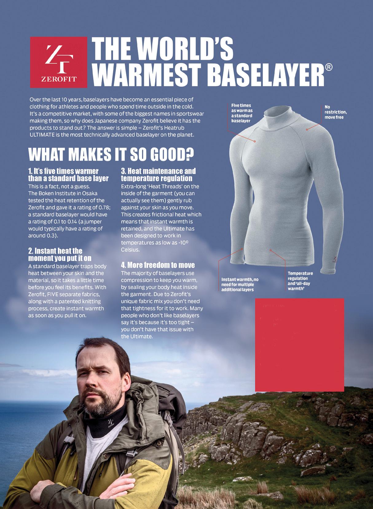
The ULTIMATE is Zerofit’s flagship product and perfect for hiking, golf, sailing or any outdoor activities when it’s cold. But if you are more active it is complemented by the Heatrub MOVE.
Twice as warm as a standard base layer, the material regulates tempertures as you move, so you won’t suffer from cold sweat, if your are running or cycling.
Please visit the Walking New Zealand Shop: https://walkingnewzealand.co.nz/productcategory/apparel/ for more details and to order.
Zealand Walk; Pakihi to Motu - a
Cape Palliser paper road bylaw to allow pedestrian and cycling access
Walk: Witton Bluff Base Trail complete!
Zealand Walk: CopperMine Trail - Nelson
Walking Tour: Tantalising Taranaki from a volcanoe to coastal walk and in between
Memories: Walking the Waikaremoana Track - 38 years ago.
Walking New Zealand Monthly Photo Contest 26 New Zealand Walk: Walking the Pahi Coastal Trackat the edgae of the Coromandel
30 New Zealand Walks Little River Trail - hike it, bike it, like it!
34 High Achiever: At nearly 80 - the melee of different walks in my life
37 Australian Walks: Alice Springs - gorges, water holes and red dessert landscapes 40 Directory of New Zealand Walking Groups
Coming Events: Rest of World
New Zealand Country Breaks 50 Index of previous 15 issues
Walking New Zealand Shop
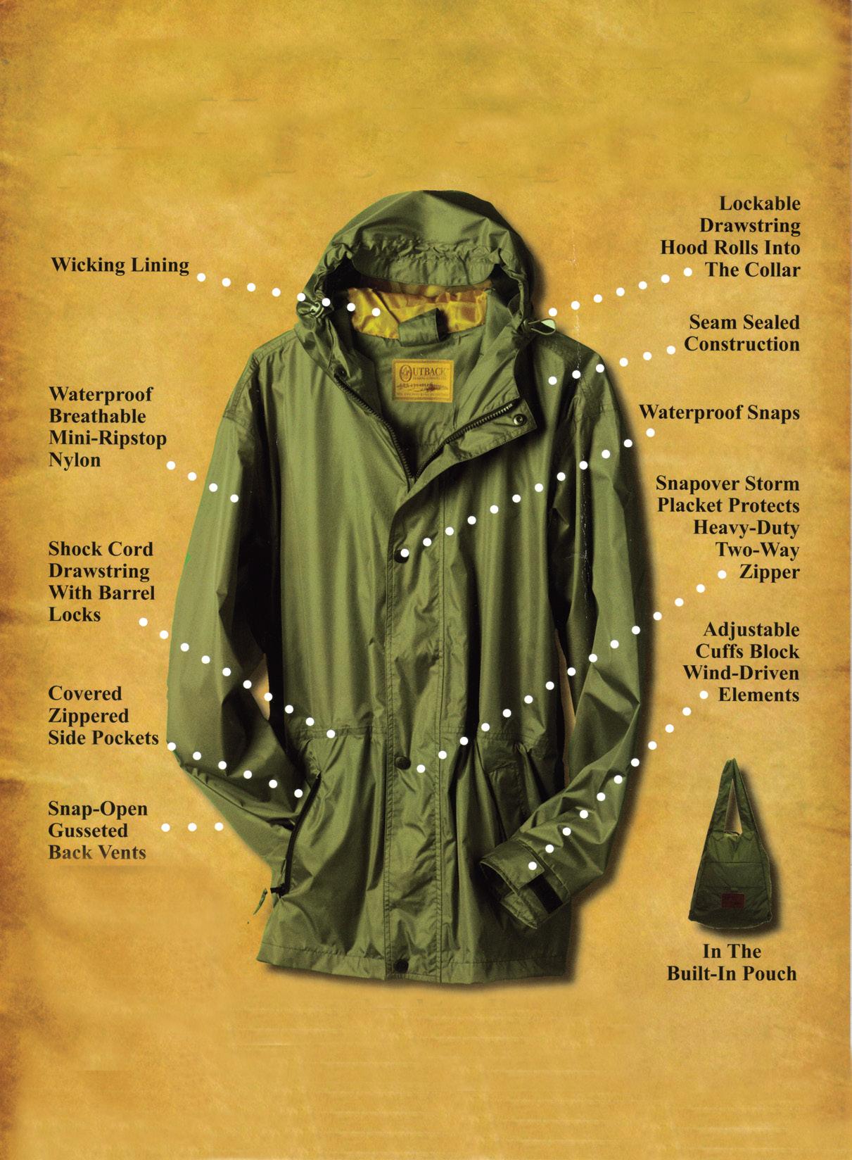
52 Pak A Roo Walking Jackets
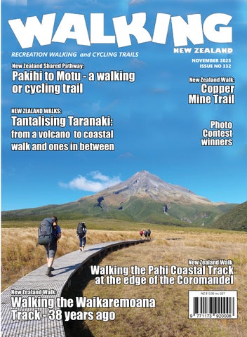
Cover image: Walkers on their way to Mt Taranaki walking on a boardwalk across Ahukawakawa Wetland. Photo by Phillip O’Donnell
PUBLISHER/EDITOR: Frank Goldingham MNZM: Phone, 027-274-0726
CONTRIBUTORS: Yvonne van Eerden, Ken Ring, Phillip O’Donnell, Barbz Lowther, Jim Richards, Sharon Bergstrom, Duncan Smith, ADVERTISING MANAGER: Frank Goldingham - 0800 walking (925-546) 027-274-0726
Email: walkingnz@xtra.co.nz
COMING EVENTS ADVERTISING: Frank Goldingham 0800-walking (925-546) Email: walkingnz@xtra.co.nz
The information and views expressed by contributors are not necessarily agreed to by the editor or publisher, and while every effort will be made to ensure accuracy, no responsibility will be taken by the editor or publisher for inaccurate information.
Walk talk
New walking holiday in Spain
European walk operator, On Foot Holidays, now offers 38 self-guided walking holidays across Europe following the launch of a new, week-long hiking route in the Cantabrian mountains in northern Spain. Bookings are open for walks this September and October and for the European spring and early summer of 2026.
The 90km walk in the Picos de Europa (Peaks of Europe) region is On Foot Holidays’ ninth hiking holiday in Spain.
It starts in the foothills around La Lastra before venturing west to the higher wilderness via the medieval hamlets of Pejanda, Pesaguero and also Fuente De where a cable car can take walkers up to alpine pastures on top of cliffs. The route then descends through wooded hillsides and meadows before ending in the village of Espinama for a celebratory dinner.
The Picos de Europa walk includes seven nights’ B&B and inn accommodation along the route, daily breakfasts, two dinners, all luggage transfers between hotels, taxi transfer to the start of the walk, and all directions, information and maps.
New southern Cotswolds hike
On Foot Holidays, has launched a selfguided hiking holiday in the Cotswolds months before the 250th anniversary of Austen’s birth on 16 December this year. The new, week-long hiking route through the southern Cotswolds is the 39th self-guided walking holiday offered by On Foot Holidays in Europe and is available for booking for this October or November (northern autumn) or from March to November in 2026.
The seven-night hiking trip between Cheltenham and the spa town of Bath where Jane Austen (born in 1775) once lived, takes walkers into villages like Castle Combe and through the farmland, valleys and woods of the southern Cotswolds away from the busy tourist areas of the region. The 108km route covers 10-23km per day and is graded medium in effort, with luggage transferred between hotels each day.
The walk includes seven nights’ B&B and inn accommodation along the route, daily breakfasts and more.
The H215s Pedometer
Digital Step Counter
The H-215s is an very easy to use step counter with very very easy to read display and is very accurate. This is the model that has sold over a quarter of a million worldwide.
* Measures walking/jogging steps up to 99999.
* Compact Clamshell Design.
* Jumbo LCD.
* Solid and Strong spring belt clip.
* Solid and lightweight.
* Great for all-day wear.
* White in colour
* An ideal pedometer for team challenges.
* Complete with battery.
Dimensions: (L) 5.6 * (W) 3.7 * (t) 2.7 cm
Price only $24.95 plus $7.00 P&P Ships from Palmerston North
Available Online Only now from: Walking New Zealand Shop 47 Lincoln Terrace, Palmerston North - Phone 0800-925-546 www.walkingnewzealand.co.nz - email walkingnz@xtra.co.nz Phone 0800-925-546 for
Walk talk
Elements of Byron has lauched a self-guided bird trail
The Elements of Byron Bird Trail is a self-guided experience that explores four distinct habitats; littoral rainforest, wetlands, eucalypt forest, and coastal dunes right back across the resort’s grounds in Byron Bay, NSW, Australia.
Developed by the resort’s in-house naturalist, Alastair Oakman, the trail is a journey through the property’s vast and diverse landscapes.
From its inception, Elements of Byron has been designed with the environment at heart. Large portions of the resort’s grounds have been carefully revegetated with native flora, including species such as banksias, grevilleas, melaleucas and she-oaks— selected specifically to support native birds through food, shelter and nesting opportunities.
This purposeful planting has created a vital refuge for vulnerable and migratory birds, some of which return seasonally, guided by ancient flight paths. Every tree, shrub and wetland edge plays a role in inviting life back to a landscape once impacted by development.
The Bird Trail is a key part of this story—a walking experience that deepens understanding, encourages awareness, and allows guests to witness first-hand the incredible biodiversity fostered on site.
Your favourite walk could win you a free subscription
We are looking for readers’ favourite New Zealand walks. Many of us go out regularly walking on a route which we class as our favourite, for a number of reasons. Perhaps because for it’s scenery, it’s safe, it’s challenging, it’s flat, it’s hilly, it’s varied, or for whatever reason.
We would like you to tell us in your own words what is you favourite walk and why. Email us a story from say 250 up to 1200 words including a photo or photos.
We will now give you a FREE subscription (six months or more, depending on the article), or extension to Walking New Zealand magazine for walks published.
You can also post an article to Walking New Zealand, Freepost 78863, P O Box 1922, Palmerston North, or fax 06-358-6864.
If sending a photo by email please make sure photos are in high resolution.
Our email address is: walkingnz@xtra.co.nz.
Please put “My Favourite Walk” in the subject line and include your name and postal address.
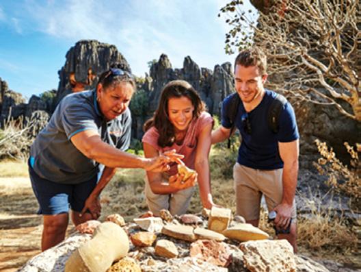
WAITOC releases Aboriginal Bushfood and Wildflower Trails Brochure
The Western Australian Indigenous Tourism Operators Council (WAITOC) has released its Aboriginal Bushfood and Wildflower Trails Brochure, a vibrant showcase of Western Australia’s rich cultural and botanical heritage. The guide highlights over 50 Aboriginal led tours and experiences across WA, inviting visitors to explore the cultural, medicinal and nutritional significance of WA’s native bushfood and wildflowers, along with bushfoodinspired recipes. This new resource showcases the depth of Aboriginal cultural connections to WA’s world-famous wildflower season.
Warm-up could make or break a work-out
Whether training for a marathon, fitting in a quick gym session after work, or running onto the footy field for a professional match, it seems that the warmup might be just as important as the exercise itself. New research from Edith Cowan University (ECU) investigated whether warming up could improve the performance outcomes of exercise and found that increased muscle temperature significantly enhances how quickly and powerfully muscles can contract, especially in explosive movements and power output.
“The research found that for every 1°C increase in muscle temperature, performance improved by about 3.5%, with the greatest benefits seen in ratedependent muscle properties like speed and power, but not in maximum strength,” said lead researcher Dr Cody Wilson.
“The important thing is to start moving. Whether that is with a light walk or taking a few flights of stairs. Eventually you can work up to a full work out, when a proper warm-up will have its greatest effect,” Professor Blazevich said.
http://www.walkingnewzealand.co.nz
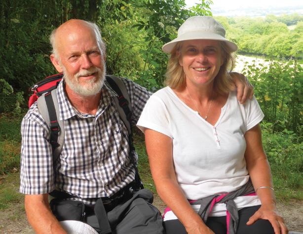
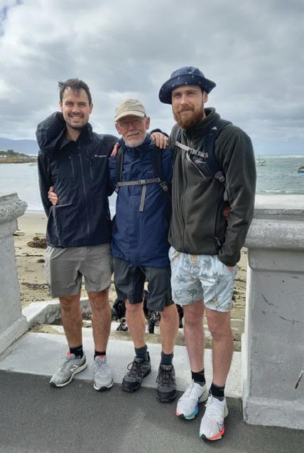
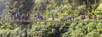
By Barbz Lowther
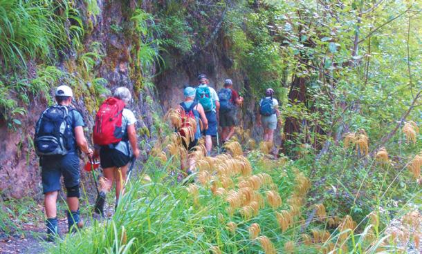
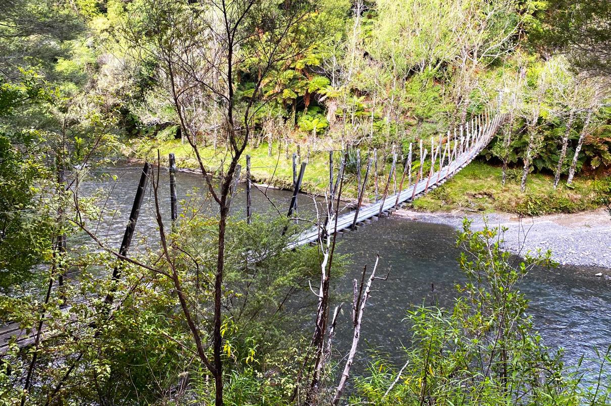
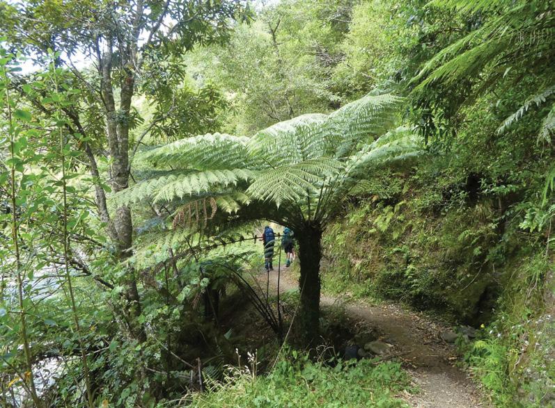
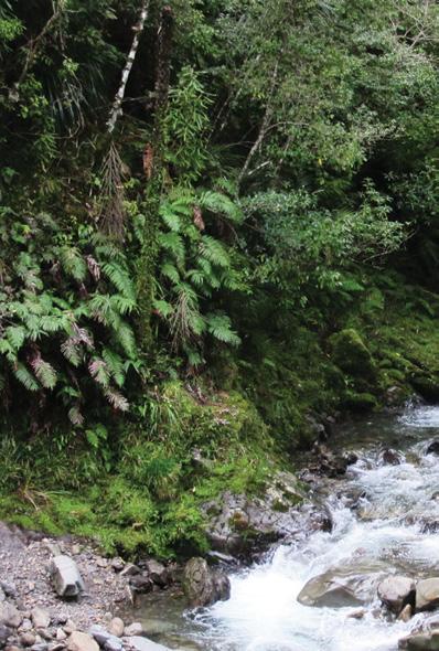
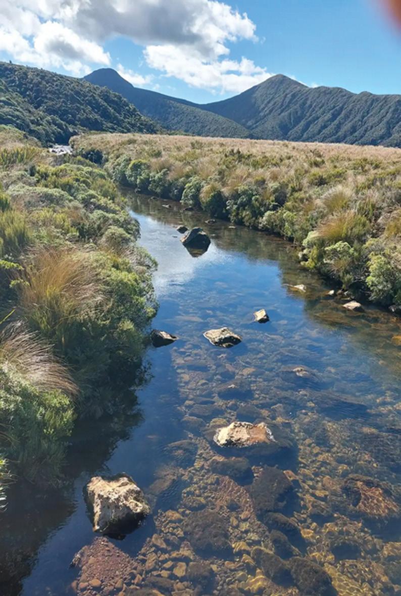
Pakihi to Motua walking or cycling trail
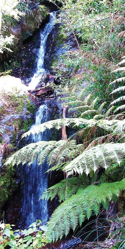
.Above: Swingbridge leading to a private home.
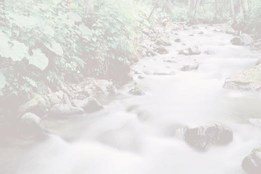
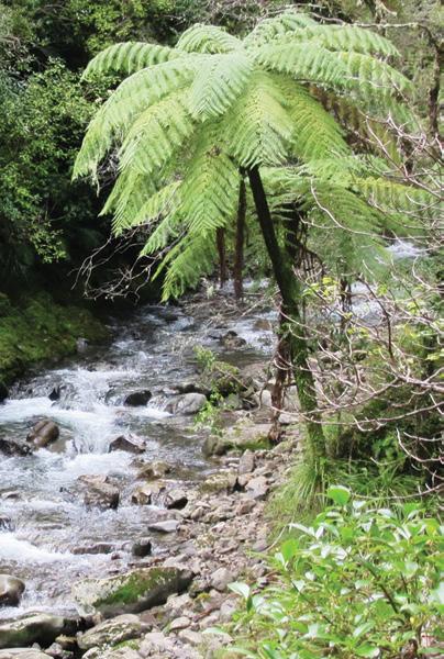
Below left: The trail follows the Pakihi stream.
Below right: The Pakihi Stream flows over a rocky area.
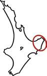
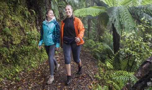
Located about 24kms south east of Opotiki, in the Urutawa Conservation Area,,the Pakihi Track is a very old one, which has been upgraded so much that it’s barely recognisable.
Originally it was an old stock route from Opotiki, to the Motu Road; which was the only transport link with Gisborne, before the road through Waioeka Gorge was established
For many years it has been a popular but rugged track for hunters and trampers. Walking up the Pakihi meant struggling through ferns and
grasses, negotiating slips, scrambling down to cross side streams and gullies, and wading through the river below the hut.
Now, to upgrade it for cyclists, as part of the ‘Motu Trails’, the track has been levelled and widened and retaining walls have been built to prevent the banks slipping away. Twenty-four wooden bridges have been built across creeks and gullies, and a swing bridge spans the river not far from the hut.- ‘A Bikers and Walkers Dream trail’
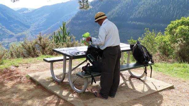
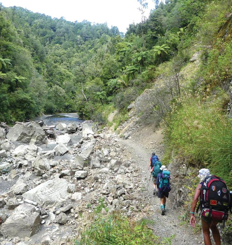
We set off from the car park at the end of Pakihi Road early afternoon,
and wandered along the trail enjoying peace, deep easily accessible swimming holes in the river, and beautiful scenery. Because the track has been so well cleared, there are amazing river views all the way.
We had expected to see lots of cyclists on the trail, but we only met three, during the two and a half
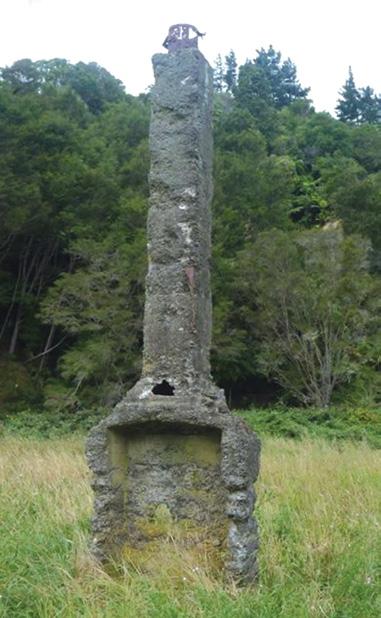
Above left: An old chimney at the beginning of the trail
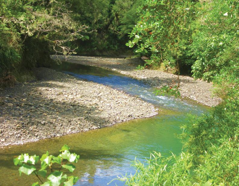
Above right: Another bend in the river.
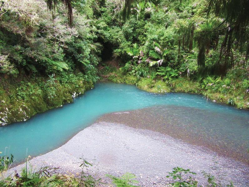
Below right: A very pretty bend in the river
Boots Packs
Pakihi to Motua walking or cycling trail
hours it took to get to the hut, and they were swimming.
Because cyclists are only permitted to travel one way on the trail, it is safer for both cyclists and walkers.
After a quiet night in the newly painted hut, we left at 7.45am, plan-
ning to reach the Motu Road within three hpurs. This end of the trail was totally different. A wide path left the river, and gradually climbed 400m through old forest of predominantly tawa, rimu and punga - all extremely tall trees. It was very beautiful, and easy walking.
There was bird song all the way, and we saw bellbirds tuis, fantails, and four wood pigeons.
After reaching the Motu Road in in two hours 40 minutes we retraced our steps back to the hut for lunch. Because the return was downhill, we were back in two and a quarter hours..
As we were enjoying a picnic, a group of cyclists arrived. They had come down from the Motu in 35 minutes. Our time seemed so slow in comparison.
We wandered back to the car, stopping for swims, snap shots and just enjoying being on the trail.
This is a lovely area for walking, biking, swimming or all three - a perfect place for a family day out
To access the Pakihi Valley, drive south. from Opotiki on the Gisborne road (SH2).Turn left. into Otara Road, and left. again into Pakihi Road - over Te Waiti Bridge. Continue to the car park at the end of the road ,where there is a shelter and toilets.
Above left: Following the trail close to the Pakihi Stream
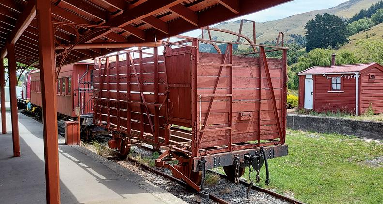
Above left: The Motu Trails in Ōpōtiki, are run by the Motu Trails Charitable Trust. This organization manages the trails, conducts maintenance, undertakes environmental restoration, and provides resources to help visitors plan their rides and enjoy the trails. They now have 33 traps to remove lots of stoats, rats along a track trapline.
Waiotahe Trail
Pakihi Track
Above left: A little waterfall beside the track. Above right: Negotiating a slip.
Above shows a volunteer placing a trap. Photo Motu Trails Charitable Trust.photo
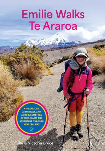
Emilie Walks Te Araroa
A 7 year old, a backpack and 3000 kilometres of mud, magic and adventure through New Zealand
By Emilie & Victoria Bruce
What happens when a sevenyear-old sets out to walk the length of Aotearoa New Zealand with her mum? An unforgettable adventure begins – one filled with mud, magic, and moments of true courage.
Emilie Walks Te Araroa is a true story about young explorer Emilie Bruce, who completed the 3,000-kilometre Te Araroa Trail from Cape Reinga to Bluff over six months.
Along the way, Emilie wades through wild rivers, climbs steep mountain passes, and explores the backcountry. But the trail isn’t always easy.
A true story of resilience and wonder, told in Emilie’s fresh, funny and heartfelt voice, Emilie Walks Te Araroa, is perfect for readers aged 8-12 years.
Cape Palliser Paper Road Bylaw to allow pedestrian and cycling access
The South Wairarapa District Council Strategy Working Committee in September agreed on an amended Bylaw to restrict access to motorised vehicles but allow for walking and cycling access on the paper road beyond Cape Palliser lighthouse.
Consultation for a proposed Bylaw to restrict all forms of public access to the paper road for a period of three years took place through July and August. The proposal addressed historic and ongoing vandalism to private land adjacent to the paper road.
An unprecedented 3,565 submissions were received, with 454 in support of the Bylaw. Feedback was diverse, with strong support for pedestrian and cycle access to be retained and significant support for vehicle restrictions. Concerns were raised about the restrictiveness of the Bylaw, and the need for emergency access, signage, and enforcement clarity.
Council Chief Executive Janice Smith acknowledged that while the proposed bylaw supported the private landowners’ request to address the vandalism, restricting pedestrians would not be enforceable and could have led to legal challenges if implemented.
Following robust deliberations, the committee resolved to:
Amend the proposed Cape Palliser Paper Road Bylaw to allow for pedestrians, bicycles and e-bikes for a 24-month period only, with the exception of motorised vehicles for landowners, the Department of Conservation and Council invitees.
Immediately survey and define the exact route of the Unformed Legal Road.
Install signage to identify the exact route of the Unformed Legal Road. Invite a stakeholder access group comprised of Ngāti Hinewaka, Ngawi community/Ratepayers association, Council, Rural and Coastal Advisory Group, Department of Conservation, Walking Access Commission, Heritage NZ and the National 4-Wheel Drive Association to consider options for future access and use of the Unformed Legal Road.
The Bylaw to be approved at the 8 October Council meeting.
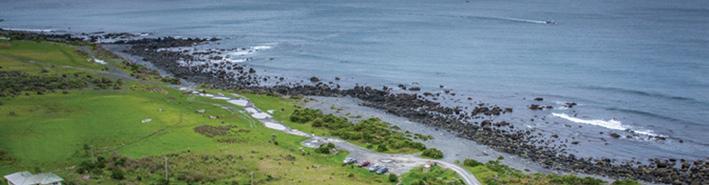
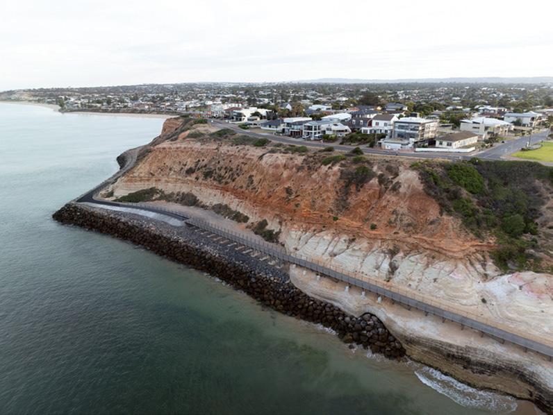
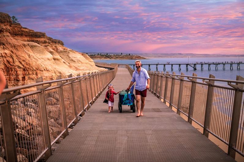
Witton Bluff Base Trail complete!
It’sopen! The much-anticipated
Witton Bluff Base Trail – linking two of Adelaide’s most iconic beaches – was recently completed with visitors and locals flocking to the dramatic coastal path to experience it for the first time.
Stage 1 of the project – a 420-metre boardwalk from Port Noarlunga to the tip of the bluff – was completed in December 2024. The stage 2 opening celebrated the upgrade of the bluff’s ageing seawall and the final 660-metre stretch of asphalt path connecting the end of the boardwalk with Christies Beach.
The 1.1km trail›s completion adds another breathtaking section to the state government›s broader Coast Park vision for a 70km shared-use coastal path from North Haven to Sellicks Beach.
About 19 kilometres of this shareduse path has now been completed in Onkaparinga (along the council region›s 31-kilometre coastline), including an uninterrupted length of trail from O›Sullivan Beach to Moana.
Stage 2›s asphalt path upgrade includes fencing and solar lighting, while the raised and reshaped seawall – which involved the installation of more than 20,000 tonnes of rock – was completed to ensure the cliffs and their infrastructure are protected from climate change, erosion and sea-level rise impacts for many years to come.
Two Tjilbruke Dreaming Track Message Sticks will be installed along the trail in October as living cultural markers, honouring the deep cultural significance of the Onkaparinga coast and the Tjilbruke songline.
Above right: An aerial view of the trail at Witton Bluff. Below lright: Trying the new boardwalk at Witton Bluff.
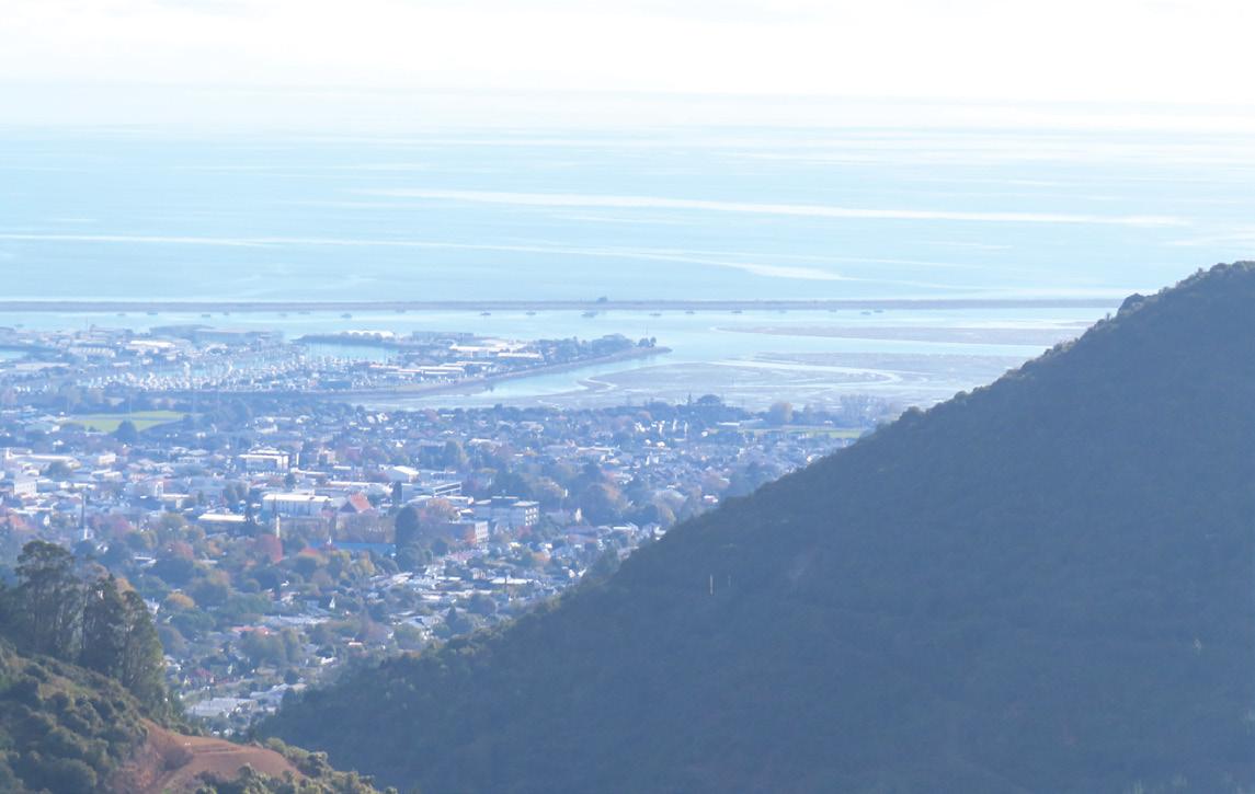
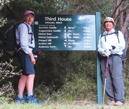
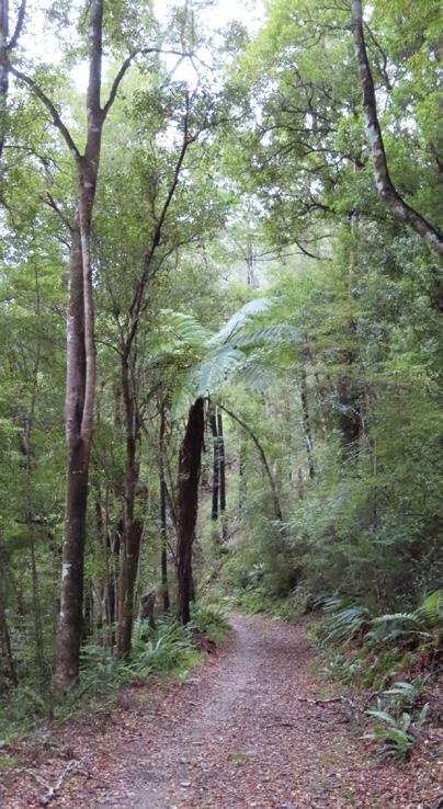
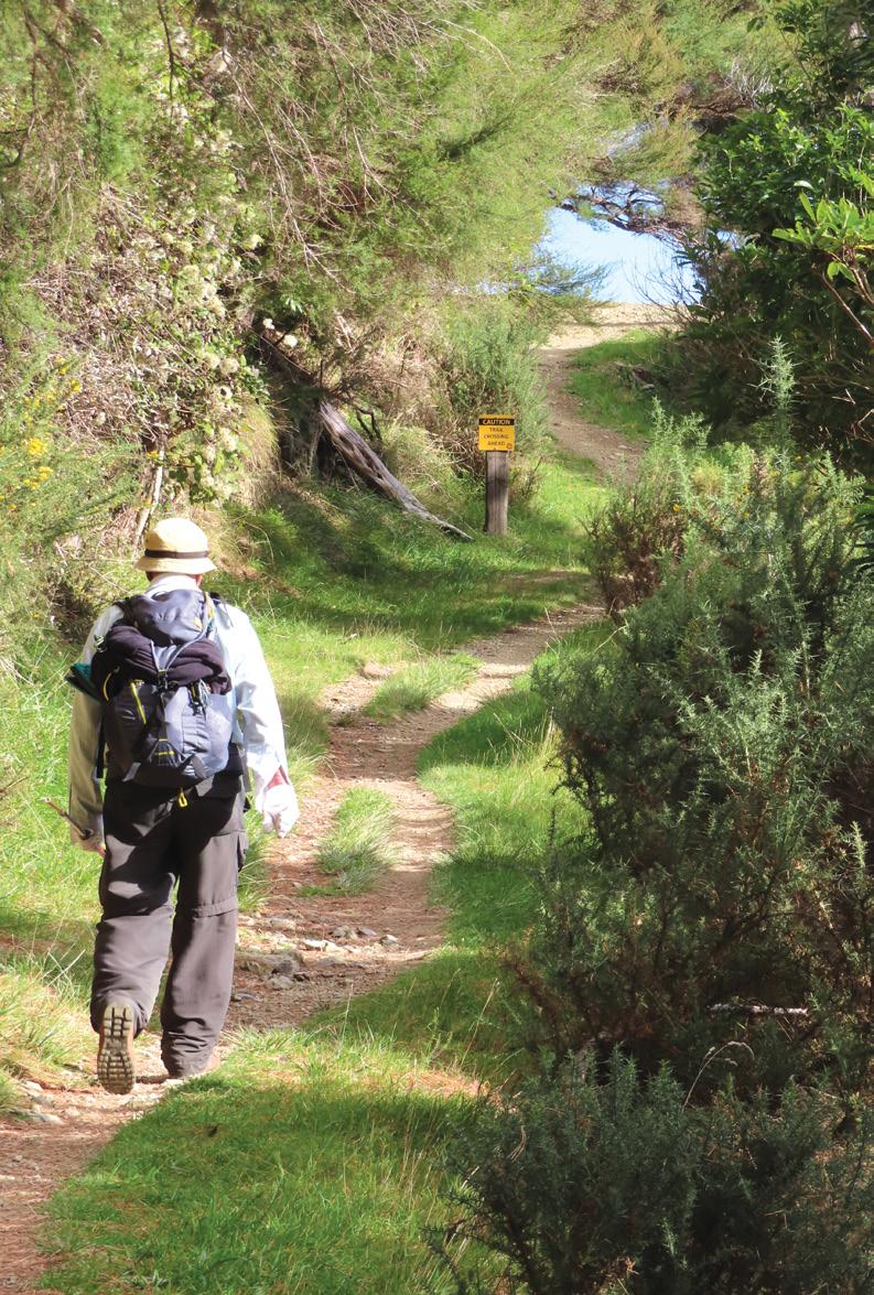
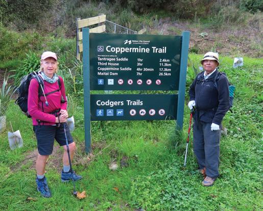
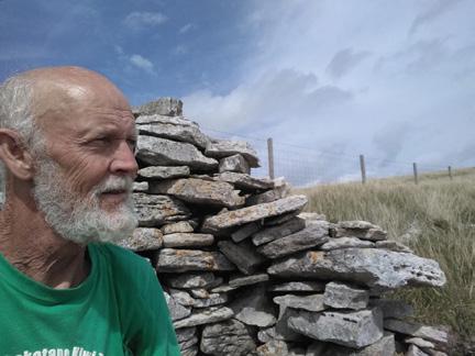
Copper Mine Trail, Nelson
By Yvonne van Erden
On many occasions we have walked the Copper Mine Trail from the Maitai Valley end. This area was Nelson’s mineral belt (copper deposits) and a railway track was opened in 1862.
The trail is well used by mountain bikers, walkers and runners. This time we decided to start the track from the Nelson town side on Brook Street.
Our challenge was to get to the third house (which was approx. 11.3 km - three hours). It was a lovely day and we would just see how far we would go with no pressure to get to our destination!
The track was in great condition and a very good gradient for walking and biking. As it was a weekday there did not seem to be many people around. There are plenty of tracks and you can do as much walking and explor-
Above top: Looking back over Nelson. Below left: Coming up to the third house.
Below right: The track among tall trees.
ing as you like.
We carried on and came to the Bullock Spur Crossing where there was a table for us to have morning tea and enjoy the views of Nelson. Then we arrived at the first house
site with views of Brook Street and Brook Valley.
There were plenty of opportunities for photos and we certainly took the time to stop and look. The native trees and ferns brought the sounds of the birds and we could spot them now and then.
We progressed well and met some enthusiastic runners and a tramper who had left very early and was already heading back down.
Once we reached the site of the second house we both felt energised to continue to the third house site as the weather was still very kind to us with no wind at all and we felt good.
As we continued out of the blue we saw a huge sign letting us know we had arrived at the third house site and we were absolutely wrapt that we had walked this far and knew it was time for a break and walked to the shelter just around the corner of the sign to have our well earned lunch.
We did take the time to study the sign and knew it was still a long way to the Coppermine Saddle. This was for another time and we had already been to the saddle from the Maitai Valley end several times.
After a good break we headed back down the track enjoying the views and the closer we came to Brook Street where we had started we met many mountain bikers young and older.
They were also taking advantage of the good weather. Certainly a great place for all.
New Zealand Walk
Above right: Sounds of birds could be heard among the native trees. Below right: Time for morning tea at Bullock Spur Crossing.
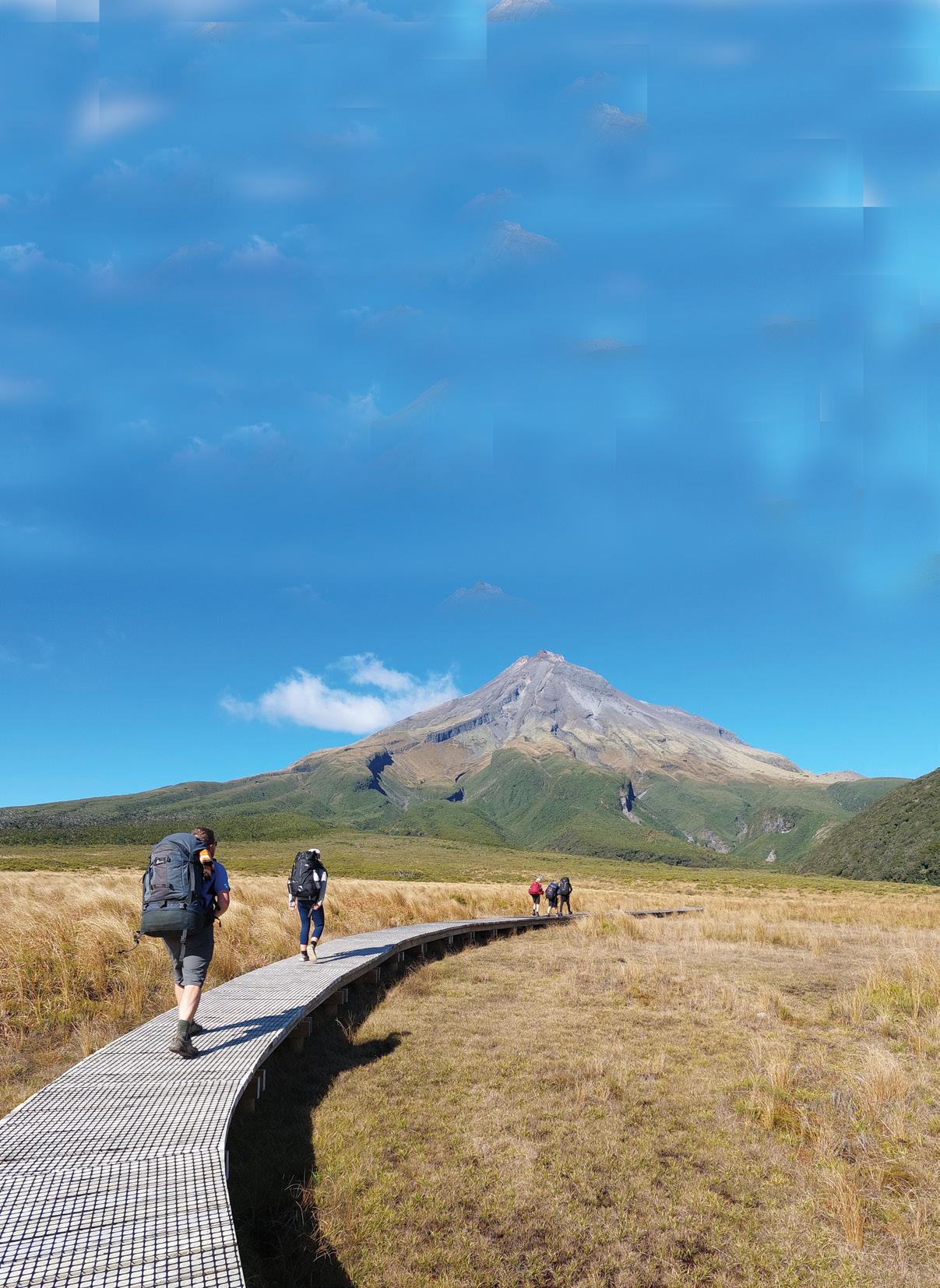
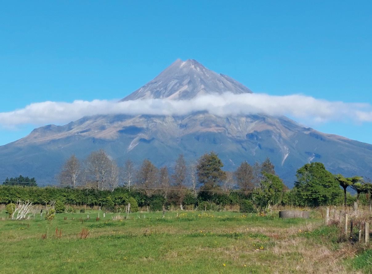
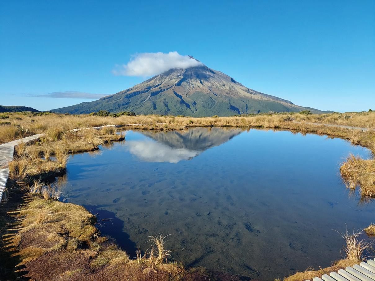
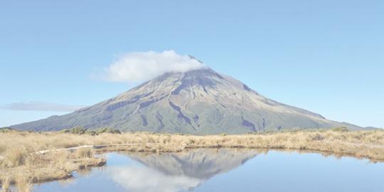
Tantalising Taranaki from a volcano to coastal walks and ones in between
Aconical hill (also cone or conical mountain) is a landform with a distinctly conical shape. It is usually isolated or rises above other surrounding foothills, and is often of volcanic origin.
Typically, they have a circular base and smooth sides with a gradient of up to 30°. A volcano is most commonly a conical hill or mountain built around a vent that connects with reservoirs of molten rock below the surface of the Earth. Lava and ash spew out of its stomach.
Mount Taranaki is a stratovolcano, also known as a composite cone volcano. These volcanoes are built up by layers of lava flows and pyroclastic material (like ash and rock fragments) from past eruptions.
Above: Mt Taranaki taken from the north.
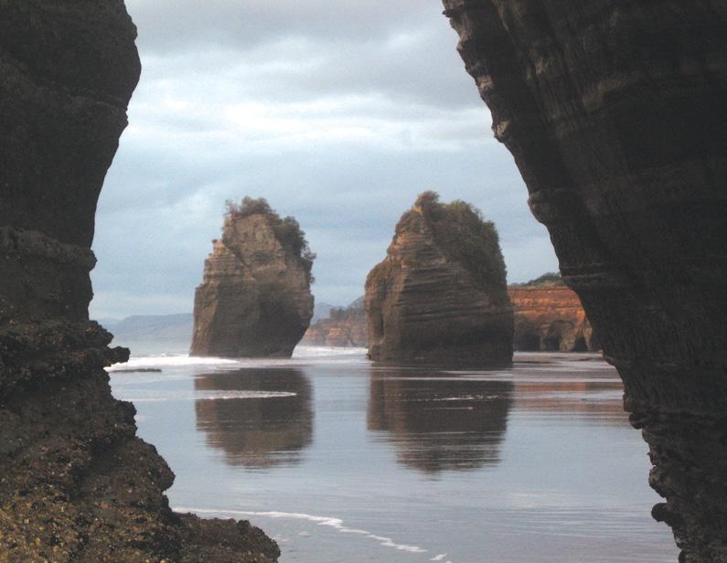
Below left: The Three Sisters Tongaporatu.
By Phillip Donnell
Taranaki’s cone shape is a result of its history of eruptions, with lava flows and tephra (volcanic ash and debris) accumulating over time. Unlike some volcanoes with multiple vents, Taranaki’s eruptions have mostly occurred from a central vent at the summit, leading to a more symmetrical cone shape. It is like a gigantic upside-down ice cream cone dominating the landscape.
The volcano is surrounded by a gently sloping ring plain, formed by debris flows (lahars), landslides, and tephra deposits.
While the cone is largely symmetrical, there have been past collapses of volcanic cones, evidenced by mounds and hummocks around the volcano.
One major collapse, about 23,000 years ago, spread debris over a large area. While the last major eruption was around 1854, the volcano is considered active and capable of future eruptions –perhaps a sleeping giant.
Mount Taranaki is the focal point of the Footsteps Tantalising Taranaki day walks tour scheduled for 22-28 February 2026. This excursion is a great opportunity to explore all sections of the mountain, as well as its surrounding hinterland, with entry points at North Egmont, the Stratford Plateau, Dawson Falls, and the western portals. In addition, you will sample the best walks of the region’s biggest city and the provinces northern gateway.
FOOTSTEPS
TARANAKI
Begin in the city of New Plymouth. Here the spectacular coastal walkway leads to the famous Rewarewa Bridge. Lake Mangamahoe yields some magnificent reflections when it is still.
Pukekura Park is adorned with colourful lighting for an evening stroll. Huatoki, Tupare and Te Henui Walkways traverse the valleys. A climb up Paritutu Rock will get your heart pumping.
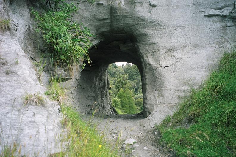
North of the city one is introduced to a landscape of rolling surf, black sand and white cliffs. The White Cliffs Walkway, the Three Sisters and Elephant at Tongaporatu, Mount Damper Falls (the highest in the North Island), the Moki-Rerekapa
trails, Awatetaka Pa, and Awakino Beach are all attractive possibilities.
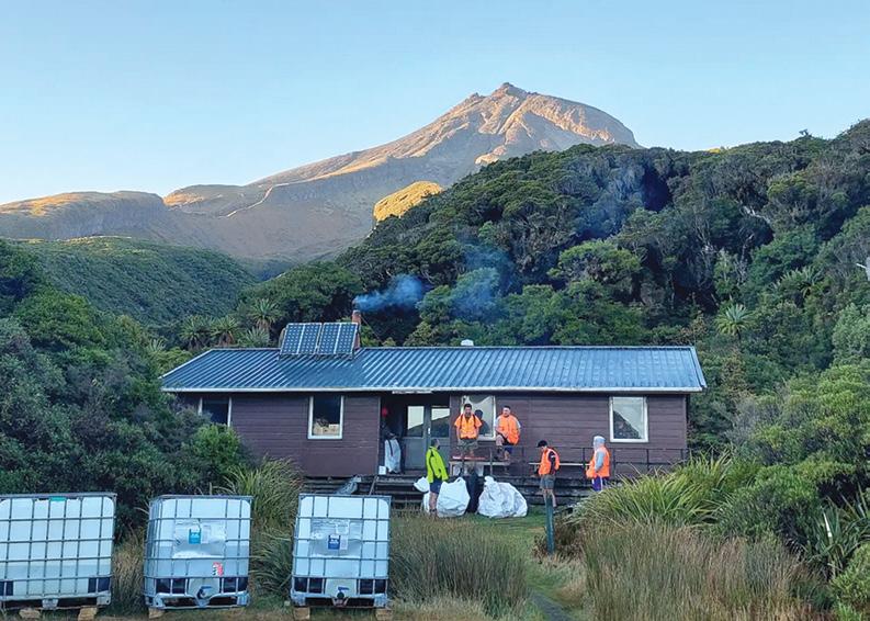
If the weather allows, a climb from North Egmont to the summit of Mount Taranaki (2518m) is a challenging option. Alternatively, take the upper level track (via Tahurangi) or lower level track (via Maketawa) towards Manganui Skifield (or do the whole loop).
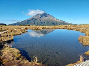
Utilising the Dover or Mangorei Tracks to visit the famous Pouakai Tarns makes for an umforgettable day, as does an out and back to Holly Hut (or even part thereof to the lookout).
Above right: Ahukawakawa Stream.
Tantalising Taranaki from a volcano to coastal walks and in between
Beyond the Stratford Mountain House, a network of trails head off from the Plateau carpark. The Enchanted/ Waingongoro Loop is memorable for its high bridge over a very deep and narrow gorge. The Potaema, Patea and Kamahi Loops will have you going round in memorable circles.
Manganui Skifield is more easily reached now because of a new state-of the-art bridge over the gorge. Curtis Falls and Lake Rotokare are further attractive ambles for the morning or afternoon.
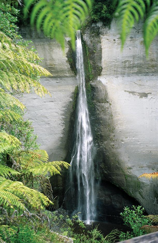
Te Rere o Kapuni, also known as Dawson Falls, tumble over a cliff at the southern base of Mount Taranaki. The waterfall is said to be the place where the Māori prophet Tahupotiki Wiremu Ratana received and revived his healing powers, and is considered sacred by the Ratana Church.
In 2006, the waterfall crumbled and is now half its original size. The Kapuni, Hasties Hill, and Ridge Loops; Konini Dell; Wilkies Pools and Hooker Shelter are all worthwhile walks in this area.
Along the Taranaki Bight it is possible to undertake a coastal walk from Waihi to
Ohawe Beach (5km, two to three hours). There are impressive views, interesting rock formations and rock pools on this walk.
The Opunake Walkway and Lake Rotorangi are excellent options as well. Several trails (Ihaia, Kahui, Puniho) lead from the national park boundary towards the mountain and can be linked for an enjoyable extended perambulation. Parihaka Pa and Cape Egmont Lighthouse are both worth a pause.
The huge advantage of a Footsteps tour is that you are able to cover so many of these great places in a short time with like-minded friends, group security, expert guidance, comfortable accommodation and hassle-free organisation.
You just sit back and let it happen! Why not join us? Come and write your own “conical chronicle” over seven days. Your diary entries may become the stuff of legends!
Full details are on the Footsteps website (www.footstepswalkingclub.com), or contact us on 021 172 3244, footstepsanz@ gmail.com.
Not a god. But unaffected
As we swarm like ants
Opposte page above: The famous Ruahumoko Tarn adorns the Pouakai Ridge. Below left: A stoppping off point is Holly Hut. Above right: A stock tunnel on the Moki Track. Below right: The Mt Dampier Falls.
Across your convex canopy; Emerging from our shared landscape
To create new identities that stretch beyond the Rich and fertile soils that bask beneath your presence. Your destructive nature respected and then considered, as we Celebrate the otherness of your existence; naïve in our assumptions That you would sense our feats beneath the shadows of your magnificence. (Author unknown)
The H215s Pedometer Digital Step Counter
The H-215s is an very easy to use step counter with very very easy to read display and is very accurate. This is the model that has sold over a quarter of a million worldwide.
* Measures walking/jogging steps up to 99999.
* Compact Clamshell Design.
* Jumbo LCD.
* Solid and Strong spring belt clip.
* Solid and lightweight.
* Great for all-day wear.
* White in colour
* An ideal pedometer for team challenges.
* Complete with battery.
Dimensions: (L) 5.6 * (W) 3.7 * (t) 2.7 cm
Price only $24.95 plus $7.00 P&P Ships from Palmerston North
Available Online Only now from: Walking New Zealand Shop
47 Lincoln Terrace, Palmerston North - Phone 0800-925-546 www.walkingnewzealand.co.nz - email walkingnz@xtra.co.nz Phone 0800-925-546 for bulk prices
www.walkingnewzealand.co.nz
Having trouble buying your copy of Walking New Zealand magazine?
Have you found that?:
* Magazine is sold out when you get to the store!
* Stores have limited space for magazines and are cutting down on space for magazines
From now you will be able to buy a copy of Walking New Zealand magazine, for $13.95 POSTED to you each month at the same price that you would pay for it at a store.
You just pay a monthly payment of $13.95 per month.
* No fixed term.
* You can cancel at any time. Each month we debit your credit card $13.95 and post you a copy of the latest issue - until cancelled.
Just phone:
0800 walking (925-546) or email us walkingnz@xtra.co.nz with your credit card details, name and postal address.
NOVEMBER
Weather prediction
(Weather is an inexact science, like medicine. Dates given are to be regarded as focus points. Please allow 3-4 days leeway for all forecasts)
1st-3rd Strong west to northwest winds to gale force at times, may be disruptive in the east and south of both islands from the East Cape and Manawatu, down through Kaikoura and Canterbury, and into Otago and Southland, possibly disrupting power and damaging local infrastructure in the Bluff and Invercargill region. Strong winds may also cause problems in the lower North Island, possibly bringing a brief closure to the Rimutaka Hill highway.
7th Misty patches in the Wellington region, later turning to heavy rain.
over much of the South Island and in the south and west of the North Island from Taranaki and Gisborne regions to Wellington.
by Ken Ring
8th-9th Patches of fog in Christchurch.
9th Very warm day in Canterbury with unusually high maximum temperatures likely in southern parts, particularly around Timaru. Heavy rain likely in Fiordland.
11th Over the next four weeks, a strong anticyclonic influence may return, with high pressure ridges moving from the Tasman Sea and across the country and bringing a mostly dry, southerly flow more frequent than average for this time of year.
The second half of this outlook period may be very dry and warm, with few districts seeing any rainfall. Overall, the next four weeks will bring very low rainfall amounts in parts of the South Island, including in Nelson, Marlborough, and central Otago, where many districts may see between half and three quarters of their usual rainfall. Similarly, the east of the North Island can also expect only around half their usual rainfall, with severe soil moisture deficits affecting the east of the country from the Bay of Plenty to the Hawke’s Bay and including the Taupo district, down through Wanganui and Wellington, Nelson, Marlborough and Canterbury and into Otago. In contrast to this, the Horowhenua may be around 25% wetter than average, while the Waikato, Auckland, and Northland are all likely to see rainfall amounts that are close to the norm. Sunshine levels may be below normal in the Far North, while above normal
Temperatures during this outlook period will average close the norm overall for this time of year in most parts of the country, with cooler than average temperatures by around half a degree less than average over the first couple of weeks, and warmer than normal temperatures over, by a similar variant above the norm, in the second fortnight ahead.
13th Shallow fog in the Christchurch area.
14th-17th Wet spell over most of the North Island with high rainfall likely in the coastal areas of the Waikato and in the Ruapehu district and hail showers possible in the lower North Island including in Wellington.
16th Cold overnight in Central Otago with the sub-zero temperatures bringing pockets of frost.
17th-19th Thunderstorms and hail showers in the Wellington region.
21st-22nd Fog in Christchurch. 22nd Heavy rain in Fiordland likely.
23rd-24th Stormy air in the Wellington region with very strong and blustery southerly winds, possibly to gale force at times, and chance of scattered thunderstorms.
27th Light air in the Wellington to Christchurch regions with chance of fog patches.
30th-6th December. Unusually hot spell in the north and east of both islands.
Extracted from 372-page 2025 New Zealand Weather Almanac, by Ken Ring. The 2026 book is available in soft cover and hardback, and as e-version from www.predictweather.com
Extracted from 372page 2025 New Zealand Weather Almanac. Availlable in soft cover and hardback, and as e-version from www.predictweather.com
years ago
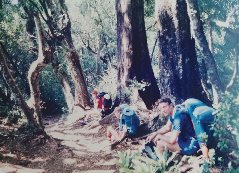
By Sharon Bergstrom
The Waikaremoana Track to be precise and how about 38 years ago. No cellphones, amazing tramping gear, well developed walking tracks, or hut facilities that may be available today.
Just the great company of friends and their families, a wonderful diary I recorded our experiences in.... and oh, just maybe I should mention, a support motorboat, should any of us pack up, as the old saying goes?
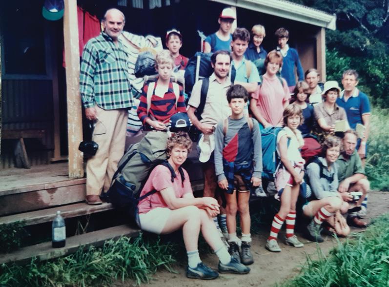
Our party of 21 ( included 11 children, aged 10 to 17 years old,) who had little to complain about, apart from the sand flies, as we set off for Panakiri Hut. At a height of 1180 metres, we chose to take advantage of good weather and the panoramic views and do the hard graft on day one of our four day tramp.
Just on 9am, in family groups, we set out. The hike was continuously uphill and the day hot, so the going tough, despite walking through bush and filtered sunlight. With packs on our backs and plenty of perspiration, we had to stop often for rests, food and fluid intake . My camera (an old Minolta) was also clicking away frequently, which was another excuse for me, in particular, to stop and catch my breath.
However, well into the 8km climb it was one of the men who cracked up! Or rather his knee did! Hence, the going got even slower as the day wore on. It became of more concern we reach the hut before the fading light.
Two of the families went on ahead to the hut, planning to leave their gear there, before two of the men, came back to help our lame soldier, whom we’d left track side, waiting.
After five and a half hours we were expecting every turn in the track to reveal Panakiri Hut but to no avail. So when the boys found a sign which said one and a half hours to the hut ( which meant two hours
to us) we were completely demoralized! (Some of us that is.)
But on we plodded . We came to a sheer rock face, which we had to scale upwards holding onto a rope (with packs on our backs)! Then up steps, (where an aluminium ladder used to be), which extended out from the cliff and dropped a 1000ft straight down . The view was so magnificent and so scary, I could hardly look, let alone make myself do it. Of course I had to remain staunch and brave in the eyes of my children, as well.
When we arrived at Panakiri Hut not long afterwards, it was shear relief and exhaustion, (for some of us. )
The children were amazing and coped very well, spurred on largely by each other.
Lesson number one for the day, was learning to deal psychologically, with danger, exhaustion and expectation. The walk up Panakiri, the hardest part of the whole walk, was difficult in itself, particularly because of its elevation, thus taking us longer, because of all our stops, the age range and injury concerns.
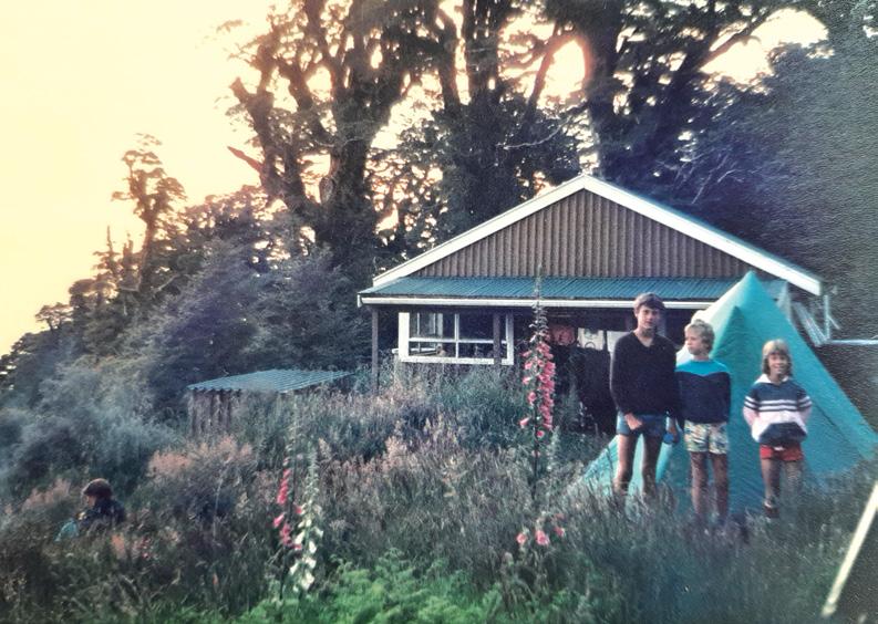
Needless to say, the hut was virtually full by the time we got there, however a few of us squeezed onto bunks inside, while the others pitched our wee tents outside, on
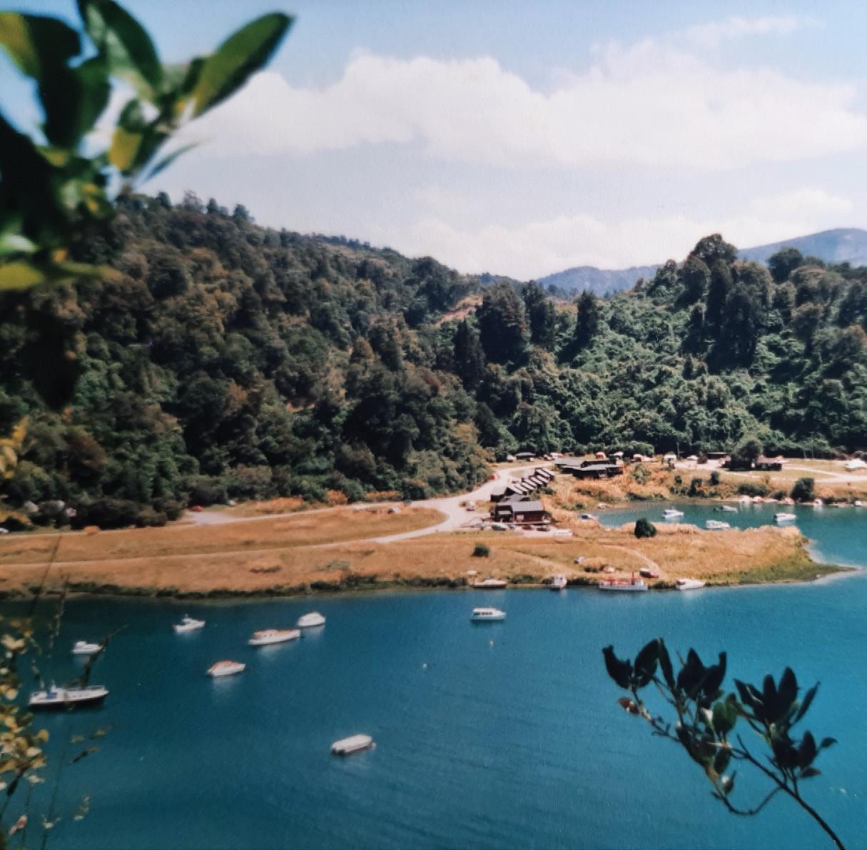
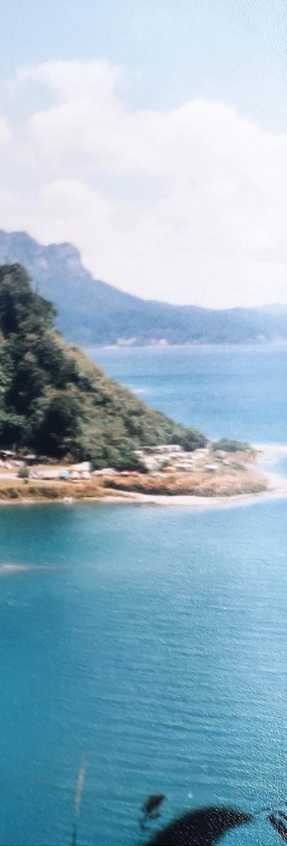
Above left: The Waikaremoana Holiday Park beside the lake.
Above right: The tent was popular with the younger ones.
Walking the Waikaremoana Track - 38
years ago
somewhat uneven ground, to sleep.
The surprising thing to me up at that height was not the mozzies but the few hundred blow flies zooming around, and the odd rat, that gnawed through plastic bags in the dead of night, for food.
Lesson number two, was keeping food really secure. No unzipped bags are safe from the rodents, by being very particular when it came to securing rubbish, (to be taken with us.)
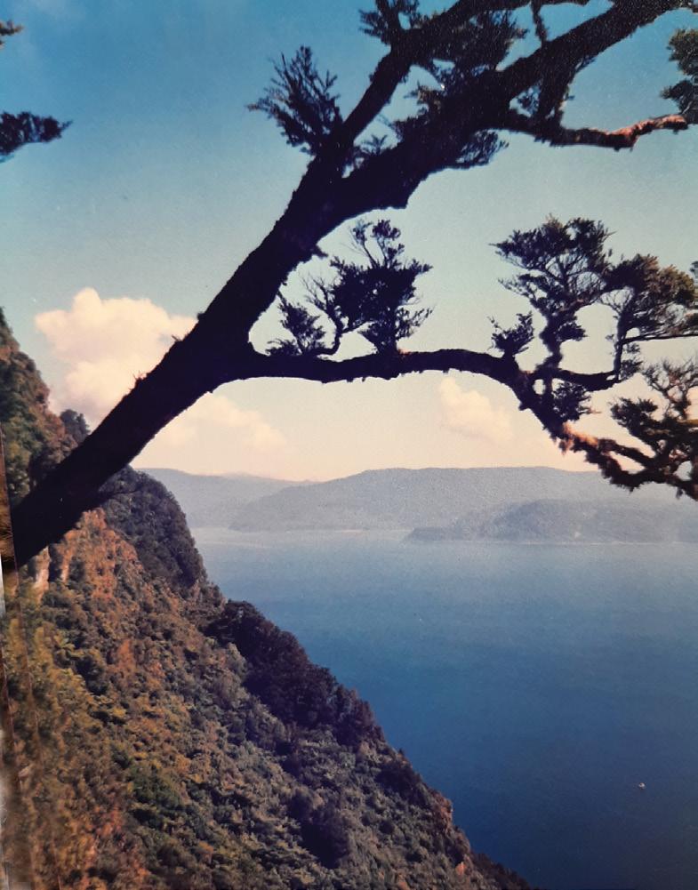
The views of lake, mountain, bush
and coast as far as Napier, back then were quite incredible, but at that height, the night very cold.
Next morning, in pleasant, fine and not too hot weather, we were away early in three parties. This time (a fast , medium and slow.) My family travelled in the medium group, on the 4 hour,
7km largely downhill tramp. Not easy for our friend who had hurt his knee. One had to be very careful and watch the placement of each foot because it was so easy to slip on
the exposed tree roots. In places, the track was also very wet and boggy while in others, poorly marked, but we made it along the ridge and descended in just under four hours, to lake level, without incident.
Three of the men had gone on ahead again, depositing their gear at the next hut Waiopaoa, before returning to meet us to provide further help for our one injured party member.
After arriving, we set up our five tents in a private spot amongst the trees, near the lake and got organized before it really poured down. Torrential rain and wind seemed to come from every direction for an hour, then cleared much to our amazement, allowing us time to cook tea on the gas burners, swim and wash in the lake.
Some of the younger ones preferred to sleep in the hut again on proper mattresses rather than on the hard ground in tents, (including me.) While not claiming to be one of the younger ones, ....someone had to supervise and be there for them!
At this point, our friend came in with his 18ft Hornet boat with its two outboard motors, and with his one passenger aboard, who because
Above left: Time to stop for a rest.
Above right: Climbing up a sheer rock face.
Below left: The party of 21 people at Panakiri Hut.
of a foot condition couldn’t walk over Panakiri. Unknown to him, his passenger list was soon to become two!.
Of course it wouldn’t have been right, unless he had a few luxuries for us, including potatoes and red wine (later referred to as possum blood!) because of a certain possum disturbing the camp at night, whose blood we were after!
Another day at Waiopaoa availed us the opportunity in small groups, to go out and experience trout fishing. Ultimately, a poor supply was caught, to feed 20 of us, but a lot of fun was had by all. Our boat captain also conveyed several boat loads to a point from which we tramped up to the beautiful Korokoro Waterfall set in beautiful bush.
It was an hour’s walk each way from the main track and well worth the effort. Everywhere the bush, birds and untouched splendour was in evidence.
The following day was a big day, as we walked the 11km (an easy four hour walk for most but more like five for us) to Marauiti Hut, a short distance beyond to set up camp by the lake again.
The weather continued to be brilliant so after a night there, we tramped passed Te Puna Hut onto the Whanganui Hut (about 7km and three hours tramping). The tramp was not difficult and the boat followed us around the lake’s edge, with our few luxuries, still fishing.
We pitched tents and had another painful night on the ground, with aching bones and muscles, not caused by walking, but by hours spent on the hard ground. All huts were full again, but there seemed always room for the kids.
On our last day we tramped 5km, (about two hours) to Hopuruahine Inlet to complete our adventure, (to say the least.)
The most challenging part of the last day was crossing a stream using a wire rope, and crossing a number of swing bridges which the kids loved, of course. The men then cadged a lift with Captain Fantastic, in his boat back to the campground to pick up the cars. It wasn’t long
before they returned to pick us up with all our gear.
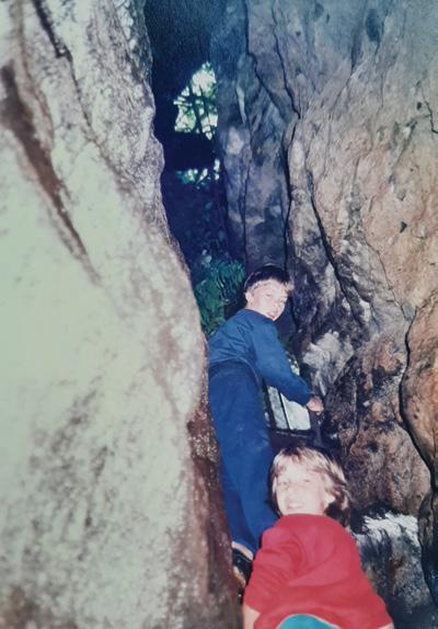
It was still fine, though windy, but being tigers for punishment a few of us walked up to the Urewera Park headquarters (a half hour walk each way) to look around a great DOC centre, as it was then, as well as walking to the waterfalls and back.
Leaving a walk up to Lake Waikareiti for another trip, the next day we headed home, but not before stopping to give the families a chance to explore the Onepoto Caves which was enjoyable for them, especially with the wind whipping through the narrow crevices.
So now to the obvious questions. Was the experience challenging ? I’d have to say yes, (38 years ago,) and in varying degrees..... depending on age and fitness.
Were we prepared ? We certainly were, in fitness, clothing, supplies, and in having a support boat (once over Panakiri). However, for all of that..... weather, and injury are the things one couldn’t be completely prepared for ......no mountain radio, or helicopter service, but fortunately we weren’t in need of those.
Did it put us off tramping the wild and wonderful Great walks of New Zealand?....
No way!
For me, friendship and human spirit, we had in abundance and there’s no substitute for those.
And are we still friends?
Yes.......the very best of!
Below right: A tree hangs perilously over the lake.
Now the time to get your digital camera out or look through your digital images and enter the
Walking New Zealand Digital Photo Contest
PHOTO CONTEST
Above: Members of the Bishopdale Tramping Club enjoying a morning tea break on their winter walk above Lyttelton Harbour, on the Godley Head Walkway. Photo by Marie-Therese McRae, Papanui, Christchurch. Below: Taking advantage of a crystal clear sunny morning, it was a walk down memory lane for my daughter to view the iconic Rangitoto Island from the East Coast Bays Coastal Walkway. Photo by Vicky Ross, Red Beach.
Ouch! Sore feet while walking?
Hikers Wool is 100% New Zealand wool. Cushion your feet to prevent pain, rubbing and blisters.
Buy online or at selected stockists For more info visit www.hikerswool.co.nz
PHOTO CONTEST
Above top: 22 members of the Upper Hutt Walking & Tramping Club went for a walk to Red Rocks on a glorious winter’s day. Photo by Judith O’Leary, Upper Hutt.
Below left: Members of the Upper Hutt Walking & Tramping Club took a drive over the Remutaka Range to tramp the Gentle Annie Track in Tararua Forest Park. Here Annemarie is negotiating the very gnarly Ridge Track which was our route down - we’re thinking we should reverse the order next time we do it!” Photo by Sharon Dunstan, Whitby, Porirua.
Below right: My husband Bruce admiring the view on top of One Tree Hill. Photo by Jo Alexander of Epsom Auckland.
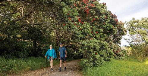
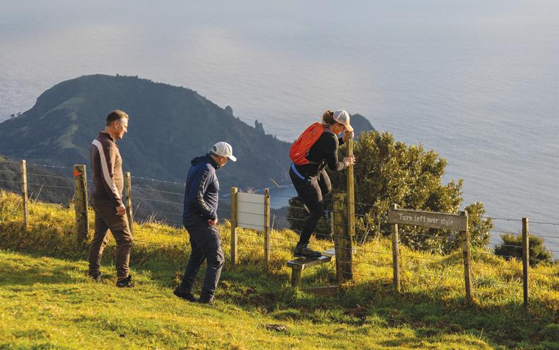
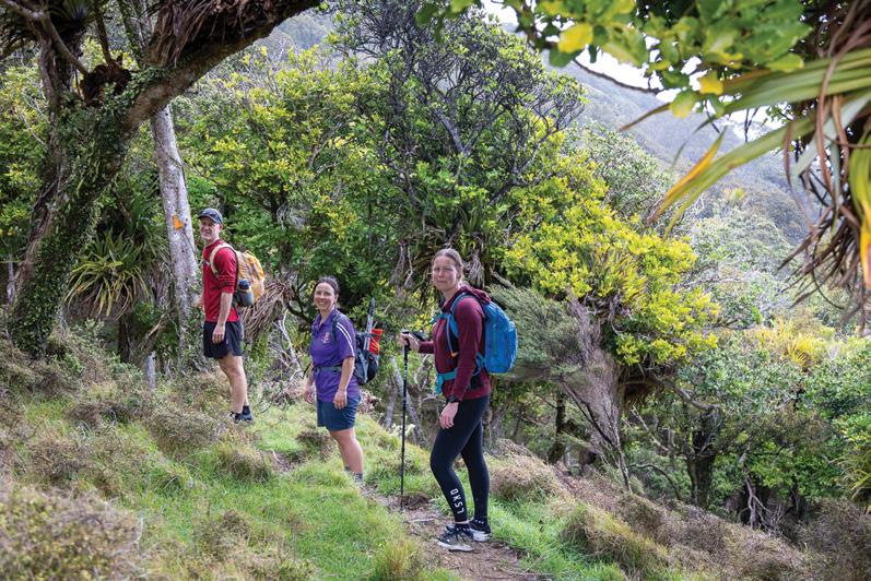
Walking the Pahi Coastal Track - at the edge
of the Coromandel
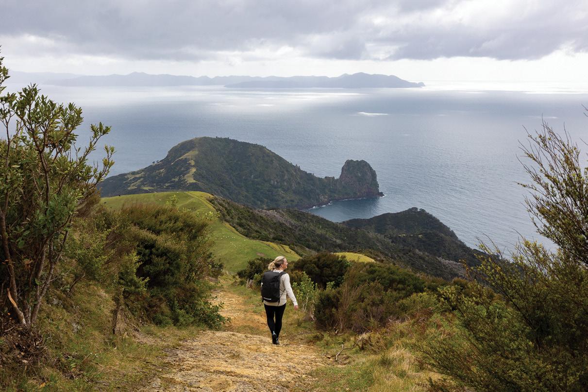
At the very northern tip of the Coromandel Peninsula, where the sealed road gives way to gravel and the Pacific stretches wide to the horizon, there’s a place that still feels remote in the best possible way.
Port Jackson has long been a destination for campers, fishermen, and those who don’t mind a winding road to get somewhere beautiful. But for a growing number of walkers, it’s now
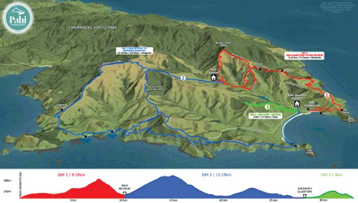
also home to the Pahi Coastal Walk — a three-day, two-night walking journey across private farmland that blends coastal drama with the rhythm of a working farm.
Launched in late 2022, the Pahi walk was born from a desire to share land that has been in the Ward family for five generations. This corner of the peninsula has always been both productive and wild: sheep grazing
under wind-bent pōhutukawa, cliffs tumbling into the sea, and bush steadily regenerating in gullies and ridges.
For the Wards, farming here has always meant balancing production
Above: Walking the old stock track towards Fletcher Bay.
.Below left: Hopping over a style to do part of Coromandel Coastal Walkway.
Words by Cath Ward Photos by www.felicityjeanphotography.co.nz
with preservation. Now, alongside those farming traditions, they’ve opened their gates to walkers — offering a chance to traverse land that, until recently, had been firmly private.
The Lay of the Land
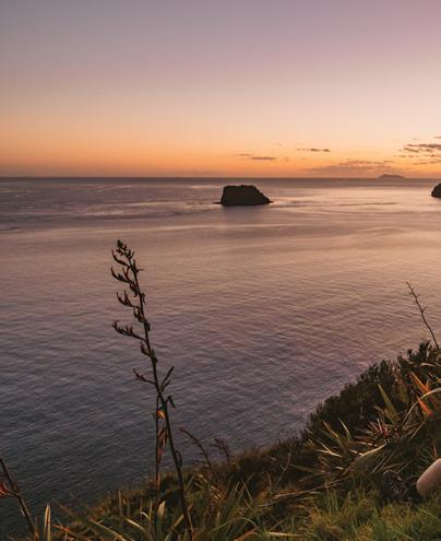
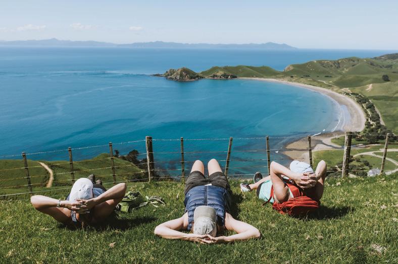
The Pahi Coastal Walk covers roughly 30 to 36 kilometres over three days, depending on the route choices you make. It’s designed to be selfpaced and accessible, but make no mistake: this is a genuine walk, not a promenade.
Expect a mixture of farm tracks, grassy ridgelines, and coastal trails. There are climbs that will get your lungs working, but they are rewarded with views that stretch from Cape Colville to Great Barrier Island, and on a clear day, out to the distant shapes of Cuvier Island and beyond.
On the first day, walkers are introduced to the property gradually. After a short shuttle from Colville, you step onto farmland where the pace is yours
Above right: A mix of bush, farm and coastal tracks.
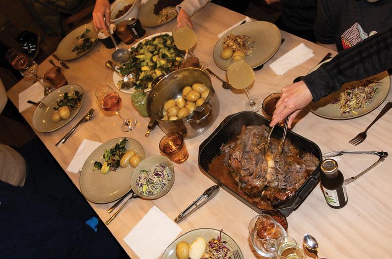
Middle right: Delicious food is provided.
Below left; Sunrise over the pinnacles and Fletcher Bay.
Walking the Pahi Coastal Trackat the edge of the Coromandel
to set. The track undulates through paddocks, skirts regenerating bush, and climbs gently to viewpoints where the sea suddenly appears, framed by hills. The day’s distance is up to 12 kilometres, with easier options available if you’d rather conserve energy.
Day two is the centrepiece: either 12 or 19 kilometres depending on your choice. This section takes you across higher ridgelines, where the land seems to fall away into ocean on both sides.
Walkers often pause here, not because the track demands it but because
Above: Port Jackson from the western side Port Jackson from the western side.
Below: Delicious food is provided.
the views insist on it.
The farm gives way at times to stretches of native bush, where kererū flap heavily above and tūī whistle in the canopy. Out on the exposed grasslands, you’re more likely to meet sheep or cattle, reminders that this is a living, working farm as much as a walking track.
The third day is intentionally lighter: around five kilometres through farm country, or an optional e-bike ride that takes you back along the coast road to Colville. It’s a thoughtful ending — enough movement to feel complete, but leaving space to linger over the views and the sense of remoteness that Port Jackson inspires.
What You’ll See
The terrain is varied enough to keep experienced walkers engaged, and the scenery is classic northern Coromandel. Expect rugged coastlines where cliffs drop to foaming surf, beaches where few footprints linger, and ridges with almost constant sea views. At times you’ll find yourself walking past stock, then minutes later you’ll be on a headland with only seabirds for company.
Looking east, Aotea (Great Barrier Island) dominates the horizon. To the south, the Hauraki Gulf glitters with islands — each one a marker of New Zealand’s volcanic and maritime past. On still evenings, when the light soft-
ens and the sea turns glassy, it’s easy to imagine the waka that once travelled these waters, or the coastal schooners that carried supplies to isolated farms.
The land itself bears traces of those histories. Māori have long connections here, with pā sites and middens still visible to those who know where to look. Later, European settlers carved farms into the hills, often with sheer determination as much as skill.
The Ward family’s story is one of persistence: Cath’s great-grandfather breaking in the land with horses and hand tools, her father balancing stock production with conservation, and now, Cath herself bringing her background in food and hospitality to create a walking experience that shares the land without diminishing it.
Accommodation and Rhythm
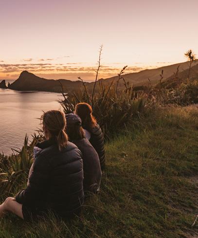
Each night ends in a very different place, which adds to the sense of progression. The first evening is spent at Pahi Retreat, a cosy farmhouse surrounded by natural beauty and a clear running stream. Here, small cabins cluster around a central farmhouse, and meals are shared in a welcoming, communal style.
The second night is at the Shearers Quarters, a six-bedroom house perched high above the sea, with uninterrupted views eastward. It’s a place where sunsets seem to last longer, and where conversation often drifts as much as the clouds.
The walking may be self-guided, but the logistics are fully supported. Meals, beds, luggage transfers — all are taken care of, meaning you carry only what you need for the day.
For older walkers in particular, this strikes a fine balance: the independence and satisfaction of a proper tramp, paired with the comforts of good food, hot showers, and a bed at the end.
The Experience in Context
The Pahi Coastal Walk sits within a wider movement in New Zealand walking: the growth of private multiday tracks that complement the public Great Walks. For those who have ticked off the Routeburn, the Heaphy, or the Kepler, the appeal here is twofold.
First, it’s the access to land you
would otherwise never be able to walk. And second, it’s the way the experience is shaped: boutique, capped at just 12 guests per night, and designed with ease in mind.
For seasoned walkers, the terrain is unlikely to present major technical challenges — there are no swing bridges or alpine passes here. What it offers instead is immersion: the chance to spend three days moving steadily through a landscape where sea and land constantly play against each other. And because guest numbers are deliberately kept small, the track never feels crowded. Often, the only sounds are the sea, the wind, and the occasional call of stock.
Resilience and Community
Like much of the Coromandel, the Pahi Coastal Walk has faced its share of challenges. The first season was marked by severe storms and Cyclone Gabrielle, forcing more than a month of cancellations. Yet the walk endured — partly through the resilience of its team, and partly through the support of the wider community.
Today, its ripple effects extend well
beyond the farm gate: local shops, artists, and accommodation providers all benefit from the steady flow of walkers who travel north for the experience.
The walk has already earned recognition, including the 2024 Rural Women’s Business Award (Supreme Award + Love of the Land category) — an acknowledgment not only of the experience itself but of its contribution to the community and to sustainable tourism.
A Walk of Transformation
Talk to past guests, and a pattern emerges. People arrive distracted, still carrying the mental load of everyday life. But two days in, the shift is obvious: shoulders drop, conversation lightens, and the pace slows to something more natural.
It’s not just about the kilometres covered. It’s about the space created by walking — the way the land and the rhythm of moving through it can reset something deeper.
For older walkers in particular, there’s a sweet spot here: a walk that is challenging enough to be satisfying, but not so demanding that it becomes
punishing. Add in the comforts of good food and genuine hospitality, and you have an experience that feels both adventurous and restorative.
Fact file
Season: September through early May.
Capacity: Maximum of 12 walkers per night.
Distance: 30–36km over three days. Accommodation: Night 1 at Pahi Retreat, Night 2 at Shearers Quarters.
Transport: Shuttle from Colville included. Optional e-bike return available.
Catering: All meals provided, showcasing local ingredients where possible.
At its heart, the Pahi Coastal Walk is not just a track but a story of a family, of a farm, and of a landscape that still feels raw and generous.
For those willing to make the journey north, it offers something increasingly rare: a walk that is both private and welcoming, remote and comfortable, challenging and deeply rewarding.
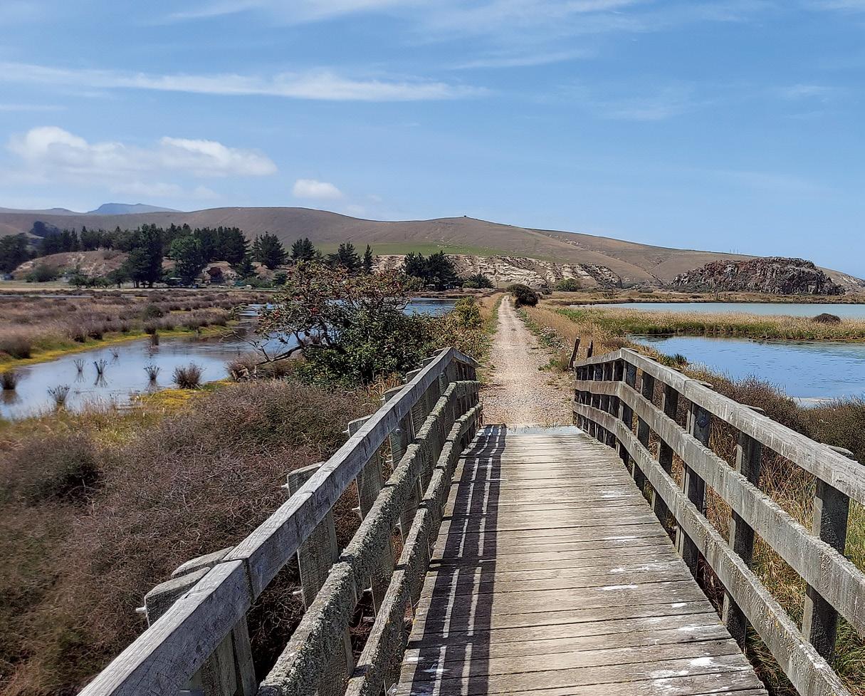
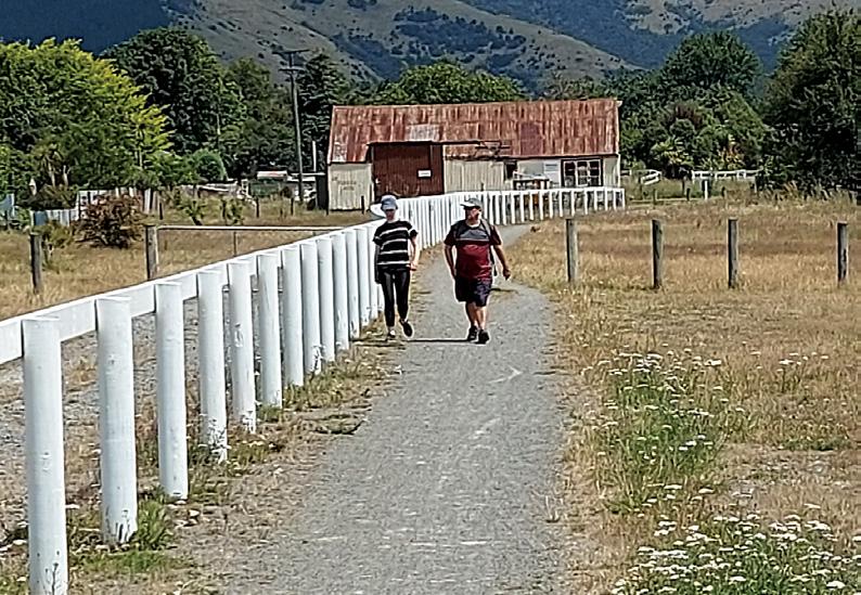
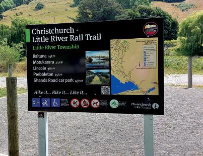
New Zealand Walk
Little River Trail - Hike
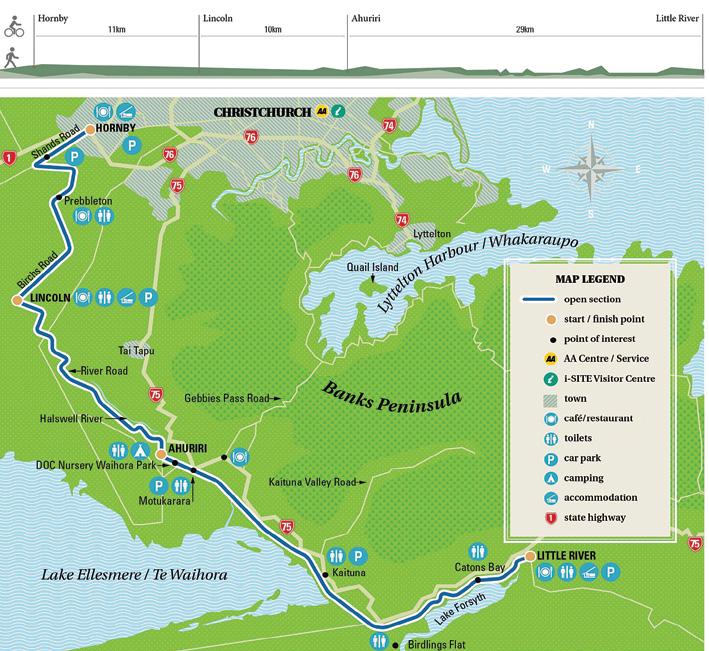
The Christchurch to Little River Rail Trail is a 49km walkway and cycleway between Christchurch and Little River.
From Hornby to Little River the route follows much of the Little River Branch railway line which operated from 1875 until 1967 providing a vital means for farmers to get stock and produce to market.
The trail passes through rural areas and settlements on the Canterbury Plains, skirts past the massive flanks of the ancient volcanoes which make up Banks Peninsula, and hugs the shoreline of a vast lagoon, Te Waihora or Lake Ellesmere, and its smaller twin, Te Roto o Wairewa or Lake Forsyth. The lakes and associated rivers and wetlands are rich in wildlife and natural vegetation.
The trail can be walked or biked in sections as below:
Above: On the most picturesque section of the trail from Motukarara to Birdlings Flat, that goes alongside Lake Ellesmere. Below left: The trail crosses a road near Kaituna.
Section 1 - Christchurch (Hornby to Prebbleton)
Distance 4km
This section is sealed and follows Shands Road to the intersection with Marshs Road. It then crosses the road to follow the old railway corridor through to Prebbleton.
Points of interest: Hornby is a residential suburb of Christchurch and an important commercial centre.
Section 2 - Prebbleton to Lincoln
Distance 7km
Beginning at the intersection of Birches Road and Trices Road. This section comprises of a 7km off-road wide asphalt pathway that runs alongside the original railway line from Birches Road to Lincoln.
Points to note: For those beginning the trail in Prebbleton there is carparking available along Birches Road between Springs Road and Trices Road or at the Prebbleton Reserve.
Section 3 – Lincoln to Ahuriri Reserve
Distance 10km
This section connects Lincoln to the Ahuriri Reserve utilising a number of sub-sections and onroad segments. The Rail Trail uses a shared pathway along the northern side of Edward Street. Continue to the Edward Street – Ellesmere Road intersection and then turn right into Ellesmere Road.
Travel 1km along Ellesmere Road, turn left into the Rail Trail that connects to Collins Road East and River Road. This section provides safe offroad cycling to River Road. From River Road to Ahuriri Reserve care needs
Below: The trail goes through flat farm land and sometimes alongside sheep.
Little River Trail Hike
it, bike it, like it!
to be taken as walkers and cyclists will be sharing the country road with heavy vehicles. At the end of River Road there is a section on the true right connecting from Geddes Road to Neills Road.
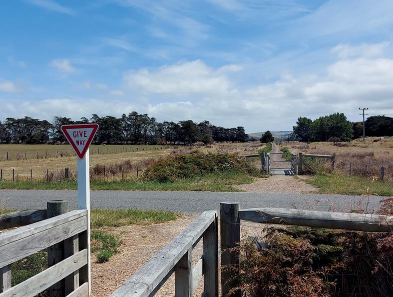
Section 4 – Ahuriri Reserve to Motukarara
Distance 4km
Off-road riding on hard packed gravel. The section begins adjacent to the Halswell Canal before deviating away onto farmland for approximately 1.7km.
Point to note: A joint planting plan for this area is being carried out by The Waihora Ellesmere Trust (WET), Rail Trail Trust and ECAN.
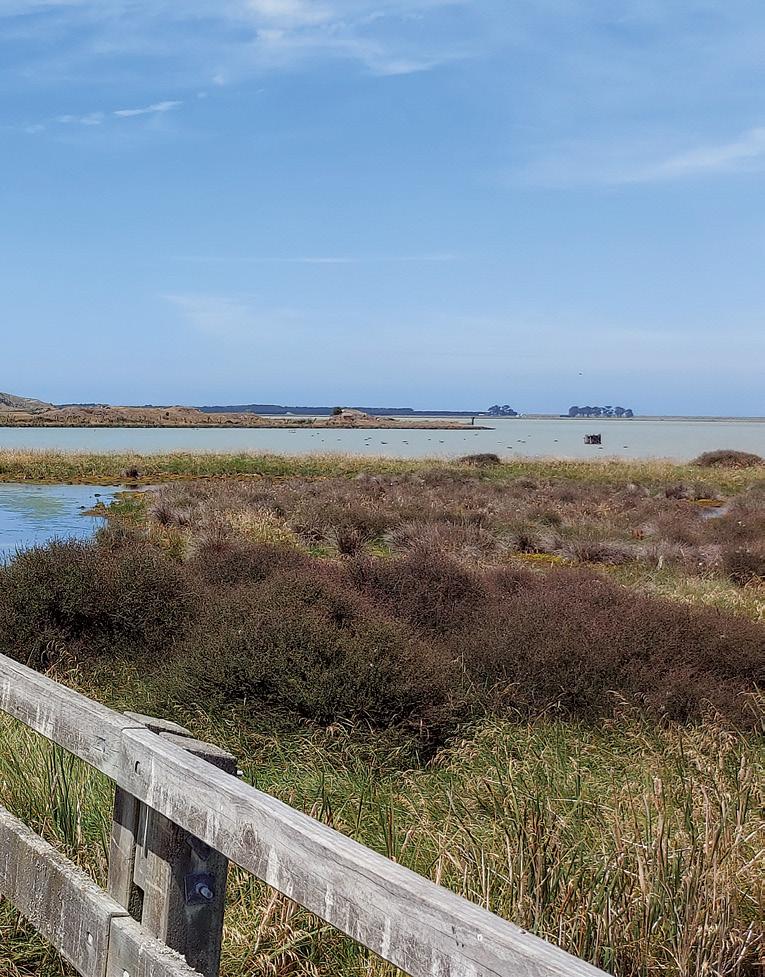
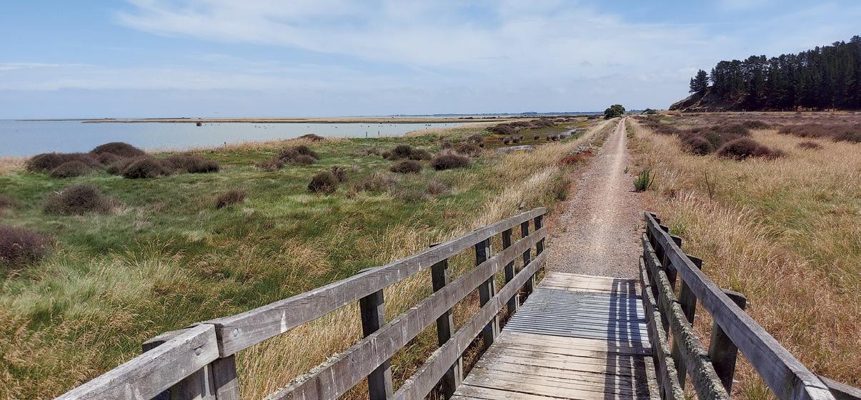
Section 5 – Motukarara to Birdlings Flat
Distance 13.3km
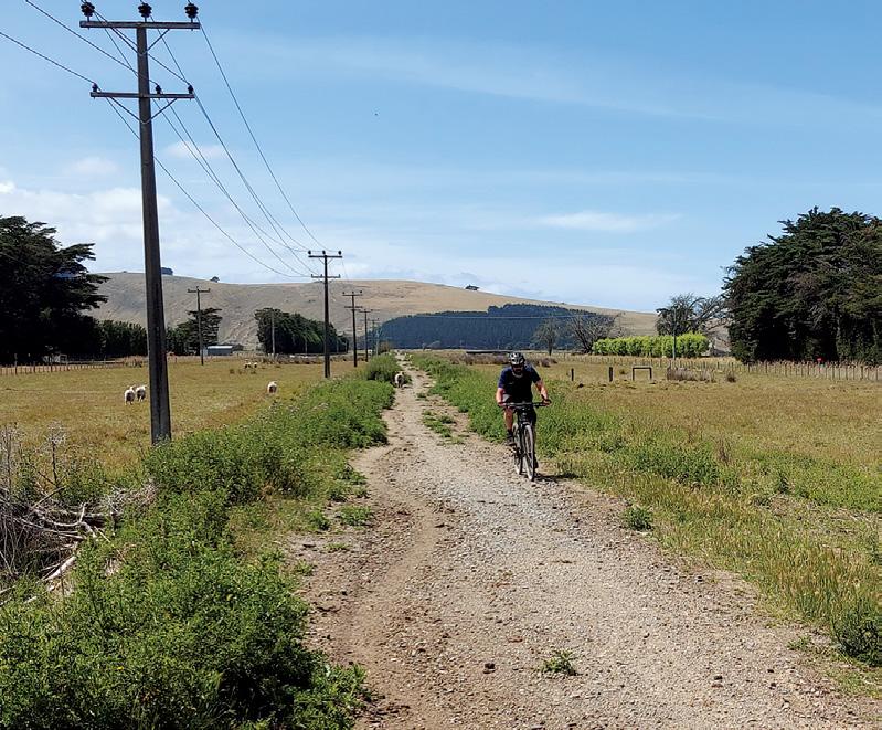
Arguably the most picturesque section of the Little River Rail Trail. The track follows the old rail embankment from Motukarara to Little River alongside Lake Ellesmere (Te Waihora) and Lake Forsyth (Te Wairewa). The trail offers stunning views across the lakes towards the Southern Alps, with great opportunities to see a variety of bird life.
Walkers and cyclists can access this
Christchurch to Little River Rail Trail Trust
The Christchurch to Little River Rail Trail Trust is a registered charity, formed in 2004 with the primary purpose being to promote, plan, fund, develop and establish a functional and high quality interconnected network of trails for walking, hiking, cycling, mountain biking and any non-motorised recreational activities covering the area from Hornby to Little River.
The Trust consists of a small group of dedicated volunteers who see endless opportunities to further develop and promote this wonderful recreational facility
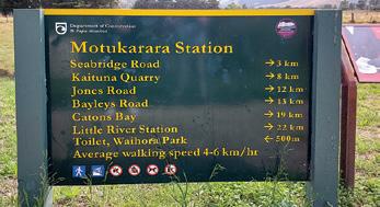
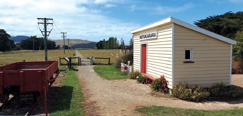
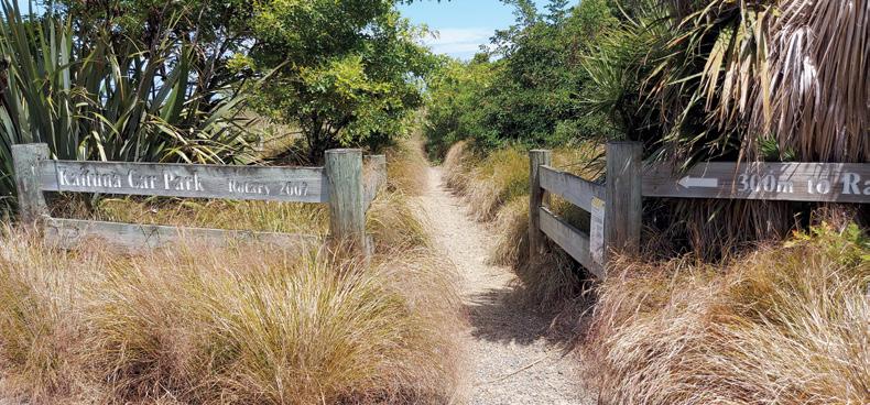
Above left: Motukarara Station. Middle left: The trail enters an area at Katuna Carpark.
Below left: Two walkers finishing the trail at Little River.
Opposite page: Above right: The trail beside Lake Ellesmere.Below left: The information board at Little River. Below right:: Old cattle wagons a relic from the past at Little River.
section of the trail at Kaituna Quarry, Seabridge Road, Birdlings Flat and Catons Bay. Points to note: Picnic stops are at Kaituna Quarry and Catons Bay. There is a small on-road section near Little River, please take care here when crossing the road.
Section 6 – Birdlings
Flat to Little River
Distance 9.7km
The trail navigates along the old railway embankment, turning inland and ends closer to the Little River township on a compact gravel track. The majority of the track travels beside Te Roto o Wairewa (Lake Forsyth).
Above left: The trail passes beside pictursque Lake Ellesmere.
By Duncan Smith
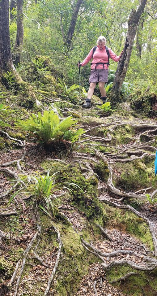
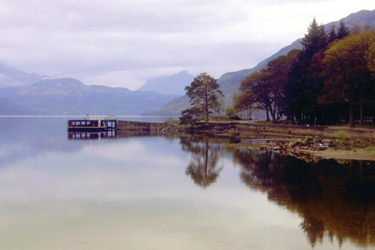
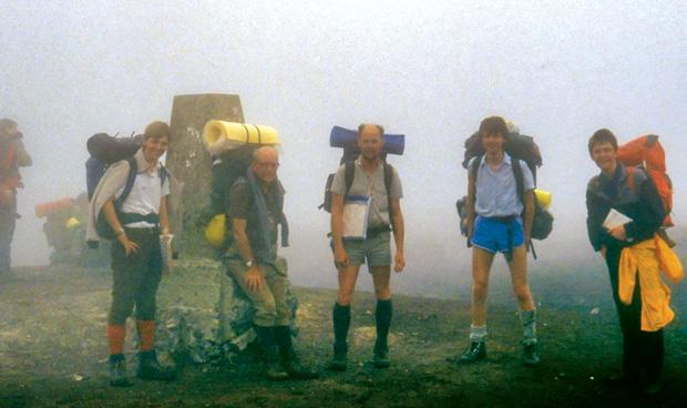
At nearly 80 - the melee of different walks in my life
Above: Loch Lomond on the West Highland Way, Scotland.
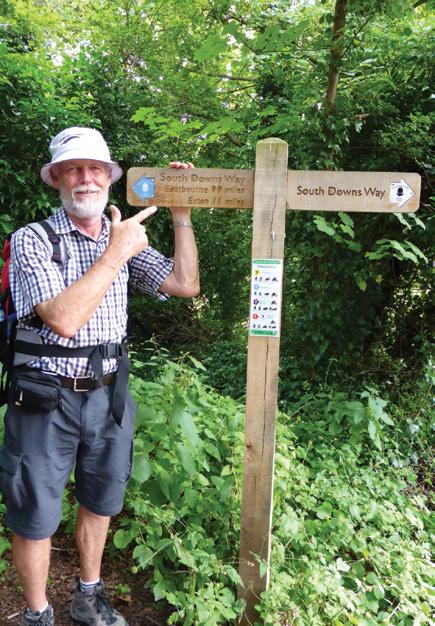
Below left: Duncan 17kms from the end of the South Downs Way in England in 2014.
At the age of forty, I found myself with a job in England that had all the charm of being locked in a cupboard with an especially irritable Rottweiler. Day after day, I shuffled papers, stared at walls, and tried not to die of boredom.
Eventually, in a moment of clarity, or possibly madness, I decided to escape. I packed my things and went north to the Lake District. The plan was vague: breathe some air that hadn’t recently been exhaled by an accountant, stretch my legs, and maybe walk about a bit.
Walking and I had never been formally introduced, but the moment I set foot on those Lakeland paths,
something peculiar happened: I loved it. The hills rose around me like kindly giants, the air smelt faintly of sheep and damp stone, and before I knew it, I was hooked.
From then on, holidays became less about beaches and sun loungers but more about self-inflicted suffering. I wanted to challenge myself each time, so I picked long-distance trails as if they were taunts.
The first was the Pennine Way, 430 km of glorious misery across England’s rugged spine. I was armed with nothing more than misplaced optimism and a backpack so enormous it looked as if I were emigrating. The blisters arrived early, set up camp on my feet, like limpets,
Ouch! Sore feet while walking?
Hikers Wool is 100% New Zealand wool. Cushion your feet to prevent pain, rubbing and blisters. Buy online or at selected stockists For more info visit www.hikerswool.co.nz
refusing to leave, but somehow I staggered through.
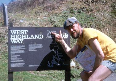
At forty-three, something even more extraordinary happened. On the West Highland Way (154 km), amid mist, midges, and damp sandwiches, I met a delightful New Zealand woman. She came to live with me, and nine months later, after the peculiar joy of redundancy freed me from office life, I sold everything, crammed my existence into a suitcase, and moved to New Zealand with her.
We bought a small farm, married, and together tramped some of the country’s loveliest trails, the Whakatāne River, Abel Tasman, and the grand loop of Lake Waikaremoana.
Along the way, I learned vital lessons: how to pack a bag without needing a forklift, how to avoid blisters, and how to endure any weather, from biblical downpours to sunshine so fierce it could melt your face off.
Life, as it does, expanded. We raised two sons. Once they’d flown the nest, we sneaked back to the UK for more paths: the South Downs Way, the Great Glen Way. Each was different, each was marvellous, and by then I’d learned to pace myself with something approaching dignity.
Then came 2016. Both sons were working in London and announced they were off to walk the Coast to Coast Trail. Devised in 1973 by
Above left: Near the end of the West Highland Way near Fort William. Above right: Duncan and Judy on the South Downs Way England in 2014. Judy has also walked The Great Glen Way, the Abel Tasman and Lake Waikaremoana (twice. Below right: Village along the South West Coast Path, England. in 2018.
At nearly 80 - the melee of different walks in my life
that lovely Yorkshireman, Alfred Wainwright, it was his mischievous idea of fun.
Tramping, 293 km from the Irish Sea at St Bees Head to the North Sea at Robin Hood’s Bay. It wasn’t an official trail then, so signs were scarce and sheep outnumbered people by a cheerful margin.
Along the way, you heave yourself over the Lake District’s stunning fells, stumble across the mindbogglingly beautiful green folds of the Yorkshire Dales, and finally trek across the vast, windblown moors of North Yorkshire.
At seventy-one, I did the only sensible thing: I gate-crashed. I turned up unexpectedly on their doorstep, declared my intentions, and set off with them. The weather was kind, the camping fantastic, and the memories better than any photograph.
Two years later came a curveball. Bowel cancer. A word nobody wants to hear, and yet, after surgery, I was back on my feet astonishingly quickly. In fact, seven weeks later, I was back in England, attempting the South West Coast Path, a monstrous 1,014 km ordeal.
It was the hottest summer that year since the one in 1976. I didn’t dare carry a full pack, being still stapled together like a DIY project,
so I had my gear shuttled ahead. Even carrying just a day sack, it was still very punishing. However, the rewards were dazzling: hidden coves, seas as clear as glass, cliffs that could make you giddy just looking at them. Nine weeks later, battered, tanned but smug, I finished.
And now, nearly eighty, I find myself still putting one foot in front of the other. Most recently, I completed the North Island section of Te Araroa, all 1,725 km of it. I did it for the Child Cancer Foundation and raised almost $7,000. It was challenging, astonishing, and deeply humbling.
If there’s one thing I’ve learned after forty years of trudging about, it’s that walking isn’t really about the kilometres.
It’s about the laughter, the weather, the company, the pain, and occasionally the giving back. But mostly, it’s about discovering that, against all odds, your legs will carry you further than you ever thought they could.
Above left: Resting on Mt Tongariro on the Te Araroa Trail.
Above right: Along the Pennine Way England on top of Black Hilll in thick cold mist in 1988.
Middle left: Start of Te Araroa Trail in Wellington with sons Jack and Tim.
Below left: Duncan on the South West Coast Path In England in 2018.
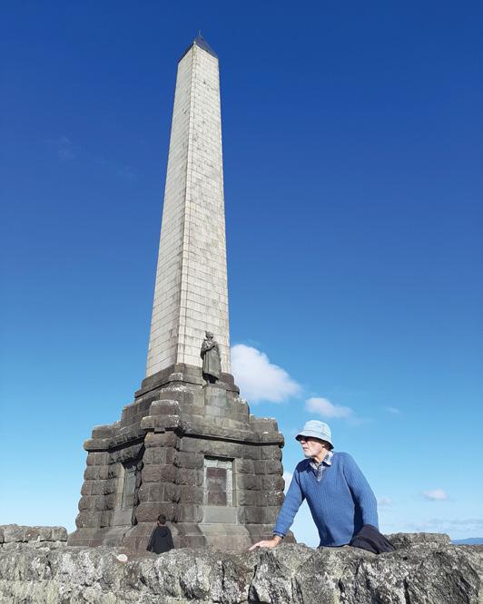
Alice Springs - gorges, waterholes and red desert landscapes
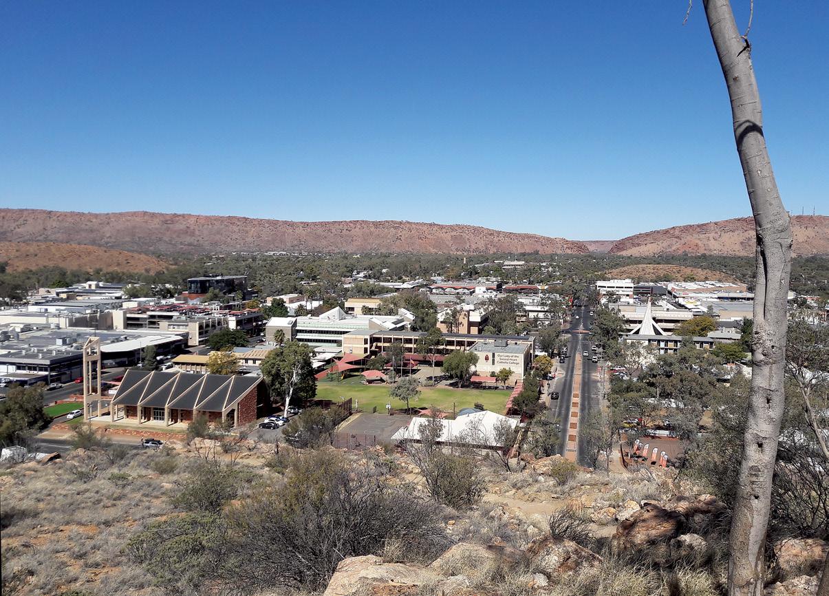
If you have a spare morning or evening in Alice Springs in Australia’s Northern Territory, you should definitely make the time to take the short hike up Anzac Hill and take in the tranquil and breathtaking views across Alice Springs. Allow 40 minutes.
Also known as “Untyeyetwelye”, it is located close to the centre of the town, and is a short 15 minute walk from the visitors centre to the lookout. Anzac Hill is a spectacular vantage point to view both the sunrise and sunset, with the backdrop of the MacDonnell Ranges in the distance. Plus while up there, you could
Above: Over looking the town centre of Alice Springs from Anzac Hill.
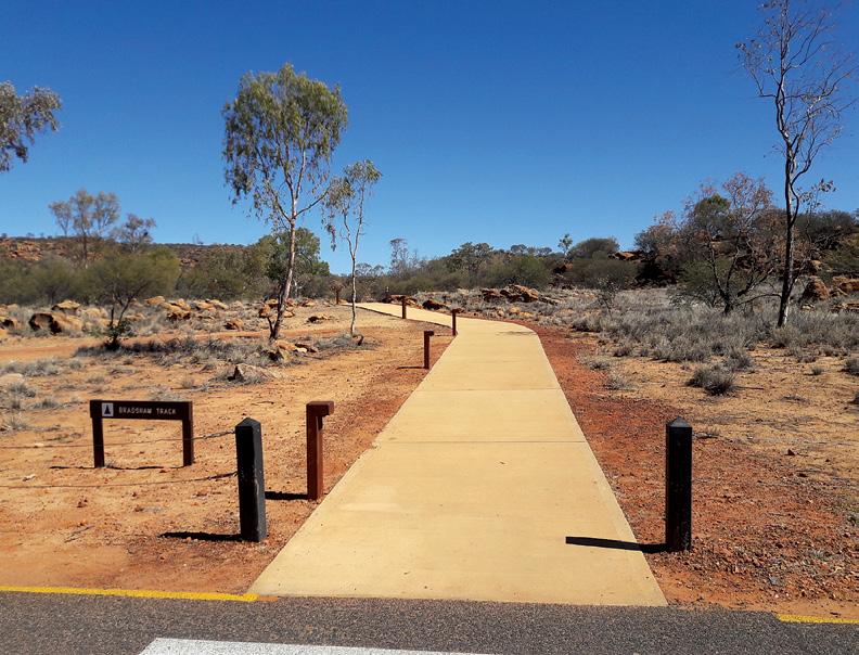
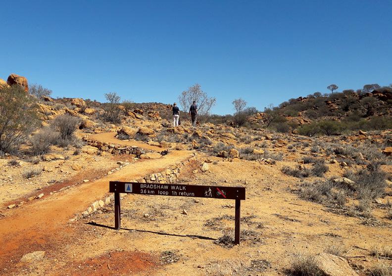
Below left: On the Bradshaw Walk that starts at the Old Telegraph Station Reserve.
Alice Springs - gorges, waterholes and red desert landscapes
view the Anzac Hill War Memorial, dedicated to the fallen heroes who fought and died in World War One.
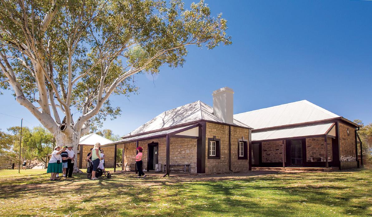
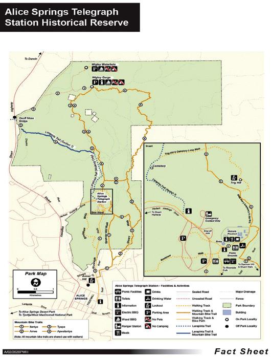
The Alice Springs Telegraph Station only four kilometers from the town centre is a must see, with its historic buildings and from here a number of walks start.
This Old Telegraph Station was built in 1871 as part of the 3,000km long Adelaide to Darwin Overland Telegraph Line, and is the best preserved of the 12 stations along the Overland Telegraph Line.
The Alice Springs Telegraph Station
Historical Reserve marks the original site of the first European Settlement in Alice Springs. It was operated for 60 years before serving as a school and welfare home for Aboriginal children of mixed ancestry until 1963.
The station is easily accessible by car (just a 10 minute drive) through the Stuart Highway and the Herbert Heritage Drive.
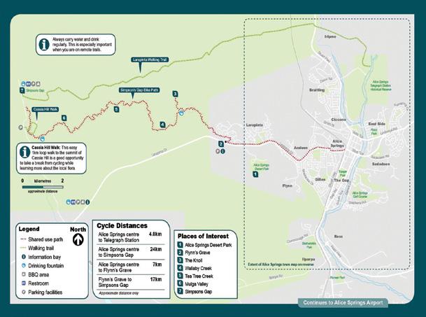
You can also use the riverside path along the Todd River for a short walk or cycle on the sealed path.
You can also take the Riverside sealed path for a short walk or cycle
from the town to the telegraph station (3.5km one way). You may spot plenty of wildlife, including the wallaroos that live among the rocks.
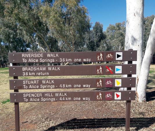
The epic Larapinta Trail begins at the old Alice Springs Telegraph Station and is roughly divided into 12 sections. You can hike for a whole week, or choose to walk for just one day –whichever option you take, you will be spoiled with breathtaking views.
The Larapinta Trail is, voted by National Geographic as one of the top
Above: Three historic buildings at the Old Telegraph Station. Reserve.
20 trekking experiences on the planet.
The formations of the West MacDonnell Ranges and the vast skies are humbling. There are plenty of swimming holes, great spots to take a dip and cool off under the desert sun.
Nearby is the original “Alice” spring, a semi-permanent waterhole in the Todd River, after which the Alice Springs town is named.
Alice Springs, the springboard to the Outback, has grown from a small settlement to a mature and colourful tourism centre. From short strolls to day treks, there are plenty of interesting trails to explore here, discovering steep gorges, untouched watering holes and striking desert landscapes.
Right in town, the Olive Pink Botanic Gardens are a haven of greenery, as well as birds, butterflies and other local wildlife. Wander through the themed areas and the bush lands for a leisurely afternoon in nature.
A short drive from Alice Springs and a kilometre or so from the Desert Springs Park, you’ll find a trail leading to the peak of Mt Gillen. It begins at the Flynn Grave (John Flynn was an Outback pioneer in the medical field and instrumental in forming
you may even see wallabies, desert birds and exotic flowers.
At the top of the rocks you’ll be rewarded with 360 degree views of the town and surrounding mountain ranges and flats. Go early to beat the heat and catch the spectacular sight of sunrise over Alice Springs. With luck
Gorges, waterholes and red desert landscapes on short walks and long treks are all in and around Alice Springs.
Above: The start of the Bradshaw Loop Walk.
The new VeryFitPro ID205L Intelligent Activity Tracker
The new VeryFitPro ID205L is an intelligent smart looking Sports Watch and activity tracker that ticks all the boxes.
* Strong and durable 3cm clear glass touch screen display
* Skin friendly soft and comfortable wristband strap
* Nine exercise modes walking, running, hiking, cycling, treadmill, fitness, mountain climbing, spinning bike and yoga
* Many functions: step monitoring function, heart rate monitoring, sleep monitoring, calorie monitoring, call reminder, message reminder, sedentary reminder, alarm reminder, stopwatch, timer, music control, looking at mobile phone, breathing training, time and date display, multi-sport mode (step, calories, speed, distance, active time), daily goal
* Raise your hand and the screen will light up.
* Customize the face of your Smart Watch to fit your needs.
* IP68 Deep Waterproof
* Magnetic charging with USB charging cable takes about 2.5 hours for around 10 days usage.
* Uses VeryFitPro app Compatible with smart phones that use IOS 8.0/ Android OS 4.4 or later, and Bluetooth 4.0 or later
* Colours available: Black
Order now $115.00 plus $8.00
the Royal Flying Doctor Service) off Larapinta Drive.
NORTH ISLAND
NORTHLAND
BAY OF ISLANDS
BAY OF ISLANDS WALKERS: Saturday (AM), Jacqui Watson 022-6019741, Roz Whittaker 021-063-1455
DARGAVILLE
DARGAVILLE TRAMPING GROUP: Last Sunday of month (AM), Lynley Thompson 021-102-3974, colvilleestate1@gmail.com
WHANGAREI
CARDIAC CARE WALKING GROUP: Wednesday (AM or PM), Jo or Hugh Knight 09-438-7976
BLUE TOP WALKERS: Henderson, Tuesday, Thursday (AM), Terry Wilson 09-814-9523 or 021-266-1071, terryandsheena@gmail.com, www. bluetopwalkers.weebly.com
FIA OLA WOMEN’S DEVELOPMEMT WALK GROUP: Monday to Saturday, Anne, 09-813-0021
FIT4LIFE: Glenfield, Monday (PM), Friday (AM), Sarah 021 534 649
GLEN EDEN ATHLETIC CLUB WALKERS: Glen Eden, Wednesday (PM) and Saturday (AM), Neil Turner 09-817-6230 GREEN BAY MUMS BUSH WALKERS: Every second Monday, Anne 09-827-7810 or 09-817-5867
KELSTON MORNING WALKERS: Kelston C.C. Tues (AM), Joy Martin 09-838-6553
KELSTON TWILIGHT WALKERS: Kelston, Tuesday (PM), Joy Martin 09-818-6084
KUMEU WALK GROUP: Kumeu, Friday (AM), Mary Davies 09-412-2262
LYNNMALL SHOPPING CENTRE KIWIFIT CLUB: Monday, Wednesday (AM), (BIA), 09-826-2333
TE ATAU PENINSULA WALKERS: Monday, Friday (AM), Wednesday (PM), Mary Jones 09-834-6989
TE ATATU SOUTH ACTIVE 35+ WALKING GROUP: Te Atatu South, Wednesday, Edna, 09-834-1401
THE HAPPY WANDERERS WALKING GROUP: Wednesday (AM), Joy Williams 09-817-2464 or 027-353-3434
TITIRANGI TWILIGHT WALKERS: Tuesdays, Thursday, (PM) Titirangi Library, Wednesday (PM) Glovers Real Estate Green Bay, Louise 021437-547, louisenicholson@xtra.co.nz
TITIRANGI WALKERS: Sundays (AM), John Harris 09-627-0099, jeanah@ihug.co.nz
Fitness levels: “B” beginner, ”I” intermediate, “A” advanced. (AM) denotes morning walk, (PM) denotes an afternoon or evening walk. Group co-ordinators are asked to please advise us of any updates by fax 06-358-6864 or email walkingnz@xtra.co.nz.
WALKERS & TALKERS: Campbells Bay, Wednesday (AM), Brenda Gray 09-410-4019, Dorothy Ensor 09-478-6702
KELVIN GROVE WALKERS: Tuesday (PM), (I), Marjory Edmonds, 06-354-3342
Notice to clubs and walking groups
If you notice there that the times, names or contact numbers etc on the list of Walking Grroups in the Directory on these pages needs updating please email us at walkingnz@xtra.co.nz. These are are free listing.
LEGEND
Fitness levels: “B” beginner, ”I” intermediate, “A” advanced. (AM) denotes morning walk, (PM) denotes an afternoon or evening walk. Group co-ordinators are asked to please advise us of any updates by fax 06-358-6864 or email walkingnz@xtra.co.nz.
LAMBDA DAY TRAMPERS: every second Sunday, (BI), social group for gays and lesbians of all ages, https://lambdatrampers.org/ LINWOOD AVENUE WALKING GROUP: Wednesday, Thursday (AM) (B), 03-389-5303
PIONEER TRAMPERS:Thursday (AM) (IA),4-5 hour tramps in Banks Peninsula and the hills and lower mountains from Mt Hutt to Mt Grey, pioneertrampers@gmail.com
LEITH WALKERS: Saturday (PM), Kevin Blair 03-476-3289
MORNINGTON MONDAY WALKERS: Monday (AM), (B), Shirley 03-4536398 or 021-294-2218
MULTI-PEAK FITNESS WALKERS: Wednesday (AM), Marelda Gallaher 03-477-6057 or 027-222-3863
OTAGO TRAMPING/MOUNTAINEERING CLUB: Sunday (AM), Joe Bretherton, jsbretherton@gmail.com, http://otmc.co.nz
OVER 30’s TRAMPING CLUB: Sunday (AM), Janice Hodges 03-489-4071
PHOENIX CLUB WALKING GROUP: Wednesday (AM), Nina Davidson 03-471-0114
PINEHILL WALKING GROUP: Thursday (AM), Norman Vare 03-473-8683
Notice to clubs and walking groups
If you notice there that the times, names or contact numbers etc on the list of Walking Grroups in the Directory on these pages needs updating please email us at walkingnz@xtra.co.nz. These are are free listing.
ST KILDA COMMUNITY CLUB WALKING GROUP: Tuesday, (AM), Ngaire McIndoe 03-456-4478
24 Manawatu Striders Super Seven Series, Palmerston North MARCH 2026
1 Maraetai Half Marathon, Beachlands, Auckland
7 Motatapu, Wanaka to Arrowtown
8 Footprints In The Sand , Foxton Beach
8 Southern Cross Round the BaysAuckland
8 Surf to City Cycle Enemt Invercargill
8 8 Waipa Fun Run and Walk, Cambridge
14 Pāuanui Trail Epic, Pauanui, Coro-
mandel
14 Run Mt Hutt, Pudding Hill, Canterbury
14 Tararua Mountain Race, Kaotoke to Otaki Forks, Tararua Ranges
15 3 Peaks Mountain Race, Leith Valley, Dunedin
15 City2Surf Fun Run, Latimer Square to New Brighton, Christchurch
15 Hamilton Half Marathon, Hamilton
15 Harcourts Cooper & Co Run Albany, Albany, Auckland
20 March to 6 April Waiheke Walking Festival
21-22 Northburn 100, Northburn Station, Central Otago
21-22 Rotorua Walking Festival, Rotorua
22 Peak Trail Blazer, Havelock North, Hawkes Bay
28 Foundation Clinic Mauao Half Marathon, Mt Maunganui
28 Middle-earth Halfling Marathon, Hobbiton™ Movie Set, Matamata
28 Tussock Traverse, Tongariro National Park
29 Waitārere Forest Run, Waitarere near Levin
AUSTRALIA
OCTOBER 2025
4 Beechworth Beer Run, Beechworth, Vic
4 Lakes Trail Festival, Hawks Nest, NSW
4 Townsville Race in the Park Run, Mundingburra, Qld
5 Barossa Run, Lyndooch, SA
5 Hidden Valley Trail Run, Paluma, Near Townsville, Qld
5 Olivia’s Walk and Run for Wellness, Melbourne, Vic
5-6 Sydney Trail Marathon, Castle Hill, Sydney, NSW
5 Walk for Prems: Adelaide, SA
5 Wally Cairns Pancake Run, Perth, WA
7 Mt Ainslie Run Up & Power Walk, Canberra, ACT
12 Goulburn Half Marathon, Goulburn, NSW
12 Harrietville Half Marathon, Harrierville, Vic
12 Perth Running Festival, Burswood, WA
19 Albury Running Festival , SouthAlbury, NSW
19 The Bloody Long Walk: Mornington, Melbourne, Vic
25 The Great Aussie Hike Mini, Mornington Peninsula, Vic
26 Paluma Village Trail Run, Paluma, near Townsville, Qld
26 Seven Bridges Walk, Sydney Harbour, NSW
26 The Bloody Long Walk: Adelaide, SA
31 Coastrek Margaret River, Margaret River,WA
NOVEMBER 2025
1 Harry’s King of the Hill, Pyalong,, Vic
2 4 Peaks Bright Alpine Climb: Mt Feathertop, Harrierville, Vic
2 Bare Creek Trail Run, St Ives, NSW
2 Cave Run, Naracoorte, SA
You can now view back issues of Walking New Zealand magazine, two issues back from the latest, FREE at : http://issuu.com/walkingnewzealand.
2 Dover Fun Run, Diver, Tas
2 Grunt Beach Marathon, Gold Coast, Qld
2 Public Great Pursuit Race, Melbourne, Vic
REST OF WORLD
OCTOBER 2025
4-5 International Walking Festival, Fulda, Germany18-19
10-12 International Walking Festival, Ottawa, Canada
NOVEMBER 2025
2 New York Marathon New York, USA
6-7 International Walking Festival, Arlington, Virginia, USA
25-26 International Walking Festival, Wonju, Korea
DECEMBER 2025
1-3 International Walking Festival, Higashimatsuyama, Japan
8-9 International Walking Festival, Taipei, Taiwan
15-16 International Walking Festival, Yogjakarta, Indonesia
MARCH 2026
The H-232G Sensor pedometer
A great little Pedometer that you can carry in your bag or pocket or clip on a belt!
Three function Pedometer with a hi-tech system that you can carry in your bag, pocket, clip on a belt, or as an arm band, and accurately records your activity through its G Sensor technology.
* Step - Counts steps up to 999,999 steps
* Total Steps - It can cumulative number of steps of each activity
* Exercise time - The effective time will be accumulated as the walking is kept going
* Comes with a lanyard if you want it to hang it around your neck, and an additional clip if you want to attach it to a belt!
Only $59.95 plus shipping $6.00 Phone 0800-925-546 for bulk prices
Available now from: Walking New Zealand Shop
47 Lincoln Terrace, Palmerston North - Phone 0800-925-546 or email walkingnz@xtra.co.nz. www.walkingnewzealand.co.nz
You can now view and enjoy the latest issue of Walking New Zealand magazine online for $3.95 at http://www.walkingnewzealand.co.nz
www.walkingnewzealand.co.nz
1 Run Tokyo, Tokyo, Japan APRIL 2026
20 130th Boston Marathon, Half Marathon, 10km & 5km, Boston, USA MAY 2026
24 Sanlam Cape Town Marathon, Cape Town, South Africa
Fingertip Pulse Oximeter
A fingertip Pulse/Oximeter can be used to measure oxygen saturation and heart pulse rate through the finger. Monitor respiratory conditions, pre and post exercise, and pre and post operative conditions.
Only $39.95 plus $7.50 P&P
Available now from: Walking New Zealand Shop
P O Box 1922, Palmerston North Phone 0800-925-546
Order online: www.walkingnewzealand.co.nz
The new VeryFitPro ID205L is an intelligent smart looking Sports Watch and activity tracker that ticks all the boxes.
* Strong and durable 3cm clear glass touch screen display
* Skin friendly soft and comfortable wristband strap
* Nine exercise modes walking, running, hiking, cycling, treadmill, fitness, mountain climbing, spinning bike and yoga
* Many functions: step monitoring function, heart rate monitoring, sleep monitoring, calorie monitoring, call reminder, message reminder, sedentary reminder, alarm reminder, stopwatch, timer, music control, looking at mobile phone, breathing training, time and date display, multi-sport mode (step, calories, speed, distance, active time), daily goal
* Raise your hand and the screen will light up.
* Customize the face of your Smart Watch to fit your needs.
* IP68 Deep Waterproof
* Magnetic charging with USB charging cable takes about 2.5 hours for around 10 days usage.
* Uses VeryFitPro app Compatible with smart phones that use IOS 8.0/Android OS 4.4 or later, and Bluetooth 4.0 or later
* Colours available: Black
Only $115.00 plus $8.00 P&P
47 Lincoln Terrace, Palmerston North - Phone 0800-925-546 Email walkingnz@xtra.co.nz. www.walkingnewzealand.co.nz
CONTENTS for previous 15 issues
OCTOBER 331 2025
3 Contents
4 Walk Talk
6 New Zealand Walk; An Autumn walk on the Otago Rail Trail
10 New Zealand Walks: Wonderful walks from Wellington to Whanganui
14 Overseas Walk: Morton Bay Fig trees a feature of Norfolk Island walk
15 New Zealand Walk: The Great Dripping Loop walk
18 Weather: Weather prediction for October
19 New Zealand Walk: Seals, camping and short walks on SH1 journey through Kaikoura
20 New Zealand Walk: Rangiwahia Hut murals makes this walk so special
22 New Zealand Walk: Discover Mangati Walkway: New Plymouth’s peaceful shared pathway
24 Walking New Zealand Monthly Photo Contest
26 New Zealand Walk: Katikati Haiku Pathway unique outside Japan
26 Overseas Tours: NZ walking company offers walks in Italy with Pleasure