The ULTIMATE is Zerofit’s flagship product and perfect for hiking, golf, sailing or any outdoor activities when it’s cold. But if you are more active it is complemented by the Heatrub MOVE.
Twice as warm as a standard base layer, the material regulates tempertures as you move, so you won’t suffer from cold sweat, if your are running or cycling.
Please visit the Walking New Zealand Shop: https://walkingnewzealand.co.nz/productcategory/apparel/ for more details and to order.
Talk 6 New Zealand Walk; Hamilton Hidden Gems
9 News: Dallington Bridge officially opened over Avon River 10 Walking Tours: Top Walks in the top of the South 15 Manawatu Striders Super Seven Series
16 New Zealand Walk: Native forest giants just off highway: 18 Weather: Weather prediction for December
19 New Zealand Walk: Taking the Green Route from Devonport to Takapuna 22 New Zealand Walk:The Hull’s farm track to Mangatiti Falls
Walking New Zealand Monthly Photo Contest
26 New Zealand Walk: A winter walk on the Old Coach Stream Track
32 New Zealand Walk: Dog Stream Waterfall Walk
35 New Zealand Walk: Mercer Bay Loop Track for great sea views
36 New Zealand Walk: Walking the Kereru Track from Days Bay for greats harbour views
39 New Zealand Walks: Walk the Chatham Islandswonderfully remote
40 Directory of New Zealand Walking Groups
42 Coming Events: New Zealand
46 Coming Events: Australia
47 Coming Events: Rest of World
48 New Zealand Country Breaks
50 Index of previous 15 issues 51 Walking New Zealand Shop
52 Pak A Roo Walking Jackets
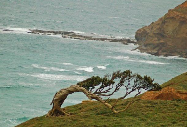
Cover image: Walkers on their way to Mt Taranaki walking on a boardwalk across Ahukawakawa Wetland. Photo by Phillip O’Donnell
PUBLISHER/EDITOR: Frank Goldingham MNZM: Phone, 027-274-0726
CONTRIBUTORS: Yvonne van Eerden, Ken Ring, Phillip O’Donnell, David Scoullar, Patrick Tooher, Ceana Priest
The information and views expressed by contributors are not necessarily agreed to by the editor or publisher, and while every effort will be made to ensure accuracy, no responsibility will be taken by the editor or publisher for inaccurate information.
Walk talk
Popular Wanaka track reopened
The popular Blue Pools track, near Wānaka, reopened in June 2025, after a two -year closure for renovations, and the Lake Sylvan track near Glenorchy reopened in October, with a new bridge, providing safe access to this family-friendly scenic hike.
Permits open for Inca Trail Trekking
The Peruvian authorities have released the official schedule for 2026 Inca Trail trekking permits, with bookings opening from late this month.
Permits are issued on a first-come, first-served basis and are in high demand, particularly for the popular trekking months of May to August. Inca Trail permits are non-transferable, non-refundable, and cannot be pre-reserved or modified once confirmed.
January 2026 opens 28 October 2025; March 2026 opens 29 November 2025; April 2026 opens 30 December 2025; May 2026 opens 31 January 2026; June 2026 opens 28 February 2026; July 2026 opens 1 April 2026; August to December 2026 opens 30 April 2026.
New CEO for Outdoor Access Commission
The Board of the Outdoor Access Commission, has announced the appointment of Dan Wildy as its new Chief Executive Officer. Dr Wildy will succeed Ric Cullinane, who has retired after a tenure as a long-serving and highly respected leader of the organisation.
Dr Wildy brings over 27 years of public sector leadership experience, with a strong background in governance, strategic transformation, and operational delivery. He is currently serving as Director: National Intelligence at New Zealand Police, where he has led significant national initiatives in intelligence and public safety.
Dr Wildy began his career in the New Zealand Army, serving in various roles both nationally and overseas. He is a graduate of the New Zealand Defence Force Command and Staff College. He holds a Doctor of Philosophy (History)-awarded with placement on the Dean’s List-as well as a Master of Strategic Studies with Merit.
Dr Wildy is also a tramper, hunter, angler and advocate for the outdoors. His connection to the land and outdoor recreation aligns with the values of the Outdoors Access Coimmision.
Do you really need to walk 10,000 steps a day?
Have you heard the oft-repeated advice that you need to be getting 10,000 steps each day? While getting some walking in each day is a good goal, is there evidence that a certain number of steps is the best?
This RNZ interview with Dr Melody Ding, a Professor of public health at the University of Sydney, suggests that you may not need to walk as many steps as you think to get health benefits. Interestingly, she says the “10,000 [steps] figure came from a stunningly effective marketing campaign in the 1960s for a Japanese pedometer”, so it isn’t backedup with research.
Melody and her colleagues did an analysis of 31 previous studies looking at the number of steps taken by study participants and the health outcomes. They found that people who walked 7,000 steps were best able to reap the health benefits of walking, while walking more than 7,000 steps did not make a huge difference in improving health. Overall, they found that walking more steps is better, so that “comparing 4000 steps with 2000 steps, for example, every step counts - 4000 steps was much better than 2000 steps.” Researchers cautioned people not to think of any number of steps as the “magic” amount needed, but to try and walk as much as is manageable each day.
Some other studies indicate that walking speed may be another important factor in improving health outcomes from walking. For example, walking at a brisk pace has been associated with a decrease in heart disease and an increase in life expectancy. Even a five minute walk at a fast pace that increases your heart rate can improve cognition and working memory. Research also shows that taking a brisk walk after eating can improve digestion and control blood sugar levels.
Walk talk
Transformative public access map unveiled
The Outdoor Access Commission, (Herenga ā Nuku Aotearo) is releasing a major upgrade to its mapping of public access to the outdoors.
After two years of cutting-edge work, an example of the improvement is that we can now confidently identify 55,000 km1 of publicly accessible unformed legal roads in New Zealand and point to them on our interactive map.
Acting chief executive Phil Culling said the upgrade represents a significant milestone for the Outdoor Access Commission, the country’s only mandated mapper of public access.
“This is the most comprehensive and robust digital representation of public access Aotearoa has ever had.”
Involving a vast amount of innovative work improving the quality of the data upon which the public access mapping is based, the upgrade represents a crucial tool for anyone who wants to get outdoors, Phil Culling said.
The new map is now available to the public and will sit in the Outdoor Access Commission’s mapping menu beside the old version so that people can experiment, explore, and compare.
The Outdoor Access Commission GIS manager Matt Grose, who led the upgrade, said his team will focus on public feedback before turning off the old version at end of the year.
“This latest upgrade is a paradigm shift in structure and reliability. We welcome all input as we continue toward completion,” Matt Grose said.
One of the most exciting aspects of the new map is that it reveals the extent of unformed legal roads-or ‘paper roads.’
Previously, there was no clear difference in the mapping between a formed and unformed road, since their legal status in the cadastre is the same and the data we had didn’t allow for a distinction.
Users had to cross-reference the public areas map with another data source, for example, an aerial imagery base map or a photo taken on the ground, to be able to distinguish a formed road from an unformed one. For example, to tell where an unformed road-section carried on over pasture or into bush,
You can now view and enjoy the latest issue of
Walking New Zealand
magazine online for $2.95 at http://www.walkingnewzealand.co.nz
Coral Coast unveils new hikes and trails guide
Australia’s Coral Coast has unveiled a free downloadable Hikes and Trails guide, inviting nature-loving visitors to set off and explore this spectacular WA region, which stretches from Cervantes, to the World Heritagelisted Ningaloo Marine Park / Nyinggulu. The guide is divided into sub-regions, allowing visitors to browse trails with ease, with highlights including the Pinnacles Desert View Walk Trail, for other worldly vistas of these iconic limestone formations; Mandu Mandu Gorge, a breathtaking advanced trail through Cape Range National Park; and Wanamalu Trail – a scenic walk offering outstanding Shark Bay views. Designed to cater to a range of hiking abilities, the guide offers inspiration, itinerary ideas and helpful trip-planning tips. Australia’s Coral Coast offers a striking balance of rugged outback and coastal beauty, with its many iconic locations including Pink Lake, Kalbarri National Park, the Shark Bay World Heritage Area and Monkey Mia.
Want to know how far you have walked?
The H-215s is an very easy to use step counter with a very easy to read display and is very accurate
This is the pedometer that has sold over a quarter of a million worldwide.
* Measures walking/jogging steps up to 99999.
* Compact Clamshell Design.
* Jumbo LCD.
* Solid and Strong spring belt clip.
* Solid and lightweight.
* Great for all-day wear.
* White in colour
* An ideal pedometer for team challenges.
* Complete with battery.
Dimensions: (L) 5.6 * (W) 3.7 * (t) 2.7 cm
Phone 0800-925-546 for bulk prices
Price only $24.95 plus $7.00 P&P
Ships from Palmerston North
Available Online Only now from: Walking New Zealand Shop
47 Lincoln Terrace, Palmerston North - Phone 0800-925-546
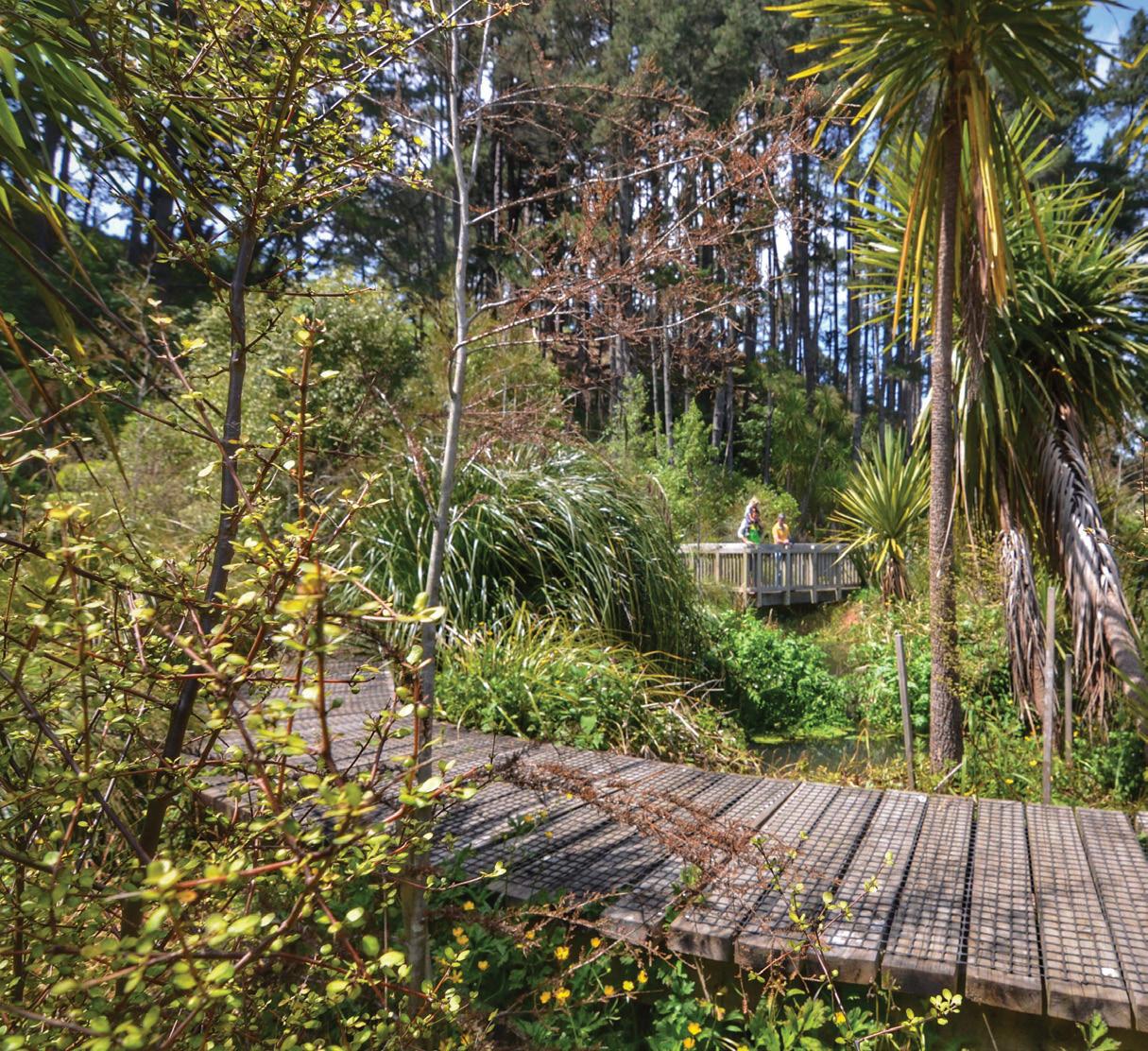
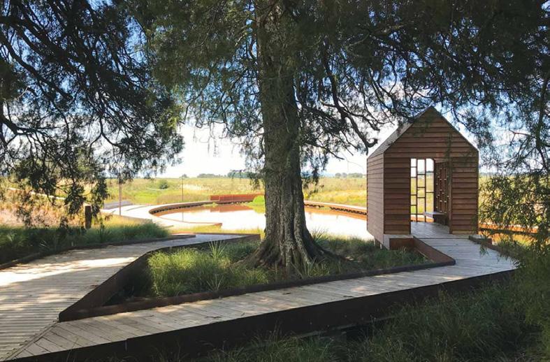
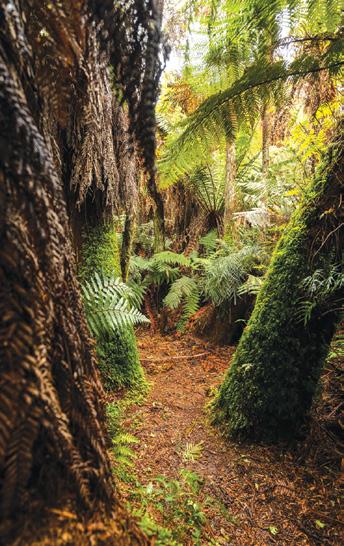
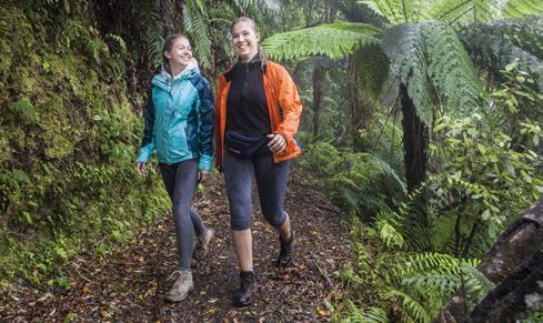
Sometimes it’s the tucked-away adventures that make the most memorable outings—peering at eels in murky streams, craning necks at trees scarred by old storms, or strolling down fern-fringed tracks. Here are five low-key adventures in and around Hamilton for the family.
Tamahere Reserve |
Tamahere
For 30 years, the Tamahare Reserve rare remnant of lowland kahikatea swamp forest near Hamilton, had become a neglected wasteland rife with pest plants and animals. Yet since 2012, Leo Koppens and numer-
ous volunteers have been transforming the gully to its former glory. Negotiate the steep path shaded by pine trees into the reserve. Long boardwalks and well-graded dirt paths wind past exotic trees providing cover for regenerating mamaku, māhoe, carex grasses and ponga.
Some stands of trees are more than 400 years old. Viewing platforms overlook the meandering Mangaone Stream and its resident tuna/eels. Information: Parking off Tauwhare Road, opposite Woodcock Road. Allow one hour to explore. Suitable for walking only. Dogs on leads.
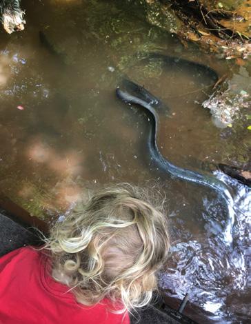
Newstead Walkway | Newstead
Murky swamps, towering eucalyptus trees and forest shelters of Newstead Walkway will delight little explorers. The farm-flanked entrance off Vaile Road is the quickest route to the clearing and a small boardwalk to spy tuna/eels in the dark, muddy waters.
Some inexpensive meat might tempt the slippery carnivorous natives from the shallows. Bring insect repellent if you plan to hang out near the swamp. A notable eucalyptus tree on the northern edge of the clearing once measured 72 metres tall, but in 1968, when the storm that caused the Wahine disaster swept across the nation, the tree lost more than three
metres off its crown. Until then, it was considered one of the nation’s tallest trees.
Information: The trail connects Morrinsville Road and Vaile Road. Allow one hour return. The entry and exit points of the clearing are diagonally opposite each other — sometimes a little tricky to see. Suitable for buggies and bikes. Dogs on leads.
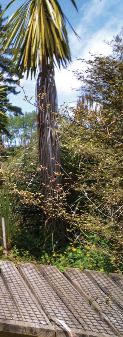
Legacy Park | Temple View
At Legacy Park, Temple View, boardwalks zigzag through shady stands of trees leading to wooden shelters with views of a rippling lagoon and mini fountains.
This excellent short adventure for kids can be wrapped up in under 30 minutes, unless they want to burn off more energy on the all-ages hillside playground with its forts, swing bridges and winding slides.
Learn about the early Mormon missionaries from the nearby Hamilton New Zealand Temple inside the shelters.
Information: Foster Road, Temple View. Allow 20 minutes for the walk.
Above left: A boardwalk in the Tamahere Reserve..
Below left: In the forest of Jubilee Park.
Above right: A lookout to a lagoon and mini fountains at Legacy Park, Temple View.
Hamilton Hidden Gems
Toilets and a drinking fountain are available. Dogs on leads. Walking and buggies only on the boardwalks, no bikes.
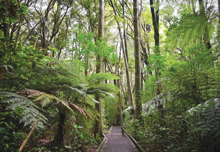
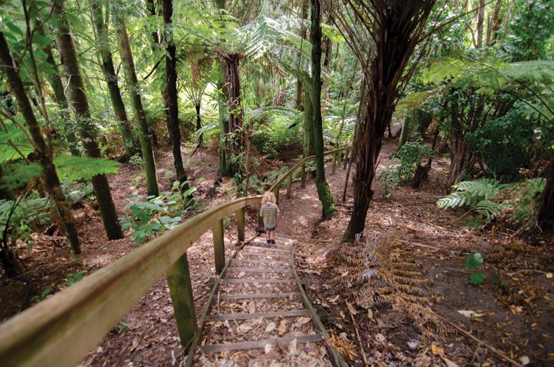
Te Papanui / Jubilee Park | Claudelands
Snaking past lofty kahikatea trees, in Te Papanui in Jubilee Park, at Claudlands this inner-city forest filled with winding boardwalks can easily be explored within 15 minutes.
But despite being a short adventure, urban life feels miles away while walking beneath the dense canopy filled with plenty of chirping birds.
Navigate trees poking through the boardwalk, lined with ferns and tan-
gled supplejack vines. Before modern settlement, vast semi-swamp lowland forests covered the area. Today, only this 5-hectare remnant remains, filled with tawa, māhoe and buttressed pukatea trees, along with at least 40 native land snail species that have been discovered here.
Information: Entrances at Claudelands Park and on Brooklyn and Boundary Roads. Allow 15 to 20 minutes to complete the loop. Easy grade on wide, flat boardwalks. Perfect for buggies. Dogs on leads.
Above: Going down the steps at Jubilee Park forest.
Below right: An eel in a stream on the Newstead Walkway.
AJ Seeley Gully |
Hamilton East
Brimming with native and exotic trees at AJ Sealey Gully, this ecological gem was once barren, unproductive land grazed by a family of donkeys.
Today, the leafy oasis has towering California redwoods beside buttressed kahikatea, spindly kānuka and mānuka, and slow-growing kauri. For over five decades,
Dr Alwyn J. Seeley, who owned the gully and whose home overlooked the formerly scrappy landscape, tirelessly helped create a biodiverse, regenerating forest, before gifting the land to the city in 2004.
Numerous trails traverse the gully, but an easy route for first-time visitors begins from the stairs on Armagh Street across the creek and left along the pathway to loop back to the start.
A short side track leads to a vantage point for views of the wetland. Information: Armagh Street, Hamilton East. Allow 30 to 45 minutes to explore. Suitable for walking only. Dogs on leads.
Ceana Priest is the author of familyfriendly Outdoor Kid guidebooks – discover adventures for young explorers across the North Island. outdoorkid.co.nz
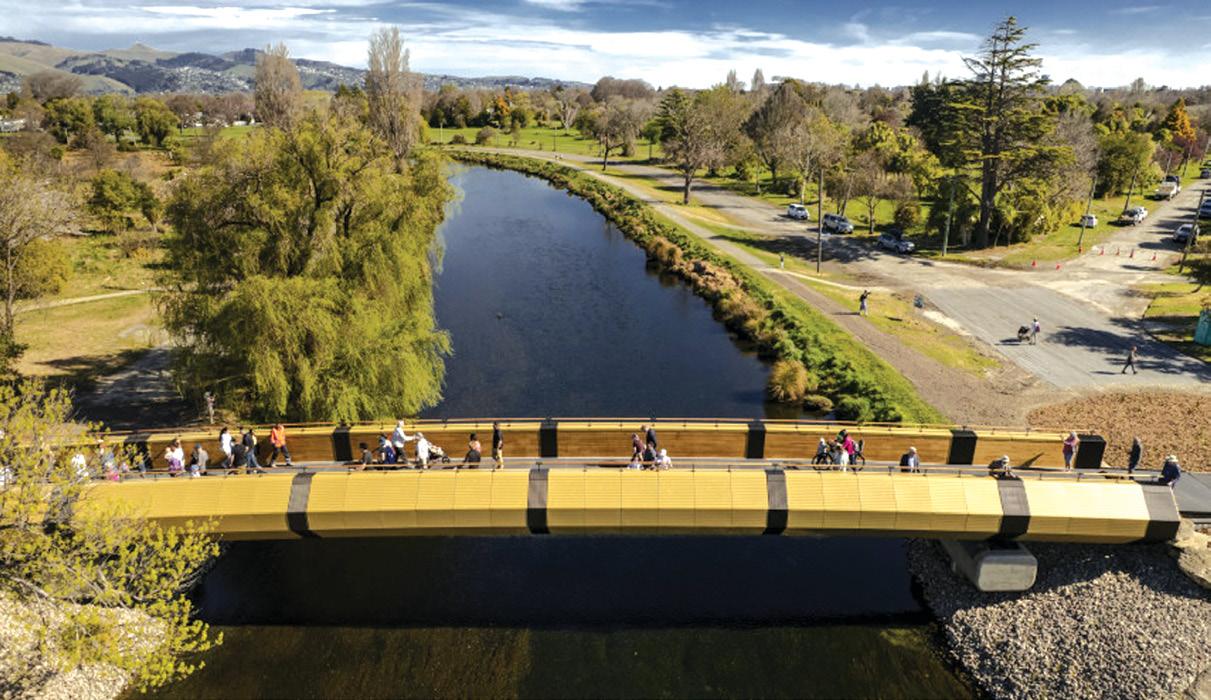
Dallington Bridge officially opened over the Avon River
The opening of the new Dallington Bridge was celebrated in the Ōtākaro Avon River Corridor (OARC) in September.
A ceremony was held to mark the opening of the bridge, which is the fourth and final walking and cycling bridge to be constructed as part of the Corridor’s Regeneration Plan.
The opening was attended by mana whenua, elected members, community groups, and the Christchurch Earthquake Appeal Trust (CEAT), who provided the funding for the bridge.
The Christchurch Earthquake Appeal Trust was an independent charity established to administer public donations raised by the Christchurch Earthquake Appeal.
The new bridge is based on concepts created by engineering and fine arts students from the University of Canterbury.
Its design is inspired by Mōkihi, a small canoe-type vessel fashioned from raupō and flax. These were more suitable than waka for navigating streams and small rivers, such as the Avon.
Residential Red Zone Manager Dave Little expressed Council’s gratitude for the Trusts’ support in funding the new Dallington bridge,
noting that this marks their final contribution to the Avon River Corridor.
“ We’re thankful to the Trust for their generosity. Their funding for this new bridge not only opens up more of the Avon River Corridor for people to enjoy, but it’s also given us a really important financial boost.
“We know the community is very excited and looking forward to using the Pathway, especially as summer approaches.”
The opening of the bridge completes the first phase of the City to Sea Pathway, linking the Pathway from the corner of Avonside Drive/ Morris Street to Dallington Terrace.
The City to Sea Pathway is an 11-kilometre-long shared-use path following the river from the central city to New Brighton.
The Pathway is being designed and constructed in three sections, with the final section expected to be completed in 2027.
Lighting will be installed on the western section in October and will take four weeks to complete.
Directional signage will be installed along the route following the installation of the lighting.
Construction of the eastern portion of the City to Sea Pathway - from Porritt Park to SH74 - will start early
in the new year. This section is expected to be completed and open for use by the middle of 2026.
Above: Dallington Bridge on opening day.
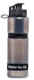
Removes bacteria and protozoa (Giardia, Crytosporidium, etc)
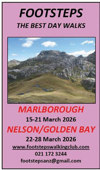
A fantastic fortnight in one of the best walking areas of the motu…
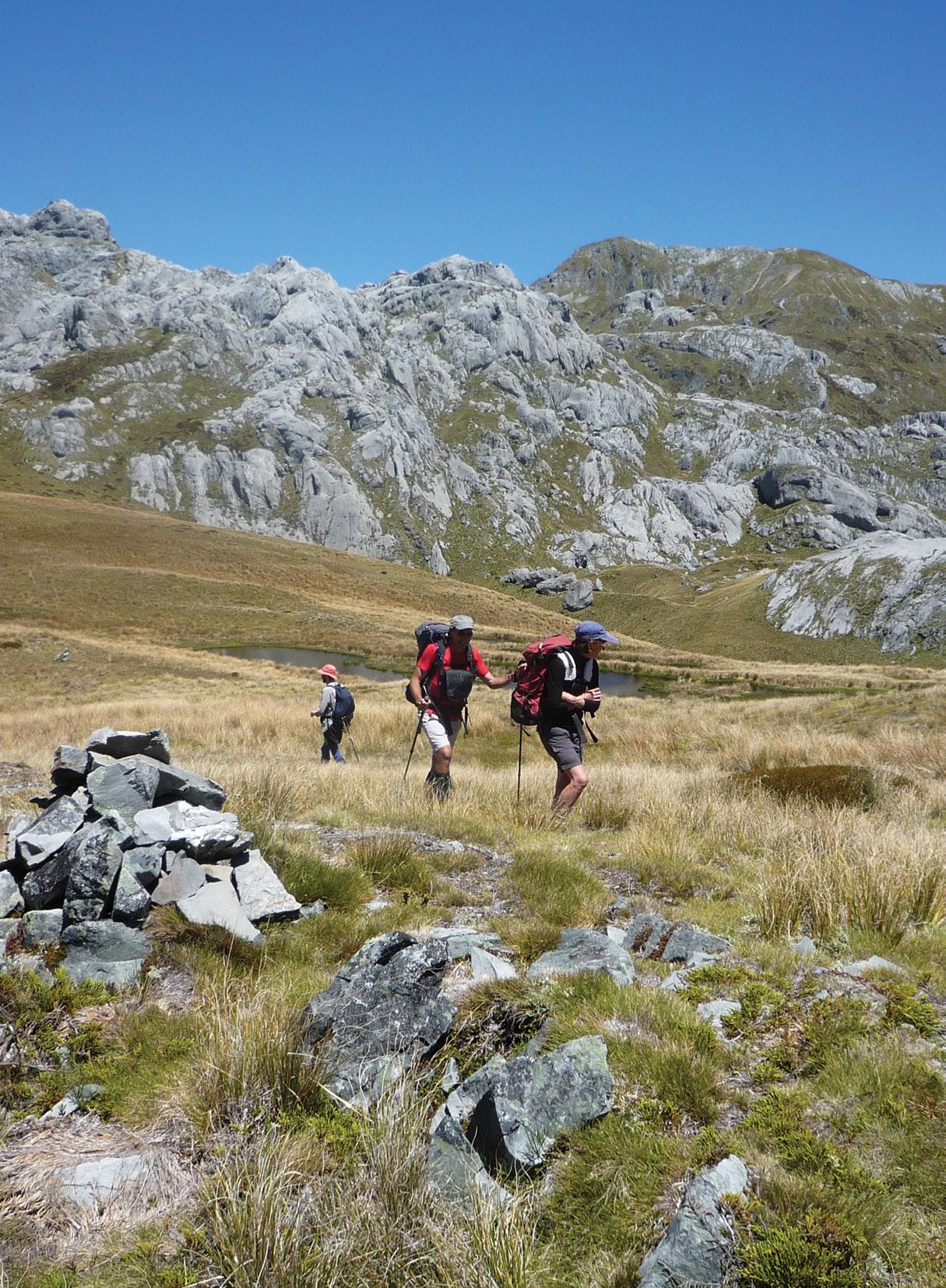
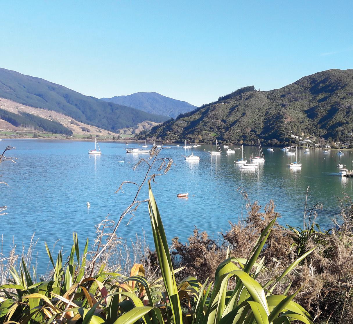
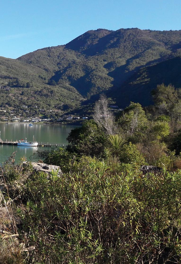
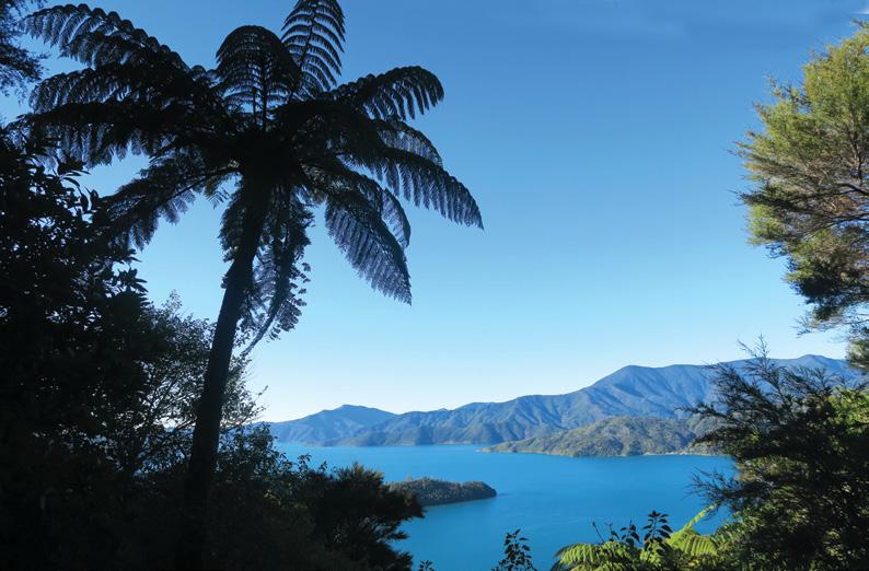
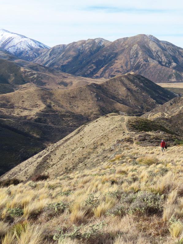
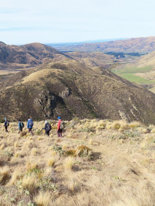
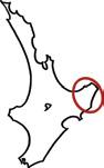
“Top of the South” is a term used to refer to that part of our South Island north of Lewis Pass, stretching from Kahurangi Point in the west to Cape Campbell in the east. It encompasses the regions of Marlborough, Hurunui, Nelson, Tasman Bay and Golden Bay.
By Phillip Donnell
Within this broad expanse there are three national parks:
Abel Tasman, Nelson Lakes, and Kahurangi. In addition you have the Marlborough Sounds, Kaikoura Ranges, and Mt. Richmond Forest Park.
The wonderful walks in this huge area would take several books to fully describe, let alone several months to traverse.
The Footsteps day-walk excursions scheduled for March
2026 are therefore simply samplers, enabling participants to taste the very best walks on offer. Marvellous Marlborough (15-21 March) is quickly followed by Noteworthy Nelson with Gob-smacking Golden Bay (22-28 March), so it is possible to undertake one or both.
Picton is our gateway to Marlborough. Like nearby Havelock, it is named after a British war hero. On the hinterland surrounding these towns a thriving wine industry has developed. Some of the best Sauvignon Blanc and Pinot Gris in the world is produced here.
About 28% of Marlborough is pasture, and 20% is native forest, but half isn’t used for anything – it’s just left in its wild state.
Mount Richmond Forest Park has an extensive network of tracks and huts, including part of the Te Araroa Trail.
My favourite is the loop of Lake Chalice (9km, three to four hours). Richmond is complemented by the
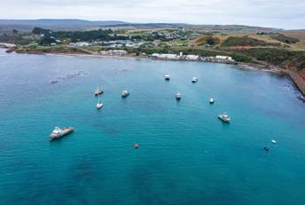
Above: left: Boats in the harbour at Anakiwa.
Above right: The geographical centre of New Zealand at Nelson.
Top walks in the top of the South
Above left: On the boulder bank at Nelson.
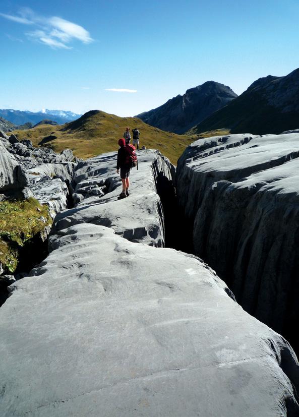
Opposite page. Above right: The waters of Wainui Falls. Below left: Limestone crevasses at Mt Owen. Middle right: Looking down on Lake Chalice Loop. Below right: Wharariki Beach, Golden Bay.
St. Arnaud Range in the west, the Amuri Range in the south, and the Seaward/Inland Kaikōura Ranges to the east. These hills and mountains offer a plethora of perambulatory possibilities.
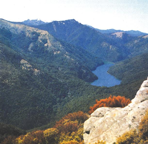
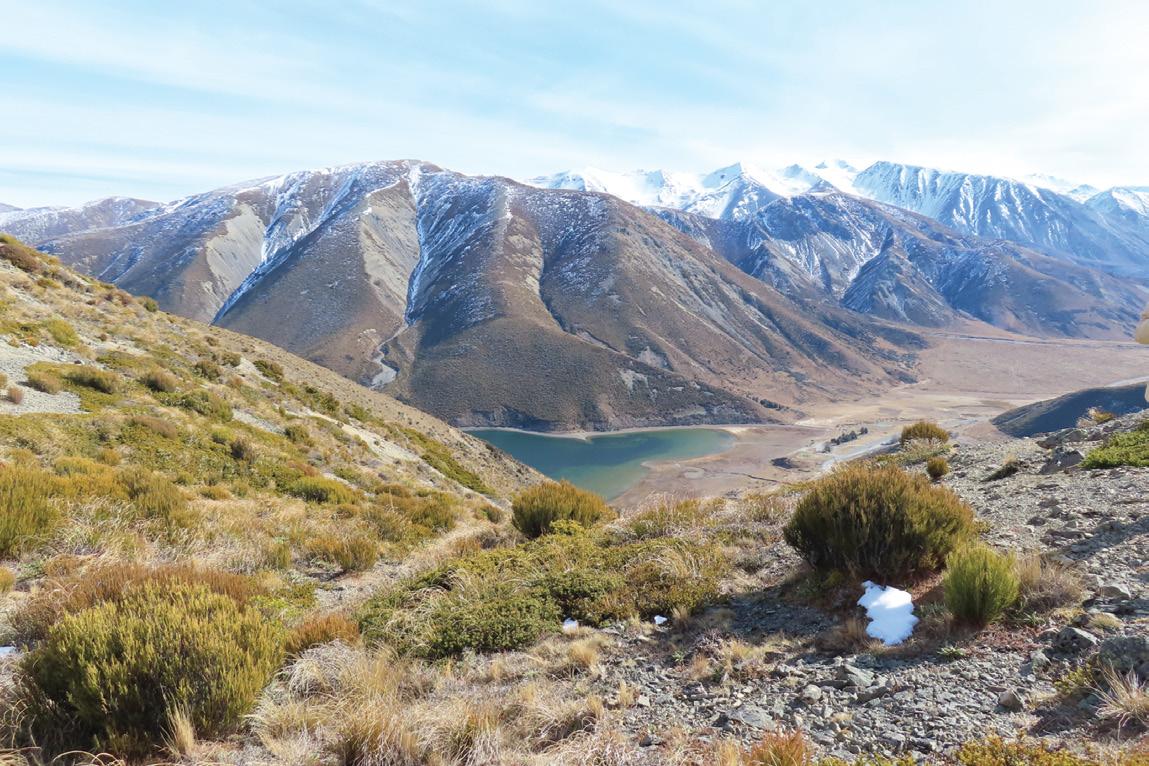
Nelson Lakes National Park is viewed by some as the most scenic in New Zealand. It straddles two magnificent alpine lakes (Rotoiti and Rotoroa), fed by rivers flowing down three parallel pristine valleys: the Travis, Sabine and D’Urville.
From short saunters around Kerr Bay (e.g. Brunner Peninsula one hour 30 minutes), to slightly more challenging routes (e.g. Bushline Hut Loop four to five hours), you cannot help but be buoyed by the vistas that open up in quick succession.
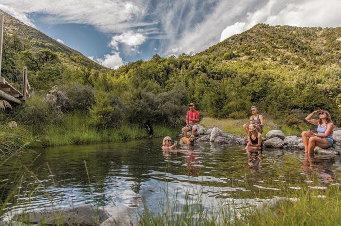
From St Arnaud, it’s possible to drive through the remote tussock and tarns of Rainbow Station to the relaxing hot springs of a true spa town – Hanmer Springs. It contains the largest outflows of thermal water in the South Island, which are balm to the body after a day strolling the gentle forest walks that tune the spirit into a serene harmony of mood.
Marlborough’s 1,893km of coastline includes the long tentacles of
Queen Charlotte, Pelorus, Kenepuru and Mahau Sounds, replete with picturesque walking opportunities. Best known are the famous Queen Charlotte Track (71km) from Ship Cove to Anakiwa, and the Kaikoura Point Walkway (two to three hours). Less known are the more remote walks around Nydia Bay, Whites Bay and Pukatea.
Stop at this juncture and you will go home with many marvellous memories, but there is the opportunity to add to them by continuing for seven more dazzling days around two big bays: Tasman Bay (named after Abel Tasman, 1642) and Golden Bay (named after the gold found in the Aorere River, 1857).
Golden Bay is shallow – less than 37 metres. Its southern shoreline has many coves and inlets edged with beaches of golden sand. It is blessed with a series of vibrant towns that are too good to miss. Tākaka, Onekaka and Collingwood have some have excellent cafes and restaurants. The main attraction, however, are the beautiful and plentiful walks in the vicinity.
The bay’s 25-kilometre-long guardian angel is Farewell Spit. A small reserve at the neck offers a pleasant loop walk one hour 30
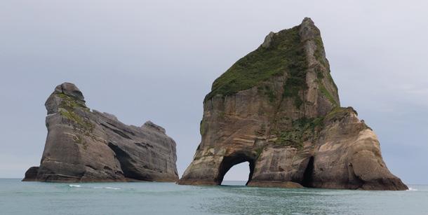
minutes), but the best way to explore the Spit is the commercial trip to the lighthouse at the end. On the way you’ll pass soaring seabirds, lunarlike landscapes, and sleepy seals. You can look for fossilised worms in the ancient cliffs. From the neck it’s possible to wander southwards to the Puponga Farm Park, featuring the spectacular stacks and arches of Pillar Point and Wharariki Beach.
Te Waikoropupū Springs pump out 14,000 litres of pristine water each second from an elaborate network of limestone under the valley. They are reached on a scenic 45-minute loop walk, which has a viewing platform out over the water. This gives you a chance to marvel at the visibility – measured to be 63m underwater, some of the clearest in the world.
Tōtaranui is a springboard to explore some wonderfully secluded beaches, such as Anapai Bay and Mutton Cove. If you’re after something more leisurely, a visit to Wainui Falls takes just over an hour return. The 40-minute amble at Grove Scenic
Reserve weaves through enormous limestone blocks, lined with nīkau palms, and feels like you’re walking through a movie set.
Further inland lies the Cobb Valley, from which it is possible to walk to Asbestos Cottage (two to three hours), focus of a fascinating love story.
The sub-alpine Lake Peel (four hours 30 minutes), rustic and tiny Chaffey’s Hut (two hours 30 minutes), gorgeous Lake Sylvester (four hours), and Mytton’s Nature Walk (45 minutes) are all magnetic options.
From the summit of the Takaka Hill, drive to Canaan Downs for the “must-do” 90-minute walk to Harwood’s Hole, our country’s deepest shaft (176m).
After his encounter with Māori in Golden Bay, Abel Tasman sailed east-
.
Top walks in the top of the South
wards into another huge bay before proceeding north. It now bears his name. The chief ports are Nelson, Mapua and Motueka.
Nelson City began as a Wakefield settlement in 1842. Church Hill, occupied by Nelson Cathedral, is a great spot to begin urban perambulations along the Maitai River, around the waterfront, through Queen’s Gardens and over the Port Hills.
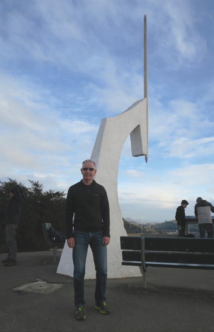
Within the city boundaries you can climb to the (incorrect) geographical centre of New Zealand (one hour) or the Grampians Lookout (one hour 30 minutes), and amble the shoreline around Tahunanui Beach.
The Dun Mountain Historic Walkway follows the line of New Zealand’s very first railway line two
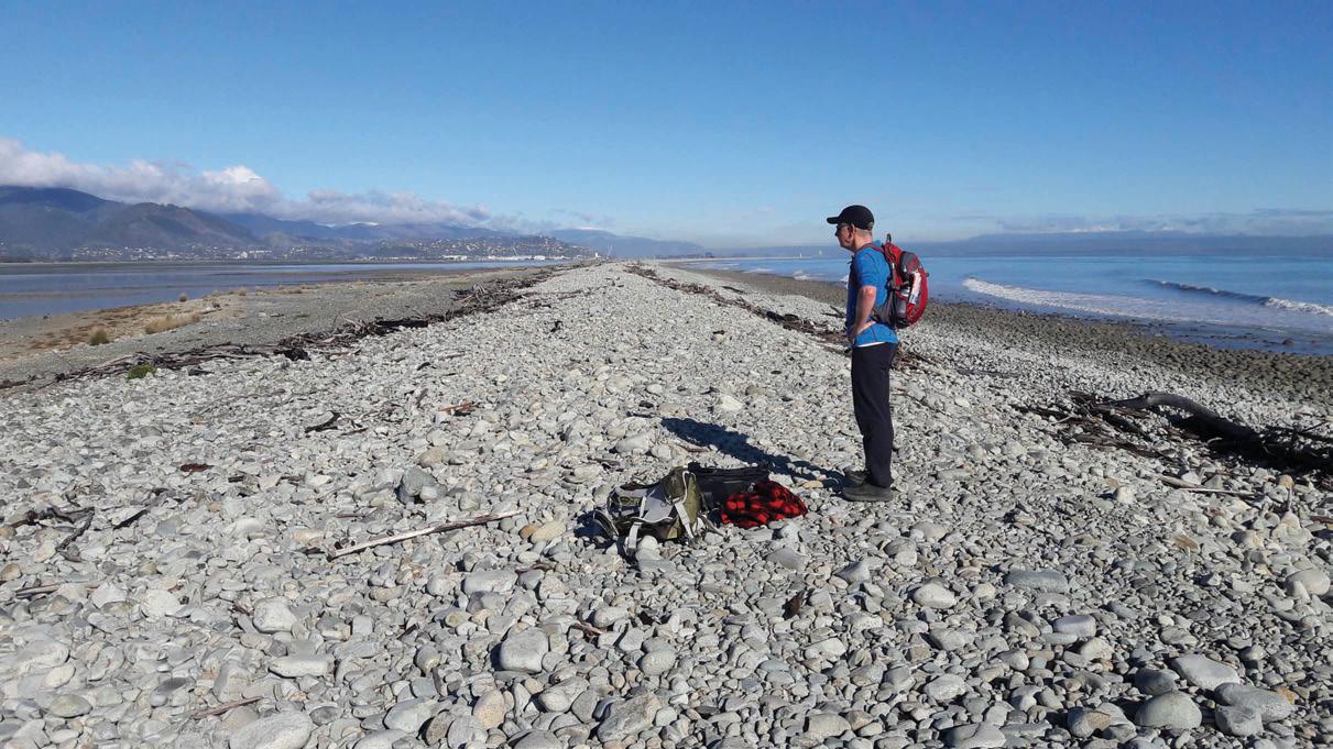
to three hours). A short distance out of town at The Glen, you can walk east over the hill to Cable Bay (three hours), where the wire connecting us to the rest of the world for many years came ashore. Alternatively, wander west along the globally-unique Boulder Bank (30m - six hours), a natural breakwater enclosing Nelson Haven.
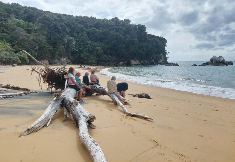
The eastern portal of the Abel Tasman National Park at Marahau beckons walkers to Split Apple Rock and the stunning cream-coloured sands of Tinline, Coquille and Apple Tree Bays, lapped by turquoise waves. The crisp sparkle of the sea is unforgettable. It’s halcyon stuff.
Beyond Motueka, a steep drive to Flora Carpark introduces you to
the wonders of Kahurangi National Park’s Mount Arthur Tablelands, including the Gridiron and Growler Shelters ( four hours), Flora Hut (one hour 30 minutes), Lodestone (four hours), the Mount Arthur Hut Loop (two hours 30 minutes) and the looming peak itself (1795m, five to seven hours).
Further south, you can venture to Dimrill Dale, the limestone-crevassed “Lord of the Rings” location on the flank of Mount Owen (five to six hours). Blue Creek, Nuggety Creek, Granity Creek and the Lutine Pool are shorter choices around the base of this magnificent massif.
Cecil King’s adze-crafted historic hut on the Wangapeka Track (five hours) is a special feature.
Why not eschew the feverish tide of life and come along? It will be a highlight of your summer. Comfortable accommodation, sit-back transport and a competent guide are provided in an inexpensive package, with the chance to see some great sights and make new friends. Visit the Footsteps website for details (www.footstepswalkingclub.com) or contact them at footstepsanz@gmail. com, 021 172 3244.
Above: Queen Charlotte Sound near Anakiwa.
Below left: Split Apple Rock and the golden sands of the Abel Tasman.
Native forest giants just off highway
By Dave Scoullar
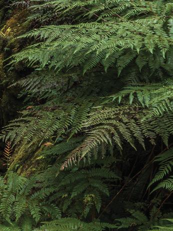
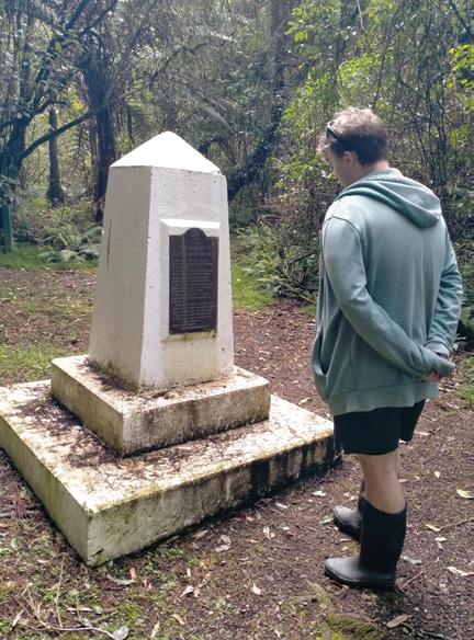
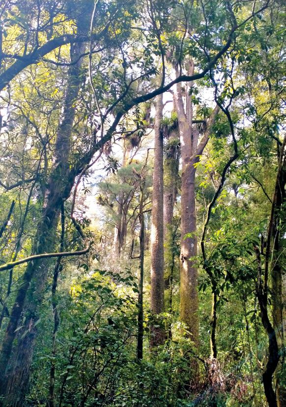
The Bruce Park Loop Track, near Hunterville, is an easy to intermediate mainly flat walk through a podocarp and broadleaf forest remnant.
The 1.4km figure of eight loop can be comfortably covered in an hour. With luck you will see bellbirds in the large stands of totara, rimu, matai and kahikatea trees which tower over the understorey of pigeonwood, lancewood and mahoe.
Robert Cunningham Bruce, after whom the scenic reserve is named, was a pioneer in the Rangitikei and represented the area in parliament. A keen naturalist, he was passionate
about our flora and fauna and gifted this 30ha to the people of New Zealand. He died in 1917.
However, he would have turned in his grave had he known the country’s main highway ploughed right through the middle of his reserve. Thankfully it has now been rerouted to give this forest a second chance.
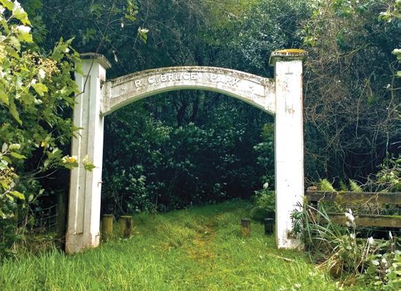
From the carpark follow the old route of SH1 through some muddy areas before climbing steps into the forest. From here tracks are mostly even with only minor undulations. There are a number of small bridges and steps. At the meeting of the figure of eight near the centre of the reserve is the RC Bruce Memorial and nearby is the RC Bruce Memorial Gate.
The monument was erected in 1924 and remembers his generosity. The plaque reads, in part, “This park is given to the people of New Zealand and to the residents of this district in particular, in order that they may have before them a beauti-
Above left: The early part of the track is muddy.
Above right: The area is clearly marked at the car park.
Below left: This memorial notes Robert Bruce’s forest gift.
Opposite page
Above left: The reserve has many towering native trees.
Above right: A Whanganui visitor, Lockie Jones, on a bridge.
Below right: The early part of the track is muddy.
Below left: The memorial gate to the reserve’s benefactor.
ful specimen of New Zealand forest life.”
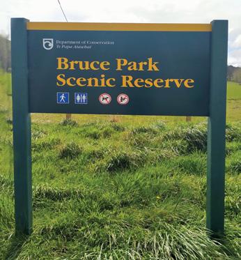
Bruce Park Scenic Reserve is located 5km south of Hunterville. Turn from SH1 onto Aldworth Road. The reserve is shortly after on the right by a locked gate. A carpark is at the trailhead, as well as a toilet. The walk is well sign-posted and easy to follow but is not wheelchair friendly and dogs are not allowed.
While this is a pleasant leg stretch to break the monotony of long distance travel, even deep in the forest you won’t be able to escape the drone of vehicles on the nearby SH1.
Having
trouble buying your copy of Walking New Zealand magazine?
Have you found that?:
* Magazine is sold out when you get to the store!
* Stores have limited space for magazines and are cutting down on space for magazines
From now you will be able to buy a copy of Walking New Zealand magazine, for $13.95 POSTED to you each month at the same price that you would pay for it at a store.
You just pay a monthly payment of $13.95 per month.
* No fixed term.
* You can cancel at any time. Each month we debit your credit card $13.95 and post you a copy of the latest issue - until cancelled.
Just phone:
0800 walking (925-546) or email us walkingnz@xtra.co.nz with your credit card details, name and postal address.
DECEMBER Weather prediction
(Weather is an inexact science, like medicine. Dates given are to be regarded as focus points. Please allow 3-4 days leeway for all forecasts)
1st-3rd Light fog in the Christchurch region.
1st-6th Unusually hot spell in the north and east of both islands.
5th Very hot day in Blenheim. Strong blustery winds in the Christchurch area.
northern half of the North Island sees below average sunshine, as well as being cloudier than average in Gisborne, Wellington, Marlborough, and Nelson.
by Ken
11th Over the next four weeks, frequent anticyclonic systems pass east of the South Island, while troughs of low-pressure form in the northern Tasman Sea before crossing over the north of the country. As such, a dry northeasterly flow will prevail more often than is normal for this time of year. This brings warmer than normal temperatures to many districts in the north and west, as well as in Southland and Otago. Temperatures are slightly above average, with the rest of the country closer to the norm.
Rainfall during this period is above normal in Northland and below normal in the Bay of Plenty, down through the southwest of the North Island and in inland parts of the South Island. It is very wet at the start of this outlook in Northland to the Bay of Plenty, with some districts seeing twice as much rainfall as normal. The Bay of Plenty, south Canterbury, north Taranaki, Manawatu, Buller, coastal parts of Kaikoura and inland parts of Southland and Otago may only see around half their usual rainfall. As such, soil moisture deficits continue to be low in Marlborough, Canterbury, and most of Otago, as well as increasing in Auckland to the Bay of Plenty region, in Taranaki, the Wairarapa, Manawatu, and Nelson.
Sunnier than average in the south of the country. In contrast, the
11th-20th Period of widespread and fairly persistent rain across the northern half of the North Island, particularly in Northland, with some outbreaks of heavy rain expected.
18th Overnight ground frosts around parts of the Hanmer Forest region, with unusually high maximum temperatures in Wanaka. Fog in Wellington. Windy with occasional gusts at times in Christchurch.
19th-27th Regular outbreaks of heavy rain in the West Coast of the South Island. Flooding for a time in Franz Josef.
21st Very hot day in Canterbury, particularly in Christchurch.
28th-29th Heavy rain at times in the top of the South Island including brief localised flooding from Blenheim to Motueka, including Nelson.
29th-31st Wet front crosses the North Island bringing outbreaks of heavy rain in most districts, with lighter rain in the Bay of Plenty. Brief surface flooding in the Central Plateau.
Extracted from 372-page 2025 New Zealand Weather Almanac, by Ken Ring. The 2026 book is available in soft cover and hardback, and as e-version from www.predictweather.com
Extracted from 372page 2025 New Zealand Weather Almanac. Availlable in soft cover and hardback, and as e-version from www.predictweather.com
You can now view and enjoy the latest issue of Walking New Zealand magazine online for $3.95 at http://www.walkingnewzealand.co.nz
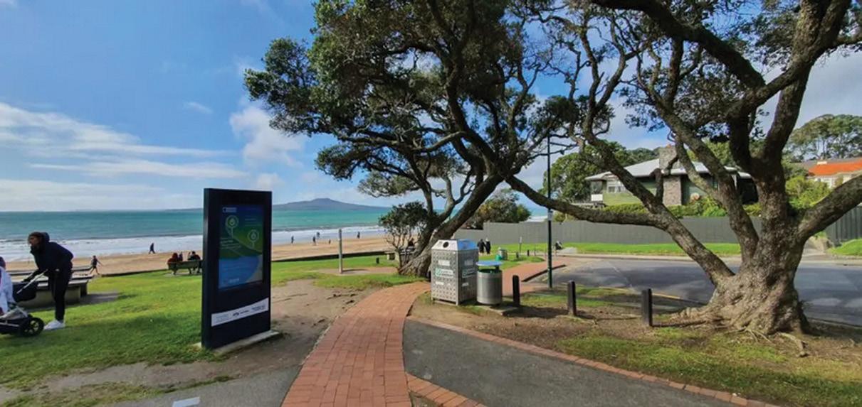
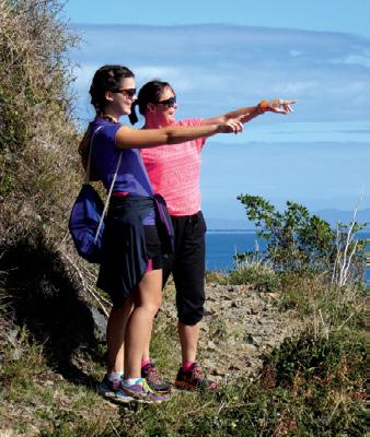
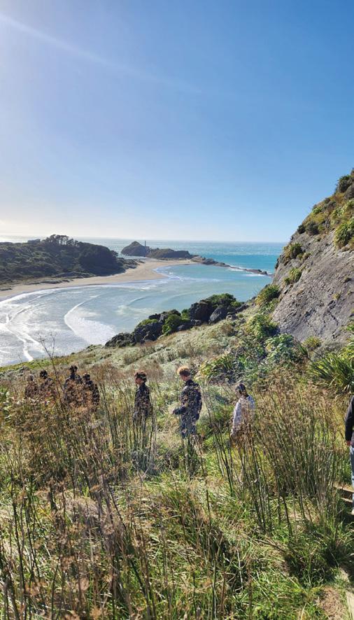
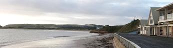
Taking the Green Route from Devonport to Takapuna
On a calm morning, the kind that feels half-asleep and silvered with sea haze, I roll my bike off the ferry at Devonport and breathe in the first lungful of salt air.
There’s something different about starting a journey by water, it puts you in the right rhythm before you’ve even begun. Devonport always feels like a place that moves slowly, even as the city hums across the harbour.
King Edward Parade lies quiet except for joggers tracing the edge of the sea and the lazy dipping of gulls.
The road smells faintly of coffee and wet asphalt. I push off, letting
the bike wheels turn over softly, the sound of the chain folding cleanly into motion. The path hugs the coast, the tide pulling gently against the sand as if whispering, go on, follow me north.
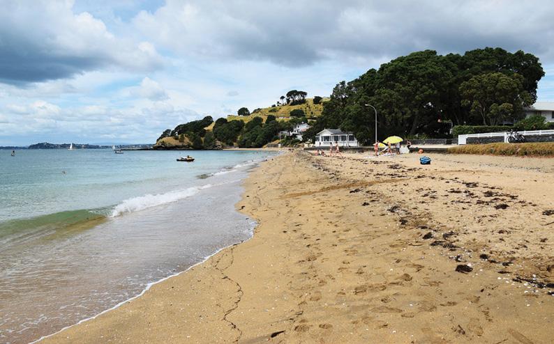
Cheltenham: The Quiet Neighbourhood Beach
By the time I reach Cheltenham Beach, the early swimmers are already out — caps and arms flashing like bright punctuation marks on the water. The sand here is fine and pale, almost powder. It has the calm of a place that doesn’t try to impress you.
I stop for a moment, leaning the bike against the seawall, taking in the
By Patrick Quinn
steady lap of water and the golden spill of sunlight over North Head. Behind me, old villas sit with their weatherboards painted crisp white and pale blue, the kind of houses that seem to exhale history. A woman walks past with her dog and calls out good morning. People here always do this here. It’s small-town courtesy thriving a ten-minute ferry ride from a metropolis.
From here, I could climb North Head, and I usually do. Cycling gives way to walking, the handlebars bumping against my palm as the gradient steepens. The path winds past the tunnels and lookouts left from another era, the military relics now softened by grass and time. Near the top, I pause, heart pounding but steady, and look out. Rangitoto Island rises like a sleepwalker’s dream, its cone softened by horizon light. The water glitters, the city shimmers behind it, and for a moment, everything feels perfectly balanced.
When I set off down the hill again, the descent feels like flight with short bursts of wind against my face, the road spinning out beneath the tyres, and the oak and pōhutukawa
Above top: Looking over the harbour towards the Auckland CBD from Mt Victoria.
Below left: A couple relax near the Devonport Wharf area.
Taking the Green Route from Devonport to Takapuna
by their leashes. They’re laughing, tossing each other’s shoes into the air. Their energy feels like summer. I catch their laughter long after they’ve gone, carried on the breeze that pushes against my back.
The Long Drift North
The further I go, the more the path seems to layer itself here asphalt giving way to boardwalk, then packed gravel, then smooth concrete again. The transitions feel natural, like breathing.
I pass a patch of tall grass alive with cicadas. Their buzzing fills the air. it is constant, insistent, but strangely comforting. It’s the sound of heat, the sound of time stretching out. I ride slower, letting the world stand still long enough to notice it. A tui hops along a branch above me, throat shimmering in a flash of bluegreen feathers.
Before I know it, the houses start to change with glassier façades, careful landscaping, hints of Takapuna ahead. The path hums with more people now: kids in helmets, couples walking arm in arm, joggers pacing to invisible music. The sea reappears to my right, wide and bright. Rangitoto seems closer here, its silhouette drawn sharper, darker against the sky.
Arriving in Takapuna
There’s a corner, near the start of Hurstmere Road, where the Green Route suddenly opens up. The buildings fall away, the horizon stretches wide, and Takapuna Beach unfurls before you like a long exhale.
I roll down to the sand and let the bike rest against the seawall. The tide is low, the water glassy. Children dig trenches at the shoreline, their laughter tumbling across the foreshore. Joggers move like slow metronomes at the water’s edge. Out on the horizon, a single yacht catches the light like a blade.
branches blurring into streaks of green.
Narrow Neck: A Middle Ground
At Narrow Neck Beach, the route flattens out again. This stretch is different here, quieter, suburban, more lived-in. The sea runs in parallel to the road; you can smell it but not always see it. The path winds behind playgrounds and through patches of shady trees, always within reach of the tide.
A group of students with surfboards pass by, dragging the boards
Cycling here feels effortless just turn, coast, breathe, repeat. It’s not about getting somewhere fast but about tuning into each moment as it arrives.
Somewhere near the golf course, the wind shifts suddenly, and the scent changes with dry grass and jasmine from someone’s front garden. Then the sound of a dog barking, a bus growling on Lake Road, a child’s voice singing off-key from a window. The Green Route doesn’t cut through life; it moves through its heart.
It’s strange with the trip only takes an hour by bike, maybe two walking, but it feels bigger than those numbers suggest. You cross moods more than you cross space. Devonport’s gentle charm gives way to North Head’s quiet drama, then Narrow Neck’s suburban ease, and finally Takapuna’s beachside pulse. Each neighborhood has its own current, and by the time you arrive, you’ve drifted between them like following tides.
I wade into the shallows, shoes in one hand. The water folds over
Left top: Looking north from Mt Victoria towards Takapuna with Cheltenham Beach in the middle.
Above left: A grand view from the top of Mt Victoria with the wharf cranes in the centre..
my feet. It is cool, electric, cleansing. A soft offshore wind pushes the salt tang inland, up through the esplanade and into the cafés beyond. People are queuing for ice cream. Somewhere, a busker is playing a slow acoustic tune that drifts between the gusts.
I sit on the sand and let the bike helmet fall beside me. The spokes of the wheels glint in the sun, little circles of light. For a moment, it’s easy to forget you’re anywhere near a city. The world narrows to sea and sky and steady breath.
The Journey Back
I don’t always take the same route home. Sometimes I’ll catch the ferry again from Devonport, looping back the same way, other times I’ll linger in Takapuna, the evening lowering itself over Rangitoto in slow, coral light. But the way south feels different from the way north being more reflective, more internal.
The same landmarks reveal themselves from new angles, and what was anticipation turns into familiar recognition.
When I hit Cheltenham again, I stop for a swim. The tide has crept higher, and the air smells of salt and sunscreen. Families are packing up towels, the laughter softer now, the day retreating in golden stripes. I float on my back and let the sea hold me, the sound of gulls fading into the sky. Somewhere beyond the horizon, the city is still busy, still moving fast.
But here, along this slice of coast, everything breathes slower.
That’s the gift of the Green Route. It doesn’t just link two beaches; it dissolves the space between them, stitches together sea and suburb, movement and stillness, leaving you suspended somewhere in between.
When people ask what it’s like, I
tell them this: it’s not just a path. It’s a way of remembering how to belong to a place: one pedal stroke, one footprint, and one breath at a time.
Above top: The view of Rangi-toto from Takapuna Beach.
Below right: Cheltenham Beach with Mt Victoria in the background.
Ouch! Sore feet while walking?
Hikers Wool is 100% New Zealand wool. Cushion your feet to prevent pain, rubbing and blisters.
Buy online or at selected stockists For more info visit www.hikerswool.co.nz
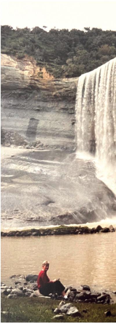
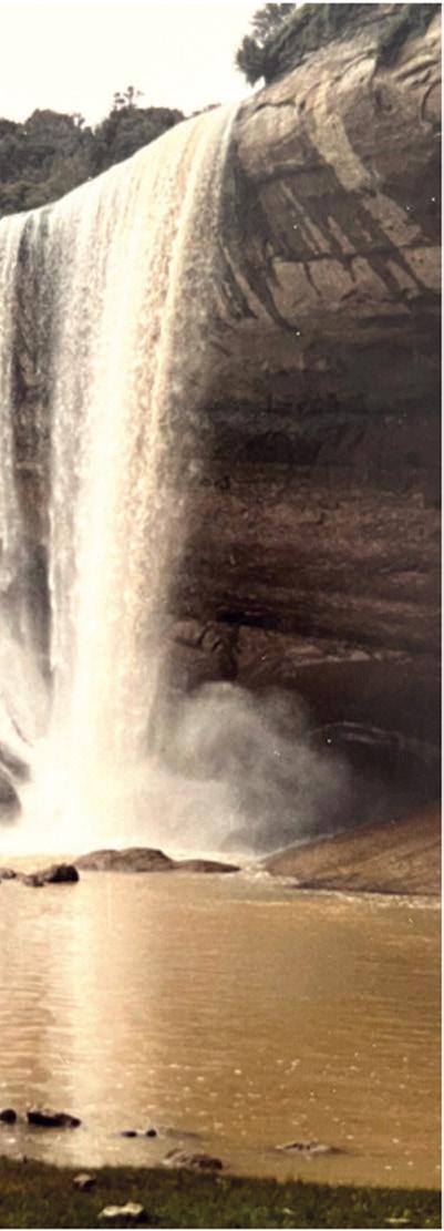
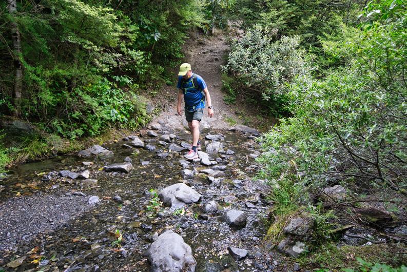
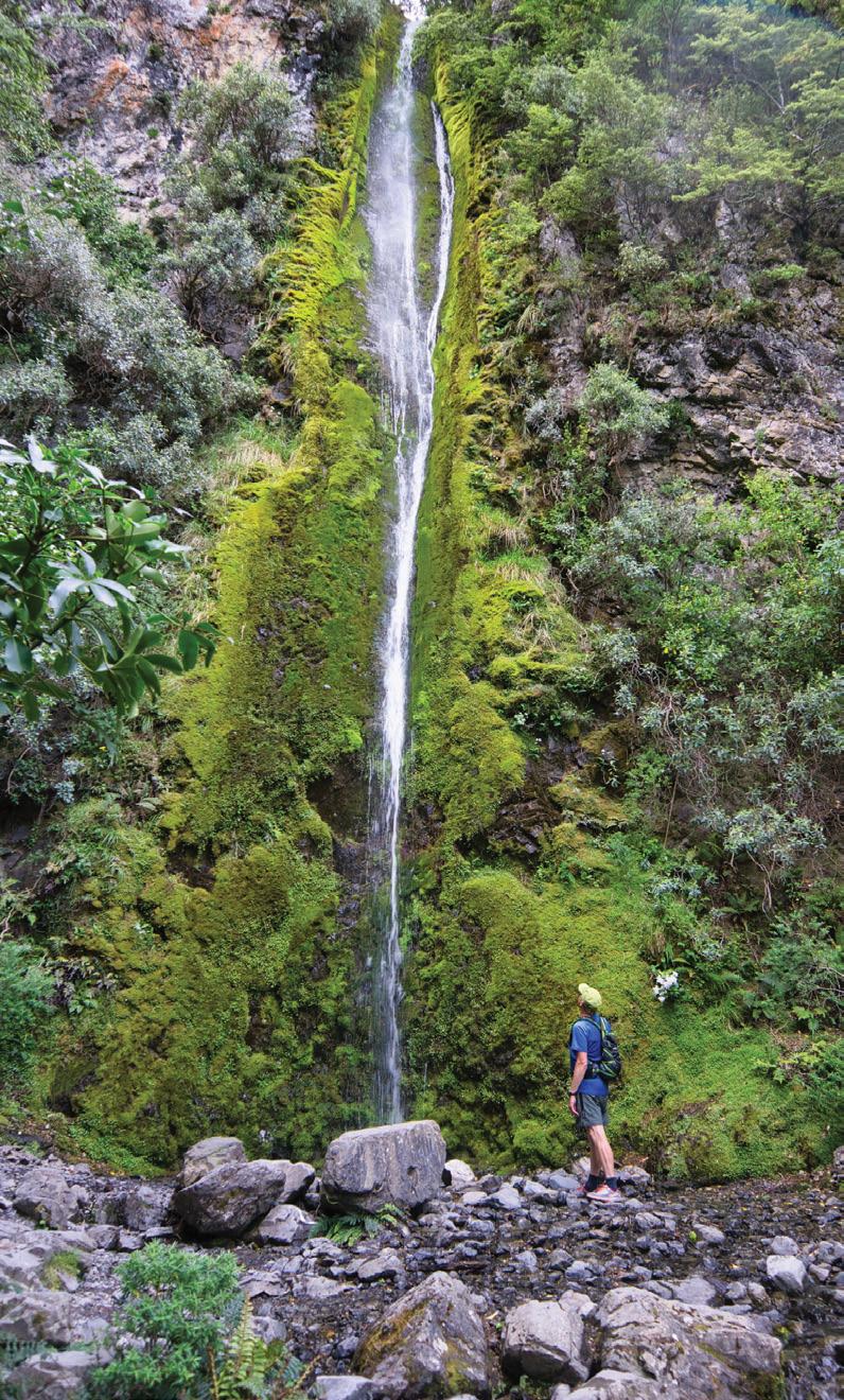
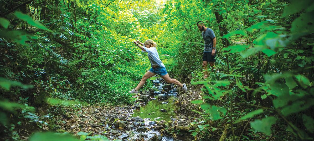
The thrill of sharing something magical : The Hulls’ farm track to Mangatiti Falls
Giving people access across his land to a “magical” waterfall is its own reward, a Tararua sheep and beef farmer says.
Marty and Debbie Hull, who fatten lambs and steers on 400 hectares east of Pongaroa in the Tararua district, have welcomed waterfall enthusiasts for the entire 20 years they have owned the property.
Marty says up to 200 people a year do the 45-minute walk across his farm to see the stately Mangatiti Falls.
“They’re pretty magical… anyone who goes down there is really thrilled.”
The walk uses a farm track and starts in a parking area beside the Hulls’ woolshed, where visitors arrive by prior arrangement.
It’s a long drive just to get to that point: the village of Pongaroa –which has a pub, accommodation, store and service station – is 50 minutes’ drive south-east of Dannevirke, with the falls another 15 minutes on.
They are worth the drive, though, at around thirty metres high, covering the whole broad width of the Aohanga River, and tucked away in a fenced, 20-hectare block of mature bush.
Marty has simple, generous reasons for maintaining the previous owner’s practice of allowing anyone in to do the walk (as long as they ring first to ask).
“It’s been going on a long time, and we’ve just carried it on. They’re just sitting down there, so we might as well let people see them.”
The bush surrounding the falls has been protected by the Hulls under a Queen Elizabeth II Trust covenant. Marty says it makes for a cinematic scene.
“They’re over a hundred feet high, there’s bush on each side. There’s no other waterfall around like it, and no
sort of sense of why it is there. I guess it’s just hard over soft, and millions of years. Peter Jackson could have made a film in there, put it that way.”
Marty meets all visitors, handing over a map showing the route to the falls: “You’d never find them if you didn’t get told.”
He asks visitors to sign a consent form, which includes a list of possible hazards to be aware of, such as stock and farm machinery movements.
School groups and tourists from overseas are among the visitors, he says.
“We had a hundred kids here the other day – nine little buses. And overseas people, they look on websites and see us, and they come down. A lot of people are really interested in waterfalls.”
Iwi celebrates access champions
The falls and the surrounding Tararua district are the ancestral territory of the Rangitāne o Tamaki nui-ā-Rua iwi.
Co-chair Lorraine Stephenson said the falls were quite significant for the iwi, being on a traditional walking route from around Dannevirke to the river-mouth settlement of Aohanga – some 80 kilometres away.
“That was land that our people used to travel over on a hīkoi from inland out to the coast. They used to go across the Puketoi Range and follow the Aohanga River down.”
She acknowledged farmers like the Hulls who permit public access.
“For us as Māori, access to the whenua… a lot of it was lost. So to get public access to places like the falls is something we support.”
Lorraine and her whānau have been building a new tradition of horse-trekking out to Aohanga, in the steps of their ancestors.
“For 37 years we’ve been riding to the coast from Dannevirke – it’s the
fourth generation that’s riding now.”
That has given her a unique perspective on the importance of public access to the land, but also the difficulties – particularly with a recent widespread change in the area from grazing to forestry.
“Unless you know someone, to get access can be really difficult. So we’ve experienced that land access problem, but we celebrate those people who allow it.”
In her experience, farmers did not encounter problems when they allowed people access to the outdoors through their farms.
“The people who go to things like the falls are generally doing it
respectfully… that’s their love, their passion.”
Thrill of sharing
Marty and Debbie have never charged access for the walk, except for a one-off occasion when they hosted a fundraiser for a community group.
“If you charge, you become responsible for health and safety and all that.”
So what’s in it for him?
“It’s just the thrill of people actually seeing it. They come back and
they say, that was unbelievable.”
The practice is not without its difficulties.
“Sometimes it feels more of a hassle than it’s worth. But they always ring ahead [to arrange to come], and I make it a time that suits me, around the farming and that, so it doesn’t mess up the day.”
He has never really considered finding another way to monetise the falls, such as setting up a B&B.
“I’m just not really interested in that.”
Besides, the couple have their hands full, with 300 Romney ewes and up to seven hundred dairy-cross steers (Hereford or Angus crossed with Friesian) and Friesian bulls.
“There’s always something to do on the farm. We fatten the steers up until they’re 600 kilos live weight, which takes about two to two-anda-half years. Then off to the works.”
The Romney lambs are also destined for the freezer.
“We put a black-face ram over the ewes, and fatten the lambs. We don’t run any hoggets, no replacements –we just buy in-lamb ewes as needed.”
They get a gang in once a year to shear any lambs that don’t make the draft, and the ewes.
“There’s no money in that, but at least nowadays you do make enough to pay for the shearing.”
Marty started off in sheep and beef when he left school, but got into dairying as a path toward farm ownership.
Does having regular visitors have any business benefits? For example, in such an isolated area, is it a comfort having extra pairs of eyes around?
Marty says security isn’t really an issue, visitors or no.
“Touch wood, we’re lucky we live in the community we do. We’ve never had any problems. In other areas, you might worry people would see what was lying around and come back and help themselves. But not here.”
Marty has no hesitation recommending to other farmers that they
.consider sharing their farms’ attractions with the public.
“I just enjoy it. I find they’re always really genuine people.”
But he does have some advice.
“The biggest thing is you can’t just have open slather. They have to ring me up, make a time, meet me, sign the form.”
He says a significant pay-off for him is that he is actually sharing two treasures: the falls plus the farm itself.
“I know a lot of [farmers] couldn’t be bothered with the hassle. But I get quite a thrill out of it – some of the kids in that school group had never been on a farm, and that makes you feel quite good, actually. Show the other half what it’s like. Because farming, on the news and that, it doesn’t get a good rap, at times.”
He doesn’t consider he’s done anything particularly special by allowing, over the past two decades, some four thousand strangers to traipse across his land and through his business, for free.
“[The falls are] a marvellous site, no doubt about that. And if other people had it they would have done much the same. But maybe they would have not been as accommodating as us, I don’t know…
“I just think, if people are interested in looking, good on them. A lot of people just enjoy walking through the farm. It’s a day out – they get out their walking sticks and back packs, take their lunch and go down, come back, and they’ve had a good day.”
This article was written as part of a joint project with Beef + Lamb New Zealand, to highlight the ways sheep and beef farmers around the country are finding positives in supporting public access.
Above left: A visitor sitting on a rock beside the pool at the base of Mangatiti Falls.
Now the time to get your digital camera out or look through your digital images and enter the
Walking New Zealand Digital Photo Contest
PHOTO CONTEST
Above top: Members of Bishopdale Tramping Club walking on the loop track around Lake Clearwater in the Hakatere Conservation Park. Spectacular views of snow capped peaks of the Two Thumb Range were enjoyed throughout the day. Photo by Marie-Therese McRae, Papanui, Christchurch.
Above: Early in the evening people are out enjoying the amazing “Festival of Lights” show at Pukekura Park in New Plymouth. Held just prior to Christmas for approximately a month. Photo by Sharon Harris, Bethlehem, Tauranga.
Ouch! Sore feet while walking?
Hikers Wool is 100% New Zealand wool. Cushion your feet to prevent pain, rubbing and blisters.
Buy online or at selected stockists For more info visit www.hikerswool.co.nz
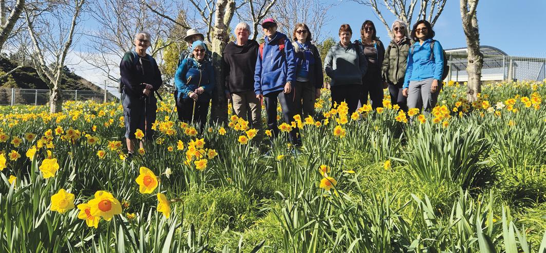
Above: Members of the Upper Hutt Walking and Tramping Club explored Whitby’s (Porirua) walkways in early September and stopped to admire this colourful display of daffodils. Photo by Sharon Dunstan, Whitby, Porirua , Below left: Walking, boating or resting the Canterbury folk were out enjoying the Avon River scenery. Photo by Heather Winter, Oxford.
Below right: We got away for a 3 days weekend and met our friends in Castlepoint. On Sunday, it was sunny and we decided to walk the Deliverance Cove Track. After a steep climb, we were rewarded by spectacular views of the lagoon. We could see the famous lighthouse in the distance. A must-do track if you visit the area. Photo by Julie Ganivet, Havelock North.
You can now view and enjoy the latest issue of Walking New Zealand magazine online for only $2.50 at http://www.walkingnewzealand.co.nz
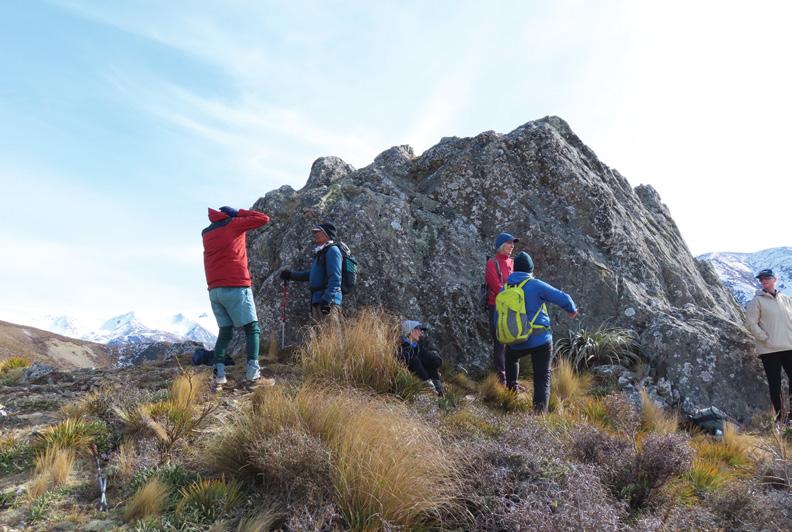
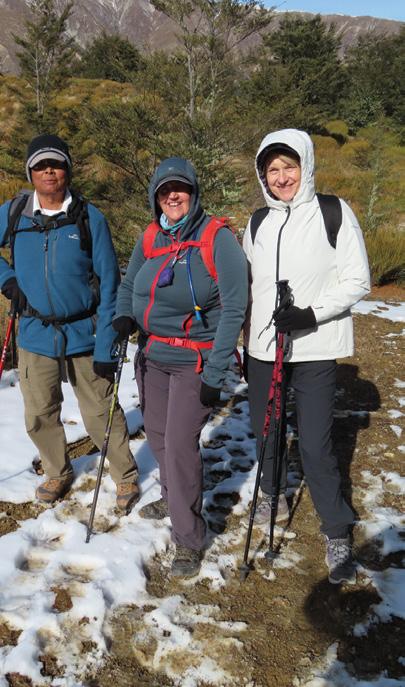
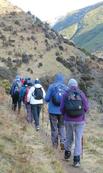
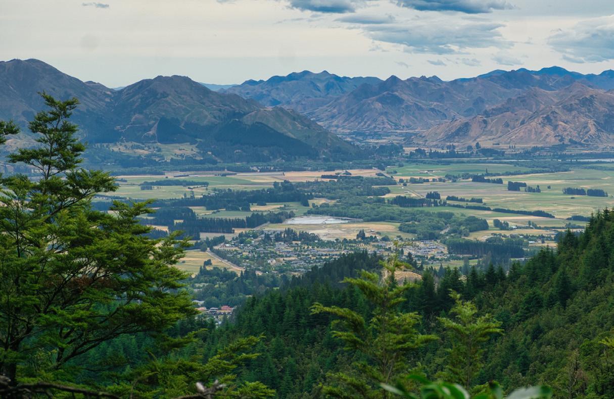
A Winter walk on the Old
Returning to the carpark with views towards Canterbury Plains.
Old Coach Stream Track
Photo Yvonne Van Eerden
A Winter walk on the Old Coach Stream Track
By Yvonne Van Eerden
Our tramping group had kept an eye on the weather all week in August as we were going to walk the Old Coach Stream Track which was a 85 km drive to
from Christchurch. The weather report was good for Sunday so we headed to our destination.
When we arrived at the car park we put on jackets, hats and gloves as the wind was very bitter but we all knew that we would soon warm
up as we would be slowly climbing up the track.
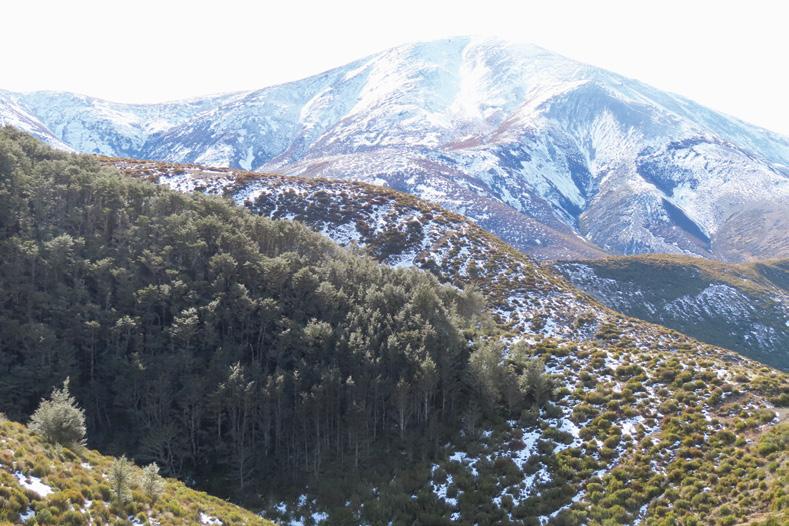
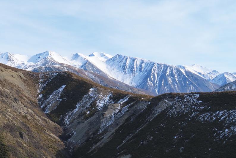
The scenery around was just beautiful with snow on the tops of the mountains which looked quite close to us all.
We started climbing and eventually after warming up we stopped to take a layer off and to catch our breath while looking at the views all around us.
As we looked beyond one of the trampers said we would be heading up a track in the distance and walking through the bush line, we all thought that looks awfully high and no way are we going that high up but yes, we all followed the track to the bush line and had snow underfoot, not heaps but just enough to make it interesting for us all.
The rock outcrops were huge and such a good shelter from the wind and gave us a super vantage spot to take photos and have a quick drink and rest!
Above: Lake Lyndon towards Porters Pass. Photo Yvonne Van Eerden
Below left: The rock formation that sheltered us from the strong wind..
Photo Yvonne Van Eerden
We reached the cross roads of Starvation Gully Track and ventured a few minutes further to get the views of Lake Lyndon. The wind was very cold and strong so a decision was made to find a sheltered spot for our lunch.
■Even though we did not get to the top of Trig M we had a magnificent tramp and would return in the summer again to reach Trig M when the day would be longer and the weather warmer.
After a great lunch we started our return to the carpark. There was lots of chatting about the absolutely spectacular views.
This was such a stunning day for us all. It was hard work climbing up the track but it was certainly worth it. The greatest fun with these tracks is that you can just walk up for the first 15 minutes and go back or take the whole day.
Old Coach Stream Track a look back at history
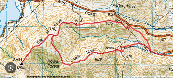
The Coach Stream Route near Christchurch is a moderately challenging tramping and mountain biking track in the Korowai-Torlesse Tussock lands Park, often linked with Trig M summit walks.
The trail offers beautiful beech forest, expansive alpine tussock, and panoramic views
The Coach Stream Route is approximately 10.2 km one way, typically taking three to four hours to complete, depending on fitness and weather. The track is well-posted and usually follows an old coach road that winds up through open tussock lands and beech forest.
It’s considered moderate in difficulty (Grade 3 intermediate for mountain bikers), suitable for reasonably fit walkers who have some
experience and are well-equipped for changeable alpine conditions
The initial section follows an easement through private farmland, after which you enter conservation land.
Walking the Coach Stream Route rewards visitors with excellent views across the Canterbury Plains, the dramatic Torlesse Range, and glimpses of native beech forest. The route is steeped in history, tracing the path used by stagecoaches traversing the pass in earlier times.
Tramping/Hiking: The main activity is tramping, with opportunities for hill fitness training, bird watching, and picnicking at scenic viewpoints.
Mountain Biking: Shared use is permitted, with downhill stretches especially popular for intermediate biking.
Ouch! Sore feet while walking?
Hikers Wool is 100% New Zealand wool. Cushion your feet to prevent pain, rubbing and blisters.
Buy online or at selected stockists For more info visit www.hikerswool.co.nz
Above left: The beginning of the snow and bush line. Photo Yvonne Van Eerden
Old Coach Stream Track a look back at history
Nature: Expect to see native birds, wildflowers in season, and livestock grazing in the private farmland section. The summit of Trig M offers 360-degree views, perfect for photos and rest breaks.
Winter (June–August): The track is accessible in winter, especially the sun-exposed Coach Stream route, but parts can be icy after snow, requiring extra care and appropriate gear.
Spring (September–November): While spring often means stunning greenery, remember that lambing closures restrict access to the Coach Stream section during October–November.
Walking the Coach Stream Route from Christchurch is a rewarding alpine adventure, with stunning scenery, accessible history, and a level of challenge suitable for intermediate trampers. It is substantial enough for a vigorous day outing, and its proximity to Christchurch makes it a popular regional favourite. Always check seasonal restrictions, bring adequate supplies, and enjoy one of Canterbury’s finest day hiking experiences through dramatic tussock lands, native forest, and panoramic mountain vistas.
For further details or current conditions, consult the Department of Conservation’s website or local recreation guides before departure
History of the track
The Old Coach Stream route holds considerable historical significance as part of a colonial road network that linked Christchurch to the West Coast goldfields, serving as a vital transportation and communication link in nineteenth-century Canterbury.
This route was part of the original coach roads constructed through the rugged Southern Alps, officially opened in March 1866, and was central to the region’s economic development and settlement.
Following the discovery of gold on the West Coast in the mid-1860s, freight and passenger movement between Christchurch and Hokitika surged, necessitating an overland route through the mountains.
The old coach road over Arthur’s Pass—of which Coach Stream is a remnant—enabled stagecoaches to transport miners, supplies, and mail, transforming what was previously a hazardous journey on foot or by bullock cart into a relatively structured service.
This development was facilitated by Cobb & Co, New Zealand’s most famous coach company, whose coaches began regular service following the road’s completion, marking the start of an era of long-distance coach transport essential to colonial communities.
The construction of the road itself—achieved with picks, shovels, wheelbarrows, and drays—was a feat of persistence in extreme weather and challenging terrain.
Early builders faced frequent flooding, snow, and freezing conditions, often resulting in loss of life. The route’s achievement is commemorated by surviving rock wall sections and historic markers along the track today.
The coach road initiated the development of what is now State High-
Above: The thick bush line with the snowy views.
Below left: Tussock Trampers at the start of Old Coach Stream, Korowai Torlesse Tussocklands Park, Porters Pass, Canterbury
way 73, permanently establishing a crucial link between Canterbury and Westland.
This route persisted as the main overland link until the opening of the Otira Tunnel in 1923, when rail finally supplanted horse-drawn and coach traffic over the pass. The track continues to be valued as an example of engineering heritage and colonial enterprise, with interpretive signs along modern hiking tracks providing insight into these pioneering efforts.
Walking the Old Coach Stream route offers a living reminder of the region’s history, reflecting the transformation from isolated settlements to thriving communities connected
by audacious infrastructure projects in a dramatic landscape.
Getting there:
Access Point: The track starts at the car park on State Highway 73, at the bottom of Porters Pass (about 85–99 km west of Christchurch, a one to one and a half hour drive depending on traffic).
Directions: Travel west out of Christchurch via the Great Alpine Highway (SH73), passing through Springfield and heading toward Arthur’s Pass. The car park is signposted; take care as it is easy to miss due to minimal signage. If accessing via Starvation Gully for a shorter option, look for a roadside layby and stile a few kilometers apart from the Coach Stream car park.
Transport: Private car is recommended, though occasional bus services operate along SH73 for walkers prepared to coordinate with schedules.
A critical note: the section through Ben More Station private farmland is closed for lambing from October 1st to November 20th each year, and dogs are not permitted at any time. During this period, hikers should use the Starvation Gully track, which remains open all year and is dogfriendly.
Summer (December–April): This is the best season for walking, offering long daylight hours, warm to mild temperatures, and the clearest mountain views. Wildflowers are abundant, and tracks are less likely to be muddy or icy.
Autumn (March–May): Autumn brings spectacular foliage and cooler, stable weather conditions—perfect for hiking.
Above left: The group heading up the valley following the Old Coach Stream Track. Photo Yvonne Van Eerden
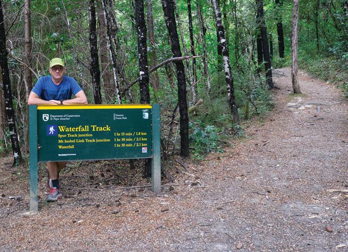
Dog Stream Waterfall Walk
By Michael Hendriks
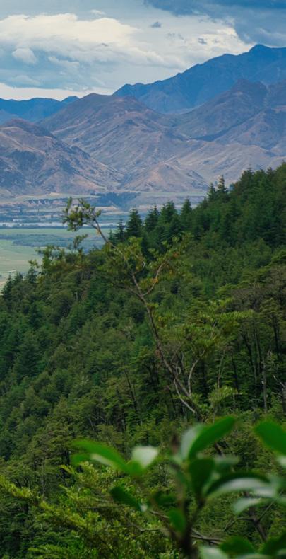
Hanmer Springs is one of New Zealand’s most popular alpine destinations, offering a unique blend of outdoor adventure, hot pools along with an excellent range of food and accommodation.
With its rich history, impressive
alpine landscapes, and four-season appeal make it a popular weekend destination, being only 90 minutes north of Christchurch.
Hanmer Forest Park has a wide variety of activities and an excellent variety of walking tracks. The forest park covers just over 16,000 ha and is bound by the Hanmer Range in
the (west and north) Hanmer River and Amuri Range (east) and Hanmer Plains to the south.
With its alpine setting, Hanmer Springs is best visited during the
Above: View of the Hanmer Springs basin.
Below left: Michael at the start of the track.
.late spring, summer, and autumn months for walking.
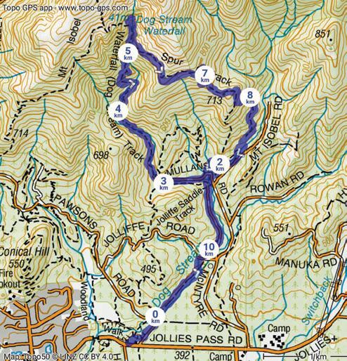
Today’s walk will take us up to the Dog Stream Waterfall. There are several route options to the Dog Stream Waterfall. For today’s walk, we will be completing the loop walk, which takes about four hours and is 11km long.
To reach the Dog Stream walk’s starting point, follow Jollies Pass Road to Hanmer DOC Base and car park, where there’s an information board and toilets. For a shorter walk, you can opt to start from the end of Mullans Road. (If the forestry road is open)
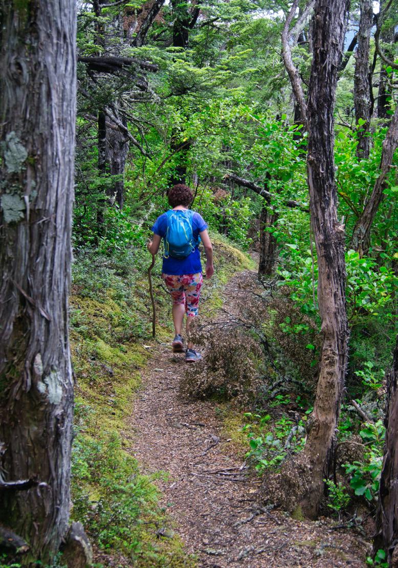
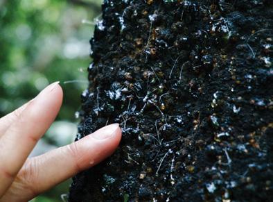
From the Jollies pass road, the well graded and well-used track follows Dog Stream through the beautiful beech trees, which will often have the honeydew on them.
These honeydew excretions on the black beech trees come from scale insects, specifically ultracoelostoma species. These tiny insects live un-
Above right: Fellow walker on lower Spur Track.
Below right: Michael, crossing Dog Stream.
New Zealand Walk
Dog Stream Waterfall Walk
Ouch! Sore feet while walking?
Hikers Wool is 100% New Zealand wool. Cushion your feet to prevent pain, rubbing and blisters. Buy online or at selected stockists For more info visit www.hikerswool.co.nz
der the bark and feed on the tree’s sap, excreting a sugary liquid called honeydew through fine, hair-like structures.
The track continues to cross several small bridges across lower Dog Stream as it exits on to Mullans Road. It is just a short walk along the road to the Mullan Road to the car park and alternative start point for the walk.
From the carpark, the track now becomes noticeably steeper as it winds its way up and continues to re-cross Dog Stream. After further crossings of Dog Stream creek, the track makes a sharp turn as it heads around a small bluff, providing you with a quick glimpse of the waterfall.
After another small bridge crossing, the track now passes the junction of the Spur Track. It is now a short but steep climb, with several small staircase sections. The track finally levels out as you arrive at the highlight of the walk, the stunning 41 metre Dog Stream Waterfall.
After enjoying our lunch, it was time to head back down. At the junction of Dog Stream and Spur Track, we followed the less-used, partially overgrown Spur Track down.
The Spur track slowly wounds its way along and around the lower slopes, before an extremely short but steep decent down meeting a small contributory creek which eventually feeds into Dog Stream. From the creek the track re joins the lower Dog Stream Track, taking you back to the start of the walk and a well-deserved rest and swim at the Hanmer Hot Pools.
Above left: Author Michael at Dog Stream Waterfall.
Above right: Honey dew on a black beech tree.
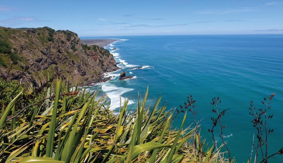
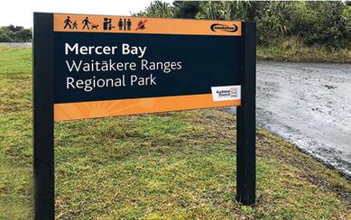
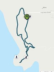
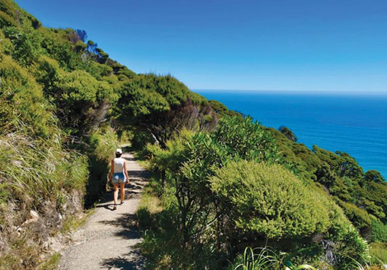
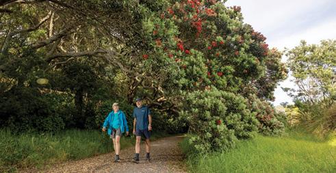
Mercer Bay Loop Track for great sea views
The Mercer Bay Loop Track starts high up above Piha and takes you to Te Ahua headland, the site of an important Māori pā (fortified village), with great views up and down the west coast.
Start at the end of Te Ahuahu Road, at the site of a former radio station. Take the time to look at the many interpretive signs here. This used to be an outpost of some significance.
The track works best in a clockwise direction, so start at the track entrance at the southern side of the car park. Follow the instructions at
cleaning stations to protect the kauri trees in the Waitākere Ranges.
The first section of the track leads down through low regenerating forest.
At the track junction, keep right and head towards the former pā site. If you keep left at the junction, you’ll go down the restored Comans Track, all the way down to Karekare Beach. It is a long climb coming back up from there, so if you have limited time, turn right to the pā site.
Take the track to the lookout point and check out the pou (marker sculpture) that marks the site of the pā. This is an important place for Te Kawerau a Maki, the Māori iwi that has authority over this land, so please stay on the track.
A small lookout platform at the end of the trail provides amazing views to the north and south.
Back on the track, keep to the left and climb up to the coastal route with more amazing views and windswept forest. The 2.2km track takes you back to the northern end of the car park.Allow time of about 50 minute for this loop walk. This is a beautiful coastal walk high above Piha, great for a family adventure.
Above top: A great view out into the Tasman Sea. from the lookout.
Below: left: A walker on the Mercer Loop Track.
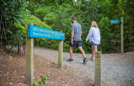
Walking the Kererū Track from Days Bay for great harbour views
TBy Patrick Tooher
he ferry pulled away from Queen’s Wharf on a calm Wellington morning, cutting a silver path across the harbour toward the green hills of Eastbourne. It’s hard to imagine that just half an hour from the bustle of the capital lies a pocket of quiet native forest, where kererū flap heavily through the treetops and the only sound is the crunch of your boots on leaf litter.
My goal for the day was the Kererū Track, a short but steady climb from Days Bay up into East Harbour Regional Park, offering one of the best “bush to ridge” walks within easy reach of Wellington.
Starting the walk at Days Bay Days Bay itself is a gem having a
crescent of sand, pōhutukawa trees, cafés, and the historic Williams Park. From the ferry terminal, I wandered a few minutes along the beach toward the park’s duck pond and tennis courts, where a sign marks the start of the Kererū Track.
For those arriving by car, there’s usually parking near the beach or along Marine Drive. Public toilets, picnic tables, and a small playground make it a pleasant starting point. It is a good place for a coffee or ice cream before heading into the hills.
Climbing into the bush
The track heads quickly into tall native forest, a cool contrast to the open beach. Almost immediately, the soundscape change. Bellbirds and tūī sing from high branches, while
fantails dart across the path. The route follows a small stream at first, then begins to climb through dense beech, kohekohe, and rātā forest.
Despite the short distance of less than a kilometre to the ridge it’s a solid climb, gaining about 260 metres in altitude. The track is well formed, mostly firm earth and gravel with occasional wooden steps where the gradient steepens. In dry weather, it’s an easy surface underfoot, though after rain the roots can be slick and the air thick with the smell of damp leaf litter.
After ten minutes I passed a small dam tucked in the bush, a remnant of early Eastbourne water works, and paused beside it to listen to the gurgle of the stream. Beyond the dam the climb begins in earnest, zigzagging sharply up through the forest.
The kererū and the climb
True to its name, the Kererū Track lives up to its bird-inspired title. About halfway up, I heard the telltale “whump-whump” of heavy
Above top: The lower section of the Kererū Track follows a shaded stream through mature native forest.
Below left: The walk begins in tranquil Williams Park at Days Bay, just a short stroll from the ferry wharf.
wings and looked up to see a kererū balancing precariously on a tawa branch. Their comical grace always makes me smile. They seem almost too large to fly, yet somehow glide effortlessly between trees.
Not long after, I reached a memorial bench, thoughtfully placed at a small clearing that opens to a spectacular view across the harbour. From here, the city skyline and the rolling western hills form a perfect backdrop. It’s an ideal spot for a water break and a few photos.
Onto the ridge
The upper section of the track narrows and climbs a little more steeply through younger beech forest, before suddenly emerging at the Main Ridge Track junction. Here, the terrain levels out and sunlight filters through the canopy. I could feel the sea breeze again a satisfying moment when you know you’ve reached the top.
At roughly 300 metres elevation, the ridge provides views across both sides of the harbour. On a clear day, you can trace the line of the Rimutaka Range to the north and the sweep of the harbour mouth to the south.
If you’ve still got energy, it’s worth exploring along the Main Ridge Track in either direction. Turning right leads toward McKenzie’s Road and Muritai Park, while left eventually connects to Ferry Road Track for a loop option. I chose to wander a short distance along the ridge before retracing my steps back down to Days Bay — an easier descent but one that still requires sure footing on the steeper sections. How long it takes
The new VeryFitPro ID205L Intelligent Activity Tracker
The new VeryFitPro ID205L is an intelligent smart looking Sports Watch and activity tracker that ticks all the boxes.
* Strong and durable 3cm clear glass touch screen display
* Skin friendly soft and comfortable wristband strap
* Nine exercise modes walking, running, hiking, cycling, treadmill, fitness, mountain climbing, spinning bike and yoga
* Many functions: step monitoring function, heart rate monitoring, sleep monitoring, calorie monitoring, call reminder, message reminder, sedentary reminder, alarm reminder, stopwatch, timer, music control, looking at mobile phone, breathing training, time and date display, multi-sport mode (step, calories, speed, distance, active time), daily goal
* Raise your hand and the screen will light up.
* Customize the face of your Smart Watch to fit your needs.
* IP68 Deep Waterproof
* Magnetic charging with USB charging cable takes about 2.5 hours for around 10 days usage.
* Uses VeryFitPro app Compatible with smart phones that use IOS 8.0/ Android OS 4.4 or later, and Bluetooth 4.0 or later
* Colours available: Black
Order now $115.00 plus $8.00 P&P - Ships from Palmerston North Walking New Zealand Ltd
47 Lincoln Terrace, Palmerston North - Phone 0800-925-546 www.walkingnewzealand.co.nz (Online only)
www.walkingnewzealand.co.nz
The return walk from Days Bay to the ridge and back typically takes one and a half to two hours, depending on fitness and photo stops. I spent about 50 minutes climbing at an easy pace, and just under 40
Above right: The upper section of the track — steeper, narrower, but rewarding for the views at the top. Below right: Typical track surface firm dirt and gravel, with occasional rooty sections and steps.
Walking the Kererū Track from Days Bay
minutes descending.
For those who want a longer outing, you can combine the Kererū Track with the ridge route and descend via Ferry Road or MacKenzie’s Road Track, creating a satisfying three to four hour loop. These connecting trails are clearly signposted and appear on the Greater Wellington trail maps.
Track condition
I’d class the Kererū Track as moderate. short, but steep in parts. The surface is mostly packed dirt with tree roots, gravel, and the occasional step section. In summer it’s dry and fast; after rain, a few patches become slippery, especially under the beech trees.
Good walking shoes or trail boots are a must, and walking poles are handy for balance on the descent. The track is shaded for most of its length, so it’s an excellent choice even on warmer days.
Birdsong and bush serenity
What struck me most was how quickly the city vanished. In just a few minutes, I was surrounded by deep green forest, sunlight flickering through leaves, the air filled with
birdsong. Along the way I spotted pīwakawaka (fantails), silvereyes, and at least three kererū swooping noisily above.
East Harbour Regional Park is well known for its birdlife, thanks to ongoing pest control and the proximity to predator-free Matiu/ Somes Island across the water. The combination makes it one of Wellington’s best suburban sanctuaries for native birds.
Back to the bay
The descent to Days Bay always feels faster with gravity lending
a hand and the sound of the sea drawing you onward. Soon the forest thinned, and the bright shimmer of the harbour appeared through the trees.
Back in Williams Park, I kicked off my boots and wandered across the grass to Chocolate Dayz Café, one of several great spots near the wharf. Their flat white and cabinet sandwiches were the perfect post-walk reward. If you’re there in summer, Gelato Classico by the beach is another local favourite for a cool treat.
Getting there
By ferry: East by West Ferries run regularly between Wellington’s Queen’s Wharf and Days Bay (about 25 minutes). Check timetables at eastbywest.co.nz
Above top: A view of Wellington Harbour with Sommes Island in the middle,
Above right: Typical track surface firm dirt and gravel on a steep section.
Below left: Days Bay’s cafés and beach make the perfect finish to a rewarding bush walk.
Foldable Hiking Poles
* Made from Aviation Aluminium
* Adjustable from 65cm -135cm
* Folds into 3 sections
* Straight rubber handle
* Comes with handy bag
* Colours Blue or Red
Buy two sticks and save $5.00
Walk the Chathams - wonderfully remote
Walk
the Five Corners of the Chathams – wild, windswept, and wonderfully remote.
From the rugged Wild West to the Sunshine Coast – the very first place to see the sunrise in the world – every step offers breath taking views and a sense of discovery. The next stop south
from here? The Antarctic.
Gather a group of friends and enjoy the comfort of Hotel Chathams, indulging in fresh local seafood and daily guided walks (three to five hours each day). Be inspired by local guides who bring to life the island’s rich history, geology, and stories.
$39.95 plus $7 .50 Shipping
Available now from:
Walking New Zealand Shop
P O Box 1922, Palmerston North Phone 0800-925-546 - email walkingnz@xtra.co.nz. www.walkingnewzealand.co.nz
* Measures walking/jogging steps up to 99999.
* Compact Clamshell Design.
* Jumbo LCD.
* Solid and Strong spring belt clip.
* Solid and lightweight.
* Great for all-day wear.
* White in colour
* An ideal pedometer for team challenges.
* Complete with battery.
Only $24.95 plus $6.50 P&P Contact us for group discounts Order-on-line: www.walkingnewzealand.co.nz/ PEDOMETERS
WALKING NEW ZEALAND Ltd
47 Lincoln Terrace, Palmerston North, 4440
Phone 06-358-6863: fax 06-358-6864 or freephone 0800-925-546 H215S Pedometer Digital Step Counter
Above right: The Chatham Islands have a treeless landscape, allowing the wind to blow unimpeded. Above left: The oldest sedimentary exposed rocks at Waiheke Bay. Below left: A narrow forest path.
Your journey also includes a Pitt Island day trip, adding another unforgettable walk in this truly unique corner of the world. The Chatham Islands are 800kms east of Christchurch New Zealand.
Contact chathamislandtours@ gmail.com for more information.
NORTH ISLAND
NORTHLAND
BAY OF ISLANDS
BAY OF ISLANDS WALKERS: Saturday (AM), Jacqui Watson 022-6019741, Roz Whittaker 021-063-1455
DARGAVILLE
DARGAVILLE TRAMPING GROUP: Last Sunday of month (AM), Lynley Thompson 021-102-3974, colvilleestate1@gmail.com
WHANGAREI
CARDIAC CARE WALKING GROUP: Wednesday (AM or PM), Jo or Hugh Knight 09-438-7976
BLUE TOP WALKERS: Henderson, Tuesday, Thursday (AM), Terry Wilson 09-814-9523 or 021-266-1071, terryandsheena@gmail.com, www. bluetopwalkers.weebly.com
FIA OLA WOMEN’S DEVELOPMEMT WALK GROUP: Monday to Saturday, Anne, 09-813-0021
FIT4LIFE: Glenfield, Monday (PM), Friday (AM), Sarah 021 534 649
GLEN EDEN ATHLETIC CLUB WALKERS: Glen Eden, Wednesday (PM) and Saturday (AM), Neil Turner 09-817-6230 GREEN BAY MUMS BUSH WALKERS: Every second Monday, Anne 09-827-7810 or 09-817-5867
KELSTON MORNING WALKERS: Kelston C.C. Tues (AM), Joy Martin 09-838-6553
KELSTON TWILIGHT WALKERS: Kelston, Tuesday (PM), Joy Martin 09-818-6084
KUMEU WALK GROUP: Kumeu, Friday (AM), Mary Davies 09-412-2262
LYNNMALL SHOPPING CENTRE KIWIFIT CLUB: Monday, Wednesday (AM), (BIA), 09-826-2333
TE ATAU PENINSULA WALKERS: Monday, Friday (AM), Wednesday (PM), Mary Jones 09-834-6989
TE ATATU SOUTH ACTIVE 35+ WALKING GROUP: Te Atatu South, Wednesday, Edna, 09-834-1401
THE HAPPY WANDERERS WALKING GROUP: Wednesday (AM), Joy Williams 09-817-2464 or 027-353-3434
TITIRANGI TWILIGHT WALKERS: Tuesdays, Thursday, (PM) Titirangi Library, Wednesday (PM) Glovers Real Estate Green Bay, Louise 021437-547, louisenicholson@xtra.co.nz
TITIRANGI WALKERS: Sundays (AM), John Harris 09-627-0099, jeanah@ihug.co.nz
Fitness levels: “B” beginner, ”I” intermediate, “A” advanced. (AM) denotes morning walk, (PM) denotes an afternoon or evening walk. Group co-ordinators are asked to please advise us of any updates by fax 06-358-6864 or email walkingnz@xtra.co.nz.
WALKERS & TALKERS: Campbells Bay, Wednesday (AM), Brenda Gray 09-410-4019, Dorothy Ensor 09-478-6702
KELVIN GROVE WALKERS: Tuesday (PM), (I), Marjory Edmonds, 06-354-3342
Notice to clubs and walking groups
If you notice there that the times, names or contact numbers etc on the list of Walking Grroups in the Directory on these pages needs updating please email us at walkingnz@xtra.co.nz. These are are free listing.
LEGEND
Fitness levels: “B” beginner, ”I” intermediate, “A” advanced. (AM) denotes morning walk, (PM) denotes an afternoon or evening walk. Group co-ordinators are asked to please advise us of any updates by fax 06-358-6864 or email walkingnz@xtra.co.nz.
PIONEER TRAMPERS:Thursday (AM) (IA),4-5 hour tramps in Banks Peninsula and the hills and lower mountains from Mt Hutt to Mt Grey, pioneertrampers@gmail.com
LEITH WALKERS: Saturday (PM), Kevin Blair 03-476-3289
MORNINGTON MONDAY WALKERS: Monday (AM), (B), Shirley 03-4536398 or 021-294-2218
MULTI-PEAK FITNESS WALKERS: Wednesday (AM), Marelda Gallaher 03-477-6057 or 027-222-3863
OTAGO TRAMPING/MOUNTAINEERING CLUB: Sunday (AM), Joe Bretherton, jsbretherton@gmail.com, http://otmc.co.nz
OVER 30’s TRAMPING CLUB: Sunday (AM), Janice Hodges 03-489-4071
PHOENIX CLUB WALKING GROUP: Wednesday (AM), Nina Davidson 03-471-0114
PINEHILL WALKING GROUP: Thursday (AM), Norman Vare 03-473-8683
Notice to clubs and walking groups
If you notice there that the times, names or contact numbers etc on the list of Walking Grroups in the Directory on these pages needs updating please email us at walkingnz@xtra.co.nz. These are are free listing.
ST KILDA COMMUNITY CLUB WALKING GROUP: Tuesday, (AM), Ngaire McIndoe 03-456-4478
6 Sydney Trail Half Marathon - Summer, Paramattta Lake, Sydney,NSW
7 Victor Harbor Half Marathon, Victor Harbor, SA
14 The Hallora Marathon Festival, Warragul,Vic
21 Western Sydney 10: Parramatta, Sydney,NSW
JANUARY 2026
11 Two Bays Trail Run, Cape Schanck/ Dromana , Melbourne,Vic
18 Harbour Coastal Run, West Lakes Shore, Adelaide, SA
18 Matilda Bay Run, Nedlands, Perth, WA
20 Black Mountain Run Up & Power Walk, Canberra, ACT
FEBRUARY 2026
8 Wentworth Falls Trail Run, Leura, NSW
15 Hobart Run The Bridge, Hobart, Tas
21 Vineyards Twilight Run, Brown Brothers Winery, Milawa, Vic
REST OF WORLD
NOVEMBER 2025
2 New York Marathon New York, USA
6-7 International Walking Festival, Arlington, Virginia, USA
25-26 International Walking Festival, Wonju, Korea
DECEMBER 2025
1-3 International Walking Festival, Higashimatsuyama, Japan
8-9 International Walking Festival,
Taipei, Taiwan
15-16 International Walking Festival, Yogjakarta, Indonesia
MARCH 2026
1 Run Tokyo, Tokyo, Japan
APRIL 2026
20 130th Boston Marathon, Half Marathon, 10km & 5km, Boston, USA
MAY 2026
24 Sanlam Cape Town Marathon, Cape Town, South Africa
You can now view back issues of Walking New Zealand magazine, two issues back from the latest, FREE at : http://issuu.com/walkingnewzealand.
Ouch! Sore feet while walking?
Hikers Wool is 100% New Zealand wool. Cushion your feet to prevent pain, rubbing and blisters.
Buy online or at selected stockists For more info visit www.hikerswool.co.nz
The H-232G Sensor pedometer
A great little Pedometer that you can carry in your bag or pocket or clip on a belt!
Three function Pedometer with a hi-tech system that you can carry in your bag, pocket, clip on a belt, or as an arm band, and accurately records your activity through its G Sensor technology.
* Step - Counts steps up to 999,999 steps
* Total Steps - It can cumulative number of steps of each activity
* Exercise time - The effective time will be accumulated as the walking is kept going
* Comes with a lanyard if you want it to hang it around your neck, and an additional clip if you want to
now from: Walking New Zealand Shop 47 Lincoln Terrace, Palmerston North - Phone 0800-925-546 or email walkingnz@xtra.co.nz. www.walkingnewzealand.co.nz
You can now view and enjoy the latest issue of Walking New Zealand magazine online for $3.95 at http://www.walkingnewzealand.co.nz
www.walkingnewzealand.co.nz
The new VeryFitPro ID205L is an intelligent smart looking Sports Watch and activity tracker that ticks all the boxes.
* Strong and durable 3cm clear glass touch screen display
* Skin friendly soft and comfortable wristband strap
* Nine exercise modes walking, running, hiking, cycling, treadmill, fitness, mountain climbing, spinning bike and yoga
* Many functions: step monitoring function, heart rate monitoring, sleep monitoring, calorie monitoring, call reminder, message reminder, sedentary reminder, alarm reminder, stopwatch, timer, music control, looking at mobile phone, breathing training, time and date display, multi-sport mode (step, calories, speed, distance, active time), daily goal
* Raise your hand and the screen will light up.
* Customize the face of your Smart Watch to fit your needs.
* IP68 Deep Waterproof
* Magnetic charging with USB charging cable takes about 2.5 hours for around 10 days usage.
* Uses VeryFitPro app Compatible with smart phones that use IOS 8.0/Android OS 4.4 or later, and Bluetooth 4.0 or later