New Zealand Walk: Walking up Rangitoto for a taste of adventure
New Zealand Walk: Exploring the Rimutaka Rail Trail from the Hutt Valley to the Wairarapa
New Zealand Walk: The Estuary Edge Walk where the Avon River meets the sea
New Zealand Walk: Walking the Piriharakeke Walkway where the Manawatu River once flowed
The ULTIMATE is Zerofit’s flagship product and perfect for hiking, golf, sailing or any outdoor activities when it’s cold. But if you are more active it is complemented by the Heatrub MOVE.
Twice as warm as a standard base layer, the material regulates tempertures as you move, so you won’t suffer from cold sweat, if your are running or cycling.
Please visit the Walking New Zealand Shop: https://walkingnewzealand.co.nz/productcategory/apparel/ for more details and to order.
PUBLISHER/EDITOR: Frank Goldingham: Phone 06-358-6863, 027-274-0726
CONTRIBUTORS: Phillip Donnell, Michael Hendriks and Barbz Lowther
New walking holiday in Campania, Italy with On Foot Holidays
European self-guided walk operator, On Foot Holidays, has launched a week-long hiking route in the Cilento National Park in Campania south of Rome.
Available in April, May, June, September and October, the trip covers eight to 23km per day and is graded medium effort, with luggage transferred between hotels each day.
It starts in the harbour town of Agropoli and traces the coastline before climbing into the mountains with views over the Amalfi Coast and Capri.
The trail visits the medieval hamlet of Castellabate, and also the mountain villages of Lustra, Castigliano and Rocca Cilento.
The walk includes B&B and inn accommodation, daily breakfasts, three dinners, all luggage transfers between hotels, and the On Foot app for navigation and all holiday information.
The holiday costs from A$2,218 perperson twin-share (depending on exchange rates). www.onfootholidays.co.uk/routes/cilento-nationalpark
Your favourite walk could win you a free subscription
We are looking for readers’ favourite New Zealand walks. Many of us go out regularly walking on a route which we class as our favourite, for a number of reasons. Perhaps because for it’s scenery, it’s safe, it’s challenging, it’s flat, it’s hilly, it’s varied, or for whatever reason.
We would like you to tell us in your own words what is your favourite walk and why. Email us a story from say 250 up to 1200 words including a photo or photos.
We will now give you a FREE subscription (six months or more, depending on the article), or extension to Walking New Zealand magazine for walks published.
You can also post an article to Walking New Zealand, Freepost 78863, P O Box 1922, Palmerston North, or fax 06-358-6864.
If sending a photo by email please make sure photos are in high resolution.
Our email address is: walkingnz@xtra.co.nz.
Please put “My Favourite Walk” in the subject line and include your name and postal address.
New Arizona bike trails
Now open to the public, the new Bean Peaks Gravity Flow Trail System in Prescott, Arizona, USA, is designed so every biker, including recumbent hand-pedaled bikers, can experience the mountain biking through towering ponderosa pines.
The first of their kind in the state, the gravity flow trails offer varying difficulties, multi-laps options and bike-only areas. A planned second phase will open in autumn.
The new VeryFitPro ID205L Intelligent Activity Tracker
The new VeryFitPro ID205L is an intelligent smart looking Sports Watch and activity tracker that ticks all the boxes.
* Strong and durable 3cm clear glass touch screen display
* Skin friendly soft and comfortable wristband strap
* Nine exercise modes walking, running, hiking, cycling, treadmill, fitness, mountain climbing, spinning bike and yoga
* Many functions: step monitoring function, heart rate monitoring, sleep monitoring, calorie monitoring, call reminder, message reminder, sedentary reminder, alarm reminder, stopwatch, timer, music control, looking at mobile phone, breathing training, time and date display, multi-sport mode (step, calories, speed, distance, active time), daily goal
* Raise your hand and the screen will light up.
* Customize the face of your Smart Watch to fit your needs.
* IP68 Deep Waterproof
* Magnetic charging with USB charging cable takes about 2.5 hours for around 10 days usage.
* Uses VeryFitPro app Compatible with smart phones that use IOS 8.0/Android OS 4.4 or later, and Bluetooth 4.0 or later
* Colours available: Black
Only $115.00 plus $8.00 P&P Walking New Zealand Shop
47 Lincoln Terrace, Palmerston North - Phone 0800-925-546
A new trekking trip is being launched in April 2025 through the Zagros Mountains of Iraqi Kurdistan as the area continues to see a growing number of tourists. Adventure travel company, Untamed Borders is leading the 15-day adventure along the newly formed Zagros Mountain Trail.
The 215km route is the latest attraction in the area’s expanding tourism offer.
The Kurdish north of the country enjoys relative stability and has a diverse number of attractions for visitors. The new trekking trail connects remote communities, using ancient pilgrimage.
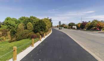
Work progressing on South Express cycleway
Another section of Christchurch’s South Express Cycleway has been completed creating an uninterrupted 10km route from the city to Hornby.
Construction along the length of Kyle Park on Waterloo Road was expected to take three months but was completed two weeks ahead of schedule, finishing up earlier this month.
“The work means cyclists can now ride from South Hagley Park in the central city out to the Council’s newest pools and library at Matatiki Hornby Centre, passing several schools and destination spots along the way,” says Manager Planning and Delivery Transport Jacob Bradbury.
“There are now three stages of work left to complete before the cycleway will be finished, all of which we are working on and progressing.”
The first involves extending the cycleway further west down Waterloo Road from Barters Road to Jones Road, where it will join up with Selwyn District Council’s cycleway to Rolleston.
A great little Pedometer that you can carry in your bag or pocket or clip on a belt!
Three function Pedometer with a hi-tech system that you can carry in your bag, pocket, clip on a belt, or as an arm band, and accurately records your activity through its G Sensor technology.
* Step - Counts steps up to 999,999 steps
* Total Steps - It can cumulative number of steps of each activity
* Exercise time - The effective time will be accumulated as the walking is kept going
* Comes with a lanyard if you want it to hang it around your neck, and an additional clip if you want to attach it to a belt!
Only $59.95 plus shipping $6.00
47 Lincoln Terrace, Palmerston North - Phone 0800-925-546 or email walkingnz@xtra.co.nz. www.walkingnewzealand.co.nz
This stage will include line markings and wayfinding signage within the Waterloo Business Park. The next stage is the Gilberthorpes Road/Waterloo Road/Parker Street/ Moffett Street intersection, including a stretch of Waterloo Road from the western end of Kyle Park to Finsbury Street. The Parker Street level crossing design required for the cycleway is still being progressed with KiwiRail.
The final stage is a section along Waterloo Road from Finsbury Street to Wilson Street, to be completed as part of the Halswell Junction Road realignment project. KiwiRail are expected to complete the level crossing works in early 2025, after which this can be completed.
“Once complete the cycleway will be just over 15km long and run from the central city out to Templeton, where it joins with the Selwyn District Council’s cycleway on Jones Road that goes all the way out to Rolleston,” Mr Bradbury says.
The cycleway passes nine schools along its route, providing safe cycle facilities for the students, as well as connecting into two existing major cycleways: Norwest Arc and Northern Line.
“This is fantastic for people wanting to get around on bikes instead of cars, helping ease the pressure on our roads and providing another safe and convenient option to get them where they want to go,” Mr Bradbury says.
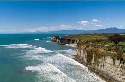
10 best short walks West Coast
Discover the West Coast’s wild side and amazing landscapes. Nowhere on New Zealand’s West Coast is ever far from mountains, lakes, forests, beaches and fascinating landforms (usually all at once).
No matter what part of the Coast you make your way to, there is a choice of easy, short walks leading to a journey of natural discovery. Short walks can be anything from 30 minutes to a couple of hours.
Easy means well-formed trails suitable for all the family, and anyone with low to moderate fitness.
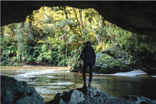
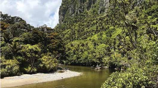
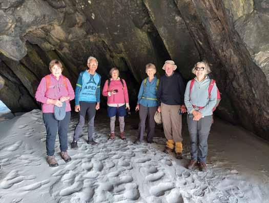
1. Ōpārara Arches walkway — Kahurangi National Park
Tucked away on the western edge of Kahurangi National Park, the landscape surrounding the Ōpārara Arches is a unique mix of luxuriant, subtropical rainforest, remarkable limestone formations and diverse ecosystems not found anywhere else
Above left: A walker in the Oparara Arches.
Above right: The boardwalk on the Okarito Trig Walk.
Middle left: Cape Foulwind and the Tasman Sea.
Below left: The famous Pancake Rocks.
walks on the
in New Zealand.
To explore this beautiful landscape, it’s just a short walk on an easily accessed public track that leads through a lush forested valley floor, across streams stained with forest tannins to the banks of the Ōpārara River and a magnificent limestone arch - a natural sculpture, formed by water and time.
The entrance to Ōpārara Arches walkway is 23 kilometres north of Karamea. The 2 km walk takes about 50 minutes return.
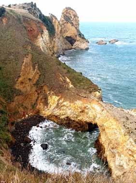
2. Cape Foulwind and Seal Colony walk — Westport
Spectacular Cape Foulwind is hard to beat if you’re looking for a burst of fresh air and interesting wildlife activity. The rocky promontory got its distinctive name from Captain Cook but the story goes that it was the elements not the air quality that impressed him back in 1770.
The short, scenic walkway out to Cape Foulwind reveals the full force of the Tasman Sea with the pounding westerly swell thundering in on the rocks below the lighthouse. On the return journey there are spectacular glimpses of the Southern Alps. The colony of kekeno / NZ fur seals is in residence year-round; breeding is in full swing during November to February,
The Cape Foulwind Walkway is 16 kilometres west of Westport. The 3.4 km walk takes One hour 15 minutes
one way or two and a half hours return. There is a shorter 15-minute option to a viewpoint above the seal colony.
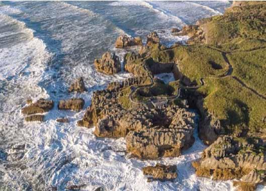
3. Punakaiki Pancake Rocks & Blowholes walk
Nature’s creative forces have out-done themselves at Punakaiki Pancake Rocks & Blowholes, a compulsory scenic stop on the beautiful Great Coast Road between Westport and Greymouth. Park the car and follow the easy, paved walkway through regenerating forest and flax to the iconic Pancake Rocks - layered stacks of ancient sea bed piled above the roaring blowholes.
Once you start watching the mesmerising spectacle, it’s hard to tear yourself away, and the camera never quite captures the full force of what you’re seeing. The blowholes are most impressive at high tide so try to time your visit for that.
Punakaiki is on SH 6, midway between Westport and Greymouth. The 20-minute loop walk is an easy
stroll, but leave enough time to watch the action.
4. Pororari River Tracks — Paparoa National Park
For a pleasant, accessible taster of New Zealand’s newest Great Walk, The Paparoa Track, there are two short walks (one and a half to hours) on the beautiful Pororari River Track which serves as the pedestrian entry/ exit for the multi-day Great Walk. These pretty rainforest walks start near the Paparoa National Park Visitor Centre, following an easy trail beside the Pororari River. Highlights include the gorge, deep pools surrounded by huge limestone boulders, a spectacular lookout and a suspension bridge. Follow the boulder-lined limestone gorge on a short walk, or make a loop for a longer walk.
The tracks start from either the
Above right: The Pororari River an entry point for the Paparoa Track. Below right: Lake Brunner has two short walks from the southern and northern ends of the lake.
10 best short walks on the West Coast
Paparoa National Park Visitor Centre or 1km north of the Visitor Centre at the Pororari River car park on SH6. The Pororari River Track is 7 km or one and a half hours return; the Pororari Loop is 11 km or three hours return.
5. Lake Brunner (Moana) walks
Treasured Lake Brunner, with its beautiful alpine reflections, is a popular summer holiday retreat for boating, swimming and trout fishing, along with easy but rewarding short walks, starting from either the southern or northern ends of the lake.
Canny walkers on the Rakaitane Track (1.2 km / 30 minutes return) might even get to spot a prize trout or two hiding in the clear waters under the suspension footbridge over the Arnold River / Kotuku Awa, along
with forest reflections in the river and panoramic views across the lake. The walk starts at the little settlement of Moana.
On the southern end of the lake, the Carew Falls Track (2 km / one hour return) winds up through the forest to an impressive waterfall tumbling from above, creating a refreshing mist - ideal on a summer’s day.
Lake Brunner is inland from Greymouth via Kumara to the southern end of the lake (45 km / 45 minutes).
The TranzAlpine scenic rail service stops at Moana on the northern edge
Above left: The white rocky walk of the Hokitika Gorge.
Bellow left: A view from the Okarito Trig Walk.
Below right: The Te Ara Kairaumati Walk is a gentle walk leads to views of New Zealand’s highest mountains reflected on the still waters of Lake Matheson,
of the lake.
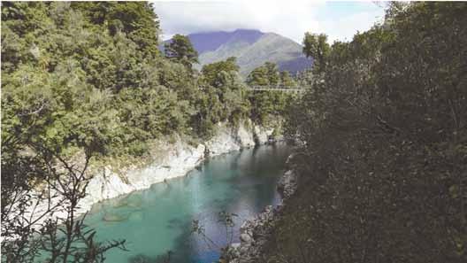
6. Hokitika Gorge Walk
The brilliant turquoise water flowing between the white rocky walls of Hokitika Gorge is the West Coast’s most distinctive natural feature. Inland and towards the hills from Hokitika, the gentle forest trail has recently been extended and upgraded, and features a wheelchair accessible viewing platform, just a few minutes walk from the start.
It’s an easy undulating walk through a leafy forest canopy of miro, rimu and kamahi trees, and across the pedestrian suspension bridge over the main channel.
The bridge offers spectacular views of the vibrant blue waters, rocky gorge, forest and the foothills of the Southern Alps, and there are several other viewing points en route. Keep an eye out for the surreal blue of the rare werewere-kōkako mushrooms found in this forest.
Hokitika Gorge Scenic Reserve is 33 km / 30 minutes inland from Hokitika. It takes about an hour and a half to complete the well formed 2.4 km trail (not counting photo stops).
At the end of a short, easy walk, the brilliant colours of the Hokitika Gorge are the West Coast’s most photographed tourist icon.
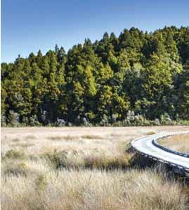
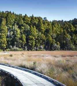
7. Ōkārito Trig Walk
The tiny waterside settlement of Ōkārito - just north of Franz Josef - is one of the West Coast’s undiscovered gems where rugged coast meets
protected coastal lagoon meets rainforest and a haven for rare wildlife.
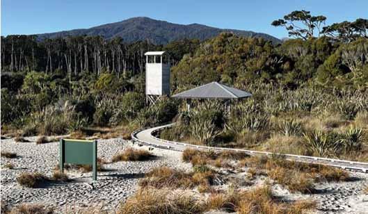
Ōkārito Lagoon is the centrepiece of New Zealand’s largest unmodified wetlands, and the only way to explore this precious environment is by water or on foot. It’s also the best way to observe some of the 76 species of native birds including kōtuku/ white heron and royal spoonbills living here.
The Ōkārito Trig Walk is an easy 4.2 km (one and a half hour) return trip passing through lowland bush and following a boardwalk over the estuary before a short gentle climb to the Ōkārito Trig viewpoint.
On a clear day, from this vantage point, there are breath-taking views of Westland Tai Poutini National Park, taking in the snow-capped Southern Alps, native forest, the coastal lagoons and beaches. The short 1km Ōkārito Wetland Walk follows the same boardwalk to another viewpoint overlooking the estuary.
From SH6, 15 km north of Franz Josef Township, it’s a further 13 km on to Ōkārito. The track begins at the Ōkārito School House, and it takes one and a half hours to complete the 4.2 km return (or 20 minutes for the shorter walk). There is a third, longer walk Three Mile Pack Track –Ōkārito Coastal Walk (9.8 km, three hours return) along the beach which is subject to tidal conditions.
8. Sentinel Rock Walk & Peters Pool Walk — Franz
Josef Glacier
If you want to learn more about this extraordinary environment, the easy Sentinel Rock Walk is a short, steady climb to the summit (900 m / 20 minutes return) with views of mountains, the valley and the Waiho River, which flows from the glacier – however, you can no longer view the glacier from here.
Sentinel Rock emerged from beneath the glacier in the mid-1800s and the walk is an eye-opening introduction to this dynamic environment with panels at the viewpoint graphically depicting the changes. Since 1909 Franz Josef Glacier has retreated more than 3km and vegetation has progressively colonised the rocky surface.
For another short easy expedition from the same departure point in the Franz Josef Glacier valley, the Peter’s Pool Walk (1.1 km / 25 minutes return) leads through rainforest to a small kettle lake with lovely alpine reflections in the tranquil water. This
Above right: The still waters of Lake Matheson.
accessible walk is a good option for children.
From Franz Josef Waiau township, drive or walk across the Waiho River bridge and turn left onto the Glacier Access Road. The walks begin 4 km further on at the car park at the end of the road.
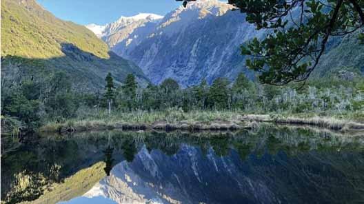
9. Lake Matheson / Te Ara Kairaumati Walk, Fox Glacier
A classic for a reason, this gentle walk leads to views of New Zealand’s highest mountains reflected on the still waters of Lake Matheson, surrounded by a temperate rainforest and only just a few kilometres from beaches.
On a good day, there are the photography dream shots of Mt Cook and Mt Tasman reflected in the waters. Or on the occasional wet West Coast day, the boardwalk makes for easy walking with atmospheric rainforest views, and there’s the outstanding Lake Matheson Cafe on the water’s edge for replenishing with everything from steaming hot chocolates to full menu.
Lake Matheson is 5 km from Fox
10 best short walks on the West Coast
Glacier township towards the coast. It takes one and a half hours to complete the well formed 4.4 km loop trail (not counting photo stops). The first section of the walk is suitable for assisted wheelchairs.
Famous for mirror views of Mount Cook and Mount Tasman, Lake Matheson nestles in rainforest just 5 km from Fox Glacier.
10. Coastal walks north of Haast township
Between Lake Paringa and Haast, the road south from the glaciers travels beside or close to some unspoiled coastal beauty spots, signposted but hidden from the highway and only accessible by walking. These photogenic landscapes - varying from a dune lake to rugged cliffs, sweeping
curves of pristine beaches, fine native forest and rare wildlife - are well worth making the easy walk.
The Monro Beach Walk, just north of Knights Point, is an easy short walk (one and a half hours / 4.7 km return) through lush temperate forest onto a remote beach where the only locals are the rare tawaki/ Fiordland crested penguins. If you spot some in the surf, enjoy the sight but take care not to disturb these rare birds.
Two short walks at Ship Creek reveal a glimpse back into time before human settlement on the West Coast.
The Kahikatea Swamp Forest Walk (800 m, 20 minutes return) follows slow flowing Ship Creek, looping through dense swamp forest of soaring kahikatea (white pine) which is New Zealand’s tallest tree. The Dune Lake Walk (1 km, 30 minutes loop) crosses sand dunes and through dense stunted coastal forest opening out to a substantial dune lake and expansive sweep of coastline.
These walks are signposted off SH6 between Haast to Lake Paringa. Monro Beach is near Lake Moeraki, 30 km north of Haast. Ship Creek Tauparikaka is 20 km north of Haast.
Ouch! Sore feet while walking?
Hikers Wool is 100% New Zealand wool. Cushion your feet to prevent pain, rubbing and blisters.
Buy online or at selected stockists For more info visit www.hikerswool.co.nz
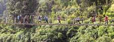
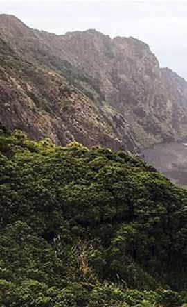
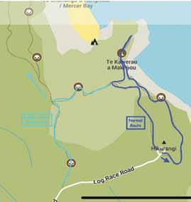
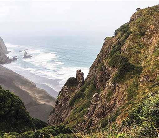
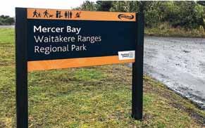
Mercer Bay
The Mercer Bay Loop Track starts high up above Piha and takes you to Te Ahua headland, the site of an important Māori pā (fortified village), with great views up and down the west coast. Start at the end of Te Ahua Road, at the site of a former radio station. Take the time to look at the many interpretive signs here. This used to be an outpost of some significance.
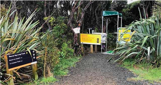
Loop Track
The track works best in a clockwise direction, so start at the track entrance at the southern side of the car park. Follow the instructions at cleaning stations to protect the kauri trees in the Waitākere Ranges.
The first section of the track leads down through low regenerating forest.
At the track junction, keep right and head towards the former pā site.
If you keep left at the junction, you’ll go down the restored Comans Track, all the way down to Karekare Beach. It is a long climb coming back up from there, so if you have limited time, turn right to the pā site.
Take the track to the lookout point and check out the pou (marker sculpture) that marks the site of the pā. This is an important place for Te Kawerau a Maki, the Māori iwi that has authority over this land, so please stay on the track.
A small lookout platform at the
end of the trail provides amazing views to the north and south.
Back on the track, keep to the left and climb up to the coastal route with more amazing views and windswept forest. The track takes you back to the northern end of the car park.
This is a beautiful coastal walk high above Piha, great for a family adventure.
Fact File
To get there: From Auckland head SW. Take SH16 and Piha Road for about 39kms to near Karekare. The walk is an 7.2-km loop trail It is considered a challenging route, it takes an average of just under three hours to complete.
This is a very popular area for hiking and walking, so you’ll likely encounter other people while exploring. The trail is open yearround and is beautiful to visit anytime.
Dogs are welcome, but must be on a leash.
Above left: Looking down at Mercer Bay. Below right: The entrance to the track.
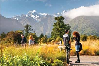
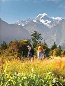
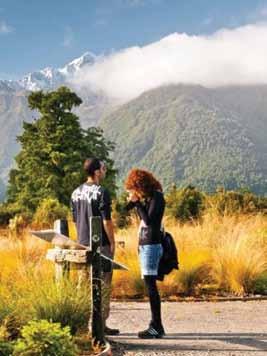
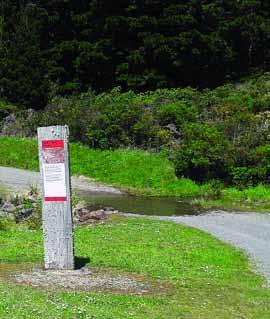
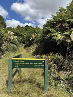
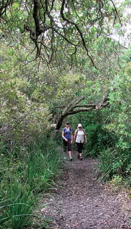
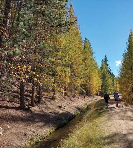
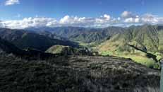
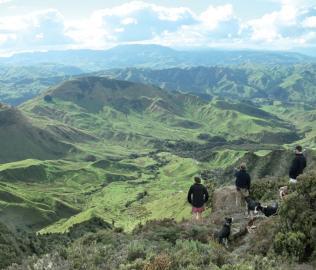
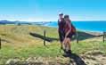
Exploring the Rimutaka Rail Trailover to the Wairarapa
New Zealand is known for its breathtaking landscapes and incredible walking trails, but few experiences are as historically rich and scenically captivating as the Rimutaka Rail Trail.
Located just a short distance from Wellington, the trail meanders through the Rimutaka Ranges, linking the Hutt Valley to the Wairarapa. Whether you’re a seasoned hiker or a casual walker, this track offers an unforgettable journey through history,
nature, and unique engineering feats.
A Glimpse into History
The Rimutaka Rail Trail is more than just a scenic walk—it’s a living history lesson. Originally constructed in the late 19th century as part of the Wellington to Wairarapa railway line, the track was designed to provide a direct route for transporting goods and passengers between the two regions.
The Rimutaka Incline, a steep section of the railway, was one of the
most challenging and unique feats of engineering in New Zealand’s railway history. In operation until 1955, this section required Fell locomotives, a special type of train that used extra grip to manage the steep gradient.
When the railway line was decommissioned, the route was repurposed as a walking and cycling track, preserving the legacy of the past while creating a beautiful recreational space for outdoor enthusiasts. Today, the Rimutaka Rail Trail allows visitors to follow in the footsteps (or wheel tracks) of the past while enjoying the natural beauty of the region.
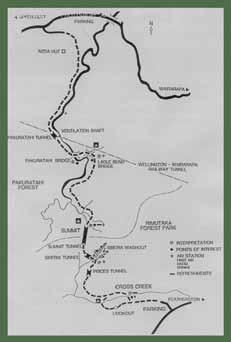
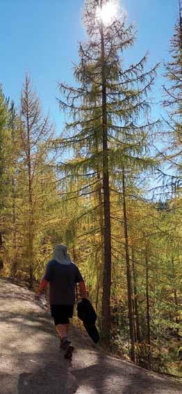
The Route: From Hutt Valley to Wairarapa
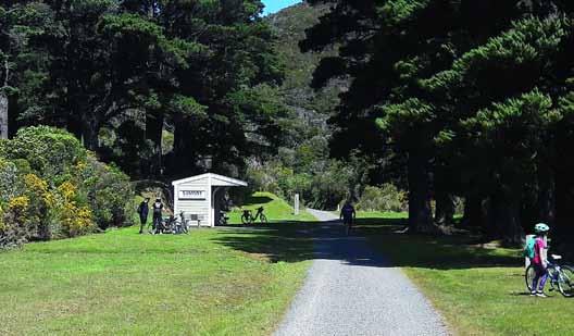
The Rimutaka Rail Trail stretches for approximately 22 kilometers, from the Kaitoke car park in the Hutt Valley to Cross Creek in the Wairarapa. This distance makes it a manageable day walk for most people, with plenty of opportunities to stop, rest, and take in the surroundings.
The trail follows the gentle gradient of the old railway line, making it accessible for walkers, cyclists, and families with children.
While the entire route can be completed in one day, it’s also possible to break it into smaller sections, depending on your pace and inter-
from Hutt Valley
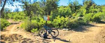
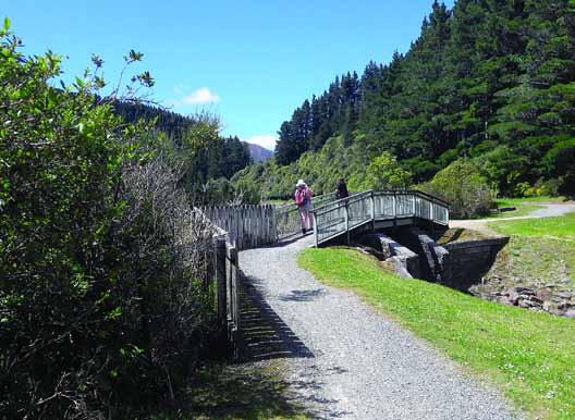
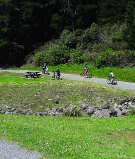
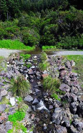
Above left: A small bridge over a stream. Above Middle: The track is popular with young cyclists.
ests. Here’s a guide to what you can expect along the way:
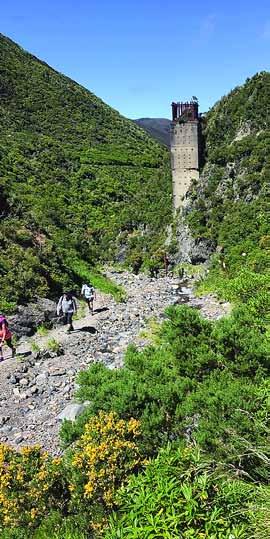
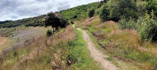
1. Kaitoke to Summit (10 km)
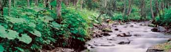
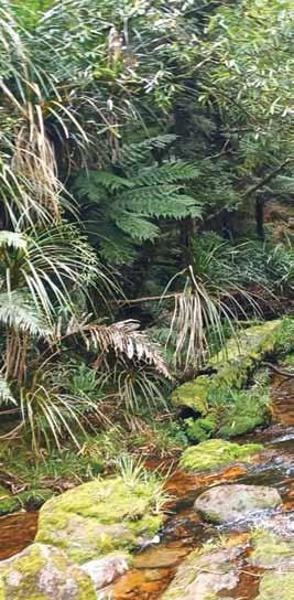
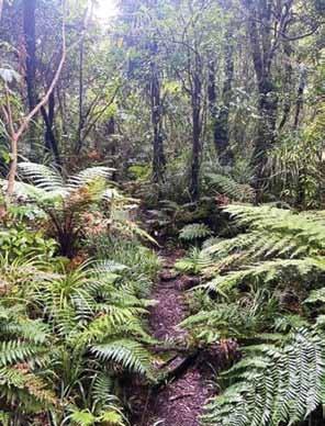
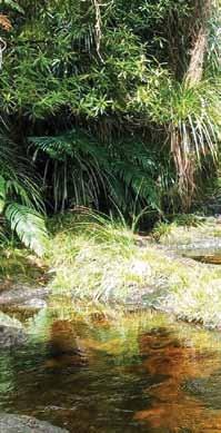
Starting at the Kaitoke car park, the trail begins with a gentle incline through native bush, offering a peaceful introduction to the walk. You’ll pass through towering beech and podocarp trees, with the sound of birdsong accompanying your journey.
This section of the trail follows the Pakuratahi River, providing beautiful views of the surrounding forest and occasional glimpses of the crystal-clear water below.
As you ascend, you’ll encounter several remnants of the old railway,
including the foundations of bridges and tunnels that once carried trains through the rugged landscape. Interpretive signs along the way provide insight into the history of the railway and the challenges faced by those who built it.
One of the highlights of this section is the Pakuratahi Tunnel, a 73-meter-long tunnel that dates back to the early days of the railway. Walking through the tunnel feels like stepping back in time, and it’s a great opportunity to imagine what
Above right: At the summit at Cross Creek.
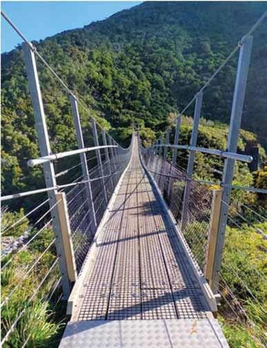
Below left: The old bridge site at the area known as Siberia.
Below right: Cross Creek is a great stopping off point for a break.
Exploring the Rimutaka Rail Trail
it must have been like for the early train passengers who travelled along this route.
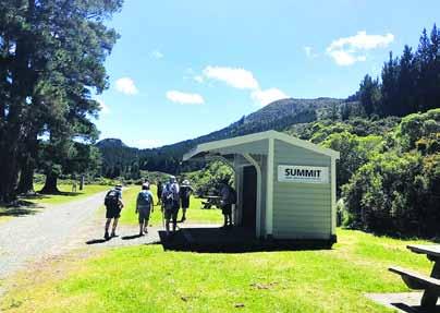
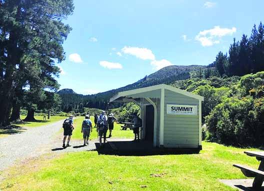
2. Summit (10 km)
The Summit is the highest point of the Rimutaka Rail Trail and a perfect spot to take a break. At 348 meters above sea level, the Summit offers panoramic views of the surrounding ranges and valleys. There are picnic tables and toilet facilities available, making it an ideal place to stop for lunch or a snack.
This area is also home to the historic Fell Engine Museum, which provides fascinating insights into the unique Fell locomotives that once operated on the Rimutaka Incline. The museum houses one of the original engines used on the incline and is a must-visit for history buffs.
3. Summit to Cross Creek (12 km)
From the Summit, the trail begins to descend toward Cross Creek in the Wairarapa. This section of the trail is
The new VeryFitPro ID205L Intelligent Activity Tracker
The new VeryFitPro ID205L is an intelligent smart looking Sports Watch and activity tracker that ticks all the boxes.
* Strong and durable 3cm clear glass touch screen display
* Skin friendly soft and comfortable wristband strap
* Nine exercise modes walking, running, hiking, cycling, treadmill, fitness, mountain climbing, spinning bike and yoga
* Many functions: step monitoring function, heart rate monitoring, sleep monitoring, calorie monitoring, call reminder, message reminder, sedentary reminder, alarm reminder, stopwatch, timer, music control, looking at mobile phone, breathing training, time and date display, multi-sport mode (step, calories, speed, distance, active time), daily goal
* Raise your hand and the screen will light up.
* Customize the face of your Smart Watch to fit your needs.
* IP68 Deep Waterproof
* Magnetic charging with USB charging cable takes about 2.5 hours for around 10 days usage.
* Uses VeryFitPro app Compatible with smart phones that use IOS 8.0/Android OS 4.4 or later, and Bluetooth 4.0 or later
* Colours available: Black
47 Lincoln Terrace, Palmerston North - Phone 0800-925-546 Email walkingnz@xtra.co.nz. www.walkingnewzealand.co.nz
particularly scenic, with sweeping views of the Wairarapa plains and the Tararua Range in the distance. As you walk, you’ll pass through more tunnels and over old railway bridges, each offering its own unique perspective on the history of the route.
The highlight of this section is the Siberia Tunnel, the longest tunnel on the trail at 108 meters. Walking through the cool, dark tunnel is a thrilling experience, and it’s easy to imagine the sound of steam engines echoing through the passage in years gone by.
As you approach Cross Creek, you’ll pass through open farmland and wetlands, offering a stark contrast to the dense bush of the earlier sections.
The landscape opens up, revealing wide skies and expansive views that seem to stretch on forever.
Cross Creek marks the end of the trail, but for those who want to
Above left: A small stream crossing. Below right: The swing bridge at Siberia.
explore further, the nearby Lake Wairarapa offers additional walking opportunities and stunning views across the water.
What to see along the Trail
The Rimutaka Rail Trail is not just a journey through history—it’s a walk through some of the most beautiful natural landscapes in the region. Here are some of the highlights you can expect to see along the way:
1. Native Bush and Wildlife
The trail passes through dense native bush, home to a variety of bird species such as tui, bellbirds, and kereru (New Zealand wood pigeon). Keep an eye out for these native birds as you walk, and enjoy the peaceful atmosphere of the forest.
2. Tunnels and Bridges
The trail features several historic tunnels and bridges that once formed part of the railway line. Walking through these tunnels is a unique experience, offering a glimpse into the engineering marvels of the past. The Siberia Tunnel and Pakuratahi Tunnel are particularly memorable.
3. Spectacular Views
From the summit of the trail, you’ll be treated to sweeping views of the surrounding ranges and valleys. On a clear day, you can see as
.far as the Wairarapa plains and the Tararua Range in the distance. The views from the Summit are a definite highlight of the walk.
4. Historic Railway Relics
Throughout the trail, you’ll encounter various relics from the railway era, including the remains of old train carriages, bridges, and even the odd railway sign. Interpretive panels provide context for these remnants, helping to bring the history of the trail to life.
Practical Tips for Walking the Rimutaka Rail Trail
What to Bring: The trail is wellmaintained and easy to follow, but it’s always a good idea to come prepared. Bring plenty of water, snacks, and sunscreen, as there are limited facilities along the route. A flashlight is also handy for navigating the tunnels, especially if you’re walking with children.
Weather: The weather in the Rimutaka Ranges can be unpredictable, so it’s a good idea to check the forecast before setting out. Bring a rain jacket and wear layers, as temperatures can drop at higher elevations.
Transport: If you’re walking the trail one way, you’ll need to arrange transport back to your starting point. There are shuttle services available, or you can organize a car drop-off at either end of the trail.
Conclusion
The Rimutaka Rail Trail offers a perfect blend of history, natural beauty, and adventure, making it one of the best walking trails in the Wellington region.
Whether you’re drawn by the chance to explore New Zealand’s railway past or simply looking for a scenic outdoor escape, the trail from Hutt Valley to Wairarapa promises a day of discovery and delight.
With its accessible terrain, stunning views, and fascinating history, it’s an experience that both locals and visitors will treasure.
So next time you are in the Hutt Valley, pack a picnic, and set off on a journey through time and nature along the Rimutaka Rail Trail!
New Zealand Trail
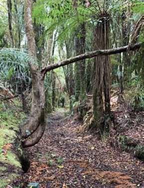
Walking to the Hurunui Hut in the Kaimai Mamaku Forest Park
If you’re looking for a cool walk on a hot summer day, the walk into Hurunui Hut in the lower Kaimais, is a lovely option.
There are several routes into this little Hunters hut.
The easiest two, are to follow the well marked North South Track from the summit of SH 29, or start from Old Kaimai Road for an even easier option.
We chose to do the easiest. Parking at a DOC sign, we followed orange markers down over
farmland for a short distance to reach Raparoa Stream, where we met our first challenge – a slippery rock shelf above a waterfall to negotiate. This is no trouble in dry weather, but can be a challenge after heavy rain.
Continuing up along a fence line we were soon on a lovely shady bush track, following the northern branch of the Henderson Tramway.
This was constructed to transport logs when the forest was milled by the Henderson Timber Co between 1936 and 1957. You can still see the
Hut.
Below left: The sign at the start.
Below middle: A narrow path through the ferns.
By Barbz Lowther
Above left: Hurunui
remains of sleepers in several places. A lot of podocarp, hardwood, and high quality rimu was extracted. Now the bush is re-growth podocarp and broadleaf, with ferns, lichen and moss on the forest floor.
There were sections of red clay, and lots of stream crossings - some tiny, others wide, but all quite slip-
pery, especially the moss covered rocks. It was much easier to plough through the water, than try to rock hop, to keep dry feet.
After a short break under a lovely rimu, we soon reached the junction with the North South Track. Turning left we followed the markers through a grassy clearing, and near the Hur-
unui Stream, a second left turn, led to the hut.
Hurunui is a little three bunk hut, about two and a half hours walk from the Kaimai Summit on SH 29, or a little less from Old Kaimai Road – 14 km return.
The trail is well marked, easily accessible, and really pretty. -- Another hut to explore?
Above left: A stream crossing. Above right: A shaded area of the track.
Below left: Another stream crossing. Below right: Part of the old Henderson Tramway. ■
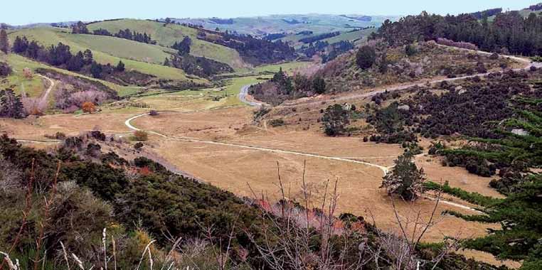
Exploring Gabriel’s Gully: a walk through history and nature
Gabriel’s Gully, nestled near Lawrence in the heart of Otago, New Zealand, is a place where history and nature intertwine. For many, it is a destination that offers not only a walk through beautiful landscapes but also a journey back to the days of the Otago gold rush.
Walking through Gabriel’s Gully is to tread the paths once crowded with fortune-seekers, and now frequented by history enthusiasts, nature lovers, and adventurers.
In this article, we will delve into the rich history of Gabriel’s Gully, explore what makes it a special destination for walking enthusiasts, and highlight the fascinating natural and historical sights you can see along the way.
Brief History
Gabriel’s Gully takes its name from Gabriel Read, the man who sparked one of New Zealand’s most famous gold rushes. In May 1861, Read discovered gold in the gully while prospecting near Lawrence, then a small settlement known as Tuapeka. Read’s discovery was significant because, unlike other finds, he found gold that was relatively easy to extract, lying just beneath the surface.
News of Read’s discovery spread like wildfire, drawing thousands of people from across New Zealand and the world to the region in search of their fortunes. The population of the nearby town of Lawrence exploded as miners, merchants, and entrepreneurs flocked to the area. At
its peak, the gold rush in Gabriel’s Gully transformed Lawrence into a bustling hub, with businesses, hotels, and saloons springing up to cater to the needs of the booming population. The initial rush lasted for several years, but as the easily accessible gold was mined out, the feverish activity in Gabriel’s Gully began to subside. By the late 1860s, the gold rush had largely come to an end, though mining continued in smaller operations for several decades. Today, Gabriel’s Gully stands as a testament to this transformative period in New Zealand’s history.
Walking through Gabriel’s Gully is a chance to experience history firsthand. The gully has been preserved as part of the Gabriel’s Gully Historic Reserve, making it a popular destina-
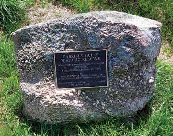
Below right: A commemorate plaque.
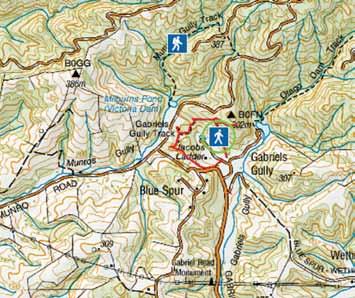
Above right: An infomation sign at the start of the track going up the hill. tion for both locals and tourists who want to explore the region’s past and enjoy its natural beauty. There are several walking tracks of varying lengths and difficulties, allowing visitors to tailor their experience to their fitness level and interests.
The Main Walking Track
The most popular walking route in Gabriel’s Gully is the Gabriel Read Memorial Track. This track is a relatively easy loop that takes about an hour to complete, making it suitable for walkers of all ages and abilities. The track begins at the reserve’s main car park and winds its way through the gully, passing key historical sites along the way.
As you walk, you’ll see remnants of the gold mining era, including the remains of sluicing operations and water races. Interpretive signs along the track provide fascinating insights into the lives of the miners who once worked in the gully, explaining the various techniques they used to extract gold from the earth.
One of the highlights of the walk is the Gabriel Read Memorial Cairn, a monument erected in 1926 to commemorate Read’s discovery of gold in the area. The cairn stands as a reminder of the significant role that Gabriel’s Gully played in shaping New Zealand’s early history and development.
Additional Tracks and Walks
For those looking for a longer or more challenging walk, the Otago Goldfields Heritage Trail offers an extended journey through the surrounding region, including Gabriel’s Gully. This trail connects several
historic gold mining sites throughout Otago, providing a more in-depth exploration of the area’s rich heritage.
There is also the nearby Wetherstons Walk, which takes you through the Wetherstons settlement, another important site from the gold rush era. This walk offers a different perspective on the mining history of the area, as well as stunning views of the surrounding countryside.
While Gabriel’s Gully is famous for its gold rush history, it is also a place of striking natural beauty. The gully is surrounded by rolling hills covered in native bush and regenerating forest, offering a peaceful and picturesque backdrop to your walk.
During the spring and summer months, the hills come alive with the vibrant colours of wildflowers, while the cooler months bring misty mornings and the quiet beauty of the changing seasons.
The gully is home to a variety of native bird species, making it a popular spot for birdwatchers. Tui, bellbirds, and fantails are commonly seen flitting through the trees, their
melodic calls adding to the serene atmosphere of the walk. The reserve’s commitment to conservation and restoration efforts means that the area’s natural ecosystems are being preserved and enhanced for future generations to enjoy.
Points
of Interest Along the Way
Gabriel Read Memorial Cairn: This monument marks the spot where Gabriel Read first discovered gold in 1861. It’s a must-see for history buffs and serves as a poignant reminder of the gold rush that forever changed the region.
Mining Relics: Scattered throughout the gully are remnants of the gold mining operations, including water races, tailings, and sluicing channels. These historical artifacts provide a tangible connection to the past and give visitors a sense of what life was like for the miners who worked here.
Regenerating Forest and Native Flora: As you walk through the gully, you’ll notice areas of regenerating forest, part of ongoing conservation
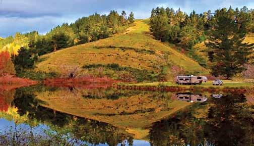
Above: Greys Dam Picnic area. Below: The track up the hill.
Exploring Gabriel’s Gully: a walk through history and nature
efforts to restore the area’s natural environment. Keep an eye out for native plants like kahikatea, totara, and matai.
Tuapeka Stream: The gully is crossed by the picturesque Tuapeka Stream, which played a crucial role in the gold mining operations of the past. Today, it adds a tranquil element to the walk, with its gently flowing waters and peaceful surroundings.
.Wetherstons Brewery Ruins:
Just a short distance from Gabriel’s Gully lies the Wetherstons Brewery site, where the famous Wetherstons Brewery once operated during the gold rush. The ruins of the brewery are an intriguing glimpse into the commercial side of the goldfields.
Planning Your Visit
Gabriel’s Gully is easily accessible from the town of Lawrence, which is about an hour’s drive from Dunedin.
The reserve has a large car park, and there are basic facilities such as toilets and picnic areas available for visitors.
The walking tracks are wellmaintained, and signage throughout the reserve provides information about the area’s history and natural features.
Before setting out, it’s a good idea to check the weather conditions and make sure you have appropriate clothing and footwear, especially if you plan to do one of the longer
walks in the area. Gabriel’s Gully can be enjoyed year-round, but the tracks can become muddy in wet weather, so sturdy shoes are recommended.
Conclusion
Gabriel’s Gully offers a unique opportunity to combine a love of walking with a passion for history and nature. As you explore the gully, you’ll not only be surrounded by stunning scenery but also immersed in the stories of those who came before.
Whether you’re a seasoned hiker or simply looking for a relaxing stroll, a walk through Gabriel’s Gully is an unforgettable experience that connects you to the land, the past, and the spirit of adventure that has always defined New Zealand’s pioneering heritage.
Above left: The track just after the start of the walkway.
Fact file
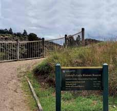
Getting there: From Lawrence turn off at Gabriels Gully Road. Start from the Gabriels Gully carpark. Gabriels Gully is 3 km from the township of Lawrence, 92 km south-west of Dunedin on SH8.
Length 2.4 km loop track
This classed as an Easy: Walking track Dogs are allowed on a leash
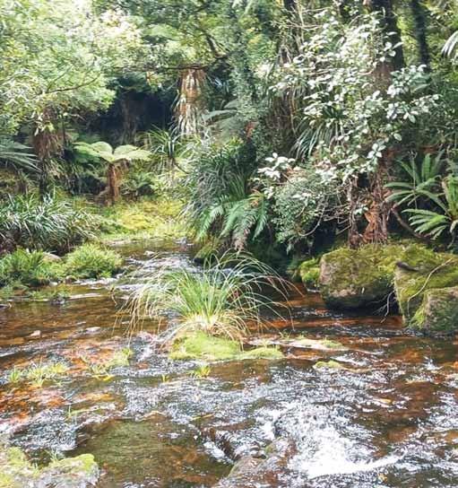
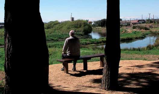
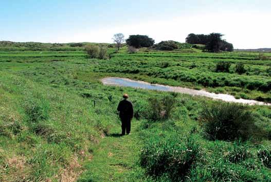
Walking the where the Manawatu
The Piriharakeke Walkway, a scenic trail stretching approximately 4 kilometers from Foxton town to the iconic trestle bridge, offers not just a pleasant outdoor experience but also a rich historical experience.
Nestled in the Horowhenua district, this pathway invites walkers, runners, and nature enthusiasts to traverse a landscape imbued with Māori cultural significance and colonial history.
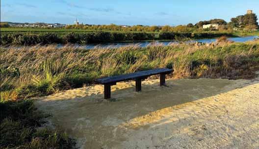
Above left: The start of the walk: Below left: A seat and improved track surface recently done by volunteers from SORT.
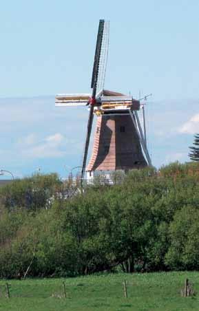
Above right: From this viewpoint you can see the Foxton windmill in the background
Piriharakeke WalkwayRiver
once flowed
The relatively short distance of 4 kilometers makes it accessible for people of various fitness levels, yet the experience leaves a lasting impression thanks to the beauty of the natural environment and the historical landmarks that dot the route.
The Piriharakeke Walkway takes its name from Piriharakeke, a Māori term that refers to the flax plants (harakeke) once prevalent in the region. Flax was a vital natural resource for Māori, used for weaving, creating ropes, and producing garments.
This plant was especially important for the local iwi (tribes) of the area, including Ngāti Raukawa and Muaupoko, who maintained a close relationship with the land and waterways around Foxton.
In pre-colonial times, the
Manawatū River, then ran parallel to much of the walkway, was an essential route for transport and trade.
Foxton itself, known in Māori as Te Awahou, has been a key hub of human activity for centuries. It served as a bustling river port during the 19th century and was central to the flax milling industry in the late 1800s and early 1900s.
European settlers in the region capitalized on the area’s abundance of flax, which they processed into textiles and rope, making Foxton the hub of New Zealand’s flax industry for many years. While the flax trade eventually declined, the cultural and historical significance of this resource remains embedded in the community’s identity.
In the present day, the Piriharakeke Walkway serves as a reminder of the intertwined histories of Māori
and European settlers in the region. As walkers set off from Foxton, they are retracing routes that were once traversed by both Māori and European settlers, who used the river and the land for sustanance and industry.
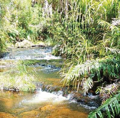
The Walk Itself: What to Expect
Starting in Foxton town, the Piriharakeke Walkway begins at a gentle pace, welcoming walkers with flat, easy terrain. The route initially takes you along Foxton’s riverbanks, which offer a peaceful and serene environment.
Along the way, the sight of native flora, including harakeke, mānuka, and tōtara, reminds walkers of the rich natural resources that sustained the area’s Māori communities for centuries. Birds such as fantails (pīwakawaka), tui, and kingfishers can often be seen flitting about, adding a lively element to the journey.
Interpretative panels placed along the walkway provide a wealth of information about the area’s history,
Mawatu River once flowed
Walking the Piriharakeke Walkwaywhere the
ecology, and cultural importance. These panels tell the stories of early Māori habitation, the development of the flax industry, and the transformation of the landscape over time.
The signage also highlights the significance of the Manawatū River, which was once the main artery for trade and travel in the area.
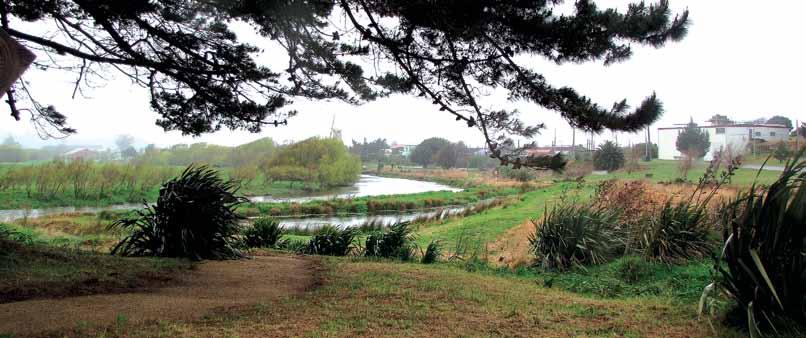
About halfway along the walkway, the landscape opens up, offering expansive views of the river on one side and farmlands on the other. The sound of flowing water and the occasional passing boat adds to the tranquil ambiance.
The walkway’s relative isolation from traffic and noise makes it a perfect spot for reflection or simply taking in the natural beauty of the Manawatū region.
Above top: Looking north from a viewing area with the Dutch windmill in the background. Above middle: A walker coming down to a flat farm area.
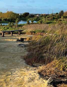
Below left: On December 16 last year members of Save Our River Trust (SORT) and voluterers spent the day restoring the track, by weeding, tidying up and laying down limestone, etc Below photo shows one area covered in limestone.
As you approach the trestle bridge, the final landmark on this route, the sense of history becomes even more palpable. This bridge is a relic of the early 20th century. It is a magnificent structure, both visually striking and historically significant.
The trestle bridge represents the rapid expansion of road transport that helped link rural communities like Foxton with larger cities and ports. Standing on the bridge offers stunning views of the river and surrounding countryside, a perfect culmination of the journey.
The Piriharakeke Walkway is more than just a recreational path; it is a living connection between the past and present. The land through which it runs has been shaped by centuries of human activity, from
.Māori settlement and the flax trade to European colonization and the development of infrastructure. The walkway serves as a reminder of the importance of preserving the land’s natural resources and the stories that come with them.
Māori continue to maintain strong ties to the region, with local iwi playing an essential role in the environmental management of the Manawatū River and its surroundings.
The walkway is also a place of education, where visitors can learn about sustainable land use and the importance of protecting native species. The native plants along the walkway, particularly the flax, are a living tribute to the resource that once defined Foxton’s economy.
The Piriharakeke Walkway is also part of a broader effort to revitalize and protect natural spaces in the region. Initiatives to restore native vegetation and improve water quality in the Manawatū River reflect a growing awareness of the need to balance development with environmental stewardship.
Walking the Piriharakeke Walkway is not only a journey through some of New Zealand’s most scenic natural landscapes but also a walk through history.
The 4-kilometre trail from Foxton town to the trestle bridge offers an immersive experience that connects walkers with the rich Māori and European heritage of the region. Whether you’re there for a leisurely
stroll or an educational adventure, the walkway leaves a lasting impression of a place where the past and present coexist harmoniously.
From the tranquil river views to the historic landmarks, every step along the Piriharakeke Walkway reveals another layer of Foxton’s history and its enduring relationship with the land and water.
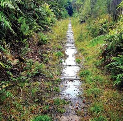
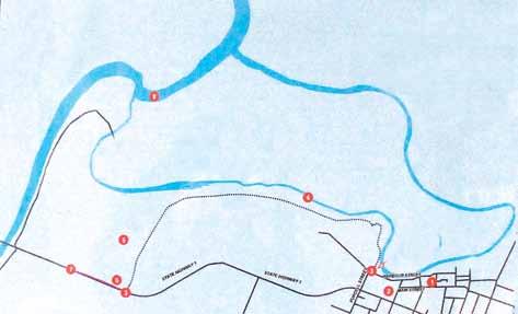
Access: Start at the corner of Purcell St and Harbour St. A short 1km loop track in the trees affords views of the river and can be walked or cycled.
For a longer walk exit the pines after 500m onto the grassy track through active farmland, and onto the Moutoa Floodway stopbanks via step-over styles.
The walk is 3.6km-long (one way). Allow about two hours for the return trip or arrange a ‘pick-up’ at the
northern end of the Trestle Bridge. Track: Partially formed track/surface. Take care to leave gates open or closed as you find them. Stop banks may be grazed by stock.
At the end of the walk why not return to Foxton where there three cafes the Dutch Oven De Molen and Robert Harris all wivhing walking distance of the start of the track.
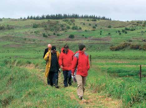
Above Left: A group on the walkway. Above right: De Molen windmill can be seen from the walkway.
Below right: Walking through a treed area near the start of the walkway.
New Zealand Walk
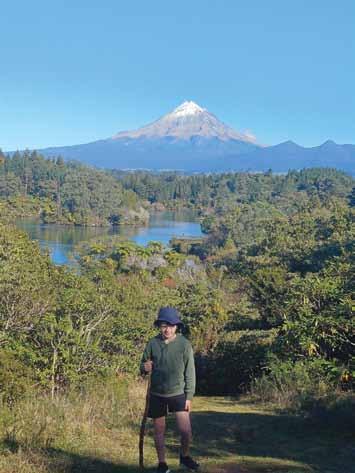
Middle left: Enjoying an early winter’s walk around this beautiful lake with my Grandson, Mark. Lake Mangamahoe in Paradise! So many stunning views on this walk. The Taranaki where else! Photo by Wendy Downes, Waipukurau.
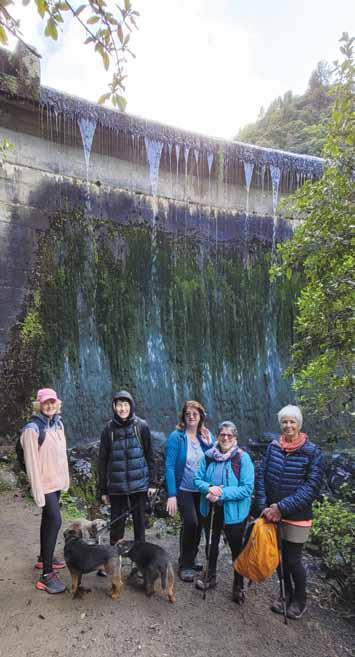
Below right: Members of the Upper Hutt Walking and Tramping Club walked up to Canon Point in the Akatarawa Forest near Upper Hutt on a cool but clear day in August - photo is at Birchville Dam where we stopped for a break on the way up. Photo by Sharon Dunstan, Whitby, Porirua.
PHOTO CONTEST
a walk along
Bay in wonderful sunshine!.
Above left: The Abel Tasman walk was amazing. Day two started with
Awaroa
Photo taken by Chrissie Courtman
Above left: Bealey Spur Track, on a late autumn day. Photo by Michael Hendriks, Lyttleton, Christchurc
PHOTO CONTEST
Above right: Nikau Walk in Pirongia Forest Park in the Waikato follows a stream through beautiful native forest. Photo by Claire Woodhall, Pandora, Napier.
Queensland’s best short walks under two hours
By Scott Russell
Feel the warm embrace of the sun, smell the salt on a sea breeze, hear bird song or see glow worms light up a cave – walking in Queensland is a feast for the senses.
You don’t need to trek for days, either (although we’ve got you covered here if that’s your thing). You’re only a short walk away from exploring a lake in a volcanic crater, feeling the mist from a towering waterfall or spotting humpback whales frolicking in the surf.
So put on your walking shoes
and read on for our guide to some of Queensland’s best short walks in under two hours.
(These walks are mostly Grade 1 (easy) or Grade 2 (moderate). Grade 1 walks are less than 5 km and suitable for assisted wheelchair users. Grade 2 walks are less than 10 km and may have some steps or gentle slopes. Before departing, check the Queensland Government’s Park Alerts).
The best short walks in South East Queensland
Natural Bridge Circuit, Springbrook National Park, Gold Coast
Wander amongst prehistoric jungle, Jurassic-period hoop pines, and tumbling waterfalls in Springbrook National Park, part of the UNESCO World Heritage-listed Gondwana Rainforest. While there are dozens of trails to choose from, for something the whole family can enjoy, we recommend the Natural Bridge Circuit, where a short trail leads to a ‘bridge’ inside a cave formed by water over thousands of years.
Return at night between December and March on a tour when the cave is illuminated by thousands of bioluminescent glow-worms.
Duration: 1 km and should take 45 minutes to complete.
Classification: Grade 2: Moderate
Accessibility: Not completely accessible (there are stairs) Oceanview Walk, Burleigh Heads National Park, Gold Coast
Just metres from the sands of Echo Beach, (one of the Gold Coast’s best-kept secrets) you’ll discover the Oceanview Walk. This familyfriendly stroll meanders through pandanus groves, subtropical rainforest, and along the surf front of Burleigh Headland—an untouched gem of natural beauty that extends out into the Pacific Ocean at Tallebudgera Creek.
You can return the same way or take the Rainforest Circuit – a 2.3 km Grade 3 (moderate) track leading up to Tumgun Lookout, offering sweeping ocean views. Visit between May and November to spot humpback whales frolicking in the sea.
Duration: 1.2 km and should take
Above left: On the Oceanview Walk at Burleigh Head, Gold Coast. Above right: Great sea views from the Mooloolaba Foreshore Boardwalk, Sunshine Coast.
Above middle: At the lookout on the Din Din Barron Falls Lookout Track.
30 minutes to complete.
Classification: Grade 2: Moderate
Accessibility: Some wheelchair and pram-access
Daisy Hill Conservation Park Tree Discovery Trail, Brisbane
This easy-going trail wanders around the open eucalypt forest and melaleuca wetlands of Logan’s Daisy Hill Conservation Park. Whether it’s a leisurely walk or a family outing you’re seeking, the trail offers a relaxed walk suitable for everyone— little kids and big kids alike.
Afterwards, make your home amongst the gum trees for the afternoon and enjoy a picnic or BBQ in the Day Use Area, or visit the Daisy Hill Koala Centre and learn about these amazing marsupials.
Duration: 940 metres and should take 20 minutes to complete.
Classification: Grade 1: Easy
Accessibility: There’s a DDAcompliant pathway through the day-use area.
Mooloolah River to Alexandra Headland Coastal Pathway, Sunshine Coast
Hugging the Sunshine Coast’s 60-kilometre ribbons of golden sand is the ‘Coastal Walk’—a 73 km network of Grade 1 (Easy) and Grade 2 (Moderate) shared pathways from Bells Creek in the south to Coolum in the north.
You can’t go wrong with any of the sections, but our fave is the coastal
pathway that links the Mooloolah River to Alexandra Headland. This 3.7-kilometre stretch offers ocean views with cafes, playgrounds and parklands dotted along the way, making it perfect for outdoor enthusiasts and families alike.
Duration: 3.7 km and should take 45 minutes to complete.
Classification: Grade 1: Easy
Accessibility: Wide shared pathway suitable for wheelchairs and prams.
Mary Cairncross Rainforest Loop, Sunshine Coast
The Rainforest Loop Walk at Mary Cairncross Scenic Reserve offers a short but serene escape into the natural beauty of the Sunshine Coast Hinterland. A gold-coin donation at the discovery centre gets you access to this 1.7-kilometre trail, where you’ll find peace and tranquillity amongst
the Strangling Figs and Piccabeen Palms. After you have finished your walk, make sure to experience the breathtaking Glass House Mountains views from the lookout.
Duration: 1.7 km and should take 1 hour to complete.
Classification: Grade 2: Moderate
Accessibility: The Glider Gallery boardwalk and butterfly walk are wheelchair-accessible.
Sunshine Coast Hinterland
Great Walk - Baxter Falls, Sunshine Coast
You don’t need to chase waterfalls amongst the rolling green hills and subtropical rainforest of the Sunshine Coast Hinterland—a short walk is all you’ll need to find one. Kondalila Falls and Mapleton Falls are ever popular—and for good reason—but we like the quieter Baxter Falls. Part of the Sunshine Coast Hin
Queensland’s best short walks under two hours
terland Great Walk, the 3.3 km trail provides a serene escape to nature, winding through rainforests across a suspension bridge to the base of the falls where water cascades into deep rock pools.
Duration: 3.3 km and should take two hours to complete.
Classification: Grade 2: Moderate
Accessibility: Not wheelchair accessible
The best short walks in North Queensland
Din Din Barron Falls Lookout Track, Cairns & Great Barrier Reef
Fly through the tree-tops on the Din Din Barron Falls Lookout Track, a 1.2-kilometre elevated walkway high above the forest floor in the Wet Tropics World Heritage Area.
Follow the track to the falls, where you’ll be awestruck by mother nature’s power—watch as nearly 2 million litres of water plunges over 125 meters of sculpted granite every
minute. Visit during the wet season when the falls are at their most spectacular, and the gorge becomes shrouded in mist.
Duration: 1.2 km and should take 45 minutes to complete.
Classification: Grade 1: Easy
Accessibility: Wheelchair-accessible walkway with some incline.
Lake Eacham Circuit Track, Cairns & Great Barrier Reef
Head up into the Atherton Tablelands (think of it like Tropical North Queensland’s built-in air conditioner—temps up here are several degrees cooler than they are in Cairns) and walk around the picturesque, emerald green waters of Lake Eacham—a ‘maar’ or volcanic crater formed 9,000 years ago by exploding superheated groundwater.
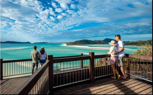
Above left: Two groups taking in the view on the Hill Inlet, Whitsunday Island, The Whitsundays.
Below left: Admiring a waterfall on the Natural Bridge, Springbrook National Park, Gold Coast.
As you wander around the track, keep an eye out for eastern water dragons, cute little musky rat-kangaroos (the world’s smallest macropod), or more than 180 species of birds.
Duration: 3 km and should take one hour to complete.
Classification: Grade 2: Moderate
Accessibility: Wheelchair-accessible access to the main pontoon and turtle viewing platform.
Hill Inlet, Whitsunday Island, The
Whitsundays
Starting from the northern end of the world-famous Whitehaven Beach, the Hill Inlet Lookout Track climbs through scenic bushland to offer views of nature’s artistry as the inlet’s turquoise waters blend with white shifting sands.
Located in Whitsunday Islands National Park, this is a Grade 3 Moderate walk—a little more strenuous than some of the others on the list— so make sure you’ve got your good walking shoes and a bottle of water.
Duration: 1.3 km and should take 40 minutes to complete.
Classification: Grade 3: Intermediate
Accessibility: Not wheelchair accessible
Airlie Creek Track, The Whitsundays
Keep an eye out for rock wallabies scurrying across the path and native birds flying overhead as you walk amongst fig trees and sub-tropical rainforests, catching glimpses of the Coral Sea as you make your way up the Airlie Creek Track.
The track starts on the edge of Airlie Beach as a gentle Grade 1 (Easy) walk but becomes increasingly challenging along the way. To make it to the top, you’ll have to brave a short Grade 4 (Difficult) section at the end, featuring a 20-degree quad-burner. Your reward? Trickling rock pools and a waterfall that’s particularly pretty after rainfall.
Duration: 850 metres and should take one hour to complete.
Classification: Grade 1: Easy (start) to Grade 4: Difficult (summit)
Accessibility: Not wheelchair accessible
Australian Walks
The Estuary Edge Walk-
where the Avon River meets the sea
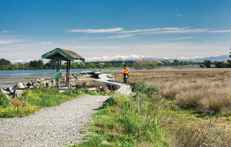
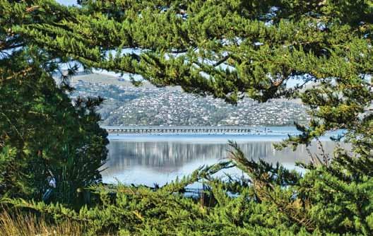
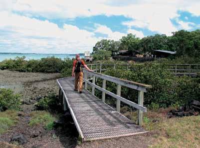
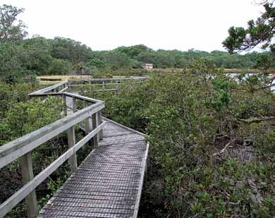
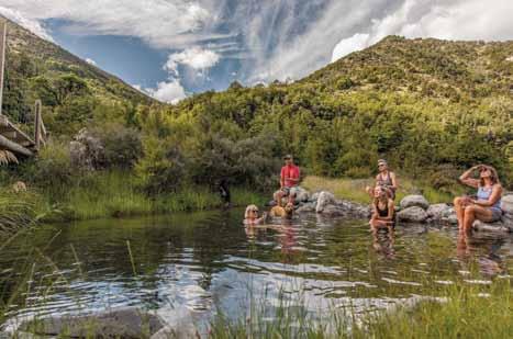
Earlier this year, I explored the Bexley Wetlands loop here in Otautahi / Christchurch as featured in the May edition of Walking NZ Magazine. Today I am back to walk the southern part of this very popular track, the Estuary Edge Walk, where the Avon River meets the sea.
The walk will take about two hours to cover the 10km on a multiuse pathway and has the option to return along the beach.
You can start the walk at multiple points to either increase or decrease the distance as needed, depending on the time you have or if you only want to complete a smaller section of this walk. It is always enjoyable to start and finish a walk at a local cafe and today I have started my walk at the “Dune” Cafe as it is an easy 15-minute walk to the Bridge Street entrance. The walk
starts by heading south on a wide gravel path, initially passing through a regenerating native bush area. Along the way, don’t forget to look back at the Southern Alps, which offer a breathtaking backdrop for this section of the walk.
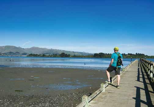
As the walk continues to head south, it weaves its way in and out of the trees, teasing you with stunning views of the bush, the Estuary, and the Port Hills. The walk arrives at the jetty at South Brighton, which was replaced in 2018 due to the damage from both earthquakes and storms. If you walk out to the end of the jetty, you will be rewarded with stunning views of the surrounding area and wildlife.
The track continues along the estuary through the last strand of trees as
Above: A cyclist on the boardwalk section of the walk with the Southern Alps in the background. Below left: Looking towards the Port Hills from the South New Brighton jetty.
Words and photos by Michael Hendriks
The Estuary Edge Walkwhere the Avon River meets the sea
boardwalk, which takes you over the salt marshes.
There is a brief detour out onto Rockinghorse Road before the track again continues back along the edge of the estuary through the now abandoned and demolished “Red Zone” sections where you will see, old swings, palms trees, Norfork pines and gates of properties that used on the estuary’s waterfront.
The track becomes narrower as it leaves the “Red Zone” properties and makes its way to the start of the South Shore dunes loop track.
This track goes up and over the dunes, leading to South New Brighton Beach, offering spectacular views of Sumner to the south and the inland Kaikoura ranges to the north on a sunny day.
It is now a long but invigorating 4.5km walk back towards the New Brighton with the pier in the distance, but with the wind and the roar of the ocean and the spectacular views of the coastline it makes it an enjoyable hour’s walk. The South New Brighton Surf Club now comes into view and it was then only a few more minutes back to the start of the walk and time of a rest and a coffee.
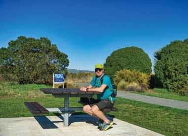
Above left: Michael, enjoying a brief break at one of the many picnic tables on the walk
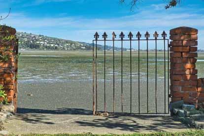
Above right: Gates of a previously demolished house from the “Red Zone”.
Middle right: Looking across the estuary to houses on Mt Pleasant and Redcliffs.
Food for thought!
The hill looked hard at first. But, I got over it. Unknown
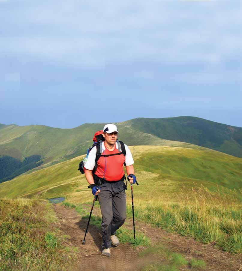
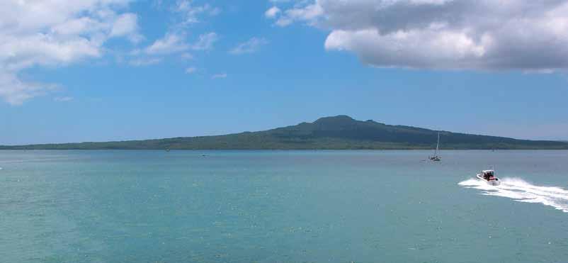
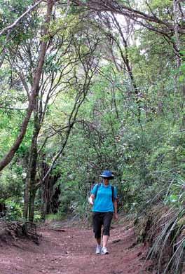
Walking up Rangitoto Island - a taste of adventure
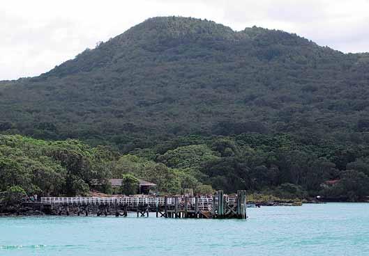
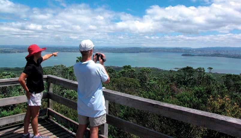
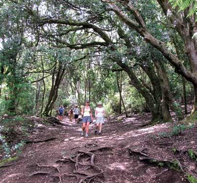
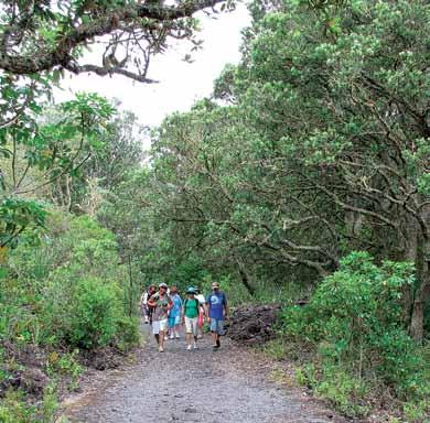
Rangitoto Island, a volcanic icon in Auckland’s Hauraki Gulf, offers one of the most scenic and historically rich hikes in New Zealand. Just a short ferry ride from Auckland’s city center, Rangitoto stands proudly, beckoning adventurers with its unique landscape, stunning views, and intriguing past.
The walk up Rangitoto Island to the summit is an accessible yet moderately challenging trek that winds through volcanic terrain and native bush, all the way to the island’s summit. The well-maintained track, starting near the ferry drop-off point, takes around an hour to an hour and a half one way, depending on pace.
Foldable Hiking Sticks
With its gradual incline, the trail is suitable for all fitness levels, though sturdy footwear is recommended due to the rugged lava rock that dominates the landscape.
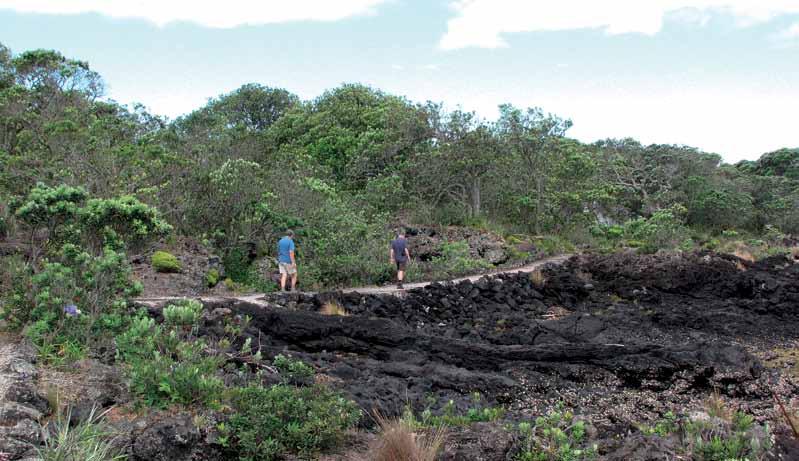
As you begin your ascent, you’re immediately greeted by the stark, otherworldly landscape of solidified lava flows. Rangitoto, which last erupted approximately 600 years ago, is the youngest and largest of Auckland’s volcanic cones. The barren, black lava fields tell a story of fiery eruptions, while the hardy pōhutukawa trees, New Zealand’s iconic “Christmas tree,” add splashes of green and red to the dark terrain.
Over time, Rangitoto has become a refuge for plant life, with over 200 species of native flora flourishing here. As you walk, keep an eye out
for unique plant species that have adapted to the harsh volcanic environment, offering a fascinating contrast between barren rock and lush growth. One highlight is the island’s vast pōhutukawa forest, the largest in the world, which bursts into bright crimson bloom during summer.
A Step Back in Time
Rangitoto Island also has a unique history intertwined with both Māori and European heritage. For Māori, the island holds cultural significance, with its name translating to “Bloody Sky” in reference to the island’s fiery origin.
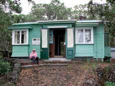
In the early 20th century, Euro-
Above: Rangioto Island in the Hauraki Gulf.
Below right: The Rangitoto Wharf as seen from the ferry.
New Zealand Walks
Walking up Rangitoto Islanda taste of adventure
pean settlers began building holiday homes, or “baches,” on Rangitoto. Today, these baches still stand, preserved as part of New Zealand’s cultural heritage, and are a fascinating glimpse into early 20th-century Kiwi life. A short detour off the main trail leads you to the Bach 38 Museum, where you can see what life on the island was like for early settlers.
As you near the summit, the landscape changes once again. The vegetation thins out, and the jagged volcanic rock becomes more promi-
nent. Upon reaching the summit, you’re rewarded with breathtaking 360-degree views.
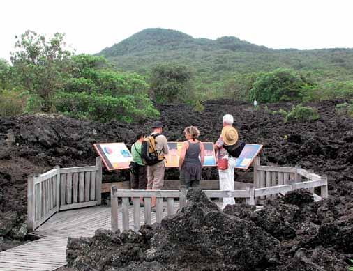
On a clear day, the vista stretches across the sparkling waters of the Hauraki Gulf, with Auckland’s skyline to the south and the Coromandel Peninsula to the east. The sight is truly one of the best panoramic views in the region.
Before heading back down, make sure to explore the lava caves—a hidden gem located just off the summit track. These caves, formed by
fast-moving lava during the island’s eruption, are an exciting detour for adventurous hikers. Bring a flashlight if you plan to venture inside, as the caves are pitch-dark and give a sense of the island’s volcanic origins.
Above: The Rangitoto Island summit viewing platform with views of the city of Auckland and its eastern beaches.
Below left: A group on their way just after the start of the summit track. Below right: A well paved track on the way to the summit.
There are are a number of short walk around Rangitoto Island Scenic Reserve. Stroll through a kowahi grove or glen of kidney ferns, or walk along the coast to a gull breeding colony.
Kowhai Grove
Time: 45 minutes return
This short walk leads to a small kowhai grove, especially attractive in
spring when the trees are flowering.
Kidney Fern Glen
Time: 45 minutes return
A track branching off the Summit Track leads through a glen of delicate, translucent kidney ferns, at their best after rain.
Flax Point and historic baches
Time: one hour return
A coastal walk to a black back gull breeding colony on Flax Point. The first section of track passes by some of the remaining historic baches on the island.
Explore Rangitoto Island Scenic Reserve offers those keen on longer walks. Walk around the coast of Rangitoto, to adjoining Motutapu Island, or continue on from the summit to Islington Bay.
Above: The Coastal Track winds its way to the beaches. Below left: A smooth surface section of the track.
Lighthouse walk to McKenzie Bay
Time: two hours 30 minutes one way from Rangitoto Wharf; three hours 45 minutes one way to summit
This walk winds along the coast to McKenzie Bay, one of the two natural sand beaches on Rangitoto, and a good picnic and swimming spot. The road continues on to the summit for those who want a longer walk.
Rangitoto Wharf to summit to Islington Bay
Time: two hours 30 minutes one way
Take the Summit Track from Ran-
Ouch! Sore feet while walking?
Hikers Wool is 100% New Zealand wool. Cushion your feet to prevent pain, rubbing and blisters.
Buy online or at selected stockists For more info visit www.hikerswool.co.nz
Walking up Rangitoto Island - a taste of adventure
gitoto Wharf and at the summit follow Summit Road down to Islington Bay. This is a wonderful route for those staying overnight or for visitors with access to a private vessel. This walk is not recommended for daytrippers on the Fuller’s ferry, as it does not allow much time to walk back to the Rangitoto Wharf ferry in time for departure.
All your tramping essentials One shop ~ Since 1988 taste of
Coastal Track from Rangitoto Wharf to Islington Bay Wharf
Time: two hours 30 minutes one way
This coastal walk passes many remnants of human activity – boatsheds and baches near Rangitoto Wharf, old quarry sites, ruins of war time storage bases for mines, and Yankee Wharf built during World War II. Islington
Boots Packs Rainwear
Bay is popular for swimming, picnicking and as a yacht anchorage.
Note: Sections of this track are over broken lava fields and the footing is rough and uneven. Good foot wear is essential.
Inland route from Rangitoto Wharf to Islington Bay Wharf
Time: one hour 30 minutes one way This alternative route to Islington Bay passes along a road built by prisoners. The road continued over the causeway to Motutapu Island.
Above left: A boardwalk follows the coastline to the section of holiday baches.
Above right: A boadwalk on the way to Flax Point.
Middle right: The track under shade. Below right; A group of interprtation panels.
Islington Bay Wharf to Home Bay (Motutapu Island)
Time: one hour 45 minutes one way
From Islington Bay, cross the causeway to Motutapu Island. A walk over farmland and cliff tops leads to Home Bay, where there is a DOC campground.
Islington Bay Road to Wreck Bay
Time: one hour one way
The Wreck Bay Track takes a twisting route to a bay on the northern side of Rangitoto. Wreck Bay and the adja-
cent Boulder Bay where once used as a dumping ground for old ships. The remains of some ships can still be seen at low tide.
Be aware the time of this walk only includes the time from the road to the end of the track one way. It takes an additional one hour 30 minutes to walk from Rangitoto Wharf via Islington Road.
Note: Sections of this track are over broken lava fields and the footing is rough and uneven. Good foot wear is essential.
Walking up Rangitoto Island is not just a hike—it’s an immersive journey through New Zealand’s natural and cultural history. Whether you’re drawn by the volcanic landscapes, the panoramic summit views, or the chance to explore lava caves, Rangitoto offers an unforgettable experience
Above right: One of the historic baches on the island.
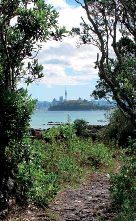
Below left: The Sky Tower from a coastal track on Rangitoto Island.
for both locals and tourists alike. With its proximity to Auckland, it’s a perfect day trip, offering a taste of adventure just a stone’s throw from the city.
Fact file
Duration: The hike to the summit takes one to one and a half hours each way, making it a two to three hour return trip.
Difficulty: Moderate. The track is well-formed but rocky in places.
Getting there: Rangitoto Island is accessible by ferry from Auckland’s downtown terminal. Regular services run throughout the day. Take care not to miss your ferry back as there is no overnight accommodation on the island and alternative transport to the mainland is expensive!
What to bring: Good walking shoes, Bring water with you as there is no supplies of drinking water on the island, sunscreen, a hat, as the volcanic landscape offers little shade.
New Zealand Walks
An on-foot odyssey in outstanding Otago
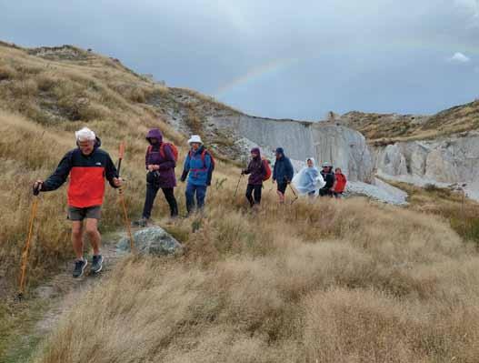
Central Otago, or just Central to locals, is New Zealand’s frontier land. It is famous for its wide open spaces with rolling hills of golden tussock grass, its arid alpine plateaux dotted with rocky tors, its gold mining and rural history, its stunning autumn colours, its extremes of temperature and its endlessly shifting moods.
The topography is a lot less defined than the Southern Alps to the west, but Central Otago has a stark and barren aesthetic of its own, usually beneath a sky of relentless, changeless blue. The vacant landscape may look blankly irresponsive, but appearances can be deceiving. It is actually teeming with life, including Grand and Otago skinks, two of New Zealand’s rarest and most distinctive, growing as long as 300mm.
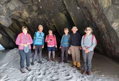
Being away from the popular centres of Queenstown and Wānaka, you seldom see many other walkers on Central Otago rambles, which is one reason why Footsteps Walking and Travel Club sponsors week-long walking trips in this unique area, beginning and ending in Dunedin.
This city is a worthy launching pad for walks within the surrounding hinterland. Silver Peaks, Mount Cargill, Leith Saddle and Flagstaff/Pineapple Hill lead you to the heights, while Tunnel Beach. Taieri Mouth, Doctor’s Point and Hawkes-
bury Estuary will find you revelling on the coastal flats.
On the nearby Otago Peninsula, be sure to tackle the Sandfly Bay-Sandymount and Tomahawk Lagoon trails. At Karitane, don’t miss Huriawa Pa.
The historic and charming town of Middlemarch sits in the StrathTaieri Valley, overlooked by the impressive Rock and Pillar Range, where a long one-day walk can be made to Big Hut (1325m). Other tracks too allow access to the tops, each requiring six to seven hours for the return trip. Spectacular schist outcrops and unusual flora and
fauna are ubiquitous.
Sutton Salt Lake, New Zealand’s only inland version, is located on the southern edge of the valley. It has formed in an enclosed shallow basin within the schist rock surrounds. With no outlet, the hollow has concentrated salts from the soil as it has repeatedly filled, evaporated, and then refilled.
Although often dry, salt tolerant herbs and grasses occupy the lake margins and a range of water birds and waders use the lake, feeding on salt-adapted aquatic invertebrates. A 3.5km (one hour) self-guided
By Phillip Donnell
FOOTSTEPS
loop around the lake is an easy way to enjoy the natural history of this stunning landscape.,
Base yourself at Ranfurly to explore the Naseby Forest, Oteake Conservation Park and St Bathans Range area. The Naseby Forest covers what was the sluiced ground of the original goldfield. Planting began in 1900, from which Douglas fir, larch, and Corsican pine have self-seeded to create the expanse you see today.
A popular route is to follow the Mount Ida Water Race, begun in
1873, upstream from the swimming dam to Hoffmans Pool (one hour 30 minutes), Coalpit Dam (two hours 30 minutes) and back via the Species Walk (three hours 30 minutes). These trails have the best surface and are always a great forest walk no matter what the weather.
Oteake Conservation Park covers large tracts of the St Bathans, Ewe, Hawkdun, Ida and St Marys ranges, and parts of the upper Manuherikia Basin. It protects outstanding landscapes, including mountainous high
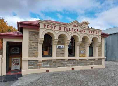
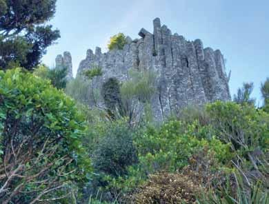
Above left:: The Blue Lake at St Bathans. Above right: Walking around the Blue Lake. Below left: The Ophir Post Office. Below right: Organ pipes on Mt Cargill. Below right: A group at Doctors Point.
An on-foot odyssey in outstanding Otago
country, tussock plateaux, scree, wetlands and indigenous shrubland.
My favourite walk in terms of value-for-effort is the Little Kyeburn Track (two hours , 5km one way), which climbs 600m through remnant tōtara and native shrubland to Buster Hut and Buster Diggings.
Here you can explore spectacular quartz sculptures created by gold mining. It is a great trip in summer to view the scenic waterfall and swim in the rock pools.
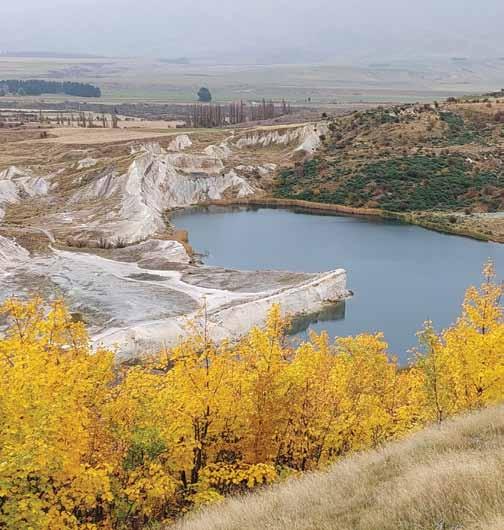
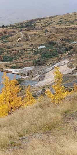
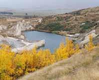
St Bathans township was established in 1863 to service the gold rush and at the time the site of the Blue Lake was the deepest mine in the southern hemisphere.
In fact, the lake was once the 120m high Kildare Hill. The hill was sluiced flat by the elevator, which excavated a massive, 70m deep ‘glory hole’.
There are two tracks to explore here: the 2km return Blue Lake Loop Track or the Around Blue Lake Track (3km). Regardless of which trail you follow, refreshments at the historic Vulcan Hotel afterwards are a must.
Take the road-less-travelled route to Alexandra via the Ida valley. If you’ve read the Booker Prizewinning novel “The Luminaries”, the Golden Progress walk (one hour return) will show you what an old gold mine
really looked like. The poppet head (winding gear) is still in place, along with two rusty old boilers and the ruins of miners’ cottages. A little further down the road, Ophir is a small town but an overachiever in terms of living history.
Stroll down Swindon Street to ad-
mire the stone kerbing, the post and telegraph office (opened 1886 and still operating), courthouse and jail, bakery, cottages, church and shops. Pause at the nearby Daniel O’Connell suspension bridge, which has one end extending through solid rock.
The 12km Millennium Trail from
Below
Below right: Golden Progress Mine, Ida Valley.
Clyde to Alexandra is not-to-bemissed, taking you down the mighty Clutha River, where turquoise water reflects autumn gold. Continue onto the Manuherikia River Track, between Shaky Bridge and the Old Railway Bridge, to access the iconic Clock on the Hill trail, an uneven path leading up to the 11m tall timepiece built in 1968, with panoramic views over the town and along the Otago Central Rail Trail.
In Flat Top Hill Conservation Area the highlights are Butcher’s Dam, a lake, historic huts, skinks and a taste of the area’s geology, dry vegetation and animals that live in it.
Popular walks include Butchers Dam Loop Track (thirty minutes, 1.5km, easy), Basin View Track (three hours, 7.5km return, moderate), and the Flat Top Hill Track (four hours 30 minutes, 13km, advanced). For those with good fitness, the Basin View Track offers sensational views of the Roxburgh Gorge.
As you continue eastwards, be sure to undertake the short amble to the impressive Horseshoe Bend Bridge, some 70.2m long. In the early days, the local community had to cross the river by punt or by chair on a cable, both particularly scary for children attending school at Raes Junction. So, a bridge was eventually constructed in 1913.
While in this area, drive 1 km further downstream and view the Lone-
ly Graves. According to legend, in 1865 William Rigney found the body of a young man in the river. He buried it here with the headboard inscribed ‘Somebody’s Darling lies buried here’. When William died in 1912, he was buried alongside.
At Lawrence, head 3km up the valley to Gabriels Gully, marking the spot where the original Otago Goldrush started when Gabriel Read struck gold in 1861.
A self-guided loop walk (2.8km, one hour 30 minutes), incorporating a series of interpretation panels, lets you explore the area and recounts the stories of the old goldfield occupants.
A little further down the highway, meander through the Mount Stuart Recreation Reserve, then take a pleasant stroll along the Tokomairiro River through bush to Woolshed Valley at Glenore (40m return).
How do you weave all these wonderful walks together in an inexpensive package? The Footsteps Outstanding Otago excursion, scheduled for 13-19 April, 2025, does it for you, removing the hassles of finding your own way around, arranging transport and accommodation and walking by yourself. It’s an easy way to avail yourself of some great opportunities.
For details go to www.footstepswalkingclub.com or contact them 021 172 3244, footstepsanz@gmail. com.
Above left: Walking in Nasby Forest. Below left: The view on the Huriawa Walk, near Karitane. Below middle: Somebodys darling grave.
left: The trail to the Clock, Alexander.
Walking Clubs Groups
NORTH ISLAND
NORTHLAND
BAY OF ISLANDS
BAY OF ISLANDS WALKERS: Saturday (AM), Jacqui Watson 022-6019741, Roz Whittaker 021-063-1455
DARGAVILLE
DARGAVILLE TRAMPING GROUP: Last Sunday of month (AM), Lynley Thompson 021-102-3974, colvilleestate1@gmail.com
WHANGAREI
CARDIAC CARE WALKING GROUP: Wednesday (AM or PM), Jo or Hugh Knight 09-438-7976
BLUE TOP WALKERS: Henderson, Tuesday, Thursday (AM), Terry Wilson 09-814-9523 or 021-266-1071, terryandsheena@gmail.com, www. bluetopwalkers.weebly.com
FIA OLA WOMEN’S DEVELOPMEMT WALK GROUP: Monday to Saturday, Anne, 09-813-0021
FIT4LIFE: Glenfield, Monday (PM), Friday (AM), Sarah 021 534 649 FOOTSTEPS: Saturday (AM), John 09-410-2995
GLEN EDEN ATHLETIC CLUB WALKERS: Glen Eden, Wednesday (PM) and Saturday (AM), Neil Turner 09-817-6230 GREEN BAY MUMS BUSH WALKERS: Every second Monday, Anne
09-827-7810 or 09-817-5867
KELSTON MORNING WALKERS: Kelston C.C. Tues (AM), Joy Martin 09-838-6553
KELSTON TWILIGHT WALKERS: Kelston, Tuesday (PM), Joy Martin 09-818-6084
KUMEU WALK GROUP: Kumeu, Friday (AM), Mary Davies 09-412-2262
LYNNMALL SHOPPING CENTRE KIWIFIT CLUB: Monday, Wednesday (AM), (BIA), 09-826-2333
TE ATAU PENINSULA WALKERS: Monday, Friday (AM), Wednesday (PM), Mary Jones 09-834-6989
TE ATATU SOUTH ACTIVE 35+ WALKING GROUP: Te Atatu South, Wednesday, Edna, 09-834-1401
THE HAPPY WANDERERS WALKING GROUP: Wednesday (AM), Joy Williams 09-817-2464 or 027-353-3434
TITIRANGI TWILIGHT WALKERS: Tuesdays, Thursday, (PM) Titirangi Library, Wednesday (PM) Glovers Real Estate Green Bay, Louise 021437-547, louisenicholson@xtra.co.nz
TITIRANGI WALKERS: Sundays (AM), John Harris 09-627-0099, jeanah@ihug.co.nz
WALKERS & TALKERS: Campbells Bay, Wednesday (AM), Brenda Gray
LEGEND
Fitness levels: “B” beginner, ”I” intermediate, “A” advanced. (AM) denotes morning walk, (PM) denotes an afternoon or evening walk. Group co-ordinators are asked to please advise us of any updates by fax 06-358-6864 or email walkingnz@xtra.co.nz.
MANAWATU STRIDERS: Tuesday, Thursday, (PM); Hockey Manawatu Pavillion, Manawaroa Street, (BIA), Bob 027-208-3719 or Kate 027-567-3896/
LEGEND
Fitness levels: “B” beginner, ”I” intermediate, “A” advanced. (AM) denotes morning walk, (PM) denotes an afternoon or evening walk. Group co-ordinators are asked to please advise us of any updates by fax 06-358-6864 or email walkingnz@xtra.co.nz.
MANAWATU STRIDERS: Sunday (AM); Manawatu Striders Clubrooms, Manawaroa Park, (behind the Esplanade Cafe), (BIA), Bob 027-2083719 or Ross 021-708-733
PIONEER TRAMPERS:Thursday (AM) (IA),4-5 hour tramps in Banks Peninsula and the hills and lower mountains from Mt Hutt to Mt Grey, pioneertrampers@gmail.com
60’S UP WALK GROUP: Monday (AM), Olive Swain 03-214-4802
YMCA WOMEN’S WALKING GROUP: Tuesday (AM), Joan Tuffery, 03-216-7377
ACTIVE WALKERS KIWI SENIORS: Thursday, Sport Southland 03-2112150, e:kiwiseniors@sportsouthland.co.nz, wwwsportsouthland. co.nz
GORE
GORE DISTRICT WALKERS: Tuesday (AM), NgaireEvans 03-208-4744 or Maureen Jones 03-208-7322, maway50@gmail.com
HOKONUI TRAMPING CLUB: Margaret Hughes 03-208-7053
NORTHERN SOUTHLAND
NORTHERN SOUTHLAND WALKERS: 2nd and 4th Thursdays, Mossburn.: Jo Muir, 03-248-6474, Balfour: Christine MacLean 03-201-6390, Riversdale: Margaret McLennan, 03-202-5868
Notice to clubs and walking groups
If you notice there that the times, names or contact numbers etc on the list of Walking Grroups in the Directory on these pages needs updating please email us at walkingnz@xtra.co.nz. These are are free listing.
NEW ZEALAND‘
OCTOBER 2024
6 Manwatu Striders Step into Spring, 15km & 10km, Palmerston North
21 Manawatu Striders Super Seven Series, Palmerston North
25 First Light Marathon, Gisborne
25 Jumbo Holdsworth and Hooper Loop Trail Races, Mt Holdsworth Lodge, near Masterton
25 Mavora Explorer, Mavora Lakes Road, Te Anau Basin
26 Vine Run at Pegasus Bay Winery, North Canterbury
28 Manawatu Striders Super Seven
Series, Palmerston North
31 to 9 February New Zealand Masters Games 2025, Whanganui FEBRUARY 2025
7 Coast to Coast Mountain Run, Aickens, Canterbury
8 Buller Gorge Marathon, Half Marathon & Team Relay, Buller to Westport
MARCH 2025
21- 6 April Waiheke Walking Festival, Waiheke Island
MAY 2025
Friday-Sunday 15 -17 Nov 2024
www.warkworthwalks.co.nz
11 fascinating guided trails through the unique & beautiful surrounds of Mahurangi, Kaipara, Warkworth & Matakana, including otherwise inaccessible areas & local hospitality. Featuring new & updated walks.
The Pohangina Downhill Walk
9th November 2024 8:00am to 2:00pm
Situated in the beautiful Pohangina Valley, in the Manawatu district, climb aboard a shuttle bus ride to the beginning of the Branch Road walkway and take a gentle walk down through 6kms of native bush and farmland back to the Pohangina township to County Fayre, where a light lunch awaits you (all included in the price). Caravan and Campervan facilities available locally.
YOU MUST BOOK and PRE-PAY for this event
Adults $30, Children $15 (5 to 15yr), Family $100 (2 Adults & 4 Children), under 5’s free.
For more information or to book your ticket email: countyfayre@inspire.net.nz or message our facebook page https:// www.facebook.com/CountyFayre.
7 Pasifika Festival and Charity Walk, Lynbrook, Melbourne Vic MARCH 2025
8 Great Illawarra Walk, Shellharbour, NSW
22 Lake High - Great Victorian Walk for Autism, Mansfield, Vic
29-230 Aussie Peace Walk, Lake Burley Griffin Canberra, ACT
REST OF WORLD
NOVEMBER 2024
2-3 IML Walking Festival, Higashimatsuyama, Japan
9-10 ML Walking Festival, Taipei, Taiwan
16-17 ML Walking Festival, Jogjakarta, Indonesia
FEBRUARY 2025
15-16 IML Walking Festival, San Antonio, USA
MARCH 2025
1-3 IML Walking Festival, Yatsushiro, Japan
23 -24 IML Walking Festival, Canberrra, ACT, Australia
APRIL 2025
14 Paris Marathm, Paris, France
27 London Marathon, London, England
MAY 2025
3-4The Two Day Walk, Blankernberge, Belgium
10-11 International Waendel Walk, Wellingborough, United Kingdam
17-18 International Walking Festival, Dalian, China
29-31 International Walking Festival, Chantonnay, France
JUNE 2025
14-15 Marche Internationale de Diekirch, Diekirch, Luxembourg
28-29 International Walking Festival, Viborg, Denmark
JULY 2025
3-5 International Walking Festival, Castlebar, Ireland
15-18 International Walking Festival,, Nijmegen, Netherlands
Ouch! Sore feet while walking?
Hikers Wool is 100% New Zealand wool. Cushion your feet to prevent pain, rubbing and blisters.
Buy online or at selected stockists For more info visit www.hikerswool.co.nz
Having trouble finding Walking New Zealand magazine in your favourite newsagent or supermarket?
Did you know you can now buy the latest copy of Walking New Zealand magazine posted to you at the retail price of $12.50 pus $3.00 postage or you can subscribe and SAVE.
You can buy a copy by:
* Visit www.walkingnewzealand.co.nz/magazine
* Email to walkingnz@xtra.co.nz with your postal address and credit card details
* Ring Freephone 0800 walking, and have your postal address and credit card details handy.
CONTENTS for previous 15 issues
OCTOBER 319 2024
3 Contents
4 Walk Talk
6 AustralianWalks: On the trails through national parks in the Northern Territory
11 New Zealand Walks: Okitu Bush Scenic Reserve Walk
12 New Zealand Walk: Pureora Timber Trail in a recovering native forest
16 Overseas Cycling Trail: Trans Dinarica Trail a long ride through nine countries
20 Australian Walk Tour: Active seniors experience Tasmanian wilderness
22 New Zealand Walks: 20 walks at Bay of Islands Weekend
24 Walking New Zealand Monthly Photo Contest
26 New Zealand Walk: Cape Wanbrow Track now part of Oamaru’s Skyline Walk
30 New Zealand Walk: Wright’s Hill Lookout Loop Walk around an historic hill fortress
32 Overseas Guided Tour: Super Saunters on the islands of Samoa
36 New Zealand Walks: Kuirau Park walks in a geothermal area
38 Event: Toi’s Challenge a challenging trail in Whakatane
44 Coming Events: New Zealand
45 Coming Events: Australia
48 New Zealand Country Breaks
51 Walking New Zealand Shop
52 Pak A Roo Jackets SEPTEMBER 318 2024
3 Contents 4 Walk Talk
6 New Zealand Walks: Karangahake Gorge with lots of walks to explore
10 New Zealand Walks: The Grampians - home to a network of walking tracks
14 New Zealand Walks: Pipinui and Waihi - two waterfalls that are well worth the short walks
16 News: Winners of Golden Foot Walking Awards 2024 announced
18 New Zealand Walks: A footstepping foray into fabulous Fiordland
22 New Zealand Walks: Five easy walks in the Greymouth Region
24 Walking New Zealand Monthly Photo Contest
26 Overseas Walks: Snow, Skull Rock and the HIdden Valley: Trekking Joshua Tree National Park
29 New Zealand Event; Martinborough Round The Vines
30 New Zealand Walk: Mangawhero Forest Walk through dense native forest
31 New Zealand Walk: Kaitoke Walkway - Raglan
32 New Zealand Walk: Mt St John Walk incredible views of the MacKenzie Basin
34 Books: Guide to Ferns and lycophytes
36 New Zealand Walks: Walking through Cascade Kauri Forest
40 Directory of Walking Groups
44 Coming Events: New Zealand
48 New Zealand Country Breaks
51 Walking New Zealand Shop
52 Pak A Roo Jackets
AUGUST 317 2024
3 Contents 4 Walk Talk
6 New Zealand Walks: Five Fantastic Auckland board walks to visit this winter
8 New Zealand Walk: Maitai Cave - highlight of walks in the valley area
10 New Zealand Walks: Breath taking and unique walks in the Bay of Plenty
16 Overseas Walk: Exploring the Appalachian Trail - a walk in the woods
23 New Trail: Work to start on Christchurch’s City to Sea Path
24 Walking New Zealand Monthly Photo Contest
26 New Zealand Walks: Driving along the earth’s heated underbellyRotorua to Taupo
28 New Zealand Trail: Tuki Tuki TrailWaipawa to Waipukurau
31 New Zealand Walk: Pukemokemoke Loop Bush Track
32 New Zealand Walk: Sutton Salt Lake - NZ’s only inland salt lake
34 News: New 100m suspension bridge opened on Taranaki Crossing
36 New Zealand Walk: Lyttelton’s Bridal Path for great harbour views
44 Coming Events: New Zealand
48 New Zealand Country Breaks
51 Walking New Zealand Shop
52 Pak A Roo Jackets
JULY 316 2024
3 Contents
4 Walk Talk
6 New Zealand Walks: Three different and interesting Marlborough walks near Picton
8 Overseas Walk: Peddlars Way a young long distance walk in England
11 New Zealand Trail: Mangaone Walkway over an historic bush tramway path
12 New Zealand Walk: Discovery Mine at Waihi Beach
15 High Achievers: Whangawehi group wins award for Te Aratia Walkway
16 New Zealand Walks: Exploring Queenstown with five day walks
24 Walking New Zealand Monthly Photo Contest
26 Australian Walk: Tomaree Coastal Walk - a new 27km hike
27 New Zealand Walks: Two walks in the Hakarimata Scenic Reserve
28 New Zealand Walk: Okere Falls Waterfall a local gem
30 New Zealand Walk: Lake McGregor Loop Walk an autumn oasis walk
33 New Zealand Walks: Hidden gems of the Coro-del
36 New Zealand Walk: Kakamatua Inlet One of the best dog walking beaches
37 New Zealand Walk: Kakamatua Inlet - Auckland’s premier dog-friendly beach destination
42 Coming Events: New Zealand
47 Award: Golden Foot Awards nominations now open
48 New Zealand Country Breaks
52 Pak A Roo Jackets
JUNE 315 2024
4 Walk Talk
6 New Zealand Walks: Aongatete Loop Track a wander in the bush
8 New Zealand Shared Trail: Exciting new walkways and cycle ways in historic Cutters Bay
10 New Zealand Trail: The magic of the Twin - Opua to Horeke
16 New Zealand Shared Pathway: New Plymouth Coastal Walkway for stunning coastal views
20 Auckland Short Walks: 10 parks to explore in Auckland’s city centre
22 The role and aims of the Outdoor Access Commision
23 Overseas Walks: Kielder Water & Forest Park has miles of beautiful trails
24 Walking New Zealand Monthly Photo Contest
26 New Zealand Trail: Northland Trails Project will create unique two-coast loop
27 Overseas Walks: Unveiling uniquely Australian experieneces by Sydney hotel
28 New Zealand Walks: Four easy trails with native flora
31 Overseas Walks: Perambulations in Patagonia
35 Books: The Tramp to the Blue Range Hut
35 New Zealand Walk: Mataihuka Walkway part of Raumati Escarpment Reserve
36 New Zealand Walk: A bush walk in Kuratau
42 Coming Events: New Zealand
48 New Zealand Country Breaks
52 Pak A Roo Jackets MAY 314 2024
3 Contents 4 Walk Talk
6 New Zealand Walks: Kauri Glen -
walk among tall kauri trees
8 New Zealand Walks: Stewart Island a fascinating place to walk
13 New Zealand Walk: Glory Track - a moderate challenge
14 New Zealand Walk: Bexley Wetland Walk - with lots ot of diversity and interest
17 Australian Walk:Tomaree Coastal Walk -a new NSW Great Walk
20 New Zealand Walk: Wandering the islands of the Gulf
24 Walking New Zealand Monthly Photo Contest
26 New Zealand Walk: A stroll through nature’s tapestry - Exploring Point Elizabeth Walkway
28 New Zealand Walk: Exploring the Ashhurst to Ruakawa Road Pathway
30 New Zealand Walk: A walk among the Vines in Martinborough
32 News: New esplanade reserve along Kaputone Creek Walkway
34 News: Magazine publisher wins award for promoting walking
35 Te Araroa Trail: Celebrating the 80th birthday of Te Araroa founder Geoff Chapple
36 New Zealand Walk: Te Whare Okioki - the newest hut in the Kaimais
37 Great Walks: DOC is increasing the price of Great Walk fascilities
38 Directory of Walking Groups
42 Coming Events: New Zealand
45 Coming Events: Australia
48 New Zealand Country Breaks
52 Pak A Roo Jackets
APRIL 313 2024
4 Walk Talk
6 New Zealand Walks: Hemi Matenga Reserve - walks with sweeping views
10 New Zealand Walks: Five adventure walks around Rotorua
15 New Zealand Walk: Wrights Hill Loop walk a look back at history
16 New Zealand Walk:Tumanako Loop Track a great walk for children
16 Overseas Walks: Experience the more remote trails of Fiji
20 New Zealand Walk: Quarry Rim Track with stun- ning views of the Alps
21 New Zealand Walks: Eastwoodhill with over 25km of walking tracks
22 Overseas Walk: Walk the Alps - observe the area with all its wonders
23 New Zealand Walking Festival: ECHO Walking Festival in its 21st year
24 Walking New Zealand Monthly Photo Contest
26 New Zealand Trails: Opotiki’s spectacular trails improved with extensive plantings and pestcon-trol
31 New Zealand Walk:Lake Panorama Walk in a peaceful setting
32 New Zealand Walk: Kaikoura Peninsula Walk for breath-taking scenery
37 New Zealand Event: Hundreds walk highway from Manawatu to Tararua
38 New Zealand Walk: Immerse yourself in nature: ex-plore the Redwood Bush Loop
41 Event: Christchurch rising to its marathon
42 Coming Events: New Zealand
45 Coming Events: Australia
48 New Zealand Country Breaks
52 Queen Charlotte Track MARCH 312 2024
4 Walk Talk
4 New Zealand Walk: Dalys Hut an easy three hour loop walk
11 New Zealand Walk: Walk to the crystal clear waters of Te Waikoropupu
12 New Zealand Walks: Walk, run or bike on the Sulphur Flats
14 New Zealand Walk: Balls Clear ing Reserve, Hawkes Bay
16 New Zealand Walk: Otaki River Track - a meander beside the river
18 Overseas Walks: Goldrush Autumn in New England
22 New Zealand Walk: Ngatoro Loop Track walk through a goblin area
24 Walking New Zealand Monthly
Photo Contest
26 Australian Walk: Mt Coolumwalk over ancient rocks
28 New Zealand Walk:Reservoir Creek Walkway enhanced with new amenities
28 New Zealand Walk: Kettleholes Easement
29 Manawatu Walking Festival
30 New Zealand Walks: 10 short walks with Squawks
34 New Zealand Walk: Harry Ell Walkway - a walk for the whole family
35 New Zealand Walk: The Abel Tasman Coastal Track the Autumn option
38 New Zealand Walk: Lake Waikaremoana - a Great Walk through pristine rainforest with rivers and waterfalls
38 News: Lake Waikaremoana Walk is now open again
41 News: Real benefits by Nordic Walking for those with hip osteoarthritis
42 Coming Events: New Zealand
48 New Zealand Country Breaks
52 Queen Charlotte Track
FEBRUARY 311 2024
4 Walk Talk
6 New Zealand Walks: Auckland’s North Shore Coastal Walk
9 New Zealand Walks: An adventure through the enchanting OtariWilton’s Bush
10 New Zealand Walks: Otari Wilton’s Bush offers a mixture of walking esperiences
13 New Zealand Walks: Two unforgetable walks on Mt Karioi, Raglan
14 New Zealand Walk: Walk Ahuriri with rich cultural heritage