Routes, Anchorages and Facilities
From the north, cruisers should first check in at the one-stop shops at Ensenada or Cabo San Lucas to clear in to Mexico and obtain temporary import permits for their vessels before heading farther south. Down the outside of the Baja, skippers can elect to go non-stop to PV if they have already cleared in, or stop (gunk hole) along the Baja peninsula Pacific coast at 50- to 100-mile intervals at places like San Quintin, Isla Cedros, Turtle Bay, San Juanico, Santa Maria or Mag Bay and Cabo San Lucas. Those who choose to visit the Sea of Cortez before heading farther south normally proceed via Los Frailes to La Paz and then circumnavigate the sea via Puerto Escondido, Bahia Concepcion, Santa Rosalia, San Carlos and Guaymas, down to Los Mochis, or cut across to Mazatlan and down to Banderas Bay via Isla Isabela, San Blas, Chacala and Jaltembra. If you are arriving from the south via the Panama Canal and Central America, the first ports of entry that can accommodate your check-in are Puerto Chiapas (formerly known as Madero), Salina Cruz and Huatulco. Then it’s a northerly passage with many wonderful ports and anchorages, including Acapulco, Zihuatenejo and Ixtapa, Las Hadas at Manzanillo, Barra de Navidad, Tenacatita, Careyes and Chamela.
Weather
Forecasting weather has not changed much over the years, although nowadays there are infinitely more sources of information at the skipper’s fingertips. It still holds true that the prudent mariner consults the forecast winds, barometric pressure, sunset, sunrise, illumination and sea conditions, looks at satellite imagery if available, patiently listens to Don on “Summer Passage“ and other forecasters for their opinions, studies historical data via pilots for their cruising area, and finally makes a personal go or no-go decision, placing their fate in their personal abilities and the hands of God. Such is the cruising lifestyle. Weather information for cruising Mexico is available via the Internet, SSB radio, HAM radio nets and subscribed weather services. Internet sites that provide comprehensive weather information for Mexico and the eastern Pacific can be found at the following addresses: www.eebmike.com (Experienced Baja forecaster Mike Guerin pulls together the best weather sites to provide a comprehensive weather picture for Mexican waters) www.clubcruceros.org/WeatherPages.htm (The best site for detailed weather information for Mexico and the Baja) www.nhc.noaa.gov (National Hurricane Center) www.bajainsider.com/weather/bajaweather.htm (Good Mexico weather overview) www.wunderground.com/global/MX.html (Current and forecast weather for cities throughout Mexico) www.buoyweather.com (Virtual buoys to predict wind and wave activity based on weather models) facs.scripps.edu/surf/socal.html (Actual buoy reports for southern California) 46 | VALLARTA nautica 2008
Radio
Radio the primary method of getting weather information once you are at sea. When coastal sailing in the USA, weather information is available via VHF (very high frequency) radio, which provides line-of-sight reception up to approximately 20 miles. Most VHF radios are pre-programmed to receive NOAA weather on Channels WX-1 or WX-2. For longer distances or when sailing outside US waters, an SSB (single sideband) radio enables vessels to get weather faxes and voice weather broadcasts, send and receive email, listen to news when out of normal FM radio range, and chat with other cruisers who may be many hundreds of miles away. Weather faxes require either a dedicated weather fax machine or a computer with appropriate software to decode the fax via either microphone input to the sound card or an HF (high-frequency) modem. Both SSB receivers and transceivers allow reception of amateur radio frequencies (HAM) and shortwave radio stations. Marine bands and weather transmissions are USB (upper sideband). Some HAM bands are LSB (lower sideband), and broadcast radio stations are usually AM. Most channels are simplex (transmit and receive on the same frequency). Some marine SSB transceivers will transmit on HAM frequencies but, unless it’s an emergency, operators need a general class or better HAM license to do so legally. If there is an SSB receiver or transceiver onboard, WWV Fort Collins, CO, broadcasts Pacific high seas weather warnings at 10 minutes past the hour, and many SSB and HAM radio nets also provide weather for all of Mexico and the eastern Pacific (see table). Don Anderson, “Summer Passage” of Oxnard, CA, has been providing extensive weather briefings on a number of SSB and HAM nets for many years. For more information, see below for Don’s daily schedule of weather briefings. Prudent mariners take advantage of every weather source they can, including talking to locals and other cruisers, to make those important decisions on when and where to make a passage, take shelter or just kick back with another cool one.
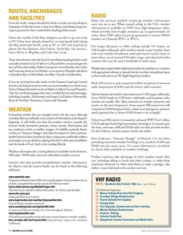
VHF Radio
VHF 22 - Banderas Bay Cruisers’ Net Mon - Sat, 8:30 am VHF Reserved Frequencies:
10 - Nuevo Vallarta & La Cruz Port Captains 12 - Paradise Village Harbormaster 13 - Puerto Vallarta Port Captain 14 - Fishing Fleet 16 - Port Captains, Commercial and Gov’t Hailing 18 - Marina Vallarta Harbormaster 22 - Cruisers’ Hailing 63 - Vallarta Yacht Club 68 - Opequimar, Canvas Connection and North Sails
Visit: www.vallartanautica.com