Urban Planning Portfolio
Jake Plummer
University of Cincinnati
College of Design, Architecture, Art, and Planning
Class of 2026
1
Table of Contents 2 My Info 3-6 5 6 Resume The Tools of Planning 7-12 9 AutoCAD 10 Illustrator, Skechup 11-12 ArcGIS Background Research 13-18 15-16 Bike Analysis in OTR 17-18 Rezoning Strategical Analysis 19-24 21 Thematic Map 22 Infographics, Viginettes Neighborhood Analysis 23-24 Writing Example 25-30 27-28 Writing Example 29 Closing and Reflection
3
My Info
4
About Me
Hello, my name is Jake Plummer and I am currently studying at the University of Cincinnati to go into my Major of Urban Planning. I have been around the city of Cincinnati my entire life, and although I live on the Kentucky side of the Ohio River, this has not stopped me from feeling the effects of that Cincinnati has on the surrounding areas. I am very interested in history and particular like studying the early modern period and World War 2. What made me want to study urban planning in college is a mix of many things. For one, I have always enjoyed maps and seeing what is there to be seen on those maps. I also enjoy games that simulate a city building experience so I figured I would enjoy the real life equivalent. City Skylines is one of my favorite games to play whenever I didn’t have anything to do.
5
PERSONAL INFO
1520 S kye Drive
Independence, Kentucky 41051
(859) 414-9546
plummejh@mail.uc.edu
Portfolio
LinkedIn
EDUCAT ION
UNI VERSI T Y OF CINCINNAT I
Bachelor of Urban Planning, anticipated in May 2026 College of Design, Architecture, Art and Planning
Cincinnati, Ohio
Participating in the Professional Practice Program, alternating semesters of classroom study with work in the field of design.
CALVARY CHRIST IAN HIGH SCHOOL
Covington, Kentucky
Class of 2021
GPA: 3.7
WORK EX PERIENCE
WARREN COUNTY REGIONAL PLANNING COMMISSION
Planning Intern
SK ILLS
ArcGIS
AutoCAD
Adobe InDesign
Adobe Photoshop
ACTI VI T IES
Archery
Academic Team
National Honors Society member
Work with children at my church in a leadership position
AWARDS
- Dean List 2021-2023
- Highest Honor Roll every year of high school
Lebanon, Ohio
January, 2023 to April 2023
▪ Prepared Staff Reports and presented presentations for the Warren County Excutive Board that gave the Warren County Regional Planning Commission’s view and recommendation for rezonings.
▪ Created a design and template for the new Warren County Parks Plan
▪ Found data on populations within Warren County and forecasted the population change
CENGAGE LEARNING
Materials Processor
Independence, Kentucky
May 2022 to August 2022 (full time)
• Completed work in different capacities in the Special Order department of the warehouse, including efficient sorting and counting of textbook product for delivery to customers, and stacking the finished boxes in a staging area
• Inspected my work to assure the right labels and quantities were shipped
• Operated quickly and as efficiently as possible to keep work within deadlines during peak shipping season for the company
UMC FOOD/AMERICORPS
Preparation and Delivery Worker
Covington, Kentucky
May 2021 to July 2021 (full time)
• Completed over 350 hours of community service
CONEY ISLAND AMUSEMEN T PARK
Amusement Park Host and Ride Operator
Cincinnati, Ohio
August 2019 to September 2019 (full time)
• Operated rides located throughout the amusement park while paying attention to the guest and ride to ensure safety
6 JAK E PLUMMER
URBAN PL ANNER
7
The Tools of Planning
8
Computer Skills
9
An example of Contrast made in AutoCAD.
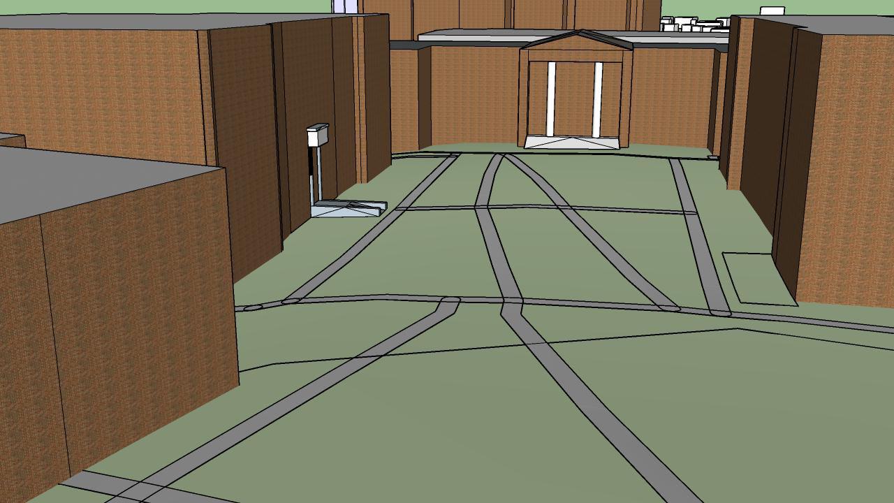
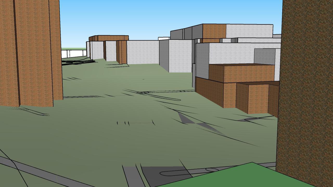


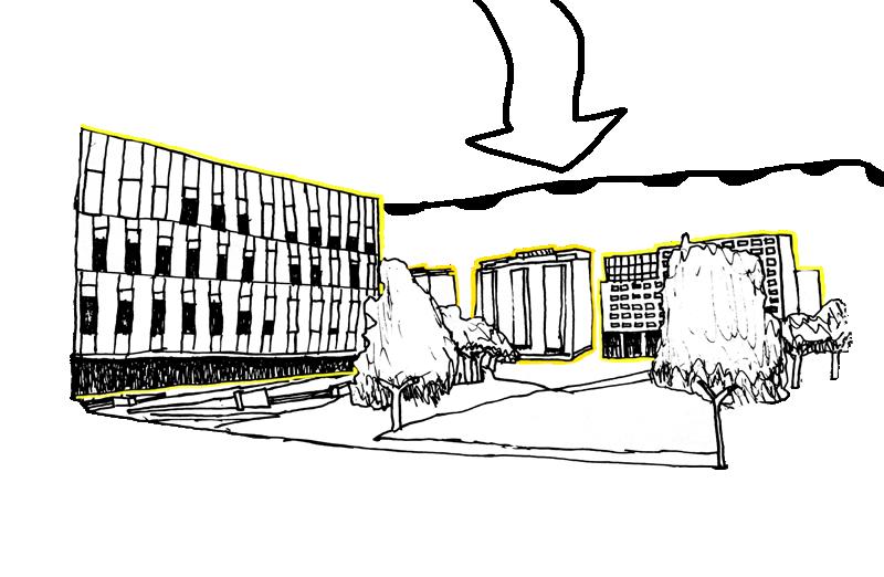
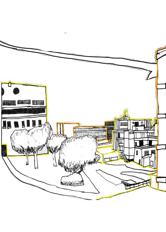
10 Districts Soft Edge Hard Edge Building Edge Landmark Car/Pedestrian Node Pedestrian Node Car Node Legend Assignment 3 Imageability Mapping Jake Plummer A city is simply a large human community. This city can be broken down into five different elements called landmarks, districts, edges, paths, and nodes. Like any city, UC’s image is made up of the overlap and layout of the five elements. The arguably easiest element to identify are landmarks. Many landmarks are large and people from the area know there way around based on landmarks. The University of Cincinnati has many landmarks, but my favorite is Crosley Tower, which is both tall and easily recognizable. The second element of the city are districts, and they tend to be the largest of the elements. Districts are separated from each other by how they are being used. UC’s districts include education, athletics, open spaces, and residential. Edges are usually the boundaries between two types of areas, but they can also be where buildings tend to completely block movement from one side to the other. Edges cam ne seem on the roads surrounding the campus and the path between Fifth Third Arena and Dabney Hall that creates a “hallway” between the two building. Paths are the area where people move from place to place. UC and its paths are not too difficult to get around because you can usually see your destination from anywhere. When you have an intersection of different paths leading to one point you have node. Nodes in UC are on the major roads surrounding campus and inside the campus itself where pedestrians cross paths and meet. Two scenes of University of Cincinnati made in SketchUP. A map of the imageability of the University of Cincinnati made in Adobe Illustrator. Warren County Parks District 5 Year Plan 4 Introduction Section 1 Chapter Chapter 1 Introduction Chapter 2 Introduction Chapter 3 Introduction Chapter 4 Introduction Chapter 5 Introduction Chapter 6 Introduction Hisey Park
This is a portion of the template that I created in Indesign for the Warren County Regional Planning Commission.
Computer Skills - ArcGIS


Sources: Esri, Airbus DS, USGS, NGA, NASA, CGIAR, N Robinson, NCEAS, NLS, OS, NMA, Geodatastyrelsen, Rijkswaterstaat, GSA, Geoland, FEMA, Intermap and the GIS user community


A subway map of Washington DC made in ArcGIS


11
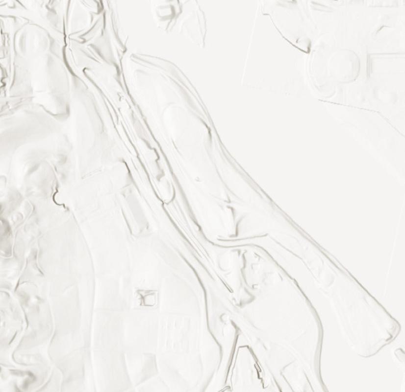
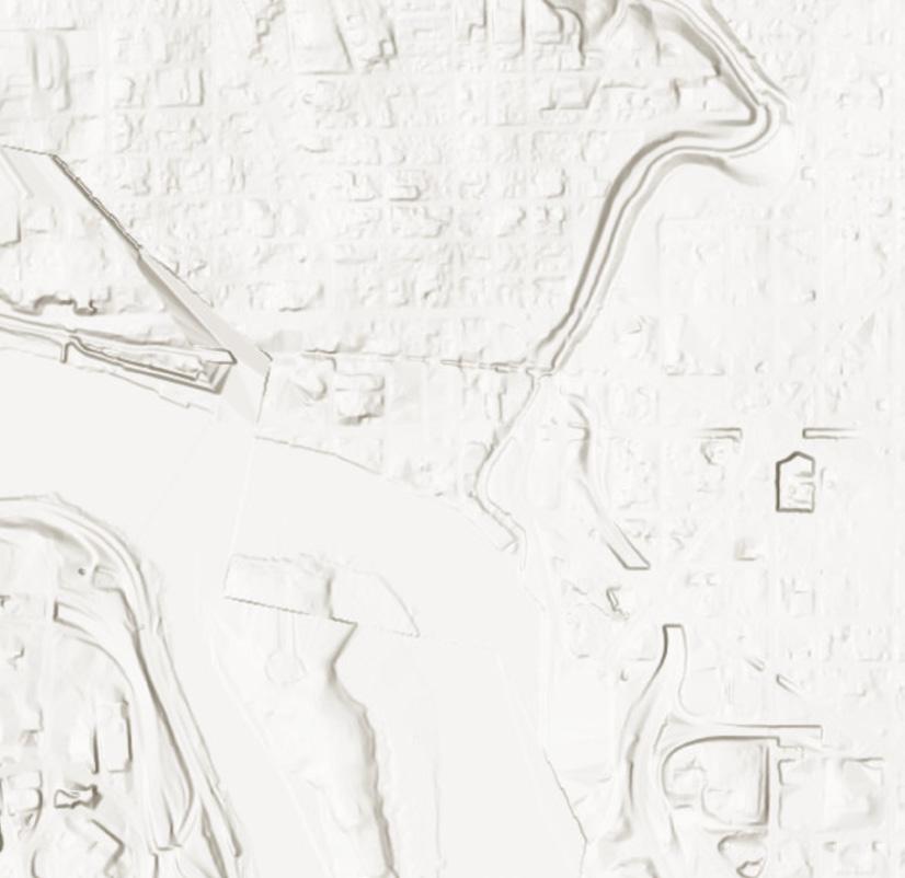
Age of Cincinnati Buildings


During my first year at University of Cincinnati I placed great emphasis on the age of building and the expansion of the urban area. These maps are both from a statistics class where I was tasked with finding and comparing the age of the apartment building to its rental coastal in the Cincinnati Area. The results were inconclusive because of to many other factors affected the price such as square footage and distance from schools.


Walnut Hills Avondale North Avondale - Paddock Hills Mt. Adams West End East Walnut Hills Queensgate Esri, HERE, Garmin, SafeGraph, METI/NASA, USGS, EPA, NPS, USDA Years of Construction 0 1 - 1900 1901 - 1915 1916 - 1930 1931 - 1945 1946 - 1960 1961 - 1975 1976 - 1997 Oakley Esri Community Maps Contributors, Esri, HERE, Garmin, SafeGraph GeoTechnologies, Inc., METI/NASA, USGS, EPA, NPS, US Census Bureau, USDA Years of Construction YEAR_BUILT 0 1 1900 1901 - 1915 1916 - 1930 1931 - 1945 1946 - 1960 1961 - 1975 1976 - 1997
12
13
Background Research
14
Over-the-Rhine and Downtown A Neighborhood Bike Analysis
This graphic goes over the last 3 years of police data. According to Insights Cincinnati, the number of bicycle accidents that have resulted in injuries in Overthe-Rhine is 10. The Central Business districts has a number of 13. These are the highest rates in the city. This could mean that there is a higher amount of bike going through these neighborhoods or that it is not safe to ride in these neighborhoods. The locations of these accidents could also be a clue as locations to put future bike lanes if it happens frequently in one place.

15 Bike Injuries Cincinnati Streetcar Stops Cincinnati Streetcar Route STUDY AREA STUDY AREA CUF Building Footprints Street Centerlines Legend
Legend
Bike Share Stations

Cincinnati Streetcar Stops
Cincinnati Streetcar Route
STUDY AREA
STUDY AREA CUF
Building Footprints
Street Centerlines
Bike Share is a rather new addition to Cincinnati. Bike Share is a system of bicycle stations that work together in order for people to get a bicycle more easily at any of the Red Bike stations. The Bike Share system is a network of 65 stations spread out across Cincinnati and Northern Kentucky. With up to 600 bicycles in it’s fleet, there are enough bicycles to go around. Red Bike and Bike Share are very rapidly expanding throughout Cincinnati, increasing the availability of bike anywhere.
16
Rezonings
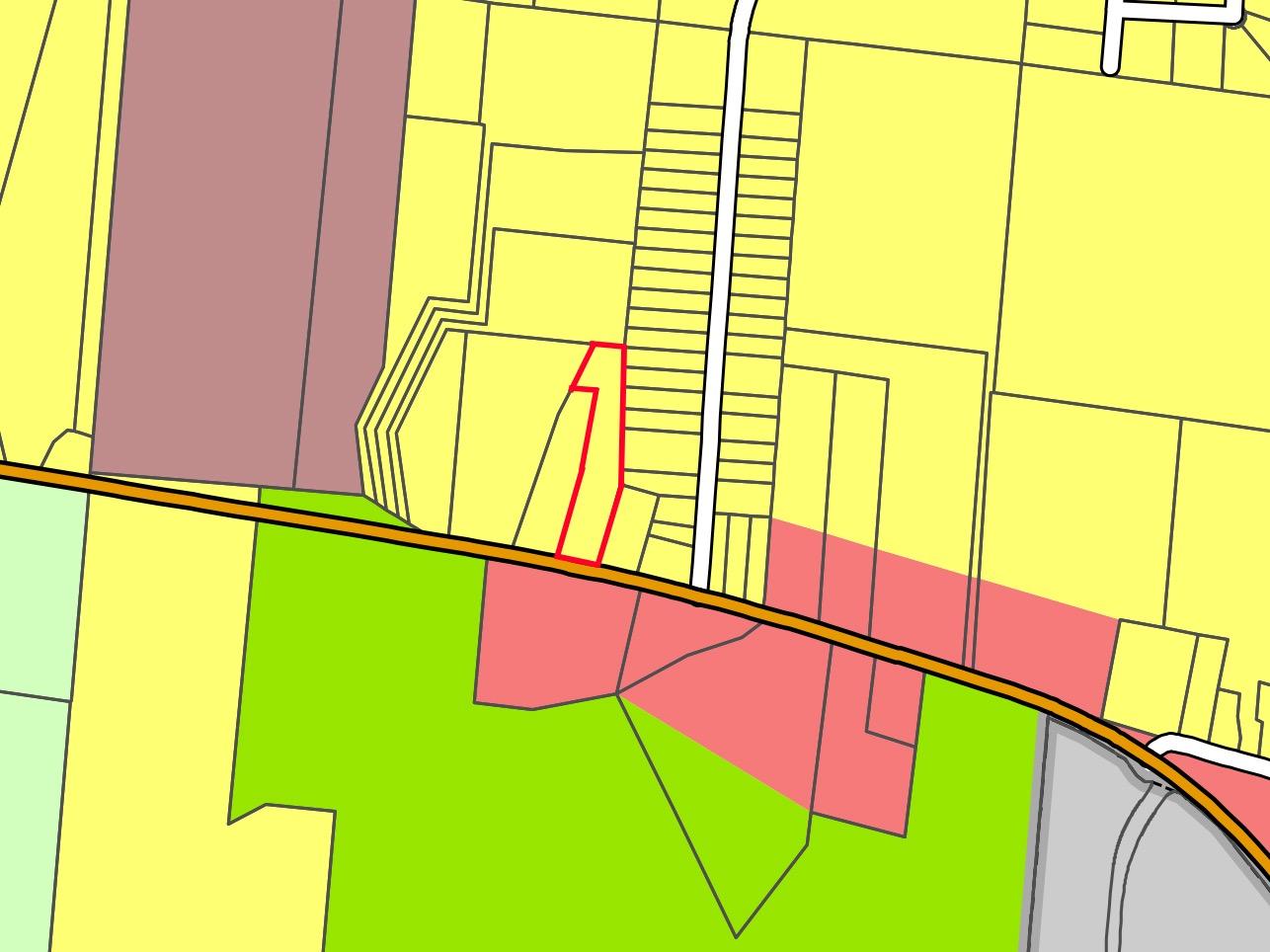
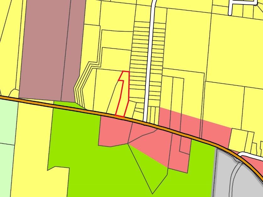
STAFF ANALYSIS – COMPREHENSIVE PLAN
FLUM Designation:
Suburban Residential
This is a portion of one of the staff reports I completed while working for Warren County. This map is meant to show the future land use of the subject site.
17
STAFF ANALYIS – ZONING-B-3 or B-2
Land Use
Automobile Oil Change
B-2 B
Conditional Use Site Plan
ZONING
Residential
FUTURE LAND USE
Commercial
Casino
Commercial Amusement or Outdoor/Drive-in Theater
Prohibited Use Site Plan
Prohibited Use Conditional Use
Racetracks Prohibited Use Conditional Use
Sexually-Oriented Business
Truck Stop
Boat/Boat equipment Sales, Rental or Repair Shop
Cold Storage Plant
Light Manufacturing


Prohibited Use Conditional Use
Conditional Use Site Plan
Prohibited Use Conditional Use
Prohibited Use Conditional Use
Conditional Use Site Plan
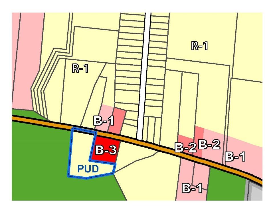
This is a portion of one of the staff reports I completed while working for Warren County. The applicant was attempting to rezone their parcel to B-3. This graphic (as well as the one above) show why the Warren County Regional Planning Commission believes that B-3 zoning is unessary for the desired land use, which were landscaping and garden center. The graphic shows different uses that could be built on the subject site in the future. We prefered if the applicant rezoned to B-2 to prevent a more intensive use in the future.
18
C-Conditional Use S –Site Plan Review
19
Strategical Analysis
20
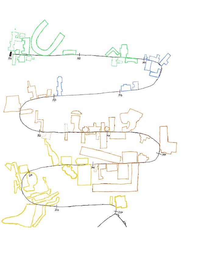
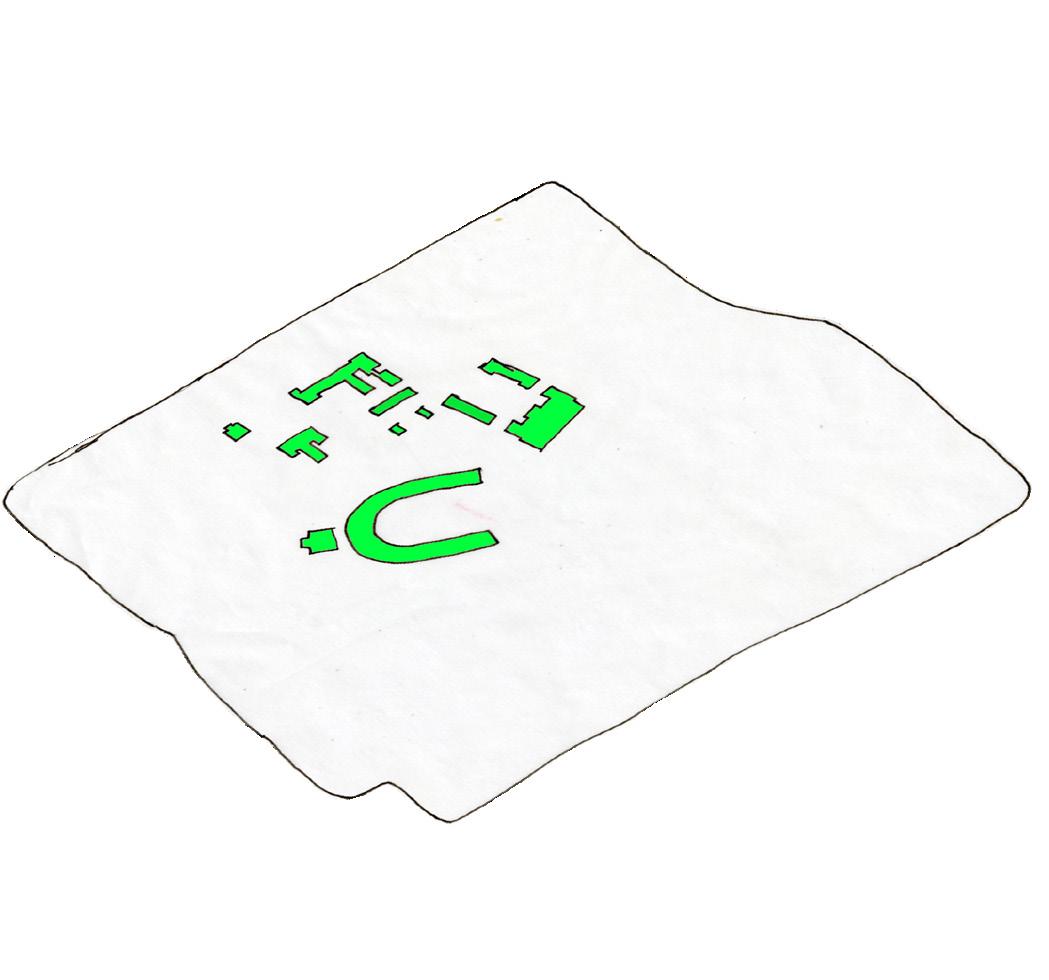
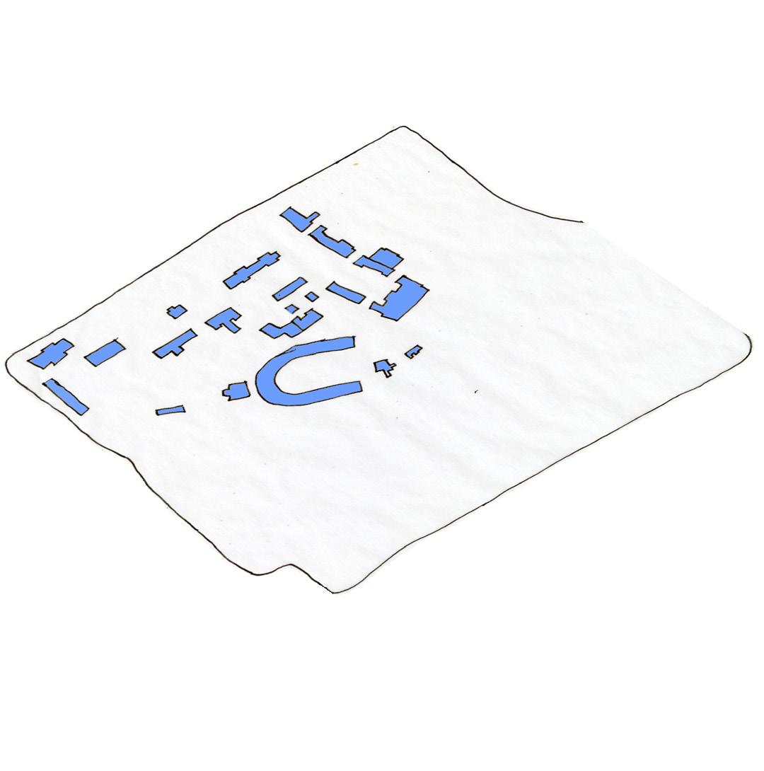
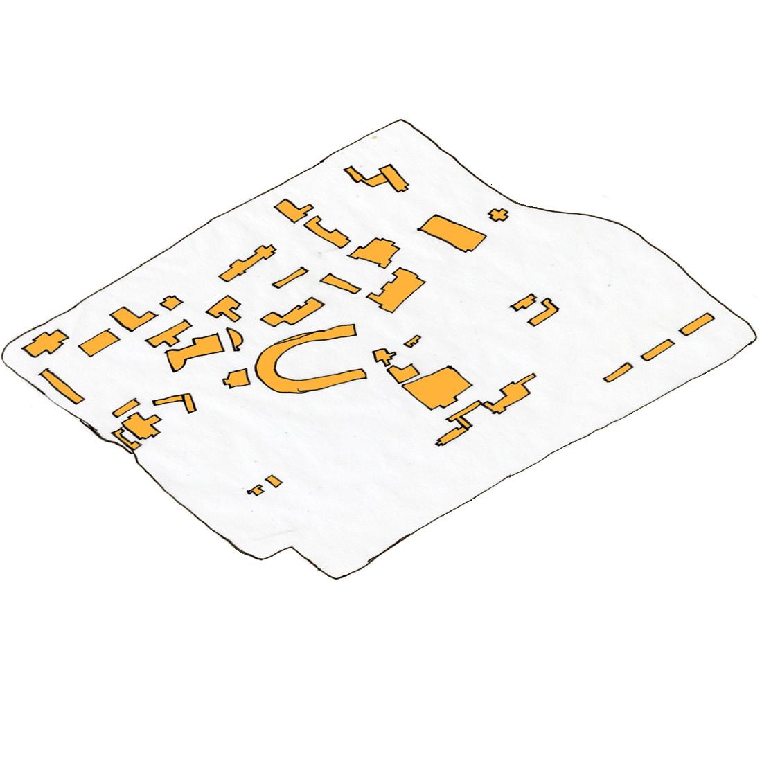
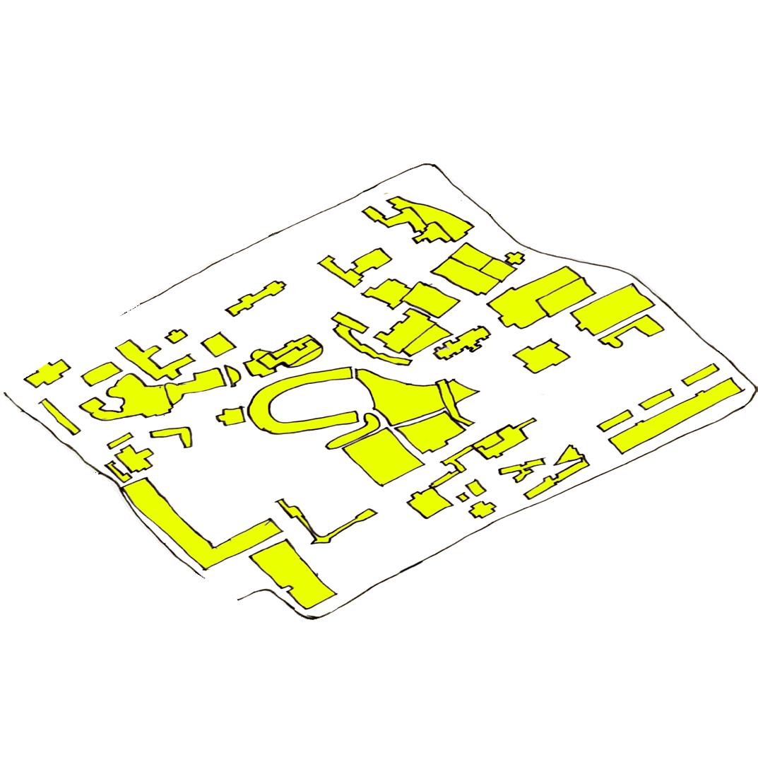
Thematic Map
Assignment 4
Thematic Mapping Jake Plummer
Legend
1910-1930 Expansion
1930-1950 Expansion
1950-1970 Expansion
1970-2020 Expansion Build either renovated or torn down
Buildings still on campus
Buildings built 1910-1930
Building built 1930-1950
Building built 1950-1970
Building built 1970-2021
21 0 Ft. 200 Ft. 400 Ft. N
Infographics
These are maps of the University of Cincinnati’s buildings each of their respective times.
The Infographic below is showing a timeline when each of the University of Cincinnati Buildings were built.
1950’s
Vignettes
1970’s
2020’s
22
Neighborhood Analysis


Lower Price Hill Typologies
Sketch-Up Render FigureGround
Lower Price Hill/Queensgate - Land Use Map
Cross Sections Street Elevation

This part of Lower Price Hill is mostly residential with some small business on State Ave. The largest feature in this section of Lower Price hill is the Oyler School that can be seen as the building with the large, thin tower. This part of the neighbor is denser than most other areas in the neighbor with building being more tightly packed in. This area has a major road in it call West Eighth Street that heads right into downtown if you go far enough. This road has a bus route that allows resident to have cheap route into downtown if they need to. Olyer School has quite unique architecture and really stand out well in the neighborhood. It was built near the begin of the 1900’s and still host a large amount of students.

23
O LER SCHOOL
*This is part of a group neighborhood project where I was responsible for the entirety of this page.
1’’=200’
1’’=20’
1’’=20’
Legend LowerPriceHillQueensgate_LandUse ZONING Community Commercial Commercail and Services Industial Zone Public Recreation Residential Flats - Commercial Residential Flats - M Residential Flat - R Low Denstiy Housing Residential Mix Use Larger Housing Parcels_Clip 0 0.5 1 0.25 Miles
These area would be the most likely to be flooded in a flooded the size of 1937’s happened in Cincinnati again. This includes almost all of Lower Price Hill and Queensgate. While this is more of an approximation from elevation, the damage would still be substantial. Expecially to Lower Price Hill and Queensgate.
This map is showing the potential danger zones if a flood as bad as the 1937 flood were to happen to Cincinnati again. Lower Price Hill and Queensgate would be especially susceptible because of the Mill Creek Valley.

24
25
Writing Example
26
Writing Example
Assignment 4
Thematic Mapping
Jake Plummer
Legend
1910-1930 Expansion
1930-1950 Expansion
1950-1970 Expansion
1970-2020 Expansion
Buildings still on campus
Build either renovated or torn down
Buildings built 1910-1930
Building built 1930-1950
Building built 1950-1970
Building built 1970-2021
27 0 Ft. 200 Ft. 400 Ft. N
Why do we study history while we are at school, and why is history important? When looking at the University of Cincinnati’s past it is important to understand both that the buildings and the land have changed over time. When looking at any building on campus, there is a chance that the building was a replacement of another. Like McMicken Hall for example, before the McMicken Hall we know was built there was an older McMicken Hall that was deconstructed. There have been many buildings, some of which are still here and some which have been demolished. These demolished buildings are represented by the dashed lines on the map. I choose to color code the buildings based on the time periods when they were built. Green were built before the 1930s, blue were built from 1930 to 1950, red were built from the 1950s to the 1970s, and yellow were built from the 1970s to the present.
There was a time earlier in UC’s history when we did not have quite so many buildings on campus. All these buildings were mostly centered along the west side of campus and are among some of the oldest buildings on campus. In the 1930s the old McMicken Hall was still around and was replaced with the newer McMicken Hall by the 1950s.
Now moving on to the 1950s-1970s and there was a large boom of buildings built including the first two building of DAAP and several of the residential halls. Then finally by 2020 all the buildings that are here now have been built, with several construction projects around campus.
This is a timeline of when all the buildings on campus were built. You can see from this infographic that there are certain periods that had massive levels of new buildings being constructed and some pockets where nothing was being built at all. While looking at the history of the campus and the buildings that were built, it is also important to look at how UC has expanded its territory. The expansion of the University of Cincinnati is not something that happened all at once. Much of the expansion happened in waves.
When looking at the direction of the expansion of UC, it is clear that the expansion happened in three main directions. To the south, to the north, and to the east.
When looking at all this, you may ask why is learning about UC past is important. I believe that it is important because history can inspire people to make changes now rather than doing nothing. Growth is necessary for mostly anything to develop, so UC needs to be able to know where and how to grow.
28
Closing and Reflection
Throughout the course of this first semester, I have learned many different skills in the art of planning. I have learned how to use my pencils and pens most effectively. Their strengths and weakness on different types of paper, because using different types of paper changes the quality of both the pencil and the pen. I have also learned many different types of programs that I could use on my computer. Some of these programs include Adobe Photoshop, Adobe Illustrator, SketchUp, GIS Mapping, and AutoCAD. These computer programs are most likely to be helpful in the entirety of my Urban Planning Career.
During the first half of the 2021-2022 college school year, there has been many school assignments and home problems that have come up at roughly the same time. I had to learn how to manage the school/life balance and how to manage my time most effectively. I had to spend less time doing things that were unnecessary like playing games and watching TV, and spend more time doing schoolwork. I learned that I must focus my time on what is most important, my education.
29
30
Urban Planning Portfolio
Jake Plummer
1520 Skye Drive (859) 414-9546
plummejh@mail.uc.edu

