Urban Planning Portfolio
University of Cincinnati
College of Design, Architecture, Art, and Planning
Class of 2026
Jake Plummer

University of Cincinnati
College of Design, Architecture, Art, and Planning
Class of 2026
Hello, my name is Jake Plummer and I am currently studying at the University of Cincinnati to go into my Major of Urban Planning. I have been around the city of Cincinnati my entire life, and although I live on the Kentucky side of the Ohio River, this has not stopped me from feeling the effects of that Cincinnati has on the surrounding areas. I am very interested in history and particular like studying the early modern period and World War 2. What made me want to study urban planning in college is a mix of many things. For one, I have always enjoyed maps and seeing what is there to be seen on those maps. I also enjoy games that simulate a city building experience so I figured I would enjoy the real life equivalent. City Skylines is one of my favorite games to play whenever I didn’t have anything to do.
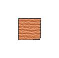
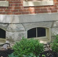
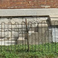
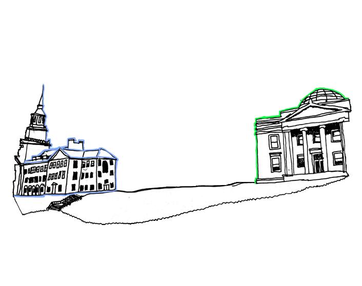
An example of Contrast made in AutoCAD.


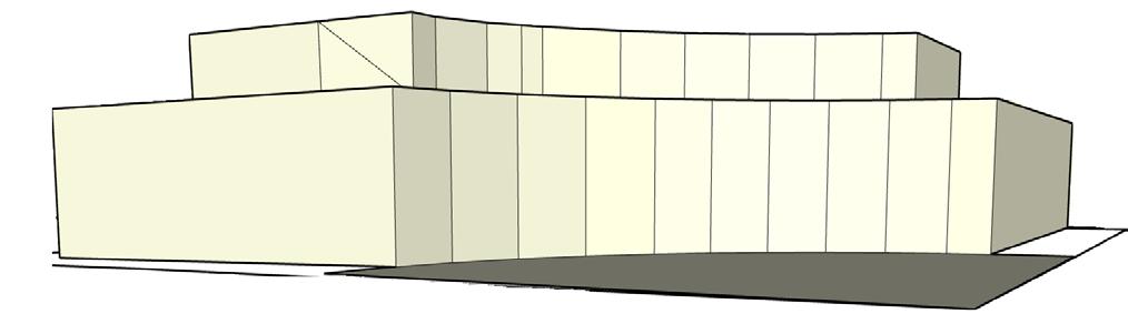


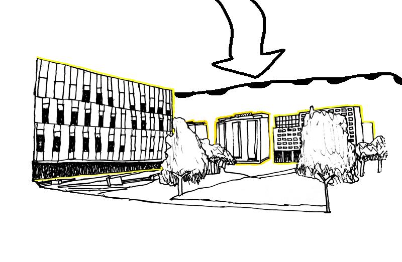
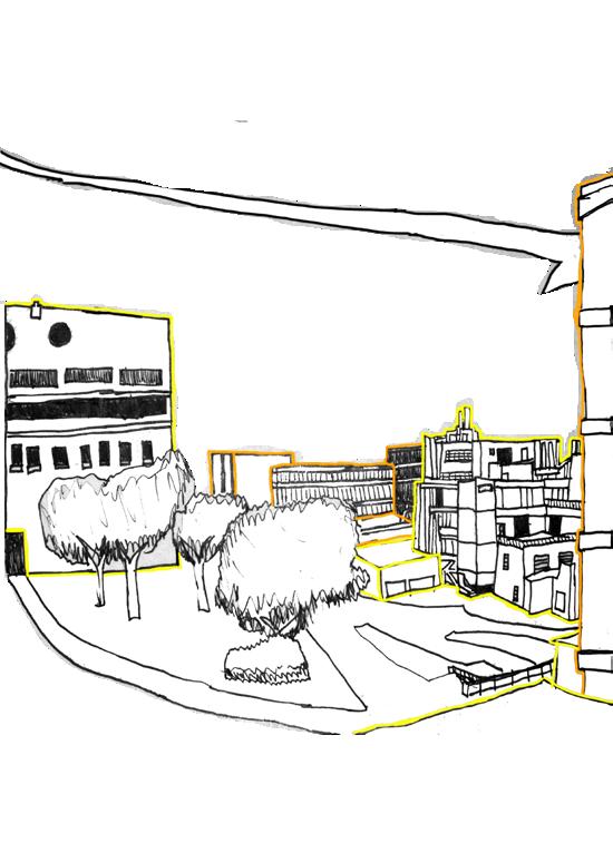
A scene of a parcel redevelopment project in the city of Sharonville made in SketchUP, with some additions in

These pages show a section title page and section material page that I created in InDesign for the Blueprint for Rehabilitation for the City of Dayton


During my first year at University of Cincinnati I placed great emphasis on the age of building and the expansion of the urban area. These maps are both from a statistics class where I was tasked with finding and comparing the age of the apartment building to its rental coastal in the Cincinnati Area. The results were inconclusive because of to many other factors affected the price such as square footage and distance from schools.


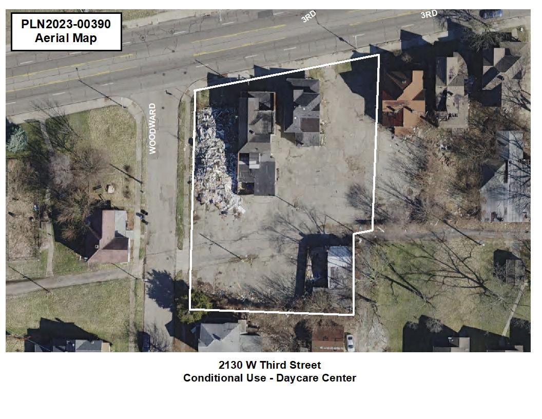
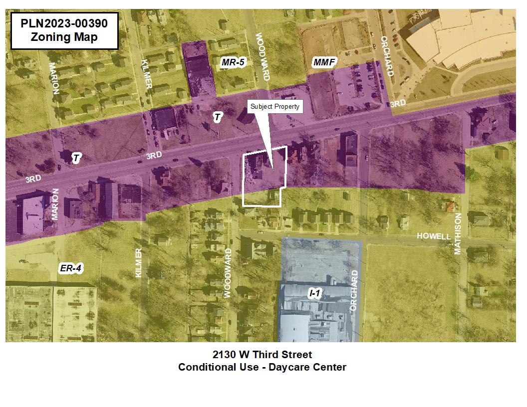
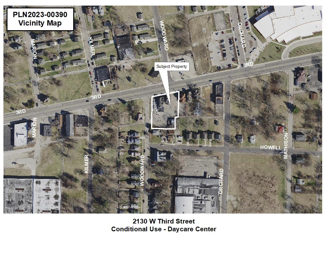
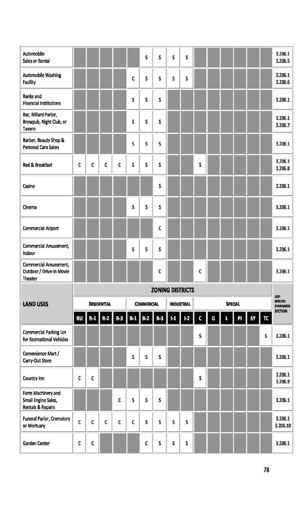
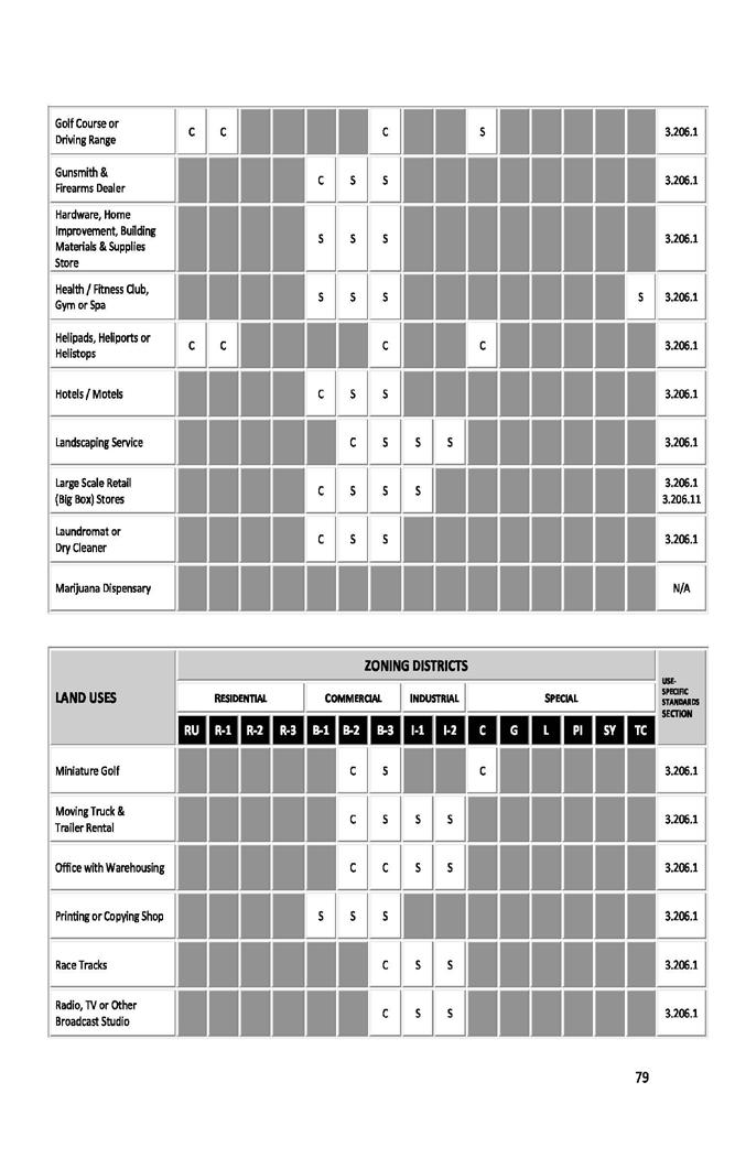
Finding the Basic detail about a site is one of the first steps when looking at any site. Finding out what it is, what it was, what is around the cite, and what is the site currently zoned being some of those details. During a rezoning or a conditional use request it is importatnt to look at the surround landuses to make sure it is compatable with the surrounding area.
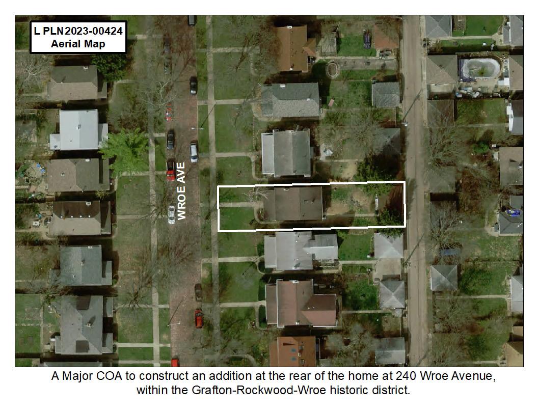
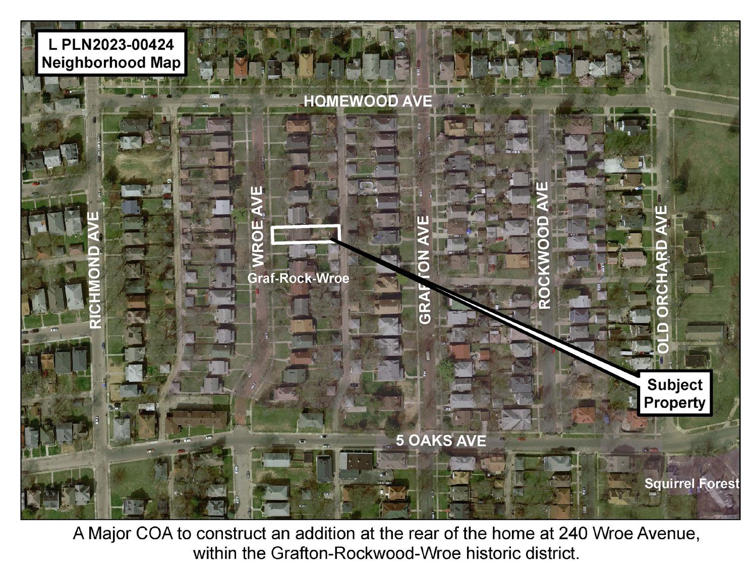
Landmarks look into the built form of the area more than the zoning matters. They Landmarks Commission looks at the surrounding buildings and compares them to the existing and new changes.
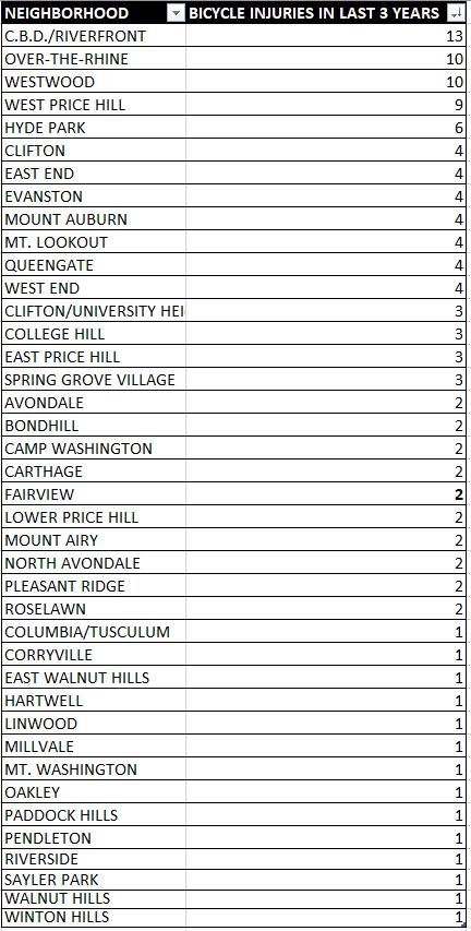
This graphic goes over the last 3 years of police data. According to Insights Cincinnati, the number of bicycle accidents that have resulted in injuries in Over-the-Rhine is 10. The Central Business districts has a number of 13. These are the highest rates in the city. This could mean that there is a higher amount of bike going through these neighborhoods or that it is not safe to ride in these neighborhoods. The locations of these accidents could also be a clue as locations to put future bike lanes if it happens frequently in one place.
Bike Share Stations
Cincinnati Streetcar Stops
Cincinnati Streetcar Route
STUDY AREA
STUDY AREA CUF
Building Footprints
Street Centerlines
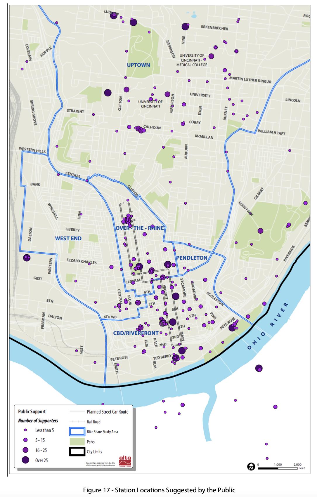
Bike Share is a rather new addition to Cincinnati. Bike Share is a system of bicycle stations that work together in order for people to get a bicycle more easily at any of the Red Bike stations. The Bike Share system is a network of 65 stations spread out across Cincinnati and Northern Kentucky. With up to 600 bicycles in it’s fleet, there are enough bicycles to go around. Red Bike and Bike Share are very rapidly expanding throughout Cincinnati, increasing the availability of bike anywhere.
FLUM Designation:
Suburban Residential
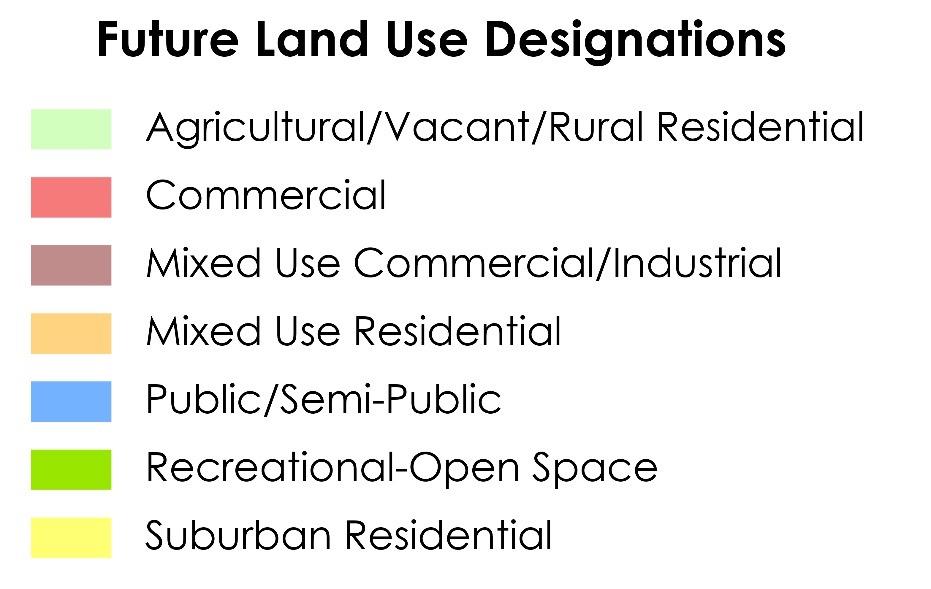
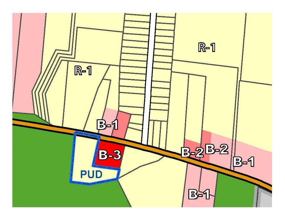
This is a portion of one of the staff reports I completed while working for Warren County. This map is meant to show the future land use of the subject site.


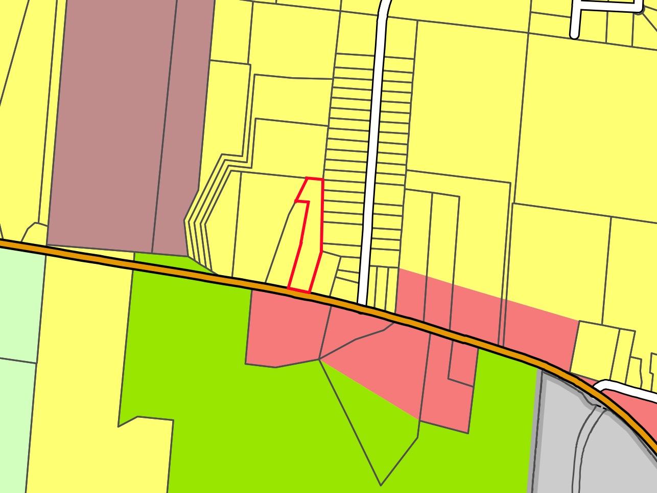
This is a portion of one of the staff reports I completed while working for Warren County. The applicant was attempting to rezone their parcel to B-3. This graphic (as well as the one above) show why the Warren County Regional Planning Commission believes that B-3 zoning is unnecessary for the desired land use, which were landscaping and garden center. The graphic shows different uses that could be built on the subject site in the future. We preferred if the applicant rezoned to B-2 to prevent a more intensive use in the future.
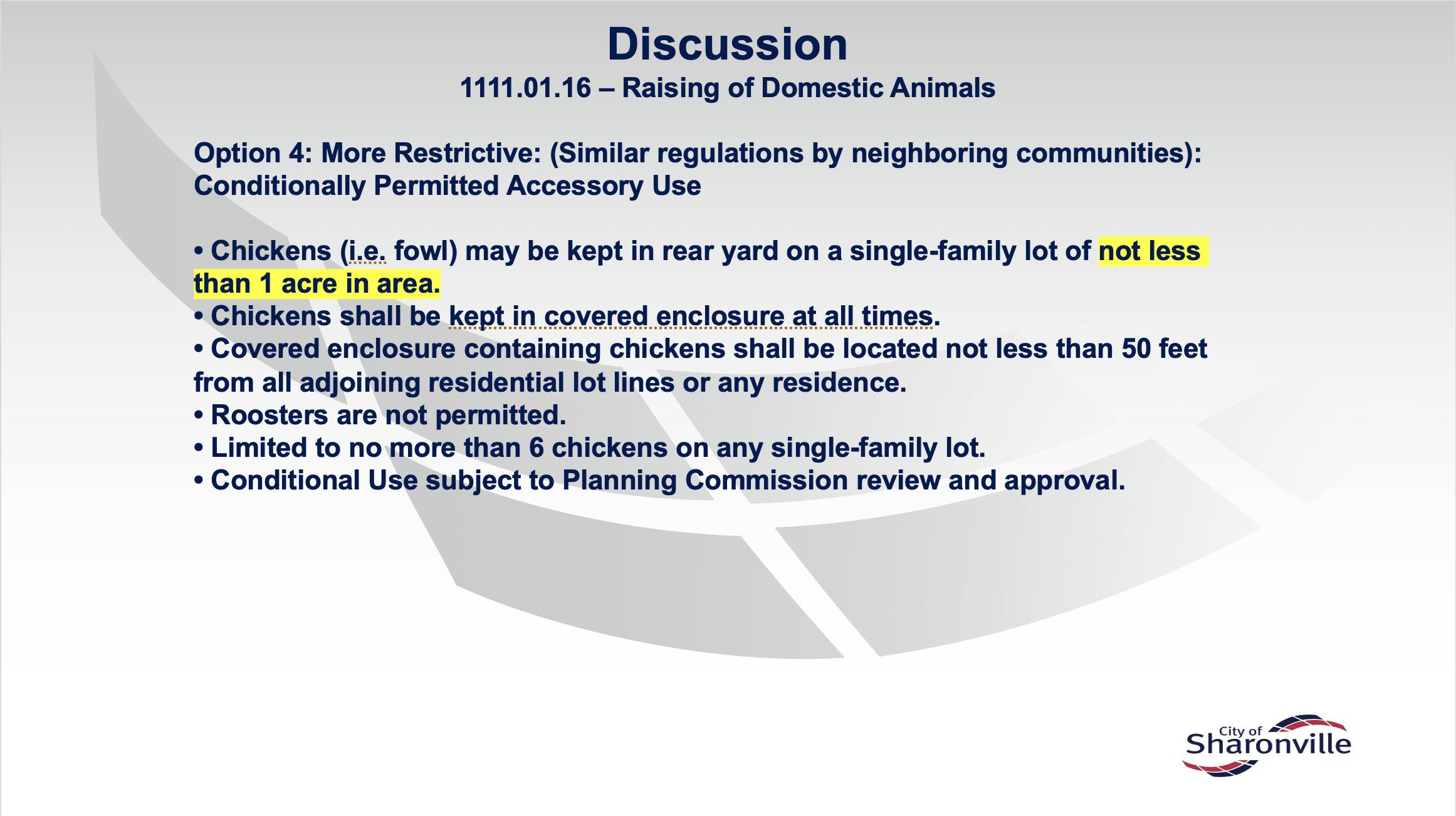
This portion of a powerpoint shows one of the many different option I created when asked to look into chicken regulations in other communities and suggest changes that needed to be made to the city of Sharonville’s regulations. I found that most communities nearby had more stringent regulation the city of Sharonville already had so I suggest an option that reflects those more stringent regulations.
These Heritage Tree Regulation were created a draft for the City of Dayton, both to figure out what exactly they wanted to do with the regulations and so I could introduce them to any new ideas.
150.801 Heritage Tree Regulation
150.801.1 Purpose
Trees contribute greatly to the health, safety, and general welfare of the City’s residents and the preservation and proper maintenance of trees is a matter of city-wide concern.
Trees provide significant environmental, public health, economic, and aesthetic benefits and as such, it is in the public interest to protect these assets by prohibiting unnecessary damage, removal, or destruction. Though at the same time, it is imperative that individual property rights to be protected at well.
Trees provide significant benefits to cities in numerous ways. Below are the most prominent benefits from tree and tree canopy:
(A) Flooding and water pollution reduction
(B) Erosion prevention
(C) Energy savings
(D) Lessening the impact of high heat days
(E) Carbon reduction
(F) Cleaner air
(G) Better health
(H) Higher property values
(I) More successful business districts
(J) Habitat for wildlife
(K) Stronger, more vibrant communities
To accomplish this, the Heritage Tree Regulations will be made with a focus on preserving our specifically chosen heritage tree types and concentrated within zoning districts that will be most affected from the removal of heritage trees.
150.801.2 Applicability
The applicability of the Heritage Tree Regulations is split into two sections, one based on the type of tree(s) plus it diameter at breast heights and another based on the size of the lot. The type of tree(s) is the first factor that should be evaluated followed by the size of the lot that the tree(s) is located. Any protected heritage tree that is on a lot within the jurisdiction of the City of Dayton (public or private) is applicable to the regulations under 150.801.2.
Species/Common Name Diameter at breast height (DBH)
The second application, the size of the lot shall have a square footage of 5,000 square feet as a minimum size with the exceptions listed below: (A) Any unprotected tree of sufficiently large size (30in diameter?) that are located in (zoning districts, protected neighborhoods, adjacent/within distance of River creek?) with exceptions being if the tree type is undesired (see 150.801.5).
(B) Public Right of Way?
150.801.3 Permitting for Removal of Heritage Tree:
Any action of the director of recreation and parks may be appealed to and heard by the recreation and parks commission. To be effective, an appeal must be filed within ten (10) days after the decision of the director. The appeal shall be in writing and shall be filed with the director for placement on the commission’s agenda. The appeal shall clearly specify the reasons for which a hearing is requested. After a hearing, the recreation and parks commission shall render its decision, which shall be final unless appealed to the city council. To be
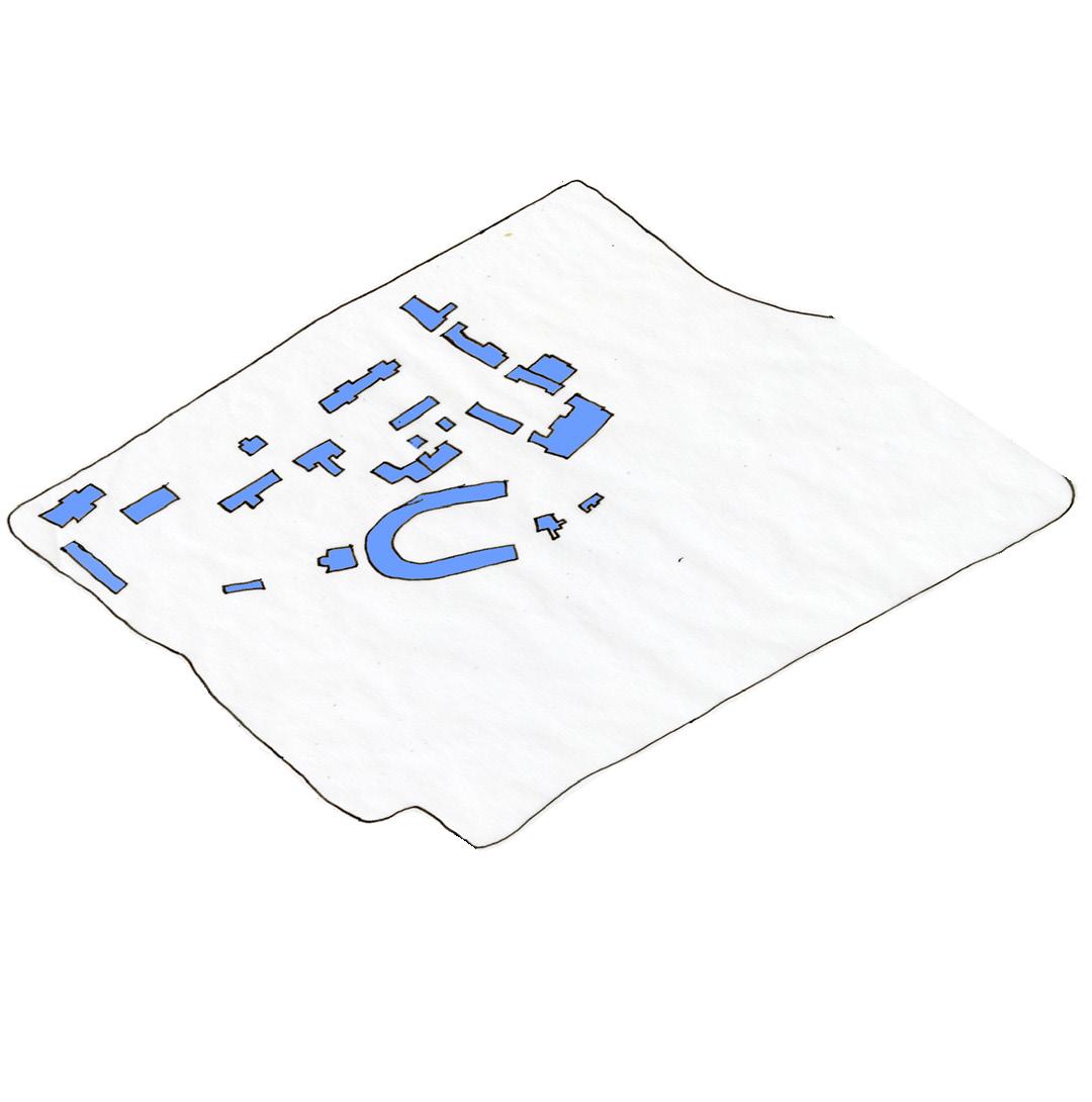
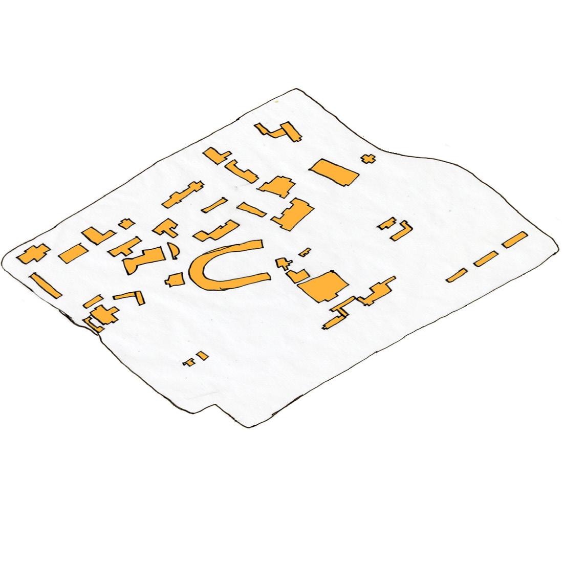
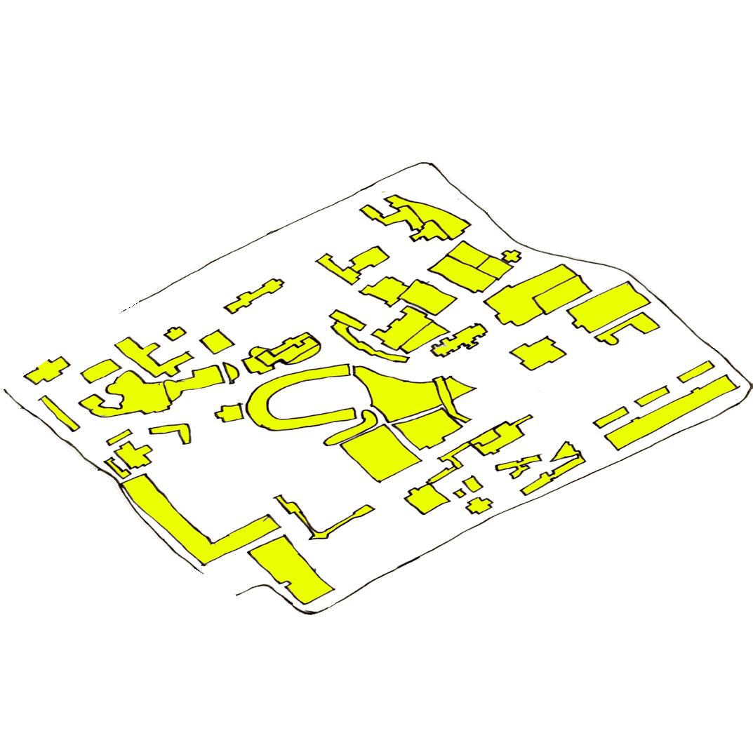
These are maps of the University of Cincinnati’s buildings each of their respective times.
1970’s 1950’s
2020’s
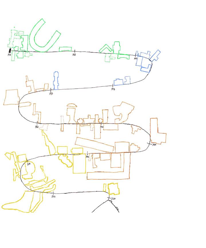
The Infographic below is showing a timeline when each of the University of Cincinnati Buildings were built.

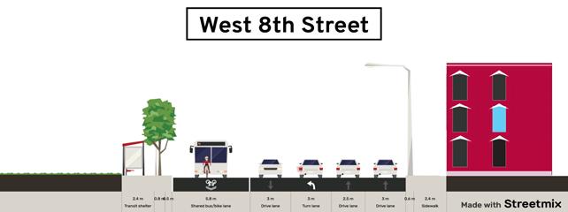
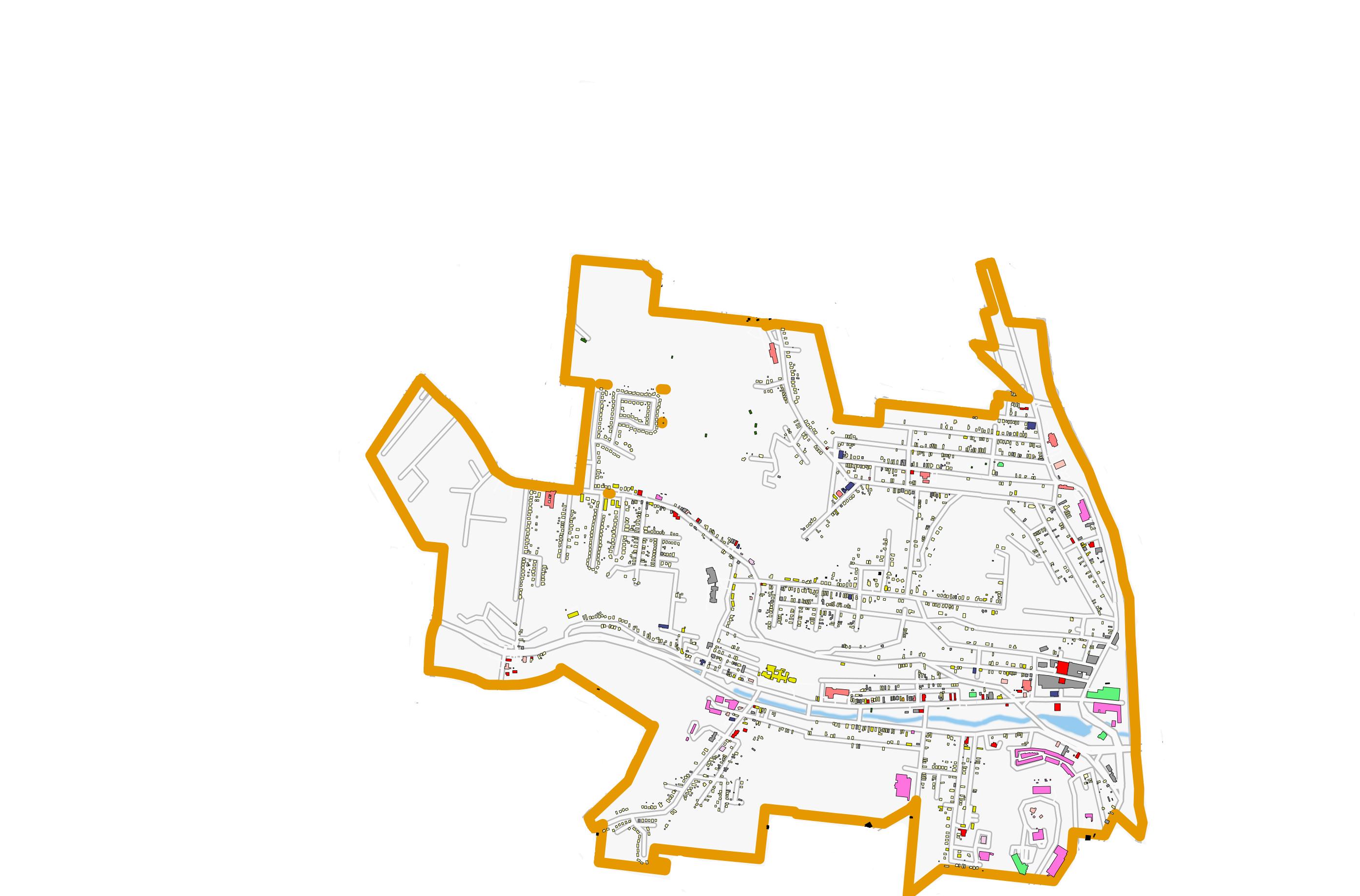
This part of Lower Price Hill is mostly residential with some small business on State Ave. The largest feature in this section of Lower Price hill is the Oyler School that can be seen as the building with the large, thin tower. This part of the neighbor is denser than most other areas in the neighbor with building being more tightly packed in. This area has a major road in it call West Eighth Street that heads right into downtown if you go far enough. This road has a bus route that allows resident to have cheap route into downtown if they need to. Olyer School has quite unique architecture and really stand out well in the neighborhood. It was built near the begin of the 1900’s and still host a large amount of students.
Lower Price Hill/Queensgate - Land Use Map
*This is part of a group neighborhood project where I was responsible for the entirety of this page.
This map is showing the potential danger zones if a flood as bad as the 1937 flood were to happen to Cincinnati again. Lower Price Hill and Queensgate would be especially susceptible because of the Mill Creek Valley.
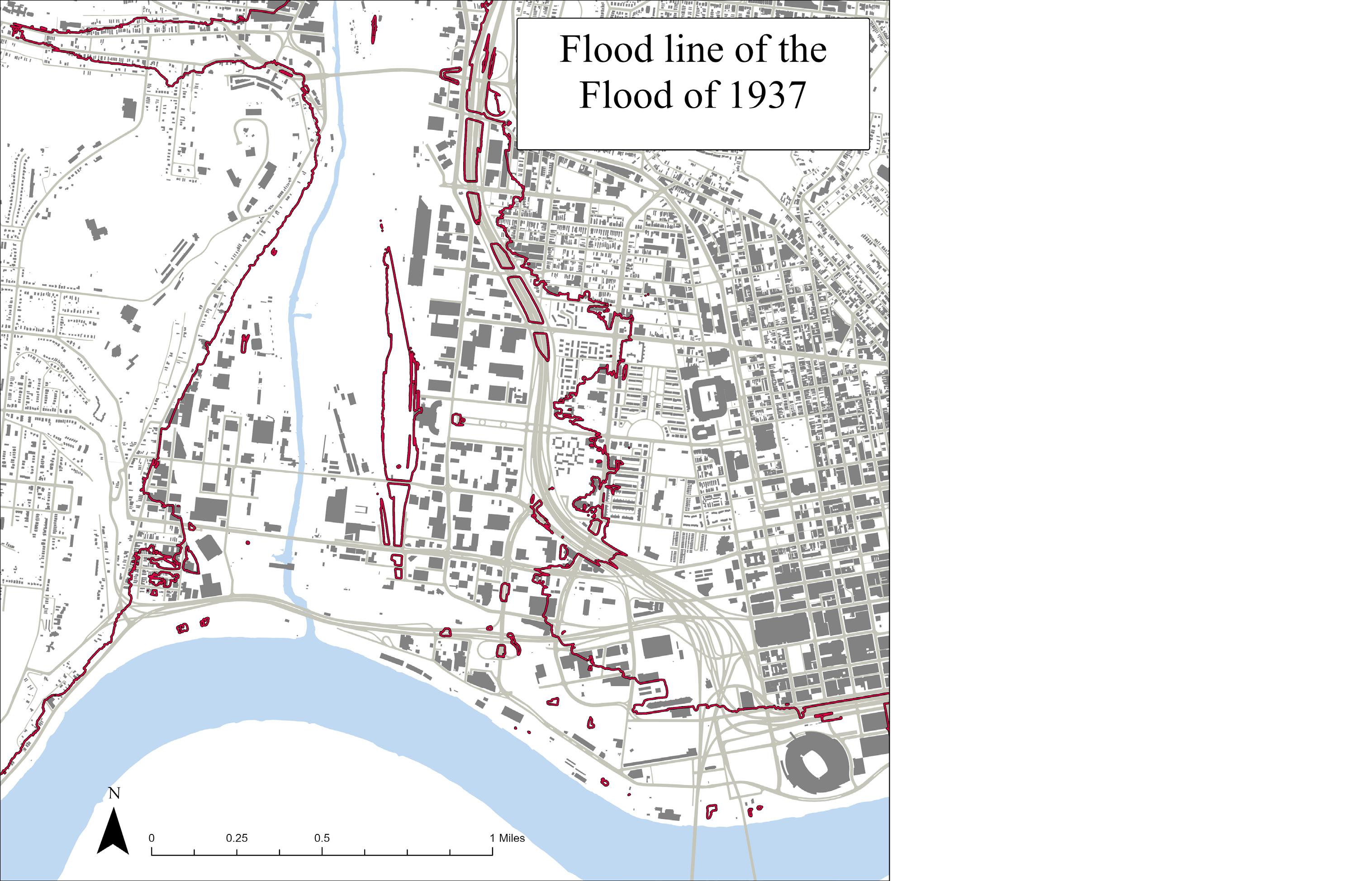
These area would be the most likely to be flooded in a flooded the size of 1937’s happened in Cincinnati again. This includes almost all of Lower Price Hill and Queensgate. While this is more of an approximation from elevation, the damage would still be substantial. Expecially to Lower Price Hill and Queensgate.
Why do we study history while we are at school, and why is history important? When looking at the University of Cincinnati’s past it is important to understand both that the buildings and the land have changed over time. When looking at any building on campus, there is a chance that the building was a replacement of another. Like McMicken Hall for example, before the McMicken Hall we know was built there was an older McMicken Hall that was deconstructed.
There have been many buildings, some of which are still here and some which have been demolished. These demolished buildings are represented by the dashed lines on the map. I choose to color code the buildings based on the time periods when they were built. Green were built before the 1930s, blue were built from 1930 to 1950, red were built from the 1950s to the 1970s, and yellow were built from the 1970s to the present.
There was a time earlier in UC’s history when we did not have quite so many buildings on campus. All these buildings were mostly centered along the west side of campus and are among some of the oldest buildings on campus. In the 1930s the old McMicken Hall was still around and was replaced with the newer McMicken Hall by the 1950s.
Now moving on to the 1950s-1970s and there was a large boom of buildings built including the first two building of DAAP and several of the residential halls. Then finally by 2020 all the buildings that are here now have been built, with several construction projects around campus.
This is a timeline of when all the buildings on campus were built. You can see from this infographic that there are certain periods that had massive levels of new buildings being constructed and some pockets where nothing was being built at all.
While looking at the history of the campus and the buildings that were built, it is also important to look at how UC has expanded its territory. The expansion of the University of Cincinnati is not something that happened all at once. Much of the expansion happened in waves.
When looking at the direction of the expansion of UC, it is clear that the expansion happened in three main directions. To the south, to the north, and to the east.
When looking at all this, you may ask why is learning about UC past is important. I believe that it is important because history can inspire people to make changes now rather than doing nothing. Growth is necessary for mostly anything to develop, so UC needs to be able to know where and how to grow.
Throughout the course of this first semester, I have learned many different skills in the art of planning. I have learned how to use my pencils and pens most effectively. Their strengths and weakness on different types of paper, because using different types of paper changes the quality of both the pencil and the pen. I have also learned many different types of programs that I could use on my computer. Some of these programs include Adobe Photoshop, Adobe Illustrator, SketchUp, GIS Mapping, and AutoCAD. These computer programs are most likely to be helpful in the entirety of my Urban Planning Career. During the first half of the 2021-2022 college school year, there has been many school assignments and home problems that have come up at roughly the same time. I had to learn how to manage the school/life balance and how to manage my time most effectively. I had to spend less time doing things that were unnecessary like playing games and watching TV, and spend more time doing schoolwork. I learned that I must focus my time on what is most important, my education.
Plummer
1520 Skye Drive (859) 414-9546
plummejh@mail.uc.edu