Urban Planning Portfolio Jake Plummer
University of Cincinnati College of Design, Architecture, Art, and Planning Class of 2026
1
The Tools

University of Cincinnati College of Design, Architecture, Art, and Planning Class of 2026
The Tools
Background Research 13-18 Analysis in and Buildings
Strategical Analysis 19-24 Map Analysis23-24
Writing Example 25-30 Example
Hello, my name is Jake Plummer and I am currently studying at the University of Cincinnati to go into my Major of Urban Planning. I have been around the city of Cincinnati my entire life, and although I live on the Kentucky side of the Ohio River, this has not stopped me from feeling the effects of that Cincinnati has on the surrounding areas. I am very interested in history and particular like studying the early modern period and World War 2. What made me want to study urban planning in college is a mix of many things. For one, I have always enjoyed maps and seeing what is there to be seen on those maps. I also enjoy games that simulate a city building experience so I figured I would enjoy the real life equivalent. City Skylines is one of my favorite games to play whenever I didn’t have anything to do.
1520 Skye Drive Independence, Kentucky 41051 (859) 414-9546
plummejh@mail.uc.edu
https://mailuc-my.sharepoint. com/:b:/g/personal/plummejh_mail_uc_edu/EUpDJlWBLRJJl0V1Esak2RMBDEvBt6L 7hzltEtfZsbZJbQ?e=gYXZEJ
https://www.linkedin.com/in/ jake-plummer-029675228/
UNIVERSITY OF CINCINNATI Bachelor of Urban Planning, anticipated in May 2026 College of Design, Architecture, Art and Planning Cincinnati, Ohio
Participating in the Professional Practice Program, alternating semesters of classroom study with work in the field of design.
CALVARY CHRISTIAN HIGH SCHOOL Covington, Kentucky Class of 2021 GPA: 3.7
CENGAGE LEARNING Materials Processor
• Independence, Kentucky
• May 2022 to August 2022 (full time)
ArcGIS
AutoCAD
Adobe InDesign
Adobe Photoshop
• Completed work in different capacities in the Special Order department of the warehouse, including efficient sorting and counting of textbook product for delivery to customers, and stacking the finished boxes in a staging area
• Inspected my work to assure the right labels and quantities were shipped
• Operated quickly and as efficiently as possible to keep work within deadlines during peak shipping season for the company
UMC FOOD/AMERICORPS Preparation and Delivery Worker
• Covington, Kentucky
• May 2021 to July 2021 (full time)
• Completed over 350 hours of community service
• Worked on site in kitchen, prepared and wrapped meals for delivery.
• Delivered complete meals to local feeding partners for distribution to children in their programs
• Performed end of day shutdown of kitchen
CONEY ISLAND AMUSEMENT PARK Amusement Park Host and Ride Operator
• Cincinnati, Ohio
• August 2019 to September 2019 (full time)
• Operated rides located throughout the amusement park while paying attention to the guest and ride to ensure safety
• Built a knowledge and proficiency in operating several rides allowing for flexibility in scheduling and increased ability to back up others
• Enforced and insured customers followed safety rules while enjoying their time at the theme park
• Performed end of day shutdown of assigned ride and general park
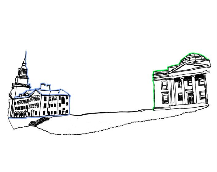
A city is simply a large human community. This city can be broken down into five different elements called landmarks, districts, edges, paths, and nodes. Like any city, UC’s image is made up of the overlap and layout of the five elements. The arguably easiest element to identify are landmarks. Many landmarks are large and people from the area know there way around based on landmarks. The University of Cincinnati has many landmarks, but my favorite is Crosley Tower, which is both tall and easily recognizable. The second element of the city are districts, and they tend to be the largest of the elements. Districts are separated from each other by how they are being used. UC’s districts include education, athletics, open spaces, and residential. Edges are usually the boundaries between two types of areas, but they can also be where buildings tend to completely block movement from one side to the other. Edges cam ne seem on the roads surrounding the campus and the path between Fifth Third Arena and Dabney Hall that creates a “hallway” between the two building. Paths are the area where people move from place to place. UC and its paths are not too difficult to get around because you can usually see your destination from anywhere. When you have an intersection of different paths leading to one point you have a node. Nodes in UC are on the major roads surrounding campus and inside the campus itself where pedestrians cross paths and meet.
A map of the imageability of the University of Cincinnati made in Adobe Illustrator.
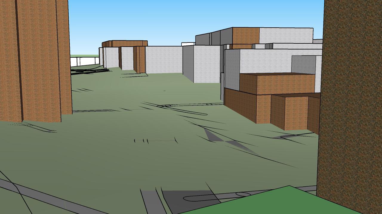
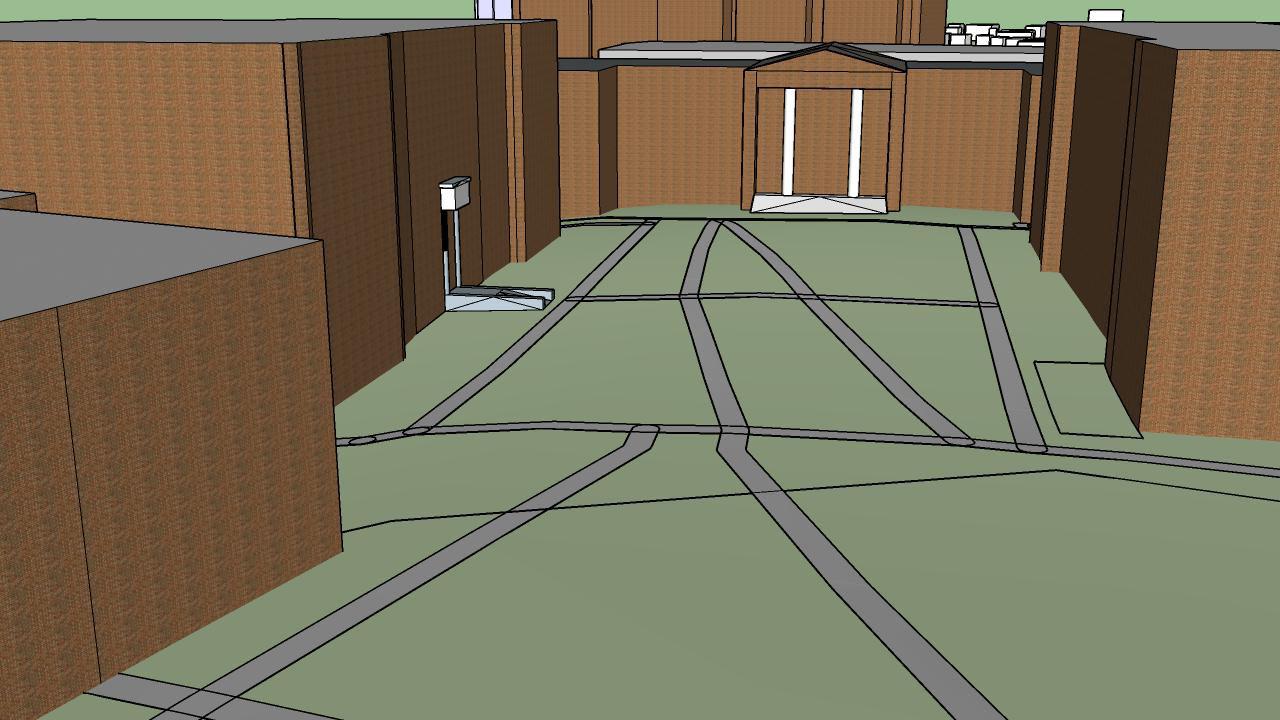
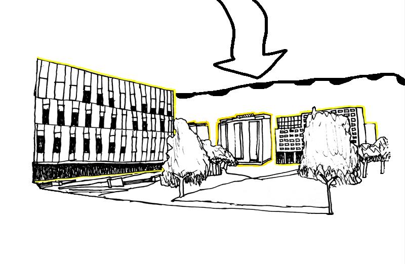
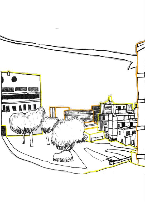
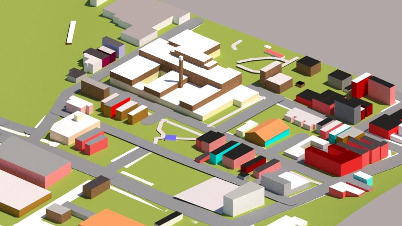
Two Scenes of University of Cincinnati made in SketchUP.


During my first year at University of Cincinnati I have placed great empasis on the age of building and the expansion of the urban area. These maps are both from a statesitics class where I was tasked with finding and compareing the age of the arpartment building to its rental costal in the Cincinnati Area. The results were incunclusive because of to many other factors affected the price such as square footage and distance from schools.


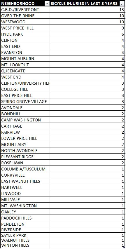
This graphic goes over the last 3 years of police data. According to Insights Cincinnati, the number of bicycle accidents that have resulted in injuries in Overthe-Rhine is 10. The Central Business districts has a number of 13. These are the highest rates in the city. This could mean that there is a higher amount of bike going through these neighborhoods or that it is not safe to ride in these neighborhoods. The locations of these accidents could also be a clue as locations to put future bike lanes if it happens frequently in one place.
Legend
Cincinnati Streetcar Stops
Cincinnati Streetcar Route
STUDY AREA
STUDY AREA CUF
Building Footprints
Street Centerlines
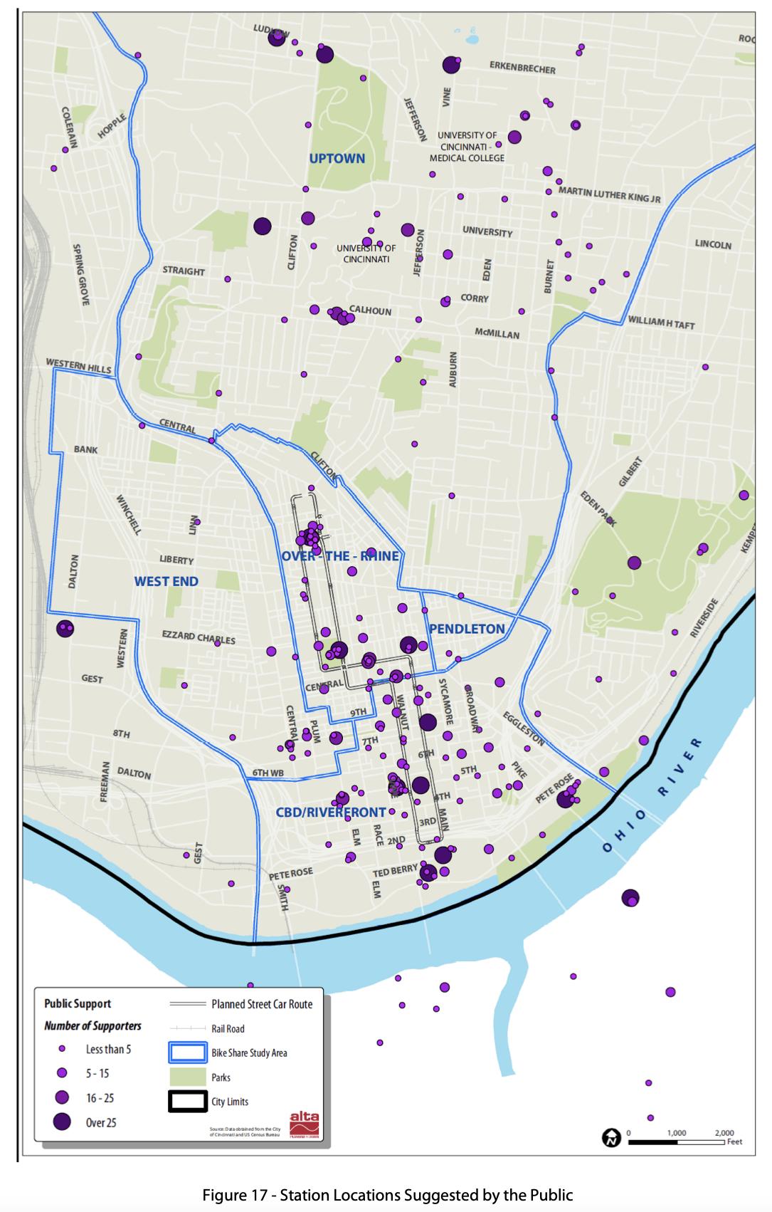
Bike Share is a rather new addition to Cincinnati. Bike Share is a system of bicycle stations that work together in order for people to get a bicycle more easily at any of the Red Bike stations. The Bike Share system is a network of 65 stations spread out across Cincinnati and Northern Kentucky. With up to 600 bicycles in it’s fleet, there are enough bicycles to go around. Red Bike and Bike Share are very rapidly expanding throughout Cincinnati, increasing the availability of bike anywhere.
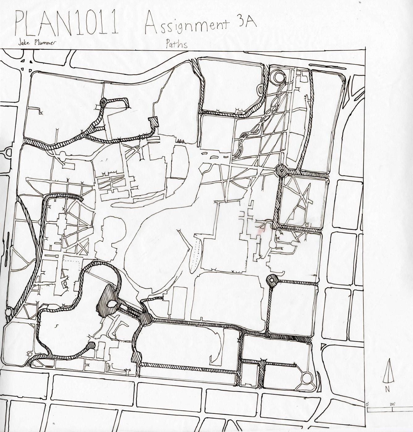
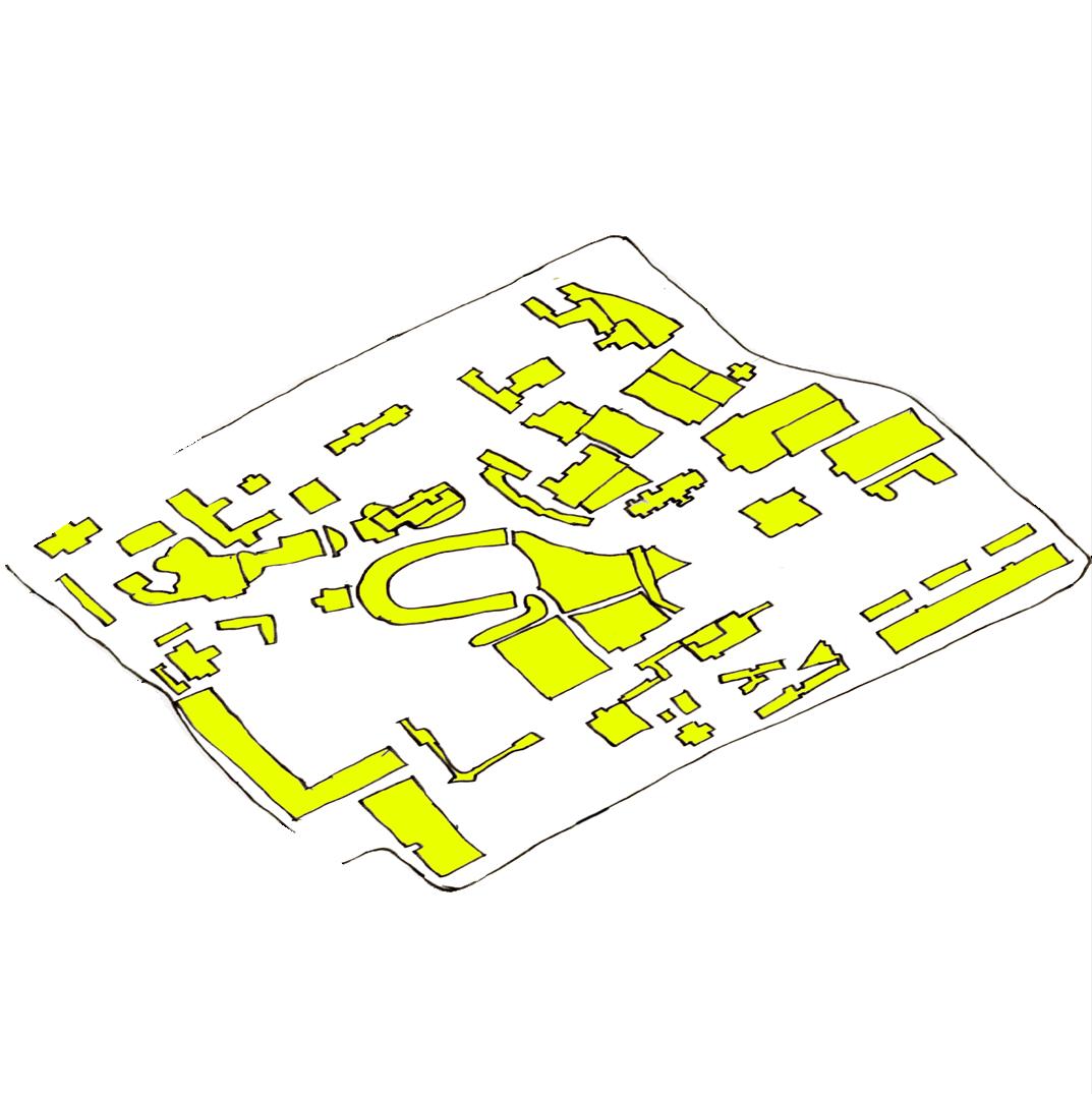
This is a map of all the paths in the University of Cincinnati. The shaded parts of the map are major roads in UC and mostly for vehicular use.
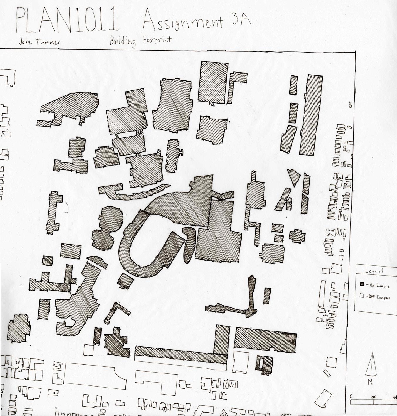
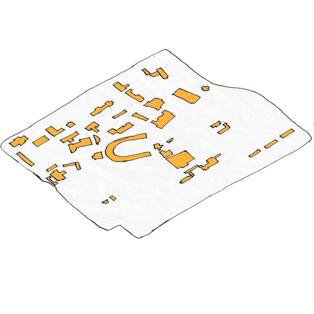
In the view of all the buildings at the University of Cincinnati, the buildings that are on campus are shaded in and the buildings that are not apart of campus are blank.
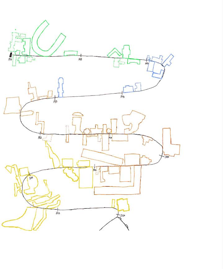
1910-1930 Expansion
1930-1950 Expansion 1950-1970 Expansion 1970-2020 Expansion Build either renovated or torn down
Buildings still on campus
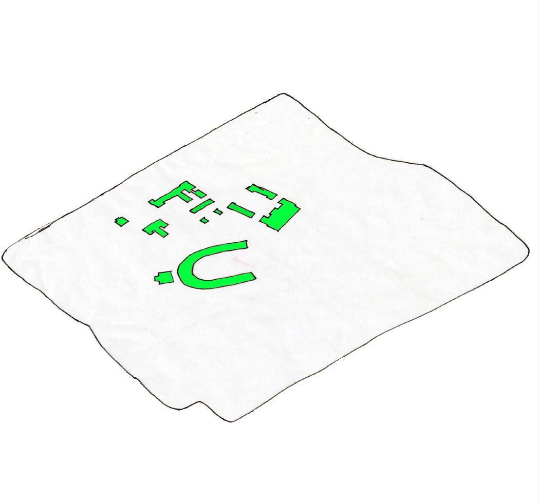
Buildings built 1910-1930
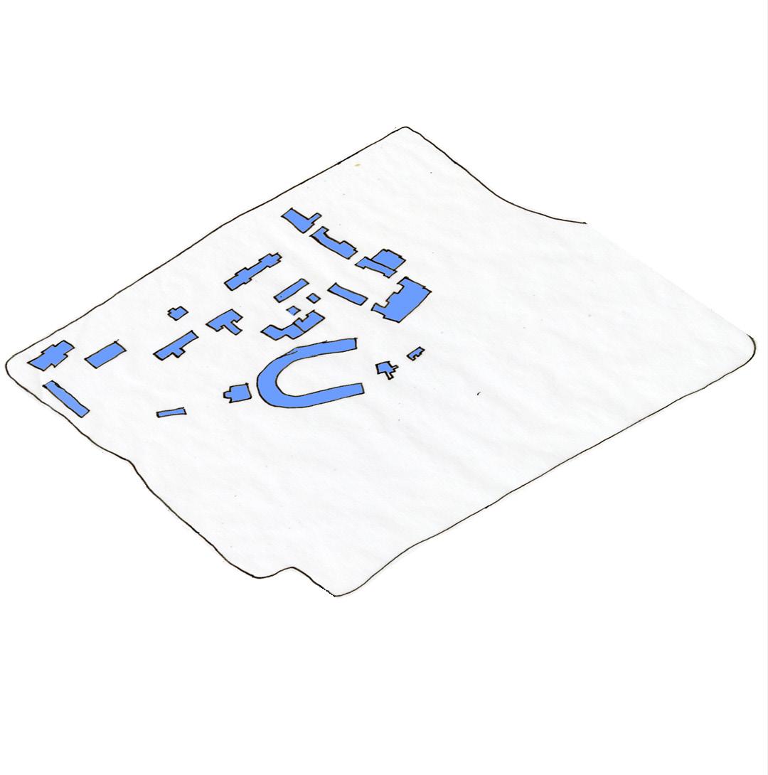
Building built 1930-1950 Building built 1950-1970 Building built 1970-2021
These are maps of the University of Cincinnati’s buildings each of their respective times.
1970’s 1950’s
2020’s
The Infographic below is showing a timeline when each of the University of Cincinnati Buildings were built.

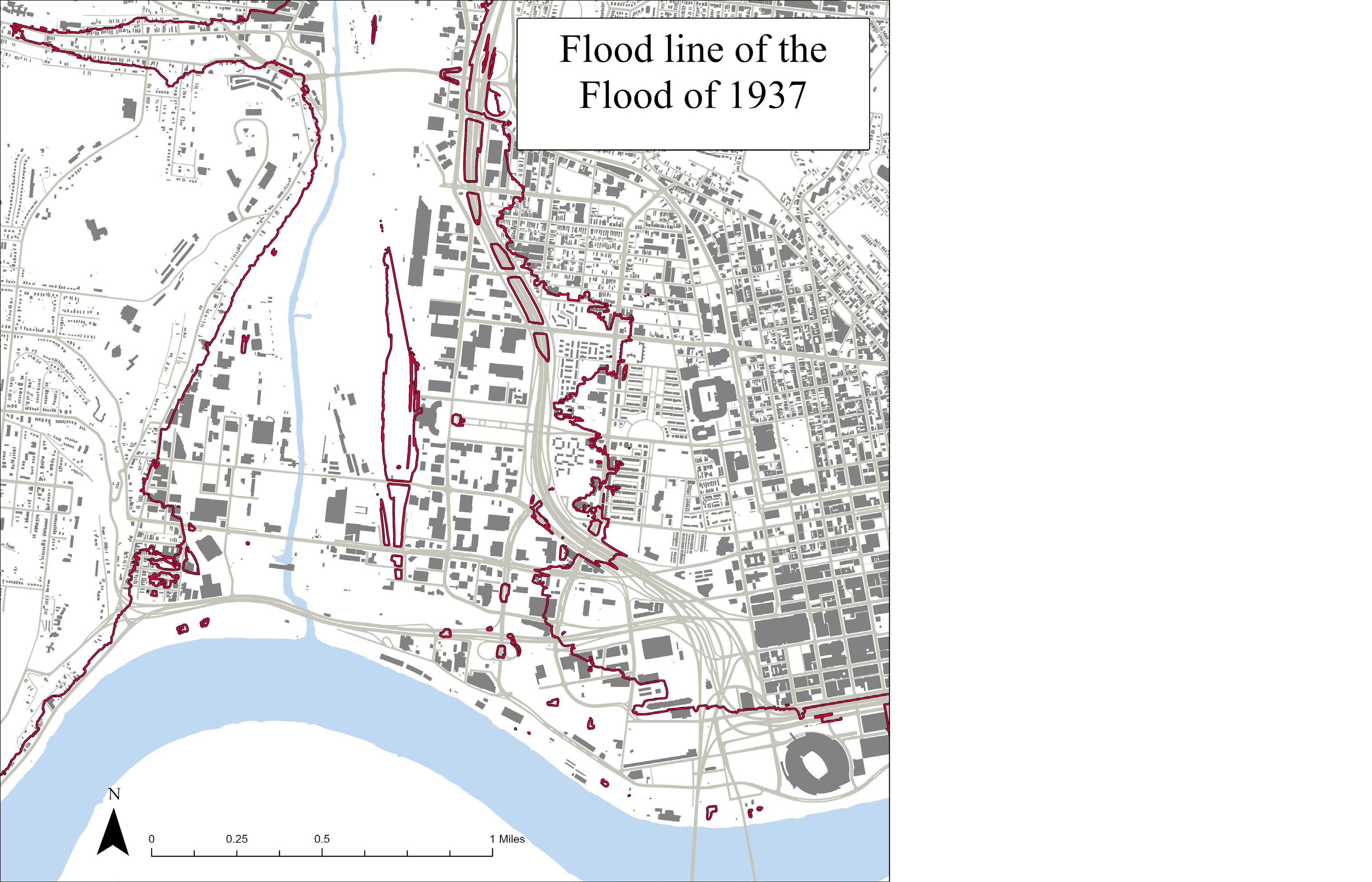
These area would be the most likely to be flooded in a flooded the size of 1937’s happened in Cincinnati again. This includes almost all of Lower Price Hill and Queensgate. While this is more of an approximation from elevation, the damage would still be substantial. Expecially to Lower Price Hill and Queensgate.
This map is showing the potential danger zones if a flood as bad as the 1937 flood were to happen to Cincinnati again. Lower Price Hill and Queensgate would be especially susceptible because of the Mill Creek Valley.
1910-1930 Expansion 1930-1950 Expansion 1950-1970 Expansion 1970-2020 Expansion
Buildings still on campus Thematic Mapping Plummer
Build either renovated or torn down
Buildings built 1910-1930 Building built 1930-1950 Building built 1950-1970 Building built 1970-2021
Why do we study history while we are at school, and why is history important? When looking at the University of Cincinnati’s past it is important to understand both that the buildings and the land have changed over time. When looking at any building on campus, there is a chance that the building was a replacement of another. Like McMicken Hall for example, before the McMicken Hall we know was built there was an older McMicken Hall that was deconstructed.
There have been many buildings, some of which are still here and some which have been demolished. These demolished buildings are represented by the dashed lines on the map. I choose to color code the buildings based on the time periods when they were built. Green were built before the 1930s, blue were built from 1930 to 1950, red were built from the 1950s to the 1970s, and yellow were built from the 1970s to the present.
There was a time earlier in UC’s history when we did not have quite so many buildings on campus. All these buildings were mostly centered along the west side of campus and are among some of the oldest buildings on campus. In the 1930s the old McMicken Hall was still around and was replaced with the newer McMicken Hall by the 1950s.
Now moving on to the 1950s-1970s and there was a large boom of buildings built including the first two building of DAAP and several of the residential halls. Then finally by 2020 all the buildings that are here now have been built, with several construction projects around campus.
This is a timeline of when all the buildings on campus were built. You can see from this infographic that there are certain periods that had massive levels of new buildings being constructed and some pockets where nothing was being built at all.
While looking at the history of the campus and the buildings that were built, it is also important to look at how UC has expanded its territory. The expansion of the University of Cincinnati is not something that happened all at once. Much of the expansion happened in waves.
When looking at the direction of the expansion of UC, it is clear that the expansion happened in three main directions. To the south, to the north, and to the east.
When looking at all this, you may ask why is learning about UC past is important. I believe that it is important because history can inspire people to make changes now rather than doing nothing. Growth is necessary for mostly anything to develop, so UC needs to be able to know where and how to grow.
Throughout the course of this first semester, I have learned many different skills in the art of planning. I have learned how to use my pencils and pens most effectively. Their strengths and weakness on different types of paper, because using different types of paper changes the quality of both the pencil and the pen. I have also learned many different types of programs that I could use on my computer. Some of these programs include Adobe Photoshop, Adobe Illustrator, SketchUp, GIS Mapping, and AutoCAD. These computer programs are most likely to be helpful in the entirety of my Urban Planning Career.
During the first half of the 2021-2022 college school year, there has been many school assignments and home problems that have come up at roughly the same time. I had to learn how to manage the school/life balance and how to manage my time most effectively. I had to spend less time doing things that were unnecessary like playing games and watching TV, and spend more time doing schoolwork. I learned that I must focus my time on what is most important, my education.
1520 Skye Drive (859) 414-9546 plummejh@mail.uc.edu