“Everybody needs beauty...places to play in and pray in where nature may heal and cheer and give strength to the body and soul alike.”
- John Muir
MOUNTAIN VIEW COMMUNITY 1
MOUNTAIN VIEW DESIGN PROjECT
Design anD Planning assistance center
sPring 2012
school of architecture
+ Planning university of new Mexico
Mountain View has the potential to face its challenges through innovative, elegant design and serve as an example of a beautiful reconciliation.
creDits
the Design and Planning assistance center (DPac) is a community outreach program established in 1969 at the university of new Mexico. DPac provides design and planning assistance to communities throughout new Mexico.
Mountain view facilitators
Jeff Klas, MVNA Board Member angela west, MVNA President
sa+P faculty
John Barney, Mountain View DPAC Instructor sue frye
Michaele Pride
sa+P graduate students
May coleman, MLA scott culler, MLA
Berenice grijalva, MARCH
Kevin harris, MARCH claire heywood, MLA indira Kaini, MLA
Maelon saress, MLA hanna thompson, MLA
acKnowleDgeMents
the following institutions and people provided invaluable support and assistance to the Mountain view Design Project and the university of new Mexico’s DPac studio:
community of Mountain view
sara carrillo, Principal of Mountain View Elementary enrico gradi, Bernallillo County
Daniel Michel, Place Matters
Mountain view neighborhood association
MOUNTAIN VIEW COMMUNITY 5
CONTENT
FINAl FRAMEWORk PlAN
SITE SOlUTIONS
001 Overlay District
claire heywood | 16
002 Prince Acres
Berenice grijalva | 18
003 Parks, Trails + Access Points
May coleman and indira Kaini | 20
004 Redefined Lines
Maelon saress | 22
005 Mountain View Elementary Kevin harris | 24
006 Urban Wildlife Refuge scott culler and hanna thompson | 26
SChEMATIC FRAMEWORk PlANS
SITE ANAlYSIS
001 Qualitative Analysis
May coleman | 34
002 Agriculture + Vacant land claire heywood | 35
003 Economy + Industry hanna thompson | 36
004 Employment
Maelon saress | 37
005 Environmental health Berenice grijalva | 38
006 Future Residential Development scott culler | 39
007 Parks + Open Space indira Kaini | 40
008 Transportation
Kevin harris | 41
MOUNTAIN VIEW COMMUNITY 7 08 INTRODUCTION 10 14
28
32
INTRODUCTION
a seconD looK Mountain view reiMagineD
DPac team
our perception of the landscape is intimate, tenuous and unfixed. We learn that variations in climate, geography, time and custom shape people’s relationship with the landscape and if we are to truly grasp a sense of place we must flesh out these differences. in the classroom we are taught to develop a sensitivity to the land that will reveal a community’s unique sense of place because without this a garden is just a garden. the success of any designer is defined not by the beauty of her or his design but the sense of place it creates.
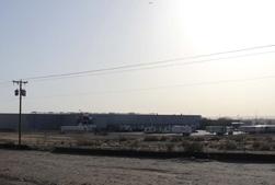
But we are not taught that places are established and exist under different standards. some places are young and easy to define but others are rooted in challenge and complicated histories. Mountain view is a unique community bound by the Bosque and rich history of industry, agriculture, ur-
ban settlement and dispute. the boundary along 2nd street marks the division within the community and its sense of place. it also marks a challenge to rethink the parameters of economy, ecology and welfare and reconcile the disparities between them.
our assignment was simple. redesign 2nd street. But along the way we realized that Mountain view holds much more meaning and purpose. this neighborhood has the potential to face its challenges through innovative, elegant design and serve as an example of a beautiful reconciliation. the master plan and specific site designs pre
sented in this book are just the beginning.
thank you to the people of Mountain view for your hospitality and invaluable support. We hope you find many useful ideas within these pages.
MOUNTAIN VIEW COMMUNITY 9
INTRODUCTION ANA l YSIS SO l UTIONS FINA l FRAMEWOR k SC h EMATIC FRAMEWOR k S
-
FINAl FRAMEWORk PlAN
Mountain View Master Plan
DPac team a | 12
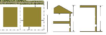
Streetscape Design at Second Street
DPac team B | 13
MOUNTAIN VIEW COMMUNITY 11 INTRODUCTION ANA l YSIS SO l UTIONS FINA l FRAMEWOR k SC h EMATIC FRAMEWOR k S
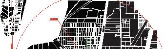
Mountain View Overlay District


Mountain View Overlay District


Mixed Use/TOD: small-scale commerce parks, business incubators, green/open space.
Mixed Use/TOD: small-scale commerce parks, business incubators, green/open space.
l-scale , n/open space.
Ag-Industr y : small and large -scale commercial plant-based businesses and related ser vices.


Ag-Industr y : small and large -scale commercial plant-based businesses and related ser vices
Manufacturing/Warehousing: Manufacturing, warehousing, distribution, largescale technology and data related industries

Manufacturing/Warehousing: Manufacturing, warehousing, distribution, largescale technology and data related industries.
Residential: single -family and small-scale multi-family building types
Ag-Residential: large -lot single family residential development and small-scale agricultural operations.
Open Space: Bosque, neighborhood parks and recreation facilities, recreation trails.
d esses and related ehousing: anuistribution, a ily and small-scale es lot and small-scale
Ag-Residential: large -lot single family residential development and small-scale agricultural operations.
Irrigation Ditches/Flood Control Channels
istrict tion ood
l-scale , n/open d esses and ehousing: anuistribution, large a ily and small-scale es lot and small-scale
Open Space: Bosque, neighborhood parks and recreation facilities, recreation trails
Irrigation Ditches/Flood Control Channels

Neighborhood Landmarks
N istrict tion ood
Residential: single -family and small-scale multi-family building types
Neighborhood Landmarks
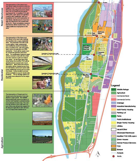
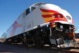
Development is most intense in the nor thern por tion of Mountain View. Warehousing, distribution and manufacturing capitaize on transpor tation links such as the rail line, and the proposed extension of Sunpor t Blvd.
elopment is most ense in the nor thern ountain View. , distribution turing capie on transpor tation links such as the rail line, oposed extent Blvd.
The TOD o ers urban ame nities such as high density housing, retail and o ces.
ers urban nities such as high y housing, retail and elopment, erspersed with esidential neighborins transitionvel of de-
Mixed use development, which is interspersed with residential neighborhoods, begins transitioning down the level of development.
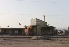
The character changes to that of semi-rural and agri-cultural type development. Residential lots are large and commercial activity on the east side of Second Street primarily ser ves the landscaping and agricul-tural industries

er changes to that of semi-rural and ype development. Residential lots ommercial y on the east side of eet primarily es the landscaping ricul-tural indus-
12 DPAC STUDIO SPRING 2012
Sec ond St r eet
Rio BravoBlvd.
Prosperity Ave
Desert Rd.
N
Sec ond St r eet
Rio BravoBlvd.
Prosperity Ave
Desert Rd
INTRODUCTION
l FRAMEWOR k ANA l YSIS SO l UTIONS SC h EMATIC FRAMEWOR k S
FINA
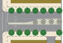
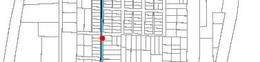
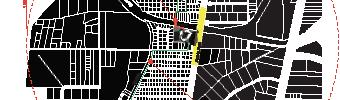
2ND | TOD
CIRCULATION DIAGRAM

2ND | PROSPERITY
2ND | MOUNTAIN VIEW ELEMENTARY
2ND | URBAN WILDLIFE REFUGE
MOUNTAIN VIEW COMMUNITY 13 95’ 20’ 10’ 30’ “Green Line” buffer median turn lane 2nd st 2nd st 2nd st-MV Elementary view NORTH buffer RR setback Scale 1” = 20’ Rail Runner 12’ 12’ 6’ 5’ 10’ 10’ 2nd Street Prosperity-MV Elementary 2nd St. Residential Industry Rail ROW proposed “Green Line” turn lane sidewalk 10’ 30’ 10’ 97’ 22’ 20’ 5’ Scale 1” = 10’
SITE SOlUTIONS
001 Overlay District claire heywood, MLA | 16
002 Prince Acres Berenice grijalva, MARCH | 18
003 Parks, Trails + Access Points May coleman and indira Kaini, MLA | 20
004 Redefined Lines Maelon saress, MLA | 22
005 Mountain View Elementary Kevin harris, MARCH | 24
006 Urban Wildlife Refuge scott culler and hanna thompson, MLA | 26
MOUNTAIN VIEW COMMUNITY 15 INTRODUCTION ANA l YSIS SO l UTIONS FINA l FRAMEWOR k SC h EMATIC FRAMEWOR k S
overlay District: a forM BaseD coDe
Mountain view is a diverse community where people from all walks of life can prosper and thrive. residents live in harmony with small businesses and clean industry; residents and workers feel a sense of pride and civic engagement.
Mountain view appeals to everyone. the toD offers urban living and a variety of amenities; ag-residential neighborhoods weave rural living with agriculture; easily accessible open spaces balance human recreation and ecological functions.
goal
enhance the quality of life and that of the environment for existing and future residents of Mountain view.
objectives
1. improve the second street streetscape.
2. establish additional parks and provide additional access to the Bosque.
3. ensure that future development does not negatively impact the environmental health of Mountain view.
4. Preserve existing agricultural land.
goal
transition to cleaner industry while maintaining the economic vitality of Mv.
objectives
1. capitalize on existing transportation networks to attract warehousing/distribution businesses.
2. Develop small-business storage facilities.
3. Develop industrial parks suitable for technology centers, data centers, other clean industries.
4. support small-scale, locally owned businesses by offering special incentives within the toD/Mixed use.
5. Provide suitable spaces within the toD/Mixed use area to encourage retail, specialty shops and restaurants.
16 DPAC STUDIO SPRING 2012
INTRODUCTION FINAl
SOlUTIONS
FRAMEWORkS
FRAMEWORk ANAlYSIS
SChEMATIC
MOUNTAIN VIEW COMMUNITY 17 O VERlAY DISTRICT ClAIRE hEYWOOD , MlA GREATER MOUNTAIN VIEW DESIGN CODE + STANDARDS 001
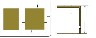
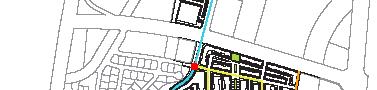
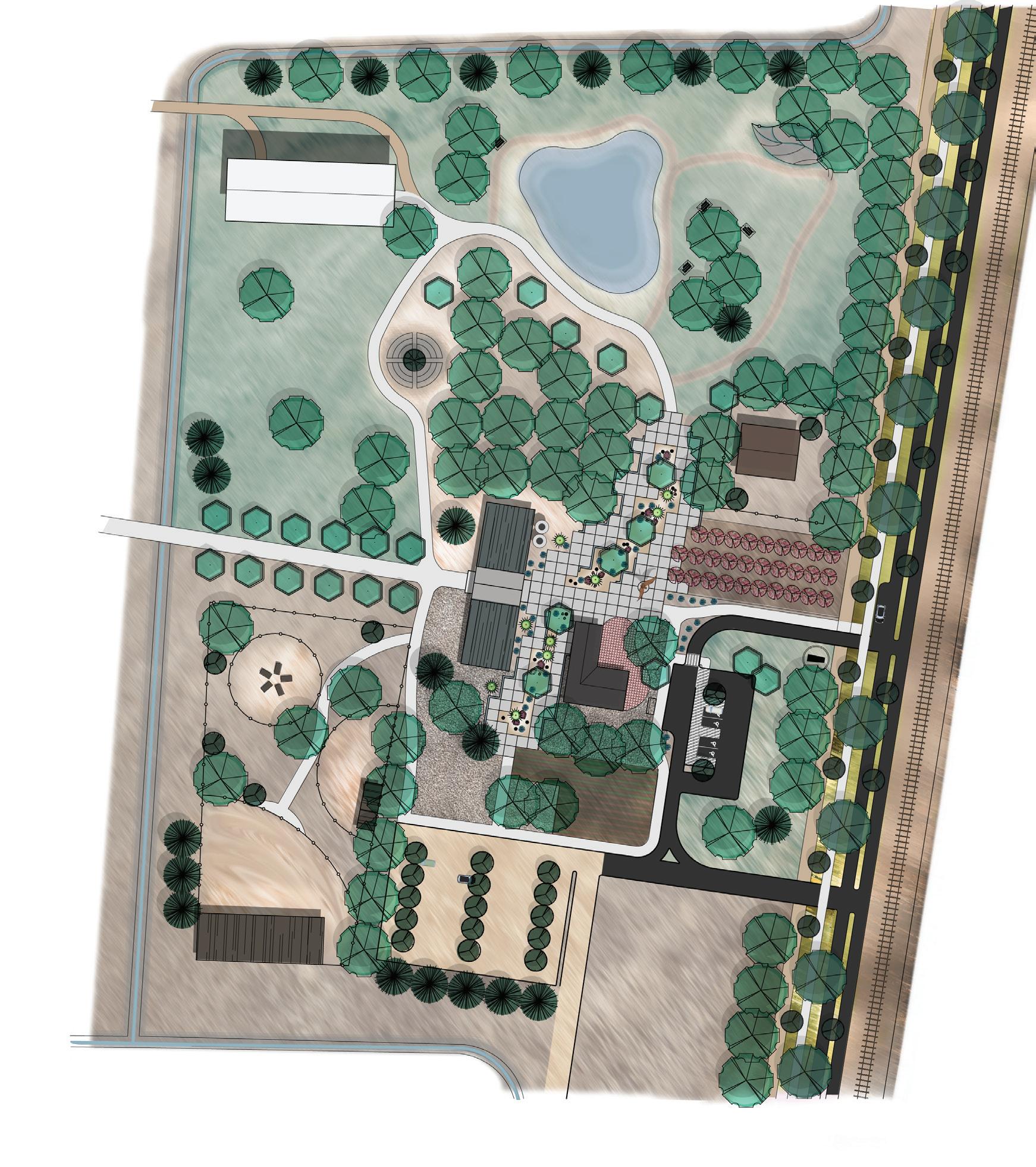
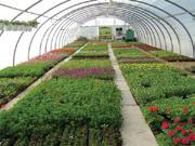
Prince acres
Prince road is an important street for Mountain view residents who live on the east side of 2nd street. it is the most direct and safe way to get to the Mountain view community center. on the se corner of Prince road and rio Bravo Blvd, is a large 46 acre vacant and undeveloped site for sale. this site is zoned as M-2, which may lead to a future large industry business if not intervened.
Because this community is mainly surrounded by industry, i propose an urban agricultural Development on this site to serve as a relief site for existing residents.
this development would mainly be a mixed use, site with recreational parks and a jewel center piece for a farmers Market along with many retail stores, restaurants and offices and residential mixed in.
the purpose of this development is to wrap around the rio Bravo Blvd already developing street that is the main entrance to the proposed transit oriented Development north of rio Bravo.
But most importantly provide existing residents with access to much needed amenities that a residential neighborhood needs to be successful.
18 DPAC STUDIO SPRING 2012
INTRODUCTION FINA l FRAMEWOR k ANA l YSIS SO l UTIONS SC h EMATIC FRAMEWOR k S


MOUNTAIN VIEW COMMUNITY 19 PRINCE ACRES B ERENICE G RA j A l VA , MARC h PRINCE + RIO BRAVO MIXED USE DEVE l OPMENT FIRE STATION EXISTING RESIDENTIAL AREA EXISTING RESIDENTIAL AREA VETENARY HOSPITAL 2ND STREET 2ND STREET RIO BRAVO BLVD. GORE AVE. WALLACE ST. SHELDON ST. GRAPE CIR. KING RD. RIOBRAVOBLVD. NEW MEXICO RAIL RUNNER STATION TRANSIT ORIENTED DEVELOPMENT (TOD) LEGEND SCALE 1” : 100’ N ROUND ABOUT MIXED USE- RETAIL, RESTAURANTS, OFFICE, SALES W/ RESIDENTIAL ABOVE PUBLIC FACILITIES/MIXED USE RETAIL COURTYARDS A PLACE TO DISPLAY PUBLIC ART PUBLIC PARKS OPEN SPACE MUD VOLLEYBALL AREA (NOT PAVED) PARKING AND STREETS RESIDENTIAL MIXED USE- RETAIL, RESTAURANTS, OFFICES, SALES BUSINESS & COMMERCIAL SERVICES - LOCAL GROCERY STORE (SMITHS OR LOWES) PROPOSED MASTER PLAN BROADWAY BLVD. WATER CHANNEL PROPOSED BIKE ROUTE BANK GROCERY STORE FARMERS MARKET LEARNING CENTER FLEA MARKET PRINCE RD. PUBLIC FACILITIES PREC FARM SECT RD 002
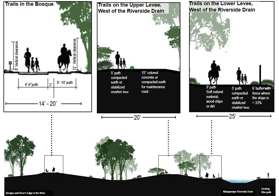
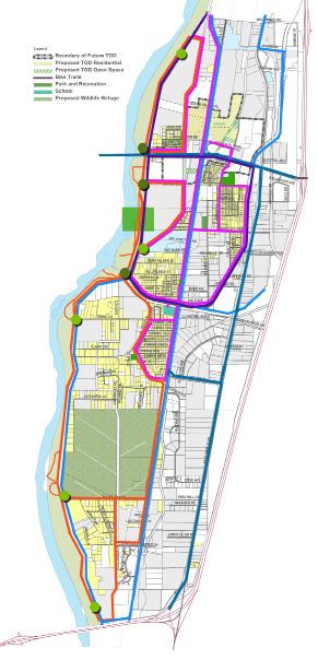
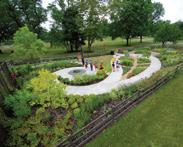
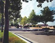
ParKs, trails anD access Points
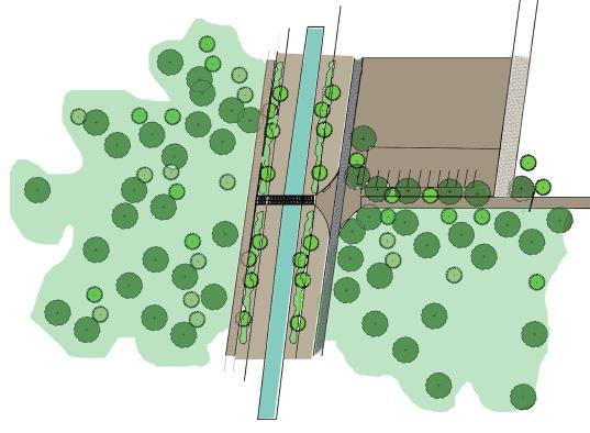
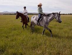
the overarching goal of this design is to increase access to open space, parks, outdoor recreation, and gardens for the residents of Mountain view. By adding access point to the Bosque, increasing the amount of parks and connecting open space areas throughout Mountain view with recreation trails, all residents will benefit from increased access to open natural space, parks and gardens.
goals
1. increase access to the Bosque, so that the nearby community can take full advantage of this asset within their neighborhood.
2. Provide more open space and parks of various types including community gardens, play grounds, recreation facilities, and natural open spaces for exploration and observation.
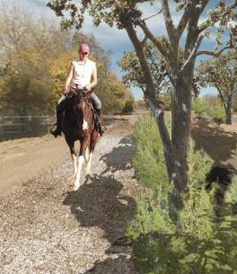
3. connect open spaces, parks and gardens through a series of paths and recreation trails for horses, bikes and pedestrians.
4. connect commuter bike trails to areas outside the immediate neighborhood.
5. help to maintain and reclaim the rural nature of Mountain view.
6. Promote healthy lifestyles and environmental education opportunities.
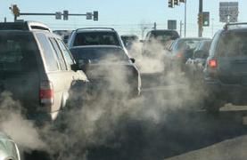
7. Mitigate effects of pollution by preserving and increasing green space.
“Open space allows kids to imagine beyond their circumstances; to move and breath; sense of freedom and possibility and anchor into the real rhythms of life”
- Mountain View Community Resident
20 DPAC STUDIO SPRING 2012
INTRODUCTION FINAl
FRAMEWORk
ANAlYSIS SOlUTIONS
SChEMATIC FRAMEWORkS
MOUNTAIN VIEW COMMUNITY 21 PAR k S + TRAI l S MAY CO l EMAN , M l A + INDIRA k AINI , M l A GREATER MOUNTAIN VIEW PAR k + OPEN SPACE 003
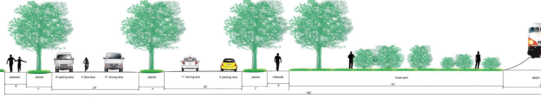
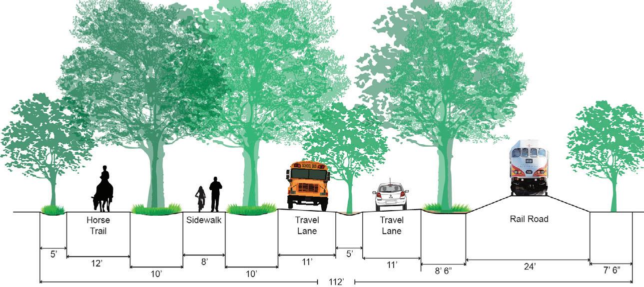
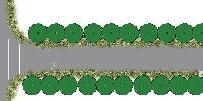
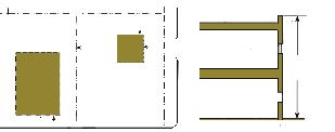
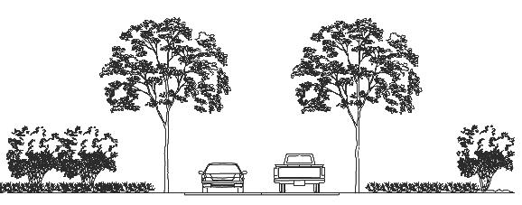
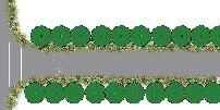
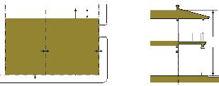
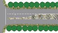
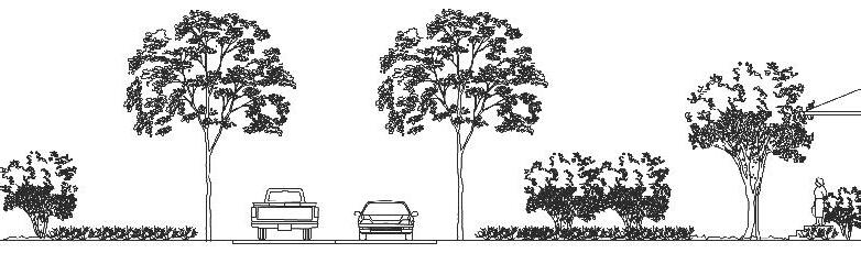
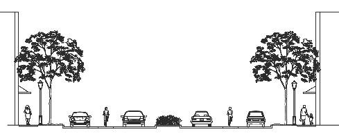
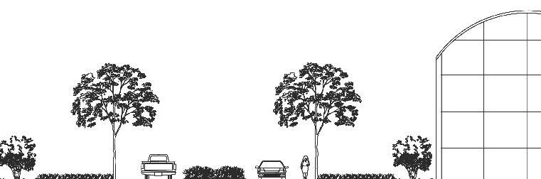
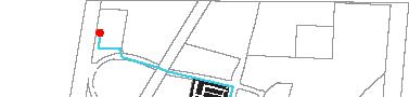
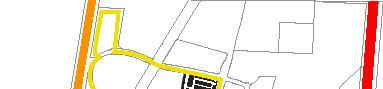
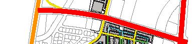
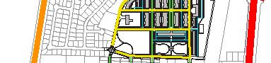
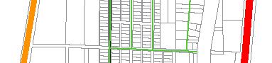
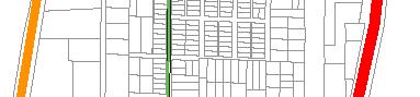
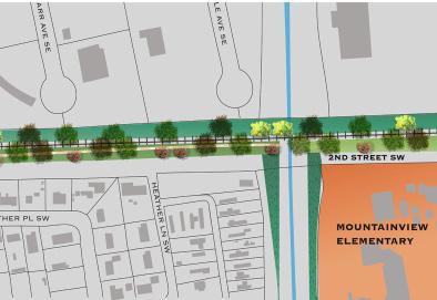
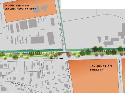
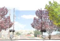
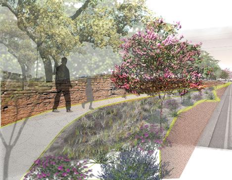
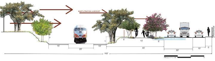
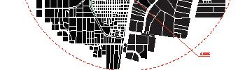
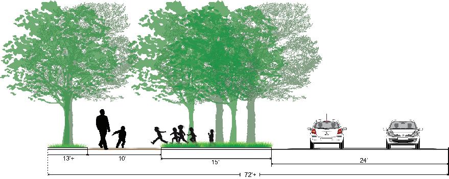
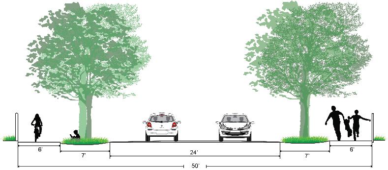
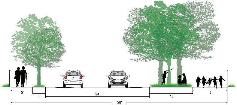
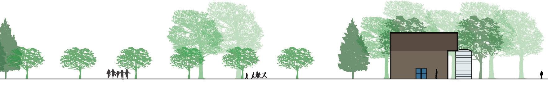
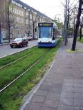
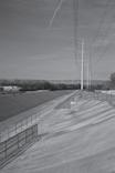
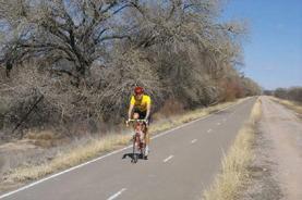
reDefineD lines | green line corriDor
Second Street is defined by both neighborhood and industry. the lines of this relationship are marked, or inscribed, in the land by the railroad and water channels. These defining lines are linked with the transport of people, goods, and resources. historically they have lived side by side, one never without the other.
second street is both a story of history and passage, and a current metaphor for needed change between society and industry. Redefining the corridor’s function gives rise to a new form, a new spatial hierarchy that can meet the demands and desires of the current century.
A re-definition of environmental space results in a site specific street design that accounts for the unique sense of place while responding to the immediate problems of pollution and noise. the generous thirtyfive foot right of way between Second Street and the rail makes it possible to propose it to begin to function
more as a linear park, a “green line” extending north and south and connecting two historical neighborhoods.
This linear park will also function as a filter between industry and residences. “shields” of clustered native planting’s are strategically staggered to catch air bourne dust and particles generated from neighboring industry. Rerouting truck traffic to a proposed relief route achieves traffic calming and inscribes a new line into the historical landscape; a re-defined line symbolizing safe passage, health, and revitalization for the community.
22 DPAC STUDIO SPRING 2012
INTRODUCTION FINA l FRAMEWOR k ANA l YSIS SO l UTIONS SC h EMATIC FRAMEWOR k S
MOUNTAIN VIEW COMMUNITY 23 REDEFINED l INES MAE l ON SARESS , M l A 2ND + PROSPERITY STREETSCAPE 004
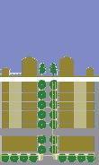
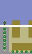
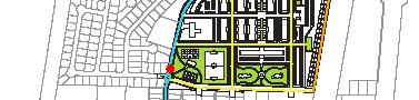
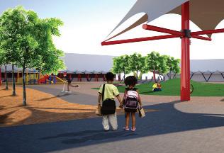
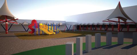
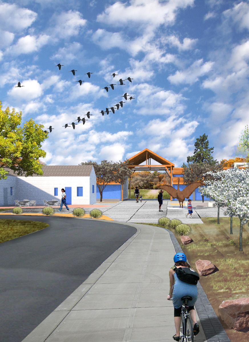
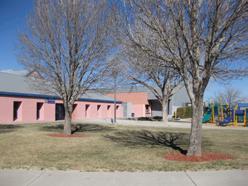
Mountain view
eleMentary school
goals
1. Propose a new master plan for new buildings, parking and playground that integrates with the surrounding community plan for circulation.
2. identify and provide walking and biking routes within a 1-mile radius for students to have direct access to school without the use of a vehicle.
3. Provide safer entrance and exit pathways for vehicles and buses.
strategies
1. walking “school Bus”
2. organized Bike groups
3. expanded school Zone
4. neighborhood Path network
5. architecture as buffer to industry east of 2nd street
a walking school bus is a group of children walking to school with one or more adults. it provides a healthy,
low-cost solution to student transportation while also building a fundamental sense of community.
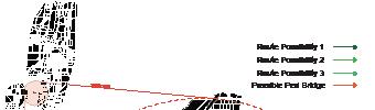
neighborhood Paths
option_1 is designed around the acequia to the south of Mountain view elementary. students are provided a large walking dirt path with green buffers to both the east and west.
option_2 consists of a fairly regular street and sidewalk spacing. It benefits from fewer children having to cross the street, but depth is lost from green buffer space.
option_3 has the majority of pedestrian/student access loaded to the east of the road. this allows for a substantial green buffer space as well as a larger path which is better suited to a “walking school bus strategy”
24 DPAC STUDIO SPRING 2012
INTRODUCTION FINAl FRAMEWORk
SOlUTIONS
FRAMEWORkS
ANAlYSIS
SChEMATIC

MOUNTAIN VIEW COMMUNITY 25 MOUNTAIN VIEW ElEMENTARY kEVIN hARRIS, MARCh 5317 2ND STREET BUIlDINGS + ROUTES 005
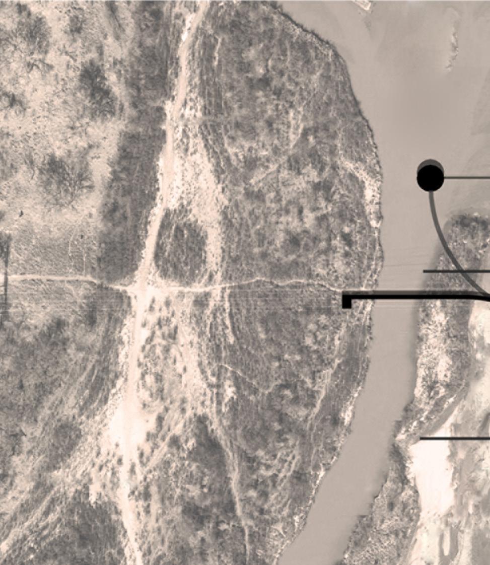
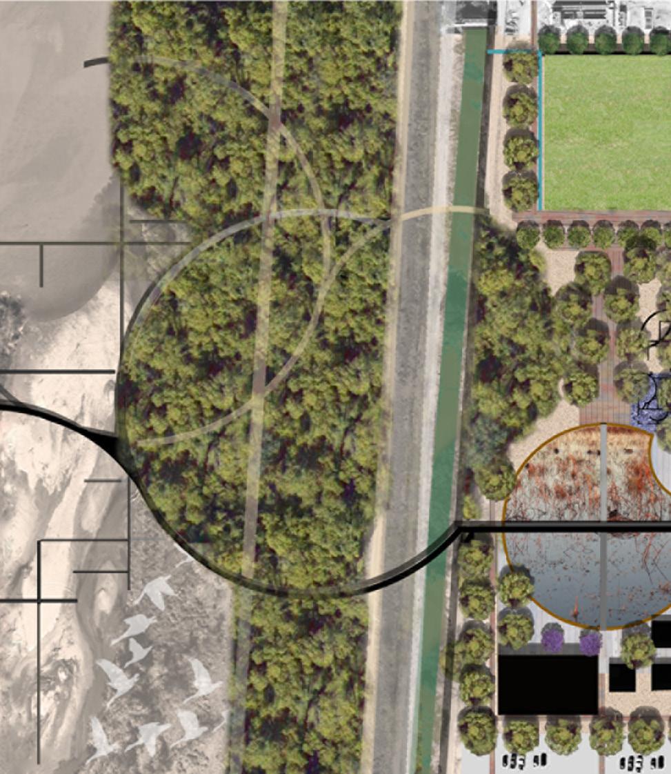
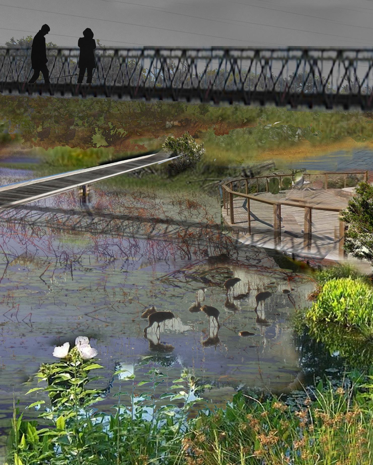
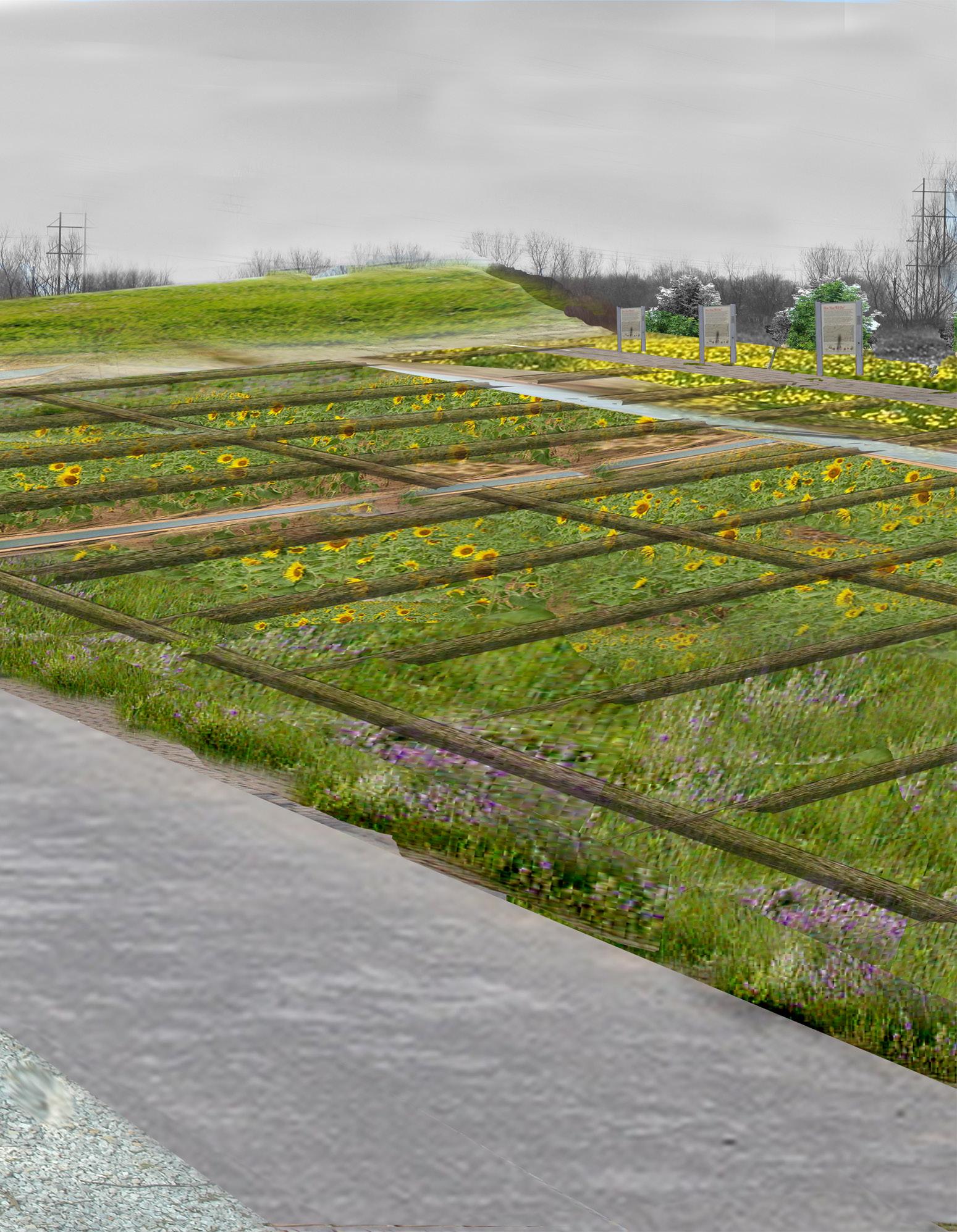
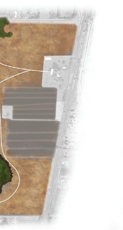
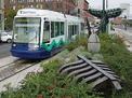
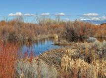
urBan wilDlife refuge
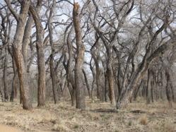
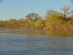
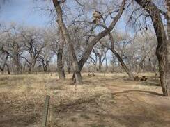
the Mountain view national urban wildlife refuge will be New Mexico’s first urban national wildlife refuge. the 570 acres of land will foster wildlife along the rio grande and provide urban ecological and agricultural education within the community.
through the design we are purposing a refuge that serves these functions and creates a place of refuge for all. the trust for Public land, in partnership with the us fish and wildlife service and Bernalillo county is at work securing the land and creating a vision for wildlife. our focus is to give the Mountain view neighborhood association a vision for the benefits to the urban community.
the urban wildlife refuge will serve the local community through education and recreation. it is designed to provide many educational opportunities showing the history of the place and teaching children the value of ecology and agriculture. the community will also benefit from the refuge as a place for recreation such as hiking and bird watching.
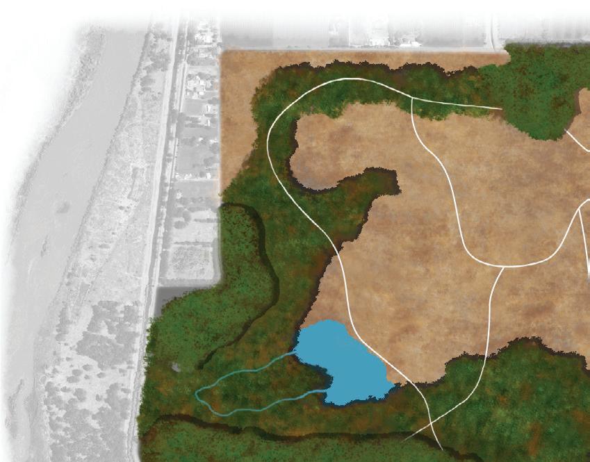
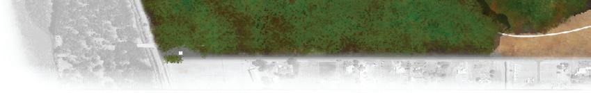
the urban wildlife refuge will also serve as a local habitat corridor and extension of new Mexico’s sand hill crane flyway. It is designed to support a range of habitats and wildlife.
a vision for the park’s ecological future is modeled from the Bosque del apache’s biological management plan. it is designed to slowly replace invasive species with cottonwoods, native willows and grasses, which will create three distinct habitat types within the refuge.
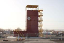
the riparian forest, scrub and meadow habitats will provide the necessary vegetation, spatial complexity and water quality to support a diverse wildlife community and restore this reach of the rio grande. in addition to habitat restoration, the urban wildlife refuge will establish a permanent research facility on site to monitor restoration efforts and develop an adaptive management plan. this facility will be available to student research and non-profit groups interested in riparian restoration.
26 DPAC STUDIO SPRING 2012
INTRODUCTION FINAl
FRAMEWORk
ANAlYSIS SOlUTIONS SChEMATIC FRAMEWORkS


MOUNTAIN VIEW COMMUNITY 27 URBAN WIlDlIFE REFUGE SCOTT CUllER, MlA + hANNA ThOMPSON, MlA 7761 2ND STREET OPEN SPACE 006 WILDLIFE REFUGE WELCOME CENTER
SChEMATIC FRAMEWORk PlANS
Agriculture
DPac team a | 30
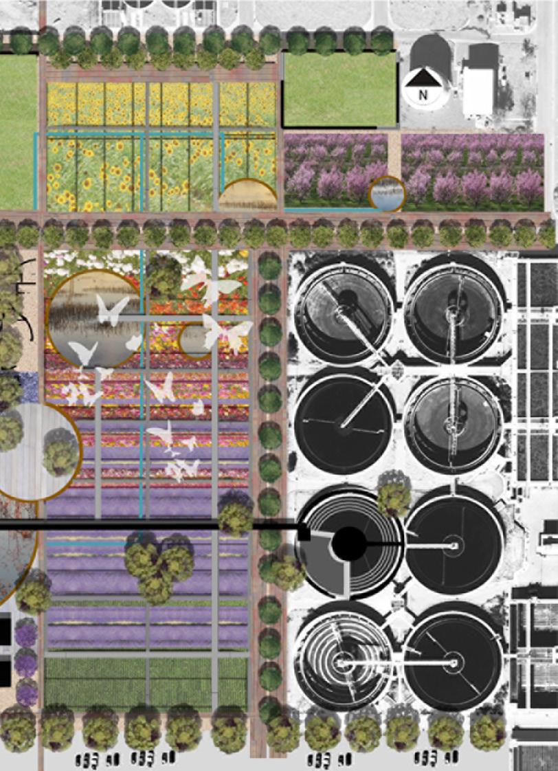
Green Industry
DPac team B | 31
MOUNTAIN VIEW COMMUNITY 29 INTRODUCTION ANA l YSIS SO l UTIONS FINA l FRAMEWOR k SC h EMATIC FRAMEWOR k S
30 DPAC STUDIO SPRING 2012


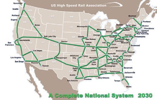
MOUNTAIN VIEW COMMUNITY 31 ¾ ¾ ¾ ¾ ¾ ¾ ¾ ¾ ¾ ¾ ¾ ¾ ¾ ¾ ¾ ¾ ¾ ¾ ¾ ¾ ¾ ¾ ¾ ¾ ¾ ¾ ¾ ¾ ¾ ¾ ¾ ¾ ¾ ¾ ¾ ¾ ¾ ¾ ¾ ¾ ¾ ¾ ¾ ¾ ¾ ¾ ¾ ¾ ¾ ¾ ¾ ¾ ¾ ¾ ¾ ¾ ¾ ¾ ¾ ¾ ¾ ¾ ¾ ¾ ¾ ¾ ¾ ¾ ¾ ¾ ¾ ¾ ¾ ¾ ¾ ¾ ¾ ¾ ¾ ¾ ¾ ¾ ¾ ¾ ¾ ¾ ¾ ¾ ¾ ¾ ¾ ¾ ¾ ¾ ¾ ¾ ¾ ¾ ¾ ¾ ¾ ¾ ¾ ¾ ¾ ¾ ¾ ¾ ¾ ¾ ¾ ¾ ¾ ¾ ¾ ¾ ¾ ¾ ¾ ¾ ¾ ¾ ¾ ¾ ¾ ¾ ¾ ¾ ¾ ¾ ¾ ¾ ¾ ¾ ¾ ¾ ¾ ¾ ¾ ¾ ¾ ¾ ¾ ¾ ¾ ¾ ¾ ¾ ¾ ¾ ¾ ¾ ¾ ¾ ¾ ¾ ¾ ¾ ¾ ¾ ¾ ¾ ¾ ¾ ¾ ¾ ¾ ¾ ¾ ¾ ¾ ¾ ¾ ¾ ¾ ¾ ¾ ¾ ¾ ¾ ¾ ¾ ¾ ½¾ ¾ ¾ ¾ ¾½ ¾ ¾ ¾ ¾ ¾ ¾ ¾ ¾ ¾ ¾ ¾ ¾ ¾ ¾ ¾ ¾ ¾ ¾ ¾ ¾ ¾ ¾ ¾ ¾ ¾ ¾ ¾ ¾ ¾ ¾ ¾ ¾ ¾ ¾ ¾ ¾ ¾ ¾ ¾ ¾ ¾ ¾ ¾ ¾ ¾ ¾ ¾ ¾ ¾ ¾ ¾ ¾ ¾ ¾ ¾ ¾ ¾ ¾ ¾ ¾ ¾ ¾ ¾ ¾ ¾ ¾ ¾ ¾ ¾ ¾ ¾ ¾ ¾ ¾ ¾ ¾ ¾ ¾ ¾ ¾ ¾ ¾ ¾ ¾ ¾ ¾ ¾ ¾ ¾ ¾ ¾ ¾ ¾ ¾ ¾ ¾ ¾ ¾ ¾ ¾ ¾ ¾ ¾ ¾ ¾ ¾ ¾ ¾ ¾ ¾ ¾ ¾ ¾ ¾ ¾ ¾ ¾ ¾ ¾ ¾ ¾ ¾ ½¾ ¾ Green Industry Master Plan Agricultural Services Technology Center Transit Oriented Development T.O.D. Proposed Mountain View Community Garden Farm Proposed Green Bu er Proposed Green Bu er Proposed 21st Century Park RioBravoBlvd Rio Bravo Blvd Broadway Blvd Broadway Blvd Proposed Wetland Water Treatment Plant 2nd Street Green Corridor 2nd Street Green Corridor Proposed Green Bu er Proposed Green Bu er Proposed Green Bu er Proposed Green Bu er Proposed Green Bu er Proposed Green Bu er Proposed Green Bu er Commercial Development Commercial Development Storage + Distribution Eco-O ce Park Horticulture Services Residential Residential Residential Urban Wildlife Refuge Rio Grande Bosque Residential Legend ¾ ¾ ¾ ¾ n Proposed Circulation Walking + Bike Trails Existing Bike Trails Proposed Green Rail and 2nd Street Corridor Existing Railroad Existing Acequias Mountain View Elementary Broadway Blvd. Proposed Emergency Evacuation Route Proposed O ce Park for Broadway Blvd. Community Garden Median example, Burlison Median Landscape Ideas on how the wetland could look like, Santa Fe Wetland Horticulture Services Cycle track and sidewalk along the street Idea for a bus stop, the roof serves a birds nest. Europe Green Rail Line Green Rail Line Existing Welcome Sign A Study by the Un versity of New Mexico Design + Planning Assistance Center DPAC Mountain View 2 Street Study nd N This study intends to enhance the identity and character of the Mountain View Neighborhood through the encouragement of green or eco-industry. The goal is to foster a sustainable future for the neighborhood by reducing environmental impact and creating opportunities for local ecological and economic growth. This study will ultimately establish a framework to integrate the residential and industrial communities. 0 500 1 000 1 500 2 000 2 500 3 000 Fee INTRODUCTION ANAlYSIS SOlUTIONS FINAl FRAMEWORk SChEMATIC FRAMEWORkS
SITE ANAlYSIS
001 Qualitative Analysis
May coleman, MLA | 34
002 Agriculture + Vacant land claire heywood, MLA | 35
003 Economy + Industry hanna thompson, MLA | 36
004 Employment
Maelon saress, MLA | 37
005 Environmental health
Berenice grijalva, MARCH | 38
006 Future Residential Development scott culler, MLA | 39
007 Parks + Open Space indira Kaini , MLA | 40
008 Transportation
Kevin harris, MARCH | 41
MOUNTAIN VIEW COMMUNITY 33 INTRODUCTION ANA l YSIS SO l UTIONS FINA l FRAMEWOR k SC h EMATIC FRAMEWOR k S


34 DPAC STUDIO SPRING 2012 QUAlITATIVE ANAlYSIS MAY COlEMAN , MlA
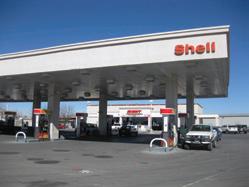
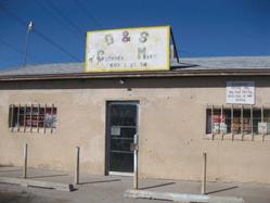
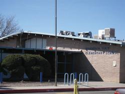
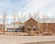
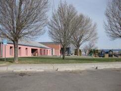
The community center is one of the most important hearts of the community ] 001 ^ ` ^ ` ^ ` ^ ` ^ ` ^ ` ^ ` ^ ` ^ ` ^ ` ^ ` ^ ^ ` ^ ` ^ ` ^ ` ^ ` ^ ` ^ ` ^ ` ^ ` ^ ` ^ ` ^ ´ ´ ´ ´ ´ ´ ´ ´ ´ ´ ´ ´ ´ ´ ´ ´´ ´ ´ ´ ´ ´ ´ ´ ´ ´ ´ ´ ´ ´ ´ ´ ´ ´ # # # 2ND BNSF RR BROAD WAY BATES SH RK P R N C E ROBRAVO B A R R N T E R O R D R A N W L M S L A T E R A L D TCH BARR CANAL W L L A M S SOUTH D I VERS ON CHANNEL R E A D N G LAGUN TAS V DAL H LL DESERT SANJOSEDRAIN COSO NDUSTRY PROSPERITY T H T H GRAPE K N N E Y DALE A R N O LAGUNITASDITCH BARR SAL DA SAND A VALLEY H GH MURRAY L E G H E D M U N D STOCK ABBIE HEATHER SUNNYSLOPE ROSSMOOR FAY I25RAMP K NG SAN JOSE LATERAL GLENN W A L L A C E PASEO ALEGRE S H E D O N GORE PARAGON HALE NOW CK N D O CLARK NM 47 C O M M U N T Y EASTV EW RENCHER CAM NO SE S B RRCLOSEDDRAIN MCCATHARN BARR SPUR DRA N TIJERAS CHANNEL R D S U S Y FEED MILL ZARTMAN CAM NO C NCO A X T E L KACEY MARY QUETZAL BOWERS CAM NO DOS CAM NO TRES BEAR EL REY B A R R D R A N C L A Y BOBBYFOSTER ELECTR C S LVER FO X CAM NO UNO JAMES ALLEN E M P R E S A KENNARD CAM NO CUATRO LLANO DEL SUR ZORRO BELVEDERE TIJERASARROYO ATCH SON C H A V A FENT MAN D R A G O N F L Y E L A N D SANROD DEAN NORTH V LLEGAS RAY BARR BRAHMA C A M E O M L A G R O ESCARPADO PROSPER TY EXTE S LVERTON S O U T H F O R SABR NA POCO LOCO S MON BARRO LAS GARZAS JOY JUNCTION PASEO DEL R O SUNUP M TCHELL AVENIDA EL TREN CAM NO OCHO NANNINGA DRA N GUERNSEY SHORTL NE C A M N O D E E S P E R A N Z A JERSEY PASEO BUENO CHAMA GNE 3RD D TCH D E A N BARRCLOSEDDRAIN BARRCLOSEDDRAIN SAN JOSE DRA N BARR A X E L L VALLEY H GH LAGUNITASDITCH BARRCLOSEDDRAIN I 25 RA MP BARRCANAL SAN J OSE DRA N BARRCLOSEDDRAIN 0 500250 Feet [ Legend X R s den ^ ` Favo e P a e and Hang Ou # C y ´ P A d d M T R 0 1 - 5 Hea t of he Commun y 1 2 5 10 d C t g Ag cu u e Comme c a Re a Comme c a Se v e D a nage d M g M R d P k g P k d R Pub c n ut ona S ng e Fam y R s den a Tran po ta on U e Va ant Oth r Wh W h g W d L g B q A q The Giant Gas station is a one of the main landmarks in Mountain View. It is described as both a heart of the community and a place to be avoided. Walmart on Rio Bravo and Coors, is not in the neighborhood but is visited often for necessities and residents frequently run into each other there. Some community members described is as a heart of the community, while others avoided it. The river and the bosque area are valued in the community for recreation and are thought as hearts of the community. RRCLO The proposed wildlife refuge is described as crucial for the well-being of the community. Process: At a community meeting, community members were dived into five groups. In groups they were then asked to place stars on a map locating; where they live; where they hang out, or favorite place; where the heart of the community is; what places they avoid and where the events in the community are. Also, community members traced their daily routes with marker on the map. This information was then compiled into one large map. In response to the question, “Where is the heart of your community?”, Many stars were placed on the same location. These stars were counted and are displayed with one star. The more stars a particular location had the larger it is displayed here. Likewise, popular routes are shown with thicker lines to indicate more common routes. This location was identified as a good place to view the stars. The Elementary School is as important heart of the community and the location of many events in the community. Many in community would like to see a safer pedestrian route to the school. The D & S Country Mart is also a heart in the community and a local hang out. The bulletin board here helps disseminate information. The Community Center is as one of the most important hearts of the community and the location for many events. Places and Routes This map shows places in Mountain View that are valued by the community and places that are avoided. Most of the avoided places correlate with either unsafe traffic or heavy industry. The most valued places are associated with community events and are near 2nd St., making 2nd St. a vital spine of the neighborhood. A Study by the University of New Mexico Design + Planning Assistance Center DPAC Mountain View 2 Street Study nd NOTE: Maps were created by students in the DPAC Studio of the School of Architecture and Planning, and are for planning purposes only. Data is courtesy of AGIS, Bernalillo County GIS, MRGCD GIS, and UNM School of Architecture and Planning. Users are solely responsible for verifying the accuracy of the data. Waste Water Treatment Plant Homeless Shelter ANAlYSIS SOlUTIONS SChEMATIC FRAMEWORkS
[
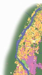
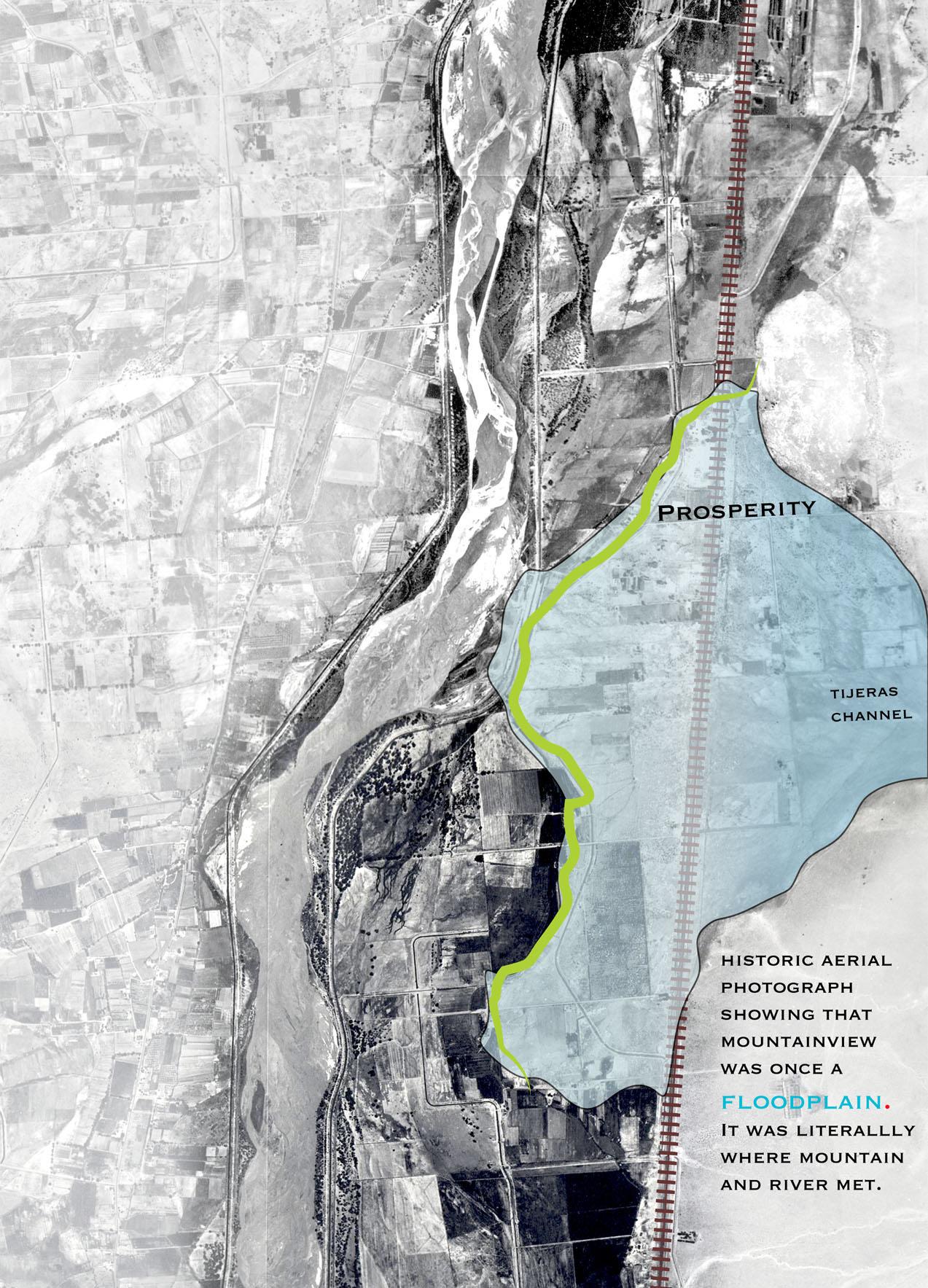
MOUNTAIN VIEW COMMUNITY 35 Legend SunportSectorPlan Og 0 1 500 3 000 4 500 6 000 750 Fee [ There is a significant amount of open space in Mountain View, which is mostly comprised of the Rio Grande State Park, agricultural land and vacant properties. Of the total 5,224 acres in Mountain View, 22% (1,150 acres) is agricultural, and 43% (2,231 acres) is vacant land. Although Mountain View comprises only 4% of Bernalillo County, the neighborhood accounts for 42% of agricultural land and 8% of vacant land within the County. A total of 37.3 miles of waterways pass through Mountain View. These include irrigation laterals and canals, stormwater drains, and floodways. There are also 2.3 miles of irrigation laterals and canals which have been abandoned, although their rights-of-way remain intact. NOTE: Maps were created by students in the DPAC Studio of the School of Architecture and Planning, and are for planning purposes only. Data is courtesy of AGIS, Bernalillo County GIS, MRGCD GIS, and UNM School of Architecture and Planning. Users are solely responsible for verifying the accuracy of the data. Changes in Land Use in the Middle Rio Grande Valley 1935 - 1992 Mountain View became more intensely developed from 1938 to 1992, although the amount of agriculturally productive land also increased during this time period. Since 1992, agricultural land use has decreased and industrial development has expanded. 1935 1992 Agricultural and Vacant Land in Mountain View Agricultural and Vacant Land in Bernalillo County Agricultural and Vacant Land in Mountain View as a Percentage of Bernalillo County AGRICUlTURE + VACANT lAND ClAIRE hEYWOOD , MlA [ Of Mountain View’s 5224 acres 23% is agriculture land 43% is vacant land ] 002
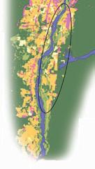
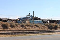
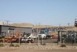
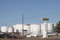
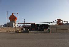
36 DPAC STUDIO SPRING 2012 RO W O A N R A MP S A E G SD H C O O V S G O A D V O U O N R N D A D E C D BR O R R E S M CA D R Legend Industrial Economies Manufactur ng Sto age Reta Serv ces Food Indus ry Junk Ya ds + Sc ap Me a T ansporta on ndust y Munc pa Fac t es O her Sector Development Plan Emp oyment Fu ure Expans on Open Space Res dent a Reta /Mixed-Use Sec or Boundary A rpor Transpo ta ion Route Rai road L ne Rai road Spurs WWTP Acequ a Refuge Bosque Open storage, warehouse space and scrap metal yards make up a significant portion of the neighborhood economy and are equally distributed throughout Mountain View. Mountain View exhibits a robust economy with a variety of services and industry. Retail, veterinary clinics and entertainment venues are just a few examples of the region’s local economy. Mountain View sits at a critical juncture. The neighborhood’s rail and roads connect to the airport and the national railroad and road network. The proximity to the airport and interstate facilitates quick transportation and product distribution. Together the Mountain View rail and road network position the neighborhood as a central transportation hub for the state. The proposed TOD sector plan includes retail and business development. This could potentially attract local business investment and interest in Mountain View. The plan may also increase traffic and density. Product manufacturing, storage, distribtution and retail are scattered throughout the neighborhood. A focused economy, such as green techonology, could streamline these processes and establish competitive advantage. Mountain View Economy NOTE: Maps were created by students in the DPAC Studio of the School of Architecture and Planning, and are for planning purposes only. Data is courtesy of AGIS, Bernalillo County GIS, MRGCD GIS, and UNM School of Architecture and Planning. Users are solely responsible for verifying the accuracy of the data. The map shows three environmental health hotspots. These are comprised of scrap car businesses with associated petroleum products and other hazardous fluids; petroleate storage facilities which have leaked in the past; manufacturing operations which contribute to suspended particulates, and facilities which manufacture pesticides and other toxic chemicals. All of these businesses have contributed to soil, water and air contamination within the neighborhood. A Study by the University of New Mexico Design + Planning Assistance Center DPAC Mountain View 2 Street Study ECONOMY + INDUSTRY hANNA ThOMPSON , MlA [ The majority of industry and manufacturing in Mountain View is located east of 2nd Street ] 003 ANAlYSIS SOlUTIONS SChEMATIC FRAMEWORkS


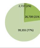
MOUNTAIN VIEW COMMUNITY 37 Employment Map NOTE: Maps were created by students in the DPAC Studio of the School of Architecture and Planning, and are for planning purposes only. Data is courtesy of AGIS, Bernalillo County GIS, MRGCD GIS, and UNM School of Architecture and Planning. Users are solely responsible for verifying the accuracy of the data. This map shows the employment numbers for Mountain View. Employment is broken down into three types, Basic, Service, and Retail, and is illustrated in the pie shaped diagrams. These indicate that majority of employment types are Basic and Service with very little Retail. Employment compared to population is illustrated in the bar graphs. These graphs show an overall extreme condition in either population or employment in most geographic areas. The inset map is a comparison of Mountain View and the Journal Center in the amount of Basic employment found in each. Mountain View accounts for 1.4% of Bernallio County overall employment and 3.7% of Bernallio County Basic employment base. A Study by the University of New Mexico Design + Planning Assistance Center DPAC Mountain View 2 Street Study nd 158 368 1210 274 894 87 148 323 307 1398 y G G S F u W d e R uge [ 0 1 400 2 800 4 200 5 600 700 Feet Legend C M county daz BAS C08 0 - 3 4 - 1 12 - 1 19 - 2 26 - 3 34 - 4 46 - 6 62 - 7 78 - 111 11 - 181 182 - 19 420 - 6899 Legend JOBS EMP08 87 88 - 148 149 - 158 159 - 274 275 - 307 308 - 323 324 - 368 369 - 894 895 - 1398 Legend BAS C08 RET08 SERV08 Legend 960 POP08 EMP0 E MP l OYMENT M AE l ON SARESS , M l A [ Mountain View accounts for 1.4% of overall employment in Bernalillo County ] 004
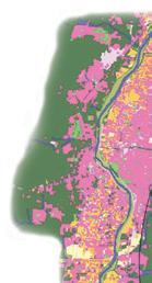
[ There are three environmental hot spots with soil, water and air contamination ]
T h
38 DPAC STUDIO SPRING 2012
ERENICE G
j
E NVIRONMENTA l h EA l
B
RI
A l VA , MARC h
005 ! ! !@ @! @ ! ! ! ! ! ! ! ! ! ! ! ! ! ! ! ! ! 2 ND NS F RR B OADWAY ATES H K P N E RIOBRAVO N A R D R O R T N R A W LIAMS ATERAL D TCH BA R CANA L OU H D V R ON CHANNEL W L M E D N G LAGUN TAS V DAL DESERT SANJOSEDRAIN H L L PRO PER Y COSO NDU T Y GRAPE T H T H N E DA E BARR LAGUNTASDTCH R O N STOCK VALL Y H GH E G H AL DA SAND A MURRA ABB E HEA HER SUNNYSLOPE ROS MOOR E D M U D FAY AN JOSE LAT RAL 25RAMP PASEOALEGRE K NG GLENN A L W E GOR H L O N HAL ARAGON C A K NOW CK ASTV EW RENCHER O D N BARRCLOSEDDRAIN NM 47 BARR PU D A N CAM NO S S U Y T JERAS CHANNEL MCCATHARN R D EED M L KACEY EL REY A TEL B AR BOWERS CAM NO S E E ZARTMAN QUETZAL CAM NO C NCO CAM NO TRES BOBBYFOSTER MARY LECTR C A D R A VER F O X C A Y CAM NO DOS M P A E AMES ALL N BELVEDERE KENNARD LANO DE SUR CAM NO UNO CAM NO CUATRO D AN Z ORRO TIJERASARROYO A CH SON C H A V A FENT MAN D R A GO N L Y CACAHUATE D N L SANROD RAY BARR VLLEGAS NORTH ESCARPADO BRAHMA C A M E O M L G R O PROSPER Y EX EN ON S LVERTON O U TH F O T POCO LOCO ABR NA S MON BARRO PA EO D L R O A GARZAS OY JUNCT ON H A M R SOL DE ND A SUNUP SW OOS E R O ABA O M TCHELL AVEN DAEL TREN GUERNSEY GUZMAN CAM NO OCHO NANN NGA DRAIN RO S ON SHORTL NE A N A E S D O M A C JERSEY PASEO BUENO G C O T O N W OO D CHAMA GNE M G U C V A Z D I TCH 3 RD AVENIDAELTREN BARRCLOSEDDRAIN ASTV EW LAGUNITASDITCH BARR CANAL AN OSE DRA N T A L VA LEY H GH BARR BARRCLOSEDDRAIN 2 5 R A M P BARR CLOSED DRA N AN JOS E DRA N BARRCLOSEDDRAIN 0 500 1 000 1 500 2 000 2 500 3 000 Fee [ Legend ! C ty Identintif ed P utant Site ! Monitored VOC Sites " ¶ Super Fund Site " ¶ Air Pollut on " ¶ Abandoned, Inactive or Uncontrolled Hazardous Waste Sites " ¶ Contamina ed Waste Water " ¶ Facili es Gene a e Haza dous Waste " ¶ Pest cide-p oducing Estab ishment " ¶ T xic Chemi al Establi hment n Mountain V ew Elementar AirTra c No se O erlay Res dentia N trate Plume Bosque R G and Bosque R o Bravo Blvd Railroad 2nd S ree MV ¾ ¾ Bike T ails Acequ as ndustrial nstitutiona T ansportati U itie Vacan Wa ehou e Distance of toxici y 0 - 1,000 1 000.000001 - 2,000 2 000.000001 - 3,000 3 000.000001 - 4,000 4 000.000001 - 5,000 Water aste T eatment Plan P k & Rec The map shows three environmental health hotspot These a e comprised of sc ap car businesses with associated pet oleum produc tions which contribute to suspended particulate and acilities which manu actu e pesticides and other toxic chemicals All of these businesses have contributed to soil water and air contamination within the neighborhood A Study by the University of New Mexico Design + Planning Assistance Center DPAC Mountain View 2 Street Study nd Environmental Health Map NOTE: Maps we e c eated by students in the DPAC Studio of the School of Archi ectu e and Planning and a e or planning purposes only Data is cou esy of AGIS, Bernalillo County GIS, MRGCD GIS, and UNM School of A chi ectu e and Planning Users are solely esponsible or verifying the a curacy of the data. ANA l YSIS SO l UTIONS SC h EMATIC FRAMEWOR k S


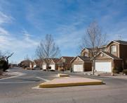
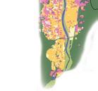
MOUNTAIN VIEW COMMUNITY 39 D & S C y M Ra Runner S a on Fu u e W d fe Re uge M t V C y C y H C y R ADWAY BA S H R N R B VO W CH NA O H O C NN A U ES L L SAN O E N S Y C ND N D E GUNTA DTCH L H G H A A N B E AY SAN LA A 5 M P O G GL NN A A M U Y NM 7 N AS C NN F KACE B A MAN AM O OB F ST R V R O M S A N K N NO D U AM NO C OR T R S RROY H O E M N H N H U A A A B R VLLEGAS NO H A AD R HMA A O Y X N N O H N B R O A A O UN O A O A DA GURNE G MA AM O OC O O N NA NG S O M O D N DAU H AS U N SAD O W O H N A V C AVNDA T EN AG A D 25 M A S D A MPRESA BARR A SU NY LO E N O E AR A N N 3RD A O Moun a n V ew E emen a LEGEND 2 d S eet Co do E t g S d lk R L ! L d k n M t V E y A q P k & R t R G d B q B k T E t g P p d R G d A E t g R G d A D d R G d A L d S g F y R id T h S g F y A t h d T A C U M b H M b H 1-10 Sp M b H 11 O M Sp M t -F y 5-9 U t 0 500 1 000 1 500 2 000 2 500 3 000 3 500 4 000 4 500 250 Feet [ Resident a Zon ng Re den a Mob e Home C Comme c a Ne ghborhood Future Development # Needed Evacua on Access MV W d f R f g P b Ag t L d TOD S D P Future Expans on Open Space Re den a Sector Boundary Future Development Map (Residental) NOTE: Maps were created by students in the DPAC Studio of the School of Architecture and Planning, and are for planning purposes only. Data is courtesy of AGIS, Bernalillo County GIS, MRGCD GIS, and UNM School of Architecture and Planning. Users are solely responsible for verifying the accuracy of the data. The map shows the residential areas of the Mountain View area and the resudential relationship to human circulation and importaint nodes within the community. It also shows the important needs for future development as related to the residential areas. These needs are better walkability, escape routes for the sotheren residents, and more amenities for residential use. A Study by the University of New Mexico Design + Planning Assistance Center DPAC Mountain View 2 Street Study nd RESIDENTIAl DEVElOPMENT SCOTT CUllER, MlA [ Future residential development needs better walkability,an emergency car route and amenities ] 006
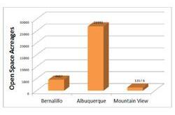
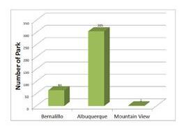
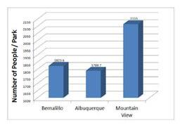
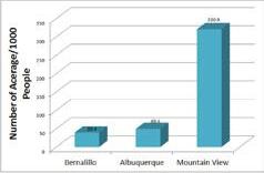
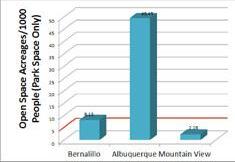
40 DPAC STUDIO SPRING 2012 PAR k S + OPEN SPACE I NDIRA k AINI , M l A [ The total area of developed parks in Mountain View is below the national average ] 007 Parks and Open Space Map NOTE: Maps were created by students in the DPAC Studio of the School of Architecture and Planning, and are for planning purposes only. Data is courtesy of AGIS, Bernalillo County GIS, MRGCD GIS, and UNM School of Architecture and Planning. Users are solely responsible for verifying the accuracy of the data. This map shows parks and open space within the Mountain View neighborhood. Ambassador Edward L. Romero Park and Mountain View Community Park are the only two parks that serve a population of approximately 4,231. The charts below provide comparisons of parks and open space between Bernalillo County, the City of Albuquerque and Mountain View. The data show that Mountain View has the highest percentage of open space in the county because of the adjacent Bosque and the proposed wildlife refuge. However, if one considers only developed parks, which total 9.5 acres the number of acres of open space per one thousand people falls below the national average. According to The National Recreation and Park Association (NRPA), the US national average is five acres per one thousand people. A Study by the University of New Mexico Design + Planning Assistance Center DPAC Mountain View 2 Street Study nd ! ! ND NS F RR OADW BATES SHIRK R N C O RA O O W M S L A T E R D TCH ARR C A A L SOUTH D I VER ON CHA NEL W R E A G TAS V DAL ERT H SANJOSEDRAIN RO G R E NDUS T H 5 T DALE N BARR N O LAGUNTASDTCH RR Y TOCK M N D O E H ROSSMOOR BB E SANJOS LATERAL GLENN 25RAMP W A L L A O GR K G S H E O N PARAGON A L E CLARK O M N T EASTV EW NM M C R N BRRCOSDDRAIN U S CAM NO SE S TIJ AS AN L 3 R ACE ZA B QUETZAL AMINO NCO C L A Y EL R Y C M NO SIETE OS OB YF ST R M A B A R R A I N E ECTR C AMES A EN S I VER F O X KENNA C LANO D L SUR E CAMINO CUATRO ORRO IJ AS RROYO C V A CA HOUN F TIM D A G O N F L Y N D C A U NORTH V LEGAS BRAHMA C M E O E CA PA O M L A R O P SILVERTON S O H F O R T POCO OCO A V STA MON LAS G R A E JO UNCT ASEO DEL RIO S NUP SO D SAND A W O O RIO MI ZMA GERNEY EN AEL REN ROSSON N G D C A M O D E S P A N ASEO DEL BAN O Y AD A EO UENO G O T N W O D MA GNE M I G U A V E VNIAE RE D TCH T E L L S N YSOP 25 AM AR LOEDDAN BARRC OSEDDR N W M LAGUNITAS DITCH SAN O CLOS D DRAIN EMPRESA VA LE H GH R B A D D HE T ARR CAN AN OSE DR D D E A N 0 500 1 000 1 500 2 000 250 Feet [ Pa k Se ce p p U C N Op S g B q ) Open S ace Compa on Cha Legend MV Landmarks Picn c area 10 t Contour R o B avo ! . Bosque Access 2nd S ree Ra road Intersta es MV B ketra s MV S ree s MVROW MV Acequ a TOD Sector Plan Open Space Sector Boundary MV W ld i e Refuge MV Ag Land MVParks& Recs MV Vacan Lots Bosque R o Grande Mounta nv ew ANA l YSIS SO l UTIONS SC h EMATIC FRAMEWOR k S


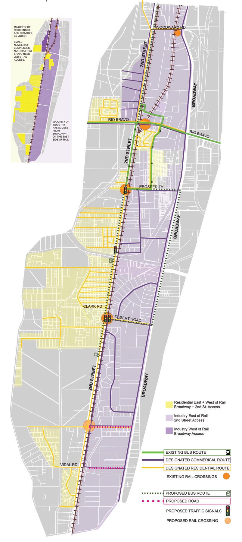
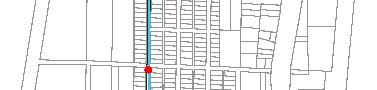
MOUNTAIN VIEW COMMUNITY 41 TRANSPORTATION kEVIN hARRIS, MARCh
Mtn.
] 2ND T BRO DWA B D ATE D R B AVOBLV S P CE S I2 W M R D N D L RD ES RD OSPE T AV H NDUS RY WAY KACEYLN E V T T V L EY H G AGU TAS D U D D SMOO RD CO O AVE N S H T S DR PASEO ALEGRE DR D LE A E CAM NO S S W A E T H D N S ARR A E C M M N T L A U R CAM NO C NCO GLENNDR CAM NO S ET CAM O DO C M NO RES NGRD MCCATHARN RD BARR RD O UNO R C AVE ST L ANO DE S R CAM NO CUATRO M L N N O D GORE VE R E C R AS V W T O BYFO TERRD A R D A N R RD E U T QUETZ VE S L VER O R M R A D G P BOWERS RD E RE RD S TH V EY P R EAR LN M E VED RE AV NNARD A E HOU A E A VILLEG S L EN MAN L Z ORRO DR E N R D R G O N H T M R G O N L A D L ATCH ON R COS CT VE DA TR N R S R T RA MA CT ESCARPADO VE NOR H S C M O D TY E TE S O GORH MAV S BR NA N ODWA D RD U H R R S LV RTO CT OY NCT O RD N MO N N E E E A A R O ABA O RD SWOO E C T CH L R HE TH R SUN SLOP D ROSS N C GUZ NAV ARRO RD L NE CT O O O O D P EO B NO C CHAMA GNE CT ER EY AX E L ST # HOL TENCT G E C A Z N W M R BARR RD BOB Y FO TER D E EY RD LAG S LN D S R O ABA O D 5100 9000 8800 5600 8600 1700 3800 3100 8900 47300 70700 35200 15500 10600 28700 28100 y G G S R R S W d R g M V E M V C C ¯ Legend G Prob em In ersect ons ! T af c S gnals - Unsa sfactory ! T af c S gnals - Sa sfactory # T af ic F ows 2010 Á RRSpurs ! Bus Stops MVLandmarks Moun ainv ew SunportSecto P an Bosque Rio Grande Access W Des red Access X Ex st ng Access A rTra f c No se Over ay Ra lRunne MVROW Bus Routes Bike Routes B keCross ng Mu t UseT ai W deRoad Road Class fica ions Loca M nor Ar er a Co ecto Pr nc pa Ar er a In ers ates 0 500 1 000 1 500 2 000 2 500 3 000 3 500 4 000 4 500 5 000 250 Fee [ Transportation Map NOTE: Maps were created by students in the DPAC Studio of the School of Architecture and Planning, and are for planning purposes only. Data is courtesy of AGIS, Bernalillo County GIS, MRGCD GIS, and UNM School of Architecture and Planning. Users are solely responsible for verifying the accuracy of the data. The map shows the main road classifications of the Mountain View community as well as noted problem areas. Intersections at Prosperity and 2nd St. and Mountain View Elemntary School and 2nd St. lack turn lanes which reesults in increased congestion and dangerous driving conditions. The intersection at Rio Bravo and 2nd St. suffers from traffic and poor light timing as well as a lack of necessary turn signals. Lack of pedestrian/bike access makes conditions along 2nd St. dangerous for community members, particularly in the region between Joy Junction and the existing bus stop. A Study by the University of New Mexico Design + Planning Assistance Center DPAC Mountain View 2 Street Study nd U TZ 008
[ Intersections at Prosperity and
View Elementary lack turn lanes which creates congestion
