Chicago’s New Nature
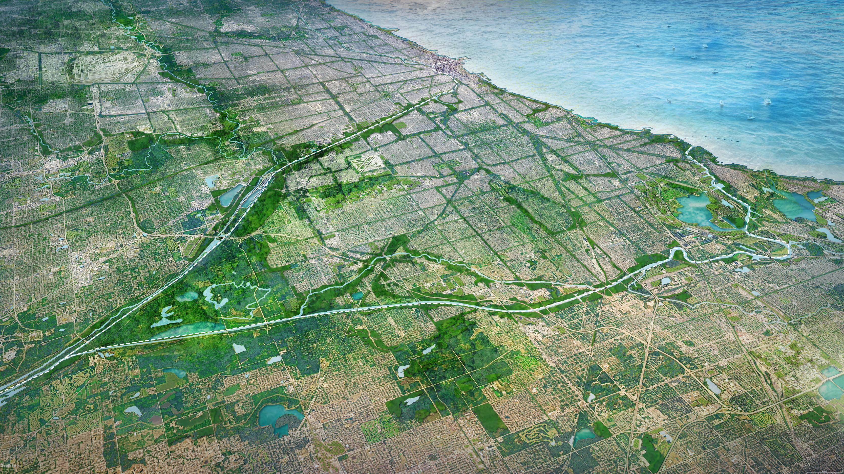


Context and Introduction
Ecotone Analysis
Vision
Placetype Zones
Goals
Regional Plans
Toolkit
Conclusion


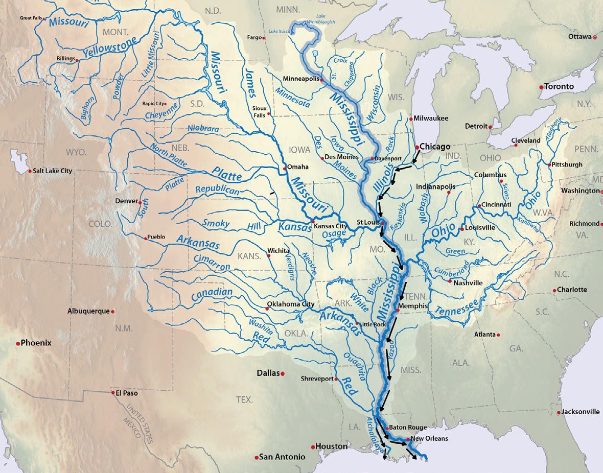
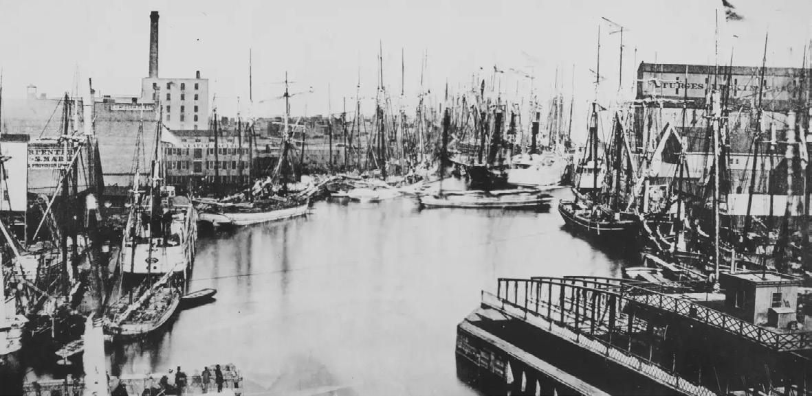


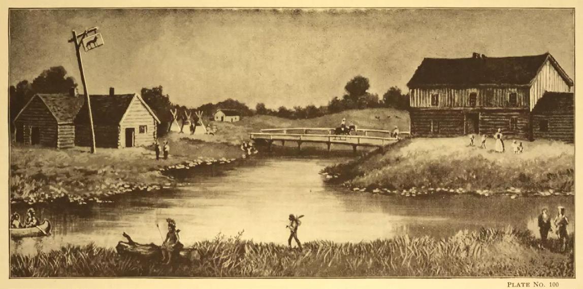
Chicago’s Legacy


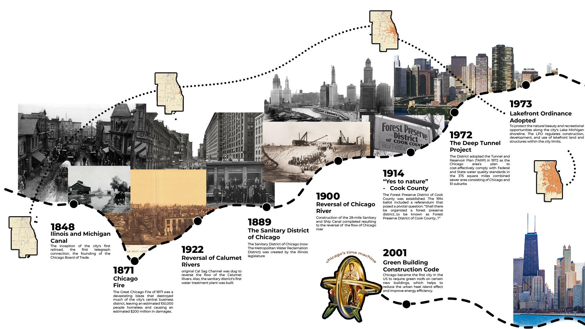


Urban Ecotone Analysis


Woodland/forest
An area of dense tree, shrub and understory growth.
A flat open area with dense growth of grasses and soft stemmed, broad leafed plant communities with minimal tree growth.
Land adjacent to rivers, streams, lakes, and other water bodies.
Aquatic
Water habitats such as rivers, lakes, streams, ponds, swamps, wetlands, bogs and lagoons.


The Great Lakes region has a history of natural abundance that has been disrupted by humanoriented development.
Despite decreasing dominance of industrial economies, industrial areas still serve as rigid barriers dividing natural systems and communities.
Antiquated single-use zoning imposes inflexibility on the built environment and further divides natural systems and communities.
The engineering of natural systems to meet growing urbanization has led to environmental degradation.
Our region faces climate vulnerabilities - such as flooding, heat islanding, and pollution - but lacks a sense of urgency for climate adaptability.
Interactions between site conditions create unique placetypes, providing opportunities to repurpose and reshape our region’s terrain.

Fragmented natural systems need to be restitched to restore the Chicago region’s legacy of rich natural systems, promote coexistence between humans and nature, and catalyze Chicago’s New Nature - an ecology that responds to historical degradation and is innovatively positioned for urban use and resilient climate adaptation - through design, planning, and governance.


Natural and built systems that disrupts the city grid.

Where natural systems have been engineered for changed functionality.

Natural areas that are cut off from their ecological point of origin but retain similar characteristics.

Protected ecological hotspots that should be retained to connect to other natural areas and integrate into the built environment.

Built and natural systems in proximity to each other which influence one another and trigger a ripple effect.

Utility and industrial corridors shaping nearby land uses.
Natural and built systems that disrupt the city grid.

Natural areas that are cut off from their ecological point of origin but retain similar characteristics. Eco-remnants

Dynamo-scapes
Built and natural systems in proximity to each other which influence one another and trigger a ripple effect.
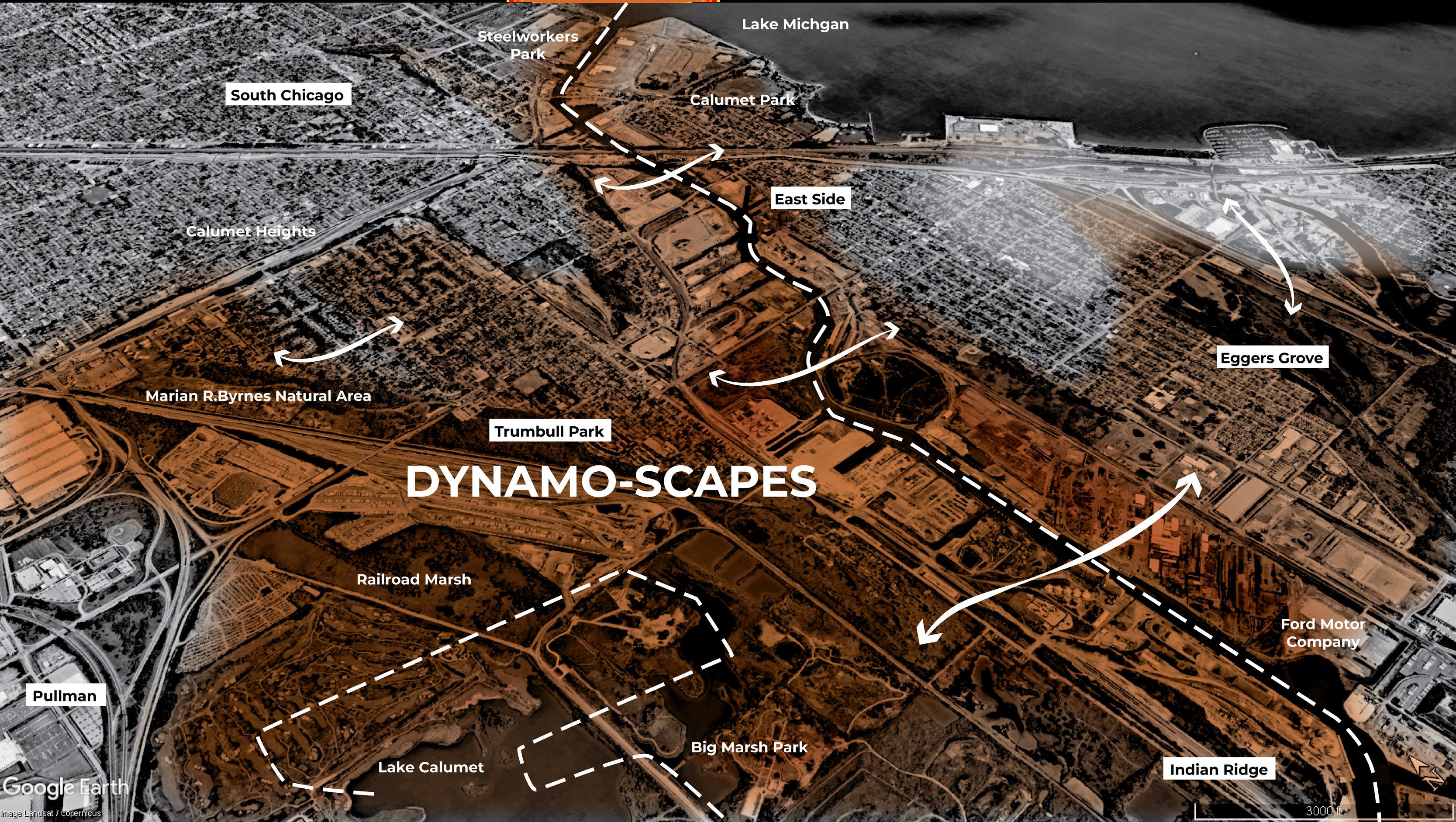
Where natural systems have been engineered resulting in changed functionality.

Protected ecological hotspots that should be retained to connect to other natural areas and integrate into the built environment.

Shifting Greys
Utility and industrial corridors shaping nearby land uses.


Grid Disruptors

Shifting Greys

Dynamoscapes

Engineered Landscapes

Eco-Remnants


Connect islanded communities to nature and fragmented natural systems to each other.
Adapt the built environment to be multi-purpose, meeting the needs of people, wildlife, and natural systems.
Restore natural edges and remove physical barriers to improve and conserve natural functions.

Policy Short Term
Enact Climate Setbacks
Add public access easements. Public buyout of land along waterways as industries phase out.
Land is placed in a land bank for community ownership.
Restored natural systems, flourishing independent ecosystems, increased community access to the river, deepened understanding and appreciation of nature.
Repurpose
Underutilized Land
Create accessible pathways for community control over redevelopment with a focus on environmental programming. Implement anti-gentrification measures through property tax, demolition freezes, and community land trusts.
Increased open space, improved stormwater management.
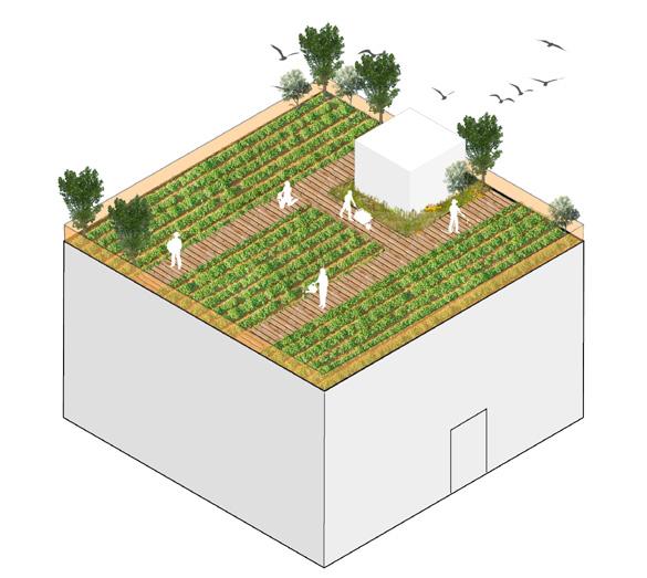
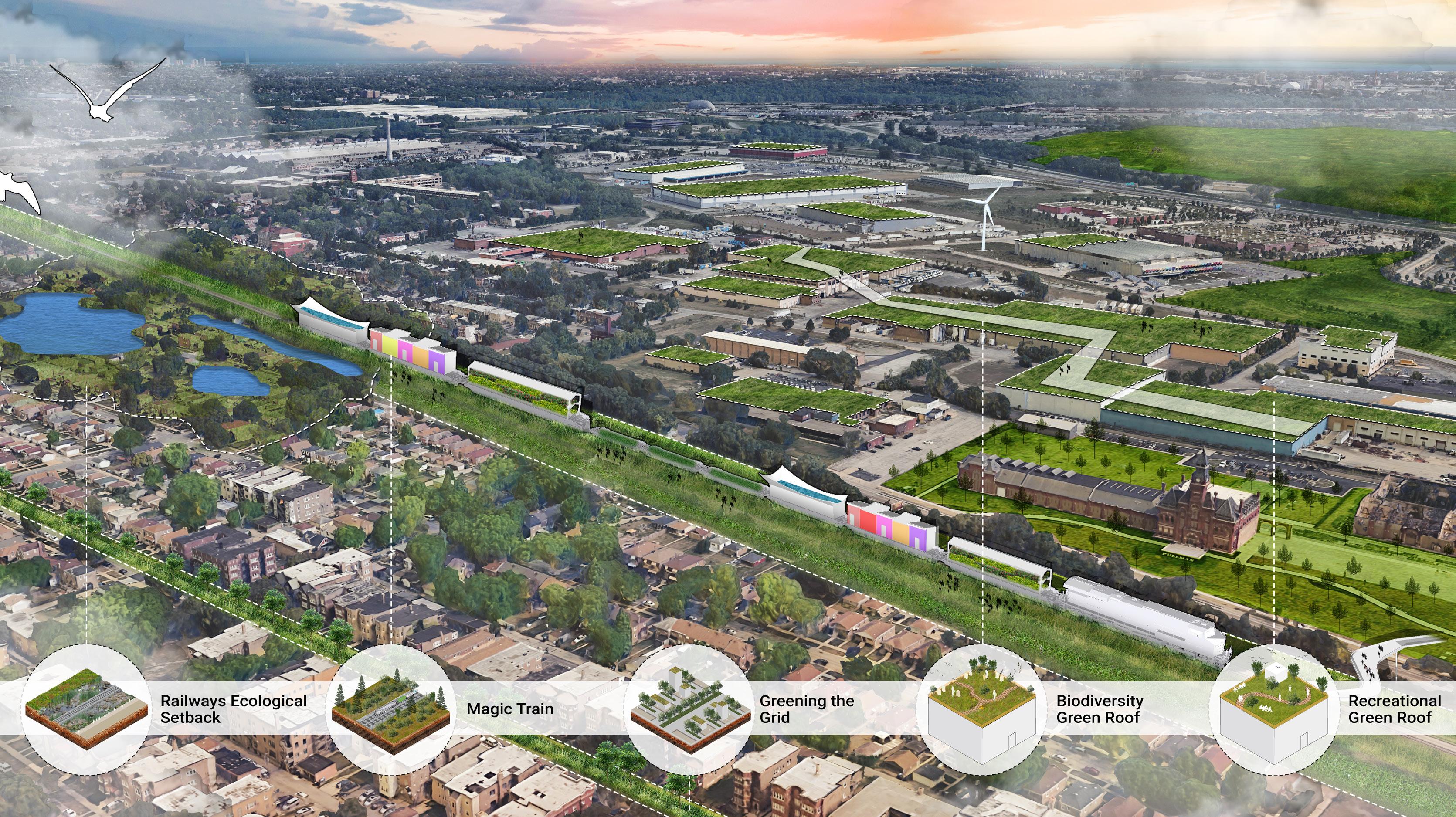
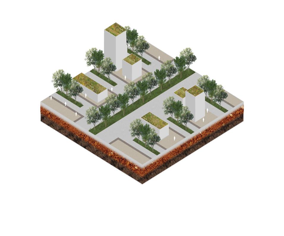
Regional green roof network
Develop green roofs on civic buildings.
Include an ecologist to review and consult on the construction. Offer tax incentives to existing industrial and private businesses who develop green roofs. Require new developments to add a green roof feature.
Reduced heat island effect, improved air quality, and enhanced biodiversity.


Opportunity areas for green roof development and financial and tax incentive recommendations.
Re-imagined infrastrucure connections along abandoned and exisitng railway corridors and utility lines.
Opportunities and challenges along the river corridor. Proposed landscapes and design recommendations.
Proposed


Industrial Civic
14,000 + acres
50+ miles of roof reimagined as green roofs. of connected green roofs forming an aerial green network.


Exisiting Landscapes

Proposed Landscapes

Proposed


Powerline Right Of Ways As Spaces Of Natural Abundance

Railway Corridors
Have Room For Reimaginatation

Override: Chao Phray Sky Park Bangkok
Proposed Plan


Existing Conditions


Proposed Plan

Proposed Strategies
Improved last-mile connectivity
Remediating underutilized lands
Increased public river access
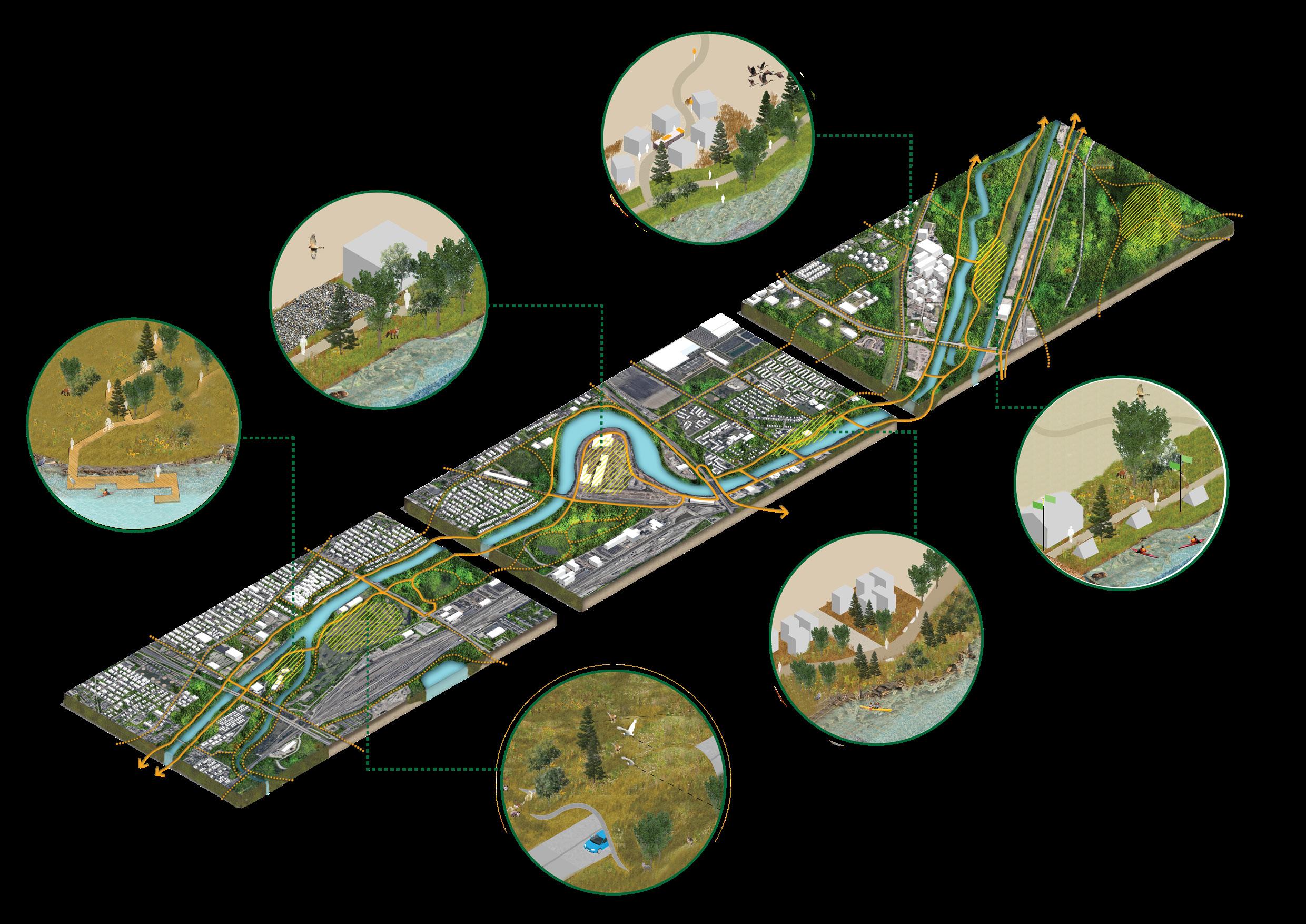
Enhancing ecological connectivity
Continuous public realm
Creating inviting destinations + recreation spots
Powerline right-ofways repurposed as trail connections
Continuous trail connection along the river corridor
Ecological restoration + conservation

Increased crossings for pedestrians + bikes Climate mitigation zones
Economic development: blue-green industries + mixed-use development


Prototype Toolkit

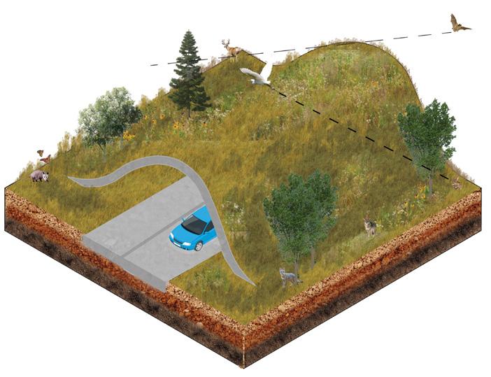


VacantLot RepurposingRiver


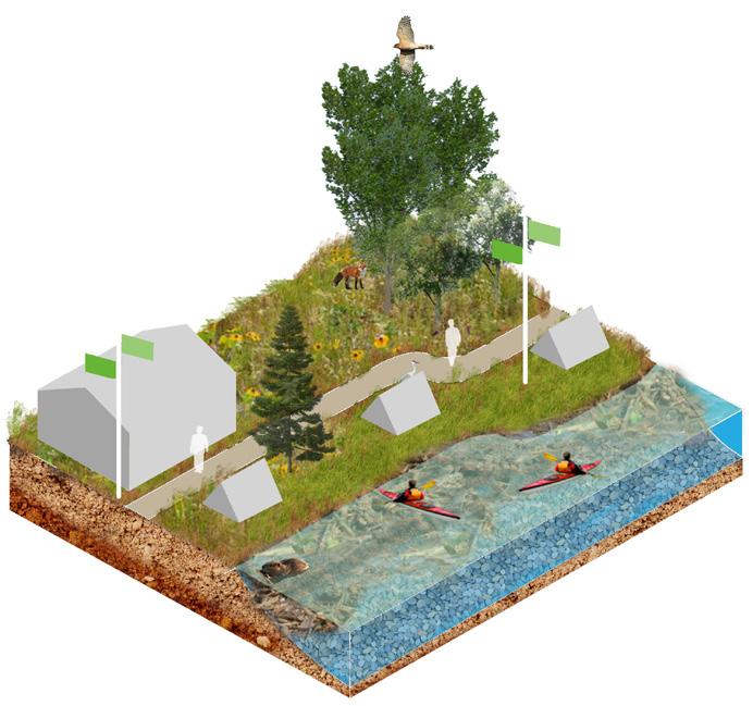
EcoRecreation Area

ClimateZoning -UrbanHeatIslandEffect MagicTrain
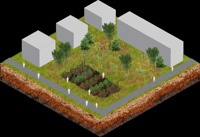
VacantLotRepurposing-Community RailroadWater Catchment RailroadRewilding


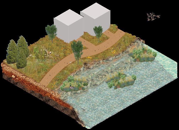


Improving
Restoring Wetlands


Increasing Community Access

Improving Waterways
Restoring Wetlands

1.28 million people living in the ‘C’ impacted by Chicago’s

Building Green Industries Connecting Trails
Increasing Community Access

New Nature of new green space across the Green Roof Network 14,000+ acres of remediated and rewilded land 12,500+ acres of newly connected ecological corridors 2,000 miles


Abdullah Chaudhry
Aayush Patel
Alek Jaunzemis
Dinesh Prasad
Grace Hebert
Mikaela Uddfolk
Molly Delaney

Neha Thunga
Janhavi Manjrekar
Wen Po Hsu
Punya Vats
Ravi Thakker
Sara Zandi
Shashwat Arya
Sevin Yildiz
Phil Enquist