YOUR AUSTIN
BEAUTY IS FOR EVERYONE: A FRAMEWORK PLAN
Master of City Design + Territory Collaboration Urban Edge Studio (Fall 2024)


Master of City Design + Territory Collaboration Urban Edge Studio (Fall 2024)


Aesha Vinit Acharya
Ashley McKnight
Clare Colvin
Disha Abhay Chande
George Perkins Anene
John Lamberton Mack
Kshitij Sriperambuduru
Zi Tang
Dr April Jackson, Director, Master of City Design
Program, Associate Professor, Urban Planning and Policy
Vinayak Bharne, Adjunct Professor, Urban Planning and Policy
Symphony Malveaux, Studio Manager
TERRITORY
Dr David Stewart, Director of Design Practice
Ashanti Leach, AmeriCorps VISTA in Community Development & Facilities Planning


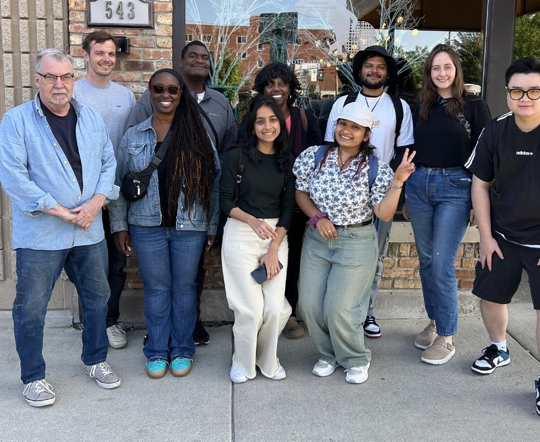

Territory is a youth-led local place-based urban design studio centered in Austin Territory’s youth leaders in Austin have been developing solutions to reclaim vacant city-owned land using art and design to promote social wellness and economic development Territory’s efforts are focused on urban design, community coownership, and cultural activation
Our efforts have been in collaboration with Territory teens (ages 16-18) to better understand their perspectives of Austin as well as working with them to create and refine the focus areas, including Territory’s new location, and inform the overall framework plan . We are also collaborating to build on their vacant lot activations and short-term approaches to move towards long term projects leading to community change
Our key objective of this partnership was to develop a comprehensive plan that supports cultural, social, and economic growth in the Austin neighborhood
TERRITORY VALUES
Youth Agency, Collaboration and Teamwork, Design Equity, Adventerousness, and Positive Impact
TERRITORY AFFILIATIONS
Austin Coming Together,Youth Empowerment Task Force, My Chi My Future, Steering Committee

MCD students partnered with Territory’s TADs (Junior Associates)

Territory’s work is rooted within the community itself . Guided by principles of equity and restorative design justice, each youth-led design project contributes to healing the community and enhancing the daily lives of its residents
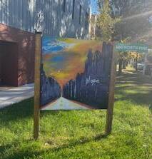
Territory recently opened “Creating Space,” a public art display in an empty lot across from the former Pink House . This display honors the Pink House, a cherished landmark in Austin that symbolized community pride and connection before being sold and repainted green


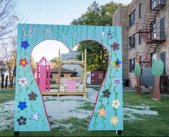
Thie Creating Space project was developed in collaboration with the City of Chicago’s Together We Heal Creative Place Program, which highlights the vital role of the arts in fostering health, healing, and safety within communities
This process has four components that lay the foundation of our understanding of the Austin community and help shape our design recommendations This includes completing an existing plan review, completing several site tours to both Austin and comparison communities, using several methods of community outreach, and collaborating with the community organization Territory
After the engagement focused components, the plan process entailed producing a framework plan, prioritizing specific focus areas to look at, developing short-term design concepts, and making recommendations to complete an action plan
This Plan will be used as a living document to guide Austin forward towards the goals established by community members The plan has been created with public input, nationwide best practices, and community analysis to ensure that it reflects the existing conditions of Austin and the desires of the residents
Over the past months, the project team (MCD and Territory TADS) have identified a shared vision for improvements and opportunities for the neighborhood’s amenities and urban spaces This process analyzes where Austin is now, where its residents want to be, and responds with how it can get there
The resulting plan offers a framework of steps to take towards the overall vision This is meant to be flexible to adapt to changing circumstances and will require significant additional implementation effort by community decision makers, leaders, and the public
Over the years, the Austin community has endured a persistent lack of investment, with developers overlooking the potential of this area This disinvestment has left local residents facing deteriorating infrastructure, limited economic opportunities, and a lack of essential services This plan encourages the community to build on it’s ongoing planning efforts in the Austin QOL Plan to support community co-ownership models for economic development Recognizing the need for change, this community-driven approach empowers residents to address the challenges of the past from within while creating tangible improvements to build a resilient, sustainable future
By drawing on local knowledge, resources, and a deep commitment to the well-being of their neighbors, this plan provides a framework to support Austin residents creating change through community control With this framework, Austin is not just waiting for change; they are creating it

This Plan supports and works together with the important planning efforts that came before it including: We Will Chicago, Soul City Corridor, Invest Southwest, Central Avenue Technical Assessment Report, and Austin Forward Together .
Existing recommendations were documented for this plan to build upon the neighborhood’s previous planning efforts and bring remaining goals forward into the future These plans were also reviewed to gain a better understanding of Austin
Across all plans, several recurring topics were realized. These initiatives identified below will be brought forward and supported within this plan
Recurring themes include:
• Emphasizing Austin’s diversity;
• creating equity and inclusion;
• prioritizing sustainability and resiliency;
• targeting economic revitalization;
• integrating Austin’s culture;
• and reframing the community’s narrative




Henry W Austin purchased 470 acres of marshland, anticipating growth driven by Chicago's expansion and the arrival of the railroad This purchase marked the start of the area's development, originally known as "Austinville " Later, it was annexed into the City of Chicago, becoming one of its 77 neighborhoods
Throughout the early 1900s, the Great Migration brought many middle-class Black families to Chicago, seeking better economic and educational opportunities, escaping the oppression of the Jim Crow South to improve their quality of life
By the 1970s, Austin faced the lasting impacts of systemic racism and economic inequities . Redlining denied Black families access to mortgages, segregating neighborhoods and limiting economic mobility Urban renewal projects often displaced residents
The West Side Riots, following Dr Martin Luther King Jr 's assassination, left lasting scars, with widespread destruction leading to disinvestment and economic decline in Austin
In 2013, the Chicago Board of Education voted to close nearly 50 public schools, citing low enrollment and budget constraints This decision affected over 30,000 students, the majority of whom were African American
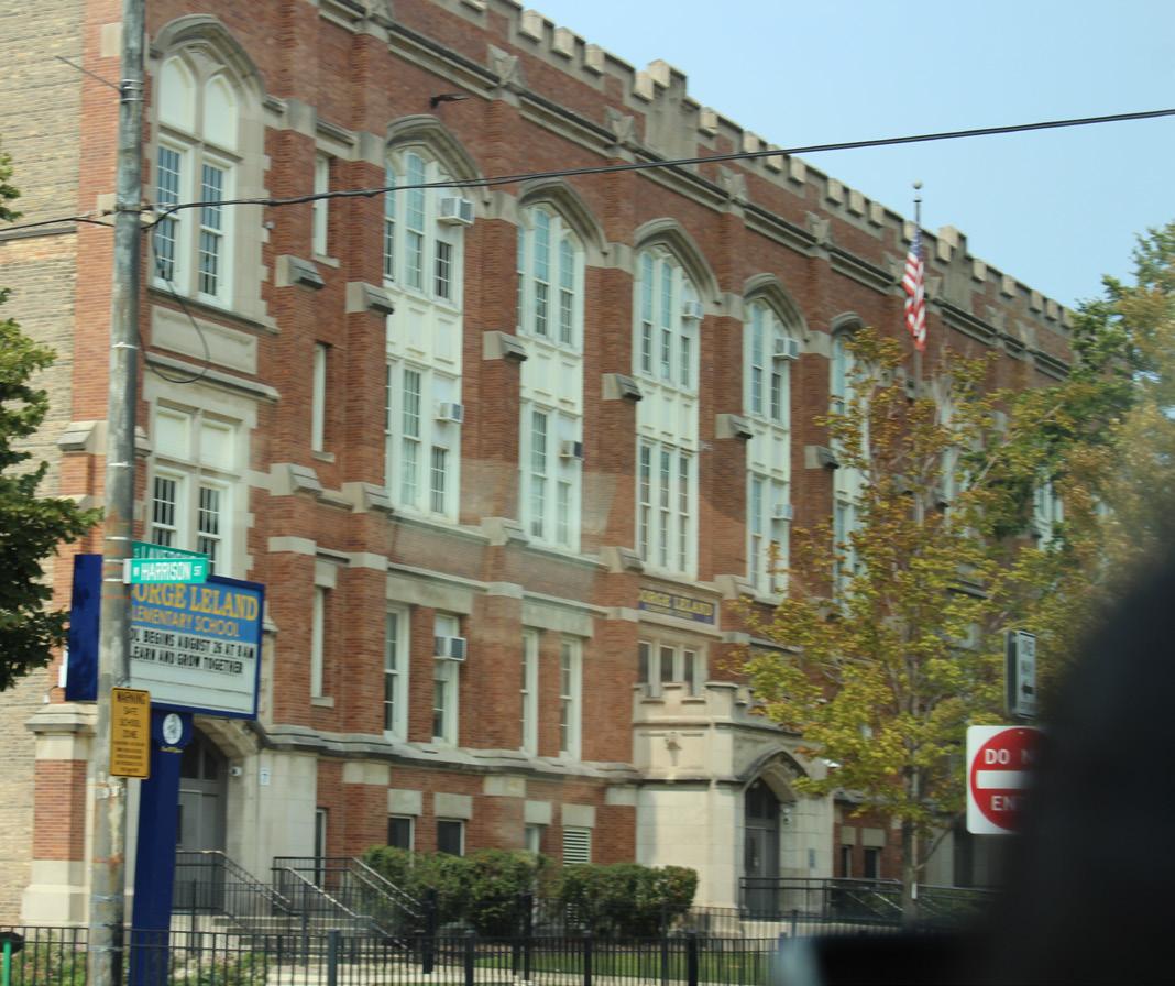
In Austin, four schools Robert Emmet Elementary, Louis Armstrong Elementary, Leland Elementary, and Frances Scott Key Elementary were permanently closed These closures further strained the community’s education system and contributed to ongoing disinvestment, leaving fewer resources and opportunities for families
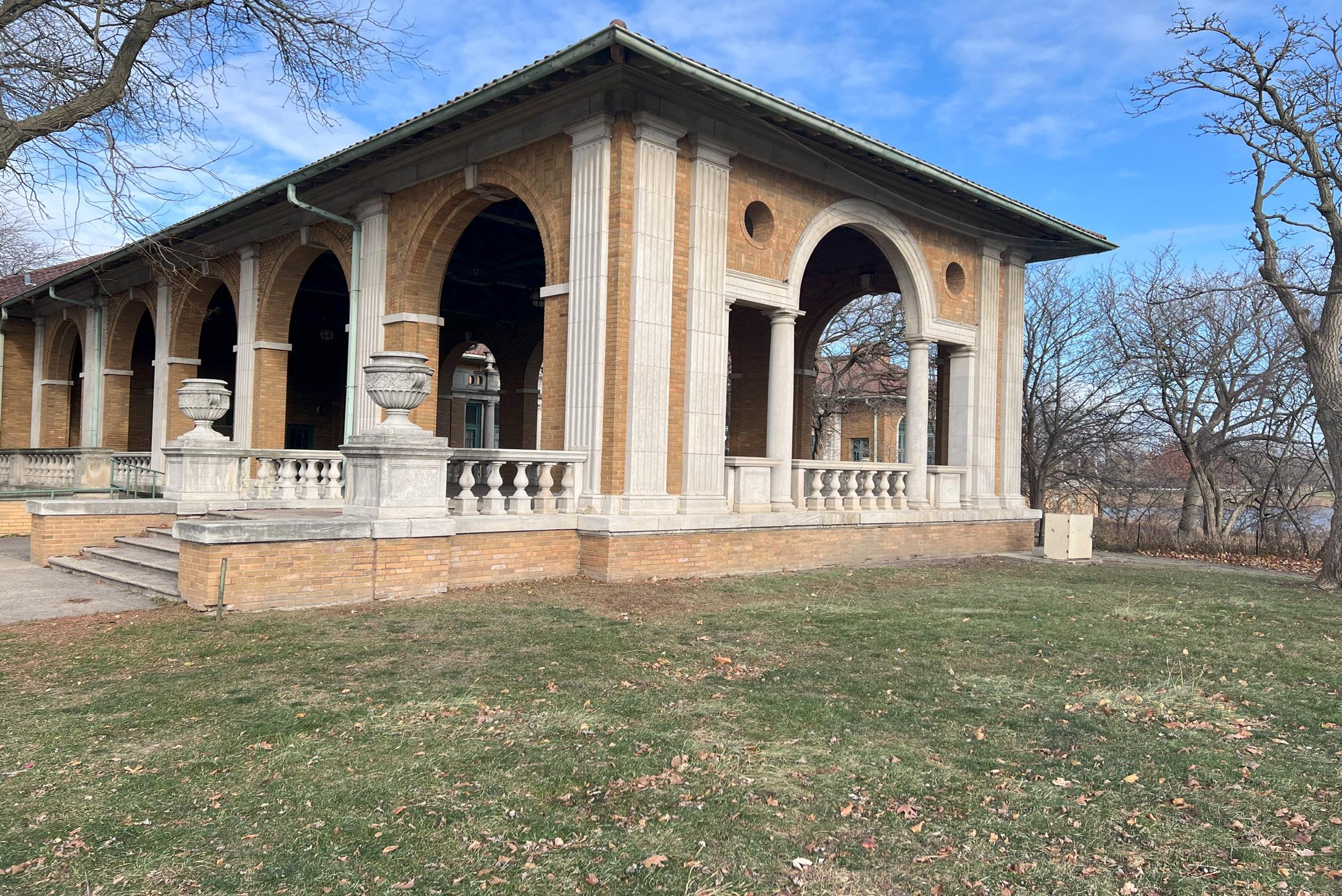
In the early 1900s, the construction of Columbus Park, the town hall, and elegant mansions transformed Austin into a thriving, middle-class community These developments attracted families and businesses, establishing Austin as a desirable neighborhood
During the mid-20th century, Austin experienced significant demographic shifts as White residents left the area in large numbers, known as "White Flight " This migration, driven by fears of racial integration, reshaped Austin's social and economic landscape
As disinvestment continued, crime and poverty increased, leading to a deterioration of the neighborhood’s infrastructure The economic decline deeply affected residents Despite these challenges, local groups took action to promote equity and rebuild Austin’s community and opportunities
The Great Recession led to increased home foreclosures in Austin, worsening the community’s financial hardships. Many residents faced job loss and instability during this period
In response to decades of challenges, local organizations and the City of Chicago have worked to reshape Austin's narrative through reinvestment and transformation . Initiatives such as the Austin Quality of Life Plan, INVEST South/West, and the Soul City Corridor were launched to address key issues These efforts aim to improve housing, education, economic development, public safety, and overall quality of life for Austin residents
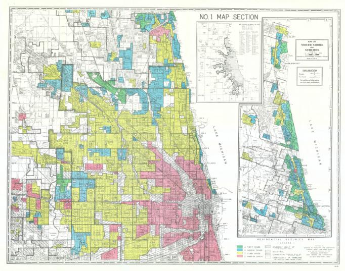
Figure 3 is derived from maps made by the Home Owners’ Loan Corporation (HOLC), a New Deal agency . Using data and evaluations gathered from local real estate professionals, HOLC created color-coded maps for more than 200 American cities The maps used four colors to represent the “security,” or the determined relative riskiness of mortgage lending, for residential areas of each city .
In the 1930s, redlining marked Austin as a highrisk area for loans, largely because it became home to African American residents This discriminatory practice meant fewer investment opportunities, limited access to affordable mortgages, and years of neglect The effects of redlining still shape Austin today, contributing to issues like housing instability and economic struggles Recognizing this history is crucial for creating equitable solutions moving forward .
• Green areas on the maps were called "A," " First Grade," or " Best " and were considered to be safest for loans These areas were typically populated with wealthy, white residents that were born in the United States
• Blue areas were called " B," " Second Grade," or " Still Desirable"
• Yellow areas were called " C," " Third Grade," or " Definitely Declining "
• Red areas were called " D," " Fourth Grade," or " Hazardous" . HOLC recommended lenders "refuse to make loans in these areas [or] only on a conservative basis " These areas typically overlapped with Black and immigrant communities, which usually had lower incomes .
These grades were a tool for redlining: making it difficult or impossible for people in certain areas to access mortgage financing and thus become homeowners Redlining directed both public and private capital to native-born white families and away from African American and immigrant families As homeownership was arguably the most significant means of intergenerational wealth building in the United States in the twentieth century, these redlining practices from eight decades ago had longterm effects in creating wealth inequalities that we still see today


7.1 Square Miles
Austin’s location offers strong connectivity, just 20 minutes from downtown Chicago and positioned between O’Hare and Midway airports, enabling both regional and national access
The Austin neighborhood sits along Chicago’s western-most boundary It is the largest of Chicago’s 77 neighborhoods, bounded by Humbolt Park to the east, Belmont Craigan to the north, Oak Park to the west and Berwyn to the south
On a local scale, it is the largest of Chicago’s 77 neighborhoods measuring 2 85 miles in length and 1 77 miles in width
Austin also has good public transport connections with stations on both the CTA Blue and Green lines as well as METRA running along its northern boundary
To illustrate its size, Austin’s 7-square-mile area could fit the neighborhoods of Lincoln Park, Lakeview, and Near North Side combined . However, Austin’s population is significantly smaller—about three times less than those neighborhoods—which highlights ongoing challenges of disinvestment and the need for revitalization efforts


Austin currently has 92,485 residents The population has seen continual declines since its peak in the early 1900’s It is anticipated to see a 23% decrease from 2000 to 2029 anticipated to see a 23% decrease from 2000 to 2029 At the same time, the population is getting older as it declines
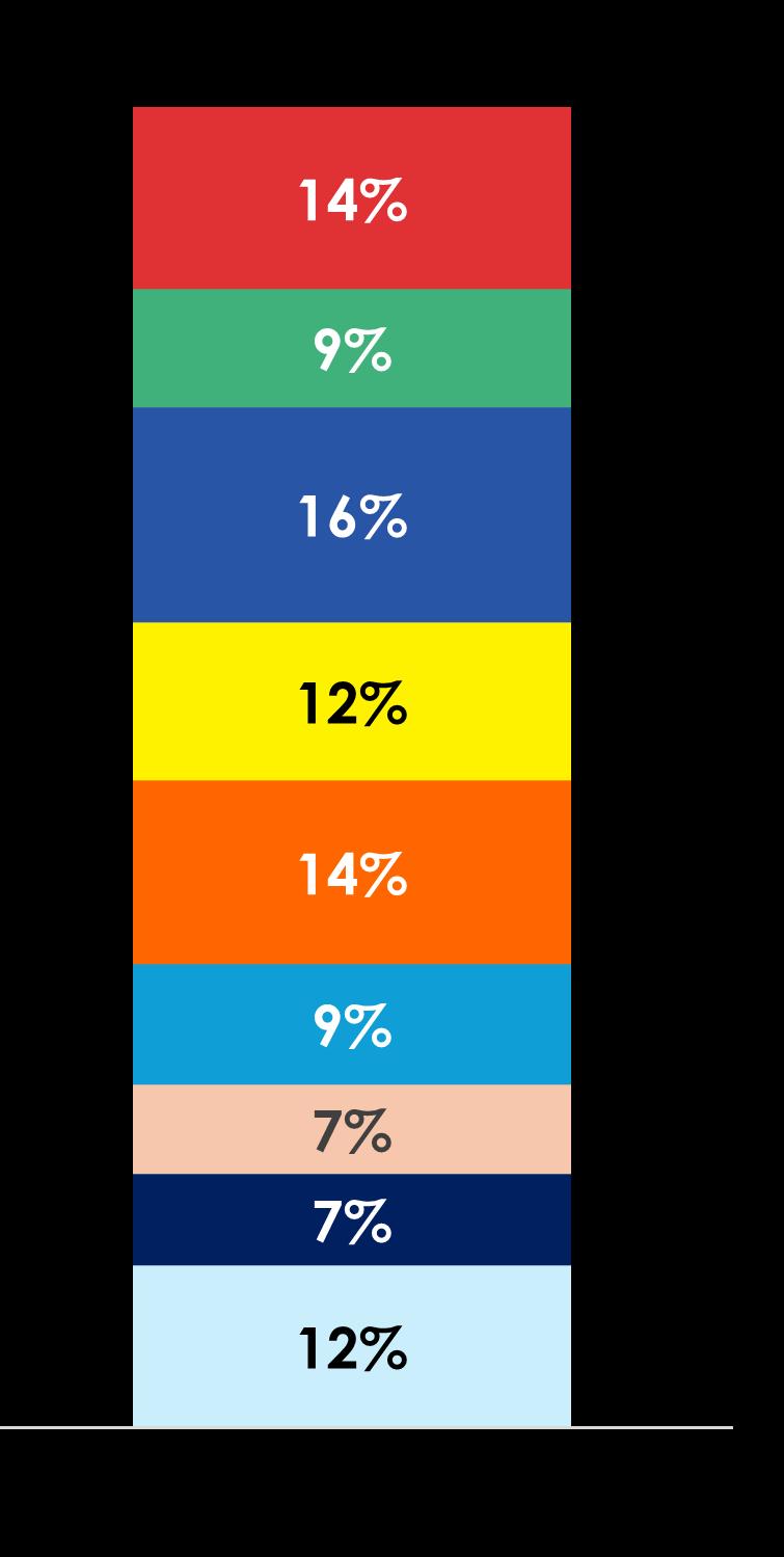
The majority of Austin residents in 2024 are between 25-34 (14%), younger than the marjoity in 2010 which was 45 - 54 However, the popplation is largely aging with an increase by 4 years from 2010 to 2024 (34 to 38, respectively) . This trend is anticipated to continue with the median age of 39 5 in 2029


Every census tract area in Austin suffers from high rental costs as a percentage of income .
This leaves less money for families to spend on other essentials such as food, medical expenses and recreation This high cost burden is common with the outer suburbs of Chicago


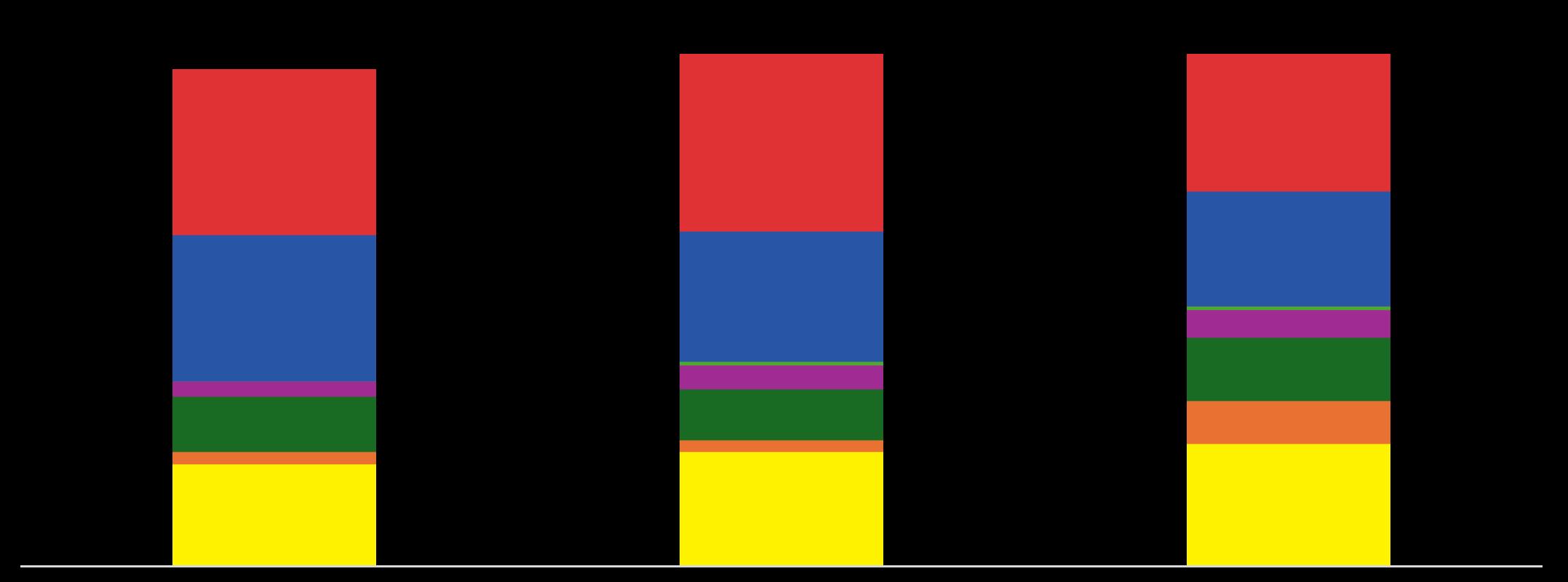
Austin remains majority black, however, like the rest of Chicago, the neighborhood is witnessing a shift in demographics due to the increase in immigrants to the city overall As a result, Black residents have decreased by 13% of the last 24 years while Hispanic residents have increased by 18%


Compared to neighboring areas - Oak Park, Berwyn, Humboldt Park, and Belmont Cragin - Austin is more diverse, highly populated, disadvantaged and under-educated In terms of demographics, it is most similar to Belmont Cragin and differs most from Oak Park The median household income is significantly lower than surrounding areas, approximately $20,000 lower than the second lowest, has a much higher portion of black residents, and is less educated than the other areas .


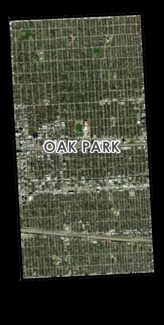


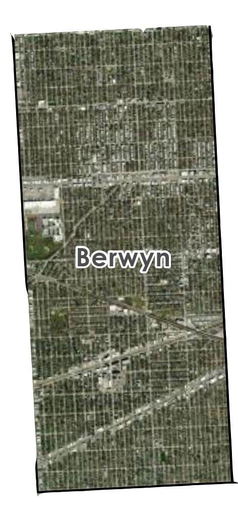


Austin is less educated than other nearby communities A majority of the population has a high school diploma and only 8% have a Bachelor’s degree

Austin has continued to have high levels of residents living below poverty . As previously discussed, the median household income of Austin is significantly lower than adjacent communities
Specifically, there is a $28,654 difference between the median household income in Austin and Chicago


Compared to the household income makeup of other communities, more Austin residents make under $15,000 and only 13% make between $100,000 - $149,000, the average income of Chicago The median household income of Austin is $43,109 which is significantly lower than adjacent communities To be more specific, there is a $28,654 difference between the median household income in Austin and Chicago
As Figure 17 shows, many residents work outside of Austin The list on the following page shows the top locations where residents work
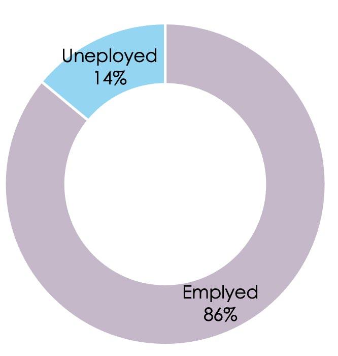
A significant portion of residents in Austin work in the Service Industry (51%) This is followed by those in Retail Trade (19 5%) and Finance, Insurance, Real Estate and Finance (5 6%)



There are 1,230 active business licenses in Austin with a majority of them being in tobacco businesses


There are 17 tax increment finance (TIF) projects within Austin (Table 3) A majority of the TIF projects are being developed by the Chicago Public Schools in the southern portion of the neighborhood


Project Address Developer
IGA - CBE - Rockne Stadium lighting 1117 S Central Av Chicago Public Schools
BUILD Incorporated TIF RDA 5100 W Harrison St BUILD Incorporated
IGA - CPD - Amundsen (Roald) 6200 W Bloomingdale Av Chicago Park District
Merlin Coke 1401 N Cicero Av MLRP-Merlin, LLC
IGA - CPD - Clark (John) Pool Rehabilitation 4615 W Jackson Bv Chicago Park District
Loretto Hospital 645 S Central Av Loretto Hospital North Cicero 1600 N Cicero Av North and Cicero LLC
McNair ES IGA with CPS BAS 4820 W Walton Dr CPS
ASPIRE Center / West Side Health RDA 5500 W Madison St Westside Health Authority
Laborer's Union 1841 N Monitor Av Construction Laborers' District Council Training and Apprentice Fund
IGA - CPD - Amundsen Park 6200 W Bloomingdale Av Chicago Park District
Spencer ES IGA with CPS 214 N Lavergne Av CPS
Brach's - 401 N Cicero 401 N Cicero Av MLRP 401 Cicero LLC
IGA-CBE-Spencer 214 N Lavergne Av Chicago Public Schools
IGA - CBE - HS - Austin - II 231 N Pine Av Chicago Public Schools
IGA - CPD - Austin Town Hall 5610 W Lake St Chicago Park District Batter and Berries 5924 W Chicago Av Juan and Only, LLC

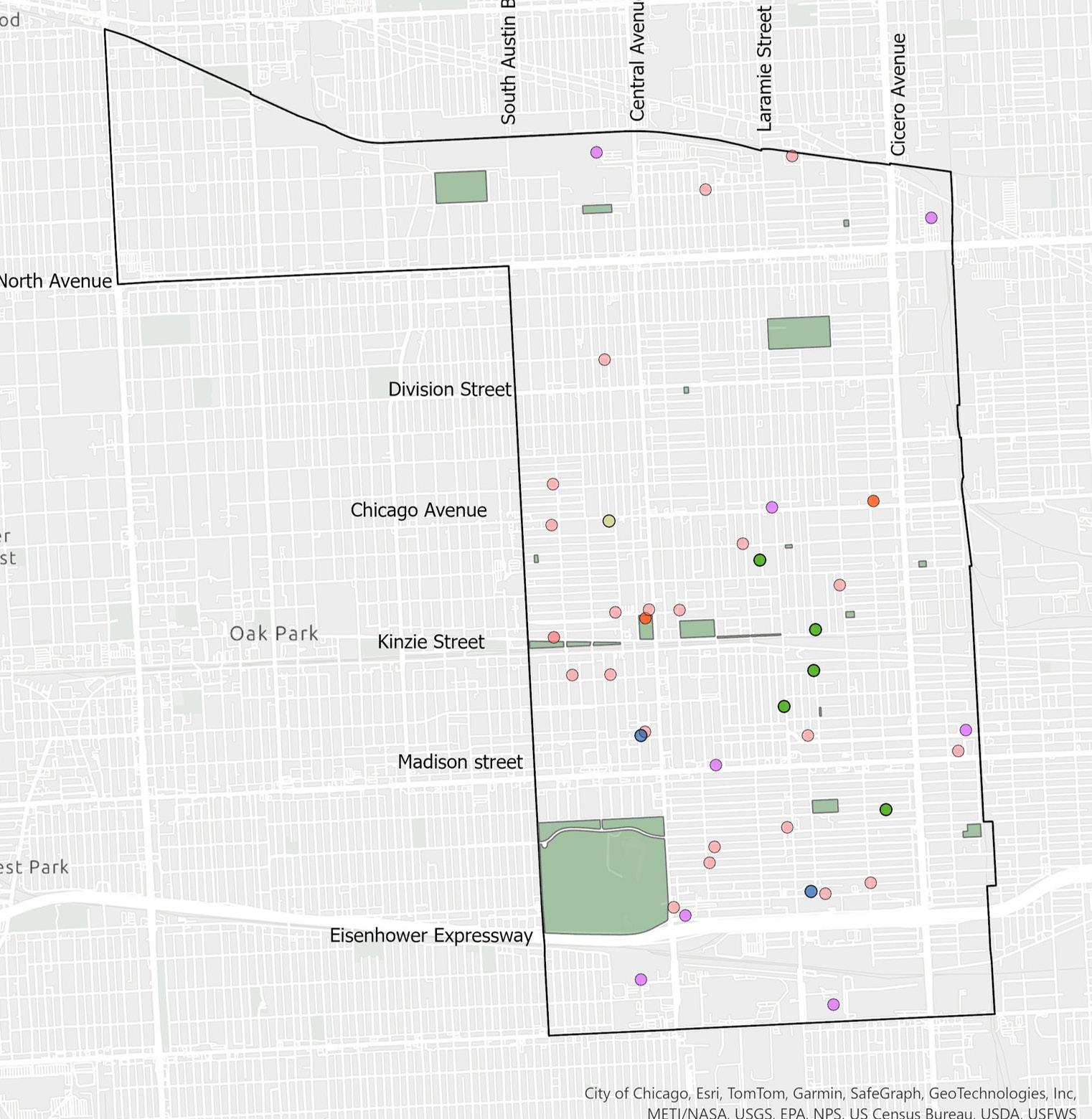
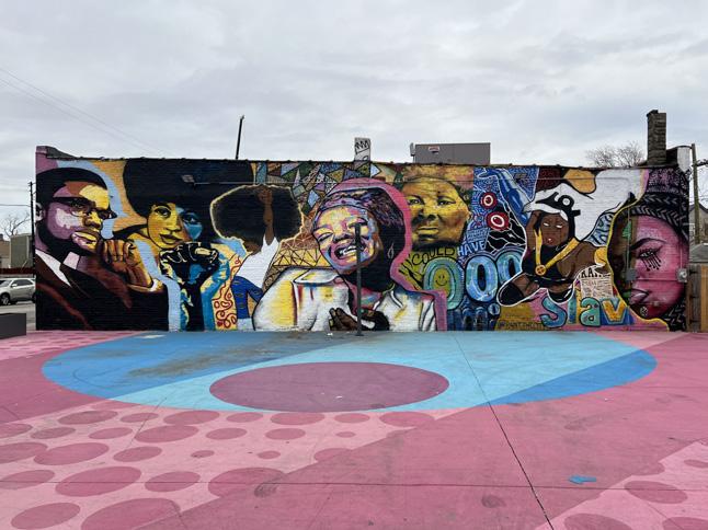
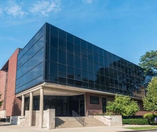
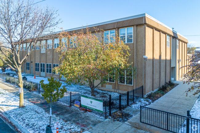
Austin has numerous cultural assets and historical landmarks that reflect its rich history. The majority are located in Austin’s south and central areas, including twelve city-recognized landmarks such as libraries, churches, and Figure 20: Cultural Assets
community centers These spaces are vital hubs for learning, gathering, and celebrating the community’s heritage




Austin is rich in history and home to a variety of historic landmarks that reflect its cultural significance. These landmarks not only celebrate
21: Historic Landmark Locations
the neighborhood’s architectural beauty but also its pivotal role in Chicago’s history


Source: Chicago Data Portal and Austin Coming Together


Austin faces heightened pollution levels due to industrial activity and major roadway intersections These factors increase health and safety risks for residents, especially those who rely on public transit or non-motorized transportation
There is a high number of pedestrian accidents on Central Avenue and Cicero Avenue A high percentage of those that involve automobiles are also along Cicero Avenue and North Avenue (Figures 23 - 25) .

“Pollution and accidents make Cicero and Central feel unsafe .”
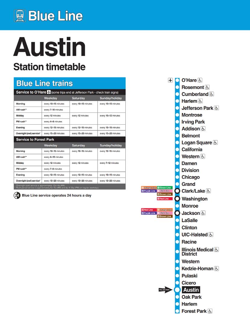
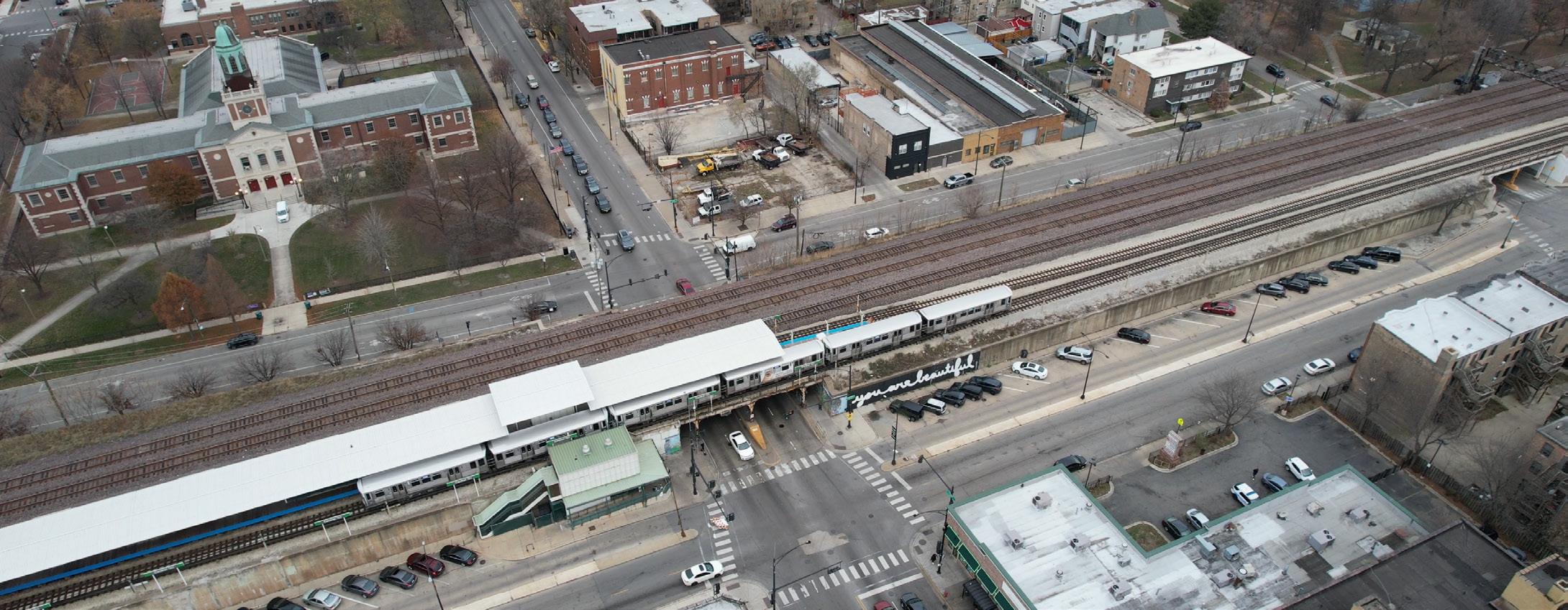


Figure 23: Mobility Map


Figure 24: Traffic Crashes Heat Map (2022-2024)


Austin experiences elevated levels of violent crime throughout the entire community, including shootings and robberies . Despite
Figure 28: Arrested Crime Heat Map 2024
efforts to improve safety, residents continue to face daily struggles with public safety, making crime a major issue in the area


Almost half of the adults in Austin are obese, a portion that is significantly above Chicago. There are also more deaths in Austin per 100,000 residents – 1 .08% in Austin versus 78%
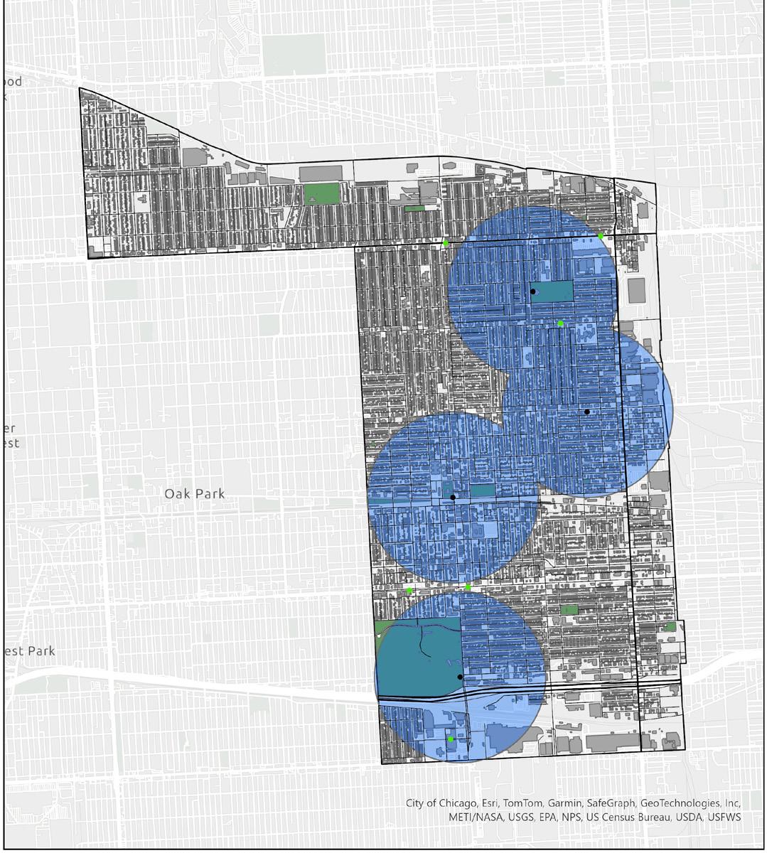
There is 65% coverage by grocery stores (Figure 28), equating to 35% gaps in access However, while there is coverage by grocery stores, Austin residents have expressed that there are not healthy, high quality food options in the area . While there are farmers markets that attempt to address this, they cover only 25% of the area and are temporary opportunities to fresh food (Figure 29)

“We don’t have grocery stores nearby with healthy, fresh options”



Multiple factors were assessed to understand Austin’s overall sustainability and vulnerability .
Austin is dealing with a high flood risk, having experienced some historic flooding in recent years As you can see in this map, a pattern clearly emerges where marginalized communities are disproportionately impacted by flooding. So again, with climate change only getting worse, there is a strong need for improved infrastructure in the area as well as flood relief efforts, because we have learned that has been very difficult for residents to get assistance from the city after flood events.
Austin has several high-traffic roads that create high levels of diesel particulate matter, which has a serious impact on Austin residents This air quality issue not only poses serious health risks, such as respiratory problems and cardiovascular diseases, but also disproportionately affects vulnerable communities
A large portion of Austin is covered by impervious surfaces such as buildings, pavement, and other structures that prevent water from seeping into the ground . This contributes to issues like increased runoff, flooding, and heat islands.
A majority of residents in Austin are dealing with a high energy burden, which means they spend 6% or more of their income on energy bills. This puts a significant strain on residents’ budgets and makes it difficult to invest in other important things such as healthcare, education, and housing Strategies that focus on energy
efficiency, increasing access to renewable energy, and providing support for low-income families to help ease their financial load may all offer relief of energy burdens
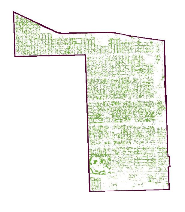
Austin has a relatively low tree canopy of 19 percent, especially when you compare it to Oak Park, which has a canopy of 31% The canopy is not evenly distributed; some streets are lush with trees, while other major arterial roads like North and Cicero Ave are noticeably lacking greenery . This uneven distribution emphasizes the need for focused efforts to boost tree coverage across the entire neighborhood
In line with most of Chicago, Austin is a heat island Notably, there can be a staggering 22-degree temperature difference between the North and Southwest sides on the same day This temperature disparity exacerbates health risks and energy demands
All of this data combined makes clear that Austin has a high vulnerability ranking This ranking takes into account things like flood risk, surface temperatures, and air toxins, providing a clear picture of how these issues overlap
A step in the right direction towards addressing these environmental challenges and establishing a more resilient community is Austin’s community gardens This plan aims to support these distinct elements and support development of more gardens
Flood Susceptibility
Particulate Matter
Impervious Surfaces
Energy Burden
Tree Canopy
Heat Island
Vulnerability
Figure 32: Vulnerability Assessment





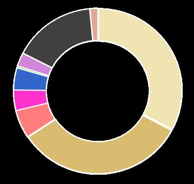
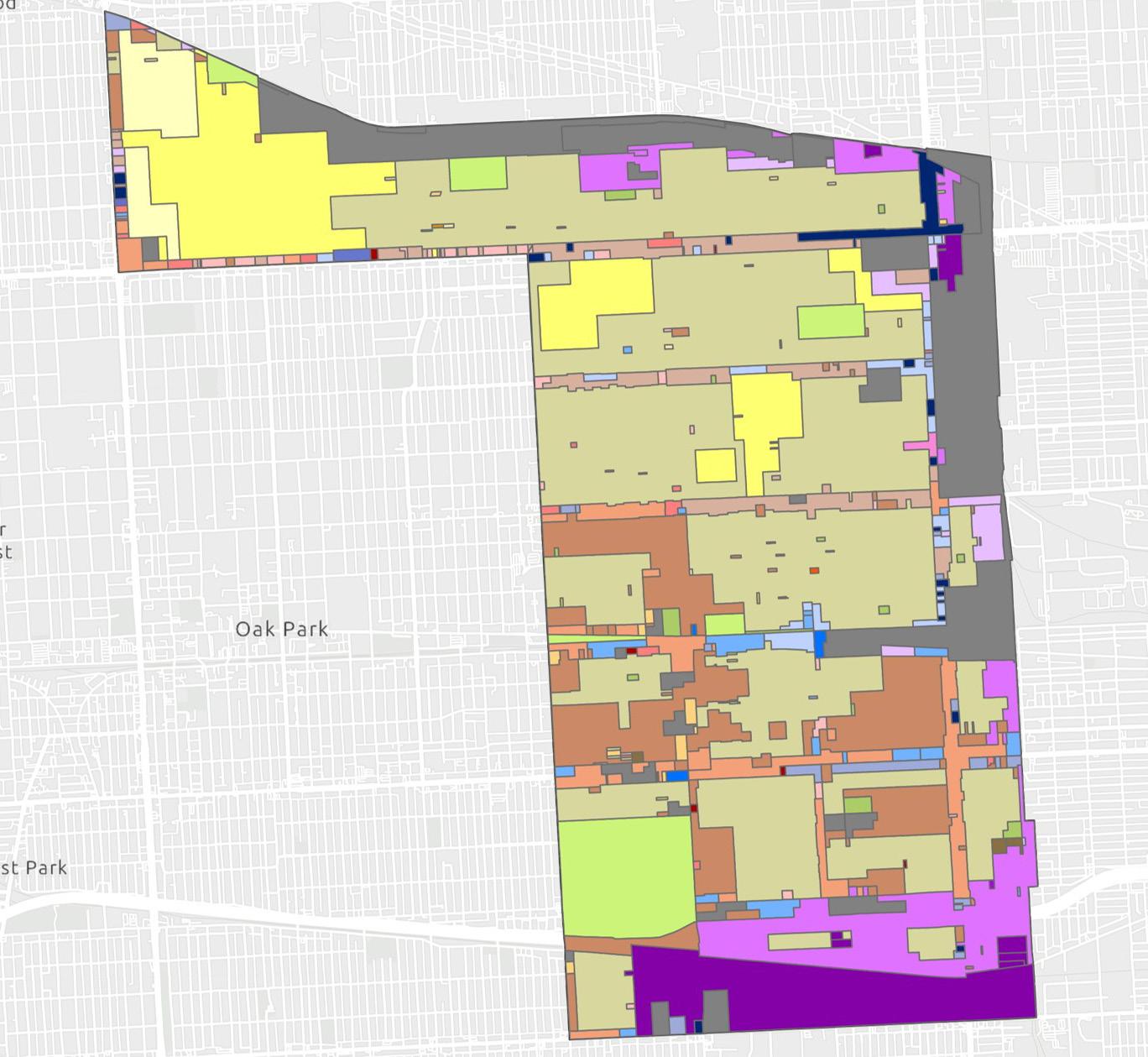
Austin largely contains residential development, which is around 65% followed by commercial, institutional, mixed-use and industrial The commercial corridors are distributed east to west with industrial scattered towards the outer edges of the community Compared to the size of the neighborhood, it lacks the amount of
open green spaces which is spread across the community
The land uses are largely reflective of the mix of zoning in the area which is largely residential Residential largely takes the form of single family detached, two flats, town houses and low density housing






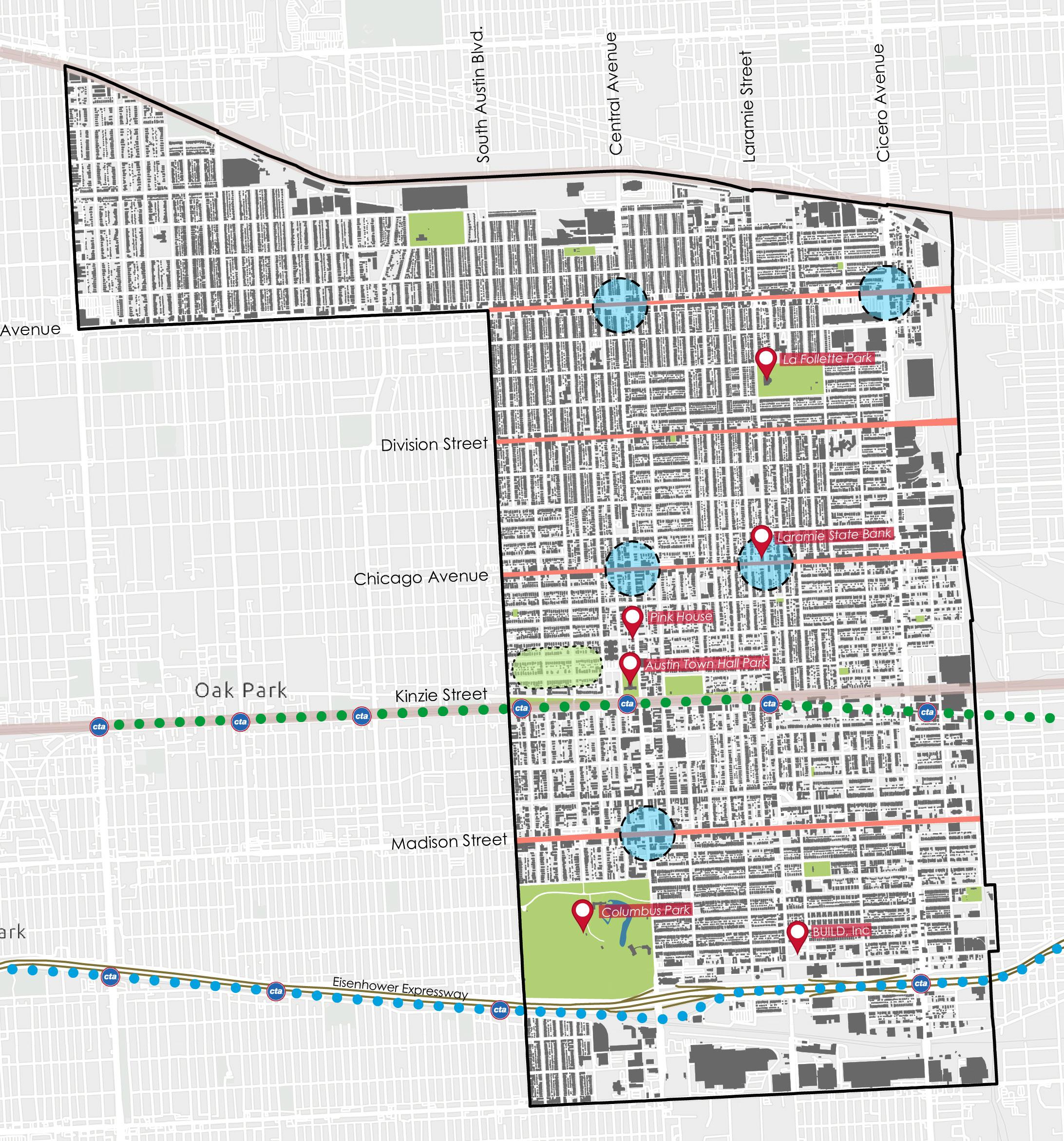

Austin’s Imageability Map examines the five key elements of a city as defined by urban theorist Kevin Lynch: paths, edges, districts, nodes, and landmarks Austin, one of Chicago’s 77 neighborhoods, spans over seven square miles, with its boundaries clearly defined. To the south, it is bordered by the Eisenhower Expressway (I-290), while the Green Line and Metra tracks traverse its center The northern boundary is marked by additional Metra railroad tracks
Austin’s Midway Park District stands out as a prominent historic residential area, known for its Queen Anne and Prairie-style homes and its connection to notable political figures from Chicago’s past The neighborhood also features several iconic landmarks, including Columbus Park, Austin Town Hall, and the historic Pink House, which, though no longer standing, remains a cherished symbol for longtime residents These landmarks, paths, edges, nodes, and districts collectively shape Austin’s identity and structure
The neighborhood’s primary paths are its major east-west streets: North Avenue, Division Street, Chicago Avenue, and Madison Street . These routes, identified by residents as key for navigation, also help delineate North Austin, Central Austin, and South Austin . Key nodes of concentrated activity, such as the intersection of Chicago Avenue and Central Avenue, serve as important gathering spots and orientation points for the community .
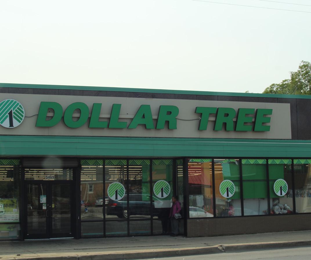
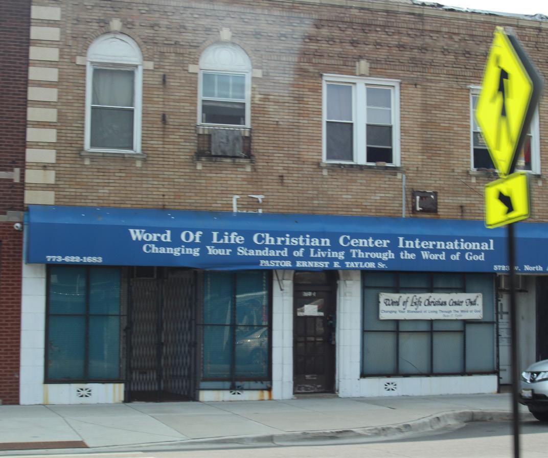
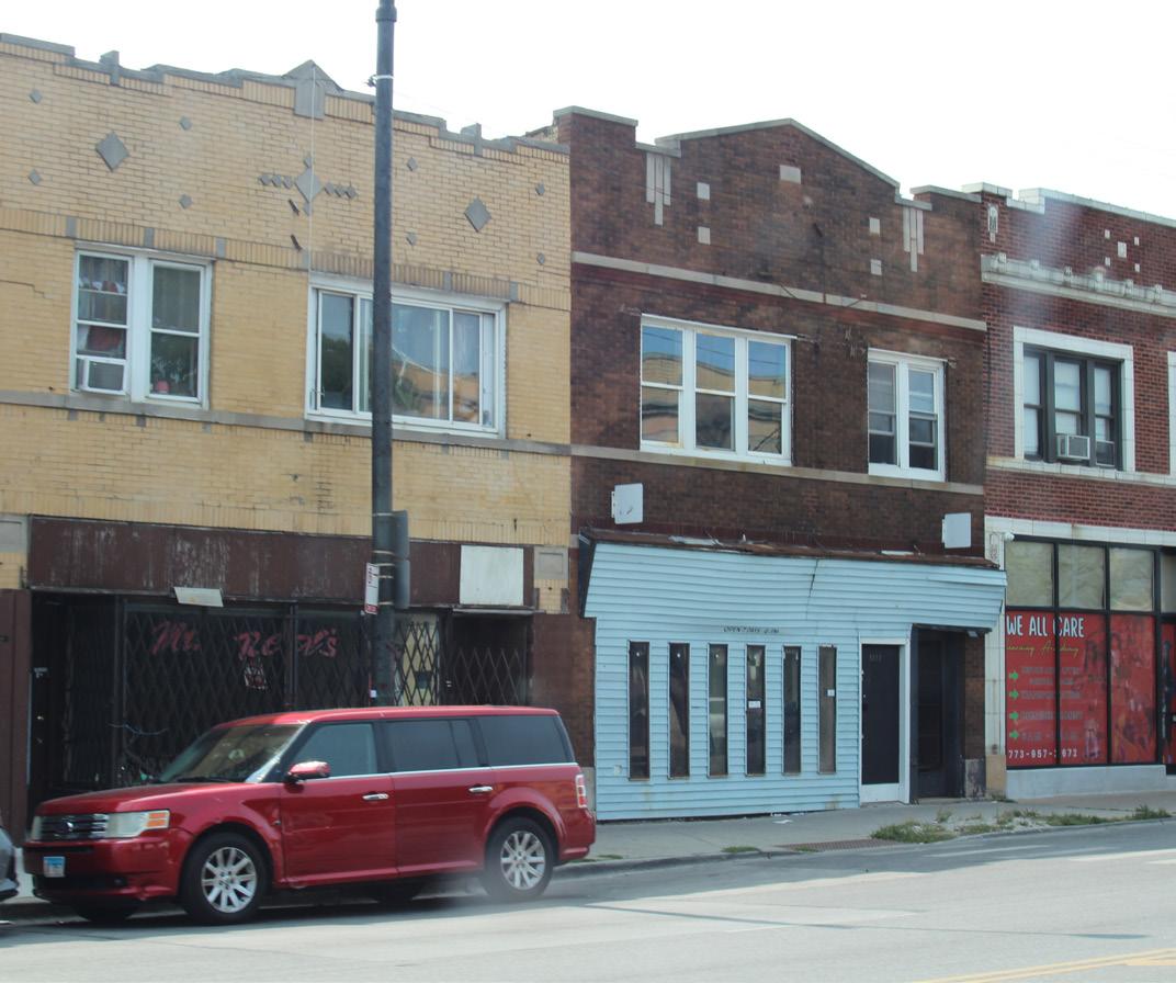
The street façades in Austin reflect the neighborhood’s mix of uses and its character Along major streets like North Avenue, Division Street, Chicago Avenue, and Madison Street, the buildings vary in style and purpose These corridors feature a combination of small businesses, restaurants, retail stores, and apartments above shops, creating an active and urban environment Most commercial buildings are concentrated along these key streets, while residential areas are set back, consisting of single-family homes, two-flats, and low-density housing. Division
Street and Chicago Avenue have a mix of local shops and institutions, giving them a more community-focused feel North Avenue, on the other hand, has larger commercial properties and busier traffic, making it a more active hub.
The condition of façades varies widely Some areas are well-maintained and lively, while others show signs of wear and neglect Poorly lit or less cared-for sections can make some streets feel uninviting, especially at night Overall, Austin’s street façades tell a story of a neighborhood with strong community potential but in need of better upkeep and investment to enhance its appearance and safety


The graphic below highlights the “vibe” of community - what makes Austin, Austin and where the residents recreate and come together





There are many lots and buildings throughout the neighborhood that are underutilized Many lots sit vacant and buildings abandoned There 1,141 vacant lots . Of those vacancies, 376 are publicly owned There are also 117 abandoned buildings in the neighborhood


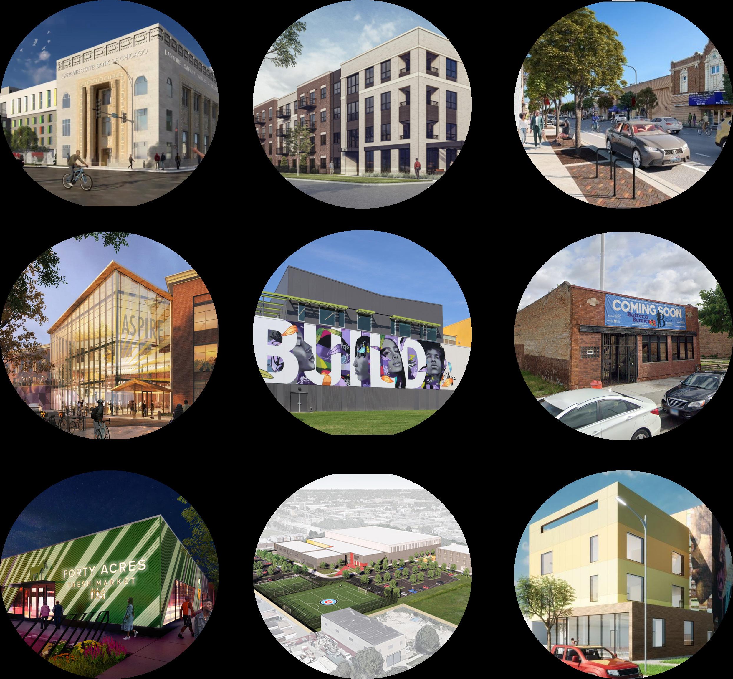
Several developments are currently underway in Austin, including residential projects, transportation improvements, office and commercial spaces, and health and wellness
initiatives Major development is taking place along Chicago Avenue and Madison Street, all aimed at addressing the community’s needs



• Entrepreneurial Spirit
• Sense of Community
• Historic Values
• Ongoing Efforts and Plans
• Community based organizations
• Community Mobility
• Diversity
• Cultural Heritage

• Sustainability
• Education
• Workforce
• Generational Wealth
• Affordable Housing
• Healthcare Access
• Deteriorating Infrastructure

• Greening
• Community Spaces
• Community Wealth Building
• Transparency
• Wayfinding
• Identity
• Size
• Vacant Lots
• Abandoned Buildings

• Closed Schools
• Crime
• Economic disparities
• Safety
• Vacancies


This process included several tactics to engage the community We heard from multiple residents and organizations in the area as well as several topic experts These participants make up the public, private, and non-profit sectors, ensuring a comprehensive and holistic outlook Together, both community and expert engagement offered insightful knowledge that was foundational both to understanding Austin as well as the possibilities for the community
STAKEHOLDER & EXPERT ENGAGEMENT







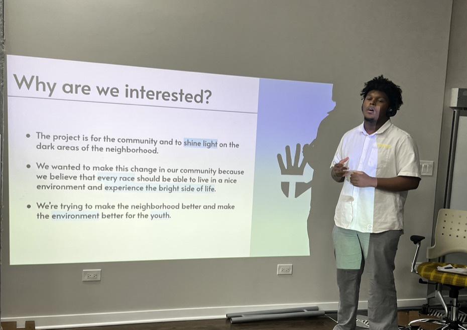
Community engagement played a crucial role in shaping this framework plan, particularly through our collaboration with Territory, a youthled, place-based design studio in Austin . Over three months, we worked closely with local youth (ages 16-18) in a series of workshops to explore priorities such as affordable housing,
local businesses, mental health programs, and walkable neighborhoods . Their insights revealed key hangout spots, potential locations for public art and green spaces, and ideas for vibrant, youth-friendly streetscapes, which have been integrated into the framework

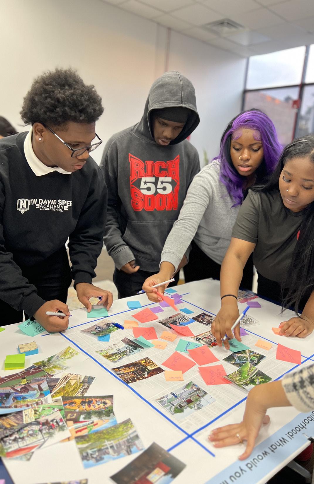

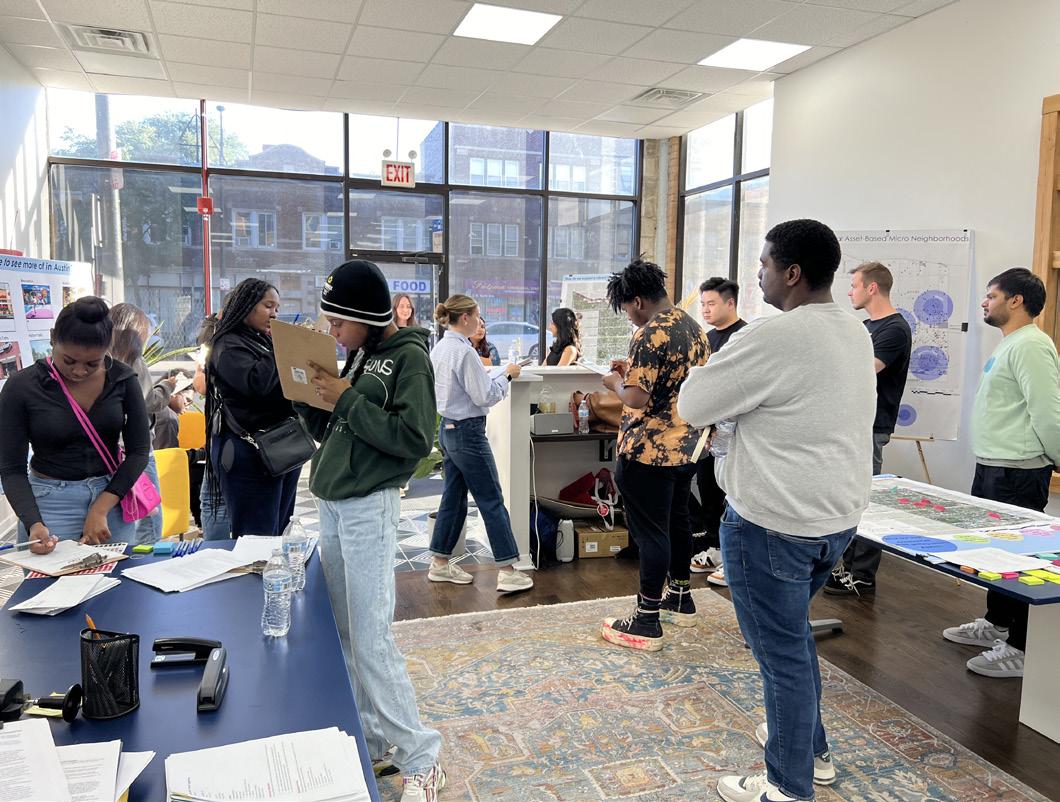
In the first workshop, 13 participants shared their preferences for Austin, focusing on topics like affordable housing, local businesses, youth programs, and mental health initiatives Through prioritization exercises and mental mapping, participants highlighted reliance on cars and
For this prioritization activity we asked the TADS what they want to see in Austin Most of them chose affordable housing We learned that they also want to see more color and art

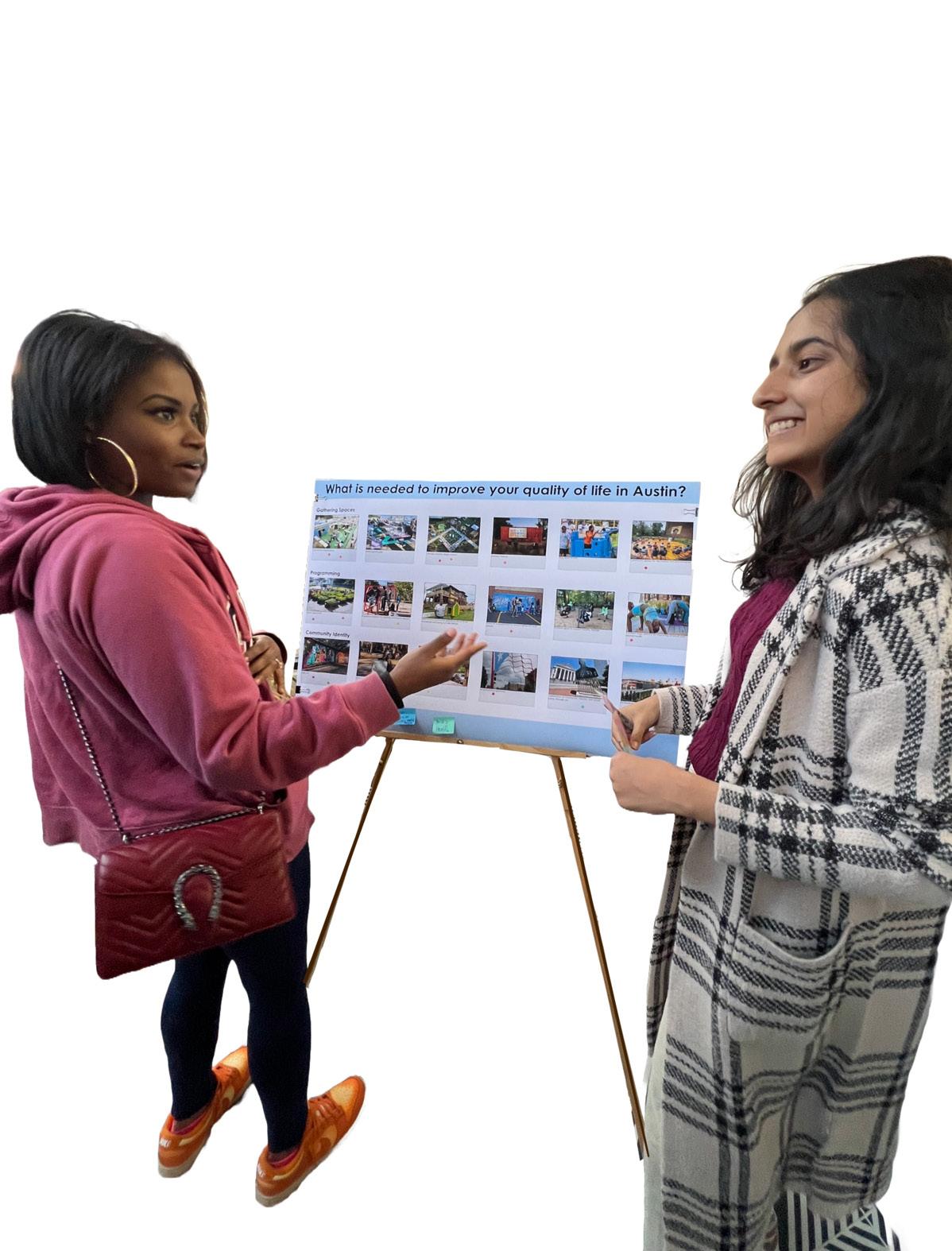
public transit along Cicero Avenue and North Avenue, identified key hangout spots, and flagged areas needing improvement. They also suggested potential sites for art installations, green spaces, and business development .
This is a mental mapping activity where we asked them to draw a path from home to territory or school, so we could better understand the paths they take most frequently in the neighborhood We learned that many of the TADs got around primarily by car due to a lack of reliable public
transport options There was also a perception that the green line stations were unsafe and that the high traffic and dangerous driving on Cicero and North Avenue makes it difficult for pedestrians
in the neighborhood, more black owned local businesses, more youth programs, and places for teens to hangout after school


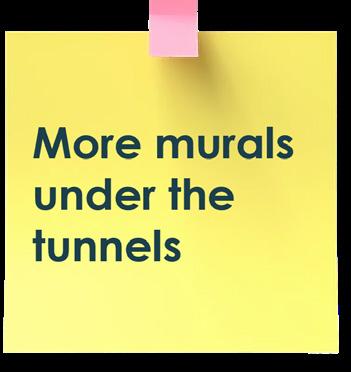

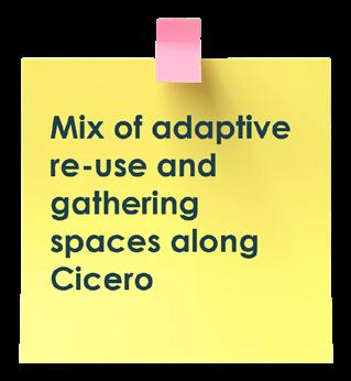
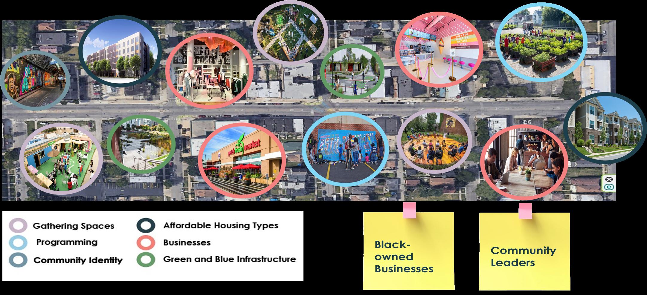
For this Magnet map activity, the students were asked to place magnets showing activities like art murals, gateways, businesses and green spaces to help enhance the built environment on a map of Austin This helped us to determine which locations in Austin might be suitable for various design development and program types


WORKSHOP #2
DESIGN YOUR STREET ACTIVITY
The second workshop, with eight participants, built on these insights . We engaged in deeper prioritization, asking the youth what would improve their quality of life, such as locally owned businesses, public art, and hangout spaces for youth They also designed their ideal street, envisioning a vibrant mix of businesses and public spaces When discussing 15-minute walkable neighborhoods, the youth prioritized spaces like gyms, healthcare clinics, and community gathering spots Feedback from three additional focus group discussions emphasized the importance of unity, safety, and preserving Austin’s history and identity .
HAND ACTIVITY
For this hand activity, we asked the TADs to describe their future vision of Austin in one word

15-MINUTE NEIGHBORHOOD ACTIVITY
or this activity, the TADS were asked to design a 15-minute walkable block They focused on youth spaces, gyms, healthcare clinics, art and greenspace and some community gathering spaces

WORKSHOP #3
The final workshop allowed us to present our design proposals, gather feedback, and ensure that the vision aligned with the priorities of the youth This collaboration has been instrumental in creating a framework that reflects the aspirations and insights of Austin’s young residents, paving the way for both short-term interventions and long-term community transformation
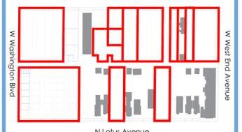
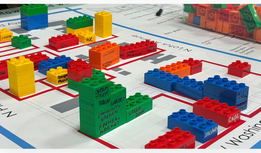
LEGO DENSITY ACTIVITY
We conducted two density and land use activities where we asked the youth to use lego blocks to activate vacant lots within our focus as to the kind of uses and massing that the youth would like to see and where These blocks represented various uses and could be stacked to give us an indication as to the kind of uses and densities they desire
CONNCEPT FEEDBACK ACTIVITY
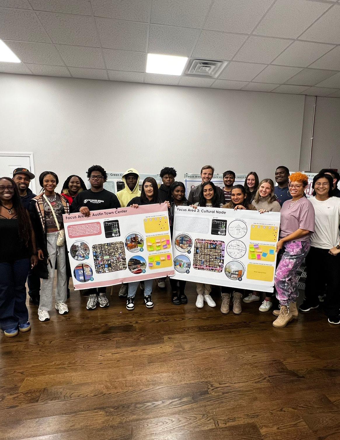
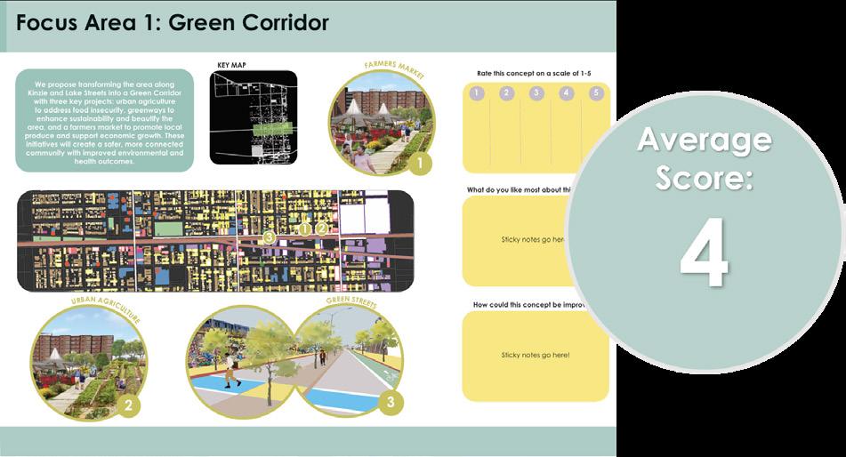
The second activity in workshop 3 was designed to allow Territory to give us feedback on our focus area concepts The results were that all three Focus Areas were seen as good, but that Focus Area 3 around Territory’s new office space, was seen as the strongest focus area.





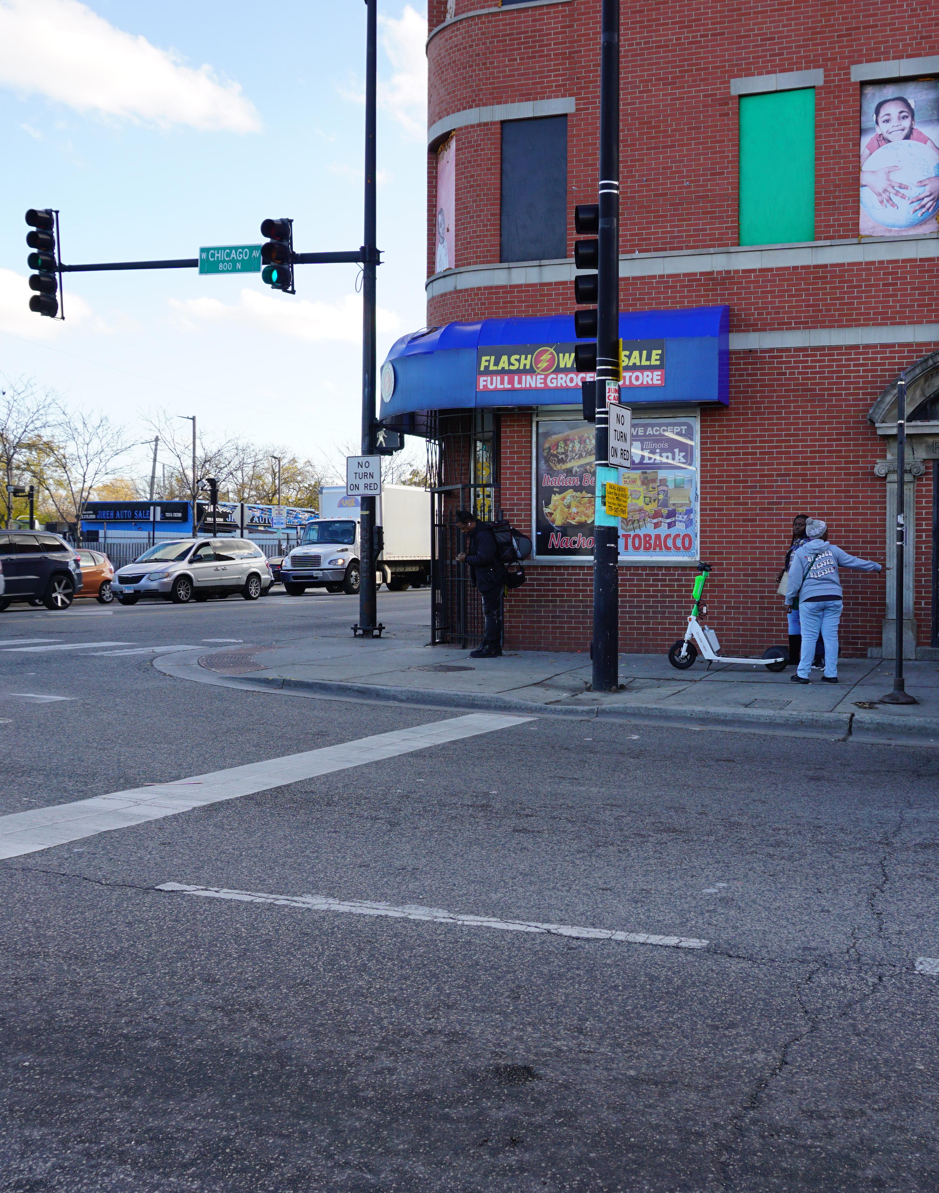
These are some of the images captured by the TADs during their photomapping of Focus Area Three, along Cicero Avenue between Chicago and Division Streets Their observations highlighted significant issues, including an abundance of litter and a noticeable absence of garbage cans. They also noted prevalent graffiti and a concentration of auto shops in the area.

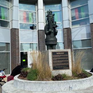


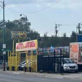
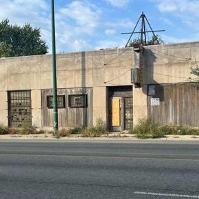
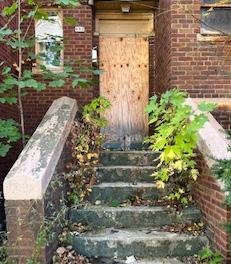
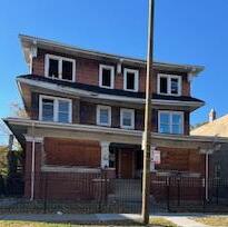
MCD students conducted the photomapping for Focus Areas 1 and 2 Their observations revealed clear signs of disinvestment, such as abandoned buildings and vacant lots . However, they also noted positive community interventions, including public art, painted garbage cans, and historical banners that reflected local pride and efforts to revitalize the area


These are the concept drawings that Territory produced following the first two workshops. Territory youth expressed their desire for a larger, newer home base for Territory with new design studio on the ground floor and affordable housing above In their concept sketches - Territory offices will act as a key anchor along Cicero that will spur additional economic development activity with uses such as a wellness center, grocery store, and small business-like salons, barber shops, and cafes
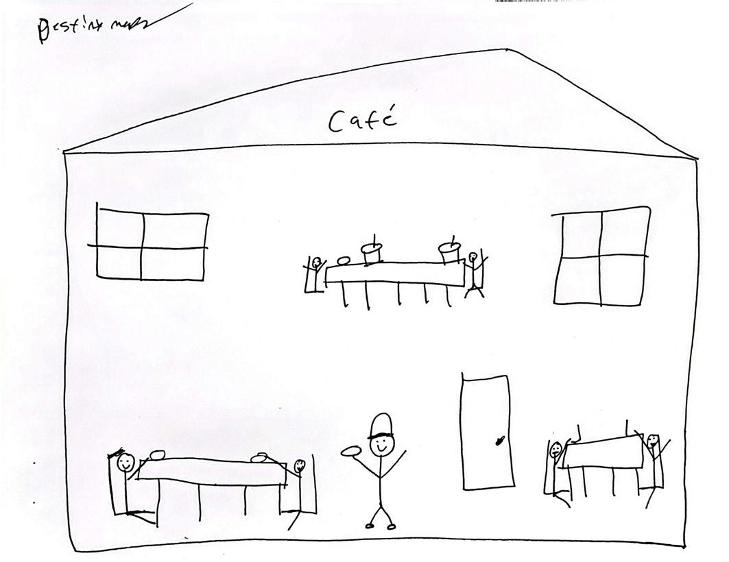

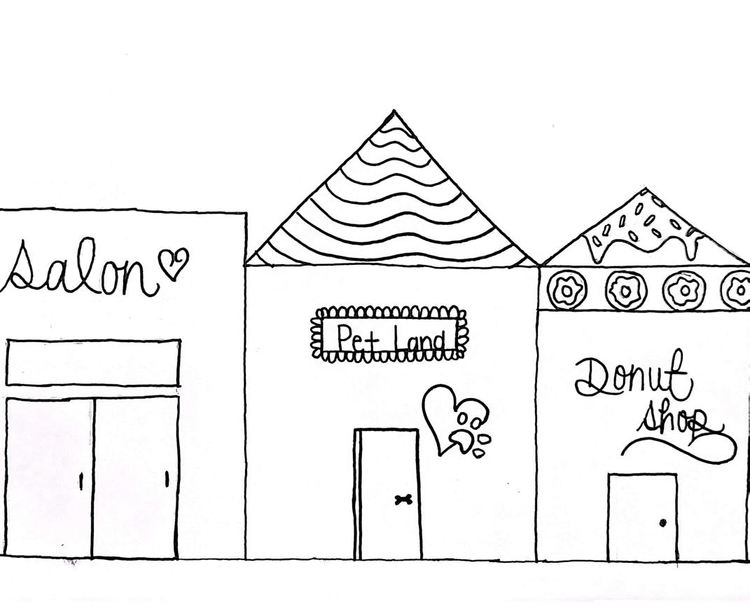


There is a strong sense of community pride that is not well-reflected through the public realm .
There is a lack of stores, restaraunts, and entertainment in Austin for residents to live, work, and play .
“I would love places to hangout with my friends”
“I feel unsafe around the green line stop”
“I want to be a part of making the decisions for Austin” “I want people to see Austin as resilient and selfreilant”
There is an absence of community spaces for residents to gather and recreate .
There are few opportunities for residents to connect with nature .
The public realm has seen years of disinvestment and is in need of aesthetic and economic improvements .
“We need more art and color” “We visit downtown because it is prettier than Austin, not just because there is more to do”
“I want to leave a lasting impact on making Austin a better place” “I want to rewrite the narrative of Austin”

Given the challenges and opportunties analyzed within Austin, several case studies were reviewed as practical applications for Austin . Incorporating planning case studies into this framework plan provides valuable real-world insights that can guide the development of effective strategies and solutions By analyzing the successes and challenges faced in previous planning projects, case studies offer a deeper understanding of best practices, common pitfalls, and innovative approaches
The case studies were vetted based on locations with similar contexts to Austin - rustbelt, historically black communities facing economic and development challenges
The following topics were reviewed for practical applications for Austin:
VACANT LOT ACTIVATION: Austin has over 1,000 vacant lots due to population decline, disinvestment, and economic challenges These lots can, and should, be repurposed for community benefits. This transformation can foster social cohesion, provide healthy food options, and improve the safety and aesthetics of the area It also helps reduce the negative impacts of vacant properties, such as blight and illegal activity
GREENWAYS: Austin, like many urban neighborhoods, can benefit from enhanced green corridors that improve connectivity, mobility, and access to green space Greenways could connect Austin’s residential areas to parks, transit hubs, and commercial corridors, promoting sustainable transportation options like biking and walking Greenways in Austin can improve air quality, reduce heat island effects, and provide residents with much-needed outdoor spaces for recreation and health They also serve as pedestrian and bike-friendly routes,
encouraging less car-dependent travel and enhancing community connectivity
STREETSCAPE AND PUBLIC REALM:
Streetscapes and public spaces in the Austin neighborhood, especially along major corridors like Chicago Avenue or Cicero Avenue, are key for improving the pedestrian experience, local business accessibility, and overall neighborhood aesthetics Investing in streetscape improvements can help transform Austin into a more pedestrian-friendly neighborhood, encourage local commerce, and create safer environments for walking and cycling Enhancing streetscapes with trees, seating, public art, and well-lit areas can encourage social interaction, reduce crime, and make the neighborhood more inviting to residents and visitors
ECODISTRICT: An ecodistrict approach in Austin would focus on creating a sustainable and self-sufficient neighborhood. Currently, the neighborhood is extremely vulnerable to natural disasters due to underinvestment and overburden of energy costs Techniques such as implementing energy-saving technologies, water-efficient landscaping, and community-driven sustainability initiatives could help combat climate change impacts, reduce energy costs, and improve overall environmental health
REPARATIVE JUSTICE: Reparative justice in the context of urban development aims to address historical and systemic injustices faced by marginalized communities These strategies aim to right past wrongs by fostering equitable development, redistributing resources, and creating opportunities for communities that have been historically marginalized .
ADAPTIVE REUSE: Adaptive reuse repurposes existing buildings to ncontribute to sustainability, preserve cultural heritage, and revitalize neighborhoods without displacing residents . This approach can be particularly valuable in


communities like Austin, where there may be underutilized or deteriorating buildings with historical significance.
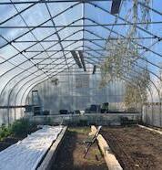
The main intent of Cadillac Farms, a one-acre urban farm, is to provide a space for communities to come together to grow produce and promote food sovereignty This also promotes place based intergenerational learning and empowerment opportunities including but not limited to activities, programs, employment, and services
Park in truck transforms urban green spaces in Philadelphia with help of neighbourhood youth . The park in a truck program uses green spaces to transform neighbourhoods with the help of young people Using the park in a truck DIY toolkit, Austin can design, build and sustain own unique green space in community .
This project shifts the narrative of the community from vulnerable to the one with power and authenticity . The open-air market will not only pay homage to the Bahamian roots of this congregation but also activate a vacant parcel that currently contributes to neighborhood blight Additionally, the project will serve as a venue to showcase The Set community’s cottage industries, such as food, entertainment, and beauty products .
The South Side Sanctuary is a transformative, gathering space dedicated to uplifting and uniting multigenerational community members from all walks of life Now open to the public, The South Side Sanctuary centers arts and culture, integrative wellness, sports and recreation and innovation and entrepreneurship


The Joe Louis Greenway is a transformative infrastructure project in Detroit, MI, designed to connect neighborhoods through a loop of pedestrian and bike networks The greenway links parks, residential areas, and cultural landmarks while promoting recreation, accessibility, and community cohesion The project prioritizes environmental sustainability, economic development, and community connectivity
The 606 Trail in Humboldt Park, Chicago, is a 2 7-mile greenway designed to connect neighborhoods, enhance access to green spaces, and promote active transportation While it has improved green space access, it also underscores the challenges of gentrification in Black and Latino communities Efforts are underway to protect affordable housing and support long-term residents
The Baltimore Greenway Trails Network is a planned 35-mile loop designed to enhance mobility and recreational access by connecting parks, waterfronts, and historically disconnected neighborhoods, particularly those with large Black populations This initiative aims to address racial and environmental inequalities by providing improved access to green spaces, transportation, and recreational opportunities



Destination Crenshaw is a 1 3-mile cultural corridor designed to celebrate Black culture and history while revitalizing the Crenshaw community’s infrastructure The project aims to boost economic development, create jobs, and promote environmental healing Featuring over 100 pieces of public art, green spaces, and gathering areas, it transforms the streetscape into a vibrant cultural destination
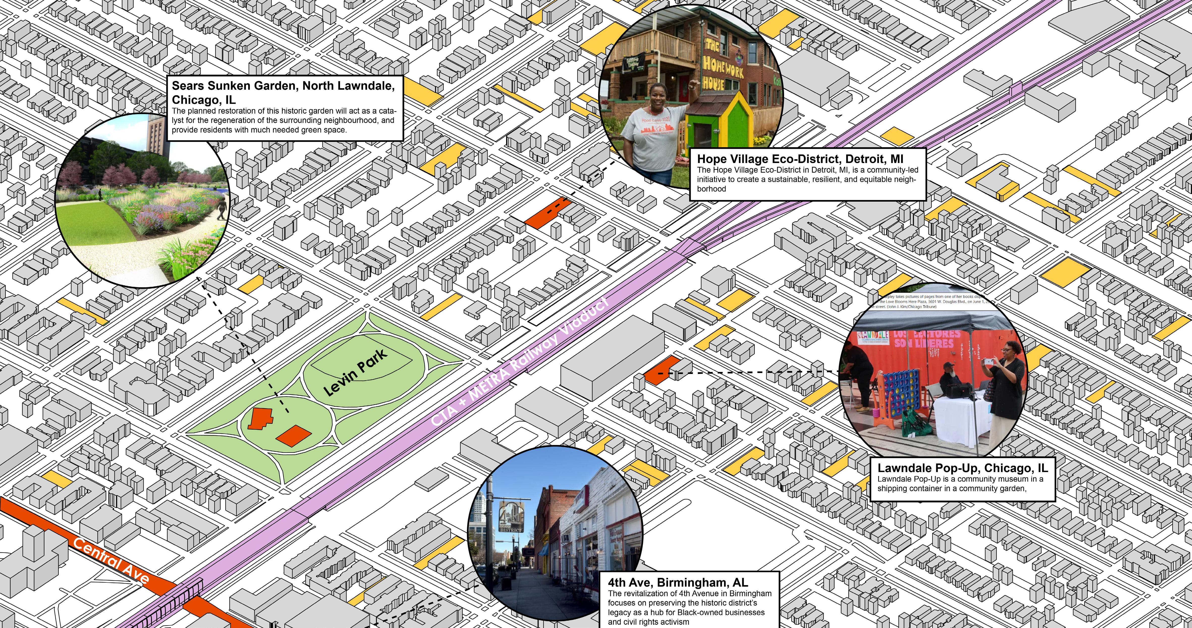
The revitalization of 4th Avenue in Birmingham focuses on preserving the historic district’s legacy as a hub for Black-owned businesses and civil rights activism Streetscape improvements, including enhanced sidewalks, upgraded lighting, and thoughtful landscaping, create a welcoming and accessible environment The project honors the area’s rich cultural and historical significance while fostering community pride and driving economic revitalization .
The Broadway Streetscape project in Portland reimagines an urban corridor focusing on sustainability, accessibility, and community engagement Enhancements like widened sidewalks, dedicated bike lanes, rain gardens, and public art installations prioritize pedestrianfriendly design and environmental stewardship This initiative creates a vibrant, inclusive, and resilient public space for residents and visitors alike
U Street in Washington, DC, is a historic corridor celebrated as a vibrant hub of African American culture and heritage, often called “Black Broadway ” Once home to icons like Duke Ellington, the area has been revitalized with a dynamic blend of live music venues, art galleries, restaurants, and boutique shops Streetscape enhancements have improved walkability and accessibility while preserving the district’s cultural legacy

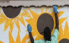
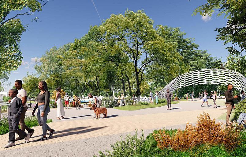
The Hope Village Eco-District in Detroit, MI, is a community-led initiative to create a sustainable, resilient, and equitable neighborhood Centered on principles of environmental stewardship and social justice, the project integrates green infrastructure, renewable energy, and energyefficient housing to enhance the quality of life for residents
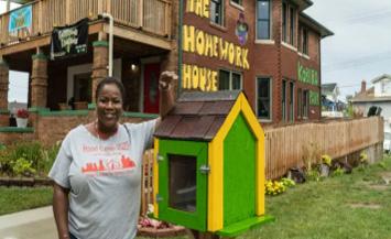
Avalon Village in Highland Park, Michigan, is a grassroots initiative led by Shamayim “Mama Shu” Harris to transform abandoned properties into vibrant community spaces The eco-village model promotes self-sufficiency and empowerment through resources like the Homework House The Homework House serves as a tutoring center where children can complete homework, enjoy meals, and engage in enrichment activities before and after school It embodies Avalon Village’s mission to uplift youth and support educational growth as a foundation for community revitalization
EcoWorks is a nonprofit organization in Detroit dedicated to promoting sustainability and energy efficiency while empowering local communities Through innovative programs and partnerships, EcoWorks provides tools, resources, and education to address climate resilience, reduce energy costs, and create sustainable job opportunities
The Englewood Agro-Eco District, the first of its kind in the nation, aims to transform vacant lots into an urban agriculture zone and green space Anchored by the Englewood Nature Trail project, this initiative focuses on environmental improvements and economic revitalization by attracting industry and entrepreneurs to this corridor situated between two railroads sites .
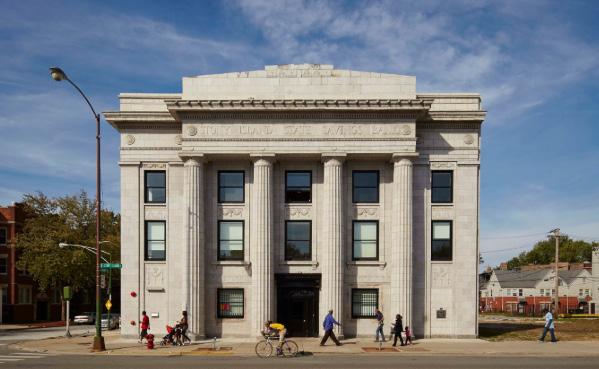

Local artist Theaster Gates led the efforts to convert this derelict former bank in the southside of Chicago into an arts and archival centre to serve the surrounding community The arts bank focuses on displaying art by black artists or which relates to the history and culture of the African American community in Chicago and in the United States
Based in Jackson Mississippi, this project seeks to create an alternative to the current exploitative and destructive socio-economic system by developing a network of cooperative organisations The project focuses primarily on black working-class neighbourhoods where the residents are not having their needs adequately addressed by conventional for-profit companies.
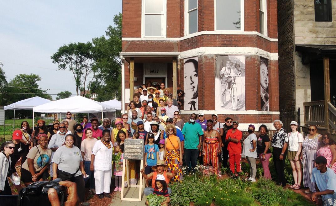
The Woodlawn neighbourhood includes the Emmett and Mamie Till-Mobley House Museum as a focus for telling the story of the great migration and of African American civil rights martyrs such as Emmett Till The Sustainable Square mile seeks to build on this heritage to foster black community development initiatives to address the challenges faced by the climate and economic crises .


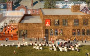

Webster Community Center is an adaptive reuse project of Webster Elementary . The intent is to transform this large 52,950-square-foot space into a mixed-use community center to further serve Pontiac residents through health and wellness, arts and culture, entrepreneurship, and youth activities
This project will reutilize Martin Luther King Jr High School for 310 housing units and two divisible commercial spaces intended to offer a diverse range of housing options, catering to various income levels, thereby fostering a socially diverse and inclusive community The development will feature a community park, farms, a pond, fountain and a walking path
The former bakery and warehouse will be converted into a mixed-use art, education and community space It includes artist studios, galleries, creative retail and an outdoor courtyard that will serve as an accessible community space The approach takes advantage of the building’s current state of disrepair, transforming turning it into unique architecture
The original home of Baker Electric Motor Vehicle Company has been transformed into art galleries, artist studios, performance spaces, and music recording studios The space hosts community events every month and includes promotions and specials for the surrounding businesses


Through community engagement and data analysis, five key principles became evident. Together, the five principles below provide a holistic framework for the revitalization of the Austin neighborhood, ensuring it thrives socially, economically, environmentally, and culturally while being inclusive and just for all residents
1 Redressing Harm: This principle aims to address the historical and ongoing challenges in Austin resulting from systemic inequality, disinvestment, and racial injustice By providing targeted support and reparative measures, the community can heal from past trauma Redressing harm also includes creating paths for healing and reconciliation, ensuring that residents feel empowered to participate in decisions about their future and are compensated for the losses they have experienced

2 Strengthening Identity: Strengthening the identity of the Austin neighborhood involves celebrating its rich cultural heritage and history This principle encourages growth of the existing community pride by amplifying local culture, traditions, and arts It also involves creating spaces where residents feel a deep sense of belonging and connection to the neighborhood
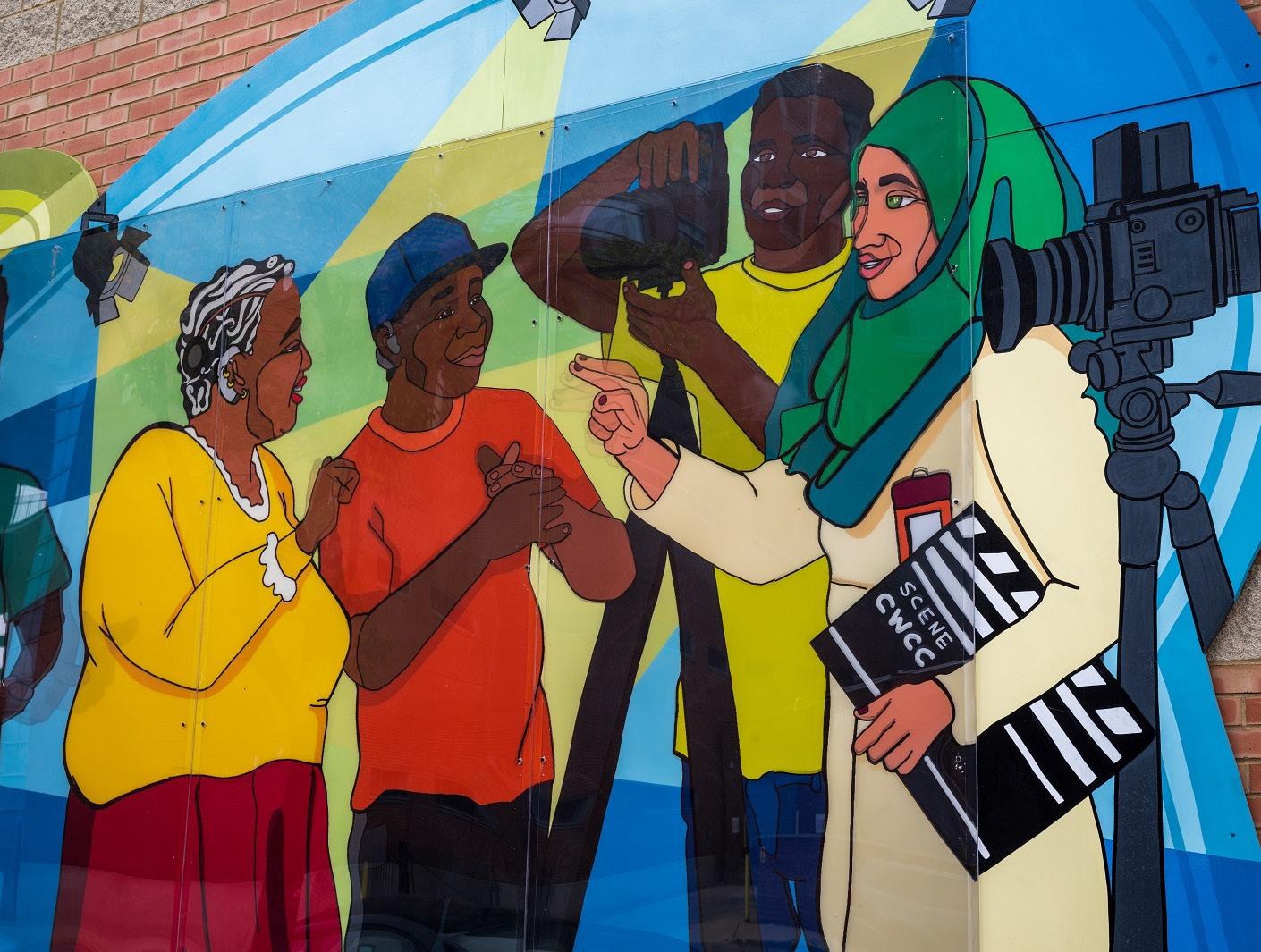
3 Supporting Economic Vitality: This principle focuses on promoting sustainable growth and fostering a thriving local economy that benefits all residents through providing locally driven jobs, goods, and entertainment This principles serves to ensure that economic opportunities are accessible, equitable, and locally driven, empowering residents to build wealth and improve their quality of life

4 Fostering Community Resiliience: This principle addresses the current vulnerability of Austin It will support Austin’s ability to withstand challenges and adapt to future uncertainties, such as economic downturns, climate change, and public health crises

5 Advocating for Environmental Justice: Advocating for environmental justice in Austin addresses the disproportionate environmental burdens faced by historically marginalized communities This principle calls for policies that mitigate environmental hazards, promote sustainable urban development, and prioritize the health and well-being of the community


The overarching concept for the Framework Plan envisions Austin as a quilt. The quilt reflects the rich, complex, and diverse nature of the community, composed of many different backgrounds, cultures, and histories that together form a unique and vibrant whole . Like a quilt, Austin is made up of different pieces, each representing various aspects of the people who live there, their stories, and their contributions In this quilt of Austin, no one patch or story stands alone The neighborhood’s strength lies in the way these different patches interweave, creating a vibrant, multifaceted community Though there may be challenges such as economic disparities or violence, there is also a deep sense of pride and solidarity The people of Austin, like the threads in a quilt, are interwoven, and the neighborhood continues to evolve, with each generation adding new layers to its collective story
The patches of the quilt are made up of halfmile grids, representing the micro-communities within Austin. Each patch reflects the diversity of Austin—whether it is an area with a predominantly African American population, a growing Latino community, or a space with a concentration of local shops and services . These patches are distinct from one another but still part of the larger whole and contributing to the broader mosaic of the neighborhood
The street grid, as the seams of the quilt, represents the connections and flows between the patches Roads like Austin Boulevard, Cicero Avenue, and Madison Street serve as the boundaries between the half-mile patches, but they also allow for movement and interaction between these areas They symbolize the ongoing interaction and movement of people, ideas, and resources, while maintaining the distinctiveness of each patch
Austin community

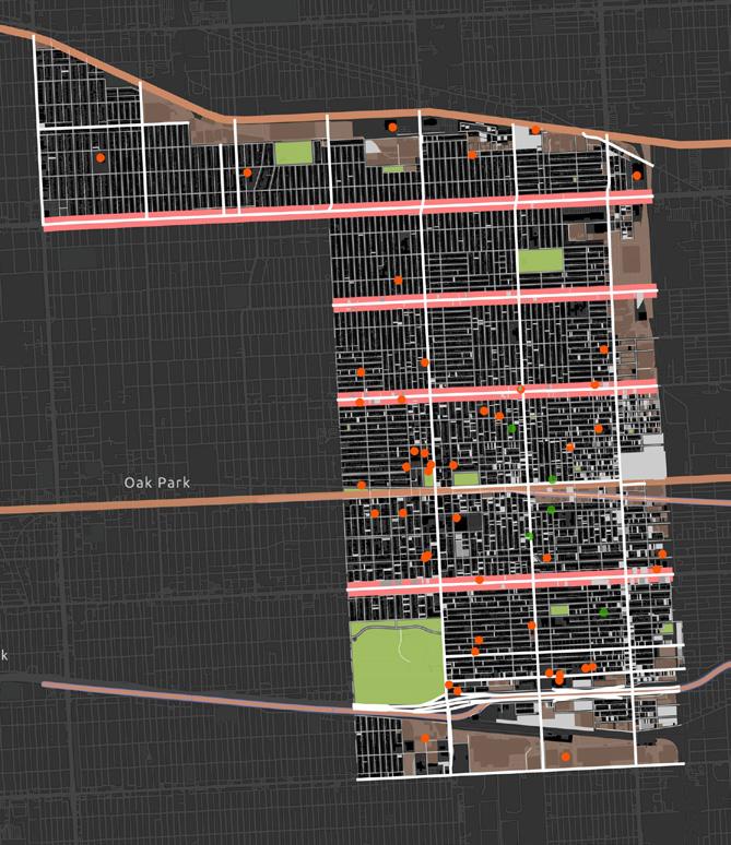
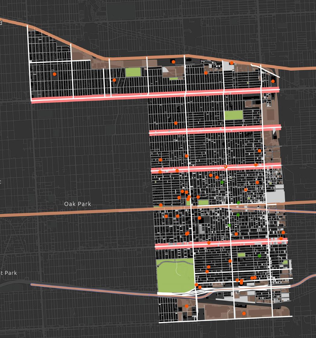
A vulnerability analysis was completed by assessing areas with significant gaps in community assets such as parks, schools, and gardens This analysis also reviewed blocks with vacant lots and abandoned buildings, two elements that can negatively impact a community, but also provide an opportunity for future development Three distinct priority areas were realized through this assessment Each area focuses on a unique set of goals, specifically in creating a green corridor, a community center grid, and a cultural grid
Due to the sheer size of Austin, this plan focuses specifically on three priority areas. However, the intention is for these frameworks to eventually be brought into the entire neighborhood once their benefits are conceived.


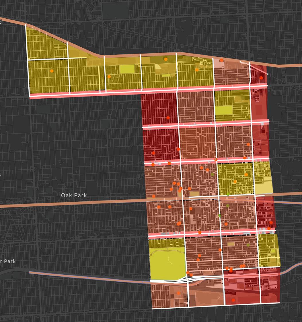
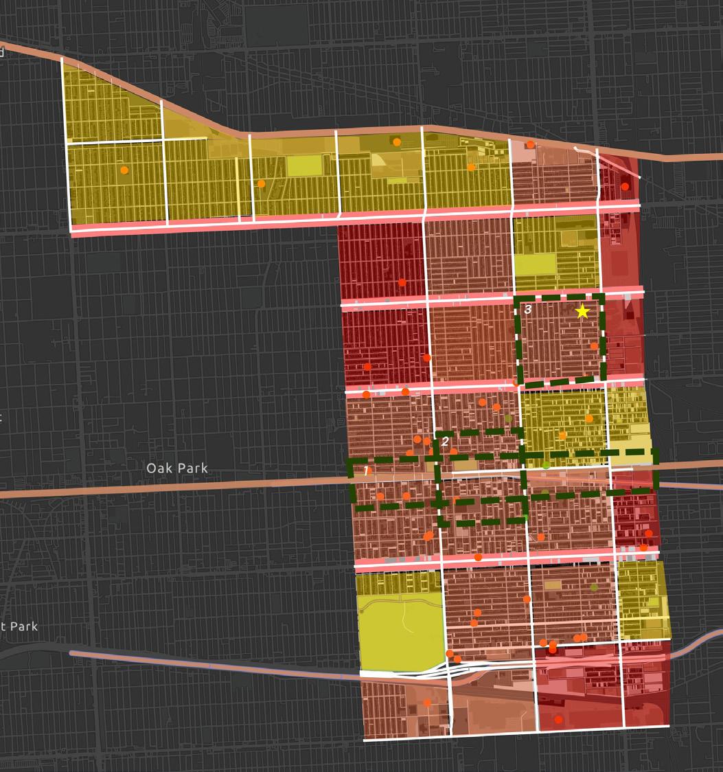
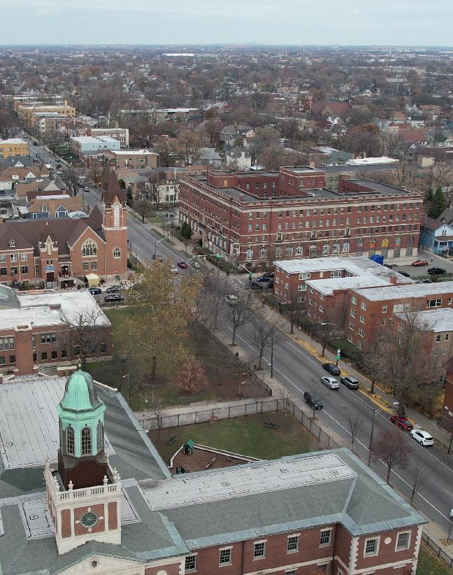
Esri Community Maps Contributors, City of Chicago, Esri, TomTom, Focus Area number one is located along Kinzie and Lake Streets near the Green Line station, an area that repeatedly came up during engagement with Territory as a place where the youth does not feel safe Currently, there is a large cluster of vacant lots and abandoned buildings This focus area is proposed as a Green Corridor to enhance sustainability, tackle food insecurity, boost economic growth in the neighborhood, and overall create a safe, welcoming area for residents
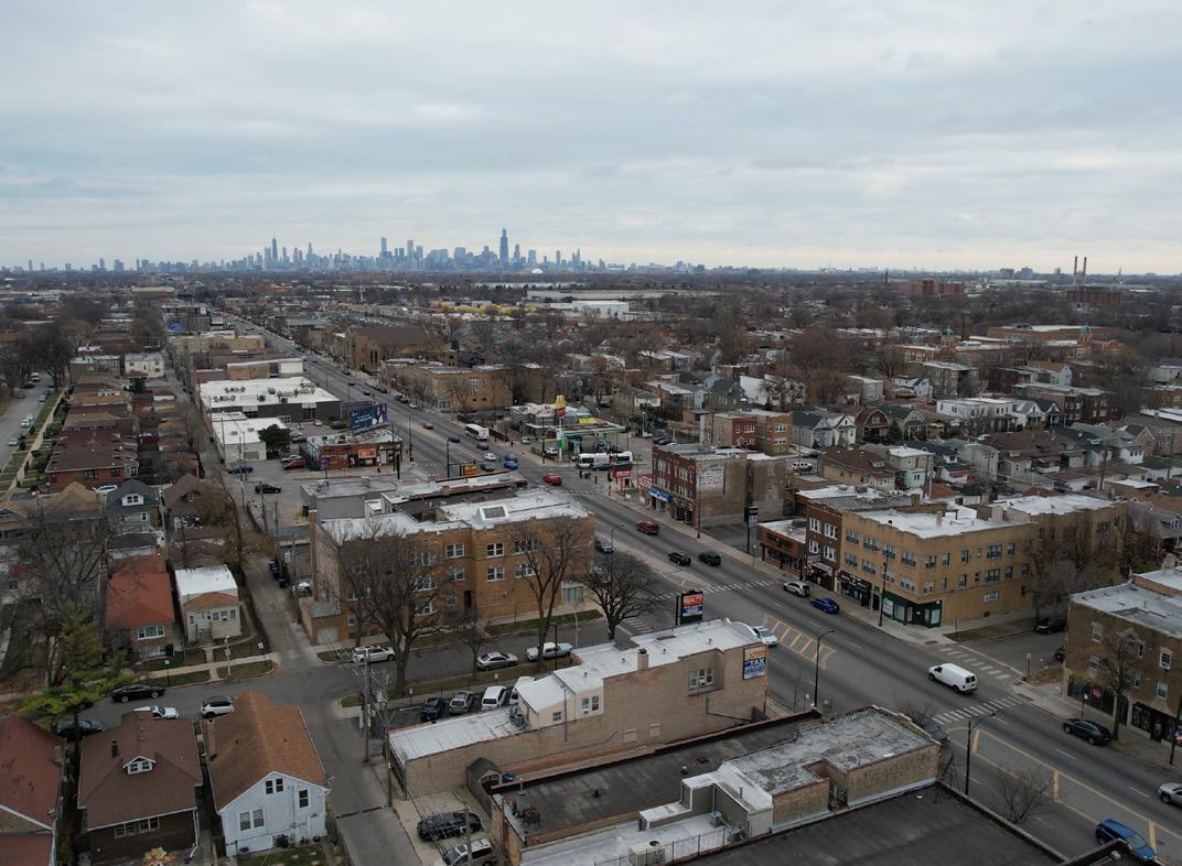
The second focus area is located in the neighborhood center of Austin, primarily based on Kenzie Street and bounded by Madison Avenue to the south, Central Avenue on the west, and Laramie street to the east
This focus area aims to create an environment of “live, work and play”, an idea that was derived from the existing conditions of significant commuters, few spaces to gather, and a lack of diverse housing types
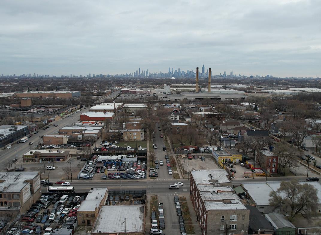
Esri Community Maps Contributors, City of Chicago, © OpenStreetMap, The third focus area is a block bounded by Chicago, Laramie, Division and Cicero This block is where the new Territory office will be. These projects will serve as the foundation for a dynamic cultural district with community co-ownership spaces (e g , artist collectives, maker spaces, and incubators for small businesses), paving the way for the eventual growth of long-term businesses in the area As such, the proposed cultural node will support a welcoming atmosphere that strengthens the neighborhood identity and community pride

This chapter reflects the proposed projects, designed to bring about transformative change in both the short and mid-term Through implementation, they lay the groundwork for a future with lasting impact This section will begin with case studies to showcase successful models of similar urban transformations, followed by intersections and photomontages to visualizre what these proposals could look like once implemented This section touches on sparks of brilliance within each of the three focus areas identified below to address the community’s needs, with the aim of creating a safer, more vibrant, and sustainable Austin
Focus Area 1 proposes the creation of a Green Corridor along Kinzie and Lake Streets, designed to not only beautify the area but also to promote sustainability and combat food insecurity This vision includes three key initiatives: urban agriculture, which will provide fresh produce to address food access challenges; greenways, which will enhance environmental sustainability while offering spaces for relaxation and recreation; and a farmers market, which will serve as a hub for local produce and economic growth Together, these efforts will foster a stronger, more resilient community that benefits from improved health, safety, and environmental outcomes
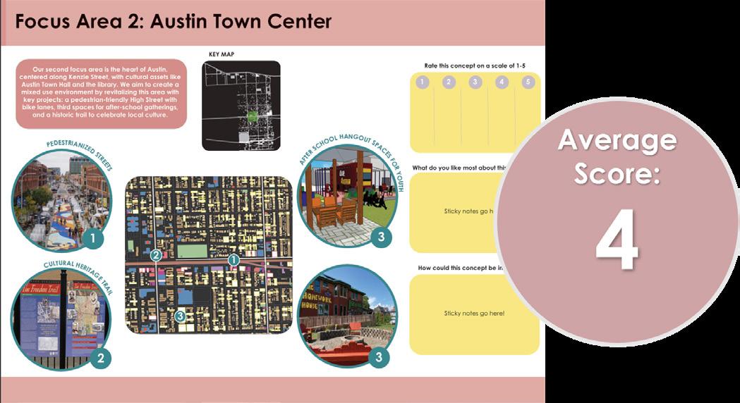
Focus Area 2 centers on revitalizing the heart of Austin, particularly along Kinzie Street, where cultural landmarks like Austin Town Hall and the local library define the area’s character. The vision for this area includes transforming Kinzie Street into a pedestrian-friendly High Street, complete with bike lanes to promote active transportation . The creation of welcoming third spaces for youth and a historic trail will celebrate Austin’s rich cultural heritage and encourage community interaction These initiatives are designed to honor the neighborhood’s history while enhancing connectivity and fostering a vibrant, inclusive environment for all .
Finally, Focus Area 3, in collaboration with Territory, proposes the transformation of vacant lots into thriving community spaces through short-term projects These projects include a makers market for local artisans, murals created by neighborhood artists to reflect Austin’s unique culture, and temporary workshop spaces that offer creative opportunities for all ages These projects will serve as the foundation for a dynamic cultural district, paving the way for the growth of long-term businesses, artist collectives, and small business incubators, fostering community co-ownership and economic development




This plan highlights case studies, including a detailed look at a zoomed-in area within Focus Area 1, as well as examples from comparable cities and neighborhoods These case studies demonstrate potential short-term projects that could activate vacant lots and improve infrastructure For instance, Chicago’s 606 serves as a model for the proposed greenway
along Kinzie Street, which would connect several existing parks through a continuous corridor featuring active travel infrastructure and parklets Similarly, Cadillac Urban Farms in Detroit showcases how urban agriculture can enhance food security for underserved communities

INTERSECTION DETAIL

The Green Corridor intersection graphic illustrates how a series of interconnected short-term projects around the Kinzie Street greenway can begin to link together, resulting in a dynamic space These projects primarily address sustainability issues The rain garden would help mitigate flooding impacts, while urban agriculture would improve food security . Building on the work of Forty Acres, the farmers’ market will provide opportunities for accessible, local food .


This section highlights as the extension of green corridor in our first focus area’s proposal on Kinzie street . It shows that pedestrianising this part of the street on weekends and festivals can help activating it This area can be turned into a TOD eventually with the proposed street infrastructure and street markets or pedestrian drives

Project: Austin Town Center
Location: Kinzie Street

This photomontage highlights potential enhancements to the street’s public realm The image in the top right shows an existing section of Kinzie Street, which currently lacks pedestrian access The photomontage demonstrates how small-scale improvements such as planting, bike lanes, and public art could redesign the street while still accommodating vehicular access .
Location: Lake Street
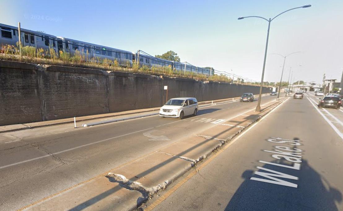

This photomontage highlights a farmers’ market concept The graphic envisions a weekly farmers’ market on a vacant lot (image on the top right), where local businesses, artisans, and restaurants could sell their goods to support economic development Such markets would also serve as social events, bringing the community together and providing opportunities for local artists and musicians to perform
Project: Farmers Market
Location: 4850 W Race Ave


This photomontage highlights an urban farm concept Urban agriculture is central to Focus Area 1, featuring a community garden aimed at mitigating food insecurity Urban agriculture provides numerous benefits, including the production of healthy, nutritious food for the local community, opportunities to support garden-to-table initiatives, access to green spaces that promote improved mental health, and the chance to learn new skills through various gardening training programs
Project: Urban Market
Location: 4825 - 4865 W Race Ave


The Sears Sunken Garden in North Lawndale provides inspiration for how landscaping improvements could be implemented at Levin Park in Focus Group 2 . The 4th Avenue in Birmingham, Alabama, serves as an example of how a historic African American main street can be revitalized This approach could inform our concept of transforming Central Avenue into a new High Street for Austin, featuring a green corridor and historic trail
INTERSECTION DETAIL

The Austin Town Center intersection graphic illustrates an area around Austin Town Hall, which is the focus of Focus Area 2 Here, Central Avenue intersects with the CTA Green Line station, which would be upgraded to create a safe and attractive gateway into Austin
Third spaces would be established in this central and accessible location to serve as a community hub for Austin The new High Street along Central Avenue could occasionally be closed to car traffic to accommodate street festivals and community events


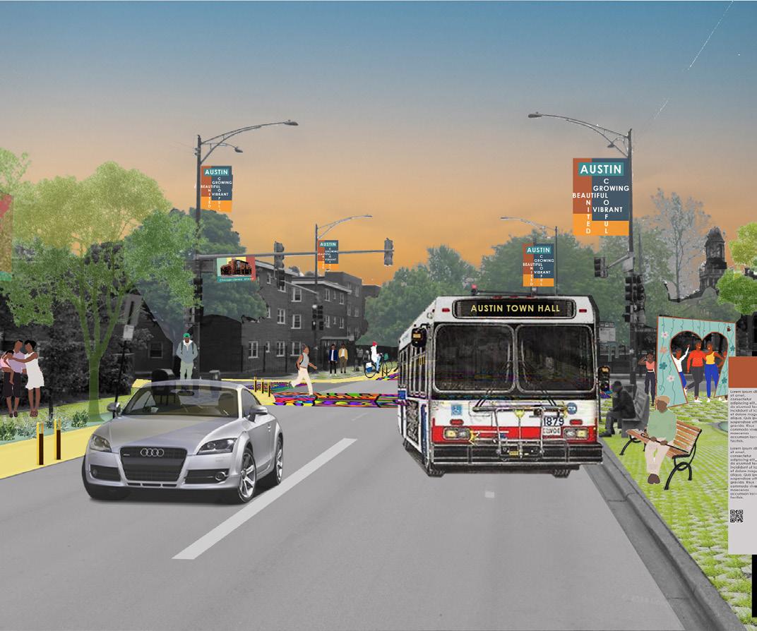
This section depicts Central Avenue activated as the historic trail with minimum physical interventions, like recognising the existing bus stop unique to Austin, adding information hoardings about the historic locations like Town Hall and Library Adding a bike lane and making the existing walkways permeable is a proposal throughout the neighborhood streets for improving street infrastructure and to mitigate the heat island


This photomontage highlights a heritage trail . The trail would link together key buildings and events in Austin’s history, providing residents with a greater understanding of their neighborhood’s past while also serving as an attraction for visitors from other areas


At night, the trail transforms into a lively and illuminated path, with colorful lights and glowing installations creating a safe and festive atmosphere This dynamic design not only deepens residents’ connection to their community but also invites visitors to explore and celebrate Austin’s rich history


This photomontage highlights pedestrian streets on weekends This artwork illustrates how closing the roadway to traffic on weekends could create new spaces for community and cultural events


During community festival, the space transforms into a hub of activity where families, friends, and neighbors come together to enjoy a safe and welcoming environment Colorful murals, accessible pathways, and greenery enhance the atmosphere, while the addition of gathering spaces, performances, and recreational activities highlight the street as a place for connection and celebration This reimagined street serves as a vibrant symbol of community pride and shared experiences


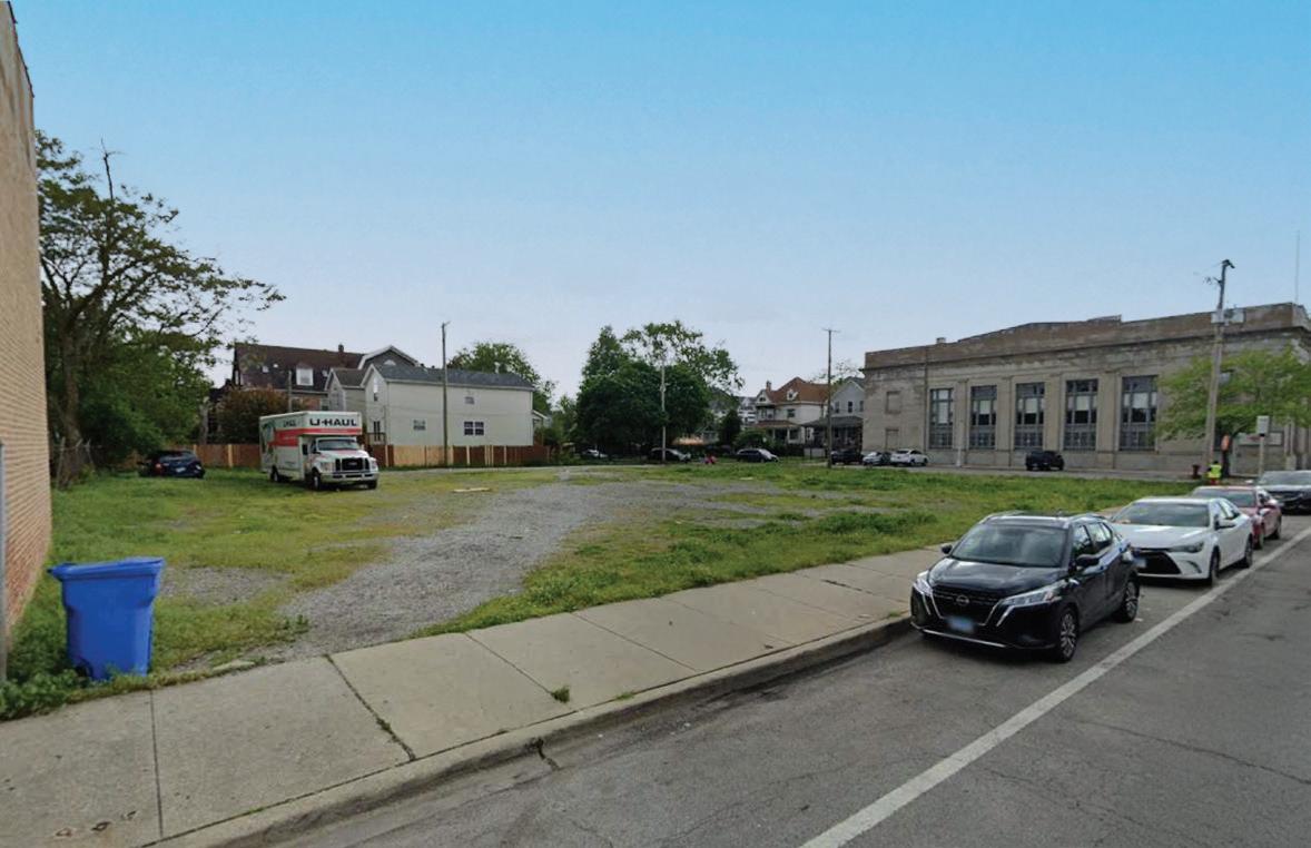
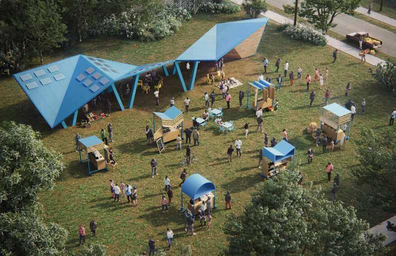
This photomontage highlights POP! Unity Third spaces can take many forms but simply provide a place outside of home or work where people can come together, socialize, and have fun, ideally with no or low cost of entry This graphic envisions transforming a vacant lot into a vibrant space featuring a mix of activities, including seating, pop-up vendors, performances, and public art, to bring the community together

This plan highlights case studies demonstrating how culture and the arts can serve as catalysts for regeneration, particularly within Black communities Southside Sanctuary in Chicago is an example of a space designed to promote arts, culture, innovation, and entrepreneurship Similarly, Destination Crenshaw in Los Angeles showcases how art can transform a declining commercial corridor

78th Street Studios, Celevland, OH
A historic building that has been renewed into art galleries, artist studios, performance spaces, and music recording studios.

Regenerating Roots, Miami, FL
A vacant parcel transformed into a venue showcasing the community’s food, entertainment, and beauty products.

Destination Crenshaw, Los Angeles California
A thriving commercial corridor linked by community spaces and pocket parks, newly planted trees, and over 100 works of art.
INTERSECTION DETAIL

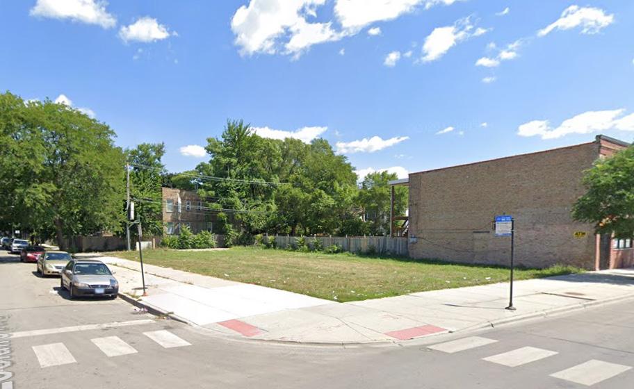
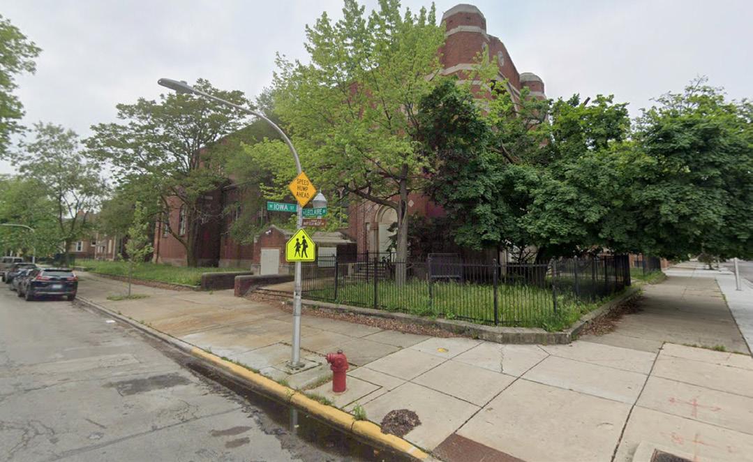
The intersection of Chicago and Leclaire features large vacant sites that could be utilized for various short-term projects This plan illustrates how public artwork, events, and public realm improvements can transform the intersection into a creative and economic hub


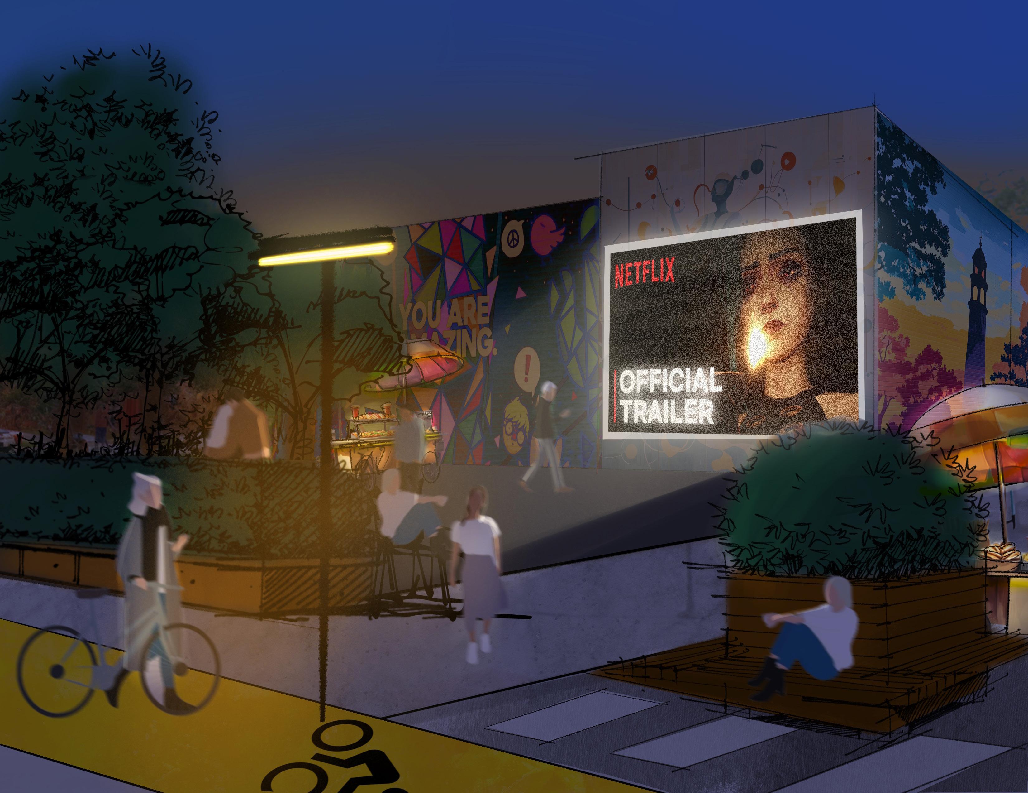
This photomontage highlights murals A blank gable wall adjacent to a vacant lot allows outdoor movie screenings and interactive murals Such a space would attract visitors, while local vendors could use the area to sell their products, such as food or crafts
Location: 899 N Leclaire Ave

In the evenings, the space could host community movie nights, food markets, live performances, and engaging activities, creating a lively atmosphere that brings people together .

In the winter, the space could host seasonal activities such as ice skating or holiday markets, further engaging the community


This photomontage highlights temporary workshop space This artwork illustrates how flexible spaces, such as artist workshops/ studios, small business spaces, or maker spaces, could be created using shipping containers . These containers can be placed on vacant lots to provide adaptable workspaces and easily removed when the lot is ready for permanent development

This photomontage highlights makers’ space . A more permanent development might include makers’ spaces on the ground floor with residential units above . This building would support the local creative community by providing residents with a space to develop their craft and turn it into a profit-generating business


The first long-term axis emphasizes emphasizes a forward-thinking approach to sustainability, food equity, and active transportation The plan introduces green corridors, bike infrastructure, and rain gardens to build environmental resilience and promote alternative mobility Urban agriculture, food pop-ups, and farmers markets address critical food access challenges and foster healthier and more self-sufficient communities. Mixed-use buildings and pocket parks activate spaces for daily life, while solar farms and green roofs integrate renewable energy solutions . Together, these strategies create a future-ready neighborhood that prioritizes ecological balance and community well-being


The second massing axis emphasizes creating a connected, inclusive, and vibrant community Proposed actions prioritize enhancing existing public spaces and promoting opportunities for social and economic interaction Key strategies include improving parks, adding affordable housing, and integrating community gathering spaces Shared workspaces, small local businesses, and mixed-use buildings further support a vibrant and dynamic urban environment . Streetscape improvements and after-school spaces address both mobility and youth engagement, ensuring that the neighborhood becomes a safe, thriving, and accessible place for all


Focus 3: Celebrating Culture, Creativity, and Innovation
The third Massing Axon explores the integration of arts, culture, and economic opportunity into the urban fabric This vision focuses on transforming underutilized spaces into vibrant hubs of activity through adaptive reuse, business incubators, and studio space Public art, including murals and open art installations, enriches the neighborhood’s identity while encouraging creative expression Maker’s markets and green paving initiatives further emphasize sustainability and community-driven growth By weaving together culture and entrepreneurship, the design strengthens the neighborhood’s sense of place and drives long-term innovation
Neighborhood Key Map

Plan Key Map
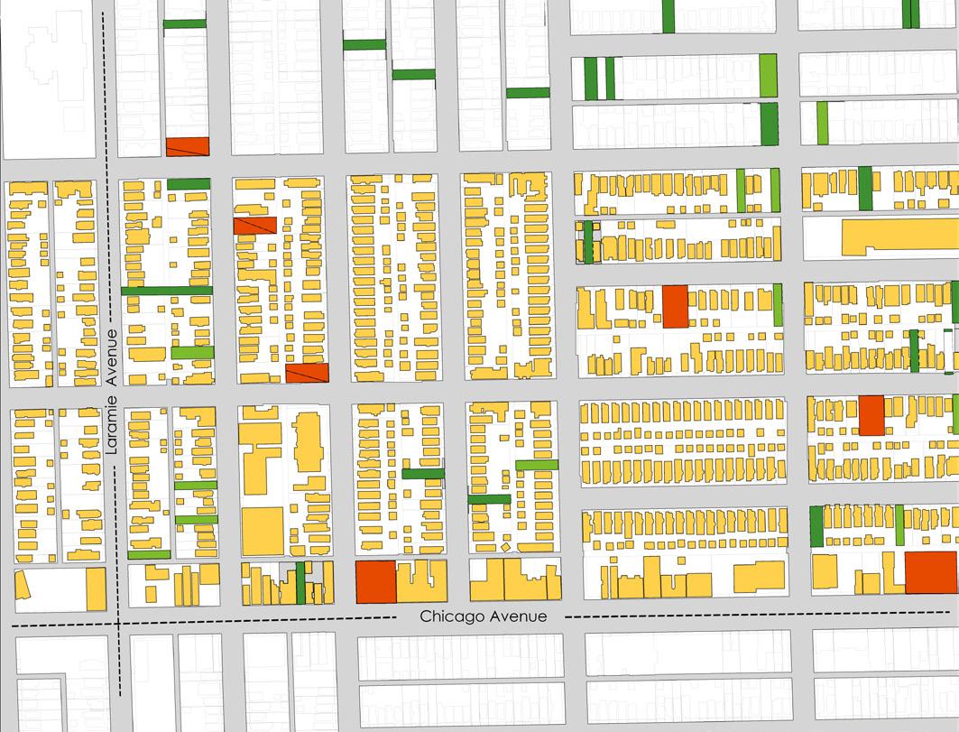


The transformation Austin will unfold over several decades, ultimately creating a vibrant, connected, and inclusive neighborhood In the early stages, development will focus on pilot projects that spark short-term improvements, such as the creation of community spaces, enhancements to streetscapes, and the support of local businesses These initial successes will serve to attract further investment to the area .
As the transformation progresses, various portions of Austin will see the successes of these projects and begin to implement even more, strengthening their unique identities centered around sustainability, cultural heritage, and the arts, while major streets are improved to better connect these evolving neighborhoods .
As time goes on, vacant lots will be developed and abandoned buildings repurposed, breathing new life into underutilized spaces Over the years, the neighborhood will become more connected, with safe, green streets and accessible transit improving mobility and making it easier for residents and visitors to navigate through and around Austin With each stageof implementation, Austin will gradually attract new residents and businesses, leading to the revitalization of key corridors with mixed-use, highdensity developments that provide affordable and diverse housing, retail, and services
Ultimately, Austin will evolve with a strong sense of community and cultural identity The long-term improvements will not only transform Austin itself but will also generate positive change in neighboring areas, creating a ripple effect of growth and opportunity throughout the wider community .
We now move out of the Focus Areas and start to look at how this development framework might be applied to Austin as a whole – creating Your Austin – where beauty is for everyone
Within a five-year time frame our three focus areas have been developed and now there is an explosion of short-term projects which are beginning to link together leading to more permanent smaller-scale development projects and investment is being attracted into the area

By year ten, other ‘patches’ are beginning to follow the initial pilots in focus areas 1, 2, and 3 and are slowly developing their own distinctive characteristics around greening, cultural heritage, and arts and culture curation In addition, the ‘seams’ or major streets that create a ½-mile square grid are starting to develop as part of a concurrent municipal initiative . This interconnected network of public realm
improvements links the various patches together . Infill development is now being undertaken throughout Austin on remaining vacant lots and abandoned buildings are being adaptively reused
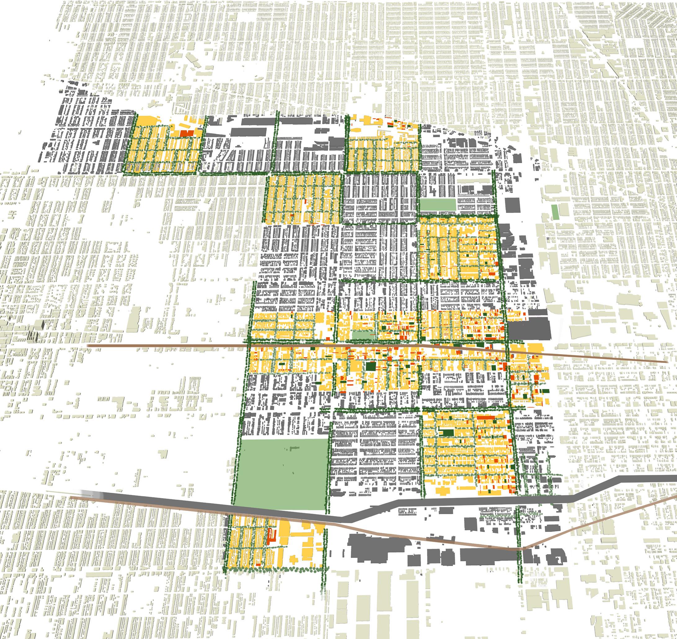
By year 15 the ‘quilt’ is beginning to be seen Redevelopment efforts being undertaken in every patch and the seams are now fully connected allowing residents to traverse the whole of Austin via green, and safe streets by a range of accessible multimodal transportation options that have resulted from a concurrent municipal effort
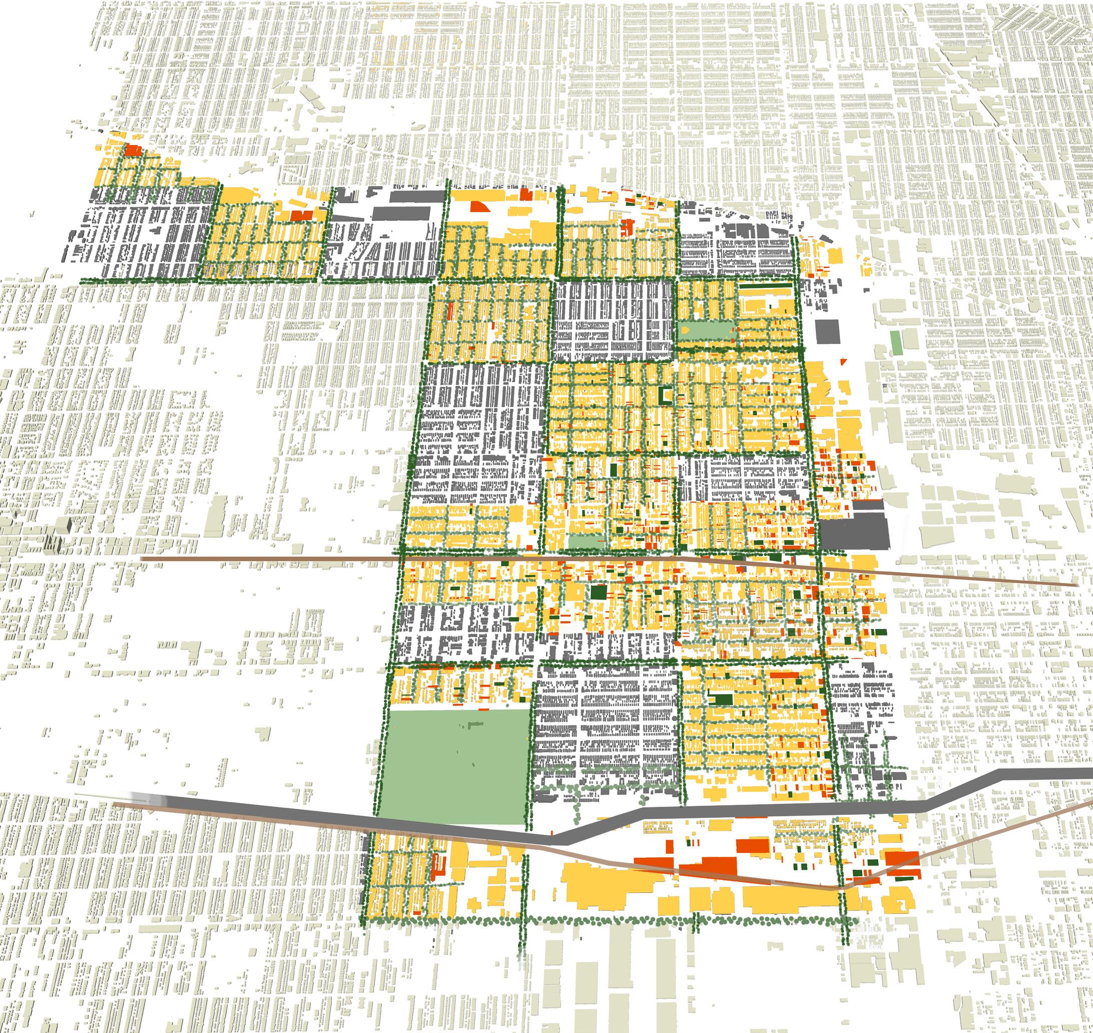
In year 20, the quilt has now fully matured, with the city’s once fragmented zones now fully interconnected with green streets, pedestrian-friendly pathways, and an expanded multimodal transportation network
By year 20, this transformation is evident in everyday life: people of all ages and backgrounds are reaping the benefits of these interventions through a range of transportation
methods, improved environmental and economic development, and an overall increased quality of life
In year 25, the momentum is now so significant that Austin’s population decline has been reversed The Austin community is attracting new residents and businesses to the point that key corridors are being densified via new highdensity mixed-use development
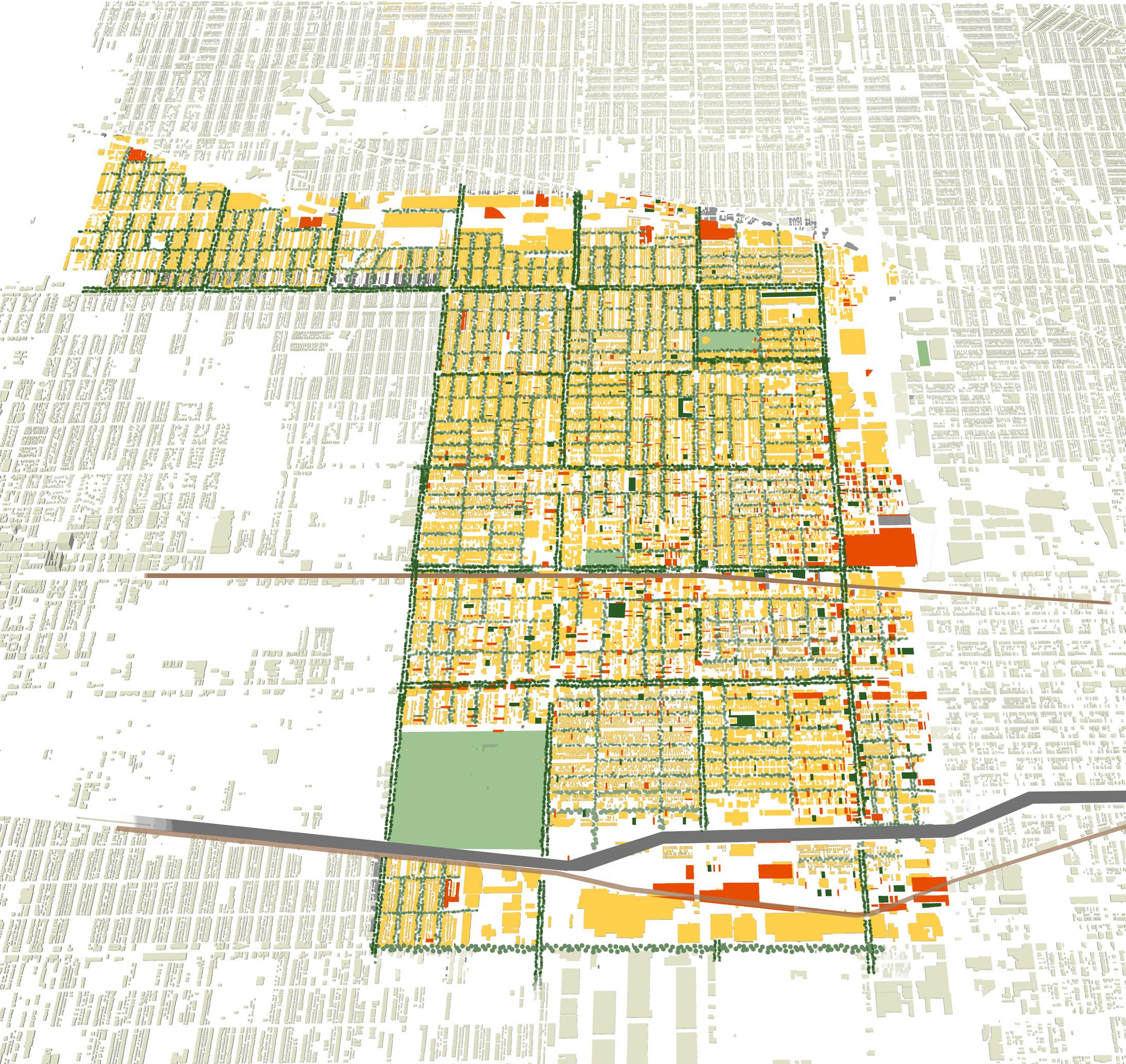

At 30 years plus, Austin has become one of the most dynamic and attractive neighborhoods in Chicago, while retaining the community and cultural identity that made it special to begin with The improvements made within Austin are starting to branch out into neighboring areas .

This page has been intentionally left blank
The process of implementing these complex projects can be challenging without proper funding or support To address this, the project team has developed an implementation matrix for twenty-three potential projects, ranging from short- to long-term, outlining key sites, partners, and funding sources This matrix will help Territory and other organizations streamline initiatives to achieve the goals
Urban Agriculture Identify strategic vacant parcels of land to be used for community farms and allotments
4852 - 4856 W Race Ave Short
Improve Existing Parks Upgrade existing parks through enhanced landscaping and improved sports and recreation facilities
Levin Park, Austin Park Short
Rain Gardens Identify strategic vacant land to be used for Sustainable Urban Drainage Systems (SUDS) . 4936 W Hubbard St Short
Green Roofs Identify flat-roof buildings suitable for green roofs . 5351 W Lake St Short
Greenways Connect existing parks and community gardens through a network of green streets . Kinzie corridor Medium
Farmers' Market Identify a site for a recurring farmers' market 4850 W Race Ave Short
Community Energy Identify opportunities for community-owned renewable energy generation, including solar photovoltaic panels and district heating
Community Pocket Park Identify opportunities for small, active green spaces within existing neighborhoods
339 N Parkside Ave Short
521-525 N Laramie Ave Short
Fresh Grocery Store Identify a site for a new community-owned grocery store to sell locally grown produce 5333 Lake St - Sprout Lofts Medium
Cycling Infrastructure Create a segregated bike lane network W Lake St, Central Ave Medium
The projects are divided into three timelines: short-term (1–5 years), mid-term (5–10 years), and long-term (10+ years). This helps the team focus resources and achieve goals step by step .
Advocating for Environmental Justice, Strenghtening Community Identity, Supporting Economic Vitality, Fostering Community Reslience
DPD, Austin Coming Together, Alderman Office, Territory, Neighborspace, Forty Acres Fresh Market, Community Garden Organizations
Sweetwater Foundation, EPA, Robert Wood Johnson Foundation, MacArthur Foundation Service/ Planning Grant
Advocating for Environmental Justice Chicago Park District, DPD Chicago Park District
Advocating for Environmental Justice MWRD City of Chicago, Neighborspace, Green Corps Chicago, CNT
Advocating for Environmental Justice
Advocating for Environmental Justice
Advocating for Environmental Justice, Supporting Economic Vitality, Fostering Community Reslience
Advocating for Environmental Justice, Supporting Economic Vitality, Fostering Community Reslience
Advocating for Environmental Justice and Fostering Community Reslience
Advocating for Environmental Justice, Supporting Economic Vitality
Advocating for Environmental Justice
USEPA, IL EPA, MWRD Green Infrastructure Partnership Program
MWRD DPD, Delta Institute ComEd's Energy Efficiency Program, USEPA Grants for Green Infrastructure, Illinois Clean Energy Community Foundation
DPD, Alderman Office, Chicago Park District, The Morton Arboretum
City of Chicago, MWRD Green Infrastructure Partnership Program, Openlands
Alderman Office, Austin Coming Together, DCASE, Neighborspace
ComEd, Chicago Department of Environment and Sustainability, DPD, Austin Coming Together
Neighborspace, Local Land Banks, Alderman Office
Forty Acres
City of Chicago, Sweetwater Foundation, USDA Farmers Market Promotion Program, DCASE, DCEO
ComEd Energy Efficiency Program, Illinois Solar for All, Federal Solar Investment Tax Credit, MacArthur Foundation
Openlands, Chicago Park District
CDOT
Sweetwater Foundation, Robert Wood Johnson Foundation, MacArthur Foundation Service/ Planning Grant
CDOT, Safe Routes to School
Austin Historic Trail Utilize signage to draw attention to important historic buildings and people
Start/end Austin town hall Short
Strenghtening Community Identity, Redressing Harm
SSA#72, City of Chicago (DCASE and DPD), Austin Chamber of Commerce
Mellon Foundation, Knight Foundation, National Trust for Historic Preservation, Illinois Transprotation Enhancements Program (ITEP), Cook County Communuity Development Block Grant (CDBG) Public Service/Planning Grant, National endowment for the humanities, Chicago Park District, NEH
Affordable Housing Develop and build affordable housing typologies based on contemporary reimaginings of popular local housing styles
Austin Gateways Upgrade the Central Green Line station through landscaping, safety features, and artwork to create a gateway to Austin town center
Third Spaces Identify locations for low- or no-cost third spaces such as cafes, shared workspaces, etc
148 N Lotus Ave Medium
Central Green Line Station Short
Supporting Economic Vitality, Fostering Community Reslience, Redressing Harm
Strenghtening Community Identity, Redressing Harm
llinois Housing Development Authority (IHDA), Austin Coming Together
LIHTC Funds, LISC, DPD, Austin Chamber of Commerce
SSA, DPD, Chicago Park District,Choose Chicago, Austin Chamber of Commerce, Austin African American Business Networking Association
Alderman Office Funds, Choose Chicago, IL Department of Commerce and Economic Opportunity (DCEO) Office of Tourism, LISC, CMAP
Lots: 155 N Pine Ave, 424 N Lockwood Ave Short
Strenghtening Community Identity, Fostering Community Reslience
DPD, Austin Coming Together, Territory, Alderman Office (29, 37,24), Chicago Architecture Center
After-School Spaces Create safe after-school recreation spaces for children and teenagers
129 N Pine Short
Austin High Street Implement street improvements, including wider footways, enhanced hard surfacing, and street furniture
Central Ave Medium
Fostering Community Reslience
Strenghtening Community Identity, Supporting Economic Vitality
Territory, Austin Coming Together, Front Porch Arts Center, Root2Fruit, local schools
CDOT, DPD, CTA, SSA#72, Austin Chamber of Commerce
DCASE, Chicago Community Trust, U for Urban Impact,National Endowment for the Arts, National Endowment for the Arts Our Town Creative Placemaking Grants, Project for Public Spaces Community Placemaking Grants
Chicago Public Schools
CDOT Make Way for People Program, USDOT Safe Streets for All (SS4A) Grant Funding, Alderman Office Funds, Choose Chicago
Makers Spaces Create small studio and workshop spaces where makers, craftspeople, and artists can develop their skills
Business Incubators Provide small, low-rent office and workshop spaces for local businesses and entrepreneurs
Murals Commission local artists to create murals on blank walls and abandoned buildings
Community Arts and Heritage Center
4857 W Iowa St (bldg) Short
Supporting Economic Vitality
DPD, Austin Coming Together, Austin Chamber of Commerce, Territory, Austin African American Business Networking Association
City of Chicago, Lohengrin Foundation, Ford Foundation, Project for Public Spaces, Ford Foundation, Tax Increment Finance funds, Community Placemaking Grants
1020-1024 N Cicero Avenue Short
Gable of 5058 W Chicago Ave Short
Build a local arts venue in the north of Austin for hosting music, performances, and exhibitions, with rehearsal space included 5058 W Chicago Ave Medium
Makers Market Build a local arts venue in the north of Austin for hosting music, performances, and exhibitions, with rehearsal space included
Adaptive Reuse Identify abandoned industrial buildings that could be brought back into use, either temporarily or permanently
Green Paving Replace hard bituminous surfaces with permeable and/ or green paving
1020-1024 N Cicero Avenue Short
Supporting Economic Vitality
Strenghtening Community Identity
Strenghtening Community Identity, Redressing Harm
Austin Chamber of Commerce, Austin African American Business Networking Association
Ford Foundation, The Kresge Foundation, Small Business Improvement Funds, LISC
SSA#72, Territory, Front Porch Arts Center Graham Foundation, Driehaus Foundation, DCASE, IL Arts Council, SSA, Kresge Foundation
DPD, Austin Coming Together, Alderman Office (29, 37,24), Territory, Austin African American Business Networking Association, Front Porch Arts Center
Supporting Economic Vitality
1124 Cicero Avenue - Cafe/ Coffee shop Long
1020-1024 N Cicero Avenue Short
Supporting Economic Vitality, Redressing Harm
Advocating for Environmental Justice
Graham Foundation, Driehaus Foundation, DCASE, Lohengrin Foundation, Ford Foundation,LISC, Kresge Foundation
Austin Chamber of Commerce, Austin African American Business Networking Association Ford Foundation, Small Business Improvement Funds, LISC, Kresge Foundation
Austin Coming Together, Austin Chamber of Commerce, Austin African American Business Networking Association
CDOT, MWRD, Austin Coming Together, NeighborSpace
LISC
Illinois Green Infrastructure Grants, ComEd Green Region Program, LISC
