Reimagining Hawai‘i's Highways For Resilience:
A Framework for Integrating Ecology, Culture, and Connectivity
Kaylen Denice Daquioag
Master of Landscape Architecture
May 2025

Kaylen Denice Daquioag
Master of Landscape Architecture
May 2025
A capstone design research project submi琀琀ed in par琀椀al ful昀椀llment of the Plan B requirements for the degree of MASTER OF LANDSCAPE ARCHITECTURE
May 2025
By Kaylen Denice Daquioag
Capstone commi琀琀ee: Judith S琀椀lgenbauer, Chairperson Cathi Ho Schar
Keywords: Highways, biodiversity, rewilding, resilience, ahupuaʻa, transporta琀椀on
This capstone project marks the closing chapter of a journey that began seven years ago in the School of Architecture at the University of Hawaiʻi at Mānoa and deepened in the Master of Landscape Architecture program. I am deeply grateful to everyone who has guided, supported, and inspired me.
To my commi琀琀ee chair, Judith S琀椀lgenbauer, mahalo nui for being there from the beginning of the program. Your encouragement and example were part of what drew me into the MLA program in the 昀椀rst place. Thank you for your steady guidance, though琀昀ul cri琀椀que, and belief in the value of this work. Your mentorship has meant more than I can fully express.
To my commi琀琀ee member, Cathi Ho Schar, thank you for being more than just a mentor and boss the past 昀椀ve years. Working alongside you has taught me to approach this profession rigorously, humbly, and with care. I’m grateful for the countless conversa琀椀ons, the trust you’ve extended me, and the many opportuni琀椀es you’ve made possible.
To the School of Architecture faculty and the MLA program — mahalo for cul琀椀va琀椀ng a space where landscape can be seen as both system and story. Thanks to Phoebe White, Simon Bussiere, Andrew Kaufman, Charlie
Palanza, and Ma琀琀 Higa for your guidance, insight, and dedica琀椀on to this place.
To my peers and studio mates — thank you for the shared energy, crea琀椀ve fric琀椀on, and collec琀椀ve support. It’s been a privilege to grow alongside you all.
To my UHCDC ʻohana — mahalo nui for being a constant source of support throughout this journey. Your encouragement, empathy, and unwavering presence carried me through some of the most challenging moments of this process. Thank you for constantly checking in, li昀琀ing me, and o昀昀ering space to vent, reset, and refocus.
To my friends and ʻohana, your pa琀椀ence, love, and encouragement have sustained me through long nights, early mornings, and everything in between. Thank you for reminding me of what ma琀琀ers most. This is especially dedicated to you, Dad, and Grandma, whom I’ve lost during this journey but who inspired me to keep going.
To the lands, waters, and communi琀椀es of Hawaiʻi, especially that of Heʻeia, where this project is rooted, I hope this work re昀氀ects the kuleana I feel toward you.
And to the highways — this project’s physical and symbolic threads — thank you for
challenging me to see the inbetween spaces not just as barriers, but as possibili琀椀es.
Introduction
� Background & Context
� Thesis Statement Methodology
� Process
� Research and Literature Review
� Design Framework
� Precedent Studies
� Site Selec琀椀on andAnalysis
Design Approach
� Site Design #1: Heʻeia Bridge
� Site Design #2: Kahekili Highway
� Site Design #3: Kamehameha Highway
Conclusion
Adapted from Grow Good Hawaiʻi.
Hawaiʻi’s landscapes are renowned for their unparalleled biodiversity and deep cultural signi昀椀cance. The islands’ ecosystems have evolved in isola琀椀on, resul琀椀ng in a unique collec琀椀on of endemic species and unprecedented natural networks. Before Western contact, the tradi琀椀onal Hawaiian land-use system, known as the ahupuaʻa, embodied a sustainable rela琀椀onship between the mountains (mauka) and the ocean (makai), promo琀椀ng interconnectedness between ecological and human systems. However, as urbaniza琀椀on transformed its landscape, modern infrastructure, par琀椀cularly highways, has disrupted these connec琀椀ons, resul琀椀ng in environmental downfall and cultural disintegra琀椀on.
De昀椀ni琀椀ons & Func琀椀ons
The development of roads and highways has a long history, from natural paths made by animals and later adapted by humans (Britannica), to being built for facilita琀椀ng trade, military movement, and communica琀椀on, evolving into today’s complex systems of modern highways. Highways, by de昀椀ni琀椀on, are major public roads designed to handle large volumes of tra昀케c e昀케ciently, connec琀椀ng ci琀椀es and regions. Their primary func琀椀ons include enabling mobility, suppor琀椀ng economic growth, and fostering community connec琀椀vity.

Highways are classi昀椀ed based on their purpose and design. Developed by the Federal Highway Administra琀椀on, the func琀椀onal classi昀椀ca琀椀on system categorizes roads into three basic types: local roads, collectors, and arterials. “Local roads serve homes, businesses, farms, and small communi琀椀es and provide access to collector roadways. Collectors channel tra昀케c from the local roads to the arterials, which provide safe, reliable, and e昀케cient travel between larger towns and major ci琀椀es” (Federal Highway Administra琀椀on 2014).
Historically, roads would run parallel and adjacent to natural landscape features and contours (Clevenger and Huijser 2011). However, since World War II, the construc琀椀on of highways
has dominated the landscape, becoming more linear and rigid in form to be more e昀케cient in terms of access, quicker travel 琀椀mes, and military mobiliza琀椀on. As a result, “many industrial na琀椀ons have given about 1% to 2% of their land to roads and roadsides” (Forman 2000; Seiler and Eriksson 1995). By 2022, U.S. urban and rural public roads and streets spanned between 4.1 and 4.2 million miles, occupying approximately 1% of the country’s total land area (Clevenger, Huijser, 2011). However, the environmental footprint of roads extends far beyond their paved surfaces. Forman (2000) es琀椀mates that roads impact roughly 20% of U.S. land through secondary e昀昀ects such as habitat fragmenta琀椀on, disrupted hydrology, and ecosystem degrada琀椀on.
Highways and roads, usually seen as symbols of growth and progress, o昀琀en come at a signi昀椀cant environmental cost. “Today, many roads and highways cut across landscapes, intersect ecosystems, and impact local habitats. In doing so, terrestrial and aqua琀椀c 昀氀ows such as wildlife movements and distribu琀椀ons, subsurface and surface hydrology, and wind erosion may be blocked or altered” (Clevenger, Huijser 2011). The consequences exacerbate biodiversity loss, water pollu琀椀on, and the spread of invasive species.
Roads also create barriers to migra琀椀on, isolate popula琀椀ons, and impair ecosystem services, such as clean water and air.
For instance, transporta琀椀on infrastructure has been linked to elevated levels of roadkill and reduced gene琀椀c diversity in wildlife popula琀椀ons, as noted by Benítez-López et al. (2010). Addi琀椀onally, roadway sediment runo昀昀 and chemical pollutants degrade aqua琀椀c ecosystems, further stressing vulnerable habitats (Forman et al. 2003).
The mid-20th-century expansion of highways priori琀椀zed vehicular connec琀椀vity but neglected the ecological and cultural systems they intersected. Growing awareness among the general public and stakeholders of roads’ environmental impacts has become central to discussions on sustainability, ecology, and community well-being, as their secondary e昀昀ects disturb the

na琀椀on’s overall quality of life (Clevenger, Huijser 2011).
In the context of Hawaiʻi, these challenges heighten because of its dis琀椀nc琀椀ve geological features, characterized by rugged mountain ranges and 昀氀a琀琀er, eroded landscapes along the coastlines. "Unlike other parts of the U.S., the usable land area in Hawaiʻi is very limited. Many roadways are con昀椀ned by developments abu琀�ng the facili琀椀es or natural topographic features. Expansion of exis琀椀ng facili琀椀es or construc琀椀ng alterna琀椀ve routes are costprohibi琀椀ve and have signi昀椀cant environmental impacts” (Hawaiʻi Department of Transporta琀椀on, 2023). The state’s current transporta琀椀on system has a total of approximately 9,803 lane miles.
The development of Oʻahu’s signi昀椀cant highways, H-1, H-2, and H-3, highlights the tensions between infrastructure and environmental preserva琀椀on. While H-1 and H-2 were generally well-accepted, H-3 encountered signi昀椀cant opposi琀椀on due to environmental impacts. Before the construc琀椀on of H-3 reached the point of no return, H-1 was open and in use, and the structures on H-2 were complete, so ques琀椀oning their suitability of loca琀椀on was fu琀椀le (Bauman and Cox 1973). Having the surrounding areas of H-1 and H-2 already been altered
Principal Arterial freeways, expressways, interstates
Arterial
ARTERIAL
high volume, long distance, limited access
COLLECTOR
medium volume, medium distance, medium access
Adapted from The Federal Highway Administra琀椀on (2014).
LOCAL
low volume, short distance, many access points


resulted in li琀琀le concern about their environmental impacts.
“It appears now that the 琀椀me lag between the planning of H-1 and the construc琀椀on of H-3 coupled with the aroused concern that has developed for the environment is the reason for the opposi琀椀on to H-3” (Bauman and Cox 1973). The opposi琀椀on to H-3 was appropriate, as the highway was constructed through Hālawa Valley and the Koʻolau Mountains, disrup琀椀ng the na琀椀ve forests of Koa and Ōhiʻa and a昀昀ec琀椀ng ancient heiaus and terraced irriga琀椀on farming systems (Ganaden 2017). S琀椀ll,
the construc琀椀on of H-1 and H-2, as well as secondary highways such as the Kamehameha Highway, Farrington Highway, Kalaniana‘ole Highway, and Nimitz Highway, contributed to the urbaniza琀椀on in lowland areas, replacing wetlands and agricultural lands with urban sprawl.
Because of its geographic isola琀椀on and fragile ecosystem, impacts in Hawaiʻi are magni昀椀ed. For example, “since the building of the H-3, the Oʻahu’s ʻalauahio, an endangered, endemic honeycreeper, last documented in Hālawa Valley in 1985, has been presumed ex琀椀nct. The forest under the H-3’s route is now home to albizia, an invasive tree species” (Ganaden 2017).
Highways are one of the perfect conduits for invasive species, as they are o昀琀en introduced and spread along the highway, further threatening na琀椀ve 昀氀ora and fauna.
Climate change intensi昀椀es the challenges facing Hawaiʻi’s highways. Rising sea levels and more intense storms threaten infrastructure, par琀椀cularly in coastal areas where erosion and 昀氀ooding are becoming more frequent. Most of Hawaiʻi’s signi昀椀cant roadways are constructed on the 昀氀a琀琀er coastline sec琀椀ons, o昀琀en encircling the island, some琀椀mes only providing one-way access to communi琀椀es (Hawaiʻi
Department of Transporta琀椀on, 2023). Segments of these highways are already being impacted and require extensive maintenance. Moreover, the high land acquisi琀椀on and construc琀椀on cost limits the poten琀椀al for highway expansion or alterna琀椀ve routes, necessita琀椀ng innova琀椀ve solu琀椀ons within exis琀椀ng corridors.
Local e昀昀orts by Hawaiʻi’s Department of Transporta琀椀on and Highways Division include crea琀椀ng the Hawaiʻi Highways Climate Adapta琀椀on Ac琀椀on Plan and the 2012-2022 Statewide Noxious Invasive Pest Program Strategic Plan. The vulnerable areas highlighted in these reports provide an opportunity to apply concepts developed in this project to help combat some of these issues and provide strategies to help build a more resilient future.
How can Hawaiʻi’s highways be reimagined to restore ecological connec琀椀vity and reinforce tradi琀椀onal Hawaiian land-use systems? What design strategies can mi琀椀gate the environmental impacts of highways in Hawaiʻi? How might rewilding align with community values, environmental sustainability, and tradi琀椀onal Hawaiian land-use prac琀椀ces? How might exploring perspec琀椀ves of human and nonhuman protagonists inform a framework?
� Thiscapstoneprojectaimstocreateadesignframeworkthat transformshighwaysfrombarriersinto resilient linkages, restoring mauka-to-makai connections ecologically, culturally, and sustainably whilesupportingthe flow of resources, cultural practices, and biodiversity.
ECOLOGY
This project follows a 昀椀vephase methodology: Research and Literature Review, Design Framework, Precedent Studies, Site Analysis, and Design Approach. Each phase builds upon the last to guide a placebased, ecologically resilient, and culturally grounded reimagining of highway infrastructure in Hawai‘i. The graphic above describes a synopsis of what each segment of the methodology consists of.
The 昀椀rst phase establishes a founda琀椀on through an indepth review of historical and contemporary literature. This includes the study of highway de昀椀ni琀椀ons and classi昀椀ca琀椀ons across global, na琀椀onal, and local contexts to be琀琀er understand their func琀椀on and evolu琀椀on. It also examines the environmental and cultural impacts of highway systems, including habitat fragmenta琀椀on, biodiversity loss, and declining water quality. Addi琀椀onally, literature related to Na琀椀ve Hawaiian cultural prac琀椀ces and rela琀椀onships to land is reviewed to provide a grounding in Indigenous perspec琀椀ves. Together, these sources o昀昀er a comprehensive understanding of highways not only as transporta琀椀on systems
but as ecological and cultural agents within the landscape.
Insights from the literature review inform the crea琀椀on of a design framework and adaptable guidelines. This framework centers on principles such as ecological connec琀椀vity, cultural con琀椀nuity, and landscape resilience. It serves as a founda琀椀on for design thinking and organizes possible interven琀椀ons into a modular “kit of parts” that can be tailored to di昀昀erent condi琀椀ons and site types across Hawai‘i.
To further inform the framework, precedent studies are conducted on relevant projects from Hawai‘i and around the world. These include examples of ecological infrastructure, rewilded corridors, highway crossings, and culturally-informed landscape designs. Each precedent is analyzed in terms of spa琀椀al strategy—such as over, under, through, or parallel—and its focus on people, 昀氀ora, fauna, or natural systems. These studies help iden琀椀fy proven strategies and highlight opportuni琀椀es to adapt or expand them within the context of Hawai‘i.
Guided by the design framework, one or more project sites are selected to test interven琀椀ons. Sites are chosen to represent di昀昀erent typologies, such as rural and urban, allowing the framework to be applied in diverse condi琀椀ons. Each site is analyzed in terms of its cultural and historical signi昀椀cance, ecological systems and landforms, exis琀椀ng infrastructure, and surrounding community context. This ensures that the designs are grounded in local reali琀椀es and responsive to place-based needs.
In the 昀椀nal phase, the design framework is applied to the selected sites to develop conceptual proposals. These designs reimagine highways as connec琀椀ve infrastructure that supports ecological 昀氀ows and cultural prac琀椀ces from mauka to makai. Plans, sec琀椀ons, renderings, and diagrams illustrate how each interven琀椀on func琀椀ons within the broader system and how they contribute to a more resilient and regenera琀椀ve future for Hawai‘i’s landscapes.
In琀椀al Research
This research begins by looking at texts that describe topics related to Na琀椀ve Hawaiian cultural prac琀椀ces, highway classi昀椀ca琀椀on, road impacts, highway design best prac琀椀ces, and theore琀椀cal frameworks.
Nā Kuaʻāina: Living Hawaiian Culture by Davianna McGregor (2007). McGregor examines the tradi琀椀onal Hawaiian ahupuaʻas as sustainable systems of resource management that integrate ecological and cultural prac琀椀ces. This text provides insights into how these principles can inform design today.
Highway Func琀椀onal Classi昀椀ca琀椀on Concepts, Criteria and Procedures 2023 Edi琀椀on by Federal Highway Administra琀椀on (2023). This report provides a founda琀椀onal understanding of highway classi昀椀ca琀椀ons, purposes, and design considera琀椀ons cri琀椀cal for dis琀椀nguishing Hawaiʻi’s infrastructure needs.
The Ecology Of Rural Roads: E昀昀ects, Management & Research by Alisa W. Co昀케n, Douglas S. Ouren, Neil D. Be琀琀ez, Luís Borda-de-Água, Amy E. Daniels, Clara Grilo, Jochen A.G. Jaeger, Lae琀椀琀椀a M. Navarro, Haiganoush K. Preisler, and Emily S.J. Rauschert (2021). This report highlights how rural roads impact ecosystems through habitat fragmenta琀椀on, altered hydrology, and wildlife mortality. It stresses
the need for management prac琀椀ces like wildlife corridors and calls for more research to support sustainable road planning.
Roads and Their Major Ecological E昀昀ects by Richard Forman and Lauren Alexander (1998). This ar琀椀cle highlights roads’ extensive environmental footprint and their e昀昀ects on ecosystems, emphasizing the need for integra琀椀ve planning to mi琀椀gate these impacts.
Wildlife Crossing Structure Handbook: Design and Evalua琀椀on in North America by Anthony P. Clevenger and Marcel P. Huijser (2011). This handbook explores highway design methods that minimize ecological disrup琀椀on and restore connec琀椀vity. It includes detailed case studies and design strategies for wildlife corridors.
Wild Ways: A Fi昀琀h Ecology for Metropolitan Los Angeles by Chris Reed. Reed discusses how infrastructure can serve as an ecological system and suggests principles for integra琀椀ng biodiversity and rewilding into highway design.
Literature Review
This next part of the sec琀椀on consists of a literature review that evaluates and compares global, na琀椀onal, and local transporta琀椀on guidelines to get a be琀琀er understanding of current highway design best prac琀椀ces.
Factors that are considered for each include key principles, its primary focus, and ranks how strong or weak the guide implements context sensi琀椀vity, ecological and cultural considera琀椀ons, and mul琀椀modal and human centered design.
Global Transporta琀椀on Guidelines:
IUCN: Addressing Ecological Connec琀椀vity in the Development of Roads, Railways, and Canals
Overview:
This technical report published by The Interna琀椀onal Union for Conserva琀椀on of Nature (IUCN) emphasizes the need to integrate ecological connec琀椀vity into transporta琀椀on planning, highligh琀椀ng how infrastructure can disrupt habitats and wildlife movement while providing strategies to mi琀椀gate these impacts.
Key Takeaways:
Solu琀椀ons include implemen琀椀ng wildlife crossings, green bridges, and bu昀昀er zones, supported by strong policies and crosssector collabora琀椀on to enhance resilience and biodiversity conserva琀椀on.
World Bank Sustainable Mobility Framework (SuM4All)
Overview:
The World Bank’s Sustainable Mobility Framework, developed through the Sustainable Mobility for All (SuM4All) ini琀椀a琀椀ve, aims to transform global
transporta琀椀on systems to be more equitable, e昀케cient, safe, and environmentally friendly.
Key Takeaways:
Strategies focus on integra琀椀ng mul琀椀modal transport, improving road safety, reducing emissions, and ensuring connec琀椀vity for underserved areas, while promo琀椀ng inclusive planning and data-driven investments.
Na琀椀onal Transporta琀椀on Guidelines:
FHWA Context Sensi琀椀ve Solu琀椀ons
Overview:
The FHWA’s Context Sensi琀椀ve Solu琀椀ons (CSS) approach emphasizes collabora琀椀on and 昀氀exibility in highway design, responding to community and environmental character.
Key Takeaways:
Promotes designing highways that respect local character, environment, and community needs. Key solu琀椀ons include engaging stakeholders, using 昀氀exible and context-aware design, suppor琀椀ng mul琀椀modal transport, and minimizing environmental impacts. The goal is to create highways that are both func琀椀onal and integrated into their social and ecological surroundings.
Flexibility in Highway Design (FHWA)
Overview:
The Federal Highway Administra琀椀on’s (FHWA)
Flexibility in Highway Design report advocates for a design approach that balances safety and mobility with environmental and community considera琀椀ons.
Key Takeaways:
Highway solu琀椀ons that adapt to local context by using 昀氀exible design standards, engaging communi琀椀es, and respec琀椀ng environmental and cultural se琀�ngs is encouraged. Other considera琀椀ons include integra琀椀ng mul琀椀modal op琀椀ons like walking and biking, allowing highways to serve both func琀椀onal needs and community values.
AASHTO Green Book
Overview:
The American Associa琀椀on of State Highway and Transporta琀椀on O昀케cials (AASHTO) publishes the Policy on Geometric Design of Highways and Streets, commonly known as the "Green Book." This comprehensive guide provides current research and prac琀椀ces for highway and street geometric design, assis琀椀ng engineers in crea琀椀ng roadways that meet user needs while preserving environmental and community values.
Key Takeaways: Use adaptable design criteria to tailor highways to speci昀椀c contexts while suppor琀椀ng mul琀椀ple modes like walking and biking. Emphasize safety,
smooth tra昀케c 昀氀ow, and designs that respect the surrounding environment and community.
(MUTCD)
Overview:
The Manual on Uniform Tra昀케c Control Devices (MUTCD) is a federal guideline published by the FHWA that establishes standardized designs and speci昀椀ca琀椀ons for tra昀케c signs, signals, and pavement markings in the U.S. Its goal is to enhance safety and e昀케ciency on roadways by ensuring consistent communica琀椀on of tra昀케c regula琀椀ons and condi琀椀ons across jurisdic琀椀ons.
Key Takeaways:
Promote safety through uniform tra昀케c control, enhancing communica琀椀on of regula琀椀ons to all road users, and providing design and installa琀椀on speci昀椀ca琀椀ons to facilitate e昀昀ec琀椀ve tra昀케c management. By adhering to these guidelines, jurisdic琀椀ons can improve roadway usability and reduce confusion among drivers, cyclists, and pedestrians.
Highway Capacity Manual
Overview:
The Highway Capacity Manual (HCM) provides methods for analyzing tra昀케c 昀氀ow, capacity, and service quality on roads, aiding transporta琀椀on professionals in planning.
Key Takeaways:
Key insights include designing to reduce conges琀椀on and improve safety through op琀椀mized lane con昀椀gura琀椀ons and performance metrics.
NACTO Urban Street Design Guide
Overview:
The NACTO Urban Street Design Guide provides strategies for designing safe, inclusive, and vibrant urban streets. It emphasizes streets as public spaces that priori琀椀ze all users— especially pedestrians, cyclists, and transit—while enhancing mobility and livability in ci琀椀es.
Key Takeaways:
Consider redesigning urban highways and arterials to priori琀椀ze safety, reduce vehicle dominance, and support mul琀椀modal use. Solu琀椀ons include narrower lanes, lower speeds, pedestrian crossings, bike infrastructure, and integra琀椀ng transit—all aimed at making highways more connected, context-sensi琀椀ve, and community-friendly.
Greenroads Ra琀椀ng System
Overview:
The Greenroads Ra琀椀ng System is a cer琀椀昀椀ca琀椀on program that measures the sustainability of roadway projects. It evaluates factors like environmental impact, resource use, and community bene昀椀ts, awarding ra琀椀ngs from Bronze to Evergreen for mee琀椀ng sustainability goals. Key Takeaways:
Solu琀椀ons involve using recycled materials, managing stormwater, promo琀椀ng mul琀椀modal access, and incorpora琀椀ng contextsensi琀椀ve and low-impact design strategies.
Local Transporta琀椀on Guidelines:
Honolulu Complete Streets Design Manual
Overview:
The Honolulu Complete Streets Design Manual provides guidelines for designing streets that safely and comfortably serve all users—pedestrians, cyclists, transit riders, and drivers. It emphasizes context-sensi琀椀ve, mul琀椀modal street types and promotes safety, accessibility, and livability.
Key Takeaways:
Solu琀椀ons involve implemen琀椀ng mul琀椀modal features such as bike lanes, pedestrian crossings, and transit facili琀椀es, as well as integra琀椀ng landscaping and green spaces to enhance the urban environment.
Hawaii Statewide Transporta琀椀on Plan
Overview:
The Hawaii Statewide Transporta琀椀on Plan (HSTP) is a policy document that guides the development of the state’s transporta琀椀on system across all modes, including air, water, and land. It aims to create an integrated, mul琀椀-modal network that ensures safe and e昀케cient movement of people and goods
throughout Hawaii.
Key Takeaways:
Solu琀椀ons involve inves琀椀ng in infrastructure, promo琀椀ng sustainable transporta琀椀on op琀椀ons, and engaging stakeholders to ensure that the system meets the needs of residents and visitors alike.
Hawaii Highways Climate
Adapta琀椀on Ac琀椀on Plan
Overview:
The Hawaiʻi Highways Climate Adapta琀椀on Ac琀椀on Plan, developed by the Hawaiʻi Department of Transporta琀椀on (HDOT), outlines strategies to enhance the resilience of the state’s highway infrastructure against climate change impacts.
Key Takeaways:
Strategies include reloca琀椀ng or eleva琀椀ng infrastructure to mi琀椀gate climate threats and emphasizing collabora琀椀ve planning to incorporate climate resilience into highway management.
Literature Review
Framework / Guide:
IUCN: Addressing Ecological Connect. in the Development of Roads.
Key Principles: Biodiversity Conserva琀椀on, Habitat Connec琀椀vity
World Bank Sustainable Mobility Framework
FHWA Context
Sensi琀椀ve Solu琀椀ons
Focus:
Context
Sensi琀椀vity:
Road Ecology and Wildlife Protec琀椀on
Equity, Climate Resilience, Economic Development
Community Integra琀椀on, Environmental Stewardship
Flexibility in Highway Design (FHWA)
ContextSensi琀椀ve Design, Safety, Aesthe琀椀c Considera琀椀ons
AASHTO Green Book Manual Unif Tra昀케c Devic (MUT
Safety, Mobility, Accessibility Standardized Tra昀케c Control, Visibility,
Ecological and Cultural Considera琀椀ons
Very StrongDesigned to minimize impact on ecosystems and local communi琀椀es
Very Strong – Priori琀椀zes habitat connec琀椀vity, ecological restora琀椀on, and rewilding approaches
Transporta琀椀on development
Mul琀椀modal and Human
Centered Design:
Moderate –Focuses more on wildlife corridors than human mul琀椀modal use
StrongAddresses socioeconomic and environmental context
Holis琀椀c Transporta琀椀on Planning
Alterna琀椀ve Highway Design Approaches
Geometric Roadway Design Tra昀케c Managemen
StrongEncourages roads that 昀椀t local community and environmental contexts
SrongPromotes sustainability, resilience, and equitable transporta琀椀on access
Strong –Priori琀椀zes transit and non-motorized transport, especially in developing regions
Strongsupports ecological preserva琀椀on and culturally responsive design
Very Strong – Encourages 昀氀exibility to 昀椀t local landscapes and community needs
Moderate –Priori琀椀zes roadway e昀케ciency with some local adapta琀椀on Weak –on uniformity rather than localized
Strong –Supports environmental preserva琀椀on and cultural site protec琀椀on
Limited - Mostly concered with roadway func琀椀on, not environmental or cultural impacts Minimal Designed for vehicular e昀케ciency than ecological/ cultural adapta琀椀on
StrongAdvocates for complete streets and public space integra琀椀on
Strong –Emphasizes pedestrian, bicycle, and transit-friendly designs
Some – Includes provisions for pedestrians and cyclists but primarily for tra昀케c 昀氀ow Weak –serves movement; limited pedestrian considera琀椀ons
anual on Uniform
Tra昀케c Control Devices (MUTCD)
Standardized Control, Visibility, Safety
Highway Capacity Manual
NACTO Urban Street Design Guide Greenroads Ra琀椀ng System
anagement
Tra昀케c Flow, Level of Service
Walkability, Urban Design, Safety
Sustainability, Material Use, Habitat Conserva琀椀on
Honolulu Complete Streets Design Manual
Hawaii Statewide Transporta琀椀on Plan
Safety, Accessibility, Sustainability
PerformanceBased Tra昀케c Analysis
Urban & Mul琀椀modal Street Design
Cer琀椀昀椀ca琀椀onBased Sustainability
– Focuses uniformity than localized needs
Weak –Priori琀椀zes e昀케ciency over place-based design
Strong –Promotes human-centered, place-based street design
Strong – Roads are evaluated based on local sustainability goals
Urban Street Design
Cultural & Environmental Stewardship, Climate Resilience
Hawaii Highways Climate Adapta琀椀on Ac琀椀on Plan
Climate Resilience, Hazard
Mi琀椀ga琀椀on, Infrastructure Adapta琀椀on
Hawai‘i Transporta琀椀on Planning
Enhancing Highway System Resilience to Climate Change
Strong –Emphasizes designs that re昀氀ect local community needs and environments
Strong – Aligns with local values and place-based needs
Very Strong – Tailored to Hawai‘i's unique environmental condi琀椀ons and projected climate impacts
Minimal –esigned vehicular e昀케ciency rather ecological/ cultural adapta琀椀on
Minimal –Focuses on roadway performance, with li琀琀le environmental or cultural adapta琀椀on
– Primarily vehicle movement; pedestrian considera琀椀ons
Weak – Primarily vehiclefocused, does not priori琀椀ze walkability
Strong –Encourages green infrastructure and culturally responsive streetscapes
Very Strong – Encourages stormwater management, na琀椀ve landscaping, and habitat restora琀椀on
Strong –Incorporates green infrastructure and respects cultural sites
Strong –Promotes climate resilience, indigenous land stewardship, and ecosystem preserva琀椀on
Strong –Addresses ecological impacts and integrates cultural considera琀椀ons in adapta琀椀on strategies
Very Strong – Priori琀椀zes walkability, cycling, and public transit
Moderate – Supports mul琀椀modal transport but focuses more on infrastructure sustainability
Very Strong – Priori琀椀zes pedestrian, bicycle, and public transit facili琀椀es
Moderate –Priori琀椀zes transit and equity but lacks explicit pedestrian-昀椀rst policies
Moderate – Focuses primarily on infrastructure resilience; some considera琀椀on of mul琀椀modal aspects
As men琀椀oned brie昀氀y in the previous chapter, the construc琀椀on and design of highways lack sensi琀椀vity to context and place, causing extensive disrup琀椀on to the ecosystems they are located in. This sec琀椀on of the literature review evaluates guidelines that relate to local context such as climate, sustainability, ecosystems, and land management frameworks.
Climate-Related Guidelines:
Hawaiʻi Climate Change
Adapta琀椀on Guidelines
Overview:
The Hawaiʻi Climate Change Adapta琀椀on Priority Guidelines require state and county agencies to consider climate impacts in all planning and development decisions. They promote cross-sector collabora琀椀on to build resilience in areas like infrastructure, coastal zones, and agriculture.
Key Takeaways:
Solu琀椀ons emphasize proac琀椀ve adapta琀椀on, cross-agency collabora琀椀on, and priori琀椀zing nature-based strategies to reduce vulnerability and protect communi琀椀es from climate impacts.
Hawaiʻi Sea Level Rise
Vulnerability and Adapta琀椀on Report
Overview:
The Hawaiʻi Sea Level Rise
Vulnerability and Adapta琀椀on
Report outlines risks from projected sea level rise of 3–4 feet by 2100, threatening coastal infrastructure, ecosystems, and communi琀椀es
Key Takeaways:
Solu琀椀ons focus on managed retreat from high-risk areas, preserving natural bu昀昀ers like wetlands and beaches, upda琀椀ng land use policies, and inves琀椀ng in resilient infrastructure to protect communi琀椀es and ecosystems.
Hawaiʻi Coastal Zone Management Program (CZM)
Overview:
The Hawaiʻi Coastal Zone Management (CZM) Program promotes sustainable use and protec琀椀on of coastal resources through integrated planning across federal, state, and local levels.
Key Takeaways:
Solu琀椀ons focus on enhancing resilience through sustainable development prac琀椀ces, protec琀椀ng natural coastal bu昀昀ers, and ensuring public access while addressing coastal hazards.
Sustainability-Related Guidelines:
Hawaiʻi 2050 Sustainability Plan
Overview:
The Hawaiʻi 2050 Sustainability Plan is a strategic ac琀椀on plan aimed at enhancing sustainability and climate resilience in the state from 2020 to 2030.
Developed by the O昀케ce of Planning and Sustainable Development, it includes 262 recommended ac琀椀ons across 38 strategies aligned with the United Na琀椀ons Sustainable Development Goals.
Key Takeaways:
It advocates for enhancing pedestrian and bicycle accessibility, suppor琀椀ng public transit, and encouraging smartgrowth planning to reduce reliance on private vehicles. These strategies aim to decrease greenhouse gas emissions and foster a more sustainable transporta琀椀on system across the state
Green Infrastructure HB837 Overview:
Hawaii’s House Bill 837 (HB837) aims to integrate green infrastructure into state planning to enhance public well-being.
Key Takeaways:
Solu琀椀ons focus on using vegeta琀椀on and trees to mi琀椀gate urban heat, enhance air quality, and manage stormwater e昀昀ec琀椀vely. The bill encourages state agencies to adopt these prac琀椀ces in infrastructure planning and development to promote sustainability and resilience across Hawaii.
Ecosystem-Related Guidelines:
Strategic Plan for Hawaiʻi’s Natural Area Reserves Overview:
The Strategic Plan for Hawaiʻi’s Natural Area Reserves System (NARS) guides the management of 19 reserves covering over 109,000 acres to preserve unique ecosystems. Its mission focuses on e昀昀ec琀椀ve stewardship, protec琀椀ng na琀椀ve communi琀椀es, and addressing challenges like invasive species through collabora琀椀ve partnerships.
Key Takeaways:
Solu琀椀ons involve implemen琀椀ng e昀昀ec琀椀ve stewardship prac琀椀ces, ac琀椀vely managing resources, and fostering partnerships with agencies and communi琀椀es to combat challenges such as invasive species and habitat loss.
Hawaiʻi Forest Ac琀椀on Plan
Overview:
The Hawaiʻi Forest Ac琀椀on Plan, created by the Division of Forestry and Wildlife, outlines strategies for managing and conserving the state’s forest resources. It iden琀椀昀椀es nine priority areas, including water quality, forest health, and urban forestry, while addressing challenges like invasive species and climate change.
Key Takeaways:
Solu琀椀ons emphasize collabora琀椀on with communi琀椀es to enhance forest resilience and promote sustainable prac琀椀ces, including conserva琀椀on e昀昀orts and ci琀椀zen engagement in urban forestry ini琀椀a琀椀ves. The plan aims to ensure the long-term health and sustainability of Hawaiʻi’s
unique forest ecosystems.
Land Management-Related Guidelines:
Ahupuaʻa-Based Planning Approach
Overview:
The Hawaiian Ahupuaʻa Planning Approach (H.A.P.A.) combines tradi琀椀onal Hawaiian land management principles with modern planning and architecture to promote sustainable living in rural communi琀椀es.
Key Takeaways: Solu琀椀ons focus on holis琀椀c, watershed-based management that emphasizes the interconnectedness of land and resources, promo琀椀ng community governance and stewardship.
Indigenous Management Models and Protec琀椀on of the Ahupuaʻa Overview:
Indigenous management models in Hawaiʻi emphasize respect for nature and the balanced use of resources, with a focus on tradi琀椀onal stewardship of ancestral lands. Central to this approach is the ahupuaʻa, a land division that extends from the mountains to the sea, promo琀椀ng sustainable management across diverse ecological zones.
Key Takeaways:
The ahupuaʻa system encourages sustainable prac琀椀ces by ensuring access to and conserva琀椀on of diverse ecological zones from
mountain to sea. Solu琀椀ons focus on empowering indigenous communi琀椀es to manage their ancestral lands, promo琀椀ng cultural preserva琀椀on, and enhancing both environmental health and community wellbeing.
The Moku System: Managing Biocultural Resources For Abundance Within SocialEcological Regions In Hawaiʻi Overview:
The Moku System is a tradi琀椀onal Hawaiian approach to managing biocultural resources through a network of social-ecological regions. This system divides large islands into moku (regions) and further into interrelated communi琀椀es, crea琀椀ng a mosaic that integrates forested landscapes, cultural sites, and seascapes.
Key Takeaways:
Solu琀椀ons focus on integra琀椀ng tradi琀椀onal knowledge and prac琀椀ces into modern conserva琀椀on e昀昀orts, enhancing environmental stewardship and community resilience.
Literature Review
Framework /
Guide:
Key Principles:
Hawai‘i Climate Change Adapta琀椀on Guidelines
Climate Resilience, Ecosystem Protec琀椀on, Indigenous Knowledge
Statewide Climate
Focus:
Context
Sensi琀椀vity:
Adapta琀椀on & Land Use
Very Strong –Requires planning to consider cultural, ecological, and climate adapta琀椀on needs
Ecological and Cultural Consid.
Integra琀椀on with Land Use and Sustainability:
Very Strong –Promotes watershed restora琀椀on, habitat conserva琀椀on, and na琀椀ve plant use
Strong – Encourages land use planning that integrates resilience, local resource management, and sustainability
Hawaiʻi Sea Level Rise Vulnerability and Adapta琀椀on Report
Coastal Erosion, Flooding Risk, Resilience Planning
Climate Impact Assessment & Adapta琀椀on Strategies
Very Strong –Provides data and maps for localized risk planning
Strong – Addresses impacts on coastal habitats, cultural sites, and communi琀椀es
Strong – Supports land-use policies and infrastructure adapta琀椀on
Hawaii Coastal Zone Management Program (CZM)
Coastal Resilience, Climate Adapta琀椀on, Public Access
Protec琀椀ng Shorelines, Beaches, and Coastal Ecosystems
Very Strong –Focuses on sea-level rise adapta琀椀on and erosion management
Strong – Protects na琀椀ve coastal habitats and integrates cultural sites
Strong – Guides coastal development and land use for sustainability
Hawaiʻi 2050 Sustainability Plan Green Infrastructur HB837
Climate Resilience, Economic Diversi昀椀ca琀椀on, Sustainability
Renewable Sustainable Development, Climate Resilience
Long-Term Planning for a Sustainable Future Infrastructure Urban Sustainability
Strong – Priori琀椀zes climate adapta琀椀on and sustainable development
Strong – Advocates for green building, energy e昀케ciency, and resilient infrastructur
Strong – Supports ecosystem restora琀椀on and cultural preserva琀椀on Moderate –Focuses on sustainability rather than natural ecosystem conserva琀椀on
Strong – Aligns land use with food security, water conserva琀椀on, and green infrastructure
Very Strong Guides sustainable urban development and renewable energy integra琀椀on
reen astructure HB837
Energy, Sustainable Development, Resilience
Infrastructure & Sustainability
Advocates building, e昀케ciency, resilient astructure
–urban sustainability ecosystem conserva琀椀on
Strong –sustainable development renewable integra琀椀on
Strategic Plan for Hawaii’s Natural Area Reserves System (NARS)
Biodiversity
Conserva琀椀on, Na琀椀ve Species Protec琀椀on
Conserva琀椀on Lands & Habitat Restora琀椀on
Very Strong –Designed to protect the most ecologically signi昀椀cant lands
Very Strong – Focused on habitat protec琀椀on, ecosystem restora琀椀on, and watershed health
Limited – Focuses on conserva琀椀on lands, with some connec琀椀on to broader land-use planning
Hawaii Forest Ac琀椀on Plan
Watershed
Protec琀椀on, Na琀椀ve Forest Restora琀椀on, Wild昀椀re Mi琀椀ga琀椀on
Forest Conserva琀椀on & Climate Adapta琀椀on
Very Strong –Targets priority forest lands for protec琀椀on and restora琀椀on
Very Strong –Integrates tradi琀椀onal knowledge, watershed health, and habitat conserva琀椀on
Strong – Supports sustainable forestry, green infrastructure, and wild昀椀re preven琀椀on
Ahupua‘aBased Planning Approach (H.A.P.A.)
Indigenous Land & Resource Management
Tradi琀椀onal Land Use & Ecosystem-Based Planning
Very Strong –Rooted in Na琀椀ve Hawaiian placebased environmental management
Very Strong –Supports mauka-tomakai (mountainto-sea) connec琀椀vity and ecosystem restora琀椀on
Strong – Encourages integrated land and water resource management
Indigenous Management Models and Protec琀椀on of the Ahupuaʻa
Cultural Resource Management, Sustainable Prac琀椀ces
Community-Based Land Management
Very Strong – Emphasizes local prac琀椀ces and tradi琀椀onal ecological knowledge
Very Strong –Protects cultural resources and ecosystems
Strong – Integrates land use with tradi琀椀onal prac琀椀ces and sustainable living
The Moku System
Biocultural Resource Management, Community Engagement
Managing Resources within SocialEcological Regions
Very Strong – Emphasizes local knowledge and community par琀椀cipa琀椀on
Very Strong – Integrates cultural prac琀椀ces and ecological stewardship
Strong – Promotes sustainable land use prac琀椀ces that enhance resource abundance
To help inform a design framework that takes best prac琀椀ces of highway and transporta琀椀on design and best prac琀椀ces of sustainable and ecosystem management, these guidelines were compared and analyzed to iden琀椀fy overlaps.
As a result, six emerging themes were developed: Context Sensi琀椀vity and Place-Based Planning, Ecological Protec琀椀on and Habitat Restora琀椀on, Climate Resilience and Adapta琀椀on, Mul琀椀modal and HumanCentered Design, Coastal and Watershed Management, Cultural and In digenous Stewardship.
Context Sensi琀椀vity and PlaceBased
Planning
� FHWA Context Sensi琀椀ve Solu琀椀ons: Tailors transporta琀椀on projects to community needs and character.
� Honolulu Complete Streets: Integrates local culture and context into street design.
Ecological Protec琀椀on and Habitat Restora琀椀on
Climate Resilience and Adapta琀椀on
� IUCN Ecologically Sustainable Roads: Aims to minimize ecological impacts and enhance habitat connec琀椀vity.
� Greenroads Ra琀椀ng System: Focuses on sustainable prac琀椀ces in road construc琀椀on and maintenance.
� HDOT Climate Adapta琀椀on Ac琀椀on Plan: Considers ecological impacts and habitat preserva琀椀on.
� HDOT Climate Adapta琀椀on Plan: Outlines strategies for highway resilience to climate impacts.
� Hawai‘i Statewide Transporta琀椀on Plan: Incorporates climate resilience into long-term planning.
Mul琀椀modal and HumanCentered Design
Coastal and Watershed Management
� NACTO Urban Street Design: Promotes complete streets that accommodate various modes of transporta琀椀on.
� Honolulu Complete Streets: Ensures safe, accessible streets for all users.
� HDOT Climate Adapta琀椀on Ac琀椀on Plan: Addresses coastal infrastructure resilience.
Cultural and Indigenous Stewardship
� Honolulu Complete Streets: Highlights cultural landmarks and integrates local heritage into transporta琀椀on design.
Ahupua‘a-Based Planning: Integrates tradi琀椀onal Hawaiian land management prac琀椀ces that respect local ecosystems and culture.
Hawai‘i 2050 Sustainability Plan: Emphasizes local context and community needs in sustainable development.
The Moku System: Emphasizes the importance of managing biocultural resources in social-ecological contexts.
NARS: Protects ecologically signi昀椀cant areas and promotes na琀椀ve species restora琀椀on.
The Moku System: Complements ecological frameworks by focusing on biodiversity and ecosystem health.
Hawai‘i Climate Change Adapta琀椀on Guidelines: Provide strategies for resilience across sectors.
Sea Level Rise Vulnerability & Adapta琀椀on Report: O昀昀ers data for localized planning and adapta琀椀on.
The Moku System: Emphasizes the rela琀椀on between upland and coastal, importance of watershed health.
Hawai‘i Green Infrastructure Priority Plan: Supports sustainable urban development/mul琀椀modal integra琀椀on.
Coastal Zone Management Program: Encourages safe access to coastal areas/alterna琀椀ve transporta琀椀on op琀椀ons.
CZM Program: Focuses on managing coastal resources and adap琀椀ng to sea-level rise.
Hawai‘i Watershed Ini琀椀a琀椀ve: Protects watersheds essen琀椀al for water quality and habitat health.
Ahupua‘a-Based Planning: Incorporates indigenous knowledge and values in land management.
Hawai‘i Climate Change Adapta琀椀on Guidelines: Emphasizes the role of cultural prac琀椀ces in adapta琀椀on strategies.
The Moku System: Priori琀椀zes tradi琀椀onal ecological knowledge and local cultural prac琀椀ces in land management.
All frameworks priori琀椀ze understanding and integra琀椀ng local cultural, historical, and ecological contexts into design and planning processes.
All frameworks emphasize the importance of minimizing ecological disrup琀椀on and enhancing habitat connec琀椀vity through though琀昀ul design and management prac琀椀ces.
All frameworks focus on integra琀椀ng climate resilience into planning, emphasizing strategies for adapta琀椀on to climate change impacts.
All promote the integra琀椀on of mul琀椀ple transporta琀椀on modes, emphasizing pedestrian and cyclist safety and accessibility in urban design.
All frameworks recognize the importance of managing coastal and watershed resources in rela琀椀on to transporta琀椀on planning and development.
All frameworks recognize the importance of incorpora琀椀ng cultural values and indigenous knowledge in planning processes, promo琀椀ng stewardship of cultural resources.
Project Principles
Ecological Protec琀椀on and Habitat Restora琀椀on
Focuses on reducing the impact of highways on na琀椀ve ecosystems and biodiversity, priori琀椀zing preserva琀椀on and restora琀椀on.
Coastal and Watershed Management
Recognizes the impact on coastal erosion, stormwater runo昀昀, and watershed health, ensuring protec琀椀on and preven琀椀ng damage to marine and freshwater systems.
Context Sensi琀椀vity and Place-Based Planning
Ensures that highway design respects and integrates the unique environmental, cultural, social context of a loca琀椀on.
Cultural and Indigenous Stewardship
Climate Resilience and Adapta琀椀on
Ensures that highways are designed to withstand climate change impacts, ensuring long-term func琀椀onality and safety.
Mul琀椀modal and HumanCentered Design
Designs highways to be safe and accessible for all users, including pedestrians, cyclists, and public transit. Respects and incorporates Hawaiian cultural knowledge, prac琀椀ces, and sacred sites into highway planning, minimizing disrup琀椀on to tradi琀椀onal resource areas.

To understand the poten琀椀al for reimagining Hawaiʻi highways, it is essen琀椀al to examine precedent projects that reimagine these infrastructural features not as barriers, but as bridges that connect ecological systems, cultural prac琀椀ces, and community across fragmented landscapes. This chapter gathers and analyzes a selec琀椀on of built and conceptual projects that o昀昀er cri琀椀cal insights into transforming human-made corridors into living systems of connec琀椀on.
These precedents span na琀椀onal and interna琀椀onal contexts, and while most are outside of Hawaiʻi, their spa琀椀al, ecological, and cultural strategies hold relatable lessons. They are presented not as 昀椀xed templates, but as evolving narra琀椀ves that inform and challenge the transforma琀椀on of Hawaiʻi’s highways, revealing what becomes possible when design works with nature, rather than over.
Precedents are analyzed using three central analy琀椀cal lenses:
Spa琀椀al Interven琀椀on
Using four categories, the precedents are organized based on the physical manner and form in which they engage infrastructure:
a. Under: Interven琀椀ons that reconnect ecosystems and people beneath highways
through passages, wildlife tunnels, or daylighted streams.
b. Over: Land bridges, parks, or elevated crossings that span o昀昀er highways, restoring con琀椀nuity across severed landscapes.
c. Parallel: Projects that run alongside highways, such as stormwater bu昀昀ers, mul琀椀modal trails, ecotones, strengthening edges, and adjacent systems.
d. Through: Large-scale transforma琀椀ons where highways are recon昀椀gured or reimagined as integrated ecological corridors, o昀琀en requiring signi昀椀cant long-term planning.
The precedents highlight how strongly their design addresses their rela琀椀onship to core protagonists: pedestrians, 昀氀ora, fauna, and natural elements such as water, wind, and soil systems. Who bene昀椀ts? Who is reconnected or restored? These ques琀椀ons reveal the mul琀椀species entanglements and ecological priori琀椀es embedded in each interven琀椀on.
Given Hawaiʻi’s diverse geography, from urban corridors like H-1 to remote coastal highways, each precedent is situated within a rural, suburban, or urban context. This typology enables a nuanced understanding of how strategies
scale, adapt, and perform under di昀昀erent condi琀椀ons.
Addi琀椀onally, precedents are analyzed based on their alignment with the six core principles of this project’s design framework.
These principles ensure that selected projects are technically innova琀椀ve, culturally grounded, ecologically restora琀椀ve, and socially inclusive.
Lastly, the chapter dis琀椀nguishes between near-term and longterm strategies. Interven琀椀ons categorized as "under", "over", and "parallel" tend to be more immediate and scalable due to their smaller footprint and targeted scope. "Through" interven琀椀ons, in contrast, require recon昀椀gura琀椀on of the highway itself and are considered longterm e昀昀orts.
Together, these lenses help reveal stories of transforma琀椀ons of rela琀椀onships rebuilt between mauka (mountain) and makai (ocean), of infrastructures that heal rather than divide, and of what it means to rewild not just land but the systems that move us through it.
Context:


Washington

Descrip琀椀on:
The SR 3 Chico Creek Fish Barrier Removal project is an ecological restora琀椀on e昀昀ort aimed at improving 昀椀sh passage by replacing culverts that previously blocked salmon migra琀椀on. The project involves construc琀椀ng a new bridge and restoring the natural streambed, allowing for the free movement of 昀椀sh, par琀椀cularly endangered salmon species, to their upstream spawning habitats. By reconnec琀椀ng waterways and enhancing ecological func琀椀on, this project supports regional conserva琀椀on e昀昀orts while demonstra琀椀ng how infrastructure can be redesigned to coexist with natural ecosystems.
Designer(s): Jacobs Engineering Group
Year Completed: 2023
Size: 200 昀琀. span
Infrastructure Type: Bridge
Scale: Small
Cost: $43 million
Protagonists:
Design Strategies:
of the Bridge
tra昀케c to center construct structure into its Bridge of this usingonly closure exitsensitive open proposed and the closed plan. mitigated coordinating ganizations, various constructing Way over tra昀케c design
SR 3
tra昀케c safety.
� Restoring ecological connec琀椀vity
Highlights the importance of reconnec琀椀ng waterways to support 昀椀sh migra琀椀on and overall ecosystem health.
� Integra琀椀ng infrastructure with nature
Replacement of culverts with a bridge shows how transporta琀椀on infrastructure can accommodate ecological processes.
� Enhancing habitat resilience
The restora琀椀on of the natural streambed improves habitat condi琀椀ons for salmon and other aqua琀椀c species.
� Collabora琀椀on for conserva琀椀on
Exempli昀椀es the power of interdisciplinary collabora琀椀on between engineers, ecologists, and landscape architects.
IMPROVEDCONFLUENCE GEOMETRY

PARALLEL RAMPDESIGN SIMPLIFIES BRIDGE CONSTRUCTION


SINGLE FULL-SPAN BRIDGE — NOPIERS INCMZ PROMOTES NATURAL STREAMPROCESS
EXPANSIONOF WETLANDAREA

Two years from then, tra昀케c will be in 昀椀nal channels will be ready for use. Creek and its Unnamed channels during the 2023 inWashington Department

SOUTHBOUNDENTRANCE- AND EXIT-RAMPS RELOCATEDTO ELIMINATE STREAM CROSSINGSANDMAXIMIZE CONTIGUOUS RIPARIAN CORRIDOR

FULL-SPANBRIDGE —ELIMINATES NEEDFORCULVERT

MAINLINE RELOCATED TOMEDIAN
INCREASEDOPENINGTO PROMOTE NATURAL FANNINGINTOESTUARY


substantive, and respectful collaboration with WSDOT, the Suquamish Tribe, WDFW, Kitsap County, and

perspectives—and we are looking forward to continuing theproject’sTechnicalAdvisoryGroup(TAG)inourTask preliminary design, 昀椀nal design, and construction. AtkinsonandJacobshaveahistoryofsuccesssupporting environmental permitting for challenging projects and schedules.Together,weo昀昀erover50sta昀昀whohavedirect
California

Descrip琀椀on:
The project is the largest dam removal and river restora琀椀on e昀昀ort, aiming to restore over 400 miles of free-昀氀owing river habitat. By dismantling four aging hydroelectric dams, the project will revive natural water 昀氀ows, improve water quality, and reopen spawning grounds for salmon and other na琀椀ve 昀椀sh species. Led by tribal na琀椀ons, conserva琀椀on groups, and local stakeholders, this e昀昀ort seeks to heal the ecological and cultural landscapes of the Klamath Basin. The project represents a landmark shi昀琀 toward rewilding rivers, restoring Indigenous stewardship, and priori琀椀zing ecosystem resilience over outdated infrastructure.
Designer(s): Kiewit Infrastructure West Co.
Year Completed: 2024
Size: 400 miles
Infrastructure Type: Dam
Scale: Large
Cost: $18.1 million
Protagonists:
Design Strategies:
� Restoring free-昀氀owing rivers
Reestablishes natural hydrology processes, improving sediment transport, water quality, aqua琀椀c habitat health.
� Reviving 昀椀sh migra琀椀on and biodiversity
Reopens 400 miles of spawning and rearing habitat for salmon and other na琀椀ve 昀椀sh species.
� Indigenous-led ecological stewardship
The Yurok, Karuk, and Klamath tribes, have led e昀昀orts to remove the dams, showing Indigenous knowledge in restora琀椀on.
� Rewilding damaged landscapes
Includes extensive riparian restora琀椀on, na琀椀ve vegeta琀椀on replan琀椀ng, and erosion control for long-term ecological resilience.


Image credit: ArchDaily.
Descrip琀椀on:
The Miaojing River project in Shanghai transforms a polluted waterway into a vibrant public space while integra琀椀ng tunnels, underpasses, and bridges that maintain connec琀椀vity across the city’s dense street grid. These interven琀椀ons allow for smooth pedestrian and vehicular movement, ensuring that the revitalized river corridor serves both as a natural habitat and an accessible urban amenity, demonstra琀椀ng how urban waterways can be restored alongside exis琀椀ng infrastructure.
Designer(s): PLAT Studio
Year Completed: 2022
Size: 6,5k sq. 昀琀.
Infrastructure Type: Green
Scale: Large
Cost: $70 / m²
Protagonists:
Design Strategies:
� Seamless urban-nature integra琀椀on
Weaves green infrastructure into the city’s dense grid.
� Mul琀椀-func琀椀onal infrastructure
Combines 昀氀ood control, transporta琀椀on, and public space to demonstrate how waterways can be ecological and recrea琀椀onal.
� Wildlife-friendly strategies
Incorporates habitat restora琀椀on, na琀椀ve plan琀椀ngs, and ecological corridors to support biodiversity.
� Pollu琀椀on mi琀椀ga琀椀on and water quality improvement
Uses natural 昀椀ltra琀椀on systems, wetlands, bank stabiliza琀椀on to enhance water quality, crea琀椀ng a more resilient ecosystem.


Descrip琀椀on:
The Greenest Road is a sustainable road infrastructure project that priori琀椀zes ecological integra琀椀on, climate resilience, and community connec琀椀vity. Designed to minimize environmental impact, the project incorporates wildlife crossings, green bu昀昀ers, and water management systems to support local biodiversity and reduce habitat fragmenta琀椀on. It also emphasizes mul琀椀modal transporta琀椀on, providing safe routes for cyclists and pedestrians alongside vehicular tra昀케c. By blending infrastructure with nature, it sets a precedent for road design that balances mobility with ecological and social well-being.
Designer(s): NEXT Architects
Year Completed: 2021
Size: 5.3 miles
Infrastructure Type: Road, Bridge
Scale: Large
Cost: $81 million
Protagonists:
Design Strategies:
� Eco-friendly road design
Integrates green bu昀昀ers, wildlife crossings, and water management systems.
� Mul琀椀modal connec琀椀vity
Priori琀椀zes safe and accessible routes for pedestrians and cyclists alongside vehicular tra昀케c.
� Climate-resilient infrastructure
Includes measures such as permeable surfaces and built-in solar panels.
� Blending infrastructure with nature
Blends into the landscape through strategic plan琀椀ng, sound barriers, and ecological corridors.


Descrip琀椀on:
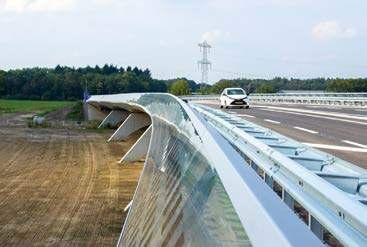
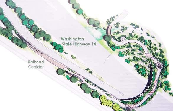
The Vancouver Land Bridge in Washington is a 40-foot-wide, earth-covered pedestrian bridge that reconnects the Columbia River waterfront with Fort Vancouver, restoring a historical and ecological link severed by Highway 14. The bridge features na琀椀ve plants, interpre琀椀ve elements, and a curving pathway that honors the area's Indigenous heritage, par琀椀cularly the Chinook people. As part of the Con昀氀uence Project, it integrates cultural storytelling with ecological restora琀椀on, providing a scenic and educa琀椀onal experience while fostering a deeper connec琀椀on between people, history, and nature.
Designer(s): Jones & Jones Architecture, Maya Lin Studio
Year Completed: 2008
Size: 190 昀琀. span
Infrastructure Type: Bridge
Scale: Small
Cost: $12.25 million
Protagonists:
Design Strategies:
� Cultural and historical integra琀椀on
Incorporates Indigenous history and storytelling into its design, honors cultural heritage and place.
� Restoring ecological & human connec琀椀ons
Establishes an important link, highligh琀椀ng how infrastructure can be reimagined to reconnect landscapes and communi琀椀es.
� Use of na琀椀ve landscaping
Emphasizes na琀椀ve plan琀椀ngs that re昀氀ect the region’s natural ecology.
� Curvilinear and experien琀椀al design
Form creates an immersive, 昀氀owing experience for pedestrians.


Descrip琀椀on:
An urban interven琀椀on in Bangkok that transforms underu琀椀lized public space into a vibrant, green oasis. Designed to promote biodiversity, environmental awareness, and community engagement, the project features modular, plant-昀椀lled structures that create an immersive natural environment in the heart of the city. By integra琀椀ng green infrastructure with playful, interac琀椀ve elements, HOP Park serves as both an educa琀椀onal and recrea琀椀onal space, encouraging visitors to reconnect with nature in an urban se琀�ng.
Designer(s): Shma Company Limited
Year Completed: 2024
Size: 28,000 sq. 昀琀.
Infrastructure Type: Bridge
Scale: Small
Cost: $8.8 million
Protagonists:
Design Strategies:
� Adaptable green spaces
Can be easily created with minimal altera琀椀ons to the exis琀椀ng, allowing for easy reloca琀椀on and adapta琀椀on in urban se琀�ngs
� Thema琀椀c zoning for mul琀椀func琀椀onality
Dis琀椀nct zones each serving unique ecological and social func琀椀ons.
� Enhancement of urban life quality
Provides areas for relaxa琀椀on, social interac琀椀on, and environmental educa琀椀on.
� Climate resilience and sustainability
Incorporates sustainable prac琀椀ces such as water management, biodiversity support, and urban cooling.


Descrip琀椀on:
The NC 12 Living Shoreline and Resiliency Project is a strategic e昀昀ort to mi琀椀gate 昀氀ooding, protect infrastructure, and enhance coastal resilience along a vulnerable stretch of NC 12 adjacent to the Currituck Sound. The project elevates approximately 1,500 feet of roadway to reduce chronic 昀氀ooding while integra琀椀ng nature-based solu琀椀ons such as marsh restora琀椀on and near-shore sills to dissipate wave energy and stabilize the shoreline. A stormwater management system improves water quality by 昀椀ltering runo昀昀, while expanded pedestrian and bicycle pathways promote safer, more sustainable mobility.
Designer(s): Vanasse Hangen Brustlin, Inc. (VHB)
Year Completed: 2024
Size: 1,375 linear 昀琀
Infrastructure Type: Road
Scale: Medium
Cost: $1.85 million
Protagonists:
Design Strategies:
� Nature-based coastal protec琀椀on
Integrates living shorelines with na琀椀ve marsh plan琀椀ngs and oyster reefs to mi琀椀gate erosion and storm impacts.
� Resilient infrastructure design
Elevated sec琀椀ons and improved drainage, adap琀椀ng transporta琀椀on networks to rising sea levels and extreme weather condi琀椀ons.
� Blending ecology with engineering
Combina琀椀on of hard infrastructure and so昀琀 shoreline restora琀椀on demonstrates a balanced approach to resilience.
� Community-centered adapta琀椀on
Protects both roadway and the surrounding environment, enhancing safety, access, and health for the coastal community.


Descrip琀椀on:
The project reimagines the edges of highways as dynamic ecological zones that restore habitat, manage stormwater, and reconnect fragmented landscapes. By transforming roadside infrastructure into produc琀椀ve ecotones, the design integrates na琀椀ve vegeta琀椀on, soil remedia琀椀on techniques, and wildlife corridors to enhance biodiversity and ecological resilience. The project demonstrates how access roads— typically overlooked spaces—can serve as vital ecological infrastructure, bridging the gap between transporta琀椀on networks and natural systems while improving environmental health.
Designer(s): MKSK
Year Completed: 2017
Size: 1.5 miles
Infrastructure Type: Stormwater
Scale: Medium
Cost:
Protagonists:
Design Strategies:
� Rewilding infrastructure
Transforms access roads into ecological corridors using na琀椀ve plan琀椀ngs, improving insect pollinator habitat.
� Ecotone as design framework
Uses the transi琀椀onal nature of ecotones to create layered, mul琀椀func琀椀onal landscapes.
� Shared-use, mul琀椀-func琀椀oning trail
Incorporates pedestrian, bicycle, ecological, stormwater, and transporta琀椀on infrastructure into a design they can co-exsist.
� Comprehensive stormwater management
Implements linear Low Impact Development (LID) tree planters and large reten琀椀on basins to address stormwater management.


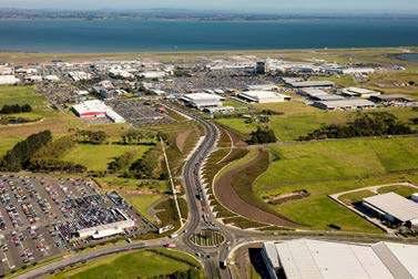
Descrip琀椀on:
The First Flight project at Auckland Interna琀椀onal Airport, designed by Surfacedesign, Inc., serves as a striking gateway that re昀氀ects New Zealand’s unique landscape and cultural heritage. Located along George Bolt Memorial Drive, the project integrates na琀椀ve plan琀椀ngs, sculptural elements, and though琀昀ul placemaking to create a welcoming arrival experience. By showcasing the country’s natural beauty and iden琀椀ty, First Flight enhances the airport’s sense of place, o昀昀ering travelers a meaningful connec琀椀on to Auckland and its surrounding environment.
Designer(s): Surfacedesign
Year Completed: 2014
Size: 6 sq. miles
Infrastructure Type: Stormwater
Scale: Medium
Cost:
Protagonists:
Design Strategies:
� Cultural and ecological iden琀椀ty
Integrates na琀椀ve plan琀椀ngs and sculptural elements to re昀氀ect natural landscapes and cultural heritage of place.
� Memorable arrival experience
Visually striking and immersive environment along a key corridor, shaping impressions and enhancing traveler experience.
� Seamless integra琀椀on with infrastructure
Blends landscape and urban design along a major route, incorpora琀椀ng ecological and aesthe琀椀cs without disrup琀椀on.
� Sustainable and context-sensi琀椀ve design
Na琀椀ve plan琀椀ngs ensures long-term resilience, reducing maintenance needs while celebra琀椀ng the local ecosystems.
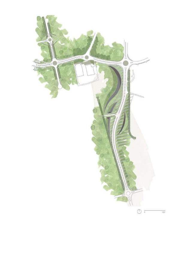


Image credit: Sky Island Alliance.
Descrip琀椀on:
This project is a conserva琀椀on ini琀椀a琀椀ve aimed at restoring decommissioned roads within the Coronado Na琀椀onal Forest to support wildlife and habitat recovery. By removing or rehabilita琀椀ng old, unused roads, the project helps reduce erosion, reconnect fragmented ecosystems, and improve water quality. Na琀椀ve vegeta琀椀on is replanted, and natural drainage pa琀琀erns are restored to enhance biodiversity and resilience. This e昀昀ort highlights the importance of rewilding infrastructure, transforming degraded roads into thriving landscapes that be琀琀er support the region’s wildlife and ecological balance.
Designer(s): Sky Island Alliance (SIA)
Year Completed: 2023
Size: 160 miles
Infrastructure Type: Road
Scale: Medium
Cost:
Protagonists:
Design Strategies:
� Restoring ecological connec琀椀vity
Helps reconnect fragmented habitats, allowing wildlife to move freely and restoring natural migra琀椀on corridors.
� Erosion control and watershed health
Reintroducing na琀椀ve vegeta琀椀on reduces soil erosion, improves water in昀椀ltra琀椀on, and restores natural hydrological cycles.
� Revegeta琀椀on with na琀椀ve plants
Reintroducing site-speci昀椀c na琀椀ve plant species enhances biodiversity, stabilizes soils, and supports local wildlife.
� Transforming infrastructure into habitat
Demonstrates how infrastructure can be rewilded, repurposed, and integrated into the natural environment for long-term health.


Image credit: Landezine.
Descrip琀椀on:
Ballerup Boulevard is a transforma琀椀ve urban design project in Denmark that reimagines a once car-dominated thoroughfare into a dynamic, pedestrian-friendly landscape. By integra琀椀ng green corridors, cycling paths, and public spaces, the design so昀琀ens the hard infrastructure of the boulevard, making it more accessible and invi琀椀ng. The project priori琀椀zes biodiversity and seasonal plan琀椀ngs, enhancing ecological value while crea琀椀ng a more vibrant and human-scaled environment. Ballerup Boulevard exempli昀椀es how infrastructure can be rede昀椀ned to support sustainability, mobility, and social interac琀椀on in urban se琀�ngs.
Designer(s): Marianne Levinsen Landskab
Year Completed: 2018
Size: 13,000 sq. 昀琀.
Infrastructure Type: Road
Scale: Small
Cost: $76 €/m²
Protagonists:
Design Strategies:
� Transforming highways into human-centered spaces
Integrates green bu昀昀ers, wildlife crossings, and water management systems.
� Urban green infrastructure
Uses trees, plan琀椀ngs, and green bu昀昀ers to so昀琀en the hard edges, improve air quality, and enhance aesthe琀椀c and ecological value.
� Dynamic and 昀氀exible public space
Incorporates open spaces that serve mul琀椀ple func琀椀ons, from social gathering spots to recrea琀椀onal areas.
� Visual and spa琀椀al iden琀椀ty
Creates a sense of place through though琀昀ul plan琀椀ng design, sculptural landforms, and rhythmic arrangement of elements.


Descrip琀椀on:
This is a project that transforms former highway infrastructure into a vibrant public park. Built over the Presidio Parkway tunnels, the design reconnects the Presidio’s historic core with the city’s waterfront, Crissy Field and Marsh, restoring ecological con琀椀nuity and enhancing public access to nature. Featuring meadows, scenic overlooks, and play areas inspired by the local landscape, the park fosters a deeper connec琀椀on between people and the environment. By blending urban design with ecological restora琀椀on, it exempli昀椀es how infrastructure can be reimagined to create inclusive and sustainable public spaces.
Designer(s): James Corner Field Opera琀椀ons
Year Completed: 2022
Size: 14 acres
Infrastructure Type: Bridge
Scale: Large
Cost: $118 million
Protagonists:
Design Strategies:
� Reconnec琀椀ng fragmented landscapes
Transforms a former highway barrier into a seamless green space, bridging Presidio’s historic core and the waterfront.
� Ecological restora琀椀on and na琀椀ve plan琀椀ng
Priori琀椀zes na琀椀ve plant communi琀椀es adapted to the coastal climate, suppor琀椀ng local biodiversity, crea琀椀ng resilient landscape.
� Mul琀椀-func琀椀onal public spaces
Integrates overlooks, play areas, picnic spaces, and walking trails, that encourage interac琀椀on with nature.
� Blending natural and cultural narra琀椀ves
Re昀氀ects the layered history, incorpora琀椀ng materials, forms, and plan琀椀ngs that honor the site’s Indigenous and military past.


(Transporta琀椀on) Autonomous
(Socio - Cultural) Pedestrian
The precedent analysis in this chapter highlights an essen琀椀al shi昀琀 in infrastructure design— one that moves beyond technical solu琀椀ons toward a more profound cultural, ecological, and systemic transforma琀椀on. These na琀椀onal and interna琀椀onal case studies provide inspira琀椀on and strategy for reimagining Hawaiʻi’s highways not as barriers, but as bridges: spaces of healing, reconnec琀椀on, and regenera琀椀ve design.
Across diverse geographies and project types, each precedent demonstrates how highways can evolve into pla琀昀orms for coexistence between people, ecosystems, and climateadap琀椀ve futures. Rather than designing only for e昀케ciency and mobility, these interven琀椀ons emphasize equity, ecological integra琀椀on, and long-term resilience—principles that lie at the heart of this capstone.
Spa琀椀al Typologies Reveal Opportuni琀椀es for Layered Interven琀椀ons
(Biological) Flora + Fauna
The spa琀椀al categoriza琀椀on of precedents—under, over, parallel, and through—provides a valuable framework for understanding how our ci琀椀es can implement rewilding strategies at di昀昀erent scales and 琀椀meframes. These spa琀椀al moves are not just physical—they represent shi昀琀s in values, priori琀椀es, and protagonists.
• "Under" and "over" interven琀椀ons demonstrate the near-term poten琀椀al to restore ecological and cultural con琀椀nuity across severed landscapes.
• "Parallel" strategies show how highway edges can become produc琀椀ve ecotones—linear systems suppor琀椀ng infrastructure and ecology.
• "Through" projects represent bold, long-term visions where the highway is reimagined or removed altogether, transforming dominant corridors into democra琀椀c
(Environmental) Natural Elements
public landscapes.
These typologies also o昀昀er a toolkit for tailoring design interven琀椀ons to Hawaiʻi’s unique condi琀椀ons—rural maukato-makai corridors, suburban watersheds, and dense urban areas alike.
Rebalancing the Protagonists: Designing for More Than the Car
A de昀椀ning insight from this study is the urgent need to re-level the playing 昀椀eld for who and what highways serve. Historically, highways in Hawaiʻi have priori琀椀zed cars as the primary protagonists, o昀琀en at the expense of ecological integrity, cultural access, and community well-being. The precedents explored here ac琀椀vely challenge that model—centering people, 昀氀ora, fauna, and natural systems as equal or primary actors in the design process.
This capstone proposes a future in which highways are no longer singular corridors for private vehicles, but mul琀椀func琀椀onal
landscapes that support:
• Autonomous and mul琀椀modal transporta琀椀on, including shu琀琀les, buses, bikes, and future mobility op琀椀ons
• Pedestrian access, emphasizing safety, walkability, and cultural storytelling along pathways
• Flora and fauna, through habitat restora琀椀on, species crossings, and seasonal connec琀椀vity
• Natural elements such as water, wind, and soil cycles, which are allowed to shape and move through infrastructure rather than be constrained by it
Rewilding Hawai'i's highways is not about replacing one system with another but restoring balance. Instead of envisioning a future that eliminates cars, it explores the concept of decentering them, allowing highways to evolve into shared spaces that serve a broader ecology of life.
Yields Regenera琀椀ve Poten琀椀al
The project evaluated each precedent using the six principles of this capstone’s design framework: Ecology, Hydrology, Context, Culture, Climate, and Mul琀椀modal. The most impac琀昀ul projects demonstrated alignment across mul琀椀ple principles—fostering synergies between cultural restora琀椀on, ecological health,
climate resilience, and humancentered design.
This systems-based approach is par琀椀cularly relevant in Hawaiʻi, where land and sea are in琀椀mately connected, and where any interven琀椀on must respect both the environment and the deep cultural knowledge systems of place. Projects such as Vancouver Land Bridge, Road Rewilding, and Miaojing River exemplify this integrated thinking, providing models that this capstone draws from and builds upon.
The precedents in this chapter help pave the way for a new vision of infrastructure in Hawaiʻi—one that sees highways as corridors of coexistence, not dominance. This vision calls for:
• Shi昀琀ing from single-use to mul琀椀func琀椀onal corridors
• Centering equity and ecological integrity over speed and throughput
• Designing for many protagonists, not just cars
• Trea琀椀ng highways as part of a living ahupuaʻa system— where 昀氀ows of water, people, animals, knowledge, and culture are all honored and reconnected.
Ul琀椀mately, the capstone proposes that to reimagine Hawaiʻi’s highways, rebalancing rela琀椀onships are required—
between people and place, between built and natural systems, and between past and future. The precedents studied here provide a diverse and compelling founda琀椀on for that journey, o昀昀ering tangible proof that transforma琀椀on is possible and already underway.
To reimagine Hawai‘i’s highways as regenera琀椀ve landscapes, it is essen琀椀al to understand their role across nested ecological and cultural systems. This chapter presents a mul琀椀scalar site analysis beginning at the state scale and narrowing down to Heʻeia Ahupuaʻa on Oʻahu, with focused site studies along Kamehameha and Kahekili Highways and the Heʻeia Bridge.
Framing this analysis is the tradi琀椀onal Hawaiian land division system: each mokupuni (island) was divided into moku (districts), subdivided into ahupua‘a (watershed-based land sec琀椀ons), and further split into ʻili (smaller land or func琀椀onal parcels). These divisions re昀氀ect an Indigenous land ethic grounded in the stewardship of interconnected ecosystems from mauka to makai—mountain to sea. Today’s highways o昀琀en run perpendicular to this logic, fragmen琀椀ng the rela琀椀onships between uplands, lowlands, and nearshore waters. By integra琀椀ng these tradi琀椀onal spa琀椀al frameworks into modern site analysis, we can begin to reveal where and how Hawai‘i’s highway systems might be rewilded to repair ecological con琀椀nuity and cultural iden琀椀ty.
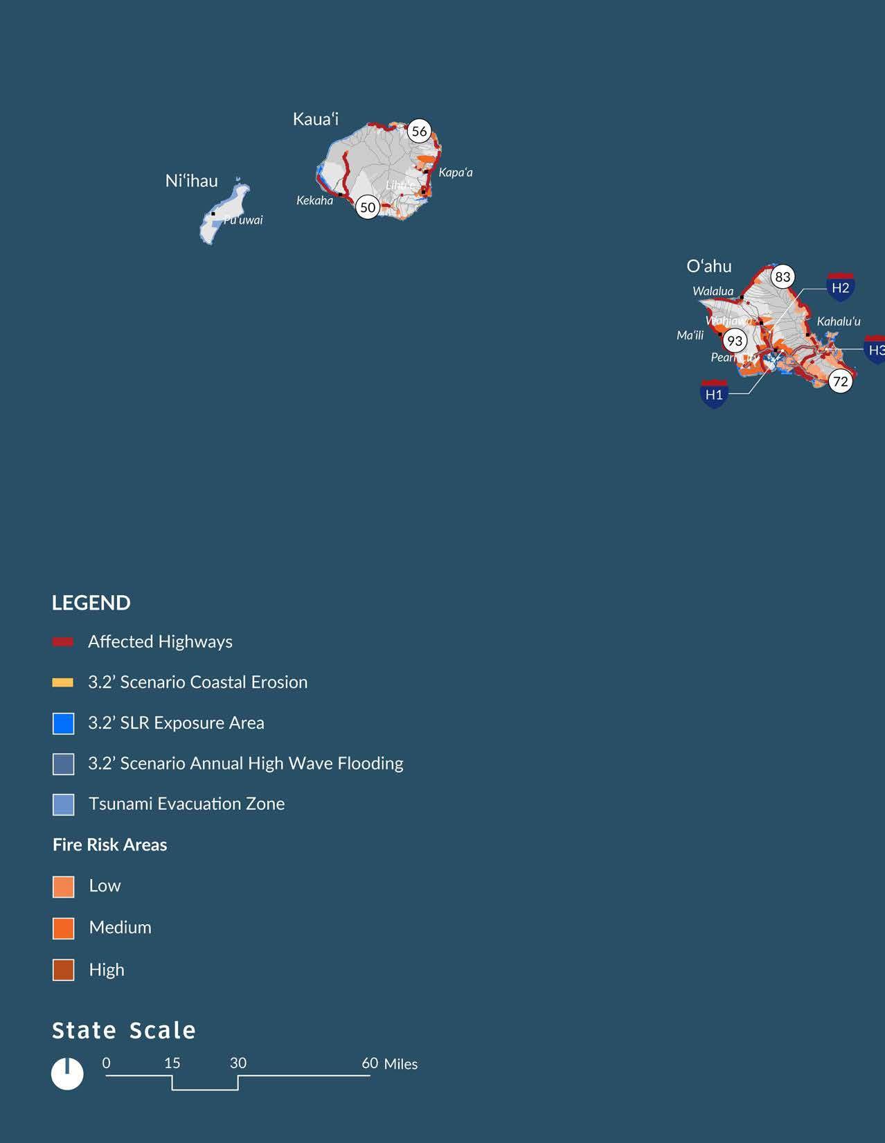
State Scale: Hawai‘i’s Highway System and Landscape
Disrup琀椀on
At the state level, Hawai‘i’s transporta琀椀on network spans approximately 9,803 lane miles,
intersec琀椀ng with every major land type: 48% conserva琀椀on, 47% agriculture, and 5% urban, with less than 1% rural land remaining. Highways are not neutral—they shape land use pa琀琀erns, catalyze development, and expose both people and ecosystems to climate vulnerabili琀椀es. Across the islands, 17–18% of highways are at risk from tsunamis, landslides, and lava 昀氀ows, while others face threats from sea level rise, coastal erosion, and storm surge.
These exposures are par琀椀cularly acute on Oʻahu, which contains the most highway mileage, the highest popula琀椀on, and the largest share of cri琀椀cal risk areas. The island has also experienced severe na琀椀ve habitat loss— from 14% pre-contact to 83% loss today—largely due to development along major corridors.
Island and Ahupua‘a Scale: Koʻolaupoko and Heʻeia Zooming in to the moku of Koʻolaupoko on O‘ahu’s windward coast, the ahupuaʻa of Heʻeia o昀昀ers a compelling context for site-speci昀椀c inquiry. De昀椀ned by natural watershed boundaries, Heʻeia encompasses upland forests, midland loʻi kalo systems, lowland wetlands, and nearshore 昀椀sheries. Historically, this ahupuaʻa was a model of biocultural produc琀椀vity, integra琀椀ng ecological func琀椀on with cultural prac琀椀ce. Today, it is also a site of ongoing
community-led restora琀椀on, including e昀昀orts by Kākoʻo ʻŌiwi and Paepae o Heʻeia to revitalize tradi琀椀onal agriculture, wetlands, and the 昀椀shpond system.
However, these e昀昀orts contend with the fragmen琀椀ng e昀昀ects of highway infrastructure. Kahekili Highway, Kamehameha Highway, and the Heʻeia Bridge cut across the ahupuaʻa at key hydrological and cultural nodes. They alter stream昀氀ows, constrain ecological restora琀椀on, and sever the historical 昀氀ow from mauka to makai.


Hawai‘i's current transportation system has a total of approximately 9,803 lane miles.
- HDOT Climate Adapta琀椀on Ac琀椀on Plan


There is approx. 4,112,388 acres of land in the State of Hawai'i.
• Conservation - 48%
• Agriculture - 47%
• Urban - 5%
• Rural - less than 1/2%
- State of Hawaiʻi O昀케ce of Planning and Sustainable Development
• Rockfall and Landslide - 17%
• Sea level Rise - 1%
• Annual high wave flooding - 2%
• Coastal erosion - 2%
• Storm surge - 8%
• Tsunami - 18%
• Wildfire 14%
• Lava flow - 16%

HDOT Climate Adapta琀椀on Ac琀椀on Plan


• Most amount of highway mileage
• Highest amount of exposure area
• Highest population
• Largest percentage of risk


• Prior to Western contact, the Hawaiian footprint resulted in 14% native habitat loss.
- Gon, Samuel, Stephanie Tom, and Ulalia Woodside. “ʻĀina Momona, Honua Au Loli—Produc琀椀ve Lands, Changing World: Using the Hawaiian Footprint to Inform Biocultural Restora琀椀on and Future Sustainability in Hawai‘i.” Sustainability 10, no. 10 (September 25, 2018): 3420. h琀琀ps:// doi.org/10.3390/su10103420.


• The modern Hawaiian footprint resulted in 83% native habitat loss.
- Gon, Samuel, Stephanie Tom, and Ulalia Woodside. “ʻĀina Momona, Honua Au Loli—Produc琀椀ve Lands, Changing World: Using the Hawaiian Footprint to Inform Biocultural Restora琀椀on and Future Sustainability in Hawai‘i.” Sustainability 10, no. 10 (September 25, 2018): 3420. h琀琀ps:// doi.org/10.3390/su10103420.


The Moku of Koʻolaupoko was once one of Oʻahu’s most produc琀椀ve districts, sustained by abundant freshwater and intricate systems of loʻi kalo, ʻauwai, and loko iʻa that supported large Na琀椀ve Hawaiian communi琀椀es. Tradi琀椀onal moʻolelo 琀椀ed to this landscape emphasize deep ancestral 琀椀es, kuleana (responsibility), and the interdependence of land and sea. Though heavily altered by colonial impacts, urbaniza琀椀on, and infrastructure, Koʻolaupoko remains a place of cultural and ecological signi昀椀cance, where restora琀椀on e昀昀orts ac琀椀vely revive tradi琀椀onal prac琀椀ces and restore landscape health.
Within this moku, Heʻeia Ahupuaʻa, meaning “washed away,” has been shaped by its streams, wetlands, and shoreline. Historically central to food produc琀椀on, it was later converted into rice paddies and eventually into suburban land. Today, it stands as a model of community-led restora琀椀on, where groups like Kākoʻo ʻŌiwi and Paepae o Heʻeia are revitalizing loʻi, wetlands, and the historic 昀椀shpond to reconnect people with place, culture, and ancestral knowledge.


Before 1778
Pre-Western Contact
1848
1810 Kamehameha
uni昀椀ed the Hawaiian Islands


was


in
1870's In昀氀ux of Chinese immigrants, started rice


1920's Back to taro, decline in rice produc琀椀on
1930's World War II brought US military presence
1950 Kaneohe transi琀椀oned into a suburban community


1960's Wetlands were used for pasture, grazing, livestock
1991 Land exchange betwee HCDA and Estate of Bernice Pauahi Bishop
2010-2011 Kako'o Oiwi and HCDA entered a 38-year lease, worked on restoring wetlands


1921 He'eia Bridge constructed
1890 Cul琀椀va琀椀on of pineapple in He'eia
Railroad installed in He'eia
was built
1982 Windward Mall constructed


2001 Paepae o He'eia established, restora琀椀on e昀昀orts of the 昀椀shpond


He‘eia is a storied ahupua‘a on the windward coast of Oʻahu, rich in cultural and ecological signi昀椀cance. This wahi pana map highlights sacred sites, historical landmarks, and natural features that embody the deep ancestral knowledge and stewardship of the land, from the uplands (mauka) of Koʻolau to the shores (makai) of Kāneʻohe Bay. It re昀氀ects the interconnectedness of people, place, and tradi琀椀on that de昀椀nes He‘eia’s enduring legacy.


The moku system of He‘eia Ahupua‘a re昀氀ects a tradi琀椀onal Hawaiian land division rooted in ecological and cultural intelligence, organizing the landscape into interconnected social-ecological zones from mauka (mountain) to makai (sea). Each zone represents an ecotone, where natural systems and human prac琀椀ces overlap and interact.


He‘eia is primarily a combina琀椀on of suburban and rural characteris琀椀cs, with elements of urban development at its edges. The region features residen琀椀al neighborhoods, small commercial areas, and urban infrastructure in parts of Kāneʻohe, which borders He‘eia. However, much of He‘eia retains a rural and semi-rural character, par琀椀cularly in its agricultural zones, wetlands, and coastal areas.


• Rich cultural and ecological history.
• Community-led conserva琀椀on and restora琀椀on.
• Diverse ecosystem.
• Government and ins琀椀tu琀椀onal support

• Land fragmenta琀椀on from highway
• Urban development pressure
• Water quality issues


• Highway green infrastructure
• Restoring mauka to makai 昀氀ow
• Partnerships with local organiza琀椀ons for rewilding e昀昀orts.
• Resilient infrastructure adapta琀椀ons


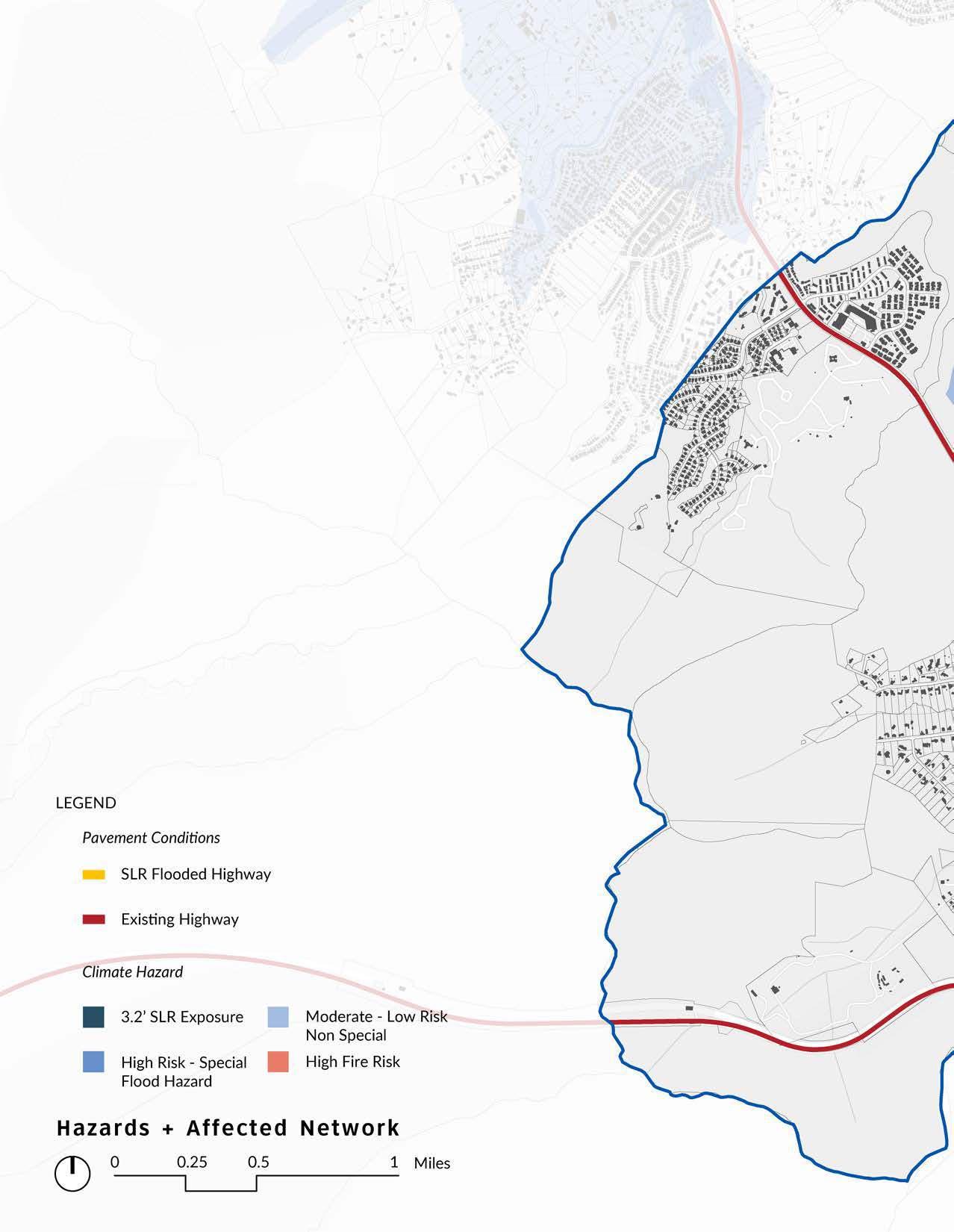
• Climate change impacts
• State and federal transporta琀椀on policies
• Community opposi琀椀on or misinforma琀椀on


Located near the 昀椀shpond, this site reveals the impact of bridge infrastructure on stream hydrology and invasive species spread, as well as ac琀椀ve restora琀椀on zones where mangroves are being removed and loʻi are returning.


Heʻeia, on Oʻahu’s windward side, is home to the 600-yearold Heʻeia Fishpond, restored by Paepae o Heʻeia through tradi琀椀onal methods. Nearby, Kākoʻo ʻŌiwi revitalizes wetlands and loʻi kalo, restoring agriculture and watershed health. These e昀昀orts reconnect mauka and makai, preserving Heʻeia’s cultural and ecological legacy.

1922
Heʻeia bridge recently constructed. The image shows a por琀椀on of Heʻeia meadowlands, before the spread of mangrove.

2018
The mangrove has fully taken over into a forest, restric琀椀ng the water 昀氀ow from the streams.

1930
A昀琀er the decline produc琀椀on,

2020
Paepae o Heʻeia restore the streams.


1977
decline in rice produc琀椀on, kalo made a return in produc琀椀on, 昀椀lling the area with expansive loʻi patches.

Heʻeia started clearing the mangrove forest to 昀椀shpond wall and natural water昀氀ows of the
The mangrove is seen taking over and growing on top of the 昀椀shpond wall.
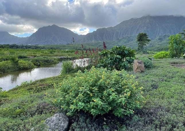
2024
Kākoʻo ʻŌiwi, Paepae o Heʻeia, NERR, and The Nature Conservancy have all done restora琀椀on work on both sides of the bridge including removing the invasive mangrove, restoring loʻi, wetlands, and 昀椀shponds.
The area consists of:
P-1: Restricted Preserva琀椀on
P-2: General Preserva琀椀on
R-5: Residen琀椀al District
AG-2: General Ag. District Country District

The heat index shows that the area around the highway ranges from 88 degrees farenheit on the wetland side, and 91 degrees on the 昀椀shpond side.


Paepae o Heʻeia is owned by Bishop Trust Estate, also known as Kamehameha Schools. HCDA owns the parcel across the highway.

There are currently no bike lanes on Kamehameha Highway in this area, however it is proposed. Kamehameha is a two lane highway, one lane in each direc琀椀on.


This stretch of highway, constructed in 1966, catalyzed suburban development. Its wide right-of-way, suburban heat gradients, and proximity to preserva琀椀on land o昀昀er opportuni琀椀es for green infrastructure retro昀椀ts and bu昀昀er rewilding.


Kahekili Highway
Kahekili Highway has shaped Heʻeia’s growth since its construc琀椀on in the 1960s, connec琀椀ng Kāneʻohe to Kahaluʻu and suppor琀椀ng residen琀椀al developments like Haiku Planta琀椀ons and Crown Terrace. As suburban expansion con琀椀nued through the 1970s, infrastructure projects—including archaeological surveys, highway widening, and the comple琀椀on of H-3 in 1997—transformed the area’s transporta琀椀on and landscape.

1966
Kahekili Highway is opened, establishing a vital connec琀椀on between Kāneʻohe and Kahaluʻu. This two-lane roadway was built with a 120-foot-wide right-of-way, an琀椀cipa琀椀ng future expansions.
1990
A Final Environmental Impact Statement (FEIS) detailed plans for widening Kahekili Highway and construc琀椀ng interchanges to improve safety and tra昀케c 昀氀ow.

Mid 1960's
Around the Haiku Planta琀椀ons with realigned

1997
The opening Windward Oʻahu on Kahekili

1960's
same 琀椀me, the Bishop Estate developed the Planta琀椀ons subdivision, a private gated community realigned easements and privately maintained roads.

Crown Terrace, a residen琀椀al subdivision between Kahekili and Kamehameha Highways, was developed with singlefamily ranch-style homes, con琀椀nuing suburban growth.

Wednesday, September 2nd , 2015 ʻĀhuimanu Elementary School

opening of H-3 provided a direct link between Oʻahu and Honolulu, impac琀椀ng tra昀케c pa琀琀erns Highway.
A public workshop gathered input from residents and stakeholders on enhancing safety and tra昀케c 昀氀ow along Kahekili Highway.
The area consists of:
P-1: Restricted Preserva琀椀on
P-2: General Preserva琀椀on'
R-5: Residen琀椀al District
R-7.5: Residen琀椀al District Country District

The heat index shows varying temperatures in the area ranging from cooler 88 degrees fahrenheit to 95 degrees in the more devloped areas.


Majority of the adjacent lands are privately owned, along with Bishop Trust Estate owning the undeveloped land nearby.

There are currently no bike lanes on Kahekili Highway in this area, however it is proposed. Kahekili is a three lane highway, one lane in one direc琀椀on, two lanes in the opposite.


Kahekili Highway


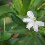


INVASIVES


As a six-lane urban corridor, this site presents the most intense example of landscape modi昀椀ca琀椀on. Stream channeliza琀椀on, commercial development, and heat islands dominate—but pockets of public infrastructure and restora琀椀on zones present openings for ecological and cultural interven琀椀ons.


Kamehameha Highway has served as a key route for Heʻeia and Oʻahu since the 1930s, promo琀椀ng residen琀椀al and commercial growth. The Kāneʻohe Bay Shopping Center opened in 1973, followed by Windward Mall in 1982, establishing the area as a commercial hub. Notable developments include the channeliza琀椀on of Heʻeia Stream in the 1960s and restora琀椀on e昀昀orts beginning in 2003, which aimed to mi琀椀gate 昀氀ooding and enhance the ecosystem. The highway adapted to tra昀케c changes with the comple琀椀on of H-3 in 1997, while community ini琀椀a琀椀ves reinforced Windward Mall’s role as a gathering space, re昀氀ec琀椀ng the area’s dynamic history of infrastructure and environmental stewardship.

To mi琀椀gate 昀氀ooding risks in the Heʻeia area, many of the streams were channelized. This aimed to protect residen琀椀al and commercial developments from waterrelated damages.
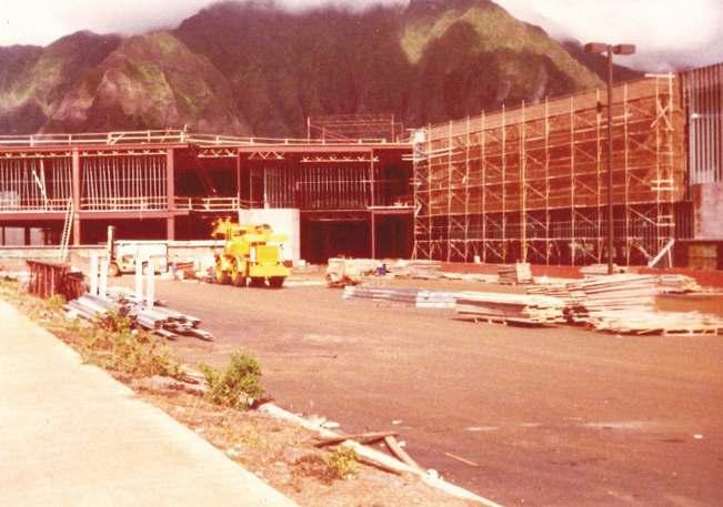
Windward Mall opened its doors in 1982. The 530,000-square-foot enclosed shopping center featured anchor stores such as Liberty House (later Macy’s) and Sears, becoming a central retail hub for the Windward side.

Pre-1980's
Prior to the intersec琀椀on remained

2006
A $23 million enhancing

the construc琀椀on of Windward Mall, the intersec琀椀on of Haʻikū Road and Kamehameha Highway largely undeveloped.


The Kāneʻohe Bay Shopping Center was established in, providing a variety of retail op琀椀ons to the local community and contribu琀椀ng to the commercial growth along the highway.

million renova琀椀on aimed to honor Kāneʻohe’s past, the mall’s design and community appeal.
The mall celebrated 40 years of serving the Heʻeia community, re昀氀ec琀椀ng on its historical signi昀椀cance and ongoing role as a gathering place.
The area consists of:
B-2: Community Business District
P-2: General Preserva琀椀on
A-2: Medium-density Apartment District
R-5: Residen琀椀al District
R-7.5: Residen琀椀al District
I-2: Intensive Industrial District

The heat index shows varying temperatures in the area ranging from cooler 91 degrees fahrenheit to 99 degrees in the more developed areas.


Majority of the adjacent lands are owned by Bishop Trust Estate, privately owned, or city owned.

There is currently one bike route on Kamehameha Highway and one bike lane that intersects it. Kamehameha is a six lane highway, three lanes in one direc琀椀on, three lanes in the opposite.


Kamehameha Highway


WINDWARD MALLKAMEHAMEHA


Located near the 昀椀shpond, this site shows how eleva琀椀ng infrastructure can restore stream 昀氀ow, reduce invasive spread, and support loʻi revival.
Built in 1966, this highway growth but now o昀昀ers a chance ridge forests through green restored ecological
and reconnect highway bridge spurred suburban chance to reconnect mauka green infrastructure and ecological bu昀昀ers.
This six-lane urban corridor shows extreme landscape modi昀椀ca琀椀on, but channelized streams and heat islands o昀昀er opportuni琀椀es to daylight water and rewild through public and agricultural spaces.
The site analysis of Heʻeia Ahupua‘a highlights the deep impacts of Hawai‘i’s highway system on ecological and cultural con琀椀nuity. At the state and island scales, highways fragment landscapes, disrupt hydrology, and intensify climate risks—par琀椀cularly on O‘ahu, where development pressure is greatest. In Koʻolaupoko, and speci昀椀cally in Heʻeia, these e昀昀ects are visible across rural, suburban, and urban condi琀椀ons.
Yet Heʻeia also o昀昀ers a model for reimagining infrastructure. With its strong communityled restora琀椀on e昀昀orts and rich biocultural heritage, it shows how highways can be transformed from barriers into bridges that support maukato-makai 昀氀ow, biodiversity, and cultural renewal. This chapter provides a founda琀椀on for design strategies that respond to both the challenges and the poten琀椀al of rewilding Hawai‘i’s roads.


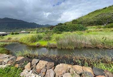


Applying the principles

mauka and makai systems?
How can historic and current social-ecological zones + ecotones inform design?
barriers?
Design for resiliency
This capstone reimagines Hawai‘i’s highways as living corridors that reconnect ecological systems, cultural prac琀椀ces, and communi琀椀es. At the heart of this vision is the tradi琀椀onal ahupuaʻa system—a land division stretching from the mountains (mauka) to the sea (makai), suppor琀椀ng interconnected water, food, culture, and stewardship systems.
Modern highways disrupted this con琀椀nuity. Built for speed and expansion, they fragmented ecosystems, reduced access to cultural resources, and deepened community disconnec琀椀on. This project proposes a shi昀琀—from roads as barriers to roads as bridges—restoring the 昀氀ows of water, species, and people that once de昀椀ned a place.
Principles of Resilience
Designing for resilience in Hawai‘i means more than ecological func琀椀on—it includes cultural revitaliza琀椀on and community well-being. This approach is rooted in four interrelated strategies:
Reconnec琀椀on – Repairing mauka-to-makai 昀氀ows of water, people, and species.
Regenera琀椀on – Restoring habitat and suppor琀椀ng na琀椀ve ecosystems through plan琀椀ng, wetlands, and stormwater infrastructure.
Reclama琀椀on – Transforming car-dominated spaces into produc琀椀ve, usable land for community, food, and gathering.
Resonance – Embedding cultural stories and prac琀椀ces into the built environment.
These strategies respond to three guiding ques琀椀ons:
How can design restore maukamakai systems?
How can social-ecological zones guide interven琀椀on?
How can design overcome cultural and ecological disconnec琀椀on?
Place-Based Redesigns
Three sites—Heʻeia Bridge, Kahekili Highway, and Kamehameha Highway—serve as loca琀椀ons for design interven琀椀on. These sites were selected for their poten琀椀al to restore ecological func琀椀on and cultural relevance across rural, suburban, and urban contexts.
Heʻeia Bridge reimagines a wetland crossing that supports water 昀氀ow, habitat, and community use.
Kahekili Highway proposes reconnec琀椀ng ridge ecosystems through mul琀椀modal access and ecological restora琀椀on.
Kamehameha Highway transforms a car-centric urban
corridor into a produc琀椀ve and cultural landscape.
These are not abstract studies, but real, place-based proposals rooted in the needs of people, 昀氀ora, fauna, and natural systems.
Toward Living Infrastructure
Rather than sta琀椀c, car昀椀rst structures, Hawai‘i’s highways can become living infrastructure—systems that adapt, heal, and support life. Green corridors can reduce runo昀昀, restore biodiversity, and invite cultural prac琀椀ces into public space. Highways can support resilience by working with the land, not against it.
This design approach envisions a future where infrastructure supports connec琀椀on, not separa琀椀on, and where aloha ʻāina values shape how we move, build, and live.

The tradi琀椀onal Hawaiian land-use system, known as the ahupuaʻa, embodied a sustainable rela琀椀onship between the mountains (mauka) and the ocean (makai), promo琀椀ng interconnectedness between ecological and human systems, pu琀�ng people, 昀氀ora, fauna, and natural elements at the forefront. Each ahupuaʻa was typically a wedgeshaped sec琀椀on of land extending from the uplands to the sea, encompassing a diverse range of ecosystems that provided for every aspect of daily life—freshwater, agriculture, 昀椀shing, and cultural prac琀椀ces. This system encouraged stewardship (kuleana) and reciprocal care (aloha ʻāina), where communi琀椀es managed natural resources with deep respect and long-term thinking.
(Socio - Cultural) People (Biological) Flora + Fauna
(Environmental) Natural Elements

As urbaniza琀椀on transformed Hawai‘i’s landscape, the construc琀椀on of highways was to connect people to places more e昀케ciently and e昀昀ec琀椀vely, introducing the reliance on cars and other modes of transporta琀椀on. This change marked a signi昀椀cant shi昀琀 from tradi琀椀onal, place-based mobility. The built environment began to re昀氀ect Western planning ideals centered on speed and growth, o昀琀en at the expense of ecological health and cultural heritage. Over 琀椀me, highways shaped development pa琀琀erns, encouraging sprawl, reducing access to natural spaces, and deepening the disconnect between communi琀椀es and their ancestral landscapes.
(Socio - Cultural) People (Biological) Flora + Fauna (Environmental) Natural Elements (Transporta琀椀on) Cars
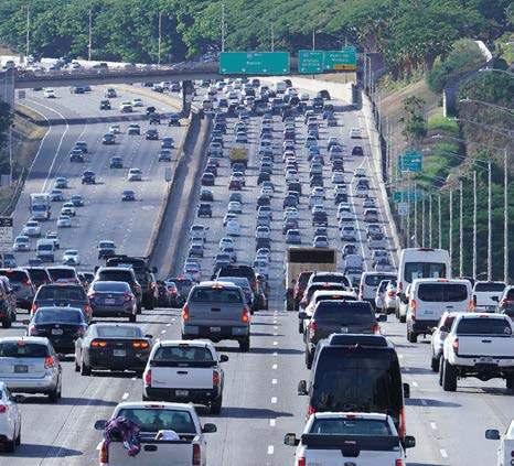
However, this resulted in bisec琀椀ng the ahupuaʻa, disrup琀椀ng natural and cultural 昀氀ows of life and resources. Met by impermeable infrastructure, were the con琀椀nuous mauka-tomakai connec琀椀ons that once supported the movement of water, na琀椀ve species, and people. Ci琀椀es and communi琀椀es became more car-centric, favoring roadways and parking over green space, pedestrian access, and ecological corridors. This neglect marginalized the needs of other protagonists, such as na琀椀ve 昀氀ora and fauna, freshwater systems, and tradi琀椀onal prac琀椀ces, by limi琀椀ng their ability to move, thrive, and interact across the landscape.
(Socio - Cultural) People (Biological) Flora + Fauna (Environmental) Natural Elements (Transporta琀椀on) Cars


He'eia Bridge
• Provide a bridge for recrea琀椀on and gathering, re昀氀ec琀椀ng the uses of the kahakai ecozone.
• Strengthen connec琀椀on of nearby organiza琀椀ons for a holis琀椀c produc琀椀on hub.
• Allow for mul琀椀modal ini琀椀a琀椀ves.
• Road pollu琀椀on mi琀椀ga琀椀on.
• Allow access for research, conserva琀椀on, and educa琀椀onal e昀昀orts.
• Celebrate natural resources.

He'eia Bridge
He'eia Bridge
He'eia Bridge
He'eia Bridge
The site currently features a few natural resources and community organiza琀椀ons.

Heʻeia Bridge - 2-lane, 2-way highway
Heʻeia Fishpond - Paepae o Heʻeia
Heʻeia Stream - Perennial, freshwater forested/shrub wetland
He'eia Bridge
Redesigning the bridge addresses issues regarding mul琀椀modal uses, climate change, and water pollu琀椀on.
Plan琀椀ng strip - Helps mi琀椀gate and filter polluted
Widen bridge
-Provide space for bikes and pedestrians
Elevate bridge
-Account for rising sea levels
He'eia Bridge
The bridge o昀昀ers the opportunity to connect the community to place through the use of gathering and providing access and habitat.
Habitat patches
- Previously loʻi patches turned to habitat to support wildlife
Making and gathering
- Bridge as gathering and recrea琀椀on space
Conserva琀椀on and restora琀椀on
- Secondary circula琀椀on to provide direct access for stewardship and research ini琀椀a琀椀ves
He'eia Bridge
The exisitng condi琀椀ons of Heʻeia Bridge consists of mul琀椀ple columns that interrupt the wetland below, contribu琀椀ng to heat and pollutants to the waterways that 昀氀ow into the 昀椀shpond nearby.
Invasive species

Disrupted habitat No right-of-way pedestrians

for bicylces or Polluted runo昀昀
He'eia Bridge
Near-term concepts include redesigning the bridge to facilitate more mauka-makai water 昀氀ows and rising sea levels while s琀椀ll providing cri琀椀cal access for cars, pedestrians and bicyclists.

Na琀椀ve and naturalized species Loʻi patches Bike lane

Pedestrian walkway and kipukas
He'eia Bridge

Long-term concepts include priori琀椀zing the bridge as a linear park and recrea琀椀on space for the community to gather, celebrate natural and cultural resources, while s琀椀ll providing emergency vehicle access.

Emergency vehicle access


• Allow for mul琀椀modal ini琀椀a琀椀ves.
• Road pollu琀椀on mi琀椀ga琀椀on.
• Highlight historic and cultural spaces and wahi pana.
• Allow access for research and conserva琀椀on e昀昀orts.
• Connect to nearby recrea琀椀on ac琀椀vi琀椀es.
• Celebrate natural resources.

Kahekili Highway
Kahekili Highway
Kahekili Highway
Kahekili Highway
Kahekili Highway
Kahekili Highway
The site currently features housing communi琀椀es on either side of the highway.

Heʻeia Stream -Perennial, freshwater forested/shrub wetland
Haiku Planta琀椀on - Gated community
Crown Terrace Homes - Planta琀椀on style housing
Kahekili Highway -3-lane, 2-way highway
Near-term concepts include tunneling the highway to facilitate movement across, cleaning up the streams, and implemen琀椀ng mutlimodal uses.
Clean up the stream - Remove overgrown and invasive species along the stream edge
- Reconnect the bisected ridge to allow access for conserva琀椀on of flora and fauna.
Change the func琀椀on
- Reduce the amount of car lanes to support roadside plan琀椀ng and bicycle uses.
Long-term concepts include further facilita琀椀ng connec琀椀on to larger-scale ameni琀椀es and organiza琀椀ons.
Connect to resources and amen琀椀es
- Provide access to the stream, path to connect to nearby recrea琀椀on or restora琀椀on efforts
Celebrate the past
- Provide a space for gathering and honoring a historic heiau
Reduce carbon emissions
- Bike lanes and roadside plan琀椀ngs encourages the community to ride
Kahekili Highway
The exisitng condi琀椀ons of Kahekili Highway disrupts the con琀椀nuity of the nearby ridge and forest, with invasives species lining the highway and li琀琀le to no room for bike access.
Fragmented biodiversity

No right-of-way uses
right-of-way for mul琀椀modal

Polluted runo昀昀
Invasive species
Kahekili Highway
Near-term concepts include tunneling the highway to provide access across, reducing the amount of car lanes to accomodate bioswales for runo昀昀.

Bike lane bu昀昀ered by swale

Con琀椀nuous habitat
Kahekili Highway


• Strengthen the connec琀椀on between the mall and shopping center.
• Create a gateway that symbolizes the history and culture of Heʻeia.
• Allow for mul琀椀modal ini琀椀a琀椀ves.
• Road pollu琀椀on mi琀椀ga琀椀on.
• Celebrate natural resources and facilitate tradi琀椀onal prac琀椀ces.

Kamehameha Highway
Kamehameha Highway
Kamehameha Highway
Kamehameha Highway
Kamehameha Highway runs through the urban part of Heʻeia with commercial uses on each side.

Windward Mall -Kamehameha Schools
Kaneohe Bay Shopping Center
-Alexander & Baldwin
Kamehameha Highway -5-lane, 2-way highway
Scale1í=2500í
Near-term concepts include reducing car lanes, priori琀椀zing bike, pedestrian, and ecology by u琀椀lizing unused perimeter parking.
-Create patches and pollinator gardens to encourage wildlife and biodiversity
Reduce car lanes
-Allow for bike lanes and wider pedestrian sidewalks
Reduce urban e昀昀ects
-Trees and swales help reduce urban heat island e昀昀ects and 昀椀lter roadside pollutants
Long-term concepts include dayligh琀椀ng the stream to facilitate agriculture produc琀椀on, honoring Heʻeia’s produc琀椀ve history.
Loʻi patches and agriculture plots - Repurpose parking lots for cul琀椀va琀椀ng crops for the community
Community hub
- Create a dedicated space for the community to gather, have events, and create a center for agriculture products
Daylight stream - U琀椀lize the stream to sustain agriculture and celebrate tradi琀椀onal uses of the stream
Scale1í=2500í
Kamehameha Highway
The exisitng condi琀椀ons of Kamehameha Highway are car-centric, with li琀琀le room for pedestrians, mul琀椀modal alterna琀椀ves, and lacks biodiversity.

Limited space for pedestrians Impervious
Polluted run-o昀昀
Low shade / canopyImpervious surfacesCar-centric spaces

Kamehameha Highway
Near-term concepts include complete streets applica琀椀ons that provide more shading, space for pedestrians, and accomodates bike lanes.
Urban parks to facilitate biodiversity

Planters for bioswales and street trees

Bike laneWider sidewalks for pedestrians
Kamehameha Highway
Long-term concepts include turning the large car-centric parking spaces into an agriculture park, along with plazas and urban parks to facilitate community.
Pedestrian bridge to connect from mall to community center

Public tram for community and facilitate less cars.
community to u琀椀lize less dependency on

Larger-scale agricultural plots and produc琀椀on

This capstone project has aimed to reimagine Hawaiʻi’s highways as more than just transporta琀椀on routes. It proposes a framework that integrates ecology, culture, and connec琀椀vity, transforming these infrastructure elements into dynamic, mul琀椀func琀椀onal corridors that promote resilience and enhance the rela琀椀onship between humans, wildlife, and the natural world. By crea琀椀ng space for both human and non-human movement, these highways can serve as conduits for resilience, fostering interconnected, adap琀椀ve, and restora琀椀ve ecosystems.
The speci昀椀c interven琀椀ons proposed for Heʻeia Bridge, Kahekili Highway, and Kamehameha Highway re昀氀ect careful considera琀椀on of their rural, suburban, and urban contexts and their ability to facilitate ecological processes and cultural prac琀椀ces. These interven琀椀ons are grounded in principles that emphasize sustainability, cultural con琀椀nuity, environmental restora琀椀on, and community well-being. For Heʻeia Bridge, the design emphasizes crea琀椀ng zones of transi琀椀on that respect both the physical landscape and the site’s cultural signi昀椀cance. The Kahekili Highway redesign addresses the challenge of reconnec琀椀ng fragmented ecosystems. In contrast, the redesign of Kamehameha Highway integrates wildlife habitat restora琀椀on with cultural
way昀椀nding systems, bridging rural and urban areas through shared heritage and ecological health.
This project frames highways as living landscapes that must serve diverse ecological, cultural, and social func琀椀ons. It underscores the importance of an interdisciplinary approach integra琀椀ng ecological restora琀椀on with cultural preserva琀椀on and human engagement. The strategies proposed are to serve transporta琀椀on needs and support the ongoing rela琀椀onship between people and place—a rela琀椀onship rooted in resilience, reciprocity, and sustainability. These interven琀椀ons transform highways from sta琀椀c infrastructure into ac琀椀ve components of a thriving, interconnected landscape.
As the world faces growing challenges related to climate change and environmental degrada琀椀on, this project o昀昀ers a 琀椀mely and relevant model for how infrastructure can contribute to broader ecological and social goals. Highways’ poten琀椀al to foster ecological regenera琀椀on, cultural revitaliza琀椀on, and community cohesion highlights a pathway toward more sustainable and resilient urban planning and landscape design.
In conclusion, this capstone project has presented a holis琀椀c framework for reimagining
Hawaiʻi’s highways in a way that integrates ecology, culture, and connec琀椀vity. The proposed interven琀椀ons o昀昀er a path toward a more sustainable, resilient, and culturally aware future, where highways serve as more than mere conduits for transporta琀椀on—they become bridges that reconnect people, nature, and heritage. By embracing these principles, we can transform Hawaiʻi’s highways into vital, mul琀椀func琀椀onal elements of the landscape that honor both the natural world and the rich cultural legacy of the islands, ensuring a harmonious and sustainable future for genera琀椀ons to come.
He'eia Ahupua'a

Located near the 昀椀shpond, this site shows how eleva琀椀ng infrastructure can restore stream 昀氀ow, reduce invasive spread, and support loʻi revival.


Built in 1966, this highway growth but now o昀昀ers a chance ridge forests through green restored ecological


and reconnect
highway bridge spurred suburban chance to reconnect mauka green infrastructure and ecological bu昀昀ers.
This six-lane urban corridor shows extreme landscape modi昀椀ca琀椀on, but channelized streams and heat islands o昀昀er opportuni琀椀es to daylight water and rewild through public and agricultural spaces.
Bauman, Richard D, and Doak C Cox. “The Moanalua Corridor: Environmental Problems Along the Proposed Route of Hawaii Interstate H-3.” Madison, WI: Transporta琀椀on Research Board of the Na琀椀onal Academy of Sciences, 1973.
Benítez-López, Ana, Rob Alkemade, and Pita A. Verweij. “The Impacts of Roads and Other Infrastructure on Mammal and Bird Popula琀椀ons: A Meta-Analysis.” Biological Conserva琀椀on 143, no. 6 (June 2010): 1307–16. h琀琀ps://doi.org/10.1016/j.biocon.2010.02.009.
Clevenger, Anthony P., and Marcel P. Huijser. Wildlife Crossing Structure Handbook Design And Evalua琀椀on In North America. Bozeman, MT: Federal Highway Administra琀椀on, 2011.
Co昀케n, Alisa W., Douglas S. Ouren, Neil D. Be琀琀ez, Luis Borda-de-Agua, Amy E. Daniels, Clara Grilo, Jochen A.G. Jaeger, Lae琀椀琀椀a M. Navarro, Haiganoush K. Preisler, and Emily S.J. Rauschert. “The Ecology Of Rural Roads: E昀昀ects, Management & Research.” Issues in Ecology. Washington, DC: Ecological Society of America, 2021.
Forman, Richard T. “Es琀椀mate of the Area A昀昀ected Ecologically by the Road System in the United States.” Conserva琀椀on Biology 14, no. 1 (February 2000): 31–35. h琀琀ps://doi.org/10.1046/ j.1523 1739.2000.99299.x.
Forman, Richard T., and Lauren E. Alexander. “Roads and Their Major Ecological E昀昀ects.” Annual Review of Ecology and Systema琀椀cs 29, no. 1 (November 1998): 207–31. h琀琀ps://doi.org/10.1146/annurev. ecolsys.29.1.207.
Forman, Richard & Sperling, Daniel & Bissone琀琀e, John & Clevenger, Anthony. (2003). Road Ecology: Science And Solu琀椀ons. Bibliovault OAI Repository, the University of Chicago Press.
Federal Highway Administra琀椀on. “Our Na琀椀on’s Highways: 2011.” O昀케ce of Highway Policy Informa琀椀on - Policy. Last modi昀椀ed November 7, 2014. h琀琀ps://www.昀栀wa.dot.gov/ policyinforma琀椀on/pubs/hf/pl11028/chapter1.cfm.
Ganaden, Sonny. “What Lies Beneath.” FLUX: The Current of Hawaii. April 1, 2017. h琀琀ps://昀氀uxhawaii.com/hawaii-interstate-h3-book-by-kapulani-landgraf-mark-hamasaki/.
Hawaii Department of Transporta琀椀on (HDOT). Hawaii Statewide Transporta琀椀on Asset Management Plan. Honolulu, HI: Hawaii Department of Transporta琀椀on (HDOT), 2024.
McGregor, Davianna. Nā Kuaʻāina: Living Hawaiian Culture. Honolulu, HI: University of Hawaiʻi Press, 2007.
Reed, Chris. “Wild Ways: A Fi昀琀h Ecology for Metropolitan Los Angeles.” Issuu, August 19, 2022. h琀琀ps://issuu.com/gsdharvard/docs/wild_ways.
Seiler, Andreas, and Inga-Maj Eriksson. "New approaches for ecological considera琀椀on in Swedish road planning." In Proceedings of the interna琀椀onal conference on" Habitat fragmenta琀椀on, infrastructure and the role of ecological engineering" Maastricht & DenHague, pp. 253-264. 1995.