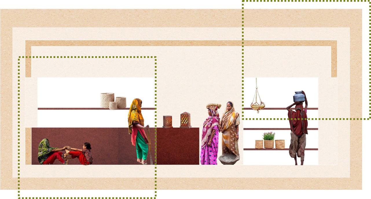
BERKELEY MASTER OF URBAN DESIGN

advanced design projects U.C.


 Foreword by Margaret Crawford Chair, MUD Exectuive Committee
Although the Berkeley Master of Urban Design program began only in 1993, urban design education has long played an important role in the College of Environmen tal Design. For many decades architecture faculty such as William Wurster, Rich ard Bender, Vernon DeMars, Charles Moore and Donlyn Lyndon added important urban dimensions to their work while planning faculty such as T. J. Kent, Jr., Cor win Mocine, Sidney Williams, and Francis Violich took a physical approach to city planning. In the late 1960s Donald Appleyard and Roger Montgomery joined the College, followed by Allan Jacobs in the 1970s. Many of these professors had ap pointments in several departments, allowing them to work across disciplinary lines.
Like the field of urban design, the program has continued to evolve over the years. Throughout all these changes, certain things have remained constant, such as the multidisciplinary nature of the program, governed by a faculty committee from the Architecture, Landscape Architecture and Urban Planning departments. The program continues to maintain a strong connection with professional practice, drawing lecturers and reviewers from local firms. In recent years, the program has attracted a highly diverse group of students from around the world who, bringing their knowledge, experiences and questions with them, have added a richly global dimension to the program.

Currently, Urban Design as an academic discipline and a professional specializa tion faces a vastly expanded set of challenges. Urbanization has become planetary, calling for new scales of intervention, far beyond the city limits, as suburbs, rural and even wilderness areas are shaped by development. At the other end of the spectrum, small, human scaled projects have taken on a new importance. Uneven urban development raises complex questions of how to balance global trends with highly specific local demands. Designers are confronted with contradictory urban dynamics that produce both enormous mega-cities and declining “shrinking cit ies.” In all of these circumstances, designers now must also address environmental problems that are inevitable outcomes of climate change. These issues include pollution, energy use, sea level rise, loss of biodiversity and many others. Social inequalities add another important set of concerns with equity an increasingly im portant issue.
This year’s final advanced design projects fit into this enlarged arena, demonstrat ing a global reach as students take on challenges in a multiplicity of settings in urban, suburban, rural, and wilderness sites in North America, Asia and Africa. The groups they propose to serve range from Bangladeshi women to rural Tanzanians to midwestern suburban immigrants, even including non-humans like bees. Some students focused on excavating the existing qualities of their sites, while others introduced radical new technologies, including non-place technologies such as so cial media. Whatever their site or approach, all of the students took on demanding issues that pushed the boundaries of urban design. Congratulations to you, MUD class of 2020, for your courage, thoughtfulness and creativity!
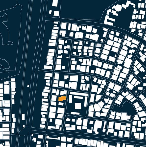
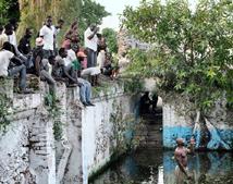
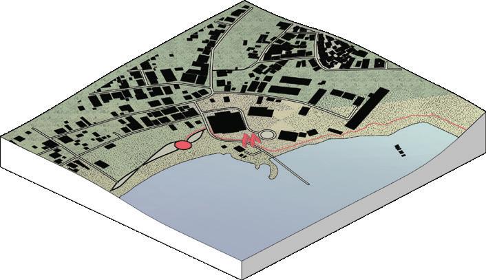
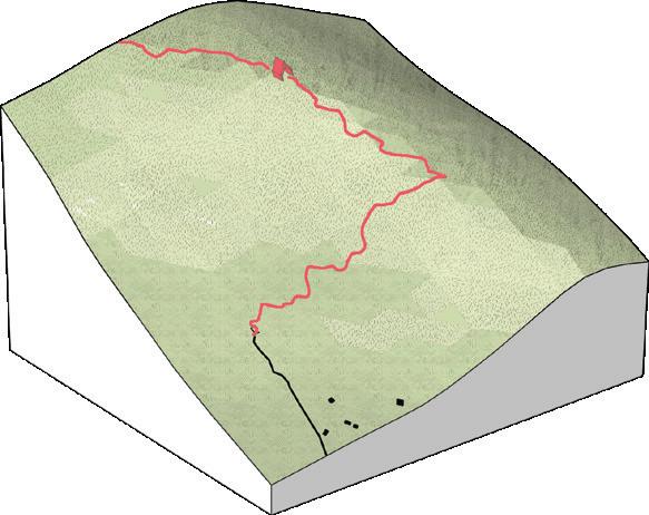
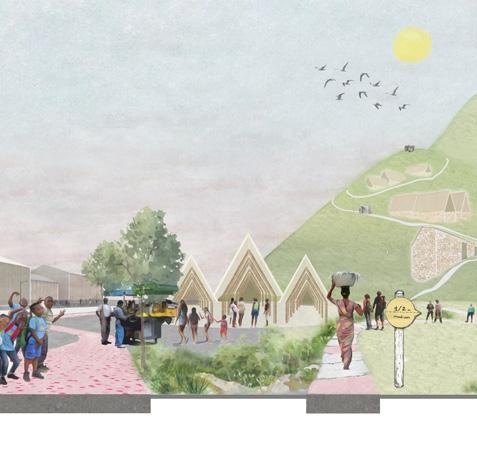
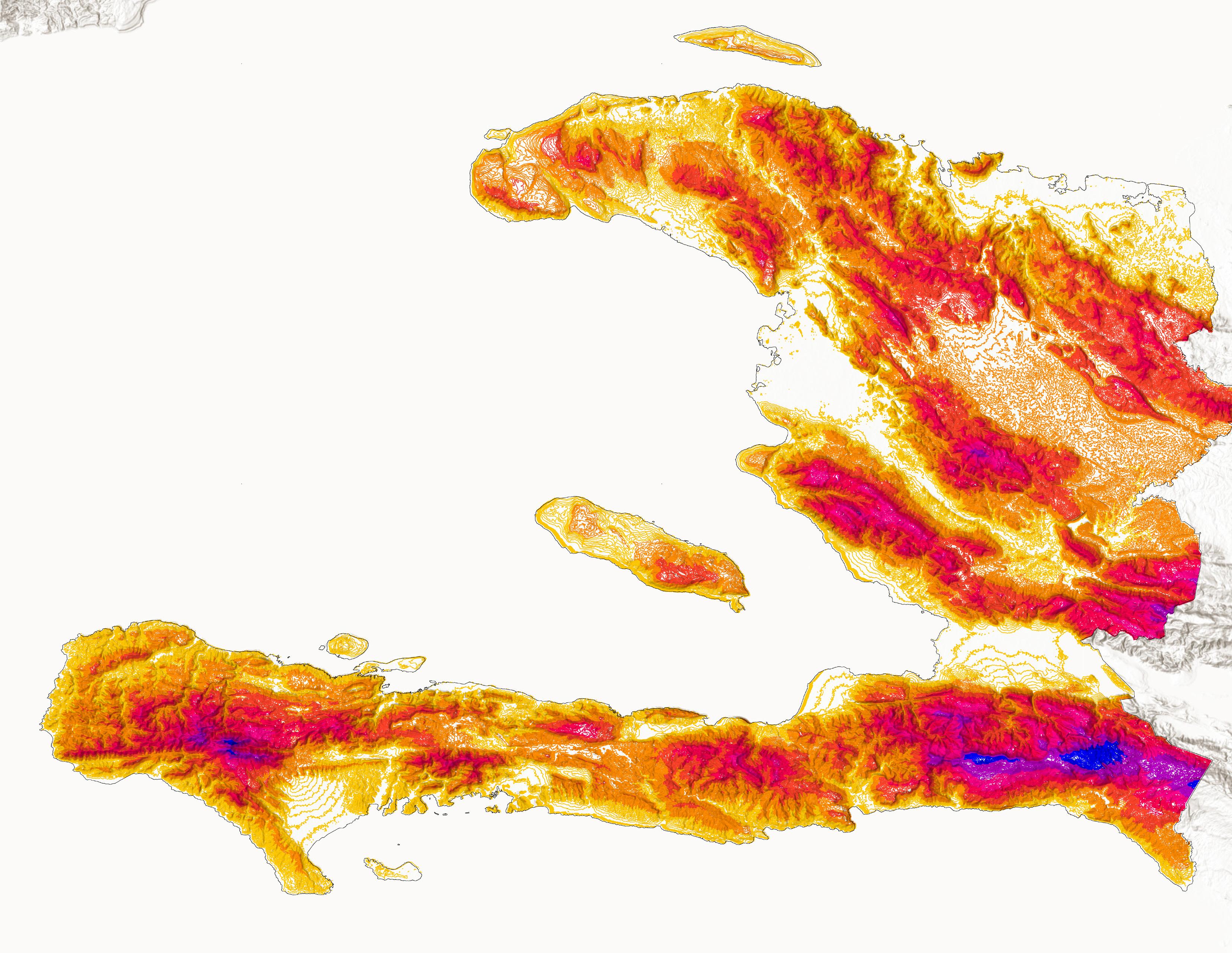
Site Location: Haiti | Advisors: Margaret Crawford + Christopher Callot
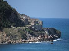
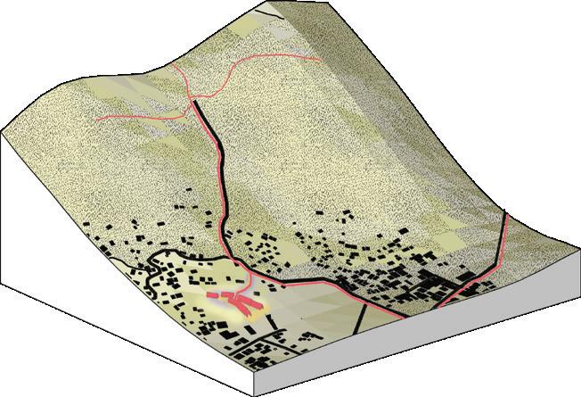
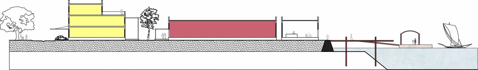
Due to its persistent struggles, Haiti is commonly identified as being in a constant state of emergency and continuously needing assistance from NGOs. These forms of aid are sometimes intertwined with eco nomic interests and political agendas that do not serve local priorities. Haiti has a complicated history, which has been exacerbated by contin uous international intervention. It currently suffers from major environ mental and economic problems.
The goal of this thesis is to alleviate some of these tensions by de signing a National Pilgrimage Trail for Haiti. This project takes a ho listic approach, linking existing places of worship with other places where future development and local activities can occur. This ‘linear intervention’ prioritizes local and market realities and addresses them by synthesizing religious movement and development within a natural setting.
The reason for addressing this issue started when I considered the global crisis that occurs when proposing development in vulnerable settings. There is an enormous struggle to provide fast, cheap, and massive developments that are also sustainable, resilient and just. This issue is extreme in Haiti, the poorest country in the Western Hemi sphere. There, the struggle between development and preservation is a constant debate.
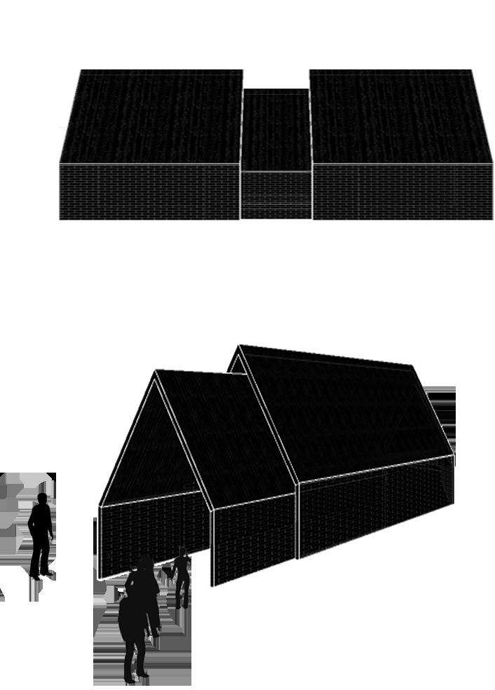
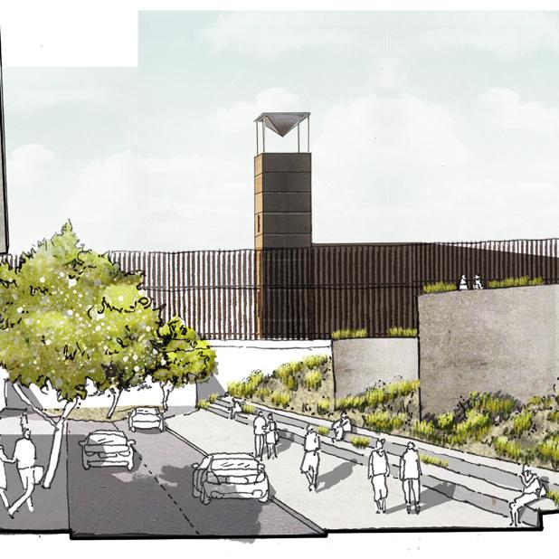
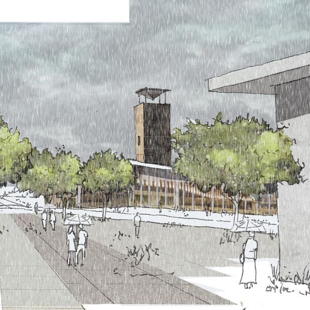
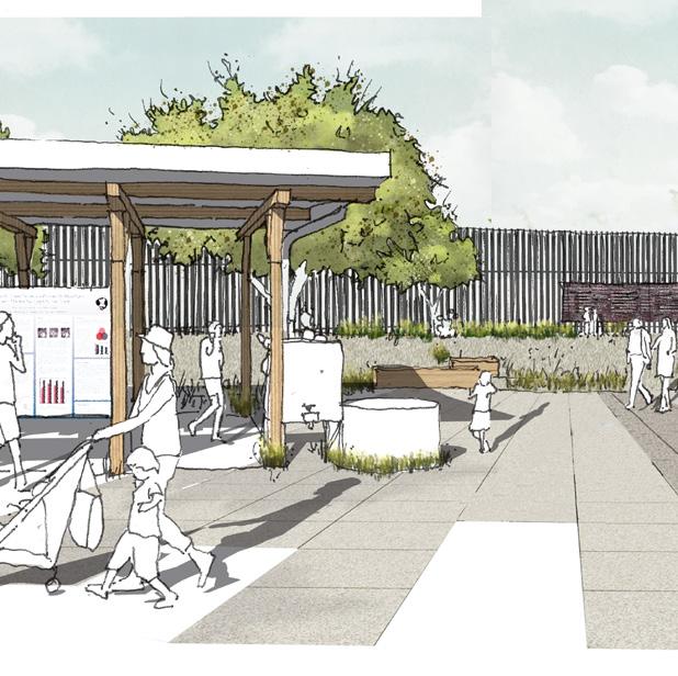
My approach was to use research to identify the path of the trail and then define how it could create guidelines for future development. The route is the main tool to justify the location of future services. I intro duced a new physical and visual landmark that can expand to hold different services. In different places along the trail, depending on the context, the landmark can be transformed, acting as a way finding tool that stitches places together to create meaningful nodes.
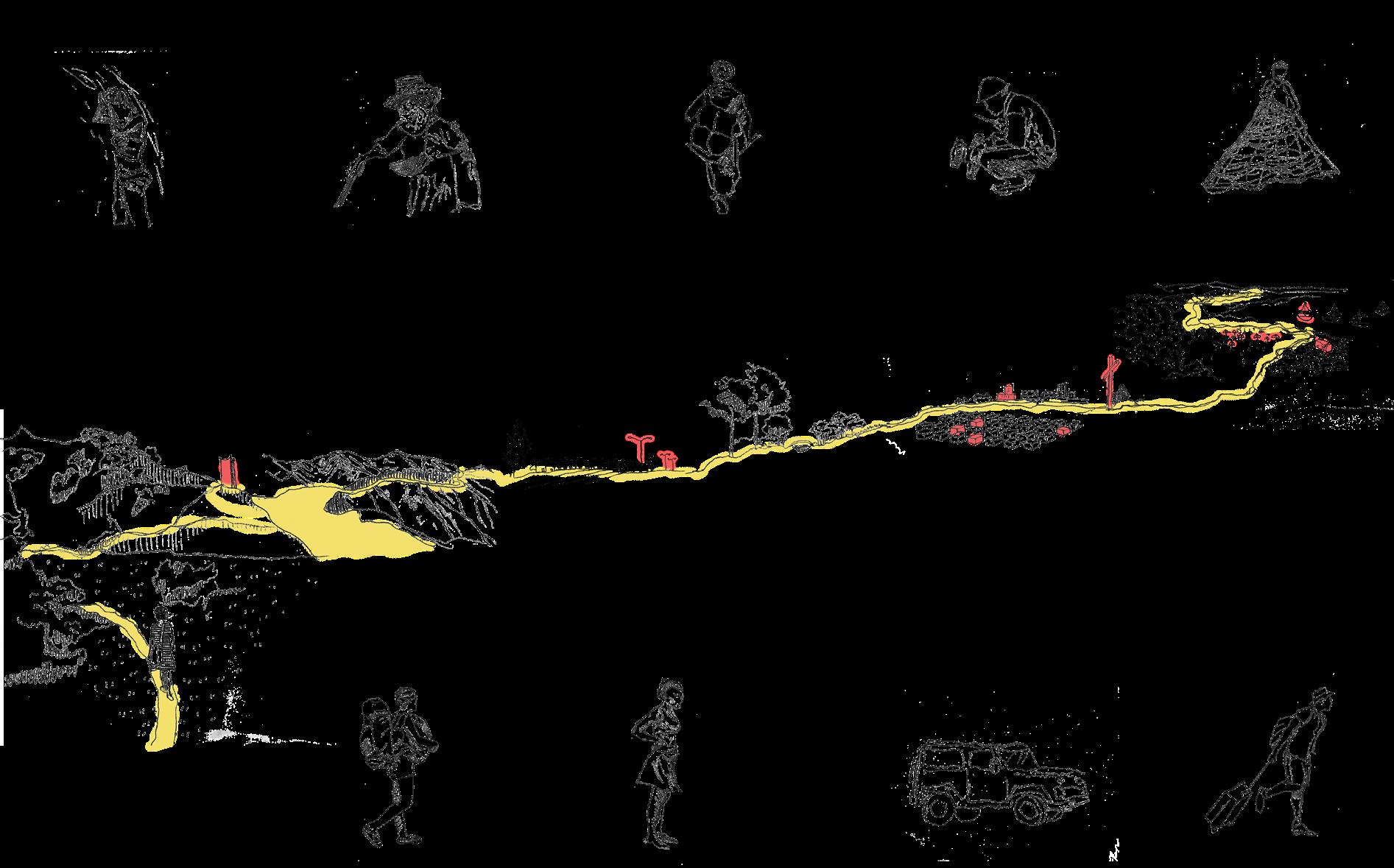
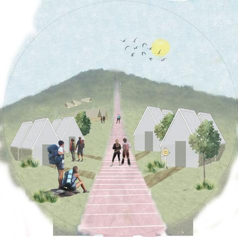
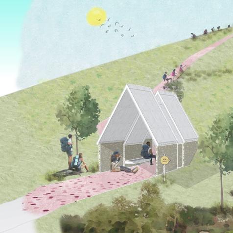
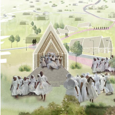
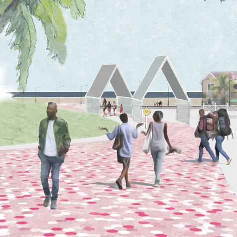
Establishing a pilgrimage route laying the foundation for future development.
The main action undertaken was the research to define the path of the trail and how this could act as the guideline for future development. This route works as the main tool that justifies the location of future services, therefore, a new landmark that can expand to hold different services is also introduced. This landmark transforms depending on the context and acts as a way finding tool that stitches places together to create meaningful nodes.
A gateway Landmark Way finding
A resting spot Shading and sitting Kiosk with info on walls
A community center
Bigger gathering area
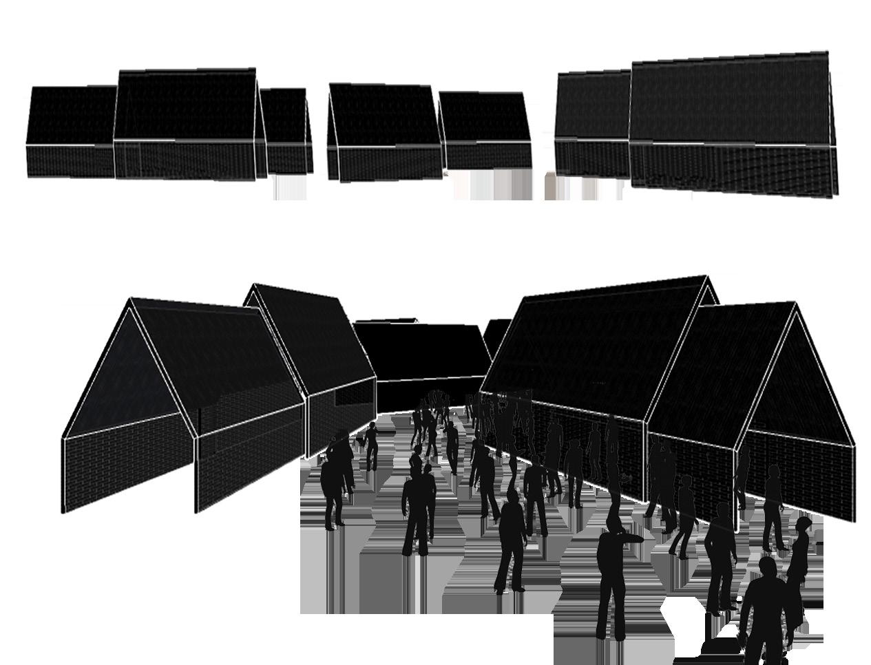
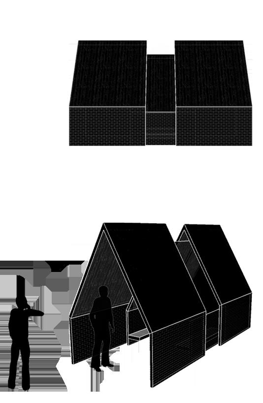
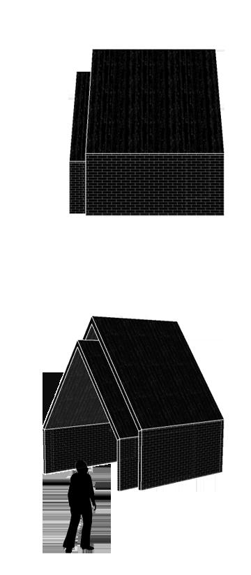
Lodge destination Seeding for future development Grow with time
-
-
- 760.000
- 760.000
- 1080.000
- 1480.000
- 1960.000

- 2660.000
Site Location: Shakopee / Minneapolis, Minnesota | Advisors: Chris Calott + Julia Grinkrug
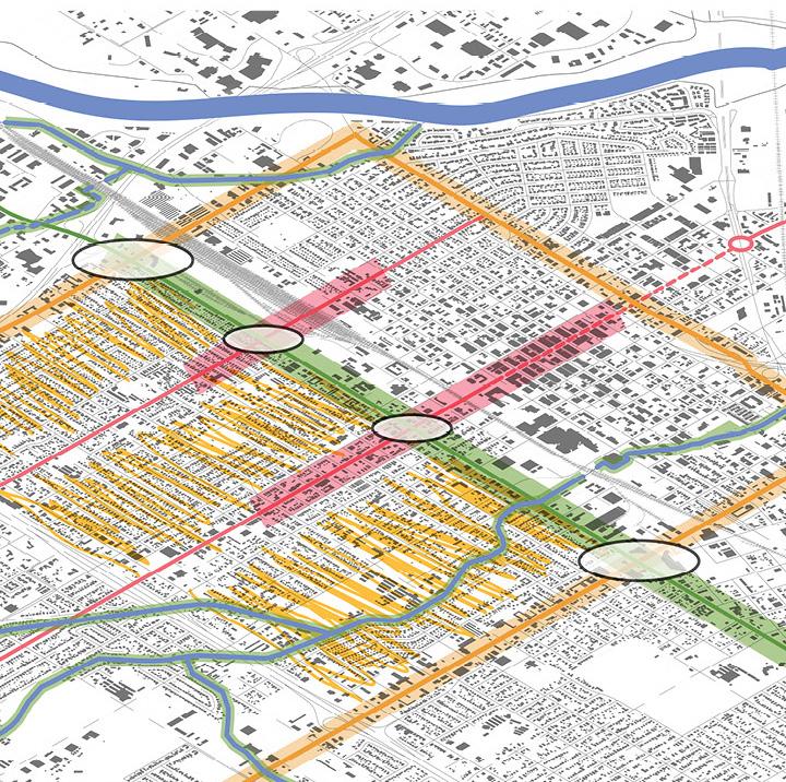
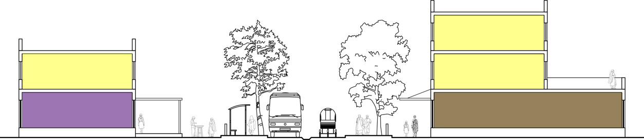
This thesis proposes a new approach for looking at Urban Identity. It explores the relationship between suburban growth and the so cio-economic phenomenon of the reverse commute, both in terms of commerce and leisure. The discontinuities between the initial inten tions behind the places explored here and their current interpretation lead to inefficiencies in use. Thus, these spaces are in a state of dilem ma,these Dilemma Lands are ill-defined places that are ripe for re-defi nition. They are currently underutilized because of their strangeness but in reality are excellent places to reconsider the suburban experi ence.
In the Twin Cities, this dilemma is embodied by the conflict between those looking for a change and the homogeneous and conservative suburban culture. In fact, the gap between the progressive downtown Minneapolis and the expanding horizontal Metropolis continues to grow.
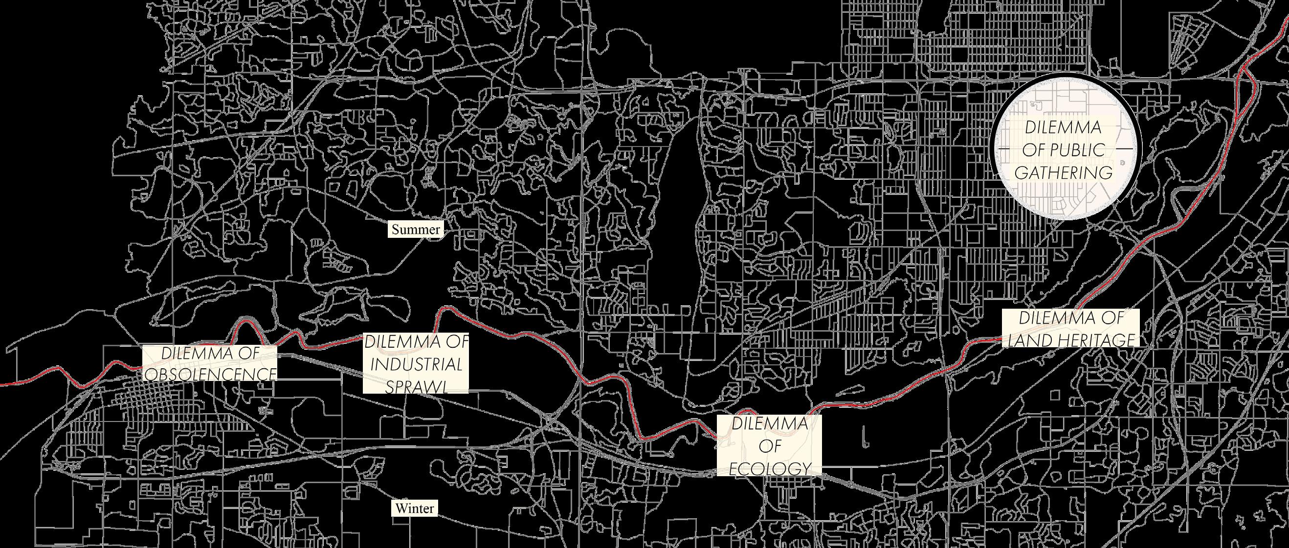
In order to bridge this gap, my project redesigns the physical spaces of Dilemma Lands in order to invite both parties to engage with one another.
By injecting character into the Dilemma Lands and opening them up to the public, they become places of friction. This tension encourages a process of participation and interaction with the design. On the south ern edge of Minneapolis, the Dilemma Lands are connected through a corridor along the Minnesota River. A series of interventions that jux tapose stereotypical Minnesotan activities and building scales aims to contradict their current state. As a result, this project imagines various alternatives to supplement the current absence of suburban identity and considers the many ways in which different individuals may come to coexist and grow with them.
Reconsider the suburban experience in the Twin Cities
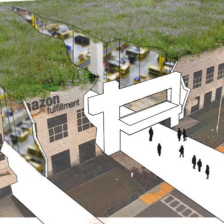
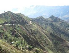
The influx of rural migrants to mega cities in Africa has produced un even growth, slum urbanization, and economic inequalities. The digital divide between the urban and rural areas exacerbates this condition and results in a lack of opportunities in rural areas where access to information is limited. Current scenarios of urban growth favors urban migration to cities over rural investment.
I believe this power starts from access to information and education, and that this can enable efficient use of resources. My role as an urban designer is to design those spaces, buildings, the sub-systems (pow er & water), and direct them to create growth. This will enable self-reliant economic growth, support local entrepreneurship, expand educational opportunities, upgrade agricultural innovation, and trad ing productivity.
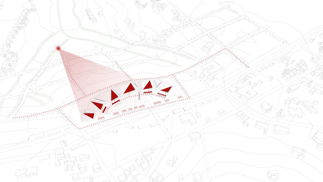
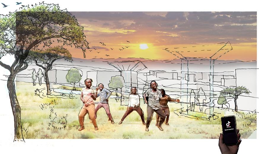
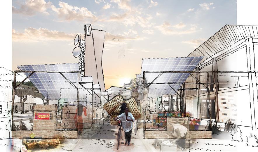
This thesis offers an alternative spatial strategy that emphasizes re gional ownership and decentralized systems in rural Tanzania. The main premise is that access to information can be a catalyst for all types of upgrades and improvements. Wi-fi towers and Institutional anchors/centers serve as catalysts for development in a remote rural area. These centers will provide connectivity, technology, and com munity services supported by a sustainable/eco-friendly infrastructure that utilizes the local natural resources. These informational tools give power to the people to create their own development.
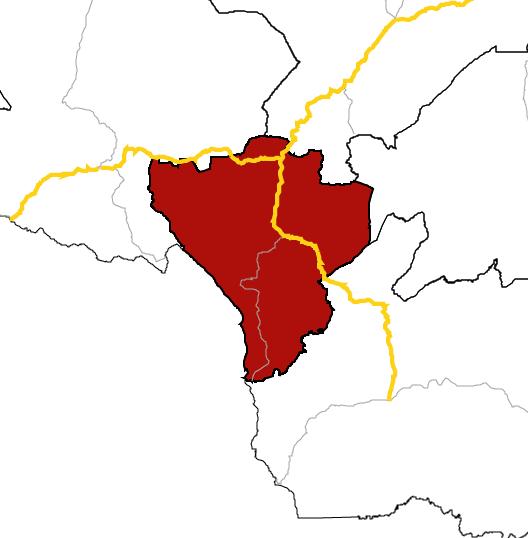
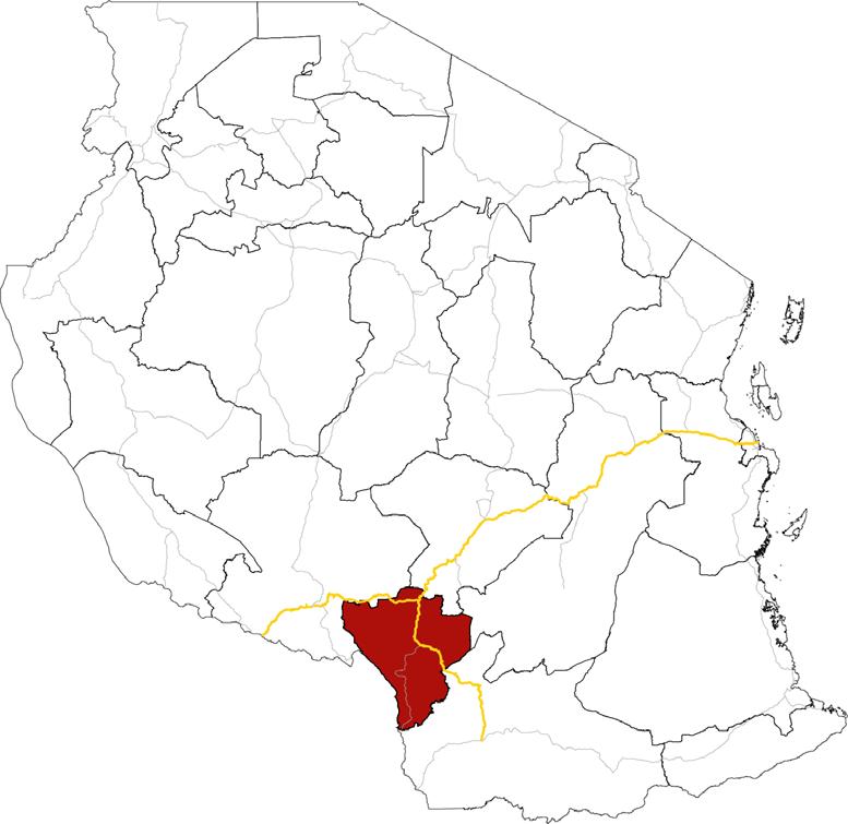
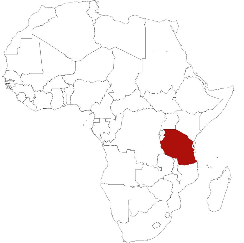
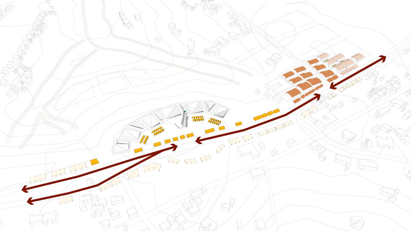
The project is physically based in a regional town center in the Njombe region with satellite centers in surrounding villages. East Africa is an appropriate site since there is a culture of technological leapfrogging, a scenario in which communities leverage new technologies to rapidly adapt and evolve. This phenomenon creates an atmosphere suitable for transformative intervention. I use Afro-futurist imagery as a way of connecting the local with a global technological future.
Information Mothership: A Catalyst for Enabling Regional Ownership and Self-Reliant Development in Rural Tanzania
Fig 88 Aerial View: The pieces of this framework come together to provide a central infrastructure that defines the area for the new center and allows for organic growth.
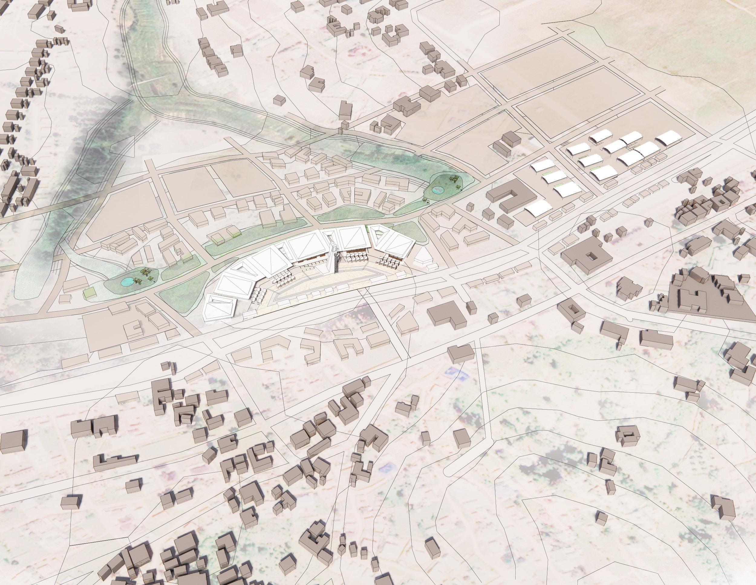
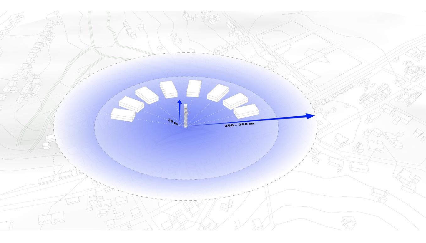
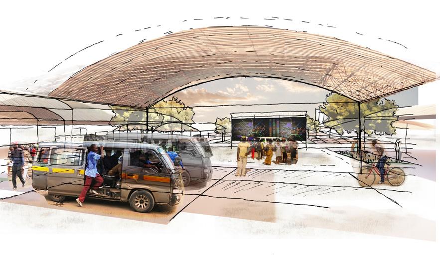
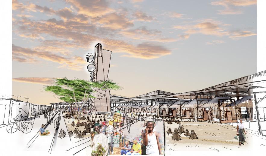
The Wi-Fi tower and institutional center becomes the anchor for a new market and transit area, pulling its figural form from the cosmic radial beams of Afro-futurism and connectivity radiation, where the center becomes the mothership and allows for community growth. This 30-meter high tower provides a mesh-network that is supported by solar energy. This lowcost, low-energy system will be built by locals and be an informational tool that gives power to the people to create their own development.
Solar panels on the roofs of the main building will provide power to the mesh network and central functions. The panels can be incrementally integrated with the emergent street mar ket, covering an area of approximately 12,000 sq. meters and generating enough power for current and future phases of development. The total power generation could reach 3,600.000 KWh/year given that the local PVC panels generate 300 KWh/sm per year, which is the power required for a 72,000 sq. meter building on an annual basis.
The water collection system requires a sustainable prototype for development and growth. The main collection area is the highest zone of the plaza with the main reservoir integrated into the tower. The catchment areas are in the lowest elevation, integrated with the open green spaces with the Internet for public use. The water is collected and cooled by the wind to provide passive cooling by the wind to provide passive cooling for the servers and the return hot water can be recirculated for use, creating a close loop that supports various functions.
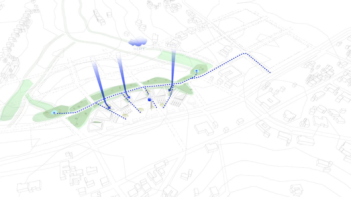
The transit, located at the entry to the center, connects the villages and cities. Along this spine is the market and plaza, which are delineated for future development. The market will be defined by armatures that provide power sources for traders to plug into and appropriate the space for their needs. This structure can support the solar panels that allow for future expansion.


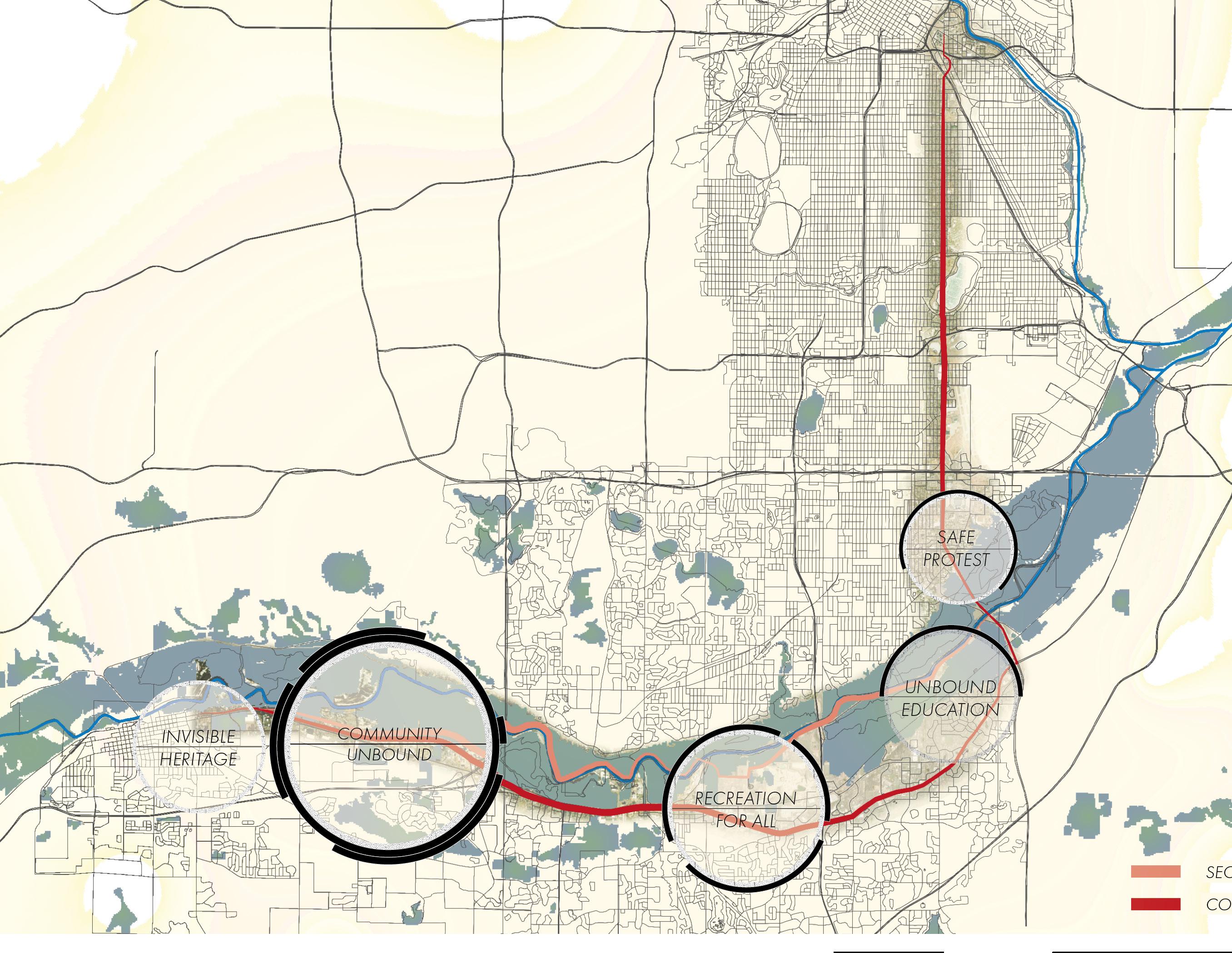
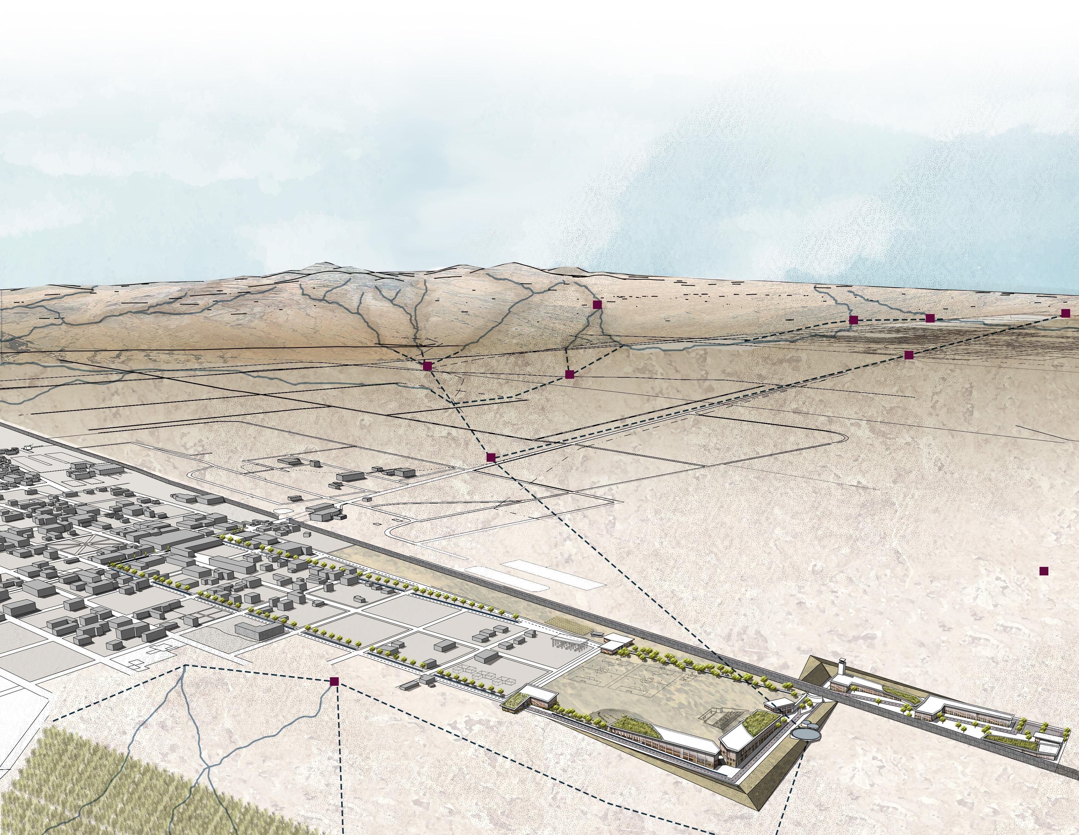
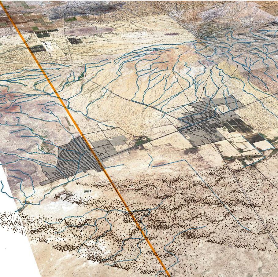
Code-switching describes the act of customizing speech or language to the audience being addressed; however, people who live in multi cultural communities code-switch not only linguistically, but spatially. Culture, identity, and experiences influence the way we move through the built environment. These factors shape how we interact with space, share space with others, or modify space to meet our needs. This the sis poses the question: how can the action of code-switching influence spatial design thinking to generate a new trans-border experience in the US-Mexico borderlands?
This condition is not an all-encompassing event sweeping across the borderlands. Rather it is a series of unique and nuanced occurrences of singular crossing points in relation to the landscape and the commu nity they are situated in.
The ‘borderlands’ are an environment of conflict, between languages, cultures, and nations. This dichotomy results in a hybrid-experience, a “synthesis of duality, a third perspective.” 1 A landscape of exchange characterizes this amalgamation as everything, from commodities and resources to privileges and people, flow across the border.
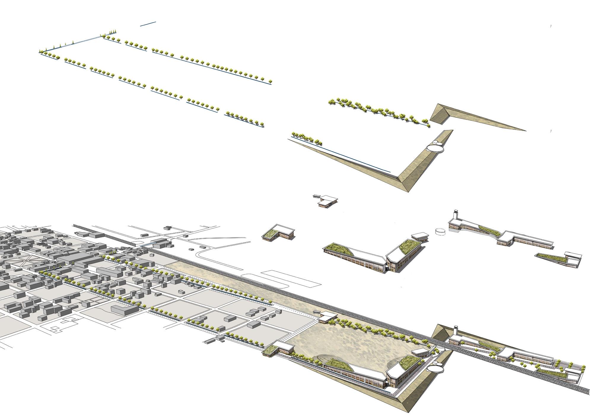
This thesis proposal presents a design strategy that synthesizes the systems of flows and exchanges with the spatial landscape of Puerto Palomas, Chihuahua and Columbus, New Mexico. The sprawling Chi huahua Desert separates the sister-cities, creating a three-mile divide between the communities. The proposal emerges from the need to activate the spatial divide by catalyzing the diverging flows of water and dust across the expanse. Through a series of interlinked interven tions, the approach subverts the political realities of the region and en gages the communities to participate in a new landscape of exchange.
 Columbus, New Mexico
Puerto Palomas, Chihuahua
Site Location: Puerto Palomas, Chihuahua + Columbus, New Mexico | Advisors: Chris Callot + Scott Elder
Columbus, New Mexico
Puerto Palomas, Chihuahua
Site Location: Puerto Palomas, Chihuahua + Columbus, New Mexico | Advisors: Chris Callot + Scott Elder


existing arroyos/ watershed from mountains
underground water management system
xs constellation network water harvesting cisterns grassland seasonal plantings
Dust Migration
Watershed - Existing
Management
Water Harvesting Cistern Grassland Plantings
The bi-national dust migration will be mitigated through seasonal grassland plantings that bal ance the local agricultural harvests.
L | water management
The existing arroyos are channeled into an un derground system that collects and guides the water towards harvesting cisterns for collection and community use.
XS | the constellations
A series of XS design moments connect the in visible dust and water features of the site. These moments allow for human scaled engagement with the territorial flows that freely cross over the political demarcations.
XS: water education
XS: dust monitoring
circulatory framework
At-grade circulation occurs within a country and below-grade circulation occurs between countries
At-grade circulation
New street acequias improve the micro- climate conditions at the existing crossing and connects to the secondary crossing and harvesting cis terns.
hydrological framework programmatic framework
The Academic District: NMSU +UAC
New Mexico State University + Universidad Autonoma de Chihuahua
Educational: Clinical Psychology Department (NMSU) Educational Innovation (UAC)
Economics + Human Rights: Economic Development Extension (NMSU) Human Rights Advocacy (UAC)
Regional Hydrology + Ecology + Meteorology:
Agriculture, Consumer, + Environmental Sciences (NMSU) Ecological + Environmental Engineering (UAC)
Tree-lined acequia streets
Below-grade circulation at wall
Landforms protect from flooding
Harvesting Cisterns
Community Activation
Academic District Descent Gateway
the submersion
the crossing the academic districtcommunity activation
Native bees provide not only incalculable value for human society by pollinating crops and flowers, but also play an important role in main taining the function of the whole ecosystem and biodiversity.
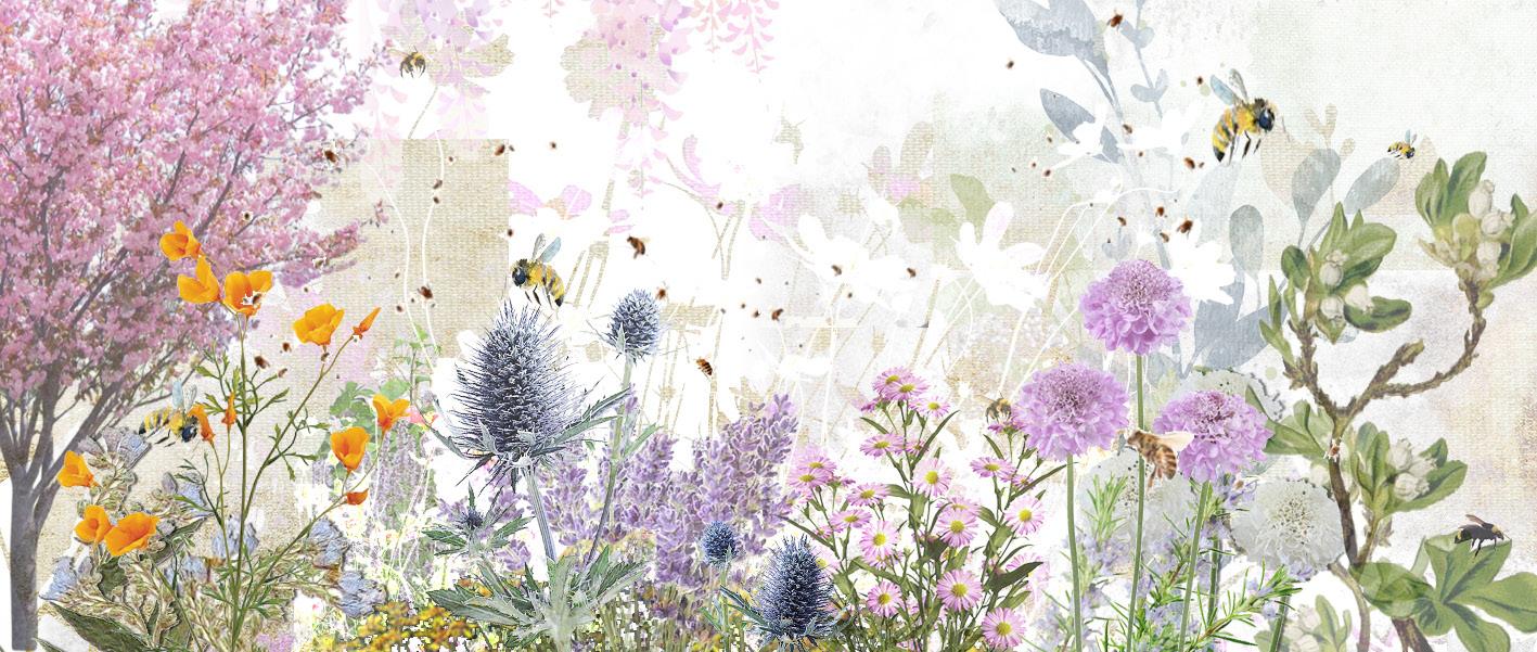
In order to mitigate the habitat fragmentation and the lack of ade quate native pollinators due to mass urbanization and mono cultural agriculture production in the Central Valley, this project will create new habitats for native bees, while providing spaces and activities for peo ple to observe, learn and interact with the native pollinators.
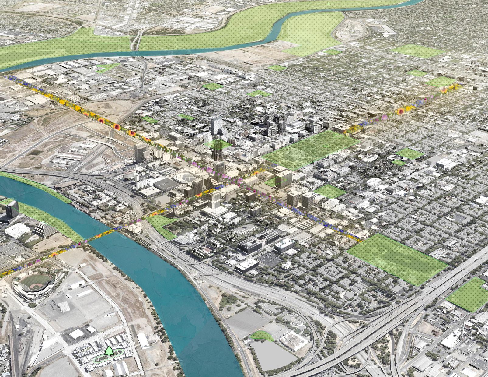
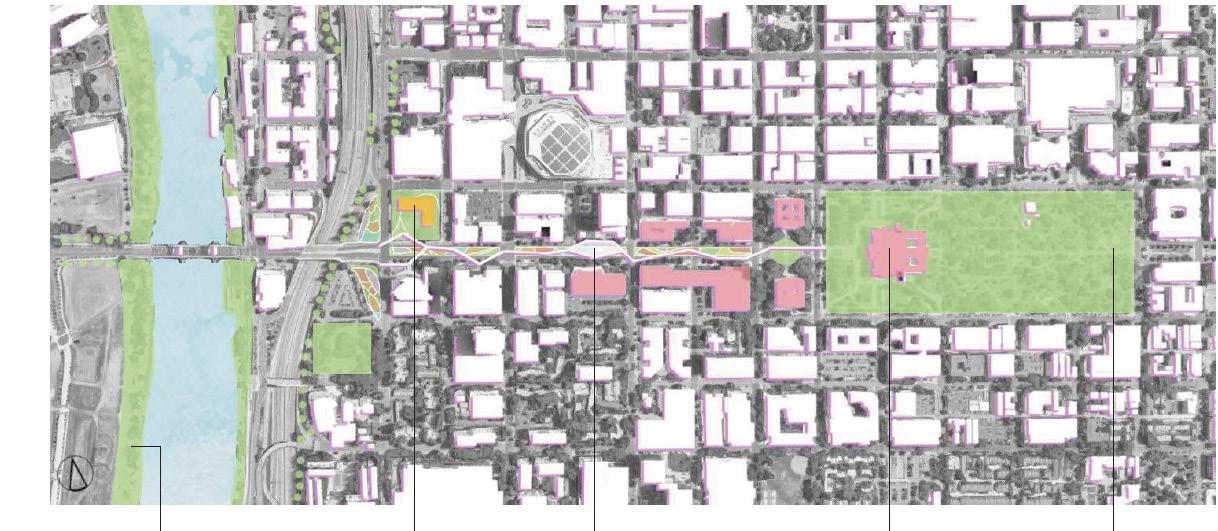
Focusing on Sacramento City and its surrounding farms, this project will involve different parties in the region, proving multiple approaches and scenarios. Strategies include a long-term peripheral corridor along highways i5 and I80, the redesign of the Capitol Mall as a demonstra tion area, infrastructural interventions and mapping stewardships.
This project aims to not juxtapose human and non-human within an urban context but to let them connect and benefit each other, while making the capital a more resilient, sustainable and bio-diverse city.
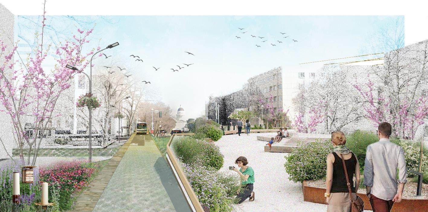
Urban Pollination: Rethinking Sacramento as a New Bee City
 Tower Bridge
Trees and shrubs that are suitable for foraging should be planted along the river bank and highway medians, where there is limited pedestrian access, to ensure the habitat connectivity while at the same time protecting people who are allergic or afraid of bees.
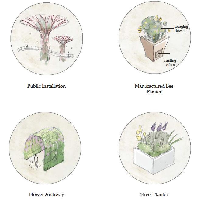
Proposed building for habitat maintenance and event curating agencies
Elevated platform for educational and recreational purposes
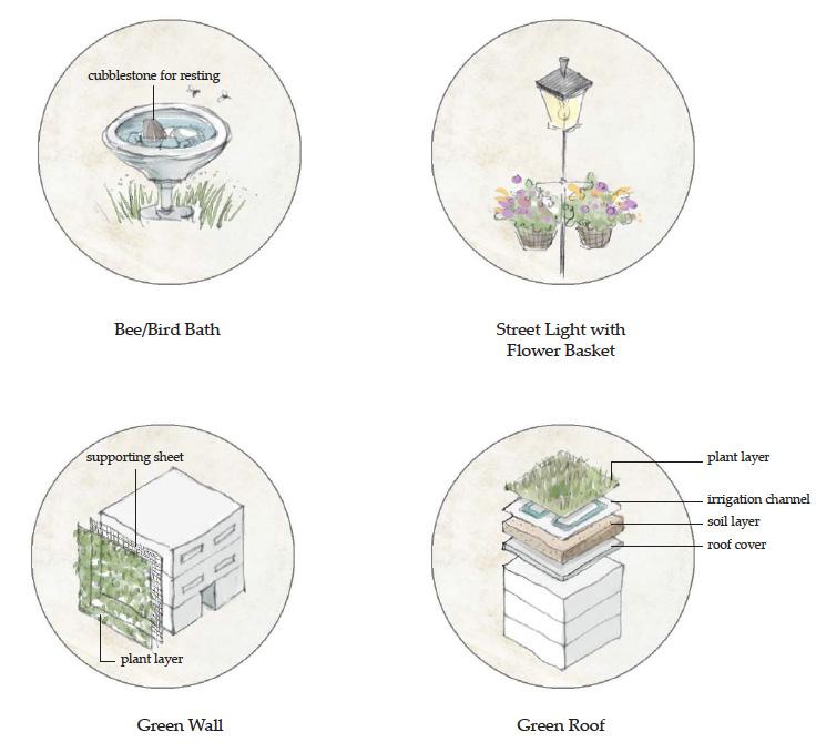
Government buildings will be able to implement green infrastructures as an exemplary action.
Existing open spaces and parks will be designed to be habitat patches. New facilities, such as bee houses, and relevant relandscaping is required.
Street Light with Flower Basket
Reduce the vehicle land by half
Make the central lawn into a habitat strip, with a bioswale in the center and nesting bare soils exposed to sun light.
Build up an elevated platform for human interaction and a storm water system leading the filtered runoff water to the Sacramento River.
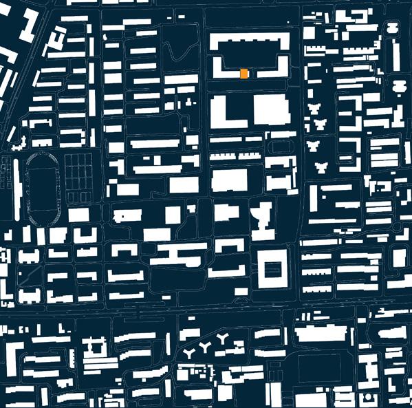
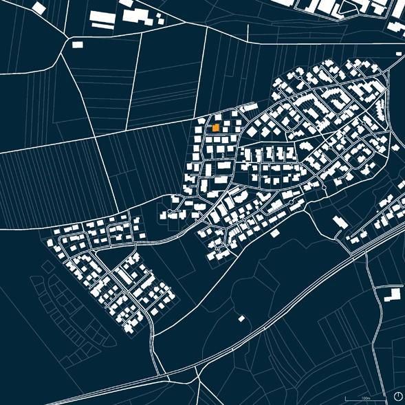
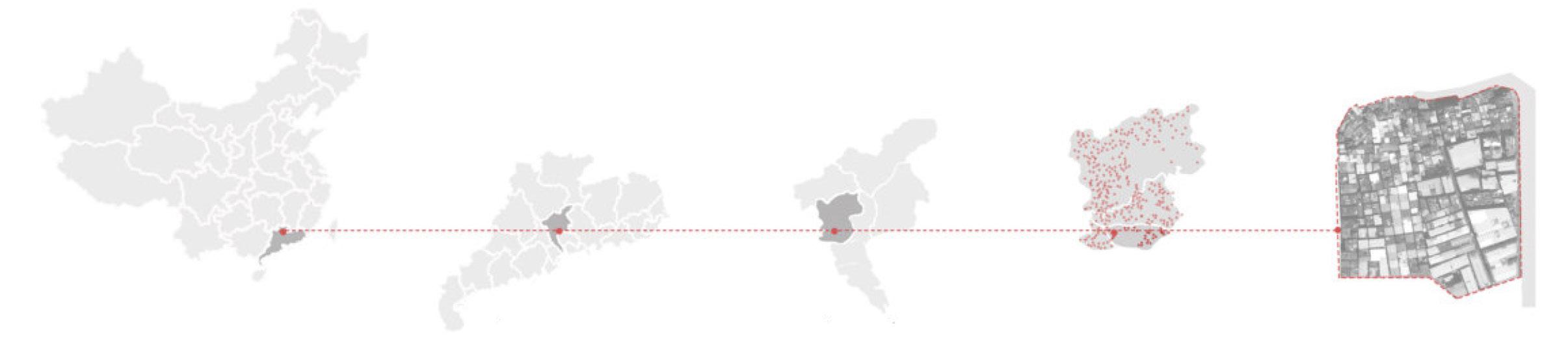
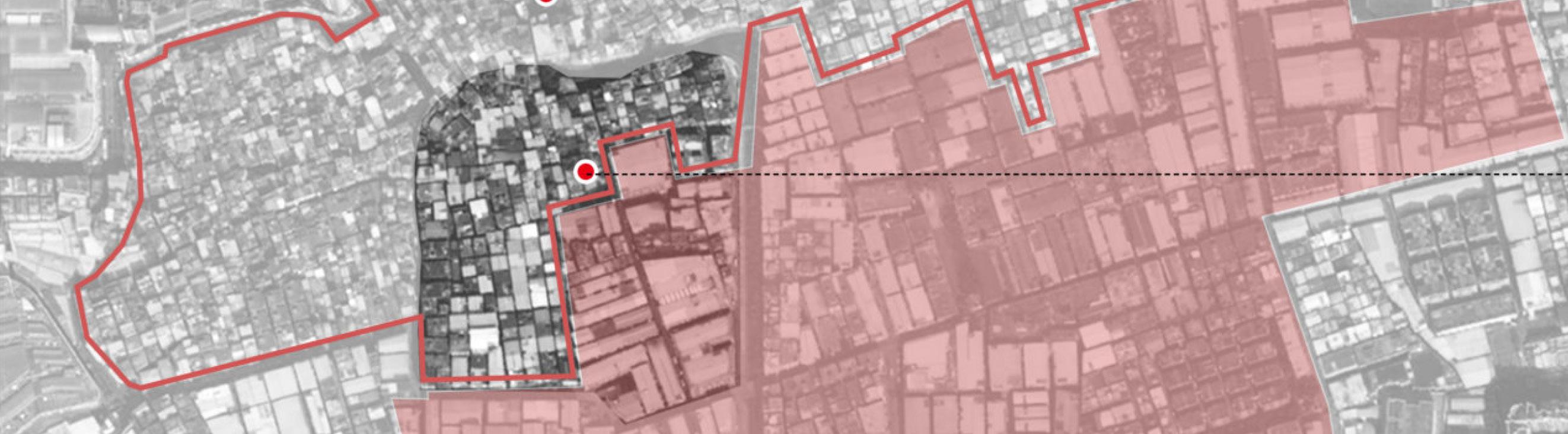
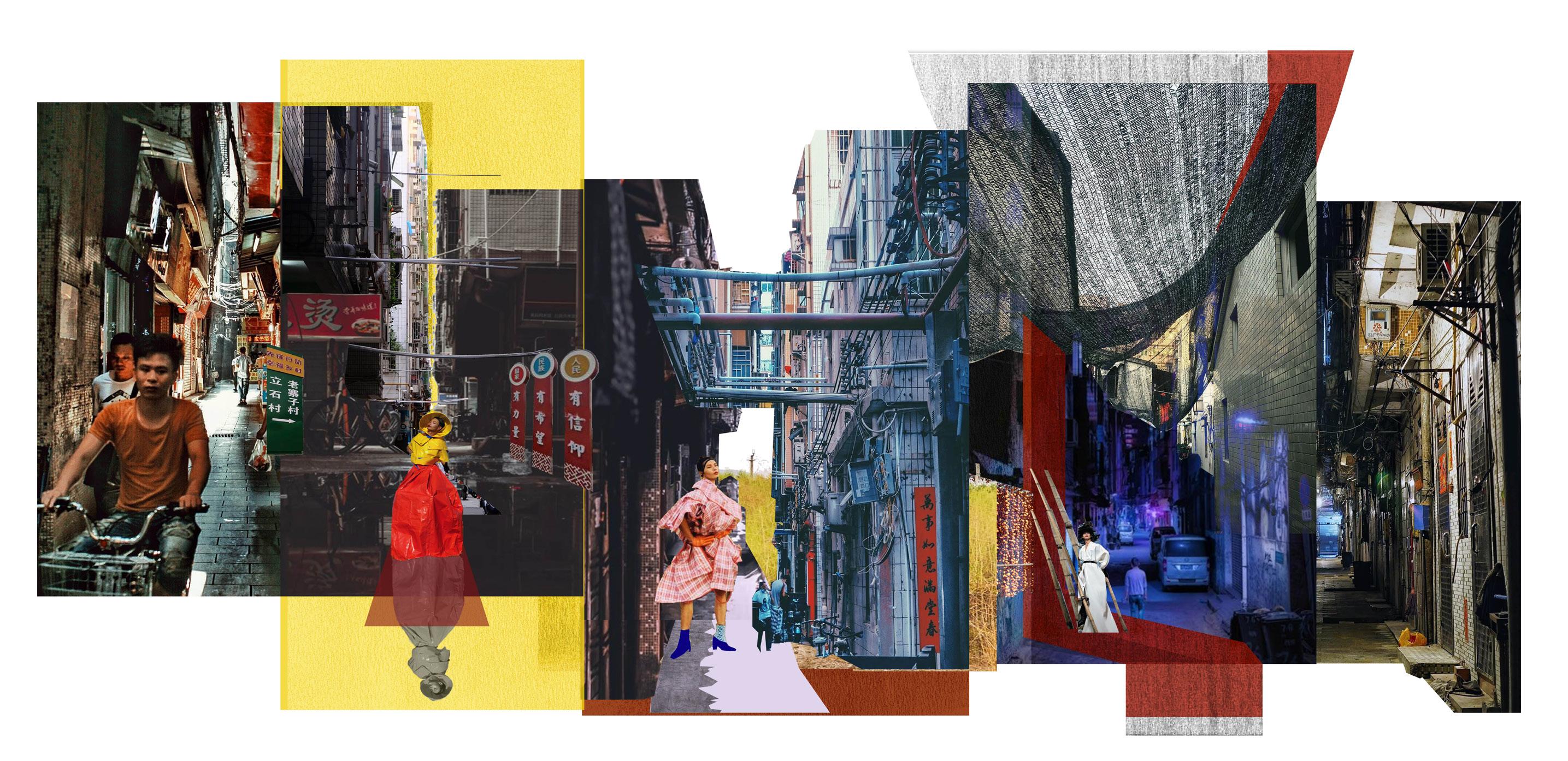
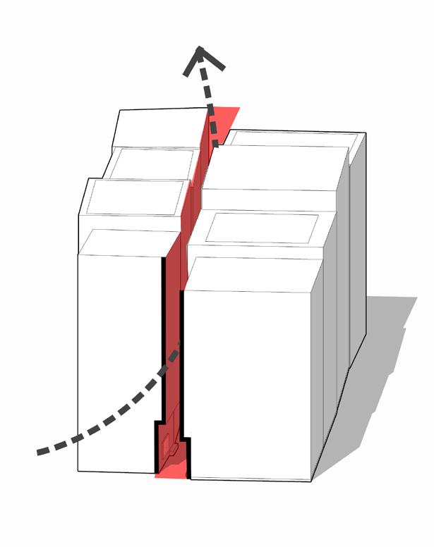
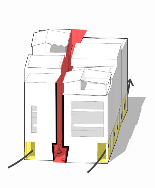
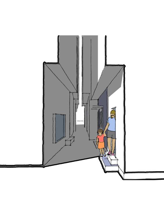
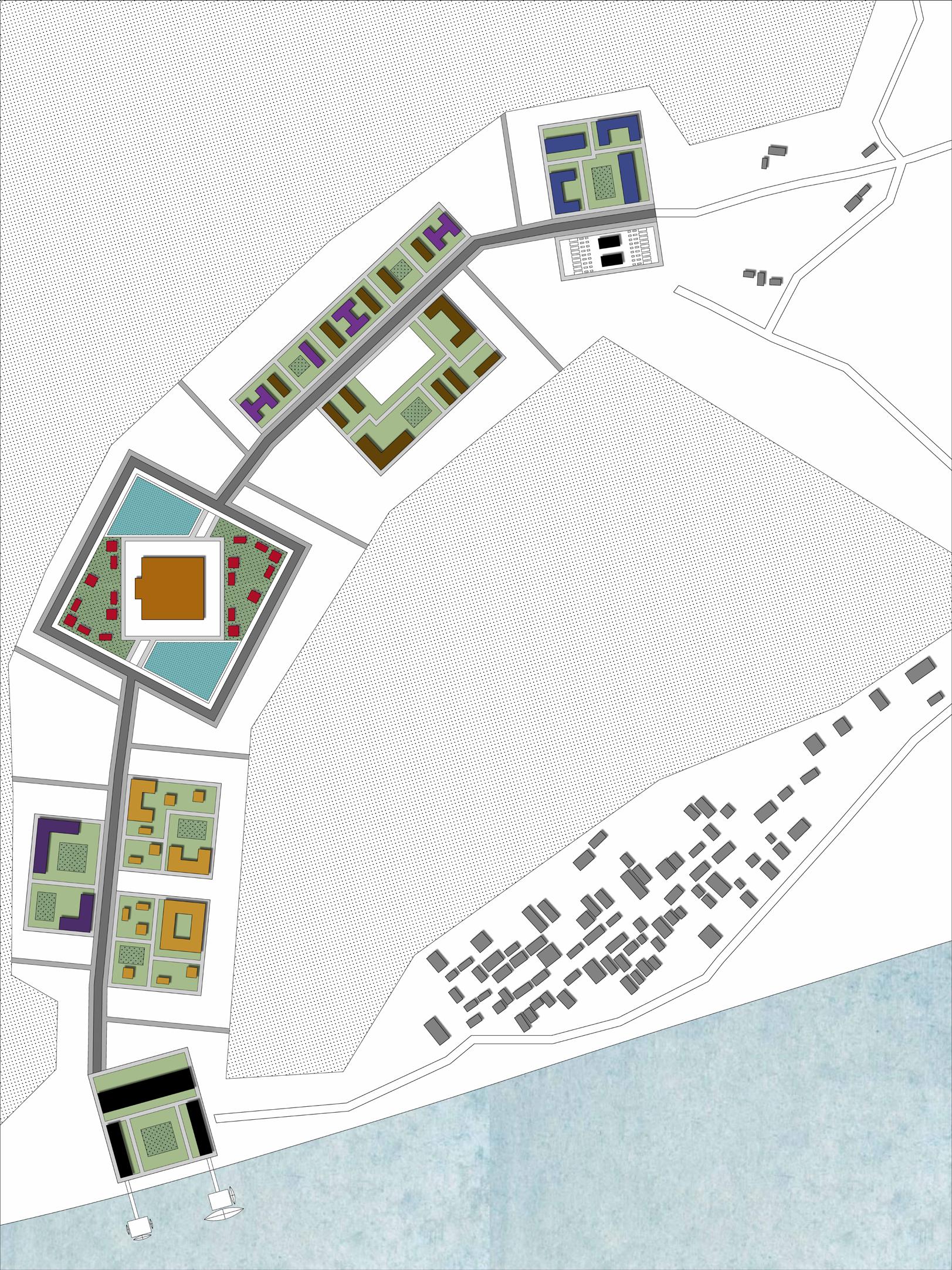
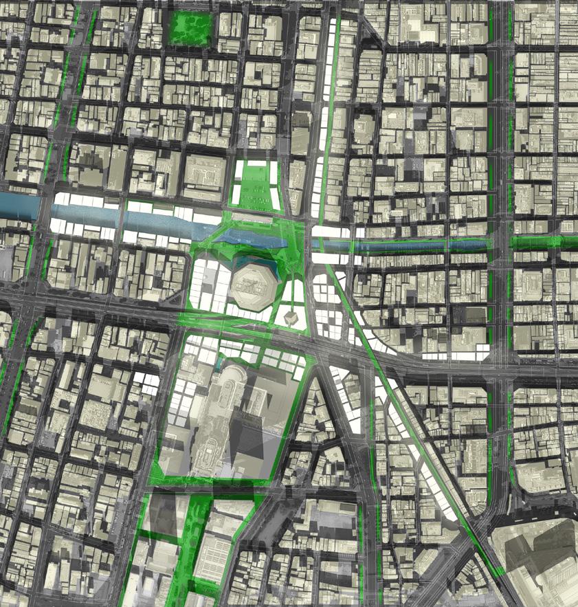
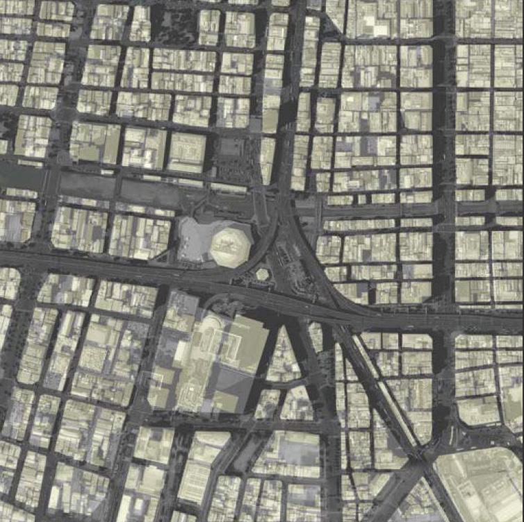
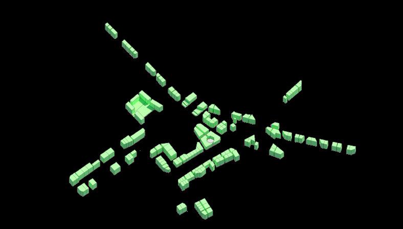
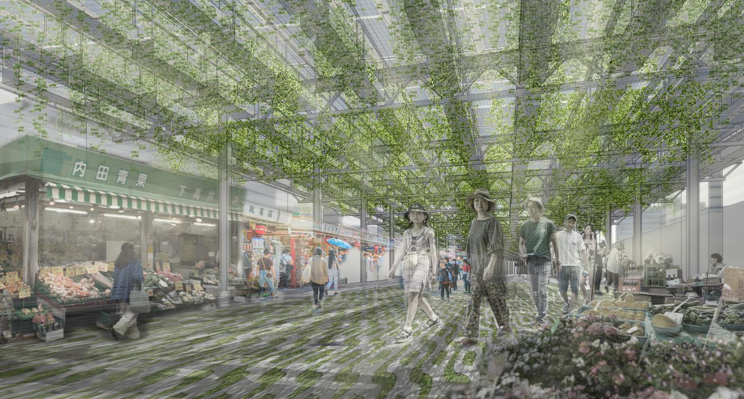
Site Location: Kangle Village, Guangzhou, China | Advisors: Peter Bosselmann + Margaret Crawford
In times of rapid urban expansion and transformation, informal settle ments have become an increasingly global urban phenomenon. Be cause of the formal city’s incapacity to satisfy all of its residents basic needs, many people’s only alternative is to live outside the regulations. In some ways, planning creates unplanned and formality creates infor mality.
Thus these informal settlements work like a sponge to absorb all the demands and issues that spill over from the city. They function to protect both its residents and the formal city from uncertainty and in adaptability during urban transformations.
My goal is to emphasize the key role these informal settlements play in creating an entire urban resilience system and to analyze the diverse possibilities that could occur there due to their unique histories and situations.
Based on my research about spatial justice, social stratification, and distinctive informal urbanization in Pearl River Delta, I choose Kangle village in Guangzhou as my site. In order to preserve its affordable liv ing environment, I upgraded and catalyzed local industry, recalled its collective memory, responded to the natural environment and made sure that every group had access to engage in this process, all improv ing its comprehensive urban resilience.
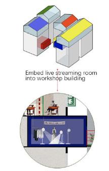
Build open space systems that can service both original villages and migrant workers. Focus on waterfront space and build bridg es between 2 sides to connect all education resources
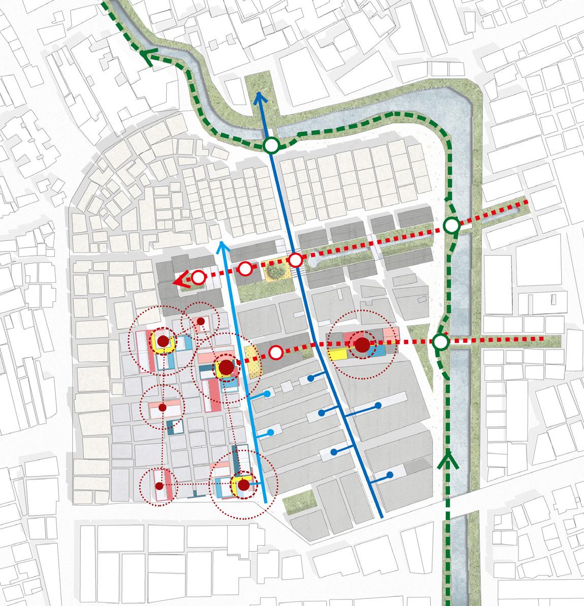
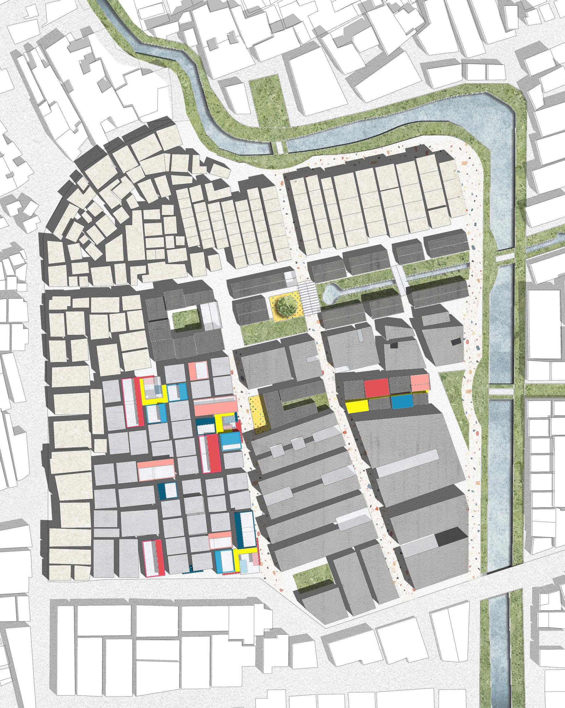
The public space system will pro tect cultural heritage and folklore. Ancestry still plays an important role to connect people; thus the view is opened towards it, from the other side, to bring a sense of ceremony back to the site.
Education systems include a worker training center and a fashion design school, one for designers and one for high-tech workers.
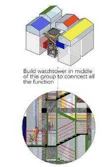
The key to building an ins-famous place is to extract local features then romanticize and exaggerate them. This will attract influencers’ attention and investment, giving a chance for future industry up grade.
This strategy provides a comfort able shopping experience and sensible products for business men and customers.
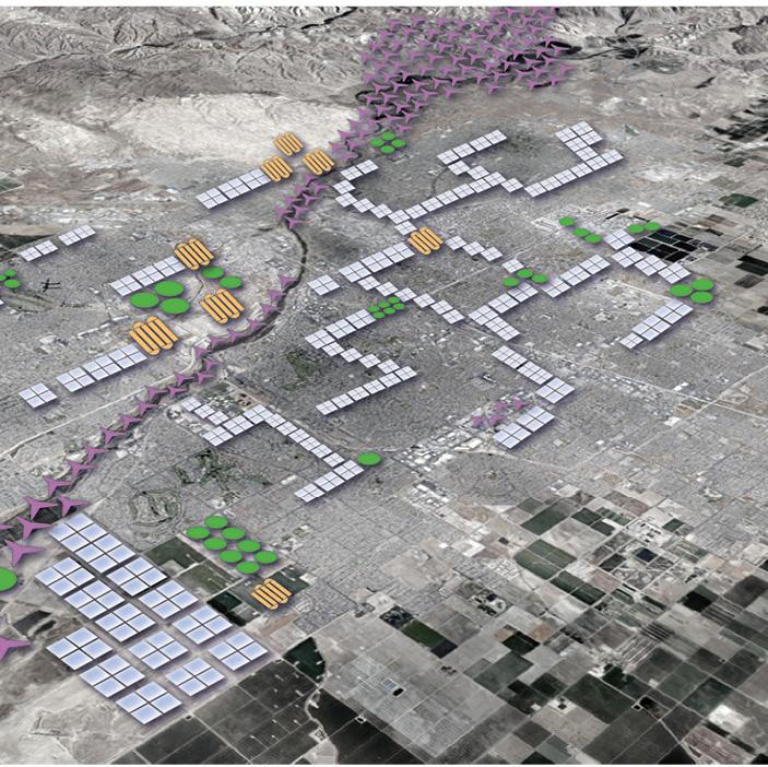
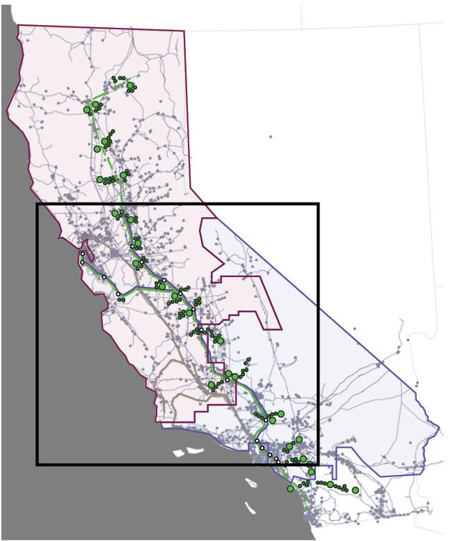
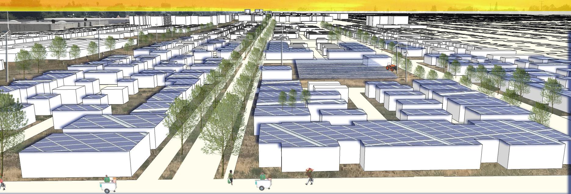
The future of renewable energy is constantly evolving, as advocates appeal to financially secure individuals and groups to promote sustain able values and technological advancement. But access to renewable energy resources must broaden beyond the advocacy of sustainability into opportunities for community resilience. In the future, sponsors of energy systems must consider the resources of local communities in ways that engage social and environmental factors. California policy makers envision transformation to 100% clean energy by 2045. This initiative will be important for producing and distributing energy in the urbanized regions in the Central Valley.
Successfully implementing clean energy as a renewable alternative throughout California, depends on the local level, with features specif ic to regional and urban conditions. This project identifies approaches at the state, regional, city, and neighborhood scales, illustrating ways to create renewable resources along with opportunities for progress, growth and equity.
Climate change presents an additional threat to populations already exposed to environmental and social injustices that impact livability and access to services. The Central Valley and surrounding areas of dispersed urbanization are projected to grow in both population and diversity in the immediate future, so providing benefits to local com munities must be a priority for the state.
My thesis proposes a regenerative energy model at the neighborhood level, including reallocating existing public streets into production corridors for renewable solar energy to be distributed into adjacent blocks. At the district level, the Sunset Oleander community of Bakers field becomes a site for district-wide renewable geothermal energy. An existing freight rail yard and brownfield sites throughout the com munity that borders downtown are converted to address degradation and pollution exposure. These solutions offer a framework for energy reliance that can be implemented at the larger city level.
Site Location: Bakersfield, California | Advisors: Christopher Callot + Julia Grinkrug + John Ellis
Regenerative energy in Bakersfield, CA for environmental and social empowerment.
Community Energy Hub


Land area energy projections in acres
California (2015 study): 975,000
Central Valley City (2020 census): 10,000 *Bakersfield, CA


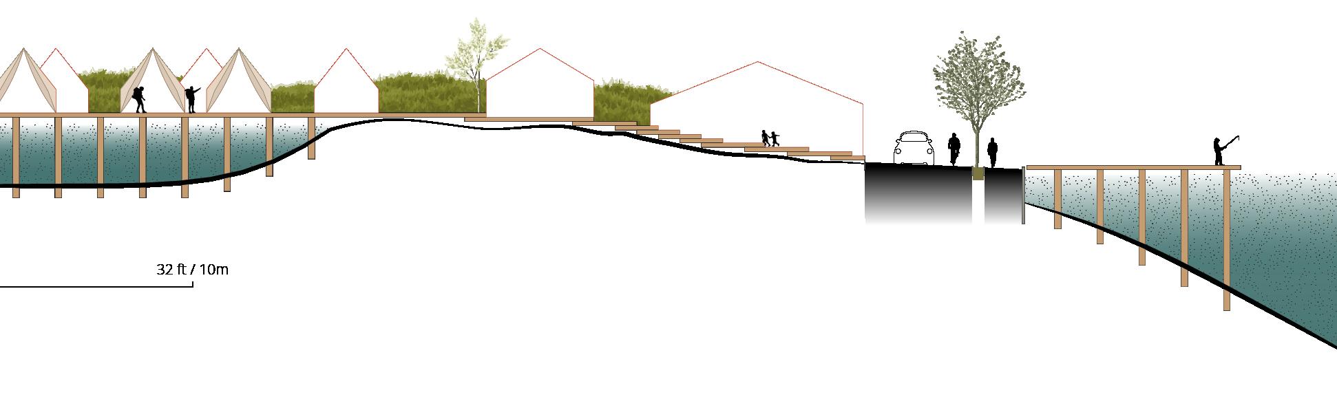
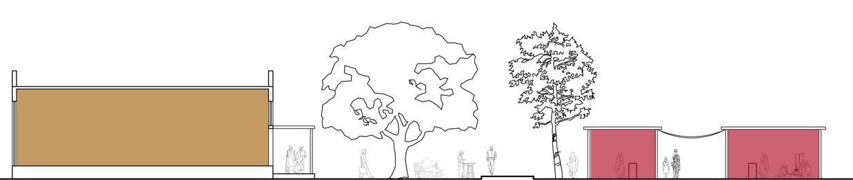
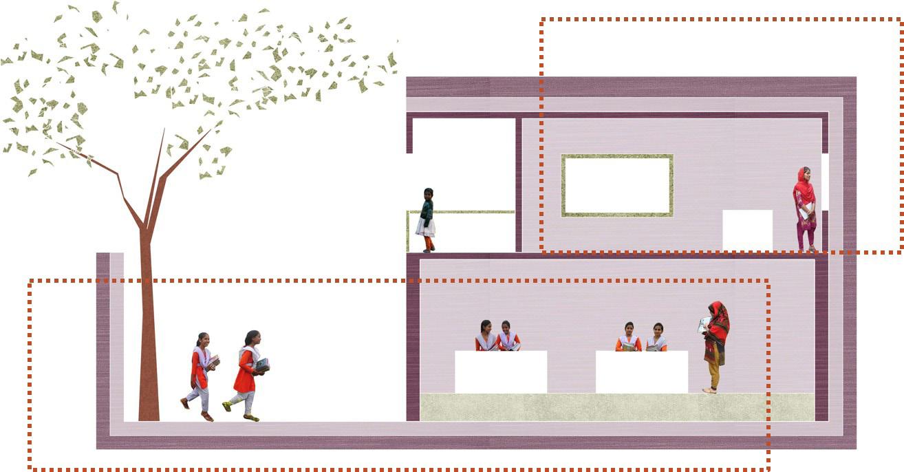
Site Location: Meghna River Belt, Bangladesh | Advisors: Harrison Fraker + Julia Grinkrug + John Ellis
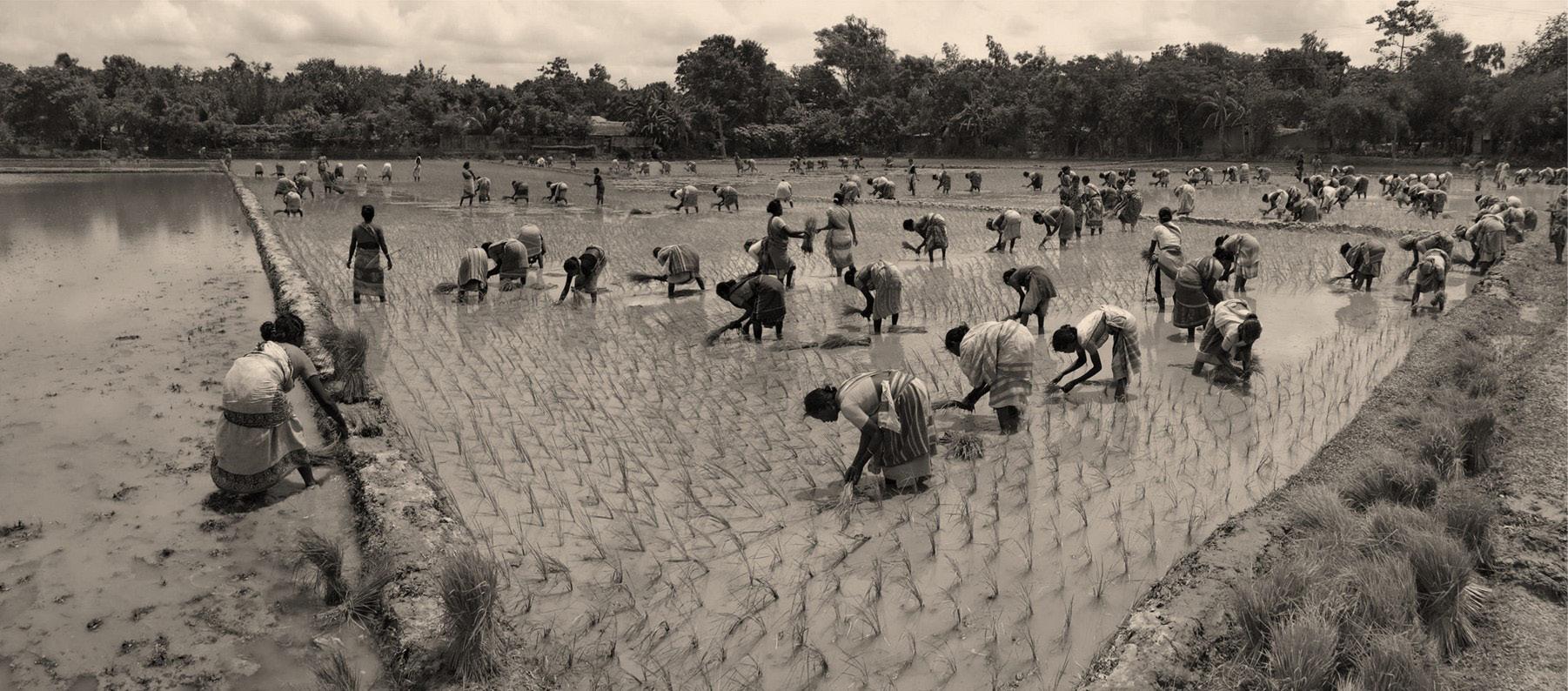
The financial livelihood of women residents in the rural areas of Ban gladesh have long been ignored. Due to the social ideologies in those communities, where the male members of the family are primarily re sponsible for the household income, this situation limits women’s abil ity to support themselves, be it economically or socially. In addition, there are few available work opportunities that would allow these rural women to be financially independent.
This expanding marketplace provides a high availability of jobs (since labor is cheap in Bangladesh) and doesn’t require a major educational background. The prospects of this type of employment continuously adds to the population flow into the already dense capital city of Dha ka. Few of these women move because they want to experience the city life, but because they have no job options in their hometowns. In order to address these issues, my project provides these women with new economic opportunities.
Change, however, is already afoot. Currently, young rural women are moving to cities to find jobs to help provide for themselves and their families back home. A significant amount of these women end up working in the RMG (ready-made garment) industry where the majority of the overall workforce are female.
The vision is to create a multi-functional communal system that will provide rural women a series of spaces where they make use of the abilities in craftsmanship that they already possess, encouraging them to create and sustain a livelihood of their own.
Building a riverside community infrastructure to empower self-dependency of rural women in Bangladesh
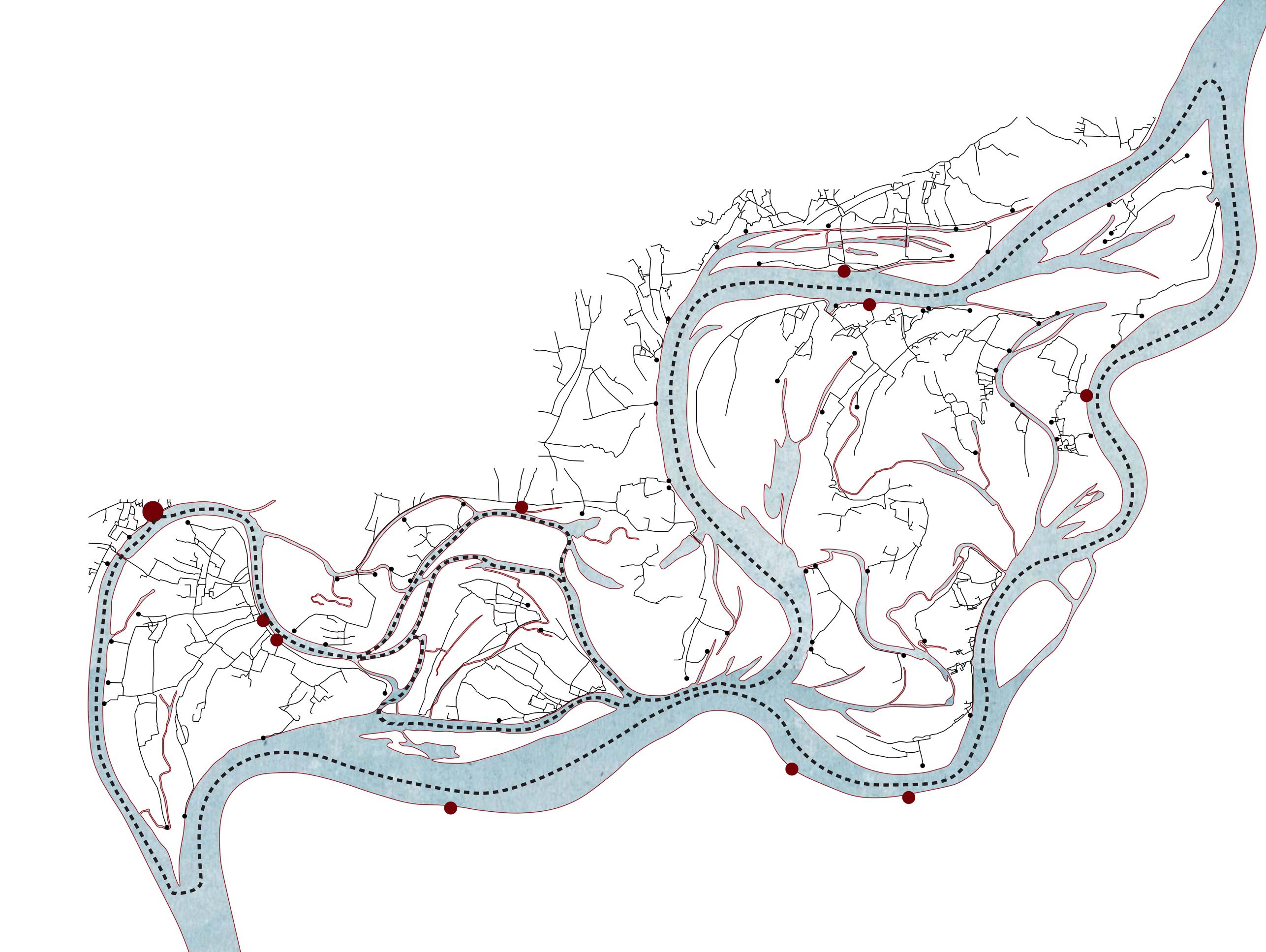


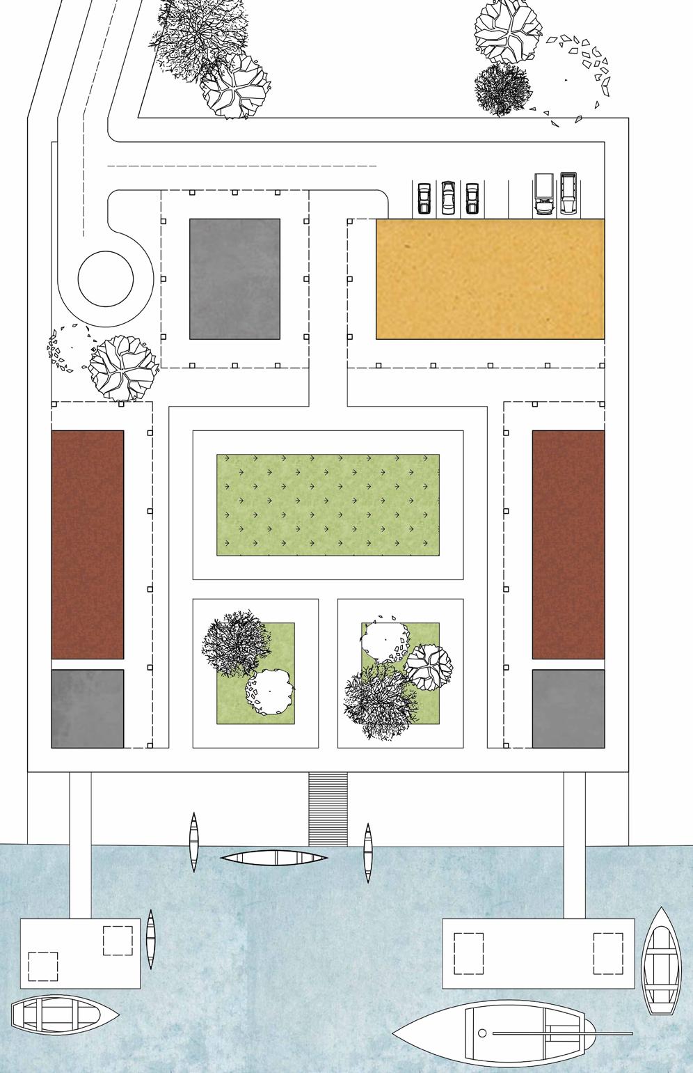
Stepped access used during low tide

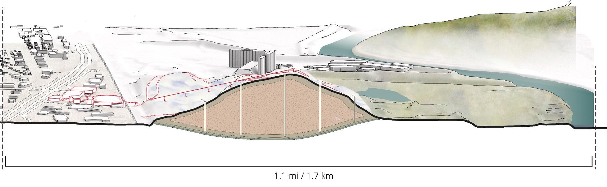
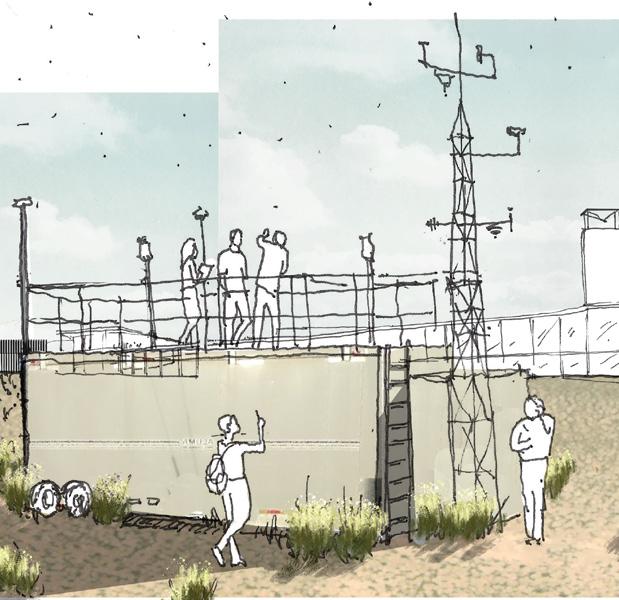
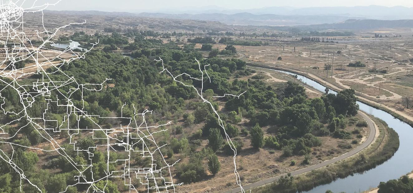
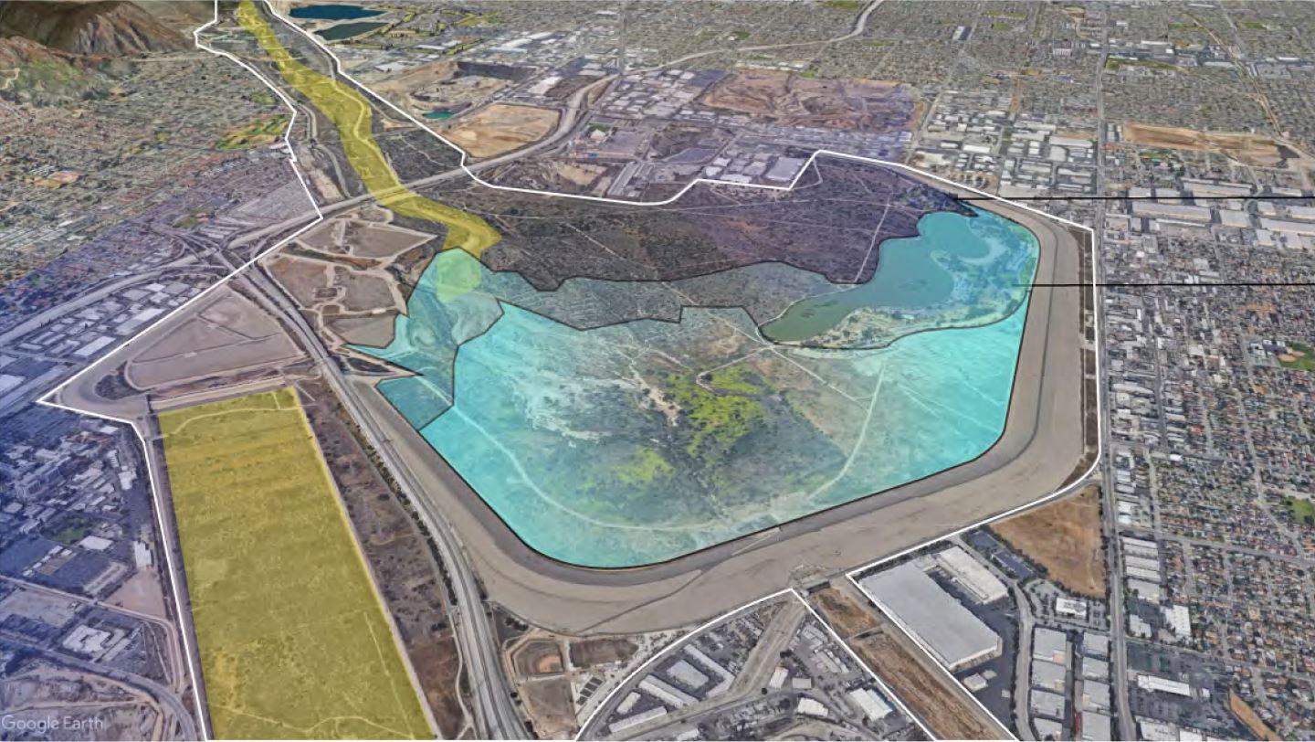
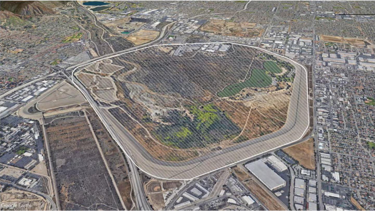
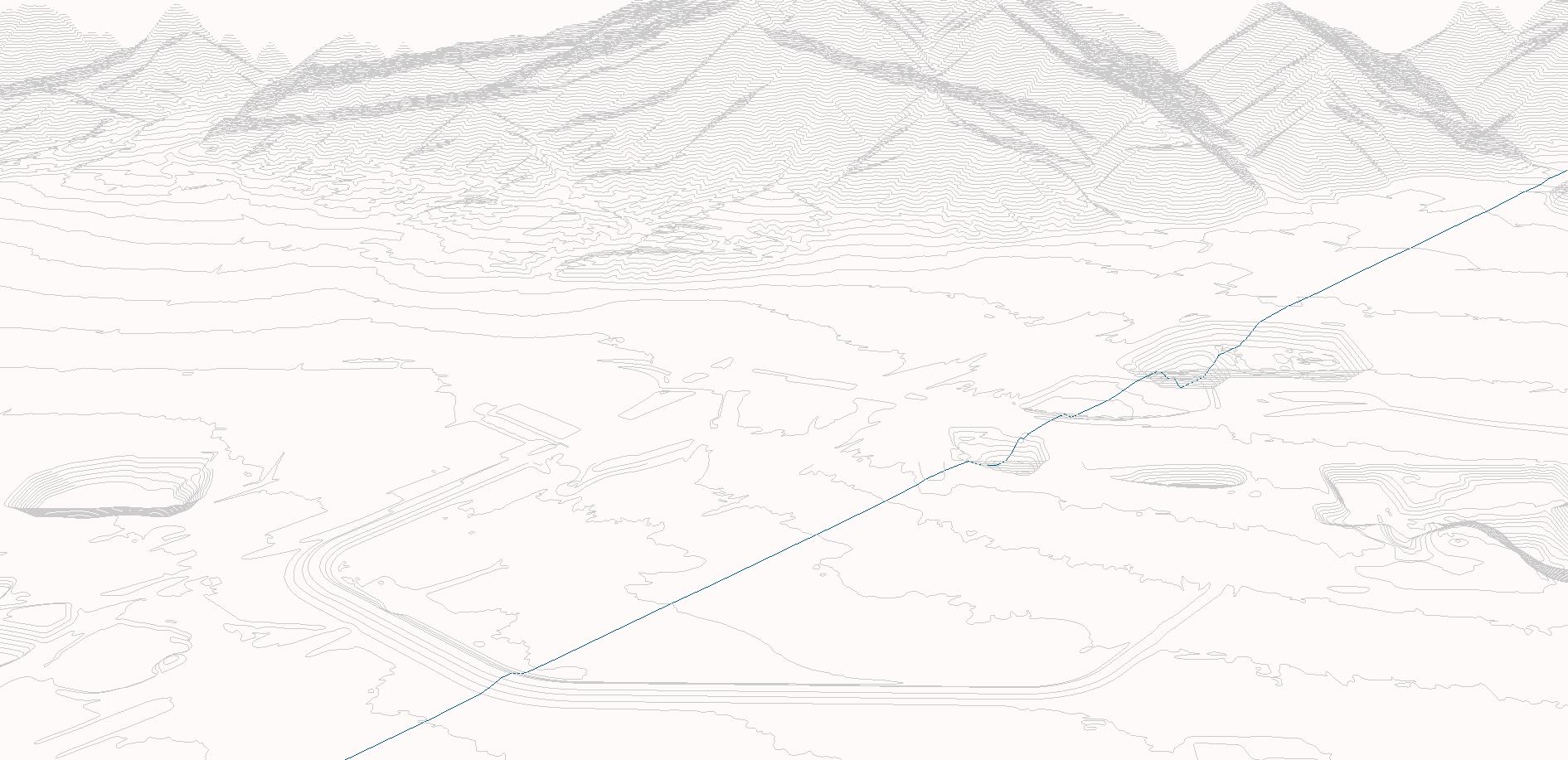
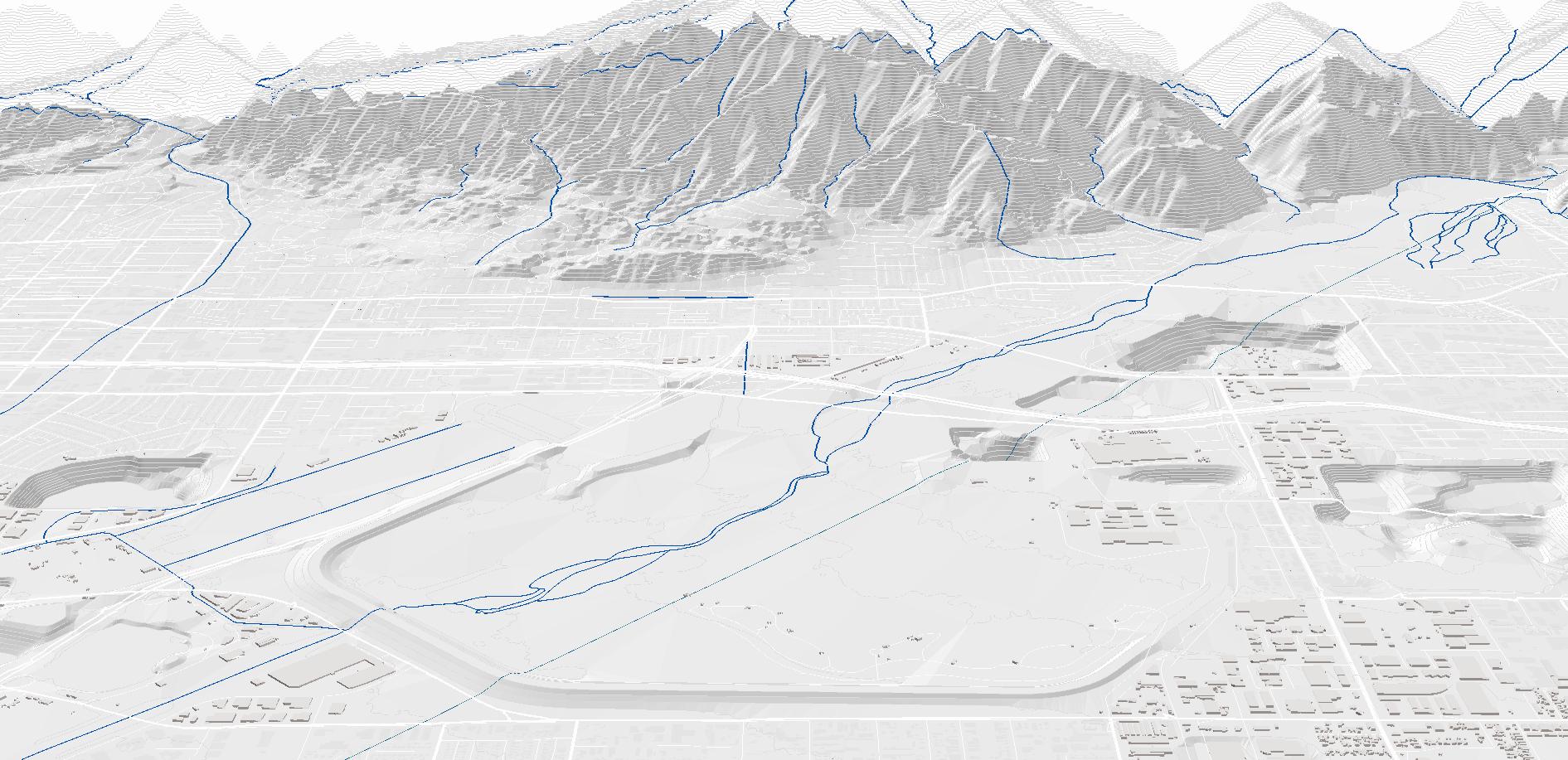
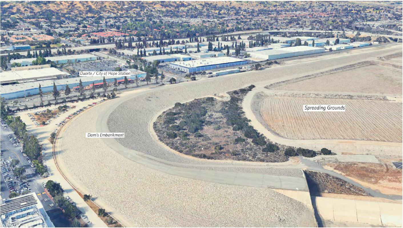
The Santa Fe Dam, located in Irwindale in the San Gabriel Valley, is a flood control structure built in 1941. Even though the Dam has never been used at its full capacity, powerful storm runoff events moved high sediment loads downstream into the basin where they scoured and buried vegetation and physically altered its ecosystems.
Due to continued accumulation of sedimentation, there has been a re duction in its water storage capacity by 11%. In addition to these prob lems with natural processes, risk management and climate change, residents living in disadvantaged and isolated neighborhoods nearby suffer from a dramatic lack of open space and social infrastructure.
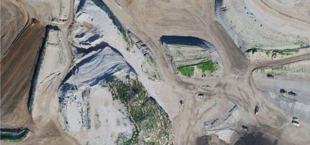
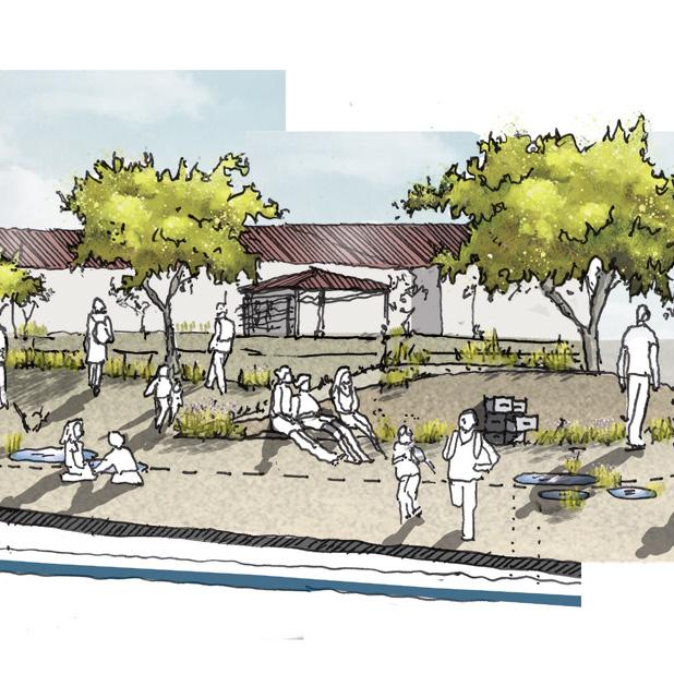
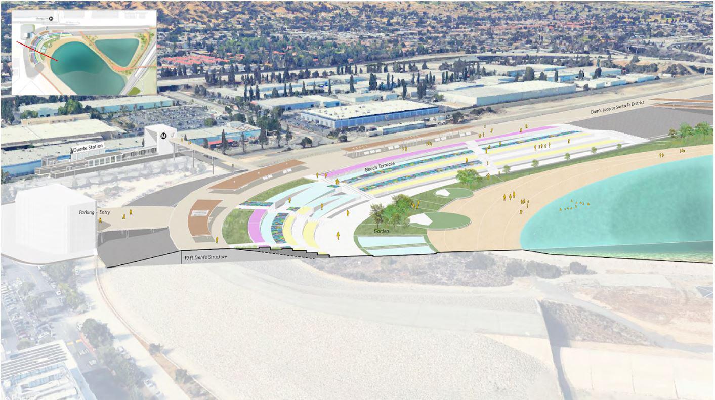
The creation of a park inside the Santa Fe Dam will provide open space and places for recreational activities in a disadvantaged neighborhood located in an area contaminated by past industrial use.
However inside the dam, a marvelous place left to nature exists. New flood-able trails, a swimming lake and beach area inside the dam, as well as a nature center, parking houses and a new metro station will make the park accessible to the surrounding communities, thus un locking its full potential, while conserving its original purpose of flood control for the entire San Gabriel Valley. New urban development in the proximity of the park will create afford able housing and encourage community engagement.
Site Location: San Gabriel Valley, CA | Advisors: John Ellis + Harrison Fraker + Margaret CrawfordIn dry seasons, the land scape experience will remain along the trail and protect the habitat of en dangered birds, least bells Vireo and Coastal California Gnat catcher.

Smart irrigation system watering along the trail is adjusted by the weather conditions of the Valley.
Canopy captures and stores storm water from rainy seasons
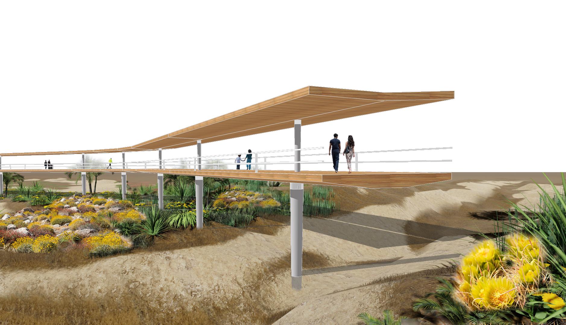
California Native Drought Resistant Plants
Dam Embankment San Gabriel River Diverted River
Nature Center
3630
Nature Center Quarry 3630 ac-ft
Santa Fe District Quarry
5690 ac-ft
Santa Fe District Quarry 5690 ac-ft
Santa Fe Regional Park:
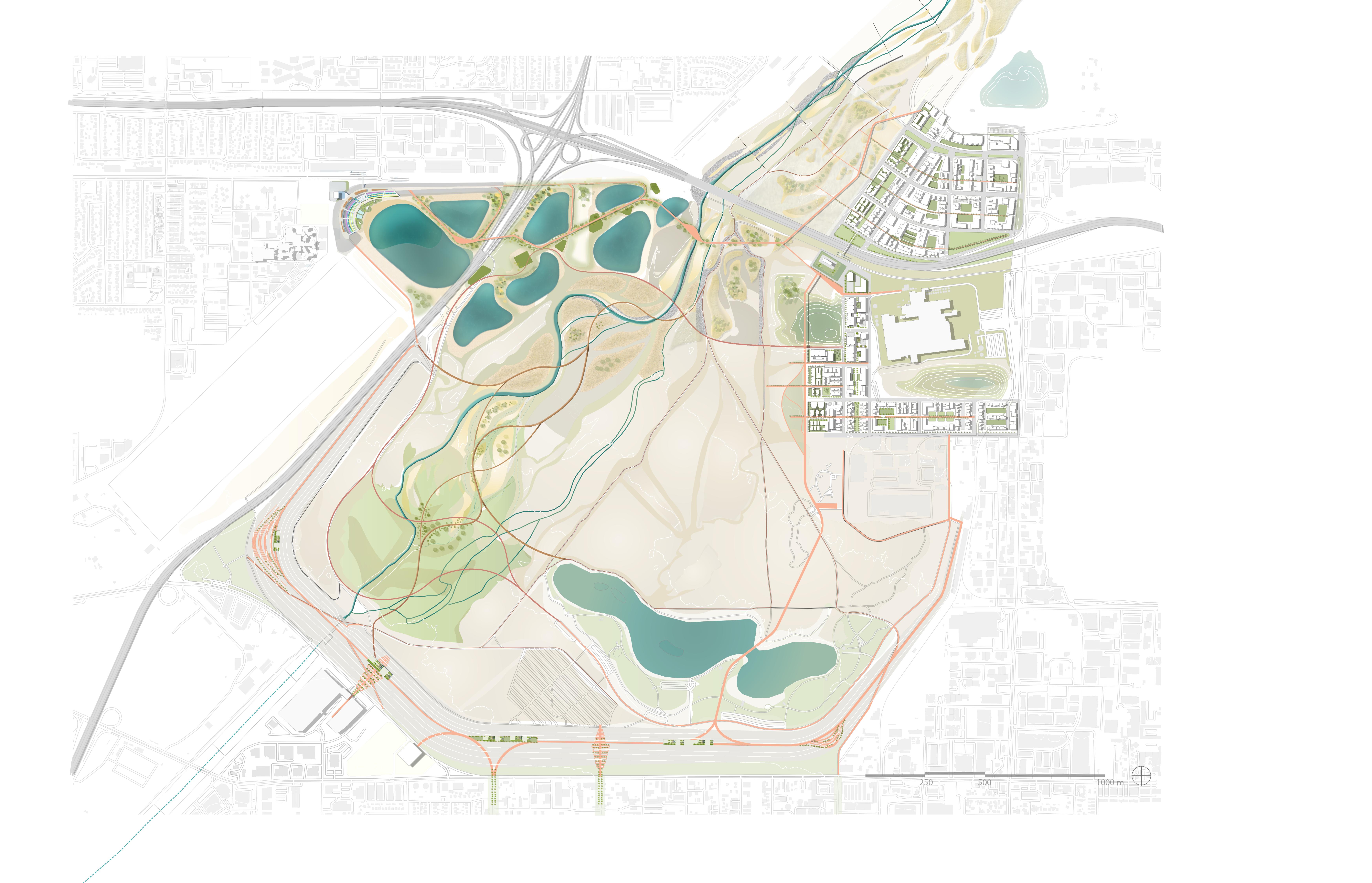
Dam’s Loop
River Walk
Wildflowers Scenic Drive
Camping Area
Picnic with a view
Charlie Produce Factory
Playground
Spreading Grounds:
Duarte / City of Hope Station
Swim Beach Area
Splash Pads
Trails Entrance
Metro Bridge
Santa fe District:
New Station
Nature Centre
Miller Street
Miller Factory
Quarry Bridge
Santa Fe Plaza
1.000.000
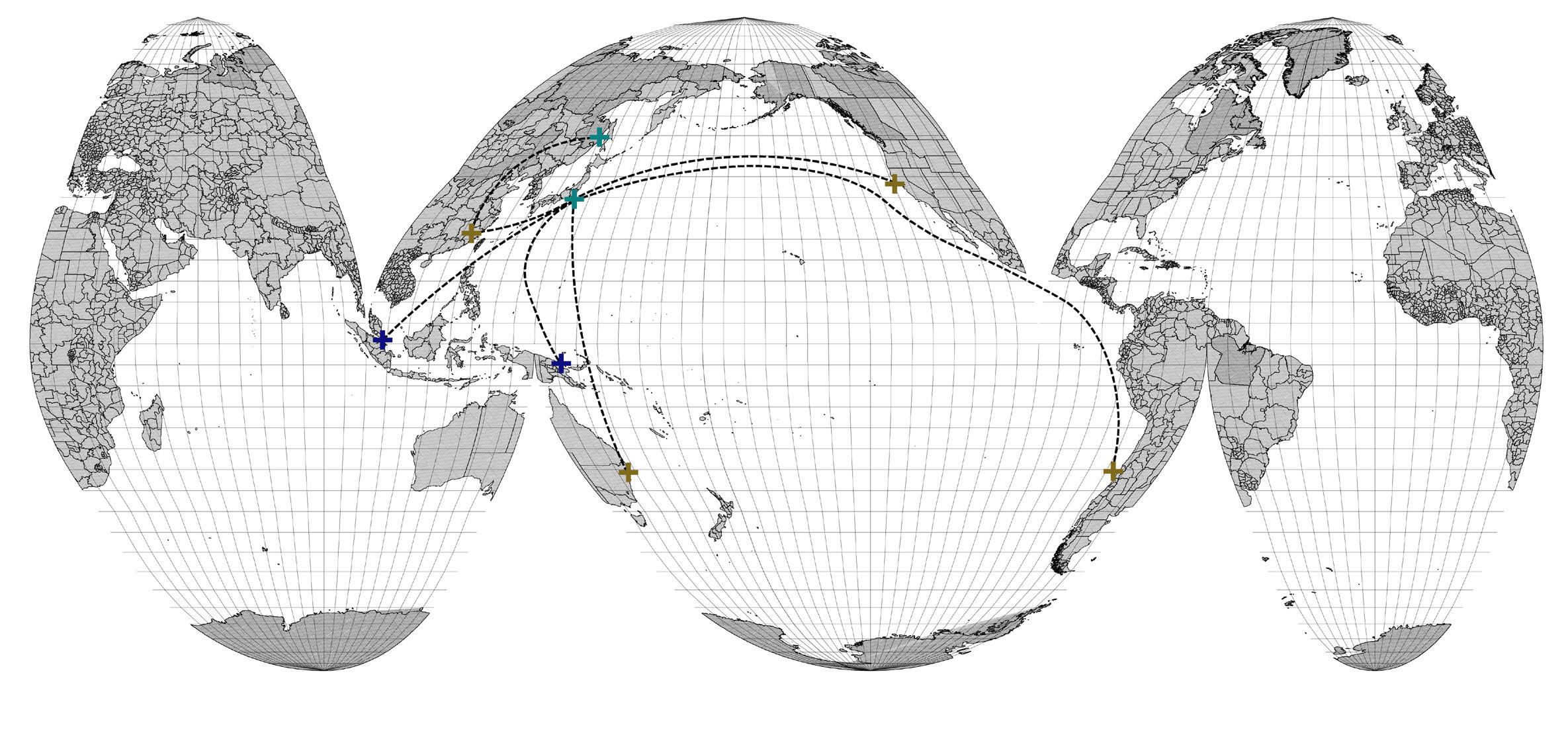
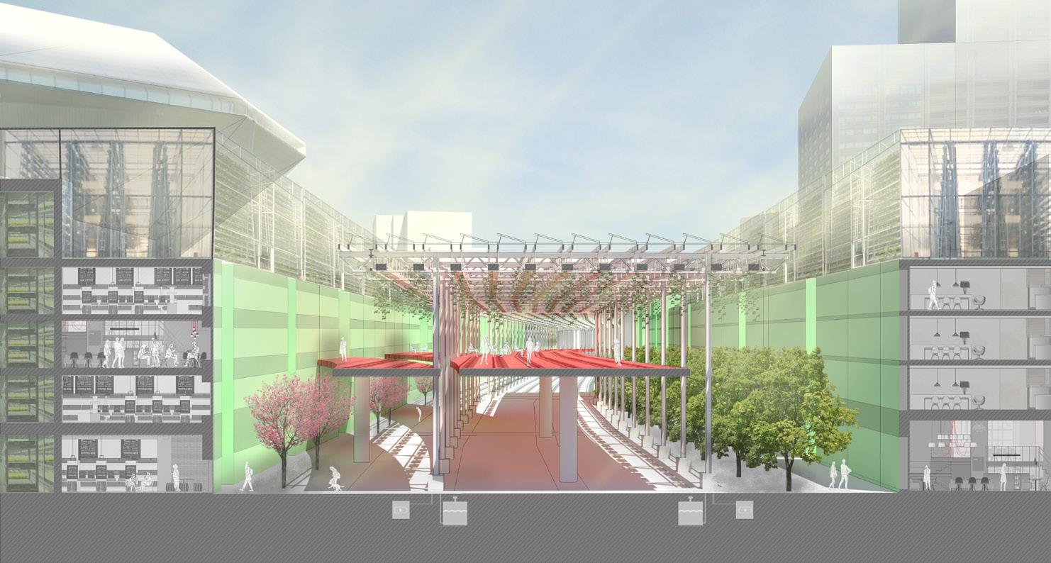
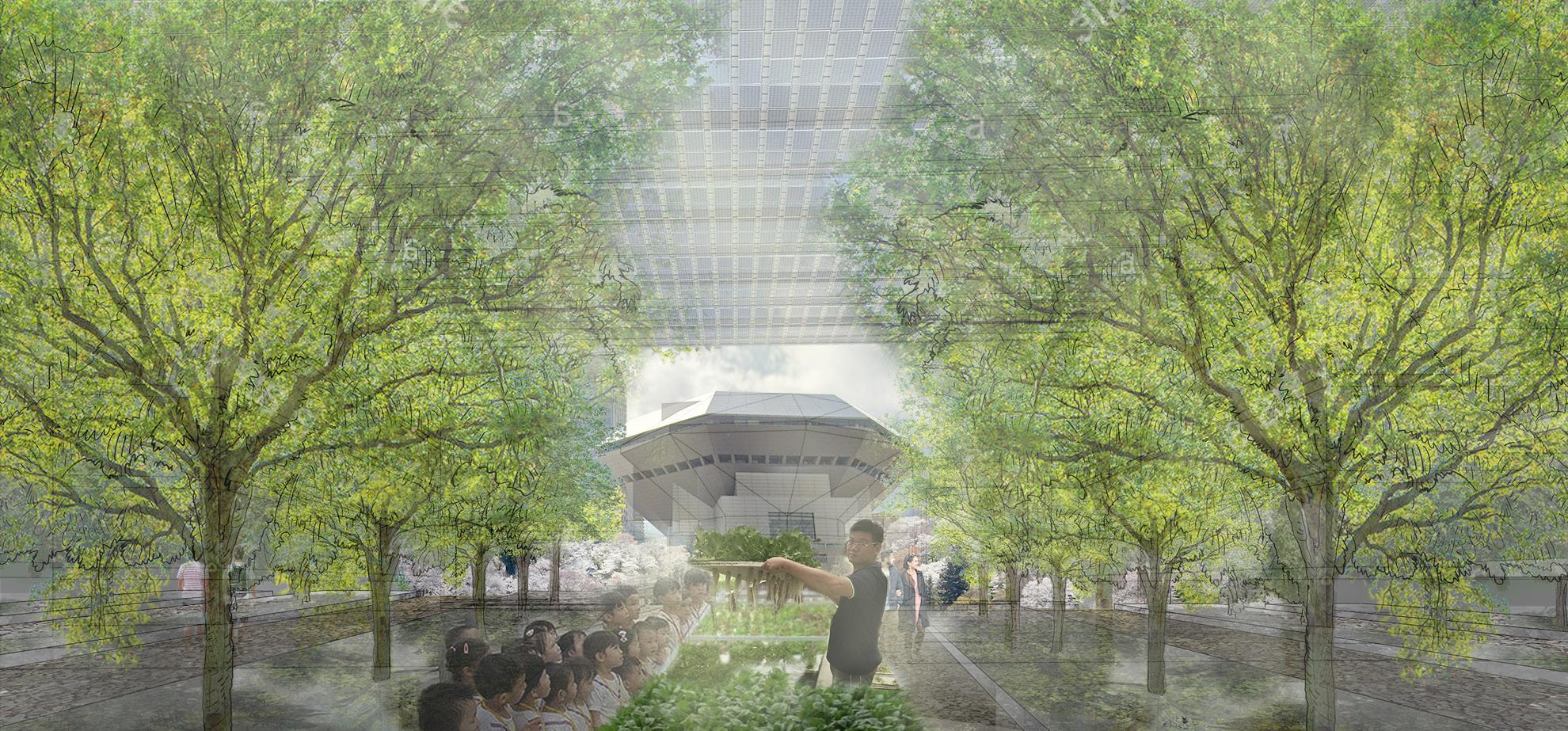
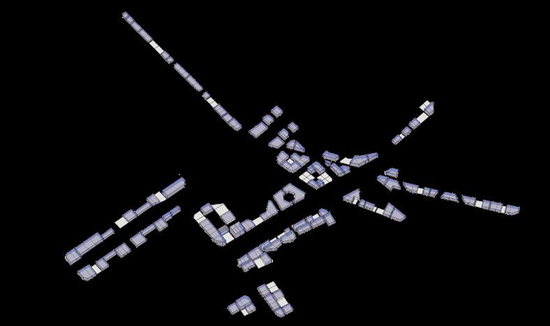
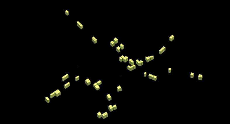
Global sites of food consumption and production
Site Location: Osaka, Japan | Advisors: Harrison Fraker + Julia Grinkrug + John Ellis
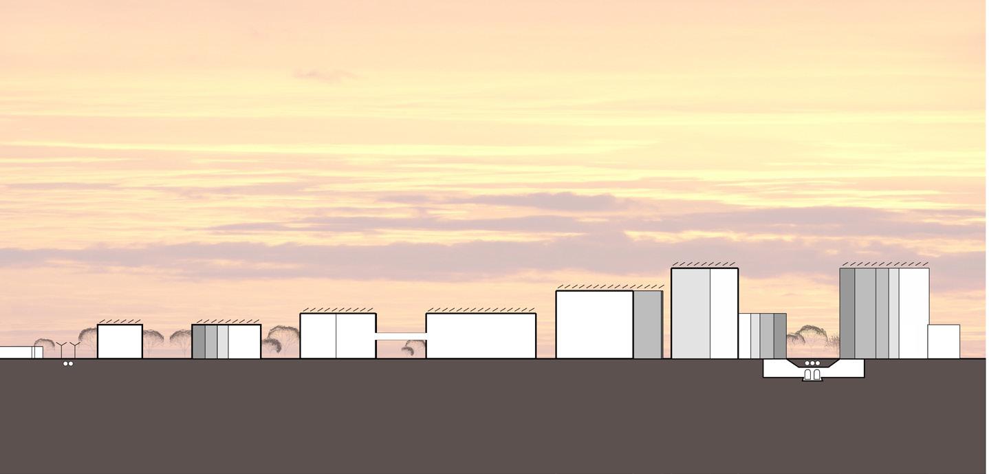
Japan has been implementing a “compact city” approach for the last 18 years, densifying what is known as the Tōkaidō Belt; a region of fifty million people in the core of the country. This is a unique phenomenon where cities keep growing but not sprawling.
The young are not willing to work on farms while an aging popula tion cannot take care of the peripheral patches. Relocating farming to downtown will release enough land to allow reforestation at the edge of the city. This change will reduce the carbon footprint and at the same time revive local food production.
Osaka – the “Kitchen of Japan” has been affected by the national com paction process, due to local migration of people moving from dis invested rural areas towards urban centers; Osaka has lost 40% of its urban agriculture during the last decade.
Revitalizing the relationship Downtown-Periphery can save Osaka po etically and practically. The soil on the periphery is deteriorated and produces low quality vegetables.
The project redevelops 9,8 Acres near Osaka’s food district, using ver tical farming typologies in an urban repair proposal. The new food production district can produce the same as 1,666 acres of traditional farming, feeding 636,636 people with locally produced food. By refor esting 1,666 acres of gradually released land, Osaka’s Carbon Foot print can be reduced by 74% by 2050 going from 58.9 to 15.3 MT/CO2 per year, Osaka´s Carbon Footprint will be similar to cities like Rome (IT) or Austin (TX).
Leveraging social-ecological and food systems to save Osaka’s downtown
Downtown
Downtown
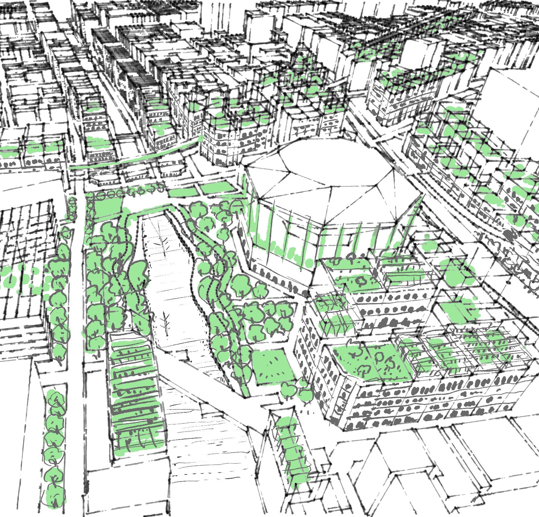

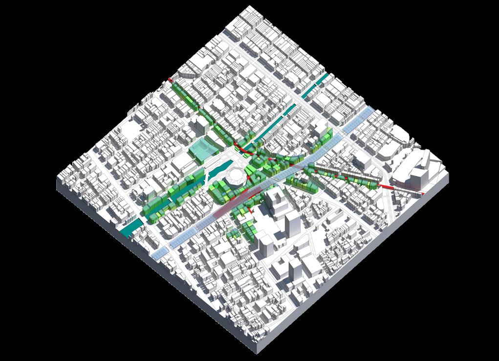
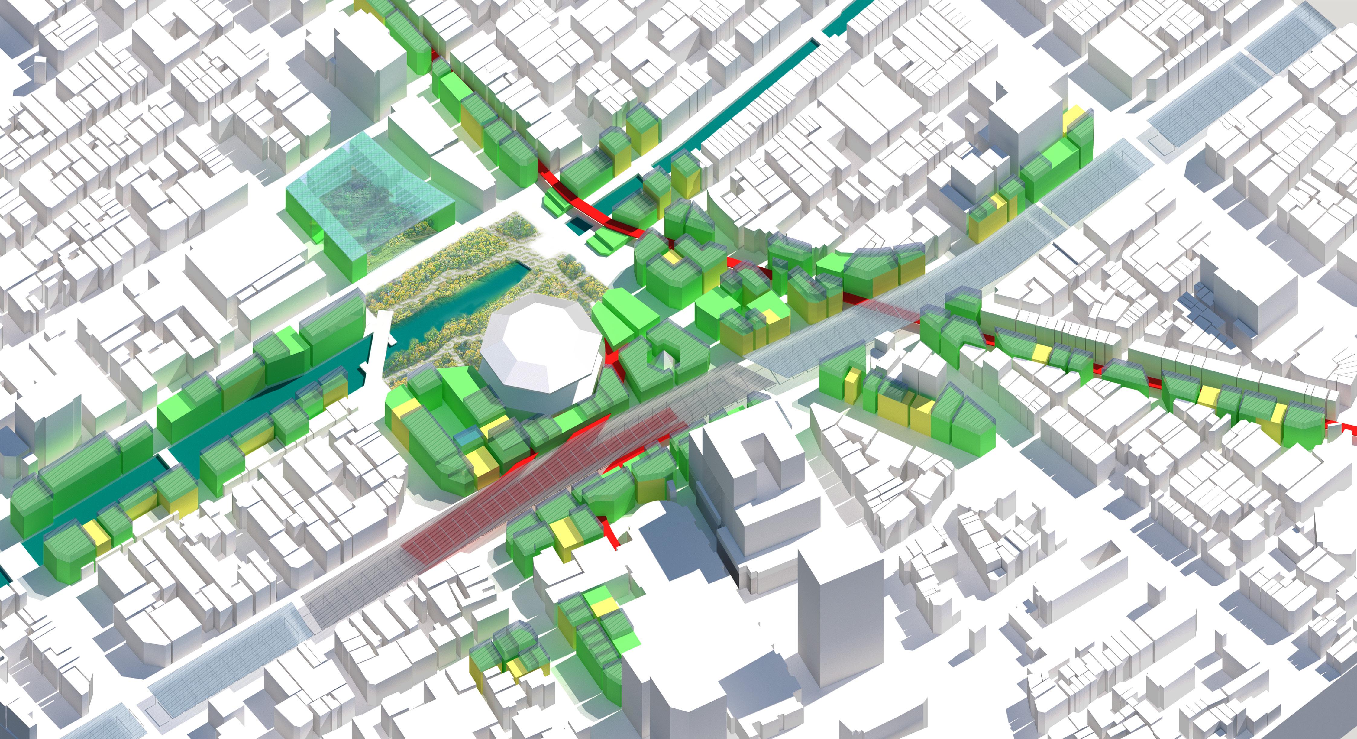
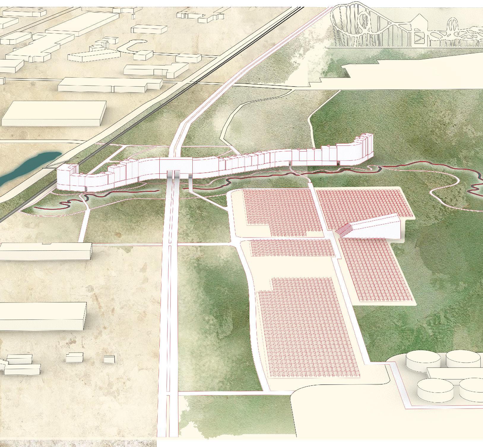
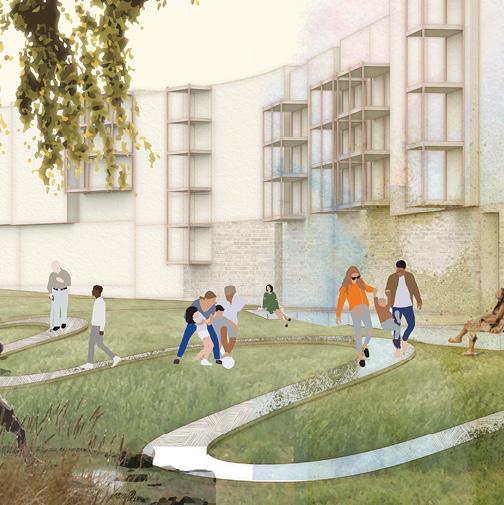
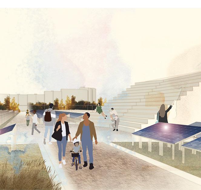
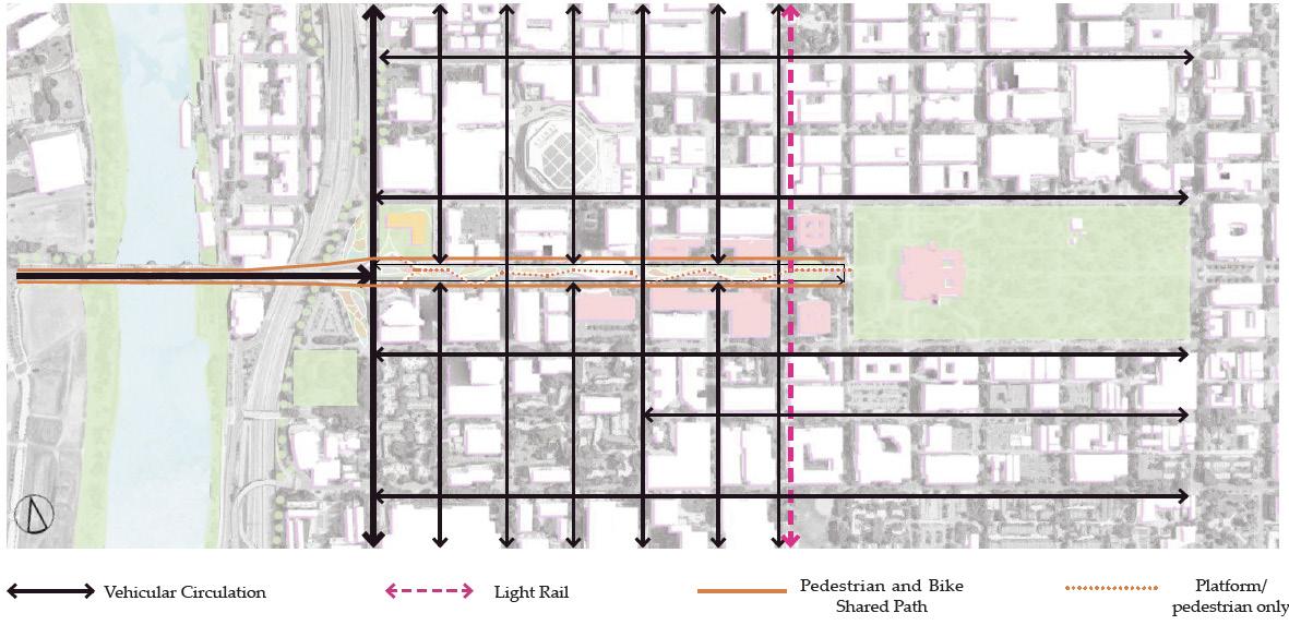
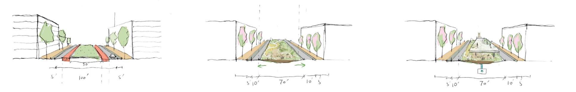
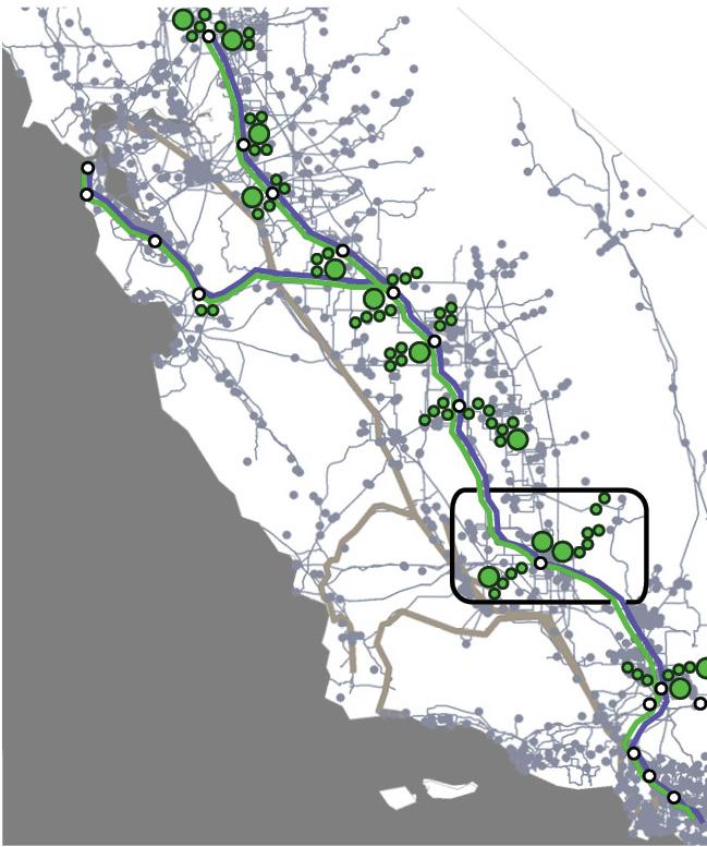
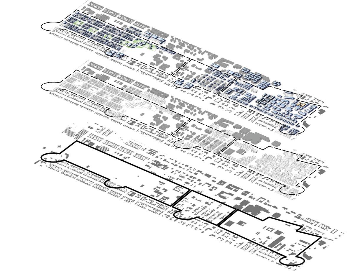
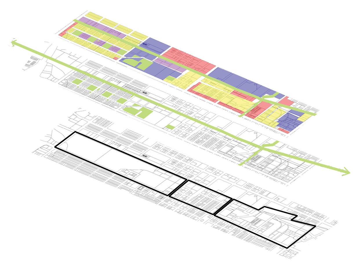
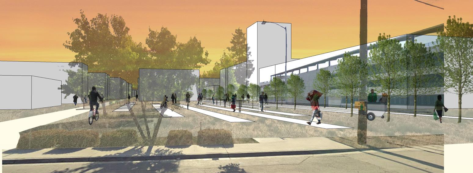
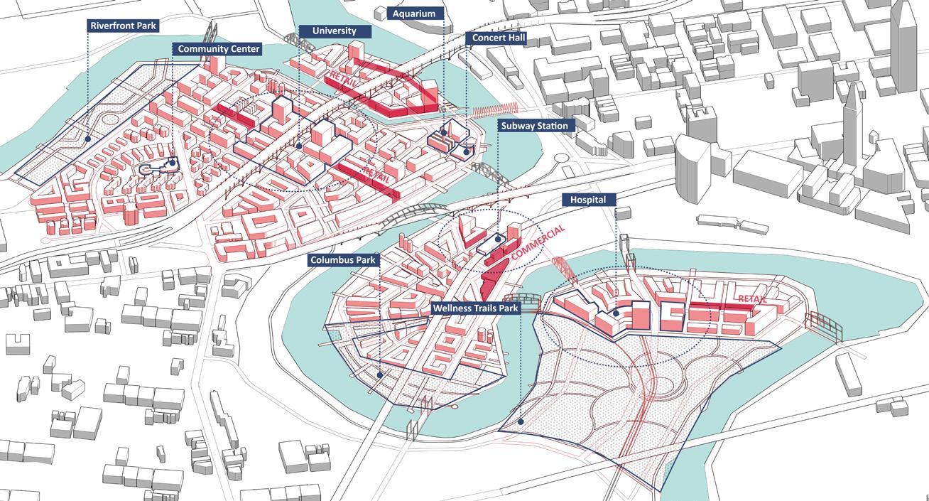
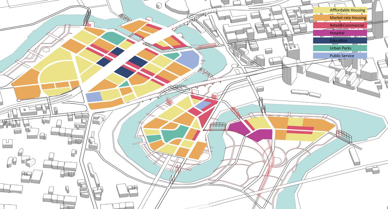
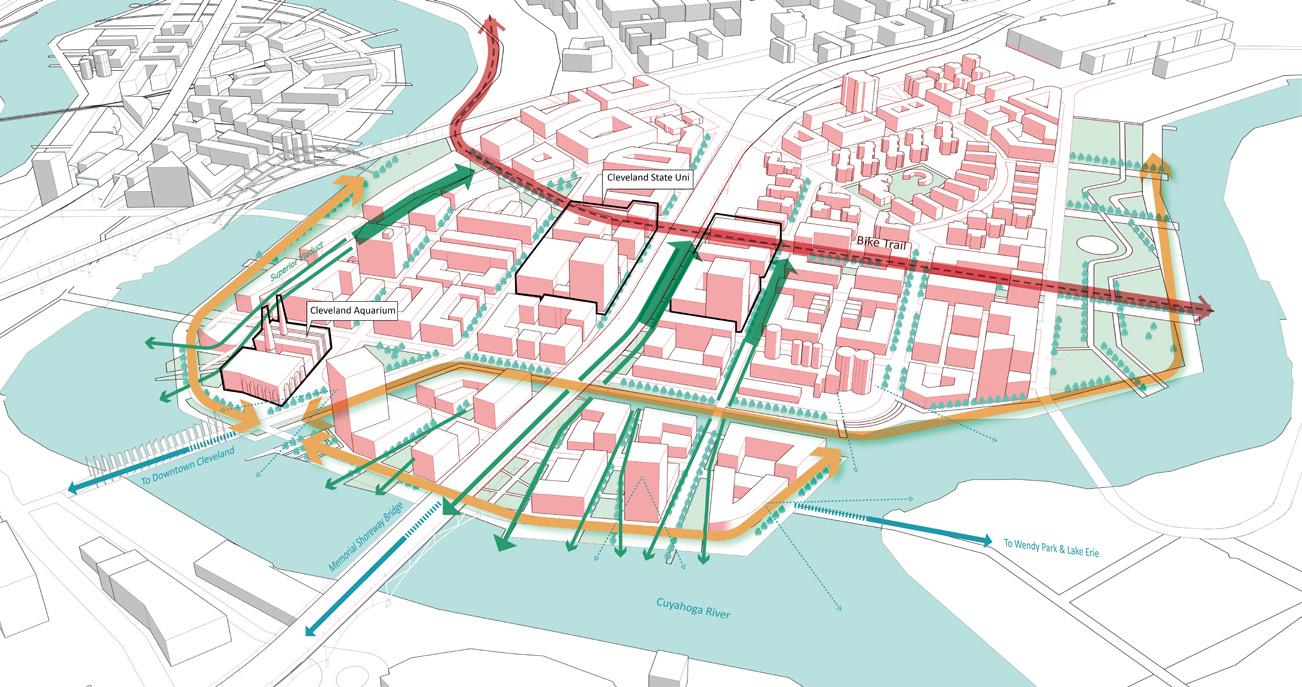
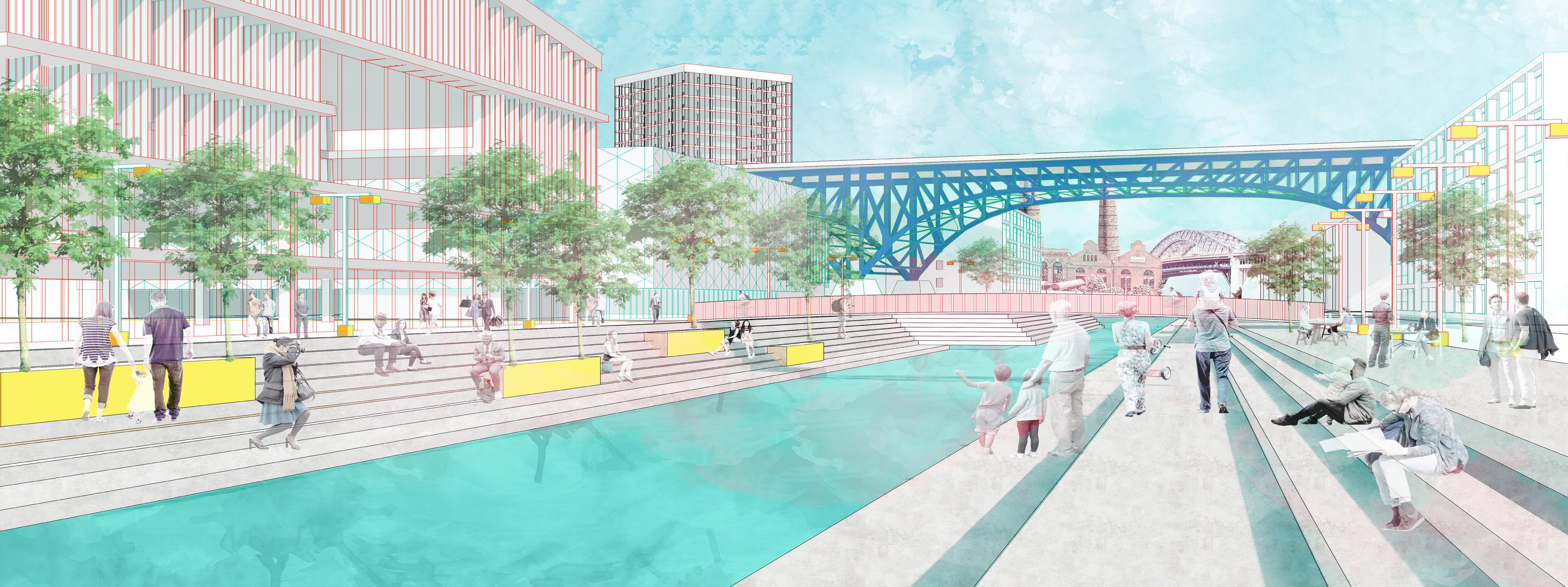
The modern world focuses on regions that are developing toward a prosperous economy and overall population growth, often neglecting declining cities. Cleveland is an exemplary Shrinking City, undergoing a steady loss of the U.S. population since 1950. Despite the loss of US residents, the city’s immigrant population is increasing due to a local Citizenship & Immigration Services office, leading to an overall increase in the number of city residents.
The selected tri-peninsula site is disinvested by the city and has lost much of its population as a result of redlining. Historically, it suffered from heavy industrial development, resulting in large-scale environ mental contamination. Additionally a demographic boundary of segre gation divides white and non-white communities, with the population predominately African American. Major challenges include the derelict state of the site, which is dominated by parking, the legacy of pollu tion, and the need to stabilize the lives of the remaining population.
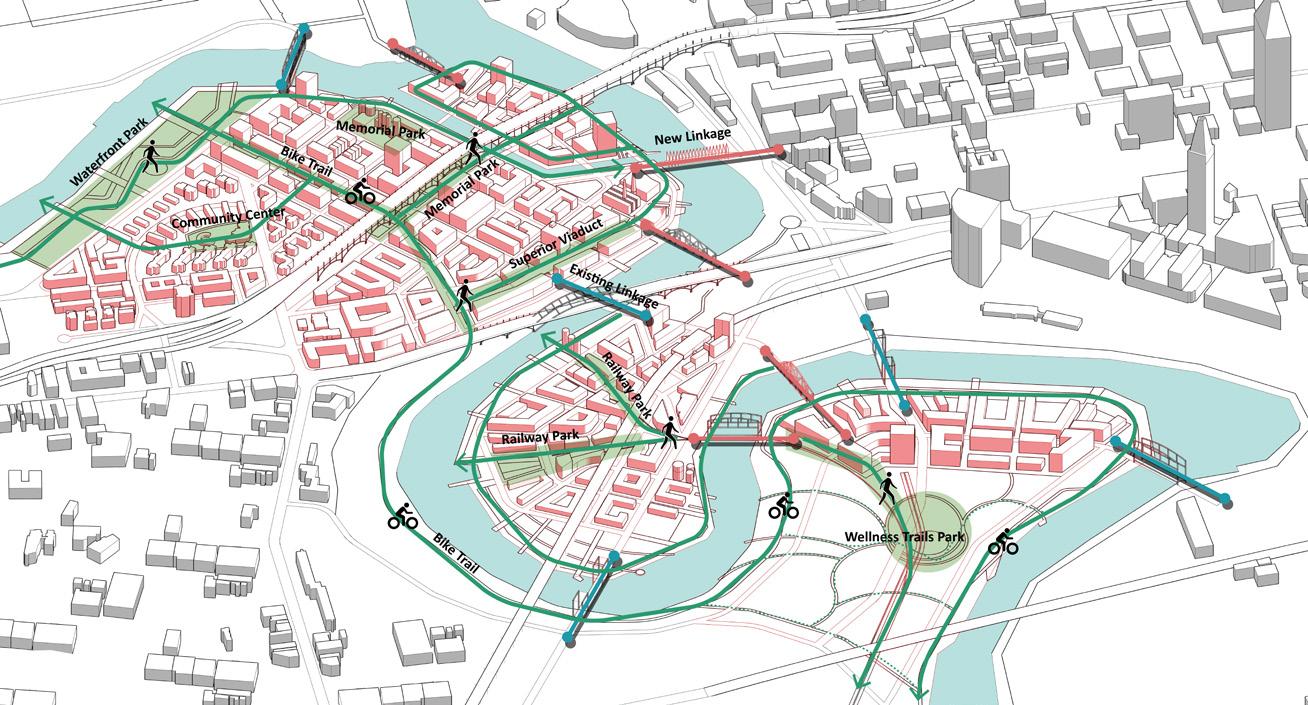
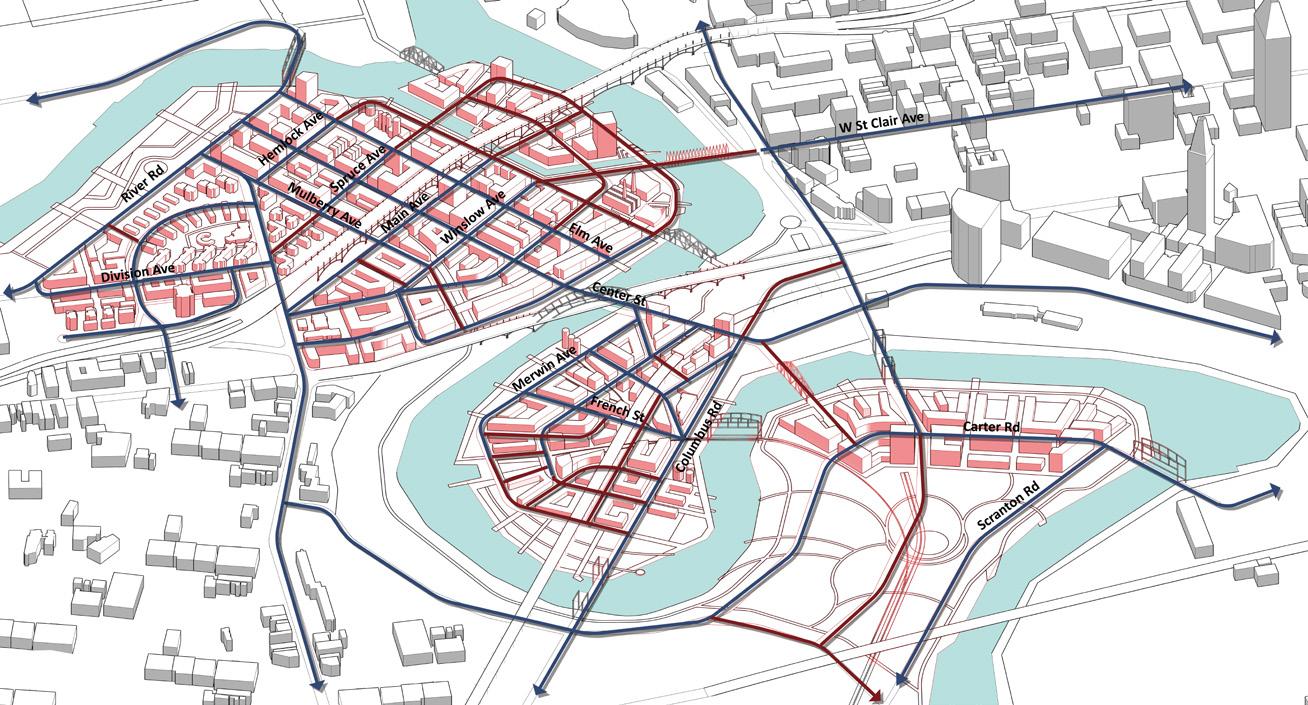
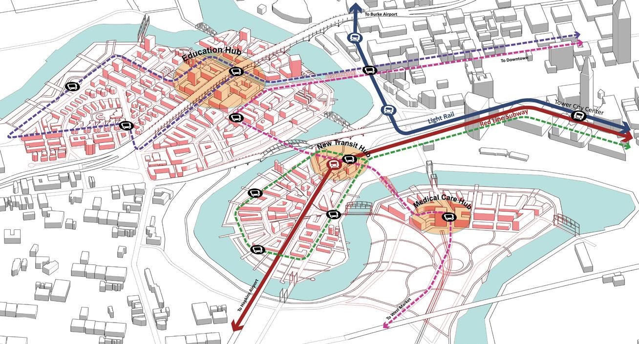
Three economic drivers at each peninsula create new job opportuni ties and provide public infrastructure. In the Main Peninsula, closest to downtown, a new mini-campus of Cleveland State University provides accessible education and boosts development in the neighborhood. The Columbus Peninsula is planned for the 2030 World Sustainable Ur banism Expo and establishes a new station on the existing subway line, connecting the site to the airport. The Scranton Peninsula incorporates a health campus and Wellness Trails System based on the existing bike paths. The three peninsulas work together to provide affordable hous ing, resilient landscaping, and connection to the adjacent neighbor hoods.
Through the creation of mixed-income neighborhoods, the activation of the waterfront, and the promotion of healthy walkable lifestyles, this thesis establishes a new urban pattern that revitalizes these disinvest ed neighborhoods in a sustainable and resilient way.
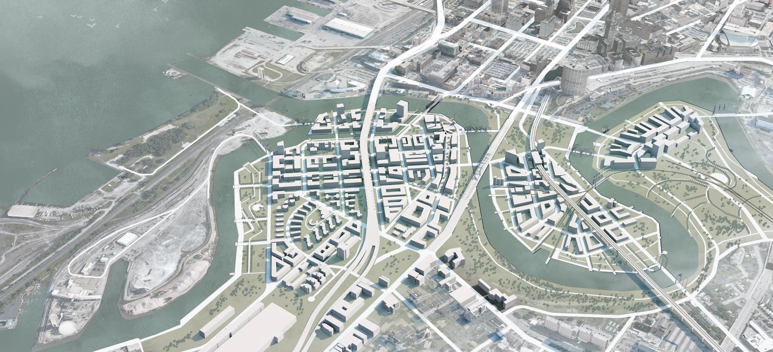
Site Location: Cleveland, Ohio | Advisors: John Ellis + Harrison Fraker + Stefan Pellegrini
Light the Blighted: Revitalizing disinvested neighborhoods along the Cuyahoga river in Cleveland
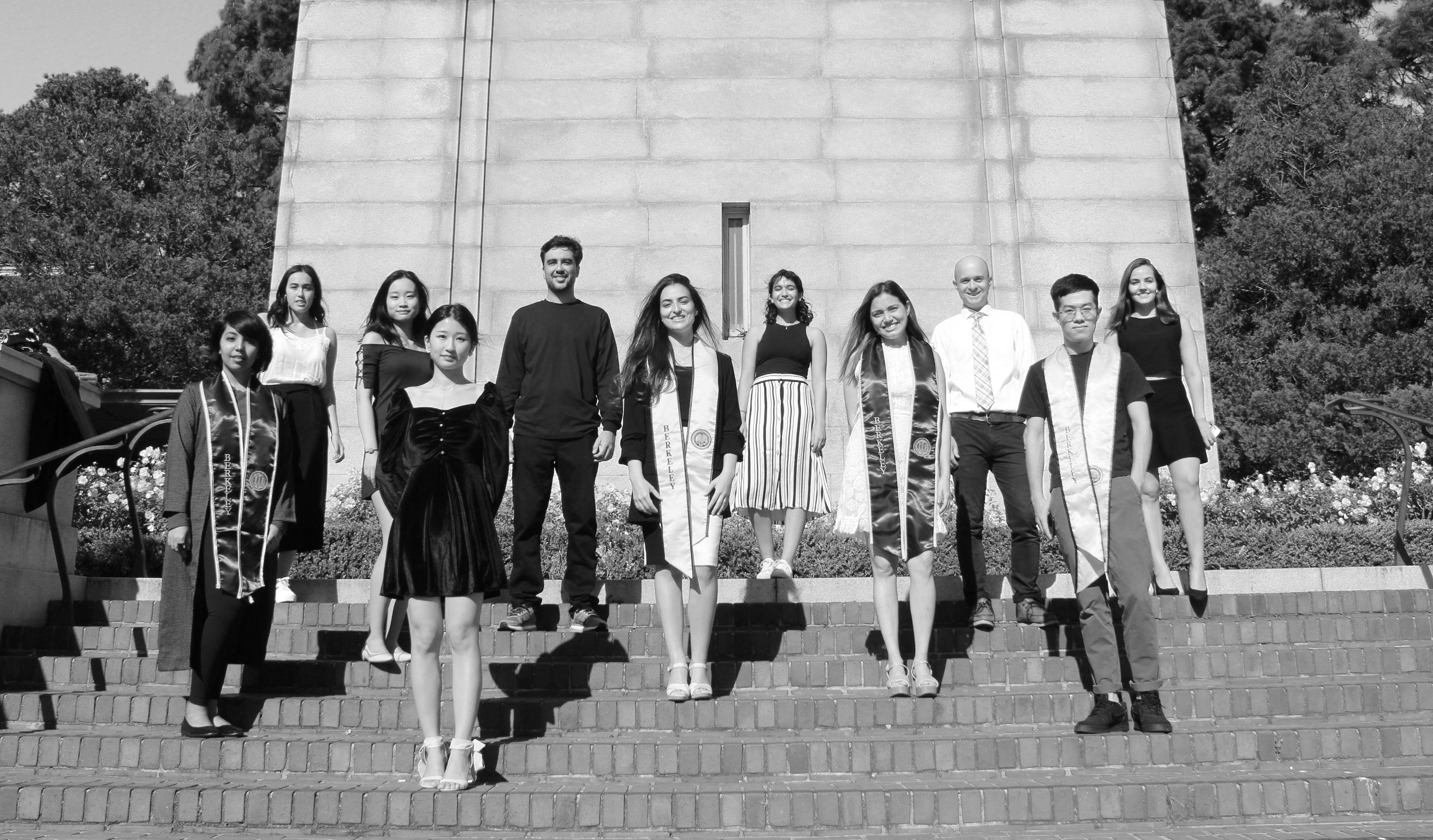
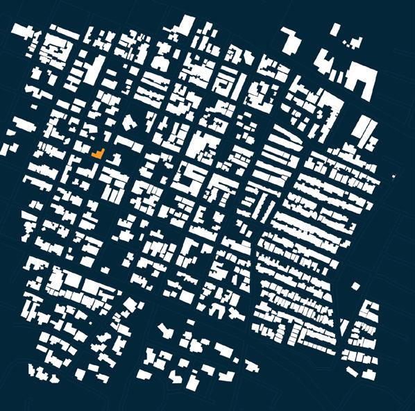
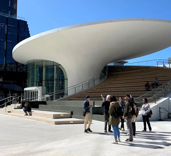
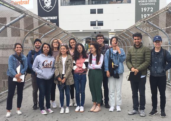
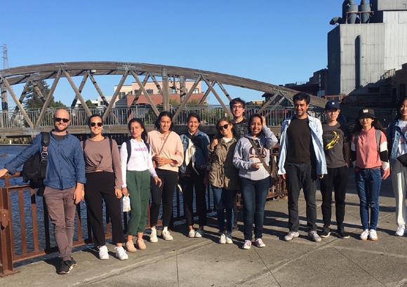
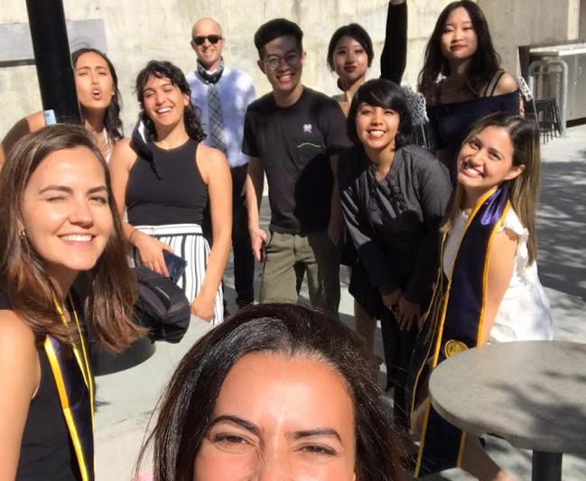
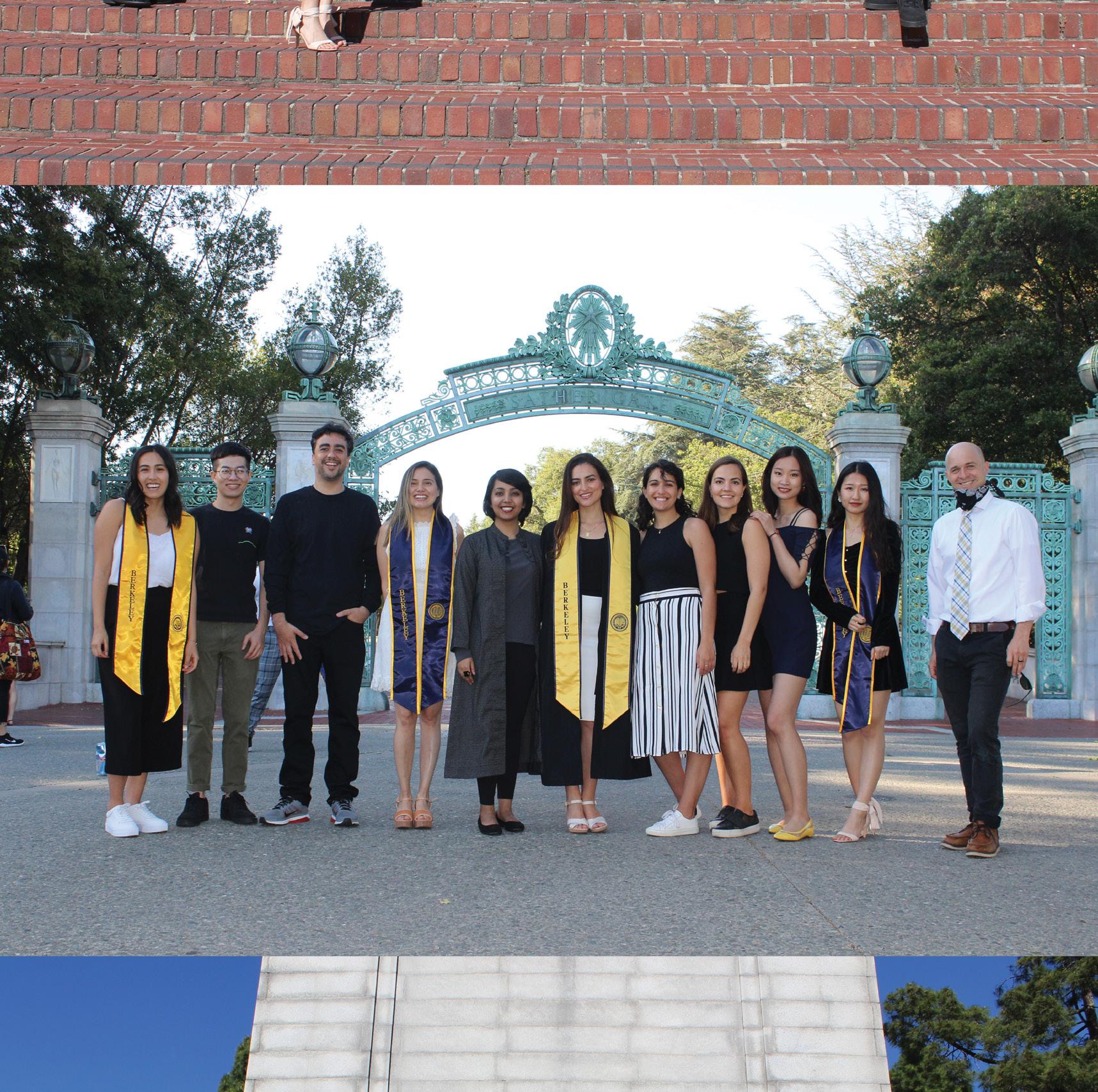
The 11 students of the class of 2020 are the 24th group to complete the Masters of Urban Design program.
MUD students represent a small but significant tranche of graduate urban de sign study at the CED that includes an urban design concentration in the pro fessional degree MCP program as well as the post-professional MUD program. MUD students are generalists who bring their previous professional experience in architecture, landscape architecture, and planning to the interdisciplinary de sign tradition at the CED and spend an academic year immersed in the urban laboratory of the San Francisco Bay Area. Their professional perspective and trajectory sets them apart from many of their colleagues as they build a founda tion in urban design, theory, and research and collaborate with students in the other advanced degree programs. MUD students often serve as unifiers across design disciplines as they practice design leadership with other students and faculty.
As the capstone of the MUD curriculum, the Advanced Design Project provides an opportunity for students to apply what they’ve learned during their brief yet intense foundational program to a specific geography, program, or design problem. With the ADP, nascent urbanists bring their assumptions under new scrutiny and take up defensible positions that express their respective urban design thesis relying upon iterative testing, design exploration, and the support of their peers and mentors.
The CED provides a setting rich in institutional knowledge that allows and en courages students to build upon past design work and research and has encour aged much growth and evolution since the early years of the program. Over the past two decades, MUD students have leveraged the department’s resources and support of urban design travel and research to expand the definition of ur ban design, from an initial focus on the design of public spaces, quarters, neigh borhoods, streets and corridors in the early years of the program, to the design of regions and territories in recent years. They have sought to confront a range of contemporary issues, from the disinvestment, disorder, and inequity of urban cores, to the retrofit of suburban places, and the adaptation of environments impacted by climate change and sea level rise. Along the way students have gained an immersive understanding of urban design’s overlap and intersection with economic forces, social and political systems, infrastructure, sustainability, cultural heritage, and natural systems (including geology, hydrology, geomor phology, and climate).
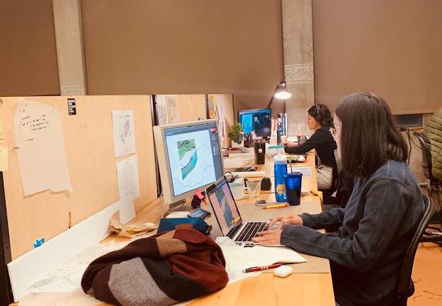
The increased availability of extensive satellite mapping data has helped to make project sites at every corner of the globe accessible and feasible and has enabled larger and more complex urban design projects; what may have need ed a travel visa, a costly site visit and hours of documentation 20 years ago may today only require access to Google Earth. And the broad efficacy of 3-D modeling software has expanded students’ ability to both analyze data and ef fectively demonstrate their design outcomes.
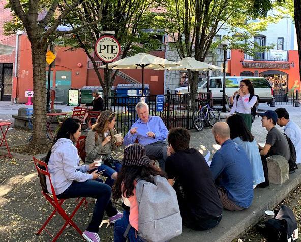
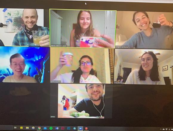
Coming into 2019, the MUD students were poised to have what should have been another “ordinary” year of urban design stretching, building upon the work of previous classes, raising some new questions and answering some old ones while collaborating to explore project sites and themes under the guid ance of faculty and reviewers. Then, 2020 happened. The advent of the pan demic greatly limited many students’ abilities to visit the ADP sites they had chosen, and lecture courses and design studios went online. Over the summer, students strived to make meaningful projects from the solitary of lockdown, as the California landscape was ravaged by unprecedented wildfires, nationwide protests over systemic racism and police reform erupted, and much of the pro gram’s informal support structure vanished.
Despite these setbacks, the class of 2020 persevered pushing forward big ideas and grand projects. Students used social media to connect with local residents of their sites, who provided reporting and took site photographs, gaining unique perspectives that were otherwise likely to be overlooked. Interim reviews – which had traditionally been very effective in the iterative development of ur ban design concepts, transitioned to online formats that allowed the “pinup” to evolve seamlessly over the course of the entire semester. Students adopted new strategies for visual communication, leveraging digital workspaces and anima tions. And the breadth and scale of projects reached new levels, among them: A national trail through Haiti, a district energy strategy for the State of California, a food production strategy for a shrinking metropolis in Japan, a sustainable land use strategy for western Tanzania.
The final ADP reviews have traditionally served as a reunion of locals: MUD graduates that have remained in the Bay Area, current and incoming students, faculty and staff, urban design professionals. This year, online reviews brought together a more international group, including broad and inclusive participa tion representing 5 continents – a testament to the continuity and community that has been created through 24 years of the program.
The need for urban designers, and multi-disciplinary design leadership, has nev er been more crucial. The summer of 2020 served as a reminder of the critical and pressing issues facing the built environment, and the abilities of Berkeley’s MUD students to respond in kind. These 11 will join the 184 students that have completed the program since 1997 in making their own important contribution.