4 Four Center
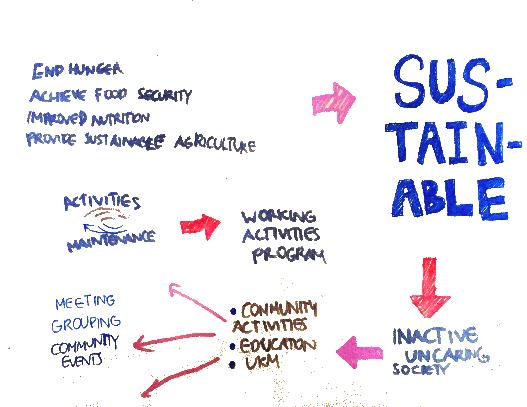
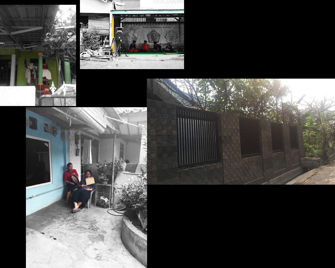
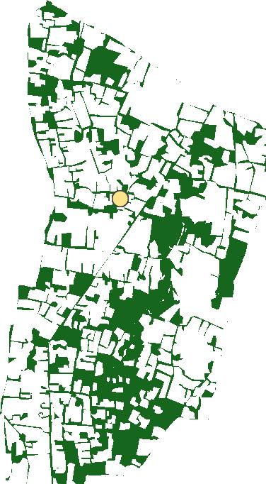
The assignment theme was SDG 17. Each sustainable goals was spread between two that I got was goal number two; zero hunger. The goal aims to end hunger and ensure tight community in Joglo, West Jakarta. The place is residential area in the corner of societal condition in the area. We saw the tight the community as an effect of
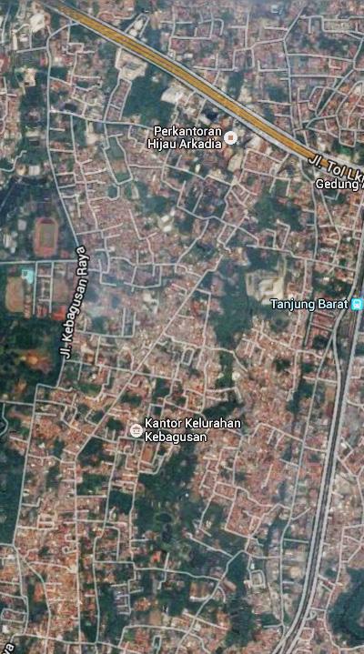


potential lot chosen after the mapping process.


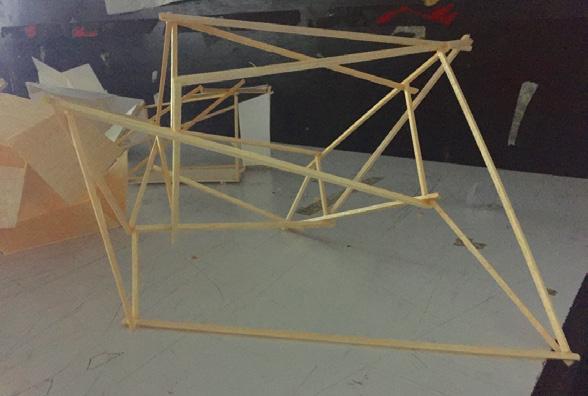


Interface Center

occurs as the effect produced by the operations that orient it, situate it, temporalize
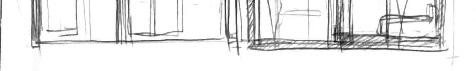
The particular site location is in the middle of one of the section of kampung that we


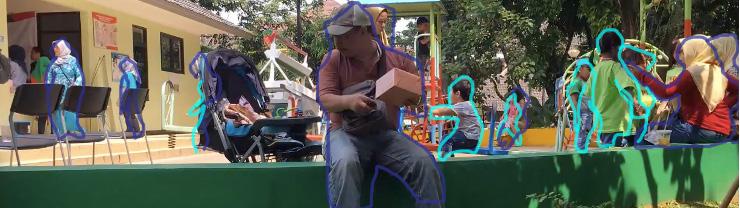
Mapping is done on the dense housing area of Joglo. From the diagram, we can see
use their space for playing, the adults can use their space for social gathering, and the sellers can use their space to sell their goods to the community.


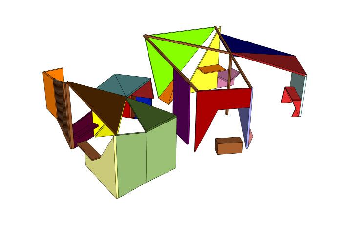


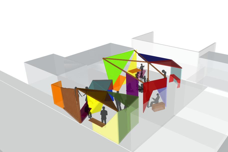


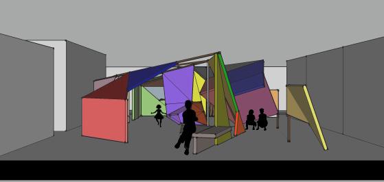
Observation of Public’s Playground
Retrospective
This was the moment I realize that I want to do more with Urban. When I made all of those studios project I kept hesitating and rewind questions in my head; Will to another steps of design making yet I often found myself in this sort of bad habit
Urban. Therefore, it is natural for me to choose this topic which is in the middle my portfolio.
Screenshot from The Social Life of Small Urban Spaces (1980) movie
Background
the architects who designed and built the space, and the community who utilize it.
in dense community from spare spaces usually an upgrade of local community center
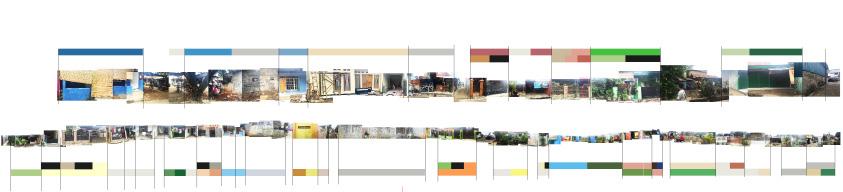
Time-Lapse Observation
they sit there anyhow. They like that place so much that they crawl, inch along that little narrow edge of the wall. We put the water near the marble ledge because we
The statement intrigued Whyte that human use space with their own imagination. It is something no architect, urban designer, or planner could dictated.
Actor-Network Theory
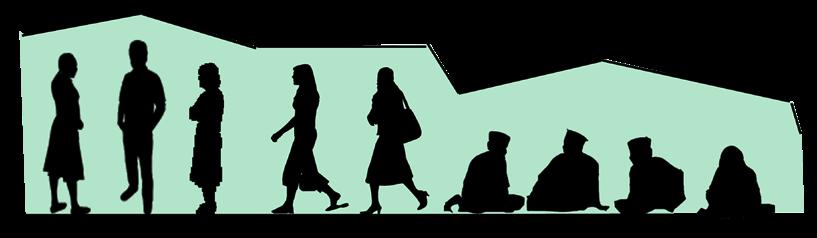
time. how big and comprised the network is, and how the adjustment made when actors actor and adult actor, school kid actor with school kid actor, and adolescent actor with adolescent actor.
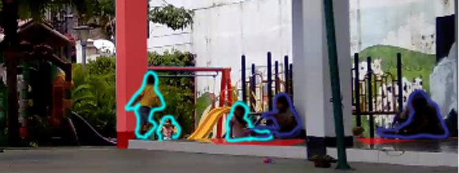

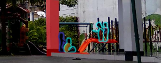


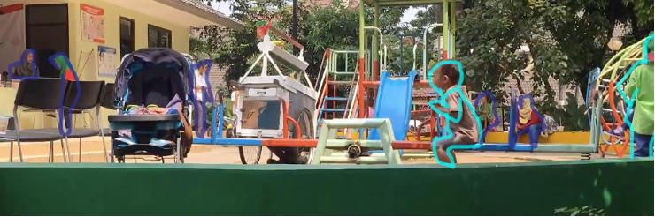
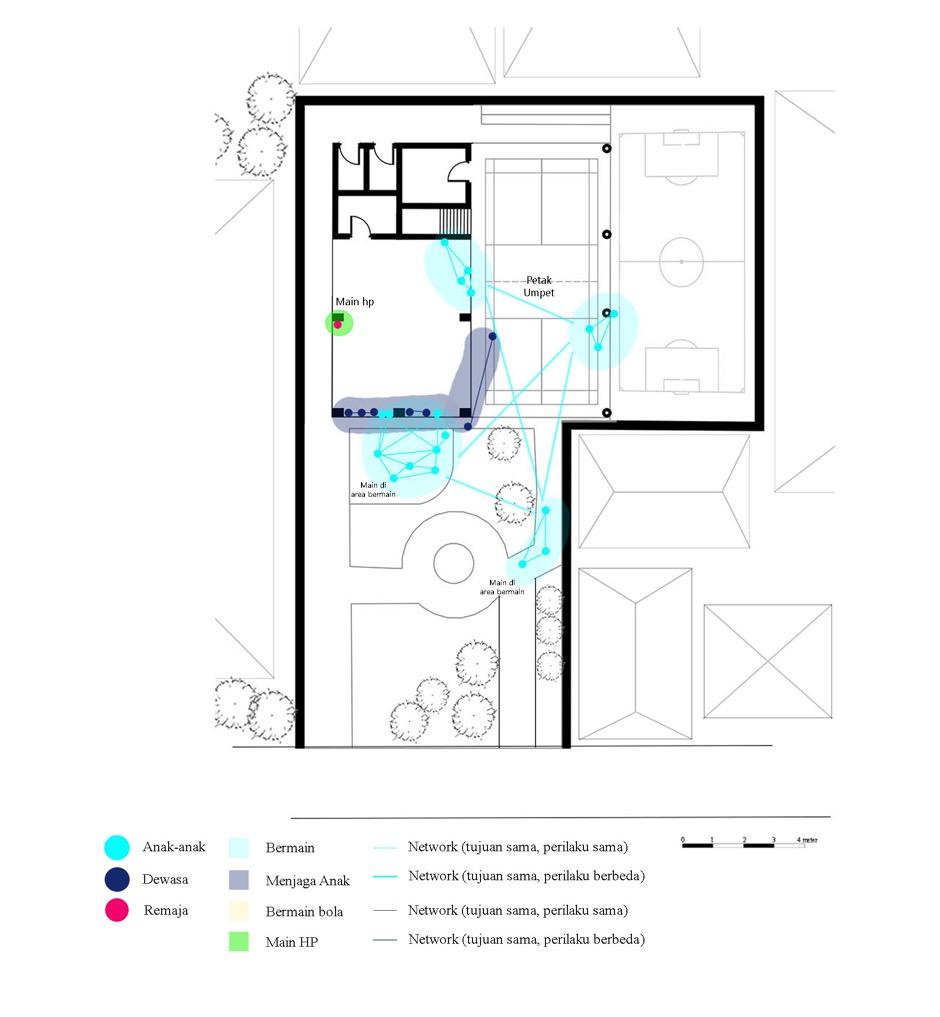


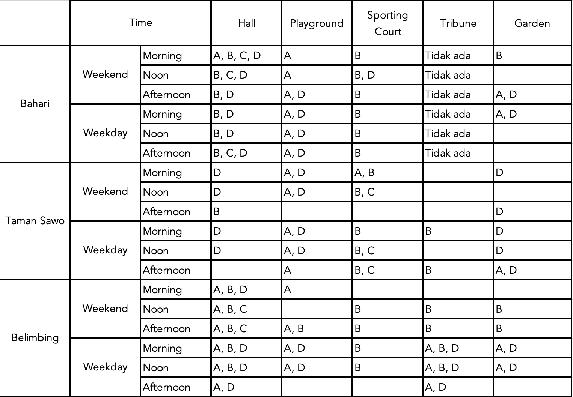
Samples from time-lapse observation and mapping (from

left to right) RPTRA Bahari, RPTRA Taman Sawo, RPTRA Belimbing
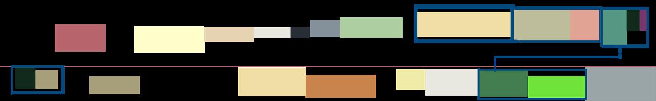
Table of actant usage from each age
A = Toddlers
B = Children
C= Teenagers
D= Adults
Observation and Retrospective Conclusion
community park with basketball ground already has a wide sporting court that can
that follow the regulated typology the most yet underused by adults actor that kids
space but to call it as child friendly space but in small area is not it.
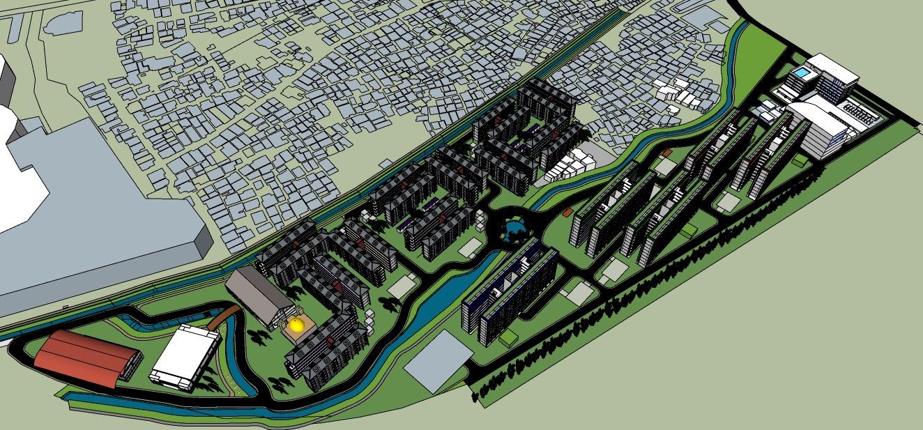
Smart Neighborhood Cibangkong
In collboration with Housing Group of ITB MPWK International Master class year 2018:
Supriyanto
Eka Septi
Ayu Erlinna
Awal Thamrin
Antoniasti E. Pupi
Karunia Akbar
part of the slum area also are standing on the land owned by the national Indonesia welfare.
West Boundary: Laswi Street and PT Koppeland
North Boundary: Cikudapateuh-Ciwidey Old Railway

East Boundary: Cikudapateuh-Ciwidey Old Railway

considers their location as strategic. It is located close to the major road and also the unfortunate situation, many see this as potential as the land price of the area is
Railway Reactivation (Development of Cikudapateuh Station)
TSM expansion
Apartement Development (PT Kopelland)
HIGH POSSIBILITY OF EVICTION
Office Tower Development (Karyapolis Policy; related to Land Use Permit)
Increased Imigrant to Cibangkong
Land Purchasing By Investor
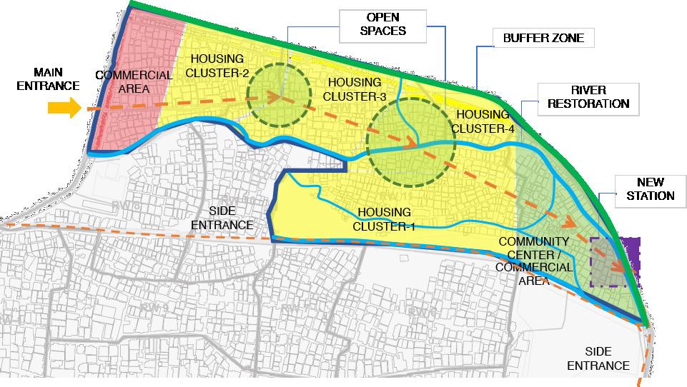
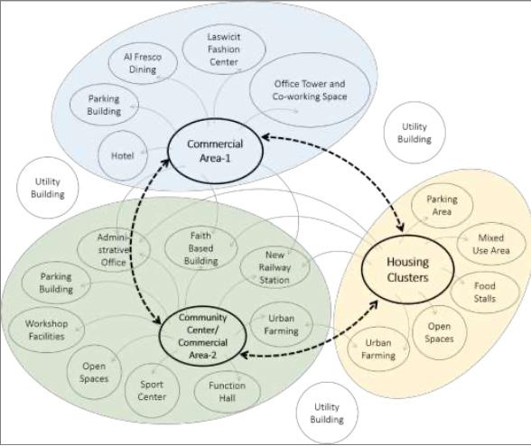
in business analysis. With this analysis concluded the possible scenario planning and area are connected with each other including hotel, alfresco dining, local craft center also connected to parking area in each building and supported by utility building farming. This primary function also supported by utility building in each housing
railway station, urban farming, function hall, sport center, open spaces, workshop


phase, community center would be added and then more housing with commercial area, etc.


swimming pool.

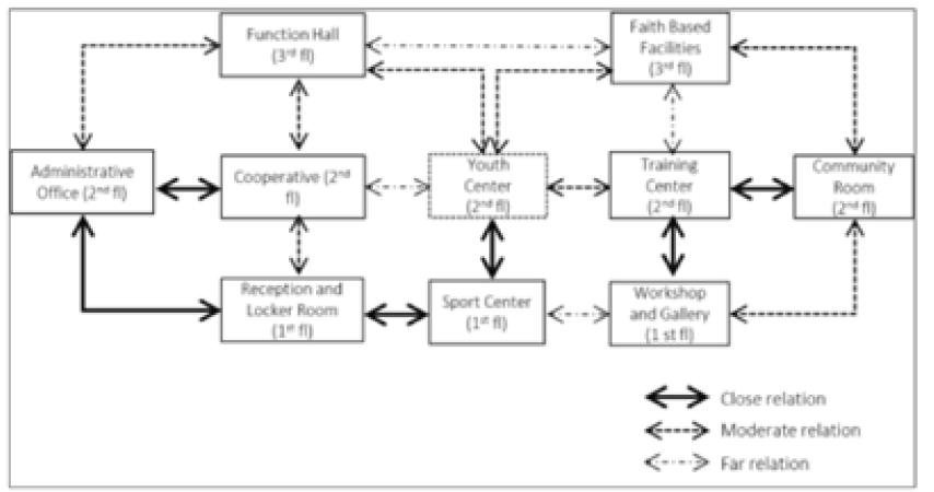
railway station and parking building. The community center is built to facilitate of workshops and gallery; managing training center and youth center; carrying out will concentrate their urban farming management too including the production,
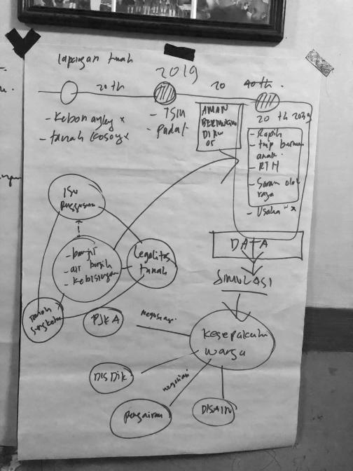
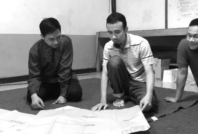
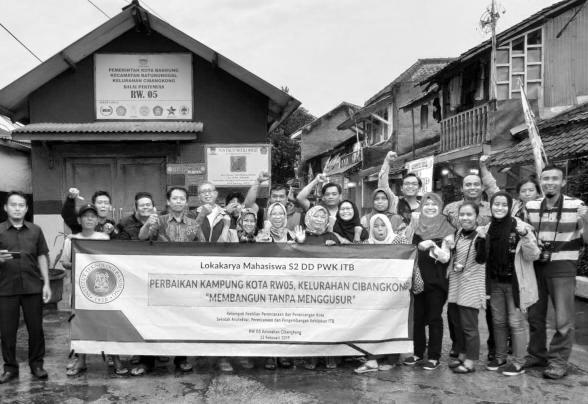


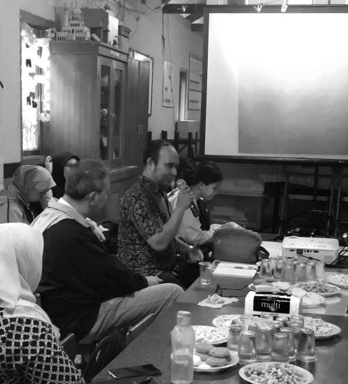
Documentations of mapping and focus group discussion with Cibangkong locals

Green Belt Haven
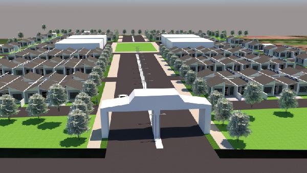
the knowledge I gained during my time as an urban design intern. The challenge to the residential units, the masterplan must incorporate essential supporting facilities

open green spaces, and sporting facilities. Incorporating these requested facilities will around the site and the effort to urge the community to be able to access the facilities

Evenly Sunlight
To promote natural lighting, the masterplan
to sunlight. Open green spaces and communal
throughout the area, the masterplan aims to

Continuous Flowing
will be incorporated to enhance mobility and community.

Centralized Activity
The masterplan centralizes public spaces to areas, featuring plazas, parks, and communal facilities, will foster social interaction and
promoting a sense of belonging. The central location ensures accessibility and strengthens


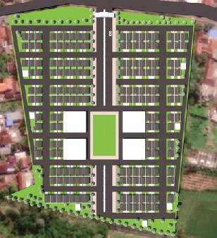
1. Gate 2. Green area 3. Housing 4. Community center
5. Public square/sporting court 6. Community center 7. Mosque 8. Church
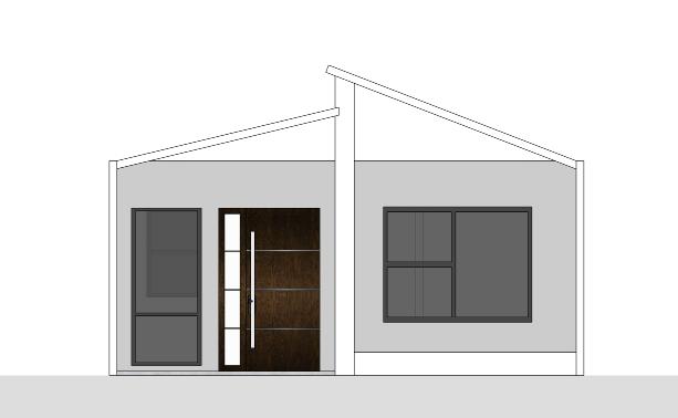
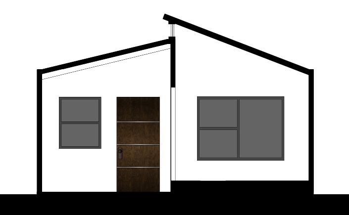
Housing
In line with the terms of reference, the housing units
Emphasizing practicality and affordability, the house
of a growing family.
of windows, utilizing their positions to allow ample natural light to penetrate the interiors. This will not only enhance the aesthetics of the house but also


Visioning Tourism Heritage Train – Blora
In collboration with SHIRVANO Consulting team

The Indonesian railway industry has come a long way since the era of Dutch and abandonment.


dominant presence of permanent production forests and rural settlements. Within this the production forest area, which is under the ownership of Perhutani. These areas are predominantly characterized by the majestic presence of teak and mahogany

Strength and Opportunities
Weakness and Threats
within the serene ambiance of a rural settlement area.
marked with green existing museum area marked with dark green marked with aqua green
area has tourism potential, including educational, teak wood processing, social, and
marked with light red marked with brown arrows marked with yellow
use, accessibility issues affecting tourism potential, and risks posed by the lack of necessary infrastructure. Addressing these concerns requires strategic planning, infrastructure.


settlements around the railway borders. community. funding sources.


domestic and international tourists.
optimize the landscape feature, preserve local wisdom, and complement the existing tourism destination. We draw inspiration from benchmarks like the Wine Studio offer unique forms of tourism using natural landscapes
heritage and local culture.


Local Wisdom/Culture Integration
physical aspects, take into account the integration of local or is located near key cultural and community points with heritage but also promotes a deeper understanding and appreciation of the local community’s traditions and wisdom.
Form Follows Nature elements such as trees, waterways, and green corridors. Future of these natural elements within the area. This approach is integrated with the surrounding natural landscape, creating an surroundings.
Well Connected accessibility and access to and from tourist destinations. connecting locations that currently lack access, promoting the quality of access points in and out of the area.
Places to Rest & Leisure resting areas, dining establishments, and other additional amenities. Strong Storyline
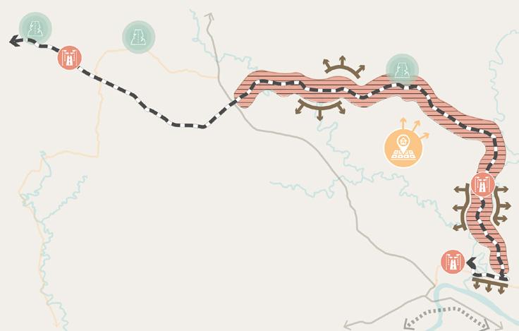
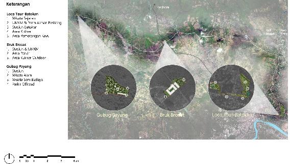
Preliminary Zoning
Total Development Area:
409,688.1 m2 / 40.96 Ha
Loco Tour - Batokan: 323,013.0 m2

Bruk Brosot: 60,647.1 m2
Gubug Payung: 26,028.0 m2
Railway Buffer Zone: 226,000 m2
Preliminary Illustrative Masterplan
Details:
process, help making mapping graphics in adobe suites, and researching benchmark that could portray the direction of how the design is going to be in preliminary design stage.


Railway Buffer Zone
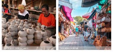
Historical Tourism
Culinary
UMKM
Wood Storage (TPK)
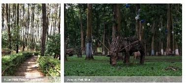
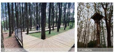
Nature Tourism
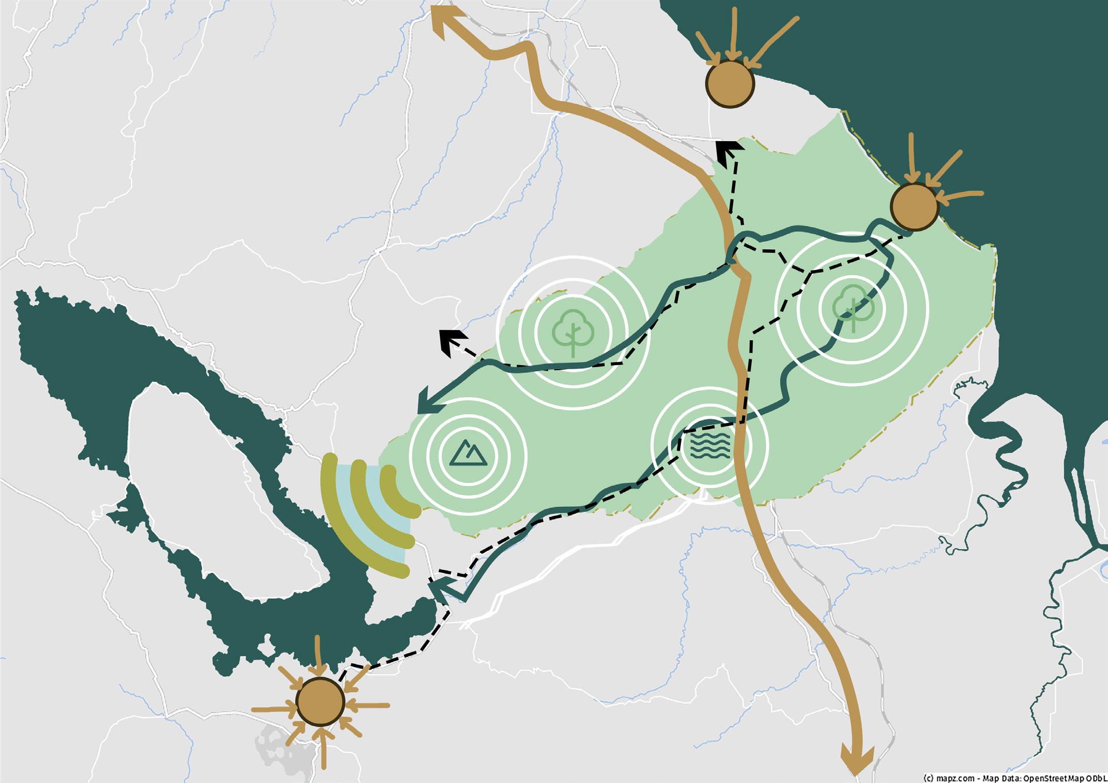
Visioning Tourism Kabupaten Asahan
In collboration with SHIRVANO Consulting team
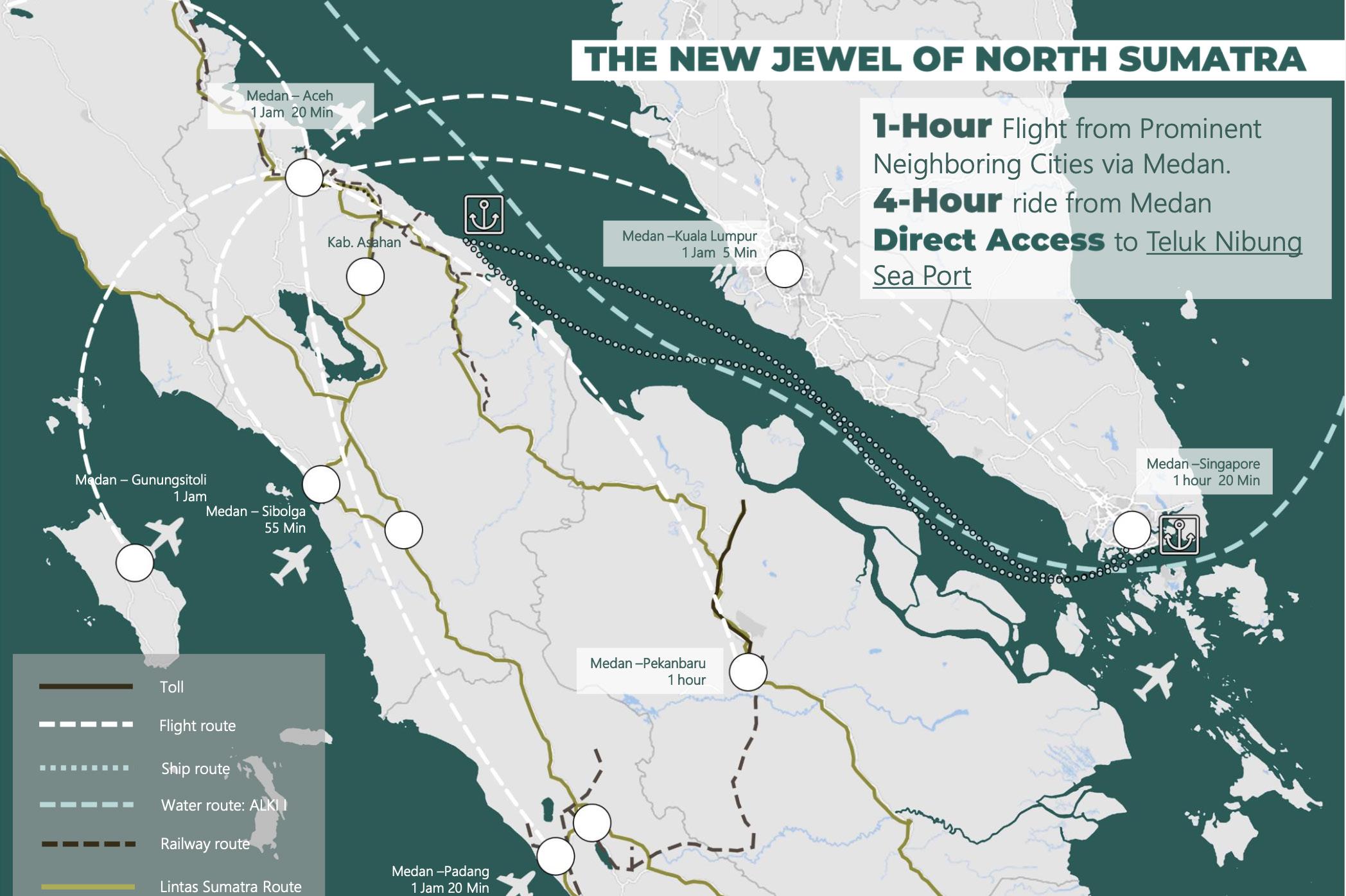
potential of Asahan’s natural landscape, we aspire to establish a sustainable and tourism network, further bolstering its appeal.

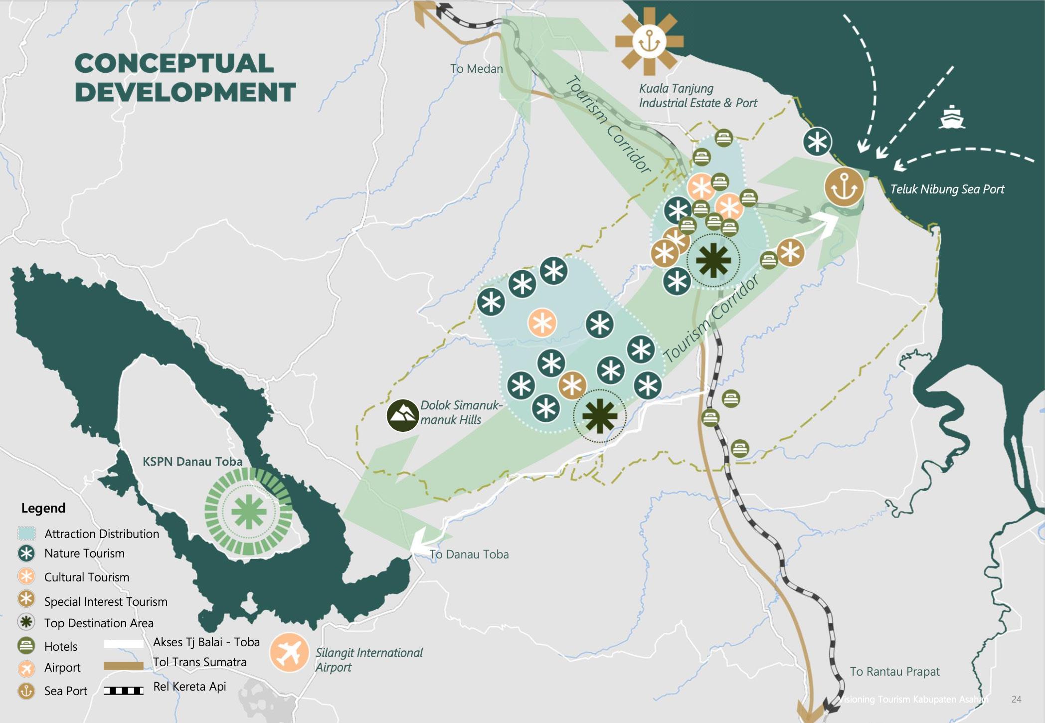
Notably, Asahan has gained global recognition as a premier destination for thrilling harnessed for tourism purposes. Additionally, the region boasts breathtaking natural into alluring tourist destinations. As the area has already started to garner attention,


Erawan National Park, Thailand

Columbia River Gorge, USA
Protected Natural Area
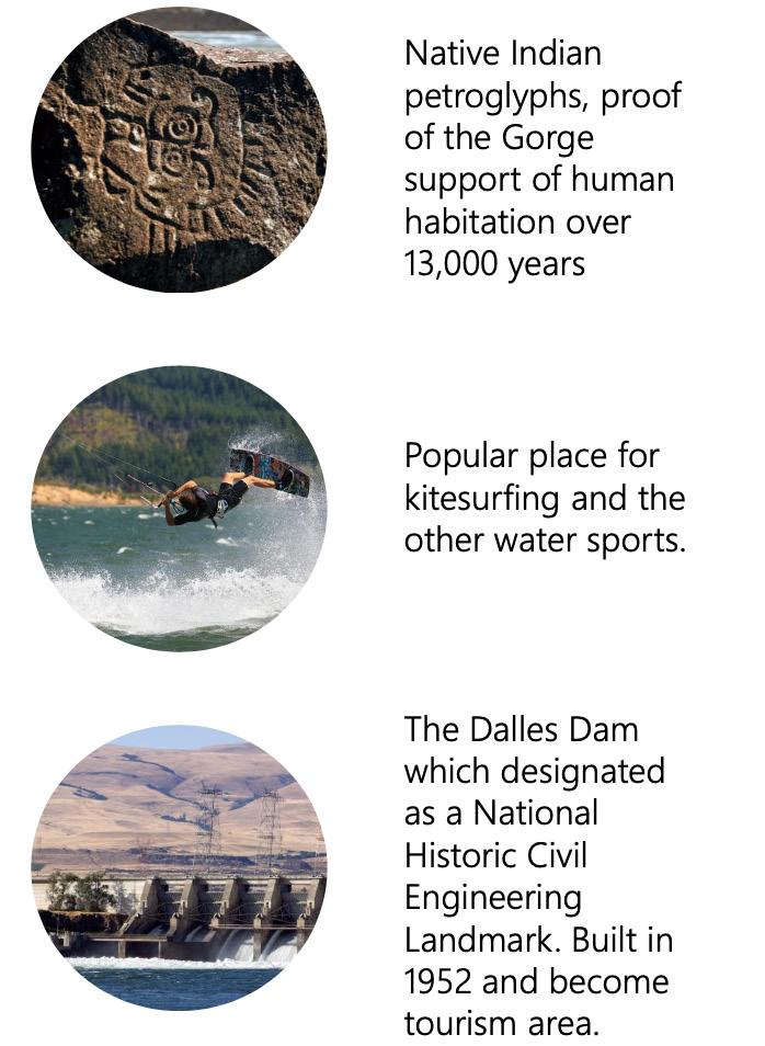
New Zealand Holiday Parks Campvan, New Zealand
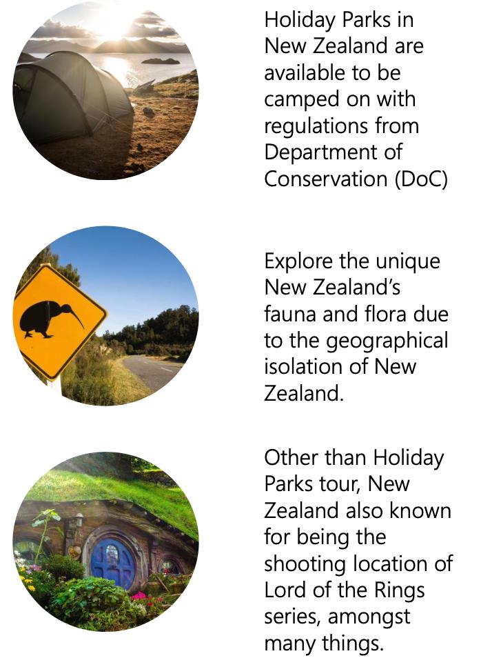
region. The key concept is to strategically position these new tourist attractions along the designated tourism corridor, as indicated by the light green area in the Conceptual Development incorporating these benchmarks, we can create a tourism landscape that offers a not only attract tourists but also contribute to the sustainable growth and economic graphic showcasing the location of nature panoramas in Asahan.

Group Research Project –Data Driven Urbanism
In collboration with SHIRVANO Urban Design
Intern Batch 16: Faza Ghilman
Productive age
Millenial & Y Generation
Connected to smartphone
Innovative urban design
ICT positioning

Implementing design principle with urban design elements where with Data Driven method planning stages?
together with population millenial generation supports of society has, unrestricted by education, business transaction for of natural sources, human sources, restoration of cultural heritage, and accomodating community needs in a way and results that are more Data Driven Urbanism
The need for urban space innovation
their stations and the topics, related to urbanism, were picked by the head of interns they would presentate their progress to their peers. At the last week of internship, of the issue.
As urban design intern, I was tasked in the group with two other urban design interns Towards Data-Driven
Data Driven

process, including big data,
Urban planning process

The urban planning process discusses the guidelines or methods for designing a city. It focuses on the stages of urban in the elements of urban design
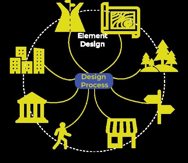
Elements of urban planning

The urban design elements elements out of the eight elements. Elements such as supporting elements of urban design.
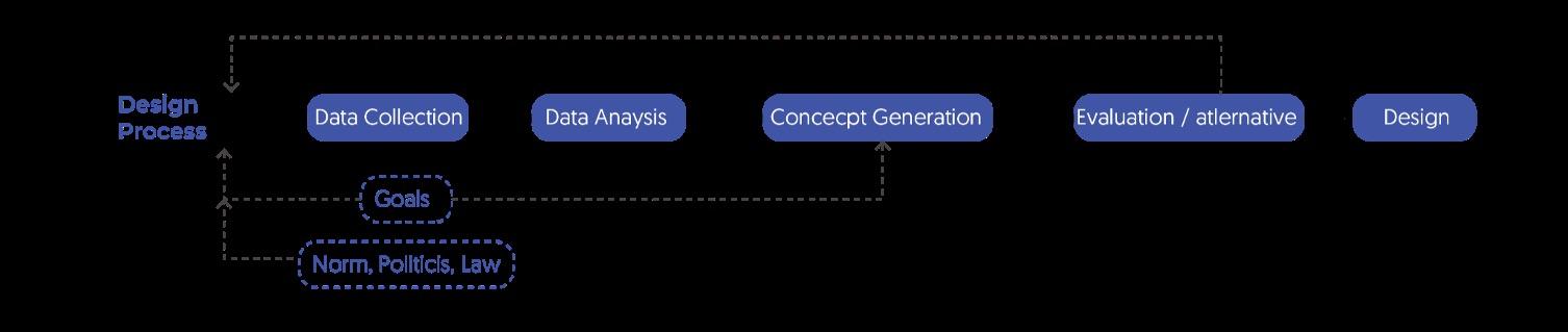
try to utilize this as tools. Are they used in synoptic way or incremental way? Are they through fragmental or pluralistic process? It is because these different methods and
In limited research timeline, we found three study cases. Two are case study where
Data-Informed Based Urban Design – New Cairo Urban Development
circulation and spatial organization, typological studies for building massing, and
connections between spaces, territorial boundaries, and emerging spaces resulting
Space Syntax
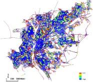
An area with poor circulation integration becomes a hub for low-income community activities
Study of surrounding typology

The surrounding building typology is an area with middle to upper-income communities.
Typology of new urban settlements

Inappropriate building typology for low-income community settlements.
Data-Driven Based Urban Design – MIT Kendall Square, Cambridge
indicator feedback. This approach follows a similar process as the synoptic design
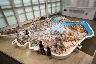
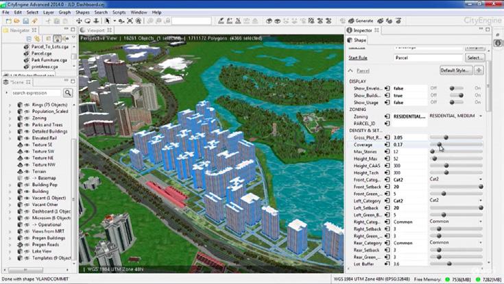
decision related to urban planning and design are integrated based on regulations
all buildings and details in Singapore are open sourced in the form of 3D mapping.
Conclusion leads to recommendations presented in graphical form, often generated using ArcGIS mapping. These technologies enable planners and designers to harness
