

The North Hobart Neighbourhood Plan is a structure plan that provides a strategy to manage growth for the next 20 years.
It sets a vision for the way we want North Hobart to function, look, develop and improve over this time. It includes goals, strategies and actions that need to be taken to achieve this vision. Some of these actions will be undertaken directly by the Council while others will require coordination with or action by other authorities or organisations.
It informs the application of zoning and overlays in the Local Provisions Schedule (LPS) of the Planning Scheme.
This structure plan sets out actions in line with community aspirations beyond planning requirements, including urban design guidelines, environmental objectives, and recommendations for civic upgrades.
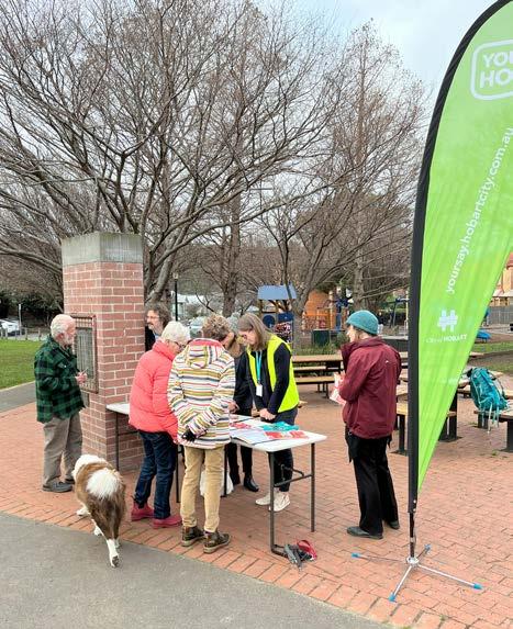
The Vision for the Neighbourhood Plan was developed through engagement with the community and stakeholders for the North Hobart Place Vision Project 2019-2021).
North Hobart is a welcoming, green urban village, with a flourishing high street at the core of community life.
The Neighbourhood Plan aims to foster Palawa engagement and expression as a core priority to enrich the city's character and identity.
Palawa culture and connection
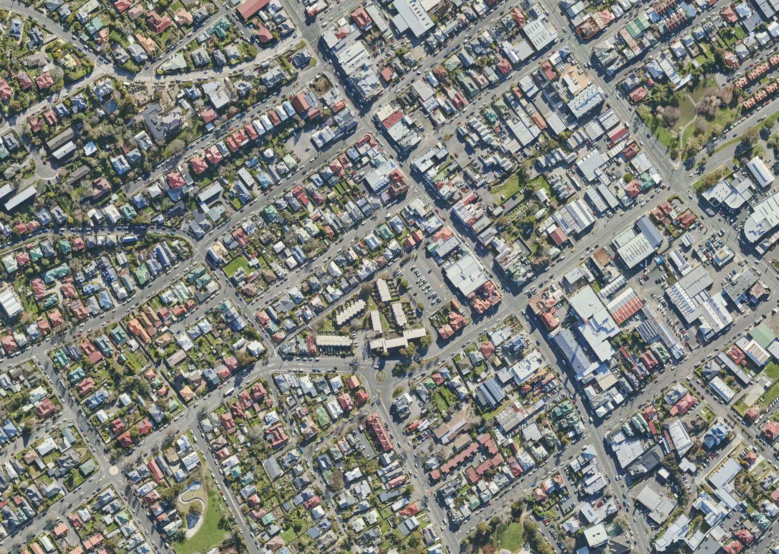
North Hobart is located in the traditional country of the southeast nation of the Tasmanian Aboriginal people.
North Hobart was once a rich cultural landscape providing resources of both the land and the sea. The area provided access to the mountains, fresh water and to many travel routes through well maintained cultural pathways. These cultural pathways were managed for ease of movement to access cultural resources, providing access to ceremonial lands and led to traditional hunting grounds.
Aboriginal heritage sites recorded within this region provide evidence of many thousands of years of Aboriginal occupation.
North Hobart is well used and collectively considered an important space by the Palawa of today. This connection to place and expression of Aboriginal culture is not readily evident in the built form and open spaces of North Hobart.
The North Hobart Neighbourhood Plan vision reflects the community aspirations for North Hobart as a welcoming and green urban village, with a flourishing high street at the core of community life.
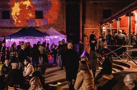
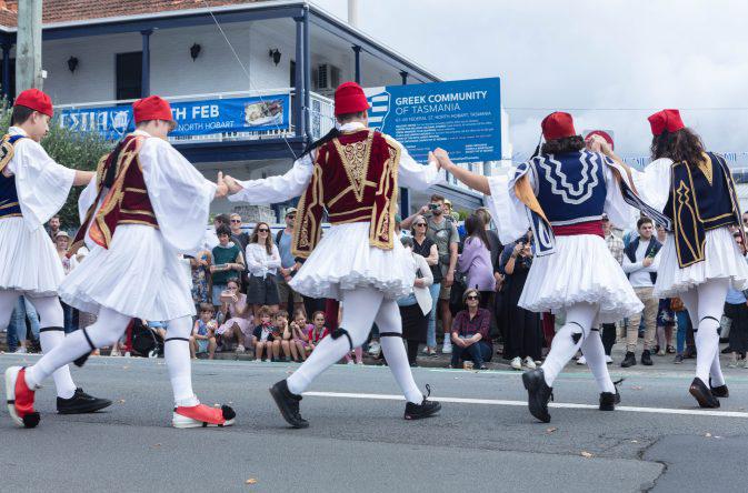
The Plan highlights opportunities to integrate Palawa culture into the neighbourhood’s rich community and sense of place. As a key destination in Greater Hobart for retail, dining, entertainment, and festivals, it outlines current and future spaces to celebrate North Hobart's cultural and arts events.
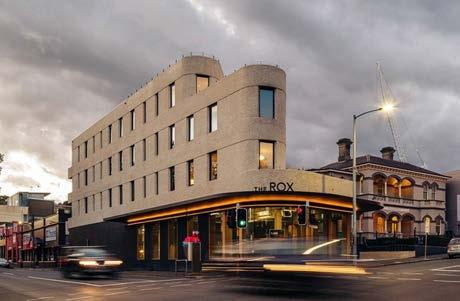
Design quality is a key community concern. The Built Form and Design Guidelines include maximum building heights to provide certainty to developers and ensure that new development respects the local character and enables sunlight access for neighbouring properties.
North Hobart can lead the transition to a zero-emissions, climate-ready community by reducing greenhouse gas emissions.
Medium-density, infill housing, and adaptive reuse of buildings will create a compact, well-designed neighbourhood where walking, cycling, and public transport are preferred.
We will build resilience by preparing for climate change and disasters like floods and urban heat. Green streets will provide water-sensitive urban design and greening will boost urban tree cover for cooler cities
The Plan prioritises affordable, medium density housing near public and active transport networks. Growth will concentrate along key corridors within walking distance of essential services and destinations.
Improving access in North Hobart for walking, cycling, micromobility, and public transport will give people more connectivity options within and beyond the area. Managed parking in strategic locations will ensure continued access for those visiting for work, retail, social, or other purposes.
North Hobart is known for its diversity, offering local jobs and business spaces. Prioritising job growth in accessible locations will support future economic expansion.
To address North Hobart’s open space shortage, the plan suggests creating urban plazas and parks, and improving connections to nearby areas like the Queens Domain. Enhancing access to green spaces, including street trees and landscaping, will boost community well-being and sense of place.
The plan contains a list of proposed actions and the main mechanisms for delivering them to establish a clear blueprint of how the vision will be delivered. See Part four for further detail.
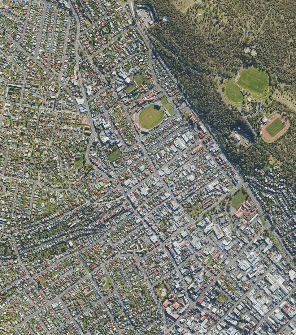
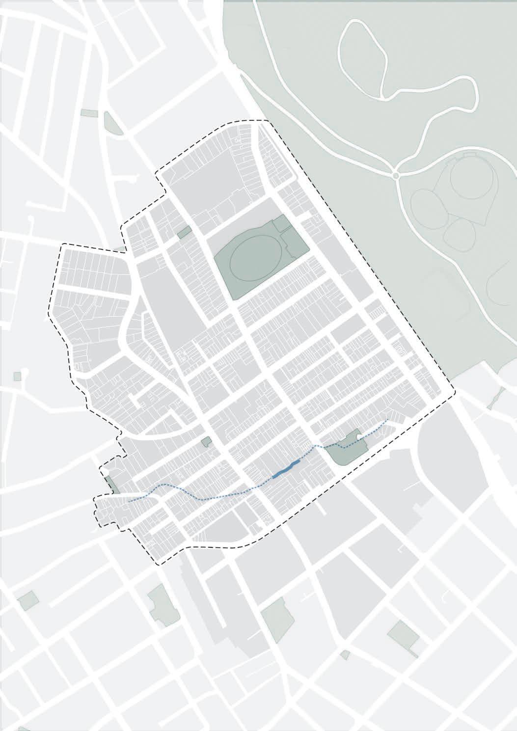
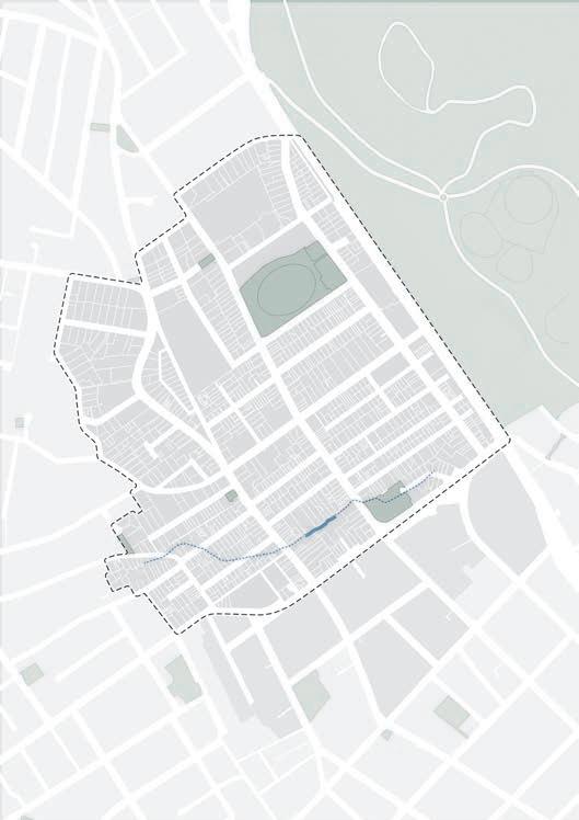
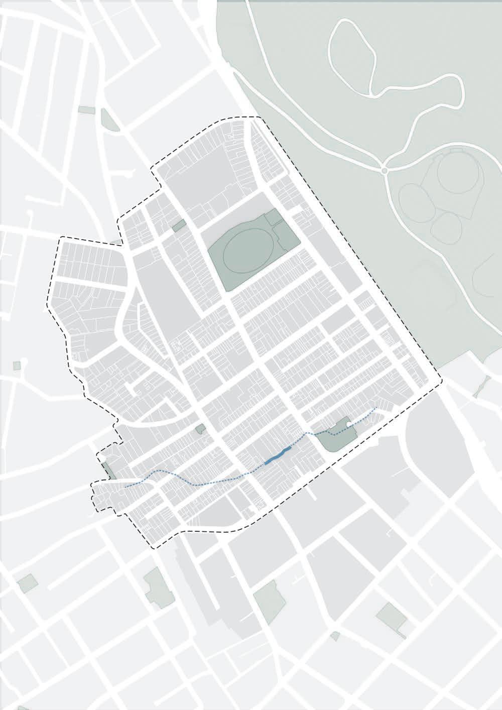
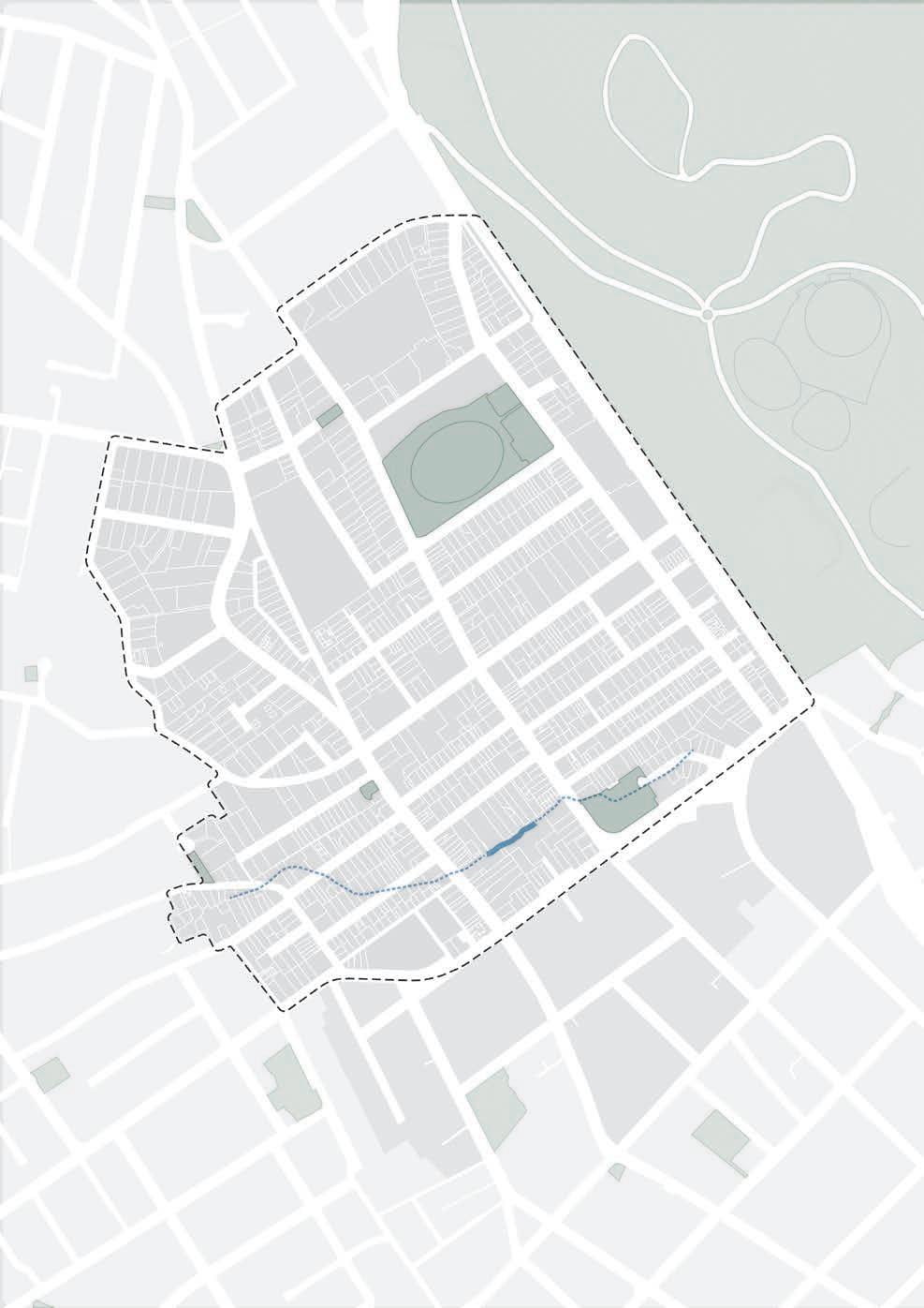
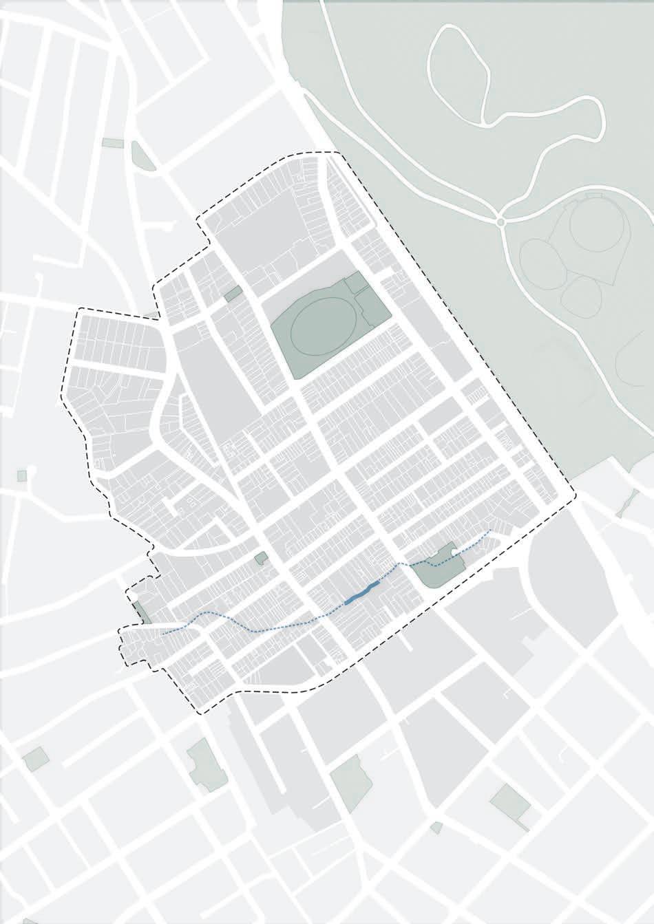
Figure 1. The North
Neighbourhood Plan area
Neighbourhood Plan study area
North Hobart suburb boundary (ABS)
Central Hobart Plan area
Suburb boundary (ABS)
The Urban Design Principles will ensure that future development is welldesigned and aligns with the vision for North Hobart. Community benefits, such as new open spaces and pedestrian links, are delivered as part of new development.
Design excellence will be regulated through specific controls, such as maximum building heights, and minimum boundary setbacks, these are defined in the Built Form and Design Guidelines and implemented through mechanisms in the planning scheme. These principles are informed by best practice in urban design and the specific place context of North Hobart, such as palawa identity, land form, scale, local character, heritage and solar access.
The Urban Design Principles (UDP) for North Hobart are organised under the themes of:
• Built form and design
• Public realm and open space
• Movement and access.
These principles are informed by best practice in urban design and the specific place context of North Hobart, such as Palawa identity, land form, character, heritage and solar access.
Good urban design goes beyond a welldesigned building. It seeks to enhance the quality of the spaces between buildings, such as the landscape, streets, and parks that are central to the liveability of North Hobart.
The North Hobart UDPs will provide clarity for the community and developers about the priorities for North Hobart. This will support the decision-making process and promote best practice development to realise the community's vision for North Hobart.
The proposed UDP will be delivered through the actions outlined in the Neighbourhood Framework, this includes an amendment to the Tasmanian Planning Scheme's Local Provisions Schedule, and improvements to the public realm and open space, new transport infrastructure will be achieved through public projects.
The Urban Design Advisory Panel (UDAP) will continue to play an important role through the independent design review process.
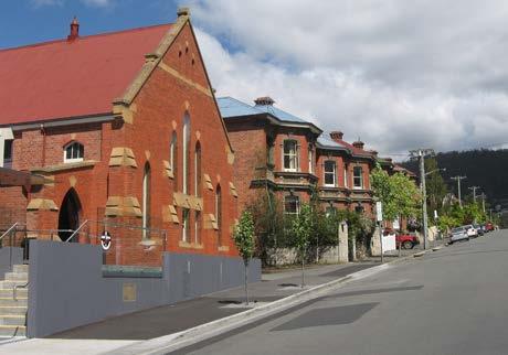
The distinctive character and heritage of North Hobart is highly valued by the local community and contributes to its appeal as a destination for visitors.
No changes are proposed to the Local Heritage Precincts or Local Heritage Places, planning applications will continue to be assessed against the standards set out in the Heritage Code.
The map shows the Local Heritage Places and Precincts, and properties listed on the Tasmanian Heritage Register.
1. Promote well designed medium density housing, mixed use renewal and future employment.
2. Support medium density development on wide green streets and strategic sites.
3. Ensure buildings respond to context, including land form, views, streetscape, local character, scale, heritage and solar access.
4. Engage with streets and spaces to increase the sense of safety and add to the vibrancy of the public realm.
Public realm and open space
1. Create a network of open spaces that connect people to Country.
2. Ensure sunlight access to open spaces and streets for people.
3. Increase the amount of greenery with street canopy planting and urban greening.
4. Build resilience to flooding risk.
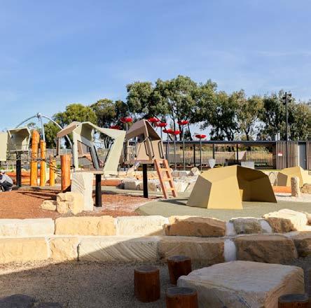
Legacy Park, Queens Domain by Field Labs
Movement and access
1. Create streets for people.
2. Make cycling and micromobility a convenient and comfortable way to move around North Hobart.
3. Advocate for and support better public transport services.
4. Manage vehicle access and car parking, prioritising pedestrian safety and consolidated car parking.
one: North Hobart is a welcoming and inclusive neighbourhood to live and work
Medium density housing offers more diverse options for different needs and incomes, including social and affordable housing, near jobs, services, transport, and open space.
Renewing sites like Condell Place car park and Providence Valley Rivulet block can provide community benefits such as safe public spaces, quality medium density housing, and more services within walking distance.
North Hobart's character and heritage will be preserved with well-designed medium density housing in suitable locations. Reusing nonresidential buildings and designing appropriate infill housing can create affordable housing opportunities.
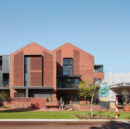
Medium density housing, is multiple dwellings on a site that can range from one to six storeys in height, it includes terrace houses, townhouses and low-rise apartments.
Mixed-use renewal means the redevelopment of land that blends multiple uses, either within buildings and/or across multiple buildings on larger sites. Uses can include, housing, retail, hospitality, office, community or cultural uses.
Adaptive reuse is the process of repurposing an existing building for a new function. This not only preserves the history of a site, but also makes use of a previous carbon investment in the building stock, therefore reducing embodied carbon.
Affordable housing is housing for purchase or rent, that costs no more than 30 per cent of a household’s gross income.
Social housing is housing provided by the government and community sectors to assist people who are unable to afford or access suitable accommodation in the private rental market.
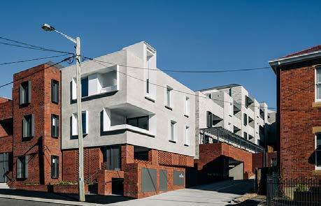
Location: Goulburn Street,
Architect: Cumulus
Dwellings: 25 (177 dwellings/ha)
Site area: 1415m2 (approx)
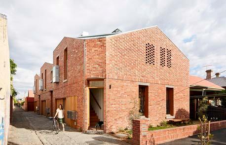
Location: Davison Street, Brunswick (VIC)
Architect: Archier
Dwellings: 3 (83 dwellings/ha)
Site area: 360m2
Architect:
Dwellings: 15 (176 dwellings/ha)
Medium density housing and mixed use renewal plan
Potential areas of change
Medium density housing
Potential for mixed-use
Strategic opportunity (large sites)
Heritage considerations
Local heritage place (LPS)
Tasmanian Heritage Register
Heritage Precinct (LPS)
Potential areas of change
Medium density housing
1 Providence Valley Rivulet Masterplan proposes to investigate medium density housing and mixed use development on a complex site.
Potential for mixed-use
2 Medium density infill housing that respects the character of the area.
Strategic opportunity (large sites)
Heritage considerations
3 Medium density infill housing and mixed use development.
Local heritage place (Draft LPS)
Tasmanian Heritage Register
4 Condell Place car park concept design for medium density housing, see next page.
5 Potential long term increase in affordable housing supply on Homes Tasmania sites.
Figure 2. Supporting medium density housing and mixed use renewal.
6 North Hobart Oval Masterplan to investigate mixed use renewal.
Existing pedestrian route
Potential new pedestrian route
Indicative access to car park
Signalised intersection (new)
Signalised inersection (upgrade)
fronting onto public open space. Investigate upper level for affordable housing. Ensure buildings are sensitively designed with natural surveillance, appropriate setbacks, and height.
5 Renew pedestrian connections along Burnett Place and Condell Place and consider improving connections through to Burnett Street.
Employment opportunities and mixed use renewal plan
Study Area
North Hobart area
included in Central Hobart Plan 2023
Study Area
North Hobart area
included in Central Hobart Plan 2023
Open space
Rivulet (open)
Rivulet (closed) Future
Figure 4. Supporting employment in existing areas and near Elizabeth Street.
Measures of success
• Increase in commercial floor space.
• Increase in retail diversity to meet daily needs.
• New supermarket or grocer to provide fresh food.
Open space
Employment focus
Rivulet (open)
Potential for mixed-use
Rivulet (closed)
Existing
Existing mixed use
Elizabeth St ‘High Street’
Education and child care centre
Community
Grocery
North Hobart area
included in Central Hobart Plan 2023
Open space
Rivulet (open)
Rivulet (closed)
Visitor Accommodation
Balancing short-stay visitor accommodation to preserve long-term rental and affordable housing is crucial. We support rezoning underused visitor accommodation sites to Urban Mixed Use or General Business Zones for increased capacity. A Specific Area Plan (SAP) is proposed to prevent full conversion of residential dwellings to visitor accommodation in Inner and General Residential zones.
Goal one: North Hobart is a welcoming and inclusive neighbourhood to live and work
Objective 3: Well designed and sustainable buildings that respond to heritage
Building heights
The proposed building heights encourage diverse medium density housing and mixed-
Study Area
North Hobart area included in Central Hobart Plan
Open space
Rivulet (open)
Rivulet (pipe)
North Hobart Specific Area Plan (SAP)
General Residential Zone height TBC by State Government Improving Residential Standards project
General Residential Zone height TBC by State Government Improving Residential Standards Project (see page 80 for more detail)
Inner Residential Zone height TBC by State Government Improving Residential Standards Project (see page 80 for more detail)
Inner Residential Zone TBC by State Government Improving Residential Standards project
General Business Zone +North Hobart SAP 9m above NGL (2 storeys)
North Hobart SAP 9 metres
10m above NGL (3 storeys mixed use development)
10 metres above natural ground level
12m above NGL (3-4 storeys mixed use development)
12 metres above natural ground level
15m above NGL (4 storeys, subject to community benefits)
15 metres above natural ground level
18m above NGL (5 storeys, subject to community benefits)
18 metres above natural ground level
Study Area
North Hobart area included in Central Hobart Plan
Open space
Rivulet (open)
Rivulet (pipe)
North Hobart Specific Area Plan (SAP)
Campbell St Primary School
We aim to bolster current business hubs and encourage mixed use development in suitable areas, fostering a variety of job opportunities, including retail and hospitality.
We plan to rezone land to accommodate:
• Established businesses currently in residential zones, relocating to more fitting areas.
• New small businesses, retail outlets, and services.
• A small supermarket or grocer in a preferred General Business zone location.
• Visitor accommodation at underutilised sites such as Rydges and the Black Buffalo Hotels.
Goal one: North Hobart is a welcoming and inclusive neighbourhood to live and work
Objective 3: Well designed and sustainable buildings that respond to heritage
Building setbacks

Landscaped front setback (12m)
Open space
Open space
Open space
Rivulet
Rivulet (pipe)
Rivulet (open) Rivulet (pipe)
Landscaped rear setback (6m)
Rivulet setback (9m)
Landscaped rear setback (6m) Rivulet setback (9m)
Urban
Urban
Goal one: North Hobart is a welcoming and inclusive neighbourhood to live and work
Landscaped front setback between Condell Place car park and Little Arthur Street
A 12m landscaped front boundary setback for buildings should be provided for landscaping including:
• greening and street trees
• a buffer to larger scale buildings
• Water Sensitive Urban Design (WSUD)
• placemaking and public open space.
Rivulet setback
Setbacks to the Providence Valley Rivulet are a key consideration for the future development of the area. Development should enable:
• solar access to the rivulet and buildings
• passive surveillance of the rivulet
• pedestrian access to the rivulet
• greening, including large trees and WSUD
• placemaking and public open space.
General Business Zone and Urban Mixed Use
Zone rear boundary setback
Future development in the General Business and Urban Mixed Use Zones to provide a 3m rear boundary setback to lots zoned Urban Mixed Use for solar access and landscaping
Landscaped rear setback on Federal Street
Setbacks to the Inner Residential Zone on Urban Mixed Use zoned land on the northern side of Federal Street provide a minimum 6m landscaped rear boundary setback for:
• greening, including large trees and WSUD
• a visual buffer between residential use and new larger scale development.
Figure 12. Cultivate North Hobart’s creative heart and provide welcoming spaces and places to innovate, experiment and connect with others.
Study Area
North Hobart area
included in Central Hobart Plan 2023
Open space
Rivulet (open)
Rivulet (closed)
Existing laneways
Future pathway
Creative Heart (support creative and community uses)
Elizabeth Street ‘High Street’ Festival area
Enticing laneways focus area
Potential creative hub
North Hobart will continue to be a place where cultural knowledge and traditions are experienced through events, festivals and artistic expression.
New creative and community spaces will be needed to accommodate a range of activities and uses, meeting the future needs of North Hobart's diverse and creative community.
Measures of success
• Increase in cultural venues and creative spaces.
• Increase in availability of community spaces for connection and socialisation for varying age groups.
• Increase in visibility of palawa living culture and heritage in North Hobart.
• Increase in public art.
• Increase in arts-based street activation.
The establishment of a creative space, such as an arts house or rehearsal facilities could provide significant benefit to the area.
Engagement with North Hobart’s Palawa community will guide the development of unique opportunities for embedding, in North Hobart's places and spaces, the sharing of history, knowledge or practices.
Palawa arts, culture and connection
Cultural expression through art is a fundamental aspect of sharing culture and knowledge for Palawa. It can provide a method of informing and educating the wider public on the traditional, historic, and contemporary community values and stories. Tasmanian Aboriginal people feel this is a priority for future planning and development.
A masterplan for the Providence Valley Rivulet area is considered the most appropriate action to further investigate how opportunities can be realised and challenges can be managed over the next 20 years.
This masterplan will look at a range of matters including housing, employment, placemaking, urban design, connection to country, pathways, open space, and challenges such as potential flooding.
There are numerous opportunities to acknowledge the cultural aspects that Palawa feel are important links to the traditional cultural landscapes and provide avenues to strengthen and support Palawa culture, with these links remaining intact despite the substantial urbanisation of the area, including Elizabeth Street, the rivulet and its surroundings.
The heart of North Hobart will continue to be a lively and flourishing high street precinct with a growing and eclectic variety of eateries, retail, services, live music, and entertainment venues.
New and renovated buildings, and public realm improvements in this area will support local businesses and venues and contribute to North Hobart’s identity and character.
Ground floor tenancies with active shopfronts, will provide for retail, hospitality, arts and entertainment uses.
Laneways and footpath areas are activated for events, music and temporary artworks.
Events in North Hobart will be supported by Council through:
• engagement with event organisers to adapt their programs to become more accessible for all, to attract more diverse audiences, and expand their market to improve their resilience
• engagement with Palawa to enhance inclusion in festivals and events
• marketing and promotion support for events through the city's online communication 'Hello Hobart' and street advertising.
• Meet the demand for retail space.
• Increase in the number and diversity of retail, hospitality, live music & entertainment venues.
• Increase in the number of festivals, events, and markets.
• Activation of streets leading to increase in business in the area.
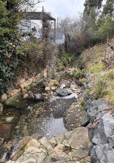
• Increase in visibility of Palawa heritage culture expression in the high street and around Providence Valley Rivulet. Improvements to the water quality in the Providence Valley Rivulet.
• Increased public open space around Providence Valley Rivulet, where people feel safe and want to spend time.
Goal two: North Hobart is a creative and diverse neighbourhood on Palawa Country
Enticing high street precinct and laneways plan
Swan St Park
Swan St Park
Swan St Park
GEORGESTSMITHST
GEORGESTSMITHST
Soundy Park
Place
Place
Street upgrades and initiatives
Street upgrades and initiatives
Enticing laneways — existing
Enticing laneways — existing
Enticing laneways — future
Enticing laneways — future
Street upgrades and initiatives
Enticing laneways — existing
Enticing laneways — future
Investigation area for future green space
Potential placemaking/urban space
Improved pedestrian crossing
Increased greenery / street planting
Investigation area for future green space
Investigation area for future green space
Potential placemaking/urban space
Potential placemaking/urban space
Improved pedestrian crossing
Improved pedestrian crossing
Increased greenery / street planting
Increased greenery / street planting
North Hobart has the second lowest tree canopy cover of any suburb in City of Hobart LGA, as well has having significant areas identified as having a risk of flooding.
Creating a greener and more attractive place to live, work and visit is important to promote community wellbeing, improve biodiversity, and provide urban cooling in the hotter months.
Street tree plantings will prioritise shading to provide amenity for footpaths and bike routes.
Managing flooding risks will help protect both privately owned and public land.
Water Sensitive Urban Design (WSUD) aims to integrate natural water management and ecological systems into urban planning, design and management.
Planting more street trees will help to meet the Hobart urban forest target of 40% tree canopy cover by 2040.
• Annual increase in street tree canopy cover.
• Increased WSUD systems in urban planning, design and management.
• Increased greening in developments on privately owned land.
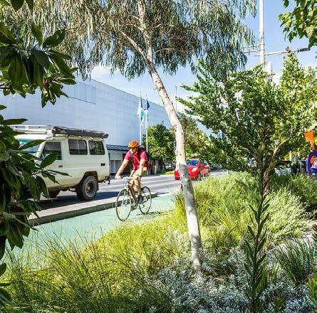
A ‘green street’ features increased greenery and landscaping, typically including:
• Deciduous trees for seasonal sunlight and shade, creating a cooler, inviting landscape
• Enhanced streetscape greening through tree planting.
Primary green streets:
• Align with primary pedestrian and cycle routes.
• Are wide (except Elizabeth Street), allowing more greening opportunities.
• Located in areas with potential for mediumdensity housing, mixed-use renewal, and employment.
Secondary green streets:
• Align with secondary pedestrian streets.
• Are narrower than primary green streets, offering fewer greening opportunities.
• Located in areas with potential for mediumdensity housing, mixed-use renewal, and
Blue streets are streets designed to help with managing flood water. WSUD and other features will contribute to the quality of the public realm.
Blue spaces refer to the areas where future redevelopment should incorporate design approaches that respond to flooding risk.
Open
Rivulet (open)
Rivulet (pipe)
Overpass (existing)
Underpass (existing)
Study Area
Open space
Rivulet (open)
Rivulet (pipe)
Overpass (existing)
Underpass (existing) Park
Sports and recreation Queens Domain
Investigation area for new local park or greening
Investigate upgrade to existing park
Investigate public access to sports and recreation
Urban plaza / ancillary open space opportunity
Investigate new bridge to Queens Domain
Investigate new bridge to Queens Domain (alternative location)
Upgrade signalised intersection for pedestrian access
Open space opportunities
To meet the demand for open space and enhance the wellbeing of North Hobart's community, providing new and improved open spaces and better access to existing open space is crucial.
Existing open spaces:
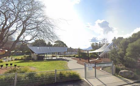
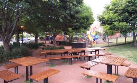
• Swan Street Park 300 m2 approx.
• Soundy Park 7,000 m2
• John Doggett Park (West Hobart) 5,865 m2
• Skate Park (Elizabeth College) 7,600 m2
Potential open space opportunities:
• North Hobart Oval precinct
• Providence Valley Rivulet block
• Condell Place car park
• Black Buffalo Hotel site
Potential upgrades:
• Una St / Lower Jordan Hill Rd Park 900 m2 approx.
• Wilson Street Pocket Park 700 m2 approx.
Ancillary open space investigation areas:
• Federal Street
• Post Office
• Former Hobart High School site
Potential public access to restricted or privately owned open space
• Campbell Street Primary School 10,000 m2
• The Friends' School Junior School 6,000 m2
• The Friends' School Senior School 4,300 m2
• Open space can be reached within a 400 metre walk from anywhere in North Hobart.
• The community have adequate and convenient public open space to use, where they feel comfortable and safe.
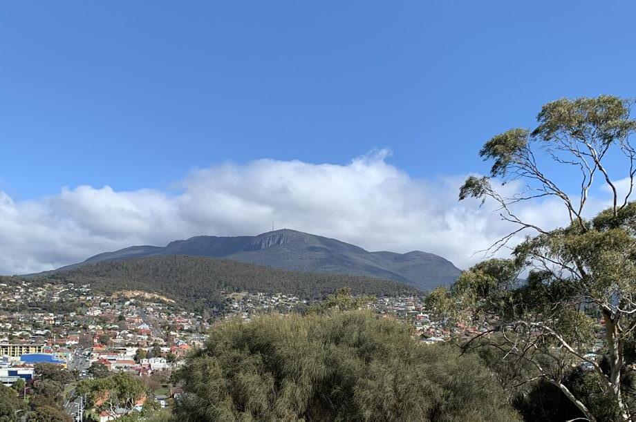
The Queens Domain provides a variety of quality public open space and community facilities within a short distance of North Hobart.
New and upgraded crossings, connections and bridges across the Brooker Highway, provide improved access between North Hobart and the Queens Domain.
As an important Palawa landscape, story telling and knowledge sharing can inform and celebrate connection to country.
Signage clearly indicates existing and proposed pathways across North Hobart to the Domain.
Access for people walking, wheeling, cycling and using other micromobility is provided. People with prams and dogs can more easily take advantage of open space, tracks and trails.
• People in North Hobart can safely walk, wheel or cycle to the Queens Domain within 10 to 20 minutes.
• At least one new connection between North Hobart and the Queens Domain.
Objective 9: High-quality walkways, footpaths, lanes, and streets, including new connections.
An increase in people choosing to walk has numerous benefits, including wellbeing and social connection, better access to open space, and reduced traffic. The high street will have activated shopfronts and widened footpaths to provide universal access and enable outdoor dining which attracts customers.
Primary pedestrian streets connect the high street to nearby business, parks, community and sports facilities. Projects to widen footpaths, and add greenery, street furniture and lighting will encourage use.
Secondary pedestrian streets will connect schools, smaller retail, side streets and housing.
Proposed mid-block laneways will make walking faster and easier. Urban greening, bike parking and seating in laneways will support nearby hospitality and retail.
• Increase in pedestrian activity and numbers on Elizabeth Street, the high street shopping precinct and throughout North Hobart.
• Improvements to the pedestrian network.
Research indicates that improving cycling infrastructure could encourage up to 60% more people to ride, by reducing traffic stress. A network of cycle routes includes:
• Primary cycle routes are the most direct routes connecting between major centres. These trunk routes form the main backbone of the cycling network and are suitable for faster riding.
• Secondary cycle routes connect to primary routes and provide access to key destinations, including schools, employment areas, shops, local services, and facilities as well as notable tourist destinations.
• Neighbourhood cycle routes allow people to comfortably ride from their homes and connect to at least one higher-order route or a local destination.
• The high street cycle route is the preferred cycle route along Elizabeth Street it is intended to be an 'All ages and abilities' route through a reduced speed limit and a reduction in traffic volume.
Proposed upgrades include:
• New bicycle priority phases at intersections.
• Limiting speeds to 30km/hr on Elizabeth Street.
• Cycle route connections to the Queens Domain.
• Clear directional signage.
• Secure, visible, and user-friendly storage and charging facilities near shops and services.
• Designated zones for scooter parking.
• Increase in the number of people choosing to cycle or wheel.
• 30km/hr speed limit on Elizabeth Street.
• A new cycle route to the Domain.
North Hobart aims to enhance its streets for safety, enjoyment, and to support local business.
Smarter parking management will ensure easier access to spaces. Plans for consolidated car parking will reduce traffic congestion.
Laneways will facilitate deliveries and access, promoting pedestrian movement with shared vehicular spaces.
Car parks will feature attractive, functional designs aligned with street improvements and residential needs, minimising access points to enhance pedestrian safety and streetscape appeal.
Car parking should be sleeved with active uses such as shops, cafes, galleries or street facing, secure, bike storage.
• New signage directing drivers to travel through North Hobart via Argyle Street rather than Elizabeth Street.
• Traffic volumes of less than 400 per hour on Elizabeth Street.
• More efficient car parking in convenient locations close to the high street shopping precinct.
Study Area
North Hobart area included in Central Hobart Plan 2023
Open space
Rivulet (open)
Rivulet (pipe)
Overpass (existing)
Underpass (existing)
Potential BRT station (indicative location only)
Primary cycle route
Secondary cycle route (subject to BRT)
Secondary cycle route
Neighbourhood cycle route
High Street cycle route (30km/hr)
Cycle route (outside study area)
Investigate new shared/cycle route
Investigate new bicycle-friendly bridge to Queens Domain New or upgraded signalised intersection (bicycle priority) Speed limit 30km/hr
Bus routes through North Hobart will be reviewed as part of the Greater Hobart Bus Network Review to provide a more legible, simpler and direct network.
Events held in the high street precinct will make use of public open space surrounding the Providence Valley Rivulet and make use of Elizabeth Street only when necessary.
New and upgraded bus stop infrastructure, such as a weather-protected shelter, signage and real-time travel information, and street trees
• Increase in the number of people choosing to travel to and from North Hobart on public transport.
• Increase in the number of bus shelters.


High frequency public transport route Bus route
Study Area
Potential BRT route
North Hobart area included in Central Hobart Plan 2023
Elizabeth Street, high street closure for events and festivals
Open space
Rivulet (open)
Alternative temporary bus stop for events and festivals
Rivulet (pipe)
Overpass (existing)
Underpass (existing)
Potential BRT station (indicative location only)
Signalised intersection
New signalised intersection
Speed limit 30km/hr
for events Alternative events
There are several mechanisms that exist to deliver on the goals, strategies and actions in the Plan. These include planning scheme amendments, CoH capital works, business and property owner investment, State Government policy changes, strategy and infrastructure delivery programs.
An Implementation Plan will be developed to identify the priority actions, determine their time frames, and allocate responsibility for delivering them. This plan will include regulatory and non-regulatory actions.
Actions that are marked ‘Deliver’ refer to projects that Council will administer and deliver directly. Each action may require further investigation, community input, planning and financing.
Each project will require an implementation program which will be linked to the Council Plan, Annual Plans and budget process to ensure a whole of Council approach.
Funding may come from a variety of sources including but not limited to government grants.
Partner
Actions that are marked ‘Partner’ refer to projects that Council will deliver in conjunction with either state agencies, community groups, land owners or the development industry. Funding may come from a variety of sources including government grants and through partnerships with the community and development industry.
Actions that are marked ‘Advocate’ involve private land that can deliver public amenity benefits, community services and/or precinct ‘activation’. Council will work with government departments, land owners, the development industry and wider community to assist in the delivery of these projects.
Timing is categorised to align with organisational time frames such as the Capital Works Program and Strategic Plan:
• Short term: 0 – 4 years
• Medium-term: 4 – 10 years
• Long-term: >10 years
Time frames are only provided as a guide and will be further refined as an implementation program is developed for each action.
The plan will be reviewed within the next five to ten years, to help ensure it is delivering on its Vision and Goals and remains accurate and relevant as North Hobart evolves.
The Plan will inform planning scheme amendments for rezoning and overlays in the Local Provisions Schedule (LPS) of the planning scheme, as well as the preparation of specific area plans (SAPs), particular purpose zones (PPZs), or site specific qualifications (SSQs), where a more unique integration of use and development is required to achieve the strategies set out in the Plan.
The Plan will also be implemented through CoH capital works, as well as business and property owner investment to achieve community aspirations for environmental objectives, and civic upgrades.
Goal one: North Hobart is a welcoming and inclusive neighbourhood to live and work
Over the next 20 years, growth in housing and employment will be encouraged along North Hobart's wider streets and near Elizabeth Street. This will improve residents' access to services, jobs, and Central Hobart. Encouraging diverse uses near Elizabeth Street will benefit local businesses and workers.
Well-designed, sustainable buildings and medium-density housing will respect North Hobart’s heritage, manage off-site impacts, and enhance public spaces
By managing this growth well, North Hobart will remain a welcoming and inclusive place for everyone.
Urban design principles: Built form and design
1. Promote well designed medium density housing, mixed use renewal and future employment.
2. Support medium density development on wide green streets and strategic sites.
3. Ensure buildings respond to context, including land form, views, streetscape, local character, scale, heritage and solar access.
4. Engage with streets and spaces to increase the sense of safety and add to the vibrancy of the public realm.
Objective 1: More diverse housing options including affordable and social housing
Strategy 1.1: Support well-designed medium density housing in the right locations through mechanisms in the planning scheme.
Action
1.1.1
Prepare a planning scheme amendment to:
• Rezone land from the Light Industrial Zone to the Urban Mixed Use Zone and to the General Business Zone.
• Rezone land from the Inner residential Zone to the Urban Mixed Use Zone.
1.1.2 Investigate mechanisms to require delivery of developer contributions for community benefit.
Strategy 1.2: Renew strategic opportunity sites to deliver affordable and/or social, medium density housing.
1.2.1 Undertake a feasibility study to investigate the potential for the council-owned car park at Condell Place to deliver affordable housing, medium density housing, community uses and a public car park (to the equivalent or more than existing).
1.2.2 Engage with Homes Tasmania to support the long term renewal of Homes Tasmania assets to deliver more affordable and social, medium density housing.
1.2.3 Engage with landowners and other stakeholders, to prepare a Providence Valley Rivulet Master Plan, which plans for the coordinated renewal of land bound by Elizabeth, Argyle, Burnett and Lefroy Streets, for the delivery of mixed-use and residential development.
Strategy 1.3: Create a sustainable balance between short stay visitor accommodation and housing for residents.
1.3.1 Prepare a planning scheme amendment to apply a Specific Area Plan to prohibit the conversion of whole dwelling residential use to visitor accommodation use in the Inner Residential and General Residential zones of North Hobart.
1.3.2 Prepare a planning scheme amendment to rezone land to the Urban Mixed Use Zone to enable larger scale visitor accommodation in appropriate locations.
Objective 2: Jobs, services, and everyday convenience within walking distance
Strategy 2.1: Support existing and future employment needs with new and renovated buildings that offer different sized tenancies at varying price points to support a range of business and employment needs.
2.1.1 Prepare a planning scheme amendment to :
• Rezone land from the Light Industrial Zone to the Urban Mixed Use Zone and to the General Business Zone
• Rezone land from the Inner residential Zone to the Urban Mixed Use Zone;
2.1.2 Engage with landowners and other stakeholders, to prepare a Providence Valley Rivulet Masterplan, which plans for the coordinated renewal of this land for the delivery of mixed-use and residential development.
Objective 3: Well-designed and sustainable buildings that respond to heritage
Strategy 3.1: Support design quality and excellence in new buildings.
3.1.1 Prepare a planning scheme amendment to implement the Built form and design guidelines set out in this Neighbourhood Plan.
3.1.2 Design buildings and infrastructure on Council owned land to be zero emissions; include 100% renewable energy generation and storage; provide electric micromobility and car charging with consolidated off-street, car parking facilities; and incorporate water sensitive urban design.
3.1.3 Advocate to the Tasmanian Government for changes to the National Construction Code (NCC) to increase the NatHERs star rating requirement to a minimum of 7 stars for new dwellings.
3.1.4 Encourage development which is easily accessible by public transport, taxi, carshare and bike, provide car parking with electric car charging for private vehicles (underground where possible).
Building on North Hobart’s reputation as a beloved destination for culture, events, food and entertainment for locals and visitors, the aim is to support both daytime and night-time activities for locals and visitors. This includes identifying areas where creative and cultural uses are encouraged and identifying where new laneways can reinforce the fine-grain character of North Hobart, particularly near Elizabeth Street.
Diversity and inclusion are important values of the North Hobart community. It is important to create spaces that are safe and welcoming for all and offer more opportunities for the expression and sharing of culture and creativity, including the palawa community.
Strategy 4.1: Cultivate North Hobart’s creative heart and provide welcoming spaces and places to innovate, experiment and connect with others.
Action
4.1.1
Identify suitable locations for:
• specific places within the public realm for ongoing activation by artists
• public art, including both permanent elements and temporary work.
4.1.2 Prepare a planning scheme amendment to rezone land to Urban Mixed Use where Community Meeting and Entertainment and General Retail and Hire are permitted uses.
4.1.3 Investigate the establishment of a creative space on Council owned land in North Hobart to support creative, cultural and community uses including:
• an arts house facility; and/or rehearsal facilities, as identified in the Greater Hobart Venues Study,
• multigenerational community spaces, to encourage connection and socialisation for a variety of people.
Strategy 4.2: Provide streetscapes that allow for both traditional and contemporary Aboriginal history and truth-telling.
4.2.1 Engage with the Palawa community on the Elizabeth Street Vision Plan to develop cultural education and immersion spaces on Elizabeth Street, where the Palawa community feel contemporary historic events hold strong links to their post - colonisation history.
Strategy 4.3: Provide opportunities for cultural expression, including connection to Country, throughout North Hobart.
4.3.1 Engage with North Hobart’s Palawa community to identify:
• culturally appropriate ways to recognise song lines and pathways in North Hobart
• places within the public realm for acknowledgement of the traditional owners and the contemporary Palawa community
• places with important links to the traditional cultural landscapes, and provide processes for strengthening and supporting Palawa culture
• places and processes for cultural expression and cultural practices as determined and led by the Palawa community.
4.3.2 Identify suitable locations for interpretation and storytelling of local heritage, history and personalities.
Objective 5: A lively and flourishing high street precinct
Strategy 5.1: Support retail, services, food, live music and entertainment between Elizabeth and Argyle Streets.
Action
5.1.1
Prepare a planning scheme amendment to:
• rezone land between Elizabeth Street and Argyle Street to Urban Mixed Use and General Business Zone, where Food Services and General Retail and Hire are permitted uses
• implement reverse amenity standards to protect hospitality uses.
5.1.2 Prepare an extension to the Elizabeth Street Vision Plan to guide a program of initiatives and upgrades to enhance the streetscape and its accessibility for pedestrians. See Strategy 9.2 for detail.
Strategy 5.2: Reimagine Providence Valley Rivulet.
5.2.1 Engage with the local community, Palawa and other stakeholders to prepare a Providence Valley Rivulet Masterplan to:
• Support landowners with property boundaries adjacent to the Rivulet to develop interfaces which support movement and activity and increase visual connections around and to the Rivulet.
• Investigate the development of a network of public paths including a new public path along the Rivulet, and refurbishment of existing connecting laneways and paths.
• Investigate the development of public open space along the Rivulet
• Encourage activation and passive surveillance of laneways leading to the Rivulet.
• Ensure Crime Prevention through Environmental Design (CPTED) principles are considered.
• Monitor, protect and celebrate the fresh water of the Providence Valley Rivulet and potential rehabilitation of indigenous vegetation, and places for knowledge sharing.
• Investigate appropriate ways to reduce sediment and pollutant loads on the Rivulet.
Strategy 5.3: Boost high street festivals, events and street activation.
5.3.1 Engage with the local community, Palawa and stakeholders to prepare an extension to the Elizabeth Street Vision Plan to consider how placemaking projects can enhance North Hobart’s high street precinct for festivals, events, markets, on-street trading, and entertainment.
5.3.2 Investigate opportunities for regular events and street activity which will attract more people to the area, such as: a fresh food market, a makers market, food vans, and arts-based activations, pop up performances and public art projects.
Support annual events such as: World Park(ing) Day, and Pedal Pallooza.
Strategy 5.4: Create enticing laneways and streets.
5.4.1 Implement a program of laneway initiatives and upgrades connecting through to the streets beyond to:
• introduce new signage and names for laneways
• encourage and enable the introduction and orientation of windows towards laneways and public spaces
• introduce greening including canopy trees where appropriate
• implement Crime Prevention Through Environment Design (CPTED)
• consider new public art installations and upgrades of existing works, using local materials, employing local artists, and involving local community members
• work with landowners to install soft upward lighting above awnings to highlight the heritage character
• install outdoor lighting that is low-key and contemporary, soft and warm, and meets dark sky requirements
• enable traders and local residents to apply for partial, time-based, temporary or permanent laneway closures, except for authorised vehicles.
5.4.2 Investigate opportunities to provide greening and/or a landscaped seating and viewing area overlooking Swan Street Park on Post Office lot with Australia Post.
The City of Hobart will lead the transformation to a zero emissions and climate ready future . Embedding design principles of sustainability and climate resilience in built form, open space and street networks will create a more comfortable, attractive and resilient neighbourhood for the community.
Increased greening and canopy trees will improve urban biodiversity comfort in summer. Incorporating water sensitive urban design and other measures to minimise negative impacts during floods, will create a safer neighbourhood. Wellbeing will be supported as the community grows with increased access to open space and a network of parks and plazas in which social connections are fostered and stories, culture and knowledge is shared and celebrated.
1. Create a network of open spaces that connect people to Country.
2. Ensure sunlight access to open spaces and streets for people.
3. Increase the amount of greenery with street canopy planting and urban greening.
4. Build resilience to flooding risk.
Objective 6: Greener, more resilient, and attractive
Strategy 6.1: Create a network of green streets to increase urban cooling in summer and to provide attractive streetscapes for everyday movement and life.
Action
6.1.1 Prepare a Street Tree Masterplan for North Hobart which defines and references ‘Green Streets’ for increased tree planting.
Strategy 6.2: Incorporate flood responsive design along streets and in areas that are most likely impacted by flooding.
6.2.1 Co-ordinate implementation of WSUD and flood responsive design measures (e.g. stormwater upgrades) with road upgrades.
6.2.2 Investigate opportunities to guide how future development can respond to flood risk, and achieve good design and equitable access outcomes, around the Providence Valley Rivulet area and lowlying land.
6.2.3 Prepare a planning scheme amendment to apply a Specific Area Plan to implement requirements for deep soil planting and WSUD.
*Note: WSUD is water sensitive urban design
Objective 7: A strong public open space network that enriches life
Strategy 7.1: Provide new open spaces, including pocket parks, plazas and forecourts, and upgrade existing open spaces.
Action
7.1.1
Consider the provision of open space in North Hobart as part of the City of Hobart Open Space Strategy
• Investigate new open space opportunities to complement the existing spaces
• Consider how existing open spaces can feel safer and more inclusive. Retain, assess and, if necessary, upgrade infrastructure in existing open spaces to ensure it is adequate. Eg. Lights and seating
• Engage with Palawa community to investigate ways to reintroduce cultural resources into natural spaces where possible
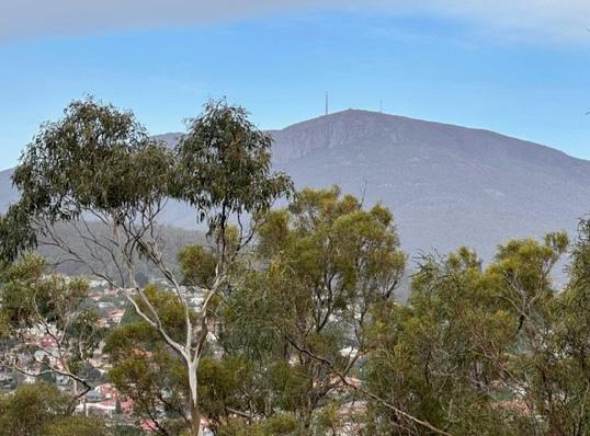
• Identify locations, in existing or proposed open spaces, that provide unbroken visual links to the mountain-scapes, to assist in maintaining and enhancing cultural links for cultural knowledge sharing.
7.1.2 Investigate opportunities for greening as part of the extension to the Elizabeth Street Vision Plan
7.1.3
7.1.4
Integrate opportunities for new open space and greening as part of the Providence Valley Rivulet Masterplan
Integrate opportunities for new open space and greening as part of the development of the Council owned Condell Place car park site.
Strategy 7.2: Investigate the future role of North Hobart Oval and Bowls Club to meet future demand for open space.
7.2.1
Engage with sports clubs, local residents, Palawa and other stakeholdersto prepare a North Hobart Oval Sports and Community Precinct Masterplan to investigate the potential capacity of the precinct to deliver additional benefits for the community, including:
• Improved pedestrian connections to Argyle, and Letitia Streets
• New public open space with high amenity and quality spaces that are safe, welcoming and complement surronding context and use
• Ways to manage flood risk through WSUD
• Space for community and/or arts use on council owned land
• Site activation with ground floor design to support natural surveillance
• Partial rezoning to Urban Mixed Use Zone which allows for a wider variety of uses
• Sensitively designed buildings in regards to setbacks, height and heritage.
Objective 8: Easy access to the Queens Domain
Strategy 8.1: Improve access to the Queens Domain for pedestrians and micro mobility users.
8.1.1 Develop wayfinding and signage that clearly indicates existing and proposed links to the Domain.
8.1.2 Engage with Palawa to explore access from North Hobart to the Domain that allows for storytelling including Palawa cultural and heritage links to place.
8.1.3
Engage with the Tasmanian Government to identify ways to improve the safety and ease of access of existing links from North Hobart to the Domain, as upgrades to the Brooker Highway and intersections with surrounding streets occur. eg. Burnett Street and/or Park Street and Clearys Gates.
8.1.4 Investigate funding opportunities for potential new pedestrian and micromobility links to the Queens Domain as identified in the Neighbourhood Plan and/or the Queens Domain Masterplan 2013.
North Hobart will continue to thrive as a destination and a neighbourhood that is easy for people to get around, offering multiple ways to travel for locals, workers, and visitors.
A clear, accessible, and well-designed pedestrian network will encourage walking for short trips and nearby destinations.
Improved bicycle and micromobility access and facilities will support more choice in how people access North Hobart.
Parking will be consolidated in locations that are accessible, and easy to find. This will support the long-term success of Elizabeth Street and other areas of activity, supporting residents, local businesses, and visitors.
Public transport improvements encourage more people to use public transport, upgraded infrastructure, such as bus stop shelters, makes catching public transport more appealing.
Objective 9: High-quality walkways, footpaths, lanes, and streets.
Strategy 9.1: Define a walking network hierarchy of primary and secondary streets and laneways, and upgrade existing footpaths, lanes, streets and pedestrian crossings, and identify potential locations for new links, bridges, and pedestrian crossings.
Action
9.1.1
Conduct a footpath and walkability audit to identify projects and upgrades to facilitate better walking access to and from key locations in the area. Improve pedestrian facilities, greening and amenities on key streets identified in the walking network hierarchy. Identify locations where footpath condition, gradient or width reduces mobility choices for pedestrians and users with impaired mobility, and assess whether road space allocation and priority could improve access.
9.1.2 Expand future editions of the Inner Hobart Transport Network Operations Plan to include key routes in North Hobart in partnership with the Tasmanian Government.
9.1.3 Advocate for funding for:
• pedestrian infrastructure upgrades on streets under State jurisdiction
• a new universally accessible bridge over the Brooker Highway to provide a connection from North Hobart/New Town to the Queens Domain.
Strategy 9.2: Strengthen Elizabeth Street’s role as pedestrian-friendly commuter spine with landscape and urban design upgrades.
9.2.1 Prepare an extension to the Elizabeth Street Vision Plan to guide a program of initiatives and upgrades to enhance the Elizabeth Street streetscape and its accessibility for pedestrians to:
• Provide appropriate footpath widths on Elizabeth Street to ensure a safe and equitable, clear path of travel for pedestrians.
• Ensure car access is maintained within the area. Provide on street, car parking spaces for people with an Australian Disability Parking Permit, short term parking for deliveries, pick up and drop off, and public transport.
9.2.2 Investigate potential for a planning scheme amendment to introduce a pedestrian priority street overlay on Elizabeth Street under the Parking and Sustainable Transport Code.
Urban design principles: Movement and access
1. Create streets for people.
2. Make cycling and micromobility a convenient and comfortable way to move around North Hobart.
3. Advocate for and support better public transport services.
4. Manage vehicle access and car parking, prioritising pedestrian safety and consolidated car parking.
Strategy 10.1: Define a micromobility network of primary and secondary cycle routes and facilities that is integrated with the surrounding cycle network and provides connections to key destinations.
Action
10.1.1
Progressively connect the cycle network within North Hobart as identified in the Greater Hobart Cycling Plan and the Micromobility Plan, including:
• Integration of key routes with additional links to key local destinations such as schools, retail and commercial centres, recreational facilities and public transport
• Directional signage to improve legibility and network navigation
• Investigating the road space allocation required for contiguous bicycle lanes along primary routes such as Argyle, Burnett, Elizabeth, and Federal Streets.
10.1.2 In partnership with the Tasmanian Government, identify the function of key cycling routes and include these in updated versions of the Inner Hobart Transport Network Operations Plan.
10.1.3 Advocate to Tasmanian Government for:
• cycling infrastructure upgrades on streets under State jurisdiction
• new connections over the Brooker Highway to provide micromobility access from North Hobart and/or New Town to the Queens Domain via a bridge and/or upgraded signalised intersection.
Strategy 10.2: Increase cycle and micromobility parking and facilities on Elizabeth Street and at key destinations.
10.2.1 Identify suitable locations for secure micromobility parking zones on primary cycle routes to facilitate a safe and equitable, clear path of travel for pedestrians.
10.2.2 Identify suitable locations for micromobility parking, storage and electric charging infrastructure in mixed use development, medium density housing and consolidated off street car parking facilities with good passive surveillance.
Objective 11: Moving and parking cars better, making streets safer for all
Strategy 11.1: Encourage vehicles to use Argyle Street or the Brooker Highway when travelling through or to North Hobart to reduce traffic congestion on Elizabeth Street.
Action
11.1.1 Install prominent signage directing drivers to take a more direct route through North Hobart, via Argyle Street, instead of Elizabeth Street.
11.1.2 Install dynamic parking availability signage for car parks to reduce vehicle circulation on Elizabeth Street.
11.1.3 Advocate and partner with the Tasmanian Government to reduce Elizabeth Street speed limit to 30km/h, and upgrade streetscape design to reflect and communicate to drivers and pedestrians the low speed environment.
11.1.4 Advocate and partner with the Tasmanian Government for a redesign of the Argyle Street and New Town Road intersection to encourage drivers to use Argyle Street and reduce through vehicle movements on Elizabeth Street.
11.1.5 Advocate to the Tasmanian Government for an additional intersection on the Brooker Highway (with full signalised access in all directions) at the northern edge of the precinct to provide an alternative route for the residential catchment to the north-west and alleviate some of the traffic pressures on Elizabeth Street.
Strategy 11.2: Make parking smarter, easier, and more reliable.
11.2.1 Investigate parking management in North Hobart as part of a wider City of Hobart parking plan, to include the following:
• Consider the consolidation of parking to the most in-demand locations, and ensure that the routes used for parking access are compatible with other objectives (including reducing vehicle volumes on Elizabeth Street).
• Identify locations to provide consolidated parking at the periphery of the Elizabeth Street Precinct, to help to reduce unnecessary vehicle movements and traffic congestion. Provide:
• clear directional signage
• adequate car parking spaces
• electric car charging infrastructure
• car share parking
• microbility parking and electric charging infrastructure.
11.2.2 Investigate locating community-based 100% renewable energy generation and storage in consolidated car parks.
11.2.3 Include publicly accessible underground car parking as part of the feasibility study for the future development of the Condell Place car park site.
Objective 12: A simpler and more reliable public transport network
Strategy 12.1: Advocate for improvements to the public transport network to support strong public transport corridors with simpler and direct routes, bus priority lanes and traffic lights, and upgraded accessible bus stops.
Action
12.1.1
Identify priority bus stop improvements and apply to the Tasmanian Government for funding through the All Access All Weather Bus Stop Upgrade Program. Include:
• comfortable seating
• weather protection
• lighting.
12.1.2 In partnership with the Tasmanian Government, identify the function of key bus routes and include these in updated versions of the Inner Hobart Transport Network Operations Plan.
12.1.3 Partner with the Tasmanian Government to incorporate bus priority measures at key intersections along public transport corridors, including bus prioritisation approaching signals at Augusta Road, New Town and Burnett Street, North Hobart.
12.1.4 Advocate to the Tasmanian Government for the review of the bus network to and through North Hobart to provide more frequent buses on simpler, direct routes.
Strategy 12.2: Advocate for alternative routes and bus stop locations to support temporary road closures for events.
12.2.1 Identify potential alternative bus stop locations which maintain access to North Hobart's high street precinct and allows reliable bus service operation, during events which require road closures.
12.2.2 Promote public transport as an attractive way to access North Hobart, especially for events.
12.2.3 Work with Metro Tas and the Tasmanian Government to establish alternate ‘event mode’ routes, services, and bus stop infrastructure as appropriate.
This document is located on yoursay.hobartcity.com.au
Please contact the City of Hobart if you need this document in another accessible format such as Word, or as an accessible PDF with enlarged print or an audio version.
In addition, due to the important information contained in the graphics of the document, please also contact us if you would like these to be explained at:
Customer Service Centre 16 Elizabeth Street, Hobart t 03 6238 2711 e coh@hobartcity.com.au
Hobart Town Hall, Macquarie Street, Hobart, Tasmania 7000 Australia
t ( 03) 6238 2711
f ( 03) 6238 2186
e coh@hobartcity.com.au
w hobartcity.com.au