SOURCE BOOK
SCIENTIFIC PUBLICATIONS FROM NRI'S RESEARCHERS

FIELD RESEARCH REPORTS
LAND MANAGEMENT AND STEWARDSHIP RESOURCES

Volume IV
Summer 2023
WHERE CONSERVATION AND APPLIED RESEARCH MEET
Each season, the Texas A&M Natural Resources Institute (NRI) publishes a digital collection of the recently published, peerreviewed scientific publications, research reports, and sciencebased resources developed to support the improvement of conservation, natural resource management and private land stewardship Through interdisciplinary and applied research, education and policy, we are committed to solving natural resource issues and engaging land managers, citizens and policymakers throughout the process. Each item in the Sourcebook can be accessed on the NRI website, nri.tamu.edu

ABOUT THE NRI SOURCEBOOK 1
O N T E N T S
A B L E O F
publications VOLUME IV SUMMER 2023 SOURCEBOOK 2 Using predictions from multiple anthropogenic threats to estimate future population persistence of an imperiled species 4 Use of live streaming systems in field-based learning 5 Animal species recognition with deep convolutional neural networks from ecological camera trap Images.........6 Testing the detection of large, secretive snakes using camera traps 8 Changes in selection of resources with reproductive state in a montane ungulate 9 Variation in diet of desert bighorn sheep around parturition: tradeoffs associated with parturition 10 Improved topographic ruggedness indices more accurately model fine-scale ecological patterns 11 Fecundity, female maturation, and nesting season of western chicken turtles in Texas 12 Effectiveness, economics, and safety of drop nets and helicopters with net-gunning for capturing white-tailed deer 15 A camera-trap survey targeting herpetofauna at Naval Air Station, Key West, Florida..........7 reports & resources Texas Landowner Survey 27 Texas Water Trends 22 Rangeland Carbon Markets Report 26 Conserving Texas: Quantifying ecological return on investment 23 Texas Ecosystem Services: A statewide assessment..........28 Mark-resight methodology for estimating key deer abundance assisted by citizen scientists 14 Using LiDAR to enhance distribution models for the dunes sagebrush lizard in Texas 17 Ecology and conservation of the imperiled dunes sagebrush lizard: An ecological specialist in a threatened ecosystem 16 Biogeographic consequences of shifting climate for the western massasauga 18 The effect of flow and mussel species traits on the occurrence of rare mussels: A case study within selected rivers of the West Gulf Coastal Plain 19 Using upper thermal limits of Texas fatmucket from the North Llano and San Saba rivers, Texas to inform water management practices in the Edwards Plateau 20 An evaluation of western chicken turtle survey and capture protocols 13 Economic Values of White-tailed Deer in Texas: Part I 24
T
C
VOLUME IV SUMMER 2023 SOURCEBOOK 3 PUBLICATIONS
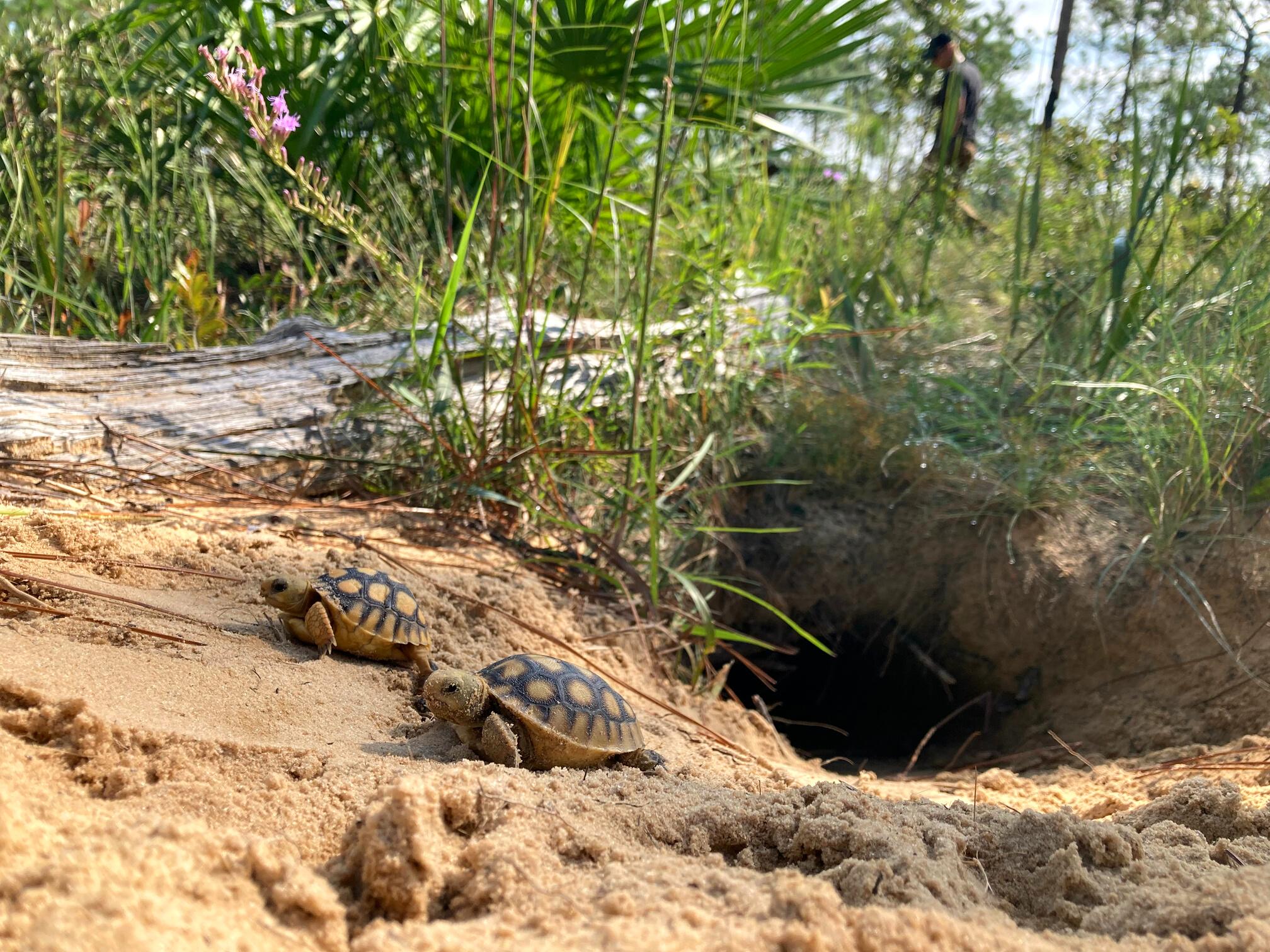
Imperiled species face numerous and diverse anthropogenic threats to their persistence, and wildlife managers charged with making conservation decisions benefit from a sound understanding of how populations, species, and ecosystems will respond to future changes in threats to biodiversity In southeastern North America, the gopher tortoise (Gopherus polyphemus) is a keystone species in upland ecosystems; however, tortoise populations have declined strongly over the last century, and the species is a candidate for increased protection by the United States federal government under the Endangered Species Act (ESA)
Here, we sought to support conservation decision making for G polyphemus by developing a spatially-explicit predictive population model that linked four anthropogenic threats (climate warming, sealevel rise, urbanization, habitat degradation) to demographic vital rates and used the model to estimate future changes in the number of individuals, populations, and metapopulations across the species’ range.
A scenario with decreased habitat management and threat effects from climate warming, sea-level rise, and urbanization predicted geographic variation in persistence probabilities for populations that might result in decreased genetic representation across the species' range Our results can be used to support conservation listing decisions for the gopher tortoise as part of its federal Species Status Assessment and provide an analytical framework for how to link diverse threats to geographically-varying demographic rates during population viability analyses for wideranging imperiled species around the world
Authors
Brian Folt
Michael Marshall
Jo Anna Emanuel
Michelina Dziadzio
Jane Cooke
Lourdes Mena
Cite
Matthew Hinderliter
Scott Hoffman
Nicole Rankin
John Tupy
Conor McGowan
Using recent survey data, we projected 457 populations for 80 years into the future under scenarios varying in threat magnitude, management magnitude, and demographic uncertainty. Population projections predicted that the number of individuals, populations, and metapopulations would decline among all simulated scenarios in the next 80 years. Model predictions were more sensitive to variation in adult survival and immigration rates than to variation in threat magnitude. Go to source
Folt, B, M Marshall, JA Emanuel, M Dziadzio, J Cooke, L. Mena, M. Hinderliter, S. Hoffmann, N. Rankin, J. Tupy, and C. McGowan. 2022. Using predictions from multiple anthropogenic threats to estimate future population persistence of an imperiled species. Global Ecology and Conservation, 36, e02143.

V:IV PUBLICATIONS SOURCEBOOK 4
Using predictions from multiple anthropogenic threats to estimate future population persistence of an imperiled species
Use of live streaming systems in field-based learning
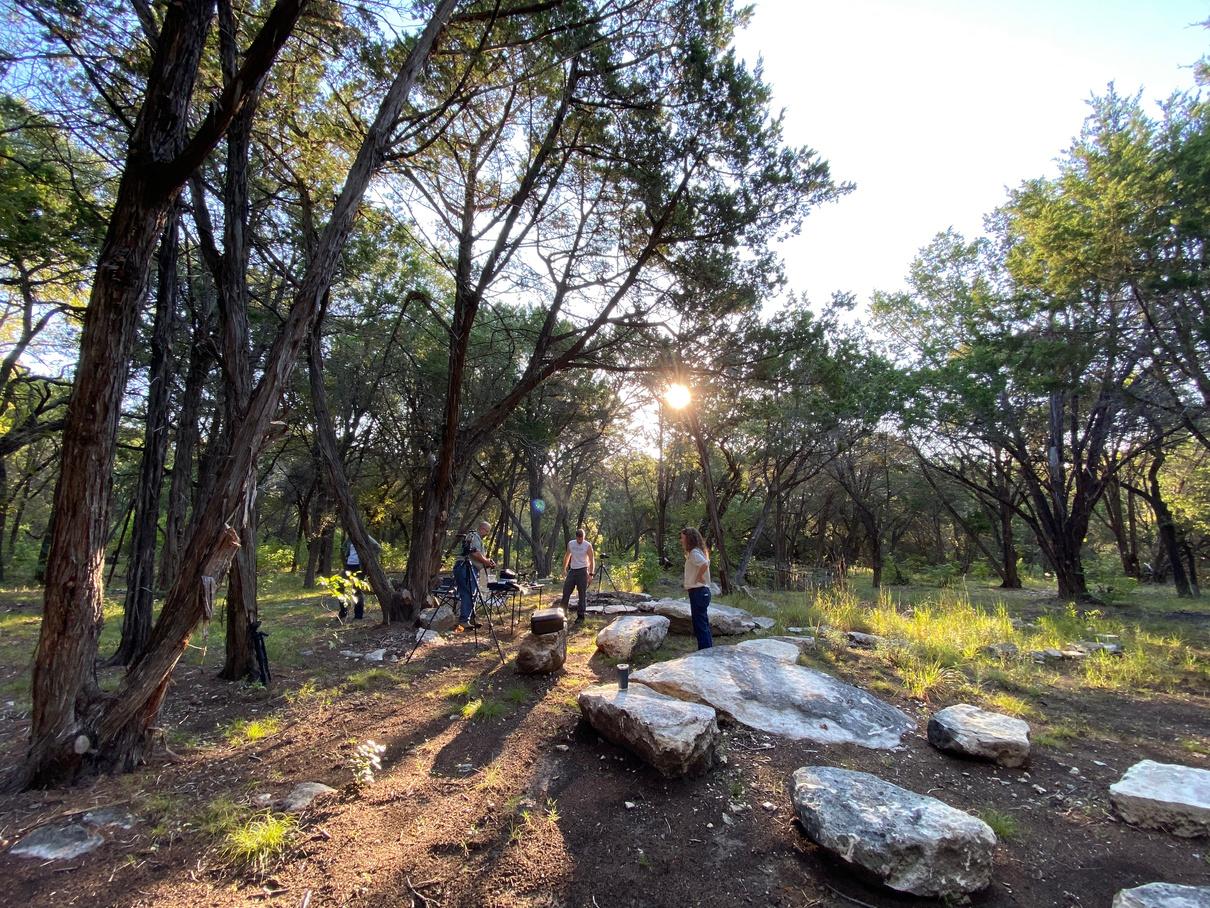
Field-based learning is a key element in wildlife management curriculum as it is a valuable teaching tool for natural resource topics. There are multiple constraints that restrict use of field-based learning techniques in wildlife programs that have been complicated by the COVID-19 pandemic. Many academic programs were forced to rapidly transition to online instruction, but despite these difficulties, there was a need to provide interactive, in the field learning opportunities for students. This necessity resulted in the development of a live streaming system to provide an interactive learning experience (Leopold Live!). In this case study, we describe the technology used in Leopold Live! to augment an online, wildlife habitat management course at Texas A&M University, and the associated challenges and adjustments needed to improve delivery in the future. We conclude that Leopold Live! serves as a potential method to meet the challenge of providing interactive, field-based learning in a distance education setting.
Authors

Shelby McCay
Roel Lopez
April Sansom
Christina Farrell
Cite
Jared Holmes
Angelica Lopez
James Cathey
McCay, S. D., R. R. Lopez, A. C. Sansom, C. M. Farrell, J. M. Holmes, A. Lopez, and J. C. Cathey. 2022. Use of live streaming systems in field‐based learning. Wildlife Society Bulletin e1381, https://doi.org/10.1002/wsb.1381.
Go to source
SOURCEBOOK
5 V:IV PUBLICATIONS
Behind the scenes of Leopold Live! at Selah, Bamberger Ranch Preserve in Blanco County, Texas
Photo by Brittany Wegner
Animal species recognition with deep convolutional neural networks from ecological camera trap images
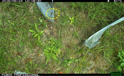
Accurate identification of animal species is necessary to understand biodiversity richness, monitor endangered species, and study the impact of climate change on species distribution within a specific region Camera traps represent a passive monitoring technique that generates millions of ecological images The vast numbers of images drive automated ecological analysis as essential, given that manual assessment of large datasets is laborious, time-consuming, and expensive Deep learning networks have been advanced in the last few years to solve object and species identification tasks in the computer vision domain, providing state-ofthe-art results
In our work, we trained and tested machine learning models to classify three animal groups (snakes, lizards, and toads) from camera trap images We experimented with two pretrained models, VGG16 and ResNet50, and a self-trained convolutional neural network (CNN-1) with varying CNN layers and augmentation parameters
For multiclassification, CNN-1 achieved 72% accuracy, whereas VGG16 reached 87%, and ResNet50 attained 86% accuracy These results demonstrate that the transfer learning approach outperforms the self-trained model performance The models showed promising results in identifying species, especially those with challenging body sizes and vegetation

body size and shape
Authors
Sazida Islam
Damian Valles
Toby Hibbitts
Cite
Wade Ryberg
Danielle Walkup
Michael Forstner
Islam, S.B., D. Valles, T.J. Hibbitts, W.A. Ryberg, D.K. Walkup, and M.R.J. Forstner. 2023. Animal species recognition with deep convolutional neural networks from ecological camera trap images. Animals 13:1526.
V:IV PUBLICATIONS
SOURCEBOOK 6
Go to source
From Figure 1 Sample of target species lizard from the camera trap dataset showing relative
A camera-trap survey targeting herpetofauna at Naval Air Station, Key West, Florida
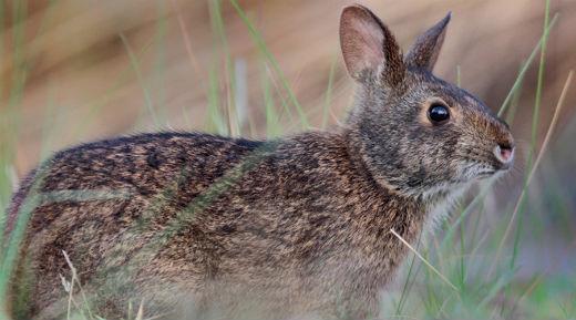
We surveyed the Naval Air Station in Key West, FL, to document state-listed herpetofauna in 2 different vegetation types using 3 motiondetecting infrared cameras centered within radiating drift fences Cameras were activated on 21 June 2021 and retrieved on 30 November 2021 Of 225,153 photos taken, 1210 were of vertebrates (603 of herpetofauna, 512 of mammals, and 95 of birds) July produced the most photographs of vertebrates per camera day (684/camera day), whereas August had the fewest (117/camera day), likely due to low precipitation The mean time of day when vertebrate photos were taken was midday at 1247 hours We found no Florida-listed birds or herpetofauna present on Navy lands during our camera-trap research; however, we did have 259 photos of the federally endangered Sylvilagus palustris hefneri (Lower Keys Marsh Rabbit). Additionally, 4 species of invasive herpetofauna were detected.
Authors

Nova Silvy
Roel Lopez
Cristian Lopez
Cite
Jewel Uzquiano
Philip Frank
Wendy Wheatley-Techmer
Silvy, NJ, RR Lopez, CN Lopez, JA Uzquiano, P.A. Frank, and W. Wheatly-Techmer. 2022. A camera-trap survey targeting herpetofauna at Naval Air Station, Key West, Florida. Southeastern Naturalist, 21, 175-186.
SOURCEBOOK
to source
Go
7 V:IV PUBLICATIONS
Lower Keys marsh rabbit (Sylvilagus palustris hefneri) Photo by Chad Anderson, USFWS
Testing the detection of large, secretive snakes using camera traps
Novel technologies, such as camera traps, have expanded the opportunities for species detection, especially for rare species. Corresponding changes in data processing must occur to handle the large volume of data gathered from technology like camera traps. Automated image data processing, usually by running images through different types of computer algorithms, is an overarching goal to reduce the number of images that researchers must manually review. However, differences in camera trap setups and species characteristics can make automatic processing a challenge.
Here, we evaluated the detection accuracy and efficiency of a time‐lapse triggered camera trapping technique combined with a pixel change detection algorithm as part of a monitoring program for a translocated population of the rare and federally threatened Louisiana Pinesnake (Pituophis ruthveni). We paired 5 cameras with automated pit tag readers to collect observations of P. ruthveni. We evaluated an image dataset of 1,500,187 images, collected over 7 months, both manually (i.e., researchers looking at each individual picture to determine snake presence) and automatically using a change detection algorithm.
There were 18 P. ruthveni observations recorded by the tag readers, 7 of which occurred while a paired camera was not operational Ten of the tag reader P ruthveni observations were captured by the paired camera trap, with an additional P ruthveni observation from a paired camera trap not recorded by the tag reader There were 132 snake observations of 13 additional species and 18 observations of unknown snakes from
the camera traps. The algorithm reduced the number of images reviewers evaluated by an average of 78.5% per camera (range = 37.3–98.7%) but had a 54.5% success rate at detecting observations of P. ruthveni (47.1% for individual images), and a slightly lower 48.9% success rate detecting other large snakes. Large snakes were 4 times more likely to be flagged by the algorithm than small snakes. Our time‐lapse triggered camera trapping technique performed well with respect to P. ruthveni detection accuracy, compared to the tag readers. However, further research is needed to improve quality assurances of camera trap image filtering and object recognition algorithms across different sites or environments.

Authors
Danielle Walkup
Wade Ryberg
Josh Pierce
Emlyn Smith
James Childress
Cite
Brian Pierce
Price Brown
Corey Fielder
Toby Hibbitts
Walkup, D.K., W.A. Ryberg, J.B. Pierce, E. Smith, J. Childress, F. East, B.L. Pierce, P. Brown, C.M. Fielder, and T.J. Hibbitts. 2022. Testing the detection of large, secretive snakes using camera traps Wildlife Society Bulletin e1408, https://doiorg/101002/wsb1408
V:IV PUBLICATIONS Go to source
SOURCEBOOK 8
Forrest East
Changes in selection of resources with reproductive state in a montane ungulate
Animals select habitats based on food, water, space, and cover Each of those components are essential to the ability of an individual to survive and reproduce in a particular habitat Selection of resources is linked to reproductive fitness and individuals likely vary in how they select resources relative to their reproductive state: during pregnancy, while provisioning young when nutritional needs of the mother are high, but offspring are vulnerable to predation, or if they lose young to mortality.

We investigated the effects of reproductive state on selection of resources by maternal female desert bighorn sheep (Ovis canadensis nelsoni) by comparing selection during the last trimester of gestation, following parturition when females were provisioning dependent young, and if the female lost an offspring. We captured, and recaptured each year, 32 female bighorn sheep at Lone Mountain, Nevada, during 2016–2018. Captured females were fit with GPS collars and those that were pregnant received vaginal implant transmitters.
We used a Bayesian approach to estimate differences in selection between females provisioning and not provisioning offspring, as well as the length of time it took for females with offspring to return levels of selection similar to that observed prior to parturition. Females that were not provisioning offspring selected areas with higher risk of predation, but greater nutritional resources than those that were provisioning dependent young. When females were provisioning young immediately following parturition, females selected areas that were safe from predators, but had lower nutritional resources.
Females displayed varying rates of return to selection strategies associated with access to nutritional resources as young grew and became more agile and less dependent on mothers We observed clear and substantial shifts in selection of resources associated with reproductive state, and females exhibited tradeoffs in favor of areas that were safer from predators when provisioning dependent young despite loss of nutritional resources to support lactation. As young grew and became less vulnerable to predators, females returned to levels of selection that provided access to nutritional resources to restore somatic reserves lost during lactation.
Authors
Marcus Blum
Kelley Steward
Kevin Shoemaker
Mike Cox
Cite
Brian Wakeling
Thomas Dilts
Joe Bennett
Vernon Bleich
Go to source SOURCEBOOK
Blum, ME, KM Stewart, KT Shoemaker, M Cox, BF Wakeling, TE Dilts, JR Bennett, and VC Bleich 2023 Changes in selection of resources with reproductive state in a montane ungulate Movement Ecology, 11:20. 9 V:IV PUBLICATIONS
We studied diet quality and forage selection by bighorn sheep before and following parturition to determine how nutritional demands associated with rearing offspring influenced forage acquisition. Selection of forage and habitats is driven by nutritional needs of individuals. Some species may sacrifice nutritional quality of forage for the mother in favor of safety of offspring (risk-averse strategy), immediately following parturition. We used desert bighorn sheep, Ovis canadensis nelsoni, to investigate that potential tradeoff.
We captured and radio-collared female bighorn sheep from 2016 to 2018. We used vaginal implant transmitters (VIT)s in pregnant females to identify parturition and to capture and radio-collar neonates to monitor survival of young. We collected fecal samples throughout the breeding season and throughout the year to understand diet quality and composition throughout those temporal periods. We determined diet quality and composition for pre-parturient females, females provisioning offspring, females that lost offspring, and nonpregnant individuals using fecal nitrogen and DNA metabarcoding analyses. Additionally, we compared the diet quality and composition of offspring and adult females during the spring, as well as summer and winter months.
Our results indicated differences in diet quality between individuals provisioning offspring and those whose offspring had died Females that were provisioning dependent young had lower quality diets than those that lost their offspring
Diet composition among those groups was also markedly different; females that had lost an offspring had a more diverse diet than did females with dependent young
Diet quality differed among seasons, wherein offspring and adult females had higher quality diets during the spring months, with decreasing quality as the year progressed. Diet diversity was similar across seasons, although spring months tended to be most diverse. Our results support tradeoffs associated with risk-averse strategies made by adult females associated with parturition. Nutritional quality of forage was linked to provisioning status, indicating that females were trading diet quality for safety of offspring, but those females whose offspring had died selected high quality forages. Those results help explain habitat selection observed in mountain ungulates around parturition and provide further insight into the evolutionary processes and adaptive significance exhibited by those specialized artiodactyls.
Authors
Marcus Blum
Kelley Stewart
Mike Cox
Kevin Shoemaker
Joe Bennett
Benjamin
Brian
Sullivan
Wakeling

Vernon
Bleich
Blum, M.E., K.M. Stewart, M. Cox, K.T. Shoemaker, J.R. Bennett, B.W. Sullivan, B.F. Wakeling, and V.C. Bleich. 2022. Variation in diet of desert bighorn sheep around parturition: tradeoffs associated with parturition. Frontiers in Ecology and Evolution, doi: 10.3389/fevo.2022.1071771.
V:IV PUBLICATIONS Go to source
SOURCEBOOK 10
Variation in diet of desert bighorn sheep around parturition: tradeoffs associated with parturition
Cite
Topographic ruggedness has been examined in thousands of ecological studies and is a popular variable for characterizing habitat selection. Despite widespread adoption, ruggedness metrics are often applied uncritically and require systematic and thorough testing using both artificial landscapes and real-world applications.
In this paper, the authors introduce a technique that removes the correlation of topographic ruggedness with curvature in order to more accurately represent fine-scale surface ruggedness.
The authors tested the modified version of several ruggedness metrics against traditional ruggedness metrics using three ideal ruggedness criteria in artificial landscapes. They further tested modified ruggedness measures using 449 real mountain ranges in Nevada, USA. Using desert bighorn sheep as a case study, they tested both modified and uncorrected ruggedness measures and slope in a multiscale context in order to examine habitat selection by female bighorn sheep.
The authors demonstrate that there are three components to ruggedness: elevation variation, aspect diversity, and surface ruggedness representing first, second, and third generation ruggedness indices. The technique for removing underlying topographic variation provides an improved mapping of surface ruggedness and augments the other two generations of ruggedness metrics

Authors
Thomas Dilts
Marcus Blum
Kevin Shoemaker
Peter Weisberg
Kelley Steward
Cite
Dilts, TE, ME Blum, KT Shoemaker, PJ Weisberg, and KM Stewart 2023 Improved topographic ruggedness indices more accurately model finescale ecological patterns Landscape Ecology, https://doiorg/101007/s10980-023-01646-6
Go to source
Improved topographic ruggedness indices more accurately model fine-scale ecological patterns
SOURCEBOOK 11 V:IV PUBLICATIONS
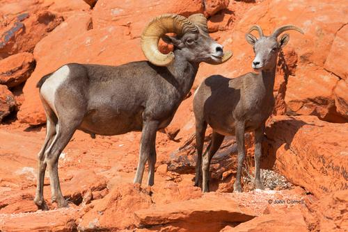
Desert Bighorn Sheep in Valley of Fire State Park, Nevada by John Cornell
Fecundity, female maturation,
and nesting season of western chicken turtles in Texas
The reproductive lifespans of turtles are consistently long, but reproductive cycles are under environmental control and thus can vary within species, populations, and individuals over time and space. Knowledge of turtle species’ reproductive traits and their associated variances over time and space are critical to understanding the dynamics of turtle populations, especially those requiring management or conservation.

Deirochelys reticularia is a species being considered for protection by the US Fish and Wildlife Service and contains 3 subspecies with some differences in reproductive characteristics of nesting season, annual nesting frequency, and egg retention. We collected ultrasound and xradiograph data in Texas to identify the
We observed shelled clutches or nesting events from April to July, confirming a spring–summer nesting season in Texas consistent with other D. r. miaria sites and supporting the paradigm that the western subspecies does not follow the autumn–winter nesting season of the other subspecies. We found no evidence that individuals retain shelled eggs while aestivating or overwintering. Individuals nested up to 3 times/yr in Texas. Individuals laid 7–11 eggs and the mean clutch size was 9.2 eggs, similar to other regions and other subspecies. Nesting phenology is regionally variable, so management plans and policies for the species will need to consider that variation and potentially recognize management differences among D. reticularia subspecies.
Authors
Brandon Bowers
Rachel Hibbitts
Toby Hibbitts
Danielle Walkup
Wade Ryberg
Cite
Bowers, BC, Hibbitts, RL, Hibbitts, TJ, Walkup, DK, Ryberg, WA, Lopez, RR and PS Crump 2022 Fecundity, Female Maturation, and Nesting
Season of Western Chicken Turtles (Deirochelys reticularia miaria) in Texas Chelonian Conservation and Biology, 21, 225-234

V:IV PUBLICATIONS Go to source
n r
SOURCEBOOK 12
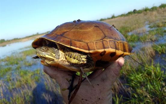
Western chicken turtle (Deirochelys reticularia miaria) Photo by Brandon Bowers
An evaluation of western chicken turtle survey and capture protocols
The behaviors and activity season of Deirochelys reticularia miaria (Western Chicken Turtle) are poorly understood in Texas Though distribution of D r miaria in the eastern portion of the state is widespread, turtle assemblage studies conducted within the range of the species in Texas have seldom documented its presence There is a lack of formal protection for this subspecies and their habitat, and past research suggests that remaining habitat within the state is under threat from increasing urbanization. Therefore, the US Fish and Wildlife Service issued a 90-day finding that states listing the subspecies as threatened or endangered may be warranted.
To provide survey recommendations for the western subspecies, we review species-wide capture techniques from the literature, recommend a survey season for D. r. miaria in Texas, and evaluate the efficacy and potential demographic biases of capture protocols implemented during field studies in the state in 2018 and 2019. We compared road surveys, dipnet surveys, seine surveys, night wading surveys, and two types of unbaited fyke net trap. Fyke nets were effective in every study that deployed them and captured D. r. miaria in this study at a rate of 0.25 captures per trap night. Dipnet surveys had the highest capture rate among active survey methods, but body size biases between methods were apparent. In Texas, road surveys yielded significantly lower capture rates than all other survey types.
The best survey method selection will vary depending on research questions, budget, and time constraints. Utilizing proper survey protocols and understanding the activity season are crucial for performing effective studies on this species.
Western chicken turtle (Deirochelys reticularia miaria) Photo by Brandon Bowers
Authors

Danielle Walkup
Toby Hibbitts
Paul Crump
Wade Ryberg
Cite
SOURCEBOOK Go to source
Bowers, BC, DK Walkup, TJ Hibbitts, PS Crump, WA Ryberg, CS Adams, and RR Lopez 2022 An Evaluation of Western Chicken Turtle (Deirochelys reticularia miaria) Survey and Capture Protocols. Journal of Herpetology, 56, 489-498. 13 V:IV PUBLICATIONS
Brandon Bowers
Mark-resight methodology for estimating key deer abundance assisted by citizen scientists
Florida Key deer (Odocoileus virginianus clavium) are an endangered subspecies of white-tailed deer endemic to the Lower Florida Keys. The New World screwworm (Cochliomyia hominivorax) infestation in July 2016 and Hurricane Irma on 10 September 2017 both caused the Key deer population to decline. Our objective was to estimate current Key deer population abundance using traditional distance sampling and a mark-resight methodology applicable for citizen scientist participation.
For mark-resight efforts, deer were marked with hand sprayers using water-based livestock dye on Big Pine (BPK) and No Name keys (NNK). Biologists conducted road surveys between 9–13 March 2020 on BPK and NNK and collected data for mark retention, mark-resight, and distance calculations concurrently. Our mark-resight estimate (n=748) was nearly 300 deer lower than the traditional distance estimate likely because of distance sampling's sensitivity to increased deer visibility along survey routes.
Compared to historic data, our mark-resight population estimate indicated increased deer abundance compared to post-Hurricane Irma estimates (n=573), but slightly below postscrewworm outbreak estimates (n=860). Based on mark-retention data, we recommend all resight surveys be completed within 5 days of the first mark placement for the most dependable mark detection. We recommend our mark-resight method be used in future Key deer surveys as it is simple, efficient, and can be reliably completed with the assistance of volunteers therefore allowing for more regular monitoring.
Authors

Nova Silvy
Roel Lopez
Cristian Lopez
Timothy Breen
Cite
Angelica Lopez
Andrea Montalvo
Israel Parker
Brian Powell
Silvy, N.J., R.R. Lopez, C.N. Lopez, T. Breen, A. Lopez, A.E. Montalvo, I.D. Parker, and B. Powell. 2022. Mark-resight methodology for estimating key deer abundance assisted by citizen scientists Wildlife Society Bulletin, e1298
V:IV PUBLICATIONS Go to source
SOURCEBOOK 14
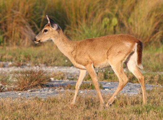
Florida Key deer (Odocoileus virginianus clavium) Photo by Joseph C Boone
Effectiveness, economics, and safety of drop nets and helicopters with net-gunning for capturing white-tailed deer
Capture and handling of animals is an essential component of wildlife research. Human population growth, coupled with rapid land use changes, have resulted in increased wildlifehuman interactions and subsequently increased public awareness and sensitivity to animal welfare. However, few publications have compared capture techniques in terms of effectiveness, economics, and animal safety across the same environment. We evaluated capture effectiveness, monetary cost, and safety for drop nets and both single and tandem helicopters with net-gunning techniques for white-tailed deer (Odocoileus virginianus; deer).
We captured 32 (drop nets), 68 (single helicopter), and 71 (tandem helicopters) deer over 6 study periods (3 autumn and 3 spring) from August 2011 to February 2014. Catch-perunit-effort (CPUE, person hours/deer) was lowest for tandem helicopters (2.3) followed by single helicopter (2.7) and then drop nets (65.8). Animals captured using drop nets heavily favored younger males compared to both helicopter and net-gunning techniques Capture cost (total cost/deer) was greater for drop nets ($655 USD) than either single helicopter ($164) or tandem helicopters ($231) Total mortality (capture-related and postcapture myopathy) was highest for drop nets at 125% followed by 59% for single helicopter and 42% for tandem helicopters While all 3 techniques were safe and effective methods for deer capture, the tandem helicopter technique was superior in balancing effectiveness, cost, safety, and maximizing spatial coverage, all of which must be considered when selecting among available capture methods
Jared Beaver
Chad Grantham
Lucas Cooksey
Kevin Skow
Brian Pierce
Roel Lopez
Cite

Beaver, J.T., C. Grantham, M.L. Cooksey, K. Skow, B.L. Pierce, and R.R. Lopez. 2022. Effectiveness, economics, and safety of drop nets and helicopters with netgunning for capturing white-tailed deer Wildlife Society Bulletin, e1365
SOURCEBOOK Go to source
15 V:IV PUBLICATIONS
Authors
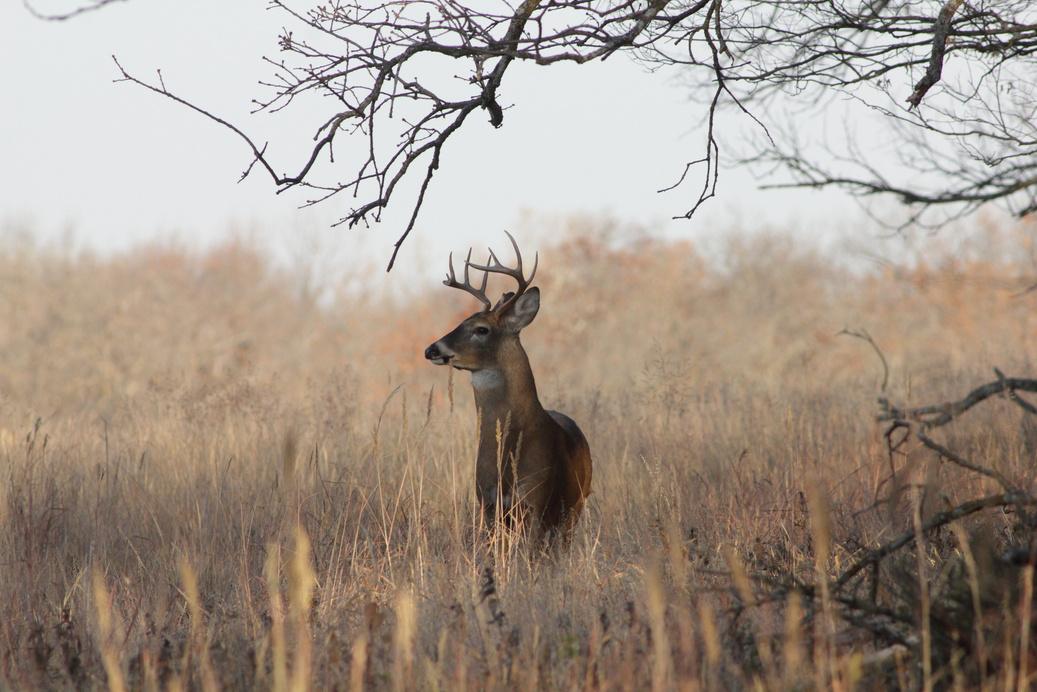
White-tailed deer (Odocoileus virginanus)
Ecology and conservation of the imperiled dunes sagebrush lizard: An ecological specialist in a threatened ecosystem

The Dunes Sagebrush Lizard (Sceloporus arenicolus) is endemic to the Mescalero-Monahans Sandhills, in southeastern New Mexico and west Texas. It only lives in dunes with bowl-shaped depressions (blowouts) that are semi-stabilized by shinnery oak (Quercus havardii). Meticulous studies reveal population dynamics in these lizards scale from local neighborhoods of individuals up to the geographic distribution. The condition and configuration of the irreplaceable landforms it inhabits are directly linked to population vital rates and persistence of populations.
The Mescalero-Monahans Sandhills overlies the Permian Basin, a region beset with increasing and extensive fragmentation from oil and gas development and sand mining for fracking. Fragmentation disrupts both the geomorphologic processes that maintain dunes and the dispersal dynamics that connect lizard neighborhoods. Effective conservation of shinnery oak dunes is a persistent challenge. Conservation agreements facilitate monitoring, land stewardship, and research. However, conservation agreements do not match dynamics of ecological scaling in this system and may not confront the problem of fragmentation that drives disappearance of S. arenicolus..
The same recommendation has been made since 1997, with increasing precision - there is a clear need to protect extensive and relatively undisturbed areas of shinnery oak dunes that are home to this highly specialized species.
Authors

Lee Fitzgerald
Wade Ryberg
Danielle Walkup
Toby Hibbitts
Cite
Michael Hill
Daniel Leavitt
Lauren Chan
Mickey Parker
Fitzgerald, LA, WA Ryberg, DK Walkup, TJ Hibbitts, MT Hill, DJ Leavitt, LM Chan, and MR Parker 2022 Ecology and Conservation of the Imperiled Dunes Sagebrush Lizard: An Ecological Specialist in a Threatened Ecosystem Imperiled: The Encyclopedia of Conservation, Elsevier, 1-16
V:IV PUBLICATIONS Go to source
SOURCEBOOK 16
Dunes sagebrush lizard (Sceloporus arenicolus) Photo by Lee Fitzgerald
Using LiDAR to Enhance Distribution Models for the Dunes
Sagebrush Lizard in Texas
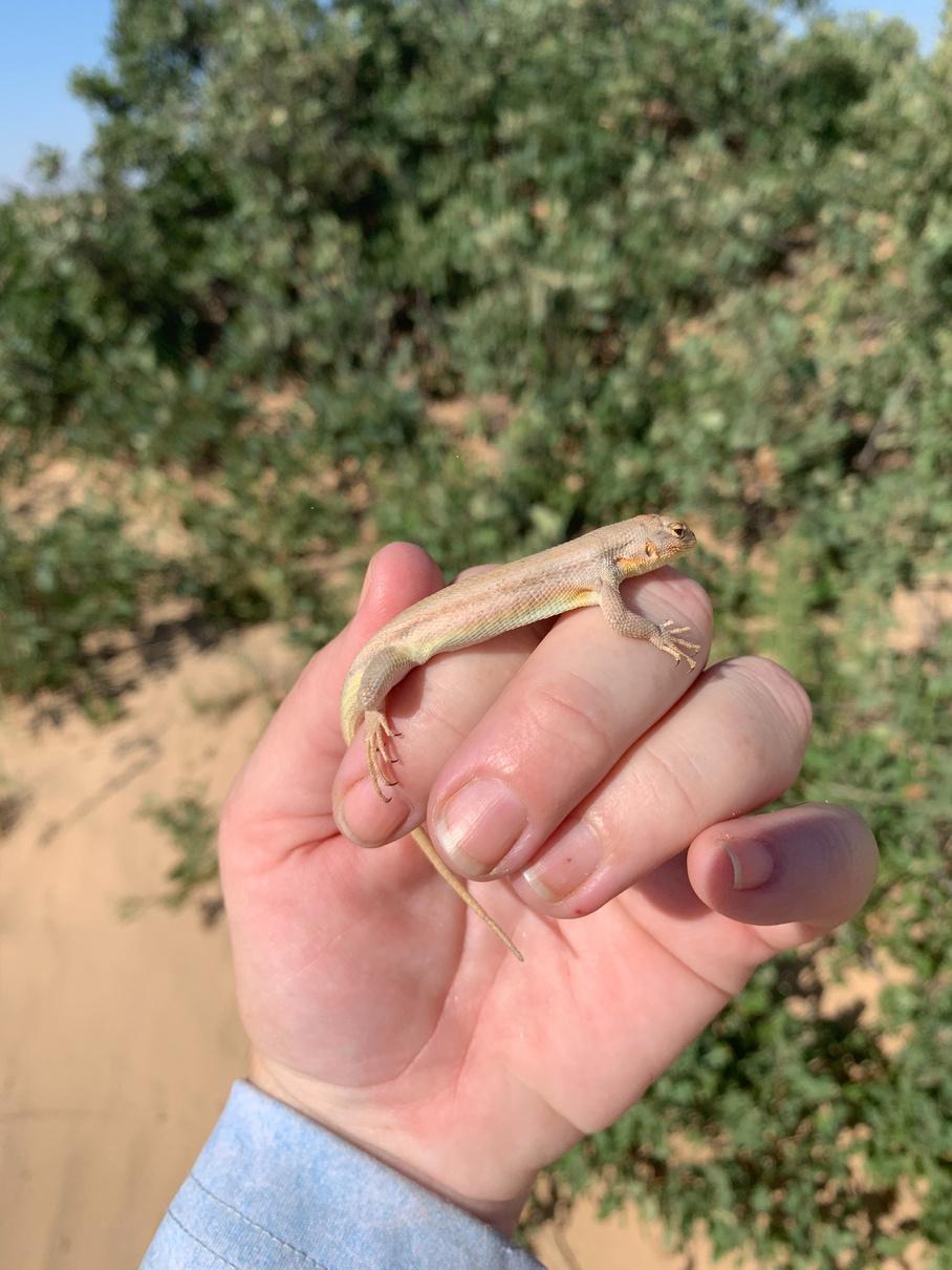
Mapping species distributions and habitat suitability guides policy decisions and conservation. Over the last few decades, multiple expert-derived, qualitative species occurrence and habitat availability maps have been developed in response to increasing conservation attention on the Dunes Sagebrush Lizard (Sceloporus arenicolus). Management and conservation decisions, however, necessitate development of a more structured, quantitative approach, based on the known occurrences of S. arenicolus and its habitat requirements. Thus, the goal of our work was to develop a continuous species distribution model for S. arenicolus in Texas.
We used Generalized Linear (GLM) and Generalized Additive (GAM) models to predict areas where conditions were appropriate, using land cover covariates as well as rugosity covariates derived from Airborne Light Detection and Ranging (LiDAR), for S. arenicolus occurrence within its known Texas range. The best fitting GLM model indicated higher mean maximum rugosity and lower percentage cover of Shinnery Oak (Quercus havardii) increased the mean predicted probability of occurrence for S arenicolus
Using the best-fitting model, we also predicted probability of occurrence via a GAM that included a spatial effect, which indicated that greater proximity to identified S. arenicolus presences increased the predicted probability of occurrence. Our species distribution maps can be used to inform the listing determination and support future conservation actions by identifying suitable areas for S. arenicolus, helping prioritize areas for future S. arenicolus surveys, and determining areas for high-value conservation or management actions.
Authors

Danielle Walkup
Wade Ryberg
Toby Hibbitts
Kevin Skow
Cite
Garrett Powers
Lee Fitzgerald
Bret Collier
Roel Lopez
Walkup, D.K., W.A. Ryberg, R.J. Hibbetts, K.L. Skow, G Powers, LA Fitzgerald, BA Collier, and RR Lopez 2022 Using LiDAR to enhance distribution models for the dunes sagebrush lizard (Sceloporus arenicolus) in Texas, USA Herpetological Conservation and Biology, 17, 349-361
Go to source
17 V:IV PUBLICATIONS
Dunes sagebrush lizard (Sceloporus arenicolus) Photo by Danielle Walkup
Biogeographic consequences of shifting climate for the western massasauga
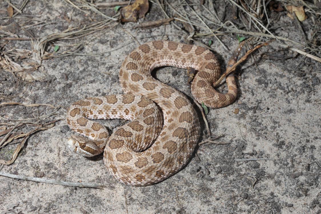
The western massasauga (Sistrurus tergeminus) is a small pit viper with an extensive geographic range, yet observations of this species are relatively rare. They persist in patchy and isolated populations, threatened by habitat destruction and fragmentation, mortality from vehicle collisions, and deliberate extermination. Changing climates may pose an additional stressor on the survival of isolated populations. Here, we evaluate historic, modern, and future geographic projections of suitable climate for S. tergeminus to outline shifts in their potential geographic distribution and inform current and future management.
We used maximum entropy modeling to build multiple models of the potential geographic distribution of S. tergeminus. We evaluated the influence of five key decisions made during the modeling process on the resulting geographic projections of the potential distribution, allowing us to identify areas of model robustness and uncertainty. We evaluated models with the area under the receiver operating curve and true skill statistic. We retained 16 models to project both in the past and future multiple general circulation models.
At the last glacial maximum, the potential geographic distribution associated with S. tergeminus occurrences had a stronghold in the southern part of its current range and extended further south into Mexico, but by the midHolocene, its modeled potential distribution was similar to its present-day potential distribution. Under future model projections, the potential distribution of S. tergeminus moves north, with the strongest northward trends predicted under a climate scenario increase of 8.5 W/m².
Some southern populations of S. tergeminus have likely already been extirpated and will continue to be threatened by shifting availability of suitable climate, as they are already under threat from desertification of grasslands. Land use and habitat loss at the northern edge of the species range are likely to make it challenging for this species to track suitable climates northward over time.
Authors

Danielle Walkup
Anna Lawing
Toby Hibbitts
Wade Ryberg
Cite
Walkup, DK, AM Lawing, TJ Hibbitts, and WA Ryberg 2022 Biogeographic consequences of shifting climate for the western massasauga (Sistrurus tergeminus)
Ecology and Evolution, 12, e8599
Go to source
Western massasauga (Sistrurus tergeminus)
V:IV PUBLICATIONS SOURCEBOOK 18
Photo by Toby Hibbitts
Mussel–flow relationships are not well defined and studies linking behavioural, physiological and life-history traits to hydrological conditions remain scant. This lack of information hinders not only understanding of how flow shapes population and community processes but the development of evidencebased flow recommendations to mitigate mussel declines.
Mussel–flow relationships were evaluated for Potamilus amphichaenus (Texas heelsplitter), Pleurobema riddellii (Louisiana pigtoe) and Truncilla macrodon (Texas fawnsfoot) from the Sabine, Trinity, Neches and Cypress River basins of East Texas using Indicators of Hydraulic Alteration and random forest models. These species were chosen because all three are currently being evaluated for listing under the US Endangered Species Act.
Analyses were performed on US Geological Survey stream gauge stations and mussel records within 20 km of each other. Only gauges with at least 15 years of continuous data and ≥70% overlap of flow records from 1968 to 2018 were included For selected 28 gauges, Indicators of Hydraulic Alteration were used to calculate 47 hydrological parameters that describe the magnitude, frequency and duration of high and low flow events Random forest classification models across species were significant and had low error rates (357–2143%), moderate to high sensitivity (081–093) and moderate to high specificity (071–100)
Life-history theory was useful for explaining how mussel species cope with hydrological variation. Potamilus amphichaenus and T. macrodon/Truncilla donaciformis, considered r-selected or opportunistic strategists, were more likely to occur in basins characterized by significant changes in flow and land use compared with P. riddellii, considered a Kselected or equilibrium strategist.
The analytical framework presented in this study should be helpful to managers and conservationists interested in determining how the flow regime is shaping aquatic communities in their region and developing reference points that could serve for ecological research, conservation and management.
Authors

Alexander Kiser
Jennifer Khan
Clinton Robertson
Roel Lopez
Charles Randklev
Cite
Kiser, AH, JM Khan, CR Robertson, R Lopez, and CR Randklev 2022 The effect of flow and mussel species traits on the occurrence of rare mussels: A case study within selected rivers of the West Gulf Coastal Plain Aquatic Conservation: Marine and Freshwater Ecosystems, 32, 98-111
Go to source
The effect of flow and mussel species traits on the occurrence of rare mussels: A case study within selected rivers of the West Gulf Coastal Plain
SOURCEBOOK 19 V:IV PUBLICATIONS
Overexploitation of freshwater resources coupled with climate change can affect the flow and temperature regimes in rivers, which can be catastrophic for aquatic biota. The San Saba and Llano rivers, located in central Texas, are experiencing low flows and stream dewatering owing to over-allocation. Both systems harbour imperilled species, including Lampsilis bracteata, Texas fatmucket, which has been proposed for listing under the US Endangered Species Act. It is suspected that elevated water temperatures are a contributing factor in its decline.
The upper thermal tolerances of glochidia and juvenile life stages were evaluated within each river. Mussels were acclimated to 27°C and tested across a range of temperatures (30–39°C) in 24 h (glochidia) and 96 h (juveniles) laboratory tests. The resulting tolerances were related to in situ water temperature and discharge using a uniform continuous abovethreshold analysis.
In the Llano, the 24 h LT50 (lethal temperature resulting in 50% mortality) was 31.8°C (95% CI 31.5–32.1°C), whereas the 96 h LT50 was 32.4°C (95% CI 32.1–32.7°C). In the San Saba, the 24 h LT50 was 34.7°C (95% CI 34.5–35.0°C), whereas the 96 h LT50 was 32.5°C (95% CI 32.2–32.9°C). LT50 thresholds were not exceeded for L. bracteata within the San Saba, but LT05 (lethal temperature resulting in 5% mortality) thresholds were exceeded. Water temperature loggers were lost in the Llano River as a result of a large flood; however, samples reported by the Texas Commission on Environmental Quality show that the LT05 and LT50 for both glochidia and juveniles were exceeded.
Findings from this study indicate that thermal tolerances of L. bracteata vary by population and that low flows may be contributing to its decline. Our approach is non-species and region specific, which means that the methods presented should help managers and conservationists evaluate whether reduced water quantity and elevated temperatures are exerting impacts on aquatic species within their region.
Authors

Amanda Goldsmith
Jennifer Khan
Clinton Robertson
Roel Lopez
Charles Randklev
Cite
Goldsmith, A, JM Khan, CR Robertson, R Lopez, and CR Randklev 2022 Using upper thermal limits of Lampsilis bracteata (Texas fatmucket) from the North Llano and San Saba rivers, Texas to inform water management practices in the Edwards Plateau Aquatic Conservation: Marine and Freshwater Ecosystems, 32, 85–97
Go to source
Using upper thermal limits of Texas fatmucket from the North Llano and San Saba rivers, Texas to inform water management practices in the Edwards Plateau
V:IV PUBLICATIONS SOURCEBOOK 20
VOLUME IV SUMMER 2023 SOURCEBOOK 21 REPORTS
TEXASWATERTRENDS

THE ENVIRONMENTAL DEFENSE FUND (EDF)
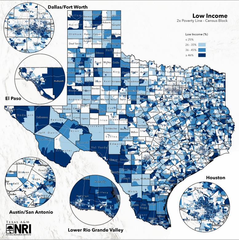
The Texas Hill Country is home to the headwaters of 13 rivers and sustains life from the rural communities of Central Texas, through the rapidly growing cities of the I-35 corridor, to the bays and estuaries of the Gulf of Mexico. The Texas Hill Country Conservation Network was created to coordinate a conservation partnership working to scale up the impact of conservationfocused organizations in the region In order to achieve their respective missions, the partnership needed an assessment of land-water challenges and how these challenges impact Hill Country communities, particularly those communities comprised of underserved or at-risk populations
This report provides a baseline, holistic understanding of Hill Country community demographic characteristics and where these intersect with land-water challenges within the region Specific project objectives include collecting and curating demographic and land-water data, to include mapping, within the project area; collecting land-water management information from communities via surveys and interviews, and synthesizing the information to offer key recommendations for the Network to increase community engagement The report further outlines key findings and defines action items moving forward
Authors
Angelica Lopez
Roel Lopez
Matthew Crawford
Addie Smith
Daniela Barrientos
Brittany Wegner
Oscar Munoz
Andrea Roberts
Vanessa Puig-Williams
Dan Mueller
V:IV REPORTS
SOURCEBOOK 22
to source
Go
CONSERVINGTEXAS


QUANTIFYINGECOLOGICAL RETURNONINVESTMENT
Proactive measures to protect the ecological and economic gains held in our open spaces are critical to ensuring a prosperous future for our state Land conservation supports numerous economic benefits for Texas while protecting wildlife habitat, enhancing water resources, preserving working agricultural and forest lands, and providing public access to outdoor recreational areas The goal of this report is to better understand the current benefits and need for financial investment in our state's natural resources to best support our growing state population, thriving economy, and healthy landscape
Authors
23
Addie Smith
Alison Lund
Roel Lopez
SOURCEBOOK V:IV REPORTS
ECONOMICVALUESOF WHITE-TAILEDDEERINTEXAS: PARTI
Authors

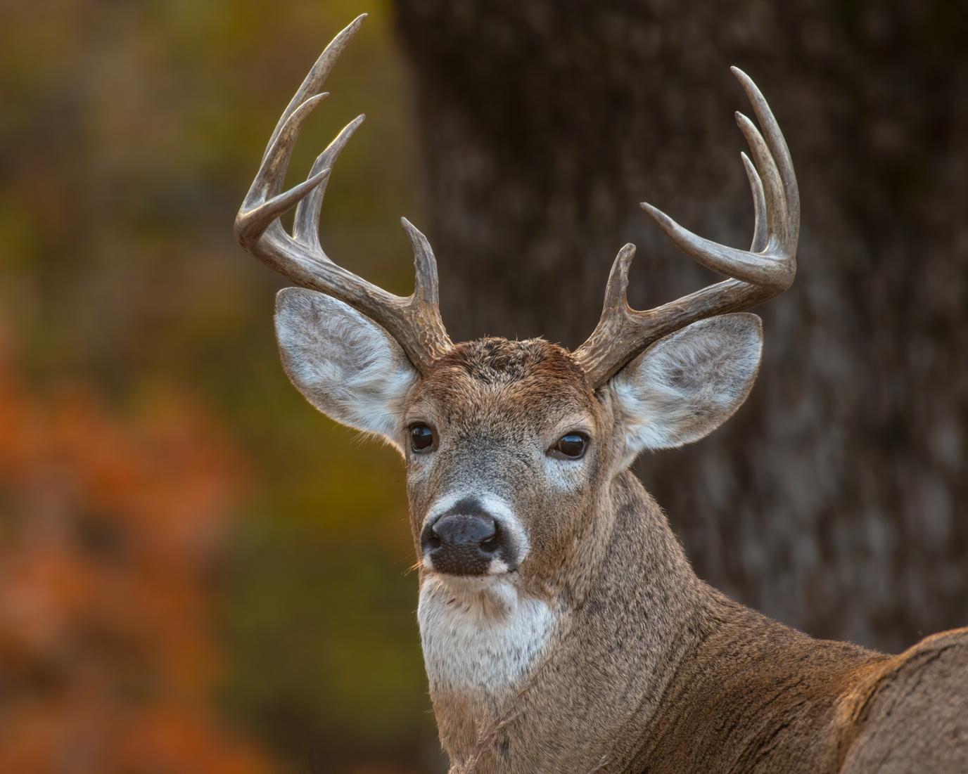
Texas is one of the top destinations for hunting in the U.S., greatly due to the abundance of white-tailed deer throughout the state. The latest US Fish and Wildlife Service recreation survey ranked Texas among the highest for the annual number of hunters in addition to days spent deer hunting Money spent by hunters and landowners alike in relation to white-tailed deer activities is substantial, contributing to jobs, sales of hunting and land management equipment, travel amenities, and much more.
This report is the first of a three-part series evaluating the economic values of white-tailed deer from surveyed hunters and landowners
Go to source
Jacob Dykes
Shraddha Hegde
Tammi Johnson
Angelica Lopez
Roel Lopez
Alison Lund
V:IV REPORTS SOURCEBOOK 24

VOLUME IV SUMMER 2023 SOURCEBOOK 25 RESOURCES
RANGELANDCARBON MARKETSRESOURCE

As Texas natural resources management and conservation professionals, we find ourselves asked by landowners, public land agency representatives, local communities, and private corporate entities about carbon markets, how they function, what the implications for rangelands are, how to understand current controversies around the carbon offsets and whether they should become carbon market participants We’ve learned, as many of you have, that voluntary carbon markets are continuing to grow rapidly and evolve in response to supply and demand, and there continue to be controversies around credit quality and the use of offsets in climate action Given this evertransforming and sometimes volatile space, the future of the voluntary carbon market is hard to predict Nevertheless, these markets are engaging landowners and affecting changes on Texas lands right now. Informed natural resources professionals and landowners will better prepare us for these changes and for the management implications of other nascent markets for water, biodiversity, and other ecosystem services
We developed Rangeland Carbon Markets to provide an overview of carbon markets specifically for natural resources professionals, landowners, agricultural producers, and others involved in making land management decisions by providing information on the background, history, processes and function of carbon markets. We focus on those carbon markets that are most applicable to rangeland systems in Texas to offer clarity for current voluntary carbon market system organization and processes Given our focus and area of expertise and the complex and ever-shifting carbon market landscape, it is possible that there are nuances of policy and interpretation that are not completely covered, so we encourage readers to utilize some of the resources we cite for additional information.
We would like to encourage more attention and evaluation of these voluntary carbon market programs, and it is our hope that this report will help to foster a knowledgeable set of natural resources professionals and decision-makers to continue that vital conversation within Texas and the country at large.
Alejandra
William
Go to source
Forrest Cobb
Amanda Goldsmith
Rodriguez
Chad Ellis
Fox
Doug Tolleson
Jeff Goodwin
Edward Osei
V:IV RESOURCES SOURCEBOOK 26 Authors
Roel Lopez
TEXASLANDOWNER SURVEY
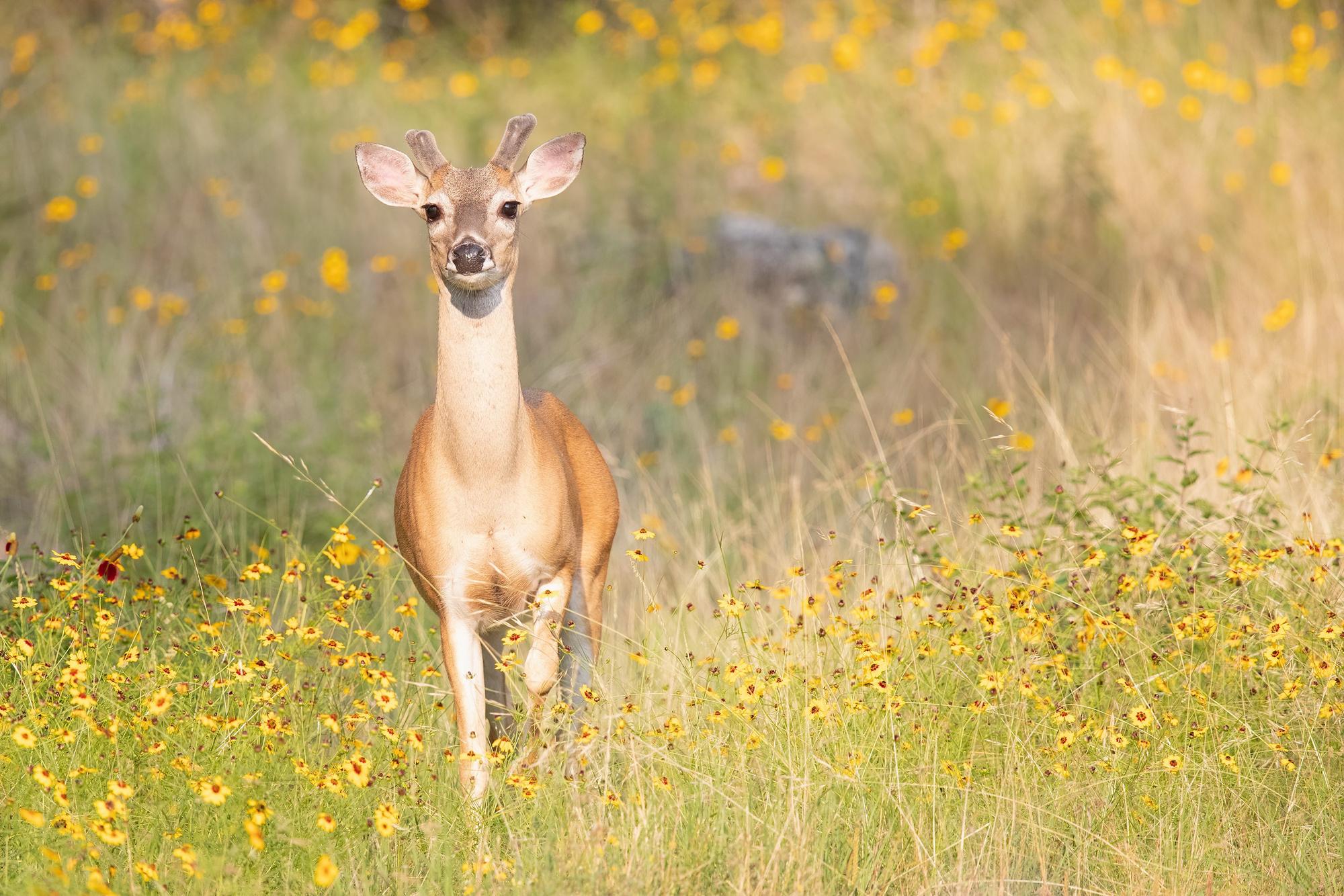
The Texas A&M Natural Resources Institute has worked alongside landowners for many years. A useful landowner tool within the Institute is Texas Land Trends, a mapping resource program that allows users to explore land and growth patterns across the state. A complementary tool is the Texas Landowner Survey. Repeated every five years, the survey determines landowner needs, preferences, and concerns that serve to improve outreach and programming.
Owners of private working lands in Texas are among the most productive stewards of farms, ranches, and forests in the country. Their land management decisions influence wildlife habitat, create many year-round opportunities, and support economy-driving industries, such as agriculture and the energy sector Since private rural working lands comprise the majority of open space in Texas (83%), private rural landowner stewardship determines the condition of the land and the resulting public and private benefits derived from their agricultural and natural resource practices Landowners are an integral part of ecosystem service benefits, and understanding their needs translates to improved programming and stewardship practices
Supporting the stewardship of working lands makes business sense because it helps conserve the state’s economy
Authors

Angelica Lopez
Daniela Barrientos
Roel Lopez
Kevin Skow
Matthew Crawford
Justin Dreibelbis
Brian Hays
Brittany Wegner
Go to source
27 V:IV RESOURCES
Authors
Roel Lopez
Addie Smith
Jewel Uzquiano
Alison Lund
David Anderson
Jianbang Gan

Jaclyn Roberts
Charles Kneuper
Lori Ziehr
Claude Ross
RVICES: MENT
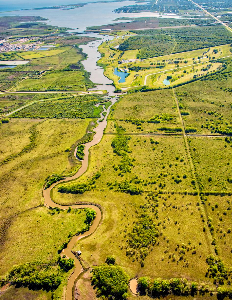
prised of ervices, of nature, t of wellbeing, ucts such
or example, d flood and tural ack formal enefits are . As a of by the those nd with a basic d their o assign ance of can serve nd policies ces and this report ystem onomic o to source
 Adriana Putman
V:IV RESOURCES SOURCEBOOK 28
H E R E C O N S E R V A T I O N A N D A P P L I E D R E S E A R C H M E E T .
Stretching from every corner of the country, through data curation and field observations, we produce sound science
We thank you for supporting our commitment to solving natural resource issues and engaging policymakers, land managers and citizens throughout this process.
W

TAMU-NRI.MEDIUM.COM/
A&M Natural Resources Institute College Station, San Antonio, Dallas and Washington D.C.
Texas
nri
nri.tamu.edu @tamu


 Adriana Putman