Transportation Master Plan - Sturgeon Road Functional Plan
Road Functional Planning Study Final Report | Prepared for Sturgeon County
Authorization and Signatory Page
This Sturgeon Road Functional Planning Study has been prepared by McElhanney Ltd. for the benefit of Sturgeon County. The information and data contained herein represent our best professional judgement based on knowledge and information available at the time of preparation. Any use of this information in a manner not intended, or with knowledge that situations have changed, shall not be the responsibility of McElhanney Ltd. or the undersigned.
McElhanney Ltd. denies any liability whatsoever to other parties who may obtain access to this report for any injury, loss or damage suffered by such parties arising from their use of, or reliance upon, this document or any of its contents without the expressed written consent of McElhanney Ltd. or County
Sturgeon Road Functional Planning Study Final Report | Prepared for Sturgeon County
Tel: 780-619-1986
Email: RBetker@mcelhanney.com 2023-06-12
List of Figures
Figure
List of Tables
Appendices
Executive Summary
Project Purpose and Objectives
In planning for anticipated growth in the Sturgeon Valley, Sturgeon County has identified a need to complete a Functional Planning Study (FPS) to develop a corridor plan for Sturgeon Road that support future growth and regional connectivity over the next 25 years. This FPS presents a long-term plan for Sturgeon Road that addresses the short and long term needs of the County and Sturgeon Valley.
Existing studies that informed this FPS include, but are not limited to, the Sturgeon Valley South and Core Area Structure Plans, the Transportation Network Improvement Strategy (2022, Associated Engineering) and the 127 Street Functional Planning Study (2012, ISL Engineering). The overall scope of this study is to:
• Confirm traffic projections and conduct traffic analysis to identify key issues and explore feasible intersection alternatives to improve corridor safety and operations issues.
• Develop the recommended strategy and conceptual plans for the Sturgeon Road corridor, including intersection treatment and access management options for the 25-year horizon and high-level analysis beyond the 25-year horizon
• Identify design constraints, including right-of-way, utilities, potential environmental and geotechnical impacts.
• Provide a solution that is stageable and constructible and compatible with the future 127 Street connection and other planned regional network improvements.
• Develop functional level cost estimates for the recommended improvements.
Traffic Review
Existing traffic conditions along Sturgeon Road are operating well with primarily free-flow traffic with some minor delays at the major intersections. These delays are well within an acceptable level of service for road users.
Traffic projections based on updated planning initiatives, land use and demographic data indicate that regardless of the 127 Street extension, Sturgeon Road is expected to have sufficient capacity as a twolane roadway to support a population of approximately 10,000 people in the Sturgeon Valley. This growth is estimated to occur sometime between 2037 (high growth of 2% per year on the whole county population), 2050 (moderate growth of 1% per year) and 2077 (low growth of 0.5% per year) Intersection improvements will also be required at River’s Gate, Starkey Road and Essex Point to maintain acceptable levels of service.
As growth continues towards a total population of approximately 26,000 people in the Sturgeon Valley (full build-out of Planning Area 1), Sturgeon Road can continue to operate with acceptable levels of service as a two-lane roadway with additional corridor improvements, however, this will also require the extension of 127 Street to at least Sturgeon Road to help alleviate traffic pressures Most of the population growth will occur in the development area southeast of Sturgeon Road, therefore the 127 Street extension is also key in facilitating access and build-out of Planning Area 1. The 127 Street to Sturgeon Road is estimated to be implemented by 2037, or as Sturgeon Valley reaches the 10,000population threshold. It is estimated that the Valley will reach a population of approximately 26,000 people sometime between 2053 (high growth of 2% per year), 2082 (moderate growth of 1% per year) and beyond 2100 (low growth of 0.5% per year)
The ultimate build-out of Sturgeon Valley (61,000-population) will require 127 Street be extended to at least Bellerose Drive and widened to four-lanes, which will allow Sturgeon Road to function as a two-lane arterial between Essex Point and 127 Street. The section of Sturgeon Road between Essex Point/Township Road 543A and Highway 28 will likely require four-lanes to facilitate further development east of Essex Point and Range Road 250.
Recommended Functional Plan
A functional plan for Sturgeon Road has been developed for the 26,000-population build-out and the full Sturgeon Valley Build out (61,000, beyond 25-year). The plan includes the following considerations:
• Maximize the life span of existing infrastructure
• Maintain efficient long-term traffic operations
• Enhance the corridor amenities, including for active transportation
• Improving safety for all travel modes along the corridor
• Consider opportunities to manage access along the corridor
• Provide logical and flexible implementation staging
Overall, a two-lane arterial cross-section is recommended to be maintained at minimum to the 26,000 population build-out with the addition of protected turn bays at various intersections to improve the safety and operations along Sturgeon Road. At the major intersections, it is recommended that a single-lane roundabout be implemented to maintain safe speeds along the corridor, improve traffic operations and enhance the overall aesthetic of the area. All study intersections are to be maintained as uncontrolled, except for the intersections at Highway 28 and 127 Street, where it is expected to be signalized. Well beyond 25-years and as warranted by development, it is recommended that the section of Sturgeon Road between Essex Point/Township Road 543A and Highway 28 be upgraded to a four-lane arterial. The segment of Sturgeon Road between Essex Point and 127 Street will remain a two-lane arterial due to significant ROW constraints.
Table ES-1 provides a summary of the proposed intersection configurations along the corridor
To enhance and facilitate active modes connections in the area, a 3.0m shared use path is also recommended along the south side of the corridor, west of Sturgeon Road/Essex Point/Township Road 543A and on the north side of the roadway east of the intersection.
Sturgeon Road Functional Planning Study Final Report | Prepared for Sturgeon County
The rate of growth and development in the Valley will influence the implementation timelines for the proposed improvements. It is recommended that the County uses a staged approached for project implementation as follows:
• As the first priority, provide the recommended active modes infrastructure and connections in the plans as soon as reasonably possible.
• Design and construct a roundabout at the Sturgeon Road/River’s Gate intersection and the Sturgeon Road/Township Road 543A/Essex Point intersection in the short-term horizon (1-5 Years) to address traffic operations and overall corridor safety. Traffic operations are expected to fail by the time population within Sturgeon Valley reaches approximately 10,000 people.
• Design and construct a roundabout at Sturgeon Road/Township Road 542A in the long-term horizon as traffic operations are expected to fail by the time population within the Valley reaches approximately 26,000 people.
• Design and construct protected left turn bays at various intersection throughout the corridor to address traffic operation concerns and provide a safe and efficient corridor (minimize queuing and interrupted flow). These improvements are required in the long-term horizon and can be implemented in sections through the Sturgeon Road Corridor.
Road Intersection Proposed Improvements
1. 127 Street
2. River’s Gate
3. Township Road 542A
4. Viscount Road West
5. Starkey Road (Range Road 251)
6. Viscount Road East / Equestrian Place
7. Viscount Drive
Construct T-intersection (signalized) as per the 127 Street interim plan. The full 4-leg intersection will then be required when 127 Street is connected across the Sturgeon River. Single left-turn lanes should be constructed as part of both the T-Intersection and 4-leg Intersection configuration
• When 127 Street is twinned from 2-lanes to 4-lanes, dual left-turn bays may be required on Sturgeon Road on the leg that connects to the City of St. Albert.
Provide temporary access to future development by constructing an access as needed at the River's Gate intersection. Complete a single-lane roundabout as development progresses and local traffic becomes active in the new development area to maintain fluid traffic operations for all movements.
Upgrade intersection to a single-lane roundabout, and properly aligning the Sturgeon Valley Golf Club access at the roundabout.
Some geometric changes to Viscount Road West to limit intersection to right-in/right-out movements. This intersection should continue to be monitored and if safety concerns are observed, the intersection should be closed with access consolidated to Viscount Road East
Minor geometric improvements to existing roundabout, including implementation of concrete splitter islands and addition of pedestrian facilities.
Addition of left-turn bays on Sturgeon Road.
Addition of westbound left-turn bay on Sturgeon Road
8. Crestview Drive West Access is limited to right-in/right-out traffic movements as a result of nearby turn bays.
9. Crestview Close / Crestview Drive East
10. Essex Point
11. Range Road 250
12. Edinburgh Road W
Addition of left-turn bays on Sturgeon Road.
Upgrade intersection to a single-lane roundabout, properly aligning the Essex Point local road access at the roundabout. Addition of pedestrian facilities at the intersection.
• Approaching the 61,000 population horizon, a dual lane roundabout may be required at this intersection.
Maintain existing lane configuration.
Addition of left-turn bays on Sturgeon Road as well as geometric improvements to the north leg to provide safer turning movements and shorter pedestrian crossing. Improve the local access road that ties-into Range Road 250 (south leg)
Addition of left-turn bays on Sturgeon Road as well as geometric improvements to the north leg to provide safer turning movements and shorter pedestrian crossing.
13. Edinburgh Road E
14. Crozier Drive
15. Range Road 245
16. Highway 28
• If the 112 St Flyover is completed and connected all the way to Sturgeon Road, the south leg will need to be improved to align with the 112 St roadway extension as shown in the 4-lane concept.
Addition of left-turn bays on Sturgeon Road.
• If needed due to development access, a south leg can be constructed to mirror the north leg.
Addition of left-turn bays on Sturgeon Road.
• If needed due to development access, the south leg can be improved to mirror the north leg. It is recommended that proposed north/south collector south of Sturgeon Road connect to this intersection to minimize the number of accesses near the highway 28 intersection.
Maintain existing intersection configuration and existing access 200m west of intersection. Limit additional development trips at the access beyond what is currently approved (i.e., Commercial development as part of Planning Area 2).
Sturgeon Road Functional Planning Study Final Report | Prepared for Sturgeon County
Project Costs & Funding Strategy
A planning-level cost estimate was prepared for the recommended plan based on 2023 dollars and are summarized in Table ES-2. The overall cost of the project is estimated to be $10.9M (2023 dollars), including construction, contingency and engineering costs.
Table ES-2: Sturgeon Road Improvements Class A Cost Estimates (2023 Dollars)
Well beyond the 25-year horizon, Sturgeon Road may be required to upgrade to a 4-lane cross-section from Essex Point to Highway 28. This upgrade will require ROW acquisition that can be approximated to be $0.9M (3 hectare of land acquisition). Should this upgrade be required, the anticipated construction cost is estimated to be $22.4M for the full reconstruction of the corridor, including engineering costs (12%) and contingency (25%). This cost also includes the introduction of an underground storm system along the corridor and Essex Point roundabout upgrades from a single-lane to a dual-lane roundabout, however it does not include any stormwater management ponds or outlet structures.
1. Introduction
McElhanney Ltd. (McElhanney) was retained by Sturgeon County to complete the functional planning of Sturgeon Road between the Sturgeon County / St. Albert limits to the west and Highway 28 to the east The primary focus of this assignment is to identify the long-term cross-section and access requirements along Sturgeon Road to support future growth and development as well as to determine the staging of improvements to address existing and future needs
1.1. PROJECT BACKGROUND
Sturgeon Road is a key east-west link within the Sturgeon Valley that facilitates local travel as well as regional connections between Sturgeon County, St. Albert and the City of Edmonton. The corridor is classified as an arterial and is currently a two-lane undivided roadway that connects from Sturgeon County / St. Albert limits to the west and Highway 28 to the east. The Sturgeon Valley area is anticipated to grow continuously throughout the next several decades, which includes the addition of over 21,000 people in the first stages of development In planning for this growth, Sturgeon County has identified a need to complete a Functional Planning Study (FPS) to develop a corridor plan that support future growth and regional connectivity. In addition, upgrades to Sturgeon Road will need to consider and complement the future 127 Street connection from the County’s southern border to Highway 2, north of St. Albert. The purpose of this FPS is to establish a strategy that addresses existing operational and safety concerns while building towards the corridor plan to support future development under the 25-year horizon and beyond. This provides the County an opportunity to define the transportation network and inform development in the Sturgeon Valley area as well as to protect the required road right-of-way for future improvements.
1.2. PROJECT SCOPE
Building from the transportation reviews conducted as part of the Sturgeon Valley South and Core Area Structure Plans (ASPs) as well as the Transportation Network Infrastructure Strategy (TNIS), the overall scope of the FPS is to:
• Confirm traffic projections and conduct traffic analysis to identify key issues and explore feasible intersection alternatives to improve corridor safety and operations issues.
• Develop the recommended strategy and conceptual plans for the Sturgeon Road corridor, including intersection treatment and access management options for the 25-year horizon and beyond
• Identify design constraints, including right-of-way, utilities, potential environmental and geotechnical impacts.
• Provide a solution that is stageable and constructible and compatible with the future 127 Street connection and other planned regional network improvements.
• Develop functional level cost estimates for the recommended improvements.
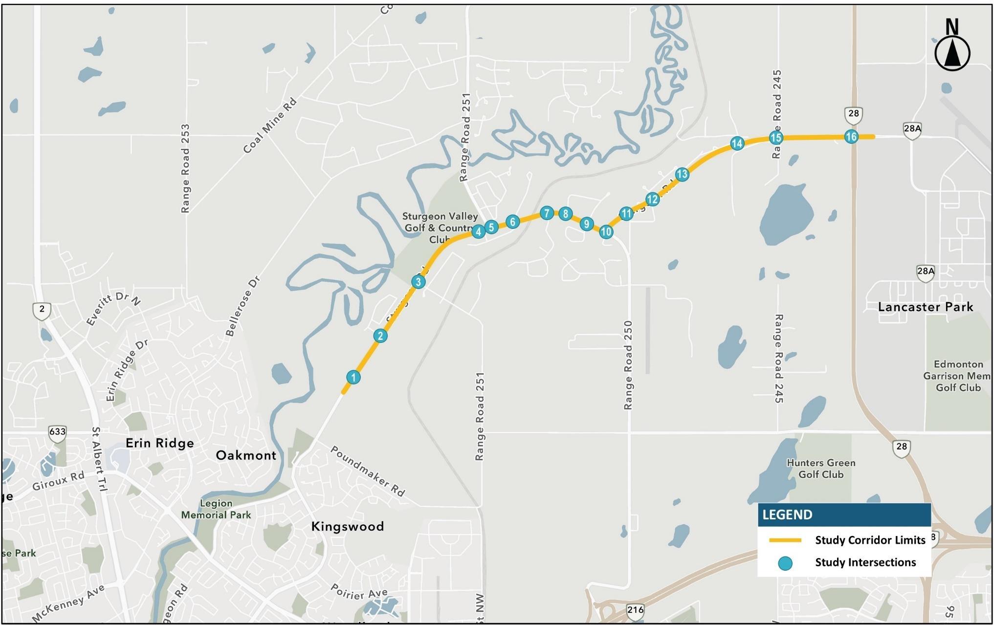
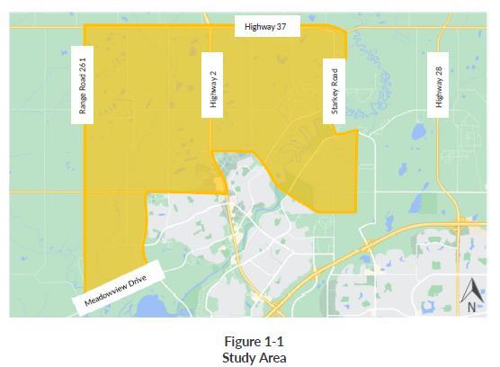
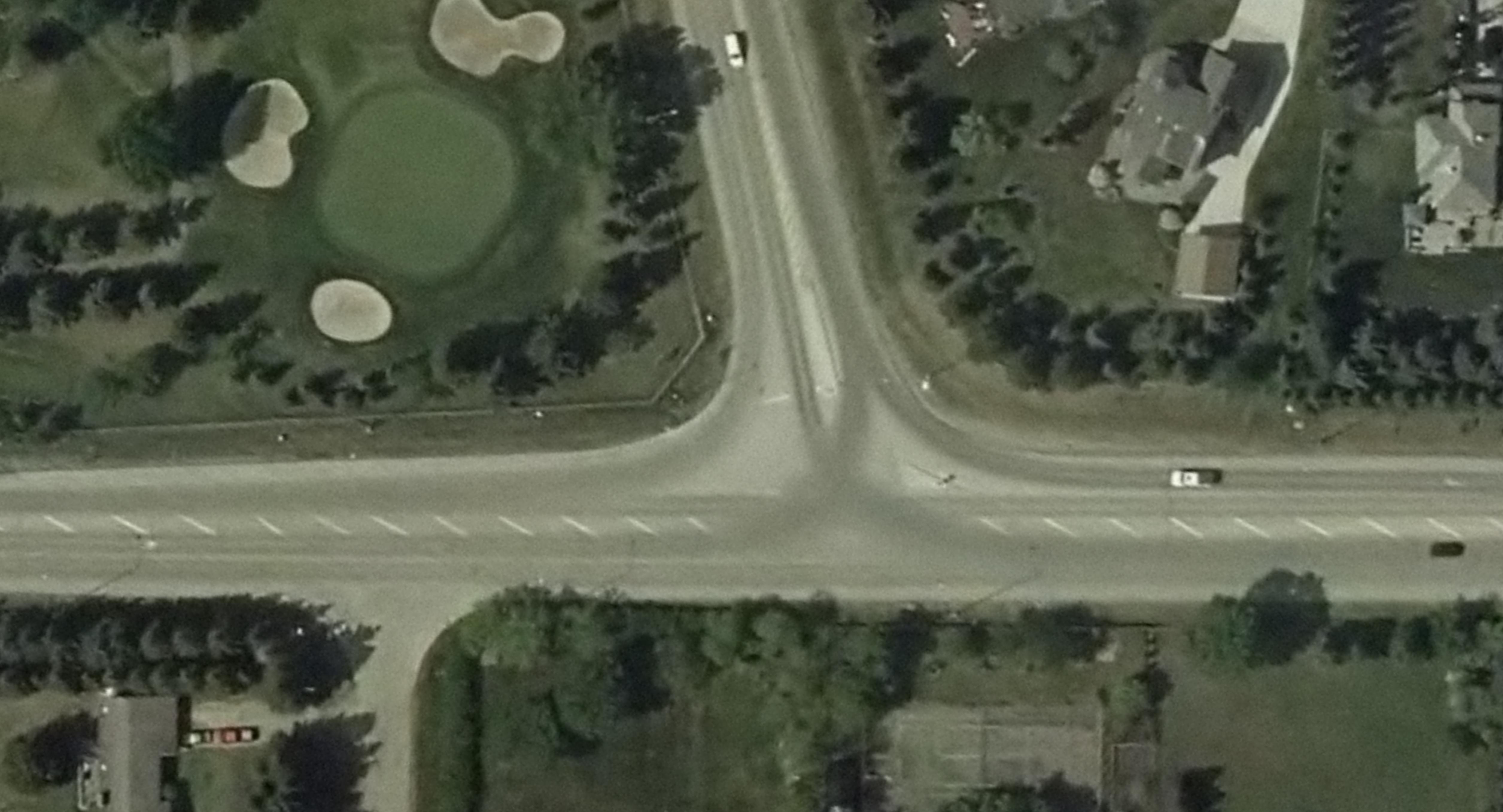
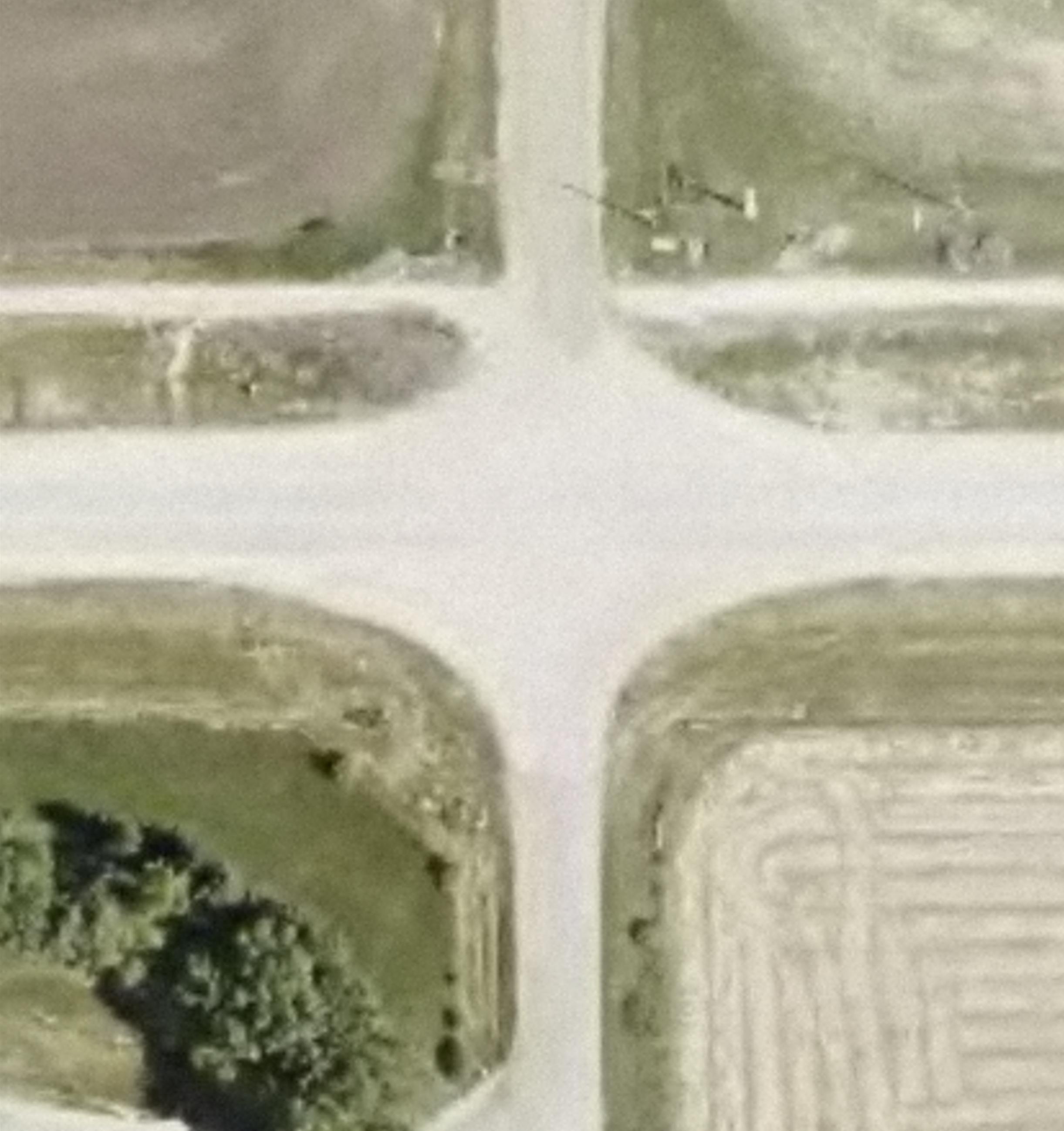
As illustrated in Figure 1, the study limits begin at the Sturgeon County / St. Albert limits to the west and terminates at Highway 28 to the east and include a review of the following key intersections with Sturgeon Road:
1. 127 Street (Future Intersection)
2. River’s Gate
3. Township Road 542A
4. Viscount Road West
5. Starkey Road (Range Road 251)
6. Viscount Road East / Equestrian Place
7. Viscount Drive
8. Crestview Drive West
9. Crestview Close / Crestview Drive East
10. Essex Point
11. Range Road 250
12. Edinburgh Road West
13. Edinburgh Road East
14. Crozier Drive
15. Range Road 245
16. Highway 28
The planning horizon of this FPS aligns with planning horizons of previous studies that have been completed for the Sturgeon Valley area.
Sturgeon Road Functional Planning Study
Final Report | Prepared for Sturgeon County
2
Figure 1: Project Limits
1.3. BACKGROUND STUDIES AND REPORTS
Several studies encompassing the project area have been completed on various aspects of transportation planning undertaken by the County and neighbouring communities. The following outlines the relevant studies used to inform this FPS.
Sturgeon Valley South and Core ASPs
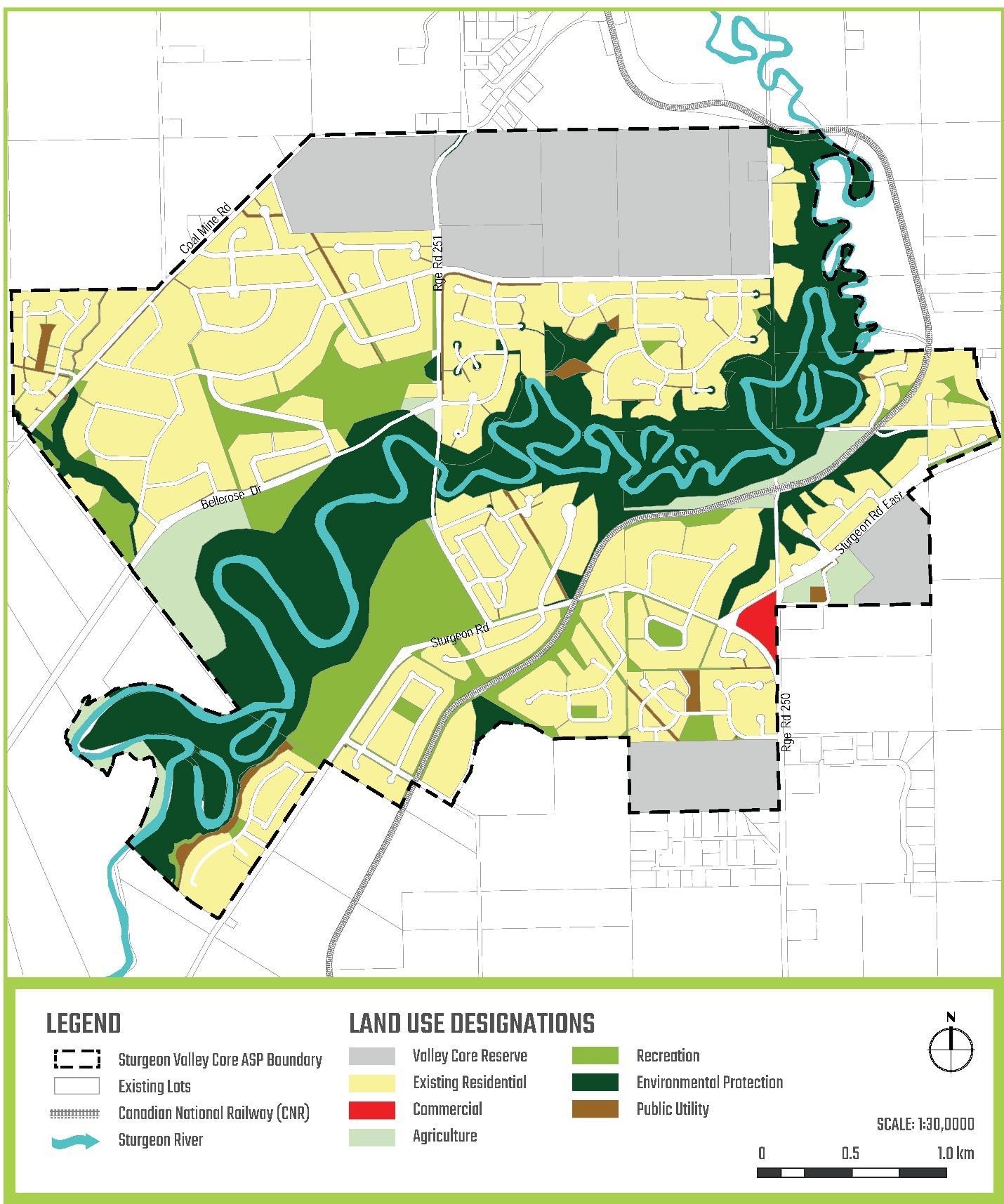
In 2021, Sturgeon County approved the Sturgeon Valley Core and South Area Structure Plans (ASPs), which includes a mix of residential, industrial and commercial development Population in the Valley Core area is expected to reach over 6,900 people by 2041 - an increase of approximately 2,600 people from today. In addition to the existing residential uses, the Valley Core area development plan sets out the direction for agricultural uses, environmental protection and the Valley Core Reserve. It also prioritizes lands for recreation and establishment of greenway corridors, including connections from the Sturgeon Valley to the Red Willow Trail system in St. Albert. Figure 2 illustrates the development concept plan as outlined in the Sturgeon Valley Core Area Structure Plan (May 2021)
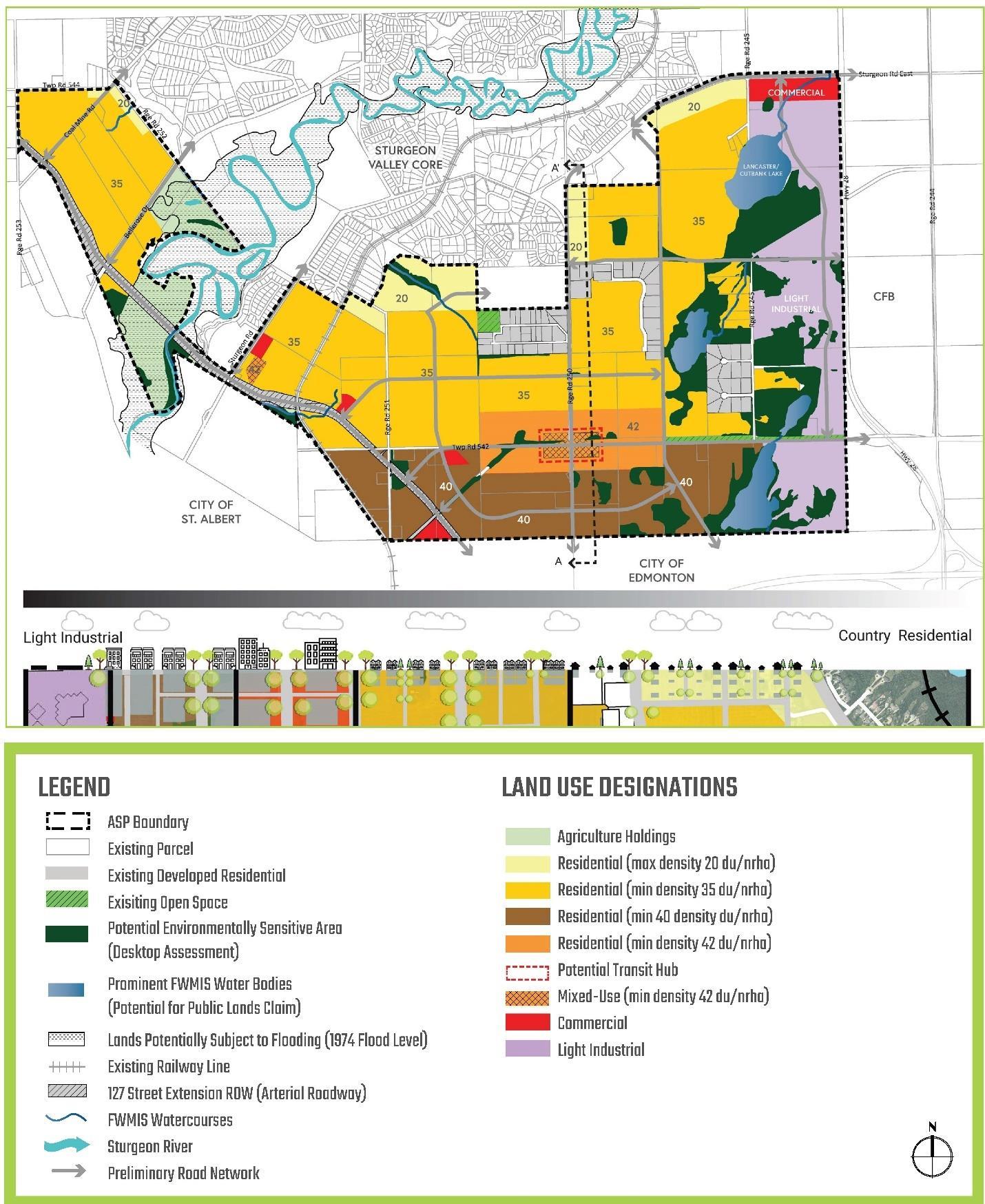
Most of the future development in the Sturgeon Valley will occur in the Valley South area, where at full build-out, the area is planned to accommodate over 61,000 people. As illustrated in Figure 3, the lands to the north will remain for agricultural uses and the lands to the south would accommodate a range of residential developments with increasing densities approaching St. Albert and Edmonton. In addition, a commercial and light industrial area is zoned for the lands to the east, adjacent to Highway 28 and is expected to generate approximately 4,800 employees.
The Valley South planning area is anticipated to be completed in five phases over the next 60 years as illustrated in Figure 4, with Planning Area 1 advancing development within the next five years and continuing over the next 25 years. Development in the designated commercial area within Planning Area 2 is also anticipated to commence within the next five years. These first stages of development are expected to add approximately 21,000 more people in the Valley area over the next 25 years.
Overall, the proposed growth in the Sturgeon Valley in addition to continued growth in the surrounding region is expected to generate a significant volume of traffic through the Sturgeon Valley Area, placing increasing pressures on the transportation network, including Sturgeon Road.
Figure 2: Development Concept Plan, Sturgeon Valley Core Area Structure Plan (Figure 5)
Figure 3: Concept Plan, Sturgeon Valley South Area Structure Plan (Figure 9)
Figure 4: Sturgeon Valley South Planning Areas (Sturgeon Valley South Area Structure Plan, Figure 10)
Sturgeon County and the City of St. Albert jointly completed the TNIS to prioritize network improvements that would benefit both municipalities while supporting planned development. The primary focus of the study was to determine the degree of benefit to both municipalities and prioritize capital projects, including cost estimates. The study incorporates operational data and forecasted growth scenarios for the 2030 and 2045 horizons, which represents the 10- and 25-year planning timeframe. The St. Albert Travel Demand Model (EMME) was used to forecast future travel patterns and traffic volumes based on updated land use information. The outcome of the TNIS identified several priority corridors for improvements, including the 127 Street extension from Anthony Henday Drive to Sturgeon Road by 2030 and the full extension of 127 Street to Highway 2 by 2045.
127 Street Functional Planning Study (2012)
A Functional Planning Study (FPS) for 127 Street was completed for Sturgeon County in August 2012 in response to previous studies that identified need for a new north-south connection in Sturgeon Valley. This FPS identified a recommended alignment, which extends from 127 Street from the City of Edmonton to Highway 2 and includes the crossing of the Canadian National Railway (CNR) and Sturgeon River. The recommended plan has a cross-section that transitions from semi-urban to the City of Edmonton urban cross-section approaching the City limits and includes seven at-grade intersections, including a signalized intersection at Sturgeon Road.
The CNR crossing is recommended to be grade-separated due to steep grades and would be required for the roadway to cross both Sturgeon Road and the tracks at-grade. The 127 Street corridor is proposed to be constructed as a two-lane road and ultimately to a four-lane arterial with a posted speed of 70 km/h, and is anticipated to be staged as follows:
1. 2 lanes from the City of Edmonton limits to Sturgeon Road
2. Extension of 2 lanes from Sturgeon Road to Bellerose Drive
3. Extension of 2 lanes from Bellerose Drive to Highway 2
4. Completing the 4-lane urban cross-section from the City of Edmonton limits to Sturgeon Road.
5. Completing the 4-lane urban cross-section from the Sturgeon Road to Highway 2
The staging of improvements would be primarily driven by area development and traffic needs. The County is also undertaking an update to the FPS in parallel to this Sturgeon Road FPS Sturgeon Valley Offsite Levy Assessment (Draft, December 2022)
The County is currently in progress of finalizing an offsite levy assessment for the Sturgeon Valley area. The purpose of the assessment is to review the water and sanitary 25-year servicing requirements to support development in the Valley. The findings will be used to determine the staging of improvements and the appropriate levy rates for developers, providing the County the appropriate metrics to effectively allocate resources.
2. Corridor Review
A detailed review was completed to understand existing and future constraints along the corridor and to establish the required corridor and intersection configuration to support future growth. This section of the report details the transportation review including the review of existing roadway conditions, traffic projections and traffic analysis
2.1. EXISTING ROADWAY CONDITIONS
Sturgeon Road is classified as an arterial roadway with a current posted speed of 70 km/hr It generally has a rural cross-section with open ditches along both sides of the corridor, however some sections along the corridor have curbs on one side of the roadway An existing multi-use trail runs parallel on the north side of the corridor, which begins at Highway 28 and terminates immediate west of the Sturgeon Road / Essex Point intersection. The trail crossings along the north side of the corridor are offset further than typically recommended from the parallel lane of travel. Overall, the study corridor has a gentle rolling terrain with several horizontal curves.
Land uses adjacent to the corridor are generally low-density residential uses, which consists mostly of country estate residential uses. Direct access to these uses is provided along Sturgeon Road – either through developed intersections or direct driveway access. Table 1 provides a summary of the study intersections within the project limits and the corresponding intersection configurations and key features. For clarity, the study corridor is generally referenced as an east-west corridor in this study with the exception at Sturgeon Road/Essex Point/Township Road 543A, where Essex Point is considered the south leg and Sturgeon Road is considered the north leg. Sturgeon Road then becomes an east-west orientation approaching Highway 28.
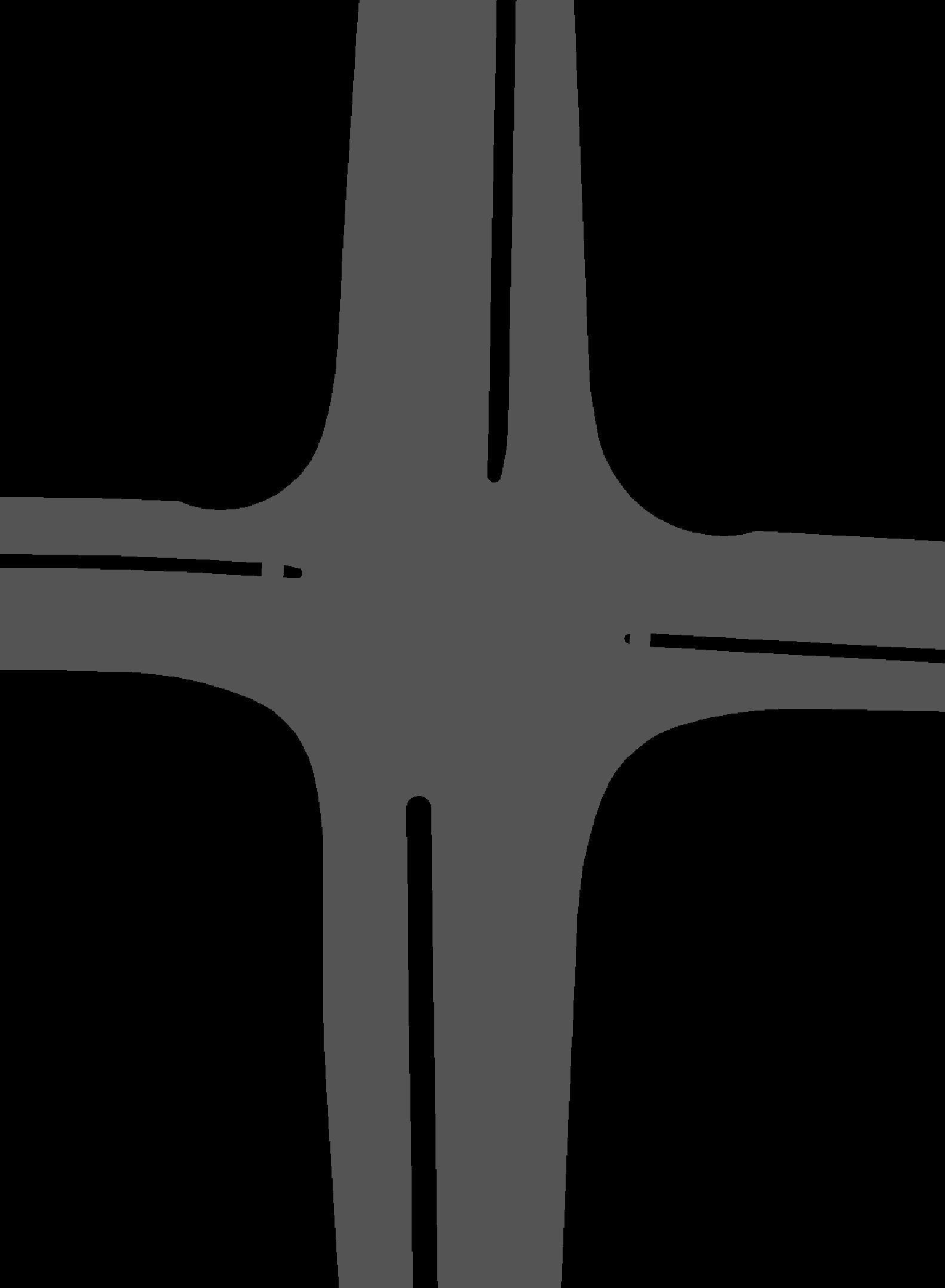
With the exception of a few locations, the majority of the study intersections generally include a single shared travel lane in all directions with stop-control on the cross-streets with Sturgeon Road. The study corridor also includes three major intersections that facilitate connections to the highway network and other key arterials or collectors These intersections are further discussed in the following sections
1. 127 Street
2. River’s Gate T-Intersection
3. Township Road 542A Four-Legged
4. Viscount Road West T-Intersection
5. Starkey Road (Range Road 251) Roundabout
6. Viscount Road East / Equestrian Place Four-Legged
7. Viscount Drive T-Intersection
8. Crestview Drive West T-Intersection
9. Crestview Close / Crestview Drive East Four-Legged
10. Essex Point Four-Legged
11. Range Road 250 Four-Legged
12. Edinburgh Road W Four-Legged
13. Edinburgh Road E Four-Legged
14. Crozier Drive T-Intersection
15. Range Road 245 Four-Legged
16. Highway 28 Four-Legged
Future New Intersection
EB:1 left (~125m), 1 Thru
WB: 1 Shared Thru & Right
SB: 1 Right, 1 Left
Single shared lane in all directions
Single shared lane in all directions
Single shared lane in all directions
Single shared lane in all directions
Single shared lane in all directions
Single shared lane in all directions
Single shared lane in all directions
Single shared lane in all directions with EB bypass lane and WB right turn lane.
Single shared lane in all directions; Private driveway on north leg.
Single shared lane in all directions; Auxiliary lanes on Sturgeon Road
Single shared lane in all directions; Auxiliary lanes on Sturgeon Road
Single shared lane in all directions; Slip lanes on Sturgeon Road
Single shared lane in all directions; Auxiliary lanes on Sturgeon Road
EB & NB: 1 Left, 1 Thru & 1 Right
WB: 2 Left, 1 Thru, 1 Right
SB: 1 Left, 2 Thru
Stop-controlled southbound Pedestrian marked crossing north leg
Stop-controlled northbound and southbound Golf course access on north leg
Stop-controlled northbound In close proximity to Starkey Road (~ 50m)
Roundabout No pedestrian crossing at intersection
Stop-controlled northbound and southbound n/a
Stop-controlled northbound n/a
Stop-controlled southbound
In close proximity to horizontal curve, west of intersection
Stop-controlled northbound and southbound n/a
Stop-controlled northbound and southbound
Horizontal curve approaching intersection from the east
Stop-controlled northbound Large turn radii;
Stop-controlled northbound and southbound Large turn radii
Stop-controlled northbound and southbound Large turn radii
Stop-controlled southbound Large turn radii
Stop-controlled northbound and southbound Large turn radii
Signalized n/a
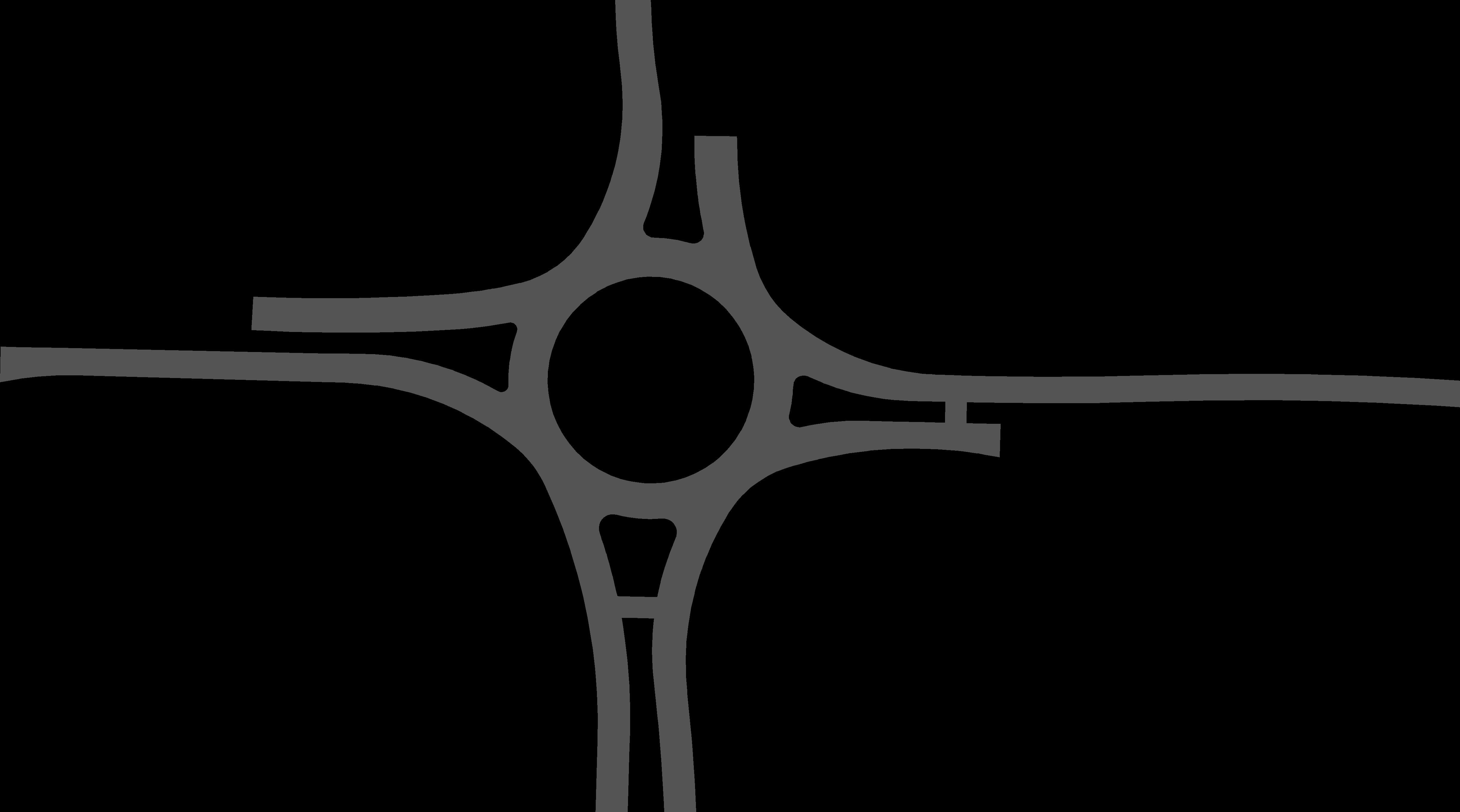
Sturgeon Road/Starkey Road
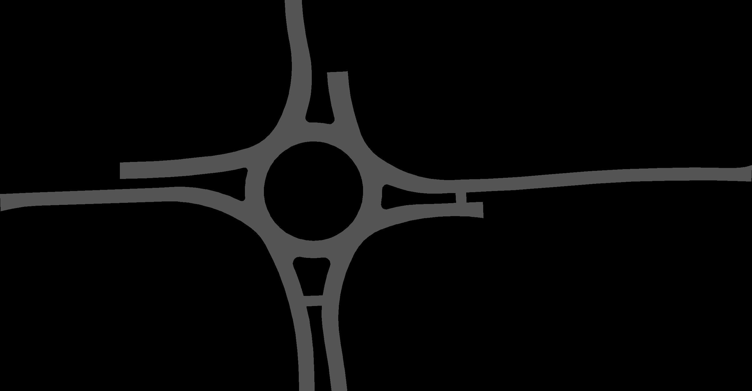
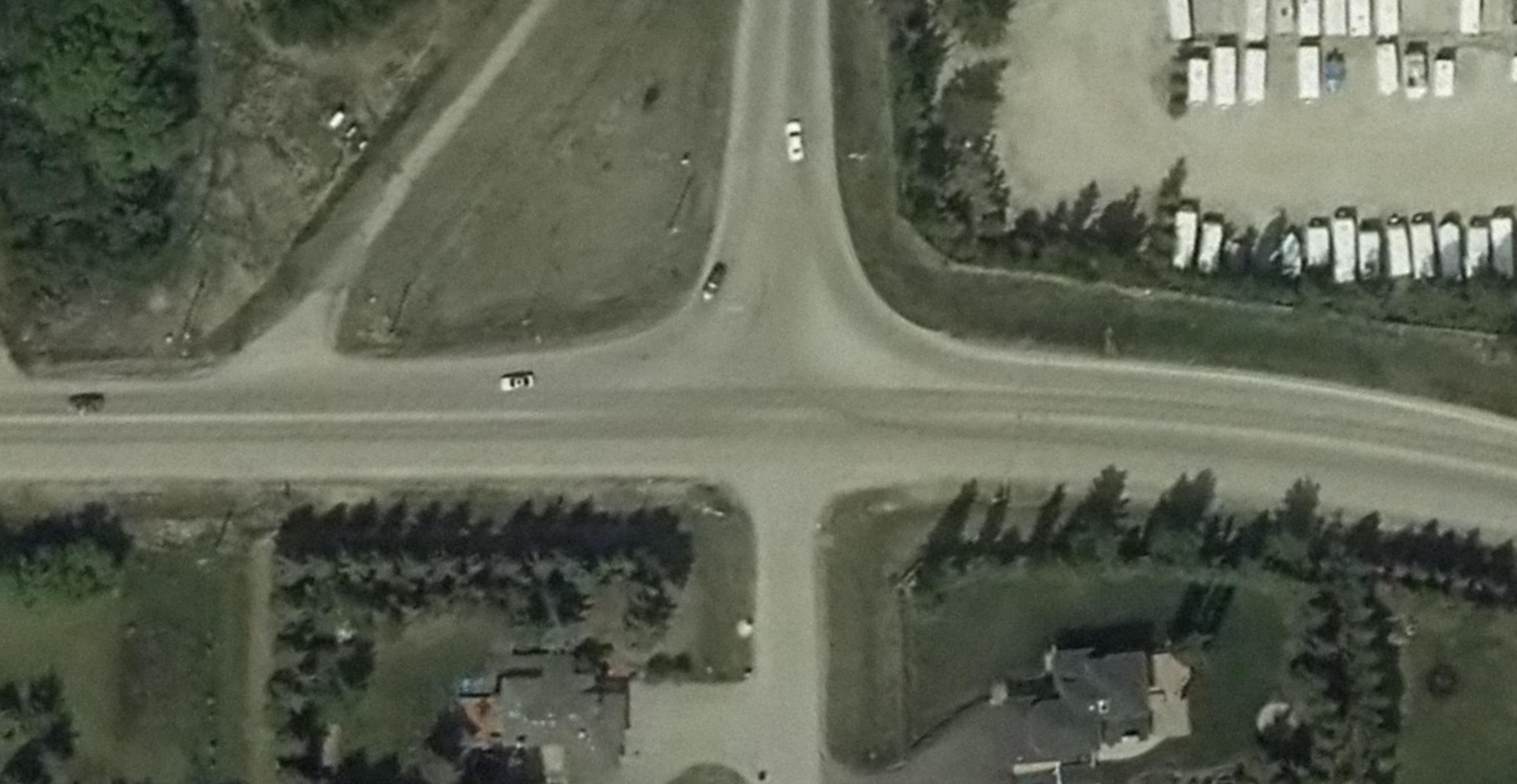
As highlighted in Figure 5, the Sturgeon Road/Starkey Road intersection is a three-legged single-lane roundabout that was recently upgraded in 2021 The roundabout does not include provision for pedestrian crossings. Starkey Road forms the north leg of the intersection and is generally a two-lane roadway that connects Sturgeon Road to Highway 37 in the north while providing access to the subdivisions adjacent to Starkey Road. The Sturgeon Road/Starkey Road intersection is a key intersection for residents in the Sturgeon Valley as it provides direct connections to Highway 37 in the north. Any upgrades to this intersection should incorporate opportunities for safe pedestrian crossing and connections and consider the ultimate widening of Starkey Road. As identified in the Valley South ASP, Starkey Road is planned as a four-lane arterial, however, this improvement is not expected within the horizon of this FPS and will not impact the recommended plan for Sturgeon Road.
Figure 5: Sturgeon Road/Starkey Road Intersection - Looking West
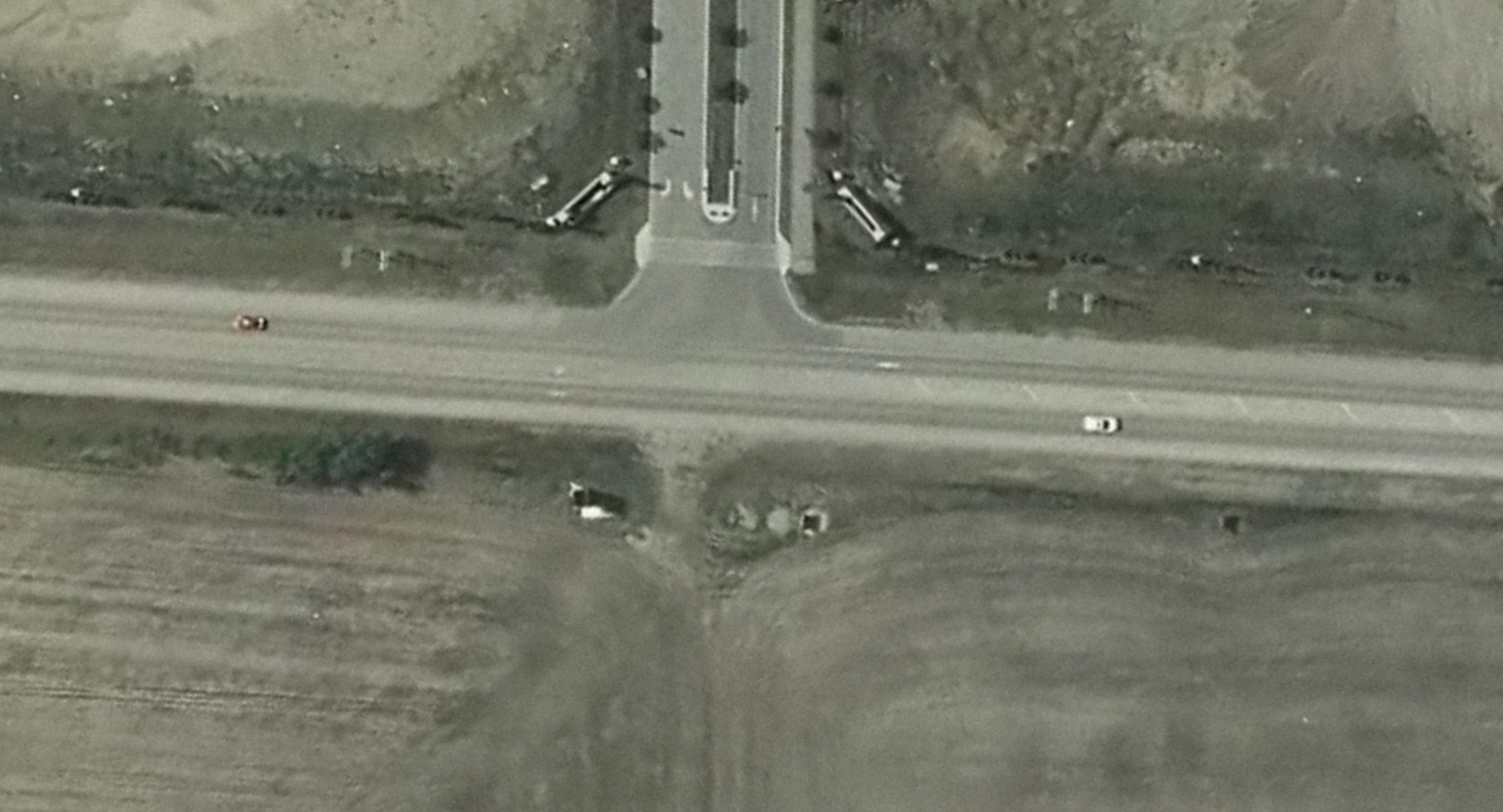
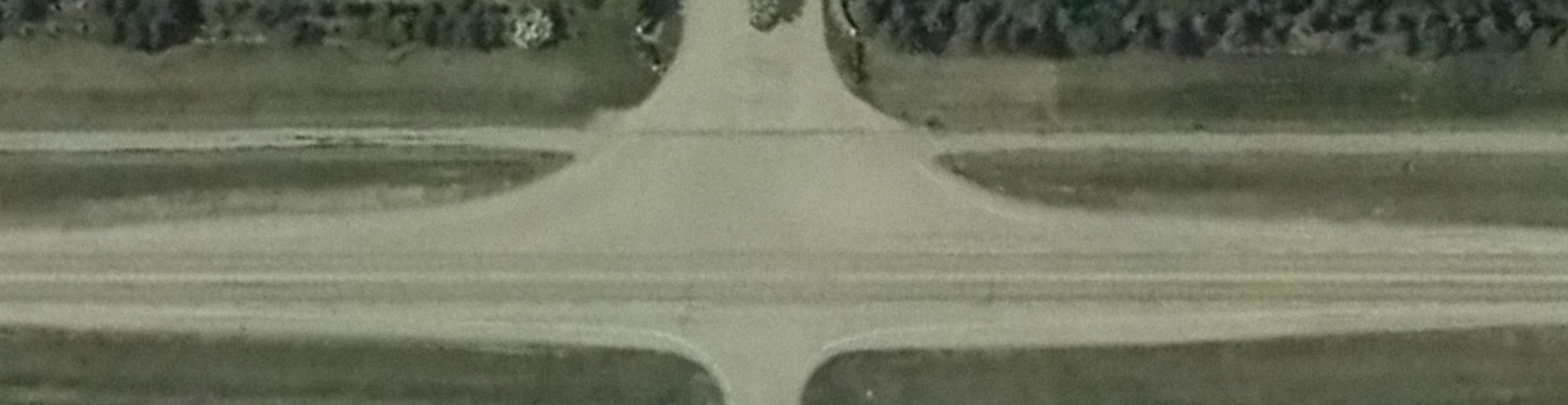
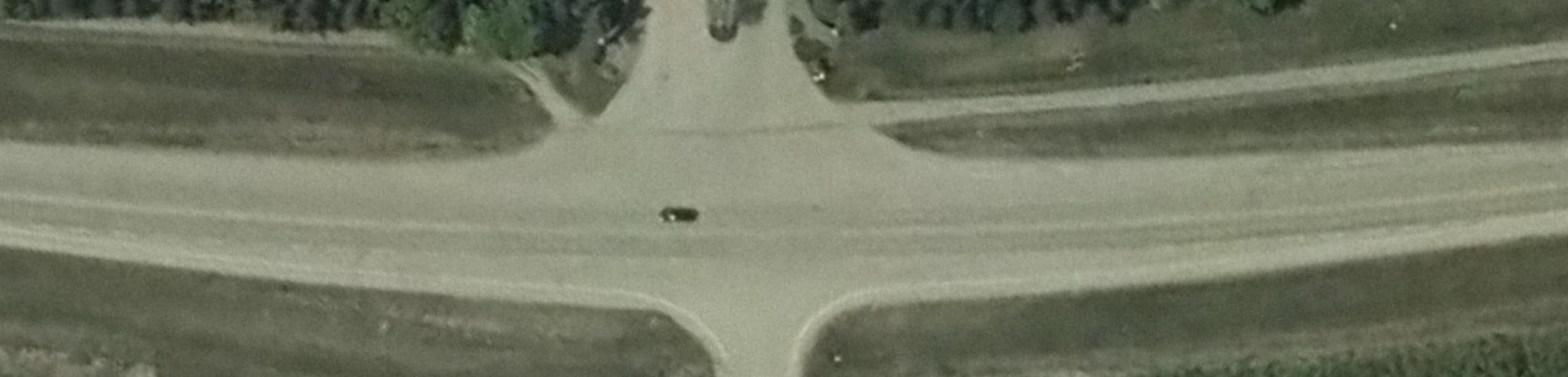
Sturgeon Road/Essex Point/Township Road 543A
The Sturgeon Road / Essex Point / Township Road 543A (see Figure 6) is an unsignalized (stopcontrolled) intersection that facilitates connection to Highway 28 to the north and 127 Street to the east It also provides direct access into the Regency Estates subdivision via Essex Point. The intersection generally includes a single shared travel lane in all directions, with a bypass lane provided in the eastbound direction (from Sturgeon Road West to Township Road 543A) and a westbound right turn lane (from Township Road 543A to Sturgeon Road East) The southbound (Sturgeon Road) and northbound (Essex Point) movement is stop-controlled. This intersection supports local and regional travel and is key in connecting people in the Sturgeon Valley to/from Edmonton, St. Albert and areas to the east, with a connection at Highway 28.
Image Source: Google StreetView
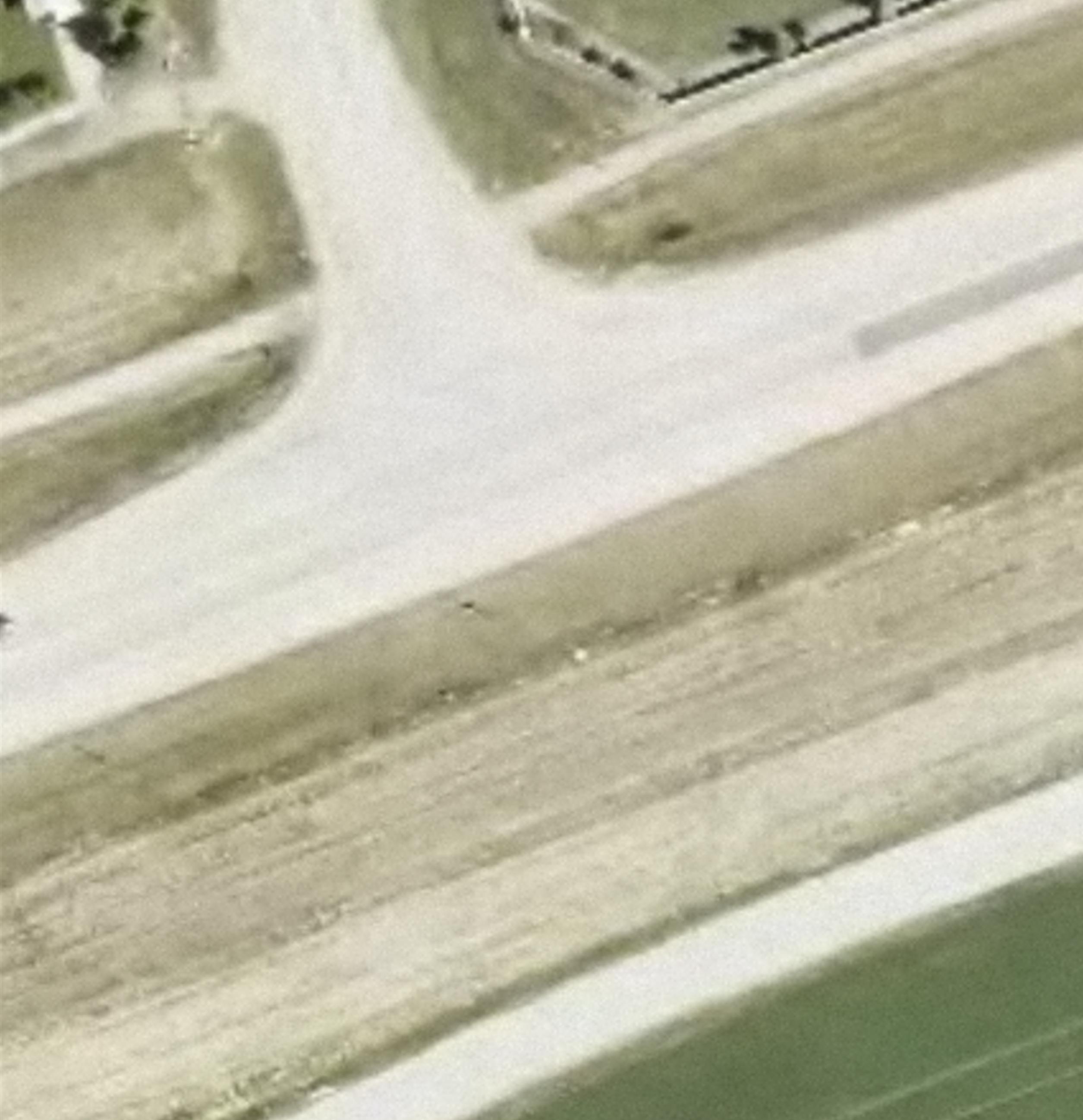
Sturgeon Road / Highway 28
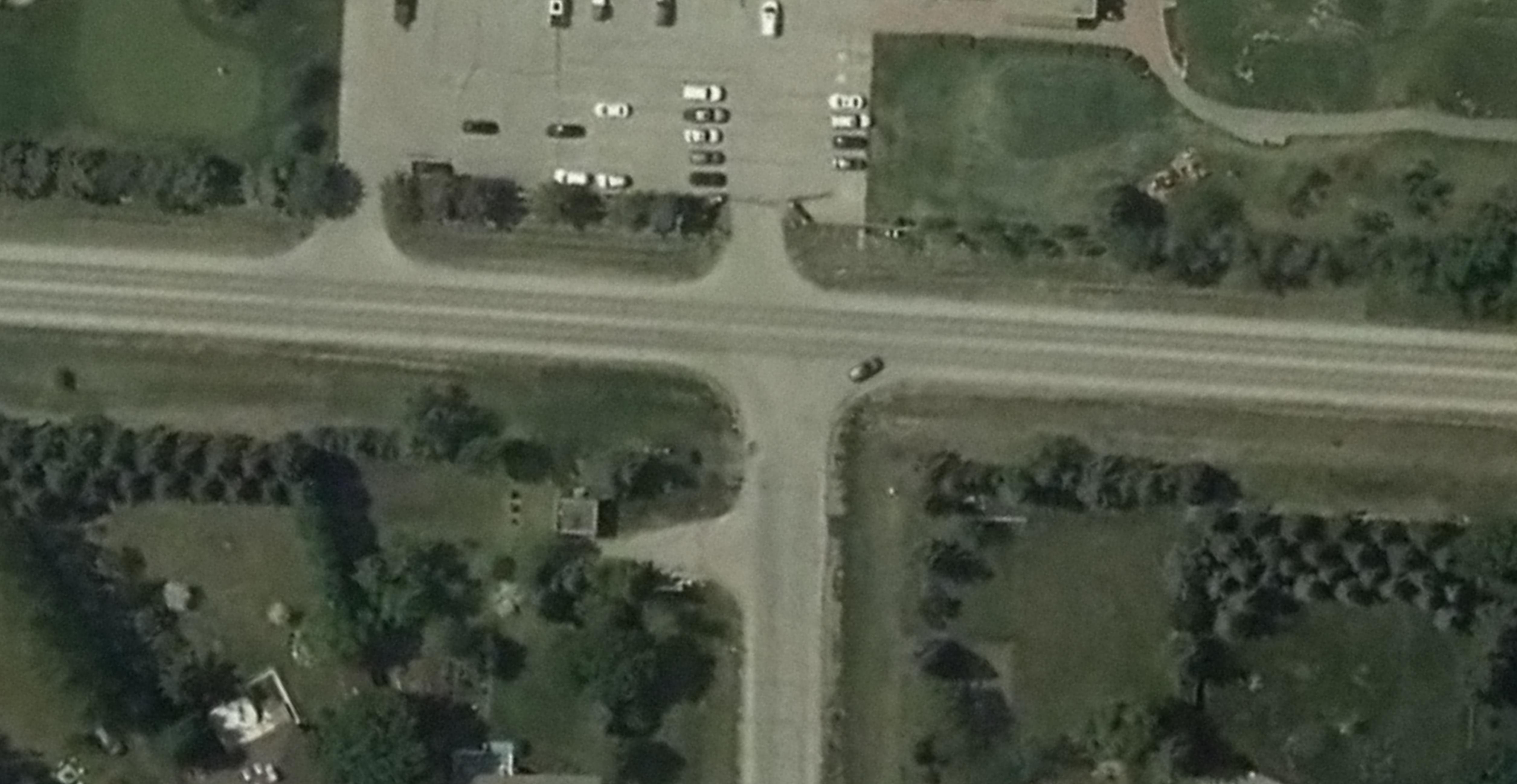
The Sturgeon Road/Highway 28 intersection is currently a signalized intersection constructed to Alberta Transportation’s standard of a Type V intersection treatment. As shown in Figure 7, the intersection currently has a dedicated left-turn lane and a single shared through and right turn lane on Highway 28 northbound and southbound. A single lane is provided for all movements in both the eastbound (Sturgeon Road) and westbound directions. This intersection is maintained by Alberta Transportation and there are plans to upgrade this intersection to a major interchange in the future. This intersection has been included as part of this FPS for only the purpose of understanding the impacts this intersection will have on the Sturgeon Road alignment and access management. However, the timing of this upgrade is unknown at the time this study was completed and ultimately, is subject to both available funding and the province and region’s long-term needs. Therefore, it is assumed that the interchange will be implemented beyond the planning horizon of this FPS and will not impact the recommendations within this plan.
Approximately 200m west of Highway 28, there is an existing access road on the south side of Sturgeon Road that provides connection to a small energy installation and a secondary access to an agricultural operation. The road is accessed by a full-movement intersection at a break in the median and a dedicated westbound left-turn lane is also provided on Sturgeon Road. This access will provide direct connection to the anticipated commercial development proposed for the southwest quadrant of the Sturgeon Road/Highway 28 intersection and ultimately, the light industrial uses along the west side of Highway 28 when Sturgeon Valley fully builds out Recognizing that the existing volumes at this access are minimal, this access was evaluated from a qualitative perspective and considered
Existing traffic data obtained from Alberta Transportation Traffic Volume Data Map and background studies indicates that the current Average Annual Daily Traffic (AADT) on Sturgeon Road ranges between 3,500 and 6,900 vehicles per day Higher volumes are observed along the section through Starkey Road and Essex Point / Township Road 543A. PM peak hour volumes are also approximately 10% higher than the AM peak hour volumes. In addition, the corridor accommodates approximately 2% heavy vehicles.
The PM peak hour represents the most critical period for traffic operations on Sturgeon Road and to be consistent with previous traffic studies, the PM peak hour is used as the design hour for this FPS. Figure 8 highlights the existing PM peak hour volumes along the study corridor. These volumes were estimated based on a combination of recent intersection counts collected through various studies, as well as estimates based on trip generation and distribution rates obtained from the 10th Edition ITE Trip Generation Manual for single-family detached dwelling units (Land Use Code 210).
Overall, directional traffic volumes in the PM peak hour are currently between approximately 200 to 500 vehicles/hr, with higher volumes observed through Starkey Road and Essex Point/Township Road 543A.
Image Source: Google Earth
Figure 7: Sturgeon Road/Highway 28 Intersection and Sturgeon Road Access
Figure 8: Existing PM Peak Hour Volume
Traffic Growth and Future Projections
Historic daily volumes on Sturgeon Road, east of Highway 28 indicates that background traffic on Sturgeon Road have remained relatively steady over the past 15 years. Figure 9 highlights the historical Average Annual Daily Traffic (AADT) on Sturgeon Road, east of Highway 28. Between 2006 and 2016, daily volumes were between 3,200 and 3,500 vehicles per day, while daily volumes observed in 2021 decreased by approximately 20% from 2016. However, this reduction can mostly be attributed to the impacts of the COVID-19 pandemic that started in 2020 and continued through 2021/2022.
Figure 9: Historic Average Annual Daily Traffic on Sturgeon Road, West of Highway 28
Sturgeon Valley is designated as a major growth area in the County and Sturgeon Road is a vital connection in supporting the anticipated growth. Due to the size of the anticipated growth as well as major network changes, future traffic volumes along Sturgeon Road cannot be established by simply applying a uniform growth rate. Rather, future traffic volumes for this study were forecasted based on several sources of traffic projections and transportation evaluations, including: EMRB Model
Traffic projections obtained from the Regional Travel Model (RTM) developed by the Edmonton Metropolitan Regional Board (EMRB) indicates that moderate growth is expected on the corridor over the next 10 years as development occurs in the Sturgeon Valley. Sturgeon Road is assumed as a two-lane roadway under both the 1.25M (~2032 horizon) and 1.5M (~2045 horizon) scenarios. The 1.5M scenario also includes the four-lane 127 Street connection from the City of Edmonton to Township Road 544 and a new cloverleaf interchange at Highway 28 and Sturgeon Road.
Corridor volumes on Sturgeon Road are expected to increase (from existing) by as much as 150 vehicles per hour during the peak hours under the 2030 horizon. However, traffic diversions along most section of Sturgeon Road are anticipated with the implementation of the four-lane 127 Street connection in the 2045 horizon, resulting in corridor volumes similar to the 2030 horizon. The section approaching the future 127 Street intersection will experience an increase of as much as 200 vehicles per hour (peak direction) from
today. Based on these projections, the Sturgeon Road corridor is projected to carry two-way volumes in the range of 500 to 600 vehicles per hour under both the 2032 and 2045 horizon. However, these projections are based on a total population of 12,930 people by 2045 in the Sturgeon Valley, which is significantly lower than what is being planned as identified in the Sturgeon Valley ASPs. For this reason, the results of the RTM were only used for reference purposes.
The St. Albert EMME Travel Demand Model (EMME) was updated and used to project future travel patterns and traffic volumes to support the TNIS study. The purpose of this study was to evaluate the network as a result of adjacent growth in both municipalities and to identify the prioritization of network improvements.
Several future scenarios that incorporate different network improvement assumptions were evaluated for the PM peak hour under the 2030 and 2045 horizon. Within Sturgeon County, Sturgeon Road is assumed to remain as a two-lane roadway under all the scenarios. The future scenarios reflect a land use (population) assumption of 10,249 people (2030) and 26,688 people (2045) in Sturgeon County, which is mostly comprised of the Sturgeon Valley growth area.
The TNIS scenarios relevant to this FPS and considered in the future traffic projections include:
1. 2030 Base – Key network improvements include twinning of Ray Gibbon Drive to Fowler Way, Fowler Way (2-lanes) and St. Albert Trail (6-lanes).
2. 2030 Ultimate – 2030 Base Network + completion of Neil Ross Road (2-lanes) and 127 Street extension to Sturgeon Road (No Corriveau Avenue Extension).
3. 2045 No Build – 2030 Ultimate with 2045 volumes.
4. 2045 Ultimate – 2045 Base network + Fowler Way extension to Highway 2 + 127 Street Extension to Highway 2.
Based on the TNIS traffic projections, PM peak hour corridor volumes on Sturgeon Road are estimated to accommodate between 300 and 600 vehicles/hr under the 2030 Base horizon – an increase of approximately 100 to 300 vehicles/hr from the Existing (2020) Base horizon. Consistent with observed volumes, the section between Starkey Road and Essex Point carries the highest volumes. The 127 Street extension to Sturgeon Road under the 2030 Ultimate horizon is expected to divert some trips from Sturgeon Road, however, the number of diverted trips is not considered significant (less than 100 vehicles/hr). Under the 2045 Base scenario, directional peak hour volumes on Sturgeon Road increases (from 2030 Ultimate horizon) by as much as approximately 400 vehicles/hr and accommodating directional volumes in the range of 800 vehicles/hr. Further trip diversion from Sturgeon Road is projected with the ultimate completion of the 127 Street Extension to Highway 2. Under the 2045 Ultimate horizon, directional PM peak hour volume on Sturgeon Road is projected to carry volumes in the range of 600
vehicles/hr, with some sections reducing by approximately 300 vehicles/hr The model results of the TNIS study also indicate that overall, Sturgeon Road will have sufficient capacity to accommodate projected traffic growth as a two-lane roadway. The approaches at the intersection with Starkey Road and Essex Point is expected to approach near or at-capacity conditions. More detailed model assumptions and resulting traffic projections are outlined in the Sturgeon Valley EMME Model Information Memo provided in Appendix A
Sturgeon Valley South and Core Area Structure Plans
A traffic review was conducted as part of the overall planning process for the Sturgeon Valley South and Core ASPs. Traffic estimates were established for two stages of development and are described as follows:
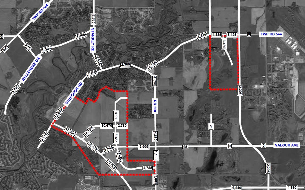
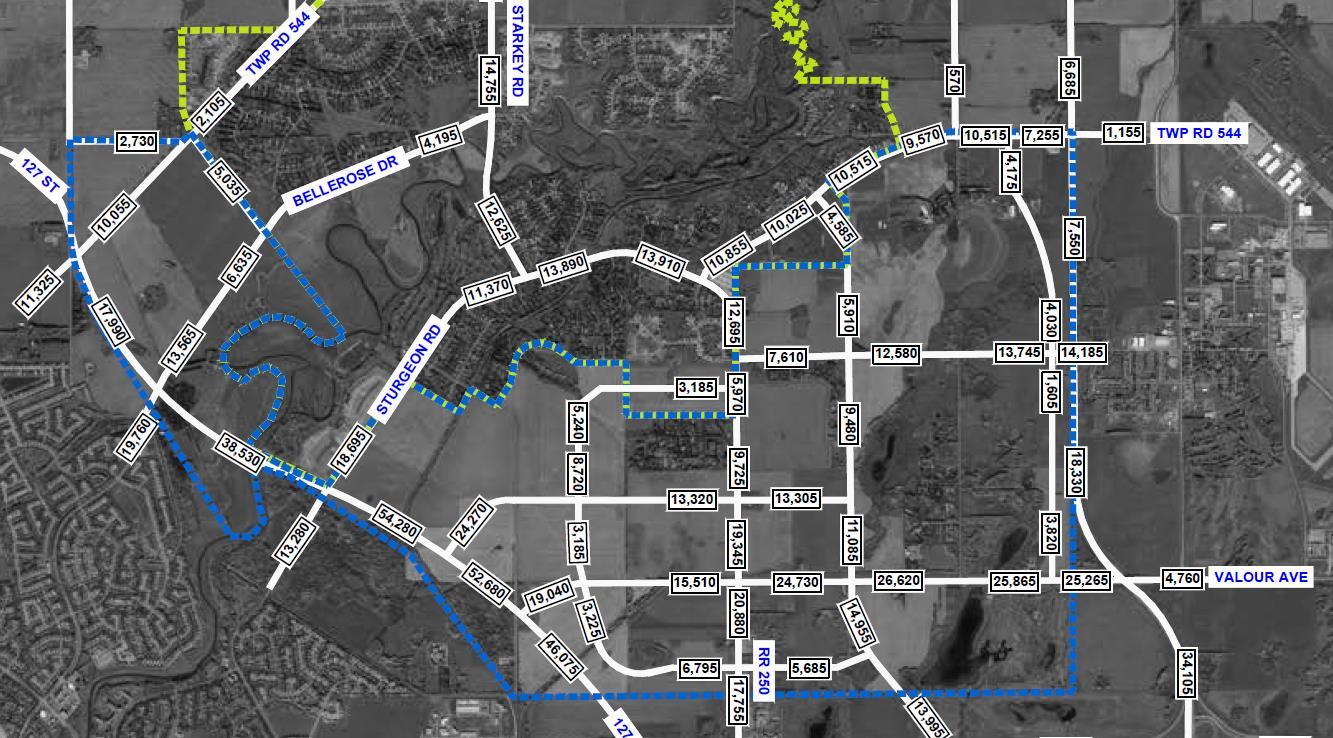
1. Stage 1 Development – This scenario includes the completion of the areas within the red border (approximately 21,000 population) as shown in Figure 10 and the completion of 127 Street to Sturgeon Road. In the ASP, Stage 1 development is projected to build-out in 30 years and is estimated to generate between 2,360 vehicles/day in the early stages to 12,895 vehicles/day on Sturgeon Road at Stage 1 full build out. The western section of the corridor between 127 Street and Starkey Road is anticipated to accommodate higher volumes of development traffic than the eastern section.
2. Full-Build – This scenario assumes full build of the ASP (over 61,000 population) and completion of 127 Street to Highway 2 Full build-out of the Sturgeon Valley is anticipated to occur beyond the 60-year horizon. Daily development traffic volumes are expected to increase significantly under the full build-out scenario, with the western section of the corridor accommodating as much as 18,695 vehicles per day as shown in Figure 11. Site-generated volumes decreases moving east and reduces to 7,255 vehicles per day at Highway 28. Overall, total traffic (background + development) on Sturgeon Road will increase to almost 22,000 daily trips on the west end and 10,000 daily trips on the east end
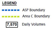
Based on the review of the traffic projection sources described above, it was determined that the 2045 projections provided in the TNIS study would be the most applicable to this FPS. The 2045 projections from the TNIS reflect a population assumption (~26,000 population) similar to the Planning Area 1 development, which generally aligns with the 30-year build-out plan for the Sturgeon Valley.
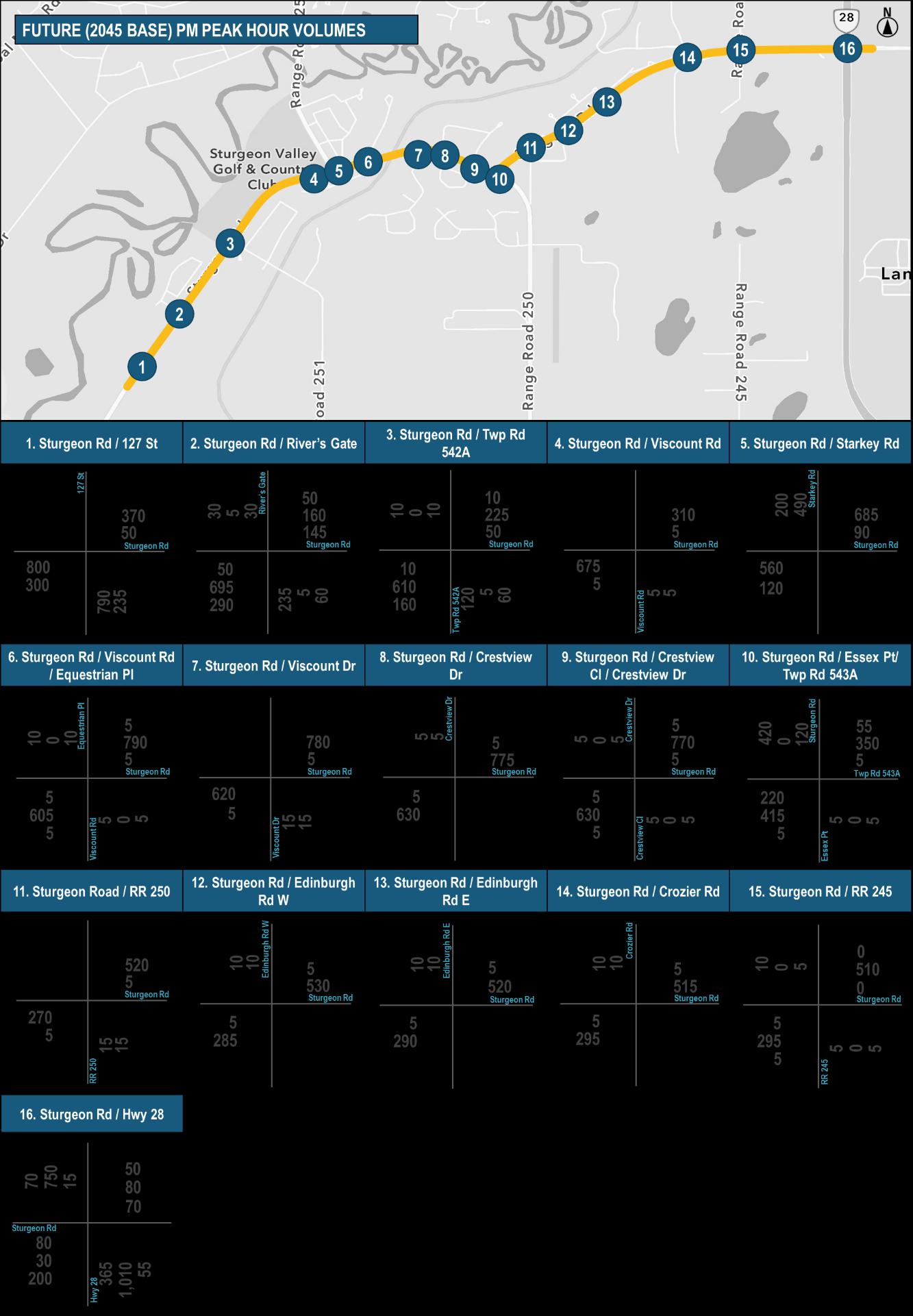
The forecast traffic volumes for the 2045 Base horizon (127 Street 2-lane extension to Sturgeon Road) and 2045 Ultimate horizon (127 Street 4-lane extension to Highway 2) is highlighted in Figure 12 and Figure 13, respectively.
Under the 2045 Base horizon, directional PM peak hour volume on Sturgeon Road is estimated to range between 250 and 800 vehicles/hr, with the section between Starkey Road and Essex Point carrying the highest volumes. The extension of 127 Street to Highway 2 is expected to reduce volumes on Sturgeon Road to between 200 and 700 vehicles/hr. It is also worth noting that traffic on Starkey Road northbound is anticipated to decrease significantly by approximately 50% under the 2045 Ultimate horizon.
Figure 10: Stage 1 Development Trip Generation
Figure 11: Full Build-Out Trip Generation
Figure 12: 2045 Base PM Peak Hour Volumes
Figure 13: 2045 Ultimate PM Peak Hour Volumes
Sturgeon Valley Population Projections
The Sturgeon Valley Offsite Levy Assessment report established a moderate (~1% per year, compounded) and high (~2% per year, compounded) population growth rate to estimate future population growth and to determine the staging of construction for the infrastructure upgrades. Building from these assumptions, Figure 14 illustrates the Valley’s population growth projections to the year 2062. A low growth scenario of 0.5% per year was also evaluated, which generally aligns with the projected average growth rate of the Edmonton Region.
The Sturgeon Valley currently has a population of almost 4,500 residents and is projected to grow by almost 5,500 residents by 2037 based on the high growth scenario of 2% per year, which generally aligns with the average growth rate of the Edmonton Region. Under a moderate growth scenario of 1.0%, population in the Valley would reach approximately 10,000 by 2050. This growth will occur during a horizon beyond 2067 assuming the low growth rate of 0.5% per year. The population projections also suggest that the completion of Planning Area 1, which corresponds to a total of about 26,000 people in the Valley, is estimated to occur between 2053 and well beyond 2062. The full build-out of the Valley (~61,000 people) can be reached just beyond 2067 with the high growth rate assumption.
Figure 14: Sturgeon Valley Population Growth Projections
For the purpose of staging the future construction of Sturgeon Valley upgrades, the population projection and corresponding horizon year for each key phase of the Sturgeon Valley development (as per the ASP) was estimated based on the information noted above and are summarized in Table 2
It should be noted that, since the planning horizon year for Sturgeon Valley varies among the sources of background information, all the traffic analysis and project staging from herein will be based on the 10,000-population and the 26,000-population horizon. This will maintain consistency between all the recent planning work completed to-date for Sturgeon Valley.
Traffic Analysis
The Level of Service (LOS) is a performance metric used to assess operating conditions of intersections and their respective approaches. LOS reported in the analysis scenarios are based on the methodology outlined in the 2010 Highway Capacity Manual. For unsignalized intersections, the LOS is based on the computed delays on each of the critical movements. LOS ‘A’ represents minimal delays for minor street traffic movements, and LOS ‘F’ represents a scenario with an insufficient number of gaps on the major street for minor street motorists to complete their movements without significant delays. For signalized intersections, the methodology considers the intersection geometry, traffic volumes, the traffic signal phasing/timing plan, as well as pedestrian and cyclist volumes. The average delay for each lane group is calculated, as well as the delay for the overall intersection. The operating conditions can also be expressed in terms of volume-to-capacity (v/c) ratio. The signalized and unsignalized LOS criteria as summarized in HCM are also outlined in Table 3 For planning purposes, an overall intersection of LOS D or better and v/c ratio of less than 0.90 are considered acceptable operational standards for Sturgeon County roadways
Table 2: Sturgeon Valley Population by Estimated Horizon Year
A Represents free flow. Individual users are virtually unaffected by others in the traffic stream.
B Stable flow, but the presence of others begins to be noticeable. Occasionally minor delay due to conflicting traffic.
C Stable flow, but occasionally some delay due to conflicting traffic. Delay is noticeable, but not inconveniencing.
D Represents high-density, but stable flow. Delay is noticeable and irritating.
E Represents operating conditions at or near the capacity level. Delay approaching tolerance levels.
F Traffic demand exceeds capacity of intersection, very long queues, and delays. Represents forced or breakdown flow. Delay exceeds tolerance level.
In addition to the LOS criteria, AADT is another metric that can be used to evaluate corridor capacity and determine whether corridor or intersection treatment upgrades are warranted based on AADT thresholds set for various road classifications. Table 4 summarizes the daily volume thresholds assumed for this study. These thresholds were established based on the County’s 2022 General Municipal Servicing Standards and Alberta Transportation’s Highway Geometric Design Guide as well as recognizing the context of the Sturgeon Road corridor, which mostly operates uninterrupted (no signals) thus allowing the corridor to maintain most of its road capacity.
Traffic operations analysis for the study intersections was completed utilizing Synchro 11 and SIDRA (roundabout at Starkey Road) for the existing and future (26,000-population) PM peak hour based on existing lane configurations, existing and forecast traffic volumes. The interim (10,000-population) horizon was also evaluated to understand the impacts of the partial build out of Planning Area 1 as well as the 127 Street extension The analysis peak hour and future horizon year is consistent with traffic analysis and projections completed in previous background studies. In addition, as discussed in Section 2.2.1, the PM peak hour is considered the critical peak hour for this study.
Table 3: 2010 Highway Capacity Manual Level of Service Criteria
Table 4: Volume Threshold by Road Classification
For staging purposes, the following horizons (which are consistent with those identified in the TNIS) was evaluated, including:
• 10,000-Population Base – This scenario reflects the 10,000-population horizon with the road network and land use assumptions corresponding to the TNIS 2030 Base scenario.
• 10,000-Population Ultimate – This scenario builds on the 10,000-Population Base scenario, but 127 Street is extended to Sturgeon Road (without Corriveau Avenue Extension). 127 Street (2lanes) is connected to Sturgeon Road with a three-legged, signalized T-intersection The lane configuration includes two lanes in all directions as follows: Northbound (127 Street) – single left and single right turn lane; Eastbound (Sturgeon Road) – single thru and single right turn lane; Westbound – single thru and single left turn lane.
• 26,000-Population Base – This scenario reflects the 26,000-population horizon with 127 Street extension (2-lanes) to Sturgeon Road (with Corriveau Avenue Extension) and Campbell Road extension to Poundmaker Road. The Sturgeon Road/127 Street intersection along with other network assumptions remains unchanged from the 10,000-Population Ultimate scenario.
• 26,000-Population Ultimate – This scenario reflects the ultimate completion of the 127 Street extension (4-lanes) to Highway 2 with the 26,000-population horizon The Sturgeon Road/127 Street intersection becomes a four-legged signalized intersection with the following lane configuration: Northbound (127 Street) – two thru lanes and dedicated left-turn lane; Southbound – two thru lanes (shared left and right); Eastbound and Westbound (Sturgeon Road) – Single thru lane, dedicated left and right turn lanes;
Table 5 provides a summary of the level of service (overall intersection and by approach) for each of the study intersections and analysis horizons. Critical movements that have a higher volume-to-capacity (v/c) ratio and/or notable queue lengths or delays are identified as well. Detailed Synchro and SIDRA reports are provided in Appendix A.
The traffic analysis results indicate that most of the study intersections are currently operating under acceptable conditions during the afternoon peak hour, with the overall intersection LOS at LOS B or better and intersection approaches at LOS C or better. As the Sturgeon Valley continues to grow, increased traffic demands along Sturgeon Road is expected to increase vehicle delays at the study intersections. The traffic analysis findings for the future horizons are summarized as follows:
10,000-Population Traffic Analysis Findings
The majority of the study intersections will continue to operate under acceptable levels of service as the Sturgeon Valley develops out to approximately 10,000 people and without upgrades along Sturgeon Road or construction of the 127 Street extension. The Sturgeon Road/Essex Point intersection is projected to operate at a LOS F with the current intersection configuration - the northbound (Essex Point) and westbound (Sturgeon Road) movements will experience significant delays as opportunities to turn left onto Sturgeon Road is reduced due to increased demands on Sturgeon Road.
The extension of 127 Street to Sturgeon Road under the 10,000-Population Ultimate scenario will help reduce demands along Sturgeon Road with 100 vehicles/hr or less diverted from Sturgeon Road. While
the number of diverted trips is not considered significant, it will help reduce the overall delays at Sturgeon Road/Essex Point (from LOS F to LOS D), however, the northbound and westbound movement continues to fail
The south leg of the Sturgeon Road/River’s Gate intersection will also need to be constructed to facilitate development and with this addition, the intersection will operate at a overall LOS A under the 10,000Population Base scenario. With the extension of 127 Street and as population grows, the south leg will experience longer cross-street delays (resulting in a LOS F) due to more vehicles turning left to utilize 127 Street via Sturgeon Road westbound rather than travelling eastbound on Sturgeon Road. The new Sturgeon Road/127 Street intersection is expected to operate at a LOS C as a T-intersection with two lanes in each direction.
26,000-Population Traffic Analysis Findings
The full build of Planning Area 1 in Sturgeon Valley along with the extension of 127 Street to Sturgeon Road (26,000-Population Base scenario) will increase directional peak hour volumes on Sturgeon Road by as much as 400 vehicles/hr (from 10,000-Population Ultimate scenario) While most of the study intersections will continue to operate under acceptable levels of service, the cross-street delays will experience a moderate increase in delays. Under the 26,000-Population Base scenario, the intersection at Sturgeon Road/Starkey Road is expected to operate near failing conditions with the westbound movement experiencing long delays (LOS F) and significant queues. The 95th percentile queue is estimated to be over 500m, which would extend past the rail crossing, while the average queue length is about 210m, which would almost reach the Equestrian Pl/Viscount Road intersection
Without intersection upgrades at Sturgeon Road/River’s Gate, Sturgeon Road/Essex Point and Sturgeon Road/127 Street, these intersections will operate under failing conditions. Vehicles turning onto Sturgeon Road from River’s Gate and Township Road 542A will also experience significant delays (LOS F) due to increased demands on Sturgeon Road as well as from new trips generated from Planning Area 1
The full extension of 127 Street to Highway 2 is expected to reduce a significant amount of traffic from Sturgeon Road and Starkey Road, which allows the Sturgeon Road/Starkey Road intersection to operate at a LOS A, particularly the westbound movement. The shift in traffic allows the westbound movement to operate at a LOS A with queue lengths reduced to just over 30m during the PM peak hour.
The critical movements at the Sturgeon Road/Essex Point intersection will continue operating at a LOS F without intersection upgrades. The cross-streets at Sturgeon Road/River’s Gate will continue to experience significant delays, while the critical movements at the new Sturgeon Road/127 Street will operate at a LOS F.
The intersection of Sturgeon Road/Highway 28 will continue to operate at a LOS C under both 26,000Population scenarios, however, the eastbound and westbound approaches are expected to approach capacity (LOS E). It is understood that there is a long-term plan for an interchange at Highway 28 and Sturgeon Road, however the analysis indicates that the intersection should operate well until at least a population of 26,000, therefore this improvement is not likely to occur until well beyond the 25-year horizon.
The findings noted above in addition to the findings outlined in the TNIS indicates the following:
• Without the extension of 127 Street to Sturgeon Road, Sturgeon Road is expected to have sufficient capacity as a two-lane roadway to support a population of approximately 10,000 people
in the Sturgeon Valley However, intersection improvements will be required to maintain acceptable intersection levels of service along the corridor, particularly at River’s Gate, Starkey Road and Essex Point. It is also worth noting that the improvements at River’s Gate and Essex Point will likely be required before the Valley area reaches the 10,000 people threshold.
• The timing and phasing of the 127 Street extension is highly dependent on the rate of development. However, the extension of 127 Street from Corriveau Avenue to Sturgeon Road will be critical in facilitating continued growth in the Sturgeon Valley (up to the full build-out of Planning Area 1) while allowing Sturgeon Road to maintain acceptable levels of service as a twolane roadway.
• The full extension of 127 Street to Highway 2 will allow Sturgeon Road to continue operating with acceptable levels of service as a two-lane roadway. It will also provide Sturgeon Road some additional capacity (approximately 10% to 20% more) to support growth beyond full build of Planning Area 1 (~26,000 people)
• The Sturgeon Road corridor is expected to accommodate up to about 13,000 vpd with completion of Planning Area 1, which is below the threshold for a 4-lane divided arterial. As development continues in the Valley, there may be a need to upgrade the corridor to a 4-lane cross-section where feasible (west of Twp Rd 542A, east of Essex Point)
• The TNIS traffic projections are reflective of other network projects located within St. Albert, including construction of Fowler Way and Neil Ross Road, which would require significant capital investment from the City. Aside from the direct connection to Sturgeon Road and Sir Winston Churchill Avenue in St. Albert, Sturgeon Road generally functions in isolation from the City of St. Albert’s road network and accommodating mostly local traffic. Should the network projects in St. Albert are delayed or terminated, little to no impact is expected on the Sturgeon Road corridor and/or phasing of improvements
1.
2. River’s
Starkey
6. Viscount Road
Crestview Close / Crestview Drive
Crozier
2.3. PRELIMINARY ASSESSMENT
The development of the recommended functional plan considered several physical constraints along the Sturgeon Road corridor that would impact the design and construction of potential upgrades. The following section summarizes the key constraints as it relates to utilities, drainage, right-of-way, environmental and geotechnical as well as the CN Rail crossing.
Utilities
The following existing third-party utilities were identified through completing a Onecall along the corridor:
• ATCO Gas
• ATCO Pipelines
• FORTIS
• Maga Energy
• TELUS
It is anticipated that some FORTIS relocations will be required as part of the construction of the upgrades to Sturgeon Road. This includes relocation of streetlights, transformers and other electrical infrastructure. Specific areas of conflict that are expected include the following intersections:
• Sturgeon Road and Township Road 542A
• Sturgeon Road and Township Road 543A/Township Road 543B/Essex Point
Similarly, there are a few locations where TELUS pedestals are present, which may require relocation. It is noted that the depth of utilities was not confirmed during the functional planning stage, however, as the existing footprint does not vary significantly with the 25-year horizon improvements, no significant mainline relocations are anticipated. Further utility coordination should be completed at future design stages to determine other utility conflicts that maybe expected during construction
Drainage
Existing drainage patterns through the corridor will be maintained using overland ditch flow and culverts where required. As a result of the introduction of significant active modes infrastructure, ditch widths will be impacted. Stormwater analysis should be completed where ditch widths vary due to the improvements to determine the required storage volumes and apply that information directly to the preliminary and detailed design.
Additional analysis was completed as part of this assignment to determine whether ditch drainage was a feasible option while still allowing for active modes infrastructure. Overall, overland drainage was deemed feasible, maintaining existing drainage patterns until at minimum the 26,000 population horizon. It was noted that some locations may require site specific considerations to convey drainage, specifically near the Starkey Road intersection where the existing ROW is already adjacent to the existing infrastructure. One of the design options to address drainage concerns where the ROW limits room for additional infrastructure, is to install a culvert along the south side of the road running parallel to the road to convey drainage and allow active modes infrastructure to be built directly on top of the culvert. Alternatively, drainage could be diverted to the north side of the roadway by installing a culvert crossing Sturgeon Road.
Between Starkey Road and Essex point it is recommended that sections of curb and gutter are installed to minimize the required storage volume within the ditches. There is existing curb and gutter in the immediate vicinity of Starkey Road with a stormwater main running parallel to the roadway along the south side of the road. This stormwater main should be maintained and where curb and gutter changes position within the roadway it is recommended that a tie-in to the storm system is maintained. This will maximize the available space within the ROW and allow for the introduction of active modes. In some cases the existing stormwater manholes appear to line up with the new recommended curb and gutter alignment therefore it may be possible to remove and replace the frame & grate and convert to catch basin manhole style. Along the reminder of this section of the corridor, curb and gutter can be installed along the south side of the roadway, providing outlets where minimal impact to active modes infrastructure occurs and ROW allows for full standard ditch widths and storage volumes. This curb and gutter has a secondary benefit of providing an added safety feature to protect active modes users along the active transportation infrastructure.
The 127 Street extension project is expected to be built within study horizon. This intersecting roadway may impact the Sturgeon Road drainage design in the immediate vicinity of the intersection. As the design of 127 Street progresses the stormwater design should consider the interruption to ditch flow and either provide a connection from the ditches to the underground storm system that is expected with the construction of 127 Street or provide the necessary infrastructure at the intersection to maintain the existing drainage patterns of Sturgeon Road (i.e. culvert crossing to maintain ditch flow). Based on the known vertical geometry from the LiDAR information, it is not expected that a large volume of water will be travelling in the ditches towards the west limits, however once 127 Street is constructed this drainage pattern will be interrupted therefore it is recommended that the ditch is tied into the 127 Street storm design. It is anticipated that this will be a very small portion of the overall storm contributions therefore the size of the stormwater infrastructure is not expected to be significantly impacted.
Towards the northeast limits it is expected that in the long-term a future outlet towards the Sturgeon River will be constructed north of Range Road 250. As part of this outlet, it is expected that a stormwater pond or management facility will be required to allow for primary treatment of stormwater before out letting into the river. Based on the existing topography and adjacent residences it is recommended that a linear pond system be constructed in the long-term horizon.
It is understood that well beyond the 25-year horizon a four-lane cross-section may be required from the Essex Point intersection to Highway 28 as a result of the full-build out of the entire Sturgeon Valley development. At this time, it is expected that additional right of way will be required to accommodate the cross-section as shown within the functional drawings. The ROW shown is adequate to accommodate continued overland flow or an underground storm system.
Environmental
An environmental desktop review was conducted for the study corridor No major concerns were noted as the general footprint does not change from the existing conditions. Some minor considerations that were noted were:
• Complete a wildlife sweep in advance of the construction of the corridor upgrades.
• Detailed stormwater and drainage analysis should be completed at future design stages to confirm that no change to existing drainage patterns occur as a result of the upgrades.
• As a result of the rural nature of the region, special care should be taken to determine if there are any typical wildlife crossing locations that require protection, wildlife fencing or additional warning signage.
Geotechnical
A desktop geotechnical study along Sturgeon Road was conducted. No major concerns were noted as the majority of the design does not significantly vary from the existing roadway footprint. Upon initiation of the preliminary and detailed design, a more comprehensive assessment should be completed to determine road and trail structures.
CN Rail Crossing
An existing CN Rail crossing of Sturgeon Road is present along the corridor between Viscount Road/Equestrian Place and Viscount Drive. The existing CN Rail crossing currently has gates, red light signals, bells and crossbuck signs in both directions. The existing timing of the rail warning system is fixed however it is understood that CN is currently considering updating the timing plan to a variable timing based on train length. This change in timing plan will likely improve traffic operations by reducing wait times, however it will not significantly alter traffic patterns along the corridor. The only recommended improvement that will be within the rail ROW is the implementation of the multiuse trail along the south side of the roadway. As there is already an existing warning system at the road crossing, if the centerline of the trail is maintained within 3.6m of the existing warning system pole, no additional warning system is required. Based on the Transport Canada guidelines no gates across the trail crossing are mandatory because of the existing roadway warning system however gates should be considered from a pedestrian safety lens, considering fixed maze gating as well as automatic gate arms The other design consideration that should be reviewed would be pre-cast concrete or wooden rail crossing panels to provide a level crossing with no grade breaks to minimize tripping hazards and provide a smooth transition between rails for cyclists and other wheel based active modes During the next design stage CN should be consulted to provide input on their preferred design of the trail crossing.
3. Recommended Functional Plan
3.1. CORRIDOR IMPROVEMENTS
The results of the traffic analysis indicate that the Sturgeon Road corridor will continue to have capacity as a two-lane roadway to support a population of 10,000 people in the Sturgeon Valley (with or without the 127 Street extension). This growth is estimated to occur sometime between 2037 (high growth of 2% per year), 2053 (moderate growth of 1% per year) and 2077 (low growth of 0.5% per year). The first stage of the 127 Street extension from Corriveau Avenue to Sturgeon Road is a strategic improvement that will promote and connect to the initial development phases of Planning Area 1 (up to ~10,000 people in the Valley).
As growth continues towards a total population of approximately 26,000 people in the Sturgeon Valley (full build-out of Planning Area 1), Sturgeon Road can continue to operate with acceptable levels of service as a two-lane roadway with additional corridor improvements, however, this will also require the extension of 127 Street to at least Sturgeon Road to help alleviate traffic pressures. Most of the population growth will occur in the development area southeast of Sturgeon Road, therefore the 127 Street extension is also key in facilitating access and build-out of Planning Area 1. The 127 Street to Sturgeon Road is estimated to be implemented by 2037, or as Sturgeon Valley reaches the 10,000population threshold. It is estimated that the Valley will reach a population of approximately 26,000 people sometime between 2053 (high growth of 2% per year), 2082 (moderate growth of 1% per year) and beyond 2100 (low growth of 0.5% per year).
It may be required beyond the 26,000-population horizon to upgrade Sturgeon Road to four-lanes from Essex Point to Highway 28, however it is noted that this is not expected until the population exceeds 40,000 people, which is expected to be at earliest in 2056 (high growth rate of 2% per year).
The south leg of the Sturgeon Road/River’s Gate intersection can also be constructed to provide direct access into the Planning Area 1, which will alleviate some pressures at Sturgeon Road/Township Road 542A and provide a better balance of development trips between the two intersections. The addition of the south/east leg will also require further intersection upgrades to address cross-street delays.
Similar to the Sturgeon Road/River’s Gate intersection, upgrades at the Sturgeon Road/Township Road 542A and Sturgeon Road/Essex Point intersections will be required to address cross-street delays and/or projected failing intersection operations as Planning Area 1 develops. A single-lane roundabout can be considered at these three intersections to not only address the identified operational constraints, but to improve intersection safety and promote lower speeds and traffic calming along the corridor. Overall, the intersection and individual movements at these intersections will improve to a LOS B or better with a single-lane roundabout under the 26,000-population horizon Further discussion on the proposed roundabout design is provided in Section 3.2 It is noted that the introduction of roundabout along the corridor will encourage vehicles to slow down at the intersections, which should serve as a traffic calming measure to mitigate excessive speeding.
There is also a potential need for an additional westbound right turn lane (slip lane) at the Sturgeon Road/Starkey Road roundabout to address the lengthy queues and delays, however, as noted in the
TNIS recommendations, this improvement is no longer required if 127 Street is constructed to Bellerose Drive This intersection should be monitored as development progresses in the Sturgeon Valley to determine whether further intersection improvements are required beyond the build-out of Planning Area 1. If at all possible, it is recommended that the slip bay is avoided due to the pedestrian conflict concerns as well as a traffic safety concern due to expected high speeds turning the corner.
The new intersection at Sturgeon Road/127 Street will need to be signalized and require at minimum, single left-turn bays from Sturgeon Road to 127 Street as well as from 127 Street to Sturgeon Road. Ultimately, it is anticipated that dual turn bays will be required as turn delays increases to failing conditions (LOS F) – thus it is recommended that ROW be protected for dual turn bays and suitable intersection configuration be confirmed at the next stage of design in coordination with the construction of the 127 Street corridor.
The eastbound and westbound movements at the Sturgeon Road/Highway 28 intersection is expected to operate at a LOS E under the 26,000-population horizon The County will need to coordinate with Alberta Transportation to ensure this intersection continues to operate under acceptable levels of service as Sturgeon Valley builds out.
While the remaining study intersections will continue to operate under acceptable levels of service in the future with the current intersection configurations and traffic controls, access management strategies such as providing dedicated left-turn bays can be implemented to further enhance overall corridor safety and operations. Installing left-turn lanes along the study corridor can minimize the risk of rear-end collisions and collisions related to turning maneuvers. In addition, the density of accesses along the corridor can be reduced through driveway closure, consolidation or relocation. The management of direct driveway accesses will enhance safety for all users, facilitate active modes and reduce vehicle delays. There is also an opportunity to extend and improve the existing multi-use trail that currently runs parallel on the north side of the corridor from Highway 28 and terminates immediately west of the Sturgeon Road/Essex Point intersection. The existing trail can continue west from Sturgeon Road/Essex Point along the south side of Sturgeon Road and connect to the River’s Gate Trail, which is located approximately 220m west of the Sturgeon Road/Township Road 542A intersection. The existing trail crossings at the intersections can also be improved to better align with industry best practices for pedestrian crossing treatments at intersections.
3.2. DESIGN CRITERIA
Defining the physical characteristics of a roadway is a function of numerous variables including accepted standards and guidelines, traffic volumes, roadway function, as well as contextual elements such as drainage, aesthetics and adjacent land uses among many others. The combination of existing and potential design parameters provides an opportunity for various elements to be incorporated or modified from guidelines, as desired.
Each individual type of improvement will require thorough analysis of the site conditions and further consultation with stakeholders to ensure the proper design criteria is selected, however the general criteria used for the functional design of the Sturgeon Road corridor is summarized in Table 6. The recommended corridor upgrades also include several roundabout intersection upgrades, therefore, it is essential that careful consideration is taken with each individual roundabout design
Table 6: Sturgeon Road Design Criteria
Design
Horizontal Alignment
Design Criteria
Intersection Spacing, min (m) (existing conditions)
(m)
Cross-section
In addition to the design criteria, the functional design process accounted for the following key considerations.
Design Vehicle
A key consideration along this corridor is the ability for large trucks to pass through the roundabouts comfortably. It is recommended that truck classifications WB-21, WB-23, WB-36, as well as any other unique design vehicle that the County may want to consider (i.e., farm equipment) all pass comfortably through the roundabouts It is noted that in the long-term horizon this is expected to be an urban area and therefore agricultural vehicles should be discouraged from using Sturgeon Road.
Stopping Sight Distance
It is encouraged that a conservative stopping sight distance (~200m) is ensured at all locations due to the presence of active modes as well as the horizontal geometry of the corridor. Vehicle users along Sturgeon Road may not be expecting to stop as many of the current intersection treatments along the corridor are primarily uncontrolled and free flow for Sturgeon Road traffic. In addition, the introduction of new active modes infrastructure will require adequate sight distances to ensure the safety of active mode users.
Access Requirements
There are many accesses to private residences along Sturgeon Road, especially along the eastern section of the corridor. As indicated within the drawings, some accesses are recommended to be closed, relocated or maintained. It is recommended that private driveway access be limited where reasonably possible due to the expected increase in volumes along the corridor as well as the many local intersecting roads. It is recommended that any private residence that has more than one existing access be engaged during the next stage of the project to determine whether it is possible to remove or relocate one and/or both of the accesses. If one of the accesses is on a collector or local road, it is strongly recommended that the other access on Sturgeon Road be removed.
As a result of the recommended design of the corridor there are some accesses that will be limited to right-in/right-out movements. It is recommended that design priority be given to the turn bays above the access movements. The proposed single lane roundabouts proposed at several intersections will allow for easy and safe U-Turn options for those that may need to travel in a direction the private access does not allow. Alternatively, as a last resort a break in the concrete median at the turn bays may be provided or the length of turn bay reduced to allow for full access movement.
Active Modes
The functional plan also incorporates provisions for active modes through implementation of a 3.0m multiuse trail along the length of the corridor. In some cases, the path transitions to a narrower boulevard (1.0m) as the existing ROW does not allow for a full boulevard separation of the path from the roadway, especially from Starkey Road to Viscount Road/Equestrian Place. The path is primarily on the south side of the roadway with crossings only provided at the major intersections and where connectivity of the overall county trail system requires connections. As the active modes network in the region builds out, additional connections may be implemented where needed, however mid-block crossings should be avoided where possible. A mid-block crossing located west of the Starkey Road roundabout was initially considered in order to maintain the overland drainage in the area, however, through discussions with the County, an east-west and north-south crossing closer to the intersection was preferred to provide enhance connections at the existing roundabout.
In general, raised crossings or Rectangular Rapid Flashing Beacons (RRFBs) would be encouraged at the pedestrian crossing locations to provide some traffic calming along the corridor as well to protect pedestrians. With the introduction of pedestrians to the corridor it is expected that drivers will have a more heightened awareness along the corridor which should mitigate excessive speeding. It is also recommended that the active modes pathways have some illumination, especially in areas of reprieve. This lighting can be lower profile, decorative style lighting that is either solar powered or connected into a power source.
Signage
Informational signage along with regulatory signage should be installed at all intersections, ensuring messaging is clearly conveyed to all users. In advance of construction, it is recommended that informational signage be placed to warn users of the change in intersection treatments.
Right-of-Way
The recommended functional plan was specifically designed to minimize right-of-way impacts while still maintaining acceptable levels of service and maintaining a safe corridor. Some construction easements and back-slope agreements may be required to complete some of the intersection improvements as well as to construct the shared use path at some locations, however the total area is considered minimal, and no permanent land acquisition is expected as a result of the recommended improvements over the next 25 years. Beyond the study horizon it may be required to construct a 4-lane cross-section towards the east project limits as shown within the functional drawings. It is recommended that the ultimate ROW be protected however it should be noted that the 4-lane cross-section is not required until well beyond 2045.
Vehicle Turn Paths
Truck aprons have been incorporated in each of the recommended roundabouts and two design vehicles, WB-21 and WB-36 were used to confirm the vehicle turning paths. Overall, each of the concepts can easily accommodate a WB-21 within the apron. Tighter turn paths are expected with the WB-36, but it can still be accommodated within the apron at each intersection and can be further addressed in future design stages. Design refinements can be included at the detailed design stage to optimize the function of the roundabout under WB-36 turn movements.
3.3. RECOMMENDED PLAN
A recommended functional plan has been established for Sturgeon Road under the long-term (~26,000 population) and ultimate (~61,000 population) timeframe and are further discussed below.
Maintain Two-Lane Cross-Section with Intersection Improvements
Overall, a two-lane cross-section is recommended to be maintained on Sturgeon Road until at minimum the 26,000-population horizon with the implementation of two new roundabouts and provisions for protected turn bays at various intersections to improve the safety and operations along the corridor. The recommended plan was developed with a few specific considerations:
• Maximize the life-span of existing infrastructure
• Minimize Right-of-Way impacts
• Introduce active modes along the full corridor
• Provide safe pedestrian crossings along the corridor at key intersections
• Maintain a consistent corridor/intersection configuration
Using these principles, the recommended design includes upgrades to many of the existing intersections with 35m left-turn bays to reduce queuing for through travel on Sturgeon Road. All turn bays are provided with concrete medians to clearly define each movement. At the intersection of Sturgeon Road/River’s Gate, Sturgeon Road/Township Road 542A, as well as the intersection of Sturgeon Road/Essex Point/Township 543B, roundabouts are recommended to maintain safe speeds along the corridor, improve traffic operations and enhance the overall aesthetic of the area. The roundabouts were designed to accommodate turning maneuvers of typical design vehicles, as well as providing safe pedestrian crossings with reprieve in the concrete splitter islands.
Towards the west limits, it is recommended that in coordination with the Sturgeon Valley development, all four legs of the River’s Gate intersection be completed along with a single-lane roundabout. At the far east limits of Sturgeon Road, the access 200m from Highway 28 along the south side of the roadway presents a concern to traffic operations and traffic safety due to its proximity from the highway. Understanding that the access and development has already been constructed, it is recommended that no additional trip generation be approved for this access and that an access road or alternative design option be considered that connects into the Range Road 245 intersection for any future growth. Should the existing access present ongoing operational and safety concerns, the access should be closed to all movements and connected via an access road to Range Road 245
To enhance and facilitate active modes connections in the area, a 3.0m shared use path is also recommended along the south side of the corridor, west of Sturgeon Road/Essex Point/Township Road 543A and on the north side of the roadway east of the intersection. As development progresses along the west side of the corridor it may be required to add additional active transportation crossings to connect the various trails within the residential development areas. If required, these crossings should only be provided at established intersections.
While it is assumed that streetlighting will be installed at all the major intersections, due to the existing semi-urban environment and the relatively low speeds it is not seen as essential to complete streetlighting along the entire corridor for road traffic purposes. It is noted that due to the trail along the corridor, all pedestrian crossings must be illuminated. To enhance active modes safety it is also encouraged that
decorative or trail style lighting is installed along the darker sections of the trail as well as at areas of reprieve as a way to illuminate the corridor without significantly affecting neighbouring residences as well as local wildlife.
Finally, given the nature of the corridor, it is recommended that the speed limit be reduced to 60 km/h to further protect all road users, especially vulnerable users.
Four-Lane Cross-Section Plan East of Essex Point/Township Road 543A
Approaching full build-out of Sturgeon Valley (~61,000 population) and as warranted by development, it is possible that the section of Sturgeon Road between Essex Point/Township Road 543A and Highway 28 will need to be upgraded to a four-lane arterial. Along with the upgrade to a 4-lane cross-section a twolane roundabout may be required at Essex point. It is noted, that the single lane roundabout described in the previous section is specifically located so that the center can remain and the roundabout will only require expansion to accommodate the additional lane. Additional ROW may be required to accommodate the construction of the expanded roundabout, however this is primarily along the west leg where the second eastbound lane is introduced. The ROW acquisition along Sturgeon Road east of the roundabout is shown within the drawings.
The segment of Sturgeon Road between Essex Point and 127 Street will remain as a two-lane arterial due to significant ROW constraints. These constraints include private properties (e.g., Sturgeon Valley Golf & Country Club and many established country residential dwellings) that front or back onto the corridor’s existing ROW and the at-grade CN rail crossing located between Equestrian Pl/Viscount Road and Viscount Drive. As a result, widening Sturgeon Road west of Essex Point/Township Road 543A would likely not be feasible due to potential significant financial and community impacts.
By only upgrading the section east of Essex Point/Township Road 543A to four-lanes, traffic would be encouraged to use Range Road 250 to connect to 127 Street from Highway 28 rather than travel across Sturgeon Road. This will also serve to maintain Sturgeon Road as more of a local connection within the Valley and mitigate further delays and congestion on the corridor. In comparison to Sturgeon Road, Range Road 250 also have the space to be widened to a four-lane roadway (as needed) without significant financial or community impacts.
Construct T-intersection as per the 127 Street interim plan. The full 4-leg intersection will then be required when 127 Street is connected across the Sturgeon River. Single left-turn lanes should be constructed as part of both the T-Intersection and 4-leg Intersection configuration When 127 Street is twinned from 2-lanes to 4-lanes, dual left-turn bays may be required on Sturgeon Road on the leg that connects to the City of St. Albert.
Provide temporary access to future development by constructing an access as needed at the River's Gate intersection. Complete a single-lane roundabout as development progresses and local traffic becomes active in the new development area to maintain fluid traffic operations for all movements.
Upgrade intersection to a single-lane roundabout, and properly aligning the Sturgeon Valley Golf Club access at the roundabout.
Some geometric changes to Viscount Road West to limit intersection to right-in/right-out movements. This intersection should continue to be monitored and if safety concerns are observed, the intersection should be closed with access consolidated to Viscount Road East
Minor geometric improvements to existing roundabout, including implementation of concrete splitter islands and addition of pedestrian facilities.
Addition of left-turn bays on Sturgeon Road.
Addition of westbound left-turn bay on Sturgeon Road
8. Crestview Drive West Access is limited to right-in/right-out traffic movements as a result of nearby turn bays.
9. Crestview Close / Crestview Drive East
10. Essex Point
11. Range Road 250
12. Edinburgh Road W
13. Edinburgh Road E
14. Crozier Drive
15. Range Road 245
16. Highway 28
Addition of left-turn bays on Sturgeon Road.
Upgrade intersection to a single-lane roundabout, properly aligning the Essex Point local road access at the roundabout. Addition of pedestrian facilities at the intersection. Approaching the 61,000 population horizon, a dual lane roundabout may be required at this intersection.
Maintain existing lane configuration.
Addition of left-turn bays on Sturgeon Road as well as geometric improvements to the north leg to provide safer turning movements and shorter pedestrian crossing. Improve the local access road that ties-into Range Road 250 (south leg)
Addition of left-turn bays on Sturgeon Road as well as geometric improvements to the north leg to provide safer turning movements and shorter pedestrian crossing. If the 112 St Flyover is completed and connected all the way to Sturgeon Road, the south leg will need to be improved to align with the 112 St roadway extension as shown in the 4-lane concept.
Addition of left-turn bays on Sturgeon Road. If needed due to development access, a south leg can be constructed to mirror the north leg.
Addition of left-turn bays on Sturgeon Road. If needed due to development access, the south leg can be improved to mirror the north leg. It is recommended that proposed north/south collector south of Sturgeon Road connect to this intersection to minimize the number of accesses near the highway 28 intersection.
Maintain existing intersection configuration and existing access 200m west of intersection. Limit additional development beyond what is currently approved (i.e. Commercial development as part of Planning Area 2).
3.4. STAGING AND IMPLEMENTATION
The staging of the recommended improvements has been carefully considered as part of the planning process. While the timelines for roadway improvements are dependent on the rate of development in the Valley and may change over time, the subsections below discuss the potential warrants for implementation to guide staging and feasible construction efforts.
The future traffic analysis completed for this FPS aligns with the TNIS horizon of 2030 and 2045, which reflects a total population of approximately 10,000 and 26,000 people in Sturgeon Valley, respectively. Based on the population projections outline in the Sturgeon Valley Offsite Levy Assessment, the 10,000 population will be reached sometime between 2037 (based on 2% high growth rate), 2050 (based on 1% moderate growth rate) and 2077 (based on 0.5% low growth rate). While the 26,000 population is estimated to occur sometime between 2053 (2% growth), 2082 (1% growth) and beyond 2100 (0.5% growth)
The following stages of implementation are discussed in order of priority, from highest priority to lowest priority.
Overall Active Modes Implementation
Implementation Timeline: As soon as reasonably possible
As indicated in the Sturgeon County Trails Master Plan, one of the highest priorities on the active modes network is along Sturgeon Road. This plays an important part in the overall County trail connectivity and provides an important connection for the future trail network throughout Sturgeon Valley. As part of the overall corridor design, the footprint of the roadway is minimally changed so that a separate trail design can be completed within the remaining ROW space. This allows for the construction of a multi-use trail along most of the corridor while minimally affecting the existing roadway. The multi-use trail system should be considered a top priority. However, if funding is available to complete some of the road upgrades at the same time, the projects could be completed concurrently. It is noted that while the Trails Master Plan indicates the trail on the north side of the roadway, our detailed analysis indicates that the while both alignments are constrained by the existing ROW, the south alignment of the trail will allow for fewer crossings of the higher volume movements along Sturgeon Road and has less complicated grading and clearing/grubbing requirements.
To facilitate development within the first stages of Planning Area 1, it is anticipated that this intersection will require the fourth (south) leg to be completed. To provide temporary access for development to begin, it is recommended that an access be provided on the south/east side of Sturgeon Road for the construction years until traffic becomes active within the development. At this time, it is recommended that a single lane roundabout be constructed to ensure adequate level of service for all movements at the intersection and to introduce a traffic calming feature along the corridor. It is noted that to complete the roundabout, some land acquisition will be required on the south/east side of Sturgeon Road. The roundabout is expected to be required approximately 5-10 years from the beginning of construction within Planning Area 1. The roundabout will be required prior to the introduction of 127 Street to the Sturgeon Valley road network.
The existing roadway surface is expected to accommodate a significant portion of the roundabouts surface works however full reconstruction of the intersection will be necessary to ensure safe and efficient roundabout traffic operations.
The first road upgrade along Sturgeon Road will likely be intersection upgrades at the Sturgeon Road/Essex Point/Township Road 543A intersection The southbound movement (on Essex Point) will start to approach capacity in the short-term (5 years), while the intersection is projected to operate under failing conditions (LOS F) by the time Sturgeon Valley reaches approximately 10,000 people. The recommended upgrades at this intersection will address the following needs:
• Traffic Operations & Connectivity: The recommended roundabout will allow the intersection and individual movements to operate under a LOS A with the completion of Planning Area 1 (26,000 population) and provide capacity for additional growth. It will also provide a continuous alignment of Sturgeon Road to direct traffic towards Highway 28
• Active Modes: Realignment of the pedestrian crossing to the intersection will play an important part in providing a safe crossing. As part of this intersection improvement, it is recommended that the trail be improved all the way to the well-established trail east of Range Road 250. As development advances towards the full build-out of Sturgeon Valley (61,000 population), further upgrades on Essex Point will be required to facilitate the four-lane cross-section on Sturgeon Road as described in the previous section.
Similar to Starkey Road, traffic patterns at this intersection should be monitored over time, with the expectation that the northbound approaching movement (Twp Rd 542A) will be the first that begins to fail. It is noted that depending on the staging of the development within Sturgeon Valley and the construction of 127 Street, the northbound movement will begin to fail (LOS F) as the Valley approaches the 26,000 population horizon. Once significant delays are beginning to occur, the intersection should be reconstructed to a roundabout to extend the life of the intersection and promote traffic calming along the corridor as a whole. The implementation of a roundabout will improve the operations of the intersection, specifically the south leg (Twp Rd 542A), from a LOS F to LOS A.
Implementation Timeline (if 127 St project does not progress to Stage 2): 2050 (2% growth), 2082 (1% growth), 2100+ (0.5% growth)
Depending on the level of development and the implementation of the 127 Street extension, significant delays may occur for the westbound movement at Starkey Road as Sturgeon Valley develops towards the full build out of Planning Area 1. This intersection should be continuously monitored to observe the queuing and backup of traffic. The traffic analysis indicates that this intersection will continue to function well until it begins to fail as the Sturgeon Valley population approaches 26,000 people. It is also worth noting that as daily volumes on Starkey Road approaches 15,000 vpd, it will trigger the need for Stage 2
implementation of the 127 Street extension which will significantly improve traffic operations at this intersection. If, for any reason, the 127 Street extension across the Sturgeon River is not able to be constructed, significant delays are expected at this intersection. It is noted that a westbound to northbound channelized turn bay would alleviate some of the delays but the intersection would still be expected to be at a LOS F and the turn bay would pose a significant risk to pedestrians as well as mitigate traffic calming efforts along the corridor.
Protected Turn Bays, Lane Reassignment & Geometric Improvements
Each protected turn bay along the corridor will be warranted at different times, however, to minimize traffic interruptions during construction and maintain a fluid corridor, it is recommended that multiple turn bays be completed concurrently. As delays and queuing begins to occur at the various intersections design and construction of the turn bays should be initiated.
Sturgeon Road/Starkey Road to Sturgeon Road/Crestview Close
Due to the close proximity of each of the intersections along this section of Sturgeon Road it is encouraged that the turn bays in each direction at each of the locations within this segment are implemented at or near the same time if funding allows. It is recommended that these are completed only when necessary as a means of extending the life of the corridor beyond the 26,000 population horizon. It is anticipated that these turn bays will not be required until after the intersection upgrades at Essex point are completed. This corridor improvement provides a safety benefit in addition to an operational benefit therefore timelines have been expedited even though formal LOS analysis does not indicate failure. It is recommended that these improvements occur, at minimum, by the time the Sturgeon Valley population reaches 10,000.
Along this section of the corridor there are 5 key intersections; Range Road 250, Edinburgh Road West, Edinburgh Road East, Crozier Drive and Range Road 245
• Sturgeon Road/Range Road 250
Range Road 250 should be maintained as is with any development encouraged to be diverted to the Edinburgh Road West intersection. This will help to minimize the number of accesses onto Sturgeon Road.
• Sturgeon Road/Edinburgh Road West
The south leg of the Edinburgh Road West intersection should be improved to properly align with Sturgeon Road and allow all movements at the intersection. This will help to address the expected additional trips from any new development and would be considered a requirement of the development and therefore funding contributions should be expected from private developers. Re-allocation of existing road space along Sturgeon Road will allow for protected turn bays along Sturgeon Road that can help maintain safe and fluid traffic operations along the corridor.
• Sturgeon Road/Edinburgh Road East
Re-allocation of existing road space along Sturgeon Road will accommodate protected turn bays along Sturgeon Road that can help maintain safe and fluid traffic operations along the corridor. The current south leg of this intersection is only providing access to a single resident. As development progresses, it is understood that this will be the future 112 Street Flyover connection to Sturgeon Road therefore the south leg will require significant improvement and realignment to tie into the future roadway. This improvement is not expected until beyond the 26,000-population horizon.
• Sturgeon Road/Crozier Drive
Similar to the previous intersections along this section, the existing roadway can accommodate the majority of the infrastructure required to add protected turn bays at this intersection. If future development warrants an additional access, the south leg could be built to allow all movements at the intersection.
• Sturgeon Road/Range Road 245
With some minor improvements, protected turn bays can be constructed at this intersection. As previously noted, no additional development access should be provided east of this intersection so it is anticipated that this intersection will be required to handle new development trip generation. New development within Planning Area 2 should be routed to this intersection to access Sturgeon Road
3.5. FUNDING & COST ESTIMATES
Cost Estimates
Class A cost estimates were developed for the corridor upgrades and are summarized in Table 8 Quantities were developed by simple linear and area-based measurement take-offs. The construction costs are estimated using 2023 dollars and unit rates, and include lump sum estimates of third-party utility relocations and include a 25% contingency. The cost estimates also assume 9.5% of the total construction cost for mobilization (6.5%) and traffic accommodation (3%). Engineering costs are assumed to be 12% of the total construction cost. The overall cost of the project is estimated to be $10.9M (2023 dollars).
Sturgeon Road & Essex Point Singlelane Roundabout Intersection Upgrades
Protected Turn Bays – Starkey Road to Essex Point
Protected Turn Bays/Lane Realignment – Essex Point to Highway 28
Sturgeon Road & Rivers Gate Intersection Upgrades
Construction Cost = $1,261,000
Utility Relocations = $150,000
Contingency (25%) = $352,750
Engineering Costs (12%) = $211,650
Total Cost = $1.98M
Construction Cost = $1,498,000
Contingency (25%) = $374,500
Engineering Costs (12%) = $224,700
Total Cost = $2.10M
Construction Cost = $1,305,000
Contingency (25%) = $326,250
Engineering Costs (12%) = $195,750
Total Cost = $1.83M
Construction Cost (4th Leg) = $155,000
Contingency (25%) = $39,000
Engineering Costs (12%) = $23,280
Total Cost = $0.218M
Construction Cost (roundabout) = $1,307,000
Contingency (25%) = $327,000
Engineering Costs (12%) = $196,080
Total Cost = $1.83M
TOTAL PROJECT COST $10.9M
Table 8: Sturgeon Road Cost Estimates
Well beyond the 25-year horizon, it may be required to upgrade to a 4-lane cross-section from Essex Point to Highway 28. This upgrade will require ROW acquisition that can be approximated to be $0.9M (3ha of land acquisition). Should this upgrade be required the anticipated construction cost is $22.4M for the full reconstruction of the corridor including engineering costs (12%) and contingency (25%). This costs also includes the introduction of an underground storm system along the corridor however it does not include any stormwater management facilities or outlet structures.
Additional Cost Information
The following cost breakdowns for some of the key improvements along the corridor are provided should the County decide to stage the implementation of improvements.
Sturgeon
Road/Township
Road 543A/Essex Point
It is anticipated that the cost of the 2-lane roundabout will be approximately $1.98M (includes 25% contingency, 12% engineering fees).
Sturgeon Road/Township Road 542A
It is anticipated that the cost of this roundabout will be approximately $1.57M (includes 25% contingency, 12% engineering fees).
Sturgeon Road/River’s Gate
To complete all legs of the River’s Gate intersection and allow for travel in all directions, it is recommended that the southeast leg be completed in coordination with future development. Minimal upgrades will be required on Sturgeon Road, primarily only needing a temporary access on the southeast leg and some line painting adjustments. It is anticipated that to complete the final leg and tie-in the existing legs at the intersection will cost approximately $218,000 (including engineering fees and contingency). This cost assumes completing the leg to 20m southeast of Sturgeon Road centerline and completing some pre-grading for the future roundabout.
To complete the single-lane roundabout will require a full re-build of the intersection. It is estimated that the cost to construct the roundabout is $1.83M (includes 25% contingency, 12% engineering fees.
Active Modes
As a reference, a general estimate for per linear metre (lm) cost for a 3.0 MUP (multi-use trail) can be assumed to be approximately $200/lm. Under the circumstances within this study, additional cost was allocated for sections with complex grading, pedestrian crossings, special stormwater considerations and some additional lighting for the darker segments of the trail.
Protected Left Turn Bays
Several of the roadway improvements include 35.0m long protected left-turn bays. The existing roadway can accommodate a significant portion of the surface improvements by reallocating existing roadway space and altering lane widths. A marginal widening will still be required at some locations in the addition to the construction of concrete medians. On average, the introduction of a single turn bay along Sturgeon Road can be expected to cost approximately $350,000 (including 25% contingency, 12% engineering fees).
Funding Strategy
Sturgeon Road is considered an east-west arterial that provides an important connection within the County, specifically through the Sturgeon Valley, however it does not provide significant travel benefits for provincial or trade connectivity. Although Sturgeon Road connects directly to Highway 28, the primary role of the corridor is to facilitate local traffic traveling to and from the adjacent residential developments. This is observed by existing traffic patterns where the corridor volumes on Sturgeon Road are highest between Starkey Road and Essex Point and volumes decreases on either ends towards St. Albert and Highway 28. Future traffic growth on the corridor is also anticipated to mainly be local growth and resident traffic. It is noted that there is some connectivity provided between neighbouring municipalities – most predominantly with St. Albert and to a lesser extent the City of Edmonton.
It is noted that the increase in traffic on Sturgeon Road due to new development is dependant on the construction timelines of other new roadways in the Sturgeon Valley, particularly 127 Street. While the neighbourhoods in the immediate vicinity of the roadways is well built out already, some new development such as Planning Area 1 will contribute significant traffic along Sturgeon Road, therefore, funding for new roadway improvements should be contributed by new development on a proportionate share basis.
Development contribution is most justifiable for the intersection upgrades at Twp Rd 542A & River’s Gate and east of Essex Point where the lands directly adjacent to the roadway are less developed –specifically an upgrade from the 2-lane to 4-lane cross-section would only be warranted as a result of the development within the Sturgeon Valley. Candidate roadway improvements for development contribution should be identified and addressed in the County’s Offsite Levy Assessment.
Finally, the County may have an opportunity to apply for various grant funds from governing bodies such as the Strategic Transportation Infrastructure Program (STIP) for improvements in the region, however this would require further review by the County to determine what the appropriate process would be to request funds, weighing other projects and priorities within the County.
4. Conclusions and Next Steps
Sturgeon Road is currently operating under good conditions and with the recommended upgrades within this functional plan, will continue to function well over the long-term – assuming the extension of 127 Street to Sturgeon Road is completed as Planning Area 1 builds out The recommended functional plan and implementation for Sturgeon Road upgrades are as follows:
Long-Term Horizon (~ 26,000 Population)
• In the long-term horizon, a two-lane cross-section is recommended to be maintained on Sturgeon Road with a posted speed of 60km/h and the following intersection improvements:
✓ Complete the Sturgeon Road/127 Street intersection as per the 127 Street Functional Plan (June 2023).
✓ Implement single-lane roundabouts at the intersections of Sturgeon Road/River’s Gate, Sturgeon Road/Township Road 542A and Sturgeon Road/Essex Point/Township Road.
✓ Implement dedicated left-turn bays on Sturgeon Road at Equestrian Place/Viscount Road, Sturgeon Road/Viscount Drive, Crestview Drive (East) and Range Road 245
✓ Limit access to right-in/right-out movements at Sturgeon Road/Viscount Road and Sturgeon Road/Crestview Drive (West)
✓ Minor geometric upgrades at the intersections of Starkey Road, Edinburgh Road (West) and Edinburgh Road (East).
• Construct a 3.0m shared use path along the south side of the corridor, west of Sturgeon Road/Essex Point/Township Road 543A and on the north side of the roadway east of the intersection.
The overall cost of the long-term recommendations is estimated to be $10.9M (2023 dollars), including construction, contingency and engineering costs.
Ultimate Horizon (~ 61,000 Population)
• As Sturgeon Valley approaches full build-out, it is recommended that the section of Sturgeon Road between Essex Point/Township Road 543A and Highway 28 be upgraded to a four-lane crosssection.
• Upgrade Sturgeon Road/Essex Point/Township Road 543A to a dual-lane roundabout.
• Additional upgrades include establishing an underground storm system along the corridor.
The overall cost of the ultimate recommendations is estimated to be approximately $22.4M (2023 dollars), including construction, contingency, engineering costs and ROW acquisitions.