I NTERSTICE
The space in-between
 By Sarah Bradshaw
Content [LOCATION] Site . 04 Pavement - Surfaces Site [HISTORY] Construct [MAPPING] . 10 . 08 [DE] Construct . 17 [RE] Construct Experiment [01] Experiment [02] [FORM] Matrix [TECHNICAL] Study Design . 23 . 26 . 34 . 40 . 36
About
The Space In-Between -
A study into understanding the formation, conection and aging of pavement surfaces.
This study is based on the surfaces of York City centre, specifically those connecting and surrounding Cliffords Tower.
Researching into these local surface types created a gate way into understanding the impact that texture can have on a persons movement and the emotions one can feel within a space. Each step is important, these surfaces are what take people through new spaces, and ones first impression of a space can be formed from the impact the ground has on them in that specific moment.
From this a form was found.
The space in-between explores how Architecture isn’t just about the form or aesthetic of a structure, but infact emotions and comfortability have to be highly considered. This therefore was one of the main forcuses for how this form came into being.
During this experiment a clear connection was made between the urban element surface-pavements, emotions and movement.
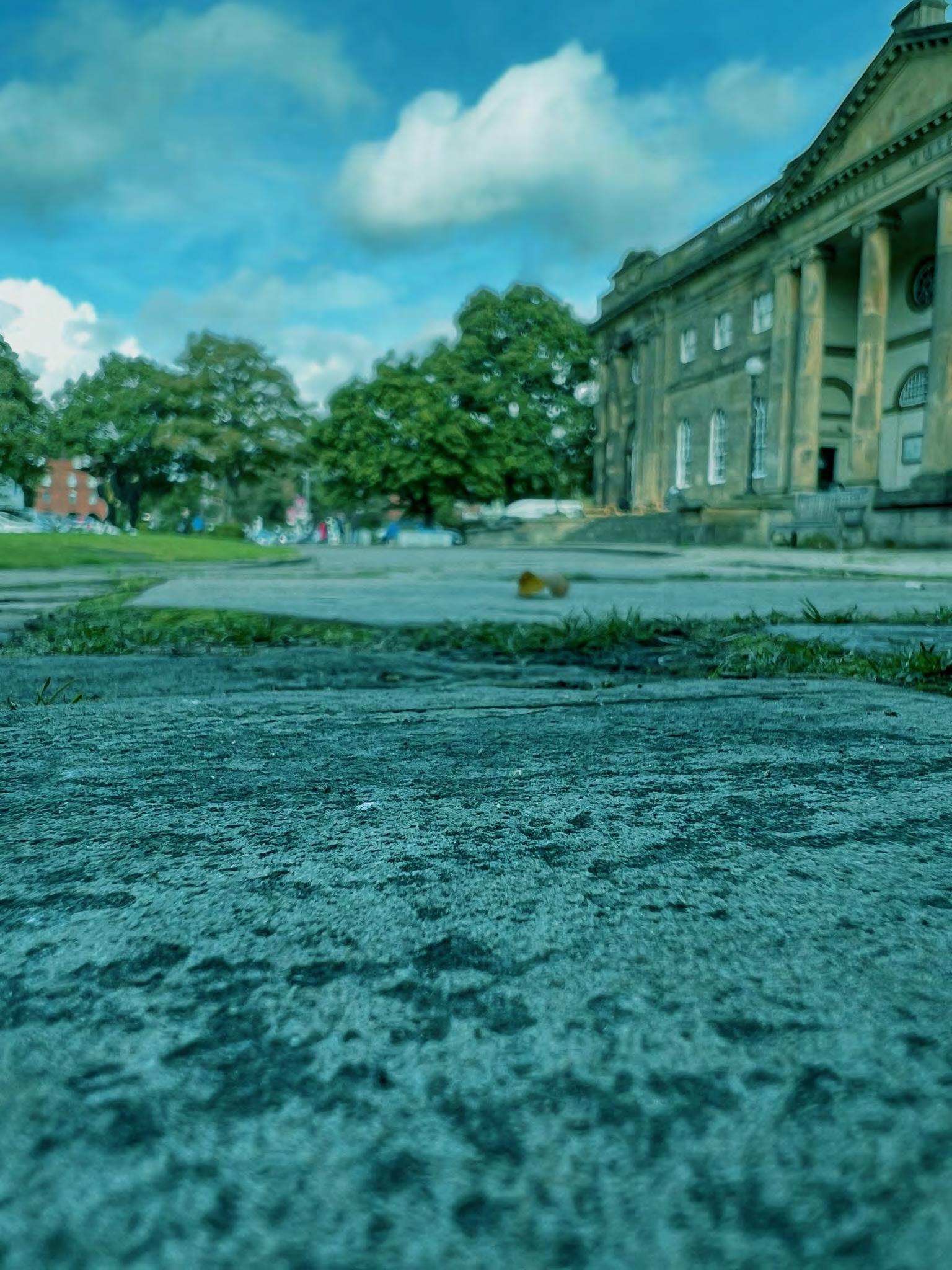
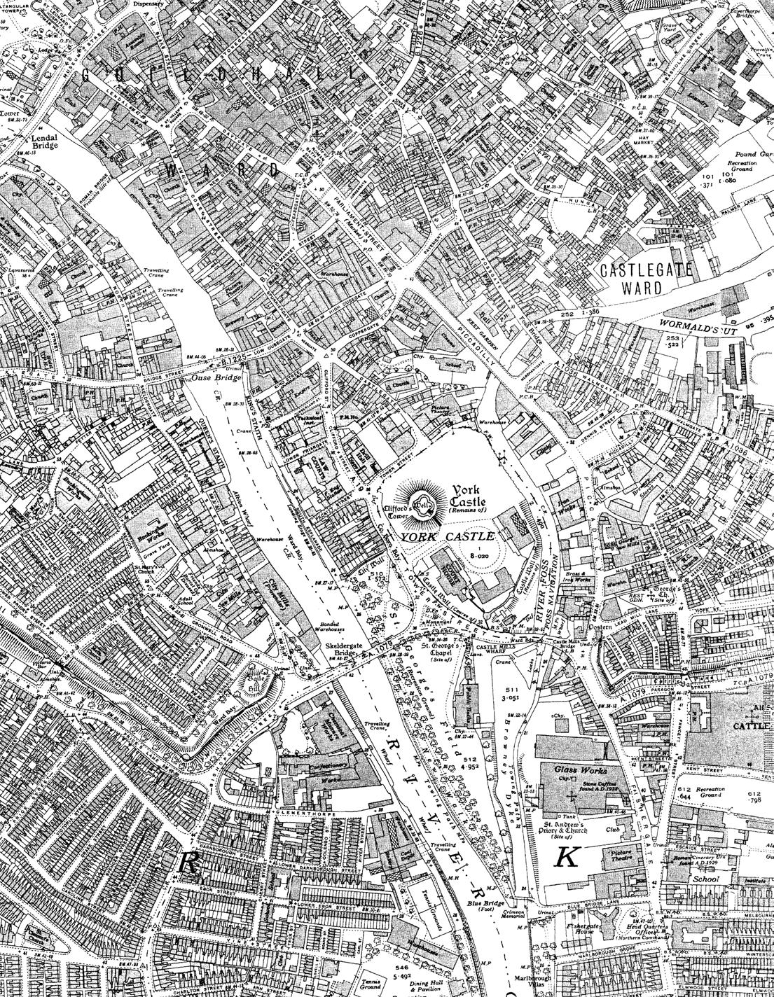
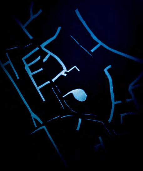
York is located in the North East of England and is the capital of Yorkshire, and it is a popular tourist location. One of its main attractions is the 13th-century gothic cathedral, York Minster.
The above map shows the 15 minute walking route taken to reach the site from the train station,.
The proposed development site for the event space is outlined in red. On the adjacent East side of the site is the River Foss which runs into the River Ouse, located 5 minutes west of the site.
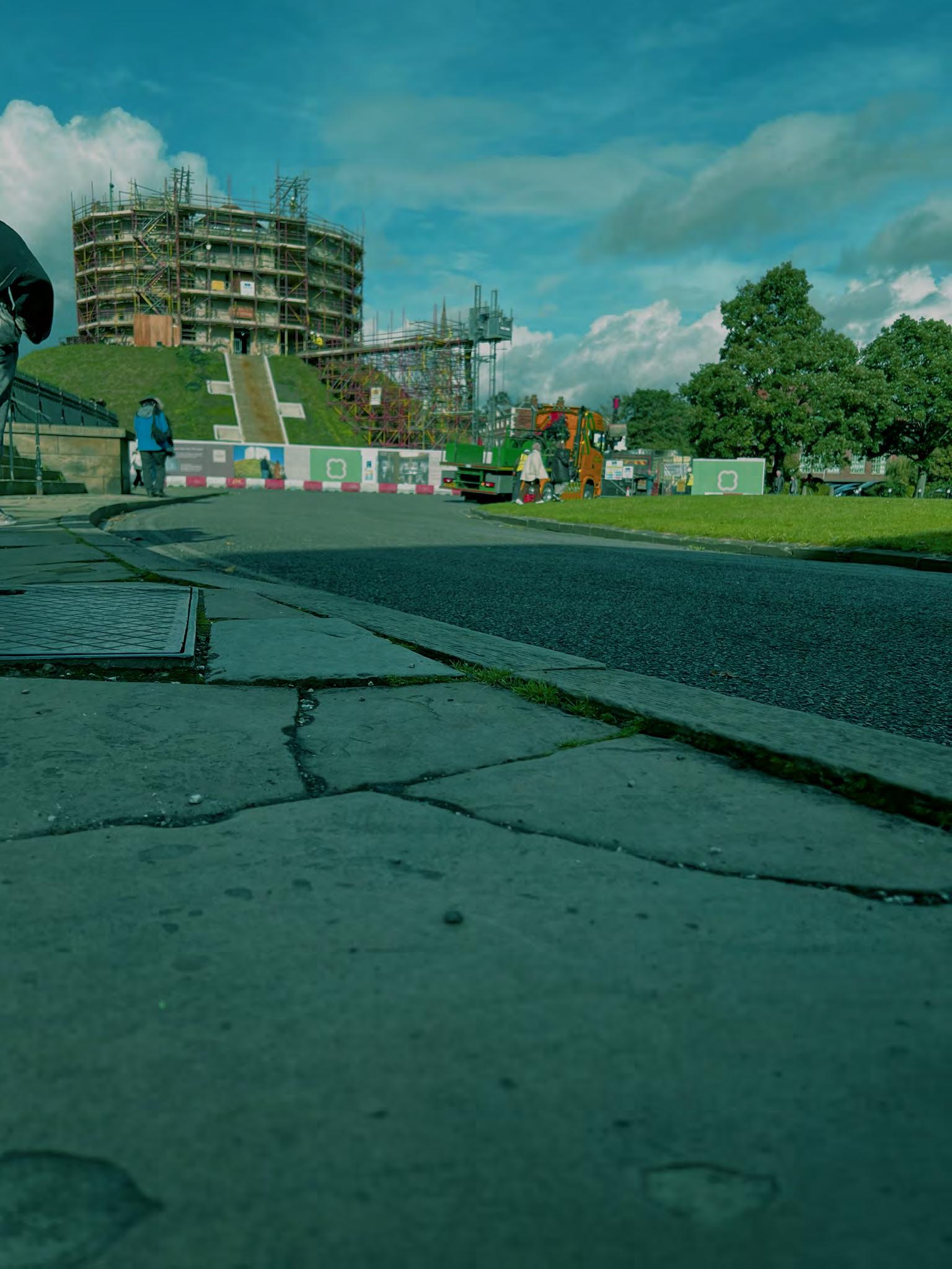
Currently, the site is used as a car park, however the ground has clearly
01 Site Location
decayed overtime and the overall surface throughout is very uneven, as there are many potholes, cracks and pressure points. On the western border is the Cliffords Tower and on the southern border is the York Castle Museum. The site has potential, is in a prime footfall location and is very spacious.

and the impact water has on this site was an element that had to be researched and considered, as this would allow further understanding about the time line of this site. This was done by looking into the history of this site and how previous times of flooding impacted the
ly like these, but weight and pres .1 .2
Evaluation
The site is an ideal space for an events structure, the location is in the centre of Yorks historical square and this its self would bring a vast amount of people each day. The event space would bring a modern twist into this traditional environment providing something new and current bringing some stylish flair into what was once a run-down car park, just used for a connection.
The site in its current format does not reflect the historical attractions that surround it, there are bollards (on the south border of the site) that symbolise a cutoff or in LYNCH perspective an edge/divide. This small feature reflects the disconnection between the locations creating a disjunct atmosphere. This overall separate the history from the visitor’s arrival point, allow ing visitors to arrive uncomfortably brings a negative vibe for the rest of their visit.
But this can all be changed by adding an event space.
Aspects that should be exploited is the view of Clifford’s Tower and the River Foss. These are 2 features that should be con sidered. The black block represents a potential location for the form to be placed to take full advantage of both elements, and there is still a space for circulation (red dots).
The majority of the buildings on-site and in the surrounding streets are commercial buildings, to add a form on the site would create a type of hub for the area to bring people from the local companies and visitors into one collective space.

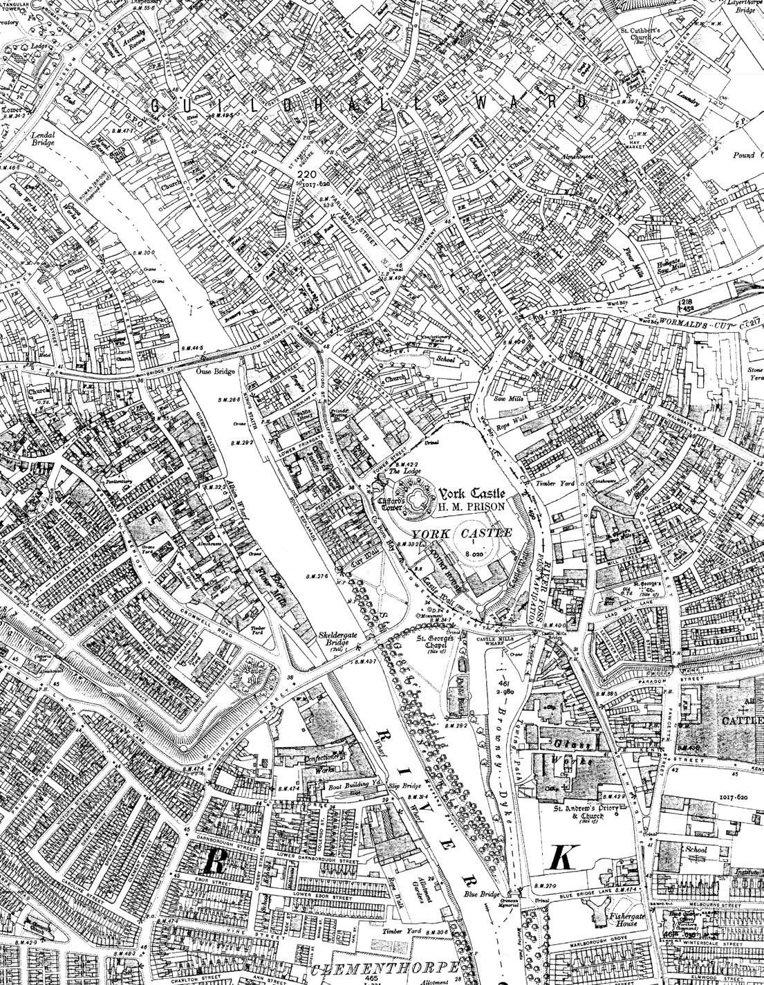
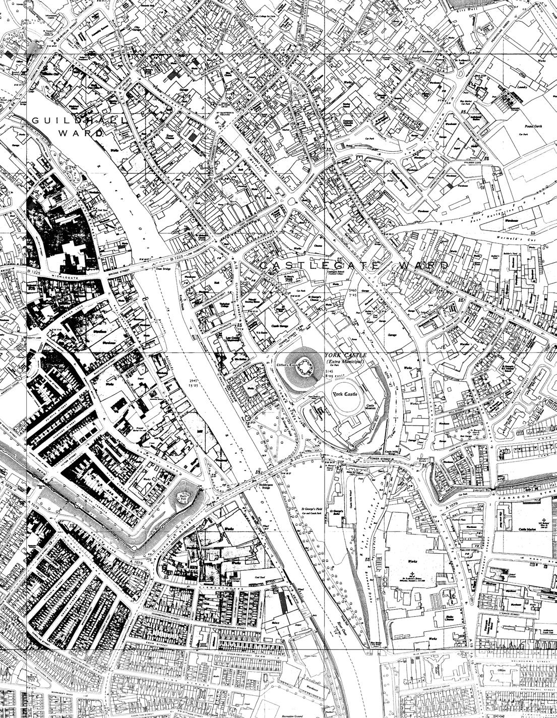
02 Site History
The 3 maps shown are 30 years apart it is clear there hasn’t been a lot of change in the last 100 years. The main features that have changed relate to the infrastructure, such as the roads and pathways.
The major change can be seen between the 1930s and 1960s maps where the car park site is not yet formed but in the 1960s map, some new buildings were built onto the site that are not there in current maps.
Looking at maps from 1852 onwards the cities landscape has remained largely the same, including the river placements and flow directions.
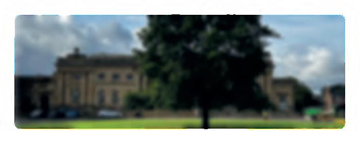
Clifford’s Tower in the past was a prison but in the modern day it is just one of Yorks many historical relics.
map map
gimap
1960s
1900s 1930s 1960s
.3

03 Mapping Construct
Off-site view point
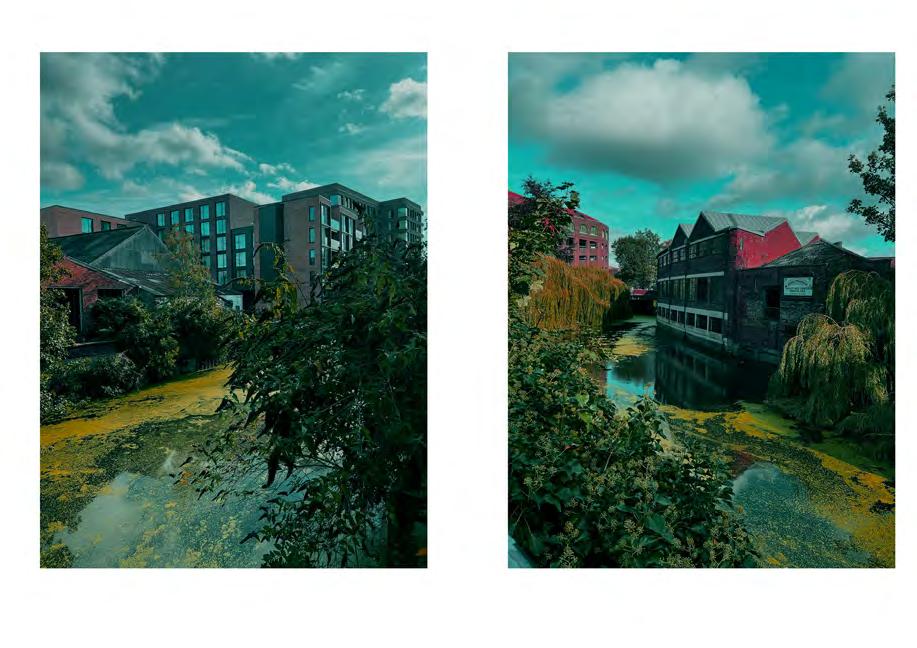
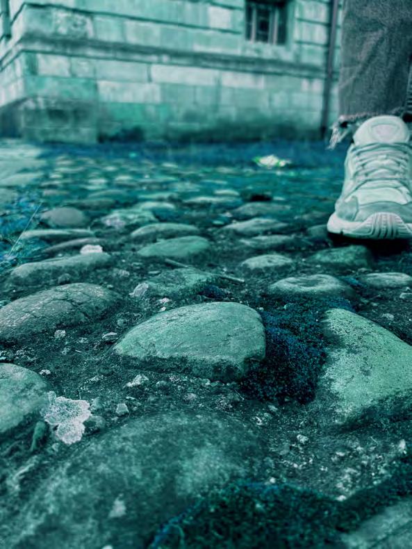
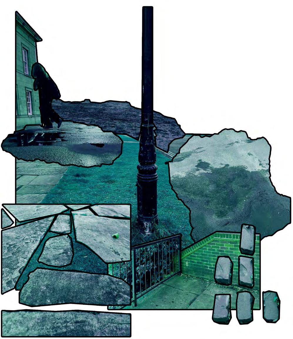
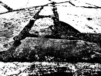
The majorty of these images were taken on the Eastern border of the site, along the edge of the River Foss. These images have been edited to over dramatise the scene at the time and to focus on elements that are usually dismissed or looked at last. Forexample the stone pathway is inverted to see the vegetation, formation and life forms that inhabit the space inbetween the stones, this shows the process of production and how they are connected. Its common for people to look at the brickwork as a textural aspect, but
Viewing direction from eastern river egde.
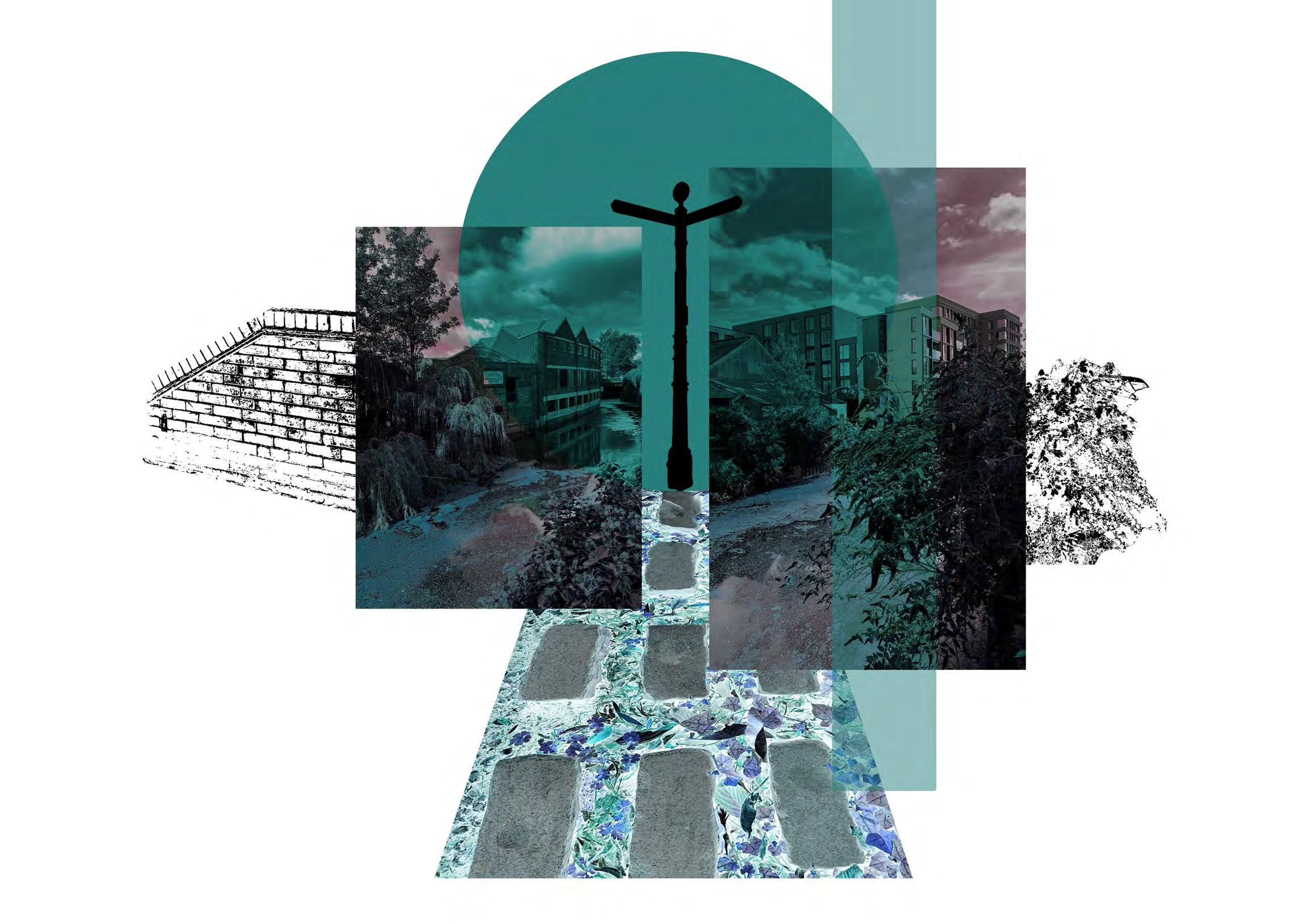
only look at the connection and pointing when they need repairing or maintaining, this edit allows a deeper understanding of the spaces in-between by having the cracks darker, adding the metaphorical aspect that the spaces in-between are darker collections and pockets of life, that are often misunderstood.
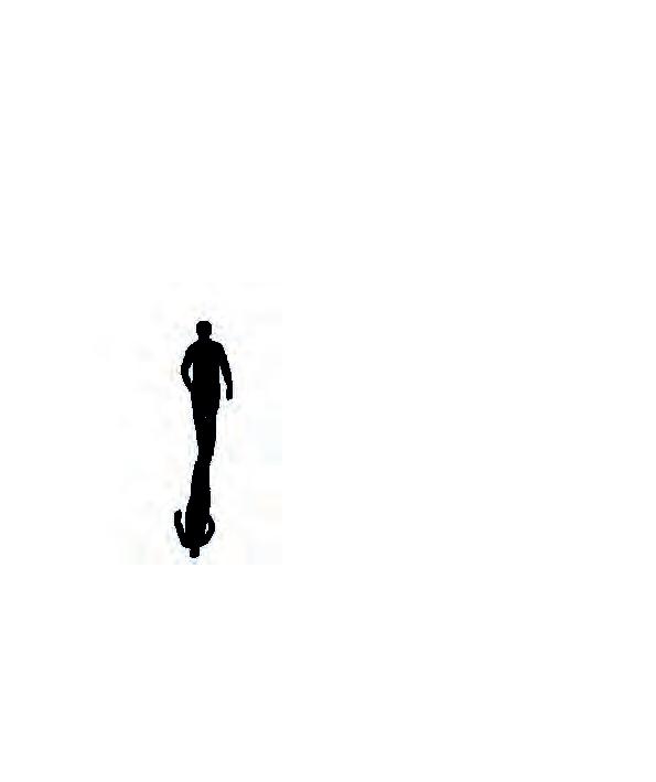
The central direction post connects everything together but is shown as a silhoutte to emphasise the importance of looking outside the norm and think outside of direction.
The River Foss border.
TRAILERTRAILER
SCAN TO WATCH

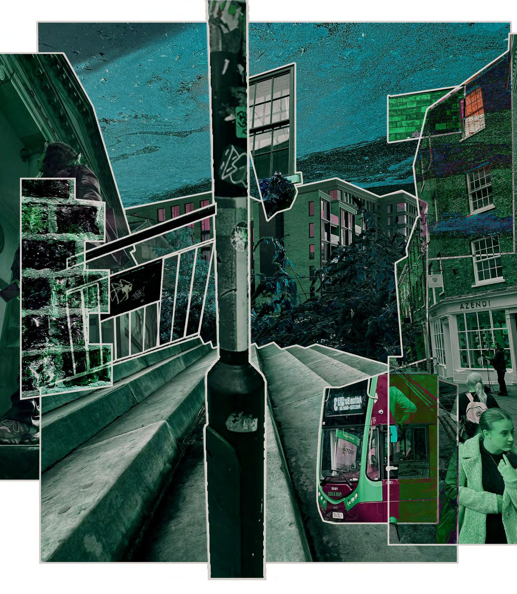
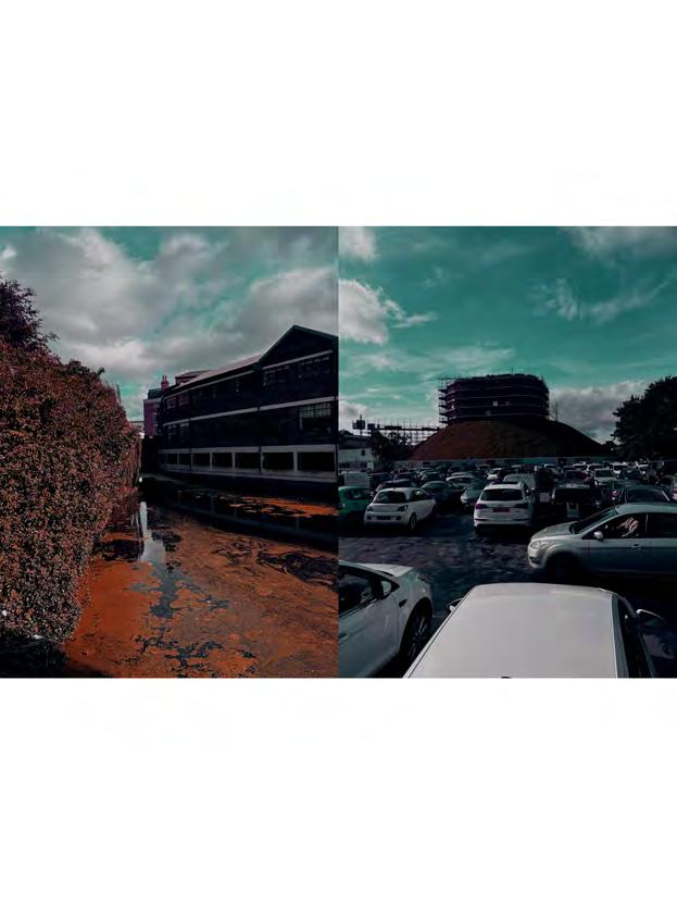
This is a combination of images from the site and the surrounding areas, the images have been manipulated to displace hierarchy. Many of the buildings surrounding the site such as the castle museum, have oversized features, that symbolise the past importance they used to have within the city. The azendi building is from a nearby street, in this collage the height is changed so that it is the same as those buildings that have higher importance. But other features such as lamp posts, signage, windows have been scaled up
S u r R E A L i s m Construct
to show the importance that those smaller elements bring to a building, such as direction and light.
The stairs are enlarged as those were what first jumped out to me as a focal point, when on site.
The image of the fencing is taken from the river edge protection barrier.
‘A 20th-century avant-garde movement in art and literature which sought to release the creative potential of the unconscious mind, for example by the irrational juxtaposition of images’
.4
BUILD-UP
TEXTURE COMFORT
04 Operative De-Construct
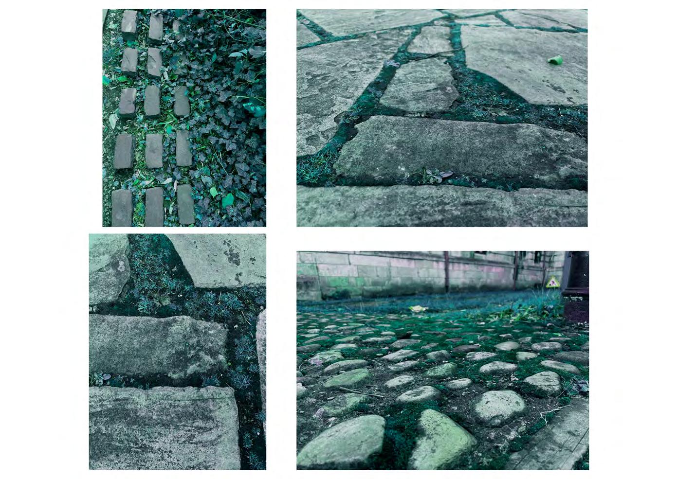
Pavement surfaces are the chosen urban element to further study in this next section, points to be analysed are: connection, decay and ageing, development/ process and the impacts these have on movement and motion.
Also, highlight and study-specific areas that have an increased amount of surface changes within a walking time frame, each will be mapped and studied.
Case Study
Key Terms
Failure -
A specific action that has caused the overall design to be at fault, that could put a user at risk due to malfunction.
Deterioration -
This is a physical action that occurs when something ages and has lost value over time. This could also relate to weathering and the way a design is affected due to flooding etc...
repairing and retaining the original appearance and function of aspects optimum , that prevents decay, damage or mal-
Weight
Drainage Material
have to be considered when making design decisions abouts pavement material selection, thickness and the overall function of the surface. These factors volume (vehicle & pedestrian), climate, of the space, the below surface material
.6 .5
Maintenance
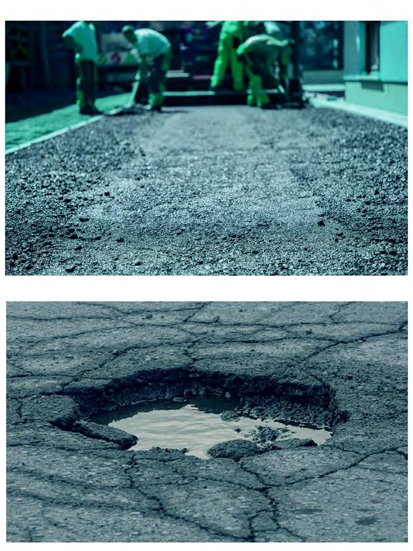
No matter the design strategy, it is inevitable that pavements will require maintenance at some point during their life span. Despite many surfaces having a waterproof layer/covering, often the need for maintenance is because of water damage. Many pavement failures occur due to a lack of maintenance, or maintenance occurs when the damage is difficult to fix it is patched up, which doesn’t always fix the problem.
It is common to think that the term pavement is just the surface layer, for example, cobbles, but that is not the case. When designing pavements, it relates to the entire thickness of the surface, this includes the wearing, base and subbase course. The pavement is the entire thickness of the hard crust that is constructed over the natural subgrade that provides a stable, flat and level surface, suitable for vehicles.
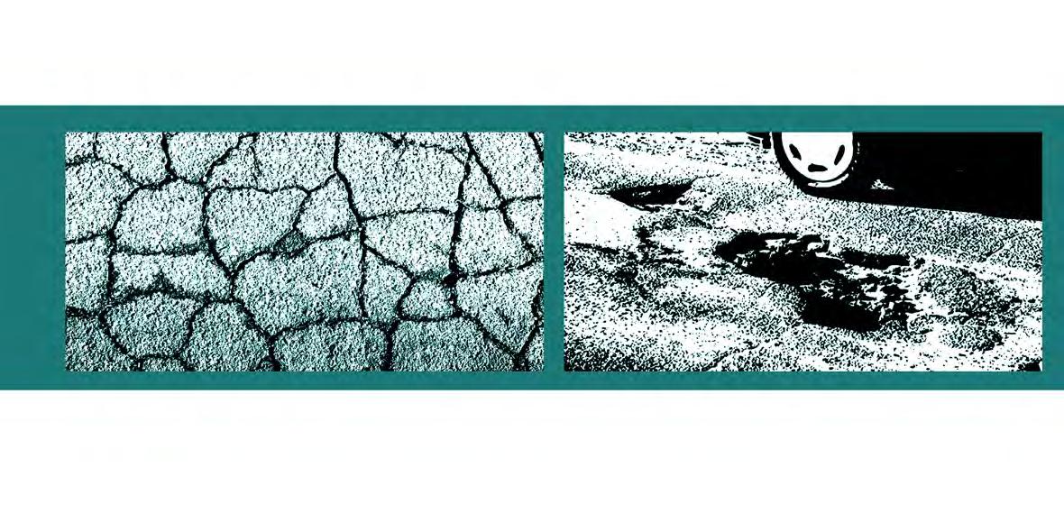
Failures
Although it might not be visible to the human eye, the deterioration of pavements starts immediately after it is open to different forms of traffic. Types of failures include bleeding, cracking, stripping, surface defects and ravelling. These can cause structural and performance issues meaning it might not perform to its highest ability when preventing skidding or maintaining water tightness.
As York is an area that has experienced flooding issues if the site has poor drainage this could cause the surface to deteriorate if the water then freezes this would cause the cracks to expand and over time could cause a structural issue to the site.
This case study was based on a specific site but is rather generic, the findings were that the cause of the majority of the on-site damage was a result of fatigue, movement of vehicles, poor drainage and unsuitable pavement layers were causes of deterioration that happened over time.
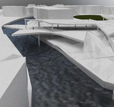
Shape, motion and fluidity are the words to describe this design by 3XN architects, these aspect directly connect with an aim for my form INTERSTICE ‘The Space In-Between’ as the the form adapts to the site and creates a structure that emerges from the grou-
‘Rethinking mobility to design better cities with Max Schwitalla’
This precedent was to inspire a rule for the future form/structure of the design. Aspects that spoke to me the most, were the ideas that each pathway external to the structure has a direct point of connection into the building and that is what inspired the shape. Suggesting that the space is inviting and directs the flow and circulation of visitors; providing elements of hidden pockets of the building.
The design suggests that aspects of the base have been cut into, these elements are then stacked to create the circular forms that make up the buildings. This is something that would be ideal for my structure as it directly reflects the shape of some of the pavements studied, specifically the cobbles.
nd. This can relate specifically to the York site as on the first visit I though the site was mainly flat, however, there is a natural slope on the eastern edge leading to the river. This sloping effect found in this precedent would be ideal for that specific site.
.7 .8
PRECEDENT POEM/STORY
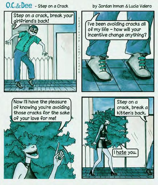
Perception is key, as previously discussed in the opening of this project, comfortability across surfaces during movement is at the forfront of this design process, therefore researching into peoples perception and the connotations that surround the word crack, which is a common term used to describe a break in a space, both naturally or human formed.
‘Step on a crack, break your back!’ is a saying that is part of a longer poem, this one line is some
thing that a majority of people learn and joke about from a young age. This helped to open up my perception as to how people will perceive and view the form that I have designed and how the younger and older generations will have different opinions and memories about cracks. York is city filled with history the idea of allowing people to look into the cracks that have appeared metaphoriclly in the city overtime will help them to love and appreciate and see the hidden aspects.
.9
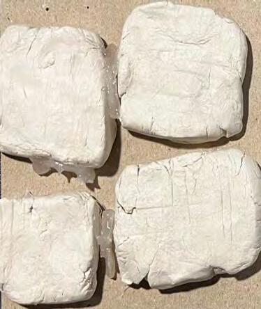
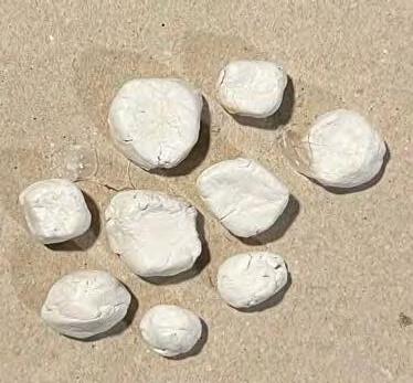
A model was made to replicate the surfaces on the site, these were made using clay and based on images taken at the time. To understand and to further connect with the surfaces, a touching and brushing motion was used to feel the texture. This was an opening to a greater understanding of the feelings those who walked across these surfaces felt.
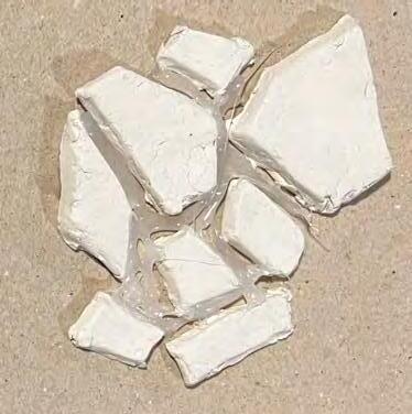
The smoothest and most comfortable type to feel was the slab model, although it is commonly known that slabs can drop over time and can become uneven, in this experiment this one was the most comfortable. The least comfortable was the cobbles because of the continual uneven nature of the layout and was quite pressuring.
A light exposure experiment was carried out, to see if a connection could be made between the roads on a map and light exposure. Selective sections and roads on the map that was of importance/relevance to the study were cut out, then a light was placed behind the map, the images that were captured were of the exposed light, this influenced the roof patterning of the end structure, INTERSTICE: The Space In-Between.
UNCOMFORTABLE DISTRESS PROCEED TREAD TIRING WALK JOURNEY WALK
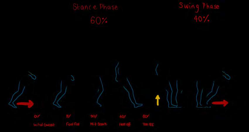
To understand how surfaces and pavements impact a person movement, the motion experiment was carried out. The research was done with a physio student to understand the cause of the reported uncomfortably. The above diagram shows the gate analysis, this begins the process of understanding movement on, across and between surfaces.
The words above are the reflection responses from people who walked on the surfaces similar to those on site. Each explains the connection/ feelings of walking on those surface.
STEP OUT COMPROMISING RUN PAINFUL PATROL M O V INCONVENIENCE 05 EXP-1 Motion
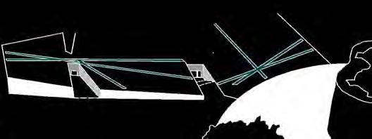
This field diagram shows the viewpoints people would see from specific corners of the site. This is done using the human eye angles of 50 (yellow)and 60 (pink) degrees as well as an estimation of the direct viewpoint from the standing locations.
The rule used to manipulate these diagrams is rotation, after rotating these diagrams a new shape became visible and is connected to create a form, this would then be minimised and placed on the site for further manipulation.
Scale 1-5000
CHURCH LANE CASTLEGATE CLIFFORD STREET STAITH CastleWalk NESSGATE CUMBERLANDSTREET HIGHOUSEGATE TOWERSTREET LOWERFRIARGATE CoppergateWalk FRIARGATE COPPERGATE KINGSTREET River Foss City Wall STREET York Castle CityWall New Walk New Walk PECKITTSTREET Fishergate Tow Path Rising Bollards SOUTH ESPLANADE TOWER STREET City Wall Foss Navigation Mary's 0o rotation 90o rotation 180o rotation 270o rotation
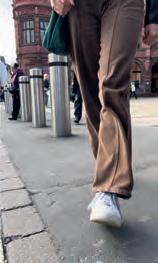
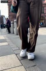
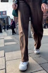
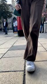
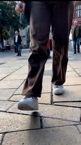
Images captured from a motion video of a person walking across multiple surface types within a 10-second time frame on a street in York.
Outline of the legs in motion to understand how the person walks and to point out the major and minor leg to formulate a motion diagram
Rotate 45o 0.00 0.02 0.025 0.04 0.05 0.08
Major (white) and minor
(grey)
legs have been identified from motion. Rotate The Cut throughs creating a direct connection from the exteral paths into the form (inspired by precedent 2) Pull Flip Original Push Mirror Minor connect Major connect
A -Square between High Ousegate, Coppergate & Parliamet Street.
B - St Helens Square
C - St Sampson’s Square
D - River to River SCALE 1-2500 06
Progression
River Ouse River Ouse
EXP-2
Step 1: Idetify walk routes from an area where there is a vast amount of pavement surface changes on either side of the site, simplify these walk ways into one continuous line that runs through the site. This is method was inspired by the london underground map progression.
SCALE 1-2000
A B C D
D - ROTATE
Each duplicated lines is 10 metres apart up to edge to edge of the site, the edges are shown at the beginning of each matrix. This will then start to show a pattern of the flow, this will then be further manipulated and transformed through the matrix and combined to reveal the overlapping elements that interconnect.
A - MOVE
B - MOVE
C - MOVE
A - MOVE
B - MOVE
C - MOVE
EDGE TO EDGE EDGE TO EDGE
D - ROTATE
A - MOVE
B - MOVE
C - MOVE
D - ROTATE
A - MOVE
B - MOVE
C - MOVE
45 o 90 o 135 o 180 o 225 o 270 o 50m radius + matrix 50m radius - matrix 325 o EDGE TO EDGE
D - ROTATE
MATRIX
This is the A-D lines that are still cutting through the site after the full rotations are made and the matrix lines are eliminated. After analysis and experimentation, further needed to be done to make the lines less continuos and more interesting. Therefore some rules were made to cut up the lines furthers. This section shows the outcome of these rules and the progression made to find a form.
overpowers (O.P) pink
U.P blue but O.P green
O.P blue but U.P green site
U.P yellow
U.P green but O.P pink
O.P yellow U.P blue
O.P blue U.P pink site
O.P yellow U.P blue
O.P yellow U.P pink
O.P blue U.P green
O.P green U.P blue site
O.P blue U.P yellow
1 Original
2
3
SCALE 1-3500
Blue Pink Yellow Red Green
Blue Pink Yellow Red Green
Blue Pink Yellow Red Green
RULE
Precedent 2 incorporates the pathways & roads that are on the exterior of the site as cut-throughs into the base of the building, I attempted to incorporate this into the ground of the site. The below matrix shows the impact this had on the rules.
eltsaC kroY rewoT s'droffilC
CityWall
Original + Site Cut through Rule 1 Rule 3 Rule 2
City Wall
SCALE 1-2500
space in-between
I NTERSTICE The
‘A space that intervenes ‘A gap or break in something
NTERSTICE in-between
intervenes between things.’ something generally continuous.’
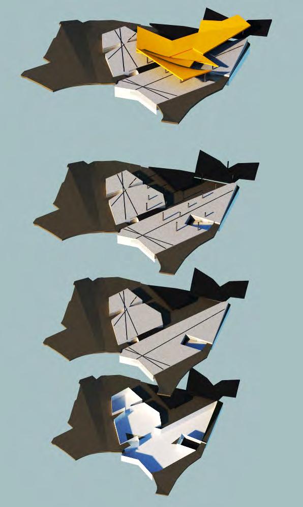
OVERLAY
COMBINE
The simple initial pavement pattern diagram was over layed onto RULE 1 + CUT THROUGH to find the final form for the basement level of the building.
Further line manipulation was made and this was the end result.
Pavements and surface build-up was the central study point that fused this process.
Initially, diagrams were created from the patterns of the pavement types found on and around the site, similar to this one, so to find the final form this specific diagram was re-introduced.
TRIM
Finding Form
SIMPLIFED + MANIPULATED 07 Matrix
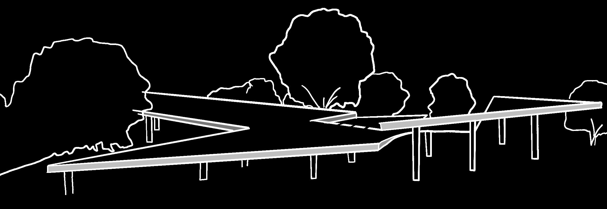
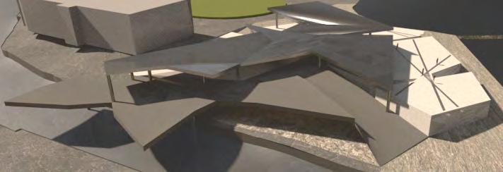
The roof shape was created from the rotation matrix, specific lines were chosen so that they could be manipulated and connected to create a continuour shape.
The remaining lines that cut through the roof form are used to signify a change in height (within the space), orientation or angle.
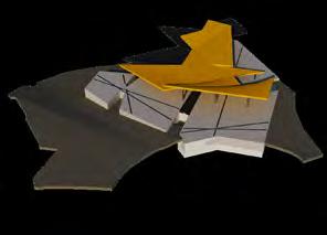
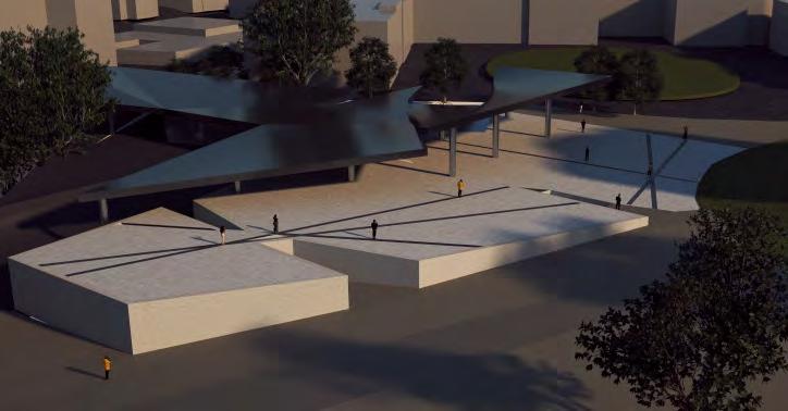
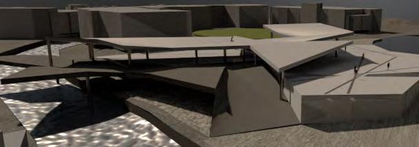
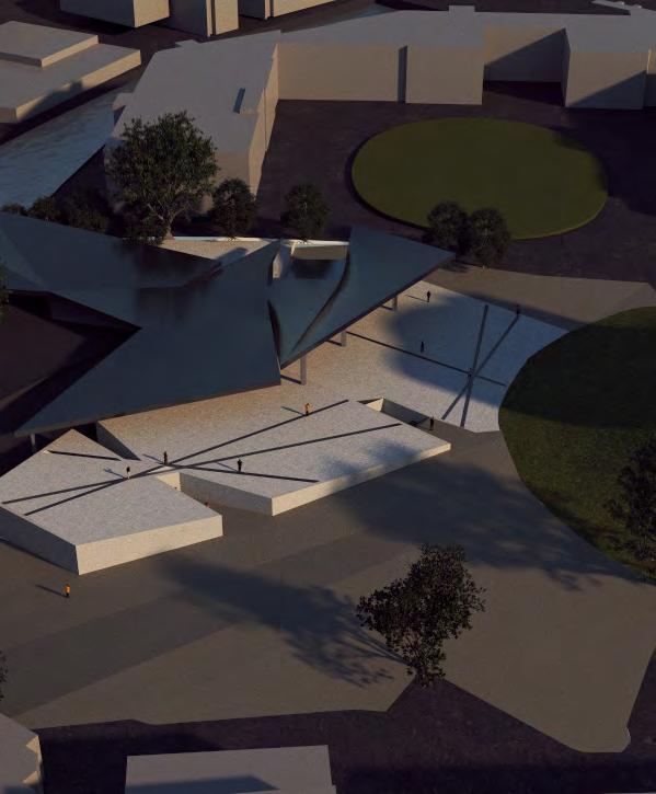
A roof form was found as well as a shape for the ground of the platform that overhangs the river. This will be a view point for people to stand on and exploit the river view.
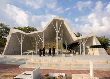
Open-Sided Shelter / Ron Shenkin Studio Burial - Pardesiya, Israel
Multi-height roof, that moulds the usage of the ground space. The roof reflects motion and symbolises the walk/journey of life, suitable for this burial site.
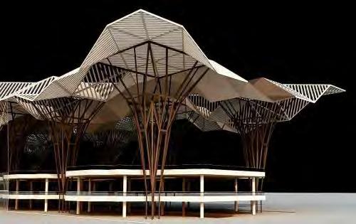
Roof Canapy / dmdesigns__
The geometric shapes create a dome style that is supported by tree colums, the roof opens up like miniture umberellas. Multi-height.
.10 .11
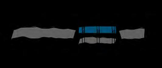
Site excavation area for basement of INTERSTICE, as the ground slopes the basement becomes visible
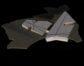
Connection between the sloping ground and the basement building is visible, showing the level of the sites terrain.
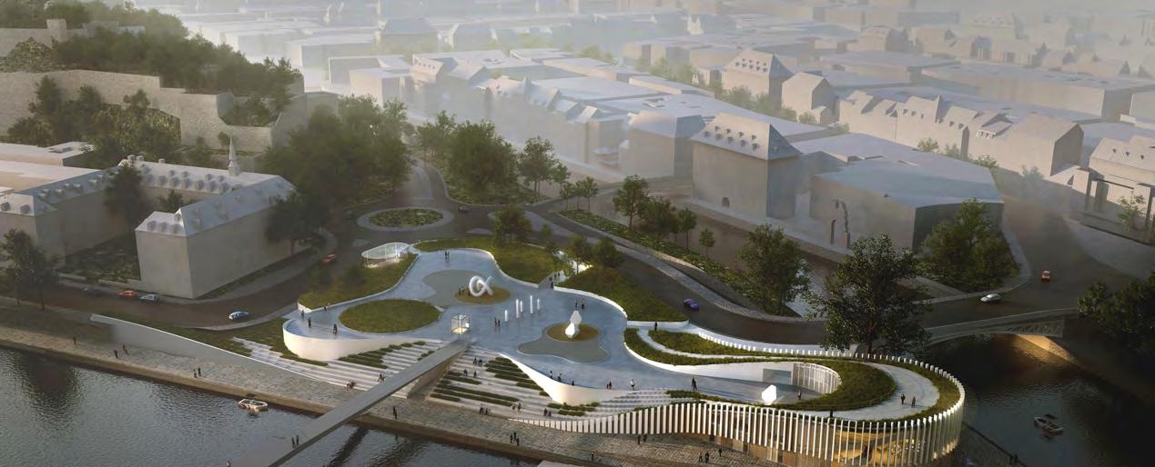
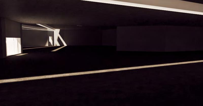
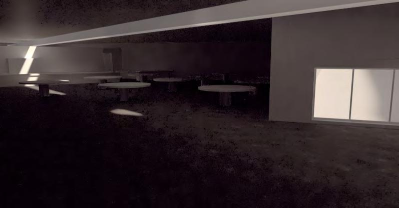
INTERSTICE in its full form. The basement relies on artificial lighting as the light wells are the only natural source.
Process Design
York Castle Clifford's Tower CityWall City Wall River
SCALE 1-1500
08
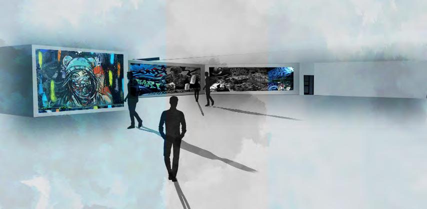
Basement Floor Plans : Scale 1-1250. These are multi functional adaptable spaces so they can cater to the neccessary event that would be taking place at the time. Events incl: perfor mances/show, galleries and open plan shopping.
1-1250
Space 1 Space 2 Space 3 Plant Room Storage Cafe
SCALE
SCALE: 1-200
EAST
SCALE: 1-750
NORTH
SOUTH-EAST : FRONT SOUTH
SCALE: 1-750
SOUTH
SCALE: 1-750
WEST
SCALE: 1-750
EAST
SECTION LINE
PAVILION ROOF INSPIRATION
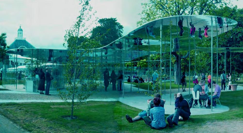
The roof of the pavilion is inspired by the Serpentine Pavilion of 2009, designed by SANAA. The reflective canopy roof exposes the surroudnign environment by creating a space in-between a space, instead of creating a divide between the buildings this is a minimal but breath taking design that fills the gam. The roof slices through the air leaving shadows on the ground.
SUPPORT BEAMS
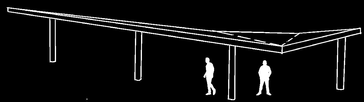
The slender columns that support the roof, on the 2009 Pavilion is random but on INTERSTICE the the beams are more strategically placed with a 5m support radius for the roof beams and 7m support radius for the river overhang.
SITE EXCAVATION
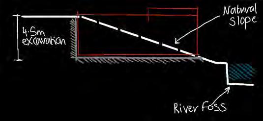
The north, south and west side of the site are level with the surrounding roads, however on the east side of the site is the location of the river and at that point, the site starts to slope. For this reason, the site needs to be excavated 4.5-5m on the north side as in this area the basement is designed to be level with the surrounding roads/paths. This excavation section would be level across the basement but towards the rear where the ground slopes the basement level becomes visible.
Technical .12
09 Study
BUSY
MODERATE
QUIET
STORAGE
SLIM ROAD
CONSTRUCTION ASSEMBLY
Studying and analysing the site has shown that the surrounding roads are often busy and congested. There are 4 moderately busy junctions located within 5 minutes from the edge of the site. This could cause issues during construction and could reduce vehicle access to the site.
Although the roads are suitable for HGVs the roads that directly connect to the car park are a lot thinner, this could cause an access problem for larger HGVs.
As the whole site isn’t being used for the INTERSTICE event space, there is space for storage.
FOUNDATIONS
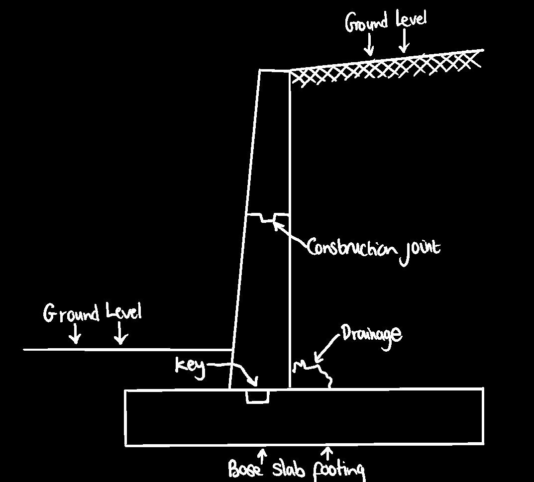
Insitu concrete is recommended for the basement and the basement walls. Although this option can be expensive it is one of the strongest foundation methods for buildings that have a basement.
SCALE 1-3500
PRECAST - PREFABRICATED
The pavilion roof canopy will be prefabricated, it is made up of 6 panels, these panels would then be connected on site. This is a cost-effective solution and means that the roof structure could be constructed in a short time frame.
SURROUNDINGS IMPACT
There would be a temporary impact on the site during construction, this would include, walking access, noise and visual pollution. However the Clifford’s Tower has been under construction for some time, this could have a a similar impact.
York Castle


PAVILION ROOF
Each panel’s main body is created using a variety of recycled wood and stone from the local area, these panels are then cladded with a shiny aluminium coating.
This is to create a similar visual aestheic as the ‘Your Reflection’ pavilion designed by Guillermo Hevia García + Nicolás Urzúa Soler.
The mirror effect allows the space to feel continual and connected with the surrounding features as well as making the canopy look like it is floating, linking to the comfort one should have when walking across pavements surfaces.
BEAMS-
Pre-cast concrete beams support the walkways that go over the river these beams have a 500mm radius as they support a 7m span.
Pre-cast Slender concrete columns support the weight of the pavilion roof, these have a radius of 350mm and a 5m span.
BASEMENT -
Insitu construction, where the concrete product is being poured into a mould or frame work specifically made for the foundations and the retaining walls.
SURFACE - PAVEMENTS - ROADS
The site is now levelled out with true grid paving with a slip-resist resin surface coat. Although there is a change in material the site border is now level with the site.
.13
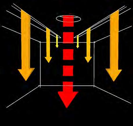
LIGHTING
Majority of the basement lighting is artificial, especially for events sections, as those are bespoke, however the ceiling light wells allow some natural light to seep into the building.
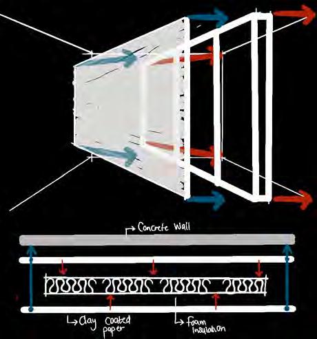
INSULATION
The basement retaining walls are insulated using rigid foam board, as they work best against solid smooth surfaces, like concrete, this will be the best way to insulate the basement.
ARTIFICIAL
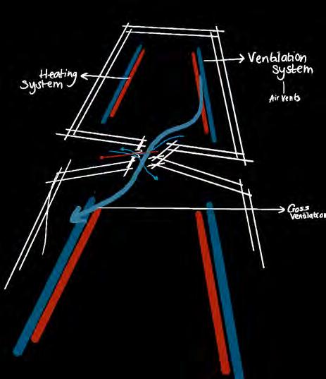
Heating and cooling systems are used to allow the building to be the most comfortable for the internal users, therefore these systems will be in place throughout the basement.
VENTILATION
As the basement is a large open plan space cross-ventilation can occur both naturally (area to area & doors) and artificially using the vent systems located in the basement walls and roof
References
images/articles/case studies
1. Pacific Paving. (2019). 9 SIGNS YOU NEED US [Image]. Retrieved December 2021, from https:// pacificpaving.com/9-signs-you-need-us/.
2. Caddo Construction LLC. (2020). How Do Potholes Form? [Image]. Retrieved December 2021, from https://connect2local.com/l/214514/c/824458/how-do-potholes-form.
3. digi maps
4. salvador dali surrealism. [Image]. Retrieved December 2021, from http://artist.com/art-recognition-and-education/wp-content/themes/artist-blog/media-files/2016/03/salvador-dali-surrealism-2.jpg.
5. pavenetwork. (2019). The Biggest Pavement Maintenance Trends from 2019 [Image]. Retrieved December 2021, from https://pavementnetwork.com/the-biggest-pavement-maintenance-trendsfrom-2019/.
6. Types of Failures in Flexible Pavements and their Repair Techniques. [Image]. Retrieved December 2021, from https://theconstructor.org/transportation/types-failures-in-flexible-pavements-repair/16124/.
7. 3XN. Beautiful Game of Terraces [Image]. Retrieved December 2021, from https://archello.com/ story/44062/attachments/photos-videos.
8.Adriana Ayala. (2020). Rethinking mobility to design better cities with Max Schwitalla [Image]. Retrieved December 2021, from https://designwanted.com/architecture/max-schwitalla-interview/.
9. yaddlezap.com. Step on a Crack [Image]. Retrieved December 2021, from http://yaddlezap.com/ ocndee10/.
10. ArchDaily. (2015). Open-Sided Shelter / Ron Shenkin Studio [Image]. Retrieved December 2021, from https://www.archdaily.com/772842/open-sided-shelter-ron-shenkin-studio.
11. dmdesigns__. (2016). nexttoparchitects [Image]. Retrieved December 2021, from https://nexttoparchitects.org/post/142302074681/nextarch-by-dmdesigns-nexttoparchitects.
12. Iwan Baan. (2010). Serpentine Pavilion 2009 [Image]. Retrieved December 2021, from https:// www.australiandesignreview.com/architecture/serpentine-pavilion-2009/.
13. Nico Saieh. (2016). YAP_Constructo 6 “Your Reflection” [Image]. Retrieved December 2021, from https://www.archdaily.com/786278/yap-constructo-6-your-reflection-guillermo-hevia-garcia-plusnicolas-urzua-soler/5720def2e58ecef747000054-yap-constructo-6-your-reflection-guillermo-hevia-garcia-plus-nicolas-urzua-soler-photo?next_project=no.
CASE STUDY : Flamarz, S. (2017). Flexible Pavement Evaluation: A Case Study [Ebook] (1st ed., p. ALL). Retrieved November 2021, from.
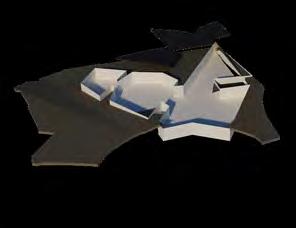
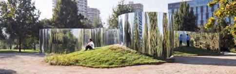
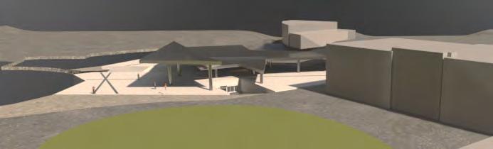
This is INTERSTICE: The Space In-Between
The space in between is a project with a central focus on pavement surfaces, and how people use and move across different types. The focus on pavements came into being after visiting York and noticing the multiple surface changes within certain time frames. As well as this, I watched people walk and many people looked uncomfortable moving across specific surface types. I researched these surface types, analysed them, mapped them and from that research created a form, this form is named INTERSTICE.
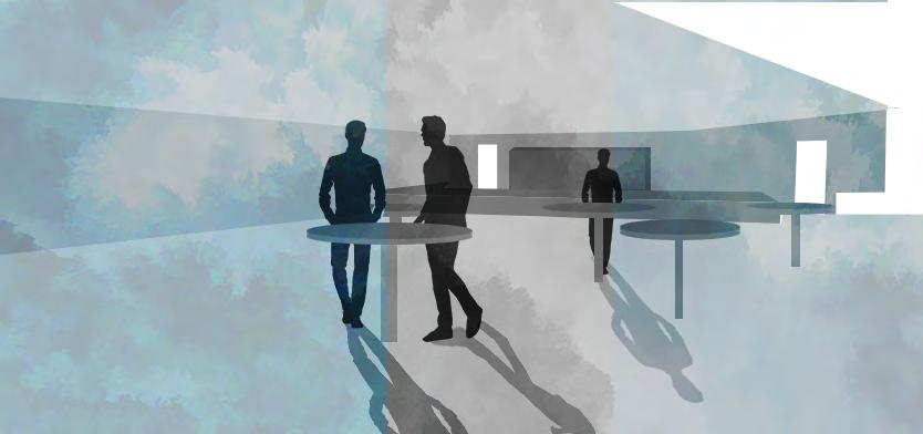
Interstice is a multifunctional event space that is open daily to the general public. The above-ground pavilion is coated in a reflective aluminium cladding that mirrors the surroundings onto the roof. It is a form that adapts to the sites natural slope and consists of multiple height changes across the form. Interstice is designed as a space that at first can glance could look uncomfortable or confusing to the visitor, however, this is space that changes the everyday mindset of cracks and levels changes and aspires to create a positive space that is against the norm.
The space can be used for a variety of events as the entire basement is open planned, events could include, shows, performances, workshops, markets and even as a gallery. There is a vast amount of storage in the basement meaning that all the elements needed to make these events happen can be stored away.
Welcome to the future of comfortability, a place where movement and walking patterns can create a multifunctional space designed directly for the people.
By Sarah Bradshaw
