5 minute read
LOCATION] Site

from Interstice Portfolio
by saraistudios
York is located in the North East of England and is the capital of Yorkshire, and it is a popular tourist location. One of its main attractions is the 13th-century gothic cathedral, York Minster.
The above map shows the 15 minute walking route taken to reach the site from the train station,.
Advertisement
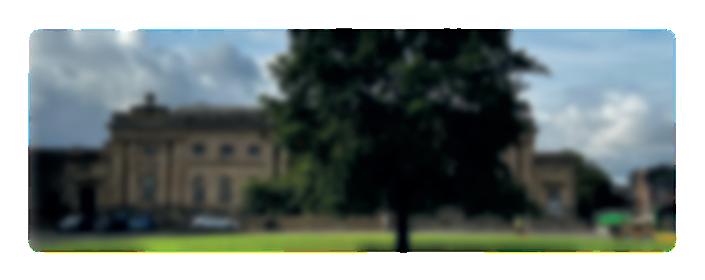
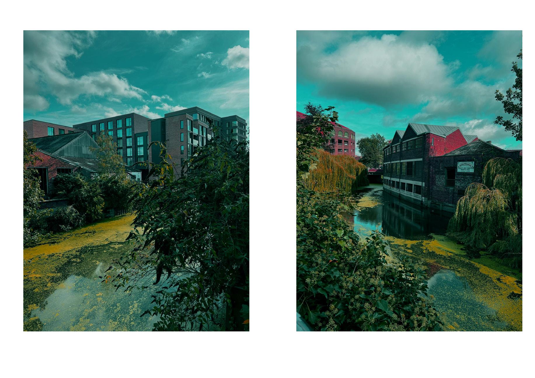
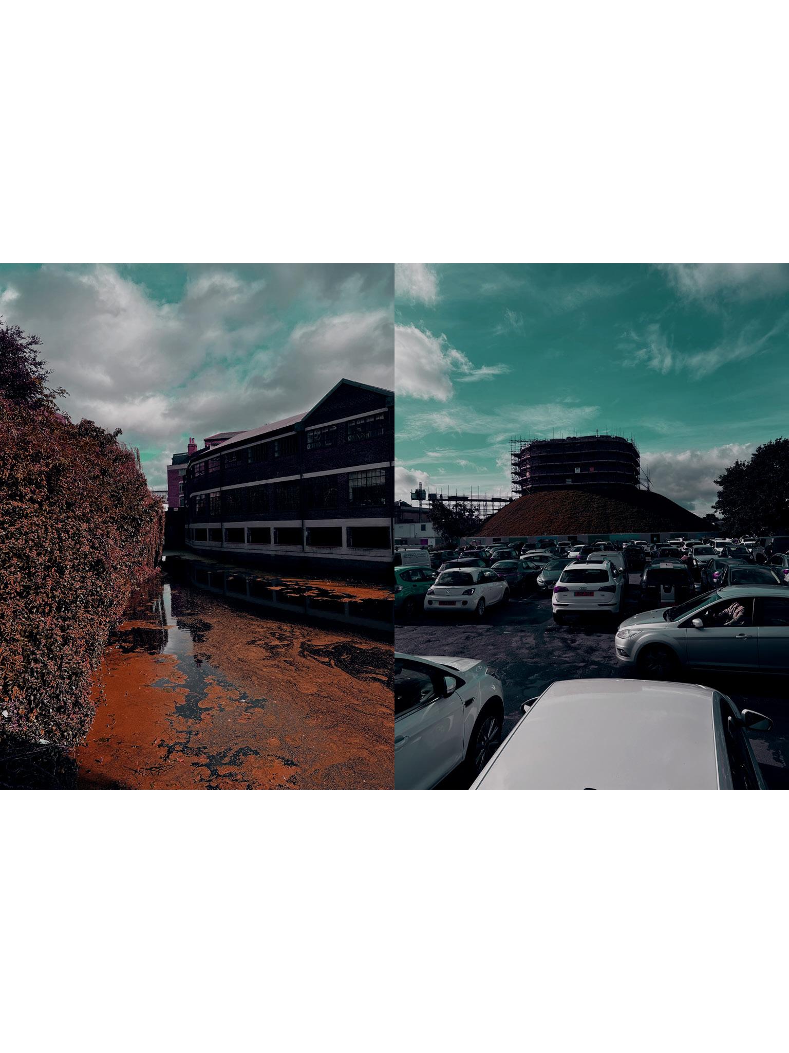
The proposed development site for the event space is outlined in red. On the adjacent East side of the site is the River Foss which runs into the River Ouse, located 5 minutes west of the site.
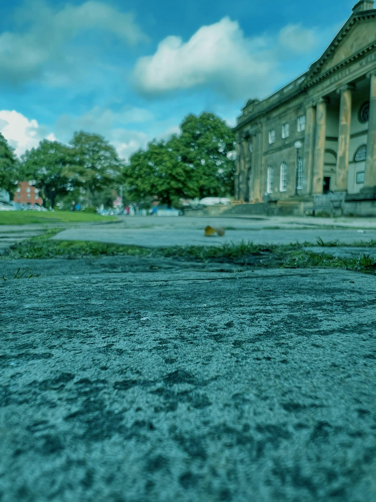
Currently, the site is used as a car park, however the ground has clearly
01Location Site
decayed overtime and the overall surface throughout is very uneven, as there are many potholes, cracks and pressure points. On the western border is the Cliffords Tower and on the southern border is the York Castle Museum. The site has potential, is in a prime footfall location and is very spacious.

Research shows that water can cause fault to surfaces specifically like these, but weight and pressure is also an issue. As this site is currently a carpark pressure over time is inevitable, from a variety of loads, but specifically vehicles. Therefore weathering, drainage and loading are elements that can cause failure and detoriation overtime. Failures that can be spotted could include : surface deformation, cracking, pot holes etc. Flooding and the impact water has on this site was an element that had to be researched and considered, as this would allow further understanding about the time line of this site. This was done by looking into the history of this site and how previous times of flooding could have impacted the surface of this plot, and whether this could be the reason behind its current state and format.
.1
.2

Evaluation
The site is an ideal space for an events structure, the location is in the centre of Yorks historical square and this its self would bring a vast amount of people each day. The event space would bring a modern twist into this traditional environment providing something new and current bringing some stylish flair into what was once a run-down car park, just used for a connection.
The site in its current format does not reflect the historical attractions that surround it, there are bollards (on the south border of the site) that symbolise a cutoff or in LYNCH perspective an edge/divide. This small feature reflects the disconnection between the locations creating a disjunct atmosphere. This overall separate the history from the visitor’s arrival point, allowing visitors to arrive uncomfortably brings a negative vibe for the rest of their visit.
But this can all be changed by adding an event space.
Aspects that should be exploited is the view of Clifford’s Tower and the River Foss. These are 2 features that should be considered. The black block represents a potential location for the form to be placed to take full advantage of both elements, and there is still a space for circulation (red dots).
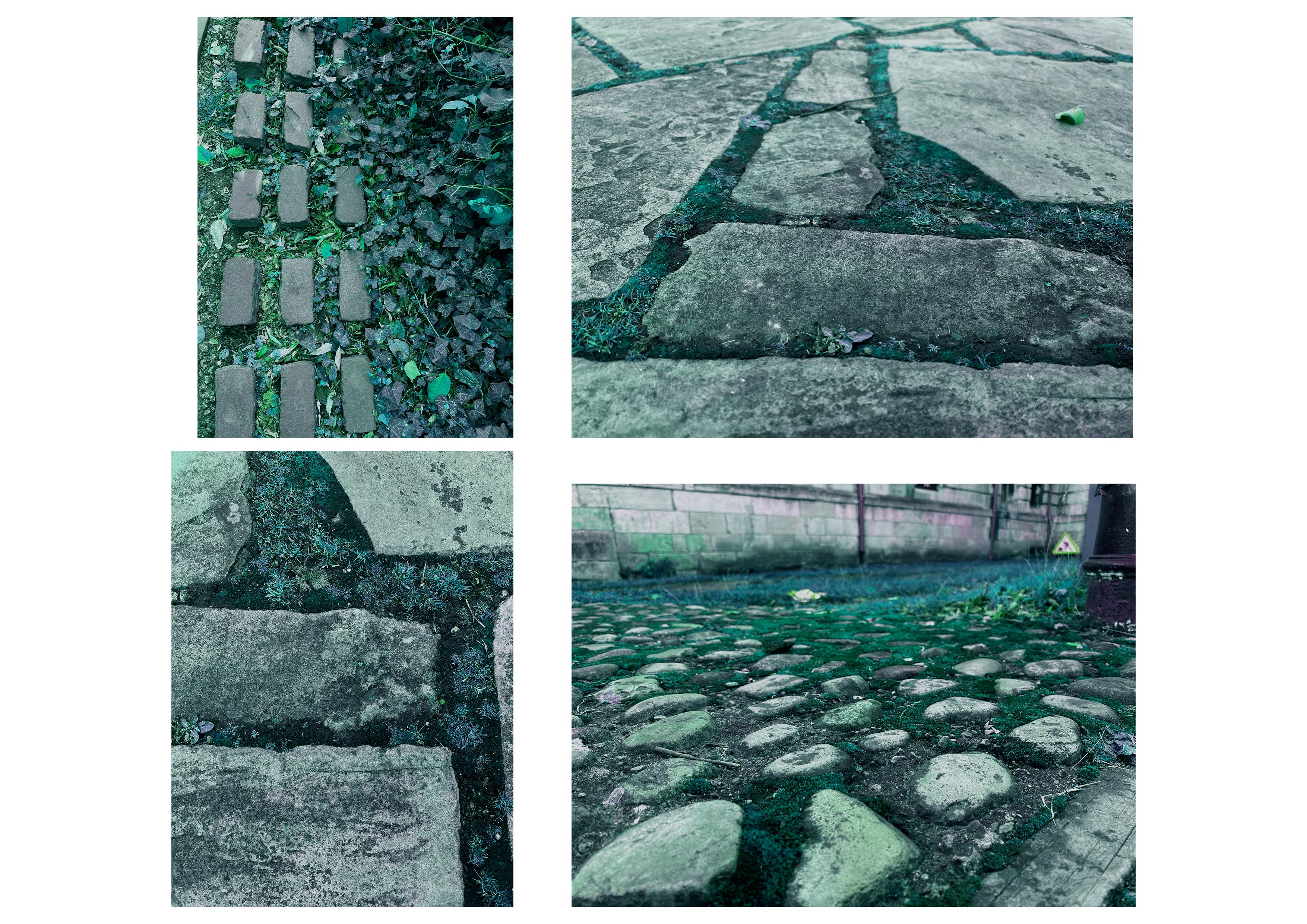
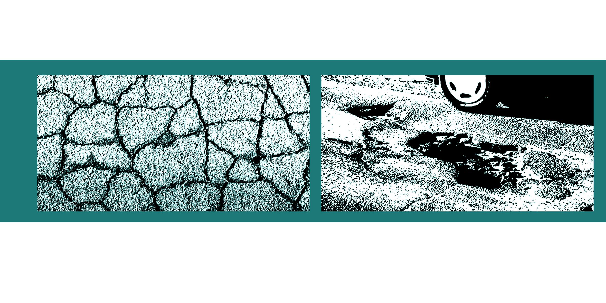
During the site visit, it became apparent that a variety of stone types were used to create/form pathways, pavements and curbs, especially in the area nearest to the museum. This became obvious when watching/assessing the movement of people and how they used the space, many pedestrians looked uncomfortable whilst walking across specific surfaces, especially the cobbled paths (this feeling is common). The main 3 stone surfaces that cause the most comfortability issues are those in the images above. These are not located just on the border of the site but also in the surroundings of York. A connection between these specific spaces should be made to search for any potential correlation across York ... is there any patterns ...
The majority of the buildings on-site and in the surrounding streets are commercial buildings, to add a form on the site would create a type of hub for the area to bring people from the local companies and visitors into one collective space.

0 40 80 120 160 200 240 280 320 360 400m Sarah Bradshaw Huddersfield University
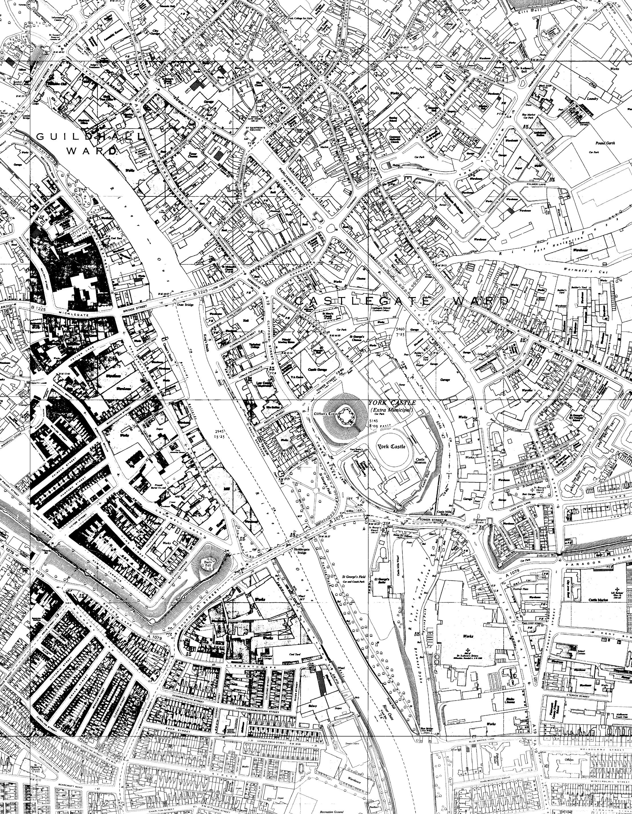
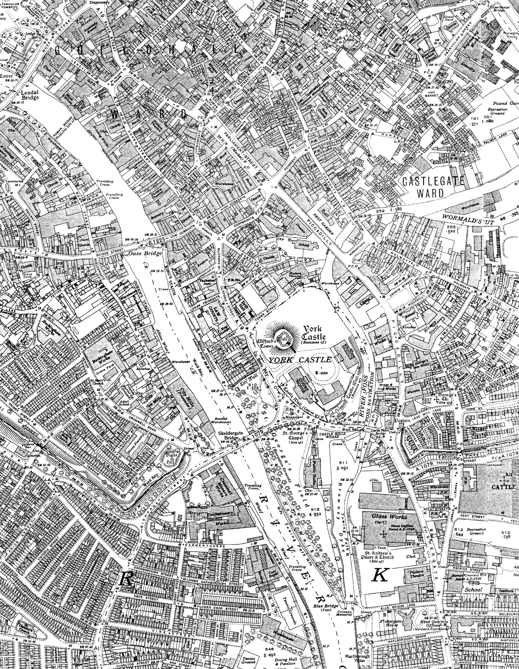
Ltd and Crown copyright 20 Dec 23, 2021 13:47 Projection:BritishNationalGrid Scale1:5000 Dig imap 21. FOR EDUCATIONAL USE ONLY. 0 40 80 120 160 200 240 280 320 360 400m Sarah Bradshaw Huddersfield University
Ltd and Crown copyright 20 Dec 23, 2021 13:47 Projection:BritishNationalGrid Scale1:5000 Dig imap 21. FOR EDUCATIONAL USE ONLY. 1960s g imap 1900s 1930s 1960s
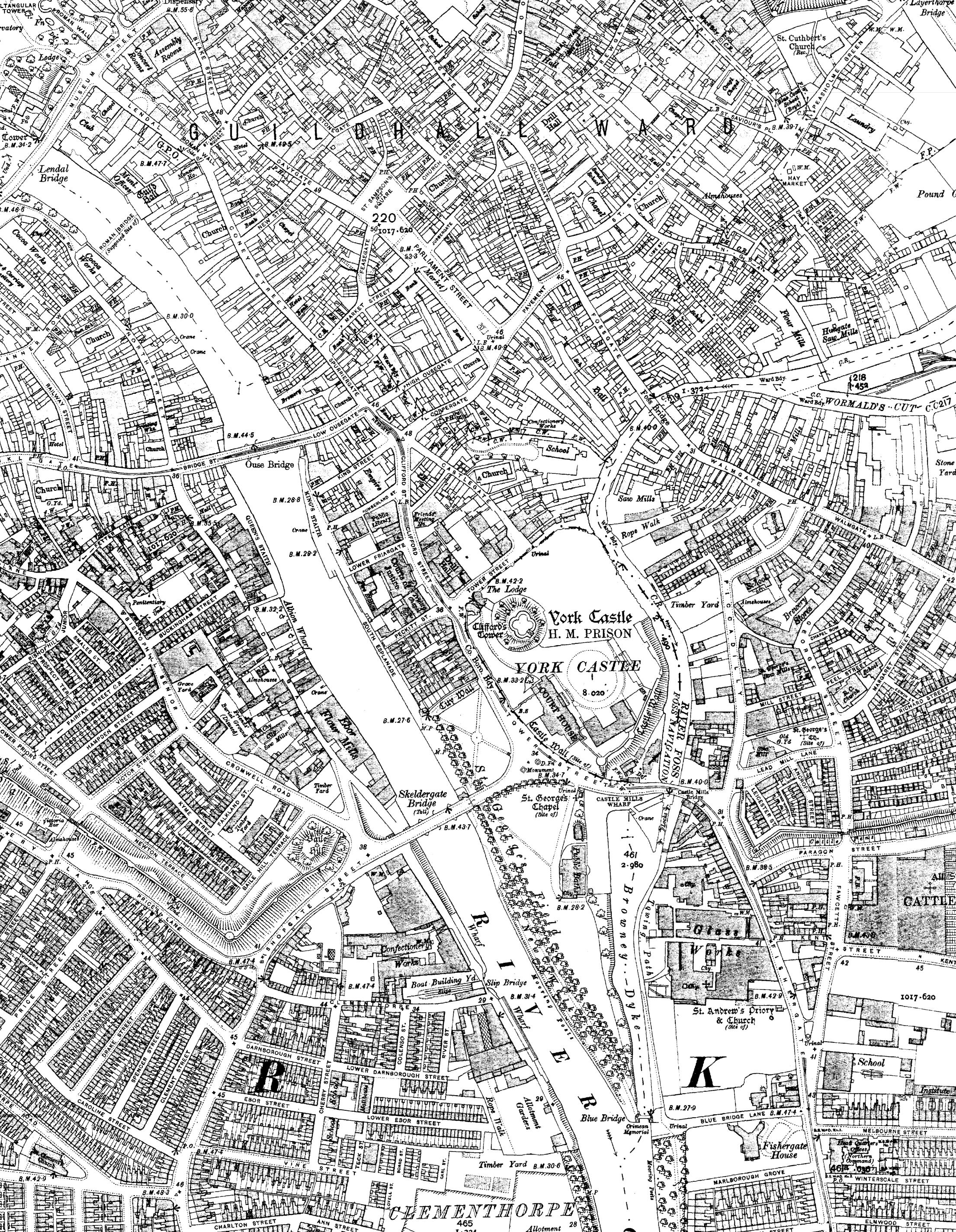
02History
Site
The 3 maps shown are 30 years apart it is clear there hasn’t been a lot of change in the last 100 years. The main features that have changed relate to the infrastructure, such as the roads and pathways. The major change can be seen be.3 tween the 1930s and 1960s maps where the car park site is not yet formed but in the 1960s map, some new buildings were built onto the site that are not there in current maps. Looking at maps from 1852 onwards the cities landscape has remained largely the same, including the river placements and flow directions. Clifford’s Tower in the past was a prison but in the modern day it is just one of Yorks many historical relics.