“Connecting nature, people, spaces.” FOODSCAPES PROTEINS COMMUNITY
Participatory Architecture of Medium Complexity
GUIDING MINDS
MSc. Urb. MAr. Diana García Cejudo
MLA. Rodrigo Pantoja Calderón
Dr. Viviana Margarita Barquero Diaz Barriga
Arq. Daniela Cruz Naranjo
Arq. Pedro Mendoza Hernández
Arq. Yetzi Tafoya
Dr. Andrea María Parga Vazquez
MSc. Miguel Anaya Díaz González
M. Arq. PhD. Gilberto Osornio
MINDS BEHIND
Ivanna De La Torre A01705624
Maria Jose Ortiz A01612250
Ximena Perez A01612204
01. 04. 05. 02. 03.
FOODSCAPES
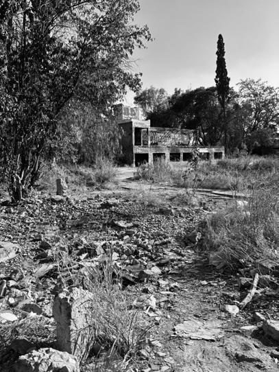
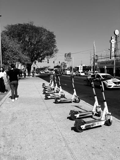
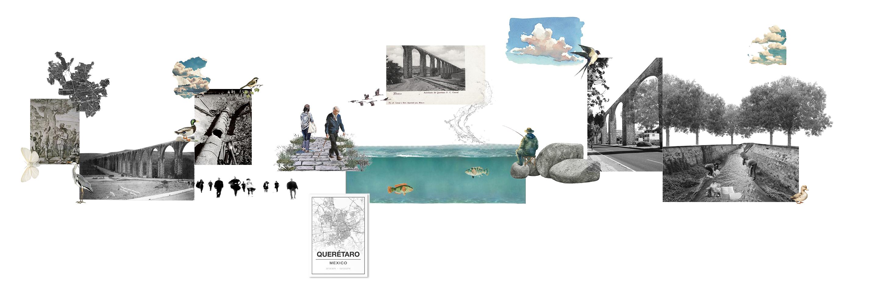
ABOUT OUR SITE
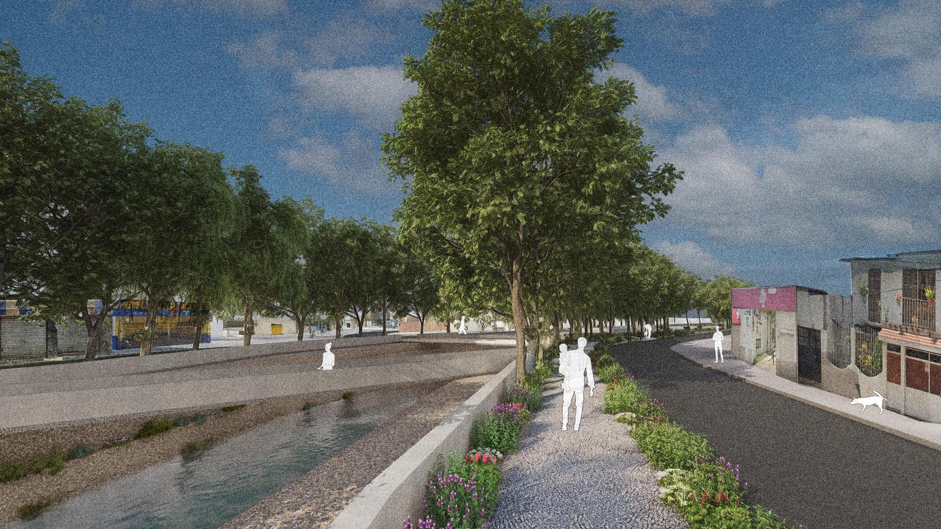
AWAKENING THE RIVER
EDIBLE FUTURES IN PUBLIC SPACE
JOINING THE KNOTS
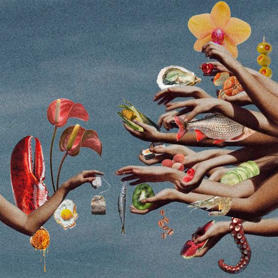
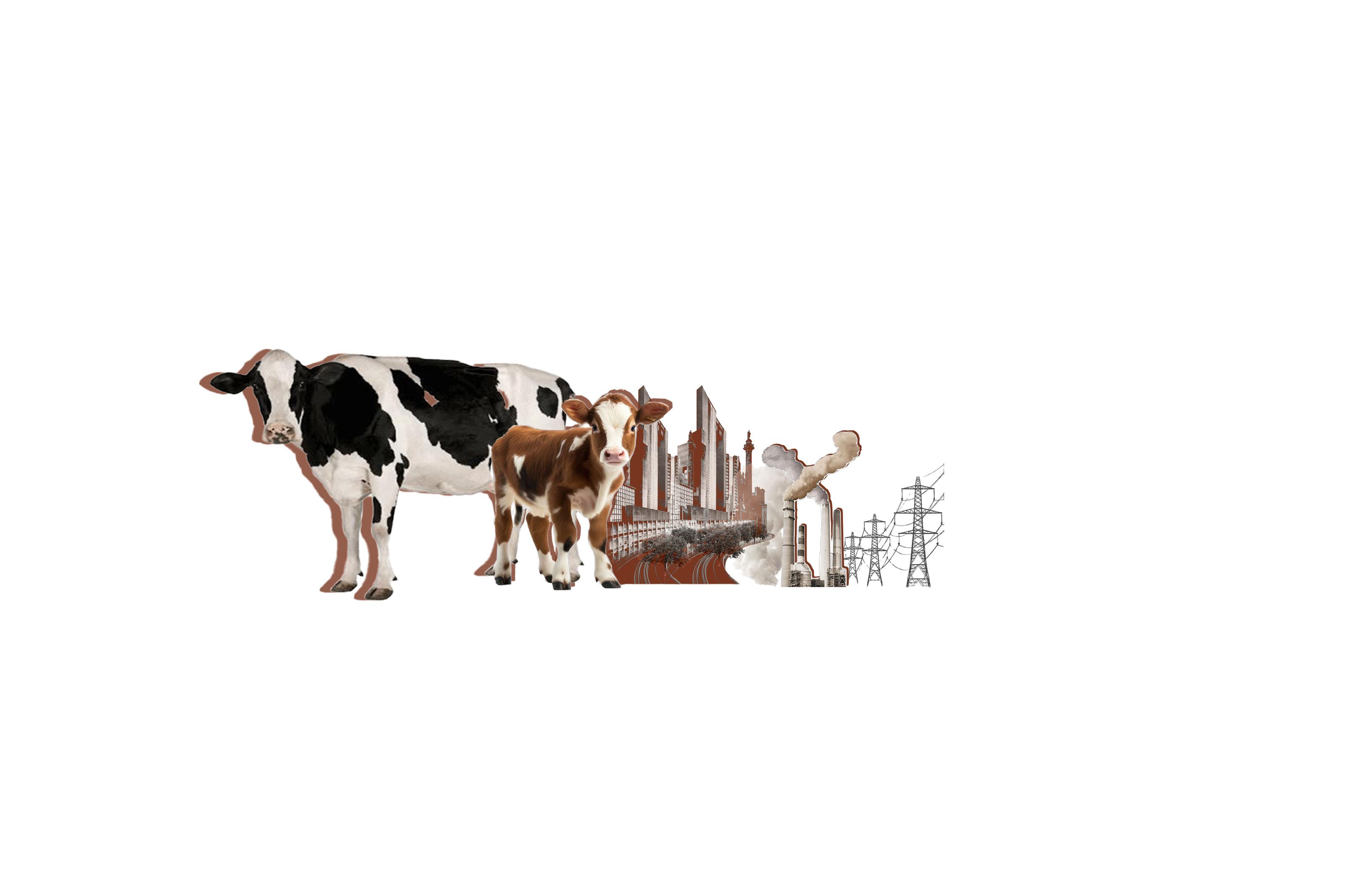
“Food is one of the key and most evident components of our identity—who we are, where we live, and where we come from. The food system is a repository of traditions and collective identity, as well as an extraordinary vehicle for self-representation and cultural exchange.
Every time we eat, we connect our plate to a multitude of distant places: supermarkets, greenhouses, farms, warehouses, logistics networks, cold chains, and landfills. Despite its immense importance, these unremarkable architectures rarely receive the attention they deserve. But in a world where the molecular becomes tectonic, and where every bite reverberates across the planet, now more than ever, we must redesign our food systems with their ecological implications in mind.
We will analyze the past and present of our food systems and the architectures that shape them, in order to look toward the future and explore alternative models—ones capable of feeding the world without devouring the planet.
FOODSCAPES
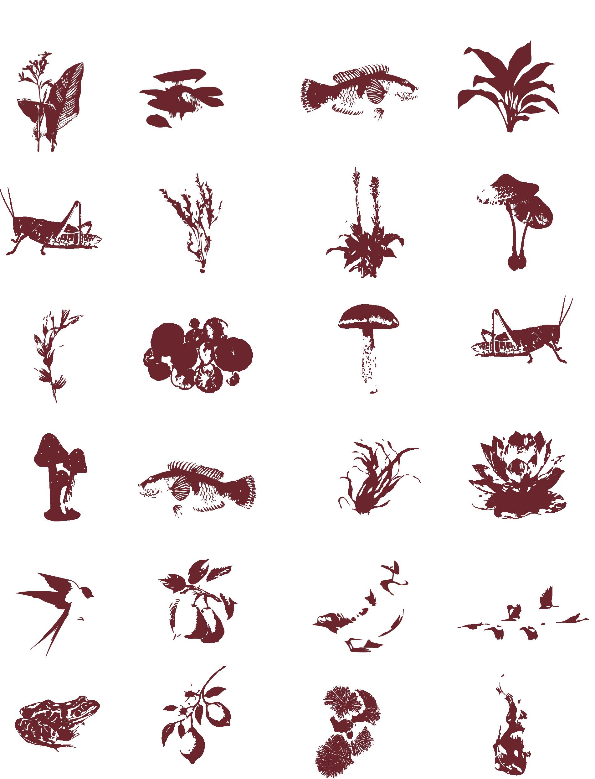
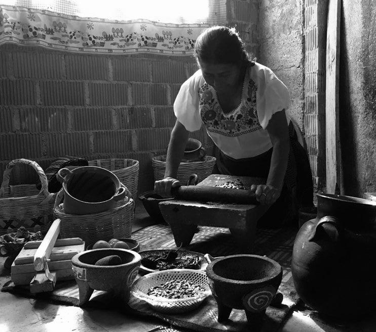
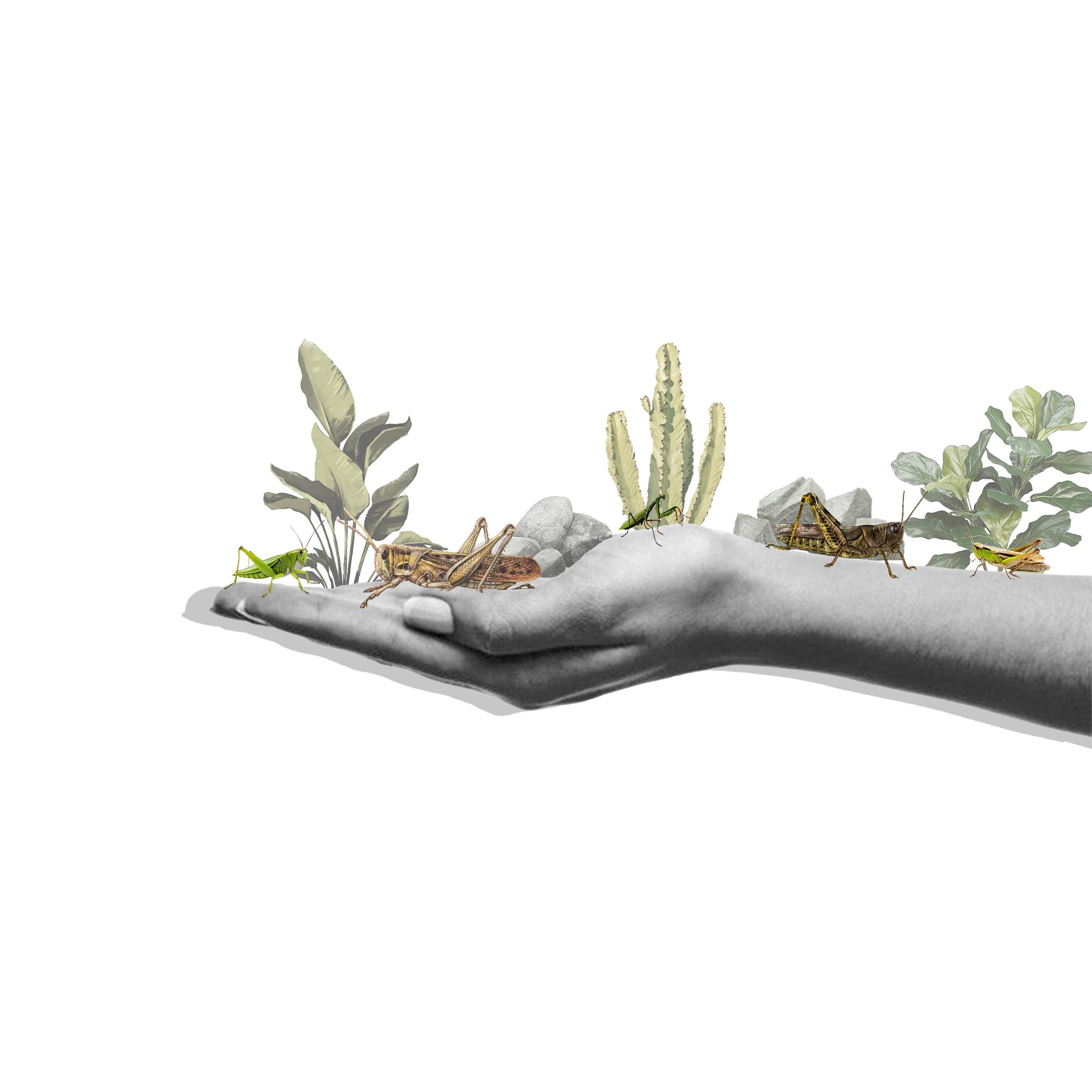
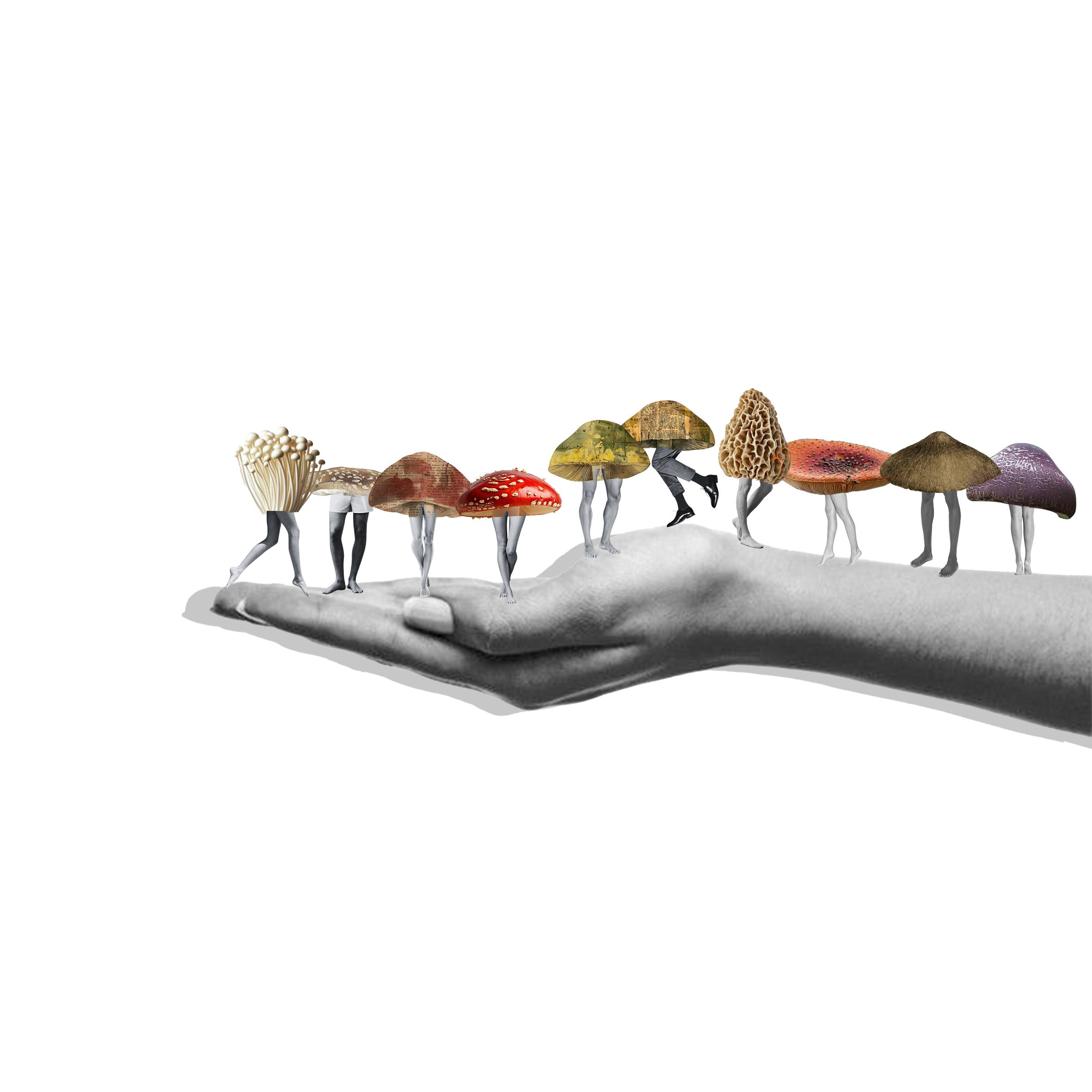
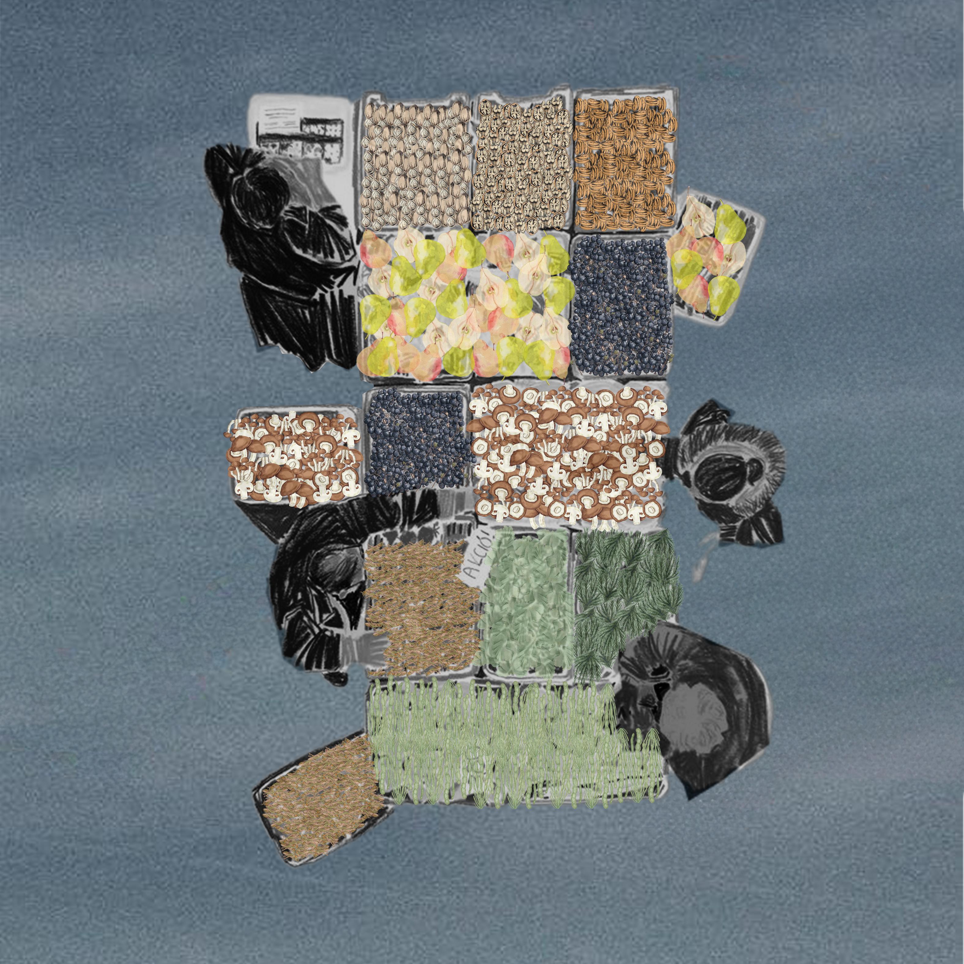
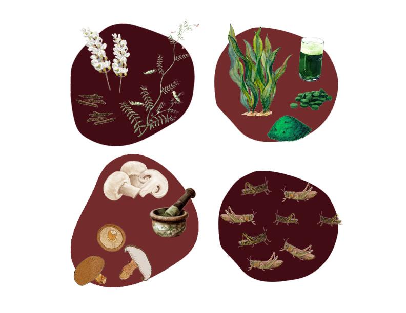
KNOT focuses on the cultivation of lentils, algae, crickets, and mushrooms, not only encouraging their direct consumption but also using them to develop clean nutritional supplements, such as adaptogens derived from mushrooms or spirulina extracted from algae.
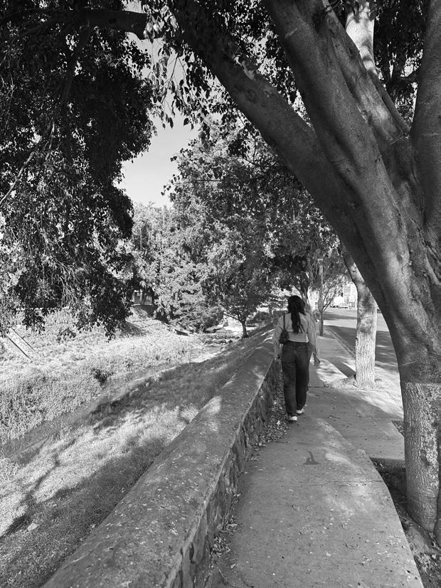
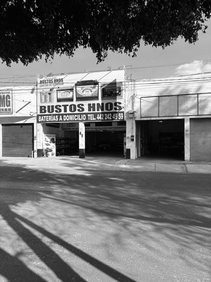
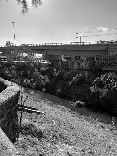
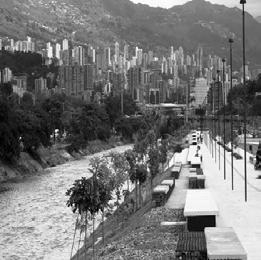
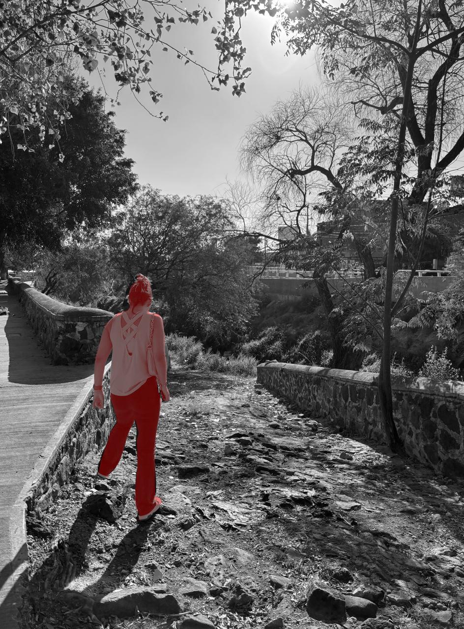
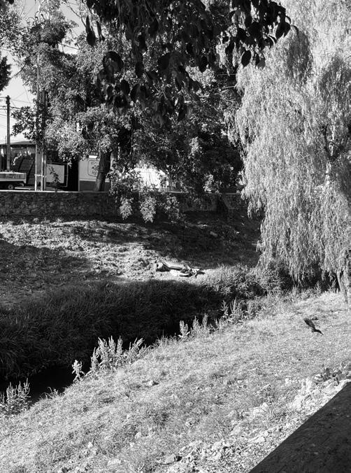
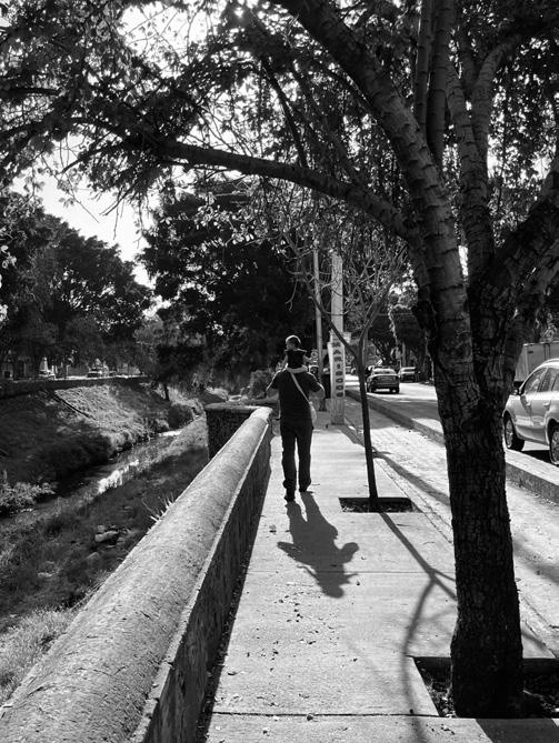
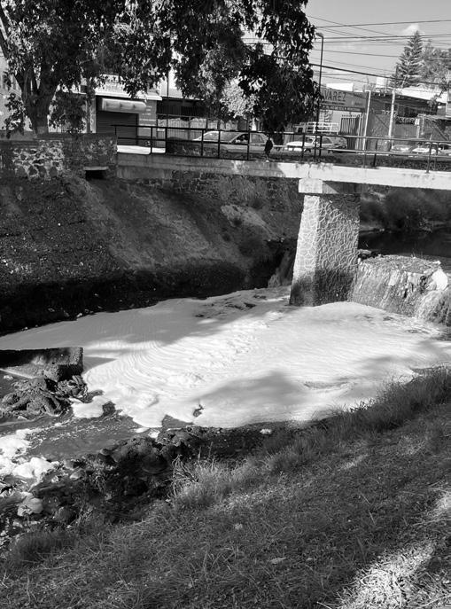
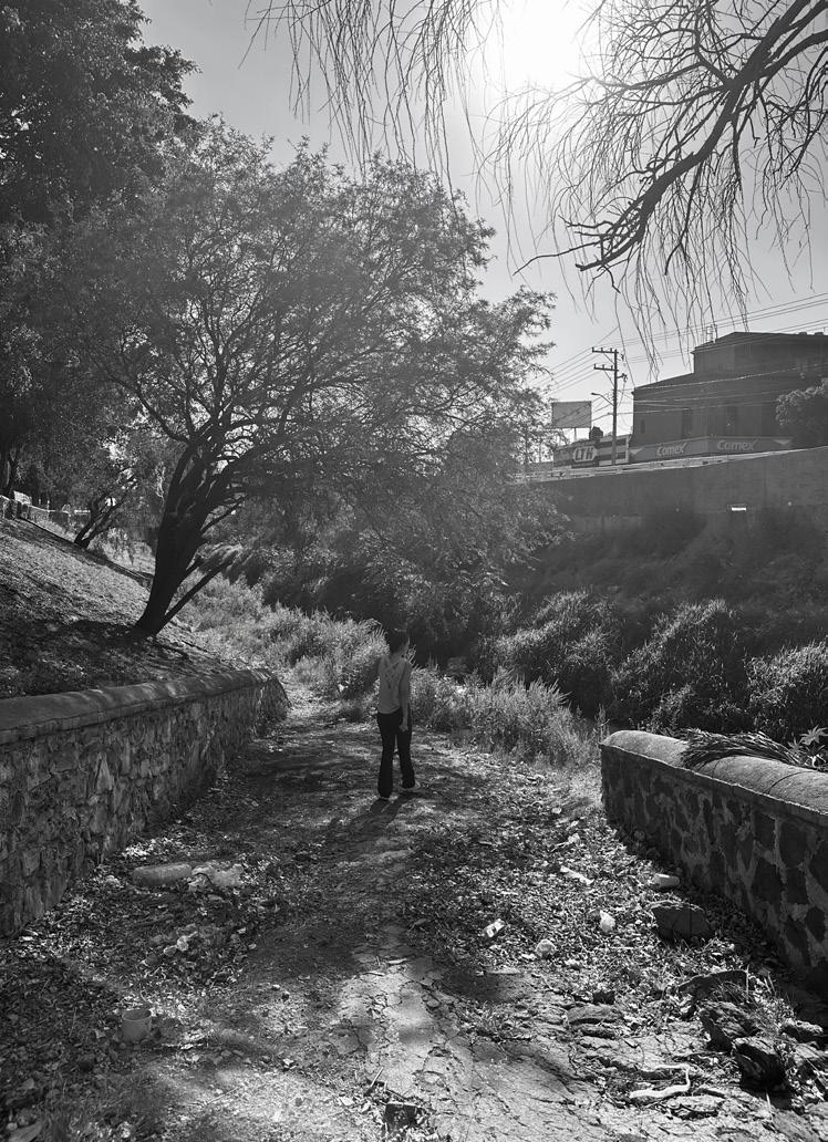
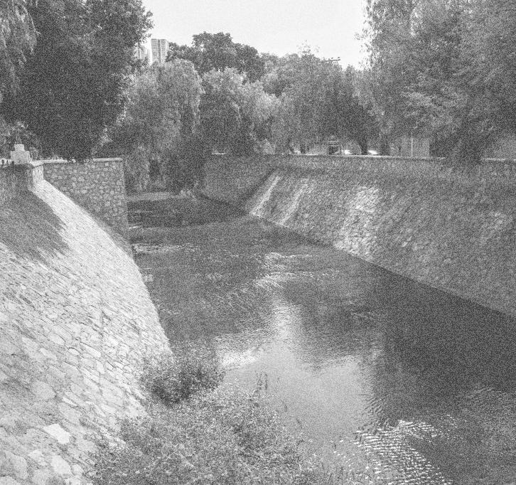
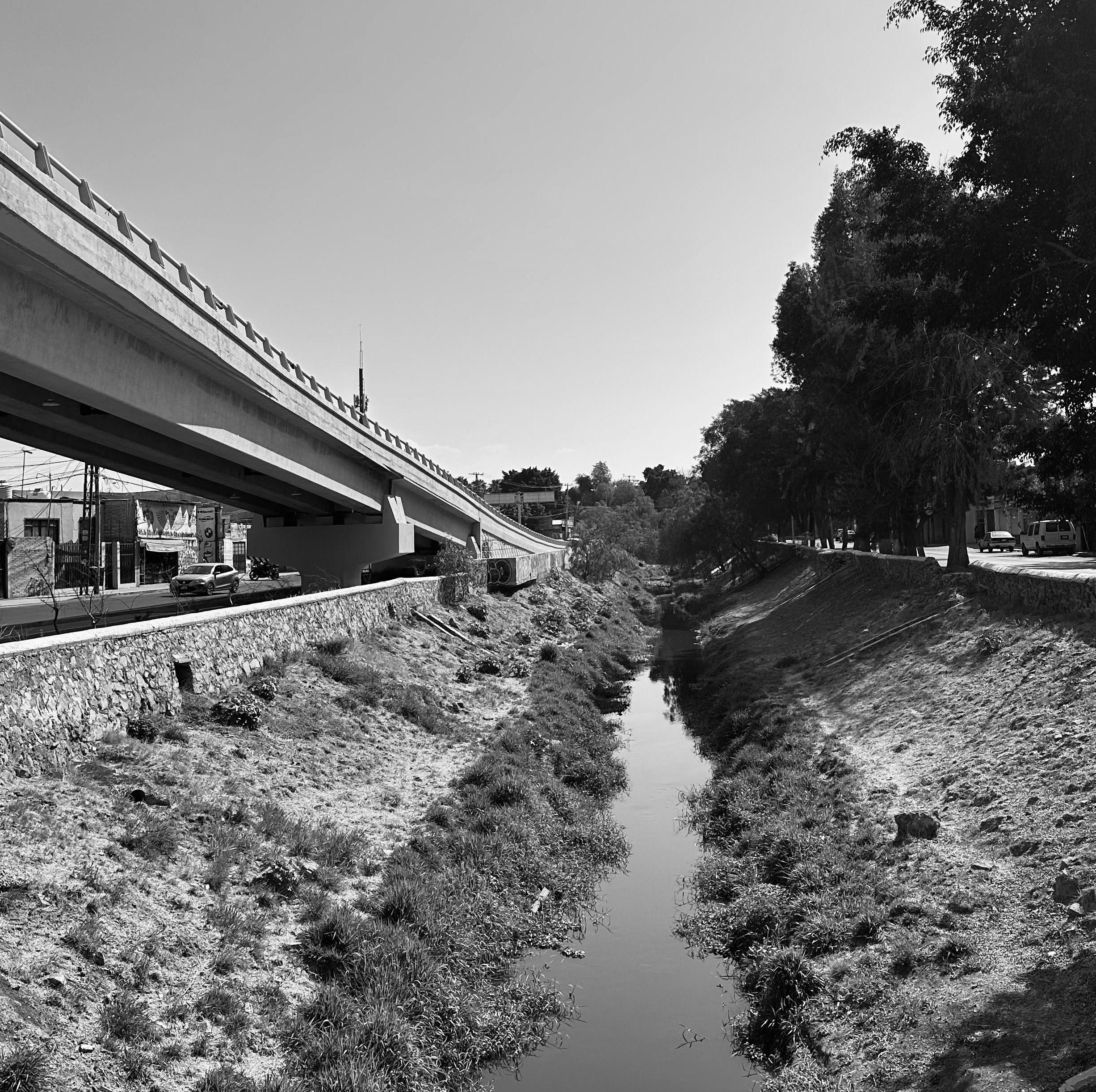
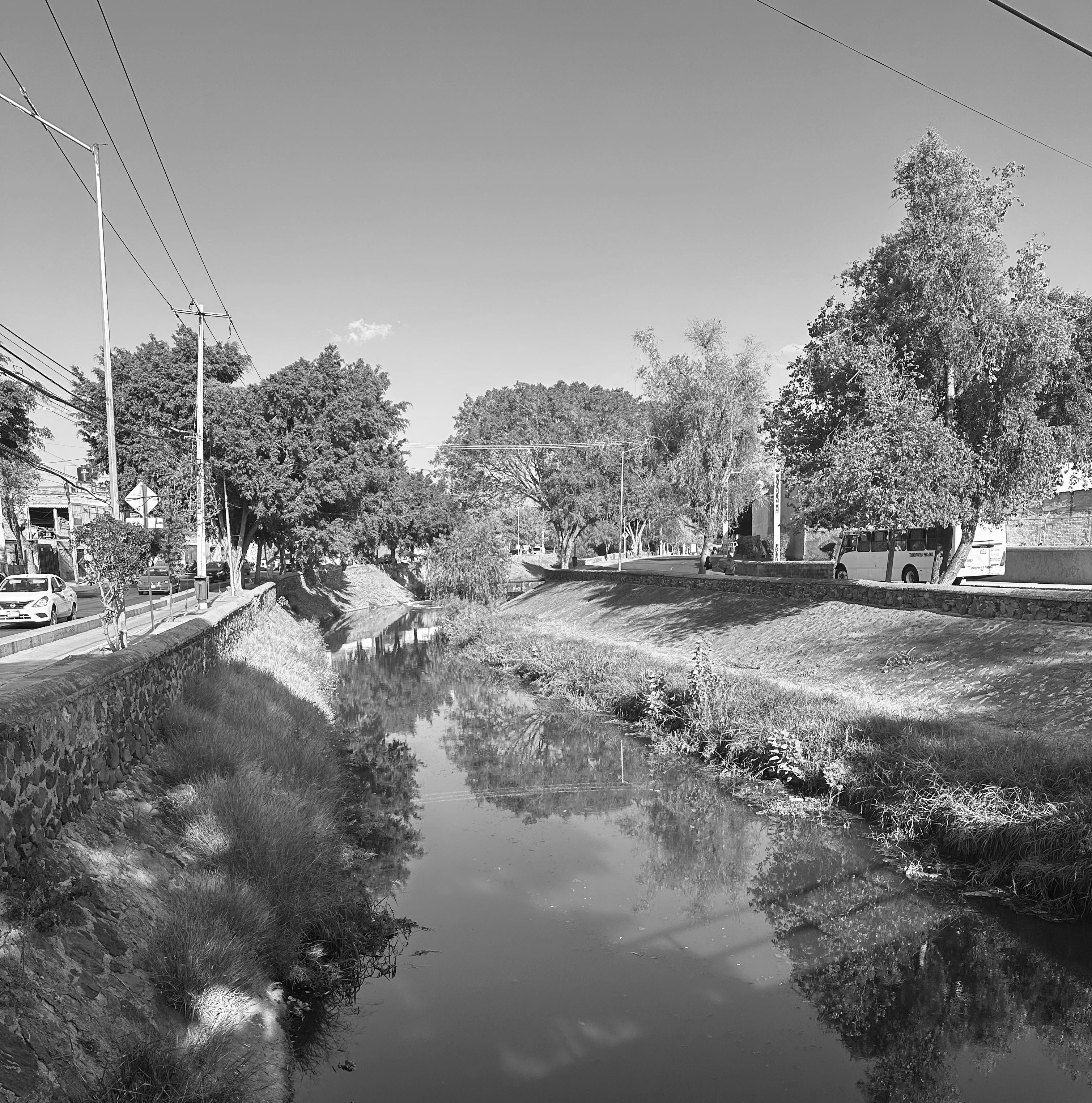
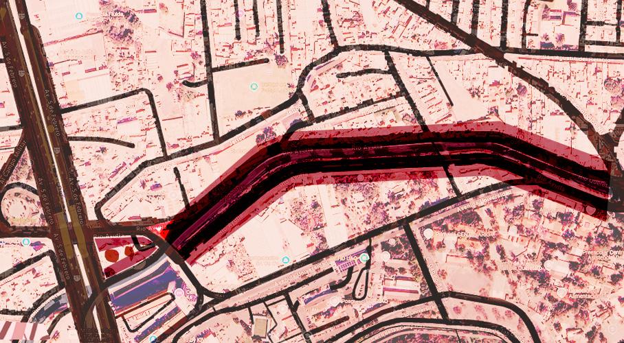
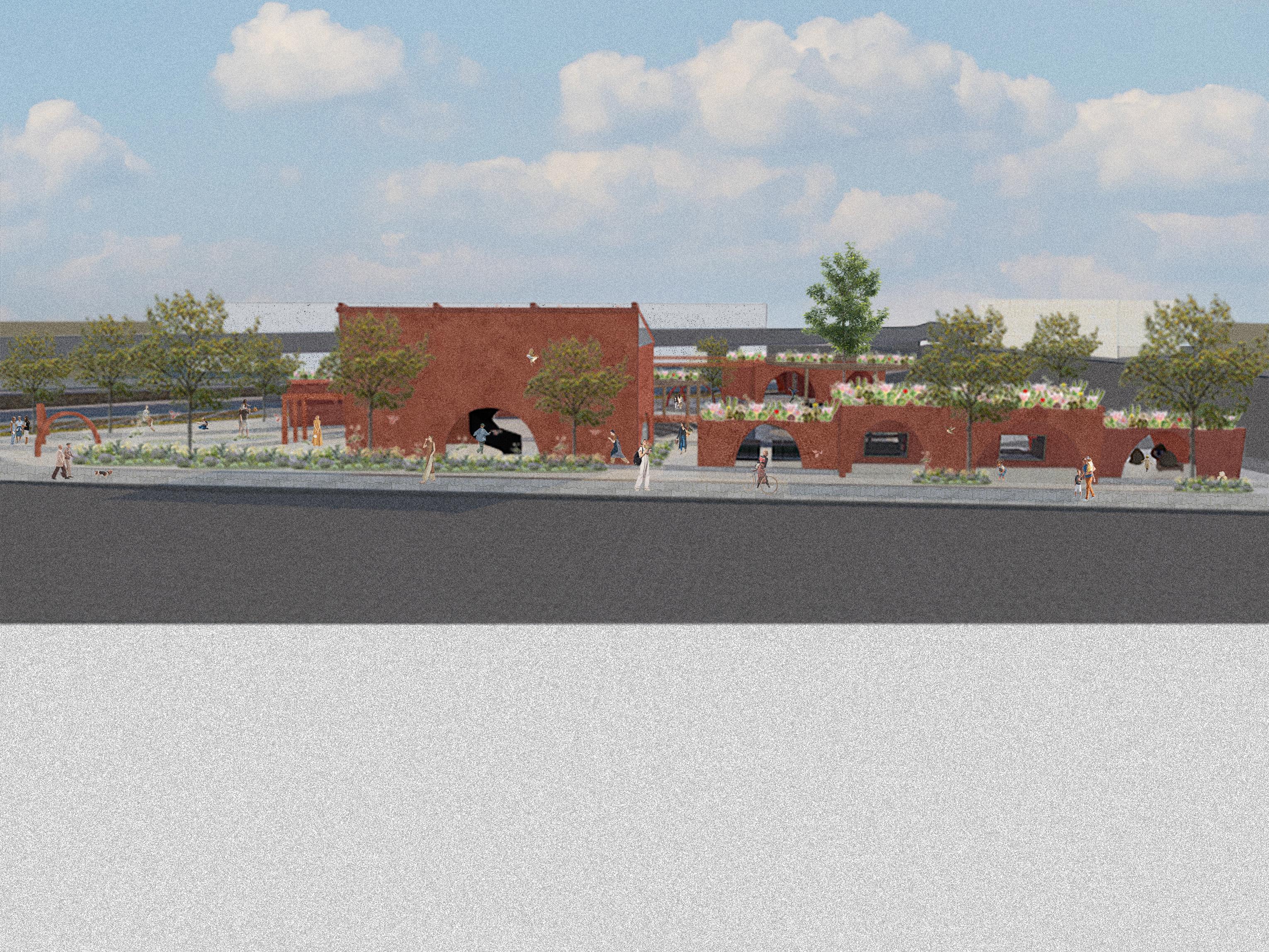
UNRENOVATED STRETCH OF RÍO AYUTLA LEADING TO THE PLAZA
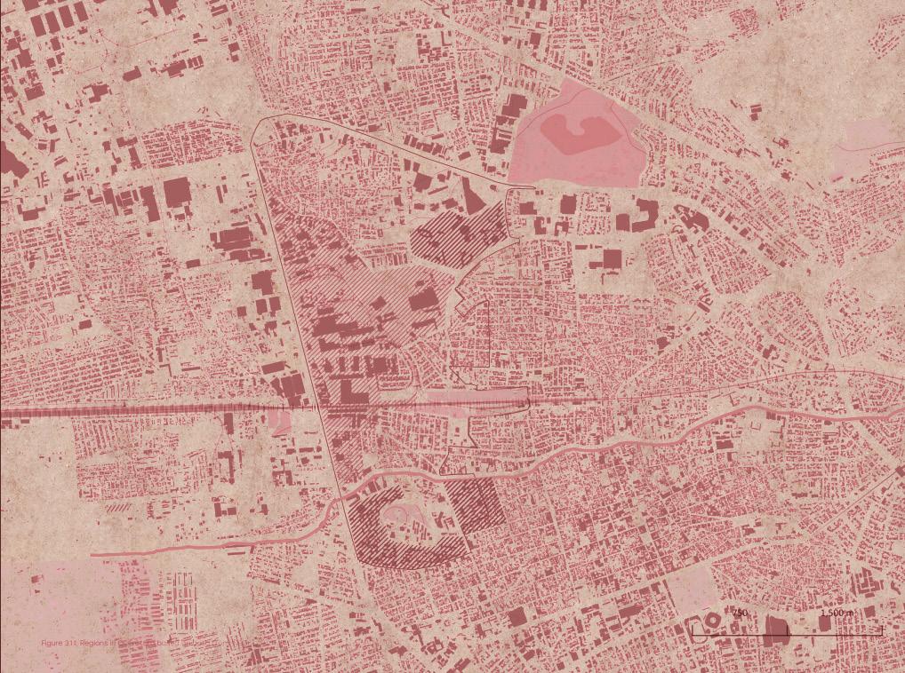
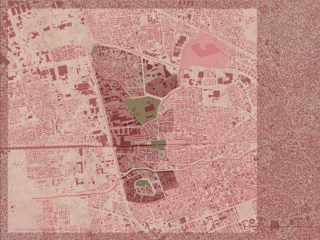
An industrial estate of approximately 100 hectares is the focus of this project. The aim is to revitalize and dignify the area, transforming it into a mixed-use, vibrant, inclusive, and sustainable environment that reflects the principles of foodscapes. DISTRITO QRO
SHIITAKE
Edible mushroom native to East Asia, known for its rich, umami flavor and meaty texture. Commonly used in Asian cuisines, it is valued for both its taste and potential health benefits, including immune-boosting properties.
SPIRULINA
Nutrient-dense blue-green algae, rich in protein, vitamins, and antioxidants. It is commonly used as a supplement for its health benefits, including boosting energy and supporting immune function.
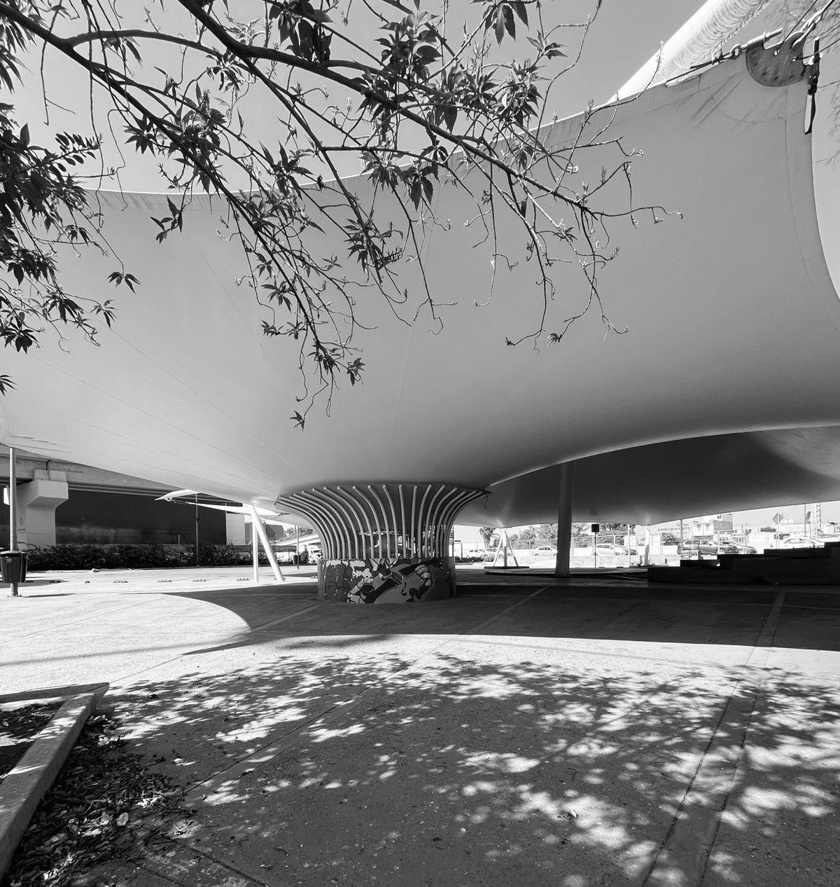
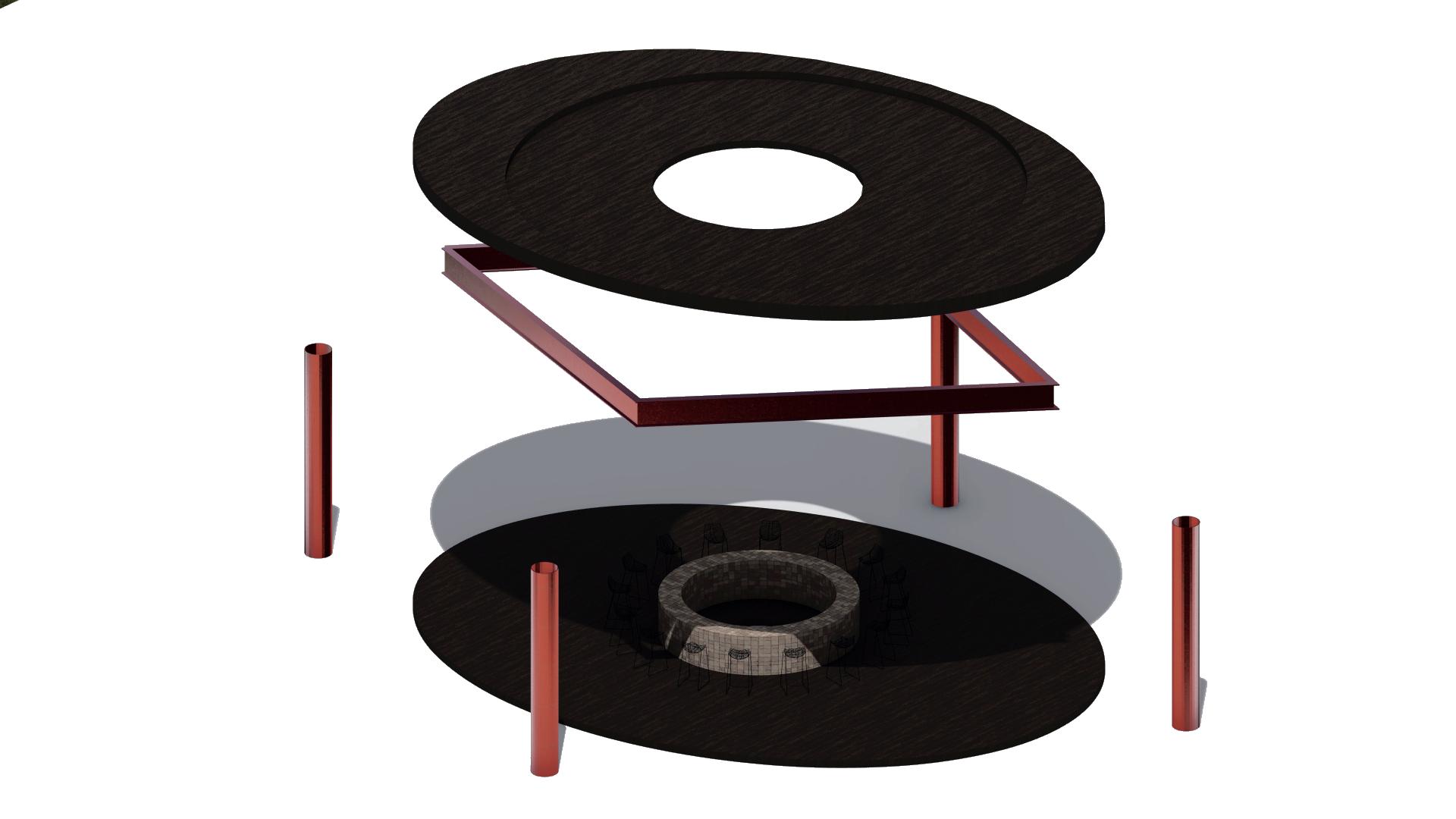
CANTILEVER
Structural element that is supported on one end while the other end extends freely without support. It is commonly used in architecture and engineering to create overhangs or projecting structures.
WATER GARDEN
Garden that incorporates water features like ponds, streams, or fountains, often used to grow aquatic plants and create a tranquil, aesthetic environment.
URBAN FOOD LANDSCAPES
Spatial organization of food production, distribution, and consumption in cities, including markets, grocery stores, gardens, and food-related spaces. They shape community interactions with food, influencing dietary habits and reflecting social, economic, and environmental dynamics.
Food environments consist of various opportunities, conditions, and factors, such as physical, economic, political, and socio cultural elements that shape the relationship between people and the food system, ultimately influencing food-related behaviors.
Ability of individuals and communities to obtain sufficient, affordable, and nutritious food consistently. It encompasses not only the physical availability of food sources but also economic, social, and cultural factors that influence people’s capacity to acquire healthy food. Ensuring food accessibility is essential for promoting food security, reducing inequalities, and supporting overall public health.
Geographic area where residents have limited access to affordable, nutritious food, particularly fresh fruits and vegetables. These areas are often found in low-income neighborhoods, where there are few grocery stores, farmers’ markets, or healthy food providers.
FOOD OASIS
Community with easy access to affordable, nutritious food, and many grocery stores.
FOOD SWAMPS
Neighborhood where unhealthy food options, like fast food and convenience stores, outnumber access to fresh and nutritious foods.
FOOD SECURITY
A catchall term for the level of accessibility to fresh, healthy, nutritious food for a person, family, or community. The United Nations Food and Agriculture Organization’s most current definition of food security is when “all people, at all times, have physical, social and economic access to sufficient, safe and nutritious food which meets their dietary needs and food preferences for an active and healthy life”.
PLAZA MARIACHI
THE WAY WE EAT IS CHANGING AAAA—
NO LONGER JUST AT THE TABLE, BUT IN THE SPACES WE SHAPE, THE STORIES AAAA WE SHARE, AND THE LANDSCAPES WE GROW. FOODSCAPES ARE THE FUTURE — AAAA WHERE FOOD MEETS PLACE, AND PLACE FEEDS US BACK AAAA.
WHAT IS FOODSCAPES?
Foodscapes are defined as the spaces and systems where food is produced, distributed, prepared, and consumed. These include farms, markets, restaurants, and waste management facilities. These foodscapes reflect a variety of cultural traditions, social interactions, economic and political influences, such as policies and accessibility. Additionally, foodscapes impact the environment through agriculture, waste, and sustainability efforts. Regardless of scale, foodscapes shape communities’ relationships with food and are crucial for urban planning, sustainability, and public health.
WHAT IS FOODMILES?
Denote the distance that food products travel from their point of origin to the point of consumption. This concept is used to assess the environmental impact associated with the transportation of food, particularly regarding greenhouse gas emissions, fossil fuel consumption, and broader sustainability concerns. A reduction in food miles is often advocated as a strategy to mitigate environmental degradation, enhance local economies, and promote more resilient and sustainable food systems.
Houtan Park
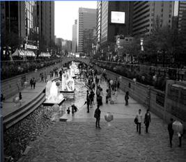
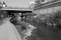
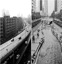
The Cheonggyecheon Stream Restoration Project in Seoul, South Korea, transformed a buried and forgotten waterway into a vibrant linear park. It is an intermittent river, meaning it doesn’t carry water year-round, yet it became an ecological corridor that enhances biodiversity, reduces urban heat, and offers a public space that reconnects the city with its natural landscape and cultural history.
Location: Shanghai, China
Architects: Turenscape Date: 2009
Cheonggyecheon Stream Restoration
The Houtan Park, located on a former industrial site along the Huangpu River in Shanghai, is an ecological regeneration project. It incorporates constructed wetlands, flood control, recovered industrial structures and materials, along with urban agriculture. Its design aims to restore the degraded riverfront, treat the contaminated river water, and create an aesthetically pleasing and functional landscape.
Location: Seoul, South Korea
Architects: Led by Mikyoung Kim DesignArchDaily+3RTF | Rethinking The Future Date: 2002–2005
CASE STUDIES
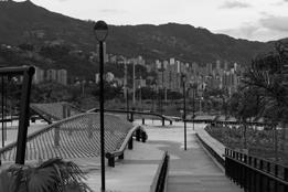
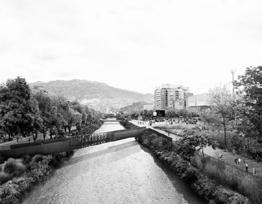
Restoration of the Medellin River
The Medellín River is being restored through sanitation, green infrastructure, flood control, reforestation, and environmental monitoring. Wastewater treatment plants have been built, parks like Parques del Río have been developed, and efforts are being made to reduce pollution. Despite progress, challenges like urban growth and residual contamination remain.
Location: Medellin, Colombia
Architects: Alejandro Echeverri with his team Latitud Taller Date: 2014-2016
WATER CONSUME IN MEXICO
MAJOR USERS OF POTABLE WATER
“While rivers run dry and communities face scarcity, vast amounts of water continue to flow silently toward large-scale agriculture, livestock, and industry — reminding us that water is not just a natural resource, but a mirror of our priorities, our economy, and our collective responsibility.”
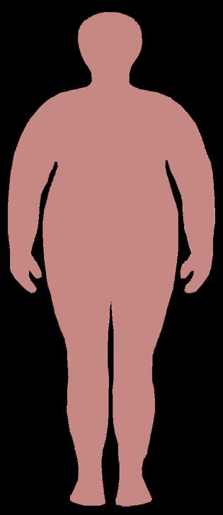
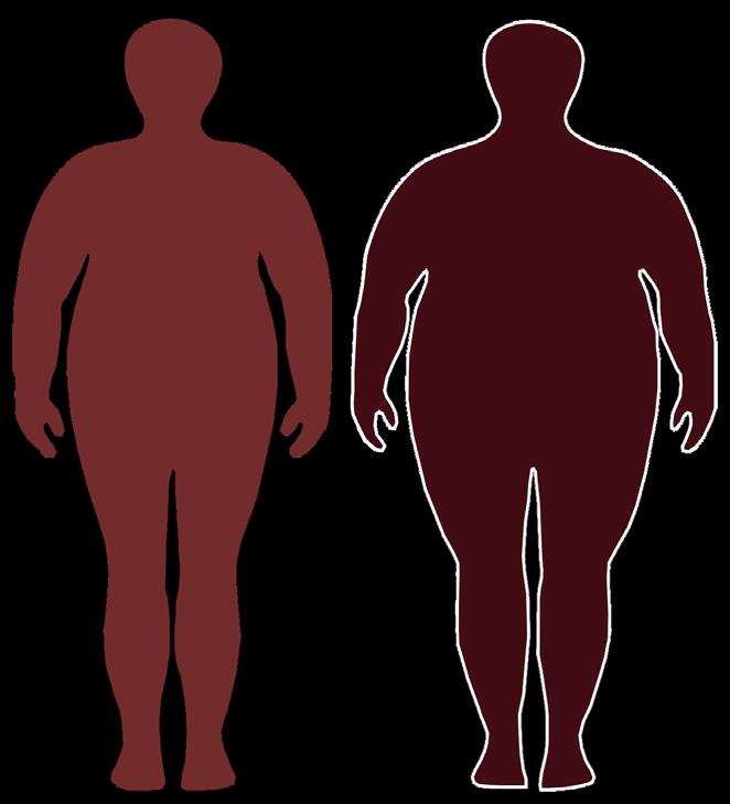
OBESITY RATE IN MEXICO
Increase of obesity and overweight in Mexico (Total population)
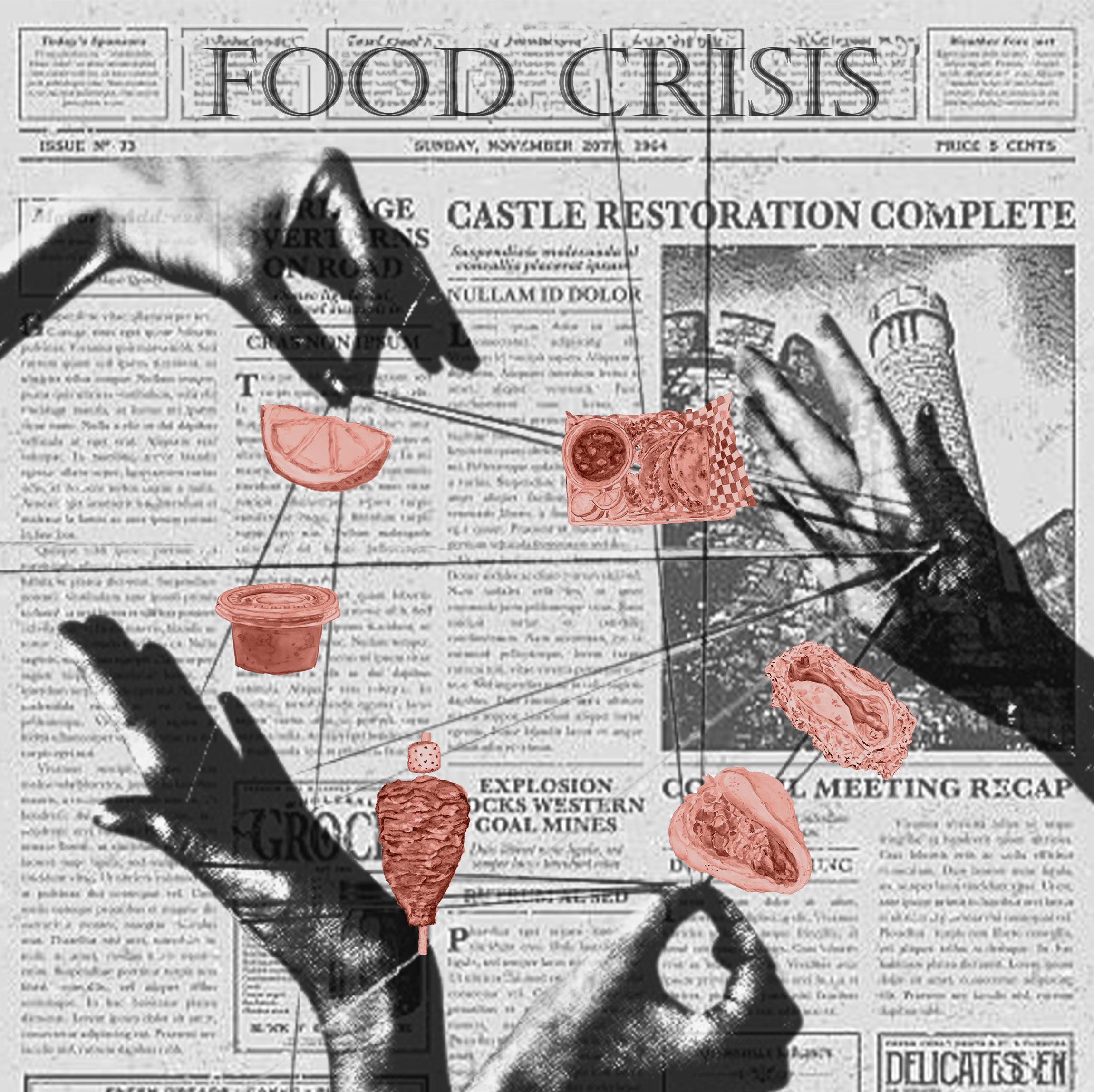
In recent years, obesity in Mexico has increased alarmingly. Data from the 2018–2019 National Health and Nutrition Survey (ENSANUT) by INEGI shows that 75.2% of adults and 38.5% of adolescents are overweight or obese. One of the main causes is the shift in eating habits: the growing consumption of fast food, ultra-processed products, and sugary drinks has displaced the traditional Mexican diet. This trend has also contributed to a rise in diseases such as diabetes and hypertension, making it urgent to promote healthier eating.
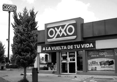
THE PARADOX OF FOOD IN MEXICO
Convenience stores such as OXXO, 7-Eleven, and others represent a significant challenge in today’s society. While they offer cheap and easily accessible food, much of what they provide has low nutritional value. This widespread availability of unhealthy food options contributes to the obesogenic environment — an environment that promotes obesity — and deepens public health risks. Although these stores fulfill the need for convenience, they simultaneously undermine efforts to build a healthier and more sustainable food culture in Mexico.Mendebis excessi iditio. Et expelibus arum facesto tem eniendamet qui dolum ea excerciet quae.
IMPACT OF MODERN FOOD CONSUMPTION
Nowadays, food consumption has drifted far from what it used to be in the past. As a result, new diseases and different habits have emerged, affecting not only humans but also the planet. Overconsumption and the environmental footprint left behind by the production and easy accessibility of daily food products have put both our health and the environment at risk.
Our lives today have become rushed, leaving behind the custom of taking time to prepare, consume fresh and nutritious foods, and pause to enjoy a meal. This shift has also contributed to the increasing centralization of cities.
WHAT IS THE PROBLEM?
LARGE AMOUNTS OF WATER
HEALTH ISSUES
ENORMOUS LAND USE
HEALTH ISSUES
WATER SCARCITY
REDUCING BIODIVERSITY
GREENHOUSE EMITIONS
PLASTIC POLLUTION
SOIL DEGRADATION
DEFORESTATION
The Metropolitan Area of Querétaro is one of Mexico’s main urban centers. It maintains close ties with other metropolitan areas, such as Guadalajara, Mexico City, León, and San Luis Potosí, due to their geographical proximity and the economic and social integration that define the Bajío region. These cities share similar patterns of urban growth, industrialization, and infrastructure development, further strengthening their interconnection. Urbanization within a state does not occur in isolation; rather, it is shaped by the growth and development of its major cities and their connections with surrounding urban centers.
INTRODUCTION
General analysis and project connection with foodscapes
KNOT is about breaking the taboo and raising awareness of everything behind having a piece of meat or chicken on your plate — something that, in the future, may no longer be possible due to the lifestyle we lead today. Our goal is to create consciousness around the alternative proteins that humans could consume in a cleaner way, with a reduced carbon footprint, and offering the same or even higher levels of protein compared to traditional sources. We also seek to bring back the cultural value of food production, much like it was in the past.
BETWEEN SCALES
DIAGRAM OF RELATION WITH THE MANIFESTO
STRATEGY #1
Creation of regenerative green public spaces from an interspecies coexistence perspective using urban voids
STRATEGY #2
Contributing to agricultural sustainability by designing infrastructures that reduce water consumption
STRATEGY #4
Designing environments that promote healthy eating by offering fresh and local food
STRATEGY #7
Reusing underutilized infrastructure to create circular economy strategies by reactivating public life
STRATEGY #11
Raising awareness about consumption through food sovereignty, highlighting production processes and water use for a cultural shift
STRATEGY #12
Fostering care in cities through urban innovation, encouraging self-care as a step toward community care
STRATEGY #14
Reducing dependence on centralized water systems by integrating rainwater harvesting, treatment, and storage at community production sites
3. CITIES THAT HEAL: DESIGN FOR LIFE, NOT EXPLOITATION
5. WATER IS LIFE: FOR ALL, NO EXCEPTIONS
6. FOOD FOR ALL: NOUTRITIOUS, AFFORDABLE, NON-NEGOTIABLE
7. SAVOR THE MOMENT: SHARE AND LIVE CONSCIOUSLY
8. CLOSE THE LOOP: WASTE LESS, SUPPORT LOCAL, BUILD RESILIENCE
ABOUT OUR SITE
IN THE TAPESTRY OF TOMORROW, ALTERNATIVE PROTEINS WITHIN FOODSCAPES
NOURISH NOT ONLY OUR BODIES, BUT ALSO OUR PLANET, FORGING
A SUSTAINABLE PATH FORWARD.
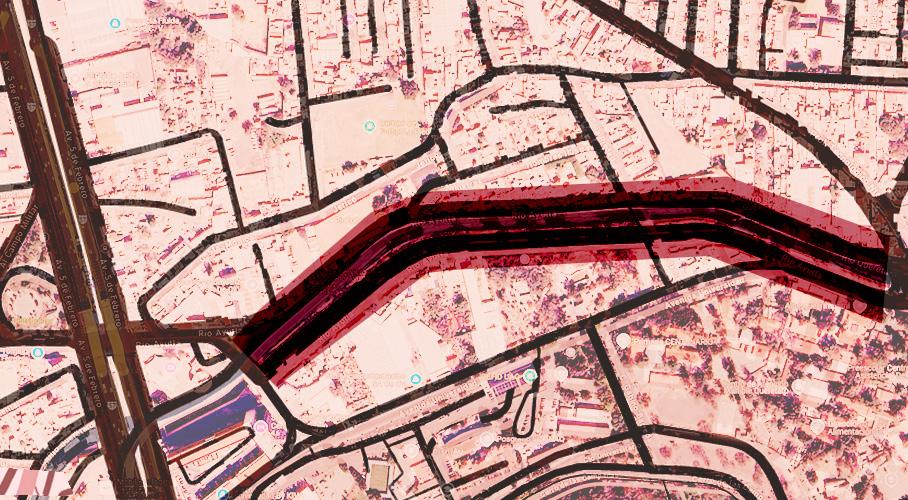
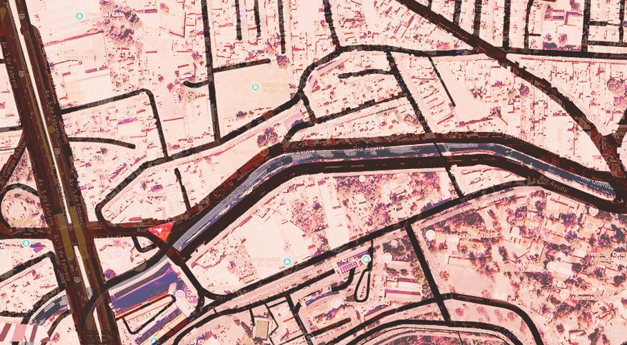
WHERE ARE WE?
We conducted a series of interviews to gather real-time insights into the daily actions, routines, and experiences of people who live, work, or spend time in the area. These conversations allowed us to better understand the community’s dynamics, needs, and interactions within the site.
THOSE WHO USE
U S E R S
Students from nearby schools and universities.
Owners or workers of businesses established along the river.
People in charge of cleaning, maintenance, or surveillance of the space.
River fauna and vegetation.
People who pass through the area daily to go to work, study, or run errands.
People who live near the river
People who work in industries, workshops, or factories near the river.
People who do not have homes, many of them live by the river or in nearby land.
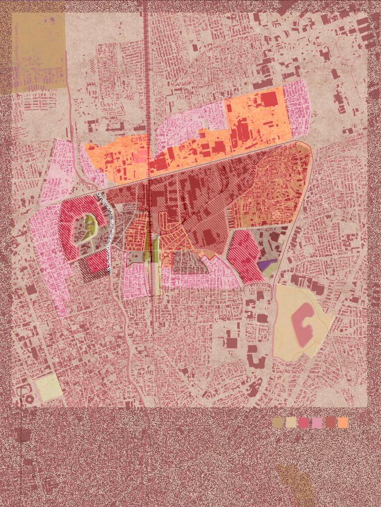
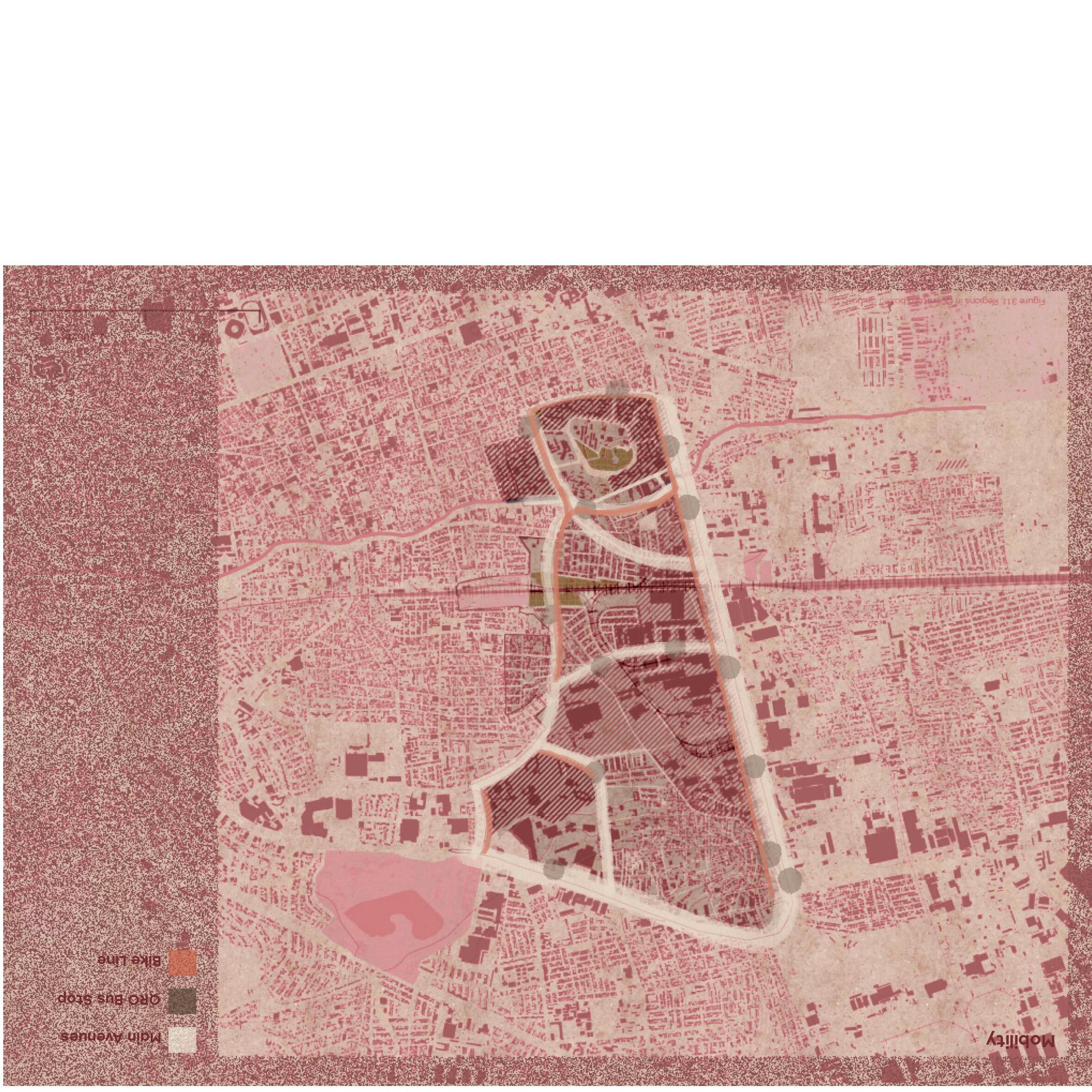
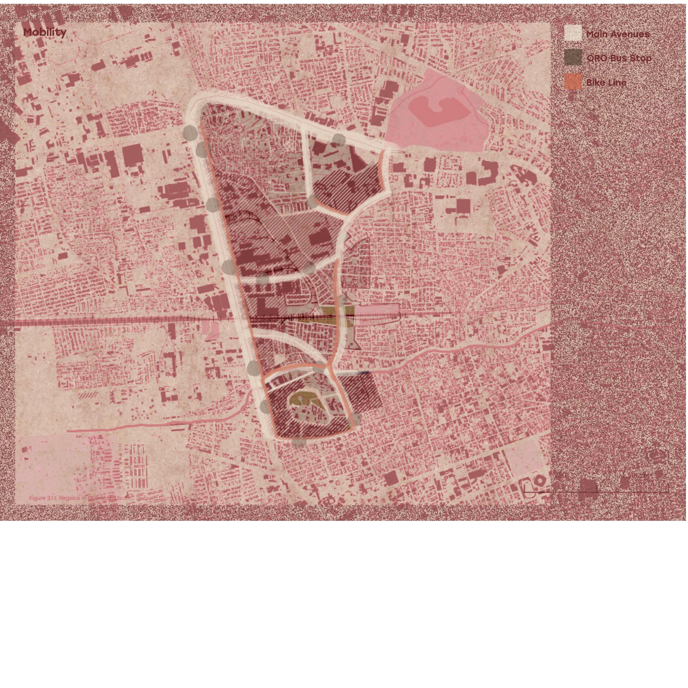
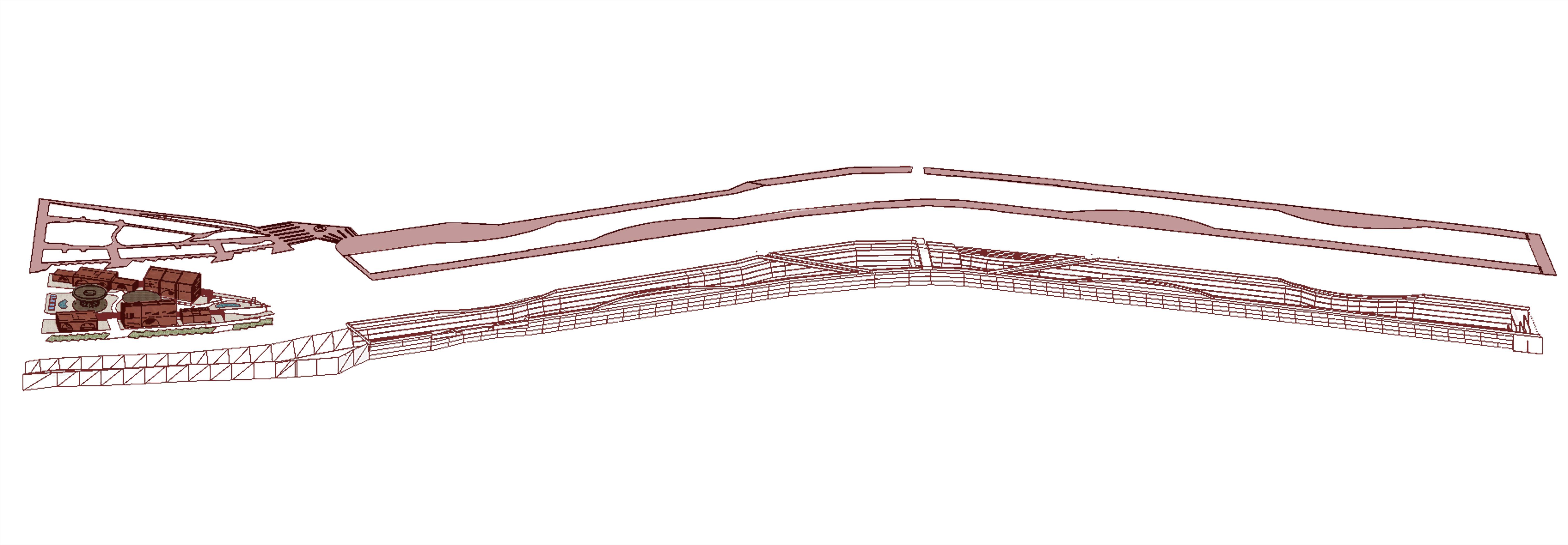
SITE BREAKDOWN
Main Passage
Secondary Passage
Student Mobility
CONNECTIONS
High Traffic & Noise Pollution
Moderate Traffic & Noise Pollution
MAIN AVENUES TRAFFIC
Residental
Commercial Areas
Educational and Religious Area
BUILDING USAGE
Body of Water
Green Areas
Built Green and Water Bodies
The site diagram offers a comprehensive spatial analysis that highlights the dynamic interplay of natural and built elements. It traces the movement of the sun throughout the day, revealing how sunlight interacts with different areas, influencing microclimates and shading patterns. The diagram also maps the main avenues that structure urban mobility, showing the primary corridors for vehicular and pedestrian flow. Green spaces and water bodies are carefully identified, emphasizing their role as ecological lungs and recreational zones within the urban fabric. Additionally, the traffic flow is illustrated to understand congestion points and circulation efficiency, while the usage of buildings is categorized to reveal the functional distribution—residential, commercial, institutional, and mixed-use—providing insight into the social and economic activities shaping the site’s character.
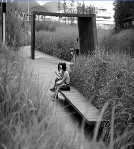
Pedestrian path
MATERIAL INSIGHTS
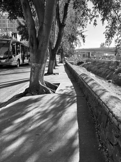
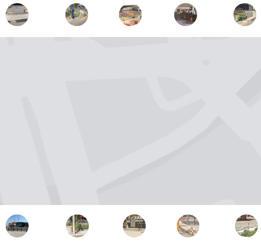
During the site analysis, we observed the presence of various materials in the surrounding area, many of which are worn and in need of maintenance. We also noted a high degree of heterogeneity in the façades of nearby houses and buildings, both in style and scale, which results in a fragmented urban image. Additionally, traffic flow on the surrounding avenues varies significantly, affecting the site’s dynamics. Another important observation was the evident lack of social cohesion within the local community, a factor we consider crucial and in need of attention in order to promote greater neighborhood integration.
FLOW OF TIME
The purity of the river also began to be altered when the first Spanish settlements were authorized in 1531.
The river's name was changed in 1852; it was previously called Río Blanco (White River) due to its purity.
In 1654, a distribution of water was carried out through the "main ditch" (zanja madre).
A shortage of people cleaning the river becomes noticeable, especially as it starts to overflow or show signs of pollution.
In 1980, two dams—El Carmen and Los Pirules—were built, which affected the Querétaro River.
It is said that in 1680, ducks, herons, and various bird species could be found, and people could even fish in the river.
The river began to lose its clarity in 1551; it originated in the community of Atongo, in the municipality.
Since 1995, a foul odor has taken over the areas around the river, and a cloud of steam has formed.
From 1933 to 1980, it was still possible to see a clean river flowing.
In 2011, the urban project of Ezequiel Montes began, heading toward Bernardo Quintana. The project called "Urban Regeneration of Avenida Universidad" was developed.
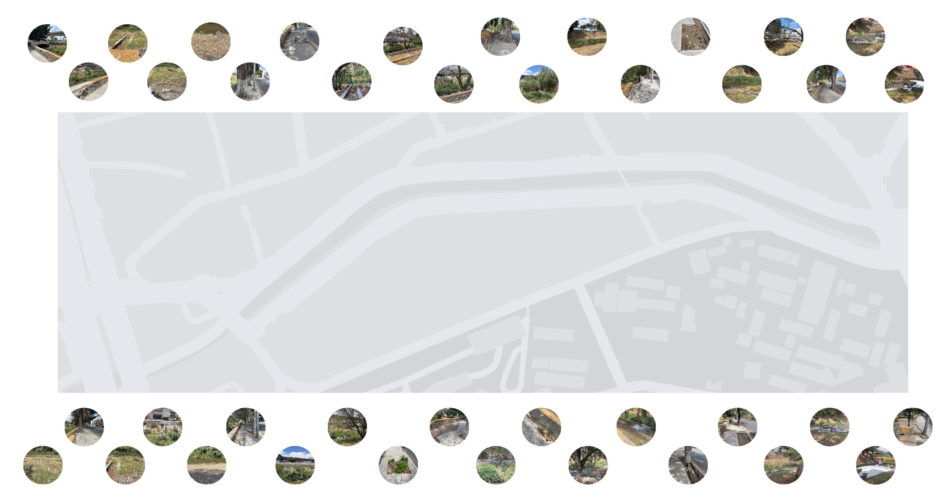
CRITICAL LAYERS
A T I C A A C T U A L P R E D I O
OTROS
BANQUETA CON IRREGULARIDADES
DESAGUE OBSTRUIDO
BANQUETA OBSTRUIDA
BASURA
BANQUETA CON IRREGULARIDADES
OTROS
DESAGUE OBSTRUIDO
BANQUETA OBSTRUIDA
BASURA
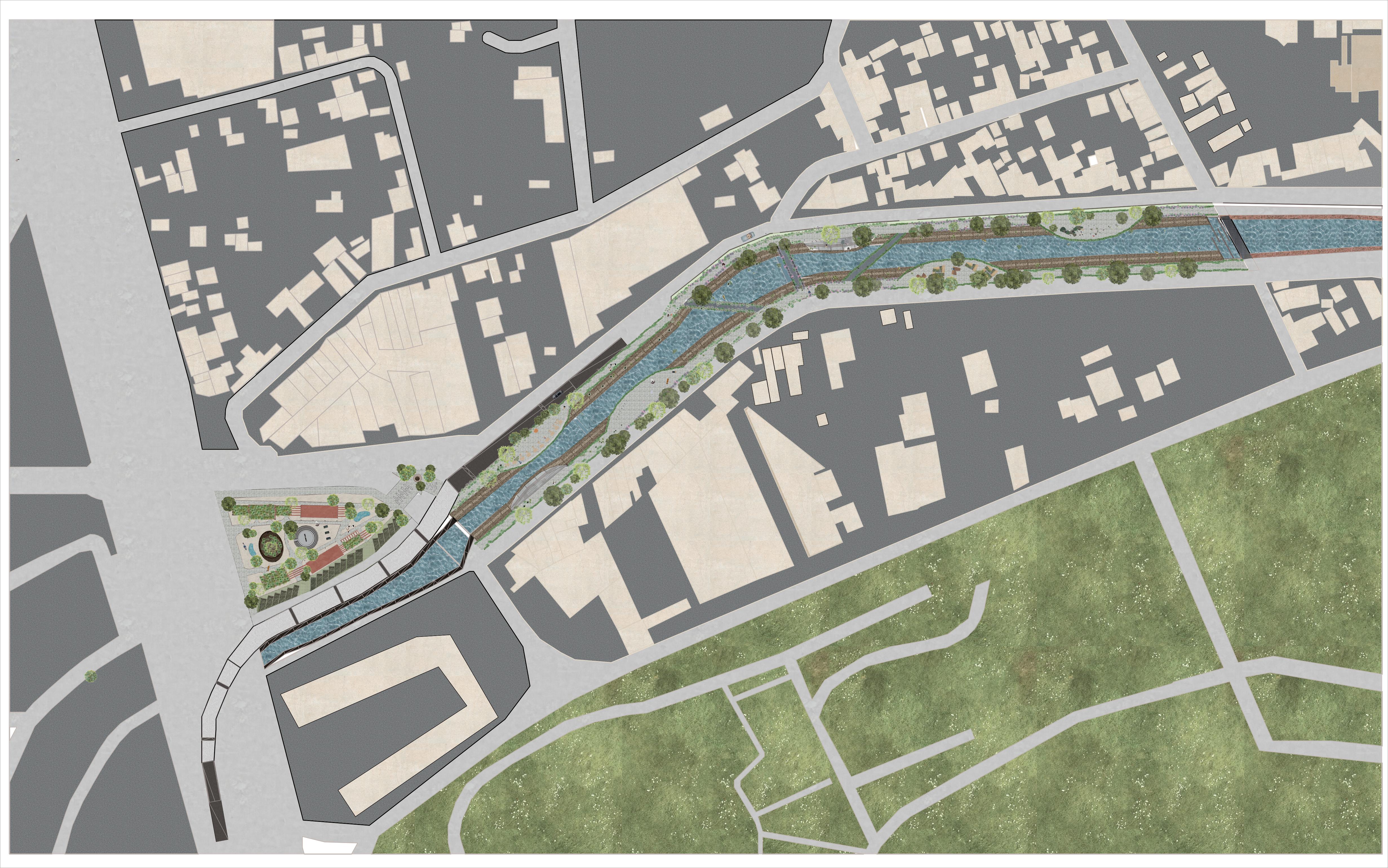
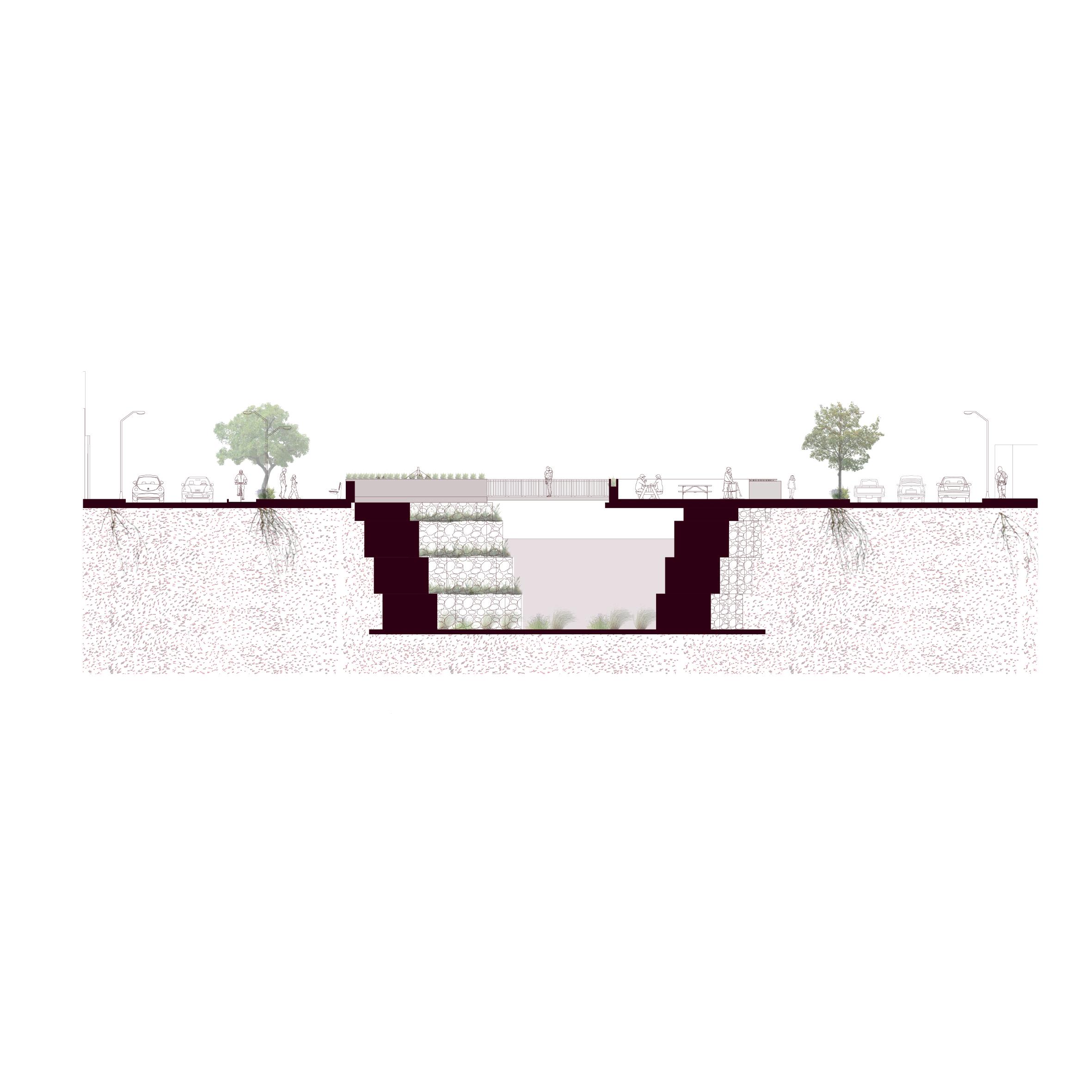
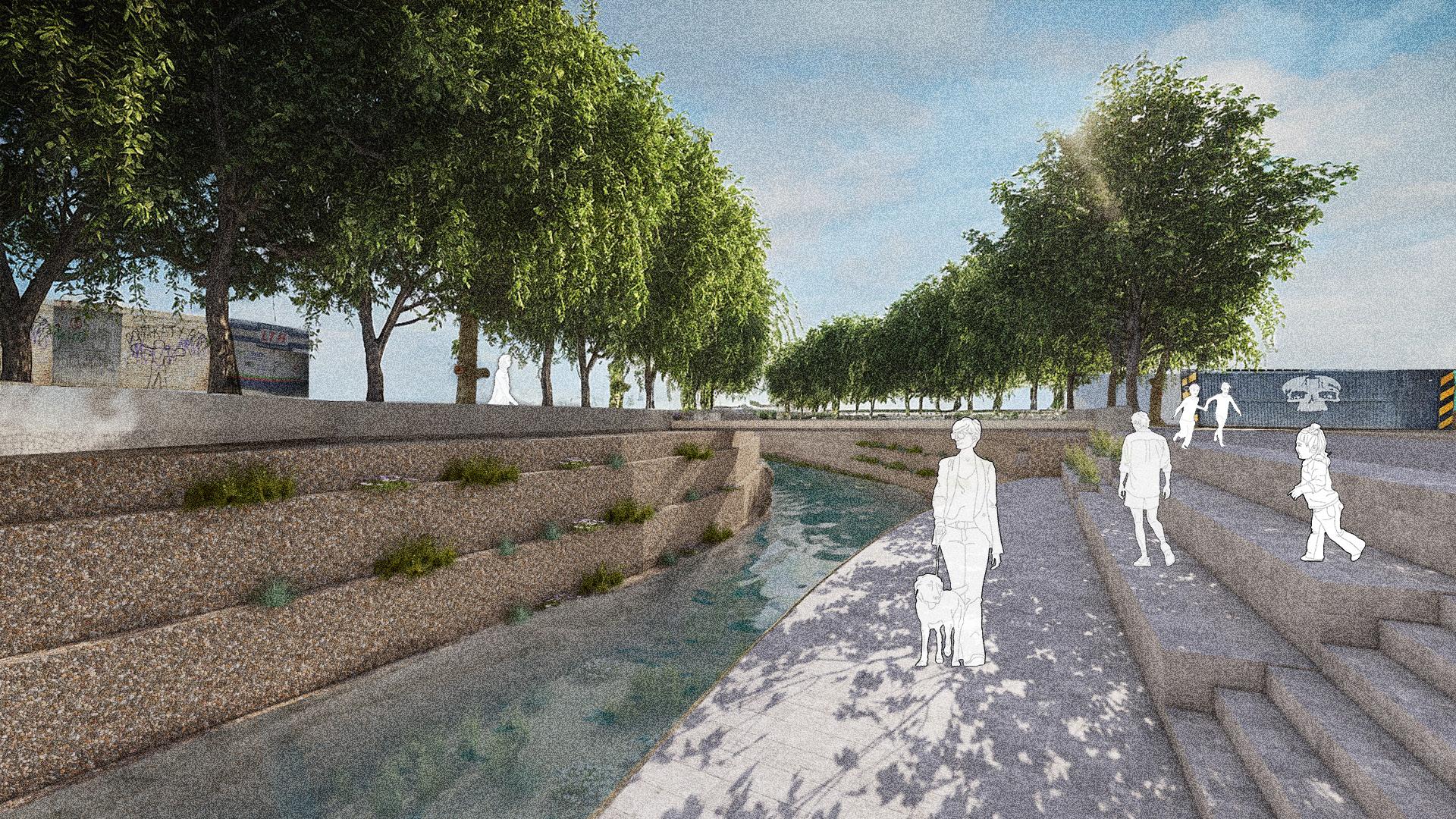
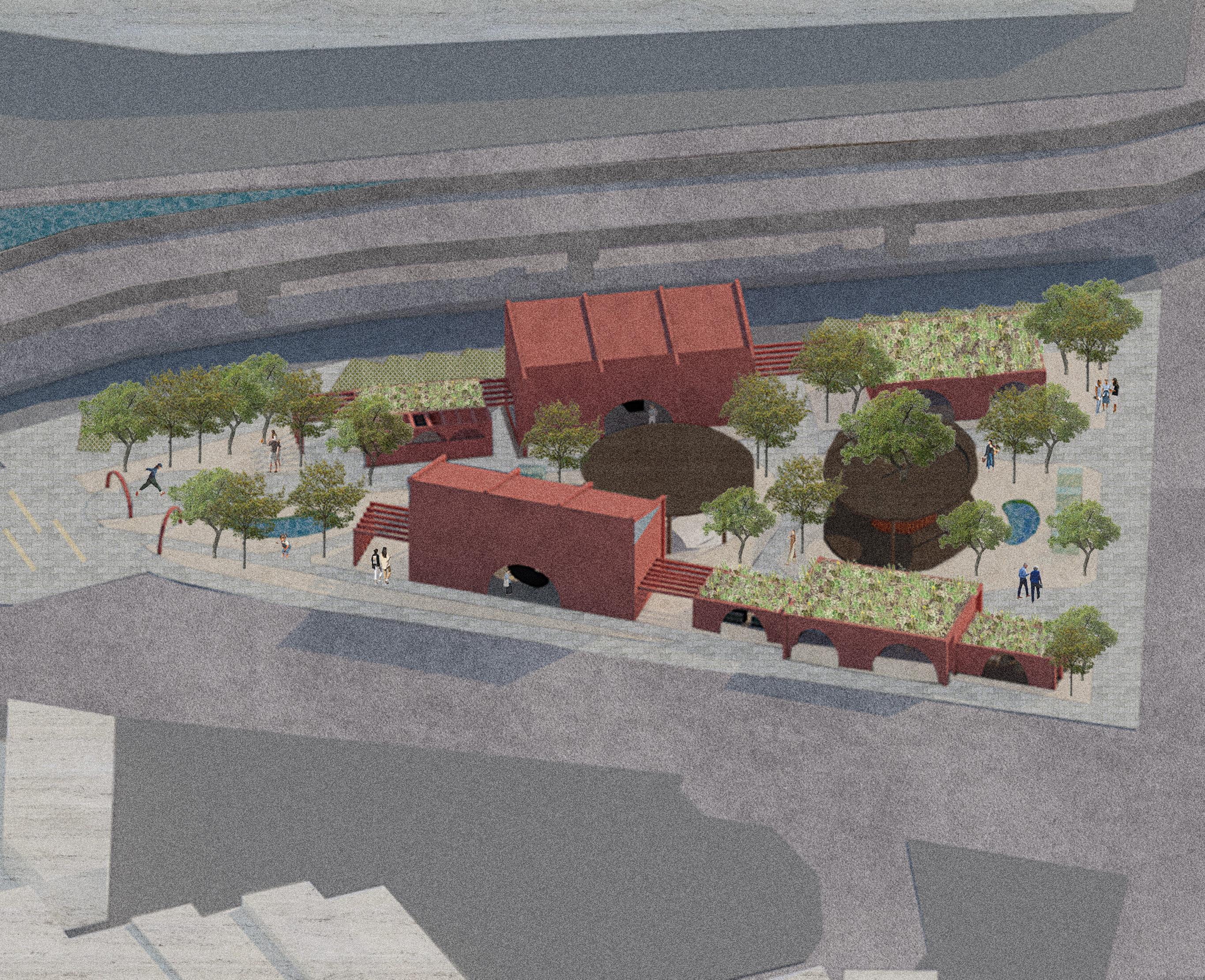
REAWAKENING THE RIVER III.
“KNOT intertwines people, the city, and nature, creating a connection that reminds us we are not separate from the environment we live in, but part of a larger, living system that moves and grows together.”
SPATIAL ZONES
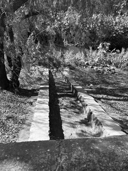
RIVER
BRIDGE
SIDEWALKS
ACTIVITIES SPOT
“As KNOT evolves, it invites us to pause and observe how our actions, materials, and designs ripple through the environment — not as isolated gestures, but as threads in a shared, living tapestry that shapes our collective future.”
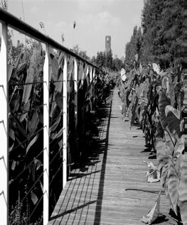
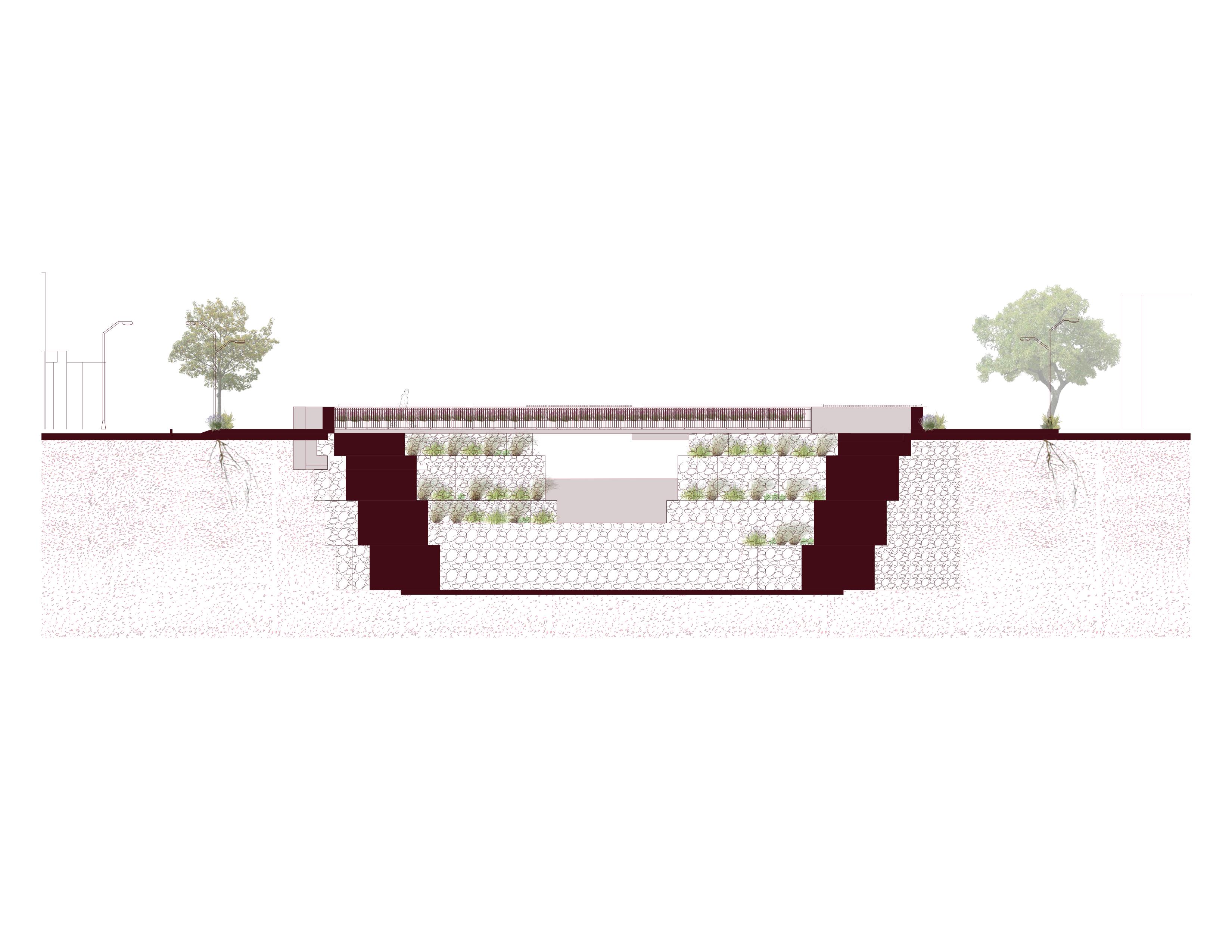
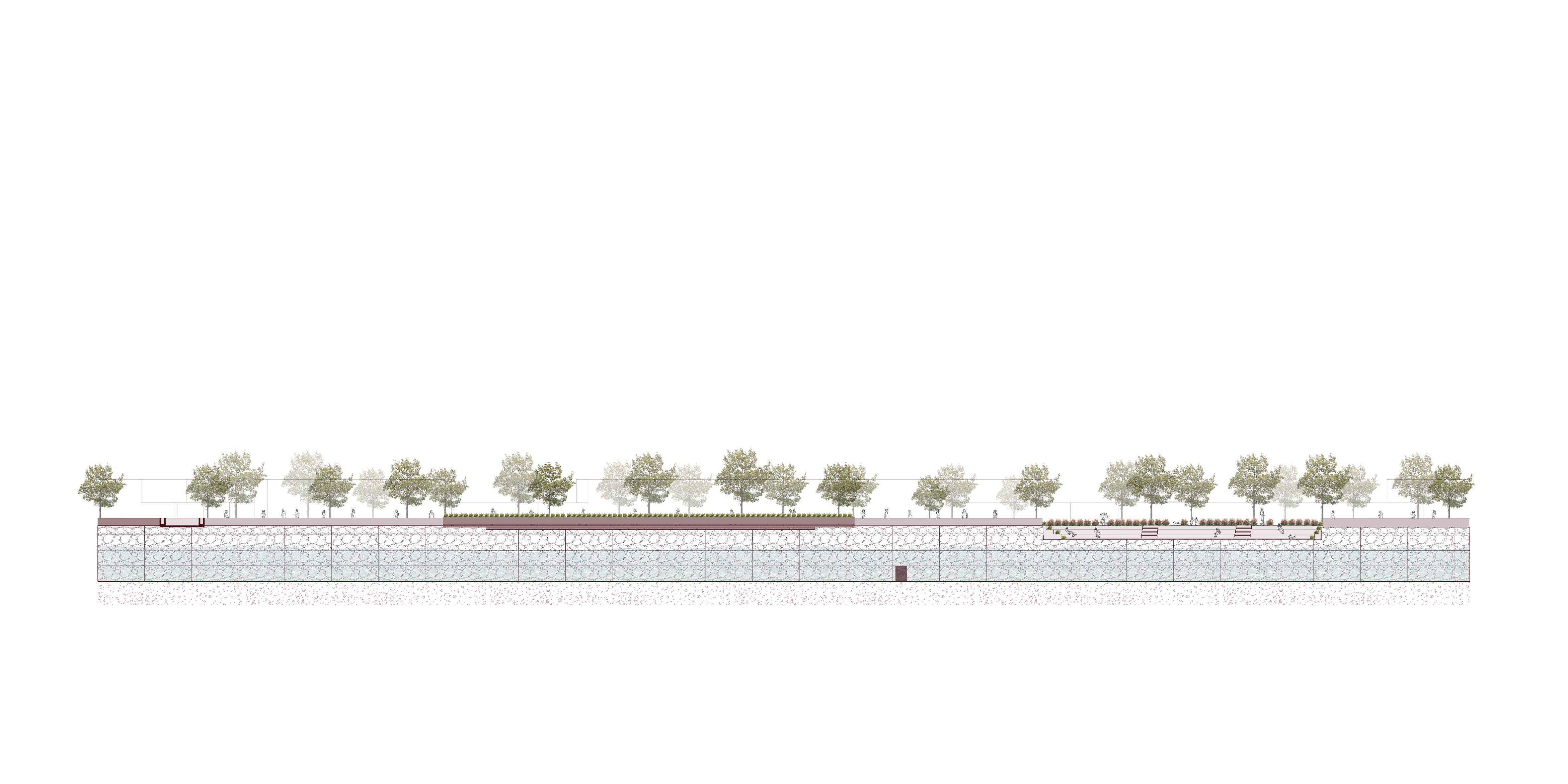
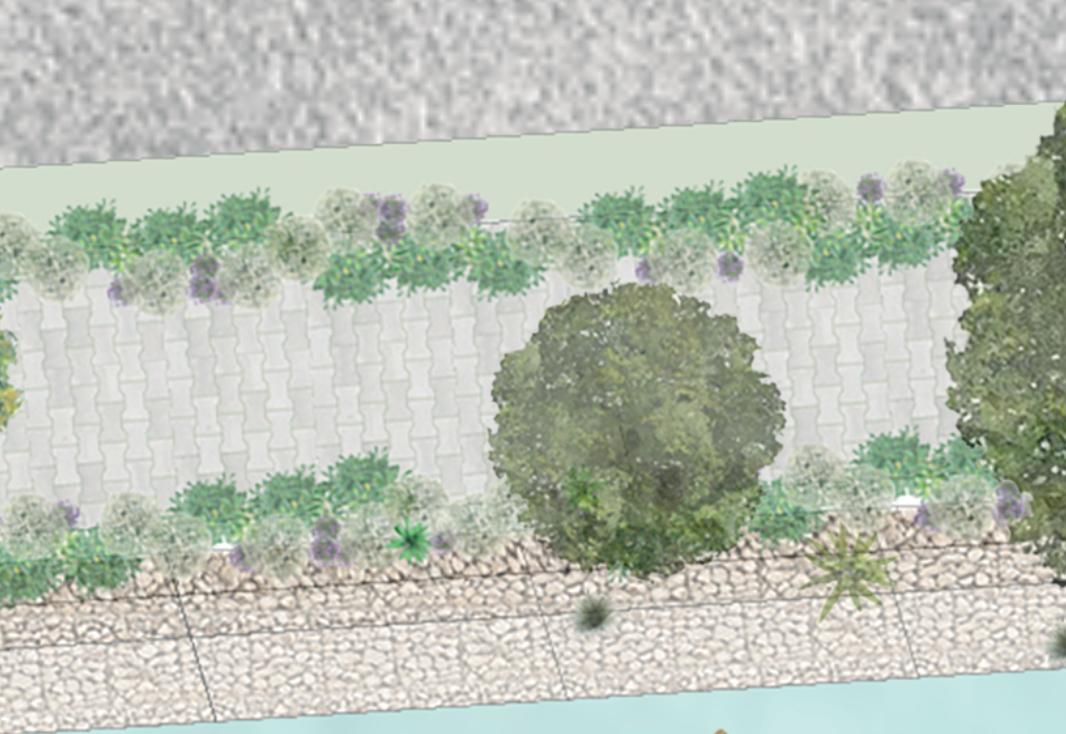
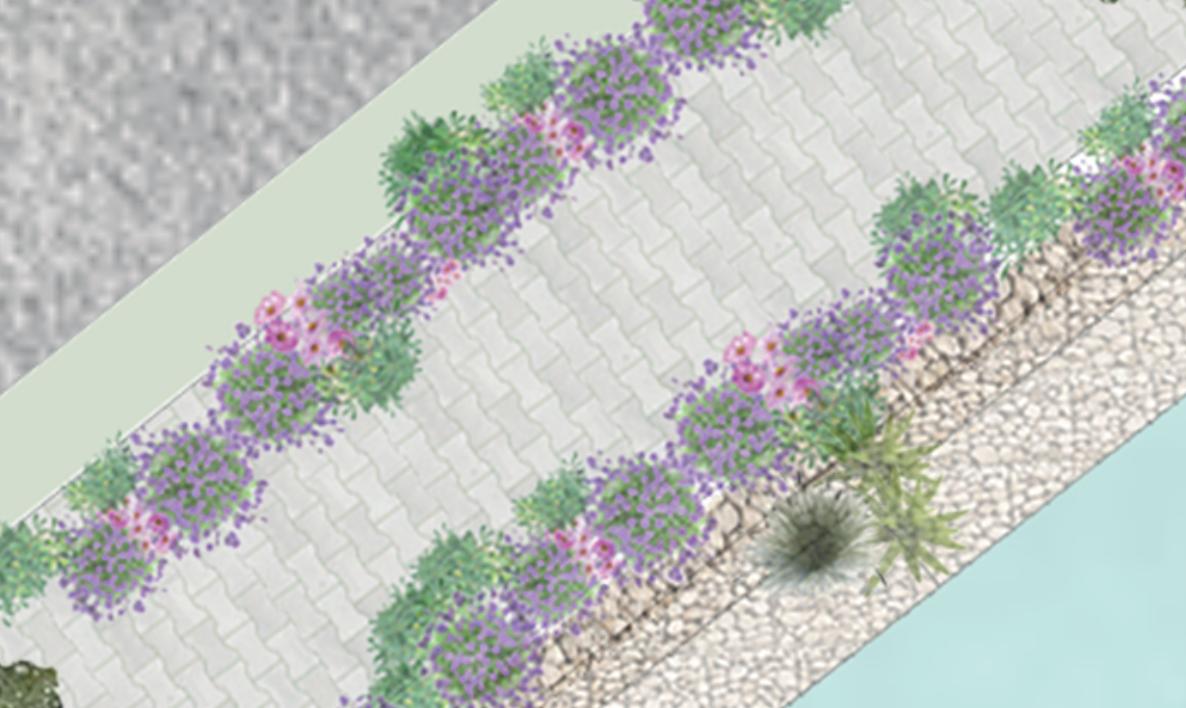
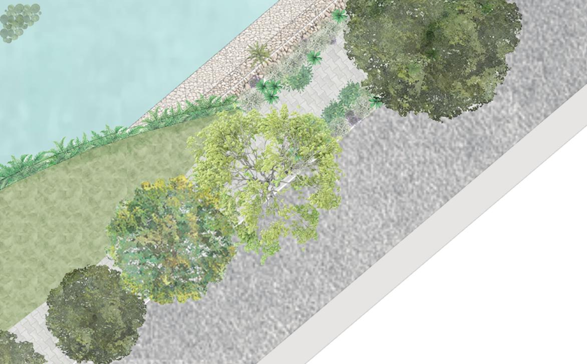
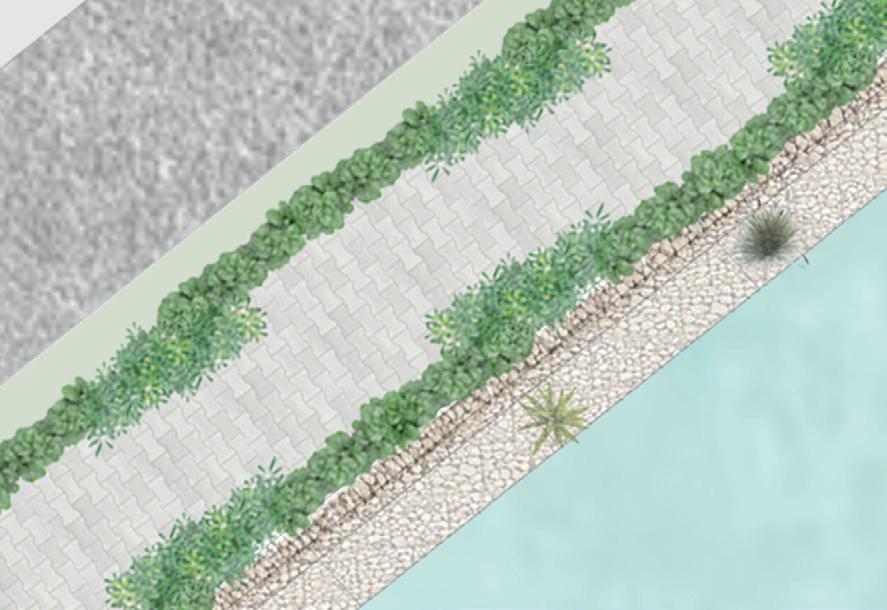
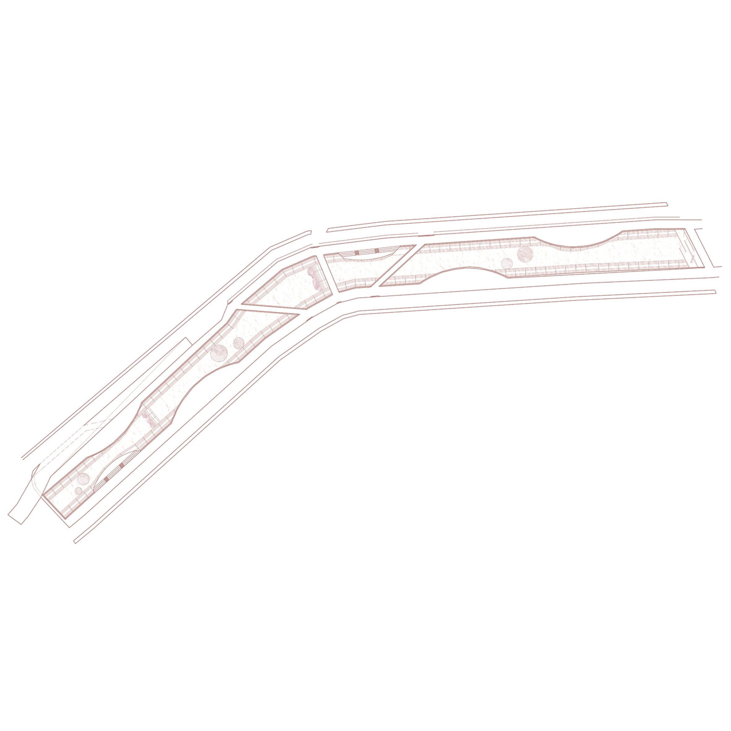
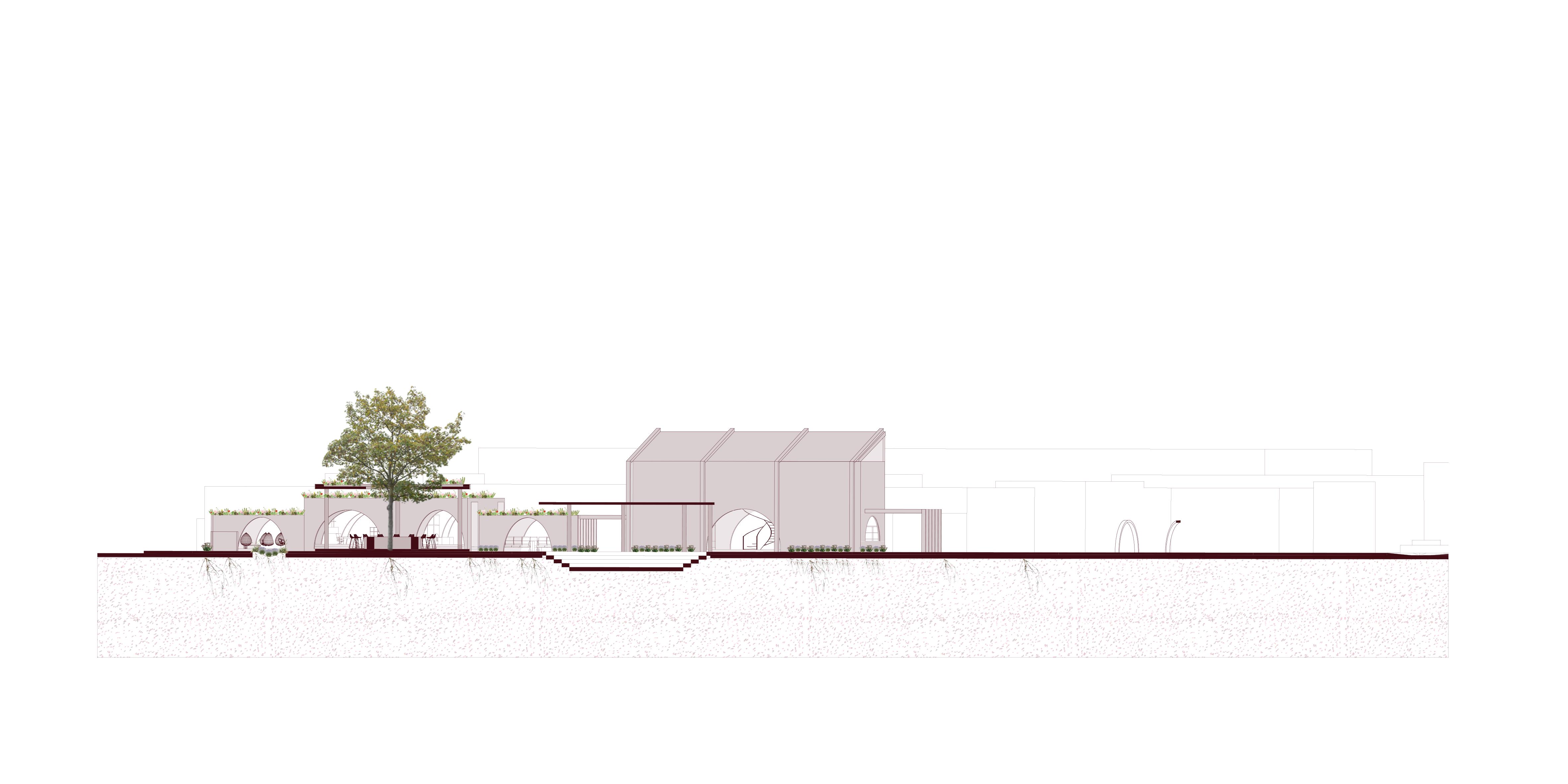
ARCHITECTURAL PLAN OF RIVER
Bike Lane Linear Park
DRY RIVER
LIVING RIVER
The months in which the Querétaro River is expected to have more water are May, with rain in June, July, August, and September. On the other hand, the months with the most drought are January, February, March, April, November, and December. However, generally, the river has running water most of the time.
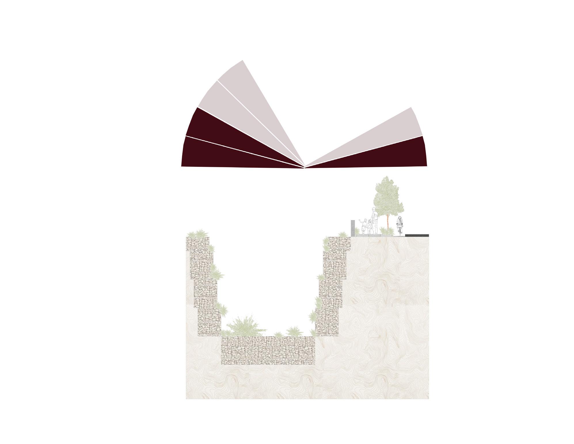
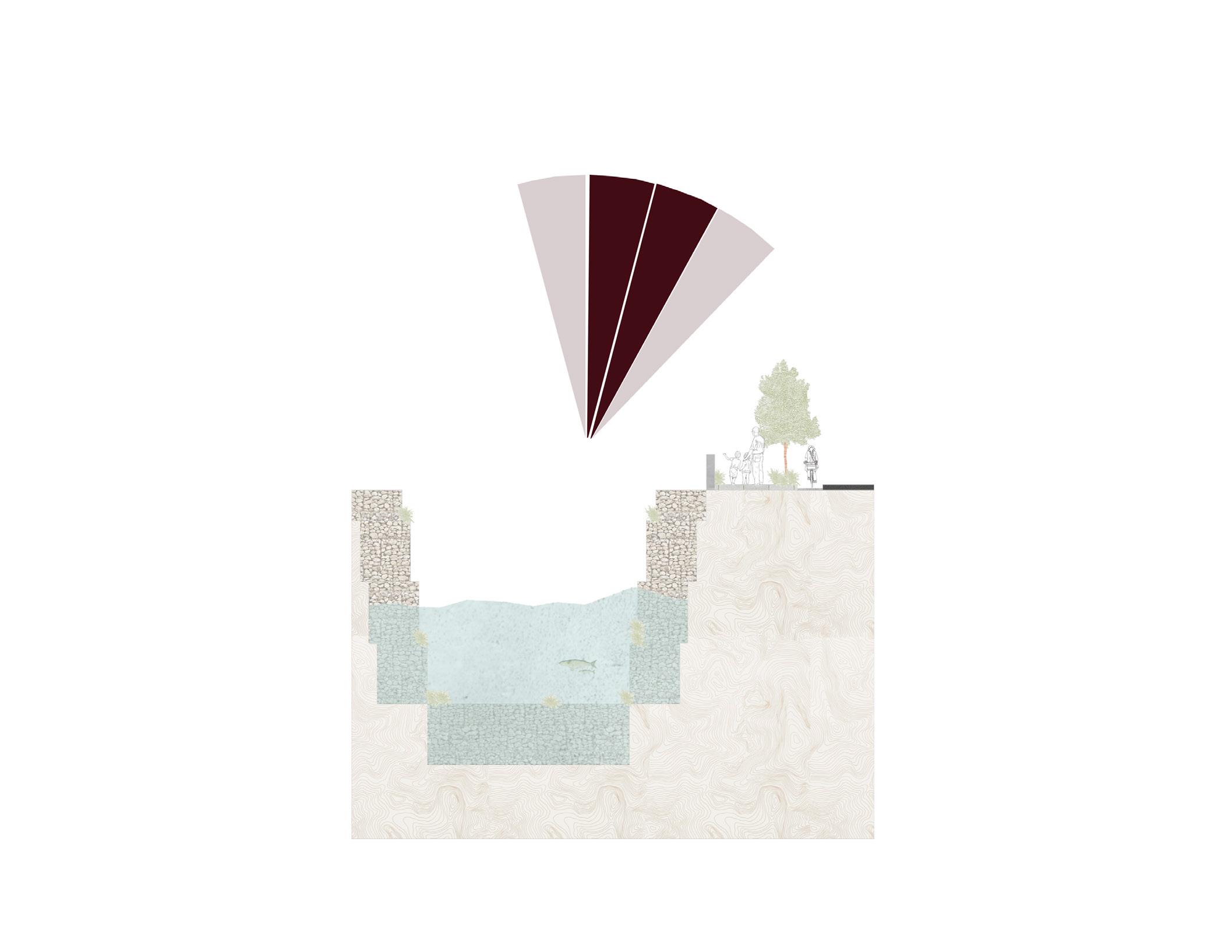
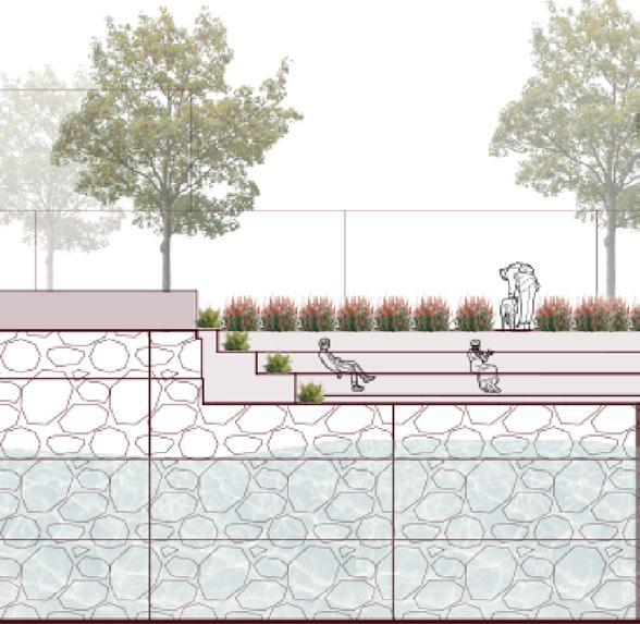
RIVER SKIN
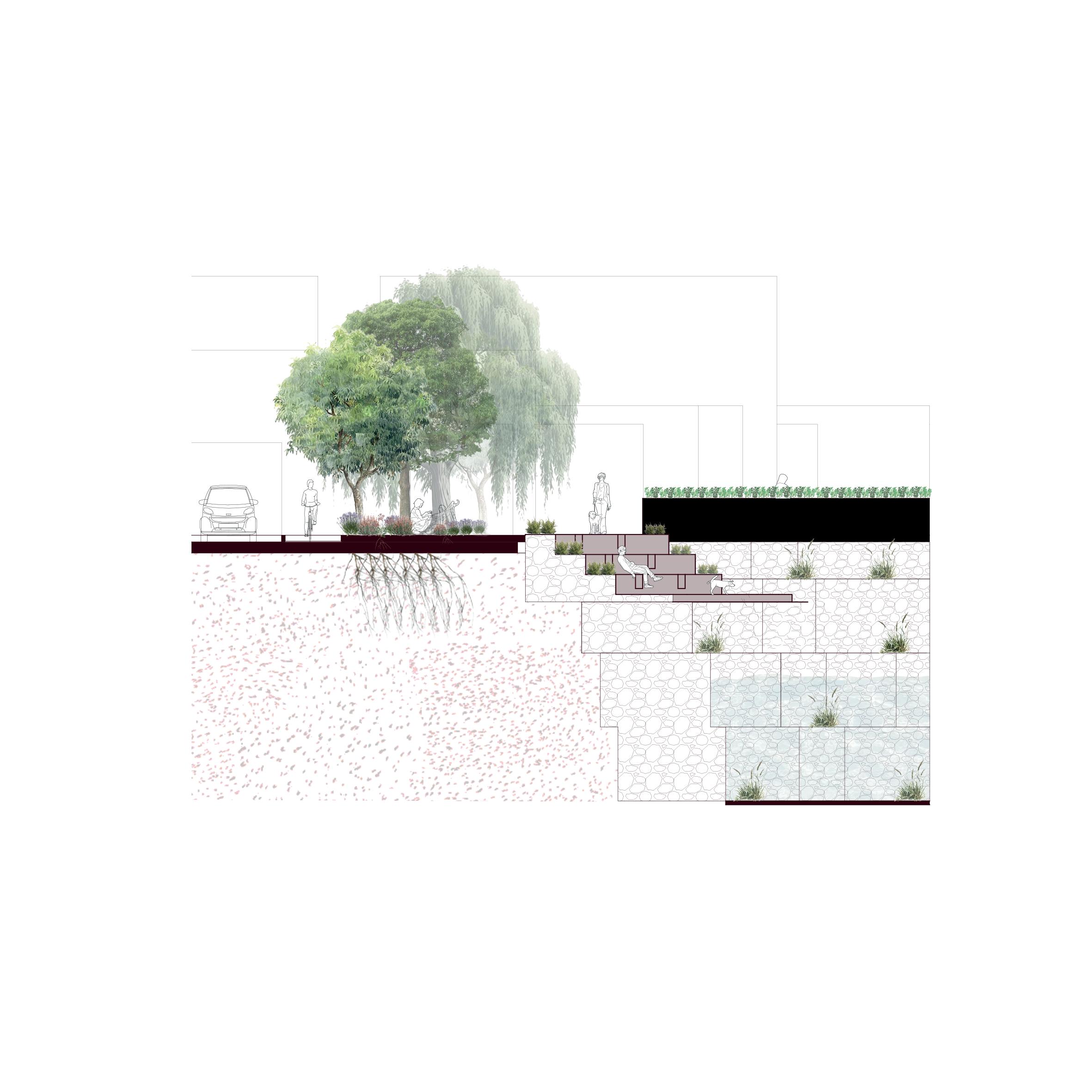
WHAT SURROUNDS THE STAIRS?
1.Bike Lane
2.Places to sit
3.Wider Sidewalk
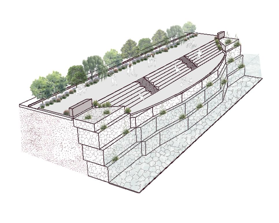
4.Stairs to rest and see the river
5.Lentil Production
4.Lentil
5.Thyme
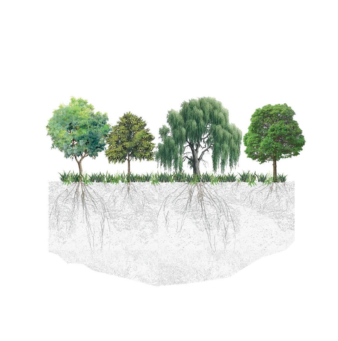
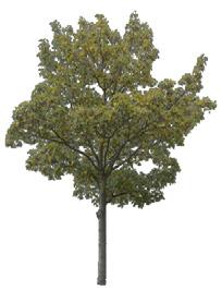
1.Walnut tree
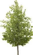
2.Ficus benjamina
8.Weeping willow
Lens culinaris
Thymus vulgaris
Juglans
Ficus macrophylla
Ficus nitida
6.Mint
Genus Mentha
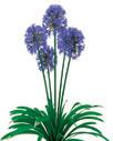
1.Lavander
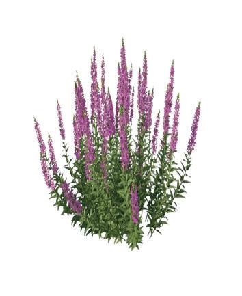
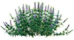
2.Salvia
3.Water hyacinth
4.Lentil
5.Thyme
6.Walnut tree
7.Ficus benjamina
8.Pear tree
Lavandula angustifolia
Zinnia Acerosa Eichhornia crassipes
Lens culinaris Thymus vulgaris Juglans
Ficus macrophylla
Pyrus communis
WHAT SURROUNDS THE CANTILEVER?
Barrier
Crossing
Area
Production
Wrought iron railing.
Dual co - extrusion wood deck by Global Woods, model
10 cm thick concrete leveling layer
- covered sidewalk.
60 cm wide steel - beam with support joists every 2 m.
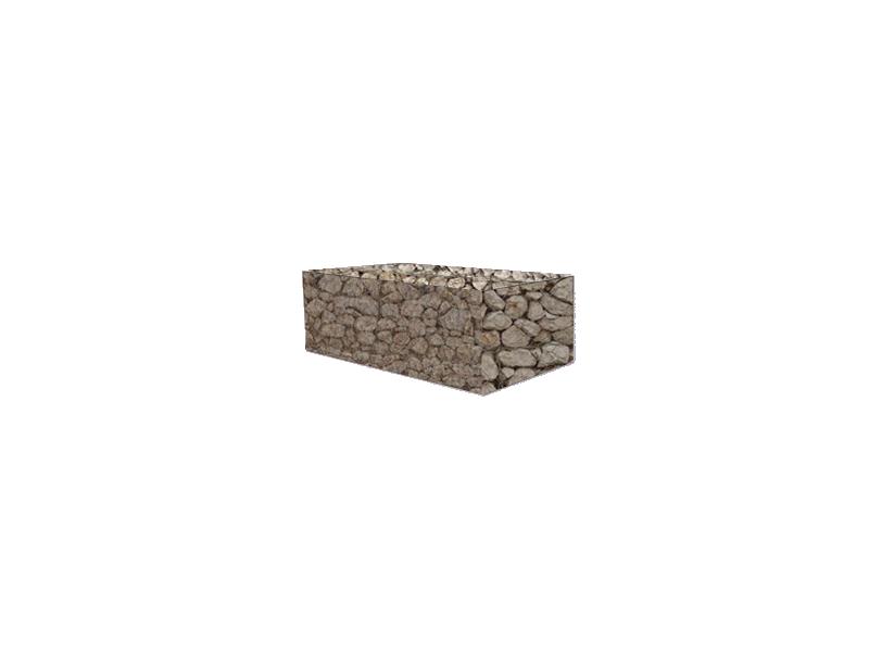
Wetland vegetation growing on the gabions that helps filter the water.
Stirrup with #3 rebar spaced at 15 cm2, cast with a mix of soil, sand and gravel.
Rainwater drainage pipe with a 10 cm diameter.
Facade section - River elevation
Compacted tepetate fill.
Gabions filled with rubble removed from the river.
Concrete
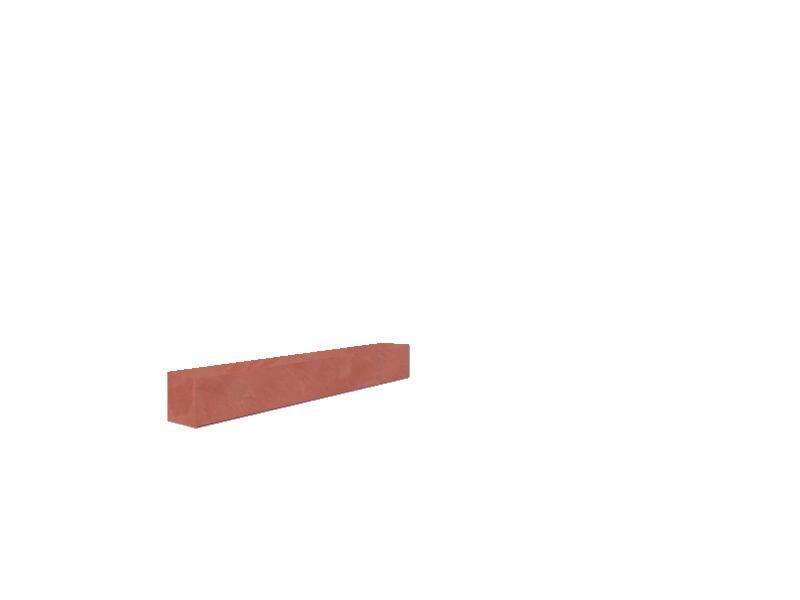
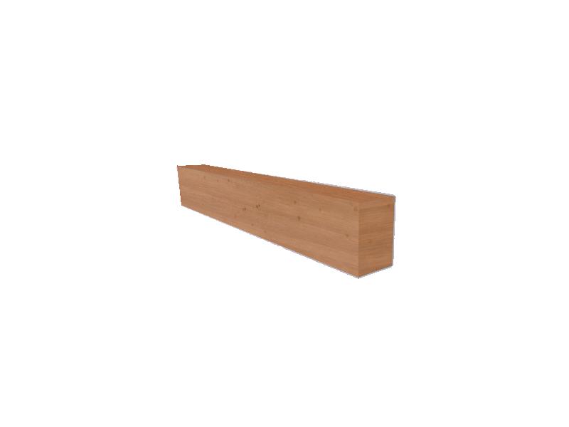
“Cashew” (14.6 x 5 x 240 cm)
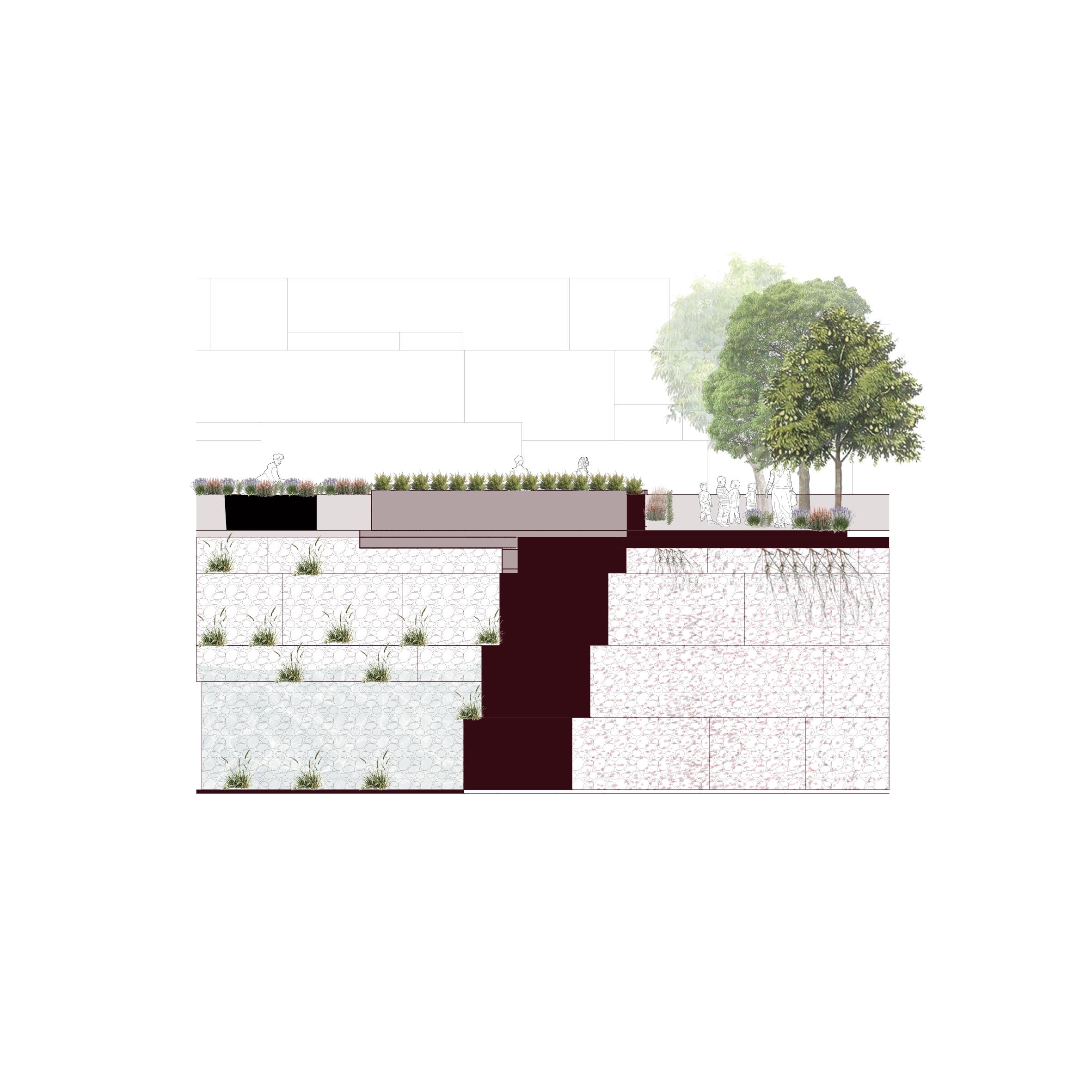
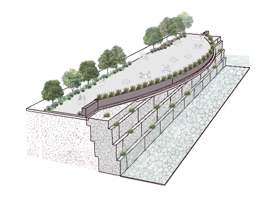
CIRCULAR USE OF RESOURCES
Gabion construction with reused masonry
Results of the shredding process
Final result of the gabion 6 x 2m
Arrangement of gabions along the river
Masonry wall
Masonry breaking process
Bicycle
Cascade Stairs Overlooking The River
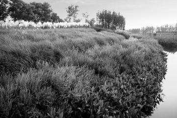
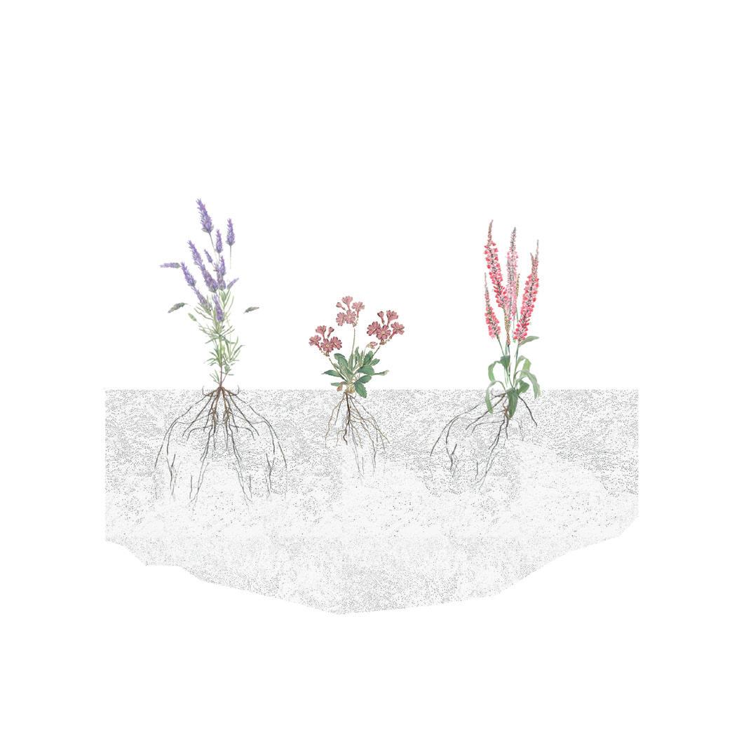
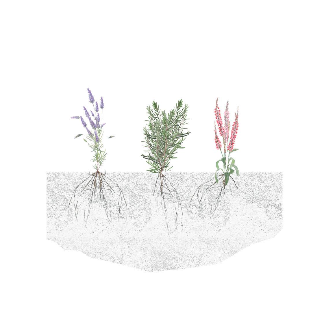
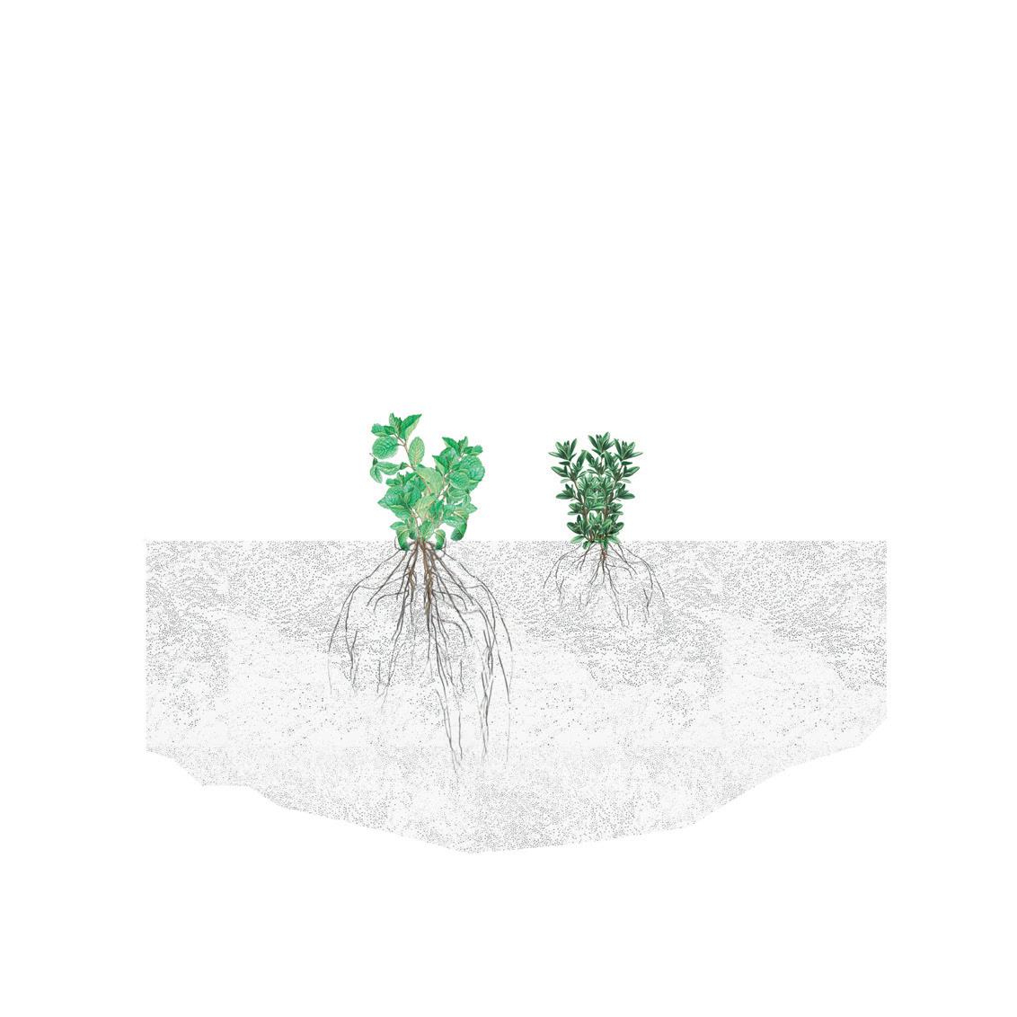
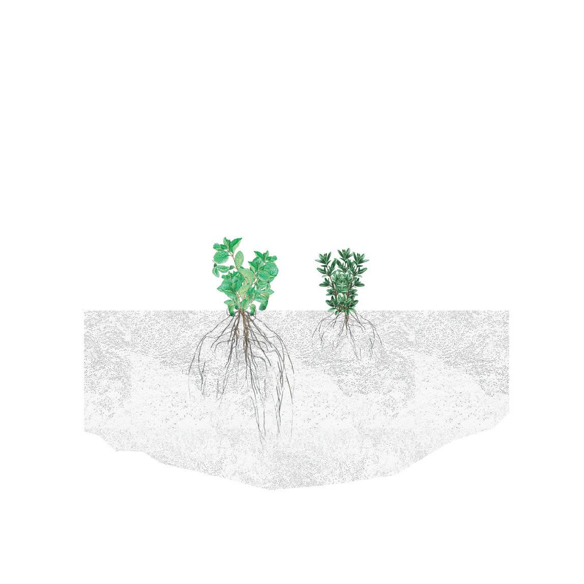
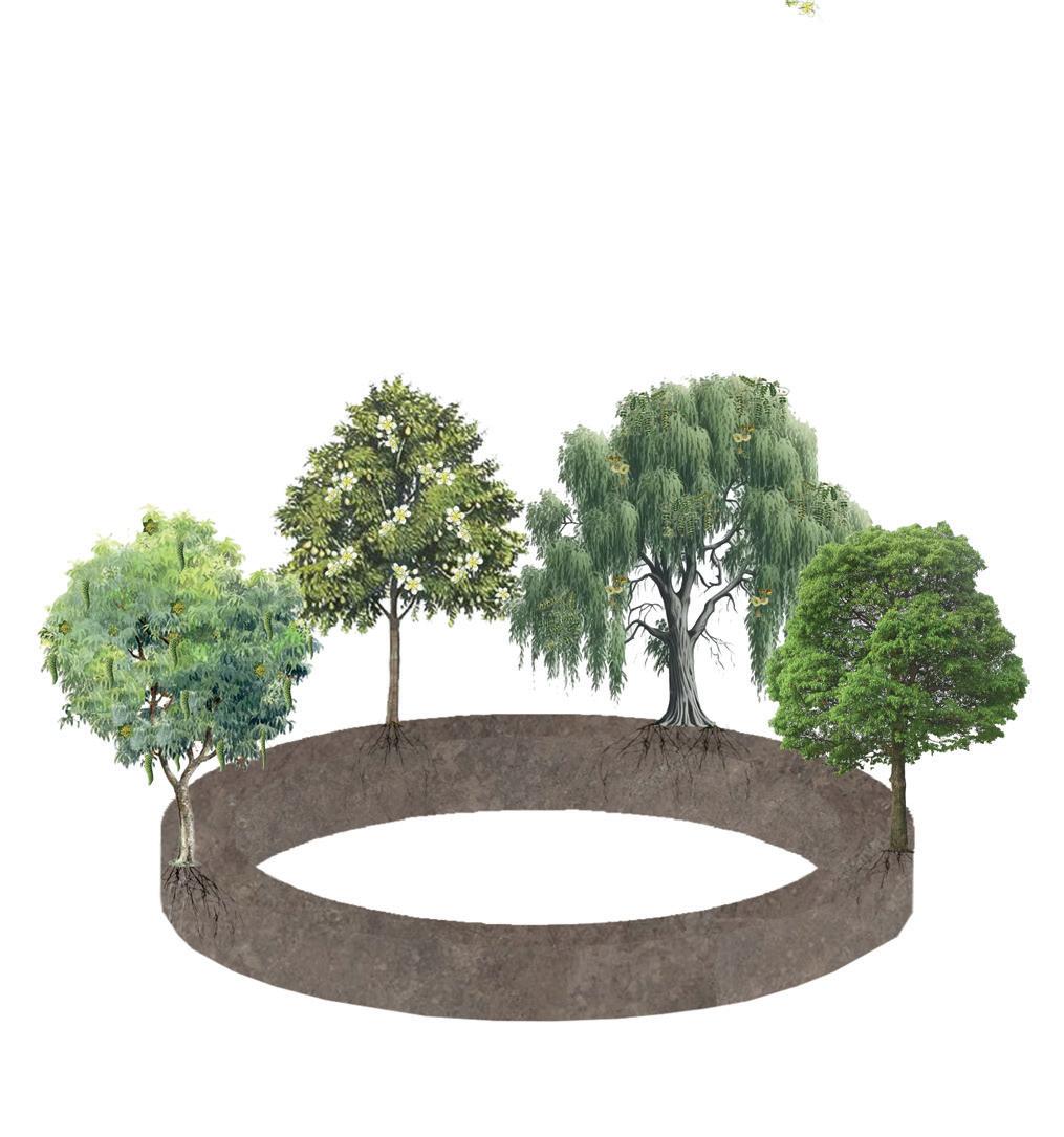
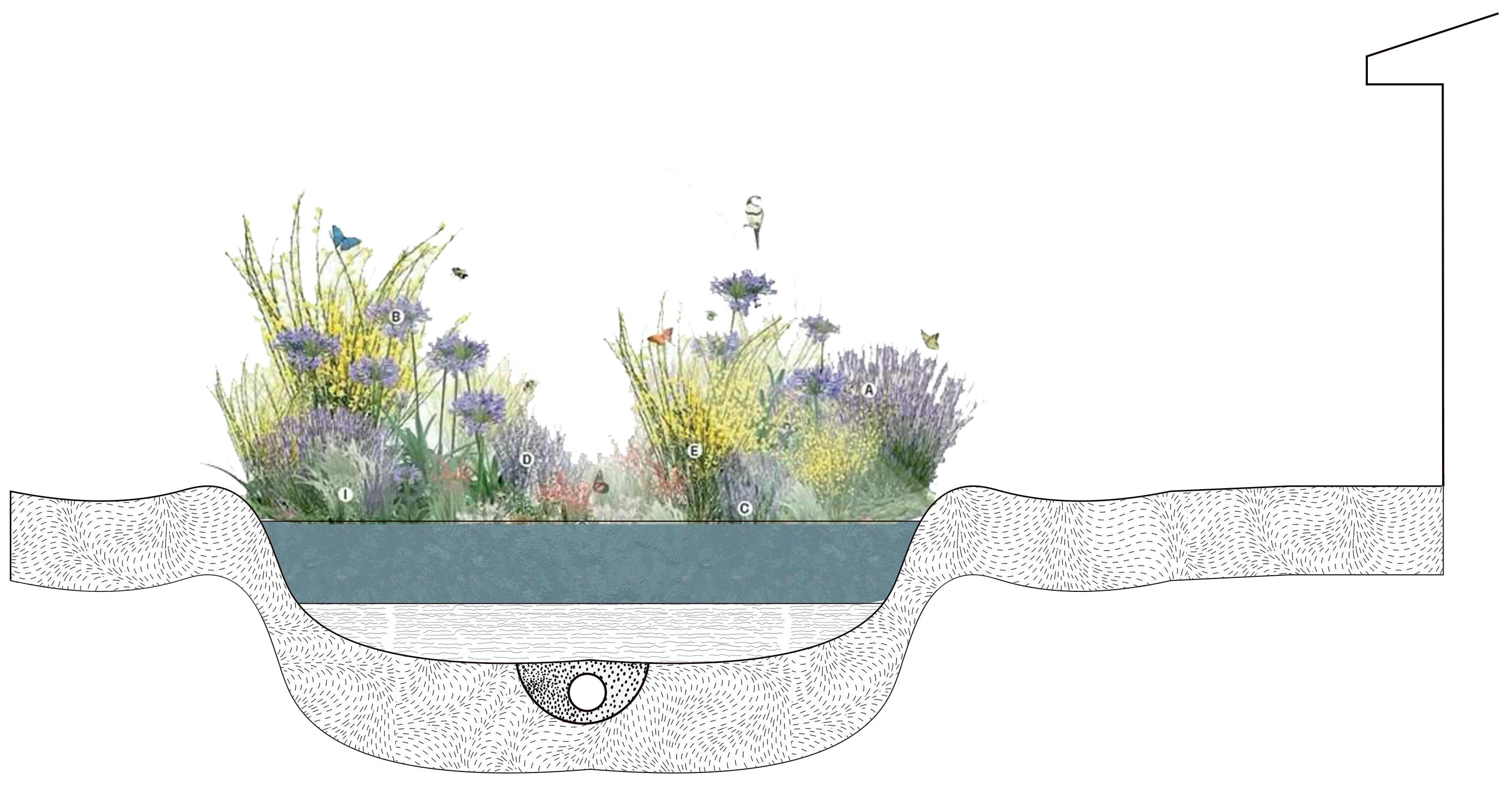
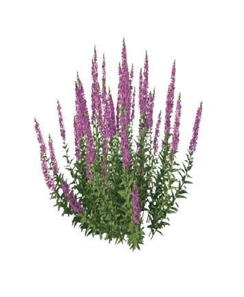
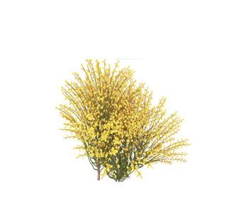
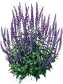
BOTANICAL NOTES
Lavender Rosemary Salvia
Lavender Cosmos Salvia
Walnut tree Pear tree Willow Ficus
Mint Thyme
GREEN ANATOMY
TREES
Ficus benjamina
Ficus macrophylla
Family: Moraceae
Height: 20-30 meters
Function: Provide shade
Irrigation:
AROMATIC PLANTS
Lavander Lavandula angustifolia
Family: Lamiaceas
Height: 0.3-1 meters
Function: Aromatherapy
Irrigation:
Salvia Zinnia Acerosa
Family: Asteraceae
Height: 2-3 meters
Function: Aromatherapy
Irrigation:
Pear tree Pyrus communis
Family: Rosaceae
Height: 10-15 meters
Function: Edible
Irrigation:
Weeping willow Ficus nitida
Family: Salicaceae
Height: 14 meters
Function: Provide shade
Irrigation:
Walnut tree Juglans
Family: Juglandaceae
Height: 20-40 meters
Function: Edible and provide shade
Irrigation:
Rosemary Salvia rosmarinus
Family: Lamiaceae
Height: 1-2 meters
Function: Aromatherapy
Irrigation: Cosmo Cosmos bipinnatus
Family: Asteraceae
Height: 0.5-2 meters
Function: Polinator
Irrigation: Mint Genus Mentha
Family: Lamiaceae
Height: 30-90 centimeters
Function: Aromatherapy
Irrigation:
Thyme Thymus vulgaris
Family: Lamiaceae
Height: 20- 30 centimeters
Function: Aromatherapy
Irrigation:
CLEANING PLANTS GREEN ROOF
Water lentil
Lemnoideae
Rush Juncus effuses
Family: Lemnaceae
Height: 1-3 milimeters
Function: Clean water
Irrigation:
Fern Polypodiopsida
Sedum
Stonecrop
Family: Polypodiaceae
Height: 45-90 centimeters
Function: Clean water
Irrigation:
PROTEIN
Family: Juncaceae
Height: 30-120 centimeters
Function: Clean water
Irrigation:
Water lettuce
Pistia stratiotes
Family: Araceae
Height: 10-15 centimeters
Function: Clean Water
Irrigation:
Water hyacinth
Eichhornia crassipes
Family: Pontederiaceae
Height: 30-90 centimeters
Function: Clean water
Irrigation:
Family: Fabaceae
Height: 30-45 centimeters
Function: Provide protein
Irrigation:
Spirulina
Arthrospira platensis
Family: Arthrospiraceae
Height: 1-4 micrometers
Function: Provide protein
Irrigation:
houseleek
Family: Crassulaceae
Height: 10-30 centimeters
Function: Retain water
Irrigation:
Sempervivum tectorum
Family: Crassulaceae
Height: 5-15 centimeters
Function: Retain water
Irrigation:
Delosperma
Delosperma cooperi
Family: Aizoaceae
Height: 10-20 centimeters
Function: Retain water
Irrigation:
Snake plant
Dracaena trifasciata
Family: Asparagaceae
Height: 30 centimeters- 1 meter
Function: Air purification
Irrigation:
Lentil Lens culinaris
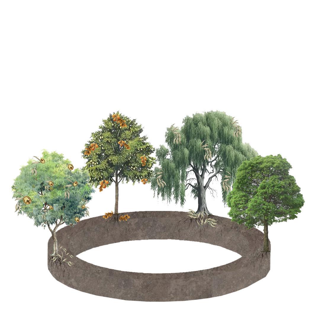
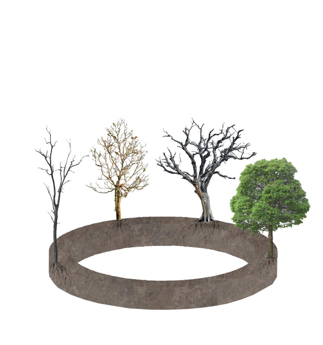
TIME IN BLOOM
SPRING
MARCH - JUNE
PEAR TREE
The leaves start to sprout and take shape, giving the tree its characteristic appearance, just like its flowers, as the season begins.
WALNUT TREE
The walnut tree leaves are light green, and flowers appear for the future production of nuts.
AUTUMN
-
WILLOW
The leaves begin to sprout and take shape, giving the tree its characteristic appearance, just like its flowers, as the season begins.
FICUS
It produces bright green leaves and is in active growth.
WALNUT TREE
The walnut shells begin to sprout from the flowers while the leaves remain bright green.
SUMMER
JUNE - SEPTEMBER
PEAR TREE
The flower buds begin to turn into young, acidic, green pears, while the leaves remain bright green.
WILLOW
The leaves begin to multiply and hang over the trunk, creating abundant shade.
The same bright green leaves are maintained.
WALNUT TREE
The nuts have already ripened and are ready to come out of the shell, even falling from the tree, while the leaves begin to dry.
WINTER
DECEMBER - MARCH
PEAR TREE
WALNUT TREE
There are no leaves anymore, but the tree is continuing its cycle and remains alive in rest.
The branches remain without leaves, with the flower husks that stayed on the tree. The cycle continues, alive and at rest.
The willow tree no longer has leaves, but the branches remain hanging in the same place, resting and alive.
The tree's leaves remain green and bright, while the growth seems a bit slower than usual.
The fruits are already ripe and even begin to fall from the branches, while the leaves dry up and turn yellow, orange, and red.
The leaves begin to dry and turn a yellowish appearance.
The leaves remain the same, constantly growing and bright green.
FASE PROGRAM
FASE 1
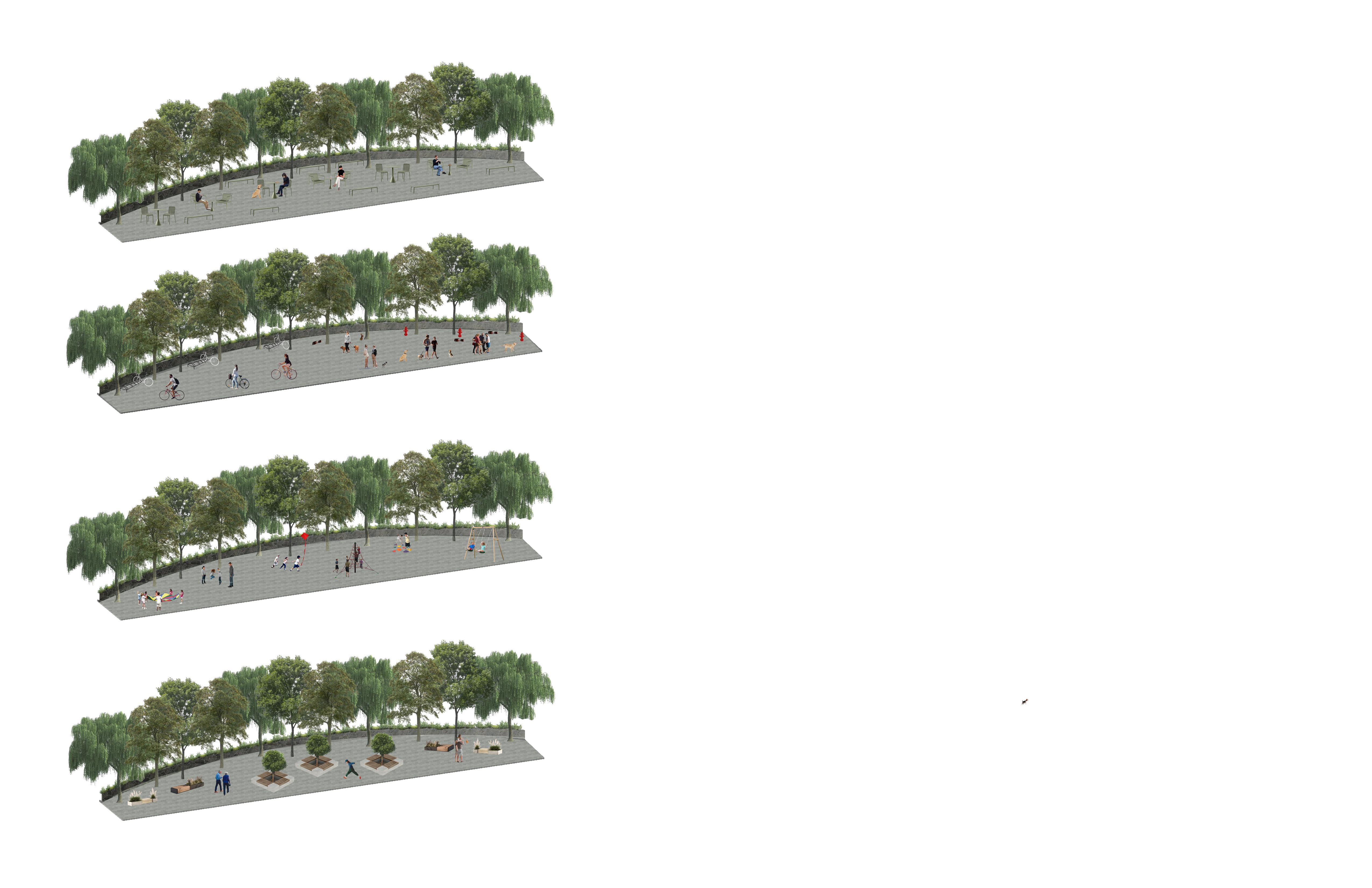
focuses on the renewal of the river and activation of the surrounding public space. This includes the rehabilitation of the river to restore its natural character, the creation of resting islands, pet-friendly zones, and children’s play areas. Aromatic plants will be installed along the river walk to enhance the sensory experience of the space, and new staircases will be added at water level to allow people to engage more closely with the river.
FASE 2
Addresses the construction of a safe and green pedestrian crossing. This crossing will be integrated with seating areas and abundant vegetation, providing a pleasant and comfortable environment. Special attention will be given to safety features to ensure secure passage for all users.
FASE 3
Marks the launch of the Alternative Protein Hub, which includes the development of the first part of the site dedicated to the production and sale of sustainable protein sources such as algae, mushrooms, and insects. This phase is crucial in addressing future food needs through innovative and ecological solutions.
Introduces a community dining area and recreation plaza. This space will be designed to host recreational and social activities, functioning as a central gathering point that ties together the project’s ecological, social, and nutritional objectives.
Finally, the full implementation of the Knot Project will be completed within a two-year span, resulting in a vibrant, sustainable, and inclusive environment that brings together nature, community, and innovation.
FASE 4
FASE 5
SPACE FOR MANY
Children’s Grove
Resting Lounge
Social Bites Zone
Pet & Cycle Zone
“THE RIVER IS BEING NATURAL ELEMENT, THAT RECONNECTS THE PEOPLE TOGETHER, NURT MAKING SPACE FOR FOOD
RESTORED NOT JUST AS A BUT AS A LIVING THREAD COMMUNITY — BRINGING URING THE LAND, AND TO GROW CLOSE TO HOME.”
EDIBLE FUTURES IN PUBLIC SPACE
“KNOT
weaves continuity between past, present, and possibility — a gesture that ties together memory, place, and intention. In its entanglement, we are reminded that design is not only about shaping space, but about nurturing relationships: between human and non-human, built and natural, stillness and flow.”
PROS AND CONS
Z O N E VS C H A L L E N G E VS P R O P O S A L
Zone with bad odors Presence of unpleasant smells. Green barriers and aromatic gardens
Zone with families and locals Lack of spaces for community interaction. Plazas, playgrounds, and community workshops.
Zone lacking healthy food resources Lack of access to nutritious food.
Production of alternative proteins (mushrooms, insects, algae).
Zone lacking recreational activities Absence of outdoor leisure spaces. Multi-purpose open plaza for sports and cultural activities.
Zone with insecurity Dark spaces and perception of insecurity. Lighting along paths and areas.
Zone with shortage of eating areas No seating areas for eating. Community dining area with collective tables.
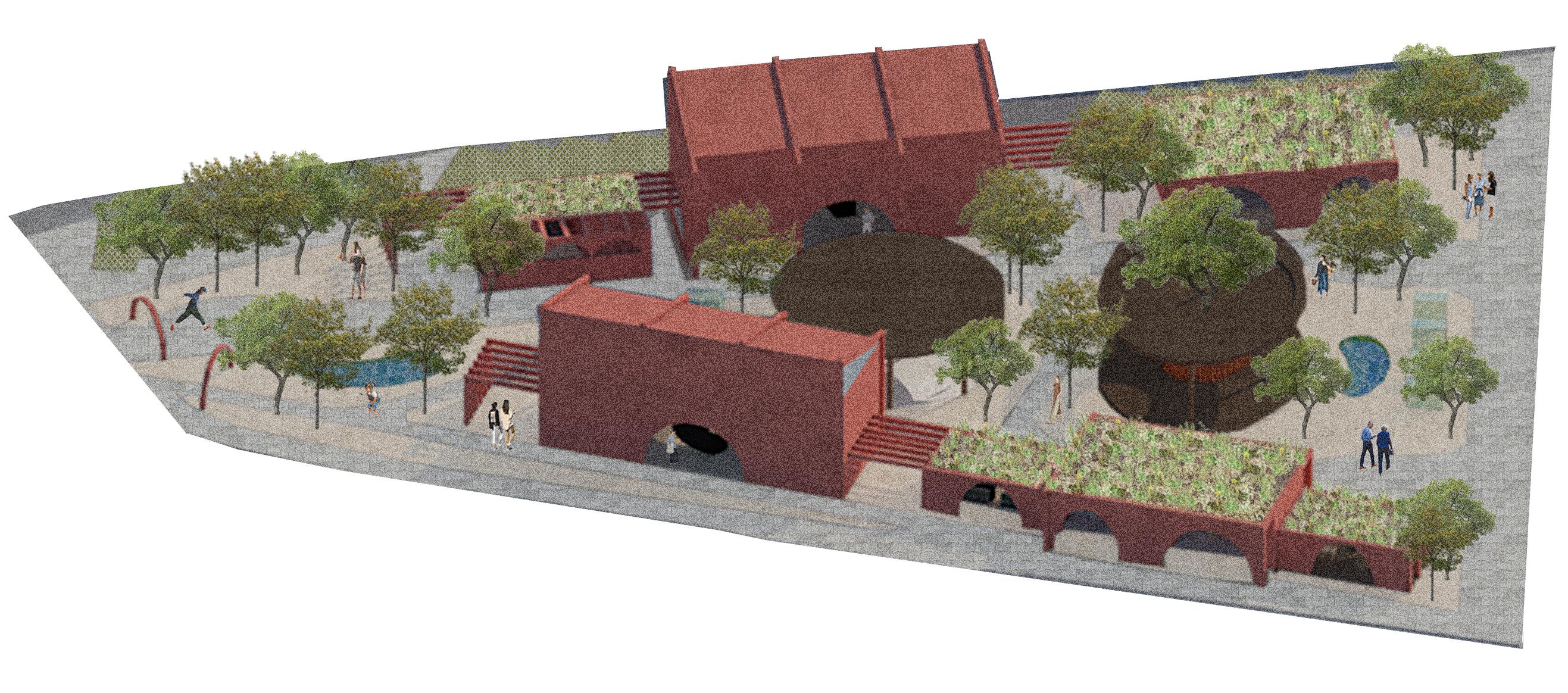
GRASSHOPPER PRODUCTION
MUSHROOM PRODUCTION
ALGAE WALL
SHOP UNITS
BUS STOP / MEETING AREA
GARDENS OF WATER
RESTROOMS
DINING
PIT
PARKING LOT
GUIDING PRINCIPLES
1. Grow Smart, Eat Smart
Embrace efficient and sustainable protein sources like mushrooms, algae, and crickets.
→ Cultivate food with low environmental impact and high nutritional value.
2. Community at the Center
The space is for everyone — a place to gather, participate, and belong.
→ Encourage collaboration through workshops, cooking sessions, and neighborhood events.
3. Food as Connection
The diner isn’t just for eating — it’s a social table for sharing, storytelling, and culture.}
→ Create meals that reflect local identity and celebrate innovation.
4. Hands-On Learning
Turn every module into a living lab.
→ Teach people how to grow, cook, and appreciate alternative proteins in creative ways.
5. Circular Thinking
Design with purpose and reuse in mind.
→ Minimize waste, reuse water, compost food scraps, and reinvest resources back into the system.
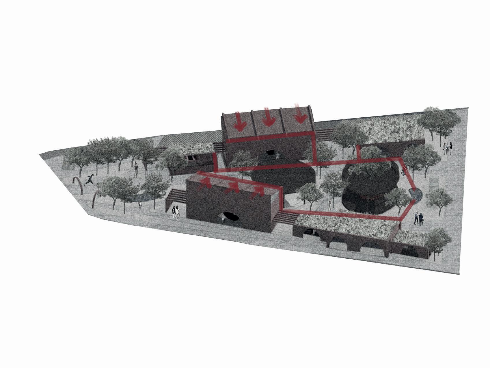
HYDRIC PASSAGE
Cascades created with gabions to generate oxygenation and complete the bioenzyme filtration process
Cascades
Lagoons
Concrete wall filters to separate larger objects from the river
Lagoons to slow down the water flow and allow the injection of bioenzymes to filter out other particles
SANITATION DIAGRAM
-Avoid direct discharges into the river.
-Use primary or secondary treatment systems (like green filters or constructed wetlands).
-A sanitary sewer network connected to a treatment plant
-Separation of rainwater and wastewater systems.
-Sustainable Urban Drainage Systems (SUDS): such as infiltration trenches, soakaways, and permeable pavements to prevent contaminated runoff from reaching the river.
-Separate bins for recycling, organic waste, and general trash.
-Environmental education campaigns to prevent littering in the park or river.
-Regular cleaning and maintenance by park staff.
-Native riparian vegetation to protect riverbanks.
-Bioengineering solutions (such as gabions or vegetated terraces) to stabilize slopes and prevent degradation of the river environment.
SANITATION
Clearly define areas for recreation, sports, conservation,and restricted access to protect sensitive parts of the river.
If public toilets are provided, they should include adequate septic tanks or be connected to a sanitary network.
-Regular monitoring of pollutants, pH, dissolved oxygen, etc.
-Alerts and enforcement in case of illegal discharges or pollution.
-Native riparian vegetation to protect riverbanks.
-Bioengineering solutions (such as gabions or vegetated terraces) to stabilize slopes and prevent degradation of the river environment.
“KNOT binds together moments and matter, creating a fabric where time, place, and purpose converge. It reveals that design is a living dialogue—one that honors the delicate balance between nature and culture, permanence and change, the visible and the unseen.”
RETHINKING PROTEIN
PROTEIN BENEFITS
WASTE REDUCTION
LAND EFFICIENT
LOW WATER USE
NUTRIENT DENSE
Grows in water
No farmland needed
Uses non-potable water
High protein
Water: Low to medium
Cleans CO2 and wastewater
Also used for biofuels
Rich in omega-3, B12, A, C, E Antioxidants
ALGAE SECTOR
Water: Moderate Low emissions Fixes nitrogen in soil
20–25% protein
High ber, iron, folate
Good for heart health
Easy to grow
Helps soil health eeds little fertilizer
LEGUMES SECTOR
SUSTAINABILITY
NUTRITION
LOW ENVIRONMENTAL IMPACT
LOW EMISSIONS
PLANT-BASED COMPATIBLE
Compact vertical farms
Eats food waste
Tiny land user
CRICKETS SECTOR
65% protein
High in B12, iron, zinc
Complete amino acids
Water use: ~1L/kg protein
Very low GHG emissions, No methane
MUSHROOMS SECTOR
Frass = natural fertilizer
LOW RESOURCE INPUT
LOCAL PRODUCTION
Water: Low No pesticides
Byproducts enrich soil
Grows on organic waste
Year-round indoor cultivation
Low energy and water
Moderate protein
High ber, B vitamins
Supports immunity
LOW WATER USE
BIODIVERSITY FRIENDLY
CIRCULAR ECONOMY
CLEAN PROTEIN
PROTEIN WATER
GENERAL ACTIVITIES
Gardening and urban farming sessions
Community dining area
Open-air group activities
Food education workshops
Outdoor recreational activities
Children’s playground
Resting areas with benches
Fruit tree harvesting along the biodiverse lane
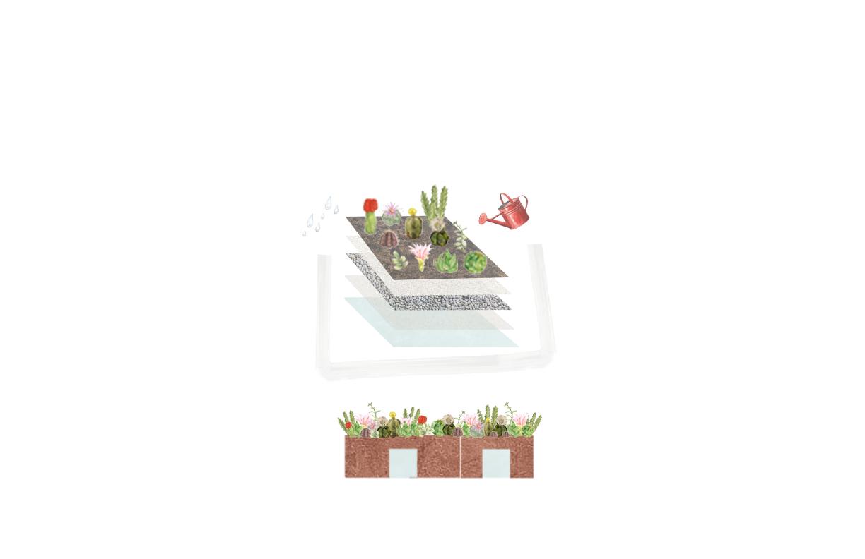
SUCCULENTS
SUBSTRATE
IRRIGATION CYCLE
Green roofs are designed to create a greener and cooler environment. They are green roofs made of succulents, which do not require daily watering and withstand droughts very well, as well as being able to receive direct sunlight. When it rains, the water that runs off the roofs is filtered and flows into the water gardens seen on the property.
Rain gardens and green roofs are part of an integrated strategy that supports the natural water cycle by aiding in the collection, filtration, and reuse of water within the urban environment. These systems not only reduce runoff and help prevent flooding, but also improve environmental quality and promote a more conscious and sustainable relationship with water resources.
WATER COLLECTION
Water on the site flows across green roofs, slopes, gutters and downspouts to the lowest point, the rain garden, where it can be reused to irrigate the green roofs and landscape areas.
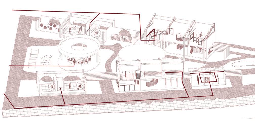
PROGRAM
ARCHITECTURAL PLAN OF GRASSHOPPER PRODUCTION UPPER FLOOR
COMMON MUSHROOM
SHIITAKE
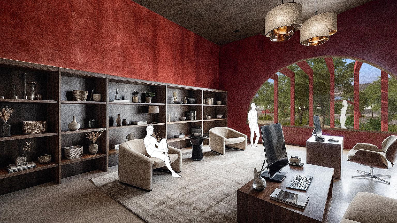
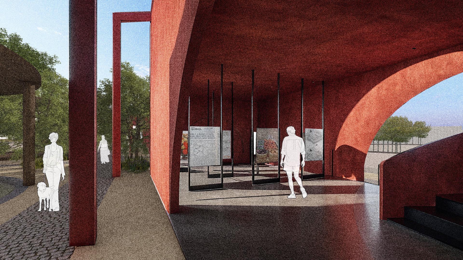
On the ground floor of the project, a museumlike exhibition space was designed to allow visitors to learn about the foods grown on site. This area aims to promote responsible food education by providing anyone the opportunity to see and understand the crops up close, fostering greater awareness about healthy food production and consumption.
Pedestrian Connection
Algae Production
Bathroom
Grasshopper Production
Reinforced concrete slab with waterproofing
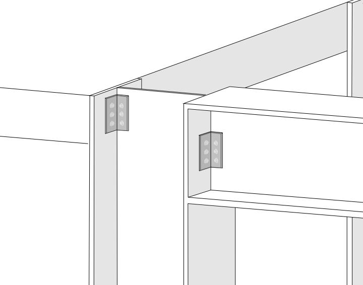
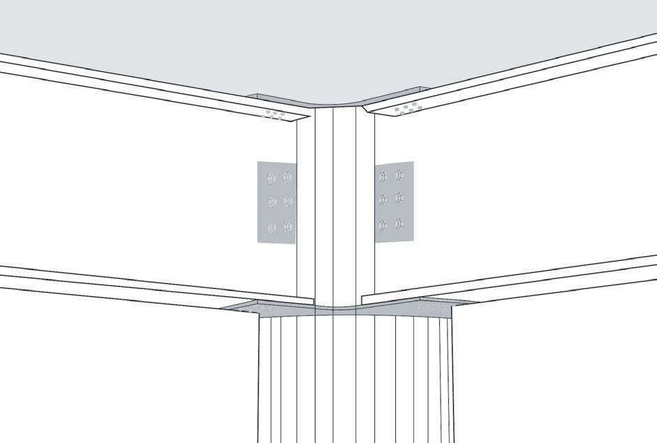
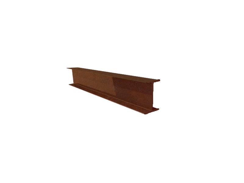
STRUCTURAL STEEL BEAM
W12-type wide flange beam
12.1 in (height) × 12.0 in (flange width), per ASTM A6
Connection: Beam is both welded and bolted to a structural steel column
Surface finish
Connections made with bolted metal plates, to give stability and easy assembly
STRUCTURAL STEEL BEAM
12.1 in (height) × 12.0 in (flange width), Surface finish
30 x 30 cm steel beam, 2.20m long (held on the closing beams).
Succulents and substrate.
Gravel filter.
Waterproofing.
Welded wire mesh 6/6 10/10.
15 cm joist and hollow block slab with a 5 cm compressive layer of concrete f’c = 250 kg/cm2.
30 x 15 cm closing beam with a compressive strenght of 200kg/cm2 reinforced with 4 steel rebars and #2 stirrups spaced every 20 cm.
Arch opening (Arch made with fire clay bricks)
20 x 15 cm beam with a compressive strenght of 200kg/cm2 reinforced with 4 steel rebars and #2 stirrups
Stucco finish in color #9f3926 Concrete
Wall made of fired clay bricks (24 x 12 x 6 cm) laid with mortar
Welded wire mesh 6/6 10/10.
36 x 15 cm footing beam with a compressive strenght of 200kg/cm2 reinforced with 4 steel rebars and #2 stirrups spaced every 20 cm.
Concrete - covered sidewalk.
5 cm concrete slab with a compressive strenght of f’c = 150kg/cm2.
1 cm polished concrete finished. #3 rebar @ 15 cm2.
Isolating footing with reinforced concrete and steel rebar.
5 cm concrete slab with a compressive strenght of f’c = 150kg/cm2.
Compacted tepetate fill.
Codo
CORNER MEETING AREA
Succulents and substrate.
Gravel filter.
Welded wire mesh 6/6 10/10. Waterproofing.
Succulents and substrate.
Gravel filter.
1 cm polished concrete finished.
Waterproofing.
Welded wire mesh 6/6 10/10.
Welded wire mesh 6/6 10/10.
15 cm joist and hollow block slab with a 5 cm compressive layer of concrete f’c = 250 kg/cm2.
1 cm polished concrete finished.
30 x 15 cm footing beam with a compressive strenght of 200kg/cm2 reinforced with 4 steel rebars and #2 stirrups spaced every 20 cm.
Welded wire mesh 6/6 10/10.
15 cm joist and hollow block slab with a 5 cm compressive layer of concrete f’c = 250 kg/cm2.
30 x 15 cm footing beam with a compressive strenght of 200kg/cm2 reinforced with 4 steel rebars and #2 stirrups spaced every 20 cm.
Stucco finish in color #9f3926
Wall made of fired clay bricks (24 x 12 x 6 cm) laid with mortar
Stucco finish in color #9f3926
Wall made of fired clay bricks (24 x 12 x 6 cm) laid with mortar
1 cm polished concrete finished.
Welded wire mesh 6/6 10/10.
+0.90m
+0.72m
1 cm polished concrete finished.
Welded wire mesh 6/6 10/10.
Concrete - covered sidewalk.
5 cm concrete slab with a compressive strenght of f’c = 150kg/cm2.
36 x 15 cm footing beam with a compressive strenght of 200kg/cm2 reinforced with 4 steel rebars and #2 stirrups spaced every 20 cm. #3 rebar @ 15 cm2.
Concrete - covered sidewalk.
Isolating footing with reinforced concrete and steel rebar.
5 cm concrete slab with a compressive strenght of f’c = 150kg/cm2.
5 cm concrete slab with a compressive strenght of f’c = 150kg/cm2.
36 x 15 cm footing beam with a compressive strenght of 200kg/cm2 reinforced with 4 steel rebars and #2 stirrups spaced every 20 cm. #3 rebar @ 15 cm2.
Compacted tepetate fill.
Isolating footing with reinforced concrete and steel rebar.
5 cm concrete slab with a compressive strenght of f’c = 150kg/cm2.
Compacted tepetate fill.
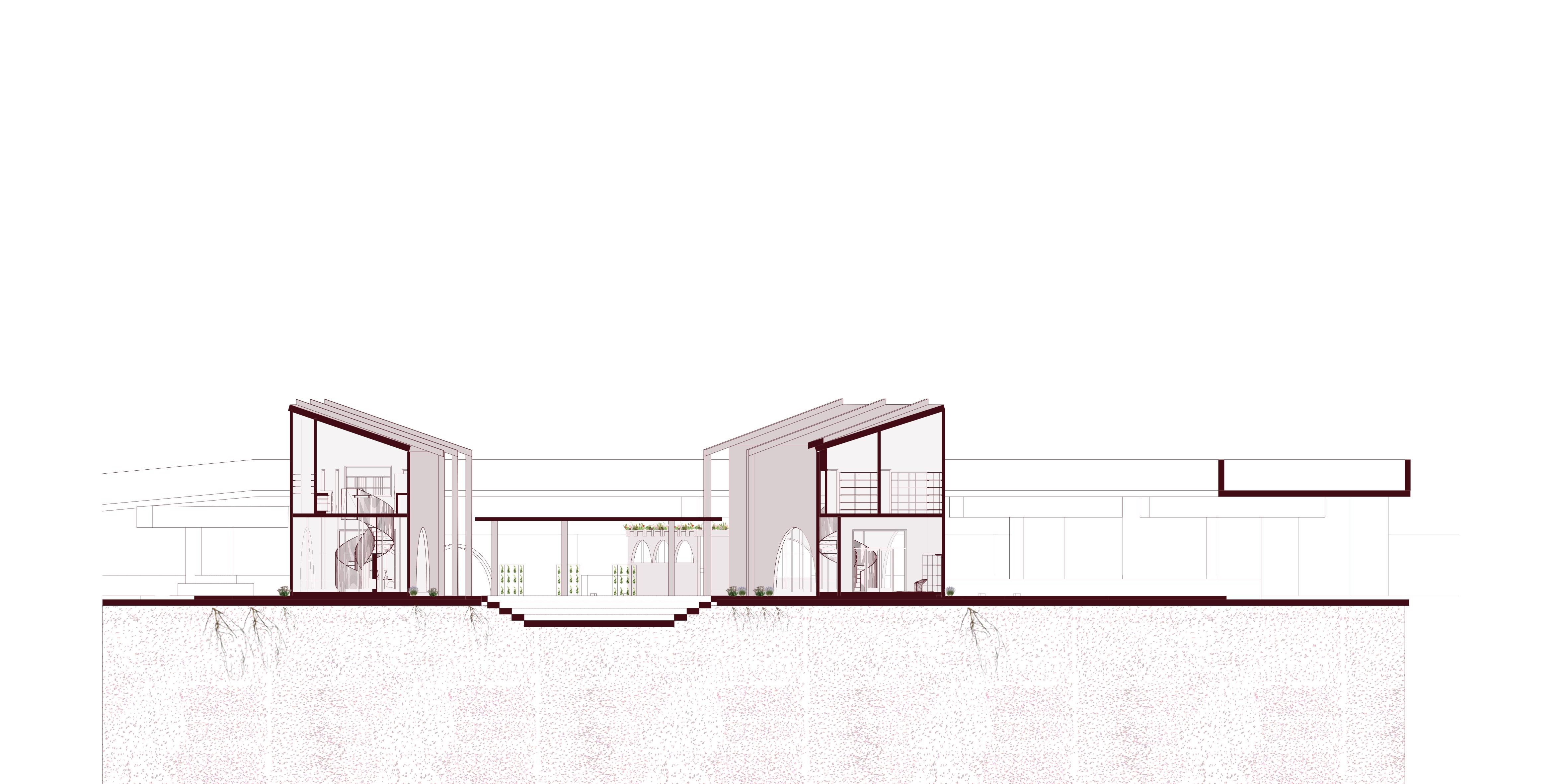
STRUCTURAL DETAIL
Wood ceiling system with timber joists and decorative wood panels
12.1 in (height) × 12.0 in (flange width), per ASTM A6
Connection: Beam is both welded and bolted to a structural steel tubular column. Surface finish
Connections made with bolted metal plates, to give stability and easy assembly
Steel tubular column Ø 6" (20 cm), height 5.16 m, structural steel ASTM A500 Grade B
DANCE ACTIVITIES
PAINTING WORKSHOPS
SPACE FOR MANY
WORKSHOPS
MUSIC CONCERTS
READING
YOGA WORKSHOPS
HIDDEN SYSTEM
SEWAGE INSTALLATION
PLUMBING INSTALLATION
HVAC INSTALLATION
LIGHTING INSTALLATION
+4.26 m
40 cm steel I-beam profile installed at a 31.75% slope.
Welded wire mesh 6/6 10/10.
15 cm joist and hollow block slab with a 5 cm compressive layer of concrete f’c = 250 kg/cm2.
30 x 15 cm perimeter beam with a compressive strenght of 200kg/cm2 reinforced with 4 steel rebars and #2 stirrups spaced every 20 cm.
Copper rainwater gutter with a 2% slope.
Wall made of fired clay bricks (24 x 12 x 6 cm) laid with mortar.
1 cm polished concrete finished.
Welded wire mesh 6/6 10/10.
15 cm joist and hollow block slab with a 5 cm compressive layer of concrete f’c = 250 kg/cm2.
12/2 NM cable in EMT conduit.
Warm light energy - saving bulb.
Stucco finish in color #9f3926.
1 cm polished concrete finished.
Welded wire mesh 6/6 10/10.
36 x 15 cm footing beam with a compressive strenght of 200kg/cm2 reinforced with 4 steel rebars and #2 stirrups spaced every 20 cm.
Concrete - covered sidewalk.
5 cm concrete slab with a compressive strenght of f’c = 150kg/cm2.
#3 rebar @ 15 cm2.
Isolating footing with reinforced concrete and steel rebar.
5 cm concrete slab with a compressive strenght of f’c = 150kg/cm2.
1:50 1 Compacted tepetate fill.
section - Grasshoppers elevation
Facade
CULTIVATING SUSTAINABILITY
"
KNOT: A Model of Circular Sustainability Through Education, Productivity, and Urban Agriculture"
Productive, Educational, Adaptive and Sustainable
Producers of alternative proteins, food education center, water harvesting systems, and carbon footprint reduction.
Carbon Sequestration
Knot is helping to sequester approximately 25,000 kg of
Per year
Circularity
Some of the harvested proteins are used to feed other proteins, are cooked, sold, and what isn't sold is sent to the market
Sustainability
River water treatment, rainwater runoff harvesting, green roofs, rain gardens, sunlight exposure,use of biogas and green shading
SECOND HAND BAZAAR
WORKSHOP
PROJECTED NIGHTS
ARTISAN MARKET
FOOD TRUCKS
ORGANIC PRODUCTS
MEETINGS
PARKING LOT
DESIGN HUB
Water Harvesting
Water harvesting through slopes directed toward the rain garden
Air Purification
Air purification and CO2 capture through vegetation and green roofs
Cross Ventilation
Windows and entrances positioned to enable cross ventilation within the spaces
Natural Shades
Heights, orientation and vegetacion arranged to generate maximum natural shade
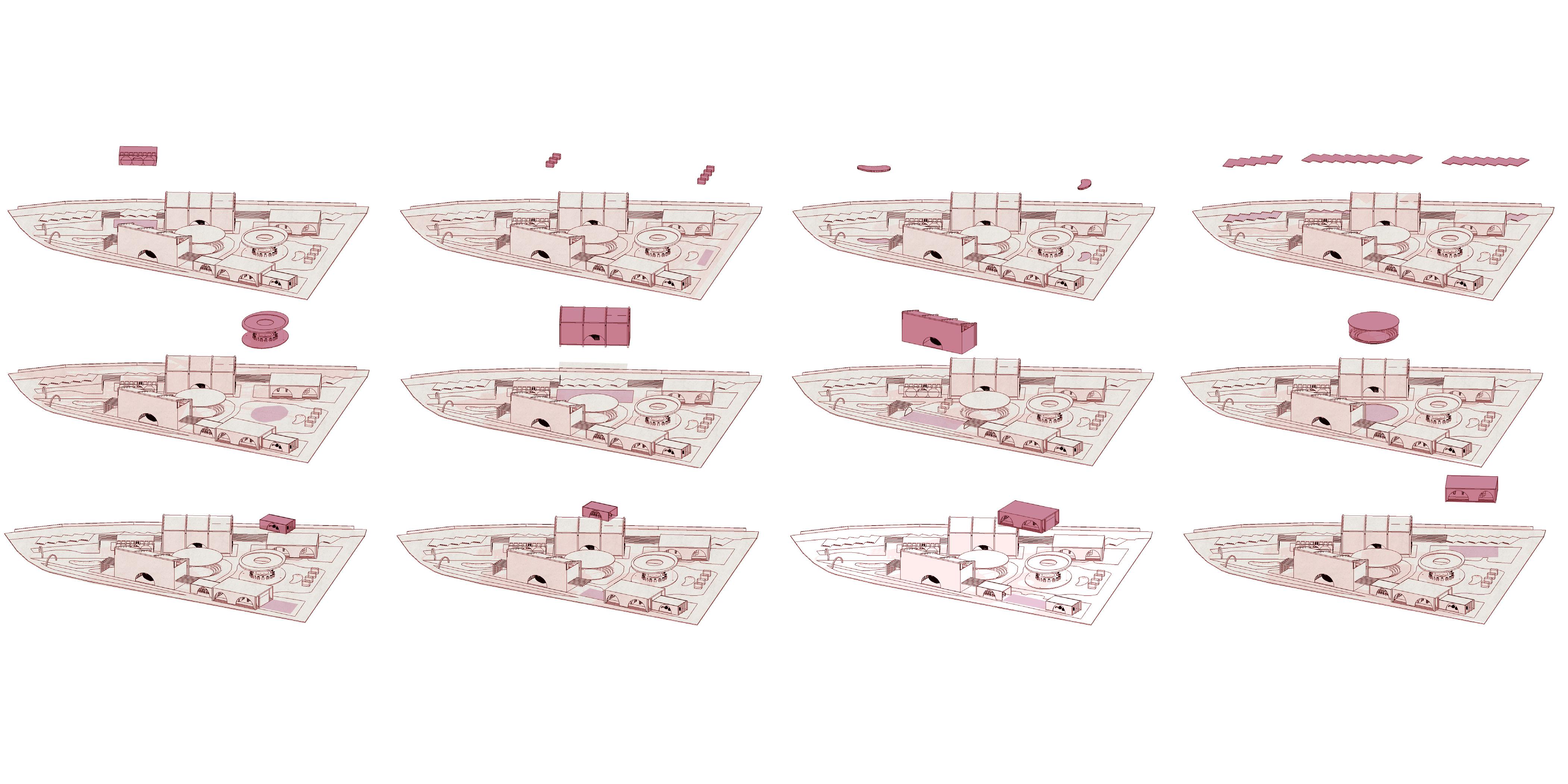
GEOMETRIC DIAGRAM
WATER GARDENS
Water gardens that collect rainwater from green roofs and surface runoff, contributing to sustainable irrigation.
BEAMS
Structural beams designed to distribute loads evenly and support the roofs effectively.
ARCHED
ARCHES
Arches marking site entrances, facilitating transitions and defining the architectural identity of the project
PERGOLAS
Pergolas are placed at various entry points offering shaded thresholds that are visually nviting and encourage passage
SLOPED ROOFS
Inclined roofs that promote water runoff, offer shade, dynamic spatial experiences.
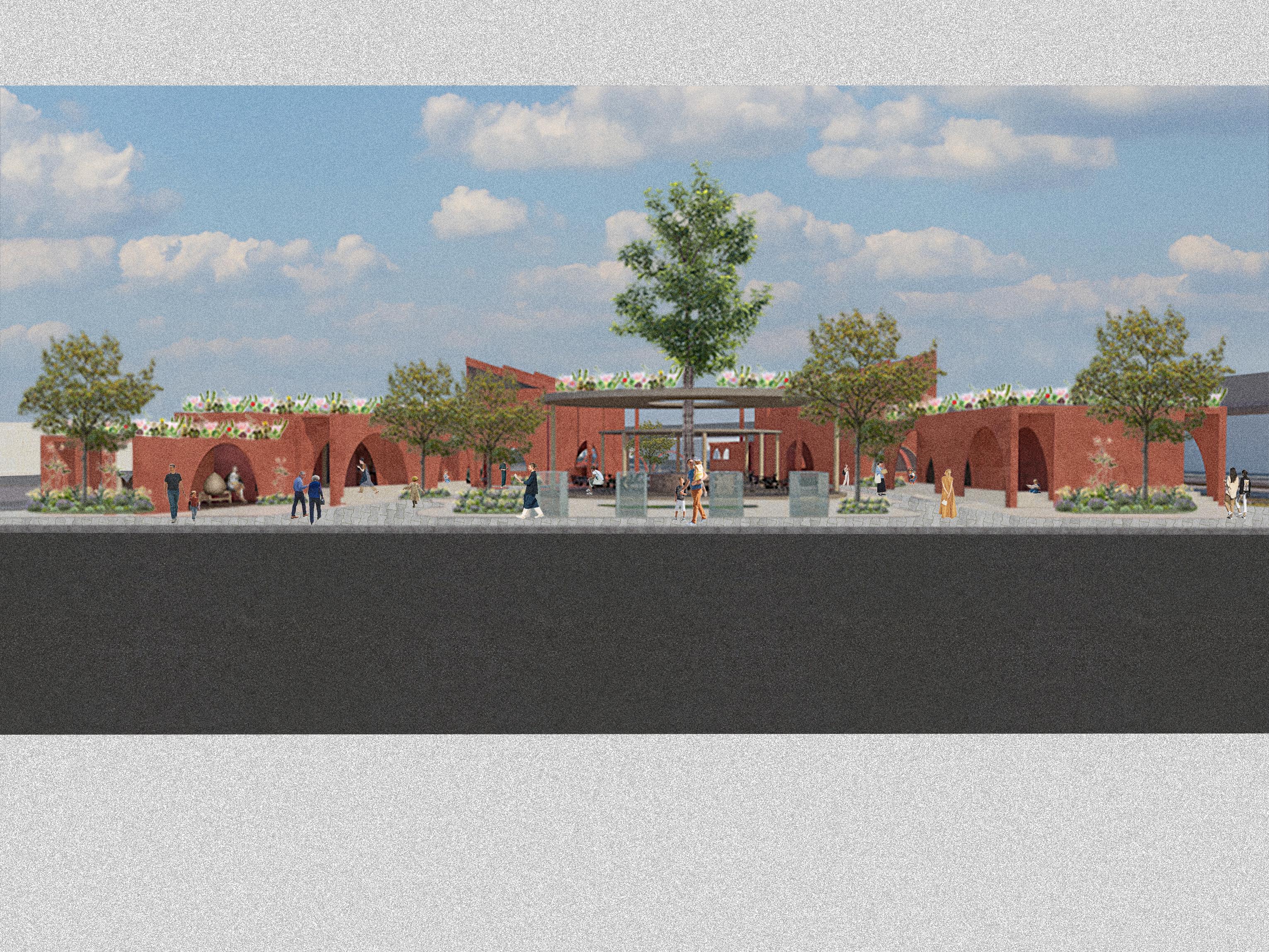
ARCHED WALLS DINING AREA
featuring arched openings that columns, allowing for load transfer creating porticoes that guide entry.
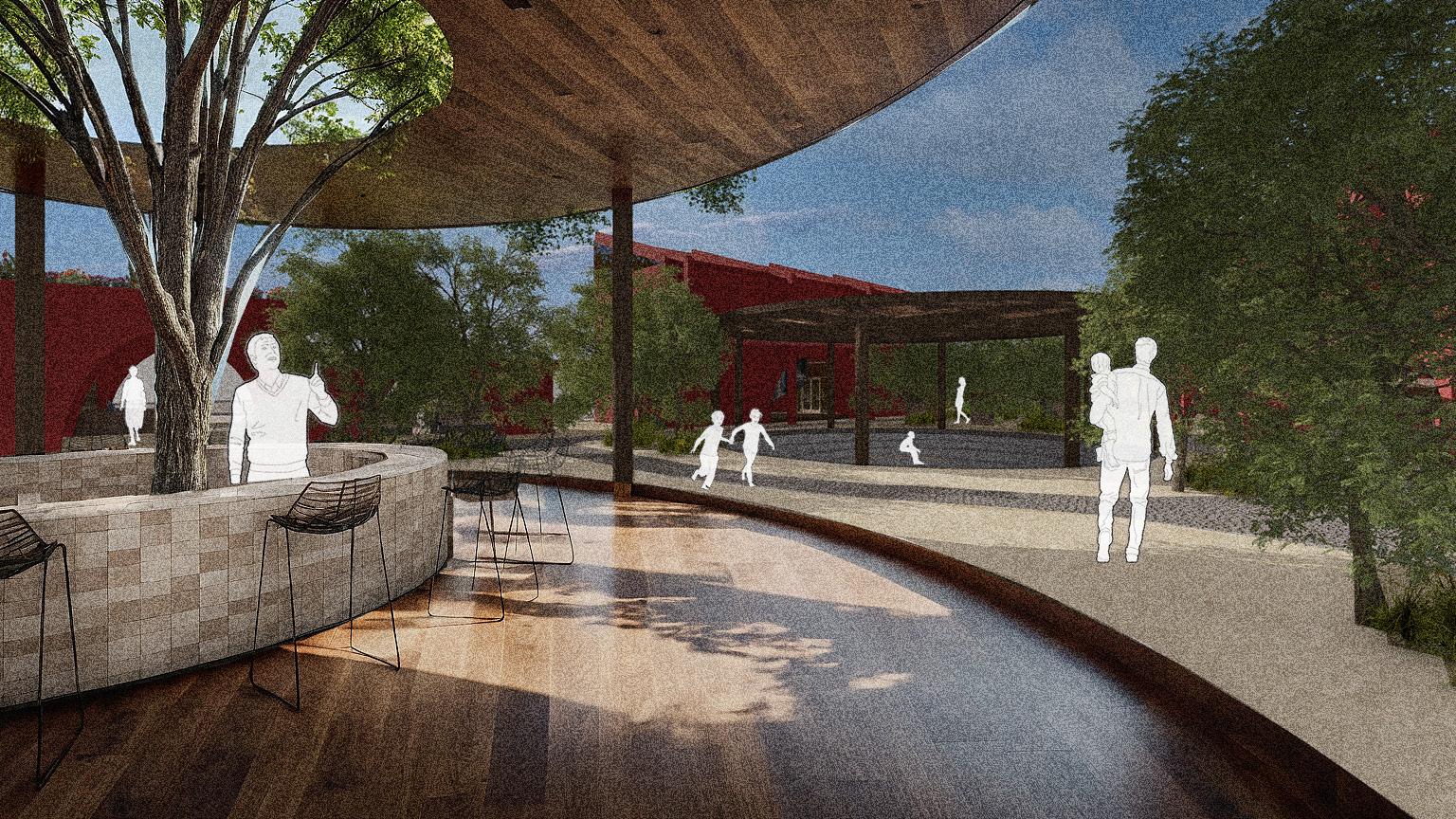
A dining space with a cantilevered structure and elliptical columns, serving as a social hub for eating and gathering
GREEN ROOFS
Green roofs that help cool the land, support biodiversity, and direct water runoff toward the water gardens.
PIT
promote efficient shade, and create experiences.
A versatile sunken area designed to host various activities, encouraging interaction and serving as a community focal point.
COLUMNS
Columns that provide structural support, spatial division, and load-bearing capacity while enhancing the overall aesthetic
STRUCTURAL ANATOMY
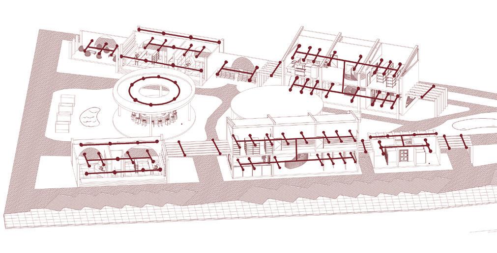
JOINING THE KNOTS
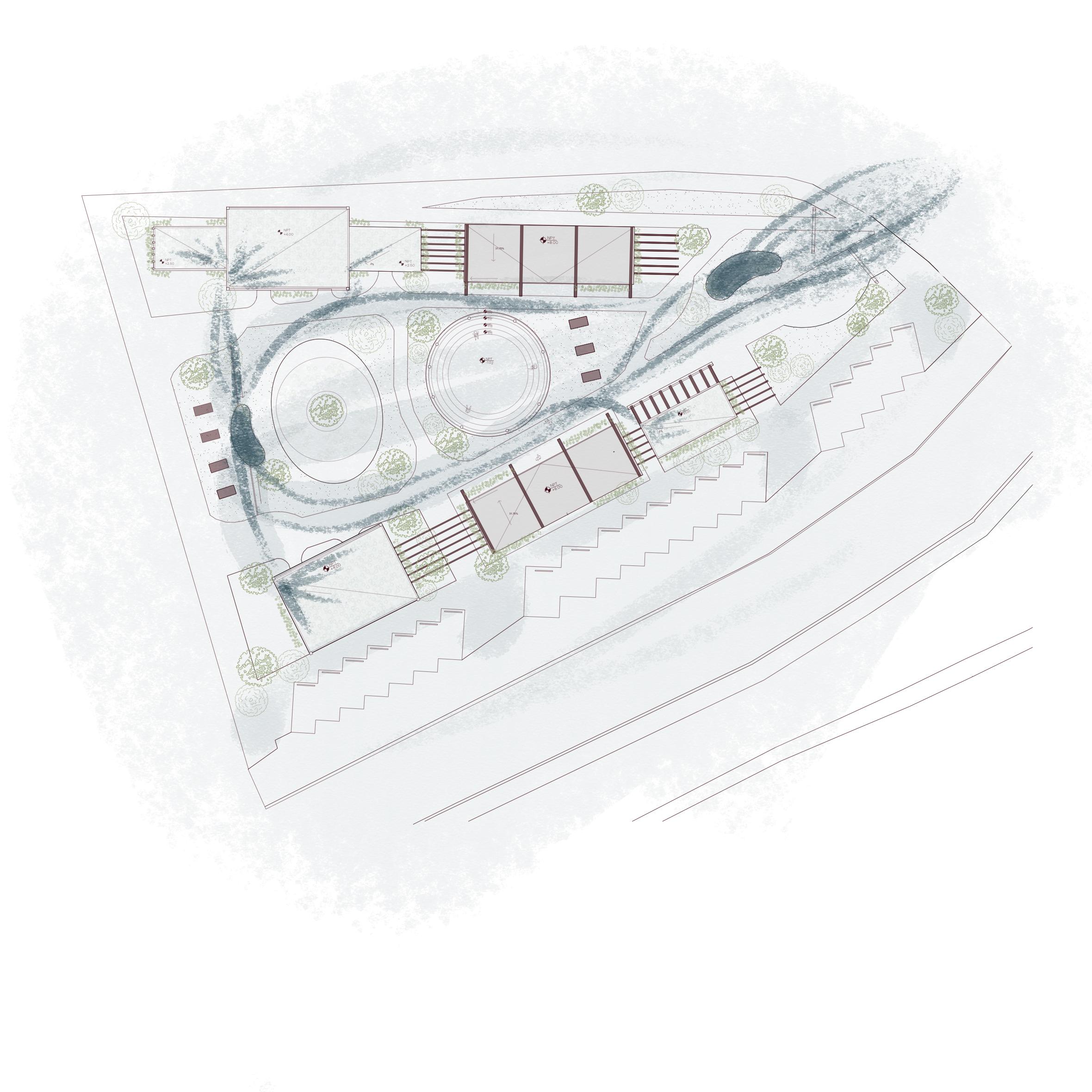
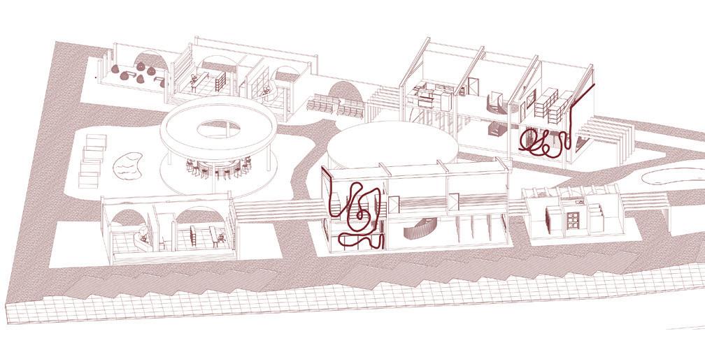
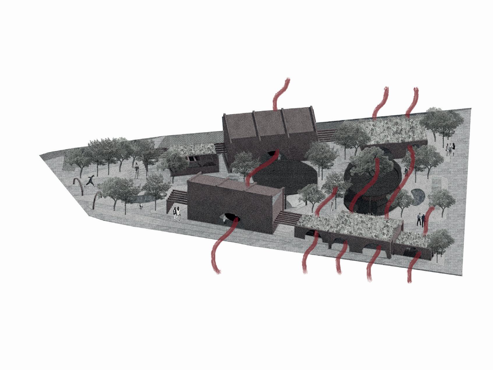
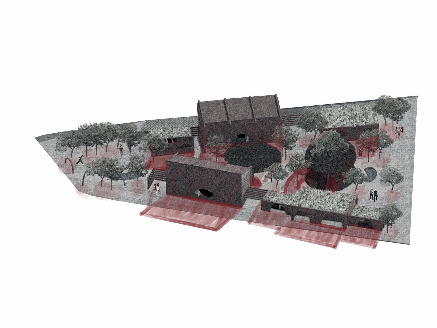
FLOW LINES
Through the different filters placed in certain areas of the river, it is expected that by the end of it, cleaner water To encourage exploration and connection throughout the site, we designed a circulation path that guides visitors through all the key spaces we created. This path weaves organically across the project, establishing a continuous flow and offering multiple leads that invite people to discover different experiences. By following this route, users encounter a series of moments — from open gathering spaces to quieter, more intimate areas — allowing for a rich and layered understanding of the environment.
In our project, the pedestrian crossing was designed by raising the street level to match the height of the sidewalk. This approach prioritizes pedestrians over vehicles, creating a safer and more visible transition for those crossing. By eliminating the height difference between the street and the sidewalk, we enhance accessibility for people with reduced mobility and reinforce the idea that public space should be centered around the safety and well-being of people..