Rolling Gran Canaria
9 Road Cycling Routes
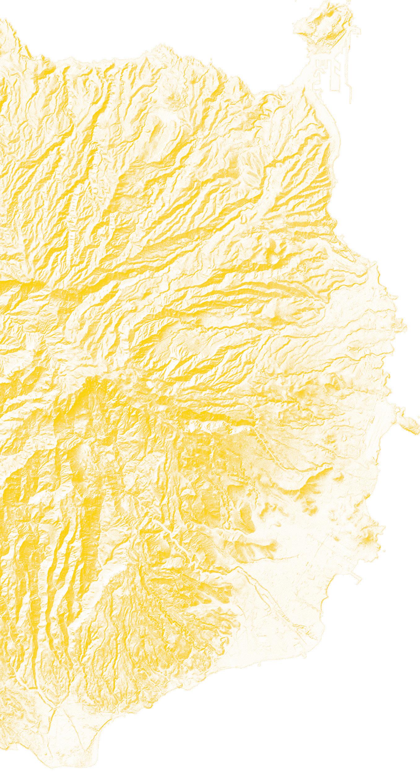
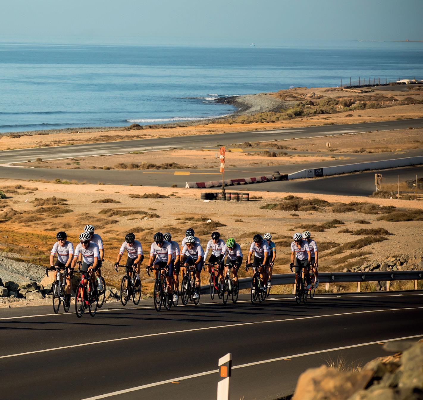
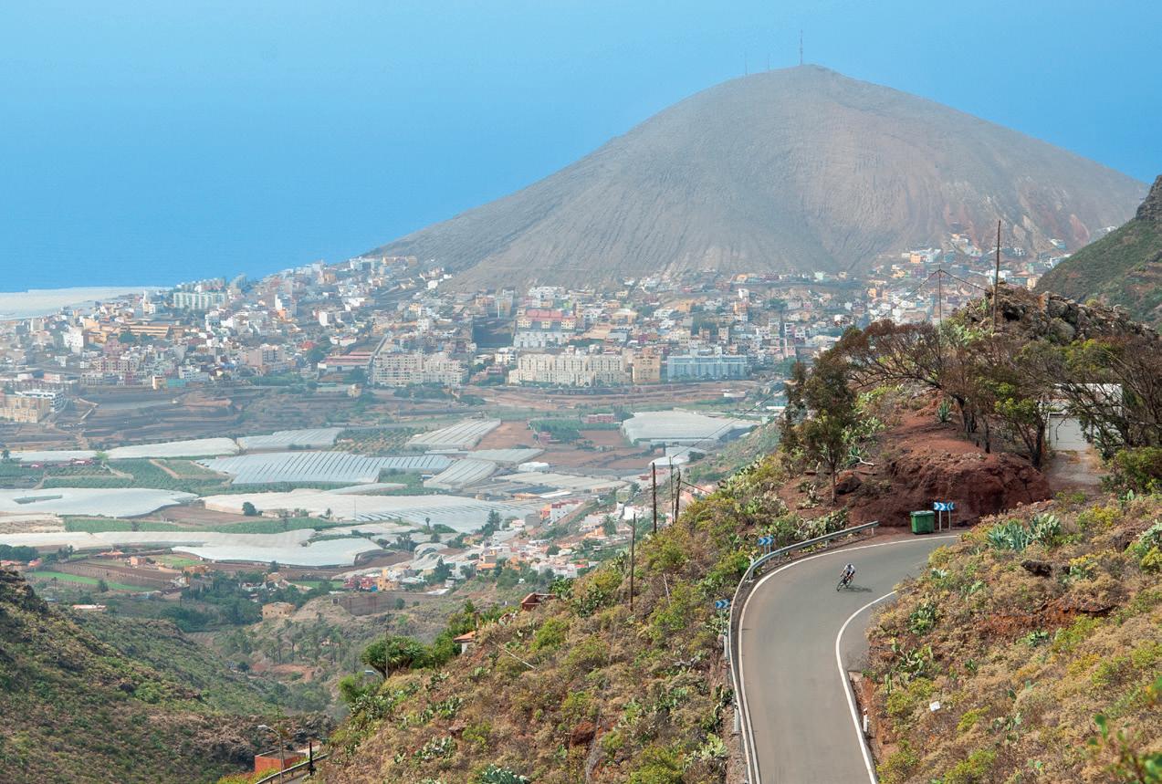
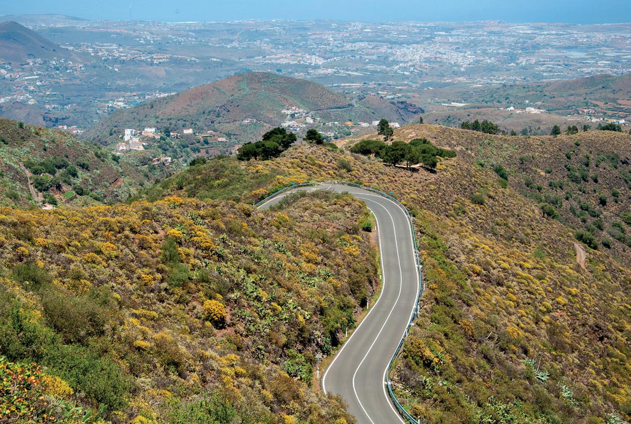
Riding around Gran Canaria, a «miniature continent»
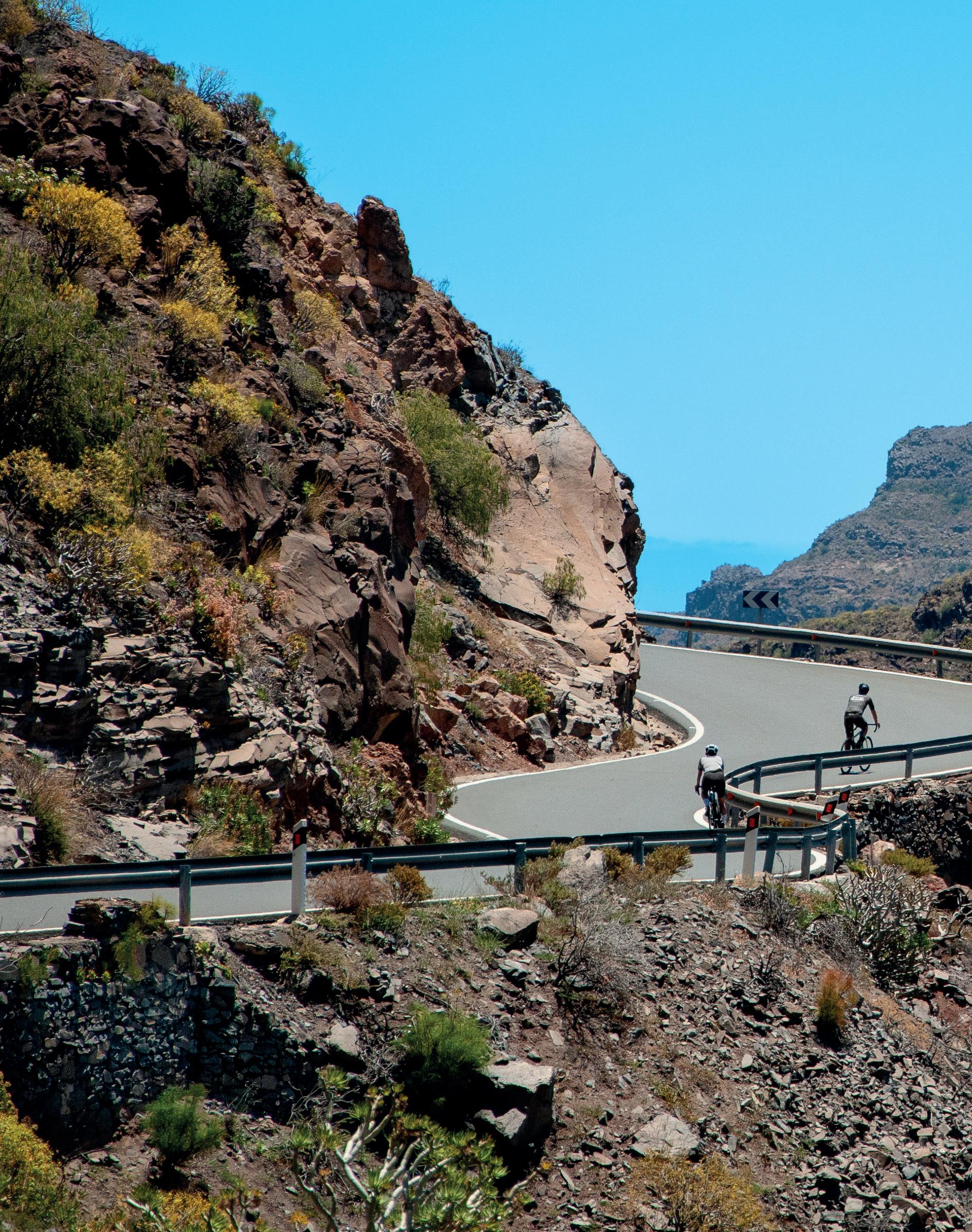
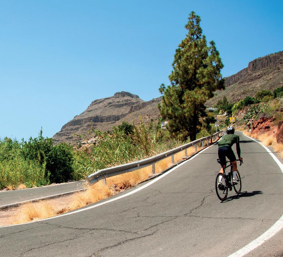
Few islands around the world offer so much in such a limited space as Gran Canaria. This destination can be discovered pedalling around the bends on a bicycle, from the tranquility of the seashore up to the volcanic peaks on high. Here, each ascent is a promise of views that will take your breath away, while each descent is an invitation to pure enjoyment. Welcome to the paradise of road cycling, on a territory that seems to be designed for endless riding pleasure.
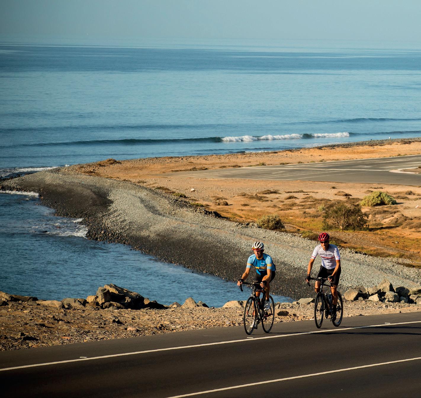
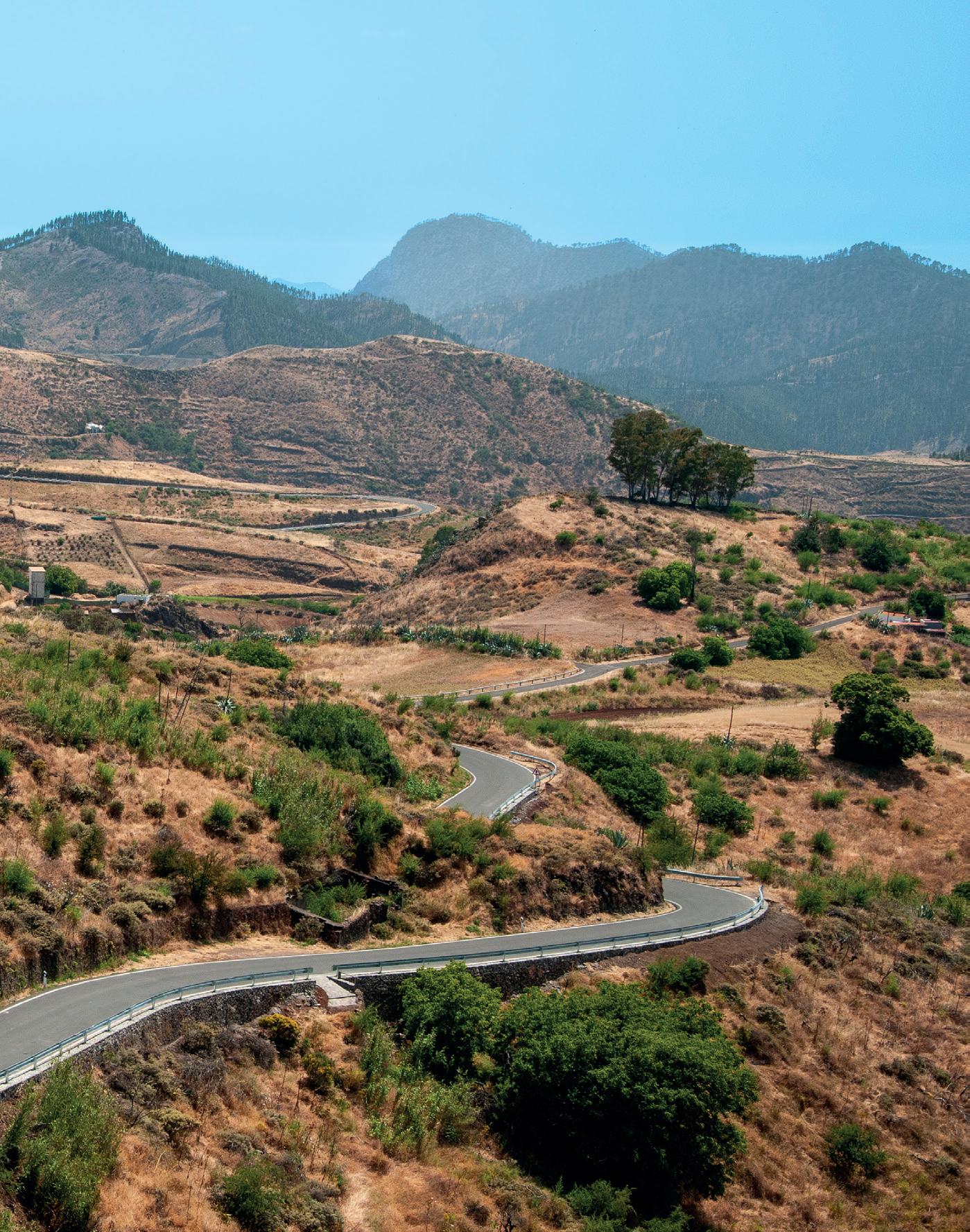
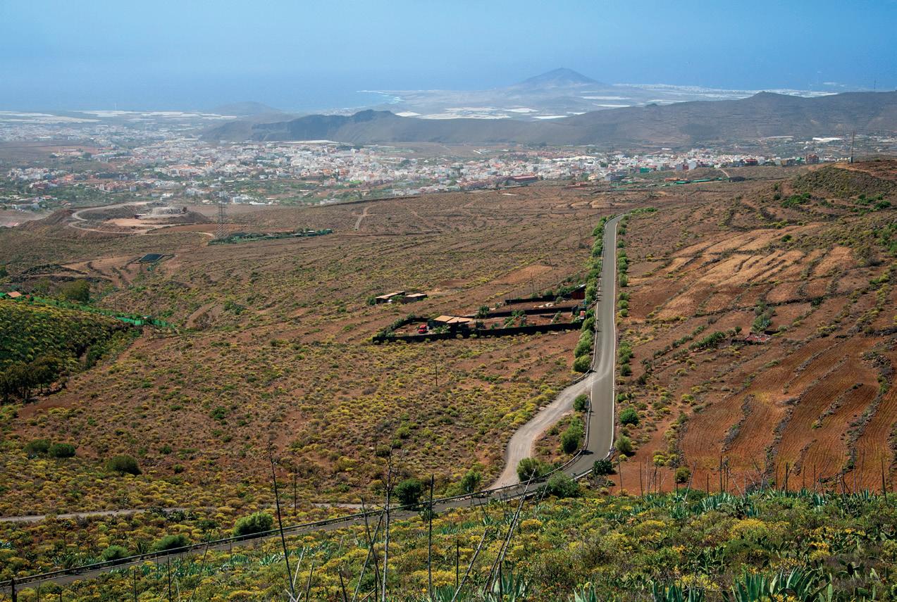
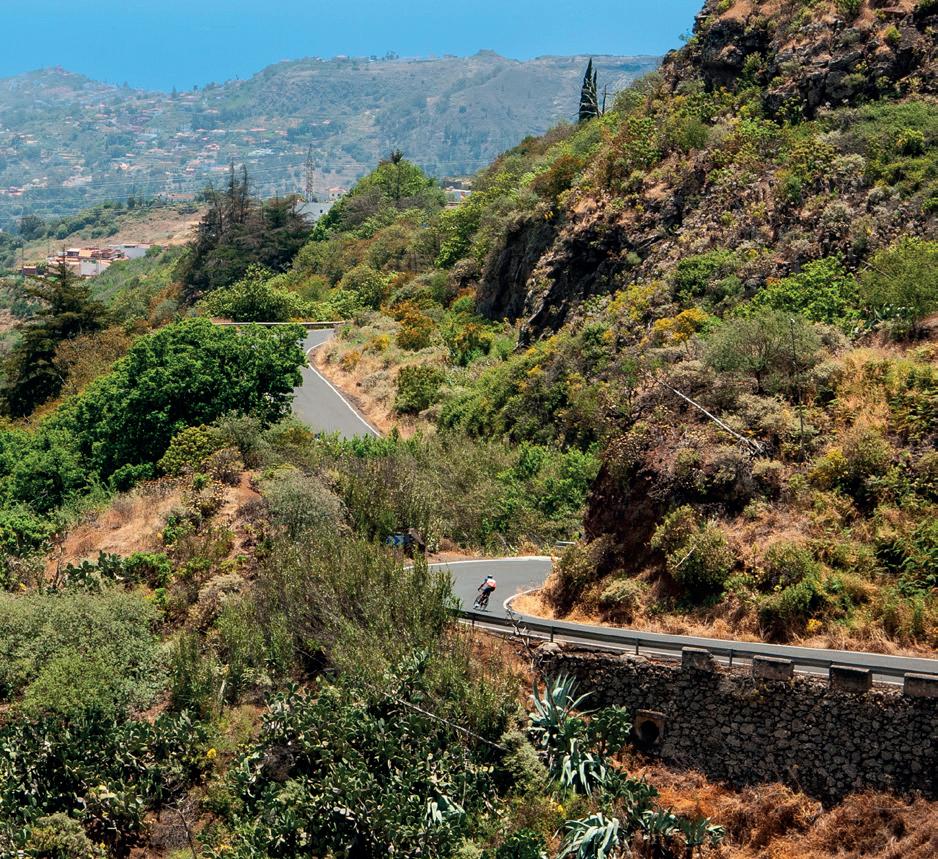
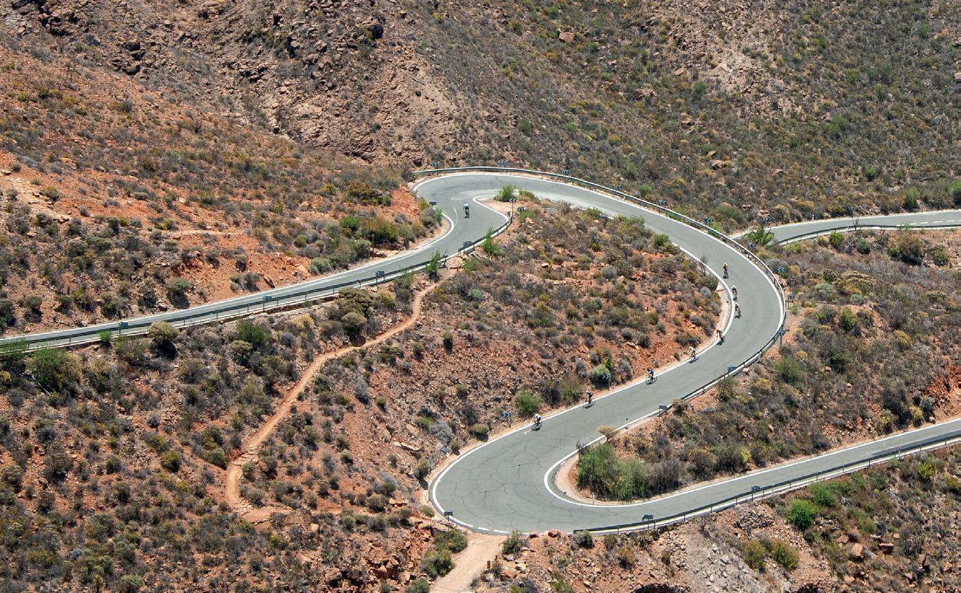
The island’s roads, which are quiet and have low levels of traffic, stick tightly to the landscape like lines of ink on a moving canvas. The more than 229 kilometres that criss-cross the island, combined with a year-round average temperature of 24°C, have made Gran Canaria a hotspot for professional and amateur cyclists looking to train, reconnect or simply enjoy their favourite sport together with top quality tourist facilities.
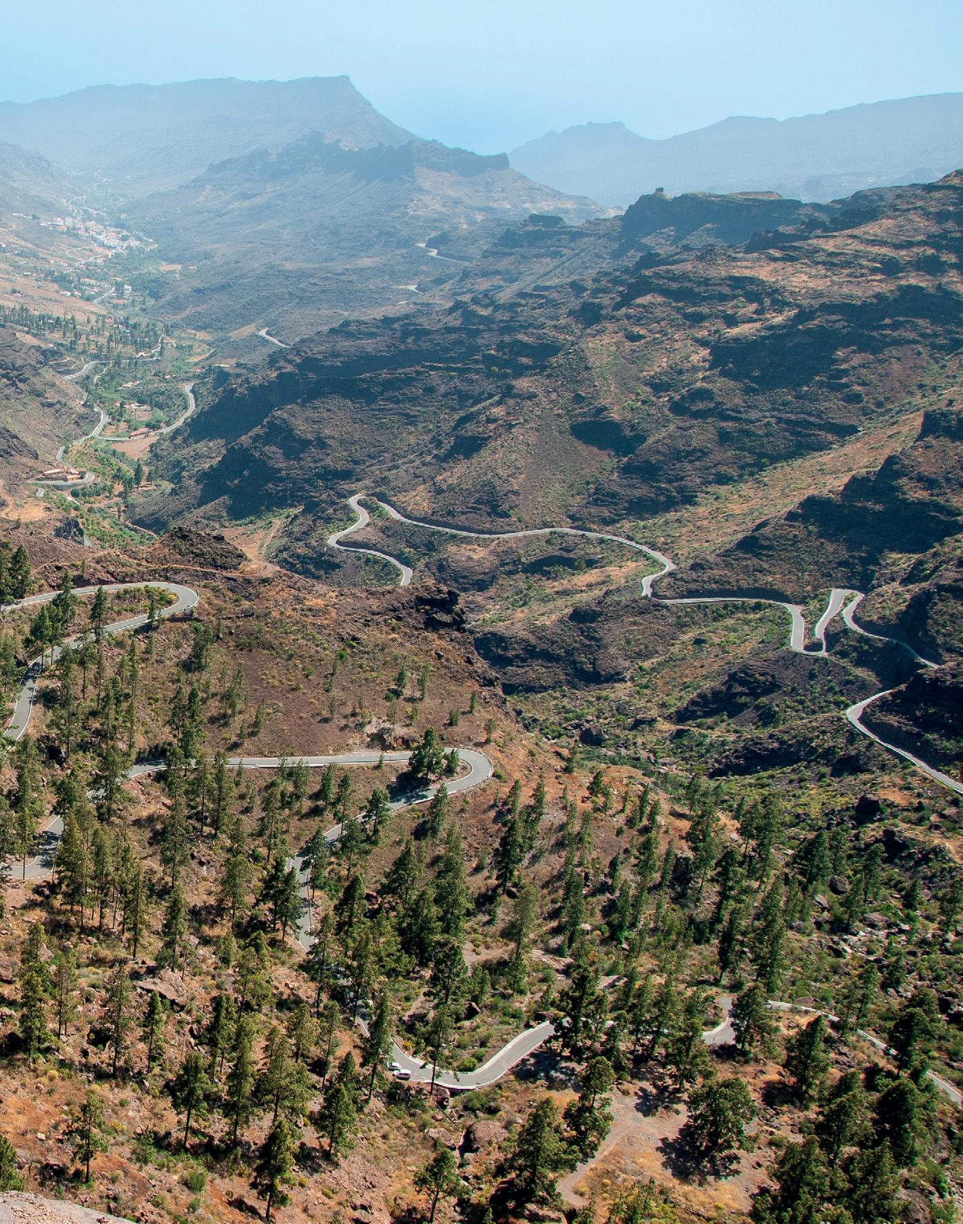
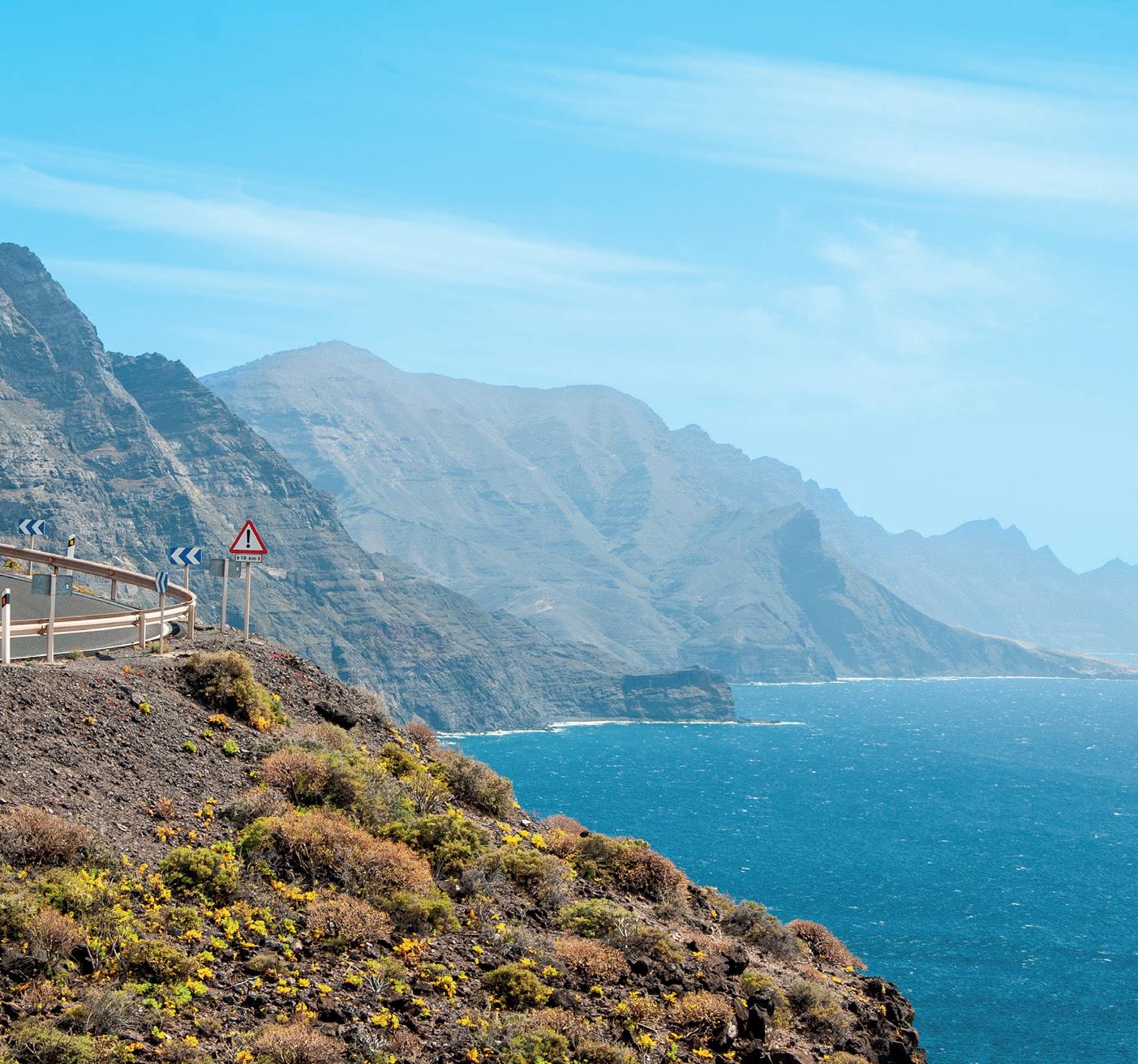
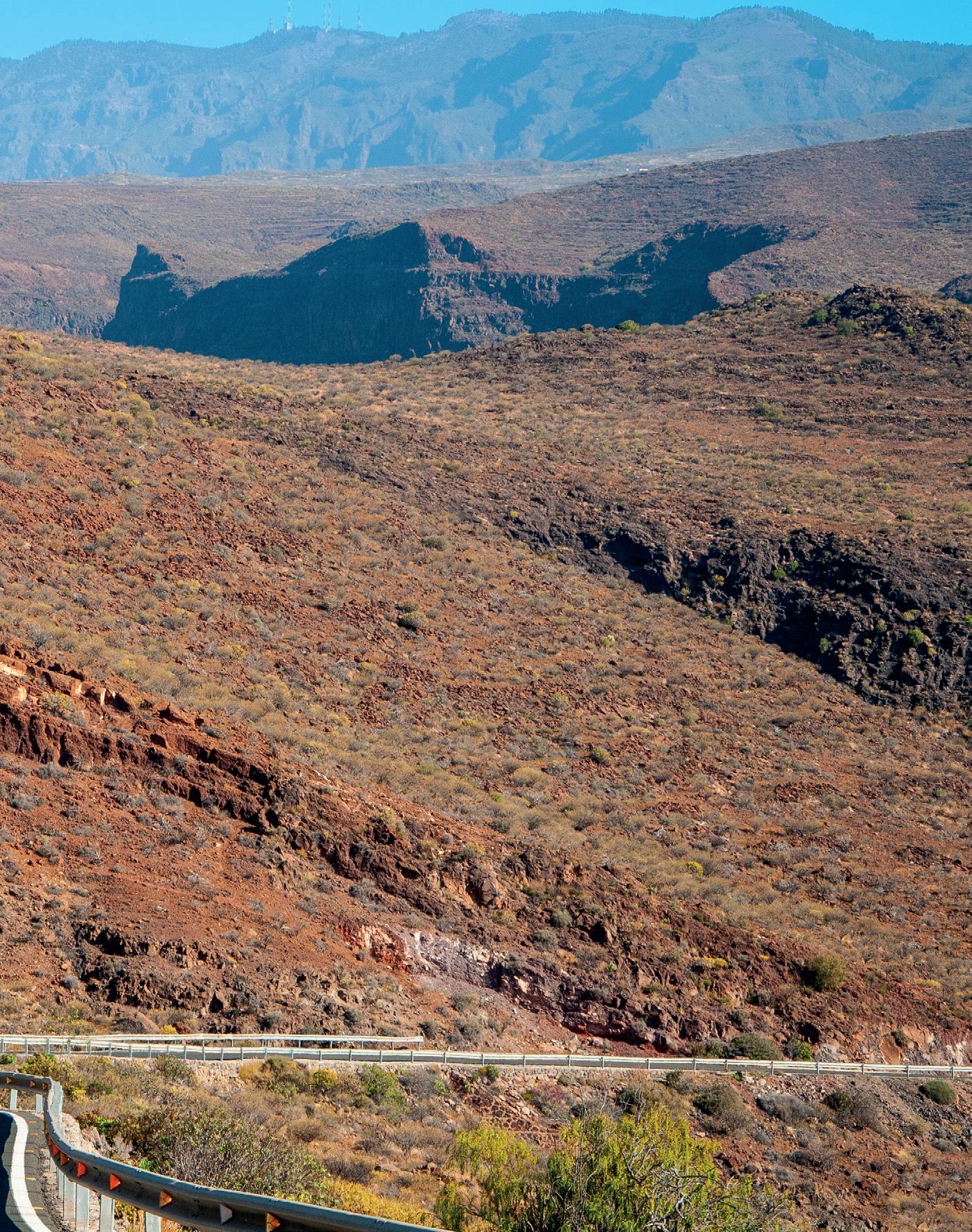
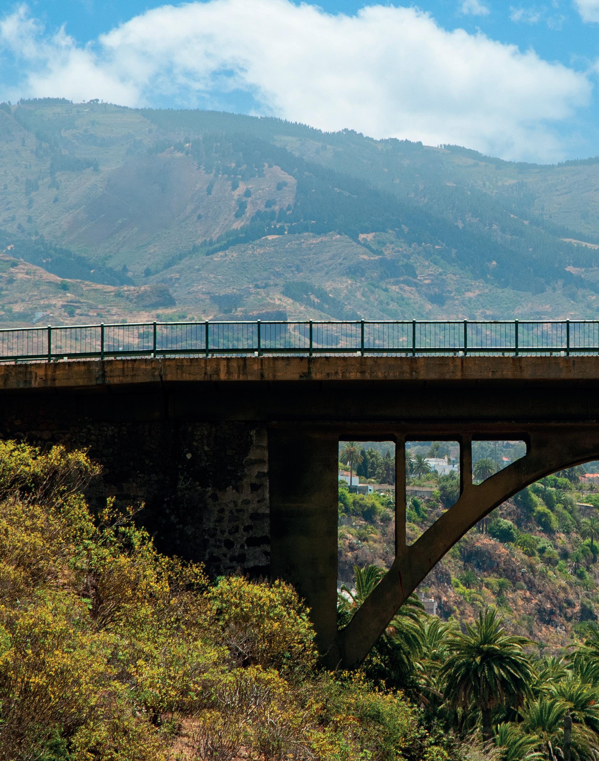
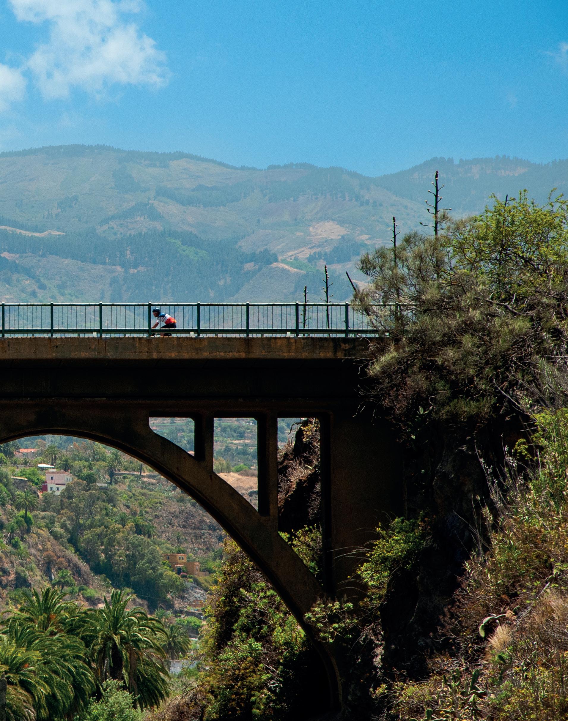
The island’s geographical diversity is its greatest strength: beaches to the south, forests to the north, cliffs to the west and, in the heart of the island, volcanic formations that reveal its rugged and unique character. Routes such as the ones that climb up to the Pico de las Nieves or wind through the Valle de las Lágrimas are as demanding as they are memorable. In Gran Canaria, challenge and landscape go hand in hand.
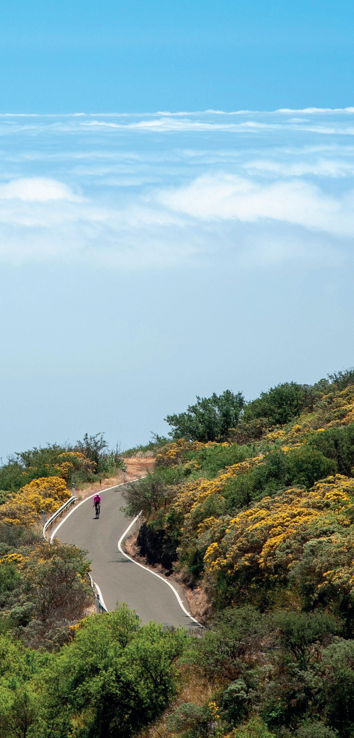
Each route brings with it the sounds of nature, the aromas of the pine forest, the sea and that crystal clear light that makes every cycling day an all-embracing experience, here in a territory that is part of the select club of worldwide Biosphere Reserves by Unesco. In only a few places does the variety of scenery - and the quality of the tarmac - make it possible to plan such versatile outings and training sessions, combining endurance, climbing and cruising.
This guide brings together nine carefully selected road routes that reflect the richness of this «miniature continent». They are designed to cater for different levels, but they are all suitable for those who understand cycling as a way of exploring the world. Or simply as a way of life.
9 Road Cycling Routes
1 — Trip around the Island
2 — Camino de Santiago in Gran Canaria
3 — Pasadilla – Pico de Las Nieves
4 — Temisas – Santa Lucia
5 — Agaete – Moya
6 — Arucas – San Mateo
7 — Ayagaures – Monte León
8 — Fataga – San Bartolomé de Tirajana
9 — Tauro – Cercados de Espino
— Trip around the Island
This is a cyclist’s “must-do”, the loop that everyone wants to tackle when they travel to Gran Canaria. The trip around the island has become one of the benchmarks on the island and leaves a lasting impression on all those that do. With nearly 200
kilometres and over 3,500 metres of elevation gain, it will be a challenge we will never forget.
We start off at the square next to the Alfredo Kraus Auditorium , at the northern end of the Playa de Las Canteras. We take calle Castillejos and then move on to Néstor de la Torre before joining the cycle lane along the Avenida Marítima.
At around kilometre 4, on calle Juan XXIII, we change lanes and join Avenida Alcalde José Ramírez Bethencourt and continue all the way to Carretera del Centro , the island’s central main road, where 11 kilometres of steep and pleasant ascent awaits us.
As we get to kilometre 16 of our route, we come to a roundabout where we turn off along the GC-801 towards “Los Hoyos” and embark on a long descent of around 7 kilometres to the district of Jinámar.
Keeping to the same road and in a southerly direction, we come to Telde (kilometre 29 of our route), where we come to a large roundabout. We take the fourth exit towards El Ejido - Lomo Cementerio along the GC-100.
Staying on the GC-100 we come to the stunning town of Agüimes , having passed through the towns of Cuatro Puertas, Aguatona and the picturesque town of Ingenio , after a number of continual rises and falls along the way.
We are now at kilometre 45 of the route and it is time to continue along the GC-100, but now towards Cruce de Arinaga. Care should be taken on the descent down to Las Crucitas is it is a highly windy area, with gusty side winds that can catch us out if we are not paying attention.
At kilometre 49 we join the GC-191 towards Vecindario , in a southerly direction.
This is a very flat area that usually has a tail wind, making cycling straightforward for around 7 kilometres until we join the GC-500 in the direction of Juan Grande
For about 15 kilometres from Juan Grande, we pass through San Agustín, Playa del Inglés and part of Maspalomas before we move on towards El Pajar while staying on the GC-500.
At approximately kilometre 90 on our route we come to Puerto Rico, the famous tourist resort town at the south of the island. Here, we hop on the boat to Puerto de Mogán as the road at Taurito is cut off.
There are two companies that operate this sea route: Líneas Salmón (www.lineassalmon.es) and Líneas Blue Bird (www.lineasbluebird.com), run alternate departures every hour on the hour and every half-past the hour respectively. The trip lasts around 25 minutes, costs around 8€ each way, and enables cyclists to take their bikes on board and is a special attraction that adds a certain touch to our cycling route.
Once there, we start a long and steep ascent up the GC-200 for about 12 kilometres, as far as the Village of Mogán where we then take a left
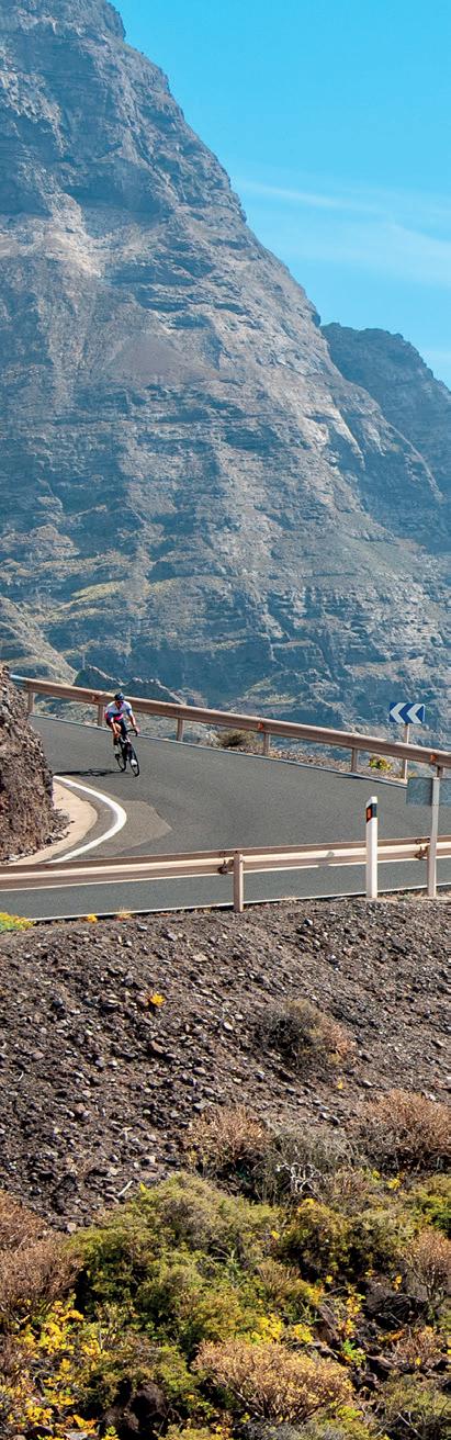
turn at Cruce de Pie de Cuesta and continue along the C-200 towards La Aldea.
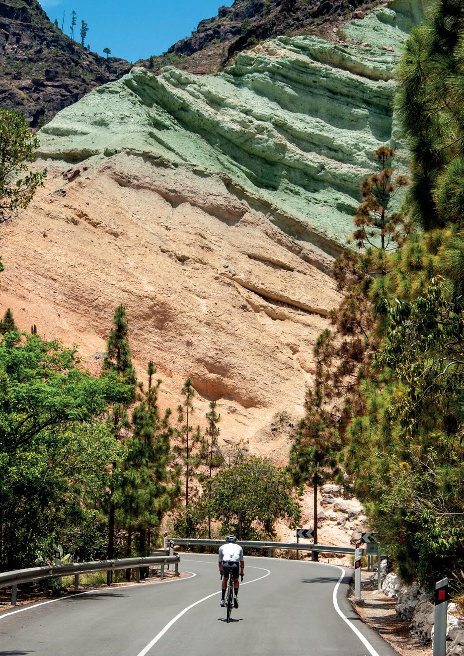
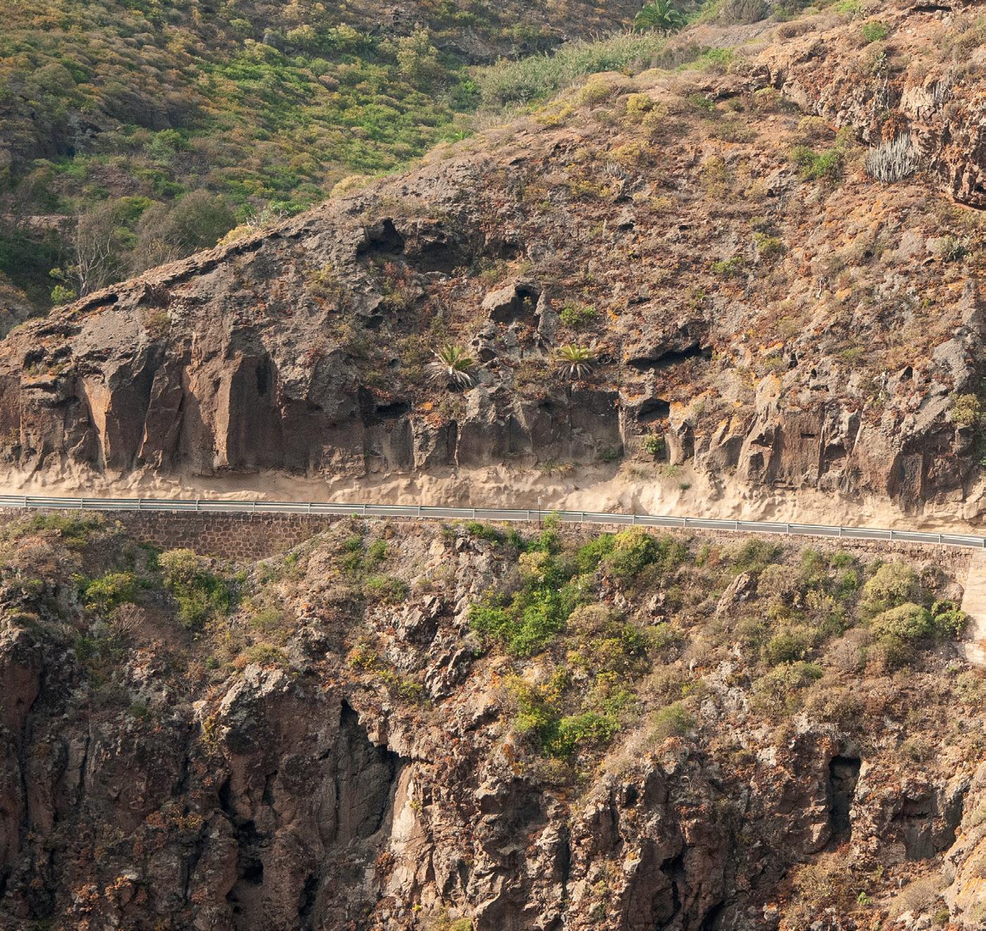
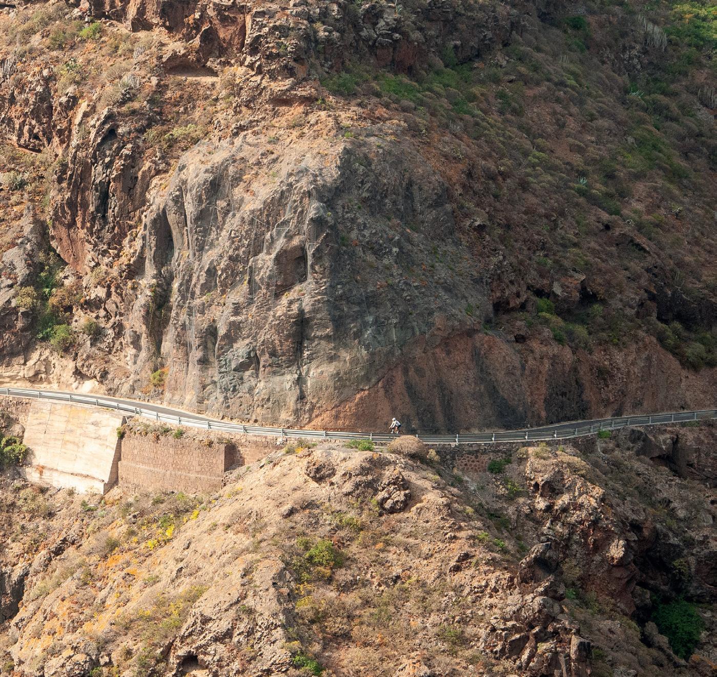
This area of the island is beautiful due to its steep ravines and winding roads. Here we come to one of the most emblematic points of the route: the ravine of Los Azulejos, famous for the different greenish and blue colours of its stones.
After a long, steep descent from the Mirador de La Aldea viewpoint, we reach the village of La Aldea, where it is advisable to take a break for refreshments.
We return to the GC-2 in the direction of Agaete/Gáldar. We can stick to the hard shoulder of the motorway along here and go through the tunnels with no trouble.
We are now at kilometre 150 of our great tour and it might be a good idea to stop off at the legendary Puerto de Agaete and take in the views of the mountains of Tamadaba
Las Palmas de Gran Canaria
and the famous “Dragon’s Tail” rock formation.
We face the final part of our route along the road to Piso Firme, the GC293, towards Guía and Gáldar, where we join back up with the GC-295 and cross the recently tarmacked Northern Road and the coastal villages of San Felipe, San Andrés, Quintanilla and Bañaderos.
The final few kilometres along the GC-2 towards Las Palmas de Gran Canaria is all that is left to culminate our route which has taken us practically 195 kilometres and about 3,700 metres of elevation gain.
This route is a real feat that any cyclist visiting Gran Canaria will remember for the rest of their life.
Telde
Puerto Rico
La Aldea
Puerto de Agaete
Puerto de Mogán
Agüimes
Juan Grande Ingenio
Mogán
— Camino de Santiago in Gran Canaria
This fast-paced cycling adventure, accredited as the Camino de Santiago (Saint James’ Way) of Gran Canaria, will transport us the near 100 kilometres that separate the south from the north of the island, across its central slopes.
The Camino de Santiago de Gran Canaria, a route linking the southern town of San Bartolomé de Tirajana with the northern town of Gáldar, has been well known for many years and is mostly done by walkers. More recently though, and equally as valid as it is also certified on arrival in Gáldar, many people have done the Camino by bicycle. This route always leaves a lasting impression.
Although the Camino officially begins in Tunte, it is often started from the coastal area further to the south of Gran Canaria. A long and steep climb, about 12 kilometres along the GC-60, will take us to the beautiful viewpoint at Degollada de las Yeguas, which offers a short and rapid descent before we face the last climb up to Fataga. This picturesque village, known as the “Valley of the Thousand Palm Trees”, is noted for its traditional charm and spectacular setting surrounded by ravines and mountains, making it an ideal stop on the route.
Sticking to the GC-60, a further 5 kilometres of exciting climb takes us to the top of Tunte, located at 930 metres above sea level and where there are only a few metres of descent left until we reach the town for the start of the Camino de Santiago. In the parish of Tunte (San Bartolomé de Tirajana) we can request a pilgrim’s certificate that can be officially signed in Gáldar once we have completed the route.
From Tunte, we get back onto the GC-60 and up to the peak at Alto de Cruz Grande , located around 40 kilometres into the route, some 10 kilometres on from the start at Tunte. This point signals the start of an exciting and gentle descent down to the village of Tejeda, recognised as one of the most beautiful towns in Spain. A stop should be made here to sample the famous giant palmeras cakes, bienmesabe or any other almond sweets, a star ingredient of this town that should not be missed.
1500 m
The route now takes us along the GC-210 to the town of Artenara, famous for being the highest village above sea level on the island and where we can enjoy some fine Canarian cuisine at any of its restaurants and bars. Artenara is also famous for its cycling tradition and proof of this is the ‘Monument to the Cyclist’ sculpture, located in front of the Cultural Centre, which is photographed by all the cyclists as they pass by. Also located here is the archaeological settlement of Risco Caído, a Unesco World Heritage Site.
Leaving Artenara we take the GC21 en route to Gáldar and Valleseco. After a futher 5 kilometres, we turn off left along the GC-220 towards Juncalillo and Agaete. Once we have passed the tiny village of Juncalillo, we take another left turn along
the GC-220 towards Fagajesto . We stay on this road en route to Caideros and Gáldar and, following a long 12-kilometre descent, passing through the towns of Saucillo , Tegueste, Buenavista and El Agazal, we tackle the final 4 kilometres along a flat road before making a triumphant entry into the square of Plaza de Santiago de Gáldar, right in front of the Church of Santiago de los Caballeros of Gáldar, thus concluding our cycling adventure. We can now collect our certificate to prove we have done the route, either at the church or at the nearby Gáldar tourism office.
So don’t miss the chance to enjoy this truly unique route, which combines nature, history, a challenge and the sense of pride of completing the Camino de Santiago, on an island full of cycling culture and tradition.
Fataga
San Bartolomé de Tirajana
Tejeda
Artenara Gáldar
Maspalomas
2 — Camino de Santiago in Gran Canaria
— La Pasadilla – Pico de Las Nieves
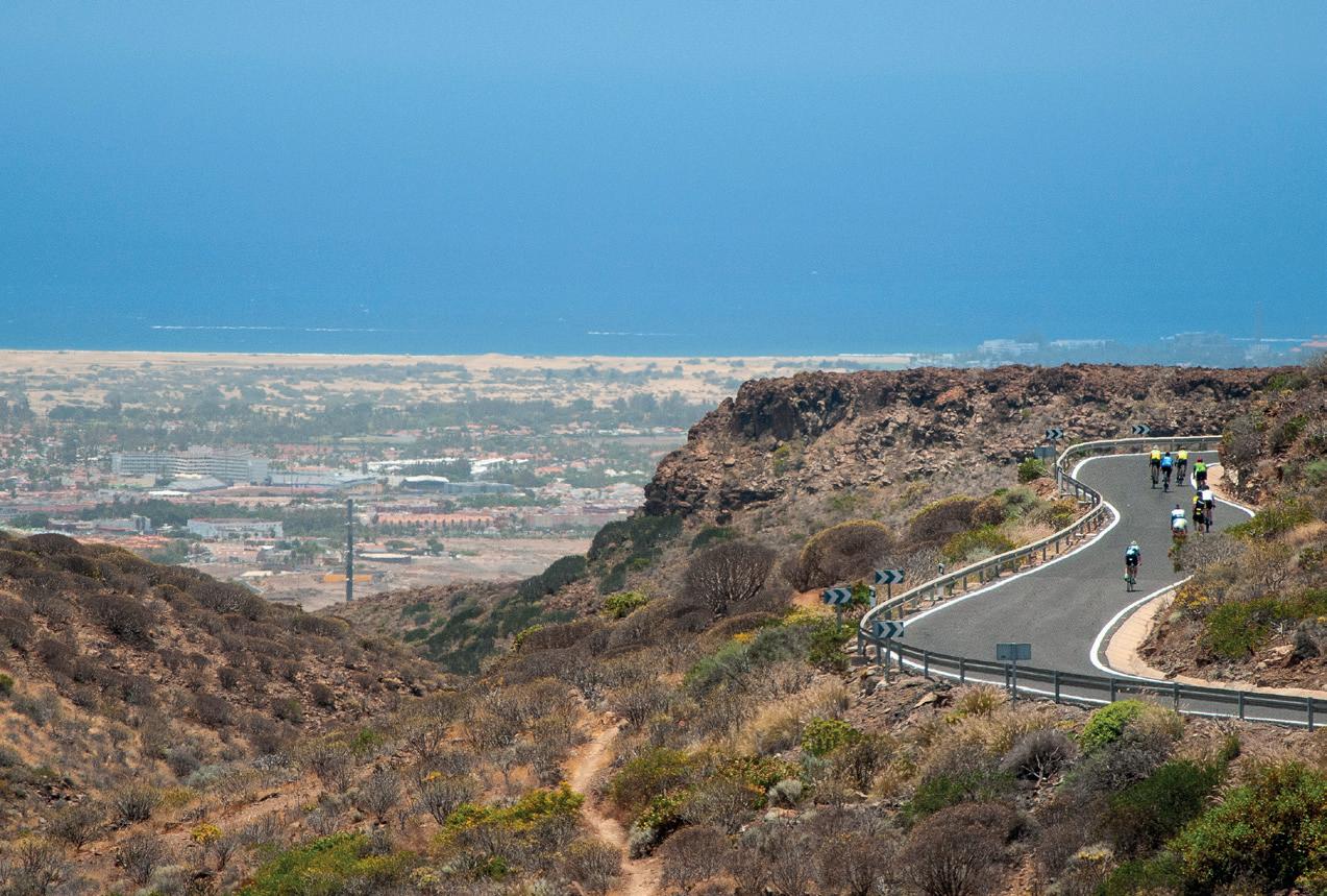
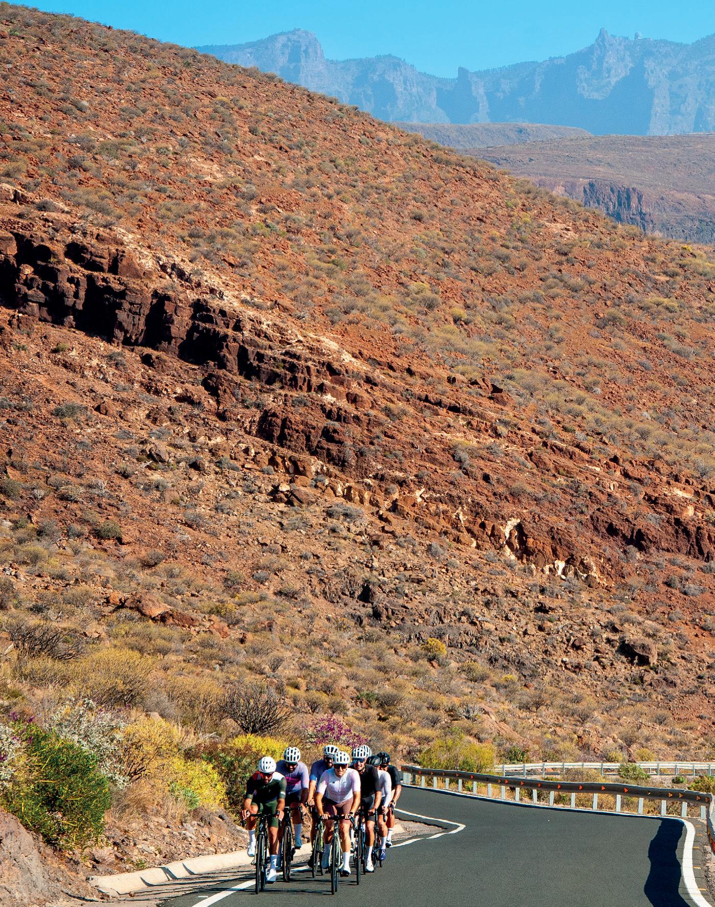
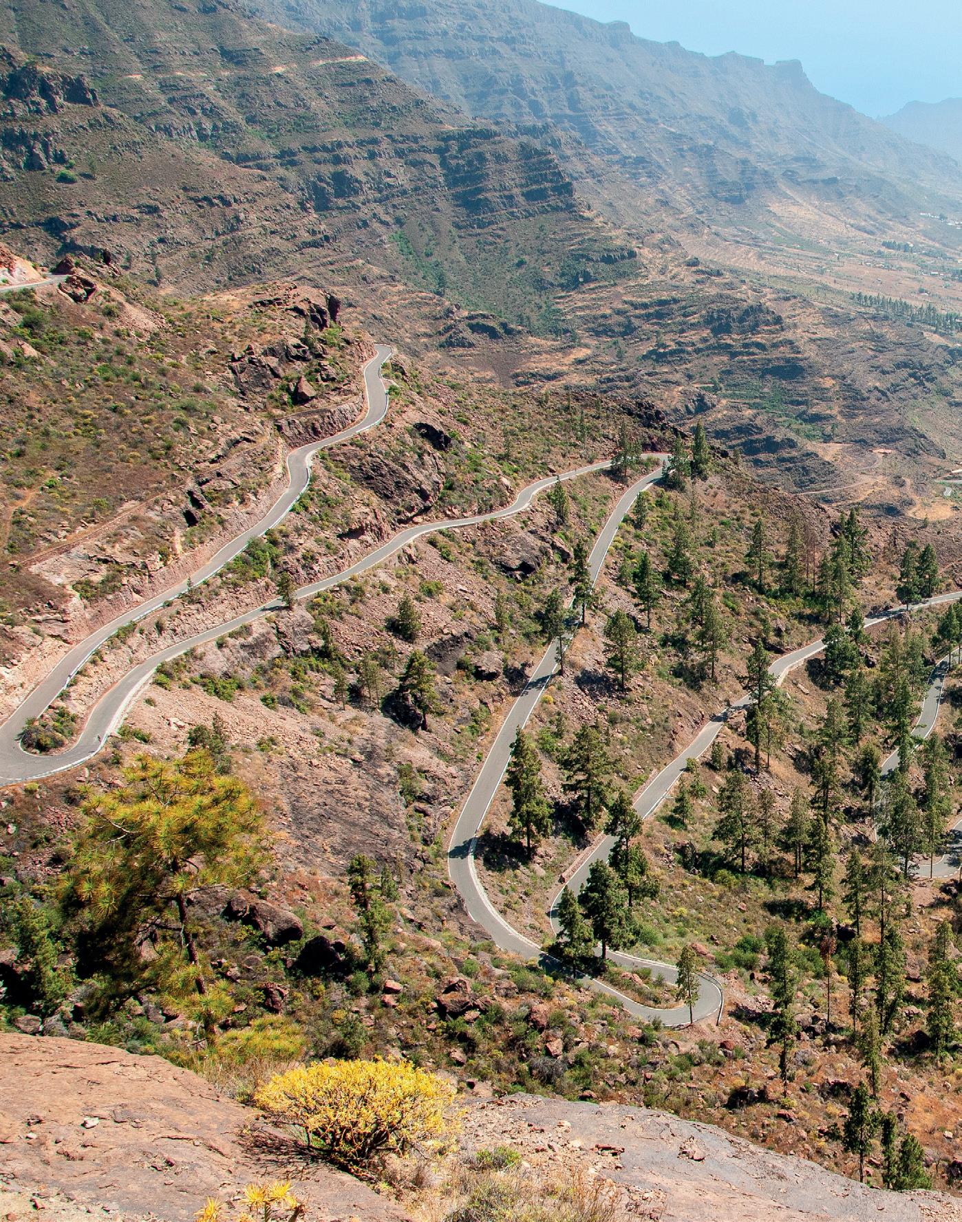
This is a great challenge, and one of the toughest ascents in Europe in terms of its elevation gain from sea level. The port of La Pasadilla leaves a lasting impression on all who reach it, with its 24 kilometres of demanding ascent up to the summit of Pico de Las Nieves, at 1,948 metres altitude. This route is designed for cyclists who are seeking an extreme challenge, for which great stamina and determination are key to conquer one of the most legendary mountain wpeaks in Gran Canaria.
Our starting point is at the square of Plaza de San Juan, en Telde , a magical location that oozes culture, history and tradition, at the heart of one of the most important cities in Gran Canaria.
We go along calle León y Castillo in a southerly direction and then onto Avenida Alcalde Alejandro Castro Jimenez, before linking up with the GC-100 which takes us, following a series of rises and falls through ravines, to the emblematic town of Ingenio, home to the island’s craftwork tradition and famous for its typical architecture and historic town centre.
At this point of the route we have covered 14 kilometres and an altitude gain of 200 metres, and now face the toughest part of our day, the ascent to Pico de Las Nieves.
At the end of calle Doctor David Ramírez we come to a little roundabout where we take the second exit towards La Pasadilla along the GC120, ready to tackle the first 5 introductory kilometres of the ascent. As we come to the restaurant Grill La Pasadilla, the real challenge is now upon us, in the form of a first section of 5 kilometres with a demanding average gradient of 11.5% and ramps that reach up to 24% of gradient.
At the Cazadores crossroads, we turn left onto the GC-130 and are now faced with the final 12 kilometres of the ascent to the Pico, with an average gradient of 6.5%. On the way, it is an absolute must to stop and contemplate the Caldera de Los Marteles, a spectacular volcanic crater 500 metres in diameter and 80 metres deep, an iconic feature of the island’s cycling and hiking routes.
We are now only 5 kilometres away from the final crossroads leading to Pico de Las Nieves, with an average gradient of 6.8%, and arriving at the crossroads of Alto del Pozo means we are practically at the top.
One last right turn takes us onto the GC-134 where we enter the final
1000 m
500 m
0 m 1500 m
0 km
and definitive kilometre that will take us up to within touching distance of the skies over Gran Canaria.
It is worth partaking in some Canarian delicacies at the stall which is almost always set up at the top of the island, and enjoy the scenery if the weather is fine, so wonderful from the highest point of the island, revealing the Roque Nublo, the Bentayga, the Caldera of Tejeda, and on the southern slope, the towns of Fataga, Tunte and the dunes of Maspalomas, a view to capture in a photo as a memento once the cycling feat has been achieved.
For the descent back to Telde, we go back on ourselves and at the Cazadores crossroads, we head straight on along the GC-130 towards La Breña (Telde). It is not advisable to return via La Pasadilla, as several tragic accidents have occurred there, staining the island’s cycling history; it is therefore advisable to avoid this downhill route.
From the Cazadores crossroads to the Plaza de San Juan de Telde there are some 18 kilometres of long, continuous descent that provide breathtaking views as we ride along smoothly. It offers an ideal stretch to relax after our titanic efforts, before we come to the Plaza and the final destination of this spectacular 66-kilometre route and 2,100 metres of elevation gain.
Telde
Pico de las Nieves
La Pasadilla
3 — La Pasadilla – Pico de Las Nieves
— Temisas – Santa Lucía
This circular route around the eastern side of the island covers around 50 kilometres, and has almost 1,000 metres of elevation gain. It runs through the beautiful towns of Agüimes, Temisas and Santa Lucía de Tirajana, ideal for those looking for long cycling ports and fantastic views.
We start off at the area of Doctoral, along Avenida de las Tirajanas in a northerly direction. This is a long, flat straight stretch of about 10 kilometres, usually with a headwind to battle against. After passing the village of Montaña Los Velez , we take a left turn to join the GC-195 towards Ingenio. After a few kilometres of steep climb, we turn left
again onto the GC-100 at the junction with Avenida Antonio Benítez Galindo, and head south towards the famous village of Agüimes.
Once through here, and around 15 kilometres into our route, we take a turn off to the right and make our way up the GC-550 towards Temisas and Santa Lucía.
This is around 10 kilometres of adrenaline-pumping climb, featuring stunning views over the coast and the summit of Gran Canaria: we crown
600 m
400 m
200 m
the port as we reach the Temisas Astronomical Observatory and from this point we begin a gentle descent of around 7 kilometres until we come to the beautiful town of Santa Lucía de Tirajana
It is well worth a stop here for refreshments at any of the town’s bars and to sit back and enjoy the peace and quiet of the surroundings. Just 18 kilometres of descent now separate us from the end of the route. Care should be taken of the
side winds that blow across us as we make a quick winding descent along the GC-65.
There are many who, after finishing this route, take a well-earned dip in the sea at Playa de Arinaga before sampling some locally-cooked food to round off a superb day out on the island.
Santa Lucía de Tirajana
El Doctoral Temisas
4 — Temisas – Santa Lucía
— Agaete – Moya
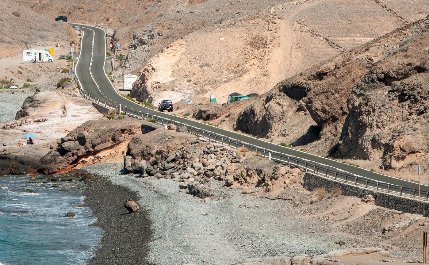
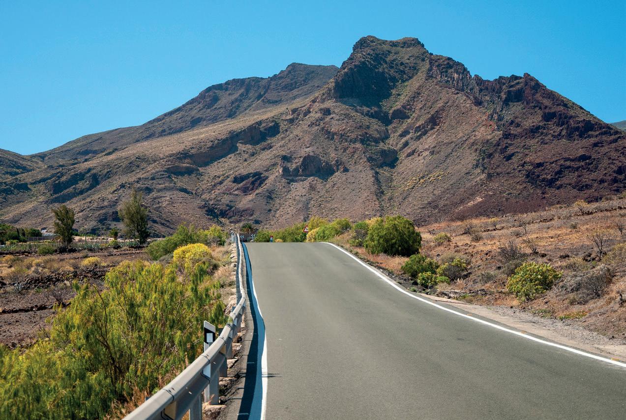
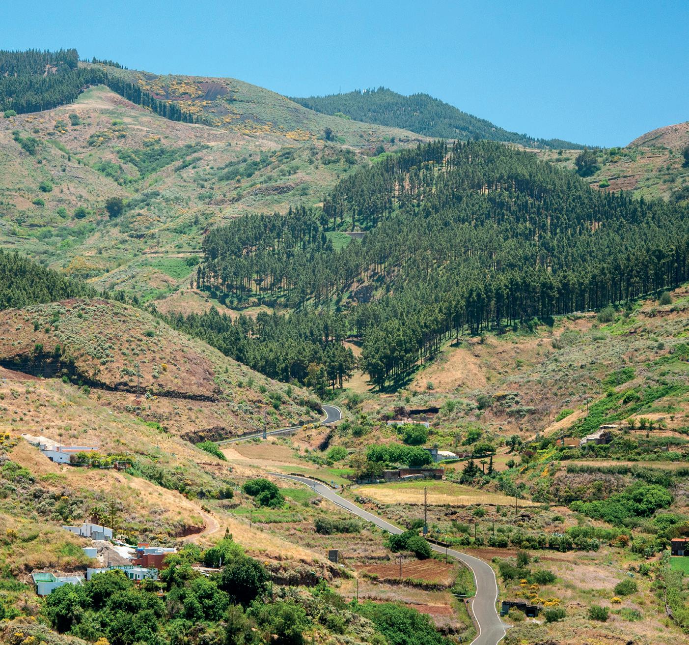
The northwest coast of Gran Canaria continues to be a treasure for many, full of amazing spots: from imposing ravines that plunge into the Atlantic Ocean to lush forests and viewpoints with stunning views of Mount Teide, the highest mountain in the Canary Archipelago and in all of Spain, which is located on the island of Tenerife. This circular route of 65 kilometres and 1,600 metres of elevation gain, will reveal some of Gran Canaria’s finest locations, exposing its hidden beauty and imposing natural surroundings.
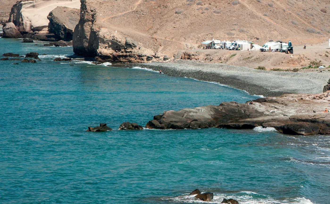
We set off from the traditional and charming fishing village of Agaete , together with its Puerto de Las Nieves and the Dedo de Dios or Finger of God rock, also known as the Roque Partido, or Split Rock. The port also boasts natural water pools and stunning views over the steep cliffs of the west coast of Gran Canaria. These cliffs give rise to the stunning “Cola de Dragón”, or dragon’s tail, a geological formation made up of sharp volcanic ridges that seem to rise up from the ocean like the tail of a sleeping dragon. This spectacular landform is one of the island’s most iconic landscapes and a real spectacle for cyclists on the surrounding routes.
From Agaete, we take the GC-293 towards Piso Firme, moving approximately 5 kilometres along a series of rises and falls through winding terrain until we reach the roundabout that will lead us to Hoya Pineda. Be extremely cautious on this part of the island, as the wind can blow quite strongly around here.
The 14 kilometre climb to Caideros , along the GC-220, is an absolute joy. Recently retarmacked, the road winds between ravines and continuous bends offering spectacular views of the valley and the northwest coast of Gran Canaria. Once we reach
the aforementioned small town, there is only one last kilometre to go before we turn left onto the GC-710 at the junction towards Fontanales-Guía.
What awaits us here is a long and steep descent. If it is not the hot season, it is advisable to take some warm clothes, as the altitude in this part of the island tends to bring cooler temperatures. After about 13 kilometres, and passing through the mythical northern towns of Montaña Alta and Santa Cristina , we come to the picturesque village of Moya, where a stop for refreshments is recommended.
Famous for its pastry tradition, with its exquisite bizcocho and suspiro cakes, and for its imposing church of Nuestra Señora de La Candelaria that hangs perilously over a ravine, a stop in the village of Moya perfectly combines a sweet reward with its charming streets and breathtaking views of the surrounding ravines.
1000 m
800 m
600 m
400 m
200 m
Puerto de Agaete
Caideros
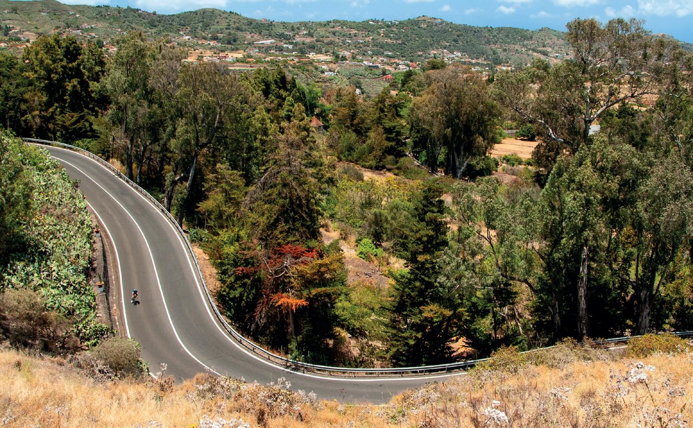
The 7 kilometres of descent that separate Moya from sea level, through the Cabo Verde area, twist and turn but are very pleasant to ride. The views offered by the GC-752 to the Atlantic Ocean, the north coast and the town on the horizon, make this descent one of the most iconic in Gran Canaria. It is recommended to do this route on the Cabo Verde side and not the Los Dragos side to avoid heavy traffic.
After joining the GC-75 and reaching the coast, we take the fourth exit at the roundabout and continue towards El Hormiguero on the GC-291. 10 kilometres separate us from Guía, another of the emblematic villages of the north. Through its mythical streets we head towards Gáldar on the GC-292 and from here we join
Moya
the GC-293 and onto Piso Firme , where the last kilometres of the day await us.
As we approach Agaete again, the landscape becomes more and more imposing, with the Atlantic in the background and the silhouette of the island of Tenerife on the horizon. Finally, one last descent brings us back to our starting point, bringing to a close a route full of beauty and cycling excitement.
— Arucas – San Mateo
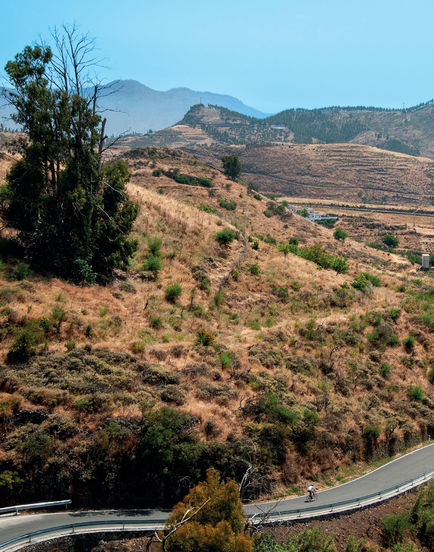
This area is one of the jewels of the north, a route that takes riders through part of the history of Gran Canaria, crossing spectacular ravines and offering breathtaking views of the Atlantic Ocean that bathes the island. This cycling route of 72 kilometres and 1,300 metres of elevation gain is designed for experienced cyclists as well as for those who want to discover the most fascinating corners of the island.
We kick off this route in the picturesque municipality of Arucas, famous for its church of San Juan Bautista, a neo-Gothic masterpiece with an imposing façade and a majestic main tower that dominates the landscape above the town.
We take the GC-300 towards Moya and after the first 6 kilometres of gentle descents and climbs, at Buen Lugar, we turn left towards Firgas on the same road, and continue for about 3 kilometres on a gentle slope, with an average gradient of 5%, until
reaching the top of the mythical village that gives its name to one of the most important water sources in the Canary Archipelago. Worth checking out is the waterfall that runs down a series of steps, located just at the entrance of the village. We now tackle a further 3 kilometres of gentle ascent which takes us to the crossroads of Los Chorros. Here, we turn left towards La Cruz-Teror along the GC-240 main road. At kilometre 21 of the route we come to Teror, an essential stop on the route and a mythical Gran Canarian village famous for its church of Virgen del Pino, one of the most
important pilgrimage sites on the island. The Virgin of El Pino is the patron saint of the island and her carving attracts thousands of worshippers every year, especially during the festivities in her honour in September.
At this point, we take the GC-42 towards San Mateo , a route that runs for 18 kilometres through leafy ravines, landscapes full of vegetation and a final ascent to the area of San Isidro which takes us on a descent to the picturesque municipality of San Mateo, famous for its agricultural market and its rich craftsmanship tradition.
Moving along the GC-15 and following 8 kilometres of gentle descent, we come to the equally emblematic town of Santa Brígida, famous for its
church and local market. It is worth stopping and taking a break for some food and drink. We then get back on route along the GC-320 towards La Angostura and through the “Viera y Clavijo” Canary Botanical Garden, famous for being one of the leading gardens in Spain and the largest on the Canary Islands, as it is home to over 500 endemic plants.
The GC-308 then takes us down to the large Alisios Shopping Centre, in Tamaraceite. From here, we take the third exit on the main roundabout and continue along the GC-300, back to our starting point and end of the route in Arucas.
The final 10 kilometres pass through the picturesque villages of Tenoya and Cardones , bringing to an end this magical cycling outing at the square of the Plaza de San Juan de Arucas.
Teror
Santa Brígida
Tenoya
Arucas
San Mateo
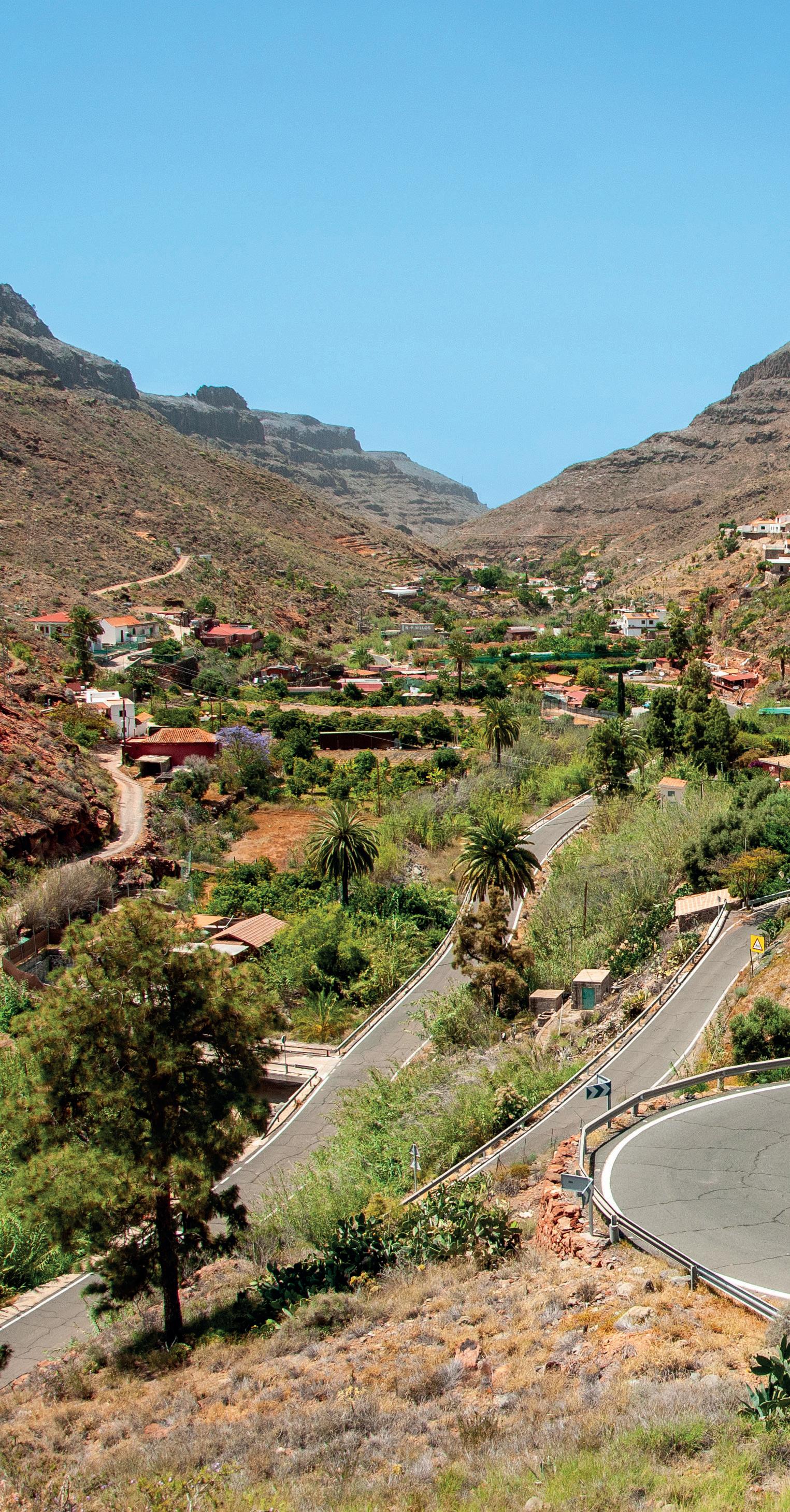
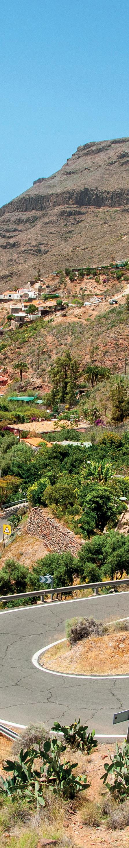
— Ayagaures – Monte León
This pleasant route around the southern area of the island comprises 35 kilometres and 560 metres of elevation gain. It is an attractive option for those looking for a quiet day of cycling around mountainous coastal areas in the south and also for those looking to do a shorter route in their training programme in Gran Canaria.
We start our route at the Campo Internacional de Maspalomas, where we head south towards the Faro de Maspalomas, offering gorgeous views over the dunes and the wide blue horizon, a place worthy of taking a photo as a memento.
We continue along the cycle lane of the famous boulevard, as far as the beach at Playa de Meloneras.
The place to look out for at this point is the Hotel H10 Meloneras in the first instance, and then the Hospital San Roque, before joining the GC500 in the direction of Maspalomas - Centro de Salud (Health Centre). At around kilometre 10 of the route, we pass by the Aqualand water park before starting the climb up to Ayagaures along the GC-504. This is a gentle slope that runs for 9 kilometres until we reach the reservoir, where we can enjoy the arid yet picturesque landscape reminiscent of the American Rockies.
400 m
300 m
200 m
100 m
0 m
km 10 km 0 km
30 km
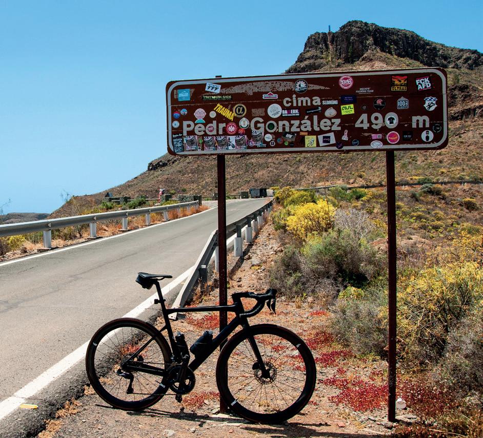
Once we have made it up to the village, we can take some refreshments at the bar located in the square. From this point, we face the toughest section of the route, 3 kilometres of ascent with an average slope of 5% until we reach the Cima de Pedro González, some 490 metres above sea level. This is a wonderful viewpoint that overlooks the whole of the southern part of the island as well as affording views of the Roque Nublo, on the peaks of Gran Canaria.
We now have just a 7 kilometre descent ahead of us, down towards
Montaña la Data and Monte León , until we reach the crossroads at Aqualand, where we turn right along the GC-503 towards Maspalomas and then head once more to Campo Internacional and back to our starting point.
Ayagaures
Monte León Montaña La Data
Maspalomas
7 — Ayagaures – Monte León
— Fataga – San Bartolomé de Tirajana
The triangle that everyone is talking about constitutes of the most famous circular routes in the south of Gran Canaria. These 70 kilometres, with 1,400 metres of elevation gain, have become one of the favourite routes for cyclists in recent years. It even features in various competitions, as it offers a variety of long flat areas, winding and fun descents and challenging climbs, suitable for any level of cycling.
The route starts at the Campo Internacional de Maspalomas and, after riding about 5 kilometres along the GC-503, we join the GC-60, in the neighbourhood of San Fernando, before tackling the ascent to the viewpoint of Degollada de las Yeguas, on the road to the village of Fataga. This steady, winding climb of about 6 kilometres offers spectacular views of the entire south of Gran Canaria, with the dunes of Maspalomas standing out above the landscape.
After reaching the top of the viewpoint, it is worth stopping to take photographs of the surroundings and to catch a glimpse of the rest of the route in the distance towards San Bartolomé de Tirajana (commonly known as ‘Tunte’), a town located at the foot of the great cliffs of the island’s summit.
Staying on the GC-60, we begin a quick descent featuring tight hairpin bends down towards the village of Fataga, known for its traditional Canarian customs and picturesque buildings. The final stretch of a long ascent to the top of the viewpoint at Mirador de Tunte, after almost 25 kilometres of route and located at 930 metres above sea level, will take us to the mythical town famous for being the beginning of the Camino de Santiago (Saint James’ Way) on its Canarian route to Gáldar. It is well worth stopping off at the village square for refreshments and to enjoy the tranquillity of the local area and its friendly people.
800 m
600 m
400 m
200 m
0 m
After this stop, we begin the descent down to the town of Santa Lucía de Tirajana . This is a wonderful experience for cyclists, as it offers a wide road with good tarmic, not much traffic and stunning scenery through the ravines.
From Santa Lucía, where it is also recommended to take a break to enjoy the surroundings, there are just under 40 kilometres left to travel down long stretches of descents and simple flat roads along the GC-65, where pedalling is straightforward and the route takes us through the towns of Vecindario, Juan Grande, Bahía Feliz and San Agustín.
This route is suitable of any level, where the countryside and the winding routes are the main attractions. It is an experience that we should not ignore in our cycling tour of Gran Canaria.
Fataga
San Bartolomé de Tirajana
Santa Lucía de Tirajana
Juan Grande
Maspalomas
8 — Fataga – San Bartolomé de Tirajana
— Tauro – Cercados de Espino
This circular route runs through two of the finest and most traditional cycling emblems of Gran Canaria: the port of Soria and Pie de Cuesta (known as Little Stelvio). It comprises almost 70 kilometres, with 1,200 metres of elevation gain that takes us through the south and south-west of the island and where we can enjoy a pleasant boat ride in the middle of the route.
We leave the area of Tauro behind and head south towards Puerto Rico and Anfi del Mar. We stay on the GC500 at all times, where we will enjoy one of the most beautiful coastal roads in the whole of the Canaries, before arriving at the crossroads of El Pajar, in the town of Arguineguín
We turn off left at the roundabout and onto the GC-505 en route to Cercados de Espino and Soria. This is a gentle 15-kilometre rise up to the
town of Las Filipinas, and it would be a good idea to take some refreshments at kilometre 11 as this will be our last chance before reaching the village of Soria.
Once we have passed through Las Filipinas we embark on one of most legendary ports in Gran Canaria, namely th Soria-Barranquillo Andrés port. This ascent runs for 9 kilometres and has an average gradient of 7.7%. It has become an essential challenge for cyclists, offering a demanding course coupled with stunning views that make it a truly memorable experience.
The area of Barranquillo de Andrés is a short port, covering just 3 kilometres, but the tarmac is in quite poor condition. Care must be taken when tackling this ascent and above all on the descent.
Following a brief and quick descent, we come to the crossroads at the Presa de las Niñas reservoir,
800 m
600 m
400 m
200 m
0 m
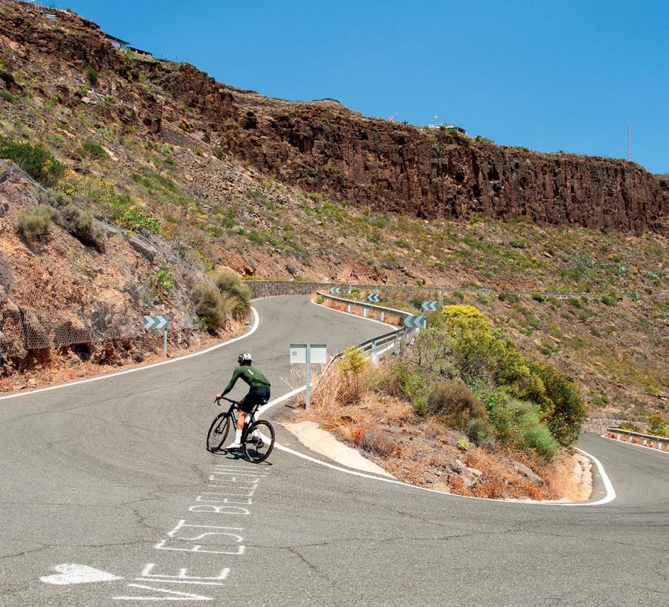
where we turn left and head down along the GC-605 towards Mogán . Here we are treated to one of the best known cycling landscapes over recent years, the famous “Little Stelvio”, so called because of its great resemblance to the legendary Italian port.
Once we have completed this gorgeous descent, we remain on the GC-200, heading towards Mogán, as we continue our descent down to the Port.
We should now get ready to enjoy the unique experience of taking our bikes with us on the boat trip, as it is not something we do every day. There are two companies that operate the sea route from Puerto de Mogán to Puerto Rico: Líneas Salmón (www.lineassalmon.es) and Líneas Blue Bird (www.lineasbluebird.com), run alternate departures every hour on the hour and every half-past the hour respectively. The trip lasts
around 25 minutes, costs around 8€ each way and enables us to complete our circular route as the road is cut off in the town of Taurito.
Once we have docked at Puerto Rico, we just need to get back on to the GC-500 and head south until we reach Tauro.
Las Filipinas
Arguineguín
Mogán
Soria
Puerto de Mogán
Tauro