
Femas Patel
DEVELOPMETNS: SUSTAINABLE CITY GROWTH
IIT College of Architecture Master of Science Program
2023-24 In India’s Urban Landscape

FuturistIc Hybrid Developments: Sustainable city growth in India’s urban landscape
2023, Professor Vedran Mimica
Professor Marya Kanakis
2024, Profesor Vedran Mimica
Professor Joel Putnam
Submitted in partial fulfillment of the requirements for the degree of Master of Science in Architecture (Non-Thesis Design Track) at College of Architecture of the Illinois Institute of Technology
Approved _________________________ Adviser
Acknowledgment
This Thesis Manual is the result of the contributions of many IIT faculty and students. The original Thesis Manual was written in 1953 and revised several times over the last fifty years.
I am deeply grateful to Professor Vedran Mimica, my primary thesis advisor, whose stories and insights have shaped the way I see architecture on a global scale. His guidance has helped me think beyond individual projects and consider the larger impact on city growth. I also sincerely thank Professor Joel Putnam for his invaluable advice in refining my research focus and Professor Maya Kanakis for helping me set the right foundation for my thesis. Their support has been instrumental in shaping my journey.
I also want to express my heartfelt gratitude to my academic advisor for their unwavering support and guidance throughout my journey, always pointing me in the right direction. A special thanks to Reed Kroloff, the dean of IIT College of Architecture—a wonderfully charismatic and insightful mentor—whose thoughtful comments on my thesis were both encouraging and inspiring. Lastly, I’m incredibly grateful to my fellow batchmates, whose support and camaraderie made my time at IIT truly unforgettable.
Lastly, I would not be here exploring the new country and hearing to new stories without my family who supported me in every aspects of my study and living. I thank everyone who supported me in every step at this journey of IIT, Chicago.
Introduction
As the world rapidly advances in construction, social trends, and business, countries like India are experiencing a booming economy alongside a rapidly growing population. Major cities are expanding at an unprecedented pace, driven by increasing demand for real estate, business opportunities, and evolving social dynamics.. Cities are expanding from the outskirts and developers are creating profits. The question is, the cities which are metropolis and has a working muncipalty, food culture and social trends, how can the development of whole city depends on the developer’s profit and making a city like concrete jungles? As architects, urban planners, and designers, we must rethink urban growth. How can we foster sustainable city development in a country where family life thrives, social interactions are integral, and yet ecological balance is rapidly deteriorating due to unchecked expansion? How do we design cities that grow responsibly—preserving culture, enhancing community life, and respecting the environment?
This thesis investigates a dynamic densed urban landscape with vibrant culture of Surat city India, a city undergoing a rapid urbanization. As urban centers grapples with the challanges of population growth, socio-economic diversification, and sustainibility, the concept of hybrid developmetns for the future of the city, emerges as a strategic approach to harmonize diverse urban functions.
As the Thesis statement : With the growing population, construction density and through the study of current socio-economic and ecological trends & concerns of the Surat city, India. This thesis research will provide architectural , urban planning/design strategies for contemporary city growth with vibrant cultural preservation and positive environmental aspects for expanding metropolis.
Chapter-1: Introduction Growth of India
As
the 5th largest economy: Factors indicating rapid growth of the country
India: As a growing country
India, a South Asian nation with a history dating back to the beginning of time, has long been a cradle of civilization, shaping societal structures and codes of conduct. Known as “Bharat,” it was once a global leader in wisdom, knowledge, and cultural advancements, flourishing until the 17th century. Hinduism has been deeply rooted in the country since its inception and continues to be followed by a significant portion of the population.
Due to its strategic geographical location, abundant resources, and profound knowledge, India attracted traders and explorers from around the world, particularly Europeans. However, in the 18th century, the British arrived under the guise of trade and gradually took control of the nation for nearly two centuries. During this period, India’s progress stagnated as its people were subjected to colonial rule. While the British introduced railways, land surveying, and their own architectural styles, they also imposed economic and political constraints that hindered India’s growth. Major cities across the country bear remnants of their presence.
Following a long and hard-fought struggle for independence, India emerged as a sovereign nation, embracing democracy and establishing new regulations for governance and development. Throughout the 20th century, the country regained its momentum, expanding its cities, fostering global trade, and asserting its leadership on the world stage. By 2024, India has risen to become the world’s fifth-largest economy and is on track to securing the fourth position.
India is a land of diverse cultures, home to over 700 languages and countless traditions, cuisines, architectural styles, and ways of life. In recent years, the country has experienced remarkable economic growth, driven by an expanding middle class, technological advancements, and increased global connectivity. Exposure to Western cultures has further shaped contemporary Indian society.
Today, as India’s economy flourishes and urban landscapes transform, the rapid expansion of cities is driven by private developers, often prioritizing profit over public welfare and environmental sustainability. This thesis examines the urban development of Surat, analyzing its history, mapping its evolution, and gathering statistical data to propose a strategic framework for sustainable growth. While each Indian city is unique in its culture and challenges, the methodology explored here can serve as a blueprint for reshaping urban landscapes nationwide. By implementing innovative strategies, India can continue to foster economic growth while ensuring a sustainable and balanced future for its cities and citizens.


1.1
Few factors behind India’s rapid growth
India, as a growing country, is marked by dynamic changes across various sectors. Its economy is expanding, driven by a burgeoning population and a vibrant entrepreneurial spirit. Urbanization is on the rise, with cities evolving into bustling hubs of activity and innovation. Infrastructure development is a key focus, encompassing transportation, energy, and urban planning. However, the pace of growth also brings about environmental concerns that need to be addressed for sustainable progress. India has witnessed significant growth in the real estate sector, fueled by various factors. Rapid urbanization, a burgeoning middle class, and increased disposable income have contributed to a growing demand for housing and commercial spaces. The rise of the co-working trend has also impacted the commercial real estate landscape, with flexible office spaces becoming increasingly popular, especially in tech-driven cities.
India stands at a crucial juncture where economic expansion, urbanization, and real estate growth must be aligned with sustainability and social well-being. The challenge lies in fostering development that enhances quality of life, preserves cultural heritage, and ensures ecological balance. The future of India’s cities depends on innovative urban planning, responsible infrastructure development, and a commitment to creating spaces that are not just economically viable but also livable and environmentally sustainable.


Figure 1.2 :GDP of India
Source : The India forum
Figure 1.3 :Population growth of India
Source : The India forum
Figure 1.4 :Real estate market of India
Source : The India forum
Figure 1.5 :Factors behind India’s growth Source : Author
AHMEDABAD
Built-up area expanded 130 % in last 30 years

SURAT
Built-up area expanded
% in last 30 years

KOLKATA
area expanded
% in last 30 years


HYDERABAD

CHENNAI
1.2 City growth in India
Organically grown cities from outskirts
After gaining independence in 1947, many Indian cities began to develop after years of British rule, establishing new buildings and infrastructure. Today, in many of these cities, the central area is often referred to as the “old city,” where remnants of British-era and other colonial structures still stand. Over time, these historical landmarks have become an integral part of the city’s heritage and are now preserved and conserved by the government. Meanwhile, new developments and urban expansion continue to take place on the outskirts, shaping the modern landscape of these cities.
In many Indian cities, the central area is commonly known as the “old city.” These districts house significant colonial-era buildings, including administrative offices, railway stations, churches, and educational institutions established by the British Cities like Mumbai, Kolkata, Chennai, and Delhi still showcase British-era structures that have stood the test of time, reflecting a blend of Victorian, Gothic, Indo-Saracenic, and Neoclassical architectural styles. In addition to British influences, remnants of Mughal, Portuguese, Dutch, and French architecture can also be found, depending on the city’s historical background. These structures are more than just physical landmarks; they represent a crucial part of India’s urban heritage. Recognizing their historical and cultural importance, the government and heritage conservation bodies have taken steps to preserve and restore many of these buildings. They now serve as museums, government offices, cultural centers, or even repurposed modern spaces that maintain their historical essence.

Figure 1.7 :Organic growth of a city
Source : https://www.researchgate.net/figure/Spatialfig
While the old city remains a historic and cultural core, rapid urbanization and population growth have pushed new developments to the outskirts. Limited space, aging infrastructure, and congestion in old city areas have led to planned expansions and satellite towns that cater to modern needs. As a result, contemporary high-rises, business hubs, residential townships, and commercial districts have emerged beyond the historical center.
Cities like Delhi, Mumbai, Bangalore, and Hyderabad have seen significant expansion in their peripheries, driven by the IT boom, improved connectivity, and increasing real estate demands. Smart city initiatives, new metro systems, and expressways are further shaping this outward growth, creating a stark contrast between the historical core and the modern urban fabric.
MUMBAI

Figure 1.8 :Burnham plan of Chicago
Source : https://afterburnham.com/daniel-burnham-2/
1.3 Significance of city planning : Planned city vs Organically grown
Planned city : Chicago
After the Great Fire of Chicago, new urban planning was introduced as both a strategic reconstruction effort and an economic development plan. This planning emphasized street layouts, building facades, and central public spaces, shaping the city’s modern functionality. Today, Chicago’s commercial business district is concentrated in the city center, while residential areas extend outward, reflecting the structured growth established through urban planning.


Organically growrn city : Surat
Most Indian cities have evolved organically over centuries, shaped by historical events, trade, and cultural influences. The central areas are dense and characterized by narrow streets, traditional markets, and architectural remnants from past rulers, including Mughal, British, Portuguese, and other colonial influences.
As urban populations grew, new developments emerged on the outskirts, driven by economic expansion rather than structured zoning regulations. Unlike Western cities with clearly defined business and residential zones, Indian cities have seen mixed-use developments where commercial, residential, and industrial functions often overlap.

- Organically deveoped city woth no pre planning or zoning
- Developing as per developers individualism real estate businesses
- Economy is growing because of local businesses and growth of industries
Western cities are mostly planned and well-organized in terms of infrastructure and amenities, having developed over the past 200 to 300 years. In contrast, Indian cities have existed for thousands of years, growing organically rather than through structured planning. Over time, they have been influenced by various foreign rulers and diverse cultures, often without centralized planning authority. As a result, while these cities have achieved significant economic growth, they lag in systematic urban planning and development.

Figure 1.11 :Surat city Source : Google maps
Figure

Gandhinagar, Gujarat, India
- Designed by H.K.Mewada
- C. Population : 1.4 Millions
- Area : 125.9 square miles
- Built year : 1965


Gandhinagar, the capital of Gujarat, is one of India’s planned cities, established in 1960 after the state of Gujarat was formed. Named after Mahatma Gandhi, it was designed to serve as a modern administrative center and a symbol of organized urban development. The city’s planning was undertaken by architects H.K. Mewada and Prakash Apte, who were influenced by Le Corbusier’s work in Chandigarh.
Planned cities serve as excellent examples of integrating various aspects of life—such as work, recreation, and residential living—into a cohesive urban environment. In the context of India’s urban fabric, they demonstrate how thoughtful planning can lead to functional and balanced cities. These cities had zoning regulations and land-use plans in place well before construction began, ensuring a structured approach to development.

Chandigarh, India
- Designed by H.K.Mewada
- C. Population : 1.4 Millions
- Area : 125.9 square miles
- Built year : 1965

Source : https://x.com/angadc/status/

Chandigarh is one of India’s first planned cities, designed by Swiss-French architect Le Corbusier in the 1950s. It serves as the capital of both Punjab and Haryana but is a Union Territory itself. The city was conceptualized to symbolize modernity, efficiency, and order in post-independence India.
Unlike cities that grow organically in response to economic or population pressures, these planned urban centers were built from scratch, following detailed blueprints. This deliberate planning offers numerous advantages, especially in addressing urban challenges prevalent in India. Planned cities help tackle issues such as overcrowding, traffic congestion, and inadequate infrastructure.
Figure 1.14: top view of Gandhinagar city, Guj, India
Source : https://www.slideshare.net/slideshow/gandhinagar-city
Figure 1.17: top view of Chandhinagar city, Guj, India
Source : https://www.slideshare.net/slideshow/chandigarh-city
Figure 1.15 & 1.16: Bird eye views of Gandhinagar city, Guj, India Source : Travehistory.com
Figure 1.18 & 1.19: Bird eye views of Chandigarh,India


Thomas Adams’s Outline of Town and City Planning was published in 1935. The book reviews past planning efforts and modern aims, and defines the scope and purpose of city planning. It was likely used as a textbook.
Town planning is the process of managing land resources, including the control of new and existing developments. It involves preparing strategies to ensure future requirements can be managed. Town planning is a dynamic process that changes in response to policy, development proposals, and local needs.
Social - Economic objectives
Design strategies & Methods
Administrative process
The chief defects in modern cities are piecemeal planning, mainly by real estate developers in their private interest and without adequate consideration for the community as a whole
LAND OWNERSHIP + BUSINESS INDIVIDUALISM
City planning is fundamentally shaped by three primary elements: economic growth, socio-cultural dynamics, and administrative processes. The role of administration is to establish final plot plans, regulations, and guidelines, while developers are responsible for executing construction projects within these frameworks.
In India, land ownership predominantly rests with private individuals. Developers acquire land from local owners and initiate construction projects. However, the absence of strict regulations regarding land use, zoning, or designated project typologies has led to unregulated urban expansion. Developers, driven by the goal of maximizing profits, often utilize land to its fullest extent, resulting in the proliferation of concrete jungles across Indian cities.
A key characteristic of this pattern is the emergence of homogeneous mixed-use developments that integrate residential, commercial, and office spaces within the same structures. As business demands continue to rise, so does the demand for housing, further fueling this rapid and often unplanned urbanization. The image on the right illustrates this phenomenon, where similar patterns of development are observed throughout Indian cities, emphasizing profit-driven urban growth.
A visible consequence of this unplanned growth is the repetitive and uniform typology of urban developments across Indian cities. Mixed-use buildings—comprising shops on the ground floors, offices on mid-levels, and residential units above—have become the default typology due to their economic viability. This pattern is observed in major metropolitan areas as well as tier-2 and tier-3 cities, creating homogeneous urban landscapes that lack distinct identity or cultural integration.
As cities continue to grow, the role of governance in balancing economic aspirations with responsible urban planning will be crucial in shaping the future of India’s urban landscapes. Without proactive planning and regulatory enforcement, the current trend of uncontrolled, profit-driven urbanization will continue to dominate, leading to further infrastructure strain and environmental concerns.
es are bustling with food stalls, street vendors, and social gatherings that last late into the night. The sheer variety of food attracts people from all walks of life, making roadside eateries and public fronts lively hubs of recreation for families and friends.
I have lived in India for the past 25 years and have witnessed its urban chaos, limited regulations, and rapid expansion, all coexisting with a rich social culture, diverse food scene, and vibrant nightlife. The energy of the cities is undeniable—public spac -
Living in India has been an incredible experience, but with improved planning and infrastructure, the cities could offer an even better quality of life while preserving their cultural and social essence.
Source : https://www.reddit.com/r/urbanhell
1.21 : Densed development of Surat, India
However, the dense construction and rapid city growth have made navigating urban spaces increasingly challenging. The overwhelming traffic and congestion often made me think twice before heading out for dinner. While the urban vibrancy adds to the charm of Indian cities, it also highlights the need for better regulations and urban planning to ensure smoother mobility, organized public spaces, and a more balanced city life.

Modern Town Planning
Figure
Figure 1.20 : “Outline of town planning” by Admas Source www.abebooks.com
Today, there are over 50 ghost cities, each on the scale of a metropolis, that stand largely abandoned.
During China’s economic boom, rapid urban expansion led to the construction of entire cities by developers, who built with the expectation that a growing population would eventually fill these spaces. However, many of these cities, despite being built on a grand scale, remained eerily empty as people didn’t move in.
While the term “ghost town” often evokes images of abandoned places, many of China’s ghost cities are actually newly built but have yet to reach their intended population densities. The scale of this issue is staggering—around 65 million homes across the country remain vacant, and there are estimates of at least 50 such cities, largely unoccupied, scattered across China. This paradox of modern development standing empty highlights the complexity and uncertainty of China’s urban growth.


In the heart of China’s economic rise, a curious phenomenon has emerged: ghost cities. These sprawling urban landscapes feature towering apartment complexes, vast shopping malls, and wide highways stretching endlessly, yet they remain strangely quiet and uninhabited.
During China’s rapid economic expansion, particularly in the early 21st century, the government and developers embarked on an ambitious urbanization project. To accommodate the growing population, entire cities were planned and constructed in anticipation of future migration from rural areas. Developers built vast residential complexes, shopping malls, office buildings, and expansive road networks—some designed to house millions of people. These cities were constructed with the expectation that China’s population would continue to rise, and new urban centers would be needed to support this growth.
Today, over 50 ghost cities exist across China, many of them on a metropolitan scale, with infrastructure and buildings ready to house millions, but with few residents. These underpopulated urban centers are often characterized by high-rise apartment buildings, empty shopping malls, and deserted streets, creating an eerie atmosphere. Despite the lack of residents, the cities continue to be maintained by local governments and developers, though they remain largely unused.
However, the reality didn’t align with these expectations. While the cities were built at a breakneck pace, the population growth didn’t happen as quickly as anticipated. Many of these newly built urban spaces, despite their size and modern infrastructure, remained largely vacant. Factors such as the overestimation of migration, an oversupply of real estate, and people’s reluctance to move to areas lacking amenities or employment opportunities contributed to this phenomenon. Developers, driven by profit, continued to build as demand didn’t materialize at the expected rate.
The situation has become so dire that the government has made the decision to demolish these vacant buildings, repurposing the land for public use, such as parks for children and hospitals for the elderly. This shift reflects the complex challenges of China’s urbanization and the need to rethink development strategies for a more sustainable and community-centered future.
Figure 1.23 : Ghost city of China - Ordos Kangbashi Source : archdaily.com

WHAT IS NEXT?
PROBLEM STATEMENT
As the redesign or rebuilt of the cities is not possible. The rapid, organic growth of cities in India, driven by developers’ pursuit of profit, has led to densely populated areas with little to no zoning. Despite this, these cities have thriving economies. As populations rise and urban areas continue to expand, new business opportunities are emerging. In this context, how can architecture and urban planning/design can play a crucial role in promoting sustainable urban development, creating healthier and more livable environments?
Chapter-2: Surat, India
World’s 4th fastest growing city
Key socio-economic factors for the Surat city to emerge as a major metropolitan hub in India.
City with its various nicknames
Surat, a thriving metropolis on the western coast of Gujarat, India, is among the fast est-growing cities in the country and is wide ly regarded as one of the best places to live. With its rich cultural heritage, deep-rooted history, and low crime rate, the city stands as a model of prosperity and progress.
Historically, Surat has been a key trade hub, serving the Mughal Empire, Portuguese merchants, and later, the British. Its strate gic location along the Arabian Sea allowed it to flourish as a major center for commerce, particularly in the trade of spices, textiles, and diamonds. The city’s past is still re flected in its architecture, cultural influenc es, and strong business mindset—a legacy shaped by centuries of commercial activity.
Nicknamed “The City of the Sun,” Surat is part of Gujarat, a state renowned for its economic leadership and entrepreneurial spirit. Gujarat has produced some of India’s most influential figures, including Mahatma Gandhi and Sardar Vallabhbhai Patel, who played vital roles in shaping the nation. To day, Gujarat continues to lead, with Prime Minister Narendra Modi and India’s wealthi est businessman both hailing from the state, further emphasizing its deep-rooted com mercial success.
As Gujarat’s second-largest city after Ahmedabad, Surat is an economic power house with a strong industrial base. Its res idents are naturally inclined toward trade, making it a major hub for textiles, diamond polishing, petrochemicals, and IT. With a flourishing business ecosystem and grow ing employment opportunities, the city at tracts migrants from across India, offering them better prospects and an improved quality of life.
For centuries, Surat was at the heart of In dia’s spice trade, exporting goods to Europe and Arabia under the influence of Mughals and European traders. This trading legacy has shaped its economy and culture, mak ing it equally renowned for its diverse and vibrant food scene. Culinary traditions re main a defining aspect of Surat’s social life, with street food and local delicacies bringing people together for recreation and socializa tion.
This chapter explores Surat’s socio-eco nomic landscape, analyzing its historical trade significance, migration trends, and food culture to understand how these ele ments continue to shape the city’s urban identity and economic growth


Current population : 8 Millions
Area : 180 Sq.miles
Populayion demsity : 38,850/ Sq.miles
Surat is a vibrant city located on the western coast of India, along the Gujarat coastline. Known for its rich culinary heritage, the city boasts a diverse and flavorful food culture that attracts locals and visitors alike. Surat is also renowned for its well-developed infrastructure, featuring numerous overbridges designed to facilitate smooth traffic movement, earning it the nickname “City of Bridges.”
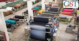
Beyond its infrastructure and food culture, Surat plays a pivotal role in India’s economic and industrial landscape. It is the global hub for diamond processing, with an astonishing 96 out of every 100 diamonds in the world being cut and polished in the city. This has earned it the title of “Diamond City of India.” Additionally, Surat is a major player in India’s textile industry, producing nearly 40% of the country’s man-made fabric, leading to its second moniker, “Silk City of India.”
SURAT
With its rapid urban growth, thriving industries, and deep-rooted cultural significance, Surat stands as one of India’s most dynamic cities, seamlessly blending tradition with modernity. Surat is located on Tapi river bank as well as Arabian sea which is a good asset for transport businesses and other resources.


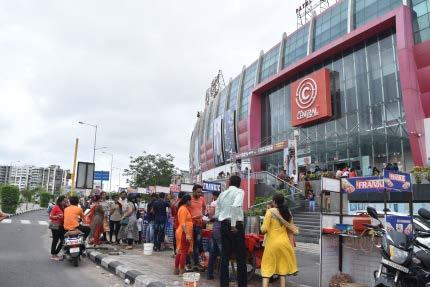
Surat has experienced rapid growth over the past 20 years, driven by its thriving diamond, textile, and trade industries. The city’s economic boom has attracted a large influx of migrants seeking better opportunities, leading to urban expansion and development. What truly sets Surat apart is its vibrant social culture and love for food. The people here are known for their cheerful and hospitable nature, and food is at the heart of their lifestyle. Weekends in Surat are bustling with activity, as families and friends prefer dining out over home-cooked meals. The city’s restaurants, street food stalls, and cafes are so packed that reservations are nearly impossible.
Even after dinner hours, Surat remains alive and energetic. People gather on footpaths and roadside tea stalls, engaging in conversations and unwinding with a cup of chai till late at night. This unique blend of social life, food culture, and community spirit makes Surat one of the most lively and engaging cities in India.

Silk city of India
City of street food
City of Diamond
City of bridges
Figure 2.3 Surat’s location in India Source : https://commons.wikimedia.org/
Figure 2.4 : Niknames of Surat city Source : Author
Figure 2.5 Surat city Source : Author

Mughal Empire took over the city for 200 years
1550-1758 AD

Chhatrapati Shivaji
Invaded the Surat, took over from the Mughals
1664

Dutch people came to Surat and startes business through trading centres exporting Fabrics and spices
1825

Muncipalty comes to existance, building designed by britisahers
1852

1500-1520 AD
Traced to the Hindu city Suryapur (old name). Known for cotton & silk productions and spices

1612
Britishers arrived in India and put first step in Surat city and established their trade center

Surat, one of India’s oldest and most prosperous cities, has a rich history that dates back to ancient times. Originally known as Surya-pur, the city flourished as a major port and trade center, facilitating commerce between India, the Middle East, Africa, and Southeast Asia. During the Mughal era (16th–18th century), Surat became the empire’s most important port, earning the title “Gateway to Mecca” due to its role in Hajj pilgrimages. The city attracted European traders, including the Portuguese, Dutch, French, and British, who established trading posts.
Britishers took over the city for their business and established trade centres 1800

In 1612, the British East India Company set up its first factory in Surat, marking the beginning of British influence in India. However, as Bombay (now Mumbai) emerged as a dominant port, Surat’s maritime significance declined. Despite this, the city thrived in textile production and diamond trade, which continue to define its economy today. Surat’s history reflects a legacy of trade, cultural diversity, and resilience, shaping it into one of India’s most dynamic urban centers.
1847
Dutch people closed their centres in Surat

After 1990
Establidhes 1000 of Textile mills, Diamond markets and food productions
1947
Got independent from Britishers

During the British colonial period, Surat’s economy saw a transformation. The city’s textile industry grew significantly, making it one of India’s leading centers for fabric production. After India gained independence in 1947, Surat experienced rapid industrialization, driven by its thriving diamond, textile, and trade industries. Surat was also a major center for shipbuilding, and its merchants had a strong influence on regional and international trade. The city’s prosperity attracted European powers such as the Portuguese, Dutch, French, and British, all of whom sought to establish their dominance over Indian trade.
Despite challenges such as floods, rapid urbanization, and industrial pollution, Surat has continuously reinvented itself, blending its rich historical legacy with modern innovation and development. Today, it stands as a symbol of India’s entrepreneurial spirit, cultural diversity, and economic strength.
1960
Patel’s startes new diamond business
Figure 2.6 : History of the Surat city
Source : Link in the Bibiliography

- 9 out of 10 of world’s diamond s are polished here.
- Approx. 5000 Diamond units
- 6 Lakhs employment in the industry
- Contributing 30% city’s economy.

- India’s 40% manmade fabric produces here.
- Almost 2 Millions people are working in textile industry
- 34 Million INR turnover annually
- Contributing 24% of city’s economy
The diamond industry in Surat is a significant contributor to the city’s economy and provides employment to a large number of people, including skilled artisans, craftsmen, and technicians. Many families in Surat are involved in the diamond business in various capacities.Overall, the diamond business in Surat is a vital part of the city’s economy and a key player in the global diamond trade. With its skilled workforce, infrastructure, and entrepreneurial spirit, Surat continues to thrive as a center for diamond cutting, polishing, and trading.
The textile industry in Surat is a major source of employment, providing livelihoods to a large segment of the population. It offers job opportunities across various stages of the textile value chain, including spinning, weaving, dyeing, printing, embroidery, garment manufacturing, and trading. The sector employs skilled and unskilled labor, contributing to both urban and rural employment. The textile industry contributes significantly to Surat’s revenue generation through taxes, duties, and export earnings. The sector generates substantial income for textile manufacturers, traders, and associated businesses, thereby contributing to the city’s economic growth and development.
- World’s largest office buildings
- More opportunities for diamond workers
- Increment in Migrants from other cities of India


The real estate sector in Surat is undergoing rapid expansion, particularly in the residential and commercial segments, fueled by the city’s economic prosperity and industrial dominance. Traditionally renowned as the textile and diamond hub of India, Surat is now evolving into a modern, well-connected metropolis with immense real estate potential. The city’s booming infrastructure, rising population, and increasing business opportunities have attracted prominent developers and investors, leading to large-scale residential townships, high-rise apartments, and commercial hubs.
The Town Planning Department of Surat has introduced several strategic development schemes, ensuring the city’s sustainable growth while accommodating its rapid urbanization. With major projects such as the Surat Metro, outer ring roads, and smart city initiatives, the city is set to become a real estate hotspot, offering lucrative opportunities for both homebuyers and businesses.
The development of Surat Metro, expanded road networks, and Surat International Airport has further boosted property values.
Gujarat,
a vibrant and growing food business sector contributing significantly to its economy. The city is known for its textile and diamond industries, but its food processing sector is also gaining momentum.
food culture among the Surti people is truly remarkable, especially when it comes to their love for dining out. On weekends, they prefer eating out rather than cooking at home. The cafes, restaurants, and even food trucks lining the streets are packed with families and friends, all eager to indulge in the city’s unique flavors. The crowds and long waits at popular food spots are a testament to the immense food craze that defines the local culture.
Beyond local delicacies, Surat also embraces regional and international cuisines, with a growing number of restaurants and food stalls offering Chinese, Mughlai, South Indian, and Western fast food. On weekends, the city comes alive with bustling food markets where people gather to socialize, indulge in tea and snacks, and explore a wide array of street food stalls, making Surat’s food scene a unique fusion of tradition and modernity.
Surat, a major industrial hub in
has
Real Estate Food market
World’s biggest office : Diamond burj
Figure 2.7: Diamond industry of Surat Source : theeconomictimes.com
Figure 2.8 : Textile industry of Surat Source : apparelresources.com
Figure 2.9 : real esatet of Surat Source : moneylife.in
Figure 2.10 : Food of Surat Source : Pinterest

As the Surat’s economy is growing fast with the population incresing and migrants are coming to the city for more opportunities. Government has expanded the boundries for the city and proposed new projects such as Metro line, river front development,new railway station and sea front development and in addition to that an interntational airport is on the way for built.
With the enhancement of mobility infrastructure, Surat is set to attract even more people seeking better job opportunities, which will seamlessly integrate them into the city’s vibrant food culture. As the city becomes more accessible, its real estate sector will experience significant growth, leading to an increase in property values. Developers, recognizing the potential for expansion, will seize opportunities to build more properties, leading to a denser construction landscape.


As the population and business opportunities continue to rise in Surat, the government has outlined a vision for 2035 that focuses on expanding commercial infrastructure and providing more land for construction. With these developments, more commercial streets and residential areas are planned to accommodate the growing demand. However, this rapid urbanization is likely to result in the construction of more concrete jungles, which may come at the cost of the city’s natural ecology.
As the city expands, the balance between development and environmental preservation will become increasingly critical, with the potential for ecological compromises as green spaces make way for urban sprawl.

The Surat Municipal Corporation (SMC) has laid out several visions for the city’s future development, aiming to attract more people for business and economic opportunities. However, as the city expands, this could lead to increasing chaos in terms of public spaces and cultural preservation. Despite plans to grow commercially, zoning laws and construction regulations remain insufficient to ensure adequate green spaces and sustainable mobility infrastructure.
As architects and urban designers, we must focus on more than just economic growth and developers’ profits. It’s essential to prioritize balanced, thoughtful urban planning that nurtures the city’s cultural identity, promotes environmental sustainability, and creates livable spaces for future generations, rather than simply accommodating the rush of development.

The SMC has proposed a 90-meter-wide commercial business road around the city as part of future development plans. As a result, land prices are skyrocketing, and more people are choosing to settle in the city. Further development is expected in the near future.
The SMC has outlined several visions for the year 2035, including plans to add green spaces and establish proper education systems for the growing population. However, at this stage, these are just promises on paper. At the end the construction and profit willbe major part of the developers only.

Figure 2.11 : Location of infrastructures Source
Figures 2.13 to 2018 : 2035 Visions of Surat
Source www.suratmunicipalgv.in
Figure 2.12 : Images of proposed infrastructures
Source : links in bibliography
Locas casts of the Surat city & Migrants
Surat has become a hub for migrants from all over India, drawn by the city’s booming industries, particularly in textiles, diamonds, and trade. People from diverse states, including Uttar Pradesh, Bihar, Rajasthan, Maharashtra, and Madhya Pradesh, migrate to Surat in search of better employment opportunities and a better quality of life. The city’s thriving economy and affordable cost of living compared to other metropolitan areas make it an attractive destination for workers, entrepreneurs, and professionals.
LOCAL CASTS OF THE CITY

Reasons why Migrant’s are coming to Surat, India
Diamond Industry
Textile industry
Food industry
Construction workers
Real estate businesses
Others
Local - 58%
Migrant - 42%
Popularity of the city on social media for one of the best city for lliving in India.
The city is home to four major local communities who share the same language but have distinct cultural differences. However, they are all united by Surat’s rich food culture and local trends. People coming to the city for business and work opportunities also immerse themselves in the city’s vibrant culture, becoming part of the local community and enjoying its unique offerings. Migrants contribute significantly to the local economy, filling jobs in manufacturing, retail, construction, and hospitality. Many settle in transit areas or migrant colonies within the city, forming tight-knit communities while also blending into the broader social fabric. Over time, these migrants have not only bolstered Surat’s workforce but also enriched its food culture, festivals, and traditions. The city’s inclusive atmosphere allows them to integrate and engage in local life, creating a dynamic, multicultural environment.
However, the rapid influx of migrants has also placed pressure on Surat’s urban infrastructure, housing, and public services, leading to challenges like overcrowding in certain areas and the need for better urban planning and sustainable development. Despite these challenges, Surat’s migrant population plays a key role in the city’s growth and vibrancy, helping shape it into a diverse and thriving metropolis.
Surat has become increasingly popular on social media due to its dynamic lifestyle, vibrant food culture, and thriving industries. The city’s diverse culinary scene, with famous street food like Surti undhiyu and dabeli, draws food enthusiasts to share their experiences online. Known as India’s textile and diamond hub, Surat also attracts fashion and luxury enthusiasts, with its textile industry and diamond trade often featured in posts.
The city’s festivals, such as Navratri and Uttarayan, offer colorful and engaging content, while its modernization and urban growth, visible in the expanding skyline and infrastructure projects, appeal to those interested in development. Surat’s vibrant nightlife, active social culture, and community engagement further contribute to its social media presence, making it a popular destination for content creators and influencers alike.


Kanbi (Patel’s) Khatris Golas Ghanchis
Figures
Food culture and various areas of the city


- Diamond and textile industries, commercial & residential
- Kathiyawadi, migrants from central gujarat
- Major Diamond and textile industries, commercial & residential
- Kathiyawadi, middle class migrants
(migrants)
AMROLI
KATARGAM
VARACHA
UTRAN
Figures 2.23 : Surat map
: Author
Figures 2.26 : Surat map
Source : Author
Figures 2.24 : Various area of the Surat city Source : Links in Bibliography
Figures 2.25 : Food culture of the city Source : Links in Bibliography
Figures 2.27 : Foods of the Surat city Source : Links in Bibliography
The heart of Surat lies in its vibrant food culture, where people gather on the streets to enjoy meals with family and friends, creating a lively and social atmosphere. It’s common to see locals sitting on footpaths, savoring street food while soaking in the city’s energy. Food trucks, vendors, and roadside stalls line the streets, serving a variety of delicacies to an eager crowd. As Surtis love to socialize in open spaces, these street-side gatherings continue late into the night, making the city feel alive even on weekdays. On weekends, the demand is so high that people wait for hours just to grab a seat and enjoy a meal, reflecting Surat’s deep connection with food and community.
While people enjoy gathering on public fronts, food vendors set up their stalls along the streets, leading to crowds occupying the roads and causing traffic congestion. With limited designated public spaces—often taken over by developers—many vehicles end up parking along the roadside, further disrupting vehicular movement. Additionally, as street vendors operate as temporary food providers, they lack proper waste management systems, resulting in littered streets and unhygienic conditions. This not only affects the cleanliness of public spaces but also impacts the overall environment and urban aesthetics, creating challenges for both city management and the local community.
FOOD CULTURE

SHOPPING FRONTS

Surat serves as a hub for diverse culinary experiences, boasting an array of local delicacies alongside renowned international food chains. This culinary landscape provides a communal space for people to come together on public fronts, savoring delectable dishes while enjoying panoramic views of the city. It’s a fusion of flavors and a shared dining experience that adds vibrancy to the city’s social fabric
LIVELYHOOD

FESTIVAL CELEBRATION
The active streets and lively public fronts create a welcoming environment for people to not just grab a bite but also to sit back, relax, and soak in the vibrant city life. The trend of people staying out until late at night on weekends adds an extra layer of liveliness, making the city thrive with energy and a sense of community. It’s more than just a city; it becomes a shared space where people come together to enjoy the rich culture, delicious food, and the lively ambiance that Surat has to offer.
With Surat being a hub for the textile business, the abundance of local stores and brands creates a thriving shopping scene. This not only caters to the city’s economic identity but also fosters community engagement. The act of shopping, whether for traditional textiles or contemporary fashion, becomes a social experience that brings people together on public fronts. It’s a shared activity that strengthens community bonds while contributing to the vibrant and dynamic social life of Surat


Immerse yourself in the lively atmosphere of street festivals and processions, celebrating cultural and religious occasions with music, dance, and vibrant decorations.


Figures 2.28 : Major attraction on streets
Chapter-3: Densed developments & falling ecology
Rapidly expanding concrete jungles replacing farmlands, leading to a chaotic living environment.
Concrete jungles
With the rapid advancement of technology and the exponential growth of industries such as diamonds and textiles, the city’s boundaries are continuously expanding. To accommodate this growth and ease the increasing pressure on transportation, the Surat Municipal Corporation (SMC) has proposed major infrastructure projects, including a metro system and a new railway station, aimed at improving public transit. However, alongside these efforts, new town planning schemes have paved the way for large-scale developments where private developers are constructing commercial and residential buildings at an unprecedented rate. Unfortunately, the primary motivation behind these developments is profit, often with little regard for the well-being of the people who will live and work in these spaces. The city’s landscape is becoming overwhelmingly dominated by built-up areas, leaving minimal room for green spaces, parks, or public recreational zones. This lack of thoughtful urban planning is creating a chaotic and congested environment, especially in a city known for its cultural vibrancy and dense population.
Beyond the issues of overcrowding and reduced quality of life, the environmental consequences of this unregulated expansion are alarming. The excessive levels of construction activity, combined with high carbon emissions from industries and vehicles, have pushed the city’s pollution levels beyond the red line. Air quality continues to deteriorate, and the long-term impact on public health is becoming a serious concern. If this pattern persists unchecked, we may soon find ourselves living in an environment reminiscent of dystopian futures depicted in movies and science fiction—where oxygen masks become a necessity, and the natural balance is completely disrupted.
At this crucial juncture, it is imperative to rethink our approach to urban development. Cities should not only cater to economic growth but also ensure sustainability, livability, and environmental harmony. Thoughtful urban planning must integrate green spaces, pedestrian-friendly zones, and ecological considerations to counterbalance rapid industrialization. As architects, planners, and urban designers, it is our collective responsibility to advocate for a balanced, people-centric approach to city-building. The future of our cities depends on the decisions we make today, and now is the time to act before we reach a point of no return.

Vibrant but overflowing fronts
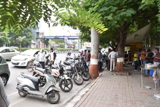
TThe city’s vibrant food culture and recreational scene make it so bustling that navigating the streets becomes challenging due to heavy crowds and traffic congestion. Nearly every roadside building houses shops, retail outlets, cafés, or restaurants, many of which offer outdoor seating. With minimal space in front, these establishments also accommodate parked cars, while food trucks and other eateries set up outside, drawing large crowds.
This influx of people disrupts both main and service road traffic and contributes to unhygienic conditions on primary streets due to the lack of traffic regulation and designated pedestrian walkways. Additionally, the high construction density limits open spaces that could otherwise be used for recreational activities. People often go out without any particular reason, simply to hang out on footpaths or in public spaces, enjoying tea with friends until late at night. Given the high number of two-wheelers in India, many riders park their bikes nearby and gather around them, creating informal social spots in the city.


Densed construction
The high intensity of public activities on streets and public fronts highlights the need for regulations that allocate adequate space for recreation and social interaction. However, the existing regulatory framework often prioritizes commercial development, allowing developers to utilize the maximum permissible area for profit-driven ventures. As a result, open spaces that could be used for pedestrian movement, seating areas, or public amenities are often sacrificed. This not only disrupts the organic social culture of the city but also leads to overcrowding, traffic congestion, and unhygienic conditions. To maintain a balance between commercial interests and public well-being, urban planning policies should enforce dedicated zones for pedestrian-friendly spaces, informal gatherings, and street-based activities without compromising accessibility and safety.
Figures 3.2 : Surat street view
Source : Author
Most proposed projects follow a similar pattern in terms of typology, height, and density. The predominant development model is mixed-use, where ground-floor commercial spaces line every street-facing site, allowing developers to maximize profits by selling retail units. Meanwhile, residential areas are placed on the upper floors and behind the commercial frontage. While project drawings depict designated spaces for shops, parking, and public activities in the front, in reality, these areas often become congested, leading to unorganized street conditions.
The lack of thoughtful planning results in chaotic public spaces where pedestrian movement, parking, and recreational activities overlap, further intensifying urban congestion and reducing the quality of the built environment.
This particular project is located in Ahmedabad and was built in 2020. I personally created this drawing, along with many others of a similar kind. It is a premium multifamily development housing 250 families, with 20 showrooms on the front spanning five stories.
Resident parking is allocated in the basement, while the designated recreational area in the layout is disproportionately small compared to the scale of the project, consisting mainly of 3BHK apartments.An average space for one person will be 4.9 sq.ft/per person on the ground.


The green space provided is more of a regulatory formality rather than a thoughtfully designed amenity, as developers rarely maintain it properly. As a result, residents and visitors tend to gather on the streets, where the atmosphere is more vibrant and engaging. This reflects a broader urban issue—while regulations mandate open spaces, their inadequate size and poor upkeep lead people to seek livelier environments in public areas, contributing to congestion and unregulated street activity.
Project statistics & details
- Tak.Elegna, Ahmedabad, India
- Total families : 250
- Total showroom : 20
- Open green area : 577 SQ.MT (10% total plot area)
- Average 4.9 sq.ft / person
- Total plot area : 5770 SQ.MT
Building height as per regulation :
- If road width is more than 18m : 60mt
- If road width is under 18m : 45m
- If road width is under 12m : 30m
- If road width is more than 30m (CBD zone) :60 to 90m
Open area regulation :
If plot is more than 2500 sq.mt : 10% of plot area is required as green if plot area is less than 2500 sq.mt : No required
Building margin :
If road width is 18m or less : Front 7.5m clear margin. Other 3 sides 6m. if road width is more than 18m : Front 9m and all 3 sides 7.5m.
Current construction
As of in August 2024, this TP plan was on the website of SMC. With the blue and red marks shown in the highlighted areas are current and proposed construction site. The rate of construction in much higher and city is expanding quickly and development and business is growing faster than ever.

- Prposed construction
- Permitted/under construction


Figures 3.4 : Project example
Source : Auhtor
Figures 3.5 : Avrage provision of area in a particular site
Source : Auhtor
Figures 3.6 : TP layout of Surat city Source Source: suratmunicipal.gov.in
Figures 3.7 : Proposed constructions Source: suratmunicipal.gov.in
Reasons for negative envrionmental effects
There are multiple reasons for the declining ecological balance in cities across India, including increasing traffic, rapid urban development, population growth, and the conversion of farmland into construction zones. While these fac tors primarily impact the local environment, their cumulative effect contributes to global environmental challenges.
Ongoing construction without consideration for ecological sustainability is problematic, especially in the midst of a global environmental crisis. While development is necessary, it should be approached with a conscious effort to incorporate envi ronmentally positive practices. This includes prioritizing green spaces, sustainable building materials, energy-efficient de signs, and responsible urban planning that balances growth with ecological preservation. Failing to integrate these aspects will only exacerbate climate-related issues, making cities less livable in the long run.
AGRICUTURE LAND TO CONSTRUCTION

BUILDING DENSITY

LIMITED REGULATIONS FOR GREEN SPACES

The recent city expansions are significantly impacting agriculture as the govern ment shifts land use from farming to construction. This change has critical implications for both the environment and food production. The conversion of agricultural land into urban areas not only disrupts the natural ecosystem but also poses a threat to the crucial balance between urban development and sustainable food sources. Striking a careful balance between urban expansion and preserving arable land is essential to mitigate the adverse effects on agriculture, ensuring the continued availability of food resources for the growing population.
The density of buildings dictated by the GDCR (General Development Control Reg ulations) is leading developers to prioritize profit, resulting in an extensive use of space for selling purposes. Unfortunately, this approach leaves minimal room for recreational areas and green spaces on the ground level. The lack of available open spaces neg atively impacts the overall well-being of the community, as residents are deprived of essential areas for recreation and relaxation. Striking a balance between urban development and the creation of accessible green spaces is crucial for fostering a healthier and more sustainable living environment.

Inflow of People for Business Opportunities:
The city attracts a large number of migrants seeking employment and entrepreneurial prospects, leading to a surge in demand for housing, commercial spaces, and infrastructure.
Conversion of Farmlands into Development Sites:
As urban expansion continues, agricultural lands are being replaced by construction projects, reducing green cover and impacting local ecosystems.
Rising Population and Building Density:
SUDA has introduced a new Town Planning (TP) layout for upcoming developments, attracting developers eager to construct buildings for profit by utilizing the available land for sale. However, the emphasis on maximizing profits has led to a higher density of buildings, resulting in a limited percentage of open areas for residents and workers within the hybrid typology. This densification is contributing to a more congested environment for the public, exerting an impact on the city’s climate and overall environmental conditions.
With more people settling in the city, the density of buildings increases, often leading to overcrowding, traffic congestion, and a strain on public resources and utilities.
The existing regulations pose a challenge as they do not permit vertical plantations in hybrid buildings with limited projections, restricting the scope for green initiatives both vertically and on the ground level. This limitation hinders the potential for incorporating sustainable and visually appealing landscaping within urban structures. Exploring ways to adapt or revise regulations to encourage vertical plantations and green spaces could enhance the overall environmental quality of these hybrid buildings, promoting a healthier and more ecologically conscious urban environment
While economic growth and development are essential, the city must adopt sustainable planning strategies to balance urban expansion with environmental and social well-being.
Surat’s rapid urbanization, industrialization, and population growth have led to significant ecological challenges, including deforestation, pollution, and climate vulnerability. The loss of green spaces and agricultural land to real estate development has intensified the urban heat island effect, making the city hotter and less resilient to climate change.
Frequent flooding due to unplanned urbanization and pollution of the Tapi River further degrade the environment. Industrial emissions, vehicular congestion, and poor waste management contribute to deteriorating air and water quality. As the city expands, sustainable planning is crucial, focusing on green infrastructure, efficient water management, eco-friendly construction, and improved public transport. By integrating environmental consciousness into its development strategy, Surat can balance economic growth with ecological resilience, ensuring a healthier and more sustainable urban future.
Figures 3.9: Surat TP Layout Source: suratmunicipal.gov.in
Figures 3.10:Top view of surat Source: www.googlemaps.com
Increasing negative air
UrbanEmissions.Info has an ecological graph for Surat, India that shows the average PM2.5 pollution by month. The graph also has a map of the annual average PM2.5 pollution for Surat, and a pie chart that shows the main sources of PM2.5 in 2018. The graph also shows the changes in contributions from different sources in 2030.
The graph also shows the variation in average PM2.5 pollution by month. For example, during the monsoon, pollution levels usually dip and may fall within national air pollution standards. However, most cities are unable to attain these standards at other times of the year.

Source: www.urbanemission.com
- Population increases from 1.2 Million to 8 Millions in 30 years (650% in 30 years)


Figures 3.12: Pollution data of Surat
Source: www.urbanemission.com
Surat’s pollution levels have reached alarming heights, with air quality consistently exceeding safe limits. The standard threshold for air pollution is 40, but Surat’s levels are reaching up to 120, which is classified as very unhealthy. This poses serious risks to public health, with prolonged exposure leading to respiratory issues, cardiovascular problems, and other chronic conditions. Despite these growing concerns, pollution continues to rise unchecked, exacerbated by industrial emissions, vehicular traffic, and poor waste management. Addressing this issue requires immediate and robust action, including stricter regulation of industrial pollution, promotion of cleaner technologies, and widespread adoption of sustainable transport options to improve the city’s air quality.
Surat has a hot climate with temperatures ranging from 37.78 oC to 44.44 oC during the summers. The climate is pleasant during the monsoon while autumn is temperate. The winters are not very cold but the temperatures in January range from 10 oC to 15.5 oC. The average annual rainfall of the city has been 1143 mm.

Figures 3.13: Pollution data of Surat
Source: www.urbanemission.com

Figures 3.11: Pollution data of Surat
Study of a primary area of the city
The reason for choosing this area for urban fabric study is that it represents a completely new development, providing an opportunity to observe how activities unfold on the streets and how the built environment interacts with the local culture. Despite being a newly developed area, it offers valuable insights into how the urban fabric functions, especially in terms of its integration with the community, social dynamics, and the types of construction being employed. This study will help understand the challenges and opportunities in blending modern developments with traditional cultural practices and local architectural styles, shedding light on how new developments can respect and enhance the existing urban identity.


Building type
All commercial, office, and mixed-use buildings are strategically positioned along the roadside to maximize developer profits and provide easy public access, while residential areas are placed behind the main roads. With only a few parks available in the entire city, streets and public fronts naturally become gathering spaces, fostering an engaging and lively atmosphere. As this is a newly developed area with vibrant street activity, people from other parts of the city often travel long distances to visit, sometimes even making a long drive just to hang out and experience the energetic urban environment. This highlights the need for more well-planned public spaces that balance commercial interests with social and recreational needs.

The area includes a variety of building types, primarily mixed-use, combining commercial and residential spaces with public activities taking place on the streets. This diversity makes it a vibrant community, reflecting modern social trends. The integration of commercial establishments with residential units fosters a dynamic environment where people engage in both work and leisure, creating a lively atmosphere. Public spaces are actively used for social interactions, contributing to the overall sense of community. The area serves as a model of how mixed-use developments can support a diverse population while adapting to contemporary urban living and social behaviors.


Commercial + residences
Institutional / Government
Figures 3.13: Surat top view Source: www.googlemaps.com
Figures 3.14: Built vs unbuilt Source: Author
Figures 3.15: Building type Source: Author
Figures 3.16: Major projects Source: Author
Figures 3.17: Building type Source: Author
Building height
The height of new developments will follow regulatory limits, with developers maximizing both height and ground coverage to optimize sales. Most buildings reach the allowed height, but some structures remain lower due to smaller site areas. Additionally, older houses along the streets contribute to a varied skyline, contrasting with the newer high-rise developments. This mix of building heights reflects the transition from traditional low-rise structures to modern commercial and mixed-use buildings, shaping the evolving urban fabric of the area.


- More than 12 floors (45m+ )
- 8-11 floors (30m-45m)
- 4 to 7 floors (15m-30m)
- 0 to 3 floors (0 -15m)
Road Activities
Street activities take place across every part of the city, though their intensity and nature vary depending on the location. On primary streets, people gather and sit on footpaths to enjoy a vibrant dining experience, with food trucks serving meals late into the night, making these areas active every day. Other common activities include groups of people socializing around food trucks, as well as two-wheeler riders who park along the streets and spend time with friends. This spontaneous and informal use of public spaces reflects the city’s social culture, where streets double as gathering spots, enhancing the urban atmosphere with energy and liveliness.


Figures 3.18: Building height Source: Author
Figures 3.21: Street activities Source: Author
Figures 3.22: Street activities Source: Links in Bibliography
Figures 3.19: Street views Source: www.googlemaps.com
Figures 3.20: Data of building height Source: Author
Chapter-4: Urban issues & Strategies
Building on the urban challenges discussed in previous chapters, strategic solutions for future urban expansion should focus on achieving a balance between development, sustainability, and livability.
Urban design strategies for upcoming urban landscape
After analyzing the evolution of Surat, its patterns of living and socialization, and conducting a detailed study of specific areas—including the built environment and existing urban regulations—it becomes clear that there is a more effective way to shape the urban landscape. A strategic approach could create a win-win situation for developers, the public, and the government by ensuring balanced growth that benefits all stakeholders.
India, with its comparatively lower construction costs, has the potential to develop large-scale infrastructure projects efficiently. The proposed strategy involves redefining public frontages by integrating green landscapes and pedestrian-friendly walkways along streets. This approach would not only improve mobility and accessibility but also enhance economic opportunities. The multipurpose landscapes would be developed and maintained by individual plot developers, ensuring that each project contributes to a larger urban vision. Meanwhile, designated lanes for food trucks and street vendors would be managed by government authorities, creating organized commercial spaces while preserving the city’s vibrant street culture.
Through this collaborative approach, the urban landscape can be better controlled and structured, ensuring a balance between development and sustainability. To maintain profitability for developers, extra selling spaces could be allocated within projects, creating an economic incentive while promoting responsible urban growth. This shift in urban regulations and planning strategies would significantly enhance socio-economic activities, mobility, and ecological sustainability, making the city more livable, efficient, and future-ready.

With the gathered data, here are some urban problems that could be resolved for smooth growth
Given the current urban scenario, several pressing issues need to be addressed to ensure balanced and sustainable development. While the city thrives on its rich culture, social interactions, and rapid economic and construction growth, unregulated expansion is leading to congestion, pollution, and a lack of well-planned public spaces. To create a win-win situation for both developers and the public, urban planning should establish clear limitations on land use, ensuring that commercial interests do not compromise livability. Strategic zoning, improved public spaces, sustainable mobility solutions, and eco-friendly building practices must be implemented. A well-planned urban landscape will allow economic growth while preserving the city’s vibrant social fabric and environmental well-being, ensuring a more inclusive and sustainable future for all.

Although there are regulations to follow, developments are happening based on developers profit rather than making an environment more liveable and in the favou of public and environment.
Modifying primary elements of urban landscape for future developmenets.
Proposing changes in key urban elements based on the current scenario and socio-economic activities can provide a strategic direction for future sustainable city growth. As the city continues to attract new residents and businesses, urban planning must focus on integrating green infrastructure, preserving cultural heritage, and enhancing the overall quality of life. This includes expanding green spaces, improving public transport, implementing strict zoning regulations, and promoting eco-friendly developments. By balancing growth with sustainability, the city can evolve into a more livable, culturally rich, and environmentally resilient urban environment.
Categories
- Residential
- Residential + Commercial
- Only commercial
- Shopping malls
- Corporate buildings

There are commercial spaces on every streets or almost every building which are road touch and most of public gathers for the food and recreational activities. Service roads, intended for site entry and exit, are often occupied by food vendors, leading to significant congestion. This unregulated use of service roads not only disrupts traffic flow but also affects accessibility for emergency vehicles and site operations.
Categories (Intensities of activities)
- 45m + road width
- 24m to 45m road width
- 12 m ro 24m road width


The scarcity of green spaces in the city, coupled with the limited size of private residential gardens, is contributing to worsening environmental conditions. Rising pollution levels, driven by rapid urbanization and vehicular congestion, are further degrading air quality, making the city less livable. Additionally, the drying up of the river is a major ecological concern, affecting water availability, biodiversity, and the overall climate resilience of the region.

The increasing public activities on roads and service roads have led to traffic congestion and unhygienic urban fronts, becoming an integral part of Surat’s evolving urban culture in recent years. The informal use of these spaces for social gatherings, street vending, and dining has blurred the lines between public infrastructure and recreational areas
Categories
- Parking
- Drive way
- Infrastructures
- Roas side vendors

What are we gaining?
1. Construction development (Living + Working)
2. Streetscape (Recreation)
2. Orders & Regulations
1. Densed Development
2. Overflowing & Chaotic public fronts
3. Falling ecology
3. Missuse of public infrastructures & Creation of unhigienic & chaotic fronts
Figure 4.2: Surat densed developement Source: www.shutterstock.com
Figure 4.3: Street activity Source: Author
Figure 4.4: Drying city Source: www.urbanhell.com
Figure
Figure 4.6: Urban issue
Source: Links in Bibliorgraphy
PERMISSABLE BUILDING HEIGHT
ECOLOGICAL GROWTH
PERMISSABLE COP INCREMENT
NEW POLICY FOR GREEN AREAS IN BUILDING
MORE OPEN ARES + SKY DECKS
SOCIO-ECONOMICAL,ECOLOGICAL GROWTH
WIDE DEVELOPED LANDSCAPE
FRONT MARGIN POLICY FOR BUILDING
LESS GROUND COVERAGE
CONJESTED + UNHYEGINEIC SPACE LESS GROUND COVERAGE
RESERVED SPACE FOR VISITORS
PRIVATE OPEN AREAS
PERMISSABLE BUILDING MARGIN PUBLIC FRONTS
PROPERTIES / DEVELOPERS PROFIT
RETAILS / OFFICE
UNDEFINED ACCESSIBILITY & MOBILITY
DEFINED PARKING + PUBLIC SPACE
FRONT MARGIN POLICY
HYBRIDITY FOR SUSTAINABLE CITY GROWTH
SOCIO-ECONOMICAL, GROWTH
FOOD TRUCKS & VENDORS
CONGESTED ,TRAFFIC ISSUES, UNHEALTHY
CONGESTED ,TRAFFIC ISSUES, NEW INFRASTRUCTURE, ORGANIZED PLANNING ACCESSIBILITY AND MOBILITY FOR BUSINESS GOVERNMENT PROPERTIES / INFRASTRUCTURES LOCAL BUSINESSES RECREATION ON ROAD FOOD CULTURE
INFRASTRUCTURE NEW INFRASTRUCTURE
LANDSCAPE FOR STREET CULTURE GREEN LANDSCAPE FOR STREET CULTURE
- URBANISM - LANDSCAPE - ARCHITECTURE
- CURRENT SCENERIO
- PROPOSED SCENERIO
Chapter-5: Strategy implimantation
After carefully considered the issued and proposed a theory of a strategy, let’s see how it could apply to the cityscape.
Implementation of the strategy while considering real-world regulations and cultural context.
By proposing a strategy that involves modifying construction regulations and redefining streetscapes, the goal is to create a more livable and sustainable urban environment. However, the critical question arises—is it truly feasible to implement such changes? While visionary ideas and ambitious discussions about urban transformation are common, the real challenge lies in their practical execution within the constraints of real-world challenges.
Having worked professionally in the field for 3.5 years, I have gained a deep understanding of urban regulations, design policies, and their impact on development. Through my experience, I have worked closely with developers, observed public behavior, and analyzed the evolving urban landscape. This has given me valuable insights into the dynamics between policy changes, developer interests, and public adaptability.
Urban regulations are not static; they evolve over time to accommodate changing needs, economic factors, and societal demands. If we can introduce well-planned and carefully structured regulatory changes, developers will be compelled to adhere to them, shaping the built environment accordingly. Similarly, the public will gradually adapt to new rules and urban settings as they experience the benefits of improved infrastructure, organized public spaces, and enhanced mobility.
While such transitions take time and effort, history has shown that cities can successfully adapt to progressive changes when urban policies are aligned with socio-economic benefits and ecological sustainability. It may be a complex process, but for a better and more resilient future, these steps are not just necessary—they are imperative.

Current vs Proposed scenario (45m

These marked roads are the city’s primary roads, spanning more than 45 meters in width, including service roads. They serve as major activity hubs, where a high concentration of public interactions, street commerce, and recreational activities take place. The availability of larger spaces naturally attracts more people, creating a vibrant and engaging urban environment. With ample room, food vendors can operate more comfortably, and the public can gather for social and recreational purposes. However, without proper planning and regulation, these spaces can become overcrowded and chaotic, emphasizing the need for organized urban design that balances commercial activity with accessibility and public well-being.

- Only commercial - Residential - Mixed use
wide road)
Street fabric of 45m Wide road
Figure 5.2: 45m+ wide roads
Source: Author + www.googlemaps
Figures 5.3: Major street images Source: Links in Bibliography
Figure 5.4: Current street top view with accurate construciton blocks Source: Author


5.6: Propoed


Current

Source: Author + www.googlemaps
These marked roads are secondary primary roads, featuring similar types of construction but accommodating a different range of activities. While the overall urban fabric remains consistent, regulations vary slightly, particularly in terms of setback margins on all sides. Public traffic flow also differs, with potentially lower congestion compared to the main primary roads. These streets still serve as vital connectors, supporting commercial and residential functions while fostering social interactions. Proper zoning and traffic management are essential to ensure these roads remain efficient, organized, and conducive to both business activities and public movement.


vs Proposed scenario (30m to 45m wide road)
Figures 5.7: Propoed street plan for 45+m wide road
Source: Author
Figure 5.8: 30m to 45m wide roads
Figures 5.8: Activities on 30m-45m wide street Source: Links in Bibliography


Figures 5.9 Current Street plan of 30m-45m wide road
Source: Author
Figures 5.10
of 30m-45m wide
Source: Author
Figures 5.11:
Proposed detailed seciton and plan of the street with activities.

Current vs Proposed scenario (12m to 30m wide road)

These marked roads are narrow, consisting of just two lanes without a divider or service roads. The surrounding construction is not as tall as that along wider roads due to height limitations. However, commercial activities still thrive, with small shops, food stalls, and mobile vendors attracting crowds and gatherings.


Figures 5.12: Current detailed plan & road section for 30m to 45m wide road
Source: Author
Figure 5.13: 12m to 30m wide roads
Source: Author + www.googlemaps
Figure 5.13: Activity on12m to 30m wide roads
Source: Author
Current detailed seciton and plan of the street with activities.

Proposed detailed seciton and plan of the street with activities.

CURRENT SCENARIO
Proposed changes in construction regulation (Site under 2500 sq.mt)
Sites under 2,500 sq. m. follow specific construction regulations, which remain consistent across mixed-use, residential, and commercial buildings. The key difference is the absence of mandatory recreational garden requirements, along with variations in front and side setback rules. However, in my proposed regulations, I am incorporating a green area at the front, seamlessly connecting it to the street. This space will serve as a multifunctional landscape, providing recreational opportunities while also being economically viable. Additionally, designated areas for food trucks and visitor parking will be clearly defined.
Proposed changes in construction regulation (Site over 2500 sq.mt)
Sites over 2,500 sq. m. follow different regulations regarding height, setbacks, and green space. Developers are required to allocate a minimum of 10% of the site as a garden for residents, though they often provide only the bare minimum. In my proposed approach, I am introducing a continuous green public landscape at the front, designed for recreation, private retail spaces, hangouts, and outdoor dining. To balance density and enhance livability, I am incorporating more ground openings to create a sense of openness while allowing increased F.S.I. through additional height. This strategy ensures economic viability for developers while promoting a socially and ecologically sustainable urban landscape.
- Front margin : 7.5m
- Other side margins : 6m
- F.S.I : 3.6
- Building height : Up to 60m
- Open recreation area : N/A
- Ground built-up : 60%
- Front margin : 6m
- Other side margins : 4.5m
- F.S.I : 2.7
- Building height : Up to 45m
- Open recreation area : N/A
- Ground built-up : 65%
- Front margin : 4.5m
- Other side margins : 3m
- F.S.I : 1.8
- Building height : Up to 30m
- Open recreation area : N/A
- Ground built-up : 74%


- Front margin : 12m
- Other side margins : 7.5m
- F.S.I : 5.0
- Building height : Up to 90m
- Open recreation area : N/A
- Ground built-up : 42%
- Front margin : 7.5m
- Other side margins : 6m
- F.S.I : 2.7
- Building height : Up to 45m
- Open recreation area : 10% of site area required
- Ground built-up : 60%
- Front margin : 10m
- Other side margins : 6.0m
- F.S.I : 3.6
- Building height : Up to 60m
- Open recreation area : N/A
- Ground built-up : 48%
- Front margin : 6m
- Other side margins : 4.5m
- F.S.I : 1.8
- Building height : Up to 30m
- Open recreation area : 10% of site area required
- Ground built-up : 65%
- Front margin : 7.5m
- Other side margins : 4.5m
- F.S.I : 2.7
- Building height : Up to 45m
- Open recreation area : N/A
- Ground built-up : 55%
- Front margin : 7.5m
- Other side margins : 6m
- F.S.I : 2.7
- Building height : Up to 45m
- Open recreation area : 10% of site area required
- Ground built-up : 60% - Front margin : 7.5m - Other side margins : 6m - F.S.I : 2.7 - Building height : Up to 45m - Open recreation area : 22% of site area required - Ground built-up : 40%

To reduce the dense contruction and to mange the flow of population, some regulations needs to be changed in accordance to current social scenario. Current urban issues might be offer a resolution for the future development.

- Ground coverage of built area reduced to 38% from 55%
- Internal green area increased by 22% from 10% of site area
- Public from multipurpose green landscape area approx 10% site area
- Developer’s selling area increased by 20% through limitation in height 2. Overflowing & Chaotic public fronts
New infrastructure for public walkways to manage the flow of public
3. Falling ecology 4. Misuse of pubic infrastructures-creation of traffic and unhygienic New policies / regulation for building margins to reduces the construction density
Green landscape in public front for recreational activities to reduce the pollution level. Green footpath for public dinning and walkway.
Stake holders, collabpration web & ecommendation
Stakeholders to perfom the neccessary changes in the real world.
Separate lanes for parking, food trucks and walkways.

Gujarat development control regulation
(GDCR book contains the buildigng rules regulations and policies)


Corporation
(SMC keeps maintainaing the public spaces and manage the infrastructures & services) Surat Urban Development Authority Government authorities
(Publishes TP schemes & Development plans including road widths)
(Convert lands into TP land for development)
Land owners
Constructions & maintainance of footpath, bridges, deviders, planters etc
tions
& construction starts as per the GDCR regula
Figures 5.17: Average occupied area (current vs proposed) in single private project as per GDCR regulation Source: Author
The collaboration involves the government, developers, the public, and retail owners, each playing a key role in the new development. What are their specific responsibilities, and how will they function within the overall system? This framework illustrates the interconnected collaboration web.
Groups of Individuals
PUBLIC
Government authori-
PROPOSE POLICIES FOR GREEN PUBLIC FRONTS
Provide new guidelines for designers & developers to follo for individual plots front recreational areas.
PROPOSE POLICIES FOR BUILDING MARGINS & HEIGHTS
Provide new guidelines for designers & developers to follo for individual plots built-up area and ground coverage
INSPECTING THE FUTURE DEVELOPMENTS
Pass the permission for drawings and checking on sites if the new developments are happening as per the renewd policies or not.
PUBLISHING RENEWD POLICIES
For the future development, new publishment in details according to the various areas and plot sizes to refer architects.
PROPOSE POLICIES FOR C.O.P INDIVIDUAL PLOTS
Provide
More open ground & Less dense developments
DEVELOPE & MAINTAIN AS PER THE NEW POLCIES
Builders
FOLLOW THE RULES
MAINTAIN THEIR SPACEWITH NO MISSUSE
With the new policies of public fronts, there will be an order for smooth operations.
WATERING & MAINTAINANCE OF PLANTATIONS.
SMC will responsible for watering the plants and maintaining them.
PROVIDE RELEVANT RESOURCES FOR THE VEGETATION.
Which vegetations will require as vertical vegetation and SMC will provide the seeds and additional materials for
CONSTRUCTION
SMC will maintain the space as well as take care of the construction.
REGULATIONS FOR LEFT THE PACE FOR INFRASTRUCTURES IN PLOT AREA.
According to the road width and public activities, there will be requirements
PROPOSAL FOR SERVICE ROADS, RAILINGS, FOOTPATH, MOBILITY INFRASTRCUTURES
Proposals for various lanes and elements to
MAINTAINING THE PUBLIC FACILITIES
Maintainance of cleaning public facilities with waste management is neccessary.
REGULATIONS FOR PRIVATE PLOT FRONT ACTIVITIES
PROPOSE POLICIES FOR CONTINUOUS WALKWAY, OUTDOOR DINNING AND SPACE FOR VENDORS
Provide new guidelines for designers
Thriving
civic & cultural life
DEVELOPERS TO PROVIDE REQUIRED SPACE FOR PRIVATE PROPERTIES FOR PUBLIC ACTIVITIES Public fronts will have great activities of dining and recreation and manag-
KEEP CLEAN AND MAINTAIN THE ORDER Sometimes public do unneccessary things on public fronts that creates the chaos.
WASTE MANAGEMENT
As the food trucks are open provider. There should be enough provisions for waste to manage.
GREEN VEGETATION ON PUBLIC FOOT-
PATHS, DEVIDERS AND PUBLIC SPACES
Public fronts needs to be get green for better environment and better cultural experience.
PUBLISHING VERTICAL VEGETATION REGULATION ACCORDING TO BUILDING TYPE
With various types of building, there are different regulations for vertical vegetation.
PROPOSE POLICIES FOR VERTICAL VEGETATION IN BUILDING
As falling ecology, building needs to get more green. Outdoor projection will help buildings to get more green and ecofriednly.
Falling
ecology
DEVELOPERS TO PROVIDE REQUIRED VEGETATION FOR PUBLIC FRONTS.
More green space will require in private properties in the front where
3D Render
By developing a multipurpose landscape that accommodates social gatherings, private dining, food trucks, and recreational activities for the public, the project enhances both social interaction and ecological benefits. Additionally, incorporating a continuous walkway along the street improves pedestrian mobility, making it economically viable while effectively managing congestion in densely populated areas.

Figures 5.20: Current urban landscape Source: Links in Bibliography
Figures 5.21: Vision for future strrtsacepe and urban landscape
Source: Author
Conclusion
As cities expand rapidly due to surging populations and the influx of business opportunities, new regulations and policies are essential to support this growth. The evolving economy serves as a key driver of these urban expansions, adding momentum to the pace of city development. Furthermore, the social and cultural landscapes of these urban areas are increasingly vibrant, contributing to the complexity and diversity of urban life.
However, with this rapid growth come various urban challenges. Issues such as infrastructure strain, environmental impact, and resource management are all byproducts of this accelerated urbanization. To facilitate sustainable development and ensure the efficient functioning of these cities, innovative urban planning and design policies are needed. Various government and private authorities are actively engaged in overseeing and coordinating future planning and infrastructure projects. Their collaborative efforts aim to address these challenges, create resilient urban environments, and promote an improved quality of life for city residents.
Despite these renewed policies, achieving seamless urban growth solely through regulation remains challenging. The general public often lacks familiarity with new guidelines and the structured approach required for smooth implementation. Adapting to these rules will require time and ongoing efforts to foster a more regulated public response.
In many Western countries, urban development and public compliance with regulations tend to be more straightforward due to a long-standing framework of structured urban planning and public engagement. In contrast, in countries like India, these regulations may take longer to become firmly established as urban expansion continues to unfold rapidly alongside evolving governance structures.
Ultimately, as architects and urban planners, our role is to lay a strong foundation for the future, striving to create sustainable, well-planned cities that serve the needs of generations to come.
Bibliography
1. City images : https://www.ideastream.org/news/2016-09-01/kolkata-isnt-just-the-city-ofmother-teresa
https://facts.net/world/cities/46-facts-about-surat/ https://www.stanzaliving.com/blog/things-to-do-in-ahmedabad https://ecole-intuit-lab.co.in/campus/design-colleges-bengaluru/ https://www.newindianexpress.com/cities/chennai/2021/Oct/01/chennai-ranks-second-among-indian- cities-for-green-real-estate-2366097.html https://stock.adobe.com/in/search?k=hyderabad+city
2. Surat History : www.wikipedia.com www.wikiwond.com indiatoday.in https://myvoice.opindia.com/ thehindustantimes.com
3. Surat Infrastructures : www.riverfront.com
https://www.freepressjournal.in/india/surat-railway-station-to-undergo-transformationfrom-june-10-to-sept-7-check-details
https://metrorailtoday.com/news/tbm-narmada-records-its-final-tunnel-breakthrough-forsurat-metro-rail-project
https://www.inidesignstudio.com/
4. Surat social life : https://foodsafetynews.wordpress.com/page/383/ https://x.com/madhukishwar/status/484022684641013761 www.pniterest.com
https://www.tourismthailand.org/Shop/san-chao-market-surat-thani-night-market https://timesofindia.indiatimes.com/life-style/food-news/local-delicacies-from-surat-that-nofoodie-should-ever-miss/photostory/79658965.cms www.instagra,.com
5. Street activities :
https://www.tourismthailand.org/Shop/san-chao-market-surat-thani-night-market https://timesofindia.indiatimes.com/life-style/food-news/local-delicacies-from-surat-that-nofoodie-should-ever-miss/photostory/79658965.cms www.instagra,.com
6. Mapping: https://foodsafetynews.wordpress.com/page/383/ https://x.com/madhukishwar/status/484022684641013761 www.pniterest.com
https://www.tourismthailand.org/Shop/san-chao-market-surat-thani-night-market
Futuristic Hybri Developments:
Sustainable city growth for India’s urban landscape.
IIT College of Architecture
Master of Science Program 2023-24
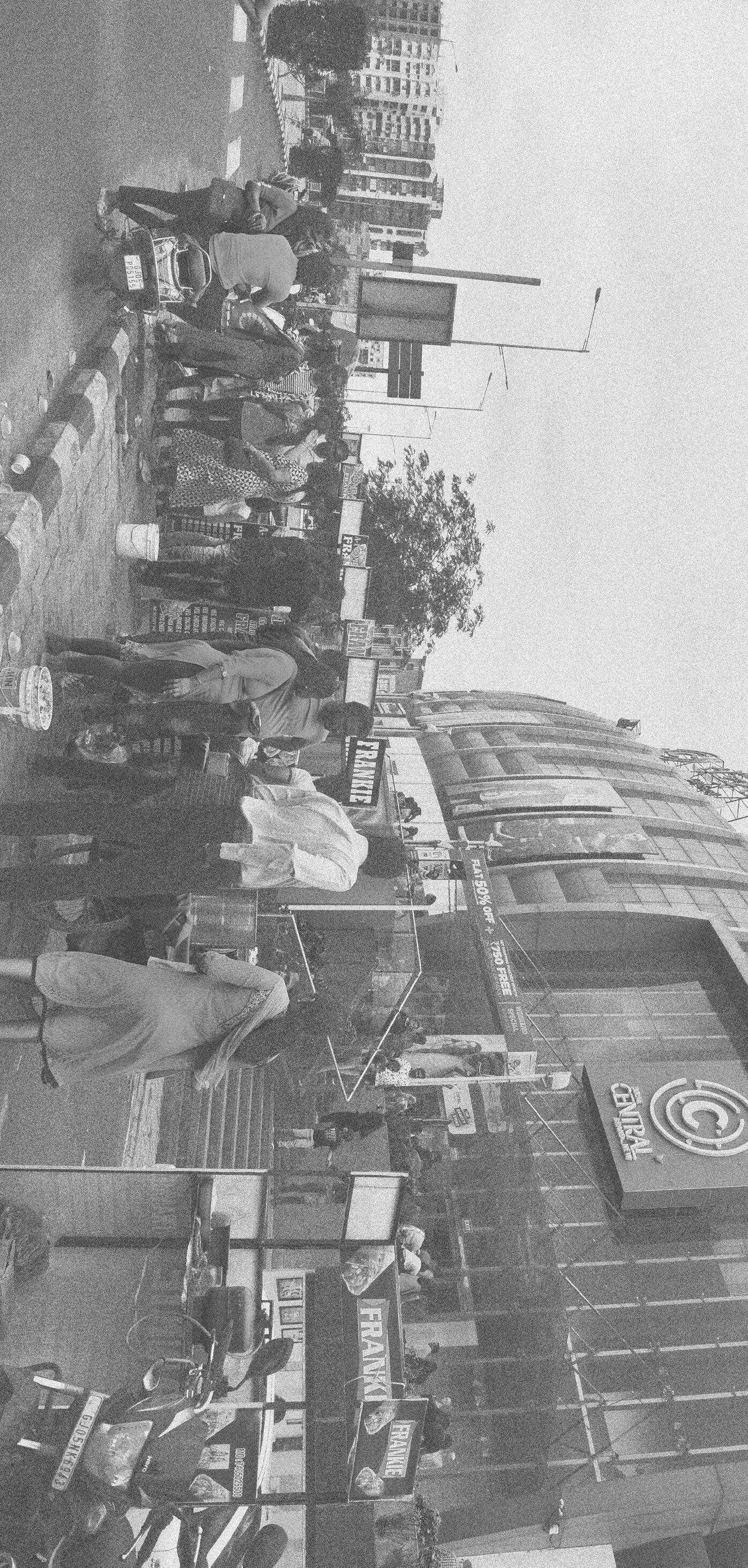
Femas Patel