HISTORIC LAYERS AROUND ISLINGTONS CITY ROAD BASIN
UCL - The Bartlett School of Architcture
MA Architecture and Historic Urban Environments
BARC0187/BARC0188
3D Scanning for Historic Urban Environments
Presented to Thomas Parker
Candidate numbers: XQTY7
May 09, 2023
TABLE
1 INTRODUCTION P. 1 3 WORKFLOW P. 4 3.01 Overview Single Scans P. 5 2 SITE P. 2 3.02 Single Scans P. 6 3.03 Overview Clusters P. 7 3.04 Clusters P. 8 4 DATA HANDELING P. 9 4.01 Reflection P .10 5 HISTORIC LAYERS P. 11 4.01 Concept P. 12 4.02 Archival Material P. 13 4.03 Layers P. 14 4.04 Collages P. 15 6 RENDERS P. 23 7 CONCLUSION P. 28 2.01 Site P. 2 2.01 Site Overview P. 3 3.01 Pictures P. 4
OF CONTENTS
1 INTRODUCTION
The following portfolio is a documentation of the work process that has been carried out over the last few weeks. Starting from a local site in London, a design project was developed within the historical context of the site. The project involved surveying 3D data from the surrounding area and processing the data into a video to understand and digitally recreate the historical context of the site. In the video, archival footage was used to recreate different built layers in the 20th century. The portfolio also includes renderings and animations of the current inventory.
Newspaper articles from local papers 1
01. Newspaper article, Fill in basin plan approved, 5/3/1976, Islington Gazette, L5.92 , Y59 B 232, Islington Local Archives, London

02. Newspaper article, Save our Basin, pleads council, 15/12/1972, Islington Gazette, L5.92 , Y59 B 232, Islington Local Archives, London
0.3 Newspaper article, Decision awaited om London´s disused lakes, 27/08/1974, The times, L5.92 , Y59 B 232, Islington Local Archives, London

04. Newspaper article, Boats in the Basin, 3/9/1976, Islington Gazette, L5.92 , Y59 B 232, Islington Local Archives, London

05. Newspaper article, Life chugs back to the old canal, 23/01/1973, Islington Gazette, L5.92 , Y59 B 232, Islington Local Archives, London

02. Newspaper article, Save our Basin, pleads council, 15/12/1972, Islington Gazette, L5.92 , Y59 B 232, Islington Local Archives, London

BARC0187/188 UCL - The Bartlett School of Architecture 1 INTRODUCTION
Historic Layers around Islingtons City Road Basin
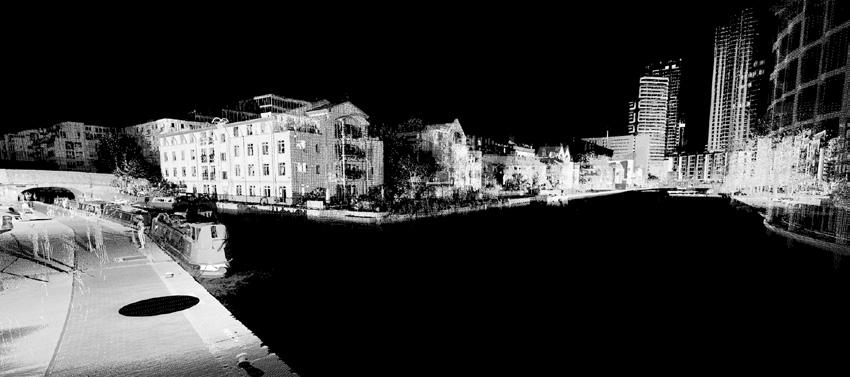
2.1 SITE
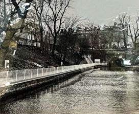
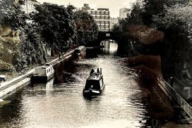
As a site for the module BARC0187 3D Scanning in Historic Urban Environments the section of the Regents Canal in Islington with the neighboring City Road basin was chosen due to its impact on the local history and cultural heritage. Regent‘s Canal is a waterway that runs through London and connects the Grand Union Canal in the west to the River Thames in the east. The canal was built in the early 19th century to transport goods between London‘s busy docks and the industrial Midlands. Due to this fact it played a crucial role in the growth of London‘s economy during the Industrial Revolution.
In the section of the canal that runs through the Borough of Islington in London, in-between Wharf Road and Graham Street, lies the City Road Basin which is connected to the Regent´s Canal. The large Basin was built in the 1820s as a turning point for the canal‘s barges. The basin was surrounded by warehouses and factories that served the needs of the growing city, but by the mid-20th century, many of these buildings had fallen into disrepair.

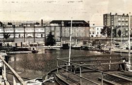
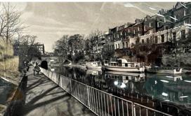
In the 1980s, there were several different ideas about what to do with the abandoned City Road Basin. In recent years, however, the City Road Basin has seen a resurgence of walking distance from the City Centre


the canal and the basin are popular destinations for walkers, cyclists, and joggers. However, this also leads to a high level of interest from developers who want to build luxury projects near the canal and thus drive-up housing prices.

BARC0187/188 UCL - The Bartlett School of Architecture 2 SITE
Historic Layers around Islingtons City Road Basin
3
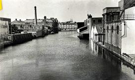
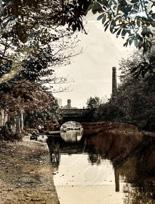
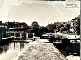
Ortho Pictures, 1946, L5.92 , Y59 B 232, Islington Local Archives, London
2
Newspaper article, Londons own canal, L5.92 , Y59 B 232, Islington Local Archives, London
2.2 SITE OVERVIEW
BARC0187/188 UCL
School of Architecture 3
- The Bartlett
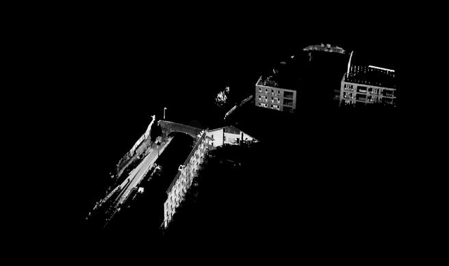
4 SITE
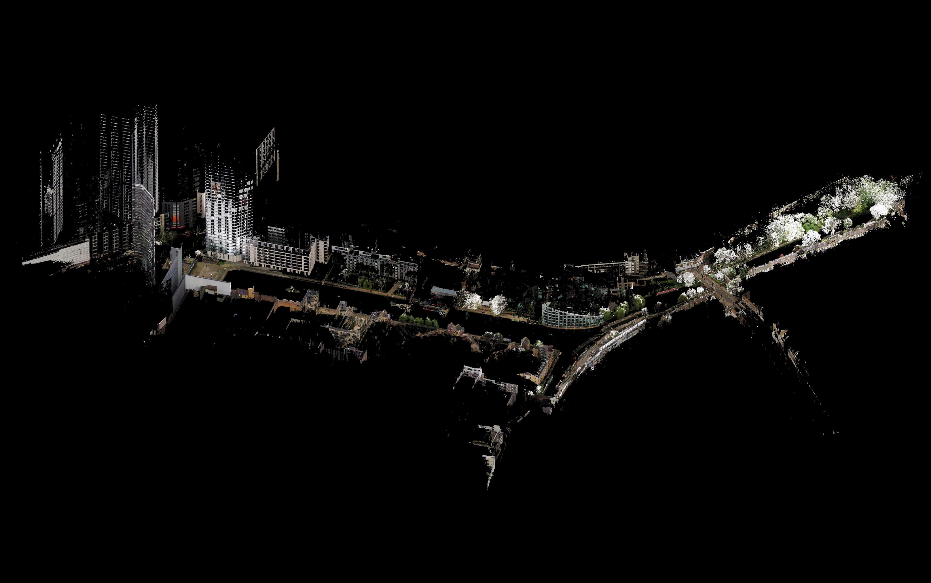
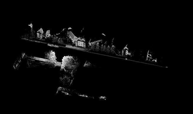
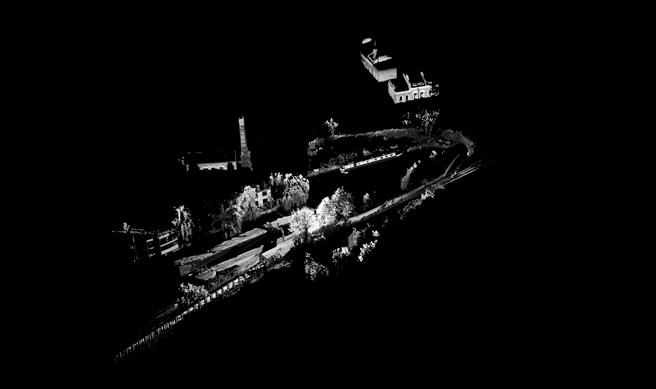
Axenometric view from the north-east side over the site
Historic Layers around Islingtons City Road Basin
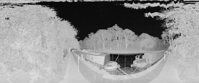
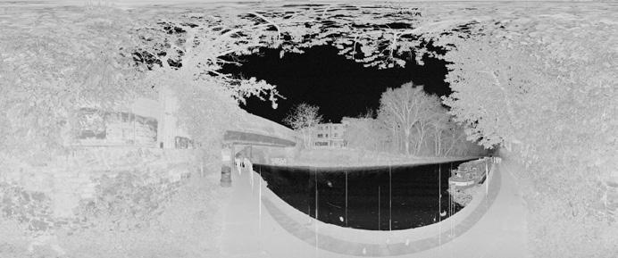
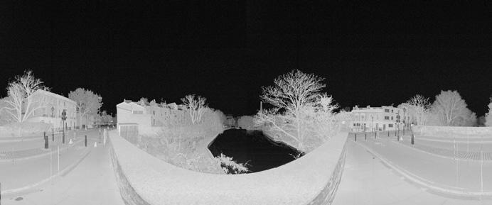
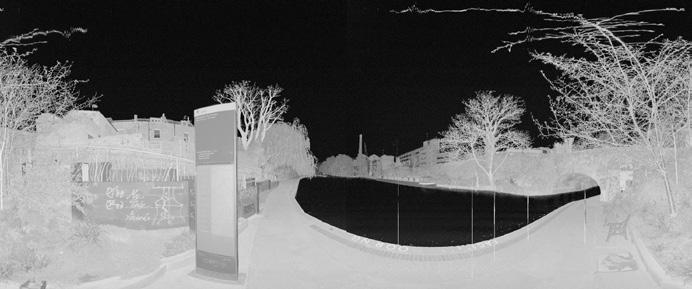
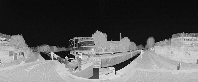
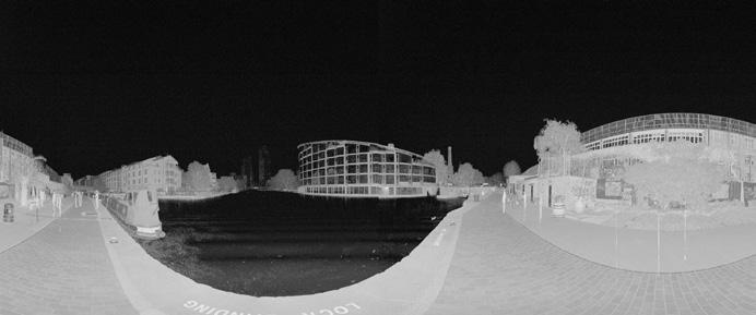
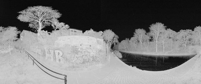
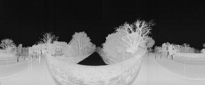
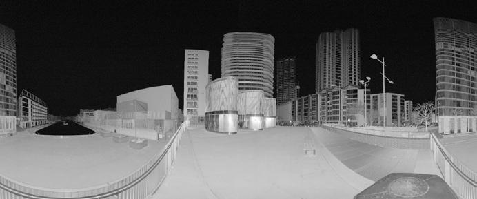
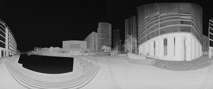
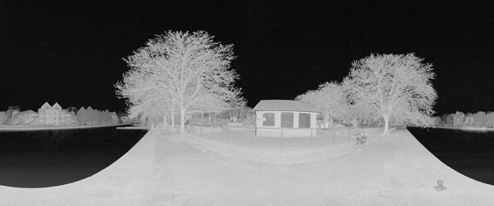
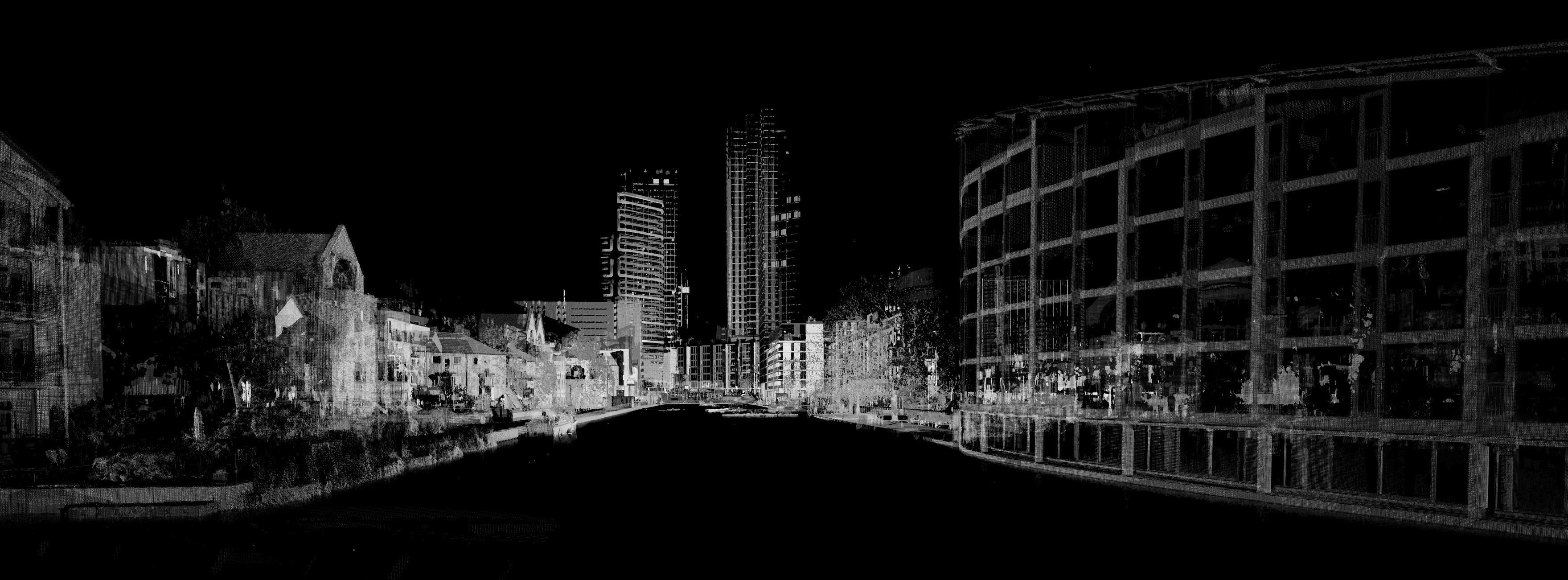
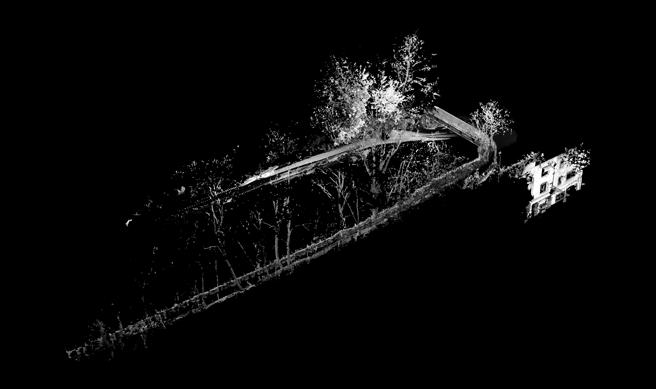
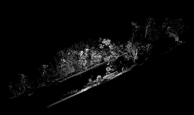
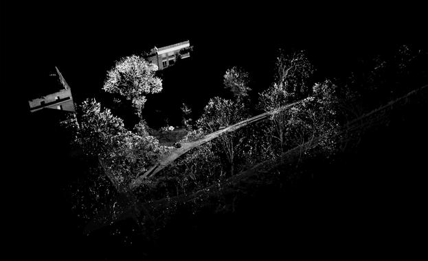
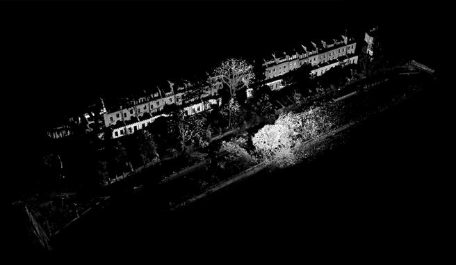
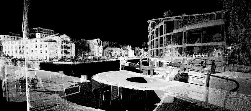
BARC0187/188 UCL - The Bartlett School of Architecture 4 WORKFLOW Historic Layers around Islingtons City Road Basin Panoramic Pictures from Scan 0 - 16 6 Scanning on site 5 SCAN 00 SCAN 01 SCAN 02 SCAN 03 SCAN 04 SCAN 05 SCAN 06 SCAN 07 SCAN 08 SCAN 09 SCAN 10 SCAN 11 SCAN 12 SCAN 13 SCAN 14 SCAN 15 SCAN 16
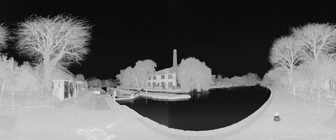
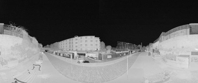
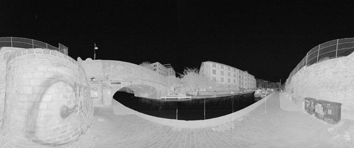
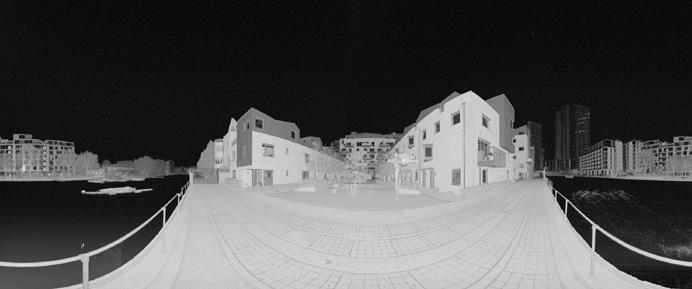
3.1 PICTURES
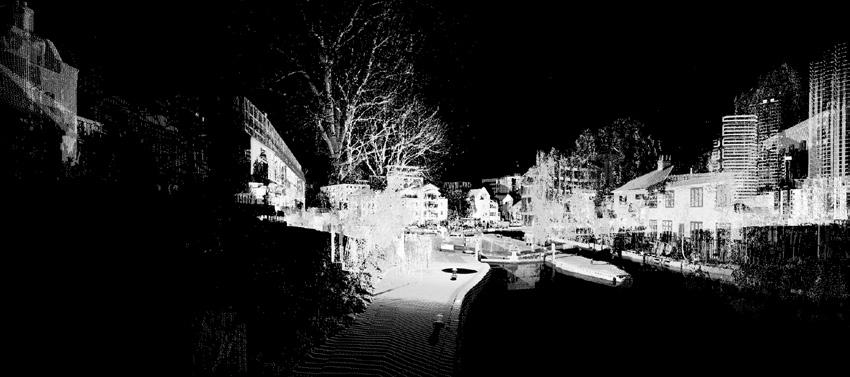
3.2 OVERVIEW SINGLE SCANS
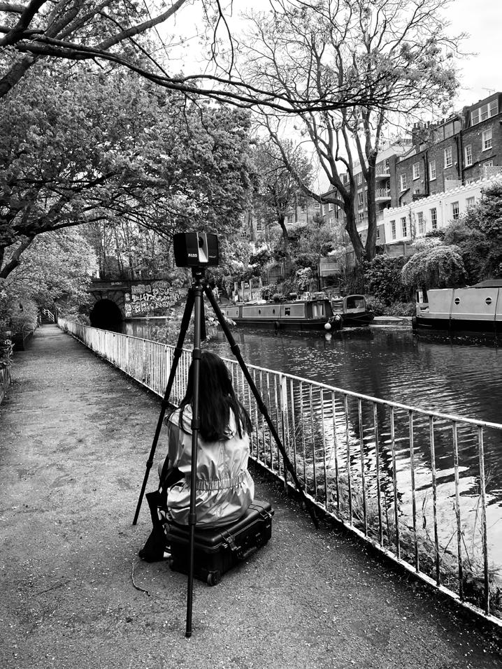
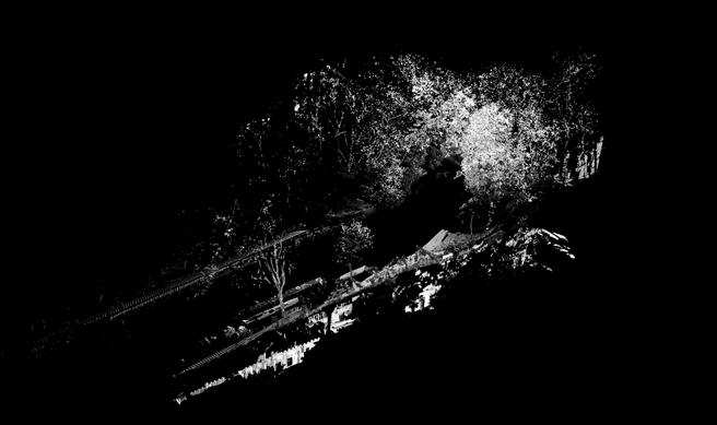
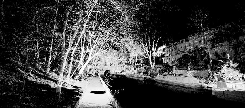
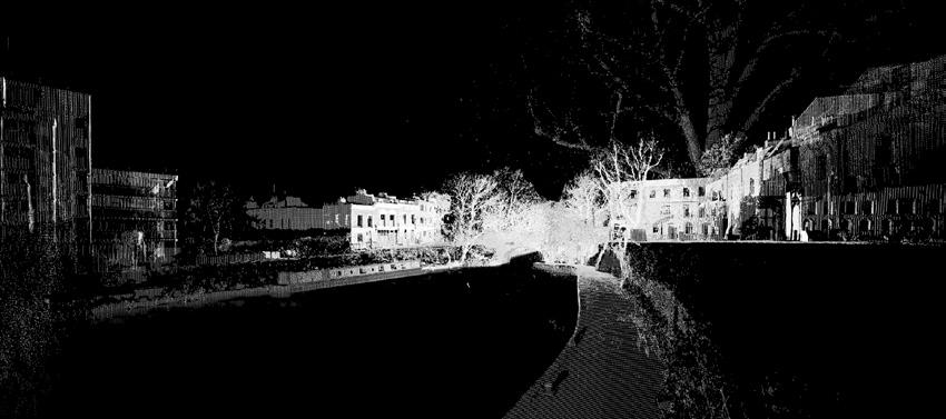
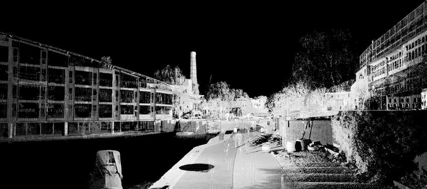
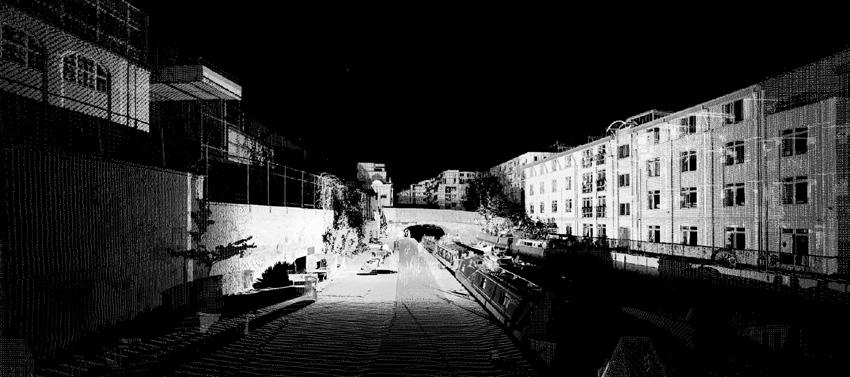
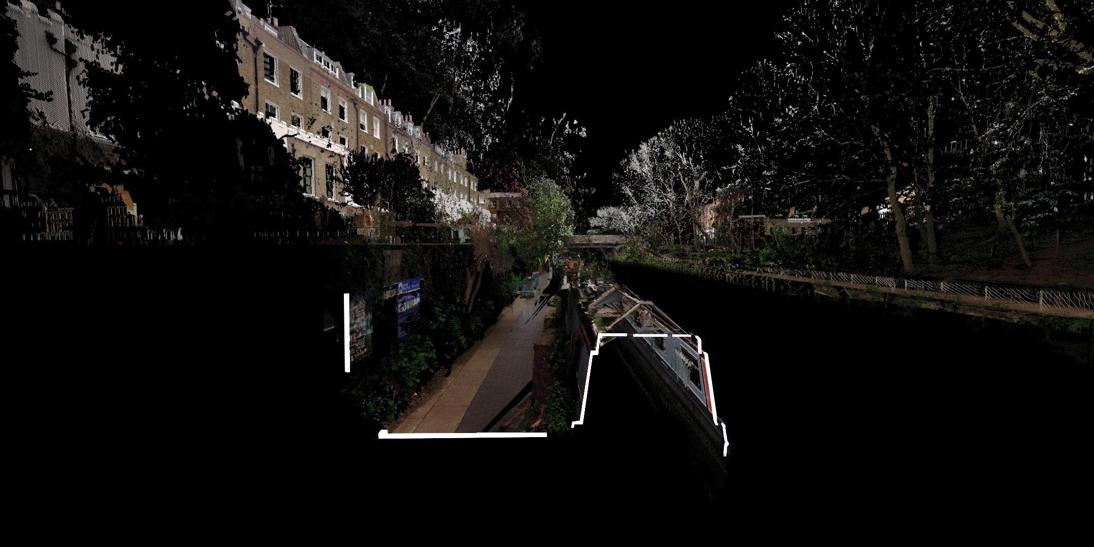
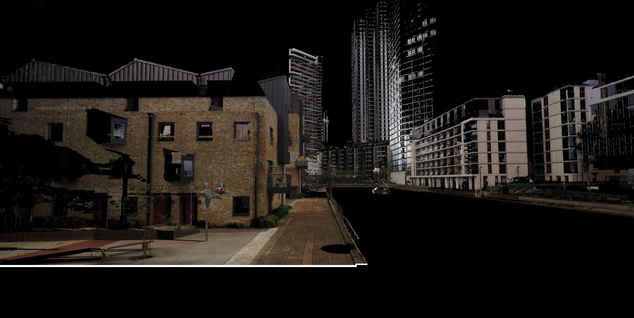
The faro Lidar Focus S350 scanner was used to survey the area. The focus of the data acquisition was the northern part of the area, especially the section of Vincent Terrace between the Islington Tunnel and Frog Lane Bridge and the area around the locks that regulate the water level of the canal. The survey was carried out in a circular clockwise direction around the area. A total of 17 scans were carried out. The instrument was set up as follows:

Profile: Outdoor
Resolution: ¼
Quality: 3x
The area was surveyed on 18 April 2023. The settings of the device were made due to the cloudy weather and the large distances of the area. Risks considered when planning the survey included the likelihood of rain, the proximity to the water without parapet protection and the increased frequency of pedestrians and cyclists on the narrow paths along the canal. Some buildings along the canal and the basin are not accessible to the public and could therefore not be surveyed in detail.
To process the data, Faro Scene was used in the first step to process, register and align the scans. Then they were exported and processed in Cloud Compare and Bentley Pointtools vI8. Finally, the results were edited in Adobe Photoshop and Premiere pro and merged with the archive material.
SCAN 00 SCAN 02 SCAN 03 SCAN 01 SCAN 13 SCAN 16 SCAN 14 SCAN 04 SCAN SCAN 12 SCAN 06 SCAN 05 SCAN 08 SCAN 07 SCAN 09 SCAN 10 SCAN 11
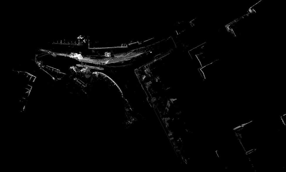
BARC0187/188 UCL - The Bartlett School of Architecture 5 N 51.533170 W -0.102648 N 51.532958 W -0.101646 N 51.533235 W -0.102329 N 51.533058 W -0.101163 N 51.532907 W -0.100222 N 51.532857 W -0.100170 N 51.532848 W -0.100044 N 51.532877 W -0.099871 N 51.532831 W -0.099309 N 51.532700 W -0.098702 N 51.532719 W -0.098283 N 51.532802 W -0.097764 N 51.532962 W -0.097166 N 51.531804 W -0.097921 N 51.531145 W -0.096931 N 51.529953 W -0.096615 N 51.529799 W -0.096172
7 WORKFLOW Historic Layers around Islingtons City Road Basin
Overview of the Singla Scans around Regent´s Canal and the City Road Basin with the respective coordinates
3.3 SINGLE SCANS
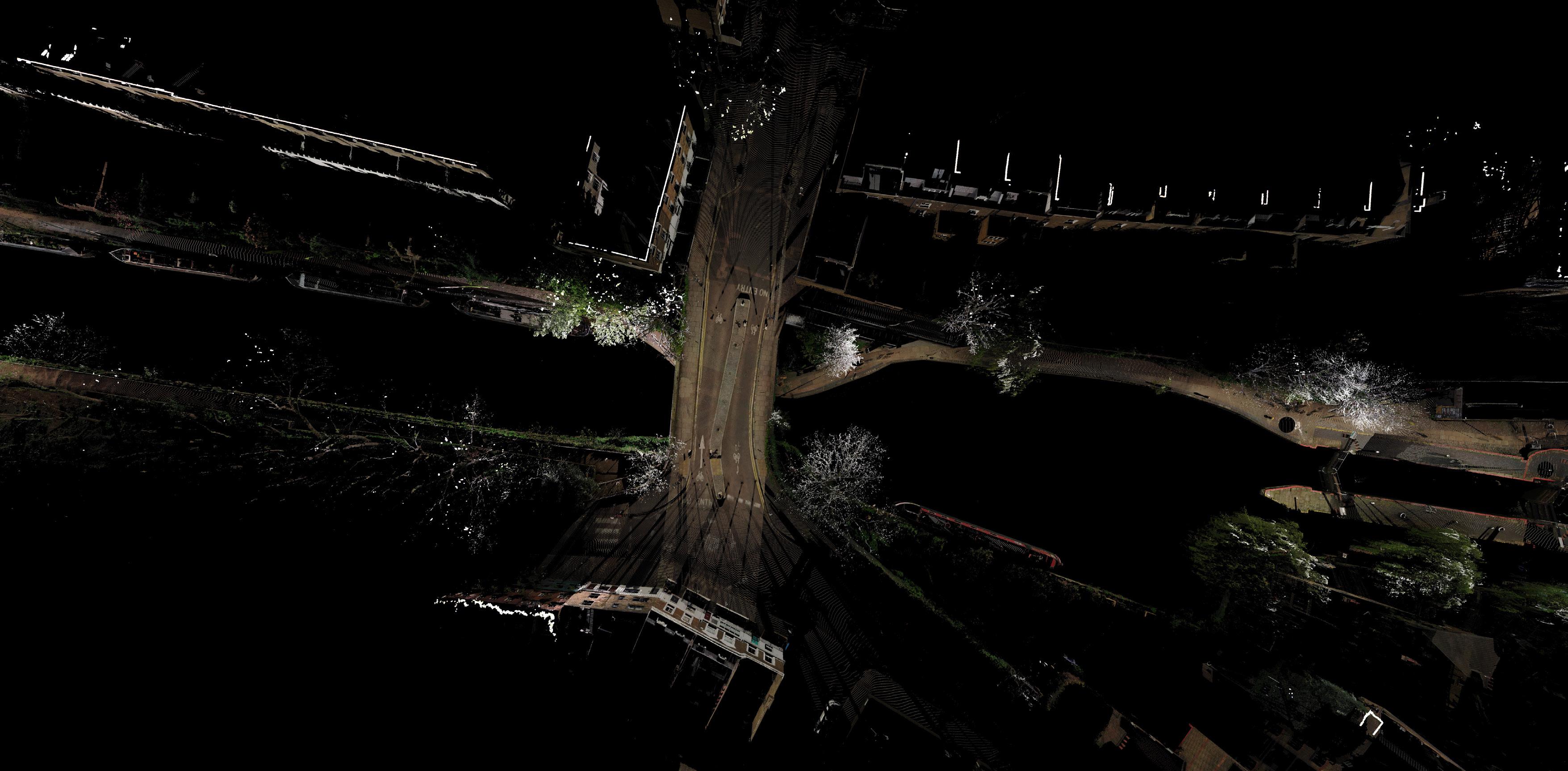
BARC0187/188 UCL - The Bartlett School of Architecture 6 SCAN 00 points 19.446.666 SCAN 01 points 17.384.875 SCAN 02 points 15.852.999 SCAN 03 points 20.258.981 SCAN 04 points 23.063.068 SCAN 05 points 17.086.028 SCAN 06 points 16.193.889 SCAN 07 points 16.703.783 SCAN 08 points 14.132.685 SCAN 09 points 17.548.150 SCAN 10 points 14.804.369 SCAN 11 points 20.475.903 SCAN 12 points 21.759.700 SCAN 13 points 15.017.672 SCAN 14 points 21.184.558 SCAN 14 points 23.124.568 SCAN 16 points 14.655.041 Axonometric views of the single scan and the recorded point number 8 WORKFLOW Historic Layers around Islingtons City Road Basin
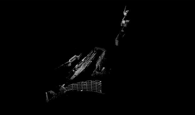
3.4 OVERVIEW CLUSTERS
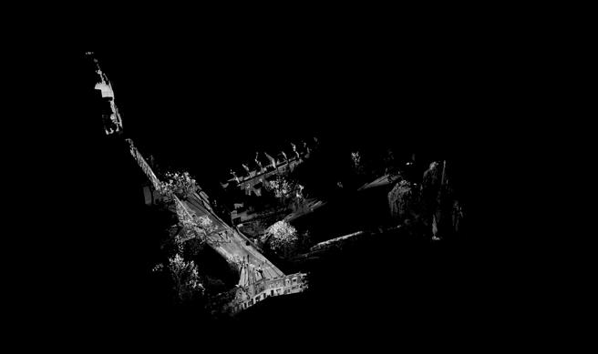
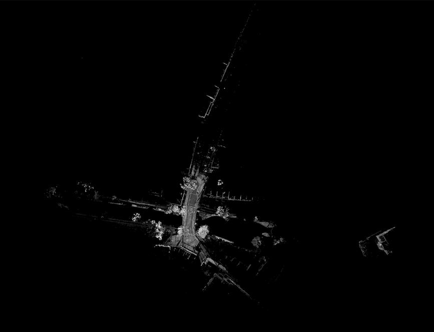
CLUSTER 1
Scan towards east above Islington Tunnel
CLUSTER 2
Scan of Vincent Terrace between Islington Tunnel and Frog Lane
Bridge
CLUSTER 3
Scan from Frog Lane Bridge on Danbury Street
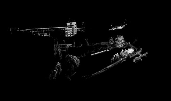
CLUSTER 4
Scan of the City Road Basin North Side
CLUSTER 5
Scan of the City Road Basin South Side
CLUSTER 6
Scan between Wharf Road Bridge and Hanover School
Overview of the clusters and discription of placement 9
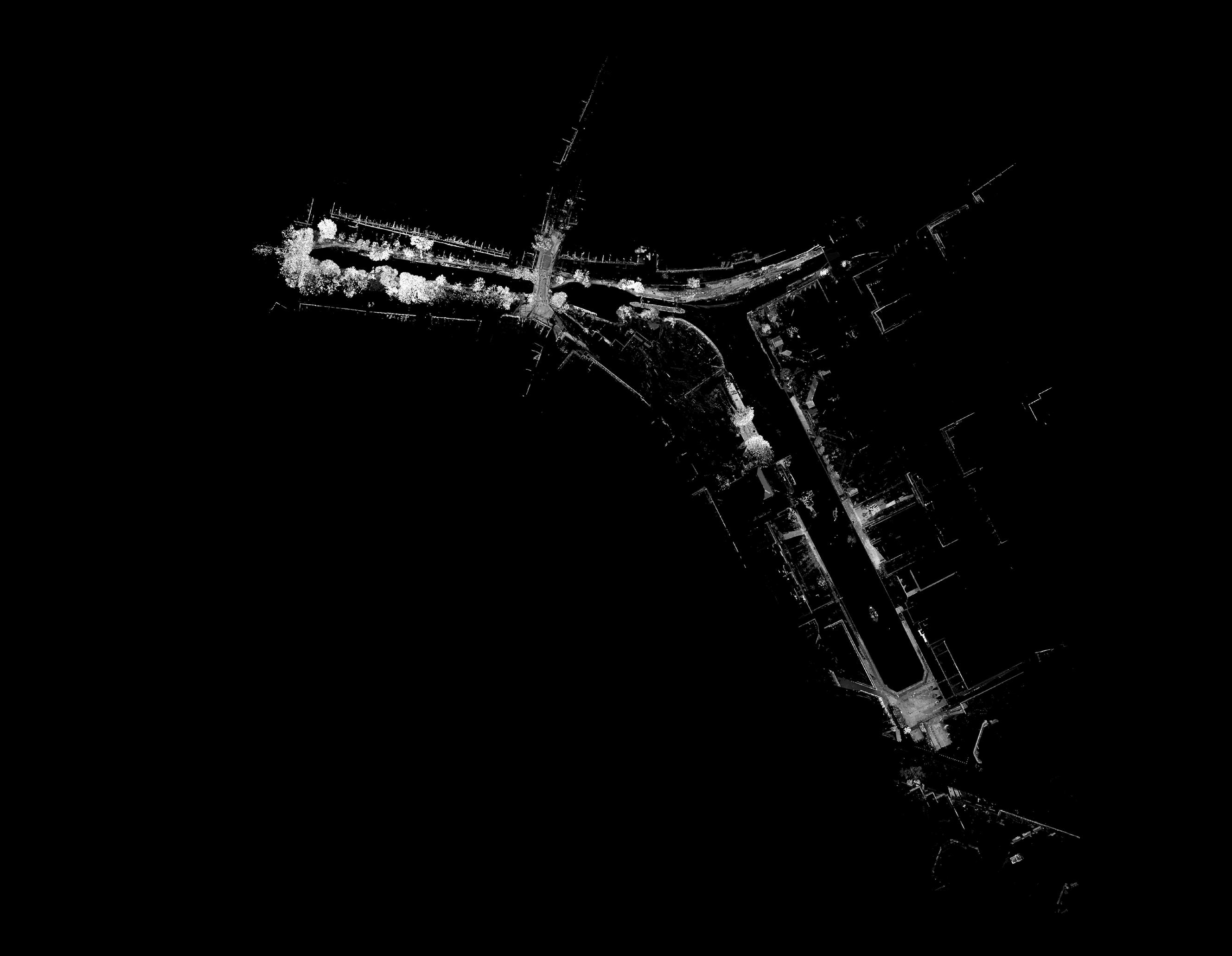
CLUSTER 1 CLUSTER 3 CLUSTER 2 CLUSTER 6 CLUSTER 4 CLUSTER 5
BARC0187/188 UCL - The Bartlett School of Architecture 7
WORKFLOW
Historic Layers around Islingtons City Road Basin
3.5 CLUSTERS
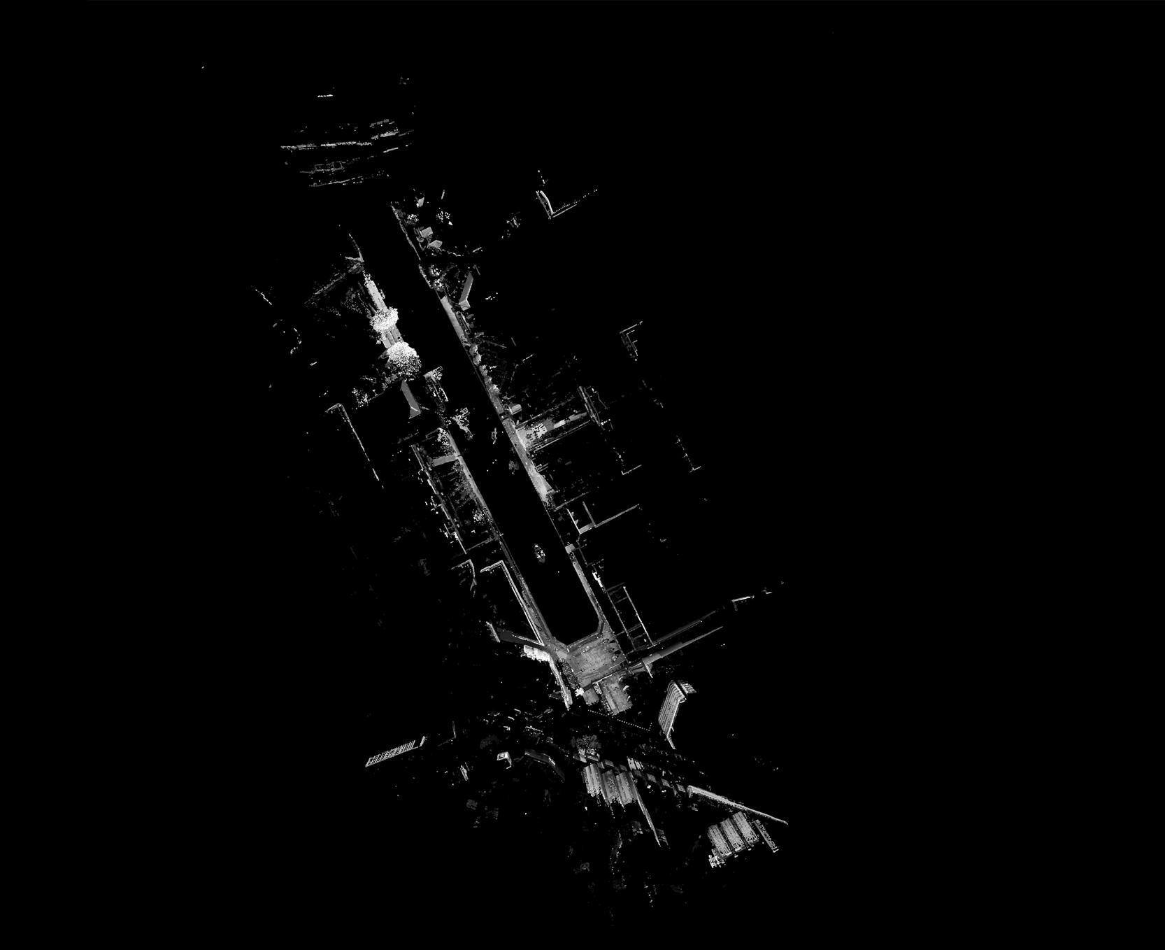
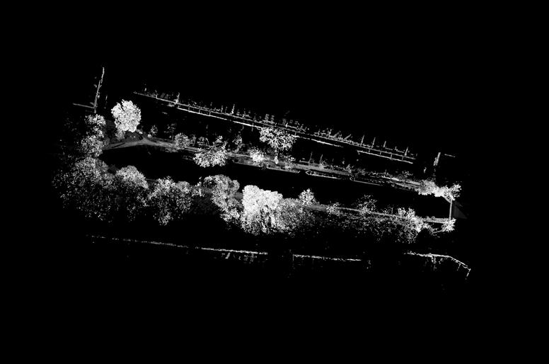
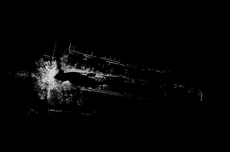
BARC0187/188 UCL - The Bartlett School of Architecture 8 CLUSTER 1 1 Scan Max. Point Error 14.2mm Mean Point Error 14.2mm Min. Overlap 28.2% CLUSTER 2 4 Scans Max. Point Error 14.2mm Mean Point Error 11.0mm Min. Overlap 23.0% CLUSTER 4 4 Scans Max. Point Error 4.2mm Mean Point Error 3.4mm Min. Overlap 47.5% CLUSTER 5 2 Scans Max. Point Error 11.1mm Mean Point Error 7.70mm Min. Overlap 38.2% CLUSTER 5 4 Scans Max. Point Error 11.1mm Mean Point Error 11.1mm Min. Overlap 38.2% CLUSTER 3 2 Scans Max. Point Error 7.7mm Mean Point Error 5.2mm Min. Overlap 23.0% OVERVIEW 17 Scans Max. Point Error 14.2mm Mean Point Error 8mm Min. Overlap 23.0% CLUSTER 1 CLUSTER 3 CLUSTER 2 CLUSTER 4 CLUSTER 5 CLUSTER 6 Overview and respective registration data from the clustes 10 WORKFLOW Historic Layers around Islingtons City Road Basin
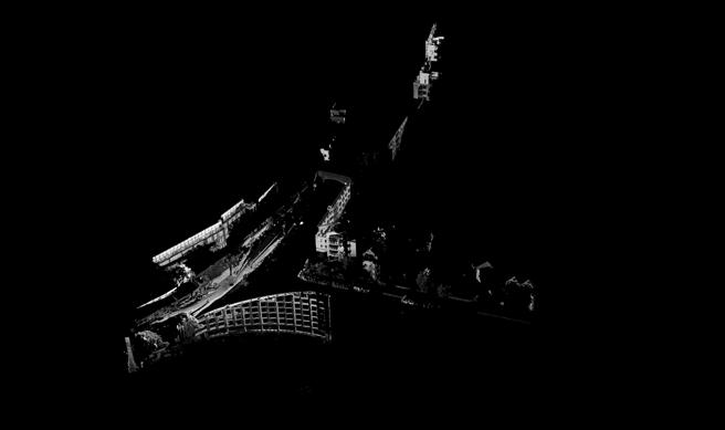
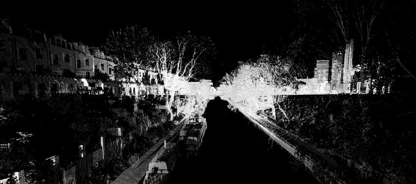
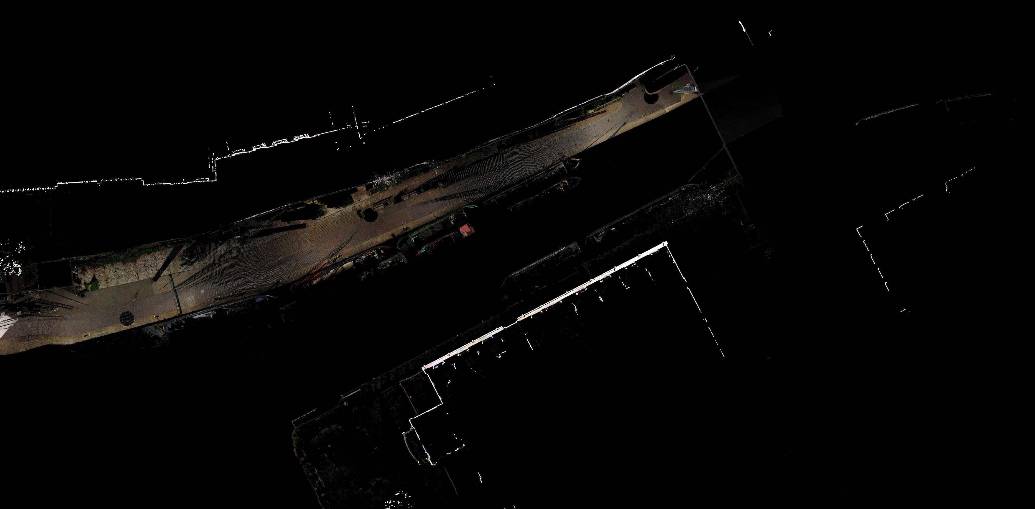
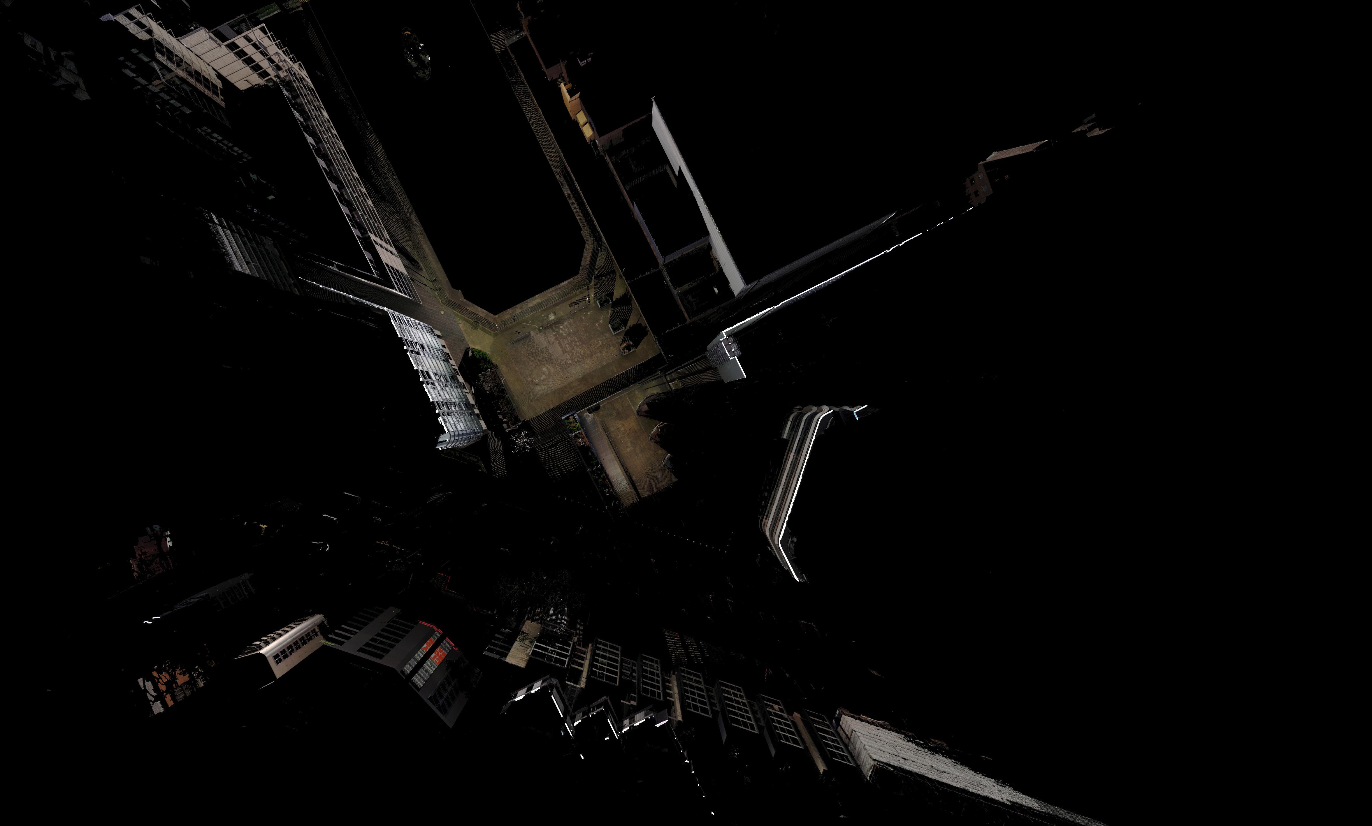
4.1 REFLECTION

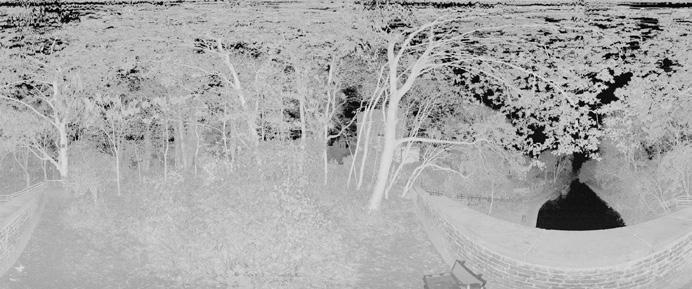
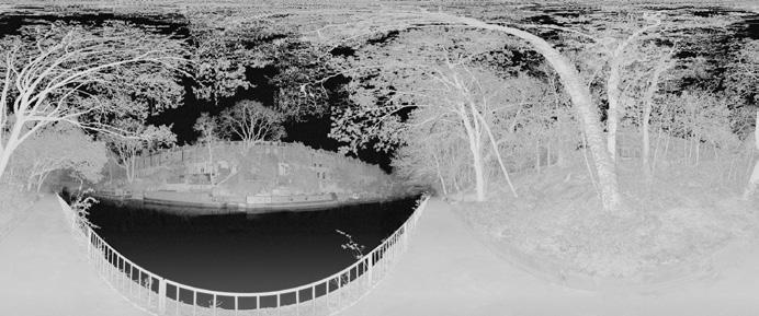
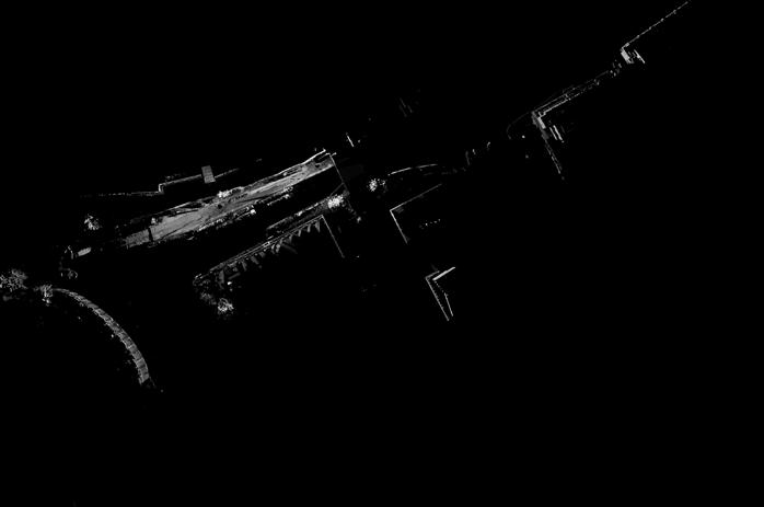
Of great importance in the processing of the scans was the reflection of materials. The survey was done around water, which is in constant motion and too reflective to be picked up. Also, the high percentage of vegetation and the reflectance of festers and modern materials like metal is not ideal for scanning. The attached graphs in the portfolio illustrate the reflectance of the different materials. The water was not captured and is therefore shown in black. Looking at the water surface, some reflections and specular reflections are visible, which are shown in blue. Semi-reflective and moving materials and objects are shown in white. Overall, it can be said that the data captured was good and correct and the colourisation was successful.


BARC0187/188 UCL - The Bartlett School of Architecture 9 DATA HANDELING
Islingtons City Road
Historic Layers around
Basin
Axonometric view from north-east with reflection values 11 Perspective from Wharf Road Bridge 13 Perspective towards the south end of the City Road Basin 12 Strong reflection Medium reflection No reflection

DATA HANDELING Historic Layers around Islingtons City Road Basin Perspective over Regent´s Canal towards the east mouth of islington Tunnel 14 10 BARC0187/188 UCL - The Bartlett School of Architecture
5.1 CONCEPT
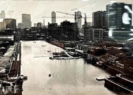
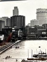
After the completion of the data processing, a concept for the use of the digital material was developed. The local importance of the sociohistorical context on the built environment of the Regents Canal and City Road Basin should be made visible. The popularity of the canal has led often to friction and debate between residents, the council and developers. Particularly in the south of the Basin, there has been an enormous increase in building density in recent decades. In the process, a large number of historic buildings have been lost, which are an important part of local history and identity.

To get a picture of the rapid change the area has undergone over the last decades, material from the Islington Local history Archive was examined and scanned. A major debate in local newspapers in the 1980s already showed the importance of the area at that time. Since then, a lot has changed in the area.
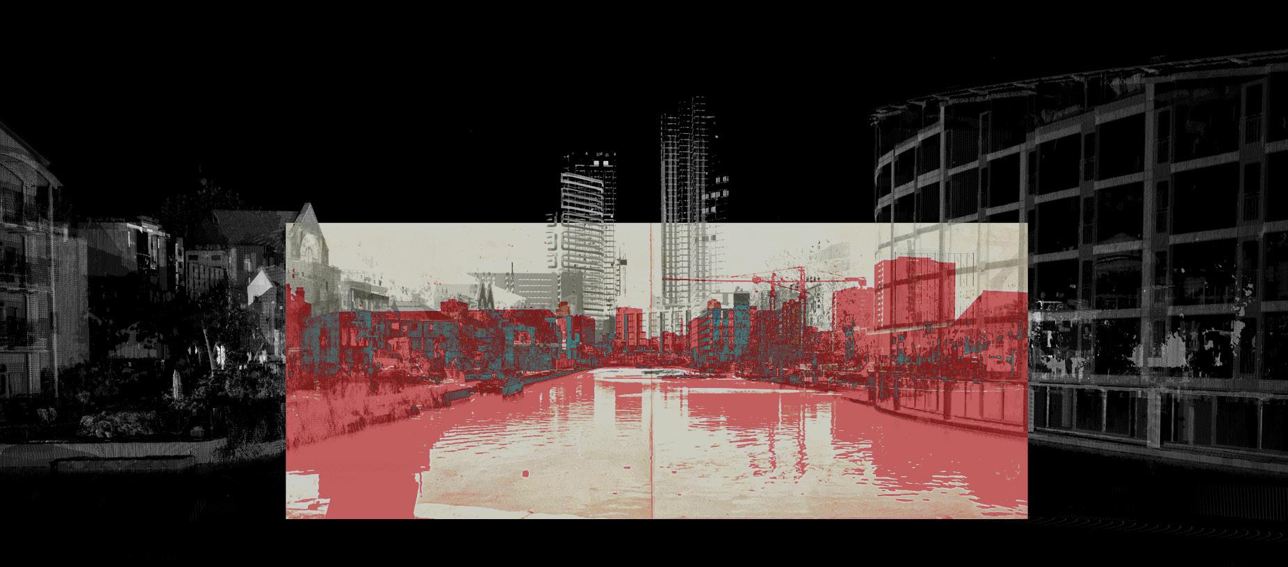
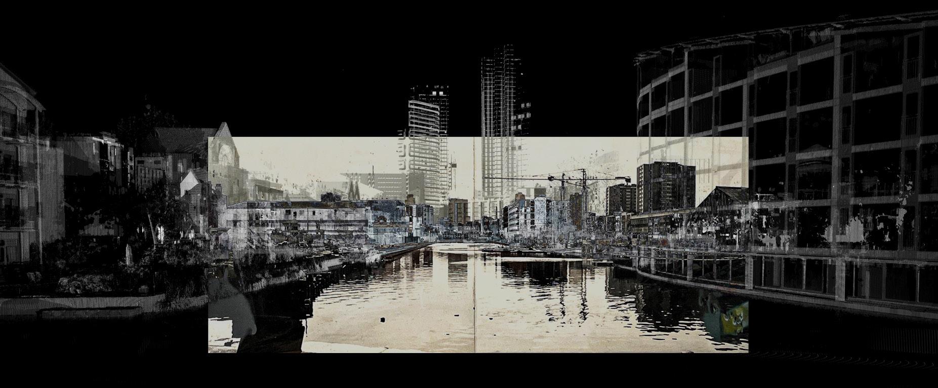
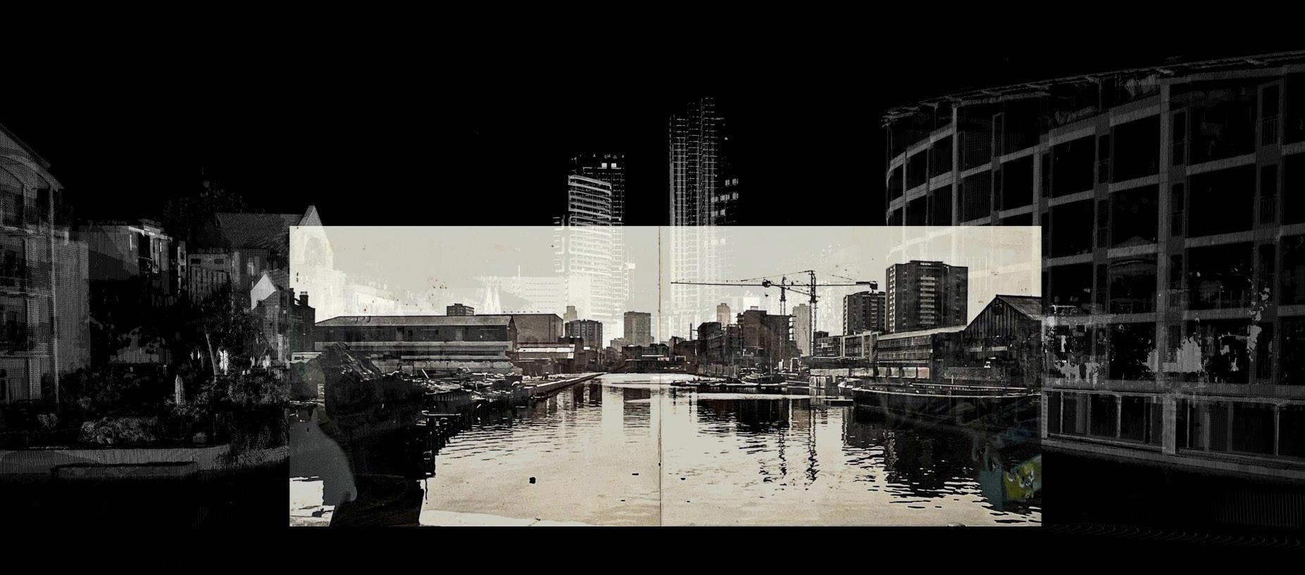
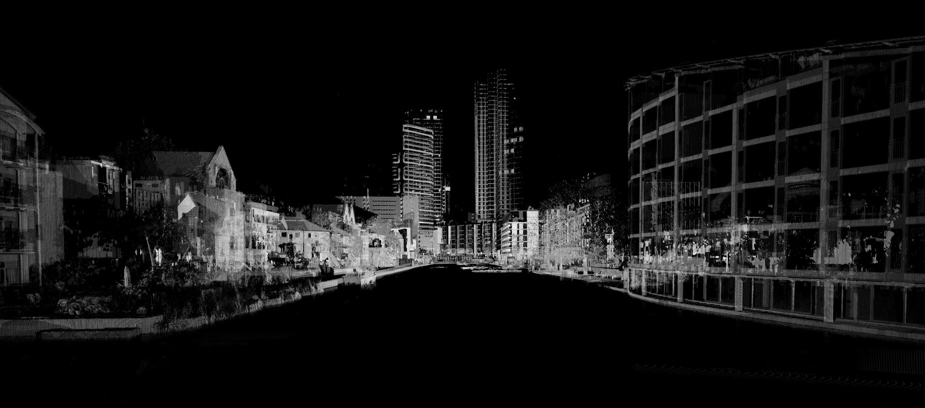
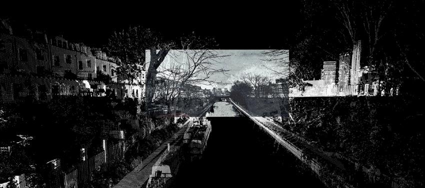
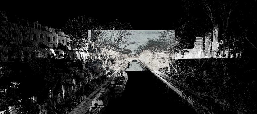
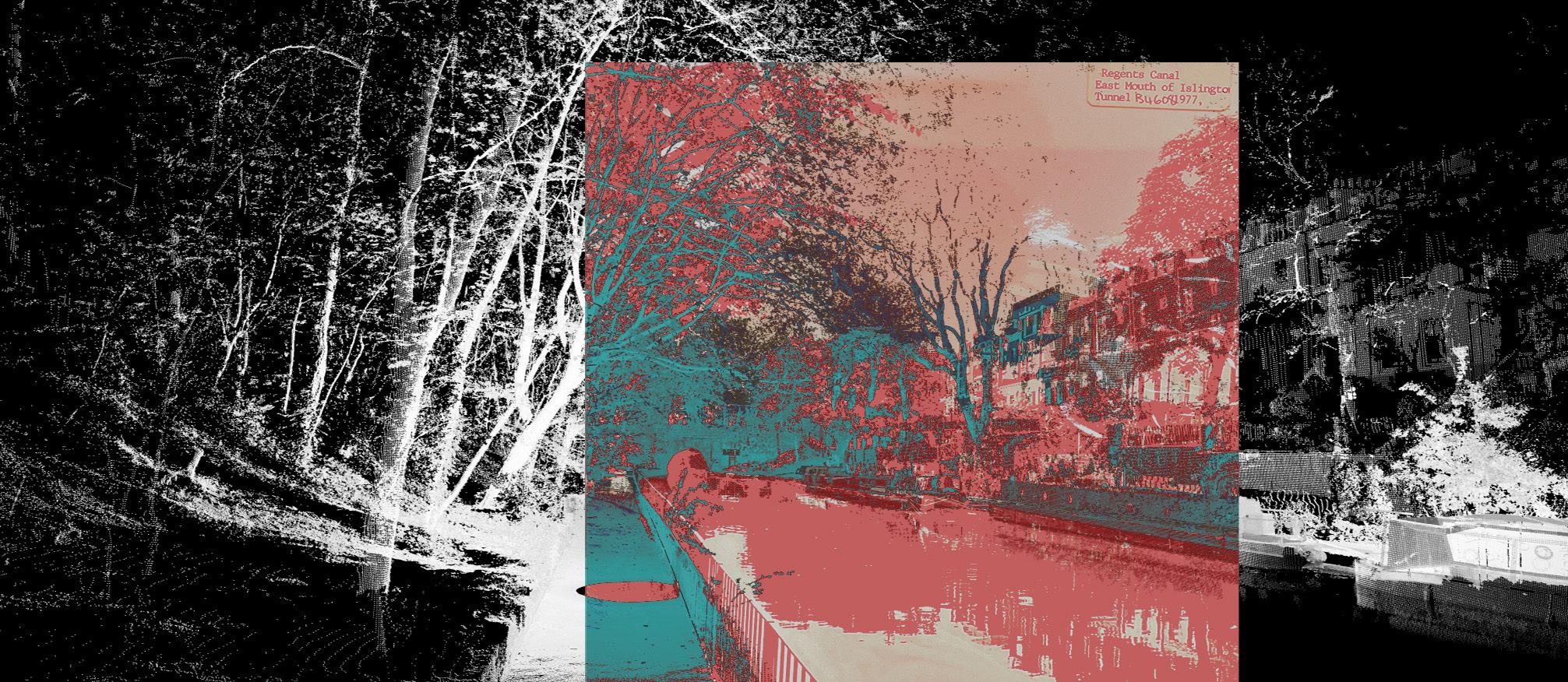
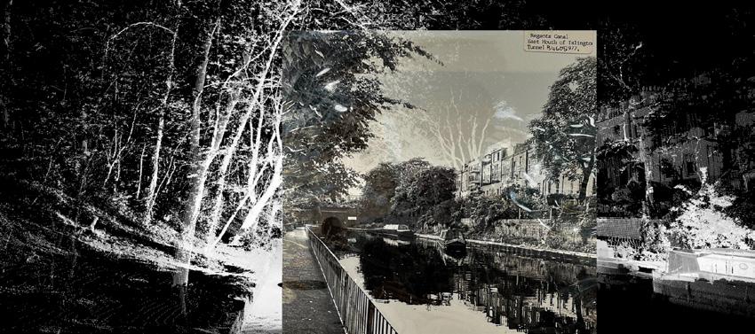
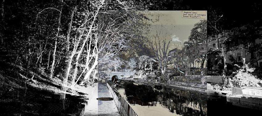
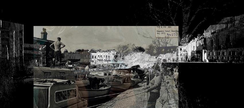
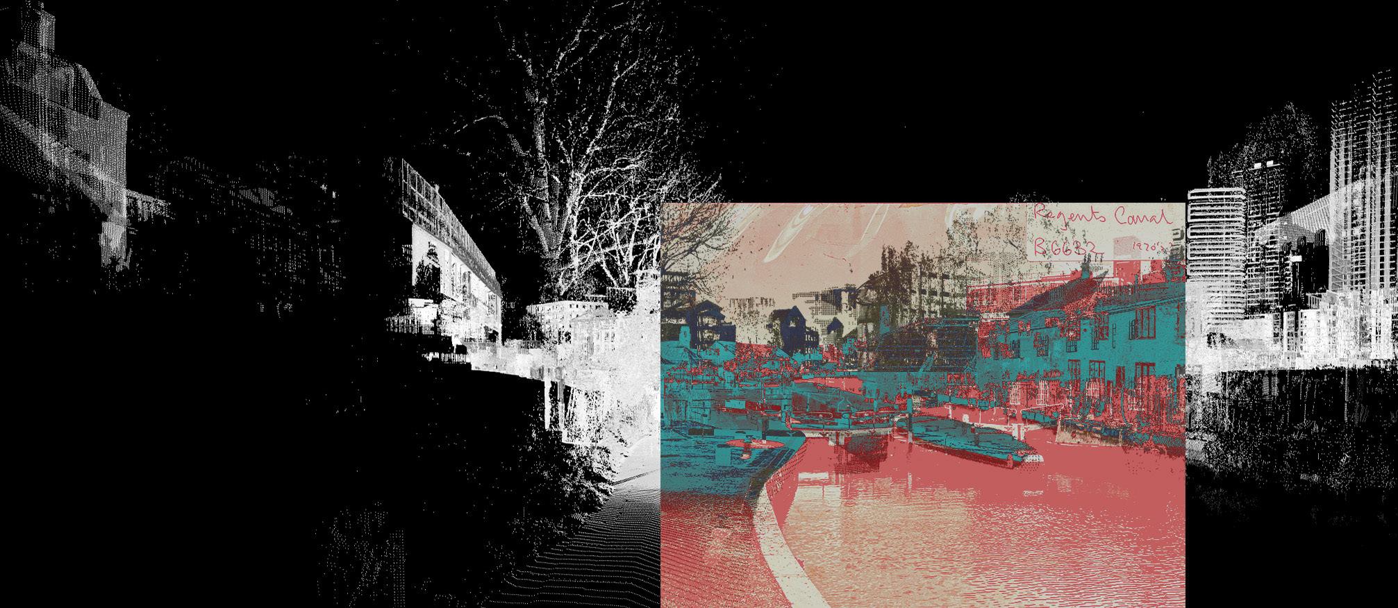
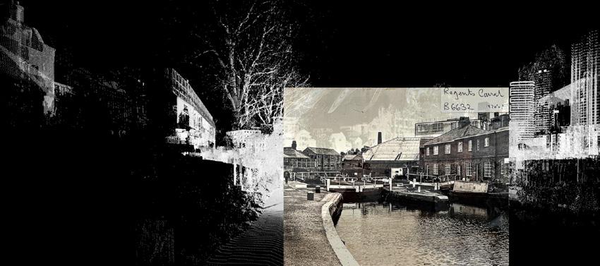
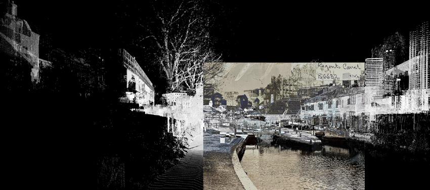
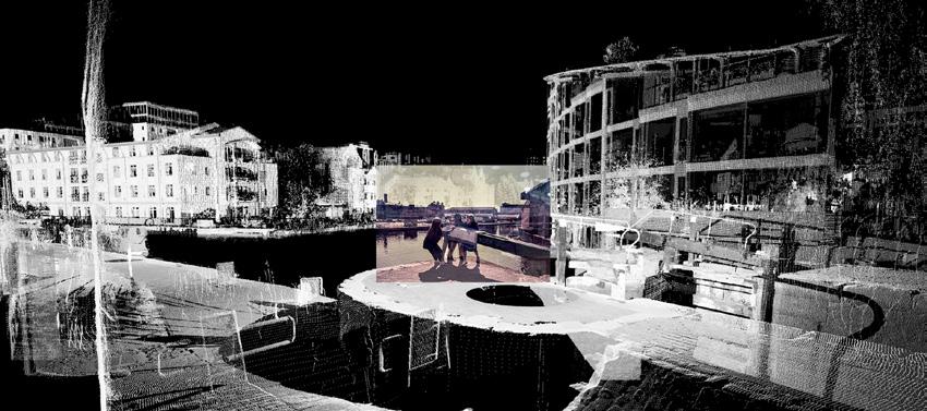
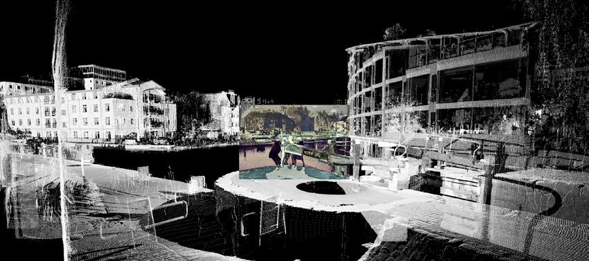
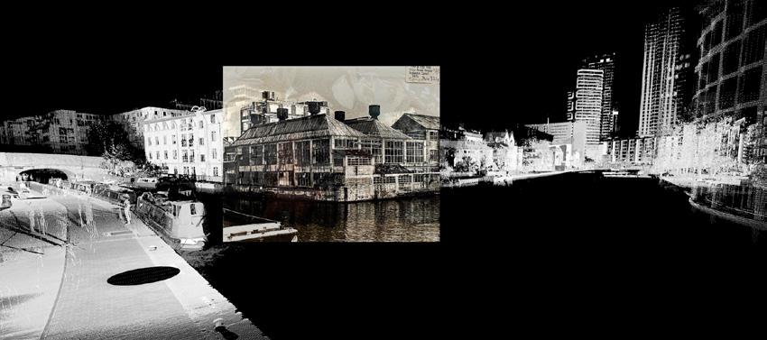
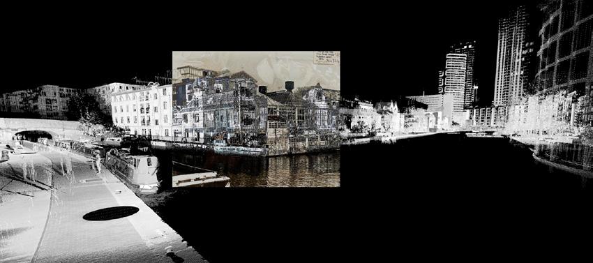
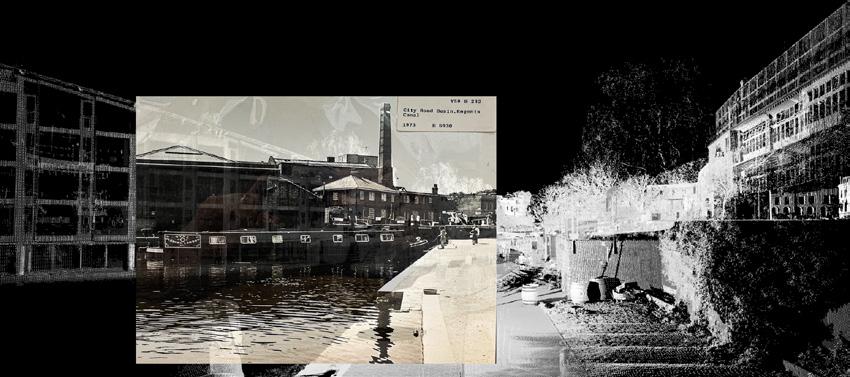
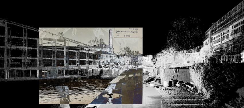
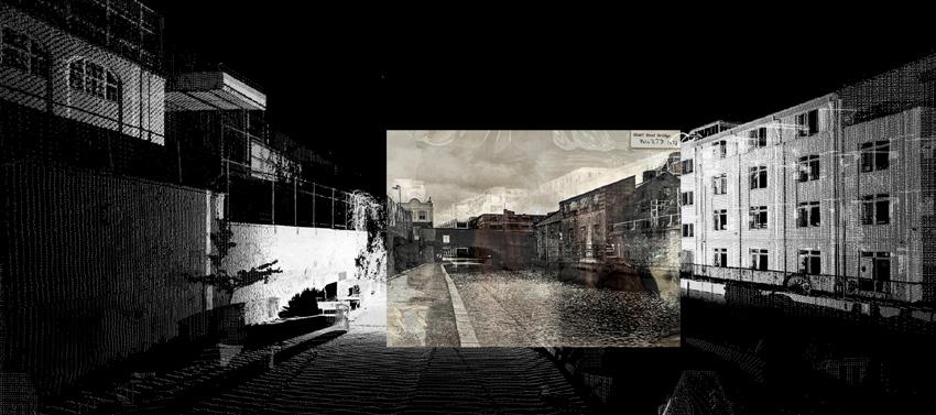
The aim of the design project is to bring archival material into the digital realm, revealing and representing different temporal layers of the built environment. The 3D data from the survey is used as the current representation. The digital 3D model makes it possible to render images from the same perspectives as
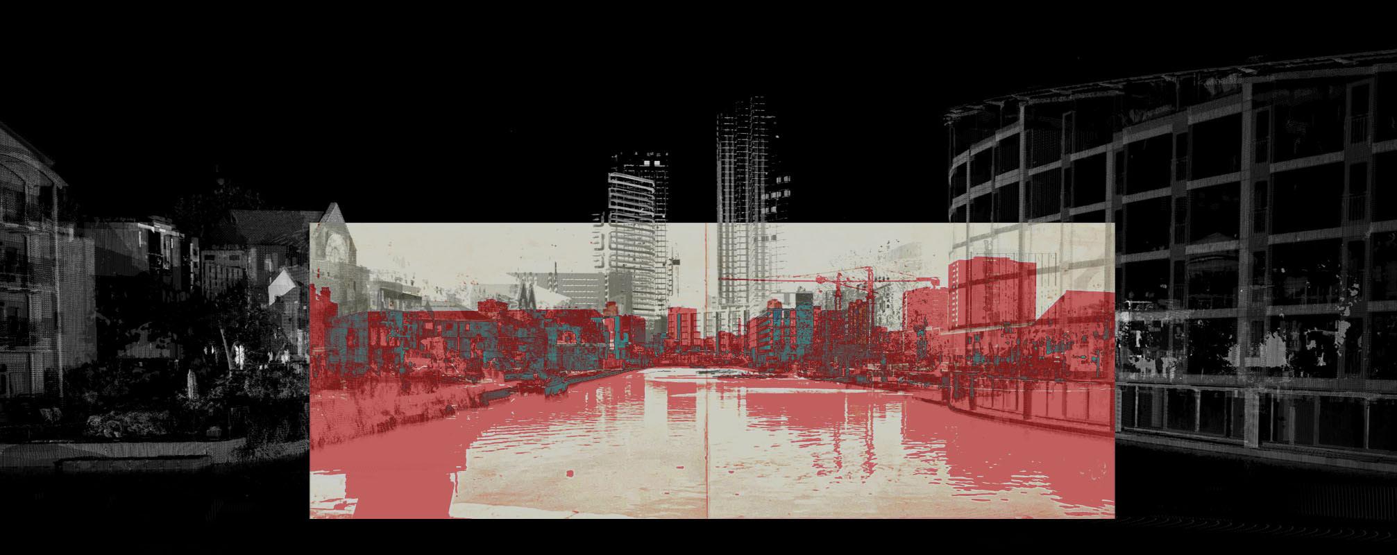
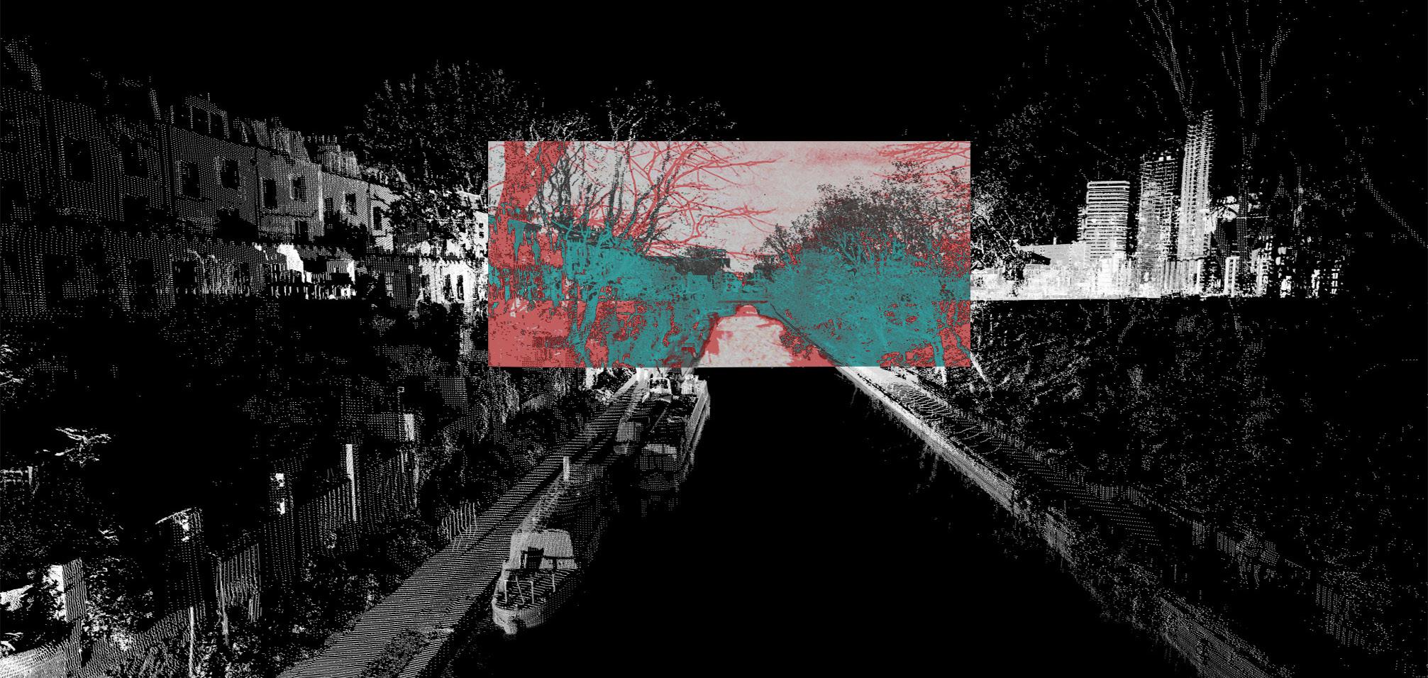
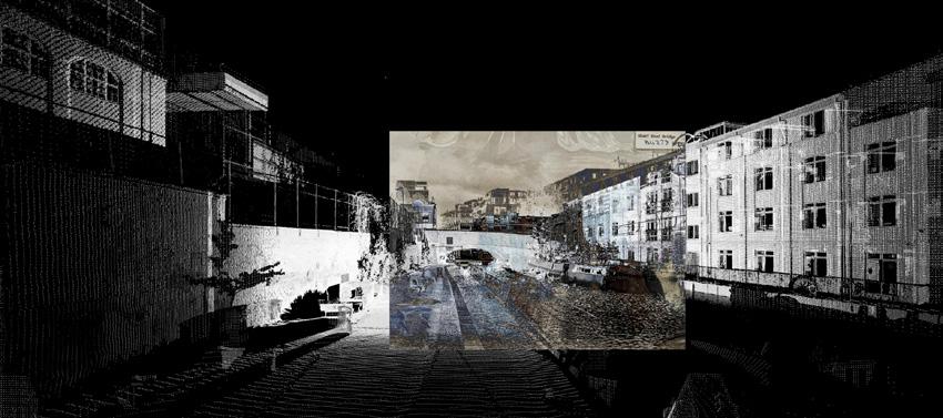
historical images. On top of these digital snapshots, the images, which are dated between 1920 and 1980, are superimposed. In Photoshop, a difference is then created between the current and the historical stock. To clarify this, it was coloured in the further process. A total of 17 collages were made which contain information about the historical development of the area. To illustrate this visually, a video was created that shows the historical layers of the Regent‘s Canal and the City Basin.
11 HISTORIC LAYERS Historic Layers around Islingtons City Road Basin
BARC0187/188 UCL - The Bartlett School of Architecture
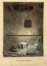
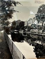
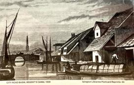
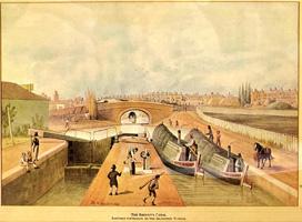
Drawing, City Road Basin Development, 1966, Architectural Review, YB 232 Reg, Islington Local Archives, London 15
5.2 ARCHIVAL MATERIAL

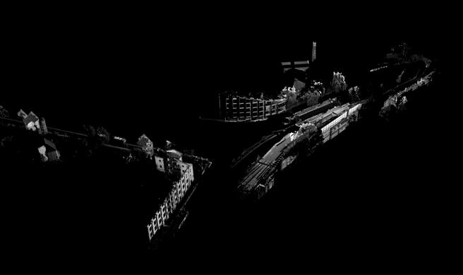
LAYERS
Layers around Islingtons City Road Basin CLUSTER 1 CLUSTER 3 Scan from Frog Lane Bridge on Danbury Street CLUSTER 2 Scan of Vincent Terrace between Islington Tunnel and Frog Lane Bridge CLUSTER 6 Scan of the City Road Basin South Side CLUSTER 4 Scan of the City Road Basin North Side CLUSTER 5 Scan between Wharf Road Bridge and Hanover School
towards east above Islington Tunnel
CENTURY 19TH CENTURY Scans from the archival material Box Y59 B 232, Islington Local Archives, London 16 12 BARC0187/188 UCL - The Bartlett School of Architecture
HISTORIC
Historic
Scan
20TH
5.3 LAYERS
Steps of Layering the Archive Material in Photoshop 17
HISTORIC LAYERS
13
UCL -
School of Architecture
Historic Layers around Islingtons City Road Basin
BARC0187/188
The Bartlett
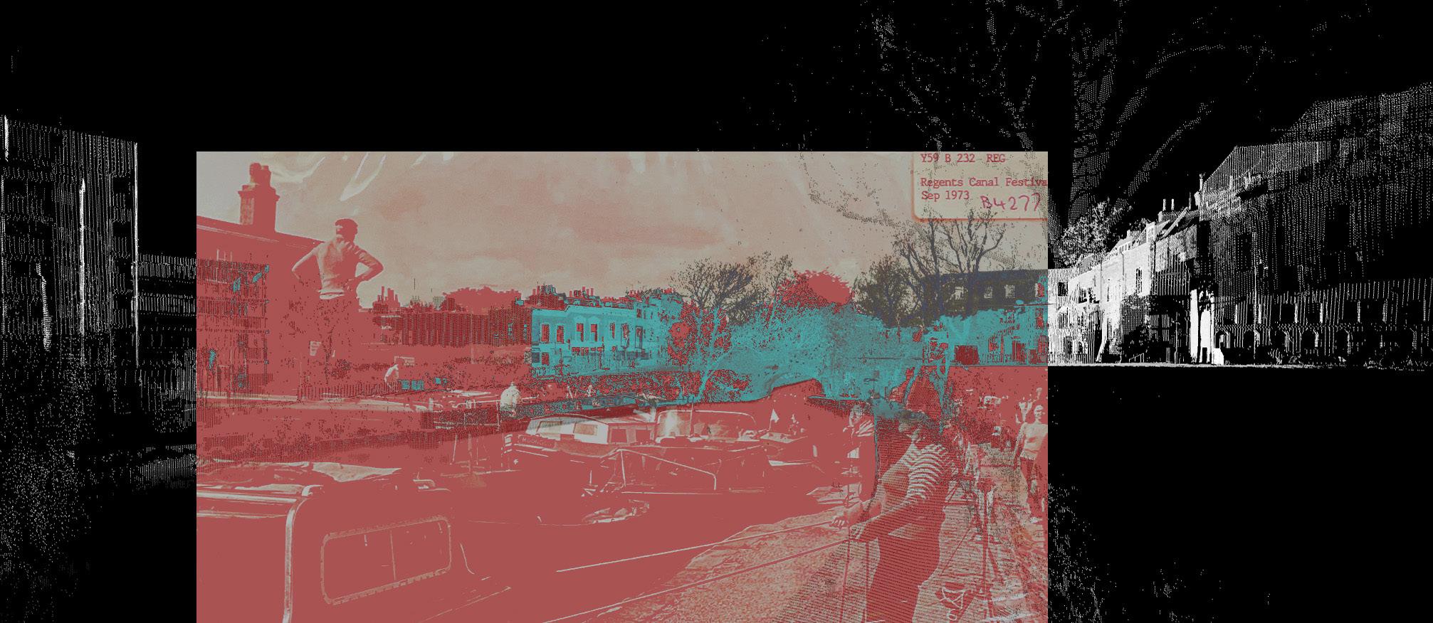
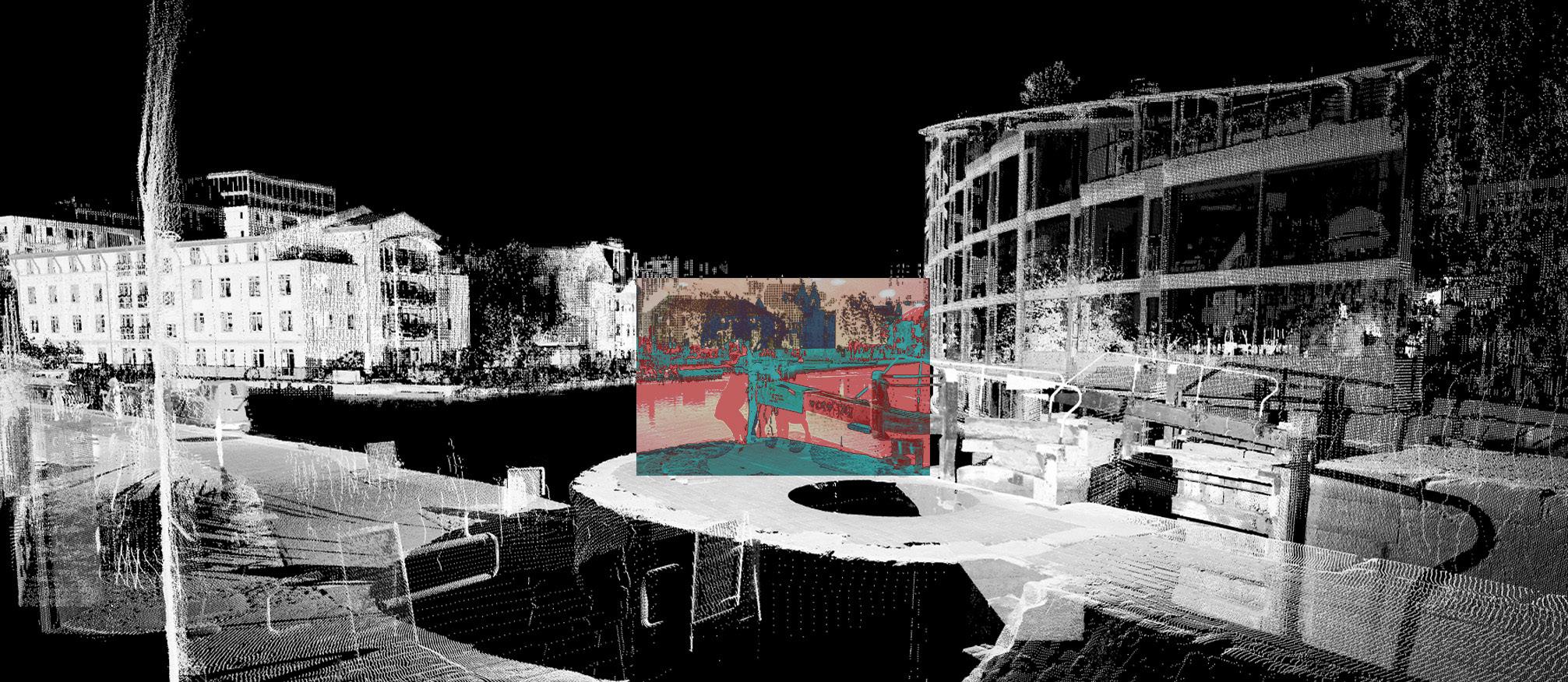
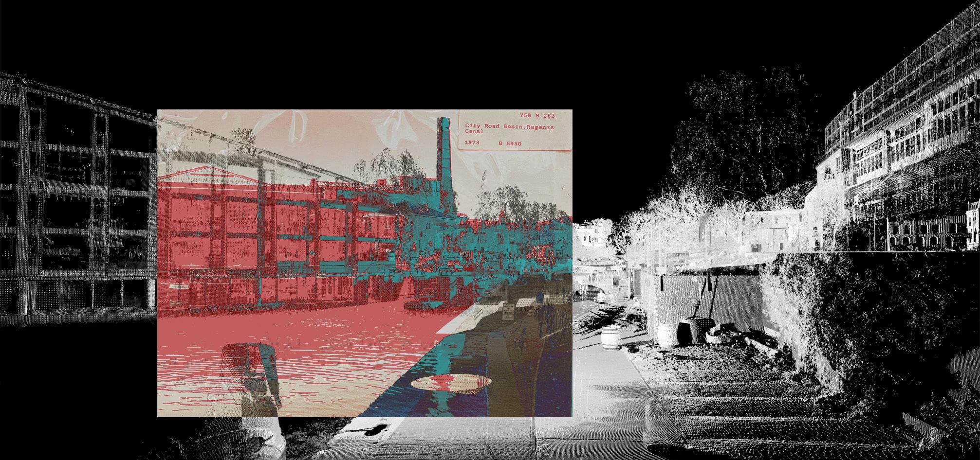
1 Monochrom Pointcloud Scan
2 Picture Scan from Islington History Archive, 80% transparency
3 Difference between the 3D model and the photo
4 Choice of colour to highlight the difference between the 3D model and the historical image
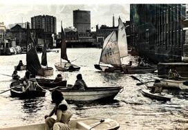
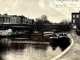
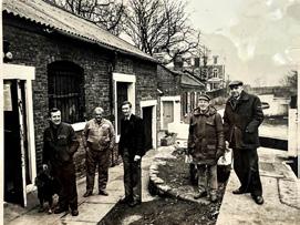
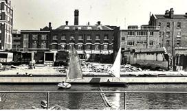
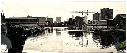
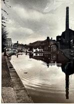
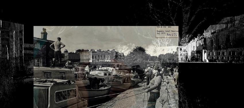
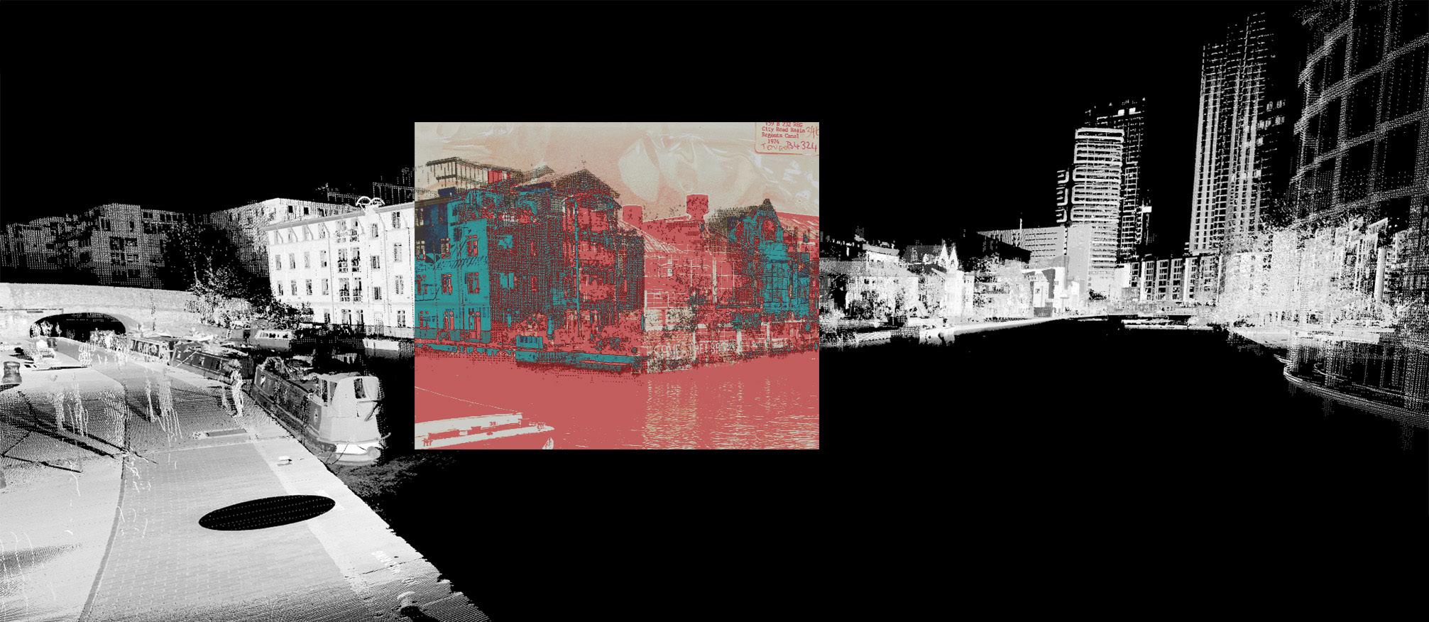
HISTORIC LAYERS Historic Layers around Islingtons City Road Basin 5.4 COLLAGES Picture, General View of Basin, 1975 B6321, Y59 B 232, Islington Local Archives, London 18 14 BARC0187/188 UCL - The Bartlett School of Architecture
HISTORIC LAYERS Historic Layers around Islingtons City Road Basin
B5263,
B 232 REG, Islington Local Archives, London 19 5.4 COLLAGES 15 BARC0187/188 UCL - The Bartlett School of Architecture
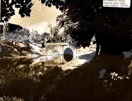
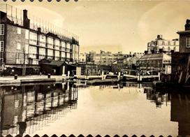
Picture, Regents Canal towards Frog Lane Bridge, 1982,
Y59
HISTORIC LAYERS Historic Layers around Islingtons City Road Basin
Islington Local Archives,
20 5.4 COLLAGES 16 BARC0187/188 UCL - The Bartlett School of Architecture
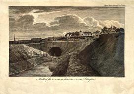
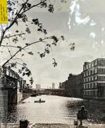
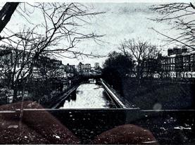
Picture,East Mouth of islington tunnel, 1977, B4608, Y59 B 232,
London
HISTORIC LAYERS Historic Layers around Islingtons City Road Basin
Islington Local
21 5.4 COLLAGES 17 BARC0187/188 UCL - The Bartlett School of Architecture
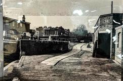
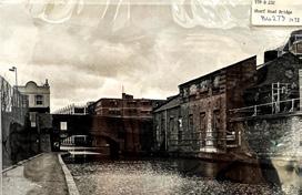
Picture, View towards Frog Lane Bridge, 1973, B4277, Y59 B 232,
Archives, London
HISTORIC LAYERS Historic Layers around Islingtons City Road Basin
B 232, Islington Local Archives, London 22 5.4 COLLAGES 18 BARC0187/188 UCL - The Bartlett School of Architecture
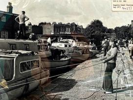
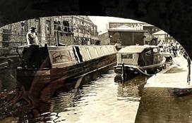
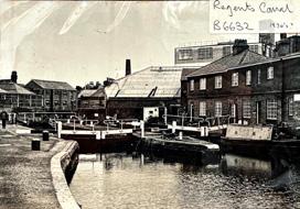
Picture, Regents Canal and Lock, 1920 B6632, Y59
HISTORIC LAYERS Historic Layers around Islingtons City Road Basin
Islington Local Archives, London 23 5.4 COLLAGES 19 BARC0187/188 UCL - The Bartlett School of Architecture
Picture, Regents Canal, Childreen on Lock, 1985, B6555, Y59 B 232,
HISTORIC LAYERS Historic Layers around Islingtons City Road Basin
Islington Local Archives,
24 5.4 COLLAGES 20 BARC0187/188 UCL - The Bartlett School of Architecture
Picture, Regents Canal, Building on the City Road Basin, 1974 B4324, Y59 B 232,
London
HISTORIC LAYERS
Islingtons City Road
Historic Layers around
Basin
Archives,
25 5.4 COLLAGES 21 BARC0187/188 UCL - The Bartlett School of Architecture
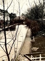
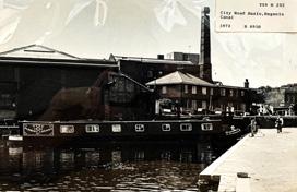
Picture, Regents Canal, Pathway along the Basin, 1973, B6830, Y59 B 232,
Islington Local
London
HISTORIC LAYERS Historic Layers around Islingtons City Road Basin
Islington Local Archives,
26 5.4 COLLAGES 22 BARC0187/188 UCL - The Bartlett School of Architecture
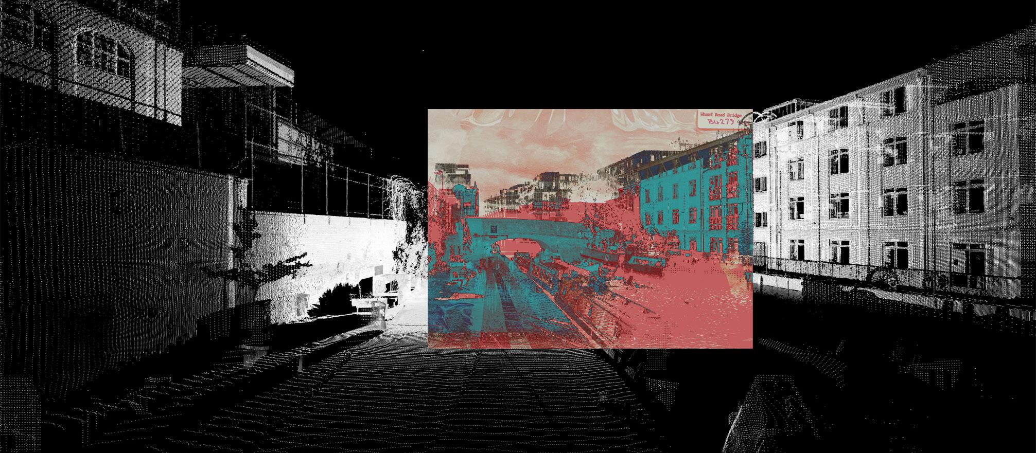
Picture, View towards Wharf Road Bridge, 1923, B4279, Y59 B 232,
London
RENDERS Historic Layers around Islingtons City Road Basin
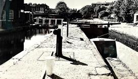
23 BARC0187/188 UCL - The Bartlett School of Architecture Top Perspective of Frog Lane Bridge 27
6 RENDERS
RENDERS Historic Layers around Islingtons City Road Basin 24 BARC0187/188 UCL - The Bartlett School of Architecture Top Perspective of the pathway along Regent´s Canal and Wharf Road Bridge 28
RENDERS Historic Layers around Islingtons City Road Basin 25 BARC0187/188 UCL - The Bartlett School of Architecture Top Perspective of the south end of the Basin and cut through Canaletto Tower 29
RENDERS Historic Layers around Islingtons City Road Basin 26 BARC0187/188 UCL - The Bartlett School of Architecture Section Perspective of the pathway along the canal on Vincent Terrace towards Frog Lane Bridge 30
RENDERS Historic Layers around Islingtons City Road Basin 27 BARC0187/188 UCL - The Bartlett School of Architecture Section Perspective towards the south end of the Basin an the Canaletto Tower 31
The overlapping of historical layers showed me how great the influence of our environment is on our perception. Small changes could be detected during the process, as well as large changes. The change in the building mass around Regent’s canal is enormous and an example of the transformation of the built environment and the role of architecture between the industrial revolution and the Anthropocene.
To conclude, the project shows with which technical means it is possible to document and thus digitally preserve the built environment in order to plan future structural changes with greater care. The work with historical material shows the great change with which the built environment can be documented, from drawings and photographs to high-tech devices such as the Lidar scanner. The combination of these tools can hopefully help us to better understand the built context and achieve a greater sensitivity in its transformation.
Technical difficulties have arisen in the course of the work process which slowed down the data processing. Due to the large span of the scan, a very large point cloud was used. This resulted in a large amount of time and the need for powerful technical equipment.
CONCLUSION
7 CONCLUSION
28 BARC0187/188 UCL - The Bartlett School of Architecture
Historic Layers around Islingtons City Road Basin
