1 minute read
5.1 CONCEPT


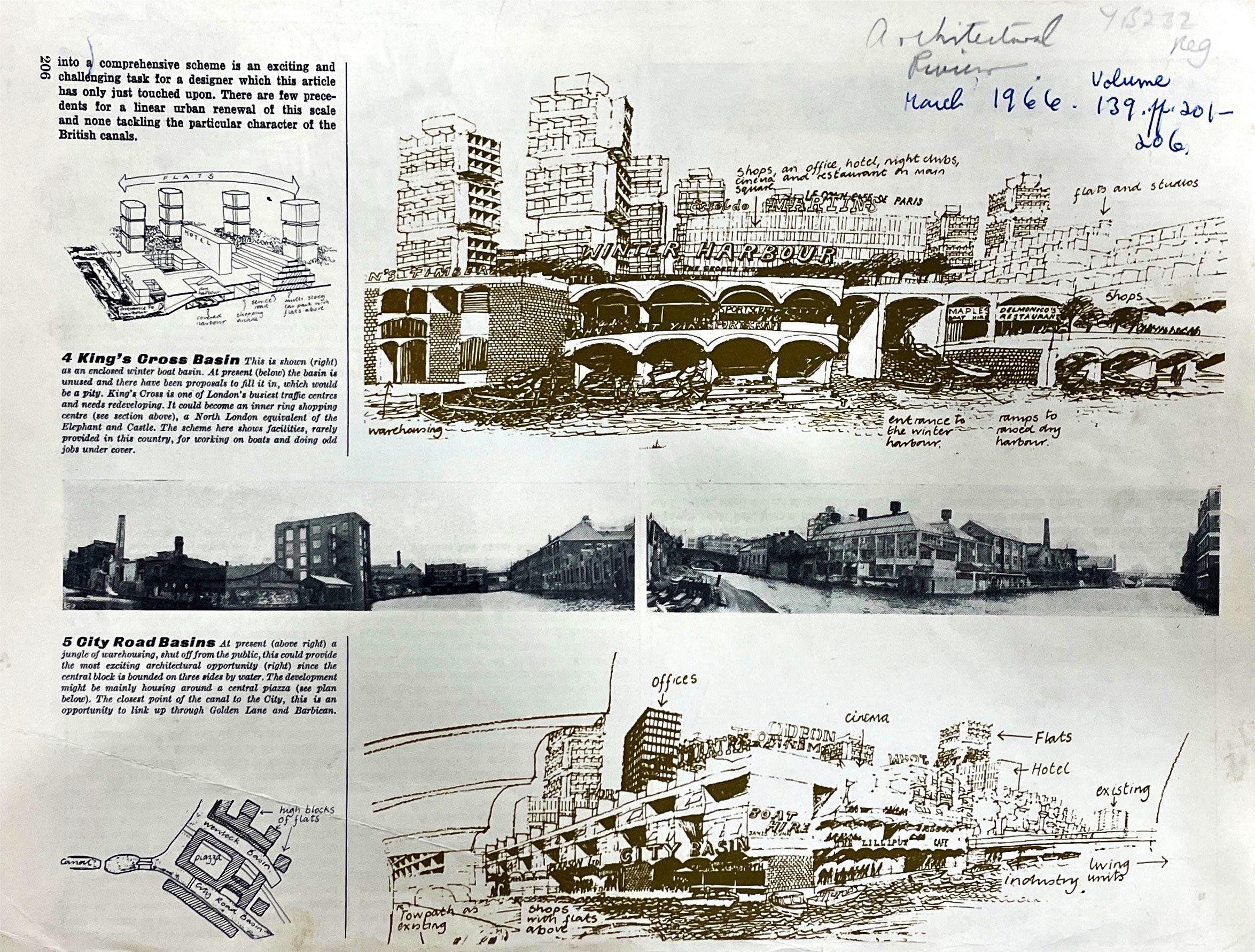
After the completion of the data processing, a concept for the use of the digital material was developed. The local importance of the sociohistorical context on the built environment of the Regents Canal and City Road Basin should be made visible. The popularity of the canal has led often to friction and debate between residents, the council and developers. Particularly in the south of the Basin, there has been an enormous increase in building density in recent decades. In the process, a large number of historic buildings have been lost, which are an important part of local history and identity.
To get a picture of the rapid change the area has undergone over the last decades, material from the Islington Local history Archive was examined and scanned. A major debate in local newspapers in the 1980s already showed the importance of the area at that time. Since then, a lot has changed in the area.
Advertisement
The aim of the design project is to bring archival material into the digital realm, revealing and representing different temporal layers of the built environment. The 3D data from the survey is used as the current representation. The digital 3D model makes it possible to render images from the same perspectives as historical images. On top of these digital snapshots, the images, which are dated between 1920 and 1980, are superimposed. In Photoshop, a difference is then created between the current and the historical stock. To clarify this, it was coloured in the further process. A total of 17 collages were made which contain information about the historical development of the area. To illustrate this visually, a video was created that shows the historical layers of the Regent‘s Canal and the City Basin.


