Cardington, Lincoln, and Westfield Townships, Morrow County, Ohio
Ohio State Historic Preservation Office Project Review Number: 2023-MRW-57606
Prepared for:
Crossroads Solar I, LLC 1105 Navasota Street Austin, TX 78702
Contact: Craig Adair, Vice President, Development (512) 297-6611 craig@openroadrenewables.com
Prepared by:
Environmental Design & Research, Landscape Architecture, Engineering & Environmental Services, D.P.C 5 E Long St, Suite 700 Columbus, OH 43215 www.edrdpc.com
June 2025
Project Review Number:
MANAGEMENT SUMMARY
2023-MRW-57606
Involved Agencies: Ohio Power Siting Board (OPSB) Ohio State Historic Preservation Office (SHPO)
Phase of Survey: Historic Resources Survey Reconnaissance
Location Information: Cardington, Lincoln, and Westfield Townships, Morrow County, Ohio
Project Description:
Project Area:
Historic Resources Study Area:
Area of Potential Effect (APE):
A utility-scale solar and sheep grazing facility consisting of groundmounted photovoltaic (PV) panels and associated infrastructure.
An approximately 897-acre area that accounts for the total area of participating parcels that will host all components of the Project. The Project Area acreage is larger than the up to 559-acre area that will host Project components. 1
Area within a 2-mile radius of the Project Area.
The APE for Direct Effects consists of the direct Project footprint with potential to experience ground disturbing activities, occurring within the boundaries of the Project Area.
The APE for Visual Effects represents portions of the Historic Resources Study Area where there is potential Project visibility
USGS 7.5-Minute Quadrangle Map: Ashley, OH (1995)
Historic Resources Overview:
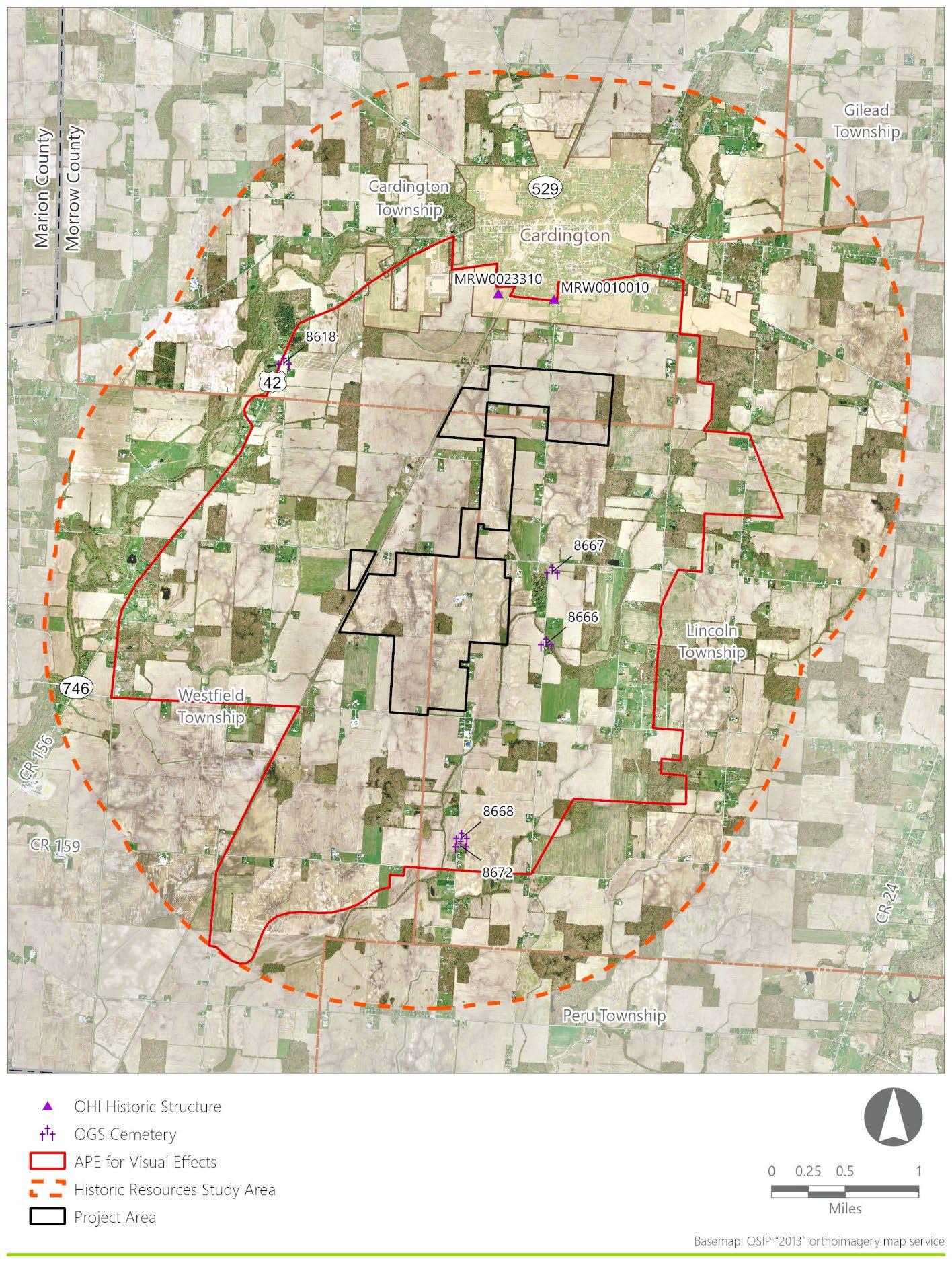
The APE for Visual Effects includes two previously recorded Ohio Historic Inventory (OHI) resources (MRW0010010 and MRW0023310) and five Ohio Genealogical Society (OGS) cemeteries (8618, 8666, 8667, 8668, and 8672) None of these previously recorded resources are recommended eligible for National Register of Historic Places (NRHP) listing. Furthermore, no newly identified resources located within the APE for Visual Effects are recommended eligible for NRHP-listing
Report Authors: Michael Kenneally
Date of Report: June 2025
1 Reflects a decrease in Project acreage since original submittal to SHPO.
Historic Resources Survey
Crossroads Solar Grazing Center i
Appendix A: Staff Résumé
Appendix B: SHPO Correspondence
LIST OF TABLES
LIST OF APPENDICES
Appendix C: Photographs – Previously Recorded Resources
On behalf of Crossroads Solar I, LLC (the Applicant), Environmental Design & Research, Landscape Architecture, Engineering & Environmental Services, D.P.C. (EDR) has prepared this Historic Resources Survey Report for the proposed Crossroads Solar Grazing Center located in Cardington, Lincoln, and Westfield Townships, Morrow County, Ohio (the Project; Figure 1-1). The information and recommendations included in this report are intended to assist the Ohio State Historic Preservation Office (SHPO) with its review of the Project for the Ohio Power Siting Board (OPSB). Specifically, this Historic Resources Survey Report has been prepared to satisfy portions of 4906-04-08(D) of the Ohio Administrative Code (OAC).
1.1 Purpose of the Survey
The purpose of this Historic Resources Survey is to identify historic resources that appear to satisfy National Register of Historic Places (NRHP) eligibility criteria within areas where the Project may result in impacts on historic resources, such as visual effects, and to seek concurrence from the Ohio SHPO on the results presented herein.
All historic resources studies undertaken by EDR in association with the Project have been conducted by professionals who satisfy the qualifications criteria per the Secretary of the Interior’s Standards (36 CFR 61; CFR, 2004). The résumé for EDR staff is included as Appendix A. The survey research design was included in the Cultural Resources Research Design and Survey Methodology: Crossroads Solar Project that EDR submitted to SHPO on April 6, 2023, and was approved in letters dated May 3, 2023, and June 5, 2023 (EDR, 2023; Horrocks, 2023; Koehlinger, 2023) SHPO correspondence regarding the research design is included as Appendix B. The field survey was conducted in accordance with the SHPO’s Guidelines for Conducting History/Architecture Surveys in Ohio (hereafter, SHPO Survey Guidelines; SHPO, 2014)
1.2 Report Organization
This report was written in accordance with the SHPO Survey Guidelines and the Survey Report Submission Requirements (SHPO, 2020) and includes the results of field investigation in narrative (written), graphic (mapping and photographs), and prescriptive formats (insets, figures, and appendices). The report is organized as follows:
• Section 1.0 (Introduction) provides the purpose of the survey, summary of report organization, Project location and description, summary of previous consultation with the SHPO concerning historic resource studies, definitions of the Historic Resources Study Area and the Area of Potential Effect (APE) for Visual Effects, and a summary of previously identified resources within the APE for Visual Effects.
• Section 2.0 (Survey Design) includes a detailed statement of the survey’s goals and objectives, the criteria used for resource evaluation, and the methodology used during the survey.
Figure 1-1. Regional Project Location
• Section 3.0 (Setting and Historic Context) includes an environmental context description, a description of historic research source materials, and history of the Historic Resources Study Area focusing on themes of agriculture and transportation along with an account of the physical development of the Historic Resources Study Area.
• Section 4.0 (Results of Field Investigation) includes a description of conditions and constraints encountered while undertaking the survey, a summary of expected versus actual survey results, and information on previously and newly identified historic resources.
• Section 5.0 (Summary) concludes the report with the survey analysis results and recommendations for future work.
• Section 6.0 (References) includes full citations for sources consulted during the production of this report.
1.3 Project Location and Description
The Project is a proposed solar-powered electric generating and sheep grazing facility located in Morrow County, Ohio (Figure 1-2). The design and engineering of the Project are ongoing concurrent with environmental studies (including cultural resources investigations) to identify sensitive resources and allow for avoidance and minimization of potential impacts. The Project will consist of, but is not limited to, the following components:
• Rows of photovoltaic panels (arrays) producing direct current electricity, mounted on single-axis tracking structures.
• Inverters placed within the panel arrays to convert direct current electricity to alternating current electricity
• A medium voltage collection system that will aggregate the alternating current output from the inverters.
• A substation and electrical switchyard where the Project’s electrical output voltage will be increased to the transmission line voltage via a step-up transformer.
• Internal infrastructure including access roads and security fencing.
• Pasture for forage and other livestock infrastructure.
The Applicant anticipates that each section of the Project’s solar arrays will be surrounded by agricultural style fencing and select sections may include landscape buffering/vegetative screening outside the fence.
Figure 1-2. Project Area
The following terms are used throughout this document to describe the proposed action:
Project: Collectively refers to all components of the Project and associated infrastructure (such as solar panels, collection lines, substation, and other equipment).
Project Area: An approximately 897-acre area that accounts for the total area of participating parcels that will host all components of the Project The Project Area acreage is larger than the up to 559-acre area that will host Project components. 2
Historic Resources Study Area: Area within a 2-mile radius of the Project Area.
APE for Direct Effects:
APE for Visual Effects:
The APE for Direct Effects consists of the direct Project footprint with potential to experience ground disturbing activities, occurring within the boundaries of the Project Area.
The APE for Visual Effects represents portions of the Historic Resources Study Area where there is potential Project visibility based on viewshed analysis.
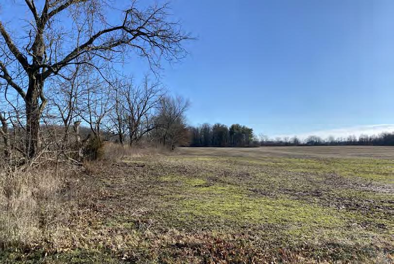
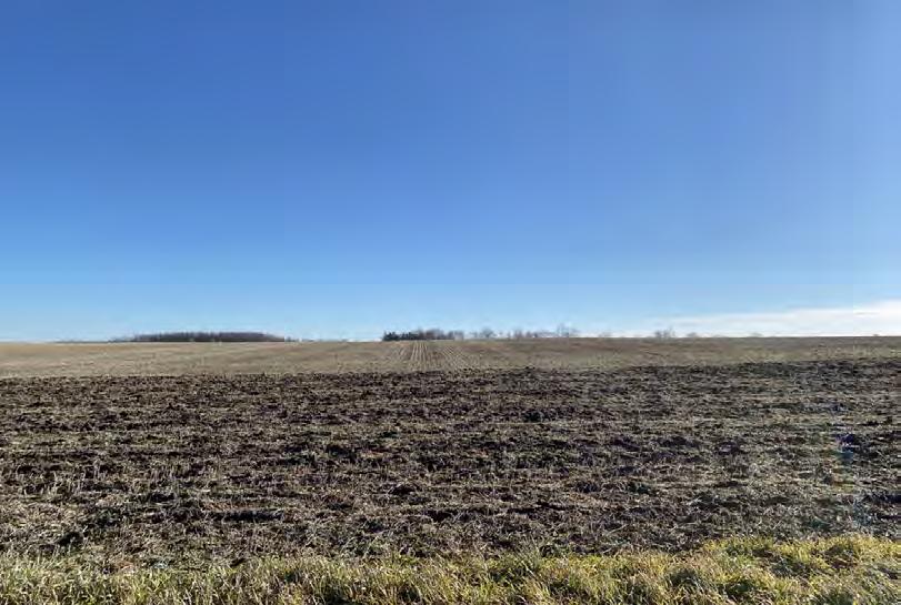
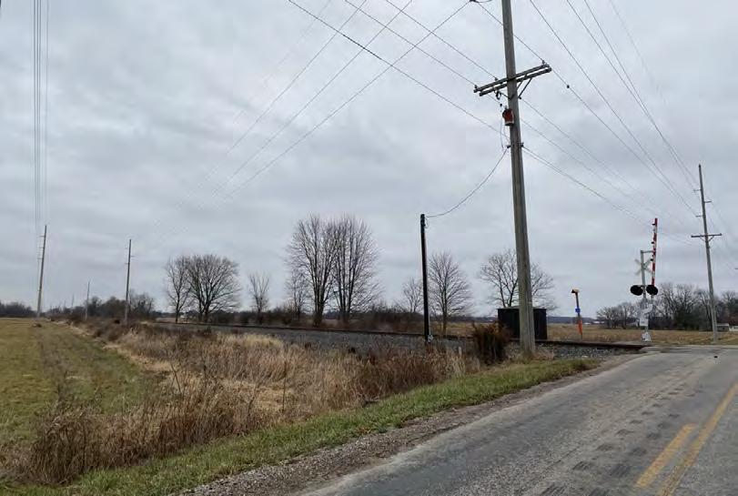
The Project Area is rural and set in an area of generally low topographic relief, mostly consisting of open agricultural fields interspersed with woodlots, tree lines, and wooded streams. Most of the landscape within the Historic Resources Study Area is flat to gently rolling agricultural fields These fields are bisected by long, straight rural transportation routes, a raised railroad bed, tree lines, woodlots, creeks, and minor tributaries to the West Branch of Alum Creek and Whetstone Creek. While the majority of the landscape within the Historic Resources Study Area is open agricultural fields, pockets of residential, commercial, and industrial development are present along the main thoroughfares, with the northern section near the Village of Cardington more developed. Existing developed features in the Historic Resources Study Area include a raised railroad bed, electric transmission lines, public roads, single-family homes, agricultural complexes, public and commercial buildings, and established cemeteries.
1.4 Area of Potential Effect
The Project’s potential effect on historic resources would be a change (resulting from the introduction of solar panels or other Project components) in the historic resource’s setting. This could theoretically consist of auditory and/or visual impacts; however, utility-scale solar facilities produce minimal noise, so auditory impacts resulting from the Project are not considered a significant type of impact to the setting of historic resources. Therefore, potential visual impacts associated with the Project are the relevant consideration for defining an APE.
To accurately determine the Project’s APE for Visual Effects, a viewshed analysis for the proposed solar panel arrays was prepared using Esri ArcGIS® software with the Spatial Analyst extension. The viewshed analysis was based on both a digital surface model (DSM) that accounts for the screening effects of topography,
2 Reflects a decrease in Project acreage since original submittal to SHPO.
vegetation, and structures and a digital surface model that accounts for elevation and topography only. This approach establishes a conservative visual APE
Through simulation prepared for this Project, as well as several previous Ohio solar projects, EDR has determined that the practical limits of solar panel visibility end prior to 2 miles due to their relatively low height (typically less than 15 feet, and in the case of the Project a maximum panel height of 12 feet during normal operation). Even at distances closer to 1 mile, it is challenging for rows of panels installed on level ground to be discerned from the background and horizon. The generally flat topography in the area and absence of elevated vantage points further contributes to the lack of distant Project views more than 1 mile away.
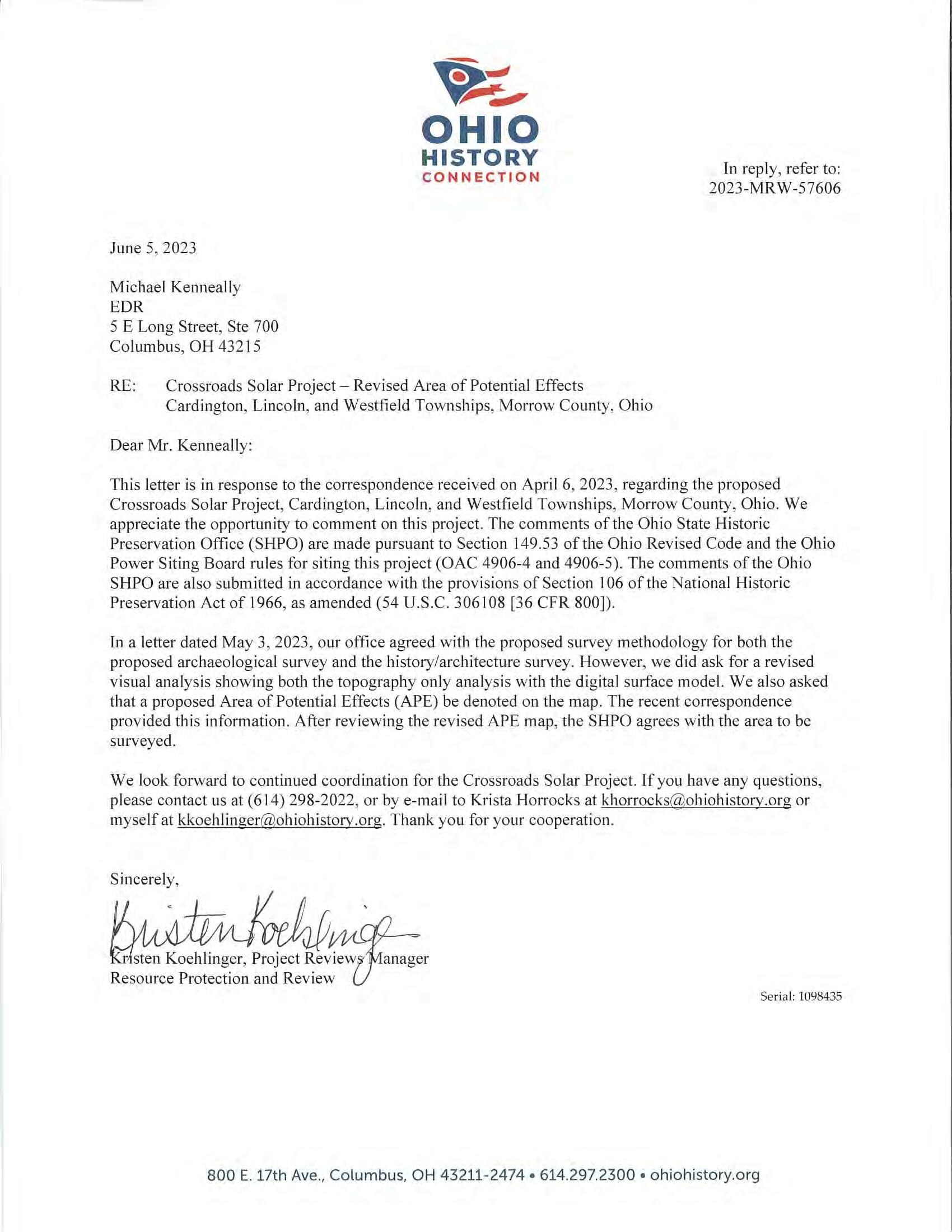
Based on the above information, the APE for Visual Effects for the Project is defined to include those areas within the Historic Resources Study Area with potential visibility of the Project as defined by the DSM and DEM viewshed results (Figure 1-3). In letters dated May 3, 2023, and June 6, 2023, the SHPO concurred with EDR’s proposed APE and survey methodologies (Appendix B).
1.5 Previously Identified Resources within the APE for Visual Effects
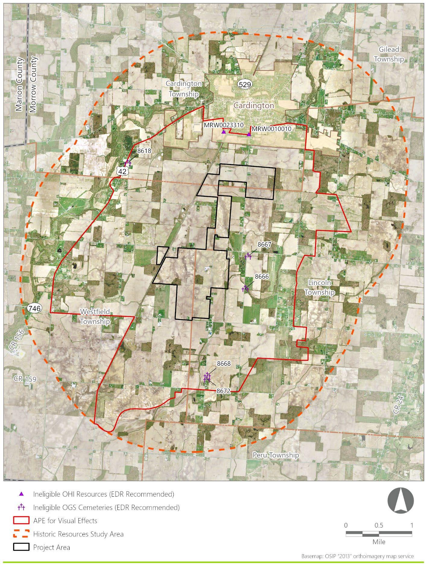
Review of SHPO’s Online Mapping System (OMS) indicates there are two previously recorded OHI resources (OHI MRW0010010 and MRW0023310) and five OGS cemeteries (OGS # 8618, 8666, 8667, 8668, and 8672) within the APE for Visual Effects (Ohio Historic Connection (OHC), 2023). None of these resources are located within the proposed Project Area. The locations of all previously identified resources within the APE for Visual Effects are indicated in Figure 1-4 and discussed in further detail in Section 4.2 of this report.
Figure 1-3. APE for Visual Effects and Historic Resources Study Area
1-4. Previously Recorded Resources within the APE for Visual Effects
Figure
2.0
SURVEY DESIGN
2.1 Survey Goals and Objectives
The goals of this Historic Resources Survey are to identify resources within the APE for Visual Effects that are potentially eligible for listing in the NRHP, and to provide updated information and recommendations of NRHP eligibility for the two previously recorded OHI resources and five OGS cemeteries located within the APE for Visual Effects (as described in Section 1.5).
2.2 Criteria for Evaluating the Significance of Historic Resources
Historically significant resources are defined herein to include buildings, districts, objects, structures and/or sites that have been listed in the NRHP, as well as those resources that the SHPO has formally determined are eligible for listing in the NRHP. Criteria set forth by the National Park Service (NPS) for evaluating historic resources (36 CFR Part 60.4) state that a historic building, district, object, structure, or site is significant (i.e., eligible for listing in the NRHP) if the resource is typically 50 years old or older and conveys:
The quality of significance in American history, architecture, archeology, engineering, and culture is present in districts, sites, buildings, structures, and objects that possess integrity of location, design, setting, materials, workmanship, feeling, and association and:
(A) that are associated with events that have made a significant contribution to the broad patterns of our history; or
(B) that are associated with the lives of persons significant in our past; or
(C) that embody the distinctive characteristics of a type, period, or method of construction, or that represent the work of a master, or that possess high artistic values, or that represent a significant and distinguishable entity whose components may lack individual distinction; or
(D) that have yielded, or may be likely to yield, information important in prehistory or history.
Cemeteries are considered eligible for the NRHP only if they independently meet NRHP Criterion D, are nominated along with a church that meets the NRHP criteria, are an integral part of an NRHP-eligible historic district, or meet the requirements of NRHP Criterion Consideration D. Under Criterion Consideration D, a cemetery is considered eligible if it “derives its primary significance from graves of persons of transcendent importance, from age, from distinctive design features, or from association with historic events” (NPS, 1995).
2.3 Survey Methodology
The Historic Resources Survey was conducted in accordance with the SHPO Survey Guidelines by professionals who satisfy the qualifications per the Secretary of the Interior’s Standards for Historic Preservation (36 CFR Part 61).
Site visits within the APE for Visual Effects were conducted between December 17 and 20, 2024 to identify and photograph historic resources, with the goal of identifying and documenting those buildings, sites, structures, objects, and/or districts within the APE for Visual Effects that, in the opinion of EDR’s architectural historians, appear to satisfy NRHP eligibility criteria. In addition, the survey was conducted for the purpose of providing updated photographs and recommendations of eligibility for previously identified OHI and OGS resources within the APE for Visual Effects. EDR also photo-documented previously unidentified
historic resources within the APE for Visual Effects that, in the opinion of EDR’s architectural historians, did not meet NRHP eligibility criteria, but appeared to be over 50 years old. The purpose of this effort was to assist the SHPO with its determination regarding “which resources warrant further investigation and which resources, due to a lack of integrity, architectural significance, etc., do not” (SHPO, 2014).
The condition and integrity of resources were evaluated based solely on the visible exterior of the structures. Note that properties included in the Historic Resources Survey were assessed from public rights-of-way. Photographs were taken of identified resources, and information describing the style, physical characteristics, and construction dates were compiled. Further information including and materials (e.g., number of stories, plan, external siding, roof, foundation, and sash), condition, physical integrity, and other noteworthy characteristics was recorded by qualified architectural historians, based on the site photographs, as required
In those instances where the viewshed spanned the parcel associated with a resource but did not overlap with its buildings, EDR visited the structures and documented the resource No inspections or evaluations requiring access to the interior of buildings, or any portion of private property, were conducted as part of this assessment.
EDR’s evaluation of historic resources within the APE for Visual Effects focused on integrity (with respect to design, materials, feeling, and association) to assess the potential architectural significance of each resource. However, physical condition was not the sole determinant of inclusion, per the SHPO Survey Guidelines, which instruct surveys to include “vernacular and high style examples, paying attention to regional and repeated building types as they often reflect important patterns in regional or statewide development.” To better understand development patterns, EDR conducted setting and context research for the Historic Resources Study Area prior to conducting the survey (see Section 3.0).
3.0 SETTING AND HISTORIC CONTEXT
3.1
Environmental Setting
Land use within the Historic Resources Study Area is primarily agricultural with scattered rural residential properties, except for in the northern portion within the village of Cardington, which also contained commercial, public, and light industrial properties. However, most of the landscape within the Historic Resources Study Area is rural with flat, open agricultural fields. These fields are bisected by rural transportation routes, tree lines, and woodlots. A raised railroad bed traverses through the APE for Visual Effects in a northeast/southwest direction. The primary waterways traversing the Historic Resources Study Area are the West Branch of Alum Creek, Whetstone Creek, Turkey Run, and their tributaries. Where not interrupted by tree lines, woodlots, and structures, the relatively level topography within the Historic Resources Study Area allows for clear views to buildings. Views to farmhouses and agricultural buildings within large-scale farming landscapes are dependent on their distance from the public rights-of-way and intervening structures and vegetation. Existing developed features include electric transmission lines, public roads, a raised railroad bed, single-family homes, and agricultural buildings, with commercial, public, and light industrial buildings near the village of Cardington. Outside of the village of Cardington, there is no concentrated historical development within the APE for Visual Effects.
3.2 Historic Context
In the mid-eighteenth century, Virginia, New York, Massachusetts, and Connecticut claimed sections of the Northwest Territory based on seventeenth- and early-eighteenth-century charters. These lands encompassed parts of present-day Ohio, Illinois, Indiana, Michigan, Minnesota, and Wisconsin; however, land companies’ and speculators’ efforts to survey and sell these lands were hindered by the Seven Years’ War (1754-1763), Pontiac’s War (1763-1766), and the American Revolutionary War (1775-1783). By 1786, the states ceded the Northwest Territory to the burgeoning United States federal government. This territory was augmented by American Indian land cessions, most notably in the treaties of Fort Stanwix (1784), Fort McIntosh (1785), Fort Finney (1786), Fort Harmer (1789), and Greenville (1795).
The Treaty of Greenville was signed on August 3, 1795, after Major General Anthony Wayne’s campaign against the native Northwestern Confederation, led by Miami chief, Little Turtle. The campaign, which culminated in the Battle of Fallen Timbers along the Maumee River near present-day Toledo, resulted in a victory for Wayne’s forces and constituted the last major American Indian resistance in present-day northwest Ohio. Throughout this period, U.S. policy encouraged American Indian groups to treat geographical areas and/or homelands as “exclusive tribal possessions” whereas many American Indians treated lands north of the Ohio River as collective, shared native land (Lakomaki, 2014:600, 602). The Treaty of Greenville undermined this belief in collective native land, as pressure to cede large portions of Ohio led some groups to begin voicing claim over specific territories (Lakomaki, 2014:603). By 1804, U.S. policy was actively undermining the belief in collective native land, exemplified by Governor William Henry Harrison’s (Indiana) drawing of intertribal boundaries, which tied ownership to specific American Indian groups. This resulted in land cession discussions with single American Indian groups rather than multiple groups and
ultimately weakened displaced American Indian groups’ claims to territory which aided Euro-American expansion (Lakomaki, 2014:609).
As Ohio developed, federal expansion policies and settlers increasingly encroached on the American Indian reservations established in the Treaty of Greenville. By 1818, the Treaty of St. Mary’s led to further land loss by Ohio’s American Indian groups, ultimately resulting in only the Shawnee, Seneca, and Wyandot retaining small reservations within Ohio at Wapakoneta, Hog Creek, and Lewistown (Lakomaki, 2014:621-622).
However, discussion of removal continued. By 1830, the Indian Removal Act displaced Ohio’s remaining American Indian groups and by 1842, the remaining tribes were forced to cede their reservations (Shetrone, 1970).
After their forced removal from Ohio, many American Indian tribes resettled within the Great Plains region. The Wyandot, removed from their reservation at Upper Sandusky, were sent to reservations in present day Wyandot County, Kansas before being forcibly moved to Oklahoma. Additional American Indian groups including the Miami and Shawnee were similarly relocated to Kansas and Oklahoma. Descendants from these groups today are members of federally-recognized tribes such as the Miami Tribe of Oklahoma and the Wyandot Nation of Oklahoma, as well as federally-unrecognized groups such as the Miami Nation of Indiana (OHC, n.d.a-n.d.c)
3.2.1
Morrow County History
Morrow County is located in central Ohio and is included in the Columbus, Ohio Metropolitan Statistical Area (US Census, 2012). While Euro-American settlement of Ohio generally increased between 1788 and 1798, it was not until the nineteenth century that Euro-American settlers moved into present-day Morrow County (Baskin, 1880:121). The first recorded Euro-Americans within the county were the Shaw family who arrived in Westfield Township in 1804, followed by Evan Holt in Chester Township in 1807, and Cyrus Benedict in Peru Township in 1809. In addition to these early settlers, other early settlers within the county were members of the Society of Friends (Quakers). In 1812, the Benedict family migrated from New York to Ohio and established the first Quaker settlement in Morrow County along Alum Creek (NPS, n.d.).
Early histories of the county state that springs were quite numerous, with early Euro-American settlers establishing cabins and “frontier farms” along these springs (Baughman, 1911: 33). Additionally, the landscape within the county consisted of dense vegetation and timber, which had to be cleared for agricultural purposes. As such, “frontier farms,” or early established farms, were typically non-sustaining for five years after land clearing (Baughman, 1911: 98). To supply the early settlers, the first Morrow County mills were erected between Cardington and Mount Gilead, to the northeast of the Historic Resources Study Area, in 1819, and in Cardington Township in 1821 (Baughman, 1911: 113-114). However, due to scarcity of supplies, goods were mostly transported via horseback from neighboring Delaware County and Owl Creek (Kokosing River) to the south (Howe, 1907:315). Trails traversed by early settlers within Morrow County included pre-established American Indian trails, the earliest of which extended from Mount Vernon, approximately 21 miles to the southeast in Knox County, Ohio to the “Sandusky plains” located south and west of the Sandusky River in northern Ohio. By 1911 this trail was all but vacated; however, a small portion
of the trail was still traveled between the towns of Pulaskiville and Chesterville, both located within Morrow County to the northwest of the Historic Resources Study Area (Baughman, 1911:48).
The Ohio government officially authorized the creation of Morrow County in 1848 from portions of Delaware, Knox, Marion, and Richland counties. The village of Mount Gilead, approximately 5 miles to the northeast of the village of Cardington, was laid out in 1824 as part of Marion County and became the county seat of Morrow County (Baughman, 1911:76). The community was first known as Whetsom and then Youngstown before it was renamed Mount Gilead in 1832. Between 1847 and 1880, Mount Gilead’s population increased from 400 to over 1,200 people, which differed from population trends in the county. Between 1850 and 1900, the population of Morrow County decreased from more than 20,000 people to less than 18,000 people.
During the 1830s and up to the Civil War, many locals, primarily due to their religious beliefs (Quakers), played an active role in the abolition movement with residents participating in the Underground Railroad (OHC, n.d.d). According to the National Park Service (n.d.), of the approximately 100,000 enslaved people who escaped via the Underground Railroad, at least 40,000 traveled through Ohio. Three stations of the Underground Railroad were located in Morrow County: South Woodbury (Peru Township), Friends’ Settlement (2.5 miles south of Mount Gilead, Gilead Township), and Iberia (Washington Township).
Agriculture was, and continues to be, the main industry in Morrow County. According to Baughman (1911: 32-33), the county was “fit for cultivation and for farming purposes.” Farms within the county were moderate sized farms, with the average acreage not exceeding eight acres. Improvements in farming reached Morrow County with the introduction of horse powered machinery in 1839, cast iron plows in 1849, the corn and cob grinder in 1856, and field drainage tile in 1859. During the nineteenth century, the primary system of agriculture was mixed husbandry, with livestock being the leading pursuit of most farmers within the county (Baughman, 1911:129). Crops grown within the county during the nineteenth century primarily included hay and apples, the latter of which saw increased production with the introduction of the railroad during the late nineteenth century (Baughman, 1911: 133). Prior to the railroad, agricultural products were transported via wagon and shipped to Cumberland, Maryland and neighboring counties in Ohio (Baughman, 1911:266).
Morrow County entered the railroad era in the latter half of the nineteenth century which facilitated economic growth within the county. The first railroad through the county was the Cleveland, Columbus and Cincinnati Railroad (CC&C), the first leg of which ran from Cleveland to Columbus, with a portion bisecting the present Project Area. Rail traffic on the entire route between Cleveland and Columbus commenced in 1851. The railroad connected the city of Cleveland to the city of Columbus and connected Morrow County to northeast Ohio. The line carried Abraham Lincoln’s funeral train from Cleveland to Columbus on April 29, 1865. The CC&C merged with the Bellefontaine Railway on May 16, 1868, becoming the Cleveland, Columbus, Cincinnati and Indianapolis Railway (CCC&I). In the late nineteenth century, the Toledo and Ohio Central Railroad was constructed through the village of Mount Gilead, connecting Morrow County to northwest Ohio (Baughman, 1911: 275).
In addition to agriculture and its associated industries (i.e., mills), other industries during the nineteenth and twentieth centuries included pottery and tile works, dry goods manufacturing, banking, hotels, and postal services. Significant industries within the county included the Mt. Gilead Tile Works, a tile factory and pottery works established in 1875, and the Hydraulic Press Manufacturing Company established in 1883 (Baughman, 1911:268-273). The tile factory burned down in 1907 and was rebuilt along a portion of the Toledo and Ohio Central Railroad, west of Mount Gilead. The tile works merged in 1922 with the McGowan and Company Pottery, a manufacturer of utilitarian earthenware and stoneware founded in 1888. The hydraulic press company was established in particular for apple cider and vinegar production in order to take advantage of the apple production within the county (Baughman, 1911: 279).
The population of Morrow County continued to decrease from 1900 to 1930. However, during the 1940s, the county’s population began to increase and continued to increase into the present (U. S. Census, 1930, 2020). Farming remains the largest employer in the county, with approximately 62% of the county’s acreage serving as farm fields. Manufacturing businesses are the county’s second largest employer, with governmental and retail finishing third and fourth, respectively. Oil drilling was also a major industry during the 1960s (OHC, n.d.d).
3.2.1.1
Cardington Township
Cardington Township was established in 1823 by the commissioners of Delaware County, Ohio. The first Euro-American settlement of Cardington Township is attributed to Quakers and Isaac Bunker, who arrived from Peru Township in 1822 (Baskin, 1880:322). News of Isaac Bunker’s success in Cardington Township led to a surge in migration to the area, particularly from former residents of Peru Township. Whetstone Creek became the focal point of the early settlement. Success of the milling enterprises became an important piece of the local economy further driving migration to the area (Baughman, 1911: 336-337). The largest population center within the township is Cardington, which was formally established in 1836 (Baughman, 1911: 344). Early industry within the town primarily consisted of grist mills and carding mills, as well as carriage manufacturers, cooper shops, blacksmiths, and furniture factories (Baughman, 1911: 358).
3.2.1.2
Lincoln Township
Lincoln Township was originally part of Harmony Township. However, as the township expanded, a petition to create a new township was drawn. Therefore, in March of 1828, Lincoln Township was formally created. Much like the rest of the county, farming became the primary economy of Lincoln Township. Rich black soil at lower elevations provided large crop yields, with soils on higher ground utilized for grasses, corn, and wheat (Baughman, 1911:510). Early Euro-American settlers of Lincoln Township consisted mainly of Quaker families from the surrounding townships (Baskin, 1880: 435). Due to the influx of Quaker settlers, Lincoln became an early adopter of church influence. Initially, the meetings for worship were held in schoolhouses and cabins until 1853 when the Center United Brethren Church was erected followed by the Lincoln Christian Church in 1858 (Baughman, 1911: 440; Baskin, 1880, 516). The largest town within the township is Fulton, which was formally established in the early twentieth century due to the prevalence of stone quarries and its location near a train station for the Toledo and Ohio Central Railroad (Baughman, 1911: 439).
3.2.1.3
Westfield Township
Westfield Township was formally organized in 1822 as part of Delaware County, and later incorporated into Morrow County in 1848. Whetstone Creek divides the township roughly in half and served as an important natural resource for early settlers to the region. The first Euro-American settlement in Westfield Township was also the first Euro-American settlement in present-day Morrow County. The Shaw family of Chester County, Pennsylvania arrived in 1804 and settled on 400 acres of purchased land located in the northern portion of Westfield Township adjacent to the Greenville Treaty line (Baughman, 1911:488). Like Lincoln Township, religion played a major role in the early settlement of Westfield Township, as Quaker families composed a majority of the original settlers to the township (Baskin, 1880:385).
3.2.1.4
Gilead Township
Gilead Township was formally organized in 1835 as part of Marion County from portions of present-day Canaan, Cardington, Congress, Franklin, and Lincoln Townships, Morrow County (Baughman, 1911: 326). The township formally became a portion of Morrow County in 1848 when the county was formed. Early industries within the township that persisted throughout the nineteenth and twentieth centuries included agriculture, stone quarries, and mills. Crops grown within the county included grass, clover, hay, corn, wheat, rye, oats, flax, and fruit trees.
3.2.1.5
Peru Township
Peru Township was formally organized in 1848 from Sunbury Township, Delaware County (Baughman, 1911: 456). Similar to county trends, most early settlements within Peru Township were located along streams, such as Alum Creek. Additionally, like Lincoln Township, religion played a major role in the early settlement of Peru Township, with the first Quaker settlement in the county established in 1812 by the Benedict family (NPS, n.d.; Baskin, 1880:385). Within Peru Township, the Reuben Benedict House, constructed by the Benedict family, served as an ideal location for an Underground Railroad station as the area contained a sizeable free and fugitive black population, an active Quaker fellowship, and a “local community with strong convictions about the immorality and injustice of slavery” (NPS, 2023).
3.3 Historic Maps Research
Historic maps depict nineteenth- and twentieth-century settlements and development within the Historic Resources Study Area. The maps reviewed are discussed in subsection 2.5.1 and 2.5.2
3.3.1 Nineteenth Century Map Research
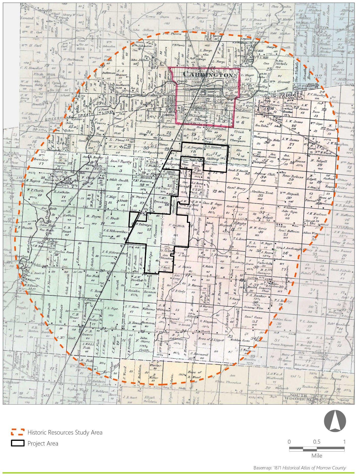
The Project Area and Historic Resources Study Area remained rural throughout the nineteenth century with the exception of the population center in the village of Cardington (Harwood and Watson:1857). Structures, predominately farmsteads, within the Project Area and Historic Resources Study Area are located along roadways connecting communities of the surrounding townships. Structures are also present along Whetstone Creek which traverses the Historic Resource Study Area. Towards the end of the nineteenth century, the population growth of the village of Cardington is depicted by the increased density of structures within the town proper, and the appearance of additional structures on the outskirts of town. However, the density of structures remains low throughout the Project Area (Lake,1871) (Figure 3-1). In addition to
mapped structures, the Cleveland, Columbus, Cincinnati, and Indianapolis Railroad (CCC&I) is mapped along the western boundary of the Project Area, which was constructed in Morrow County during the late 1860s (Schmid, 1928).
3.3.2 Twentieth Century Map Research
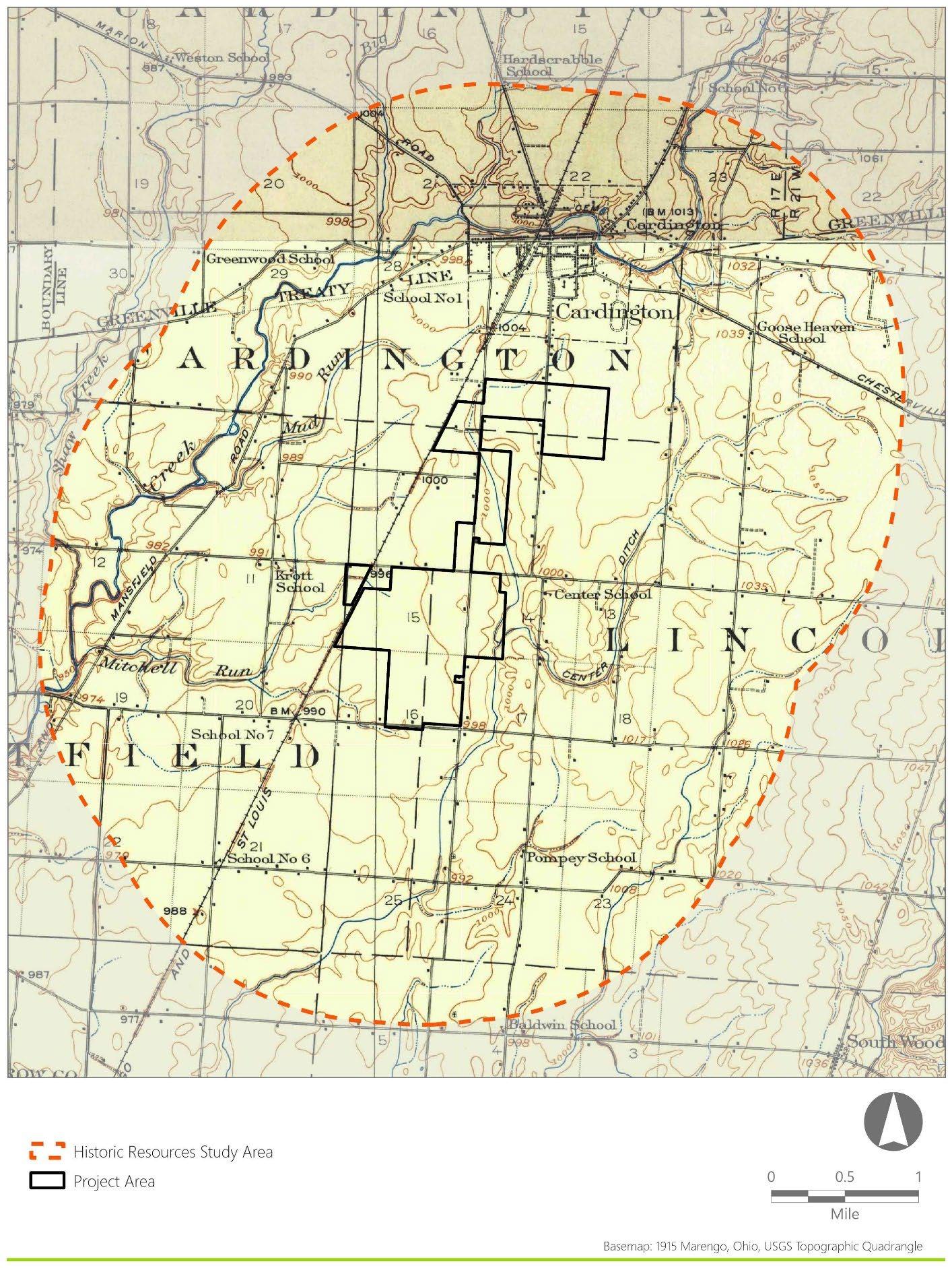
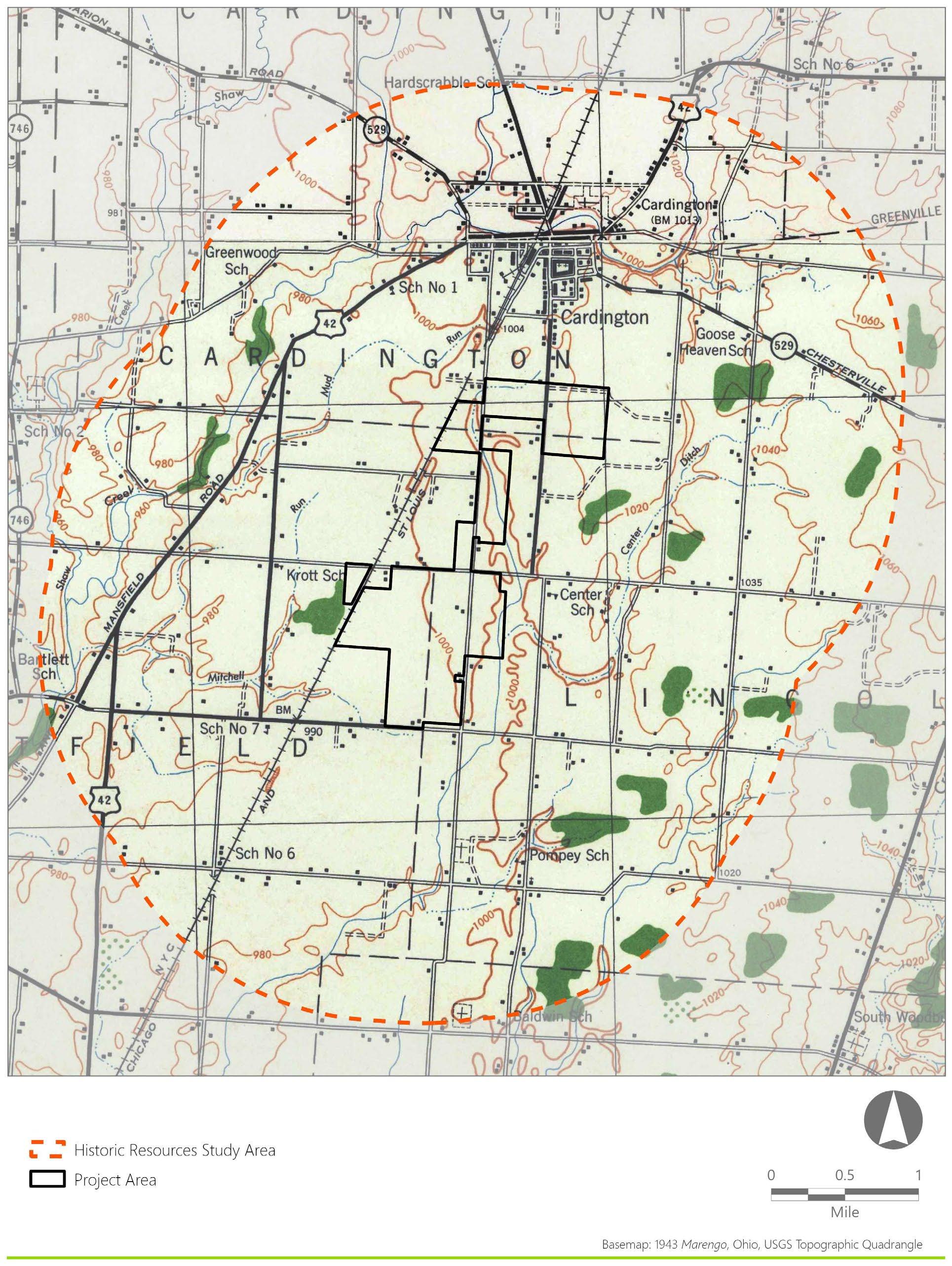
Between 1871 and 1916, the Historic Resources Study Area changed little. Differences between the 1871 atlas map and 1915 and 1916 USGS topographic maps include the identification of schoolhouses within the Historic Resources Study Area and the change in ownership of the CCC&I Railroad to the Cleveland, Cincinnati, Chicago, and St. Louis Railroad (Figure 3-2). By the mid-twentieth century, the Historic Resources Study Area included more roadways and more mapped structures along roadways. However, the structures still appear relatively sparse throughout the Project Area. Similar to the Project Area, the village of Cardington remains relatively unchanged (USGS,1915, 1916, 1943a, 1943b) (Figure 3-3). By the midtwentieth century, the Historic Resources Study Area appeared very similar to the area’s current configuration. Developments within the late-twentieth century include the construction of electric transmission lines through the Project Area, as well as the railroad’s name and/or ownership change to the New York Central Railroad. The railroad’s present ownership is CSX Transportation, a freight railroad company. However, by the late-twentieth century the Project Area and Historic Resources Study Area remain relatively unchanged (USGS, 1961a and 1961b).
Figure 3-1. 1871 Historical Atlas of Morrow County
Figure 3-2. 1915 Marengo, Ohio and 1916 Mount Gilead, Ohio USGS Topographic Quadrangles
Figure 3-3. 1943 Marengo, Ohio and Mount Gilead, Ohio USGS Topographic Quadrangles
4.0 RESULTS OF FIELD INVESTIGATION
Section 4.1 describes the conditions present in the APE for Visual Effects during EDR’s site visits. The results of the field investigation are described in Sections 4.2 (previously identified resources) and 4.3 (newly identified resources). Resources that, in the opinion of EDR’s architectural historians, did not meet NRHP eligibility criteria are discussed in Section 4.4. New or updated I-Forms are not being submitted for resources that are recommended as not NRHP-eligible, nor for resources that are no longer extant.
4.1 Conditions and Constraints
Weather conditions during the site visits on December 17-20, 2024, were typical of the season, with daytime temperatures between 30- and 45-degrees Fahrenheit during fieldwork, with clear visibility. The weather did not adversely affect the ability to conduct the Historic Resources Survey.
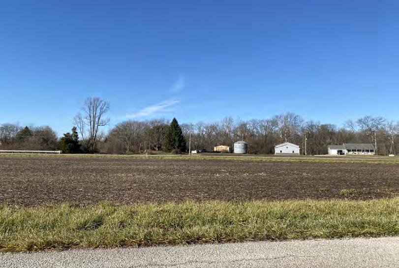
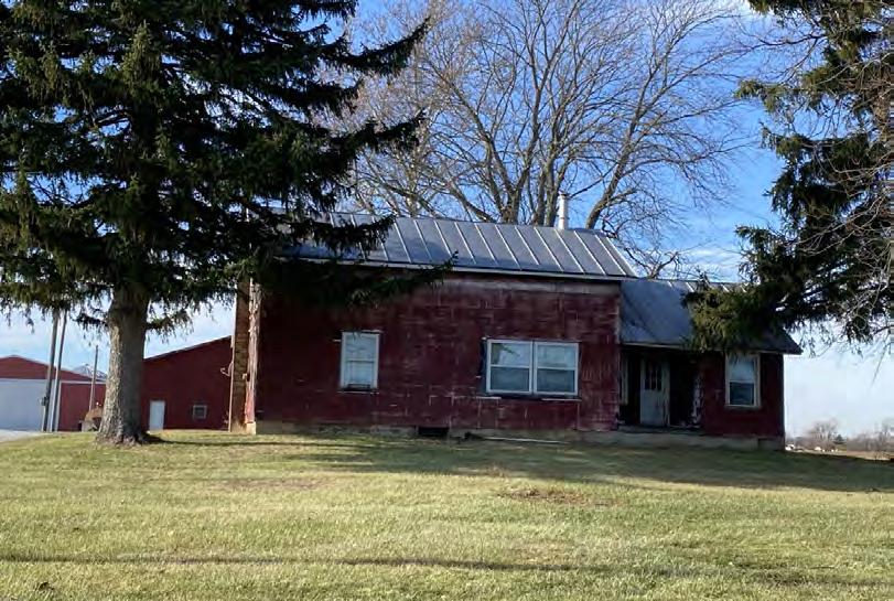
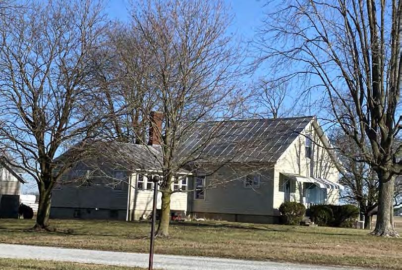
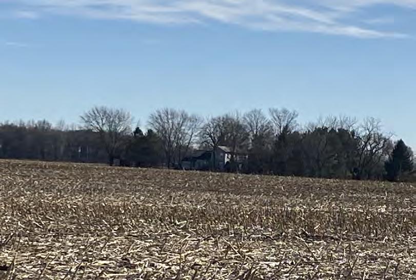
Views from public rights-of-way within the APE for Visual Effects were dominated by agricultural farmland, farmsteads, rural residential development divided by transportation corridors, with denser development on the outskirts of the Village of Cardington. When not interrupted by vegetation, the relatively level topography within the APE for Visual Effects allowed for clear views of historic resources. Views of farmhouses and agricultural buildings within large scale farming landscapes were dependent on their distance from the public rights-of-way and presence of vegetation, but most resources were sited close to roads. There were no road closures that prevented access to public rights-of-way.
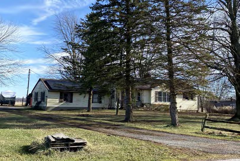
The area within the APE for Visual Effects is mostly rural and lightly populated, except for the outskirts of Cardington, where residential, commercial, public, and light industrial development increases. Development occurs at a very low density throughout most of the APE for Visual Effects, and is for the most part widely spaced along, and near the edge of, roadways. There appears to be no clear view of the Project from within the more developed portions of Cardington Residential styles include Italianate, Gothic Revival, and Greek Revival, but primarily include vernacular folk houses with elements of those styles. Mid- to late-twentieth century Ranch, Minimal Traditional, Split Level, and modular homes are also prolific throughout the APE for Visual Effects Agricultural development ranges from small farmsteads that may include a residence, barn, and sheds, to larger scale agricultural complexes. There is also scattered suburban development within the APE for Visual Effects around the Village of Cardington
4.2 Previously Identified Historic Resources
Seven previously recorded resources, consisting of two OHI resources and five OGS cemeteries, were located within the APE for Visual Effects and evaluated as part of the Historic Resources Survey. None of these resources are located within the Project Area.
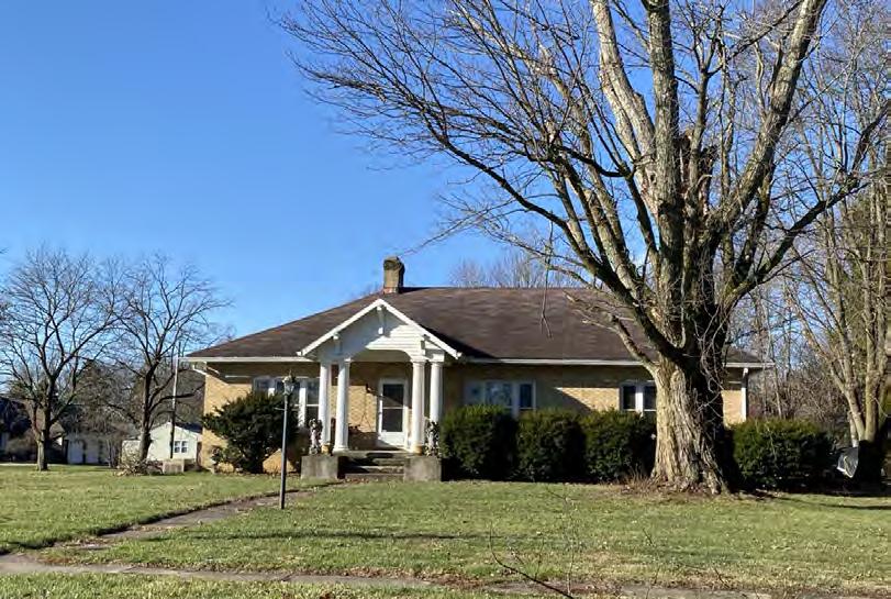
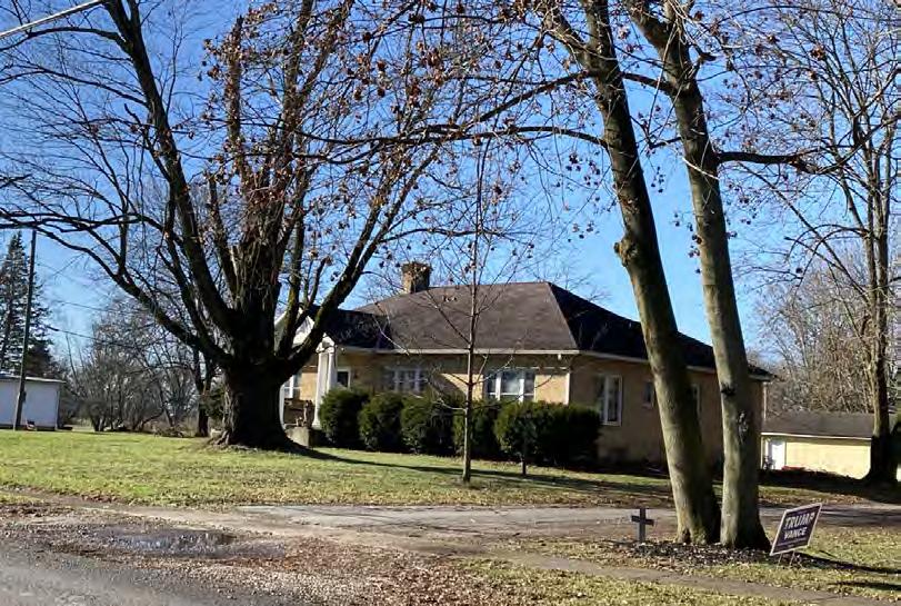
4.2.1 OHI Resources
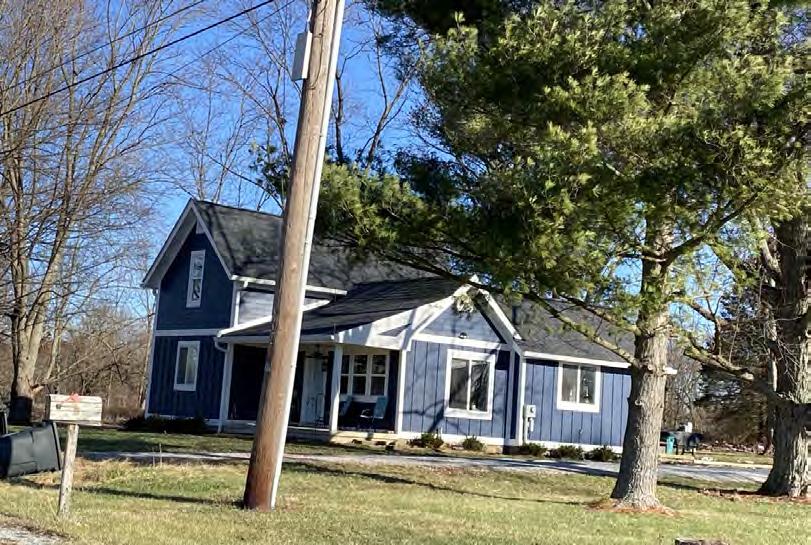
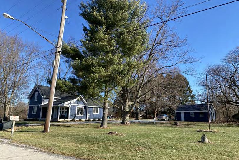
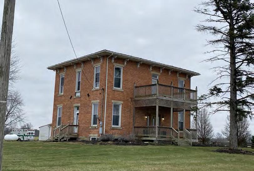
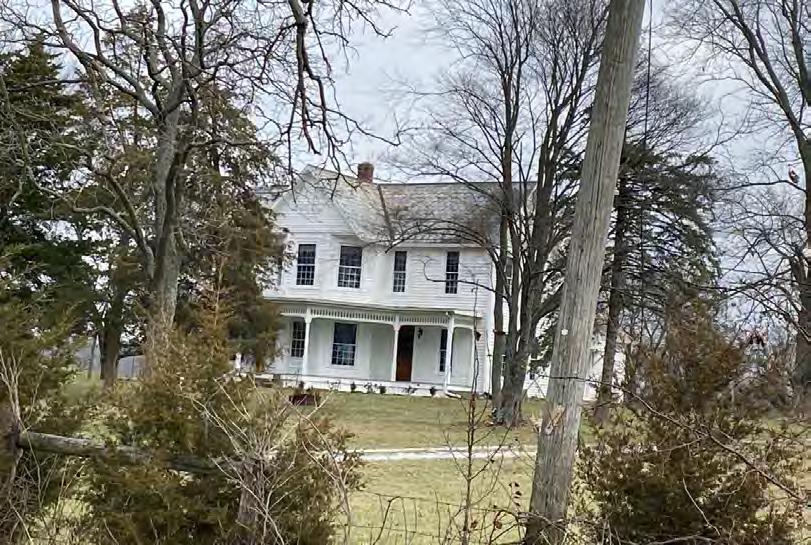
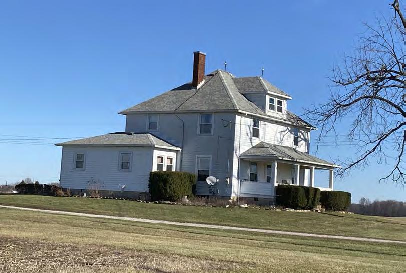
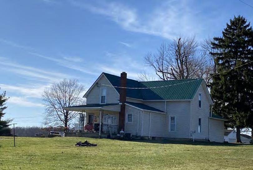
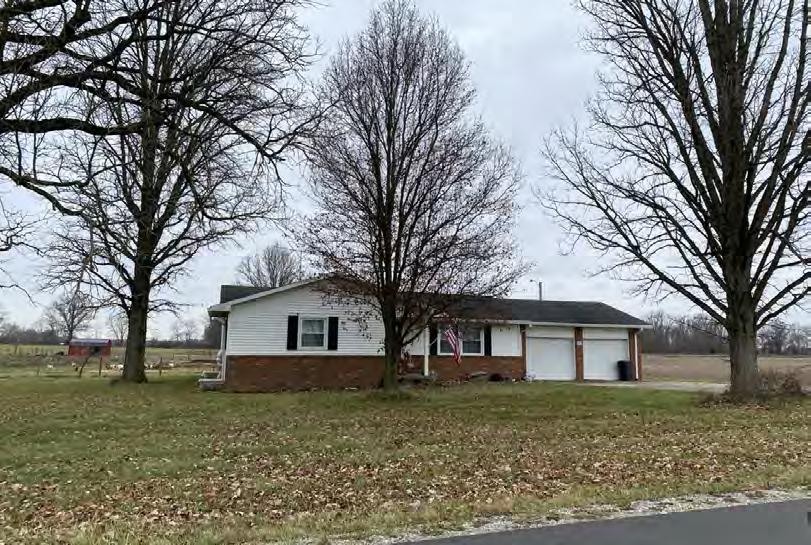
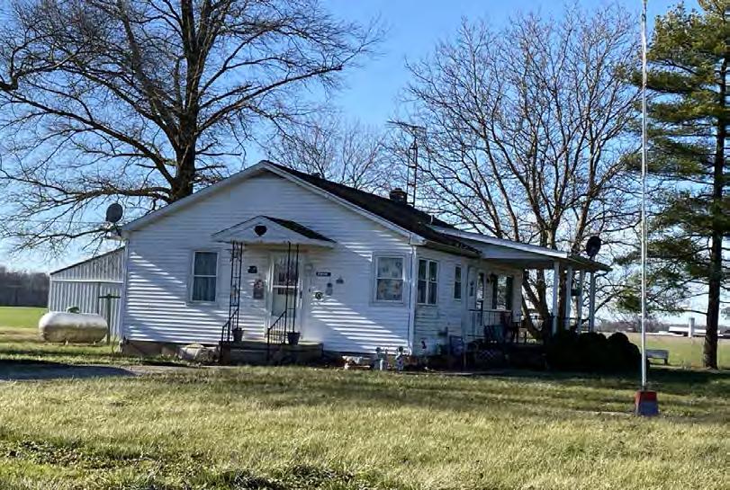
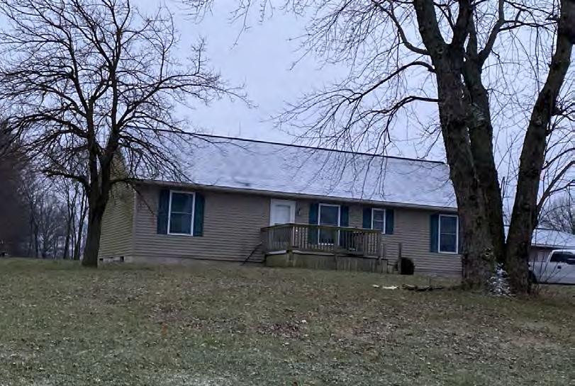
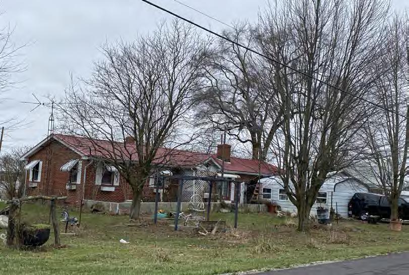
The previously recorded OHI resources include two residences located on the outskirts of Cardington (Table 1). These resources are recommended not eligible for the NRHP due to a lack of historic integrity and/or significance. Resource locations are depicted on Figure 4-1 and photographs of the previously recorded resources are provided in Appendix C.
4-1. Identified Resources within the APE for Visual Effects
Figure
Table 1. Previously Identified OHI Resource within APE for Visual Effects
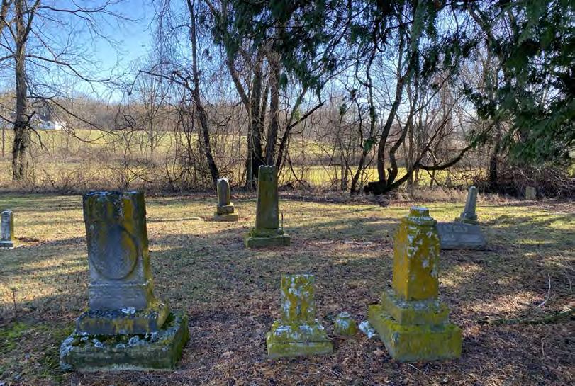
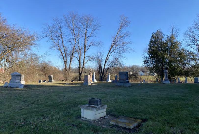
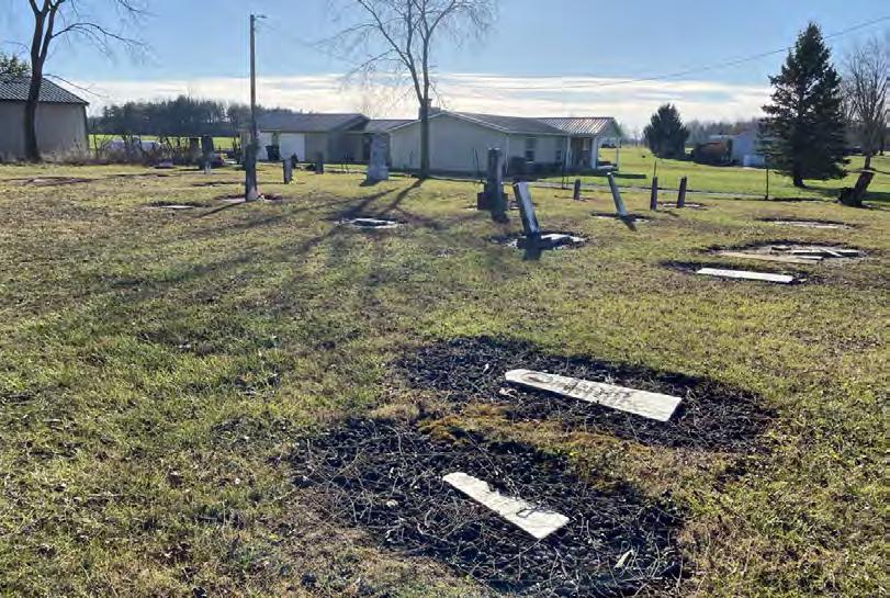
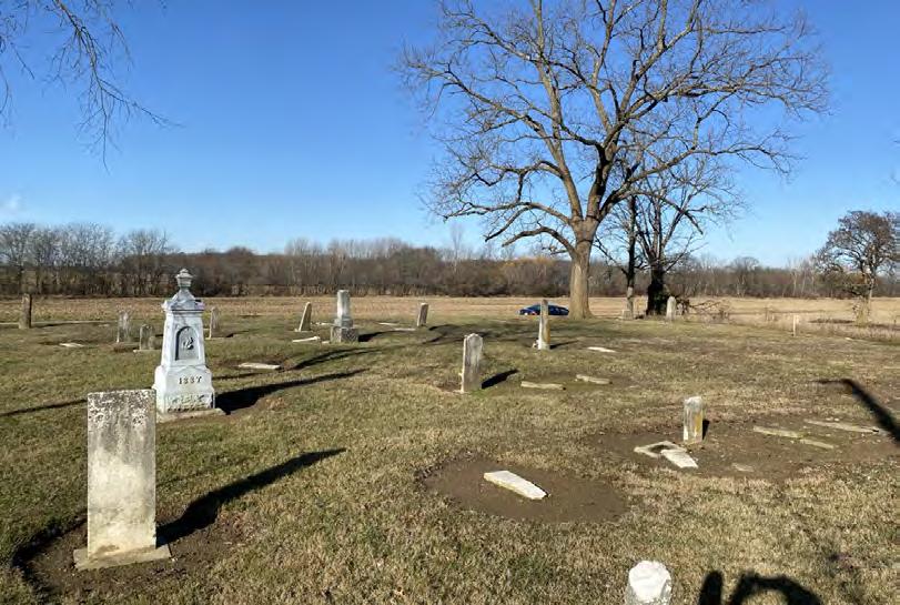
4.2.2 OGS Cemeteries
The OGS is a non-profit, state-wide, genealogical organization. Its mission includes the identification of all Ohio cemeteries, which are inventoried in its online database.
EDR is providing updated information and recommendations for NRHP eligibility for the previously recorded OGS cemeteries within the APE for Visual Effects (Table 2). Cemeteries are not typically eligible for listing unless they satisfy National Register Criteria Consideration D, which stipulates a cemetery may be eligible “if it derives its primary significance from graves of persons of transcendent importance, from age, from distinctive design features, or from association with historic events” (NPS, 1995).
Table 2. Previously Identified OGS Cemeteries within the APE for Visual Effects.
East Side of County Road 165, 0.22 Mile North of Township Road 159, Cardington, Ohio
East Side of County Road 165, 0.16 Mile North of Township Road 159, Cardington, Ohio
4.3 Newly Identified Resources
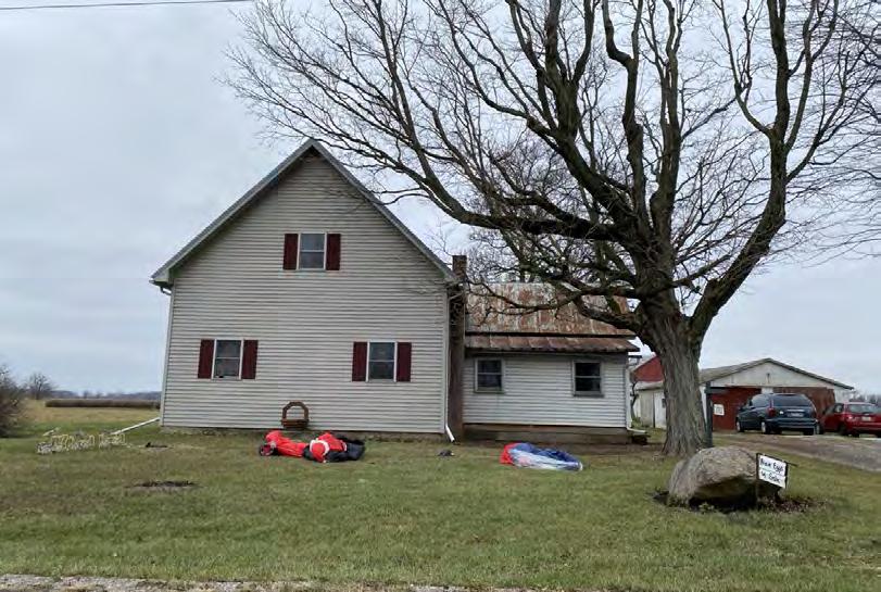
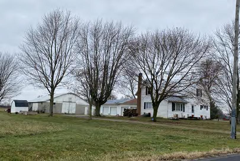
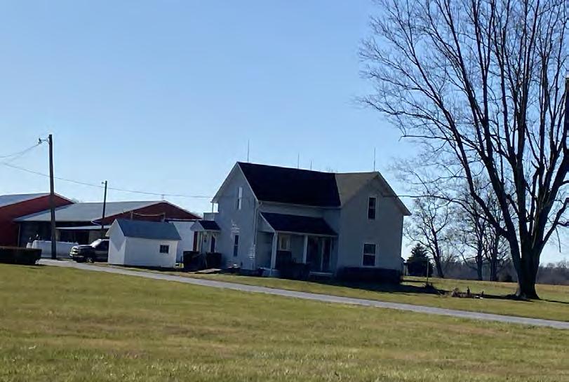
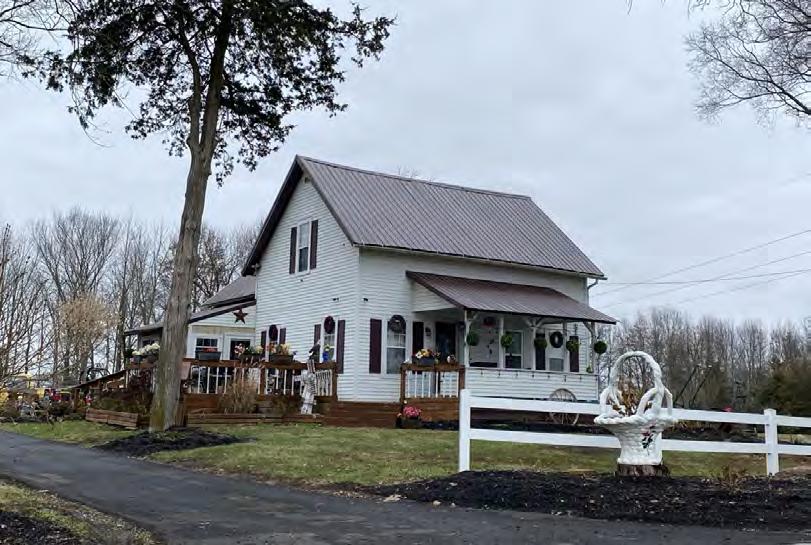
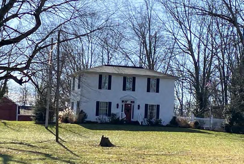
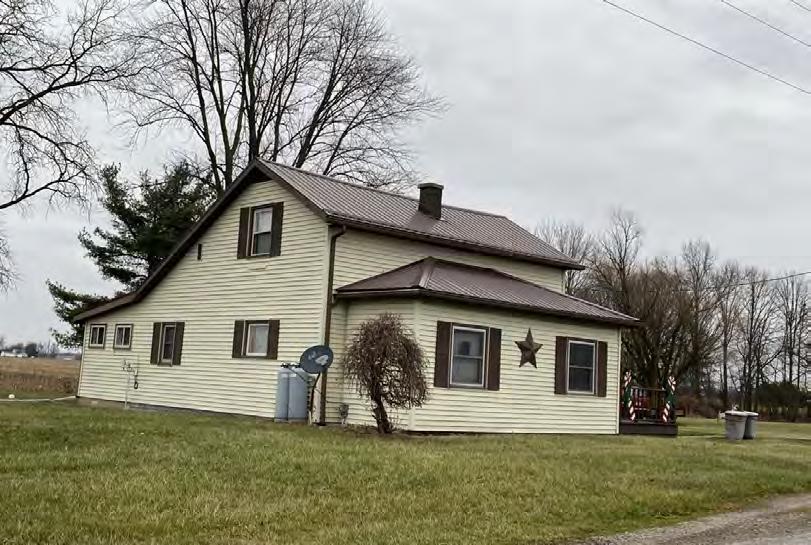
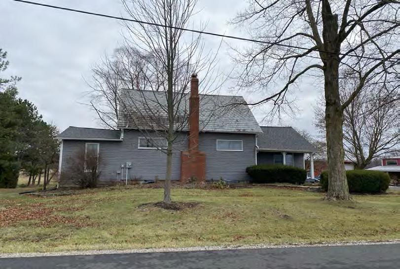
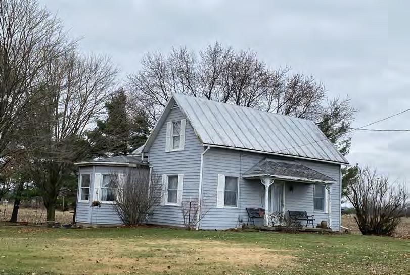
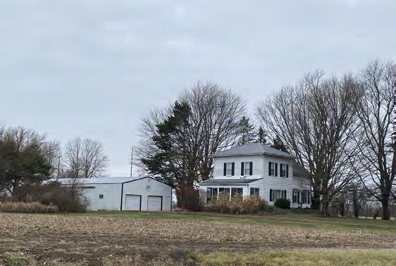
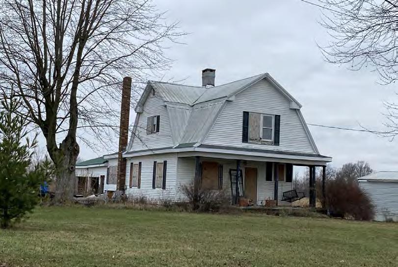
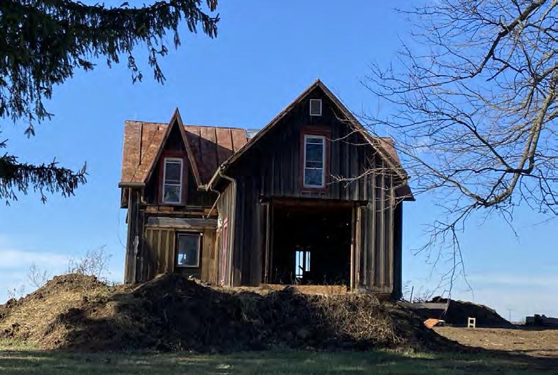
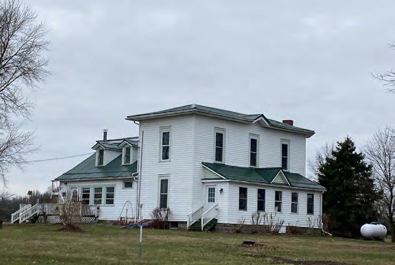
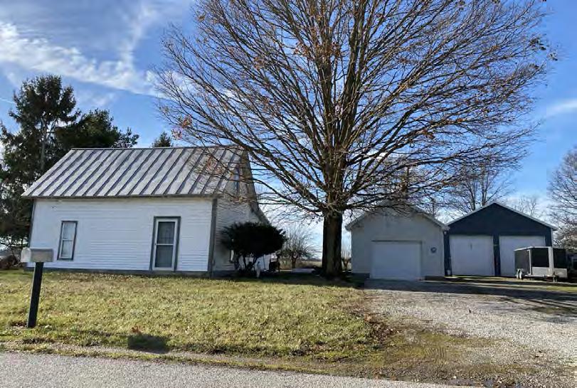
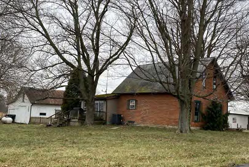
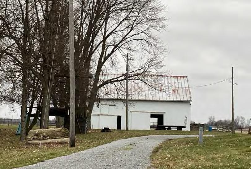
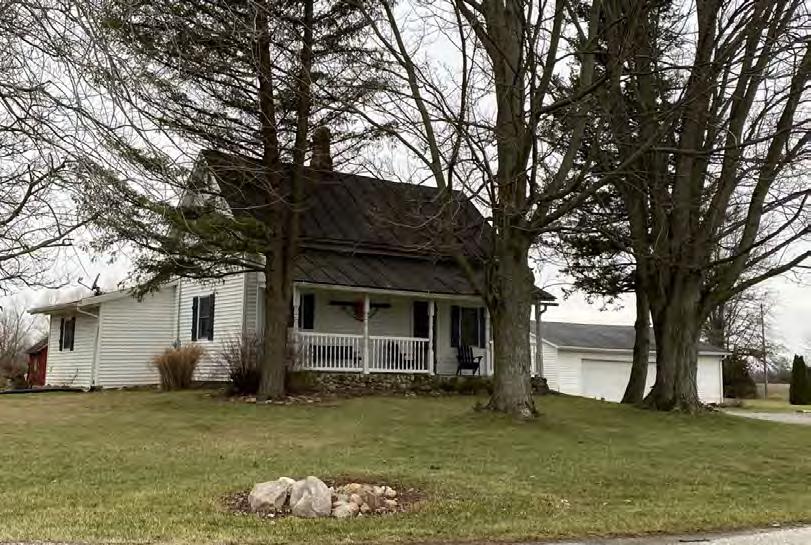
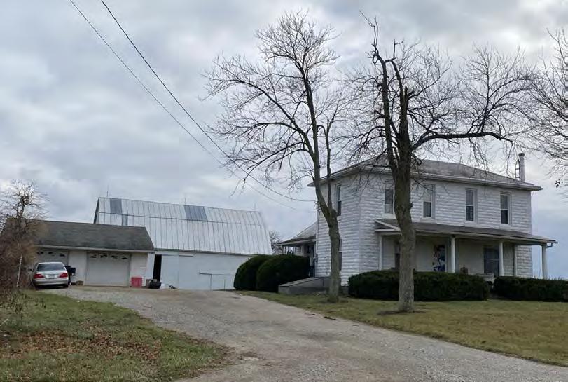
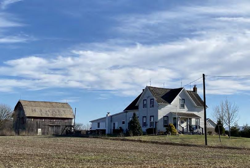
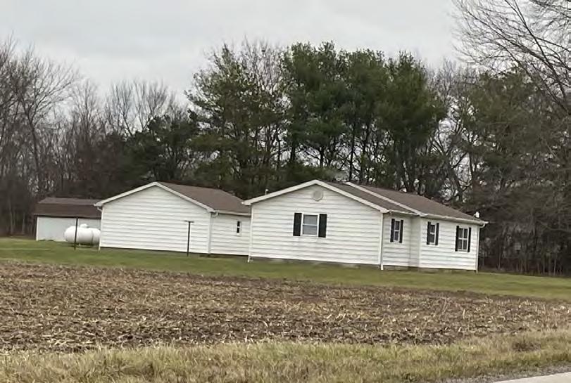
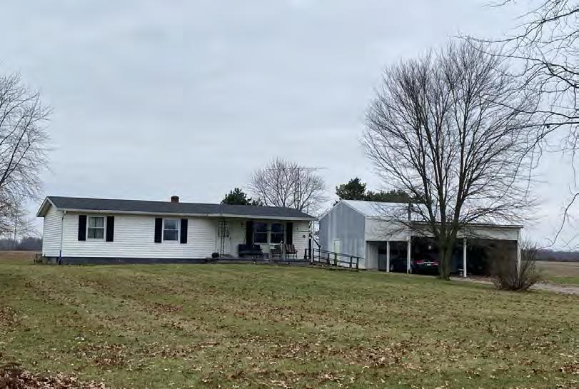
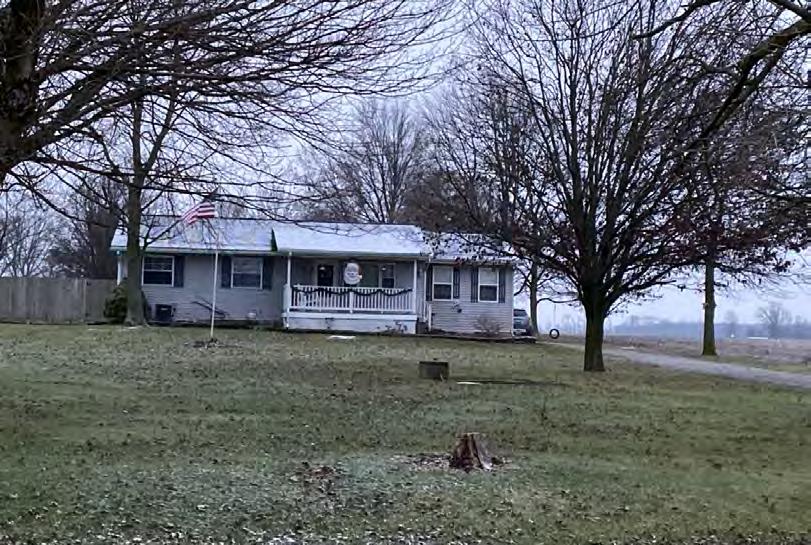
EDR identified 155 previously unrecorded resources over 50 years of age within the APE for Visual Effects. None of these newly identified resources are recommended eligible for listing in the NRHP due to a lack of historic integrity and/or significance. Discussions on the type of resources identified are provided in the following section and representative photographs of newly identified resources within the APE for Visual Effects are provided in Appendix D.
4.4 Representative Non-NRHP-Eligible Resources
EDR took photographs of previously unidentified resources over 50 years of age within the APE for Visual Effects that, in the opinion of EDR’s architectural historian, did not meet NRHP eligibility criteria. The purpose of the photo-documentation effort was to assist the SHPO with its determination regarding “which resources warrant further investigation and which resources, due to a lack of integrity, architectural significance, etc., do not” (SHPO, 2014). A photolog of representative views throughout the APE for Visual Effects to illustrate resources that, in the opinion of EDR’s architectural historians, did not satisfy NRHP eligibility is included as Appendix D.
Buildings over 50 years old that were identified represented a range of qualities that did not warrant further investigation such as a lack of integrity and/or significance. Examples include rural residences representing common and/or altered nineteenth and twentieth century architectural styles, farmsteads with common and/or altered nineteenth and twentieth century residences and outbuildings, as well as residences located in the Village of Cardington (Appendix D, Photographs 1-34). In addition, EDR evaluated the potential for an NRHP-eligible historic district within the Village of Cardington, as well as for agricultural/rural districts within the APE for Visual Effects. However, due to a lack of historic integrity and significance, EDR recommends that there are no NRHP-eligible historic districts located within the APE for Visual Effects.
According to the SHPO Survey Report Submission Requirements, “buildings less than 50 years old should only be included in Historic Resources Surveys if they exemplify a distinctive architectural style or buildings type, represent an important and distinctive physical expression of the modern period, or have gained historical significance through a strong association with a historic theme” (SHPO, 2014). No buildings less than 50 years old and meeting these criteria were identified during the survey.
5.0 SUMMARY
On behalf of the Applicant, EDR conducted a Historic Resources Survey for the proposed Crossroads Solar Project, located in Morrow County, Ohio. Seven previously recorded resources were identified within the APE for Visual Effects. Of these resources, two were previously recorded as OHI resources (OHI MRW0010010 and MRW0023310), and five were previously recorded by the OGS (OGS 8618. 8666, 8667, 8668, and 8672) None of these resources are recommended eligible for the NRHP due to a lack of historic integrity and/or significance (Appendix C). In addition, EDR photographed 155 newly identified resources located within the APE for Visual Effects. None of these resources are recommended eligible for the NRHP due to a lack of historic integrity and/or significance (Appendix D).
In addition, to minimize potential visual impacts, the Project is implementing setbacks from neighboring parcels and residences, and vegetative screening plans will be prepared for the Project. The goals of the setbacks and landscape plans are to soften views of the proposed Project and help blend the newly introduced Project components into the existing landscape. To accomplish this, perimeter plantings in select locations are proposed that utilize native and/or beneficial plant species found in and around the site in existing hedgerows, fields, and tree stands, combining different varieties and sizes of material in a layered, natural arrangement. By utilizing this approach, the proposed Project can be integrated into the existing landscape, rather than hiding it behind a row of evergreen material that does not look natural and contrasts with the existing landscape. Therefore, EDR recommends that the proposed Project will result in No Effects to historic properties within the APE for Visual Effects. No further historic resources investigations are currently recommended. If Project design changes, further studies may be warranted.
6.0 REFERENCES
Baskin, O L 1880 History of Morrow County and Ohio. O.L. Baskin & Company, Chicago, IL.
Baughman, A.J. 1911. History of Morrow County, Ohio: A Narrative Account of its Historical Progress, Its People, and it Principal Interests, Volume 1. The Lewis Publishing Company, Chicago, IL and New York, NY.
Environmental Design & Research, Landscape Architecture, Engineering & Environmental Services, D.P.C. (EDR). 2023 Cultural Resources Research Design and Survey Methodology: Crossroads Solar Project Columbus, Ohio.
Harwood and Watson. 1857, Map of Morrow County Ohio; From Actual Surveys. Published by Woodford & Bartlett, Philadelphia, PA.
Horrocks, Krista. 2023. Section 106 Review: Crossroads Solar Project, Cardington, Lincoln, and Westfield Townships, Morrow County, Ohio. 2023-MRW-57606 response letter, May 3, 2023, SHPO, Columbus, Ohio.
Howe, Henry. 1907. Historical Collections of Ohio in Two Volumes, Volume II. Published by the State of Ohio and C.J. Krehbiel & Company, Cincinnati, Ohio.
Justice, Noel D. 1987. Stone Age Spear and Arrow Points of the Midcontinental and Eastern United States: A Modern Survey and Reference. Indiana University Press, Bloomington & Indianapolis.
Koehlinger, Kristen. 2023. Section 106 Review: Crossroads Solar Project, Cardington, Lincoln, and Westfield Townships, Morrow County, Ohio. 2023-MRW-57606 response letter, June 5, 2023, SHPO, Columbus, Ohio.
Lake, D.J. 1871. Atlas of Morrow County, Ohio. Published by, C.O. Titus, Philadelphia, PA.
Lakomaki, Sami. 2014. “Our Line”: The Shawnees, The United States, and Competing Borders on the Great Lakes Borderlands, 1795-1832. Journal of the Early Republic Volume 34(4):597-624.
National Park Service (NPS). N.d. Aboard the Underground Railroad: Reuben Benedict House. Available at: https://www.nps.gov/nr/travel/underground/oh9.htm (Accessed March 2023).
NPS. 1990. How to Apply the National Register Criteria for Evaluation. U.S. Department of the Interior. Available at: https://www.nps.gov/subjects/nationalregister/upload/NRB-15_web508.pdf. (Accessed 2021)
NPS. 2023. National Register of Historic Places [website]. U.S. Department of the Interior. Available at: https://www.nps.gov/subjects/nationalregister/index.htm. (Accessed March 2023).
Ohio State Historic Preservation Office (SHPO). 2014. Guidelines for Conducting History/Architecture Surveys in Ohio. Ohio History Connection, Columbus, Ohio.
OHC. n.d.a. Miami Indians. Available at: https:// https://ohiohistorycentral.org/w/Miami_Indians (Accessed March 2023).
OHC. n.d.b. Shawnee Indians. Available at: https:// https://ohiohistorycentral.org/w/Shawnee_Indians (Accessed March 2023).
OHC. n.d.c. Wyandot Indians. Available at: https:// https://ohiohistorycentral.org/w/Wyando_Indians (Accessed March 2023).
OHC. n.d.d. Morrow County. Available at: https://ohiohistorycentral.org/w/Morrow_County#:~:text=On%20February%2024%2C%201848%2C%20th e,role%20in%20the%20Underground%20Railroad (Accessed March 2023).
OHC. 2023 Online Mapping System [website]. Available at: https://www.ohiohistory.org/preserve/statehistoric-preservation-office/mapping, (Accessed March 2023)
Schmid, R. C. 1928. The Cleveland, Columbus, Cincinnati, & Indianapolis Railroad. In The Railway and Locomotive Historical Society Bulletin 16: 23-37. Railway and Locomotive Historical Society.
Smith, James. 1978. Scoouwa: James Smith’s Indian Captivity Narrative. Ohio Historical Society, Columbus, Ohio.
United States Bureau of the Census (US Census). 1930 Columbus, OH Metropolitan Statistical Area.
US Census. 2012. Columbus, OH Metropolitan Statistical Area.
US Census. 2020 Columbus, OH Metropolitan Statistical Area.
United States Geological Survey (USGS). 1915. Marengo, Ohio. 1:62,500-Scale Topographic Quadrangle. United States Department of the Interior, Geological Survey, Washington, D.C.
USGS. 1916 Mount Gilead, Ohio. 1: 62,500-Scale Topographic Quadrangle. United States Department of the Interior, Geological Survey, Washington, D.C.
USGS. 1943a. Morengo, Ohio. 1: 62,500-Scale Topographic Quadrangle. United States Department of the Interior, Geological Survey, Washington, D.C.
USGS. 1943b Mount Gilead, Ohio. 1: 62,500-Scale Topographic Quadrangle. United States Department of the Interior, Geological Survey, Washington, D.C.
USGS. 1961a Ashley, Ohio. 1:24,000-Scale Topographic Quadrangle. United States Department of the Interior, Geological Survey, Washington, D.C.
USGS. 1961b. Denmark, Ohio. 1:24,000-Scale Topographic Quadrangle. United States Department of the Interior, Geological Survey, Washington, D.C.
Appendix A
Staff Résumé
Education
Master of Arts, History, Youngstown State University, Youngstown, Ohio, 2004
Bachelor of Arts, Anthropology, Youngstown State University, Youngstown, Ohio, 1997
Certifications
Meets the Secretary of Interior’s Standards for History and Architectural History (36 CFR Part 61)
Michael Kenneally, MA Historic Preservation Project Manager
Michael is a Historic Preservation Project Manager with EDR. Mr. Kenneally has over 21 years of experience working on cultural resource management projects and meets the professional qualifications for the Secretary of the Interior’s Standards in History and Architectural History (per 36 CFR 61). Mr. Kenneally specializes in managing and conducting cultural resource surveys, including both archaeology and historic resources surveys, and has extensive knowledge of the rules and regulations governing Section 106 and National Register of Historic Places (NRHP) eligibility evaluations. He has managed and conducted numerous large- and small-scale cultural resource assessment surveys for various state and federal agencies, city departments, municipalities, and various organizations in both the public and private sectors.
Selected Project Experience
Erie Citywide Historic Resources Survey, Erie County, PA – Project Manager for Phase I and Phase II of the City of Erie Citywide Historic Resources Survey. Phase I involved public outreach, project promotion, and preparation of a StoryMap website that engaged residents of Erie to provide information on places considered significant. Phase II of the project consists of systematic historic resources survey of select planning neighborhoods including Bayfront, Downtown, Pulaski Lighthouse, West Bayfront (Phase II-A), and 12th Street Corridor, East Bayfront, Trinity Park, and Little Italy (Phase II-B). Following the historic resources survey, which includes approximately 11,000 resources, all identified resources will be entered into the Pennsylvania State Historic Preservation Office’s PA SHARE database. Final historic resources survey reports will be prepared, including the development of historic contexts for each of the planning neighborhoods and National Register of Historic Places evaluations for identified resources.
Aristotle South Pipeline, Franklin, Fairfield, and Licking County, OH – Served as Historic Preservation Project Manager for preparation of a Research Design and Survey Methodology Report and Historic Resources Survey Report.
Cambria Wind Repowering Project – Served as Task Manager for historic architectural resources studies. Prepared initial consultation submission and historic architecture work plans for submittal to the Pennsylvania SHPO. Oversaw historic resources survey and co-authored historic resources survey report. Prepared Assessment of Effects for identified resources.
Eastern Cottontail Solar, Fairfield County, OH - Project Manager for studies associated with the preparation of a Certificate Application for the Ohio Power Siting Board (OPSB) on a proposed 250-MW solar facility, including serving as Task Manager for historic resources studies. Historic resources tasks included preparing a research design and survey methodology report, conducting a historic resources survey, authoring the historic resources survey report, preparing a historic resources mitigation plan, preparing a Memorandum of Understanding for the mitigation of adverse effects to identified historic properties and archaeological sites, preparing written direct testimony for adjudicatory hearing, and providing in-person expert witness testimony for the historic resources investigations and reports at the adjudicatory hearing.
Highland North Wind Repowering Project, Cambria County, PA – Served as Task Manager for historic architectural resources studies. Prepared initial consultation submission and historic architecture work plans for submittal to the Pennsylvania SHPO Oversaw historic resources survey and co-authored historic resources survey report. Prepared Assessment of Effects for identified resources.
Carnation Solar Project - Task Manager for historic architectural resources studies for a utility-scale solar project sited on approximately 1650 acres. Prepared a research design and survey methodology report, oversaw historic resources survey, and authored historic resources survey report for submittal to the Ohio SHPO in support of Certificate Application.
Richwood Solar, Union County, OH - Project Manager for studies associated with the preparation of a Certificate Application for the Ohio Power Siting Board (OPSB) on a proposed 250-MW and 50-MW BESS solar facility, including serving as Task Manager for historic architectural resources studies. Prepared a research design and survey methodology report, oversaw historic resources survey, and authored historic resources survey report, including an addendum historic resources survey report, for submittal to the SHPO in support of Certificate Application.
Appendix B
SHPO Correspondence
In reply, refer to 2023-MRW-57606
May 3, 2023
Michael Kenneally EDR
5 E. Long Street, Suite 700 Columbus, OH 43215 mkenneally@edrdpc.com
RE: Crossroads Solar Project, Cardington, Lincoln, and Westfield Townships, Morrow County, Ohio
Dear Mr. Kenneally:
This letter is in response to the correspondence received on April 6, 2023 regarding the proposed Crossroads Solar Project, Cardington, Lincoln, and Westfield Townships, Morrow County, Ohio. We appreciate the opportunity to comment on this project. The comments of the Ohio State Historic Preservation Office (SHPO) are made pursuant to Section 149.53 of the Ohio Revised Code and the Ohio Power Siting Board rules for siting this project (OAC 4906-4 and 4906-5). The comments of the Ohio SHPO are also submitted in accordance with the provisions of Section 106 of the National Historic Preservation Act of 1966, as amended (54 U.S.C. 306108 [36 CFR 800]).
The proposed undertaking involves the construction of a 604-acre solar-powered electric generating facility in Morrow County. Our office has reviewed the Cultural Resources Research Design and Survey Methodology, Crossroads Solar Project, Cardington, Lincoln, and Westfield Townships, Morrow County, Ohio prepared by EDR. An archaeological sensitivity assessment was created to identify areas of elevated archaeological sensitivity based on Criterion 1 (within 1,000 feet of permanent water and on slopes equal to or less than 15%), Criterion 2 (within or near known archaeological sites) and Criterion 3 (locations of standing or demolished historic structures). Based on these criterion, it is recommended that 100% Phase I-level survey will take place in the elevated sensitivity for archaeological material (483 acres of the project area) and 100% Phase I survey (increased shovel testing interval to 30 meters and increased pedestrian survey to 20 meters) will take place in reduced sensitivity for archaeological material areas (121 acres of the project area). Our office agrees with this proposed archaeological survey methodology.
Our office also agrees to the proposed historic resources research design and survey methodology. However, we request a revised visual analysis showing one that combines both the topography only analysis with the digital surface model. We also request a proposed Area of Potential Effects (APE) line be added to the map. Based on where the proposed APE is located, at a minimum, street views of the southern edge of Cardington should be taken to determine if there is a potential historic district that might be affected by the solar facility.
Our office looks forward to additional coordination for the Crossroads Solar Project. If you have any questions, please contact me by e-mail at khorrocks@ohiohistory.org or Kristen Koehlinger at kkoehlinger@ohiohistory.org. Thank you for your cooperation.
Sincerely,
Krista Horrocks, Project Reviews Manager Resource Protection and Review
RPR Serial No: 1097681
OHIO
HISTORY CONNECTION
In reply, refer to: 2023-MRW-57606
June 5,2023
Micliael Kenneally EDR
5ELong Street, Ste 700 Columbus, OH 43215
RE: Crossroads Solar Project - Revised Area of Potential Effects Cardington, Lincoln, and Westfield Townsliips, Morrow County, Oliio
Dear Mr. Kenneally:
Tliis letter isin response to tlie correspondence received on April 6, 2023, regarding tlie proposed Crossroads Solar Project, Cardington, Lincoln, and Westfield Townships, Morrow County, Ohio. We appreciate tlie opportunity to comment on tliis project. The comments of the Ohio State Historic Preservation Office (SHPO) are made pursuant to Section 149.53 of the Oliio Revised Code and the Oliio Power Siting Board rules for siting this project (OAC 4906-4 and 4906-5). The comments of the Ohio SHPO are also submitted in accordance with the provisions of Section 106 of the National Historic Preservation Act of 1966, asamended (54 U.S.C. 306108 [36 CFR 8001).
In aletter dated May 3,2023, our office agreed with the proposed survey methodology for both the proposed archaeological survey and tlie history/architecture survey. However, we did ask for arevised visual analysis sliowing both the topography only analysis witli the digital surface model. We also asked that aproposed Area of Potential Effects (APE) be denoted on the map. The recent correspondence provided tliis information. After reviewing tlie revised APE map, the SHPO agrees witli the area to be surveyed.
We look forward to continued coordination for tlie Crossroads Solar Project. If you have any questions, please contact us at (614) 298-2022, or by e-i'nail to Krista Horrocks at khorrocks@)ohiohistory.org or myself at kkoelilinger(24oliioliistory.org. Thank you for your cooperation.