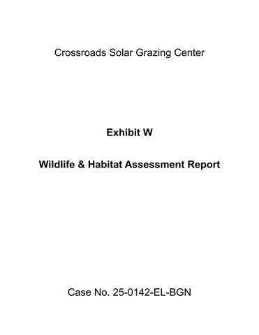

Wildlife and Habitat Assessment Report
Crossroads Solar Grazing Center
Cardington, Westfield, and Lincoln Townships
Morrow County Ohio
Prepared for:
Crossroads Solar I, LLC
1105 Navasota Street
Austin, Texas 78702
Prepared by:
Verdantas LLC
6397 Emerald Pkwy, Suite 200
Dublin, Ohio 43016 (614) 793-8777
Verdantas Project No: 17078
July 2025

This page intentionally left blank.
Figures
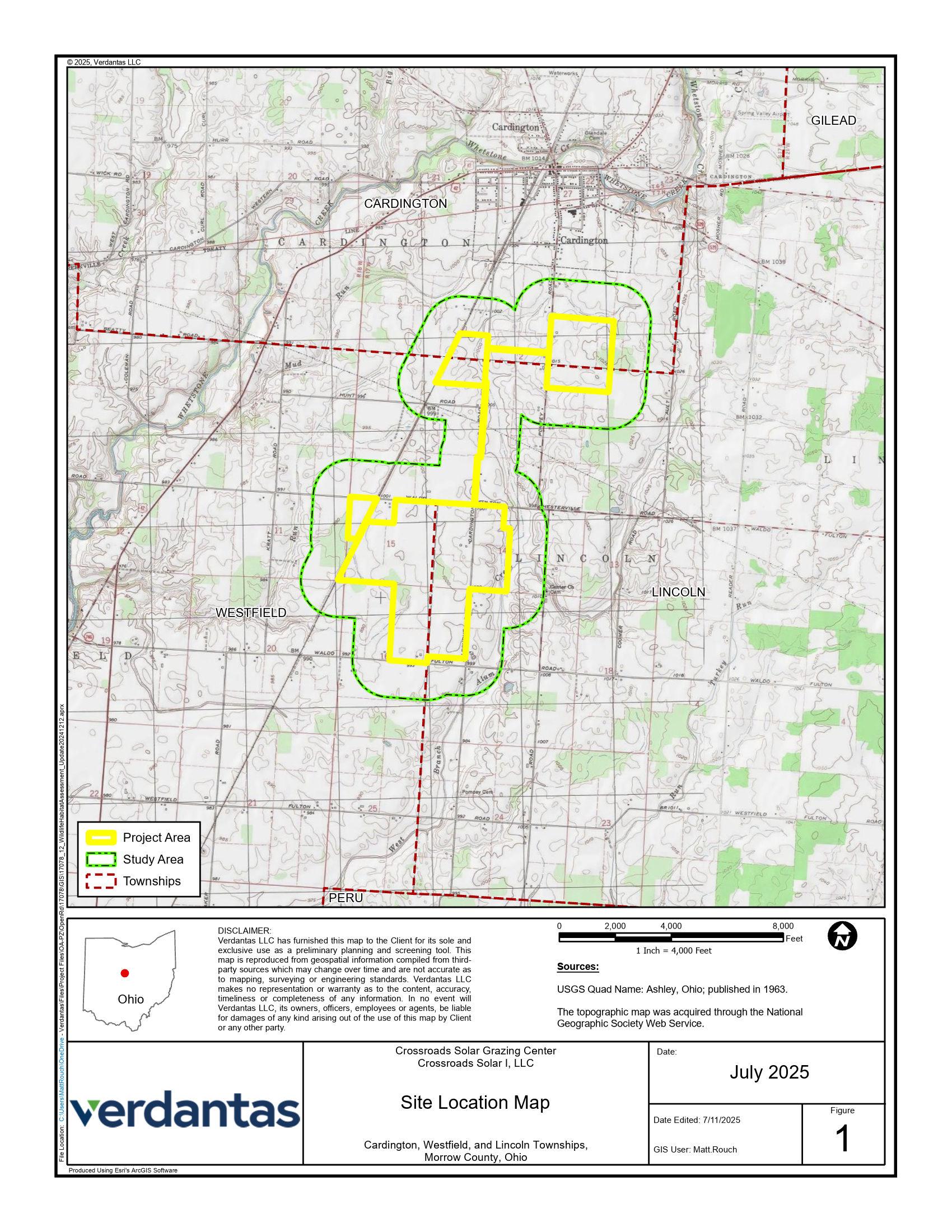
Figure 1 Site Location Map
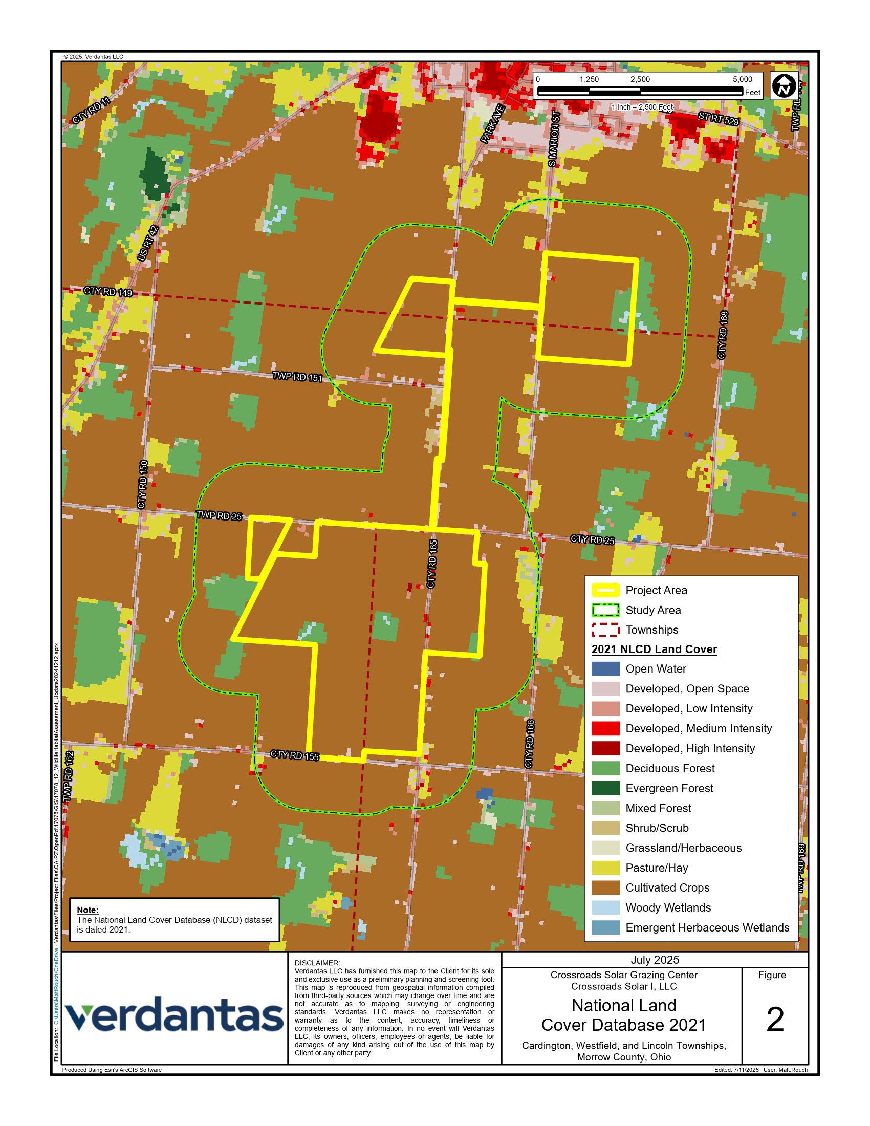
Figure 2 National Land Cover Database Map
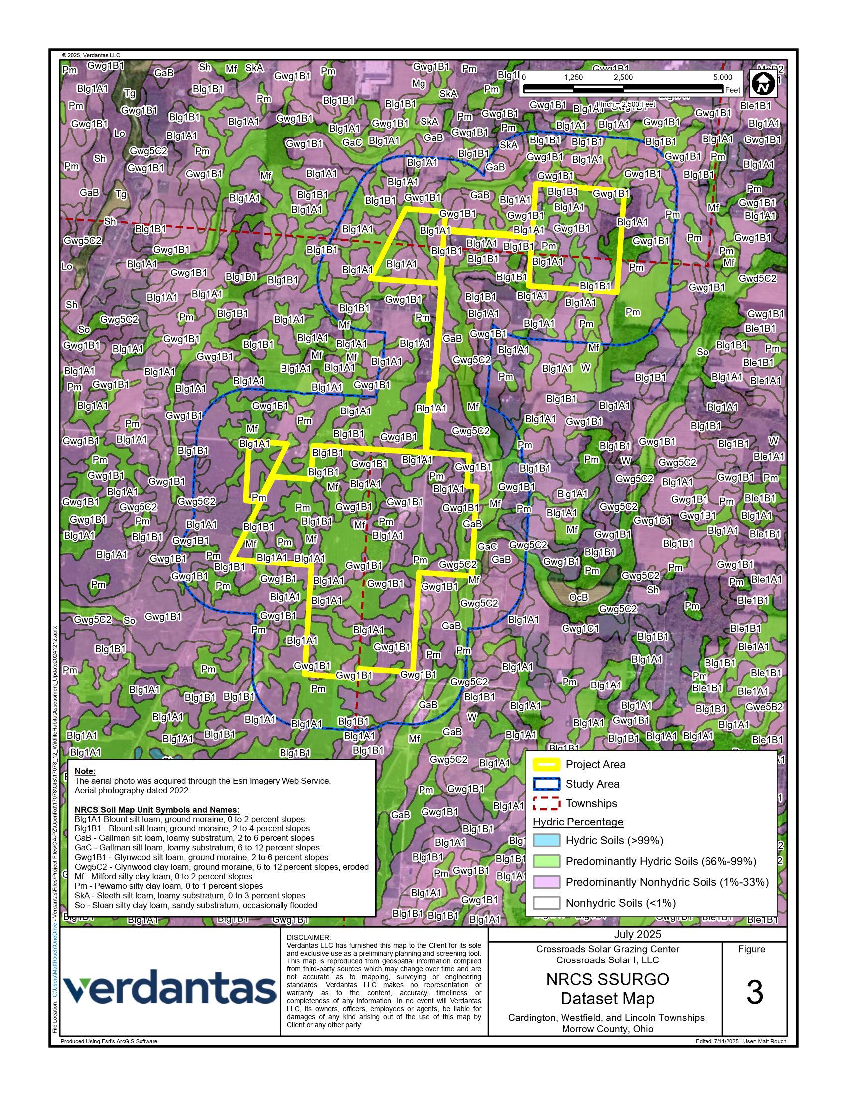
Figure 3 NRCS SSURGO Dataset Map
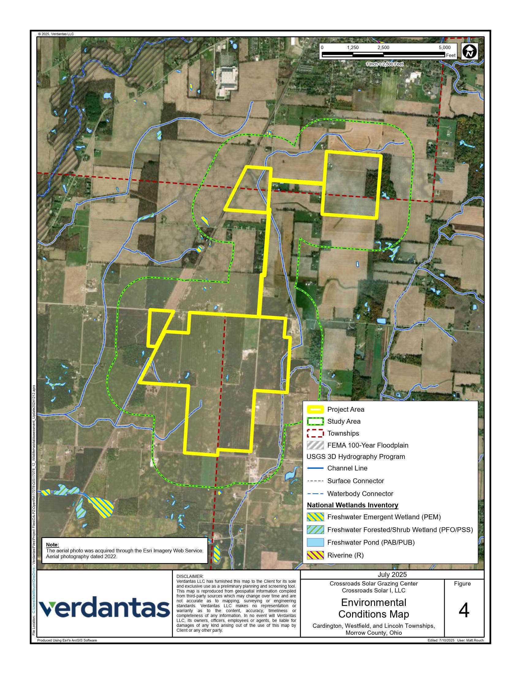
Figure 4 Desktop Environmental Conditions Map
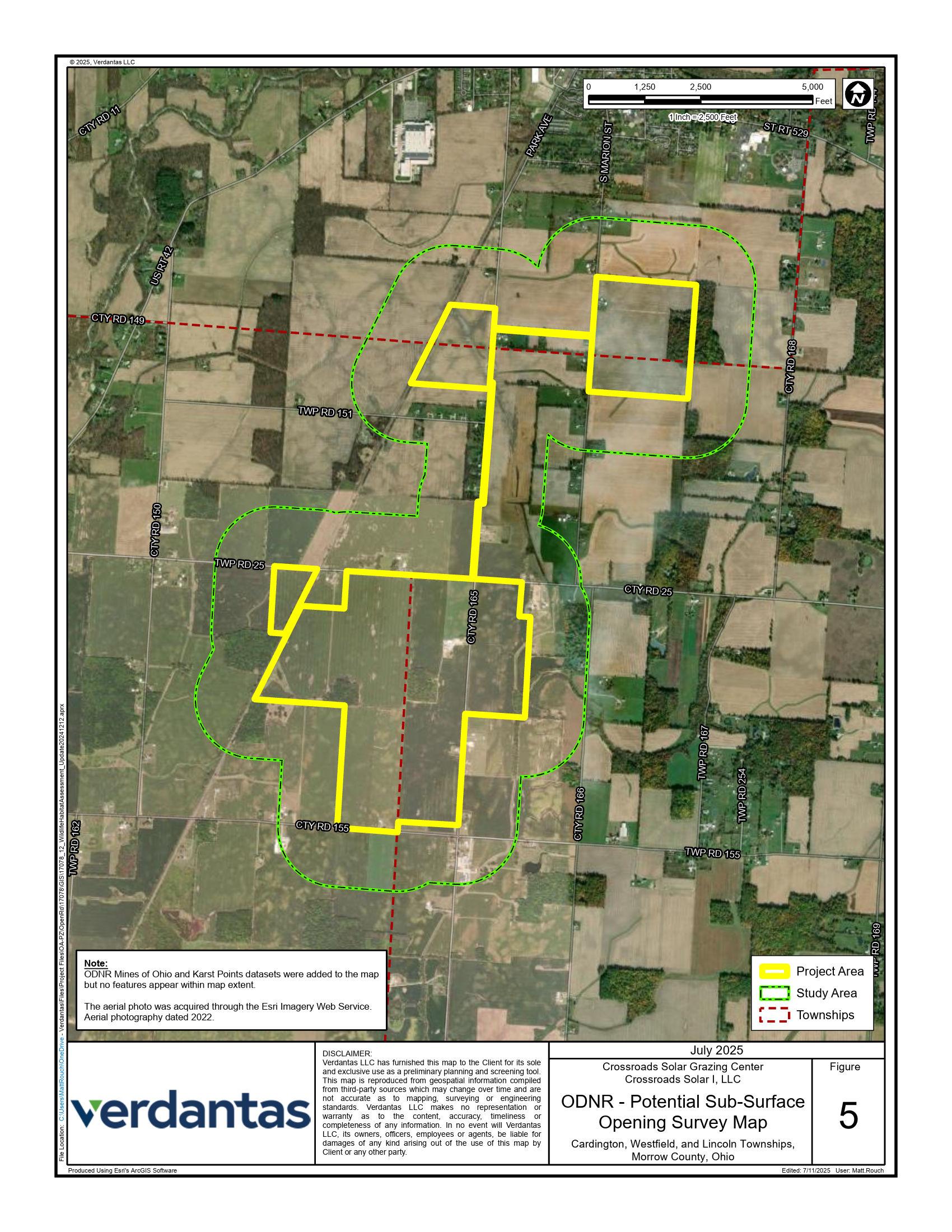
Figure 5 ODNR Potential Sub-Surface Opening Survey Map
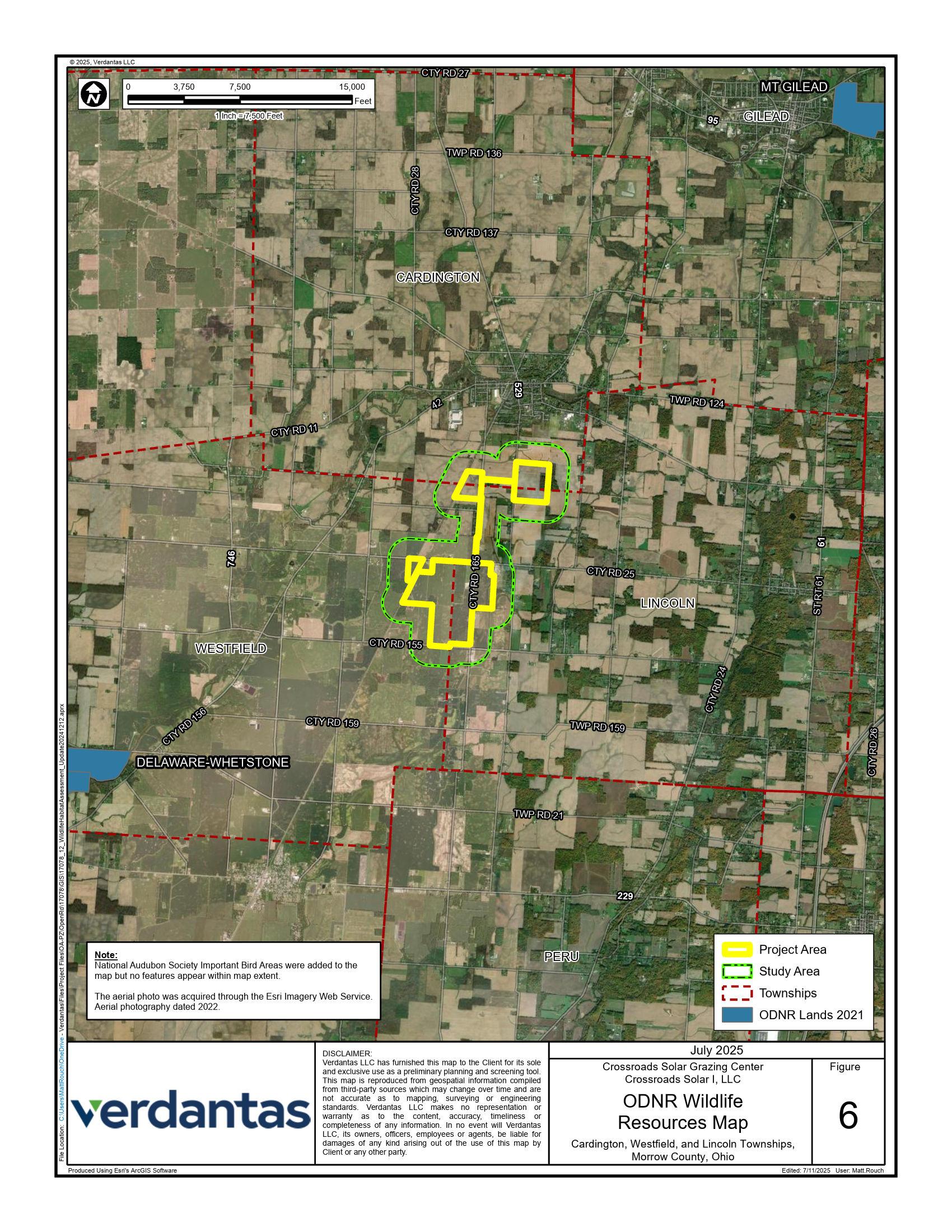
Figure 6 ODNR Wildlife Resources Map
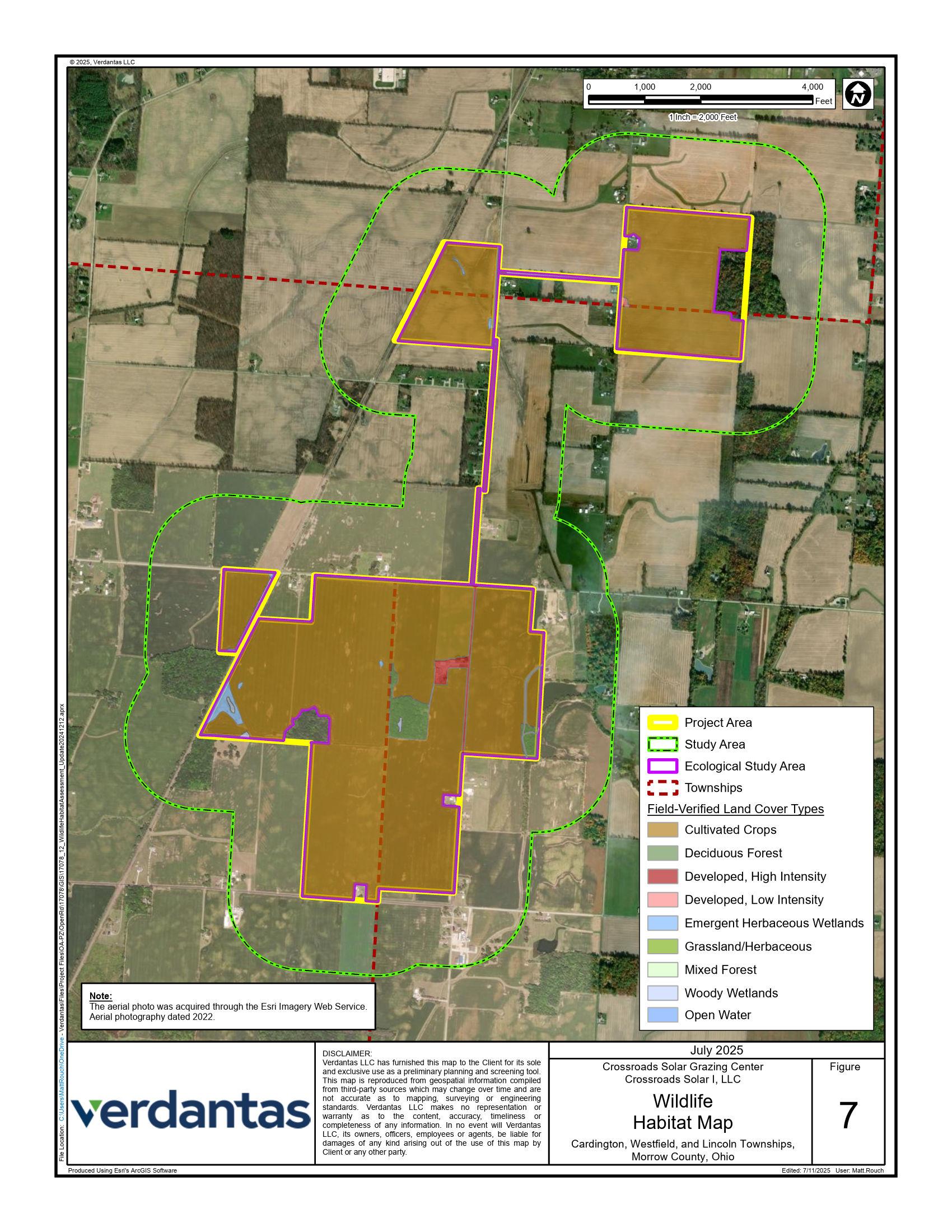
Figure 7 Wildlife Habitat Map
Figure 8 Wildlife Habitat Map series
Appendices
Appendix A USFWS IPaC Resource List
Appendix B State-Listed Animal and Plant Species Lists for Morrow County
Appendix C Agency Correspondence with USFWS
Appendix D Agency Correspondence with ODNR
Appendix E Field-Verified Land Cover, Habitat, and Wildlife Photographs

1. Introduction
This Wildlife and Habitat Assessment Report (“Report”) has been prepared for the Crossroads Solar Grazing Center (“Crossroads”). Crossroads is proposing to construct a combined utilityscale solar energy and sheep grazing facility in Cardington, Lincoln, and Westfield Townships in Morrow County, Ohio (the “Project” or the “Facility”). The Project will use rows of ground-mounted solar panels to supply up to 94 megawatts AC (MWac) of wholesale power to the existing electric grid while also providing pasture for livestock. All of the Project’s above-ground infrastructure will be located within agricultural-style fences, which also will confine the livestock and protect them from predators. The fenced area will be up to 559 acres (the “Solar & Grazing Area”) of an area totaling approximately 726 acres (the “Project Area”).
The purpose of this report was to determine the location and extent of suitable habitat for species within the Project Area that may be subject to regulation under the Endangered Species Act (ESA); the Migratory Bird Treaty Act (MBTA); the Bald and Golden Eagle Protection Act (BGEPA); and Ohio Revised Code (ORC), Chapters 1518 and 1531.25. This report complies with portions of Section 4906-4-08(B)(1) and Section 4906-4-09(D)(1) of the Ohio Administrative Code.
2. Methods
2.1 Desktop Assessment and Literature Survey
Verdantas conducted a desktop assessment and literature survey to assess the types of plant and animal life that may occur within 0.25 mile of the Project Area boundary (the Project Area with a 0.25-mile buffer applied is hereafter referred to as the “Study Area”). In total, the Study Area comprised 2,372.5 acres.
The desktop assessment and literature survey particularly focused on special status species. The term “special status species” refers to aquatic and terrestrial plant and animal species of commercial or recreational value, species designated as endangered and threatened at the Federal and/or State level, and species protected under the MBTA and BGEPA.
The following publicly available data sources were reviewed to help determine the types, locations, and extents of potential habitats within the Study Area:
• Current and historic aerial imagery;
• Multi-Resolution Land Characteristics Consortium (MRLC) National Land Cover Database (NLCD; NLCD, 2021);
• United States Geological Survey (USGS) 7.5-minute Topographic Quadrangle for Ashley, Ohio (USGS, 1963);
• U.S. Fish and Wildlife Service (USFWS) National Wetlands Inventory (NWI; USFWS, 2024);
• USGS 3D Hydrography Program (3DHP; USGS, 2024);
• Federal Emergency Management Agency (FEMA) National Flood Hazard Layer (NFHL, 2024);
• United States Department of Agriculture (USDA) Natural Resources Conservation Service (NRCS) Soil Survey Geographic Database (SSURGO; NRCS, 2024);
• USFWS Information for Planning and Consultation (IPaC) tool (USFWS, 2024);
• Ohio Department of Natural Resources (ODNR) State Listed Animal Species for Morrow County (ODNR, 2023);
• ODNR State Listed Plant Species for Morrow County (ODNR, 2016);
• National Audubon Society Important Bird Areas (IBAs) (NAS, 2024); and,
• eBird database (eBird, 2024).
2.2 Field Survey
Using the results of the desktop assessment and literature survey, Verdantas ecologists performed field surveys to confirm the types, locations, and extents of potential suitable habitats for special status species within the Project Area. Habitats were delineated using a combination of aerial imagery and field reconnaissance. All wildlife and signs of wildlife encountered during the field surveys were documented and recorded. Representative photographs were taken of the habitat types within the Project Area.
3. Desktop Assessment and Literature Survey
3.1 Land Use
3.1.1 Aerial Imagery and National Land Cover Database
Current and historic aerial imagery indicates that the primary land use within the region is agricultural. The NLCD confirms the dominant land cover within the StudyArea is cultivated crops. The other most common land cover is deciduous forest (Table 1). This is consistent with the surrounding landscape (Figure 2).
Table 1. MRLC NLCD Land Cover Types within the Study Area
3.1.2
Agricultural Conversion Considerations
According to the NLCD, cultivated crops comprise approximately 90 percent of the Study Area. Cropland typically provides minimal habitat for wildlife due to the practice of monoculture, the frequent use of pesticides and herbicides, seasonal disturbances associated with planting and harvest, and habitat fragmentation. The conversion of cropland to a solar energy facility will have minimal negative impacts to wildlife.
The Project is expected to remain in agricultural use throughout its life; however, land use will transition from cultivated cropland into pasture habitat which may contain pollinator-friendly species. Where feasible, the Project is expected to incorporate native flowering forb species into landscape screening areas outside of the fence line to support pollinators. These areas will provide some nesting and foraging habitat for insects and birds.
Pastureland may provide habitat to species that were previously using the agricultural fields. Increased ground cover; decreased seasonal disturbances; as well as decreased frequency of application and amounts of pesticides, herbicides, and fertilizers will slightly increase habitat quality compared to cropland. These factors might also increase water quality in nearby surface waters by stabilizing the soil and reducing nutrient and pesticide/herbicide run-off. This could result in improved habitat quality for aquatic species.
Crossroads is planning to implement a vegetation management plan (VMP) to maintain the vegetation after construction. The plan includes best management practices (BMPs) for vegetation clearing, protection, installation, establishment, and short- and long-term maintenance. The VMP includes provisions for targeted invasive species management and monitoring of vegetation establishment.
3.2 Soils and Ecology
3.2.1 USGS 7.5-minute Topographic Quadrangle
The USGS topographic mapping for the Ashley quadrangle indicates that topography is relatively flat but generally slopes east toward West Branch Alum Creek (Figure 1).
The Study Area lies within the Central Ohio Clayey Till Plain (ODNR, 1998). The distinguishing characteristics of the Central Ohio Clayey Till Plain include a surface of high-lime Wisconsinan age clayey till with well-defined moraines with intervening flat-lying ground moraine and intermorainal lake basins. There are no bolder belts. There are also about a dozen silt-, clay- and till-filled lake basins with few large streams and limited sand and gravel outwash.
3.2.2 USDA NRCS SSURGO
The NRCS SSURGO database identifies soil map units within the Study Area, of which there are 10 mapped (Figure 3 and Table 2). A variety of soil characteristics can contribute to habitat suitability for plants and wildlife, including soil texture, hydric rating or drainage class, and flooding or ponding frequency. NRCS mapped soils typically show estimated soil series for an area under natural conditions and does not take into account artificial modifications (i.e., drainage systems) that may be causing a naturally wet area to function as an upland for the purpose of cultivating row crops.
Table 2 NRCS SSURGO Soil Map Units within the Study Area
Map Unit Key
Blg1A1
So
Gwg5C2
Map Unit Name
Blount silt loam, ground moraine, 0 to 2 percent slopes
Pewamo silty clay loam, 0 to 1 percent slopes
Glynwood silt loam, ground moraine, 2 to 6 percent slopes
silty clay loam, 0 to 2 percent slopes
Blount silt loam, ground moraine, 2 to 4 percent slopes
Gallman silt loam, loamy substratum, 2 to 6 percent slopes
Sloan silty clay loam, sandy substratum, occasionally flooded
Glynwood clay loam, ground moraine, 6 to 12 percent slopes, eroded
Sleeth silt loam, loamy substratum, 0 to 3 percent slopes
Gallman silt loam, loamy substratum, 6 to 12 percent slopes
3.3 Surface Waters
3.3.1 USFWS NWI
The USFWS NWI was reviewed to determine the types, sizes, and locations of aquatic habitats that could be present within the Study Area (Table 3 and Figure 4). Potential wetlands are identified and mapped within the NWI based on desktop interpretation. NWI information is used to supplement knowledge about a site and cannot take the place of field observations due to minimal ground truthing, age of the map, mapping scale, and criteria that differ from USACE wetland delineation criteria.
Table 3 NWI-Mapped Features within the Study Area
3.3.2 USGS 3DHP
The USGS 3DHP provides information regarding water drainage networks within the Project Area and can indicate the presence of streams. Features within the 3DHP sometimes overlap with riverine wetlands in the NWI. 3DHP information is used to supplement knowledge of a site and cannot take the place of field observations due primarily to stream criteria that differ from USACE stream delineation criteria. In total, 25,963.90 linear feet of streams were mapped within the Study Area (Figure 4).
3.3.3 FEMA NFHL
The FEMA NFHL contains effective flood maps and Letters of Map Change (LOMC) that show areas of high, moderate, and minimal flood hazard. The NFHL map indicates that no 100-year floodplains are located within the Study Area (Figure 4)
3.4 Wildlife with Potential to Occur Within the Project Area
Verdantas gathered information regarding which species might utilize the Study Areafor breeding, nesting, foraging, stopover, resting, or shelter. Special status species were considered, as well as species of commercial or recreational value.
3.4.1 Federally Protected Species (USFWS IPaC)
The USFWS IPaC resource list for Morrow County identified two ESA-listed species, two proposed species, and one candidate species within range of the Project Area (Appendix A). Please note that a species’ inclusion on an IPaC list does not necessarily indicate its presence or documented occurrence within the Study Area. There are no critical habitats for ESA-listed species within Morrow County. The USFWS IPaC list identified 8 birds of particular concern (these birds either occur on the USFWS Birds of Conservation Concern [BCC] list or warrant special attention in the project location). Of note, this list included bald eagles (Haliaeetus leucocephalus), which are protected under the BGEPA.
3.4.2
State-Listed Species (ODNR State Listed Animal and Plant Species Lists)
The ODNR State Listed Animal and Plant Species lists for Morrow County were reviewed to identify which state-listed species may be present within the Project Area (Appendix B). These lists provide documented occurrences of listed species within the county since 1980. Five statelisted species, 8 species of concern, 1 species of special interest, 1 threatened plant species, 1 endangered plant species, and 2 potentially threatened plant species weredocumented in Morrow County (ODNR, 2023c; ODNR, 2023a).
3.4.3
Species of Commercial or Recreational Value (Local Data Sources)
Species of commercial or recreational value that are local to the Study Area include common game species, such as white-tailed deer (Odocoileus virginiana), turkey (Meleagris gallopavo), waterfowl (mallards [Anas platyrhynchos, etc.]), upland game birds (doves [Zenaida macroura], pheasants [Phasianus colchicus], bobwhite [Colinus virginianus], etc.), fish, and furbearers (ODNR, 2023c). These, and other common wildlife species may utilize the Project Area.
The Important Bird Areas (IBAs) Program is administered by the National Audubon Society in the United States. IBAs are distinct areas that provide essential breeding, wintering, or migration habitat for one or more bird species. Killdeer Plains-Big Island IBA is located about 15 miles northwest of the Project Area and is the closest to the Project. The Killdeer Plains-Big Island IBA includes Big Island State Wildlife Area and Killdeer Plains State Wildlife Area. The IBA supports wetland prairies, an upland reservoir, a greentree reservoir, and mature deciduous forest stands that provide important habitat for breeding birds and migrating birds, of which 37% of state listed species used this IBA as migrants or winter residents and 43% of state listed species used this IBA for breeding.
Verdantas ecologists also reviewed eBird hotspots nearest to the Project Area. The eBird website and application are administered by the Cornell Lab of Ornithology and the National Audubon Society and provide real-time species lists of birds as recorded by both recreational and professional birders. There is one (1) eBird hotspot within two (2) miles of the Project Area:
• Glendale Cemetery, which is located 1 mile north of the Project Area. This hotspot has record of 27 species utilizing the area, including downy woodpecker (Dryobates pubescens) and northern flicker (Colaptes auratus) (last observed in 2023).
No ESA-listed or state-listed species were observed at this hotspot. There are many eBird hotspots within the landscape greater than two miles from the Project Area. These hotspots are typically associated with parks, natural areas, and rural landscapes.
There are no ODNR lands or ODNR parks within the Study Area (Figure 6). Nearby ODNR lands are Delaware-Whetstone Wildlife Area, southwest of the Project, and Mount Gilead State Park, northeast of the Project. The Project will not have an effect on ODNR lands or IBAs.
3.4.4 USFWS Coordination
Verdantas coordinated with the USFWS regarding federally protected species within the Project Area (Appendix C). The USFWS addressed potential impacts to Indiana bat (Myotis sodalis), northern long-eared bat (Myotis septentrionalis), tricolored bat (Perimyotis subflavus), salamander mussel (Simpsonaias ambigua), and monarch butterfly (Danaus plexippus). The USFWS does not anticipate adverse effects to any other federally endangered, threatened, proposed species, or proposed or designated critical habitat.
3.4.5 ODNR Coordination
Verdantas coordinated with ODNR regarding plants and wildlife within a one-mile radius of the Project Area (Appendix D). In a response received on December 27, 2024, the Natural Heritage Database indicated there are no records of state or federally listed plant or animals within a onemile radius of the Project Area.
Further, the Division of Wildlife (DOW) identified that the Project Area is within range of the following species:
1. Indiana bat (Myotis sodalis)
2. Northern long-eared bat (Myotis septentrionalis)
3. Little brown bat (Myotis lucifugus)
4. Tricolored bat (Perimyotis subflavus)
5. Iowa darter (Etheostoma exile)
6. Lake chubsucker (Erimyzon sucetta)
7. Northern harrier (Circus hudsonius)
In addition, the DOW recommended that a desktop review of potential subsurface openings within 0.25 miles of the Project Area be performed to identify features which may serve as bat hibernaculum. Verdantas reviewed the ODNR Mines of Ohio Database and karst topography data and found no potential subsurface openings mapped within the Project Area or Study Area (Figure 5). The ODNR response letter also provided recommendations for avoidance and minimization of impacts to sensitive natural resources and wildlife. Those recommendations are summarized in Section 5, Table 6 of this report.
4. Field Survey and Biological Resources
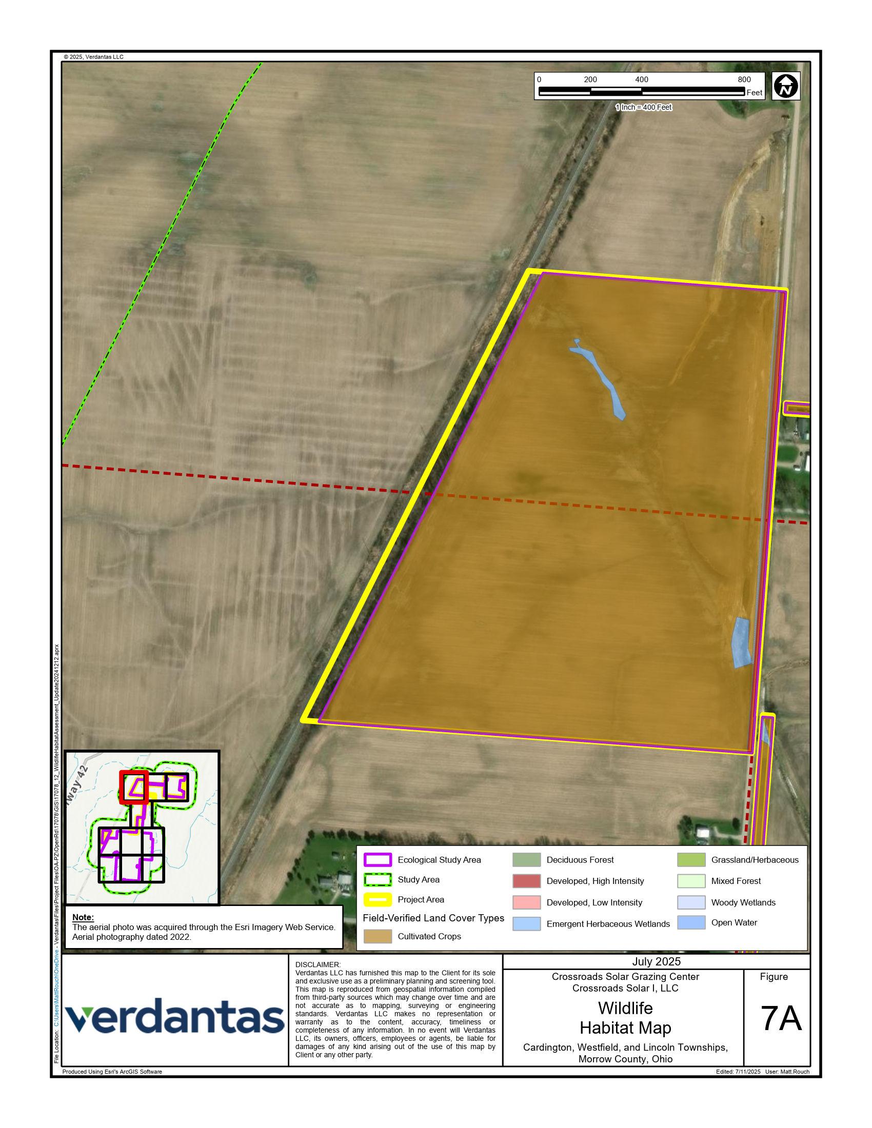
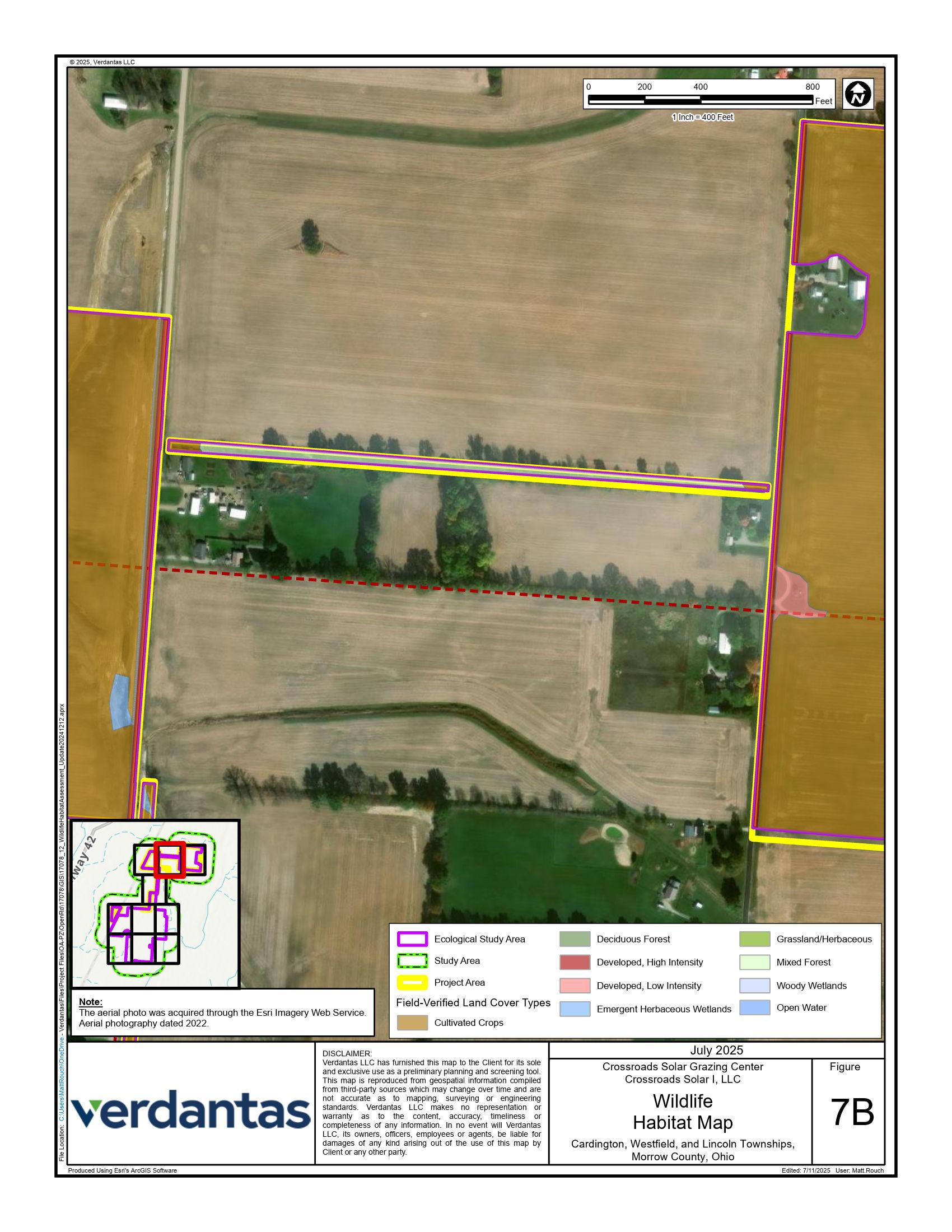
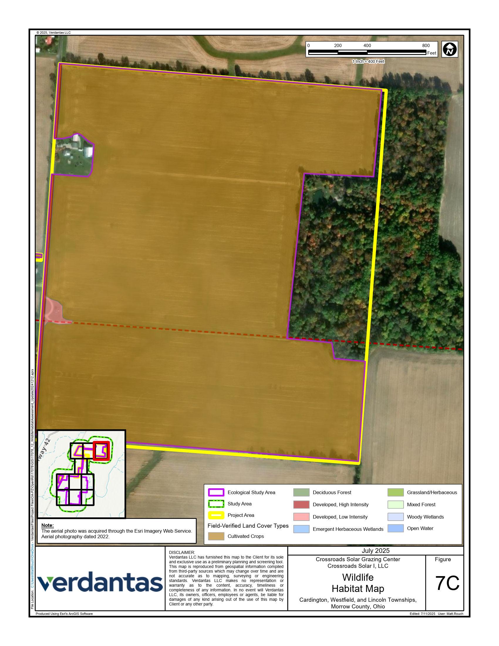
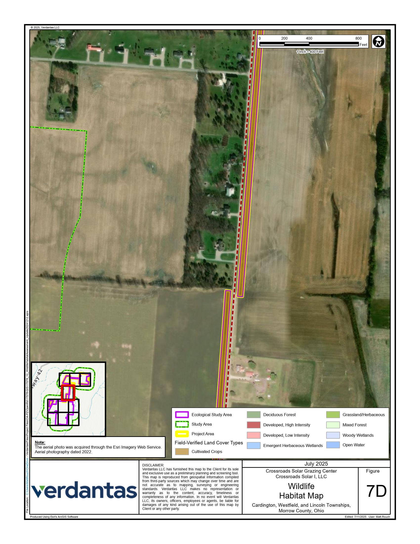
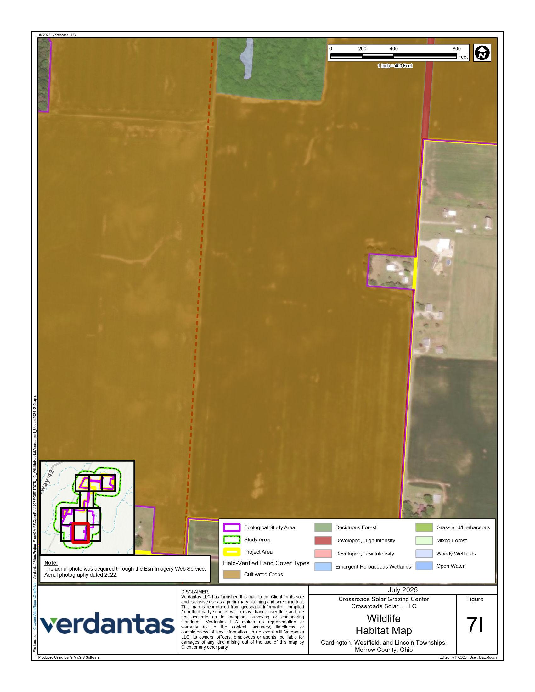
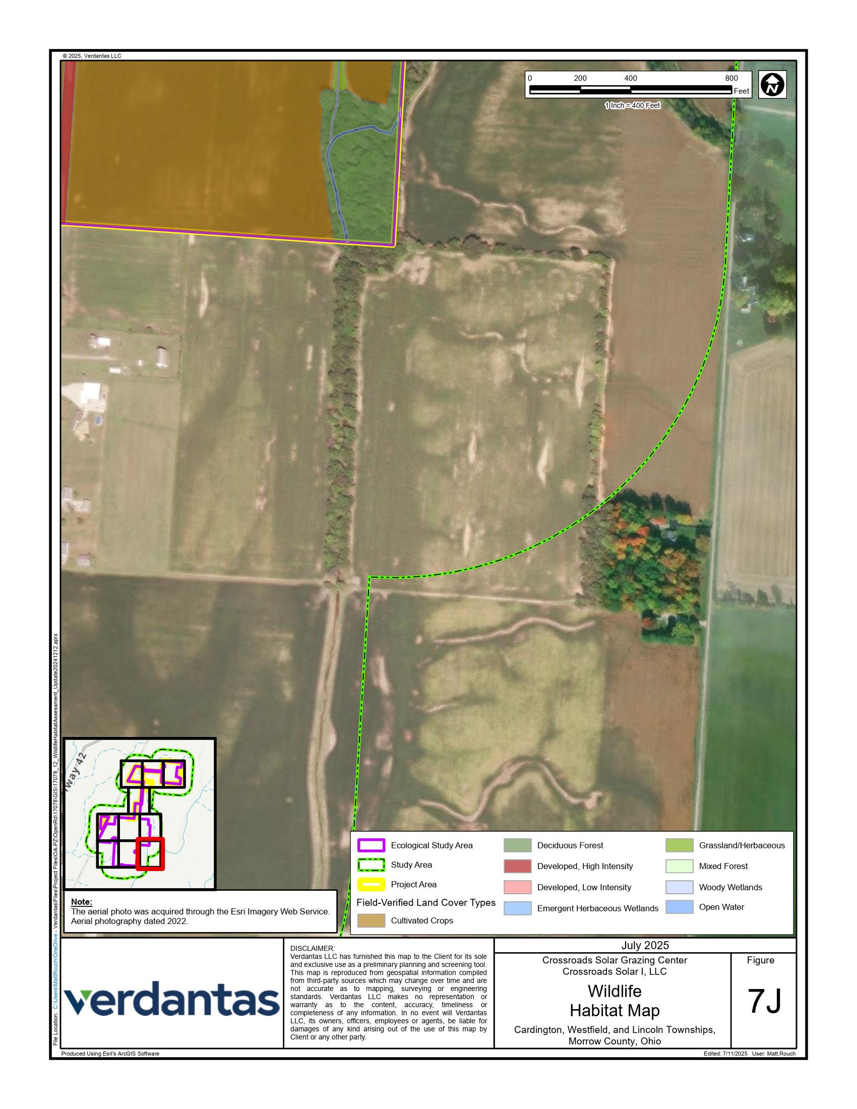
A field survey was conducted within a 694.1-acre boundary which included constructable portions of the Project Area (hereafter referred to as the “Ecological Study Area”) on April 19th and November 18th, 2024. In total, 9 habitats were identified within the Ecological Study Area (Figure 7). Representative photographs of each habitat type are provided in Appendix E.
4.1 Vegetative Community
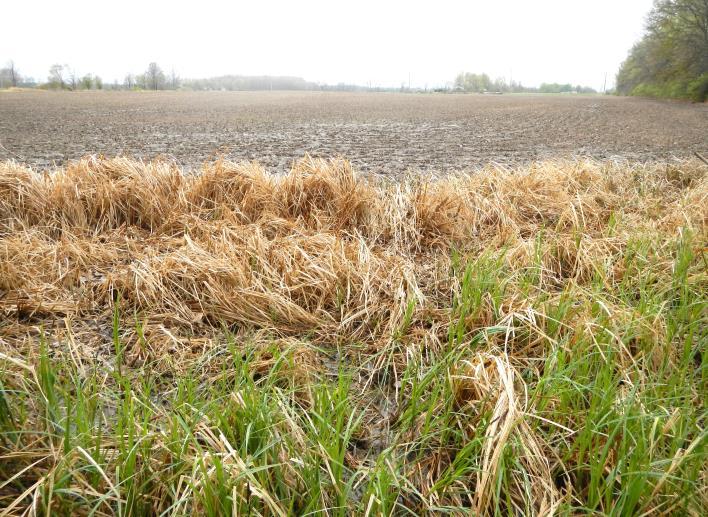
The results of the field survey were generally consistent with the results of the desktop assessment (Table 4). Cultivated crops are the dominant landcover (93 9 %).
Table 4 Field-Verified Land Cover Types within the Ecological Study Area
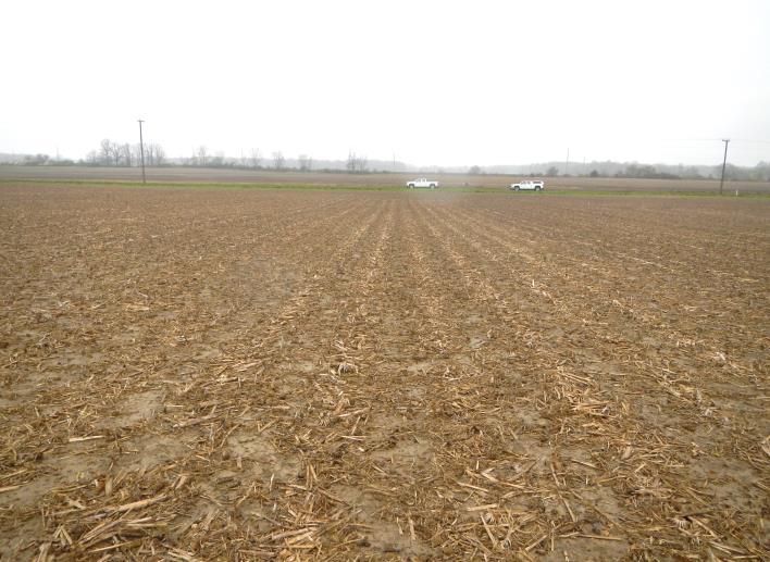
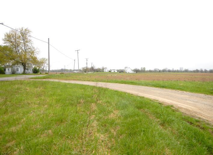
4.1.1 Agricultural Lands
The dominant land cover within the Ecological Study Area is active crop land. The most commonly encountered crops were corn (Zea mays) and soybeans (Glycine max).
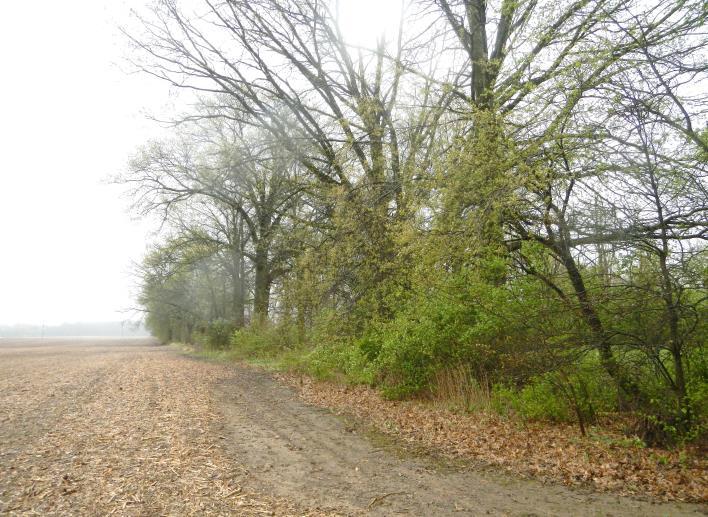
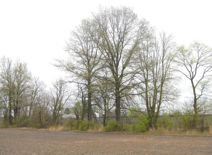
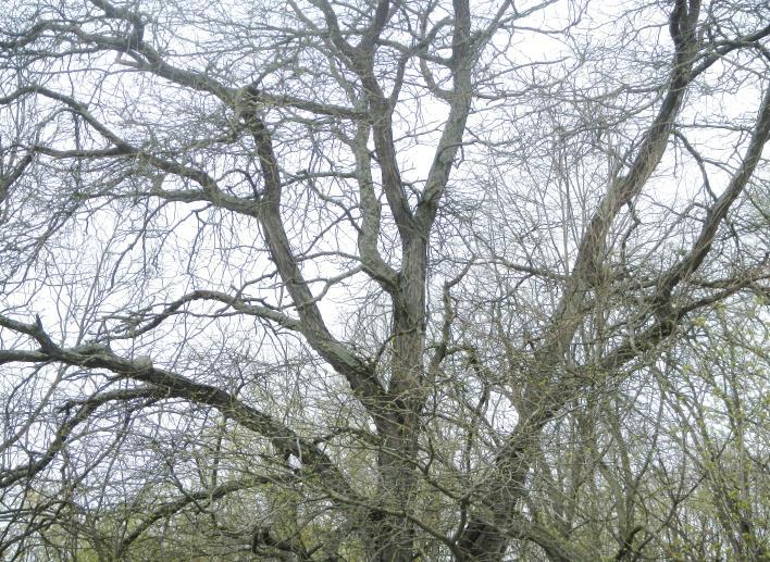
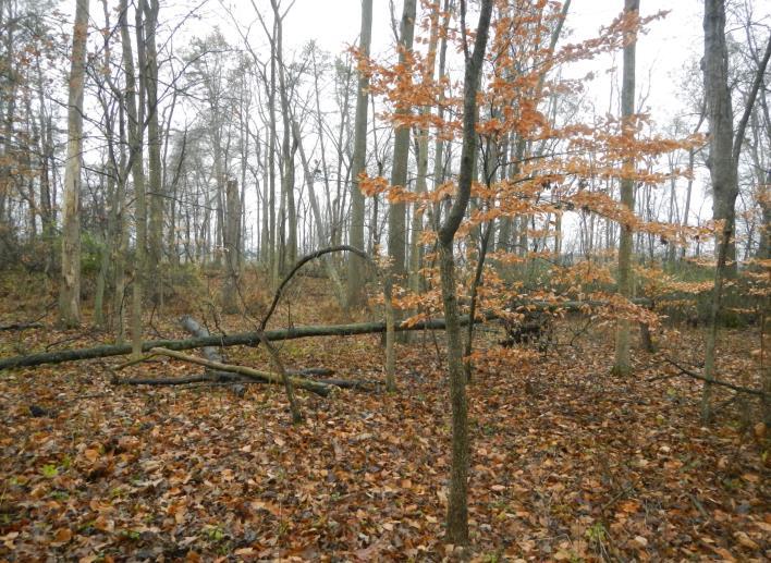
4.1.2 Forests, Hedgerows, and Woodlots
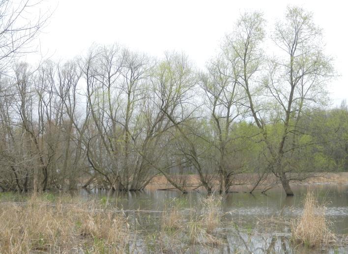
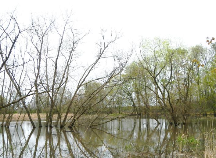
Tree lines and woodlots were sparse within the Ecological Study Area and consisted of both upland and wetland woods. Deciduous and mixed hardwood forest in upland areas supported shagbark hickory (Carya ovata), silver maple (Acer saccharinum), red oak (Quercus rubra), and white pine (Pinus strobus) in the over- and mid-stories. The understories tended to be dominated by invasive species such as bush honeysuckle (Lonicera spp.) and multiflora rose (Rosa multiflora). Woody wetlands consisted of black willow (Salix nigra), silver maple (Acer
saccharinum), and silky dogwood (Cornus amomum). Herbaceous layers were generally sparse to absent.
4.1.3 Potential Roost Trees
Within the Ecological Study Area, potential roost trees (PRTs) were observed in low to moderate density along tree lines. These trees are less than 1,000 feet from forests/woodlots, have a diameter at breast height (DBH) greater than or equal to 3 inches, and have shaggy/flaking bark, deep crevices, and/or snags. Several trees were shagbark hickories (Carya ovata), and others were standing dead snags.
4.1.4 Wetlands and Streams
Three (3) wetlands were identified within the Ecological Study Area, comprising a total of 0.45 acres. Wetlands were typically associated with streams and supported emergent, scrub-shrub, forested vegetation, or a mixture of more than one type. Two (2) wetlands were evaluated as a Category 2 and the rest were evaluated as Category 1 based on Ohio Rapid Assessment Method scoring (ORAM; Mack, 2001). No potential Category 3 wetlands were identified within the Project Area. Note that concurrence from the Ohio Environmental Protection Agency (Ohio EPA) will be required to confirm these field-identified wetland categories.
Two (2) streams were delineated, comprising 2,827 linear feet within the Ecological Study Area Both streams were determined to be relatively permanent waters with perennial flow regimes. For more information regarding surface water features within the Ecological Study Area, refer to the surface water delineation report for the Project, provided under separate cover.
4.1.5 Open Spaces, Herbaceous, and Developed
Developed low intensity cover was minimal within the Ecological Study Area and regularly maintained, occurring primarily along field edges and within roadway right-of-ways. The dominant species in these areas included tall fescue (Lolium pratense), meadow fescue (Festuca pratensis), perennial ryegrass (Lolium perenne), Kentucky bluegrass (Poa pratensis), and white clover (Trifolium repens). The Project Area supported some high intensity developed space in the form of roadways
4.2 Biological Resources
Verdantas ecologists generated a comprehensive list of the wildlife encountered during field surveys (Table 5). Wildlife species were typical of the region and most frequently encountered along the edges of agricultural fields, the interior of woodlots, and utilizing surface water features.
No subsurface openings or potential winter hibernacula for Indiana bat, northern long-eared bat, or tricolor bat were observed within the Project Area.
Table 5 Comprehensive list of wildlife encountered during field surveys for the Crossroads Solar Site.
Common Name (Scientific Name)
Frequency Observed1
Habitat
Field Notes Mammals
Eastern fox squirrel (Sciurus niger) Commonly
Eastern grey squirrel (Sciurus carolinensis) Commonly
North American deer mouse (Peromyscus maniculatus) Occasionally
Virginia opossum (Didelphis virginiana) Rarely
Raccoon (Procyon lotor) Commonly
White-tailed deer (Odocoileus virginianus) Commonly
Groundhog/Woodchuck (Marmota monax) Rarely
Eastern cottontail rabbit (Sylvilagus floridanus) Commonly
Birds
Cooper’s hawk (Astur cooperii) Rarely
Wooded areas 10 to 20 acres or greater that are interspersed with large agricultural tracts. Observed
Wooded areas containing middle-aged and mature hardwoods.
Inhabits most upland habitats in Ohio, including forests, grasslands, scrubshrub, and agricultural fields.
Areas with a variety of land cover types, including woods, wetlands, and farmland.
Commonly found in wooded areas with large trees and water close by. In Ohio, the population is growing, and racoons can live nearly anywhere there is food and shelter available.
Prefer areas supporting a variety of land cover types and food sources, including a mix of forest, scrub-shrub, and cropland.
Open grasslands, pastures, and woodlands. Burrows in forests, brush along fencerows, or along streambanks.
Prefer open fields with tall grass, bordered by thickets or brush. Found in urban areas as well.
Deciduous and mixed forests with tall trees. Along rivers and swamps.
Observed
Observed
Roadkill Only
Tracks Only
Observed
Skeleton and burrows Only
Observed
Observed
Common Name (Scientific Name)
Frequency Observed1
House sparrow (Passer domesticus) Commonly
Red-bellied woodpecker (Melanerpes carolinus) Rarely
Killdeer (Charadrius vociferus) Commonly
Robin (Turdus migratorius) Commonly
Carolina Wren (Thryothorus ludovicianus) Commonly
Turkey vulture (Cathartes aura) Occasionally
Red-winged blackbird (Agelaius phoeniceus) Commonly
Northern cardinal (Cardinalis cardinalis) Commonly
Blue jay (Cyanocitta cristata) Commonly
Mourning dove (Zenaida macroura) Occasionally
Tufted titmouse (Baeolophus bicolor) Occasionally
Song sparrow (Melospiza melodia) Commonly
Brown thrasher (Toxostoma rufum) Rarely
Mallard (Anas platyrhynchos) Rarely
Habitat Field Notes
Introduced species associated with man-made disturbance, particularly near buildings. Found in both urban areas and agricultural landscapes. Observed
Forests, woodlots, and parks. Observed
Found on sparsely vegetated open ground, and in parks, lawns, driveways, golf courses, parking lots, gravel covered roofs, pastures, fields, sandbars, and mudflats.
Observed
Open woodlands, lawns, fields, and parks. Observed
Wooded areas in forest ravines and neighborhoods. Observed
Deciduous forests and woodlands. Observed
Open habitats including roadsides, meadows, and wetlands. Observed
Mixed habitat including woodlands, brush, and forest edges. Observed
Wooded areas, parks, and suburbs. Observed
Rural and suburban residential areas, shrubbery, shade trees, farmland, fencerows, and edges of woodlots. Observed
Forests, woodlots, parks, and neighborhoods. Observed
Gardens, woodland borders, and roadsides. Observed
Thickets, hedgerows, forest edges, and shrubbery. Observed
Wetlands, farm ditches, streams, lakes, ponds. Observed
Common Name (Scientific Name)
Blue-winged teal (Anas discors)
Red tailed hawk (Buteo jamaicensis)
Frequency Observed1
Rarely
Rarely
American crow (Corvus brachyrhynchos) Commonly
Canada goose (Branta canadensis) Rarely
American pipit (Anthus rubescens)
Rarely
Field sparrow (Spizella pusilla) Commonly
Northern flicker (Colaptes auratus) Occasionally
Brown headed cowbird (Molothrus ater) Occasionally
Reptiles and Amphibians
Habitat
Field Notes
Large wetlands, ponds, and small lakes with emergent vegetation. Observed
Woodlands, fields, plains, and deserts. Observed
Open fields and trees. Observed
Large lakes and marshes. Observed
Plains, meadows, agricultural fields, and wheat fields. Observed
Gardens, woodland borders, and roadsides. Observed
Open habitats near trees, including woodlands, yards, edges, and parks. Observed
Occupies all habitats except dense woods. Observed
Snake Rarely NA
Green frog (Lithobates clamitans melanota) Occasionally
Dead Only. Not in an identifiable condition.
Near bodies of water such as ponds, road-side ditches, lakes, swamps, streams, and vernal pools. Observed
1Qualtitative designation of frequently, occasionally, commonly, or abundantly based on frequency of encounters during field surveys.
5. Special Status Species Assessment
Based on the results of the desktop assessment and literature survey, 22 special status species were identified as targets for more detailed review. The field surveys focused on identifying potentially suitable habitat for target species and other wildlife resources. Table 6 provides a summary of the target species, the results of field surveys, and recommendations provided through agency coordination.
Table 6. Summary of Special Status Species with the Potential to Occur in the Vicinity of the Ecological Study Area.
Common Name (Scientific Name)
Listing Status1 Preferred Habitat Summary
Birds
Bald eagle (Haliaeetus leucocephalus)
Northern harrier (Circus hudsonius)
BGEPA Marshes, swamps, and river systems throughout Ohio. Generally found nesting within two miles of large bodies of water supporting food sources.
SE A common migrant and winter species, nesting harriers are rare. Occasionally breed in large marshes and grasslands and nest in loose colonies. The stick nest is built on the ground, often on top of a mound. Harriers hunt over grasslands.
Potentially Suitable Habitat in Ecological Study Area? Habitat Comments
No
Yes
There are no suitable woodlots within the Ecological Study Area that are within proximity of open water.
Potential habitat exists within the Ecological Study Area consisting of developed, low intensity habitat, emergent herbaceous wetlands, and grassland/herbaceous habitat (Figures 7 and 8A8J).
The ODNR DOW recommends construction should be avoided in this habitat during the species’ nesting period of April 15 through July 31.
Fish
Iowa darter (Etheostoma exile)
Lake chubsucker (Erimyzon sucetta)
SE Found in clear, slow moving vegetated streams and weedy areas of glacial lakes, marshes, and ponds. During April and May, spawning occurs in sandy areas or beneath stream banks.
ST Found in fairly clear lakes, stillwater lakes, swamp like areas of lakes, and marshy streams with cobble, sand, boulder, mud, or silt bottoms.
Yes
Yes
Potential habitat for both fish species exists within the Ecological Study Area consisting of open water in West Branch Alum Creek (Stream 2) (Figures 7 and 8A-8J).
The ODNR DOW recommends no in-water work in perennial streams from March 15 through June 30 to reduce impacts to indigenous aquatic species and their habitat.
Common Name (Scientific Name)
Mammals
Indiana bat (Myotis sodalis)
Listing Status1
Little brown bat (Myotis lucifugus)
Northern long-eared bat
(Myotis septentrionalis)
Preferred Habitat Summary
Tricolored bat (Perimyotis subflavus)
FE, SE Winter hibernacula include caves or abandoned mines. Summer roosting habitat for IBAT includes forests, woodlots, and wooded corridors containing potential roost trees (trees or snags >=5 inches DBH with cracks, crevices, exfoliating bark, or hollows. Foraging habitat includes forest stands, and adjacent habitats like wetlands, field edges, old fields, pastures, and large tracts of early successional forest.
SE Winter hibernacula include caves and mines. Summer roosting habitat includes roost trees (>=10 cm DBH), artificial structures, bat houses, under rocks, and in piles of wood. Foraging habitat includes woodlands near water, as well as over bodies of water and along the edge of lakes.
FE, SE Winter hibernacula include caves or abandoned mines. Summer roosting habitat for NLEB includes forests, woodlots, and wooded corridors containing potential roost trees (trees or snags ≥ 3 inches DBH with cracks, crevices, exfoliating bark, or hollows. Foraging habitat includes forest stands, and adjacent habitats like wetlands, field edges, old fields, pastures, and large tracts of early successional forest.
FPE, SE Winter hibernacula include caves, abandoned mines, or tunnels. Summer roosting habitat for tricolored bat includes forests, woodlots, and wooded corridors containing potential roost trees (trees or snags >=4 inches DBH with suitable nesting substrates like dead leaves, Spanish moss, and beard lichen. Foraging habitat includes forest edges, and adjacent habitats like wetlands, field edges, old fields, and pastures.
Potentially Suitable Habitat in Ecological Study Area?
Habitat Comments
Yes Potentially suitable summer roosting habitat exists within the Ecological Study Area consisting of deciduous forests and mixed forests (Figures 7 and 8A-8J). Potentially suitable winter hibernaculum does not exist within the Ecological Study Area.
Yes
Yes
The USFWS and ODNR DOW recommend clearing of potential summer roosting habitat occur between October 1 and March 31, unless a summer presence-absence survey is performed, to reduce impacts to bat species
Yes
Common Name (Scientific Name)
Mollusks
Salamander mussel (Simpsonaias ambigua)
Listing Status1 Preferred Habitat Summary
Insects
Monarch butterfly (Danaus plexippus)
FPE
Inhabits the state’s rivers, creeks, and large lakes. According to the Freshwater Mussels of Ohio Field Guide (ODNR, 2022), there are no records from Morrow County.
Potentially Suitable Habitat in Ecological Study Area?
Habitat Comments
FPT Old fields, prairies, meadows, grasslands and along roadsides.
Yes Potential habitat for this species exists within the Ecological Study Area consisting of open water in West Branch Alum Creek (Stream 2) (Figures 7 and 8A-8J).
The USFWS indicated that proposed critical habitat for this species does not overlap the Project.
The ODNR DOW states the Project shall not impact native mussel species as all native freshwater mussels are protected by the State of Ohio. If impacts are proposed to waterway which contains mussels, a mussel salvage and relocation survey must be coordinated with ODNR and performed prior to in-water work.
Yes Potential habitat exists within the Ecological Study Area consisting of developed, low intensity habitat and grassland/herbaceous habitat (Figures 7 and 8A-8J).
1 FE = ESA-listed Endangered; FPE = ESA-proposed Endangered; FPT = ESA-proposed threatened; FT = ESA-listed Threatened; SE = State-listed Endangered; ST = State-listed Threatened; SC = State Species of Concern; BGEPA = Bald and Golden Eagle Protection Act
6. Species of Commercial and Recreational Importance
Several species of commercial and recreational importance were observed during field surveys, in particular white-tailed deer and a variety of songbirds.
White-tailed deer are recreationally hunted in Morrow County. While movement of deer may alter slightly due to exclusion from the Facility, Project avoidance of and minimization of impacts to forest stands and wetlands will maintain valuable wildlife corridors to facilitate deer movement. Further, the Project is designed with appropriate setbacks which can also function as corridors for movement. While a small loss of habitat may occur due to exclusion from the array areas, the loss is minimal when taken in context with the surrounding landscape.
Birdwatchers engage in recreational observation of songbirds. Nearby birding hotspots were identified during the desktop survey, and songbirds were observed during field surveys. There are no National Audubon Society IBAs within the Study Area. Verdantas understands where feasible, the Project plans to incorporate native flowering forb species into landscape screening areas outside of the fence line to support pollinators. These areas will provide some nesting and foraging habitat for insects and birds. Birds may also use the interior of the Facility, which will be planted as pasture, as foraging habitat.
Finally, pastureland may provide habitat to species that were previously using the agricultural fields. Increased ground cover; decreased seasonal disturbances; as well as decreased frequency of application and amounts of pesticides, herbicides, and fertilizers will increase habitat quality compared to cropland.
7. Conclusions
Verdantas performed a desktop assessment and literature survey, followed by a field survey conducted on April 19th and November 18th , 2024. In total, nine (9) land use types were documented within the Ecological Study Area. Cultivated crops dominated the landscape. Forests, wetlands, and developed spaces were present in small quantities throughout the Project Area.
Wildlife encountered during fieldwork was consistent with the common assemblage of species expected in a predominantly agricultural landscape in central Ohio. Potentially suitable habitat for some special status species was observed within the Ecological Study Area. No special status species were observed at the time of survey. No subsurface openings or potential bat hibernacula were observed during field surveys. Few potential roost trees were observed in wooded fencerows and upland forests.
The following summary of ODNR and USFWS guidance, and findings relevant to the guidance, should reduce the potential for impacts to biological resources within the Project Area:
• The ODNR DOW recommends tree-cutting only occur from October 1 through March 31, conserving trees with loose, shaggy bark and/or crevices, holes, or cavities, as well as trees with DBH ≥ 20, if possible. If trees must be cut during the summer months, then the DOW recommends a mist net survey or acoustic survey be conducted between June 1 and August 15, prior to any cutting. Mist net and acoustic surveys should be conducted in accordance with the most recent version of the Ohio Division of Wildlife Guidance for Bat Surveys and Tree Clearing (ODNR, 2023). If listed bats are documented, DOW recommends cutting only occur from October 1 through March 31.
• The USFWS also recommends implementation of seasonal tree-clearing of all trees with DBH >3 inches between October 1 and March 31 only to avoid adverse effects to listed bat species. If trees must be cut during the summer months, then the USFWS also recommends a summer mist net or acoustic survey be conducted prior to clearing to establish listed species absence.
o Verdantas understands Crossroads plans to avoid impacts to forest stands, but some tree trimming and clearing of field borders and along easement corridors may occur. Potential roost trees within 1,000 feet of a woodlot, and within hedgerows, forest edges, and buffer strips, were identified as part of the Wildlife and Habitat Assessment field survey. No hibernacula were identified during field surveys If tree clearing is required, Crossroads is expected to abide by the recommended time of year restriction (TOYR).
• The ODNR DOW recommends that impacts to streams, wetlands and other water resources be avoided and minimized to the extent possible, and that BMPs be utilized to minimize erosion and sedimentation.
o The locations of surface water features were delineated. For more information, refer to the surface water delineation report for the Project.
o Crossroads plans to minimize impacts to surface water features to the maximum extent practicable, and BMPs will be used to minimize erosion and sedimentation.
• Per the Ohio Mussel Survey Protocol, all Group 2, 3, and 4 streams require a mussel survey. Group 1 streams and unlisted streams with a watershed of five square miles or larger above the point of impact should be assessed using the Reconnaissance Survey for Unionid Mussels to determine if mussels are present. Mussel surveys may be recommended for these streams as well. If in-water work is planned in any stream that
meets any of the above criteria, the DOW recommends that the applicant provide information to indicate no mussel impacts will occur, otherwise, a professional malacologist should conduct a mussel survey in accordance with the Ohio Mussel Survey Protocol. If mussels that cannot be avoided are found, the DOW recommends a professional malacologist collect and relocate the mussels to suitable and similar habitat upstream of the project site.
o Stream 2 (West Branch Alum Creek) is a suitable size to harbor freshwater mussels (6.7 sq mile drainage area) A mussel survey is recommended before inwater work in this stream.
• The DOW recommends no in-water work in perennial streams from March 15 through June 30 to reduce impacts to indigenous aquatic species and their habitat, including the Iowa darter and lake chubsucker.
o Impacts to perennial streams will be minimized to the maximum extent possible. If impacts to perennial streams are unavoidable, Crossroads is expected to abide by the recommended TOYR or apply for an In-Water Work Exclusion Dates Waiver.
• The DOW recommends that if grasslands and large marshes will be impacted, construction should be avoided in this habitat during the northern harrier’s nesting period of April 15 through July 31.
o Impacts to grasslands which may provide suitable northern harrier habitat will be minimized to the maximum extent practicable. Verdantas understands that any unavoidable impacts to potential northern harrier habitat will be performed in accordance with the DOW nesting period TOYR.
Refer to Appendix C and D for the complete set of guidance and correspondence with ODNR and USFWS. Based on the findings of the field survey and the agency recommendations, it is unlikely that significant impacts to state or ESA-listed species will occur.
Likewise, impacts to species of commercial and recreational importance will be negligible. Avoidance of sensitive natural resources, such as wildlife corridors, combined with the installation of a diverse assemblage of plant species in a previously monoculture landscape will provide a slight ecological uplift to wildlife within the vicinity of the Project.
8. References
Cornell Lab of Ornithology. 2024. eBird. Available at: https://ebird.org/home Last accessed: February 9, 2024.
Federal Emergency Management Agency. 2024. National Flood Hazard Layer. Last accessed: May 22, 2024.
Mack, John J. 2001. Ohio Rapid Assessment Method for Wetlands v. 5.0, User’s Manual and Scoring Forms. Ohio EPA Technical Report WET/2001-1. Ohio Environmental Protection Agency, Division of Surface Water, 401/Wetland Ecology Unit, Columbus, Ohio.
Multi-Land Resolution Land Characteristics Consortium. 2021. National Land Cover Database. Last accessed: May 22, 2024.
National Audubon Society (NAS). 2024. Important Bird Areas Information Hub. Available at: https://gis.audubon.org/portal/apps/sites/?_gl=1*e4ubyo*_ga*NDA3MjIxNTYzLjE2ODk3 MDMyOTc.*_ga_X2XNL2MWTT*MTY4OTk2MTAzMy4zLjAuMTY4OTk2MTAzNi41Ny4w LjA.#/nas-hub-site Last accessed: February 9, 2024.
Ohio Department of Natural Resources (ODNR). 1998. Physiographic Regions of Ohio.
Ohio Department of Natural Resources (ODNR). 2022. Freshwater Mussels of Ohio Field Guide. Available at: https://ohiodnr.gov/static/documents/wildlife/backyardwildlife/Pub+5517+-+Freshwater+Mussels+of+Ohio+R1022.pdf Last accessed: July 21, 2023.
Ohio Department of Natural Resources (ODNR). 2023a. Morrow County State Listed Plant Species. Available at: https://ohiodnr.gov/static/documents/naturalareas/species/Morrow.pdf Last accessed: March 3, 2024.
Ohio Department of Natural Resources (ODNR). 2023b. Hunting Resources by Species. Available at: https://ohiodnr.gov/discover-and-learn/education-training/wild-ohio-harvestcommunity/hunting-resources-species Last accessed: May 21, 2024.
Ohio Department of Natural Resources (ODNR). 2023c. Morrow County State Listed Animal Species. Available at: https://ohiodnr.gov/static/documents/wildlife/state-listedspecies/morrow.pdf Last accessed: March 3, 2024.
Ohio Department of Natural Resources (ODNR). 2023. Ohio Division of Wildlife and U.S. Fish and Wildlife Service (OH-Field Office) Joint Guidance for Bat Surveys and Tree Clearing. Available at: https://ohiodnr.gov/static/documents/wildlife/permits/2023+State+Bat+Survey+Guidance. pdf Last accessed: June 10, 2024.
Soil Survey Staff, Natural Resources Conservation Service, United States Department of Agriculture. 2024. Web Soil Survey. Available at: http://websoilsurvey.nrcs.usda.gov Last accessed: May 22, 2024.
U.S. Fish and Wildlife Service (USFWS). 2024. National Wetlands Inventory. U.S. Fish and Wildlife Service, St. Petersburg, FL. Last accessed: May 22, 2024.
U.S. Fish and Wildlife Service (USFWS). 2024. Information for Planning and Consultation. Available at: https://ipac.ecosphere.fws.gov/ Last accessed: March 6, 2024.
U.S. Geological Survey (USGS). 1963. Topographical quadrangle maps (7.5-minute series). Ashley, Ohio quadrangle. U.S. Department of the Interior. Washington, D.C.
U.S. Geological Survey (USGS). 2024. National Hydrography Dataset. Last accessed: May 22, 2024.
9. Signatures Of Environmental Professionals
I declare that, to the best of my professional knowledge and belief, I meet the definition of Environmental Professional as defined in §312.10 of 40 CFR 312 and I have the specific qualifications based on education, training, and experience to assess a property of the nature, history, and setting of the Subject Property. I have developed and performed the AAIs in conformance with the standards and practices set forth in 40 CFR Part 312.
Thank you for the opportunity to provide this information. Please contact Verdantas with any questions.

Helena Hayter Ecologist hhayter@verdantas.com
Date: July 10, 2025

Emily Ott Staff Ecologist III eott@verdantas.com

Jordan Rofkar Senior Project Manager jrofkar@verdantas.com
Figures
USFWS IPaC Resource List

United States Department of the Interior
FISH AND WILDLIFE SERVICE
Ohio Ecological Services Field Office 4625 Morse Road, Suite 104 Columbus, OH 43230-8355
Phone: (614) 416-8993 Fax: (614) 416-8994

In Reply Refer To:
Project Code: 2025-0088327
Project Name: Crossroads Solar Grazing Center
04/25/2025 12:25:47 UTC
Subject: List of threatened and endangered species that may occur in your proposed project location or may be affected by your proposed project
To Whom It May Concern:
The enclosed species list identifies threatened, endangered, proposed and candidate species, as well as proposed and final designated critical habitat, that may occur within the boundary of your proposed project and/or may be affected by your proposed project. The species list fulfills the requirements of the U.S. Fish and Wildlife Service (Service) under section 7(c) of the Endangered Species Act (Act) of 1973, as amended (16 U.S.C. 1531 et seq.).
New information based on updated surveys, changes in the abundance and distribution of species, changed habitat conditions, or other factors could change this list. Please feel free to contact us if you need more current information or assistance regarding the potential impacts to federally proposed, listed, and candidate species and federally designated and proposed critical habitat. Please note that under 50 CFR 402.12(e) of the regulations implementing section 7 of the Act, the accuracy of this species list should be verified after 90 days. This verification can be completed formally or informally as desired. The Service recommends that verification be completed by visiting the IPaC website at regular intervals during project planning and implementation for updates to species lists and information. An updated list may be requested through the IPaC system by completing the same process used to receive the enclosed list.
The purpose of the Act is to provide a means whereby threatened and endangered species and the ecosystems upon which they depend may be conserved. Under sections 7(a)(1) and 7(a)(2) of the Act and its implementing regulations (50 CFR 402 et seq.), Federal agencies are required to utilize their authorities to carry out programs for the conservation of threatened and endangered species and to determine whether projects may affect threatened and endangered species and/or designated critical habitat.
A Biological Assessment is required for construction projects (or other undertakings having similar physical impacts) that are major Federal actions significantly affecting the quality of the human environment as defined in the National Environmental Policy Act (42 U.S.C. 4332(2) (c)). For projects other than major construction activities, the Service suggests that a biological
evaluation similar to a Biological Assessment be prepared to determine whether the project may affect listed or proposed species and/or designated or proposed critical habitat. Recommended contents of a Biological Assessment are described at 50 CFR 402.12.
If a Federal agency determines, based on the Biological Assessment or biological evaluation, that listed species and/or designated critical habitat may be affected by the proposed project, the agency is required to consult with the Service pursuant to 50 CFR 402. In addition, the Service recommends that candidate species, proposed species and proposed critical habitat be addressed within the consultation. More information on the regulations and procedures for section 7 consultation, including the role of permit or license applicants, can be found in the "Endangered Species Consultation Handbook" at:
https://www.fws.gov/sites/default/files/documents/endangered-species-consultationhandbook.pdf
Migratory Birds: In addition to responsibilities to protect threatened and endangered species under the Endangered Species Act (ESA), there are additional responsibilities under the Migratory Bird Treaty Act (MBTA) and the Bald and Golden Eagle Protection Act (BGEPA) to protect native birds from project-related impacts. Any activity, intentional or unintentional, resulting in take of migratory birds, including eagles, is prohibited unless otherwise permitted by the U.S. Fish and Wildlife Service (50 C.F.R. Sec. 10.12 and 16 U.S.C. Sec. 668(a)). For more information regarding these Acts, see https://www.fws.gov/program/migratory-bird-permit/whatwe-do.
The MBTA has no provision for allowing take of migratory birds that may be unintentionally killed or injured by otherwise lawful activities. It is the responsibility of the project proponent to comply with these Acts by identifying potential impacts to migratory birds and eagles within applicable NEPA documents (when there is a federal nexus) or a Bird/Eagle Conservation Plan (when there is no federal nexus). Proponents should implement conservation measures to avoid or minimize the production of project-related stressors or minimize the exposure of birds and their resources to the project-related stressors. For more information on avian stressors and recommended conservation measures, see https://www.fws.gov/library/collections/threats-birds.
In addition to MBTA and BGEPA, Executive Order 13186: Responsibilities of Federal Agencies to Protect Migratory Birds, obligates all Federal agencies that engage in or authorize activities that might affect migratory birds, to minimize those effects and encourage conservation measures that will improve bird populations. Executive Order 13186 provides for the protection of both migratory birds and migratory bird habitat. For information regarding the implementation of Executive Order 13186, please visit https://www.fws.gov/partner/council-conservationmigratory-birds.
We appreciate your concern for threatened and endangered species. The Service encourages Federal agencies to include conservation of threatened and endangered species into their project planning to further the purposes of the Act. Please include the Consultation Code in the header of this letter with any request for consultation or correspondence about your project that you submit to our office.
Attachment(s):
Official Species List
OFFICIAL SPECIES LIST
This list is provided pursuant to Section 7 of the Endangered Species Act, and fulfills the requirement for Federal agencies to "request of the Secretary of the Interior information whether any species which is listed or proposed to be listed may be present in the area of a proposed action".
This species list is provided by: Ohio Ecological Services Field Office 4625 Morse Road, Suite 104 Columbus, OH 43230-8355 (614) 416-8993
PROJECT SUMMARY
Project Code: 2025-0088327
Project Name: Crossroads Solar Grazing Center
Project Type: Power Gen - Solar
Project Description: The Crossroads Solar Grazing Center is a combined utility-scale solar energy facility and sheep grazing operation being developed in Morrow County, Ohio. The Project will use rows of ground-mounted solar panels to supply wholesale power to the existing electric grid while also providing pasture for livestock. All of the Project’s above-ground structures will sit within vegetated fields enclosed within agriculturalstyle fences, which also will confine the livestock and protect them from predators. The Project’s above-ground infrastructure will encompass approximately 460 acres within a 468-acre area of study.
Project Location:
The approximate location of the project can be viewed in Google Maps: https:// www.google.com/maps/@40.470252450000004,-82.905249391831,14z
Counties: Morrow County, Ohio
ENDANGERED SPECIES ACT SPECIES
There is a total of 4 threatened, endangered, or candidate species on this species list.
Species on this list should be considered in an effects analysis for your project and could include species that exist in another geographic area. For example, certain fish may appear on the species list because a project could affect downstream species.
IPaC does not display listed species or critical habitats under the sole jurisdiction of NOAA Fisheries , as USFWS does not have the authority to speak on behalf of NOAA and the Department of Commerce.
See the "Critical habitats" section below for those critical habitats that lie wholly or partially within your project area under this office's jurisdiction. Please contact the designated FWS office if you have questions.
1.
NOAA Fisheries, also known as the National Marine Fisheries Service (NMFS), is an office of the National Oceanic and Atmospheric Administration within the Department of Commerce.
MAMMALS
NAME
Indiana Bat Myotis sodalis
There is final critical habitat for this species Your location does not overlap the critical habitat.
Species profile: https://ecos.fws.gov/ecp/species/5949
Tricolored Bat Perimyotis subflavus
No critical habitat has been designated for this species.
Species profile: https://ecos.fws.gov/ecp/species/10515
CLAMS
STATUS
Endangered
Proposed Endangered
NAME STATUS
Salamander Mussel Simpsonaias ambigua
There is proposed critical habitat for this species Your location does not overlap the critical habitat.
Species profile: https://ecos.fws.gov/ecp/species/6208
INSECTS
Proposed Endangered
NAME STATUS
Monarch Butterfly Danaus plexippus
There is proposed critical habitat for this species Your location does not overlap the critical habitat.
Species profile: https://ecos.fws.gov/ecp/species/9743
CRITICAL HABITATS
Proposed Threatened
THERE ARE NO CRITICAL HABITATS WITHIN YOUR PROJECTAREA UNDER THIS OFFICE'S JURISDICTION.
YOU ARE STILL REQUIRED TO DETERMINE IF YOUR PROJECT(S) MAY HAVE EFFECTS ON ALL ABOVE LISTED SPECIES.
IPAC USER CONTACT INFORMATION
Agency: Private Entity
Name: Helena Hayter
Address: 6397 Emerald Parkway, Suite 200
City: Dublin
State: OH
Zip: 43016
Email hhayter@verdantas.com
Phone: 6143624809
LEAD AGENCY CONTACT INFORMATION
Lead Agency: Army Corps of Engineers
Appendix B
State-Listed Animal and Plant Species Lists for Morrow County
Morrow County State Listed Animal Species
Scientific Name
Sandhill Crane
Sora Rail
Cerulean Warbler
Blue-headed Vireo
Western Creek Chubsucker
Lake Chubsucker
Iowa Darter
Blacknose Shiner
Slippershell Mussel
Wavy-rayed Lampmussel
Creek Heelsplitter
Round Pigtoe
Kidneyshell
Rainbow
Antigone canadensis
Porzana carolina
Setophaga cerulea
Vireo solitarius
Erimyzon claviformis
Erimyzon sucetta
Etheostoma exile
Notropis heterolepis
Alasmidonta viridis
Lampsilis fasciola
Lasmigona compressa
Pleurobema sintoxia
Ptychobranchus fasciolaris
Villosa iris

Group
Common Name State
Bird
Bird
Bird
Bird
Fish
Fish
Fish
Fish
Mollusk
Mollusk
Mollusk
Mollusk
Mollusk
Mollusk
Data from the Ohio Natural Heritage Database
Species reported extant in county since 1980
6/23/2023
Threatened
Species of Concern
Species of Concern
Special Interest
Species of Concern
Threatened
Endangered
Endangered
Threatened
Species of Concern
Species of Concern
Species of Concern
Species of Concern
Species of Concern

Absence of a species on this list does not indicate absence from the county. The information contained in this list does not represent coordination with ODNR or fulfill NEPA or other federal/state requirements. All federally and/or state listed bat species have ranges that encompass the entire state and are not included on county lists. For further information on current listed species, please use the following link:
State Listed Species | Ohio Department of Natural Resources (ohiodnr.gov)
Appendix C
Agency Correspondence with USFWS

United States Department of the Interior FISH AND WILDLIFE SERVICE
Ecological Services
4625 Morse Road, Suite 104 Columbus, Ohio 43230 (614) 416-8993 / FAX (614) 416-8994
February 6, 2024
Project Code: 2024-0025893
Dear Emily Ott:
The U.S. Fish and Wildlife Service (Service) has received your recent correspondence requesting information about the subject proposal. We offer the following comments and recommendations to assist you in minimizing and avoiding adverse impacts to threatened, endangered, and proposed species pursuant to the Endangered Species Act of 1973 (16 U.S.C. 1531 et seq), as amended (ESA).
Federally Threatened and Endangered Species: The endangered Indiana bat (Myotis sodalis) and northern long-eared bat (Myotis septentrionalis) occur throughout the State of Ohio. The Indiana bat and northern long-eared bat may be found wherever suitable habitat occurs unless a presence/absence survey has been performed to document absence. Suitable summer habitat for Indiana bats and northern long-eared bats consists of a wide variety of forested/wooded habitats where they roost, forage, and breed that may also include adjacent and interspersed non-forested habitats such as emergent wetlands and adjacent edges of agricultural fields, woodlots, fallow fields, and pastures. Roost trees for both species include live and standing dead trees ≥3 inches diameter at breast height (dbh) that have any exfoliating bark, cracks, crevices, hollows and/or cavities. These roost trees may be located in forested habitats as well as linear features such as fencerows, riparian forests, and other wooded corridors. Individual trees may be considered suitable habitat when they exhibit the characteristics of a potential roost tree and are located within 1,000 feet of other forested/wooded habitat. Northern long-eared bats have also been observed roosting in human-made structures, such as buildings, barns, bridges, and bat houses; therefore, these structures should also be considered potential summer habitat. In the winter, Indiana bats and northern longeared bats hibernate in caves, rock crevices and abandoned mines.
Federally Proposed Species: On September 14, 2022, the Service proposed to list the tricolored bat (Perimyotis subflavus) as endangered under the ESA. The bat faces extinction due to the impacts of white-nose syndrome, a deadly disease affecting cave-dwelling bats across the continent. During spring, summer, and fall, this species roosts primarily among leaf clusters of live or recently dead trees, emerging at dusk to hunt for insects over waterways and forest edges. While white-nose syndrome is by far the most serious threat to the tricolored bat, other threats now have an increased significance due to the dramatic decline in the species' population. These threats include disturbance to bats in roosting, foraging, commuting, and over-wintering habitats. Mortality due to collision with wind turbines, especially during migration, has also been documented across their range Conservation measures for the Indiana bat and northern long-eared bat will also help to conserve the tricolored bat.
Seasonal Tree Clearing for Federally Listed Bat Species: Should the proposed project site contain trees ≥3 inches dbh, we recommend avoiding tree removal wherever possible. If any caves or abandoned mines may be disturbed, further coordination with this office is requested to determine if fall or spring portal surveys are warranted. If no caves or abandoned mines are present and trees ≥3 inches dbh cannot be avoided, we recommend removal of any trees ≥3 inches dbh only occur between October 1 and March 31. Seasonal clearing is recommended to avoid adverse effects to Indiana bats and northern long-eared bats.
If implementation of this seasonal tree cutting recommendation is not possible, a summer presence/absence survey may be conducted for Indiana bats and northern long-eared bats. If Indiana bats and northern long-eared bats are not detected during the survey, then tree clearing may occur at any time of the year. Surveys must be conducted by an approved surveyor and be designed and conducted in coordination with the Ohio Field Office. Surveyors must have a valid federal permit. Please note that in Ohio summer mist net surveys may only be conducted between June 1 and August 15.
Section 7 Coordination: If there is a federal nexus for the project (e.g., federal funding provided, federal permits required to construct), then no tree clearing should occur on any portion of the project area until consultation under section 7 of the ESA, between the Service and the federal action agency, is completed. We recommend the federal action agency submit a determination of effects to this office, relative to the Indiana bat and northern long-eared bat, for our review and concurrence. This letter provides technical assistance only and does not serve as a completed section 7 consultation document.
Stream and Wetland Avoidance: Over 90% of the wetlands in Ohio have been drained, filled, or modified by human activities, thus is it important to conserve the functions and values of the remaining wetlands in Ohio (https://epa.ohio.gov/portals/47/facts/ohio_wetlands.pdf). We recommend avoiding and minimizing project impacts to all wetland habitats (e.g., forests, streams, vernal pools) to the maximum extent possible in order to benefit water quality and fish and wildlife habitat. Additionally, natural buffers around streams and wetlands should be preserved to enhance beneficial functions. If streams or wetlands will be impacted, the U.S. Army Corps of Engineers should be contacted to determine whether a Clean Water Act section 404 permit is required. Best management practices should be used to minimize erosion, especially on slopes. Disturbed areas should be mulched and revegetated with native plant species. In addition, prevention of non-native, invasive plant establishment is critical in maintaining high quality habitats.
Due to the project type, size, and location, we do not anticipate adverse effects to any other federally endangered, threatened, or proposed species, or proposed or designated critical habitat. Should the project design change, or additional information on listed or proposed species or their critical habitat become available, or if new information reveals effects of the action that were not previously considered, coordination with the Service should be initiated to assess any potential impacts.
Thank you for your efforts to conserve listed species and sensitive habitats in Ohio. We recommend coordinating with the Ohio Department of Natural Resources due to the potential for the proposed project to affect state listed species and/or state lands. Contact Mike Pettegrew, Environmental Services Administrator, at (614) 265-6387 or at mike.pettegrew@dnr.ohio.gov.
If you have questions, or if we can be of further assistance in this matter, please contact our office at (614) 416-8993 or ohio@fws.gov.
Sincerely,

Scott Hicks Acting Field Office Supervisor
cc: Nathan Reardon, ODNR-DOW
Eileen Wyza, ODNR-DOW


Appendix D
Agency Correspondence with ODNR

December 27, 2024
Mike DeWine, Governor
Jon Husted, Lt. Governor
Mary Mertz, Director
Office of Real Estate & Land Management
Tara Paciorek - Chief 2045 Morse Road – E-2 Columbus, Ohio 43229-6693
Helena Hayter Verdantas
6397 Emerald Parkway, Suite 200 Dublin, Ohio 43016
Re: 24-1879 - Crossroads Solar
Project: The proposed project involves the installation of a utility-scale solar facility.
Location: The proposed project is located in Cardington, Lincoln and Westfield Townships, Morrow County, Ohio.
The Ohio Department of Natural Resources (ODNR) has completed a review of the above referenced project. These comments were generated by an inter-disciplinary review within the Department. These comments have been prepared under the authority of the Fish and Wildlife Coordination Act (48 Stat. 401, as amended; 16 U.S.C. 661 et seq.), the National Environmental Policy Act, the Coastal Zone Management Act, Ohio Revised Code and other applicable laws and regulations. These comments are also based on ODNR’s experience as the state natural resource management agency and do not supersede or replace the regulatory authority of any local, state, or federal agency nor relieve the applicant of the obligation to comply with any local, state, or federal laws or regulations.
Real Estate and Land Management: The Office of Real Estate and Land Management (REALM) has the following comments.
The Ohio Department of Natural Resources (ODNR) Guidance for Proposed Solar Energy Facilities in Ohio should be incorporated into the project design and site development plan. This guidance document was developed by multiple Divisions within the Ohio Department of Natural Resources. The guidance document is non-exhaustive and project recommendations are made on a site-specific basis and may include additional considerations. The incorporation of these conditions will help ensure that the project will result in the minimum adverse environmental impact.
Natural Heritage Database: A review of the Ohio Natural Heritage Database indicates there are no records of state or federally listed plants or animals within one mile of the specified project area Records searched date from 1980.
Please note that Ohio has not been completely surveyed and we rely on receiving information from many sources Therefore, a lack of records for any particular area is not a statement that rare species or unique features are absent from that area
Fish and Wildlife: The Division of Wildlife (DOW) has the following comments.
The DOW recommends that impacts to streams, wetlands and other water resources be avoided and minimized to the fullest extent possible, and that Best Management Practices be utilized to minimize erosion and sedimentation.
The entire state of Ohio is within the range of the Indiana bat (Myotis sodalis), a state endangered and federally endangered species, the northern long-eared bat (Myotis septentrionalis), a state endangered and federally endangered species, the little brown bat (Myotis lucifugus), a state endangered species, and the tricolored bat (Perimyotis subflavus), a state endangered species During the spring and summer (April 1 through September 30), these species of bats predominately roost in trees behind loose, exfoliating bark, in crevices and cavities, or in the leaves However, these species are also dependent on the forest structure surrounding roost trees If trees are present within the project area, and trees must be cut, the DOW recommends cutting only occur from October 1 through March 31, conserving trees with loose, shaggy bark and/or crevices, holes, or cavities, as well as trees with DBH ≥ 20 if possible. If trees are present within the project area, and trees must be cut during the summer months, the DOW recommends a mist net survey or acoustic survey be conducted from June 1 through August 15, prior to any cutting. Mist net and acoustic surveys should be conducted in accordance with the most recent version of the “OHIO DIVISION OF WILDLIFE GUIDANCE FOR BAT SURVEYS AND TREE CLEARING” . If state listed bats are documented, DOW recommends cutting only occur from October 1 through March 31. However, limited summer tree cutting may be acceptable after consultation with the DOW (contact Eileen Wyza at Eileen.Wyza@dnr.ohio.gov).
The DOW also recommends that a desktop habitat assessment is conducted, followed by a field assessment if needed, to determine if a potential hibernaculum is present within the project area. Direction on how to conduct habitat assessments can be found in the current USFWS “RANGE-WIDE INDIANA BAT & NORTHERN LONG-EARED BAT SURVEY GUIDELINES.” If a habitat assessment finds that a potential hibernaculum is present within 0.25 miles of the project area, please send this information to Eileen Wyza for project recommendations If a potential or known hibernaculum is found, the DOW recommends a 0.25-mile tree cutting and subsurface disturbance buffer around the hibernaculum entrance, however, limited summer or winter tree cutting may be acceptable after consultation with the DOW. If no tree cutting or subsurface impacts to a hibernaculum are proposed, this project is not likely to impact these species.
This project must not have an impact on native mussels This applies to both listed and non-listed species, as all species of mussel are protected in Ohio Per the Ohio Mussel Survey Protocol (2022), all Group 2, 3, and 4 streams (Appendix A) require a mussel survey. Per the Ohio Mussel Survey Protocol, Group 1 streams (Appendix A) and unlisted streams with a watershed of 5 square miles or larger above the point of impact should be assessed using the Reconnaissance Survey for Unionid Mussels (Appendix B) to determine if mussels are present. Mussel surveys may be recommended for these streams as well. Therefore, if in-water work is planned in any stream that meets any of the above criteria, the DOW recommends the applicant provide information to indicate no mussel impacts will occur. If this is not possible, the DOW recommends a professional malacologist conduct a mussel survey in the project area. If mussels that cannot be avoided are found in the project area, the DOW recommends a professional malacologist collect and relocate the mussels to suitable and similar habitat upstream of the project site. Mussel surveys and any subsequent mussel relocation should be done in accordance with the Ohio Mussel Survey Protocol. If there is no in-water work proposed, impacts to mussels are not likely.

The project is within the range of the Iowa darter (Etheostoma exile), a state endangered fish, and the lake chubsucker (Erimyzon sucetta), a state threatened fish. The DOW recommends no in-water work in perennial streams from March 15 through June 30 to reduce impacts to indigenous aquatic species and their habitat. If no in-water work is proposed in a perennial stream, this project is not likely to impact these or other aquatic species.
The project is within the range of the northern harrier (Circus hudsonius), a state endangered bird. This is a common migrant and winter species Nesters are much rarer, although they occasionally breed in large marshes and grasslands. Harriers often nest in loose colonies The female builds a nest out of sticks on the ground, often on top of a mound. Harriers hunt over grasslands If this type of habitat will be impacted, construction should be avoided in this habitat during the species’ nesting period of April 15 through July 31 If this habitat will not be impacted, the project is not likely to impact this species.
Due to the potential of impacts to federally listed species, as well as to state listed species, we recommend that this project be coordinated with the US Fish & Wildlife Service.
Water Resources: The Division of Water Resources has the following comment.
If the subject project is in a floodplain regulated by the Federal Emergency Management Agency (FEMA), the local local floodplain administrator should be contacted concerning the possible need for any floodplain permits or approvals The FEMA National Flood Hazard Layer (NHFL) Viewer website can be utilized to see if the project is in a FEMA regulated floodplain. If the project is not in a FEMA regulated floodplain, then no further action is required.
ODNR appreciates the opportunity to provide these comments. Please contact Mike Pettegrew (Environmental Services Administrator) at mike.pettegrew@dnr.ohio.gov if you have questions about these comments or need additional information.
Expiration: ODNR Environmental Reviews are typically valid for 2 years from the issuance date. If the scope of work, project area, construction limits, and/or anticipated impacts to natural resources have changed significantly from the original project submittal, then a new Environmental Review request should be submitted.
Appendix E
Field-Verified Land Cover, Habitat, and Wildlife Photographs

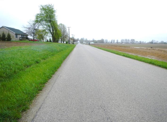
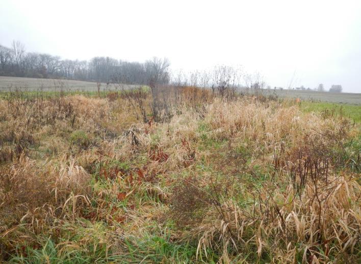
Study Area, facing north.
Crossroads Solar Grazing Center
Crossroads Solar I, LLC

Field-Verified Land Cover, Habitat, and Wildlife Photographs
April 19, 2024
Photo 1: Cultivated crops within the Ecological
Photo 2: Cultivated crops within the Ecological Study Area, facing west.
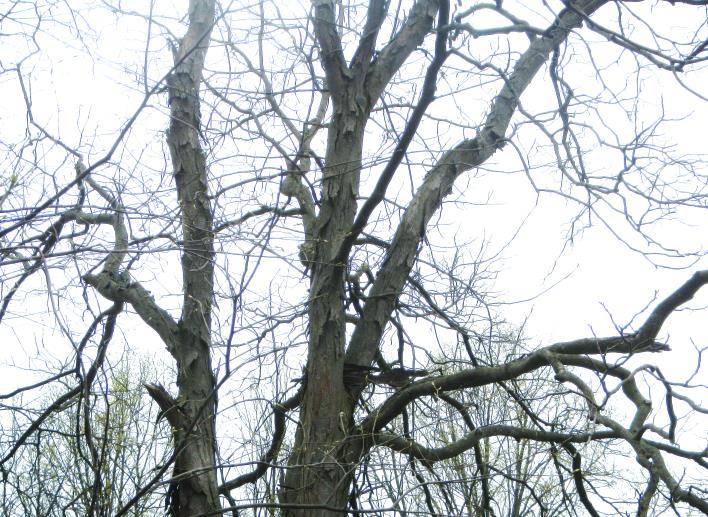
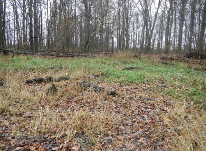
Photo 3: Deciduous forest tree line within the Ecological Study Area, facing northeast.
Photo 4: Deciduous forest tree line within the Ecological Study Area, facing west.
Project Number: 17078
Cardington, Westfield, and Lincoln Townships, Morrow County, Ohio
Field-Verified Land Cover, Habitat, and Wildlife Photographs
April 19, 2024
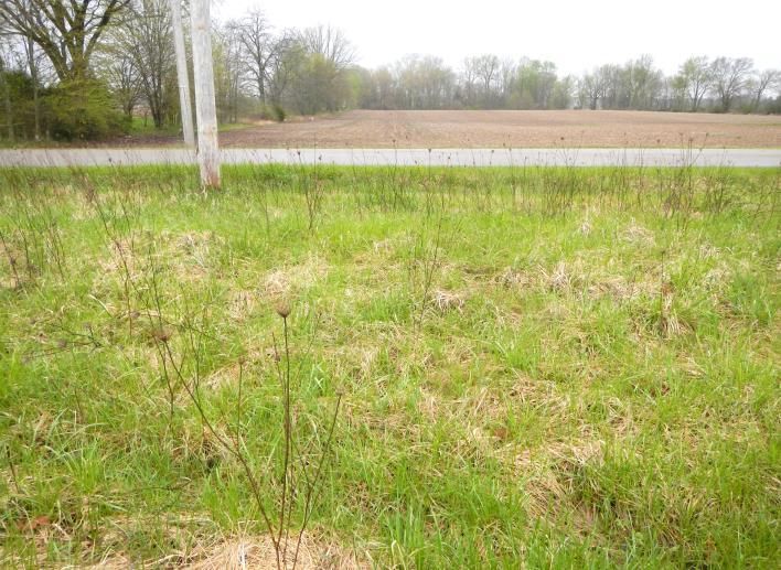
Photo 5: Developed lowintensity land cover within the Ecological Study Area, facing north.
Photo 6: Developed lowintensity land cover within the Ecological Study Area, facing west.
Photo 7: Developed highintensity land cover within the Ecological Study Area, facing north.
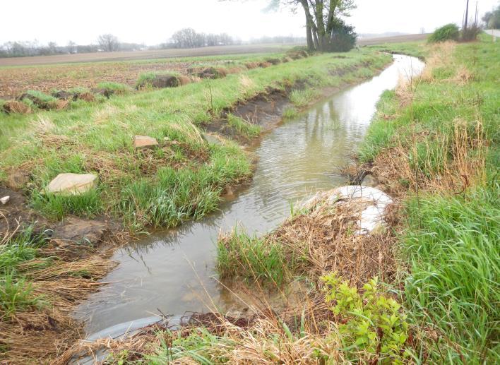
Photo 8: Open water stream within the Ecological Study Area, facing southeast.
Project Number: 17078
Crossroads Solar Grazing Center
Crossroads Solar I, LLC
Cardington, Westfield, and Lincoln Townships, Morrow County, Ohio
Study
Crossroads Solar Grazing Center
Crossroads Solar I, LLC
Field-Verified Land Cover, Habitat, and Wildlife Photographs
April 19, 2024
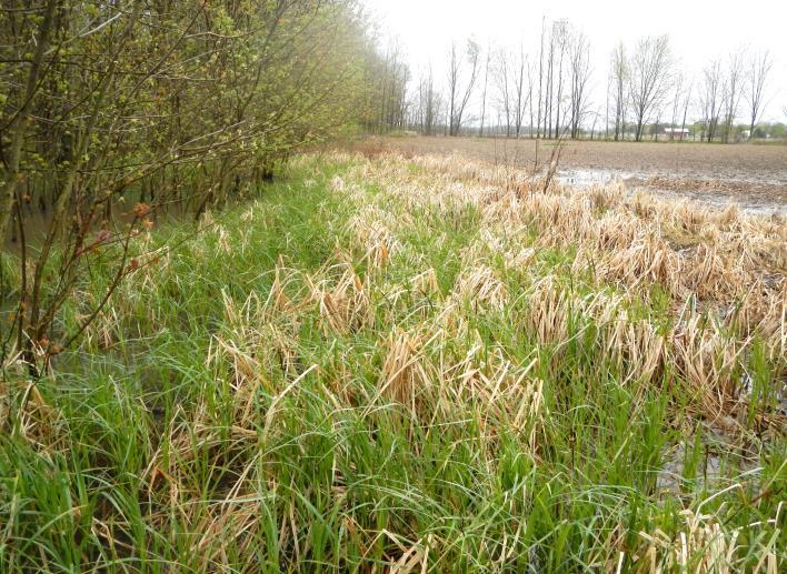
Photo 9: Emergent herbaceous wetlands within the Ecological
Area, facing north.
Photo 10: Emergent herbaceous wetlands within the Ecological Study Area, facing east.
Photo 11: Woody wetlands within the Ecological Study Area, facing southeast.
Photo 12: Woody wetlands within the Ecological Study Area, facing southwest.
Project Number: 17078
Cardington, Westfield, and Lincoln Townships, Morrow County, Ohio
Area.
Crossroads
Field-Verified Land Cover, Habitat, and Wildlife Photographs
April 19, 2024 Project Number: 17078
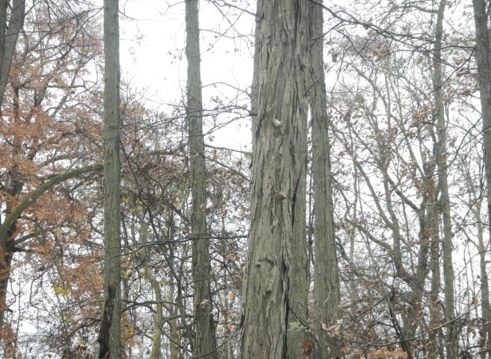
Photo 13: Representative PRT within deciduous forest tree line within the Ecological Study
Photo 14: Representative PRT within deciduous forest tree line within the Ecological Study Area.
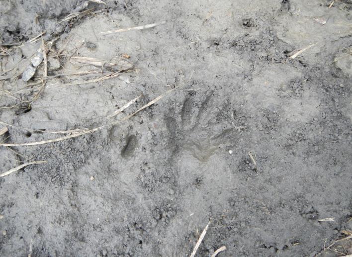
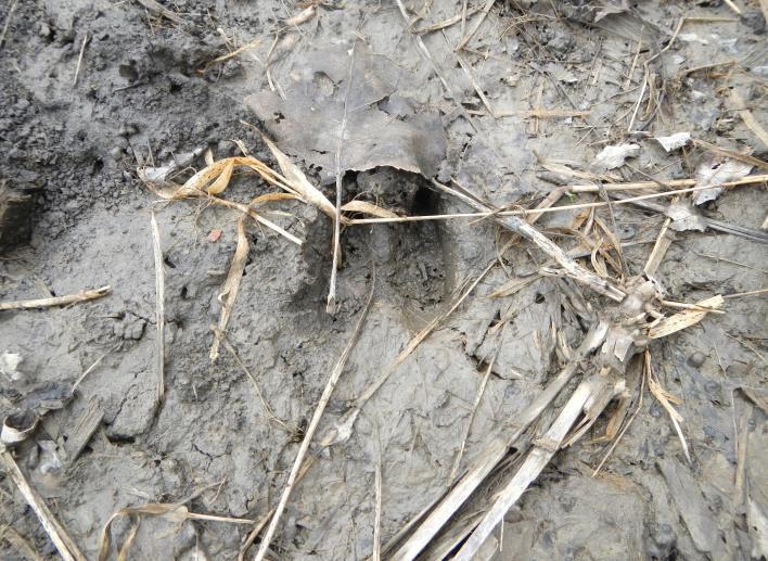
Photo 15: Representative animal tracks within the Ecological Study Area.
Photo 16: Representative animal tracks within the Ecological Study Area.
Solar Grazing Center
Crossroads Solar I, LLC
Cardington, Westfield, and Lincoln Townships, Morrow County, Ohio
Field-Verified Land Cover, Habitat, and Wildlife Photographs
Photo 17: Deciduous forest tree within the Ecological Study Area, facing south.
Photo 18: Emergent herbaceous wetlands within the Ecological Study Area, facing east.
Photo 19: Developed lowintensity land cover within the Ecological Study Area, facing south.
Photo 20: Representative PRT in deciduous forest within the Ecological Study Area.
November 18, 2024
Project Number: 17078
Crossroads Solar Grazing Center
Crossroads Solar I, LLC
Cardington, Westfield, and Lincoln Townships, Morrow County, Ohio