Appendix C
Oram Wetland Evaluation Data Forms

Oram Wetland Evaluation Data Forms
Name:
Date:
HelenaHayter/JacobGeorge 12/18/2023
Affiliation:
VerdantasLLC
Address:
4HemisphereWayBedford,OH44146
Phone Number:
+1440-232-9945
e-mail address:
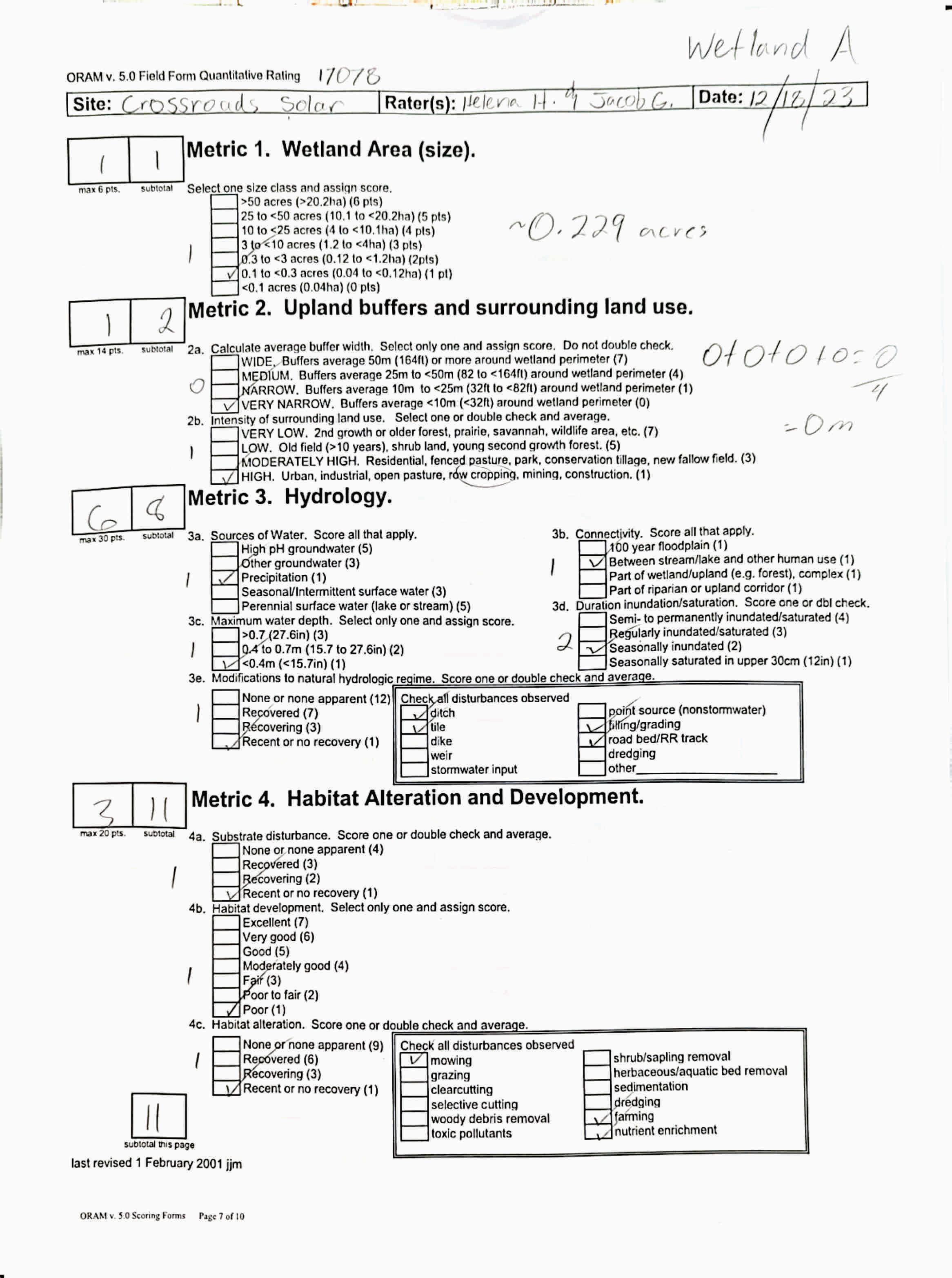
jgeorge@verdantas.com WetlandA
Name of Wetland:
Vegetation Communit(ies):
PEM
HGM Class(es):
IAIB Figure9
Location of Wetland:include map, address, north arrow, landmarks, distances, roads, etc.
Lat/Long or UTM Coordinate
USGS Quad Name County Township Section and Subsection
Hydrologic Unit Code
Site Visit
National Wetland Inventory Map
Ohio Wetland Inventory Map
Soil Survey
Delineation report/map
Wetland Size (acres, hectares):
Sketch:Include north arrow, relationship with other surface waters, vegetation zones, etc.
SeeFigure9 N/A
Comments, Narrative Discussion, Justification of Category Changes:
INSTRUCTIONS. The initial step in completing the ORAM is to identify the “scoring boundaries” of the wetland being rated. In many instances this determination will be relatively easy and the scoring boundaries will coincide with the “jurisdictional boundaries.” For example, the scoring boundary of an isolated cattail marsh located in the middle of a farm field will likely be the same as that wetland’s jurisdictional boundaries. In other instances, however, the scoring boundary will not be as easily determined. Wetlands that are small or isolated from other surface waters often form large contiguous areas or heterogeneous complexes of wetland and upland.In separating wetlands for scoring purposes, the hydrologic regime of the wetland is the main criterion that should be used. Boundaries between contiguous or connected wetlands should be established where the volume, flow, or velocity of water moving through the wetland changes significantly. Areas with a high degree of hydrologic interaction should be scored as a single wetland. In determining a wetland’s scoring boundaries, use the guidelines in the ORAM Manual Section 5.0. In certain instances, it may be difficult to establish the scoring boundary for the wetland being rated. These problem situations include wetlands that form a patchwork on the landscape, wetlands divided by artificial boundaries like property fences, roads, or railroad embankments, wetlands that are contiguous with streams, lakes, or rivers, and estuarine or coastal wetlands. These situations are discussed below, however, it is recommended that Rater contact Ohio EPA, Division of Surface Water, 401/Wetlands Sectionif there are additional questions or a need for further clarification of the appropriate scoring boundaries of a particular wetland.
# Steps in properly establishing scoring boundariesdone?not applicable
Step 1 Identify the wetland area of interest. This may be the site of a proposed impact, a reference site, conservation site, etc.
Step 2 Identify the locations where there is physical evidence that hydrology changes rapidly. Suchevidence includes both natural and humaninduced changes including, constrictions caused by berms or dikes, points where the water velocity changes rapidly at rapids or falls, points where significant inflows occur at the confluence of rivers, or other factors that may restrict hydrologic interaction between the wetlands or parts of a single wetland.
Step 3 Delineate the boundary of the wetland to be rated such that all areas of interest that are contiguous to and within the areas where the hydrology does not change significantly, i.e. areas that have a high degree of hydrologic interaction are included within the scoring boundary.
Step 4 Determine if artificial boundaries, such as property lines, state lines, roads, railroad embankments, etc., are present. These should not be used to establish scoring boundaries unless they coincide with areas where the hydrologic regime changes.
Step 5 In all instances, the Rater may enlarge the minimum scoring boundaries discussed here to score together wetlands that could be scored separately.
Step 6 Consult ORAM Manual Section 5.0 for how to establish scoring boundaries for wetlands that form a patchwork on the landscape, divided by artificial boundaries, contiguous to streams, lakes or rivers, or for dual classifications.
End of Scoring Boundary Determination. Begin Narrative Rating on next page. X X X X X X
INSTRUCTIONS. Answer each of the following questions. Questions 1, 2, 3 and 4 should be answered based on information obtained from the site visit or the literature and by submitting a Data Services Request to the Ohio Department of Natural Resources, Division of Natural Areas and Preserves, Natural Heritage Data Services, 1889 Fountain Square Court, Building F-1, Columbus, Ohio 43224, 614-265-6453 (phone), 614-265-3096 (fax), http://www.dnr.state.oh.us/dnap . The remaining questions are designed to be answered primarily by the results of the site visit. Refer to the User’s Manual for descriptionsof these wetland types. Note: "Critical habitat" is legally defined in the Endangered Species Act and is the geographic area containing physical or biological features essential to the conservation of a listed species or as an area that may require special management considerations or protection. The Rater should contact the Region 3 Headquarters or the ColumbusEcological Services Office for updates as to whether critical habitat has been designated for other federally listed threatened or endangeredspecies. “Documented” means the wetland is listed in the appropriate State of Ohio database.
1 Critical Habitat. Is the wetland in a township, section, or subsection of a United States Geological Survey 7.5 minute Quadrangle that has been designated by the U.S. Fish and Wildlife Service as "critical habitat"for any threatened or endangered plant or animal species?
Note: as of January 1, 2001, of the federally listed endangered or threatened species which can be found inOhio, the Indiana Bat has had critical habitat designated (50 CFR 17.95(a)) and the piping plover has had critical habitat proposed (65 FR 41812 July 6, 2000).
2 Threatened or Endangered Species. Is the wetland known to contain an individual of, or documented occurrences of federal or state-listed threatened or endangered plant or animal species?
3 Documented High Quality Wetland. Is the wetland on record in Natural Heritage Database as a high quality wetland?
should be evaluated for possible Category 3 status
2
is a Category 3 wetland
4
4 Significant Breeding or Concentration Area. Does the wetland contain documented regionally significant breeding or nonbreeding waterfowl, neotropical songbird, or shorebird concentration areas?
5 Category 1 Wetlands. Is the wetland less than 0.5 hectares (1 acre) in size and hydrologically isolated and either 1) comprised of vegetation that is dominated (greater than eighty per cent areal cover) by Phalaris arundinacea, Lythrum salicaria, or Phragmites australis, or 2)anacidic pond created or excavated on mined lands that has little or no vegetation?
6 Bogs. Is the wetland a peat-accumulating wetland that 1) has no significant inflows or outflows, 2) supports acidophilic mosses, particularly Sphagnum spp., 3) the acidophilic mosseshave >30% cover, 4) at least one species from Table 1 is present, and 5) the cover of invasive species (see Table 1) is <25%?
7 Fens. Is the wetland a carbon accumulating (peat, muck) wetland that is saturated during most of the year, primarily by a discharge of free flowing, mineral rich, ground water with a circumneutral ph (5.5-9.0) and with one or more plant species listed in Table 1 and the cover of invasive species listed in Table 1 is <25%?
8a "Old Growth Forest." Is the wetland a forestedwetland and is the forest characterized by, but not limited to, the following characteristics: overstory canopy trees of great age (exceeding at least 50% of a projected maximum attainable age for a species); little or no evidence of human-caused understory disturbance during the past 80 to 100 years; an all-aged structure and multilayered canopies; aggregations of canopy trees interspersed with canopy gaps; and significant numbers of standing dead snags and downed logs?
Wetland is a Category 3 wetland
to Question 5
Wetland is a Category 1 wetland Go to Question 6
YES
Wetland is a Category 3 wetland
Go to Question 7 NO
Go to Question 7
YES
Wetland is a Category 3 wetland
Go to Question 8a NO Go to Question 8a
YES
Wetland is a Category 3 wetland.
Go to Question 8b NO Go to Question 8b
8b Mature forested wetlands. Is the wetland a forested wetland with 50% or more of the cover of upper forest canopy consisting of deciduous trees with large diameters at breast height (dbh), generally diameters greater than 45cm (17.7in) dbh?
YES
Wetland should be evaluated for possible Category 3 status. Go to Question 9a NO
9a Lake Erie coastal and tributary wetlands. Is the wetland located at an elevation less than 575 feet on the USGS map, adjacent to this elevation, or along a tributary to Lake Erie that is accessible to fish? YES Go to Question 9b
9b Does the wetland's hydrology result from measures designed to prevent erosion and the loss of aquatic plants, i.e. the wetland is partially hydrologically restricted from Lake Erie due to lakeward or landward dikes or other hydrological controls? YES
Wetland should be evaluated for possible Category 3 status Go to Question 10 NO
to Question 9a
9c AreLake Erie water levels the wetland's primary hydrological influence, i.e. the wetland is hydrologically unrestricted (no lakeward or upland border alterations), or the wetland can be characterized as an "estuarine" wetland with lake and river influenced hydrology. These include sandbar deposition wetlands, estuarine wetlands, river mouth wetlands, or those dominated by submersed aquatic vegetation.
9d Does the wetland have a predominance of native species within its vegetation communities, although non-native or disturbance tolerant native species can also be present?
to Question 9d
Wetland is a Category 3 wetland
to Question 10
9e Does the wetland have a predominance of non-native or disturbance tolerant native plant species within its vegetation communities? YES Wetland should be evaluated for possible Category 3 status Go to Question 10
10 Lake Plain Sand Prairies (Oak Openings) Is the wetland located in Lucas, Fulton, Henry, or Wood Counties and can the wetland be characterized by the following description: the wetland has a sandy substrate with interspersed organic matter, a water table often within several inches of the surface, and often with a dominance of the gramineous vegetation listed in Table 1 (woody species may also be present). The Ohio Department of Natural Resources Division of Natural Areas and Preserves can provide assistance in confirming this type of wetland and its quality. YES
11 Relict Wet Prairies. Is the wetland a relict wet prairie community dominated by some or all of the species in Table 1. Extensive prairies were formerly located in the Darby Plains (Madison and Union Counties), Sandusky Plains (Wyandot, Crawford, and Marion Counties), northwest Ohio(e.g.Erie, Huron, Lucas, WoodCounties), and portions of western Ohio Counties (e.g. Darke, Mercer, Miami, Montgomery, Van Wert etc.).
Wetland is a Category 3 wetland.
Go to Question 11
YES
Wetland should be evaluated for possible Category 3 status
Complete Quantitative Rating
to Question 10
to Question 9c
10
to Question 9e
10
to Question 11
Quantitative Rating
Table 1. Characteristic plant species. invasive/exotic spp fen speciesbog species0ak Opening specieswet prairie species
Lythrum salicaria
Myriophyllum spicatum
Najas minor
Phalaris arundinacea
Phragmites australis
Potamogeton crispus
Ranunculus ficaria
Rhamnus frangula
Typha angustifolia
Typha xglauca
Zygadenus elegans var. glaucus
Cacalia plantaginea
Carex flava
Carex sterilis
Carexstricta
Deschampsia caespitosa
Eleocharis rostellata
Eriophorum viridicarinatum
Gentianopsis spp.
Lobelia kalmii
Parnassia glauca
Potentilla fruticosa
Rhamnus alnifolia
Rhynchospora capillacea
Salix candida
Salix myricoides
Salix serissima
Solidago ohioensis
Tofieldia glutinosa
Triglochin maritimum
Triglochin palustre
Calla palustris
Carex atlantica var. capillacea
Carex echinata
Carex oligosperma
Carex trisperma
Chamaedaphne calyculata
Decodon verticillatus
Eriophorum virginicum
Larix laricina
Nemopanthus mucronatus
Schechzeria palustris
Sphagnum spp.
Vaccinium macrocarpon
Vaccinium corymbosum
Vaccinium oxycoccos
Woodwardia virginica
Xyris difformis
Carex cryptolepis
Carex lasiocarpa
Carex stricta
Cladium mariscoides
Calamagrostis stricta
Calamagrostis canadensis
Quercus palustris
End of Narrative Rating. Begin Quantitative Rating on next page.
Calamagrostis canadensis
Calamogrostis stricta
Carex atherodes
Carex buxbaumii
Carex pellita
Carex sartwellii
Gentiana andrewsii
Helianthus grosseserratus
Liatris spicata
Lysimachia quadriflora
Lythrum alatum
Pycnanthemum virginianum
Silphium terebinthinaceum
Sorghastrum nutans
Spartina pectinata
Solidago riddellii
circle answer or insert score Result
Narrative Rating Question 1 Critical HabitatYES NOIf yes, Category 3.
Question 2. Threatened or Endangered Species YES NOIf yes, Category 3.
Question 3. High Quality Natural WetlandYES NOIf yes, Category 3.
Question 4. Significant bird habitatYES NOIf yes, Category 3.
Question 5. Category 1 WetlandsYES NOIf yes, Category 1.
Question 6. BogsYES NOIf yes, Category 3.
Question 7. FensYES NOIf yes, Category 3.
Question 8a. Old Growth ForestYES NOIf yes, Category 3.
Question 8b. Mature Forested WetlandYES NOIf yes, evaluate for Category 3; may also be 1 or 2.
Question 9b. Lake Erie WetlandsRestricted YES NOIf yes, evaluate for Category 3; may also be 1 or 2.
Question 9d. Lake Erie Wetlands –Unrestricted with native plants YES NOIf yes, Category 3
Question 9e. Lake Erie WetlandsUnrestricted with invasive plants YES NOIf yes, evaluate for Category 3; may also be 1 or 2.
Question 10. Oak OpeningsYES NOIf yes, Category 3
Question 11. Relict Wet PrairiesYES NOIf yes, evaluate for Category 3; may alsobe 1 or 2.
Quantitative Rating
Metric 1. Size
Metric 2. Buffers and surrounding land use
Metric 3. Hydrology
Metric 4. Habitat
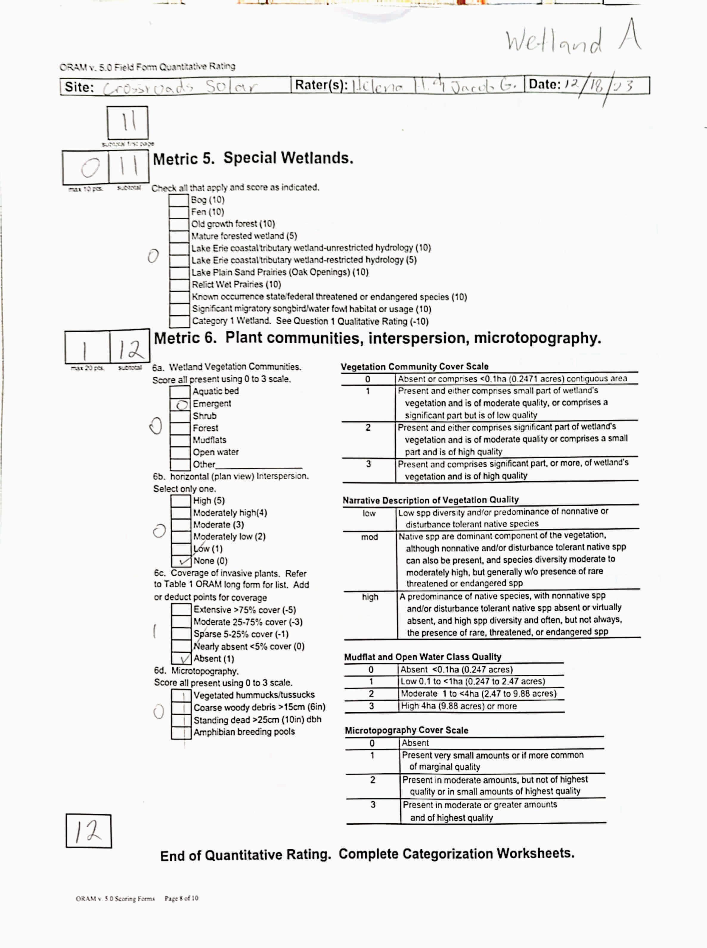
Metric 5. Special Wetland Communities
Metric 6. Plant communities, interspersion, microtopography
Choices Circle one
Did you answer "Yes" to any of the following questions:
Narrative Rating Nos. 2, 3, 4, 6, 7, 8a, 9d, 10
Did you answer "Yes" to any of the following questions:
Narrative Rating Nos. 1, 8b, 9b,9e, 11
Did you answer "Yes" to
Narrative Rating No. 5
Does the quantitative score fall within the scoring range of a Category 1, 2, or 3 wetland?
Does the quantitative score fall with the "gray zone" for Category 1 or 2 or Category 2 or 3 wetlands?
YES
Wetland is categorized as a Category 3 wetland
YES
Wetland should be evaluated for possible Category 3 status
YES
Wetland is categorized as a Category 1 wetland
YES
Wetland is assigned to the appropriate category based on the scoring range
YES
Wetland is assigned to the higher of the two categories or assigned to a category based on detailed assessments and the narrative criteria
NO
Does the wetland otherwise exhibit moderate OR superior hydrologic OR habitat, OR recreational functions AND the wetland was not categorized as a Category 2 wetland (in the case of moderate functions) or a Category 3 wetland (in the case of superior functions) by this method?
YES
Wetland was undercategorized by this method. A written justification for recategorization should be provided on Background Information Form
NO
NO
NO
NO
Evaluation of Categorization Result of ORAM
Is quantitative rating score less than the Category 2 scoring threshold (excluding gray zone)? If yes, reevaluate the category of the wetlandusing the narrative criteria in OAC Rule 3745-1-54(C) and biological and/or functional assessments to determine if the wetland has been overcategorized by the ORAM
Evaluate the wetland using the 1) narrative criteria in OAC Rule 3745-1-54(C) and 2) the quantitative rating score. If the wetland is determined to be a Category 3 wetland using either of these, it should be categorized as a Category 3 wetland. Detailed biological and/or functional assessments may also be used to determine the wetland's category.
Is quantitative rating score greater than the Category 2 scoring threshold (including any gray zone)? If yes, reevaluate the category of the wetland using the narrative criteria in OAC Rule 3745-1-54(C) and biological and/or functional assessments to determine if the wetland has been under-categorized by the ORAM
If the score of the wetland is located within the scoring range for a particular category, the wetland should be assigned to that category. In all instances however, the narrative criteria described in OAC Rule 3745-1-54(C) can be used to clarify or change a categorization based on a quantitative score.
Rater has the option of assigning the wetland to the higher of the two categories or to assign a category based on the results of a nonrapid wetland assessment method, e.g. functional assessment, biological assessment, etc, and a consideration of the narrative criteria in OAC rule 3745-154(C).
NO
Wetland is assigned to category as determined by the ORAM.
A wetland may be undercategorized using this method, but still exhibit one or more superior functions, e.g. a wetland's biotic communities may be degraded by human activities, but thewetland may still exhibit superior hydrologic functions because of its type, landscape position, size, local or regional significance, etc. In this circumstance, the narrative criteria in OAC Rule 3745-1-54(C)(2) and (3) are controlling, and the under-categorization should be corrected. A written justification with supporting reasons or information for this determination should be provided. Final Category
Choose one Category 1Category 2 Category 3
Name:
Date:
HelenaHayter/JacobGeorge 12/18/2023
Affiliation:
VerdantasLLC
Address:
4HemisphereWayBedford,OH44146
Phone Number:
+1440-232-9945
e-mail address:
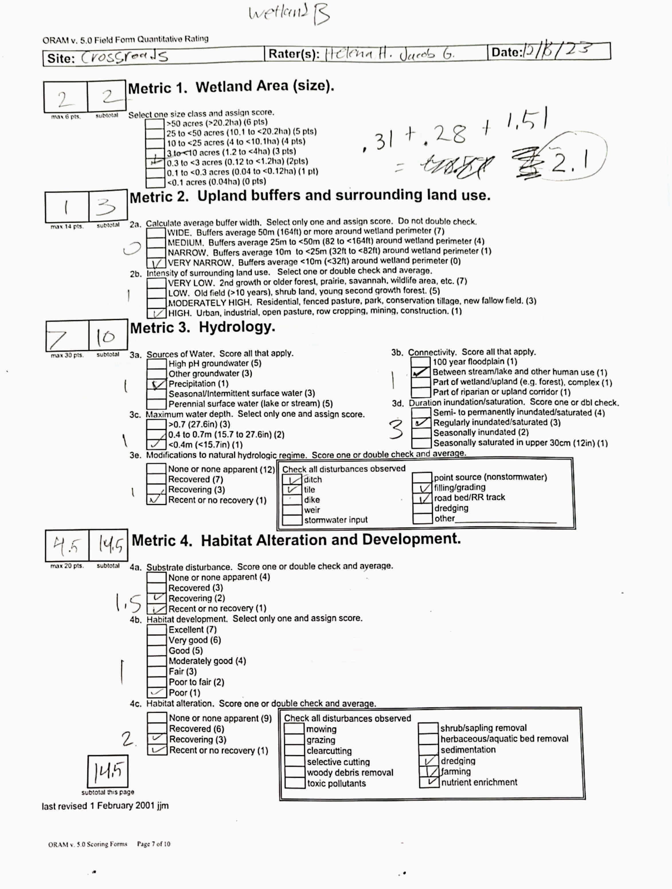
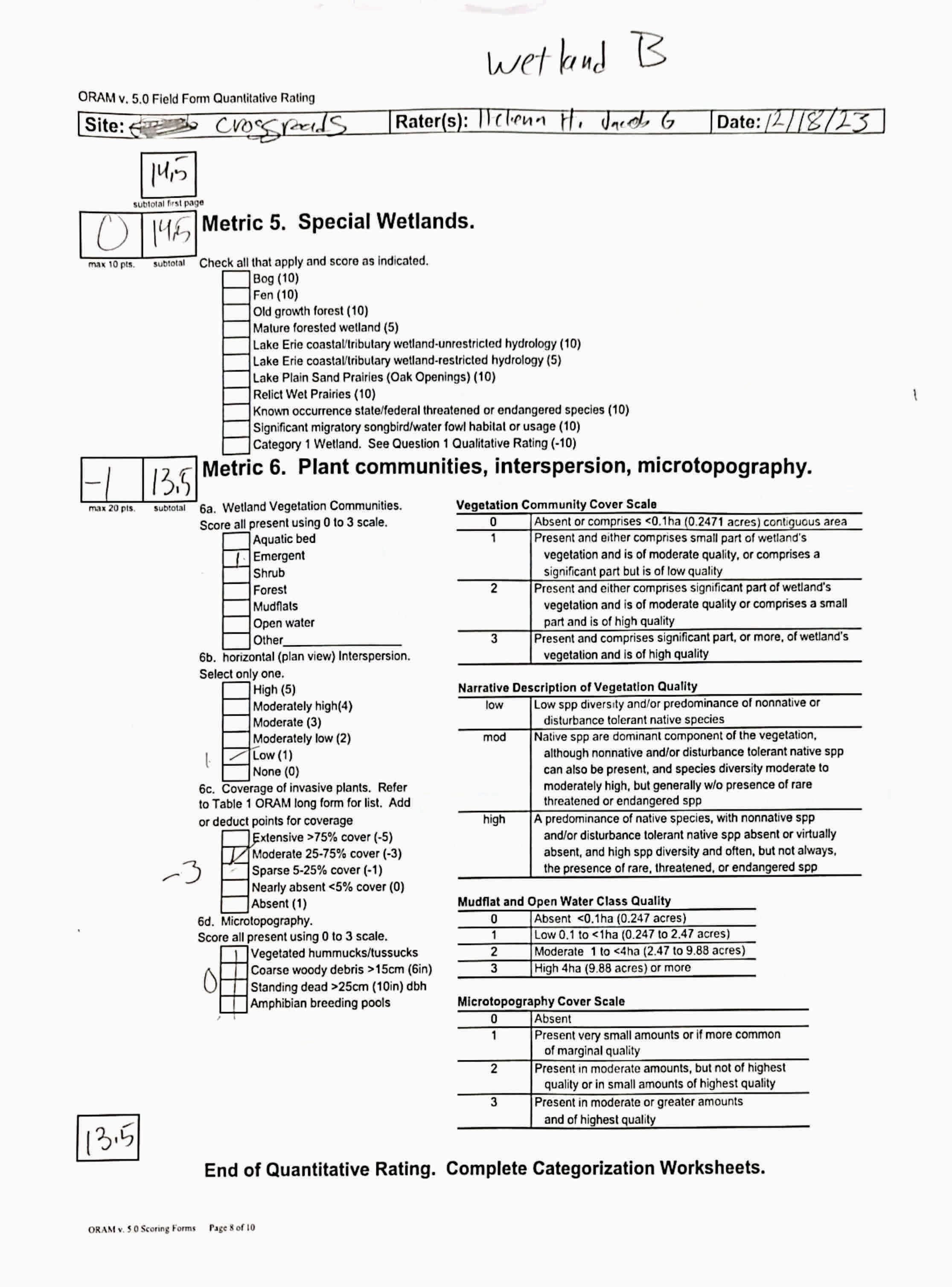
jgeorge@verdantas.com WetlandB
Name of Wetland:
Vegetation Communit(ies):
PEM
HGM Class(es):
IAIB Figure9
Location of Wetland:include map, address, north arrow, landmarks, distances, roads, etc.
Lat/Long or UTM Coordinate
USGS Quad Name County Township Section and Subsection
Hydrologic Unit Code
Site Visit
National Wetland Inventory Map
Ohio Wetland Inventory Map
Soil Survey
Delineation report/map
Wetland Size (acres, hectares):
Sketch:Include north arrow, relationship with other surface waters, vegetation zones, etc.
SeeFigure9
Comments, Narrative Discussion, Justification of Category Changes:
INSTRUCTIONS. The initial step in completing the ORAM is to identify the “scoring boundaries” of the wetland being rated. In many instances this determination will be relatively easy and the scoring boundaries will coincide with the “jurisdictional boundaries.” For example, the scoring boundary of an isolated cattail marsh located in the middle of a farm field will likely be the same as that wetland’s jurisdictional boundaries. In other instances, however, the scoring boundary will not be as easily determined. Wetlands that are small or isolated from other surface waters often form large contiguous areas or heterogeneous complexes of wetland and upland.In separating wetlands for scoring purposes, the hydrologic regime of the wetland is the main criterion that should be used. Boundaries between contiguous or connected wetlands should be established where the volume, flow, or velocity of water moving through the wetland changes significantly. Areas with a high degree of hydrologic interaction should be scored as a single wetland. In determining a wetland’s scoring boundaries, use the guidelines in the ORAM Manual Section 5.0. In certain instances, it may be difficult to establish the scoring boundary for the wetland being rated. These problem situations include wetlands that form a patchwork on the landscape, wetlands divided by artificial boundaries like property fences, roads, or railroad embankments, wetlands that are contiguous with streams, lakes, or rivers, and estuarine or coastal wetlands. These situations are discussed below, however, it is recommended that Rater contact Ohio EPA, Division of Surface Water, 401/Wetlands Sectionif there are additional questions or a need for further clarification of the appropriate scoring boundaries of a particular wetland.
# Steps in properly establishing scoring boundariesdone?not applicable
Step 1 Identify the wetland area of interest. This may be the site of a proposed impact, a reference site, conservation site, etc.
Step 2 Identify the locations where there is physical evidence that hydrology changes rapidly. Suchevidence includes both natural and humaninduced changes including, constrictions caused by berms or dikes, points where the water velocity changes rapidly at rapids or falls, points where significant inflows occur at the confluence of rivers, or other factors that may restrict hydrologic interaction between the wetlands or parts of a single wetland.
Step 3 Delineate the boundary of the wetland to be rated such that all areas of interest that are contiguous to and within the areas where the hydrology does not change significantly, i.e. areas that have a high degree of hydrologic interaction are included within the scoring boundary.
Step 4 Determine if artificial boundaries, such as property lines, state lines, roads, railroad embankments, etc., are present. These should not be used to establish scoring boundaries unless they coincide with areas where the hydrologic regime changes.
Step 5 In all instances, the Rater may enlarge the minimum scoring boundaries discussed here to score together wetlands that could be scored separately.
Step 6 Consult ORAM Manual Section 5.0 for how to establish scoring boundaries for wetlands that form a patchwork on the landscape, divided by artificial boundaries, contiguous to streams, lakes or rivers, or for dual classifications.
End of Scoring Boundary Determination. Begin Narrative Rating on next page. X X X X X X
INSTRUCTIONS. Answer each of the following questions. Questions 1, 2, 3 and 4 should be answered based on information obtained from the site visit or the literature and by submitting a Data Services Request to the Ohio Department of Natural Resources, Division of Natural Areas and Preserves, Natural Heritage Data Services, 1889 Fountain Square Court, Building F-1, Columbus, Ohio 43224, 614-265-6453 (phone), 614-265-3096 (fax), http://www.dnr.state.oh.us/dnap . The remaining questions are designed to be answered primarily by the results of the site visit. Refer to the User’s Manual for descriptionsof these wetland types. Note: "Critical habitat" is legally defined in the Endangered Species Act and is the geographic area containing physical or biological features essential to the conservation of a listed species or as an area that may require special management considerations or protection. The Rater should contact the Region 3 Headquarters or the ColumbusEcological Services Office for updates as to whether critical habitat has been designated for other federally listed threatened or endangeredspecies. “Documented” means the wetland is listed in the appropriate State of Ohio database.
1 Critical Habitat. Is the wetland in a township, section, or subsection of a United States Geological Survey 7.5 minute Quadrangle that has been designated by the U.S. Fish and Wildlife Service as "critical habitat"for any threatened or endangered plant or animal species?
Note: as of January 1, 2001, of the federally listed endangered or threatened species which can be found inOhio, the Indiana Bat has had critical habitat designated (50 CFR 17.95(a)) and the piping plover has had critical habitat proposed (65 FR 41812 July 6, 2000).
2 Threatened or Endangered Species. Is the wetland known to contain an individual of, or documented occurrences of federal or state-listed threatened or endangered plant or animal species?
3 Documented High Quality Wetland. Is the wetland on record in Natural Heritage Database as a high quality wetland?
should be evaluated for possible Category 3 status
2
is a Category 3 wetland
4
4 Significant Breeding or Concentration Area. Does the wetland contain documented regionally significant breeding or nonbreeding waterfowl, neotropical songbird, or shorebird concentration areas?
5 Category 1 Wetlands. Is the wetland less than 0.5 hectares (1 acre) in size and hydrologically isolated and either 1) comprised of vegetation that is dominated (greater than eighty per cent areal cover) by Phalaris arundinacea, Lythrum salicaria, or Phragmites australis, or 2)anacidic pond created or excavated on mined lands that has little or no vegetation?
6 Bogs. Is the wetland a peat-accumulating wetland that 1) has no significant inflows or outflows, 2) supports acidophilic mosses, particularly Sphagnum spp., 3) the acidophilic mosseshave >30% cover, 4) at least one species from Table 1 is present, and 5) the cover of invasive species (see Table 1) is <25%?
7 Fens. Is the wetland a carbon accumulating (peat, muck) wetland that is saturated during most of the year, primarily by a discharge of free flowing, mineral rich, ground water with a circumneutral ph (5.5-9.0) and with one or more plant species listed in Table 1 and the cover of invasive species listed in Table 1 is <25%?
8a "Old Growth Forest." Is the wetland a forestedwetland and is the forest characterized by, but not limited to, the following characteristics: overstory canopy trees of great age (exceeding at least 50% of a projected maximum attainable age for a species); little or no evidence of human-caused understory disturbance during the past 80 to 100 years; an all-aged structure and multilayered canopies; aggregations of canopy trees interspersed with canopy gaps; and significant numbers of standing dead snags and downed logs?
Wetland is a Category 3 wetland
to Question 5
Wetland is a Category 1 wetland Go to Question 6
YES
Wetland is a Category 3 wetland
Go to Question 7 NO
Go to Question 7
YES
Wetland is a Category 3 wetland
Go to Question 8a NO Go to Question 8a
YES
Wetland is a Category 3 wetland.
Go to Question 8b NO Go to Question 8b
8b Mature forested wetlands. Is the wetland a forested wetland with 50% or more of the cover of upper forest canopy consisting of deciduous trees with large diameters at breast height (dbh), generally diameters greater than 45cm (17.7in) dbh?
YES
Wetland should be evaluated for possible Category 3 status. Go to Question 9a NO
9a Lake Erie coastal and tributary wetlands. Is the wetland located at an elevation less than 575 feet on the USGS map, adjacent to this elevation, or along a tributary to Lake Erie that is accessible to fish? YES Go to Question 9b
9b Does the wetland's hydrology result from measures designed to prevent erosion and the loss of aquatic plants, i.e. the wetland is partially hydrologically restricted from Lake Erie due to lakeward or landward dikes or other hydrological controls? YES
Wetland should be evaluated for possible Category 3 status Go to Question 10 NO
to Question 9a
9c AreLake Erie water levels the wetland's primary hydrological influence, i.e. the wetland is hydrologically unrestricted (no lakeward or upland border alterations), or the wetland can be characterized as an "estuarine" wetland with lake and river influenced hydrology. These include sandbar deposition wetlands, estuarine wetlands, river mouth wetlands, or those dominated by submersed aquatic vegetation.
9d Does the wetland have a predominance of native species within its vegetation communities, although non-native or disturbance tolerant native species can also be present?
to Question 9d
Wetland is a Category 3 wetland
to Question 10
9e Does the wetland have a predominance of non-native or disturbance tolerant native plant species within its vegetation communities? YES Wetland should be evaluated for possible Category 3 status Go to Question 10
10 Lake Plain Sand Prairies (Oak Openings) Is the wetland located in Lucas, Fulton, Henry, or Wood Counties and can the wetland be characterized by the following description: the wetland has a sandy substrate with interspersed organic matter, a water table often within several inches of the surface, and often with a dominance of the gramineous vegetation listed in Table 1 (woody species may also be present). The Ohio Department of Natural Resources Division of Natural Areas and Preserves can provide assistance in confirming this type of wetland and its quality. YES
11 Relict Wet Prairies. Is the wetland a relict wet prairie community dominated by some or all of the species in Table 1. Extensive prairies were formerly located in the Darby Plains (Madison and Union Counties), Sandusky Plains (Wyandot, Crawford, and Marion Counties), northwest Ohio(e.g.Erie, Huron, Lucas, WoodCounties), and portions of western Ohio Counties (e.g. Darke, Mercer, Miami, Montgomery, Van Wert etc.).
Wetland is a Category 3 wetland.
Go to Question 11
YES
Wetland should be evaluated for possible Category 3 status
Complete Quantitative Rating
to Question 10
to Question 9c
10
to Question 9e
10
to Question 11
Quantitative Rating
Table 1. Characteristic plant species. invasive/exotic spp fen speciesbog species0ak Opening specieswet prairie species
Lythrum salicaria
Myriophyllum spicatum
Najas minor
Phalaris arundinacea
Phragmites australis
Potamogeton crispus
Ranunculus ficaria
Rhamnus frangula
Typha angustifolia
Typha xglauca
Zygadenus elegans var. glaucus
Cacalia plantaginea
Carex flava
Carex sterilis
Carexstricta
Deschampsia caespitosa
Eleocharis rostellata
Eriophorum viridicarinatum
Gentianopsis spp.
Lobelia kalmii
Parnassia glauca
Potentilla fruticosa
Rhamnus alnifolia
Rhynchospora capillacea
Salix candida
Salix myricoides
Salix serissima
Solidago ohioensis
Tofieldia glutinosa
Triglochin maritimum
Triglochin palustre
Calla palustris
Carex atlantica var. capillacea
Carex echinata
Carex oligosperma
Carex trisperma
Chamaedaphne calyculata
Decodon verticillatus
Eriophorum virginicum
Larix laricina
Nemopanthus mucronatus
Schechzeria palustris
Sphagnum spp.
Vaccinium macrocarpon
Vaccinium corymbosum
Vaccinium oxycoccos
Woodwardia virginica
Xyris difformis
Carex cryptolepis
Carex lasiocarpa
Carex stricta
Cladium mariscoides
Calamagrostis stricta
Calamagrostis canadensis
Quercus palustris
End of Narrative Rating. Begin Quantitative Rating on next page.
Calamagrostis canadensis
Calamogrostis stricta
Carex atherodes
Carex buxbaumii
Carex pellita
Carex sartwellii
Gentiana andrewsii
Helianthus grosseserratus
Liatris spicata
Lysimachia quadriflora
Lythrum alatum
Pycnanthemum virginianum
Silphium terebinthinaceum
Sorghastrum nutans
Spartina pectinata
Solidago riddellii
circle answer or insert score Result
Narrative Rating Question 1 Critical HabitatYES NOIf yes, Category 3.
Question 2. Threatened or Endangered Species YES NOIf yes, Category 3.
Question 3. High Quality Natural WetlandYES NOIf yes, Category 3.
Question 4. Significant bird habitatYES NOIf yes, Category 3.
Question 5. Category 1 WetlandsYES NOIf yes, Category 1.
Question 6. BogsYES NOIf yes, Category 3.
Question 7. FensYES NOIf yes, Category 3.
Question 8a. Old Growth ForestYES NOIf yes, Category 3.
Question 8b. Mature Forested WetlandYES NOIf yes, evaluate for Category 3; may also be 1 or 2.
Question 9b. Lake Erie WetlandsRestricted YES NOIf yes, evaluate for Category 3; may also be 1 or 2.
Question 9d. Lake Erie Wetlands –Unrestricted with native plants YES NOIf yes, Category 3
Question 9e. Lake Erie WetlandsUnrestricted with invasive plants YES NOIf yes, evaluate for Category 3; may also be 1 or 2.
Question 10. Oak OpeningsYES NOIf yes, Category 3
Question 11. Relict Wet PrairiesYES NOIf yes, evaluate for Category 3; may alsobe 1 or 2.
Quantitative Rating
Metric 1. Size
Metric 2. Buffers and surrounding land use
Metric 3. Hydrology
Metric 4. Habitat
Metric 5. Special Wetland Communities
Metric 6. Plant communities, interspersion, microtopography
Choices Circle one
Did you answer "Yes" to any of the following questions:
Narrative Rating Nos. 2, 3, 4, 6, 7, 8a, 9d, 10
Did you answer "Yes" to any of the following questions:
Narrative Rating Nos. 1, 8b, 9b,9e, 11
Did you answer "Yes" to
Narrative Rating No. 5
Does the quantitative score fall within the scoring range of a Category 1, 2, or 3 wetland?
Does the quantitative score fall with the "gray zone" for Category 1 or 2 or Category 2 or 3 wetlands?
YES
Wetland is categorized as a Category 3 wetland
YES
Wetland should be evaluated for possible Category 3 status
YES
Wetland is categorized as a Category 1 wetland
YES
Wetland is assigned to the appropriate category based on the scoring range
YES
Wetland is assigned to the higher of the two categories or assigned to a category based on detailed assessments and the narrative criteria
NO
Does the wetland otherwise exhibit moderate OR superior hydrologic OR habitat, OR recreational functions AND the wetland was not categorized as a Category 2 wetland (in the case of moderate functions) or a Category 3 wetland (in the case of superior functions) by this method?
YES
Wetland was undercategorized by this method. A written justification for recategorization should be provided on Background Information Form
NO
NO
NO
NO
Evaluation of Categorization Result of ORAM
Is quantitative rating score less than the Category 2 scoring threshold (excluding gray zone)? If yes, reevaluate the category of the wetlandusing the narrative criteria in OAC Rule 3745-1-54(C) and biological and/or functional assessments to determine if the wetland has been overcategorized by the ORAM
Evaluate the wetland using the 1) narrative criteria in OAC Rule 3745-1-54(C) and 2) the quantitative rating score. If the wetland is determined to be a Category 3 wetland using either of these, it should be categorized as a Category 3 wetland. Detailed biological and/or functional assessments may also be used to determine the wetland's category.
Is quantitative rating score greater than the Category 2 scoring threshold (including any gray zone)? If yes, reevaluate the category of the wetland using the narrative criteria in OAC Rule 3745-1-54(C) and biological and/or functional assessments to determine if the wetland has been under-categorized by the ORAM
If the score of the wetland is located within the scoring range for a particular category, the wetland should be assigned to that category. In all instances however, the narrative criteria described in OAC Rule 3745-1-54(C) can be used to clarify or change a categorization based on a quantitative score.
Rater has the option of assigning the wetland to the higher of the two categories or to assign a category based on the results of a nonrapid wetland assessment method, e.g. functional assessment, biological assessment, etc, and a consideration of the narrative criteria in OAC rule 3745-154(C).
NO
Wetland is assigned to category as determined by the ORAM.
A wetland may be undercategorized using this method, but still exhibit one or more superior functions, e.g. a wetland's biotic communities may be degraded by human activities, but thewetland may still exhibit superior hydrologic functions because of its type, landscape position, size, local or regional significance, etc. In this circumstance, the narrative criteria in OAC Rule 3745-1-54(C)(2) and (3) are controlling, and the under-categorization should be corrected. A written justification with supporting reasons or information for this determination should be provided. Final Category
Choose one Category 1Category 2 Category 3
Name:
Date:
HelenaHayter/JacobGeorge 12/18/2023
Affiliation:
VerdantasLLC
Address:
4HemisphereWayBedford,OH44146
Phone Number:
+1440-232-9945
e-mail address:
jgeorge@verdantas.com
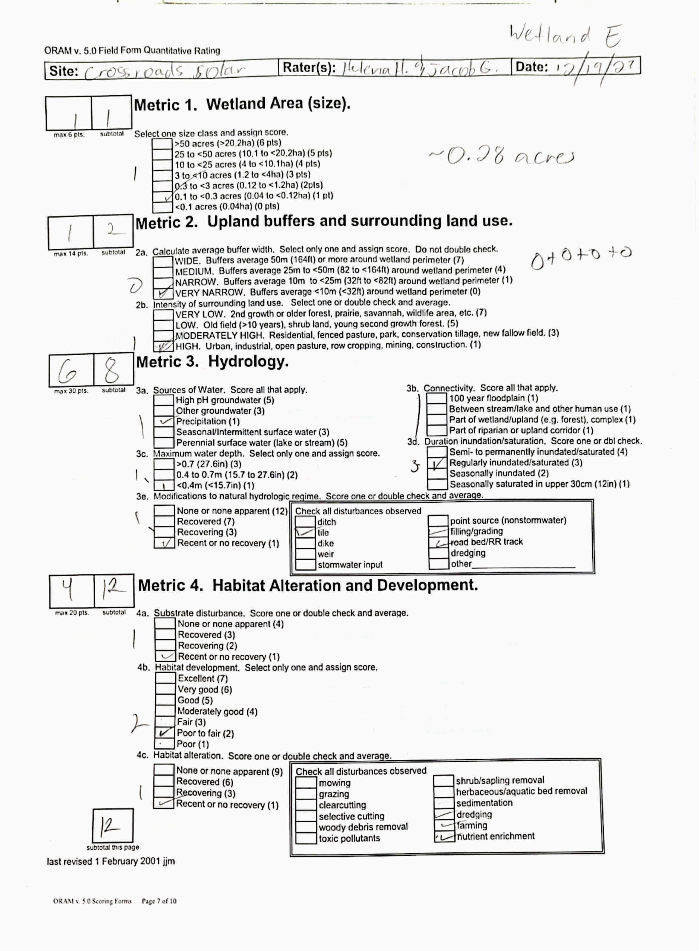
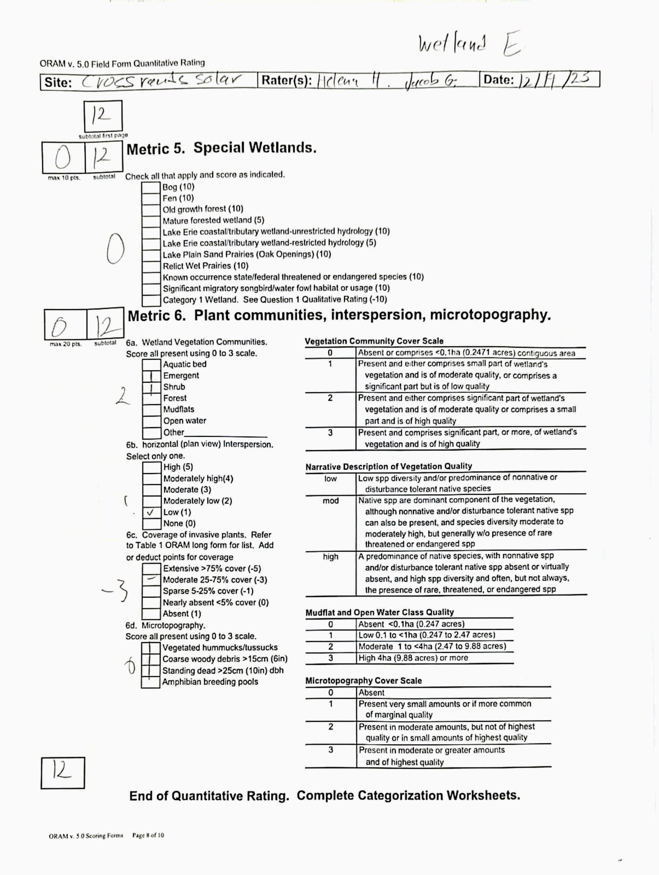
Name of Wetland:
WetlandE
Vegetation Communit(ies):
PEM
HGM Class(es):
IAIB Figure9
Location of Wetland:include map, address, north arrow, landmarks, distances, roads, etc.
Lat/Long or UTM Coordinate
USGS Quad Name County Township Section and Subsection
Hydrologic Unit Code
Site Visit
National Wetland Inventory Map
Ohio Wetland Inventory Map
Soil Survey
Delineation report/map
Wetland Size (acres, hectares):
Sketch:Include north arrow, relationship with other surface waters, vegetation zones, etc.
SeeFigure9 N/A
Comments, Narrative Discussion, Justification of Category Changes:
INSTRUCTIONS. The initial step in completing the ORAM is to identify the “scoring boundaries” of the wetland being rated. In many instances this determination will be relatively easy and the scoring boundaries will coincide with the “jurisdictional boundaries.” For example, the scoring boundary of an isolated cattail marsh located in the middle of a farm field will likely be the same as that wetland’s jurisdictional boundaries. In other instances, however, the scoring boundary will not be as easily determined. Wetlands that are small or isolated from other surface waters often form large contiguous areas or heterogeneous complexes of wetland and upland.In separating wetlands for scoring purposes, the hydrologic regime of the wetland is the main criterion that should be used. Boundaries between contiguous or connected wetlands should be established where the volume, flow, or velocity of water moving through the wetland changes significantly. Areas with a high degree of hydrologic interaction should be scored as a single wetland. In determining a wetland’s scoring boundaries, use the guidelines in the ORAM Manual Section 5.0. In certain instances, it may be difficult to establish the scoring boundary for the wetland being rated. These problem situations include wetlands that form a patchwork on the landscape, wetlands divided by artificial boundaries like property fences, roads, or railroad embankments, wetlands that are contiguous with streams, lakes, or rivers, and estuarine or coastal wetlands. These situations are discussed below, however, it is recommended that Rater contact Ohio EPA, Division of Surface Water, 401/Wetlands Sectionif there are additional questions or a need for further clarification of the appropriate scoring boundaries of a particular wetland.
# Steps in properly establishing scoring boundariesdone?not applicable
Step 1 Identify the wetland area of interest. This may be the site of a proposed impact, a reference site, conservation site, etc.
Step 2 Identify the locations where there is physical evidence that hydrology changes rapidly. Suchevidence includes both natural and humaninduced changes including, constrictions caused by berms or dikes, points where the water velocity changes rapidly at rapids or falls, points where significant inflows occur at the confluence of rivers, or other factors that may restrict hydrologic interaction between the wetlands or parts of a single wetland.
Step 3 Delineate the boundary of the wetland to be rated such that all areas of interest that are contiguous to and within the areas where the hydrology does not change significantly, i.e. areas that have a high degree of hydrologic interaction are included within the scoring boundary.
Step 4 Determine if artificial boundaries, such as property lines, state lines, roads, railroad embankments, etc., are present. These should not be used to establish scoring boundaries unless they coincide with areas where the hydrologic regime changes.
Step 5 In all instances, the Rater may enlarge the minimum scoring boundaries discussed here to score together wetlands that could be scored separately.
Step 6 Consult ORAM Manual Section 5.0 for how to establish scoring boundaries for wetlands that form a patchwork on the landscape, divided by artificial boundaries, contiguous to streams, lakes or rivers, or for dual classifications.
End of Scoring Boundary Determination. Begin Narrative Rating on next page. X X X X X X
INSTRUCTIONS. Answer each of the following questions. Questions 1, 2, 3 and 4 should be answered based on information obtained from the site visit or the literature and by submitting a Data Services Request to the Ohio Department of Natural Resources, Division of Natural Areas and Preserves, Natural Heritage Data Services, 1889 Fountain Square Court, Building F-1, Columbus, Ohio 43224, 614-265-6453 (phone), 614-265-3096 (fax), http://www.dnr.state.oh.us/dnap . The remaining questions are designed to be answered primarily by the results of the site visit. Refer to the User’s Manual for descriptionsof these wetland types. Note: "Critical habitat" is legally defined in the Endangered Species Act and is the geographic area containing physical or biological features essential to the conservation of a listed species or as an area that may require special management considerations or protection. The Rater should contact the Region 3 Headquarters or the ColumbusEcological Services Office for updates as to whether critical habitat has been designated for other federally listed threatened or endangeredspecies. “Documented” means the wetland is listed in the appropriate State of Ohio database.
1 Critical Habitat. Is the wetland in a township, section, or subsection of a United States Geological Survey 7.5 minute Quadrangle that has been designated by the U.S. Fish and Wildlife Service as "critical habitat"for any threatened or endangered plant or animal species?
Note: as of January 1, 2001, of the federally listed endangered or threatened species which can be found inOhio, the Indiana Bat has had critical habitat designated (50 CFR 17.95(a)) and the piping plover has had critical habitat proposed (65 FR 41812 July 6, 2000).
2 Threatened or Endangered Species. Is the wetland known to contain an individual of, or documented occurrences of federal or state-listed threatened or endangered plant or animal species?
3 Documented High Quality Wetland. Is the wetland on record in Natural Heritage Database as a high quality wetland?
should be evaluated for possible Category 3 status
2
is a Category 3 wetland
4
4 Significant Breeding or Concentration Area. Does the wetland contain documented regionally significant breeding or nonbreeding waterfowl, neotropical songbird, or shorebird concentration areas?
5 Category 1 Wetlands. Is the wetland less than 0.5 hectares (1 acre) in size and hydrologically isolated and either 1) comprised of vegetation that is dominated (greater than eighty per cent areal cover) by Phalaris arundinacea, Lythrum salicaria, or Phragmites australis, or 2)anacidic pond created or excavated on mined lands that has little or no vegetation?
6 Bogs. Is the wetland a peat-accumulating wetland that 1) has no significant inflows or outflows, 2) supports acidophilic mosses, particularly Sphagnum spp., 3) the acidophilic mosseshave >30% cover, 4) at least one species from Table 1 is present, and 5) the cover of invasive species (see Table 1) is <25%?
7 Fens. Is the wetland a carbon accumulating (peat, muck) wetland that is saturated during most of the year, primarily by a discharge of free flowing, mineral rich, ground water with a circumneutral ph (5.5-9.0) and with one or more plant species listed in Table 1 and the cover of invasive species listed in Table 1 is <25%?
8a "Old Growth Forest." Is the wetland a forestedwetland and is the forest characterized by, but not limited to, the following characteristics: overstory canopy trees of great age (exceeding at least 50% of a projected maximum attainable age for a species); little or no evidence of human-caused understory disturbance during the past 80 to 100 years; an all-aged structure and multilayered canopies; aggregations of canopy trees interspersed with canopy gaps; and significant numbers of standing dead snags and downed logs?
Wetland is a Category 3 wetland
to Question 5
Wetland is a Category 1 wetland Go to Question 6
YES
Wetland is a Category 3 wetland
Go to Question 7 NO
Go to Question 7
YES
Wetland is a Category 3 wetland
Go to Question 8a NO Go to Question 8a
YES
Wetland is a Category 3 wetland.
Go to Question 8b NO Go to Question 8b
8b Mature forested wetlands. Is the wetland a forested wetland with 50% or more of the cover of upper forest canopy consisting of deciduous trees with large diameters at breast height (dbh), generally diameters greater than 45cm (17.7in) dbh?
YES
Wetland should be evaluated for possible Category 3 status. Go to Question 9a NO
9a Lake Erie coastal and tributary wetlands. Is the wetland located at an elevation less than 575 feet on the USGS map, adjacent to this elevation, or along a tributary to Lake Erie that is accessible to fish? YES Go to Question 9b
9b Does the wetland's hydrology result from measures designed to prevent erosion and the loss of aquatic plants, i.e. the wetland is partially hydrologically restricted from Lake Erie due to lakeward or landward dikes or other hydrological controls? YES
Wetland should be evaluated for possible Category 3 status Go to Question 10 NO
to Question 9a
9c AreLake Erie water levels the wetland's primary hydrological influence, i.e. the wetland is hydrologically unrestricted (no lakeward or upland border alterations), or the wetland can be characterized as an "estuarine" wetland with lake and river influenced hydrology. These include sandbar deposition wetlands, estuarine wetlands, river mouth wetlands, or those dominated by submersed aquatic vegetation.
9d Does the wetland have a predominance of native species within its vegetation communities, although non-native or disturbance tolerant native species can also be present?
to Question 9d
Wetland is a Category 3 wetland
to Question 10
9e Does the wetland have a predominance of non-native or disturbance tolerant native plant species within its vegetation communities? YES Wetland should be evaluated for possible Category 3 status Go to Question 10
10 Lake Plain Sand Prairies (Oak Openings) Is the wetland located in Lucas, Fulton, Henry, or Wood Counties and can the wetland be characterized by the following description: the wetland has a sandy substrate with interspersed organic matter, a water table often within several inches of the surface, and often with a dominance of the gramineous vegetation listed in Table 1 (woody species may also be present). The Ohio Department of Natural Resources Division of Natural Areas and Preserves can provide assistance in confirming this type of wetland and its quality. YES
11 Relict Wet Prairies. Is the wetland a relict wet prairie community dominated by some or all of the species in Table 1. Extensive prairies were formerly located in the Darby Plains (Madison and Union Counties), Sandusky Plains (Wyandot, Crawford, and Marion Counties), northwest Ohio(e.g.Erie, Huron, Lucas, WoodCounties), and portions of western Ohio Counties (e.g. Darke, Mercer, Miami, Montgomery, Van Wert etc.).
Wetland is a Category 3 wetland.
Go to Question 11
YES
Wetland should be evaluated for possible Category 3 status
Complete Quantitative Rating
to Question 10
to Question 9c
10
to Question 9e
10
to Question 11
Quantitative Rating
Table 1. Characteristic plant species. invasive/exotic spp fen speciesbog species0ak Opening specieswet prairie species
Lythrum salicaria
Myriophyllum spicatum
Najas minor
Phalaris arundinacea
Phragmites australis
Potamogeton crispus
Ranunculus ficaria
Rhamnus frangula
Typha angustifolia
Typha xglauca
Zygadenus elegans var. glaucus
Cacalia plantaginea
Carex flava
Carex sterilis
Carexstricta
Deschampsia caespitosa
Eleocharis rostellata
Eriophorum viridicarinatum
Gentianopsis spp.
Lobelia kalmii
Parnassia glauca
Potentilla fruticosa
Rhamnus alnifolia
Rhynchospora capillacea
Salix candida
Salix myricoides
Salix serissima
Solidago ohioensis
Tofieldia glutinosa
Triglochin maritimum
Triglochin palustre
Calla palustris
Carex atlantica var. capillacea
Carex echinata
Carex oligosperma
Carex trisperma
Chamaedaphne calyculata
Decodon verticillatus
Eriophorum virginicum
Larix laricina
Nemopanthus mucronatus
Schechzeria palustris
Sphagnum spp.
Vaccinium macrocarpon
Vaccinium corymbosum
Vaccinium oxycoccos
Woodwardia virginica
Xyris difformis
Carex cryptolepis
Carex lasiocarpa
Carex stricta
Cladium mariscoides
Calamagrostis stricta
Calamagrostis canadensis
Quercus palustris
End of Narrative Rating. Begin Quantitative Rating on next page.
Calamagrostis canadensis
Calamogrostis stricta
Carex atherodes
Carex buxbaumii
Carex pellita
Carex sartwellii
Gentiana andrewsii
Helianthus grosseserratus
Liatris spicata
Lysimachia quadriflora
Lythrum alatum
Pycnanthemum virginianum
Silphium terebinthinaceum
Sorghastrum nutans
Spartina pectinata
Solidago riddellii
circle answer or insert score
Narrative Rating Question 1 Critical HabitatYES NOIf yes, Category 3.
Question 2. Threatened or Endangered Species YES NOIf yes, Category 3.
Question 3. High Quality Natural WetlandYES NOIf yes, Category 3.
Question 4. Significant bird habitatYES NOIf yes, Category 3.
Question 5. Category 1 WetlandsYES NOIf yes, Category 1.
Question 6. BogsYES NOIf yes, Category 3.
Question 7. FensYES NOIf yes, Category 3.
Question 8a. Old Growth ForestYES NOIf yes, Category 3.
Question 8b. Mature Forested WetlandYES NOIf yes, evaluate for Category 3; may also be 1 or 2.
Question 9b. Lake Erie WetlandsRestricted YES NOIf yes, evaluate for Category 3; may also be 1 or 2.
Question 9d. Lake Erie Wetlands –Unrestricted with native plants YES NOIf yes, Category 3
Question 9e. Lake Erie WetlandsUnrestricted with invasive plants YES NOIf yes, evaluate for Category 3; may also be 1 or 2.
Question 10. Oak OpeningsYES NOIf yes, Category 3
Question 11. Relict Wet PrairiesYES NOIf yes, evaluate for Category 3; may alsobe 1 or 2.
Quantitative Rating
Metric 1. Size
Metric 2. Buffers and surrounding land use
Metric 3. Hydrology
Metric 4. Habitat
Metric 5. Special Wetland Communities
Metric 6. Plant communities, interspersion, microtopography
Choices Circle one
Did you answer "Yes" to any of the following questions:
Narrative Rating Nos. 2, 3, 4, 6, 7, 8a, 9d, 10
Did you answer "Yes" to any of the following questions:
Narrative Rating Nos. 1, 8b, 9b,9e, 11
Did you answer "Yes" to
Narrative Rating No. 5
Does the quantitative score fall within the scoring range of a Category 1, 2, or 3 wetland?
Does the quantitative score fall with the "gray zone" for Category 1 or 2 or Category 2 or 3 wetlands?
YES
Wetland is categorized as a Category 3 wetland
YES
Wetland should be evaluated for possible Category 3 status
YES
Wetland is categorized as a Category 1 wetland
YES
Wetland is assigned to the appropriate category based on the scoring range
YES
Wetland is assigned to the higher of the two categories or assigned to a category based on detailed assessments and the narrative criteria
NO
Does the wetland otherwise exhibit moderate OR superior hydrologic OR habitat, OR recreational functions AND the wetland was not categorized as a Category 2 wetland (in the case of moderate functions) or a Category 3 wetland (in the case of superior functions) by this method?
YES
Wetland was undercategorized by this method. A written justification for recategorization should be provided on Background Information Form
NO
NO
NO
NO
Evaluation of Categorization Result of ORAM
Is quantitative rating score less than the Category 2 scoring threshold (excluding gray zone)? If yes, reevaluate the category of the wetlandusing the narrative criteria in OAC Rule 3745-1-54(C) and biological and/or functional assessments to determine if the wetland has been overcategorized by the ORAM
Evaluate the wetland using the 1) narrative criteria in OAC Rule 3745-1-54(C) and 2) the quantitative rating score. If the wetland is determined to be a Category 3 wetland using either of these, it should be categorized as a Category 3 wetland. Detailed biological and/or functional assessments may also be used to determine the wetland's category.
Is quantitative rating score greater than the Category 2 scoring threshold (including any gray zone)? If yes, reevaluate the category of the wetland using the narrative criteria in OAC Rule 3745-1-54(C) and biological and/or functional assessments to determine if the wetland has been under-categorized by the ORAM
If the score of the wetland is located within the scoring range for a particular category, the wetland should be assigned to that category. In all instances however, the narrative criteria described in OAC Rule 3745-1-54(C) can be used to clarify or change a categorization based on a quantitative score.
Rater has the option of assigning the wetland to the higher of the two categories or to assign a category based on the results of a nonrapid wetland assessment method, e.g. functional assessment, biological assessment, etc, and a consideration of the narrative criteria in OAC rule 3745-154(C).
NO
Wetland is assigned to category as determined by the ORAM.
A wetland may be undercategorized using this method, but still exhibit one or more superior functions, e.g. a wetland's biotic communities may be degraded by human activities, but thewetland may still exhibit superior hydrologic functions because of its type, landscape position, size, local or regional significance, etc. In this circumstance, the narrative criteria in OAC Rule 3745-1-54(C)(2) and (3) are controlling, and the under-categorization should be corrected. A written justification with supporting reasons or information for this determination should be provided. Final Category
Choose one Category 1Category 2 Category 3
Name:
Date:
HelenaHayter/JacobGeorge 12/18/2023
Affiliation:
VerdantasLLC
Address:
4HemisphereWayBedford,OH44146
Phone Number:
+1440-232-9945
e-mail address:
jgeorge@verdantas.com
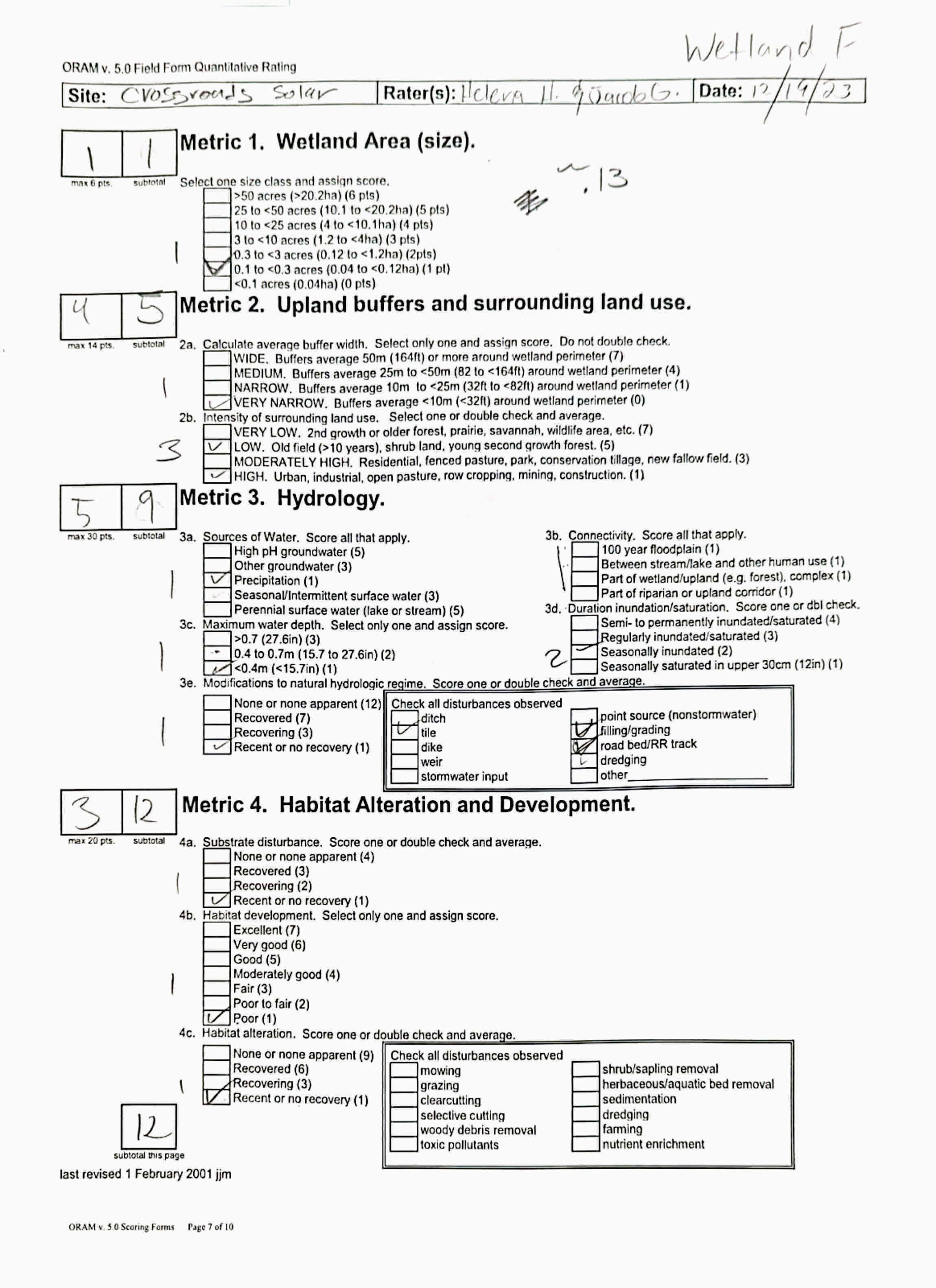
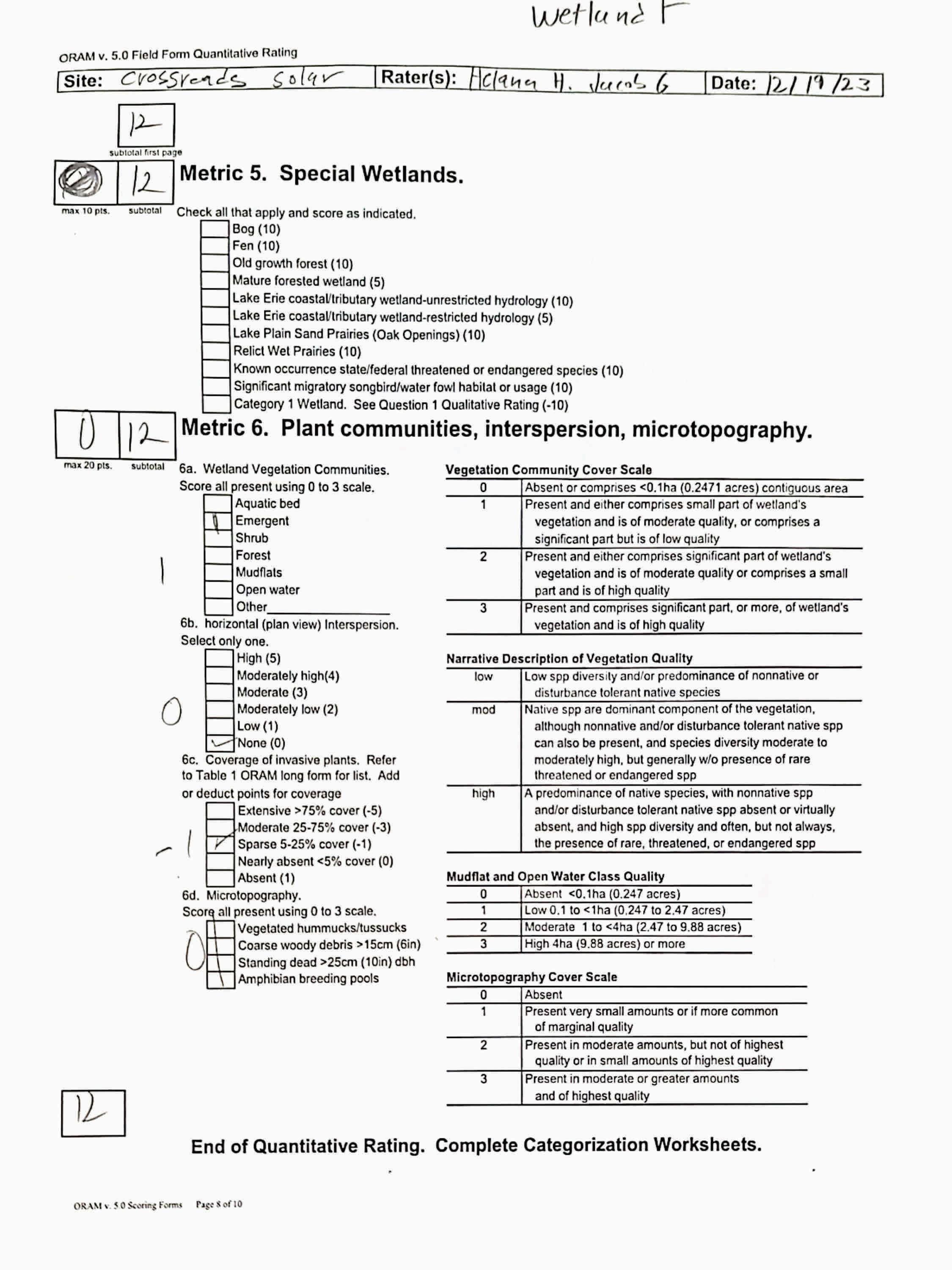
Name of Wetland:
WetlandF
Vegetation Communit(ies):
PEM
HGM Class(es):
IAIB Figure9
Location of Wetland:include map, address, north arrow, landmarks, distances, roads, etc.
Lat/Long or UTM Coordinate
USGS Quad Name County Township Section and Subsection
Hydrologic Unit Code
Site Visit
National Wetland Inventory Map
Ohio Wetland Inventory Map
Soil Survey
Delineation report/map
Wetland Size (acres, hectares):
Sketch:Include north arrow, relationship with other surface waters, vegetation zones, etc.
SeeFigure9
Comments, Narrative Discussion, Justification of Category Changes:
N/A
INSTRUCTIONS. The initial step in completing the ORAM is to identify the “scoring boundaries” of the wetland being rated. In many instances this determination will be relatively easy and the scoring boundaries will coincide with the “jurisdictional boundaries.” For example, the scoring boundary of an isolated cattail marsh located in the middle of a farm field will likely be the same as that wetland’s jurisdictional boundaries. In other instances, however, the scoring boundary will not be as easily determined. Wetlands that are small or isolated from other surface waters often form large contiguous areas or heterogeneous complexes of wetland and upland.In separating wetlands for scoring purposes, the hydrologic regime of the wetland is the main criterion that should be used. Boundaries between contiguous or connected wetlands should be established where the volume, flow, or velocity of water moving through the wetland changes significantly. Areas with a high degree of hydrologic interaction should be scored as a single wetland. In determining a wetland’s scoring boundaries, use the guidelines in the ORAM Manual Section 5.0. In certain instances, it may be difficult to establish the scoring boundary for the wetland being rated. These problem situations include wetlands that form a patchwork on the landscape, wetlands divided by artificial boundaries like property fences, roads, or railroad embankments, wetlands that are contiguous with streams, lakes, or rivers, and estuarine or coastal wetlands. These situations are discussed below, however, it is recommended that Rater contact Ohio EPA, Division of Surface Water, 401/Wetlands Sectionif there are additional questions or a need for further clarification of the appropriate scoring boundaries of a particular wetland.
# Steps in properly establishing scoring boundariesdone?not applicable
Step 1 Identify the wetland area of interest. This may be the site of a proposed impact, a reference site, conservation site, etc.
Step 2 Identify the locations where there is physical evidence that hydrology changes rapidly. Suchevidence includes both natural and humaninduced changes including, constrictions caused by berms or dikes, points where the water velocity changes rapidly at rapids or falls, points where significant inflows occur at the confluence of rivers, or other factors that may restrict hydrologic interaction between the wetlands or parts of a single wetland.
Step 3 Delineate the boundary of the wetland to be rated such that all areas of interest that are contiguous to and within the areas where the hydrology does not change significantly, i.e. areas that have a high degree of hydrologic interaction are included within the scoring boundary.
Step 4 Determine if artificial boundaries, such as property lines, state lines, roads, railroad embankments, etc., are present. These should not be used to establish scoring boundaries unless they coincide with areas where the hydrologic regime changes.
Step 5 In all instances, the Rater may enlarge the minimum scoring boundaries discussed here to score together wetlands that could be scored separately.
Step 6 Consult ORAM Manual Section 5.0 for how to establish scoring boundaries for wetlands that form a patchwork on the landscape, divided by artificial boundaries, contiguous to streams, lakes or rivers, or for dual classifications.
End of Scoring Boundary Determination. Begin Narrative Rating on next page. X X X X X X
INSTRUCTIONS. Answer each of the following questions. Questions 1, 2, 3 and 4 should be answered based on information obtained from the site visit or the literature and by submitting a Data Services Request to the Ohio Department of Natural Resources, Division of Natural Areas and Preserves, Natural Heritage Data Services, 1889 Fountain Square Court, Building F-1, Columbus, Ohio 43224, 614-265-6453 (phone), 614-265-3096 (fax), http://www.dnr.state.oh.us/dnap . The remaining questions are designed to be answered primarily by the results of the site visit. Refer to the User’s Manual for descriptionsof these wetland types. Note: "Critical habitat" is legally defined in the Endangered Species Act and is the geographic area containing physical or biological features essential to the conservation of a listed species or as an area that may require special management considerations or protection. The Rater should contact the Region 3 Headquarters or the ColumbusEcological Services Office for updates as to whether critical habitat has been designated for other federally listed threatened or endangeredspecies. “Documented” means the wetland is listed in the appropriate State of Ohio database.
1 Critical Habitat. Is the wetland in a township, section, or subsection of a United States Geological Survey 7.5 minute Quadrangle that has been designated by the U.S. Fish and Wildlife Service as "critical habitat"for any threatened or endangered plant or animal species?
Note: as of January 1, 2001, of the federally listed endangered or threatened species which can be found inOhio, the Indiana Bat has had critical habitat designated (50 CFR 17.95(a)) and the piping plover has had critical habitat proposed (65 FR 41812 July 6, 2000).
2 Threatened or Endangered Species. Is the wetland known to contain an individual of, or documented occurrences of federal or state-listed threatened or endangered plant or animal species?
3 Documented High Quality Wetland. Is the wetland on record in Natural Heritage Database as a high quality wetland?
should be evaluated for possible Category 3 status
2
is a Category 3 wetland
4
4 Significant Breeding or Concentration Area. Does the wetland contain documented regionally significant breeding or nonbreeding waterfowl, neotropical songbird, or shorebird concentration areas?
5 Category 1 Wetlands. Is the wetland less than 0.5 hectares (1 acre) in size and hydrologically isolated and either 1) comprised of vegetation that is dominated (greater than eighty per cent areal cover) by Phalaris arundinacea, Lythrum salicaria, or Phragmites australis, or 2)anacidic pond created or excavated on mined lands that has little or no vegetation?
6 Bogs. Is the wetland a peat-accumulating wetland that 1) has no significant inflows or outflows, 2) supports acidophilic mosses, particularly Sphagnum spp., 3) the acidophilic mosseshave >30% cover, 4) at least one species from Table 1 is present, and 5) the cover of invasive species (see Table 1) is <25%?
7 Fens. Is the wetland a carbon accumulating (peat, muck) wetland that is saturated during most of the year, primarily by a discharge of free flowing, mineral rich, ground water with a circumneutral ph (5.5-9.0) and with one or more plant species listed in Table 1 and the cover of invasive species listed in Table 1 is <25%?
8a "Old Growth Forest." Is the wetland a forestedwetland and is the forest characterized by, but not limited to, the following characteristics: overstory canopy trees of great age (exceeding at least 50% of a projected maximum attainable age for a species); little or no evidence of human-caused understory disturbance during the past 80 to 100 years; an all-aged structure and multilayered canopies; aggregations of canopy trees interspersed with canopy gaps; and significant numbers of standing dead snags and downed logs?
Wetland is a Category 3 wetland
to Question 5
Wetland is a Category 1 wetland Go to Question 6
YES
Wetland is a Category 3 wetland
Go to Question 7 NO
Go to Question 7
YES
Wetland is a Category 3 wetland
Go to Question 8a NO Go to Question 8a
YES
Wetland is a Category 3 wetland.
Go to Question 8b NO Go to Question 8b
8b Mature forested wetlands. Is the wetland a forested wetland with 50% or more of the cover of upper forest canopy consisting of deciduous trees with large diameters at breast height (dbh), generally diameters greater than 45cm (17.7in) dbh?
YES
Wetland should be evaluated for possible Category 3 status. Go to Question 9a NO
9a Lake Erie coastal and tributary wetlands. Is the wetland located at an elevation less than 575 feet on the USGS map, adjacent to this elevation, or along a tributary to Lake Erie that is accessible to fish? YES Go to Question 9b
9b Does the wetland's hydrology result from measures designed to prevent erosion and the loss of aquatic plants, i.e. the wetland is partially hydrologically restricted from Lake Erie due to lakeward or landward dikes or other hydrological controls? YES
Wetland should be evaluated for possible Category 3 status Go to Question 10 NO
to Question 9a
9c AreLake Erie water levels the wetland's primary hydrological influence, i.e. the wetland is hydrologically unrestricted (no lakeward or upland border alterations), or the wetland can be characterized as an "estuarine" wetland with lake and river influenced hydrology. These include sandbar deposition wetlands, estuarine wetlands, river mouth wetlands, or those dominated by submersed aquatic vegetation.
9d Does the wetland have a predominance of native species within its vegetation communities, although non-native or disturbance tolerant native species can also be present?
to Question 9d
Wetland is a Category 3 wetland
to Question 10
9e Does the wetland have a predominance of non-native or disturbance tolerant native plant species within its vegetation communities? YES Wetland should be evaluated for possible Category 3 status Go to Question 10
10 Lake Plain Sand Prairies (Oak Openings) Is the wetland located in Lucas, Fulton, Henry, or Wood Counties and can the wetland be characterized by the following description: the wetland has a sandy substrate with interspersed organic matter, a water table often within several inches of the surface, and often with a dominance of the gramineous vegetation listed in Table 1 (woody species may also be present). The Ohio Department of Natural Resources Division of Natural Areas and Preserves can provide assistance in confirming this type of wetland and its quality. YES
11 Relict Wet Prairies. Is the wetland a relict wet prairie community dominated by some or all of the species in Table 1. Extensive prairies were formerly located in the Darby Plains (Madison and Union Counties), Sandusky Plains (Wyandot, Crawford, and Marion Counties), northwest Ohio(e.g.Erie, Huron, Lucas, WoodCounties), and portions of western Ohio Counties (e.g. Darke, Mercer, Miami, Montgomery, Van Wert etc.).
Wetland is a Category 3 wetland.
Go to Question 11
YES
Wetland should be evaluated for possible Category 3 status
Complete Quantitative Rating
to Question 10
to Question 9c
10
to Question 9e
10
to Question 11
Quantitative Rating
Table 1. Characteristic plant species. invasive/exotic spp fen speciesbog species0ak Opening specieswet prairie species
Lythrum salicaria
Myriophyllum spicatum
Najas minor
Phalaris arundinacea
Phragmites australis
Potamogeton crispus
Ranunculus ficaria
Rhamnus frangula
Typha angustifolia
Typha xglauca
Zygadenus elegans var. glaucus
Cacalia plantaginea
Carex flava
Carex sterilis
Carexstricta
Deschampsia caespitosa
Eleocharis rostellata
Eriophorum viridicarinatum
Gentianopsis spp.
Lobelia kalmii
Parnassia glauca
Potentilla fruticosa
Rhamnus alnifolia
Rhynchospora capillacea
Salix candida
Salix myricoides
Salix serissima
Solidago ohioensis
Tofieldia glutinosa
Triglochin maritimum
Triglochin palustre
Calla palustris
Carex atlantica var. capillacea
Carex echinata
Carex oligosperma
Carex trisperma
Chamaedaphne calyculata
Decodon verticillatus
Eriophorum virginicum
Larix laricina
Nemopanthus mucronatus
Schechzeria palustris
Sphagnum spp.
Vaccinium macrocarpon
Vaccinium corymbosum
Vaccinium oxycoccos
Woodwardia virginica
Xyris difformis
Carex cryptolepis
Carex lasiocarpa
Carex stricta
Cladium mariscoides
Calamagrostis stricta
Calamagrostis canadensis
Quercus palustris
End of Narrative Rating. Begin Quantitative Rating on next page.
Calamagrostis canadensis
Calamogrostis stricta
Carex atherodes
Carex buxbaumii
Carex pellita
Carex sartwellii
Gentiana andrewsii
Helianthus grosseserratus
Liatris spicata
Lysimachia quadriflora
Lythrum alatum
Pycnanthemum virginianum
Silphium terebinthinaceum
Sorghastrum nutans
Spartina pectinata
Solidago riddellii
circle answer or insert score
Narrative Rating Question 1 Critical HabitatYES NOIf yes, Category 3.
Question 2. Threatened or Endangered Species YES NOIf yes, Category 3.
Question 3. High Quality Natural WetlandYES NOIf yes, Category 3.
Question 4. Significant bird habitatYES NOIf yes, Category 3.
Question 5. Category 1 WetlandsYES NOIf yes, Category 1.
Question 6. BogsYES NOIf yes, Category 3.
Question 7. FensYES NOIf yes, Category 3.
Question 8a. Old Growth ForestYES NOIf yes, Category 3.
Question 8b. Mature Forested WetlandYES NOIf yes, evaluate for Category 3; may also be 1 or 2.
Question 9b. Lake Erie WetlandsRestricted YES NOIf yes, evaluate for Category 3; may also be 1 or 2.
Question 9d. Lake Erie Wetlands –Unrestricted with native plants YES NOIf yes, Category 3
Question 9e. Lake Erie WetlandsUnrestricted with invasive plants YES NOIf yes, evaluate for Category 3; may also be 1 or 2.
Question 10. Oak OpeningsYES NOIf yes, Category 3
Question 11. Relict Wet PrairiesYES NOIf yes, evaluate for Category 3; may alsobe 1 or 2.
Quantitative Rating
Metric 1. Size
Metric 2. Buffers and surrounding land use
Metric 3. Hydrology
Metric 4. Habitat
Metric 5. Special Wetland Communities
Metric 6. Plant communities, interspersion, microtopography
Choices Circle one
Did you answer "Yes" to any of the following questions:
Narrative Rating Nos. 2, 3, 4, 6, 7, 8a, 9d, 10
Did you answer "Yes" to any of the following questions:
Narrative Rating Nos. 1, 8b, 9b,9e, 11
Did you answer "Yes" to
Narrative Rating No. 5
Does the quantitative score fall within the scoring range of a Category 1, 2, or 3 wetland?
Does the quantitative score fall with the "gray zone" for Category 1 or 2 or Category 2 or 3 wetlands?
YES
Wetland is categorized as a Category 3 wetland
YES
Wetland should be evaluated for possible Category 3 status
YES
Wetland is categorized as a Category 1 wetland
YES
Wetland is assigned to the appropriate category based on the scoring range
YES
Wetland is assigned to the higher of the two categories or assigned to a category based on detailed assessments and the narrative criteria
NO
Does the wetland otherwise exhibit moderate OR superior hydrologic OR habitat, OR recreational functions AND the wetland was not categorized as a Category 2 wetland (in the case of moderate functions) or a Category 3 wetland (in the case of superior functions) by this method?
YES
Wetland was undercategorized by this method. A written justification for recategorization should be provided on Background Information Form
NO
NO
NO
NO
Evaluation of Categorization Result of ORAM
Is quantitative rating score less than the Category 2 scoring threshold (excluding gray zone)? If yes, reevaluate the category of the wetlandusing the narrative criteria in OAC Rule 3745-1-54(C) and biological and/or functional assessments to determine if the wetland has been overcategorized by the ORAM
Evaluate the wetland using the 1) narrative criteria in OAC Rule 3745-1-54(C) and 2) the quantitative rating score. If the wetland is determined to be a Category 3 wetland using either of these, it should be categorized as a Category 3 wetland. Detailed biological and/or functional assessments may also be used to determine the wetland's category.
Is quantitative rating score greater than the Category 2 scoring threshold (including any gray zone)? If yes, reevaluate the category of the wetland using the narrative criteria in OAC Rule 3745-1-54(C) and biological and/or functional assessments to determine if the wetland has been under-categorized by the ORAM
If the score of the wetland is located within the scoring range for a particular category, the wetland should be assigned to that category. In all instances however, the narrative criteria described in OAC Rule 3745-1-54(C) can be used to clarify or change a categorization based on a quantitative score.
Rater has the option of assigning the wetland to the higher of the two categories or to assign a category based on the results of a nonrapid wetland assessment method, e.g. functional assessment, biological assessment, etc, and a consideration of the narrative criteria in OAC rule 3745-154(C).
NO
Wetland is assigned to category as determined by the ORAM.
A wetland may be undercategorized using this method, but still exhibit one or more superior functions, e.g. a wetland's biotic communities may be degraded by human activities, but thewetland may still exhibit superior hydrologic functions because of its type, landscape position, size, local or regional significance, etc. In this circumstance, the narrative criteria in OAC Rule 3745-1-54(C)(2) and (3) are controlling, and the under-categorization should be corrected. A written justification with supporting reasons or information for this determination should be provided. Final Category
Choose one Category 1Category 2 Category 3
Name:
Date:
HelenaHayter/JacobGeorge 12/18/2023
Affiliation:
VerdantasLLC
Address:
4HemisphereWayBedford,OH44146
Phone Number:
+1440-232-9945
e-mail address:
Name of Wetland:
Vegetation Communit(ies):
HGM Class(es):
jgeorge@verdantas.com WetlandG PEMPF0 IAIB
Location of Wetland:include map, address, north arrow, landmarks, distances, roads, etc.
Lat/Long or UTM Coordinate
USGS Quad Name County Township Section and Subsection
Hydrologic Unit Code
Site Visit
National Wetland Inventory Map
Ohio Wetland Inventory Map
Soil Survey
Delineation report/map
Nameof
Wetland Size (acres, hectares):
Sketch:Include north arrow, relationship with other surface waters, vegetation zones, etc.
Comments, Narrative Discussion, Justification of Category Changes:
INSTRUCTIONS. The initial step in completing the ORAM is to identify the “scoring boundaries” of the wetland being rated. In many instances this determination will be relatively easy and the scoring boundaries will coincide with the “jurisdictional boundaries.” For example, the scoring boundary of an isolated cattail marsh located in the middle of a farm field will likely be the same as that wetland’s jurisdictional boundaries. In other instances, however, the scoring boundary will not be as easily determined. Wetlands that are small or isolated from other surface waters often form large contiguous areas or heterogeneous complexes of wetland and upland.In separating wetlands for scoring purposes, the hydrologic regime of the wetland is the main criterion that should be used. Boundaries between contiguous or connected wetlands should be established where the volume, flow, or velocity of water moving through the wetland changes significantly. Areas with a high degree of hydrologic interaction should be scored as a single wetland. In determining a wetland’s scoring boundaries, use the guidelines in the ORAM Manual Section 5.0. In certain instances, it may be difficult to establish the scoring boundary for the wetland being rated. These problem situations include wetlands that form a patchwork on the landscape, wetlands divided by artificial boundaries like property fences, roads, or railroad embankments, wetlands that are contiguous with streams, lakes, or rivers, and estuarine or coastal wetlands. These situations are discussed below, however, it is recommended that Rater contact Ohio EPA, Division of Surface Water, 401/Wetlands Sectionif there are additional questions or a need for further clarification of the appropriate scoring boundaries of a particular wetland.
# Steps in properly establishing scoring boundariesdone?not applicable
Step 1 Identify the wetland area of interest. This may be the site of a proposed impact, a reference site, conservation site, etc.
Step 2 Identify the locations where there is physical evidence that hydrology changes rapidly. Suchevidence includes both natural and humaninduced changes including, constrictions caused by berms or dikes, points where the water velocity changes rapidly at rapids or falls, points where significant inflows occur at the confluence of rivers, or other factors that may restrict hydrologic interaction between the wetlands or parts of a single wetland.
Step 3 Delineate the boundary of the wetland to be rated such that all areas of interest that are contiguous to and within the areas where the hydrology does not change significantly, i.e. areas that have a high degree of hydrologic interaction are included within the scoring boundary.
Step 4 Determine if artificial boundaries, such as property lines, state lines, roads, railroad embankments, etc., are present. These should not be used to establish scoring boundaries unless they coincide with areas where the hydrologic regime changes.
Step 5 In all instances, the Rater may enlarge the minimum scoring boundaries discussed here to score together wetlands that could be scored separately.
Step 6 Consult ORAM Manual Section 5.0 for how to establish scoring boundaries for wetlands that form a patchwork on the landscape, divided by artificial boundaries, contiguous to streams, lakes or rivers, or for dual classifications.
End of Scoring Boundary Determination. Begin Narrative Rating on next page. X X X X X X
INSTRUCTIONS. Answer each of the following questions. Questions 1, 2, 3 and 4 should be answered based on information obtained from the site visit or the literature and by submitting a Data Services Request to the Ohio Department of Natural Resources, Division of Natural Areas and Preserves, Natural Heritage Data Services, 1889 Fountain Square Court, Building F-1, Columbus, Ohio 43224, 614-265-6453 (phone), 614-265-3096 (fax), http://www.dnr.state.oh.us/dnap . The remaining questions are designed to be answered primarily by the results of the site visit. Refer to the User’s Manual for descriptionsof these wetland types. Note: "Critical habitat" is legally defined in the Endangered Species Act and is the geographic area containing physical or biological features essential to the conservation of a listed species or as an area that may require special management considerations or protection. The Rater should contact the Region 3 Headquarters or the ColumbusEcological Services Office for updates as to whether critical habitat has been designated for other federally listed threatened or endangeredspecies. “Documented” means the wetland is listed in the appropriate State of Ohio database.
1 Critical Habitat. Is the wetland in a township, section, or subsection of a United States Geological Survey 7.5 minute Quadrangle that has been designated by the U.S. Fish and Wildlife Service as "critical habitat"for any threatened or endangered plant or animal species?
Note: as of January 1, 2001, of the federally listed endangered or threatened species which can be found inOhio, the Indiana Bat has had critical habitat designated (50 CFR 17.95(a)) and the piping plover has had critical habitat proposed (65 FR 41812 July 6, 2000).
2 Threatened or Endangered Species. Is the wetland known to contain an individual of, or documented occurrences of federal or state-listed threatened or endangered plant or animal species?
3 Documented High Quality Wetland. Is the wetland on record in Natural Heritage Database as a high quality wetland?
should be evaluated for possible Category 3 status
2
is a Category 3 wetland
4
4 Significant Breeding or Concentration Area. Does the wetland contain documented regionally significant breeding or nonbreeding waterfowl, neotropical songbird, or shorebird concentration areas?
5 Category 1 Wetlands. Is the wetland less than 0.5 hectares (1 acre) in size and hydrologically isolated and either 1) comprised of vegetation that is dominated (greater than eighty per cent areal cover) by Phalaris arundinacea, Lythrum salicaria, or Phragmites australis, or 2)anacidic pond created or excavated on mined lands that has little or no vegetation?
6 Bogs. Is the wetland a peat-accumulating wetland that 1) has no significant inflows or outflows, 2) supports acidophilic mosses, particularly Sphagnum spp., 3) the acidophilic mosseshave >30% cover, 4) at least one species from Table 1 is present, and 5) the cover of invasive species (see Table 1) is <25%?
7 Fens. Is the wetland a carbon accumulating (peat, muck) wetland that is saturated during most of the year, primarily by a discharge of free flowing, mineral rich, ground water with a circumneutral ph (5.5-9.0) and with one or more plant species listed in Table 1 and the cover of invasive species listed in Table 1 is <25%?
8a "Old Growth Forest." Is the wetland a forestedwetland and is the forest characterized by, but not limited to, the following characteristics: overstory canopy trees of great age (exceeding at least 50% of a projected maximum attainable age for a species); little or no evidence of human-caused understory disturbance during the past 80 to 100 years; an all-aged structure and multilayered canopies; aggregations of canopy trees interspersed with canopy gaps; and significant numbers of standing dead snags and downed logs?
Wetland is a Category 3 wetland
to Question 5
Wetland is a Category 1 wetland Go to Question 6
YES
Wetland is a Category 3 wetland
Go to Question 7 NO
Go to Question 7
YES
Wetland is a Category 3 wetland
Go to Question 8a NO Go to Question 8a
YES
Wetland is a Category 3 wetland.
Go to Question 8b NO Go to Question 8b
8b Mature forested wetlands. Is the wetland a forested wetland with 50% or more of the cover of upper forest canopy consisting of deciduous trees with large diameters at breast height (dbh), generally diameters greater than 45cm (17.7in) dbh?
YES
Wetland should be evaluated for possible Category 3 status. Go to Question 9a NO
9a Lake Erie coastal and tributary wetlands. Is the wetland located at an elevation less than 575 feet on the USGS map, adjacent to this elevation, or along a tributary to Lake Erie that is accessible to fish? YES Go to Question 9b
9b Does the wetland's hydrology result from measures designed to prevent erosion and the loss of aquatic plants, i.e. the wetland is partially hydrologically restricted from Lake Erie due to lakeward or landward dikes or other hydrological controls? YES
Wetland should be evaluated for possible Category 3 status Go to Question 10 NO
to Question 9a
9c AreLake Erie water levels the wetland's primary hydrological influence, i.e. the wetland is hydrologically unrestricted (no lakeward or upland border alterations), or the wetland can be characterized as an "estuarine" wetland with lake and river influenced hydrology. These include sandbar deposition wetlands, estuarine wetlands, river mouth wetlands, or those dominated by submersed aquatic vegetation.
9d Does the wetland have a predominance of native species within its vegetation communities, although non-native or disturbance tolerant native species can also be present?
to Question 9d
Wetland is a Category 3 wetland
to Question 10
9e Does the wetland have a predominance of non-native or disturbance tolerant native plant species within its vegetation communities? YES Wetland should be evaluated for possible Category 3 status Go to Question 10
10 Lake Plain Sand Prairies (Oak Openings) Is the wetland located in Lucas, Fulton, Henry, or Wood Counties and can the wetland be characterized by the following description: the wetland has a sandy substrate with interspersed organic matter, a water table often within several inches of the surface, and often with a dominance of the gramineous vegetation listed in Table 1 (woody species may also be present). The Ohio Department of Natural Resources Division of Natural Areas and Preserves can provide assistance in confirming this type of wetland and its quality. YES
11 Relict Wet Prairies. Is the wetland a relict wet prairie community dominated by some or all of the species in Table 1. Extensive prairies were formerly located in the Darby Plains (Madison and Union Counties), Sandusky Plains (Wyandot, Crawford, and Marion Counties), northwest Ohio(e.g.Erie, Huron, Lucas, WoodCounties), and portions of western Ohio Counties (e.g. Darke, Mercer, Miami, Montgomery, Van Wert etc.).
Wetland is a Category 3 wetland.
Go to Question 11
YES
Wetland should be evaluated for possible Category 3 status
Complete Quantitative Rating
to Question 10
to Question 9c
10
to Question 9e
10
to Question 11
Quantitative Rating
Table 1. Characteristic plant species. invasive/exotic spp fen speciesbog species0ak Opening specieswet prairie species
Lythrum salicaria
Myriophyllum spicatum
Najas minor
Phalaris arundinacea
Phragmites australis
Potamogeton crispus
Ranunculus ficaria
Rhamnus frangula
Typha angustifolia
Typha xglauca
Zygadenus elegans var. glaucus
Cacalia plantaginea
Carex flava
Carex sterilis
Carexstricta
Deschampsia caespitosa
Eleocharis rostellata
Eriophorum viridicarinatum
Gentianopsis spp.
Lobelia kalmii
Parnassia glauca
Potentilla fruticosa
Rhamnus alnifolia
Rhynchospora capillacea
Salix candida
Salix myricoides
Salix serissima
Solidago ohioensis
Tofieldia glutinosa
Triglochin maritimum
Triglochin palustre
Calla palustris
Carex atlantica var. capillacea
Carex echinata
Carex oligosperma
Carex trisperma
Chamaedaphne calyculata
Decodon verticillatus
Eriophorum virginicum
Larix laricina
Nemopanthus mucronatus
Schechzeria palustris
Sphagnum spp.
Vaccinium macrocarpon
Vaccinium corymbosum
Vaccinium oxycoccos
Woodwardia virginica
Xyris difformis
Carex cryptolepis
Carex lasiocarpa
Carex stricta
Cladium mariscoides
Calamagrostis stricta
Calamagrostis canadensis
Quercus palustris
End of Narrative Rating. Begin Quantitative Rating on next page.
Calamagrostis canadensis
Calamogrostis stricta
Carex atherodes
Carex buxbaumii
Carex pellita
Carex sartwellii
Gentiana andrewsii
Helianthus grosseserratus
Liatris spicata
Lysimachia quadriflora
Lythrum alatum
Pycnanthemum virginianum
Silphium terebinthinaceum
Sorghastrum nutans
Spartina pectinata
Solidago riddellii
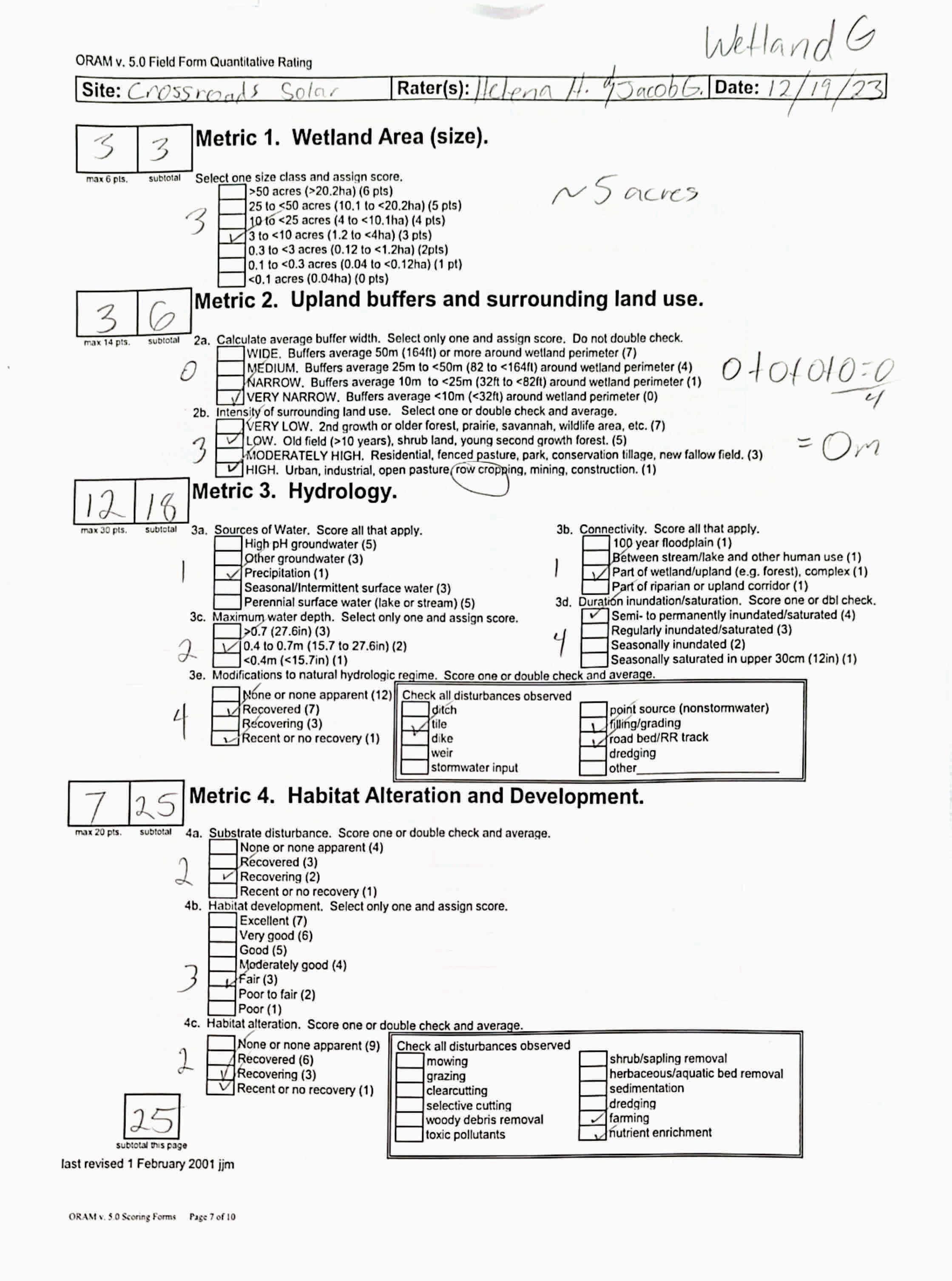
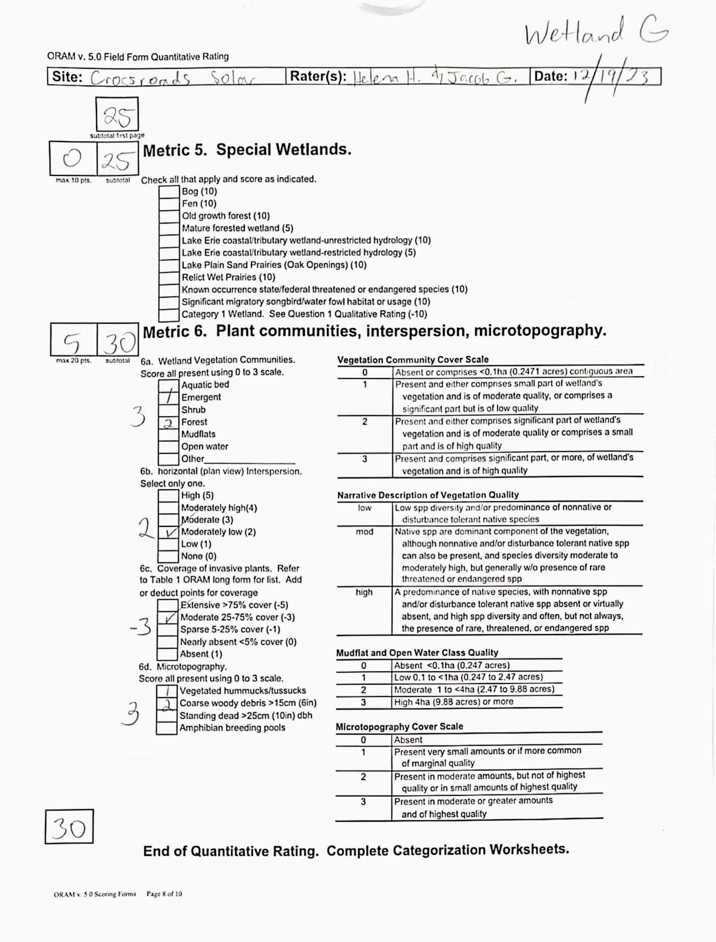
circle answer or insert score
Narrative Rating Question 1 Critical HabitatYES NOIf yes, Category 3.
Question 2. Threatened or Endangered Species YES NOIf yes, Category 3.
Question 3. High Quality Natural WetlandYES NOIf yes, Category 3.
Question 4. Significant bird habitatYES NOIf yes, Category 3.
Question 5. Category 1 WetlandsYES NOIf yes, Category 1.
Question 6. BogsYES NOIf yes, Category 3.
Question 7. FensYES NOIf yes, Category 3.
Question 8a. Old Growth ForestYES NOIf yes, Category 3.
Question 8b. Mature Forested WetlandYES NOIf yes, evaluate for Category 3; may also be 1 or 2.
Question 9b. Lake Erie WetlandsRestricted YES NOIf yes, evaluate for Category 3; may also be 1 or 2.
Question 9d. Lake Erie Wetlands –Unrestricted with native plants YES NOIf yes, Category 3
Question 9e. Lake Erie WetlandsUnrestricted with invasive plants YES NOIf yes, evaluate for Category 3; may also be 1 or 2.
Question 10. Oak OpeningsYES NOIf yes, Category 3
Question 11. Relict Wet PrairiesYES NOIf yes, evaluate for Category 3; may alsobe 1 or 2.
Quantitative Rating
Metric 1. Size
Metric 2. Buffers and surrounding land use
Metric 3. Hydrology
Metric 4. Habitat
Metric 5. Special Wetland Communities
Metric 6. Plant communities, interspersion, microtopography
Choices Circle one
Did you answer "Yes" to any of the following questions:
Narrative Rating Nos. 2, 3, 4, 6, 7, 8a, 9d, 10
Did you answer "Yes" to any of the following questions:
Narrative Rating Nos. 1, 8b, 9b,9e, 11
Did you answer "Yes" to
Narrative Rating No. 5
Does the quantitative score fall within the scoring range of a Category 1, 2, or 3 wetland?
Does the quantitative score fall with the "gray zone" for Category 1 or 2 or Category 2 or 3 wetlands?
YES
Wetland is categorized as a Category 3 wetland
YES
Wetland should be evaluated for possible Category 3 status
YES
Wetland is categorized as a Category 1 wetland
YES
Wetland is assigned to the appropriate category based on the scoring range
YES
Wetland is assigned to the higher of the two categories or assigned to a category based on detailed assessments and the narrative criteria
NO
Does the wetland otherwise exhibit moderate OR superior hydrologic OR habitat, OR recreational functions AND the wetland was not categorized as a Category 2 wetland (in the case of moderate functions) or a Category 3 wetland (in the case of superior functions) by this method?
YES
Wetland was undercategorized by this method. A written justification for recategorization should be provided on Background Information Form
NO
NO
NO
NO
Evaluation of Categorization Result of ORAM
Is quantitative rating score less than the Category 2 scoring threshold (excluding gray zone)? If yes, reevaluate the category of the wetlandusing the narrative criteria in OAC Rule 3745-1-54(C) and biological and/or functional assessments to determine if the wetland has been overcategorized by the ORAM
Evaluate the wetland using the 1) narrative criteria in OAC Rule 3745-1-54(C) and 2) the quantitative rating score. If the wetland is determined to be a Category 3 wetland using either of these, it should be categorized as a Category 3 wetland. Detailed biological and/or functional assessments may also be used to determine the wetland's category.
Is quantitative rating score greater than the Category 2 scoring threshold (including any gray zone)? If yes, reevaluate the category of the wetland using the narrative criteria in OAC Rule 3745-1-54(C) and biological and/or functional assessments to determine if the wetland has been under-categorized by the ORAM
If the score of the wetland is located within the scoring range for a particular category, the wetland should be assigned to that category. In all instances however, the narrative criteria described in OAC Rule 3745-1-54(C) can be used to clarify or change a categorization based on a quantitative score.
Rater has the option of assigning the wetland to the higher of the two categories or to assign a category based on the results of a nonrapid wetland assessment method, e.g. functional assessment, biological assessment, etc, and a consideration of the narrative criteria in OAC rule 3745-154(C).
NO
Wetland is assigned to category as determined by the ORAM.
A wetland may be undercategorized using this method, but still exhibit one or more superior functions, e.g. a wetland's biotic communities may be degraded by human activities, but thewetland may still exhibit superior hydrologic functions because of its type, landscape position, size, local or regional significance, etc. In this circumstance, the narrative criteria in OAC Rule 3745-1-54(C)(2) and (3) are controlling, and the under-categorization should be corrected. A written justification with supporting reasons or information for this determination should be provided. Final Category
Choose one Category 1Category 2 Category 3
Name:
Date:
HelenaHayter/JacobGeorge 12/18/2023
Affiliation:
VerdantasLLC
Address:
4HemisphereWayBedford,OH44146
Phone Number:
+1440-232-9945
e-mail address:
jgeorge@verdantas.com
Name of Wetland:
Vegetation Communit(ies):
HGM Class(es):
Location of Wetland:include map, address, north arrow, landmarks, distances, roads, etc.
WetlandH PFO IA Figure9
Lat/Long or UTM Coordinate
USGS Quad Name County Township Section and Subsection
Hydrologic Unit Code
Site Visit
National Wetland Inventory Map
Ohio Wetland Inventory Map
Soil Survey
Delineation report/map
Wetland Size (acres, hectares):
Sketch:Include north arrow, relationship with other surface waters, vegetation zones, etc.
SeeFigure9
Comments, Narrative Discussion, Justification of Category Changes:
N/A
INSTRUCTIONS. The initial step in completing the ORAM is to identify the “scoring boundaries” of the wetland being rated. In many instances this determination will be relatively easy and the scoring boundaries will coincide with the “jurisdictional boundaries.” For example, the scoring boundary of an isolated cattail marsh located in the middle of a farm field will likely be the same as that wetland’s jurisdictional boundaries. In other instances, however, the scoring boundary will not be as easily determined. Wetlands that are small or isolated from other surface waters often form large contiguous areas or heterogeneous complexes of wetland and upland.In separating wetlands for scoring purposes, the hydrologic regime of the wetland is the main criterion that should be used. Boundaries between contiguous or connected wetlands should be established where the volume, flow, or velocity of water moving through the wetland changes significantly. Areas with a high degree of hydrologic interaction should be scored as a single wetland. In determining a wetland’s scoring boundaries, use the guidelines in the ORAM Manual Section 5.0. In certain instances, it may be difficult to establish the scoring boundary for the wetland being rated. These problem situations include wetlands that form a patchwork on the landscape, wetlands divided by artificial boundaries like property fences, roads, or railroad embankments, wetlands that are contiguous with streams, lakes, or rivers, and estuarine or coastal wetlands. These situations are discussed below, however, it is recommended that Rater contact Ohio EPA, Division of Surface Water, 401/Wetlands Sectionif there are additional questions or a need for further clarification of the appropriate scoring boundaries of a particular wetland.
# Steps in properly establishing scoring boundariesdone?not applicable
Step 1 Identify the wetland area of interest. This may be the site of a proposed impact, a reference site, conservation site, etc.
Step 2 Identify the locations where there is physical evidence that hydrology changes rapidly. Suchevidence includes both natural and humaninduced changes including, constrictions caused by berms or dikes, points where the water velocity changes rapidly at rapids or falls, points where significant inflows occur at the confluence of rivers, or other factors that may restrict hydrologic interaction between the wetlands or parts of a single wetland.
Step 3 Delineate the boundary of the wetland to be rated such that all areas of interest that are contiguous to and within the areas where the hydrology does not change significantly, i.e. areas that have a high degree of hydrologic interaction are included within the scoring boundary.
Step 4 Determine if artificial boundaries, such as property lines, state lines, roads, railroad embankments, etc., are present. These should not be used to establish scoring boundaries unless they coincide with areas where the hydrologic regime changes.
Step 5 In all instances, the Rater may enlarge the minimum scoring boundaries discussed here to score together wetlands that could be scored separately.
Step 6 Consult ORAM Manual Section 5.0 for how to establish scoring boundaries for wetlands that form a patchwork on the landscape, divided by artificial boundaries, contiguous to streams, lakes or rivers, or for dual classifications.
End of Scoring Boundary Determination. Begin Narrative Rating on next page. X X X X X X
INSTRUCTIONS. Answer each of the following questions. Questions 1, 2, 3 and 4 should be answered based on information obtained from the site visit or the literature and by submitting a Data Services Request to the Ohio Department of Natural Resources, Division of Natural Areas and Preserves, Natural Heritage Data Services, 1889 Fountain Square Court, Building F-1, Columbus, Ohio 43224, 614-265-6453 (phone), 614-265-3096 (fax), http://www.dnr.state.oh.us/dnap . The remaining questions are designed to be answered primarily by the results of the site visit. Refer to the User’s Manual for descriptionsof these wetland types. Note: "Critical habitat" is legally defined in the Endangered Species Act and is the geographic area containing physical or biological features essential to the conservation of a listed species or as an area that may require special management considerations or protection. The Rater should contact the Region 3 Headquarters or the ColumbusEcological Services Office for updates as to whether critical habitat has been designated for other federally listed threatened or endangeredspecies. “Documented” means the wetland is listed in the appropriate State of Ohio database.
1 Critical Habitat. Is the wetland in a township, section, or subsection of a United States Geological Survey 7.5 minute Quadrangle that has been designated by the U.S. Fish and Wildlife Service as "critical habitat"for any threatened or endangered plant or animal species?
Note: as of January 1, 2001, of the federally listed endangered or threatened species which can be found inOhio, the Indiana Bat has had critical habitat designated (50 CFR 17.95(a)) and the piping plover has had critical habitat proposed (65 FR 41812 July 6, 2000).
2 Threatened or Endangered Species. Is the wetland known to contain an individual of, or documented occurrences of federal or state-listed threatened or endangered plant or animal species?
3 Documented High Quality Wetland. Is the wetland on record in Natural Heritage Database as a high quality wetland?
should be evaluated for possible Category 3 status
2
is a Category 3 wetland
4
4 Significant Breeding or Concentration Area. Does the wetland contain documented regionally significant breeding or nonbreeding waterfowl, neotropical songbird, or shorebird concentration areas?
5 Category 1 Wetlands. Is the wetland less than 0.5 hectares (1 acre) in size and hydrologically isolated and either 1) comprised of vegetation that is dominated (greater than eighty per cent areal cover) by Phalaris arundinacea, Lythrum salicaria, or Phragmites australis, or 2)anacidic pond created or excavated on mined lands that has little or no vegetation?
6 Bogs. Is the wetland a peat-accumulating wetland that 1) has no significant inflows or outflows, 2) supports acidophilic mosses, particularly Sphagnum spp., 3) the acidophilic mosseshave >30% cover, 4) at least one species from Table 1 is present, and 5) the cover of invasive species (see Table 1) is <25%?
7 Fens. Is the wetland a carbon accumulating (peat, muck) wetland that is saturated during most of the year, primarily by a discharge of free flowing, mineral rich, ground water with a circumneutral ph (5.5-9.0) and with one or more plant species listed in Table 1 and the cover of invasive species listed in Table 1 is <25%?
8a "Old Growth Forest." Is the wetland a forestedwetland and is the forest characterized by, but not limited to, the following characteristics: overstory canopy trees of great age (exceeding at least 50% of a projected maximum attainable age for a species); little or no evidence of human-caused understory disturbance during the past 80 to 100 years; an all-aged structure and multilayered canopies; aggregations of canopy trees interspersed with canopy gaps; and significant numbers of standing dead snags and downed logs?
Wetland is a Category 3 wetland
to Question 5
Wetland is a Category 1 wetland Go to Question 6
YES
Wetland is a Category 3 wetland
Go to Question 7 NO
Go to Question 7
YES
Wetland is a Category 3 wetland
Go to Question 8a NO Go to Question 8a
YES
Wetland is a Category 3 wetland.
Go to Question 8b NO Go to Question 8b
8b Mature forested wetlands. Is the wetland a forested wetland with 50% or more of the cover of upper forest canopy consisting of deciduous trees with large diameters at breast height (dbh), generally diameters greater than 45cm (17.7in) dbh?
YES
Wetland should be evaluated for possible Category 3 status.
Go to Question 9a NO
9a Lake Erie coastal and tributary wetlands. Is the wetland located at an elevation less than 575 feet on the USGS map, adjacent to this elevation, or along a tributary to Lake Erie that is accessible to fish? YES Go to Question 9b NO
9b Does the wetland's hydrology result from measures designed to prevent erosion and the loss of aquatic plants, i.e. the wetland is partially hydrologically restricted from Lake Erie due to lakeward or landward dikes or other hydrological controls? YES
Wetland should be evaluated for possible Category 3 status
Go to Question 10 NO
to Question 9a
to Question 10
to Question 9c
9c AreLake Erie water levels the wetland's primary hydrological influence, i.e. the wetland is hydrologically unrestricted (no lakeward or upland border alterations), or the wetland can be characterized as an "estuarine" wetland with lake and river influenced hydrology. These include sandbar deposition wetlands, estuarine wetlands, river mouth wetlands, or those dominated by submersed aquatic vegetation.
9d Does the wetland have a predominance of native species within its vegetation communities, although non-native or disturbance tolerant native species can also be present?
to Question 9d
Wetland is a Category 3 wetland Go to Question 10
9e Does the wetland have a predominance of non-native or disturbance tolerant native plant species within its vegetation communities? YES Wetland should be evaluated for possible Category 3 status
Go to Question 10
10 Lake Plain Sand Prairies (Oak Openings) Is the wetland located in Lucas, Fulton, Henry, or Wood Counties and can the wetland be characterized by the following description: the wetland has a sandy substrate with interspersed organic matter, a water table often within several inches of the surface, and often with a dominance of the gramineous vegetation listed in Table 1 (woody species may also be present). The Ohio Department of Natural Resources Division of Natural Areas and Preserves can provide assistance in confirming this type of wetland and its quality. YES
11 Relict Wet Prairies. Is the wetland a relict wet prairie community dominated by some or all of the species in Table 1. Extensive prairies were formerly located in the Darby Plains (Madison and Union Counties), Sandusky Plains (Wyandot, Crawford, and Marion Counties), northwest Ohio(e.g.Erie, Huron, Lucas, WoodCounties), and portions of western Ohio Counties (e.g. Darke, Mercer, Miami, Montgomery, Van Wert etc.).
Wetland is a Category 3 wetland.
Go to Question 11
YES
Wetland should be evaluated for possible Category 3 status
Complete Quantitative Rating
Question 10
to Question 9e
10
to Question 11
Quantitative Rating
Table 1. Characteristic plant species. invasive/exotic spp fen speciesbog species0ak Opening specieswet prairie species
Lythrum salicaria
Myriophyllum spicatum
Najas minor
Phalaris arundinacea
Phragmites australis
Potamogeton crispus
Ranunculus ficaria
Rhamnus frangula
Typha angustifolia
Typha xglauca
Zygadenus elegans var. glaucus
Cacalia plantaginea
Carex flava
Carex sterilis
Carexstricta
Deschampsia caespitosa
Eleocharis rostellata
Eriophorum viridicarinatum
Gentianopsis spp.
Lobelia kalmii
Parnassia glauca
Potentilla fruticosa
Rhamnus alnifolia
Rhynchospora capillacea
Salix candida
Salix myricoides
Salix serissima
Solidago ohioensis
Tofieldia glutinosa
Triglochin maritimum
Triglochin palustre
Calla palustris
Carex atlantica var. capillacea
Carex echinata
Carex oligosperma
Carex trisperma
Chamaedaphne calyculata
Decodon verticillatus
Eriophorum virginicum
Larix laricina
Nemopanthus mucronatus
Schechzeria palustris
Sphagnum spp.
Vaccinium macrocarpon
Vaccinium corymbosum
Vaccinium oxycoccos
Woodwardia virginica
Xyris difformis
Carex cryptolepis
Carex lasiocarpa
Carex stricta
Cladium mariscoides
Calamagrostis stricta
Calamagrostis canadensis
Quercus palustris
End of Narrative Rating. Begin Quantitative Rating on next page.
Calamagrostis canadensis
Calamogrostis stricta
Carex atherodes
Carex buxbaumii
Carex pellita
Carex sartwellii
Gentiana andrewsii
Helianthus grosseserratus
Liatris spicata
Lysimachia quadriflora
Lythrum alatum
Pycnanthemum virginianum
Silphium terebinthinaceum
Sorghastrum nutans
Spartina pectinata
Solidago riddellii
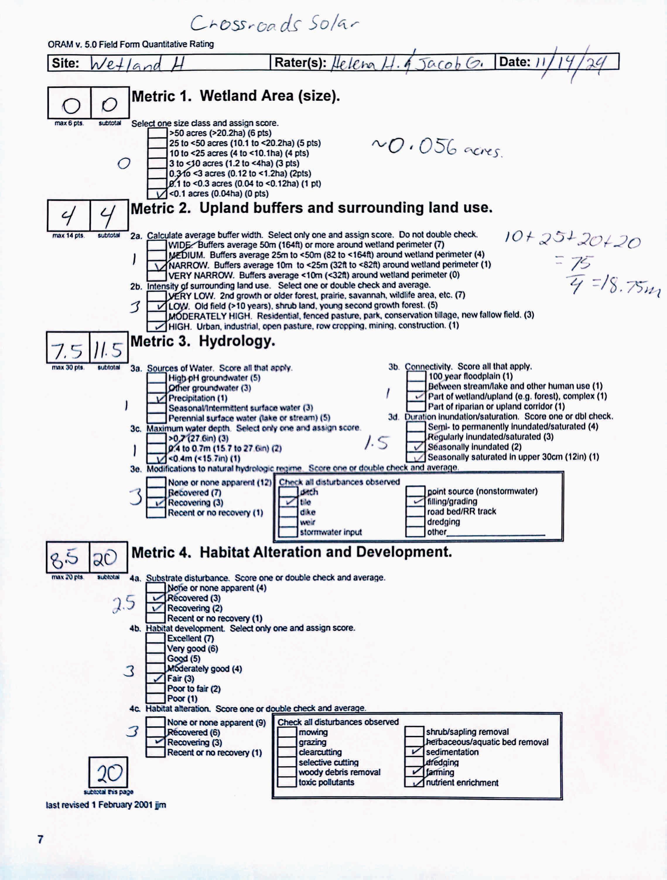

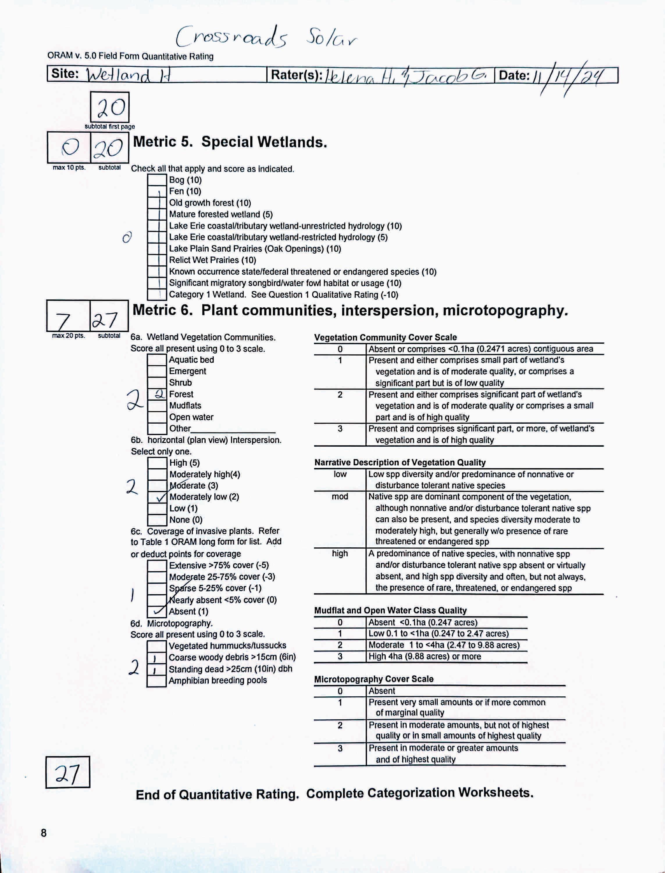
circle answer or insert score Result
Narrative Rating Question 1 Critical HabitatYES NOIf yes, Category 3.
Question 2. Threatened or Endangered Species YES NOIf yes, Category 3.
Question 3. High Quality Natural WetlandYES NOIf yes, Category 3.
Question 4. Significant bird habitatYES NOIf yes, Category 3.
Question 5. Category 1 WetlandsYES NOIf yes, Category 1.
Question 6. BogsYES NOIf yes, Category 3.
Question 7. FensYES NOIf yes, Category 3.
Question 8a. Old Growth ForestYES NOIf yes, Category 3.
Question 8b. Mature Forested WetlandYES NOIf yes, evaluate for Category 3; may also be 1 or 2.
Question 9b. Lake Erie WetlandsRestricted YES NOIf yes, evaluate for Category 3; may also be 1 or 2.
Question 9d. Lake Erie Wetlands –Unrestricted with native plants YES NOIf yes, Category 3
Question 9e. Lake Erie WetlandsUnrestricted with invasive plants YES NOIf yes, evaluate for Category 3; may also be 1 or 2.
Question 10. Oak OpeningsYES NOIf yes, Category 3
Question 11. Relict Wet PrairiesYES NOIf yes, evaluate for Category 3; may alsobe 1 or 2.
Quantitative Rating
Metric 1. Size
Metric 2. Buffers and surrounding land use
Metric 3. Hydrology
Metric 4. Habitat
Metric 5. Special Wetland Communities
Metric 6. Plant communities, interspersion, microtopography
Choices Circle one
Did you answer "Yes" to any of the following questions:
Narrative Rating Nos. 2, 3, 4, 6, 7, 8a, 9d, 10
Did you answer "Yes" to any of the following questions:
Narrative Rating Nos. 1, 8b, 9b,9e, 11
Did you answer "Yes" to
Narrative Rating No. 5
Does the quantitative score fall within the scoring range of a Category 1, 2, or 3 wetland?
Does the quantitative score fall with the "gray zone" for Category 1 or 2 or Category 2 or 3 wetlands?
YES
Wetland is categorized as a Category 3 wetland
YES
Wetland should be evaluated for possible Category 3 status
YES
Wetland is categorized as a Category 1 wetland
YES
Wetland is assigned to the appropriate category based on the scoring range
YES
Wetland is assigned to the higher of the two categories or assigned to a category based on detailed assessments and the narrative criteria
NO
Does the wetland otherwise exhibit moderate OR superior hydrologic OR habitat, OR recreational functions AND the wetland was not categorized as a Category 2 wetland (in the case of moderate functions) or a Category 3 wetland (in the case of superior functions) by this method?
YES
Wetland was undercategorized by this method. A written justification for recategorization should be provided on Background Information Form
NO
NO
NO
NO
Evaluation of Categorization Result of ORAM
Is quantitative rating score less than the Category 2 scoring threshold (excluding gray zone)? If yes, reevaluate the category of the wetlandusing the narrative criteria in OAC Rule 3745-1-54(C) and biological and/or functional assessments to determine if the wetland has been overcategorized by the ORAM
Evaluate the wetland using the 1) narrative criteria in OAC Rule 3745-1-54(C) and 2) the quantitative rating score. If the wetland is determined to be a Category 3 wetland using either of these, it should be categorized as a Category 3 wetland. Detailed biological and/or functional assessments may also be used to determine the wetland's category.
Is quantitative rating score greater than the Category 2 scoring threshold (including any gray zone)? If yes, reevaluate the category of the wetland using the narrative criteria in OAC Rule 3745-1-54(C) and biological and/or functional assessments to determine if the wetland has been under-categorized by the ORAM
If the score of the wetland is located within the scoring range for a particular category, the wetland should be assigned to that category. In all instances however, the narrative criteria described in OAC Rule 3745-1-54(C) can be used to clarify or change a categorization based on a quantitative score.
Rater has the option of assigning the wetland to the higher of the two categories or to assign a category based on the results of a nonrapid wetland assessment method, e.g. functional assessment, biological assessment, etc, and a consideration of the narrative criteria in OAC rule 3745-154(C).
NO
Wetland is assigned to category as determined by the ORAM.
A wetland may be undercategorized using this method, but still exhibit one or more superior functions, e.g. a wetland's biotic communities may be degraded by human activities, but thewetland may still exhibit superior hydrologic functions because of its type, landscape position, size, local or regional significance, etc. In this circumstance, the narrative criteria in OAC Rule 3745-1-54(C)(2) and (3) are controlling, and the under-categorization should be corrected. A written justification with supporting reasons or information for this determination should be provided. Final Category
Choose one Category 1Category 2 Category 3
Name:
Date:
HelenaHayter/JacobGeorge 12/18/2023
Affiliation:
VerdantasLLC
Address:
4HemisphereWayBedford,OH44146
Phone Number:
+1440-232-9945
e-mail address:
jgeorge@verdantas.com
Name of Wetland:
WetlandI
Vegetation Communit(ies):
PEMandPFO
HGM Class(es):
IA Figure9
Location of Wetland:include map, address, north arrow, landmarks, distances, roads, etc.
Lat/Long or UTM Coordinate
USGS Quad Name County Township Section and Subsection
Hydrologic Unit Code
Site Visit
National Wetland Inventory Map
Ohio Wetland Inventory Map
Soil Survey
Delineation report/map
Wetland Size (acres, hectares):
Sketch:Include north arrow, relationship with other surface waters, vegetation zones, etc.
SeeFigure9
Comments, Narrative Discussion, Justification of Category Changes:
INSTRUCTIONS. The initial step in completing the ORAM is to identify the “scoring boundaries” of the wetland being rated. In many instances this determination will be relatively easy and the scoring boundaries will coincide with the “jurisdictional boundaries.” For example, the scoring boundary of an isolated cattail marsh located in the middle of a farm field will likely be the same as that wetland’s jurisdictional boundaries. In other instances, however, the scoring boundary will not be as easily determined. Wetlands that are small or isolated from other surface waters often form large contiguous areas or heterogeneous complexes of wetland and upland.In separating wetlands for scoring purposes, the hydrologic regime of the wetland is the main criterion that should be used. Boundaries between contiguous or connected wetlands should be established where the volume, flow, or velocity of water moving through the wetland changes significantly. Areas with a high degree of hydrologic interaction should be scored as a single wetland. In determining a wetland’s scoring boundaries, use the guidelines in the ORAM Manual Section 5.0. In certain instances, it may be difficult to establish the scoring boundary for the wetland being rated. These problem situations include wetlands that form a patchwork on the landscape, wetlands divided by artificial boundaries like property fences, roads, or railroad embankments, wetlands that are contiguous with streams, lakes, or rivers, and estuarine or coastal wetlands. These situations are discussed below, however, it is recommended that Rater contact Ohio EPA, Division of Surface Water, 401/Wetlands Sectionif there are additional questions or a need for further clarification of the appropriate scoring boundaries of a particular wetland.
# Steps in properly establishing scoring boundariesdone?not applicable
Step 1 Identify the wetland area of interest. This may be the site of a proposed impact, a reference site, conservation site, etc.
Step 2 Identify the locations where there is physical evidence that hydrology changes rapidly. Suchevidence includes both natural and humaninduced changes including, constrictions caused by berms or dikes, points where the water velocity changes rapidly at rapids or falls, points where significant inflows occur at the confluence of rivers, or other factors that may restrict hydrologic interaction between the wetlands or parts of a single wetland.
Step 3 Delineate the boundary of the wetland to be rated such that all areas of interest that are contiguous to and within the areas where the hydrology does not change significantly, i.e. areas that have a high degree of hydrologic interaction are included within the scoring boundary.
Step 4 Determine if artificial boundaries, such as property lines, state lines, roads, railroad embankments, etc., are present. These should not be used to establish scoring boundaries unless they coincide with areas where the hydrologic regime changes.
Step 5 In all instances, the Rater may enlarge the minimum scoring boundaries discussed here to score together wetlands that could be scored separately.
Step 6 Consult ORAM Manual Section 5.0 for how to establish scoring boundaries for wetlands that form a patchwork on the landscape, divided by artificial boundaries, contiguous to streams, lakes or rivers, or for dual classifications.
End of Scoring Boundary Determination. Begin Narrative Rating on next page. X X X X X X
INSTRUCTIONS. Answer each of the following questions. Questions 1, 2, 3 and 4 should be answered based on information obtained from the site visit or the literature and by submitting a Data Services Request to the Ohio Department of Natural Resources, Division of Natural Areas and Preserves, Natural Heritage Data Services, 1889 Fountain Square Court, Building F-1, Columbus, Ohio 43224, 614-265-6453 (phone), 614-265-3096 (fax), http://www.dnr.state.oh.us/dnap . The remaining questions are designed to be answered primarily by the results of the site visit. Refer to the User’s Manual for descriptionsof these wetland types. Note: "Critical habitat" is legally defined in the Endangered Species Act and is the geographic area containing physical or biological features essential to the conservation of a listed species or as an area that may require special management considerations or protection. The Rater should contact the Region 3 Headquarters or the ColumbusEcological Services Office for updates as to whether critical habitat has been designated for other federally listed threatened or endangeredspecies. “Documented” means the wetland is listed in the appropriate State of Ohio database.
1 Critical Habitat. Is the wetland in a township, section, or subsection of a United States Geological Survey 7.5 minute Quadrangle that has been designated by the U.S. Fish and Wildlife Service as "critical habitat"for any threatened or endangered plant or animal species?
Note: as of January 1, 2001, of the federally listed endangered or threatened species which can be found inOhio, the Indiana Bat has had critical habitat designated (50 CFR 17.95(a)) and the piping plover has had critical habitat proposed (65 FR 41812 July 6, 2000).
2 Threatened or Endangered Species. Is the wetland known to contain an individual of, or documented occurrences of federal or state-listed threatened or endangered plant or animal species?
3 Documented High Quality Wetland. Is the wetland on record in Natural Heritage Database as a high quality wetland?
should be evaluated for possible Category 3 status
2
is a Category 3 wetland
4
4 Significant Breeding or Concentration Area. Does the wetland contain documented regionally significant breeding or nonbreeding waterfowl, neotropical songbird, or shorebird concentration areas?
5 Category 1 Wetlands. Is the wetland less than 0.5 hectares (1 acre) in size and hydrologically isolated and either 1) comprised of vegetation that is dominated (greater than eighty per cent areal cover) by Phalaris arundinacea, Lythrum salicaria, or Phragmites australis, or 2)anacidic pond created or excavated on mined lands that has little or no vegetation?
6 Bogs. Is the wetland a peat-accumulating wetland that 1) has no significant inflows or outflows, 2) supports acidophilic mosses, particularly Sphagnum spp., 3) the acidophilic mosseshave >30% cover, 4) at least one species from Table 1 is present, and 5) the cover of invasive species (see Table 1) is <25%?
7 Fens. Is the wetland a carbon accumulating (peat, muck) wetland that is saturated during most of the year, primarily by a discharge of free flowing, mineral rich, ground water with a circumneutral ph (5.5-9.0) and with one or more plant species listed in Table 1 and the cover of invasive species listed in Table 1 is <25%?
8a "Old Growth Forest." Is the wetland a forestedwetland and is the forest characterized by, but not limited to, the following characteristics: overstory canopy trees of great age (exceeding at least 50% of a projected maximum attainable age for a species); little or no evidence of human-caused understory disturbance during the past 80 to 100 years; an all-aged structure and multilayered canopies; aggregations of canopy trees interspersed with canopy gaps; and significant numbers of standing dead snags and downed logs?
Wetland is a Category 3 wetland
to Question 5
Wetland is a Category 1 wetland Go to Question 6
YES
Wetland is a Category 3 wetland
Go to Question 7 NO
Go to Question 7
YES
Wetland is a Category 3 wetland
Go to Question 8a NO Go to Question 8a
YES
Wetland is a Category 3 wetland.
Go to Question 8b NO Go to Question 8b
8b Mature forested wetlands. Is the wetland a forested wetland with 50% or more of the cover of upper forest canopy consisting of deciduous trees with large diameters at breast height (dbh), generally diameters greater than 45cm (17.7in) dbh?
YES
Wetland should be evaluated for possible Category 3 status.
Go to Question 9a NO
9a Lake Erie coastal and tributary wetlands. Is the wetland located at an elevation less than 575 feet on the USGS map, adjacent to this elevation, or along a tributary to Lake Erie that is accessible to fish? YES Go to Question 9b NO
9b Does the wetland's hydrology result from measures designed to prevent erosion and the loss of aquatic plants, i.e. the wetland is partially hydrologically restricted from Lake Erie due to lakeward or landward dikes or other hydrological controls? YES
Wetland should be evaluated for possible Category 3 status
Go to Question 10 NO
to Question 9a
to Question 10
to Question 9c
9c AreLake Erie water levels the wetland's primary hydrological influence, i.e. the wetland is hydrologically unrestricted (no lakeward or upland border alterations), or the wetland can be characterized as an "estuarine" wetland with lake and river influenced hydrology. These include sandbar deposition wetlands, estuarine wetlands, river mouth wetlands, or those dominated by submersed aquatic vegetation.
9d Does the wetland have a predominance of native species within its vegetation communities, although non-native or disturbance tolerant native species can also be present?
to Question 9d
Wetland is a Category 3 wetland Go to Question 10
9e Does the wetland have a predominance of non-native or disturbance tolerant native plant species within its vegetation communities? YES Wetland should be evaluated for possible Category 3 status
Go to Question 10
10 Lake Plain Sand Prairies (Oak Openings) Is the wetland located in Lucas, Fulton, Henry, or Wood Counties and can the wetland be characterized by the following description: the wetland has a sandy substrate with interspersed organic matter, a water table often within several inches of the surface, and often with a dominance of the gramineous vegetation listed in Table 1 (woody species may also be present). The Ohio Department of Natural Resources Division of Natural Areas and Preserves can provide assistance in confirming this type of wetland and its quality. YES
11 Relict Wet Prairies. Is the wetland a relict wet prairie community dominated by some or all of the species in Table 1. Extensive prairies were formerly located in the Darby Plains (Madison and Union Counties), Sandusky Plains (Wyandot, Crawford, and Marion Counties), northwest Ohio(e.g.Erie, Huron, Lucas, WoodCounties), and portions of western Ohio Counties (e.g. Darke, Mercer, Miami, Montgomery, Van Wert etc.).
Wetland is a Category 3 wetland.
Go to Question 11
YES
Wetland should be evaluated for possible Category 3 status
Complete Quantitative Rating
Question 10
to Question 9e
10
to Question 11
Quantitative Rating
Table 1. Characteristic plant species. invasive/exotic spp fen speciesbog species0ak Opening specieswet prairie species
Lythrum salicaria
Myriophyllum spicatum
Najas minor
Phalaris arundinacea
Phragmites australis
Potamogeton crispus
Ranunculus ficaria
Rhamnus frangula
Typha angustifolia
Typha xglauca
Zygadenus elegans var. glaucus
Cacalia plantaginea
Carex flava
Carex sterilis
Carexstricta
Deschampsia caespitosa
Eleocharis rostellata
Eriophorum viridicarinatum
Gentianopsis spp.
Lobelia kalmii
Parnassia glauca
Potentilla fruticosa
Rhamnus alnifolia
Rhynchospora capillacea
Salix candida
Salix myricoides
Salix serissima
Solidago ohioensis
Tofieldia glutinosa
Triglochin maritimum
Triglochin palustre
Calla palustris
Carex atlantica var. capillacea
Carex echinata
Carex oligosperma
Carex trisperma
Chamaedaphne calyculata
Decodon verticillatus
Eriophorum virginicum
Larix laricina
Nemopanthus mucronatus
Schechzeria palustris
Sphagnum spp.
Vaccinium macrocarpon
Vaccinium corymbosum
Vaccinium oxycoccos
Woodwardia virginica
Xyris difformis
Carex cryptolepis
Carex lasiocarpa
Carex stricta
Cladium mariscoides
Calamagrostis stricta
Calamagrostis canadensis
Quercus palustris
End of Narrative Rating. Begin Quantitative Rating on next page.
Calamagrostis canadensis
Calamogrostis stricta
Carex atherodes
Carex buxbaumii
Carex pellita
Carex sartwellii
Gentiana andrewsii
Helianthus grosseserratus
Liatris spicata
Lysimachia quadriflora
Lythrum alatum
Pycnanthemum virginianum
Silphium terebinthinaceum
Sorghastrum nutans
Spartina pectinata
Solidago riddellii
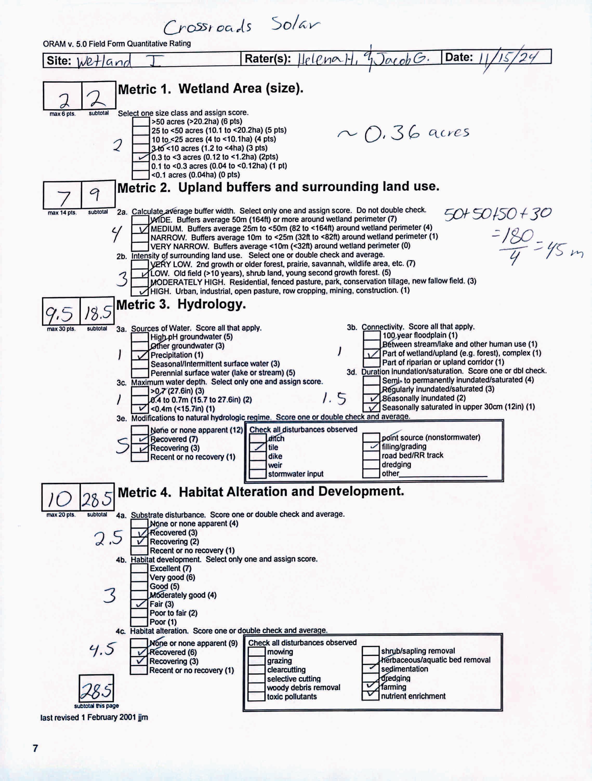
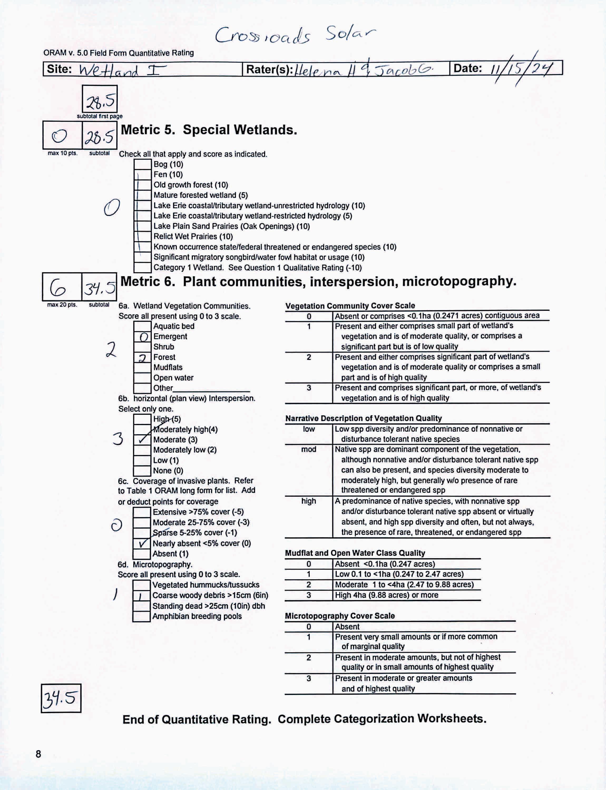
circle answer or insert score
Narrative Rating Question 1 Critical HabitatYES NOIf yes, Category 3.
Question 2. Threatened or Endangered Species YES NOIf yes, Category 3.
Question 3. High Quality Natural WetlandYES NOIf yes, Category 3.
Question 4. Significant bird habitatYES NOIf yes, Category 3.
Question 5. Category 1 WetlandsYES NOIf yes, Category 1.
Question 6. BogsYES NOIf yes, Category 3.
Question 7. FensYES NOIf yes, Category 3.
Question 8a. Old Growth ForestYES NOIf yes, Category 3.
Question 8b. Mature Forested WetlandYES NOIf yes, evaluate for Category 3; may also be 1 or 2.
Question 9b. Lake Erie WetlandsRestricted YES NOIf yes, evaluate for Category 3; may also be 1 or 2.
Question 9d. Lake Erie Wetlands –Unrestricted with native plants YES NOIf yes, Category 3
Question 9e. Lake Erie WetlandsUnrestricted with invasive plants YES NOIf yes, evaluate for Category 3; may also be 1 or 2.
Question 10. Oak OpeningsYES NOIf yes, Category 3
Question 11. Relict Wet PrairiesYES NOIf yes, evaluate for Category 3; may alsobe 1 or 2.
Quantitative Rating
Metric 1. Size
Metric 2. Buffers and surrounding land use
Metric 3. Hydrology
Metric 4. Habitat
Metric 5. Special Wetland Communities
Metric 6. Plant communities, interspersion, microtopography
Choices Circle one
Did you answer "Yes" to any of the following questions:
Narrative Rating Nos. 2, 3, 4, 6, 7, 8a, 9d, 10
Did you answer "Yes" to any of the following questions:
Narrative Rating Nos. 1, 8b, 9b,9e, 11
Did you answer "Yes" to
Narrative Rating No. 5
Does the quantitative score fall within the scoring range of a Category 1, 2, or 3 wetland?
Does the quantitative score fall with the "gray zone" for Category 1 or 2 or Category 2 or 3 wetlands?
YES
Wetland is categorized as a Category 3 wetland
YES
Wetland should be evaluated for possible Category 3 status
YES
Wetland is categorized as a Category 1 wetland
YES
Wetland is assigned to the appropriate category based on the scoring range
YES
Wetland is assigned to the higher of the two categories or assigned to a category based on detailed assessments and the narrative criteria
NO
Does the wetland otherwise exhibit moderate OR superior hydrologic OR habitat, OR recreational functions AND the wetland was not categorized as a Category 2 wetland (in the case of moderate functions) or a Category 3 wetland (in the case of superior functions) by this method?
YES
Wetland was undercategorized by this method. A written justification for recategorization should be provided on Background Information Form
NO
NO
NO
NO
Evaluation of Categorization Result of ORAM
Is quantitative rating score less than the Category 2 scoring threshold (excluding gray zone)? If yes, reevaluate the category of the wetlandusing the narrative criteria in OAC Rule 3745-1-54(C) and biological and/or functional assessments to determine if the wetland has been overcategorized by the ORAM
Evaluate the wetland using the 1) narrative criteria in OAC Rule 3745-1-54(C) and 2) the quantitative rating score. If the wetland is determined to be a Category 3 wetland using either of these, it should be categorized as a Category 3 wetland. Detailed biological and/or functional assessments may also be used to determine the wetland's category.
Is quantitative rating score greater than the Category 2 scoring threshold (including any gray zone)? If yes, reevaluate the category of the wetland using the narrative criteria in OAC Rule 3745-1-54(C) and biological and/or functional assessments to determine if the wetland has been under-categorized by the ORAM
If the score of the wetland is located within the scoring range for a particular category, the wetland should be assigned to that category. In all instances however, the narrative criteria described in OAC Rule 3745-1-54(C) can be used to clarify or change a categorization based on a quantitative score.
Rater has the option of assigning the wetland to the higher of the two categories or to assign a category based on the results of a nonrapid wetland assessment method, e.g. functional assessment, biological assessment, etc, and a consideration of the narrative criteria in OAC rule 3745-154(C).
NO
Wetland is assigned to category as determined by the ORAM.
A wetland may be undercategorized using this method, but still exhibit one or more superior functions, e.g. a wetland's biotic communities may be degraded by human activities, but thewetland may still exhibit superior hydrologic functions because of its type, landscape position, size, local or regional significance, etc. In this circumstance, the narrative criteria in OAC Rule 3745-1-54(C)(2) and (3) are controlling, and the under-categorization should be corrected. A written justification with supporting reasons or information for this determination should be provided. Final Category
Choose one Category 1Category 2 Category 3
Name:
Date:
HelenaHayter/JacobGeorge 12/18/2023
Affiliation:
VerdantasLLC
Address:
4HemisphereWayBedford,OH44146
Phone Number:
+1440-232-9945
e-mail address:
jgeorge@verdantas.com
Name of Wetland:
Vegetation Communit(ies):
HGM Class(es):
Location of Wetland:include map, address, north arrow, landmarks, distances, roads, etc.
WetlandJ PFO IA Figure9
Lat/Long or UTM Coordinate
USGS Quad Name County Township Section and Subsection
Hydrologic Unit Code
Site Visit
National Wetland Inventory Map
Ohio Wetland Inventory Map
Soil Survey
Delineation report/map
Wetland Size (acres, hectares):
Sketch:Include north arrow, relationship with other surface waters, vegetation zones, etc.
SeeFigure9
Comments, Narrative Discussion, Justification of Category Changes:
INSTRUCTIONS. The initial step in completing the ORAM is to identify the “scoring boundaries” of the wetland being rated. In many instances this determination will be relatively easy and the scoring boundaries will coincide with the “jurisdictional boundaries.” For example, the scoring boundary of an isolated cattail marsh located in the middle of a farm field will likely be the same as that wetland’s jurisdictional boundaries. In other instances, however, the scoring boundary will not be as easily determined. Wetlands that are small or isolated from other surface waters often form large contiguous areas or heterogeneous complexes of wetland and upland.In separating wetlands for scoring purposes, the hydrologic regime of the wetland is the main criterion that should be used. Boundaries between contiguous or connected wetlands should be established where the volume, flow, or velocity of water moving through the wetland changes significantly. Areas with a high degree of hydrologic interaction should be scored as a single wetland. In determining a wetland’s scoring boundaries, use the guidelines in the ORAM Manual Section 5.0. In certain instances, it may be difficult to establish the scoring boundary for the wetland being rated. These problem situations include wetlands that form a patchwork on the landscape, wetlands divided by artificial boundaries like property fences, roads, or railroad embankments, wetlands that are contiguous with streams, lakes, or rivers, and estuarine or coastal wetlands. These situations are discussed below, however, it is recommended that Rater contact Ohio EPA, Division of Surface Water, 401/Wetlands Sectionif there are additional questions or a need for further clarification of the appropriate scoring boundaries of a particular wetland.
# Steps in properly establishing scoring boundariesdone?not applicable
Step 1 Identify the wetland area of interest. This may be the site of a proposed impact, a reference site, conservation site, etc.
Step 2 Identify the locations where there is physical evidence that hydrology changes rapidly. Suchevidence includes both natural and humaninduced changes including, constrictions caused by berms or dikes, points where the water velocity changes rapidly at rapids or falls, points where significant inflows occur at the confluence of rivers, or other factors that may restrict hydrologic interaction between the wetlands or parts of a single wetland.
Step 3 Delineate the boundary of the wetland to be rated such that all areas of interest that are contiguous to and within the areas where the hydrology does not change significantly, i.e. areas that have a high degree of hydrologic interaction are included within the scoring boundary.
Step 4 Determine if artificial boundaries, such as property lines, state lines, roads, railroad embankments, etc., are present. These should not be used to establish scoring boundaries unless they coincide with areas where the hydrologic regime changes.
Step 5 In all instances, the Rater may enlarge the minimum scoring boundaries discussed here to score together wetlands that could be scored separately.
Step 6 Consult ORAM Manual Section 5.0 for how to establish scoring boundaries for wetlands that form a patchwork on the landscape, divided by artificial boundaries, contiguous to streams, lakes or rivers, or for dual classifications.
End of Scoring Boundary Determination. Begin Narrative Rating on next page. X X X X X X
INSTRUCTIONS. Answer each of the following questions. Questions 1, 2, 3 and 4 should be answered based on information obtained from the site visit or the literature and by submitting a Data Services Request to the Ohio Department of Natural Resources, Division of Natural Areas and Preserves, Natural Heritage Data Services, 1889 Fountain Square Court, Building F-1, Columbus, Ohio 43224, 614-265-6453 (phone), 614-265-3096 (fax), http://www.dnr.state.oh.us/dnap . The remaining questions are designed to be answered primarily by the results of the site visit. Refer to the User’s Manual for descriptionsof these wetland types. Note: "Critical habitat" is legally defined in the Endangered Species Act and is the geographic area containing physical or biological features essential to the conservation of a listed species or as an area that may require special management considerations or protection. The Rater should contact the Region 3 Headquarters or the ColumbusEcological Services Office for updates as to whether critical habitat has been designated for other federally listed threatened or endangeredspecies. “Documented” means the wetland is listed in the appropriate State of Ohio database.
1 Critical Habitat. Is the wetland in a township, section, or subsection of a United States Geological Survey 7.5 minute Quadrangle that has been designated by the U.S. Fish and Wildlife Service as "critical habitat"for any threatened or endangered plant or animal species?
Note: as of January 1, 2001, of the federally listed endangered or threatened species which can be found inOhio, the Indiana Bat has had critical habitat designated (50 CFR 17.95(a)) and the piping plover has had critical habitat proposed (65 FR 41812 July 6, 2000).
2 Threatened or Endangered Species. Is the wetland known to contain an individual of, or documented occurrences of federal or state-listed threatened or endangered plant or animal species?
3 Documented High Quality Wetland. Is the wetland on record in Natural Heritage Database as a high quality wetland?
should be evaluated for possible Category 3 status
2
is a Category 3 wetland
4
4 Significant Breeding or Concentration Area. Does the wetland contain documented regionally significant breeding or nonbreeding waterfowl, neotropical songbird, or shorebird concentration areas?
5 Category 1 Wetlands. Is the wetland less than 0.5 hectares (1 acre) in size and hydrologically isolated and either 1) comprised of vegetation that is dominated (greater than eighty per cent areal cover) by Phalaris arundinacea, Lythrum salicaria, or Phragmites australis, or 2)anacidic pond created or excavated on mined lands that has little or no vegetation?
6 Bogs. Is the wetland a peat-accumulating wetland that 1) has no significant inflows or outflows, 2) supports acidophilic mosses, particularly Sphagnum spp., 3) the acidophilic mosseshave >30% cover, 4) at least one species from Table 1 is present, and 5) the cover of invasive species (see Table 1) is <25%?
7 Fens. Is the wetland a carbon accumulating (peat, muck) wetland that is saturated during most of the year, primarily by a discharge of free flowing, mineral rich, ground water with a circumneutral ph (5.5-9.0) and with one or more plant species listed in Table 1 and the cover of invasive species listed in Table 1 is <25%?
8a "Old Growth Forest." Is the wetland a forestedwetland and is the forest characterized by, but not limited to, the following characteristics: overstory canopy trees of great age (exceeding at least 50% of a projected maximum attainable age for a species); little or no evidence of human-caused understory disturbance during the past 80 to 100 years; an all-aged structure and multilayered canopies; aggregations of canopy trees interspersed with canopy gaps; and significant numbers of standing dead snags and downed logs?
Wetland is a Category 3 wetland
to Question 5
Wetland is a Category 1 wetland Go to Question 6
YES
Wetland is a Category 3 wetland
Go to Question 7 NO
Go to Question 7
YES
Wetland is a Category 3 wetland
Go to Question 8a NO Go to Question 8a
YES
Wetland is a Category 3 wetland.
Go to Question 8b NO Go to Question 8b
8b Mature forested wetlands. Is the wetland a forested wetland with 50% or more of the cover of upper forest canopy consisting of deciduous trees with large diameters at breast height (dbh), generally diameters greater than 45cm (17.7in) dbh?
YES
Wetland should be evaluated for possible Category 3 status.
Go to Question 9a NO
9a Lake Erie coastal and tributary wetlands. Is the wetland located at an elevation less than 575 feet on the USGS map, adjacent to this elevation, or along a tributary to Lake Erie that is accessible to fish? YES Go to Question 9b NO
9b Does the wetland's hydrology result from measures designed to prevent erosion and the loss of aquatic plants, i.e. the wetland is partially hydrologically restricted from Lake Erie due to lakeward or landward dikes or other hydrological controls? YES
Wetland should be evaluated for possible Category 3 status
Go to Question 10 NO
to Question 9a
to Question 10
to Question 9c
9c AreLake Erie water levels the wetland's primary hydrological influence, i.e. the wetland is hydrologically unrestricted (no lakeward or upland border alterations), or the wetland can be characterized as an "estuarine" wetland with lake and river influenced hydrology. These include sandbar deposition wetlands, estuarine wetlands, river mouth wetlands, or those dominated by submersed aquatic vegetation.
9d Does the wetland have a predominance of native species within its vegetation communities, although non-native or disturbance tolerant native species can also be present?
to Question 9d
Wetland is a Category 3 wetland Go to Question 10
9e Does the wetland have a predominance of non-native or disturbance tolerant native plant species within its vegetation communities? YES Wetland should be evaluated for possible Category 3 status
Go to Question 10
10 Lake Plain Sand Prairies (Oak Openings) Is the wetland located in Lucas, Fulton, Henry, or Wood Counties and can the wetland be characterized by the following description: the wetland has a sandy substrate with interspersed organic matter, a water table often within several inches of the surface, and often with a dominance of the gramineous vegetation listed in Table 1 (woody species may also be present). The Ohio Department of Natural Resources Division of Natural Areas and Preserves can provide assistance in confirming this type of wetland and its quality. YES
11 Relict Wet Prairies. Is the wetland a relict wet prairie community dominated by some or all of the species in Table 1. Extensive prairies were formerly located in the Darby Plains (Madison and Union Counties), Sandusky Plains (Wyandot, Crawford, and Marion Counties), northwest Ohio(e.g.Erie, Huron, Lucas, WoodCounties), and portions of western Ohio Counties (e.g. Darke, Mercer, Miami, Montgomery, Van Wert etc.).
Wetland is a Category 3 wetland.
Go to Question 11
YES
Wetland should be evaluated for possible Category 3 status
Complete Quantitative Rating
Question 10
to Question 9e
10
to Question 11
Quantitative Rating
Table 1. Characteristic plant species. invasive/exotic spp fen speciesbog species0ak Opening specieswet prairie species
Lythrum salicaria
Myriophyllum spicatum
Najas minor
Phalaris arundinacea
Phragmites australis
Potamogeton crispus
Ranunculus ficaria
Rhamnus frangula
Typha angustifolia
Typha xglauca
Zygadenus elegans var. glaucus
Cacalia plantaginea
Carex flava
Carex sterilis
Carexstricta
Deschampsia caespitosa
Eleocharis rostellata
Eriophorum viridicarinatum
Gentianopsis spp.
Lobelia kalmii
Parnassia glauca
Potentilla fruticosa
Rhamnus alnifolia
Rhynchospora capillacea
Salix candida
Salix myricoides
Salix serissima
Solidago ohioensis
Tofieldia glutinosa
Triglochin maritimum
Triglochin palustre
Calla palustris
Carex atlantica var. capillacea
Carex echinata
Carex oligosperma
Carex trisperma
Chamaedaphne calyculata
Decodon verticillatus
Eriophorum virginicum
Larix laricina
Nemopanthus mucronatus
Schechzeria palustris
Sphagnum spp.
Vaccinium macrocarpon
Vaccinium corymbosum
Vaccinium oxycoccos
Woodwardia virginica
Xyris difformis
Carex cryptolepis
Carex lasiocarpa
Carex stricta
Cladium mariscoides
Calamagrostis stricta
Calamagrostis canadensis
Quercus palustris
End of Narrative Rating. Begin Quantitative Rating on next page.
Calamagrostis canadensis
Calamogrostis stricta
Carex atherodes
Carex buxbaumii
Carex pellita
Carex sartwellii
Gentiana andrewsii
Helianthus grosseserratus
Liatris spicata
Lysimachia quadriflora
Lythrum alatum
Pycnanthemum virginianum
Silphium terebinthinaceum
Sorghastrum nutans
Spartina pectinata
Solidago riddellii
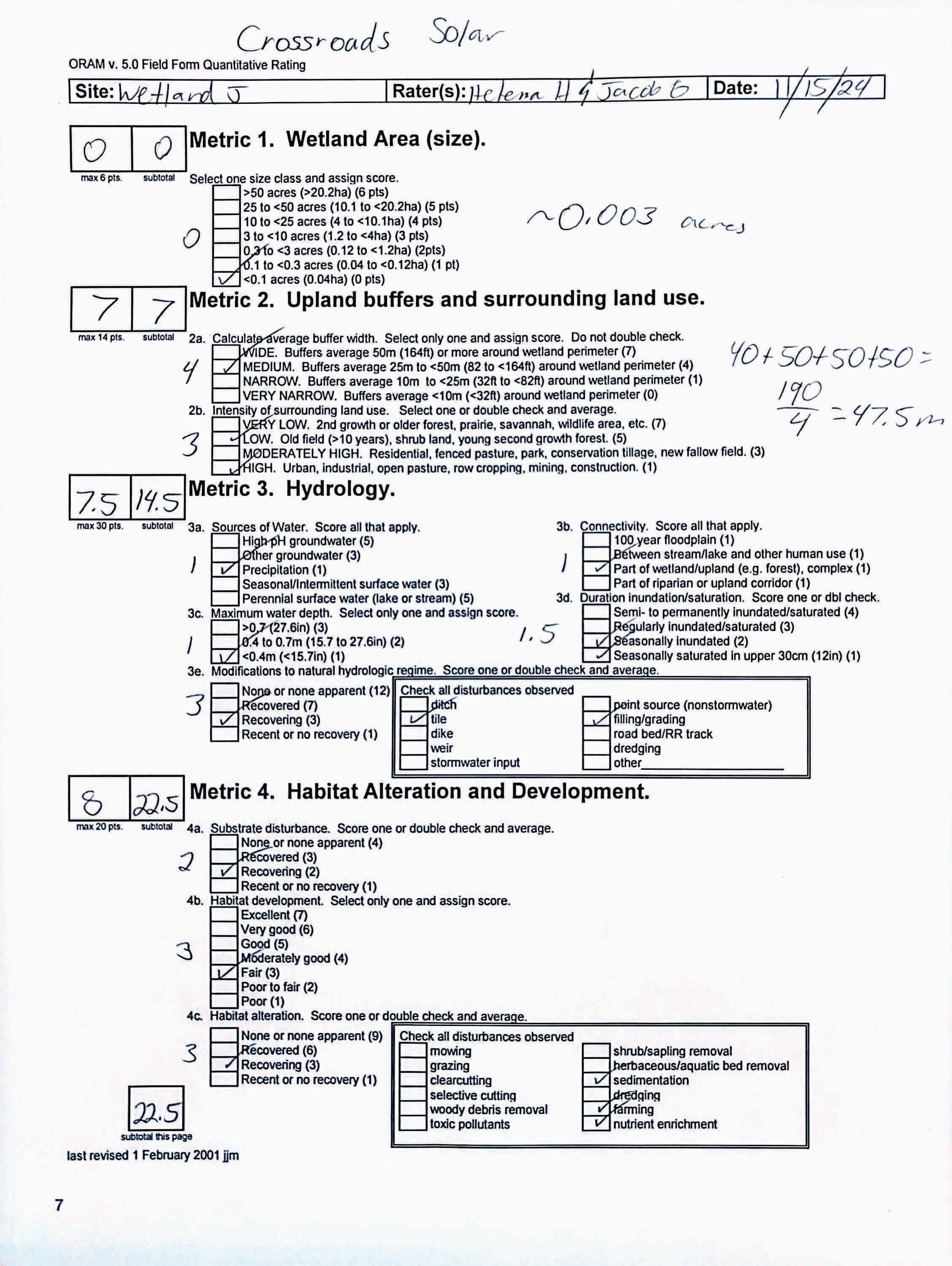
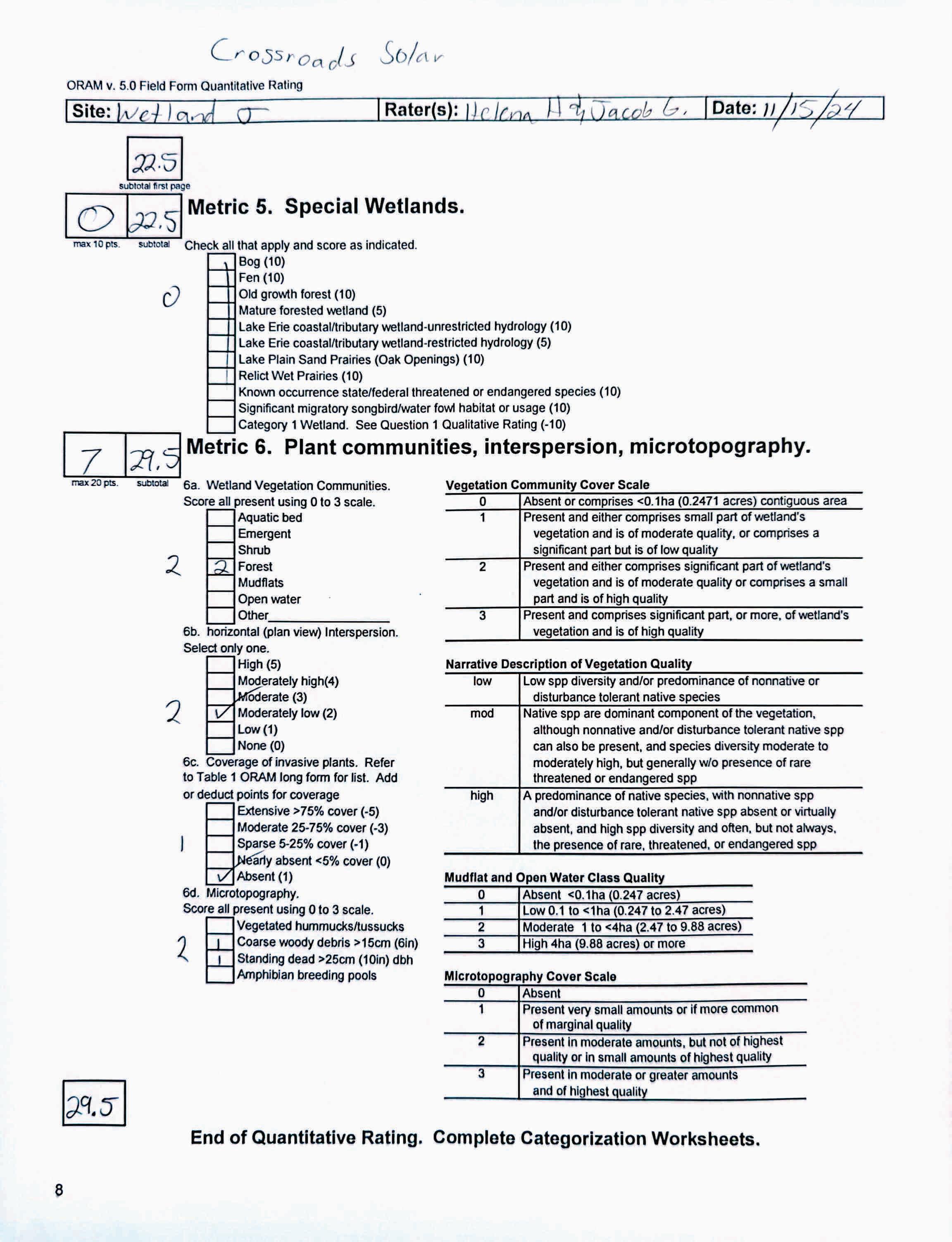
circle answer or insert score Result
Narrative Rating Question 1 Critical HabitatYES NOIf yes, Category 3.
Question 2. Threatened or Endangered Species YES NOIf yes, Category 3.
Question 3. High Quality Natural WetlandYES NOIf yes, Category 3.
Question 4. Significant bird habitatYES NOIf yes, Category 3.
Question 5. Category 1 WetlandsYES NOIf yes, Category 1.
Question 6. BogsYES NOIf yes, Category 3.
Question 7. FensYES NOIf yes, Category 3.
Question 8a. Old Growth ForestYES NOIf yes, Category 3.
Question 8b. Mature Forested WetlandYES NOIf yes, evaluate for Category 3; may also be 1 or 2.
Question 9b. Lake Erie WetlandsRestricted YES NOIf yes, evaluate for Category 3; may also be 1 or 2.
Question 9d. Lake Erie Wetlands –Unrestricted with native plants YES NOIf yes, Category 3
Question 9e. Lake Erie WetlandsUnrestricted with invasive plants YES NOIf yes, evaluate for Category 3; may also be 1 or 2.
Question 10. Oak OpeningsYES NOIf yes, Category 3
Question 11. Relict Wet PrairiesYES NOIf yes, evaluate for Category 3; may alsobe 1 or 2.
Quantitative Rating
Metric 1. Size
Metric 2. Buffers and surrounding land use
Metric 3. Hydrology
Metric 4. Habitat
Metric 5. Special Wetland Communities
Metric 6. Plant communities, interspersion, microtopography
Choices Circle one
Did you answer "Yes" to any of the following questions:
Narrative Rating Nos. 2, 3, 4, 6, 7, 8a, 9d, 10
Did you answer "Yes" to any of the following questions:
Narrative Rating Nos. 1, 8b, 9b,9e, 11
Did you answer "Yes" to
Narrative Rating No. 5
Does the quantitative score fall within the scoring range of a Category 1, 2, or 3 wetland?
Does the quantitative score fall with the "gray zone" for Category 1 or 2 or Category 2 or 3 wetlands?
YES
Wetland is categorized as a Category 3 wetland
YES
Wetland should be evaluated for possible Category 3 status
YES
Wetland is categorized as a Category 1 wetland
YES
Wetland is assigned to the appropriate category based on the scoring range
YES
Wetland is assigned to the higher of the two categories or assigned to a category based on detailed assessments and the narrative criteria
NO
Does the wetland otherwise exhibit moderate OR superior hydrologic OR habitat, OR recreational functions AND the wetland was not categorized as a Category 2 wetland (in the case of moderate functions) or a Category 3 wetland (in the case of superior functions) by this method?
YES
Wetland was undercategorized by this method. A written justification for recategorization should be provided on Background Information Form
NO
NO
NO
NO
Evaluation of Categorization Result of ORAM
Is quantitative rating score less than the Category 2 scoring threshold (excluding gray zone)? If yes, reevaluate the category of the wetlandusing the narrative criteria in OAC Rule 3745-1-54(C) and biological and/or functional assessments to determine if the wetland has been overcategorized by the ORAM
Evaluate the wetland using the 1) narrative criteria in OAC Rule 3745-1-54(C) and 2) the quantitative rating score. If the wetland is determined to be a Category 3 wetland using either of these, it should be categorized as a Category 3 wetland. Detailed biological and/or functional assessments may also be used to determine the wetland's category.
Is quantitative rating score greater than the Category 2 scoring threshold (including any gray zone)? If yes, reevaluate the category of the wetland using the narrative criteria in OAC Rule 3745-1-54(C) and biological and/or functional assessments to determine if the wetland has been under-categorized by the ORAM
If the score of the wetland is located within the scoring range for a particular category, the wetland should be assigned to that category. In all instances however, the narrative criteria described in OAC Rule 3745-1-54(C) can be used to clarify or change a categorization based on a quantitative score.
Rater has the option of assigning the wetland to the higher of the two categories or to assign a category based on the results of a nonrapid wetland assessment method, e.g. functional assessment, biological assessment, etc, and a consideration of the narrative criteria in OAC rule 3745-154(C).
NO
Wetland is assigned to category as determined by the ORAM.
A wetland may be undercategorized using this method, but still exhibit one or more superior functions, e.g. a wetland's biotic communities may be degraded by human activities, but thewetland may still exhibit superior hydrologic functions because of its type, landscape position, size, local or regional significance, etc. In this circumstance, the narrative criteria in OAC Rule 3745-1-54(C)(2) and (3) are controlling, and the under-categorization should be corrected. A written justification with supporting reasons or information for this determination should be provided. Final Category
Choose one Category 1Category 2 Category 3
QHEI Stream Evaluation Data Forms
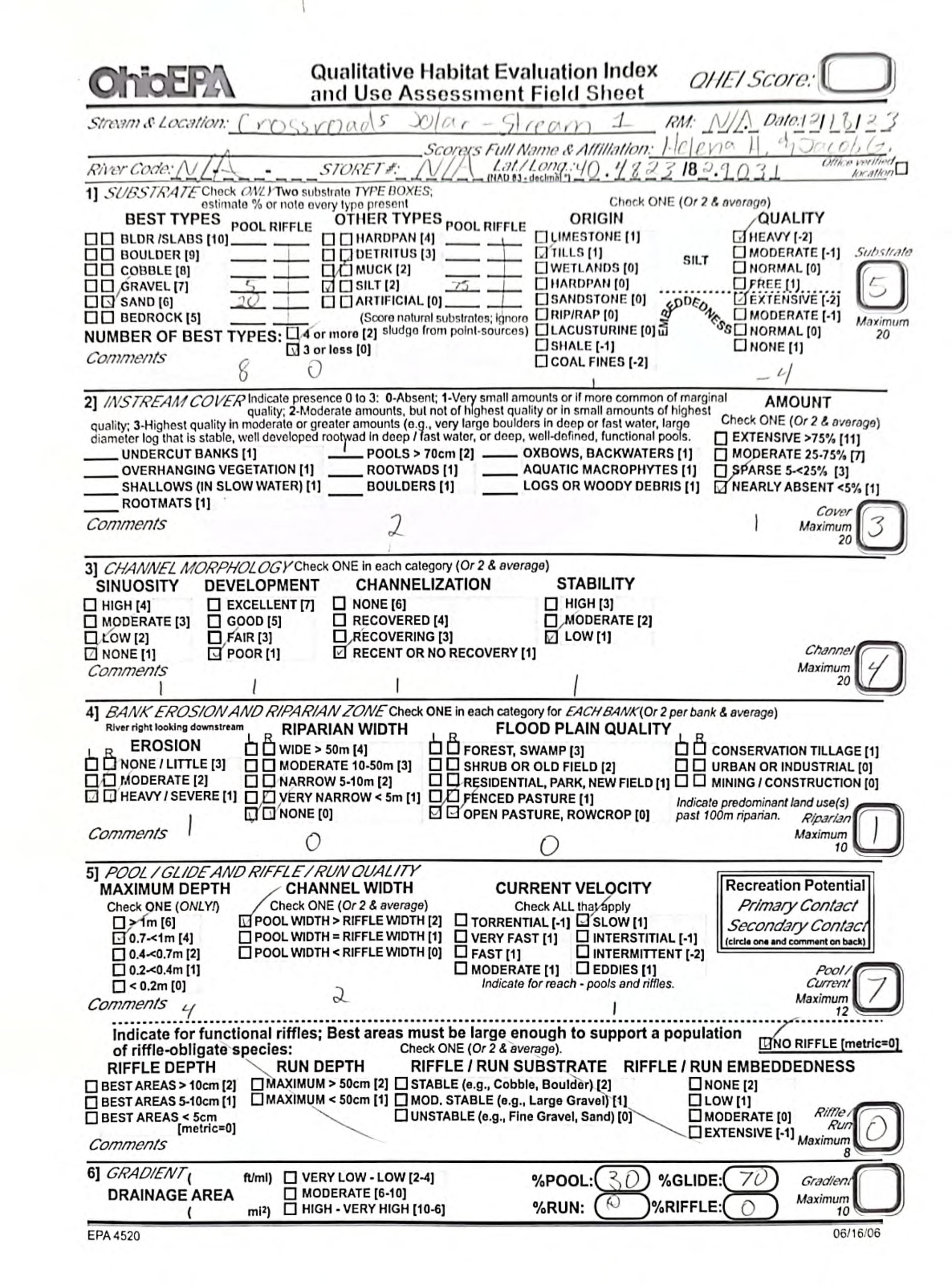
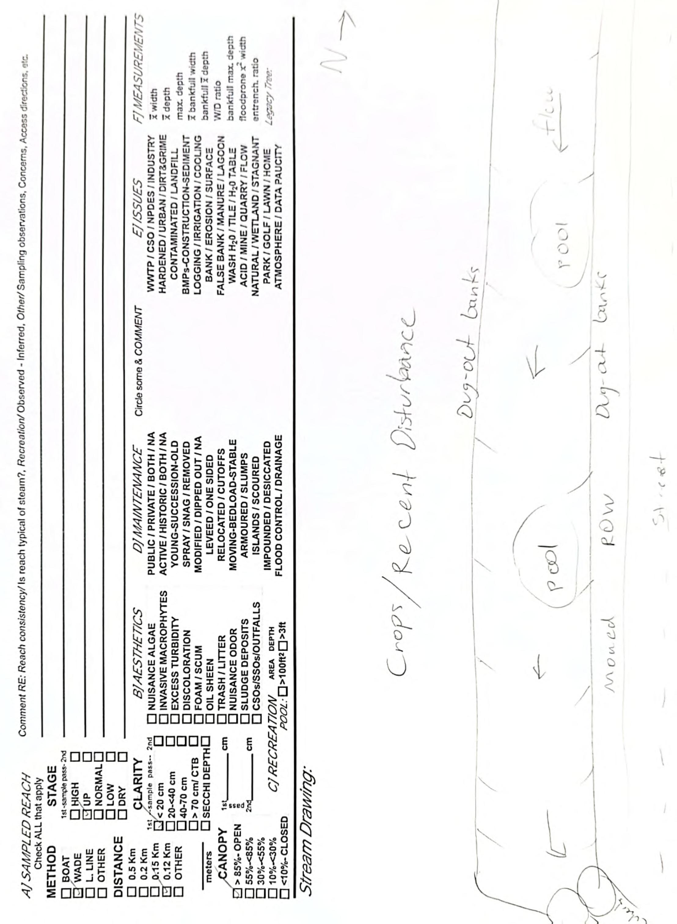
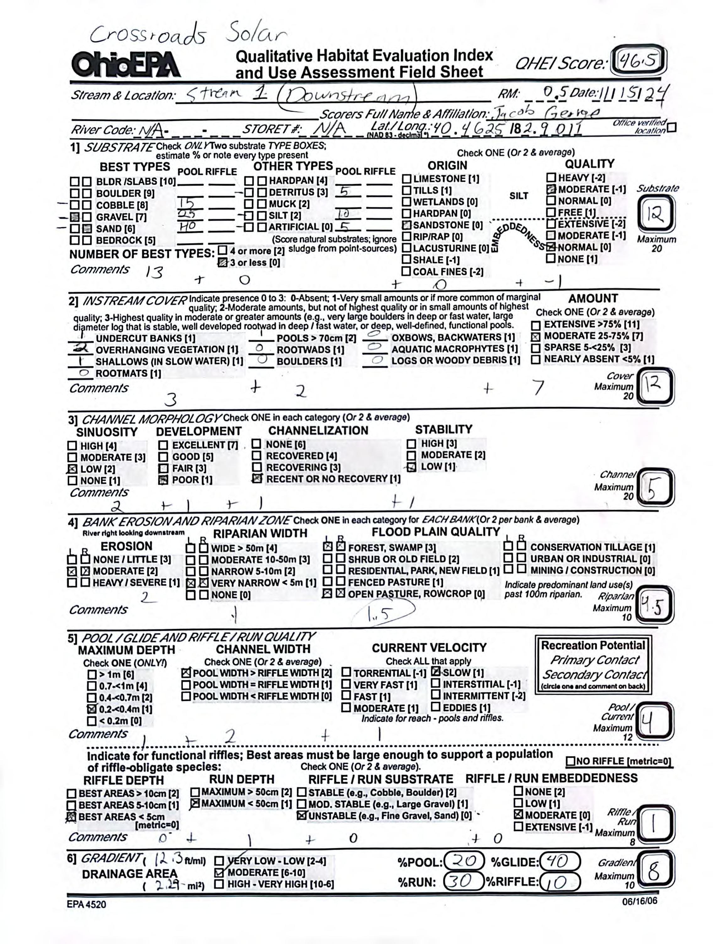

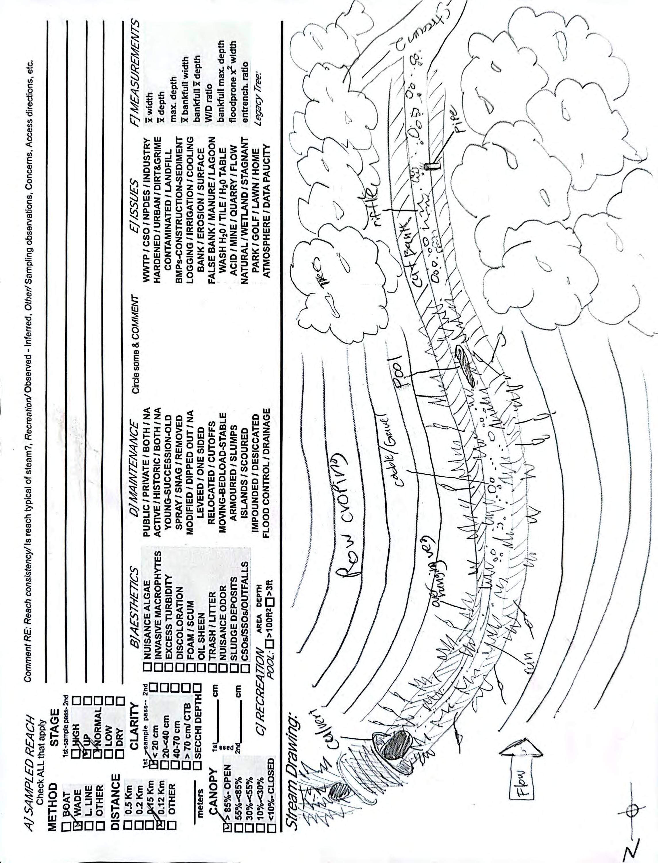
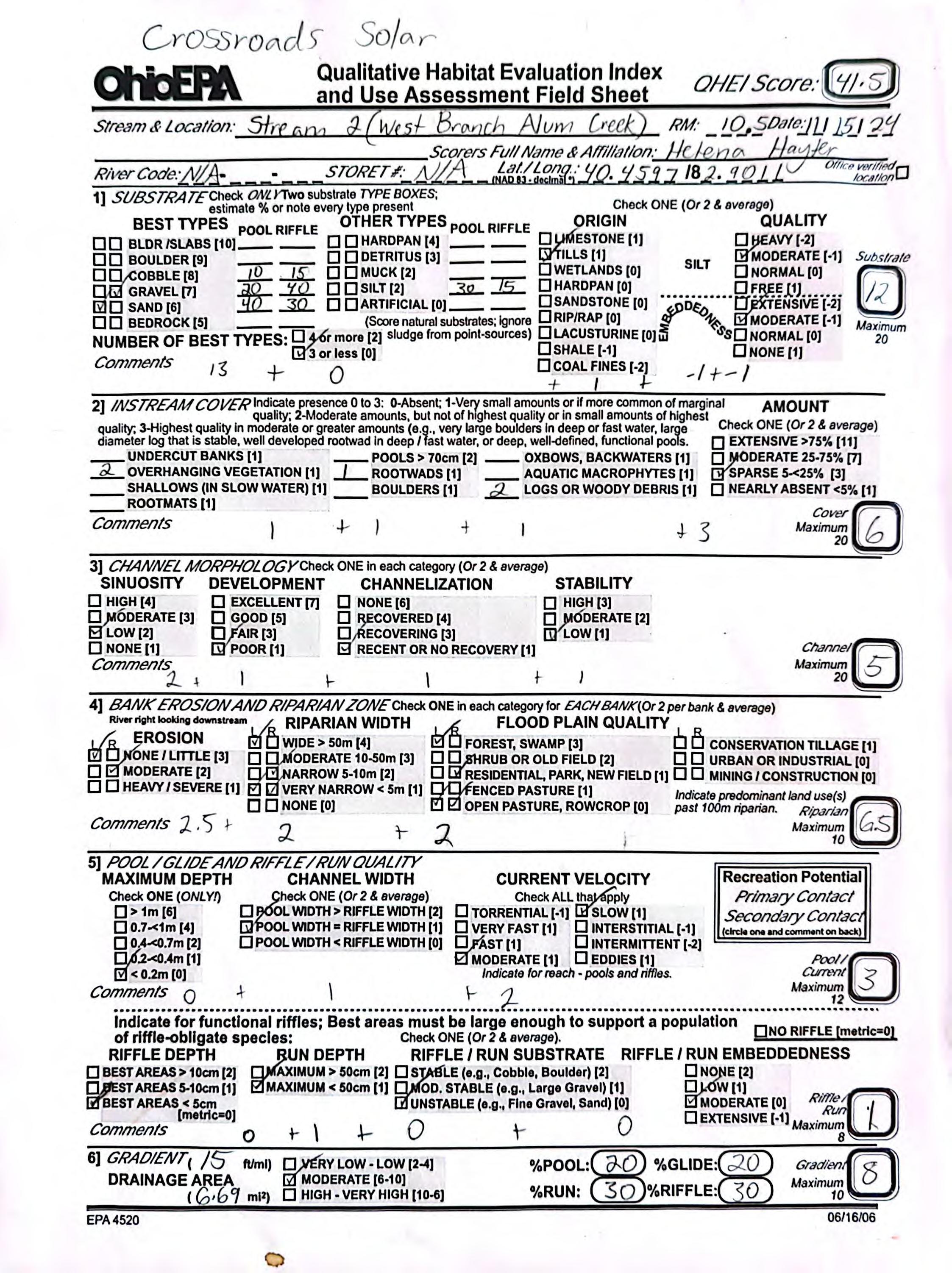
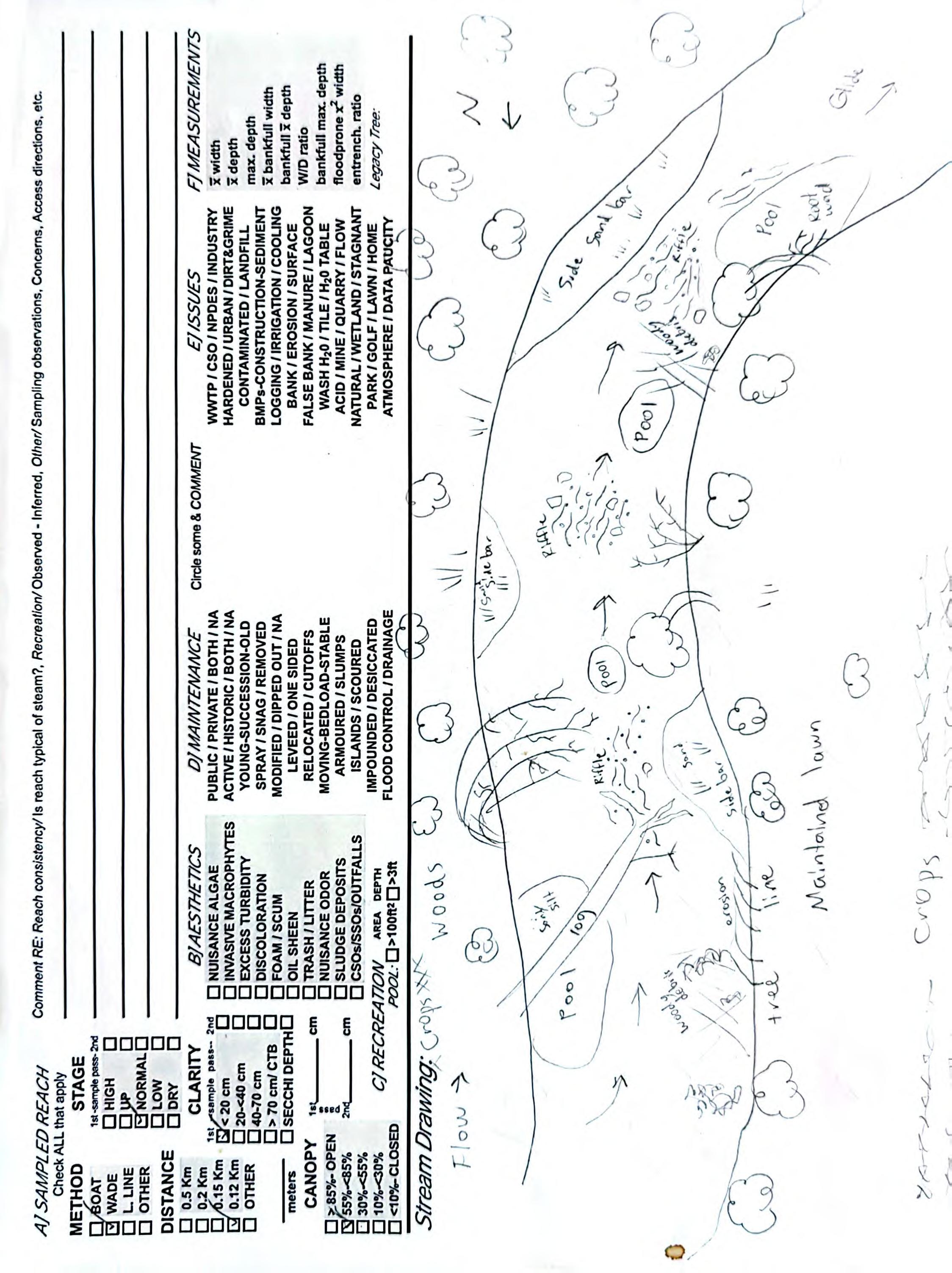
Project Area Photographs
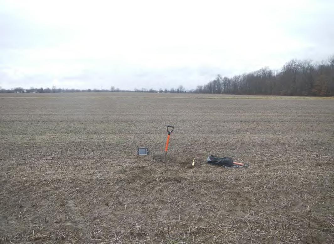
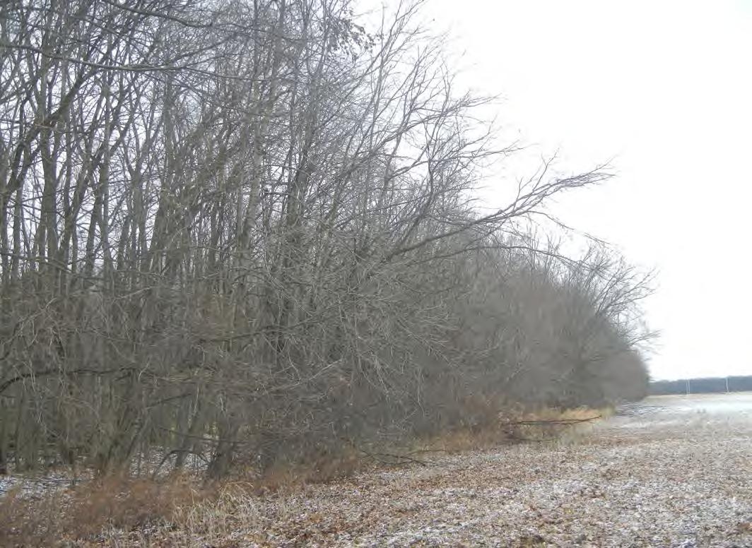
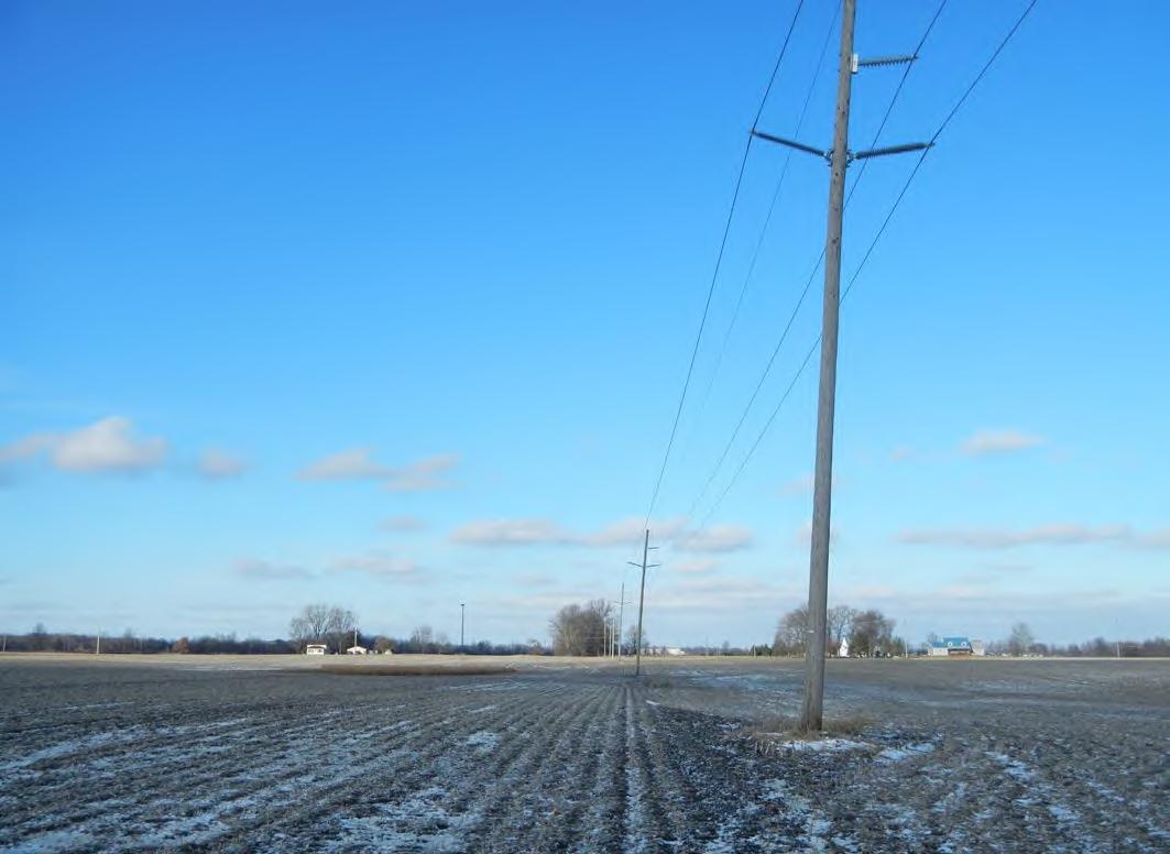
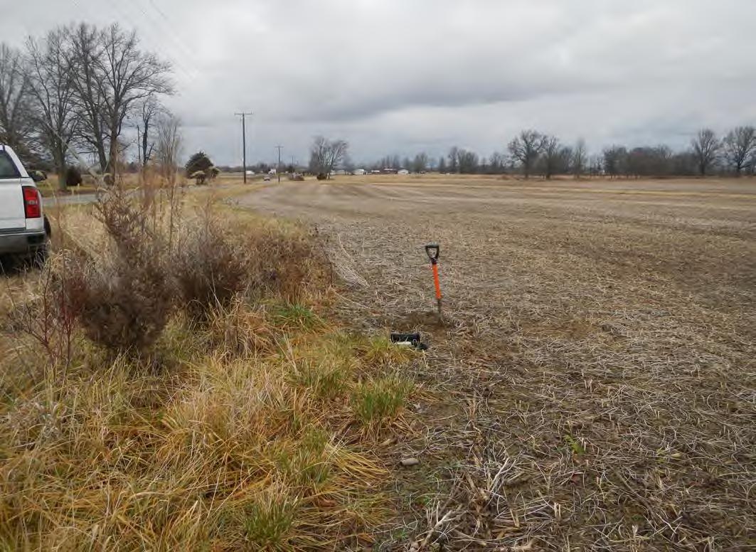

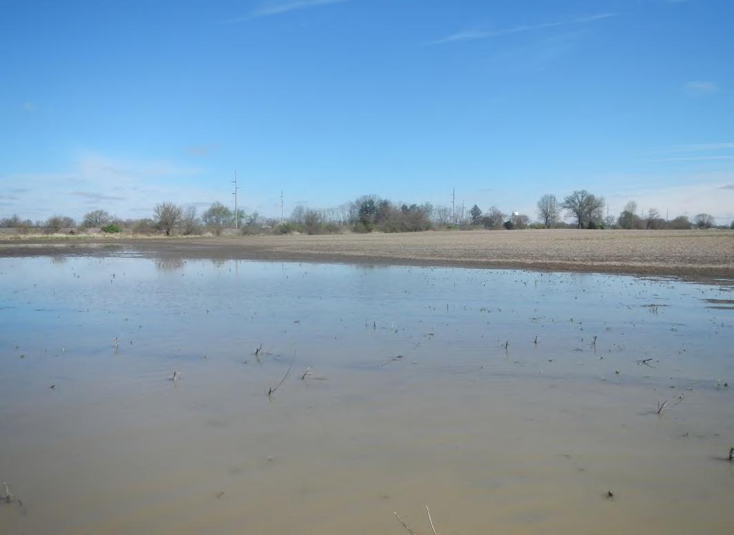
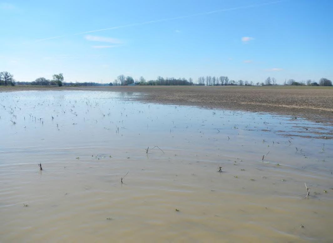
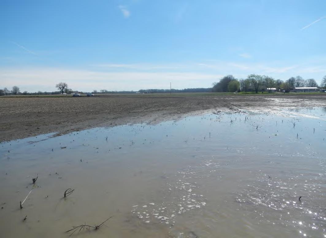
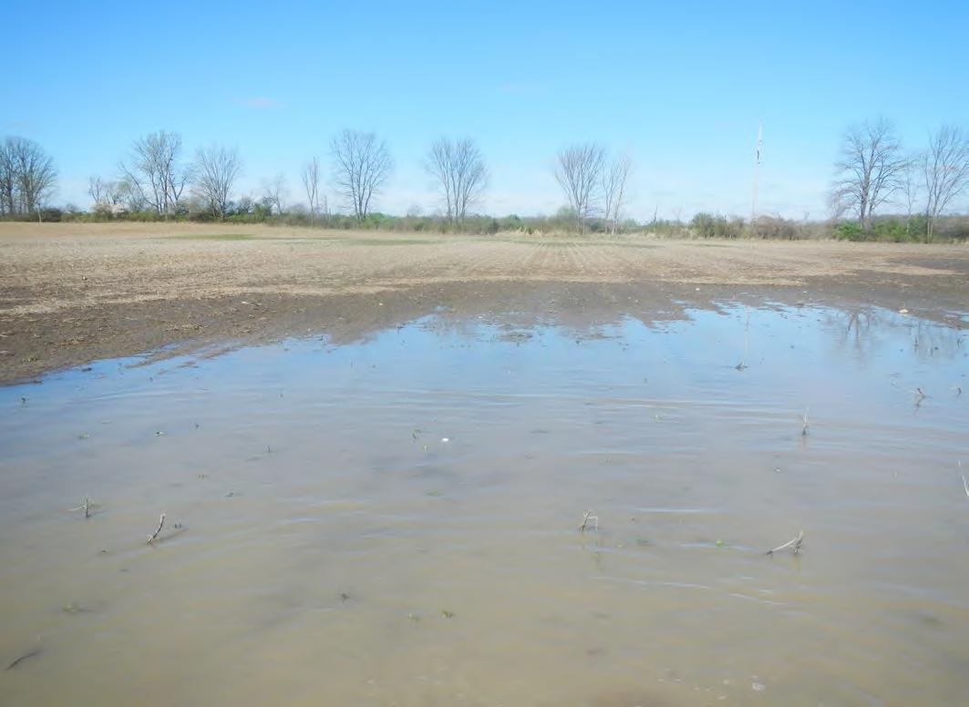
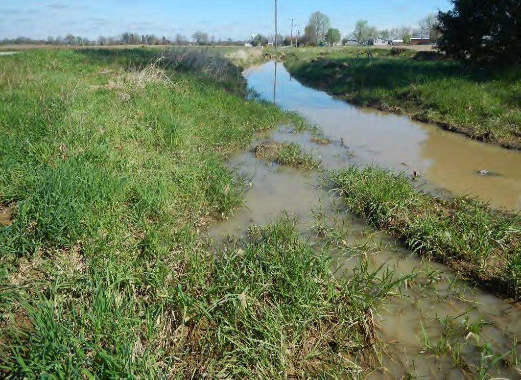
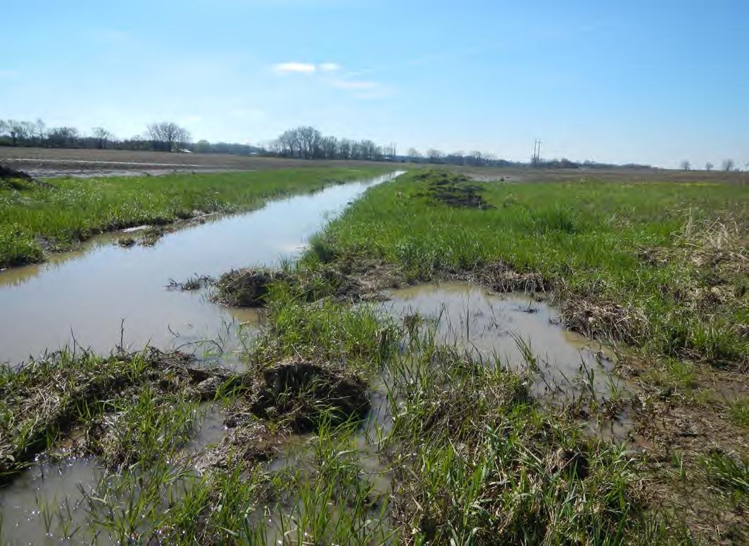
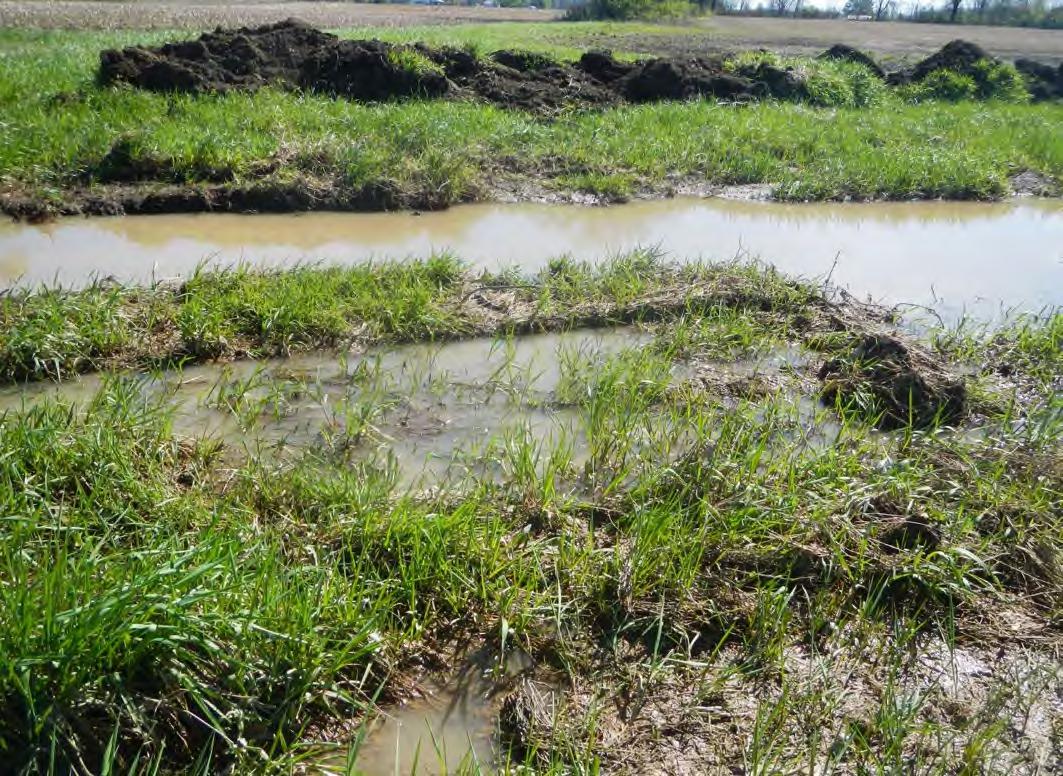
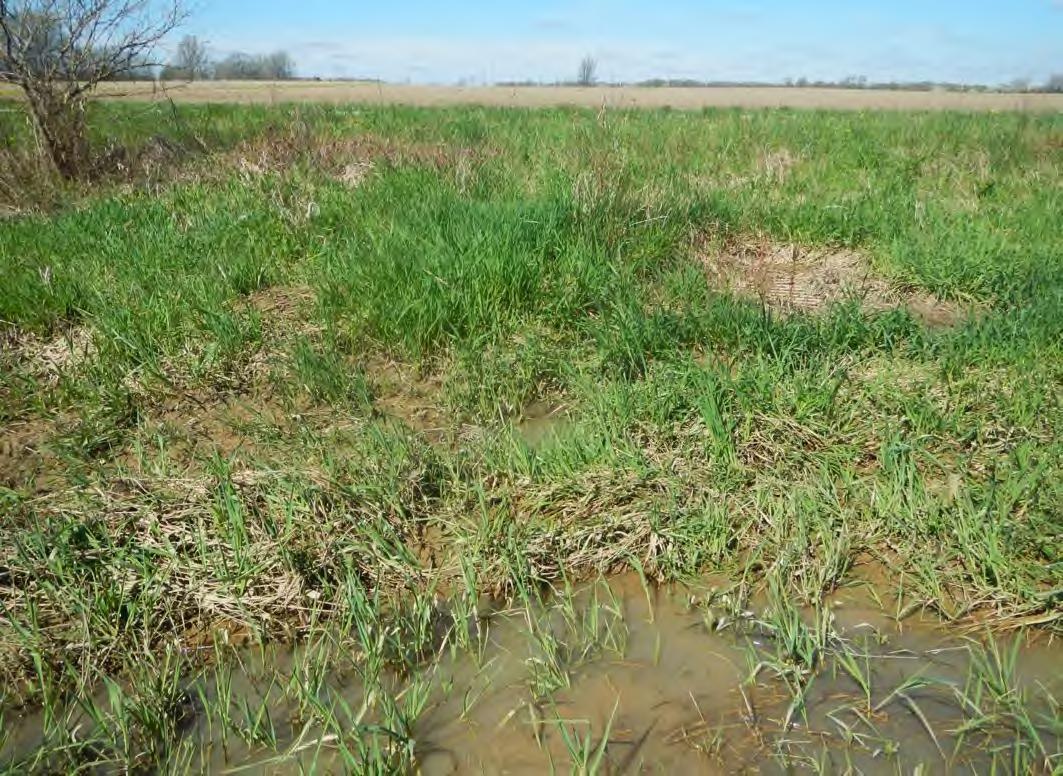
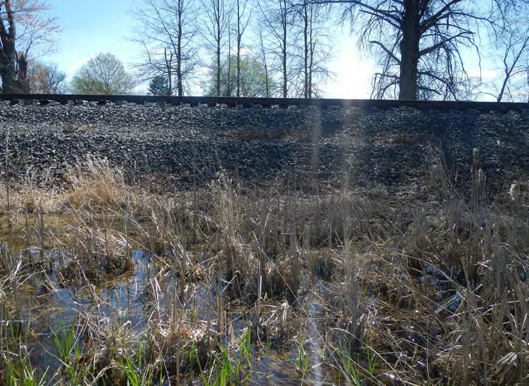
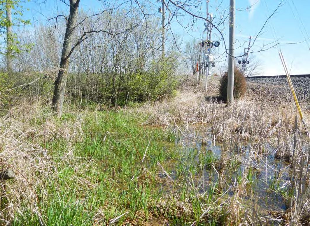
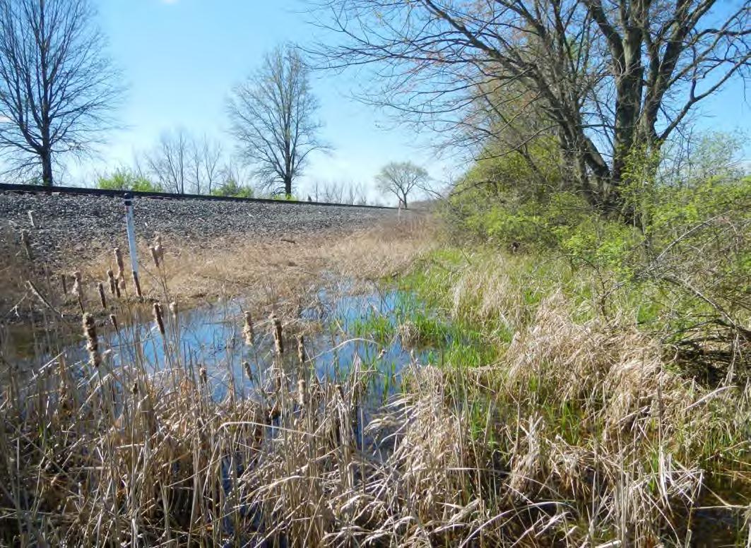
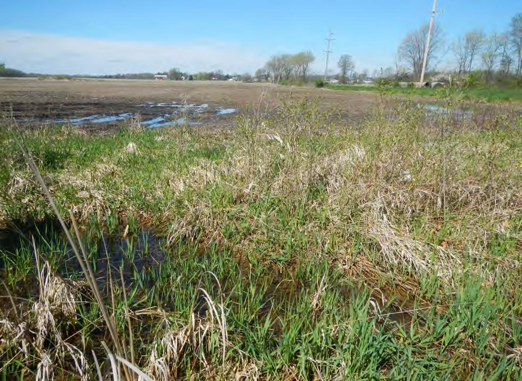
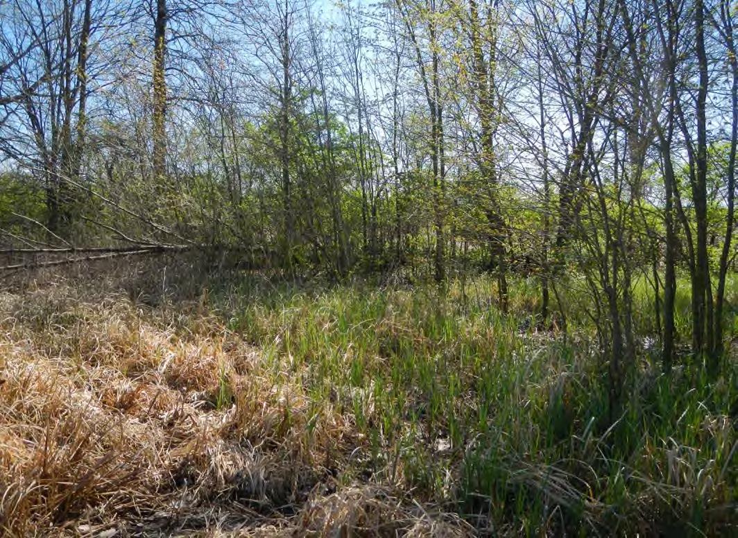
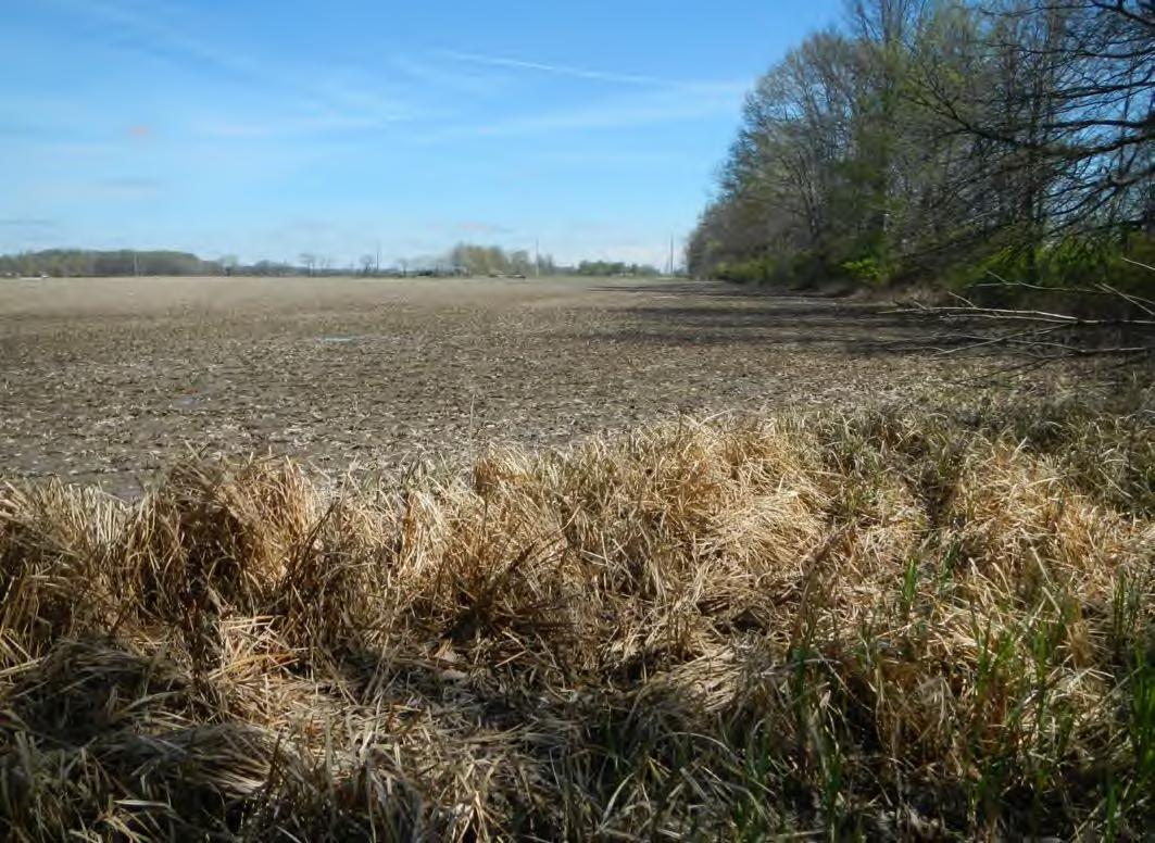
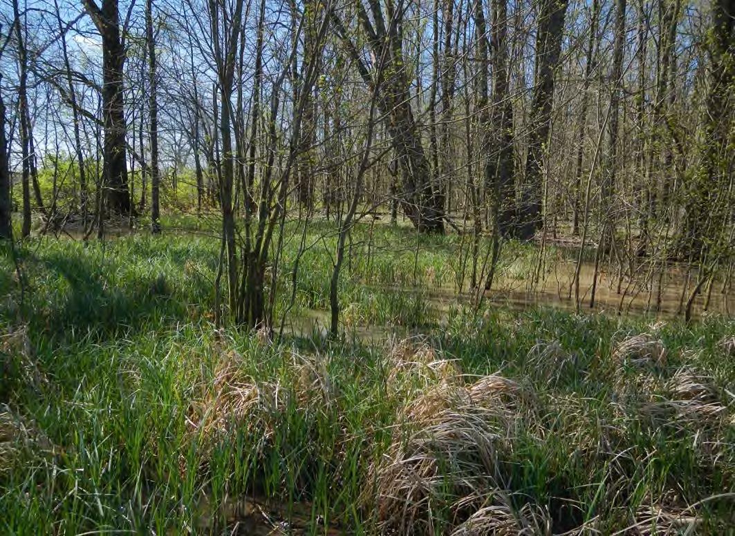
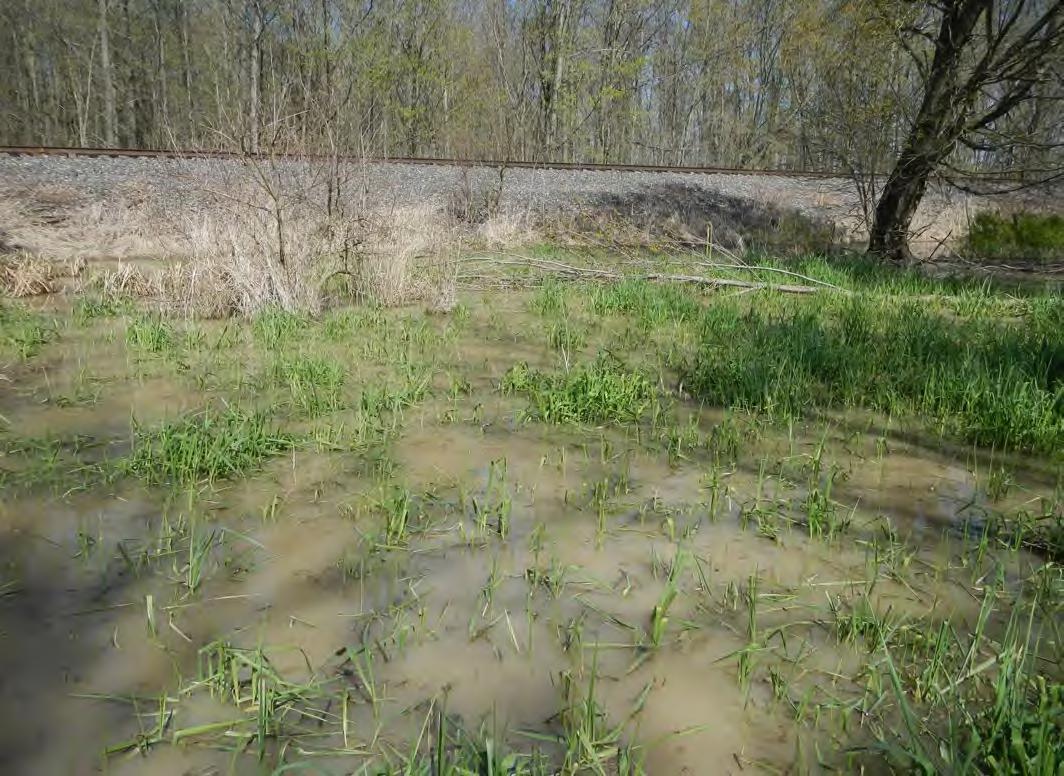
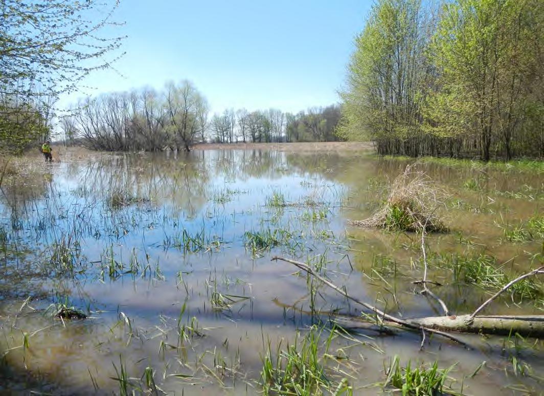
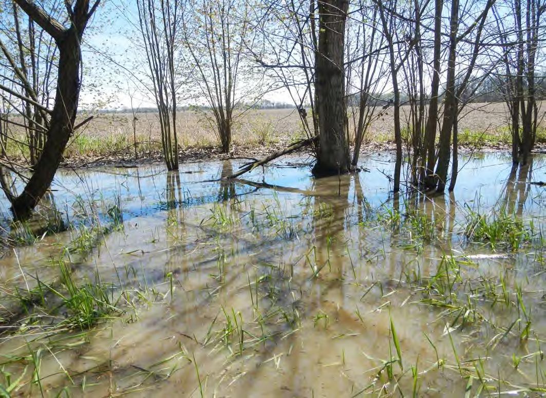
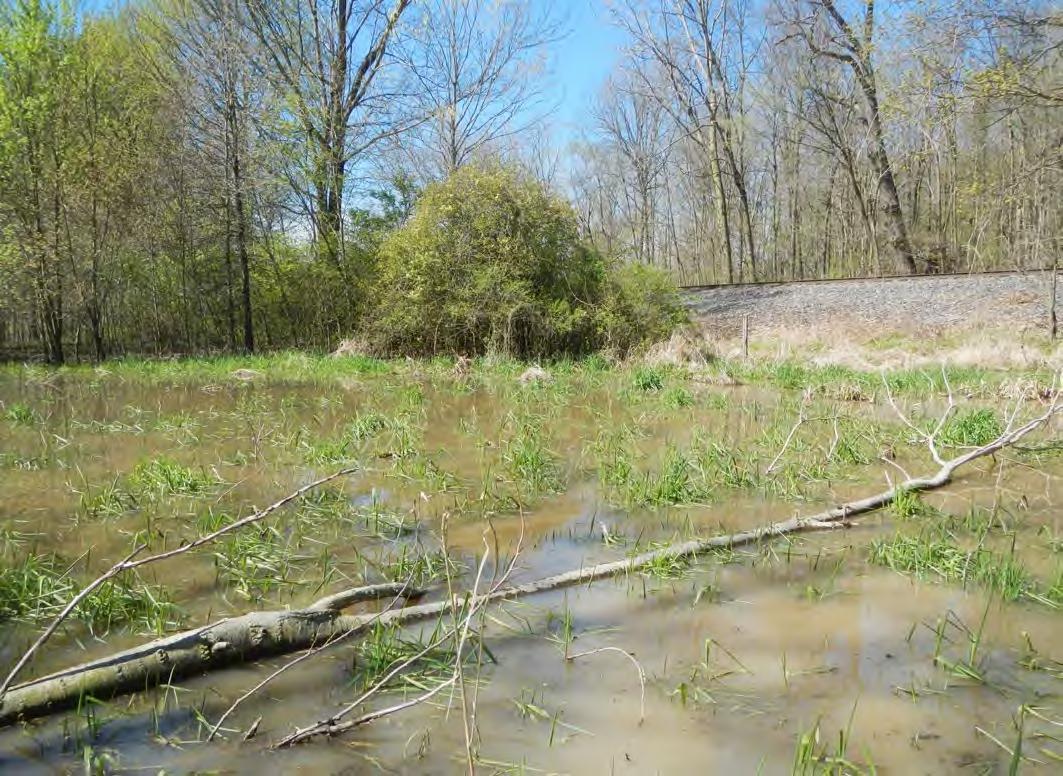
Site Photographs
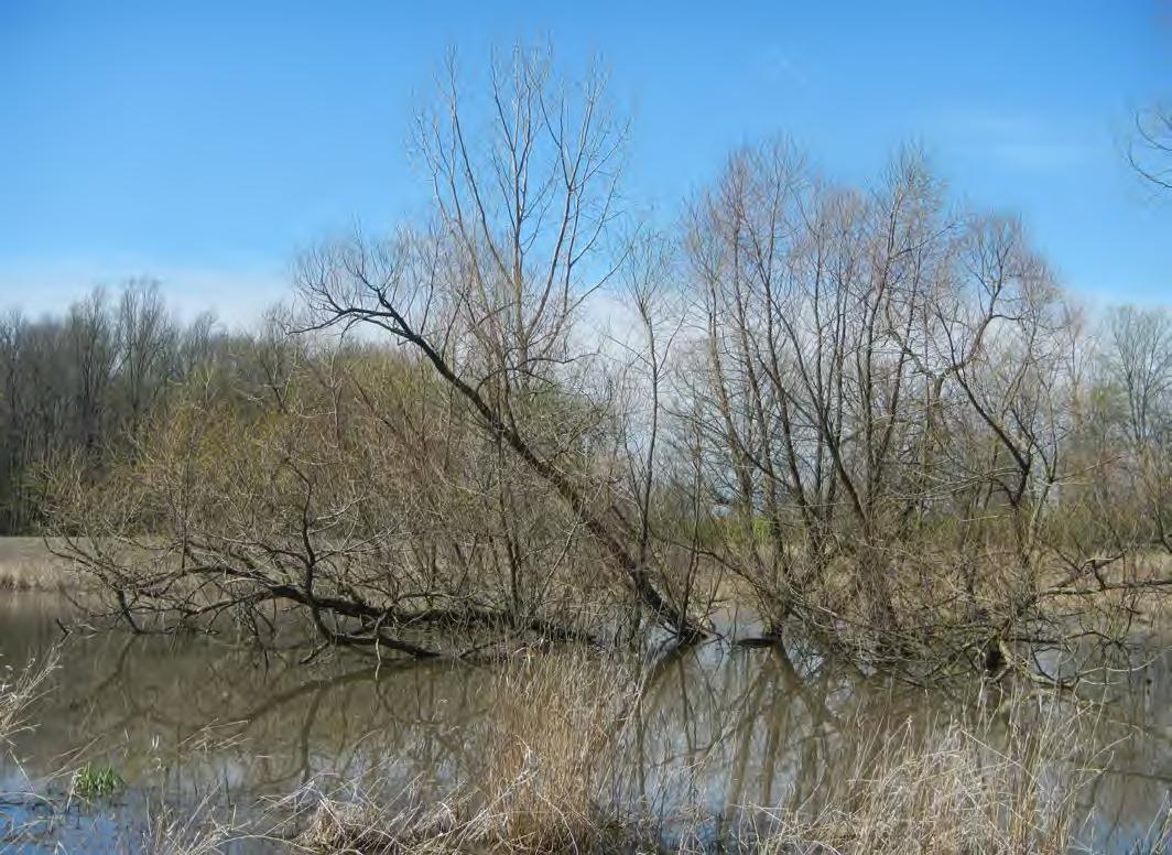
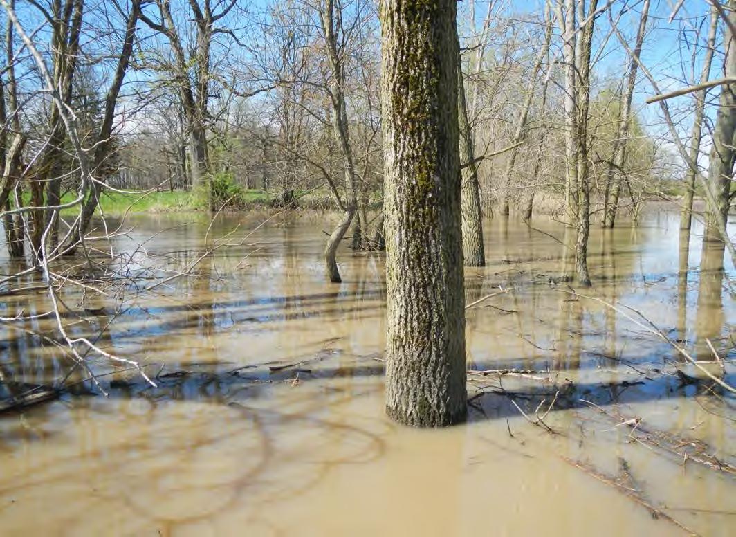
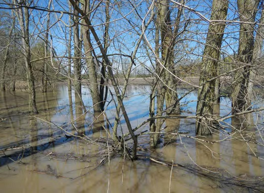
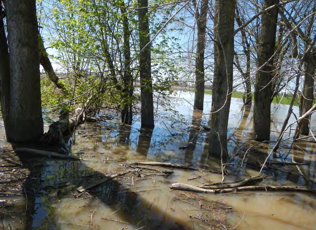
Site Photographs
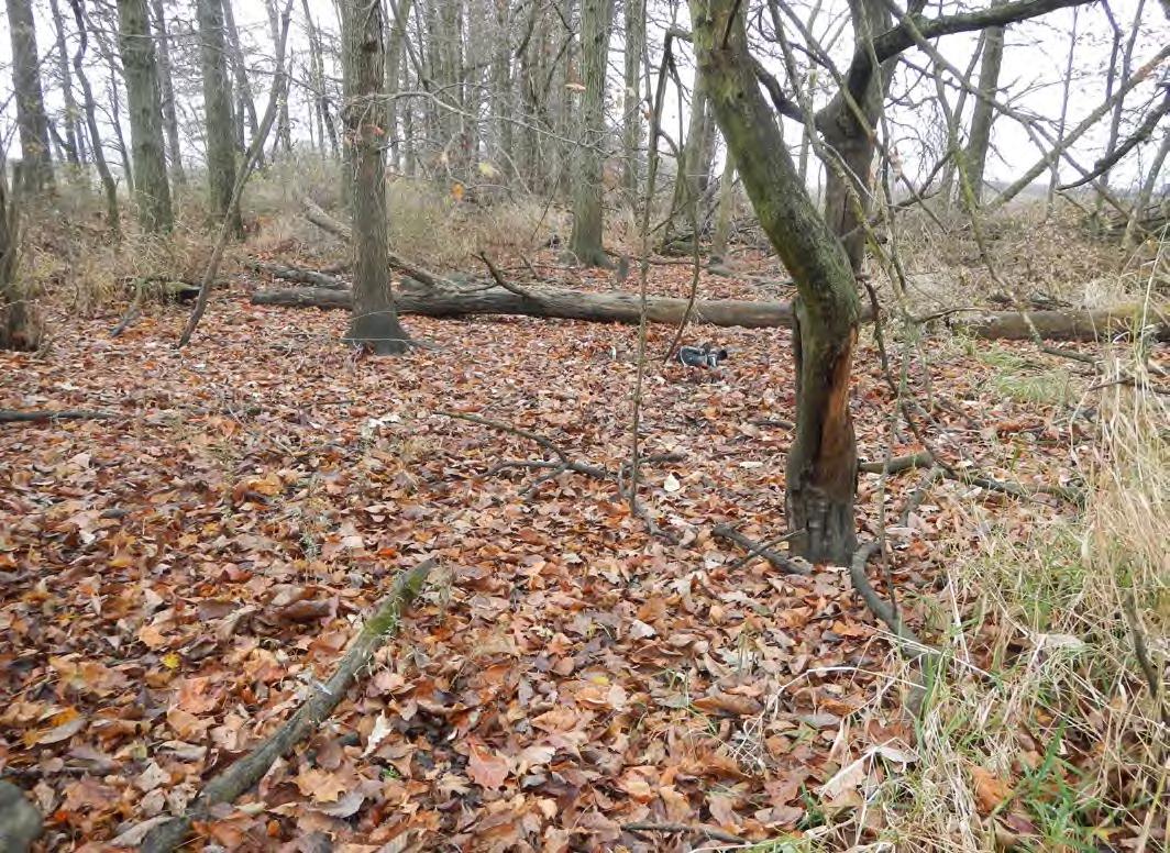
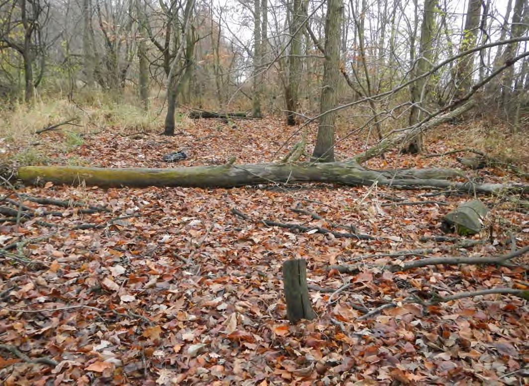
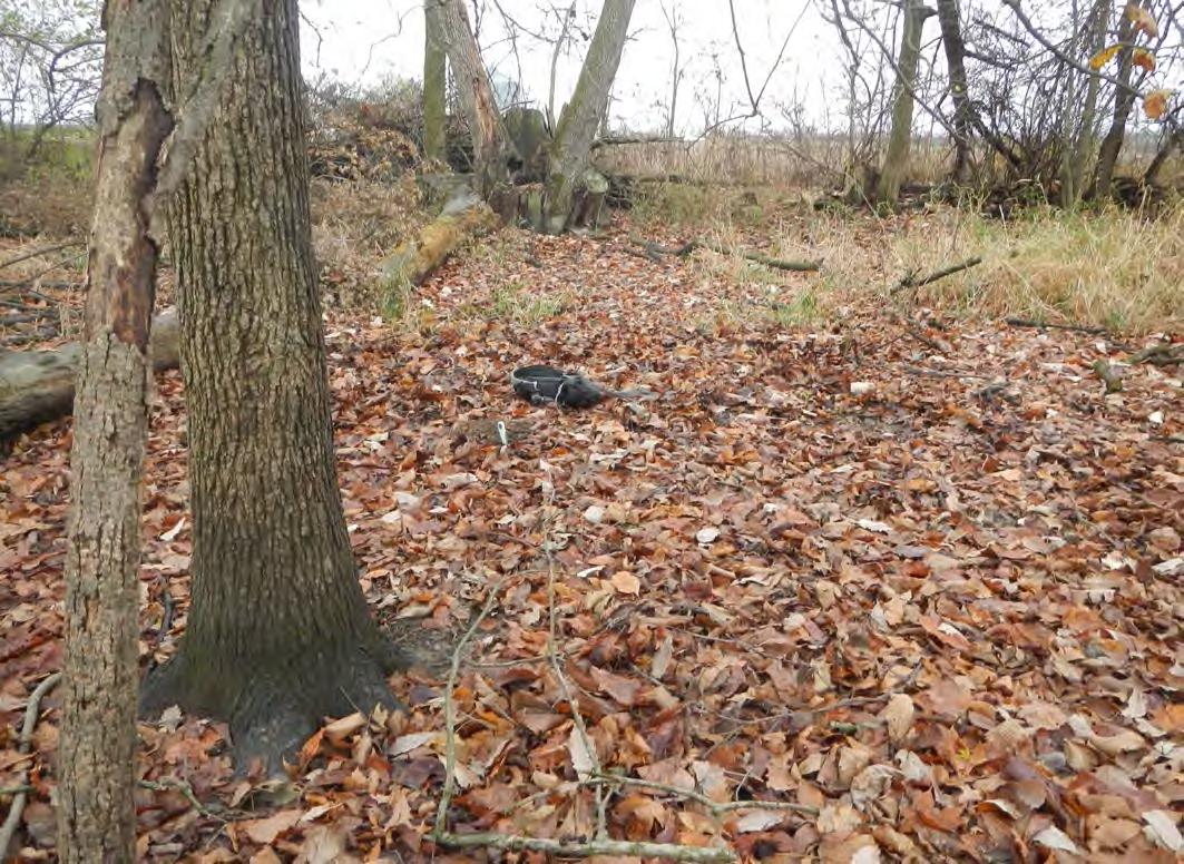
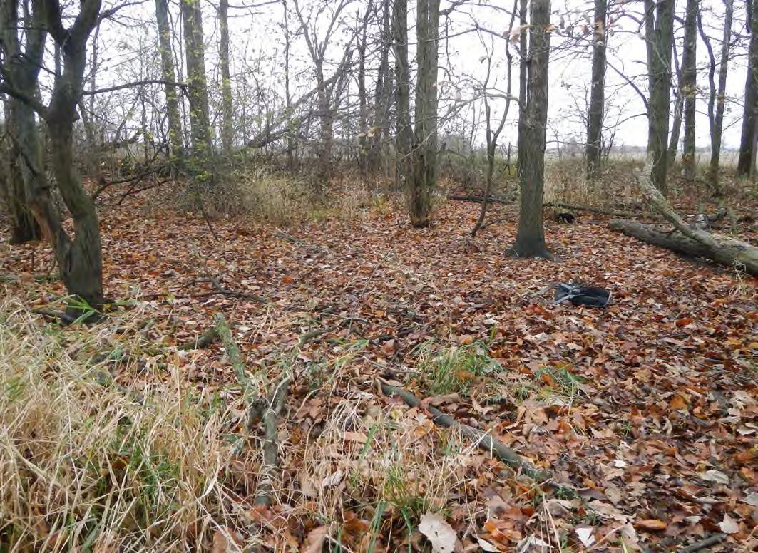
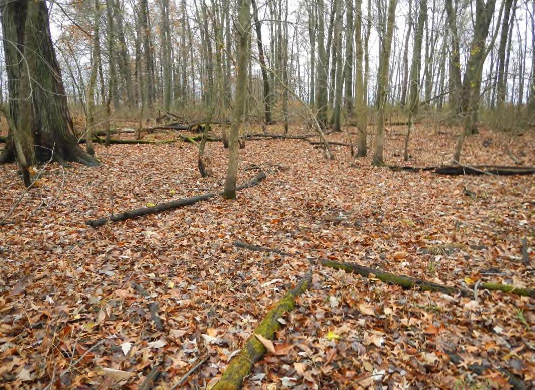
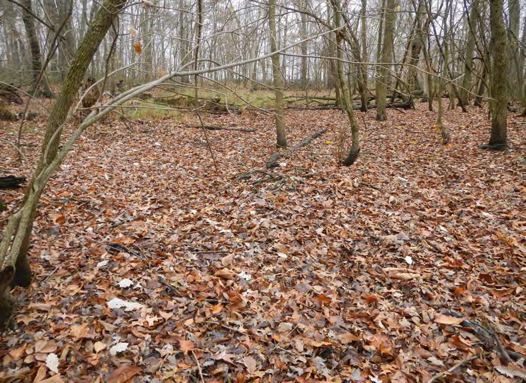
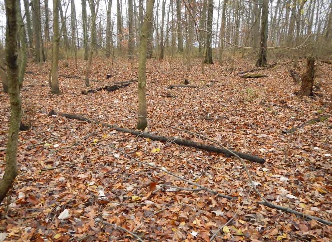
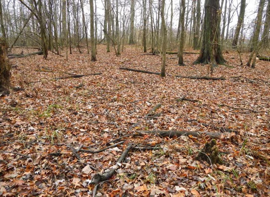
Site Photographs
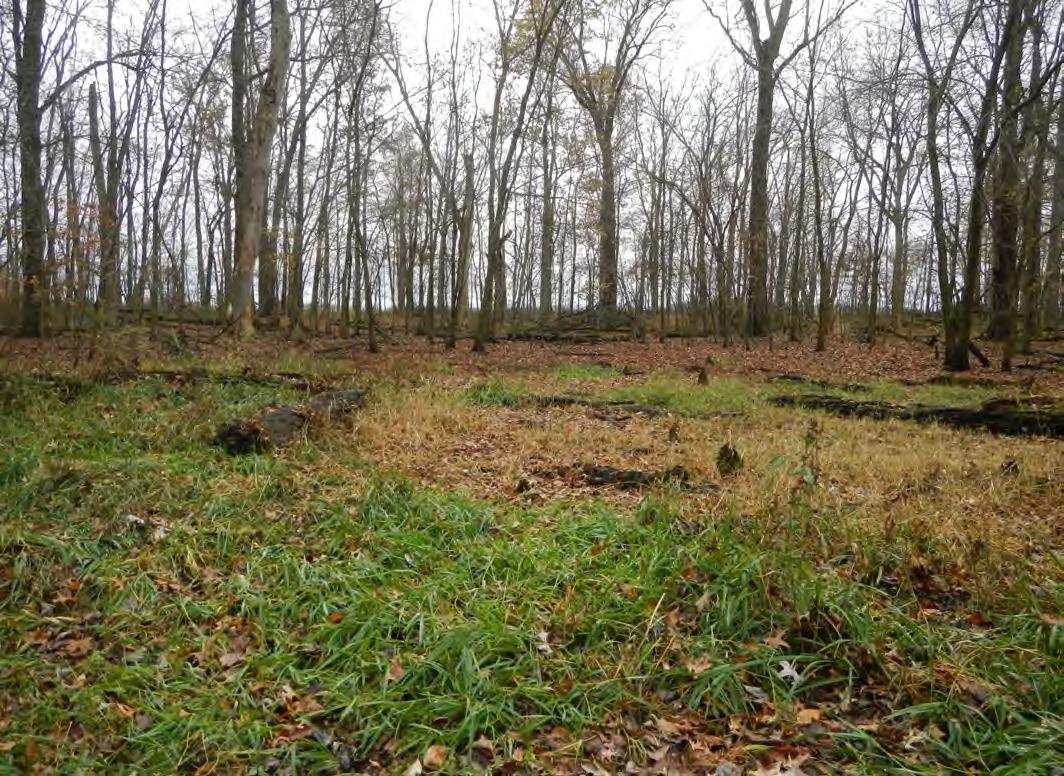
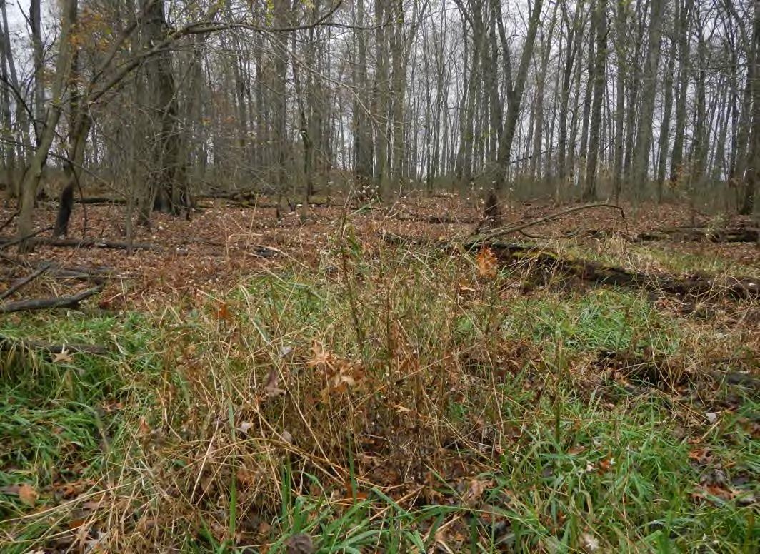
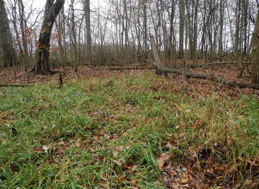
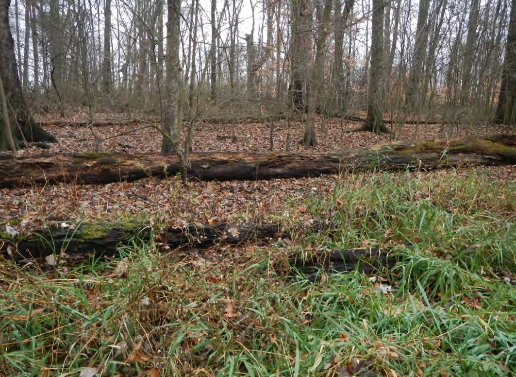
Site Photographs
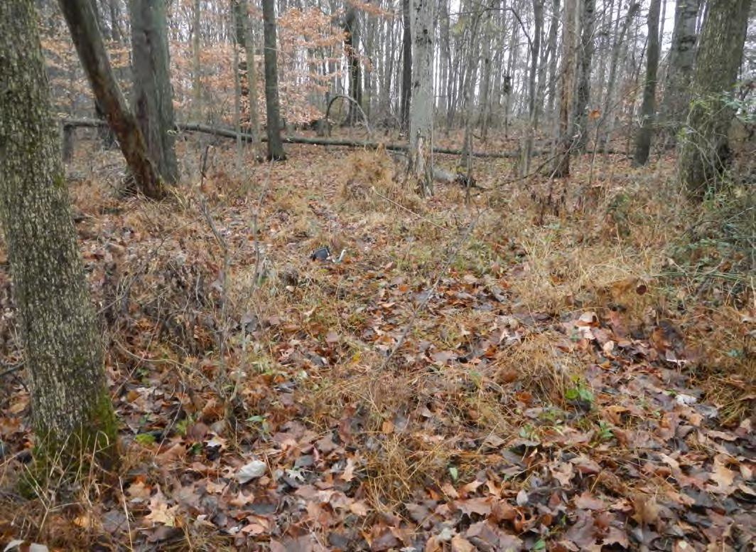
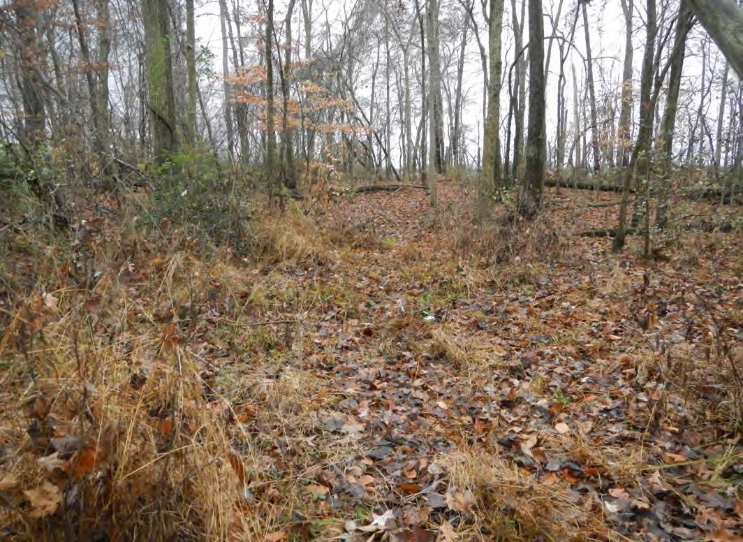
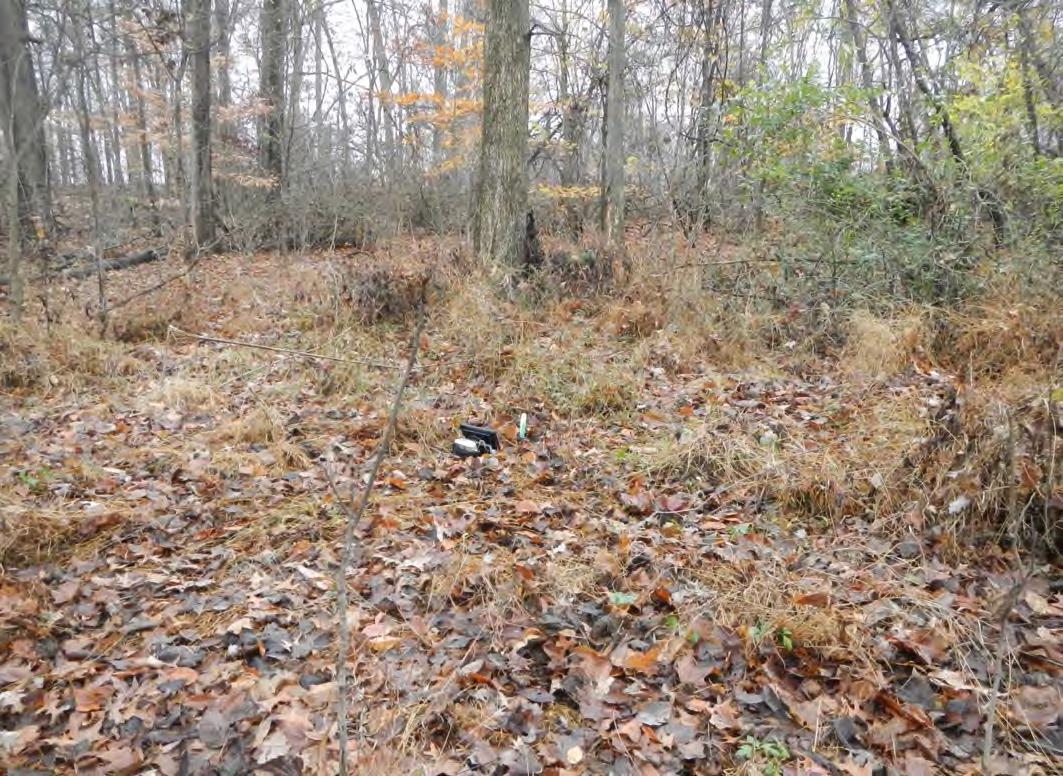
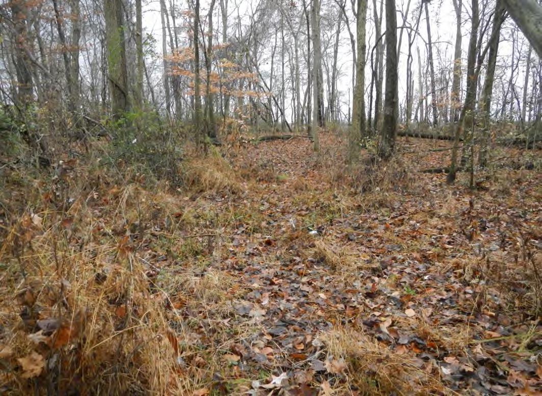
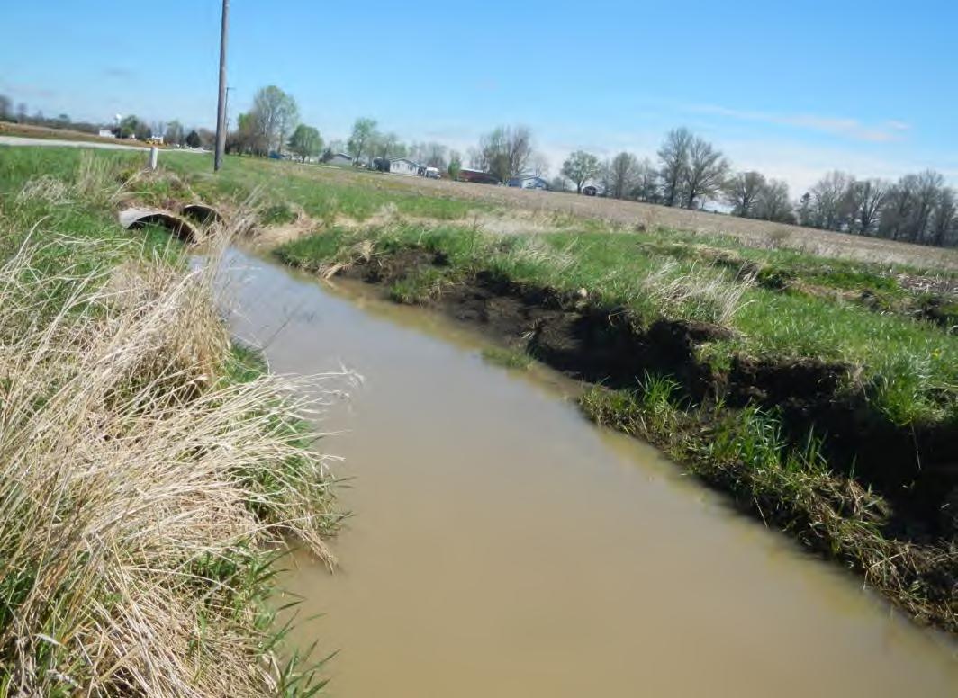
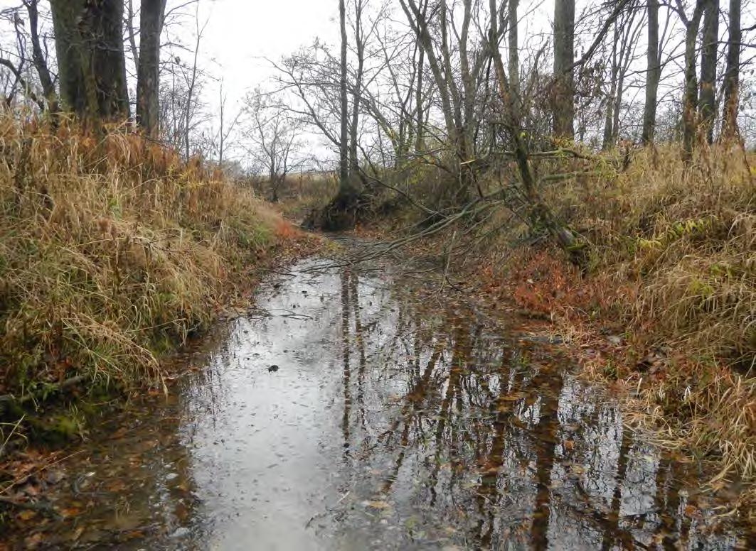
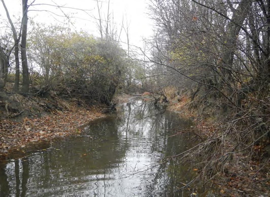
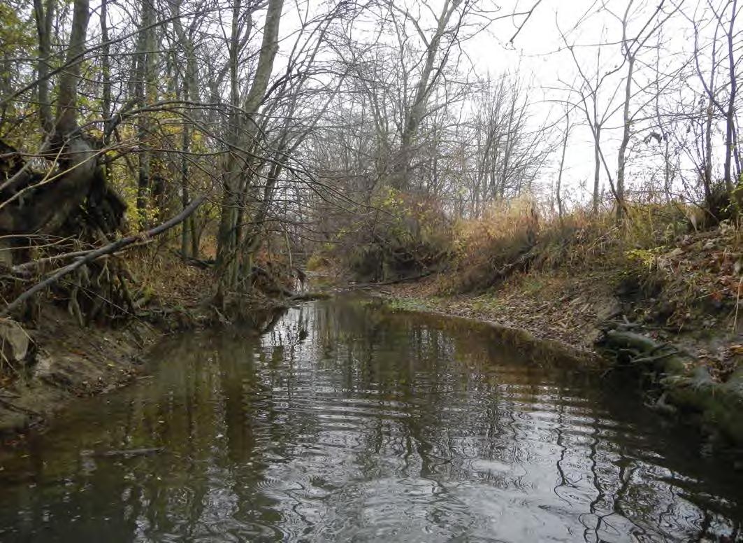
Site Photographs