EXHIBIT AA Archaeology Study
APPLICATION TO THE OHIO POWER SITING BOARD FOR A
CERTIFICATE OF ENVIRONMENTAL COMPATIBILITY AND PUBLIC NEED FOR THE

APPLICATION TO THE OHIO POWER SITING BOARD FOR A
CERTIFICATE OF ENVIRONMENTAL COMPATIBILITY AND PUBLIC NEED FOR THE


Phase I Archaeological Survey: Grange Solar Grazing Center Project
Stokes, Bloomfield, Washington, Richland, and McArthur Townships, Logan County, Ohio
September 2024
Prepared for:
Grange Solar Grazing Center LLC 315 E Main Street Russells Point, Ohio 43348
Prepared by: John S Flood, Isabelle Ortt, and Anne B. Lee
Stantec Consulting Services Inc. 3901 Industrial Boulevard Indianapolis, IN 46254 www.stantec.com
Project Number: 239000643
Phase I Archaeological Survey: Grange Solar Grazing Center Project
Stokes, Bloomfield, Washington, Richland, and McArthur Townships, Logan County, Ohio
This document entitled Phase I Archaeological Survey: Grange Solar Grazing Center Project, Stokes, Bloomfield, Washington, Richland, and McArthur Townships, Logan County, Ohio was prepared by Stantec Consulting Services Inc. (“Stantec”) for the account of Grange Solar Grazing Center LLC (the “Client”). Any reliance on this document by any third party is strictly prohibited. The material in it reflects Stantec’s professional judgment in light of the scope, schedule and other limitations stated in the document and in the contract between Stantec and the Client. The opinions in the document are based on conditions and information existing at the time the document was published and do not take into account any subsequent changes. In preparing the document, Stantec did not verify information supplied to it by others. Any use which a third party makes of this document is the responsibility of such third party. Such third party agrees that Stantec shall not be responsible for costs or damages of any kind, if any, suffered by it or any other third party as a result of decisions made or actions taken based on this document.

Prepared by: Signature
John S. Flood
Printed Name

Reviewed by: Signature
Anne B. Lee
Printed Name

Approved by: Signature
Ryan J. Peterson
Printed Name

2.4
2.4.1
2.4.5
4.3.3
4.3.4
4.3.5
4.4.2 Site 33LO1183/ FS-1-3 ...................................................................................4-74
4.4.3 Site 33LO1184/ FS-1-6 ...................................................................................4-76
4.4.4 Site 33LO1185/ FS-1-9 ...................................................................................4-77

Phase I Archaeological Survey: Grange Solar Grazing Center Project Stokes, Bloomfield, Washington, Richland, and McArthur Townships, Logan County, Ohio
4.4.5
Site 33LO1186/ FS-1-15 .................................................................................4-78
4.4.6 Site 33LO1187/ FS-1-17 .................................................................................4-82
4.4.7 Site 33LO1188/ FS-1-21 .................................................................................4-85
4.4.8 Site 33LO1189/ FS-1-22 .................................................................................4-88
4.4.9 Site 33LO1190 / FS-1-26 RECOMMENDED FOR FURTHER STUDY..........4-91
4.4.10 Site 33LO1191/ FS-1-30 .................................................................................4-96
4.4.11 Site 33LO1192/ FS-1-35 .................................................................................4-97
4.4.12 Site 33LO1193/ FS-1-36 .................................................................................4-98
4.4.13 Site 33LO1194/ FS-1-41 ...............................................................................4-102
4.4.14 Site 33LO1195/ FS-1-43 ...............................................................................4-105
4.4.15 Site 33LO1196/ FS-1-53 ...............................................................................4-108
4.4.16 Site 33LO1197/ FS-1-60 ...............................................................................4-110
4.4.17 Site 33LO1198/ FS-2-1 .................................................................................4-114
4.4.18 Site 33LO1199/ FS-2-2 .................................................................................4-117
4.4.19 Site 33LO1200/ FS-2-3 .................................................................................4-119
4.4.20 Site 33LO1201/ FS-2-4 .................................................................................4-121
4.4.21 Site 33LO1202/ FS-2-5 .................................................................................4-122
4.4.22 Site 33LO1203/ FS-2-6 .................................................................................4-124
4.4.23 Site 33LO1204/ FS-2-7 .................................................................................4-126
4.4.24 Site 33LO1205/ FS-2-8 .................................................................................4-128
4.4.25 Site 33LO1206/ FS-2-13 ...............................................................................4-130
4.4.26 Site 33LO1207/ FS-2-14 ...............................................................................4-133 4.4.27 Site 33LO1208/ FS-2-15 ...............................................................................4-137
4.4.28 Site 33LO1209/ FS-2-16 ...............................................................................4-140
4.4.29 Site33LO1210/ FS-2-17 ................................................................................4-142
4.4.30 Site 33LO1211/ FS-2-18 ...............................................................................4-144
4.4.31 Site 33LO1212/ FS-2-20 ...............................................................................4-146
4.4.32 Site 33LO1213/ FS-2-22 ...............................................................................4-148
4.4.33 Site 33LO1214/ FS-2-24 ...............................................................................4-149
4.4.34 Site 33LO1215/ FS-2-25 ...............................................................................4-151
4.4.35 Site 33LO1216/ FS-2-26 ...............................................................................4-153
4.4.36 Site 33LO1217/ FS-2-29 ...............................................................................4-154
4.4.37 Site 33LO1218/ FS-2-30 ...............................................................................4-155
4.4.38 Site 33LO1219/ FS-2-32 ...............................................................................4-157
4.4.39 Site 33LO1220/ FS-3-11 RECOMMENDED FOR FURTHER STUDY.........4-158
4.4.40 Site 33LO1221/ FS-4-3 .................................................................................4-163
4.4.41 Site 33LO1222/ FS-4-4 .................................................................................4-164
4.4.42 Site 33LO1223/ FS-4-8 RECOMMENDED FOR FURTHER STUDY...........4-165
4.4.43 Site 33LO1224/ FS-4-10 ...............................................................................4-168
4.4.44 Site 33LO1225/ FS-4-11 RECOMMENDED FOR FURTHER STUDY.........4-169
4.4.45 Site 33LO1226/ FS-4-12 ...............................................................................4-171
4.4.46 Site 33LO1227/ FS-4-13 ...............................................................................4-173
4.4.47 Site 33LO1228/ FS-4-15 ...............................................................................4-174

Phase I Archaeological Survey: Grange Solar Grazing Center Project Stokes, Bloomfield, Washington, Richland, and McArthur Townships, Logan County, Ohio
4.4.48 Site 33LO1229/ FS-4-17 ...............................................................................4-177
4.4.49 Site 33LO1230/ FS-4-19 RECOMMENDED FOR FURTHER
4.4.50 Site 33LO1231/ FS-4-20 ...............................................................................4-181
4.4.51 Site 33LO1232/ FS-4-25 ...............................................................................4-182
4.4.52 Site 33LO1233/ FS-4-26 ...............................................................................4-184
4.4.53 Site 33LO1234/ FS-4-28 ...............................................................................4-186
4.4.54 Site 33LO1235/ FS-4-29 ...............................................................................4-188
4.4.55 Site 33LO1236/ FS-4-30 ...............................................................................4-189
4.4.56 Site 33LO1237/ FS-4-38 RECOMMENDED FOR FURTHER STUDY.........4-192
4.4.57 Site 33LO1238/ FS-4-40 ...............................................................................4-197
4.4.58 Site 33LO1239/ FS-4-43 ...............................................................................4-199
4.4.59 Site 33LO1240/ FS-4-48 ...............................................................................4-201
4.4.60 Site 33LO1241/ FS-4-50 ...............................................................................4-205
4.4.61 Site 33LO1242/ FS-4-51 ...............................................................................4-207
4.4.62 Site 33LO1243/ FS-4-52 ...............................................................................4-209
4.4.63 Site 33LO1244/ FS-5-2 .................................................................................4-212
4.4.64 Site 33LO1245/ FS-5-3 .................................................................................4-216
4.4.65 Site 33LO1246/ FS-5-4 .................................................................................4-217
4.4.66 Site 33LO1247/ FS-5-6 .................................................................................4-218
4.4.67 Site 33LO1248/ FS-5-12 ...............................................................................4-219
4.4.68 Site 33LO1249/ FS-5-14 ...............................................................................4-221
4.4.69
4.4.71
4.4.73
4.4.75
4.4.76
4.4.77

Phase I Archaeological Survey: Grange Solar Grazing Center Project Stokes, Bloomfield, Washington, Richland, and McArthur Townships, Logan County, Ohio
Appendix A Historic Maps
Appendix B Photographs Documenting the Phase I Archaelogical Survey
Appendix C Artifact Catalog
Appendix D Previously recorded Cultural Resources within 8.0 km (5.0 mi) of the Project Area
Appendix E Previously Recorded Cultural Resources within 8.0 km (5.0 mi) of the Project Area
Appendix F Project Areas Soil
Appendix G Fieldwork Results Aerial
Appendix H Fieldwork Results Topo
Figure 1. Project Location ...........................................................................................................................
Figure 2. Project Area Soils .......................................................................................................................2-4
Figure 3. Previously Identified Cultural Resources—2 mi (3.2 km) Study Area ......................................2-19
Figure 4. Previous Cultural Resources Investigations—2 mi (3.2 km) Study Area .................................2-20
Figure 5. Areas Surveyed ..........................................................................................................................4-2
Figure 6. Fieldwork Results—Aerial...........................................................................................................4-3
Figure 7. Fieldwork Results—USGS
Figure 8. NRHP Recommended Sites ...................................................................................................4-245

Phase I Archaeological Survey: Grange Solar Grazing Center Project Stokes, Bloomfield, Washington, Richland, and McArthur Townships, Logan County, Ohio
Table 1. Project Area Soils.........................................................................................................................2-1
Table 2. Previously Recorded Historic Structures within the Project Area..............................................2-14
Table 3. Previously Recorded Cemeteries within the 3.2 km (2 mi) Study Area.....................................2-15
Table 4. Previously Cultural Resources Investigations within 2 miles of the Project Area......................2-16
Table 5. Isolate Find Site Table ...............................................................................................................4-14
Table 6. Artifacts Recovered from Site 33LO0285 ..................................................................................4-61
Table 7. Artifacts Recovered from Site 33LO0289 ..................................................................................4-63
Table 8. Artifacts Recovered from Site 33LO0455 ..................................................................................4-66
Table 9. Artifacts Recovered from Site 33LO1249 ..................................................................................4-68
Table 10. Artifacts Recovered from Site 33LO1249 ................................................................................4-70
Table 11. Artifacts Recovered from Site 33LO1182 ................................................................................4-73
Table 12. Artifacts Recovered from 33LO1183........................................................................................4-75
Table 13. Functional Groups Recovered from 33LO1183.......................................................................4-75
Table 14. Artifacts Recovered from Site 33LO1184 ................................................................................4-76
Table 15. Artifacts Recovered from Site 33LO1185 ................................................................................4-77
Table 16. Precontact Artifacts Recovered from Site 33LO1186..............................................................4-79
Table 17. Historic Artifacts Recovered from Site 33LO1186 ...................................................................4-79
Table 18. Historic Functional Groups 33LO1186.....................................................................................4-80
Table 19. Precontact Artifacts Recovered from Site 33LO1187..............................................................4-83
Table 20. Historic Artifacts Recovered from 33LO1187 ..........................................................................4-83
Table 21. Historic Functional Groups at 33LO1187.................................................................................4-84
Table 22. Precontact Artifacts Recovered from Site 33LO1188..............................................................4-86
Table 23. Historic Artifacts Recovered from Site 33LO1188 ...................................................................4-86
Table 24. Historic Functional Groups.......................................................................................................4-87
Table 25. Artifacts Recovered from Site 33LO1189 ................................................................................4-89
Table 26. Artifacts Recovered from Site 33LO1189 ................................................................................4-89
Table 27. Historic Functional Groups.......................................................................................................4-90
Table 28. Precontact Artifacts Recovered from Site 33LO1190..............................................................4-93
Table 29. Historic Artifacts Recovered from Site 33LO1190 ...................................................................4-93
Table 30. Historic Functional Groups 33LO1190.....................................................................................4-94
Table 31. Artifacts Recovered from Site 33LO1191 ................................................................................4-96
Table 32. Artifacts Recovered from Site 33LO1192 ................................................................................4-97
Table 33. Precontact Artifacts Recovered from Site 33LO1193..............................................................4-99
Table 34. Historic Artifact Summary Table Site 33LO1193 .....................................................................4-99
Table 35. Historic Functional Groups at 33LO1193...............................................................................4-100

Phase I Archaeological Survey: Grange Solar Grazing Center Project
Stokes, Bloomfield, Washington, Richland, and McArthur Townships, Logan County, Ohio
Table 36. Artifacts Recovered from Site 33LO1194 ..............................................................................4-103
Table 37. Historic Functional Groups at 33LO1194...............................................................................4-103
Table 38. Artifacts Recovered from Site 33LO1195 ..............................................................................4-106
Table 39. Historic Functional Groups at 33LO1195...............................................................................4-106
Table 40. Precontact Artifacts Recovered from Site 33LO1196............................................................4-108
Table 41. Precontact Artifacts Recovered from Site 33LO1197............................................................4-111
Table 42. Historic Artifacts Recovered from Site 33LO1197 .................................................................4-111
Table 43. Historic Functional Groups at 33LO1197...............................................................................4-112
Table 44. Precontact Artifacts Recovered from Site 33LO1198............................................................4-115
Table 45. Historic Artifacts Recovered from Site 33LO1198 .................................................................4-116
Table 46. Historic Functional Groups at 33LO1198...............................................................................4-116
Table 47. Artifacts Recovered from Site 33LO1199 ..............................................................................4-118
Table 48. Artifacts Recovered from Site 33LO1200 ..............................................................................4-119
Table 49. Artifacts Recovered from Site33LO1201 ...............................................................................4-121
Table 50. Artifacts Recovered from Site 33LO1202 ..............................................................................4-123
Table 51. Artifacts Recovered from Site 33LO1203 ..............................................................................4-124
Table 52. Artifacts Recovered from Site 33LO1204 ..............................................................................4-126
Table 53. Artifacts Recovered from Site 33LO1205 ..............................................................................4-128
Table 54. Artifacts Recovered from Site 33LO1206 ..............................................................................4-131
Table 55. Historic Artifacts Recovered from Site 33LO1206 .................................................................4-131
Table 56. Historic Functional Groups at 33LO1206...............................................................................4-131
Table 57. Artifacts Recovered from Site 33LO1207 ..............................................................................4-134
Table 58. Historic Artifacts Recovered from Site 33LO1207 .................................................................4-134
Table 59. Historic Functional Groups at 33LO1207...............................................................................4-135
Table 60. Historic Artifacts Recovered from Site 33LO1208 .................................................................4-138
Table 61. Historic Functional Groups at 33LO1208...............................................................................4-138
Table 62. Artifacts Recovered from Site 33LO1209 ..............................................................................4-140
Table 63. Artifacts Recovered from Site 33LO1210 ..............................................................................4-143
Table 64. Artifacts Recovered from Site 33LO1211 ..............................................................................4-145
Table 65. Artifacts Recovered from Site 33LO1212 ..............................................................................4-146
Table 66. Artifacts Recovered from Site 33LO1213 ..............................................................................4-148
Table 67. Artifacts Recovered from Site 33LO1214 ..............................................................................4-149
Table 68. Artifacts Recovered from Site33LO1215 ...............................................................................4-151
Table 69. Artifacts Recovered from Site 33LO1216 ..............................................................................4-153
Table 70. Artifacts Recovered from Site 33LO1217 ..............................................................................4-154
Table 71. Artifacts Recovered from Site 33LO1218 ..............................................................................4-155

Phase I Archaeological Survey: Grange Solar Grazing Center Project
Stokes, Bloomfield, Washington, Richland, and McArthur Townships, Logan County, Ohio
Table 72. Artifacts Recovered from Site 33LO1219 ..............................................................................4-157
Table 73. Precontact Artifacts Recovered from Site 33LO1220............................................................4-159
Table 74. Historic Artifacts Recovered from Site 33LO1220 .................................................................4-160
Table 75. Historic Functional Groups at 33LO1220...............................................................................4-161
Table 76. Artifacts Recovered from Site 33LO1221 ..............................................................................4-163
Table 77. Artifacts Recovered from Site 33LO1222 ..............................................................................4-164
Table 78. Artifacts Recovered from Site 33LO1223 ..............................................................................4-166
Table 79. Artifacts Recovered from Site 33LO1224 ..............................................................................4-168
Table 80. Artifacts Recovered from Site 33LO1225 ..............................................................................4-170
Table 81. Artifacts Recovered from Site 33LO1226 ..............................................................................4-171
Table 82. Artifacts Recovered from Site 33LO1227 ..............................................................................4-173
Table 83. Artifacts Recovered from Site 33LO1228 ..............................................................................4-175
Table 84. Historic Artifacts Recovered from Site 33LO1228 .................................................................4-175
Table 85. Historic Functional Group at 33LO1228 ................................................................................4-176
Table 86. Artifacts Recovered from Site 33LO1229 ..............................................................................4-178
Table 87. Artifacts Recovered from Site 33LO1230 ..............................................................................4-180
Table 88. Artifacts Recovered from Site 33LO1231 ..............................................................................4-181
Table 89. Artifacts Recovered from Site 33LO1232 ..............................................................................4-183
Table 90. Artifacts Recovered from Site 33LO1233 ..............................................................................4-184
Table 91. Artifacts Recovered from Site 33LO1234 ..............................................................................4-187
Table 92. Artifacts Recovered from Site 33LO1235 ..............................................................................4-188
Table 93. Artifacts Recovered from Site 33LO1236 ..............................................................................4-190
Table 94. Artifacts Recovered from Site 33LO1237 ..............................................................................4-194
Table 95. Historic Artifacts Recovered from Site 33LO1237 .................................................................4-195
Table 96. Historic Functional Group at 33LO1237 ................................................................................4-195
Table 97. Artifacts Recovered from Site 33LO1238 ..............................................................................4-198
Table 98. Artifacts Recovered from Site 33LO1239 ..............................................................................4-200
Table 99. Artifacts Recovered from Site 33LO1240 ..............................................................................4-202
Table 100. Historic Artifacts Recovered from Site 33LO1240 ...............................................................4-203
Table 101. Historic Functional Groups at 33LO1240.............................................................................4-203
Table 102. Historic Artifacts Recovered from Site 33LO1241 ...............................................................4-206
Table 103. Artifacts Recovered from Site 33LO1242 ............................................................................4-207
Table 104. Precontact Artifacts Recovered from Site 33LO1243..........................................................4-210
Table 105. Historic Artifacts Recovered from Site 33LO1243 ...............................................................4-210
Table 106. Historic Functional Groups at 33LO1243.............................................................................4-211
Table 107. Artifacts Recovered from Site 33LO1244 ............................................................................4-213

Phase I Archaeological Survey: Grange Solar Grazing Center Project
Stokes, Bloomfield, Washington, Richland, and McArthur Townships, Logan County, Ohio
Table 108. Historic Artifacts Recovered from Site 33LO1244 ...............................................................4-214
Table 109. Historic Functional Groups at 33LO1244.............................................................................4-214
Table 110. Artifacts Recovered from Site 33LO1245 ............................................................................4-216
Table 111. Artifacts Recovered from Site 33LO1246 ............................................................................4-217
Table 112. Artifacts Recovered from Site 33LO1247 ............................................................................4-218
Table 113. Artifacts Recovered from Site 33LO1248 ............................................................................4-220
Table 114. Artifacts Recovered from Site 33LO1249 ............................................................................4-221
Table 115. Artifacts Recovered from Site 33LO1250 ............................................................................4-223
Table 116. Artifacts Recovered from Site 33LO1251 ............................................................................4-225
Table 117. Artifacts Recovered from Site 33LO1252 ............................................................................4-226
Table 118. Artifacts Recovered from Site 33LO1253 ............................................................................4-227
Table 119. Artifacts Recovered from Site 33LO1254 ............................................................................4-228
Table 120. Artifacts Recovered from Site 33LO1255 ............................................................................4-229
Table 121. Artifacts Recovered from Site 33LO1256 ............................................................................4-230
Table 122. Artifacts Recovered from Site 33LO1257 ............................................................................4-231
Table 123. Artifacts Recovered from Site 33LO1258 ............................................................................4-232
Table 124. Artifacts Recovered from 33LO1259....................................................................................4-233
Table 125. Summary of Archaeological Sites........................................................................................4-234
Photo 1. Overview Looking West 33LO0285...........................................................................................4-60
Photo 4. Representative artifacts from site 33LO0289............................................................................4-62
Photo 5. Overview Looking North 33LO0455 ..........................................................................................4-65
Photo 6. Representative artifacts from site 33LO0455............................................................................4-65
Photo 7. Overview Looking North 33LO0469 .........................................................................................4-67
Photo 8. Representative artifacts from site 33LO0469............................................................................4-67
Photo 9. Overview Looking Southeast 33-HR-0471...............................................................................4-69
Photo 10. Representative artifacts from site 33-HR-0471 ......................................................................4-69
Photo 11. Overview Looking East 33LO1182.........................................................................................4-72
Photo 12. Representative artifacts from site 33LO1182..........................................................................4-72
Photo 13. Overview Looking East 33LO1183.........................................................................................4-74
Photo 14. Representative artifacts from site 33LO1183..........................................................................4-74
Photo 15. Overview Looking West 33LO1184........................................................................................4-76

Phase I Archaeological Survey: Grange Solar Grazing Center Project
Stokes, Bloomfield, Washington, Richland, and McArthur Townships, Logan County, Ohio
Photo 16. Representative artifacts from site 33LO1184..........................................................................4-76
Photo 17. Overview Looking East 33LO1185.........................................................................................4-77
Photo 18. Representative artifacts from site 33LO1185..........................................................................4-77
Photo 19. Overview Looking Northeast 33LO1186 .................................................................................4-78
Photo 20. Representative artifacts from site 33LO1186..........................................................................4-78
Photo 21. Overview Looking West 33LO1187........................................................................................4-82
Photo 22. Representative precontact artifacts from site 33LO1187 ........................................................4-82
Photo 23. Representative Historical Artifacts from site 33LO1187.........................................................4-82
Photo 24. Overview Looking South 33LO1188.......................................................................................4-85
Photo 25. Precontact artifacts from site 33LO1188.................................................................................4-85
Photo 26. Post-contact artifacts from site 33LO1188 ..............................................................................4-85
Photo 27. Overview Looking East 33LO1189.........................................................................................4-88
Photo 28. Representative precontact artifacts from site 33LO1189 ........................................................4-88
Photo 29. Representative post contact artifacts from site 33LO1189 .....................................................4-88
Photo 30. Overview Looking east at 33LO1190 from old
Photo 31. Precontact artifacts from site 33LO1190.................................................................................4-91
Photo 32. Historic Period Artifacts from 33LO1190.................................................................................4-91
Photo 33. 1875 Plat Map showing Hone Residence ...............................................................................4-95
Photo 34. Photo of Henry Hone Courtesy of ancestry.com.....................................................................4-95
Photo 35. Overview Looking East 33LO1191..........................................................................................4-96
Photo 36. Representative artifacts from site 33LO1191..........................................................................4-96
Photo
Photo
Photo 39. Overview Looking North 33LO1193 ........................................................................................4-98
Photo 40. Precontact isolate from site 33LO1193 ...................................................................................4-98
Photo 41. Representative historic artifacts from site 33LO1193..............................................................4-98
Photo 42. Overview Looking North 33LO1194 .....................................................................................4-102
Photo 43. Representative artifacts from site 33LO1194........................................................................4-102
Photo 44. Overview Looking North 33LO1195 .....................................................................................4-105
Photo 45. Representative artifacts from site 33LO1195........................................................................4-105
Photo 46. Overview Looking North 33LO1196 ......................................................................................4-108
Photo 47. Representative precontact artifacts from site 33LO1196 ......................................................4-108
Photo 48. Overview Looking North 33LO1197 ......................................................................................4-110
Photo 49. Precontact isolate from site 33LO1197 .................................................................................4-110
Photo 50. Representative historic artifacts from site 33LO1197............................................................4-110
Photo 51. Overview looking north at 33LO1198....................................................................................4-114

Phase I Archaeological Survey: Grange Solar Grazing Center Project
Stokes, Bloomfield, Washington, Richland, and McArthur Townships, Logan County, Ohio
Photo 52. Representative Precontact artifacts from site 33LO1198......................................................4-114
Photo 53. Historic Artifacts from Site 33LO1198 ...................................................................................4-114
Photo 54. Overview Looking Southwest 33LO1199
Photo
Photo 56. Overview Looking South 33LO1200......................................................................................4-119
Photo
Photo 58. Overview Looking South 33LO1201......................................................................................4-121
Photo 59. Representative artifacts from site 33LO1201........................................................................4-121
Photo 60. Overview Looking West 33LO1202.......................................................................................4-122
Photo
Photo 62. Overview Looking North 33LO1203
Photo 63.
Photo
Photo
Photo
Photo
Photo
Photo
Photo
Photo
Photo
Photo 87.

Phase I Archaeological Survey: Grange Solar Grazing Center Project
Stokes, Bloomfield, Washington, Richland, and McArthur Townships, Logan County, Ohio
Photo
Photo
Photo 90.
Photo
Photo
Photo
Photo
Photo
Photo
Photo
Photo
Photo
Photo
Photo
Photo
Photo
Photo
Photo
Photo

Phase I Archaeological Survey: Grange Solar Grazing Center Project
Stokes, Bloomfield, Washington, Richland, and McArthur Townships, Logan County, Ohio
Photo
Photo
Photo
Photo
Photo
Photo
Photo
Photo
Photo
Photo
Photo
Photo
Photo
Photo
Photo
Photo
Photo
Photo
Photo
Photo
Photo
Photo
Photo
Photo
Photo 156.
Photo
Photo
Photo 159.

Phase I Archaeological Survey: Grange Solar Grazing Center Project
Stokes, Bloomfield, Washington, Richland, and McArthur Townships, Logan County, Ohio
Photo
Photo
Photo
Photo
Photo
Photo
Photo
Photo
Photo
Photo
Photo
Photo
Photo

Phase I Archaeological Survey: Grange Solar Grazing Center Project
Stokes, Bloomfield, Washington, Richland, and McArthur Townships, Logan County, Ohio
In response to a request from Grange Solar Grazing Center LLC, Stantec has prepared a Phase I archaeological survey for the Grange Solar Grazing Center Energy Project (the "Project") in Logan County, Ohio. The Project is located on the Russells Point and Huntsville, Ohio United States Geological Survey (USGS) 7.5’ quadrangle maps in Logan County, Ohio.
The Grange Solar Grazing Center Project is a combined utility-scale solar energy facility and sheep grazing operation being developed in Logan County, Ohio. The Project will use rows of ground-mounted solar panels to supply wholesale power to the existing electric grid while also providing pasture for livestock. All of the Project’s above-ground structures will be situated within vegetated fields enclosed by agriculturalstyle fences, which will confine the livestock and protect them from predators.
The Project Area is defined as the vertical and horizontal space that will be directly impacted by Project activities. This constitutes the Area of Potential Effects (APE) for direct effects on below-ground resources such as archaeological sites. State agencies involved in the oversight of this Project include the Ohio Power Siting Board (OPSB) and the Ohio State Historic Preservation Office (OH-SHPO).
A cultural resources literature review focused on a 3.2 km (2 mi) radius around the proposed Project Area identified multiple previous surveys, archaeological sites, cemeteries, and historic properties within the study area, with numerous cultural resources located within Project parcels.
As part of the field efforts, Stantec staff surveyed 2,580 acres of the Project Area, supplementing 1,383 acres that were previously surveyed as part of a separate project. An additional 479 acres of land, not part of the Project Area but still included in this report, was also surveyed. A total of 274 acres consisting of house lots, woodlots, and pasture could not be surveyed but will also not be utilized by the Project. In total, 4,008 acres has been surveyed for cultural resources. A total of 117 acres of agricultural land could not be surveyed due to impacts on the agricultural cycle and will be surveyed after the 2024 harvest, with results submitted as part of an addendum report.
Five previously recorded pre-European contact archaeological sites were revisited as part of the field effort. Additionally, a total of 215 previously unrecorded archaeological sites were documented. Of these newly recorded sites, 137 are precontact isolates, which are recommended not eligible for listing in the National Register of Historic Places (NRHP). Seventy-eight sites contained more than a single artifact: 56 represent precontact artifact scatters, seven represent historical homesteads or farmsteads, and 14 consist of artifacts dating to both before and after European contact in Ohio.
Of the 220 total archaeological sites either revisited or newly recorded, eight are recommended for avoidance or additional investigation prior to any impact by Project activities. These sites—33LO0469, 33LO0471, 33LO1190, 33LO1220, 33LO1223, 33LO1225, 33LO1230, and 33LO1237—may contain information important to both the precontact and post-contact history of the region. Further work is necessary to assess their NRHP eligibility.


1 Introduction
the Area of Potential Effects (APE) for direct effects. A cultural resources literature review focused on a 3.2 km (2 mi) buffer (study area) around the proposed Project Area. Research identified 23 cultural resource projects, 359 previously identified archaeological sites, 24 cemeteries, 79 historic structures, and three properties listed on the NRHP have been recorded within the 3.2 km (2 mi) study area. Of these resources, 7 cultural resource projects, 54 previously identified archaeological sites, and 9 historic structures have been recorded within the proposed Project Area.
Key personnel committed to the Project Manager Ryan J. Peterson, Principal Investigator Anne B. Lee and primary report author John S. Flood. Dr. Matthew Pike created the report graphics. John S. Flood served as Field Director. Kevin Jones and Brian Rapes served as crew chiefs. Field archaeologists included Brianna Baker, Stephanie Luckasevic, Ryan Tincher, Victoria Hammond, and Steven England
This report is organized as follows: Section 2.0 presents the environmental and cultural context, while Section 3.0 details the methodology used. Section 4.0 discusses the results of the fieldwork, and Section 5.0 provides conclusions and recommendations. Section 6.0 lists the references cited. Additionally, Appendix A includes historic maps documenting the use of the Project Area over time, and Appendix B shows field photos documenting the field effort. The artifact catalog can be found in Appendix C, and Appendix D lists previously recorded cultural resources within a 10-mile study area. Appendix E contains detailed additional figure sets.

This background section briefly outlines the environment the region in and around Logan County, Ohio. The Project Area is located within the Scioto River watershed. Multiple waterbodies traverse the Project Area, including tributaries of the Great Miami River.
This background section briefly outlines the environment the region in and around Logan County, Ohio. The Project Area is located within the Great Miami River watershed. Multiple waterbodies traverse the Project Area, including tributaries of the Great Miami River.
The Project Area lies within two physiographic regions as well as Quaternary Lake basin deposits. The first is the Central Ohio Loamy Till Plain, which is described as having a surface of clayey till with well-defined moraines, intervening flat-lying ground moraines, and intermorainal lake basins (Brockman 1998). The second physiographic region is known as the Southern Ohio Loamy Till Plain- with portions of the Bellefontaine Upland Section present as well. The Bellefontaine Upland Section, which is described as having moderately high relief, dissected topography with moraine complexes, boulder belts, high-gradient major streams, caves, sinkholes, and relatively few glacial depressions when compared to surrounding areas (Brockman 1998). The landscape of the Central Ohio Loamy Till Plain is typified by elevations of between 700 and 1,150 feet (ft) above mean sea level (AMSL) and the landscape of the Bellefontaine Upland contains elevations between 1,110 and 1,549 ft AMSL, including the highest point in Ohio (Brockman 1998).
The Project Area is located within the Latty-Fulton and the Nappanee-Paulding soil associations. Soils of the Latty-Fulton association are nearly level to gently sloping, very to somewhat poorly drained, and formed in textured lakebed sediments on lake plains (United States Department of Agriculture, Soil Conservation Service [USDA/SCS] 1979). The Nappanee-Paulding soil association is characterized by nearly level to gently sloping soils that are somewhat to very poorly drained and formed in fine textured glacial till on ground moraines and lake plains (USDA/SCS 1979). Specific soil types within the Project Area are shown on Table 1.
Ble1B1 Blountsiltloam,endmoraine,2to4percentslopes No
Blg1A1 Blountsiltloam,groundmoraine,0to2percentslopes No
Blg1B1
Blountsiltloam,groundmoraine,2to4percentslopes No
Ca Carlislemuck,CentralOhioclayeytillplain,drained,0to2 percentslopes Yes
DeA

DelReysiltloam,0to2percentslopes
Symbol Description
DeB
EmA
EmB
EmC2
DelReysiltloam,2to6percentslopes No
Eldeansiltloam,0to2percentslopes No
Eldeansiltloam,2to6percentslopes No
Eldeansiltloam,6to12percentslopes,moderatelyeroded No
FlA Foxloam,tillplain,0to2percentslopes No
FlB Foxloam,tillplain,2to6percentslopes No
FuA Fultonsiltloam,0to4percentslopes No
Gn Geneseesiltloam No
Gwd5C2 Glynwoodclayloam,6to12percentslopes,eroded No
Gwe1B1 Glynwoodsiltloam,endmoraine,2to6percentslopes No
Gwg1B1 Glynwoodsiltloam,groundmoraine,2to6percentslopes No
Gwg5C2 Glynwoodclayloam,groundmoraine,6to12percentslopes, eroded No
HdA Haskinsloam,0to2percentslopes No
HdB Haskinsloam,2to6percentslopes No
HoA Homersiltloam,0to2percentslopes No
HoB Homersiltloam,2to6percentslopes No
La Lattysiltyclay Yes
Lb Lattysiltyclay,occasionallyflooded Yes
Ln Linwoodmuck Yes
Lp Lippincottsiltyclayloam,0to2percentslopes Yes
Mnl3A Minstersiltyclayloam,tillsubstratum,0to1percentslopes Yes
Mns3A Minstersiltyclayloam,0to1percentslopes Yes
Mz Muskegomuck Yes
NaA Nappaneesiltloam,0to2percentslopes No
NaB Nappaneesiltloam,2to6percentslopes No
OcA Ockleysiltloam,SouthernOhioTillPlain,0to2percentslopes No
Pe Pewamosiltyclayloam,0to1percentslopes Yes
Pk Pits,quarries No
ScB St.Clairsiltloam,2to6percentslopes No
ScC2 St.Clairsiltloam,6to12percentslopes,moderatelyeroded No
ScD2 St.Clairsiltloam,12to18percentslopes,moderatelyeroded No
SlA Sleethsiltloam,0to2percentslopes No
W Water No
Wa Wallkillsiltloam Yes
Wu Westlandsiltyclayloam,claysubstratum Yes

Symbol Description
Wv Wetzelsiltyclayloam Yes
Wx Willettemuck Yes


The climate of Logan County is typical of the Midwest, with warm, humid summers and cold, wet winters. Precipitation varies annually, but the average annual precipitation is 90.4 cm (35.6 in) (USDA/SCS 1979). The typical winter snowfall is 55.6 cm (21.9 in). The average low winter temperature in January is -7.6º C (18.2º F) and the average high summer temperature in July is 28.5º C (83.4º F) (USDA/SCS 1979).
There are five basic vegetation zones in Ohio that have very similar boundaries as the physiographic regions. Over 2,500 plant species have been identified in Ohio. The Project Area lies within the Clayey, High Lime Drift Plains, the Loamy, High Lime Till Plains, and the Mad River Interlobate Area sections of the Eastern Corn Belt Plains Ecoregion (Woods et al. 2007).
The Clayey, High Lime Drift Plains ecoregion contains clayey, high lime, late-Wisconsinan glacial till, lacustrine deposits, and scattered loess soils. The region was originally dominated by beech forests and scattered elm-ash swamp forests. Today, corn, soybean, wheat, and livestock farming are common (Woods et al. 2007).
The Loamy, High Lime Till Plains ecoregion contains loamy, high lime, late-Wisconsinan glacial till, glacial outwash, and scattered loess soils. Today, corn, soybean, and livestock production have replaced beech, oak-sugar maple, and elm-ash swamp forests in this region (Woods et al. 2007).
The Mad River Interlobate Area ecoregion contains loamy, high lime, late-Wisconsinan glacial till and coarse glacial outwash. The region contains high yielding aquifers in areas with glacial outwash deposits. Extensive corn, soybean, dairy, and livestock production, as well as urban activity, have replaced the beech, oak-sugar maple, and elm-ash swamp forests native to the area (Woods et al. 2007).
Prior to European settlement in Ohio, the state was inhabited by white-tail deer, passenger pigeons, bald eagle, beaver, black bear, panther, elk, gray wolf, and buffalo (Ohio State University 2013). Today Ohio’s mammals include coyote, white-tail deer, the red and gray fox, the common cottontail, raccoon, opossum, and several species of squirrel. Birds such as the eastern great blue heron, eastern cowbird, and a variety of woodpeckers also nest in Ohio.
Indian Lake in Ohio possesses a unique geomorphic history, originally comprised of a cluster of natural lakes formed through glacial processes. As the continental glaciers receded from Ohio, chunks of ice detached, melted, and created depressions known as kettle lakes. The region surrounding Indian Lake was initially characterized by these shallow, marshy natural lakes, covering an expanse of 640 acres. Subsequently, human intervention altered this natural landscape. In the mid-19th century, the construction of the Miami and Erie Canal involved damming the Great Miami River, transforming the pre-existing natural lakes into a larger, controlled reservoir. The resulting geomorphic changes, blending both natural and anthropogenic influences, redefine the history of Indian Lake, offering insights into the dynamic interplay between glacial legacies and human engineering.

While this report structurally categorizes Ohio's history into Precontact and Post contact eras, it is crucial to recognize that the delineation is not merely a division between pre and post-European colonization. Native American history is far more nuanced than a binary before and after the arrival of Europeans. Native American lifeways were complex, culturally rich, and developed in parallel with their European counterparts. Often, historical narratives tend to portray Native American societies as a foil to Euro-American cultures, neglecting the sophistication and diversity inherent in indigenous cultures. Contrary to the historical notion that Native American populations were entirely "removed in the 1830s," contemporary Ohio bears witness to the continued presence and contributions of Native Americans. Today, Native Americans in Ohio play vital roles in various aspects of society, contributing to the cultural, economic, and social fabric of the state. Recognizing the complexity and ongoing contributions of Native American communities challenges outdated perspectives and fosters a more inclusive understanding of Ohio's dynamic history.
This section will outline the Precontact cultural setting of central Ohio. The goal of this discussion is to present a context through which to examine the precontact history of the region in and around the Project Area. For the purposes of this report, precontact history is defined as the time beginning with the initial human occupation of the region and continuing up to the period of European contact.
The Precontact occupation of Ohio is generally divided into four broad periods, Paleoindian, Archaic, Woodland, and Mississippian. The Paleoindian period encompasses the cultural remains of the earliest recorded occupations of the region, after about 13,000 B. P., during early postglacial times. The Archaic is identified by archaeologists as the period where more localized seasonal settlement and subsistence patterns replaced the broad seasonal migration patterns of the Paleoindian period. Broad exchange patterns, the innovation of ceramic technology, the emergence of cultigens, and an increasing shift toward sedentism generally identify the transition to the Woodland time period. The Mississippian period is marked by continued population growth, large villages, and subsurface storage pits resulting from an increased reliance on maize agriculture. The following sections will outline each of these broad time periods, including temporal divisions within each.
Paleoindians consisted of nomadic groups comprised of small kin-based bands that primarily practiced a foraging subsistence strategy. The term “Paleoindian” refers broadly to a pattern of nomadic mobility and foraging rather than to a discrete group of people. Research suggests that these Paleoindian groups repetitively moved within a geographic range to intercept large herd animals during their migratory cycles (Gramly 1988; Stothers 1996). Over time, the focus likely shifted from large-scale expeditions to more regular, smaller-scale hunting, along with a decrease in the overall size of territory exploited by these groups.
Paleoindian sites are recognized in the archaeological record by the presence of narrow, lance-shaped spear points. These points may or may not have a flute (a large flat flake) removed from each side of the point. Early Paleoindian projectile points are often made of high-quality materials, usually from a widely

dispersed area, which suggests a high level of mobility (Speth et al. 2010). Later Paleoindian points are more often made from local chert types, which may reflect a reduction in this mobility.
Paleoindian groups occupied the southern Great Lakes region circa 11,500 to 10,800 B.P. (Waters and Stafford 2007). Fluted projectile points have been found in the Great Lakes region and generally date from 11,000 to 10,000 B.P. In Ohio, Paleoindians lived in small groups and moved south to west across the state, advancing northward as the Wisconsin glacier retreated (Gordon 1996). Paleoindians hunted megafauna common to the area such as mastodon, caribou, giant beaver, musk-ox, and ground sloth (Gordon 1996). Due to their small group size and mobility, few sites have been studied and many of the artifact finds are isolates. A Paleoindian antler spear point uncovered in Hancock County dated to 11,000 B.P. is among the oldest artifacts discovered in Ohio (Gordon 1996). The retreat of the Wisconsin glacier and the changing ecology to a warmer and dryer climate ended the Paleoindian culture (Gordon 1996).
The Early Archaic (10,000 – 8,000 B.P.) time period is often identified in the archaeological record by the transition from large, lanceolate bifaces of Paleoindian assemblages, to smaller, notched and bifurcated bifaces (Stothers 1996; Stothers et al. 2001). Groundstone tools and other lithic tools such as gravers, scrapers, and notched knives are also observed in the Early Archaic. Local cherts continue to be utilized as a resource. Early Archaic subsistence strategies continued the focus on large migrating Pleistocene herd animals, but Early Archaic groups also began to exploit more local environmental resources, including smaller game animals. Early Archaic artifacts tend to display more diversity in style and function, which also may reflect diversity in resource exploitation.
Archaeologists observe minimal change between the Early and Middle Archaic periods. The Middle Archaic period (8,000 – 5,000 B.P.) is reflected by changes in projectile point and blade types, but these variations are more prominent in southern portions of the U.S. and are not evident in central Ohio (Vickery and Litfin 1992). The Middle Archaic may be described as a transitional period between the Early and Late Archaic periods.
During the Late Archaic (6,000 – 3,500 B.P.) there is a period with increased focus on regional mobility patterns, as well as an increase in resource diversity. Late Archaic groups incorporated plants as a larger part of their subsistence strategy. Late Archaic sites often represent repeated occupation over a long period of time, which suggests a regular, more localized pattern of movement across the landscape. Projectile points and other lithic tools also show increases in variation. Small side-notched and corner-notched points and side and end scrapers appear frequently in Late Archaic assemblages. Groundstone tools are also increasingly evident. Pottery begins to appear in the transition between the Late Archaic and Early Woodland periods.

Populations in the Woodland Period tended to be broad spectrum hunter-gatherers, living in semi-sedentary occupations made up of small groups, likely based on kinship. These occupations were typically located around riverine environments and organized around communal burials. The Woodland Period saw innovation in pottery, horticulture, earthwork construction, and other technological advancements, including the invention of the bow and arrow.
The Woodland Period is largely recognized through the Adena and Hopewell cultural periods, which are discussed in greater detail below.
The Early Woodland period (2,500 – 1,900 B.P.) marks the transition from the nomadic Archaic subsistence strategy to a more localized, semi-sedentary subsistence strategy. The Adena culture is representative of the Early Woodland period in southern Ohio. During the Early Woodland Period, the tradition expanded across Kentucky, southeastern Indiana, and the Kanawha Valley in West Virginia (OHC n.d.a.). The Adena culture is named after the estate of Ohio Governor Thomas Worthington, which was located approximately 1.5 miles northwest of Chillicothe, in which a 26 ft tall burial mound was present. This mound site exemplified all of the significant features of the culture, and so became the namesake (OHC n.d.a).
Adena people continued the hunter gathering practices of earlier periods, but also began to domesticate crops, such as squash, sunflower, sumpweed, maygrass, and tobacco (OHC n.d.a). Societies lived in small villages; however, frequently moved to follow animal herds and other seasonally available food resources (OHC n.d.a). Cultural material associated with the Adena include stemmed projectile points with weak shoulders, thick-walled ceramic vessels with flat bottoms and lug handles, drills, scrapers, and a variety of ornamental and ceremonial materials (Tuck 1978).
The earliest earthworks and burial mounds in central and southern Ohio are attributed to the Adena. These earthworks were often constructed over another structure, indicated by the presence of postmold features. Burials are often associated with a variety of exotic materials, such as cut mica, copper, beads, gorgets, and shell. It is important to note, however, that “Adena,” like “Hopewell” in the Middle Woodland, refers more to a pattern of mortuary practices and exchange of goods, rather than to a discrete group of people.
While the Early Woodland/Adena lifestyle persisted into the Middle Woodland period in some peripheral areas, archaeologists generally describe the Middle Woodland period in Ohio (1,900 – 1,400 B.P.) as the period associated with the development of the Hopewell culture. The Hopewell culture seems to have developed simultaneously across the Midwest, in places such as Nebraska to Mississippi, Indiana to Minnesota, and from Virginia to Ohio, which is considered the epicenter of the Hopewell culture (OHC n.d.b). The Hopewell influences were strongest in the southern part of the state, specifically in the Ohio, Scioto, and Miami valleys. Residential patterns of the Hopewell culture differed from the previous Adena culture, as people tended to reside in one location, normally near major waterways, until the resources were exhausted in that area, before moving to a new location (OHC n.d.b).

Very few Hopewell archaeological sites have been investigated in Ohio, which leaves many questions regarding these populations unanswered (Yerkes 1988). Regardless, researchers believe that the Hopewell constructed earthworks, participated in trade, and were semi-sedentary.
The Middle Woodland period saw a continued increase in population and social organization, reflected in the numerous earthworks constructed in this period. These earthworks, often constructed in geometric figures, may have represented ceremonial centers, which suggests that populations may have been organized at some larger scale. Others have suggested that the earthworks were used as distribution centers for the trade of raw materials and refined goods (Yerkes 1988). The Precontact trade of exotic materials also reached a high during the Middle Woodland as populations within the “Hopewell Interaction Sphere” traded materials from as far away as the Upper Peninsula of Michigan (copper), the Gulf Coast (shell and shark teeth), and the Carolinas (mica). It has also been suggested that trade transcended physical goods and that the Hopewell people also shared mortuary-ceremonial or religious concepts (citation). It is likely that trade during this period was represented by a broad, loosely organized pattern of exchange rather than a well-defined system of trade (Pacheco 1996).
The subsistence strategy was organized around a seasonal pattern of resource procurement and an increasing reliance on horticulture. Investigations at the Murphy Site (33Li212), a central Ohio Hopewell site, suggests small groups periodically occupied the area in the summer and fall seasons (Yerkes 1988). Around 400 A.D., the Hopewell culture began to decline, though the reason for this is unknown (OHC n.d.b). A prominent theory is due to a cultural collapse, as societies then shifted to larger, permanent, communities, which were more isolated from each other (OHC n.d.b).
The Late Woodland Period (1,400 –1,000 B.P.) is often characterized by a significant reduction in the extensive, extra-regional trade of exotic goods and materials. The construction of large ceremonial earthworks also ended in this period, as mortuary practices shifted to the interment of burials into existing, older mounds or small stone mounds. Isolated, individual burials are also observed. Late Woodland villages are located well to the north, east, and south of the Hopewell core (Seeman and Dancey 2000).
This period also is characterized by an increasingly sedentary residential pattern of large, nucleated villages supported by a growing reliance on maize and other cultigens as a substantial part of the Late Woodland diet. Palisades or ditches were sometimes constructed around these villages. This need for defensive structures suggests an increasing instability at times. These villages, however, appear to be relatively brief occupations, generally lacking overlapping features (Seeman and Dancey 2000). Resource diversity also continued to increase, although reliance on aquatic resources was less pronounced in southern Ohio than in other areas of the Midwest. Some representative Late Woodland artifacts include small triangular points, scrapers, mortars and pestles, celts, and hoes. A distinct technological innovation of the period was the use of earthen ovens for steaming or baking food (Seeman and Dancey 2000). The Late Woodland is also represented by well-developed lithic, bone, fiber, and ceramic industries. Pottery in the early portion of the Late Woodland is generally thin, vertically cordmarked with angular shoulders (Newtown shoulder), while Middle Woodland containers typically have thicker walls and curved, indistinct shoulders (Seeman and Dancey 2000). The majority of ceramics at this time typically lack decoration and surface treatments (Yerkes 1988). Stone tools are characterized as bifacial with less elaborate designs than those that predate

them (Yerkes 1988). The bow and arrow also became prevalent, though likely in the later portion of the Late Woodland.
The Cole Complex has been described as a Late Woodland society, which gave way to the Fort Ancient culture (Dancey and Seeman 2005; Lentz 2003). Originally, the Cole Complex was defined by Baby and Potter (1965:5-6) as ““a post-Hopewellian manifestation of a basic Woodland or Scioto tradition present in the Ohio Valley from Late Adena to Fort Ancient times.” Study of several sites within Ohio revealed that the Cole Complex was defined by distinctive cord-marked and plain pottery styles. The cord-marked vessels exhibited full cord-marking with rounded shoulders, an inverted and collared rim, and four castellations, which were evenly spaced around the rim (Dancey and Seeman 2005). The Cole Complex communities were noted to not have participated in elaborate Hopewellain ceremonialism but practiced a simpler existence. They did not bury their dead in mounds; rather in glacial kames and escarpments, grave goods were plain, and community enclosures were small when compared to the large villages of the Hopewell and later Fort Ancient peoples.
Criticism of the definition of Cole being a “complex” have surfaced (Dancey and Seeman 2005). It has been said that sites exhibiting Cole Complex artifacts cover too long of a timespan (1000 years), the excavated deposits have yielded conflicting dates, and non-ceramic artifacts are found to be more similar to those excavated in northern areas, such as the Great Lakes region, rather than the Ohio Valley. Instead, it has been suggested that the Cole Complex be placed within ceramic manufacture through the Woodland and Late Precontact periods, rather than a specifically defined complex or culture (Dancey and Seeman 2005).
The end of this period is attributed to the arrival of Europeans across the region. As these settlers arrived, new goods and ideas were brought to the Native American population, which instigated widespread change to their way of life.
Many Woodland communities across the midwestern portion of America began taking on characteristics of the Mississippian complex and developing strong ties with Cahokia and other centers during this time. However, some peripheral Late Woodland societies maintained their way of life until contact period (Yerkes 1988). In Ohio, the Protohistoric period is at the terminus of the Late Woodland Precontact time period and just before the earliest arrival of Europeans in northern Ohio. At this time, Native Americans are receiving European material indirectly from intermediate sources but have never actually had physical contact with Europeans. The European material appears to be coming from French sources in the St. Lawrence River region and/or English sources in the Chesapeake Bay region (Pendergast 1985, 1990; Stothers et al. 1994). Some researchers have also suggested a third, as of yet unproven, Spanish source from the American southeast (Drooker 1997; Stothers and Abel 1991).
The Protohistoric period in Ohio is dominated by the Fort Ancient peoples. The Fort Ancient material culture replaced earlier groups of agriculturalists in central Ohio. It has been determined that these people were predominantly sedentary and relied on horticulture, Fort Ancient people grew maize, beans, squash, and sunflower (Wagner 1986). Fort Ancient groups also relied heavily on maize agriculture. Their villages were densely occupied, being home to approximately 100-500 people (Fort Ancient 2013). Fort Ancient villages have been determined to be autonomous settlements with no evidence of regional hierarchy (Yerkes 1988).

Population within the villages would vary throughout the year, as groups would leave villages in the winter to live in hunting camps. Village structures included a pattern of concentric circles with a central plaza, defined boundaries for cemeteries, and stockades. Residences were usually rectangular in shape. In addition to the villages, Fort Ancient peoples are known for their animal effigy mounds, specifically Alligator Mound in Granville and Serpent Mount in Peebles, Ohio (Fort Ancient 2013). Fort Ancient ceramics are described as “grit and shell-tempered cord-marked and plain jars with strap handles, vertical to flaring rims” (Yerkes 1988). Stone tool production appears to have been conducted within a ceremonial area, which some have interpreted as a sign of gender roles (Robertson 1984).
This culture has been associated with Mississippian cultures to the west and throughout the southeastern United States; however, Mississippian groups are noted to be larger with more complex practices (Fort Ancient 2013). It is currently unclear whether the Fort Ancient peoples originated from the Mississippian groups, or if they are their own separate culture, though the Fort Ancient peoples are considered descendants of Late Woodland peoples (Fort Ancient 2013; USDA/SCS 2003). The Fort Ancient peoples abruptly disappear from the archaeological record around 1650 A.D. Potential theories include the decimation of the population from European explorers or they were driven out by waring contemporary groups, though there is no hard evidence for either theory (Fort Ancient 2013).
By the mid-1700s, European explorers had begun to make contact with the tribes occupying the Ohio River Valley, which included the Shawnee, Miami, and Delaware, among others (Fort Ancient 2013). While none of these groups have been able to be definitively linked to the Fort Ancient culture, the Shawnee is often described as the most likely historical descendent. These Native American groups were spread out across the United States at the time of European contact, while the Shawnee were specifically encountered in Maryland and Pennsylvania prior to European contact in Ohio (Fort Ancient 2013).
During Contact Period in Ohio, the Shawnee occupied southern portion of the state (OHC n.d.c). Meanwhile, the Seneca-Cayuga were present in central and northwest Ohio (OHC n.d.c). In the eastern portion of Ohio, the Lenape Indians claimed land (OHC n.d.c). The Wyandot and Ottawa tribe could be found in areas of northern Ohio (OHC n.d.c). The western portion of the state was documented to be occupied by the Myaamia (OHC n.d.c).
The establishment of Detroit in 1701 marked a turning point, transforming the Ohio region into a focal point for fur trade and European political and military influence (Nester 2000). Over the eighteenth century, this resulted in an influx of non-Native settlers and a resurgence of Native American activities in the Ohio area. By the mid-eighteenth century, British and French traders competed for dominance in the region, a rivalry that heightened following the French and Indian War (1756-1763). Post the war, the French ceded control of all Ohio lands to the British (Nester 2000).
In the post-war years, British colonists engaged in skirmishes with disgruntled Native Americans due to British postwar policies. In an effort to maintain peace with tribes allied to the French, the Royal Proclamation of 1763 was enacted, restricting settlement west of the Appalachian Mountains (OHC n.d.d). This proclamation, however, failed to curb colonists' westward movement, contributing to tensions that played a role in the American Revolution against Great Britain (OHC n.d.d).

After the Revolutionary War (1775–1783), Native American territories, including Ohio, were ceded to the United States through treaties like the Treaty of Fort McIntosh (Pennsylvania) in 1785 and the Treaty of Greenville (Ohio) in 1795 (OHC n.d.e). Multiple states, including New York, Connecticut, and Virginia, laid claim to Ohio, with Virginia asserting rights to all territory northwest of the Ohio River (Bennett 1902).
Virginia's claims led to the establishment of the Virginia Military District, aiming to reward Revolutionary soldiers. Lands within this district, including present-day Logan County, were distributed between the Scioto and Little Great Miami Rivers (Bennett 1902). Early Euro-American records for the area now known as Logan County exist by the end of the American Revolution.
By 1805, what would be Logan County underwent significant transformation, evolving from an "unbroken wilderness" into a thriving community marked by schoolhouses, churches, and industries (Antrim 1872). The development of roadways and transportation routes facilitated increased settlement, while agriculture became central. Johnny Appleseed's presence and the prevalence of clay belts further diversified economic activities (Perrin and Battle 1880).
Logan County was officially established in 1817, and Bellefontaine was founded in 1820, becoming the county seat. As Euro-American settlers moved in, Native American communities, especially the Delaware and Shawnee tribes, continued to live in the area. The Treaty of Lewistown on August 3, 1829, played a crucial role, leading to the establishment of the Seneca-Shawnee reservation near Muchinnippi Creek (Logan County, Ohio Historical Society marker). However, as U.S. expansionism prevailed, the trajectory of Native American settlement shifted, culminating in the forced expulsion of the Seneca and Shawnee tribes from the reservation in 1832 (Treaty of Lewistown, August 3, 1829).
While manufacturing, service industries, and tourism shaped Logan County's economic trajectory (OHC n.d.f), the historical echoes of Native American dispossession served as a pragmatic reminder of the complexities embedded in the county's history. Attractions like Lake State Park and Zane Caverns now stand as reflections of a history intricately connected with the legacy of indigenous displacement. The technical history of Logan County unfolds as a narrative woven with threads of territorial negotiations, administrative decisions, and the resilience of communities navigating the ever-shifting currents of change.
The literature review was directed toward identifying previously recorded archaeological sites, historic structures, and other cultural resources. Research was conducted using data provided by the OH-SHPO in January 2024 (Ohio History Connection 2024). Stantec focused on previously recorded resources within 3.2 km (2 mi) of the Project Area, but also examined the larger region where appropriate. For the literature review, we consulted the following resources:
National Historic Landmark list; National Register of Historic Places (NRHP) list; Cultural Resource Management reports; County Histories and Atlas Maps; Ohio Archaeological Inventory (OAI) files;

Ohio Genealogical Society (OGS) cemetery files
Archaeological Atlas of Ohio (Mills 1914).
In addition to the cultural resources within the 3.2 km (2 mi) study area, discussed below, Appendix D includes tabular data listing the cultural resources within 8.0 km (5.0) mi of the Project Area.
2.4.1
There are no National Historic Landmarks within the study area.
There are three NRHP listed resource within the 3.2 km (2 mi) study area: 74001548, 74001549, and 75001458 (Figure 2). Dunns Pond Mound (74001548), located in Logan County, Ohio near Huntsville, represents an archaeological site attributed to the Hopewell culture. Estimated to be over 2,000 years old, the mound exhibits a dome-shaped structure thought to primarily have been used as a burial ground. Lake Ridge Island Mounds (74001549), also known as Wolf Mounds I-IV are situated in Logan County, Ohio on the eastern shoreline of Indian Lake on Lake Ridge Island. The resource consists of three to four earthen mounds arranged in a linear/ semi-triangular formation. Attributed to the Hopewell culture, dating back approximately 2,000 years. The precise function of these mounds remains unclear, and limited archaeological investigation has been conducted on them. The McColly Covered Bridge (75001458), constructed in 1875 in Miami Township, Logan County, Ohio, is a historical covered bridge representing only one of two remaining covered bridges in Logan County. This wooden bridge is an example of 19thcentury American bridge engineering. Specific details, such as structural dimensions and load-bearing capacity, can be extracted from engineering records and documentation.
A total of 79 properties have previously been documented within the 3.2 km (2.0 mi) study area (Figure 2). Nine of these properties are mapped within the Project Area (Table 2). The Howard Barn, constructed in 1910 in Washington Township, stands as a two-and-a-half-story Vernacular-style building with a gambrel roof and rectangular shape. Moving to the Thurman House, built in 1880 with an 1885 addition in the same township, this Vernacular-style single dwelling exhibits a gabled ell and L-shaped design, along with a carriage house/garage. The Lenhart House in Bloomfield Township, constructed in 1911 with a 1920 addition, represents another Vernacular-style single dwelling with a gabled ell, including a barn and a shed. The Huber House, situated in Bloomfield Township as well, was built in 1935 with a 1940 addition, presenting a one-and-a-half-story Vernacular-style single dwelling with a barn. In the same township, the Wildermuth House, dating back to 1907 with a 1910 addition, showcases a two-story Vernacular-style building with a barn, carriage house/garage, and a silo. The Shrelkeld House, constructed in 1910 in Bloomfield Township with a 1970 alteration, stands as a two-story Vernacular-style single dwelling with a privy, barn, and a garage. Heading to Stokes Township, the Aldrich House (Stokes Twp School), built in 1880 with a 1950 addition, served as a rural or county school district and features one-room schoolhouse architecture. In McArthur Township, the Dunn Property, constructed in 1875 with a 1920 addition, is a oneand-a-half-story Vernacular-style building with a barn and a carriage house/garage. Finally, the Abandoned Toledo & Ohio Central RR Trestle, associated with the Toledo & Ohio Central and New York Central

railroads in Washington Township, dates to around 1900-1968, presenting a ruinous state in its current vacant/not in use condition. The remaining 70 properties are not located within the Project Area; however, they may be located within the viewshed for indirect effects.
Table 2. Previously Recorded Historic Structures within the Project Area
Structure
LOG0052116 HowardBarn Barn SR274EofCR61
LOG0052216 ThurmanHouse SingleDwelling 7682SR708
LOG0052505 LenhartHouse SingleDwelling 6337HoganRd
LOG0052705 HuberHouse SingleDwelling 10690SR274
LOG0053605 WildermuthHouse SingleDwelling 13071SR274
LOG0053705 ShrelkeldHouse SingleDwelling 13884SR274
LOG0055901 AldrichHouse OneRoom Schoolhouse 8278SR235
LOG0060618 DunnProperty SingleDwelling 5701TR95
LOG0064116 AbandonedToledo&Ohio CentralRRTrestle RailRelated
The OAI files reveal a comprehensive overview of 359 archaeological sites within the 3.2 km (2 mi) study area. Among these, 108 are documented as Precontact isolate finds. Additionally, 182 sites are marked as non-isolate Precontact sites, indicating the discovery of multiple artifacts and/or features. Within this category, 161 sites are classified as unknown site types, suggesting they likely served as short-term camp sites. Notably, four sites (33LO0028-0031) are identified as earthen mounds associated with the Wolf Mound grouping. Isolated human burials are documented at sites LO-0182, 0183, 0187, 0188, 0189, 0190, 0274, and 0412. Furthermore, 47 sites represent Historic period sites, spanning from the late 18th century to modern times. The remaining 21 sites are categorized as multicomponent, indicating the presence of both historic and precontact material culture.
Of 359 archaeological sites within the 3.2 km (2 mi) study area, fifty-four are located within the Project Area. These were recorded as part of a 1998 ASC survey discussed below. Of these 54 sites, six were recommended for further work: Site 33LO0247, located in a cornfield, displayed a flat rise on the glacial lakebed, yielding 41 artifacts as a lithic scatter from an unassigned Precontact temporal period. Site 33LO0285, located on a rise on the glacial lakebed with a 5 percent slope gradient, producing 55 artifacts categorized similarly. Site 33LO0289, found partially outside the Project Area in a cornfield, featured a rise with an 11 percent slope gradient on the glacial lakebed, resulting in 52 artifacts of the same classification. In an agricultural field, Site 33LO0455, located on a rise with a 7 percent slope gradient on the ground moraine, yielded 36 artifacts, all unassigned to a specific Precontact period. Site 33LO0469, positioned in an agricultural field above a wetland, presented a rise with a 9 percent slope gradient on the ground moraine, revealing 26 artifacts, including a heated Cedarville-Guelph chert Brewerton Corner Notched projectile point from the Late Archaic period. Lastly, Site 33LO0471, identified in an agricultural field, showcased a rise with an 11 percent slope gradient on the ground moraine, producing 32 artifacts of an


This section presented the results of the cultural resources records review. The records check indicates that 23 cultural resource projects, 359 previously identified archaeological sites, 24 cemeteries, 79 historic structures, and three properties listed on the NRHP have been recorded within the 3.2 km (2 mi) study area. Of these resources, 7 cultural resource projects, 54 previously identified archaeological sites, and 9 historic structures have been recorded within the Project Area.
The cultural context of the region suggests that additional unidentified cultural resources persist in this area. These unidentified resources may represent a variety of time periods ranging from Precontact Paleoindian period sites through protohistoric Native American sites. These sites may represent a variety of site types, including isolated artifacts to larger occupational sites. Terrace remnants and topographical rises, particularly in association with drainages or other water sources, are local landforms likely to contain archaeological deposits.
The historic context of the region suggests that unidentified historic archaeological sites may represent a variety of activities ranging from historic dump and debris discard areas to residential sites, as well as sites associated with the historic Seneca-Shawnee reservation. Historic sites also tend to occur in conjunction with transportation features such as drainages, railroads, and roads. Additionally, these types of transportation features can be considered cultural resources. Cemeteries are also common historic resources in rural areas.
In summary, the Project Area is situated in a culturally sensitive region, given the Great Miami River's historical significance for archaeological sites in Ohio before European contact. Additionally, it was formerly a joint Seneca/Shawnee reservation, contributing to its archaeological and historical importance. This information helped guide the cultural survey in an attempt to provide informed recommendations of NRHP eligibility.

This section describes the regulations and guidelines governing archaeological fieldwork as well as the research design, field methods, and laboratory methods employed during the Phase I survey. The objective of the Phase I was to identify cultural resources that may be affected by the proposed Project.
The proposed Project will require a Certificate of Environmental Compatibility and Public Need from the Ohio Power Siting Board (OPSB). The Project is not a federal undertaking subject to review under Section 106 of the National Historic Preservation Act (NHPA); however, the Phase I archaeological reconnaissance was conducted in a way consistent to satisfy requirements of Section 106 of the NHPA.
OPSB OAC 4906-4-08 requires the provision of information on cultural resources. Specifically, registered landmarks and significant cultural resources within 10 miles of the Project Area must be indicated on a map and described. Stantec understands the client will seek a waiver from this rule and has investigated the Project footprint, in accordance with OH-SHPO expectations for archaeological investigations. Significant cultural resources include “those districts, buildings, structures, and objects that are recognized by, registered with, or identified as eligible for registration by the… Ohio Historical Society [sic]” [OAC 4906-408 (D)]. It is further required that the impact of the proposed facility on the preservation and continued meaningfulness of these landmarks be evaluated, and plans described to avoid or mitigate any adverse impact [OAC 4906-4-08 (D)].
The Grange Solar Grazing Center Project Area is situated in a portion of Logan County that was occupied by humans since the Pleistocene. The Project Area lies within the Central Ohio Clayey Till Plain, which is described as having “a surface of clayey till with well-defined moraines with intervening flat-lying ground moraine and intermorainal lake basins” (Brockman 1998). The landscape of the Central Ohio Clayey Till Plain is typified by elevations of between 700 and 1,150 feet AMSL (Brockman 1998). The Project Area is bisected by the Scioto River and Great Miami River watersheds. Multiple waterbodies traverse the Project Area, including Payden Run, McCoy Run, the North Fork of the Great Miami River, and multiple tributaries of these waterways.
Stantec conducted the archaeological fieldwork using methods consistent with the OH-SHPO guidelines and in consultation with OH-SHPO. Stantec performed the Phase I in order to identify archaeological sites and other cultural resources throughout the Project Area.
In areas with greater than 50 percent surface visibility, Stantec conducted a controlled surface survey. This survey was conducted in transects spaced at a maximum 10 m (33 ft) interval. When the field crew identified cultural material on the surface, additional survey on a 5 m (16 ft) grid surrounding the artifacts was conducted. Artifacts were marked with pin flags mapping the artifact distribution across the ground surface.

3 Methodology
These locations were assigned individual Provenience Numbers (PN). At precontact sites, Stantec recorded and collected all materials located within the Project Area. Archaeologists recorded the artifact distribution, along with relevant landscape features, with a Trimble R1 GNSS Receiver unit capable of sub-meter accuracy. Shovel tests were excavated at selected sites with multiple artifacts to determine if intact stratigraphy was present within the agricultural fields.
Pursuant to OH-SHPO guidelines, shovel tests measured 50 centimeters (cm) x 50 cm (19.6 inches [in] x 19.6 in) square with straight sides and extended into undisturbed soils. Soils removed from the probes were screened for cultural materials through ¼-in hardware mesh and immediately backfilled. The crew documented and characterized soil stratigraphy according to the Munsell color guide (Munsell 1994). The entire Project Area was additionally visually inspected for cultural resources.
Laboratory staff cleaned, sorted, and cataloged all cultural material recovered during the investigation. Following initial processing, they classified materials in increasingly specific terms: material type (e.g. ceramic, lithic, faunal), morphological attributes (e.g. rimsherd, biface, large mammal long bone), and when possible, specific types (e.g. dentate stamped rimsherd, corner-notched projectile point, white-tailed deer femur).
3.4.1.1
Precontact cultural material can help archaeologists build an understanding of site function, activity areas, chronology, technology, settlement patterns, and landscape use. For example, functionally diagnostic material, such as lithic artifacts, can indicate the types of activities people conducted in the past, from resource procurement and tool manufacture to plant and animal processing. Temporally diagnostic materials can indicate the period when a site was occupied.
Lithic Artifacts
During the current Project, investigations at the precontact sites yielded only lithic material. Laboratory staff sorted lithic material into the following category based on the individual attributes of each sample.
Biface – a tool that has two surfaces, or faces, which meet to form a single edge that circumscribes the tool. Both faces usually contain flake scars that travel at least half-way across the face (Andrefsky 2005). Artifacts which fall within the biface category include Preform I/I/IIII and various scrapers.
For the purposes of our examinations, tools usually categorized as “Projectile Points or Hafted Bifaces” were assigned to this category and further described based on their characteristics.
Core – a transportable supply of lithic material that may be minimally reduced or prepared.
Primary flake – a lithic flake that possesses a flat ventral face and/or bulb of percussion. Primary flakes have no flake scars on the dorsal surface, which typically consists of cortex.

3 Methodology
Secondary flake – a lithic flake with previous flake scars on the dorsal surface and some remaining cortex. Secondary flakes result from later stages of lithic reduction.
Shatter – debitage with no discernible ventral surface.
Tertiary flake – a lithic flake with previous flake scars on the dorsal surface and no remaining cortex. Tertiary flakes result from late stages of lithic reduction.
Utilized Flake – a flake with intentional secondary modification or “retouch” (Odell 2004).
Unifaces – a flake with retouch on either its ventral and/or dorsal surface along one side of an edge (Andrefsky 2005:79, Crabtree 1982:57). Artifacts which fall within the unifaces category include utilized flakes, endscrapers, sidescraper, gravers, bifacially retouched flakes and backed blades.
Groundstone – tools formed by abrasion rather than percussive forces (Odell 2004). This category would include gorgets, beads, manos, metates, bannerstones, abraders, amongst others.
DeRegnaucourt and Georgiady (1998) and Converse (2007) were referenced for chert material sourcing. Analysis of lithic tools focused on identifying the type of tool. If the tool represented a projectile point, analysis utilized syntheses of point type descriptions for the Midwest by Justice (1987). Metric attributes were recorded according to Justice (1987). Other types of lithic tool analysis used definitions by Andrefsky (2005), Crabtree (1982), and Odell (1996, 2004).
Following the completion of initial processing, historic materials were identified according to material, manufacture, form, and function. Artifacts were first separated into broad material categories: ceramics, glass, metal, faunal, brick, and others. Although brick is a ceramic material in that it is fired clay material, it does not represent a ceramic container, but rather a structural element. Therefore, for the purposes of this report, brick will be categorized separately from other ceramic objects.
Artifacts were then sorted into subcategories defined within each of the material categories. They were also grouped into functional categories, which act as an analytical tool in examining patterns such as activity areas and intensity of use. The artifacts were grouped into functional categories adapted from previous studies (Mansberger 1988; Rogers et al. 1988; South 2002). Both material and functional categories are discussed, as appropriate, in this section.
Glass is primarily identified by color, form, function, and manufacturing techniques. Prior to the late-19th century, the glass industry was relatively static and almost every piece was handmade. Glassmaking underwent a “revolution” of change during the 19th century, resulting in numerous identifiable temporal markers. These manufacturing characteristics and their respective temporal ranges were identified for container, tableware, and miscellaneous glass. For example, in early bottles, a pontil was attached to the bottle base to provide a means of holding it. A piece with a pontil scar typically predates the Civil War, while

3 Methodology
molded bottles completed with the aid of a finishing tool generally date from 1820 to the 1920s (Jones & Sullivan 1989, Lindsey 2024). While color is not always a reliable diagnostic tool, it can illustrate function and can sometimes provide dates (Jones & Sullivan 1989). Glass was analyzed according to Jones and Sullivan’s (1989), Lindsey’s (2024), and Toulouse’s (1969, 1971) classification, terminology, definitions, and chronology.
Early bottle glass made by European and American manufacturers were free blown and shaped to the vessel form, or were blown into simple dip molds, this method is known as “mouth-blown”. These terms apply to all non-machine-made glassware (Jones and Sullivan 1989). Mouth blown glassware can be divided into two categories, free blown and molded glassware (Jones and Sullivan 1989). Free blown bottle glass is characterized by a lack of seams, asymmetrical shape, and flowing lines. It is typically difficult to date free blown glassware due to the lengthy time period this method was used (Jones and Sullivan 1989). The molded glassware manufacture is characterized by the molten glass being blown into a mold either by mouth or a machine. Dip molds are single component iron or wooden molds that give the body of the vessel its shape. The characteristic features of a dip molded bottle are no mold seams, the body shape must be straight or tapered to the base in order to be removed from the top of the mold (rather than a two piece mold), the symmetry of the body on different vessels is uniform and may be textured, while the shoulders and necks may be different heights and styles due to hand application, and the glass on the shoulders and neck is smooth due to the hand application of these features (Jones and Sullivan 1989).
Multipart molds (typically 3-part) having dip molded bodies (Rickett's molds), were typical in making rounded bottles, and were common between 1820 and 1880, although they continued to be used into the 1920s (Jones and Sullivan 1989). Some characteristics of a Rickett’s molded bottle include: a horizontal seam at the juncture of the body and shoulder, two vertical seams over the shoulder oriented on opposite sides of the bottle that may extend up the neck, textured surface on the body, shoulder, and potentially neck, and the body must be at least slightly tapered in order to remove it from the mold (Jones and Sullivan 1989). Many other methods of molded glassware manufacture exist including press molding, pattern molding, and optic molding. Jones and Sullivan (1989) was referenced for characteristics and date ranges for these types of molds.
Two-piece molds were introduced in the United States ca. 1800, having been used in Europe since the mid eighteenth century. These molds were hinged and therefore the bottles could be shaped in any form as they did not need to be extracted from the top of the mold. These molds enabled embossed lettering to be put on the fronts, backs, sides, and shoulders of the bottles (Jones and Sullivan 1989). Removable plates or panels that could be inserted into the mold were patented in 1867 (Jones and Sullivan 1989). These panels or plates were often embossed with the manufacturers name, product name, and city of manufacture. With the introduction of these plates, companies were able personalize large shipments of bottles. This method of embossing was especially used on pharmaceutical and bitters bottles.
Multipart open and shut molds were the most commonly used mold between 1840 and 1860, followed by two-piece molds (Jones and Sullivan 1989). Similar to two-piece molds, the multi-part open-shut mold have a separate base plate, thus exhibiting a seam around the base.
Machine made container glass was first manufactured in the United States in the late nineteenth century. Characteristics of a machine-made glassware include: multiple mold seams, especially in the finish, as well

as two vertical seams, “ghost” seams, which are parallel on the body and join the full-sized mold seams at the finish, base seams, and horizontal seams at the neck and finish junction (Jones and Sullivan 1989). Applied color labels were incorporated on manufactured bottles as early as 1934. These labels consisted of baked on enamel (Jones and Sullivan 1989).
The bottle finish consists of the top part of a bottle or jar that was made to fit the closure of the bottle. The finish contains two parts, the bore (opening) and lip. Some finishes also have a third part known as the string rim. Glassware finishes were formed by applying additional glass to the vessel body and hand shaping a lip. By the 1820s, lipping shears were being utilized to shape the inside of the bottle, producing a standardized form known as an applied (unfused) tooled finish, which was most common from about 1840 to 1870. In the latter part of the nineteenth century, the use of finishing tools to shape the lip of the bottle, recognized by a mold seam which disappears at some point between the neck and tip of the lip of the container, but is not clearly overlain by the finish (Lindsey 2024). Finish methods and styles are a highly datable aspect of container glass (Jones and Sullivan 1989; Lindsey 2024).
Flat glass fragments are typically windowpane glass if no other function can be determined, such as for mirrors, flat container glass, etc. Analysis of flat glass is a strong method for establishing chronology of a site. During the eighteenth century, a typical method of pane glass manufacture was crown glass. In this method, glass is cut from a large disk, which was subsequently cut into panes. This glass manufacture method is known as crown glass and is typically distinguished by a slight thickening and increased opaqueness toward the plate interior. In the early nineteenth century, the method of pane glass manufacture known as cylinder glass was introduced. This method created a pane of uniform thickness (Weiland 2009). As Americans desired larger panes of glass, the glass was cut into thicker panes, lasting until the early twentieth century (Weiland 2009). By the late nineteenth century, machine made glass was introduced. Machine made flat glass is characterized by a uniform thickness, with occasional wavy lines or bubbles. By the early twentieth century, production of machine-made sheet pane glass was the dominant manufacturing process (Weiland 2009).
Window glass can be used as a temporal indicator on sites with high frequencies of flat window glass by measuring its thickness and using Moir’s glass formula (84.22 X average glass thickness (mm) + 1712.7) to calculate date ranges (Moir 1987). Moir (1987) used the mathematical formula to show the relationship between window glass thickness and the known construction date of an associated structure. In 60 percent of cases that Moir studied (1987), the dates produced were accurate within seven years. In this study, although the quantity of flat glass recovered was less than what Moir suggests, the dates calculated were used to support the temporal range of occupation calculated from the overall artifact assemblage recovered.
Ceramics are one of the most temporally diagnostic artifact classes, the analysis of which can illustrate the socio-economic scaling of site occupants, market access and practices, personal preferences and fashion, and the range of some site-specific activities in which they were historically engaged. During laboratory analysis, ceramics are initially sorted in the following paste types: earthenware, stoneware, and porcelain. They are next sorted into ware types, such as whiteware, pearlware, creamware, white improved earthenware, yellowware, redware, and so forth. Ware types are distinguished on the basis of paste color, paste texture, glaze, and decoration. The classifications and chronologies formulated by Debolt (1994),

3 Methodology
Godden (1991), Greer (2005), Ketchum (1983), Miller (1980, 1991), Miller et al. (2002), Ramsay (1939), Samford and Miller (2002), and Stelle (2002) are among the sources used to identify and date ceramic artifacts for the current Project. These paste and ware types are discussed below.
Earthenware is the most common type of historic ceramic. Source material is widespread, so earthenware items were produced in many locales. Earthenwares are identified by brown, red or beige colored bodies. They tend to have sand, ground quartz, or ash as a temper. When dried and fired, earthenwares are hard, brittle, and highly porous. Earthenware may be surface treated with slips or glazes. Slips are liquefied clays applied to the vessel. Glazes are glassy, semi-vitreous coatings that partially fuse to the vessel during firing. Glazes vary in appearance based on their chemical and mineral composition. Glazes may be opaque, translucent, colorless, colored, textured, untextured, or have a metallic sheen. Unless they are glazed, earthenware vessels cannot hold liquids. Common earthenware glazes include lead, tin, and varieties of aluminum-silicate glazes. Earthenware can be divided into two types. Coarse Earthenware includes redware, yellow ware, and stoneware (Greer 2005, Ketchum 1983). Refined earthenware includes whiteware, creamware, ironstone, and pearlware (Samford & Miller 2002; Stelle 2020).
Red and Brown Paste Earthenwares (Redware)
Red and brown paste earthenwares (redware) often are unrefined and have a red or reddish-brown body. Redware is one of the earliest types of pottery made in America (ca. 1725-present) and is the softest and most porous of the earthenwares, often with a lead glaze to decrease the tendency of redware to absorb liquids (Ketchum 1983; Ramsay 1939). These earthenwares were often used for utilitarian vessels and for the manufacture of architectural elements, such as ceramic drainpipes and tiles. Late-19th and 20th century red-paste ceramics for kitchen use were high fired and more durable than the early wares (Greer 2005; Ramsay 1939).
Stoneware
Stoneware ranges from porous to nonporous, from coarse to fine-grained, and have gray, beige, or slightly red bodies. More often stoneware is vitreous (nonporous). These unrefined utilitarian wares were originally designed to serve the most basic functions, such as large storage vessels, and were produced in northeastern part of the United States as early as the 17th century. By the early-19th century, this pottery industry had spread to the Midwest. Stoneware surface treatments can include slipping, glazing, and the application of decoration. A common 19th to 20th century stoneware surface treatment was salt glazing. Salt glazing results when salt, used as a flux agent, is added to the kiln during the firing process, creating an “orange peel” appearance to the vessel surface. Due to the abundance of domestic stoneware manufacturers and the difficulty in attributing vessels to a particular manufacturer, stoneware is considered a poor chronological indicator on nineteenth century sites. However, the presence or absence of two common surface treatments, Bristol glaze and Albany slip, are useful for dating purposes. Albany slip ranges in color from light brown to black. It was a common slip in the Midwest from the mid-1820s to the early twentieth century (Greer 2005). Bristol glaze is white and was introduced into the United States in the 1880s. This is frequently used on the same container as Albany slip until around 1920. Bristol slip on stoneware usually occurs alone on vessels after 1920, sometimes with cobalt blue decoration (Greer 2005).

3 Methodology
Refined earthenware includes creamware, pearlware, whiteware, and ironstone (white granite), all containing finely ground silicon, feldspar, and sometimes kaolin. Creamware, pearlware, whiteware, and ironstone evolved over time and body and glaze formulas were not standardized (Samford & Miller 2002). Creamware is a clear lead-glazed refined earthenware with an ivory, tan, or straw color developed in England in the mid-18th century and manufactured in North America by the 1770s. Creamware has a characteristic “cream”-colored paste. Pearlware was developed in England in the late 1700s and was manufactured until the mid-1800s (Stelle 2020). Pooling of cobalt-rich glaze, creating a blue cast in thicker areas like foot rings, categorizes pearlwares, although certain decorative techniques (flown blue prints) can mimic this blue cast. Whiteware is similar to pearlware, and a result of potters attempting to more closely mimic the white body of porcelain. Whiteware was developed in 1830 and distinguished by reduced amounts of cobalt in the paste to mimic white-bodied porcelains (Samford and Miller 2002). Ironstone is an opaque earthenware with a clear glaze which was commonly used for plates and platters. Ironstone was first marketed by Charles Mason in England in 1813, and it was not until the 1840s that the plain undecorated ware began to be popular in the United States (Samford and Miller 2002). Ironstone began to be manufactured in the United States in the 1870s but was often imported from England prior to World War I as well (Majewski & O’Brien 1987; Venable et al. 2000). This ware is referred to by potters (and sometimes advertised on Maker’s Marks) as white granite ware or porcelain (DeBolt 1994; Godden 1991; Venable et al. 2000).
Porcelain is a highly vitrified ware that is manufactured in two paste varieties from fine kaolin clay. Soft paste porcelains tend to be thin bodied, highly translucent, and have a sugary appearance. Hard paste porcelains are usually thick-bodied and have a glassy paste structure. There are only limited kaolin finds in the world. Before the 1760s, no porcelain was produced outside of China or Japan. In 1660, England began exporting porcelains to the American colonies. Exports were generally Chinese porcelain, a white or gray, dense, non-porous and highly fired product. European, mainly British, production of porcelain did not begin until the mid-18th century (Samford and Miller 2002; Staniforth and Nash 1998).
Between 1660 and 1840, Chinese porcelains were very common in the Americas. In the mid-1700s, Europeans developed their own porcelains by experimenting with body composition. This resulted in the production of two near porcelains in the 1700s: English Soft-Paste porcelain (1740s to 1790s), refined white earthenware with glass added to the body, and Bone China (post-1790), a white earthenware with ground bone added as a flux. The English produced their first real porcelain in the 1760s (Fisher 1974, Staniforth and Nash 1998). In 1840, the Japanese took over the commercial market. Americans did not develop their first porcelain production plant until the 1820s.
The glaze on porcelains often is of a similar composition so the body and glaze often fuse together, giving very little difference between the body and the glaze. Porcelains could be decorated in under glaze or over glaze fashions. The most common commercial Chinese pattern is the Willow Pattern (post-1792). Popular items manufactured of porcelain include teawares, tablewares, figurines, doll parts, toys, toiletries, and electrical insulators (Samford and Miller 2002).

Metal artifacts are identified by material (aluminum, brass, copper, iron, lead, steel, etc.), form, and function (hardware, tools, roofing, buttons, etc.). It is common that metal artifacts are found in severely deteriorated states that compromise the success of their identification. When good preservation exists, metal artifacts can be useful not only in dating an assemblage, but also in identifying site activity areas and establishing construction dates for architectural and mechanical features.
The mode of manufacture may be identified to date the artifact; this has proven especially successful in the analysis of historic nails (Nelson 1968). Nails can be divided into three basic categories: hand wrought nails, machine cut nails, and wire nails. Wrought nails consist of hand-forged nails, which were made well into the nineteenth century and even through the present. Typically wrought nails are square or rectangular in cross section, and taper on all four sides towards a point. These nails were common through the 1830s and 1840s. In the later periods wrought nails were made in smaller numbers, typically in remote areas (Nelson 1968). The most temporally diagnostic of the nails are machine cut nails and wire nails. Machine cut nails typically range in date from post 1790 to 1880 (Nelson 1968). These nails are cut from a sheet of steel and only taper on two sides to a point. Small numbers of cut nails are still made today for specialized purposes. Wire nail production in the United States began in the mid-nineteenth century; however, early production was limited (Nelson 1968). Wire nails are made by cutting steel wire and are therefore round in cross section. By 1890, wire nails became the dominant type, although some builders preferred using cut nails into the twentieth century due to their greater holding power (Nelson 1968). The presence of wire nails and cut nails can indicate late nineteenth century repairs, alterations, or maintenance on a structure predating the late nineteenth century (Nelson 1968).
While brick is a ceramic material it also represents a structural element. For the purposes of this Project brick will be classified as a separate material type. Isolating brick from ceramics ensures functional clarity between architectural ceramic and container ceramic in artifact documentation and analysis.
Local manufacturers dominated early brick making in the United States. Early handmade bricks often are characterized by coarse bodies and imperfections in manufacturing (in the quality of the finished product’s composition and form). The five basic steps to making bricks by hand are winning/mining, preparation, molding, drying, and firing (Gurcke 1987). Early brick making machinery was introduced in America in the mid-1800s. In the 20th century, less local brick making occurred. Some brick makers molded their name and markers of production locations onto their products. Other descriptive qualities of brick include glaze, shape, size, and function (i.e., pavers vs. face bricks).
Other materials include conglomerate artifacts (such as mortar), indeterminate artifacts, and those artifacts with materials that do not readily fit into other identified material categories such as mica, concrete, mortar, plastic, rubber, textile, wood, or lithics. Items that are of an unidentifiable material, however, are classified as having an indeterminate material type.

3 Methodology
Artifacts are also separated into functional categories in order to determine the function of a feature or site. The functional categories used in the present study include:
Architectural, which is divided into construction materials, hardware, and fixtures;
Fuel/ Energy, which is divided into electrical insulators, fuses, battery parts, and fuel items such as coal;
Furniture, which are divided into lighting, housewares (furniture to knick-knacks), and stove parts;
Clothing, which includes buttons, shoes, buckles, and other items associated with clothing;
Personal, which includes miscellaneous items owned or used by a single person such as keys, coins, watches, rings, tobacco pipes, eyeglasses and items associated with personal hygiene such as combs, mirrors, and cosmetic containers;
Kitchen, which is divided into food preparation, food service, and food storage;
Misc. Hardware, which consists of items for which a function can be determined but a larger context is unknown, such as nuts, bolts, chains, pipes or washers.
Tableware, which includes the dishware used for serving food and dining such as decorative dishes, decanters, bowls, plates, and cups;
Toys, which includes dolls, toy cars, marbles, animal figurines, and tea sets; and
Unknown which includes items for which the function cannot be determined such as fragments of metal, glass or ceramic.
Recovered artifacts were transported to Stantec’s laboratory. Following review and concurrence of all reports of investigations by OH-SHPO, Stantec will return the artifacts to the individual property owners associated with the artifacts. If the property owner wishes to donate the artifacts for curation, a signed Deed of Gift letter will accompany the artifacts and associated records to the curation facility. Thorough documentation of artifacts will be conducted prior to returning artifacts to landowners.

Stantec conducted the fieldwork between April and June 2024. Weather ranged from cold and overcast to sunny and hot with temperatures were between 30 and 90o F. The Project Area consisted predominantly of agricultural land. The Project Area included parcels anticipated for solar modules, access roads, and underground collection lines in Logan County, Ohio (Figure 1). Ground surface visibility typically ranged from 50 to 100 percent. Soil profiles varied across the Project Area. All sites were identified on the ground surface during the pedestrian survey, including one within a woodlot.
A shovel test was excavated at archaeological sites with more than five artifacts to determine soil stratigraphy, whether an intact A-horizon was present, and density of artifacts in the plowzone. These individual shovel tests are described within the site descriptions below. No intact, unplowed A-horizon was noted at any of the archaeological sites. Photographs of the Project Area and site overviews, and typical soil profiles are included in Appendix B.
As a result of the fieldwork, 220 archaeological sites were identified or reinvestigated, including precontact isolates, precontact lithic scatters, historic scatters, multicomponent sites, and components of one previously recorded site (Figure 6 and 7 series). Site descriptions, artifact analysis, and NRHP eligibility recommendations are presented below.


One hundred-thirty seven isolated precontact finds were identified during the 2024 field efforts. The large amount of isolated find sites is indicative of the ephemeral use of the landscape within the Project Area. The Project Area is located in a mostly flat area with low moraine rises that were more suitable for precontact habitation; however, the majority of these rises only produced small, low-density lithic scatters.
Several waterways are located within or adjacent to the Project Area, including the Great Miami River and Indian Lake, and multiple tributaries of these waterways. It is likely that the area encompassed within the Project Area was utilized for seasonal resource procurement and hunting, as well as short term encampments, rather than long term occupation.
The large number of isolated find tools and debitage identified throughout the Project Area likely reflects the casual loss of these items during resource procurement, tool manufacture, and tool maintenance. Seventy-three of the isolated finds were utilized flakes, unifaces, biface fragments, and hafted bifaces, representing casual tool loss. The remainder of the precontact isolated finds represented lithic debitage which are indicative of possible tool resharpening during seasonal resource procurement. Table 5. Isolated Find Site Table summarizes the isolated find sites identified during the 2024 field efforts and includes photographs of the recovered artifacts.
The isolated find sites are not likely to produce information important to the prehistory of the region and therefore are recommended not eligible for listing in the NRHP; however, the isolated finds do speak to the ephemeral use of the region as a whole and may in the future assist with creating a dialog regarding probability models of landscape use in the region. The identified precontact sites, both isolated finds and small scatters, appear to represent small activity areas and the casual loss of artifacts rather than longer term occupation sites such as villages and hamlets.

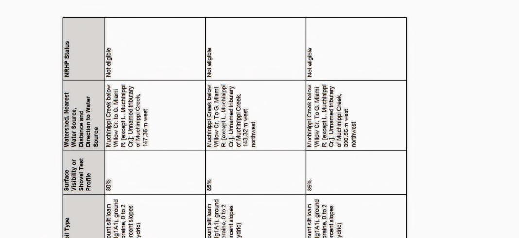
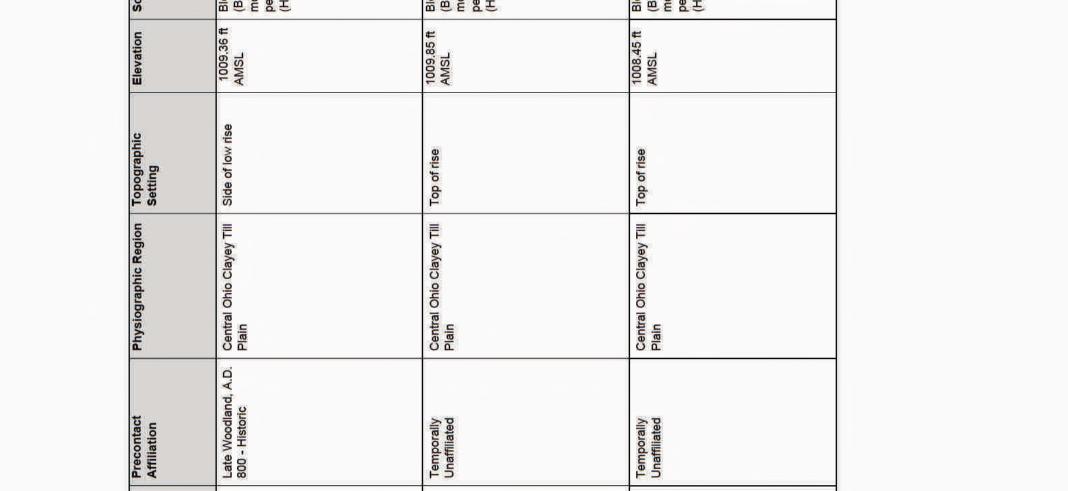


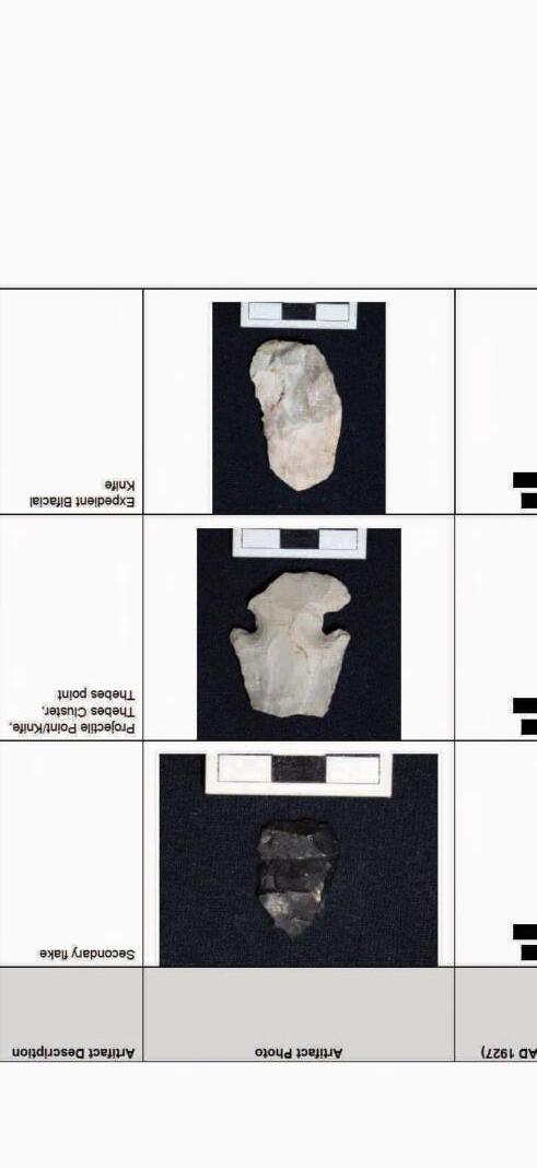
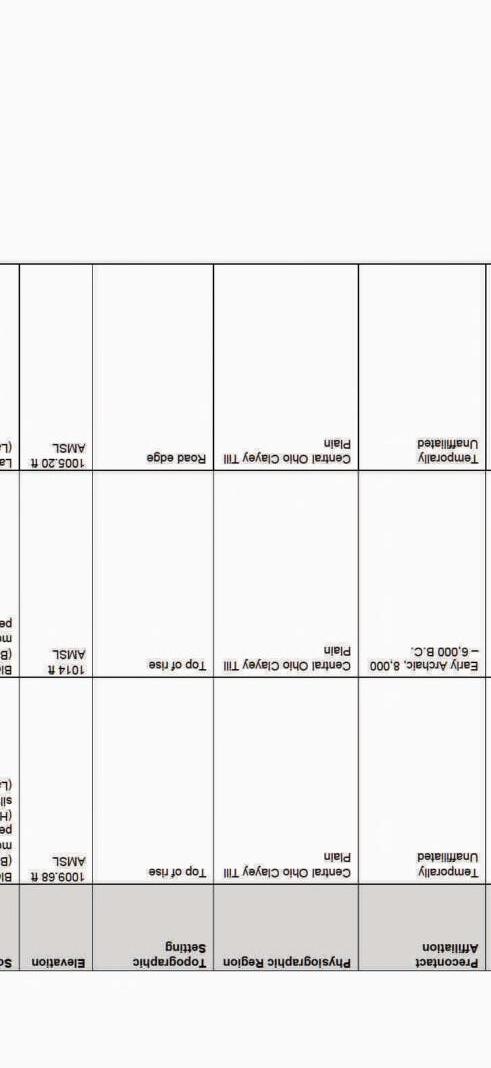
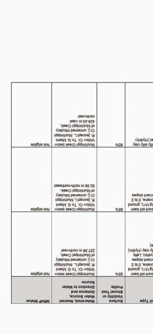


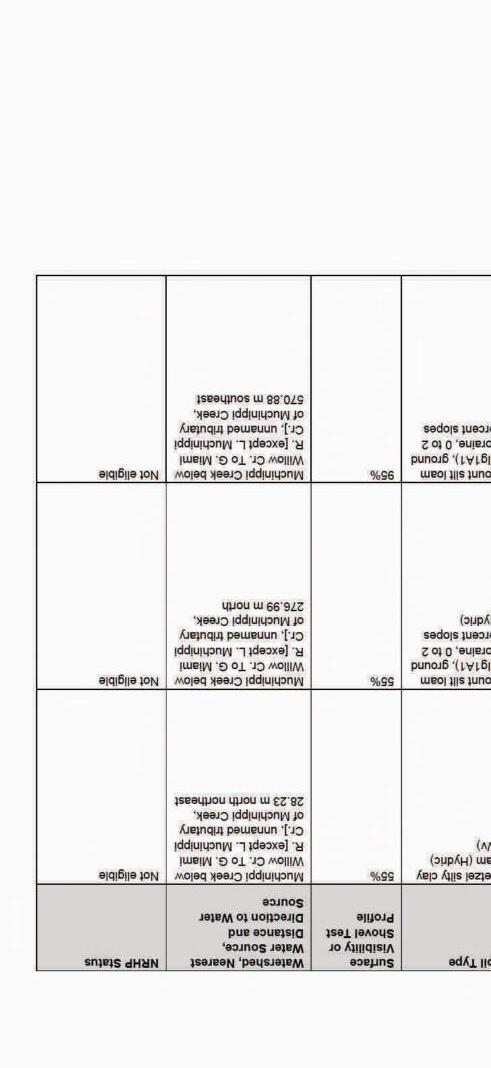

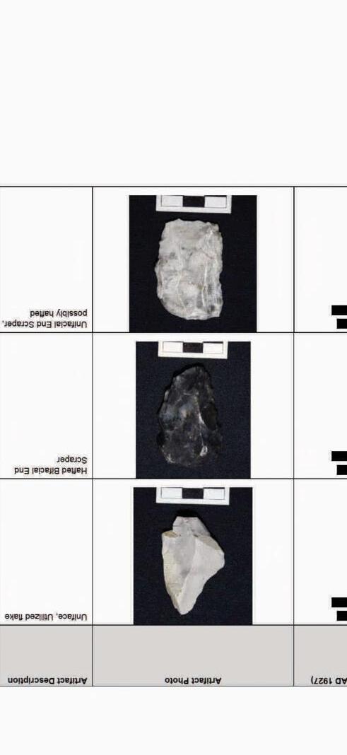
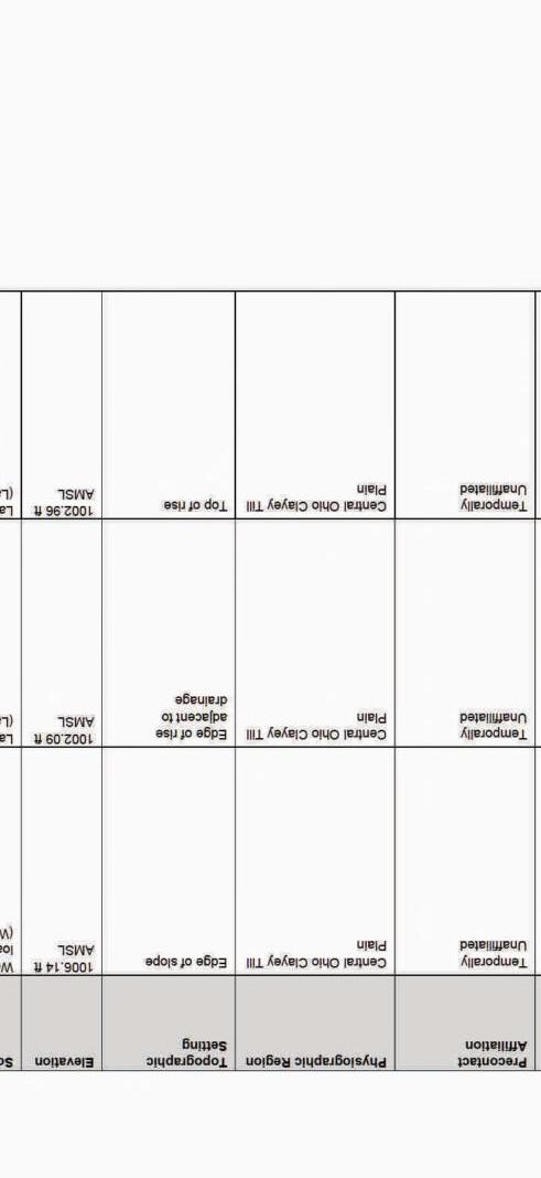
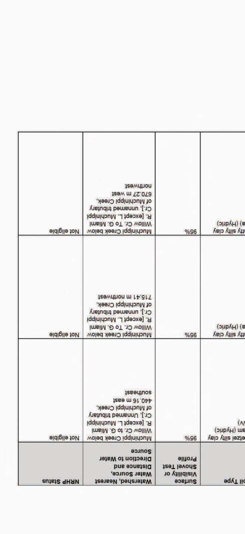

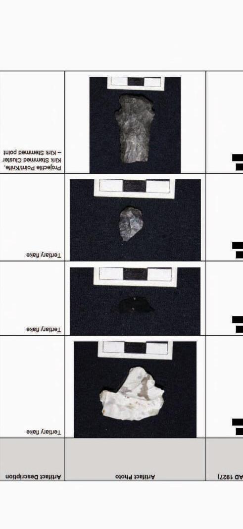


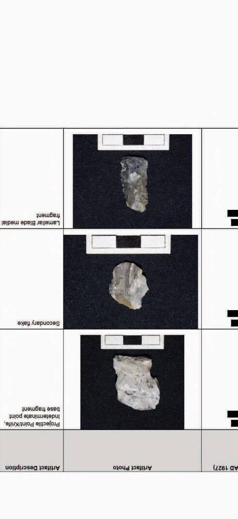
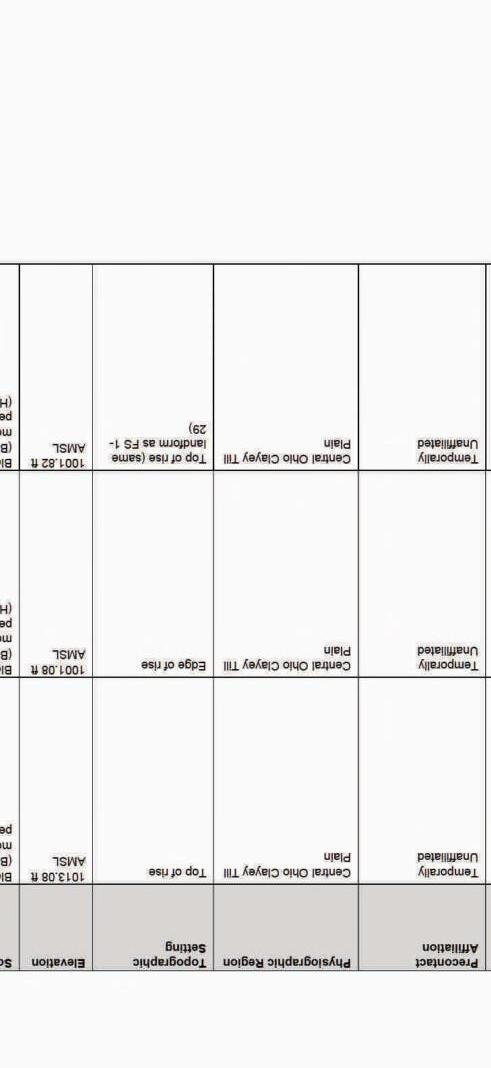
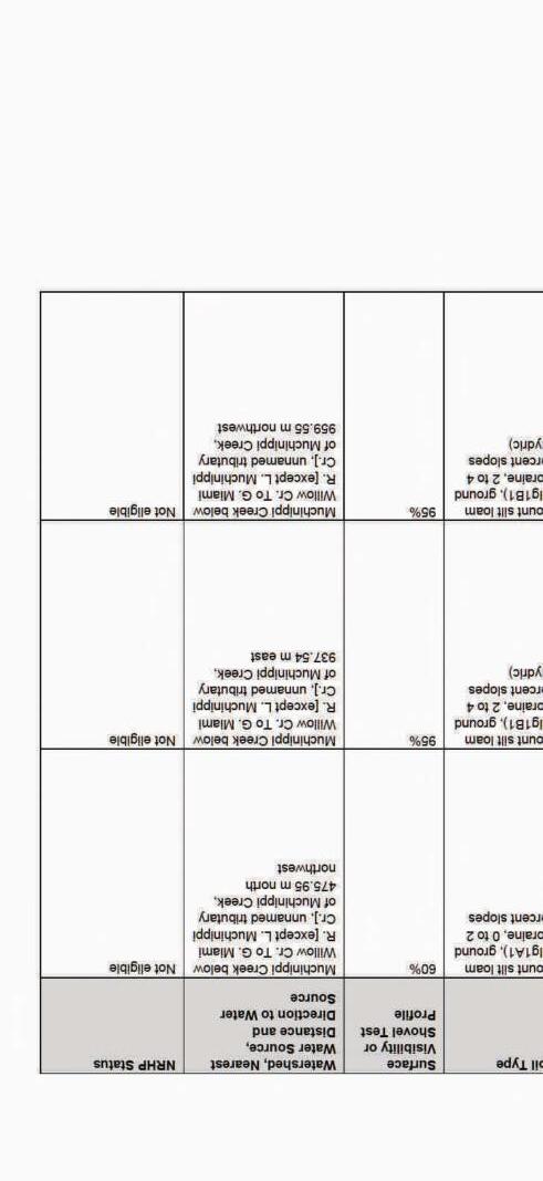

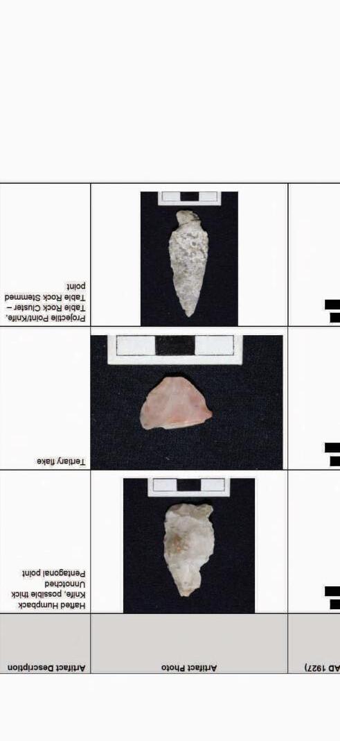
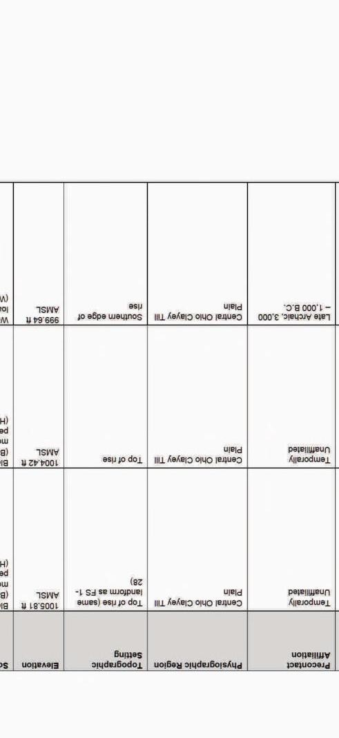
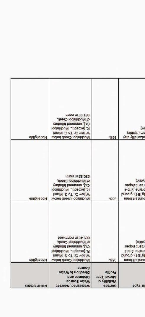

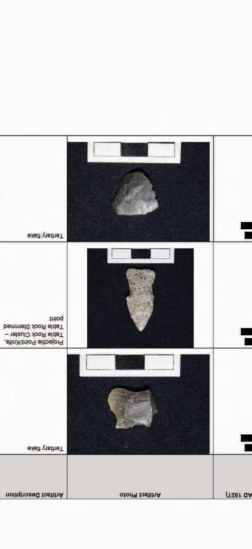
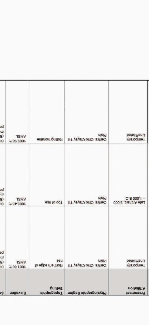
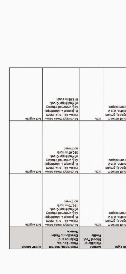

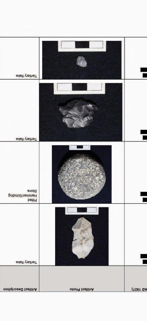
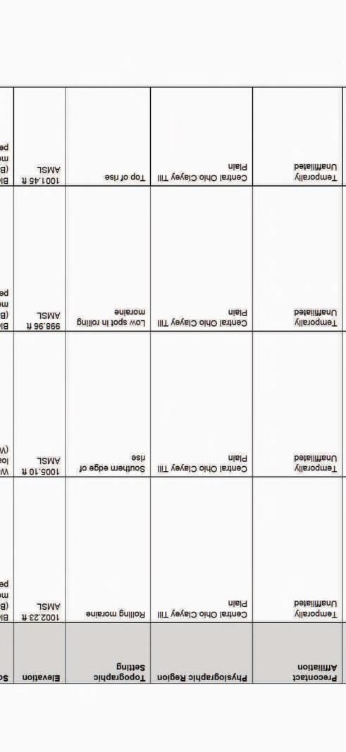


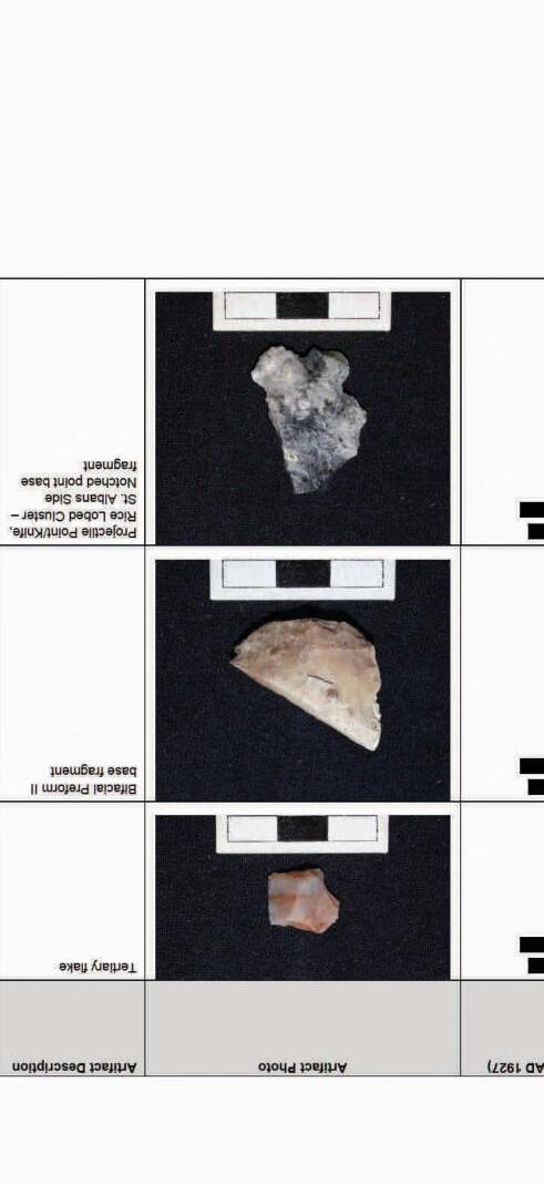
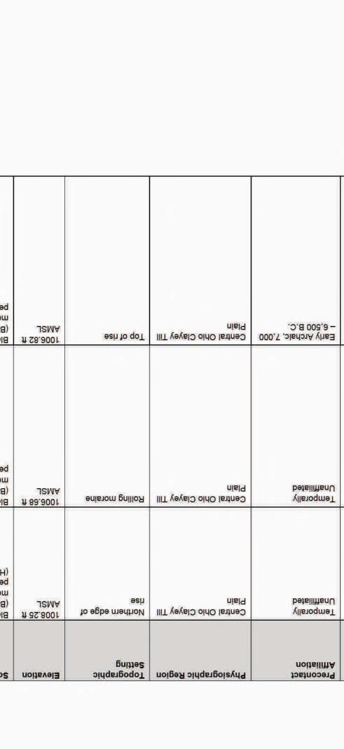
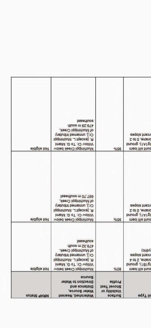

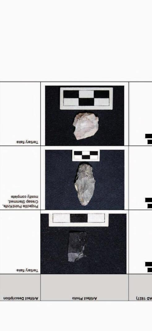


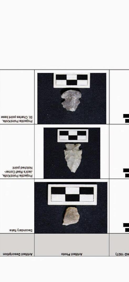


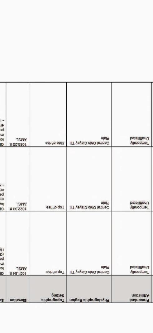
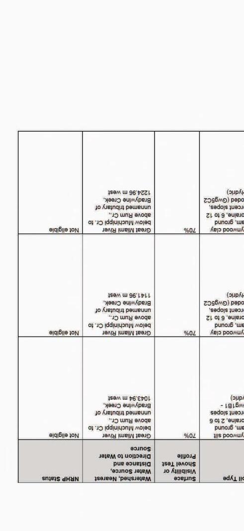

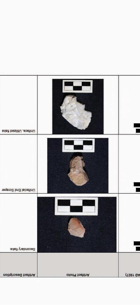
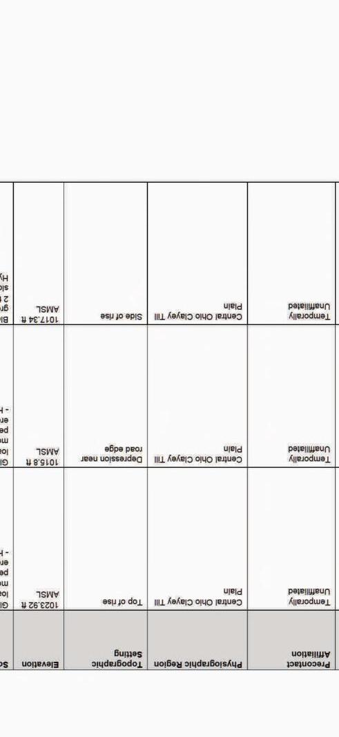


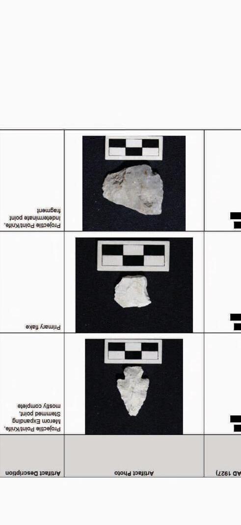


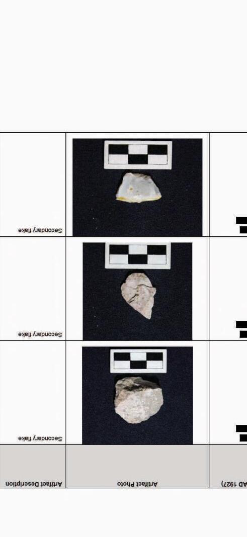


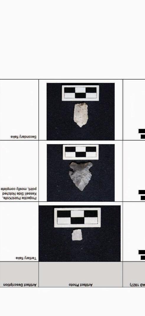
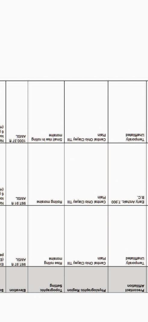
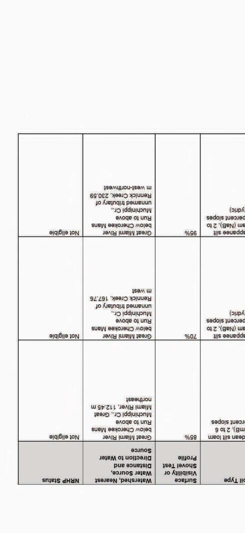

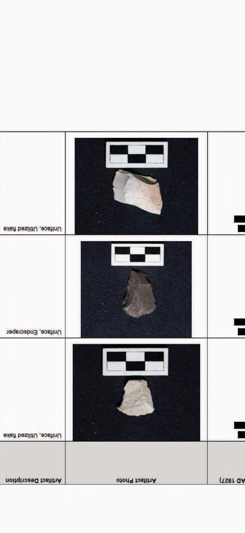

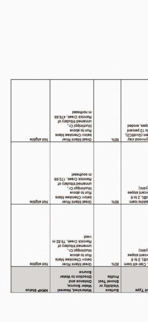


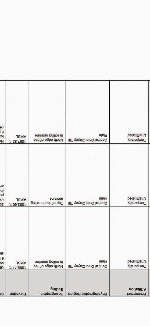
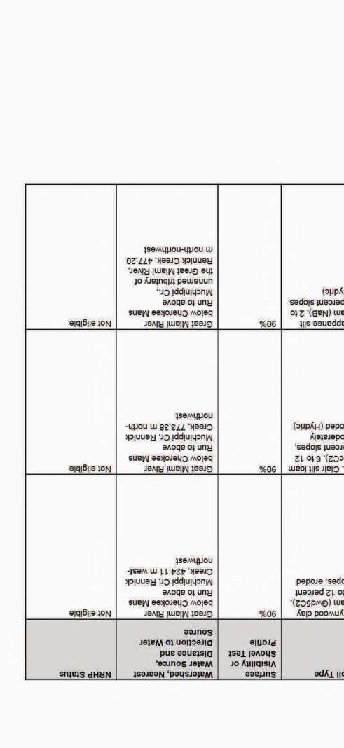

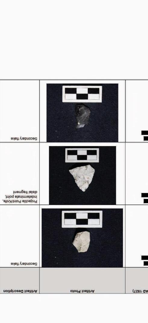

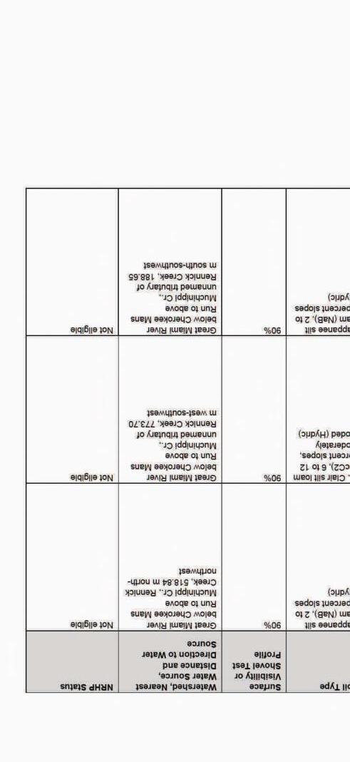


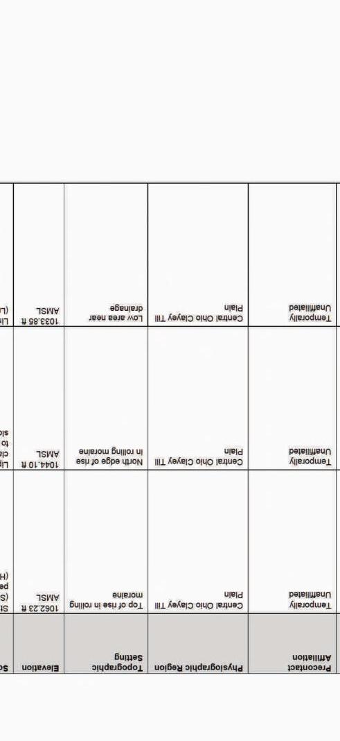


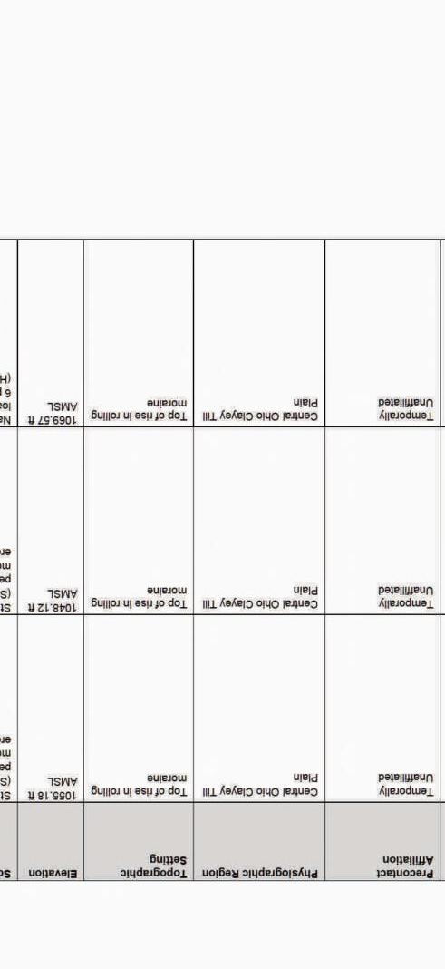


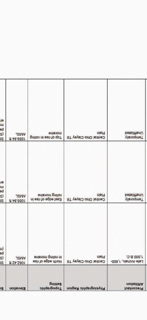


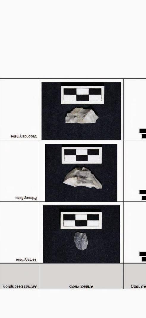


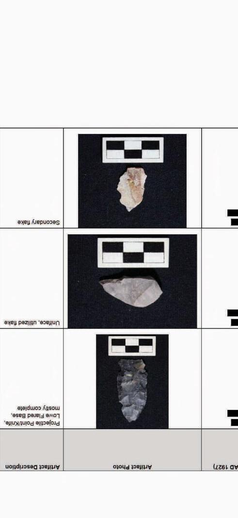
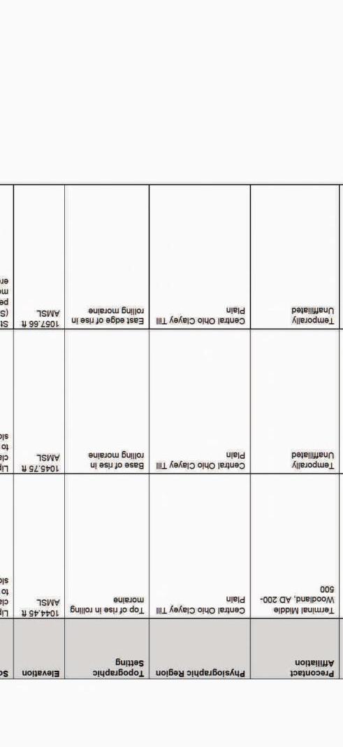
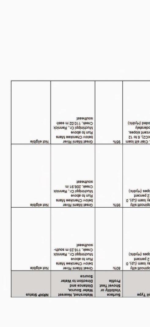

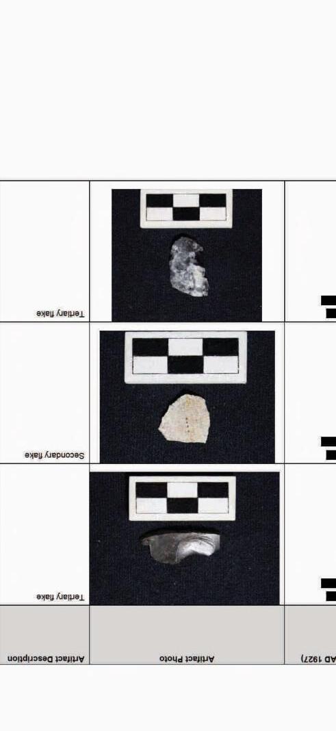
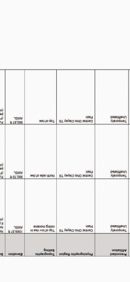


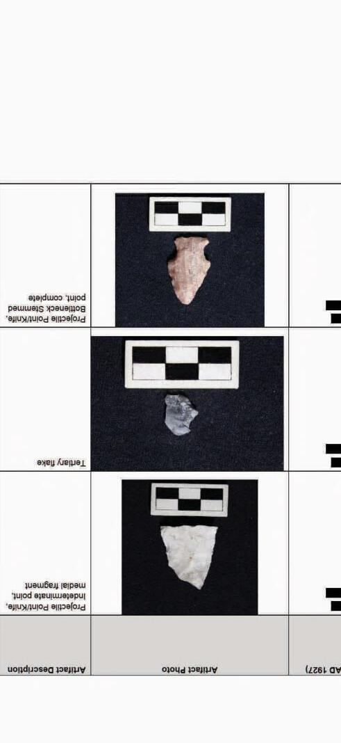
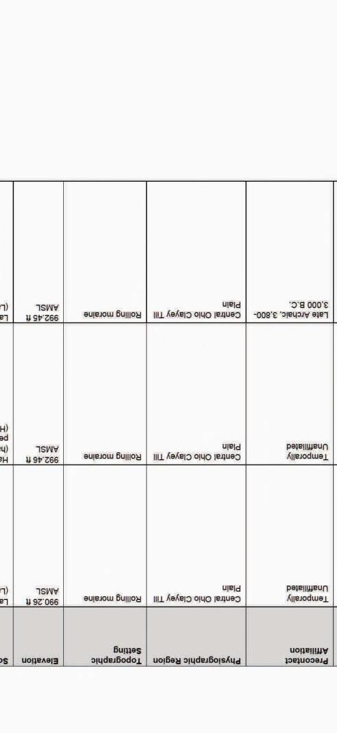
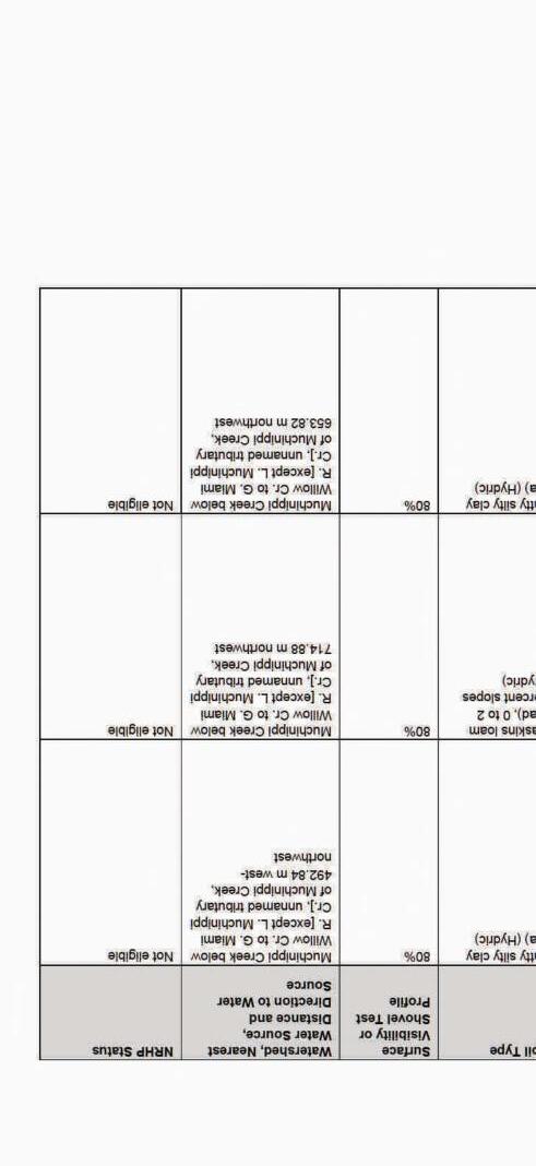


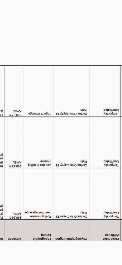


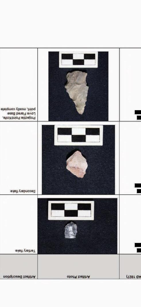
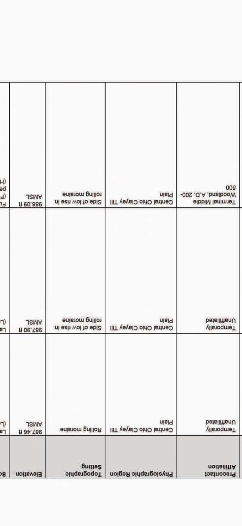


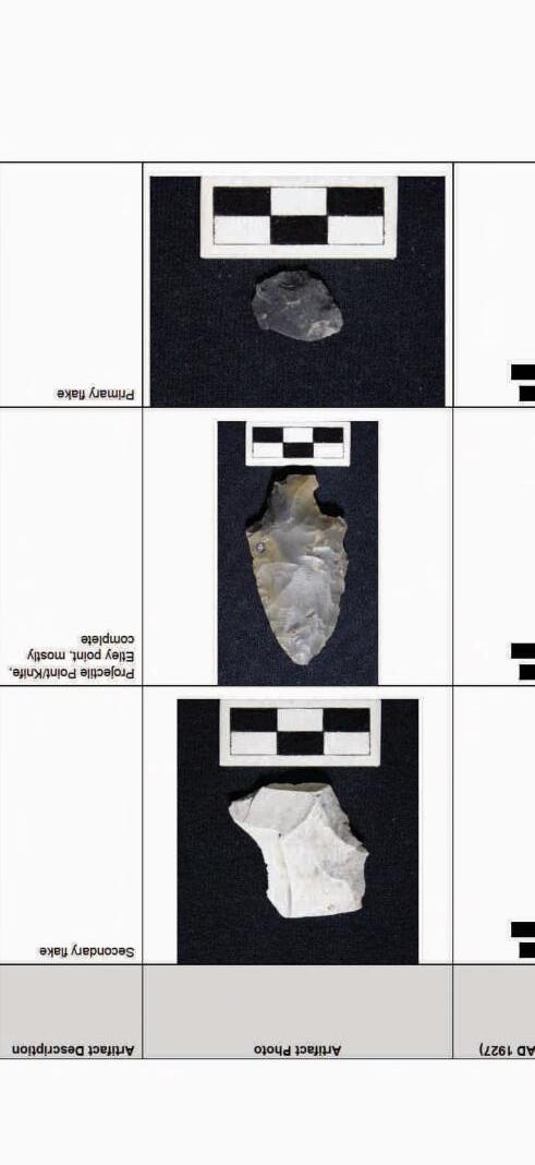
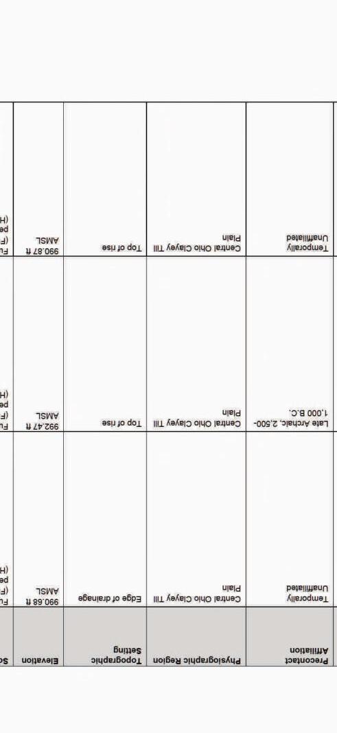


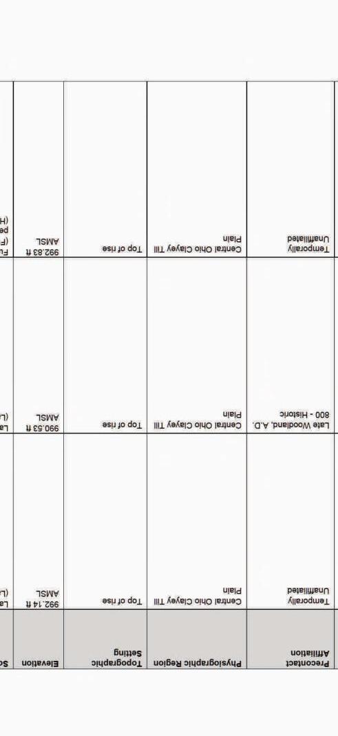
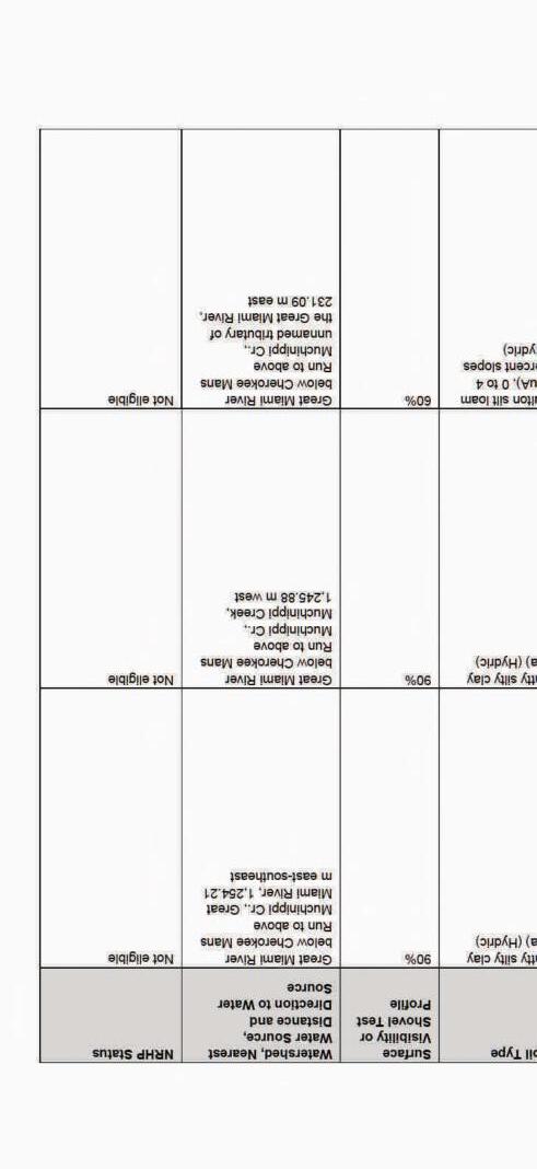


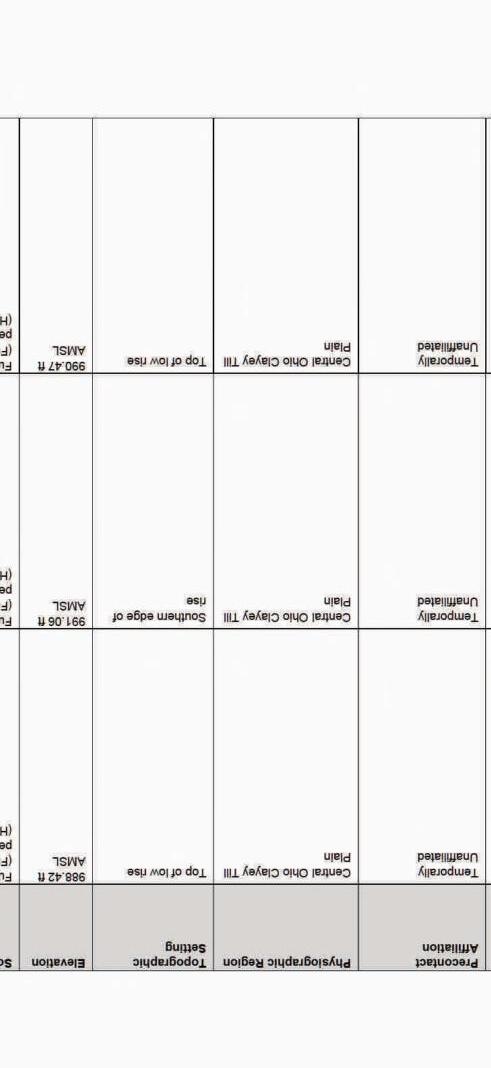


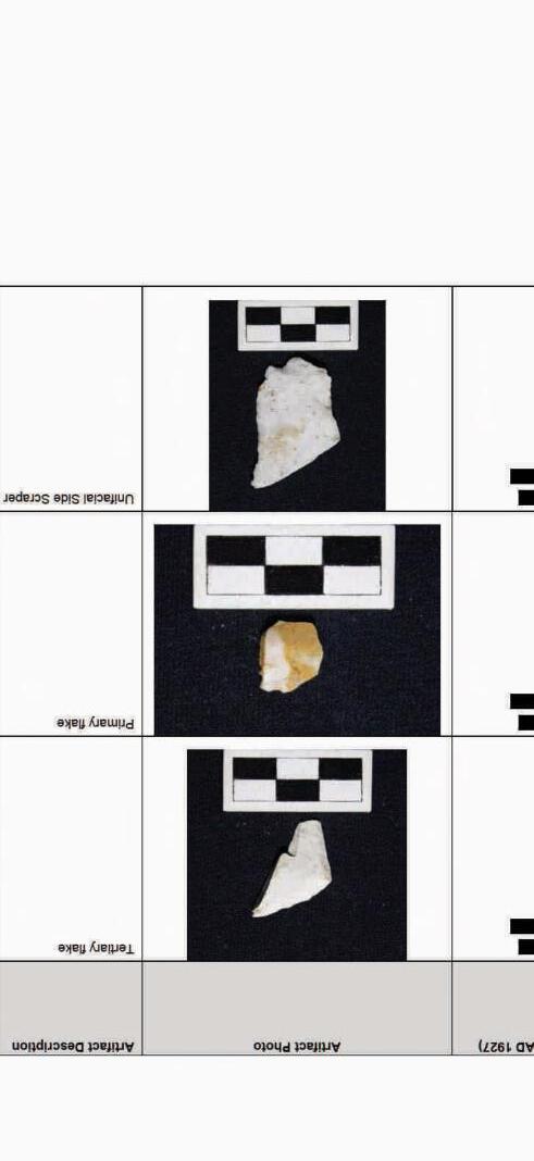

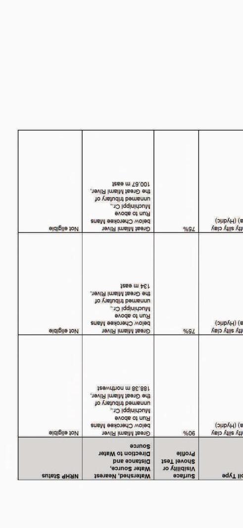


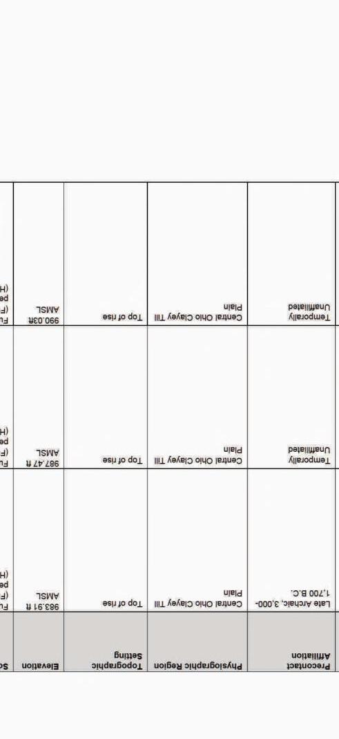
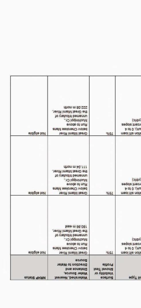

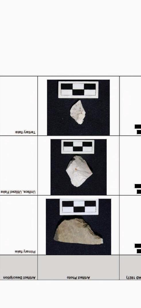


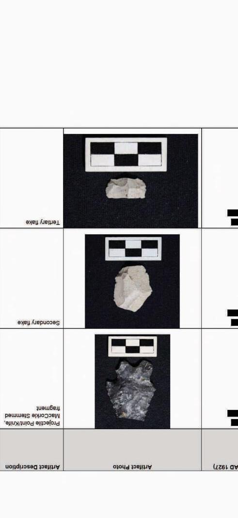


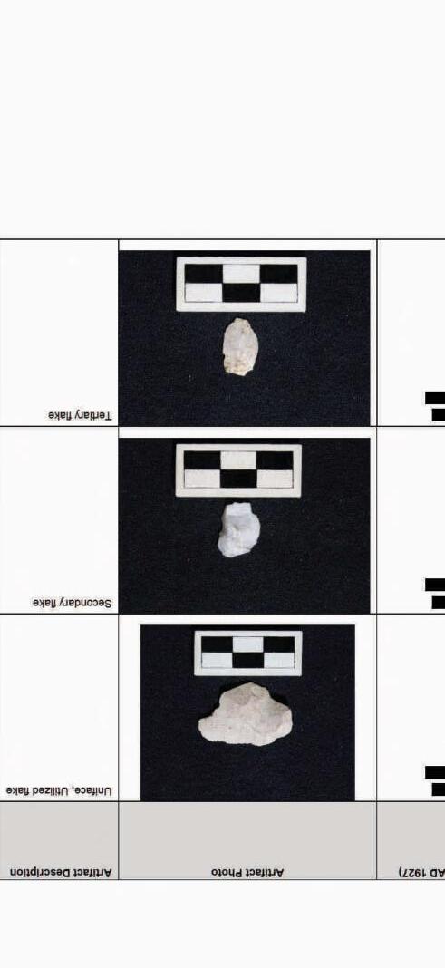

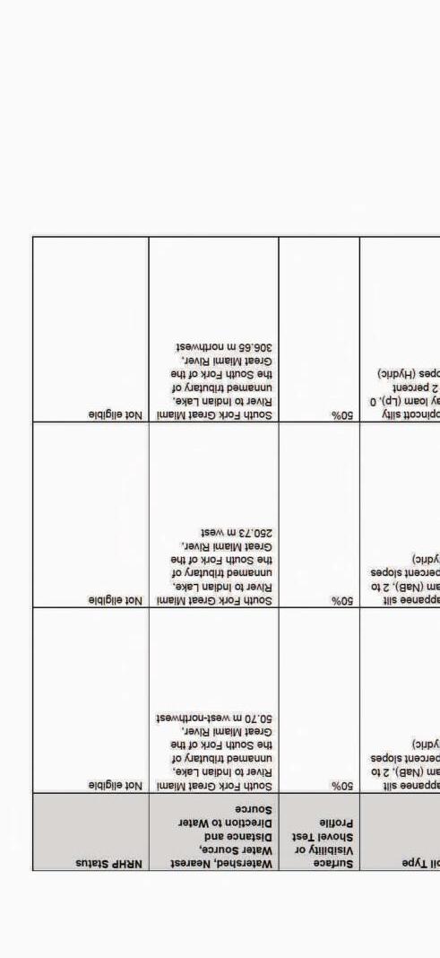

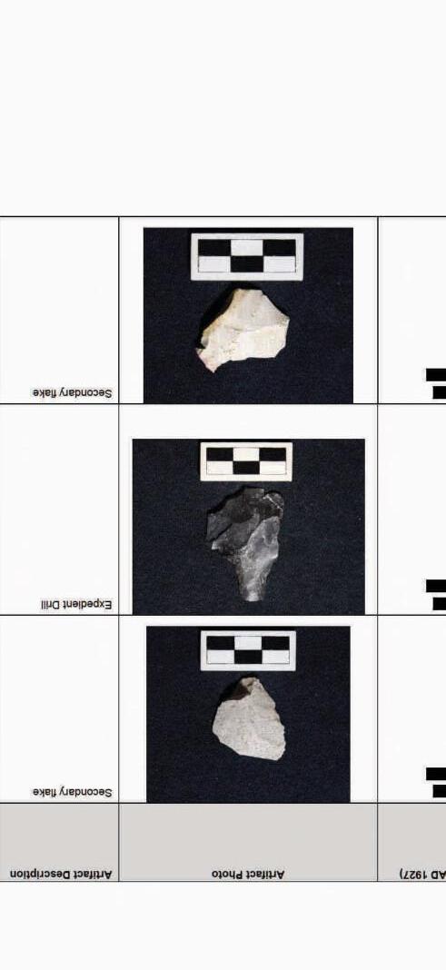
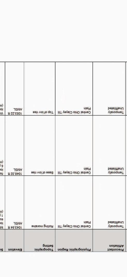


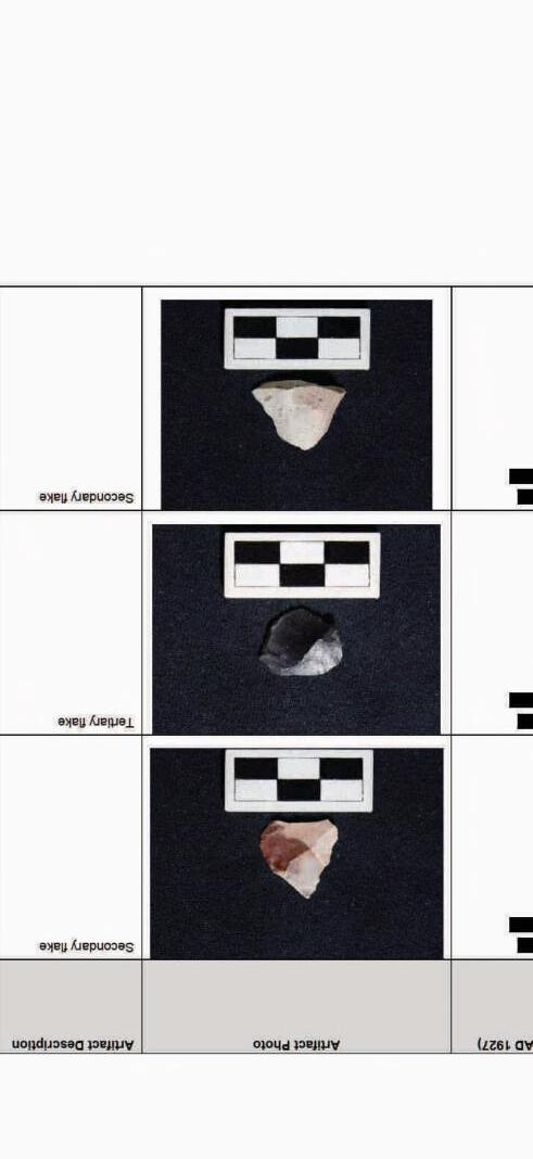
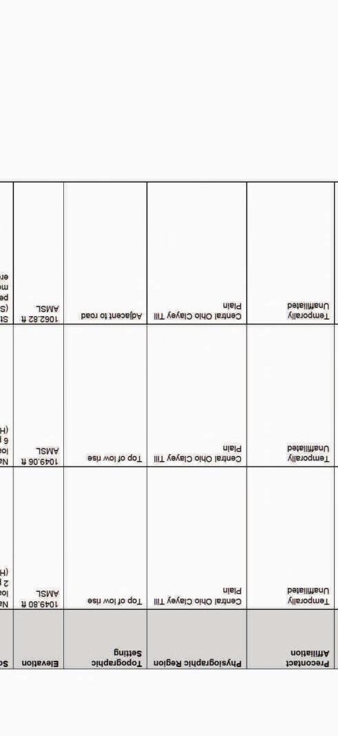


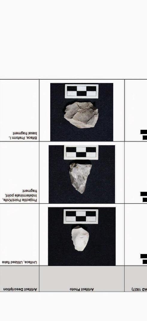
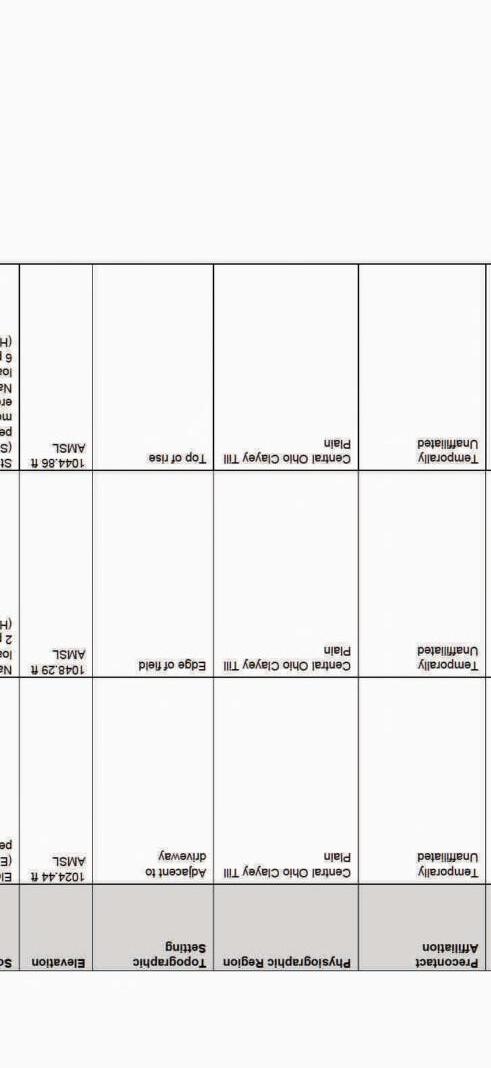


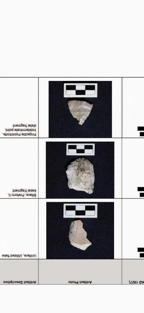
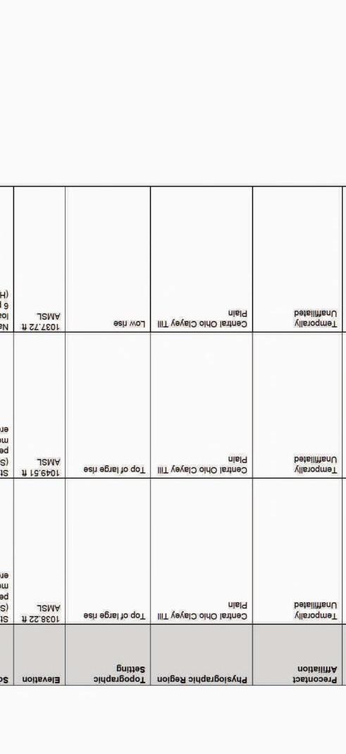
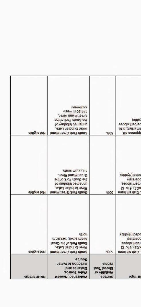

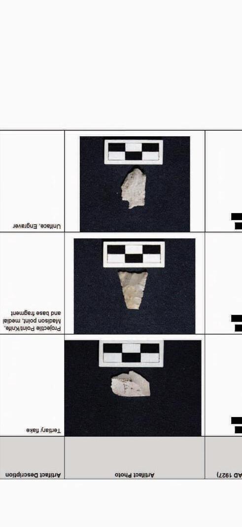
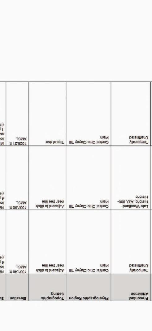


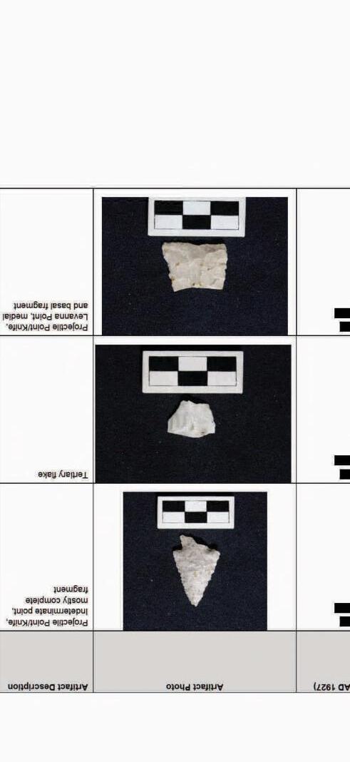
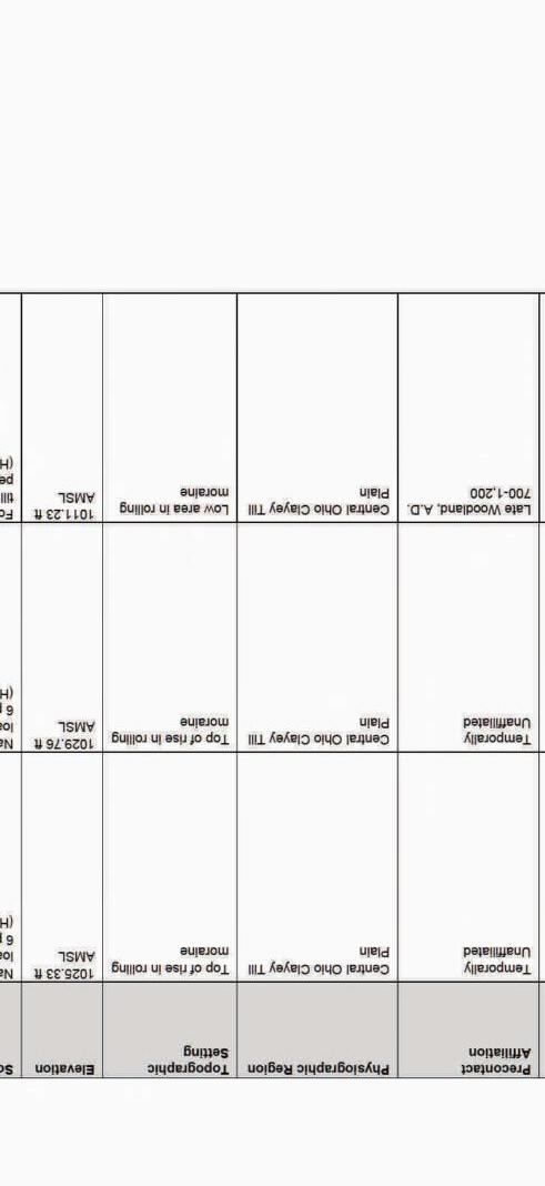

As stated in the work plan approved by OH-SHPO, five sites recorded by Whitman et al. (1998) were resurveyed. Stantec archaeologists conducted surveys at 10-meter intervals initially to understand the site boundaries. Subsequently, the survey interval was reduced to enhance artifact detection.
In addition to the pedestrian survey, one STP was excavated at each site to characterize the subsurface deposits of the site. Pursuant to OH-SHPO guidelines, shovel tests were 50 centimeters (cm) (19.6 inches [in]) in diameter and extended into undisturbed soils. Soils removed from the probes were screened for cultural materials through ¼-inch hardware mesh and immediately backfilled. The crew documented and characterized soil stratigraphy according to the Munsell color guide (Munsell 1994).

4 Results
Cultural period: Unidentified Precontact
UTM:
USGS Quadrangle: Russells Point, Ohio
Site dimensions: 68 m N-S by 50 m W-E (2456. square meters)
Physiographic region: Central Ohio Clayey Till Plain
Topographic setting: Alluvial Plain
Elevation: 991 ft AMSL
Soil Series: Fulton silt loam, 0 to 4 percent slopes, Haskins loam, 2 to 6 percent slopes
Watershed: Great Miami River below Cherokee Mans Run to above Muchinippi Creek
Nearest water source: Great Miami River
Distance and direction to nearest water source: 350 m north
Surface visibility: 90 percent
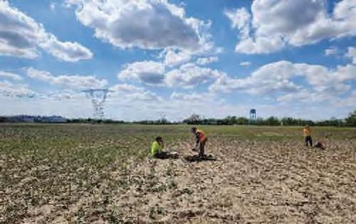
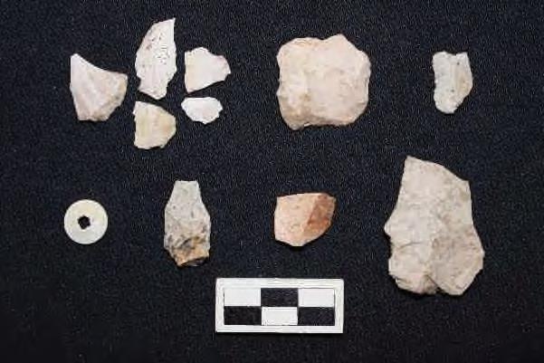
Site 33LO0285 was initially documented by Whitman et al. (1998) during the 1998 ASC study. The original investigation identified a lithic scatter consisting of 55 artifacts: 35 pieces of shatter, 15 secondary flakes, four thinning flakes, and one granite pitted stone. Due to the quantity and non-diagnostic nature of these artifacts, ASC recommended further investigations to better evaluate the site's eligibility for the NRHP.
In Stantec’s subsequent investigations, an additional eight Precontact artifacts were recovered, including utilized flakes, unmodified lithic debitage, and a single knife. Additionally, a historic isolate button was recovered. A summary of artifacts recovered from site 33LO0285 is provided in Table 6, with a detailed artifact catalog available in Appendix C. Representative artifacts are illustrated in Photo 2.
Additionally, one shovel test was excavated to assess soil stratigraphy. This test revealed an 18 cm plowzone of 10YR 3/2 silt loam overlying a subsoil of 10YR 6/4 gray clay loam. No cultural materials were found within the shovel test.


4 Results
Cultural period: Late Archaic, 3,700-3,000 B.C., Late Archaic to Early Woodland, 1,300-600 B.C., Late
Precontact A.D. 800-1500 C.E.
UTM:
USGS Quadrangle: Russells Point, Ohio
Site dimensions: 121 m NW-SE by 75 m NE-SW (6015 square meters)
Physiographic region: Central Ohio Clayey Till Plain
Topographic setting: Alluvial Plain
Elevation:988 ft AMSL
Soil Series: Fulton silt loam, 0 to 4 percent slopes (FuA - Hydric), Haskins loam, 2 to 6 percent slopes (HdB - Hydric), and Latty silty clay (La - Hydric)
Watershed: Great Miami River below Cherokee Mans Run to above Muchinippi Creek
Nearest water source: Jordan Creek
Distance and direction to nearest water source: 34m northeast
Surface visibility: 90 percent


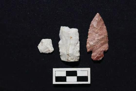
Site 33LO0289 was initially documented by Whitman et al. (1998) during the 1998 ASC study. The original investigation identified a lithic scatter consisting of 52 artifacts: 22 thinning flakes, 29 pieces of shatter, and 1 biface fragment. Due to the quantity and non-diagnostic nature of these artifacts, ASC recommended further investigations to better evaluate the site's eligibility for the NRHP. During Stantec’s subsequent investigations, an additional 188 artifacts were recovered, including utilized flakes and unmodified lithic debitage. Diagnostics included a late Precontact Madison projectile point as well as a Late Archaic Karnak, and a Late Archaic/Early Woodland Motley Projectile point. Minimal fire-cracked rock was observed on the surface. The surface of the site appeared to have been significantly impacted by agricultural practices and the removal of an adjacent railroad line. A summary of artifacts recovered from site 33LO0289 is provided in Table 7 with a detailed artifact catalog available in Appendix C. Representative artifacts are illustrated in Photo 4. Additionally, one shovel test was excavated to assess soil stratigraphy. This test revealed a 30 cm plowzone of 10YR 4/3 silt loam mixed with wet organics overlying a subsoil of 10YR 5/4 gray clay loam. It almost appeared as the soil was removed at some point and backfilled with an organic soil mixture. The test was negative for cultural material, and water seepage was observed at the Ap/B soil transition.


4 Results
Site 33LO0289 comprises a fairly large Late Archaic, 3,700-3,000 B.C., Late Archaic to Early Woodland, 1,300-600 B.C., Late Precontact A.D. 800-Historic precontact lithic scatter. The scatter likely represents expedient tool manufacture or modification, reflecting the ephemeral use of the landscape for precontact resource procurement. While the site's artifact density is greater than that of other sites in the immediate vicinity, the overall setting indicates significant plowing damage and substantial erosion. While nearly 200 artifacts were recovered, the presence of these just on the surface is likely indicative of the heavy erosion on the site, and the removal of soil. Sub-surface testing has indicated the absence of a natural A horizon beneath the plow zone. Overall, due to its diminished integrity, the site is unlikely to yield additional significant information about the prehistory of the region. The site is likely exhausted between the ASC study and our subsequent fieldwork, especially given the lack of sub plow zone integrity. Therefore, no further archaeological work is recommended at this site.

4 Results
Cultural period: Unidentified Precontact
UTM:
USGS Quadrangle: Huntsville, Ohio
Site dimensions: 45.8 NW-SE by 36.9 m NE-SW (1,312.3 square meters)
Physiographic region: Central Ohio Clayey Till Plain
Topographic setting: Second Terrace above Alluvial Plain
Elevation: 1049 ft AMSL
Soil Series: Minster silty clay loam, ground moraine, 2 to 4 percent slopes (Blg1B1 – Hydric) and Nappanee silt loam, 2 to 6 percent slopes (NaB – Hydric)
Watershed: South Fork Great Miami River to Indian Lake
Nearest water source: Unnamed tributary of the South Fork of the Great Miami River
Distance and direction to nearest water source: 57 m west-northwest
Surface visibility: 90 percent


Site 33LO0455 was originally recorded by Whitman et al. (1998) during the 1998 ASC study. The original collection from the site included a lithic scatter containing 36 artifacts: 27 pieces of shatter, 2 primary flakes, and 7 thinning flakes. Due to the quantity of artifacts and the lack of diagnostic artifacts, ASC recommended further investigations to better provide recommendations to the NRHP.
As part of Stantec’s investigations into the site, an additional 15 artifacts were recovered, including utilized flakes and unmodified lithic debitage. Artifacts recovered from Stantec’s site 33LO0455 are summarized in Table 8, with a more detailed artifact catalog available in Appendix C. Representative artifacts are shown in Photo 6.
One shovel test was excavated to determine soil stratigraphy. The shovel test exhibited a 22 cm plowzone of 10YR 5/2 silt loam over a 10YR 6/2 with gray clay loam subsoil and was negative for cultural material.


4 Results
Cultural period: Early Archaic, (8,000-6,000 B.C.) and Terminal Late Archaic (1,000-200 B.C.)
UTM:
USGS Quadrangle: Russells Point, Ohio and Huntsville, Ohio
Site dimensions: 170 m N-S by 161 m E-W (16560 square meters)
Physiographic region: Central Ohio Clayey Till Plain
Topographic setting: Terrace above Alluvial Plain
Elevation: 1008 ft AMSL
Soil Series: Nappanee silt loam, 2 to 6 percent slopes (NaB - Hydric) and St. Clair silt loam, 6 to 12 percent slopes, moderately eroded (ScC2 - Hydric)
Watershed: Great Miami River below Cherokee Mans Run to above Muchinippi Creek
Nearest water source: Unnamed tributary of Jordan Creek
Distance and direction to nearest water source: 314 m south-southwest
Surface visibility: 80 percent


Site 33LO0469 was initially documented by Whitman et al. (1998) during the 1998 ASC study. The original investigation identified a Late Archaic lithic scatter containing 26 artifacts: 1 piece of retouched shatter, 13 pieces of shatter, 11 thinning flakes, and 1 Brewerton Corner Notched projectile point.
Due to the quantity of artifacts and the potential for future research, ASC recommended further investigations to better evaluate the site's eligibility for the NRHP. In Stantec’s subsequent investigations, an additional 100 artifacts were recovered, including utilized flakes and unmodified lithic debitage. Firecracked rock was noted on the surface but was not collected. Much of the material appeared to be eroding down an east-facing hill. A summary of artifacts recovered from site 33LO0469 is provided in Table 9, with a detailed artifact catalog available in Appendix C. Representative artifacts are illustrated in Photo 8.
Additionally, one shovel test was excavated to assess soil stratigraphy. This test revealed a 22 cm plowzone of 10YR 4/2 silt loam overlying a subsoil of 10YR 5/4 gray clay loam. The test was negative for cultural material.


4 Results
Cultural period: Late Archaic, (3,000-1,700 B.C.) and Late Precontact, A.D. (500-1,500 C.E.)
UTM:
USGS Quadrangle: Huntsville, Ohio
Site dimensions: 215 m N-S by 125.9 m E-W (14070.7 square meters)
Physiographic region: Central Ohio Clayey Till Plain
Topographic setting: Terrace above Alluvial Plain
Elevation: 1026 ft AMSL
Soil Series: St. Clair silt loam, 6 to 12 percent slopes, moderately eroded (ScC2 - Hydric), Nappanee silt loam, 2 to 6 percent slopes (NaB - Hydric), and St. Clair silt loam, 2 to 6 percent slopes (ScB - Hydric)
Watershed: Great Miami River below Cherokee Mans Run to above Muchinippi Creek
Nearest water source: Unnamed tributary of Jordan Creek
Distance and direction to nearest water source: 62.3 m south-southeast
Surface visibility: 90 percent
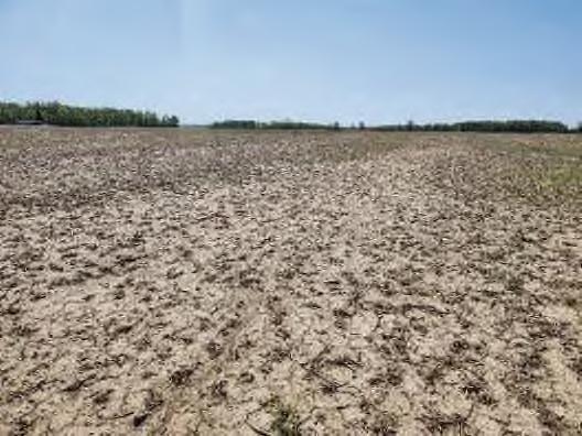
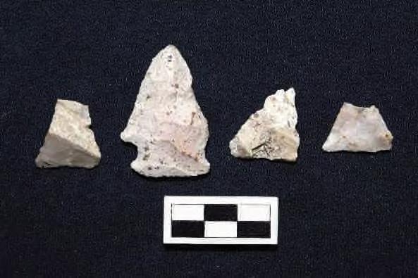
Site 33LO0471 was initially documented by Whitman et al. (1998) during the 1998 ASC study. The original investigation identified a lithic scatter containing 32 artifacts: 14 pieces of shatter, 17 thinning flakes, and 1 flake fragment.
Due to the quantity and non-diagnostic nature of these artifacts, ASC recommended further investigations to better evaluate the site's eligibility for the NRHP. In Stantec’s subsequent investigations, an additional 1897 Precontact artifacts were recovered, including utilized flakes, unmodified lithic debitage, and several projectile points across numerous small rises separated by drainages. A summary of artifacts recovered from site 33LO0471 is provided in Table 10, with a detailed artifact catalog available in Appendix C. Representative artifacts are illustrated in Photo 10.
Additionally, one shovel test was excavated to assess soil stratigraphy. This test revealed a 20 cm plowzone of 10YR 4/3 silt loam overlying a subsoil of 10YR 5/4 gray clay loam, which contained a single flake.


All surveyed areas had over 50% soil visibility and were examined using a pedestrian survey with 10-meter intervals. When a site was discovered, the survey interval was reduced to improve artifact detection. Detailed notes documented the topography and setting of each site. All artifact locations were meticulously plotted and recorded using a Trimble R1 GNSS Receiver unit with sub-meter accuracy.
If an archaeological site with more than five artifacts was identified, at least one shovel test pit (STP) was excavated to characterize the subsurface. Following OH-SHPO guidelines, STPs were 50 centimeters (19.6 inches) in diameter and extended into undisturbed soils. Soils from the probes were screened for cultural materials using ¼-inch hardware mesh, and shovel tests were immediately backfilled. The crew documented and characterized soil stratigraphy using the Munsell color guide (Munsell 1994).

4 Results
Cultural period: Early Woodland (500 B.C.-A.D. 200)
UTM:
USGS Quadrangle: Russells Point, Ohio
Site dimensions: 55.66 m NE-SW by 147.41 m NW-SE (5844.64 square meters)
Physiographic region: Central Ohio Clayey Till Plain
Topographic setting: Terrace above alluvial plain
Elevation: 1009.93 ft AMSL
Soil Series: Blount silt loam (Blg1B1), ground moraine, 2 to 4 percent slopes (Hydric), Wetzel silty clay loam (Hydric) (Wv), Blount silt loam (Blg1A1), ground moraine, 0 to 2 percent slopes (Hydric)
Watershed: Muchinippi Creek below Willow Cr. to G. Miami R. [except L. Muchinippi Cr.]
Nearest water source: Unnamed tributary of Muchinippi Creek
Distance and direction to nearest water source: 171.35 m west
Surface visibility: 80 percent
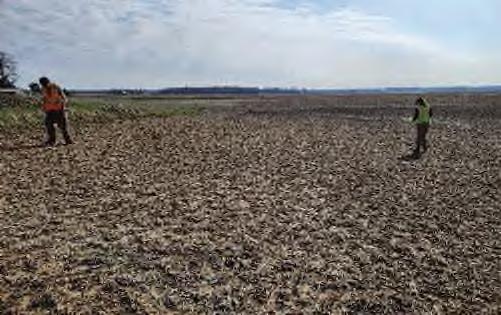
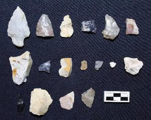
Site 33LO1182 is characterized by a small precontact lithic scatter consisting of 17 artifacts discovered during a pedestrian survey. The artifacts included lithic debitage, with several pieces showing possible retouch. Additionally, a single Early Woodland projectile point was recovered, identified as either a Robbins or Adena type. Robbins points date to the Early Woodland period, 500 B.C. to A.D. 200, while Adena Stemmed points also belong to the Early Woodland period, 800-300 B.C. No fire-cracked rock was found at the site. Artifacts from site 33LO1182 are summarized in Table 11, and a more detailed artifact catalog is available in Appendix C. Representative artifacts are shown in Photo 12. To determine soil stratigraphy, one shovel test was excavated. The shovel test revealed an 18 cm plow zone of dark grayish-brown (10YR 4/2) silt loam over a yellowish-brown (10YR 5/4) silty clay loam subsoil. The test yielded no cultural material.


4 Results
Cultural period: Historic (Mid-19th – Mid-20th Centuries)
UTM:
USGS Quadrangle: Russells Point, Ohio
Site dimensions: 38.62 m N-S by 16.80 m E-W (447.60 square meters)
Physiographic region: Central Ohio Clayey Till Plain
Topographic setting: Slight rise in Upland Flat
Elevation: 1009.36 ft AMSL
Soil Series: Pewamo silty clay loam (Pe), 0 to 1 percent slopes (Hydric), Blount silt loam (Blg1A1), ground moraine, 0 to 2 percent slopes (Hydric)
Watershed: Muchinippi Creek below Willow Cr. to G. Miami R.
Nearest water source: Unnamed tributary of Muchinippi Creek
Distance and direction to nearest water source: 4.80 m west
Surface visibility: 85 percent
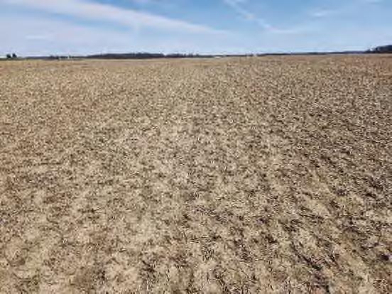
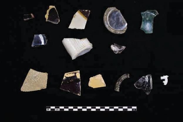
Site 33LO1183 is located on the Russells Point, Ohio 7.5’ USGS topographic quadrangle map (Figure 6 and 7 Series). The site consists of a small post contact artifact scatter (n=14) located along a field drainage, which dates broadly from the mid-nineteenth to mid-twentieth centuries. The site was discovered during a pedestrian survey of an agricultural field with approximately 85 percent surface visibility. Architectural materials were found across the drainage, and additional materials were visible on the surface. Since the adjacent field was outside the Project Area, these materials were not documented. It appears that the materials collected within site 33LO1183 were not in their primary context but were secondarily deposited during drainage maintenance. Consequently, no shovel test was excavated, as the primary site is located across the drainage.
Artifacts consisted of post contact era ceramics and glass. Diagnostic ceramics included redware (17501970; Ketchum 1983), Albany-slipped and Bristol glazed stoneware (1825-1920; Greer 1920), and salt glazed stoneware (1825-1900; Greer 2005). A post-bottom mold bottle (1800-1925; Jones and Sullivan 1989) and a Hazel Atlas Glass Company jar (circa 1923-1982; Lindsey 2024) were also identified at the site.


4 Results
Cultural period: Multicomponent- Historic (Mid-19th – Early 20th Centuries) and Unidentified Precontact
UTM: (NAD 1927)
USGS Quadrangle: Russells Point, Ohio
Site dimensions: 127.98 m NW-SE by 53.49 m SW-NE (5048.72 square meters)
Physiographic region: Central Ohio Clayey Till Plain
Topographic setting: Terrace above alluvial plain
Elevation: 1005.18 ft AMSL
Soil Series: Blount silt loam (Blg1A1), ground moraine, 0 to 2 percent slopes (Hydric
Watershed: Muchinippi Creek below Willow Cr. to G. Miami R. [except L. Muchinippi Cr.]
Nearest water source: Unnamed tributary of Muchinippi Creek
Distance and direction to nearest water source: 561.29 m southeast
Surface visibility: 95 percent
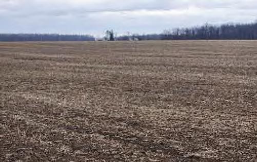

Site 33LO1186 is located on the Russells Point, Ohio 7.5’ USGS topographic quadrangle map (Figure 6 and 7 Series). The site consists of a precontact isolate and post contact artifact scatter (n=129), which dates to the nineteenth and twentieth centuries. The site was encountered during pedestrian survey of an agricultural field which exhibited approximately 95 percent surface visibility. One shovel test was excavated to determine soil stratigraphy. The shovel test exhibited a 30 cm plowzone of 10YR dark grayish brown 4/2 silt loam over a grayish brown 10YR 5/2 with silt loam subsoil and was positive for cultural material.
One nondiagnostic precontact biface was collected from site 33LO1186.
Most artifacts consisted of post-contact domestic ceramics and glass, while architectural material, personal items, and hardware are represented to a lesser degree. Around one fourth of the historic component from site 33LO1186 is considered nondiagnostic. Diagnostic utilitarian ceramics included redware (1750-1870; Ketchum 1983), stoneware with various treatments dating from 1800 to 1940 (Greer 1920), and undecorated yellowware (1828-1940; Ketchum 1983). Most diagnostic ceramic tableware consisted of sponged, edge-decorated, and transfer printed pearlware and whiteware manufactured from the late eighteenth century to the late nineteenth century, while tableware which may have been manufactured in the twentieth century was represented as a minority (Majewski & O’Brien 1987; Samford & Miller 2002; UFM 2024). One ceramic maker’s mark was identified, belonging to an imported ware manufactured by the English company J&G Meakin (Post 1890; Birks n.d.; Godden 1991). Diagnostic glass consisted mostly of


4 Results
Historic mapping places site 33LO1186 on a parcel owned by J. Minich in 1874 (Stewart 1875). A structure and orchard likely representing the site are located just to the west of the site. By 1890, the map of Logan County, Ohio indicates that the parcel had transferred ownership to C.E.M. Watkins, and it appears that the structure associated with 33LO1186 was no longer present. The 1915 mapping also does not show a structure at the location, although the 1940 mapping indicates a new structure depicted.
Interestingly, a single domestic structure can be seen on the 1957 aerial photograph, but it appears demolished by 1981 (Netronline 2024). This suggests that while there was an early homestead on the site (pre-1880), it was abandoned, and a new structure was built after 1914. This scenario aligns well with the artifact assemblage, as early ceramics such as redware, pearlware, and Edge Decorated (Shell-edge): Symmetrical Scalloped Rim/Impressed Lines/Painted white wares are intermixed with mid-20th century wares. However, ceramics dating tightly from the turn of the century were not well-represented.
Site 33LO1186 consists of a light density nineteenth to early twentieth century historic artifact scatter and a small precontact scatter. Although some of the cultural material recovered was manufactured as early as the 1800 and as late as the modern period, the deposit was likely not deposited over the entire range in temporal periods represented by the artifacts. Instead, it likely represents two separate farmsteads built, demolished, and then later mixed by plowing. No additional features or intact structural remains were identified during the investigation. It is unlikely that this site will yield additional information important to the history of the region, nor does it appear to be associated with historically significant persons or events within the area. The prehistoric component of the site appears to represent the ephemeral use of the landscape and does not appear to offer information important to the prehistory of the region. No further archaeological work is recommended at this site.

Phase I Archaeological Survey: Grange Solar Grazing Center Project
Stokes, Bloomfield, Washington, Richland, and McArthur Townships, Logan County, Ohio
4 Results
Cultural period: Multicomponent- Historic (Early 19th – Early 20th Centuries) and Precontact Early Archaic (8,000-6,000 B.C.)
UTM: m N (NAD 1927)
USGS Quadrangle: Russells Point, Ohio
Site dimensions: 48.61 m N-S by 42.20 m E-W (1671.79 square meters)
Physiographic region: Central Ohio Clayey Till Plain
Topographic setting: Terrace above alluvial plain
Elevation: 1005.32 ft AMSL
Soil Series: Fulton silt loam (FuA), 0 to 4 percent slopes (Hydric), Latty silty clay (Hydric) (La)
Watershed: Muchinippi Creek below Willow Cr. to G. Miami R. [except L. Muchinippi Cr.]
Nearest water source: Unnamed tributary of Muchinippi Creek
Distance and direction to nearest water source: 561.26 m northwest
Surface visibility: 95 percent
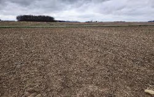
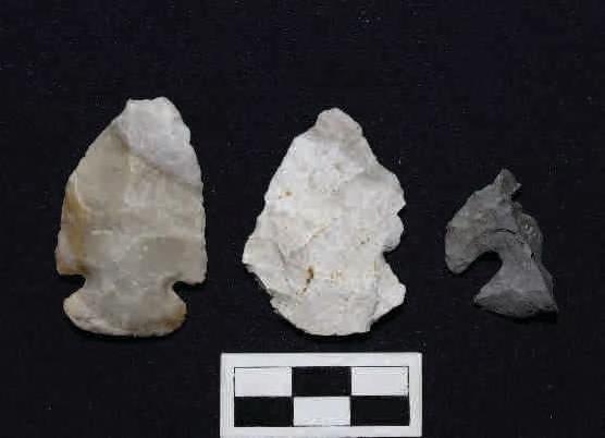
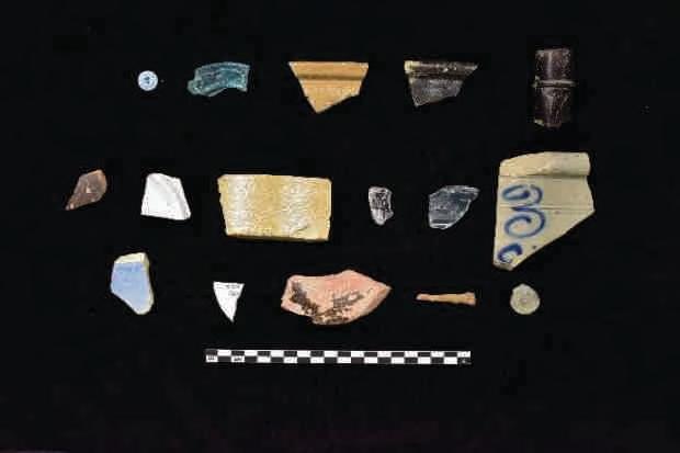
Site 33LO1187 is located on the Russells Point, Ohio 7.5’ USGS topographic quadrangle map (Figure 6 and 7 Series). The site consists of a multicomponent artifact scatter (n=76), which dates from the early nineteenth to the early twentieth centuries. The site was encountered during pedestrian survey of an agricultural field which exhibited approximately 95 percent surface visibility. One shovel test was excavated to determine soil stratigraphy. The shovel test revealed a 30 cm plow zone of dark grayish-brown (10YR 4/2) silt loam over a yellowish-brown (10YR 5/4) with mottling of light gray (10YR 7/2) silty clay loam subsoil.


Phase I Archaeological Survey: Grange Solar Grazing Center Project
Stokes, Bloomfield, Washington, Richland, and McArthur Townships, Logan County, Ohio
4 Results
Cultural period: Multicomponent- Historic (Late 19th – Early 20th Century) and Unidentified Precontact UTM: (NAD 1927)
USGS Quadrangle: Russells Point, Ohio
Site dimensions: 80.84 m NW-SE by 46.06 m SW-NE (2593.73square meters)
Physiographic region: Central Ohio Clayey Till Plain
Topographic setting: Terrace above alluvial plain
Elevation: 1000.86 ft AMSL
Soil Series: Fulton silt loam (FuA), 0 to 4 percent slopes (Hydric), Latty silty clay (Hydric) (La)
Watershed: Muchinippi Creek below Willow Cr. to G. Miami R. [except L. Muchinippi Cr.]
Nearest water source: Unnamed tributary of Muchinippi Creek
Distance and direction to nearest water source: 699.54 m north northeast
Surface visibility: 90 percent

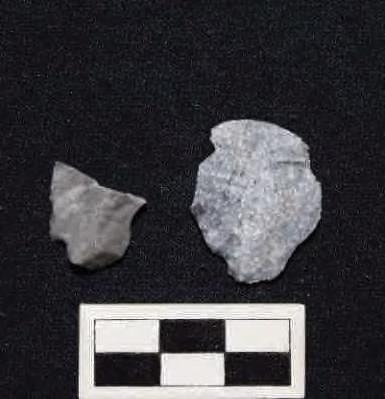
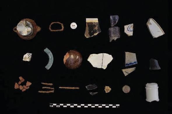
Site 33LO1188 is located on the Russells Point, Ohio 7.5’ USGS topographic quadrangle map (Figure 6 and 7 Series). The site consists of a multicomponent scatter (n=105), which dates to the nineteenth and twentieth centuries. The site was encountered during pedestrian survey of an agricultural field which exhibited approximately 90 percent surface visibility. One shovel test was excavated to determine soil stratigraphy. The shovel test revealed a 28 cm plow zone of dark grayish-brown (10YR 4/2) silt loam over a yellowish-brown (10YR 5/4) silty clay loam subsoil. The test yielded no cultural material.


Phase I Archaeological Survey: Grange Solar Grazing Center Project
Stokes, Bloomfield, Washington, Richland, and McArthur Townships, Logan County, Ohio
4 Results
Cultural period: Multicomponent- Historic (Mid-19th – Early 20th Centuries) and Unidentified Precontact UTM: (NAD 1927)
USGS Quadrangle: Russells Point, Ohio
Site dimensions: 44.93 m N-S by 56.18 m E-W (2115.97 square meters)
Physiographic region: Central Ohio Clayey Till Plain
Topographic setting: Terrace above alluvial plain
Elevation: 1008.51 ft AMSL
Soil Series: Wetzel silty clay loam (Hydric) (Wv), Blount silt loam (Blg1A1), ground moraine, 0 to 2
percent slopes (Hydric)
Watershed: Muchinippi Creek below Willow Cr. to G. Miami R. [except L. Muchinippi Cr.]
Nearest water source: Unnamed tributary of Muchinippi Creek
Distance and direction to nearest water source: 745.87 m north northwest
Surface visibility: 95 percent
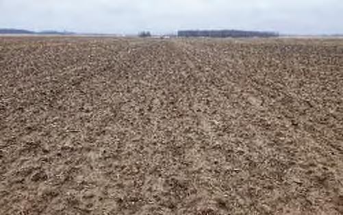
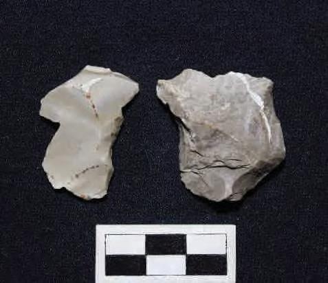
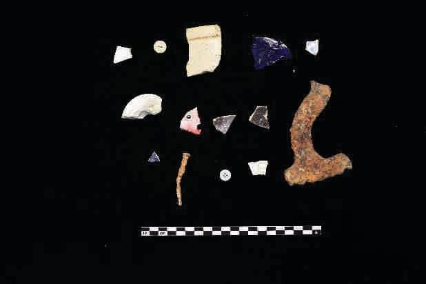
Site 33LO1189 is located on the Russells Point, Ohio 7.5’ USGS topographic quadrangle map (Figure 6 and 7 Series). The site consists of a multicomponent artifact scatter (n=39), the post-contact component of which dates to the nineteenth and twentieth centuries. The site was encountered during pedestrian survey of an agricultural field which exhibited approximately 95 percent surface visibility. One shovel test was excavated to


Phase I Archaeological Survey: Grange Solar Grazing Center Project
Stokes, Bloomfield, Washington, Richland, and McArthur Townships, Logan County, Ohio
4 Results
Cultural period: Multicomponent- Precontact Early Woodland (800-300 B.C.) and Historic (Early 19th –Early 20th Centuries)
UTM: N (NAD 1927)
USGS Quadrangle: Russells Point, Ohio
Site dimensions: 60.42 m SW-NE by 48.99 m NW-SE (1238 square meters)
Physiographic region: Central Ohio Clayey Till Plain
Topographic setting: Terrace above alluvial plain
Elevation: 1006.05 ft AMSL
Soil Series: Blount silt loam (Blg1A1), ground moraine, 0 to 2 percent slopes (Hydric)
Watershed: Muchinippi Creek below Willow Cr. to G. Miami R. [except L. Muchinippi Cr.]
Nearest water source: Unnamed tributary of Muchinippi Creek
Distance and direction to nearest water source: 954.96 m north northwest
Surface visibility: 95 percent
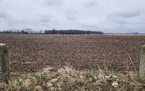
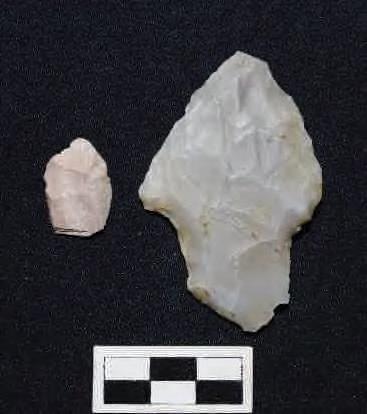

Site 33LO1190 is located on the Russells Point, Ohio 7.5’ USGS topographic quadrangle map (Figure 6 and 7 Series). The site consists of a multicomponent artifact scatter (n=202), including a small Early Woodland scatter (n=2) and a large historic scatter (n=200), which likely dates from the early nineteenth to early twentieth centuries. The site was encountered during pedestrian survey of an agricultural field which

4 Results
exhibited approximately 95 percent surface visibility. One shovel test was excavated to determine soil stratigraphy. The shovel test revealed a 30 cm plow zone of dark grayish-brown (10YR 4/2) silt loam over a yellowish-brown (10YR 5/4) silty clay loam subsoil.
Two precontact artifacts, an Early Woodland Dickson Cluster – Adena Stemmed point (800-300 B.C.; Justice 1987) and a nondiagnostic utilized flakes, were collected from site 33LO1190.
Just over one third of the post-contact component of site 33LO1190 is considered nondiagnostic, and includes undecorated or indeterminately decorated refined white earthenware, indeterminate and container glass, architectural material, and miscellaneous metal hardware. Some metal objects, such as buckles, a partial spoon, and a fragment of a saw blade, were unable to be assigned a manufacture date range but still possess recognizable forms and functions which can be informative about the activities which formerly took place at the site. Also of interest at site 33LO1190 is a carved stone button, which was not assigned a manufacture date range, as stone buttons in a historical archaeological context appear to be rare and understudied. Following the patenting of the Prosser process in the mid-nineteenth century, a method of mass-manufacturing ceramic buttons, porcelain buttons enjoyed a period of intense popularity until the 1920s, when production began to decline in favor of plastic buttons; Prosser buttons were common on historic archaeological sites during this time (Luscombe 1992; Venovcevs 2013). The stone button is an anomalous find and may indicate manufacture prior to the development of the Prosser process. An undated fragment of a pig molar was also recovered from site 33LO1190, indicative of food consumption and disposal of food remains.
Diagnostic post-contact artifacts with reliable date ranges include utilitarian ceramics manufactured from the mid-eighteenth century through the mid-twentieth century, decorated refined white earthenwares manufactured from the early to late nineteenth century, a nineteenth century ceramic reed stem pipe, and glass and nails manufactured in both the nineteenth century and early twentieth centuries. While some diagnostic artifacts (redware, 1750-1870; Ketchum 1983), edge-decorated refined white earthenwares (1820s-1890s; Samford & Miller 2002), and applied finish (1820-1890; Toulouse 1969, 1971) and two-piece mold container glass (1810-1880; Toulouse 1969) were most likely manufactured prior to the twentieth century, others, such as machine-made glass and wire nails, were manufactured in the last years of the nineteenth century at the earliest (Jones & Sullivan 1989; Nelson 1968). Three edge-decorative techniques which were popular only for short periods of time in the nineteenth century are present in this artifact assemblage, indicating changing consumer preference for tableware ceramics between the 1820s and 1840s, and 1840s to 1860s (Samford & Miller 2002). The nineteenth century transition from utilitarian redware (n=29) to stoneware (n=16) is also evident in the assemblage, although the predominance of redware suggests the utilitarian ceramics were more heavily accumulated in the nineteenth century rather than twentieth century (Ramsay 1939).
Artifacts recovered from site 33LO1190 are summarized in Table 28 and Table 29; a more detailed artifact catalog can be found in Appendix C. Representative artifacts are shown in Photo 31 and Photo 32.


4 Results
By 1890, the property had passed to H. Snapp, believed to be Hamilton Snapp, a Virginia immigrant. It is unclear how long the Snapp family occupied the residence, or if they just farmed the property. The Snapp family is still in the area. A 1957 aerial photo shows a small structure and silo at the site, appearing abandoned and in disrepair, with no driveway. These features are not seen in the next photo, dated 1981 (Netronline 2007).
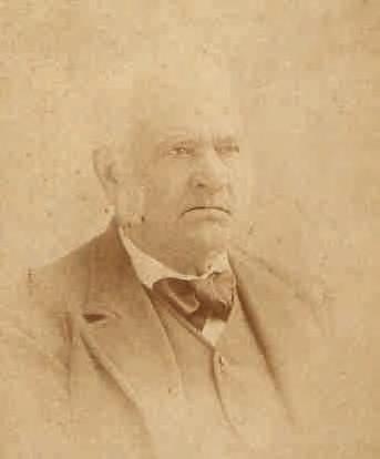
Site 33LO1190 consists of a large historic site and a small precontact lithic scatter. The small precontact artifact scatter likely represents expedient tool manufacture or modification, reflecting the ephemeral use of the landscape for precontact resource procurement. No further archaeological work is recommended for the precontact portion of the site. The historic portion of the site appears to represent the homestead of early Logan County settler Henry Hone and his family. Although the site has been farmed and plowed for many years since abandonment, it is possible that sub-plowzone features persist. The pedestrian survey recovered artifacts which reflect shifting consumer trends in utilitarian and decorated ceramics throughout the nineteenth century. The nineteenth century transition from utilitarian redware to stoneware is captured in the artifact assemblage, as are a series of three relatively short-lived edge-decorative techniques on refined white earthenware which each enjoyed several decades of popularity during the nineteenth century. These artifacts also reflect shifting consumer trends common from the 1820s to 1830s, 1840s to the 1860s and again between the 1860s and the 1890s, paralleling the shift from frontier economies to more globalized ones. Given that the Hone family lived here between 1837 and at least 1875, the site offers a unique opportunity to study these changes in material culture.
Stantec recommends that site 33LO1190 be surveyed with both magnetometry and electrical resistivity, followed by testing of features to determine if a Phase II investigation is required to assess potential NRHP eligibility. At this time, a determination cannot be made, and the site should be avoided.


Phase I Archaeological Survey: Grange Solar Grazing Center Project
Stokes, Bloomfield, Washington, Richland, and McArthur Townships, Logan County, Ohio
4 Results
Cultural period: Multicomponent- Historic (Mid-19th Century – Early 20th Century) and Precontact Late Archaic (3,500-2,500 B.C.)
UTM: N (NAD 1927)
USGS Quadrangle: Russells Point, Ohio
Site dimensions: 63.59 m N-S by 50.51 m E-W (2419.34 square meters)
Physiographic region: Central Ohio Clayey Till Plain
Topographic setting: Terrace above alluvial plain
Elevation: 1000.62 ft AMSL
Soil Series: Blount silt loam (Blg1A1), ground moraine, 0 to 2 percent slopes (Hydric), Wetzel silty clay loam (Hydric) (Wv)
Watershed: Muchinippi Creek below Willow Cr. to G. Miami R. [except L. Muchinippi Cr.]
Nearest water source: Unnamed tributary of Muchinippi Creek
Distance and direction to nearest water source: 294.40 m west
Surface visibility: 85 percent
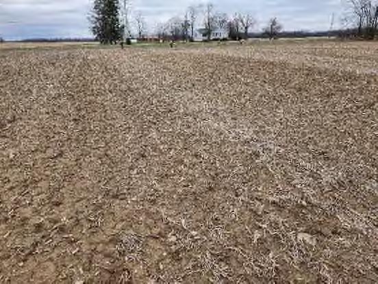
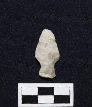
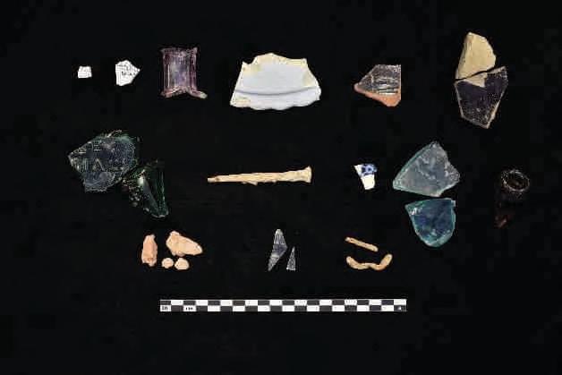
Site 33LO1193 is located on the Russells Point, Ohio 7.5’ USGS topographic quadrangle map (Figure 6 and 7 Series). The site consists of a multicomponent artifact scatter (n=59), containing a precontact Late Archaic isolate component and a medium sized (n=58) historic component which dates from the midnineteenth to early twentieth centuries. The site was encountered during pedestrian survey of an agricultural field which exhibited approximately 85 percent surface visibility. One shovel test was excavated to


4 Results
Site 33LO1193 consists of a light-density scatter of late nineteenth-century historic artifacts. While some recovered items date from as early as the 1820s to as late as the 1940s, the deposits likely reflect a specific abandonment event from the late nineteenth century rather than continuous occupation over that time. No additional features or intact structural remains were found during the investigation. It is unlikely that this site will provide further significant information about the region's history, nor does it appear connected to historically notable individuals or events. Therefore, no further archaeological work is recommended at this site.

4 Results
Cultural period: Historic (Late 19th Century – Early 20th Century)
UTM: (NAD 1927)
USGS Quadrangle: Russells Point, Ohio
Site dimensions: 76.96 m SW-NE by 53.73 m NW-SE (2763.24 square meters)
Physiographic region: Central Ohio Clayey Till Plain
Topographic setting: Terrace above alluvial plain
Elevation: 1000.25 ft AMSL
Soil Series: Blount silt loam (Blg1A1), ground moraine, 0 to 2 percent slopes (Hydric)
Watershed: Muchinippi Creek below Willow Cr. to G. Miami R. [except L. Muchinippi Cr.]
Nearest water source: Unnamed tributary of Muchinippi Creek
Distance and direction to nearest water source: 308.37 m north
Surface visibility: 75 percent
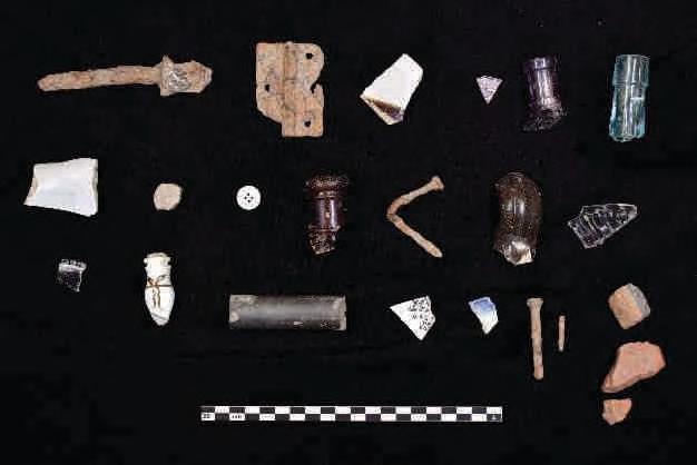
Site 33LO1194 is located on the Russells Point, Ohio 7.5’ USGS topographic quadrangle map (Figure 6 and 7 Series). The site consists of a moderate post contact artifact scatter (n=57), which dates to the midnineteenth to early twentieth centuries. The site was encountered during pedestrian survey of an agricultural field which exhibited approximately 70 percent surface visibility. One shovel test was excavated to determine soil stratigraphy. The shovel test revealed a 26 cm plow zone of dark grayish-brown (10YR 4/2) silt loam over a grayish-brown (10YR 5/2) mottled with yellowish brown (10 YR 5/4) silty clay loam subsoil with a small amount of sand.
Around one third of the artifacts from post-contact site 33LO1194 are considered nondiagnostic, and include undecorated refined white earthenwares, miscellaneous metal hardware, indeterminate glass, slag, and brick fragments. The remaining diagnostic artifacts, including utilitarian stoneware, refined white earthenware with an identified manufacturer, mold blown container glass, solarized glass, and electrical components, appear to date from the late nineteenth to early twentieth centuries (ACS 2024; Godden 1991; Greer 2005; Jones & Sullivan 1989; Lindsey 2024). While a small portion of the diagnostic artifacts may have been manufactured prior to (transferprinted whiteware) or after (generic machine-made container glass) this range, most fall within that time period (Jones & Sullivan 1989; Samford & Miller 2002).
Artifacts recovered from site 33LO1194 are summarized in Table 36; a more detailed artifact catalog can be found in Appendix C. Representative artifacts are shown in Photo 43.


4 Results
Historic mapping places site 33LO1194 on a parcel owned by W.F. Gardling in 1875 (Stewart 1875). No structures appear within or immediately adjacent to the site at this time. A structure is listed on the same parcel but is depicted further south towards Bloom Center. By 1890, the Logan County map indicates that ownership of the parcel had transferred to J.W. Beerline. It is unclear if John Beerline lived here, as a 1914 marriage notice suggests he had manufacturing interests and a “pleasant residence” in Cridersville, Auglaize County, Ohio (Ancestry 2024). Based on USGS maps and historical aerials, the structure was likely demolished before 1955.
Site 33LO1194 consists of a small historic scatter near the road right of way, also containing a small drainage creek that has eroded much of the site. More intact house lots likely remain in the area, and the current integrity of site 33LO1194 does not suggest any remaining research potential. Therefore, no further work is recommended at this site.

Stokes, Bloomfield, Washington, Richland, and McArthur Townships, Logan County, Ohio
4 Results
Cultural period: Historic (Mid-19th – Early 20th Century)
UTM: (NAD 1927)
USGS Quadrangle: Russells Point, Ohio
Site dimensions: 71.58 m E-W by 53.87 m N-S (2317.18 square meters)
Physiographic region: Central Ohio Clayey Till Plain
Topographic setting: Terrace above alluvial plain
Elevation: 998.30 ft AMSL
Soil Series: Blount silt loam (Blg1A1), ground moraine, 0 to 2 percent slopes (Hydric), Wetzel silty clay
loam (Hydric) (Wv)
Watershed: Muchinippi Creek below Willow Cr. to G. Miami R. [except L. Muchinippi Cr.]
Nearest water source: Unnamed tributary of Muchinippi Creek
Distance and direction to nearest water source: 68.28 m north
Surface visibility: 75 percent
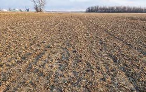
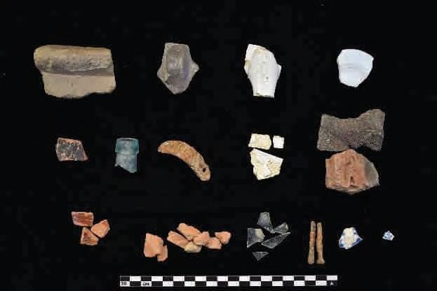
Site 33LO1195 is located on the Russells Point, Ohio 7.5’ USGS topographic quadrangle map (Figure 6 and 7 Series). The site consists of a moderate post contact artifact scatter (n=78), which dates to the nineteenth and twentieth centuries. The site was encountered during pedestrian survey of an agricultural field which exhibited approximately 60 percent surface visibility. One shovel test was excavated to determine soil stratigraphy. The shovel test revealed a 30 cm plow zone of dark grayish-brown (10YR 4/2) silt loam over a yellowish-brown (10YR 5/4) silty clay loam subsoil and mottled with light gray (10 YR 7/2) silt loam glacial soil.
Artifacts consisted of post contact era ceramics, metal, and glass, most of which was nondiagnostic. Diagnostic ceramics included utilitarian redware and stoneware dating to from the mid-eighteenth to nineteenth and nineteenth to early twentieth centuries, respectively (Greer 2005; Ketchum 1983). Fragments of mold blown glass bottles and jars and a cut nail, all diagnostic to the nineteenth century, were also documented (Ketchum 1983; Nelson 1968; Toulouse 1971). Although the diagnostic artifacts well outnumbered by nondiagnostic material, the artifacts that are dated suggest manufacture dates from the mid-nineteenth to early twentieth century.


4 Results
Historic mapping places site 33LO1195 on a parcel owned by S. Hoover in 1875 (Stewart 1875). No structures appear within or immediately adjacent to the site at this time. By 1890, the Logan County map shows that the parcel had transferred ownership to Josh J. Wright, who was born in 1869 and died in 1918 at the age of 48. He was married to Estella Pence. The structure is not captured in any aerial imagery or in maps from 1914 or later, suggesting it was a relatively short-lived structure that has undergone plowing ever since.
Site 33LO1195 consists of a light density mid-nineteenth to early twentieth-century historic artifact scatter which is predominantly nondiagnostic and utilitarian. Although some cultural material recovered was manufactured as early as the 1750s and as late as the 1920s and possibly after, the deposit was likely not accumulated over the entire range represented by the artifacts. Instead, it likely resulted from a single or short-period dumping or abandonment event during the late nineteenth to early twentieth century. No additional features or intact structural remains were identified during the investigation. It is unlikely that this site will yield additional information important to the history of the region, nor does it appear to be associated with significant persons or events within the area. Therefore, no further archaeological work is recommended at this site.


4 Results
Site 33LO1196 consists of a small, precontact lithic scatter. The small precontact artifact scatter likely represents expedient tool manufacture or modification and reflects the ephemeral use of the landscape for precontact resource procurement. The site is unlikely to yield additional significant information about the prehistory of the region because of the low density of artifacts. No further archaeological work is recommended at this site.

Phase
4 Results
Cultural period: Multicomponent- Historic (20th Century) and Unidentified Precontact UTM: (NAD 1927)
USGS Quadrangle: Russells Point, Ohio
Site dimensions: 38.32 m N-S by 26.51 m E-W (804.35 square meters)
Physiographic region: Central Ohio Clayey Till Plain
Topographic setting: Terrace above alluvial plain
Elevation: 1024.99 ft AMSL
Soil Series: Blount silt loam, ground moraine, 2 to 4 percent slopes (Blg1B1 - Hydric) and Glynwood silt loam, ground moraine, 2 to 6 percent slopes (Gwg1B1 - Hydric)
Watershed: Great Miami River below Muchinippi Cr. to above Rum Cr.
Nearest water source: Unnamed tributary of Bradywine Creek
Distance and direction to nearest water source: 1079.00 m west
Surface visibility: 70 percent
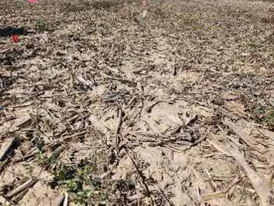
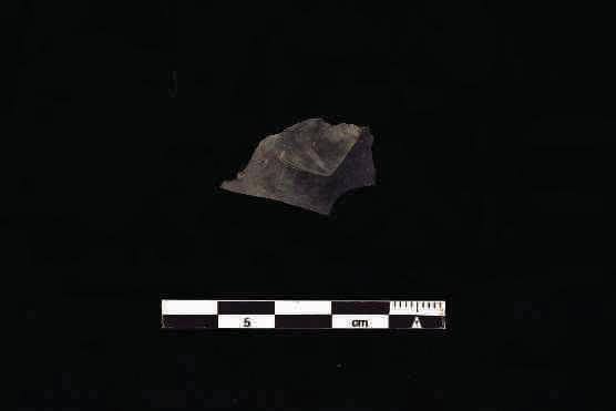

Site 33LO1197 is located on the Russells Point, Ohio 7.5’ USGS topographic quadrangle map (Figure 6 and 7 Series). The site consists of a multicomponent artifact scatter, containing a precontact isolate (n=1) and a large historic component (n=109). The site was encountered during pedestrian survey of an agricultural field which exhibited approximately 70 percent surface visibility. One shovel test was excavated to determine soil


4 Results
Historic mapping places site 33LO1197 on a parcel owned by Salomon Garling in in 1874 (Stewart 1875). No structures appear within or immediately adjacent to the site at this time. A structure is listed on the same parcel; however, the structure is depicted 400 meters to the southwest in the southwestern portion of the parcel. The 1890 map of Logan County, Ohio indicates that the parcel is still owned by Salomon Garling (Lathrop et al. 1890). No structures are mapped on any mapping or can be seen in any aerials.
Site 33LO1197 consists of a light density nineteenth to early twentieth century historic artifact scatter and precontact isolate. Although some of the cultural material recovered was manufactured as early as the 1800s and as late as 1970, the deposit was likely not deposited over the entire range in temporal periods represented by the artifacts. Instead, it is likely a single or short period dumping or abandonment event that occurred during the late nineteenth to early twentieth century. This is supplemented by the lack of architectural materials. No additional features or intact structural remains were identified during the investigation. It is unlikely that this site will yield additional information important to the history of the region, nor does it appear to be associated with important persons or events within the area. The precontact isolate is not eligible for listing on the NRHP. No further archaeological work is recommended at this site.

Phase I Archaeological Survey: Grange Solar Grazing Center Project
Stokes, Bloomfield, Washington, Richland, and McArthur Townships, Logan County, Ohio
4 Results
Cultural period: Multicomponent- Precontact Middle Archaic (6,000-5,000 B.C.) and Historic (Late 19th –Early 20th Centuries)
UTM: (NAD 1927)
USGS Quadrangle: Russells Point, Ohio
Site dimensions: 68.37 m N-S by 130.81m E-W (5712.85square meters)
Physiographic region: Central Ohio Clayey Till Plain
Topographic setting: Alluvial plain
Elevation: 992.14 ft AMSL
Soil Series: Fulton silt loam (FuA), 0 to 4 percent slopes (Hydric), Latty silty clay (La) (Hydric)
Watershed: Great Miami River below Cherokee Mans Run to above Muchinippi Cr.
Nearest water source: Cherokee Mans Run
Distance and direction to nearest water source: 507.99 m north-northeast
Surface visibility: 70 percent

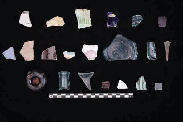
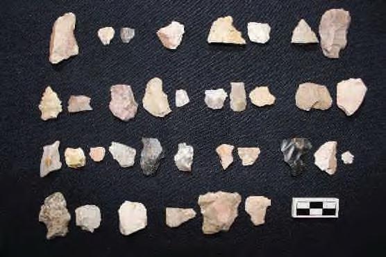
Site 33LO1198 is located on the Russells Point, Ohio 7.5’ USGS topographic quadrangle map (Figure 6 and 7 Series). The site consists of a Middle Archaic (6,000-5,000 B.C.) precontact and post-contact artifact scatter (n=114). The site was encountered during pedestrian survey of an agricultural field which exhibited approximately 70 percent surface visibility. One shovel test was excavated to determine soil stratigraphy. The shovel test revealed a 25 cm plow zone of brown (10YR 4/3) silt clay loam over a dark yellowish-brown (10YR 4/6) silt loam subsoil.


4 Results
Cultural period: Late Archaic, 3,000-1,700 B.C. and Late Precontact, A.D. 500-1,500
UTM: (NAD 1927)
USGS Quadrangle: Russells Point, Ohio
Site dimensions: 114.43 m N-S by 64.15 m E-W (5315.56 square meters)
Physiographic region: Central Ohio Clayey Till Plain
Topographic setting: Alluvial plain
Elevation: 992.08 ft AMSL
Soil Series: Fulton silt loam (FuA), 0 to 4 percent slopes (Hydric), Latty silty clay (La) (Hydric)
Watershed: Cherokee Mans Run; Great Miami River below Cherokee Mans Run to above Muchinippi Cr.
Nearest water source: Cherokee Mans Run
Distance and direction to nearest water source: 144.62 m north-northeast
Surface visibility: 85 percent

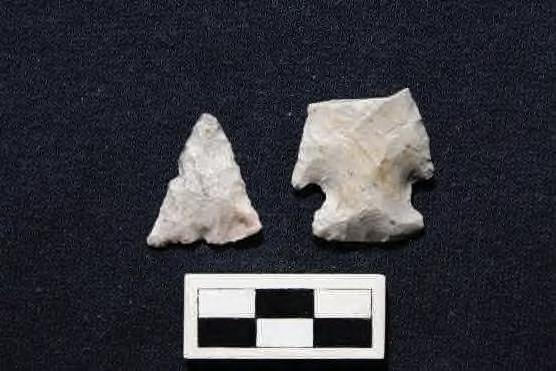
Site 33LO1199 is located on the Russells Point, Ohio 7.5’ USGS topographic quadrangle map (Figure 6 and 7 Series). The site consists of a small Late Archaic and Late Precontact artifact scatter (n=32) The site was encountered during pedestrian survey of an agricultural field which exhibited approximately 85 percent surface visibility. One shovel test was excavated to determine soil stratigraphy. The shovel test revealed a 30 cm plow zone of brown (10YR 4/3) silt clay loam over a dark yellowish-brown (10YR 4/6) silty clay subsoil and was negative for cultural material. Artifacts recovered from site 33LO1199 are summarized in Table 47; a more detailed artifact catalog can be found in Appendix C. Representative artifacts are shown in Photo 55


4 Results
Site 33LO1200 consists of a small, Early Archaic and Late Woodland lithic scatter. The small precontact artifact scatter likely represents expedient tool manufacture or modification and reflects the ephemeral use of the landscape for precontact resource procurement. The site is unlikely to yield additional significant information about the prehistory of the region because of the low density of artifacts. No further archaeological work is recommended at this site.


4 Results
Cultural period: Unidentified Precontact
UTM: m N (NAD 1927)
USGS Quadrangle: Russells Point, Ohio
Site dimensions: 191.05 m NE-SW by 100.37 m NW-SE (13,412.65 square meters)
Physiographic region: Central Ohio Clayey Till Plain
Topographic setting: Alluvial plain
Elevation: 991.36 ft AMSL
Soil Series: Lippincott silty clay loam (Lp), 0 to 2 percent slopes (Hydric), Haskins loam (HdB), 2 to 6 percent slopes (Hydric)
Watershed: Great Miami River below Cherokee Mans Run to above Muchinippi Cr.
Nearest water source: Cherokee Mans Run
Distance and direction to nearest water source: 93.36 m east
Surface visibility: 85 percent
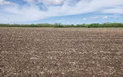

Site 33LO1202 is located on the Russells Point, Ohio 7.5’ USGS topographic quadrangle map (Figure 6 and 7 Series). The site consists of a small precontact artifact scatter (n=43) The site was encountered during pedestrian survey of an agricultural field which exhibited approximately 85 percent surface visibility. One shovel test was excavated to determine soil stratigraphy. The shovel test revealed a 35 cm plow zone of dark brown (10YR 3/3) sandy silty loam over a grayish-brown (10YR 5/2) sandy silty loam subsoil. Artifacts recovered from site 33LO1202 are summarized in Table 50; a more detailed artifact catalog can be found in Appendix C. Representative artifacts are shown in Photo 60


4 Results
Site 33LO1203 consists of a small, Late Precontact lithic scatter. The small precontact artifact scatter likely represents expedient tool manufacture or modification and reflects the ephemeral use of the landscape for precontact resource procurement. The site is unlikely to yield additional significant information about the prehistory of the region because of the low density of artifacts. No further archaeological work is recommended at this site.


4 Results
Site 33LO1204 consists of a small, precontact lithic scatter. The small precontact artifact scatter likely represents expedient tool manufacture or modification and reflects the ephemeral use of the landscape for precontact resource procurement. The site is unlikely to yield additional significant information about the prehistory of the region because of the low density of artifacts. No further archaeological work is recommended at this site.


4 Results
Site 33LO1205 consists of a small, precontact lithic scatter. Interestingly, seven of the thirteen artifacts represent preforms produced from Flint Ridge and Upper Mercer. The site likely represents an isolated cache that was plowed out, or items that were in accidently discarded. The site is unlikely to yield additional significant information about the prehistory of the region because of the low density of artifacts and lack of soil integrity. No further archaeological work is recommended at this site.

Stokes, Bloomfield, Washington, Richland, and McArthur Townships, Logan County, Ohio
4 Results
Cultural period: Unidentified Precontact and Historic (Mid-19th – Early 20th Century)
UTM: m N (NAD 1927)
USGS Quadrangle: Huntsville, Ohio
Site dimensions: 48.15 m NW-SE by 37.05 m NE-SW (1038.25 square meters)
Physiographic region: Central Ohio Clayey Till Plain
Topographic setting: Slight rise on alluvial plain
Elevation: 1001.41 ft AMSL
Soil Series: Fulton silt loam (FuA), 0 to 4 percent slopes (Hydric)
Watershed: Cherokee Mans Run; Great Miami River below Cherokee Mans Run to above Muchinippi Cr.
Nearest water source: Cherokee Mans Run
Distance and direction to nearest water source: 143.12 m north
Surface visibility: 80 percent
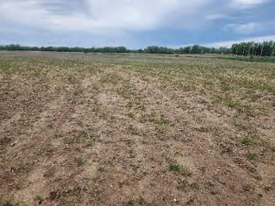


Site 33LO1206 is located on the Huntsville Point, Ohio 7.5’ USGS topographic quadrangle map (Figure 6 and 7 Series). The site consists of a multicomponent artifact scatter (n=29) containing a small precontact component (n=19) and a small post-contact component (n=10). The site was encountered during pedestrian survey of an agricultural field which exhibited approximately 80 percent surface visibility. One shovel test was excavated to determine soil stratigraphy. The shovel test revealed a 30 cm plow zone of dark grayish brown (10YR 4/2) silty loam over a yellowish-brown (10YR 5/4) silty loam subsoil.


4 Results
Historic mapping places site 33LO1206 (along with 33LO1207 and 1208) on a parcel owned by John G. Dunn in in 1875 (Stewart 1875). No structures appear within or immediately adjacent to the site at this time. The site is interesting placed directly west of Robert’s line. The Dunn family is relatively well documented throughout Logan and Hardin counties, Ohio. Several structured are located on the same parcel; however, they are located north of 33LO 1206, 1207, and 1208. The 1890 map of Logan County, Ohio indicates that the parcel has transferred ownership to S.L. Horn. No structures are shown on any additional or historical mapping or aerials.
Site 33LO1206 consists of a light density nineteenth to early twentieth century historic artifact scatter and a small prehistoric scatter. Although some of the cultural material recovered could have been manufactured as early as 1750 and as late as the modern era, the assemblage was likely not deposited over the entire range in temporal periods represented by the artifacts. Instead, it likely accumulated from more isolated single or short period dumping or abandonment events that occurred during the late nineteenth to early twentieth centuries. No additional features or intact structural remains were identified during the investigation. It is unlikely that this site will yield additional information important to the history of the region, nor does it appear to be associated with important persons or events within the area. The prehistoric component of the site appears to represent the ephemeral use of the landscape and does not appear to offer information important to the prehistory of the region. No further archaeological work is recommended at this site.

Phase I Archaeological Survey: Grange Solar Grazing Center Project
Stokes, Bloomfield, Washington, Richland, and McArthur Townships, Logan County, Ohio
4 Results
Cultural period: Historic (Late 19th – Early 20th Century) and Unidentified Precontact
UTM: m N (NAD 1927)
USGS Quadrangle: Russells Point, Ohio
Site dimensions: 48.53 m E-W by 47.13 m N-S (1477.55 square meters)
Physiographic region: Central Ohio Clayey Till Plain
Topographic setting: Alluvial plain
Elevation: 994.06 ft AMSL
Soil Series: Eldean silt loam (EmA), 0 to 2 percent slopes (Hydric); Latty silty clay (La) (Hydric)
Watershed: Cherokee Mans Run; Great Miami Headwaters to above Cherokee Mans Run [except North & South Forks]
Nearest water source: Cherokee Mans Run
Distance and direction to nearest water source: 191.95 m south southwest
Surface visibility: 90 percent
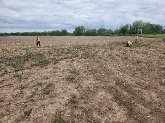

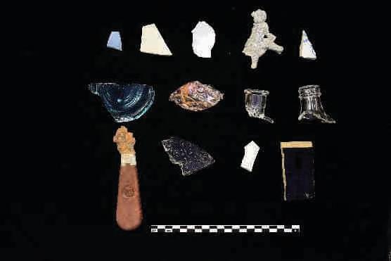
Site 33LO1207 is located on the Russells Point, Ohio 7.5’ USGS topographic quadrangle map (Figure 6 and 7 Series). The site consists of a multicomponent artifact scatter (n=50) containing a small precontact component (n=4) and a medium-sized post-contact component (n=46). The site was encountered during pedestrian survey of an agricultural field which exhibited approximately 90 percent surface visibility. One shovel test was excavated to determine soil stratigraphy. The shovel test revealed a 30 cm plow zone of


4 Results
Historic mapping places site 33LO1207 (along with 33LO1206 and 1208) on a parcel owned by John G. Dunn in in 1875 (Stewart 1875). No structures appear within or immediately adjacent to the site at this time. The site is interesting placed directly west of Robert’s line. The Dunn family is relatively well documented throughout Logan and Hardin counties, Ohio. Several structured are located on the same parcel; however, they are located north of 33LO 1206, 1207, and 1208. The 1890 map of Logan County, Ohio indicates that the parcel has transferred ownership to S.L. Horn. A barn is seen at the site location on the 1957 and 1959 historical aerials but is demolished sometime between 1981 (Netronline 2024). A railroad line running east and west is also mapped immediately north of the site on the 1915 and 1940 USGS mapping. No structures are shown on any additional or historical mapping or aerials images.
Site 33LO1207 consists of a light density nineteenth to early twentieth century historic artifact scatter and a small prehistoric scatter. Although some of the cultural material recovered could have been manufactured as early as 1825 and as late as the modern era, the assemblage was likely not deposited over the entire range in temporal periods represented by the artifacts. Instead, it likely accumulated from more isolated dumping or abandonment events that occurred during the late nineteenth century into the early twentieth century. No additional features or intact structural remains were identified during the investigation. It is unlikely that this site will yield additional information important to the history of the region, nor does it appear to be associated with important persons or events within the area. The precontact component of the site appears to represent the ephemeral use of the landscape and does not appear to offer information important to the prehistory of the region. No further archaeological work is recommended at this site.

4 Results
Cultural period: Historic (Early 20th Century)
UTM: m N (NAD 1927)
USGS Quadrangle: Russells Point, Ohio
Site dimensions: 45.96 m NE-SW by 25.91 m NW-SE (803.76 square meters)
Physiographic region: Central Ohio Clayey Till Plain
Topographic setting: Alluvial plain
Elevation: 989.65 ft AMSL
Soil Series: Latty silty clay (Lb), occasionally flooded (Hydric)
Watershed: Cherokee Mans Run
Nearest water source: Cherokee Mans Run
Distance and direction to nearest water source: 101.20 m west northwest
Surface visibility: 90 percent
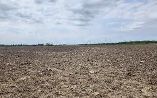
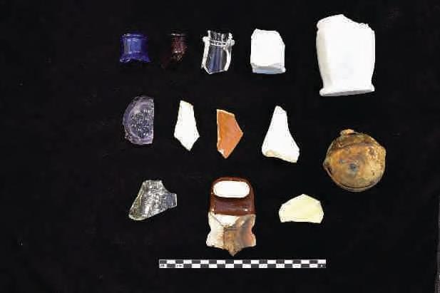
Site 33LO1208 is located on the Russells Point, Ohio 7.5’ USGS topographic quadrangle map (Figure 6 and 7 Series). The site consists of a small post-contact artifact scatter (n=36) discovered during pedestrian survey of an agricultural field which exhibited approximately 90 percent surface visibility. One shovel test was excavated to determine soil stratigraphy. The shovel test revealed a 20 cm plow zone of light yellowish brown (10YR 6/4) silty loam over a dark grayish-brown (10YR 4/2) silty loam subsoil and was negative for cultural material.
Just under one third of the post-contact artifacts from site 33LO1206 are nondiagnostic, including fragments of container glass, sherds of undecorated refined white earthenware, and indeterminate metal. Diagnostic artifacts include stoneware with treatments spanning the nineteenth and early twentieth centuries (Greer 2005), a variety of twentieth century machine-made container glass (CWRU 2024; Lindsey 2024; Lockhart & Porter 2010), Depression Table glass (1920s-1940s; Venable et al. 2000), porcelain electrical insulation not manufactured until the late nineteenth century (Berry 2003), and one Petal-patterned sleigh bell (18401920; Hume 1969). Most of these diagnostic artifacts were not manufactured until the early twentieth century, while a limited amount of material could have been manufactured earlier in the nineteenth century.
Artifacts recovered from site 33LO1208 are summarized in Table 60; a more detailed artifact catalog can be found in Appendix C. Representative artifacts are shown in Photo 75.


4 Results
Historic mapping places site 33LO1208 1207 (along with 33LO1206 and 1207) on a parcel owned by John G. Dunn in in 1875 (Stewart 1875). No structures appear within or immediately adjacent to the site at this time. The site is interesting placed directly west of Robert’s line. The Dunn family is relatively well documented throughout Logan and Hardin counties, Ohio. Several structured are located on the same parcel; however, they are located north of 33LO 1206, 1207, and 1208. The 1890 map of Logan County, Ohio indicates that the parcel has transferred ownership to S.L. Horn. A railroad line running east and west is also mapped immediately north of the site on the 1915 and 1940 USGS mapping. No structures are shown on any additional or historical mapping or aerials images.
Site 33LO1208 consists of a light density early twentieth century historic artifact scatter. Although some of the cultural material recovered could have been manufactured as early as 1825 and as late as the modern era, the assemblage was likely not deposited over the entire range in temporal periods represented by the artifacts. Instead, it likely accumulated from more isolated dumping or abandonment events that occurred during the early twentieth century. No additional features or intact structural remains were identified during the investigation. It is unlikely that this site will yield additional information important to the history of the region, nor does it appear to be associated with important persons or events within the area. No further archaeological work is recommended at this site.


4 Results
Site 33LO1209 consists of a small, precontact lithic scatter. The small precontact artifact scatter likely represents expedient tool manufacture or modification and reflects the ephemeral use of the landscape for precontact resource procurement. The site is unlikely to yield additional significant information about the prehistory of the region because of the low density of artifacts. No further archaeological work is recommended at this site.

4 Results
Cultural period: Late Precontact (500-1500 CE)
UTM: m N (NAD 1927)
USGS Quadrangle: Russells Point, Ohio
Site dimensions: 93.27 m E-W by 45.27 m N-S (3270.48 square meters)
Physiographic region: Central Ohio Clayey Till Plain
Topographic setting: Alluvial plain
Elevation: 993.91 ft AMSL
Soil Series: Eldean silt loam (EmB), 2 to 6 percent slopes,
Watershed: Great Miami River below Cherokee Mans Run to above Muchinippi Cr.
Nearest water source: Unnamed tributary of Jordan Creek
Distance and direction to nearest water source: 527.11 m south
Surface visibility: 90 percent

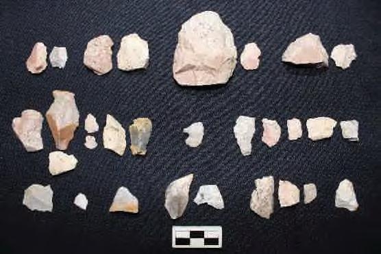
Site 33LO1210 is located on the Russells Point, Ohio 7.5’ USGS topographic quadrangle map (Figure 6 and 7 Series). The site consists of a small late precontact artifact scatter (n=30). Artifacts include debitage and a Late Precontact Levanna projectile point. The site was encountered during pedestrian survey of an agricultural field which exhibited approximately 80 percent surface visibility. One shovel test was excavated to determine soil stratigraphy. The shovel test revealed a 28 cm plow zone of brownish yellow (10YR 6/4) silty clay loam over a yellowish-brown (10YR 5/4) clay loam subsoil and was negative for cultural material.
Artifacts recovered from site 33LO1210 are summarized in Table 63; a more detailed artifact catalog can be found in Appendix C. Representative artifacts are shown in Photo 79.


Stokes, Bloomfield, Washington, Richland, and McArthur Townships, Logan County, Ohio
4 Results
Cultural period: Late Archaic, 3,200-2,500 B.C.
UTM: m N (NAD 1927)
USGS Quadrangle: Russells Point, Ohio
Site dimensions: 40.35 N-S by 117.22 m E-W (2263.45 square meters)
Physiographic region: Central Ohio Clayey Till Plain
Topographic setting: Alluvial plain
Elevation: 992.24 ft AMSL
Soil Series: Latty silty clay (La) (Hydric); Eldean silt loam (EmB), 2 to 6 percent slopes
Watershed: Great Miami River below Cherokee Mans Run to above Muchinippi Cr.
Nearest water source: unnamed tributary of Jordan Creek
Distance and direction to nearest water source: 536.58 m north northwest
Surface visibility: 90 percent
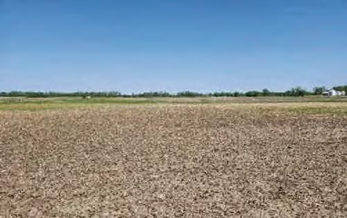
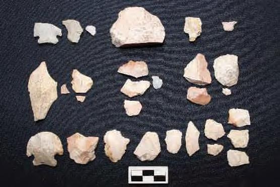
Site 33LO1211 is located on the Russells Point, Ohio 7.5’ USGS topographic quadrangle map (Figure 6 and 7 Series). The site consists of a moderate Late Archaic artifact scatter (n=65). Artifacts include two Late Archaic Brewerton Corner Notch Points, one of which was re-worked into a hafted scraper. No fire cracked rock was noted. The site was encountered during pedestrian survey of an agricultural field which exhibited approximately 80 percent surface visibility. One shovel test was excavated to determine soil stratigraphy. The shovel test revealed a 27 cm plow zone of brown (10YR 5/3) sandy silty loam over a dark yellowish-brown (10YR 4/5) sandy silty loam subsoil and was negative for cultural material.
Artifacts recovered from site 33LO1211 are summarized in Table 64; a more detailed artifact catalog can be found in Appendix C. Representative artifacts are shown in Photo 81


4 Results
Site 33LO1212 consists of a small, precontact lithic scatter. The small precontact artifact scatter likely represents expedient tool manufacture or modification and reflects the ephemeral use of the landscape for precontact resource procurement. The site is unlikely to yield additional significant information about the prehistory of the region because of the low density of artifacts. No further archaeological work is recommended at this site.


4 Results
Site 33LO1214 consists of a small, precontact lithic scatter. The small precontact artifact scatter likely represents expedient tool manufacture or modification and reflects the ephemeral use of the landscape for precontact resource procurement. The site is unlikely to yield additional significant information about the prehistory of the region because of the low density of artifacts. No further archaeological work is recommended at this site.


4 Results
Site 33LO1215 consists of a small, precontact lithic scatter. The small precontact artifact scatter likely represents expedient tool manufacture or modification and reflects the ephemeral use of the landscape for precontact resource procurement. The site is unlikely to yield additional significant information about the prehistory of the region because of the low density of artifacts. No further archaeological work is recommended at this site.


4 Results
Site 33LO1218 consists of a small, precontact lithic scatter. The small precontact artifact scatter likely represents expedient tool manufacture or modification and reflects the ephemeral use of the landscape for precontact resource procurement. The site is unlikely to yield additional significant information about the prehistory of the region because of the low density of artifacts. No further archaeological work is recommended at this site.


Phase I Archaeological Survey: Grange Solar Grazing Center Project
Stokes, Bloomfield, Washington, Richland, and McArthur Townships, Logan County, Ohio
4 Results
Cultural period: Historic (Mid- to Late 19th Century) and Precontact Late Archaic (3,800 – 3,000 B.C.)
UTM: (NAD 1927)
USGS Quadrangle: Hunstville, Ohio
Site dimensions: 0.10 m N-S by 0.09 m E-W (0.01 square meters)
Physiographic region: Central Ohio Clayey Till Plain
Topographic setting: Upland Terrace
Elevation: 1093.60 ft AMSL
Soil Series: St. Clair silt loam (ScC2), 6 to 12 percent slopes, moderately eroded (Hydric)
Watershed: Great Miami River below Cherokee Mans Run to above Muchinippi Cr.
Nearest water source: Rennick Creek
Distance and direction to nearest water source: 773.38 m north northwest
Surface visibility: 80 percent
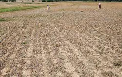

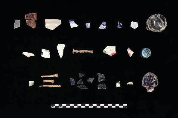
Site 33LO1220 is located on the Russells Point, Ohio 7.5’ USGS topographic quadrangle map (Figure 6 and 7 Series). The site consists of a small precontact and historic artifact scatter (n=130) discovered during pedestrian survey of an agricultural field which exhibited approximately 80 percent surface visibility. One shovel test was excavated to determine soil stratigraphy. The shovel test revealed a 30 cm plow zone of very dark grayish brown (10YR 4/2) silty loam over a yellowish-brown (10YR 5/4) silty loam subsoil and was positive for cultural material.


4 Results
Cultural period: Precontact Early Archaic (6,500-5,800 B.C.) and Late Archaic (3,700-2,500 B.C.) – Late Archaic/Early Woodland (2,000-650 B.C.)
UTM: (NAD 1927)
USGS Quadrangle: Russells Point, Ohio
Site dimensions: 94.11 m N-S by 141.27 m E-W (10161.22 square meters)
Physiographic region: Central Ohio Clayey Till Plain
Topographic setting: Alluvial plain
Elevation: 989.15 ft AMSL
Soil Series: Latty silty clay (La), (Hydric); Fulton silt loam (FuA), 0 to 4 percent slopes (Hydric)
Watershed: Great Miami River below Cherokee Mans Run to above Muchinippi Cr.
Nearest water source: Unnamed tributary of the Great Miami River
Distance and direction to nearest water source: 953.58 m north northwest
Surface visibility: 85 percent
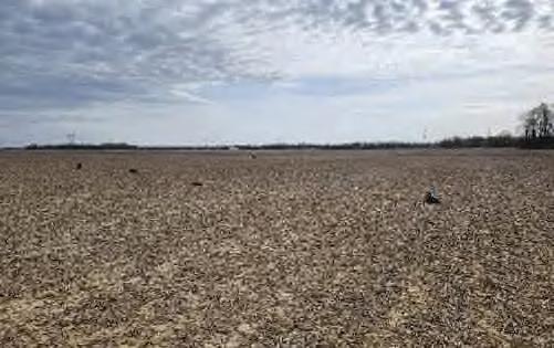
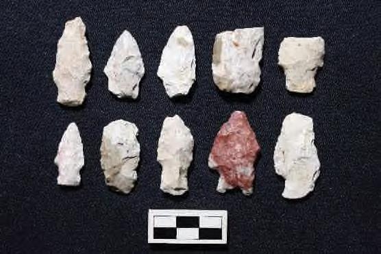
Site 33LO1223 is located on the Russells Point, Ohio 7.5’ USGS topographic quadrangle map (Figure 6 and 7 Series). The site consists of a large Late and Early Archaic l precontact artifact scatter (n=546) discovered during pedestrian survey of an agricultural field which exhibited approximately 85 percent surface visibility. Diagnostic artifacts include one Early Archaic LeCroy point, five Late Archaic Lamoka points (three mostly complete and two complete), and two Late Archaic/Early Woodland Saratoga Parallel Stemmed points (one complete and one medial and base fragment). Additionally, the site also yielded two Late Archaic Karnak Unstemmed points (both medial and base fragments) and three Indeterminate points (Two distal fragments and One medial fragment). There were also Seven preforms, with five complete, one mostly complete, and a base fragment. Debitage included 13 Primary flakes, 237 secondary flakes, and 190 tertiary flakes. The assemblage includes 47 utilized flakes, with varying degrees of treatment: 14 heattreated and 33 untreated. In addition, the site yielded Three knives as well as a thumbnail scraper. A single granitic celt was also recovered from the site. Two shovel tests were excavated at the site to determine soil stratigraphy. One contained several flakes; the other was negative for material culture. The positive shovel test revealed a 24 cm plow zone of a yellowish-brown (10YR 5/4) silt loam over a yellowish-brown (10YR 5/6) silty clay loam subsoil. The negative shovel test yielded a 27 cm plow zone of a yellowish-brown (10YR 5/4) silt loam over a yellowish-brown (10YR 5/6) silty clay loam subsoil. Artifacts recovered from site 33LO1223 are summarized in Table 78; a more detailed artifact catalog can be found in Appendix C. Representative artifacts are shown in Photo 107.


4 Results
33LO1223 represents a large Precontact site with mostly Late Archaic projectile points and a single Early Archaic point. The artifact assemblage recovered from site 33LO1223 includes a diverse array of formal lithic tools and associated debitage. The presence and distribution of these artifacts across the site suggest it likely served multiple purposes. The density of artifacts and the presence of fire-cracked rock at the site indicates the possibility of intact subsurface deposits and/or features. Further archaeological investigation could help identify specific areas within the site that were used for tool manufacturing and maintenance, food preparation, or domestic activities. If project plans cannot avoid this site, Stantec recommends conducting a magnetometry survey within the site boundary to locate any potential features, followed by targeted excavation and recovery of all identified sub-plow anomalies. If intact features are identified, Phase II archaeology would likely be required to assess eligibility to the NRHP.


4 Results
Cultural period: Unidentified Precontact
UTM: m N (NAD 1927)
USGS Quadrangle: Russells Point, Ohio
Site dimensions: 120.23 m NW-SE by 86.17 m NE-SW (7491.88 square meters)
Physiographic region: Central Ohio Clayey Till Plain
Topographic setting: Alluvial plain
Elevation: 988.75 ft AMSL
Soil Series: Latty silty clay (La), (Hydric); Fulton silt loam (FuA), 0 to 4 percent slopes (Hydric)
Watershed: Great Miami River below Cherokee Mans Run to above Muchinippi Cr.
Nearest water source: Great Miami River
Distance and direction to nearest water source: 799.63 m east
Surface visibility: 85 percent
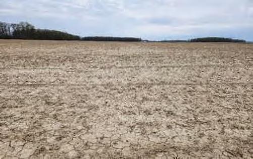

Site 33LO1225 is located on the Russells Point, Ohio 7.5’ USGS topographic quadrangle map (Figure 6 and 7 Series). The site consists of a large precontact artifact scatter (n=109) discovered during pedestrian survey of an agricultural field which exhibited approximately 85 percent surface visibility.
No diagnostic artifacts were collected from site 33LO1225, but large volumes of debitage, as well as some unifacial and bifacial tools, were documented. One shovel test was excavated to determine soil stratigraphy. The shovel test revealed a 32 cm plow zone of dark grayish-brown (10YR 4/2) silt loam over a yellowish-brown (10YR 5/4) silty clay loam subsoil and was negative for material culture.
Artifacts recovered from site 33LO1225 are summarized in Table 80; a more detailed artifact catalog can be found in Appendix C. Representative artifacts are shown in Photo 111


4 Results
Site 33LO1226 consists of a small, Early Woodland (1,000-500 B.C.) lithic scatter. The small precontact artifact scatter likely represents expedient tool manufacture or modification and reflects the ephemeral use of the landscape for precontact resource procurement. The site is unlikely to yield additional significant information about the prehistory of the region because of the low density of artifacts. No further archaeological work is recommended at this site.


Phase I Archaeological Survey: Grange Solar Grazing Center Project
Stokes, Bloomfield, Washington, Richland, and McArthur Townships, Logan County, Ohio
4 Results
Cultural period: Precontact Late Archaic (3,500-2,500 B.C.) and Historic (Late Nineteenth – Early Twentieth Century)
UTM: m N (NAD 1927)
USGS Quadrangle: Russells Point, Ohio
Site dimensions: 58.06 m NW-SE by 25.55 m NE-SW (943.30 square meters)
Physiographic region: Central Ohio Clayey Till Plain
Topographic setting: Alluvial plain
Elevation: 988.10 ft AMSL
Soil Series: Latty silty clay (La), (Hydric)
Watershed: Great Miami River below Cherokee Mans Run to above Muchinippi Cr.
Nearest water source: Unnamed tributary of the Great Miami River
Distance and direction to nearest water source: 849.09 m northwest
Surface visibility: 85 percent
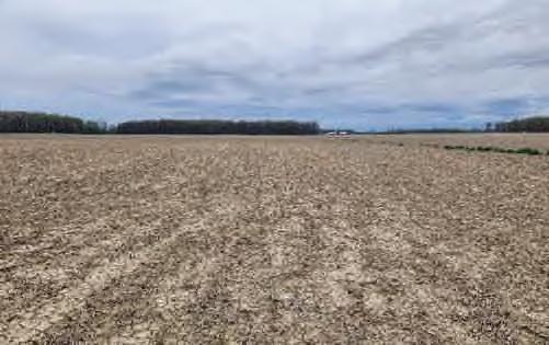
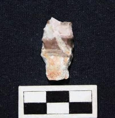
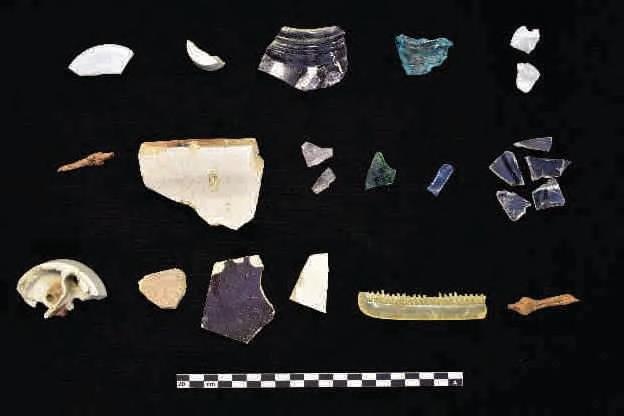
Site 33LO1228 is located on the Russells Point, Ohio 7.5’ USGS topographic quadrangle map (Figure 6 and 7 Series). The site consists of a multicomponent artifact scatter (n=79) containing a small (n=2) Late Archaic precontact component and a large (n=77) post-contact component. The site was encountered during pedestrian survey of an agricultural field which exhibited approximately 85 percent surface visibility.


Phase I Archaeological Survey: Grange Solar Grazing Center Project
Stokes, Bloomfield, Washington, Richland, and McArthur Townships, Logan County, Ohio
4 Results
4.4.48
Cultural period: Late Archaic (3,000-1,700 B.C.) and Early Woodland (1,000-500 B.C.)
UTM: m N (NAD 1927)
USGS Quadrangle: Russells Point, Ohio
Site dimensions: 97.53 m NE-SW by 50.00 m NW-SE (3005.20 square meters)
Physiographic region: Central Ohio Clayey Till Plain
Topographic setting: Alluvial plain
Elevation: 993.21 ft AMSL
Soil Series: Latty silty clay (La), (Hydric); Fulton silt loam (FuA), 0 to 4 percent slopes (Hydric)
Watershed: Great Miami River below Cherokee Mans Run to above Muchinippi Cr.
Nearest water source: Unnamed tributary of the Great Miami River
Distance and direction to nearest water source: 531.44 m north northwest
Surface visibility: 85 percent
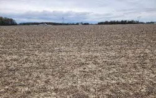
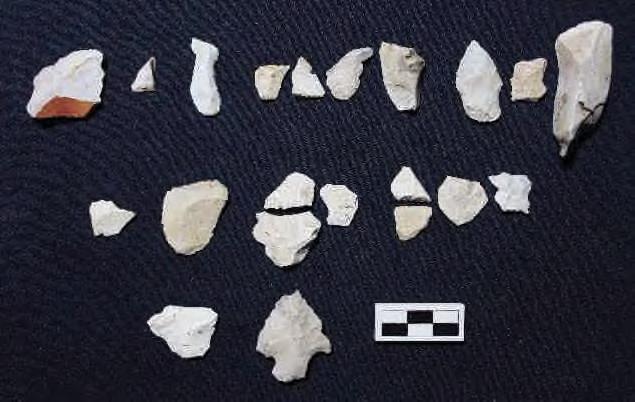
Site 33LO1229 is located on the Russells Point, Ohio 7.5’ USGS topographic quadrangle map (Figure 6 and 7 Series). The site consists of a moderate precontact artifact scatter (n=22) discovered during pedestrian survey of an agricultural field which exhibited approximately 85 percent surface visibility.
Two diagnostic artifacts, an Early Woodland Stemmed Cluster – Kramer Point (1,000-500 B.C.) and a Late Archaic Brewerton Corner Notched – Corner Cluster (3,000-1,700 B.C.; Justice 1987), were collected from site 33LO1229, along with debitage and a small amount of utilized flake tools and a pitted hammer/griding stone. One shovel test was excavated to determine soil stratigraphy. The shovel test revealed a 24 cm plow zone of yellowish-brown (10YR 5/4) silt loam over a yellowish-brown (10YR 5/6) silty clay loam subsoil and contained a single flake.
Artifacts recovered from site 33LO1229 are summarized in Table 86; a more detailed artifact catalog can be found in Appendix C. Representative artifacts are shown in Photo 120.


4 Results
Cultural period: Precontact Late Archaic (3,700-2,000 B.C.) and Late Woodland/Proto-historic (A.D.1,400-Post 1,700)
UTM: m N (NAD 1927)
USGS Quadrangle: Russells Point, Ohio
Site dimensions: 64.51m NW-SE by 55.97 m NE-SW (2672.28 square meters)
Physiographic region: Central Ohio Clayey Till Plain
Topographic setting: Alluvial plain
Elevation: 989.42 ft AMSL
Soil Series: Fulton silt loam (FuA), 0 to 4 percent slopes (Hydric)
Watershed: Great Miami River below Cherokee Mans Run to above Muchinippi Cr.
Nearest water source: Great Miami River
Distance and direction to nearest water source: 824.36 m east
Surface visibility: 85 percent
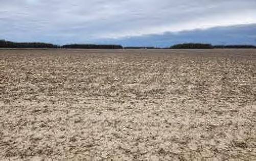
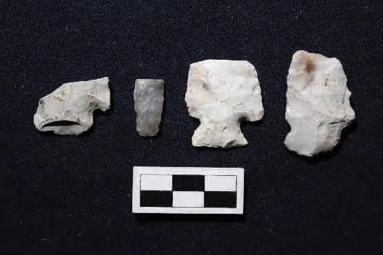
Site 33LO1230 is located on the Russells Point, Ohio 7.5’ USGS topographic quadrangle map (Figure 6 and 7 Series). The site consists of a large precontact artifact scatter (n=192) discovered during pedestrian survey of an agricultural field which exhibited approximately 85 percent surface visibility. The chipped stone assemblage recovered from the site includes a variety of artifacts spanning multiple periods and types. Diagnostic finds include several uniface utilized flakes and a variety of flakes, predominantly of secondary and tertiary types. Notable artifacts include a Late Archaic Bisher heat-treated Brewerton Corner Notched Cluster - Vosburg Corner Notched point, which is missing its distal end and tips of both shoulders, with one flat and one excurvate blade edge and a slightly ground excurvate base. The collection also includes a Late Archaic Brassfield heat-treated Brewerton Corner Notched Cluster - Matanzas Side Notched point, missing its distal tip but reworked into a unifacial scraper, featuring dull to very dull excurvate blade edges, heavily ground convex base and side notches. Additionally, the assemblage contains a Late Woodland/Protohistoric Flint Ridge Nodena Cluster - Nodena Elliptical point, possibly a spike drill base, and a Late Archaic/Early Woodland preform I with bifacial use wear on one excurvate edge. The debitage includes 10 primary flakes, 78 secondary flakes, and 72 tertiary flakes, along with 18 utilized flakes, including 14 heat-treated and 4 untreated. The assemblage also yielded 3 knives, including 2 complete and 1 mostly complete, as well as a scraper. One shovel test was excavated to determine soil stratigraphy. The


4 Results
Cultural period: Precontact Late Archaic (3,200-2,500 B.C.) and Late Archaic (1,300-500 B.C.) or Late Precontact (A.D. 500-900)
UTM: m N (NAD 1927)
USGS Quadrangle: Russells Point, Ohio
Site dimensions: 72.77m N-S by 34.63 m E-W (1949.34 square meters)
Physiographic region: Central Ohio Clayey Till Plain
Topographic setting: Alluvial plain
Elevation: 988.62 ft AMSL
Soil Series: Latty silty clay (La), (Hydric); Fulton silt loam (FuA), 0 to 4 percent slopes (Hydric)
Watershed: Great Miami River below Cherokee Mans Run to above Muchinippi Cr.
Nearest water source: Great Miami River
Distance and direction to nearest water source: 680.27m east southeast
Surface visibility: 90 percent
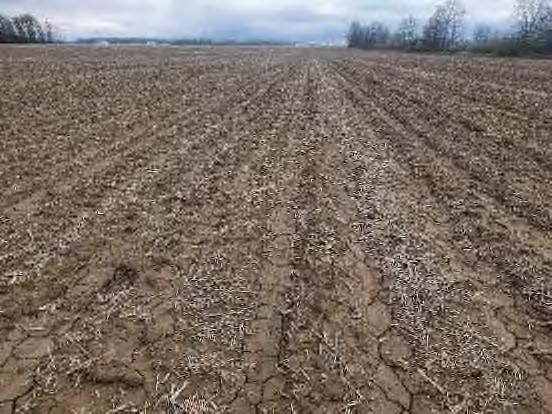
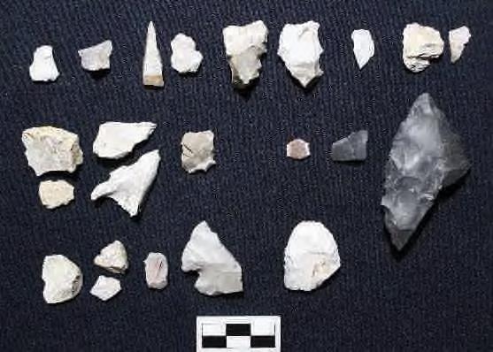
Site 33LO1232 is located on the Russells Point, Ohio 7.5’ USGS topographic quadrangle map (Figure 6 and 7 Series). The site consists of a moderate precontact artifact scatter (n=21). The site was encountered during pedestrian survey of an agricultural field which exhibited approximately 90 percent surface visibility. One shovel test was excavated to determine soil stratigraphy. The shovel test revealed a 22 cm plow zone of very dark grayish brown (10YR 4/2) silty loam over a yellowish-brown (10YR 5/4) silty loam subsoil and was negative for cultural material.
Two diagnostic projectile points were collected from site 33LO1232, a Late Archaic Brewerton Corner
Notched point (3,200-2,500 B.C.) and a point which could be either a Late Archaic Pomranky point (1,300500 B.C.) or a Jack’s Reef Pentagonal point dating to the Late Precontact period (A.D. 500-900; Justice 1987). The remaining artifacts are nondiagnostic flakes and one preform.
Artifacts recovered from site 33LO1232 are summarized in Table 89; a more detailed artifact catalog can be found in Appendix C. Representative artifacts are shown in Photo 126


4 Results
Site 33LO1233 consists of a small, precontact lithic scatter that includes an early archaic projectile point as well as a late precontact projectile point. The small precontact artifact scatter likely represents expedient tool manufacture or modification and reflects the ephemeral use of the landscape for precontact resource procurement. The site is unlikely to yield additional significant information about the prehistory of the region because of the low density of artifacts. No further archaeological work is recommended at this site.

Stokes, Bloomfield, Washington, Richland, and McArthur Townships, Logan County, Ohio
4 Results
Cultural period: Precontact Late Archaic (3,700-2,500 B.C. or 3,700-1,700 B.C., and 1,600-1,000 B.C.)
UTM: m N (NAD 1927)
USGS Quadrangle: Russells Point, Ohio
Site dimensions: 63.72 m N-S by 57.50 m E-W (2100.91 square meters)
Physiographic region: Central Ohio Clayey Till Plain
Topographic setting: Alluvial plain
Elevation: 990.11 ft AMSL
Soil Series: Latty silty clay (La), (Hydric); Fulton silt loam (FuA), 0 to 4 percent slopes (Hydric)
Watershed: Great Miami River below Cherokee Mans Run to above Muchinippi Cr.
Nearest water source: Great Miami River
Distance and direction to nearest water source: 788.48 m east southeast
Surface visibility: 80 percent


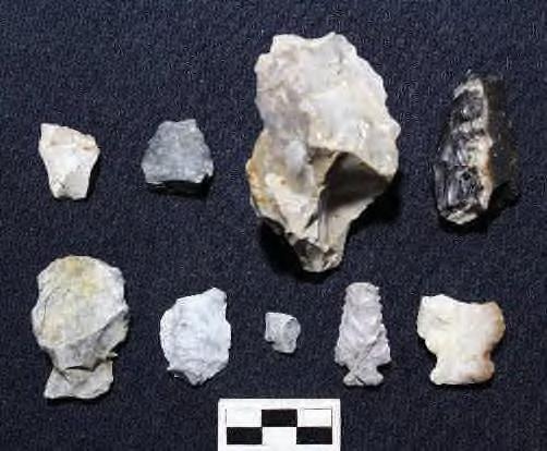
Site 33LO1234 is located on the Russells Point, Ohio 7.5’ USGS topographic quadrangle map (Figure 6 and 7 Series). The site consists of a small Late Archaic artifact scatter (n=9) was discovered during pedestrian survey of an agricultural field which exhibited approximately 80 percent surface visibility. One shovel test was excavated to determine soil stratigraphy. The shovel test revealed a 20 cm plow zone of very dark grayish brown (10YR 4/2) silty loam over a yellowish-brown (10YR 5/4) silty loam subsoil that appeared hydric and was positive for cultural material- a single flake.
Artifacts recovered from site 33LO1234 are summarized in Table 91; a more detailed artifact catalog can be found in Appendix C. Representative artifacts are shown in Photo 130.


4 Results
Cultural period: Precontact Late Archaic (3,000-1,000 B.C.)
UTM: m N (NAD 1927)
USGS Quadrangle: Russells Point, Ohio
Site dimensions: 51.81m NE-SW by 50.50 m NW-SE (1850.64 square meters)
Physiographic region: Central Ohio Clayey Till Plain
Topographic setting: Alluvial plain
Elevation: 989.46 ft AMSL
Soil Series: Latty silty clay (La), (Hydric)
Watershed: Great Miami River below Cherokee Mans Run to above Muchinippi Cr.
Nearest water source: Unnamed tributary of the Great Miami River
Distance and direction to nearest water source: 1095.84 m north northwest
Surface visibility: 90 percent

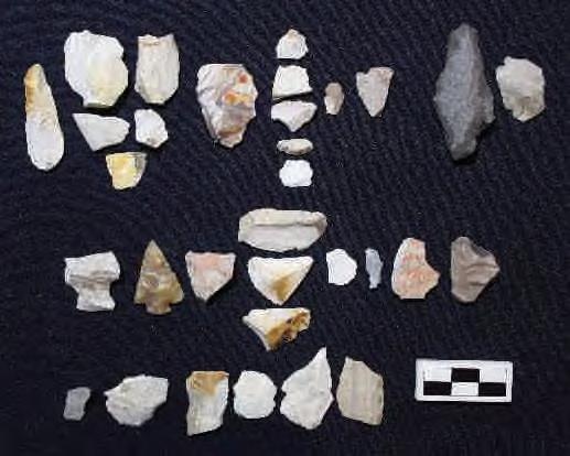
Site 33LO1236 is located on the Russells Point, Ohio 7.5’ USGS topographic quadrangle map (Figure 6 and 7 Series). The site consists of a moderate precontact artifact scatter (n=78) discovered during pedestrian survey of an agricultural field which exhibited approximately 90 percent surface visibility. Artifacts from 4-30 include several projectile points, other bifaces, scrapers, and debitage. Among the projectile points are a Table Rock Stemmed point from the Late Archaic period, and an indeterminate Merom Cluster point from the Late Archaic period, and two indeterminate points (Justice 1987). Additionally, the site yielded a variety of bifaces including an expedient knife fragment, a possible drill or point, potentially from the Ledbetter Cluster or Dickson Cluster, and indeterminate bifaces. The collection also features a thumbnail scraper, characterized by unifacial use wear along almost its entire perimeter. Flakes from the site include 1 primary flake, 17 secondary flakes, 25 tertiary flakes, and 13 utilized flakes. One shovel test was excavated to determine soil stratigraphy. The shovel test revealed a 30 cm plow zone of very dark grayish brown (10YR 4/2) silty loam over a yellowish-brown (10YR 5/4) silty loam subsoil and was positive for cultural material.
Artifacts recovered from site 33LO1236 are summarized in Table 93; a more detailed artifact catalog can be found in Appendix C. Representative artifacts are shown in Photo 134


4 Results
Site 33LO1236 consists of a moderate Late Archaic precontact lithic scatter. Artifacts from 4-30 include several projectile points, other bifaces, scrapers, and various flakes. While 33LO1236 is decently sized and has yielded a variety of artifacts, shovel test results suggest that the site exists solely within a plowzone. This indicates that the site has been disturbed and is unlikely to contain intact archaeological deposits. Larger nearby sites, such as 33LO1223, are more likely to provide a greater chance of locating intact deposits that would significantly supplement our current understanding of the Late Archaic period in the region. Therefore, based on the disturbed context of the artifacts and the limited potential for significant intact deposits, site 4-30 is likely not to provide important information. Consequently, Stantec recommends no further work at this site.

Phase I Archaeological Survey: Grange Solar Grazing Center Project
Stokes, Bloomfield, Washington, Richland, and McArthur Townships, Logan County, Ohio
4 Results
Cultural period: Precontact (Early Archaic-Late Woodland) and Historic (Early-Late 19th Century)
UTM: m N (NAD 1927)
USGS Quadrangle: Russells Point, Ohio
Site dimensions: 183.57 m NE-SW by 81.75 m NW-SE (8310.33 square meters)
Physiographic region: Central Ohio Clayey Till Plain
Topographic setting: Alluvial plain
Elevation: 992.59 ft AMSL
Soil Series: Fulton silt loam (FuA), 0 to 4 percent slopes (Hydric); Latty silty clay (La), (Hydric)
Watershed: Great Miami River below Cherokee Mans Run to above Muchinippi Cr.
Nearest water source: Unnamed tributary of the Great Miami River
Distance and direction to nearest water source: 51.94 m east
Surface visibility: 90 percent
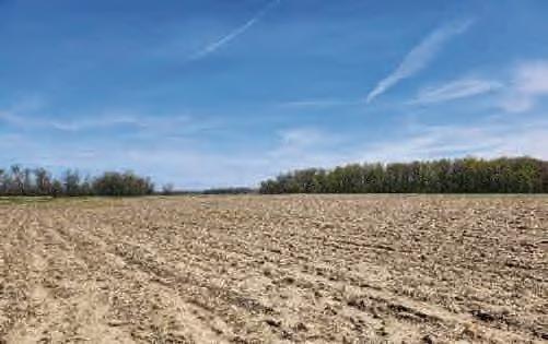
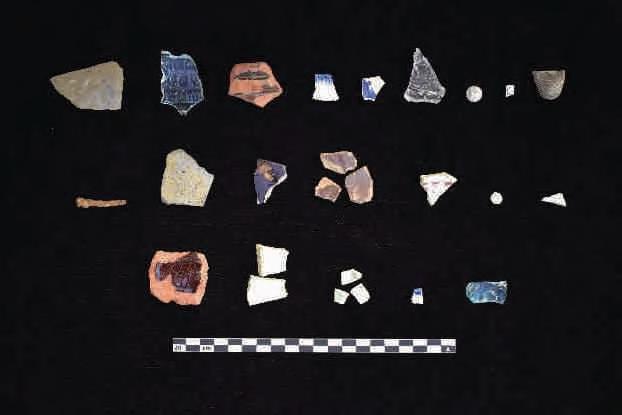
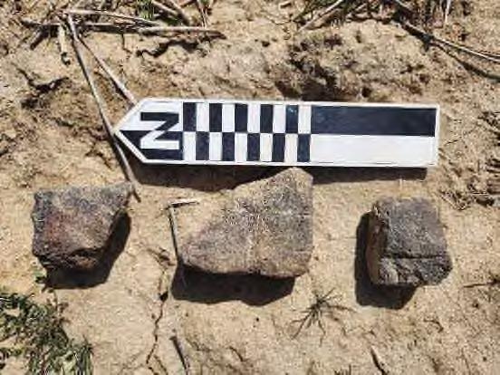

Site 33LO1237 is located on the Russells Point, Ohio 7.5’ USGS topographic quadrangle map (Figure 6 and 7 Series). The site consists of a large multicomponent artifact scatter (n=173) discovered during pedestrian survey of an agricultural field which exhibited approximately 90 percent surface visibility. Two shovel tests were excavated to determine soil stratigraphy. One was positive for material culture and the second was negative. The positive shovel test revealed a 25 cm plow zone of a dark grayish-brown (10YR 4/2) silt loam over a

4 Results
yellowish brown (10YR 5/6) clay loam subsoil. The negative shovel test yielded a 20 cm plow zone of a dark grayish-brown (10YR 4/2) silt loam over a yellowish brown (10YR 5/6) clay loam subsoil.
The Precontact artifact assemblage includes a variety of lithic tools and flakes. Among the projectile points identified, were nine types: One Steuben Expanded Stem from the Middle to Late Woodland period, One Kirk Corner Notched from the Early Archaic period, one Godar/Raddatz Side Notched from the Middle Archaic period, one indeterminate type (Medial) likely from the Late Archaic period, a single Motley from the Early Woodland period, a Bottleneck Stemmed (Medial and base) from the Late Archaic period, one Perkiomen Broad from the Late Archaic/Early Woodland period, one Raddatz Side Notched from the Middle Archaic period, and a Saratoga Parallel Stemmed from the Late Archaic/Early Woodland period. In addition to the projectile points, the assemblage includes 70 secondary flakes, 17 tertiary flakes, and 32 utilized flakes.
Just over one fourth of the post-contact artifacts from site 33LO1237 are nondiagnostic, including container glass and undecorated or burned refined white earthenware. Diagnostic post-contact artifacts are mostly utilitarian and tableware ceramics, with some architectural material and container glass fragments predating the twentieth century. A majority of the utilitarian ceramics consist of redware dating from the mid-eighteenth century to the late nineteenth century; a small amount of stoneware with treatments dating from 1900 to the twentieth century was also recovered. The predominance of redware over stoneware and the presence of earlier stoneware treatments (salt glazed and unglazed, 1800-1860; Greer 2005) is unusual when compared to other historic sites investigated during this field effort, the majority of which contain mostly utilitarian stoneware over redware.
Tableware ceramics consist of refined white earthenwares (pearlware and whiteware) with various decorative techniques dating from the early nineteenth to late nineteenth century, such as shell-edge, transferprint, sponge-decoration, enamel, and hand painting (Samford & Miller 2002). Also unusual is the presence of a variety of Rockingham ware, which was not observed at any other historic site during this field effort (1840s-1870s; Samford & Miller 2002). Some of the sponged wares may have been manufactured in the early twentieth century, but the majority of ceramic tablewares date from the late eighteenth century to late nineteenth century.
Additionally recovered was pressed, decorated glass resembling Sandwich Glass (1825-1888; Just Collectibles 2018) although later glass makers used similar patterns, and two pieces of lead shot, one of which was cast and fits the bore of an “American Rifle” manufactured as early as the Revolutionary War period (Sivilich 2016). Remnant lead from casting appears to have been removed from this ball with a knife, by hand. The other lead shot is buckshot-sized and appears to have been fired; its manufacture is indeterminate (Sivilich 2016). A small amount of container glass was documented, including a body fragment from a medicine bottle (Dr. King’s New Discovery for Consumption), which was manufactured in Chicago from 1878-1972 (Fike 1987) and a bottle base with a glass-tipped pontil scar, indicative of manufacturing between 1820 and 1870 (Jones & Sullivan 1989).
Artifacts recovered from site 33LO1237 are summarized in Table 94 a more detailed artifact catalog can be found in Appendix C. Representative artifacts are shown in Photo 136 through Photo 138.


4 Results
In 1874, the parcel was mapped as belonging to George Harner. Although no structure is directly associated with the artifact scatter location, an orchard is noted on the map. The main residence is situated farther south along a road (Stewart 1875). A land patent indicates that George purchased the 80 acres in 1837 from the Lima, Ohio land office. By 1880, he is listed as a retired farmer, and he passed away in 1893 (Ancestry 2024). Harner’s modest farm was valued at around $700 in 1850, just over $4000 in 1870, and $2000 in 1880, and the agricultural census indicates the farm produced various livestock and grains in 1870 but only “Indian Corn” and wheat by 1880 (Ancestry 2024). The 1890 map shows the parcel belonging to John Smith. Little is documented about Harner and Smith in the historical record, but an 1890 newspaper article detailing early settlers in the region discusses both men and is referenced in Photo 140.
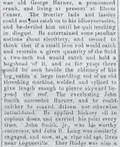
The Precontact portion of 33LO1237 contains numerous diagnostic artifacts, debitage, and other tools. The presence and distribution of these artifacts suggest the site likely served multiple purposes. The density of artifacts and presence of fire-cracked rock indicate the potential for intact subsurface deposits or features. Further archaeological investigation could help identify specific areas within the site used for tool manufacturing and maintenance, food preparation, or domestic activities.
The historic component of the site appears to be tightly dated, with early historic artifacts, including architectural brick, but no mapped structure. This absence suggests the historic portion of the site might represent an early rendition of the Harner domicile or another specialized outbuilding, presenting a unique resource.
Therefore, if project plans cannot avoid this site, Stantec recommends conducting a magnetometry survey within the site boundary to locate potential features, followed by targeted excavation to sample identified sub-plow anomalies. If intact features are identified, Phase II archaeology would likely be required to assess eligibility for the NRHP.

4 Results
Cultural period: Precontact Early Archaic (7,500-6,900 B.C.) and Late Archaic (3,500-2,500 B.C.)
UTM: m N (NAD 1927)
USGS Quadrangle: Russells Point, Ohio
Site dimensions: 51.82 m N-S by 17.45 m E-W (393.92 square meters)
Physiographic region: Central Ohio Clayey Till Plain
Topographic setting: Alluvial plain
Elevation: 990.86 ft AMSL
Soil Series: Fulton silt loam (FuA), 0 to 4 percent slopes (Hydric)
Watershed: Great Miami River below Cherokee Mans Run to above Muchinippi Cr.
Nearest water source: Unnamed tributary of the Great Miami River
Distance and direction to nearest water source: 89.36 m west northwest
Surface visibility: 90 percent

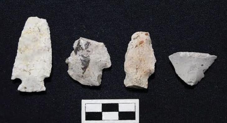
Site 33LO1238 is located on the Russells Point, Ohio 7.5’ USGS topographic quadrangle map (Figure 6 and 7 Series). The site was encountered during pedestrian survey of an agricultural field which exhibited approximately 90 percent surface visibility. The site consists of a small precontact artifact scatter (n=4). These artifacts include a Kirk Corner Notched Cluster point from the Early Archaic period (7,500-6,900 B.C.), characterized by lightly serrated excurvate blade edges and a thin biconvex cross-section; a possible expended Snyders or Lowe Cluster point, showing damage to one excurvate blade edge; a Lamoka Cluster point from the Late Archaic (3,500-2,500 B.C.), featuring a flat intact blade edge and a slightly excurvate base; and a Utilized flake with heavy use wear, indicative of possible resharpening.
Artifacts recovered from site 33LO1238 are summarized in Table 97; a more detailed artifact catalog can be found in Appendix C. Representative artifacts are shown in Photo 142.


Phase I Archaeological Survey: Grange Solar Grazing Center Project
4 Results
4.4.58 Site 33LO1239/ FS-4-43
Cultural period: Precontact Early Archaic (8,000-6,000 B.C.) and Early Woodland (800-300 B.C.)
UTM: m N (NAD 1927)
USGS Quadrangle: Russells Point, Ohio
Site dimensions: 107.16 m N-S by 75.09 m E-W (6690.54 square meters)
Physiographic region: Central Ohio Clayey Till Plain
Topographic setting: Alluvial plain
Elevation: 985.31 ft AMSL
Soil Series: Latty silty clay (La), (Hydric); Fulton silt loam (FuA), 0 to 4 percent slopes (Hydric)
Watershed: Great Miami River below Cherokee Mans Run to above Muchinippi Cr.
Nearest water source: Unnamed tributary of the Great Miami River
Distance and direction to nearest water source: 98.60 m east
Surface visibility: 75 percent
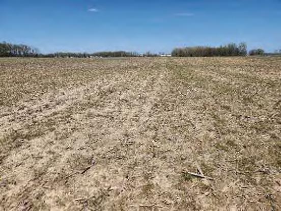

Site 33LO1239 is located on the Russells Point, Ohio 7.5’ USGS topographic quadrangle map (Figure 6 and 7 Series). The site consists of a moderate precontact artifact scatter (n=59) discovered during pedestrian survey of an agricultural field which exhibited approximately 75 percent surface visibility. One shovel test was excavated to determine soil stratigraphy and was negative for material culture. The shovel test revealed a 25 cm plow zone of a dark grayish-brown (10YR 4/2) silt loam over a light brownish gray (10YR 6/2) clay loam subsoil. Artifact assemblage from archaeological site 33LO1239 includes a variety of lithic tools and flakes, spanning different materials and temporal ranges. The assemblage consists of two projectile points: a Biface PPK from the Thebes Cluster dating to the Early Archaic period (8,000-6,000 B.C.) and a Biface PPK Adena Stemmed from the Dickson Cluster dating to the Early Woodland period (800-300 B.C.; Justice 1987). Other lithic tools identified include a Thumbnail Scraper made of Flint Ridge, Uniface Utilized flakes from Upper Mercer, Bisher, and Brassfield materials, and several Preform bifaces from Cedarville-Guelph, Flint Ridge, and Brassfield. Additionally, there are Lamellar blades from Bisher, Brassfield, and Flint Ridge, and various Secondary and Tertiary flakes primarily from Brassfield and Bisher. The assemblage includes 1 primary flake, 33 secondary flakes, 14 tertiary flakes, and 6 utilized flakes. No FCR was observed beyond the one collected example. The site smelled like a wetland, and various wetland snail species was observed. It is likely the site was a small rise that overlooked marshy land.


Phase I Archaeological Survey: Grange Solar Grazing Center Project
Stokes, Bloomfield, Washington, Richland, and McArthur Townships, Logan County, Ohio
4 Results
Cultural period: Precontact Late Archaic (3,200-2,500 B.C.)
UTM: m N (NAD 1927)
USGS Quadrangle: Russells Point, Ohio
Site dimensions: 63.14 m NW-SE by 48.72 m NE-SW (2156.08 square meters)
Physiographic region: Central Ohio Clayey Till Plain
Topographic setting: Alluvial plain
Elevation: 987.34 ft AMSL
Soil Series: Fulton silt loam (FuA), 0 to 4 percent slopes (Hydric); Latty silty clay (La), (Hydric)
Watershed: Great Miami River below Cherokee Mans Run to above Muchinippi Cr.
Nearest water source: Unnamed tributary of the Great Miami River
Distance and direction to nearest water source: 223.23 m east
Surface visibility: 75 percent
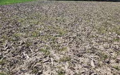
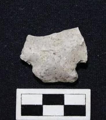
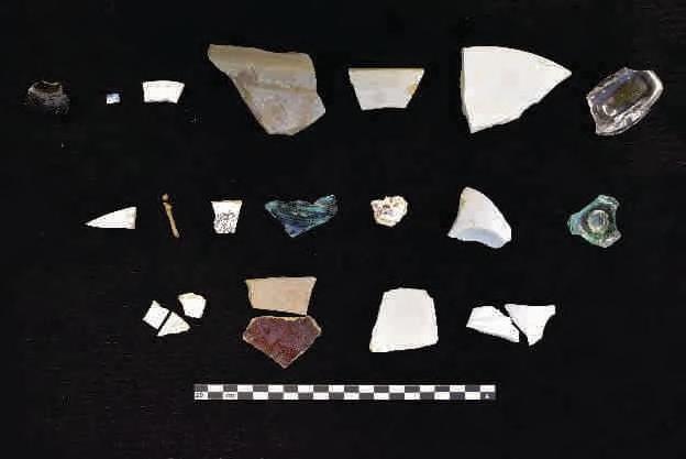
Site 33LO1240 is located on the Russells Point, Ohio 7.5’ USGS topographic quadrangle map (Figure 6 and 7 Series). The site consists of a post-contact artifact scatter (n=107) and Precontact Isolate (n=1). The site was encountered during pedestrian survey of an agricultural field which exhibited approximately 75 percent surface visibility. One shovel test was excavated to determine soil stratigraphy. The shovel test revealed a 35 cm plow zone of yellowish-brown (10YR 5/4) silt loam over a yellowish-brown (10YR 5/6) silty clay loam subsoil. The shovel test contained several pieces of ceramic. A single Precontact artifact


4 Results
Historic mapping places site 33LO1240 on a parcel owned by E. Shaffer in 1875 (Stewart 1875), with a structure located at the site. By 1890, the Logan County, Ohio map indicates that the parcel had transferred ownership to W.J. Sanders, with the structure still depicted at the site. In 1957, at least one structure appears to be standing based on shadows in historical aerials (Netronline 2024). However, by 1959, no structures are visible, and the vegetation appears overgrown. The 1981 mapping shows the site within a farm field. Based on mapping, aerials, and artifacts, it seems likely the structure was constructed sometime between the Civil War and the 1874 mapping and was razed between 1957 and 1959.
Site 33LO1240 consists of a Late Archaic isolate and historic scatter dating between 1860 and 1960. The small precontact isolate is not eligible for inclusion in the NRHP. The historic scatter represents a home/farmstead, but it has been severely impacted by plowing and is unlikely to provide research potential compared to mid-nineteenth-century house lots that have not been plowed. Consequently, the site is unlikely to yield additional significant information about the history of the region. No further archaeological work is recommended at this site.

Stokes, Bloomfield, Washington, Richland, and McArthur Townships, Logan County, Ohio
4 Results
Cultural period: Historic (Twentieth Century)
UTM: m N (NAD 1927)
USGS Quadrangle: Russells Point, Ohio
Site dimensions: 93.08 m N-S by 44.87 m E-W (3288.16 square meters)
Physiographic region: Central Ohio Clayey Till Plain
Topographic setting: Alluvial plain
Elevation: 988.99 ft AMSL
Soil Series: Fulton silt loam (FuA), 0 to 4 percent slopes (Hydric); Latty silty clay (La), (Hydric)
Watershed: Great Miami River below Cherokee Mans Run to above Muchinippi Cr.
Nearest water source: Unnamed tributary of the Great Miami River
Distance and direction to nearest water source: 233.38 m west
Surface visibility: 10 percent


Site 33LO1241 is located on the Russells Point, Ohio 7.5’ USGS topographic quadrangle map (Figure 6 and 7 Series). The site consists of a small post-contact artifact scatter (n=9) discovered during pedestrian survey of a woodlot 10 percent surface visibility.
Half of the post-contact artifacts from site 33LO1241 are nondiagnostic and include refined white earthenwares and container glass. The diagnostic artifacts all date to the twentieth century, with the exception of one porcelain sherd, which may date to from the late nineteenth century to the present (Samford & Miller 2002). No functional group analysis is presented for this site, as all artifacts are considered “Kitchen” materials.
Artifacts recovered from site 33LO1241 are summarized in Table 102; a more detailed artifact catalog can be found in Appendix C. Representative artifacts are shown in Photo 149.


4 Results
Site 33LO1242 consists of a moderately sized precontact lithic scatter. The precontact artifact scatter likely represents expedient tool manufacture or modification and reflects the ephemeral use of the landscape for precontact resource procurement. The site is unlikely to yield additional significant information about the prehistory of the region because of the low density of artifacts and lack of diagnostic artifacts, as well as the potential for disturbances due to the adjacent modern house. No further archaeological work is recommended at this site.

4 Results
4.4.62 Site 33LO1243/ FS-4-52
Cultural period: Multicomponent- Historic (Late Nineteenth Century – Early Twentieth Century) and Unidentified Precontact
UTM: m N (NAD 1927)
USGS Quadrangle: Russells Point, Ohio
Site dimensions: 138.88 m N-S by 70.44 m E-W (7957.36 square meters)
Physiographic region: Central Ohio Clayey Till Plain
Topographic setting: Alluvial plain
Elevation: 985.39 ft AMSL
Soil Series: Minster silty clay loam (Mns3A), 0 to 1 percent slopes (Hydric); Fulton silt loam (FuA), 0 to 4 percent slopes (Hydric); Latty silty clay (La), (Hydric)
Watershed: Great Miami River below Cherokee Mans Run to above Muchinippi Cr.
Nearest water source: Unnamed tributary of the Great Miami River
Distance and direction to nearest water source: 257.47 m south
Surface visibility: 95 percent


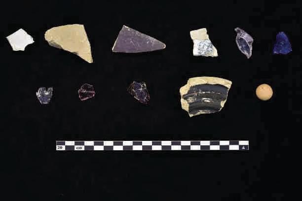


4 Results
Cultural period: Unidentified Precontact and Historic (Late Eighteenth Century – Late Nineteenth Century)
USGS Quadrangle: Huntsville, Ohio
Site dimensions: 36.23 m N-S by 43.61m E-W (1290.94 square meters)
Physiographic region: Central Ohio Clayey Till Plain
Topographic setting: 2nd Terrace above alluvial plain
Elevation: 1048.98 ft AMSL
Soil Series: Minster silty clay loam (Mnl3A), till substratum, 0 to 1 percent slopes (Hydric); Nappanee silt loam (NaB), 2 to 6 percent slopes (Hydric)
Watershed: South Fork Great Miami River to Indian Lake
Nearest water source: Unnamed tributary of the South Fork of the Great Miami River
Distance and direction to nearest water source: 59.86 m west northwest
Surface visibility: 50 percent

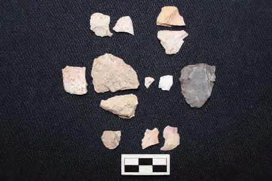


4 Results
Cultural period: Unidentified Precontact
UTM:
USGS Quadrangle: Huntsville, Ohio
Site dimensions: 75.43 m N-S by 164.46 m E-W (6371.64 square meters)
Physiographic region: Central Ohio Clayey Till Plain
Topographic setting: Ridge on 2nd terrace above alluvial plain
Elevation: 1059.46 ft AMSL
Soil Series: St. Clair silt loam (ScC2), 6 to 12 percent slopes, moderately eroded (Hydric); Wetzel silty clay loam (Wv), (Hydric)
Watershed: South Fork Great Miami River to Indian Lake
Nearest water source: Unnamed tributary of the South Fork of the Great Miami River
Distance and direction to nearest water source: 290.39 m south
Surface visibility: 60 percent
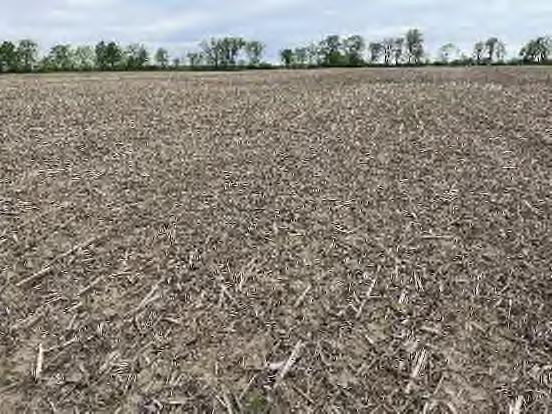

Site 33LO1248 is located on the Huntsville, Ohio 7.5’ USGS topographic quadrangle map (Figure 6 and 7 Series). The site consists of a large precontact artifact scatter (n=97) The site was encountered during pedestrian survey of an agricultural field which exhibited approximately 60 percent surface visibility. One shovel test was excavated to determine soil stratigraphy. The shovel test exhibited a 30 cm plowzone of brown (10YR 4/3) silty clay loam over a yellowish brown (10YR 5/4) with silty clay subsoil and contained a single precontact flake. Artifacts recovered from site 33LO1248 are summarized in Photo 166; a more detailed artifact catalog can be found in Appendix C. Representative artifacts are shown in Table 113.


4 Results
Site 33LO1249consists of a small, precontact lithic scatter. The small precontact artifact scatter likely represents expedient tool manufacture or modification and reflects the ephemeral use of the landscape for precontact resource procurement. The site is unlikely to yield additional significant information about the prehistory of the region because of the low density of artifacts. No further archaeological work is recommended at this site.


4 Results
Site 33LO1250 consists of a moderate, precontact lithic scatter. The small precontact artifact scatter likely represents expedient tool manufacture or modification and reflects the ephemeral use of the landscape for precontact resource procurement. The site is unlikely to yield additional significant information about the prehistory of the region because of the low density of artifacts. No further archaeological work is recommended at this site.


4 Results
The Project Area consists predominantly of agricultural land in Logan County, Ohio. As part of the field efforts, Stantec staff surveyed 2,580 acres of the Project Area, supplementing 1,383 acres that were previously surveyed as part of a separate project. An additional 479 acres of land, no longer part of the Project Area but still included in this report, were also surveyed. A total of 274 acres consisting of house lots, woodlots, and pasture could not be surveyed but will also not be utilized by the Project. In total, , acres of the expected 4,08 -acre archaeological APE have been surveyed for cultural resources. A total of 117 acres of agricultural land could not be surveyed due to impacts on the agricultural cycle and will be surveyed after the 2024 harvest, with results submitted as part of an addendum report. Five previously recorded pre-European contact archaeological sites were revisited as part of the field effort. Additionally, a total of 215 previously unrecorded archaeological sites were documented. Of these newly recorded sites, 137 are precontact isolates, which are ineligible for inclusion on the NRHP. Seventy-eight sites contained more than a single artifact: 56 represent precontact habitations, seven represent historical homesteads or farmsteads, and 14 consist of artifacts dating to both before and after European contact in Ohio.
To date, no federal nexus is present for this project, but requirements for Certificate Applications for Electric Generating Facilities and Electric Transmission Facilities as detailed in Ohio Administrative Code (OAC) 4906-03 and 4906-4, and as administered by the Ohio Power Siting Board (OPSB) must be met. In addition to completing the required literature review, a good faith effort was made to identify and document previously unrecorded cultural resources, which includes both history/architecture and archaeological resources that are eligible for listing in the NRHP and that may be impacted by the proposed development. For the purposes of this survey, the entire Project Area is considered to be the area where ground disturbing activities, and hence impacts to archaeological resources, may occur.
33LO0469 Scatter
33LO0471 Scatter
33LO1045 PrecontactIsolate
LateArchaic,3,700-3,000B.C., LateArchaictoEarlyWoodland, 1,300-600B.C.,LatePrecontact A.D.800-1500C.E.NoFurtherWork
EarlyArchaic,8,000-6,000B.C. andTerminalLateArchaic(1,000200B.C.)
LateArchaic,3,000-1,700B.C.and LatePrecontact,A.D.500-1,500
Avoidance/ Further Work Recommended
Avoidance/ Further Work Recommended
LateWoodland,A.D.800–1500 C.E.Ineligible
33LO1046 PrecontactIsolate TemporallyUnaffiliated Ineligible
33LO1047 PrecontactIsolate TemporallyUnaffiliated Ineligible
33LO1048 PrecontactIsolate TemporallyUnaffiliated Ineligible
33LO1049 PrecontactIsolate EarlyArchaic,8,000–6,000B.C. Ineligible

33LO1050
PrecontactIsolate TemporallyUnaffiliated Ineligible
33LO1051 PrecontactIsolate TemporallyUnaffiliated Ineligible
33LO1052 PrecontactIsolate TemporallyUnaffiliated Ineligible
33LO1053 PrecontactIsolate LateArchaic,3,200–2,500B.C. Ineligible
33LO1054 PrecontactIsolate TemporallyUnaffiliated Ineligible
33LO1055 PrecontactIsolate TemporallyUnaffiliated Ineligible
33LO1056 PrecontactIsolate TemporallyUnaffiliated Ineligible
33LO1057 PrecontactIsolate TemporallyUnaffiliated Ineligible
33LO1058 PrecontactIsolate TemporallyUnaffiliated Ineligible
33LO1059 PrecontactIsolate TemporallyUnaffiliated Ineligible
33LO1060 PrecontactIsolate EarlyArchaic,6,900–6,000B.C. Ineligible
33LO1061 PrecontactIsolate TemporallyUnaffiliated Ineligible
33LO1062 PrecontactIsolate TemporallyUnaffiliated Ineligible
33LO1063 PrecontactIsolate TemporallyUnaffiliated Ineligible
33LO1064 PrecontactIsolate TemporallyUnaffiliated Ineligible
33LO1065 PrecontactIsolate TemporallyUnaffiliated Ineligible
33LO1066 PrecontactIsolate LateArchaic,3,000–1,000B.C. Ineligible
33LO1067 PrecontactIsolate TemporallyUnaffiliated Ineligible
33LO1068 PrecontactIsolate LateArchaic,3,000–1,000B.C. Ineligible
33LO1069 PrecontactIsolate TemporallyUnaffiliated Ineligible
33LO1070 PrecontactIsolate TemporallyUnaffiliated Ineligible
33LO1071 PrecontactIsolate TemporallyUnaffiliated Ineligible
33LO1072 PrecontactIsolate TemporallyUnaffiliated Ineligible
33LO1073 PrecontactIsolate TemporallyUnaffiliated Ineligible
33LO1074 PrecontactIsolate TemporallyUnaffiliated Ineligible
33LO1075 PrecontactIsolate TemporallyUnaffiliated Ineligible
33LO1076 PrecontactIsolate EarlyArchaic,7,000–6,500B.C. Ineligible
33LO1077 PrecontactIsolate TemporallyUnaffiliated Ineligible
33LO1078 PrecontactIsolate EarlyWoodland,1,000-500B.C. Ineligible
33LO1079 PrecontactIsolate TemporallyUnaffiliated Ineligible
33LO1080 PrecontactIsolate TemporallyUnaffiliated Ineligible
33LO1081 PrecontactIsolate LateWoodland,A.D.500-1,200 Ineligible
33LO1082 PrecontactIsolate EarlyArchaic,8,000-6,000B.C. Ineligible
33LO1083 PrecontactIsolate TemporallyUnaffiliated Ineligible
33LO1084 PrecontactIsolate TemporallyUnaffiliated Ineligible

33LO1085
PrecontactIsolate TemporallyUnaffiliated Ineligible
33LO1086 PrecontactIsolate TemporallyUnaffiliated Ineligible
33LO1087 PrecontactIsolate TemporallyUnaffiliated Ineligible
33LO1088 PrecontactIsolate TemporallyUnaffiliated Ineligible
33LO1089 PrecontactIsolate LateArchaic,1,600-1,000B.C. Ineligible
33LO1090 PrecontactIsolate TemporallyUnaffiliated Ineligible
33LO1091
PrecontactIsolate TemporallyUnaffiliated Ineligible
33LO1092 PrecontactIsolate TemporallyUnaffiliated Ineligible
33LO1093
PrecontactIsolate TemporallyUnaffiliated Ineligible
33LO1094 PrecontactIsolate TemporallyUnaffiliated Ineligible
33LO1095
PrecontactIsolate TemporallyUnaffiliated Ineligible
33LO1096 PrecontactIsolate EarlyArchaic,7,900B.C. Ineligible
33LO1097 PrecontactIsolate TemporallyUnaffiliated Ineligible
33LO1098 PrecontactIsolate TemporallyUnaffiliated Ineligible
33LO1099 PrecontactIsolate TemporallyUnaffiliated Ineligible
33LO1100 PrecontactIsolate TemporallyUnaffiliated Ineligible
33LO1101 PrecontactIsolate TemporallyUnaffiliated Ineligible
33LO1102 PrecontactIsolate TemporallyUnaffiliated Ineligible
33LO1103 PrecontactIsolate TemporallyUnaffiliated Ineligible
33LO1104 PrecontactIsolate TemporallyUnaffiliated Ineligible
33LO1105 PrecontactIsolate TemporallyUnaffiliated Ineligible
33LO1106 PrecontactIsolate TemporallyUnaffiliated Ineligible
33LO1107 PrecontactIsolate TemporallyUnaffiliated Ineligible
33LO1108 PrecontactIsolate TemporallyUnaffiliated Ineligible
33LO1109 PrecontactIsolate TemporallyUnaffiliated Ineligible
33LO1110 PrecontactIsolate TemporallyUnaffiliated Ineligible
33LO1111 PrecontactIsolate TemporallyUnaffiliated Ineligible
33LO1112 PrecontactIsolate TemporallyUnaffiliated Ineligible
33LO1113 PrecontactIsolate LateArchaic,1,600-1,000B.C. Ineligible
33LO1114 PrecontactIsolate TemporallyUnaffiliated Ineligible
33LO1115 PrecontactIsolate TemporallyUnaffiliated Ineligible
33LO1116 PrecontactIsolate TemporallyUnaffiliated Ineligible
33LO1117 PrecontactIsolate TemporallyUnaffiliated Ineligible
33LO1118 PrecontactIsolate TemporallyUnaffiliated Ineligible
33LO1119 PrecontactIsolate TemporallyUnaffiliated Ineligible

33LO1120
PrecontactIsolate TemporallyUnaffiliated Ineligible
33LO1121 PrecontactIsolate TemporallyUnaffiliated Ineligible
33LO1122
33LO1123
33LO1124
PrecontactIsolate
TerminalMiddleWoodland,AD 200-500 Ineligible
PrecontactIsolate TemporallyUnaffiliated Ineligible
PrecontactIsolate TemporallyUnaffiliated Ineligible
33LO1125 PrecontactIsolate TemporallyUnaffiliated Ineligible
33LO1126 PrecontactIsolate TemporallyUnaffiliated Ineligible
33LO1127 PrecontactIsolate TemporallyUnaffiliated Ineligible
33LO1128 PrecontactIsolate TemporallyUnaffiliated Ineligible
33LO1129 PrecontactIsolate TemporallyUnaffiliated Ineligible
33LO1130 PrecontactIsolate LateArchaic,3,800-3,000B.C. Ineligible
33LO1131 PrecontactIsolate TemporallyUnaffiliated Ineligible
33LO1132 PrecontactIsolate TemporallyUnaffiliated Ineligible
33LO1133 PrecontactIsolate TemporallyUnaffiliated Ineligible
33LO1134 PrecontactIsolate TemporallyUnaffiliated Ineligible
33LO1135 PrecontactIsolate TemporallyUnaffiliated Ineligible
33LO1136 PrecontactIsolate
TerminalMiddleWoodland,A.D. 200-500 Ineligible
33LO1137 PrecontactIsolate TemporallyUnaffiliated Ineligible
33LO1138 PrecontactIsolate LateArchaic,2,500-1,000B.C. Ineligible
33LO1139 PrecontactIsolate TemporallyUnaffiliated Ineligible
33LO1140 PrecontactIsolate TemporallyUnaffiliated Ineligible
33LO1141 PrecontactIsolate LateWoodland,A.D.800-Historic Ineligible
33LO1142 PrecontactIsolate TemporallyUnaffiliated Ineligible
33LO1143 PrecontactIsolate TemporallyUnaffiliated Ineligible
33LO1144 PrecontactIsolate TemporallyUnaffiliated Ineligible
33LO1145 PrecontactIsolate TemporallyUnaffiliated Ineligible
33LO1146 PrecontactIsolate TemporallyUnaffiliated Ineligible
33LO1147 PrecontactIsolate TemporallyUnaffiliated Ineligible
33LO1148 PrecontactIsolate TemporallyUnaffiliated Ineligible
33LO1149 PrecontactIsolate LateArchaic,3,000-1,700B.C. Ineligible
33LO1150 PrecontactIsolate TemporallyUnaffiliated Ineligible
33LO1151 PrecontactIsolate TemporallyUnaffiliated Ineligible
33LO1152 PrecontactIsolate TemporallyUnaffiliated Ineligible
33LO1153 PrecontactIsolate TemporallyUnaffiliated Ineligible

33LO1154
PrecontactIsolate TemporallyUnaffiliated Ineligible
33LO1155 PrecontactIsolate EarlyArchaic,7,000-6,500B.C. Ineligible
33LO1156 PrecontactIsolate TemporallyUnaffiliated Ineligible
33LO1157 PrecontactIsolate TemporallyUnaffiliated Ineligible
33LO1158 PrecontactIsolate TemporallyUnaffiliated Ineligible
33LO1159 PrecontactIsolate TemporallyUnaffiliated Ineligible
33LO1160 PrecontactIsolate TemporallyUnaffiliated Ineligible
33LO1161 PrecontactIsolate TemporallyUnaffiliated Ineligible
33LO1162 PrecontactIsolate TemporallyUnaffiliated Ineligible
33LO1163 PrecontactIsolate TemporallyUnaffiliated Ineligible
33LO1164 PrecontactIsolate TemporallyUnaffiliated Ineligible
33LO1165 PrecontactIsolate TemporallyUnaffiliated Ineligible
33LO1166 PrecontactIsolate TemporallyUnaffiliated Ineligible
33LO1167 PrecontactIsolate TemporallyUnaffiliated Ineligible
33LO1168 PrecontactIsolate TemporallyUnaffiliated Ineligible
33LO1169 PrecontactIsolate TemporallyUnaffiliated Ineligible
33LO1170 PrecontactIsolate TemporallyUnaffiliated Ineligible
33LO1171 PrecontactIsolate TemporallyUnaffiliated Ineligible
33LO1172 PrecontactIsolate TemporallyUnaffiliated Ineligible
33LO1173 PrecontactIsolate TemporallyUnaffiliated Ineligible
33LO1174 PrecontactIsolate TemporallyUnaffiliated Ineligible
33LO1175 PrecontactIsolate TemporallyUnaffiliated Ineligible
33LO1176 PrecontactIsolate TemporallyUnaffiliated Ineligible
33LO1177 PrecontactIsolate
LateWoodland-Historic,(A.D.8001500) Ineligible
33LO1178 PrecontactIsolate TemporallyUnaffiliated Ineligible
33LO1179 PrecontactIsolate TemporallyUnaffiliated Ineligible
33LO1180 PrecontactIsolate TemporallyUnaffiliated Ineligible
33LO1181 PrecontactIsolate LateWoodland,A.D.700-1,200 Ineligible
33LO1182 Scatter
33LO1183 Scatter
EarlyWoodland(500B.C.-A.D. 200) NoFurtherWork
Historic(Mid-19th–Mid-20th Centuries) NoFurtherWork
33LO1184 Scatter UnidentifiedPrecontact NoFurtherWork
33LO1185 Scatter UnidentifiedPrecontact NoFurtherWork

4 Results
33LO1186 Scatter
33LO1187 Scatter
33LO1188 Scatter
33LO1189 Scatter
33LO1190 Scatter
Multicomponent-Historic(Mid-19th –Early20thCenturies)and UnidentifiedPrecontact NoFurtherWork
Historic(Early19th–Early20th Centuries)andPrecontactEarly Archaic(8,000-6,000B.C.) NoFurtherWork
Multicomponent-Historic(Late19th –Early20thCentury)and UnidentifiedPrecontact NoFurtherWork
Multicomponent-Historic(Mid-19th –Early20thCenturies)and UnidentifiedPrecontact NoFurtherWork
Multicomponent-PrecontactEarly Woodland(800-300B.C.)and Historic(Early19th–Early20th Centuries) Avoidance/ Further Work Recommended
33LO1191 Scatter UnidentifiedPrecontact NoFurtherWork
33LO1192 Scatter
LateArchaic,(3,000-1,700B.C.) NoFurtherWork
33LO1193 Scatter NoFurtherWork
33LO1194 Scatter
33LO1195 Scatter
33LO1196 Scatter
Historic(Mid-19thCentury–Early 20thCentury)andPrecontactLate Archaic(3,500-2,500B.C.) NoFurtherWork
Historic(Late19thCentury–Early 20thCentury) NoFurtherWork
Historic(Mid-19th–Early20th Century) NoFurtherWork
33LO1197 Scatter UnidentifiedPrecontact NoFurtherWork
33LO1198 Scatter
33LO1199 Scatter
33LO1200 Scatter
33LO1201 Scatter
Historic(20thCentury)and UnidentifiedPrecontact NoFurtherWork
MiddleArchaic(6,000-5,000B.C.) andHistoric(Late19th–Early20th Centuries) NoFurtherWork
LateArchaic,(3,000-1,700B.C.) andLatePrecontact,(A.D.5001,500) NoFurtherWork
EarlyArchaic(7,500-6,900B.C.) andLateWoodland(A.D.7001,200) NoFurtherWork
33LO1202 Scatter UnidentifiedPrecontact NoFurtherWork
33LO1203 Scatter UnidentifiedPrecontact NoFurtherWork
33LO1204 Scatter
LatePrecontact(A.D.800-1500) NoFurtherWork
33LO1205 Scatter UnidentifiedPrecontact NoFurtherWork
33LO1206 Scatter UnidentifiedPrecontact NoFurtherWork

33LO1207 Scatter
33LO1208 Scatter
33LO1209 Scatter
UnidentifiedPrecontactand Historic(Mid-19th–Early20th Century) NoFurtherWork
UnidentifiedPrecontactand Historic(Late-19th–Early20th Century) NoFurtherWork
Historic(Early20thCentury) NoFurtherWork
33LO1210 Scatter UnidentifiedPrecontact NoFurtherWork
33LO1211 Scatter
LatePrecontact(500-1500CE) NoFurtherWork
33LO1212 Scatter LateArchaic,(3,200-2,500B.C.) NoFurtherWork
33LO1213 Scatter UnidentifiedPrecontact NoFurtherWork
33LO1214 Scatter
UnidentifiedPrecontact NoFurtherWork
33LO1215 Scatter UnidentifiedPrecontact NoFurtherWork
33LO1216 Scatter
UnidentifiedPrecontact NoFurtherWork
33LO1217 Scatter UnidentifiedPrecontact NoFurtherWork
33LO1218 Scatter UnidentifiedPrecontact NoFurtherWork
33LO1219 Scatter UnidentifiedPrecontact NoFurtherWork
33LO1220 Scatter
33LO1221 Scatter
UnidentifiedPrecontact Avoidance/ Further Work Recommended
Historic(Mid-toLate19thCentury) andPrecontactLateArchaic(3,800 –3,000B.C.) NoFurtherWork
33LO1222 Scatter UnidentifiedPrecontact NoFurtherWork
33LO1223 Scatter
33LO1224 Scatter
33LO1225 Scatter
UnidentifiedPrecontact
Avoidance/ Further Work Recommended
PrecontactEarlyArchaic(6,5005,800B.C.)andLateArchaic (3,700-2,500B.C.)–Late Archaic/EarlyWoodland(2,000-650 B.C.) NoFurtherWork
LatePrecontact(A.D.800–1500 C.E.)
Avoidance/ Further Work Recommended
33LO1226 Scatter UnidentifiedPrecontact NoFurtherWork
33LO1227 Scatter
33LO1228 Scatter
33LO1229 Scatter

PrecontactEarlyWoodland(1,000500B.C.) NoFurtherWork
PrecontactMiddleArchaic(6,0003,000B.C.) NoFurtherWork
PrecontactLateArchaic(3,5002,500B.C.)andHistoric(Late Nineteenth–EarlyTwentieth Century) NoFurtherWork
4 Results
33LO1230 Scatter
33LO1231 Scatter
LateArchaic(3,000-1,700B.C.) andEarlyWoodland(1,000-500 B.C.)
Avoidance/ Further Work Recommended
PrecontactLateArchaic(3,7002,000B.C.)andLate Woodland/Proto-historic (A.D.1,400-Post1,700) NoFurtherWork
33LO1232 Scatter UnidentifiedPrecontact NoFurtherWork
33LO1233 Scatter
33LO1234 Scatter
33LO1235 Scatter
LateArchaic(3,200-2,500B.C.) andLateArchaic(1,300-500B.C.) orLatePrecontact(A.D.500-900) NoFurtherWork
EarlyArchaic(6,500-5,800B.C.) NoFurtherWork
LateArchaic(3,700-2,500B.C.or 3,700-1,700B.C.,and1,600-1,000 B.C.)NoFurtherWork
33LO1236 Scatter UnidentifiedPrecontact NoFurtherWork
33LO1237 Scatter
33LO1238 Scatter
33LO1239 Scatter
33LO1240 Scatter
33LO1241 Scatter
LateArchaic(3,000-1,000B.C.)
Avoidance/ Further Work Recommended
EarlyArchaic-LateWoodlandand Historic(Early-Late19thCentury) NoFurtherWork
EarlyArchaic(7,500-6,900B.C.) andLateArchaic(3,500-2,500 B.C.)NoFurtherWork
PrecontactEarlyArchaic(8,0006,000B.C.)andEarlyWoodland (800-300B.C.) NoFurtherWork
LateArchaic(3,200-2,500B.C.) NoFurtherWork
33LO1242 Scatter Historic(TwentiethCentury) NoFurtherWork
33LO1243 Scatter UnidentifiedPrecontact NoFurtherWork
33LO1244 Scatter
Historic(LateNineteenthCentury–EarlyTwentiethCentury)and UnidentifiedPrecontact NoFurtherWork
33LO1245 Scatter UnidentifiedPrecontact NoFurtherWork
33LO1246 Scatter UnidentifiedPrecontact NoFurtherWork
33LO1247 Scatter UnidentifiedPrecontact NoFurtherWork
33LO1248 Scatter UnidentifiedPrecontact NoFurtherWork
33LO1249 Scatter UnidentifiedPrecontact NoFurtherWork
33LO1250 Scatter UnidentifiedPrecontact NoFurtherWork
33LO1251 Scatter UnidentifiedPrecontact NoFurtherWork
33LO1252 Scatter UnidentifiedPrecontact NoFurtherWork
33LO1253 Scatter UnidentifiedPrecontact NoFurtherWork
33LO1254 Scatter UnidentifiedPrecontact NoFurtherWork

4 Results
33LO1255 Scatter
33LO1256 Scatter
33LO1257 Scatter
33LO1258 Scatter
33LO1259 Scatter

UnidentifiedPrecontact NoFurtherWork
UnidentifiedPrecontact NoFurtherWork
UnidentifiedPrecontact NoFurtherWork
UnidentifiedPrecontact NoFurtherWork
UnidentifiedPrecontact NoFurtherWork


4 Results
to document an immediate postbellum collection. This site was surveyed by Stantec, but not within the Project Area.
Sites 33LO1223, 33LO1225, and 33LO1230: These three large precontact sites are located in proximity to one another and contain mostly Late and Terminal Late Archaic projectile points, especially Lamoka and Karnak types. The sites appear to be located on similar landforms overlooking what was likely marsh land. The artifact assemblage includes a diverse array of formal lithic tools and associated debitage. The density and diversity of artifacts, along with the presence of fire-cracked rock, suggest the possibility of intact subsurface deposits or features. Further investigation could help identify specific activity areas associated with tool manufacture and maintenance, food preparation, or other domestic activities. Numerous Glacial Kame burials have been recorded in the area (though not within the Project Area), and these burial sites typically yield few projectile points, making it difficult to identify contemporaneous habitation areas. Sites 33LO1223, 33LO1225, and 33LO1230 may be temporally related and could represent habitationl sites associated with the Glacial Kame peoples.
Site 33LO1237: The precontact portion of this site contains numerous diagnostic artifacts, debitage, and other tools, suggesting a diversity of activities conducted at the site. The density of artifacts and presence of fire-cracked rock indicate potential intact subsurface deposits or features. Further investigation could help identify specific activity areas associated with tool manufacture and maintenance, food preparation, or other domestic activities. The historic component of Site 33LO1237 is tightly dated and includes early historic artifacts, such as architectural brick, but no mapped structure. The absence of a mapped structure suggests the historic portion might represent an early version of the Harner domicile or another specialized outbuilding, representing a unique resource type.
If project plans cannot avoid these eight sites, Stantec recommends a tiered Phase II approach to assess each site (or portion of the sites) for NRHP-eligibility. This tiered approach would consist of conducting a magnetometry survey (and in some cases electrical resistance or ground -penetrating radar) within the site boundaries to locate potential features, followed by targeted excavation to sample identified sub-plow zone anomalies. If numerous intact features are identified, Phase III archaeology may be required to fully mitigate project impacts to significant archaeological resources.


6 References Cited
Allen, Danna, and Matthew Swihart
2020 Cultural Resources Report for the MOUNDWOOD - A (Site 616428476) 7407 State Route 368, Huntsville, (Washington Township), Logan County, Ohio. Prepared by ERM (Environmental Resources Management). Copy on file at the Ohio History Connection, Columbus, Ohio.
American Chemical Society (ACS)
2024 The Columbia Dry Cell Battery. ACS. Electronic document, https://www.acs.org/education/whatischemistry/landmarks/drycellbattery.html. Accessed April 2024.
Ancestry.com.
2024 Ancestry. Accessed July 24, 2024. https://www.ancestry.com
Andrefsky, William
2005 Lithics: Macroscopic Approaches to Analysis. 2nd ed. Cambridge University Press, Cambridge.
Antrim, Joshua
1872
The History of Champaign and Logan Counties from their First Settlement. Press Printing Co. Bellefontaine, Ohio.
Baby, Raymond S., and Martha A. Potter
1965 Cole Complex: A Preliminary Analysis of Late Woodland Ceramics in Ohio and Their Relationship to the Ohio Hopewell Phase. Ohio Historical Society Papers in Archaeology, no. 2. Columbus.
Baskin, O.L. & Co.
1880 History of Logan County and Ohio. O. L. Baskin & Co., Historical Publishers, Chicago.
Bennett, Henry H. (editor)
1902 The County Of Ross: A History of Ross County, Ohio, from the Earliest Days, with Special Chapters on the Bench and Bar, Medical Profession, Educational Development, Industry and Agriculture and Biographical Sketches. Selwyn A. Brant, Madison, Wisconsin.
Berry, Bob
2003 A Brief History of Porcelain Insulators. The Porcelain Insulator Page. Electronic document, https://www.insulators.info/porcelain/history.htm. Accessed April 2024.
Bier, Donald R., Jr., and Shaune M. Skinner
1985 A Phase I and II Archaeological Survey for the Point Place, Ltd. Apartments Development, South Russell, Logan County, Ohio. Prepared by Ohio Historical Society, Contract Archaeology. Copy on file at the Ohio History Connection, Columbus, Ohio.
Birks, Steve
n.d.North Staffordshire Pottery Marks, J & G Meakin (Ltd). Electronic document, https://www.thepotteries.org/mark/m/meakinjg.html. Accessed July 2024.

Phase I Archaeological Survey: Grange Solar Grazing Center Project
Stokes, Bloomfield, Washington, Richland, and McArthur Townships, Logan County, Ohio
6 References Cited
Brockman, C. Scott
n.d. Physiographic Regions of Ohio. Electronic document, [link](http://www.epa.state.oh.us/portals/27/SIP/Nonattain/F2physiographicregionsofOhio.pdf), accessed July 2024.
Bureau of American Ethnology.
1894 Indian Land Cessions in the United States Map. Washington, D.C.: U.S. Government Printing Office.
Carskadden, Jeff and Richard Gartley
1990 A Preliminary Seriation of 19th-Century Decorated Porcelain Marbles. Historical Archaeology 24(2):55-69.
Case Western Reserve University (CWRU)
2024 Musterole Co. Encyclopedia of Cleveland History. Electronic document, https://case.edu/ech/articles/m/musterole-co. Accessed July 2024.
Classic Bells Ltd. (Classic Bells)
2024 Dating Bells. Electronic document, https://classicbells.com/info/DatingBells.asp. Accessed July 2024.
Clorox Company
2024 The Clorox Bottle Guide: Vintage Bottle Guide. Electronic document, https://www.thecloroxcompany.com/company/our-story/bottle-guide/. Accessed July 2024.
Conroy, Barbara J.
1998 Restaurant China: Volume I. Collector Books, Paducah, Kentucky.
Converse, Robert N.
2007 Ohio Flint Types. Archaeological Society of Ohio.
Crabtree, Don E.
1982 An Introduction to Flintworking. Idaho Museum of Natural History, Pocatello, Idaho.
Dancey, and Seeman
2005 Rethinking the Cole Complex, a Post-Hopewellian Archaeological Unit in Central Ohio. In Woodland Period Systematics in the Middle Ohio Valley. Edited by Darlene Applegate and Robert C.Mainfort Jr., pp. 134-149. University of Alabama Press, Tuscaloosa.
Davis, Pearce
1949 The Development of the American Glass Industry. Russell and Russell, New York.
DeBolt, Gerard
1994 DeBolt's Dictionary of American Pottery Marks, Whiteware and Porcelain. Collector Books, Paducah, KY.

Phase I Archaeological Survey: Grange Solar Grazing Center Project
Stokes, Bloomfield, Washington, Richland, and McArthur Townships, Logan County, Ohio
6 References Cited
DeRegnaucourt, Tony and Jeff Gerogiady
1998 Prehistoric Chert Types of the Midwest. Upper Miami Valley Archaeological Research Museum (UMVARM). Arcanum, Ohio.
Derry, Anne, H. Ward Jandl, Carol D. Shull, and Jan Thorman
1977 National Register Bulletin: Guidelines for Local Surveys: A Basis for Preservation Planning. U.S. Department of the Interior, National Park Service.
Digital Archaeological Archive of Comparative Slavery (DAACS)
2018 DAACS Cataloging Manual: Buttons. Florida Museum, UFL.
Drooker, P.
1997 The View from Madisonville: Protohistoric Western Fort Ancient Interaction Patterns. Memoirs of the Museum of Anthropology No. 21. The University of Michigan, Ann Arbor.
Fike, Richard E.
1987 The Bottle Book: A Comprehensive Guide to Historic, Embossed Medicine Bottles. Gibbs M. Smith, Inc., Peregrine Smith Books, Salt Lake City.
Find a Grave
2024 Find a Grave. Accessed July 24, 2024. https://www.findagrave.com
Fisher, Stanley W.
1974 Fine Porcelain and Pottery: The Best of the World’s Beautiful China. Octopus Books, London.
The Federation of Historical Bottle Collectors (FOHBC)
2024 L.Q.C. Wishart’s Pine Tree Tar Codial Phila Patent (Pictorial Tree) 1859. Virtual Museum of Historical Bottles and Glass. Electronic document, https://fohbcvirtualmuseum.org/galleries/medicines/l-q-c-wisharts-pine-tree-tar-cordial/. Accessed May 2024.
Fort Ancient
2013 Ohio Prehistory: Late Precontact Period AD 1000 – 1750. Electronic document, [link](https://www.fortancient.org/archaeology/ohio-pre-history?showall=&start=5), accessed May 2020.
Gartley, Richard and Jeff Carskadden
1998 Colonial Period and Early 19th-Century Children’s Toy Marbles; History and Identification for the Archaeologist and Collector. The Muskingum Valley Archaeological Survey, Zanesville, Ohio.
Glass Bottle Marks
2024a Cobalt Blue Vicks VapoRub Jars. Electronic document, https://glassbottlemarks.com/cobalt-bluevicks-vaporub-jars/. Accessed July 2024.
2024b Milk Glass – Vintage Cold Cream, Cosmetic, Salve, and Ointment Jars. Electronic document, https://glassbottlemarks.com/milk-glass-jars-vintage-cold-cream-salve-and-ointment-jars/ Accessed July 2024.

Phase I Archaeological Survey: Grange Solar Grazing Center Project
Stokes, Bloomfield, Washington, Richland, and McArthur Townships, Logan County, Ohio
6 References Cited
Godden, Geoffrey A.
1991 Encyclopedia of British Pottery and Porcelain Marks. Bonanza Books, New York.
Gordon, J.
1996 Aboriginal Cultures and Landscapes. In A Geography of Ohio, edited by Leonard Peacefull, pp. 64-78. The Kent State University Press, Kent, Ohio. Originally Published 1990, The Changing Heartland: A Geography of Ohio, Ginn Press.
Gramly, R.
1988 Paleoindian Sites South of Lake Ontario, Westernand Central New York State. InLate Pleistocene and Early Holocene Paleoecology and Archaeology of the Eastern Great Lakes Region, edited by R.S. Laub, N. Miller and D. Steadman, pp. 265-280. Bulletin of the Buffalo Society of Natural Sciences 33.
Greer, G. H.
2005 American Stonewares: The Arts and Crafts of Utilitarian Potters. Schiffer Publishing Co., Atglen.
Gurcke, Carl
1987 Bricks and Brickmaking: A Handbook for Historical Archaeology. Idaho Research Foundation.
Hall, Franklin Pierce
2018 The American Doorknob – Reading Room. Antique Homes. Electronic document, https://www.antiquehomesmagazine.com/reading-room/the-american-doorknob/. Accessed July 2024.
Herron, James T.
n.d. Cannonsburg's Potteries. Rootsweb.com. Electronic document, https://freepages.rootsweb.com/~mimikiwi/history/Canonsburg%20pottery/potteries.html. Accessed May 2024.
Hinks, Stephen
1988 A Structural and Functional Analysis of Eighteenth Century Buttons. Dissertations, Theses, and Masters Projects. Paper 1539625441College of William & Mary - Arts & Sciences.
Hume, I.N.
1969 A Guide to Artifacts of Colonial America. Alfred A. Knopf, Inc., New York.\
Invaluable
2024 A Collector’s Guide to Carnival Glass. In Good Taste. Electronic document, https://www.invaluable.com/blog/carnival-glass/. Accessed July 2024.
Jones, O. R.
2000 A Guide to Dating Glass Tableware, 1800 to 1940. Studies in Material Culture Research. Edited by Karlis Karklins. Society for Historical Archaeology.

Phase I Archaeological Survey: Grange Solar Grazing Center Project
Stokes, Bloomfield, Washington, Richland, and McArthur Townships, Logan County, Ohio
6 References Cited
Jones, O. and C. Sullivan
1989 Glass Glossary for the Description of Containers, Tableware, Flat Glass, and Closures. Studies in Archaeology, Architecture, and History, National Historic Parks and Sites Branch, Parks Canada, Ottawa.
Just Collectibles
2018 Sandwich Glass. Electronic document, https://www.justcollectibles.com/sandwich-glass/ Accessed July 2024.
Justice, Noel
1987 Stone Age Spear and Arrow Points of the Midcontinental and Eastern United States: A Modern Survey and Reference. Indiana University Press, Bloomington.
Kelly, Christina E.
2020 Phase I Cultural Resources Survey For The Proposed Dayton Lake Rebuild Richland Township, Logan County, Ohio. Prepared by Civil & Environmental Consultants, Inc. Copy on file at the Ohio History Connection, Columbus, Ohio.
Keener, Craig S.
2021 Phase I Cultural Resource Management Survey for the Proposed Storm Sewer Improvements the Village of Russells Point, Logan County, Ohio. Prepared by Professional Archaeological Services Team. Copy on file at the Ohio History Connection, Columbus, Ohio.
Ketchum, William C., Jr.
1983 The Knopf Collectors’ Guides to American Antiques: Pottery & Porcelain. Alfred A. Knopf, New York.
Lathrop, James M, William Bracher, and Frederick Bourquin
1890 Atlas of Logan County, Ohio. D.J. Lake and Company. Philadelphia, Penssylvania.
Lentz, Ed
2003 Columbus, The Story of a City: The Making of America Series. Arcadia Publishing, an imprint of Tempus Publishing, Charleston, South Carolina.
Lindsey, Bill
2024 Historic Glass Bottle Identification and Information Website. Electronic database, https://sha.org/bottle/. Accessed July 2024.
Lockhart, Bill
2006 The Color Purple: Dating Solarized Amethyst Container Glass. Historical Archaeology, 40(2):4556.
Lockhart, Bill and Bill Porter
2010 The Dating Game -- Tracking the Hobble-Skirt Coca-Cola Bottle. Bottles and Extras 21 (5): 46-61.

Phase I Archaeological Survey: Grange Solar Grazing Center Project
Stokes, Bloomfield, Washington, Richland, and McArthur Townships, Logan County, Ohio
6 References Cited
Logan County
1890 Atlas of Logan County, 1890. Electronic copy provided by the Ohio History Connection, [link](https://www.ohiohistory.org/OHC/media/OHCMedia/Documents/SHPO/Atlas/Atlas_of_Logan_County_1890.pdf), accessed July 2021.
Luscomb, S. C.
1992 The Collector’s Encyclopedia of Buttons. Bonanza Books, New York.
Majewski, T. and M. J. O'Brien
1987 The Use and Misuse of Nineteenth-Century English and American Ceramics in Archaeological Analysis. In Advances in Archaeological Method and Theory, M. B. Schiffer, editor, Academic Press, Inc., New York, pp.97-207.
Mansberger, Floyd
1988 The Archaeology of Historic Galena, Illinois. Illinois Historic Preservation Avency, Cultural Resources Study 7, Springfield, Illinois.
Marcel, S.E.
1994 Buttoning Down the Past: A Look at Buttons as Indicators of Chronology of Material Culture. University of Tennessee Honors Thesis Projects.
Martin, Montana.
2020 Phase I Archaeological Survey of the Lewistown New Sanitary Sewage Collection System In Lewistown, (Logan County) Ohio. Prepared by Corps of Engineers, Louisville District. Copy on file at the Ohio History Connection, Columbus, Ohio.
McAllister, Lisa S.
2003 Collector's Guide to Yellow Ware Book III. An Identification and Value Guide. Collector Books, Paducah.
McKearin, G and H. McKearin
1941 American Glass. Crown Publishers, New York, NY.
Meier, Bill
2024 Insulator Profile: Hemingray-12. Glass & Porcelain Insulators. Electronic document, https://www.insulators.info/general/profiles/113hemi.htm. Accessed April 2024.
Meyer, Walter H.
1939 Design for a bottle. Des. 119,862. Filed Sept. 20, 1939. United States Patent Office.
Miller, G. L.
1980 Classification and Economic Scaling of Nineteenth-Century Ceramics. Historic Archaeology 14:140.
1991 A Revised Set of CC Index Values for Classification and Economic Scaling of English Ceramics from 1787 to 1880. Historical Archaeology, 25(1): 1-25.

6 References Cited
Miller, George. L., Patricia Samford, Ellen Shlasko and Andrew Madsen
2000 Telling Time for Archaeologist. Northeast Historic Archaeology 29:1-22.
Mills, W.
1914 Archaeological Atlas of Ohio. Ohio State Archaeological and Historical Society, Columbus.
Mogen David Wine Co.
2024 Mogen David, America’s Classic Wine. Electronic document, https://www.mogendavid.com/ Accessed July 2024.
Moir, R.W.
1987 Socioeconomic and Chronometric Patterning of Window Glass in Historic Buildings, Material Culture, and People of the Prairie Margin, edited by DH Jurney and RW Moir pp. 73-81. Richland Creek Technical Series vol. V. Southern Methodist University, Dallas Texas.
Munsell Soil-Color Charts
1994 Munsell Soil-Color Charts with genuine Munsell color chips. Munsell Color, Grand Rapids.
National Park Service (NPS)
1983 Secretary of the Interior’s Standards and Guidelines for Archaeology and Historic Preservation. United States Government Printing Office, Washington, D.C.
Nelson, L. H.
1968 Nail Chronology as an Aid to Dating Old Buildings. -History News- 19(2): 25-27.
Nester, William
2000 The Great Frontier War: Britain, France, and the Imperial Struggle for North America, 1607-1755. Praeger Publishers. Westport, Connecticut.
Ohio History Central (OHC)
n.d.a Adena Culture. Ohio History Connection. Electronic document, [link](https://ohiohistorycentral.org/w/AdenaCulture), accessed May 2020.
n.d.b Hopewell Culture. Ohio History Connection. Electronic document, [link](https://ohiohistorycentral.org/w/HopewellCulture), accessed May 2020.
n.d.c American Indians. Ohio History Connection. Electronic document, [link](https://ohiohistorycentral.org/w/AmericanIndians), accessed March 2021.
n.d.d Ohio History Central: French and Indian War. Electronic document, [link](http://www.ohiohistorycentral.org/w/FrenchandIndianWar), accessed September 2015.
n.d.e Ohio History Central: Treaty of Greeneville (1795). Electronic document, [link](http://www.ohiohistorycentral.org/w/TreatyofGreeneville(1795)), accessed September 2015.
n.d.f Logan County, Ohio. Electronic Document, [link](https://ohiohistorycentral.org/w/LoganCounty). Accessed January 2024.

6 References Cited
Ohio History Connection
2024 Ohio State Historic Preservation Office Online Mapping System. Electronic database, [link](https://www.ohiohistory.org/preserve/state-historic-preservation-office/mapping), accessed July 2024.
Ohio State Historic Preservation Office/Ohio History Connection (OH-SHPO/OHC)
2014 Guidelines for Conducting History/Architecture Surveys in Ohio. State Historic Preservation Office.
Odell, George H.
1996 Stone Tools and Mobility in the Illinois Valley: From Hunter-Gatherer Camps to Agricultural Villages, International Monographs in Prehistory, Ann Arbor, Michigan.
2004 Lithic Analysis. Kluwer Academic/Plenum Publishers, New York.
Pacheco, P.
1996 Ohio Hopewell Regional Settlement Patterns. In A View From the Core: A Synthesis of Ohio Hopewell Archaeology, edited by P. J. Pacheco, pp. 18-35. Ohio Archaeological Council, Columbus.
Pendergast, J. F.
1985 Were the French on Lake Ontario in the Sixteenth Century? Man in the Northeast 29:71-85.
1990 Native Encounters with Europeans in the Sixteenth Century in the Region Known as Vermont. Vermont History 58(2):99-124.
Perrin, William Henry, J. H. Battle, and O.L. Baskin & Co., eds.
1880 History of Logan County and Ohio: Containing a History of the State of Ohio, from Its Earliest Settlement to the Present Time: a History of Logan County, Giving an Account of Its Aboriginal Inhabitants, Biographical Sketches, Portraits of Some of the Early Settlers and Prominent Men, Etc. Chicago: O.L. Baskin. Digitized by the New York Public Library, February 6, 2008.
Purtill, Matthew P.
2009 The Ohio Archaic: A Review in Archaic Societies: Diversity and Complexity across the Midcontinent. Edited by Thomas E. Emerson, Dale L. McElrath, and Andrew C. Fortier. State University of New York Press. Albany, New York.
Ramsay, John
1939 American Potters and Potteries. Hale, Cushman, and Flint. Colonial Press, Inc., Clinton.
Riordan, Robert V.
1991 An Archaeological Survey of the Indian Lake Facilities Plan Update in Richland and Stokes Townships, Logan County, Ohio. Prepared by Robert V. Riordan, Floyd Browne & Associates, Inc. Copy on file at the Ohio History Connection, Columbus, Ohio.

6 References Cited
Rogers, L.D., Candace J. Lutzow, and T.J. Martin
1988 The Ratchff (13MA40O) and Storted/Crookham (13MA262) Sites: Data Recovery at Two Historic Farmsteads, Lake Red Rock, Iowa. Cultural Resources Management Report No. 129. American Resources Group, Carbondale, Illinois.
Samford, Patricia
2008 Writing Slate. Maryland Archaeological Conservation Laboratory. Electronic document, https://jefpat.maryland.gov/Pages/mac-lab/curators-choice/2008-curators-choice/2008-09writing-slate.aspx. Accessed March 2024.
Samford, Patricia and George Miller
2002 Post-Colonial Ceramics. Maryland Archaeological Conservation Lab (MACL). Electronic database, https://apps.jefpat.maryland.gov/diagnostic/Post-Colonial%20Ceramics/indexPostColonialCeramics.htm. Accessed April 2024.
Seeman, M. and W. Dancey
2000 The Late Woodland Period in Southern Ohio: Basic Issues and Prospects. In Late Woodland Societies: Tradition and Transformation Across the Midcontinent, edited by T. E. Emerson, D. L. McElrath, and A. C. Fortier, pp. 583-611. University of Nebraska Press.
Sivilich, Daniel M.
2016 Musket Ball and Small Shot Identification: A Guide. University of Oklahoma Press.
Skinner, Shaune M.
1985 A Phase I and II Archaeological Survey for the Point Place, Ltd. Apartments Development, South Russell, Logan County, Ohio. Prepared by Ohio Historical Society, Contract Archaeology. Copy on file at the Ohio History Connection, Columbus, Ohio.
South, Stanley
2002 Method and Theory in Historical Archaeology. Percheron Press, Eliot Werner Publications, Inc., New York.
Speth, J., K. Newlander, A. White, A. Lemke, and L. Anderson
2010 Early Paleoindian Big-game Hunting in North America: Provisioning or Politics? Quaternary International (2010).
Sprague, Rae Norris and William M. Hunter
1993 Literature Review and Reconnaissance Survey of Four Areas to be Impacted By Proposed Water System Improvements in Russells Point, Washington Township, Logan County, Ohio. Prepared by ASC Group, Inc. Copy on file at the Ohio History Connection, Columbus, Ohio.
Staniforth, M. and M. Nash
1998 Chinese export porcelain from the wreck of the Sydney Cove (1797). Special Publication, the Australian Institute for Maritime Archaeology (12).

Phase I Archaeological Survey: Grange Solar Grazing Center Project
Stokes, Bloomfield, Washington, Richland, and McArthur Townships, Logan County, Ohio
6 References Cited
Steinhauer, Curtis
2024 Remington & REM-UMC Shot Shells. Electronic document, https://cartridgecorner.com/remumc.htm. Accessed April 2024.\
Stelle, Lenville J.
2020 An Archaeological Guide to Historic Artifacts of the Upper Sangamon Basin, Central Illinois, U.S.A. Center for Social Research, Parkland College. Electronic document, https://virtual.parkland.edu/lstelle1/len/archguide/documents/arcguide.htm. Accessed July 2024.
Stewart, D.J.
1875 Combination Atlas Map of Logan County, Ohio. Copy provided by the Ohio History Connection, [link](https://www.ohiohistory.org/OHC/media/OHC-Media/Documents/SHPO/Atlas/Stewart s_Combination_Atlas_Map_of_Logan_County_1875.pdf), accessed July 2021.
Stothers, D.M.
1996 Resource Procurement and Band Territories: A Model for Lower Great Lakes Paleoindian and Early Archaic Settlement Systems. Archaeology of Eastern North America 24: 173-216.
Sullivan, Bo
2021 The History of the Lavatory. Home Group. Electronic document, https://www.oldhouseonline.com/kitchens-and-baths-articles/the-history-of-the-toilet/. Accessed April 2024.
Toulouse, J. H
1969 A Primer on Mold Seams. The Western Collector, 7(11) 526-535, San Diego, California.
1971 Fruit Jars. Thomas Nelson Inc., Camden, New Jersey and Everybody’s Press, Hanover, Pennsylvania.
University of Florida Museum (UFM)
2024 Pearlware, Sponged or Spattered – Type Index. Florida Museum. Electronic document, https://www.floridamuseum.ufl.edu/typeceramics/type/pearlware-sponged-or-spattered/ Accessed July 2024.
UK Detector Finds Database (UKDFD)
2005 Thimbles. UKDFD Database. Electronic document, https://www.ukdfd.co.uk/pages/thimble.html. Accessed July 2024.
Venable, C.L., E.P. Denker, K.C. Grier, and S.G. Harrison
2000 China and Glass in America 1880-1980: From Tabletop to TV Tray. Dallas Museum of Art, Dallas, TX.
Venovcevs, Anatolijs
2013 Dress for Life and Death: The Archaeology of Common Nineteenth-Century Buttons. 23rd Annual Forward into the Past Conference. Wilfrid Laurier University, Waterloo, Ontario.

Phase I Archaeological Survey: Grange Solar Grazing Center Project
Stokes, Bloomfield, Washington, Richland, and McArthur Townships, Logan County, Ohio
6 References Cited
The Watkins Co.
2024 A Natural History. Electronic document, https://www.watkins1868.com/pages/our-history Accessed July 2024.
Weiland, Jonathan
2009 A Comparison and Review of Window Glass Analysis Approaches in Historical Archaeology. Technical Briefs in Historical Archaeology 4:29-40.
Weller, Ryan J.
2010 Phase I Cultural Resources Management Survey for the 9.8 ha (24.3 ac) Longview Cove Housing Development in Richland Township, Logan County, Ohio. Prepared by Weller & Associates, Inc. Copy on file at the Ohio History Connection, Columbus, Ohio.
Whitman, Linda G. et al.
1999 Addendum to Phase I Literature Review, Predictive Model, Archaeological and Architectural Cultural Resource Survey for the AUG/LOG-33.26.875/0.00; (PID 16385) Project (in Multiple Townships) in Auglaize, Logan and Shelby Counties, Ohio. Prepared by ASC Group, Inc. Copy on file at the Ohio History Connection, Columbus, Ohio.
Wolfe, Bernard
1945 Plastics: What Everyone Should Know. Bobbs-Merril Co., New York.
