This publication was developed within the UN4UkrainianCities Project titled "Development Pilot Projects to support the implementation of the Reconstruction Master Plan for the city of Mykolaiv, Ukraine." This project is implemented by UNECE, funded by the German Federal Ministry for Economic Cooperation and Development (BMZ), and supported by the Deutsche Gesellschaft für Internationale Zusammenarbeit (GIZ).
Introduction/
Reconstruction
Reconstruction
Executive summary
Резюме
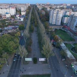
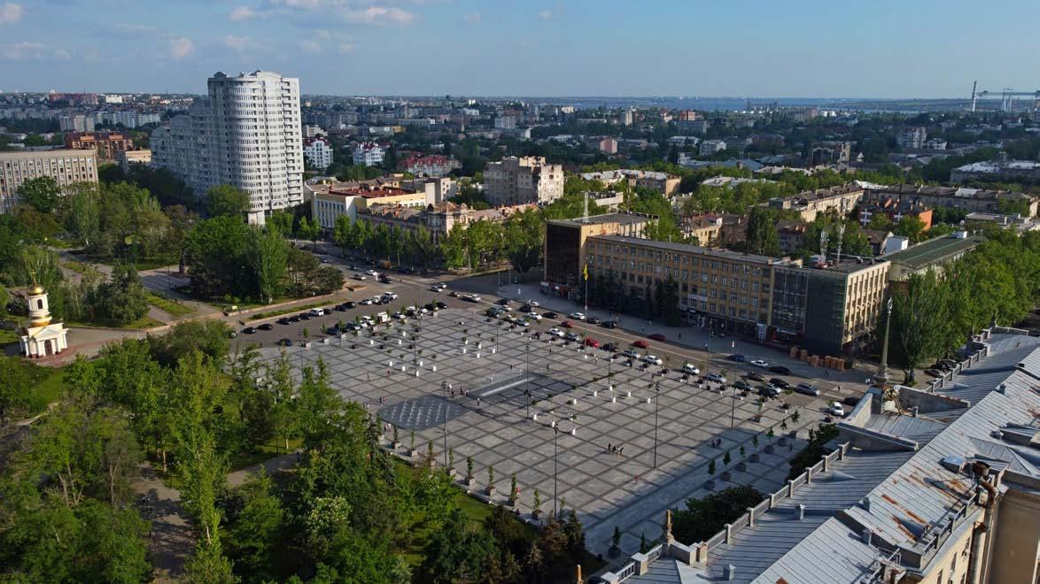
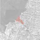
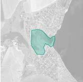
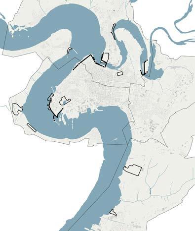
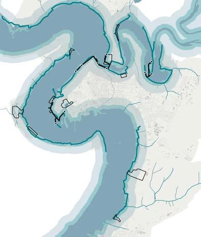
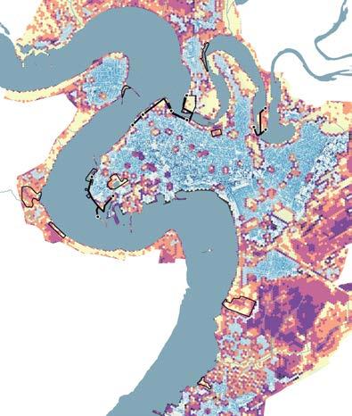
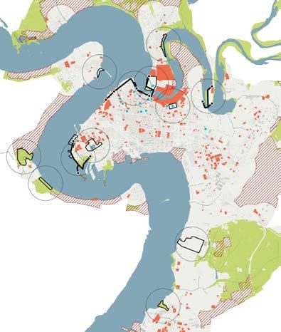
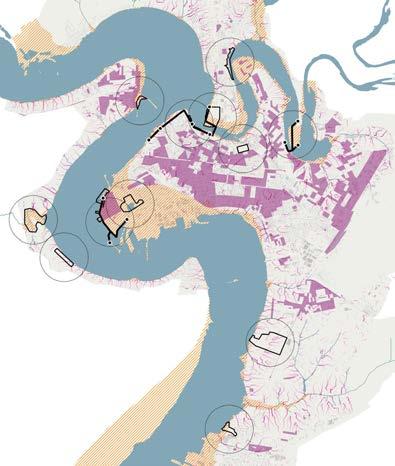
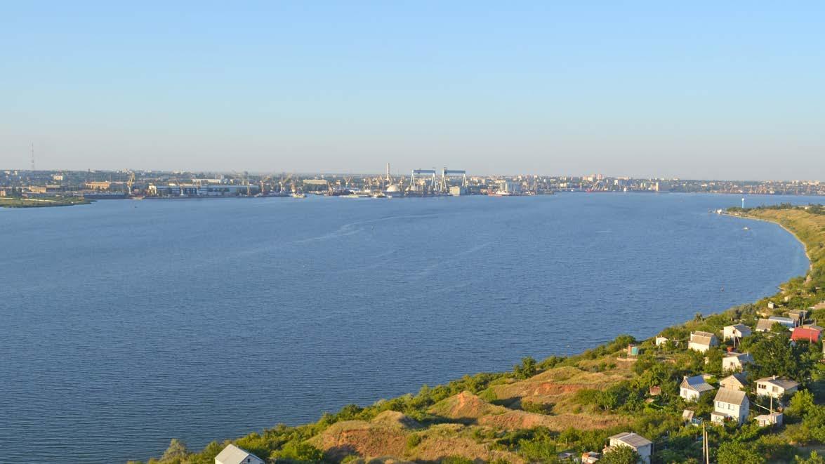
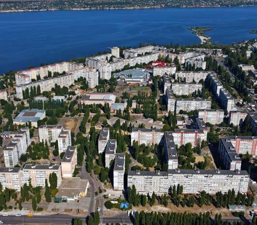
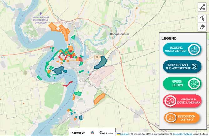
The Mykolaiv Concept Masterplan has established the key goals for the post-conflict future of the city. Taking advantage of the local strengths and character, Mykolaiv will look at developing a sustainable urban environment, whereby the city rivers and its industrial heritage will play a crucial role in creating an innovative, attractive, and green destination for future residents and visitors.
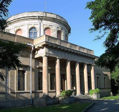
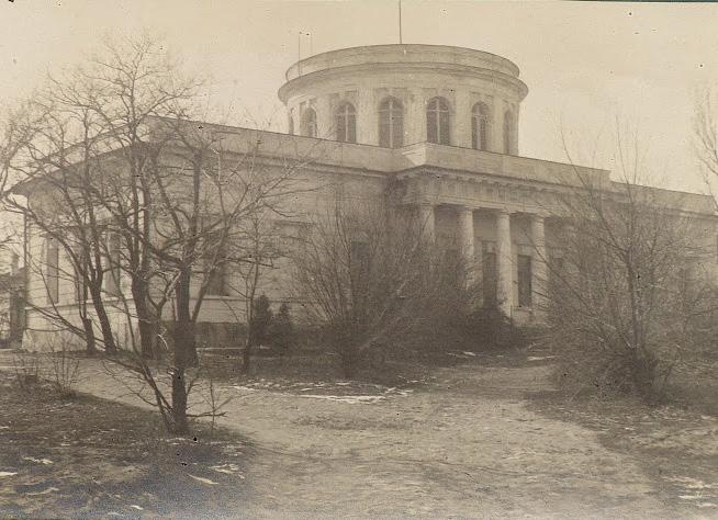
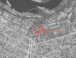
This report explores different topics that will be crucial for implementing the set overarching strategies. A transport plan sets the basis for transforming the city mobility infrastructure into a green and flexible network, aligning with the urban design and landscape vision. A debate regarding urban policies emphasised how a shift in planning practices will be fundamental to adopt a contemporary, transparent and participated approach to city development. A study on the city’s heritage highlighted the potential as well as missed opportunities related to the historical monuments in the city centre. Lastly, an assessment of various options led to identifying the recommended sites for the development of the Heritage and Green & Public Space Pilot Projects.
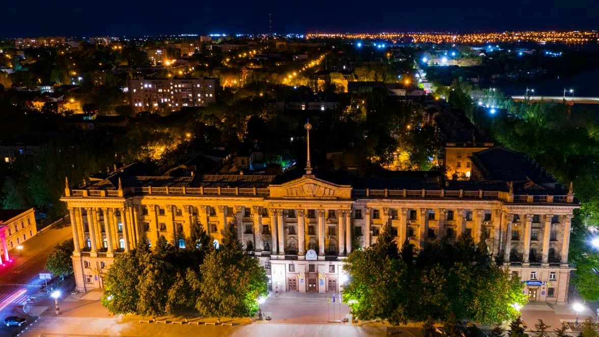
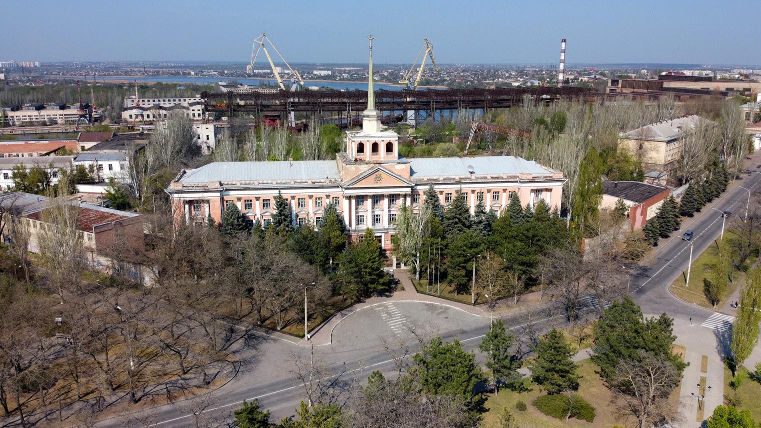
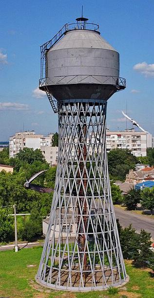
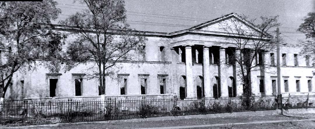
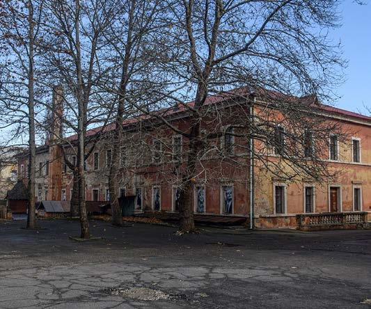
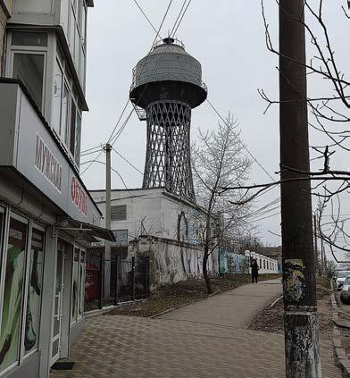
Photo: Evgen Gomonjuk
CHAPTER 1 | РОЗДІЛ 1
Transport and mobility strategy*
*This version of the Strategy might be subject to changes due to further overall developments of the Concept Masterplan.
Introduction Вступ
The Transport and Mobility Strategies for Mykolaiv‘s Concept Master Plan aim to transform the city’s mobility landscape, ensuring a sustainable, efficient, and liveable urban environment. This report outlines a series of strategic interventions across multiple sectors, aiming to enhance accessibility and connectivity and promote sustainable transportation modes, while offering flexible and adaptable mobility solutions that can be updated to accommodate future needs. The proposed strategies include railway and road networks, public transport, parking, and soft mobility, as well as recommendations related to adaptable and flexible reuse of transport infrastructure. Ultimately, Key Performance Indicators (KPIs) were defined in order to assess/evaluate the impact of the proposed strategies in the next phase of the project.
The railway network strategy is crucial to enhancing transportation efficiency in Mykolaiv. By integrating railways into the urban landscape, the plan aims to minimise their barrier effect, improve connectivity to the airport, and repurpose industrial railway tracks for urban regeneration.
The road network strategy focuses on redesigning streets and implementing bypass routes to redirect freight traffic in order to improve urban liveability. This strategy will free up streets for pedestrian and community use, creating a more pleasant and accessible urban environment for residents and visitors.
The public transport strategy prioritises sustainability and flexibility and proposes various enhancements, including the development of mobility corridors, a citywide water transport system, feeder services as complementary shuttle service to the public transport for last mile connections and low demand areas, and the establishment of multimodal hubs. These measures aim to provide a cohesive and efficient public transport network that meets the diverse future needs of Mykolaiv’s population.
The parking strategy envisions a citywide parking system with paid zones in the city centre, Park and Ride facilities, and strategic alignments to improve transportation efficiency. This approach encourages modal shifts towards sustainable transport options, thereby aiming to reduce traffic congestion and enhancing urban mobility.
The soft mobility strategy includes developing dedicated cycling infrastructure, improving waterfront access, promoting micro-mobility services, and engaging in innovative urban revitalisation initiatives. These efforts ensure urban accessibility and sustainability and aim to foster a culture of
and healthy transportation and reduce reliance on motorised vehicles.
The report delves into detailed strategies and guidelines for each sector. These proposed strategies are based on thorough analyses of the current situation in Mykolaiv and arising opportunities and challenges. Each chapter begins with a summary of these findings and considers previously planned strategies from the municipality. The strategies are then updated according to these plans and the overall urban strategy proposed for Mykolaiv’s future master plan.
The report outlines short- and long-term strategies for the rail network, followed by interventions for the road network to accommodate freight vehicles, private cars, and proposed public transport modes. Key proposals include limited zones for heavy traffic to improve urban liveability.
A detailed public transport network plan features flexible on-wheel systems, dedicated and nondedicated lanes, strategically located stops, and a complementary feeder system for last mile connections. Water transport strategies introduce new ferry routes, water taxi stops, and the development of mobility hubs, ticketing options, and Mobility as a Service (MaaS) solutions.
Parking strategies focus on implementing Park and Ride facilities, paid parking zones, and comprehensive parking policies to manage citywide parking efficiently. Soft mobility strategies involve developing bike lanes, micro-mobility sharing stations, and various bike parking facilities to encourage cycling and other forms of active, low-emission mobility transportation.
A dedicated chapter explores the adaptable and flexible reuse of transport infrastructure, offering benchmarks for strategies like temporary street closures to provide space for community events and car-free Sundays to encourage cycling. Parking area repurposing transforms parking spaces into functional public areas, such as pop-up parks, outdoor dining, or community spots. Tactical urbanism initiatives involve improvements like seating areas, painted sidewalks, parklets to test new ideas, engage the community, and address public space needs flexibly. The report concludes with a chapter on proposed and identified Key Performance Indicators (KPIs) for evaluating the suggested strategies in the next phase. These KPIs include Public Transport Accessibility Level (PTAL), Pedestrian Isochrones Analysis, Network Morphological Analysis, and Depth Map Space Syntax. Through these comprehensive strategies, the Mykolaiv Concept Master Plan aims to create a more efficient, sustainable, and liveable urban environment aligned with the city’s overall goals and vision.
Main mobility strategies
The railway network strategy’s goal is to enhance transportation efficiency by integrating railways into urban landscapes, minimising their barrier effect, improving airport connectivity, and repurposing industrial railway tracks for urban regeneration.
The road network strategy strives to increase urban liveability by redesigning streets and implementing bypass routes to redirect freight traffic, thereby freeing streets for pedestrian and community use.
The public transport strategy prioritises sustainability and flexibility through various improvements, including mobility corridors, a city-wide water transport system, feeder services, and establishing hubs to enhance multimodal connectivity.
The parking strategy aims to integrate a city-wide parking system with paid zones in the city centre, Park and Ride facilities, and strategic alignments to boost transportation efficiency and encourage modal shifts towards sustainable transport options.
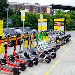
The soft mobility strategy’s goal is to improve urban accessibility and sustainability through dedicated cycling infrastructure, improved waterfront access, promotion of micro-mobility services, and innovative urban revitalisation initiatives.
Railway network strategy
Railway network strategy
The following chapter provides a detailed overview of the railway network strategy for Mykolaiv. It begins by identifying the existing challenges and opportunities, followed by the main goals and strategies, which are then translated into the proposed short- and long-term strategies.
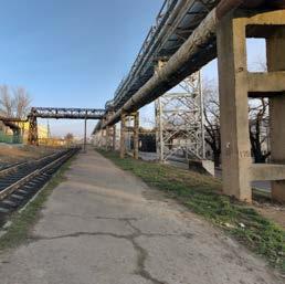
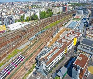
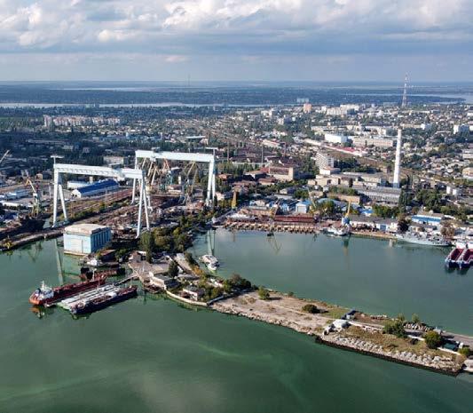
One of the major challenges of the existing railway network is the infrastructural barrier it creates, especially for pedestrians and the lack of safety barriers around railway yards. Additionally, extensive railway yards in former industrial and port areas hinder waterfront access, and reduce the amount of potential drop-off areas and pedestrian connections to train stations.
However, the city also has significant opportunities. Mykolaiv boasts a substantial railway network that can be consolidated and enhanced to optimise train usage for freight and passenger transportation. The presence of two main train stations in the city centre offers an excellent opportunity to establish them as vital and centrally located mobility hubs. Additionally, the railway line extends close to the airport, offering a near connection that currently lacks direct access and has excellent potential for improvement. The industrial
area of the current port near the city centre, which is identified for future regeneration, features minor railway tracks that could be repurposed into new public spaces.
The main goals of the railway network strategy are to establish a direct railway link to the airport and improve accessibility and connectivity for travellers. It further aims to mitigate infrastructure barriers by connecting neighbourhoods and ensuring the continuity of soft mobility routes by implementing pedestrian and cycling bridges over railway tracks. Another goal is to convert minor railway tracks within former industrial zones into new public spaces. In the long term, the plan envisions redirecting the railway to remove barriers from potential new regeneration areas while ensuring railway access to the industrial park. This chapter will further detail these strategies, providing a comprehensive short- and long-term implementation plan.
Railway network challenges
The existing railway network creates infrastructure barriers, i.e. for pedestrians
The lack of barriers in the railway yards poses a threat to pedestrians safety.
The presence of extensive railway yards in former industrial and port areas reduces/hinders access to the waterfront.
Lack of adequate drop-off areas and pedestrian connections to the train stations
Railway network opportunities
The city has a substantial railway network that can be consolidated and enhanced to optimise train usage for both freight and passenger transportation
The presence of two main train stations in the city centre offers an excellent opportunity to enhance urban transportation and mobility, and to establish them as vital mobility hubs for the city.
The railway line extends close to the airport, offering a close connection but lacking direct access
The industrial area of the current port near the city centre, identified as a future regeneration area, features minor railway tracks that could be repurposed into new public spaces
Railway network main goals
Establish a direct railway link to the airport to improve accessibility and connectivity for travelers
Mitigate infrastructure barriers, connect neighbourhoods, and ensure continuity of soft mobility routes by implementing pedestrian and cycling bridges over railway tracks
Convert minor railway tracks within former industrial zones into new public spaces
Implement a long-term redirection of the railway to remove barriers from potential new regeneration areas while ensuring railway access to the industrial park
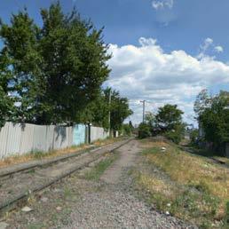
Existing railway network
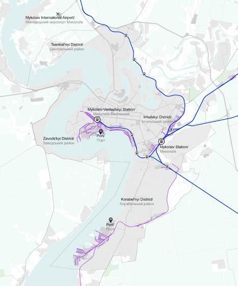
The city’s railway network includes freight and passenger services, featuring two main train stations in the city centre and several former or secondary train stops along the rail lines. The extensive freight network supports the movement of goods, primarily serving the city’s ports. However, the rail network also creates an infrastructural barrier, as it is poorly integrated into the urban landscape. This lack of integration impacts freedom of movement across certain areas, particularly towards the waterfront where the port is located.
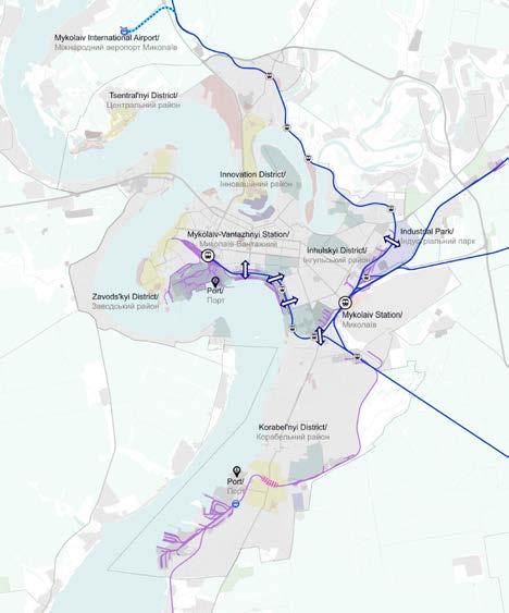
Short-term railway network
The proposed short-term railway network strategy aims to enhance connectivity by establishing a direct link with the airport, thereby improving the passenger travel experience. The plan also includes implementing cyclist and pedestrian bridges above the railway in crucial city areas to stitch neighbourhoods together and better integrate the surrounding areas of the rail tracks, promoting sustainable and accessible transportation solutions throughout the city. Additionally, in Bohoiavlenskyi Avenue, close to the southern port, a grade-level separation between the rail and the road is proposed to ensure safety and facilitate movement. In the long term, this separation is especially crucial to accommodate potential increases in railway capacity once the northern port is relocated to the south.
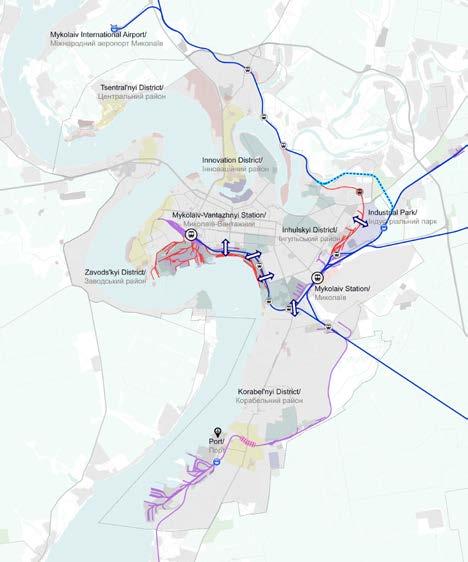
Long-term railway network
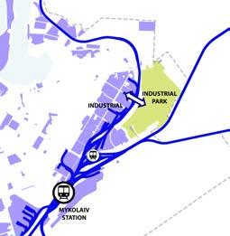
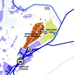
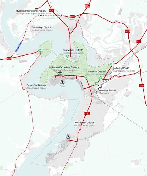
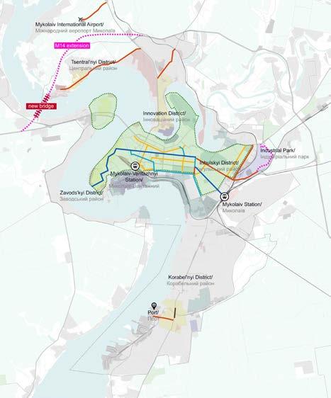
The long-term proposal of relocating the northern port - which is currently located near the city centre - to the southern port, allows for the transformation of this strategic part of the city in a mixed-use area. This would involve removing or repurposing the railway tracks and hence, paving the way for vibrant urban spaces. This strategy will ensure the area’s accessibility for citizens by all modes of transport, creating new opportunities for accessing the waterfront. Additionally, the proposal includes redirecting a section of the railway network to the east to provide the newly set up industrial park with its own stop. Simultaneously, the existing stop will be removed, as it currently divides the industrial park from its adjacent industrial zone in the city. This strategy eliminates the physical barrier the former tracks create between neighbourhoods, fostering greater urban integration. It will also ease the movement of cars and soft mobility within and between this zone and the industrial park.
Industrial park
Maintaining
Redirection
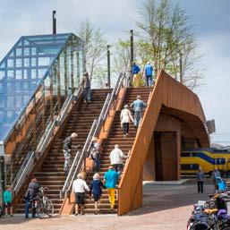
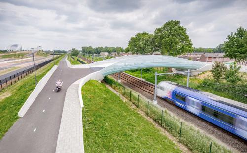
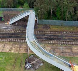
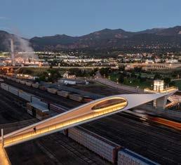
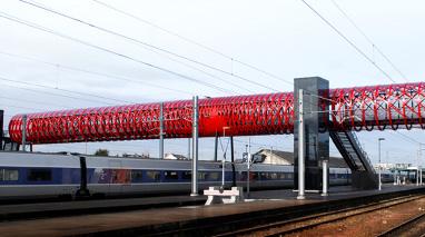
Cyclist-pedestrian bridges
The following page presents four examples of cyclistpedestrian bridges, as references for proposed soft mobility connections between neighbourhoods divided by railway yards. These bridges aim to mitigate the infrastructural barriers created by the railway tracks, ensuring continuous movement and fostering neighbourhood connectivity.
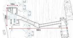
Flow footbridge, Shropshire UK
Railway footbridge, Roche-sur-Yon
Length: 21m
Length: 67m
Pedestrian
Road network strategy
Стратегія
\ Фотографія: https://www.google.it/maps/
Photo
Road network strategy
The following chapter provides a detailed overview of Mykolaiv’s road network strategy. It begins with identifying existing challenges and opportunities, followed by the main goals and strategies before translating these into proposed short- and long-term strategies.
One of the major challenges of the current road network is the lack of bypass roads. This results in a situation where heavy freight trucks travel through the city centre, causing traffic congestions and degrading the existing road network. Additionally, there are no traffic limited or speed-limit zones for heavy vehicles. Wide traffic lanes on some roads encourage highspeed driving. Changes and improvements in road design are required, i.e. to ensure pedestrian safety. However, several opportunities can be leveraged to improve the road network. Mykolaiv is not predominantly reliant on cars, with only 16% of the city’s modal share being private car usage. Previous proposals by the Japan International Cooperation Agency, PADECO Co., Ltd., and Pacific Consultants Co., Ltd., for a new bridge and bypass road aim to redirect freight traffic from the city centre to the ports. Some areas have ample roads and sidewalks that can be redesigned to include dedicated public transport and cycling lanes. Additionally, roads in peripheral areas, marked by undefined spaces and low traffic volumes, offer an opportunity to be repurposed as shared roads and public spaces.
The main goal of the road network strategy is to develop a phased approach to create a bypass road,
gradually diverting heavy vehicle traffic away from city centre roads while incorporating both immediate and long-term solutions. Another goal is to implement strategic road interventions, such as road upgrades, downgrades, and removal of tram tracks to replace them with greenery or dedicated lanes for public transport to promote sustainability and flexibility, ensuring a safer and more people-friendly urban environment. The strategy also aims to transform existing streets into dynamic, inclusive, and flexible spaces by prioritising needs of pedestrians and cyclists, fostering a strong sense of community. Enhancing road safety through improved accident data analysis, the implementation of slow zones, and intersection improvements, including better signage, lighting, and pedestrian crossings, is also a key objective.
This chapter details the road network strategy for freight movements with proposed interventions for a heavy traffic limited zone, outlining short- and longterm solutions. It is followed by detailed proposals for short- and long-term interventions for the road network, including current and envisaged road sections for the intervention typologies. The report concludes with a series of guidelines for street design to ensure accessibility, multimodality, versatility, and safety.
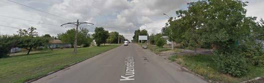
Road network challenges
Freight trucks traveling through the city centre due to lack of bypass roads
The absence of traffic-limited zones for heavy vehicles and designated speed limit zones leads to increased number of heavy vehicles in the city center contributing to congestion and causing road safety concerns for soft mobility users
Wide traffic lanes
Many streets need design improvements especially at intersections to ensure safe pedestrian crossings
Road network opportunities
With private cars only making up for 16% of the city’s modal share, Mykolaiv already offers huge acceptance for shared urban mobility
The availability of previous proposals for a new bridge and bypass road presents a chance to effectively redirect freight traffic from the city center alleviating congestion and improving urban mobility
Ample roads and sidewalks in some areas can be redesigned to include dedicated public transport lanes and cycling lanes
Roads in peripheral areas, characterised by undefined spaces and low traffic volumes, offer an opportunity to be repurposed as shared
Road network main goals
Develop a phased approach to create a bypass road, gradually diverting heavy vehicle traffic away from the city centre while incorporating both immediate and long-term solutions
Implement strategic road interventions, such as road upgrades, downgrades, and the introduction of dedicated lanes or green spaces, to promote sustainability and flexibility, ensuring a safer and more people-friendly urban environment
Revitalise streets into dynamic, inclusive, and flexible spaces by prioritising pedestrians and cyclists, fostering a strong sense of community
Enhance road safety through improved accident data analysis, implementation of slow zones, and intersection improvements, including signage, lighting, and pedestrian crossings
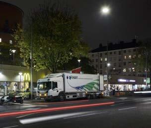
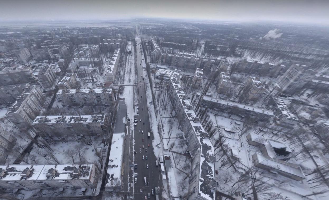
Existing freight routes
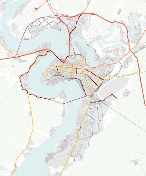
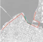
The following map illustrates the current heavy vehicle routes through Mykolaiv. These routes connect the city to other major Ukrainian cities and traverse the city centre to access the ports and industrial areas. This leads to increased heavy vehicle traffic in the city centre, raising safety concerns for soft mobility users and necessitating frequent road maintenance. These issues underscore the urgent need for a bypass road to divert heavy and medium vehicle movements away from the city centre.
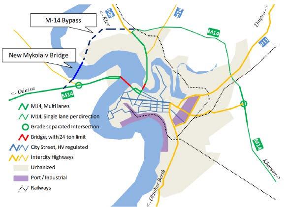
Proposed implementation of a bypass road
During the desktop-based research conducted for Mykolaiv, the following study was identified and utilised as the basis for proposing a bridge in the northern part of the city. This bridge aims to connect to the M-14 highway and divert heavy vehicle traffic from the city centre. The study referenced is titled “Data Collection Survey on Logistics and Transport System in Southern Ukraine Final Report - June 2017” prepared by the Japan International Cooperation Agency, PADECO Co., Ltd., and Pacific Consultants Co., Ltd. This study was necessitated by significant changes in transport patterns in the Southern Region of Ukraine following Russia’s annexation of Crimea in 2014 and the ongoing conflict in the eastern province. The analysis focused on the Southern Region of Ukraine, including Odessa, Mykolaiv, and Kherson Oblasts, and reviewed major highways, bridges, and ports in these areas.
The study aimed to examine the current logistics situation, review the Mykolaiv bridge construction project initially proposed to strengthen the east-west transit corridor along the national highway M-14, and propose other potential projects to improve Ukraine’s economic situation.
Data Collection Survey on Logistics and Transport System in Southern Ukraine Final Report, JAPAN INTERNATIONAL COOPERATION AGENCY, PADECO Co., Ltd. Pacific Consultants Co., Ltd, June 2017 /
PADECO Co., Ltd., Pacific Consultants Co., Ltd.,
Freight routes / short term
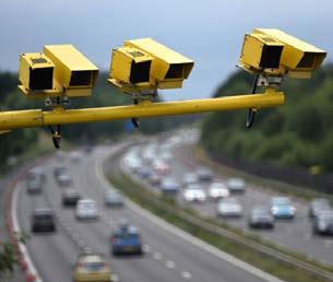
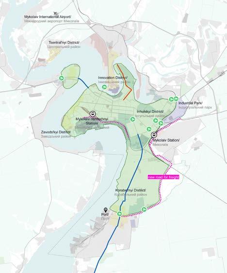
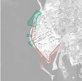
The following map illustrates the proposed freighttraffic redirection routes in the short-term scenario for Mykolaiv. Several strategic initiatives aim to address the issues caused by freight routes passing through the city. The proposal is based on the study shown on the previous page. These measures include the construction of a new bridge and an extension of the M14 highway to create a bypass road that connects the ports without passing through the city centre. Access to the heavy traffic limited zone should be regulated using access points equipped with traffic enforcement cameras. These measures also ensure efficient service to ports and industrial areas. Furthermore, the plan proposes to introduce a consolidation centre in the new industrial park. This strategy would allow goods to be delivered to the consolidation centre and distributed using smaller electric vehicles for last mile delivery within the city. These adaptations to the freight routes will help maintain logistics operations while enhancing urban accessibility and sustainability.
Freight routes / long term
The following map illustrates the proposed freighttraffic routes in the long-term scenario. These are aligned with the strategic plan to relocate the northern port from the city centre to the south. The heavy vehicle traffic limited zone is proposed to extend southward, encompassing the Korabel’nyi district. Additionally, two alternative roads are proposed to bypass the Korabel’nyi district and run parallel to the existing railway line leading to the southern port. These two options, requiring detailed feasibility studies in the future, are shown on the map. Option one proposes a new road passing behind the main train station, while option two redirects the road around the military zones before running parallel to the existing rail lines. This comprehensive strategy aims to increase urban livability and promote sustainable urban development by reducing congestion in the city, providing additional space for soft mobility and public transport, increasing road safety, and improving port accessibility.
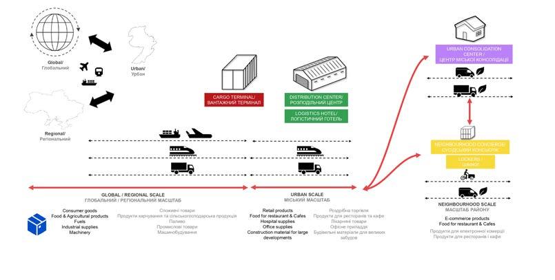
Urban logistics concept
In addition to redirecting routes, the primary logistics proposal involves establishing a consolidation centre in the Industrial Park where goods can be aggregated and distributed throughout the city using electric vehicles. The following diagram illustrates logistics movements from a global and regional scale to urban and neighbourhood scales, showing how a consolidation centre operates. The following page outlines the characteristics of different scales and types of logistics centres that would be part of the goods’ transfer to their final destinations. It includes examples of urban consolidation centres.
Urban logistics typology
The cargo terminal serves as a logistics gateway, as it handles large amount of freight/cargo and is well connected to regional transport networks
The distribution centre is a multimodal distribution platform that sorts, consolidates and handles incoming goods depending on their destination
The urban consolidation centre is well connected to the urban road network and operates as an urban distribution centre, making it the main logistics point at city level
The neighborhood concierge serves as local logistics point, consolidating last mile delivery and small goods as well as integrating delivery pick up points
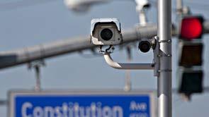
Interventions for heavy traffic limited zones
Establishing
and charges to ensure compliance with
Current road hierarchy
The following plan illustrates Mykolaiv’s current road hierarchy, which comprises five typologies: international roads, national roads, local roads, residential roads, and others. Currently, international roads such as the M14 highway and national roads pass through the city centre, resulting in significant heavy vehicle traffic through the central urban area, as shown on previous pages.
Planned road hierarchy by Municipality
The plan illustrates the road network planned by the Mykolaiv municipality. Primary interventions include creating a bypass road by constructing a new bridge, which aims to divert heavy vehicle traffic away from the city centre. Additionally, the plan involves reconstructing specific roads throughout the city that require adjustments to improve overall connectivity and traffic flow.
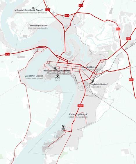
Airport
Freight port - existing Вантажний
Ferry terminal - planned Поромний
Maritime tracks - planned
International roads
National roads
roads
Highways - public
Highways
district
Tsentral’nyi
T1507 T1501
Short-term road interventions
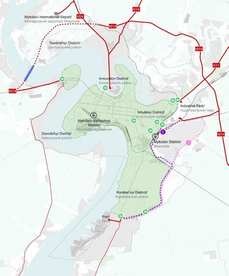
The following map illustrates proposed road interventions for the short-term scenario, taking into consideration the municipality’s previous plans and studies, as well as the freight movement strategies and planned public transport corridors detailed in the next chapter. The main strategy involves constructing a new bridge (1) and extending the M14 highway to divert heavy traffic from the city centre (2), thereby supporting the creation of a heavy traffic limited zone (3). Additionally, proposed road improvement measures include upgrades to accommodate dedicated public transport lanes, converting traffic into public transport lanes, and potentially replacing tram tracks with either new public transport lanes or greenery and soft mobility corridors (4). Furthermore, it is proposed to implement level separation between road and rail in Bohoiavlenskyi Avenue close to the southern port to accommodate the anticipated increase in capacity at the southern port, which will lead to higher vehicular and railway traffic volumes (4). These interventions collectively aim to enhance urban accessibility in Mykolaiv and foster sustainable transport options.
Long-term road interventions Option 1
The following plan illustrates the proposed road interventions for long-term scenario option 1. The primary intervention, previously mentioned, involves constructing a new road behind the central train station to extend the heavy traffic limited zone to the south, diverting heavy and medium-sized trucks from the Korabel’nyi District.
Additionally, with the relocation of the northern industrial port to the south and the repurposing of its land, a new road is proposed along its current boundary. This intervention will enhance public transport access, as outlined in the public transport strategy. The plan also includes upgrading a road on the northern peninsula to accommodate a dedicated public transport lane and modifying Bohoiavlenskyi Avenue, the main axis connecting the Korabel’nyi District to central areas, by converting a vehicular lane into dedicated lanes for public transport.
Long-term road interventions Option 2
The following plan illustrates proposed road interventions for the long-term scenario option 2. The main difference from option 1 is the proposed location of the new road bypassing the Korabel’nyi District to reach the southern port.
Current and proposed road sections
Street design principles
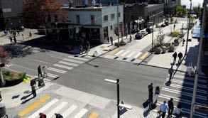
The following pages provide comprehensive Street Design Principles tailored for implementation throughout Mykolaiv. These principles are meticulously crafted to enhance urban streetscapes, focusing on improving accessibility, promoting multimodal transportation options, ensuring versatility in street usage, and prioritising safety for all users. In response to the city’s evolving urban landscape, these principles advocate for streets accommodating pedestrians, cyclists, and public transport users. They aim to integrate dedicated lanes for public transport and cyclists, improved pedestrian crossings, and strategically placed amenities such as seating areas and shelters. By promoting a human-scale approach, these principles aim to create vibrant and inclusive street environments that cater to the needs of residents and visitors. Additionally, they highlight the significance of incorporating universal design principles to ensure that streets are accessible to people of all ages and abilities.
By implementing these Street Design Principles, Mykolaiv aims to transform its streets into safe, inviting, and functional spaces that support community life and economic vitality. These principles serve as a blueprint for creating a cohesive and resilient urban fabric that aligns with the city’s long-term vision for sustainable development and quality of life improvement.
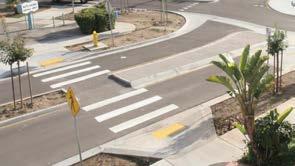
Accessibility design principles
Ensure
Provide
Implement
Provide
Incorporate
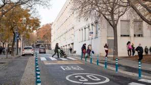
Multimodality design principles
Design
Establish
Allocate
Designate
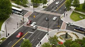
Versatility design principles
Promote activity on the ground floors to increase street liveability
Promote
Provide
Allocate designated spaces for street vendors to support the local economy
Design flexible street layouts to accommodate diverse activities and events
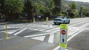
Safety design principles
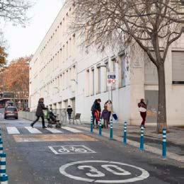
Redesign the streets to create narrower traffic lanes and allocate safe, dedicated spaces for cyclists and micro-mobility
Implement speed limits and slow traffic zones near schools, parks and other areas with high pedestrian traffic
Implement
Redesign intersections with high numbers of traffic accidents to
Install
and
and
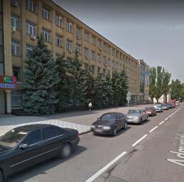
\ Фотографія: https://www.google.it/maps/
Photo
Public transport strategy
Стратегія розвитку громадського
транспорту
Public transport strategy
The following chapter provides a detailed overview of Mykolaiv’s public transport network strategy. It begins with identifying existing challenges and opportunities, followed by the main goals and strategies before translating these into proposed short- and long-term strategies.
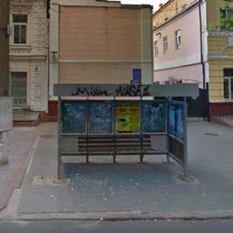
One of the major challenges in the current public transport network is the imbalance in the availability of transport options throughout the city scape. While multiple options like trams, trolleybuses, buses, and marshrutkas are available in the city centre, suburban areas often solely rely on marshrutkas, an informal transport system. Additionally, many public transport options operate on the same routes, leading to heavy passenger dependence on marshrutkas to reach their destination which is not serviced by the formal transport system. This situation highlights the need to revise public transport corridors to enhance the network’s reliability and flexibility to adapt to citizens’ changing needs. Furthermore, the entire transport infrastructure, including rolling stock, transport stops, signage, and maps, is outdated and requires a comprehensive upgrade to create a more efficient, reliable, and userfriendly public transport network. Transport stops also lack essential amenities such as shelters, seating, timetables, and real-time information, making them inconvenient for passengers.
Despite these challenges, several opportunities exist to enhance Mykolaiv’s public transport network. With a share of around 45% of urban mobility, public transport offers significant potential to promote further and improve public transportation usage. Ensuring flexibility in public transport routes and systems is critical to efficiently meet citizens’ ever-changing demands and needs. Additionally, the city’s navigable waterways present an opportunity to introduce a
water transport system, that connects different city neighbourhoods.
The main goals of the public transport network strategy are to establish sustainable and flexible transport systems that consider population density, land use, and new ideas, allowing easy adaptation to the city’s future needs. Another goal is to implement a citywide water transport system to provide citizens and visitors with diverse commuting options. The strategy also aims to introduce a feeder system of electric shuttles for last-mile connections and low-demand areas, complementing the public transport network and enhancing multimodal transportation connectivity through the establishment of a network of mobility hubs.
The proposed public transport corridors are based on the municipality’s previously proposed mass rapid transit corridors. They have been optimised and modified to align with the city’s proposed urban strategies and new developments. The proposal includes a network of trackless trams or bus rapid transit, complemented by buses. These corridors are strategically located to provide north-south and eastwest connections, including two looping circular lines around the city centre where main tourist sites are located, and future regeneration of industrial zones and the port is proposed. The corridors are designed to complement water transport, Park and Ride facilities, and mobility hubs to ensure multimodality and high accessibility throughout the city. This chapter includes details of the proposed public transport lines, specifying whether they would operate on dedicated or non-dedicated lanes in the short and long term. It details the typology and characteristics of the proposed transport modes, including capacity,
speed, distances between stops, and required infrastructure. The chapter elaborates on each public transport line, their relevant stops, mobility hubs, Park and Ride facilities, and the feeder system for last mile connections. It includes proposed public transport stop typologies and related facilities for public transport stops. The chapter continues with the proposed mobility hub network detailing the types of modes, facilities, and services available at each hub. It also covers the proposed additional water transport stops, ferry routes, and the characteristics and typologies of suggested water transport modes and their relevant stops. The chapter concludes with guidelines for implementing Mobility as a Service (MaaS) and integrated ticketing options.
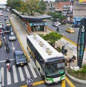
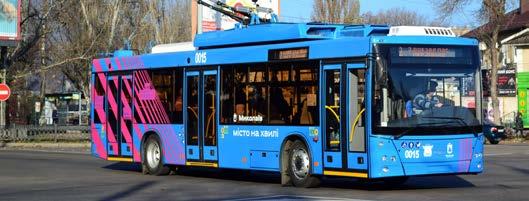
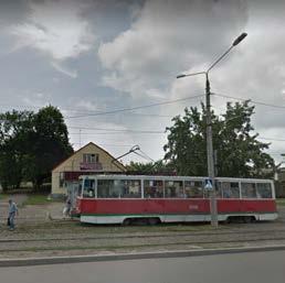
Source Джерело https://nikvesti.com/en/news/public/282192#google_vignette
Public transport strategy
Public transport challenges
Several public transport options are available within the city centre, including tram, trolleybus, bus, and marshrutka. In suburban areas, however, options are limited, often relying solely on marshrutka.
Many public transport options operate on the same routes, and passengers depend heavily on marshrutkas. This situation highlights the need for revising public transport corridors within the city to enhance the network’s reliability and flexibility and allow it to adapt to citizens’ changing needs.
The entire transport infrastructure, including rolling stock, transport stops, signage, and maps, is outdated and needs a comprehensive upgrade to create a more efficient, reliable, and user-friendly public transport network.
Transport stops lack essential amenities, such as shelters, seating, timetables, and real-time information, making them inconvenient for passengers.
Public transport opportunities
With
Ensuring flexibility in public transport routes and systems is critical to efficiently meet the ever-changing demands and needs of citizens
Navigable waterways present an opportunity to implement a water transport system for citizens and tourists, efficiently connecting different city neighbourhoods
Last mile connections and low-demand areas should be reached through a complementary feeder system, connecting them to the city’s main public transport corridors
Public transport main goals
Establishing sustainable and flexible transport systems that consider population density, land use, and new ideas that allow easy adaptation to the city’s future needs
Implementing a city-wide water transport system to provide citizens and visitors with diverse commuting options
Introducing a feeder system for last mile connections to complement the public transport network
Enhancing multimodal transportation connectivity by establishing a network of mobility hubs
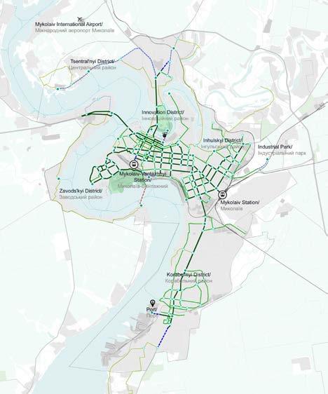
Current public transport network
The following map illustrates Mykolaiv’s current public transport network, which is composed of four modes: trams, trolleybuses, buses, and marshrutkas
As depicted, trams and trolleybuses primarily serve the city centre, providing coverage to the densely populated and commercially active areas. In contrast, the suburban areas rely mainly on buses and marshrutkas. This distribution highlights a centralfocused network with peripheral areas depending on less formal transport options.
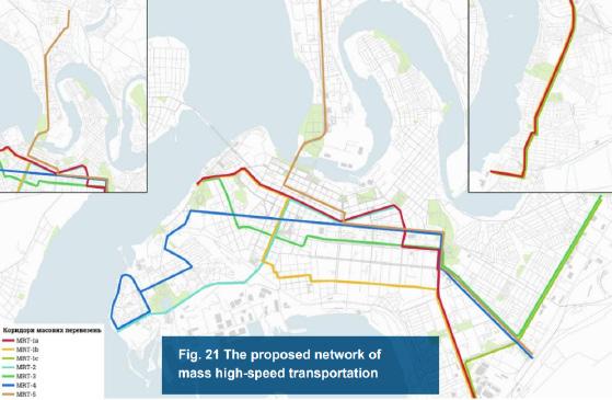
Public transport MaaS transit (proposed by Municipality)
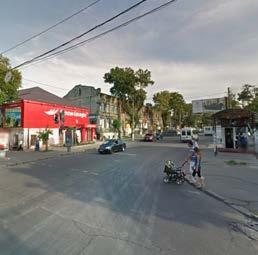
Based on the Municipality’s data, Mykolaiv experiences significant passenger traffic, particularly along the Avenues Central, Myru, and Epiphany.
To address this congestion, the Municipality is considering to implement Mass Rapid Transit (MRT) systems such as Bus Rapid Transit (BRT) and Light Rail Transit (LRT), which offer fast travel via dedicated infrastructure. The proposed network aims to enhance transportation efficiency throughout the city.
The following map displays the Municipality’s proposed mass rapid transit network, a key consideration for developing new public transport lines.
Notably, proposed urban strategies, including pilot projects, regeneration initiatives, and potential densification areas, have been considered to design the new lines.
This comprehensive approach ensures that the new transport network will effectively support the city’s growth and evolving urban landscape.
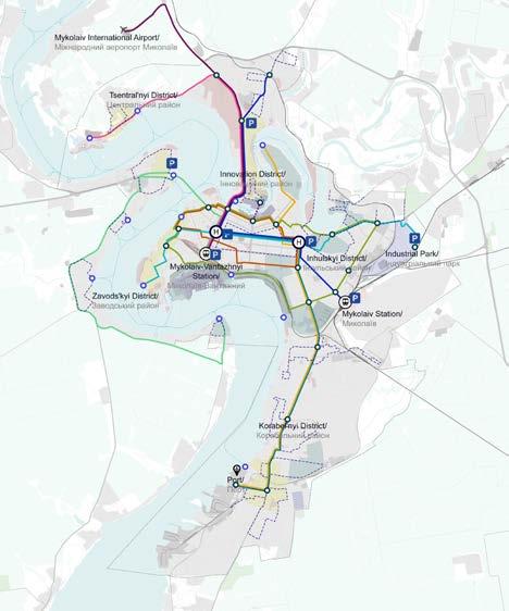
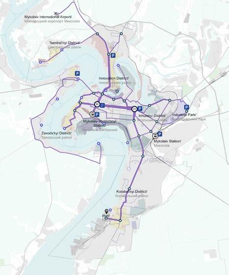
Public transport network
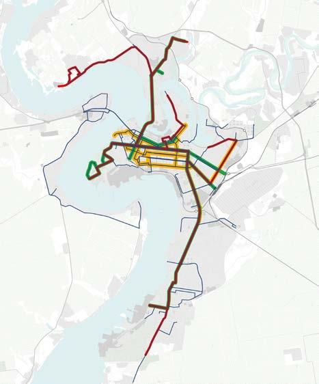
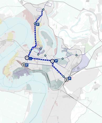
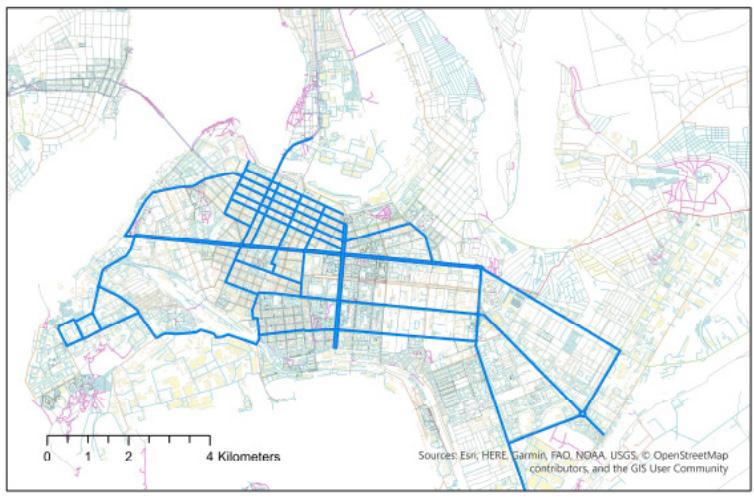
The following map illustrates the proposed public transport network, consisting of 10 main lines served by trackless trams or Bus Rapid Transit (BRT) that will run on dedicated public transport lanes, and buses that will run on mixed traffic lanes (non dedicated lanes). This primary network is complemented by a feeder system of electric shuttles designed for last mile connections and to service low-demand areas. Additionally, the proposed network includes a citywide water transport system, details of which will be provided on the following pages. A network of strategically located mobility hubs is integrated into the system, ensuring seamless transitions between different transport modes. The network also connects with Park and Ride facilities, facilitating easy shifts from private to public transportation. This proposal’s overarching aim is to ensure multimodality, enhancing the efficiency and accessibility of Mykolaiv’s public transport system.
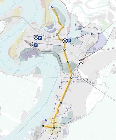
Dedicated lanes / short term
The following maps illustrate the proposed public transport lines running through dedicated lanes in short- and long-term scenarios. In the short term, only Line G is planned to operate with a dedicated lane. These lines are designed to utilise trackless trams or Bus Rapid Transit (BRT). The current and proposed road network hierarchy and the availability of space to dedicate a vehicular lane to public transport have been carefully considered to develop these maps.
Dedicated lanes / long term
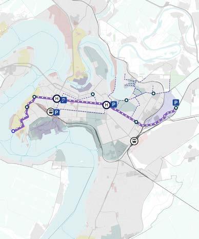
Non-dedicated lanes / short term
The following maps illustrate the proposed public transport lines running through non-dedicated lanes, moving with mixed traffic in both short- and long-term scenarios. These lines are designed to utilise electric buses. The current and proposed road network hierarchy and the availability of space to accommodate public transport within existing vehicular lanes have been carefully considered to develop these maps.
Non-dedicated lanes / long term
Proposed public transport modes
The following page details the main characteristics of the three proposed modes for the public transport network.
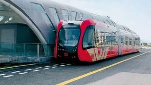
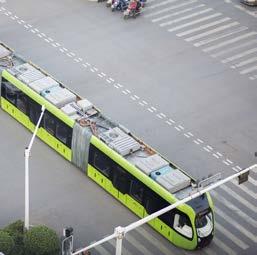
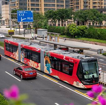
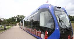
Trackless trams are a high-capacity system that operates on dedicated lanes separate from vehicular traffic to achieve their full capacity. The main advantage of trackless trams over traditional trams is that they do not require a fixed track on the ground. This reduces operational and maintenance costs and makes them a flexible and highly efficient urban transit system. Trackless trams can be rerouted to serve the changing needs of citizens post-conflict, enhancing their adaptability.
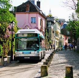
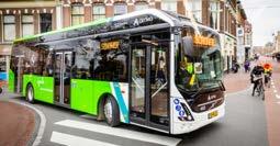
It is proposed that electric buses may operate on dedicated lanes as an alternative to the trackless tram network if needed. The system would operate as a Bus Rapid Transit (BRT) on dedicated lanes. Electric buses are also the preferred mode for non-dedicated lanes with mixed traffic. They offer a more quiet and environmentally friendly alternative to fossil fuel buses while maintaining service flexibility. Electric shuttles are proposed to operate within the feeder system. Designed for short distances, last mile connections and serving low-demand areas. Emissionfree and low-noise, electric shuttles significantly reduce air pollution while providing a sustainable and convenient mode of transport.
Distance between stops: 200-400m
Required
Charging
Elevated
Roof-mounted
Maintenance
Required infrastructure:
At grade platforms
Horizontal signage
Information panels at bus
Maintenance
Required
Horizontal
Public transport lines
The following pages provide comprehensive details for each public transport line, including information on its stops, associated feeder systems, mobility hubs, Park and Ride facilities, and connections to water transport stops.
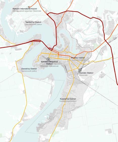
Tsentral’nyi District/
District/
Zavods’kyi District/
Korabel’nyi District/
Tsentral’nyi District/
Tsentral’nyi
Mykolaiv-Vantazhnyi Station/
Zavods’kyi District/
Tsentral’nyi District/
Inhulskyi District/
Mykolaiv-Vantazhnyi Station/
Zavods’kyi District/
Inhulskyi District/
Korabel’nyi District/
Korabel’nyi
Tsentral’nyi
Tsentral’nyi
Mykolaiv-Vantazhnyi Station/
Zavods’kyi District/
Inhulskyi
Mykolaiv
Inhulskyi District/
Mykolaiv-Vantazhnyi Station/
Korabel’nyi District/
Tsentral’nyi District/
Zavods’kyi
Mykolaiv-Vantazhnyi Station/
Inhulskyi
Korabel’nyi District/
Tsentral’nyi District/
Zavods’kyi
Mykolaiv-Vantazhnyi Station/
Inhulskyi
Korabel’nyi
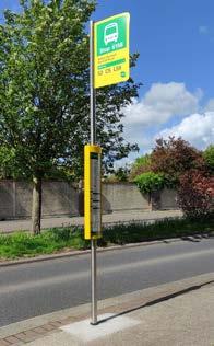
Proposed public transport stop typologies
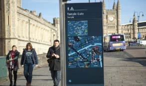
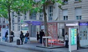
The following pages detail various typologies of public transport stops designed for different urban environments and route priorities. Sheltered stops are intended for main routes with sufficient space to accommodate these stops, providing protection and comfort for passengers. Digital stops are suitable for primary and secondary routes with limited space, offering streamlined functionality in compact areas. Totem stops are ideal for optimising connectivity on secondary routes and feeder systems, serving as key points in the network to improve access and integration.
The subsequent page outlines the essential facilities incorporated into these stops to improve passenger comfort and accessibility across the urban network. Real-time information systems are recommended to boost public transport reliability and improve the passenger experience by providing up to date travel information. Maps and wayfinding tools should be integrated to assist with navigation and promote multimodality within the transport system. Step-free access is recommended to ensure inclusivity for passengers with disabilities, facilitating easy entry to public transport stops and vehicles. Additionally, leaning bars should be implemented at stops with limited space, supporting those who may find it difficult to sit.
Together, these features aim to create a more user friendly, accessible, and efficient public transport system throughout the city.
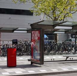
Proposed facilities for public transport stops
Real-time information to improve public transport reliability and passenger experience
Maps and wayfinding for improving navigation and promoting multimodality
Step-free access to public transport stops and vehicles for disability-inclusive transport
Leaning bar: Ideal for stops with limited space and suitable for those who find it difficult to sit
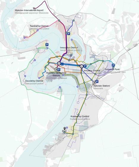
Mobility hub network
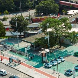
The following map illustrates the proposed mobility hub network, strategically integrated within the public transport system, including the proposed public transport lines, water transport, and feeder systems. This network encompasses four distinct types of hubs. Railway station mobility hubs are centred around the city’s two main train stations, which act as major nodes, with several lines intersecting at these points. These hubs are equipped with Park and Ride facilities and offer shared mobility services such as carsharing and micro mobility options, including bike and scooter sharing stations.
The two proposed major mobility hubs are situated along central avenues where multiple public transport lines converge. Like the railway station hubs, these include Park and Ride facilities and shared mobility services. They serve as crucial points for transfer between different transport modes.
Two types of smaller-scale mobility hubs are strategically positioned throughout the city. These hubs, which may or may not be connected to water transport, provide vital links to public transport and water transport stops. They also support connections to feeder systems for last mile travel and offer
shared mobility services, improving accessibility and convenience for users.
In addition to the mobility hubs, a network of Park and Ride facilities is strategically positioned to boost accessibility throughout the city. These facilities allow commuters to transition from private vehicles to public transport, facilitating smoother and more efficient travel.
Each hub is crafted to ensure seamless transfers between different modes of transportation, significantly enhancing the efficiency of the overall transport network. The following page provides detailed information about each hub type, including their specific transport modes, facilities, and services.
Mobility hub typologies and facilities
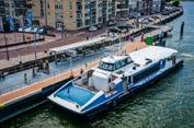
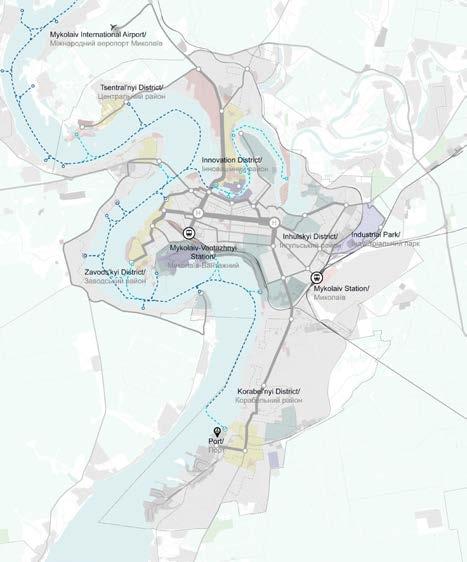
Water transport stops
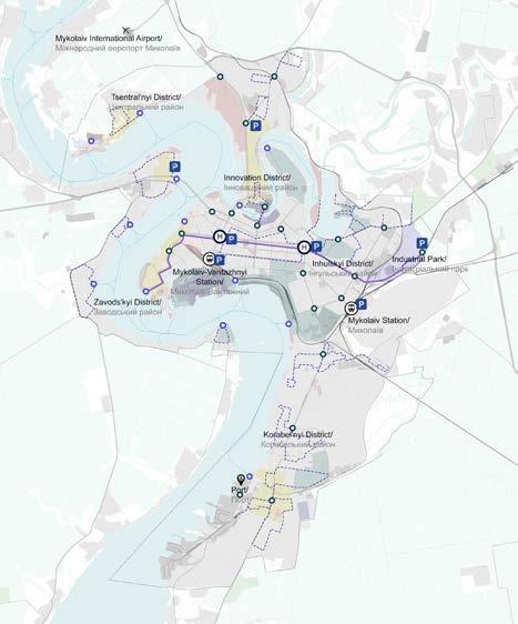
The following map illustrates the proposed water transport stops. These include stops already outlined in the municipality’s general plan as well as new ones based on the proposed urban strategy and city developments, including pilot projects, regeneration areas and proposed densification zones. Several public transport lines are extended to connect with these stops, to ensure a high level of multimodality within the transport network. This water transport system aims to complement the existing public transport network by offering citizens and visitors a new transportation option and linking areas of the city that are otherwise difficult to reach. Additionally, it provides a convenient commuting alternative for employees working at the southern industrial port.
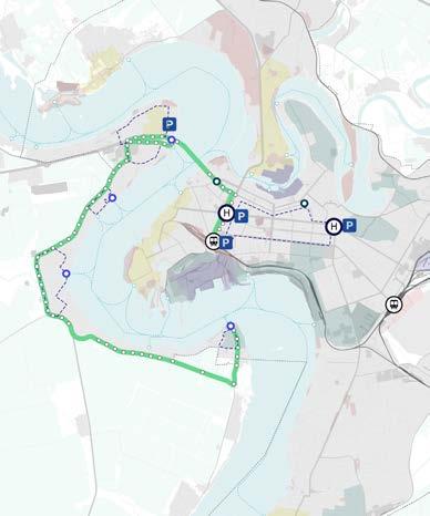
Water transport routes
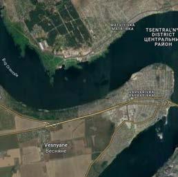
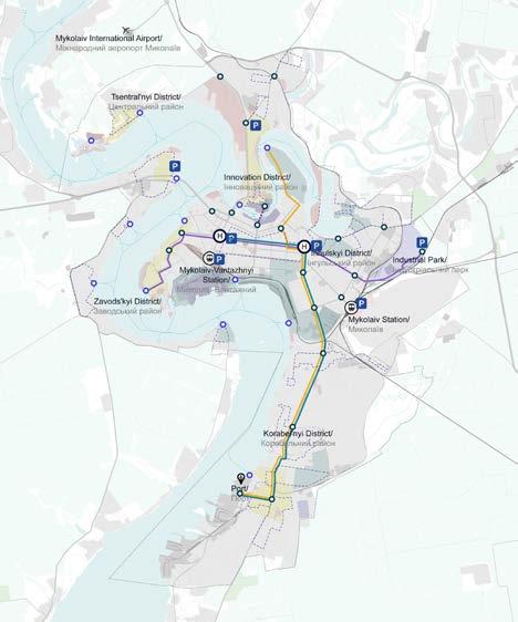
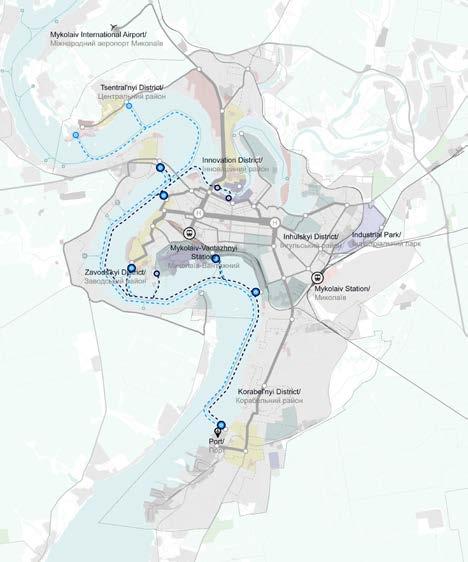
The following map illustrates the proposed routes for ferries and water taxis in the city. It outlines two main ferry routes and additional stops designated for water taxis. The first ferry route connects the northern district of Tsentral’nyi to Varvarivka on the west side of the river, with stops at the city centre in Zavods’kyi district and the northern port, and potentially extends to the southern port. The second ferry route runs between the historic port in the north and the innovation district, also connecting the city centre in Zavods’kyi district and the northern port, the southern port.
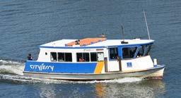
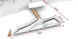
Water taxis are planned to serve all designated locations along these ferry routes as well as additional stops that are not covered by the ferry services. The main difference between ferries and water taxis lies in their operation; ferries follow fixed routes with schedules, while water taxis offer more flexibility and provide service on demand to additional locations. This network is designed to improve connectivity across the city, providing flexible transportation options and improving access to key areas. Importantly, the water transport system offers a viable city-wide alternative for both citizens and tourists, contributing to a diverse and efficient public transport network. Water transport stops are strategically integrated with the proposed public transport modes, facilitating efficient transfers and promoting multimodality. The subsequent page provides detailed information about the proposed water transport vehicles, specifically ferries and water taxis, their characteristics, and examples of the pier designs at these stops.
Required infrastructure: Docks or terminals, charging stations, passenger amenities
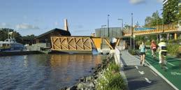
Location: Brisbane, Australia
14m
Location: Brisbane, Australia
14m
Functions: floating public spaces, panoramic river views
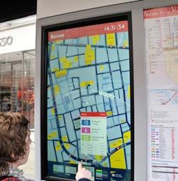
Mobility as a Service (MaaS) - mobility mobile application
Mobility as a Service (MaaS) represents a transformative approach to urban transportation, integrating various transportation services into a single, accessible platform. By combining public transport, ride sharing, bike sharing, car rentals, and other mobility services, MaaS offers a seamless and personalised travel experience. This approach allows customers to plan, book, and pay for their journey through one digital interface. MaaS aims to reduce reliance on private vehicles, alleviate traffic congestion, and promote sustainable transportation options, ultimately improving urban mobility and accessibility.
Integrated ticketing system options
Close loop smart cards
Closed loop smart cards are typically issued by transit operators and authorities and can only be used within their private ticketing system. Some transit smart cards interact offline with scanning devices on board of vehicles, while others act as tokens, working in tandem with a back office.
• Ownership of the fare collection system
• Prepay ‘float’ integrates seamlessly into the system by allowing passengers to prepay and load funds onto their smart cards, injecting funds into transit operators’ accounts
• Equitable fare payment is achieved through closed-loop payment systems, which do not exclude unbanked and underbanked individuals
• Fast transaction and boarding times
• Within an ABT (Account Based Ticketing) system, where smart cards are used as a token linked to an individual’s account, the account can hold information such as eligibility for discounts
• Lack of interoperability across cities and countries
• Transit operators are often locked-in to technology that has been built from scratch by a single vendor
• High cost of ticketing infrastructure and cash handling
• Transit providers must pay for upgrades / allocate funds for upgrades
• Prepay cards lock in riders’ funds, which may pose a challenge for lowerincome individuals who find it difficult to pay for travel in advance.
Integrated ticketing system options
In open loop EMV fare collection systems, customers can use their bank-issued contactless credit or debit card, prepaid EMV card, mobile wallet, or smart device, to pay for journeys.
• Convenience is provided as passengers can use the same card or mobile wallet to pay for transit trips & retail purchases
• Potential for universal, interoperable fare payment systems
• Fare structures to unify the rider experience across a local authority, state, or country
• Flexible fare models can be configured in the back office
• Configured to offer simple flat fares, fare caps and discounts, with the best fare automatically being calculated in the back office
• Holistic systems are expensive to build
• Perceived to be less inclusive historically, open loop EMV has been viewed to exclude riders without a bank account and an associated card
• Bank fees transit operators must pay acquiring banks’ merchant service fees.
• Vendors manage the system by collaborating with multiple providers to offer a modular solution rather than relying entirely on a single vendor.
\ Фотографія: https://www.google.it/maps/
Photo
Parking strategy
Стратегія у сфері паркування
транспортних засобів
Parking strategy
The following chapter provides a detailed overview of Mykolaiv’s parking strategy. It begins with identifying existing challenges and opportunities, followed by the main goals and strategies before translating these into proposed parking strategies.
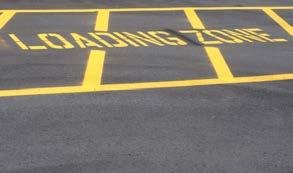
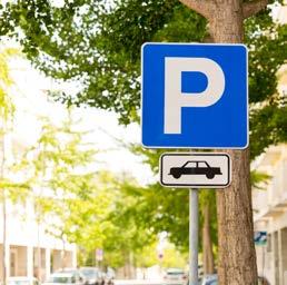
Identified challenges in the current parking situation include the absence of a paid parking policy and system, irregular parking without proper markings and signs on the streets, as well as the lack of official on-street and off-street parking facilities. Most parking is handled on the street, occupying roadways, sidewalks, and pockets. These informal parking practices deteriorate the quality of the public realm and negatively impact the experience of soft mobility users. Despite these challenges, several opportunities exist to enhance Mykolaiv’s parking system. The municipality’s planned implementation of a parking system, including a paid parking zone in the city centre, aligns with the proposed extensive multimodal public transport network. Proposing Park and Ride facilities near major mobility hubs and nodes can sustain and encourage a modal shift from private cars to public transport. Furthermore, it is possible to integrate Park and Ride facilities in railway, public transport, and shared mobility services, especially at the main entry points to the city.
The main goals of the parking strategy are to
encourage a shift from private cars to public and active modes of transport, thereby preventing congestion. Another goal is to implement regulations for on-street parking in order to curb informal parking practices. The strategy also aims to introduce paid parking policies and time-limited parking in high-demand areas, especially in central locations of the city. Furthermore, a comprehensive on-street parking strategy with resident-only and Persons with Reduced Mobility (PRM) parking programs will optimise availability and enhance accessibility in urban areas. This chapter includes the proposed parking strategy, detailing the type and location of parking facilities, specifics on the paid parking zones, and examples of Park and Ride facilities. It also concludes with guidelines for parking policies to be implemented in Mykolaiv.
Parking challenges
Currently,
Presence of irregular parking in the city without proper markings and signs on the streets
The city lacks official on- and off-street parking facilities, with most parking handled on-street, occupying roadways, sidewalks, and pockets
Informal parking practices deteriorate the quality of the public realm and negatively impact the experience of soft mobility users
Parking opportunities
Planned paid parking zone in the city centre by the municipality, aligning with the proposed extensive multimodal public transport network
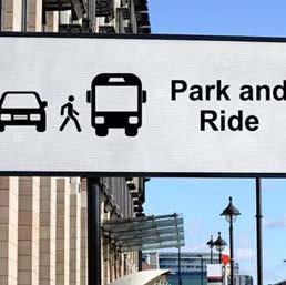
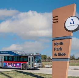
Proposed Park and Ride facilities near major mobility hubs and nodes can encourage a modal shift from private car to public transport
Possibility of integrating Park and Ride facilities with the railway, public transport, and shared mobility services, especially at the main entrances to the city, to encourage the use of public and active modes of transport
Parking main goals
Implement Park and Ride facilities integrated in public transport and shared mobility services to encourage a shift from private cars to public and active modes of transport, thereby preventing congestion
Introduce regulations for on-street parking to curb informal parking practices
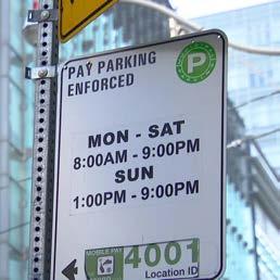
Introduce paid parking policies and time-limited parking in high-demand areas, especially in central locations of the city
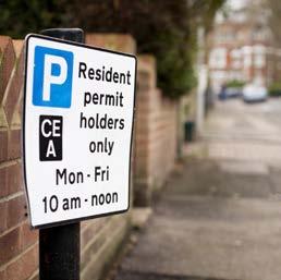
Introduce a comprehensive on-street parking strategy with resident-only and Persons with Reduced Mobility (PRM) parking programs to optimise availability and enhance accessibility in urban areas
Parking strategy
The following map illustrates the proposed parking strategy for the city. The primary proposal includes introducing a paid parking zone in the city centre. The second intervention focuses on establishing a network of Park and Ride facilities close to the city’s main entry points from highways, main train stations, and major mobility hubs, facilitating the transition from private to public transport modes. The third intervention aims to create new parking zones in proposed densification areas to meet the increasing demand.
Subsequent pages provide examples of Park and Ride facilities and proposed parking policies. Additionally, the proposed parking policies outline regulations and guidelines designed to effectively manage parking demand, promote the use of public transport, and support the city’s overall mobility strategy.
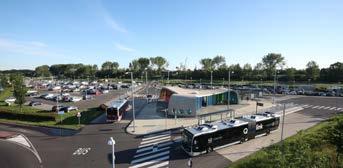
Example of Park and Ride facilities
A properly planned Park and Ride system offers sustainable solutions to meet transport needs. In this case, the primary objective of implementing such a system is to minimise on-street parking while balancing profitability and maintenance costs. The following examples of Park and Ride facilities include those integrated in railway stations, structured Park and Ride facilities, and on-street Park and Ride options. These facilities should be well integrated in public transport systems, as recommended in the plans provided on previous pages. It is also recommended to develop an electronic system for booking parking spaces and ensure they are seamlessly integrated into the city’s mobility app and ticketing system.
Examples of Park and Ride facilities
On-street Park and Ride facility
Proposed parking policies
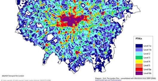
Public transport accessibility level
Parking restrictions and limitations should align with the availability and accessibility of public transport options
Introduce resident parking permits to manage parking demand on neighbourhood streets, enhancing resident access to parking spaces, and discouraging vehicle use for neighbourhood-to-neighbourhood travel
Time-of-day parking pricing
Minimise the duration of parking by implementing higher rates during peak demand periods of the day or week
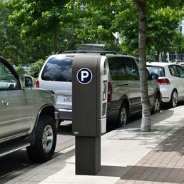
Metered parking
Implement pricing policies for the use of curbside space by vehicles especially in the central areas of the city
Provide designated parking spaces specifically for persons with reduced mobility (PRM) to ensure equitable access and convenience
Provide designated spaces for deliveries, emergency access, taxis, and sharing services
Created by Taufik Ramadhan
\ Фотографія: https://www.google.it/maps/
Photo
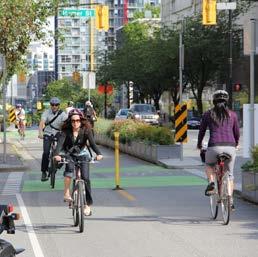
Soft mobility strategy
Стратегія розвитку системи м’якої
мобільності
Soft mobility strategy
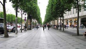
The following chapter provides a detailed overview of Mykolaiv’s soft mobility strategy. It begins with identifying existing challenges and opportunities, followed by the main goals and strategies before translating these into proposed solutions for enhancing soft mobility infrastructure.
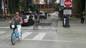
Identified challenges in the current soft mobility infrastructure include the lack of dedicated cycling infrastructure, forcing cyclists to share lanes with vehicles and pedestrians, which poses significant safety concerns. Additionally, some streets require the maintenance of pedestrian infrastructure, including sidewalks, intersections, and curb ramps. The main city bridges; which are crucial access points to the city centre, need additional infrastructure to ensure the safe movement for soft mobility users. Furthermore, the city lacks bike and micro-mobility sharing options and sufficient cycling facilities, including adequate bike parking.
Despite these challenges, several opportunities can be leveraged to enhance the soft mobility in Mykolaiv. The high modal share of walking presents a significant opportunity to further invest in pedestrian infrastructure and amenities, promoting active transportation and enhancing the city’s overall liveability. The ample road infrastructure could allow for street redesign to accommodate cycling lanes and improve pedestrian spaces. The waterfront, one of the city’s main assets, has the potential for improved accessibility for pedestrians, Micro-mobility users, and cyclists. Additionally, the municipality’s extensive cycling plans present a significant opportunity to enhance the city’s cycling infrastructure, promoting safer and more
accessible routes for cyclists.
The main goals of the soft mobility strategy are to develop a comprehensive cycling strategy based on the municipality’s previous plans, and to identify gaps and missing links to ensure alignment with all proposed urban strategies and new developments in the city. Another goal is to ensure safety for soft mobility users by implementing dedicated cycling lanes, adequate sidewalks, frequent crossing points, speed management systems, and proper signage. The strategy promotes Micro-mobility by offering sharing services and bike parking facilities to enable convenient short-distance travel and last mile connections. Furthermore, ensuring public access to the waterfront for pedestrians and cyclists is a crucial objective.
This chapter details the cycling strategy after considering the municipality’s bike lane map and the Coolville Design Lab’s proposed cycling network. It identifies missing links and gaps based on the areas highlighted for different urban strategies, including suggested regeneration, pilot projects, and densification areas. The proposal includes suggested locations for bike-sharing stations and places to be designed as cycle-friendly. The chapter continues with the recommended bike parking typologies and examples of soft mobility-friendly waterfronts.
Soft mobility challenges
The city lacks dedicated cycling infrastructure, forcing cyclists to share lanes with vehicles and pedestrians, posing significant safety concerns.
Some streets require maintenance of pedestrian infrastructure, including sidewalks, intersections, and curb ramps.
The main city bridges, which are crucial access points to the city centre, require additional infrastructure to ensure safe movement for soft mobility users.
The city lacks bike and micro-mobility sharing options and sufficient cycling facilities, including adequate bike parking.
Soft mobility opportunities
The high modal share of walking presents a significant opportunity to further invest
pedestrian infrastructure and amenities. This will promote active transportation and enhance the city’s overall liveability
The waterfront, one of the city’s main assets, has the potential for improved accessibility for pedestrians, micro-mobility users, and cyclists
The municipality’s extensive cycling plans present a significant opportunity to enhance the city’s cycling infrastructure, promoting safer and more accessible routes for cyclists
Soft mobility main goals
Develop a comprehensive cycling strategy based on the municipality’s previous plans, identifying gaps and missing links to ensure access to all proposed urban strategies and new developments in the city
Ensure safety for soft mobility users by implementing dedicated cycling lanes, adequate sidewalks, frequent crossing points,
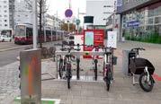
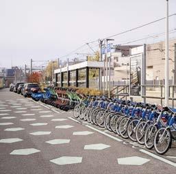
Promote micro-mobility use by offering sharing services and bike parking facilities to enable convenient short distance travel and last mile connections
and cyclists
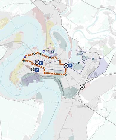
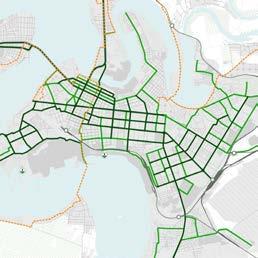
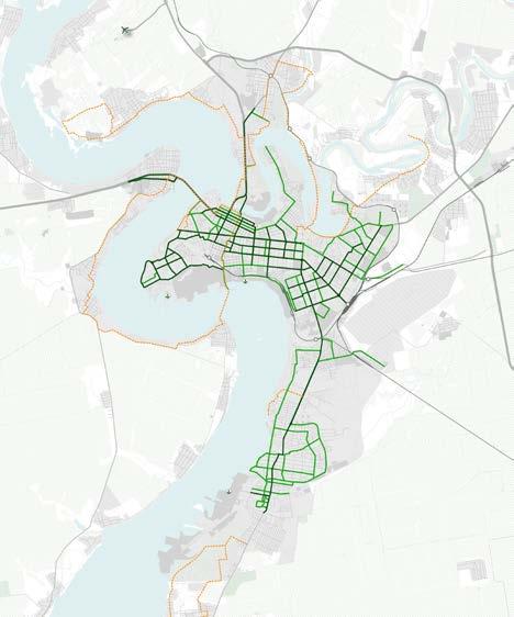
Proposed cycling network by Municipality
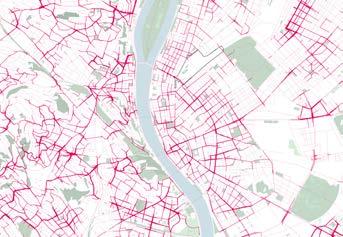
The following map illustrates the municipality’s proposed cycling network, which includes three types of cycling lanes: trunk, secondary, and recreational. Currently, bicycles account for 1.1% of the modal share. According to the Sustainable Urban Mobility Plan (SUMP), promoting cycling and implementing this envisaged network could increase the modal share upto 11.1%. The SUMP proposal has been considered in developing the proposed cycling strategy.
Future planned modal share based on SUMP
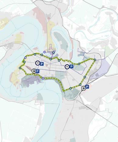
Proposed cycling network by Coolville Design Lab
The proposed cycling network, developed by Coolville Design Lab, has been considered in formulating the cycling strategy. This plan aims to promote bicycles as a viable mode of transportation for the city’s residents. The network design considers Mykolaiv’s sociospatial dynamics, analysing residential, occupational, and recreational areas and the city’s road network characteristics.
Proposed cycling network
The following map illustrates the proposed cycling network based on the municipality’s initial proposal and the map developed by Coolville Design Lab. This proposal considers the urban strategy for Mykolaiv, including pilot projects, regeneration areas, and proposed future densification zones. Minor adjustments need to be made to ensure network continuity and alignment with envisaged projects. The plan also includes providing bike parking and bike sharing stations to encourage bicycle use, following NACTO (The National Association of City Transportation Officials) guidelines for station spacing. Additionally, the plan highlights two proposed bikefriendly zones in the innovation district and the former northern port, will be regenerated using a mixed-use master plan. The plan aims to promote alternative modes of transportation and foster bike friendly practices. The cycling strategy aims to provide a sustainable alternative mode of transport.
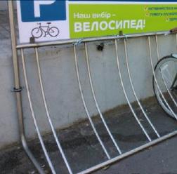
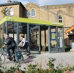
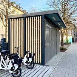
Proposed bike parking typologies
The following page presents four proposed typologies for bike parking designed to integrate seamlessly into the cycling network. These facilities aim to encourage the use of bicycles within the city.
Sheltered bike parking near major public spaces and attraction points
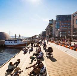
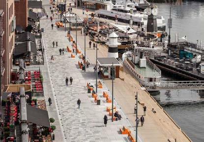
The Aker Brygge promenade in Oslo, Norway, offers ground-floor activities and shared spaces for pedestrians and micro mobility users, with convenient access to water transport stops.
Променад «Aker Brygge»
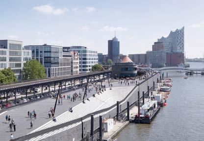
Niederhafen river promenade / Hamburg, Germany
The Niederhafen river promenade in Hamburg, Germany, offers a spacious riverside area with amenities for pedestrians, joggers, street performers, food stalls, shops, and public utilities. It prioritises accessibility with dedicated cycling lanes and water transport.
Adaptable and flexible reuse of transport infrastructure
Адаптивне та гнучке повторне
використання транспортної
інфраструктури
Adaptable and flexible reuse of transport infrastructure
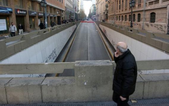
This chapter explores innovative strategies for adapting and flexibly reusing transport infrastructure in Mykolaiv. By examining examples and case studies from around the world, the chapter provides inspiration and ideas on how existing transport infrastructure can be temporarily repurposed to enhance urban life and foster a sense of community, especially in a postconflict context.
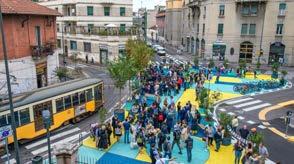
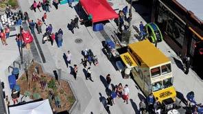
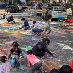
One of the discussed interventions are Temporary Street Closures, which involves closing streets to vehicular traffic on specific days. Examples include car-free Sundays or open street events, where streets become lively spaces for pedestrians, cyclists, and community activities.
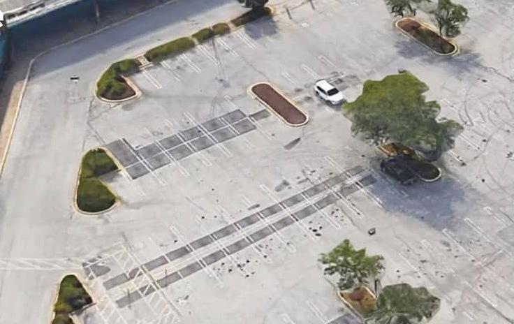
Another focus is repurposing parking areas, where parking spaces are temporarily converted into functional public areas. These spaces can be transformed into pop-up parks, outdoor dining areas, or community spots, enhancing urban life and encouraging social interaction.
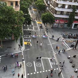
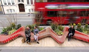
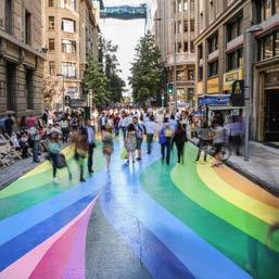
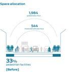
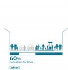
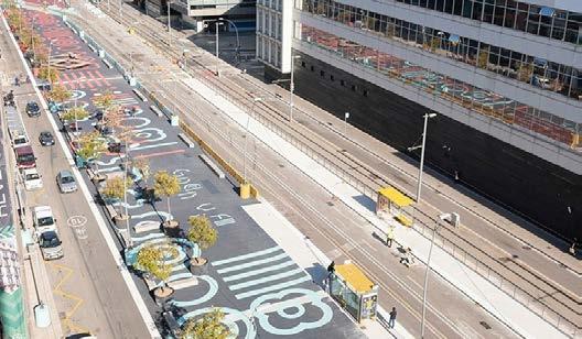
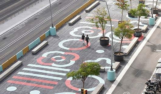
The chapter also covers Tactical Urbanism Initiatives, which employ cost-effective, quickly deployable improvements. These include the creation of seating areas, painted sidewalks, and parklets. Such interventions are designed to test new ideas, engage the community, and flexibly address public space needs.
These examples and case studies are provided to inspire and guide the reuse of Mykolaiv’s existing transport infrastructure. They demonstrate how temporary changes create opportunities for citizens to gather, interact, and rebuild a sense of community in a dynamic and resilient urban environment.
Typologies of interventions
Temporary street closures
This intervention involves closing streets to vehicular traffic on specific days, such as car-free Sundays or open street events.
Parking area repurposing
This intervention temporarily converts parking spaces into functional public areas, such as pop-up parks, outdoor dining, or community spots, enhancing urban life and encouraging social interaction.
Tactical urbanism initiatives
This intervention employs cost-effective, quickly deployable improvements such as seating areas, painted sidewalks, and parklets to test new ideas, engage the community, and address public space needs with flexibility while being easy to modify.
Temporary street closures
Quincy Better Block/ Washington, United States of America
Quincy Better Block /
The Quincy Better Block project aims to revitalise a designated street area in Quincy, Washington, by transforming it into a lively and attractive space. As part of the Better Block Program, this initiative temporarily changes the streetscape to create an interactive environment that fosters community involvement. Open on Friday evenings, the site features games, music, and food, and on Saturday, it features the Farmers Market.
Playstreet/ New York, United States of America
Playstreet /
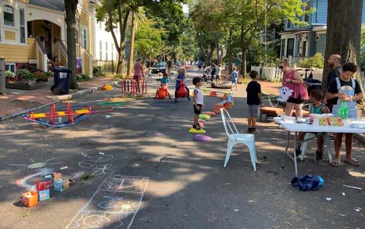
Play street is an initiative implemented in many cities where a residential street is temporarily closed to through traffic, enabling children and families to play and socialise safely. Organised by local communities with municipal support, these closures encourage physical activity, creativity, and social interaction, ultimately fostering more liveable and friendly urban environments.
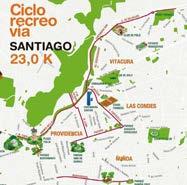
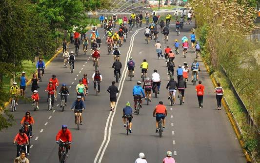
CicloRecreoVía/ Santiago, Chile
CicloRecreoVía / Сантьяго,
CicloRecreoVía is an initiative in Santiago, Chile, that closes kilometres of streets to cars every Sunday from 9:00 AM to 2:00 PM, creating spaces for non-motorised activities. The project aims to reclaim public spaces for recreation, play, and physical activity, transforming streets into vibrant community areas. Open to people of all ages, whether on foot, bicycle, rollerblades, or other non-motorised means, CicloRecreoVía attracts around 40,000 participants each weekend. This initiative, replicated in cities around the world, exemplifies how transport infrastructures can be adapted to prioritise community interaction and foster healthy lifestyles.
CicloRecreoVía — це
Parking area repurposing
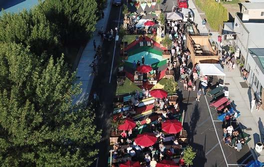
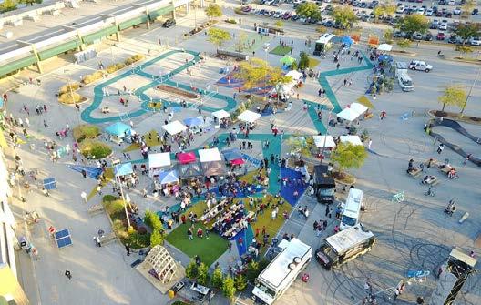
Burtonsville Better Block/ Maryland, United States of America
Burtonsville Better Block /
The Burtonsville Placemaking Festival, part of the Better Block initiative, transformed the empty parking lot of the Burtonsville Crossing Shopping Centre in the USA into a vibrant community space for all ages. By introducing pedestrian pathways, lively spaces, and entertainment zones, the event demonstrated the community’s enthusiasm for activating public spaces.
Burtonsville Placemaking,
Burtonsville Crossing
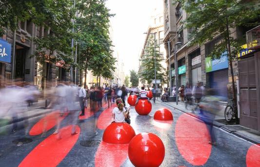
Park(ing) Day
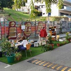
Park(ing) Day
Park(ing) Day is an international initiative encouraging communities to creatively convert on-street parking spaces into social spaces. This participatory project aims to raise awareness for safer, greener, and more inclusive streets, advocating for urban environments that prioritise people over cars.
Park(ing) Day —
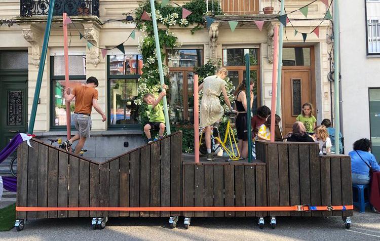
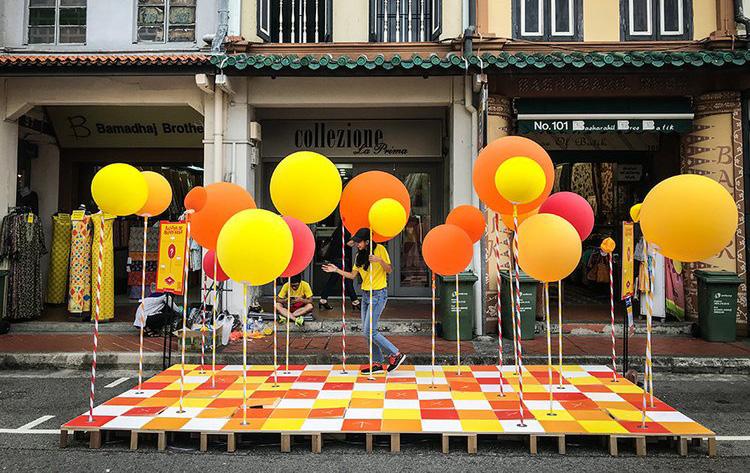
Tactical urbanism initiatives
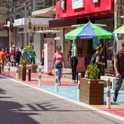
Reclaiming the streets of Fortaleza, Brazil
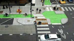
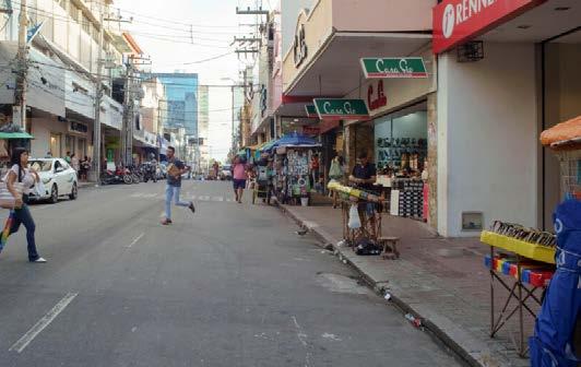
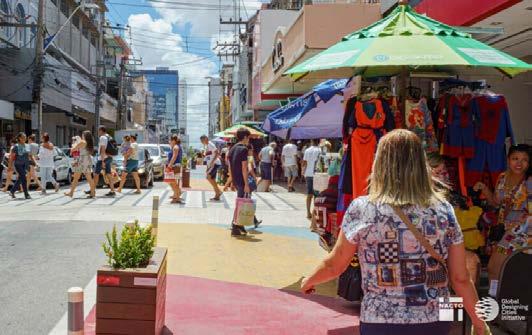
The city of Fortaleza redesigned Barão do Rio Branco Street, converting one travel lane into an interim sidewalk extension to provide a safe space for pedestrians using low-cost materials like paint, benches, bollards, and planters. The temporary redesign allows for testing its impact on future permanent interventions. The narrowed lanes, redesigned intersections, and new pedestrian crossings significantly reduced crash risks and speeding.
Paseo Banderas/ Santiago, Chile
Paseo Bandera /
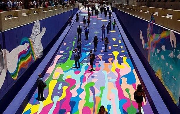
During metro construction, Paseo Bandera, a street in Santiago’s city centre in Chile, was closed to cars and transformed into a vibrant pedestrian walkway adorned with urban art. Initially conceived as a temporary measure, the decision was made to make this closure permanent. Paseo Bandera evolved into an experimental zone where innovative features like intelligent streetlights, parking sensors, and interactive totems were introduced. This initiative not only embraced technological advancements but also encouraged community involvement and the utilisation of public space.
Paseo Banderas/ Santiago, Chile
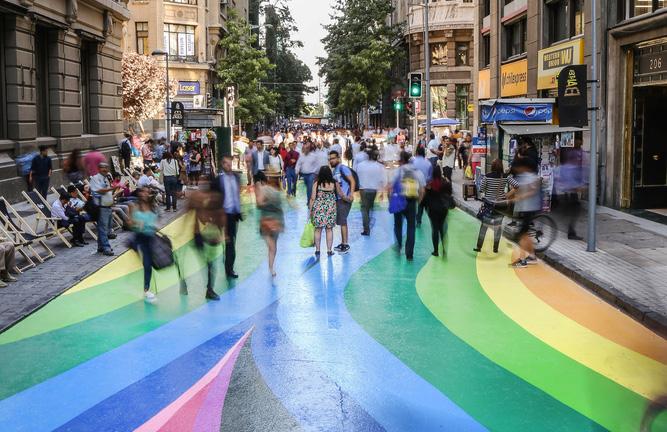
Tactical urbanism/ Barcelona, Spain
In response to the climate emergency, Barcelona City Council swiftly adapted to new mobility needs and redefined urban living through tactical urbanism. This approach rapidly and affordably shifts streets from fossil fuel-based mobility to prioritise spaces for walking, playing, relaxing, and community care, and this way reclaims urban areas for citizens. A graphic system has been devised using paint to implement these actions, acting as signage on reclaimed surfaces for pedestrians, bicycles, schools, and leisure. This system humanises asphalt, infusing warmth into areas typically dominated by hostile materials while accommodating diverse uses and contexts within these spaces. Barcelona’s tactical project highlights a strategic commitment to a new urban model, promoting sustainable mobility, empowering pedestrians, enhancing urban greenery, encouraging citizen engagement in street life, and fostering the socialisation of urban spaces.
Key Performance Indicators for evaluating proposed strategies in the next phase
Key Performance Indicators for evaluating proposed strategies
This chapter focuses on the Key Performance Indicators (KPIs) that will be used to evaluate the effectiveness of the proposed strategies in the next phase of the Mykolaiv Concept Master Plan project. Three specific KPIs have been identified to test and refine the proposed interventions, ensuring they meet the city’s mobility and accessibility goals.
The first KPI is the Public Transport Accessibility Level (PTAL), which will be used to evaluate the proposed public transport network. PTAL measures the accessibility of public transport services, helping to determine how well the new network connects various parts of the city and serves its residents.
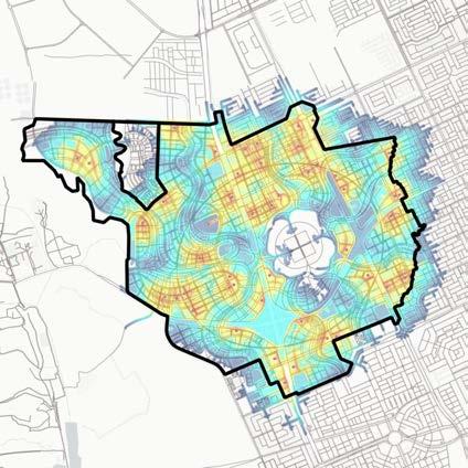
The second KPI is Pedestrian isochrones analysis. This analysis will help understand the catchment areas from public transport stops, providing insights into how far people can walk within a specific time frame to access public transport. This KPI is crucial for ensuring that the proposed public transport stops are conveniently located and accessible to a wide range of users.
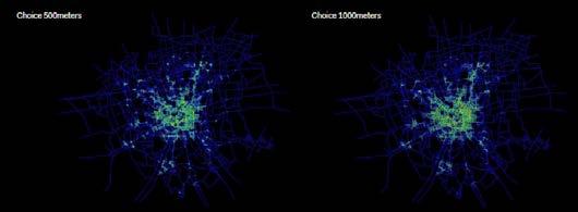
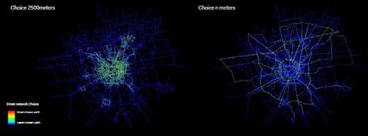
The third KPI is the Network morphological analysis depthmap - space syntax, which will be used to test the proposed cycling lanes. This analysis examines the spatial configuration of the cycling network, assessing its connectivity and integration within the broader urban fabric. It helps to ensure that the cycling infrastructure is optimally designed to promote safe and efficient cycling routes. Together, these KPIs will provide a comprehensive framework for evaluating the proposed strategies, guiding the project’s next phase towards a more connected, accessible, and sustainable urban mobility system in Mykolaiv.
Proposed Key Performance Indicators
Public Transport Accessibility Level (PTAL)
Public Transport Accessibility Level (PTAL) is a measure used to assess the accessibility and convenience of public transport within a specific area. PTAL considers factors such as the distance to the nearest public transport services, the frequency of those services, and the number of available routes. It assigns a score that ranges from 1 (poor accessibility) to 6 (excellent accessibility), helping urban planners and policymakers to identify areas with good or poor public transport connectivity and plan improvements accordingly. This metric is crucial for ensuring equitable access to public transportation and fostering sustainable urban development.
PTAL is a global index, which serves as a useful and reliable planning tool. This index can predict modal shifts in the project site resulting from public transport interventions. Additionally, it maps accessibility and assesses changes in relation to different alignments, the number of lines, and block sizes.
Pedestrian isochrones analysis
Pedestrian isochrones analysis from public transport stops using population density involves creating detailed visual maps that illustrate the areas reachable by walking within specific time intervals, such as 5, 10, or 15 minutes from each transport stop. This analysis utilises GIS (Geographic Information Systems) to model pedestrian pathways, considering factors like sidewalks, crosswalks, and other pedestrian infrastructure.
By overlaying population density data onto these isochrone maps, urban planners can assess how many people live within walking distance of public transport stops. This approach provides valuable insights into the accessibility and convenience of the public transport network. It helps to identify areas with high population density that lack sufficient access to public transport, highlighting gaps in the network. Furthermore, this analysis can reveal disparities in accessibility, showing which neighbourhoods are well-served by public transport and which are not. It allows planners to evaluate the impact of potential changes, such as new transport lines or stops, different alignments, or changes in service frequency. By understanding the relationship between population density and public transport accessibility, planners can make informed decisions to improve connectivity, enhance walkability, and ensure equitable access to transportation for all residents. This method is essential for promoting sustainable urban development and improving the overall quality of life in urban areas.
Road network morphological analysis
Space Syntax tool
Space Syntax is a science-based and human-focused method for describing and analysing the relationships between spaces and people within a building or an urban environment. Topological and geometric analysis of urban grids using Space Syntax helps to understand the configurational structure of urban spaces and its potential impact on social behaviour and economic activity (Hillier, 1996a).
Space Syntax segment choice analysis
Segment analysis is a syntactic representation of cities which measures movement flows through space. It reveals those streets that are on multiple shortest paths, when considering all origins and destinations within a certain network distance radius. It is a powerful measure to identify the roads that have a high potential for ‘through’ movement. By changing the scale for choice analysis, results are different depending on the applied distance, suggesting different configurations that are ideal for different travel modes.
Mobility workshop outcome report
мобільності
Mobility workshop outcome report
On July 16th, 2024, a mobility workshop was held for Mykolaiv municipality representatives, where several key points and outcomes were discussed.
Railway network strategy:
It was noted that the current and planned state of the railway network, including disused lines and operational/ disused stops, should be verified by the national railway company.
Additionally, the long-term proposal to remove tracks between the industrial park and industrial zone, as shown in this report must also be reviewed by the national railway company.
It was highlighted that a passenger railway track extends to the Alumina factory in the south, in addition to the freight line. Systematica will check the frequency and operational status of this passenger line with the national railway company.
Road network strategy:
Furthermore, the municipality mentioned a new concrete road connecting the Alumina factory, located outside the Mykolaiv city boundary, with the M14 highway. This road will be considered in updating the strategies in the next phase.
Public transport strategy:
The municipality has acquired new trolleybuses, with an additional fleet to be added to the city network shortly.
Changes to the public transport network, including the addition of new trolleybus lines and potential future purchases, will be forwarded to Systematica by the municipality.
The municipality is also requested to provide information on the possibility of replacing the trolleybus system with a trackless tram or BRT to ensure flexibility in future route locations. Additionally, the municipality requested the proposed ferry route to be extended towards the Urochyshche Raketne district.
Parking strategy:
The Municipality mentioned that previously conducted studies on parking in Mykolaiv would be shared with the team.
These and any further comments will be addressed in the final mobility strategy.
*Please refer to page 330 for detailed information on the Mobility Workshop.
Urban policies
Executive summary
This report addresses a number of urban policy challenges, arising from specific development trajectories and institutional, political, social and economic circumstances that characterise both, Mykolaiv and the wider regional and interregional context. Three main areas have been identified for critical discussion: evolving patterns of metropolitan governance, strategies for public participation and community engagement, and planning issues related to Ukraine’s path towards EU accession. For each of the three areas, the report offers an analytical introduction based on a European debate, a number of case studies, and final policy recommendations. The first aspect considers urban reconstruction as a chance to adopt a metropolitan perspective in urban planning. Traditional city boundaries are outdated, and modern urbanisation involves complex, networked processes that transcend existing limits. Scholars advocate for integrating urban areas into broader regional contexts, moving towards regional urbanisation and polycentric development. European experiences show ambivalent results of metropolitan governance, suggesting flexible, collaborative frameworks that are more effective. For Ukraine, the decentralisation process has bolstered local resilience, but spatial planning still remains quite underdeveloped. Mykolaiv’s reconstruction should consider regional cooperation and innovative EU policies to foster sustainable and cohesive urban growth. The second aspect highlights the significance of civic engagement and public participation in urban transformation strategies, identifying key questions for the future planning of Mykolaiv. It emphasises that a diverse public debate can foster shared visions for urban reconstruction and strengthen local democracy.
Mykolaiv has shown interest in innovative planning methodologies, incorporating both traditional and softer strategic spatial planning tools. The importance of citizen involvement is highlighted, using examples to illustrate effective engagement, as well as the potential challenges that may emerge during these processes. The discussion highlights mutual learning, multi-level engagement, and the integration of physical and digital forums, advocating for flexible and adaptive approaches to participatory planning. Urban transformation strategies, on the other hand, should involve citizens not just in participation, but also in co-design and coproduction. This includes leveraging local knowledge and diverse perspectives, experimenting with innovative ownership models, and addressing real estate market challenges. Successful initiatives integrate existing frameworks, avoid community overstimulation, and may help to ensure long-term, non-speculative property use. The final aspect deals with the urban reconstruction of Mykolaiv. Though the city has been impacted by wartime destruction and geopolitical shifts, it still has the opportunity to be innovative in urban planning. By balancing immediate restoration with long-term modernisation, Mykolaiv aims to overcome its dependency on neighbouring countries and align with the European Union. The concept masterplan, a dynamic and flexible tool, integrates short-term projects within a strategic vision, involving various stakeholders. The transition from a Soviet-style planning system to a multi-level governance model requires careful reforms and cooperation. Emphasising local autonomy, professional capacity building, and efficient land management is crucial for effective and sustainable reconstruction, ensuring a sustainable recovery for Ukraine. Ultimately, this report then proposes final policy recommendations in the three areas.
Photo: Alexander Minyaylo
Introduction Вступ
Objectives and methodology
Our studies on urban policies in Mykolaiv aimed to achieve the following objectives:
1. Identify the property regimes underlying urban planning choices in Mykolaiv, with particular regard to the transition period and the ensuing privatisation processes;
2. Understand the dynamics of policy design by deconstructing the existing urban policies, identifying the most relevant policy gaps in different areas, and the relationships between those areas;
3. Formulate recommendations for policy updates and integration, as well as for monitoring processes.
For the first objective, the lack of consistent information and data led the research group to propose more methodological considerations about the relationship between property regimes, urban planning tools and decision making processes. For the second and third obectives, the team has proposed to focus on three areas of interest for Mykolaiv’s reconstruction plan. They include: evolving patterns of metropolitan governance within the reconstruction phase, strategies for public participation and community engagement, and planning issues pertaining to Ukraine’s integration within the EU.
In order to address the aforementioned objectives, the team proposed to organise three capacity building workshops. The aim of these workshops was twofold: to offer an opportunity for critical discussion of each of the policy areas identified, including different perspectives, and to propose cases and examples of interest for Mykolaiv. Each workshop has involved experts from different European contexts, with a member of the Polimi Urban Policies team acting as a moderator. The targets and topics of each workshop are summarised in the following paragraphs, and their content is central to the following thematic chapters.
The workshops addressed the topic of urban policies within the framework of Mykolaiv’s concept masterplan for reconstruction and recovery. It has been an opportunity for local policymakers and professionals to debate and interact with international experts in the fields of urban planning and governance from a European perspective.
Selected interviews with experts in preparation for each workshop helped to make sure that the most important issues were addressed. These workshops have been recorded and circulated to maximise capacity building. They have informed and inspired the content of this report, providing relevant suggestions for a strategic approach to reconstruction.
Workshop topics
1. The metropolitan dimension as a strategic challenge for reconstruction (25.03.24)
The reconstruction of Ukrainian cities can be an opportunity to feed into an initial and innovative debate about the urban metropolitan dimension in Ukraine. All over Europe, socio-economic dynamics have been powerful in restructuring the form, size, dimension, and nature of cities. Thus, experts and policymakers have expressed the need for both, new planning tools and forms of governance to deal with the challenges generated by these dynamics. This workshop’s purpose was to trigger a debate on how these challenges can be strategically included and addressed in plans for the reconstruction of Mykolaiv and other cities.
2. Urban and regional planning in preparation for European accession (24.04.24)
Ukraine’s future entry into the European Union entails innovation and adaptation of the urban and regional planning system in order to harmonise it with existing systems of other member states. Experiences of experts working in Eastern European countries which already joined the EU were useful and inspirational for the Ukrainian accession process.
This workshop focused on the discussion of challenges and opportunities arising through the use of new planning tools and methods, and how these relate to existing plans and governance processes in Ukraine.
3. Public participation and urban transformation: An open challenge (23.05.24)
This workshop aimed to reflect on the role of civic engagement and public participation in the design, definition and implementation of urban transformation strategies and plans at different scales.
A thoroughly diverse public debate with different perspectives on urban development is the basis for different forms of citizen engagement. It fosters the emergence of shared visions of the future, which is particularly relevant when looking at reconstruction efforts. At the same time, it may also contribute to strengthening local democracy and citizenship practices.
This workshop involved experts and activists from different European contexts.
For more details about these workshops, refer to Output 2-Chapter 6, and Chapter 5 of this report.
Structure of the report
Based on the topics introduced in the three capacity building workshops, expert interviews and extensive research, the report is divided into three sections. Each section begins with an introductory question which is then elaborated using more specific topics and discussion points, supported by case studies and examples.
The first subchapter evolves around the question: Can the reconstruction process be an opportunity to develop a metropolitan perspective on urban planning?
This is divided into several aspects:
1. Investigating why the metropolitan dimension is crucial, also for reconstruction; a general reflection on an urban approach based on a new scale, drawing from urban theory but also from the principles promoted by UN-Habitat under the Metro-HUB initiative;
2. Inquiring about the kinds of metropolitan approaches that are currently being applied in the context of the EU, highlighting the fragility of metropolitan governance all over the EU, as well as interesting inputs from cities that are already working with a metropolitan perspective.
This subchapter demonstrates how the EU supports wider-scale approaches both in the conceptualisation and operationalisation of a metropolitan perspective. Metropolitan governance in Ukraine, and some references to current practices in Lviv and Kyiv are also discussed.
The second subchapter deals with the question: Can the reconstruction process be an opportunity to establish a sound approach to community engagement and participation in urban planning?
The discussion centres on two main points:
1. The role of citizen involvement: a critical appraisal of involvement strategies based on experiences across European cities, considering emerging difficulties and opportunities;
2. Co-design and co-production in urban policies: how local authorities can involve citizens, and what roles they can play in terms of actions to be promoted, designed and implemented in relation to urban transformations.
The third subchapter investigates the reconstruction process as an opportunity to experiment with novel approaches to urban planning. This is done by delving into the adaptation of national planning norms in view of Ukraine’s accession to the EU, and by ensuing relevant consequences on the social, productive, infrastructural and environmental layout of the city. This subchapter analyses the integration of informal planning tools within statutory planning in Mykolaiv, and highlights the contentious issue of the management of land and property assets owned by private entities in Mykolaiv, which in turn implies the importance of establishing accurate ownerships of land and property assets that are critical to the city’s urban regeneration projects.
Reconstruction as an opportunity to develop a metropolitan planning perspective
Building back better through a metropolitan lens
Urban areas worldwide are undergoing significant spatial restructuring, driven by a complex interplay between cities and their socio-economic development. This ongoing transformation of urban spaces extends well beyond traditional definitions of the ‘city’ inherited from the 20th century. The existing administrative boundaries no longer fully capture the breadth and depth of urban phenomena, making it challenging to analyse contemporary urban issues based on outdated static elements and plan them within traditional urban boundaries.
The world’s urbanisation is not merely a result of an increasing number of people living in urban areas; the production of “urbanity” - meaning the lively and challenging complexity of the city - is related to a multiplicity of intertwined processes. Factors such as the proliferation of information technologies, economic restructuring, and evolving lifestyles have fundamentally transformed the urban landscape.
Efforts are being made to develop new interpretations of territorial and urban realities, moving beyond administrative boundaries to better understand the evolving relationship between space and society. While a unified methodology to comprehend the nature of contemporary urban forms is still lacking, it is clear that a shift away from myopic views on the city is necessary, and a perspective that integrates the urban realm within a broader regional and translocal context must be embraced.
Several studies aim to produce new and updated interpretations of territorial/urban facts. Among others, the EU State of the City Report (2016), undertaken by OECD and Eurostat, maps the Degree of Urbanisation. The more recent work funded by World Bank and the
European Commission aims to identify functional areas which bypass urban boundaries and generate new functional geographies across Europe*
Scholars suggest that a shift towards regional urbanisation is taking place, with large urban regions having increasingly prominent roles in the global economy. Authors like Neil Brenner challenge traditional distinctions between urban and non-urban areas, arguing that understanding modern cities requires a more nuanced approach. They highlight new hierarchies and power dynamics that are reshaping urban spaces and their relationships with other regions.
These changes have led to new spatial configurations, power struggles, and political dynamics that demand attention. Brenner’s concept of “operational landscapes” emphasises the strategic role of places in supporting traditional urban areas; his concept of “extended urbanisation” bypasses the idea of metropolitan areas of the 20th century. Meanwhile, other authors focus on the emergence of in-between regions and their potential for socio-economic and spatial innovation, challenging the traditional view of these areas as peripheral or suburban.
From a policy and governance point of view, the scientific debate argues that the lack of recognition of these new features and scales of the urban dimension could have significant political implications, as some areas are already experiencing new urban conditions, but are being overlooked.
This condition of a growing disparity between the administrative boundaries, often inherited from the 20th century organisation of the state territory, along with the form and extension of urban phenomena, can produce additional fragmentation of people and places.
Cities are already becoming more fragile, being exposed to a lack of spatial imaginaries and governance approaches that recognise the new scale of the cities. This can leave spatial planning and policies unable to support people and places toward liveability, economic development, and territorial cohesion.
Therefore, how shall the reconstruction process in Ukraine consider the new urban scale? Can reconstruction be an opportunity to reflect on the existing and changing patterns of urbanisation in the country, and consider the necessity or opportunity to develop an updated representation of urbanisation dynamics and feed spatial planning efforts for ‘building back better’?
To what extent should the Mykolaiv’s Concept Masterplan consider the city’s new nature, size, and form?
Mykolaiv’s reconstruction as a driver for the country’s territorial cohesion
Urbanisation maps of Ukraine and Mykolaiv show a scattered pattern based on a fragmented and dispersed polycentric spatial organisation (especially dense in the eastern region). At the same time, however, a consistent process of agglomeration around the main western urban areas can be observed, which led to consistent challenges to territorial cohesion.
Restrictions on urbanisation and internal migration, imposed during the time of the Soviet Union, have long created a situation of static urbanisation, a sort of reduced impact of the processes of agglomeration, as compared to some neighbouring countries.
The most recent phase of economic growth generated by neighbouring EU countries has reversed the process and produced a contrasting pattern. On the one hand, the eastern part of the country hosts the most extensive urban centres, while the western part is home to more consistent urban growth and economic development processes.
As per the World Bank “Ukraine-Urbanisation review highlights (2015)*, the city of Mykolaiv seems to be in a place between areas of urban growth and shrinkage; between the dense but declining urban area of the East and the growing urban area of the West. At the same time, the city of Mykolaiv shows a sizeable suburban area which has been developing over the last 50 years. This highlights the need to introduce a larger territorial perspective when planning for reconstruction, taking into consideration an extended area and its relationships with the other surrounding municipalities, as well as other large urban areas of the southern part of the country.
This has crucial effects on urban planning, considering the new economic role of this urban area, demographic trends and scenarios, while also working on mobility dynamics and environmental challenges.
In the map on the left, data from “GHSL - Global Human Settlement Layer”, shows the considerable fragmented and dispersed urbanisation patterns of the southern part of the country, but also the phenomenon of growth and concentration around the main urban poles, producing new forms of urbanisation and suburbanisation. In the map to the right, the red and orange colours pertain to urban centres, while the brown and yellow refer to dense and semidense urban clusters and suburban cells respectively, according to the Degree of Urbanisation methodology.
Source I Джерело https://human-settlement.emergency.copernicus.eu/visualisation.php#lnlt=@46.74362,31.73950,9z&v=301&ln=0&gr=ds&lv=00000000000000000000000000000000000000111010&lo=aaa3aaaaaaa5aaaaaaaaaaaaaaaaaaaaaaaaaaaaaaaa&pg=V.
The map above shows the patterns of growth and shrinkage of Ukrainian cities from 1996 to 2010, highlighting the trends of shrinkage of established large urban areas in the east, and growth of small urban areas in the west. Mykolaiv stands in the middle of these two conditions.
As shown in the map above, the city of Mykolaiv seems to be positioned between areas affected by urban growth and areas affected by shrinkage processes from 1996-2010. From this perspective, its population remained quite constant during this period while its urban extents increased by 1% from 2000-2013.
Reinforcing decentralisation in Ukraine: takeaways from the EU
Cities have regained prominence in contemporary Europe, especially with the increased attention from the EU and international institutions. Some scholars even suggest that cities would govern the world more effectively than traditional national governments. However, the scientific and policy debate has also made clear that cities cannot succeed without engaging complex networks and diverse sets of actors and agencies that operate across different scales. Administrative boundaries continue to hold significance by formulating the parametres for addressing problems and devising solutions in policymaking: they establish authorities, territorial jurisdiction, and legitimacy. However, socio-economic processes are increasingly transcending established geographical boundaries, leading to the rise of new translocal actors and processes, and to a growing effort to institute forms of metropolitan governments that are able to play a strategic role in addressing coordination issues (Italy and France in particular have invested in this direction).
Nevertheless, all over the EU, the effectiveness of introducing forms of inter-municipal cooperation, particularly in metropolitan governments, is still low. The emergence of a metropolitan framework has been a recurring theme in national policy and action frameworks since World War II. Despite growing processes of differentiation, concentration, and increasing disparities in European cities, the focus has been on promoting forms of metropolitan governments, often based on traditional approaches, seeking to establish a holistic and systemic framework against complexity, uncertainty, and fragmentation.
These reforms tend to revisit administrative boundaries inherited from the pre-war period without moving away from a Cartesian representation of the urban environment, which does not fully capture the complex relationships between people, spaces, and places of contemporary cities.
This approach is based on a fixed and segregated view to space, rather than transcalar and relational thinking, and has yielded limited results thus far. This is due to obstacles to the metropolitan government coming from local (where there is no interest in coordination) and higher levels (which are too rigid in terms of supralocal and inter-city alliances).
Moreover, forms of metropolitan governance in many European cases have consistently suffered from a mainstream approach which continually designs metropolitan government forms based on a municipalism-inspired formula. It is characterised by fixed boundaries and weak democratic relations, or based on decentralisation processes which have not efficiently addressed the subsidiarity principle as well as the transcalar dimension of current urban and territorial transitions.
As a counter argument to these failures and limited successes, the growth of flexible governance frameworks and planning mechanisms have been proposed by promoting soft alliances and partnerships. Sometimes, the outcomes of these efforts may be subject to challenges since they operate beyond the traditional concepts of territorial control and sovereignty. Nevertheless, these efforts are crucial.
The increasing disparity between established forms of territory, as well as pace, patterns and scale of socioeconomic change, frequently leads to deficiencies in long-term planning and governance frameworks for decision-makers. A soft approach to urban and territorial governance can be crucial. Based on these experiences, some scholars have even theorised about the potential of a polycentric political system as an alternative to a holistic metropolitan solution, suggesting the need to move beyond simple institutional solutions.
Suggestions from cities active in experiencing metropolitan governance as seen in the recent Manifesto of METREX (see page 140) , the Association of European Metropolitan cities and areas, recently presented in Brussels, also seem to align with this ideology. It is the outcome of a process of reflection on the role that metropolitan governance forms can play at European level.
At the same time, the Manifesto proposes the idea that regardless of the form of metropolitan governance, it is crucial to experiment with metropolitan partnerships and thereby deal with societal challenges and sustainable development goals. METREX cities and metropolitan areas suggest this to establish a formal dialogue at EU level. It also proposes dedicated funding and active consultations on shaping programs and projects; as well as a dedicated EU Commissioner on the Metropolitan Dimension, and the transformation of the Committee of the Regions in the Committee of the Regions and Metropolitan Areas, to give them a space of direct representation.
Moreover, the Manifesto asks for an effort to create a crucial EU investment for Infrastructure, Agriculture, Innovation and Regional Development in support of the metropolitan dimension.
In the last decade, Ukraine has invested consistently in decentralisation, by introducing a reform that is a significant step towards reinforcing the local level. According to some scholars, the process of decentralisation has generated resilience capacity during the armed conflict* .
The decentralisation reform in 2014 “Concept of Reforming Local Self-Government and Territorial Organisation of Power” produced the voluntary amalgamation of Hromadas, providing them with a democratic organisation, together with growing competencies and resources.
The creation of larger municipalities resulted in higher efficiencies in the production of welfare, by reducing fragmentation; but it was also fundamental in understanding operations at a larger scale. At the same time, the OECD report “Turning to regions and local governments to rebuild Ukraine” issued in 2022, highlights how some policy areas have taken advantage from this process in limited capacities. Spatial planning is one of those areas. The report suggests that during the process of reconstruction, reinforcing the importance of cooperation between municipalities is crucial to achieve more effective and strategic planning approaches.
The city of Mykolaiv did not experience any consistent reconfiguration as a result of this reform, which suggests that on the one hand, local level boundaries could already be fitting the planning and policy agenda, or there has been limited interest regarding the revision of boundaries.
Can the process of reconstruction be an opportunity to develop new collaborative partnerships with the surrounding municipalities, in particular in the field of spatial planning?
In light of potential metropolitan governance, a few cities in Ukraine have already started a process of cooperation. This is the case of Ukraine’s capital city, Kyiv, which is probably one of the few cities that have assumed a metropolitan dimension. It is also the case of smaller cities- like Lviv, which has started an interesting process of collaboration with the surrounding municipalities in order to establish a form of metropolitan governance.
At national level, the State Regional Development Strategy (2021-2027) defines the development of metropolitan areas in Ukraine as one priority for regional policy, in the light of their role as “hubs of economic growth and recovery”.
The Council of Europe’s Centre of Expertise for Good Governance (CEGG) is helping to develop practical recommendations on how to enhance inter-municipal co-operation and to design a strategic vision, including the elaboration of the Lviv Agglomeration Development Strategy until 2027.
Developing forms of metropolitan governments are seen as a vital step in the country’s future, and medium sized cities like Mykolaiv can play an important role in the discussion about the different models to be adopted in the country.
At this stage, it is important to consider the failures of metropolitan government forms thus far and promote a strategic and critical reflection on how large and medium sized urban areas can take action to promote and implement collaborative partnerships and frameworks.
“Not all metropolitan regions and areas have their own formalised institutional structures. Nevertheless, they all are shaping and managing effective partnerships to achieve common, often cross-border and trans-sectoral goals. The strength of our regions and areas lies in the combination of three interlinked dimensions: urban, rural, and suburban” (METREX, Manifesto for metropolitan partnerships, 2024).
“Momentum is building behind the metropolitan level. Both the most recent EMA declaration signed in Helsinki in September 2023, and the resolution adopted by UN-Habitat in Nairobi in June 2023, stress that metropolitan regions and areas are indispensable to achieving the sustainable development goals” (METREX, Manifesto for metropolitan partnerships, 2024).
“Our manifesto is about rediscovering the real engines of Europe in turbulent times of global change. It is about making the EU more efficient. About regaining the global competitive position of the EU and preserving quality of life.” – Łukasz Medeksza* .
Decentralisation seems to have had a positive impact on several policy fields, but is quite limited in the field of spatial planning. At the same time, intermunicipal cooperation had been consistently growing before the conflict; currently, during the conflict it has experienced an expected drop.
Source
OECD Multi-level Governance Studies Rebuilding Ukraine by Reinforcing Regional and Municipal Governance, 2022.
EU support to the metropolitan scale: ITIs as an opportunity for Ukraine
The New Leipzig Charter, approved in late 2020, outlines the EU’s perspective on the role of cities in the future of the European Union. It emphasises the transformative power of cities in supporting sustainable development by focusing on just, green, and productive dimensions, and stresses the need for integrated approaches at various scales. The charter also highlights the importance of governance, the role of national and European support, and the need for spatial planning to achieve polycentric development. Furthermore, it calls for multi-level governance and emphasises the need for financial instruments and innovative business models to achieve climate-neutral and socially sustainable cities.
The new EU Cohesion Policy cycle aims to enhance the role of urban regions in building a Europe that is closer to its citizens through five pillars, including a focus on a smarter, greener, connected, and social Europe, and the objective of supporting locally led development strategies and sustainable urban developments. The policy emphasises supporting agglomeration economies, addressing adverse effects of urban concentration, and overcoming negative effects of low density and peripherality in rural areas. It also strengthens the urban dimension of Cohesion Policy with a dedicated portion of the European Regional Development Fund (ERDF), new networking and capacity-building programs, and a focus on using ERDF to support integrated territorial development.
The policy also reinforces tools such as Integrated Territorial Investments (ITIs) and Community-led Local Development, while confirming Interreg Europe as the interregional cooperation programme, co-funded by the European Union. It strives to reduce disparities in the levels of development, growth, and quality of life in and across Europe’s regions. These tools and programs are reinforced to allow for Interregional Innovative investments, which are able to activate alliances between different regions in order to support pan-European clusters in priority sectors, such as big data, circular economy, advanced manufacturing, or cybersecurity.
The ITI was created as part of Cohesion Policies to serve as a territorial mechanism for effectively utilising structural funds in implementing comprehensive development strategies. Its adaptability and open framework has allowed it to support various projects of different scopes and strategic significance. This adaptability strengthens its role as a territorial unifier, enabling the identification and collaboration of local authorities and their initiatives.
Within the ITI framework, there is potential for reevaluating the delegation of priorities and governance balances for shared projects. From an economic perspective, the ITI has the potential to secure funding for innovative measures and facilitate new collaborations between authorities and beneficiaries, both in terms of content and management. However, like any tool, the ITI depends on a strategic foundation to give genuine substance to a unified governance and action framework.
The ITIs have opened up a highly experimental space in this respect. It allows the construction of an action framework that transcends administrative boundaries, and is based primarily on policy problems. Based on information collected from the STRATBoard* database and existing literature from the Joint Research Center of the EU (JRC), ITI has been particularly used by developing regions, where the funding is crucial for strategy realisation, as well as regions “in transition” for implementing their territorial strategy. Its widespread adoption is considered a success, largely due to its novelty. Surprisingly, this is only partially linked to its financial reach, as the majority of ITIs (38%) collected less than €25 million of European Structural and Investment Funds (ESIF) for each strategy, with only 11% earmarking more than €100 million. There is a clear trend of using ITI in urban or metropolitan contexts, although there are some notable exceptions in newly established, experimental, and non-institutionalised territories.
ITI is a mechanism for integration that increases the number of resources for urban and territorial development, integrating domestic and private funds with EU funding from multiple sources. Nonetheless, ITI was introduced with the objective to handle territorial discrepancies (between administrative and functional urban areas); making planning more strategic, and promoting a multi-level governance structure. Key elements of the ITI are:
1. A designated territory and integrated development strategy – applicable to any geographical area (a region, a functional area, an urban or a rural municipality, a neighbourhood or any other sub-national territory) or a cross-administrative or cross-border area;
2. A catalogue of measures to be implemented in light of a local strategy and third governance arrangements to manage the ITI. The strategy can rely on budgets from national, regional, local and even private funds and can be implemented in different phases and with varying implementation conditions, eligibility rules for projects, etc.
* STRAT-Board is an interactive mapping tool that provides a visual overview of Sustainable Urban Development (SUD), Integrated Territorial Investment (ITI) and Community-led Local Development (CLLD) strategies currently implemented across Europe within Cohesion Policy 2014-2020. https://urban.jrc.ec.europa.eu/strat-board/about?lng=en
Source I Джерело Böhme, K., Toptsidou, M., (2019) Macro-regional Integrated Territorial Investments: How to break out of Interreg. (Spatial Foresight Brief No. 12). Luxembourg.
ITI cases have been successfully implemented not only when promoted by cities and large urban areas, but also in less urban contexts, characterised by lower population densities such as islands, cross border or mountain regions. Böhme and Toptsidou (2019) highlighted that ITIs were particularly successful in smaller functional areas. The relative majority of ITIs have been used for functional areas (26%), followed by areas within a city, town or district/neighbourhood (17%). Around 22% of ITIs is then equally divided in cities and “other specific territory”. Fewer are used for regions (7%) and city networks (6%).
The main experiences linked to city networks are located in Lithuania, UK and Italy, while Belgium, Spain and, especially, Slovakia, experimented with regional or sub regional applications of ITI. A high percentage of ITIs cover areas with a population between 50,000 and 250,000 people (30%), while 16% of ITIs cover areas with a population below 50,000 inhabitants.
Particularly in Eastern EU, ITI was used in establishing metropolitan regions, to support newly formed, experimental and non-institutionalised territories, with a mix of medium-sized cities and rural areas, often within regionalisation attempts aimed at fostering cultural, environmental and social development.
ITIs are mostly utilised in functional areas in Poland, where they were chosen as a unique delivery mechanism at the national level and it was crucial to experimental forms of metropolitan governance. It was also used in France, Croatia and Portugal.
et aute repudi sunt veliquam aut rerspel liquis dit volorepudae niendendania quodis denderi osapele ndaeprorum rehent, tem andis eosam licimol estrum exero consed molore, sum ex expe dollaut ex eosapel es dolorest et quibus as venihic tem quam veliqua ssernat enisquae parum veriatur?
Oressumque rem qui cus adis ma dolesequia consequo coribus et qui ipiet atatata spicias simoluptias si nos doluptias etur? Qui aped et voles inisqui blacearciam, verspit ut aliquam vitibus quis unt rat dolore cuptatia sam, quis re aut ut quiduntibus voluptus et ute queaccatur aut re repudantur,
The Warsaw case
The utilisation of ITIs in Warsaw aligns with the national objective to facilitate decentralised fund management and promote territorial cooperation within Poland.
This initiative seeks to address the nascent administrative framework of functional areas, which currently exhibits limited inter-municipality collaboration and inadequate coordination of fund management. Consequently, ITIs endeavour to foster trust and collaboration between the core city of Greater Warsaw and the surrounding 40 municipalities. Through regional endorsement, the City of Warsaw has been assigned the responsibility to oversee fund allocation to beneficiary administrations, with a deliberate focus on supporting the most financially challenged yet proactive local entities. The overarching aim is to orchestrate territorial development based on complementarity, cohesion, and dialogue, owing to Warsaw’s growth being intricately linked to its outward expansion and the resulting infrastructural demands. ITIs have contributed to the formulation and execution of strategic interventions by embedding a triplelevel coordination within existing administrative structures, thereby facilitating constructive dialogue and decision-making processes.
Data by JRC Seville
(JRC Seville)
Data provided by JRC Seville shows the distribution of ITIs all over Europe, as well as the different nature of the cases involved, in terms of both territorial focus and the population covered, demonstrating its flexibility and adaptability to different kinds of contexts.
Data provided by the Polish Statistical Institute in 2020 shows the extensive implementation of ITIs in Poland, in different urban contexts.
Source I Джерело https://stat.gov.pl/en/regional-statistics/classification-of-territorial-units/other-territorial-units/areas-of-a-realization-of-integratedterritorial-investments-iti/#:~:text=In%20total%2C%2024%20areas%20of,%C5%9Al%C4%85skie%2C%20Wielkopolskie%20and%20 Zachodniopomorskie%20Voivodships.
Reconstruction as an opportunity for catalysing community engagement
Реконструкція як можливість
Establishing a framework for community engagement
The following section reflects upon the role of civic engagement and public participation in the design, definition and implementation of urban transformation strategies and plans at different scales. A dynamic public debate on different perspectives on urban development, based on the engagement of citizens and urban stakeholders at large can foster the emergence of shared visions of the future. This is particularly relevant when looking at urban reconstruction while at the same time, it may also contribute to a stronger sense of citizenship, through an ongoing exercise of local and direct democracy.
Different policy typologies have been influencing the way cities in Ukraine, and Mykolaiv in particular, are considering policies, plans and projects for urban development and transformation, both during the most recent phases of their development, and while looking at reconstruction. Some of them are related to decisions which have large scale effects such as the path to EU accession, with different implications it will have on spatial and regional planning, on administrative reorganisation, on the definition of processes and procedures, and on stakeholder involvement strategies. Other policy typologies are sectoral, such as land policy, discussed more in depth in the third subchapter of this report, along with many others in the different domains of urban policy.
Many of these policies have been influenced by administrative reforms, especially those related to decentralisation, which has been a consistent trend in Ukraine, leading to a progressive handing over of decision-making power to lower levels of government, moving away from the highly centralised model that characterised post-Soviet countries.
With regards to planning policy, Mykolaiv Municipality has shown a very strong interest towards forms of innovation in the design of planning policy, and to the changes in the regulatory frameworks, which have been debated both at national and local levels. In view of the significant challenges which will characterise urban transformation dynamics in the next years, there has been a keen interest in exploring different planning methodologies, as well as different types of planning tools in Mykolaiv.
Looking at the local level, two tools have been consolidated: a comprehensive spatial development plan and a draft general plan. At the same time, Mykolaiv, in line with some other Ukrainian municipalities, has expressed a very strong interest towards different, softer forms of strategic spatial planning, able to capture the complexity of transitional phases.
Moving from the consolidated, institutional forms of planning, particularly in moments of significant discontinuity like the present situation, it is possible to think about other types of planning tools as elements to imagine and co-design desired urban futures. This is why a reflection on participatory planning approaches, concerning spatial planning in general, as well as specific policy orientations and domains, should be the focal point. Thus, a seminar during the urban policies workshop series focused specifically on issues of public participation, stakeholder involvement and forms of co-design and co-production of urban space.
There is specific attention paid towards forms of citizen engagement which can enhance the range, diversity, and the quality of the knowledge that can be deployed to design planning policies.
Particularly in moments of uncertainty, a public debate between different perspectives on urban development becomes important to define and design shared visions of the future, considering that the positions, interests, and perspectives expressed by local actors might be very different and might lead to contentious and polarised debates. Simultaneously, these strategies might also contribute to strengthening forms of local democracy through open and transparent public discussions, and foster a sense of citizenship, linked to forms of direct involvement.
Thus, the following paragraphs will focus on the role of citizen involvement and its different experimental approaches, which have varying traditions across different countries and planning cultures. Some are more related to forms of invited engagement, in which local authorities enable discussions by providing a required framework (open spaces, arenas) to debate about future urban development and planning instruments to be used. Moreover, across European cities, forms of civic activism and grassroot involvement, promoted by citizens and community organisations, have greatly benefitted from the quality of the debate about urban futures.
In parallel, it is key to highlight the importance of codesign and co-production of urban policies, and how it is possible to think and co-produce urban plans, policies, and projects, based on the different resources that diverse urban actors may contribute. Different knowledge and perspectives can enhance and foster some forms of rootedness, aiming at different types of urban futures.
This section will thus have a double focus: stakeholder and citizen engagement and forms of co-design and co-production.
The role of citizen involvement
While citizen involvement - due to its ability to bring together diverse approaches and perspectives - is crucial in the design of urban plans and policies, it becomes specifically relevant when working in reconstruction scenarios. A critical appraisal of involvement strategies based on experiences across European cities can be the basis for an open discussion, thus enabling the consideration of emerging difficulties and opportunities.
Firstly, engagement strategies are strictly related to the governance models and arrangements that characterise different urban contexts, but they also leverage strengths of the respective civil society - a robust and vocal civil society can be pivotal in this regard.
At the same time, the implementation of extended information and engagement campaigns can act as a trigger to foster citizen engagement and participation, and to contribute to the quality of the societal debate. A good example is the extended involvement process carried out by Urban Lab Turin (Italy), that provides information about the general urban plan, and aims to collect everyday experiences and perspectives on the city and its neighbourhoods, along with expectations on their future development.
In terms of governance, Urban Lab Turin is an association created by the Municipality and a local Foundation to narrate the transformation processes of the city and the metropolitan area. It is a centre for documentation, dissemination and debate on the city, where information is available to citizens and economic operators*. It thus is a permanent structure, which can be active on specific aspects and issues such as the definition of general or sectoral planning instruments. It has a continuity, which contributes to the accumulation of local knowledge and capacity.
* urbanlabtorino.it
In some cases, Urban Lab is requested to support city offices in the process of engaging with local stakeholders regarding the content of specific planning instruments, such as the new city masterplan. In this context, the relationship between emerging and continuous, long-term involvement should be an object of attention, to be elaborated on the basis of the varying characters of each city and its contextual conditions.
From this point of view, a very relevant dimension is the one related to mutual learning. Engaging citizens and other local actors to think about the future and to express visions about how they would like their city to be, means to foster occasions for knowledge sharing and mutual learning. This is achieved by being exposed to different perspectives and knowledge forms, and through the common examination of different directions and options. Some of the conversations that take place can help local authorities to better focus on which are the topics that are most important and interesting for the local stakeholders.
Learning is a two-way process, and local authorities should be ready to provide transparent feedback on what they gained through engagement processes, along with the extent to which this learning may influence the technical processes of definition of planning tools.
Secondly, working with local actors implies a very defined structure of engagement. It encompasses the city-wide level concerning large scale strategic directions, as well as forms of engagement which are rooted in different neighbourhoods and which are closer to places of daily life and experiences of different citizen groups.
Thus, it is important to structure models for engagement from a city-wide to a neighbourhood scale. In this sense, the many examples of strategies Local Authorities implement to reach out to local communities, extending participation activities to the neighbourhood leveI, can significantly foster a sense of rootedness and renewed engagement.
Thirdly, engagement strategies need to be designed in a way that includes physical as well as digital interactions. This enables different types of information collection as well as exchange formats. The interface and interaction between the physical and digital spheres, which contribute to defining complex, locally rooted, and hybrid platforms for engagement and knowledge exchange is extremely complex. It entails issues of accessibility, privacy, equal opportunities and digital literacy, which should all be addressed.
Finally, complex engagement processes such as the ones involving interactions with diverse local actors, do not lend themselves to be designed and rigidly defined at the beginning but should always be incremental, flexible and open to unexpected outcomes, the emergence of contentious issues as well as unforeseen opportunities.
As the process involving Urban Lab Turin and many others have shown, the ability to:
- assess what worked and what did not work during the process itself;
- decide when it is necessary to change plans;
- apply the results emerging from this learning on the ground timely, are an integral part of citizen engagement activities.
The Voci di Quartiere (Neighbourhood Voices) Experience, Municipality of Turin, Italy
A programme of activities involving the population of Turin, was started in May 2024 and will continue for the rest of the year. Voci di Quartiere (Neighbourhood Voices), is an initiative conceived by Urban Lab with the City of Turin, the Network of Neighbourhood Houses, the Turin Foundation for Culture and Tourism, and the Province. It aims to foster dialogue, and an exchange between citizens and local communities, in order to understand citizens’ perspectives on the quality of life, public spaces and services in Turin’s neighbourhoods.
Voci di Quartiere is a widespread campaign in the area of Turin, consisting of meetings, open-air shows, and walks. In spring and autumn, the events vitalise public spaces, parks, neighbourhood houses, markets and some of the places most loved by the people of Turin. The protagonists of these initiatives are the citizens of Turin, in the way they use their city, along with their desires and ideas for a better urban future.
A dedicated digital environment accompanies the activities, offering opportunities for games, information and engagement. Tickets for museums, theatres, events and much more are sold, to integrate the initiative within the cultural life of the city.
Co-design and co-production of urban policies
Looking towards the reconstruction process and transformation strategies in general, an important question is not only how local authorities can involve citizens, but also what roles citizens can play, and which actions they can promote, design, and implement. A thorough process of engagement may involve strategies to co-design and co-produce urban projects, plans and policies based on the resources that different actors may contribute. The sense of rootedness and belonging that citizens express towards the urban contexts in which they live can thus become a springboard for the engagement in the design of shared futures, and the elaboration of strategies which consider the diversity of perspectives and expectations.
Several relevant issues in the design and implementation of co-design and co-production processes should be taken into account. Some of them emerged from experimental cases during the last twenty years across European cities, both as the result of city, community or neighbourhood initiatives, and as the result of EU supported policy frameworks. Others have more specifically to do with the future challenges posed by the dynamics of reconstruction of the built urban environment that will take place in Mykolaiv and in other Ukrainian cities.
A key aspect is the relation between co-design and co-production initiatives, particularly when they are part of a larger framework (e.g. the preparation of a Masterplan), and when they include existing initiatives (local and/or sectoral) that operate in cities which contribute to opening dialogue and fostering citizenship and local democracy. It is very important to avoid the overstimulation of communities and neighbourhoods, but, at the same time, to collect and circulate knowledge gained from local initiatives and experiences that may be useful to improve urban debates and action at different levels of government.
A second aspect concerns real estate markets and the possible risks related to a widespread presence of global investors. Looking at how real estate investments can be deployed, many experiences across Europe and beyond have focused on how citizens and their organisations can become developers, experimenting with an array of different forms of property and management models.
In a city like Mykolaiv, considering the damage due to the conflict, the dynamics of the real estate market are a critical concern, especially with respect to price trends and the expectations of foreign investments and investors.
In this context, it will be important to carefully consider the identities that territories will assume, and this has a lot to do with ownership. Across European cities there are several interesting examples that address these issues, in which local community groups have been working to experiment with innovative ownership and management models. A 2017 publication from the Cooperative City Magazine discusses ways to finance cooperative city models*. As part of a larger action research framework, this report explores how citizen initiatives, cooperatives, non-profit companies, community land trusts, crowdfunding platforms, ethical banks and anti-speculation foundations step out of the regular dynamics of real estate development and arrange new mechanisms to access, purchase, renovate or construct buildings for communities.
One first operational principle could be to work with public properties (companies or managed by NGOs). Gdansk (Poland) has many neighbourhood houses and municipal properties that are run for different kinds of social activities by NGOs.
NGOs can provide services that are not being offered by the State or the market, and which are specifically targeted to local needs and objectives, as well as utilise properties which are being regenerated. When it comes to non-speculative real estate development, there are a lot of new ownership models that are organised around the civil society and non-speculative financial organisations. There are several models that could be interesting for the future development of Mykolaiv: allowing civil society initiatives to use and own buildings in a split ownership way that doesn’t allow them to speculate and resell properties. Different kinds of instruments have been tested to this end, that allow citizen groups, different social services and many initiatives to use buildings in the long term, without privatising them and without speculating on real estate value.
It is important to consider how viable financing schemes will be imagined and designed for some of the most important social innovation projects in the future. Across European cities, there are significant investments coming from large firms and investors; there is also the possibility to raise money for community-oriented projects.
For example, in recent years, the city of Barcelona has been fundraising through crowd investments for social housing, imagining a financial scheme which involves a large array of small size investors. Forms of crowdfunding, largely diffused for private, personal or business projects, have been tested across European cities also for civic purposes, in which the collected resources are directed towards projects
of interest for local communities. An interesting example is the Crowdfunding Civico 2022** initiative in Milan, that aimed at financing innovative projects focused on social and cultural improvements at the neighbourhood scale, by involving local associations and citizens. 60% of the funds were covered by the municipality, while the rest was collected through an online platform. Belgium is another example where civic crowdfunding has been used to economically contribute in repurposing abandoned or underused buildings, and in rehabilitating neglected public space and provide local services.
These initiatives require clear policy frameworks, that are strongly tied to the phases of urban development, in terms of economic, social and political conditions, but also in terms of rising opportunities. At unexpected times, cities may need to act quickly and redirect money to where it is needed. This can be supported by specific competitions, where architecturally sound development projects and ideas are combined with social, cultural and environmental impacts. For example, the case of the Faire Paris (making Paris) project, that was called Reinventing Paris, is now a whole series of Reinventing Cities projects and policies which has become a model to running specific and diversified competitions (https://www. c40reinventingcities.org/). It is therefore very important to approach reconstruction with the right kind of instruments, using architecture and urban planning competitions as a tool that can eventually involve citizens and community groups as well.
The community revalorisation strategies that specifically concern heritage, on the one hand, relate to the fact that heritage and its perception in contemporary urban life is very closely related to a sense of rootedness. This sense of belonging, and perception of local identities, ties citizens to their daily habitat, and in how it is recognised and recognisable. At the same time, heritage in many European cities represents a valuable and frequently under-used asset, which can become a resource for the co-production of urban commons. This heritage may be revalorised in many ways as shown by examples of interesting community and nonprofit bodies, to protect, valorise and re-use heritage buildings across European cities.
The following examples show how innovative revalorisation strategies based on the direct involvement of community actors might address heritage buildings, and make them highly recognisable for local people.
Mykolaiv - House of Naval Officers: community activities
Repurposing Stará Tržnica Old Market Hall, Bratislava (Slovakia)
Alianca Stará Tržnica is an NGO from Slovakia that manages the Old Market Hall, a historic building in the centre of Bratislava. The building closed down after years of unsuccessful attempts by the municipality to keep the market alive.
Years later, the market hall reopened with a redevelopment plan proposed by the NGO, combining a food market every Saturday with cultural events on other days, as well as two
cafés, a grocery shop, a cooking school and a soda water manufacturer.
Rethinking the Old Market Hall potential allows the organisation to run the building in an economically sustainable way, while gradually renovating it and creating a new event venue and meeting space in the heart of the city.
Like other major European cities, Barcelona has a great industrial heritage that can now be re-used for a new and different development of its urban life, regenerating spaces, places and communities. The former Can Batlló factory, a post-industrial infrastructure in La Bordeta neighbourhood of the Sants district, is part of this industrial heritage. Due to its size of 14 hectares as well as upcoming public interest in the area, Can Battló became a site of experimenting with new ways of conceiving and regulating the urban commons. This story is also relevant for other cities engaged in bringing urban planning closer to the social activism of its citizens.
Photo: Dmytro Udovytskyi
Reconstruction as a driver for testing novel approaches to urban planning
The reconstruction process as an opportunity for innovative planning
The process of urban reconstruction during conflict situations is a challenge that compels cities to satisfy the priority needs of restoring damaged and destroyed urban equipment, without losing sight of the opportunity to set up a reconstruction process that addresses both the critical heritage value as well as future modernisation development.
In the case of Mykolaiv, these two short- and long-term objectives are closely connected. On the one hand, reconstruction efforts allow the city to resist difficult circumstances imposed by the conflict and the resulting threat to the lives of inhabitants and their assets. On the other hand, the geopolitical reorientation of Ukraine, with the start of official talks of Ukraine joining the European Union, offers Mykolaiv a unique opportunity to rethink its economic drivers, towards greater sectoral and geographical diversification. Mykolaiv’s effort to build back better can thus contribute to achieving a just recovery for Ukraine.
Choosing the concept masterplan as a tool responds to the dual need for reconstruction in accordance with short- and long-term strategies for future development. The concept masterplan is a more dynamic and flexible urban planning tool than those provided by comprehensive planning methods. The masterplan seeks to coordinate temporal and spatial dimensions, without the administrative and legal complexities typical for statutory plans. A series of pilot projects with a high implementation priority is proposed within the flexible framework of a long-term strategic vision, open to a continuous review process by local policymakers and stakeholders.
This kind of strategic urban planning has been practised for several decades in Western countries, where the shift from a manufacturing to a post-industrial economy required the renewal of large, abandoned brownfields. In the cities and towns affected by this transition, setting strategic goals and pilot projects has not replaced but complemented statutory planning.
Thanks to advances in planning theory, the revision of national planning systems has increasingly recognised the need to reconcile the systemic and binding nature of land use planning (aimed at protecting the general interest of society), with the flexible and contractual approach of strategic planning. This reconciliation is not an easy task and requires decision-making and procedural mechanisms that allow both strategic visions to be translated and specified as development objectives of statutory planning. It should also provide for the pilot projects to be implemented with detailed rules regarding land use and building design, the relationship between public and private space, and the obligations of real estate developers and investors towards the local community.
Since the urban planning in Mykolaiv is still of a systemic nature, and since a reform of the planning system is being examined at the national level, the choice of the concept masterplan as a tool for post-war reconstruction requires specific attention. Specifically, how the analysis, vision and pilot projects of the masterplan can be integrated and implemented through the existing tools of urban planning managed by elected officials and local planners with the skills and resources at their disposal.
In the following sections, taking advantage of the evidence collected through the second workshop on urban policies, the just mentioned issues, are brought into greater focus and some recommendations are proposed.
Adaptation of planning norms in view of Ukraine’s accession to the EU
Ukraine’s future entry into the European Union significantly expands the geopolitical, economic and cultural horizon of the country. Being the administrative centre of a region with access to the Black Sea and home to important shipyards, for a port city like Mykolaiv, the European accession makes it possible to rethink its trade system and opportunities related to the transformation of raw materials, with crucial consequences for the social, productive, infrastructural and environmental layout of the city.
As seen in several Eastern European countries (Romania, Bulgaria, Poland and Hungary), entry into the European Union entails the need to standardise legal systems, to allow the application of European laws and principles and to achieve a more effective integration within the EU single market, including respect for fundamental freedoms and democratic values.
Spatial planning is not a matter of competence for the European Union. Nevertheless, for the sake of its Cohesion Policy, the progressive convergence and alignment of the planning systems in force in the member countries is certainly desirable. Furthermore, the mechanisms for the distribution of European development funds on a regional basis encourage countries that have recently joined the EU to adopt less centralised government structures with greater degrees of autonomy for cities and regions. This set of factors will also be relevant in the case of Ukraine, and opens up a scenario for reforming the planning
system, moving from the Soviet-style centralised and hierarchical model to a multi-level governance model in which multiple actors - national and local, institutional and social - can share decision-making responsibilities. Therefore, an innovative adaptation of the Ukrainian planning system to European standards is crucial.
One of the big challenges is how to move from a topdown spatial planning model towards more strategic and permissive approaches to urban regeneration as a way to address the challenges that arise in the transition from an industrial to a post-industrial society. In other words, it is crucial to prepare the political, social and economic conditions for transforming a planning system based on zoning principles to a new one where planning practices focus on a strategic cooperation between the public and the private sector, and address not just the physical transformation of space, but also the social, environmental and economic dimensions of development.
Precisely because there is no single reference model for spatial planning at a European level, local urban planning experiences, such as those underway in Mykolaiv and other Ukrainian cities, albeit linked to the pressing needs of post-conflict reconstruction, are to be considered with utmost attention. In the exceptional circumstances of the current conflict, they are genuine opportunities to experiment and test novel methods of spatial planning that can pioneer legislative reform processes to extend local innovation at the national level.
The reform of a rigid and hierarchical planning system, conceived in the Soviet era and based on public ownership of the land, requires an incremental process to support the expansion of a private land market without severe social repercussions. The transfer of land ownership and consequently, building rights from the State to private individuals and businesses, brings with it new and different planning needs, which go beyond the functional arrangement of urban and rural areas and the design of infrastructural networks, delving into the regulation of private actions, and therefore affecting the use and value of property assets secured by law.
This shift entails greater municipal autonomy in spatial planning and greater private initiatives in land subdivision and development. Many stakeholders are involved in planning and regeneration processes, and relevant coordination issues must be addressed and managed.
Urban players find themselves in need of reciprocity, agreement and mutual adjustment. Laws and regulations do not entirely govern their actions. Coordination must move beyond established procedures and hierarchies - it depends also on the stakeholders’ goodwill and their mutual agreement in achieving shared goals of urban transformation.
Any reform of the current planning system in Ukraine should provide solutions and mechanisms to address cooperation and coordination among multiple actors at different governance levels to avert untenable and undesirable centralisation on the one hand and laissez-faire on the other. The latter could result in
the uncontrolled sprawl of cities in the countryside with negative impacts on farmlands already reduced by landmines and unexploded shells. The ongoing land reform, which allows the free sale and transfer of land, and an administrative reform aiming toward the amalgamation of small municipalities entail a risk of uncontrolled development unless sufficient regulatory powers are transferred to existing and new administrative units.
Based on the review made by Oleksandr Anisimov* during the second workshop, Ukraine’s national planning system has been under reform since 2011. New laws on the regulation of planning activities and decentralisation of urban planning controls have already been approved, and other measures are being debated in Parliament. This path of reform shapes a four-level system, with national, regional, subregional and municipal tiers of government. It does not radically change the structure of this hierarchy, but rather how the planning system works.
Specifically, growing authority at the municipal level is apparent, while the planning responsibilities of the national level regarding territorial development schemes remain unchanged. However, the impacts of the reform on the planning capacity at intermediate levels and the effectiveness of their tools is unclear.
* Researcher at Aalto University.
New planning tools are introduced, including the Comprehensive Spatial Development Plan to support land use and spatial planning at the municipal level, and the Integrated Urban Development Concept as a strategic tool to identify long-term, interdisciplinary, spatial and socio-economic priorities. However, beyond formal arrangements, the coordination of statutory plans with non-statutory planning documents remain provisional due to insufficient examples to assess critical issues in practice and provide corrective measures.
Another topic underlined during the second workshop regards the delimitation of functional areas due to the amalgamation of administrative districts started in 2014, and the land market reform approved in 2024. As Olha Zadorozhna** argued, updated information on urban functional areas is crucial to promote economic growth by delivering goods and services to suburban areas where people live and work. The merging of administrative units, maybe due to outdated statistical data, generates situations in which, according to Anisimov, big cities have merged rural territories with little relevance to them and small growth dynamics. In contrast, most of the city’s growth occurs outside the newly formed administrative boundaries. Although Mykolaiv’s territory has not undergone significant changes in this process of administrative reform, the issue of how to give a metropolitan dimension to the city in the coming years remains open.
** Expert in urban governance and institutions at Kozminski University.
Territories are divided into districts either for securing general welfare or to achieve social control. However, the administrative layers of spatial ordering are built upon the people’s everyday motion and action. Hence, responsible experts advising on administrative partitioning or making plans, should balance the advantages provided through the stability of boundaries on the one hand with the advantages of adapting old boundaries to new practices. This balance can be achieved more easily by reusing existing boundaries rather than making new ones.
Integration of informal planning tools within statutory planning in Mykolaiv
This section discusses the challenges and opportunities of using new planning tools and methods and how they relate to existing plans and planning practices in Mykolaiv.
The task commissioned to the One Works Foundation concerns the preparation of a concept masterplan. This type of planning tool is not included among those provided for in the current urban planning legislation of Ukraine. However, it still plays a critical role in building a robust and far-sighted vision for the reconstruction of Mykolaiv. The masterplan is a strategic tool, the primary purpose of which is not the binding regulation of land use but to support local stakeholders in identifying their shared development objectives within an updated analytical framework and agreeing on a roadmap to achieve those goals over the next years. The concept masterplan is a tool for fostering dialogue between elected politicians, public officials, persons with economic interests, professionals and citizens about which kind of city is desirable for a prosperous future. The concept masterplan draws up an indicative and selective spatial strategy in broad terms that offers a conceptual idea of the future where uncertain details regarding the fate of specific urban areas are omitted. Moreover, to foster a broader community engagement to discuss future developments, the concept masterplan strives to use languages and images that are understandable even for those who are not experts in spatial planning. In this sense, the masterplan is not a document that endorses public policies in its own right; it has some aspects in common with the Integrated Development Concept recently introduced in Ukraine’s planning law. The concept serves as an informal tool for strategic planning and it forms the basis for the Comprehensive Plan
However, as argued in the Background paper on the governance and legal framework for spatial planning and reconstruction in Ukraine (May 2024)*, “within professional circles and legislative frameworks, there is a tendency to categorise tools like integrated urban development concepts or concept masterplans solely as informal and non-binding in terms of their effect on land-use, primarily for engaging the general public. This characterisation inadvertently creates a perceived division between these tools and what is conventionally considered as the ‘real’ spatial plan”. Such a perception is detrimental to the effectiveness of the concept masterplan and the success of the reconstruction effort. It is, therefore, crucial to establish with sufficient clarity the relationship between the concept masterplan and the ordinary planning tool, which, in the case of Mykolaiv, is the Comprehensive Plan. Introduced by law in 2020, this latest tool applies to all urban and rural areas within the city limits and will become the leading urban planning instrument at the municipal level. However, like other Ukrainian cities, Mykolaiv has not prepared a Comprehensive Plan so far. This circumstance opens a window of opportunity.
With the analytical tools, vision and development goals envisioned in the concept masterplan, albeit referring mainly to reconstruction, the city has a sound basis to prepare its first Comprehensive Plan draft by January 2025, as required by law. Several benefits could arise from aligning the informal and formal planning processes.
* UN4UkrainianCities, 2024, Background Paper on The Governance and Legal Framework for Spatial Planning and Reconstruction in Ukraine: A Focus on Conceptual Masterplans in Kharkiv and Mykolaiv
The first advantage lies in the possibility of a fast development and approval of the Comprehensive Plan, giving Mykolaiv a leading role at the national level, placing the city in a favourable position to acquire incentives and support from the national government and the international community.
The second advantage lies in transferring the strategic vision of the concept masterplan into statutory planning with the necessary adaptations, integrations, and specifications, allowing the reconstruction to proceed quickly along a clear and legally sound implementation path.
The third advantage lies in the possibility of integrating the pilot projects of the concept masterplan within the detailed plans that will be part of the Comprehensive Plan, so that the pilot projects can play a demonstrative role of the principles outlined in the concept masterplan.
To achieve the above mentioned advantages, the concept masterplan must be known and shared by as many local stakeholders as possible, ensuring that the urban development vision truly reflects the aspirations and needs expressed by the population. This purpose can be achieved by producing and widely distributing a booklet of the concept masterplan among the population of Mykolaiv, also in a digital format. This initiative, albeit unusual, should make it clear that the concept masterplan is aimed at all citizens and can only generate actions with the consensus and involvement of the community at large. The concept masterplan should be finalised following approvals and thorough discussions by the city council. A second essential condition is to ensure adequate levels of professional and managerial capacity for all phases following the delivery of the concept masterplan up to the execution of the reconstruction works.
The vision, objectives and projects of the concept masterplan must be compatible with the methods, procedures and resources of existing urban planning norms in order to be implemented without upheavals, disputes and delays. Therefore, the concept masterplan must become a legacy of the experts, since public officials will have the task of preparing and implementing the Comprehensive plan in the years to come, alongside private companies, investors, real estate developers and other stakeholders. Specific seminars for the presentation and discussion of the masterplan with planning officials can facilitate the correct reception and understanding of the proposals and their translation into the local technical language.
In an increasingly changing legal and institutional landscape, it is vital to prepare the technical staff of the municipality to carry out tasks that differ from those in the past. This is due to reforms concerning urban planning, the land market and changes that will take place after Ukraine’s accession to the European Union. The transition from a hierarchical planning model towards a model that is based on local autonomy necessarily incorporates the practices of local planners.
Along with mobilising resources to resist the military aggression, capacity building efforts aimed at local planning officials is recommended so that they can better prepare to manage integrated spatial and socioeconomic transformations.
In addition to familiarising individual planners with strategic planning tools and methods, it is important to reflect collectively on the organisational structure of the urban planning sector. Working collaboratively on integrated projects is difficult if sectoral skills are separated within administrative practice and are assigned to different offices that report to different departments. The continuous need to coordinate decisions on the many aspects relating to integrated urban projects can be facilitated by the creation of flexible and inter-sectoral administrative structures with persons having the required skills.
A special department for the management of reconstruction projects could be created on an experimental basis with the participation of planners, architects, lawyers, economists and environmental experts.
Photo: Dmytro Udovytskyi
Managing land and property assets owned by public, private or foreign entities
The spatial planning process connected to reconstruction requires a reliable and updated picture of cadastral data, to understand whether the areas required for reconstruction can be satisfied by public property or whether it is necessary in some cases to resort to the expropriation of private land. In both cases, it is essential to verify land ownerships and property assets involved in urban regeneration plans and projects.
In the case of public owners other than Mykolaiv’s municipality, a procedure for exchanging real estate assets between public bodies can facilitate the production of new facilities for the community. In the case of private landowners, the expropriation procedure must determine precisely which asset is subject to forced sale, its market value and the legal status of the owner. The same information is important to initiate negotiation procedures between the municipality and private owners to return part of the increase in land value determined by reconstruction projects to the community.
Due to Ukraine’s past membership of the Soviet Union and the interconnection of the Ukrainian economy with that of the Russian Federation after 1991, in the reconstruction of Mykolaiv, like other Ukrainian cities, the question arises of determining the legal status of land and property assets owned by entities associated with the northern neighbours. The information available does not allow an estimate of the number of these assets in Mykolaiv’s urban and rural territory. However, it will be important to carry out a survey to determine the size, location, state of maintenance and use of the main assets related to mining, agriculture, retail and industrial activities, including the shipyards on the riverfront.
Determining the legal status of assets belonging to entities affiliated to a State with which Ukraine is in conflict, is a matter that falls to the highest government authorities and levels of jurisdiction.
Whatever the decisions and measures adopted in this regard by the Ukrainian national government will be, in the case of the reconstruction of Mykolaiv and other cities affected by the ongoing conflict, knowing the specifics of land and property assets belonging to private or foreign entities can help evaluate scenarios of urban reconstruction and regeneration.
The lack of sufficient information regarding land and property assets that could fall within the scope of urban regeneration areas or pilot projects is likely to generate a variety of obstacles and delays, mainly of a legal nature, with the risk of slowing down or stopping (perhaps for long periods) reconstruction operations. A preliminary investigation into the size and geographical distribution of this category of real estate assets could inform spatial planning, and become relevant when the strategic vision developed in the Concept Masterplan are to take precise and binding form in the Comprehensive Plan for Mykolaiv.
An example taken from the experience of Nicosia, the capital of Cyprus, may help understand at least some of the possible negative implications of the indefinite freezing of areas and properties located in strategic and contested locations for urban regeneration.
In the aftermath of the events that led to the occupation of North Cyprus by Turkish troops in 1974, Nicosia became a divided city. It was split in the middle by a strip of no man’s land with no crossing allowed. Therefore, the city faced the interruption of roads and infrastructure, a divide between religious and ethnic groups in the population, and the lack of a unified administrative body. What had been the commercial and cultural heart of the city for centuries, where people of different ethnic groups and cultures coexisted peacefully, became a no-man’s land or a buffer zone. The areas inside the buffer zone are currently under military control of the United Nations. The adjacent areas, on the side of the Greek-Cypriot community and on the side of the Turkish-Cypriot community, are still harmed by abandonment, and are marked by a decline in business activities, building dilapidation, and feelings of insecurity among residents. During the armed conflict, numerous inhabitants of the historic centre abandoned their properties, homes, shops and warehouses to seek refuge in the area controlled by their ethnic group. One of the greatest challenges of this area is the uncertain legal status of the properties abandoned by
owners who fled after the Turkish intervention, thereby preventing action by the planning authorities in charge of urban regeneration. One of the most significant areas of disagreement between the two communities is regarding the compensation for the loss of land and property, the legal status of which is very controversial. The entire island of Cyprus is affected by this problem, as the evacuation involved around 160,000 people who had to abandon their places of residence without possibly regaining possession of their assets. However, in the case of Nicosia, the fate of the land and property assets within and on the edges of the buffer zone is linked to the difficulty of implementing urban regeneration plans and projects due to the impossibility of proceeding with expropriating measures in some cases, and also tracing the original owners of land and properties. The situation became more complicated with the entry of Cyprus into the EU in 2004. This entry meant that the Republic of Cyprus, which controls the southern part of the island, had to comply with the European legal framework. At the same time, this did not happen for the Turkish Republic of Northern Cyprus, which controls the northern part.
Nicosia, Cyprus
Photo:Viktor Adjamsky
Urban policy recommendations
Рекомендації у сфері міської
політики
Developing new spatial imaginaries and metropolitan partnerships
Addressing a wider spatial and territorial scale
The first policy recommendation is to consider the possibility of framing Mykolaiv’s Masterplan within a wider spatial perspective, and to generate conditions under which the city can play a collaborative role within the national urban system by feeding into a polycentric urban structure. This is crucial to support the process of reconstruction in addressing the tensions between past and future, and between shrinkage and growth dynamics.
“Building back better” implies setting the basis for a polycentric structure in which cities are drivers of territorial cohesion, both at a local and a larger scale, thereby promoting a culture of networking and collaboration which is essential to address sustainable development challenges. Urgent questions are to be addressed regarding Mykolaiv’s role in the country’s urban future: shall reconstruction favour agglomeration and concentration only in large, existing urban areas, or should it favour a more balanced and polycentric urban development? Can mid-size cities like Mykolaiv be crucial in fostering a more cohesive territorial development and to what extent can mid-size cities be the levers for polycentric development in urban regions?
The second policy recommendation deals with the opportunity of framing Mykolaiv’s Masterplan as a driver for interventions on a wider territorial scale, fed by forms of collaborative governance frameworks, in support of the strategic vision for the city as well as the strategic projects that can enforce the Masterplan.
At this stage, the city of Mykolaiv should carefully reflect on collaborative schemes and partnerships that could enforce policy design, as well as infrastructural, welfare and environmental strategies at the appropriate scale.
At national level the metropolitan governance framework has not yet been set, however the recent decentralisation reform has already reinforced the cooperative dialogue between urban and rural realm, promoting a growing territorial autonomy. A strong decentralisation framework, reinforced by incentives for cooperation and territorial partnership can be relevant to support the efforts for reconstruction in a systemic way. Moreover, the issue of metropolitan governance has a high priority in the 2021-2027 national agenda, being seen as a pillar for supporting the country in economic development and territorial cohesion.
On a European level, cities and metropolitan areas are asking to have a stronger role, as well as, dedicated funding. Promoting forms of metropolitan dialogue can enable access to these funds, resources, and opportunities, also in the Ukrainian context. At this stage, delivering forms of metropolitan governance suitable for the country is crucial to develop a reform that is not crippled by setbacks, that have emerged from previous cases adopted thus far in Europe, based on a mainstream understanding of metropolitan governance.
Taking advantage of European policy frameworks
A third policy recommendation is to consider opportunities to experiment with innovative policy frameworks proposed by the EU. These frameworks could be pivotal in order to support cities like Mykolaiv in playing a strategic role in the region by establishing collaborative partnerships and promote integrated policy frameworks that are able to address the complex challenge of reconstruction. Integrated territorial initiatives launched by the EU in the 2014-2020 cohesion policy and confirmed in the current cycle can be a testbed for supporting integrated projects and actions based on territorial scales.
ITI cases all over the EU show that they have the potential to transcend administrative boundaries, become a space for experimentation between urban and rural areas, along with growing and shrinking territories. It is also a framework under which new public-private partnerships (PPP) have been established, as well as capacity building, opening windows of opportunity to steer public action towards complex problems, in need of integrated solutions. Research shows that ITIs helped to shift “cognitive” barriers of stakeholders involved in the construction of new spatial imaginaries and visions, stimulating and strengthening local capabilities beyond their individual reach, and expanding the available tools of territorial actors in view of the next programming period funds.
Viewing the Masterplan for Mykolaiv’s reconstruction as a fulcrum for an ITI could contribute to considering it as an integral part of a wider strategic framework. In particular it could open up a process of collaboration on specific policy challenges with the surrounding municipalities, and also foster alliances with cities along the southern coast of Ukraine in view of a shared sustainable development strategy.
The reconstruction process as an opportunity
Establishing a sound approach to community engagement and participation in urban planning
In terms of citizen involvement, the first recommendation is to design processes which leverage civil society strengths, valorising the existing forums for debate, and supporting them to become not only places for the expression of concern or discontent, but also places of mutual learning
This means generating and fostering relationships at city level but also, importantly, at the level of different neighbourhoods, through appropriate and diverse outreach strategies tailored to different local contexts and populations, bringing together different actors and involving appropriate third party organisations.
A second recommendation is that processes of citizen and stakeholder involvement need a strong and clear political commitment and a high degree of transparency (about the respective responsibilities in face of the possible outcomes) from all the actors involved. This will make it possible to increase the legitimacy of decisionmaking processes, to open up debates about the future directions of urban development, and to foster the uptake of the results of civic participation in terms of policy design, even in the face of differing views and open contention.
Lastly, civil society involvement should not only include debates about future strategies, but it should also involve diverse social actors engaged in urban transformation, through actions and initiatives aimed at co-designing the urban environment. This requires the definition of clear models of public-private interaction, the experimentation of innovative and crowdfunding schemes, as well as the recognition and valorisation of existing forms of civic activism and social innovation.
Experimenting with novel approaches to urban planning
In terms of experimentation with new planning methods and approaches in reconstruction processes, the following recommendations are proposed:
1. To reform the planning system in Ukraine by providing solutions and mechanisms to address cooperation and coordination among multiple actors at different governance levels
2. To plan reconstruction in an exemplary way that can be recognised and legitimised by higher levels of government and adopted by other Ukrainian municipalities.
3. To consider the concept masterplan as a preliminary analytical and strategic basis for the preparation of the Comprehensive plan.
4. To invest human, financial and instrumental resources in the capacity building of technical staff in municipal planning offices.
5. To establish a cross-sectoral office for the planning, design, implementation and management of regeneration programs that integrate environmental, functional, spatial and socio-economic aspects.
6. To catalog and map land and property assets attributable to private entities and ascertain their legal status for urban planning purposes.
Bibliography
Бібліографія
Aadne A. & Oleksii L. (2016) Local democracy in Ukrainian cities: civic participation and responsiveness of local authorities, Post-Soviet Affairs, 32:2, 152-175
Anisimov, O. Fedoriv, P. and Tkachenko, O., Lawson, J. and Buitelaar, E. (2023), Rebuilding a place to call home. Sharing knowledge for the recovery of Ukraine, The Hague: PBL Netherlands Environmental Assessment Agency.
Auzin, Š, A.; Jürgenson, E.; Burinskien ̇E, M. Comparative Analysis of Spatial Planning Systems and Practices: Changes andContinuity in Baltic Countries: A Comparative Study of Latvia, Estonia, and Lithuania. Methods Concepts Land Manag. Divers. Changes New Approaches 2020, 4, 13–22.
Darkovich A., M., Savisko and M. Rabinovych (2023), Explaining Ukraine’s Resilience to Russia’s Invasion: The Role of Local Governance and Decentralization Reform SEPTEMBER 11, 2023A. PONARS Eurasia Policy Memo No. 855.
ESPON IMAGINE (2021) TARGETED ANALYSIS // IMAGINE Developing a metropolitan-regional imaginary in Milano-Bologna urban region Scientific annex 5 // Imagine your ITI https://archive.espon.eu/ imagine
Getimis, P. Comparing Spatial Planning Systems and Planning Cultures in Europe. The Need for a MultiScalar Approach. Plan. Pract. Res. 2012, 27, 25–40.
GLOBAL HUMAN SETTLEMENT LAYERS https:// human-settlement.emergency.copernicus.eu/ Gullino S., H. Seetzen, C. Cerulli, C. Pacchi (2018)
“Citizen-led Micro-regeneration: case studies of Civic Crowdfunding in London and Milan”, in J.K. Fisker, L. Chiappini, L. Pugalis and A. Bruzzese (eds.)
The Production of Alternative Urban Spaces. An International Dialogue, Routledge
Habrel M., M. Denis, A. Majewska, M. Habrel, M. Izdebski, O. Fenchuk, 2024, Delimitation of the metropolitan areas of Warsaw and Lviv over the last 100 years. The Polish-Ukrainian experience, Cities, Volume 144, January 2024, Elsevier. https://www.sciencedirect.com/science/article/pii/ S0264275123004766
Hamilton, D. A.. Ukraine - Urbanization review. Washington, D.C.: World Bank Group. http://documents. worldbank.org/curated/en/213551473856022449/ Ukraine-Urbanization-review
Ker-Lindsay J. (2011), The Cyprus Problem: What Everyone Needs to Know, Oxford University Press: Oxford – New York.
Klinenberg E. (2018) Palaces for the People, Penguin Random House, London
METREX (2023), Manifesto for Metropolitan partnerships, Accelerating on a Greener, More just and competitive Europe, https://www.eurometrex.org/ manifesto-for-metropolitan-partnerships/
Nowak, M.; Cotella, G.; ́Sleszynski, P. The Legal, Administrative, and Governance Frameworks of Spatial Policy, Planning, and Land Use: Interdependencies, Barriers, and Directions of Change. Land 2021, 10, 1119.
Nowak, M.; Pantyley, V.; Blaszke, M.; Fakeyeva, L.; Lozynskyy, R.; Petrisor, A.-I. Spatial Planning at the National Level: Comparison of Legal and Strategic Instruments in a Case Study of Belarus, Ukraine, and Poland. Land 2023, 12, 1364.
Nowak, M.; Petrisor, A.-I.; Mitrea, A.; Kovács, K.F.; Lukstina, G.; Jürgenson, E.; Ladzianska, Z.; Simeonova, V.; Lozynskyy, R.;Rezac, V.; et al. The Role of Spatial Plans Adopted at the Local Level in the Spatial Planning Systems of Central and Eastern European Countries. Land 2022, 11, 1599.
OECD (2017), Land-use Planning Systems in the OECD: Country Fact Sheets, OECD Regional Development Studies, OECD Publishing, Paris, https://doi.org/10.1787/9789264268579-en.
OECD (2022), Rebuilding Ukraine by Reinforcing Regional and Municipal Governance, OECD Multilevel Governance Studies, OECD Publishing, Paris, https://doi.org/10.1787/63a6b479-en.
Patti D. & Polyák L. (eds.) (2017) Funding the Cooperative City: Community Finance and the Economy of Civic Spaces, Eutropian Research & Action Cooperative City Books, Vienna.
Rebuilding Ukraine by Reinforcing Regional and Municipal Governance, May 2024, https://www.oecdilibrary.org/urban-rural-and-regional-development/ rebuilding-ukraine-by-reinforcing-regional-andmunicipal-governance_63a6b479-en
Reimer, M.; Getimis, P.; Blotevogel, H. Spatial Planning Systems and Practices in Europe: A Comparative
Perspective on Continuity and Changes; Routledge: London, UK, 2014.
Ro3kvit Urban Coalition for Ukraine & Ukraine Rebuilding Action Group & American Planning Association (2023) The Public Participation Handbook of Urban Planning for Ukraine, https://doi. org/10.36196/0726.2023
UN4UkrainianCities, 2024, Background Paper on The Governance and Legal Framework for Spatial Planning and Reconstruction in Ukraine: A Focus on Conceptual Masterplans in Kharkiv and Mykolaiv.
World Bank, Government of Ukraine, European Union, United Nations. Ukraine - Third Rapid Damage and Needs Assessment (RDNA3) : February 2022 - December 2023, https://documents1.worldbank. org/curated/en/099021324115085807/pdf/ P1801741bea12c012189ca16d95d8c2556a.pdf
Böhme, K., Toptsidou, M., (2019) Macro-regional Integrated Territorial Investments: How to break out of Interreg. (Spatial Foresight Brief No. 12). Luxembourg.
Photo: Evgen Gomonjuk
Cultural heritage
Introduction Вступ
This chapter was compiled by the Heritage Group of the Politecnico di Milano, a team of experts in architectural and urban history as well as regarding the restoration and conservation of architectural heritage. Their expertise is based on many years of experience in researching the architecture of Eastern and Central Europe and their modernisation processes in the last two centuries, including the transformations that characterised the notions of heritage, identity and conservation in newly formed countries, after the fall of the Berlin Wall.
The research group therefore investigates the ways in which the notions of heritage, identity and conservation are manifested in the “new countries” that characterise Eastern Europe’s geography. In particular, the team examines the status that 20th century architectural heritage acquires in these countries, along with their physical and spatial conditions following the dissolution of the great empires of the past (Austro-Hungarian Empire, Soviet Union), in the context of contemporary political-ethnic geographies of contested territories or more recent armed conflicts (the Yugoslav wars of 1991-1998).
After reviewing the extensive and detailed documentation provided by the authorities of Mykolaiv, this report presents an analysis of the city’s heritage as well as a series of considerations and suggestions.
Photo: Alexander Minyaylo
Cultural heritage prior to the beginning of the conflict
Cultural heritage prior to the beginning of the conflict
Due to the current conflict situation, the heritage team’s work was conducted remotely and based on the information provided, without the possibility of accessing other resources. This inevitably led to some limitations.
It should be stressed that the provided documentation contains a highly selective vision (and identification methodology) of the local architectural heritage, which only partially corresponds to the scientific and disciplinary norms at an international level. The analysis of the available documentation led to the following considerations:
1. In line with national directives, Mykolaiv currently has a traditional approach to heritage, based on the identification of individual buildings or complexes for the purposes of possible protection and enhancement. In some cases, these are undoubtedly recognisable landmarks of great importance; in others they are perhaps significant in a historical urban context. The protected monuments represent and circumscribe a specific arc of Ukraine’s and Mykolaiv’s history and architecture.
Consequently, from a typological perspective, there are numerous examples of classical monuments that adhere to a traditional vision of “monumentality” (statues, sculptures, or commemorative plaques). Additionally, there is a notable prevalence of residential architecture, with a significant number of small buildings that contribute to this vision of monumentality. Furthermore, there is a substantial number of public and institutional buildings.
type and period
From the perspective of historical contextualisation and representativeness of these artefacts, it is particularly significant that almost all of the classified works belong to a period between the end of the 18th century and the 19th century.
This corresponds to a prevalence of architectural expressions exhibiting eclectic, historicist, and neoclassical styles. The only exceptions are a few examples related to the first decades of the 20th century, namely two instances of industrial architecture from the pre-revolutionary period - one of which refers to Modern-Art Nouveau - and a number of residential examples dating from the 1920s-1950s.
These examples demonstrate a more intricate picture of architectural and urban testimonies and values. The 20th century was the most significant in terms of the construction of the contemporary city, and probably includes a multitude of other examples that are of significant historical, architectural, typological, and urban planning importance. These examples are noteworthy from the perspective of safeguarding and overall valorisation of the architectural and urban identity of Mykolaiv.
As an example, in the urban realities of other Ukrainian cities of similar historical importance and dimensions, we can trace the presence of significant investments that resulted in unique architectural examples and typologies. For example, the activities of Robert Maillart* can be documented in Ukraine at the beginning of the century.
* Swiss civil engineer who revolutionised the use of structural reinforced concrete.
In Kharkiv, there are remarkable architectural and urban testimonies to the design culture of the 1920s and 1930s. In Zaporizhzhya, Georgi Vegman, one of the most important representatives of Soviet architecture in the first half of the 20th century, worked with highly representative creations of socialist realism.
During a focus meeting on heritage with local experts held in January 2024, it emerged that Mykolaiv did not experience a particularly vibrant cultural period in the 1920s-1930s. Mykolaiv was the core of the shipbuilding industry, and most people living in the city were part of the working class; avant-garde was risky, and this led to only a few iconic buildings dating from that period. Nonetheless, an in depth evaluation of Mykolaiv’s heritage might result in additional buildings being considered for protection.
2. The catalogue of the heritage studied implies a precise, ‘volumetric’ idea of urban heritage. That is, the recognition of its objective value as a historicallinguistic landmark in the landscape and design of the city. This is evidenced by the cases of the Admiralty, the Shukhov Tower, neoclassical architecture, and the 19th century urban typologies marked as “monuments” in the city plan. Notably absent from the reports are any references to urban complexes, parks (with the exception of the archaeological area, which is of indisputable importance, despite its apparent state of neglect), or city avenues. It would appear that these elements are not given sufficient attention within the concept of urban and landscape heritage.
Photo: Dmytro Udovytskyi
Damage assessment
Damage to monuments and cultural heritage
As reported in Output 1, the damage assessment was based on information shared by the Municipality up to August 2023.
The damage points database received did not include specific categories, providing detailed information on the degree of damage for monuments. However, considering the significant historical value of some buildings and installations, it became crucial to assess whether they had incurred any damage, and to what extent.
On the map to the right, monuments that may have suffered damage are identified within buffers of either 50 or 100 metres from recorded damage points. Three monuments were found within a 50-metre radius of damage points, all situated in the Tsentral’nyi district. Among the most famous monuments, the Mariinsky Gymnasium and the Admiralty Building suffered the most extensive damage.
Monuments that may have suffered category II damage (does not jeopardise the overall structural integrity of the building) - 50m buffer
Tsentral’nyi
Monuments that may have suffered category II or III damage (buildings that cannot be restored) -100m buffer
Zavods’kyi ////
Damaged Mariinsky Gymnasium
Damaged building in the Navy Barracks complex
Introduction of new heritage concepts and recommendations for legislative updates
Considerations on underrepresented heritage periods and types
Given the considerations mentioned in the first subchapter, it is evident that the methodology employed in the mapping of listed buildings (or those undergoing protection) is both valuable and legitimate. Nevertheless, it is evident that there are significant gaps in the data, which prevent a comprehensive mapping of the architecture and significant urban areas constructed in more recent times.
The results of increasingly in-depth international scientific studies have not always been promptly implemented in local contexts. The Heritage Group’s studies have compared the area in question with other geographically and culturally similar realities, including Kharkiv, Zaporizhzhia, Odesa, and others. For these, a more extensive corpus of documentation is available, along with a greater depth of historical knowledge concerning the urban and architectural events that characterised the Soviet and Eastern European area. Based on this, it would be worth investigating whether there is an equally interesting historical legacy beyond the 18th - 19th century in the territory of Mykolaiv.
The heritage in question encompasses the period between the 1910s and the 1970s. It includes an interesting and often less studied pre-revolutionary Art Nouveau-Modernist movement which coincides with the different phases of the Soviet rule. The Constructivist movement (1920s–early 1930s), Socialist Realism (1930s–mid-1950s) and the Socialist City of the 1960s–1980s are notable examples of architectural styles that emerged during this period. These styles are characterised by remarkable experiments in prefabrication and urban design, which are often recognisable in public structures, including workers’ clubs, post offices, and other similar facilities.
They also include residential complexes of various types and periods, as well as industrial structures and its associated facilities. Collectively, these structures gave rise to a specific, original form of the industrial city in terms of fabric, encompassing not only the built environment but also the infrastructure that supports it.
It is certain that during this time, artefacts of a high architectural and typological quality were designed and produced, as well as a high quality urban fabric, which has a significant design potential in contemporary Europe. This architectural tradition, meticulously studied and historicised, has lent itself to the construction of parts of cities, encompassing their spaces and typologies (courtyards, porticoes, urban passages, gardens, parks, etc.), and has developed environmental and relational qualities that should be mapped, studied, understood, and valued.
It is crucial to acknowledge that multifunctional and complex urban realities, which have been previously highlighted, extend beyond the mere volumetric and iconic value of the architectural object. These realities constitute a significant spatial and identity value of other important 20th century European cities, offering a potential for valorisation. Among the cases proposed for consideration are Le Havre in France (which was inscribed on the UNESCO Heritage List for the quality and uniqueness of its architecture and urban planning), Ivrea in Italy, Nova Gorica in Slovenia (which has been designated as the European Capital of Culture for 2025), Tychy in Poland, and Novi Beograd in Serbia.
Novi Beograd, Serbia
Source I
Le Havre, France: reconstruction plan for the city centre, 1960s
Source I
Elisabeth Chauvin, The City of Le Havre – the Story of a Modernist Utopia
The cases presented here illustrate how, following three decades of transition from the socialist period to the new spontaneous and isotropic urban development, the principles of planning from the twentieth century continue to be relevant in the context of contemporary city-making. Such cases provide invaluable insights for future urban planning, due to their unique characteristics.
From this perspective, it is important to highlight the significance of the residential neighbourhoods constructed after World War II. These neighbourhoods, designated as the Soviet microrayon*, played a pivotal role in establishing a distinctive spatial and landscape quality within the urban structure of the city, and its expansion and growth. Parks, avenues, and multifunctional urban complexes (with kindergartens, schools, markets, and other community facilities) are a rarity in today’s post-Soviet city, which is in a state of transition between the previous socialist system and capitalism. For some years now, a phase of posttransition has begun. These spaces have the potential to undergo significant expansion in the future, with implications for the future urban planning of Mykolaiv. The city is notable for its urban greenery, which must be protected in landscape terms.
Other contemporary cities that have emerged from a socialist background, such as Novi Beograd, the expansion of Sofia, and the outskirts of Polish cities, demonstrate how the aggression of the liberal economy has completely disrupted the spatial and urban structure of spaces in between.
These spaces are filled with predominantly temporary volumes, advertising signs, and illegal parking; while public green areas appear neglected, and the original urban plan compromised. The fragility of these neighbourhoods is seen not only in the architectural precariousness that characterises socialist architecture, which - despite its historic value - has been ruined by time, neglect, and a lack of attention to its required periodic restoration, but also in the fragility of the interstitial space. A loss of this aspect results in the loss of the identity of the architecture itself and its urban value (in both formal and social terms).
The landscape that should be valorised does not typically concern Soviet architecture and urban planning. However, it constitutes the basis of any valorisation of historical architecture (or architectural complex) to be preserved. The numerous examples we have noted (House of Naval Officers, and other nineteenth-century complexes) are all distinguished by a precise spatial configuration within the citycharacterised by urban greenery or spatial backdrops that frame the buildings. It is recommended that these landscape aspects be taken into consideration.
Photo: Viktor Adjamsky
Building typologies in socialist cities
Ukraine, like many other former Soviet republics, had adopted a socialist model of the society, which led to the emergence of new architectural typologies in the urban fabric. These buildings served very specific urban and socialist functions and represented the spheres of life of a modern man and woman under Soviet socialism: housing, work, scientific research, education, memory and collective identity, public assembly and representation of power, culture, leisure, trade, tourism, outdoor and urban infrastructure.
The typologies include, among others: experimental housing complexes, buildings for cultural exchange, such as houses and palaces of workers, as well as buildings for the youth, pioneers, writers (and others related to specific professions or skills), hotels, museums, cinemas and theatres, circuses, markets and supermarkets, restaurants and cafes, institutes and universities, bus, train and metro stops, and others. Depending on the importance of the Soviet city among others, each city consisted of a certain number of the aforementioned typologies, which represented the city’s importance and character.
The topic of socialist typologies and the cultural heritage of the 20th century seems to be underrepresented and not yet researched in Mykolaiv. Nevertheless, it was possible to study the current situation in the city with limited online tools, to prove that some typologies exist. The results of this research are presented on the next page.
1. Post office
Example
3.
4.
Significant architecture in smaller towns
The following images present examples of significant architecture (from the Avant-garde, Art Nouveau or Socialist Realist periods) built outside the main centres of the Soviet Republics.
Example in Khabarovsk
Cinema-theatre in Khabarovsk, 1920s-1930s
Housing typology in Zaporizhzhia by G.Vegman, 1920s-1930s
Residential building typology in Khabarovsk, 1900s
Housing typology in Khabarovsk, 1920s-1930s
Hotel typology in Khabarovsk, 1900s
Restoring heritage post conflict in Mykolaiv
The necessity to commemorate the memory of the current conflict is understandable. However, it is proposed that the restoration of the building heritage should be a priority, rather than allowing the ruins to serve as a memory. In this sense, utilising damage to “get rid” of architecture that is politically and culturally adverse should be avoided. It is necessary to maintain the memory of Soviet architecture, also in cultural terms, which should be guided by engaging the local community. In the upcoming decades, despite the challenges currently faced, heritage will continue to play an important role in the formation of the local identity.
Currently the list of cultural heritage of Mykolaiv does not include typologies of traditional Soviet architecture, which can be found in other cities of a similar size and importance. As mentioned, these include cinemas, circuses, markets, hotels, or palaces of culture.
An overview on the architecture of Mykolaiv through Yandex street view was helpful to identify a few interesting themes that should be further analysed:
1. Soviet Modernist architecture
2. Urban decoration
The team observed that Petro Mohyla Black Sea National University (1970s-80s), an example of the transition from prefabrication to an emphasis on the relationship between structuralism and contextuality, suffered extensive damage during the ongoing conflict. The Institute of Impulse Processes and Technologies was also damaged.
The lack of recognition of this kind of architecture presents a significant obstacle to its conservation and reconstruction.
Unlisted cultural heritage objects in Mykolaiv
Mosaic on 23 Dekabristov Street
Zorya
Mosaic on the façade of Mykolaiv Palace
Heritage pilot project sites assessment
Introduction Вступ
As agreed with the Municipality, the analysis and recommendations regarding heritage recovery focused on the six sites selected for the Heritage pilot project. A further site was added to this analysis, following a request from the local population.
This subchapter illustrates the location and characteristics of the selected sites, a comparison matrix, and final recommendations for priority interventions.
Methodology
Методологія
In order to identify priorities for the cultural heritage reconstruction, seven sites that had been selected by the Mykolaiv Municipality underwent a series of comparative analyses. These analyses were conducted according to a set of pre-defined categories, including:
- the buildings’ intended purpose;
- received funds before and during the conflict;
- current level of recognition and forms of protection (both local and international);
- position within the urban system and accessibility;
- usability by citizens;
- experience offered; and
- the current state of conservation.
The current state of the building’s conservation is further explored using three parameters for each site, namely - State of Repair, Integrity and Authenticity.
STATE OF REPAIR
(1 – poor state of repair; 4 – good state of repair)
1. The building is in a complete state of disarray, possibly impacting the load bearing structure, and is not usable
2. The building shows severe localised damageswhich could affect its stability - and/or diffused and extended deterioration patterns. However, it is still possible to use it.
3. The building shows localised deterioration patterns which do not affect its stability.
4. The building is in perfect (or nearly perfect) conditions.
INTEGRITY
Definition:
Integrity is a measure of the wholeness and intactness of the natural and/or cultural heritage and its attributes. Examining the conditions of integrity, therefore requires assessing the extent to which the property:
a) includes all elements necessary to express its Outstanding Universal Value; b) is of adequate size to ensure the complete representation of the features and processes which convey the property’s significance;
c) suffers from adverse effects of development and/ or neglect.
Grading scale:
(1 – poor level of integrity; 4 – high level of integrity)
1. The building has lost most of the elements necessary to express its significance.
2. Transformations to the building and its surroundings caused the loss of some of the elements necessary to express its significance.
3. The building has retained all the elements necessary to express its significance but is in a poor state of repair.
4. The building has retained all elements necessary to express its significance and is in a good state of repair.
AUTHENTICITY
Definition:
The ability to understand the value attributed to the heritage site depends on the credibility and truthfulness of the information sources. Knowing and understanding these sources, in relation to original and subsequent characteristics of the cultural heritage, and their accumulated significance over time, are prerequisites for assessing all aspects of authenticity.
Grading scale:
(1 – poor level of authenticity; 4 – high level of authenticity)
1. The building has been subject to major interventions which resulted in an overall transformation (either internal, external or both).
2. The building has been subject to localised but significant modifications (either internal, external or both).
3. The building has been subject to slight changes and replacements (either internal, external or both).
4. Only small repairs and conservation activities were carried out on the building.
Furthermore, the buildings were evaluated in terms of their significance within the current national list of monuments and cultural heritage
The data provided by the Municipality of Mykolaiv on the cultural heritage of the region was analysed and compared to the existing representation of the various types and periods of cultural heritage. Consequently, seven booklets were prepared for each case study, comprising the collected information, analyses, maps, drawings and photographs. A summary of these booklets is presented in the following pages, with the aim of providing a comprehensive overview of the buildings that were the subject of this study.
A community engagement exercise allowed the evaluation of the local population’s emotional response to these buildings, through the Exp-EIA methodology. Finally, the seven buildings were listed in a comparative chart, and assigned a score according to the aforementioned categories.
For more information about the Exp-EIA methodology please refer to Chapter 5 of this report, Community Engagement.
Shukhov Tower
Sites overview - location and sizing
Shukhov tower
Brief overview
Building typology Tower, Landmark
Style Industrial
DATES
Design period 1904
Construction period 1906-1907
Later interventions It was in use until 1944, when it was damaged by retreating German troops. After the liberation of Mykolaiv, the tower was restored by Vodokanaltrest. It was in use until mid-1958. In May 2013, Mykolayivvodokanal MCP reconstructed some areas near the tower, as a result of which the metal grates were restored and the original fence was repaired. In 2021 the tower itself was subjected to maintenance works.
Form of Protection The tower has the status of a monument of local history and culture.
ACTORS
Architects Volodymyr Shukhov, Fedir Koloskov
USE
Current use Unused, landmark
Original use Water tower
Recent reconstruction funding received No
The need for building a water tower in Mykolaiv arose in July 1904, and its first design is credited to Victor Weber, the creator of the Mykolaiv water supply and sewage network, and partly to the secretary of the Water Supply Commission, Eng. L. Rode.
The project was an equalisation tower (reservoir), which was to be part of the municipal water supply network with a total length of 75.7 km, and included a system of wells equipped with modern pumps. According to the design, there was to be a concrete tank at ground level with a usable capacity of approximately 651 m³, from where water was to be forwarded into the network under pressure generated by a central steam pumping station.
Subsequently, members of the water supply commission came up with the idea of building a metal tower that would not equalise but increase the water pressure and, moreover, increase its usable capacity. Manufacturers were asked to present the cheapest design to the water commission that complied with the new requirements. The most profitable was the project of Volodymyr Shukhov, engineer of the Moscow V. Bari plant, the estimated cost was 25,200 rubles. Some of the most vocal members of the City Duma accused the commission members of not taking into account the commercial proposals of Mykolaiv producers, although the estimates of local producers were quite high. Despite some disputes, a decision was made to build a water tower according to the design of V. Shukhov.
A distinctive feature of the design of the Shukhov tower was that it was 12 times lighter than the others, and its weight was less than the water contained in it. The final cost of the project, which included the construction of a fence and a stone house for the watchman, amounted to 35,638 rubles and 99 kopecks. The location of the water tower was changed: it was moved from Katolicka Street to Kurierska Street, to the area of the former Umansky factory (currently Ryumina Street). This relocation reduced the length of the main pressure pipelines between the wells and the tower, significantly reducing the cost of the entire project.
The water tower in Mykolaiv became an exemplary object, a “showcase” of the Moscow plant of V. Bari, where the engineer worked, which is why its image was successfully used on advertising posters and postcards of the time.
pastvu.com
Poster by Bari
Urban context
The water tower was located on the site of the former Umansky factory. It is part of the “Nikolaevvodokanal” (Mykolayiv Vodokanal), which is the municipal utility of the City of Mykolaiv for water supply as well as for wastewater collection and treatment.
Map of Mykolaiv, 1919
Map of Mykolaiv, 1955
1955 р.
Map of Mykolaiv, 2024
The Shukhov tower within the historical centre of Mykolaiv
Heritage context
The Shukhov tower itself is designated as an Architectural and Monumental Art Monument of Local Significance. The site is located at the boundary of the historical area of the city and the Regulated Development Zones as described in the General Plan 2019. The site is contained within the Monument Protection Zones. The Shukhov Tower itself falls under Monument Territories. The plot has Significant Historical Buildings in its vicinity. The Mykolaiv Observatory is a significant zone of the Monument Territories toward the north of the Shukhov Tower as seen in the map to the left.
Shukhov tower
Proposed intervention site of the Shukhov tower
Significant Historical Buildings
Ordinary Historical Buildings
Regulated Development Zones
Architectural and Monumental Art Monument of Local Significance
Ownership status of property:
Municipal property owned by Mykolaiv City Council, listed on the balance sheet of the Department of Culture and Protection of Cultural Heritage of Mykolaiv City Council.
Other buildings within the plot:
The other buildings within the plot are municipal property. They are not vacant and are used to service the water supply station of the buildings of Mykolaivvodokanal. They can be included within the project provided that their functional purpose is preserved.
Architecture
In October 1906, the construction of the stone foundations for the main supporting ring of the tower began. Metal structures were imported from Moscow. Initially, the building’s frame was mounted on screws, which were replaced with rivets after installation. The tower’s assembly was completed in January 1907. Shortly after, the world’s largest Intze* water tank, along with the necessary pipes, was assembled and painted. In March 1907, the water tower was connected to the Mykolaiv water supply network, which was the beginning of the use of this building. Such a fast pace of construction was made possible by the engineer’s patent for lightweight prefabricated structures. Moreover, in terms of material costs, they were extremely cheap.
In Shukhov’s design, structural and technological considerations were taken into account: wind load on the base and tank, temperature differences and the associated expansion of metal structures.
The total height of the structure is 25.6m, 32m including the tank. The tank capacity is 615m3. For increased strength, iron corners were added to form the frame of the tower and reinforced with nine horizontal rings. At their intersection point, all 48 corners and lumbar rings were riveted together. Inside, there is a metal spiral staircase and a metal balcony around the tower. The functioning of the water tower was ensured by a necessary amount of water supplied from wells, which operated continuously.
*. A type of tank that is used to store large volumes of water at an elevation.
Cast iron pipes from the well were connected inside a gallery under the tower to a 12-inch pressure pipeline, which led to the tank. From it, in the gallery, an iron pipe branched into three directions. The first one went towards Kuryerska Street, the second in the opposite direction, and the third one was used to drain water from the reservoir. In the 26.5m long gallery, there were valves enabling the tower to be closed in the event of washing or repairing the tank. There is also a “Voltman” water meter installed. The water level in the tank was regulated by devices installed in the tower, in the guardhouse and at the electrical station, which drove the well pumps. Additionally, the structure is equipped with a pneumatic hydrometre, a control pressure gauge and an electric alarm. The advantage of the Mykolaiv water tower was that it had the largest reservoir of the Intze tower system of the Russian Empire among all other reservoirs, it did not require heating, water from various wells circulated in it naturally, and the water level was controlled automatically at the electrical station of the Central Lighting Company. Decades later, the water tower was one of the main water sources of Mykolaiv, supplying water from underground springs to thousands of people. It is also important that it operated both during the revolutionary years and during the fascist occupation, after which it was damaged. Shortly after the liberation of Mykolaiv, the structure was successfully restored by Vodokanaltrest. The tower supplied water to the townspeople until the mid-1950s, until water from the Inhul river reached the village. Currently, the tower is not used for its intended purpose, but it remains the pride of the “Nikolaevvodokanal” team.
The tower in 2023. View from Riumina Street
Shukhov tower damaged during World War II
State of repair, authenticity and integrity
STATE OF REPAIR SCORE:
3 - The building shows localised deterioration patterns which do not affect its stability.
In May 2013, the metal grates were restored and the original fence was repaired. In 2021 the tower itself was subject to maintenance works. The photographic documentation included in the report shows that the external structure has been reconstructed, but does not indicate that any work has been carried out on the spiral staircase and the balcony. The photos also show that the water reservoir has been subject to conservation works, while the documentation from 2021 indicates that it was probably painted, which may be observed by the paint peeling off in pieces from the bottom. Besides that, other maintenance works are not known.
Protection status: The tower has the status of a monument of local history and culture.
INTEGRITY SCORE:
Exterior: 3 - The building has retained all the elements necessary to express its significance but is in a poor state of repair.
AUTHENTICITY SCORE:
Exterior: 4 - Only small repairs and conservation activities were carried out on the building.
For a detailed elaboration on the scoring methodology, please refer to pages 197 - 198 of this report.
Mykolaiv Observatory
Brief overview
Building typology Observatory
Style Classicism
DATES
Design period -
Construction period 1821-1829
Later interventions -
Form of Protection Monument of heritage of national significance. Its territory is a part of a historic-cultural reserve territory named Observatoriya. The building was inscribed in Ukraine’s Tentative List of The World Heritage on March 12, 2007.
ACTORS
Architect F.I.Wunsch (A Chief Architect of the Black Sea Admiralty)
USE
Current use Astronomic Observatory and Museum
Original use Astronomic Observatory Space utilisation Still being used for its original purpose.
Recent reconstruction funding received No
The history of the observatory is closely connected with the origin of Mykolaiv. The Imperial Prince Grigory Potemkin issued an order about laying the foundation for a ship building yard at the mouth of the river Ingul in 1789 and for the port town of Mykolaiv in 1790. From 1796 to 1856, the headquarters of the Black Sea Navy was situated in Mykolaiv to enable seafaring activities in the neighbouring waters and, when possible, in the channels of the Marmara, Aegean and Mediterranean Seas. In 1816, Admiral Aleksey S. Greig was appointed as the Commander-in-chief of the Navy and Black Sea Ports, and military governor of Mykolaiv and Sevastopol.
Greig had a great passion for astronomy. After arriving in Mykolaiv, he established a personal astronomical observatory in his home. Therefore, he was well aware that without astronomical support, the Fleet would not be able to fulfill its mission. Thus, it was decided to build a naval astronomical observatory in Mykolaiv, where naval officers could improve their maritime bearing techniques, knowledge of marine hydrology and topography, as well as use geodetic landmarks. Having received support from the Naval Minister I. Traverse and permission from the Russian Tzar Alexander I, Greig entrusted the Chief Architect of the Black Sea Admiralty, F. I. Wunsh to establish the observatory. Architect F. Wunsh chose the location for the observatory at a local height of 54m above sea level, which was called the Spassky Barrow. The construction of the observatory started in May 1821. The hydraulic engineer Fon-der-Flis was appointed to manage the construction.
The history of the development of the Mykolaiv observatory is also related to the creation of the basic celestial coordinate system, one of the outstanding achievements of astronomy in the 19th and 20th centuries. It was the first in the history of astronomy, the largest international project, consisting in the creation of a series of Basic Catalogs, which were the result of the collective efforts of many observatories in the world, made on the basis of millions of individual observations.They determined the coordinates of stars for almost 200 years. Since 1935, the abovementioned series of basic catalogs has been the basic coordinate system in astronomical and geodetic works around the world.
The first director of this observatory, K. Knorre, wrote his name in the history of astronomy as the author of the 5th sheet of the star map of the Berlin Academy of Sciences, with the help of which the smaller planets Astraea (No. 5) and Flora (No. 8) were finally discovered in 1845 and 1847, respectively. An outstanding work of second director I.E. Cortazzi became part of the history of astronomy under the name “Mykolaiv equatorial zone”. It was devoted to marking almost 6,000 equatorial stars up to magnitude 9 on the meridional circle of right ascension and declination. The achievements of the Mykolaiv Observatory are also great in terms of mapping the Black Sea coast and conducting reconnaissance work on the extension of the measurement of the RussianSwedish degree (Struve arc) from the Danube south to the island of Crete.
The construction of the observatory was initiated in the first stages of planning and historical development of the city of Mykolaiv. The main characteristics of this stage were the development of the planning system and the architectural and spatial composition, i.e. determining the main compositional axes, the street grid, the arrangement of monuments and recreational areas.
Greig, who in 1816 began his term as commander of the Black Sea Fleet and military governor of Mykolaiv, played an important part in the development of the city at this stage. At his request, many new facilities were built in the city, including the Market Square and the design of a boulevard (currently Flots’kiy Boulevard), which previously served as a garbage dump.
The Admiral also initiated the development of the Astronomical Observatory Hill area. It was built in accordance with the design of F. Wunsh. From the beginning of its activity and for many years it was ruled by astronomer K.Kh. Knorre and starting in 1831, the observatory conducted meteorological observations.
During Greig’s time, the architectural and spatial composition of the city was enriched with a number of iconic architectural structures. In 1855, Mykolaiv had three large squares, 33 streets running from east to west and 29 from north to south. The streets intersected at right angles, dividing the city into rectangular blocks.
When the decision was made to build an observatory on top of Spassky Hill in 1821, it was included in the hierarchy of the city’s structure, which has basically been preserved to this day and was continued in subsequent phases of the city’s development. At this stage, the entire architectural and spatial composition of the historical core of the city was formed. Its main centre was Manhanarivskyi Square, which was built around the 18th and early 19th centuries. It housed the Admiralty Cathedral, which served as a landmark for the entire city. The architectural and spatial composition was based on and supplemented by a number of citywide and local monuments, most of which were of a sacred nature, but also included an observatory (18211827), on the top of Spassky Hill.
In the second half of the 19th century, that is, in the second stage of the city’s development, the observatory site was considered one of the few recreational zones and therefore one of the best places for walks in the area.
Currently, the Observatory is the highest point of the city (approx. 54m) and is centrally located at the intersection of important urban axes. The historical layout of the internal urban core of the city has been preserved almost in its entirety. The objects to which the street axes are oriented are also perceived as landmarks of the urban fabric, and one of them is the distinct axis of the observatory.
Map of Mykolaiv, 1834
Map of Mykolaiv, 1855
Map of Mykolaiv, 1955
1955
Map of Mykolaiv, 2024
Map of Mykolaiv, 1875
1875 р.
Map of Mykolaiv, 1919
1919 р.
Enhancing Urban Planning in the city of Mykolaiv. Concept Masterplan
The Mykolaiv Observatory within the historical centre of Mykolaiv
Heritage context
The Observatory itself is designated as an Architectural Monument of National Significance. The site is located at the boundary of the historical area of the city and the Regulated Development Zones as described in the General Plan 2019. The site is contained within Monument Protection Zones. Almost the entire plot boundary itself falls under Monument Territories. The plot has Significant Historical Buildings in its vicinity. There is a significant area of the Natural Reserve Sites to the north of the plot, as seen in the map to the left.
Proposed
Architectural Monument of National Significance
Ownership status of property:
The site is state property. The owner is a representative of the Ministry of Education and Science of Ukraine. The building is permanently used by the Research Institute “Mykolaiv Astronomical Observatory”.
Other buildings within the site:
The other buildings within the site are municipal property and are not vacant. They are residential buildings and structures used for servicing the observatory. Only the buildings and structures supporting the observatory should be included in the project.
Architecture
The Mykolaiv Astronomical Observatory is within an architectural complex, covering an area of approximately 7 hectares (ha). It was built from 1821 - 1829 according to the design of architect F. Wunsh. The observatory building has a T-shaped plan with dimensions of 23.87 x 32.57m and is located on the top of Spassky Mound (54m above sea level). The building is a three-storey structure, consisting of a basement, a ground floor in the shape of a truncated pyramid, and a first floor. The 1.5m thick walls are made of shellstone and clay. The massiveness of the wall is emphasised by rustovka - an imitation of large stonework. The façades are equipped with decoration elements, such as cornices, sandworks over window openings, and pilasters. The ground floor consists of four independent parts. On the north side there is a front entrance, decorated with a six-column portico in the Tuscan classic style, supporting an elegant pediment along the building’s façade. Wide entrance steps lead to the Round Hall - a square area of 100 metres with a semicircular dome ceiling, supported by sixteen columns arranged in a circle. In the eastern part, currently there is a scientific and technical library. The southern and western parts are for administrative use.
In the main part of the building there are stairs, a metal fence and a wooden figured balustrade, which are in their original form and in a good condition. On the roof above the Round Hall there is a cylindrical rotunda, the origins of which come from four doors oriented toward the cardinal directions, featuring twelve windows. Currently, several windows and doors are closed. The floor of the rotunda is covered with marble slabs that are still well preserved.
To the north of the main blocks that are used by a defensive wall, there is an underground gallery for accessing the main part of the building. The basement contains massive load-bearing walls up to three metres thick. Initially, basic astronomical instruments and stone pillars were located here for the installation of pendulum astronomical clocks and other supporting devices. Currently, the vault and corridors leading to the basement of the observatory are in unsatisfactory condition and require renovation.
About 10m south of the building, there is a stone outhouse from 1875, and to the west of the main building there are two outhouses from 1821-1822 (rebuilt in the 20th century). In the eastern part there is a house built in 1938, making the whole architectural environment historically relevant.
Mykolaiv
State of repair, authenticity and integrity
STATE OF REPAIR SCORE:
3 - The building shows localised deterioration patterns which do not affect its stability.
The object has an appropriately high degree of authenticity. The original form and function of the main building have been preserved. The roof, walls and foundations are in a satisfactory condition. During its operational years, the interior of the main building was partially rebuilt and repairs were carried out, retaining the decorative elements. These repairs did not compromise the structural integrity of the bulding. The original wooden windows and doors have been preserved in good condition. However, compared to the original images, some elements of the decoration of the rotunda and the building itself were lost, and some of the windows are broken. The decorative composition of the fence requiring conservation work was significantly damaged.
Auxiliary rooms (laboratories, pavilions of the old building, outhouses) were partially rebuilt due to operational and economic necessity, i.e. they underwent ongoing renovations, but no major reconstruction was carried out. The basic elements of the main building’s heating system and a unique water storage system have been preserved. No renovation was carried out during the observatory’s
existence. The original architecture, functional orientation, traditions and location of the complex have been preserved. The authenticity of individual elements is confirmed by documents from the archives of the Institute of Scientific Research of the Polish Academy of Sciences.
Protection status: Monument of heritage of national significance. Its territory is a part of a historic-cultural reserve territory named Observatoriya. The building was inscribed on Ukraine’s Tentative List of The World Heritage on March 12, 2007.
INTEGRITY SCORE:
Exterior: 3 - The building has retained all the elements necessary to express its significance but is in a poor state of repair.
AUTHENTICITY SCORE:
Exterior: 4 - Only small repairs and conservation activities were carried out on the building.
For a detailed elaboration on the scoring methodology, please refer to pages 197 - 198 of this report.
Dykky Sad
Building typology Ruins, archaeological site
DATES
Design period Late Bronze Age
Construction period 1250–925 BC
Later interventions The ruins were undiscovered till the 20th century. Moreover, in the first half of the 19th century, Admiral Greig established a garden there. Officially, the garden was called the Admiral’s Garden, and suffered greatly during both World Wars. The settlement was discovered by archaeologist F.T. Kaminsky on August 15, 1927. After World War II, the garden along with the ruins remained a wasteland, with only a few plants growing there. Soon after, more than half of the garden was built up with residential buildings.
Form of Protection Protection zone of the archaeological cultural layer of the second category. In 2016, the Mykolaiv City Council published a petition regarding the creation of an open-air museum park, called the Dykky Sad. Currently the creation of the “Dykky Sad” museum is included in the cultural heritage protection program of the Mykolaiv.
ACTORS
Explorer F.T Kaminsky
USE
Current use Unused, a landmark occasionally used as a location for festivals and events
Original use Ancient Cimmerian fortified settlement.
Recent reconstruction funding received No
History
At the beginning of the 19th century, Admiral Aleksey S. Greig founded a garden in this area during his rule over the city. The garden got its name from the “wild trees” that do not bear fruit. Officially, the garden was called Admiral, but the name “Wild” (Dykky) became popular, and remained over time.
The settlement was discovered by Mykolaiv archaeologist F.T. Kaminsky in 1927. He was a local historian who ran the Historical and Archaeological Museum in Mykolaiv from 1923–1929. Kaminsky began collecting materials from the area of the “Wild Garden” and its surroundings on August 15, 1927. The same day can be considered as the opening of the archaeological monument. The arrest of Kaminsky by the People’s Commissariat for Internal Affairs (NKVD) authorities prevented the continuation of the search.
The garden, together with the archaeological site, which was only partly explored at that time, suffered greatly during the two World Wars. Due to a lack of firewood and coal, local residents used the garden extensively for this purpose. After World War II, the garden remained as a wasteland, overgrown with scattered bushes. Almost at the same time, the area of the garden was developed, however, its original name remained. In its northern part, residential buildings typical of the post-war period were built. The area of the settlement is 3 hectares (ha), 2 of which were sold by the city authorities for residential development.
The next phase began in 1956/1957, when Kaminsky returned to collect materials from the settlement.
During this period, research on the site was also related to the work of the Black Sea Archaeological Expedition of Kyiv State University, T.G. Shevchenko in 1954. The expedition was led by the head of the department of archaeology L.M. Slavin. Associate professors M. M. Bondar and O. M. Malovaniy also participated in the expedition. Malovaniy was the first to excavate the remains of the stone foundations of the structure (today the area has been destroyed by natural erosion).
From the beginning of the 1990s, the fourth stage of research began, associated with Yuri Spiridonovich Grebennikov. The new artefacts made it possible to reconsider the cultural affiliation of the monument.
Kyrylo Volodymyrovich Horbenko was involved in the excavations since 1994. In 1998, he became the head of the expedition, and Grebennikov remained its scientific consultant. The fifth stage became a sensation: new architectural objects were discovered (two defensive ditches), completely new elements of a horse bridle, casting moulds, and various bronze and bone objects.
During 18 years of excavations in the settlement, it was possible to examine a significant part of the preserved objects of the “Wild Garden”. By the end of 2008, 5,822m2 of its area had been excavated: 44 archaeological objects, 35 properties with adjacent courtyards, utility pits, a ritual and cult ramp, a central post office square with 21 utility and ritual pits, and defensive ditches were found. The main reasons for the initial settlement were of subjective and geographical (it is the northernmost point of the Black Sea coast
with access to wide steppe areas), as well as objective (relating to the search for convenient routes to the Volhynian and Baltic amber deposits) nature. Recorded artefacts indicate that the “Wild Garden” ceased to function as a socio-economic centre and served as a traditional administrative and cult centre for long-distance trade connections. Geopolitically, the settlement controlled the main meridional land routes along the watershed. It was the shortest route to the direct watershed between the Southern Bug and the Dniester - the watershed that leads to the most convenient exits to Central and Northern Europe. In the Dykky Sad area, transhipments from sea vessels to river boats were carried out. The route then continued to the Buzhka rapids, where there was a more convenient exit to the Buga-Dniester watershed, which led to Central Europe and the Baltic Sea.
In June 2009, during the excavations, archaeologists discovered a unique stone foundation for the second bridge within the ditch of the settlement’s citadel. This finding definitively confirmed the fact that the “Wild Garden” was not only a settlement of craftsmen, farmers and cattle breeders, but a regional centre at the end of the 2nd century BC.
New discoveries allowed for the conclusion that the “Wild Garden” may have been a kind of “capital” of the territory from the Danube to the Dnieper and from the Black Sea coast north of the modern oblasts of Mykolaiv, Odesa and partly Kherson.
The original area of the settlement was approximately 3 hectares (ha). After World War II, about two-thirds of the site were sold by the city authorities for residential development. Currently, the archaeological site covers an area of approximately 1 hectare.
Map of Mykolaiv, 1875
1875
Map of Mykolaiv, 1919
1919
Map of Mykolaiv, 2024
Enhancing Urban Planning in the city of Mykolaiv. Concept Masterplan
The Dykky Sad around the historical centre of Mykolaiv
Heritage context
The site is located immediately outside the boundary of the historical area of the city and within a Protected Landscape Zone as described in the General Plan 2019. According to the General Plan 2019, the site is surrounded by Monument Protection Zones and Regulated Development Zones. The site has its northern side facing the river, which is described as a Scenic Front in the General Plan.
Proposed
Scenic
Ownership status of property:
The site is municipal property.
Other buildings within the site:
The other buildings on the site are not vacant. The buildings are used for servicing the pier without the right to obtain a certificate of ownership of real estate. They should not be included in the project.
Architecture
The archaeological site of Dykky Sad is the remains of a fortified Cimmerian settlement, an ancient port city. The site dates to the Bilozer culture, around 1250–925 BC. The discovered settlement is classified as a protopolis, or a proto-state, which ends with the advent of the political organisation of the Cimmerian and Scythian states. The beginnings of statehood were visible in Wild Garden, which gives a new idea about the ancient history of Mykolaiv, south of Ukraine, and the entire southeastern Europe.
The outer ditch constituted the outer line of defense, while the inner ditch, which surrounded the citadel, had both defensive and social functions in dividing the population. The so-called elite - priests, and guards - lived in the citadel. Moreover, it was inside the citadel that archaeologists found rooms that could be characterised as warehouses of valuable materials. Two metres from the bridge, a large collection of stones was noted, which can now certainly be interpreted as the remains of a defensive wall and a guard tower that covered the entrance to the second bridge. Two bridges, conventionally called “southern” and “northern”, were built across the moat surrounding the citadel (the first one was opened in 2004). According to archaeologists, such complex architectural compositions could have been created by people who not only lived in a community but had a specific social structure, resulting in differences in their dwelling typologies.
The defense system itself indicates that it was intended to preserve accumulated material goods due to the fact
that Dykky Sad occupied a key point at the intersection of trade routes. Socially, socio-economically and even politically, the settlement and society were highly developed for its time.
It should be noted that this settlement was divided into several “micro-districts”. There was a citadel on the bank of the river. It was protected on its rear side by a very steep coastal slope, with deep gorges on both sides, and a ditch between these gorges. The citadel was the oldest part of the settlement, with mainly the elite living there. Over time, a suburb grew around the citadel. It was also protected from the outside by a moat. The “middle class” lived here, although there were also some houses of the elite, especially the residence of a master bronze caster. Behind the outer moat, there was a post - which was the newest part of the settlement. This district was inhabited by ordinary people.
Dykky Sad was inhabited for approximately 200-250 years. Most of the discovered structures probably served as living quarters. They had a rectangular shape with oval corners, the long axis of which extended along the Inhul River. Stone elements have been preserved in the form of basement structures and cladding. Living areas ranged between 48 and 63m2. Ground floor structures were used as farm buildings - sheds, workshops, and warehouses. In some of these rooms, the remains of stone foundations of the walls have been preserved. The walls were made of local limestone, with two to five layers with finishing elements. The structures had single or gable roofs. The floor was compacted, with traces of clay. At the floor level of these rooms, there were utility, ritual, pillar, and open cells. The cult complexes of the site’s “citadel” were deep structures with brick and stone walls.
Plan of the Dykky Sad (Wild Garden) Settlement
Suburb
State of repair, authenticity and integrity
STATE OF REPAIR SCORE:
1 - The ruins are in a complete state of disarray and are not usable.
Over the last few years, the site has been cleared of debris, fenced, and the findings and artefacts properly preserved.
Local activists and an advisor to the mayor initiated the project: “Wild Garden: a look through the millennium” as part of the Mykolaiv public budget competition for 2020. The allocated budget was approximately 299,000 Ukrainian hryvnia, but could only be spent on the development of the surrounding area, which is outside the boundaries of the excavations. However, it is not known whether any works under this competition have been completed.
Everything that was excavated there is stored either in a local historical museum or in warehouses due to a lack of space. The activists suggest that the archaeological site should be properly protected and covered (with a roof or domes). The covered area could be enriched with the reconstruction of some objects that can serve as spaces for presenting excavated artefacts.
For a detailed elaboration on the scoring methodology, please refer to pages 197 - 198 of this report.
Protection status:
The site falls under the protection zone of the archaeological cultural layer of category II, which states that:
a) all construction and earthworks within the protection zone of the archaeological cultural layer are carried out with the consent of the relevant cultural heritage protection authorities and under the supervision of a specialist archaeologist;
b) the agreement with the competent authority for the protection of cultural heritage provides for mandatory archaeological research of the area of planned earthworks, construction or recultivation by means of visual inspection or exploration excavations;
c) exploratory drilling in the zone should be carried out before construction works begin, in accordance with construction location plans. Funds for this are undoubtedly provided for in the design and construction estimate documentation;
d) if the remains of archaeological objects are discovered, it is mandatory to carry out archaeological excavations in the entire area of planned works.
House of Naval Officers
Building typology Palace
Style Classicism
Other Names Winter Noble Assembly, Officers’ Assembly, House of Sailors’ Culture, House of Fleet Officers, House of Navy Officers
DATES
Design period -
Construction period 1824
Later interventions In 1872, the building was thoroughly renovated. However, it was seriously damaged during World War II. The roof was repaired in 2010. In 2022, the building was damaged in the ongoing conflict.
Form of Protection Architectural monument of national importance.
ACTORS
Architects F.I.Wunsch (Chief Architect of the Black Sea Admiralty), Wasyl Rulev (Architect of the Black Sea Admiralty)
USE
Current use Community hub, humanitarian aid centre
Original use Palace for leisure and entertainment for naval officers and their families. Space utilisation Partially abandoned. Some rooms are not accessible due to the damages caused by the recent conflict.
Recent reconstruction funding received No
Brief overview
House of Naval Officers
History the German troops in March 1944 - the battle in the port of a paratrooper unit under the command of senior lieutenant K.F. Olshansky.
The House of Flag Officers and Commanders, or the Winter Assembly of the Nobility, was built on the order of Admiral Aleksey S. Greig, Commander-in-chief of the Navy and Black Sea Ports, and military governor of Mykolaiv and Sevastopol.
The aim was to provide a place of leisure for naval officers and their families. Greig’s dream was to make Mykolaiv a southern cultural centre and provide officers of the Black Sea Fleet with opportunities for cultural and intellectual recreation. This resulted in the decision to build a special premises to meet these needs. Thus, in 1824, according to the design of the architect F. Wunsh, the House of Flag Officers and Commanders was built. Later the house was named as the Winter Assembly of the Nobility (Navy).
Since its foundation, social events, balls, concerts, family dance evenings, and lectures have been held there. There was a school for musicians and singers, cadet classes, and a library. Members of the Naval Assembly could include the highest ranking officers of all departments who had served or retired, nobility, honorary citizens bearing a hereditary surname, and merchants of the first guild.
From 1924, the building became the House of Sailors’ Culture, and in the post-war years it became the House of Naval Officers and a centre of culture, recreation, and education of the Soviet Navy. It housed a cinema hall, rooms for amateur artists, and a library with a reading room. The club exhibited a diorama depicting a scene in the fight for the liberation of Mykolaiv from
Financial contributions consisted of membership fees and income from various events. A significant part of the revenues came from card games and penalties for playing after a set time.
In a short time from 1924 till the early 2000s, the Naval Assembly became the centre of educational work, not only for the Black Sea Fleet but also for the inhabitants of Mykolaiv. The stage of the Winter Naval Assembly became the centre of activity for the city’s various cultural, artistic, and charitable associations. The facility’s management willingly rented the building for charitable purposes.
Until 2004, the House of Naval Officers was owned by the Ministry of Defense of Ukraine, after which it became the property of the municipality.
In 2020, the mayor of Mykolaiv, Oleksandr Syenkevich, announced the possibility of including the House of Naval Officers in the nationwide program for the reconstruction of architectural monuments of Ukraine “Great Renovation”, but this did not happen. Later, the building became a centre for public events, including exhibitions and outdoor film screenings, and today serves as the centre for humanitarian aid.
Urban context
The House of the Naval Officers was one of the first complexes designed for leisure and cultural entertainment in Mykolaiv in the 19th century. It was established in the north-eastern, less urbanised part of the city centre. Its location was determined by its proximity to the coast and the garden (Dykky Sad), which was created immediately after the construction of the Naval Officers’ House.
It was also designed at the intersection of two main axes of the city, as an architectural landmark. The first of these axes was Artyleriiska Street, which led to the Mykolaiv Observatory, and Admiralska Street, which led to the Old Barracks Complex and the Black Sea Fleet Shipyard. The Naval Officers’ House, the Barracks Complex, the Dykky Sad, the Observatory and some other buildings and public squares belong to the system of the 19th century city which is associated with a period of great development of the Black Sea Fleet.
The House of the Naval Officers is connected to the other buildings by a system of underground tunnels along Admiralska Street.
Map of Mykolaiv, 1834
Map of Mykolaiv, 1875
Map of Mykolaiv, 1919
Map of Mykolaiv, 1955
Map of Mykolaiv, 2024
The House of Naval Officers within the historical centre of Mykolaiv
Heritage context
The building itself is designated as an Architectural Monument of National Significance. The site is located at the boundary of the historical area of the city and in the Regulated Development Zones as described in the General Plan 2019. The site is contained within Monument Protection Zones. Part of the plot of the House of Naval Officers falls under Monument Territories. The plot has Significant Historical Buildings in its vicinity. There is also an Architectural and Monumental Art Monument of Local Significance within the plot boundary.
House of Naval Officers
Proposed Intervention site of the House of Naval Officers
Ordinary Historical Buildings
Monument
Regulated Development Zones
Architectural and Monumental Art Monument of Local Significance
Ownership status of property:
Municipal property land plot under the jurisdiction of the Mykolaiv community (Mykolaiv City Palace of Culture and Arts).
Other buildings within the site:
The other buildings on the site are municipal property and are used for cultural and social activities. They can be included in the project.
Architecture
The building is an example of civil architecture of the Classical style.
It is a two-storey building with a basement, built of stone on a rectangular plan. Together with the two outhouses that are still preserved, it constituted one complex. The architectural complex consisted of the main building and side wings. The windows in the annexes were decorated with Venetian glass.
In the main building there was a large marble hall, several guest rooms, above which there were choirs for musicians and spectators.
In the centre of the main façade, on the stylobate, there is a six-column portico of the Tuscan order, culminating in a triangular pediment. The window openings are rectangular and arched, decorated with modest moldings, while the first-floor windows are accentuated with sandstone sills. The façade has a large overhanging cornice and is separated by floorto-ceiling beams.
From its foundation, the building played the role of the officers’ club of the Black Sea Fleet. The large hall was handed over to the Noble Assembly, founded in 1820. The building was then called the Winter Sea Assembly. Gala receptions, balls, concerts, family dance evenings and lectures were held. The building also housed schools for musicians and singers, cadet classes and a large library.
In 1872, the building was thoroughly renovated according to the design of the architect of the Maritime Faculty, academician, engineer-colonel Wasyl Rulew. The building received the status of the Naval Assembly and became a cultural and educational centre for naval officers, gathering officers during the wintering of ships.
The building remained the centre of attraction for urban bohemia and the families of naval officers, social life there continued until the 1920s. After the arrival of the Bolsheviks, all unique functions of the House of Flagships and Captains were abolished, and it turned into an ordinary House of Culture for sailors. After twenty years, the building was destroyed during WWII, and only its structural elements remained.
However, the Sailors’ Cultural Centre became one of the first choices for restoration in post-war Mykolaiv. The reconstruction after WWII gave the famous building a new name, which is still used today - the House of Naval (or Fleet) Officers.
Until 2004, the House of Naval Officers was owned by the Ministry of Defense of Ukraine, after which it became the property of the municipality. In the beginning of 2010, it came under the care of the Municipal Department of Culture and Cultural Heritage Protection. Restoration and reconstruction works were planned for the unique architectural monument. The works were scheduled for 4 years, and included a concert hall for 165 seats, a conference room for 49 people with a small stage, a recreation room, offices, a stage with a dressing room, a lobby, and sanitary facilities. In the basement there were to be a hall with a dressing room, a vestibule-gate with an elevator for disabled people, a costume room, an orchestra room,
workshops, warehouses and other technical rooms. These plans were not completed due to the lack of financing, and only the roof was renovated.
Currently, this architectural monument is in ruins, since it was damaged during the current conflict, and requires reconstruction.
Source I Джерело archmykolaiv.com
STATE OF REPAIR SCORE:
Upper floor:
State of repair, authenticity and integrity waterproofing, dismantle the existing stairs and build new ones, dismantle the old ones and first lay new floors above the basement and second floors. Of course, it is necessary to carry out internal and external renovation and finishing works, insulate external walls and coatings, build a transformer substation and a gas boiler room, and equip the adjacent area’.
1 - The building is in a complete state of disarray, possibly impacting the load bearing structure, and is not usable
Lower floor:
2 - The building shows severe localised damages which could affect its stability - and/or diffused and extended deterioration patterns. It is, however, still possible to use it.
The state of repair of the building was described in an interview in the article “From the sea gathering to the volunteer point: The history of the Mykolaiv House of Fleet Officers” published at mykolaiv-future.com.ua:
‘It’s in terrible condition. You can see the sky through the roof, literally everything is falling apart. The first thing that should be done is to thoroughly repair the leaking roof. The amount of work is enormous. You need to strengthen the walls and pillars, inject cracks in the walls, renovate the horizontal and vertical
Protection status: Architectural monument of national importance.
INTEGRITY SCORE:
Exterior and interior: 3 - The building has retained all the elements necessary to express its significance but is in a poor state of repair.
AUTHENTICITY SCORE:
Exterior: 3 - The building has been subjected to slight changes and replacements (either internal, external or both).
Interior: 2 - The building has been subjected to localised but significant modifications (either internal, external or both).
The main difficulty in assessing the integrity and authenticity of the House of Naval Officers building is the lack of information in the case of two interventions - one that took place in 1872, and one after World War II.
For a detailed elaboration on the scoring methodology, please refer to pages 197 - 198 of this report.
Old Navy Barracks complex
Brief overview
Building typology Barracks (Palace)
Style Classicism
DATES
Design period 1832 - 1838
Construction period 1850
Later interventions In 1862, a one-storey entrance with a balustrade at the top was added to the building. A house church was built in the gymnasium and domes were added to the building. In the beginning of the 20th century there was a fire in the church. The gymnasium building was slightly reconstructed. During World War II, the building on the western side of the complex burnt down. During the restoration a six-columned Doric portico with a triangular pediment was added. From 2010-2012 the northern building (now the Mykolaiv Regional Museum of Local History) was renovated.
In 2021, the authorities started preparing the underground tunnel under the building for adaptation and reuse.
Form of Protection: Architectural monument of national importance
ACTORS
Architect Karl Ackroyd
USE
Current use Mykolaiv Regional Museum of Local Lore, Construction College
Original use Barracks for the fleet
Space utilisation Partially abandoned
Recent reconstruction funding received No
East wing of the Old Navy Barracks complex in 2022
History it should be the central place of Mykolaiv, because there were historical districts and squares around it. This allowed a different approach to the concept of a historical and cultural centre. Therefore, with the support of the municipality, it was decided to unite all the historical buildings into one architectural complex.
From 1832-1838 a complex of naval barracks was built in Mykolaiv according to the design of Karl Ackroyd. The building complex is the third part of the ensemble that was planned around the Admiralty Square. The Crimean War prevented the plan from being finalised.
After the end of the Crimean War, Russia was forbidden to have a fleet in the Black Sea, and thus the crew was greatly reduced, leading to the liberation of one of the buildings. In 1862, it was transferred to the first secondary school of the city of Mykolaiv, the Alexander Men’s Gymnasium, and in 1863, a men’s gymnasium was officially opened there. A one-storey entrance tower with a balustrade at the top was attached to the building. A house church was built in the gymnasium and domes appeared above the building. At the beginning of the 20th century there was a fire in the church. The gymnasium building was slightly reconstructed.
During World War II, the building was burnt down. A six-columned Doric portico with a triangular pediment was added as part of its restoration. The building housed the Mykolaiv Construction College.
The two remaining corps, together with the area, continued to faithfully serve the naval forces of the USSR and then Russia. They housed a team of ship builders and ship repairers.
The bold idea of creating a museum complex based on the restored Old Fleet Barracks was born in 1999. 15 years earlier, the city authorities had decided that
Unfortunately, this idea was not realised. This affected not only the barracks, which were gradually destroyed, but also the Regional Museum of Local History. As a matter of fact, in 1999, in accordance with the Order of the Head of the Regional State Administration “On the Use of the Property of the Military City No. 3”, two barracks with the surrounding area were transferred to the Mykolaiv Regional Museum of Local History.
The city allocated funds for renovation between 20002003, 2006-2008 and 2011. Currently the museum contains archaeological findings from the “Wild Garden” excavations.
Old Navy Barracks on a postcard
Project of Old Navy Barracks
Source
bazar.nikolaev.ua/
Source
The master plan of 1833 provided for a new development of the Admiralty district which included new areas along the eastern bank and on the opposite bank such as timber depots, sawmills, carpentry workshops, a rope factory, and new permanent military headquarters of Slobodka towards the Rocket Road and the Trade Port (south-western outskirts of the city). The ideas of planning quarters from Popova Street to Bohoiavlenskyi Avenue and creating squares near Spasek were ultimately rejected.
The undeveloped area in front of the Admiralty was redesigned. It was planned to build three large rectangular blocks with a complex of naval and marine barracks. In the middle quarter, in front of the central barracks building, a new Admiralty Square, (which would have the function of a parade ground) was planned. In the place of the old hexagonal square, an additional square (the modern Manhanarivskyi) was to be built, and at the intersection of the Admiraliska and Naberezhnaya streets, the George Zmeborets Cathedral was to be erected. According to the development plan, Sadowa Street was blocked by buildings. Due to the Crimean War from 1853-1856, the project was only partially implemented: three barracks, a fence and two front entrances to the Admiralty were built in the western part of the city.
After the end of the Crimean War, the implementation of the 1833 plan continued. The layout of the city became compact and geometrically centred. In 1854, the city wall, built in the 1820s on a narrow isthmus on the eastern outskirts of the city (as a protection
mechanism against robbers), was turned into a defence mechanism with the addition of shooting ranges. In the 1940s, it was a clear demarcation of the city’s boundary to the east. The city’s development progressed slowly towards the north-west (Rocket factory, 1860-1869), the south (commercial port, warehouses, slaughterhouses) and the south-east (disabled facilities for Crimean war veterans).
The Naval Officers’ House, the Barracks Complex, the Dykky Sad, the Observatory and some other buildings and public squares belong to the system of the 19th century city which is associated with a period of the great development of the Black Sea Fleet.
The complex is connected to the other buildings by a system of underground tunnels. One of them probably provides access to the former shipyard; while the complex is connected to other important infrastructure and buildings from the 19th century along the Naberezhna and Admiralska Streets.
Map of Mykolaiv, 1910
Map of Mykolaiv, 1919
Map of Mykolaiv, 1955
Map of Mykolaiv, 2024
The Old Navy Barracks within the historical centre of Mykolaiv
Heritage context
The Old Navy Barracks are designated as an Architectural Monument of National Significance. The site is located at the boundary of the historical area of the city and as the Regulated Development Zones described in the General Plan 2019. The site is contained within the Monument Protection Zones. The entire plot boundary falls under Monument Territories. The plot has an Architectural Monument of National Significance and Local Historical Significance (Mykolaiv Construction Vocational College) outside its immediate plot boundary and Significant Historical Buildings in its vicinity.
Old Navy Barracks
Proposed Intervention site of the Old Navy Barracks
Architectural Monument of National Significance, Local Historical Significance
Significant
Ordinary
Monument
Monument
Zones
Regulated Development Zones
Ownership status of property:
The site is state owned. The site is under the jurisdiction of the territorial community of the Mykolaiv region with municipal ownership rights according to the property ownership certificate dated 06.04.2000.
Other buildings within the site:
Some of the buildings of the Local History Museum complex (the complex is located within the plot boundary shown in the map to the left) are in use, while others are vacant. The buildings of the Mykolaiv Construction College (located outside the plot boundary) are in use. The buildings are still used for cultural and educational purposes, which was their original function. They can be included within the project.
Architecture
From 1832-1838, a complex of naval barracks was built in Mykolaiv according to the design of Karl Ackroyd. It consisted of three identical buildings. All the buildings were built in the strict style of late English Classicism and have modest façades.
The central and corner parts of the U-shaped buildings are accentuated by pilasters of the Tuscan order. These buildings were intended for the sailors of the naval crews. Each of them housed between 1,200 and 2,000 people. The building complex is the third part of the ensemble that was planned around the Admiralty Square. The Crimean War prevented the plan from being finalised.
The complex is interesting not only as an architectural monument, but also as a feat of engineering. It had a unique heating system and was part of the Spassky gravity water supply system. Under each building there were two boiler rooms.
Air was supplied to the boilers through special underground tunnels that ran from each boiler room to the centre of the former parade ground. In the centre of the former parade ground there is a well, which was covered with a reinforced concrete slab in Soviet times. Ostensibly, it was the main destination of the Spassky gravity water supply system and also the main air intake of the entire heating system of the complex.
The aim of this engineering solution was not only to increase the natural drafts due to the temperature difference between the external and internal air, but also to warm the air due to the natural heat of the earth. Thus, the air, passing through the system of galleries, was heated due to the natural temperature of the earth and entered the boiler which would already be heated with respect to the temperature of the air outside in winter. However, the heated steppe air entered the well with water, and then passed through the tunnels, which were cool due to the temperature of the ground. The air then entered special wall channels, cooling the building. Thus, the heating system was also an air conditioning system back in 1840.
Old Navy Barracks
Old Navy Barracks
Source I Джерело bazar.nikolaev.ua/
Source I Джерело bazar.nikolaev.ua/
Works site visit,
State of repair, authenticity and
STATE OF REPAIR SCORE:
3 - The building shows localised deterioration patterns which do not affect its stability.
Protection status: Architectural monument of national importance.
INTEGRITY SCORE:
Exterior: 4 - The complex has retained all elements necessary to express its significance and is in a good state of repair.
AUTHENTICITY SCORE:
Exterior: 4 - Only small repairs and conservation activities were carried out on the building.
For a detailed elaboration on the scoring methodology, please refer to pages 197 - 198 of this report.
Mariinsky Gymnasium
Brief overview
Building typology Gymnasium (Junior High School)
Style Art Nouveau & Renaissance
Other names Lyceum named after Nikolai Arkas, The First Ukrainian Gymnasium
DATES
Design period -
Construction period 1863
Later interventions Between September and November of 2022, the school sustained damages due to the current conflict. The destruction included broken windows, as well as damage to the middle and front of the building. Following this, in November 2022, damaged parts of the building were demolished.
Form of Protection Architectural monument of national importance
ACTORS
Architect Yevgeny Shtukenberg
USE
Current use Lyceum (High school)
Original use Gymnasium (Junior High School)
Space utilisation Partially abandoned. Some rooms are not accessible due to the demages caused by the current conflict.
Recent reconstruction funding received Yes
Mariinsky Gymnasium in 2022
History
Fundamental changes in the development of Mykolaiv, as in the entire country, began to occur in the 1860s as a result of crucial reforms initiated by Emperor Alexander II.
Mykolaiv’s development at the time was also shaped by the activities of Vice Admiral B.A. von Glazenap, who in 1860 was appointed as the Supreme Commander of the Black Sea Fleet and Ports and military governor of Mykolaiv. He created the city’s revival and development program, which included the advancement of public education. In 1862, a classical boys’ junior high school, a port crafts school, private girls’ schools and boarding schools were founded. In November 1863, a men’s gymnasium was opened in one of the buildings of the naval crew barracks, which were mainly abandoned since the dissolution of the Black Sea Fleet.
In October 1863, according to von Glazenap’s design, a first-class girls’ school was established, which in 1870 was transformed into the Mariinsky Gymnasium. In the same year, 19 public writing schools were opened under the patronage of the Benevolent Society for the Poor, the Elderly and the Disabled.
The functional structure of the city became more complicated in the 1860s. During this time, the architectural and spatial composition was supplemented by a number of landmarks, which were primarily public buildings with distinctive architectural forms: the Monte Theater, the True School in Oleksandrivsko, the chapel of St. Oleksandra,
Shukhov Tower, tram substation, bank buildings, were developed.
From an architectural and urban perspective, this facility is regarded as a typical example of how a building’s spatial layout aligns with the scale of the surrounding public space.
In 1918, the name of the junior high school was changed to School No. 5. One of its alumni was Viktor Khomenko, who participated in the anti-Nazi underground resistance movement and was executed by the Gestapo in 1942. In 1993, the school underwent another transformation, becoming a junior high school. In 2021, as part of the reform of the education system, this type of institution underwent a change from junior high school to high school.
Mariinsky Gymnasium on a postcard of the beginning of the 20th century
The Mariinsky Gymnasium was one of the first buildings designed for education in Mykolaiv in the 19th century. The school was designed as an architectural landmark in the classical style along Admiralska Street, which led to the Old Barracks Complex and the Black Sea Fleet Shipyard on one side, and to the House of Naval Officers on the other.
Urban context
Map of Mykolaiv, 1919
1919
Map of Mykolaiv, 1955
1955
Map of Mykolaiv, 2024
The Mariinsky Gymnasium within the historical centre of Mykolaiv
Heritage context
The Mariinsky Gymnasium itself is designated as an Architectural and Historical Monument of Local Significance. The site is located within the historical area of the city. The site is contained within the Monument Protection Zones. Part of the plot boundary falls under Monument Territories. The plot has Historical Monuments of Local Significance within its plot boundary and Significant Historical Buildings in its vicinity. The plot also has an area of Natural Reserve Sites (Arkasivskyi Square) within the proposed plot boundary.
Mariinsky Gymnasium
Proposed Intervention site of the Mariinsky Gymnasium
Ownership status of property:
The site is municipal property.
Other buildings within the site:
The other buildings on the site are municipal property and are not vacant. They include music school and residential buildings. They can be partially included within the project. The site also includes three cultural heritage monuments of local significance (shown in the map to the left).
Architecture
The Mariinsky Gymnasium is a large-scale structure that was constructed according to the design of the architect E. A. Shtukenberg. It is one of the largest public buildings constructed at the end of the 19th century in Mykolaiv. Along its main façade (76 m) it covers almost the entire width of the urban block. The principal axis of Pushkin Square (located in front of the building’s main façade) is parallel to the central axis of the building.
The two-storey building, situated upon a lofty plinth, was conceived in the historicist style, employing architectural forms characteristic of the Italian Renaissance. It is U-shaped, with the two arms of varying lengths oriented towards the Nikolskaya and Admiraliskaya streets. The symmetrical composition of the long main façade, comprising 27 window openings, represents a classic five-part structure with protruding central and side ridges. The southern façade of the wing, viewed from the street, is asymmetrical. Furthermore, the Nikolskaya street frontage is accentuated by the presence of an avant-corps.
The overall architectural design of the main façade is further enhanced by a wide central avant-corps with seven divisions for windows, the shape of which is complemented by a bathhouse in the form of a mirror vault at the top. The side avant-corps and the recessed parts have four and six divisions respectively.
The façade is vertically divided by the basement, intermediate and crown cornices, the horizontal stripes of which are further accentuated by window cornices and the upper frieze. The horizontal elevations of the avant-corps are articulated with pilasters, while on the first floor the pilasters are adorned with stylised Ionic capitals. The transoms of all windows are semicircular in shape and feature a decorated upper portion. The central avant-corps on the first floor serves to accentuate the main entrance, with a wide door set within a slightly arched lintel and a high, single-sided avant-corps. On the second floor, a Florentine window is positioned in a similar manner.
The entrance is framed by pilasters and is topped by a triangular pediment that contrasts with the solid attic. The bathhouse situated above the gable is distinguished by the presence of a skylight. Furthermore, the central axes of the side projections are accentuated by Florentine windows on the second floor and triangular pediments above. The corners of the window sills of all projections were decorated with decorative vases, although only those on the façade facing Nikolskaya Street have survived. The walls of the broad sections are pierced with identical windows with semicircular lintels, arranged uniformly and divided only vertically by strips of cornices.
Mariinsky Gymnasium on a postcard of the beginning of the 20th century
Mariinsky Gymnasium on a postcard of the beginning of the 20th century
State of repair, authenticity and integrity
STATE OF REPAIR SCORE:
Most of the building: 1 - The building is in a complete state of disarray, possibly impacting the load bearing structure, and is not usable.
Some areas: 2 - The building shows severe localised damages - which could affect its stability - and/or diffused and extended deterioration patterns. However, it is still possible to use it.
Protection status: Architectural monument of national importance. The building has been shelled twice during the conflict. The foundations survived, but the front part was destroyed. Windows were broken, and the two middle floors were destroyed. The building was also hit on its central marble steps which led to the collapse of the ceilings between the floors and many teaching rooms being destroyed, as well as the room that housed the art gallery.
INTEGRITY SCORE:
Exterior and interior: 2 - Transformations to the building and its surroundings caused the loss of some of the elements necessary to express its significance.
AUTHENTICITY SCORE:
Exterior and interior: 2 - The building has been subjected to localised but significant modifications (either internal, external or both).
For a detailed elaboration on the scoring methodology, please refer to pages 197 - 198 of this report.
Construction period Building constructed from 1920s1950s, on the remains of former church (construction date unknown)
Later interventions It was probably originally a church, which was partially demolished in the Soviet period and then transformed into the House of Workers
Form of Protection Architectural monument of national importance
ACTORS
Architect Yevgeny Shtukenberg
USE
Current use Community Hub, Philharmonic Original use Workers Club (and church)
Recent reconstruction funding received No
The building was probably constructed from the 1920s-1950s, as suggested by historical maps on the following page. By the 1930s, Mykolaiv had already become part of the Soviet Union, and the subsequent phase of administrative and territorial reforms had commenced. Consequently, in 1932, Mykolaiv became the district centre of the Odesa Oblast until 1937.
In 1937 the Mykolaiv Oblast was established and the city became the regional centre. It was probably at this time that the building of the present Regional Philharmonic was erected. The inscription above the colonnade of the front façade of the building refers to it as the House of Building Culture or, alternatively, the House of Workers.
Considering its name, the building was probably part of the social infrastructure of the socialist city - as it was in many cities of the time - and its function was a club for leisure and entertainment. Such facilities were built in all the federal states and colonies.
Considering its cross shape, which can be seen on the map of 1955, it is assumed that this building was originally a church, which was later adapted to the function of the club. The history of the building is not well known and requires further research.
The Mykolaiv District Philharmonic Orchestra has been performing in the building since 2016.
The building is not present on the 1919 map. On the map from 1955, a cross-shaped building is shown on the site. This was probably a church, which was later partially demolished and transformed into the House of Workers.
Not enough information was provided or found for the Architecture section.
Urban context
Map of Mykolaiv, 1919
1919
Map of Mykolaiv, 1955
Map of Mykolaiv, 2024
The Regional Philharmonic within the historical centre of Mykolaiv
Heritage context
The building itself is designated as a Significant Historical Building. The site is located at the boundary of the historical area of the city and the Regulated Development Zones. According to the General Plan 2019, the site is contained within the Monument Protection Zones. The plot has another Significant Historical Building along with an area of Natural Reserve Sites within its boundary. There are also two Architectural and Monumental Art Monuments of Local Significance (Pam’yatnyk Lyahinu, the Flagpole) within the proposed plot boundary.
Regional Philharmonic
Proposed Intervention site of the Regional Philharmonic
Regulated Development Zones
Architectural and Monumental Art Monument of Local Significance
Ownership status of property:
The site is municipal property.
Other buildings within the site:
The other buildings on the site are municipal property and are not vacant. They are administrative buildings or educational institutions. They cannot be included in the project. There is also a monument of cultural heritage of local significance within the plot boundary (shown in the map to the left).
State of repair, authenticity and integrity
STATE OF REPAIR SCORE:
3 - The building shows localised deterioration patterns which do not affect its stability.
The condition of the building’s exterior façade indicates the need for renovation.
Not enough information was provided or found to provide the scores for the States of Authenticity and Integrity.
For a detailed elaboration on the scoring methodology, please refer to pages 197 - 198 of this report.
Source I
/www.youtube.com/watch?v=s5HtExzcZKc
Source I Джерело /www.youtube.com/watch?v=s5HtExzcZKc
Source I Джерело /www.youtube.com/watch?v=s5HtExzcZKc
Assessment matrix: heritage aspects
The following pages show an assessment matrix, with the purpose of comparing all the analysed sites according to a specific set of parameters. A final scoring table is presented afterward.
Dykky Sad/ Wild Garden Former Mariinsky Gymnasium Old Navy Barracks Complex
Dykky Sad/
P
P
Presence
P
Proximity to secondary
Dykky Sad/ Wild Garden Former Mariinsky Gymnasium Old Navy Barracks Complex
Experiencing Mykolaiv: exploring the community’s perception
This activity was a collaborative effort, involving several partners with the purpose to contribute to the “build back better” initiative, focusing on inclusivity and sustainable urban development.
Transport
The event “Experiencing Mykolaiv: Exploring Places Perceptions by the Community” was held online in April 2024 as part of the New European Bauhaus (NEB) Satellite Events, and in conjunction with the NextGenEU MUSA (‘Multilayered Urban Sustainability Action’) project. This community engagement activity aimed to evaluate the seven heritage pilot project sites within Mykolaiv from a different perspective.
The activity consisted of two parts. First, an open call for participation in an online survey was launched, with the aim to promote inclusivity by engaging diverse communities in assessing Mykolaiv’s sites. 2169 people participated in the survey, of which a representative sample of 1153 people was used for the analysis. Of this sample, 73.5% were female and 26.5% were male. The second part consisted of a remote presentation of the survey’s outcomes, to engage the citizens and stakeholders interested in the relationships between the city and its inhabitants. This presentation focused on fostering dialogue about the diverse perspectives regarding Mykolaiv’s heritage sites that might undergo a process of urban regeneration.
By providing a platform for these diverse voices, this approach acknowledges the richness that various perspectives bring in understanding urban spaces, supporting the creation of meaningful and inclusive urban developments from a sustainable perspective. In this context, the event’s outcomes provided insights for urban planning by making the sentiments of diverse communities seen, thereby contributing to the understanding of the relationship between the local population and these sites, and also providing valuable information for the design and decisionmaking processes.
For more information regarding the survey, please refer to Chapter 5 of this report, Community Engagement.
Transport
In collaboration with:
Università degli Studi di Milano
Marco Boffi
Nicola Rainisio
Transform
Andrea Gorrini
Accessibility Analysis
The mobility study assessed the pedestrian accessibility of the selected cultural heritage sites by evaluating their level of walkability, cyclability, and availability of public transport services. Using 15-minute isochrones, the proposed methodology included:
1. Cartographic analyses of the geo-localised datasets related to Mykolaiv (city-level) and in-depth analyses on the level of accessibility of the selected sites (site level);
2. Metrics of walkability, cyclability, and availability of public transport services; and
3. Characterisation of the selected sites through sustainable mobility indicators to support decisionmakers in prioritising interventions.
Results showed that the “Dykky Sad / Wild Garden” site has the lowest level of accessibility; on the other hand, the “Old Navy Barracks Complex” and “Mykolaiv Observatory” sites have the highest level of accessibility.
The psychological-architectural assessment of the seven cultural heritage sites enabled the evaluation of participants’ perceptions using psychological scales, namely: Place Attachment, Restorative Effect, and Emotional Reaction. Statistical analyses revealed that all the sites were positively perceived across the psychological scales. Emotional responses were generally clustered around “excited”, reflecting a strong positive connection despite the current conflict conditions. It is interesting to note that this outcome demonstrates that all the sites lie within the same emotional spectrum, even if they have different emotional intensities. All seven sites exhibited high or medium-high values, with minor differences, suggesting that all sites are intensively and positively perceived by the population. To better appreciate these perceptual nuances among the different sites, a second analysis was conducted applying the statistical tercile classification. This allowed the identification of three intensity ranges for each parametre for the different sites. These terciles represent each one-third of the outcome’s distribution from lowest to highest (1st tercile encompasses the lowest 33% of outcomes, 2nd tercile from the 33% limit to the 66% limit, and the 3rd tercile above the 66% limit). The statistical tercile classification further details these perceptions, highlighting the differences in intensity across sites. Notably, the “Mariinsky Gymnasium” and the “House of Workers” scored lower across all parameters, while the “Shukhov Tower” had a slightly higher emotional intensity response.
Mykolaiv
4.
The “Dykky Sad / Wild Garden”, and the “House of Naval Officers” show a medium result across all parameters, although the latter shows a lower result for emotional intensity. The “Mykolaiv Observatory” and the “Old Navy Barracks Complex” are ranked in the upper tercile for all parameters.
Overall, the cultural and symbolic value of all sites was perceived very positively by citizens, emphasising their importance for community well-being. Sites that are currently closed to the public were seen as priorities, as reopening them could contribute to enhanced cultural cohesion. Places with lower accessibility were prioritised for transformation to improve the public space quality and active mobility. The juxtaposition of all these aspects resulted in the final evaluation of intervention priorities for the seven sites under investigation.
It is worth mentioning that while the emotional responses for the sites are positive overall, they highlight a lack of diversity in emotional reaction types as they all fall within the range of “excitement”. It is reasonable to assume that this result is influenced by the current conflict conditions, which probably enhance the need to return to public life. This aspect would need to be investigated further. If the spectrum of excitement is confirmed for all the sites, future design proposals might aim to diversify the offer, enabling a richer urban life through varied urban experiences. Despite these considerations, the overall high evaluation also underscores the importance of such sites in fostering a sense of belonging for the population, which can contribute to an overall sense of well-being.
In conclusion, the cultural heritage sites identified as high priorities for intervention from the perspective of this study were the “Shukhov Tower,” the “House of Naval Officers”, and the “House of Workers”. This prioritisation aims to enhance urban perception and experiences, and contributing to overall well-being through informed and inclusive urban design.
Assessment matrix: community engagement aspects
Note: when sites have multiple positive results, but have been rated with one or two stars, this signifies that it has a lower priority for intervention.
Dykky Sad/ Wild Garden Former Mariinsky Gymnasium Old Navy Barracks Complex
Overall assessment matrix
Necessity to obtain funds and/or be involved in a wider
Overall assessment matrix
Sites overview - scoring
Reasoning and recommendations for the selected sites
The analyses produced by the Heritage group provided the necessary information to define the criteria that could be used to evaluate the historical significance of the sites and to ascertain their present state.
Thanks to the support of the municipality, different categories of information were collected such as the pre-conflict condition of the buildings and their current state of repair. It is important to note that, it was not possible to visit the city of Mykolaiv and gain firsthand experience of the architectural heritage under consideration. This is a fundamental aspect of the methodology, which required a deep understanding of the context in which the buildings were constructed so as to be able to appreciate their true significance.
The evaluation process resulted in the creation of a categorisation, which was expressed in a summary table. The initial intention was not to assign scores or preferences, but instead to collect all the significant information in one place. The necessity of visualising the problems that characterise the sites created an automatic and obvious classification.
Despite the initial approach to the problem being more methodological and less focused on the specific goal of selecting the most valuable building to be restored, the final evaluation was eventually done by classifying the concerned sites. Although the architectural features of each site (shape, style, or ornamentation) are extremely important, they were not considered to be the sole assessment parametre of the sites’ architectural value. The relationship between architecture and the urban system was considered, in terms of spatial relationships and the tangible and intangible elements
that make up the city. In the majority of the analysed sites, a significant spatial expanse to the site boundary, potentially encompassing entire urban blocks, should be considered. This spatial potential could have a significant and tangible impact on Mykolaiv’s urban life. These sites are vital in terms of being triggers for regeneration in different parts of the city, not only in symbolic terms but also in architectural and urban terms, as elements that could transform parts of the city, if not the entire city in the future.
The architectural heritage of a city or nation is an important factor in its identity and international recognition. While often underestimated by the local population, it is a crucial factor in attracting tourists and is a catalyst of future urban design development.
The comparative chart also incorporates the findings of the community engagement activity, which involved interviews with citizens to ascertain their relationship with the selected buildings. The group investigated the same sites, but focused on different aspects and employed a distinct methodology. This involved posing questions that explored both the everyday use of these spaces and the attachment of individuals to them. The usage of the buildings was considered crucial for understanding the attachment to it; hence the public, private and closed aspects of the buildings were explored. Additionally, the emotional and intangible relations to the monuments were examined. The interviews revealed an astonishing relationship with the historical monuments, thereby confirming the iconic significance of these objects for the population. However, they also revealed a substantial concordance in their opinions, indicating that the difference in the preferences between the specific buildings is minimal.
Overall, the proposed methodology demonstrates how information was collected and analysed in the context of a historical and conflict situation. It will also offer a methodological tool (potentially a guide or example) for future approaches to the architectural heritage of Mykolaiv by the local authorities.
Pilot project selection
The conclusion of this study was the selection of two pilot projects as intervention priorities.
This approach takes into account a broad cultural and historical context that expands beyond the single buildings, and observes the notion of “architectural uniqueness” from an international perspective. Through this lens, the Shukhov tower was chosen
The second choice was made considering contemporary issues, in collaboration with all the institutions involved in the project. This involved analysing the context of the ongoing conflict, the preferences indicated by the population (their emotional reaction), and the expectations of the city authorities. According to these criteria, the selected site was the House of Naval Officers.
Both pilot projects are considered to be of equal merit. These perspectives are shaped by the diverse actors involved in the project, their different ambitions and aspirations, the pressing issues faced by the population, and the economic necessities at hand.
Individual perspectives might in fact vary considerably:
1. If one were to ask architectural historians, it is likely that the Shukhov Tower would be their choice, due to its distinctive architectural and engineering structure, and also because of its relation to many sites of recognised historical value. Even for those engaged in heritage theory, the building presents no significant challenges as its renovation is conceptually and practically relatively simple.
2. If one were to ask an architect or an urban planner, they would likely select a landmark (such as the Observatory or Shukhov Tower) that can influence the organisation of their respective urban systems, in both physical and spatial terms.
3. If one were to ask a theorist of architectural heritage, the most challenging and significant task would be to renovate a severely damaged building with structural deficiencies, with the objective to reconstruct the structure (for example the Mariinsky Gymnasium or the House of Naval Officers).
4. When the inhabitants of Mykolaiv were asked, they tended to select a building that was in close proximity to them, probably due to the current conflict.
5. If one were to ask the local authorities, they would select the most realistic priority, based on financial possibilities, with the most immediate and beneficial results for the population.
Source I
Source I Джерело archmykolaiv.ua
House of Naval Officers
Shukhov Tower
6. From the perspective of uniqueness in the international context, it can be argued that the only two relevant sites are the archaeological ruins and the Shukhov Tower. In both cases, it is necessary to contextualise the restoration project with a balanced architectural project, which should enhance the existing architectural value in terms of visualisation, accessibility, use and functionality, while taking into account the contemporary city.
Shukhov tower
In proposing the architectural elements that should be prioritised in the restoration process, the most valuable building in Mykolaiv is considered to be the Shukhov Tower. This is based on the Heritage Group’s expertise in the fields of History of Architecture, and Heritage Protection and Conservation. The tower’s structure is iconic, from both an architectural and engineering perspective, and it is arguably the most internationally relevant building in Mykolaiv. The structure was in a very poor condition due to a lack of raw materials and building technologies in the period of late Russian empire. The invention of the hyperbolic structural figure is internationally and globally recognised as an outstanding feat of engineering. This tower is similar to a stretched tent and is made up of thin iron or steel bands in the form of a thin metal membrane. The focus of this study is the innovative engineering of Shukhov, specifically in the creation of a unique structural figure that was previously unknown in the world of construction. This concept has been and continues to be highly regarded by professionals from a range of countries.
By using a minimal amount of iron, Shukhov was able to construct intricate structures with large spans
and a remarkable structural efficiency, as seen in the Mykolaiv tower, which has remained stable for over a century despite its considerable weight. Shukhov’s oeuvre comprises a distinctive body of engineering works, including steam boilers, pumps, tanks for the storage of petroleum products, pipelines, bridges, and the restoration of architectural monuments. Regardless of the project at hand, Shukhov consistently achieved breakthroughs in engineering, often pioneering new techniques and technologies. His work has always been at the forefront of discovery and innovation, setting new standards of excellence in the field. Shukhov Tower is the most famous example of his architectural skill. The structure, along with its relationship to the infrastructural network of the entire area (which is of a recognised historical value) led Shukhov to be considered as the Russian Gustave Eiffel. The Heritage Group believes that the tower is the only object that can genuinely and concretely meet some of the UNESCO selection criteria, particularly those pertaining to architectural and engineering. For instance, the following criteria may be considered: criterion 1, which pertains to a building that represents a masterpiece of human creative genius; criterion 2, which concerns an important interchange of human values over time or within a cultural area of the world, on developments in architecture or technology, monumental arts, town-planning or landscape design; and criterion 4, which pertains to an outstanding example of a type of building, architectural or technological ensemble or landscape which illustrates a significant stage(s) in human history.
House of Naval Officers
Conversely, the House of Naval Officers represents an appropriate choice as a cultural heritage pilot project, given its potential to enhance the morale of the local community through reconstruction. The building historically served as a space where naval officers and their families could spend time together, and in more recent times, some cultural activities were also organised for the local communities. Since its inception, the House has hosted a plethora of social events, including balls, concerts, family dance evenings, and lectures.
In 2022, the building sustained damage from the ongoing conflict, yet it continues to serve as a focal point for local public life, operating as a centre for humanitarian assistance. The damage to the building is significant, and its current state is likely to have a substantial impact on its stability. Consequently, some spaces are not currently usable. In light of the historical importance of the House of Naval Officers, the community’s perception of it, as well as the building’s spatial qualities, including its expansive green area, additional smaller buildings, and its prominent location in the Mykolaiv landscape, it is evident that this site merits consideration alongside the Shukhov Tower.
Conclusions
Each city is the result of a long history of people, events, and relationships that have created a palimpsest of significance. The twentieth century demonstrated that within the perimetre of every city,
multiple traces of all historical phases can be found. Recalling “The Architecture of the City” by Aldo Rossi, the city is, therefore, the “locus” of collective memory. Today, the temptation to make a hasty selection of this layered history must be countered. On the contrary, all elements potentially carrying historical meaning and value should be preserved so that future generations can choose what to remember and what to forget.
For this reason, it is hard to reduce the long history of Mykolaiv to a single building; entrusting a single structure with the task of embodying the multifaceted values and memories that constitute the history of the city and its community. Therefore, it is deemed essential that Mykolaiv entrusts the narration of its modern history to a pair of buildings rather than just one. This will allow the city and its authorities to tell multiple stories and enrich the dialogue with the local, national, and international community.
Pilot project brief
For both the Shukhov tower and the House of Naval Officers, the primary recommendation is to restore the selected sites to their original state as thoroughly as possible, removing the superficial elements that have been added over time.
Additionally, the sites should be restored taking their urban context into consideration, tying the theme of conservation into a broader theme of urban regeneration. For the Shukhov tower, the rectangular space surrounding the tower should be considered; and for the House of Naval Officers the context would include the garden around the building, along with its functional connection to Dykky Sad.
It should be noted that it is difficult to provide a detailed brief for the sites without seeing them physically in their current state, or without a thorough and accurate damage assessment being conducted. Further specifics may be provided following the completion of the aforementioned activities.
Shukhov tower
House of Naval Officers
Source I
Wikipedia
Bibliography
1.
Mykolaiv Observatory / Миколаївська
1. Pinigin, G. I., “Mykolayivsk Astronomical Observatory”, Encyclopedia of Modern Ukraine [Electronic resource], 2001. https://esu.com.ua/ article-44535
4. Yatsyna, Elena, “Миколаївська вежа в історичному контексті”, Bazar of Nikolaev, August 30,2013. http:// bazar.nikolaev.ua
5. “Шуховська вежа (Миколаїв)”, Ukrainian Wikipedia. https://shorturl.at/GIKkH
6. “Шухов Володимир Григорович”, Ukrainian Wikipedia, https://shorturl.at/vZkBu
Dykky Sad / Дикий Сад:
1. Miroshnychenko, Alla, “«Дикий Сад» - край кімерійців”, Ukrinform, December 14, 2019. https:// www.ukrinform.ua/rubric-regions/2837977-dikij-sadkraj-kimerijciv.html
2. Miroshnychenko, Alla, “«Дикий Сад» - край кімерійців”, Ista Pravda, January 8, 2020. https://www. istpravda.com.ua/articles/2020/01/8/156838/
November 16, 2010. https://news.pn/uk/politics/32862
7. “Офіцерське
Ukrainian Wikipedia. https://t.ly/kHASU
Former Mariinsky Gymnasium /
1. Baranov-Mokhort Serhiy, “Віра
, Ukrainian Academy of Architecture, March 2, 2023. https:// yaa.com.ua/vira-lyudej-ne-zrujnovana-a-krayinuvidbuduyemo/
2. Bogun, Nika, “Ракетный
November 1, 2022. https://vchaspik. ua/regiony/541600-raketnyy-udar-po-nikolaevurazrusheny-zhilye-doma-i-gimnaziya-est-zhertvy
3. Borysenko, Ivan, “Russia bombs historic Ukrainian school building in Mykolaiv”, The New Voice of Ukraine, November 2, 2022. https://english.nv.ua/life/ russia-bombs-historic-ukrainian-school-building-inmykolaiv-ukraine-news-50281165.html
4. Horbatenko, Igor, “У
November 5, 2022. https://suspilne.media/mykolaiv/746279-tatu-a-hocusob-ti-ziv-dovgo-ak-mikolaivec-podolav-skidlivi-zvickistavsi-sportsmenom-veganom/
5. Ovcharishin, Serhiy, “Россияне
November 1, 2022. https://nikvesti. com/ru/news/photoreportage/259158
Bazar of Nikolaev, January 1, 2012. https://t.ly/YoZoZ
4. “В “Старофлотских
August 6, 2021. https://vn.mk.ua/ru/vstaroflotskih-kazarmah-raschishhayut-podzemnyjtunnel-dlya-ekskursij/
5. “Комплекс
Ukrainian Wikipedia. https://t.ly/HlumG
Considerations on underrepresented
1. Le Havre, the City Rebuilt by Auguste Perret”, UNESCO, 2005. https://whc.unesco.org/en/list/1181/
2. Oczko, Patryk, “The New City of Tychy: An Early Socialist Realist Episode and Its Contestation”, Architectural Histories, September 18, 2023. https:// journal.eahn.org/article/id/8372/
9. Ritter, Shapiro-Obermair, Wachter. “Soviet Modernism 1955-1991: an unknown history”, Park
1. Chernychko, Artem, “Modest Monumentalism: Ukrainian Balcony Mosaics”, Bird in Flight, March 6, 2023. https://birdinflight.com/en/inspiration/20230306soviet-pixel.html
2. “Mykolaiv”, Soviet Mosaics in Ukraine. https:// sovietmosaicsinukraine.org/en/list/?author=1&city=31
3. “Велике
OBOZ. UA, July 26,2021. https://news.obozrevatel. com/ukr/society/velike-budivnitstvo-zelenskogorekonstruyue-pyatdesyatirichnij-basejn-u-mikolaevi. htmn=&land=&act=print
CHAPTER 4 |
Pilot project sites evaluation
Photo: One Works
One Works
Heritage Pilot Projects
спадщини
Heritage Pilot Projects
The selected sites for the Heritage Pilot Project are the Shukhov tower and the House of Naval Officers. Our considerations and recommendations related to the Heritage Pilot Project are included in Chapter 3.
Green Space and Public Realm Pilot Projects
From strategy to pilot projects
The principles of the Landscape strategy start from the city’s DNA, centered around the Bug and Inhul rivers; focusing on the relationship between the city and its rivers, the creation of a new green urban grid and the activation of new possible polarities. Building on this base, the following step involves the identification of possible public green areas as pilot projects that are capable of acting as promoters of the application of the fundamental strategy principles.
Following the systematisation of the above-mentioned principles, twelve possible areas - located in the Tsentral’nyi, Zavods’kyi, Inhulskyi, and Korabel’nyi districts - were identified with the support of the Municipality. These areas are categorised into larger elements, such as parks, and linear elements, such as green connections.
The overlap between the areas and the Landscape Strategy already presented in Output 2 demonstrates the possible interaction between the potential pilot project areas and the existing and strategic green network. The new pilot project areas can implement the green grid within the city and improve the quality of public spaces where there is currently a deficiency.
Main Green Axes
Potential Green Axes
Creation of New Green Axes
Elements of the Urban Green Network
Mitigation of existing highways and railways
Mitigation of potential new highways and railways
Proposed new highway
Riverfront potential activation
Main parks and squares
Sites overview - location and sizing
The 12 areas identified as potential pilot projects are highlighted in the map to better visualise their exact location and context. These areas differ from each other mainly in terms of general size, location, proximity to the river, physical access to water, ecological quality, vulnerability of the natural and hydraulic system, soil sealing and many other characteristics. A matrix of morphological, environmental and social perception differences consequently define the main site evaluation parameters for the pilot projects, as shown in the following pages.
Initially, 10 areas (represented in orange) were identified, as previously defined by the Municipality and the Local Working Group. Subsequently, this matrix was enriched with two additional areas (represented in green), selected from among the city’s Potential Expansion Areas (see Output 1, Chapter 3). Occasionally, some of these expansion areas complement those already identified by the Municipality and Working Group, forming a more complex and comprehensive area, for instance in the case of the Health Route and the Hydropark “Namiv”.
Solyani -Ternivka Park
Chaika beach
Velyka Korenikha
Park
Skver Verbochka Beach Area
On this page, the set of areas is comparatively represented in terms of their extent and surface area. In this arrangement, the areas are placed within a circle whose radius represents the distance users can travel in 15 minutes (900 metres) from the center of each area outwards. This representation helps to better understand the actual extent of each area. Notably, all areas fit perfectly within the 15-minute city model, with the exception of the Health Route and the Hydropark “Namiv”, which extend beyond the circle, defining a larger area. For linear elements, such as the Health Route, Hydropark “Namiv”, and Alauda Peninsula, an average width of 50 metres is considered to attribute a surface area.
Pilot project sites
Existing and potential green areas
by Local Working group)
Source: Google Street View
Source: Google Street View
Source: Google Street View
Source: Google Earth
Source: Google Earth
Source: Google Earth
Source: Google Earth
Source: Google Earth
Makarova Street
in the Tabirne Pole area
in the Korabel’nyi district
Source: Google Street View
Source: Google Street View
Source: Google Street View
Source: Google Street View
Source: Google Street View
Source: Google Street View
Source: Google Street View
Source: Google Street View
Source: Google Street View
Source: Google Street View Wetlands along the Inhul
Wetland area in Lisky Park Friendship Park fields and trees
Wetland area on Mlynna street
Source: Google Street View
Source: Google Earth Street view of Admiralty Park
Approach and assessment
The definition of the evaluation criteria for selecting the pilot projects was a result of both the geometrical attributes of the sites (as illustrated in the matrix), and the general objectives for strategic actions.
The following pages present the matrix of objectives and their evaluation parameters, which draw on the extensive analyses conducted in Output 1-Chapter 3: Ecological Network and Vacant Land Assessment and Output 2-Chapter 3: Mykolaiv Environmental Analysis
The key evaluation parameters, as illustrated in the following section “First evaluation overview”, are applied to Mykolaiv within a framework of existing and potential characteristics. They can be summarised in 6 macro-categories, comprising a total of 13 evaluation criteria.
On the following pages, the evaluation parameters are visualised spatially on maps. The objective is to identify the characteristics of the selected sites, and highlight their strengths and weaknesses.
In addition, a relevance score, from low to high, was assigned for each of the parameters. In particular, areas in physical and visual proximity to major greenblue systems, areas with an urgent need of restoration due to existing ecological degradation, and areas that have a potential for tourism are rewarded with a high score.
Water accessibility Habitat protection and development
Ecosystem connection assessment
Identification of shared values
Mitigation and prevention actions
Fostering biodiversity Respecting and enhancing the ecological network Mitigating the effects of climate change
Placing the Bug River at the centre of the green and social network of the city Bringing people closer to nature
Site’s provision of green area per person in the reference district
Visual and physical accessibility and connection to the waterfront.
Existing public green area requiring quality improvement, as per analysis of pervious areas.
Proximity to the waterfront axis, open and underground canals, and location of these areas in relation to the blue infrastructure identified in the landscape strategy.
Priority intervention due to elevated state of degradation, as per analysis of habitat decay.
Proximity to an existing consolidated and/or protected ecological system; potential to improve the quality of key ecological corridors.
Deficient ecosystem services that need restoration to preserve and implement multisystemic ecological quality, as per analysis of composite ecosystem values.
Potential to rebalance local public green space deficits, through the 15-minute city model.
Connectivity to major sustainability corridors identified in the landscape strategy; potential to develop and establish an ecological network in the city.
Proximity to sites of high cultural, civic, historical, natural and community interest with potential strategic tourism value.
Stormwater retention capacity lower than 30%, as per analysis of hydraulic vulnerable areas.
Proximity to public buildings and urban
High intensity of runoff streams offering the opportunity to grow new vegetation to reduce urban heat island effects, as per flow accumulation analysis.
First evaluation overview
Using the GUS* 2019 demographic data for the Mykolaiv region (Mykolaiv Statistical Yearbook for 2018 and Mykolaivska Region Statistical Yearbook for 2021), the population of each district was identified to calculate a ratio between the population and extents of each area. A ratio of green per capita ≥ 2 m2/person was considered as a positive evaluation factor.
Pilot project site locations
1. Main Department of Statistics in Mykolaiv region.
Tsentral'nyi
Zavods'kyi
Inhulskyi
Korabel'nyi
First evaluation overview
Given that the city’s DNA relies on the development of its river connections, the primary assessment focuses on the existing proximity and accessibility to waterfronts and canals. Additionally, the potential development of new functions is considered when analysing each area in relation to the riverfront and canals.
Visual and physical accessibility and connection to the waterfront Proximity to the waterfront axis, open and underground canals, and location of these areas in relation to the blue infrastructure identified in the landscape strategy.
High score: visually and physically accessible
Mid score: visually and potentially physically accessible
Low score: visually inaccessible
Not identifiable
High score: along reactivated waterfront axis and/or canals Mid score: within 300 meter buffer from waterfront Low score: within 900 meter buffer from waterfront
Pilot project site locations
First evaluation overview
One of the main general objectives is to ensure ecosystem resilience in the urban environment by fostering the spread of biodiversity. The identified assessment parameters emphasise areas that require interventions due to their current habitat vulnerability. Each area was analysed through the NDVI* classification for pervious areas and the state of habitat decay, using data from the InVEST Habitat Quality model (see Output 2 - Chapter 3: Mykolaiv Environmental Analysis).
1. Normalised Difference Vegetation Index: indicates the healthy status of vegetation.
Pilot project site locations
First evaluation overview
Mykolaiv is surrounded by extensive natural areas, such as the Nature Reserve Fund territories, wetlands, grasslands, and forests. To understand the relationship between these areas and the ecological potential of each pilot project site, this analysis considers their location relative to the existing natural network, the vulnerability and need for reactivation of key ecosystem services, and possible connections through ecological corridors identified in the Landscape Strategy.
Proximity to an existing consolidated and/ or protected ecological system; potential to improve the quality of key ecological corridors
High score: Wetland ecosystems, grasslands, forests and/or Nature Reserve Fund territories within site
Mid score: Wetland ecosystems, grassland and/or Nature Reserve Fund territories within a 15 min walking distance
Low score: No consolidated and/or protected systems in the site’s proximity
Deficient ecosystem services that need restoration to preserve and implement multisystemic ecological quality, as per analysis of composite ecosystem values
Pilot project site locations
First evaluation overview
As a socially stratified structure, Mykolaiv includes numerous and functionally diverse poles of community identity. These places are identified as potential new tourist attractions. Additionally, each site has the potential to rebalance public green space deficits within its district, through the 15-minute city model.
Pilot project site locations
First evaluation overview
MITIGATING THE EFFECTS OF CLIMATE CHANGE
Another main general objective of the concept masterplan is to mitigate the effects of climate change. The evaluation parameters prioritise areas needing interventions, due to low stormwater retention capacity and with potential for new vegetation growth that would help reduce the urban heat island effect. This analysis is based on the flow accumulation and hydraulic vulnerability maps presented in Output 2 - Chapter 3: Mykolaiv Environmental Analysis.
High score: Area included in vulnerable and flood risk zones
Mid score: Area included in vulnerable or flood risk zones
Low score: Area within a 15 min walking distance from vulnerable and/or flood risk zones
High
Pilot project site locations
Result for each individual parameter is shown in the assessment in the next section
Assessment result
In this section, the method used for identifying the potential pilot project sites is described through the use of a matrix*, which compares alternatives according to a set of selected criterion.
Each evaluation parameter, derived from the strategic objectives, was assigned a “weight” reflecting its alignment with the main landscape guidelines, principles, and ecological analyses. This is introduced since not all evaluation parameters have the same environmental and landscape impacts on the selected sites.
In particular, the existing and potential accessibility of the sites to primary green-blue systems, the need to restore existing vulnerable ecosystems, and the site’s potential to mitigate public green space deficits through the 15-minute city model are given greater weightage. In addition, parameters such as the state of soil sealing and habitat degradation are given a high score, giving priority to interventions in areas with rich ecological systems. The scores of the different pilot project sites are indicated by 3 different colours (green for a high score, yellow for a mid score, and red for a low score), and are presented for each parameter on the next page.
* Also known as the Pugh matrix, a criteria-based matrix used to compare and evaluate multiple design options.
By assigning a priority to the evaluation parameters, and a score to each plot according to these criteria, it is possible to determine the most interesting areas for the pilot project. In the following pages of the next section “Sites Overview - Qualitative Assessment”, each site has been assigned a number of stars from 1 to 3, reflecting its cumulative ranking. The areas marked with three green stars are those most interesting to be developed as a pilot project, while those marked with a red star will be less suitable for this purpose.
Photo: Evgen Gomonjuk
Sites overview - qualitative assessment
1.1
Sites overview - qualitative assessment
The qualitative assessment presented on the previous pages is summarised in the diagram below. Each parameter is assigned one of three values, green for a high score, yellow for a medium score, and red for a low score.
Hydropark
Based on the established weight for each parameter, these values are combined to assign an overall rating to each analysed pilot project site. This diagram provides an overview of the assessment, with highpriority areas identified with green stars and lowpriority areas identified with red stars.
Solyani-Ternivka
Velyka
Skver Verbochka Beach Area
Photo: Evgen Gomonjuk
Sites overview - scoring summary
Following the evaluation of the 12 sites per the criteria defined on the previous pages, the main results are summarised on an orthophoto base map.
Three colors are assigned:
- green for areas with significant regeneration potential, such as those needing priority interventions to safeguard the city’s ecological balance, that have a high social recognition and tourism potential, and/or are part of a consolidated ecological system. These areas have the potential to create a greater impact within the city;
- yellow represents areas with certain critical issues, yet with a lower priority of intervention for protection and regeneration; and
- red denotes areas that are either already part of a good-quality ecological system or that do not include strategic elements. For these reasons, these sites would have a lower impact on the city.
The pilot project sites presented in this summary graphic are ordered by their degree of intervention relevance.
According to their regeneration potential, priority should be given to the 3 areas identified in green, namely the Health Route, Hydropark “Namiv” and Victory Park.
The following pages focus on the highest ranking sitethe Health Route. Both its existing conditions analysis and the proposed design guidelines to be used as a brief for the development of this pilot project.
Health Route - existing conditions
According to the previously analysed objective parameters, the Health Route pilot project is defined as follows:
The site is 5km long; assuming an average 50m width, and an additional potential expansion area, this results in a total of 29 hectares. The area has the potential to provide an additional 1.6 m2 of green space per person in the Tsentral’nyi district, and 0.4 m2/person in the Zavods’kyi district.
Located along the waterfront, the site enables visual connections to the river; the different levels along the path provide physically accessible points. The site’s pervious areas have low quality vegetation and a medium level of degradation.
Despite presenting a deficient ecosystem, the site intersects Nature Reserve Fund territories, three main landscape axes, and several secondary axes as defined by the Landscape Strategy. The Health Route has therefore a high potential to create an ecological corridor integrated into the city’s proposed ecological network.
According to the 15-minute city model, the site is located in a well-served zone with green spaces. Along its length, there are high cultural, civic, historical, and community interest points, as well as public buildings for education, sports, and healthcare.
The site includes hydraulic-vulnerable zones and is at a risk of flooding, becoming a priority for intervention. In addition, the medium flow accumulation offers scope for new vegetation growth and, in turn, the potential for reducing urban heat island effects.
Yacht club
Dykky Sad Monument “Cimmerian Horseman” Monument to Cossack Mamay
Boulevard
Health Route - main pilot project objectives
Ensure a minimum ratio for green area/person within the pilot project site to create functional green spaces
Establish functional zones for sports and recreation within the site, and incorporate zones for water sports along the waterfront, depending on the varying elevations and whether the waterfront is predominantly natural or recreational
2. MAINTENANCE AND PREVENTION ACTIONS 3. FUNCTIONAL ELEMENTS FOR GREEN AREAS
Designate minimum areas for biodiversity expansion, that will focus on the restoration and enhancement of biodiversity
Define protected zones for the existing natural zones and Nature Reserve Fund territories within the site
Safeguard provision of humid areas in zones with high hydraulic vulnerability within the pilot project site
Develop a maintenance plan for the existing green areas to improve their NDVI classification, and a conservation plan to protect the existing natural zones and Nature Reserve Fund territories
Implement an enhancement plan to restore the low composite ecosystem values existing in the site, as well as a restoration plan for the vegetation and to preserve the main active biotopes
Introduce new native, indigenous, shrub, and herbaceous species in existing green areas within the site
Include tree rows, wildlife corridors and species capable of attracting pollinating insects along the existing and new ecological corridors
Implement Sustainable Urban Drainage Systems (SUDS) in existing and new areas within the site, such as linear rain gardens, and permeable materials for new paved surfaces
Introduce viewpoints and functional docking spaces in the existing and proposed points of interest along the waterfront
Include and implement complementary piers for water transport hubs and stops on the waterfront side of the plot
Incorporate slow mobility paths along the waterfront and transversal paths to connect the city with the waterfront
Establish a continuous ecological corridor along the pilot project by improving road greenery, such as single line trees, green boulevards and dense arbustive groups, by proposing permeable and sustainable materials, and by including complementary equipment to the mobility network
Designate rest areas with equipment, shade, and urban furniture, such as benches and drinking fountains, along the main and secondary axes of the ecological network
Provide organised public sports areas equipped with playing fields for various disciplines and introduce flexible spaces for community events, situated in designated zones to preserve existing habitats
Convert unused green spaces within public facilities into pocket gardens to encourage interactions between the community
Designate valuable sites within the area as landmarks through the incorporation of signage, the design of pathways, introduction of greenery and tactical urbanism initiatives to create awareness about the sites
Establish green, tree-lined parking areas designed as infiltration zones to capture potential intense rainfall
Create ‘emergency points’ in hydraulic vulnerable zones within the site as protected areas against flooding
Health Route - main pilot project objectives
Community engagement
Photo: Evgen Gomonjuk
Capacity building workshops
Capacity building workshop - participatory policies
Polytechnic University of
Participants
Participants' sectors
This workshop focused on the role of civic engagement and public participation in urban transformation strategies at various scales. It highlighted how public debates based on citizen engagement can foster shared visions for the future - crucial for urban reconstruction - and strengthen local democracy and citizenship. Experts and activists discussed cases from European and Ukrainian cities.
Speakers addressed two main issues:
Citizen involvement:
Crucial for designing urban plans and policies, citizen involvement integrates diverse perspectives and fosters pluralism, which is especially important in reconstruction efforts, as seen in Mykolaiv and other Ukrainian cities. A critical appraisal of involvement strategies from European experiences was discussed, considering emerging challenges and opportunities.
Co-design and co-production of urban policies:
Engaging citizens in co-designing and co-producing urban projects leverages diverse resources and results in a sense of belonging. This approach can help create shared visions and strategies that reflect diverse perspectives and expectations.
Objectives
Discussing
Emerging themes during the open discussion
The main takeaways from the discussion on participatory and inclusive urban policies are the following:
Unified Vision and Political Commitment: Establishing a common vision among public entities, private sectors, and NGOs is essential. This vision must be supported by a strong political intention to implement participatory, inclusive, and socially sustainable design processes.
Process-Oriented Design: The focus should be on the process rather than on specific design outcomes. Defining the process allows for a flexible and goaloriented workflow, which is crucial for adaptability and effectiveness.
Empowerment Tools and Inclusive Practices: Implementing tools that ensure the empowerment and inclusion of various actors, especially vulnerable and minority groups. This involves developing policies that empower local resources and promote their autonomy.
Sustainable and Inclusive Investment: Investing in projects that guarantee inclusive development and sustainability. This approach helps ensure long-term benefits for all community members.
Overall, innovating policy design means working at both the political and technical levels in a complementary manner.
Capacity building workshop - mobility strategies
Participants
Participants
Systematica,
Objectives
To agree on a short and long-term strategy for local public transport, including railway, road, cycling systems, and parking
Participants'
First session: in-person and online
Second session: online only
The transport strategy workshops took place in two sessions. The first session took place on 16th July, 2024, in the Municipality offices. One Works Foundation, One Works and UNECE attended in person during the Mykolaiv site visit. The rest of the technical team joined remotely. The workshop was an interactive discussion focused on Mykolaiv‘s current and future mobility needs, as extensively reported in Chapter 1-Transport and mobility strategy.
The second session took place on 17th October, 2024, and was conducted remotely. Attendees included UNECE, One Works and Systematica as part of the technical team, the Transport Department of Mykolaiv, and Mykolaivelectrotrans, a company which is part of the Mykolaiv City Council, providing electric transport services. Mykolaivelectrotrans is responsible for the procurement and maintenance of both the vehicles and the related infrastructure. The workshop was an interactive discussion focused on Mykolaiv‘s public transport.
Speakers addressed three main issues during the first session:
Railway strategy:
In line with the industrial port relocation proposal, existing tracks in the port area of the city centre will be abandoned in the long term when the port is moved to the Korabel’nyi district or further south.
A new railway station is also proposed near the new industrial park and a railway line will be rerouted accordingly.
introduction of a series of interchange car parks in strategic locations.
Public transport strategy:
It proposes new, rationalised lines and more flexible means of transport (such as trams on wheels) compared to the existing traditional trams and trolley buses. The proposed strategies envisage a complete rethinking of the existing right of ways, to implement transport-dedicated lanes when needed, and improve greenery and sidewalks.
Parking and cycling strategies were not presented due to time constraints.
Speakers addressed the following issues during the second session:
Overview of the complete transport strategy:
The technical team provided a brief overview of the transport strategy for the local stakeholders present, touching upon the road, railway, public transport, parking and soft mobility strategies developed thus far. Public transport strategy:
The public transport strategy was discussed at length, focusing on the tram and trolleybus network. The benefits and drawbacks of trackless trams and trolleybuses were compared in terms of operability, maintenance, functionality, and adaptability to Mykolaiv’s urban context.
Mobility hubs:
The local stakeholders and the technical team discussed that the location of the proposed mobility hubs could be modified, even though precise locations of the hubs cannot be determined at this stage. 39%
Road strategy:
It includes a new bypass road for heavy vehicles to reach the South port avoiding the city centre, the upgrading or removal of some roads and the
Emerging themes during the open discussion
First session:
Planning on a broader scale: the presentation of the draft mobility strategies was well received by the municipality and present stakeholders. However, the municipality emphasised the necessity of planning on a broader, non-municipal scale.
Preliminary approval for the port relocation: the approval was given understanding that, in the longterm, after maximising the existing southern extents of the port, the area of the ports could be extended further south of the Mykolaiv region if required. Following the workshop, the draft mobility strategy was shared among the invited stakeholders that could not be present at the workshop.
Second session:
Planning for the public transport network: the technical team had proposed trackless trams as a high capacity, flexible alternative to the existing tram and trolleybus networks of Mykolaiv, which require maintenance and repair. However, since the city has already acquired new trolleybuses which have started operating on a new route, the technical team will take this into consideration, and modify their proposal accordingly. The stakeholders would need to see technical specifications of the trackless trams to determine their applicability for the city.
Location of the mobility hubs: it was decided that an additional discussion will be held at a later date to further understand the feasibility of the locations currently selected, and initial considerations for possible alternatives.
The results showed that Mykolaiv’s inhabitants have a strong sense of community towards the city, especially those living in historical districts. Additionally, the survey evaluated the emotional impact of a number of carefully selected monuments on the population. The outcome was surprisingly positive - despite some differences, all monuments generated extremely positive emotions and a high sense of attachment, suggesting that they play an important role in shaping the local population’s identity. The results of this study will be considered as a key factor when determining reconstruction priorities for the city.
For further details regarding the outcome of this survey, refer to Chapter 3 of this report, Cultural heritage.
Moved before February 2022 (20% of “outside Ukraine”)
Moved after February 2022 (79% of “outside Ukraine”)
Moved before February 2022 (13% of “in Ukraine”)
Moved after February 2022 (77% of “in Ukraine”)
Innovation District housing survey
Fondazione Housing Sociale (FHS) & GISDevio
Fondazione Housing Sociale (FHS) & GISDevio
Participants' profile
One Works Foundation and Fondazione Housing Sociale have been working together to define guidelines for the development of affordable housing within the pilot project of the Innovation District, as part of the Concept Masterplan for the city of Mykolaiv.
The Innovation District housing survey was circulated to Mykolaiv’s citizens in order to understand the people’s views on the city’s residential conditions, which would then inform the housing strategies to be proposed for the Innovation District. The survey garnered 144 responses, of which 73% were female respondents and 27% were male. The questionnaire contained 38 questions, and was divided into eight sections, covering topics such as general information, housing, neighbourhood, services, infrastructure, social life, safety, transport, and future perspectives.
Key takeaways of the survey:
The citizens listed the three primary strengths of their neighbourhoods to be public transport, accessibility and the presence of public green. They cited the main weaknesses of their neighbourhoods to be the lack of public spaces and community facilities
For more information about the detailed results of the survey, please refer to Chapter 4-Housing Strategy of the Output 3-Part 2 report.
Respondents’ current residence, workplace and preferred location for living
The
Would you like a communal room like a laboratory for hobbies and crafts?
Would
Would
Would you like an indoor or outdoor community area dedicated to physical activities or sports?
Would
Innovation District workshop
One Works, LAND, Systematica, Fondazione Housing
Sociale
One Works, LAND, Systematica, Fondazione Housing
Sociale
Participants
Objectives
The aim was to agree on strategies for the urban
Participants' sectors
The workshop was an interactive discussion focused on Mykolaiv‘s proposed Innovation District as Mykolaiv’s first pilot project. Speakers addressed five main issues:
Urban design strategy:
The main key moves included creating new green connections across the site to enhance relations between the existing green spaces, including the creation of a new green spine and a wide urban park between the Innovation District and the Shipyard. The masterplan envisages the creation of new superblocks, the precise functions of which are kept flexible to adapt to new tenants, investments, and requirements of the site in the future. Some of the buildings within the site, existing and new, are considered to become “catalysts” of the Innovation District’s development, the most important one being the University. The proposed densities of the masterplan see higher volumes starting toward the east of the site to take advantage of the riverfront views, with gradually lower densities towards the centre of the site. The proposed urban framework is set to be developed in phases, and suggests strong connections and synergies with the adjacent Shipyard site, which was selected as a further pilot project.
Transport strategy:
The Innovation District will have two main access roads, one on the west and east of the district respectively. The access road to the west is the existing M14 highway, which is proposed to be optimised to serve the district. On the east, a new bridge is proposed to ensure enhanced accessibility to the district from the Tsentral’nyi district. The Innovation District will be served by three secondary roads along which public transport will circulate, along with a network of local
roads and soft mobility paths. Signalised junctions between primary and secondary roads, right-in, rightout intersections between primary and local roads, heavy-traffic limited zones, and speed-limited zones are proposed to ensure smooth traffic flows through the district. Two main mobility hubs are proposed in the district, along with four main public transport lines passing through the district. Three of the lines pass through the existing bridge connecting the city centre with the district while one line passes through the proposed new bridge.
Landscape strategy:
The key strategies included bringing the existing natural systems into the proposed Innovation District, creating strong green connections through the site, and enhancing the proposed polarities and open spaces within the site.
Three primary “systems” were considered, namely the hydrographic system, the urban green space system, and the urban space system. Based on these systems, a flexible set of strategies for the proposed public spaces were suggested, which differed in their scale of application and accessibility.
Phasing strategy:
Three phases were envisaged for the district’s development. Phase 1 was imagined to be driven by the existing University on the site, by creating a new campus, the first elements of the green network, and the first blocks of the high-density towers to the east of the site. Phase 2 sees the connection of the Innovation district with the existing residential area to the north, and continuing the development of the green network.
Housing strategy:
Key strategies included the concentration of residences along main pedestrian routes, creation of a hierarchy of public spaces, interventions on existing residential fabric, and upgrading existing residential heritage. The strategies are based on the concept of the 15-minute city, and the residential system is based not only on the provision of housing, but also on its supporting facilities. The proposed strategies apply to both the Innovation District and its immediate existing residential surroundings to the North.
Emerging themes during the open discussion
The proposed strategies were generally well received and the main takeaways were as follows:
Defence Industry: the Municipality informed attendees that a part of the shipyard site belongs to the Ministry of Defence, which could make it difficult to implement changes. It was discussed that the phasing strategy could be adjusted to accommodate the timing needed for the necessary administrative and political changes.
Housing needs for the University: a representative of the Admiral Makarov National University of Shipbuilding located on the site expressed their interest to use the vacant land of the University to build combined housing to accommodate teachers, researchers, and students. The technical team said that there would be sufficient provision throughout the Innovation District to meet the housing demands related to the university, and accommodate different types of residential offers as needed.
Photo: Alexander Minyaylo
Digital community engagement platforms
Introduction Вступ
As part of the project scope, the team explored innovative ways to engage and consult stakeholders and the local population. Depending on specific project needs and using specific software, three main “digital”, interactive activities have been carried out:
• A “GeoEditor” platform, that allowed local experts to map and share potential locations and extents of the masterplan pilot project sites;
• A “Mykolaiv Housing Survey” platform, that was used to gather valuable information from the local population, in order to shape the proposed housing strategies in the Innovation District (refer to the Output 3 – Part 2 Report);
• A City Project Tracker platform was developed by UNECE and supported by the team, to provide a transparent and comprehensive overview of all activities completed within the UN4Ukrainian cities project.
The following pages provide an overview of how these platforms were developed, and the results that were achieved.
Photo: Viktor Adjamsky
Photo: Viktor Adjamsky
GeoEditor platform Платформа GeoEditor
As demonstrated in the previous sections, interactions with local authorities have usually taken place online and within in-person workshops, making it easier for the technical team to gather their input. However, at times, interacting with some members of the municipality’s technical team, local experts and civic leaders proved challenging. Especially in the initial stages of the project, the local teams presented their suggestions separately during weekly meetings. This was a time consuming process with many collaborators involved, with risks of missing parts of the inputs provided.
In response to this, GISDevio, a company with expertise in Innovative Geographic and Software Development, set up an online platform that could serve as a real-time working tool for all stakeholders involved. This would allow experts based in Mykolaiv to make recommendations which would be immediately visible and accessible to the technical team.
In particular, the online platform enabled local experts in Mykolaiv to provide recommendations on the potential sites that may be suitable for the development of the 5 Pilot Project types: Innovation District, Culture and Heritage, Industry and the Waterfront, Housing MicroDistrict, and Green & Public Space. The platform uses an open-source software, packaged as a simple and lightweight webGIS application designed to optimise performances and allow multiple users to edit the map simultaneously. The source code is openly available at https://github.com/GISdevio/ GeoEditor.
Accessible after authentication, the application allowed experts to manually digitise areas of interest on top of a basemap (OpenStreetMap background map or satellite imagery). Users could create, edit, and delete polygons, assign a category from the five categories
mentioned earlier, and add text comments justifying their choices. Additionally, they could view polygons created by others and endorse them with a dedicated button.
Finally, the online mapping tool was equipped with a conversion feature to export the georeferenced data created by experts into a standard GIS format (GeoPackage). The same conversion tool included a Ukrainian-to-English translator based on a publicly available translation service leveraging a commercial Application Programming Interface (API) to automatically translate explanations of the chosen areas and store them within data attributes.
The platform was activated at the onset of the project and was kept operational for 2 weeks, during which the local experts were invited to edit and select the recommended areas. Within this period, it was used by a total of 10 users, who added 70 polygons with the requested key information. These areas were classified as follows: 14 belonged to the Housing Micro-district category, 3 to the Industry and the Waterfront category, 25 to the Green & Public Space category, 12 to the Culture and Heritage category, and 16 to the Innovation District category. In total, 141 endorsements were assigned by the experts, and their count for each area was included in the final dataset.
The data generated with this platform was used as a base for the Pilot Project site assessment in each category, as detailed in Chapter 4.
Screenshots of the GeoEditor interface
GeoEditor
Mykolaiv housing survey platform
As part of the Concept Masterplan, the team has been working to define guidelines for the development of affordable housing within the pilot project of the Innovation District*, as part of the Concept Masterplan for the city of Mykolaiv. The Mykolaiv housing survey was circulated to Mykolaiv’s citizens in order to understand their views on the city’s residential conditions, which would then inform the housing strategies to be proposed for the Innovation District.
The platform for the housing survey was developed by GISDevio, as a web application aimed to actively involve the local population in the planning process. Developed using React technology, the application follows a serverless architecture and utilises a JSONbased database for efficient data management. The source code for the platform is openly available at https://github.com/GISdevio/GeoEditor/tree/main/ geoeditor-survey.
The platform included an online questionnaire designed to gather detailed feedback from residents, offering both English and Ukrainian language options. The questionnaire was built with a user-friendly interface, optimised for both desktop and mobile devices. The questionnaire was structured into eight key sections—general information, housing, neighbourhood, services, infrastructure, social life, safety, transport, and future prospects. The form features a variety of question types, including singlechoice, multiple-choice, and open-ended questions, allowing respondents to express their thoughts both through predefined options and in free-text format.
What made the questionnaire more interactive was the integration of map-based questions. Respondents could interact with a geographic interface based on an OpenStreetMap background to mark points of interest, such as their home location, work location, and preferred areas to live in Mykolaiv. This tool provided users with the flexibility to add, delete, and re-add elements during their session, enhancing the data input process.
Another section evaluated the extent to which citizens’ desired certain residential spaces, focusing on the design of both indoor and outdoor spaces and the presence of shared co-working and recreational facilities. Users were shown images of various typologies of residential spaces and asked to rate them on a scale of 1 to 5, where 1 represents the lowest level of preference, and 5 the highest. This section facilitates the collection of intuitive feedback on community preferences for future housing solutions.
Throughout the process, a progress bar was displayed to show users how much of the questionnaire had been completed. To ensure the accuracy of the data collected, validation rules have been implemented to prevent the submission of incorrect or incomplete information. Questions were clearly marked as mandatory or optional, helping guide respondents through the survey efficiently.
This platform allowed the team to gather first-hand data on housing, and therefore helped shape the proposed strategies according to the specific local social and geographical context of Mykolaiv.
The City Project Tracker, developed within the UN4UkrainianCities initiative, is a critical tool designed to enhance transparency, efficiency, and donor trust in the ongoing reconstruction of Ukrainian cities. The team supported UNECE in the development of this initiative for Mykolaiv by providing the necessary data to be uploaded on the platform. Data was provided for both the existing conditions as well as projected scenario of the city, in line with the different strategies proposed, including transport, landscape, urban design, pilot projects and the projects conducted in collaboration with UNDP. The information was provided in multiple formats - georeferenced raster files, GIS compatible files, 3D models, tables and diagrams.
Overall, the platform leverages cutting-edge GIS technology to visualise strategic elements of urban reconstruction, providing a clear view of project progress in cities like Mykolaiv and Kharkiv. By doing so, it fosters transparency, engages local communities, and attracts international donor support by highlighting key reconstruction projects. The City Project Tracker is designed to provide users with the opportunity to get informed not only about the progress of individual projects but also on the progress of the implementation of the city’s strategy and vision. The tracker aims to provide both 2D and 3D visualisations of urban areas, including detailed data layers such as population distribution, areas of destruction, and the progress of strategic projects as outlined in city masterplans. The tool is scalable, with the potential to onboard additional municipalities, thus supporting Ukraine’s broader urban recovery efforts.
Contributors to this report
Government Officials
Oleksandr Syenkevych (Mayor) Олександр
Vitalii Lukov (Vice Mayor)
Yuri Adrienko (Deputy Mayor)
Dmytro Falko (President of Mykolaiv City Council)
Yevhen Poliakov (Chief Architect of Mykolaiv City Council)
Paola Deda (Director, Forests, Land and Housing Division)