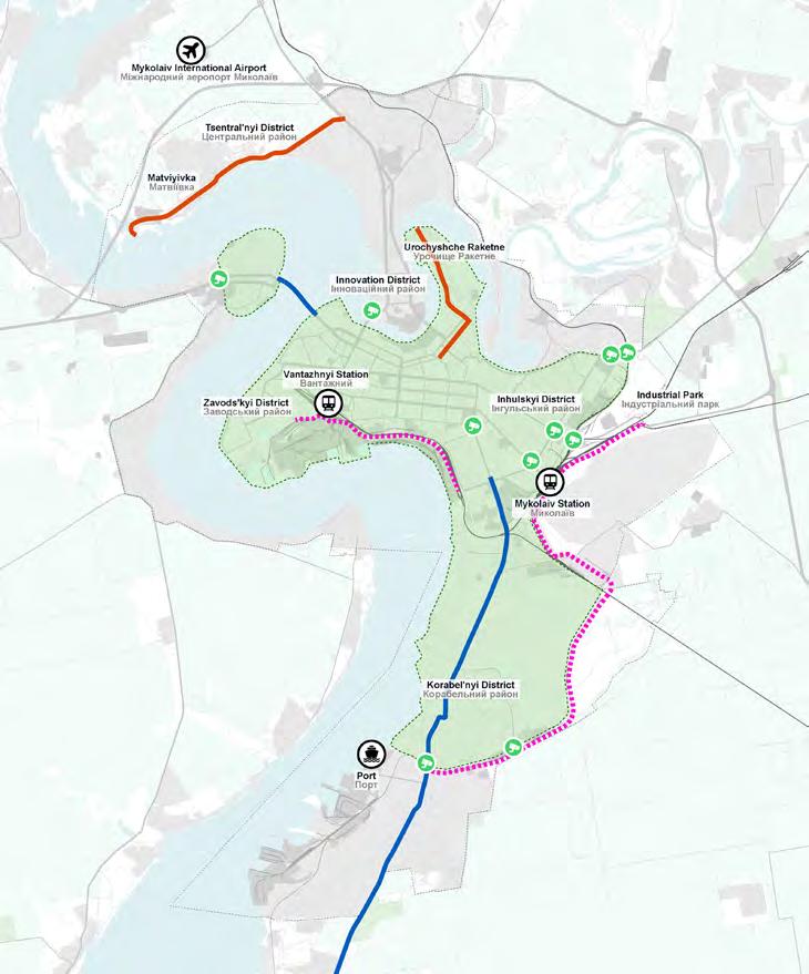
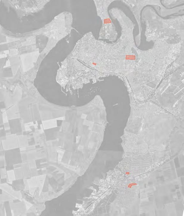
5_Mykolaiv Concept Masterplan: Digital Deliverables
ENHANCING URBAN PLANNING IN THE CITY OF MYKOLAIV
CONCEPT MASTERPLAN
OUTPUT 4 GRAPHIC AND DIGITAL DELIVERABLES
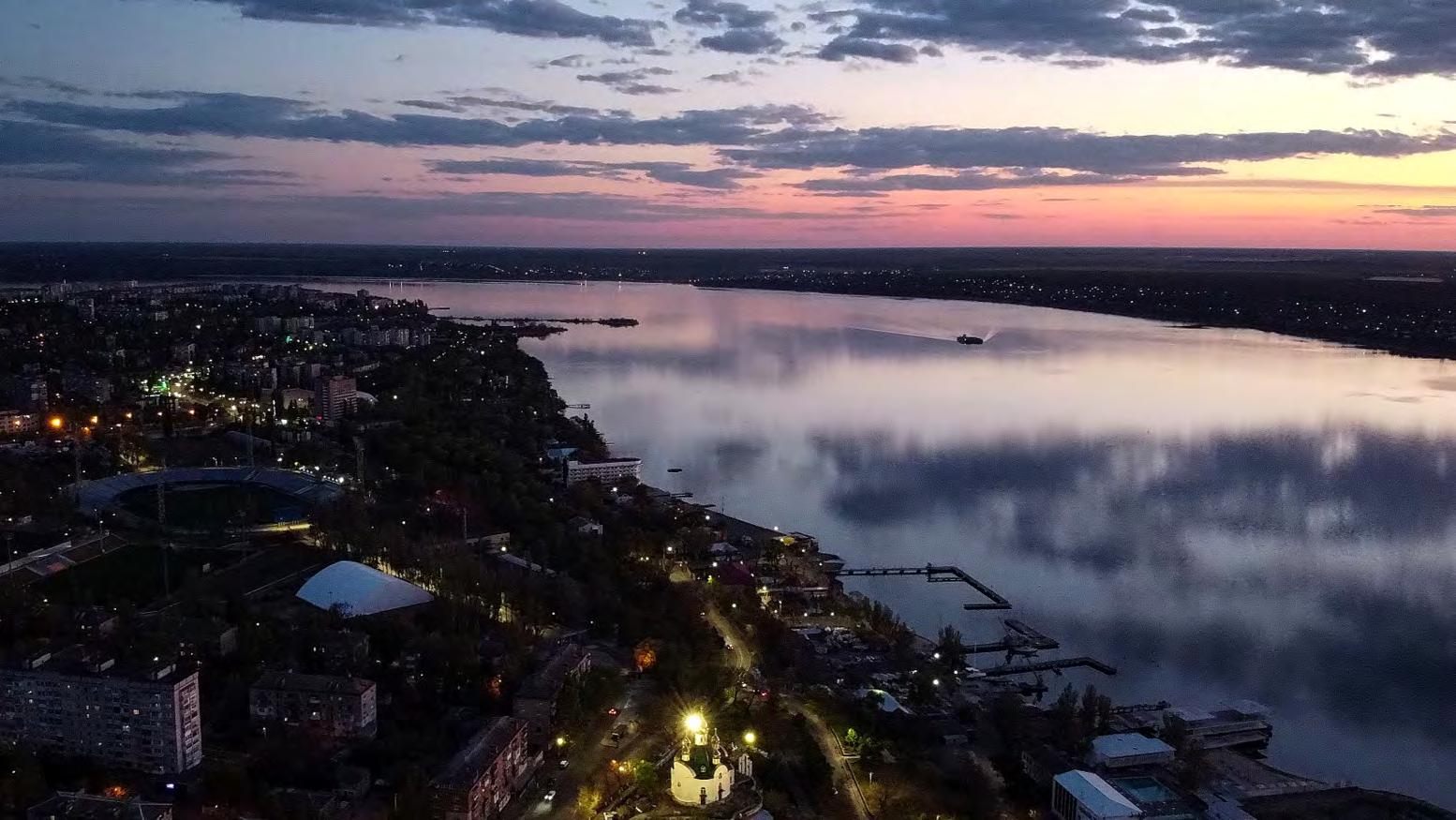
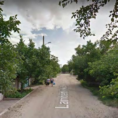
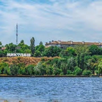
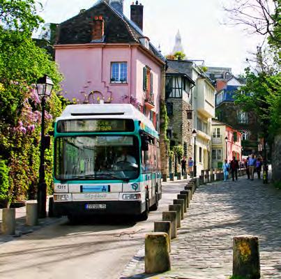
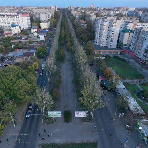
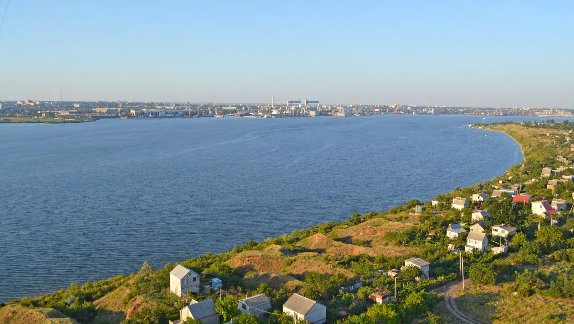
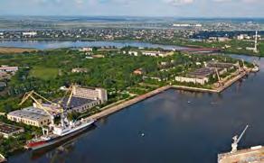
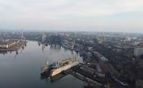
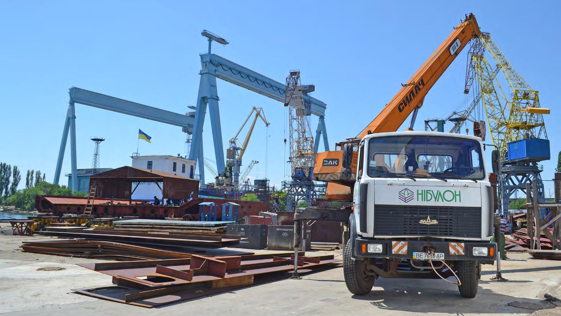
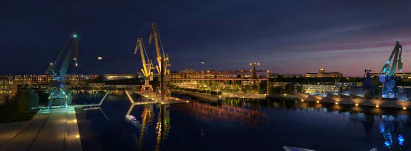
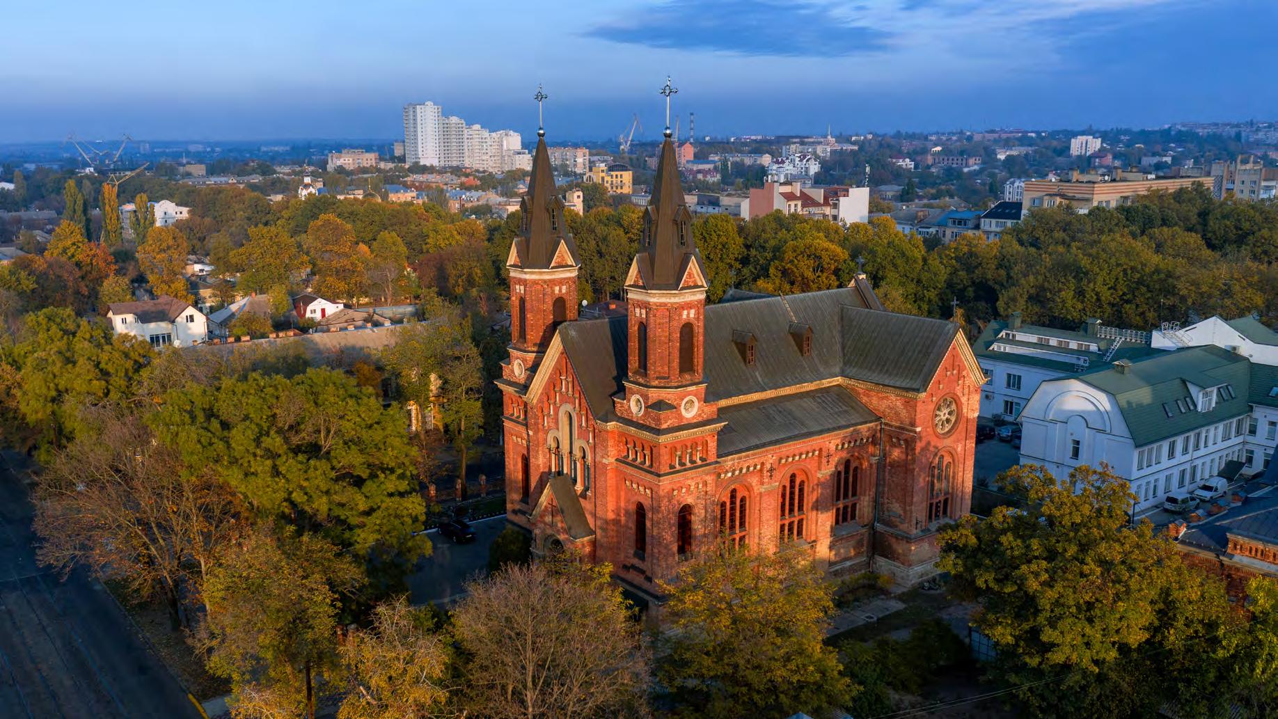
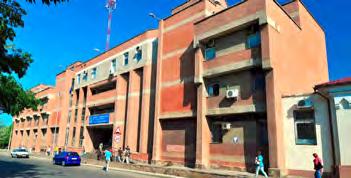
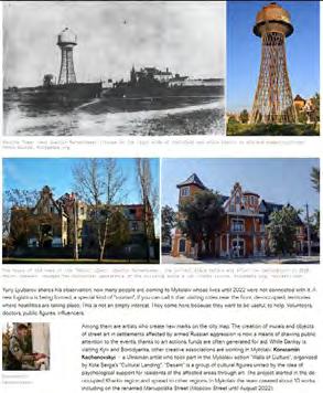
Photo: Dmytro Udovytskyi
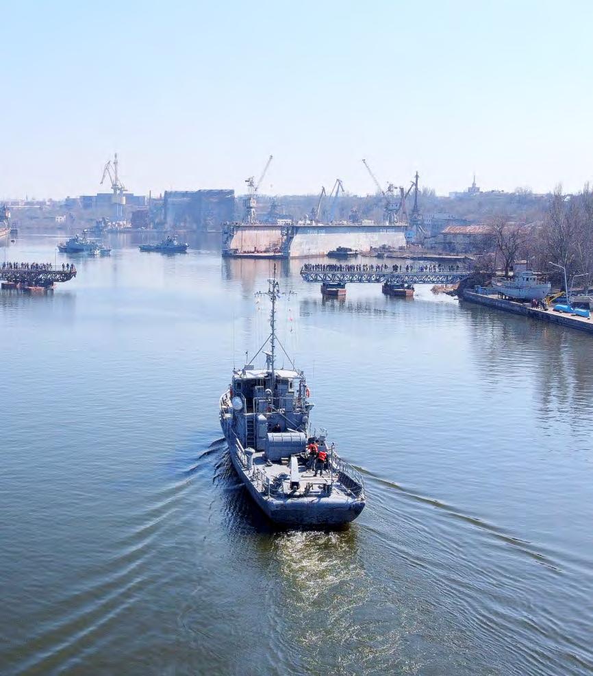
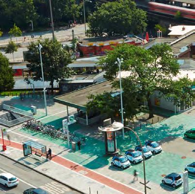
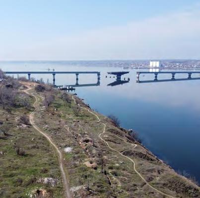
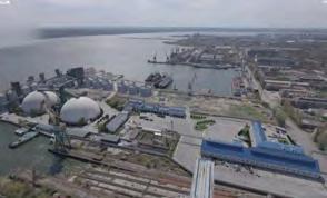
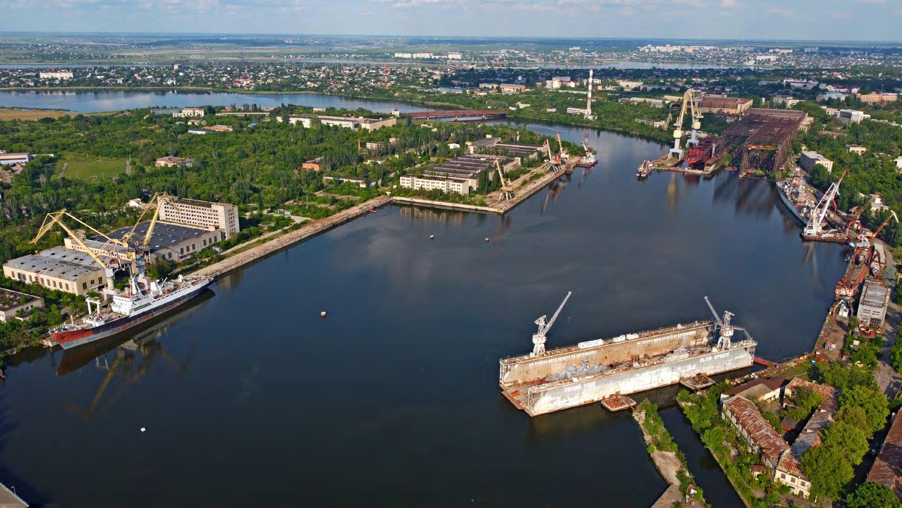
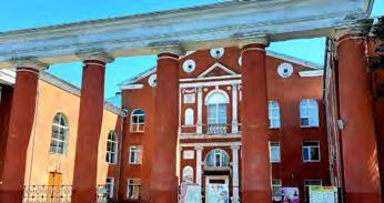
Photo: Alexander Minyaylo
ENHANCING URBAN
PLANNING IN THE CITY OF MYKOLAIV
CONCEPT MASTERPLAN
OUTPUT 4
GRAPHIC AND DIGITAL DELIVERABLES
This publication was developed within the UN4UkrainianCities Project titled "Development Pilot Projects to support the implementation of the Reconstruction Master Plan for the city of Mykolaiv, Ukraine." This project is implemented by UNECE, funded by the German Federal Ministry for Economic Cooperation and Development (BMZ), and supported by the Deutsche Gesellschaft für Internationale Zusammenarbeit (GIZ).
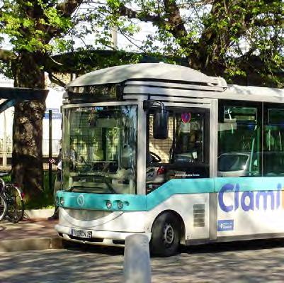
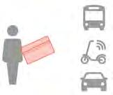
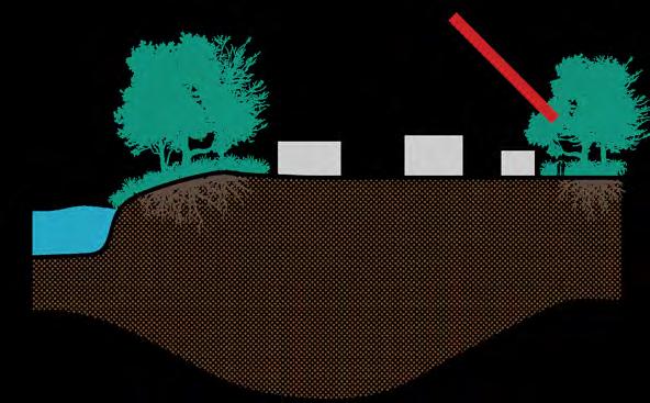
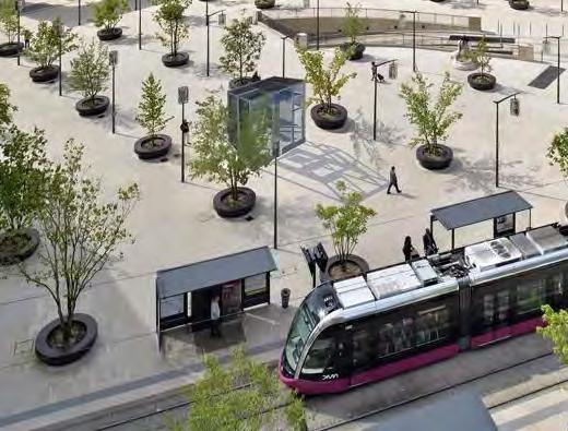
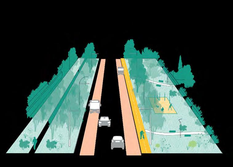
Adaptable and flexible reuse of transport
CHAPTER 2/
2
CHAPTER
3
Executive summary
Резюме
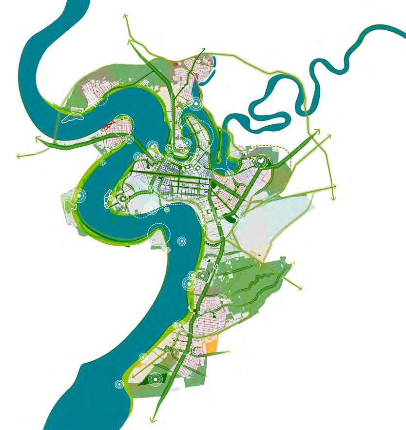
This report forms the last integral module of the Concept Masterplan for Mykolaiv, tying together the strategies and principles put forth in previous Outputs. The Output 4 report proposes guidelines for two of the main urban systems: the mobility and landscape networks.
The mobility strategy offers a comprehensive overview of proposed routes and modalities, including road, railway, soft mobility, and public transport networks. The landscape guidelines for the city cater to the allrounded vision of Mykolaiv as a nature-positive urban environment.
This report provides also a site evaluation for two crucial pilot projects - Industry and Trade, and Housing and Community.
Finally, the report discusses the multiple formats in which dissemination activities have been carried out to share the work done for the Concept Masterplan with the public and other stakeholders.
Although this report marks the conclusion of the project, it is intended as a starting point, a strong foundation for the future development of Mykolaiv.
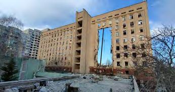
Photo: Dmytro Udovytskyi
CHAPTER 1 | РОЗДІЛ 1
Transport and mobility strategy*
*This is an updated version of the Draft transport and mobility strategy submitted in the Output 3 - Part 1 report.
Introduction Вступ
The Transport and Mobility Strategies for Mykolaiv‘s Concept Master Plan aim to transform the city’s mobility landscape, ensuring a sustainable, efficient, and liveable urban environment. This report outlines a series of strategic interventions across multiple sectors, aiming to enhance accessibility and connectivity and promote sustainable transportation modes, while offering flexible and adaptable mobility solutions that can be updated to accommodate future needs. The proposed strategies include railway and road networks, public transport, parking, and soft mobility, as well as recommendations related to adaptable and flexible reuse of transport infrastructure. Ultimately, Key Performance Indicators (KPIs) were defined in order to assess/evaluate the impact of the proposed strategies in the next phase of the project.
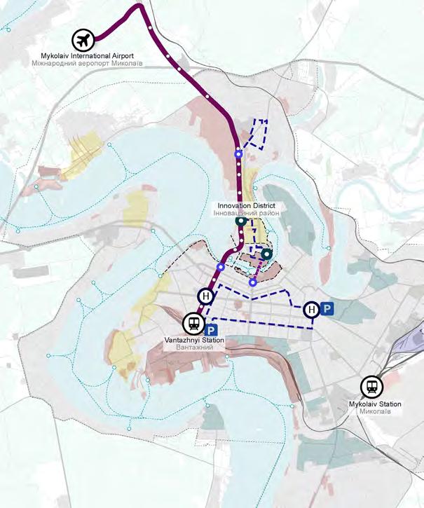
The railway network strategy is crucial to enhancing transportation efficiency in Mykolaiv. By integrating railways into the urban landscape, the plan aims to minimise their barrier effect, improve connectivity to the airport, and repurpose industrial railway tracks for urban regeneration.
The road network strategy focuses on redesigning streets and implementing bypass routes to redirect freight traffic in order to improve urban liveability. This strategy will free up streets for pedestrian and community use, creating a more pleasant and accessible urban environment for residents and visitors.
The public transport strategy prioritises sustainability and flexibility and proposes various enhancements, including the development of mobility corridors, a citywide water transport system, feeder services as complementary shuttle service to the public transport for last mile connections and low demand areas, and the establishment of multimodal hubs. These measures aim to provide a cohesive and efficient public transport network that meets the diverse future needs of Mykolaiv’s population.
The parking strategy envisions a citywide parking system with paid zones in the city centre, Park and Ride facilities, and strategic alignments to improve transportation efficiency. This approach encourages modal shifts towards sustainable transport options, thereby aiming to reduce traffic congestion and enhancing urban mobility.
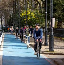
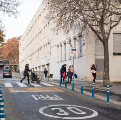
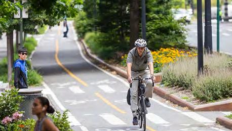
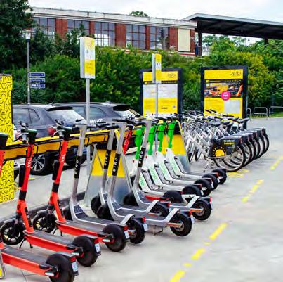
The soft mobility strategy includes developing dedicated cycling infrastructure, improving waterfront access, promoting micro-mobility services, and engaging in innovative urban revitalisation initiatives. These efforts ensure urban accessibility and sustainability and aim to foster a culture of active and healthy transportation and reduce reliance on motorised vehicles.
The report delves into detailed strategies and guidelines for each sector. These proposed strategies are based on thorough analyses of the current situation in Mykolaiv and arising opportunities and challenges. Each chapter begins with a summary of these findings and considers previously planned strategies from the municipality. The strategies are then updated according to these plans and the overall urban strategy proposed for Mykolaiv’s future master plan.
The report outlines short- and long-term strategies for the rail network, followed by interventions for the road network to accommodate freight vehicles, private cars, and proposed public transport modes. Key proposals include limited zones for heavy traffic to improve urban liveability.
A detailed public transport network plan features flexible on-wheel systems, dedicated and nondedicated lanes, strategically located stops, and a complementary feeder system for last mile connections. Water transport strategies introduce new ferry routes, water taxi stops, and the development of mobility hubs, ticketing options, and Mobility as a Service (MaaS) solutions.
Parking strategies focus on implementing Park and Ride facilities, paid parking zones, and comprehensive parking policies to manage citywide parking efficiently. Soft mobility strategies involve developing bike lanes, micro-mobility sharing stations, and various bike parking facilities to encourage cycling and other forms of active, low-emission mobility transportation.
The report includes a chapter on the analysis and evaluation of the proposed strategies with Key Performance Indicators (KPIs) including Public Transport Accessibility Level (PTAL), Pedestrian Isochrones Analysis, Network Morphological Analysis, and Depth Map Space Syntax
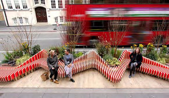
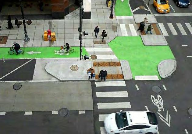
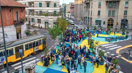
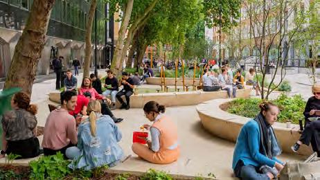
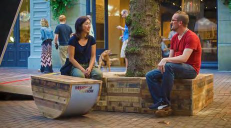
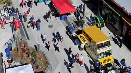
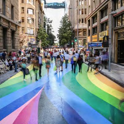
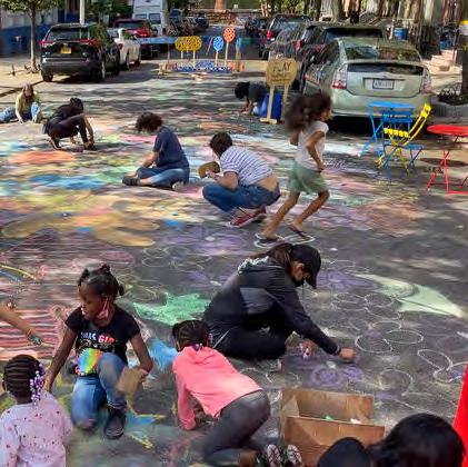
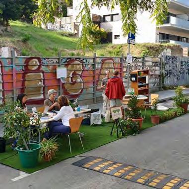
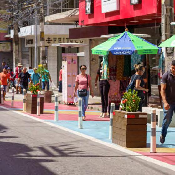
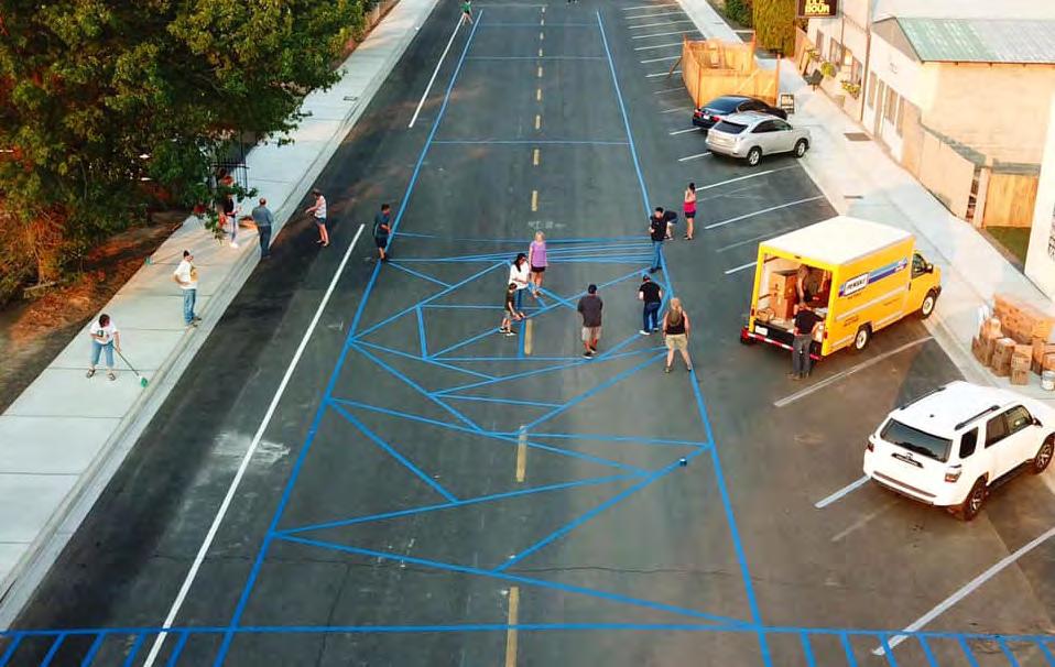
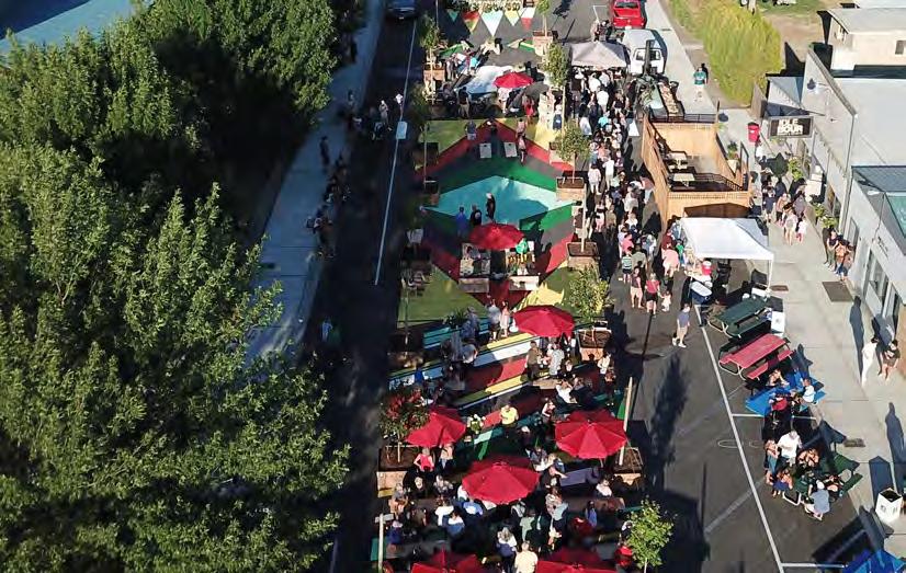
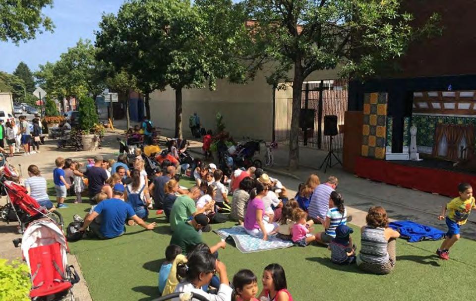
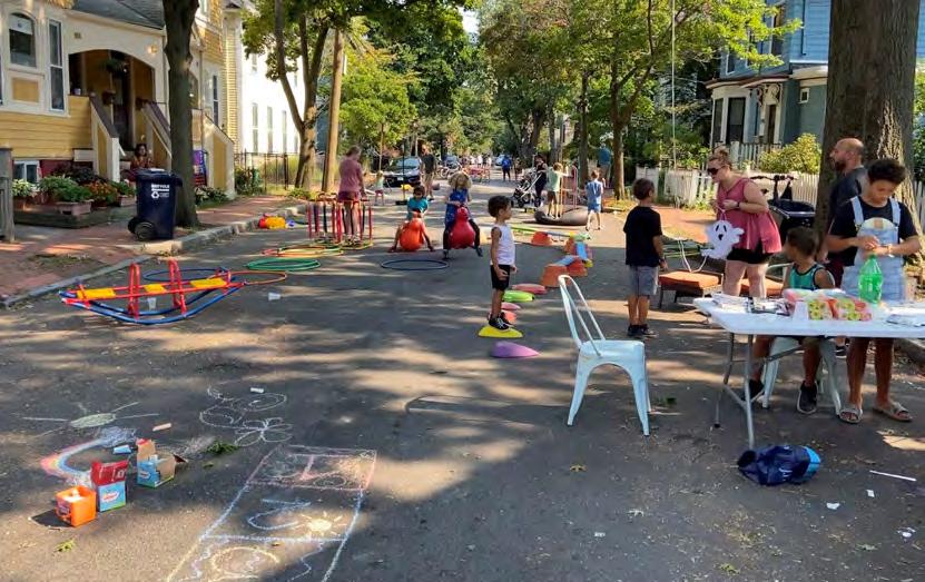
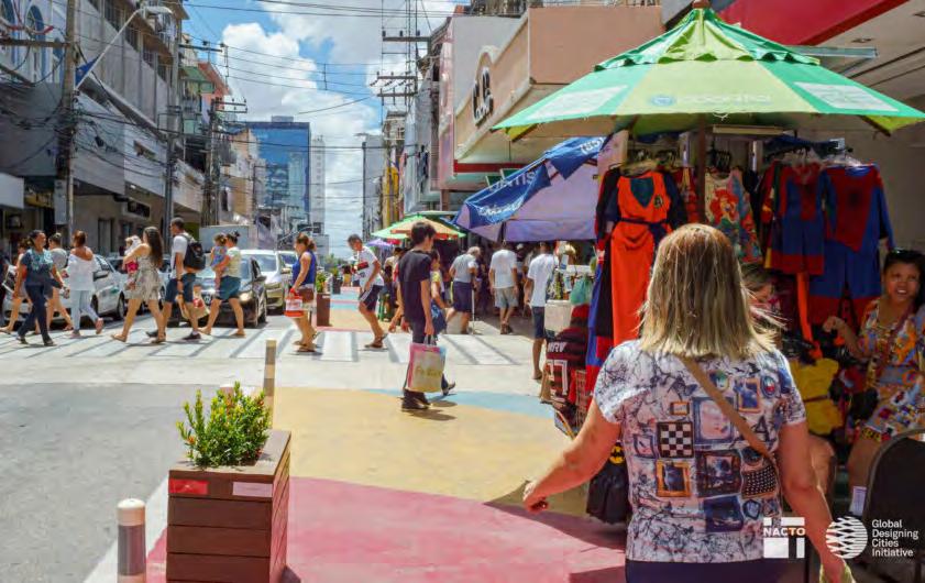
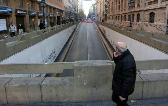
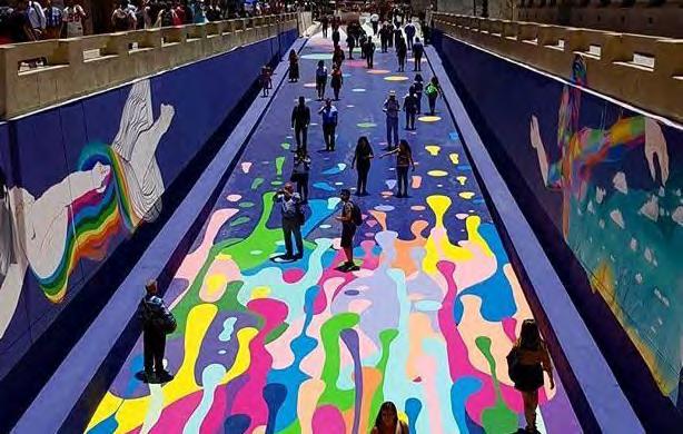
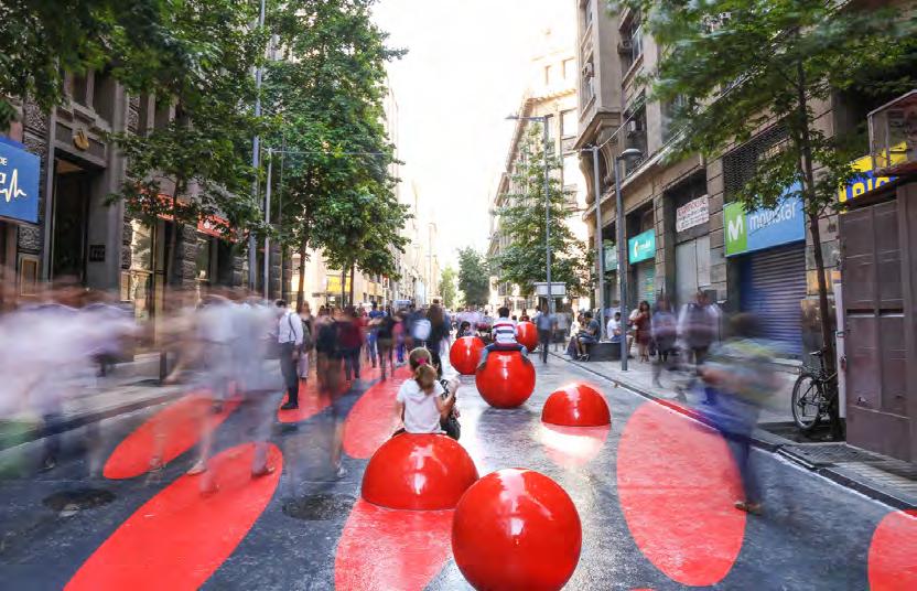
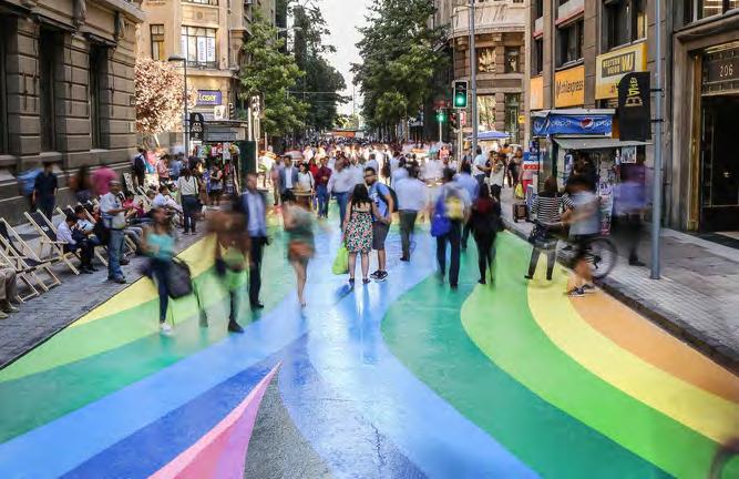
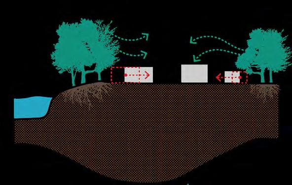
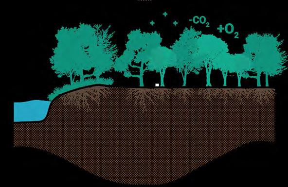
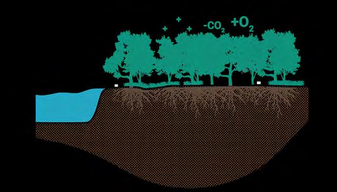
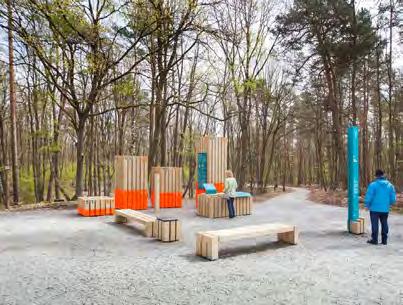
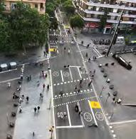
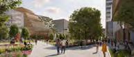
A dedicated chapter explores the adaptable and flexible reuse of transport infrastructure, offering benchmarks for strategies like temporary street closures to provide space for community events and car-free Sundays to encourage cycling. Parking area repurposing transforms parking spaces into functional public areas, such as pop-up parks, outdoor dining, or community spots. Tactical urbanism initiatives involve improvements like seating areas, painted sidewalks, parklets to test new ideas and engage the community, and address public space needs flexibly. Through these comprehensive strategies, the Mykolaiv Concept Master Plan aims to create a more efficient, sustainable, and liveable urban environment aligned with the city’s overall goals and vision.
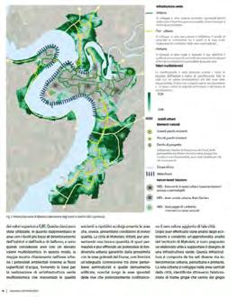
Main mobility strategies
The railway network strategy’s goal is to enhance transportation efficiency by integrating railways into urban landscapes, minimising their barrier effect, improving airport connectivity, and repurposing industrial railway tracks for urban regeneration.
The road network strategy strives to increase urban liveability by redesigning streets and implementing bypass routes to redirect freight traffic, thereby freeing streets for pedestrian and community use.
The public transport strategy prioritises sustainability and flexibility through various improvements, including mobility corridors, a city-wide water transport system, feeder services, and establishing hubs to enhance multimodal connectivity.
The parking strategy aims to integrate a city-wide parking system with paid zones in the city centre, Park and Ride facilities, and strategic alignments to boost transportation efficiency and encourage modal shifts towards sustainable transport options.
The soft mobility strategy’s goal is to improve urban accessibility and sustainability through dedicated cycling infrastructure, improved waterfront access, promotion of micro-mobility services, and innovative urban revitalisation initiatives.
Railway network strategy
Railway network strategy
The following chapter provides a detailed overview of the railway network strategy for Mykolaiv. It begins by identifying the existing challenges and opportunities, followed by the main goals and strategies, which are then translated into the proposed short- and long-term strategies.
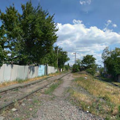
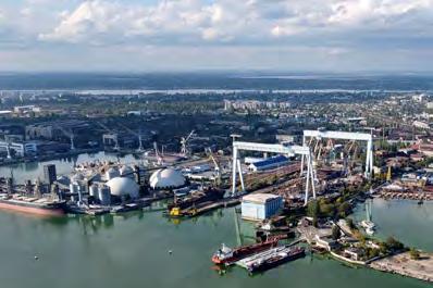
One of the major challenges of the existing railway network is the infrastructural barrier it creates, especially for pedestrians and the lack of safety barriers around railway yards. Additionally, extensive railway yards in former industrial and port areas hinder waterfront access, and reduce the amount of potential drop-off areas and pedestrian connections to train stations.
However, the city also has significant opportunities. Mykolaiv boasts a substantial railway network that can be consolidated and enhanced to optimise train usage for freight and passenger transportation. The presence of two main train stations in the city centre offers an excellent opportunity to establish them as vital and centrally located mobility hubs. Additionally, the railway line extends close to the airport, offering a near connection that currently lacks direct access and has excellent potential for improvement. The industrial
area of the current port near the city centre, which is identified for future regeneration, features minor railway tracks that could be repurposed into new public spaces.
The main goals of the railway network strategy are to establish a direct railway link to the airport and improve accessibility and connectivity for travellers. It further aims to mitigate infrastructure barriers by connecting neighbourhoods and ensuring the continuity of soft mobility routes by implementing pedestrian and cycling bridges over railway tracks. Another goal is to convert minor railway tracks within former industrial zones into new public spaces. In the long term, the plan envisions redirecting the railway to remove barriers from potential new regeneration areas while ensuring railway access to the industrial park. This chapter will further detail these strategies, providing a comprehensive short- and long-term implementation plan.
Railway network challenges
The existing railway network creates infrastructure barriers, i.e. for pedestrians
The lack of barriers in the railway yards poses a threat to pedestrian safety.
The presence of extensive railway yards in former industrial and port areas reduces/hinders access to the waterfront.
Lack of adequate drop-off areas and pedestrian connections to the train stations
Railway network opportunities
The city has a substantial railway network that can be consolidated and enhanced to optimise train usage for both freight and passenger transportation
The presence of two main train stations in the city centre offers an excellent opportunity to enhance urban transportation and mobility, and to establish them as vital mobility hubs for the city.
The railway line extends close to the airport, offering a close connection but lacking direct access
The industrial area of the current port near the city centre, identified as a future regeneration area, features minor railway tracks that could be repurposed into new public spaces
Railway network main goals
Establish a direct railway link to the airport to improve accessibility and connectivity for travelers
Mitigate infrastructure barriers, connect neighbourhoods, and ensure continuity of soft mobility routes by implementing pedestrian and cycling bridges over railway tracks
Convert minor railway tracks within former industrial zones into new public spaces
Implement a long-term redirection of the railway to remove barriers from potential new regeneration areas while ensuring railway access to the industrial park
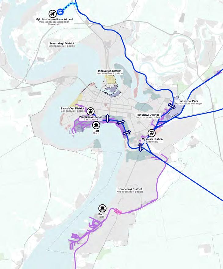
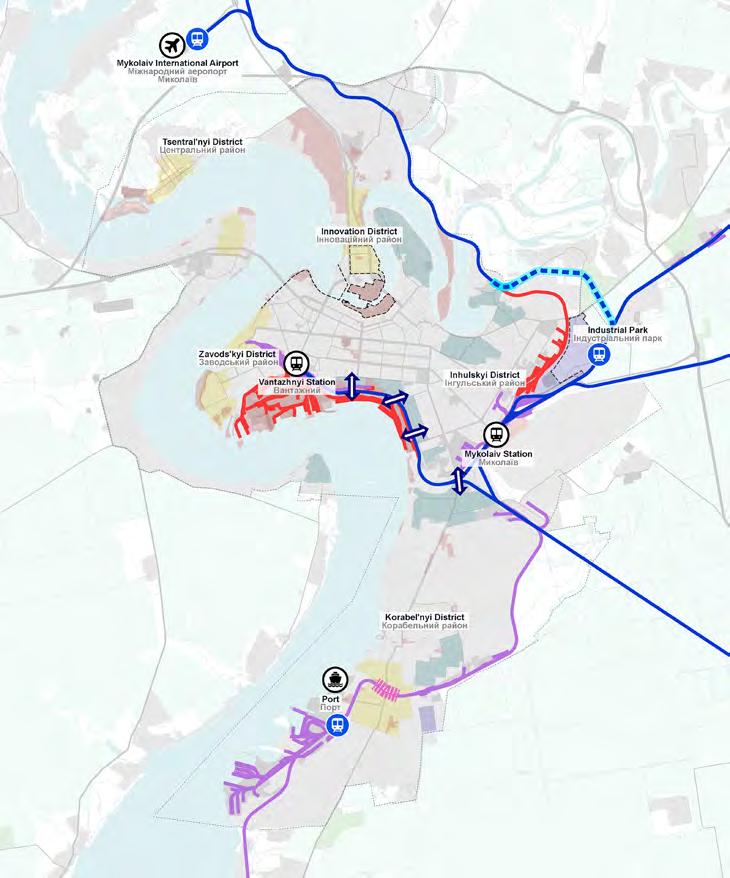
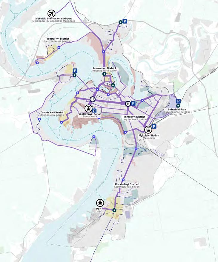
Existing railway network
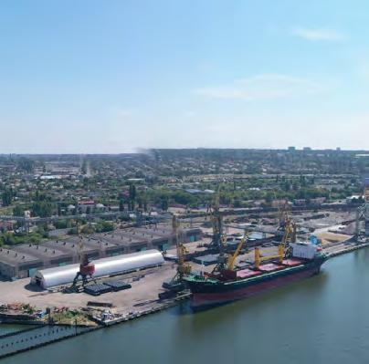
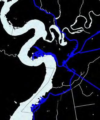
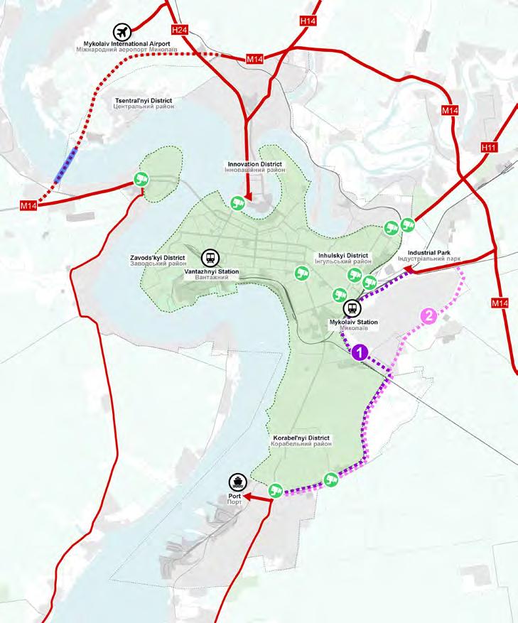
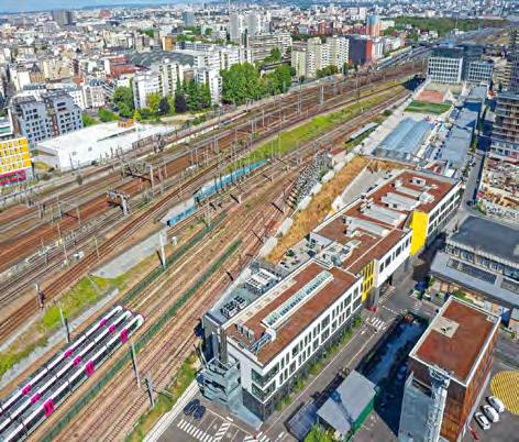
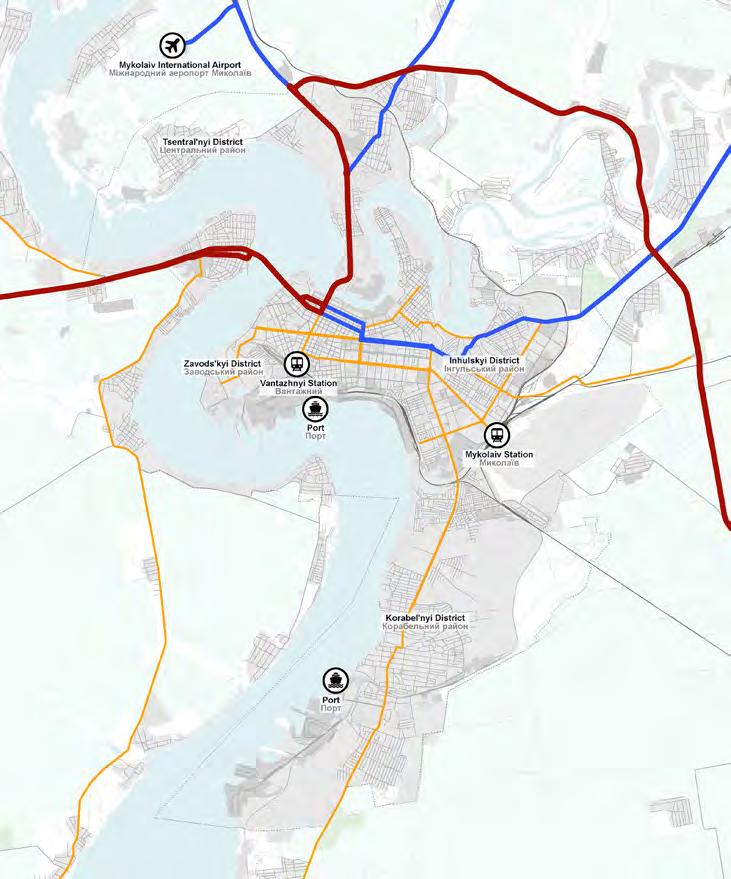
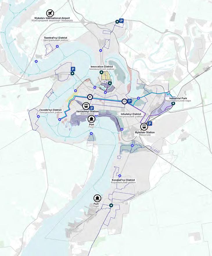
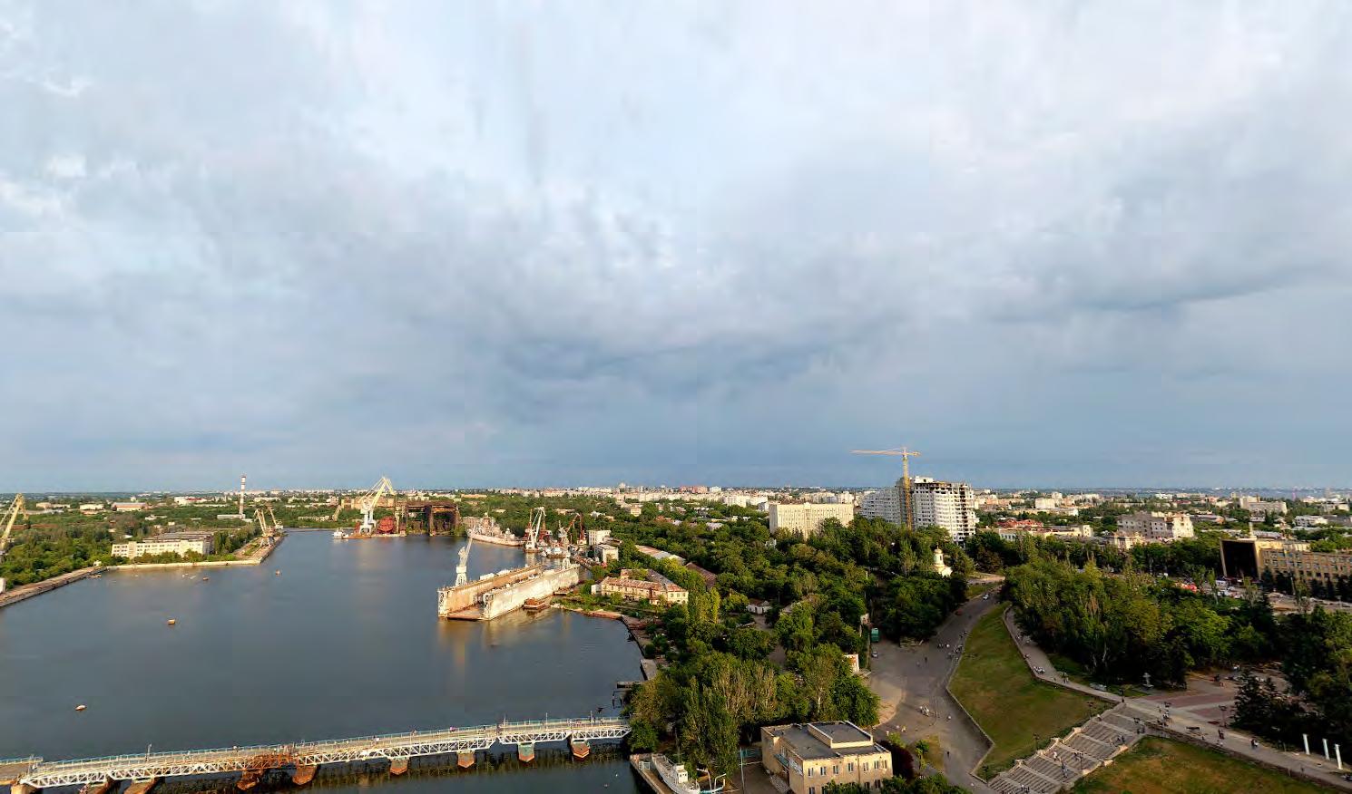
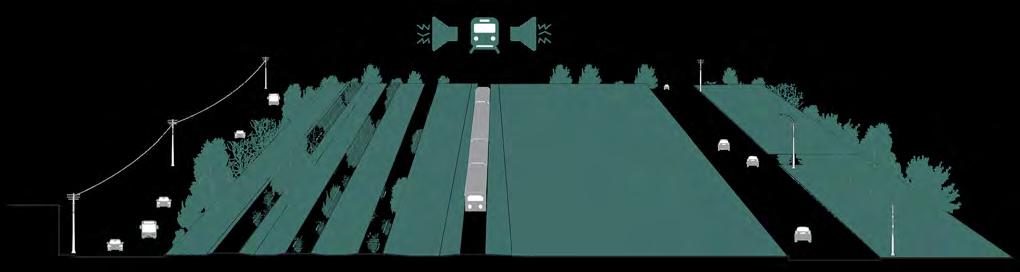
The city’s railway network includes freight and passenger services, featuring two main train stations in the city centre. The extensive freight network supports the movement of goods, primarily serving the city’s ports. However, the rail network also creates an infrastructural barrier, as it is poorly integrated into the urban landscape. This lack of integration impacts freedom of movement across certain areas, particularly towards the waterfront where the port is located.
Short-term railway network
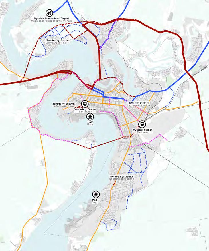
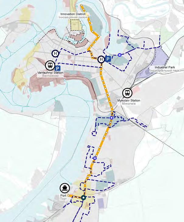
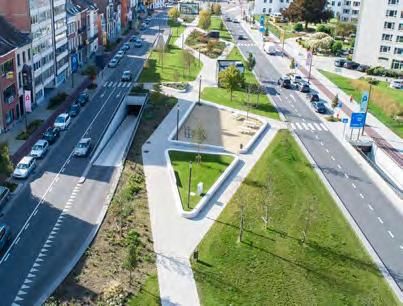
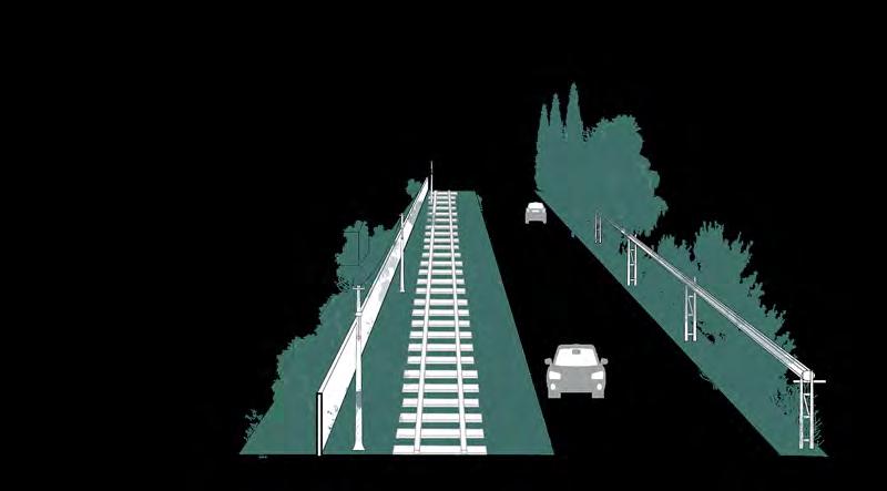
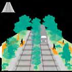
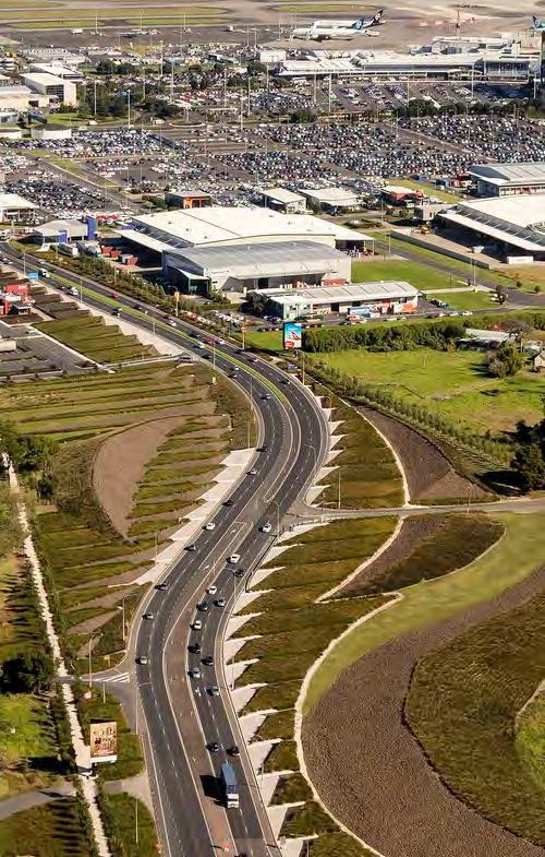
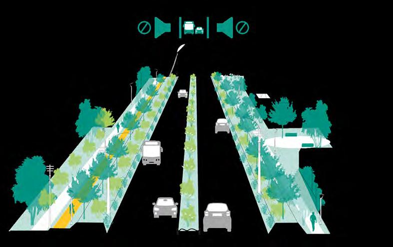
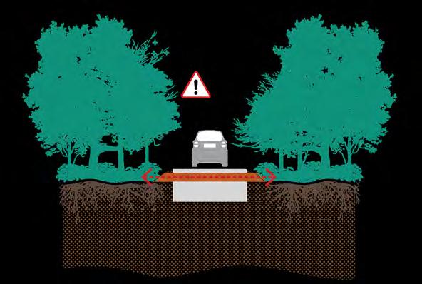
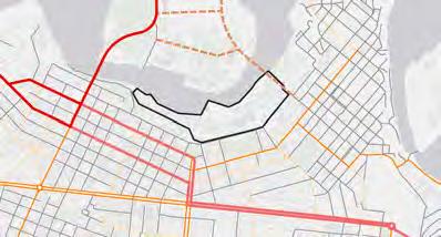
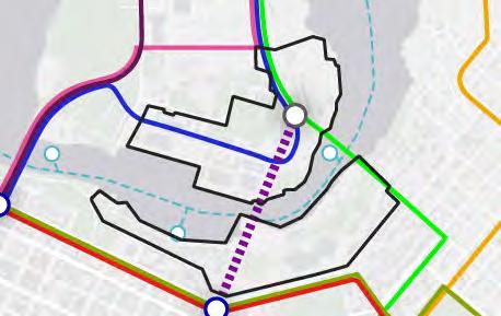
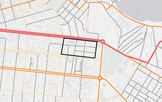
The proposed short-term railway network strategy aims to enhance connectivity by establishing a direct link with the airport, thereby improving the passenger travel experience. The plan also includes implementing cyclist and pedestrian bridges above the railway in crucial city areas to stitch neighbourhoods together and better integrate the surrounding areas of the rail tracks, promoting sustainable and accessible transportation solutions throughout the city. Additionally, in Bohoiavlenskyi Avenue (1), close to the southern port, a grade-level separation between the rail and the road is proposed to ensure safety and facilitate movement. In the long term, this separation is especially crucial to accommodate potential increases in railway capacity once the northern port is relocated to the south.
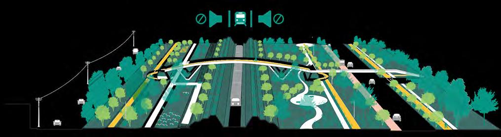
Long-term railway network
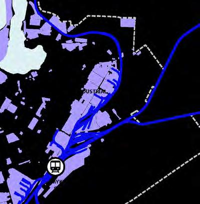
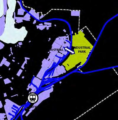
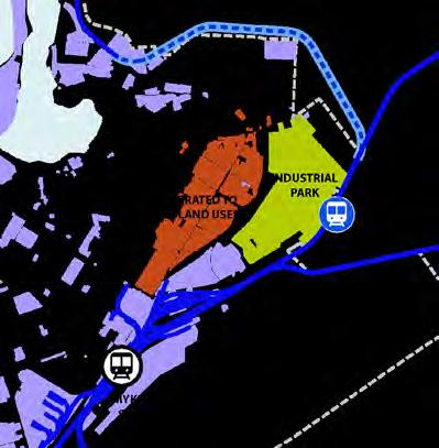
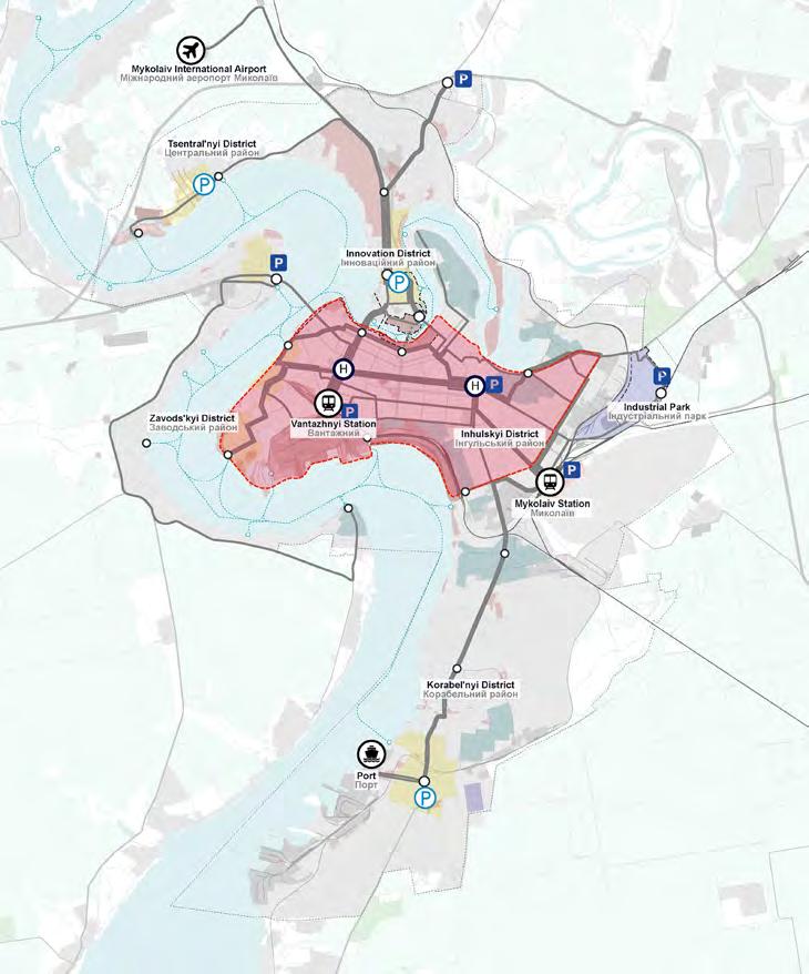
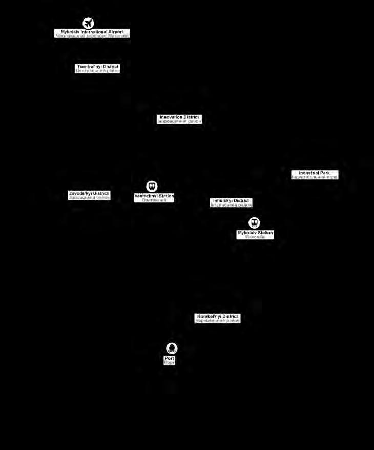
The long-term proposal of relocating the northern port - which is currently located near the city centre - to the southern port, allows for the transformation of this strategic part of the city in a mixed-use area. This would involve removing or repurposing the railway tracks and hence, paving the way for vibrant urban spaces. This strategy will ensure the area’s accessibility for citizens by all modes of transport, creating new opportunities for accessing the waterfront. Additionally, the proposal includes redirecting a section of the railway network towards the east to provide the newly set up industrial park with its own stop. This strategy eliminates the physical barrier that tracks create between neighbourhoods, fostering better urban integration. It will also improve the movement of cars and soft mobility between this zone and the industrial park.
Existing
Industrial park Індустріальний
Maintaining
Proposed
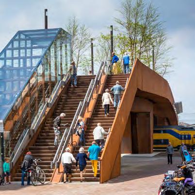
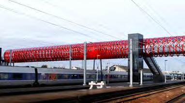
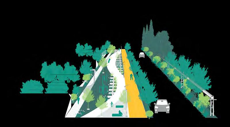
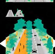
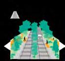
Cyclist-pedestrian bridges
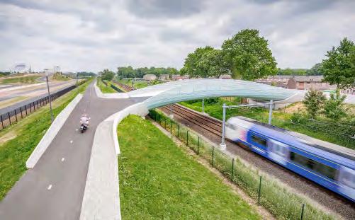
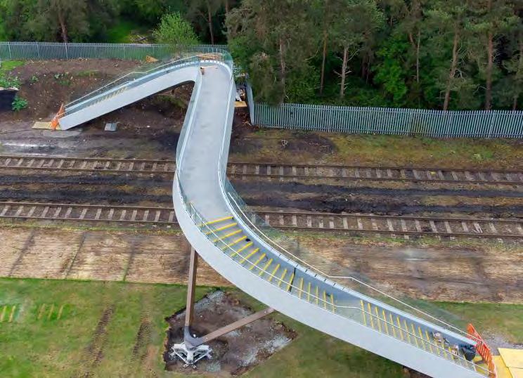
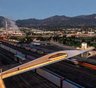
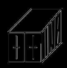
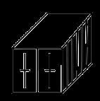
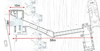
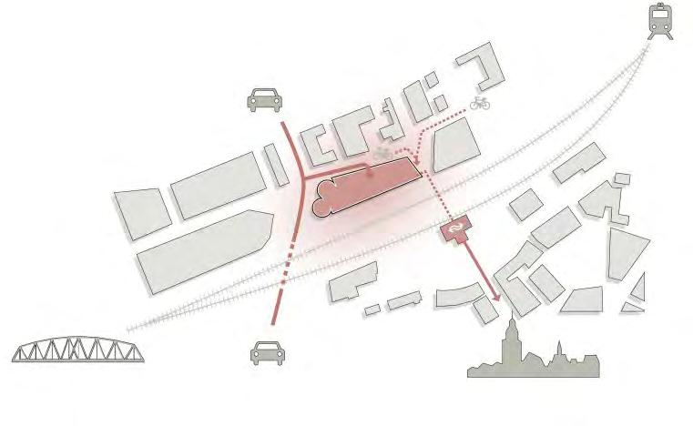
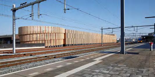
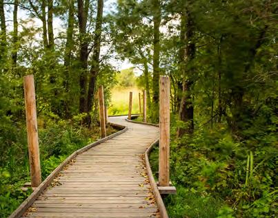
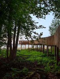
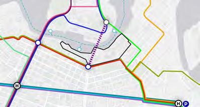
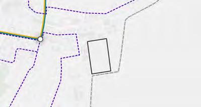
The following page presents four examples of cyclistpedestrian bridges, as references for proposed soft mobility connections between neighbourhoods divided by railway yards. These bridges aim to mitigate the infrastructural barriers created by the railway tracks, ensuring continuous movement and fostering neighbourhood connectivity.
Flow footbridge, Shropshire, UK
Park Union bridge, Colorado Springs, USA
Railway footbridge, Roche-sur-Yon, France
Length: 21m
21м
Pedestrian
Length: 76m
76м
Pedestrian and Cycling
Length: 67m
67м
Pedestrian
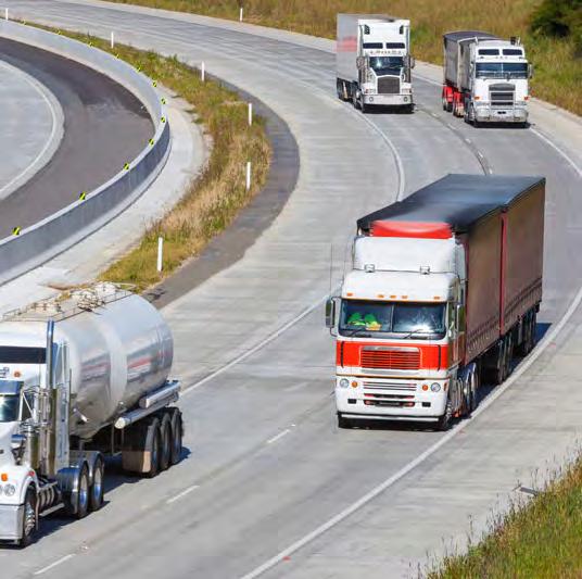
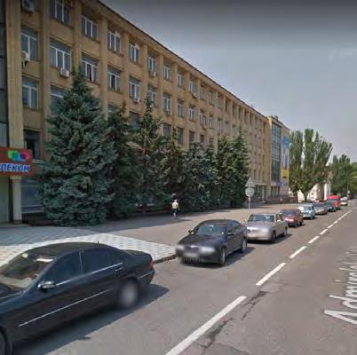
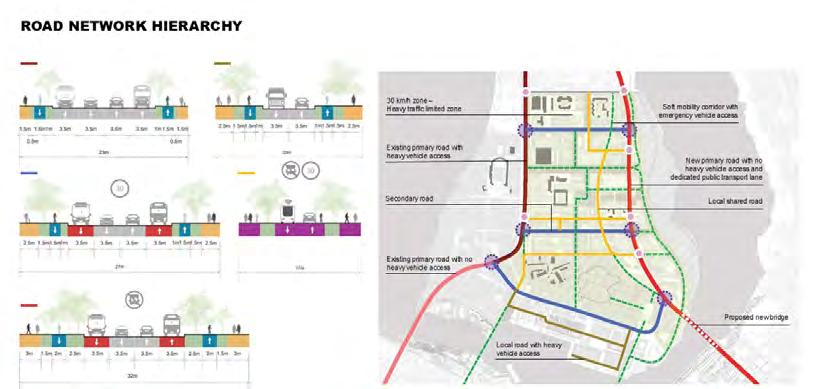
Road network strategy
Стратегія
\ Фотографія: https://www.google.it/maps/
Photo
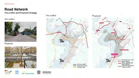
Road network strategy
The following chapter provides a detailed overview of Mykolaiv’s road network strategy. It begins with identifying existing challenges and opportunities, followed by the main goals and strategies before translating these into proposed short- and long-term solutions.
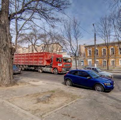
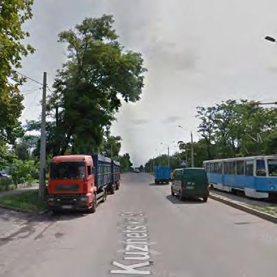
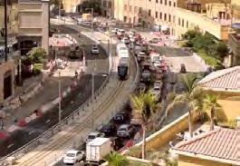
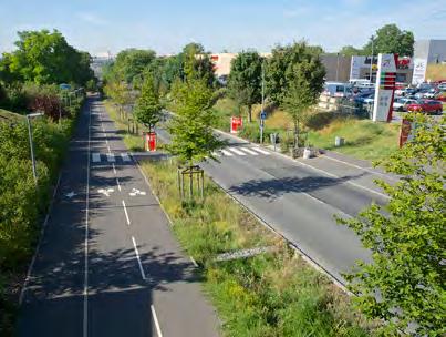
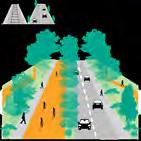
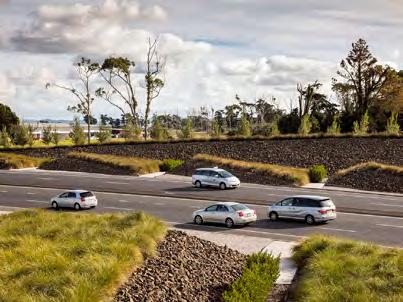
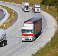
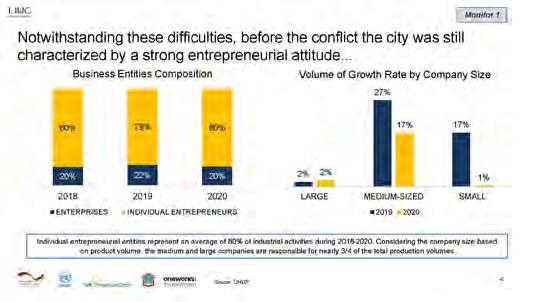
One of the major challenges of the current road network is the lack of bypass roads. This results in a situation where heavy freight trucks travel through the city centre, causing traffic congestions and degrading the existing road network. Additionally, there are no traffic limited or speed-limit zones for heavy vehicles. Wide traffic lanes on some roads encourage highspeed driving. Changes and improvements in road design are required, i.e. to ensure pedestrian safety. However, several opportunities can be leveraged to improve the road network. Mykolaiv is not predominantly reliant on cars, with only 16% of the city’s modal share being private car usage. Previous proposals by the Japan International Cooperation Agency, PADECO Co., Ltd., and Pacific Consultants Co., Ltd., for a new bridge and bypass road aim to redirect freight traffic from the city centre to the ports. Some areas have ample roads and sidewalks that can be redesigned to include dedicated public transport and cycling lanes. Additionally, roads in peripheral areas, marked by undefined spaces and low traffic volumes, offer an opportunity to be repurposed as shared roads and public spaces.
The main goal of the road network strategy is to develop a phased approach to create a bypass road, gradually diverting heavy vehicle traffic away from city centre roads while incorporating both immediate and long-term solutions.
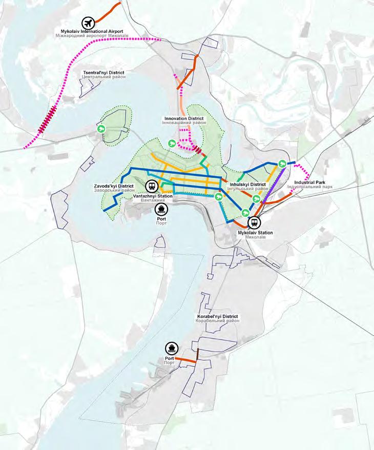
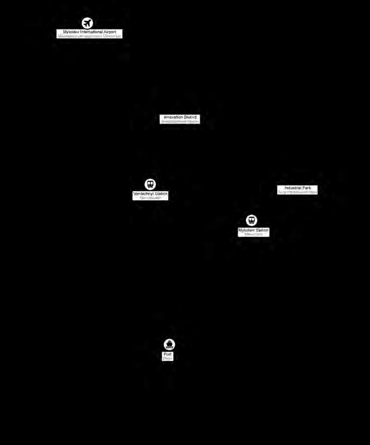
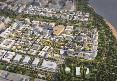
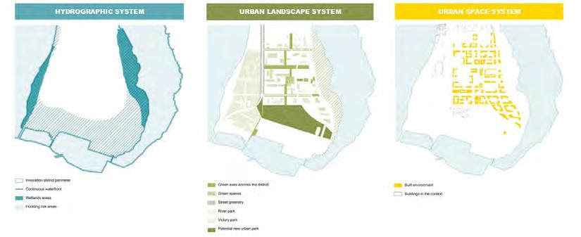
Additionally, the road network strategy proposes improvements to the accessibility of the Innovation District. These include the introduction of a new bridge connection between the site and the city centre, integrating it into the broader road network while creating new roads within the area.
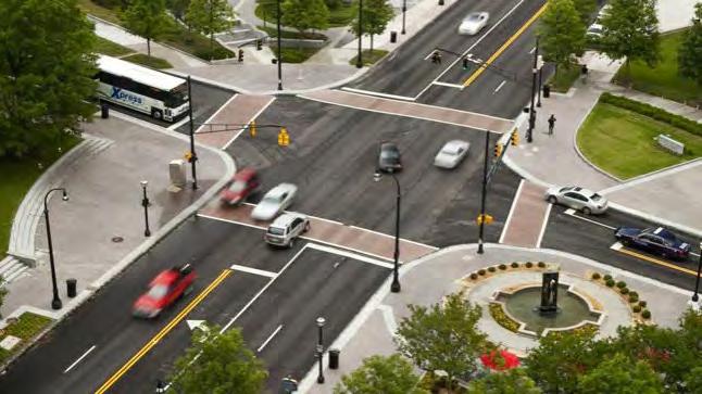
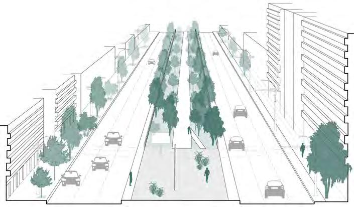
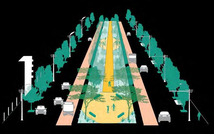
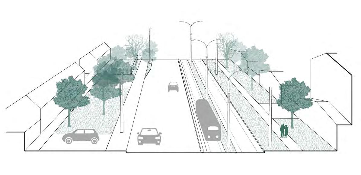
The road network strategy includes upgrading and downgrading roads, improving pavement and signage, and replacing tram tracks with greenery or dedicated public transport lanes. The road network strategy promotes sustainability and flexibility by prioritising public transport while fostering a safer and more pedestrian-friendly urban environment.
The road network strategy also aims to transform existing streets into dynamic, inclusive, and flexible spaces by prioritising needs of pedestrians and cyclists, fostering a strong sense of community. Enhancing road safety through improved accident data analysis, the implementation of slow zones, and intersection improvements, including better signage, lighting, and pedestrian crossings, is also a key objective.
This chapter details the road network strategy for freight movements with proposed interventions for a heavy traffic limited zone, outlining short- and longterm solutions. It is followed by detailed proposals for short- and long-term interventions for the road network, including current and envisaged road sections for the intervention typologies. The report concludes with a series of guidelines for street design to ensure accessibility, multimodality, versatility, and safety.
Road network strategy
Road network challenges
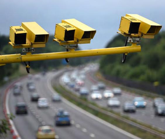
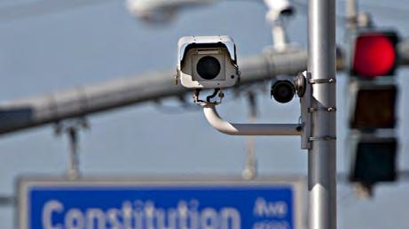
The absence of traffic-limited zones for heavy vehicles and designated speed limit zones leads to increased number of heavy vehicles in the city centre contributing to congestion and causing road safety concerns for soft mobility users
Many streets
Road network opportunities
With private cars only making up for 16% of the city’s modal share, Mykolaiv already offers huge acceptance for shared urban mobility
The availability of previous proposals for a new bridge and bypass road presents a chance to effectively redirect freight traffic from the city centre alleviating congestion and improving urban mobility
Ample roads and sidewalks in some areas can be redesigned to include dedicated public transport lanes and cycling lanes
Roads in peripheral areas, characterised by undefined spaces and low traffic volumes, offer an opportunity to be repurposed as shared roads and public spaces
Road network main goals
Develop
Implement strategic road interventions, such as road upgrades, downgrades, and the introduction of dedicated lanes or green spaces, to promote sustainability and flexibility, ensuring a safer and more people-friendly urban environment
Revitalise streets into dynamic, inclusive, and flexible spaces by prioritising pedestrians and cyclists, fostering a strong sense of community
Enhance road safety through improved accident data analysis, implementation of slow zones, and intersection improvements, including signage, lighting, and pedestrian crossings
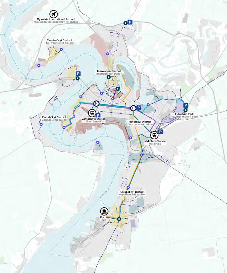
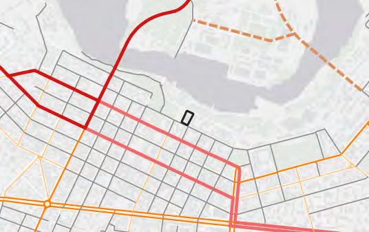
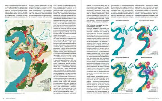
Existing freight routes
The following map illustrates the current heavy vehicle routes through Mykolaiv. These routes connect the city to other major Ukrainian cities and traverse the city centre to access the ports and industrial areas. This leads to increased heavy vehicle traffic in the city centre, raising safety concerns for soft mobility users and necessitating frequent road maintenance. These issues underscore the urgent need for a bypass road to divert heavy and medium vehicle movements away from the city centre.
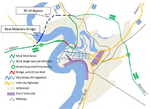
Proposed implementation of a bypass road
During the desktop-based research conducted for Mykolaiv, the following study was identified and utilised as the basis for proposing a bridge in the northern part of the city. This bridge aims to connect to the M-14 highway and divert heavy vehicle traffic from the city centre. The study referenced is titled “Data Collection Survey on Logistics and Transport System in Southern Ukraine Final Report - June 2017” prepared by the Japan International Cooperation Agency, PADECO Co., Ltd., and Pacific Consultants Co., Ltd. This study was necessitated by significant changes in transport patterns in the Southern Region of Ukraine following Russia’s annexation of Crimea in 2014 and the ongoing conflict in the eastern province. The analysis focused on the Southern Region of Ukraine, including Odessa, Mykolaiv, and Kherson Oblasts, and reviewed major highways, bridges, and ports in these areas.
The study aimed to examine the current logistics situation, review the Mykolaiv bridge construction project initially proposed to strengthen the east-west transit corridor along the national highway M-14, and propose other potential projects to improve Ukraine’s economic situation.
Source
Data Collection Survey on Logistics and Transport System in Southern Ukraine Final Report, JAPAN INTERNATIONAL COOPERATION AGENCY, PADECO Co., Ltd. Pacific Consultants Co., Ltd, June 2017 /
PADECO Co., Ltd., Pacific Consultants Co., Ltd.,
Freight routes: short term
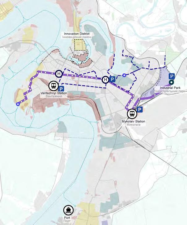
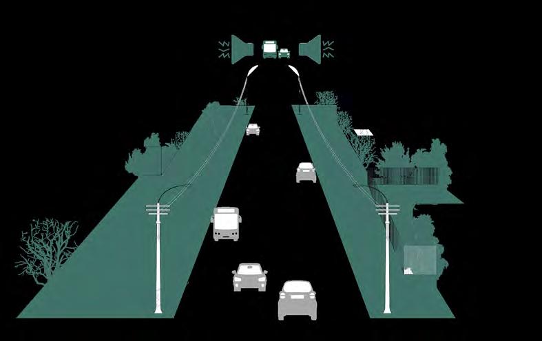
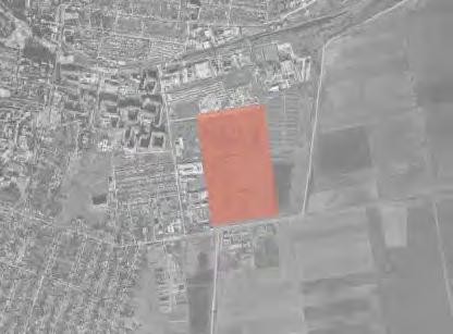
The following map illustrates the proposed freighttraffic redirection routes in the short-term scenario for Mykolaiv. Several strategic initiatives aim to address the issues caused by freight routes passing through the city. The proposal is based on the study shown on the previous page. These measures include the construction of a new bridge and an extension of the M14 highway to create a bypass road that connects the ports without passing through the city centre. Access to the traffic-limited zones for heavy vehicles should be regulated using access points equipped with traffic enforcement cameras. These measures also ensure efficient service to ports and industrial areas. Furthermore, the plan proposes to introduce a consolidation centre in the new industrial park. This strategy would allow goods to be delivered to the consolidation centre and distributed using smaller electric vehicles for last mile delivery within the city. These adaptations to the freight routes will help maintain logistics operations while enhancing urban accessibility and sustainability.
Freight routes: long term
The following map illustrates the proposed freighttraffic routes in the long-term scenario. These are aligned with the strategic plan to relocate the northern port from the city centre to the south. The trafficlimited zones for heavy vehicles is proposed to extend southward, encompassing the Korabel’nyi district. Additionally, two alternative roads are proposed to bypass the Korabel’nyi district and run parallel to the existing railway line leading to the southern port. These two options, requiring detailed feasibility studies in the future, are shown on the map. Option one proposes a new road passing behind the main train station, while option two redirects the road around the military zones before running parallel to the existing rail lines. This comprehensive strategy aims to increase urban liveability and promote sustainable urban development by reducing congestion in the city, providing additional space for soft mobility and public transport, increasing road safety, and improving port accessibility.
Urban logistics concept
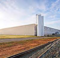
In addition to redirecting routes, the primary logistics proposal involves establishing a consolidation centre in the Industrial Park where goods can be aggregated and distributed throughout the city using electric vehicles. The following diagram illustrates logistics movements from a global and regional scale to urban and neighbourhood scales, showing how a consolidation centre operates. The following page outlines the characteristics of different scales and types of logistics centres that would be part of the goods’ transfer to their final destinations. It includes examples of urban consolidation centres.
Urban logistics typology
The cargo terminal serves as a logistics gateway, as it handles large amount of freight/cargo and is well connected to regional transport networks
The urban consolidation centre is well connected to the urban road network and operates as an urban distribution centre, making it the main logistics point at city level
The neighbourhood concierge serves as local logistics point, consolidating last mile delivery and small goods as well as integrating delivery pick up points
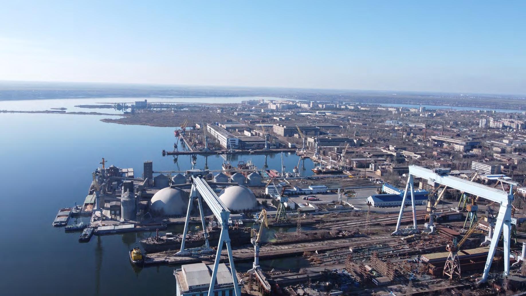
Photo \ Фотографія: Dmytro Udovytskyi
Interventions for traffic-limited zones for heavy vehicles
Establishing
Implementation
and
Enhancement of traffic management with clear signage, enforcement
Current road hierarchy
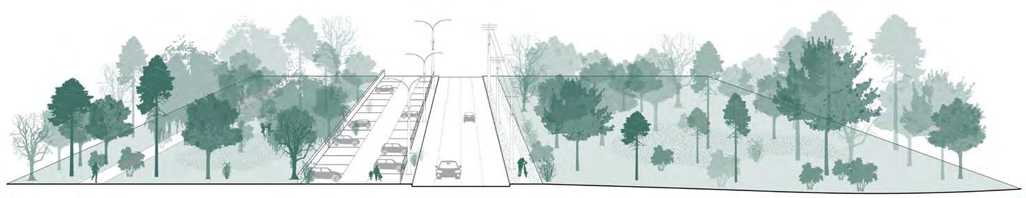
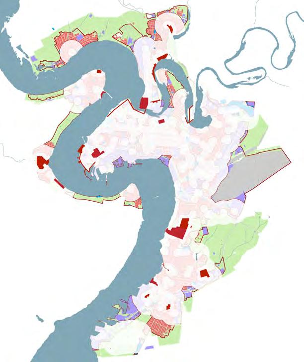
The following plan illustrates Mykolaiv’s current road hierarchy, which comprises five typologies: international roads, national roads, local roads, residential roads, and others. Currently, international roads such as the M14 highway and national roads pass through the city centre, resulting in significant heavy vehicle traffic through the central urban area, as shown on previous pages.
roads
Planned road hierarchy by Municipality
The plan illustrates the road network planned by the Mykolaiv municipality. Primary interventions include creating a bypass road by constructing a new bridge, which aims to divert heavy vehicle traffic away from the city centre. Additionally, the plan involves reconstructing specific roads throughout the city that require adjustments to improve overall connectivity and traffic flow.
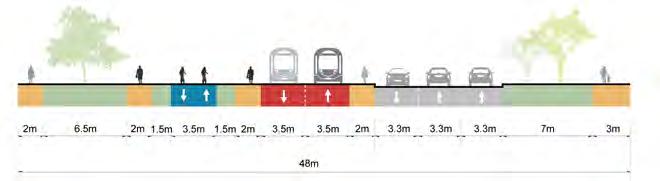
Short-term road interventions
The following map illustrates proposed road interventions for the short-term scenario, considering the municipality’s previous plans and studies, freight movement strategies, and planned public transport corridors, detailed in the next chapter.
The primary strategy involves constructing a new bridge (1) and extending the M14 highway to divert heavy traffic from the city centre (2), thereby creating a bypass road that will support the implementation of traffic-limited zones for heavy vehicles and low emission zones (3).
A second relevant strategy involves all the required road interventions for implementing the proposed Innovation District. The primary intervention is implementing a new bridge and road connection from the site’s east side connecting it with the city centre (4). This connection is proposed to be extended towards the north linking with the M14 highway, improving the city’s connectivity (5). New roads within the Innovation District are proposed to ensure safe access for all modes of transport (6).
Additionally, proposed road improvement measures include upgrades to accommodate dedicated public transport lanes or freight traffic, converting traffic into public transport lanes, and replacing tram tracks with new public transport lanes or greenery and soft mobility corridors. Other interventions include road improvements to prioritise public transport, or improving pavement and signage to allow for public transport circulation (7).
Furthermore, it is proposed that level separation between road and rail on Bohoiavlenskyi Avenue be implemented close to the southern port to accommodate the expected increase in capacity at the southern port (8). These interventions collectively aim to enhance urban accessibility in Mykolaiv and foster sustainable transport options.
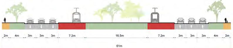
Long-term road interventions: option 1
The following plan illustrates the proposed road interventions for the first option of the long-term scenario. The primary intervention, previously mentioned, involves constructing a new road behind the central train station to extend the traffic-limited zone for heavy vehicles to the south, diverting heavyand medium-sized trucks from the Korabel’nyi District. With the relocation of the northern industrial port to the south and the planned regeneration of the area, a new road is proposed along its current boundary to improve public transport access, as outlined in the public transport strategy. The plan also includes the upgrade of Sylikatna Street (1) in the northwest and Pryvilna Street (2) in the northern peninsula by accommodating a dedicated public transport lane, to enhance accessibility to the new urban projects in the Matviyivka and Urochyshche Raketne neighbourhoods. Additionally, Bohoiavlenskyi Avenue (3), which is the main axis linking the Korabel’nyi District to central areas, and the Varvarivsʹkyy Mist Bridge (4) will be modified by converting one vehicular lane into a dedicated lane for public transport.
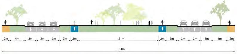
Long-term road interventions: option 2
The following plan illustrates proposed road interventions for the second option of the long-term scenario. The main difference from option 1 is the proposed location of the new road bypassing the Korabel’nyi District to reach the southern port.
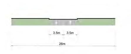
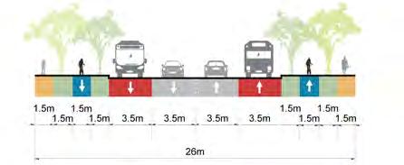
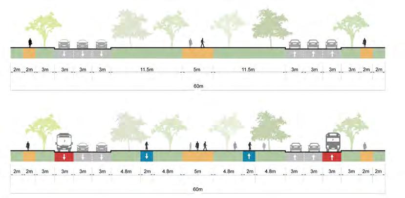
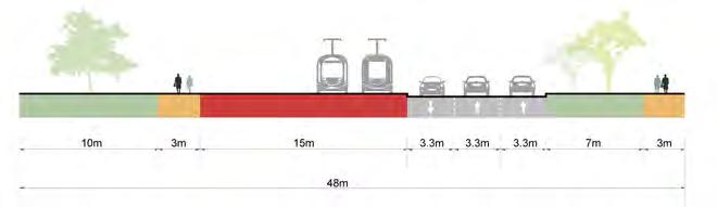
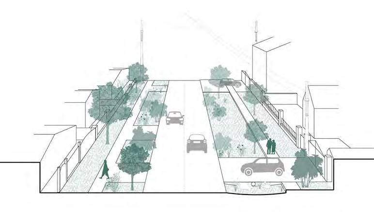
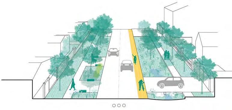
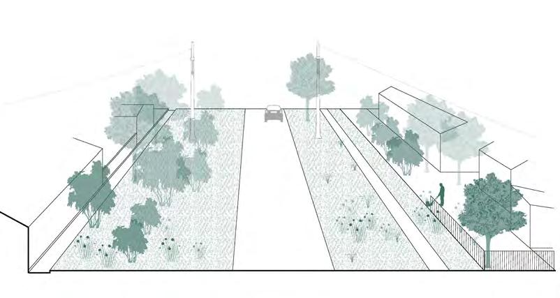
Current and proposed road sections
Current and proposed road sections
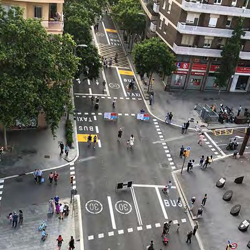
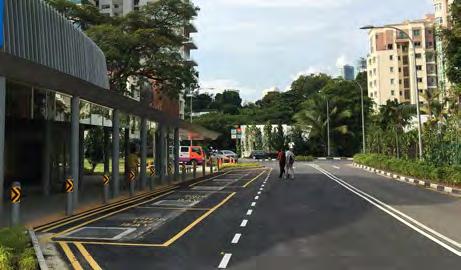
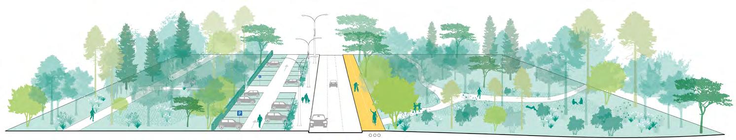
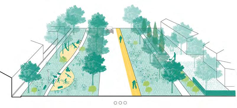
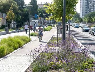
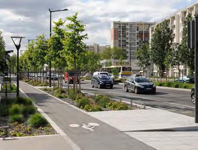
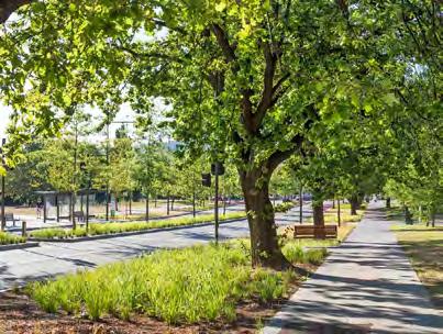
Street design principles
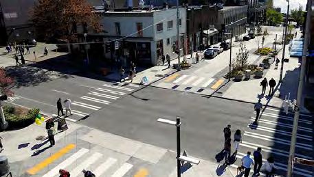
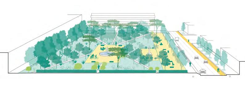
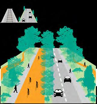
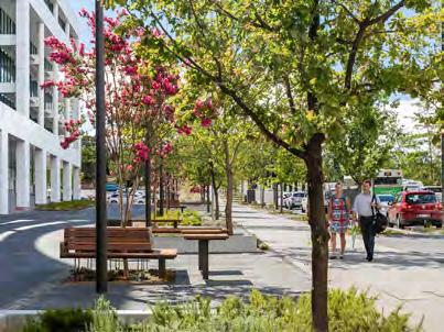
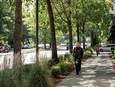
The following pages provide comprehensive Street Design Principles tailored for implementation throughout Mykolaiv. These principles are meticulously crafted to enhance urban streetscapes, focusing on improving accessibility, promoting multimodal transportation options, ensuring versatility in street usage, and prioritising safety for all users. In response to the city’s evolving urban landscape, these principles advocate for streets accommodating pedestrians, cyclists, and public transport users. They aim to integrate dedicated lanes for public transport and cyclists, improved pedestrian crossings, and strategically placed amenities such as seating areas and shelters. By promoting a human-scale approach, these principles aim to create vibrant and inclusive street environments that cater to the needs of residents and visitors. Additionally, they highlight the significance of incorporating universal design principles to ensure that streets are accessible to people of all ages and abilities.
By implementing these Street Design Principles, Mykolaiv aims to transform its streets into safe, inviting, and functional spaces that support community life and economic vitality. These principles serve as a blueprint for creating a cohesive and resilient urban fabric that aligns with the city’s long-term vision for sustainable development and quality of life improvement.
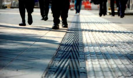
Accessibility design principles
Ensure
Provide
Incorporate
Multimodality design principles
Design
Allocate dedicated lanes for public transport to optimise transit efficiency and reliability
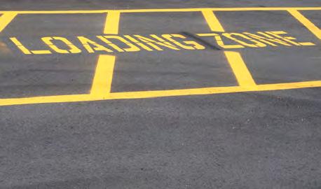
Incorporate dedicated loading zones to accommodate delivery services
Designate pickup and drop-off areas to facilitate traffic and enhance safety
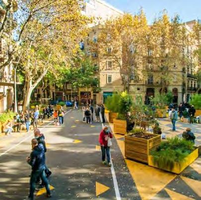
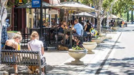
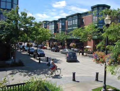
Versatility design principles
Promote activity on the ground floors to increase street liveability
Promote
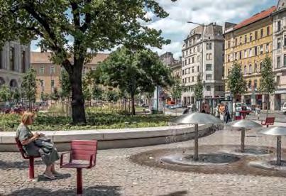
Provide areas for social activities to foster community engagement
Allocate designated spaces for street vendors to support the local economy
Design flexible street layouts to accommodate diverse activities and events
Safety design principles
Redesign
Implement speed limits and slow traffic zones near schools, parks and other areas with high pedestrian traffic
Implement medians on major and multi-lane roads to enhance pedestrian safety while crossing
Redesign intersections with high numbers of traffic accidents to be more compact, incorporating curb extensions
Install
enforcement cameras and collect and
traffic data for future interventions and improvements
\ Фотографія: https://www.google.it/maps/
Photo
Public transport strategy
Стратегія розвитку громадського
транспорту
Public transport strategy
The following chapter provides a detailed overview of Mykolaiv’s public transport network strategy. It begins with identifying existing challenges and opportunities, followed by the main goals and strategies before translating these into proposed short- and long-term strategies.
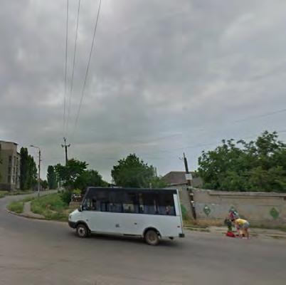
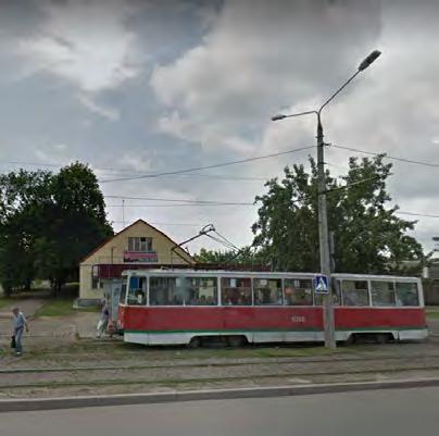
One of the major challenges in the current public transport network is the imbalance in the availability of transport options throughout the city scape. While multiple options like trams, trolleybuses, buses, and marshrutkas are available in the city centre, suburban areas often solely rely on marshrutkas, an informal transport system. Additionally, many public transport options operate on the same routes, leading to heavy passenger dependence on marshrutkas to reach their destination which is not serviced by the formal transport system. This situation highlights the need to revise public transport corridors to enhance the network’s reliability and flexibility to adapt to citizens’ changing needs. Furthermore, the entire transport infrastructure, including rolling stock, transport stops, signage, and maps, is outdated and requires a comprehensive upgrade to create a more efficient, reliable, and userfriendly public transport network. Transport stops also lack essential amenities such as shelters, seating, timetables, and real-time information, making them inconvenient for passengers.
Despite these challenges, several opportunities exist to enhance Mykolaiv’s public transport network. With a share of around 45% of urban mobility, public transport offers significant potential to promote further and improve public transportation usage. Ensuring flexibility in public transport routes and systems is critical to efficiently meet citizens’ ever-changing demands and needs. Additionally, the city’s navigable waterways present an opportunity to introduce a
water transport system, that connects different city neighbourhoods.
The main goals of the public transport network strategy are to establish sustainable and flexible transport systems that consider population density, land use, and new ideas, allowing easy adaptation to the city’s future needs. Another goal is to implement a citywide water transport system to provide citizens and visitors with diverse commuting options. The strategy also aims to introduce a feeder system of electric shuttles for last-mile connections and low-demand areas, complementing the public transport network and enhancing multimodal transportation connectivity through the establishment of a network of mobility hubs.
The proposed public transport corridors are based on the municipality’s previously proposed mass rapid transit corridors. They have been optimised and modified to align with the city’s proposed urban strategies and new developments. The proposal includes a network of trackless trams or bus rapid transit, complemented by buses. These corridors are strategically located to provide north-south and eastwest connections, including two looping circular lines around the city centre where main tourist sites are located, and future regeneration of industrial zones and the port is proposed. The corridors are designed to complement water transport, Park and Ride facilities, and mobility hubs to ensure multimodality and high accessibility throughout the city. This chapter includes details of the proposed public transport lines, specifying whether they would operate on dedicated or non-dedicated lanes in the short and long term. It details the typology and characteristics of the proposed transport modes, including capacity,
speed, distances between stops, and required infrastructure. The chapter elaborates on each public transport line, their relevant stops, mobility hubs, Park and Ride facilities, and the feeder system for last mile connections. It includes proposed public transport stop typologies and related facilities for public transport stops. The chapter continues with the proposed mobility hub network detailing the types of modes, facilities, and services available at each hub. It also covers the proposed additional water transport stops, ferry routes, and the characteristics and typologies of suggested water transport modes and their relevant stops. The chapter concludes with guidelines for implementing Mobility as a Service (MaaS) and integrated ticketing options.
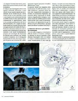
Source Джерело https://nikvesti.com/en/news/public/282192#google_vignette
Public transport strategy
Public transport challenges
Several public transport options are available within the city centre, including tram, trolleybus, bus, and marshrutka. In suburban areas, however, options are limited, often relying solely on marshrutka.
Many public transport options operate on the same routes, and passengers depend heavily on marshrutkas. This situation highlights the need for revising public transport corridors within the city to enhance the network’s reliability and flexibility and allow it to adapt to citizens’ changing needs.
The entire transport infrastructure, including rolling stock, transport stops, signage, and maps, is outdated and needs a comprehensive upgrade to create a more efficient, reliable, and user-friendly public transport network.
Transport stops lack essential amenities, such as shelters, seating, timetables, and real-time information, making them inconvenient for passengers.
Public transport opportunities
With
Ensuring flexibility in public transport routes and systems is critical to efficiently meet the ever-changing demands and needs of citizens
Navigable waterways present an opportunity to implement a water transport system for citizens and tourists, efficiently connecting different city neighbourhoods
Last mile connections and low-demand areas should be reached through a complementary feeder system, connecting them to the city’s main public transport corridors
Public transport main goals
Establishing sustainable and flexible transport systems that consider population density, land use, and new ideas that allow easy adaptation to the city’s future needs
Implementing a city-wide water transport system to provide citizens and visitors with diverse commuting options
Introducing a feeder system for last mile connections to complement the public transport network
Enhancing multimodal transportation connectivity by establishing a network of mobility hubs
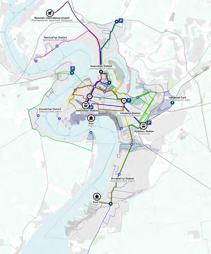
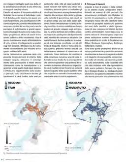
Current public transport network
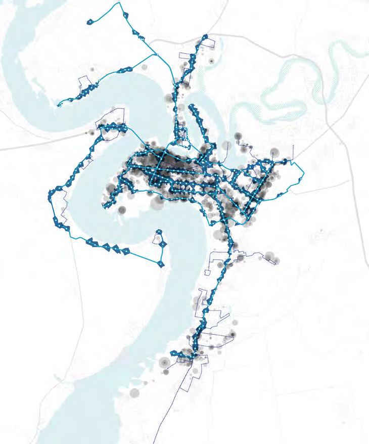
The following map illustrates Mykolaiv’s current public transport network, which is composed of four modes: trams, trolleybuses, buses, and marshrutkas. As depicted, trams and trolleybuses primarily serve the city centre, providing coverage to the densely populated and commercially active areas. In contrast, the suburban areas rely mainly on buses and marshrutkas. This distribution highlights a centralfocused network with peripheral areas depending on less formal transport options.
Public transport MaaS transit (proposed by Municipality)
Based on the Municipality’s data, Mykolaiv experiences significant passenger traffic, particularly along the Avenues Central, Myru, and Epiphany.
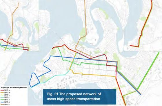
To address this congestion, the Municipality is considering to implement Mass Rapid Transit (MRT) systems such as Bus Rapid Transit (BRT) and Light Rail Transit (LRT), which offer fast travel via dedicated infrastructure. The proposed network aims to enhance transportation efficiency throughout the city.
The following map displays the Municipality’s proposed mass rapid transit network, a key consideration for developing new public transport lines. Notably, proposed urban strategies, including pilot projects, regeneration initiatives, and potential densification areas, have been considered to design the new lines.
This comprehensive approach ensures that the new transport network will effectively support the city’s growth and evolving urban landscape.
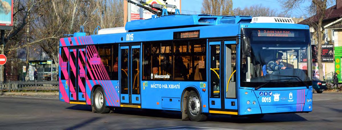
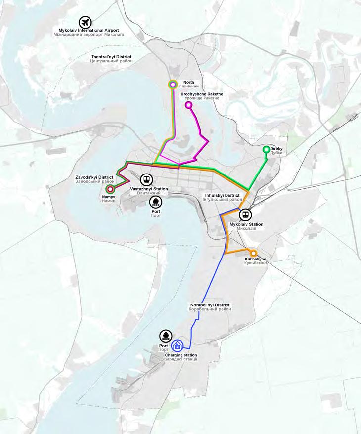
Trolleybus routes
(proposed by the Municipality)
The map illustrates the trolleybus routes proposed by the Municipality. Currently, Line 10 is operational, while the remaining routes are improvements to pre-conflict routes and new proposals. A charging station is planned at the end of Line 10 in the Korabel’nyi District, located at the intersection of Aivazovsky Street and Korabeliv Avenue (1). The proposed public transport network, outlined on the following pages, considers these routes while also aligning with planned urban projects as part of Mykolaiv’s Concept Master Plan. This integrated approach aims to create a comprehensive, flexible, and resilient network that addresses current needs, and anticipates the city’s future urban transformation. It is important to note that trolleybuses are not included in the proposed strategies. Their reliance on overhead charging infrastructure renders them to be relatively inflexible systems, making future rerouting or network adjustments more challenging. However, the trolleybuses proposed by the Mykolaiv Municipality can serve as a viable short-term solution. Instead, the envisaged long-term public transport lines are designed to accommodate multiple modes, ensuring greater adaptability and resilience in meeting evolving urban mobility demands.
Public transport network
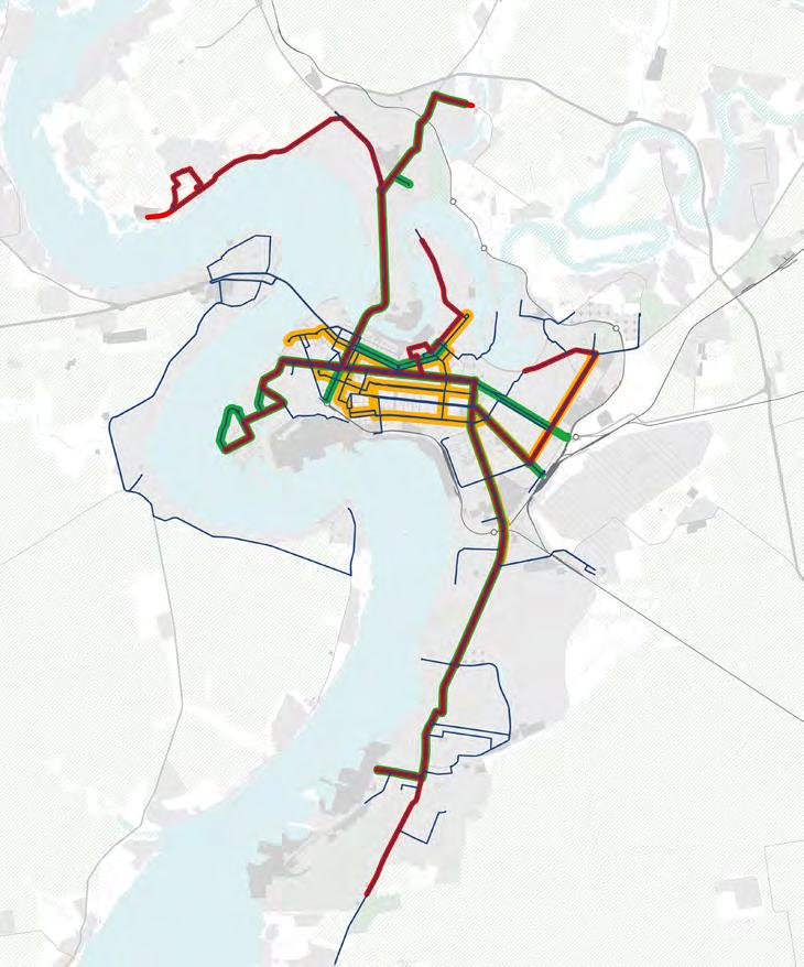
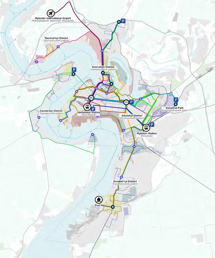
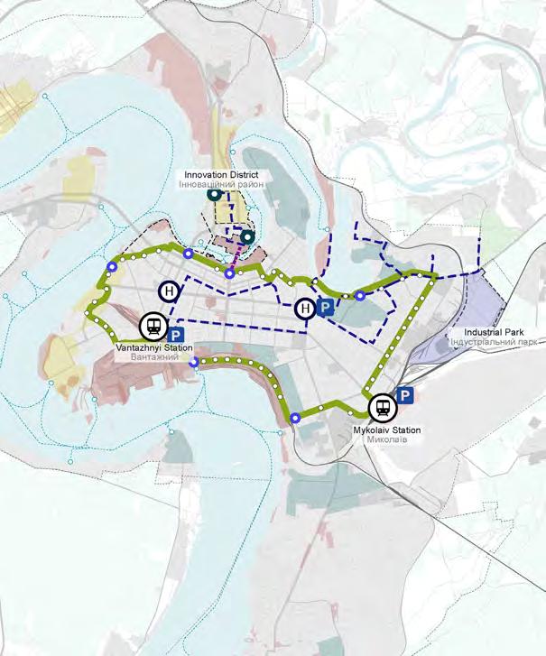
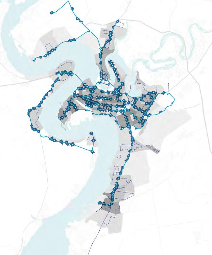
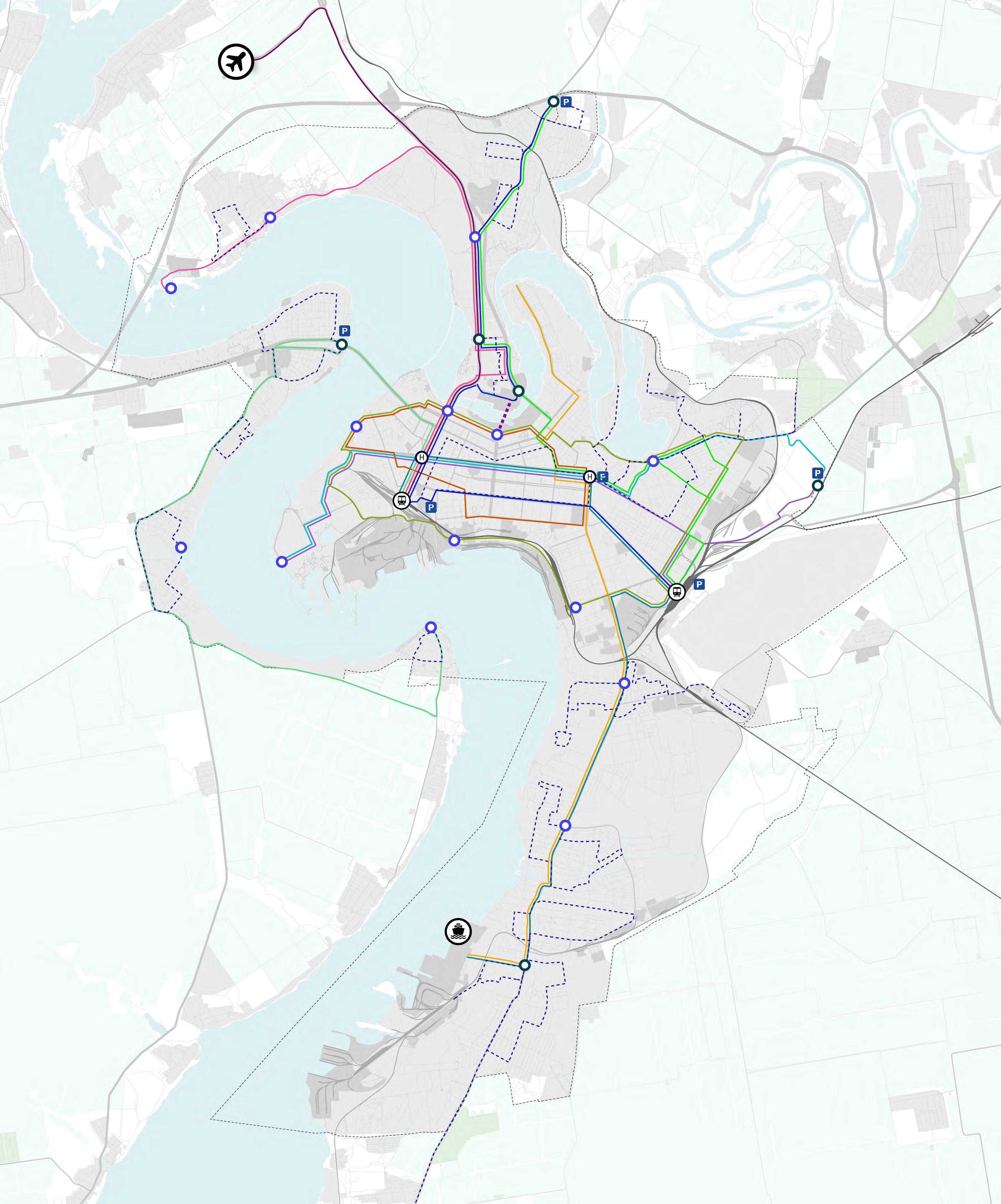
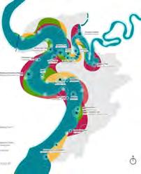
The following map illustrates the proposed public transport network, consisting of 11 main lines served by trackless trams or Bus Rapid Transit (BRT) that will run on dedicated public transport lanes, and buses that will run on mixed traffic lanes (non dedicated lanes). This primary network is complemented by a feeder system of electric shuttles designed for last mile connections and to service low-demand areas. Additionally, the proposed network includes a citywide water transport system, details of which will be provided on the following pages. A network of strategically located mobility hubs is integrated into the system, ensuring seamless transitions between different transport modes. The network also connects with Park and Ride facilities, facilitating easy shifts from private to public transportation. This proposal’s overarching aim is to ensure multimodality, enhancing the efficiency and accessibility of Mykolaiv’s public transport system.
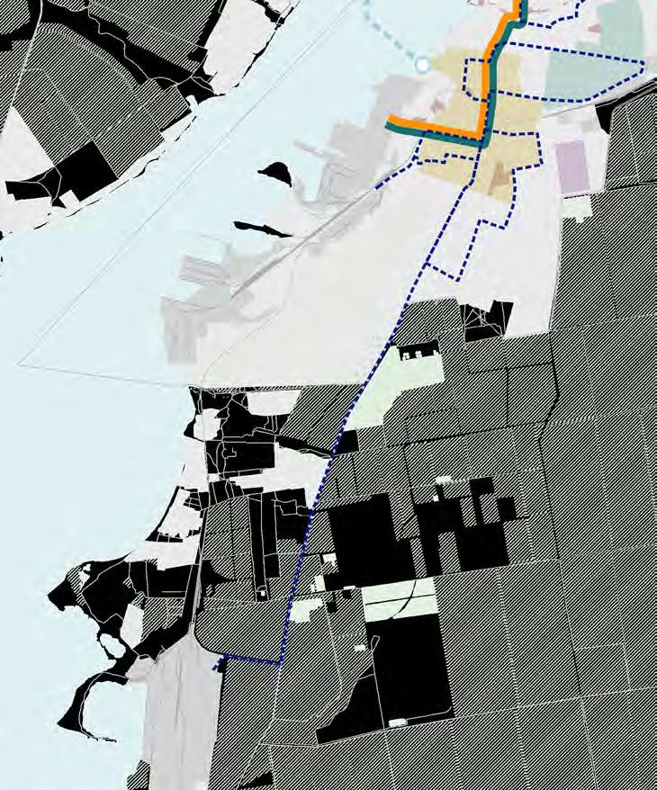
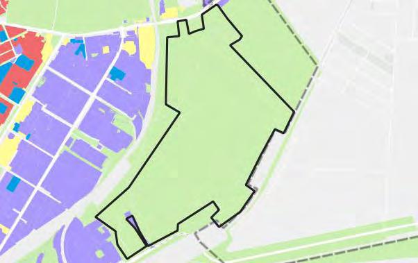
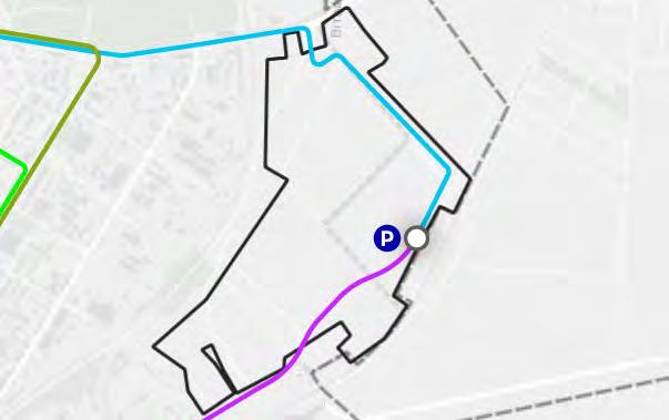
Feeder system: south
The following map illustrates the proposed feeder route utilising electric shuttles to access the Mykolaiv Alumina Plant, also known as Halytsynove. This route will accommodate employees traveling from the city relying on public transport to reach the facility. Commuters arriving via public transport lines C and F, or through other modes of transport, can transfer at the proposed mobility hub located near the port to the south, at the intersection of Korabeliv Avenue and Bohoiavlenskyi Avenue (1), and continue their journey to the Plant via the feeder route.
Mykolaiv Alumina Plant
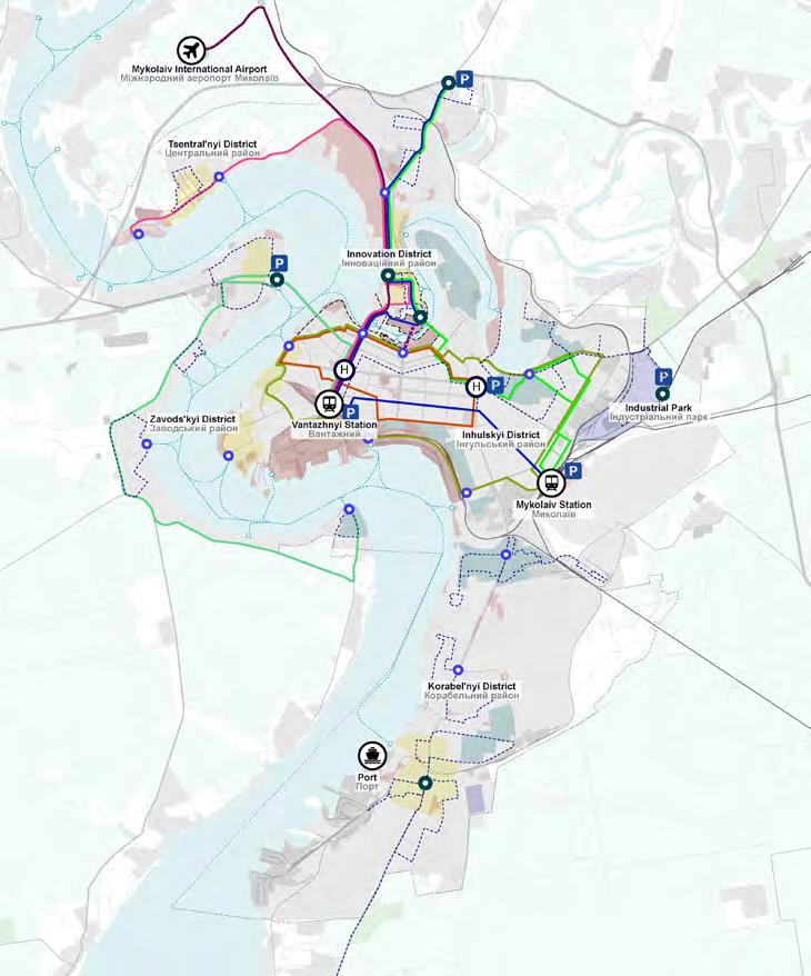
Dedicated lanes: short term
The following maps illustrate the proposed public transport lines operating in dedicated lanes under short- and long-term scenarios. In the short term, only Lines D and G are planned to operate with dedicated lanes, while in the long term, Lines C and F will also be introduced. These lines are designed to accommodate trackless trams or Bus Rapid Transit (BRT), offering flexibility and efficiency. The development of these maps carefully considers the current and proposed road network hierarchy and the spatial availability to integrate public transport within existing vehicular lanes.
Dedicated lanes: long term
Non-dedicated lanes: short term
The following maps illustrate the proposed public transport lines running through non-dedicated lanes, moving with mixed traffic in both short- and long-term scenarios. These lines are designed to utilise electric buses. The current and proposed road network hierarchy and the availability of space to accommodate public transport within existing vehicular lanes have been carefully considered to develop these maps.
Non-dedicated lanes: long term
Phasing of dedicated lanes
As outlined in the previous pages, certain public transport lines - either specific segments or the whole line - are proposed to operate in dedicated lanes where spatial conditions permit. A phased approach is recommended to assess the feasibility and effectiveness of these interventions, given the need for investment, and the importance of testing the proposals to prevent traffic congestion or bottlenecks.
The first phase involves a low-cost, immediate intervention, by designating a lane exclusively for public transport using pavement markings. This temporary solution will serve as an initial test to assess the viability and impact of dedicated lanes. If the initial phase yields positive results, a second phase can follow to implement a permanent solution. In this stage, dedicated lanes would be fully segregated from general traffic, ensuring an uninterrupted flow of public transport. The long-term scenario may also include further enhancements, such as introducing advanced and innovative transport modes, upgrading infrastructure, and improving stops and stations, thereby maximising the efficiency and user experience.
Proposed public transport modes
The following page details the main characteristics of the three proposed modes for the public transport network.
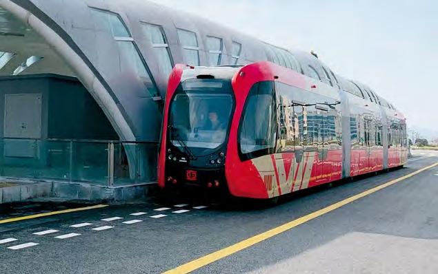
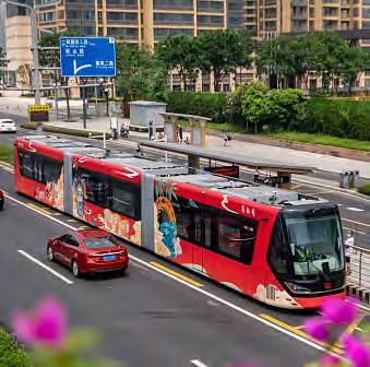
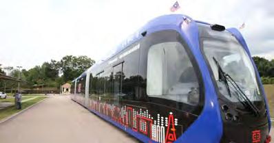
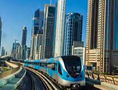
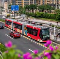
Trackless trams are a high-capacity system that operates on dedicated lanes separate from vehicular traffic to achieve their full capacity. The main advantage of trackless trams over traditional trams is that they do not require a fixed track on the ground. This reduces operational and maintenance costs and makes them a flexible and highly efficient urban transit system. Trackless trams can be rerouted to serve the changing needs of citizens post-conflict, enhancing their adaptability.
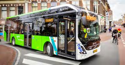
It is proposed that electric buses may operate on dedicated lanes as an alternative to the trackless tram network if needed. The system would operate as a Bus Rapid Transit (BRT) on dedicated lanes. Electric buses are also the preferred mode for non-dedicated lanes with mixed traffic. They offer a more quiet and environmentally friendly alternative to fossil fuel buses while maintaining service flexibility.
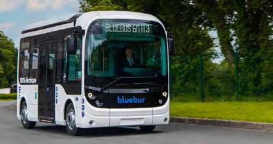
Electric shuttles are proposed to operate within the feeder system. Designed for short distances, last mile connections and serving low-demand areas. Emissionfree and low-noise, electric shuttles significantly reduce air pollution while providing a sustainable and convenient mode of transport.
Speed: 20-50 km/h
Distance between stops: 200-400m
Charging
Required infrastructure:
At grade platforms
Horizontal signage
Information panels at bus stops
Maintenance and refueling
Required infrastructure:
Public transport lines
The following pages provide comprehensive details for each public transport line, including information on its stops, associated feeder systems, mobility hubs, Park and Ride facilities, and connections to water transport stops.
Proposed public transport stop typologies
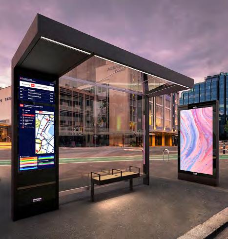
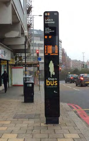
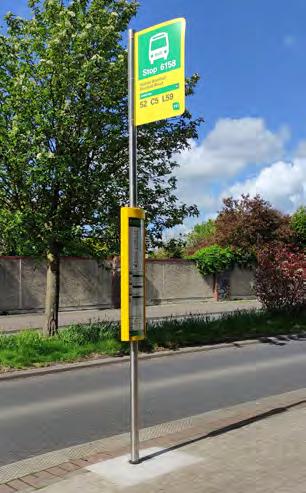
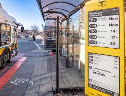
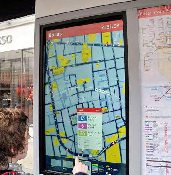
The following pages detail various typologies of public transport stops designed for different urban environments and route priorities. Sheltered stops are intended for main routes with sufficient space to accommodate these stops, providing protection and comfort for passengers. Digital stops are suitable for primary and secondary routes with limited space, offering streamlined functionality in compact areas. Totem stops are ideal for optimising connectivity on secondary routes and feeder systems, serving as key points in the network to improve access and integration.
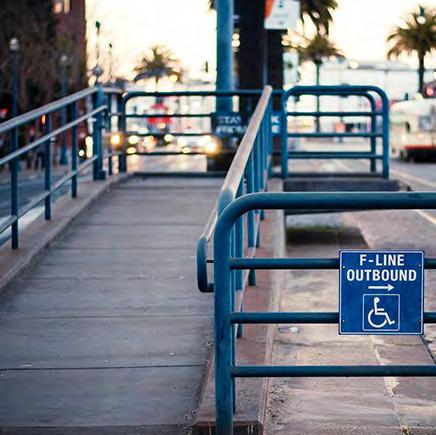
The subsequent page outlines the essential facilities incorporated into these stops to improve passenger comfort and accessibility across the urban network. Real-time information systems are recommended to boost public transport reliability and improve the passenger experience by providing up to date travel information. Maps and wayfinding tools should be integrated to assist with navigation and promote multimodality within the transport system. Step-free access is recommended to ensure inclusivity for passengers with disabilities, facilitating easy entry to public transport stops and vehicles. Additionally, leaning bars should be implemented at stops with limited space, supporting those who may find it difficult to sit.
Together, these features aim to create a more user friendly, accessible, and efficient public transport system throughout the city.
Proposed facilities for public transport stops
Maps and wayfinding for improving navigation and promoting multimodality
Step-free access to public transport stops and vehicles for disability-inclusive transport
Leaning bar: Ideal for stops with limited space and suitable for those who find it difficult to sit
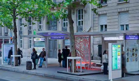
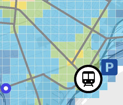
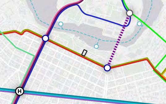
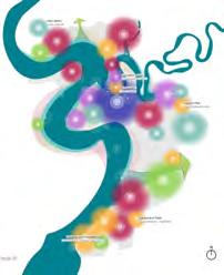
Mobility hub network
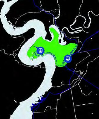
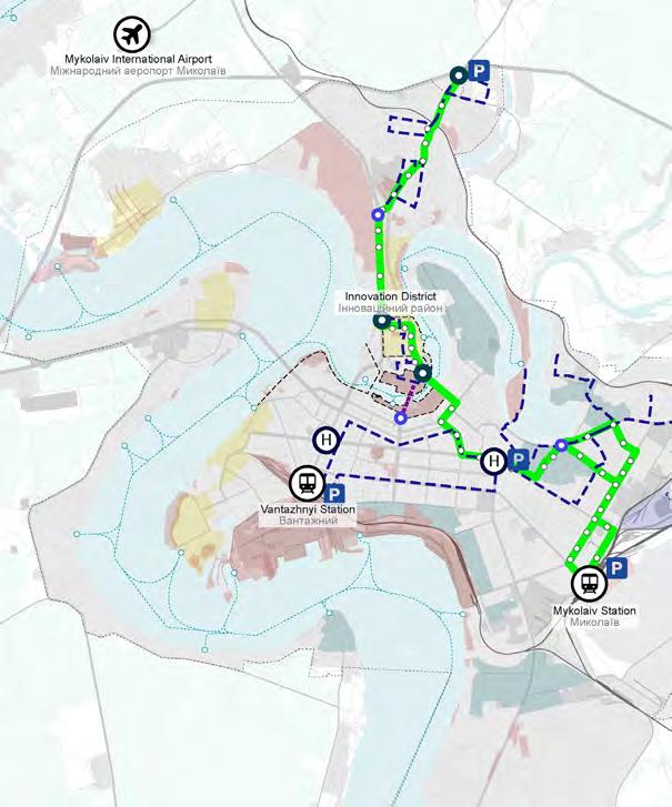
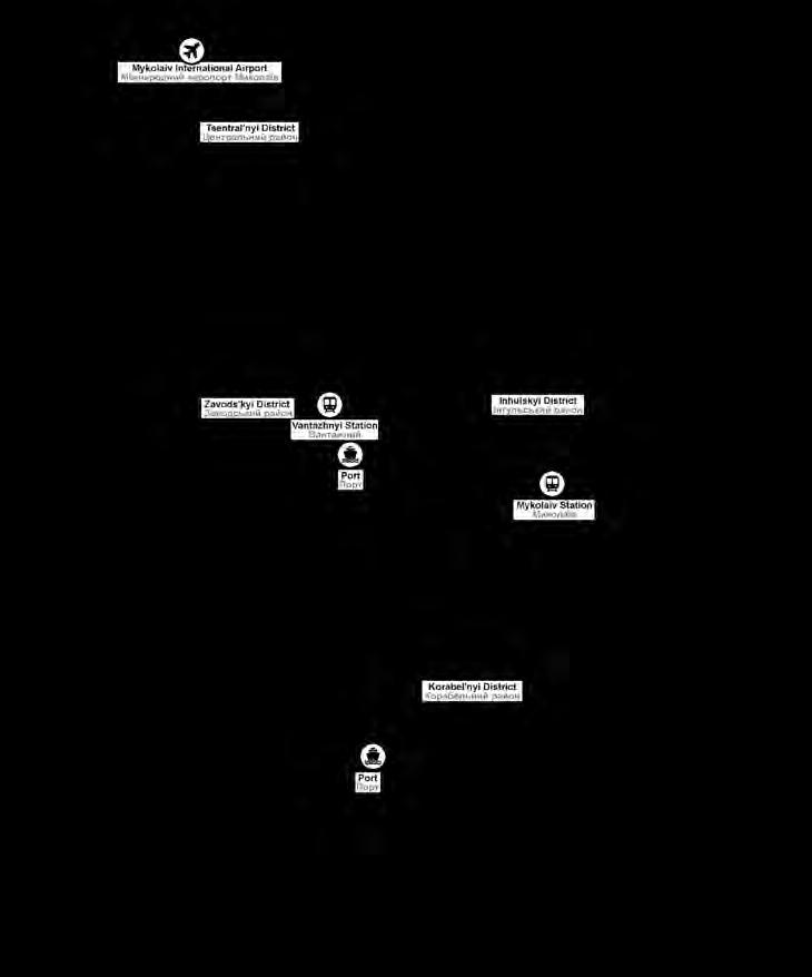
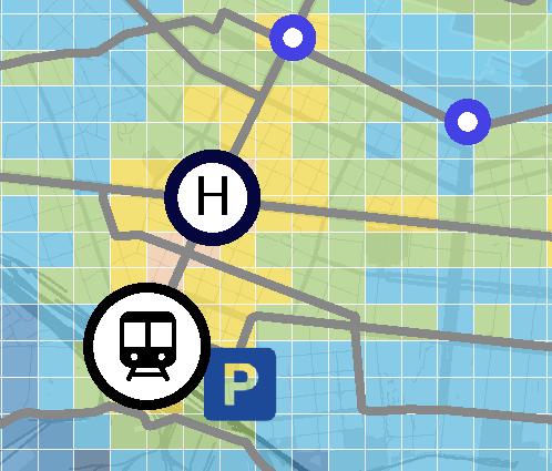
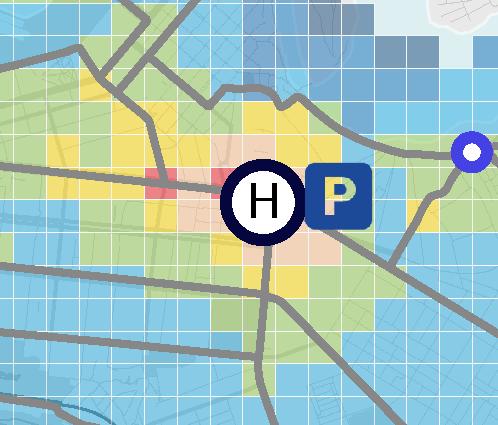
The following map illustrates the proposed mobility hub network strategically integrated within the public transport system, including the proposed public transport lines, water transport, and feeder systems. This network comprises four distinct types of hubs: major mobility hubs with railway stations, major mobility hubs, medium mobility hubs, and small mobility hubs. Major mobility hubs with railway stations are centred around the city’s two main train stations, which serve as key nodes where multiple lines intersect. These hubs have Park and Ride facilities, and provide shared mobility services, including car-sharing and micro-mobility sharing stations.
Major mobility hubs are located along Central Avenue (1), where multiple public transport lines converge. These hubs also include shared mobility services, essential in facilitating transfers between different transport modes. Notably, the hub at the intersection of Central Avenue, Khersons’ke Highway, and Bohoiavlenskyi Avenue (2) features a Park and Ride facility.
Medium mobility hubs are positioned at strategic locations across the city. Some of these hubs are integrated with water transport stops and serve as vital links to public transport systems. They also connect to feeder networks for last mile travel and include shared mobility services, providing greater accessibility and convenience for users.
Small mobility hubs operate at a neighbourhood level, enabling local scale interchanges. They also provide access to public transport lines and micro-mobility sharing stations, ensuring high accessibility within communities.
In addition to the mobility hubs, a network of Park and Ride facilities is strategically positioned to boost accessibility throughout the city. These facilities allow commuters to transition from private vehicles to public transport, facilitating smoother and more efficient travel. Each hub is crafted to ensure seamless transfers between different modes of transportation, significantly enhancing the efficiency of the overall transport network. The following page provides detailed information about each hub type, including their specific transport modes, facilities, and services.
Mobility hub typologies and facilities
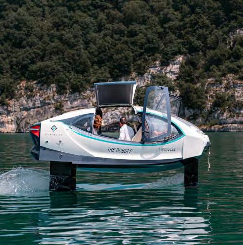
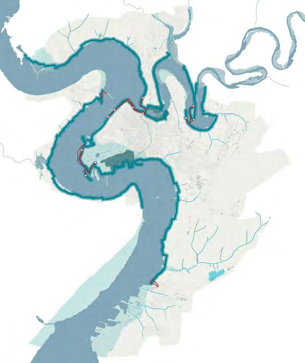
Water transport stops
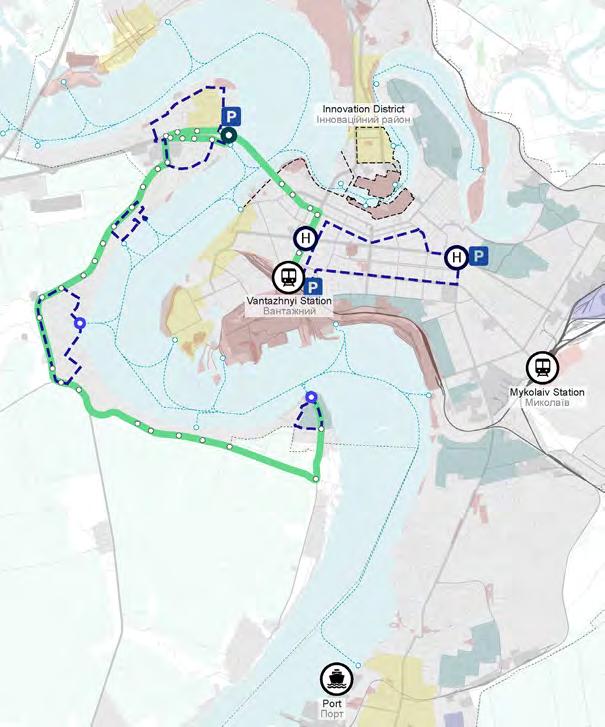
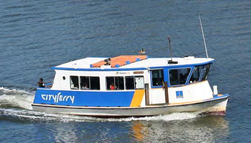
The following map illustrates the proposed water transport stops. These include stops already outlined in the Municipality’s General Plan, as well as new stops based on the proposed urban strategy and city developments, including pilot projects, regeneration areas and proposed densification zones. Several public transport lines are extended to connect with these stops, to ensure a high level of multimodality within the transport network. This water transport system aims to complement the existing public transport network by offering citizens and visitors a new transportation option and linking areas of the city that are otherwise difficult to reach. Additionally, it provides a convenient commuting alternative for employees working at the southern industrial port.
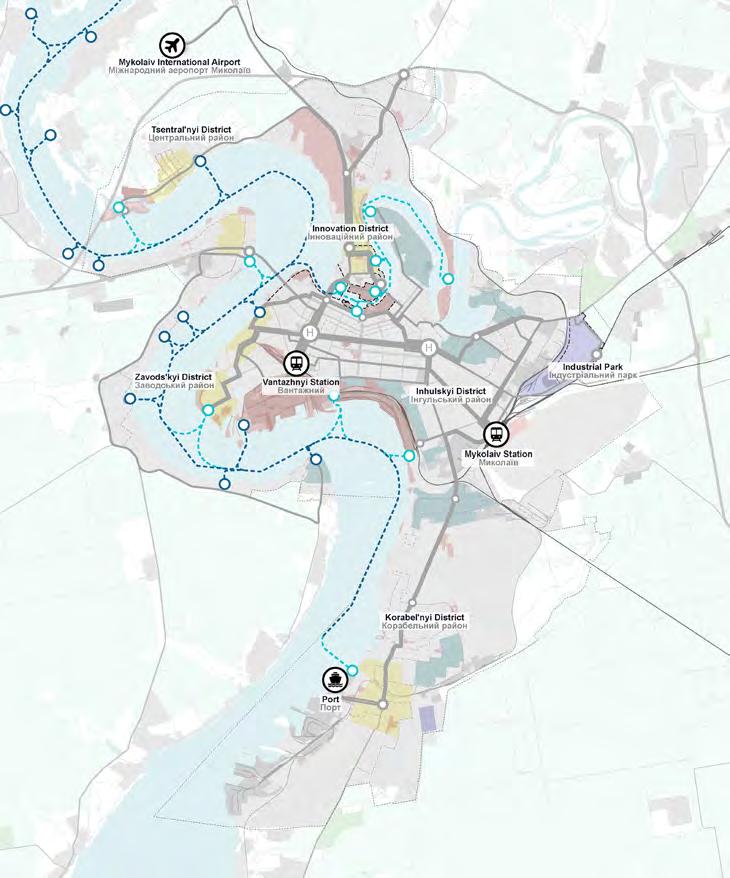
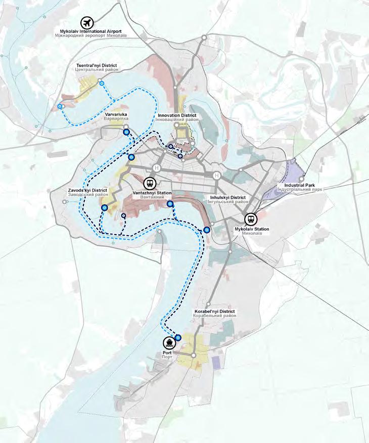
Water transport routes
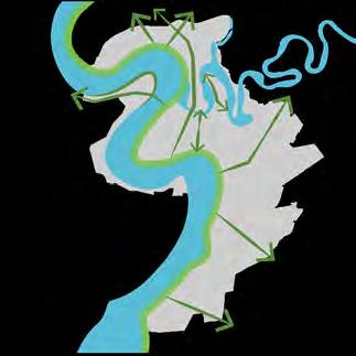
The map on the following page illustrates the proposed routes for ferries and water taxis in the city. It outlines two main ferry routes and additional stops designated for water taxis. The first ferry route connects the northern Tsentral’nyi district to Varvarivka on the west side of the river, with stops in the central Zavods’kyi district and the northern port, potentially extending to the southern port. The second ferry route runs between the historic port in the north and the Innovation District, also connecting the Zavods’kyi district to the northern and southern port.
Water taxis are planned to serve all designated locations along these ferry routes as well as additional stops that are not covered by the ferry services. The main difference between ferries and water taxis lie in their operation - ferries follow fixed routes with schedules, while water taxis offer more flexibility and provide service-on-demand to additional locations. This network is designed to improve connectivity across the city, providing flexible transportation options and improving access to key areas. Importantly, the water transport system offers a viable city-wide alternative for both citizens and tourists, contributing to a diverse and efficient public transport network.
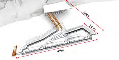
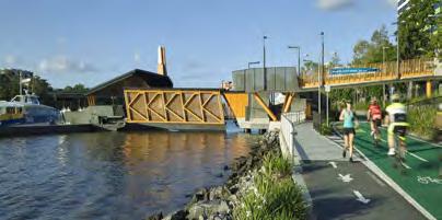
Water transport stops are strategically integrated with proposed public transport modes, facilitating efficient transfers and promoting multimodality. The subsequent page provides detailed information about the proposed water transport vehicles, specifically ferries and water taxis, their characteristics, and examples of pier designs at these stops.
Required infrastructure: Docks or terminals, charging stations, passenger amenities
Location: Brisbane, Australia
14m
Location: Brisbane, Australia
10m
14m
floating public
Functions: floating public spaces, panoramic river views
Mobility as a Service (MaaS) - mobility mobile application
INFRASTRUCTURE
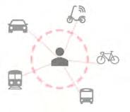
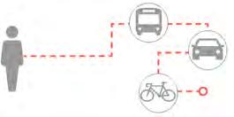
Mobility as a Service (MaaS) represents a transformative approach to urban transportation, integrating various transportation services into a single, accessible platform. By combining public transport, ride sharing, bike sharing, car rentals, and other mobility services, MaaS offers a seamless and personalised travel experience. This approach allows customers to plan, book, and pay for their journey through one digital interface. MaaS aims to reduce reliance on private vehicles, alleviate traffic congestion, and promote sustainable transportation options, ultimately improving urban mobility and accessibility.
Integrated ticketing system options
Closed loop smart cards are typically issued by transit operators and authorities and can only be used within their private ticketing system. Some transit smart cards interact offline with scanning devices on board of vehicles, while others act as tokens, working in tandem with a back office.
• Ownership of the fare collection system
• Prepay ‘float’ integrates seamlessly into the system by allowing passengers to prepay and load funds onto their smart cards, injecting funds into transit operators’ accounts
• Equitable fare payment is achieved through closed-loop payment systems, which do not exclude unbanked and underbanked individuals
• Fast transaction and boarding times
• Within an ABT (Account Based Ticketing) system, where smart cards are used as a token linked to an individual’s account, the account can hold information such as eligibility for discounts
• Lack of interoperability across cities and countries
• Transit operators are often locked-in to technology that has been built from scratch by a single vendor
• High cost of ticketing infrastructure and cash handling
• Transit providers must pay for upgrades / allocate funds for upgrades
• Prepay cards lock in riders’ funds, which may pose a challenge for lowerincome individuals who find it difficult to pay for travel in advance.
Integrated ticketing system options
In open loop EMV fare collection systems, customers can use their bank-issued contactless credit or debit card, prepaid EMV card, mobile wallet, or smart device, to pay for journeys.
• Convenience is provided as passengers can use the same card or mobile wallet to pay for transit trips & retail purchases
• Potential for universal, interoperable fare payment systems
• Fare structures to unify the rider experience across a local authority, state, or country
• Flexible fare models can be configured in the back office
• Configured to offer simple flat fares, fare caps and discounts, with the best fare automatically being calculated in the back office
• Holistic systems are expensive to build
• Perceived to be less inclusive historically, open loop EMV has been viewed to exclude riders without a bank account and an associated card
• Bank fees transit operators must pay acquiring banks’ merchant service fees.
• Vendors manage the system by collaborating with multiple providers to offer a modular solution rather than relying entirely on a single vendor.
\ Фотографія: https://www.google.it/maps/
Photo
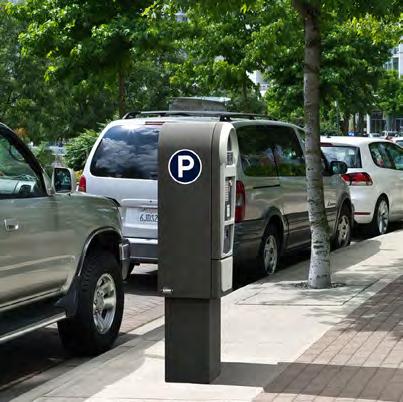
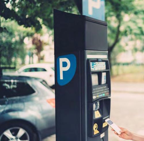
Parking strategy
Parking strategy
The following chapter provides a detailed overview of Mykolaiv’s parking strategy. It begins with identifying existing challenges and opportunities, followed by the main goals and strategies before translating these into proposed parking strategies.
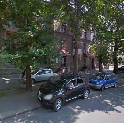
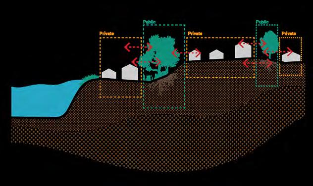
Identified challenges in the current parking situation include the absence of a paid parking policy and system, irregular parking without proper markings and signs on the streets, as well as the lack of official on-street and off-street parking facilities. Most parking is handled on the street, occupying roadways, sidewalks, and pockets. These informal parking practices deteriorate the quality of the public realm and negatively impact the experience of soft mobility users. Despite these challenges, several opportunities exist to enhance Mykolaiv’s parking system. The municipality’s planned implementation of a parking system, including a paid parking zone in the city centre, aligns with the proposed extensive multimodal public transport network. Proposing Park and Ride facilities near major mobility hubs and nodes can sustain and encourage a modal shift from private cars to public transport. Furthermore, it is possible to integrate Park and Ride facilities in railway, public transport, and shared mobility services, especially at the main entry points to the city.
The main goals of the parking strategy are to encourage a shift from private cars to public and active modes of transport, thereby preventing congestion. Another goal is to implement regulations for on-street parking in order to curb informal parking practices. The strategy also aims to introduce paid parking policies and time-limited parking in high-demand areas, especially in central locations of the city. Furthermore, a comprehensive on-street parking strategy with resident-only and Persons with Reduced Mobility (PRM) parking programs will optimise availability and enhance accessibility in urban areas. This chapter includes the proposed parking strategy, detailing the type and location of parking facilities, specifics on the paid parking zones, and examples of Park and Ride facilities. It also concludes with guidelines for parking policies to be implemented in Mykolaiv.
Parking challenges
Currently, the city lacks a paid parking policy
Presence of irregular parking in the city without proper markings and signs on the streets
The city lacks official on- and off-street parking facilities, with most parking handled on-street, occupying roadways, sidewalks, and pockets
Informal
Parking opportunities
Planned paid parking zone in the city centre by the municipality, aligning with the proposed extensive multimodal public transport network
Proposed Park and Ride facilities near major mobility hubs and nodes can encourage a modal shift from private car to public transport
Possibility of integrating Park and Ride facilities with the railway, public transport, and shared mobility services, especially at the main entrances to the city, to encourage the use of public and active modes of transport
Parking main goals
Implement Park and Ride facilities integrated in public transport and shared mobility services to encourage a shift from private cars to public and active modes of transport, thereby preventing congestion
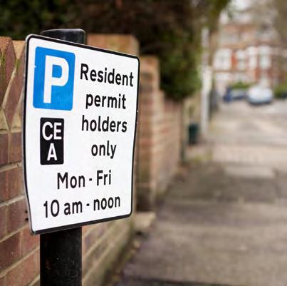
Introduce regulations for on-street parking to curb informal parking practices
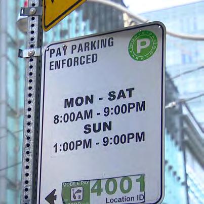
Introduce paid parking policies and time-limited parking in high-demand areas, especially in central locations of the city
Introduce a comprehensive on-street parking strategy with resident-only and Persons with Reduced Mobility (PRM) parking programs to optimise availability and enhance accessibility in urban areas
Parking strategy
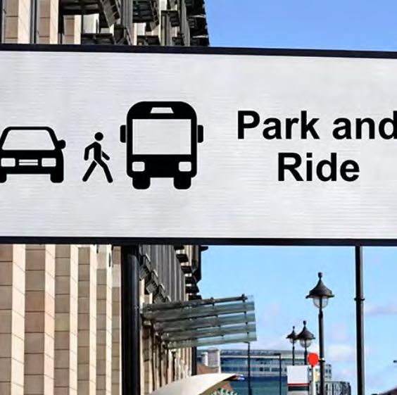
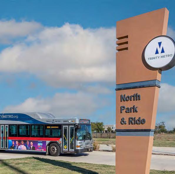
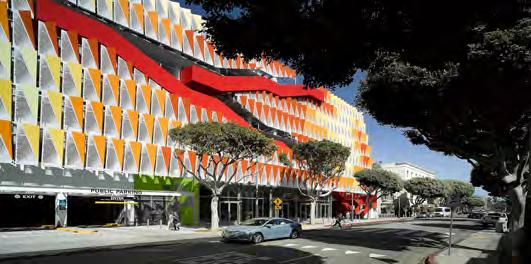
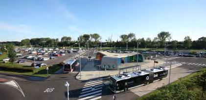
The following map illustrates the proposed parking strategy for the city. The primary proposal includes introducing a paid parking zone in the city centre. The second intervention focuses on establishing a network of Park and Ride facilities close to the city’s main entry points from highways, main train stations, and major mobility hubs, facilitating the transition from private to public transport modes. The third intervention aims to create new parking zones in proposed densification areas to meet the increasing demand. Subsequent pages provide examples of Park and Ride facilities and proposed parking policies. Additionally, the proposed parking policies outline regulations and guidelines designed to effectively manage parking demand, promote the use of public transport, and support the city’s overall mobility strategy.
Examples of Park and Ride facilities
A properly planned Park and Ride system offers sustainable solutions to meet transport needs. In this case, the primary objective of implementing such a system is to minimise on-street parking while balancing profitability and maintenance costs. The following examples of Park and Ride facilities include those integrated in railway stations, structured Park and Ride facilities, and on-street Park and Ride options. These facilities should be well integrated in public transport systems, as recommended in the plans provided on previous pages. It is also recommended to develop an electronic system for booking parking spaces and ensure they are seamlessly integrated into the city’s mobility app and ticketing system.
Area:
Proposed parking policies
Public Transport Accessibility Level
Parking restrictions and limitations should align with the
Introduce resident parking permits to manage parking demand on neighbourhood streets, enhancing resident access to parking spaces, and discouraging vehicle use for neighbourhood-to-neighbourhood travel
Time-of-day parking pricing
Minimise the duration of parking by implementing higher rates during peak demand periods of the day or week
Metered parking
Implement pricing policies for the use of curbside space by vehicles especially in the central areas of the city
Provide designated parking spaces specifically for persons with reduced mobility (PRM) to ensure equitable access and convenience
Provide designated spaces for deliveries, emergency access, taxis, and sharing services
Taufik Ramadhan
Soft mobility strategy
Стратегія розвитку системи м’якої
мобільності
\ Фотографія: https://www.google.it/maps/
Photo
Soft mobility strategy
The following chapter provides a detailed overview of Mykolaiv’s soft mobility strategy. It begins with identifying existing challenges and opportunities, followed by the main goals and strategies before translating these into proposed solutions for enhancing soft mobility infrastructure.
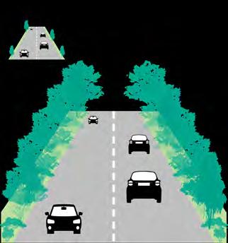
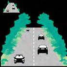
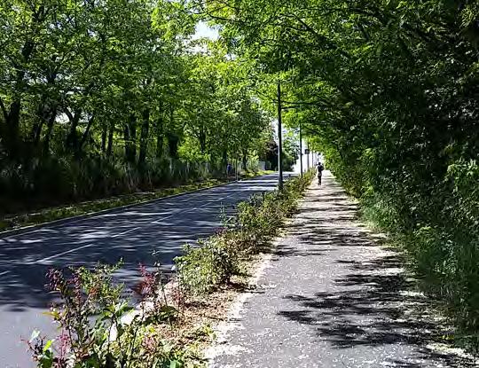
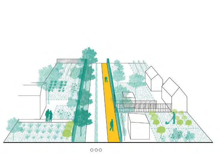
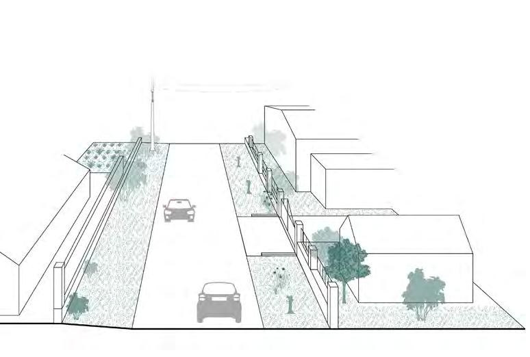
Identified challenges in the current soft mobility infrastructure include the lack of dedicated cycling infrastructure, forcing cyclists to share lanes with vehicles and pedestrians, which poses significant safety concerns. Additionally, some streets require the maintenance of pedestrian infrastructure, including sidewalks, intersections, and curb ramps. The main city bridges; which are crucial access points to the city centre, need additional infrastructure to ensure the safe movement for soft mobility users. Furthermore, the city lacks bike and micro-mobility sharing options and sufficient cycling facilities, including adequate bike parking.
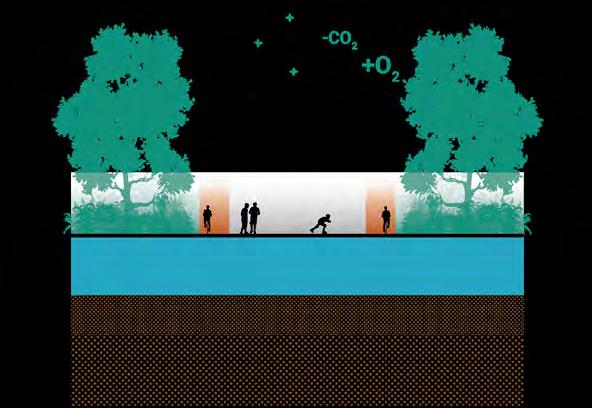
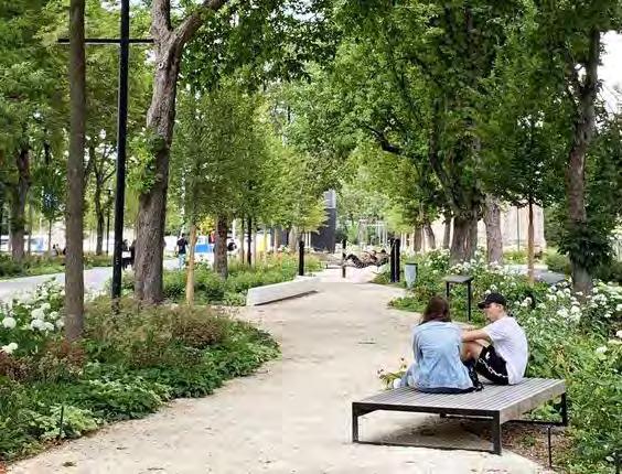
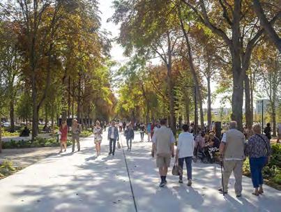
Despite these challenges, several opportunities can be leveraged to enhance the soft mobility in Mykolaiv. The high modal share of walking presents a significant opportunity to further invest in pedestrian infrastructure and amenities, promoting active transportation and enhancing the city’s overall liveability. The ample road infrastructure could allow for street redesign to accommodate cycling lanes and improve pedestrian spaces. The waterfront, one of the city’s main assets, has the potential for improved accessibility for pedestrians, Micro-mobility users, and cyclists. Additionally, the municipality’s extensive cycling plans present a significant opportunity to enhance the city’s cycling infrastructure, promoting safer and more
accessible routes for cyclists.
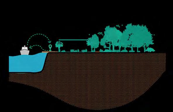
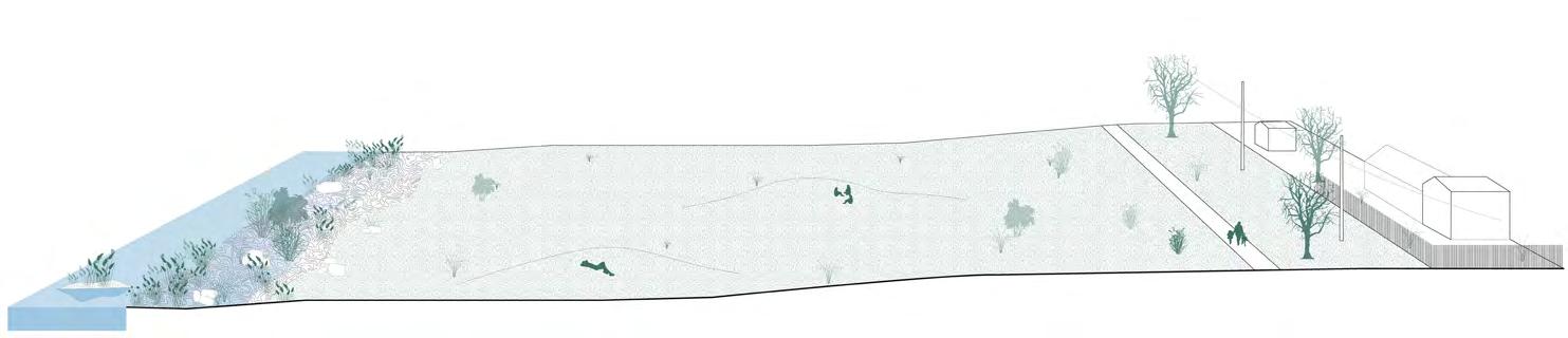
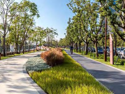
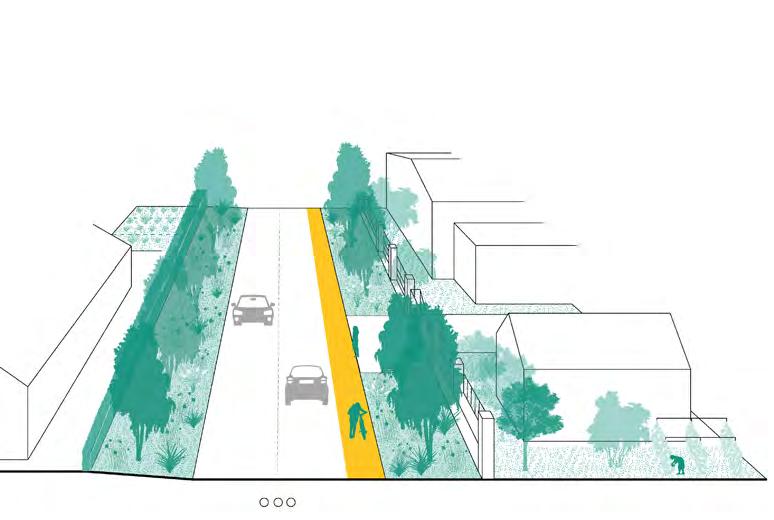
The main goals of the soft mobility strategy are to develop a comprehensive cycling strategy based on the municipality’s previous plans, and to identify gaps and missing links to ensure alignment with all proposed urban strategies and new developments in the city. Another goal is to ensure safety for soft mobility users by implementing dedicated cycling lanes, adequate sidewalks, frequent crossing points, speed management systems, and proper signage. The strategy promotes Micro-mobility by offering sharing services and bike parking facilities to enable convenient short-distance travel and last mile connections. Furthermore, ensuring public access to the waterfront for pedestrians and cyclists is a crucial objective.
This chapter details the cycling strategy after considering the municipality’s bike lane map and the Coolville Design Lab’s proposed cycling network. It identifies missing links and gaps based on the areas highlighted for different urban strategies, including suggested regeneration, pilot projects, and densification areas. The proposal includes suggested locations for bike-sharing stations and places to be designed as cycle-friendly. The chapter continues with the recommended bike parking typologies and examples of soft mobility-friendly waterfronts.
Soft mobility challenges
The city lacks dedicated cycling infrastructure, forcing cyclists to share lanes with vehicles and pedestrians, posing significant safety concerns.
Some streets require maintenance of pedestrian infrastructure, including sidewalks, intersections, and curb ramps.
The main city bridges, which are crucial access points to the city centre, require additional infrastructure to ensure safe movement for soft mobility users.
The city lacks bike and micro-mobility sharing options and sufficient cycling facilities, including adequate bike parking.
Soft mobility opportunities
The high modal share of walking presents a significant opportunity to further invest in pedestrian infrastructure and amenities. This will promote active transportation and enhance the city’s overall liveability
The
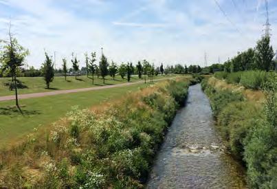
The waterfront, one of the city’s main assets, has the potential for improved accessibility for pedestrians, micro-mobility users, and cyclists
The municipality’s extensive cycling plans present a significant opportunity to enhance the city’s cycling infrastructure, promoting safer and more accessible routes for cyclists
Soft mobility main goals
Develop a comprehensive cycling strategy based on the municipality’s previous plans, identifying gaps and missing links to ensure access to all proposed urban strategies and new developments in the city
Ensure safety for soft mobility users by implementing dedicated cycling lanes, adequate sidewalks, frequent crossing points, speed management systems, and proper signage
Promote micro-mobility use by offering sharing services and bike parking facilities to enable convenient short distance travel and last mile connections
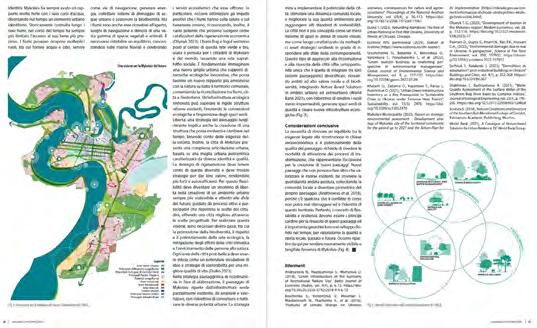
Proposed cycling network by Municipality
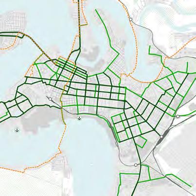
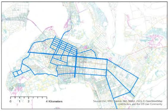
The following map illustrates the municipality’s proposed cycling network, which includes three types of cycling lanes: trunk, secondary, and recreational. Currently, bicycles account for 1.1% of the modal share. According to the Sustainable Urban Mobility Plan (SUMP), promoting cycling and implementing this envisaged network could increase the modal share upto 11.1%. The SUMP proposal has been considered in developing the proposed cycling strategy.
Future planned modal share based on SUMP
Proposed cycling network by Coolville Design Lab
The proposed cycling network, developed by Coolville Design Lab, has been considered in formulating the cycling strategy. This plan aims to promote bicycles as a viable mode of transportation for the city’s residents. The network design considers Mykolaiv’s sociospatial dynamics, analysing residential, occupational, and recreational areas and the city’s road network characteristics.
Proposed cycling network
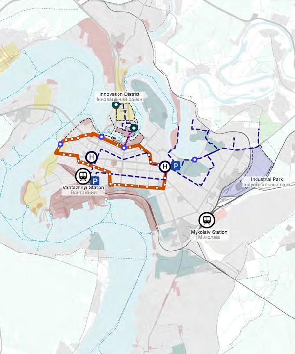
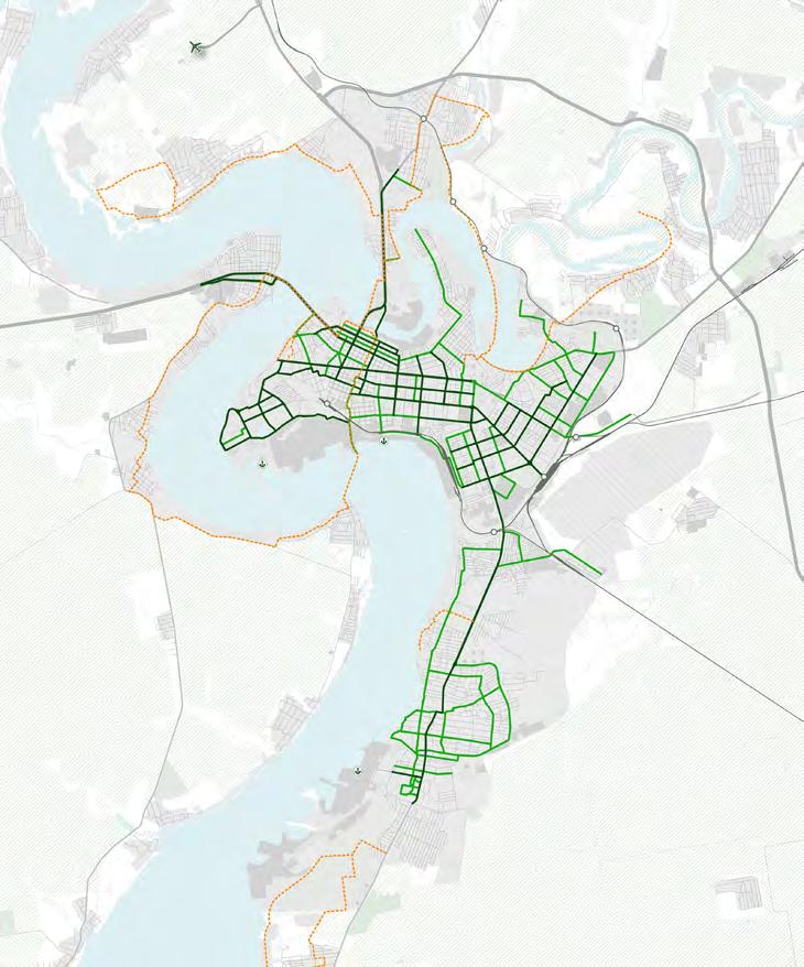
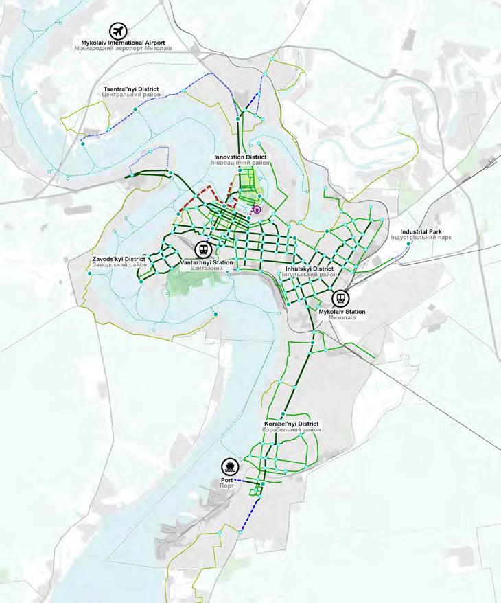
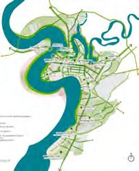
The following map illustrates the proposed cycling network based on the municipality’s initial proposal and the map developed by Coolville Design Lab. This proposal considers the urban strategy for Mykolaiv, including pilot projects, regeneration areas, and proposed future densification zones. Minor adjustments need to be made to ensure network continuity and alignment with envisaged projects. The plan also includes providing bike parking and bike sharing stations to encourage bicycle use, following NACTO (The National Association of City Transportation Officials) guidelines for station spacing. Additionally, the plan highlights two proposed bikefriendly zones in the innovation district and the former northern port, will be regenerated using a mixed-use master plan. The plan aims to promote alternative modes of transportation and foster bike friendly practices. The cycling strategy aims to provide a sustainable alternative mode of transport.
Trunk
Recreational
Trunk
Recreational
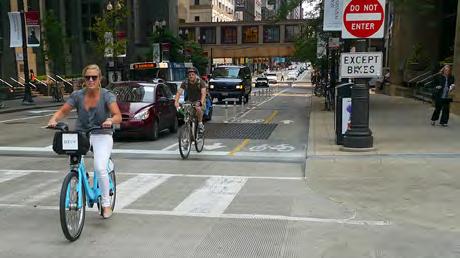
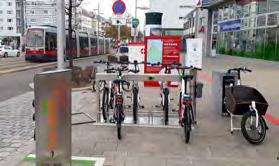
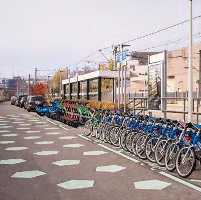
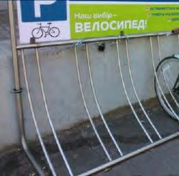
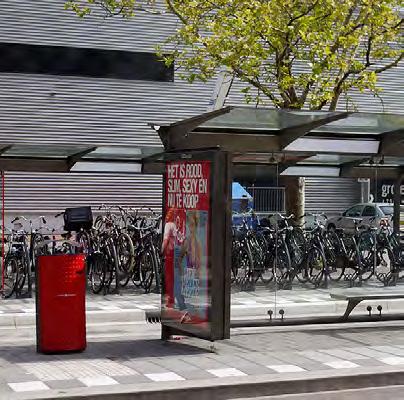
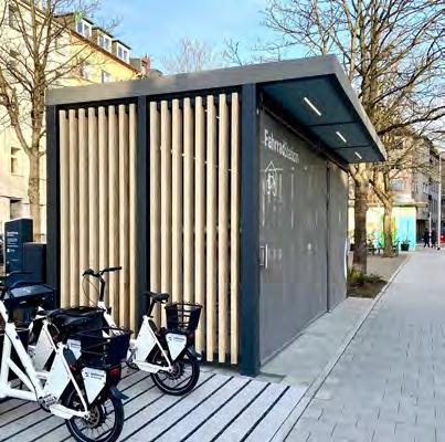
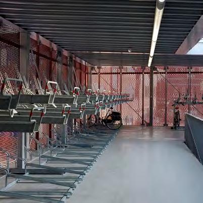
Proposed bike parking typologies
The following page presents four proposed typologies for bike parking designed to integrate seamlessly into the cycling network. These facilities aim to encourage the use of bicycles within the city.
Integrated
Sheltered bike parking near major public spaces and attraction points
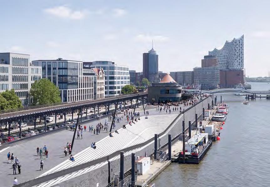
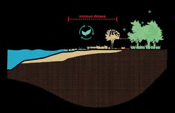
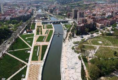
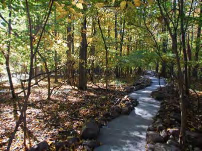
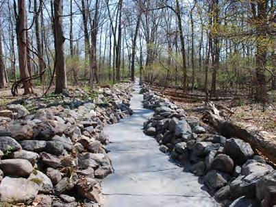
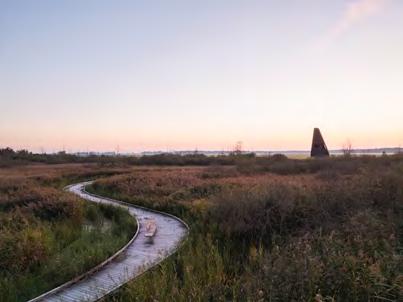
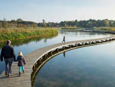
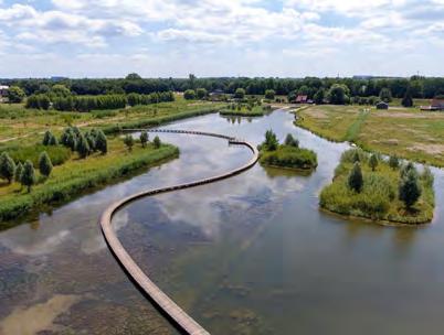
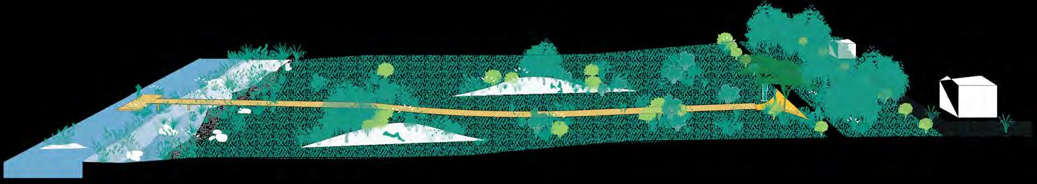
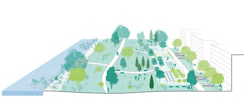
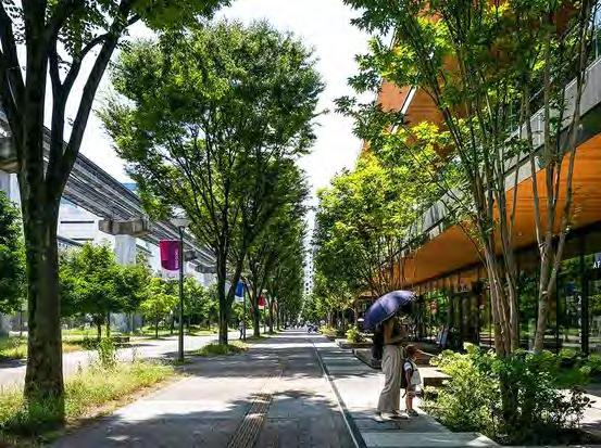
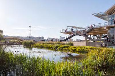
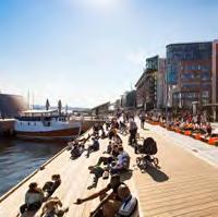
Examples of soft mobility friendly waterfronts
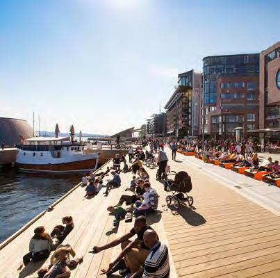
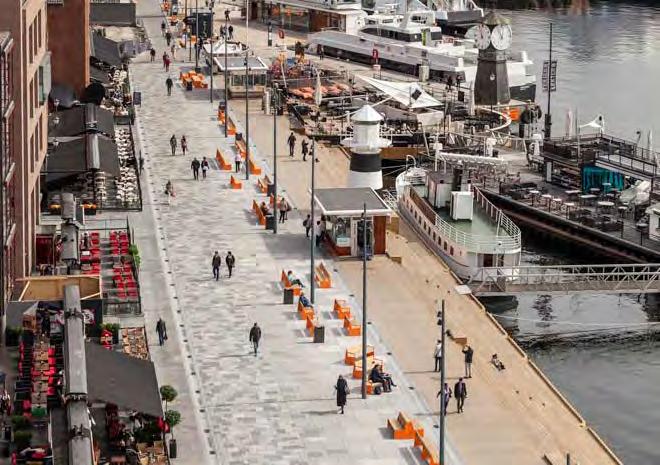
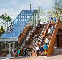
Aker Brygge promenade / Oslo, Norway
Променад «Aker Brygge»
The Aker Brygge promenade in Oslo, Norway, offers ground-floor activities and shared spaces for pedestrians and micro-mobility users, with convenient access to water transport stops. Променад «Aker Brygge»
Niederhafen river promenade / Hamburg, Germany
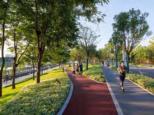
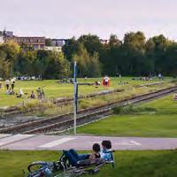
The Niederhafen river promenade in Hamburg, Germany, offers a spacious riverside area with amenities for pedestrians, joggers, street performers, food stalls, shops, and public utilities. It prioritises accessibility with dedicated cycling lanes and water transport.
Key Performance Indicators (KPIs) for evaluating proposed strategies
Key Performance Indicators for evaluating proposed strategies
This chapter focuses on the Key Performance Indicators (KPIs) that are used to evaluate the effectiveness of the proposed strategies. Three specific KPIs have been identified to test and refine the proposed interventions, ensuring they meet the city’s mobility and accessibility goals.
The first KPI is the Public Transport Accessibility Level (PTAL), which will be used to evaluate the proposed public transport network. PTAL measures the accessibility of public transport services, helping to determine how well the new network connects various parts of the city and serves its residents.
The second KPI is Pedestrian Isochrones Analysis. This analysis will help understand the catchment areas from public transport stops, providing insights into how far people can walk within a specific time frame to access public transport. This KPI is crucial for ensuring that the proposed public transport stops are conveniently located and accessible to a wide range of users.
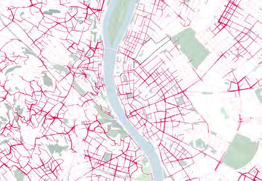
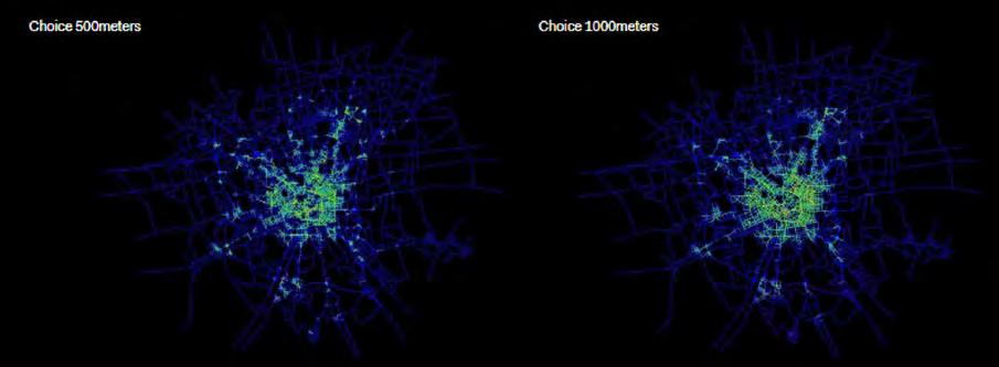
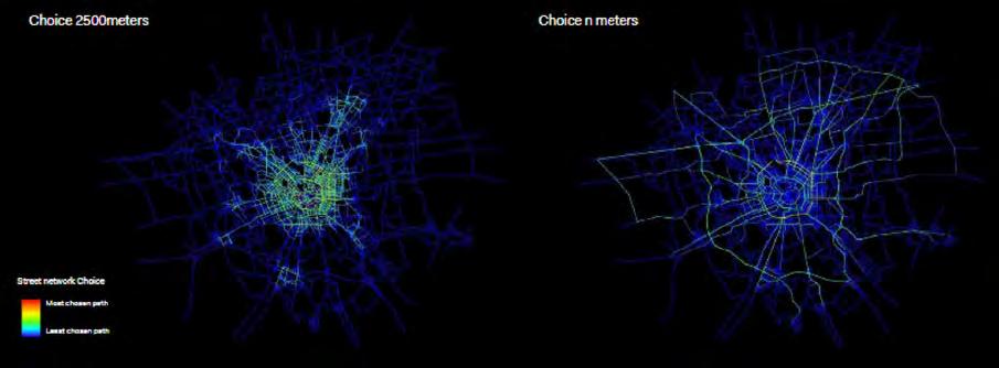
The third KPI is the Network Morphological Analysis Depthmap - Space Syntax, which will be used to test the proposed cycling lanes. This analysis examines the spatial configuration of the cycling network, assessing its connectivity and integration within the broader urban fabric. It helps to ensure that the cycling infrastructure is optimally designed to promote safe and efficient cycling routes. Together, these KPIs will provide a comprehensive framework for evaluating the proposed strategies, guiding the project’s next phase towards a more connected, accessible, and sustainable urban mobility system in Mykolaiv.
Proposed Key Performance Indicators (KPIs)
Public Transport Accessibility Level (PTAL)
Pedestrian Isochrones Analysis
Network Morphological Analysis
Public Transport Accessibility Level (PTAL)
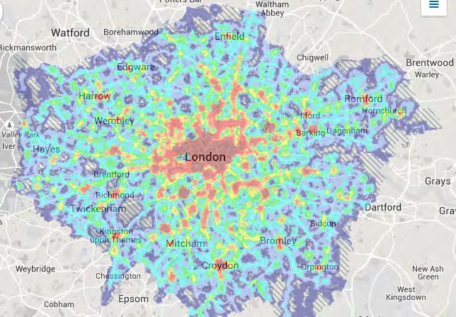
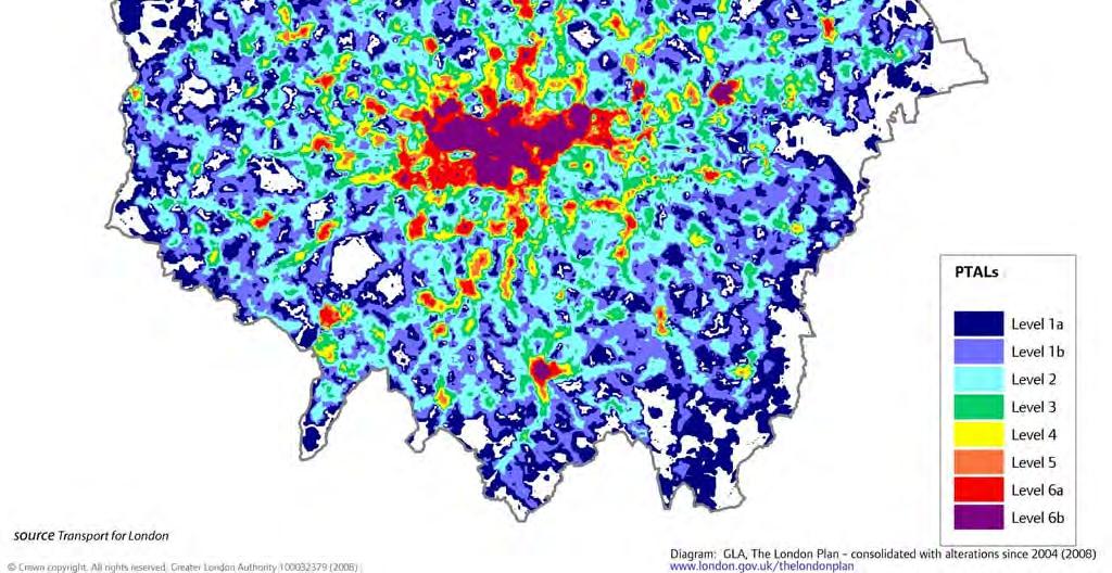
Public Transport Accessibility Level (PTAL) is a measure used to assess the accessibility and convenience of public transport within a specific area. PTAL considers factors such as the distance to the nearest public transport services, the frequency of those services, and the number of available routes. It assigns a score that ranges from 0 (poor accessibility) to 6 (excellent accessibility), helping urban planners and policymakers to identify areas with good or poor public transport connectivity and plan improvements accordingly. This metric is crucial for ensuring equitable access to public transportation and fostering sustainable urban development.
PTAL is a global index, which serves as a useful and reliable planning tool. This index can predict modal shifts in the project site resulting from public transport interventions. Additionally, it maps accessibility and assesses changes in relation to different alignments, the number of lines, and block sizes.
Public Transport Accessibility Level (PTAL)
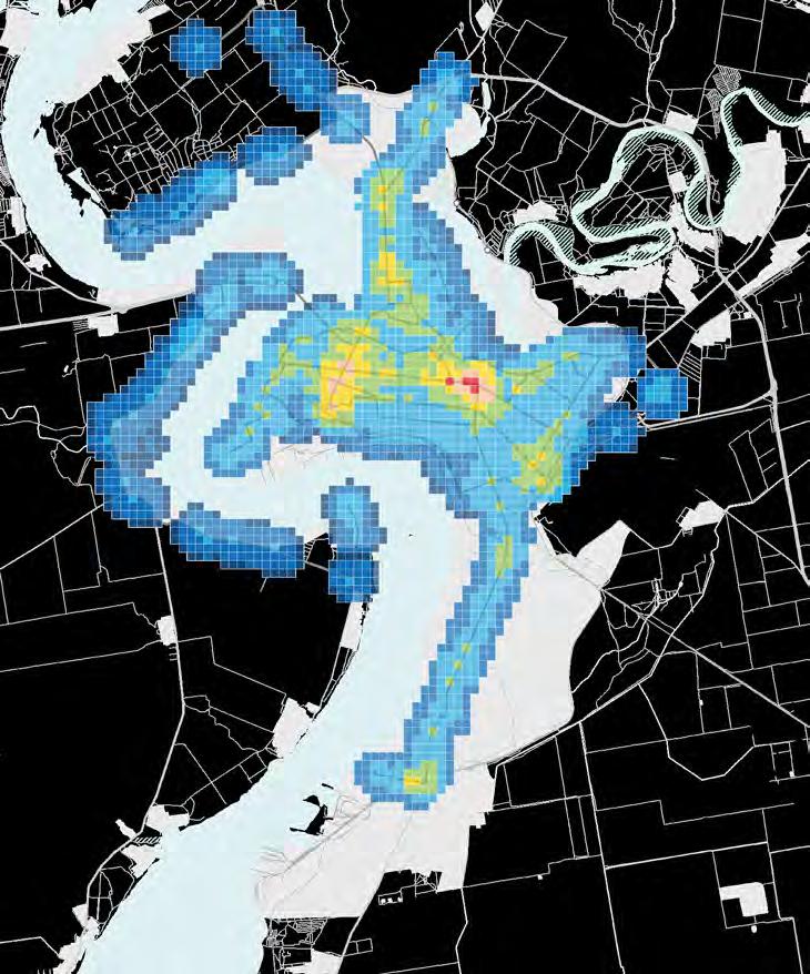
The map on the following page illustrates Mykolaiv’s Public Transport Accessibility Level (PTAL) based on the proposed public transport network. This analysis assumes service frequencies of 7 minutes for Bus Rapid Transit (BRT) or trackless tram, 8 minutes for buses, and 15 minutes for electric shuttles, aligning with benchmarks of cities with high-frequency, high-performance transit systems. The minimal difference in frequency between BRT or trackless tram (operating on segregated lanes) and standard buses (on non-segregated lanes) reflects Mykolaiv’s current conditions, characterised by low car ownership, a small share of private vehicles in the modal share, and limited congestion. These trends are expected to persist with the implementation of the planned high-frequency public transport services. The analysis identifies several high accessibility level zones around major mobility hubs, such as those along Central Avenue and near railway stations (1-2-3).
Other areas with high accessibility include planned densification and regeneration zones, such as the proposed Innovation District and its surroundings (4). Key locations include Heroiv Stalinhradu Avenue (a), the existing Inhulʹsʹkyy Mist bridge (b), and the proposed new bridge (c) connecting the Innovation District to the city centre on the east. These PTAL results highlight areas with high accessibility levels, making them ideal for TransitOriented Development (TOD). TOD is an urban planning strategy emphasising mixed-use, highdensity development within walking distance of public transport hubs, fostering sustainable and accessible urban growth. These areas include the Lisky neighbourhood (d), the proposed Innovation District (e), and the developments near the southern port (f).
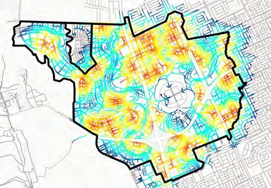
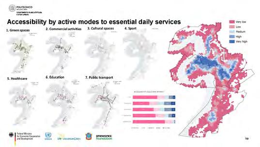
Pedestrian isochrones analysis
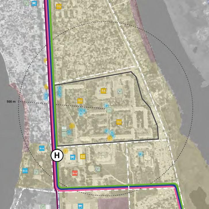
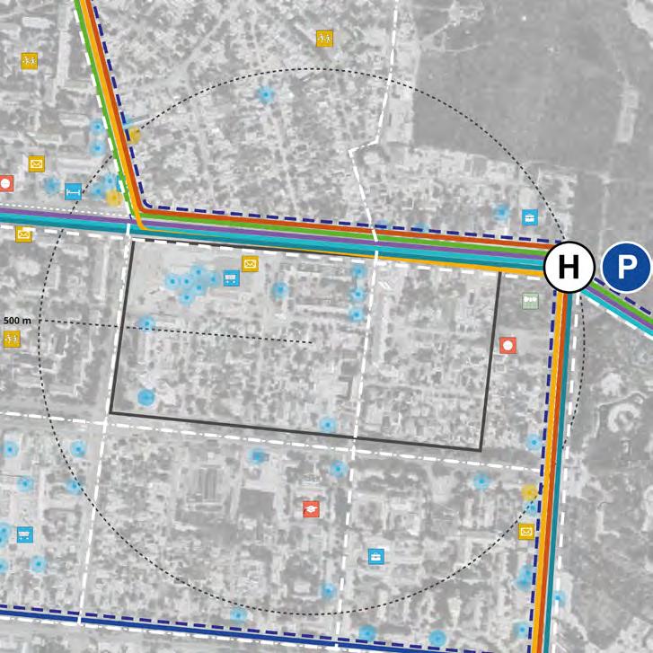
Analysing pedestrian isochrones from public transport stops using population density involves creating visual maps that show areas accessible on foot within specific time intervals, such as 5, 10, or 15 minutes from each stop. This analysis utilises GIS (Geographic Information Systems) to model pedestrian pathways, considering factors like sidewalks, crosswalks, and other pedestrian infrastructure. By overlaying population density data onto these isochrone maps, urban planners can assess how many people live within walking distance of public transport stops. This approach provides valuable insights into the accessibility and convenience of the public transport network. It helps to identify areas with high population density that lack sufficient access to public transport, highlighting gaps in the network. Furthermore, this analysis can reveal disparities in accessibility, showing which neighbourhoods are well-served by public transport and which are not. It allows planners to evaluate the impact of potential changes, such as new transport lines or stops, different alignments, or changes in service frequency. By understanding the relationship between population density and public transport accessibility, planners can make informed decisions to improve connectivity, enhance walkability, and ensure equitable access to transportation for all residents. This method is essential for promoting sustainable urban development and improving the overall quality of life in urban areas.
5-minute pedestrian isochrone for
residents: all public transport modes
The following map illustrates the population catchment based on pedestrian isochrones, highlighting areas accessible within a 5 minute walking distance from the proposed public transport stops. The image demonstrates that 30% of residents will have access to at least one mode of public transport within this distance, indicating a significant improvement in accessibility compared to existing conditions, where the population catchment is smaller. The values for the pre-conflict and proposed scenarios are presented below.
5-minute pedestrian isochrone for employees:
all public transport modes
The following map illustrates the population catchment based on pedestrian isochrones, highlighting areas that are accessible within a 5 minute walking distance from the proposed public transport stops. The image indicates that 64% of employees will have access to at least one mode of public transport within this distance, representing a significant improvement in accessibility compared to existing conditions, where the population catchment is smaller. The values for the pre-conflict and proposed scenarios are presented below.
Road network morphological analysis
Space Syntax tool
Space Syntax is a science-based and human-focused method for describing and analysing the relationships between spaces and people within a building or an urban environment. Topological and geometric analysis of urban grids using Space Syntax helps to understand the configurational structure of urban spaces and its potential impact on social behaviour and economic activity (Hillier, 1996a).
Space Syntax segment choice analysis
Segment analysis is a syntactic representation of cities which measures movement flows through space. It reveals those streets that are on multiple shortest paths, when considering all origins and destinations within a certain network distance radius. It is a powerful measure to identify the roads that have a high potential for ‘through’ movement. By changing the scale for choice analysis, results are different depending on the applied distance, suggesting different configurations that are ideal for different travel modes.
Street choices for micro-mobility
The following map shows the Space Syntax segment choice analysis. A radius of 5,000 metres has been established to reflect paths that form important ‘through’ routes for micro-mobility. This analysis highlights streets that are likely to be used the most, as they represent the shortest paths connecting different areas within the assigned radius. Segment choice refers to the users’ selection of specific routes based on accessibility and efficiency. In this context, it identifies the segments that facilitate the most direct and convenient routes for micro-mobility transport modes, such as bicycles and scooters, enhancing overall connectivity and encouraging sustainable transportation choices within the urban environment.
The space syntax analysis confirms that the cycling lanes are strategically placed across the city, providing effective and accessible service for residents.
Adaptable and flexible reuse of transport infrastructure
Адаптивне та гнучке повторне
використання транспортної
інфраструктури
Adaptable and flexible reuse of transport infrastructure
This chapter explores innovative strategies for adapting and flexibly reusing transport infrastructure in Mykolaiv. By examining examples and case studies from around the world, the chapter provides inspiration and ideas on how existing transport infrastructure can be temporarily repurposed to enhance urban life and foster a sense of community, especially in a postconflict context.
One of the discussed interventions are Temporary Street Closures, which involves closing streets to vehicular traffic on specific days. Examples include car-free Sundays or open street events, where streets become lively spaces for pedestrians, cyclists, and community activities.
Another focus is repurposing parking areas, where parking spaces are temporarily converted into functional public areas. These spaces can be transformed into pop-up parks, outdoor dining areas, or community spots, enhancing urban life and encouraging social interaction.
The chapter also covers Tactical Urbanism Initiatives, which employ cost-effective, quickly deployable improvements. These include the creation of seating areas, painted sidewalks, and parklets. Such interventions are designed to test new ideas, engage the community, and flexibly address public space needs.
These examples and case studies are provided to inspire and guide the reuse of Mykolaiv’s existing transport infrastructure. They demonstrate how temporary changes create opportunities for citizens to gather, interact, and rebuild a sense of community in a dynamic and resilient urban environment.
Typologies of interventions
Temporary street closures
This intervention involves closing streets to vehicular traffic on specific days, such as car-free Sundays or open street events.
Parking area repurposing
This intervention temporarily converts parking spaces into functional public areas, such as pop-up parks, outdoor dining, or community spots, enhancing urban life and encouraging social interaction.
Tactical urbanism initiatives
This intervention employs cost-effective, quickly deployable improvements such as seating areas, painted sidewalks, and parklets to test new ideas, engage the community, and address public space needs with flexibility while being easy to modify.
Temporary street closures
Quincy Better Block / Washington, United States of America
Quincy Better Block /
The Quincy Better Block project aims to revitalise a designated street area in Quincy, Washington, by transforming it into a lively and attractive space. As part of the Better Block Program, this initiative temporarily changes the streetscape to create an interactive environment that fosters community involvement. Open on Friday evenings, the site features games, music, and food, and on Saturday, it features the Farmers Market.
Playstreet / New York, United States of America
Playstreet / Нью-Йорк,
Play street is an initiative implemented in many cities where a residential street is temporarily closed to through traffic, enabling children and families to play and socialise safely. Organised by local communities with municipal support, these closures encourage physical activity, creativity, and social interaction, ultimately fostering more liveable and friendly urban environments.
CicloRecreoVía / Santiago, Chile
CicloRecreoVía / Сантьяго,
CicloRecreoVía is an initiative in Santiago, Chile, that closes kilometres of streets to cars every Sunday from 9:00 AM to 2:00 PM, creating spaces for non-motorised activities. The project aims to reclaim public spaces for recreation, play, and physical activity, transforming streets into vibrant community areas. Open to people of all ages, whether on foot, bicycle, rollerblades, or other non-motorised means, CicloRecreoVía attracts around 40,000 participants each weekend. This initiative, replicated in cities around the world, exemplifies how transport infrastructures can be adapted to prioritise community interaction and foster healthy lifestyles.
CicloRecreoVía — це
Parking area repurposing
Burtonsville Better Block / Maryland, United States of America
Burtonsville Better Block /
The Burtonsville Placemaking Festival, part of the Better Block initiative, transformed the empty parking lot of the Burtonsville Crossing Shopping Centre in the USA into a vibrant community space for all ages. By introducing pedestrian pathways, lively spaces, and entertainment zones, the event demonstrated the community’s enthusiasm for activating public spaces.
Burtonsville Placemaking,
Burtonsville
Park(ing) Day
Park(ing) Day
Park(ing) Day is an international initiative encouraging communities to creatively convert on-street parking spaces into social spaces. This participatory project aims to raise awareness for safer, greener, and more inclusive streets, advocating for urban environments that prioritise people over cars.
Park(ing) Day —
Tactical urbanism initiatives
Reclaiming the streets of Fortaleza, Brazil
The city of Fortaleza redesigned Barão do Rio Branco Street, converting one travel lane into an interim sidewalk extension to provide a safe space for pedestrians using low-cost materials like paint, benches, bollards, and planters. The temporary redesign allows for testing its impact on future permanent interventions. The narrowed lanes, redesigned intersections, and new pedestrian crossings significantly reduced crash risks and speeding.
Paseo Banderas / Santiago, Chile
Paseo Bandera /
During metro construction, Paseo Bandera, a street in Santiago’s city centre in Chile, was closed to cars and transformed into a vibrant pedestrian walkway adorned with urban art. Initially conceived as a temporary measure, the decision was made to make this closure permanent. Paseo Bandera evolved into an experimental zone where innovative features like intelligent streetlights, parking sensors, and interactive totems were introduced. This initiative not only embraced technological advancements but also encouraged community involvement and the utilisation of public space.
Paseo Banderas / Santiago, Chile
Tactical Urbanism / Barcelona, Spain
In response to the climate emergency, Barcelona City Council swiftly adapted to new mobility needs and redefined urban living through tactical urbanism. This approach rapidly and affordably shifts streets from fossil fuel-based mobility to prioritise spaces for walking, playing, relaxing, and community care, and this way reclaims urban areas for citizens. A graphic system has been devised using paint to implement these actions, acting as signage on reclaimed surfaces for pedestrians, bicycles, schools, and leisure. This system humanises asphalt, infusing warmth into areas typically dominated by hostile materials while accommodating diverse uses and contexts within these spaces. Barcelona’s tactical project highlights a strategic commitment to a new urban model, promoting sustainable mobility, empowering pedestrians, enhancing urban greenery, encouraging citizen engagement in street life, and fostering the socialisation of urban spaces.
Strategic landscape guidelines
Vision and strategic objectives
Approach and strategic overview
As illustrated in Output 2, Chapter 5, the landscape strategy for Mykolaiv is based on four layers that define the city: its DNA, its rivers, its new urban green grid, and the activation of its urban polarities. At the same time, the landscape strategy defined five overarching strategic objectives:
1. Bringing the Bug river to the centre of the green and social network of the city;
2. Fostering biodiversity;
3. Respecting and enhancing the ecological network;
4. Bringing people closer to nature;
5. Mitigating the effects of climate change.
The city layers, together with the strategic objectives, constitute the foundation for the landscape guidelines. These are categorised into three main groups:
• the hydrographic system, consisting of the waterfront and wetland areas;
• the urban green space system, encompassing public and semi-public spaces;
• the urban space system, that comprises semiprivate spaces and extensive border landscapes. The guidelines are conceived as design principles for developing masterplan projects, across the different systems. The hydrographic and urban space system guidelines are treated as general recommendations, without referring to a particular site. On the contrary, the urban green space system guidelines are applied specifically to each streetscape, public and semi-public green space typology.
The graphics on the next page provide a detailed overview, illustrating the relationships between the defined levels:
• Hydrographic system: comprises six main objective guidelines, each related to the hydrographic components of the city, such as the
rivers, waterfront, natural wetlands and streams.
• Urban green space system: divided into green areas and streetscape. The green areas category includes guidelines for different public and semipublic green spaces, such as forest parks, public parks, linear parks, green squares, accessible natural wetlands, and semi-public residential green areas. The streetscape category includes guidelines for different road types, such as highways, railways, road axes (main, secondary and local) and cycling / pedestrian paths.
• Urban space system: divided into built environment and border landscapes. The built environment category includes guidelines for semi-private green spaces within industrial uses, residential uses, public buildings and urban facilities. The border landscapes category includes guidelines for extensive territories such as grasslands, forests, and agricultural lands.
On the following pages, each system is analysed and explained in detail, along with the corresponding applicable landscape guidelines. These will inform the short- and long-term approaches for each system.
It is important to note that the landscape guidelines have incorporated the analyses, recommendations and proposals from the wider team presented in Outputs 1 and 2, as well as the Urban Design Strategy and the Transport and Mobility Strategy presented in Output 2. Additionally, the applicability of each system’s guidelines have considered the Potential Expansion Areas identified in Output 1, and the ‘Green Space and Public Realm’ pilot project sites analysed in the Output 3 - Part 1 report.
GENERAL OBJECTIVES
as
LANDSCAPE STRATEGY
to be applied to the main landscape typologies of the
LANDSCAPE GUIDELINES
Overarching guidelines
A framework was developed to define minimum conditions for each proposed strategy. The framework consists of a set of criteria that are transversally applicable to all three macrosystems - they can be applied to existing sites, areas identified in the Concept Masterplan as potential pilot projects and / or expansion areas. The parameters are extrapolated from the pilot project site assessment completed in the Output 3 - Part 1 report, serving as the basis for developing the landscape strategy and to complement the guidelines that will be presented in this chapter.
The framework consists of three main themes:
• New landscape zoning: proposes a classification of zones with specific functions within green areas, based on their respective systems and ensuring multifunctionality, protection of biodiversity in natural areas, and mitigation of flood risk.
• Maintenance and prevention actions: includes actions to turn both existing and newly proposed large-scale ecosystems into resilient and protected zones, considering the hydrographic system, green areas, and border landscapes.
• Functional elements across the systems: details the functional components that green areas and ecological corridors should contain, depending on their system. These components can include: new functions, such as viewpoints or multi-purpose spaces; complementary elements to the existing land use, such as new pocket gardens for public buildings; and linear features, such as cycling and pedestrian paths.
The parameters are proposed as complementary guidelines, applicable across the established systems. On the following page, the parameters are subdivided by theme, with an indication of the systems each parameter applies to.
Improvement of green area provision per inhabitant by providing additional recreational and sports activity spaces in public,
Creation of new protected areas within existing
Conversion of existing green spaces within community facility plots into new pocket gardens: ≥ 20% of total area.
Creation of new floodable areas in existing zones with high hydraulic vulnerability: ≥ 30% of total area.
Provision of biodiversity expansion zones in waterfront, public green areas, grasslands and forests:
15% of total areas.
Introduction of conservation plans to restore and protect existing vast natural zones and Nature Reserve Fund territories
Promotion of biodiversity by planting indigenous trees, shrub and herbaceous species in existing public and semi-public green areas
Establishment of ecological corridors by introducing tree rows, wildlife corridors, and plant species capable of attracting pollinators.
Implementation of viewpoints and docking areas along the waterfront, to benefit both the local
Inclusion and creation of public spaces around new water transport stops and hubs along the waterfront.
Inclusion of slow-mobility paths across public and semi-public green areas near the waterfront to ensure urban-riverside connectivity.
Reduction of impermeable surfaces in new and existing public, semi-public and private green areas, by replacing / avoiding impervious paving and implementing Sustainable Urban Drainage Systems (SUDS).
Enhancement of existing green corridors / implementation of new green corridors through road greenery, permeable and sustainable materials and sustainable construction techniques; addition of complementary urban equipment to cycling and pedestrian networks.
Implementation of emergency access points in public and semi-public green areas, according to the city’s masterplan provision and suggested locations.
Vision and strategic objectives
As shown on the map, the landscape strategy is detailed and categorised according to each system. An overview of the main objectives for the development of the guidelines is presented on the following page.
Establishment of continuous
Mitigation
Enhancement
Enhancement
Mitigation
Improvement
Project strategic objectives
BUILT ENVIRONMENT
Managing flood risk for vulnerable zones along the Bug and Inhul rivers
Enhancing the quality of existing public spaces by maximising green areas and revitalising open spaces
Enhancing street greenery to mitigate environmental impacts on the road system
Implementing semi-private green spaces as potential gathering areas for the community
Preserving ecological connections between
Enhancing and naturalising streams and underground canals
Including and enhancing urban equipment for the slow-mobility network
Improving and consolidating the slow-mobility network
Promoting eco-friendly industrial areas
Preserving natural wetlands as important
Introducing and improving sports facilities
Mitigating adverse impacts of built, industrial, and infrastructural areas on the river landscape
Regenerating vacant urban voids to provide space for nature
Mitigating and reclaiming space taken up by infrastructure
Implementing green elements in existing and new buildings
Preserving and enhancing grasslands as a local
typology
Regenerating accessible waterfront areas and establishing
Expanding the public green provision at neighbourhood scale (15-minute distance)
Hydrographic system
Гідрографічна система
Hydrographic system: strategic objectives
The hydrographic system regeneration is a key focus for Mykolaiv - the ‘city of two rivers’. The aim is to rediscover the city’s green and blue spaces and relink them to the city, strengthening Mykolaiv’s character as a river city, while addressing current risks related to fluvial dynamics.
In order to reconnect the city with its rivers, and transform these into an opportunity of regeneration for the whole Municipality, six objectives have been outlined, and specified through corresponding actions. It is essential to note that the action framework took the analyses, recommendations and proposals carried out by the wider team into consideration.
These include the “Water Supply and Sanitation Institutional Analysis Report”, issued by COWI in November 2023 - which details the current pollution levels in the city’s water bodies; the “Mykolaiv Environmental Analysis”, carried out by Politecnico di Milano and included in Output 2 - reporting the current environmental condition of the city; the Working Group’s results from January 2024, which highlighted citizens’ desire for improved public beaches with appropriate urban furniture, facilities, and water sport activities.
The hydrographic system objectives are as follows:
• Managing flood risk for vulnerable zones along the Bug and Inhul rivers: developing a riverfront consolidation and adaptation plan is crucial to reduce flooding effects, by temporarily diverting floodwater and creating reservoirs to retain water.
• Enhancing and naturalising streams and underground canals: renaturalising streams that have artificial banks and uncovering underground canals to provide more space for blue infrastructure within the city.
• Preserving natural wetlands as important
ecosystems of the city: restoring habitats to improve natural wetland ecosystems and biodiversity, fostering environmental tourism. It should be noted that wetland areas resulting from human activity will not be part of this preservation action - their identification will require further analysis.
• Mitigating adverse impacts of built, industrial, and infrastructural areas on the river landscape: where possible, reorganising and regenerating areas within industrial plots located along riverbanks to create transitional spaces between different land uses; converting dismissed industrial zones into urban parks for citizens.
• Regenerating accessible waterfront areas and establishing a continuous green corridor along the riverfront: reconnecting the city with the river by introducing new uses to encourage social activities, and providing accessible areas along the riverfront that are located within ex-industrial zones to improve ecological quality.
• Creating a green network connecting the river to the city and main urban green areas: establishing a consolidated green network by connecting watercourses, canals and basins with main green areas, to preserve natural systems and enhance urban ecosystems.
The following pages will specify concrete actions for each objective.
Hydrograpic system strategic objectives
Managing flood risk for vulnerable zones along the Bug and Inhul rivers
Mitigating adverse impacts of built, industrial, and infrastructural areas on the river landscape
Enhancing and naturalising streams and underground canals
Regenerating accessible waterfront areas and establishing a continuous green corridor along the riverfront
Preserving natural wetlands as important ecosystems of the city
Creating a green network connecting the river to the city and main urban green areas
Hydrographic system: applied strategy
The objectives described on the previous pages are illustrated in this map, in alignment with the landscape strategy. Considering the identified ‘Potential Expansion Areas’ and potential ‘Green Space and Public Realm’ pilot project sites*, the following specific areas located along the waterfront have been selected for the application of the hydrographic system guidelines:
1. Skver Verbochka beach area;
2. Coastal area, close to Lisky park;
3. Coastal line Hydropark “Namiv”;
4. Coastal line Health route;
5. Historical park “Mr. Sonyakniy”;
6. Coastal path Alauda peninsula;
7. Chaika beach.
The following page provides an overview of the hydrographic system specific guidelines, which will be futher detailed on subsequent pages.
* Refer to Output 1 for Potential Expansion Areas, and Output
3 - Part 1 for Pilot Project Areas.
1.
2.
3.
4.
5.
6.
Potential expansion areas and ‘Green Space and Public Realm’
Restoration and protection of natural wetland ecosystems
Reconstruction of Zhovtneve Reservoir (proposed by COWI)
** This action does not apply to wetland areas resulting from human activity. Their identification will require further analysis.
HYDROGRAPHIC SYSTEM
Managing flood risk for vulnerable zones along the
Enhancing and naturalising streams and underground canals
Preserving natural wetlands as important
Mitigating adverse impacts of built, industrial, and infrastructural areas on the river landscape
Regenerating accessible waterfront areas and establishing a continuous green corridor along the riverfront
Creating a green network connecting the river to the city and main urban green areas
Implementation of streams as natural systems for water transport and management in response to flooding events
Reconstruction of natural canal stream beds and uncovering of canals
Restoration of natural habitats
Reorganisation and optimisation of industrial areas
Establishment and preservation of green lungs along the waterfront
Establishment and preservation of green boulevards
Renaturalisation of streams
Introduction of new access points to wetland areas
Inclusion of visual and auditory buffer areas
Introduction of well-defined access paths to the riverfront
Introduction of connections between riverbanks
Renaturalisation
Mitigation of water pollution through the restoration of newly uncovered streams
Mitigation
Implementation of
Introduction of Sustainable Urban Drainage
Restriction of human access to
Introduction of policies to enhance the
ecological value in industrial and infrastructural plots
Nature
Establishment of a continuous riverfront corridor with slow-mobility paths and water
Activation of existing beaches as
Introduction of policies to maintain and protect natural conditions of beaches and
Hydrographic system: urban and natural environment guidelines
Managing flood risk for vulnerable zones along the Bug and Inhul rivers
Implementation of streams as natural systems for water transport and management in response to flooding
Renaturalisation and consolidation of riverbanks through nature-oriented engineering
Restore the beds of existing streams in Mykolaiv to redirect excess water from the Bug and Inhul Rivers away from the city centre, towards peripheral agricultural areas.
Implement riverbank consolidation strategies such as vegetation stabilisation and bio-engineering techniques to mitigate flooding impacts. For example, live staking with fast-rooting species can help stabilise eroded banks. Similarly, brush layering using Cornus spp. and Alnus spp. can be applied to reinforce steep slopes. These methods will protect and strengthen the riverbanks, promoting riparian vegetation growth and reducing reliance on man-made structures. Additionally, renaturalising certain areas will enhance biodiversity due to the creation of new habitats for various plant and animal species.
Implementation of existing and potential future water basins for floodwater collection
Reactivate the existing Zhovtneve reservoir* to support Mykolaiv during flood events. Floodplain and water basins should act as storage areas for excess floodwater during periods of heavy rainfall. By diverting and temporarily storing floodwater, these basins will help reduce the volume and speed of water flowing into downstream areas, thereby protecting communities, infrastructure and other valuable resources.
Introduction of Sustainable Urban Drainage Systems in planning strategies (SUDS)
Apply Sustainable Urban Drainage Systems (SUDS) to help manage stormwater runoff in urban areas, by emulating natural hydrological processes. Strategies may include the use of green roofs and permeable surfaces, allowing rainwater to infiltrate underground instead of becoming run-off which flows to drainage systems. The collection and use of rainwater for non-potable purposes, such as irrigation, toilet flushing or industrial processes should be prioritised.
* A water retention basin in the south-eastern area of the city.
Enhancing and naturalising streams and underground canals
Reconstruction of natural canal stream beds and uncovering of canals
Remediate man-made canals that lack diverse habitats and support limited biodiversity. Implement natural canal bed reconstructions to introduce a variety of habitat types, including shallow areas, submerged vegetation, and areas with different flow speeds. Restoring the streams will help maintain an ecological balance, support biodiversity and contribute to the health of the surrounding areas, promoting new ways of experiencing the municipal territory while attracting nature enthusiasts for wildlife watching focused on native flora and fauna.
Renaturalisation of streams
Prioritise riparian vegetation that stabilises banks, reduces erosion and provides shade, helping regulate water temperature and improve habitat quality. By restoring riparian zones around streams, a diverse range of plant species will be supported, providing wildlife habitats that contribute to the health of the overall ecosystem.
Mitigation of water pollution through the restoration of new uncovered streams
Reduce underground water pollution levels arising from landfill leaks within the city. As a complementary measure to uncovering man-made canals, address pollution through the renaturalisation of the riverbanks and the addition of specific species that can absorb and treat pollutants.
Promotion of slow-mobility corridors along existing and new uncovered streams
Revitalise exposed streams to connect the inner city with the waterfront, contributing to the blue-green network. Depending on whether the streams have a recreational or natural purpose, incorporating cycling and pedestrian paths will complement the slow-mobility network and align with the surrounding land uses.
Preserving natural wetlands as important ecosystems of the city*
Recognise the importance of extensive natural wetlands as a key element of the natural landscape along the Bug and Inhul rivers. Restore the most compromised natural habitats with the integration of local species. Preserving the wetlands and maintaining their condition will benefit the overall environmental quality of the city in terms of biodiversity and ecosystem services
*This action does not apply to wetland areas resulting from human activity. Their identification will require further analysis.
Refer to Output 2
Facilitate easy access to natural wetland areas for local citizens to engage in recreational activities such as birdwatching, nature photography, hiking, canoeing and fishing. Accessible natural wetlands will also attract nature enthusiasts, eco-tourists and visitors interested in experiencing and learning about unique natural environments.
Mitigation
Mitigate high pollution levels of the river and waterfront due to the discharge of wastewater and industrial waste. Implement phytodepuration systems in natural wetland ecosystems to address this issue and prevent future instances of the same. Priority should be given to compatible species capable of absorbing, accumulating and decomposing industrial and waste pollutants, while contributing to the health of the overall ecosystem.
Embrace a comprehensive approach that combines policy, management and community engagement. Designate sensitive areas as protected zones with restricted access, and establish buffer zones around habitats undergoing regeneration. Implement regular monitoring activities to sustain these efforts. Consider community engagement campaigns and volunteer programs to involve the community in conservation efforts and habitat restoration projects.
Mitigating adverse impacts of built, industrial, and infrastructural areas on the river landscape
Reorganisation and optimisation of industrial areas
Optimise the layout of new industrial development areas, integrating green areas and / or green corridors that can serve as new accessible polarities for the city and its citizens. Giving space to nature will also improve air quality, reduce noise pollution, and mitigate the heat island effect in response to the climate crisis.
Inclusion of visual and auditory buffer areas
Encourage green buffer zones along industrial areas to improve the environmental quality of their surroundings. Mitigate the visual and auditory impact that industrial facilities have on the natural landscape of the river and city.
Reclaim abandoned industrial areas to help restore the natural environment. This will promote the activation of new urban areas as attractors, offering recreational and leisure opportunities while giving new purpose to areas that are currently underused.
Protect waterfront areas that have high-quality ecosystems. Minimise the environmental impact of industrial activities, by integrating greenery within industrial and infrastructural plots. Strategies can include green roofs, permeable surfaces, and the preservation or creation of green spaces. All areas should be developed according to the Concept Masterplan of the city.
Regenerating accessible waterfront areas and establishing a continuous green corridor along the riverfront
Establishment and preservation of green lungs along the waterfront
Reactivate existing green areas in proximity to the river that lack maintenance and points of interest. Give these spaces a new purpose related to outdoor sports and recreational activities. Facilitate cycling and pedestrian access to promote sustainable mobility in the city.
Introduction of well-defined access paths to the riverfront within residential areas
Re-evaluate waterfront residential areas, to ensure better access to the riverfront. Establish clearer relationships between public and private spaces, to allow for new ways of accessing the river.
Nature preservation in new land uses along
Assess the ecosystem values of waterfront areas affected by changes in land use, to identify areas suitable for recreational or nature-oriented activities. Implement appropriate measures to protect these areas and enhance resiliency.
Create a corridor that encompasses identified areas for riverfront re-activation, regardless of their land use, and reinforce continuity along the waterfront with a slow-mobility network. Incorporate water transport hubs and stops along the waterfront in line with the mobility strategy, to improve accessibility to this corridor. This will enable citizens to safely and sustainably reclaim and enjoy the waterfront and its natural surroundings.
Activation of existing beaches as recreational destinations
Turn existing beaches into recreational destinations, implementing equipped areas for rest, sport, and small commercial activities. Include new facilities such as accessible dressing rooms, public toilets and local points for medical assistance.
Introduction of policies to maintain and protect natural conditions of beaches and coastlines
Implement a communication and sensitisation plan focusing on beaches and the coastline, to enhance community engagement, raise awareness and foster the citizens’ sense of ownership and responsibility. Include policies that ensure the protection of natural conditions, such as minimum distances between the coastline and built areas, and the use of sustainable materials for all interventions.
Creating a green network connecting the river to the city and main urban green areas
Establishment and
Reconnect the waterfront to the rest of the city by upgrading green cycling-pedestrian boulevards that highlight and strengthen Mykolaiv’s ecological green network. This will improve the city’s environmental quality while promoting sustainable mobility.
Introduction of connections between riverbanks
Protect and improve the ecological value of the riverbank in proximity to existing and new bridges, in order to maintain the ecological continuity of the green corridor along the waterfront. Enhance bridges by strengthening the existing natural habitat to facilitate wildlife movement and improve river health.
Creation of thematic trails to connect grassland peri-urban areas to the river as new touristic attractions
Consolidation of existing and new points of interest at end points of main axes leading to the waterfront
Reconnect the waterfront to the rest of the city through the provision of green cycle-pedestrian boulevards that highlight and strengthen the ecological green network of the city, and improve its environmental quality, promoting sustainable mobility in the city.
Improve existing and new points of interest along the promenade and consolidate these into landmarks, complementing them with public space appropriate to the land use of each interest area. These landmarks will serve as destination end points of the city’s primary green network axes.
Photo: Evgen Gomonjuk
Hydrographic system: case studies
Managing flood risk for vulnerable zones along the Bug and Inhul rivers
Enhancing and naturalising streams and underground canals
Lura River Retention Basins, Milan Metropolitan area, Italy
The Milan Metropolitan area suffers from increasingly frequent and extreme flooding phenomenon as a result of climate change. The Lura River retention basins (designed by LAND) help mitigate adverse flooding effects during intense rains. A permanent wetland with hygrophilous vegetation was created through two basins that collect water from the river in case of flooding. Following a process of community engagment, the area surrounding these basins is now also a public park.
*Vegetation that grows in moist places.
Parque La Marjal, Alicante, Spain
Marjal,
The park La Marjal is designed to improve the resilience of residential areas surrounding it in case of heavy rain. The floodable park can store up to 45,000 m3 of stormwater, reducing the risk of flash flooding. The park also recycles rainwater, collecting it in two ponds before diverting it to a nearby treatment plant. This greywater can be reused for street cleaning, irrigation and water parks.
Renaturalisation of the Hermance River, France / Switzerland
The Hermance is a French-Swiss transborder river. Since 2006, as part of a river management programme, restoration measures have been implemented along the Hermance to reduce flood risk downstream. The estuary has been widened, the riverbed realigned, a 2.3 km stretch has been renaturalised, and the banks replanted with vegetation. In addition, the restoration of a path along the Hermance allow people to regain ownership of the river.
Renaturalisation of the Lura River, Arese, Italy
In a highly urbanised zone north of Milan, a section of the Lura River has been replanted in an area previously occupied by a large automobile factory. The surrounding open spaces have been enhanced through landscape design, providing accessibility to the site and reconnecting it to the regional river system.
Mitigating adverse impacts of built, industrial, and infrastructural areas on the river landscape
Madrid Río, Madrid, Spain Madrid Río, Мадрид,
The Madrid Río park was created following the tunnelling of the M-30, an artery of the city’s ring road built alongside the Manzanares River. Madrid Río was developed along the dismissed underground infrastructure. It meanders for 10 km along the river, connecting people with the waterfront, while providing the city with extensive open spaces, including areas for sport activities, skate parks and children’s play areas.
Presqu’île Rollet Park, Rouen, France
Presqu’île Rollet,
The Flaubert district in Rouen, France, was developed on a former port and industrial wasteland, creating new blue-green connections with the Seine River. The Rollet peninsula has been converted into a 2km linear park that enhances the ecological value of the site and connects different uses resulting from the densification of the neighbourhood. The natural banks of the river have been restored with 100,000 new plants.
Parco Dora, Turin, Italy
Parco Dora, Турин,
Parco Dora is a post-industrial park in Turin, located in an area that hosted large manufacturing plants until the 1990s. The park integrates the natural environment with its industrial heritage, that is either preserved or assigned new functions. Parco Dora offers a variety of gathering spaces where people can walk, play, relax, and exercise. The park owes its name to the Dora river, which flows close to the ex-industrial complex. The riverbanks have been renaturalised and made partially accessible to visitors.
Preserving natural wetlands as important ecosystems of the city
Naturerlebnispfad Langwarder, Groden, Germany
Naturerlebnispfad Langwarder Groden,
The Langwarder Groden offers a 4km long circular hiking trail and a 2km long nature-discovery trail along the North Sea wetlands. The park offers observation points and footbridges, allowing visitors to discover the wetland's flora and fauna and experience the constant tidal change. Information boards and physical models throughout the site allow visitors to learn more about the natural site and its habitat.
Hydrographic system: short-term implementation
HYDROGRAPHIC SYSTEM: SHORT TERM 5-10 YEARS
Managing flood risk for vulnerable zones along the Bug and Inhul rivers
Enhancing and naturalising streams and underground canals
Preserving
wetlands as important ecosystems of the city
Mitigating adverse impacts of built, industrial, and infrastructural areas on the river landscape
Creating a green network connecting the river to the city and main urban green areas
Regenerating accessible waterfront areas and establishing a continuous green corridor along the riverfront
Management and maintenance plan to
Implementation of regulations to develop ecologically-equipped industrial plots: educational campaigns and demonstrative strategies to include greenery in small industrial developments
Implementation of existing water retention basins
* Planting permanent and temporary green areas before buildings are completed, according to an incremental logic, promoting local appropriation by initial residents.
Development of a SUDS and NatureBased Solutions (NBS) plan and timetable to be included within city policies
Regulating future waterfront interventions considering the preservation of current ecosystems while combining educational campaigns and information boards to foster awareness about the maintenance and protection of the city’s
Hydrographic system: long-term implementation
Managing flood risk for vulnerable zones along the Bug and Inhul rivers
Enhancing and naturalising streams and underground canals
Preserving natural wetlands as important ecosystems of the city
Mitigating adverse impacts of built, industrial, and infrastructural areas on the river landscape
Regenerating
Implementation
Extension of environmental quality strategies to the entire hydrographic network
Establishment of specific wetland areas as Protected Zones and creation of wetland
Expropriation of abandoned or dismissed industrial areas along the riverfront to establish green lungs
Creation of visual and auditory green buffer areas
Implementation and consolidation of
Consolidation
Urban green space system
Urban green space system - green areas: strategic objectives
Following an analysis of the existing conditions of Mykolaiv’s urban green areas*, a series of objectives and strategic guidelines were formulated for this system. This section focuses on strategic guidelines specifically related to public and semi-public green areas. Publicly-owned spaces are crucial to the implementation of the landscape strategy, through which the Municipality will have the opportunity to significantly contribute to the reconfiguration of the city’s environmental network.
The analysis of existing green areas has highlighted the following issues:
a) Green areas in Mykolaiv are often affected by poor or no maintenance with regard to planting. Vegetation is often sparse and / or encroaches on pedestrian areas, making these spaces unclear and difficult to navigate;
b) Green spaces often include small playgrounds, however, they lack space dedicated for sport or other recreational activities. As indicated in the results from the Working Group discussion held in 2024, citizens are keen to access outdoor recreational spaces that are in close proximity to residential areas, and this should be taken into consideration in both existing and new public green areas;
c) Most internal paths are made of impermeable paving, and bicycle and pedestrian routes are not interconnected;
d) Residential areas are characterised by the presence of residual green spaces, that have significant potential for the introduction / enhancement of new uses that foster community interaction;
* Refer to Output 1, Chapter 3.
e) The overall green space network lacks interconnectivity, which makes green spaces poorly accessible, in contrast to the 15-minute city model.
As a result, the proposed strategic objectives focus on:
• Upgrading the quality and accessibility of existing public or semi-public green spaces;
• Improving public green space provision and ecological connections within those districts that are currently underserved;
• Introducing facilities for recreational and sport activities;
• Including nature and Nature Based Solutions (NBS) in new urban developments, and / or in the redevelopment of urban voids (i.e. brownfields, infrastructural residual areas, or spaces resulting from the current conflict);
• Introducing urban equipment complementary to the proposed slow-mobility network, in line with the mobility strategy.
The design actions and guidelines for this system are structured according to five main themes:
• Typology: indicates the specific green space typology each action is applicable to;
• Features: new uses to activate open spaces;
• Accessibility: integration of new paths and tools to access and use these areas in a safe and controlled way;
• Biodiversity and ecosystem services: inclusion of nature-based solutions to improve biodiversity and functionality of ecosystem services;
• Maintenance: recommendations for open space maintenance.
Enhancing the quality of existing public spaces by maximising green areas and revitalising open spaces
Including and enhancing urban equipment for the slow-mobility network
Introducing and improving sports facilities in green public spaces
Regenerating vacant urban voids to provide space for nature
Urban green space system - green areas: applied strategy
The components of this system, as outlined in the landscape strategy, are illustrated on the map to the right.
‘Potential Expansion Areas’ and potential ‘Green Space and Public Realm’ pilot project sites* are identified as new public areas where the landscape guidelines could be implemented. These include:
1. Accessible wetlands with paths and fishing spots;
2. Public parks in residential contexts;
3. Forest parks with trails and cycle routes;
4. Park in Ternivka district;
5. Park in town of Severniy;
6. Park in Soliany-Ternivka area;
7. Park in Temvod district, nearby Innovation district;
8. Accessible Landscape park Velyka Korenikha;
9. Accessible wetland Velyka Korenikha;
10. Vantazhnyi train station green square;
11. Pasazhyrskyi train station green square;
12. Friendship park and its potential extension;
13. Public parks along the stream;
14. Public parks as sport and leisure green lungs.
The following page provides an overview of the strategic objectives of this system, and the different green space typologies these apply to.
* Refer to Output 1 for Potential Expansion Areas, and Output
3 - Part 1 for Pilot Project Areas.
2.
3.
4.
5.
6.
7.
GREEN AREAS
Enhancing the quality of existing public spaces by maximising green areas and revitalising open spaces
Including and enhancing urban equipment for the slow-mobility network
Introducing and improving sports facilities in green
Expanding the public green provision at neighbourhood scale (15-minute distance)
Urban green space system - green areas: landscape guidelines
Sub-typologies
• Existing forest park
• New forest park
Features
• Introduce facilities (refreshment areas, public toilets, green parking) to support the use of forest parks;
• Increase and enhance pedestrian and bicycle connections between forest parks and the city centre;
• Wherever possible, relocate utility networks underground in order to improve the open space and landscape quality.
Universal accessibility and design
• Integrate exploration paths made of sustainable materials;
• Integrate equipped areas for activities compatible with the natural environment and suitable to the surrounding urban context;
• Introduce urban furniture elements, outdoor play and sport equipment produced through sustainable processes;
• Implement a wayfinding system aimed at assisting users in navigating the forest park and enhancing their overall experience.
Biodiversity and ecosystem services
• Select planting species suitable for the urban environment, adaptable to changing climate conditions, and beneficial for biodiversity;
• Introduce natural forestation areas to develop varied and attractive woodlands;
• Encourage planting of native species currently at risk, especially those that provide habitats for birds and other local native species, with the aim to create highly diverse forests able to increase their carbon sequestration capacity;
• Promote the eradication of invasive plant and animal species; minimise the negative impacts of such species where eradication is not possible;
• Ensure structural heterogeneity of the forest species and a diversified range of age classes through silvicultural interventions. Maintenance
• Develop a maintenance plan to enhance forested areas by tackling fire hazard, tree health, and any other risks that may be caused by climate change.
Policies
• Highlight the importance of forested areas through educational programmes, sensitisation campaigns and research studies, in synergy with universities, and other relevant educational and community engagement partners.
Forest park design references
Enhancing the quality of existing public spaces by maximising green areas and revitalising open spaces
Expanding the public green provision at neighbourhood scale (15-minute distance)
Stone River, New York, USA
Stone River,
Including and enhancing urban equipment for the slowmobility network
Sports Park, Genk, Belgium Sports Park,
Wald.Berlin.Klima, Berlin,
Wald.Berlin.Klima,
Multi-species woodland formation
Recognisable entrance point
Underground service networks
Sub-typologies
• Existing park
• New park
Features
• Introduce facilities (refreshment areas, public toilets, green parking) to support the use of public parks and green areas;
• Introduce new uses such as areas for play, outdoor sport, and other recreational activities;
• Increase and enhance pedestrian connections between public parks and urban centre;
• Increase and enhance the connection between urban and peri-urban cycling path networks;
• Design a functional programme for important public parks according to the nearest urban uses;
• Introduce vast open spaces without physical obstacles that can promote gatherings and social events;
• Introduce fenced dog areas.
Universal accessibility and design
• Upgrade existing routes and provide new accessible paths made of permeable and environmentally friendly pavements or natural materials such as beaten earth;
• Introduce urban furniture elements, outdoor play and sport equipment produced through sustainable processes;
• Introduce public lighting systems powered by renewable energy sources (e.g. solar energy) to improve the use and safety of green areas at night.
• Implement a wayfinding system aimed at assisting users in navigating the public park and enhancing their overall experience.
Biodiversity and ecosystem services
• Select planting species suitable for the urban environment, adaptable to changing climate conditions, and beneficial for biodiversity;
• Maximise green cover in order to improve the environmental comfort and ecosystem services of the city;
• Introduce NBS such as single tree rows, urban forestry, infiltration basins and wildflower strips;
• Introduce wildlife meadows as vast horizontal green surfaces instead of grasslands to promote biodiversity and wild microbial and macro-invertebrate communities. These range from pollinators like butterflies and bees, to soil micro-organisms, birds, and small mammals;
• Introduce dense herbaceous / shrubs at the borders of public parks, to act as a visual buffer and safety measure for the surrounding road network.
Maintenance
• Develop a maintenance plan to support the city in enhancing different public parks.
Public park design references
Приклади
Enhancing the quality of existing public spaces by maximising green areas and revitalising open spaces
Including and enhancing urban equipment for the slow-mobility network
Biblioteca degli Alberi, Milan, Italy
Biblioteca degli Alberi,
Introducing and improving sports facilities in green public spaces
Parc Théo Monod, Ville du Mans, France
Parc Théo Monod, Віль-дю-Ман,
Großer Tiergarten, Berlin, Germany
Großer Tiergarten,
New permeable paths
Multi-species woodland formation
accessible playground
Diffused public lighting system
Double-lane cycle-pedestrian path
Equipped resting area (kiosks, seating)
Sub-typologies
• Existing linear park
• New linear park
Features
• Increase and enhance the connection between urban and peri-urban cycling path networks through the design of new cycling lanes;
• Introduce tree-shaded rest areas.
Universal accessibility and design
• Upgrade existing routes and provide new accessible paths made of permeable and environmentally friendly pavements or natural materials such as beaten earth;
• Introduce urban furniture elements, outdoor play and sport equipment produced through sustainable processes.
Biodiversity and ecosystem services
• Select planting species suitable for the urban environment, adaptable to changing climate conditions, and beneficial for biodiversity;
• Maximise green cover in order to improve the environmental comfort and ecosystem services of the city;
• Introduce dense herbaceous / shrub strips to act as a visual buffer and safety measure for the surrounding road network;
• Introduce NBS, including bioswales, or linear raingardens with the aim of capturing surface water runoff from adjacent roads and pavements. These interventions could reduce flow speeds, clean water of pollutants, and promote infiltration into the soil. Potential reuse of this water for irrigation purposes is possible, supporting a circular and sustainable approach;
• Introduce wildlife meadows as vast horizontal green surfaces instead of grasslands to promote biodiversity and wild microbial and macro-invertebrate communities. These range from pollinators like butterflies and bees, to soil micro-organisms, birds, and small mammals.
Linear park design references
Enhancing the quality of existing public spaces by maximising green areas and revitalising open spaces
Regenerating vacant urban voids to provide space for nature Озеленення
Vestenpark Hendrik Speecqvest, Mechelen, Belgium
Vestenpark Hendrik Speecqvest,
Including and enhancing urban equipment for the slow-mobility network
Les promenades, Reims, France Les promenades,
Linear park: typical existing conditions and proposal
Pedestrian surface with impermeable paving
Available space without particular uses
Car-only driveway
Entry area with impermeable paving
Double-lane cycle-pedestrian path
space
New single line trees
Walled
Degraded grasslands and herbaceous fields
Diverse
Inclusion of new vegetation to mitigate effects of
Sub-typologies
• Existing green square
• New green square for train station Features
• Introduce new uses such as play areas, outdoor sport areas, and / or other recreational activities;
• Increase and enhance pedestrian and bicycle connections between green squares and the city centre;
• Upgrade connections between the urban and peri-urban cycling path networks;
• Introduce and increase the provision of communal gathering spaces for recreation and leisure, along with rest areas;
• Introduce equipped areas that can host public outdoor events when appropriate to the urban context and size of the square;
• Relocate utility networks underground wherever possible in order to improve the open space and landscape quality. Universal accessibility and design
• Upgrade existing routes and provide new accessible paths made of permeable and environmentally friendly pavements or natural materials such as beaten earth;
• Introduce urban furniture elements, outdoor play and sport equipment produced through sustainable processes;
• Replace impermeable surfaces with permeable ones to enhance resilience against flooding hazards;
• Introduce diffused public lighting systems powered by renewable energy sources (e.g. solar energy) to improve the use and safety of green areas at night.
Biodiversity and ecosystem services
• Select planting species suitable for the urban environment, adaptable to changing climate conditions, and beneficial for biodiversity;
• Introduce wildlife meadows as vast horizontal green surfaces instead of grasslands to promote biodiversity and wild microbial and macro-invertebrate communities. These range from pollinators like butterflies and bees, to soil micro-organisms, birds, and small mammals;
• Introduce NBS such as single line trees, urban forests and arboretums;
• Maximise green cover in order to improve the environmental comfort and ecosystem services of the city;
• Introduce shrubs and herbaceous beds along with planting new trees.
Green square design references Приклади
Enhancing the quality of existing public spaces by maximising green areas and revitalising open spaces
Regenerating vacant urban voids to provide space for nature
Blaha Lujza Square, Budapest, Hungary
Blaha Lujza Square,
Place Darcy, Dijon, France
Place Darcy,
Including and enhancing urban equipment for the slow-mobility network
Granary Square, London, United Kingdom
Granary Square,
Clemenstorget, Lund, Sweden
Clemenstorget,
Les promenades, Reims, France Les promenades,
Les promenades, Reims, France
Les promenades,
Degraded grassland and herbaceous fields
Inactive waterfront area
Impermeable paved area and paths
Invasive species
Reactivation of the waterfront (temporary gathering activities)
Diverse
Degraded grassland and herbaceous fields
Impermeable paved area and paths
Permeable
Accessible natural wetland*
Sub-typologies
• Existing natural wetland area
• Potential accessible natural wetland area
Features
• Integrate natural wetlands within cyclepedestrian routes connecting to the urban centre in order to promote these areas as potential tourism and recreational zones;
• Ensure that tourism and recreational use do not interfere with the value and overall health of the natural wetlands, and limit any action that might alter their ecological balance.
Universal accessibility and design
• Integrate exploration paths accessible to all people, made of natural materials and noninvasive methods to preserve natural habitats;
• Develop areas equipped for uses and activities that are compatible with the natural environment, in order to carry out guided tours, birdwatching and other experiences related to ecotourism.
Biodiversity and ecosystem services
• Select planting species suitable for the urban environment, and able to remediate highly compromised areas;
• Reduce the anthropic pressure on natural wetlands through policies which promote a reduction in soil consumption along the river, and through timely interventions of regeneration of the natural soil;
• Manage water distribution to ensure that the water flows through wetlands are of the proper quality, amount, timing, and duration, to preserve the natural values and services noted in catchment-based water allocation and management planning processes.
Maintenance
• Develop a maintenance plan to support the city in enhancing accessible natural wetlands. Review and report on their condition periodically through comparative analyses, and monitoring on a catchment or regional basis;
• Strictly limit the release of damaging substances or species into natural wetlands such as nonindigenous species.
* These actions do not apply to wetland areas resulting from human activities. Their identification will require further analysis.
Accessible wetland objectives
Regenerating vacant urban voids to provide space for nature
Including and enhancing urban equipment for the slow-mobility network
Accessible wetland design references
Freshkills Park, New York, USA
Freshkills Park,
Gaomei wetlands, Taichung, Taiwan
Gaomei wetlands,
Nature Park Amager, Copenhagen, Denmark
Nature Park Amager,
Zuidpolder Landscape Park, Rotterdam, Netherlands
Zuidpolder Landscape Park,
Semi-public green spaces within apartment developments
Features
• Introduce new uses such as play areas, outdoor sport areas, and / or other recreational activities to foster a stronger sense of community;
• Upgrade connections between the urban and peri-urban cycling path networks;
• Introduce and increase the provision of communal gathering spaces for recreation and leisure, along with rest areas;
• Connect and integrate different open green spaces to create a shared system of neighbourhood parks for residents.
Universal accessibility and design
• Upgrade existing routes and provide new accessible paths made of permeable and environmentally friendly pavements or natural materials such as beaten earth;
• Introduce urban furniture elements, outdoor play and sport equipment produced through sustainable processes;
• Introduce fenced dog areas;
• Replace impermeable surfaces with permeable ones to enhance resilience against flooding hazards and revitalise residential green areas.
Biodiversity and ecosystem services
• Select planting species suitable for the urban environment, adaptable to changing climate conditions, and beneficial to biodiversity;
• Introduce wildlife meadows as vast horizontal green surfaces instead of grasslands to promote biodiversity and wild microbial and macro-invertebrate communities. These range from pollinators like butterflies and bees, to soil micro-organisms, birds, and small mammals;
• Introduce NBS to be applied according to existing and / or new architecture such as green roofs and living facades;
• Maximise green cover in order to improve the environmental comfort and ecosystem services of the city;
• Introduce shrubs and herbaceous beds along with planting new trees;
• Increase urban orchards with the aim of redeveloping disused and run-down areas.
Policies
• Initiate policies that promote cooperation between residents of large complexes to maintain the quality and safety of shared public space.
Semi-private green spaces objectives
Regenerating vacant urban voids to provide space for nature
Including and enhancing urban equipment for the slow-mobility network
Design references
Wohnen am Wald, Düsseldorf, Germany
Wohnen am Wald,
Introducing and improving sports facilities in green public spaces
Remiseparken, Copenhagen, Denmark
Remiseparken,
Helmut-Zilk-Park, Vienna, Austria
Helmut-Zilk-Park,
Double-lane cycle-pedestrian path
Increasing green area provision per inhabitant
The analysis of current green areas in Mykolaiv showed a good availability of public green spaces within a 15-minute radius*. However, there is a notable shortage of accessibility to public green areas within a 5-minute radius, mainly along the “edges” of the city. All “Potential Expansion Areas” and “Green Space and Public Realm” pilot project sites were added to this analysis as potential green public areas, to evaluate whether they could improve the current provision within 15-minute buffers.
The results of this analysis is illustrated on the adjacent page. These areas could effectively improve the provision of public green areas within neighbourhoods that are currently poorly connected to public green areas, in particular to the north, south and west of the city.
The analysis also reveals that the “cottage” districts have a shortage of public greenery. However, it should be considered that cottages have in any case access to greenery due to their private gardens.
The final objective for Mykolaiv’s public green areas is to increase the green space provision per inhabitant for each district within the city** . Although the baseline provision of green space is considered to be satisfactory***, this analysis serves to identify areas with the potential to address public green space deficits within their respective districts.
* Refer to Output 1.
** This was in fact an assessment parameter for the Green Space and Public Realm pilot project sites; see Output 3 - Part 1.
*** It should be noted that this is a high-level assessment only. Quantifying in detail the current green provision has not been possible.
These areas should be prioritised in future developments with the purpose to enhance the city’s green network.
By increasing green provision in the identified areas, it is possible to achieve two strategic objectives for this system:
• Regenerating vacant urban voids to provide space for nature: involves transforming brownfields and underused areas into active green spaces.
• Expanding public green provision at the neighbourhood scale (15-minute distance): aims to ensure that all residents have convenient access to quality green spaces by introducing new green areas, as well as enhancing their quality.
1)Regenerating vacant urban voids to provide space for nature
2)Expanding public green provision at the neighbourhood scale
(15-min. distance)
The map on the left illustrates current urban areas within a 5- and 15-minute walking distance from green spaces, highlighting gaps in green space coverage on the left bank of the Southern Bug and in the northernmost parts of the city. Considering “Potential Expansion Areas” and “Green Space and Public Realm” pilot projects as new green areas, the map to the right shows that there is an increase in green areas provision and accessibility, mostly in the main unserved areas.
Urban green space system - streetscapes: strategic objectives
In addition to urban green spaces, objectives and strategic guidelines were also formulated to enhance Mykolaiv’s streetscapes. The streetscapes considered refer to public green spaces located within the street network, along infrastructural axes of varying scales, categories and land uses.
In addition to the categories of urban green spaces described previously, engineering structural safety zones have also been considered as they refer to infrastructural areas.
The framework for these guidelines focuses on reclaiming vehicular roads and infrastructural corridors to provide accessible green areas, wherever feasible. As noted in the Working Group’s results issued in January 2024, citizens desire accessible sidewalks and car-free road lanes. For green areas fragmented by infrastructure, mitigation solutions include linear tree rows, hedges and wildflower strips.
Oversized road networks present opportunities to redesign streetscapes to include cycle-pedestrian paths and green barriers, like bioswales and rain gardens. The introduction of resilient, adaptive and native plant species is proposed to enhance biodiversity. Expanding residential and public green spaces will encourage outdoor social gatherings within a 15-minute walk. For urban areas such as singlefamily home, mixed low-rise and cottage districts, the guidelines target the public street network, and not privately owned lots, to improve the quality of outdoor residential spaces and overall well-being, enhancing the city’s environmental and the ecological quality.
The strategic objectives for streetscapes, aligned with the proposed mobility strategy, focus on integrating street greenery to reduce impacts of the road network, reclaiming and repurposing existing spaces occupied by infrastructure, such as road network, highways and railways, and consolidating the slow-mobility network.
Actions and guidelines for improving the streetscapes are structured according to five main themes, similar to the urban green areas: sub-typologies, features, accessibility, biodiversity and maintenance.
Each guideline includes a dedicated section that also outlines the public transport paths, as indicated in the Transport and Mobility Strategy.
Enhancing
Improving and consolidating the slow-mobility network
Mitigating and reclaiming space taken up by infrastructure
Urban green space system - streetscapes: applied strategy
The following guidelines apply to all components of this system as well as Potential Expansion Areas (located along the identified axes in the Landscape Strategy):
1. New pedestrian axes in residential contexts;
2. Integration of green areas within existing markets and parking garages along the street;
3. Introduction of green areas along the Zaliznychna Street and the southern bridge crossing;
4. Inclusion of green areas for commercial buildings. An overview of the typologies and strategic objectives of this system is presented on the following page. The guidelines for “Streetscapes” are organised into three main groups. “Road Axes” and “Railway and Highway Axes” are addressed through a general approach, with their components shown in the map alongside. Guidelines for “Residential Districts” are further sub-categorised based on the different residential typologies present in the city, namely single-family homes, mixed low-rise districts, and cottages.
Potential
Streetscapes:
Streetscapes:
Infrastructural
Cycle-pedestrian
Improving
URBAN GREEN SPACE SYSTEM
STREETSCAPES
Streetscapes: road axes
Sub-typologies
• Main road axes with and without public transport network;
• Secondary axes with and without public transport network;
• Local axes.
Features
• Increase and enhance connections between urban and peri-urban cycling path networks through the design of new cycling lanes;
• Pedestrianise specific streets in the city centre on a temporary and / or permanent basis to improve liveability.
Universal accessibility and design
• Introduce urban street elements such as tactile walkways, street lighting, and synchronised traffic lights to ensure maximum accessibility and safety for all users.
Biodiversity and ecosystem services
• Select planting species suitable for the urban environment, adaptable to changing climate conditions, and beneficial to biodiversity;
• Introduce single line trees, green boulevards, and dense herbaceous / shrub strips to act as a visual buffer and safety measure for the surrounding road network;
• Introduce NBS, including bioswales, or linear raingardens with the aim of capturing surface water runoff from adjacent roads and pavements. These interventions could reduce flow speeds, clean the water of pollutants and promote infiltration into the soil. Maintenance
• Develop a maintenance plan to support the city in enhancing various types of street green areas.
Streetscapes: road axes - objectives
Enhancing street greenery to mitigate environmental impacts on the road system
Mitigating and reclaiming space taken up by infrastructure
Streetscapes design references
Route de Longjumeau, Paris, France
Route de Longjumeau, Париж, Франція
Improving and consolidating the slowmobility network Розвиток
Grey to Green project, Sheffield, United Kingdom
Grey to Green project,
Ville de Dammarie-lès-Lys, France
Ville de Dammarie-lès-Lys, Франція
Lack
Impermeable
Permeable
Sub-typologies
• Existing and new highway axes with and without public transport network;
• Existing railway axes with and without public transport network;
• Cycle-pedestrian bridges over railway axes;
• Buffer zones along main infrastructure.
Features
• Introduce uses in buffer zones along railway and highway axes, depending on safety and security requirements and surrounding land use;
• Increase and enhance the cycling path network between urban and peri-urban areas through the design of new cycling lanes in available railway and highway axes buffer zones;
• Improve existing and introduce new cyclepedestrian bridges along railway axes to reduce the infrastructural barrier, and ensure a continuous slow-mobility network.
Universal accessibility and design
• Introduce urban street elements such as tactile walkways, street lighting, and synchronised traffic lights to ensure maximum accessibility and safety for all users;
• Use mild slopes for cycle-pedestrian bridges over railways, promoting easy access for all users.
Biodiversity and ecosystem services
• Select planting species suitable for absorbing pollutants and improving air quality along transport routes;
• Implement vegetative barriers, such as trees, shrubs, and earth embankments to act as auditory barriers, sequester carbon, and mitigate climate change.
• Introduce bioswales and permeable surfaces to manage stormwater, reduce runoff pavements, and recharge groundwater storage.
Maintenance
• Develop a maintenance plan to support the city in enhancing green areas near buffer zones along railway infrastructure;
• Establish a plan for potential green areas along new transport axes in the city, in line with the mobility strategy.
Railway and highway axes design references
Enhancing street greenery to mitigate environmental impacts on the road system
Mitigating and reclaiming space taken up by infrastructure
Buitenschot Park, Amsterdam, Netherlands
Buitenschot Park,
Improving and consolidating the slow-mobility network Розвиток
Auckland International Airport, Manukau City, New Zealand
Highway axes: existing conditions and proposal
Earth embankments with vegetative
Car-only
Degraded
Degraded
Permeable paved
Permeable
Features
• Increase and enhance pedestrian and bicycle connections between residential areas and the city centre including new sidewalks;
• Increase and enhance connection of residential areas with the urban and periurban bicycle network;
• Introduce tree-shaded rest areas;
• Relocate utility networks underground wherever possible in order to improve the open space and landscape quality. Universal accessibility and design
• Upgrade the existing road network with permeable and sustainable paving, or with natural materials in case of accessible street green areas;
• Introduce urban furniture elements, outdoor play and sport equipment produced through sustainable processes.
Biodiversity and ecosystem services
• Select planting species suitable for the urban environment that can be planted in residential contexts and private gardens to promote biodiversity;
• Introduce single line tree rows and green boulevards proportionate to the size of the residential context; where possible, introduce dense herbaceous / shrubs, to act as a visual buffer and safety measure for the surrounding road network.
• Introduce NBS, including bioswales, or linear raingardens with the aim of capturing surface water runoff from adjacent roads and pavements. These interventions could reduce flow speeds, clean the water of pollutants and promote infiltration into the soil;
• Contain weed species.
Single-family home residential district objectives
Single-family home residential district design references
Enhancing street greenery to mitigate environmental impacts on the road system
Improving and consolidating the slow-mobility network
Streetscape in Seattle, USA
Streetscape in Seattle,
Minami-Ikebukuro Park, Tokyo, Japan
Minami-Ikebukuro Park,
Bourke Street Cycleway, Sydney, Australia
Bourke Street Cycleway,
Green Park
Green
France
Da Sha River streetscape, Shenzen, China
River streetscape,
Bègles, Bordeaux,
Park Bègles,
Features
• Increase and enhance pedestrian connections between residential areas and the city centre;
• Expand and upgrade connections between residential areas and the urban and periurban bicycle network;
• Introduction of tree-shaded rest areas;
• Relocate utility networks underground wherever possible in order to improve the open space and landscape quality.
Universal accessibility and design
• Upgrade existing routes with permeable and environmentally friendly pavements, or natural materials in case of accessible street green areas;
• Upgrade and improve existing and new sidewalks with materials that differ from those of the road network, to promote uniformity between the architectural context, and characterise the historical centre;
• Introduce urban furniture elements produced through sustainable processes.
Biodiversity and ecosystem services
• Select planting species suitable for the urban environment that can be planted in residential contexts and private gardens to promote biodiversity;
• Introduce single-line tree rows and green boulevards with sizes appropriate to the residential context where possible;
• Introduce dense herbaceous / shrubs to act as a visual buffer and safety measure for the surrounding road network;
• Introduce NBS, including bioswales, or linear raingardens with the aim of capturing surface water runoff from adjacent roads and pavements. These interventions could reduce flow speeds, clean the water of pollutants and promote infiltration into the soil;
• Contain weed species.
Mixed low-rise district design references
Enhancing street greenery to mitigate environmental impacts on the road system
Mitigating and reclaiming space taken up by infrastructure
Avenue Mermoz, Lyon, France
Avenue Mermoz,
Improving and consolidating the
Constitution Avenue, Canberra, Australia
Constitution
Degraded
Features
• Increase and enhance pedestrian connections between residential areas and the city centre;
• Upgrade connections to residential areas through the urban and peri-urban cycling network;
• Introduce tree-shaded rest areas;
• Relocate utility networks underground wherever possible in order to improve the open space and landscape quality.
Universal accessibility and design
• Upgrade existing routes with permeable and eco-friendly pavements, or natural materials in case of accessible street green areas;
• Introduce urban furniture elements produced through sustainable processes;
• Create clear segregations between road lanes to distinguish vehicular and pedestrian traffic;
• Develop new public pathways that connect the riverfront and the cottage districts;
• Reduce the width of carriageways so as to accommodate pedestrian sidewalks;
• Promote spatial continuity between public street spaces and private residential gardens by introducing hedges instead of gates and fences.
Biodiversity and ecosystem services
• Select planting species suitable for the urban environment that can be planted in residential contexts and private gardens to promote biodiversity;
• Introduce dense herbaceous / shrubs to act as a visual buffer and safety measure for the surrounding road network;
• Contain weed species;
• Promote awareness and sensitisation toward biodiversity through ad hoc campaigns.
Cottage district objectives
Enhancing street greenery to mitigate environmental impacts on the road system
Improving and consolidating the slow-mobility network
Streetscapes in cottage districts: existing conditions and proposal
Expansive street section
Degraded borders
Lack of public-private connection
Improved cycle-pedestrian connections
Fence with vegetation
Implementation of
elements
Urban green space system: short-term implementation
URBAN GREEN SPACE SYSTEM: SHORT TERM 5-10 YEARS
Enhancing the quality of existing public spaces by maximising green areas and revitalising open spaces
Including and enhancing urban equipment for the slow-mobility network
Introducing and improving sports facilities in green
Regenerating vacant urban
Expanding the public green provision at neighbourhood scale (15-minute distance)
Enhancing
Mitigating and reclaiming space taken up by infrastructure
Improving and consolidating the slow-mobility network
Urban green space system: long-term implementation
URBAN GREEN SPACE SYSTEM: LONG TERM UP TO 30 YEARS
Enhancing the quality of existing public spaces by maximising green areas and revitalising open spaces
Including and enhancing urban equipment for the slow-mobility network
Introducing and improving sports facilities in green public spaces
Regenerating vacant urban voids to provide space for
Expanding the public green provision at neighbourhood scale (15-minute distance)
Enhancing
greenery
Mitigating and reclaiming space taken up by infrastructure
Improving and consolidating the slow-mobility network
Implement
Consolidate regreening of
Improve neighbourhood green provision in terms of quality, quantity, and relationship with the urban context
Explore the possibility of implementation of new active green areas in buffer zones along main infrastructure
Urban space system
Urban space system - built environment: strategic objectives
The built environment encompasses both existing and new buildings, including their immediate context, with specific characteristics corresponding to different land uses. The main objectives for this system were formulated to:
• Increase the provision of green spaces for local residents, and support the 15-minute city model, as a complementary measure to the urban green space system;
• Promote flood-risk mitigation strategies within the urban fabric, coordinating these actions with those identified in the hydrographic system;
• Create sustainable industrial landscapes to provide a seamless transition between residential and industrial land uses, effectively addressing spatial conditions which occur frequently in Mykolaiv.
Similar to the other systems, the development of these actions have taken into account previous studies carried out by the wider team. These include the “Water Supply and Sanitation Institutional Analysis Report”, issued by COWI in November 2023 - which illustrates the current status of Mykolaiv’s stormwater management system and the need for improvement to prevent failure of the sewerage system; the Working Group’s results from January 2024, which highlighted how citizens desire an increased provision of accessible recreational and sport areas as part of the social infrastructure of the city.
The proposed objectives are as follows:
• Implementing semi-private green spaces as potential gathering areas for the community: providing spaces to enhance community engagement and well-being in community facilities and residential plots, following the 15-minute city model and ensuring residents’ accessibility to nature.
• Promoting eco-friendly industrial areas: establishing minimum rates of green space and usable landscaped areas for operators of industrial sites, introducing mitigation strategies, sustainable materials, and renewable energy sources. The aim is to create sustainable industrial landscapes, transitional landscapes between the urban fabric and industrial areas, and provide recreational spaces that improve the well-being and productivity of workers.
• Implementing green elements in existing and new buildings: enhancing available landscaped spaces in buildings, to increase green area per capita provision and reduce heat island effects. This may include green roofs, pocket gardens in residential plots, green facades as well as permeable materials to aid stormwater management and reduce flooding.
The following pages provide a more detailed description of the actions associated with each objective.
Urban space system - built environment:
Implementing semi-private green spaces as potential gathering areas for the community
Promoting eco-friendly industrial areas
Implementing green elements in existing and new buildings
Urban space system - built environment: applied strategy
The components of this system are categorised into three main groups: residential typologies, community facilities, and industrial facilities. It is worth mentioning that the industrial facilities considered in this system are those located within urban areas, with no connection to the waterfront.
The map to the right includes ‘Residential and Industrial Development Projects’ as per the Landscape Strategy, ‘Densification Areas’ as per the Urban Design Strategy, and the following ‘Potential Expansion Areas’
1. Industrial green areas to enhance and create an environmental transition towards residential zones;
2. Public parks within community facility plots in residential contexts;
3. Semi-private green areas in residential complexes.
The following page provides an overview of the specific actions proposed for this system.
* Refer to Ouput 1, Chapter 3 for ‘Potential Expansion Areas’; refer to Output 2, Chapter 5 for Landscape Strategy and Urban Design Strategy.
Implementing semi-private green spaces as potential gathering areas for the community
URBAN SPACE SYSTEM
BUILT ENVIRONMENT
Promoting eco-friendly industrial areas
Implementation of therapeutic gardens within educational and healthcare facilities
Creation of communal gathering spaces within community facility plots
Establishment of minimum requirements for open green areas in industrial plots
Inclusion
Introduction of mitigation strategies for existing and new industrial plots
Implementing green elements in existing and new buildings
Implementation of green facades
Creation
Usage
Urban space system - built environment: guidelines
Implementing semi-private green spaces as potential gathering areas for the community
Implementation of therapeutic gardens within educational and healthcare
Provide accessible therapeutic gardens as restful spaces that promote healing and relaxation. Determine a planting palette to maximise green cover, enhancing biodiversity, and aesthetic appeal. Therapeutic gardens will offer serene environments that support the physical and mental well-being of students, teachers, patients, and healthcare professionals.
Implement communal gathering spaces within semi-private gardens in community facility plots, such as sport venues, educational institutions, healthcare facilities, and municipal areas. Introduce tactical urbanism interventions and promote activities that engage citizens to create vibrant hubs of interaction and connection. This approach will increase usage of open spaces while fostering a sense of community and belonging among residents.
Connection of existing green areas within residential complexes and community facilities
Regenerate existing semi-private green areas within community facility plots and residential complexes, and create networks to link them seamlessly, in line with the 15-minute city model. Encourage multi-functional outdoor activity spaces, tailored to local needs. This will enhance the quality of life of local residents and foster a more connected and sustainable urban environment.
Introduce educational programs to raise consciousness and awareness about natural areas, and protect and maintain their ecological value. These programs will aim to educate individuals about the importance of preserving green spaces, understanding local ecosystems, and promoting sustainable practices. By involving communities in environmental education and hands-on activities such as nature walks, workshops and conservation projects, citizens are empowered to become active stewards of their natural environment.
Promoting eco-friendly industrial areas
Establishment of minimum requirements for open green areas in industrial plots
Adopt new policies complementary to existing regulations to prioritise environmental sustainability and enhance the quality of industrial spaces. Establish minimum requirements for built-up areas in industrial plots, and encourage the implementation of green spaces interspersed with industrial buildings to balance industrial development and ecological preservation. Prioritise the incorporation of plant species tailored to specific industrial uses, to ensure that the green areas are both aesthetically pleasing and compatible with the surrounding environment.
Inclusion of sustainable materials and renewable energy systems
Include sustainable materials and renewable energy systems in industrial developments through the integration of solar panels or wind-powered systems within industrial buildings and facilities. This will allow the generation of clean and renewable energy on-site, reducing reliance on fossil fuels, and decreasing the carbon footprint of industrial operations.
Introduction
Create vegetation buffers between industrial areas and road axes, as well as green buffer zones between industrial and residential land uses, to mitigate the impact of industrial plots. Implement preverdissement actions, establishing green spaces before full development, to ensure that green infrastructure is in place from the onset, enhancing the environmental quality of the industrial landscape.
Promote new usable green areas within existing and new industrial plots: green rest areas for employees, to enhance their well-being and productivity; semi-private green spaces equipped with urban furniture and shaded areas; pocket gardens near existing industrial plots to provide accessible green spaces, improving the overall environment and promoting relaxation.
Implementing green elements in existing and new buildings
Utilise rooftops as new semi-private green spaces, especially in high-density (and future densification) residential and community facility areas, to increase the availability of greenery in areas with limited space available on the ground. Integrate solar panel systems within green roofs to produce renewable energy and enhance the ecological value of the built environment.
Incorporate green facades, to provide ecological benefits while enhancing the aesthetic appeal of existing and new buildings. Select species that are suitable to each building’s use, complementing the building's purpose and environment, and maximising the ecological impact of green facades. Through the strategic integration of greenery within the building, built spaces can be transformed into vibrant and sustainable living environments.
Creation of pocket gardens in existing and new residential plots
Create pocket gardens in semi-private green areas of low, medium and high-density residential complexes, including complementary facilities such as playgrounds, informal sports, and horticultural gardens. Whether in sprawling suburban developments or compact urban neighbourhoods, these gardens offer numerous benefits, including improved air quality and increased biodiversity.
Use
Reconfigure entirely impermeable surfaces to improve air quality and reduce the urban heat island effect. Implement green areas and vegetation strips wherever possible to enhance both the visual appeal and climate comfort of these spaces. Maximise the use of permeable materials in paved areas to aid stormwater management and prevent flooding, further promoting the environmental sustainability of urban landscapes.
Case studies
Implementing semi-private green spaces as potential gathering areas for the community
Novo Nordisk Nature Park, Copenhagen, Denmark Novo Nordisk Nature Park,
Novo Nordisk Nature Park, located in the town of Bagsværd near Copenhagen, serves as the recreational space between two new private corporate headquarter buildings. Despite being situated between private buildings, the park is public and features a diverse selection of native plants, including over 1,000 new trees that will grow into clearly defined small ‘forests’. The vegetation is designed to be wild and self-sustaining, allowing the biotopes to evolve through natural succession.
Martin Luther King Park, Paris, France
The Martin Luther King Park is located within the Clichy-Batignolles eco-neighbourhood urban development, connecting residential, tertiary and leisure. The park integrates urban pathways and green spaces while preserving the site’s topography, incorporating themes of seasons, water, and recreation. Sustainable practices such as water recycling, solar panels, wind turbines, energy-efficient lighting, material reuse, and biodiversity enhancement are included.
Clichy-Batignolles
Heel Europa, Purmerend, Netherlands
Heel Europa is a care complex, where residential and healthcare uses are integrated seamlessly. It is a neighbourhood community for people of all age groups, with or without specific care needs. The garden is open to the public during the day, serving both as a garden for local residents and a vibrant centre for the wider area. A public walking route has been introduced alongside a semi-private garden for residents.
Heel
The Crack, Brussels, Belgium The Crack,
Located on the site of a central park that was never built and later privatised by a tennis club, this project aimed to revitalise a former tennis court by creating a network of green lanes where neighbours could meet. The community centre and the park become the heart of the city. ‘The Crack’, adorned with yellow flowering plants and logs for a children’s path, gradually expands and encircles a seating area.
Implementing green elements in existing and new buildings
Promoting eco-friendly industrial areas
Roche Pocket Park, Kaiseraugst, Switzerland
Roche Pocket Park,
The Roche Pocket Park serves as an area for both landscape and culture. The paving design is generated based on areas of active pedestrian traffic, seating areas, and the position of trees. This design creates a permeable gradient, transitioning from hardscape to softscape and establishing a circulation hierarchy. Initially more grey than green, the square transformed over time to become a vibrant green oasis.
Atmos, Zürich, Switzerland
Atmos is a building complex in Zurich West, a predominantly industrial area which faced the pressing need for new public spaces.
A key feature of Atmos is its roof garden, which functions not only as the private garden of the building, but also as an integral part of the expanding network of green roofs in the city’s industrial zones. Additionally, the roof plays a crucial role in the water management system, with extensive planting and raised flowerbeds that utilise the entire surface to store water.
Uferpark Attisholz Süd, Luterbach, Switzerland
Uferpark Attisholz Süd,
This project addresses the need for bicycle connections, water stream uncovering, and drainage of rear plots, in an area of existing industrial buildings. This was achieved through targeted interventions that enhance the spatial quality of the area, while complementing the heritage of the former industrial structures, notably the canteen and former sewage treatment plant, which are made accessible and integrated into the public park as natural features.
Landschaftspark Duisburg
The existing industrial elements of the site were reinterpreted and developed into a new “landscape”. The Metallic Square, the park’s symbol, represents the transformation of the hard and rugged industrial structure into a public park. The water canal and overall water system are designed as artefacts intended to restore natural processes within an environment previously marked by demolition
Urban space system - border landscapes: strategic objectives
The border landscapes in Mykolaiv encompass a variety of environments, including rural landscapes, forests, and meadow / steppe areas. Rediscovering and preserving the unique characteristics of these landscapes is crucial for both the ecosystem and overall human health. Urban margins are significant in reconnecting the urban dimension to the natural one. Within border landscapes, areas designated for future private developments have been identified. While overlaying these new development areas onto the border landscape, it is evident that the preserved natural areas will be significantly reduced and have limited development potential. To address this, a series of actions are planned to maintain ecological connectivity during and after the eventual completion of these new urban private developments. Different consultants’ analyses, recommendations, and proposals have been integrated in the framework of these actions. These include the “Water Supply and Sanitation Institutional Analysis Report”, issued by COWI in November 2023 - which indicates the current location and status of landfills in the city that should be enhanced and relocated; the Working Group’s results from January 2024 - which highlighted that citizens look forward to a diverse offer of recreational spaces that are not concentrated solely in the city centre. According to this information, the landscape areas on the city’s fringes have the potential to become recreational hubs while still protecting the local ecosystem.
The proposed objectives are as follows:
• Enhancing forest areas as green lungs for the city: forests have the potential to become core areas within the ecological network, through the introduction of new natural forms able to increase the resilience and biodiversity of forest habitats.
Improving accessibility through cycle-pedestrian connections and trails will lead to the reconnection of previously inaccessible areas, forming a network of natural spaces.
• Preserving ecological connections between rivers, natural landscapes and agricultural land: planning guidelines for new urban developments, such as the inclusion of buffers between new developments and natural or agricultural landscapes, to enhance the ecological connectivity of the border and to improve the quality of the neighbouring environments.
• Preserving and enhancing grasslands as a local landscape typology: the city has extensive grassland areas that can be transformed into green protected areas through restoration and preservation, and the creation of a Steppe Park. Additionally, the establishment of policies to curb urban sprawl and the creation of safe connections within the grassland, can integrate these areas with the urban fabric and promote the reclamation and rediscovery of these landscapes.
Redeveloping these peri-urban open spaces will enhance the surroundings of residential areas by creating healthy spaces for social aggregation, with dedicated areas and paths, fostering the rebuilding of connections with nature.
Preserving ecological connections between
Preserving and enhancing grasslands as a local landscape typology
Urban space system - border landscapes: strategic objectives
The elements that compose this system are illustrated in this map, including the following type of “Potential Expansion Areas”:
1. Potential grassland park as buffer between municipal facility and residential context.
The specific guidelines for this system are detailed on the following pages.
URBAN SPACE SYSTEM
BORDER LANDSCAPES
Preserving ecological connections between rivers, natural landscapes and agricultural land
Introduction of trails, itineraries and wayfinding systems
Expansion of biodiversity with the reintroduction of local species
Protection of forest areas through reintroduction of new tree species
Introduction of new types of forestation
Integration of green corridors in new developments and regeneration areas
Inclusion of buffer strips and buffer zones for better ecological connectivity
Improvement of accessibility and insertion of cycle-pedestrian connections
Preserving and enhancing grasslands as a local landscape typology
Preservation and restoration of local grasslands
Activation of new synergies between grasslands and the urban fabric
Creation of a Steppe Park: understanding how local landscapes and ecologies function
Designation of extensive grassland areas as protected areas accessible to citizens and tourists
Urban space system - border landscapes: guidelines
Enhancing
Introduction of trails, itineraries and wayfinding systems
Enhance visitor accessibility and experience through trails and itineraries in natural environments which provide structured routes highlighting natural features and attractions. These enable activities such as hiking, walking, jogging and biking, allowing visitors to engage with nature and enjoy its benefits. This improved accessibility will attract tourists and outdoor enthusiasts, making border landscapes more accessible and enjoyable.
Re-introduce local species which can help restore the natural balance and enhance the overall health of ecosystems. Local species can significantly aid pollination, seed dispersal, nutrient cycling and maintenance of ecological processes. The re-introduction of local species can assist in the restoration of border landscape habitats, contribute to the resilience and stability of the ecosystem, and the re-establishment of important ecological relationships.
Protection
Reintroduce new tree species which contribute to forest restoration and help replace or supplement existing tree species that may have been lost due to natural disasters, or other causes. This intervention can assist in regenerating forest ecosystems and improving their overall health, resilience and ecological balance.
Introduction of
Introduce new, biodiverse typologies of forestation that will have environmental benefits for the city and improve its ecosystem services. This might include floodable forests, designed to control flow rates and decrease flow peaks by storing excess floodwater.
Preserving ecological connections between rivers, natural landscapes and agricultural land
Integration
Integrate green corridors within new developments and regeneration areas to minimise environmental impacts of taking up natural areas for developing industrial or residential uses. Mitigate effects of new interventions and promote a seamless transition between urban and natural land. Include green roofs, permeable surfaces, and green spaces which are accessible to all people.
Inclusion of buffer strips and buffer zones for a better ecological connectivity
Improve the environmental quality of the surroundings by providing green buffers along main peri-urban roads. These buffers will help to counter pollution from these roads and promote biodiversity within border landscapes, supporting ecological connectivity. These buffers will also help mitigate adverse impacts of landfill plots located in the border landscape areas.
Improvement of accessibility and insertion
Improve accessibility and add new cycle-pedestrian connections along main roads connecting the city centre to border landscapes. Through these connections, grassland areas will become more accessible to residents and visitors, allowing people to easily reach and explore these natural spaces, promoting a stronger connection between the city and its peri-urban green areas.
Identify current and proposed ecological corridors and establish protected zones along them, to maintain ecological continuity in the border landscapes. Create new corridors and restore degraded habitats. Introduce vegetation strips along strategic axes in these new protected zones to facilitate the movement and dispersal of diverse fauna. This will help maintain genetic diversity, enhance species resilience during seasonal changes and support seasonal migrations.
Preserving and enhancing grasslands as a local landscape typology
Preservation
Conduct a historical analysis and an inventory, engage with stakeholders of surrounding areas, promote soil restoration actions, and plant native herbaceous species, to preserve and restore grasslands. Introduce a monitoring system for the grassland ecosystems to ensure high levels of biodiversity, ecosystem services, and resilience against climate change.
Activate new synergies and symbiotic relationships between grasslands and the urban fabric, fostering a more harmonious and sustainable urban environment. Integrate grasslands into the urban fabric, to provide opportunities for recreation, education and community engagement, and enrich the quality of life for residents. Establish policies to curb urban sprawl and create safe connections with urban areas as well as new opportunities for outdoor sport and recreational activity, which could contribute to the rediscovery of these landscapes.
Creation of
Create a Steppe Park as a natural museum, to showcase the diverse flora and fauna of Mykolaiv, and offer a tangible connection to its natural heritage. Allow visitors to explore grasslands and learn about native species, deepening their appreciation and stewardship for Mykolaiv's natural landscapes. Promote environmental awareness to help preserve the unique steppe ecosystems for future generations.
Designation of extensive grassland areas as protected areas accessible to citizens and tourists
Establish policies to maintain and protect extensive grassland areas and preserve existing habitats. Introduce eco-tourism trails and educational signage to inform visitors about the ecological importance of grasslands. Encourage sustainable tourism practices by creating limited access zones, and implement eco-friendly slowmobility corridors. Ensure regular maintenance for long-term preservation.
Case studies
Enhancing forest areas as green lungs for the city
Lammassaari Boardwalk, Helsinki, Finland
Lammassaari Boardwalk,
Vanhankaupunginlahti Bay Nature Reserve is the largest conservation area in Helsinki. The project aimed to improve accessibility to urban nature by increasing awareness about significant destinations, and by removing physical and mental barriers that hinder visits to the areas. Another goal was to promote natural destinations as city attractions. As a part of this project, old duckboards were replaced with new, fully accessible boardwalks with accessible birdwatching platforms.
Rewilding the Grote Nete River, Kempen, Belgium
Rewilding the Grote Nete River,
Located in the Kempen region in Belgium, the valley of the Grote Nete River has a diverse mosaic of habitats, including forest areas, heathlands, sand dunes, grasslands, marshes, and floodplain forests. NGO Natuurpunt has been working to connect these areas since 2012, rewilding the landscape to create a continuous, 2,500ha reserve. The main focus is the preservation and restoration of natural woodland habitats and the re-establishment of more natural water flows, which have been adversely affected by factors such as intensive agriculture.
Enhancing forest areas as green lungs for the city
Bosque Metropolitano, Madrid, Spain
Bosque Metropolitano, Мадрид,
The Bosque Metropolitano project aims to extend and improve Madrid’s existing forest belt which spans over 75 kilometres. The enhancement of the forested areas imagines an area rich in native species and representative of Spain’s natural heritage, enriched with pedestrian and bicycle paths, rest areas and facilities for outdoor sports. The plan envisions the active involvement of citizens with a series of tailored sensitisation campaigns.
Bosque Metropolitano
Source
Buckler’s Forest, Crowthorne, United Kingdom
Buckler’s Forest,
Buckler’s Forest sits immediately adjacent to the Thames Basin Heath. As part of the development, 100 acres of land have been reclaimed to protect the area’s fragile biodiversity. The project creates an interconnected network of trails and cycle routes through the forest, which have been opened up for free public access with a wayfinding system that supports users in exploring the area. The restoration of the site has allowed flora and fauna to thrive, creating a mosaic of natural and semi-natural habitats.
Implementing semi-private green spaces as potential gathering areas for the community
Implementing green elements in existing and new buildings
Promoting eco-friendly industrial areas
Enhancing forest areas as green lungs for the city
Preserving ecological connections between rivers, natural landscapes and agricultural land
Preserving and
Introduction of policies for mitigation strategies in existing and new industrial areas, along with a management and maintenance plan for creating functional green areas in semi-private lots and development of SUDS and NBS strategies to be applied in these areas
Introduction of policies for new forestation typologies and restoration of natural habitats, along with a management and maintenance plan to increase the value of border landscapes and enhance existing meadows
Use
Urban space system: long-term implementation
URBAN SPACE SYSTEM | LONG TERM: UP TO 30 YEARS
Implementing semi-private green spaces as potential gathering areas for the community
Implementing green elements in existing and new buildings
Promoting eco-friendly industrial areas
Enhancing forest areas as green lungs for the city
Preserving ecological connections between rivers, natural landscapes and agricultural land
Implementation of management and maintenance plans, to ensure the correct operational coordination of stakeholders involved in action monitoring implemented in the short term
Preserving and enhancing grasslands as
Consolidation
Inclusion of sustainable materials, renewable energy systems, and buffer strips and zones between industrial plots and
Consolidation of information dissemination and engagement strategy through establishment of accessible trails and itineraries within forests and grasslands
Inclusion of buffer strips and buffer zones for ecological connectivity
Connections with the slow-mobility network
Identification of new protected areas and touristic zones
Implementation of new types
Establishment of grasslands as new protected zones and implementation
Implementation of green surfaces on roofs and facades, and installation of permeable materials in horizontal paved surfaces
Programmatic action: policies, regulations and awareness-raising campaigns Action on the municipal
Mykolaiv future landscapes
This conclusive chapter on Landscape Guidelines was built upon a process that developed over the course of a year, starting with a territorial analysis at both national and local scales, followed by the definition of the Landscape Strategy and Site Evaluation parameters for the Green Space and Public Realm Pilot Project, and culminated with a landscape design concept for the Innovation District as a pilot project to activate the proposed development.
This contribution aims to consolidate the valuable experiences gained throughout the process into a comprehensive set of guidelines designed to enhance, protect and deepen the understanding of the local landscapes. Recognising the importance of establishing planning guidelines that address the conditions and vulnerabilities of the territory, these guidelines aim to direct future developments toward a thoughtful, forward-looking planning approach that is deeply focused on both the territory and its people. Considering the richness and diversity of the existing landscape systems in the Municipality of Mykolaiv, the established guidelines are intended to serve as the basis for a programmatic and implementation vision, such as the development of a defined Green Plan.
Rooted in the true identity of the city’s natural heritage, this approach could form the basis for a new renaissance of Mykolaiv’s landscape, making it more flexible and resilient. Through this strategy, the landscape becomes a central driver of community engagement and sustainable development, shaping a positive future.
TOWARDS NEW FLEXIBLE AND RESILIENT LANDSCAPES
CHAPTER 3 | РОЗДІЛ 3
Pilot project sites evaluation
Photo: Dmytro Udovytskyi
Industry and trade
Sites overview - location and sizing
Through previous stakeholder engagement, five sites were identified as the most interesting for the ‘Industry and Trade’ pilot project.
This pilot project will be crucial for the future of Mykolaiv, given the aspirations and potential of the city: on the one hand, Mykolaiv wants to reboost and reshape its industrial engine; on the other hand, many abandoned industrial areas across the city - and especially along the river - represent great opportunities for regeneration, offering both generous development areas and iconic structures. For this reason, this pilot project will comprise two distinct sub-projects:
1. Industrial Park - logistics and manufacturing: it will host the development of new industrial and logistics facilities;
2. Brownfield Regeneration development: it will aim to rejuvenate a disused site, to host diverse uses, mixing new buildings and public realm with industrial heritage.
The requirements for industrial parks and brownfield regeneration sites are quite different. Therefore, two separate qualitative assessments have been carried out, to understand each sites’ potential to either become a new industrial hub, or be transformed into a new district showcasing the industrial heritage of the city. The assessment criteria take into consideration the overall strategy of the Concept Masterplan, to which these pilot projects will have to align* .
Source: Google Earth
Source: Viktor Adjamsky
Source: Dmytro Udovytskyi Source: Google Earth Source: Google Earth
Industrial Park: benchmarking results
A benchmarking exercise was carried out for the Industrial Park, focusing on sustainable best practices. The case studies were carried out along two main axes - eco-industrial and agro-industrial parks, both of which were considered to be the most relevant themes for Mykolaiv. The case studies were chosen globally, namely - Kalundborg (Denmark), Handelo Eco Industrial Park (Sweden), Ulsan Eco Industrial Park (Korea), Bulbula Integrated Agro Industrial Park (Ethiopia) and Sky Greens (Singapore).
The case studies helped to provide insights regarding important parameters for Mykolaiv’s Industrial Park, such as the size of the site required, necessary transport connections to the site, the variety of industries located within the Industrial Parks, and their corresponding areas.
Agro-industrial parks studied
Name: Sky Greens, Singapore
Size: 0.04 km2
Year of construction: 2009-2012
Travel time to city centre: 25 minutes
Distance to airport: 30 km
Distance to nearest railway station: 5 km
Distance to nearest public transport stop: 1.5 km
Type of industries present: specialised in vertical farming, focusing on the cultivation of vegetables
Name: Bulbula Integrated Agro Industrial Park, Oromia, Ethiopia
Size: 2.6 km2
Year of construction: 2017 - ongoing
Travel time to city centre: 10 minutes
Distance to airport: 180 km
Distance to nearest railway station: 100 km
Distance to nearest public transport stop: 4 km
Type of industries present: food processing, textiles and garments, leather and leather products, agricultural machinery and equipment, packaging industries
Eco-industrial parks studied
Name: Ulsan Mipo Eco Industrial Park, Korea
Size: 1.28 km2
Year of construction: 2014 - ongoing
Travel time to city centre: 44 minutes
Distance to airport: 50 km
Distance to nearest railway station: 20 km
Distance to nearest public transport stop: within site
Type of industries present: new and renewable energy, advanced convergence parts and materials, fine chemicals, machinery, knowledge industry-related industries
Mipo,
Name: Händelö Eco-Industrial Park, Sweden
Size: 1 km2
Year of construction: 2020 - ongoing
Travel time to city centre: 32 minutes
Distance to airport: 150 km
Distance to nearest railway station: 2 km
Distance to nearest public transport stop: 1 km
Type of industries present: agriculture, machinery, bioenergy, biogas, food, recycling
Name: Kalundborg Eco-Industrial Park, Denmark
Size: 4.6 km2
Years taken for completion: 56
Travel time to city centre: 20 minutes
Distance to airport: 66 km
Distance to nearest railway station: 1.5 km
Distance to nearest public transport stop: within site
Type of industries present: recycling, shipping, pharmaceuticals, materials, prebiotics, bio energy and bio fuels Назва:
Kalundborg,
Takeaways
The case studies range from relatively compact parks such as Sky Greens in Singapore (0.04 km²) to large hubs such as Kalundborg in Denmark (4.6 km²). Medium-sized parks, such as Bulbula (2.6 km²) and Ulsan Mipo (1.28 km²), strike a balance between providing space for different industries and keeping infrastructure manageable. A park of around 2 km² seems optimal, combining sufficient capacity with simplicity. Well-integrated transport networks, as seen in Kalundborg and Ulsan, improve logistics and worker access, while proximity to city centres - 10 minutes (Bulbula) to 44 minutes (Ulsan) - underlines the value of urban connectivity.
Industrial Park: plot size
Although the required size for Mykolaiv’s Industrial Park will have to be determined through a specific economic assessment, the benchmarking exercise provided initial guidance. The average size for industrial parks was derived to be approximately 2 km2. Therefore, each of the five sites has been overlaid upon a representative 2 km2 area square to help assess the site’s scale.
The results of this exercise showed that two of the sites, namely the Mykolaiv Shipyard and Industrial Park “Energy” fall below the required site area. The Temvod area is the third smallest site at 0.6 km2 and also falls below the recommended size.
The Second Industrial Zone and the Industrial Park “Naval” are the only two sites that are larger than the benchmarking average size, and hence are more likely to be suitable from this point of view.
Sizing for sites according to benchmarking results for
Photo: Evgen Gomonjuk
Industrial Park: sites overview
Second Industrial Zone
Summary
- The Second Industrial Zone is a greenfield site located at the edges of the municipal territory;
- Active and inactive railway tracks as well as a national road run along the edges of the site;
- The transport and mobility strategy envisaged a new train station and interchange hub in this location.
Summary
- Temvod is a brownfield site located within the sparsely developed Temvod peninsula;
- The site will benefit from an upgraded road system linking the city centre to the South and the Innovation District to the North;
- A dismissed railway system is present on the site;
- Temvod includes an extensive riverfront, and as such is an important area from a landscape and ecology point of view.
- Mykolaiv Shipyard is a brownfield site, part of the abandoned historical shipyard of the city, located within the busy city centre;
- A dismissed railway system is present on the site;
- Mykolaiv Shipyard includes an extensive riverfront, and as such is an important area from a landscape and ecology point of view.
Summary
- The Industrial Park “ENERGY” is a greenfield site located at the edge of the municipal territory;
- The site is served only by local roads and does not have immediate connections to the the railway network;
- The Landscape Strategy recommends to maintain this site as a natural “border landscape”.
Summary
- the Industrial Park “NAVAL” is a brownfield site in close proximity to the city centre; - the site is served by the rail network; - because of its riverfront and central location, the Urban Design Strategy identifies this site as a key area for regeneration and dismissal of industrial facilities.
Assessment methodology
As shown on the following pages, the potential sites were assessed through the use of a matrix*, which compares alternatives according to a set of selected criteria.
Each evaluation parameter was assigned a “weight” depending on the importance of the parameter in the development of the pilot project. This is introduced taking into consideration the fact that not all evaluation parameters have the same impact on the site selection.
In particular, for the Industrial Park, criteria such as easy accessibility by road, and proximity to railways, are given greater importance. In addition, public land ownership of the site, low potential of the site to be a riverfront destination and the site’s potential to integrate existing industrial land uses to form a continuous industrial fabric are all high-weightage parameters.
As shown on following pages, the evaluation parameters for selecting the Brownfield Regeneration sites are different. For this category, the site’s proximity to other pilot projects, the site’s potential to be integrated with the surrounding urban fabric and become a significant public space for the city are given a higher weightage. In this category, conversely, the site should be able to realise the city’s riverfront aspirations. Additionally, the presence of industrial heritage structures within the site, public land ownership of the site, and proximity to social infrastructure and public uses are all important criteria in the urban regeneration of the area, and are assigned a high weightage.
* Also known as the Pugh matrix, a criteria-based matrix used to compare and evaluate multiple design options.
By assigning a priority to the evaluation parameters, and a score to each plot according to these criteria, it is possible to determine the most interesting areas for both pilot project typologies. In the “Qualitative Assessment”, each site has been assigned a number of stars from 1 to 3, reflecting its cumulative ranking. The areas marked with three green stars are those most interesting to be developed as a pilot project, while those marked with a red star will be less suitable for this purpose.
Industrial Park: qualitative assessment
Current and potential future road accessibility
Proximity to railways or potential to develop railway connections for freight and passenger transport
Public land ownership that facilitates ease of development
Low value for non-industrial development
Low or no interference with the city’s public riverfront aspirations
Potential to integrate existing industrial land use in the surroundings to form a continuous industrial fabric
Low proximity to residential areas and community facilities
Convenient location for agri-tech development
Low environmental quality, needing remediation
Proximity to river to facilitate water freight movements
Accessibility to existing and future public transport
Low potential to become a public space for citizens/ low proximity to existing public spaces
Proximity to Landscape Strategy green axes, with the potential to improve green provision within the area
Industrial Park: qualitative assessment
Industrial Park: scoring summary
The qualitative assessment for the Industrial Park presented on the previous pages is summarised in the diagram below. Each parameter is assigned one of three values, green for a high score, yellow for a medium score, and red for a low score.
Based on the established weight for each parameter, these values are combined to assign an overall rating to each analysed pilot project site. This diagram provides an overview of the assessment, with highpriority areas identified with green stars and low priority areas identified with red stars.
Photo: Dmytro Udovytskyi
Industrial Park: scoring summary
Following the evaluation of the five sites according to the criteria defined on the previous pages, the main results for developing the Industrial Park - Logistics and Manufacturing pilot project are summarised on an orthophoto-base map.
Three colours are assigned:
- green for sites which meet the most important criteria for constructing an Industrial Park. These areas are considered the most feasible.
- yellow represents sites with certain critical issues, and thus have a medium priority of intervention; and
- red denotes sites that are lacking critical elements necessary for an Industrial Park and hence have the lowest priority.
The pilot project sites presented in this summary graphic are ordered by their degree of intervention relevance for the greenfield site development of an Industrial Park.
According to their regeneration potential, priority should be given to the area identified in green, namely the Second Industrial Zone.
The following pages focus on this site. Both its existing conditions analysis and the proposed design guidelines can be used as a brief for the development of this pilot project.
Industrial Park: Second Industrial Zone - existing conditions
The Second Industrial Zone has proved to be the most relevant and interesting site for developing the Industrial Park.
Identified by the Municipality as a potential extension to the existing industrial fabric, the site is located in a greenfield area in the Inhulskyi district, on the eastern edge of the city, between the First Industrial Zone and the military airport.
The site has an area of 1.85 km2, falling slightly short of the 2 km2 area derived from benchmarking, but is still large enough to host all important uses of an Industrial Park.
The site is accessible from the H11 national road to the north, and the Khersons’ke Hwy local road to the south, ensuring good connectivity by private transport.
Two railway lines run along the north and south edges of the site respectively, posing constraints in terms of direct connections to the site. However, the proximity to railway lines could facilitate freight movements. The nearest railway station is 1.3 km away; the mobility strategy for Mykolaiv envisages a potential new train station, as well as an interchange hub with a Park and Ride facility, serving the site directly.
The site is owned by the Municipality, which facilitates ease of development.
Industrial Park: Second Industrial Zone - strategic goals
URBAN DESIGN STRATEGY GOALS
LANDSCAPE STRATEGY GOALS
Fostering biodiversity
Enhancing the ecological network
Mitigating the effects of climate change
Diverting heavy vehicle traffic away from city centre by creating a bypass road
Redirecting the railway away from regeneration areas in the longterm while providing access to the Industrial Park
Converting minor railway tracks within former industrial zones into new public spaces
Ensuring continuity of soft mobility routes by implementing pedestrian and cycling bridges over railway tracks
Enhancing multimodal transportation connectivity through mobility hubs
Implementing Park and Ride facilities
Industrial Park: Second Industrial Zone - pilot project brief
Despite its industrial use, the site will have to promote sustainable development, aligning with Mykolaiv’s blue-green economy strategy and landscape guidelines*. The site will also need to accommodate the transport and mobility strategy proposed at city level**
Specific uses and tenant types for the Industrial Park will have to be determined following an economic study tailored to Mykolaiv. However, an initial selection of potential uses is listed below.
Uses
1. Industrial enterprises
The Municipality has already identified two companies as potential tenants for the park: one specialising in asphalt production and the other in recycling. Further enterprises might include various sectors, such as small-tonnage shipbuilding, metalworking, machinery manufacturing, food industry, light industry, waste processing, chemical industry, electronics production, energy.
2. Logistics centre
Logistics enterprises to ensure efficient and fast delivery of goods. Including warehouse complexes, transportation infrastructure, dry port, long-term storage, cargo sorting, and a potential consolidation centre.
3. Innovation centre and business incubators
Creating conditions for the placement of innovative enterprises, research laboratories, and innovation centres, which will contribute to the development of new technologies and the attraction of highly skilled specialists. Hosting small and medium-sized businesses, providing support and consultations to young entrepreneurs, which will help stimulate the economic development of the region.
Mobility strategy key aspects
The Industrial Park should host an interchange hub, in line with the transport and mobility strategy, which envisages a medium-sized mobility hub in this area**
Dismissed railway lines north of the site could be transformed into a green axis/linear park.
Applicable landscape guidelines
Hydrographic system
1.1.d: Implementation of green roofs
1.4.a: Reorganisation and optimisation of industrial areas
1.4.b: Inclusion of visual and auditory buffer areas
Urban green space system - green areas Linear park guidelines
Urban green space system - streetscapes Streetscapes: railway and highway axes guidelines
Urban space system - built environment
4.2.a: Establishment of minimum requirements for open green areas in industrial plots
4.2.b: Inclusion of sustainable materials and renewable energy systems
4.2.c: Introduction of mitigation strategies for existing and new industrial plots
4.2.d: Implementation of usable landscape areas to serve industry operators
Concept for the Second Industrial Zone /
4.3.a: Establishment of minimum requirements for open green areas in industrial plots
4.3.d: Use of permeable materials for horizontal paved surfaces
* Refer to Chapter 2: Landscape guidelines
** Refer to Chapter 1: Transport and mobility strategy
Source: One Works
Industrial Park: Second Industrial Zone - pilot project brief
4.2.a:
Concept for the Second
Source: One Works
Brownfield Regeneration: benchmarking results
Three case studies across the world were analysed for brownfield regeneration developments, namely Brooklyn Navy Yard (New York, USA), Rotterdam Makers’ District (Netherlands), and the NDSM shipyard in Amsterdam (Netherlands). Each case study provided important insights on the regeneration of brownfield sites, and shipyards in particular. Parameters like the size of the regenerated site, the different uses along with their areas accomodated within the site, adaptive reuse of different cultural heritage elements, distances and connectivity to different modes of public transport,
major transport hubs, and the city centre provided significant information for the Brownfield Regeneration pilot project in Mykolaiv.
A key element of these case studies is the integration of different, high-density, and multifunctional land uses, contributing to a dynamic mixed-use urban area - one of the main goals of the Brownfield Regeneration site in Mykolaiv.
Type of land uses present: residential, light industrial, amenities, offices
Rotterdam Makers’ District,
Name: NDSM Shipyard, Amsterdam, Netherlands
Size: 0.67 km2
Years taken for completion: 17
Type of land uses present: residential, commercial, cultural, amenities
benchmarking avarage
According to the benchmarking research, the average size for regenerated shipyard sites is approximately 1 km2. As seen in the diagram on the left, each of the five potential sites in Mykolaiv has been overlaid upon a representative 1 km2 area square to help assess the site’s scale.
The results of this exercise show that two of the sites, namely the Mykolaiv Shipyard and the Temvod site together have an area of 1.1 km2, falling within a suitable size range. The two sites can be considered together due to their proximity to each other.
The Second Industrial Zone and the Industrial Park “Naval” are larger than the optimum size. On the other hand, the Industrial Park “Energy” falls below the recommended site area.
It should be noted that for Brownfield Regeneration projects, plot size is not a crucial element. Regeneration can happen at different scales, and in phases. This parameter has therefore been given a low weight in the assessment score.
Brownfield Regeneration: sites overview
Second Industrial Zone
Summary
- The Second Industrial Zone is a greenfield site and, as such, it does not qualify for brownfileld regeneration.
Summary /
- Temvod is a brownfield site located within the sparsely developed Temvod peninsula;
- The site will benefit from upgraded road and public transport systems linking the city centre to the South and the Innovation District to the North;
- Temvod includes an extensive riverfront, and such is an important area from a landscape and ecology point of view.
Summary
- Mykolaiv Shipyard is a brownfield site, part of the abandoned historical shipyard of the city, located within the busy city centre;
- The site is well served by public transport and is envisaged to include water transport and a cable car in the future;
- Mykolaiv Shipyard includes an extensive riverfront, and as such is an important area from a landscape and ecology point of view.
Industrial Park “ENERGY”
Industrial Park “NAVAL”
- The Industrial Park “NAVAL” is a brownfield site in close proximity to the city centre;
- The site is served by the rail network;
- Because of its riverfront and central location, the Urban Design Strategy identifies this site as a key area for regeneration and dismissal of industrial facilities.
Photo: One Works site visit, July 2024
Brownfield Regeneration: qualitative assessment
Potential to integrate with existing surrounding urban fabric
Proximity to other pilot projects, ability to generate synergies and drive wider regeneration
Potential to become a significant public destination for the whole city
Potential to fulfil the city’s public riverfront aspirations and align to the Landscape Strategy
Public land ownership that facilitates ease of development
Presence of iconic industrial heritage structures
Proximity to social infrastructure and public uses
and potential
to integrate existing green spaces and ecological corridors
public transport connections
Accessibility by private transport
Low environmental quality, opportunity for remediation
Brownfield regeneration: qualitative assessment
Brownfield Regeneration: scoring summary
The results of the qualitative assessment for the Brownfield Regeneration sites are summarised in the diagram below.
The next page highlights the high-priority site (in green), the medium-priority sites (in yellow) and the low-priority sites (in red).
The pilot project sites presented in this summary graphic are ordered by their degree of intervention relevance for brownfield areas.
According to their regeneration potential, priority should be given to the two areas identified in green, namely the Mykolaiv Shipyard and Temvod.
The following pages focus on these two sites jointly. Both their existing conditions analysis and the proposed design guidelines can be used as a brief for the development of this pilot project.
The Mykolaiv Shipyard and Temvod plots have been identified as the most relevant and interesting sites for the brownfield category of the Industry and Trade pilot project.
The sites have a combined area of 1.1 km2 and are located on either side of the Inhul River. Though they are two distinct sites identified by the municipality, due to their proximity to each other, they can be considered as one site for the purpose of this pilot project. Since the sites used to host the historical shipyard of the city, they contain relevant industrial heritage elements in or around them. Because of their proximity to the city centre, Mykolaiv Shipyard and Temvod have a high potential of becoming a cultural and social hub. Additionally, the sites are located adjacent to other important pilot projects, such as the Innovation District*
* Refer to Output 3 - Part 2.
and the Health Route**; this will offer great synergy opportunities.
According to the parameters analysed, both sites have the potential to extend and integrate existing public transport systems, as well as promote new transport modes, such as a cable car system and water transport.
The proximity of the sites to the waterfront and other natural spaces allow them to be integrated into existing and future ecological corridors.
** Refer to Output 3 - Part 1, Chapter 4, pages 326-328.
The Mykolaiv Shipyard and Temvod sites should contribute to the city-wide strategic goals* listed to the right and on the following page.
* Refer to Output 2, Chapter 5: Strategy
URBAN DESIGN STRATEGY GOALS
Giving the riverfront back to the community
Boosting the “City on the Wave” tourism offer
Developing new industry & tech dedicated districts
Promoting mixed-use districts
LANDSCAPE STRATEGY GOALS
Bringing the river to the centre of the city
Fostering biodiversity
Enhancing the ecological network
Bringing people closer
Mitigating the effects of
Implementing
Revitalising streets by
Promoting micro-mobility use
Ensuring public access to the waterfront for pedestrians and cyclists
Enhancing
Implementing strategic road interventions for
Establishing sustainable and flexible public transport systems
Converting minor
tracks within
Brownfield Regeneration: Mykolaiv Shipyard & Temvod - pilot project brief
The two sites will be crucial in shaping the “City on the Wave” image of Mykolaiv; their relationship with the Inhul River should therefore be given careful consideration.
The sites should work in synergy, maintaining a distinct character yet providing complementary and integrated uses. Mykolaiv Shipyard should provide a public promenade along the river connected to the “Health Route”, offer active frontages on the ground floor, and host predominantly cultural, entertainment and residential uses, due to its proximity to the city centre. On the other hand, Temvod should become a new platform for light shipbuilding, complementary industries and tech, providing production and research spaces more compatible with a central location, while taking advantage of the adjacent Innovation District (located just north of Temvod).
Both sites should be aligned with the proposed Mykolaiv transport and mobility strategy*, including the integration of the main public transport lines, the implementation of the water transport system, and, potentially, a cable car connecting the two sites. Mykolaiv’s Landscape Guidelines** should also be considered.
It should be noted that both sites are currently owned by the Ministry of Defence. An agreement with the State authorities for the dismissal of current military uses will be crucial for a comprehensive regeneration of this part of the city.
* Refer to Chapter 1: Transport and mobility strategy
** Refer to Chapter 2: Strategic landscape guidelines
Concept for Mykolaiv Shipyard
Source: One Works
Uses
1. Small-scale shipbuilding, seasonal storage and berthing for small yachts and boats
Small-scale shipbuilding enterprises for producing and repairing yachts and boats. Infrastructure for storage and mooring of yachts and boats during non-navigable seasons, including special berths, boathouses, storage facilities and service centres.
2. Office buildings for enterprises complementary to the shipbuilding sector
Office space for companies operating in the shipbuilding industry and related areas, such as design, engineering, logistics and brokerage services.
3. Tech-Park complex
Specialised technological park for the development and implementation of new technologies applicable to shipbuilding and related industries.
4. Culture and historical industrial heritage
Preservation and restoration of industrial heritage present on site; implementation of a “diffused museum” offer, including regenerated and new spaces for exhibitions and cultural events.
5. Residential development and hospitality
Accommodation for residents and visitors.
6. Commercial premises, food & beverage
Retail outlets, coffee shops, restaurants and food halls.
7. Recreational areas and green public space
River promenade, parks and squares for social gathering, sports and leisure.
Mobility strategy key aspects Roads
• Provision of a new vehicular bridge linking the two banks of the sites to improve accessibility;
• Construction of a secondary road linking the light industrial zone directly to the international road network, improving connectivity and traffic flow;
• Improvement of the existing pedestrian bridge.
Public transport
• Integration of the existing public transport network within the site, facilitated by a new medium scale mobility hub, and a small hub to the south;
• Provision of new public transport lines and feeder systems;
• New water transport stops to improve multi-modal mobility options and connectivity across the site;
• Potential cable car line connecting the two sites.
Applicable landscape guidelines
Hydrographic system
1.1.b: Renaturalisation and consolidation of riverbanks through nature-oriented engineering;
1.1.d: Implementation of green roofs;
1.3.a: Restoration of natural habitats;
1.3.b: Introduction of new access points to wetland areas;
1.3.c: Mitigation of water pollution through the restoration of wetland ecological systems;
1.4.b: Inclusion of visual and auditory buffer areas;
1.4.c: Transformation of abandoned industrial zones into urban parks;
1.4.d: Introduction of policies to enhance the waterfront’s ecological value in industrial and infrastructural plots;
1.5.c: Nature preservation in new land uses along the waterfront;
1.5.d: Establishment of a continuous riverfront corridor with slow-mobility paths and water transport hubs;
1.6.b: Introduction of connections between riverbanks;
1.6.d: Consolidation of existing and new points of interest at end points of main axes leading to the waterfront.
Urban space system - green areas
Accessible natural wetland guidelines; Semi-public green spaces within apartment developments guidelines.
Urban space system - streetscapes Road axes guidelines.
Urban space system - built environment
4.2.a: Establishment of minimum requirements for open green areas in industrial plots;
4.2.b: Inclusion of sustainable materials and renewable energy systems;
4.2.c: Introduction of mitigation strategies for existing and new industrial plots;
4.2.d: Implementation of usable landscape areas to serve industry operators;
4.3.a: Establishment of minimum requirements for open green areas in industrial plots;
4.3.b: Implementation of green facades;
4.3.c: Creation of pocket gardens in existing and new residential plots;
4.3.d: Use of permeable materials for horizontal paved surfaces.
Source: One Works
Concept for Mykolaiv Shipyard and Temvod /
Photo: Viktor Adjamsky
Housing and community
Housing and Community pilot project: introduction
The ‘Housing and Community’ pilot project has the potential to greatly benefit the local community, establishing best practices that can be applied to further sites in the future.
Through a stakeholder engagement process, 12 sites in total were initially identified for this pilot project.
Following discussions with the Municipality, the team agreed to subdivide this pilot project into two subcategories:
1. Housing: a renovation strategy for an existing residential development;
2. Community: a public-ownership site, able to act as a social infrastructure hub.
An analysis of the existing plots allowed to identify which sites where more suitable for the first category, and which were more appropriate for the second category.
The map on the right illustrates where the Housing and Community sites are located.
As reported on the following pages, the criteria used for the assessment of the two categories were tailored to highlight the most important aspects for each.
Photo: Viktor Adjamsky
Housing: sites overview
The five sites selected for the Housing pilot project are distributed across the city, as shown on the map to the right:
- Sites B and E are located in the city centre, and as such benefit from a higher density, a mixed-use environment and accessible key services and social infrastructure;
- Site A is located in the Temvod peninsula, at the edge of a residential area and north of the identified site for the Innovation District pilot project* ;
- Sites C and D are located near the industrial port in the Korabel’nyi district, an area with a more suburban character that will be subject to future transformation. The urban fabric of these sites ranges from greenfields (site D), to low-density contexts with low-rise singlefamily homes within a smaller-scale fabric (sites B, C and E), to neighbourhoods dominated by large, highdensity housing complexes, comprising tall buildings arranged around expansive open courtyards (site A). These differences call for a tailored approach suited to each site’s specific conditions.
An analysis of the main characteristics of each site is presented on the following pages. The criteria used to evaluate the potential of each site and related context provides a structured foundation for selecting the most promising Housing pilot project plot.
A. Parusnyi Lane
B. Obraztsova Lane
C. Bohoiavlenskyi Avenue
D. Ternopil’s’ka Street
E. Central
Parusnyi Lane
Obraztsova Lane
Bohoiavlenskyi Avenue
Ternopil’s’ka Street
Source: Google Earth
Source: Google Earth
Source: Google Earth
Source: Google Earth
Source: Google Earth
A. B. C.
Housing: assessment approach
The evaluation criteria for the Housing pilot project consider the attributes of each site (such as size* and building typologies), their relationship with the surrounding context (accessibility, proximity to facilities, open spaces…) and the overall objectives of the Concept Masterplan. The goal is to identify the characteristics of all selected sites, and highlight their strengths and weaknesses.
As illustrated on the following pages, the key evaluation parameters are subdivided in 6 macro-categories, comprising a total of 19 evaluation criteria. The 19 criteria are divided in three weighting groups (from high to low).
Finally, the scores are summed up to reach an overall rating.
* With regard to plot size, larger plots are considered to be more suitable for the implementation of overarching housing strategies and the achievement of a critical mass for intervention. Assessment thresholds have therefore been defined as follows:
<50,000 sqm: not ideal = low score
50,000-150,000 sqm: acceptable = medium score
>150,000 sqm: optimal = high score.
0 SITE ATTRIBUTES
SITE’S SURROUNDINGS
RETAIL
OPEN SPACES
Equipped public spaces (playgrounds, dog areas, sport fields)
Housing: site analysis
Large-scale residential blocks framing open courtyards; lower buildings within courtyards hosting communal
Surrounding morphology
Low-rise informal settlement to the the east; low-rise singlefamily homes to the north and west; future development area (Innovation District) to the south.
Densification
Regeneration
Cycle-pedestrian route
A. Parusnyi Lane /
B. Obraztsova Lane
Feeder
Mobility
Park
Mixed
C. Bohoiavlenskyi Avenue
Cycle-pedestrian
Mobility
D. Ternopil’s’ka Street
Feeder
Cycle-pedestrian route
Mobility
Cycle-pedestrian route
Mobility
Photo: Viktor Adjamsky
Housing: qualitative assessment
Part
Housing: qualitative assessment
Housing: sites overview - scoring summary
The results of the qualitative assessment for the Housing sites are summarised in the diagram below. The next page highlights the high-priority site (in green), the medium-priority sites (in yellow) and the low-priority sites (in red).
E - Central Avenue E
A - Parusnyi Lane B
C - Bohoiavlenskyi Avenue
B
B - Obraztsova Lane
D - Ternopil’s’ka Street
D
The pilot project sites presented in this summary graphic are ordered by their degree of intervention relevance for community facilities. According to their regeneration potential, priority should be given to the area identified in green, namely the Central Avenue site. The following pages focus on this site. Both its existing conditions analysis and the proposed design guidelines can be used as a brief for the development of this pilot project.
Housing: Central Avenue - existing conditions
The results of the site assessment determined that Central Avenue is poised to become one of the highest-priority projects for housing.
Located in the city centre along two busy avenues, the site has a mixed urban fabric that is well suited for interventions aimed at renewing outdated residential building stock. This includes large-scale, open-plan buildings that have been damaged during the ongoing conflict. Additionally, the site offers opportunities to test regeneration strategies on a smaller-scale fabric, consisting of single-family homes.
The proposed transport and mobility strategy* envisages a mobility hub and Park and Ride facility by the north-east corner of the site. This should be considered when approaching the project.
* Refer to Chapter 1: Transport and mobility strategy
Housing: Central Avenue - strategic goals
URBAN DESIGN STRATEGY GOALS
Promoting mixed-use districts
Promoting micro-mobility use
Revitalising streets by prioritising pedestrians and cyclists
Enhancing multimodal transportation connectivity through mobility hubs
Establishing sustainable and flexible public transport systems
Housing: Central Avenue - pilot project brief
Central Avenue should support Mykolaiv to develop the “city of proximity” or “15-minute city” concept*. This approach to urban design advocates for a new way of building and regenerating residential neighbourhoods, embracing complexity and richness. Central Avenue should take inspiration from the design principles of the historic city centre, integrating residential uses with a variety of activities and amenities within the public realm and ensuring accessibility within walkable distances.
The main objectives for this site include:
Open space regeneration
• Establishing a hierarchy of public and semi-public spaces within the existing urban fabric;
• Rethinking spatial relationships in between housing blocks;
• Ensuring urban connectivity with the surrounding area;
• Reconfiguring the public realm, potentially incorporating commercial activities, community facilities, new recreational and sports areas, parking spaces, green spaces, and shared gardens.
Upgrading existing residential buildings
• Enhancing construction quality and energy performance of existing buildings;
• Upgrading facades using new self-supporting structures that offer integrated and versatile solutions;
* For the “15-minute city” concept and a complete overview of best-practice strategies for housing regeneration, refer to Output 3 - Part 2, Chapter 4: Housing strategy.
• Regenerating ground floors with the potential introduction of special residential typologies, commercial spaces, common areas, and community facilities.
• Improving dwelling interiors to increase comfort and liveability.
New buildings
• Identifying opportunities for densification and construction of new residential buildings where needed, especially along the main avenues to establish a strong urban front.
Mobility strategy key aspects
• A major mobility hub is envisaged near the Central Avenue site; this will incorporate a Park and Ride facility to enhance accessibility and connectivity;
• Main public transport lines and feeder systems are planned near the site;
• Bike parking and bike sharing stations are proposed near the site.
**
Applicable landscape guidelines
Hydrographic system
1.1.d: Implementation of green roofs.
Urban space system - green areas
Accessible natural wetland guidelines; Semi-public green spaces within apartment development guidelines.
Urban space system - streetscapes Road axes guidelines; Streetscapes in mixed low-rise districts guidelines.
** Refer to Chapter 2: Strategic landscape guidelines
Urban space system - built environment
4.1.c: Connection of existing green areas within residential complexes and community facilities;
4.3.a: Establishment of minimum requirements for open green areas in industrial plots;
4.3.c: Creation of pocket gardens in existing and new residential plots;
4.3.d: Use of permeable materials for horizontal paved surfaces.
Facade upgrade example
Housing: Central Avenue - pilot project brief
Photo: Alexander Minyaylo
Community: sites overview
The map to the right identifies the potential sites for the Community pilot project. Some of them partialy overlap with the Housing plots, due to the presence of community facilities within mainly residential plots.
Secondary school No.
Sukhomlynskyi Mykolaiv National
Secondary school No. 51
Mykolaiv Regional State
Mykolaiv Lyceum No. 2
Zhovtevnyi House of Culture
Source: Google Earth
Source: Google Earth Source: Google Earth Source: Google Earth
Community: site analysis
Secondary school No. 60
Summary
- Secondary School No. 60 is located on the west bank of the Bug River, along the M14 international road, 2 km away from the city centre;
- The school is located near the current main freight traffic link to the city industrial areas; once the proposed transport and mobility strategy is implemented, this has the potential to become a green axis;
- The site is part of a low-density residential development; the transport and mobility strategy envisages a nondedicated lane public transport line, a feeder system and a Park and Ride facility in the site’s proximity.
Sukhomlynskyi Mykolaiv National University
Summary
- Sukhomlynskyi Mykolaiv National University is located at the terminus of Vadyma Blahovisnoho St (M14), one of the city centre’s main axes;
- The site is close to a potential green axis and along the future Health Route pilot project;
- The transport and mobility strategy envisages a small mobility hub in close proximity to the site.
Summary /
- Mykolaiv Regional State Administration is located in a prime location in the city centre;
- It is located near the Mykolaiv Shipyard and its extensive river bank, which is an important area from a landscape and ecological point of view;
- The site is close to a future small mobility hub, including a potential cable car station.
Mohyla University
Zhovtevnyi House of Culture
Community: qualitative assessment
Low presence of other community facilities near the site
High priority of intervention due to damage to a part or whole of the site
The site is municipally owned (green), ensuring ease of development, or owned by the State (yellow) or other (red)
Good accessibility by existing and future public transport
High priority of intervention due to low IAPI index zone
Site is not yet subject to planned transformations
High proximity to existing consolidated urban areas and potential to reinforce a continuous urban fabric
High proximity to green areas and potential to reinforce green corridors
Potential to integrate and enhance public space within plot boundaries
No environmental, historical or administrative constraints that could weaken the future regeneration of the area
Site has already received funding for development
Potential to drive wider urban regeneration
*Refer to Output 1 - Chapter 4: Traffic and Transport Network Analysis
Mykolaiv Regional State Administration
Secondary school No. 51
Sukhomlynskyi
Mykolaiv National University
Zhovtevnyi House of Culture
Secondary school No. 48
Secondary school No. 60
Petro Mohyla University
Mykolaiv Lyceum No. 2
Community: qualitative assessment
Community: scoring summary
The results of the qualitative assessment for the Community sites are summarised in the diagram below.
The next page highlights the high-priority site (in green), the medium-priority sites (in yellow) and the low-priority sites (in red).
Mykolaiv
Regional State Administration
Secondary school No. 51
Sukhomlynskyi
Mykolaiv National University
Zhovtevnyi House of Culture
Secondary school No. 48
Secondary school No. 60
Petro Mohyla University
Mykolaiv Lyceum No. 2
The pilot project sites presented in this summary graphic are ordered by their degree of intervention relevance for community facilities. According to their regeneration potential, priority should be given to the area identified in green, namely the Mykolaiv Regional State Administration building.
The following pages focus on this site. Both its existing conditions analysis and the proposed design guidelines can be used as a brief for the development of this pilot project.
Mykolaiv Regional State Administration
Zhovtevnyi House of Culture
Sukhomlynskyi Mykolaiv
Mykolaiv Lyceum No. 2
Mykolaiv Regional State Administration - existing conditions
The Mykolaiv Regional State Administration plot is located in a high-profile area in the city centre, in close proximity to the Mykolaiv Municipality building, and south of the Mykolaiv Shipyard site*
The building within the plot - the Regional Government headquarter - has been heavily damaged, becoming a sorrow symbol of the conflict in Mykolaiv. Due to the extensive damage to the building, the plan is to demolish and relocate the headquarter elsewhere in the city**, freeing up a crucial plot for public uses and regeneration. The generous open space around the plot - which includes a World War II memorial site - is a valuable asset.
Part of the plot is owned by the Municipality, while the remaining area belongs to the Regional Government.
An agreement between the two parties will be fundamental for the site to become a destination for the city of Mykolaiv and the whole Oblast alike.
* See Brownfield Regeneration pilot project on previous pages.
** Refer to Output 3 - Part 2, Chapter 1: Urban design strategy. The Regional Government offices may be relocated to the Innovation District, acting as an iconic catalyst for regeneration and development in the Temvod peninsula.
Mykolaiv
Community: Mykolaiv Regional State Administration - strategic goals
The Mykolaiv Regional State Administration site should contribute to the city-wide strategic goals* highlighted here.
* Refer to Output 2, Chapter 5: Strategy.
URBAN DESIGN STRATEGY GOALS
Boosting the “City on the Wave” tourism offer
Promoting mixed-use districts
Promoting micro-mobility use
Enhancing multimodal transportation connectivity through mobility hubs
Establishing
and
Mitigating
LANDSCAPE STRATEGY GOALS
Community: Mykolaiv Regional State Administration - pilot project brief
This site will become an important focal point for the local community by integrating built forms and the landscape. The goal is to create a place for social gathering and events, accessing municipal services, connecting the city to the riverfront, and taking part in community life.
The development should commemorate the past of the city, preserving the World War II memorial site, and including elements of remembrance of the current conflict.
Assuming that the existing building will be demolished, any new building will have to take the hierarchy of the surrounding urban environment into account, addressing Admiralska Street as the main entry point, while facilitating connections to the Shipyard site and the riverfront.
Though further discussions with the Municipality and the Regional Government will have to take place to determine a specific use for this site, the Community pilot project should aim to establish a model for inclusive, sustainable, and vibrant urban spaces in Mykolaiv. The project shall focus on enhancing the quality of life for residents in the following ways:
• Designing flexible areas for community events, cultural gatherings, and pop-up activities;
• Designing open spaces that foster community interaction, including playgrounds, outdoor dining spaces, and cultural hubs;
• Incorporating signage and tactical urbanism elements to highlight the commemorative role of the site.
In addition to this, the Community pilot project should also align with the city’s broader objectives of sustainability and community engagement.
This site should take into account the following guidelines:
Mobility strategy key aspects
Sustainable urban infrastructure
Include features such as bike racks, pedestrian lighting, rest areas, and information kiosks along cycling and pedestrian networks to enhance functionality and user experience.
Applicable landscape guidelines
Hydrographic system
1.1.d: Implementation of green roofs.
Urban green space system - green areas Green square guidelines.
Urban space system - built environment
4.1.b: Creation of communal gathering spaces within community facility plots;
4.1.c: Connection of existing green areas within residential complexes and community facilities;
4.1.d: Establishment of natural immersive experiences for learning and community engagement;
4.3.d: Use of permeable materials for horizontal paved surfaces.
CHAPTER 4 | РОЗДІЛ 4
Dissemination activities
Photo/
One Works
Conferences and events
“ReBuild Ukraine” and “Ukraine Recovery” conferences
The International Conference “ReBuild Ukraine”, is a yearly event and a platform for recovery projects, materials, technologies, equipment, and investments required to rebuild Ukraine, with a focus on infrastructure, industry, energy, and housing*. Mykolaiv Municipality and One Works Foundation attended this event both in 2023 and 2024.
Mykolaiv Municipality, One Works Foundation
One Works Foundation
Objectives
Showcasing the work completed on Mykolaiv within the UN4UkrainianCities project at the Mykolaiv Municipality stand at the venues.
Mykolaiv Municipality, UNECE, One Works Foundation, One Works
One Works Foundation, One Works
Showcasing the work completed on Mykolaiv within the UN4UkrainianCities project at the Mykolaiv Municipality stand at the venue.
* https://rebuildukraine.in.ua/en
* https://rebuildukraine.in.ua/en
The theme of the Ukraine Recovery Conference (URC) 2024 was “United in defence. United in recovery. Stronger together.” The main aim of the conference was to mobilise continued international support for the recovery, reconstruction, reform, and modernisation of Ukraine*. Mykolaiv Municipality, UNECE, and part of the team attended this event.
* https://www.urc-international.com/
The team actively took part in the two largest international events concerning reconstruction in Ukraine held in 2024, showcasing Mykolaiv as a benchmark for “building back better”. On both occasions, the One Works Foundation supported the Mykolaiv Municipality in organising a stand dedicated to the city, with brochures and posters
advertising the work done for the Concept Masterplan till date, as shown above. The technical team attended these events to promote the ongoing work of the Concept Masterplan to various stakeholders and organisations, with the aim of attracting future funding and investments.
New European Bauhaus (NEB) Festival 2024
UNECE, Mykolaiv Municipality, Politecnico di Milano*, One Works Foundation, One Works * in collaboration with Università degli Studi di Milano and Fondazione Transform Transport
One Works Foundation, One Works
Main event: Brussels, Belgium
Satellite events: across the EU
Format I
In-person and online
Università degli Studi di Milano та Fondazione Transform Transport
The results of the study informed the selection of the proposed Culture & Heritage Pilot Project sites for Mykolaiv**** .
* https://new-european-bauhaus.europa.eu/index_en
** In collaboration with Università degli Studi di Milano and Fondazione Transform Transport.
*** https://www.labsimurb.polimi.it/expmykolaiv/
**** Refer to Output 3 - Part 1: Concept Designs, Chapter 3.
https://www.labsimurb.polimi.it/expmykolaiv/
“Pan for Ukraine” event
«Pan for Ukraine»
Mykolaiv
Presenting Mykolaiv’s transformation into a vibrant and resilient city, while promoting sustainable development and inclusive growth. Beginning by addressing current urban regeneration challenges, the event highlighted the importance of landscape and people-oriented reconstruction.
An engaging conference was held as part of the “Planning and Architecture Network for Ukraine”, (Pan for Ukraine) on 7th May, 2024. Pan for Ukraine is a platform where German architecture and planning universities support Ukrainian students and researchers*. The presentation was part of the ‘Reconstruction Modules Ukraine’ project, funded by the Deutscher Akademischer Austauschdienst ‘Ukraine Digital’ (DAAD) program. During the event, the concept of an integrated urban development for the city of Mykolaiv was explored. The event was moderated by Dr. Detlef Kurth (Professor of Urban Planning at RPTU**), while Andreas Kipar (CEO and co-founder of LAND), and Dmytro Falko (City Council Chairman of Mykolaiv Municipality) shared their ideas on cultivating resilient and adaptable landscapes to support urban reconstruction efforts. The meeting explored the participatory process of UN4UkrainianCities, aimed at facilitating the recovery and transformation of Mykolaiv into a dynamic and future-proof city, while also integrating the principles of sustainability and inclusivity. During the presentation, the team highlighted that Mykolaiv’s rivers form a characteristic element of the city, and are therefore the main driver of urban regeneration on which the new urban green grid is being developed. The landscape and resilience strategies follow three proposed principles: History, Identity and Freedom. Through these pillars, the Concept Masterplan aims to promote and nurture biodiversity, improve the ecological network, mitigate climate impacts and strengthen the connection between cities.
* https://www.panforukraine.de/
** Rheinland-Pfälzische Technische Universität KaiserslauternLandau (RPTU)
Extract of presentations made at the event
MYKOLAIV’S STRATEGIES FOR RECONSTRUCTION
PRINCIPLES FOR MYKOLAIV’S FUTURE LANDSCAPES
LANDSCAPE STRATEGY
4th Forum of Mayors and 85th session of the UNECE CUDHLM*
UNECE, Mykolaiv Municipality, One Works Foundation, One Works
Works Foundation, One Works
The Forum of Mayors is a subsidiary body of the UNECE Committee on Urban Development, Housing, and Land Management (CUDHLM)** , conceived to enable mayors to participate in their own capacity, independent of national delegations***. The 4th Forum of Mayors, titled “Cities Summit of the Future”, focused on the localisation and adoption of Sustainable Development Goals (SDGs).
Presenting the project and opening the ‘UN4UkrainianCities’ exhibition alongside Lord Norman Foster and UNECE’s Executive Secretary Tatiana Molcean, allowing the public to assess the Mykolaiv concept master plan work completed until then.
Supported by the One Works Foundation and UNECE, Mykolaiv’s Mayor, Oleksandr Syenkevych, was invited to present the sustainable strategies adopted within the Mykolaiv’s Concept Masterplan.
As part of the Forum of Mayors, an exhibition titled “Rebuilding Futures in Kharkiv and Mykolaiv” showcased the ongoing efforts to rebuild the cities of Kharkiv and Mykolaiv, along with providing insights into innovation urban planning and reconstruction methodologies.
The Forum of Mayors was followed by the 85th session of the UNECE Committee on Urban Development, Housing and Land Management, that showcased several projects and studies carried out in 2024.
Members of UNECE, the Municipality of Mykolaiv and One Works Foundation had the opportunity to present the work done till date for the Concept Masterplan of Mykolaiv, touching upon the background studies, as well as the Urban Design, Landscape and Mobility Strategies, along with the Innovation District pilot project.
* Committee on Urban Development, Housing, and Land Management
** The highest policymaking body of UNECE dealing with with housing, economic development, urban planning and development, and land administration and management
“The concept master plan for the city of Mykolaiv” conference
One Works Foundation, whole technical team, Mykolaiv Municipality and UNECE
One Works Foundation,
Objectives I
Presenting the main results of the team’s work on the concept master plan for Mykolaiv and pilot projects.
The “Concept master plan for the city of Mykolaiv” event was organised by the Centre of Excellence on sustainable finance for infrastructure and smart cities (ExSUF), established by UNECE and LIUCUniversità Cattaneo, in collaboration with One Works Foundation. The event was conducted in-person and remotely, with live interpretation in Italian and English for online participants.
Introductions and opening speeches were given by Davide La Cecilia (Special Envoy for the Reconstruction of Ukraine, Italian Ministry of Foreign Affairs), Oleksandr Syenkevych (Mayor of Mykolaiv), Paola Deda (Director of Forests, Land and Housing Division, UNECE), Giulio de Carli (One Works Foundation), and Anna Gervasoni (Appointed Rector, LIUC).
The whole technical team, consisting of One Works, Systematica, LAND, Fondazione Housing Sociale, LIUC, and Politecnico di Milano delivered presentations highlighting their contributions toward the development of the concept masterplan for Mykolaiv, hence providing a complete picture of the multifaceted work produced.
“Mykolaiv - City on the Wave” event
Presenting Mykolaiv’s new economic mission and its current portfolio to a wide range of stakeholders, to establish connections and seek potential new partnerships, investments, and opportunities for funding and financial support.
The “Mykolaiv – City on the Wave: Building Extended Partnerships for Sustainable Recovery and Transformation of Mykolaiv” conference was the first step in Mykolaiv’s “City on the Wave” rebranding initiative. The event allowed the city of Mykolaiv to present its new vision for the future to the public. In particular, the event aimed to emphasise how, with the support of the local community and international partners, Mykolaiv is developing a transformation plan based on the principles of sustainable development and circular economy. The conference engaged multiple stakeholders at national and international level, recognising the importance of strong partnerships for the success of subsequent steps in terms of resource mobilisation, unified and coordinated efforts, and bringing plans to fruition.
During the conference, UNECE and the One Works Foundation presented the strategic projects and initiatives for the city’s recovery, such as the Innovation District and its residential area, the revitalisation of the Shipyard site, the concept for the Aquaport site and the initial study on the Industrial Park. Additionally, the work-in-progress “City Project Tracker” online plaform, as well as plans for the upcoming year and collaboration opportunities, were outlined.
Following the event, an article regarding the work carried out by the team was published on PRAGMATIKA.MEDIA*
HOUSING SURVEY RESULTS: DESIRED ELEMENTS IN RESIDENTIAL SPACES
LANDSCAPE SYSTEMS
“The future of spatial planning in Ukraine” symposium
In November 2024, the Kharkiv School of Architecture, with the support of Aalto University - School of Engineering, UN-Habitat Urban Lab Ukraine, New Housing Policy NGO, and AESOP (Association of European Schools of Planning), hosted the international symposium “Rebuilding a place to call home: The future of spatial planning in Ukraine”. The two-day programme focused on the issues of urban planning in Ukraine, followed by a discussion regarding education for future graduates, including contributions from European scholars and planners
Presenting the team’s studies on sustainable development for cities facing shrinkage, with a focus on Mykolaiv.
Politecnico di Milano and Visionary Analytics discussed their paper titled “Smart shrinkage for Mykolaiv? Sustainable development in stagnating and shrinkage scenarios”. The team presented the possible postconflict demographic scenarios for the city of Mykolaiv, and their socio-economic effects on the city. The discussion focused on how Mykolaiv could become a benchmark in adopting a ‘smart shrinkage’ approach, intended as a planned urban development model that adapts to population stagnation and decline, reducing disparities and helping foster sustainable urban development.
A special issue of the AESOP Transactions journal** , containing the papers presented at the symposium, will be published at the beginning of 2025.
* For more information about the symposium please see: https://kharkiv.school/en/digest/iii-internationa-sumposiumrebuilding-a-place-to-call-home-the-future-of-spatial-planningin-ukraine/
Rebuilding a place to call home: The future of spatial planning in Ukraine 1-2 November 2024, Lviv, Ukraine, hybrid format
Smart shrinkage for Mykolaiv?
Sustainable development in stagnating and shrinkage scenarios
Agim Kërçuku*, Dimitris Manoukas*°, Austėja Makarevičiūtė^, Ilaria Mariotti*, Federica Rossi* and Audrone Sadauskaite^ *DAStU-Politecnico di Milano (Italy);°Pantheion University (Greece);^VisionaryAnalytics (Lithuania)
2 Demographic scenarios
Key takeaways
2 Demographic scenarios Key takeaways
BASELINE SCENARIO
BASELINE SCENARIO
• Continuation of the conflict on the territory of Ukraine in 2025 and in the first half of 2026, with the establishment of peace in 2027.
• Continuation of the conflict on the territory of Ukraine in 2025 and in the first half of 2026, with the establishment of peace in 2027.
• Perceived safety level in Mykolaiv is moderate.
• Perceived safety level in Mykolaiv is moderate.
Results
Results
• In the short term: very slow population growth during the projected ongoing conflict.
• In the short term: very slow population growth during the projected ongoing conflict.
• Rapid growth after the conflict’s resolution.
• Rapid growth after the conflict’s resolution.
• Population does not converge to the pre-conflict level.
• Population does not converge to the pre-conflict level.
PESSIMISTIC SCENARIO
PESSIMISTIC SCENARIO
• Continuation of the conflict on the territory of Ukraine at least until 2027 with the establishment of peace in 2028.
• Continuation of the conflict on the territory of Ukraine at least until 2027 with the establishment of peace in 2028.
• Perceived safety level in Mykolaiv is moderately low.
• Perceived safety level in Mykolaiv is moderately low.
Results
Results
• In the short term: slow population decline during the projected ongoing conflict.
• In the short term: slow population decline during the projected ongoing conflict.
• Slower growth after the conflict’s resolution.
• Slower growth after the conflict’s resolution.
• Population does not converge to the pre-conflict level.
• Population does not converge to the pre-conflict level.
OPTIMISTIC SCENARIO
OPTIMISTIC SCENARIO
• Continuation of the conflict on the territory of Ukraine in 2024 with the establishment of peace in 2025.
• Continuation of the conflict on the territory of Ukraine in 2024 with the establishment of peace in 2025.
• Perceived safety level in Mykolaiv is moderately high.
• Perceived safety level in Mykolaiv is moderately high.
Results
Results
• In the short term: slow population growth during the projected ongoing conflict.
• In the short term: slow population growth during the projected ongoing conflict.
• Quick growth after the conflict’s resolution.
• Quick growth after the conflict’s resolution.
• Population converges to the pre-conflict level.
• Population converges to the pre-conflict level.
Index
1 Introduction:
DAStU Politecnico di Milano Task force + UNECE UN4UkrainianCities + ONEWORKS Foundation ….
DAStU approach
2 Demographic scenarios
Possible demographic scenarios for the city of Mykolaiv after the conflict and their socioeconomic effects on the city.
3 Smart Shrinkage debate
Contradictions, opportunities, causes, strategies, and consequences of the geography of knowledge produced on smart shrinkage literature and experiences
4 Smart shrinkage for Mykolaiv?
Whether and how these strategies can be applied to the mounting recovery challenges in Mykolaiv.
2 Demographic scenarios
2 Demographic scenarios
Mykolaiv’s demographic projections until 2035 according to three scenarios: baseline, optimistic, and pessimistic
Mykolaiv’s demographic projections until 2035 according to three scenarios: baseline, optimistic, and pessimistic
two key drivers
two key drivers
•stability of the security situation, linked to the continuation/end of the conflict.
•stability of the security situation, linked to the continuation/end of the conflict.
•Economic opportunities; specifically, the speed of economic recovery and of rebuilding homes and social infrastructures (schools, hospitals,…).
•Economic opportunities; specifically, the speed of economic recovery and of rebuilding homes and social infrastructures (schools, hospitals,…).
Through a quantitative projection (by Visionary) and using econometric models we identify socioeconomic effects of population return scenarios until 2035
Through a quantitative projection (by Visionary) and using econometric models we identify socioeconomic effects of population return scenarios until 2035
World Urban Forum - WUF12
UNECE, One Works Foundation, Fondazione
Housing Sociale / ЄЕК ООН, One Works Foundation, Fondazione Housing Sociale
Showcasing Mykolaiv’s Innovation District and Housing Strategy as examples of development pursuing the implementation of Sustainable Development Goals (SDGs)
Convened by the United Nations Human Settlements Programme (UN-Habitat), the Twelfth Session of the World Urban Forum - WUF12, took place in Cairo, Egypt, in early November 2024. Over 25,000 participants from 182 countries attended the event. The theme for the WUF12 was “It all starts at home: local actions for sustainable cities and communities”, with a stress on the importance of localising the Sustainable Development Goals (SDGs) by addressing pressing challenges such as inadequate housing, rising urban poverty, and access to basic services exacerbated by global crises* .
As part of the UN4UkrainianCities project, a WUF12 side event titled “Ukraine Path to Recovery, Economic Growth and Housing Reform in Kharkiv and Mykolaiv” was organised by UNECE, with the aim to facilitate in-depth discussions on urban reconstruction and economic recovery in Ukraine.
UNECE, One Works Foundation, and Fondazione Housing Sociale attended the event to showcase Mykolaiv as an example of a sustainable approach to development. UNECE presented work done on the Concept Masterplan of Mykolaiv, while One Works Foundation and Fondazione Housing Sociale presented the design for one of the pilot projects being developed for Mykolaiv - the Innovation District, including its housing component.
i. Progettare la ricostruzione post-bellica in Ucraina. L’esperienza di Mykolaiv/ Planning post-conflict reconstruction in Ukraine. The Mykolaiv experience /
ii. Mykolaiv tra passato, presente e futuro: una strategia sostenibile di ricostruzione e rinascita / Mykolaiv between past, present and future: sustainable strategy for reconstruction and rebirth / Миколаїв
iii. Analisi del tessuto socio-economico di Mykolaiv / Socioeconomic analysis of Mykolaiv /
iv. Mykolaiv si muove verso il futuro: rigenerazione, prossimità, accessibilità, innovazione / Mykolaiv moves towards the future: regeneration, proximity, accessibility, innovation /
v. Accessibilità di prossimità a Mykolaiv. Scenari per una ‘città dei 15 minuti’ Accessibility by proximity in Mykolaiv. Scenarios for a “15-minute city”
vi. Una visione per la Mykolaiv del futuro: verso nuovi paesaggi flessibili e resilienti / A vision for the future Mykolaiv: towards a new flexible and resilient landscape /
vii. Il progetto di rete verde multisistematica nella città di Mykolaiv
The multisystemic green network project in the city of Mykolaiv /
Edited by S. Salata - POLIMI
POLIMI
S. Salata - POLIMI
POLIMI
G. De Carli, F. Pintus - One Works
One Works
A. Gervasoni, C. De Silva, M. Lertora, A. Puricelli - LIUC / А. Гервасоні, К. Де Сільва, М. Лертора, А. Пурічеллі, LIUC
D. Deponte, G. A. Vallelonga, A.
Rezaallah - Systematica / Д. Депонте, Дж. А. Валелонга, А. Резаалла, Systematica
P. Pucci, G. Lanza - POLIMI
Пуччі, Д. Ланца, POLIMI
I. Congia, B. Magagnoli, A. AtzeniLAND / І. Конгія, Б. Маганьйолі, А.
LAND
S. Salata, E. Boraso, N. Buzzella, S. Dassi, S. Festa - POLIMI / Е. Борасо, Н. Буццелла, С. Дассі, С. Феста, POLIMI
urbanistica INFORMAZIONI is the official journal of the Italian National Institute of Urban Planning, which publishes bi-monthly editions.
In the March-April 2024 issue, the journal published an extensive feature of the Concept Masterplan for Mykolaiv, called “Reconstructing Mykolaiv”. This included articles submitted by all partners of the technical team, highlighting their contributions toward the Masterplan.
Articles submitted by Politecnico di Milano include an introduction to design for post-conflict reconstruction in Mykolaiv, accessibility by proximity and scenarios for a 15-minute city, and a discussion on the multisystemic green networks in the city of Mykolaiv.
The article submitted by One Works and One Works Foundation touch upon the context of the city of Mykolaiv, taking its past, present and future into account to introduce sustainable strategies for reconstruction.
Systematica’s contribution to the edition included a report on Mykolaiv’s transport vision for the future, with respect to new innovative mobility solutions.
LAND’s article for the journal synthesised their vision of new flexible and resilient landscapes for Mykolaiv.
Finally, LIUC’s article touched upon their socioeconomic analysis of the city of Mykolaiv.
“New Metrics for Inclusive Accessibility by Proximity” article
Polimi Springer Briefs.
Questioning proximity - opportunities and challenges for urban planning and mobility policies
PoliMI Springer Briefs
P. Pucci, G. Lanza - Politecnico di Milano
POLIMI
New Metrics for Inclusive Accessibility by Proximity
The article “New Metrics for Inclusive Accessibility by Proximity”, authored by Politecnico di Milano, addresses the challenges relating to accessibility that many cities around the world are facing today. These challenges entail the physical spatio-temporal distance to essential daily services and opportunities
The article stresses the importance of accessibility by proximity, advocating for an infrastructure-based approach focused on resource exchange within a community, in order to solve accessibility-related needs and issues pertaining to mobility. Based on this concept, the article introduces a new index which is used to measure functional and relational proximity, called Inclusive Accessibility by Proximity Index (IAPI). This index promotes forms of accessibility by proximity, by improving access to essential services through active modes of transport.
The IAPI index was applied to the city of Mykolaiv to analyse the local context and provide equitable access to basic services. The results of this index highlighted areas in the city with poor service accessibility, thus informing the urban design strategies for the city** .
* Pucci P., Lanza G., (2024). New Metrics for Inclusive Accessibility by Proximity in Pucci P., Vecchio G. (eds). Questioning Proximity. Opportunities and Challenges for Urban Planning and Mobility Policies, Springer, pp. 43-56, ISSN 2282-2577.
** Refer to Output 2: Vision and Strategic Proposals, Chapter 5.
Domus is a monthly publication of Editoriale Domus, featuring international architecture projects. DomusAir is a subsidiary publication of Domus that focuses on transport architecture and infrastructure, and how these have an impact on cities around the world. DomusAir publishes new editions quarterly in English and Italian, with articles categorised under Projects, Technology and Sustainability.
*** Refer to Output 3 - Part 1: Concept Designs, Chapter 3.
“PRAGMATIKA.MEDIA” articles
«PRAGMATIKA.MEDIA»
i. Three anchors of the reconstruction of Mykolaiv. What the architects from Milan presented at the first conference dedicated to the restoration of the city
ii. Mykolaiv of the future: to make the city better than before the war
One Works Foundation, One Works One Works Foundation, One Works
PRAGMATIKA.MEDIA is a multimedia platform founded in 2017, based in Ukraine with a global reach. The platform’s goal is to promote, inform, and popularise modern approaches to urban development in accordance with the Global Agenda and the UN Sustainable Development Goals*. The magazine version of PRAGMATIKA.MEDIA is a monthly edition, which has published 38 issues since its inception in March 2018.
Multiple articles have been published on the website of PRAGMATIKA.MEDIA, about the ongoing conflict in Mykolaiv and Ukraine, and related reconstruction efforts.
iii. From small to large: European initiatives to preserve the heritage and identity of Ukraine
UNECE, Mykolaiv Municipality, Politecnico di Milano
Mykolaiv Municipality
iv. Mykolaiv is a city on the wave that is experiencing
UNECE, Mykolaiv Municipality ,One Works Foundation, One Works
One Works Foundation, One Works
One Works was featured and interviewed as part of one of these articles titled “Three anchors of the reconstruction of Mykolaiv. What the architects from Milan presented at the first conference dedicated to the restoration of the city”, consisting of a detailed report about the ongoing work on the pilot projects being developed within the Concept Masterplan, discussed at the “City on the Wave” event held in Kyiv**
Other articles in past editions discussed how European initiatives can be applied to preserve the heritage and identity of Ukraine, the #UN4Mykolaiv project and the multiple stakeholders involved, and the different reconstruction scenarios for Mykolaiv presented within the Concept Masterplan.
v. The master plan for Mykolaiv from One Works — reconstruction
for the southern Ukrainian city
UNECE, Mykolaiv Municipality ,One Works Foundation, One Works
One Works Foundation, One Works
* https://www.linkedin.com/company/pragmatika-media/ ** Refer to “Mykolaiv - City on the Wave” event on previous pages
Photo/
UNECE
Videos and interviews
Відеоматеріали та інтерв’ю
“First steps towards rebuilding Mykolaiv” video
i. Damage to the Regional Administration building of Mykolaiv, challenges of a lack of drinking water in Mykolaiv
ii. Introduction to One Works’ collaboration toward the Concept Masterplan
iii. Introduction to COWI’s collaboration toward the Concept Masterplan, the need and urgency for reconstruction
Yevhen Poliakov - Mykolaiv
Municipality
Paez - One Works Foundation
Jesper Karup Pedersen - COWI
Ukraїner is a YouTube channel which publishes information about Ukraine in multiple languages. The channel has a wide reach, with over 370,000 subscribers, and is very active, publishing new content once or twice a week.
“First steps towards rebuilding Mykolaiv” is the third episode of the Restoration documentary project*, and has received over 78,000 views after it was published on 28th January 2024. The video discusses how Mykolaiv is working with Ukrainian and international partners in its reconstruction efforts to build back better.
As part of the Mykolaiv Municipality, Yevhen Poliakov, Chief Architect of the city of Mykolaiv discussed the damage inflicted upon the Regional State Administration building of Mykolaiv and the challenges that Mykolaiv faces with respect to the lack of drinking water. As part of the technical team, Ana Paez and Jasper Karup Pedersen discussed the role of One Works Foundation and COWI as partners in Mykolaiv’s reconstruction efforts. The video also touched upon damage to different elements of the city’s social infrastructure.
View the full video here: https://www.youtube.com/ watch?v=Po8irIpgcYw
* https://www.ukrainer.net/restoring-mykolaiv/
Screenshots of the video
#UN4UkrainianCities Masterplan Series
Episodes of the series I
i. “Green Spaces, Riverfronts, and Industrial Heritage in Mykolaiv”
Speakers
Leonardo Cavalli - One Works
One Works
The #UN4UkrainianCities Masterplan Series is an initiative by UNECE, that provides insights into Ukraine’s urban transformation through in-depth conversations by leading experts in the field of urban planning, urban design, mobility, and landscape design. The goal of the series is to make concept masterplans for Ukrainian cities more accessible and engaging to a wider audience*
ii. “Historic Industrial Sites Will Find New Purpose in Modern Mykolaiv”
Francesca Pintus - One Works
One Works
iii. “Mykolaiv Embraces a Tech-Powered Future”
iv. “Urban Rivers Lead Mykolaiv’s Green Recovery”
v. “Reimagining Mobility in Mykolaiv”
vi. “Beyond Adversity - Mykolaiv Maps Its Urban Future”
Lucas London - One Works
One Works
Andreas Kipar - LAND
LAND
Giuseppe Vallelonga - Systematica
Systematica
Giulio De Carli - One Works Foundation
One Works Foundation
The Mykolaiv series touches upon themes that are crucial for a sustainable reconstruction of the city:
a. Mykolaiv’s industrial sites and how they can be repurposed and regenerated** ;
b. Mykolaiv’s transition to a tech-oriented city, including smart city initiatives*** ;
c. A flexible and future-proof mobility strategy for Mykolaiv, including new public transport systems, road networks and mobility hubs**** ;
d. A robust landscape strategy for Mykolaiv, that protects and enhances existing green areas, while creating new green axes and corridors for the city***** .