4_Mykolaiv Concept Masterplan: Innovation District
ENHANCING URBAN PLANNING IN THE CITY OF MYKOLAIV
CONCEPT MASTERPLAN
OUTPUT 3 PART 2
INNOVATION DISTRICT PILOT PROJECT
ENHANCING URBAN PLANNING IN THE CITY OF MYKOLAIV
CONCEPT MASTERPLAN
OUTPUT 3 PART 2
INNOVATION DISTRICT PILOT PROJECT
This publication was developed within the UN4UkrainianCities Project titled "Development Pilot Projects to support the implementation of the Reconstruction Master Plan for the city of Mykolaiv, Ukraine." This project is implemented by UNECE, funded by the German Federal Ministry for Economic Cooperation and Development (BMZ), and supported by the Deutsche Gesellschaft für Internationale Zusammenarbeit (GIZ).
CHAPTER 1/
Urban design
What
1
Addressing the city’s goals/
The
Masterplan/
Learning from benchmarks:
Massing and density studies/
Phasing/
Illustrative
Executive summary
Резюме
Following the approval of the city-wide strategy for Mykolaiv, this report focuses on the first pilot projectthe Innovation District.
Located in the Tsentral’nyi district along one of the main regional arteries coming from the North of the site, the Innovation District will play a pivotal role in the future of Mykolaiv, by providing a new future-oriented hub between the city centre, the historical Shipyard site, and the airport.
Leveraging the presence of the ‘Admiral Makarov National University of Shipbuilding’, the Innovation District will act as a regeneration catalyst for the area at the crossroads of education, research and business, promoting sustainable ways of working and living. This report explores the overall urban design framework, the proposed mobility strategy and the landscape strategy for the district. A study on the existing and new residential component within the Innovation District and its immediate surroundings was also carried out.
The proposed principles can serve as a benchmark for further development in Mykolaiv, establishing best practice for ‘building back better’.
CHAPTER 1 | РОЗДІЛ 1
Urban design strategy
What is an Innovation District?
Introduction Вступ
An Innovation District is a geographic area where leading-edge anchor institutions and companies cluster and connect with start-ups, business incubators and accelerators, to develop integrated strategies and solutions for a thriving innovative ecosystem. They typically feature transit-accessible, hi-tech mixed-use spaces where people can live, work, and play. Often using repurposed land or structures, they are committed to sustainability, and to establish a favourable relationship with nature.
Innovation districts are a way to revitalise urban areas and attract new businesses and talent, valuing the well-being of each individual, and the safety and dynamism of the community.
Innovation districts are designed to promote collaboration, networking, economic and individual growth.
Prototyping
Inclusion
Flexibility
Research
Carbon-Neutral
Connectivity
Talent Growth
Mobility
Proximity
Start-Up
Visionary
Opportunity
Experimentation
Live-Work-Play
Diversity
Sustainability
Community
Networking
Enterpreneurship
Business
Companies
Infrastructure
Institutions
Creativity
Investment
Education
Knowledge
Thriving
Collaboration
Innovation districts typically have the following characteristics:
- They are located in central or well-connected areas to leverage surrounding resources;
- They regenerate existing neighbourhoods and disused facilities, giving them new identities;
- They link different competitive sites to form “Innovation corridors”/ “Innovation ecosystems”;
- They are anchored to premier universities/ institutions in the area;
- They ensure a strong land use mix to generate flows of diverse user groups;
- They have dedicated public transport stops/ hubs which serve the district.
In order to determine the appropriate size and nature of an Innovation District, a formal market research and thorough commercial analysis of its context are necessary. However, by studying successful case studies, it is possible to determine preliminary metrics*. These average values may be considered as a reasonable starting point for planning Mykolaiv’s Innovation District, prior to undertaking further economic studies.
* Refer to Output 1, Chapter 6.
NUMBER
DISTANCE TO
Design components
Planning an Innovation District requires a holistic vision that aims at integrating land uses to create a high-quality living and working environment. By analysing the benchmarks*, it was possible to identify typical design components that address how land uses are organised (‘clustering’), how places are created (‘placemaking’), how green spaces are incorporated (‘environment’) and how accessibility and mobility are strengthened (‘connectivity’).
*Refer to Output 1, Chapter 6.
Addressing the city’s goals
The Innovation District within Mykolaiv’s city-wide strategy
The long-term strategy for Mykolaiv addresses the challenges that emerged through public engagement, and collaborative discussions with the municipality, local and international experts*. The strategy is built on five overarching pillars, each including several multifaceted goals.
Five Pilot Projects have been identified to serve as testing grounds for these pillars and as catalysts for broader transformations. As one of the first pilot projects to be developed, the Innovation District will contribute towards achieving several goals, playing a pivotal role in the regeneration of the city. The Innovation District will also see the implementation of three of the four “themes for urban rebirth” identified for Mykolaiv, encouraging riverfront regeneration and promoting a mixed-use neighbourhood through the establishment of a tech-oriented district.
* Refer to Output 2, Chapter 5.
Theme 3: Developing new Industry &
Theme 4: Promoting mixed-use districts
1. INNOVATION & INDUSTRY DEVELOPMENT
1.1 Identifying key industries/
INNOVATION AND TECHNOLOGY GOALS
1.7 Supporting the development of an interactive space for launching the Mykolaiv City Portfolio (PORTFOLIOHUB) /
1.8 Development and implementation of the pilot project “Innovation District”/
1.9 Development of creative industries in the city/
1.10 Promotion and development of innovative entrepreneurship/
FUTURE SKILLED WORKFORCE /
1.11 Education development for future skilled workers/
1.12 Modern educational space as the key to successful learning and development of
2. CULTURAL & ENVIRONMENTAL HERITAGE
URBAN DEVELOPMENT AND LIVEABILITY
2.1 Regeneration of ex-industrial areas for
2.2 Development of modern, multi-functional and attractive public spaces in compliance with the principles of inclusion
2.4 Creation
2.8 Holding city-wide
2.10 Reclaiming infrastructural spaces to
Biodiversity
3. SUSTAINABLE MOBILITY
ROAD SAFETY AND INFRASTRUCTURE GOALS
3.1 Enhancement of safety for all road users, following the principles of inclusion and accessibilty/
3.2 Development of road infrastructure/
3.3 Establishment of a network for electric micro-mobility vehicles and bicycles/
COMMUNITY ENGAGEMENT AND DIGITAL INTERACTION GOALS
4.7 Performance monitoring and evaluation/
4.8 Implementation of participatory and transparent urban planning/
NEIGHBOURHOOD AND COMMUNITY DEVELOPMENT GOALS
4.9 Provision of basic services at the neighbourhood scale/
4.10 Development of a people-centric masterplan/
4.11 Provision of social services through community hubs/
4.12 Design of safe and restorative urban spaces for the population affected by the conflict/
3.5 Providing a quality passenger transportation system/
3.6 Improving transport services between different parts of the city/
3.7 Development of small-scale water transport modes/
5.3 Involvement of city business representatives in donor grant programs for the development of small and medium-sized businesses in various areas/
NEW POLICY GOALS
5.4 Creation of a favourable legal and regulatory environment for business development/
DIGITALISATION GOALS /
5.8 Prioritising informed land use
5.9 Promotion of digital transformation of processes and services in core areas/
Proposed design principles
Overall, the Innovation District will follow specific design principles, aimed at creating a new holistic and integrated hub in Mykolaiv. These principles, once fully implemented, will seamlessly integrate the Innovation District within the existing city and support the environmental, social and economic needs of the key user groups of the district.
The site
Пілотна ділянка
Site selection Вибір пілотної
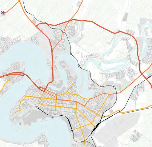
The municipality identified a series of primarily vacant sites across the city that could potentially host the Innovation District. An evaluation was carried out, taking several factors into account, including size, location, connections and the ability to create synergies with surrounding uses*. In agreement with the municipality, the chosen site was the “MKR. Solyani Territory”, located in a sparsely developed peninsula in the Tsentral’nyi district, north of the city centre.
* Refer to Output 1, Chapter 6
Wider site analysis summary
Situated along the Inhul river, this part of the city, known as Temvod, consists of valuable green spaces and parks. The wider area’s architectural fabric includes Soviet-era apartment blocks and lowdensity suburban housing, with nearby industries occupying the waterfront and limiting public access. While the external road network connects the site to the city centre and the northern part of the city, the internal mobility infrastructure is underdeveloped, with unpaved roads affecting urban quality. Oversized commercial complexes pose spatial challenges. The site has potential as a water transport hub, to improve connections to the city. The project provides an opportunity to integrate these elements, improve community facilities, sustainable mobility and access to the waterfront.
Existing buildings
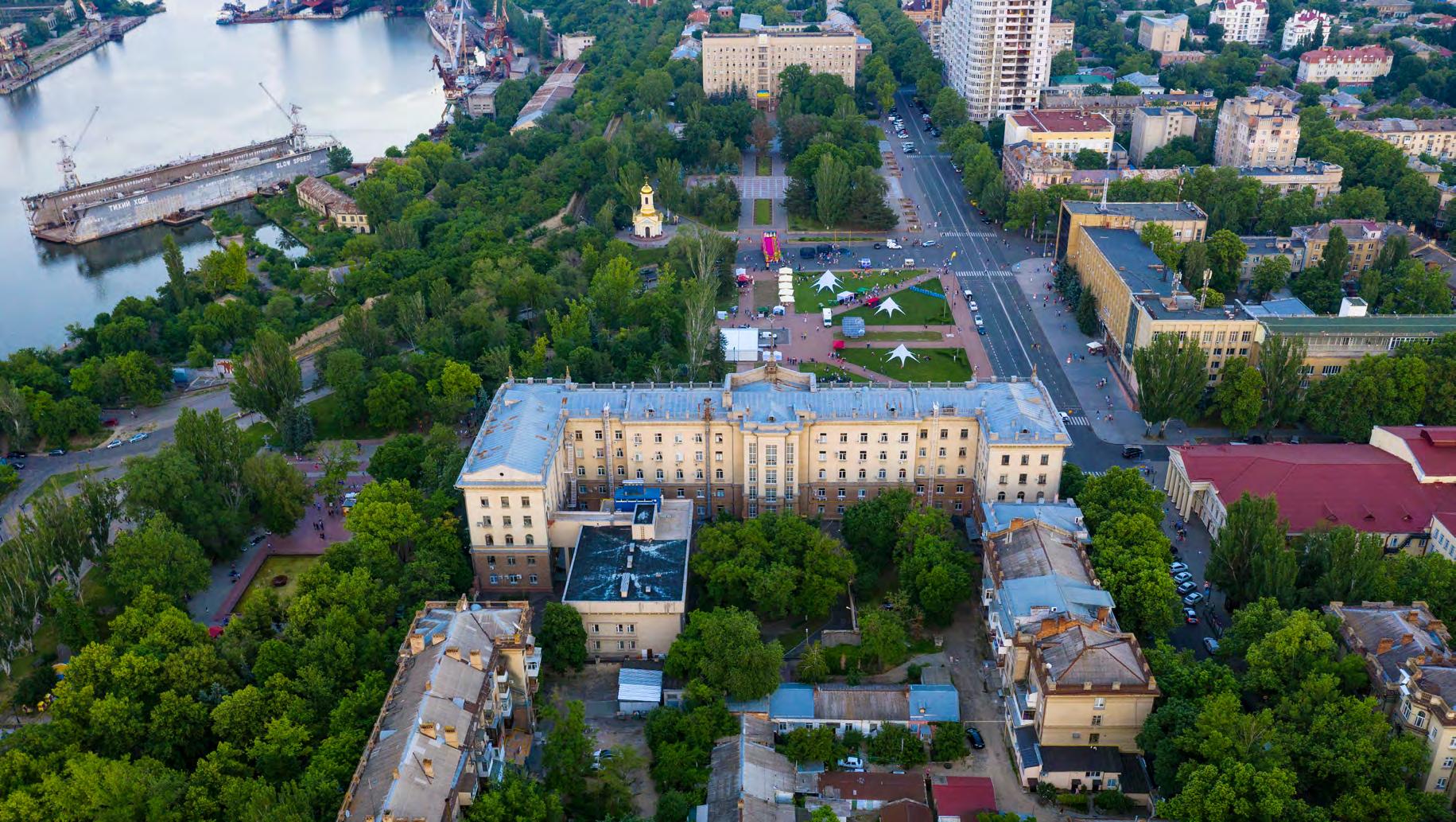
The proposed site covers an area of approximately 1,000,000 m2, with a discontinuous urban fabric. It comprises a variety of buildings, with the ‘Admiral Makarov National University of Shipbuilding’ campus representing the most significant structure.
Commercial activities are located along Heroyiv Stalinhrada Avenue (also known as International Road M14), while multi-storey residential buildings are situated to the north of the plot, in continuity with the adjacent urban fabric.
Small warehouses occupy a considerable portion of the area. A power plant is centrally located, close to the Inhul River.
The proposed site for the Innovation District partially overlaps with the historical shipyard plot, which has also been selected as a further pilot project for the city. The masterplan of the Innovation District will have to be integrated with the valuable urban development of the shipyard, avoiding repetitive land uses while promoting synergies within a coherent urban framework.
Aerial view
Existing land ownership
A considerable portion of the site currently belongs to either the Municipality or the Ministry of Education. This should allow a relatively smooth urban regeneration process, provided a formal agreement between the two entities is reached. The data also indicates the presence of areas where property ownership is attributed to both the State and the Municipality; the accuracy of this data should be verified, and amended, if necessary.
It should be noted that a vast privately-owned plot along the M14 belongs to the ‘Metro Cash & Carry’ enterprise. A smaller plot to the East is also privately owned, while a considerable area is occupied by the power plant mentioned earlier. While the relocation of the power plant might prove to be challenging, discussions with other private owners should take place to facilitate the integration of these plots within the district’s regeneration framework in the mediumlong term.
Lastly, the adjacent Shipyard is currently owned by the Ministry of Defence, making it a sensitive site. An agreement with the State authorities for the dismissal of current military uses will be crucial for a comprehensive regeneration of this part of the city.
Masterplan
Майстер-план
Buildings to be demolished or retained
Following conversations with the municipality regarding land ownership, existing building uses, types and conditions, the adjacent map identifies buildings that should be demolished in the short-medium term to unlock the potential of the site* . The residential area to the North will be preserved as a connection to the surrounding urban fabric and as a first example of residential stock regeneration. The completed and functioning blocks belonging to the university, including teaching spaces, offices and student housing, will also be preserved to serve as key catalysts in the development of the entire area. The low-quality warehouses, which currently occupy a large amount of space and negatively impact the site’s potential, will be demolished and rebuilt as structured and dedicated storage/manufacturing facilities within the adjacent Shipyard site. Additionally, the large retail building along the M14, which is partially disused, should also be demolished.
* Refer to phasing strategy on page 53-57
Urban grid
After taking the existing buildings to be retained and the site surroundings into consideration, the urban framework is proposed as an orthogonal grid, drawing upon the structured urban fabric of Mykolaiv’s city centre. This grid provides a clear and organised layout which ensures continuity with the surrounding built environment.
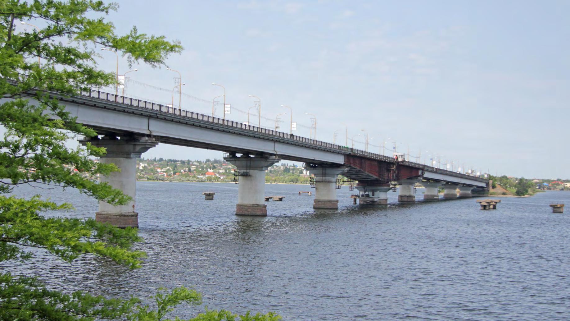
A series of more organic axes is then introduced towards the eastern side of the development, to align with the site’s natural contours toward the river. These areas create a dynamic contrast with the rigid grid, offering a more diverse and flexible plan that enhances the site’s relationship with its natural surroundings. The organic system crosses the water via a new bridge, providing an alternative connection between the Temvod peninsula and the city centre.
Superblocks and internal connections
The intersection of the main axes generate several superblocks* within the site. The edges of each superblock is accentuated by planned green corridors internal to the district, as well as an external ‘green belt’.
The masterplan strongly prioritises sustainable mobility, and a network of vehicular and pedestrian mobility routes, planned to ensure an integrated and accessible urban environment.
* A superblock is a large urban block barred to through traffic, and crossed by pedestrian walkways. Access roads leading to the buildings are allowed only where strictly needed; their location and layout is not prescribed, and can be adapted to the urban fabric subsequently proposed through more detailed plans, as the project evolves.
Road network
The road network consists of two primary roads: the existing M14 and a new “parkway” that will be connected to a newly proposed bridge. Heavy vehicles will not be permitted on this new road, which will instead function as the main public transport corridor, with dedicated lanes.
A series of secondary roads will connect these two main routes at right angles, allowing for flexible configurations and internal connections within the superblocks.
The main walkway, the Riverfront Promenade, will provide new activities and functions for public use along the Inhul River, while also connecting the proposed Shipyard cable car system to the Innovation District site.
Catalysts Каталізатори
Catalysts are key buildings that act as drivers of development for the Innovation District, and create a vibrant and dynamic urban environment. These catalysts may act both at urban and neighbourhood scale.
Urban-scale catalysts include major destinations such as the university campus, the cable car station, the regenerated Shipyard, cultural venues, mixed-use towers, government buildings* and the mobility hub. These projects significantly impact the broader urban fabric, while activating and vitalising the district. In contrast, neighbourhood-scale catalysts greatly benefit the local community through the implementation of social infrastructure, or, as an example, the development of an art district. These developments encourage social interaction and contribute to the cultural and creative character of the district.
* The area between the Innovation District and the Shipyard could host the new headquarters of the Regional Government, whose original premises were heavily damaged during the conflict and are therefore planned to be demolished.
The new development of the site will be advantageous for existing institutions, as accessibility and associated public spaces will be improved. The football stadium and sports area west of the site will benefit from a direct green link to the Inhul river. The university campus will be situated in the core of the development, along an east-west green corridor and near the main square of the district, thereby establishing its presence as one of the main triggers of innovation and exchange.
Character zones Характерні зони
Though specific character zones are identified, the precise use of each building is not rigidly defined to promote flexibility, allowing the district to evolve over time, depending on contingent economic conditions. Generally, a predominantly residential fabric is suggested for the northern area, in continuity with the surrounding urban context. This side will host existing and new local residents, and might include more units of student accomodation, as well as housing for researchers and professors of the local university. The central core will prioritise cultural and educational activities, aligning with the functions of the university, thereby establishing it as the dynamic centre for learning and creativity. Meanwhile, the southern section, which overlooks the potential new park, will be home to numerous offices and start-ups, thereby fostering innovation, entrepreneurship, and synergies with the Shipyard site. The Riverfront Promenade will be predominantly mixed-use, featuring a variety of commercial establishments, including hotels, retail spaces, and offices. This will result in a vibrant and diverse waterfront, which will boost social and economic activity throughout the day.
Focus: existing buildings and adaptive reuse
Adaptive reuse is a forward-thinking approach for developments that repurpose and create new uses for existing buildings, offering a sustainable alternative to the continuous cycle of demolition and construction. Adaptive reuse significantly reduces resource consumption and waste, leading to a lower carbon footprint and environmental impact. It is cost-effective, often cheaper than building anew, and can increase property values while also creating jobs in construction and design, thus boosting the local economy. It revitalises communities by transforming underutilised areas into vibrant spaces with flexible designs that enhance liveability and meet evolving community needs. These projects are designed to adapt to changing needs, ensuring they remain valuable and functional over time. The challenges of adaptive reuse drive innovation in design and construction, fostering collaboration among architects, engineers, and community stakeholders, leading to creative solutions and a shared sense of purpose. There are multiple possibilities for adaptive reuse in the Innovation District. This study focuses on the ‘Metro Cash and Carry’ building located to the west of site.
From a discount shop to a Social Makers Hub
It is proposed to convert the existing Metro Cash & Carry supermarket into a new Social Makers Hub, envisioned as a dynamic area for tech-sector start-ups and other innovative enterprises. Though the Metro Cash & Carry building might be needed to operate with its existing function in the early post-conflict years to meet Mykolaiv’s immediate needs, the supermarket’s size and location are ideal for higher value uses as the land value of the Innovation District increases. The building’s long-span rectangular grid structure can easily accommodate a variety of modular workspaces and multi-storey spaces, creating new types of workplaces with resourcefulness and creative thinking at its core.
Focus: catalysts along the riverfront
The presence of catalyst buildings along the riverfront of the Innovation District transforms it into a vibrant socio-cultural hub at urban scale. These buildings will host artistic and cultural uses to showcase Mykolaiv’s local talent and unique identity while also fostering innovation and community engagement.
The image to the right illustrates a theatre along the riverfront, as an example of a cultural/public catalyst building - a dynamic space that elevates the waterfront, making it a focal point for creativity and collaboration.
Learning from benchmarks: design components
Вчимося на еталонах: архітектурно-просторові компоненти
Design components: environment
Drawing upon successful Innovation District case studies, environmental components will be essential in creating a liveable and high-quality public realm. Specifically, the precinct aims to define a safe, accessible, inclusive, and user-friendly space. The commons refer to the main park and open fields, which are vital for health and well-being, as well as for hosting temporary events. Natural corridors are key in enhancing the area’s ecosystem and biodiversity. Finally, the context focuses on creating permeable and adaptable borders that respond to the characteristics of the surrounding environment.
Design components: placemaking
The plaza will be the heart of the Innovation District’s public space, functioning as a focal point and a new meeting place for the city. The design allows for flexibility and adaptability, ensuring that the space can accommodate a wide range of events and activities. Secondary plazas are located throughout the site, serving as transitional or active public spaces. Typological yards provide open spaces for adjacent buildings, and may be subject to restrictions or designated as semi-private. The landmark buildings serve as symbols of the district, potentially functioning as iconic structures or monuments.
Placemaking
Design components: clustering
The principle of clustering promotes smart growth, environmental sustainability, and the efficient use of resources. “Innovator settlers” (entities capable of bringing and promoting innovation through their research and activities) will encompass universities, start-up incubators, and research centres. Complementary facilities, like sports centres, health facilities, and art centres, will contribute in the creation of a multifunctional, vibrant space. Residential uses will include a diverse range of housing options, including shared and temporary residences, designed for users visiting the District for a short period of time. The central cluster will serve as a social hub, serving as a meeting point for the city, including uses such as a theatre, museum, or conference centre.
Design components: connectivity
As better described in the mobility chapter, the main axis functions as a catalyst around which the mixeduse buildings of the District develop, facilitating a dynamic urban realm.
The number of supporting roads is kept to a minimum, thereby reducing the reliance on private vehicles and facilitating the use of centralised car parks. The mobility hub serves to enhance the district’s accessibility bringing together several modes of transport.
Massing and density studies
Дослідження об’ємно-просторових
Densities
The project site can be divided into three distinct density zones. The first and most extensive is defined by relatively low-density development, and extends from the M14 motorway to the urban promenade. From this point, a medium-rise development zone commences, continuing up to the third zone, characterised by high-rise developments along the river. This results in a gradient of building heights, originating from the motorway and increasing in scale towards the area of the site with the highest landscape and economic value.
Building heights: option 1
In order to facilitate a human-scale environment, the average height for buildings in the low-density zone is five storeys. However, especially along the existing residential area to the North (which consists of taller structures), buildings may go up to 7 storeys.
In the medium-density zone, the lower blocks will be five storeys, with interspersed towers reaching 15 storeys.
In the high-density zone, buildings will range in height from six to nine storeys, with the presence of several towers exceeding 20 storeys, up to a maximum of 30 storeys.
Gross Floor Area (GFA): option 1
Considering the buildings within the boundary of the Innovation District site, the total Gross Floor Area (GFA) of the proposed buildings equals 1 million m2, with an additional 230,000 m2 of GFA attributed to the existing buildings. The Floor Area Ratio (FAR*) ranges between 3 and 5 in the zone previously identified for high-rise development. In contrast, the superblocks along the M14 highway have mostly a FAR ranging from 0 to 2, while the superblocks located between the high-density and low-density zones have generally an intermediate FAR, ranging from 2 to 3.
* FAR = GFA / Plot Area. This is a parameter representing the building density in a plot. A FAR ranging from 0 to 2 equals a relatively low density, which is the result of low/medium-rise buildings and/or generous open spaces; 2-3 represents a medium density; 3-5 represents a relatively high density.
The wind rose for Mykolaiv shows that the prevailing winds blow from the North-West and South-SouthEast. On average, wind speeds are highest in February and March, and lowest in July and August. The proposed massing, which includes towers located along the eastern edge of the site, will protect the riverfront from strong North-West winds in winter. At the same time, the urban grid allows the slower and more pleasant S-S-E breeze to flow through the district.
Wind rose for Mykolaiv, showing
The orientation of the site works in favour of solar exposure: most buildings will benefit from direct sunlight at some point during the day. This is reflected in the shadow analysis on the next page. Throughout the year, taller buildings along the riverfront do not particularly affect the lower buildings around them, as they are at an adequate distance. The proposed urban framework therefore guarantees adequate solar exposure in all seasons.
Building heights: option 2
Option 2 is planned with a more ambitious approach, with an average of 2 storeys added to the low-density buildings, and 4 to 6 storeys added to the towers.
Gross Floor Area (GFA): option 2
Overall, Option 2 envisages a 30% increase in Gross Floor Area (GFA) compared to Option 1, reaching a total of 1.3 million m2 for new buildings. This option may be partially or completely implemented over time should the development of the economic conditions of the city require and sustain additional construction.
Existing GFA = 10,000m2 Наявна GFA = 10 000
GFA = 1,530,000m2
Phasing
Phase 1
Етап 1
The phasing strategy keeps into account the existing urban fabric, and the possibility of either enhancing it or replacing it over time, depending on its potential and value.
Phase 1 envisages the redevelopment of the university campus and its immediate surroundings, serving as the primary catalyst for this initial project phase. This zone will represent the core of the Innovation District, featuring a diverse range of functions, including academic, research, and public spaces.
In addition to the campus redevelopment, Phase 1 will also introduce the new green corridors, as well as the initial development of the Riverfront Promenade. This will establish a dynamic and accessible public realm and waterfront zone, enhancing public access to the river and providing new avenues for leisure and community engagement. The properties included in this phase are under the ownership of the State and the Municipality, facilitating a unified approach to land use and development. Both the Metro Cash & Carry and the semi-used retail building along the M14 will be kept operational. Only a portion of the outdated warehouses are envisaged to be demolished in the first phase, to allow the university campus to reach the riverfront.
Phase 2
Phase 2 will result in a more extensive integration of the Innovation District’s urban fabric with its surroundings. The northern area will undergo significant residential development, along with existing residential buildings undergoing renovation in order to facilitate this vision. At the same time, the construction of a new bridge will provide a more direct link between the Innovation District peninsula and the city centre. The existing mall to the north-west corner of the site is transformed into a mobility hub in this phase, while the Metro Cash & Carry is partially converted into a social makers hub* . The green corridors will be extended, thus enhancing the district’s ecological networks and providing additional recreational spaces. The Riverfront Promenade will continue to be expanded, thereby enhancing accessibility to the waterfront and creating additional public spaces for leisure and community use. New neighbourhood and urban-scale services will be constructed, including a conference and cultural centre, in order to promote the district’s evolving role as a centre for innovation and cultural activities. The demolition of underused warehouses and other neglected structures will be necessary to implement this phase. The majority of the land included in Phase 2 is under the ownership of the State and the Municipality. Nevertheless, a small number of privately owned properties are also included in the redevelopment plan. In addition, the construction of the new bridge will affect the Shipyard site, which is currently owned by the Ministry of Defence, and will therefore require specific agreements.
* Refer to retrofitting study on pages 34-35.
Phase 3 Етап 3
Phase 3 will complete the development of the Innovation District, potentially expanding beyond the site boundary and thereby fully reaching the project potential. The objective of this phase is to establish a fully realised connection between the project and the Shipyard site*, facilitating business and social interactions within the wider area. The green connections will extend further South, potentially culminating in the establishment of a new urban park (“Union Park”) between the Innovation District and the Shipyard. This will serve as a vital ecological corridor and green space for residents and visitors alike, promoting sustainability and enhancing the ecological landscape of the area. The Riverfront Promenade will also be extended southward, through the demolition of several abandoned buildings, thereby transforming previously neglected spaces into vibrant areas that encourage exploration and activity. By leveraging these assets, Phase 3 aims to create a cohesive urban environment that prioritises accessibility, connectivity, and ecological balance.
* It should be noted that the Shipyard site is currently dedicated to Defence uses. Postponing linking the two sites to Phase 3 will allow enough time for the necessary agreements and changes in land use to take place.
Phasing summary
In conclusion, the three phases of the project follow a strategic progression aimed at revitalising and integrating the Innovation District with its surrounding areas over time, balancing new and existing developments. Phase 1 focuses on redeveloping the university campus, considered to be the core of the District, while introducing green corridors and enhancing the riverfront. Phase 2 proposes a new bridge across the Inhul River, and expands the district to the North and West, including residential developments and the establishment of new cultural and urban-scale services. Phase 3 reconnects the District with the Shipyard and city centre, through extended green networks and a park that maximises physical, ecological and social connectivity.
Illustrative plan and renderings
Illustrative plan
Aerial view from South-East
Campus view
Riverfront view
CHAPTER 2 | РОЗДІЛ 2
Transport and mobility strategy
Photo: Dmytro Udovytskyi
Mobility goals
Main mobility goals
Mobility Goals
Main Principles and Actions
Enhance
Enhance accessibility and connectivity
Prioritise public transport and shared mobility
Prioritize public transport and shared mobility
Integrating the Innovation District with the wider city network by implementing a new bridge connection and optimising existing access routes
Integrate the Innovation District with the wider city network by enhancing and optimizing the existing connections
Ensure multi-modal accessibility to the Innovation District by implementing public transport corridors, water transport and electric shuttles for internal circulation
Ensure easy accessibility to the Innovation District by establishing public transport corridors, water transport routes, and electric shuttle routes supported by dedicated facilities within the area
Implement innovative and smart solutions
Implement innovative and smart solutions
Implement sustainable and smart mobility solutions and devices including electric and autonomous vehicles and Mobility as a Service (MaaS)
Implement Mobility as a Service (MaaS) to integrate various sustainable and innovative transport options, providing seamless and efficient multimodal travel for users
Ensure urban environments that promote walking and soft mobility
Ensure a pedestrian-friendly environment
Design safe, flexible and vibrant streets along with dedicated lanes for soft mobility
Design safe, flexible and vibrant streets along with dedicated paths for soft mobility
Road network strategy
Стратегія
Road network principles
Enhance accessibility to the site by introducing a new primary road to the east and a new bridge connection between the Innovation District and the city centre.
Create efficient multi-directional access points to the site to facilitate smooth, uninterrupted traffic flows.
Implement 30 km/h and heavy traffic-limited zones within the site to enable safe pedestrian and cyclistfriendly environments.
Design roads to ensure safe and adequate spaces for all transport modes, fostering an accessible and efficient mobility network.
Proposed road network hierarchy
The proposed road network for the Innovation District is shown on the following page. It features the existing Heroyiv Stalinhrada Avenue, which is a primary road connecting the site to the airport and the city centre to the west. Heavy vehicles accessing the site from the north are permitted only to ensure accessibility to the shipyard, but these vehicles are prohibited from crossing the existing bridge connection to the city centre.
A new bridge and road connection to the east of the site will provide additional accessibility to the city centre while restricting heavy vehicle access. It is recommended to extend this primary road towards the north to connect it with the M14 highway.
Secondary roads within the master plan provide eastwest connections between the two primary roads through signalised junctions, granting access to each plot while minimising roadways to create a superblock* typology, focused on pedestrian and soft mobility circulation.
* The superblock concept is an urban planning strategy that creates large, car-free zones by combining traditional city blocks, prioritising pedestrians and cyclists over vehicles. By limiting car access and encouraging sustainable transportation, superblocks enhance community interaction, improve air quality, and create vibrant spaces that support local businesses and increase overall liveability in urban areas.
Local shared roads within the site enable access to each plot for residential purposes only, including deliveries and emergencies, along with ensuring accessibility for People with Reduced Mobility (PRM).
Access to these roads can be controlled using automatic bollards. Connections from local to primary roads on the east and west are restricted to right-in and right-out movements only.
Lastly, the entire master plan, excluding the shipyard area, is proposed to be a 30 km/h and heavy trafficlimited zone, to create a safe environment that welcomes soft mobility.
Proposed road network hierarchy
Local shared road (residential only - deliveries, emergencies, and access for persons with reduced mobility)
Local shipyard road with heavy vehicle access
Proposed road section: existing primary road
Proposed Road Section
Existing Primary external road
The Heroyiv Stalinhrada Avenue is an existing external primary road with a 2+2 lane configuration. The proposed road section maintains this configuration, with public transport sharing the vehicular lanes. No downgrades are recommended, given the need for heavy vehicle access to the shipyard and the anticipated increase in traffic flows due to new land uses. The road section may vary depending on the available space within the existing infrastructure.
Proposed Road Section
No downgrades are recommended, given the need for heavy vehicle access to the shipyard and the anticipated increase in traffic due to new land uses. It is advisable to maintain the road as a 2+2 lane configuration, with public transport sharing the vehicular lanes.
Existing Primary external road
The road section may vary depending on the available space within the existing infrastructure.
No downgrades are recommended, given the need for heavy vehicle access to the shipyard and the anticipated increase in traffic due to new land uses. It is advisable to maintain the road as a 2+2 lane configuration, with public transport sharing the vehicular lanes.
The road section may vary depending on the available space within the existing infrastructure.
Proposed road section: internal primary road
Proposed Road Section
Primary internal road
The road section proposal for the internal primary road features a 2+2 lane configuration, which includes dedicated lanes for public transport. Bike lanes are provided on each side, and ample sidewalks. Sufficient space for public transportation stops and micromobility sharing stations should be provided along this road.
Proposed Road Section
Primary internal road
We recommend a 2+2 lane configuration with dedicated bike lanes on each side, sidewalks, and dedicated lanes for public transport. Ensure sufficient space for public transportation stops and micro-mobility sharing stations along this road.
We recommend a 2+2 lane configuration with dedicated bike lanes on each side, sidewalks, and dedicated lanes for public transport. Ensure sufficient space for public transportation stops and micro-mobility sharing stations along this road.
Proposed road section: secondary road
Proposed Road Section
Secondary road
The road section proposal for the secondary roads features a 2+2 lane configuration including dedicated lanes for public transport, bike lanes on each side, and sidewalks.
We recommend a 2+2 lane configuration with dedicated bike lanes on each side, sidewalks, and dedicated lanes for public transport.
Proposed Road Section
Proposed road section: local shared road
Local Shared Road
We recommend shared streets without distinct spaces for pedestrians, cyclists, or motorized vehicles. Instead, the street is a shared space for all users, encouraging flexibility and safety.
Proposed Road Section
Local Shared Road
The proposed road section for local roads features shared streets without distinct spaces for pedestrians, cyclists, or motorised vehicles, nevertheless creating a flexible and safe environment for all users. Local roads are accessible exclusively to residents, off-peak delivery services, taxis, people with reduced mobility, and emergency vehicles.
We recommend shared streets without distinct spaces for pedestrians, cyclists, or motorized vehicles. Instead, the street is a shared space for all users, encouraging flexibility and safety.
Proposed Road Section
Proposed road section: local shipyard road with heavy vehicle access
Local Shipyard Road with Heavy Vehicle Access
We recommend a 1+1 street configuration with bike lanes and sidewalks on both sides. These streets allow heavy vehicle traffic access to the shipyard.
Proposed Road Section
Local Shipyard Road with Heavy Vehicle Access
The road section proposal for the local shipyard roads features a 1+1 lane configuration with bike lanes and sidewalks on both sides. This design accommodates heavy vehicles accessing the shipyard.
We recommend a 1+1 street configuration with bike lanes and sidewalks on both sides. These streets allow heavy vehicle traffic access to the shipyard.
Photo: Viktor Adjamsky
Public transport and soft mobility strategy
Стратегія громадського транспорту
Public transport and soft mobility principles
Ensure multimodal accessibility from key transport hubs of the city, including the airport and train stations.
Promote multimodality within the masterplan by introducing mobility hubs that integrate public transport and sharing services.
Create a pedestrian and cyclist-friendly environment by developing a comprehensive soft mobility network.
Implement innovative and sustainable mobility solutions for internal movements.
Proposed public transport networkcity scale
The following map outlines the public transport network at the city scale. Four main public transport lines will pass through the Innovation District, connecting it to the city’s main transport hubs, the airport, and the primary train stations. This infrastructure will ensure high levels of accessibility for residents, employees, and visitors of the Innovation District by public transport.
Line
Line K (new proposal)
Water transport route
Water transport stop
Feeder system
Cable car
Small mobility hub
Proposed public transport network
Public Transport Network Proposal
The map outlines the proposed public transport network for the Innovation District. The district is wellconnected to the rest of the city through a multimodal network, including Mass Rapid Transit (MRT) such as trackless trams or Bus Rapid Transit (BRT) on dedicated lanes, buses, water transport modes, and a cable car linking to the historic shipyard on the other side of the river. The alignment of lines and stops ensures a high level of accessibility for residents, employees, and visitors of both the shipyard and the Innovation District.
Additionally, strategically located mobility hubs will facilitate seamless transitions between different modes of transport and offer access to innovative and shared modes of transport for last-mile connections.
Please note that since the city’s main mobility strategy is currently under revision and development, the final selection of public transport modes and line alignments may change.
Proposed internal mobility network
Internal Mobility Network Proposal
The map outlines the proposed internal circulation strategy, including last-mile connections and soft mobility networks for the Innovation District.
The core mobility principle of the Innovation District prioritises pedestrians and soft mobility. As a result, the concept master plan features a comprehensive network of dedicated soft mobility routes and cycling lanes along all roads, ensuring safe spaces for nonmotorised transport modes.
Two electric autonomous shuttle routes are proposed, offering an innovative and sustainable mobility option for residents, employees, and visitors.
Photo: Evgen Gomonjuk
New bridge and primary road impact study
Innovation District integration with the city road network
The adjacent page presents the current, municipalityplanned, and proposed road hierarchy for the Innovation District.
The primary issue regarding mobility in the current state is the limited accessibility of the Innovation District. It can only be reached through the Heroyiv Stalinhrada Avenue (1), which is currently a congested road and bridge. This route is the main connection between the city centre, northern areas and the M14 highway. The anticipated increase in traffic flows generated by new land uses and developments within the Innovation District may create additional demands on this route, amplifying existing concerns.
To improve connectivity at a city scale, the municipality has planned a new bridge connecting the future Innovation District site to the city centre (2). This new bridge will connect to the northern M14 highway, and to a proposed road running along the eastern side of the planned Innovation District (3). Additionally, the municipality’s plan includes upgrades to surrounding roads, such as the 2nd Naberezhna Road along the river (4), in response to expected increases in traffic flows generated by the new bridge.
The proposal for the Innovation District aligns with the municipality’s planned interventions, with slight modifications to minimise impact on surrounding areas and achieve the concept master plan’s key mobility goals.
The proposal suggests constructing the new bridge slightly further west (5) to enhance connections with existing major roads, thereby reducing the need for interventions on local roads like the 2nd Naberezhna Road. Furthermore, the proposal includes extending the bridge to a planned primary road on the eastern side of the Innovation District (6) to integrate it into the city’s main road network. However, a feasibility study should be conducted during the upcoming design phases to ensure sufficient space is available and to identify any potential need for demolishing existing buildings.
Road hierarchy: current
Road hierarchy: planned by the municipality
Road hierarchy: Innovation District proposal
Proposed primary road connection
As previously mentioned, it is recommended to extend and connect the proposed primary road on the eastern side of the Innovation District to the M14 highway to the north to increase connectivity and accessibility of the site.
The construction of this new road will require the demolition of several existing buildings and infrastructure within the highlighted area of the Solyani neighbourhood of Mykolaiv, as shown in the image. Therefore, the municipality should conduct a feasibility study in the upcoming design phases to ensure its viability.
The southern Temvod neighbourhood and the proposed Innovation District do not present any critical issues related to existing infrastructure or buildings along the planned route. However, a feasibility study should still be conducted for the entire length of the road.
Vehicular flows toward the Innovation District
This section provides an overview of vehicular flows to and from the Innovation District. The maps on the next page show three scenarios - the current state scenario, where the Heroyiv Stalinhrada Avenue and the bridge serve as the main access points to the site.
The initial bridge proposal features a new bridge connecting the eastern side of the Innovation District to the city centre, reflecting the municipality’s proposals for the bridge. As shown, this bridge location would affect flows on local streets, 9th Voienna Street and 2nd Naberezhna Road, which would require upgrades. Therefore, it would have significant impacts on the surrounding road network and costly interventions.
The updated proposal connects the bridge to wider roads in the city centre, minimising its impact on the surrounding road network.
Additionally, this section includes a detailed multicriteria analysis comparing these three scenarios. The analysis indicates that, despite its high implementation costs, the new bridge improves accessibility to the Innovation District and offers opportunities for multimodal corridors, enhancing connectivity through public transport and soft mobility.
Vehicular flows toward the Innovation District
From Kyiv
From Odesa
From Dnipro From Kherson
New bridge: multi-criteria analysis
Multi-criteria
No implementation costs
No impact on the public realm or existing buildings
No change in current accessibility to the Innovation District
No additional vehicular infrastructure, avoiding increased traffic
No interventions required on existing roads, allowing current traffic
levels to remain unchanged
No enhancements to public transport or soft mobility connectivity
High implementation costs
Impact on the public realm and existing buildings
Improved accessibility to the Innovation District from other areas of the city
A new bridge can encourage the use of private transport modes
Requires interventions and road upgrades to handle the extra traffic
The bridge can be used as multi-modal corridor to implement new public transport lines and increase soft mobility connectivity
High implementation costs
Impact on the public realm and existing buildings
Improved accessibility to the Innovation District from other areas of the city
A new bridge can encourage the use of private transport modes
Requires minimum interventions and road upgrades to handle the extra traffic
The bridge can be used as multi-modal corridor to implement new public transport lines and increase soft mobility connectivity
Photo: Evgen Gomonjuk
Landscape strategy
Photo: Evgen Gomonjuk
A nature-positive Innovation District
Природоорієнтований інноваційний
What is a nature-positive Innovation District?
A “green” Innovation District is an urban area designed by integrating advanced technologies and ecological infrastructure to create an environment that supports sustainable innovation. These typologies of districts must prioritise environmental sustainability and the reduction of their ecological footprint through efficient use of natural resources and integration of advanced design strategies.
Therefore, they are characterised by energy-efficient buildings, eco-friendly public transportation, ample green spaces, and systems for managing natural resources such as water and energy.
It is essential to introduce large green spaces that promote biodiversity and offer recreational areas, contributing to residents’ overall well-being. These green spaces will contribute to a healthier environment by improving the air quality and reducing urban heat islands. They will also serve as community hubs, fostering social interaction and encouraging outdoor activities.
Weaving green spaces into the Innovation District can support a sustainable urban ecosystem, enhance the quality of life, and promote environmental stewardship among residents.
The following page describes four districts around the world that have evolved around green spaces and sustainability, becoming active urban hubs for energy production and water management. These could potentially serve as inspiration for the Innovation District in Mykolaiv.
Songdo International Business District, Incheon, South Korea
Songdo International Business District,
Nature-positive Innovation Districts
Hammarby Sjöstad, Sweden, 2016
Hammarby Sjöstad, Швеція, 2016
Hammarby Sjöstad is one of the world’s most successful urban renewal districts. Sustainability was one of the pillars of the design of this new water-centric district. Sustainable alternatives for managing water, energy and waste were carefully studied at an architectural and infrastructural level. Rainwater either infiltrates the ground directly or is drained off through canals. Based on the strategy of a compact green town, a feasible balance has been found between built and open spaces. Limiting barriers such as fences and introducing continual public spaces gives rise to a district that has a dynamic environment.
Hammarby Sjöstad
Vauban District, Germany, 2001
2001
Worldwide, Vauban District is the first housing community where all the homes produce a positive energy balance. Organic household waste is treated with an anaerobic digester. One pilot project of the district features a unique ecological sewage system, where greywater is cleaned in biofilm plants and restored to the water cycle. The district evolved around public transportation and soft mobility. Pedestrian and bicycle paths form a highly-connected and efficient network, and every home is within walking distance of a tram stop. Within Vauban, people get around primarily on foot or by bicycleon average 38-73% of all daily trips are performed by walking or cycling, as opposed to only 5–16% by car.
The Forestias, Thailand, 2023
The Forestias, Таїланд, 2023
Forestias in Bangkok is a pioneering urban development project that prioritises sustainability and landscape integration. The development includes interconnected green spaces such as parks, gardens, and nature trails, which promote walkability and offer residents easy access to nature. The buildings are designed with green roofs, vertical gardens, and large windows to maximise natural light and reduce energy consumption. Sustainable water management practices are employed; rainwater harvesting systems are used for irrigating the extensive vegetation and greenery. The use of native plant species support local ecosystems and reduces the need for additional water and maintenance.
Masdar City, United
2016
Masdar City is a cutting-edge sustainable urban development that aims to set new standards for eco-friendly living. Innovative features include advanced temperature-reduction techniques, which utilise natural methods. The district’s urban design resulted in street temperatures that felt 5-10°C cooler than the surrounding desert. The city’s core, called the podium, is raised above the surrounding area and oriented to direct wind through the streets. Buildings are clustered together to create streets and walkways that are shielded from the sun. Additionally, a 45-metre high wind tower modelled on traditional Arab designs takes in air from above and creates a cooling breeze.
What is the role of landscape in the Innovation District?
The role of landscape in the Innovation District will be crucial to create a sustainable urban environment, not only through the introduction of green spaces, but also through the development of a natural system that is integrated within the city’s urban system, resulting in numerous benefits.
The district’s landscape should be designed to enhance the connection between the natural and built environment, creating ecological pathways such as pedestrian trails and bike lanes that improve sustainable mobility, and a strong ecological corridor that can support wildlife flows within the district.
Additionally, the landscape can serve as a tool for ecological management as well as promoting resilience. Using native vegetation and implementing nature-based design solutions will improve energy efficiency, mitigate the effects of climate change, provide natural protection against extreme weather events, and preserve the urban area in the long-term.
The landscape in the Innovation District can also play an educational and cultural role, offering opportunities for learning and environmental awareness. Providing green spaces that can host events, workshops, and educational activities will encourage greater understanding and participation in environmental protection. Finally, a well-designed landscape will be able to contribute to the aesthetic appeal and quality of life of the district, increasing property values and potentially attracting investments and talent, thus supporting the economic development and liveability of the Innovation District.
Landscape as an active resource to reconnect people with nature
1. CULTIVATE THE LANDSCAPE
Restoring existing nature ecosystems using various regeneration techniques within a comprehensive framework
2. CULTIVATE THE NATURE
Implementation of Nature Based Solutions (NBS) and Sustainable Drainage Systems (SuDS)
3. CREATE URBAN SPACES BASED ON A HUMAN SCALE
Reconnect people with nature at every scale
4. CREATE A LINK BETWEEN NATURE AND TECHNOLOGY
Transform green spaces into an experiential, technological environment
Solutions, NBS)
(Sustainable Drainage Systems, SuDS)
Photo: Viktor Adjamsky
Landscape principles
Принципи ландшафтного дизайну
The landscape strategy starts from the context
NATURE INFILTRATION
Bringing
Landscape strategy for the Innovation District
The landscape strategy stems from the analysis of the local context, thus deriving the project’s functional identity from its surroundings.
The strategy is based on three main pillars:
• Nature infiltration: bringing existing green and blue features of the surroundings into the district, such as the Victory park to the west, the wetland system of the Inhul river to the east and the green urban void to the south.
• Green connections: connecting the city’s natural polarities by creating green links, such as the east-west axes connecting the Southern Bug and the Inhul rivers, and the north-south axis which is crossed by key infrastructural lines.
• Cityscape: enhancing polarities and open spaces within the city, starting from the main urban-scale catalysts of the Innovation District. Green spaces become an integral part of the urban system by forming the “green lung” of the Innovation District, characterising the different blocks and offering new opportunities for use.
Through the systemisation of these three strategic pillars, each new open space will have a distinct identity and function, one that is recognisable within the urban framework, but also offers a new and welcoming image.
Landscape approach for different environmental systems
From an environmental standpoint, the location of the Innovation District is advantageous due to its proximity to the Bug and Inhul rivers. Therefore, the district has diverse natural landscapes that complement the existing green areas within the urban fabric. Building on the landscape strategy developed in Output 2, and integrating the four design principles discussed previously, the primary goals for this district are to preserve its natural landscape, enhance its environmental features, and reconnect the community with nature.
This will be achieved by introducing and increasing the offer of diverse public spaces while maintaining a balance between the district’s natural and built environment.
The strategic guidelines developed for the Innovation District are structured around the three systems identified in the city’s landscape strategy:
- the hydrographic system, consisting of the waterfront and wetland areas;
- the urban green space system, encompassing existing and new green public areas, including the river park that features accessible sections of the wetland;
- the urban space system, that comprises the district’s diverse functional buildings.
For each component of these systems, specific strategic guidelines are proposed for implementing the strategic objectives and defining an approach for the different types of open and green spaces. The following pages illustrate the proposed guidelines through prototypes which represent the different open space typologies within the district.
Cultivate the landscape Cultivate the nature Create urban spaces based on human scale Create a link between nature and technology
Serving as an emergency buffer area during floods, and ensuring safety in surrounding high-risk zones along the Bug and Inhul rivers
Enhancing the quality of existing public spaces by maximising their green areas and revitalising their space
Implementing semi-private green spaces as potential gathering spaces for the community
Preserving the natural wetland areas on each side of the Innovation District as important ecosystems to be maintained
Regenerating
Creating a green network connecting the Innovation District and Victory park to the river
Regenerating vacant urban voids to include
Ensuring access to public green spaces within a 15-minute walking distance in the
Transforming small industrial areas and the electric plant into ecologically equipped areas
Mitigating the impact of built areas on the river landscape
Introducing
Improving and consolidating the slow mobility network
Including and enhancing urban infrastructure to support the slow mobility network
Implementing small-scale strategies like green roofs and green façades in existing and new buildings according to each functional typology
Creating multifunctional semi-private green spaces that complement existing and proposed urban facilities
Implementing street greenery as a way of mitigating infrastructural impacts related to the road system
Open space taxonomy
This section describes the strategy for defining the new open space typologies that characterise the landscape of the Innovation District and make it unique. The spaces are classified by size - Small (S), Medium (M), Large (L), Extra Large (XL); and by level of accessibility (public, hybrid and private). Additionally, the sizes of different spaces proposed should not be compared across accessibility levels, since the standard dimensions for public spaces cannot be correlated with those of hybrid and private spaces. Various typologies have been identified by combining these different variables in the matrix, in order to fully highlight and express the identity of the area. The positioning of the different areas within the district follows the main character and identity of the concept masterplan, defining a configuration that aims to reconnect people to Mykolaiv’s natural systems.
HYBRID SPACES
•
• Nature-based solutions for water management
• Higher biodiversity and adaptive plants
• Higher aesthetic quality
• Wi-Fi
• Charging stations for electronic devices
• Shared, shaded work stations
• Wi-Fi •
• Wi-Fi connection
• Smart information points with real-time updates
• Smart bus shelters and bike racks for intermobility
• Wi-Fi
POCKET GARDEN
Functional area |
• Residents’ involvement across different
• Local small food production
• Enhancement
Potential
• Mixed vegetation edges with shrubs and herbaceous plants
• Lounge areas
•
• Smart solar benches with Wi-Fi
connection and power stations for devices
• Small plazas for work breaks and lunch
• Mixed vegetation edges and trees
• Community meeting point
• Mixed vegetation edges with shrubs and herbaceous plants
• Small bodies of water controlling the micro
MIXED
• Land art installations (permanent or temporary)
• Shaded leisure areas
• High
•
• Equipped workout areas
• Charging stations for electronic devices and e-bikes
• Adequate paving for high performance activities
• Leisure areas during work breaks
•
• Wi-Fi connectivity
• Charging stations for electronic devices and e-bikes
• Multifunctional spaces for different age groups
• Wi-Fi
• Scenic water & light features
• Features for kids
• Lower temperatures during summer
• Shaded leisure areas
• Highly diverse vegetation with mixed vegetation edges
• Space for the community •
• Equipped workout areas
• Charging stations for electronic devices and e-bikes
• Leisure spaces for exercise and sport •
• Mixed vegetation edges with shrubs and herbaceous plants
• Presence of small bodies of water
• Community hotspot
• High biodiversity
• Meeting point for the community, serving different buildings
• Leisure promenade with vegetation and urban furniture
•
educational purposes
• Local food production
• Articulated area with high involvement of the university community
• Meeting point for working community and for open-air workshops
• Small bodies of water controlling the micro-climate
• Mixed vegetation edges with shrubs and herbaceous plants
•
• University’s representative square with traditional paving
• Meeting place for students
• Wi-Fi connectivity
• Charging stations
• Equipped sport area with dedicated sport fields
• Wi-Fi connectivity
• Community hotspot •
• Nature-based solutions for water
•
• Nature-based solutions for heat management
• Higher biodiversity and performative plants
• Higher aesthetic quality
* Opportunity to align with the layout of the
massing. In addition, the solar panel roofing strategy is included within this category.
• Increased and enhanced biodiversity
• Strategic choice of native plants for a unique ecosystem
• Shaded leisure area
• Mixed vegetation edges with shrubs and herbaceous plants
• Elevated walkways connecting the riverfront to the wetland
• Viewpoints
• Birdwatching points
• Information panels about the wetland’s flora and fauna
• Information panels for flood risk events and mitigation
• Community hotspot
• Plazas and intersections with rest areas
• Paths connecting district hubs
• Thematic areas for art, sport, and temporary events
• Scenographic water & light features
• Playground and workout areas for all age groups
• Different native vegetation species for lowering temperatures during summer
• Soft mobility points and corresponding infrastructure •
UNION
Materials and urban furniture: an innovative and ecological approach
The choice of materials and street furniture within the Innovation District must be designed to reflect the modern, technological and innovative identity of the area.
The following pages showcase examples of innovative furnishings to illustrate their potential uses and applicability. The final selection of materials, furnishings, and colours can be made at later stages to ensure a coherent design language between the built environment and the open spaces.
Materials must be sustainable, durable, and adaptable to the changing needs of the environment. Prioritising environmental-friendly materials such as recycled plastics, sustainably sourced wood, and corrosionresistant metals will align with the district’s focus on innovation and environmental responsibility. These materials should be low-maintenance and weatherproof to ensure durability.
Key furniture elements, such as benches, lighting, and kiosks, should integrate cutting-edge technologies such as solar panels and smart sensors, which can provide services such as wireless charging, Wi-Fi hotspots, and environmental data collection. These features address modern user needs while contributing to the district’s sustainability goals by reducing reliance on traditional energy sources and promoting environmental-friendly practices. Furthermore, accessibility and inclusivity should be paramount in the design of street furniture. The district can become a benchmark with respect to the furniture of its public spaces, which is designed to foster social equity and improve the quality of life for all citizens.
The examples of smart products are accompanied by an initial selection of complementary urban furniture.
Monash University Caulfield Campus Green, Melburne, Australia
Material palette
• Permeability
•
• Permeability
WORKOUT AREAS
• Durability
•
•
•
Smart urban furniture
• Powered by solar energy
• Environmental sensors
• Free Wi-Fi hotspots
• Free battery charging
Smart solar benches are innovative public seating solutions that integrate solar panels to generate renewable energy. These benches offer features such as USB charging ports, Wi-Fi, and environmental sensors, providing both comfort and utility in outdoor spaces. They promote sustainability while enhancing urban infrastructure, making parks, campuses, and streets more interactive and eco-friendly.
• Powered by solar energy
• High surveillance
• Real-time travel data
• Environmental sensors
A smart bus shelter is a modernised transit stop equipped with advanced technology to improve urban mobility. These shelters typically feature solar panels for energy efficiency, real-time digital displays showing bus schedules, USB charging stations, Wi-Fi connectivity, and security cameras. They may also include interactive touchscreens, environmental sensors, and lighting powered by renewable energy.
• Compression of waste
• Automatic waste sorting
• AI-based waste recognition
• Fill level control and alerts
Smart waste bins sort and compress waste automatically, control the fill level, and process data for convenient waste management. Plastic and paper get compressed to decrease waste volume and lower the frequency of bin emptying, while fill level sensors check whether the bin needs to be emptied. These bins use an AI-based recognition system to identify waste, reaching 90% accuracy.
• Powered by solar energy
• High surveillance
• Free charging
• Environmental sensors
E-bike charging stations promote the use of high-tech and ecofriendly transportation. These stations are often equipped with multiple charging ports compatible with various e-bike models, and are powered by renewable energy sources. These charging stations encourage people to adopt electric bicycles for commuting, reducing carbon emissions and traffic congestion. They play a crucial role in supporting sustainable transportation networks.
Complementary urban furniture
OUTDOOR
TRIPLE
LITTER
Positive impacts of vegetation and wetlands on cities
The presence of a natural area within or near a city offers a wide range of benefits. They can boost resilience against climate change and contribute to the city’s environmental, social, and economic well-being. One of the main advantages of natural areas such as parks, forests, and green spaces, is that they help to cool the micro-climate and mitigate urban heat island effects. This plays a crucial role within the city, especially as urban environments face rising temperatures.
The cooling benefits of natural areas extend beyond just comfort; they also result in significant energy savings for city residents and businesses. As natural spaces reduce the need for air conditioning in buildings nearby, energy consumption drops, leading to lower electricity bills and reduced carbon emissions. More specifically, the integration of wetlands, such as the River park and rain gardens, amplifies the cooling effect. Studies found that wetlands are consistently among the coolest natural areas in urban settings, reducing daily temperatures by absorbing and storing heat during the day and slowly releasing it at night. These natural areas possess high rates of evapotranspiration, and their specific vegetation releases water vapour through their leaves, which cools the air as it evaporates. The presence of a river within wetlands, as in the future River park within the Innovation District, also facilitates evaporative cooling, where surface water absorbs heat from the air as it evaporates, further lowering surrounding temperatures.
The following pages contain a first selection of proposed native species for the Innovation District, including both the urban landscape and the wetland system.
Photo: Andrej Dronov via Google Earth//////
Planting palette
Ulmus campestris
Acer tataricum
Quercus robur
Tilia cordata Salvia nemorosa
TreeShrubGrass
Geranium sanguineum
Caragana scythica Amygdalus nana
Frangula alnus
Robus idaeus
Vicia villosa Salvia nemorosa
Méntha arvénsis Pastinaca sativa
Achillea millefolium Malus domestica
Ribes nigrum Allium ursinum
Pyrus communis
Corylus avellana Brassica oleracea Beta vulgaris
Iris pseudacorus
Betula pendula
Carex riparia
Carpinus betulus
Filipendula ulmaria
Lavandula angustifolia
Lythrum salicaria
Agrostis gigantea
Equisetum hyemale
Poa trivialis
Carex hirta
Alnus glutinosa
Salix cinerea
RIVER PARK SPECIES
Phragmetis australis
Agrostis stolonifera
Phalaris arundinacea Schoenoplectus lacustris Nymphaea alba Nymphaea lutea
Nature-positive Innovation District: a new green oasis in Mykolaiv
The multiple possibilities offered by the landscape matrix have been applied to the entire masterplan of the Innovation District. This helped define a new, dynamic image for the district, emphasised by the presence of ‘catalyst’ buildings* and spaces that are homogeneously spread across the proposed area.
The resulting design is a dense weave of new green open spaces, that highlight the key role of nature, and are capable of reconnecting people with their surroundings.
The landscape masterplan is the final representation of how this matrix of spaces, starting from the existing natural features of the site, adapts to the new urban framework as necessary. The landscape plan encourages a constant dialogue between its different parts - the large green buffers at the fringes of the peninsula (Victory park, Union park and the riverfront), new territorial connections (greenways, linear park, green promenade and urban promenade), and the system of small, medium and large spaces within the urban blocks. Additionally, a proposal for green and solar-panelled roofs has also been included in the master plan.
*Refer to Chapter 1, Urban Design Strategy, page 30
Photo: Alexander Minyaylo
Housing strategy
Photo: Alexander Minyaylo
Guidelines for an affordable housing model
Guidelines for an affordable housing model
The Innovation District can be used as a testing ground to explore new housing models for Mykolaiv, providing guidelines that aim to improve the quality of affordable living in the city.
There are three proposed focus areas:
1. New residential typologies, integrated with the existing residential fabric and surrounding open spaces, from the scale of the wider masterplan to each urban block. The themes addressed also include the hierarchy of public spaces in the district, the articulation of open spaces within urban blocks, and the activation of ground floors with non-residential uses such as social infrastructure, retail, and community spaces.
2. Interventions in the existing residential fabric, within the Innovation District and its immediate surroundings. This entails the enhancement and upgrade of the existing residential buildings with respect to aesthetics, energy efficiency, comfort, and a reconfiguration of open spaces (including residential courtyards) aimed at defining a more legible urban context.
3. Guidelines on affordable housing typologies, which target optimising housing capacity and space utilisation, according to the principles of usability, architectural quality and flexibility of use.
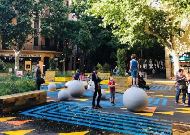
Superilla - tactical urbanism in Barcelona, Spain Superilla
The last section of this chapter presents the results of the interactive survey that was made accessible to the public via the Mykolaiv Municipality website from the 11th to the 23rd of September 2024. The survey aimed to investigate the current living conditions in Mykolaiv, the local citizens’ perception of their city, neighbourhood, and home as well as their desires and perspectives for future development. The survey has been conceived as part of the “Development of a Community Engagement Platform for the Mykolaiv Masterplan Project” task, which looked to actively involve the local population in the planning process. The results helped shape the proposed strategies, making these more relevant to the local context. Some of the survey results are inserted in red boxes within the report where relevant.
City of proximity (15-minute city)
The development model for the Innovation District is based on the concept of the “city of proximity” or the “15-minute city”.
In European cities such as Paris, Barcelona, Copenhagen, and Milan, experiences of social and urban innovation based on this model have been particularly relevant.
The concept of hybrid proximity calls for a new approach to the construction and regeneration of neighbourhoods, allowing them to welcome complexity and richness. Successful neighbourhoods will draw upon the design principles of historical city centres, integrating residential uses along with a variety of activities and facilities, through the public realm and within walkable distances.
Through various tangible and intangible actions, the 15-minute model simultaneously incorporates greenery, mobility, social infrastructure, residential areas, and workplaces, promoting sustainable development from both an environmental and social point of view.
In the 15-minute city, residents step out of their homes into a vibrant environment: local shops for daily shopping, nearby healthcare services, public spaces for meeting and socialising, as well as shared areas designed for working and studying. This urban concept goes beyond the physical dimension, standing out for its collaborative activities and community initiatives that enliven and enrich neighbourhood life.
Enlarge sidewalks to create space for other uses
Encourage public use of open-air spaces for cultural events
“Le Paris du 1/4 heure” scheme
«Le Paris du 1/4 heur»
Ancillary functions that sustain residential systems
Successful residential developments include a mix of affordable housing options with different rent, rentto-buy or sale typologies within open-market housing, residential services for vulnerable populations managed by non-profit organisations, and temporary housing
A residential system should not only consist of dwellings, but also a variety of facilities that activate ground floors. This contributes in building a cohesive and well-integrated community, thereby revitalising the whole neighbourhood. The social infrastructure provided should include:
• Local/urban facilities that support new and existing residents, consolidate the social fabric, and facilitate integration within the community. These facilities have a high social value, and contribute in creating a vibrant and safe community.
• Hybrid community facilities - these commercial outlets combine useful services for the community, like a launderette, alongside profitable services, like a cafeteria, making them more economically viable. These innovative models are fundamental to the development of a balanced neighbourhood, and must be encouraged and supported.
• Communal spaces where residents can interact while engaging in collaborative activities (e.g. gardening) that benefit the community.
In addition, good residential developments require well-designed public, semi-public and semi-private spaces, as well as an efficient network of pedestrian paths, that can stimulate outdoor life and interactions.
Coffee & Laundry in Sheung Wan, Hong Kong,
Social and affordable housing developments require:
• A MIX OF AFFORDABLE HOUSING OPTIONS
• HOSPITALITY OFFER
• TEMPORARY HOUSING
The residential neighbourhood as a mix of dwellings, commercial activities and community facilities.
Short-term rent rooms or apartments I Guest Houses | Hostels
HOSPITALITY
ANCILLARY USES
CITY OF PROXIMITY
LOCAL HYBRID SHOPS
Bike repair - bistrot
Hybrid market Laundry - cafè
Hybrid library
ADDITIONAL FACILITIES for residents
Spaces and facilities exclusively dedicated to residents, where they can interact and engage in collaborative activities that benefit the community
The perception of boundaries between public, semi-public and semi-private spaces must be softened through the design of architectural or landscape features.
LOCAL/URBAN FACILITIES
Accessible to new and existing communities, facilitating integration
Neighbourhood maker spaces\ coworking Community hub
Neighbourhood concierge
OPEN SPACES
Carefully designed public, semipublic and semi-private spaces and pedestrian paths, stimulating outdoor activities and facilitating interactions
fields
Inclusive playground
HYBRID OUTLETS: new commercial-community formats
The synergy between communal facilities and commercial outlets (i.e. a launderette connected to a café) ensures greater attractiveness and economic sustainability
83% of Mykolaiv’s interviewees know their neighbours
59% of the interviewees consider the sense of community in their neighbourhood to be weak
Playgrounds are essential in residential districts, as they attract people and help activate public areas throughout the day.
They should be intended not only for children, but also include facilities for teenagers, adults and elderly people.
Focus: housing international standards
Sustainable Development Goals (SDGs)
The Sustainable Development Goals (SDGs) are a set of 17 goals defined by the United Nations within the 2030 Agenda for Sustainable Development, aimed at addressing a wide range of topics related to economic and social development.
The 11th Sustainable Development Goal (SDG 11) focuses on creating sustainable, inclusive, safe, and resilient cities and communities. It specifically addresses the need to improve living conditions in urban areas, taking into consideration the growing urbanisation and its social, economic, and environmental consequences. One of the key aspects addressed is inclusive and accessible housing.
Target 11.1 of SDG 11 is to provide access to adequate, safe, and affordable housing solutions for all, while also improving basic services. A dwelling is deemed adequate if it meets criteria such as structural safety, affordability, access to basic services and sufficient living space.
Various national and international initiatives are promoting social and affordable housing policies, implementing housing programs for low-income families, and urban renewal projects aimed at improving infrastructure and services in neighbourhoods. The promotion of sustainable construction, including the use of low-impact environmental technologies, is also a key strategy.
European regulations regarding residential construction
A key intergovernmental initiative in the context of European Union (EU) housing policies is The Urban Agenda that addresses urban issues by fostering partnerships between the European Commission, EU organisations, national governments, local authorities, and stakeholders, such as NGOs. Housing and construction are among the main themes of The Urban Agenda outlined in the Amsterdam Pact, ratified by ministers of EU member states for urban policies in May 2016.
The common principles and strategies for urban policy in EU countries are also defined in The New Leipzig Charter - the transformative power of cities for the common good, which includes a reference to sustainable, affordable and social housing.
The study #Housing2030 (Effective policies for affordable housing in the UNECE region) – developed as part of a joint international initiative by UNECE, UN-Habitat, and Housing Europe – supports the implementation of the 2030 Agenda for Sustainable Development, the New Urban Agenda, the Geneva UN Charter on Sustainable Housing, and other relevant international initiatives. This study examines housing affordability challenges and existing policy tools for improving housing affordability.
With regard to specific aspects related to residential construction, European regulations operate within a complex and evolving legislative framework. These regulations aim to promote sustainable and energyefficient buildings across all member states. The Energy Performance of Buildings Directive (EPBD) promotes energy efficiency in EU buildings by requiring new buildings to be “Nearly Zero-Energy” (NZEB) and mandates energy certifications and regular inspections.
One of the main objectives of European directives is to reduce energy consumption in residential buildings, through the introduction of stricter insulation standards, the improvement of heating, ventilation, and air conditioning systems along with the integration of renewable energy sources like solar panels, heat pumps and geothermal systems.
Energy certification is mandatory for all new buildings or those that are for sale or rent. The certificate attests to the building’s energy class and provides recommendations for improving its efficiency.
European regulations also take into account accessible design, especially for persons with disabilities or reduced mobility. Inclusive design is a principle that is incorporated from the early stages of planning for both new buildings and existing buildings undergoing renovation. The directives also promote affordable housing solutions that meet the needs of different sections of the population.
The residential component of the Innovation District
проєкту
Residential development strategy
The proposed masterplan for the Innovation District envisages a primarily residential area north of the site, in continuity with the existing adjacent housing fabric, which will be retained.
In line with the overall guidelines proposed for the whole city, the residential development strategy for the Innovation District is based on three main principles, aimed at creating a vibrant and safe urban environment.
1. Concentration of residential uses along main pedestrian routes and public spaces. This action has a twofold objective:
• Defining areas having predominantly residential buildings, and creating a visual continuity through these zones. This promotes the creation of a liveable, walkable urban environment with safe pedestrian routes, social infrastructure, commercial outlets and open spaces that are rendered accessible, safe and vibrant by the presence of residents.
• Promoting the accessibility and safety of public spaces, and the activation of ground floors as a key element in the creation of lively, attractive and safe urban spaces.
2. Defining a public realm hierarchy
This involves the creation of primary green areas and urban squares lined with commercial activities and community facilities, which serve as places for aggregation and social interaction for the entire neighbourhood. A further network of smaller, local squares and connecting pedestrian paths, multiply opportunities for gatherings and public life.
3. Distribution of ancillary uses
This involves the distribution of community facilities and commercial uses around public spaces and along main routes, to ensure easy access for all residents. The main public spaces will contain urbanscale facilities, while those of a more local nature will animate residential courtyards.
As the Innovation District has the ambition to be a lively neighbourhood throughout the day, it is proposed to provide residential uses along the main pedestrian axes, around the main public spaces and along the Union park, as illustrated on the following page.
The
respondents
Focus on new residential blocks
As illustrated on the following page, the key elements proposed for the design of new residential blocks in the Innovation District are as follows:
1. A strong relationship between the ground floors and streets: activating ground floors is crucial for fostering liveable and safe public spaces. Ground-floor residences, local shops, and services can contribute to the vibrancy of the district. Effective ways of ensuring privacy and desirability for ground-floor living will be:
• Setting the residential façade back from the street, and using green buffer zones;
• Introducing housing typologies such as duplexes and atelier homes, which maximise the potential of living directly on the street while enhancing interactions.
2. Neighbourhood squares: strategically placed along pedestrian pathways with active frontages hosting local shops. These squares become welcoming spaces where people gather, access services, and engage with the community, thereby strengthening public connections.
3. Articulation of courtyards as open spaces, supported by the presence of local retail and community facilities. A distinction between semi-public, semi-private, and private areas will establish a different sense of ownership for each, while ensuring connectivity to the surrounding residential blocks.
4. Facilities for residents: between the public realm and semi-public courtyards, dedicated areas for residents can be established to support communal activities and foster interaction among neighbours.
Superilla, Barcelona, Spain
Superilla,
Tactical urbanism, Seattle, USA
Bauen Wohnhof Orasteig, Vienna, Austria Bauen Wohnhof Orasteig,
Aria Ex-Macello project, Milan, Italy
“The space between residential buildings is where the collective dimension of living manifests itself. The non-residential spaces of housing blocks deserve special design efforts to generate new neighbourhoods that are alive and integrated in the city. These are the places where the community belongs”.
Photo: Evgen Gomonjuk
Interventions within the existing residential fabric
Three potential approaches to residential renovation
With regard to the existing residential stock, the Innovation District could take three potential approaches:
1. Maintenance and minor improvements only:
• Upgrades to building façades, water, mechanical and electrical systems, and interiors to improve efficiency, comfort and aesthetics;
• Reconfiguration of open spaces with pop-ups, local retail and community facilities, playgounds, rest areas, and communal green spaces.
2. Building and urban block upgrade:
• Internal maintenance and major upgrade to building façades;
• Transformation of ground floors through the introduction of new residential typologies and non-residential uses;
• Relocation of existing inhabitants to new adjacent buildings;
• Regeneration of open spaces;
• Completion of the residential urban block through the construction of new housing buildings and new buildings for local retail and community facilities.
3. Partial or complete demolition and redevelopment:
• Demolition and replacement if the building is compromised or very low quality, foreseeing a mobility plan, after the construction of new buildings in the district.
• Introduction of new residential building typologies to increase social mix and architectural quality. Following a discussion with the Municipality, and considering the economic and logistical challenges posed by the conflict, the first two approaches are more likely to be implemented in the Innovation District in the short-medium term.
The masterplan for the district therefore retains the existing buildings, but also provides opportunities for future redevelopment should this option become viable as the area evolves.
1. MAINTENANCE AND MINOR IMPROVEMENTS ONLY
Upgrades to building façades, and reconfiguration of open spaces.
2. BUILDING AND URBAN BLOCK UPGRADE
3. DEMOLITION AND REDEVELOPMENT
3.
Major upgrade to building façades, transformation of ground floors, regeneration of open spaces and eventually construction of new housing buildings.
Demolition and replacement if the building is compromised or very low quality, foreseeing a mobility plan, after the construction of new buildings in the district.
Promoting a positive impact beyond the Innovation District
In order to formulate a comprehensive strategy, this proposal also addresses the regeneration of the existing large-scale housing north of the Innovation District. This area portrays urban and architectural features that are quite common in all monofunctional, residential neighbourhoods across Mykolaiv. In principle, the recommendations outlined here will be applicable to most of the other districts within the city.
The proposed guidelines focus on two main axes of intervention:
1. Open space regeneration:
• Defining a hierarchy of public and semi-public spaces within the existing urban fabric;
• Rethinking the relationships between the existing housing blocks;
• Ensuring urban connections within the Innovation District;
• Reconfiguring the public realm, with the potential inclusion of commercial activities, community facilities, new recreational and sports facilities, parking spaces, green areas, and shared gardens;
• Identifying opportunities for densification and constructing new residential buildings, if necessary.
2. Upgrading existing residential buildings:
• Improving the construction and energy performance of buildings;
• Improve dwelling interiors to increase comfort and liveability.
Enhance the relationship between existing and new neighbourhoods
Overall strategy: a balanced hierarchy of connected spaces
In line with what has been proposed for the new blocks, the strategy aims to transform the neighbourhood by redesigning the public realm and improving pedestrian flows. A key element is to insert squares and pedestrianised zones at critical points, linking fragmented routes and redirecting flows toward the busiest areas. Local shops and community facilities will encourage activity and natural surveillance, supporting these spaces.
A central square is proposed to become the social hub of the neighbourhood, where residents and visitors can gather. Additionally, courtyards will be carefully designed to balance and integrate semipublic and private spaces. These will be equipped with complementary open spaces and multi-functional sport facilities, ensuring that the entire neighbourhood has access to diverse recreational opportunities
A key element of the project is the enhancement of the east-west urban axis along the northern edge of the Innovation District , through the creation of a linear park. It will include green spaces, playgrounds, commercial areas, and bike lanes. The project also focuses on introducing additional local shops and social infrastructure, prioritising smaller businesses over larger retail outlets. These shops should be clustered in groups of at least five units, creating small local retail hubs. In some areas, groundfloor residences may be converted into local shops or facilities to meet demand, activating the streetscape. Overall, the proposal seeks to create a cohesive, inclusive neighbourhood where public space, local businesses, and recreational facilities come together to enhance liveability
Moneta affordable housing, Milan, Italy
The Goods Line, Sydney, Australia
La Duchère central square, Lyon, France
Duchère,
Myyrmäki sports park, Vantaa, Finland
Gallery of Shees
Sharjah,
Create a hierarchy of spaces and connections
Define
Create a clear distinction between
80% of respondents are not fully satisfied with the quality of community facilities in their neighbourhood. There is a particular demand for public parks, facilities for teenagers, and sport centres.
Strengthen the public realm through the insertion of
Façade additions to existing residential buildings: a case study
This solution is applicable to existing buildings in Mykolaiv in need of an upgrade and renovation, and for which demolition is not appropriate or feasible.
The proposal aims to improve the construction, comfort and energy efficiency of the buildings through a modular and flexible system of new façades that are independent from the original structure. These modifications can be carried out without requiring temporary relocation of tenants.
Benefits of this strategy
- Avoids tenant relocation
- Does not require heavy modifications to existing structures
Expansion of living space for some apartments
Expansion of entrance
Architects: Lacaton & Vassal
Location: Bordeaux, France
Year: 2017
Project: Transformation of 530 homes within the Grand Parc neighbourhood
Lacaton & Vassal
The renovation of existing buildings through façade redesign using new self-supporting structures offers integrated and versatile solutions. These freestanding elements enable the physical integration of new balconies and terraces, and also significantly improve the building’s thermal insulation, contributing to greater energy efficiency and comfort. Additionally, they provide the opportunity to expand and completely reinterpret the appearance of the façade, giving the whole complex a new architectural identity
New volumes inserted into the self-supporting structure allow the expansion of living areas, which can become new rooms or winter gardens. New volumes on the ground floor also enhance the aesthetics and functionality of entrance halls, transforming them into welcoming environment for residents, thereby fostering greater social interaction within the housing complex.
The introduction of balconies or loggias has significant benefits for the building’s occupants. In addition to the practical advantages related to the expansion of private open spaces, these elements enrich the façade, breaking visual monotony and giving the building a more articulated, dynamic appearance. This intervention also helps increase residents’ perception of security, as private outdoor spaces encourage people to look out or spend time outside.
To improve building accessibility and usability, the project also proposes the introduction of direct access to ground floor apartments from the inner courtyard. The creation of a green buffer between exterior and interior spaces serves as a transition zone, providing private gardens for ground-floor residents while simultaneously protecting their privacy and security.
The regeneration of ground floors may include the introduction of special residential typologies, commercial spaces, common areas, and community facilities. These new uses transform the ground floors into a vibrant and dynamic space, fostering opportunities for interaction and social engagement among residents and the wider community. Lastly, flat roofs can be transformed into community terraces or roof gardens, equipped with seating areas and amenities, along with the installation of solar panels.
On the following page, a regeneration proposal is made for an existing building north of the Innovation District (see image and key plan below).
SOLAR PANELS
NEWFACAD
ENTRANCE HALL
COMMON S PACES
Photo: Viktor Adjamsky
Guidelines for housing typologies
General guidelines
For social and affordable housing, design plays a crucial role in guaranteeing high efficiency standards and quality, along with a control of construction costs. An integrated design approach will allow the construction of quality urban and residential spaces, as well as the introduction of new housing models. In other words, the development process should bring together all project aspects - economic, managerial, social, architectural and environmental.
Achieving these objectives requires an in-depth typological study of residential buildings, based on two fundamental criteria: optimisation and flexibility of the living spaces.
Some considerations to be made when designing residential typologies include structural efficiency, optimisation of mechanical and electrical systems (including lifts and elevators), the possibility of varying unit typologies and dimensions over time, and renewed attention to the design of independent homes.
When designing a new complex, a detailed study of housing typologies is often neglected. Recommendations are made with respect to standards and norms to be followed, but little attention is paid to how the internal spaces can actually be used.
On the contrary, affordable housing requires particular attention to the design of the living space. The limited space available, combined with the multiple requirements of the average modern family, makes optimising the usable space of residential units a central element of the design development.
Optimising liveability means making the most of the space available to accommodate all the necessary and desired functions that enhance the quality of life. When studying unit layouts, special attention must be paid to the effective use of space, the architectural quality of the rooms and flexibility of use. In short, any compromise in size must always be accompanied by an improvement in the performance and habitability of spaces
This section illustrates some of the elements that should be taken into account while designing housing typologies, providing some examples with regard to:
• Optimisation and typological interchangeability
• Flexibility and adaptability over time
• Housing typologies for specific target users
• Ground floor typologies
• Typological mix
Photo: Alexander Minyaylo
Optimisation and typological interchangeability
The design of an affordable housing project must meet typological, economic and efficiency goals, which are based on the reduction of the ratio between Gross Built Area (GBA)* and Residential Area**. The Efficiency Ratio must be around 1.41-1.42.
Some essential principles for an efficient design are as follows:
• Structural congruence between residential floors and basement floors for parking (when they are provided);
• Spatial efficiency of services (water, electricity, gas systems);
• Distribution optimisation: a staircase-elevator block should serve at least four flats;
• Flexibility in design, construction and use: flat size, mix, and the distribution of different types of accommodations on different floors must be able to vary independent of the structural system; the size and position of shafts must be able to accomodate changes.
It is essential to ensure maximum construction and design flexibility of above-ground floors, as well as the optimisation of basement floors, allowing the construction of cellars, technical spaces, garages or suitable parking spaces.
*Gross Built Area (GBA) is calculated considering each basement and above-ground floor utilises the maximum building footprint possible, including loggias and balconies. Measurements are made on the outer edge of the perimeter walls. This area is equal to the sum of the sub-areas of the various building elements.
**Residential Area includes 100% of the internal usable area, 100% of interior walls, 100% of exterior walls, 50% of dividing walls between dwellings, and between dwellings and stairwells, 50% of balconies, 25% of cellars. A 4% surcharge is applied to all these areas to take into account non-residential spaces. 10 sqm per parking space are also included, if relevant.
It should be noted that the parameters are valid for housing typologies in Italy; the efficiency ratio will have to be re-evaluated based on local standards.
Paying attention to effective
The design of an affordable housing building must be oriented towards:
• Housing solutions appropriate for different user groups: young couples, elderly, students, temporary workers, and families;
• Understanding the definition of an adequate housing mix and typologies based on the local social structure;
• The optimisation of living spaces with respect to usable square metres, which is crucial to keep low rental or sale costs;
• The flexibility of dwellings, designed to allow households to adapt to different housing needs and changes in the family composition over time (when, for example, one or more children are born).
Flexibility and adaptability over time
The single bedroom is designed to enable use as a double bedroom as well. The room has two windows so it can be divided into two rooms with adequate light.
Family with 2-3
Family with 2-3 children of different age groups
The concept of a home that evolves over time offers the possibility of a large, undifferentiated space for singles or couples, and a more articulated, subdivided space for a family.
The family composition
Uso della casa nel corso della vita
Necessità di suddividere gli spazi interni
Intensity
This typology optimises residential space, is very efficient and adaptable over time
This apartment, though small, is very flexible. It can initially be used by a couple who may decide to have a large living and study area. The single bedroom is designed to accommodate a double bed and other furniture as required in the future, like wardrobes. The partition wall between the living room and the bedroom should have no installations.
Partition wall without piping/wiring
If a child is born, the living area can be downsized to make space for a large bedroom, potentially for the parents. This is possible due to the continuity between the two spaces. The small bedroom could become the child’s bedroom.
In this apartment, the living area separates the parents’ bedroom from the child’s bedroom, allowing for increased privacy.
Housing typologies for specific target users
Student room in co-living or student housing
Accommodation for elderly people living in cohousing
Optimised studio apartment for singles or young couples
Ground-floor typologies
Bauen Wohnhof Orasteig, Vienna
Bauen Wohnhof Orasteig, Відень
Ground floors are often critical in that they may not easily accomodate commercial uses and are often not very attractive to host residential uses.
Ground floors are nevertheless an asset for properties, and represent the threshold between private and public space
It is therefore important that ground floors are inhabited and active, in order to avoid blank or uninhabited frontages.
Certain conditions may make ground floor residences more desirable:
• The opportunity to have a protected private garden;
• Residences overlooking semi-private courtyards instead of public streets;
• Raised access from the street;
• Access to the residence protected by green buffer zones;
• Small duplex or atelier house typologies.
Inhabiting the ground floor: duplexes
The kitchen faces the street and acts as a buffer zone for the living space
A private garden facing the building courtyard provides separation from semi-public spaces
The duplex typology is a good solution for ground floor residences, ensuring the privacy of tenants along with the benefits of an open space. This typology allows:
• The living areas to occupy the ground floor and the bedrooms to be restricted to the upper floors
• A living area that can be an open space or divided from the kitchen
An offset and elevated access protects the living spaces from overlooking the
Sidewalk
Duplex - atelier house
A variation of the duplex option is the Atelier house typology
These dwellings combine living and working, integrating residential spaces with work spaces, which are accessible directly from outside.
The Atelier house typology can respond to multiple objectives:
• To help new families settle and integrate with the existing community, while offering their skills to the neighbourhood;
• To contribute to the activation of ground floors and the preservation of public space;
• To favour those looking for an affordable live-andwork solution, especially young people.
Typological mix
Типологічне поєднання
1. Develop building typologies that allow a combination of different apartment sizes to answer effectively to the needs expressed by the municipality.
2. Furniture plans should be designed to ensure that all necessary furniture can be accommodated.
4. Terraces and balconies are provided in the living areas and are intended as an outward “extension” of the house. Their size must be contained to avoid increasing rent/sale costs, yet adequately large (minimum depth 1.6m) to accomodate some furniture, like a dining table.
2.
1-bed
3-bed
3.
3. One staircase-lift block should serve numerous apartments. 1.
Cenni di Cambiamento, Affordable housing in Milan
Photo: Evgen Gomonjuk
Housing survey
Опитування щодо житла
Housing survey
A survey focusing on housing was conducted as part of the “Development of a Community Engagement Platform for the Mykolaiv Masterplan Project” task. It was distributed through the municipality’s channels from 11th-23rd September, 2024, receiving 144 responses.
The survey aimed to gain a deeper understanding of the daily lives of Mykolaiv’s citizens, and identify the strengths and weaknesses of the districts in which they live. The questionnaire was divided into eight sections, namely: general information, housing, neighbourhood, services, infrastructure, social life, safety, transport, and future perspectives.
With regard to housing, the survey inquired into the state of maintenance of properties, the characteristics of flats, desired improvements, and the living models that residents identify with most. Additionally, it looked into which spaces and activities residents would like to see improved to enhance their daily lives within their neighbourhoods.
The collected answers helped shape the proposal presented in this report.
Survey respondents’ place of residence and work
Housing Житло
45%
63% of respondents are open to move to another dwelling in better conditions
Neighbourhood, open space and mobility
55% of respondents consider public transport a strength of their neighbourhood
62% of respondents think their neighbourhood lacks public space
The most desired activity among the respondents in open spaces is relaxing (92%)
85% of respondents usually walk in their neighbourhood
Community facilities, infrastructure and retail
Respondents
Respondents
Community life, safety and security
30% of respondents had not attended any event or activity in their neighbourhood before the conflict
Future perspectives
Typology of interventions in residential buildings within the Innovation District
Respondents
Demolition
Renovation as the only response
Ground
Would you like a kitchen space separate from the living room, large enough for family meals and gatherings?
Would you like an outdoor space, like a balcony or terrace, to relax in the open air?
Would you like an indoor or outdoor community area dedicated to physical activities or sports?
Would you like a communal room for meetings or community events?
Would you like to live on the ground floor, with a private garden?
Would you like a dedicated space for coworking in the building?
Would you like an indoor or outdoor community area dedicated to children’s play?
Would you like a communal room as a
Would you like a common outdoor space, like a courtyard or communal garden, where you can socialise and relax?
Would you like a common outdoor space to cultivate plants and vegetables, or for example a chicken coop?
Contributors to this report
Government Officials
Oleksandr Syenkevych (Mayor) Олександр
Vitalii Lukov (Vice Mayor)
Yuri Adrienko (Deputy Mayor)
Dmytro Falko (President of Mykolaiv City Council)
Yevhen Poliakov (Chief Architect of Mykolaiv City Council)
Paola Deda (Director, Forests, Land and Housing Division)
Tetiana Schulichenko (Head of Economic Development Department, Mykolaiv City Council)