BUILD BACK BETTER New wetland from old pasture
WAHINE TOA

Standing up for rivers
EVER UPWARDS 50 years tracking carbon

MELTWATER Glaciers feel the heat
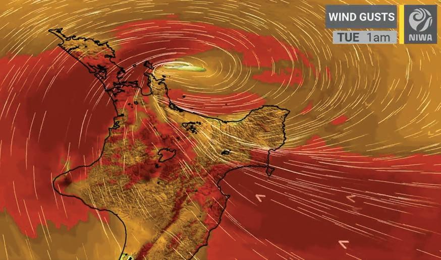
Mapping Gabrielle’s fury
Hazard science and cyclone recovery


JUNE 2023


June 2023
Water & Atmosphere is published by NIWA.
It is available online at www.niwa.co.nz/pubs/wa
Enquiries to:
The Editor
Water&Atmosphere
NIWA
Private Bag 14901
Kilbirnie Wellington 6241
New Zealand
email:
wa-editor@niwa.co.nz
©National Institute of Water & Atmospheric Research Ltd
ISSN 1172-1014
Water & Atmosphere team:
Editor: Rory Newsam
Production: NIWA
Communications and Marketing Team
Editorial Advisory Board: Geo Baird, Sarah Fraser, Barb Hayden, Emily Lane, Rob Murdoch
Follow us on: Water

facebook.com/nzniwa
twitter.com/niwa_nz
niwa_science
youtube.com/@NIWA_Science

www.niwa.co.nz
Water & Atmosphere is
produced using vegetable-based inks on paper made from FSC certifed mixed-source fibres under the ISO 14001 environmental management system.
June
& Atmosphere
2023
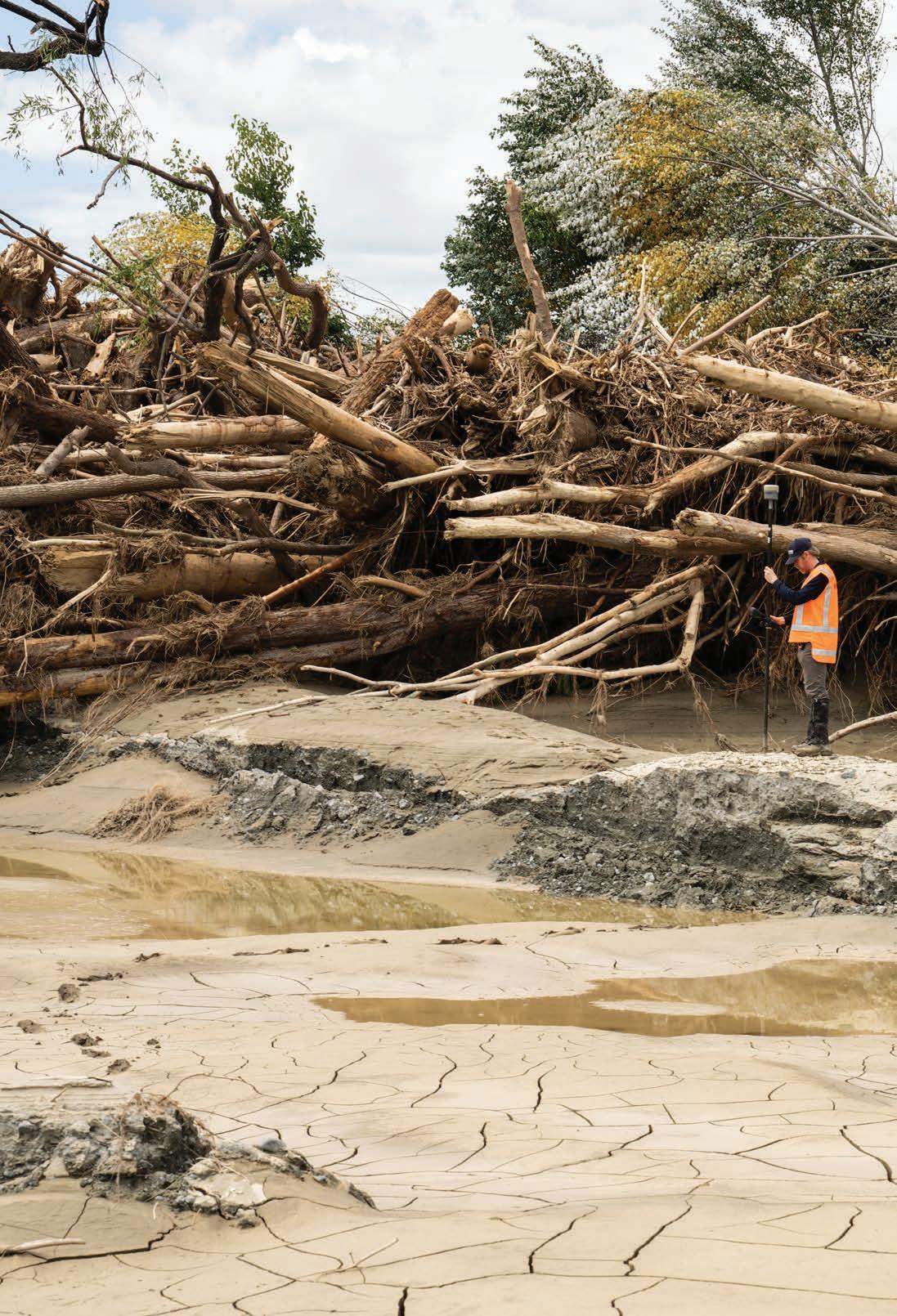
Cover: NIWA hydrodynamics specialist Dr Graeme Smart tracking high flow marks left after Cyclone Gabrielle sent the Tūtaekurī River surging through Hawke's Bay in February. (Rebekah Parsons-King)
Justin Stout
Rebekah Parsons-King
CONTENTS
4 Storm Warning
NIWA Chief Executive John Morgan on the value of investing in hazard science.
5 News briefs
8 Fifty years tracking carbon Baring Head Atmospheric Research Station.
10 Lessons from Gabrielle
Researchers track through the mud and silt left by Cyclone Gabrielle to help communities prepare for future storms.
20 Wahine toa
Meet the engineer who wants our rivers to run free.
22 Glacial retreat
Images from another hot summer in the Southern Alps.
www.niwa.co.nz June 2023 Water & Atmosphere 3
34
on
fish line up for the
of
28 Build back better Constructing brand new wetlands from scratch.
Game
Native
game
their lives.
Storm warning
The bill for extreme weather events in Aotearoa New Zealand is climbing at an alarming rate.
In 1993, insurance claims due to storms, wind and floods across New Zealand totalled $12 million, in today’s dollar terms.
Last year, flooding in the Nelson-Tasman district, along with a string of storms lashing both Westland and the North Island‘s East Coast, pushed insurance industry payouts to a new annual all-time high of $351 million.
That record lasted less than three months.
The Insurance Council confirmed in April that, in the wake of the Auckland Anniversary Weekend floods and Cyclone Gabrielle, insurers already face well over $2 billion in claims for 2023.
It is sobering to think that this figure only covers damage to private homes and businesses. It doesn’t include the costs that Waka Kotahi and local councils face to repair damaged roads and bridges across the North Island. Nor does it cover the wider economic disruption caused by these two extreme events.
Treasury’s latest estimate puts the bill for Gabrielle and the Anniversary Weekend floods at up to $14.5 billion.
Climate researchers have consistently warned that our warming climate means extreme weather events will become more severe.
Science can’t hold back the wind or rain, but it does play an increasingly important role in helping
us understand the impact of these events, and in planning for their return.
NIWA’s supercomputers and increasingly sophisticated weather models mean forecasters can now more accurately predict how much rain will fall, where and when.
And we are continuing to refine our catchment level tools, so, once that rain hits the ground, our river flow experts can pinpoint where that water will go, at what volumes and how fast it will be travelling.
Hazard specialists can then use RiskScape – a multirisk analysis tool designed by NIWA and GNS Science – to assess what those floodwaters will mean for the people and property in their path.
The Government recently committed $10.8 million to support the science of extreme weather response and recovery. It will be money well spent.
Gabrielle is a timely reminder of the value of investing in such hazard-related research.
Regional planners and civil defence teams rely on the data collected and forecasts generated, and communities rely on the modelling that follows. Better informed means better prepared.
At a national level we know that more storms are headed our way, and that they are likely to be more severe.
We also know that investing in the science that informs hazard planning and recovery will help soften the next blow.
“Gabrielle is a timely reminder of the value of investing in hazard-related research”
www.niwa.co.nz 4Water & Atmosphere June 2023 PANORAMA
John Morgan
NIWA Chief Executive John Morgan outlines the case for investment in hazard forecasting and resilience
Rebekah Parsons-King
DEEP DIVE
A NIWA marine biologist and a Chinese submersible pilot have become the first women to dive to Scholl Deep in the Kermadec Trench, 10km below sea level.
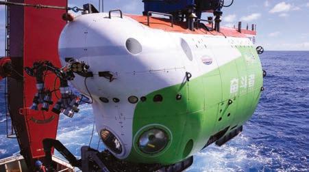
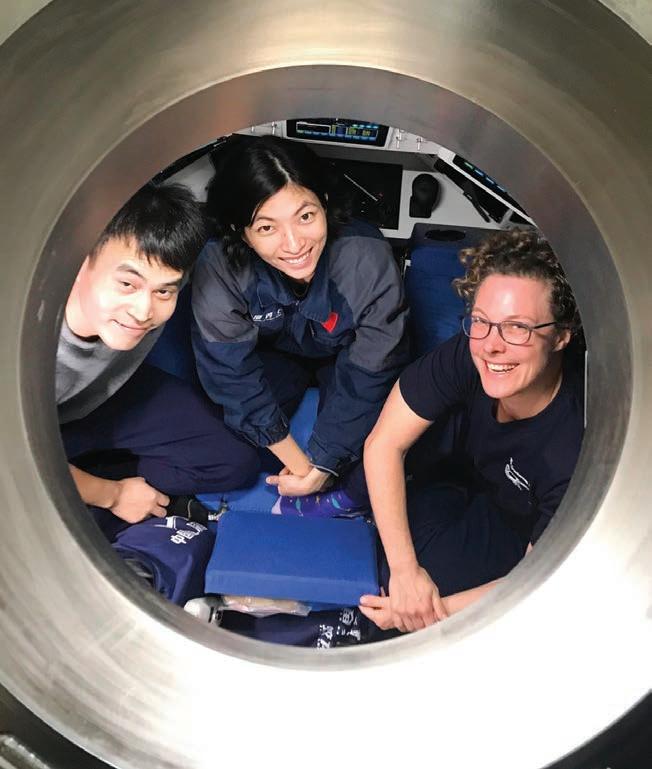
The dive was part of a joint research mission between NIWA and China’s Institute of Deep Sea Science and Engineering using the Human Occupied Vehicle Fendouzhe. Dr Kareen Schnabel and Fendouzhe pilots, Xin Yuan and Yuqing Deng, spent six hours exploring Scholl Deep and the steep sides of the surrounding underwater basin.
Observations and samples gathered during the scientific collaboration represent a step-change in understanding the biodiversity of New Zealand’s deepest marine environment.
ICE-FREE
Researchers aboard RV Tangaroa’s six-week voyage to Antarctica noted a marked reduction in sea ice on the edges of the Ross Sea this summer. The mission, Tangaroa’s 14th to Antarctica, is part of NIWA’s on-going research to assess the Ross Sea Marine Protected Area and the impact of climate change in the region.
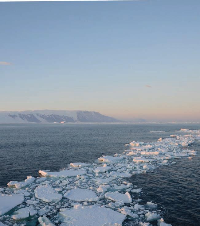
Tangaroa’s passage through the challenging southern waters was made significantly easier by the lack of sea ice normally guarding entry to the Ross Sea.
NASA says sea ice registered by satellites during February around Antarctica was the lowest recorded since observations began in 1979.
CARBON GOBBLERS
New research aims to probe the role undersea kelp forests could play in o setting New Zealand’s carbon emissions.
Kelp beds are the dominant primary producers in the waters around our coasts, and studies already indicate species such as the native Giant Kelp (Macrocystis pyrifera) can sequester up to twice as much CO2 per year as pine trees.

The Quantifying Kelp Blue Carbon Project is a collaboration between NIWA and Blue Carbon Services and will determine kelp carbonaccumulation rates and how long the carbon is stored for.
It will also look at the potential for kelp aquaculture to contribute to the country’s zero carbon emissions.
www.niwa.co.nz June 2023 Water & Atmosphere 5 NEWS BRIEFS
CIDSSE
Joshu Mountjoy
Lana Young
CIDSSE
SCIENCE INVESTMENT
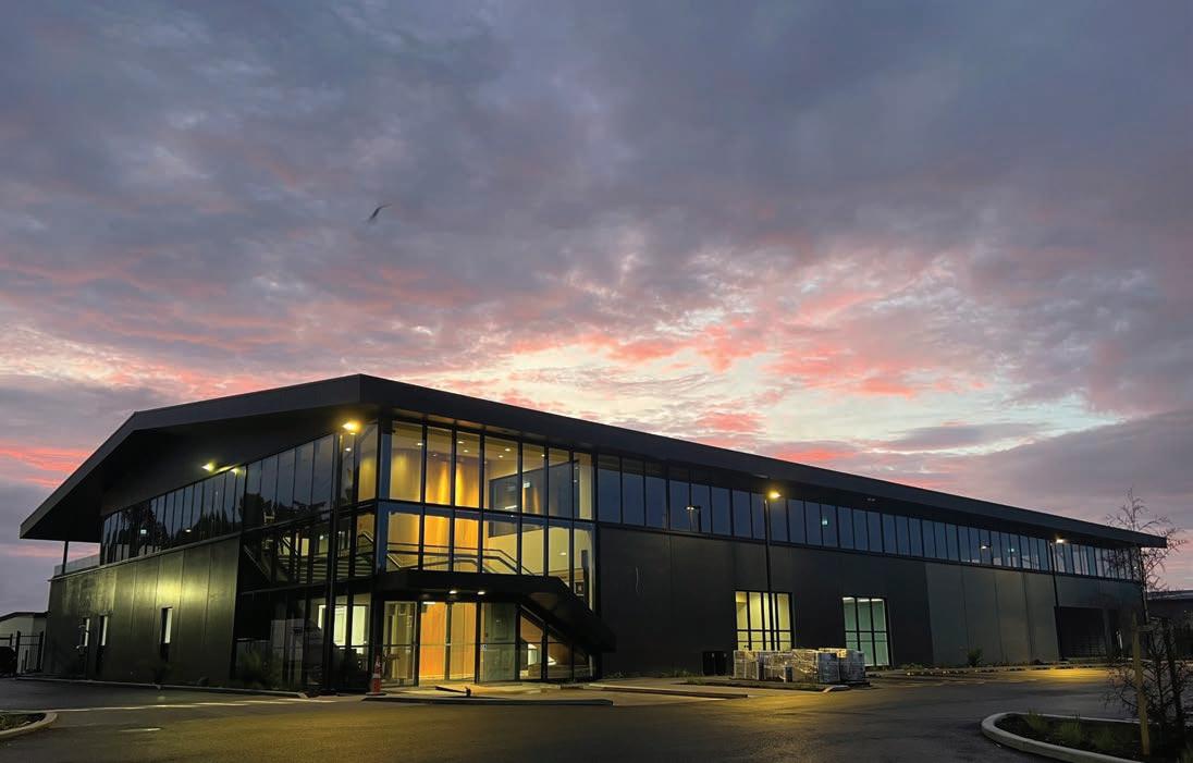
A $45 million injection in science in Waikato goes live in coming weeks as NIWA researchers start to move into their new purpose-built facilities in Hamilton.
The environmental research complex is sited on the University of Waikato campus and includes a 45000m² laboratory and o ce building, alongside standalone workshop and storage buildings.
SNAPPER SURVIVAL
Field trials indicate that careful handling could help save hundreds of thousands of recreationally caught snapper each year.
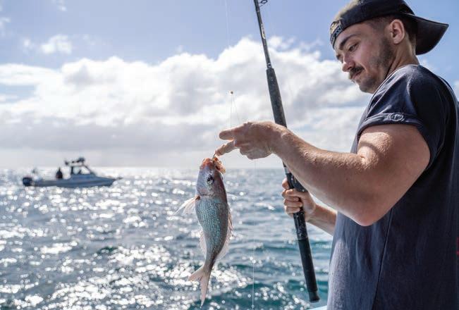
Anglers catch about 4000 tonnes of snapper annually and it is estimated that five undersized fish are thrown back for every legal snapper kept.
A NIWA research project, commissioned by Fisheries New Zealand and supported by Ngāti Kuta, LegaSea and Bluewater Marine Research, tested the survival rates of snapper caught in the Bay of Islands.
Initial results suggest that, provided fish were well handled, carefully unhooked and quickly returned to the sea, up to 85 percent survived.
Recurve hooks, which reduce the chances of gut hooking, also appear to significantly enhance fish survival rates.
It will provide state-of-the-art research and o ce facilities for more than 150 scientists, technicians and support sta working across NIWA’s freshwater, climate and marine platforms, with extensive accommodation for visiting scientists and collaborators.
It will also help strengthen long-standing partnerships with both the University and Waikato Tainui.
LOW FLOW
A new study of long-term river flows in New Zealand shows marked regional changes over the past 90 years.
Researchers at NIWA and Victoria University of Wellington analysed historic flow data across 53 sites from Northland to South Otago.
They found that, despite extreme rainfall events in recent months, long-term trends show average summer flows over much of the North Island decreasing and likely to get even lower.
In contrast, average flows on the West Coast of the South Island, Fiordland and Southland have significantly increased.
The researchers say our warming climate is causing atmospheric moisture and wind patterns to shift, with major implications for management of regional water resources.
www.niwa.co.nz 6Water & Atmosphere June 2023
Stuart Mackay
Rebekah
Parsons-King
Alex Fear
NEWS BRIEFS
UNDERSEA MAPS
NIWA has worked with the Department of Conservation to produce a comprehensive online atlas of New Zealand’s underwater ecosystems. New Zealand’s marine domain covers more than 4.2 million km², and the atlas provides a detailed overview of the distribution of nearly 600 marine species, many endemic to our waters.
Led by NIWA marine researchers, the team behind the project pooled national data sets to develop the species distribution models used in the atlas.
The resource is now publicly available for use by resource managers, coastal planners and anyone else with an interest in marine planning and protection.

WORM POWER
Researchers have discovered 26 species of roundworms that are completely new to science during a survey near Wellington. The roundworms, or nematodes, were identified during sampling in Porirua’s Pāuatahanui Inlet. Twenty nine other known nematode species were also found in the inlet.
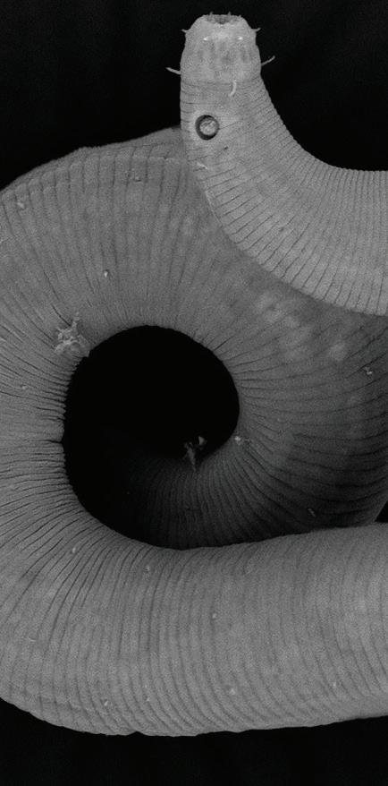
Nematodes are one of the most successful groups of animals, but marine biologists were surprised by the sheer number of species uncovered.
They estimate that nematodes make up almost 40 percent of the inlet's known biodiversity.

The study has been published in NIWA’s latest Biodiversity Memoir, a series of technical works that describe New Zealand’s invertebrate marine life, such as sponges, corals, and sea stars.
SPANISH VISITOR
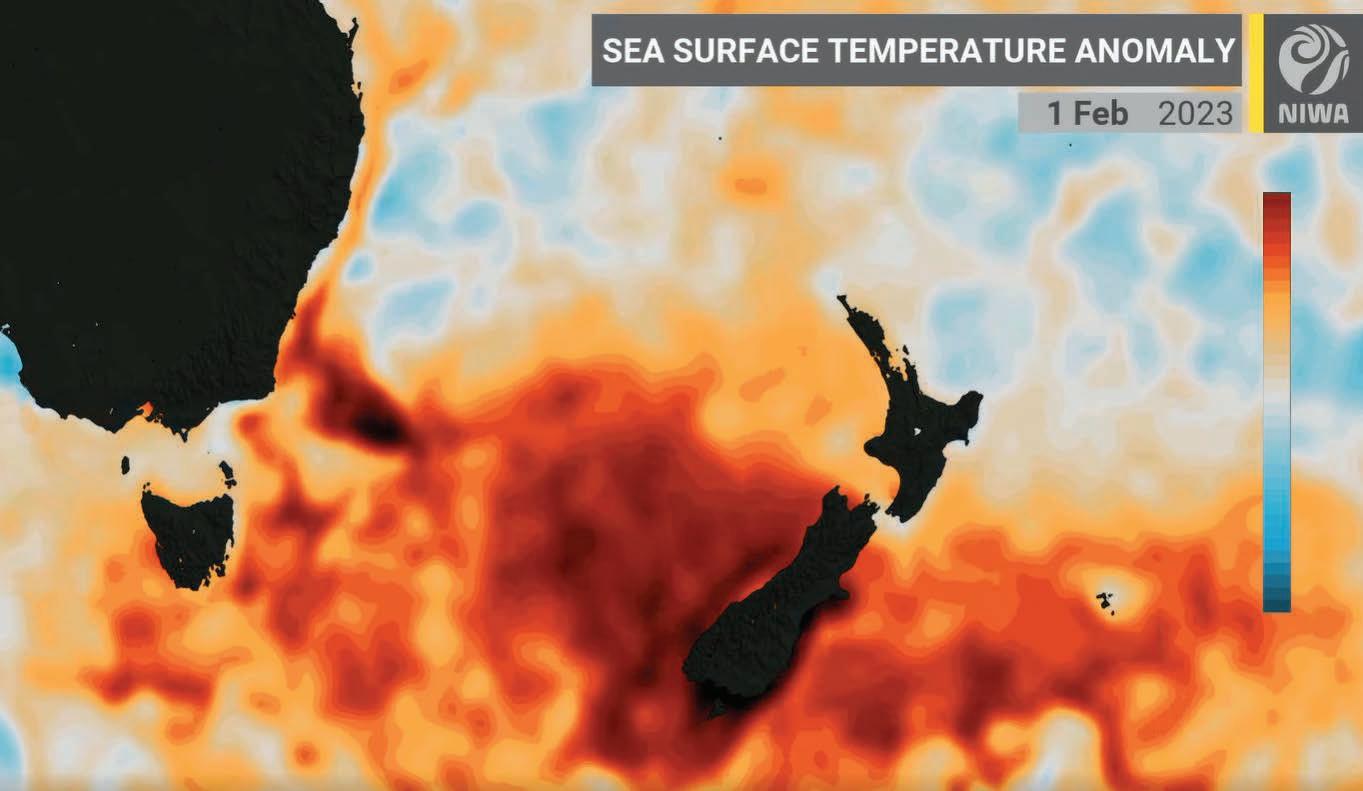
After three consecutive La Niña years, sea conditions are changing in the Eastern Pacific and NIWA meteorologists are keeping watch for the potential return of El Niño.
La Niña and El Niño are opposite phases of a naturally occurring global climate cycle.
The unusual La Niña “threepeat” has coincided in New Zealand with a string of marine heatwaves, record warm summers and extreme flooding events. But warming waters o the coast of South America point to the possibility of a developing El Niño phase over winter.
Every El Niño is di erent, but it often brings cooler, southerly conditions in winter, followed by more pronounced westerly flows during summer, along with dry spells for eastern regions.
www.niwa.co.nz June 2023 Water & Atmosphere 7
Richie Hughes
NIWA
NIWA
Above normal+3.0 +2.0 +1.0 -3.0 -2.0 -1.0 0.0 Below normal Normal 0C
From obscure science to hot news
Melissa Bray looks at a small research station on the Wellington coast with an international reputation.
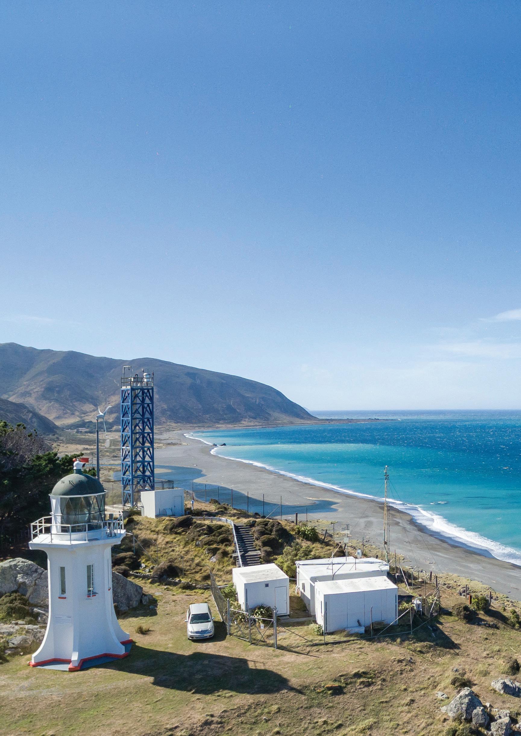
he graph that shows ever-increasing levels of carbon dioxide (CO2) in the skies above New Zealand over the past five decades is confronting. Marching relentlessly higher, it is also testament to the role NIWA’s Baring Head Atmospheric Research Station has played in helping us understand just what is driving the changes in our climate.
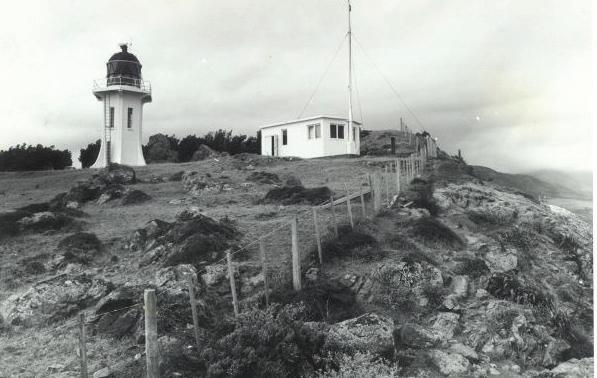
Baring Head was first selected as the site for the then-named "New Zealand Atmospheric Carbon Dioxide Monitoring Project" in the early 1970s. It was perfectly positioned for the job.
Overlooking Cook Strait and exposed to the chilly southerlies, it captures “clean” air samples sweeping up from Antarctica, largely uncontaminated by any immediate human activities.
Atmospheric carbon dioxide levels have been continuously measured and recorded at the headland for more than 50 years. The second continuous CO2 monitoring station to be established worldwide, it is home to the longest-running record of this type in the Southern Hemisphere.
The station plays a key role in feeding data from the remote southern oceans into the international network of ground-, ship- and aircraft-based monitoring stations, coordinated by the World Meteorological Organization.
When the CO2 monitoring project began in 1972 on a gusty Thursday just before Christmas, interest in greenhouse gases was distinctly muted.
Baring Head – the longest running CO2 monitoring station in the Southern Hemisphere. (NIWA)
www.niwa.co.nz 8Water & Atmosphere June 2023 NEWS
1972
Dave Allen
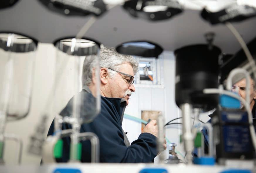
Atmospheric researcher Gordon Brailsford has been travelling from his Wellington base to Baring Head for 37 years and says he’s witnessed a marked turnaround in attitudes.
“When I would mention that I worked in greenhouse gases and atmospheric research, it was like a conversation stopper at so many levels. There was no willingness to engage – it was a tomorrow thing.
“Now there’s a demand by ministries, policy people and the public for our information.”
The passing decades have also seen a marked growth in the range and sophistication of the data gathered from Baring Head.
The work has morphed from manually collecting CO2 samples in a glass flask to a detailed analysis of a full range of real-time greenhouse gas readings. Gases now measured include methane, oxygen, nitrous oxide, sulphur hexafluoride, ozone, carbon monoxide and radon, among others.
Brailsford says improved techniques also allow a much more accurate analysis of all samples captured, particularly of the tell-tale signs of human-induced activity in samples arriving over the land.
Take the example of the analysis of methane.
Advanced laboratory experiments can now identify the unique atomic structures – or isotopes – of the methane molecules captured at Baring Head. These can distinguish whether the methane was produced from fossil fuels or agricultural emissions. Researchers can combine this information with wind modelling software to track back where that methane may have come from to build regional or global profiles.
The gas laboratory at NIWA’s Wellington site analyses Baring Head samples for the isotopes of carbon dioxide, methane and carbon monoxide, as well as nitrous oxide and carbonyl sulfide. Some samples are also sent to the United States’ National Oceanic and Atmospheric Administration (NOAA) for analysis.
This is just one of the many collaborations that now take place in the international atmospheric research community.
Collaborative programmes include CarbonWatch-NZ and MethaneSat, where NIWA works with a range of researchers around the world to identify and track greenhouse gas sources and concentrations.
Brailsford acknowledges this growing willingness to share data and sees a future where the sources of greenhouse gases are being reported in a similar way to weather forecasting.
With atmospheric greenhouse gas profiles determining the trajectory of our climate, it looks like another busy 50 years ahead for Baring Head.
Gordon Brailsford collects air samples at Baring Head. These undergo detailed analysis back at NIWA’s Wellington gas laboratory. (Rebekah Parsons-King)
Atmospheric readings from Baring Head reveal the relentless rise of CO2 over the past five decades. Levels have increased by more than a quarter since 1972. (NIWA)
CO2 level
Current416 ppm
1972323 ppm
1975 1980 1985 1990 1995 2000 2005 2010 2015 2050 320 330 340 350 360 370 380 390 400 410 420 Carbon Dioxide Mole Fraction (ppm) Atmospheric
Taihoro
www.niwa.co.nz June 2023 Water & Atmosphere 9
Carbon Dioxide at Baring Head National Institute of Water and Atmospheric Research (NIWA)
Nukurangi
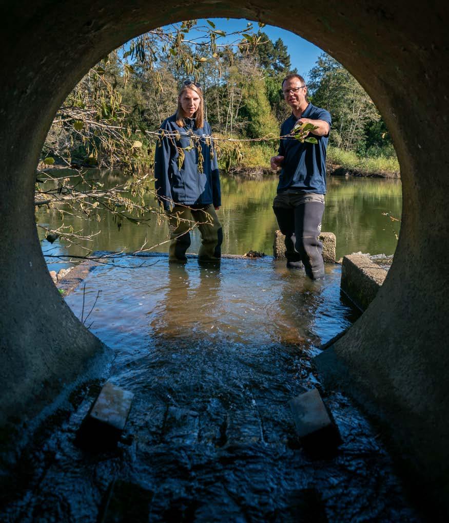
In the wake of Gabrielle
Cyclone Gabrielle unleashed torrential rain and record floods across Hawke's Bay and Tairāwhiti in the second week of February. In the days that followed, river flow experts and hazard scientists rushed to the region to capture vital data showing the full fury of the storm.
Stacy Mohan talks to the researchers unravelling Gabrielle’s legacy and helping local communities plan for their future.
www.niwa.co.nz 10 Water & Atmosphere June 2023
www.niwa.co.nz June 2023 Water & Atmosphere 11
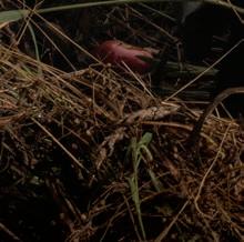
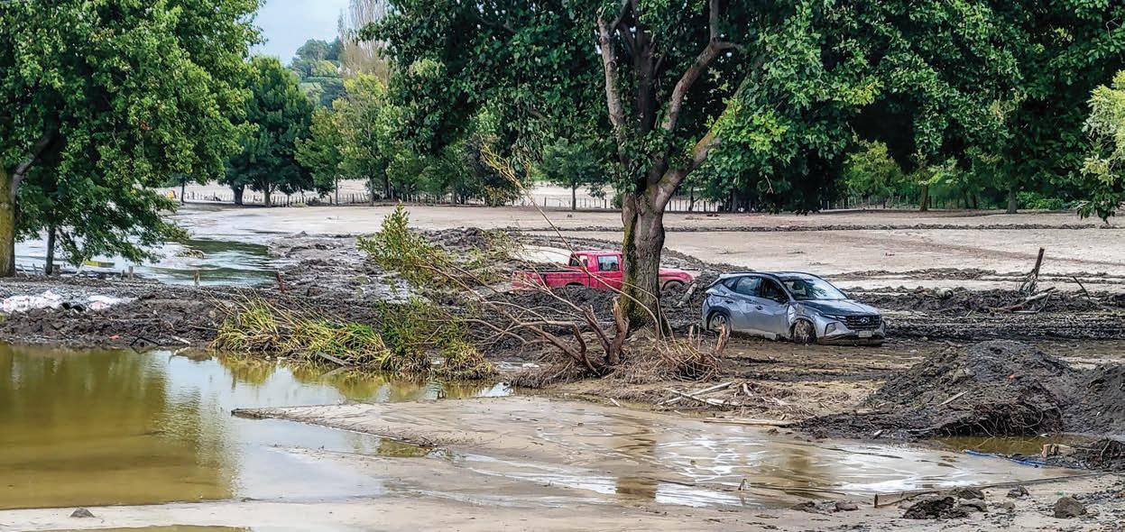
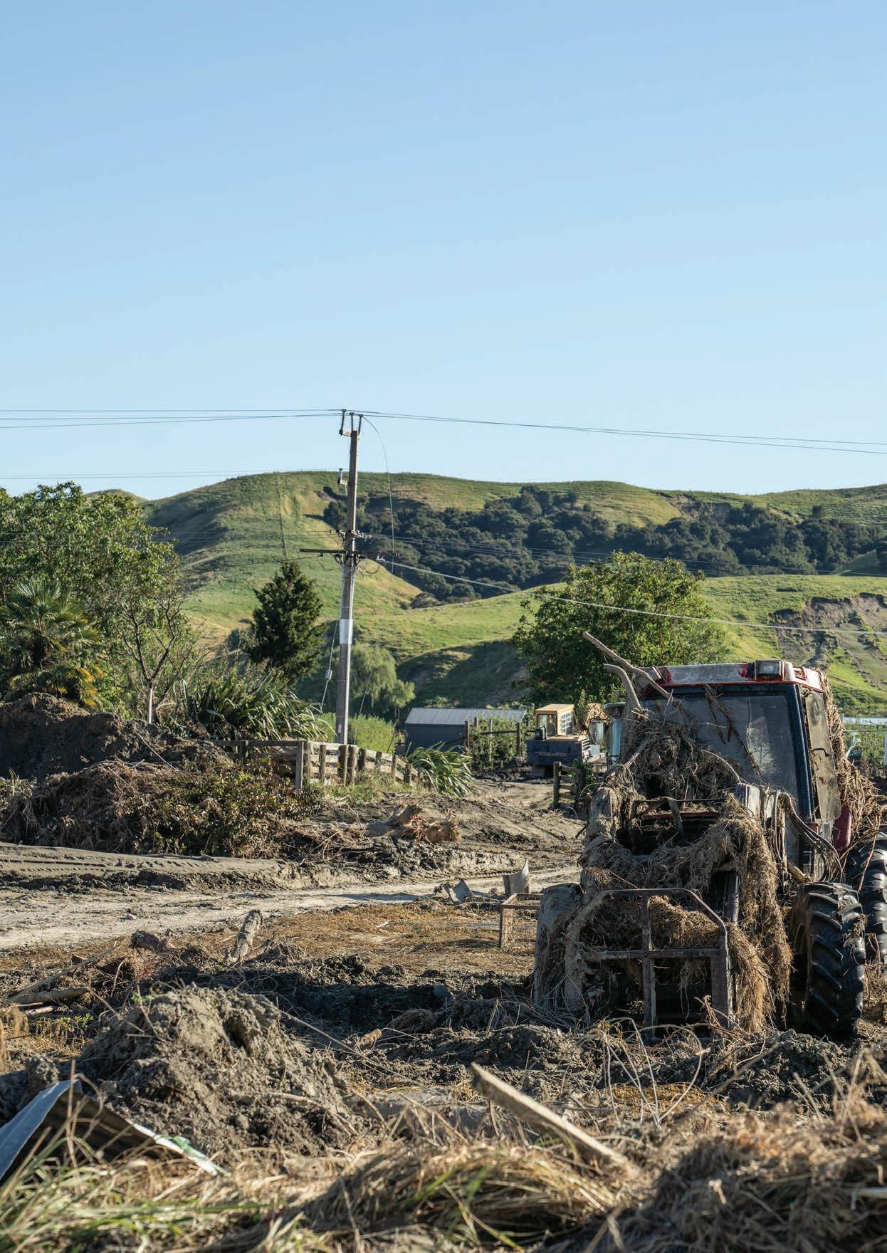
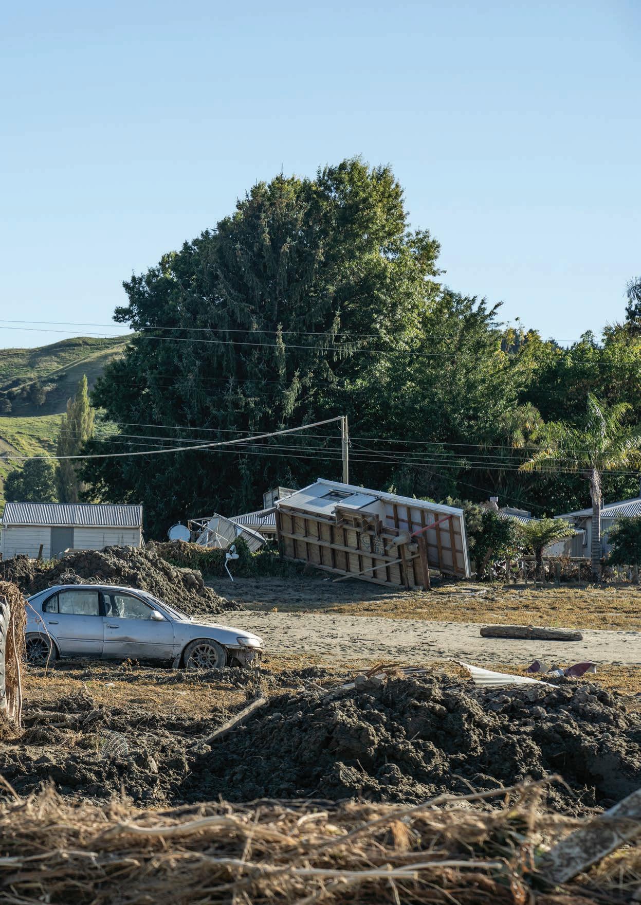
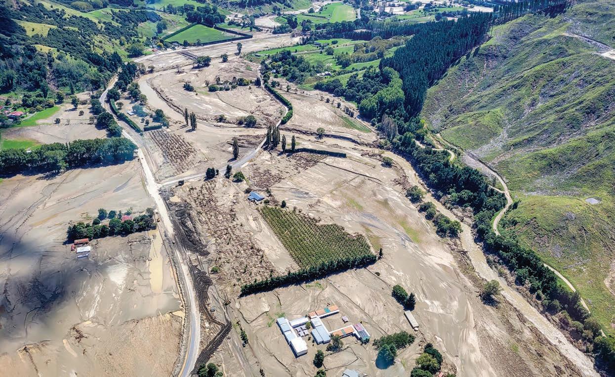
A tractor bears witness to the scale of the floodwaters which sent Puketapu Valley residents scrambling for their rooftops in the early hours of 14 February. (Rebekah Parsons-King)
r Graeme Smart is looking out across a featureless metre-high layer of silt. Behind him are the remains of a stopbank breached by the raging Tūtaekurī River.
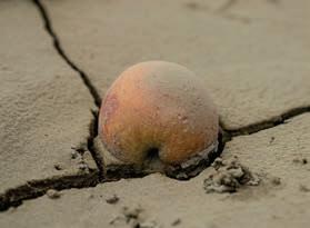
Just a week ago this was a thriving orchard in full production. Now orphaned apples litter the landscape and there’s not a fruit tree in sight. The orchard has been completely swept aside by terrifying, torrential flood waters, and everywhere you look is sediment or debris.
“It’s devastating,” says Smart, a NIWA principal hazards and hydrodynamics scientist.
“This was a really large flood – the stopbank had half a metre clearance on what they thought was a onein-100-year flood level when they designed it. The river level went well above that.”
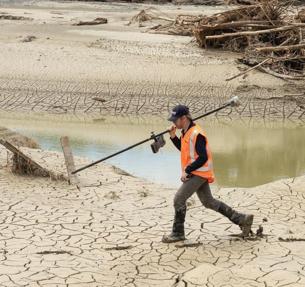
Smart and his colleagues are on a mission: to urgently capture, measure and map the flood levels left in Cyclone Gabrielle’s wake, before more forecast rain washes the evidence away.
He knows the importance of his work. The people of Hawke's Bay, he says, need to understand exactly what happened to their rivers, if they are to recover from this disaster and e ectively prepare for what lies ahead.
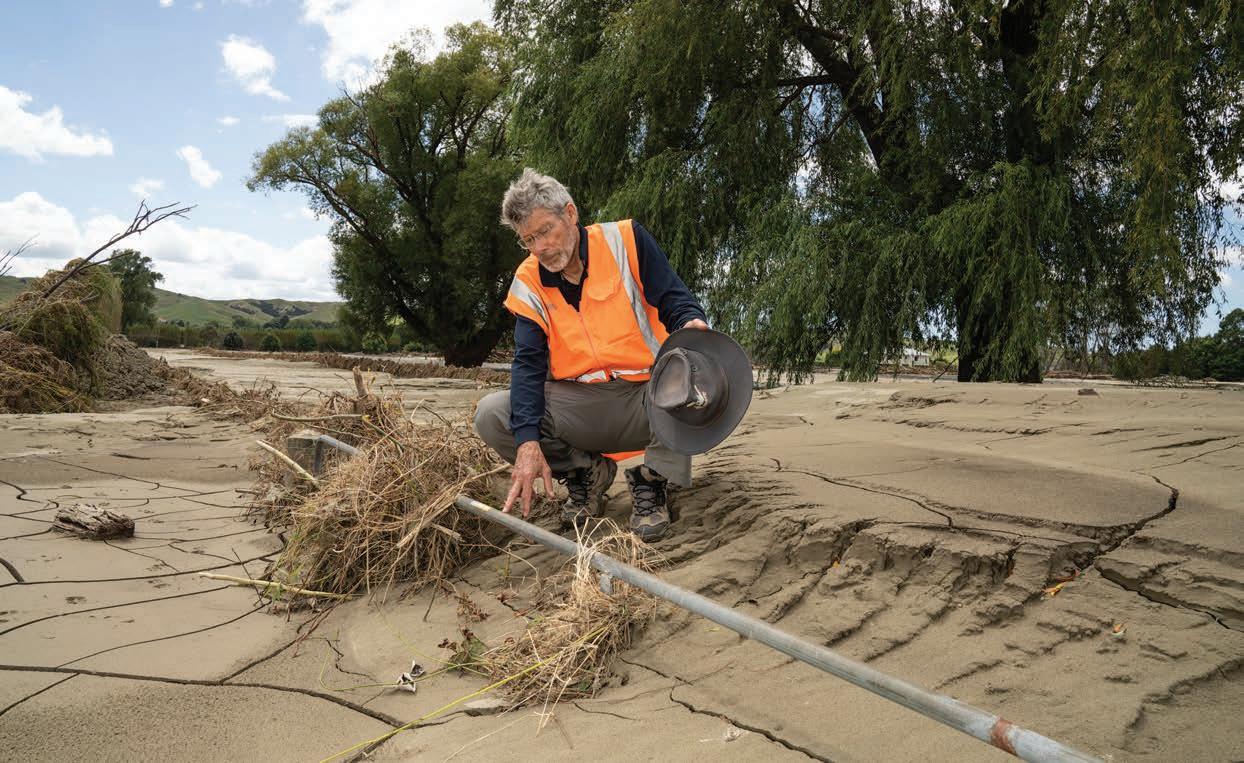
“Just a little bit of rain washes away all the silt lines and all the top water levels. We have to get this data before it is obliterated.
“It is critical for future planning.”
IWA forecasting, hazards and hydrodynamics sta had already had a hectic start to the year.
Cyclone Hale swept in during the second week of January, leaving a trail of wrecked roads and severed power lines from Northland, through the Coromandel and down the East Coast.
Next came the Auckland Anniversary Weekend floods – four dead, homes, streets and airports inundated and a city reeling from the record-breaking deluge.
Little over a week later, NIWA’s Forecasting Services team, led by meteorologist Chris Brandolino, watched in alarm as Cyclone Gabrielle began to form in the northeastern Coral Sea, possibly heading south.
Worried by its size, the team started to alert agencies about Gabrielle’s progress. A string of briefings followed for Fire and Emergency New Zealand, the Department of Conservation and the Ministry for Primary Industries, with o cials from the National Emergency Management Agency and Civil Defence also sitting in. These briefings were interspersed with on-going media interviews and updates on social media.
While the cyclone’s track was still uncertain, coastal and river flow specialists pitched in. Natural hazards scientist Dr Emily Lane worked with her team to combine coastal storm surge predictions with forecasts for the multiple possible cyclone tracks.
“We have to get this data before it is obliterated. It is critical for future planning”
www.niwa.co.nz 12Water & Atmosphere June 2023
Dr Graeme Smart
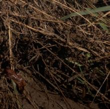
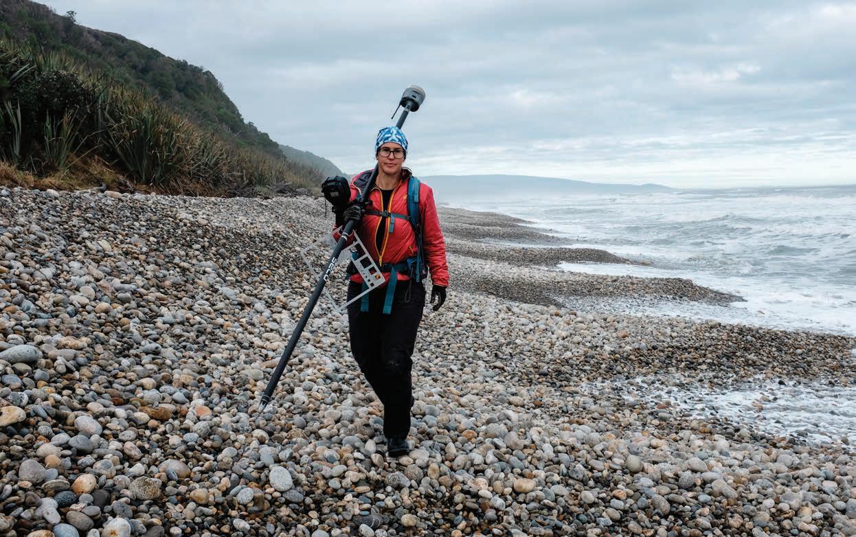
Hydrodynamics specialist Graeme Smart inspects a farm gate buried under silt on a horticultural property near Puketapu. Detailed sediment mapping is essential for recovery planning. (Rebekah Parsons-King)
In the wake of Gabrielle
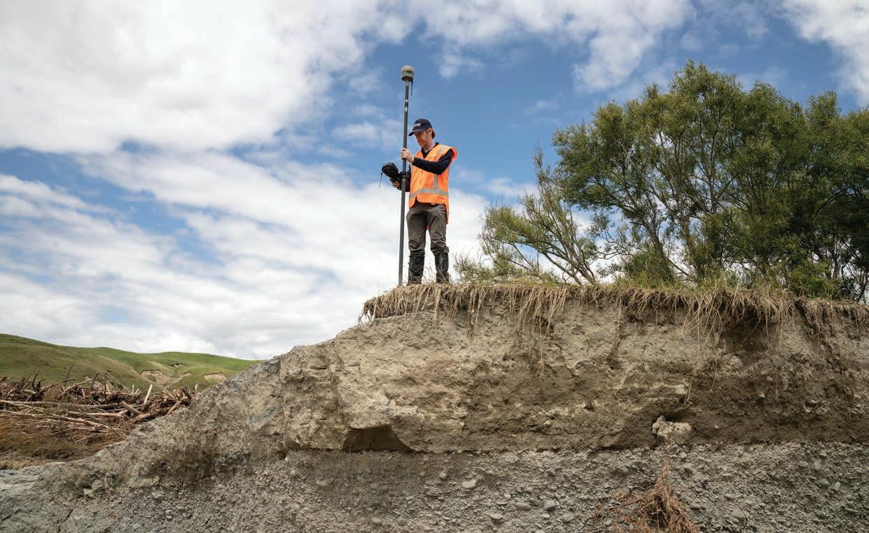
Using real time GPS survey equipment, Jochen Bind accurately maps high water marks to help build detailed new river flow models.
(Rebekah Parsons-King)
Led by Dr Céline Cattoën-Gilbert, another group focused on river catchments. They are fine tuning a new modelling tool that combines rainfall forecasts with a hydrological model to pinpoint areas likely to be most impacted by high river flows. During weather events such as Cyclone Gabrielle, Brandolino and the other NIWA forecasters often present data from this tool.
Brandolino can’t speak highly enough about the value of having NIWA’s other experts on hand to help understand what might happen. “As meteorologists we’re well versed at communicating direct weatherrelated impacts, but we really need the other experts when it comes to coastal inundation and river flooding. Having them in the tent during Cyclone Gabrielle was critical,” he says.
“It’s all about the impacts. There were questions that people were going to ask and without that extra information we wouldn’t have been able to answer them. Even though there was still uncertainty, the agencies we briefed before and during the cyclone were incredibly grateful for the additional information.”
Other researchers started looking at landslide risks. Over the past year NIWA has been working with GNS Science on a pilot study looking at forecasting rainfall-induced landslides (RILs) in the Wellington region.
The work combines NIWA’s near-real time rain forecasts with GNS’s land stability data.
“As Cyclone Gabrielle approached, GNS Science extended the pilot study to trial the RIL forecast tool across much of the upper North Island,” explains NIWA climate scientist Dr Trevor Carey-Smith.
“The landslide forecasts were converted to impact forecasts – houses, roads and rail networks – and shared with councils, central government and emergency response agencies to help inform decisions about things like evacuations and road closures.”
abrielle swept onto the northeast of the North Island in the early hours of Sunday, 12 February, saving its full fury for Hawke’s Bay and Tairāwhiti two days later. It claimed 11 lives, destroyed hundreds of homes and devastated huge swathes of agricultural and horticultural land.
The most expensive weather event to hit New Zealand, the bill is being counted in billions. Treasury's latest estimates suggest it may top the $13 billion price tag for the 2011 Christchurch earthquakes.
The flood waters were only starting to recede as Christchurch-based Smart and his colleagues packed their survey equipment and headed for Hawke’s Bay and Tairīwhiti to gather critical time-sensitive data.
“Hawke’s Bay Regional Council put out a call to ask who could pitch in,” explains hydrodynamics technician Jochen Bind. “And NIWA, amongst a whole bunch of other organisations, said ‘yes, we’ll be there’.”
www.niwa.co.nz June 2023 Water & Atmosphere 13
Smart and Bind were two of several NIWA sta , alongside teams from agencies and locations across the country, who answered the call.
The first sites they tackled were the stopbank breaches and extensive flooding caused by the Tūtaekurī, Ngaruroro and Esk Rivers.
The data captured is now being used to calibrate flood models and help pinpoint the mechanisms driving sediment transport and stopbank breaches. It will be key to designing new flood defences.
“It’s really important when there’s a natural disaster like this that we capture the water depths, levels and
extents, because an event is the real thing. It’s not a model, it’s a one hundred percent perfect model,” says Smart.
As the survey team worked on the ground, NIWA also joined forces with the University of Canterbury (UC) and Christchurch Helicopters, to collect aerial LiDAR data, covering the worst a ected areas.
LiDAR – which stands for Light Detection and Ranging – is a method of rapidly capturing topographic data to build 3D maps. With the LiDAR instrument mounted on a helicopter, a team led by UC’s Professor James Brasington flew rapid response surveys of stop banks for Hawke’s Bay Regional Council.
Adapting to change
World Weather Attribution (WWA) is an initiative led by climate scientists from Imperial College London that works to quantify the role of climate change in extreme weather events.
In February, WWA worked with NIWA climate scientist Dr Sam Dean and others to quickly determine the contribution of climate change to Cyclone Gabrielle’s intense rainfall. Such studies usually take years to complete.
The rapid nature of the study meant there was
large uncertainty in the results. However, the team found evidence in rainfall measurements that very heavy rainfall is now more common in the a ected regions, with climate change by far the most likely explanation.
“The study contributes to a wealth of evidence that here in Aotearoa New Zealand, adapting to a changing flood risk, now and for the foreseeable future, is one of the greatest challenges we face,” says Dean.
“The amount of sediment deposited through the lower catchment was mind blowing”
www.niwa.co.nz 14 Water & Atmosphere June 2023
Dr Arman Haddadchi
In the wake of Gabrielle
The LiDAR flights then moved to wider coverage of impacted rivers and flood plains across Hawke’s Bay and Gisborne regions.
“The LiDAR data has been critical for investigating the impact of Cyclone Gabrielle,” says NIWA hydrodynamics scientist Dr Hamish Biggs.
By comparing the post-Gabrielle helicopter LiDAR data with LiDAR surveys from 2020 by Land Information New Zealand (LINZ), researchers can investigate stopbank breaches, woody debris piles, riverbank erosion, flood inundation depths and sediment deposits.

The LiDAR data is also a critical input for NIWA’s flood modelling work.
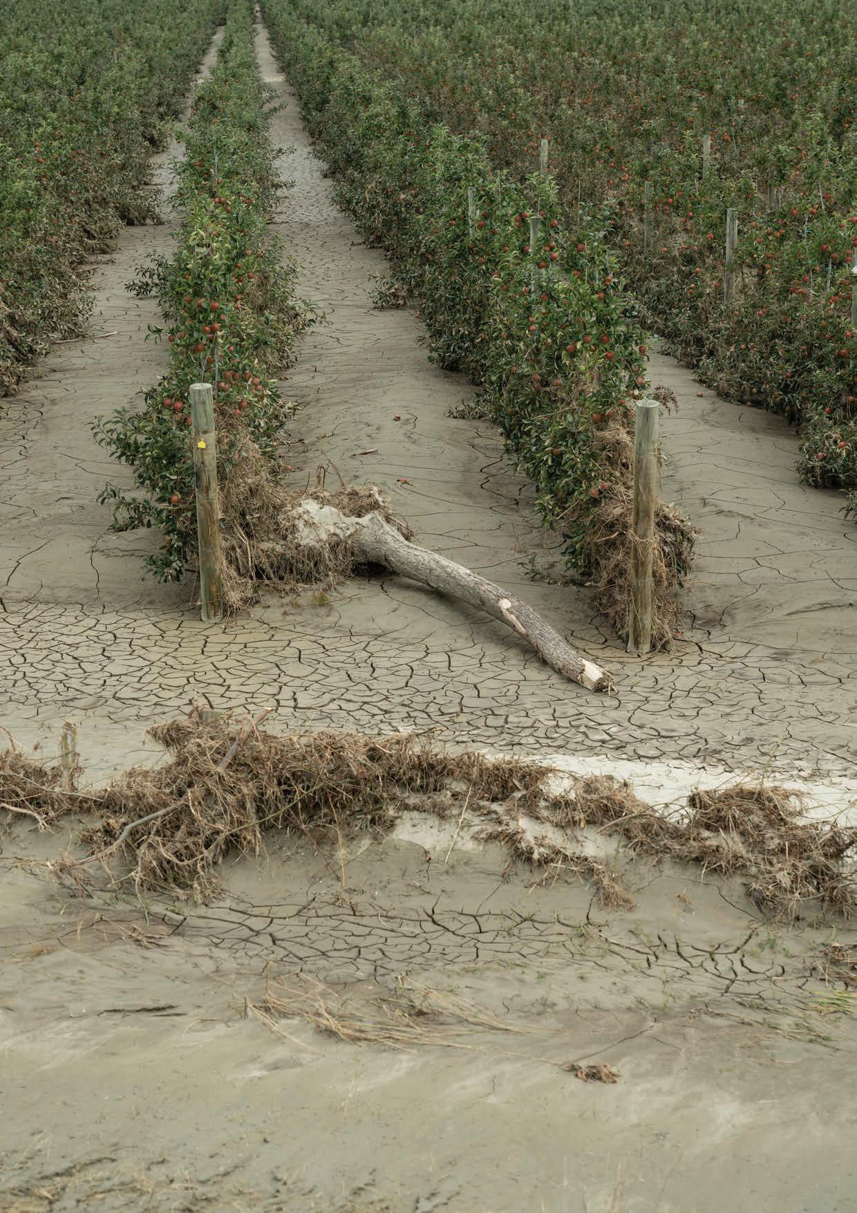
ediment is one of the biggest challenges for communities facing the long road of recovery. It’s estimated that about eight million tonnes of river sediment and four million tonnes of hillside erosion lies in the Esk Valley alone.
Sediment transport scientist Dr Arman Haddadchi and environmental monitoring technician Hamish Sutton sampled 50 sites across the valley.
“The amount of sediment deposited through the lower catchment was mind-blowing, and just devastating to the agricultural and horticultural lands,” says Haddadchi.
“Lab analysis of the samples will help us understand more about particle size distribution, stratification and contamination by toxic chemical and biological substances.”
Dust created by the wind or clean-up activities, and smoke from debris burn o , is also compounding air quality problems.
To gain insights into what people are inhaling, NIWA air quality researchers led by Dr Elizabeth Somervell are working with local health and air quality experts to set up monitoring networks across Hawke’s Bay and Tairāwhiti.
These findings, along with the sediment sampling work, will help councils and communities make decisions about how best to tackle recovery.
Millions of tonnes of sediment have also poured out the river estuaries into Hawke Bay. NIWA marine scientists have begun mapping around 200km² of coastal seafloor using multibeam echosounder equipment.
This data will build on surveys carried out six years ago, assessing where the sediment outwash has settled and possible impacts on biodiversity and the marine environment.
www.niwa.co.nz June 2023 Water & Atmosphere 15
Aerial surveys reveal widespread sediment deposits across the Esk Valley floor. Red dots on the LiDAR generated map to the left denote more than 50 sediment sampling sites. (NIWA)
Justin Stout
ā te haumaru ō te wai is a five-year research programme funded by the Ministry of Business, Innovation and Employment (MBIE). Led by Dr Emily Lane, the team is developing a system to map flood hazard consistently across the whole country.
It will reveal how flood risk across New Zealand will vary over the next 100 years, as climate-induced changes, such as rising rainfall and sea levels, interact with land-use changes.
In Gabrielle’s wake, the team refocused their e orts on urgent new flood hazard maps for the worst a ected parts of Hawke’s Bay.
Additional investment by MBIE has enabled the work to be extended across the rest of the region and Tairāwhiti.
“We need to understand what will happen when the next extreme event comes our way. How have changes in riverbed levels and channels from sediment deposits altered the flood hazard? And what is the impact of the changing climate?” says Lane.
“Councils need to be able to respond to this event as quickly as possible to provide certainty to their residents. They are already making decisions about managed retreat and rebuilding stopbanks.”
In addition, NIWA and GNS Science have begun working directly with Cyclone Gabrielle recovery agencies using the RiskScape analysis tool.
RiskScape is a sophisticated software application that enables users to rapidly work out the dangers and impacts of a range of natural hazards. It will help councils and other agencies make maximum use of the new flood maps, and other data being produced, to inform their response.
The version of RiskScape being used for the Gabrielle response includes a dashboard for agencies tasked with short- and long-term recovery decisions for individuals, communities and sectors.
“It’s highly customisable, and will let users input the data they’re interested in to assess vulnerability of assets and people to future storms and floods,” says NIWA hazard analyst Ryan Paulik.
“This will help response planning, including di cult discussions about things like managed retreat,” he says.
ack by the Tūtaekurī stopbank breach, Graeme Smart takes in the devastation around him.
He was here so quickly, he says it reminds him of his experience living through the Christchurch earthquakes and their aftermath. But he also talks warmly about the community spirit he witnessed then, and is seeing again now.
Smart clearly considers he is working for the local community, helping them respond to this disaster and prepare for the next.
“Until we had climate change, past behaviour of weather was the best indicator of future behaviour. This is getting really uncertain now because disastrous events like this are happening in many countries.
“It’s like there’s a step-change in the way that the climate is behaving and it’s very di cult for us to predict into the future,” says Smart.
“But whatever happens, if we measure what is happening, we’re partly on that journey.”
“We need to understand what will happen when the next extreme event comes our way”
www.niwa.co.nz 16 Water & Atmosphere June 2023
Dr Emily Lane
In the wake of Gabrielle
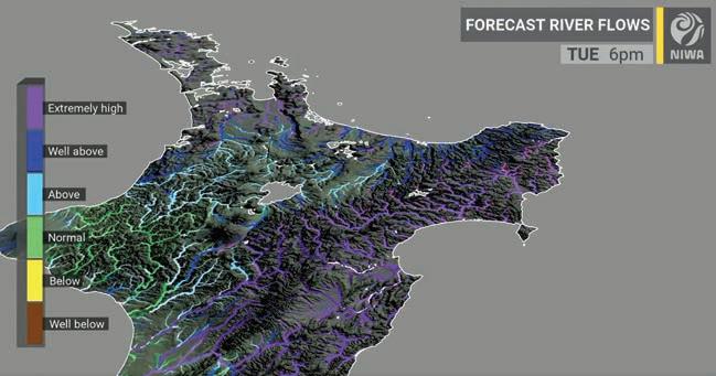
NIWA flow model tools combine projected rain forecasts with catchment data to pinpoint extreme river flows. (NIWA)
“It’s like there is a step change in the way that the climate is behaving”
www.niwa.co.nz June 2023 Water & Atmosphere 17
Dr Graeme Smart
It never rains, but it pours
Extreme weather events are by nature unpredictable, and increasingly expensive.
Back-track three summers from Cyclone Gabrielle, and this Hawke's Bay farm was in the grip of drought.
Farmer Louis Beamish had no rain on his property, in the foothills west of Napier, between January and May 2020.

Northland, Auckland, Waikato and the ManawatuWhanganui region were also battling drought.
The multi-regional dryspell is estimated to have cost New Zealand almost $600M in lost farm production.
Cost of Weather
Feb 2018 – Cyclones Fehi & Gita ($82M)
Feb 2019 – Nelson fires ($4M)
Feb 2020 – Southland floods ($30M)
Mar 2020 – North Island drought ($596M)1
May 2020 – Auckland water crisis ($224M)2
May 2021 – Canterbury floods ($46M)
Jul 2021 – Westport floods ($97M)
Aug 2022 – Nelson/Tasman floods ($31M)
Jan 2023 – Auckland Anniversary Weekend floods ($1.4B)
Feb 2023 – Cyclone Gabrielle ($1.15B)
Source: Insurance Council 1 Treasury 2 Auckland Council

www.niwa.co.nz 18Water & Atmosphere June 2023
www.niwa.co.nz June 2023 Water & Atmosphere 19
Shaped by water
Caroline Beamish meets a braided river specialist, and Wahine Toa, on a mission to let our rivers flow.
or most of us, getting caught in gale-force winds on the banks of the Rangitata River, with sand and debris whipping at your legs and face, wouldn’t be described as fun. But for Dr Jo Hoyle, it’s "type two fun".
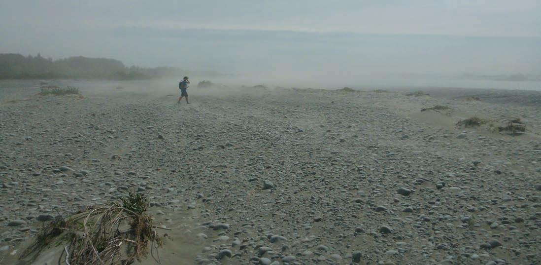
And she’s not alone. As manager of NIWA’s sediment processes group, Jo leads a team of eight river researchers, tied together by a love of their work and the outdoors.
“We do seem to find ourselves often doing quite hard and di cult fieldwork. It’s really fun. Even if it’s not fun at the time, it’s fun afterwards,” she says. rowing up in Kerikeri with both parents working as physical education teachers, it’s no surprise that Jo enjoys challenging herself. She has also always had an a nity for rivers.
A keen whitewater kayaker, she took a year o after school to represent New Zealand at the junior world championships, before completing an undergraduate degree in natural resources engineering.
Fast forward a couple of decades, and Jo is a braided river expert, working as a river geomorphologist. Her focus is on how rivers change over time in response to variations in flow and sediment supply.
It’s a job that requires hard days in the field, but Jo, who has biked the length of New Zealand, the width of the North Island and completed the Coast to Coast, loves it.
Prior to this she worked as a river engineer, where traditional river management practices – managing flood risk – were the norm. But Jo’s interest was in a much wider approach.
“I enjoyed that job, but I was interested in whether there were di erent ways of doing things, things that worked with the river a little bit more.”
s if in answer to her musings, an opportunity in Australia presented itself, and before she knew it, Jo was on a plane across the ditch to undertake a PhD in river geomorphology.
Her studies involved working on a river restoration project with five PhD students, each bringing their own perspectives. Jo enjoyed the interconnected approach and has carried it through to her work today.
“It involves understanding a river as a whole. Not just its physical behaviour, but the life in it, and the processes that occur within a river and how they support each other,” she says.
“We need to work with them instead of trying to control them”
www.niwa.co.nz 20Water & Atmosphere June 2023
Dr Jo Hoyle
PROFILE
A "fun” day in the field: Jo Hoyle disappears into a full force Canterbury nor’wester, funnelling dust down the Rangitata River. (Jochen Bind)
ow back in New Zealand, a big part of Jo’s role at NIWA involves working with Meridian Energy’s hydroelectricity group, providing not just her own geomorphology expertise, but knowledge from the wider freshwater team, be it about water quality, invertebrates or native fish.
“It’s really interesting work and I enjoy it because it involves understanding these applied problems and working with people with di erent expertise to try and provide that holistic information.”
There are few practising geomorphologists in New Zealand, and even fewer of them are women. A testament to Jo’s talent and expertise, she took home the 2021 Rivers Group Wahine Toa Award.
The award recognises a female role model who is leading the way in a river-related field, though Jo says she doesn’t see herself as a role model.
“I still feel like one of the young ones, but I’m coming to this realisation that I’m not anymore,” she laughs.
Braided rivers are particularly special to Jo. More than 150 of New Zealand’s rivers are braided, an impressive number considering that globally these rivers are rare, only occurring in mountainous areas where there is a steady supply of sediment.
“Braided rivers are really interesting, they’re super dynamic and adjusting all the time.”
“But ours are under threat. I’m passionate about them because we can see them diminishing in front of us. Every year we seem to be losing more and more braided riverbed.”
For generations, communities have been developed alongside rivers, building increasing protection measures to hold back floods.
But recent devastating events, such as the Canterbury floods two years ago and Cyclone Gabrielle, have highlighted the need to rethink how we manage our rivers.
“We do everything right up to the edge of a river and we’re trying to control the river. But rivers are naturally dynamic, they’re always shifting and moving,” says Jo.
“When a big flood hits, the river will burst its banks. And we’re going to get more and more of that happening with climate change.”
Jo says she would like to see rivers treated as dynamic rather than static.
She knows it’s a complex issue that requires balancing multiple considerations, but Jo is hopeful, that in the long-term, a broader approach to river management will be taken.
“We need to work with them instead of trying to control them, because really, we’re just not as strong as them.”
www.niwa.co.nz June 2023 Water & Atmosphere 21
River geomorphologist Jo Hoyle on GPS survey duty at BlueCli s Beach, near the mouth of Southland’s Waiau River. (Jochen Bind)
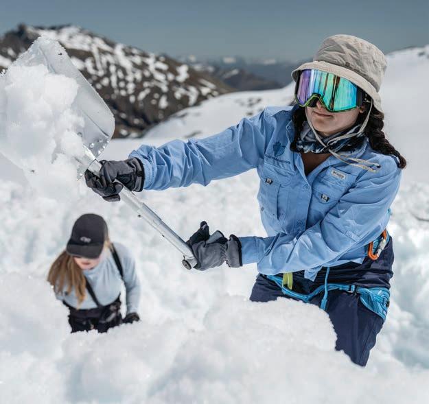
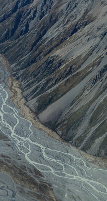
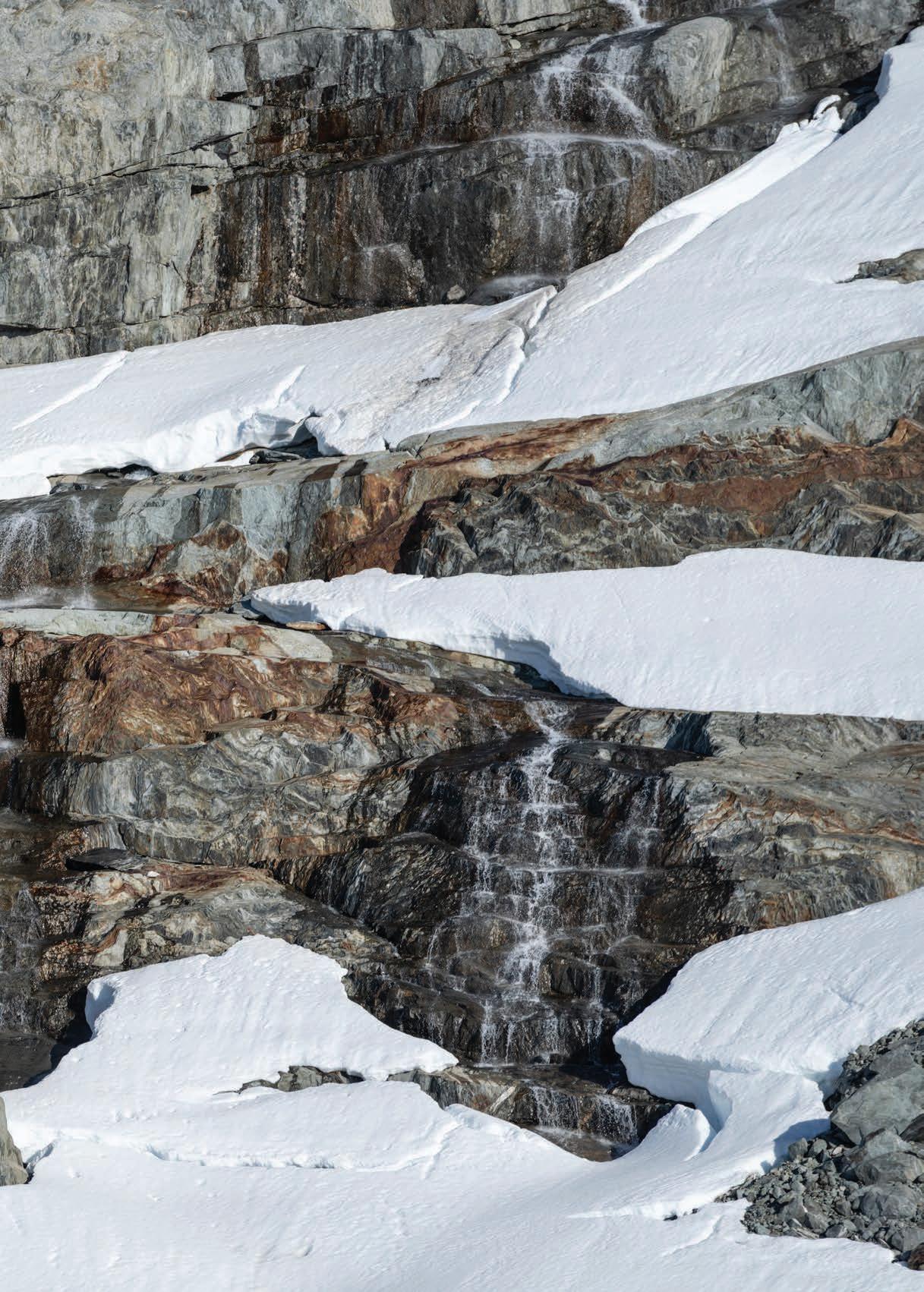
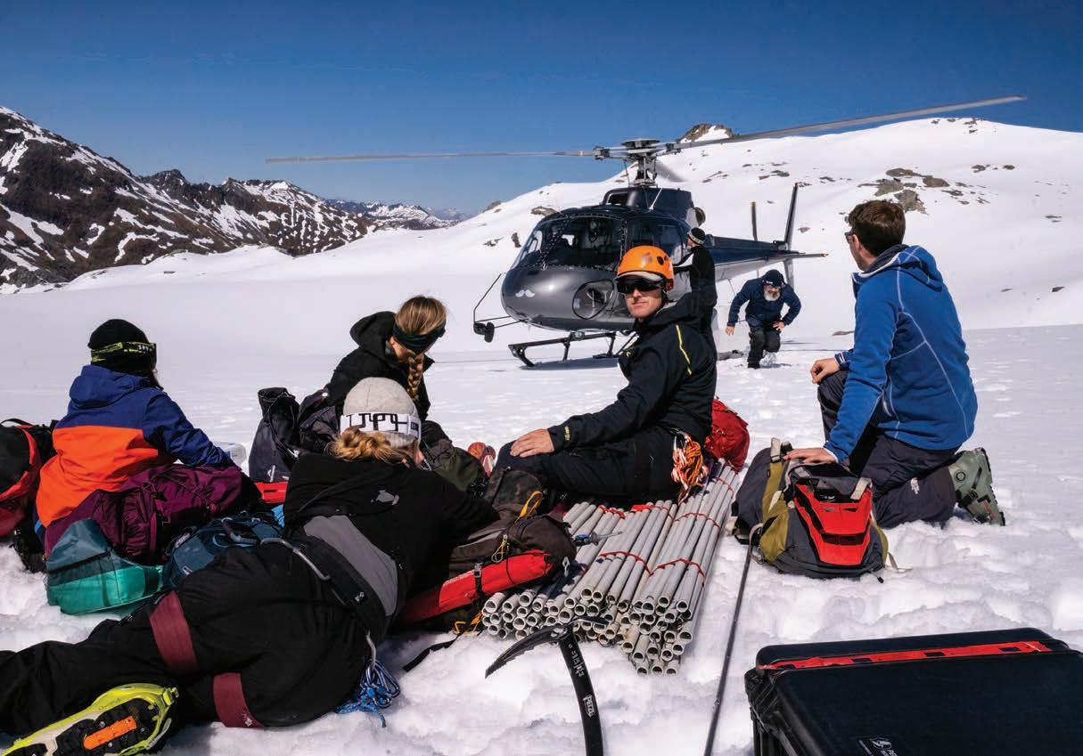
Melting away
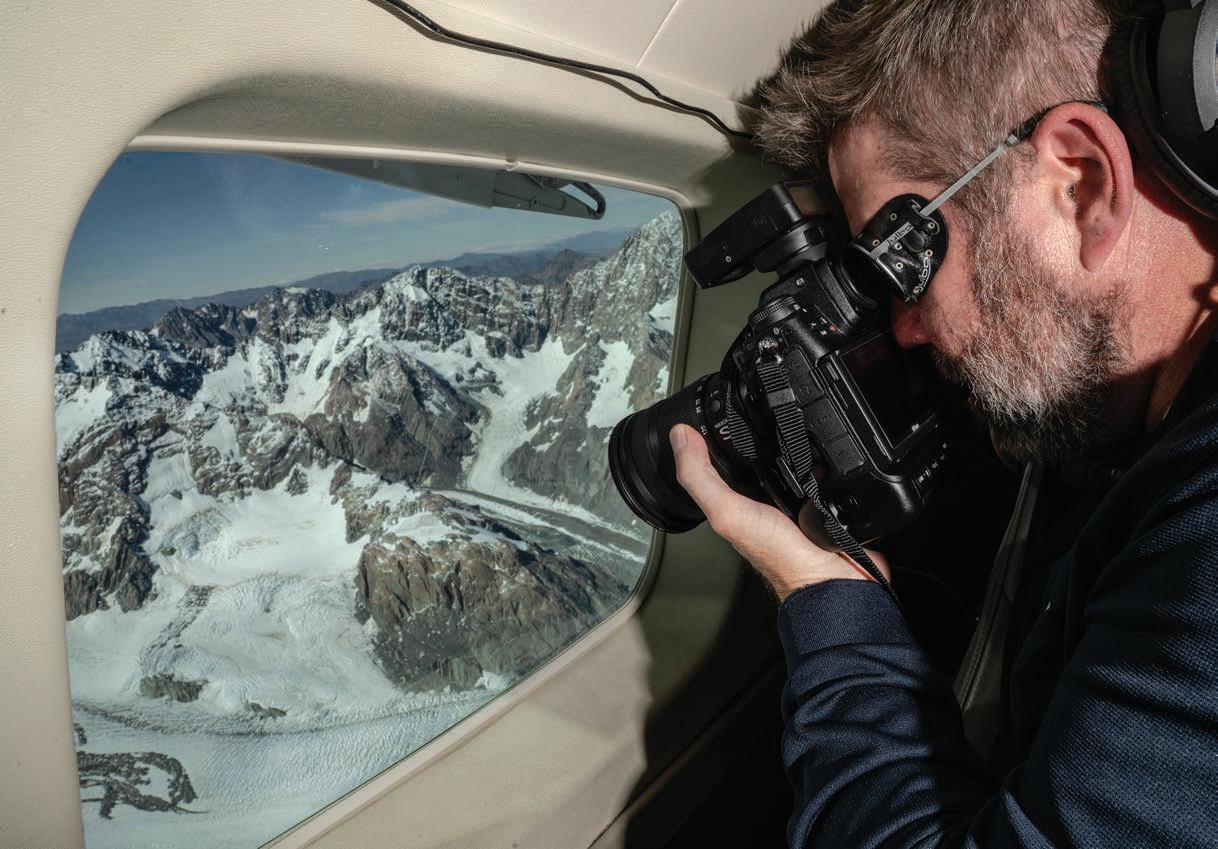
Towards the end of each summer, climate researchers head to the Southern Alps to investigate how our glaciers have fared over the past 12 months.
They visit selected sites each year to investigate snow makeup and depth, and capture thousands of photographs during a detailed aerial survey of more than 50 index glaciers.
The information gathered from glacier surfaces, along with the aerial photos, helps construct 3D models which are used to analyse changes in glacier ice volumes.
The snowline survey collaboration between scientists at NIWA, University of Otago, Victoria University of Wellington and University of Canterbury shows our glaciers are retreating fast.
The long-running observations indicate the Southern Alps glaciers have lost more than 30% of their volume over the past 40 years.
Results from this year’s survey are still being collated, but NIWA’s Dr Andrew Lorrey says our warming climate is continuing to take its toll.
“It is a bit emotional to see an amazing, pristine part of our natural environment slipping through our fingers.”
www.niwa.co.nz 22Water & Atmosphere June 2023
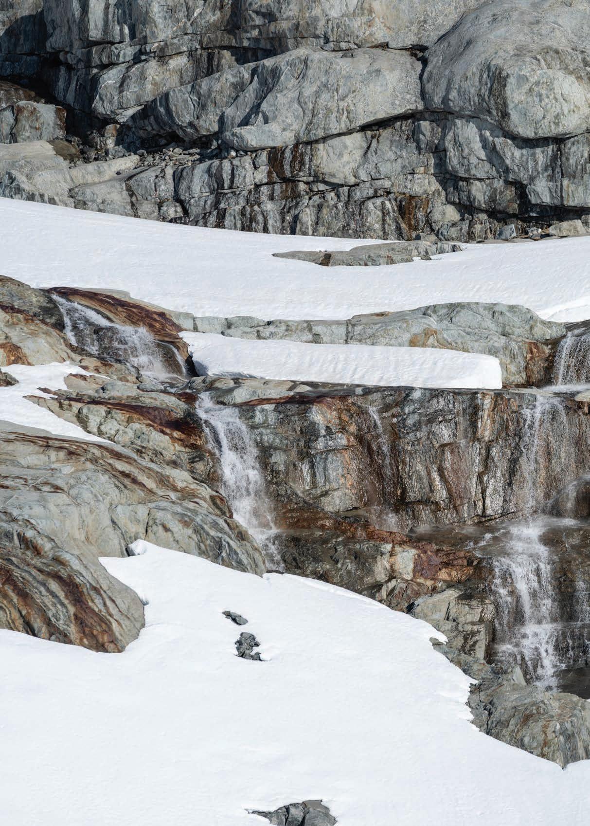
Late spring meltwater runs from the Brewster Glacier in Mount Aspiring National Park. The past three years have been New Zealand’s warmest on record. (Rebekah Parsons-King)
www.niwa.co.nz June 2023 Water & Atmosphere 23
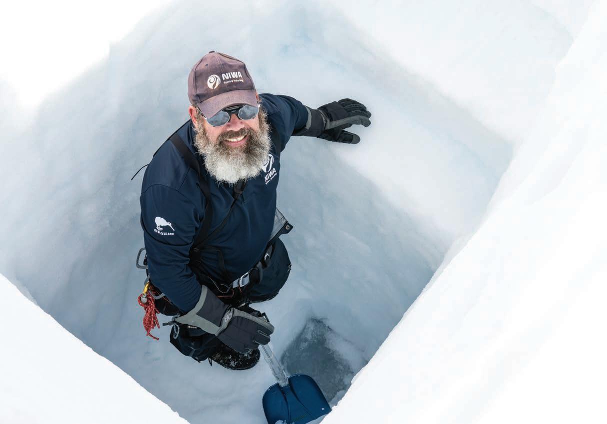
Andrew Lorrey enjoys a welcome break from the spade work. He has coordinated the annual snowline survey since 2009, but this was his first time on Brewster.
Opposite: Team members look down on the intricate collage of ice-sculpted bedrock and meltwater, left behind by the shrinking glacier. The ice has retreated about 100 metres from the lake since 2016.
www.niwa.co.nz 24 Water & Atmosphere June 2023
Melting away
Researchers from NIWA and the University of Otago land on Brewster Glacier. The team use measuring stakes and hand dug snow pits to gather key data about annual snow retention and composition. (Rebekah Parsons-King)
(Rebekah Parsons-King)
(Rebekah Parsons-King)

www.niwa.co.nz 26 Water & Atmosphere June 2023
Victoria University glaciologist Dr Lauren Vargo at Queenstown Airport, preparing for this year’s eight-hour snowline survey. Vargo’s structure from motion modelling reveals key changes in glacier ice each year. (Rebekah Parsons-King)
Melting away
Lorrey captures fresh GPStagged photos of Haupapa/ Tasman Glacier – New Zealand’s largest alpine river of ice. The glacier has retreated by more than 7km since the end of summer snowline survey began. (Rebekah Parsons-King)
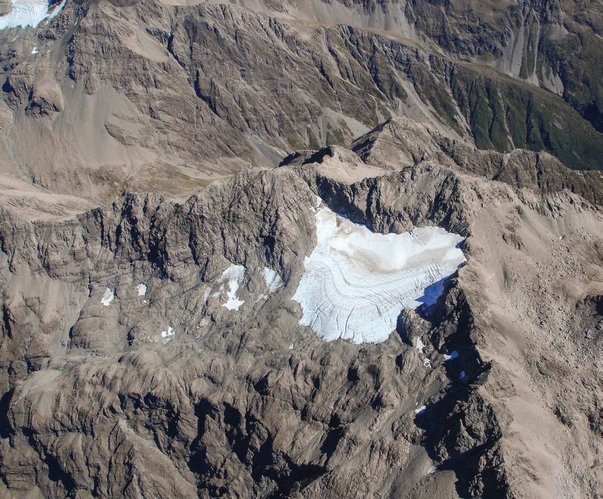
Rolleston Glacier 1978
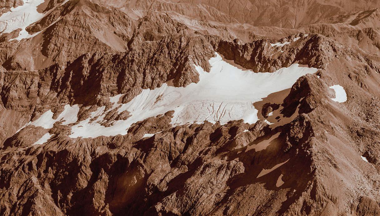
Rolleston Glacier 2018
University of Canterbury researchers estimate Rolleston Glacier, near Arthurs Pass, has lost enough water since 2010 to fill more than 30 Olympic swimming pools each year. (NIWA/Trevor Chinn)
www.niwa.co.nz June 2023 Water & Atmosphere 27
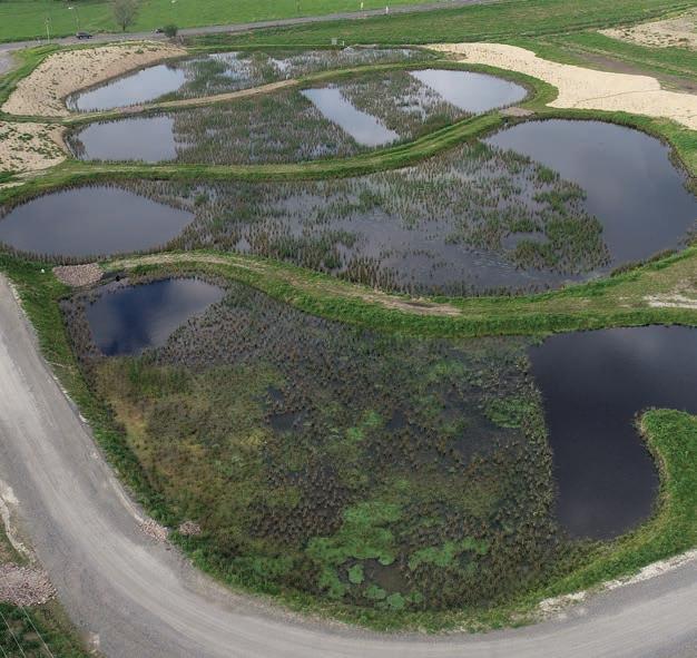
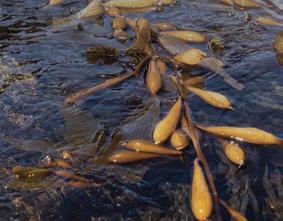
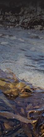
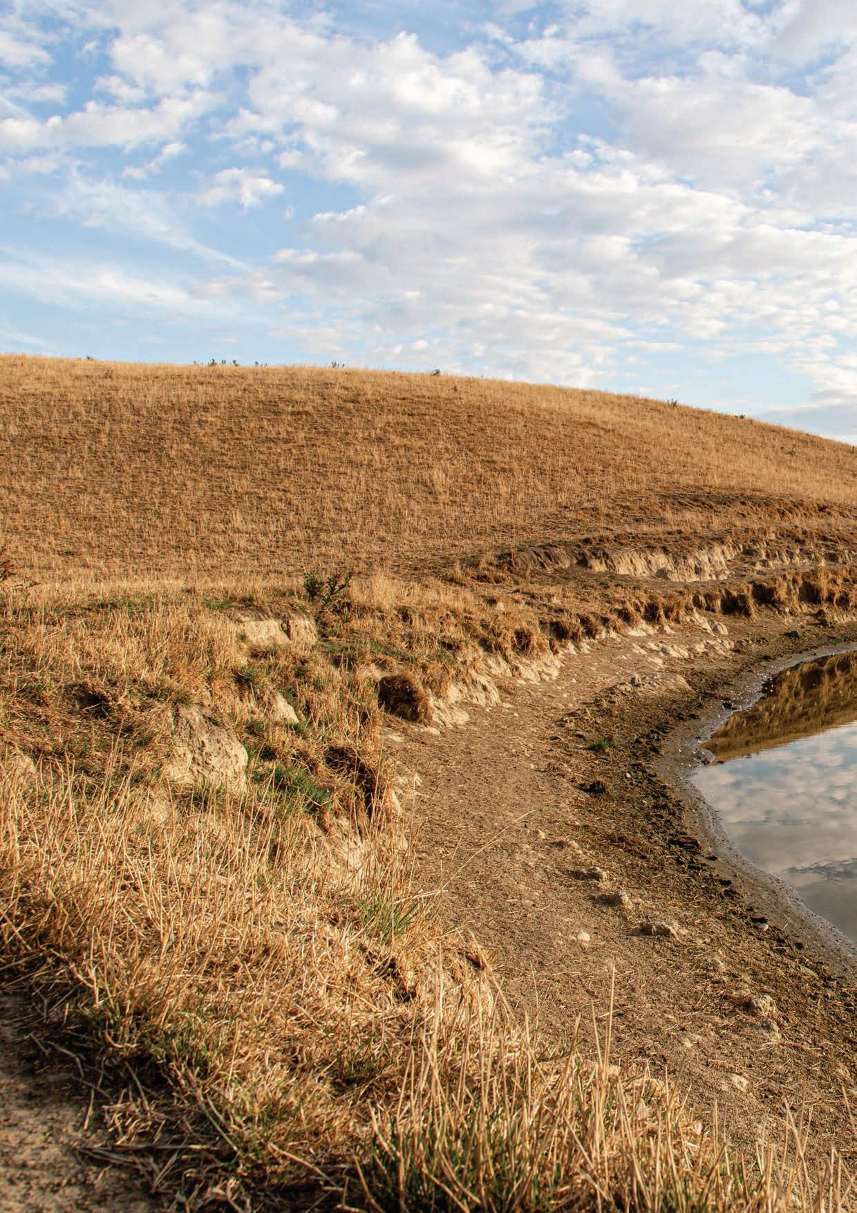
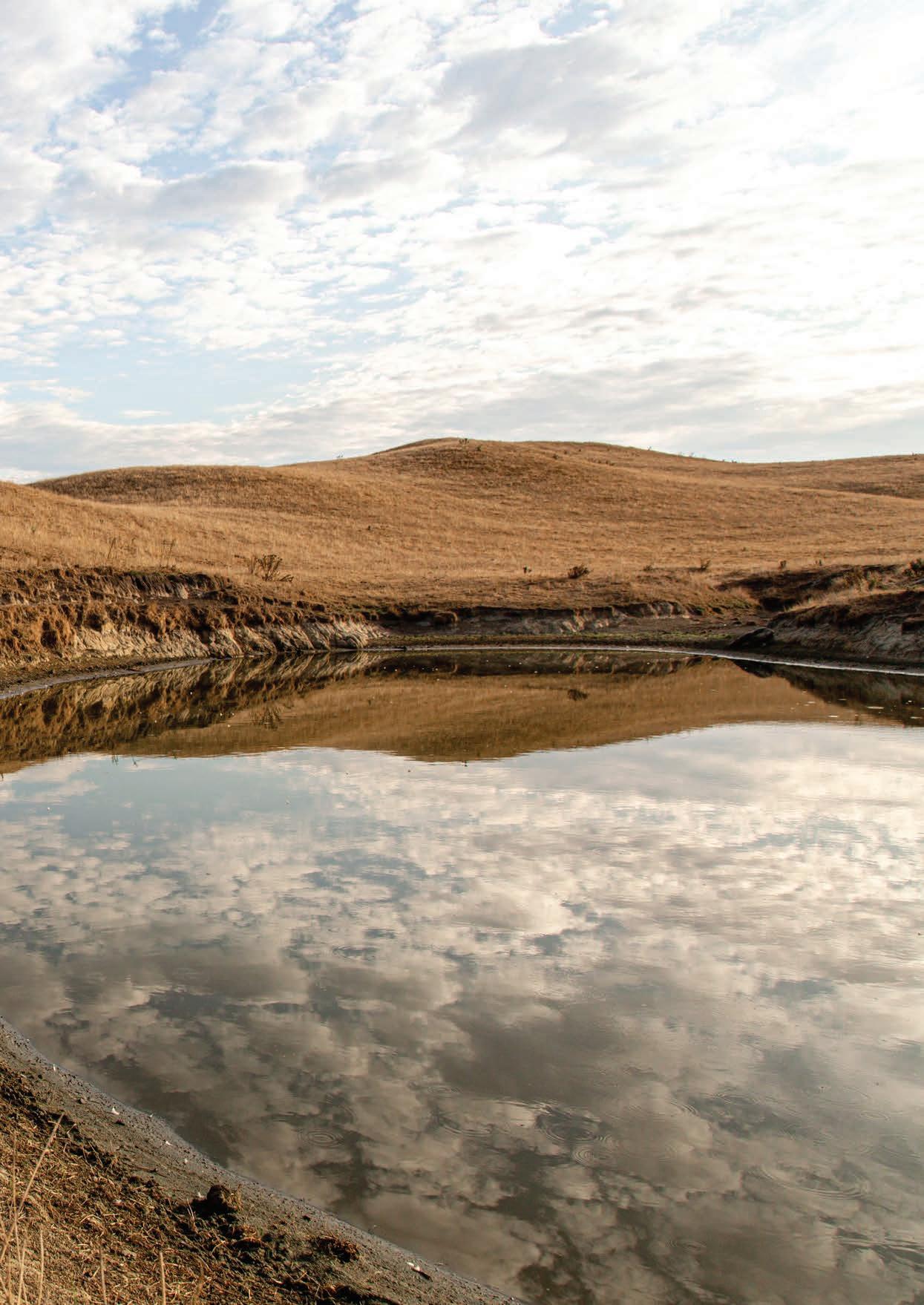
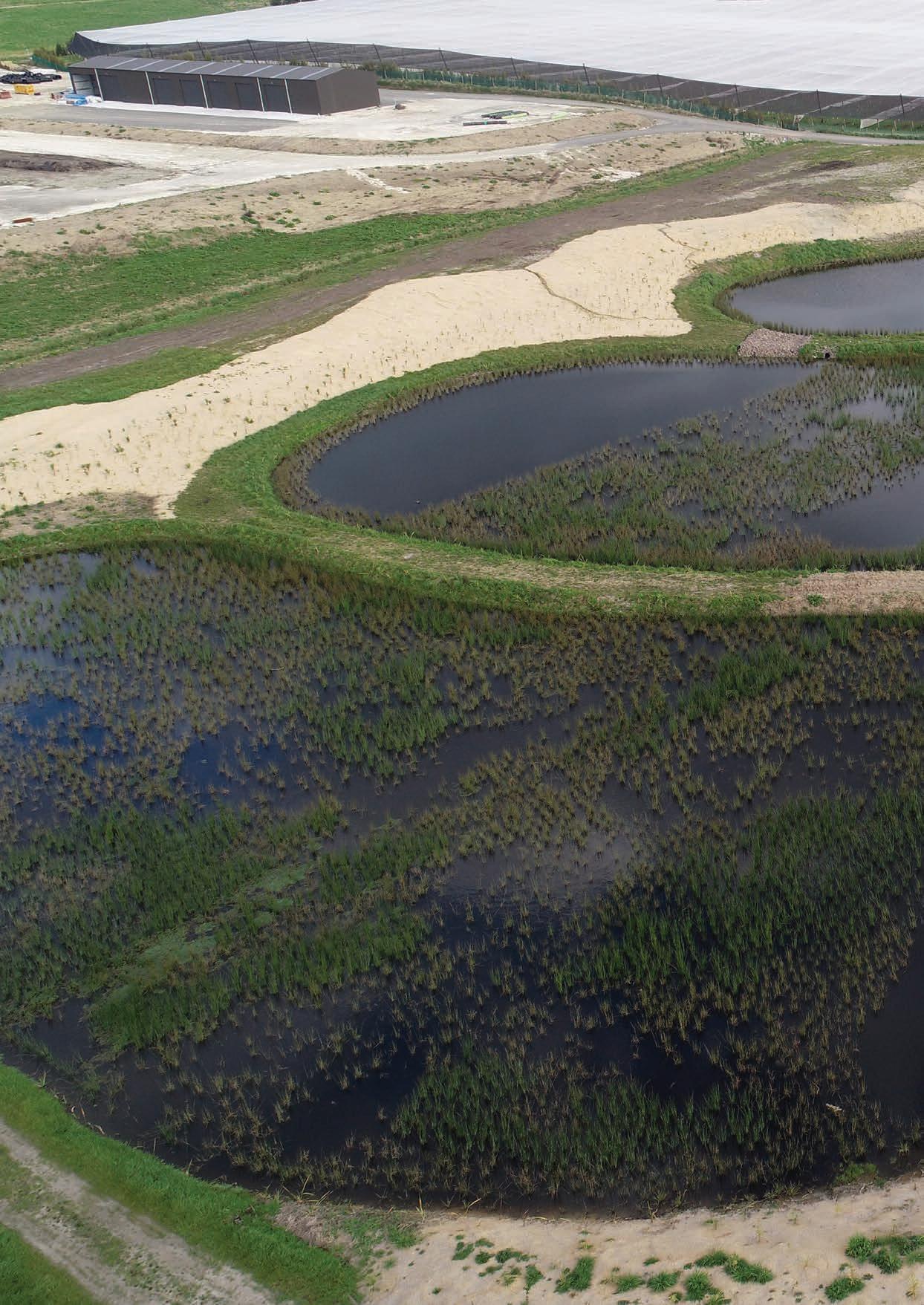
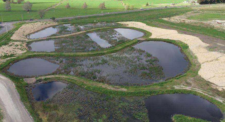
Building back wetlands
This new 3-hectare wetland has been constructed from scratch on a former dairy property near Maketu.
A little over a year old, it’s already hard at work stopping sediment and contaminants entering local waterways. Lawrence Gullery reports on a research project that aims to build back better.
www.niwa.co.nz 28 Water & Atmosphere June 2023
Te Rere I Maniatutu – the Bay of Plenty wetland constructed by kiwifruit company Baygold. (Les Anstis)
www.niwa.co.nz June 2023 Water & Atmosphere 29
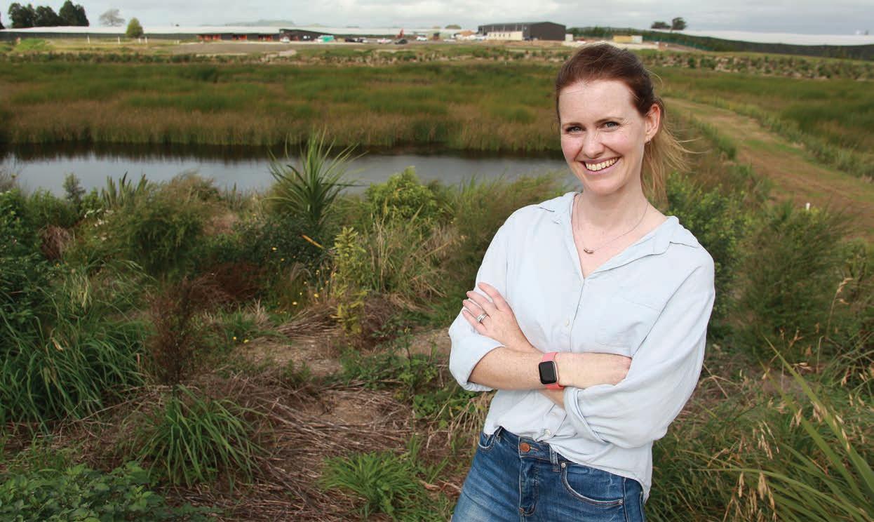
livia Manusauloa loves her drive in to work every day.
When she turns o State Highway 2 into Baygold’s head o ce, she can see three years of hard work and planning starting to reach fruition.
Manusauloa is the kiwifruit company’s relationship and sustainability manager and is the driving force behind an innovative project to construct a wetland at its Bay of Plenty headquarters.
“It’s quite unique for an orchard company to build its own wetland, but it is indicative of where the directors want Baygold to go.”
anusauloa could see the potential when Baygold decided to centre its operations on a 32ha former dairy farm near Maketu in 2020.
“When we looked at the site it was clear that it was in a flood zone. Our consenting requirements stated we must have ponds for water storage, but we thought we might be able to do more than just ponds.”
Manusauloa worked with Bay of Plenty Regional Council on options for a custom-built wetland, sited on an old drain on the edge of the property.
“We had worked with the council on native planting projects in the past, but we asked if they would support a much larger project,” she says.
“That’s when we heard that there was an opportunity coming up with NIWA.”
Earlier that year, NIWA researchers launched a fouryear, $1.95 million project, funded by the Ministry of Primary Industries, to examine the performance of constructed wetlands in mitigating rural run-o .
The project involves five councils: Tasman, Taranaki, Hawke’s Bay, Bay of Plenty and Canterbury.
NIWA worked alongside councils and landowners to identify sites and design the wetland systems, advising on plant selection, estimates of contaminant removal, and installing monitoring equipment.
The councils are co-funding and assisting with wetland monitoring, which will help improve understanding of the ability of constructed wetlands to reduce the flow of nutrients, suspended solids and faecal microbes into waterways.
In-kind support from landowners and organisations such as Fonterra, has helped fund wetland construction.
For the Baygold wetland, funding support was provided by Bay of Plenty Regional Council, the Ministry for the Environment and the Ministry for Primary Industries, One Billion Trees programme. The regional council and Baygold developed a plan to set aside 3 ha for the wetland, and construction started in February 2022.
Local iwi Ngāti Pikiao, have supported the project, naming the wetland Te Rere I Maniatutu – “the flow from the Maniatutu”.
It is one of six wetlands constructed around the country as part of the research project. It is the only site built on an orchard – the others are on dairy or drystock farms or council reserve land.
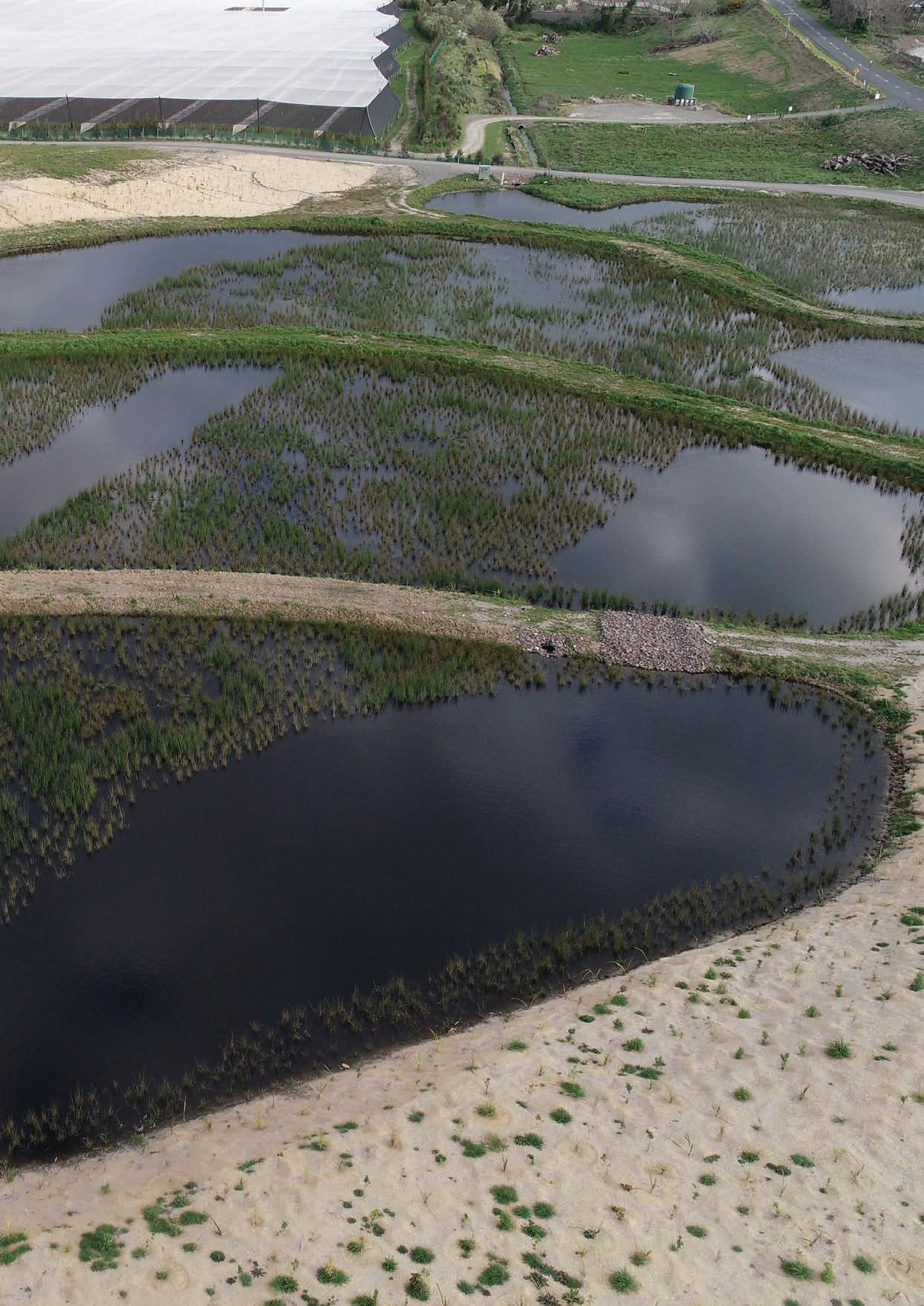
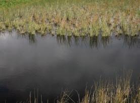
Maniatutu wetland was designed as a series of four connected ponds; each pond has smaller sections of deeper water to allow sediment to settle, larger areas of shallow water for densely vegetated plants, and then open areas to allow the water to recirculate and redistribute across the wetland.
It has been planted with 41,000 natives, with margins and riparian surrounds a mixture of sedges, flaxes, shrubs and trees. As well as improving water quality, the goal is to boost biodiversity and enhance both wetland aesthetics and cultural values.
Maniatutu wetland helps to slow and filter water flowing into the nearby Little Waihi Estuary. It occupies 2.6% of a 73ha catchment, and it is estimated to remove an annual average of 40% of nitrogen load carried by the water that passes through the wetland.
While it is early days for Maniatutu, the results are on par with other similarly designed wetlands in the project (See box page 33).
In recent decades, the Little Waihi Estuary’s water quality has declined as increasing amounts of nutrients, sediment and faecal matter have washed in from surrounding land. Bay of Plenty Regional Council scientists estimate that the current quantity of nutrients and bacteria entering the estuary will need to be reduced by 30–66 percent to stop the decline.
www.niwa.co.nz 30Water & Atmosphere June 2023
“It’s quite unique for an orchard company to build its own wetland”
Building back wetlands
Olivia Manusauloa Baygold sustainability manager
IWA wetland scientist Dr Brandon Goeller and his colleague, aquatic pollution specialist, Dr Chris Tanner, lead the nationwide project, supported by freshwater researchers around the country.
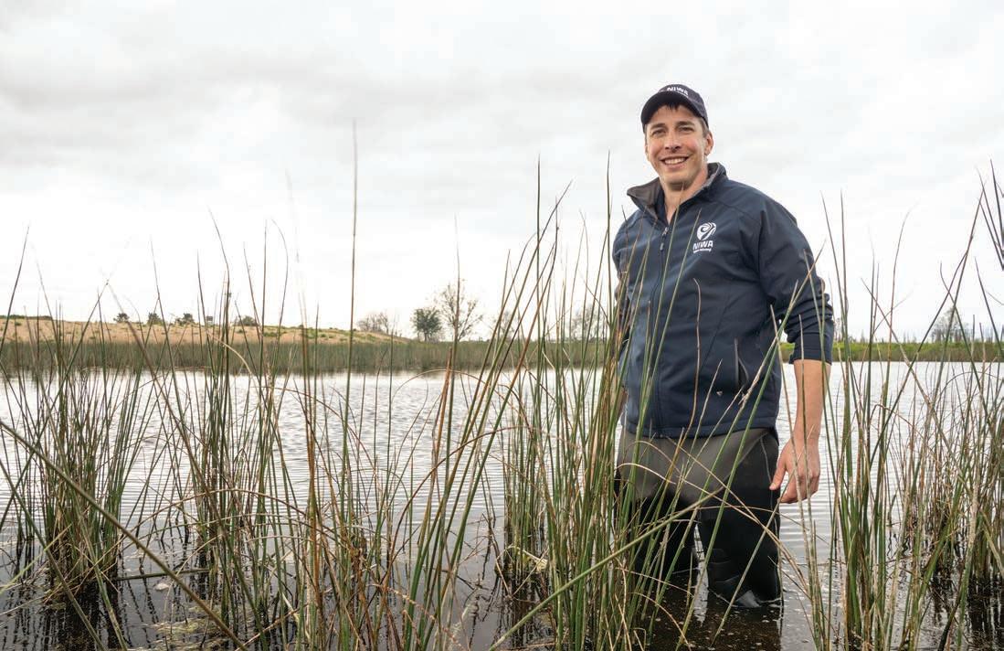
Goeller said the inlet and outlet of each constructed wetland is equipped with state-of-the-art flow, nitrate and turbidity sensors that enable real-time, continuous measurements.
They also feature automated samplers, which are triggered to take samples for analysis of nutrients, sediment and E. coli during heavy rain and runo events.
Sample collection and maintenance of equipment is completed by regional council sta .
The monitoring systems enable analysis of the water both as it enters the wetland, and just before it exits, to determine any changes over time.
“We started the monitoring at Maniatutu in July 2022, and it’s been a very wet year with more flow through the wetland than anyone might have expected,” Goeller says.
“Surface drainage is the major inflow; groundwater makes up a very minor portion of what’s treated.”
Maniatutu is a series of connected ponds. Deep pools combine with densely planted shallow sections to trap sediment and filter contaminants. (Les Anstis)
www.niwa.co.nz June 2023 Water & Atmosphere 31
Wetland scientist Dr Brandon Goeller says, although little over a year old, the Maniatutu wetland is already proving its worth. (Rebekah Parsons-King)
“Initial results from the baseflow water quality monitoring are very encouraging”
Dr Brandon Goeller
anusauloa says the recognition is confirmation that a business can be economically viable and environmentally responsible, and she hopes it will be an encouragement for others.
“So far, we’ve helped two other property owners with advice on where to source plants and with funding applications."
Manusauloa says Baygold joined the project with a long-term view of the wetland’s potential.
“Yes, the wetland has an amenity value, but we also believe there will be opportunities in the future to harness the carbon sequestration potential of the native plants in and around it.
“We also know the wetland will continue to produce scientific data which will assist development of other projects.
“There is a lot of interest, people comment on how much they appreciate the investment in the area, others want advice on wetland development.
“It has involved three years of planning and hard work. But driving past the wetland every day, I just love it.
“Every time I see it, I feel we’ve accomplished something great.”
Wetland performance
Baygold’s Maniatutu constructed wetland is one of six currently monitored as part of the MPIfunded project.
Performance varies due to a number of factors, including size, surrounding soil profiles and climate.
Case studies show that as wetlands increase in size from 1% to 5% of the contributing catchment, sediment removal rates ranging from 50% to 90% can be achieved. Similarly, in warmer areas of New Zealand, nitrate removal ranges up to 50%
Wetlands up to 5% of the catchment area can also remove up to 48% of total phosophorus.
“People comment on how much they appreciate the investment in the area.”
www.niwa.co.nz June 2023 Water & Atmosphere 33
Olivia Manusauloa
Stuart Mackay
Game on
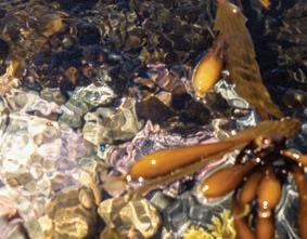
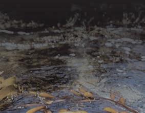
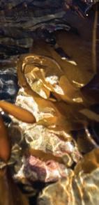
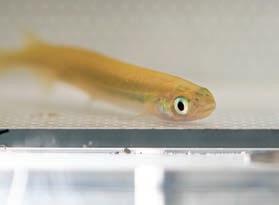
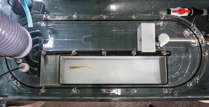
Have you ever heard of a fish climbing competition? Mia Blyth drops in on the native fish getting put through their paces for a very good cause.
In a small, windowless laboratory at NIWA’s Hamilton site, you will find young native fish competing in their very own Freshwater Olympics. However, the rivalry is about far more than mere gold medal status.
Wriggling their way up steep ramps or swimming their hearts out on a specially designed treadmill, these New Zealand representatives are competing for their very survival.
There are about 50 freshwater fish species native to New Zealand. Three-quarters of these are classified as threatened with, or at risk of, extinction.
Many of our iconic natives, such as tuna and whitebait, migrate between the sea and our rivers, and, due to this transitory lifestyle, they now face imposing challenges.
As the small, finger-sized juveniles make their way upstream to reach the habitats they need to grow, feed and breed, they increasingly encounter manmade barriers such as dams, culverts and weirs.
Fragmentation of river systems is a key driver in their decline. If they can’t get past these obstacles, they are not able to access the essential habitats required to complete their life cycle.
University of Waikato PhD student Rachel Crawford is on a mission to change this.
As part of a NIWA-led, five-year Endeavour Fund project, Crawford is holding her very own piscine Olympics. She is getting the stopwatch out to see how fast individual fish can swim, and for how long, so she can help develop practical solutions to the barriers they face.
Īnanga, kōkopu, kōaro, tuna, and the common and redfin bully are among some of the species gathered from Waikato streams to take part in Crawford’s experiments. She wants to discover the top swimming speeds these small fish can sustain and how water temperature impacts on their performance.
“You can think of the experiment as like a treadmill, except this time it’s full of water, so the fish are swimming against the current, and the water velocity the fish are exposed to will gradually increase,” Crawford explains.
“This will tell us the maximum swimming velocity each fish can sustain.”
Other “competitions” measure how well fish can climb varied materials or gradients and, unbeknown to all these mini-Olympians, their performance may have a major influence on their future survival.
Crawford’s results feed directly into NIWA’s New Zealand Fish Passage Guidelines. These guidelines were used to inform new regulations in the National Policy Statement for Freshwater Management and the National Environmental Standards for Freshwater.
www.niwa.co.nz 34Water & Atmosphere June 2023 SOLUTIONS
A juvenile īnanga battles its way to the front of the modified flow tank, built to test the optimum swimming speeds. (Stuart Mackay)
Like
most native fish, īnanga face multiple barriers heading upstream.
(Stuart Mackay)
“This will tell us the maximum swimming velocity each fish can sustain”
Rachel Crawford
As a result of these regulations, any new structure which is put across a river or stream now needs to be designed to enable fish to get past, and Crawford’s work influences the designs of those fish-friendly pathways.
For freshwater ecologist Dr Paul Franklin, this work is more vital than ever. While future structures will adhere to the updated guidelines, new research shows nearly half of New Zealand’s rivers and streams are already partially or fully inaccessible to migratory fish.
New Zealand has some of the highest densities of barriers to fish passage in the world – individuals can encounter 10 or more structures on their journey upstream.
“One of our biggest challenges over the next 5–10 years is figuring out how we fix all those structures so more rivers are accessible,” says Franklin.
Thanks in part to Crawford’s “Olympics”, the good news is that solutions are now easier to implement. Old structures can be modified with well-designed fish ladders or passages.
Culverts, for example, can be fitted with ‘fish resting stops’.
“You can install ba es into culverts, which are basically panels placed inside the tube that help to slow water down and create resting areas, so that fish can pass through into the stream above,” says Franklin.
NIWA has also developed a Fish Passage Assessment
Tool to provide an easy-to-use system for recording instream structures and assessing their likely impact on fish movements and river connectivity.
Anyone can use the tool and provide data by using the survey available in the NIWA Citizen Science app.
“It’s small changes like this that can make a big di erence,” says Franklin.
“If we don’t start addressing the threats that we’ve placed into their environment, these precious fish will one day be gone.”
For those who are wondering: the pint-sized smelt and kōaro are currently in gold medal contention to take New Zealand’s “strongest swimmer” title.
www.niwa.co.nz June 2023 Water & Atmosphere 35
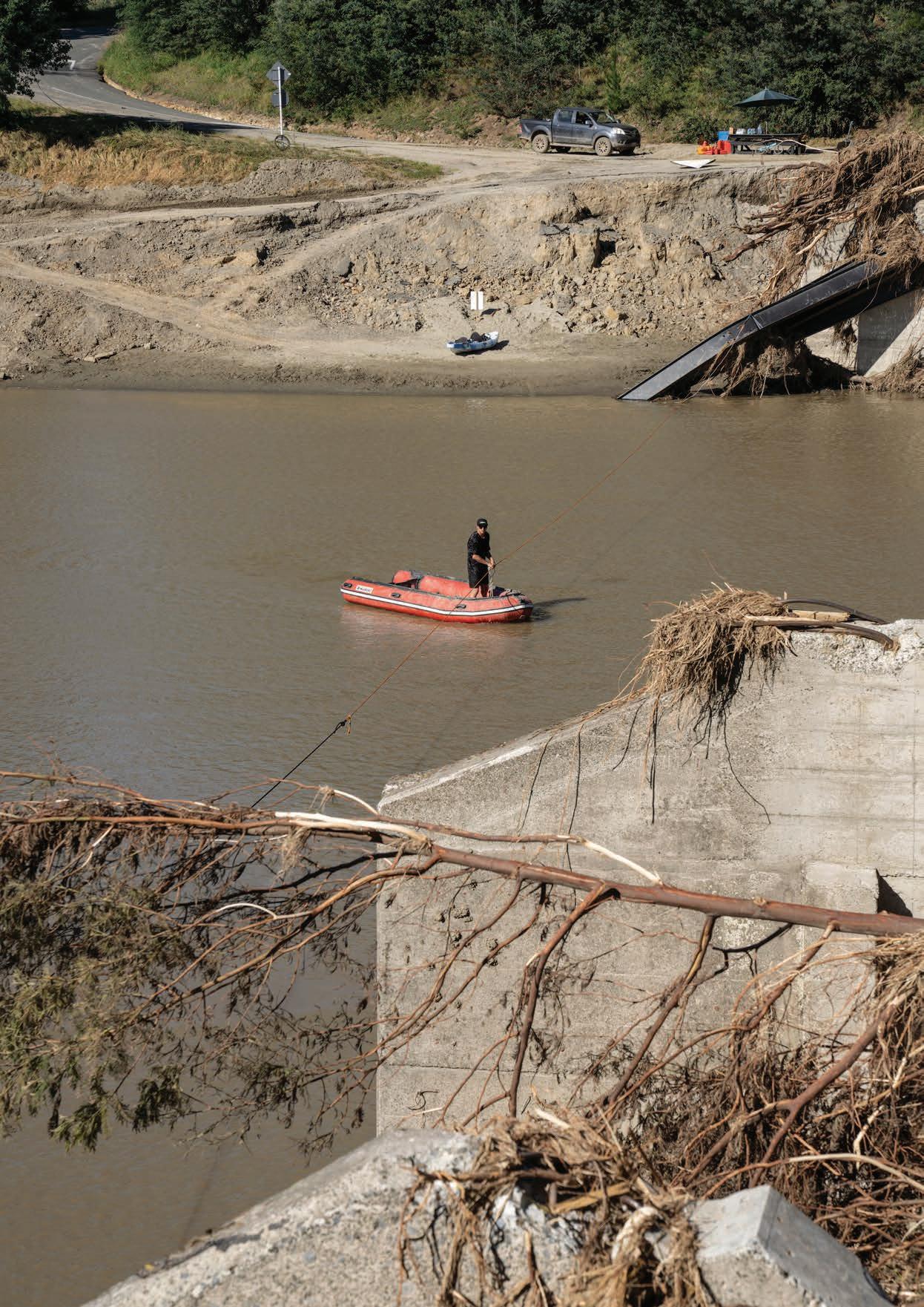
Back cover photo: Residents of the Dartmoor community were forced to turn to inflatable boats and a pulley to access Napier across the Mangaone River. (Rebekah Parsons-King)
“Small changes like this can make a big di erence”
Dr Paul Franklin
PhD student Rachel Crawford and freshwater ecologist Dr Paul Franklin discuss brick ba es installed in a Waikato River culvert. The ba es provide resting spots for migratory fish. (Stuart Mackay)