Editorial Advisory Board: Geo Baird, Sarah Fraser, Barb Hayden, Emily Lane, Rob Murdoch
Follow us on:
facebook.com/nzniwa
x.com/niwa_nz
niwa_science
youtube.com/@NIWA_Science www.niwa.co.nz
Water & Atmosphere is produced using vegetable-based inks on paper made from FSC certifed mixed-source fibres under the ISO 14001 environmental management system.
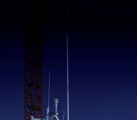
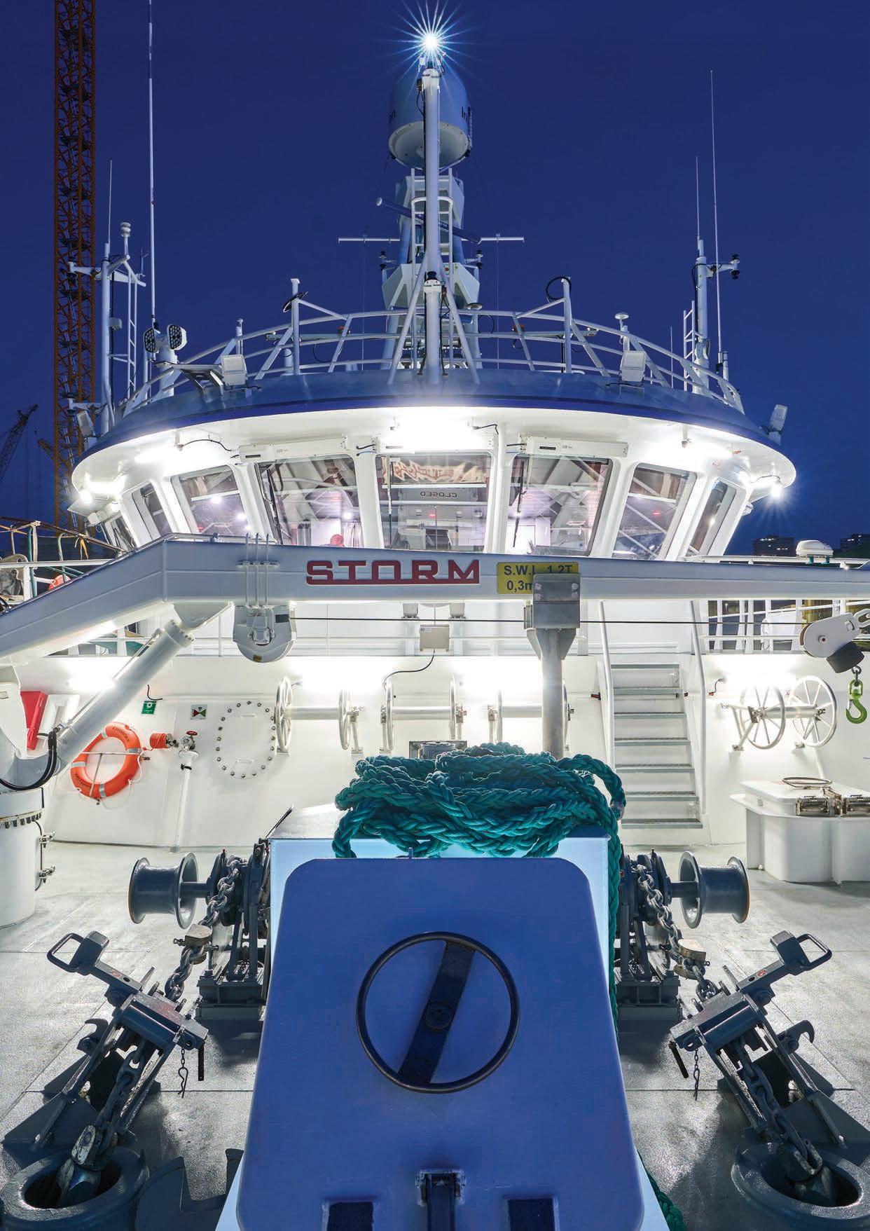
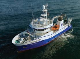
Cover: Framed against a clear night sky in a Spanish shipyard in Vigo, final checks are made as NIWA's new research vessel Kaharoa II prepares for her maiden voyage to New Zealand. (Armon)
Water & Atmosphere July 2024
Rebekah Parsons-King Armon
What does it take to discover, and accurately describe, life in the darkest
10 Ready for research
Step aboard NIWA's high-tech, high-spec, new research vessel Kaharoa II, as she prepares to embark on a life of science on the high seas.
18 Water therapy
Zen and the art of freshwater ecology. Meet the scientific diver who knows her weeds. 20
On a mission
New Zealand researchers join forces with their Italian colleagues to understand changes ahead for the Ross Ice Shelf.
New Zealand's first
What do marine heatwaves mean
Investing in our marine realm
If New Zealand is to e ectively manage its coast and oceans, we need to keep investing in marine science. NIWA Chief Executive John Morgan explains.
“Our marine realm presents one of New Zealand science's greatest challenges”
John Morgan
ne of the great wonders of science is that it enables you to manage what you can’t see.
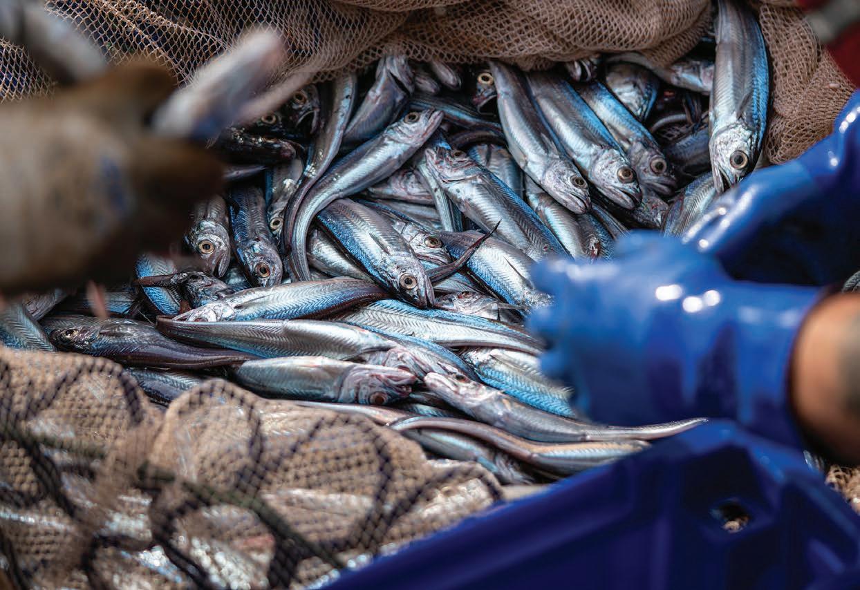
Take our fishing industry, for example. It is worth $1.8 billion a year and employs nearly 4,000 people across New Zealand.
These jobs depend on healthy, sustainable fish populations. But how do fisheries managers know how many fish there are in the sea?
The answer is high-quality fisheries science –regular, independent fish stock surveys, backed by sophisticated population and ecosystem modelling.
This data is gathered by NIWA fisheries scientists and ecosystem specialists working both on research vessels at sea and in laboratories back on land. It underpins the decision making needed for New Zealand’s sustainable fishing industry.
Science on the high seas also helps reveal New Zealand’s hidden seismic risks. Our biggest tectonic hazard doesn’t lie under central Wellington or along the Southern Alps. It runs deep under the seafloor, alongside the North Island’s East Coast and out into the Kermadec Trench.
It is known as the Hikurangi Subduction Zone, and it is capable of delivering megaquakes and huge tsunami.
The potential impact of this tectonic zone rupturing is now embedded in our emergency planning and
building codes, thanks to marine geologists and undersea mapping specialists working together in the waters o the East Coast.
New Zealand manages one of the world’s largest marine realms. To gather the scientific evidence required to inform quality decision making about this realm, you need to continue to invest in the research platforms capable of gathering that data at sea.
That is why NIWA invested in Kaharoa II – to complement our flagship research vessel Tangaroa and our inshore vessel Ikatere. Larger, and with substantially increased capabilities and capacity, Kaharoa II can carry more equipment and more researchers than its 44-year-old predecessor
Kaharoa. The new vessel illustrates NIWA’s ongoing commitment to marine research in New Zealand.
Whether it is understanding how sea temperatures drive our climate, or analysing the impact of cycloneborne sediment on fisheries, Kaharoa II is a state-ofthe-art, next generation science platform capable of operating equally e ectively in New Zealand coastal waters or taking our science out across the Pacific and Indian Oceans.
Understanding the opportunities and risks that our marine realm presents is one of New Zealand science’s greatest challenges.
Kaharoa II will enable us to e ectively weigh those opportunities and risks for decades to come.
Stuart Mackay
NEWS BRIEFS
DOWN DEEP
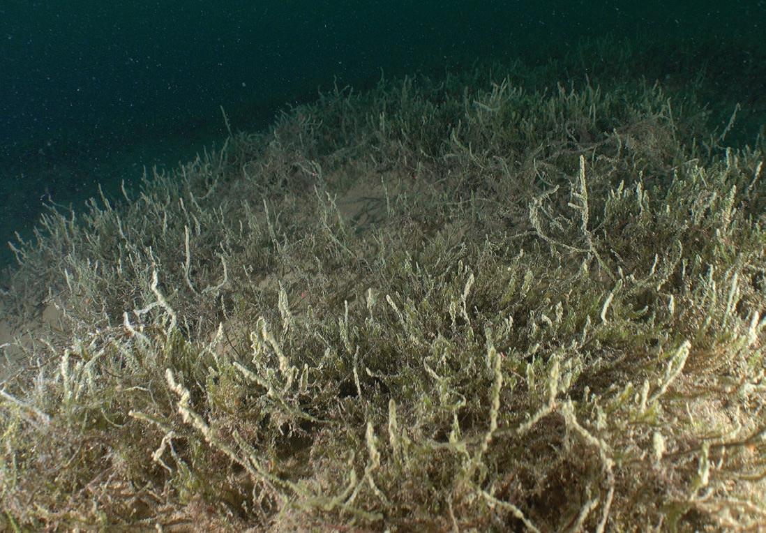
NIWA divers have successfully confirmed the presence of globally rare plant communities deep in Otago’s alpine lakes.
The moss and liverwort species, collectively known as deepwater bryophytes, were first discovered more than thirty years ago, up to 50m deep in lakes Wakatipu and Wānaka.
Bryophytes are normally found in moist terrestrial environments, such as damp forests or shady
rock faces, and the extreme clarity of Otago’s lake waters are thought to be behind the deep aquatic communities.
Otago Regional Council commissioned the research on these sensitive plants to help set monitoring protocols for tracking environmental changes in the lakes.
ROCKY OUTLOOK
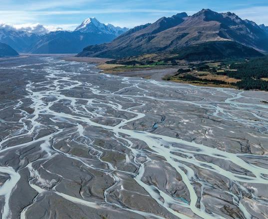
An estimated 13 trillion litres of water have been lost from New Zealand’s glaciers over the last five decades.
Each year, NIWA climate scientists lead an aerial snowline survey which has documented ice cover in key Southern Alps glaciers since the late 1970s.
Seven of New Zealand’s 10 warmest recorded years have occurred in the last decade, and the long-running photographic survey has revealed rapidly accelerating snowline retreat.
In collaboration with colleagues at Otago and Victoria universities, the researchers estimate the volume of water lost through this ongoing glacial melt is equivalent to nearly five decades of basic household water use for the whole country.
LAKE SURVEY
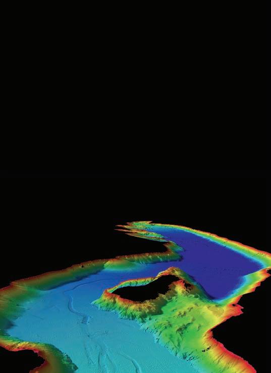
Researchers have mapped the underwater geology of Lake Wānaka to help local communities better understand lake dynamics and prepare for potential future seismic risks.
The NIWA team used a multibeam echosounder to create a detailed 3D model of the lakebed. This revealed complex river flow channels and steep underwater slopes, reflecting the lake’s glacial formation.
The data will be used to analyse ongoing lake sediment and water quality changes, as well as assessing potential seismic hazards.
An active fault runs under Wānaka township and out into the lake. The new models will help understand landslidetriggered tsunami risk.
NEWS BRIEFS
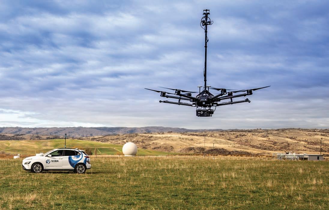
PADDOCK SCALE
NIWA atmospheric scientists have been trialling new ways to quantify methane emissions from sources such as farms, landfills or wastewater plants.
Agricultural methane makes up more than half of New Zealand’s greenhouse gas emissions, and strategies to e ectively reduce emissions depend on accurate measurements to demonstrate methane changes.
The research is testing the capability of drones and vehicle-mounted instruments to measure controlled releases of methane and ethane gases at paddock scale.
The team are working closely with a network of advisory groups to identify suitable study sites.
SNOW MELT
Better forecasts to help predict snowmelt impacts on river flows and alpine hazards are on the way.
Hydrological specialists from NIWA and the University of Otago are working with international snow modelling experts on new, national-scale snowmelt forecast models.
The work has a particular focus on understanding the impact of extreme rain-on-snow events, where winter or spring storms bring intense rainfall in alpine regions.
The research will support hazard managers, and those in the energy, agriculture and tourism sectors, to better respond to changes in snow conditions and river flows.
COLD STORAGE
The waters around Antarctica are probably storing much more carbon than previously thought.
The news follows surprise findings made by NIWA marine ecologists during RV Tangaroa’s voyages to the Ross Sea region in 2021 and 2022.
Antarctic waters were previously considered unsuitable for macroalgae, but remote underwater video footage gathered during the expeditions uncovered extensive seaweed beds along the Antarctic coast, at depths ranging from 40 to 250m.
Macroalgae absorb CO2 as they grow, storing carbon on the seafloor once the seaweed breaks down.
Combining the recent findings with satellite data, the researchers now estimate Antarctic seaweed may contribute up to 3% of global macroalgal carbon uptake.
Dave Allen
Stuart Mackay
Nava Fedae
MUSSEL UP
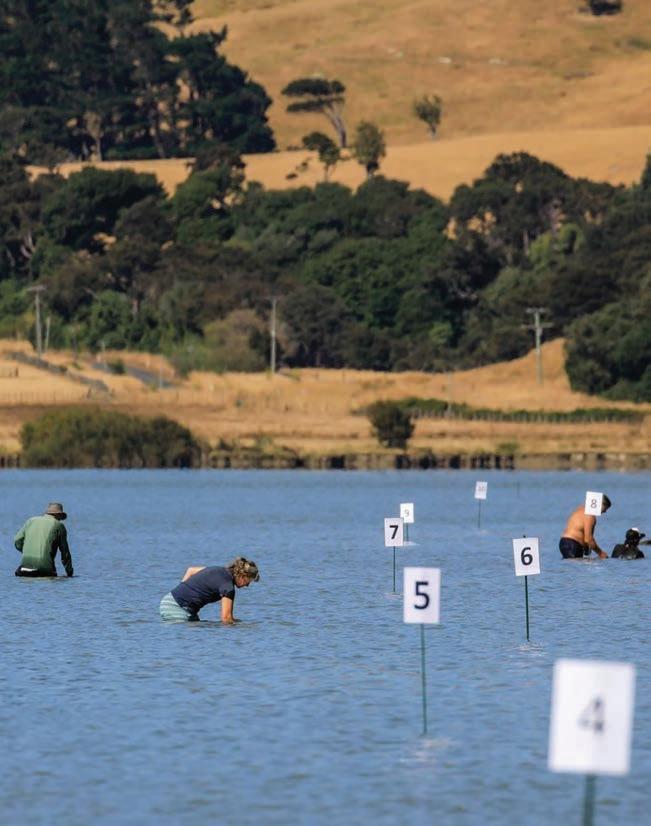
Citizen scientists have marked 10 years recording the health of kākahi/ freshwater mussels in Wairarapa Moana.
As filter feeders, kākahi are sensitive to changes in water quality and sediment levels, and populations are under pressure nationwide from environmental change.
Iwi and local councils work together through the Wairarapa Moana Wetlands project to restore Lakes Wairarapa and Ōnoke, with citizen scientists joining freshwater scientists on the long-term kākahi monitoring programme.
Encouragingly, comparisons since the surveys started in 2015 indicate the population appears to be holding ground.
CLIMATE FORECASTS
New national projections forecasting regional climate scenarios out almost a hundred years will be available later this month.
NIWA climate scientists have worked with the Ministry for the Environment to update existing climate forecasts, which will be publicly accessible through a new interactive mapbased portal.
Researchers used NIWA’s supercomputing facility to downscale data from the latest global climate models and generate a detailed range of local climate scenarios out to 2120.
The results will help communities and authorities better understand regional climate risks and improve decision-making.
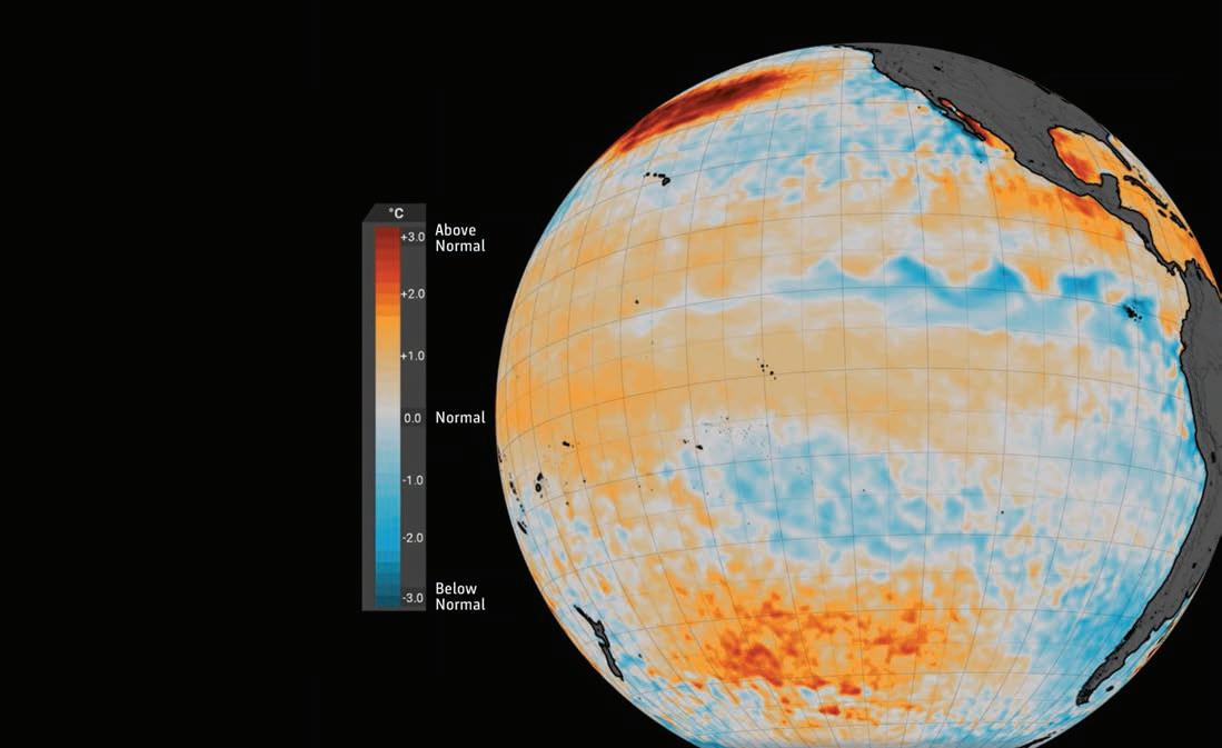
LA NI Ñ A RETURNS?
The La Niña weather system, largely responsible for the wet summers and increasing flood events of recent years, looks set for a comeback.
A sequence of moist, atmospheric rivers sweeping in from the northeast Pacific marked the recent La Niña sequence, unleashing record-breaking floods for Nelson, Canterbury, Auckland, Hawke's Bay and the East Coast.
A swing back to westerly flows and El Niño conditions broke the pattern this summer, but recent months have seen a marked switch back to cooler sea-surface temperatures spreading strongly east of Peru.
NIWA forecasters say this signals the end of El Niño, with La Niña’s northerlies likely to increasingly dominate weather conditions from the coming spring.
STUFF
Supplied
Voyage of deepsea discovery
A hidden treasure trove of biodiversity lies just waiting to be uncovered thousands of metres below the surface of our oceans.
Ryan Willoughby investigates what it takes to discover and accurately describe life at the darkest depths of the sea.
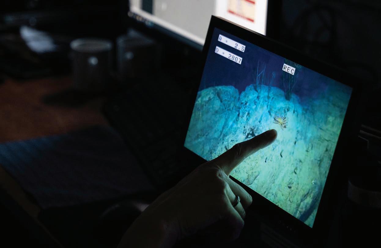
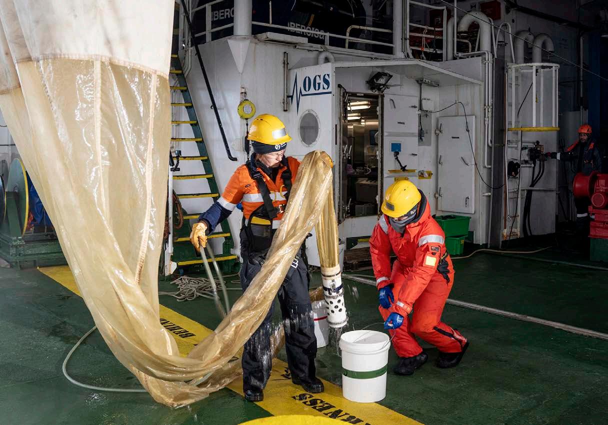
IWA’s research vessel Tangaroa sits quietly o the east coast of the South Island, almost 5km above the largely unexplored seabed of the Bounty Trough. Onboard, a group of scientists huddle around a small monitor, watching the vessel’s Deep Towed Imaging System steadily descend into the ocean darkness.
The research camera platform finally reaches the seafloor, 4,808m below – the deepest it has ever gone.
The room erupts in cheers. As the light adjusts, the scientists are rewarded with images of a whole new world of seafloor creatures and habitats, never seen before.
The scientists are part of the Ocean Census NIWA Bounty Trough Expedition. Ocean Census is a global alliance, launched by Japan’s Nippon Foundation and the United Kingdom’s Nekton organisation. Its goal is to accelerate the discovery and protection of ocean life.
The Bounty Trough expedition is Ocean Census’ first mission in the Southern Hemisphere, and the research team are nearing the end of a highly successful voyage of deepsea discovery.
Over the past three weeks, the 37-strong team of both local and international marine specialists, plus crew, has launched a range of deepwater research equipment from Tangaroa, including cameras, corers, seabed landers and nets.
“The expertise we have been able to pull together on this voyage is unparalleled ”
Sadie Mills
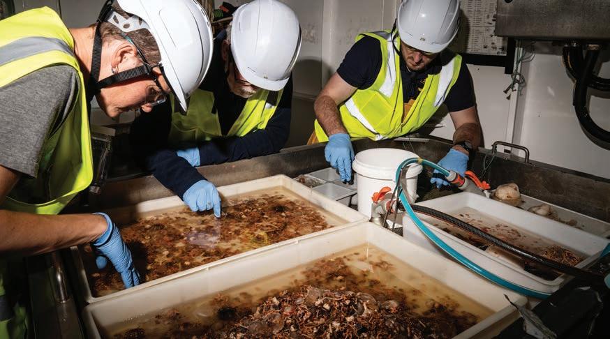
Thousands of new samples recovered from the ocean depths are now sitting in Tangaroa’s storage, awaiting accurate identification in laboratories back on shore.
On their return to Wellington, the team are joined by a second wave of specialists, again both local and international, for a series of taxonomic workshops at NIWA and the Museum of New Zealand Te Papa Tongarewa.
Their shared mission is to sort through the 1,800 samples and to precisely describe the fish, invertebrate and geological specimens collected, so they can be added to the picture of New Zealand’s marine biodiversity.
This highly detailed and specialised work will likely continue for decades, but is vital marine science if New Zealand is to understand the complex web of life that lies at the bottom of our oceans.
Already over 100 new, or potentially new, ocean species have been identified. These range from fish to snails, to corals and sea cucumbers, including some creatures so small they can barely be seen with the naked eye.
New specimens will be physically stored in either the NIWA Invertebrate Collection or Te Papa, and the knowledge gathered will be combined into future editions of NIWA’s New Zealand Marine Biota Biodiversity Memoir.
Rebekah Parsons-King
oyage co-leader NIWA marine biologist Sadie Mills says the deepsea is the largest ecosystem on the planet and we need to make the most of every opportunity to explore it.
She says it is rare to be involved in missions, like the Ocean Census expedition, which are solely focused on biodiversity discovery and identification.
”A voyage is only meaningful if it is also backed up by the identification and taxonomic description work onshore.
“The expertise we have been able to pull together on this voyage is unparalleled, and not just within NIWA, but all the other organisations we’ve been able to work with.
“Discovering new species requires collaboration with partners across the world who lend their expertise. We couldn’t achieve half the things we do without those strong global networks.
It is a sentiment shared by the Ocean Census science director Professor Alex Rogers who describes the
Ocean Census NIWA Bounty Trough Expedition as a truly collaborative mission.
“The partnership with NIWA and Te Papa, along with the crew on Tangaroa, has led to a transformative change in our understanding of this remote part of the ocean and the species that live within it.
“It leaves a fantastic legacy for the people of New Zealand.”
Mills is also excited by what the voyage has achieved, but she cannot resist a strong plea for continuing to nurture the taxonomists who underpin such expeditions around the world.
“Globally we have a major problem. Experienced taxonomists are ageing and want to hand over to the next generation.
“We need the commitment to supporting more voyages like this, and to nurturing the specialists they require, if we are going to grow that generation.”
Researchers carefully pick through samples recovered from the seafloor. Over a 100 new ocean species have so far been identified from the voyage. (Rebekah Parsons-King)
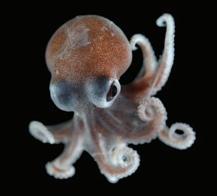
“Small, but perfectly formed.” This 10cm bobtail squid (Sepioloidea virgilioi) was recovered about 1km down on the Bounty Trough seafloor. These tiny creatures bury themselves in the seabed mud, emerging at night to feed. (Rebekah Parsons-King)
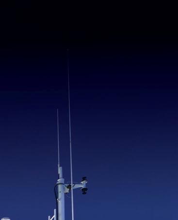
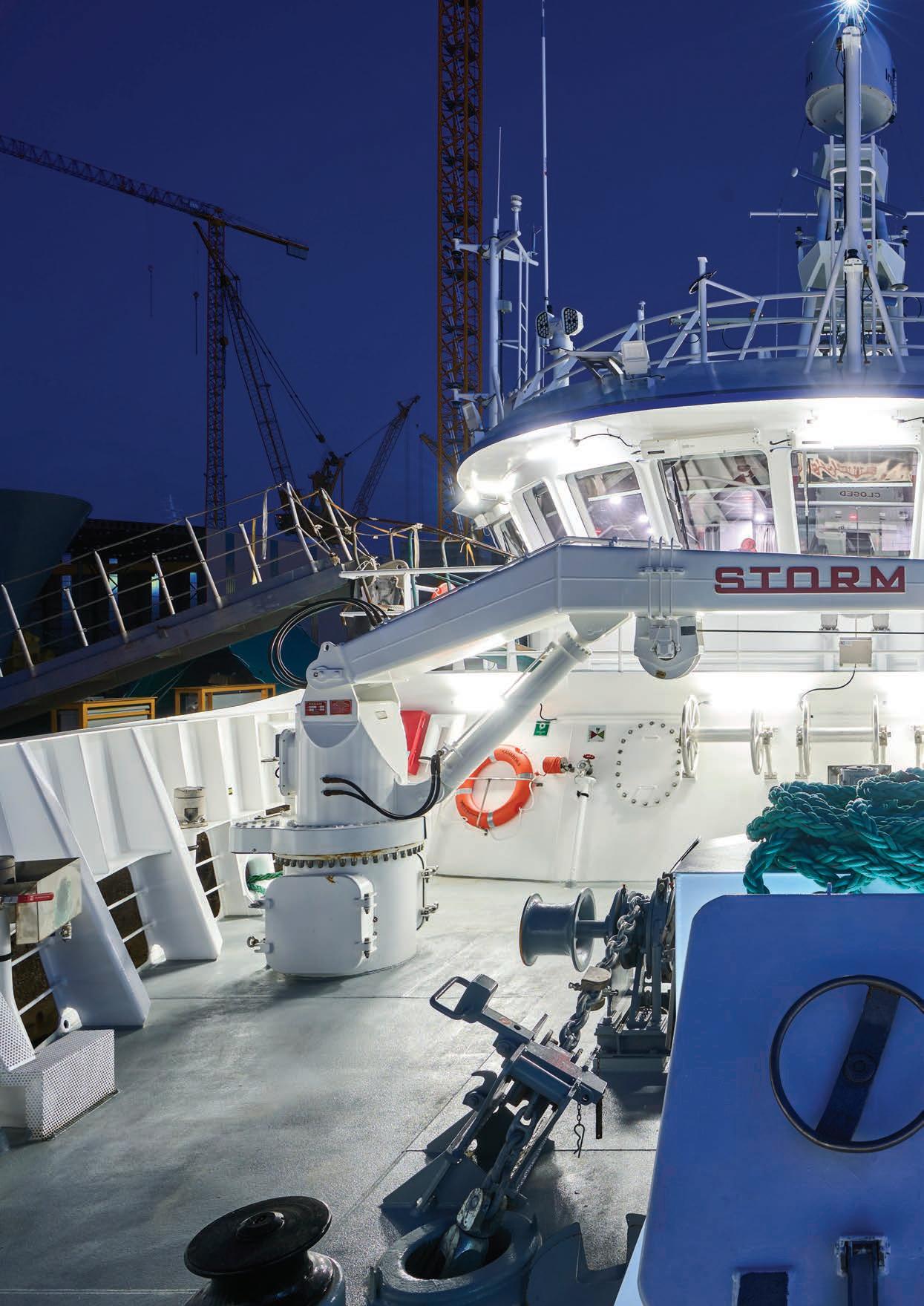
With more powerful cranes and winches and increased deck space, Kaharoa II can deploy a far greater range of sophisticated oceanographic equipment than her predecessor, including tsunami warning buoys and remotecontrolled, deepwater drones. (Armon)
Ready for research
Fresh from a Spanish shipyard and all set for her first full voyage at home, NIWA’s new research vessel Kaharoa II is ready to recharge New Zealand’s marine science capability.
Ryan Willoughby takes a look at the distinctively bluehulled, high-tech research vessel that will significantly extend science on our seas.
“It opens the door to a vast array of new applications and horizons”
Dr Rob Murdoch
ore than 90% of New Zealand’s continental shelf is underwater.
Stretching from the Chatham Rise across to the Challenger Plateau and from the Kermadec Islands down to the Campbell Plateau, it is a vast undersea realm covering more than 4 million square kilometres. Its complex subterranean geology harbours our greatest seismic threats, the temperature of its waters helps shape our changing weather, and its rich biodiversity sustains both our coastlines and our fisheries.
Understanding the opportunity and risks that this vast marine region presents is one of New Zealand science’s greatest challenges.
“Maintaining our ocean-going research capability is essential if New Zealand is going to sustainably manage our marine resources and maintain the health of our marine environment,” explains NIWA’s Deputy Chief Executive, Dr Rob Murdoch.
ue RV Kaharoa II, NIWA’s latest ocean-going scientific research platform, which arrived in Wellinton this month after a three-month voyage from a Spanish shipyard.
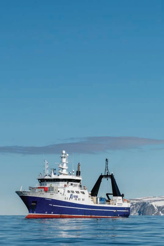
NIWA owns and operates New Zealand’s only purpose-built, coastal and open-ocean, research vessels.
Weighing 2,500 tonnes and 70m long, RV Tangaroa is the largest. Ice-strengthened, Tangaroa can carry 44-person research teams, out across the Pacific and deep into the Southern Ocean, mapping the seabed, collecting fisheries data or recovering ocean samples from thousands of metres below the surface.
A ectionately known as “The Little Ship that Can”, Tangaroa’s smaller sister ship, the 28m RV Kaharoa, is also a veteran of countless research missions. However, at 44 years old, she has now reached the end of a life of science on the high seas.
Two hundred tonnes heavier and eight metres longer, the brand new Kaharoa II is more than capable of taking over Kaharoa’s research duties.
With increased working deck and laboratory space, and kitted out with the latest marine research technology, Kaharoa II can carry more researchers and accomplish more science than its predecessor.
“Kaharoa II substantially advances our research capabilities – it opens the door to a vast array of new applications and horizons,” says Murdoch.
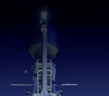
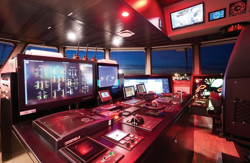
The modern bridge boasts a marked upgrade in operational and research options, such as dynamic positioning capabilities and a 5-channel multibeam echosounder. (Armon)
he new vessel is the result of six years of planning, from stakeholder engagement to detailed design, construction and launch.
NIWA's Manager – Marine Resources, Rob Christie, who’s been directing the project, acknowledges fitting the requirements of the scientists into a 36.1m vessel has been a big challenge.
“We needed to create a new multipurpose vessel under 500 tonnes that can still anticipate future demands of fisheries, oceanography and a variety of maritime commercial operations.”
Marine research technology is constantly evolving and, after talking to both clients and scientists, it fast became clear to Christie that NIWA needed a research platform with similar operating costs to the current vessel, but significantly enhanced capabilities.
“You can’t just order up a research vessel, ready for use. Imagine designing and building a new model of car from scratch – that’s e ectively what we have done.”
The final brief settled on a 500 gross tonne vessel that could accommodate nine scientists, plus six crew, capable of operating at sea for up to 30 days or 6,500 nautical miles.
“It’s been a delicate balance between buoyancy, weight and space whilst maintaining seaworthiness.
The scientific world has been looking on to see how small you can go and still keep a high level of research functionality,” says Christie.
Designed by the respected Norwegian naval architect Skipsteknisk, who also designed Tangaroa, Kaharoa II was built in Vigo, northern Spain, at the Astilleros Armon shipyard.
The close links between New Zealand, Spain and Norway have been instrumental in successfully delivering to the brief, according to Santiago Martin, Managing Director from Armon shipyard.
“By combining everybody’s expertise, we have created a floating laboratory that will advance our knowledge of the oceans and their ecosystems,” he says.
Science facilities have been upgraded, with larger laboratories and significantly increased deck space, and the whole vessel is fully data-networked, with separate science and operational systems.
Advanced acoustic technology for fisheries and deepwater seafloor surveys has also been installed, along with dynamic positioning capability and a roll tank to soften vessel motion.
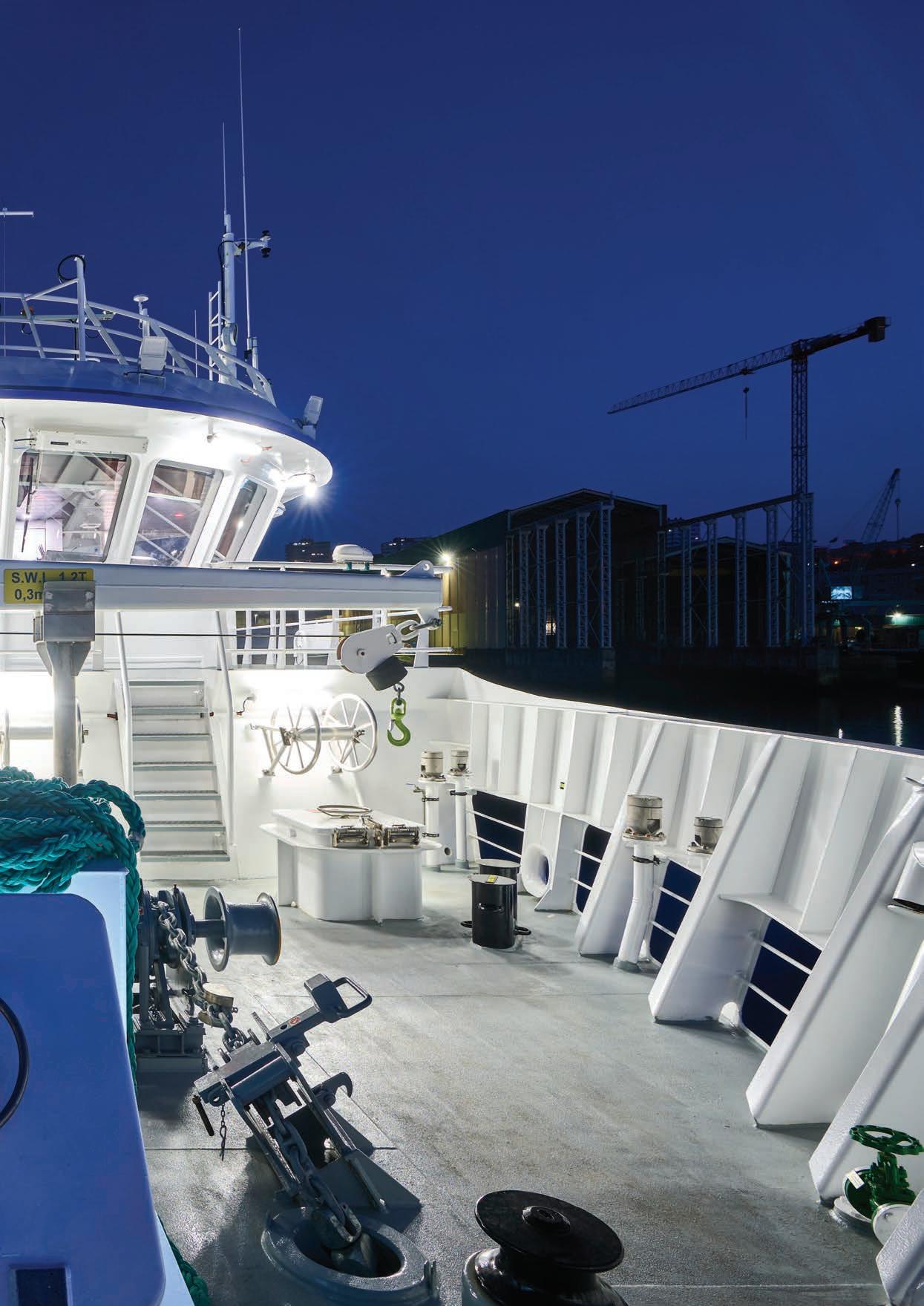
Designed by Norwegian naval architects and built in Spain, Kaharoa II can carry more scientists, using a greater range of research equipment, on more expansive expeditions. (Armon)
Ready for research
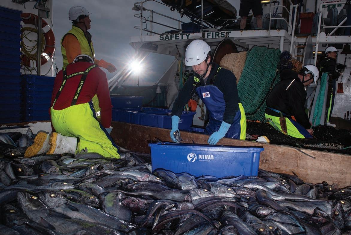
Fisheries scientists gather freshly landed hoki for detailed examination in Kaharoa’s wetlab. The new vessel’s expanded facilities will enable researchers to more e ciently analyse fish stocks at sea. (Rebekah Parsons-King)
NIWA Ship Technical Director, Greg Foothead, who helped supervise construction, says the crew on the maiden journey back to Wellington have been blown away by the sea-going capabilities and comfort of the new vessel.
“Being at sea for a 30-day stretch is hard, so getting the living and working areas right is important for crew and scientists alike,” says Foothead.
omfort is important, but Kaharoa II’s primary benefit will be the sophisticated new technology and advanced capabilities she brings to marine science.
Whether it is physics, chemistry, biology, geology or climate research – she will boost the marine research needed to support a whole range of sectors and challenges.
Science, for example, is fundamental to the sustainable management of New Zealand’s $1.8 billion fishing industry, and Kaharoa II will likely spend an average of 130 days a year at sea on fisheries research voyages.
Much of this work centres on the long-running surveys monitoring the abundance and distribution of New Zealand’s most valuable fisheries, such as hoki, snapper and scampi.
Constructed to Silent DNV Acoustic and Fisheries classifications, Kaharoa II boasts a five-channel Kongsberg echosounder which will significantly boost acoustic research capabilities.
She also carries a larger wetlab and an additional fish measuring station, enabling more scientists working at sea to analyse more fish.
Stretching back more than 40 years, NIWA’s fish abundance surveys play a key role in helping Fisheries New Zealand set the commercial quotas required to ensure sustainable fisheries.
“Kaharoa II will not only allow us to continue Fisheries New Zealand research surveys, but we’ll be able to do more with the increased capability, including the new fibre-optic camera cable and multifrequency acoustic sounder equipment,” says Chief Scientist – Fisheries, Dr Richard O’Driscoll.
The new vessel's first mission will be to head north to collect underwater imagery of seafloor biodiversity, habitats and fish in the Hauraki Gulf. This project, which revolves around the images captured by a new multi-camera video system, is only possible due to Kaharoa II’s additional capabilities.
“Kaharoa II will deliver critical science inputs into our fisheries science and management processes,”
Hoki Seabed
says Fisheries New Zealand’s Director Science & Information, Simon Lawrence.
large range of other research programmes around New Zealand’s coast and out into the wider Pacific are also set to benefit from the arrival of Kaharoa II
“Our vessels work as platforms for our science. With a broader range of inbuilt capacity and more flexible layout, Kaharoa II will transform what we are able to do,” says Chief Scientist – Oceans, Dr Mike Williams.
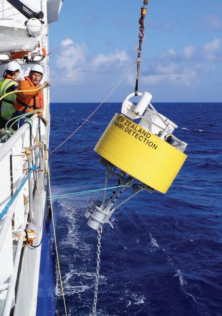
Take tsunami detection. Capable of carrying and managing larger loads and voyaging further than its predecessor, Kaharoa II will play a significant role in maintaining New Zealand’s deep ocean tsunami detection network.
Starting in the waters above the Hikurangi Trough o the east coast of New Zealand and running on into the Kermadec Trench and New Caledonia, 12 fourth-generation tsunami detection buoys underpin the multi-agency network that gives New Zealand and other Pacific nations early warning of possible tsunami.
“Kaharoa II will transform what we are able to do”
Dr
Mike Williams
Able to both deploy and recover these 4,000kg ocean monitoring sensors, Kaharoa II will soon be working on the maintenance programme for the 24/7 emergency monitoring network.
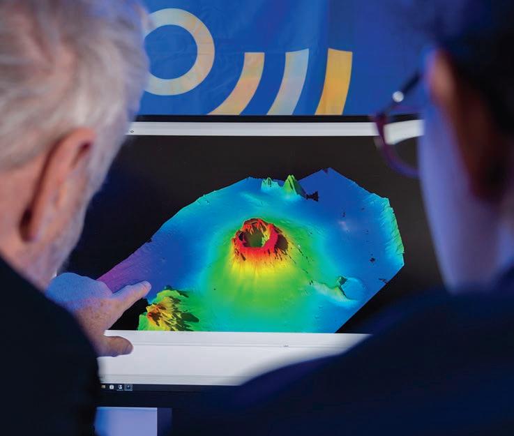
The improved Kongsberg multibeam echosounder unit will also boost mapping of the underwater geology of New Zealand and the wider Pacific region.
A major beneficiary will be the Seabed 2030 Project, an ambitious international e ort to map the ocean's seafloor within the next six years.
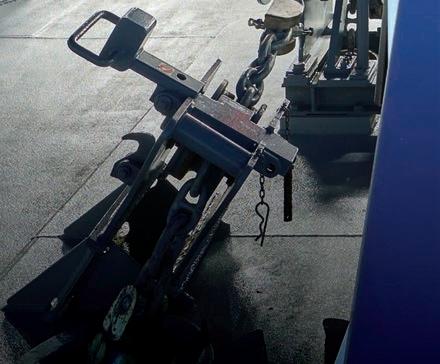
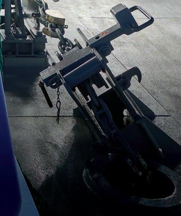
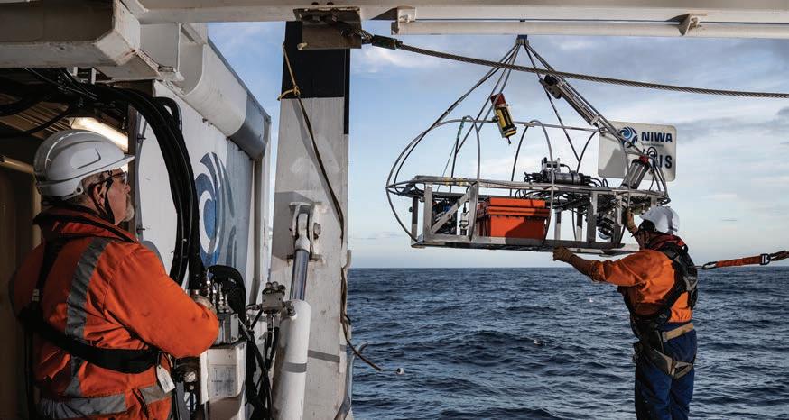
The vessel is fitted with a 10-tonne A-frame and supporting starboard 5-tonne T-frame, enabling research teams to deploy a much wider range of equipment, from high-tech submersibles to remotely operated underwater vessels, deep ocean landers and seabed samplers.
These extended operating capabilities mean Kaharoa II can independently load and o oad scientific equipment or supplies in isolated Pacific Island destinations. This significantly broadens the range of roles and support NIWA can o er Pacific programmes.
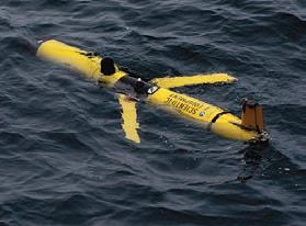
glider
remote underwater research drone used to gather oceanographic data over extended periods. (Rebekah Parsons-King)
Kaharoa II will be able to deploy open-ocean tsunami warning buoys and provide more detailed bathymetric data from the seafloor. (Sarah Searson, Rebekah Parsons-King)
The Slocum
– a
The existing camera platform can capture live underwater imagery up to 4km below the surface. The new vessel can deploy an even more sophisticated multi-camera system.
(Rebekah Parsons-King)
Ready for research
“Ongoing access to such a marine research vessel is essential to deliver national research priorities and support our Pacific neighbours,” says Williams.
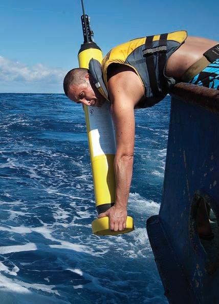
The name Kaharoa is indelibly linked with the global Argo ocean monitoring initiative (see below) and Kaharoa II has already begun work deploying Argo floats to extend this important international datagathering network.
Another significant change is the ability to carry bigger research teams on the new vessel. This will enable scientists to operate day and night shifts, working 24/7 to deliver much more targeted and e cient research e ort during their time at sea.
Marine ecologist Dr Mark Morrison, who has spent
Gathering key ocean data
Argo is a global, ocean monitoring initiative deploying remote sensing floats to measure temperature and salinity throughout the world’s oceans.
Once deployed, the floats drift with ocean currents, sinking to 2,000m and then recording key oceanographic data from the water column as they rise back to the surface. These readings are transmitted to researchers via satellite, before the floats sink back down, repeating their 10-day cycle for up to 7 years.
The floats operate from the Arctic Ocean to the Ross Sea and the information gathered has played a key role in understanding ocean currents, temperatures and processes, as well determining the role oceans play in our weather and changing climate.
NIWA’s Kaharoa has crossed the Pacific and the Indian Oceans, deploying more than 2,220 Argo floats since 2001. It has deployed about one-third of the globe’s active Argo floats – far more than any other research vessel worldwide. Kaharoa II has already picked up the Argo baton. On the maiden voyage back to Wellington, the crew have deployed 64 new floats in the Atlantic Ocean, and a further 88 in the Pacific. NIWA-deployed floats have now reached every ocean except the Arctic.
many days aboard its predecessor, is looking forward to getting aboard Kaharoa II
“It will take a bit of time, adjusting to the new gear and working out how to deploy various equipment, to best take advantage of what it has to o er. But it is exciting times to be doing vessel-based research.
“There are survey trips that extend around New Zealand now booked up back-to-back, and the list of people wanting to get onboard is a nautical mile long.”
With its additional research capacity and extended range, it’s clear the distinctive blue hull of Kaharoa II is destined to become a familiar sight around the waters of New Zealand, and much further afield, in the years to come.
“Kaharoa II substantially advances our research capabilities”
Dr
Rob Murdoch
Armon
Water therapy
Caroline Beamish catches up with a freshwater ecologist who dives deep into her work.
uillwort, egeria and hornwort might sound unfamiliar to most, but Mary de Winton can identify each of these aquatic plants – and about 150 others – just by looking at them.
It’s a skill she’s mastered over four decades, working as a freshwater ecologist and scientific diver. In that time, she’s completed an incredible 3,000 dives.
“I find diving quite therapeutic. You get in your Zen space. You’re weightless, you’re floating; observing and running through questions in your mind about what you’re seeing and how you’re recording it.”
Diving has been integral to de Winton’s career. She currently manages NIWA’s Hamilton-based Aquatic Plant Group, a team specialising in freshwater plant ecology, survey and management.
The team is heavily involved in freshwater biosecurity, running long-term monitoring programmes and providing guidance and solutions on aquatic weed management for the likes of councils and hydrogeneration companies.
de Winton in
(Aleki Taumoepeau)
This early interest morphed into a BSc in animal physiology and behaviour from the University of Waikato and, soon after, a role with the Ruakura Agricultural Centre’s aquatic plant group.
“I was initially more interested in animals at the time, but was super fortunate to have my MSc funded by the Ministry for Agriculture and Fisheries, focusing on aquatic weeds – that was my cross over to the ‘green side’!”
She’s been splashing around in freshwater ever since and is now widely recognised as a leading expert in aquatic plants.
Invasive weeds are a huge problem in our freshwater systems. These alien species degrade water quality, outcompete native species and disrupt hydroelectric power schemes.
“They’re the ultimate space invaders, growing taller and denser than anything else and just taking over.”
Since the early 2000s, the team have used a monitoring technique developed by NIWA called LakeSPI (Submerged Plant Indicators) to measure two major influences on lake ecology: increased sediments and nutrients, and the impact of invasive weeds on the lake’s native vegetation.
Divers head beneath the surface with clipboards and waterproof paper to survey the plants growing from the lake edge down to the lake floor.
“It tells us about the ecological condition of our lakes from the point of view of plants, because plants reflect their environment.
“When you’ve worked in the field as long as I have, you see the deterioration first hand, particularly when you’re going to places again and again.”
“We’re constantly looking at how can we develop the next tool – how can we develop better ways of detecting weeds earlier and thinking of new, innovative ways to control weeds and othe aquatic pests.”
A lot of her time is spent out in the field, often submerged in New Zealand’s network of waterways and lakes.
Growing up in Hamilton, de Winton showed an early curiosity with the natural world.
“I’m sure my mother would be able to tell stories about me out in the trough with the ducklings and the frogs,” she laughs.
And it’s not just about eradicating invasive species, the team are also finding ways to restore native plants.
“If you’re controlling the aquatic weeds, you’re helping the natives to come back. So, we’re always thinking about how to make the habitat better for them and speed up their recovery in degraded lakes.”
Mary
her “Zen space” on LakeSPI duties, distinguishing freshwater native plants from invasive exotic weeds.
“If you are controlling the aquatic weeds, you are helping the natives come back”
Mary de Winton
She’s still diving, but these days she’s starting to ease back from the fieldwork and turning her attention more to training and sharing her extensive knowledge with the next generation of scientific divers and aquatic plant specialists.
“I’ve got a really good team at various stages of learning, some quite experienced and some learning the ropes, so now it’s all about passing on that information.”
It also gives her more time to work with her favourite plant group, the charophytes.
“They’re algae, but they look like plants. I just find them fascinating. There are about 22 species found
in New Zealand and they can be di cult to tell apart. I’m trying to work out better ways of identifying which ones are which.”
De Winton has dived in over 200 lakes throughout the country. Asked which is her favourite, a question she’s had countless times, she says it changes continually.
“You go to another water body and have a really nice experience and suddenly that’s your new favourite.
“But I do love Wānaka, the scenery is just amazing. The water is always clear, it’s a stunning spot to work.
“You get there and think, oh, this is just another day in the o ce.”
At work in the shallows of Southland’s Waituna Lagoon, Mary de Winton samples underwater vegetation using patch dynamics principles and a modified garden hoe. (Susie Elcock)
On a mission
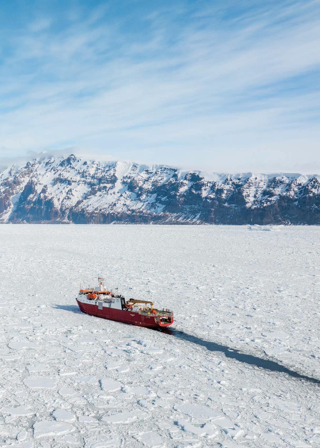
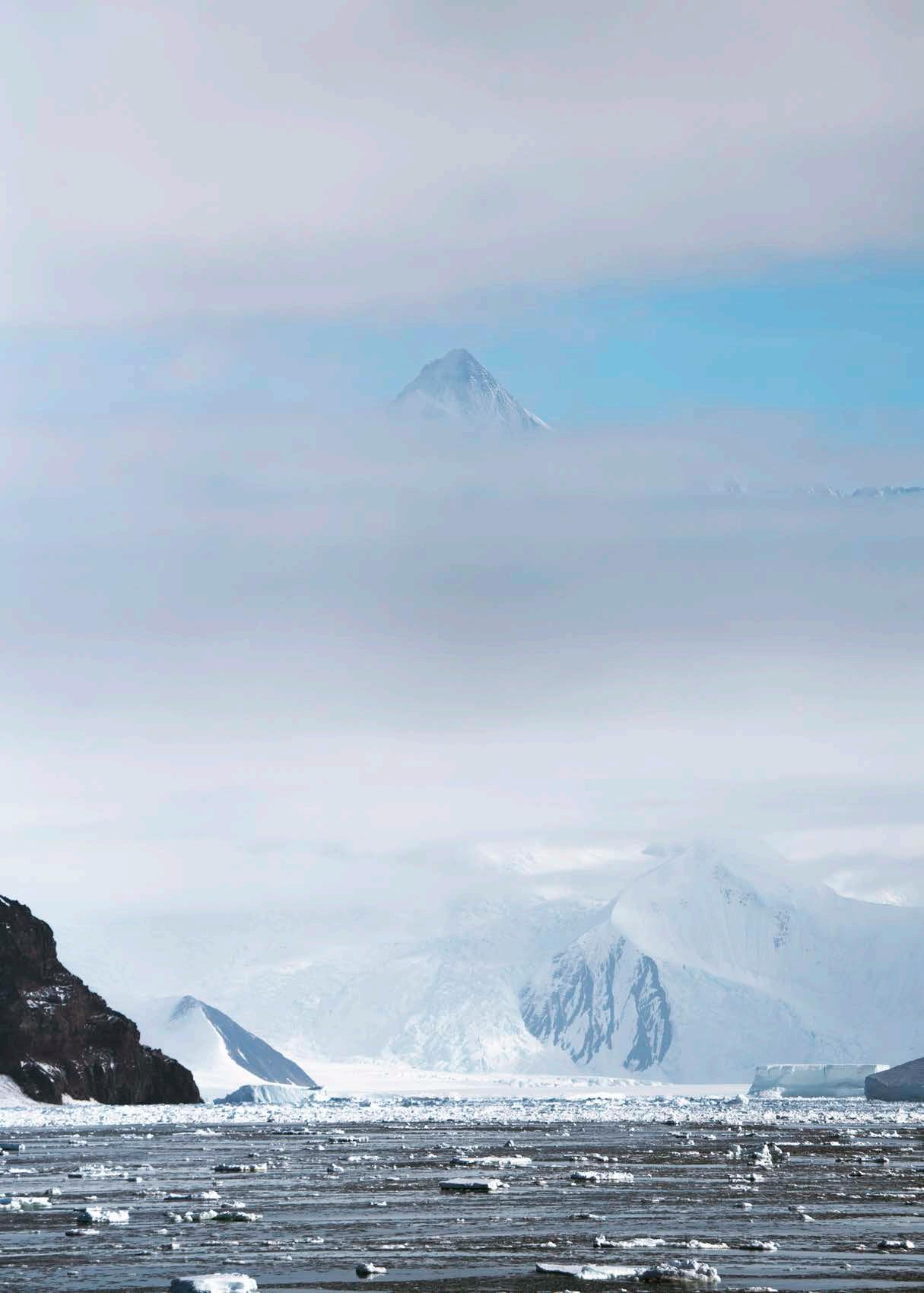
The Italian research icebreaker, Laura Bassi, cuts steadily across Robertson Bay heading for the open waters of the Ross Sea and the Ross Ice Shelf beyond.
The shelf, more than 600km long and up to 1.2km thick, is the largest floating body of ice in the world. It plays a key role in stabilising the Antarctic ice sheet.
However, rapid changes are afoot, with NASA measuring record low Antarctic sea ice last year.
Funded by the Antarctic Science Platform, New Zealand scientists joined their Italian counterparts in a multi-disciplinary mission to help understand Antarctic changes.
Scientists battled intense cold, harsh winds and giant icebergs to gather key oceanographic and biological data from the waters along the edge of the Ross Ice Shelf.
New Zealand voyage leader, NIWA marine physicist Dr Craig Stevens says climate change brings a growing sense of urgency to Antarctic science.
“We can see so much from space, but we can’t see beneath the ice or under the surface of the ocean.“
“To understand what is happening, you have to come and make some measurements.”
The photographs on this and the following pages were taken by NIWA's video content producer, Lana Young, who accompanied the voyage.
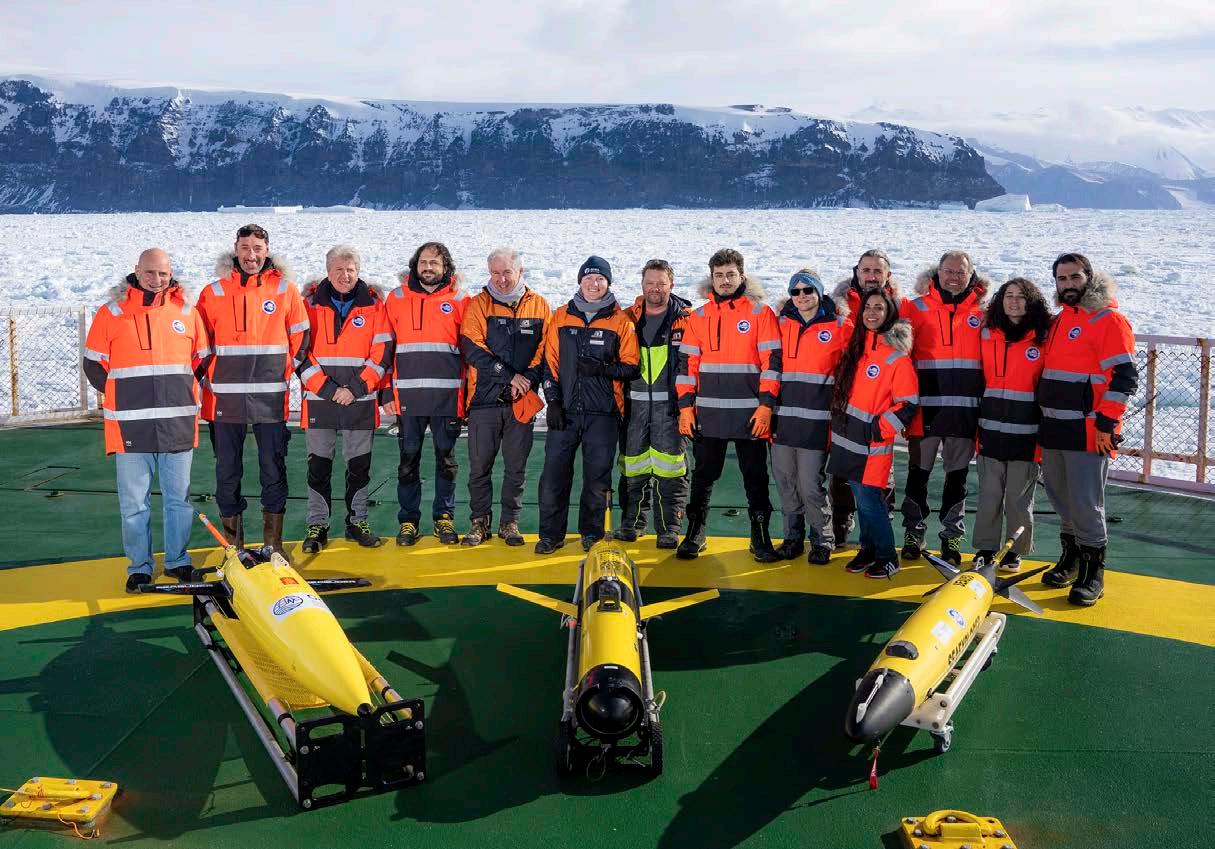
Italian and New Zealand researchers with the three remote ocean drones they deployed along the edge of the Ross Ice Shelf. The gliders descend to depths of up to 1km, gathering key data on deep currents circulating near the ice shelf.
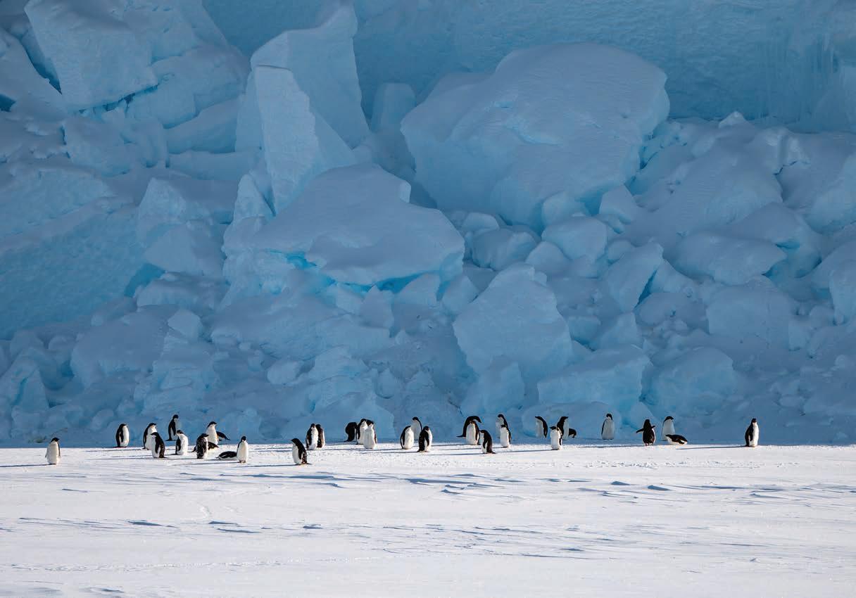
A group of Adélie penguins are dwarfed by giant ice blocks in the Bay of Whales. The bay marks the southernmost point for ships in Antarctica and was the launch site for Amundsen’s successful expedition to the South Pole.
The imposing 3,335m peak of Mt Herschel rises above the clouds guarding Robertson Bay. The Laura Bassi cautiously worked her way in close to retrieve ocean moorings recording seabed currents and water conditions.
NIWA videographer Lana Young watches nervously from the helideck directly below as her drone batteries rapidly fade in the chilly Antarctic air. Lana had minutes to capture this image of the Laura Bassi wedged in by sea ice as researchers attempt to recover a seabed mooring.
Warm gloves are essential on the open deck as marine physicist Dr Craig
and PhD student Liv Cornelissen grapple with the release mechanism for an acoustic mooring.
Stewart
Dr Craig Stewart sends NIWA’s remote ocean glider Manaia off on another mission to probe water and current conditions along the eastern end of the Ross Ice Shelf.
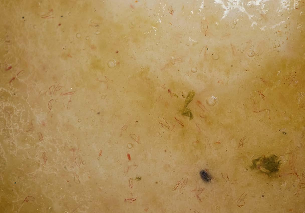
A rich haul of Ross Sea phyto and zooplankton –including distinctive pink krill. The fast reproductive cycles of zooplankton are ideal for researchers studying changes in marine environment.
Zooplankton Ecologist Dr Svenja Halfter and PhD student Georgia Pollard retrieve Ross Sea plankton from the cod end of a small-meshed bongo net.
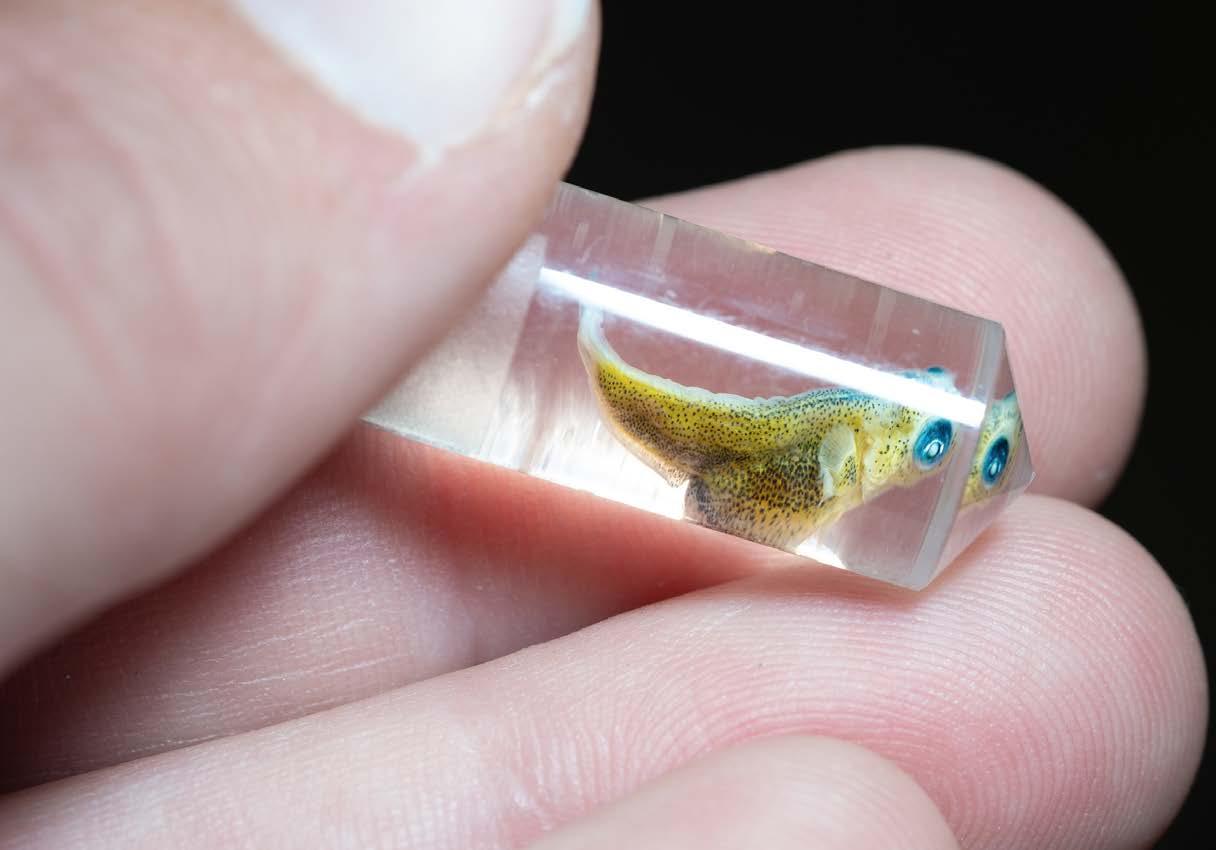
A minute, unidentified fish larva found in one of the bongo trawl nets. Destined for genetic examination, the specimen will be added to the database of Ross Sea life.
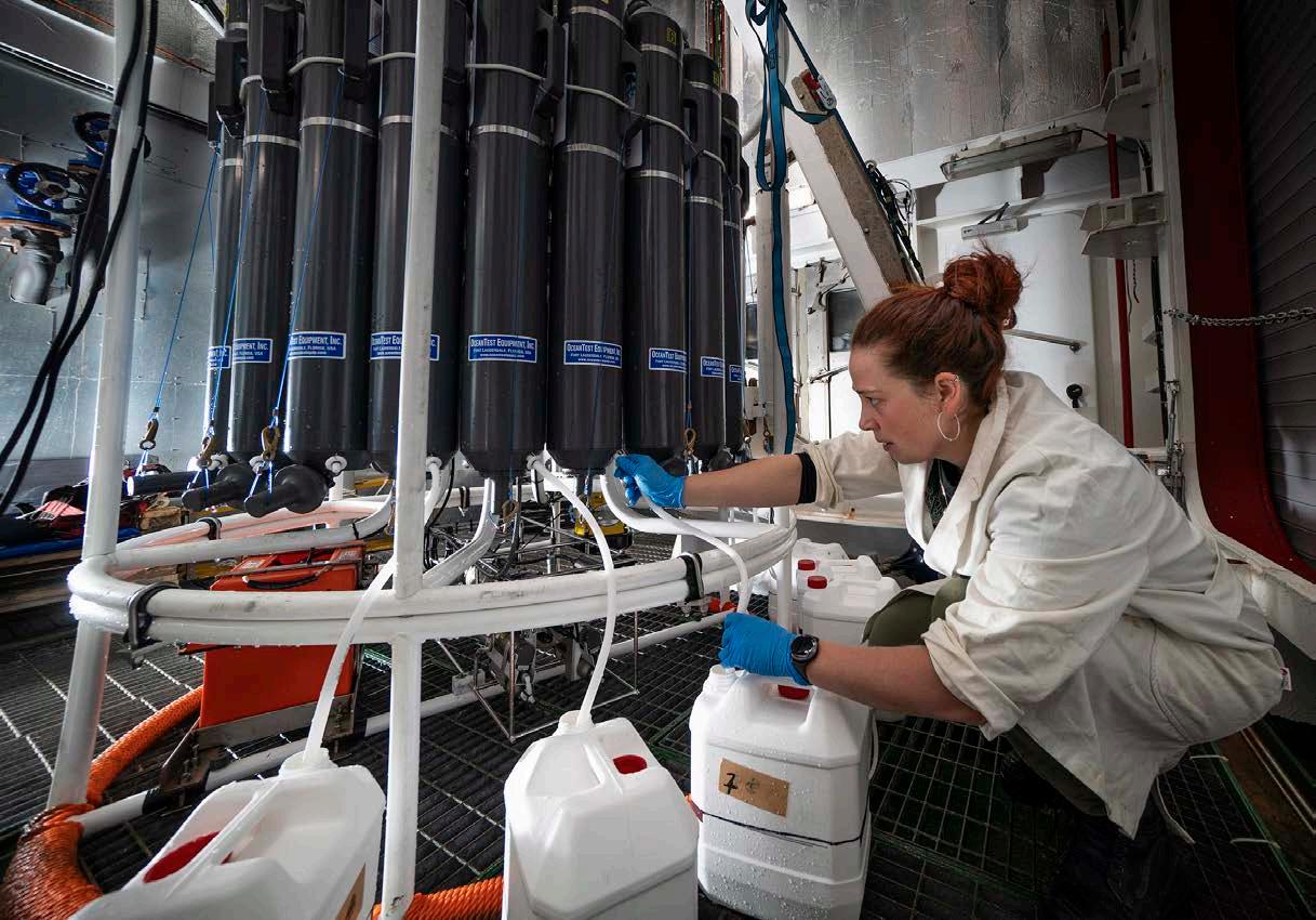
water samples captured at a range of depths by the CTD. In the onboard lab,
analyses the samples for eDNA signatures to identify fish species and location.
Fisheries scientist Dr Alina Madita Wieczorek carefully retrieves
Alina
Lift off for MethaneSAT
New Zealand has joined an international satellite mission focused on fighting climate change from space. Stacy Mohan reports.
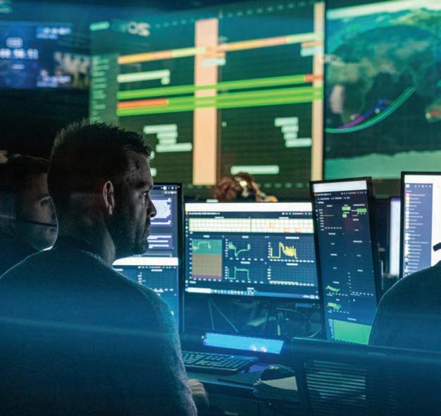
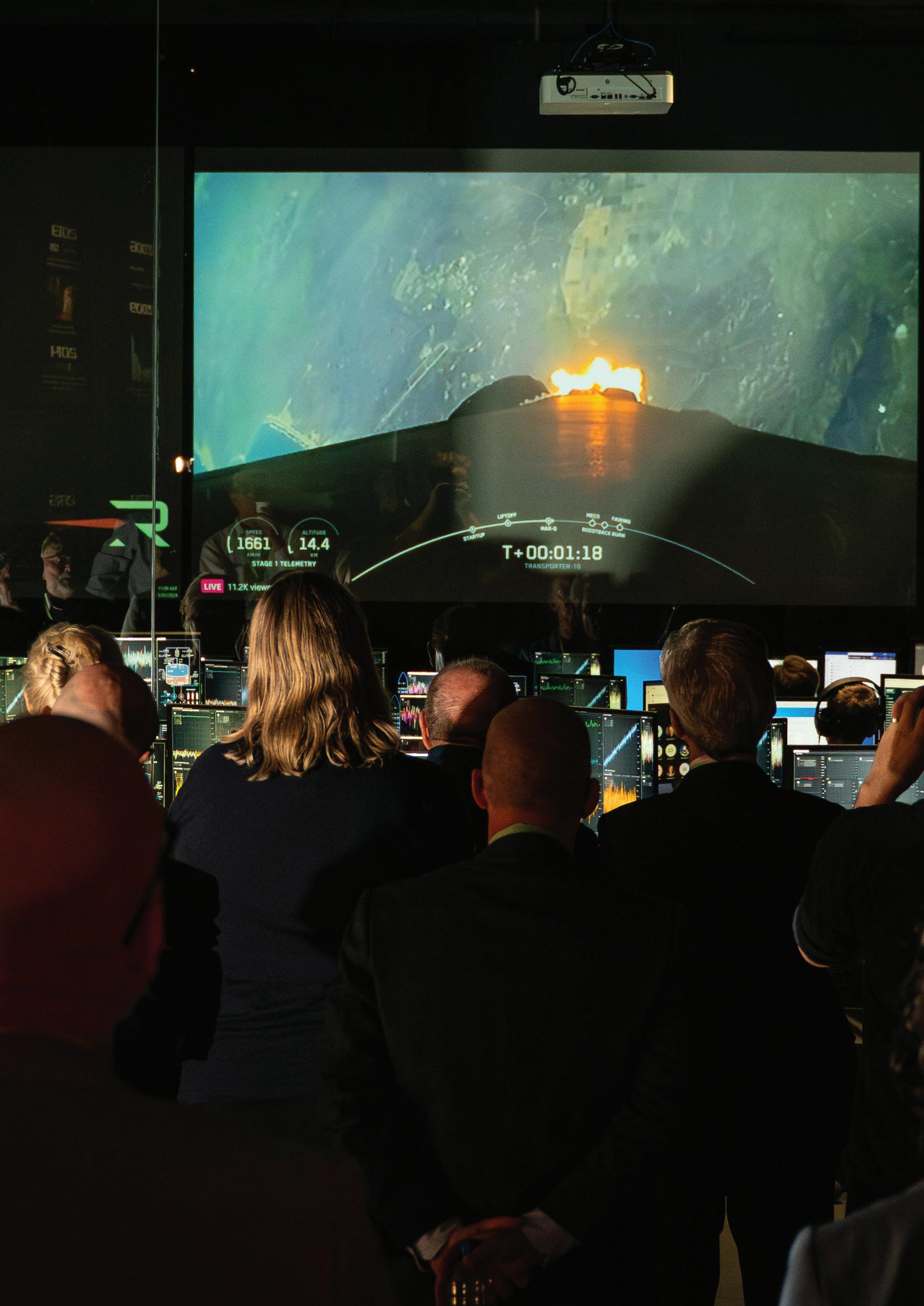
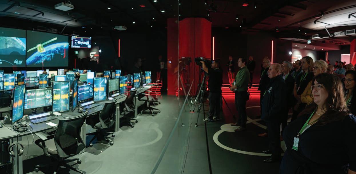
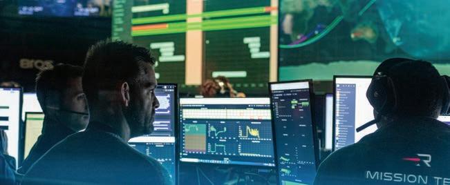
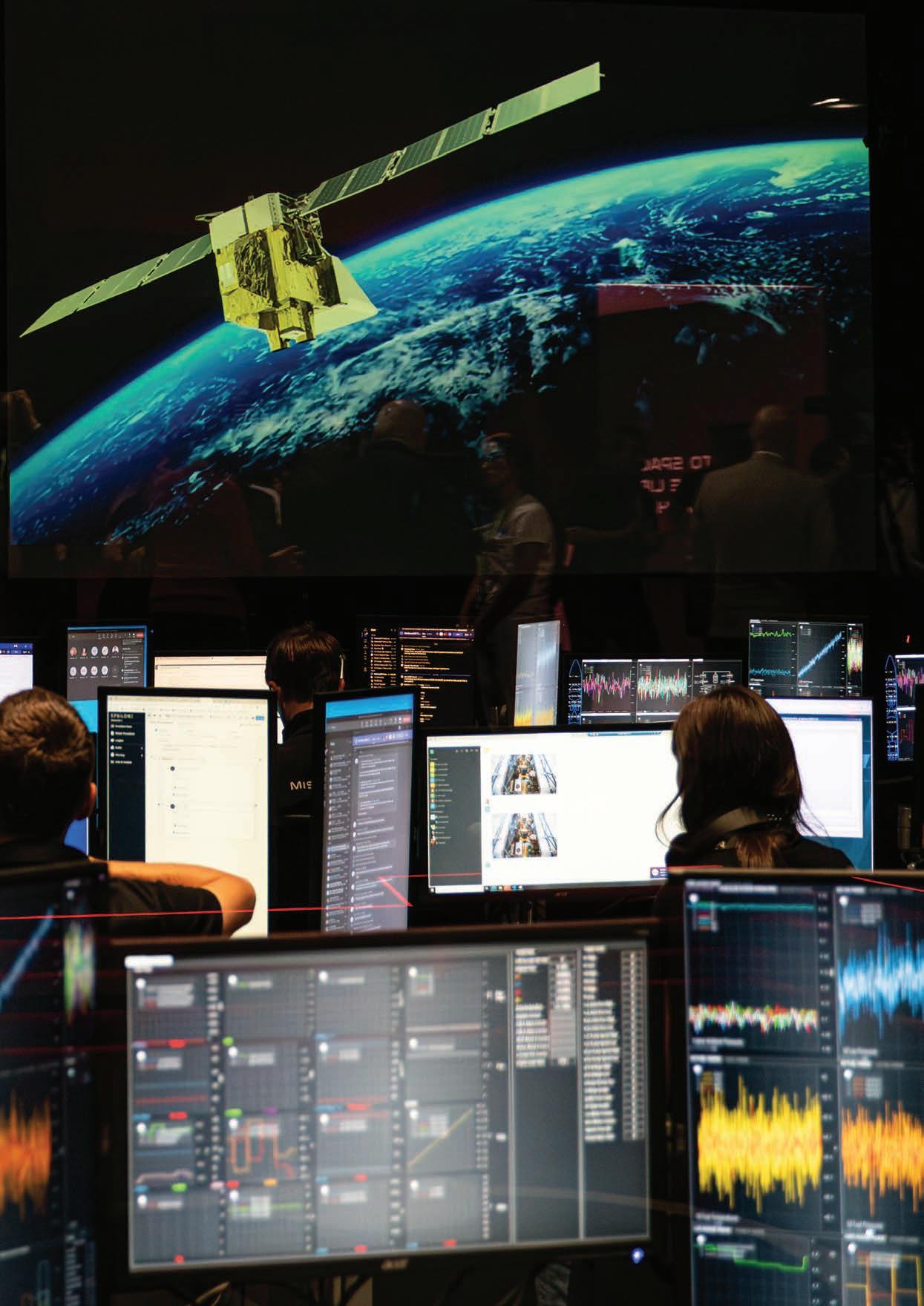
The leaders of New Zealand’s space industry gather in Rocket Lab's mission control centre in Auckland to watch the launch of MethaneSAT, New Zealand’s first public space mission. (Stuart Mackay)
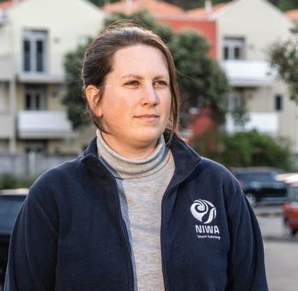
NIWA’s Dr Sara Mikalo -Fletcher (far right) leads the agricultural emissions programme for the global methane tracking project. (Stuart Mackay)
r Sara Mikalo -Fletcher is all concentration.
“It's basically the closest I could ever possibly get to my actual dream job”
Dr Sara MikaloFletcher
She is standing in Rocket Lab’s Penrose mission control centre, watching the final countdown for the launch of a 70m-tall Falcon 9 rocket from California’s Vandenburg Space Force Base.
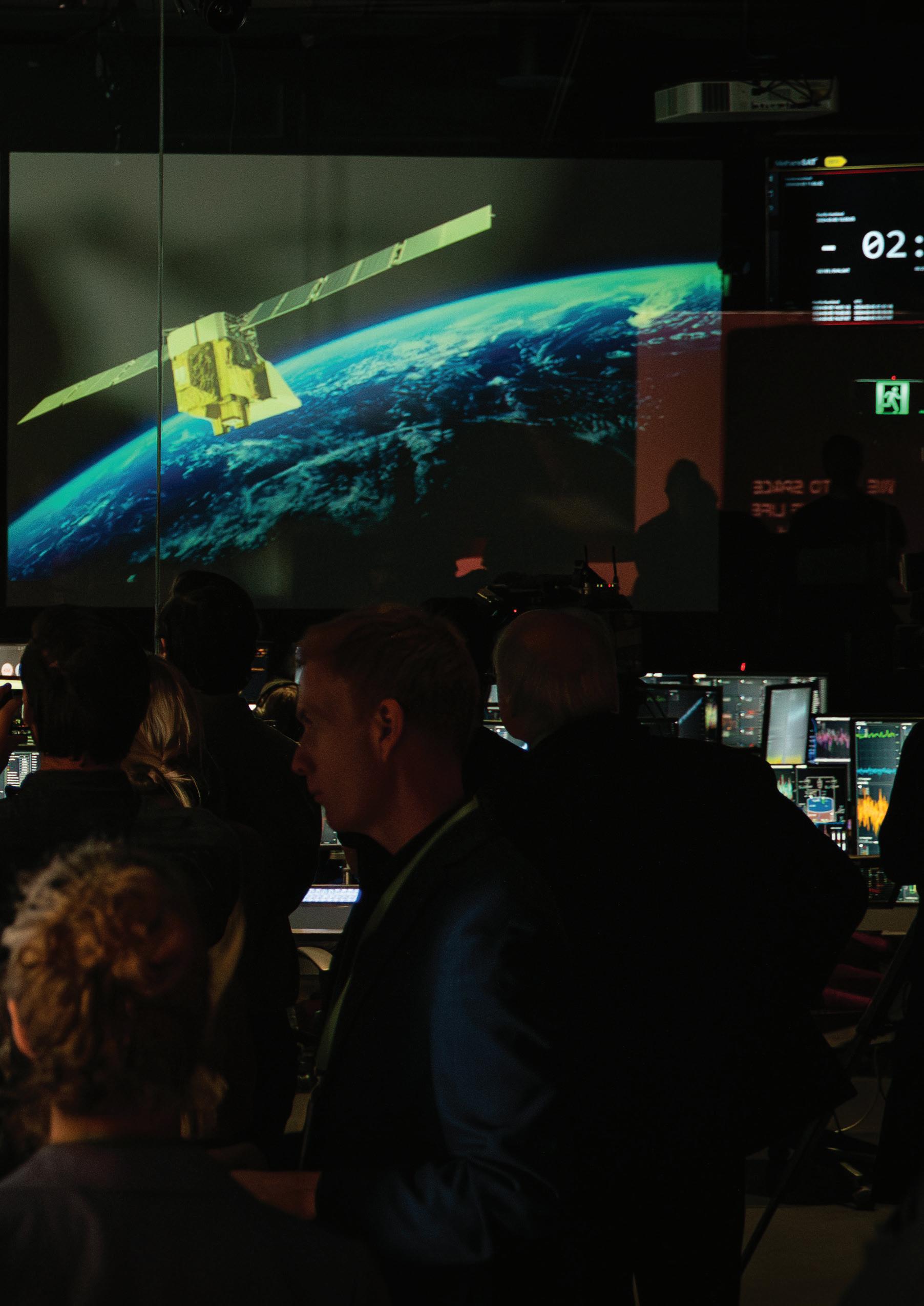
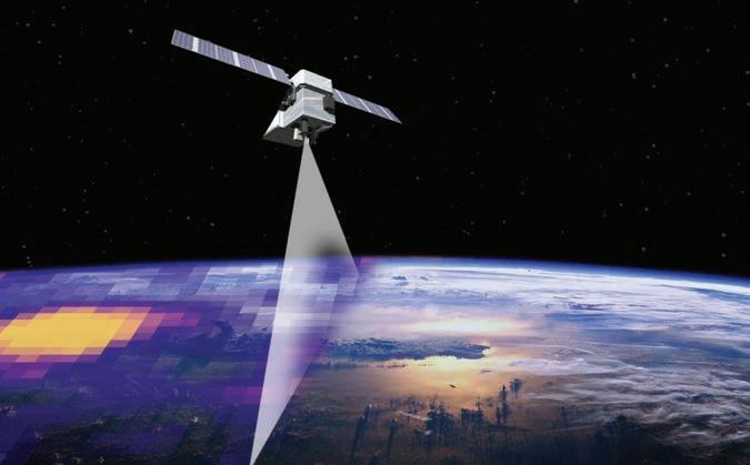
If the launch goes to plan, in little over an hour the second stage of Falcon 9 will release MethaneSAT – a state-of-the-art methane (CH4) sensing satellite – on a five-year mission, orbiting 600km above the Earth, 15 times a day.
The launch marks a key milestone in MikaloFletcher’s professional commitment to explore new ways of accurately measuring global greenhouse gas emissions to curb climate change.
She has always been fascinated by space and revels in her current role as leader of MethaneSAT’s agricultural science programme.
“It’s basically the closest I could ever possibly get to my actual dream job – Chief Science O cer aboard the Starship Enterprise.”
Fighting climate change from space
The United States-New Zealand MethaneSAT mission is a $140 million programme targeted at detecting, with unprecedented accuracy, global methane emissions from space.
Methane is the second most abundant man-made greenhouse gas after carbon dioxide (CO2). While it has a much shorter atmospheric lifespan than carbon dioxide, methane is considerably more destructive. One molecule of methane warms the Earth as much as 86 molecules of CO2.
Methane concentrations have also more than doubled in the past 200 years, and cutting methane emissions is seen as one of the fastest ways to take action to curb global warming.
Led by the American non-profit advocacy organisation, the Environmental Defense Fund (EDF), MethaneSAT’s mission is to fight climate change by leading the campaign to detect and reduce global methane emissions.
The EDF’s primary target is highlighting the methane released through leaks and production faults in oil and gas facilities around the world. The industry is estimated to emit 80 million tonnes of methane every year, and MethaneSAT will use a high-performance methane-sensing spectrometer to accurately pinpoint and quantify those leaking facilities with each sweep over the Earth.
The EDF is committed to regularly publishing the data on the location and scale of the methane leaks, and working with individual companies and nation states to shut o these unnecessary and damaging emissions.
Unravelling agricultural emissions
While the MethaneSAT programme is initially focused on the oil and gas industry, the satellite will also give fresh insights into agricultural methane emissions across the globe.
Methane produced by burping livestock, or released from flooded rice paddies, is estimated at 140 million tonnes a year – almost double that produced by oil and gas facility leaks.
MethaneSAT’s high-resolution methane sensors are also capable of picking up the more di use air column signals from these dispersed agricultural emissions, and this is where the New Zealand Government, and Dr Sara Mikalo -Fletcher, join the mission.
The New Zealand Space Agency is investing $30 million in the programme. This funding supports the Auckland space technicians who are responsible for operational control of the satellite during its fiveyear journey, as well as the New Zealand researchers leading the programme to analyse MethaneSAT’s agricultural emissions data.
This two-pronged approach will spearhead international e orts to research primary industry methane production worldwide.
“Due to its high precision and spatial resolution, MethaneSAT is the first satellite that’s well suited to quantifying di use agricultural emissions,” MikaloFletcher says.
The satellite can map methane over 200 by 200 kilometre regions, and is able to detect as few as two parts of methane per billion parts of air, when averaged over a 1km spatial resolution.
These numbers might mean little to the uninitiated, but Mikalo -Fletcher points out that while it is orbiting Earth at about 450km a minute, MethaneSAT is still capable of capturing the same level of accuracy as instruments taking measurements from a fixed location on the ground.
“That is an extraordinary degree of precision to get from a space-based instrument.”
The perfect natural laboratory
New Zealand is particularly well suited to leading the world in working out how to track and analyse global agricultural emissions.
The greenhouse gas footprint of most developed countries is dominated by C02. But methane –primarily produced by burping cattle and sheep – is New Zealand’s biggest source of greenhouse gases.
“Because we’re a country that feeds a lot of the world, about 85% of all of our methane emissions are just from agriculture. We’ve got a nice, clear methane signal that the satellite can see,” says MikaloFletcher.
In addition, New Zealand has a long history of worldclass measurements and modelling for methane and other greenhouse gases.
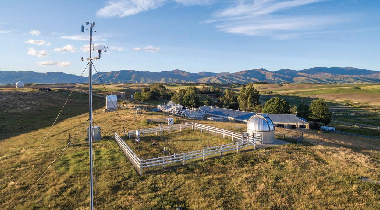
NIWA’s atmospheric observing site at Lauder is one of the two founding Total Column Carbon Observing Network sites, which are the international gold standard for validating greenhouse gas observing satellites, including MethaneSAT.
“Methane emission reductions are the strongest lever we have to rapidly slow climate change”
Dr Sara Mikalo -Fletcher
Atmospheric researchers have been laying the groundwork for the agricultural science project since 2021 – developing and testing models to help them make sense of the satellite data, preparing and testing instruments to validate the satellite’s information from the ground, and identifying the best places for the satellite to measure agricultural emissions around the world.
“This capability positions us beautifully to ground truth our results. And by proving this capability in New Zealand, we will demonstrate that measurements made at other locations around the world can be used with confidence,” says MikaloFletcher.
Ultimately, New Zealand’s methane emissions are already relatively well quantified, through groundbased measurements, land-use maps and modelling. But many countries with high agricultural methane emissions don’t have the same ground-based data available.
MethaneSAT’s agricultural programme will play a key role in shedding light on emissions from agriculture for countries all over the world, where very little data is available and uncertainty is high.
Making sense of the data
MethaneSAT team member and NIWA atmospheric modeller, Dr Beata Bukosa, is eagerly awaiting the satellite’s first data download.
Once initial calibration testing is completed, the sensor’s results go through a multi-step processing pipeline, beginning with the transmission of raw imaging satellite data to ground centres, followed by calibration, geolocation and mapping. The methane concentration data is then synced with meteorological data to quantify emission rates and to identify sources.
“The satellite shows us a snapshot from the top down of how methane is moving around the atmosphere and how much methane is being released from
NIWA’s Lauder Atmospheric Research Station will play a key role in ground truthing MethaneSAT’s space-based readings. (Rebekah Parsons-King)
di erent regions – essentially maps of methane hotspots,” explains Bukosa.
“But if winds are high, all that methane blows away. So it’s really important to know what the wind conditions were when the data was collected, so that we don’t misattribute a source.
“For that we need atmospheric transfer models – or weather models which show us where the air came from, and subsequently point to the origin of the methane source. This requires big computational resources, which is where NIWA’s supercomputer comes into play.”
From early next year, it’s expected MethaneSAT agricultural data will be freely available, via Google Earth, to any researchers, non-profit organisations or academic institutions.
Reducing emissions
Reflecting on the project, Mikalo -Fletcher jumps to the future, when it’s hoped global agricultural emissions will be well mapped and understood, with e orts to reduce and mitigate those emissions equally well established.
“One of the dreams of this project is being able to see how much methane emissions drop as a result of interventions we might do.
“It’s an incredibly important thing to be able to o er people when you’ve asked them to make changes – to be able to say how well that change is working.
“Methane emission reductions are the strongest lever we have to rapidly slow climate change.”
For now, Mikalo -Fletcher’s immediate focus is squarely on progressing her methane work.
However, the atmospheric scientist is under no illusions that the long-term fight to turn around global warming revolves squarely around pulling back atmospheric CO2 concentrations.
“Methane has a shorter lifetime than carbon dioxide. And in that short lifetime, it can do a heck of a lot of damage.”
But she also notes that methane naturally disappears in little over a decade, while CO2 can hang around in the atmosphere for up to 1000 years.
It’s a sobering backdrop to the hope generated by her work on the MethaneSAT programme, and it prompts a very clear warning from Mikalo -Fletcher.
“There’s no pathway to climate stabilisation that doesn’t involve reaching carbon zero.”
New Zealand’s first public space mission
MethaneSAT’s operations control centre is based in Auckland, and New Zealand researchers lead the international atmospheric research programme studying global emissions from agriculture.
Rocket Lab is transferring daily operational satellite control to the University of Auckland’s Te Pūnaha Ātea Space Institute, and NIWA’s Dr Sara Mikalo -Fletcher heads a methane research team drawn from NIWA, GNS Science and Manaaki Whenua Landcare Research, along with scientists at Auckland, Waikato and Victoria universities.
The NZ-based team are also working closely with colleagues at Harvard University and the Smithsonian Astrophysical Observatory.
“This mission demonstrates the value New Zealand brings to international science collaborations and the real-world application of satellite remote sensing in supporting global e orts to combat climate change,” says Space Minister Judith Collins.
Atmospheric modeller Dr Beata Bukosa’s work will combine MethaneSAT readings with meteorological data to quantify emission rates and identify ground sources. (Lana Young)
Warmer water ahead
Andrea Rush heads down to the water to catch up with researchers investigating what climate change means for our estuaries and coastlines.
n the world of marine science, estuaries are known as the lungs of the sea, and the plants and creatures they contain are integral to keeping them clear, healthy and sandy.
Many of our taonga species also live on the rocky shores and sandy bottoms of shallow coastal bays.
NIWA marine ecologists are working to understand both the impact of rising water temperatures on these important habitats, and what that may mean for wider sectors such as aquaculture or fisheries.
Programme leader Dr Vonda Cummings says ocean sea-surface temperatures are closely monitored, however the impacts of higher temperatures in tidal estuaries and shallow coastal bays is less understood.
“These areas can experience greater heat extremes, and we want to understand the impact this has on aquaculture and fisheries – including taonga species such as crayfish, pāua, mussels and other shellfish.
“If you’re putting out juvenile shellfish in a reseeding e ort, and there’s a heat wave coming, then data can avoid exposing them to temperature shock,” Cummings explains.
ne target for the wider research programme is the Waihī Estuary in the Bay of Plenty, where a NIWA field team recently started investigations.
The team set up experiments to simulate warming and measure the impact on estuary life, as well as gather greenhouse gas emissions data.
“Estuaries are very, very important. There’s an abundance of life, small highways of activity that all play a crucial role,” says NIWA marine technician Sarah Hailes.
“The inhabitants circulate the nutrients, and all contribute to the health of the ecosystem.”
The research has the backing of local iwi who are concerned about the estuary’s degradation. Ngāti Whakahemo, Ngāti Whakaue ki Maketū, Ngāti Mākino, Ngāti Pikiao and Tapuika will utilise NIWA’s research alongside their own restoration e orts.
Dr Drew Lohrer, NIWA Coasts & Estuaries Strategy Manager, says the estuary’s health has decreased over the decades.
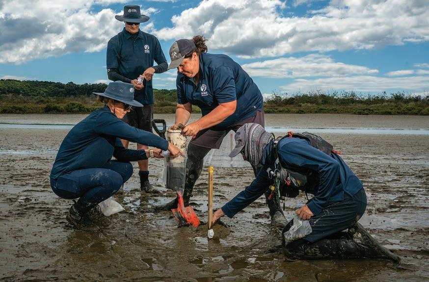
The research team gather sediment core samples from the Waihī Estuary flats, looking for small organisms such as worms and sand hoppers. (Stuart Mackay)
“Understanding how warming a ects marine species will help us manage them in the future”
Dr
Emily Douglas
“There’s been something like 70% loss of seagrass over the last 70 years. Iwi realise that some of the land use has a ected the estuary, and also they’re increasingly concerned with climate change and the loss of kaimoana.”
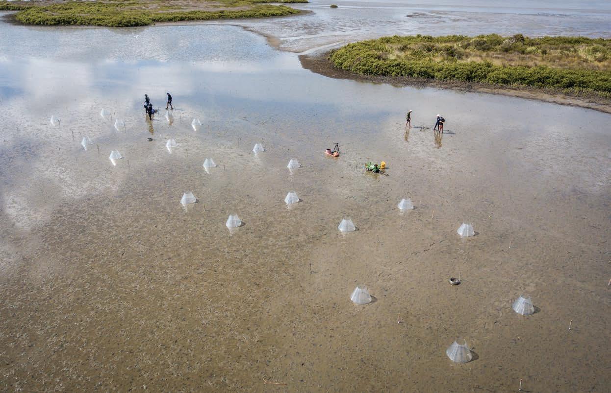
Over seven days, the marine ecologists used opentop chambers, which look like mini-greenhouses, to warm the air and sediment within them to simulate what might happen as temperatures rise.
The team set up two sites, each with 20 chambers, 300m apart. But the two sites were quite di erent: one was muddy and degraded; the other, on a sandy surface, was much healthier.
“Understanding how warming a ects marine species will help us manage them in the future," says NIWA ecologist Dr Emily Douglas.
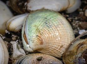
Tuangi (cockles) were the main focus of this experiment, but wedge shells were also collected. In addition, the team took sediment core samples to collect the polychaetes (worms), sand hoppers, crabs and other small organisms that live buried in the sand and mud.
They also measured greenhouse gas emissions (methane and carbon dioxide) from the sediment, both within and outside of the glasshouses, using a portable gas analyser.
“We don’t really understand the role of the shallow estuary ecosystems in the carbon cycle, so we don’t actually know whether they’re absorbing or emitting greenhouse gases,” says Douglas.
Investigations into the impacts on the macrofauna are still underway, but results from the greenhouse gas measurements show the healthier sandy site absorbed more carbon dioxide. The muddier site also had greater methane emissions.
“These results support the need to prevent sedimentation of estuaries and the restoration of degraded sites,” she says.
Back cover:
Travelling at 450km a second and orbiting the Earth 15 times a day, MethaneSAT will still be able to map methane emissions with the same precision as ground-based instruments. (NIWA)
The tide starts to sweep in as the field team check the mini greenhouses set up to simulate the impacts of rising temperatures on test sites. (Stuart Mackay)