CedarRiverRecreationParkFeasibilityStudy


CityofAustin,Minnesota


PREPARED FOR: City of Austin 203 500 Fourth Avenue, NE Austin, MN 55912
PREPARED BY: Recreation Engineering & Planning Inc. 485 Arapahoe Ave, Boulder, CO 80302
DATE: August 1, 2023


CedarRiverRecreationParkFeasibilityStudy Recreation Engineering and Planning | 485 Arapahoe Ave | Boulder, CO, 80302 www.repwhitewaterparks.com | info@boaterparks.com | (303) 545-5883 1 TableofContents Introduction.........................................................................................................................2 WhatisaWhitewaterPark?................................................................................................4 SiteAssessment..................................................................................................................6 ExistingConditions.............................................................................................................6 OpportunitiesandChallenges.............................................................................................9 Hydrology.........................................................................................................................11 ConceptualDesign............................................................................................................14 ConstructionCostEstimate...............................................................................................18 FloodplainFeasibility.......................................................................................................20 RegulatoryContext...........................................................................................................20 ConclusionsandNextSteps..............................................................................................21 Attachments: ConceptualPlanViewRenderingoftheCedarRiverRecreationPark
CedarRiverRecreationParkFeasibilityStudy


Introduction
Austin is located in Southern Minnesota on the Cedar River, a two-hour drive from the hub of Minneapolis. The City of Austin has a history of various industries and is home to the world-renowned Hormel Foods. The City is currently focused on investing in community development projects that are intended to help spur economic development, tourism, community wellness, and education. With the goal of making the downtown business district more of a destination, recent completions included a downtown Spam Museum, a new recreation center by the river, and a visitors’ center. The Cedar River flows directly through town, and flatwater recreation including canoeing, stand-up paddle boarding, and fishing are popular activities. Austin Horace Park, with its Mill Pond, network of connecting trails, and playgrounds has provided in-town access to casual outdoor recreation for many years. The Cedar River is one of the most iconic natural wonders of the region, yet due to the high number of low-head dams it has little to offer the whitewater recreationalist.
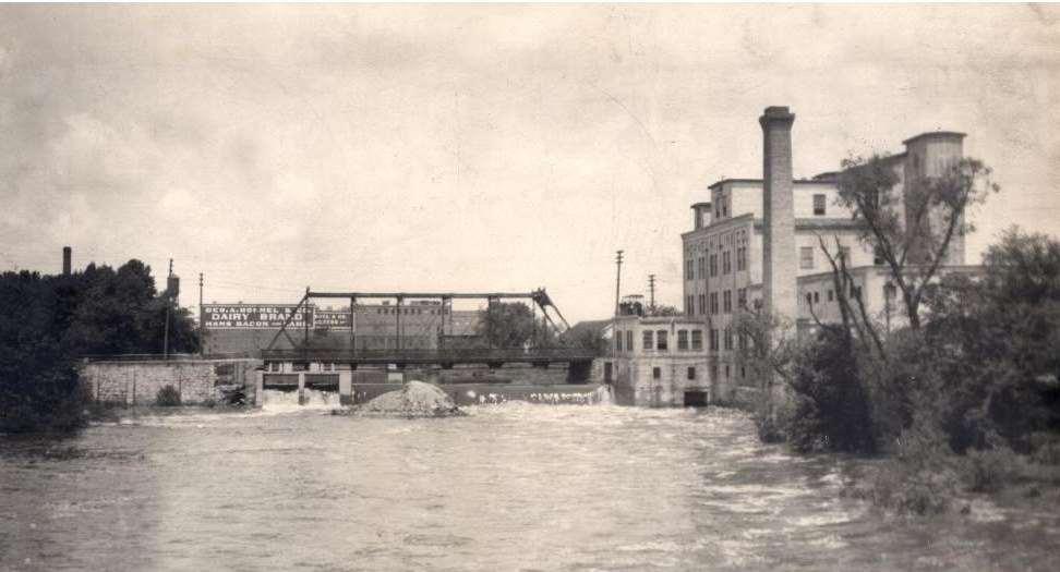
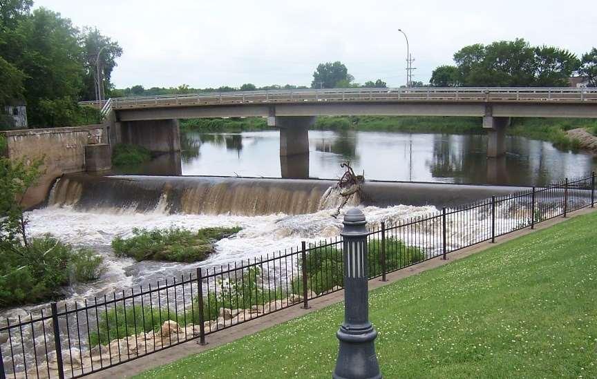
Mills, powered by the Cedar River, enabled the first industries in Austin in the 1800s. 4th Avenue Dam is located on the Cedar River in downtown Austin, and was built over a century ago to divert water to power a mill. Today, aside from maintaining the Mill Pond, the dam is obsolete, and the mill can only be recognized by its crumbling concrete remnants. The City owns the dam, and almost all of the property around it. After witnessing the transformation that other towns have seen along the Cedar River after modifying old defunct dams into river recreation opportunities (including REP’s project in Charles City), the City of Austin identified the 4th Avenue Dam as a potential site for a project that would provide a unique recreation destination within city limits.
Recreation Engineering and Planning | 485 Arapahoe Ave | Boulder, CO, 80302 www.repwhitewaterparks.com | info@boaterparks.com | (303) 545-5883 2
Figure1.AustinislocatedontheCedarRiver inSouthernMinnesota.
Image Credit: World Atlas
Figure2.Left:Historicphotoofthe4th AveDamwithadjacentmill.Right:Current4th AveDamandmill remnants. Historic image provided to REP by City of Austin.
CedarRiverRecreationParkFeasibilityStudy


The City of Austin contracted with Recreation Engineering & Planning (REP) to provide feasibility and concept design services for a river recreation park at the site of the 4th Avenue Dam. This report describes the feasibility assessment performed and presents a conceptual design for a river recreation park at the site. A floodplain feasibility study was a primary component. REP contracted with LV Brown Studios to develop graphic renderings of the proposed conceptual design.
Recreation Engineering and Planning | 485 Arapahoe Ave | Boulder, CO, 80302 www.repwhitewaterparks.com | info@boaterparks.com | (303) 545-5883 3
Figure3.Left:HormelFoodswasfoundedinAustinandthenewSpamMuseumisaprimaryattractiontodowntown. Right:TheMillPondupstreamofthe4th AvenueDamhashostedrecreationactivitiesfordecades.
Before After
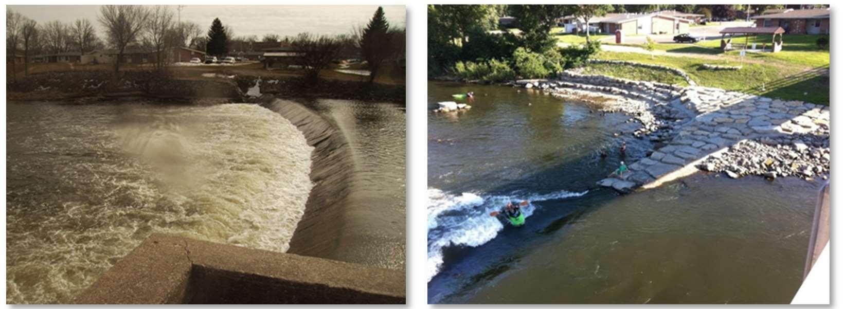
Figure4.BeforeandAfterphotosofthewhitewaterparkinCharlesCity,ontheCedarRiver downstreamofAustin.
CedarRiverRecreationParkFeasibilityStudy


What is a Whitewater Park?
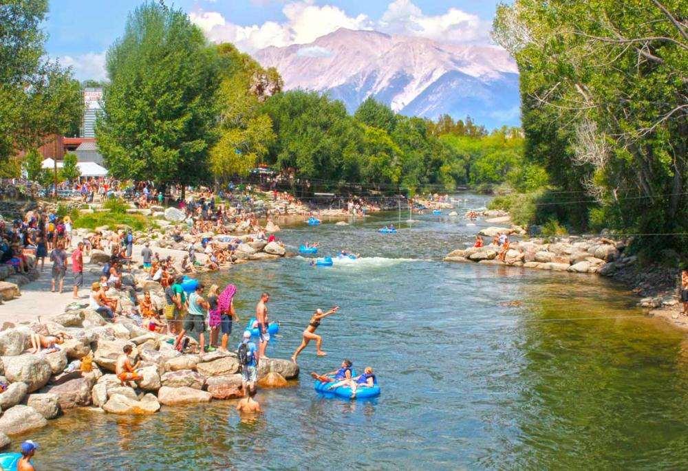
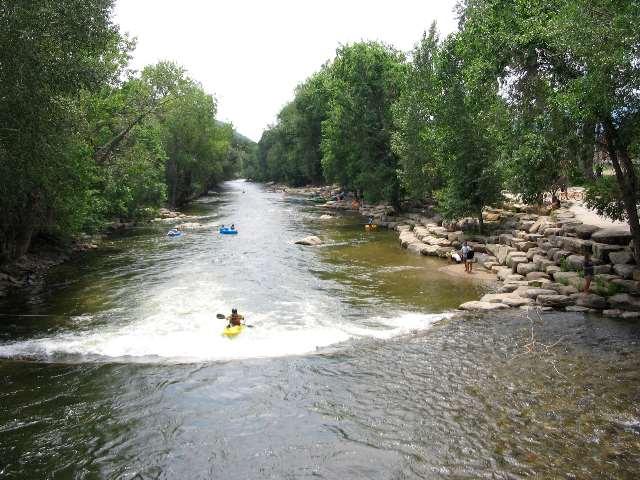
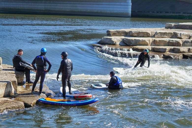
“Whitewater park” is a general term used to describe an area where improvements have been made to facilitate and enhance river recreation, varying from minor manipulation of boulders in a natural streambed, to large pumped courses located in artificial channels off-river. The term “river recreation park” can also be used to describe these types of river improvements. This term may be less confusing and more descriptive. No two whitewater parks are alike, and each is designed for the unique needs of the river system and community they are located in. The most successful whitewater parks create a blend of bank access and whitewater features that support the widest possible cross-section of users, helping turn neglected river corridors into vibrant people-places. Whitewater parks generally include a variety of hydraulic features including eddies, pools, waves, holes, and other features to enhance the river experience for kayaking, surfing, swimming/wading, rafting, standup paddleboarding, and more. Whitewater parks can include many whitewater features, providing a range of user experiences. Whitewater parks are constructed with a variety of materials including boulders, concrete, grout, streambed and bank material. Enhanced bank access, riparian vegetation, and riverside trails are all elements that are commonly included in whitewater park projects.
Recreation Engineering and Planning | 485 Arapahoe Ave | Boulder, CO, 80302 www.repwhitewaterparks.com | info@boaterparks.com | (303) 545-5883 4
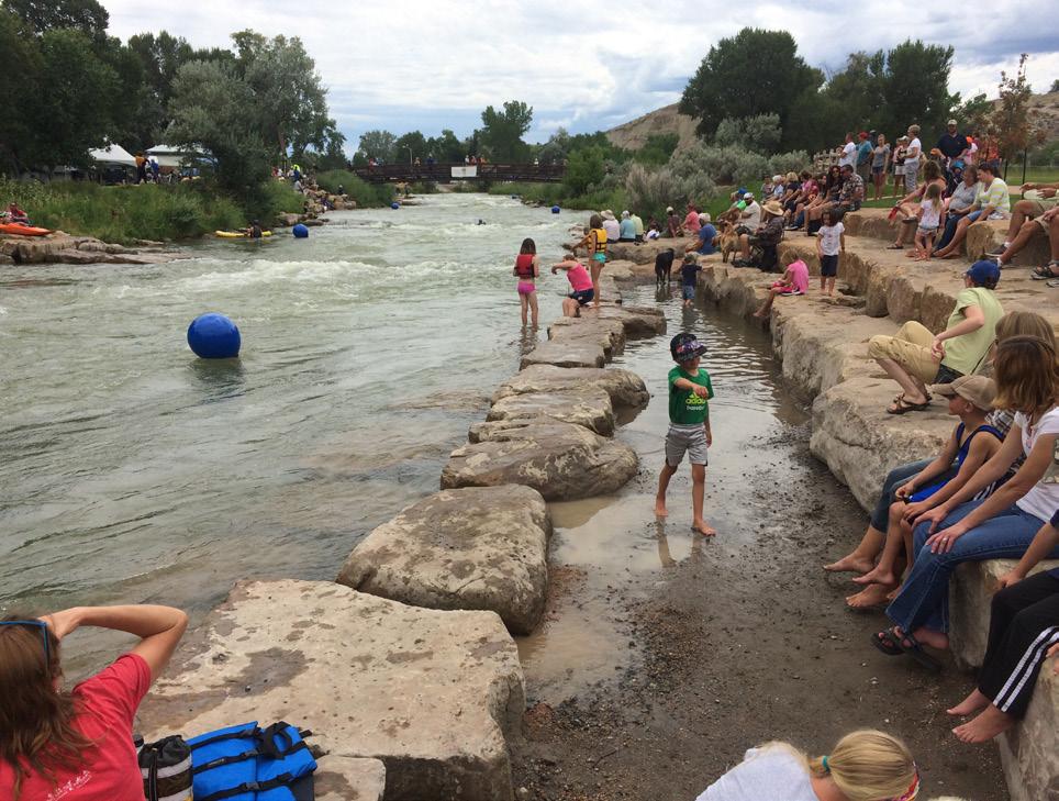
Figure5.CanoeingatthewhitewaterparkinSiloamSprings, Arkansas.
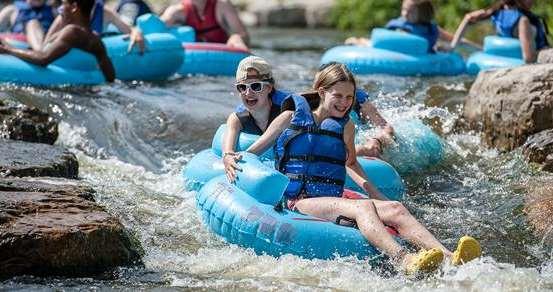
Figure6.TubingatthedambypassArgoCascadesinAnnArbor,Michigan.
CedarRiverRecreationParkFeasibilityStudy


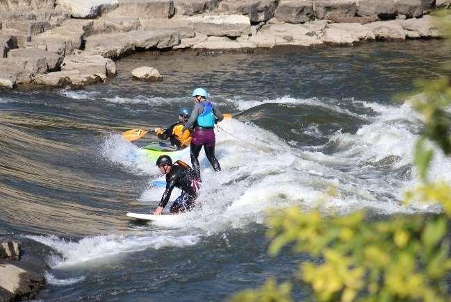
A whitewater park in Austin would be designed to attract a wide variety of users, including advanced kayakers and surfers, but also beginners, families, and people who just want to enjoy being by the river. In terms of numbers, whitewater parks are used and visited primarily by everyday people who want to inner-tube, swim, or just hang out by the river.
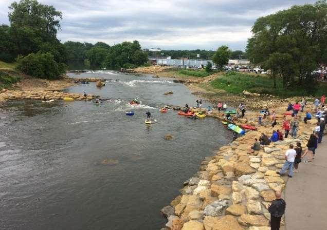
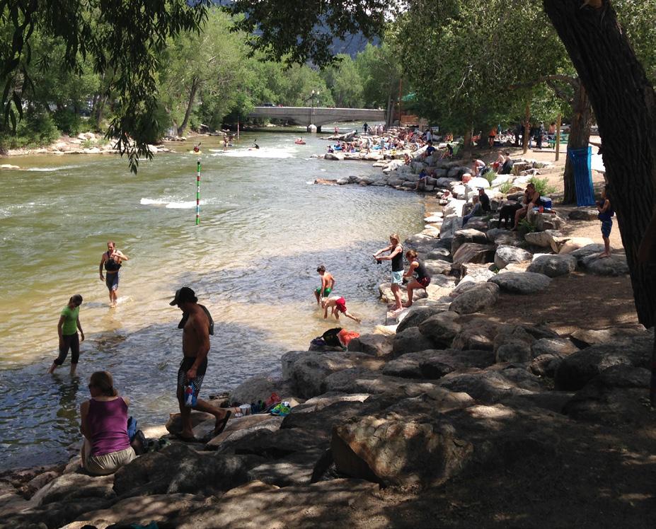
Whitewater parks have proven to provide powerful and lasting economic benefit to their communities. Examples include Reno, Nevada’s Wingfield Park which transformed a neglected corner of downtown into a hub of year-round activity and created an estimated $18 million impact to the local economy in the first 5 years. Or Dayton, Ohio where the downtown whitewater park (opened in May 2017) replaced a dangerous low head dam and is part of that community’s effort at standing out to new economy employers and employees. In Manchester and Charles City, Iowa the whitewater parks have become regional attractions, bringing people to the downtown business districts in these agricultural communities.
Recreation Engineering and Planning | 485 Arapahoe Ave | Boulder, CO, 80302 www.repwhitewaterparks.com | info@boaterparks.com | (303) 545-5883 5
Before After
Figure8.Beforeandafterphotosof adammodification whitewaterparkdesignedbyREPinManchester,Iowa.
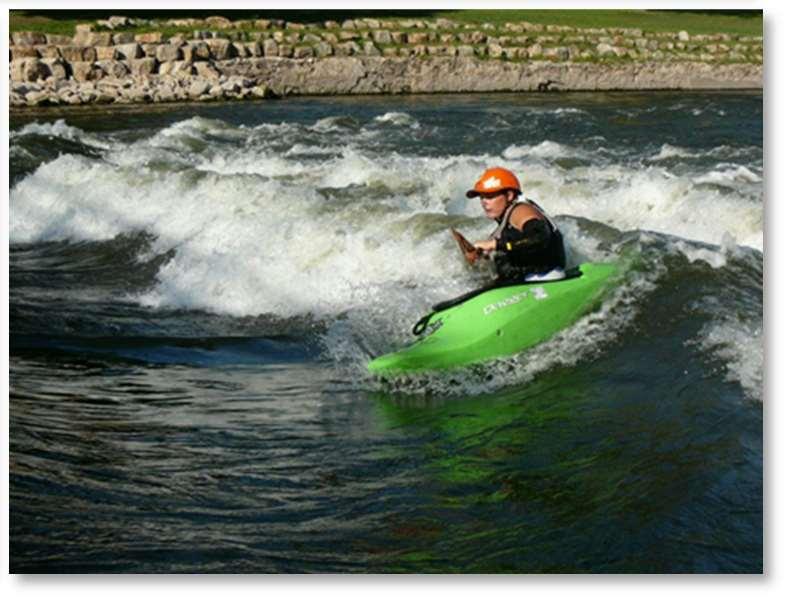
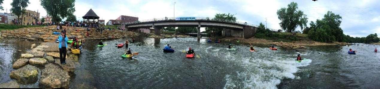
Figure7.Riversurfersandkayakersshareawaveon theCedarRiverinCharlesCity,Iowa
CedarRiverRecreationParkFeasibilityStudy
Site Assessment
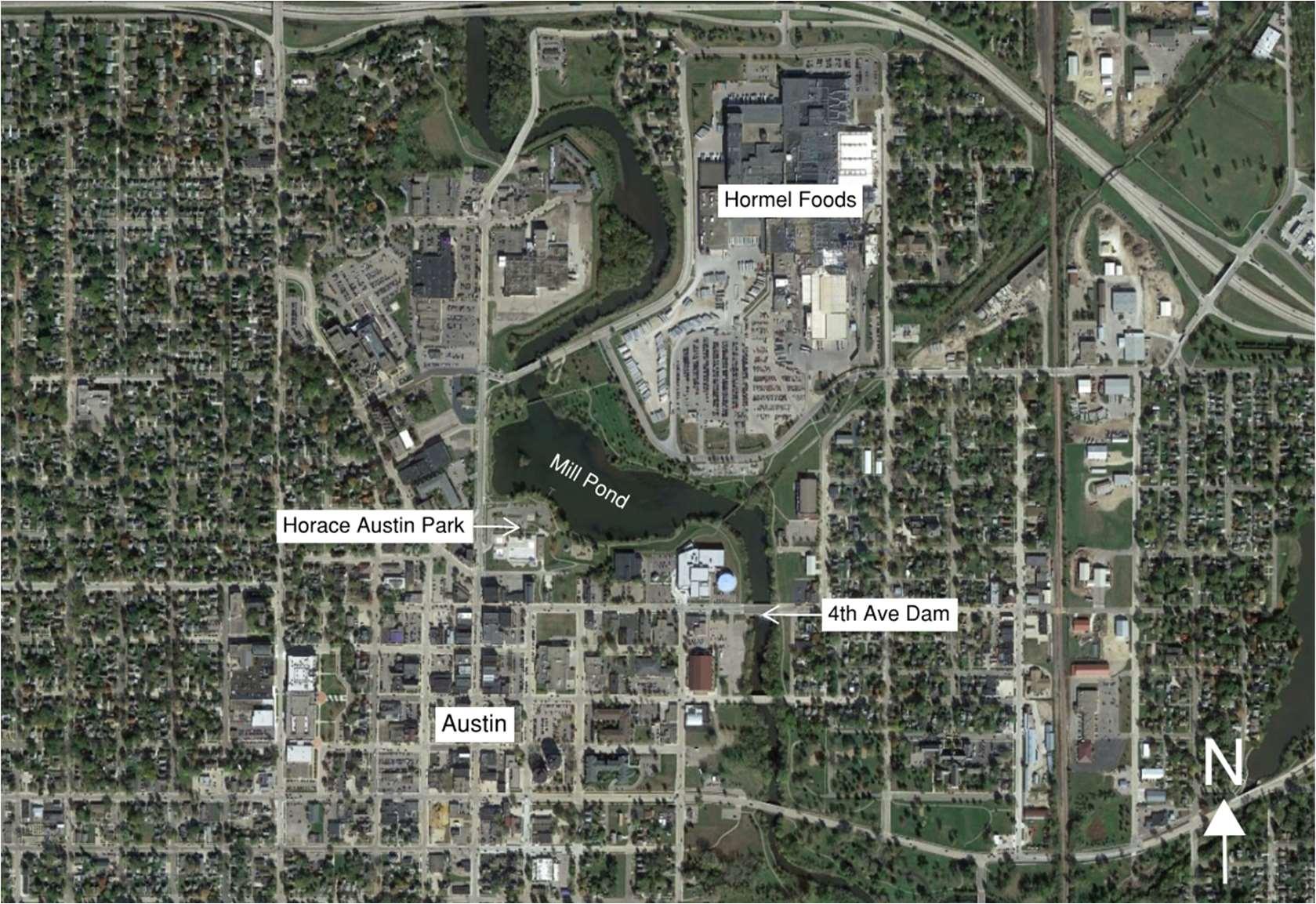
The proposed Cedar River Recreation Park project is at the site of the 4th Avenue Dam, an existing low-head dam in downtown Austin on the Cedar River. A vicinity map showing the location of the 4th Avenue Dam in relation to downtown Austin is shown below.
REP engineers Gary Lacy and Spencer Lacy conducted a site visit May 17 – 18, 2023. The site field investigation included a visual assessment of the necessary variables relevant to the feasibility of the project, including a review of existing park elements and infrastructure, hydraulic gradient, site access, staging, constructability, bed / bank material, and wetlands / sensitive areas. Aerial imagery of the site was collected with a DJI Mavic Air 2 drone. LiDAR topography data and property boundaries were provided by the City of Austin’s GIS department.
Existing Conditions
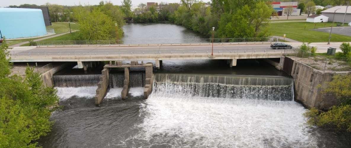
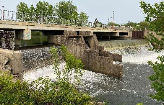
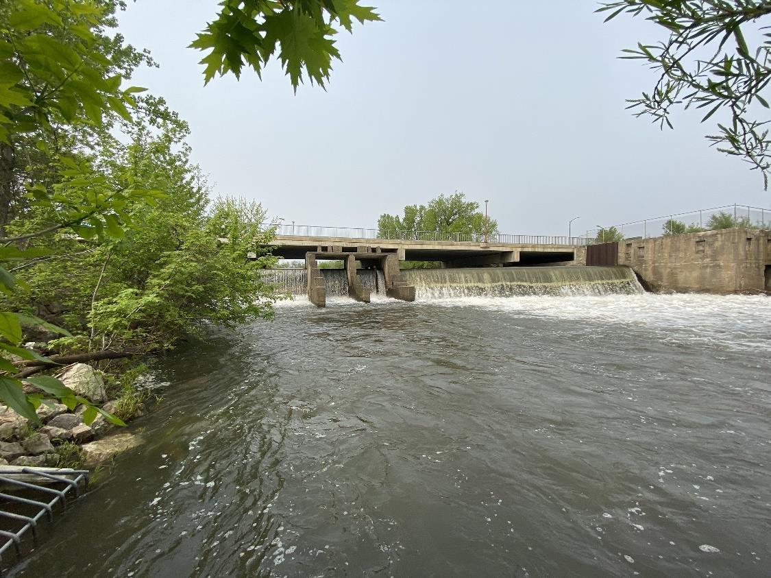
The 4th Avenue Dam in downtown Austin was built over a century ago to divert water to a mill and is no longer in use. No detailed survey has been completed, but from the asbuilt plans it can be determined the dam is approximately 11 ft in height. There are two portions of the dam divided by old concrete bays. The east portion of the dam is an
Recreation Engineering and Planning | 485 Arapahoe Ave | Boulder, CO, 80302 www.repwhitewaterparks.com | info@boaterparks.com | (303) 545-5883 6
Figure9.Vicinity mapwiththe4th AveDamandprojectsiteinrelationtodowntownAustinand othernearbylandmarks.TheCedarRiverflowsfromnorthtosouth(toptobottomoftheimage).
over-flow weir. The west portion of the dam has a slightly higher crest and is dry during periods of low flow. The dam is walled in on both sides by vertical concrete structures. There is currently no way for fish to pass upstream past the dam. The 4th Avenue bridge crosses the river just upstream of the dam. The bridge is supported by three sets of bridge piers within the river. Under the bridge the bank has extensive grouted riprap scour protection at the abutments. There is approximately 5 feet of clearance as you walk under the bridge at the river’s edge.
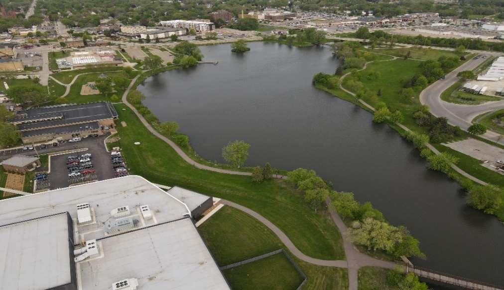
The 4th Avenue Dam backs up the Cedar River creating an impoundment referred to as the Mill Pond. Today the Mill Pond is the center piece of Horace Austin Park and has significant recreational and community value for the City, thus the dam cannot be removed and the water surface elevation of the Mill Pond must be maintained.


Recreation Engineering and Planning | 485 Arapahoe Ave | Boulder, CO, 80302 www.repwhitewaterparks.com | info@boaterparks.com | (303) 545-5883 7
CedarRiverRecreationParkFeasibilityStudy
Figure10.Theexisting4th AvenueDamandBridge
Figure11.AerialimagecapturedduringtheREPsite visitshowingtheMillPond upstreamoftheprojectin HoraceAustinPark.Theprojectwouldbedesignedto maintainthewatersurfaceelevationoftheMillPond.
CedarRiverRecreationParkFeasibilityStudy
There are several existing uses in the vicinity of the project that would be enhanced with the development of a whitewater park. A shared-use trail network is located in Horace Austin Park that extends downstream along the Cedar River. Flatwater recreation including canoeing and stand-up paddling are popular on the Mill Pond. A recently constructed recreation center is located just upstream of the dam. The Riverside Arena Ice Rink is located next to the project site with a large parking lot that abuts the river to the west of the dam.
The riverbanks in the project area are generally covered in vegetation, except at the dam where grouted riprap and concrete walls create the banks. Most vegetation appears to be non-native. The engineers observed exposed bedrock on the east bank downstream of the dam. Concrete remnants of the mill can be found along the east bank downstream of the dam. Downstream of the dam, the riverbed appears to be mostly cobble and larger material. Upstream of the dam, the riverbed material is much finer due to settling in the Mill Pond.
After a series of floods between 1978 and 2010, the City implemented a flood mitigation program inolving the purchase and demolition of properties and buildings within the floodplain. The program also implemented a flood wall (dike) project. As a result, the City owns most property in the vicinity of the Cedar River in Austin and the floodplain horizontal extents have been greatly reduced.
Recreation Engineering and Planning | 485 Arapahoe Ave | Boulder, CO, 80302 www.repwhitewaterparks.com | info@boaterparks.com | (303) 545-5883 8
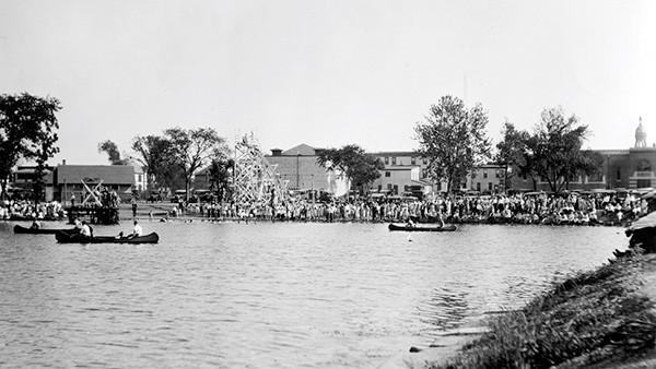
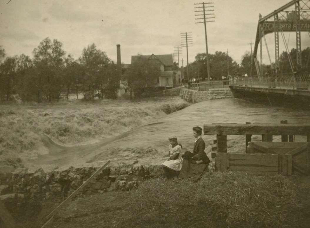
Figure12.Historicalimageofthesiteduringthe1908flood,providedtoREPbythe CityofAustin.Anyprojectatthe4th AveDamwouldneedtobedesignedtomeet stringentfloodwaystandards.
CedarRiverRecreationParkFeasibilityStudy


Opportunities and Challenges
The existing dam provides substantial hydraulic drop necessary for whitewater features. The Cedar River in Austin has enough total flow for quality instream recreation. The length of the reach of the river in which the project is proposed is long enough to spread out the whitewater features to provide optimal river gradient throughout the park. The existing channel remains narrow upstream of the dam to the existing pedestrian bridge which will help to keep construction quantities reasonably low.
The structural components at the location of the dam provide excellent anchor points for a recreational drop structure to be constructed there. The bedrock and riverbed material downstream of the dam makes for standard anchoring of drop structures, bank terracing, and river access. Upstream of the dam, drop structure anchoring will be more involved due to the depth of the pond and fine riverbed material.
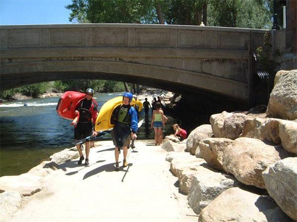
The existing concrete trails in the vicinity of the project and the upstream pedestrian bridge crossing the Mill Pond provide a pre-existing network that can be readily tied into with riverside trails throughout this project. Both road bridges in the project vicinity provide opportunities for trail underpasses on both sides of the river. The retaining walls and riprap under the 4th Avenue bridge would need to be modified to create trail underpasses. The remnant concrete mill structure at the east bank at the dam will require demolition to pass the trail under the bridge and create river access.
Recreation Engineering and Planning | 485 Arapahoe Ave | Boulder, CO, 80302 www.repwhitewaterparks.com | info@boaterparks.com | (303) 545-5883 9
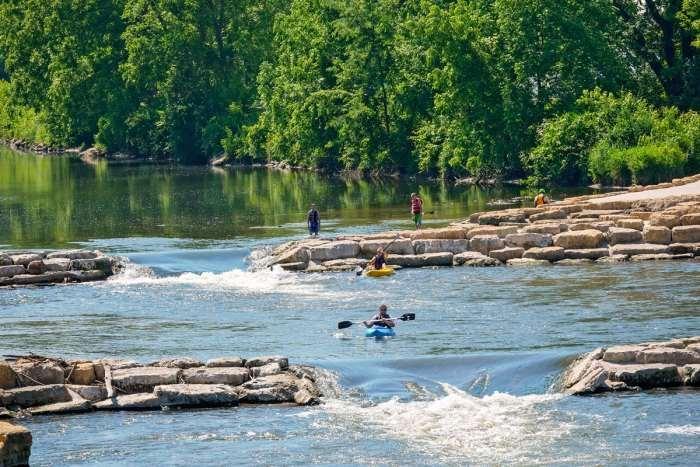
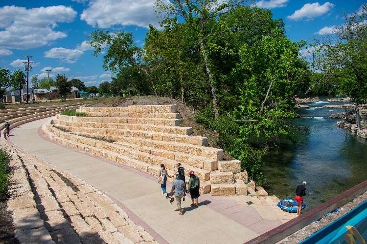
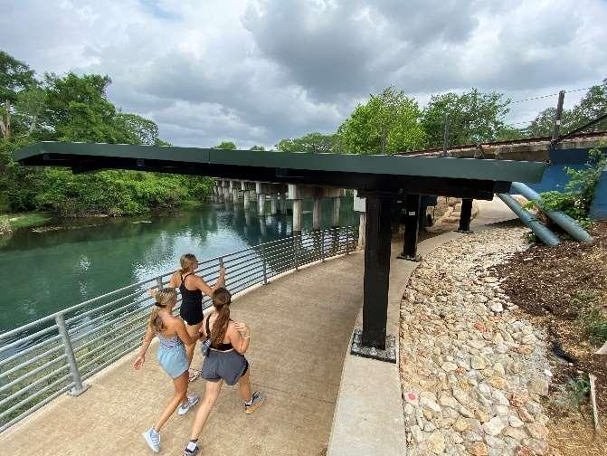
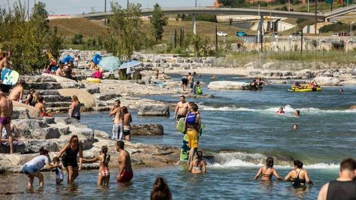
Figure14.TrailunderpassessuchasthesedesignedbyREPinSanMarcos,TXareregularlyincludedas partofriverimprovementprojects.Theexistinggradeseparationbetweentheriverandbridgesmakesan ideallocationfor anunderpass,andtrailconnectivity,riveraccess,andpublicsafetyareallimproved.
Figure13.Thereisamplehydraulicdrop attheexistingdamforthedevelopmentof whitewaterfeatures.
CedarRiverRecreationParkFeasibilityStudy


There is currently no fish passage at the dam, and the reach is heavily impacted by past development. There is the opportunity to provide fish passage through this reach, as well as improved habitat for species including freshwater mussels.
The existing vegetated banks provide bank stability that can be maintained in this project. The bank height relative to the water surface provides for river access and fishing access opportunities at strategic locations throughout the project site.
The City’s purchase of many of the properties in the vicinity of the river at the project site eliminates many ownership and adjacent neighbor concerns that many projects must navigate.
The Cedar River in Austin has a history of flooding, and the floodplain concerns are highly relevant to this project. The project must be designed to meet FEMA floodway standards, including no-rise criteria. The solution proposed is to modify the dam by reducing its height and transfer most of the total hydraulic drop upstream across several instream recreational structures. This is feasible and has been completed on other similar projects. This technique of constructing river structures upstream of the existing dam, although more involved from a design, construction, and anchoring standpoint, is how drop structures can be built to replace the dam without raising the floodplain. A feasibility level floodplain analysis was performed as part of this study to demonstrate that it is feasible to construct the project without adverse impacts to the floodplain.
Recreation Engineering and Planning | 485 Arapahoe Ave | Boulder, CO, 80302 www.repwhitewaterparks.com | info@boaterparks.com | (303) 545-5883 10
Figure15.ThewhitewaterparkinManchester,IAisanexampleofaprojectthatreplacedadamwith severaldropstructuresupstreamthatmetFEMAno-riserequirements.Threedropstructureswere constructedupstreamof theoriginaldam,oneatthedam,andtwodownstream. TopLeft:Theoriginaldam atthestartofconstruction.TopRight:Threeupstreamstructuresintheoldimpoundment.Bottom:The featurejustupstreamoftheoriginaldamandbridge.
CedarRiverRecreationParkFeasibilityStudy
Hydrology
The availability and timing of flow is one of the most important factors in the performance of a whitewater park, and a key factor in design. The Cedar River in Austin is a small river with small discharges, but enough to provide for quality whitewater features for most of the year. Many popular whitewater parks have similar flow regimes, designed to function down to 100 cubic feet per second (cfs) or even less. These same features can be designed to also function well at higher flows with increased performance for advanced paddlers and surfers.
River discharge data was downloaded from the publicly available USGS gage station 05457000 Cedar River Near Austin, located downstream of Austin at Mower County Road 28. There are a few flow sources between the project site and this gage, notably Dobbins Creek, Turtle Creek, and the Austin Wastewater Treatment Plant. There is a Minnesota DNR gage on Dobbins Creek, though there are significant time gaps in the flow data. For the purposes of this feasibility study, the USGS gage data was analyzed without adjusting for the inflows between the 4th Ave Dam and the gage, knowing that the actual flow at the site will be slightly less than represented by the gage data.
Discharge data is available from the USGS gage from 1910 to present, with missing data from 1915-1944. For the purposes of this study, REP analyzed the average daily discharge for the last 30 full calendar years, 1993 through 2022. This provides a relatively large sample of data from the modern watershed. Older discharge data may not accurately reflect current watershed dynamics due to development, increase in impervious surface area, and other factors.
Recreation Engineering and Planning | 485 Arapahoe Ave | Boulder, CO, 80302 www.repwhitewaterparks.com | info@boaterparks.com | (303) 545-5883 11
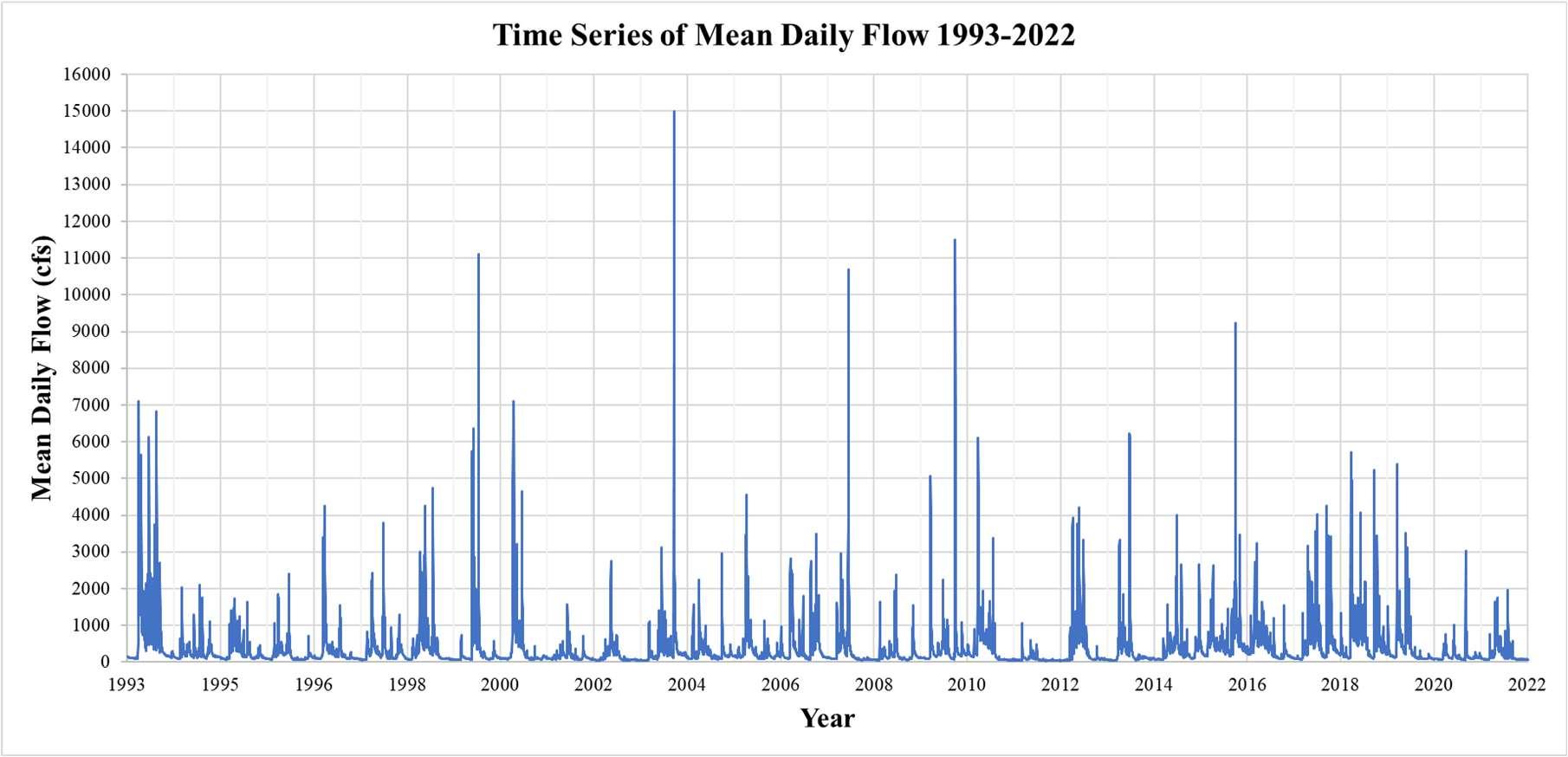
Figure16.Dailyflowtime seriesforthelast30fullcalendaryearsatUSGSgage05457000CedarRiver NearAustin.Therivertypicallyhasrelativelylowflows,punctuatedbyhighflowevents.
CedarRiverRecreationParkFeasibilityStudy
The complete time series of the daily flow data for the last 30 full calendar years is shown on the previous page. Generally flows are low: below 1,000 cfs nearly all of the time, and more typically around 100 cfs for the majority of the year. However, these low flows are punctuated by high flows of several thousand cfs, with the highest mean daily flow of 15,000 cfs recorded on September 16, 2004. On that date, the flow peaked at an estimated 20,000 cfs, the highest flow ever recorded at the gage.
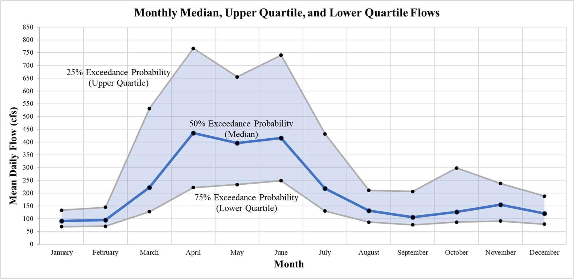
While the river park must be designed to accommodate and withstand flood flows, the park should be designed for quality river recreation and public use during typical flows. To better understand what typical flows can be expected throughout the year, monthly statistics were developed from the 1993-2022 daily flow data. Exceedance probabilities are a useful way to determine typical flows and were calculated for each calendar month: 75% exceedance probability (lower quartile flow) is the flow that 75% of the recorded daily flows in that month were higher than, 50% exceedance probability (median flow) is the flow that 50% of the recorded daily flows in that month were higher than, and 25% exceedance probability (upper quartile flow) is the flow that 25% of the recorded daily flows in that month were higher than. The plot below shows these flows for each month, with the median flow in each month connected by a blue line, and the area between the upper and lower quartile flows shaded in light blue. This shaded area represents the middle 50% of recorded flows for each month, and is a good indicator of the range of typical flows that can be expected each month of the year.
Recreation Engineering and Planning | 485 Arapahoe Ave | Boulder, CO, 80302 www.repwhitewaterparks.com | info@boaterparks.com | (303) 545-5883 12
Figure17.Monthlymedian,upperquartile,andlowerquartiledailyflowscalculatedforeachmonthofthe yearbasedondailyflowdatafrom1993-2022.FlowsaregenerallyhighestApril–June,withmedian flowsaround400cfs.Fallandwinterflowsarelower,withmedianflowsaround100to150cfs.
CedarRiverRecreationParkFeasibilityStudy
Flows are typically highest April – June, with median flows around 400 cfs. Late summer, fall, and winter (August – February) have low flows, with median flows generally between 100 and 150 cfs. March and July are transitionary months, with median flows between the early summer high flows and the low flows. A table summarizing the monthly statistics developed is shown below. The month where the minimum daily flow was recorded is September (31 cfs), which also happens to be the month when the highest recorded flow occurred. This demonstrates that extreme high flow events can occur even during the times of year of the lowest typical flows.
There are many existing successful river parks with similar flow regimes. Based on the anticipated flow available, the proposed river recreation improvements can be designed to function well for a wide variety of instream whitewater recreation for much of the average year. During the spring and summer months of higher flows, the project can be designed to provide accessible whitewater that provides great opportunities for beginner through advanced whitewater paddling. In the later summer months when the flow drops, the features wouldn’t be as appealing for advanced users, but the same structures would be designed to function well for tubing, boat passage, and beginner whitewater recreation. Riverside recreation including fishing, strolling, picnicking, biking, splashing, wading, etc., will be available year-round. The project would be designed to provide fish passage at all anticipated flows, as well as provide habitat for freshwater mussels and other species.
Recreation Engineering and Planning | 485 Arapahoe Ave | Boulder, CO, 80302 www.repwhitewaterparks.com | info@boaterparks.com | (303) 545-5883 13
Month50%(Median)25%(UpperQuartile)75%(LowerQuartile)MinimumMaximum January9113469351260 February9514571352730 March222532128366600 April436767222637110 May397655234575730 June4177412497610700 July2194321304711100 August13221187366820 September106207763115000 October12729987373500 November15523891371080 December12118979322660 ExceedanceProbability
Table1.MonthlystatisticsfromUSGSgage05457000dailyflowdata(cfs)
CedarRiverRecreationParkFeasibilityStudy
Conceptual Design

REP developed a conceptual design for a river recreation park at the site of the 4th Avenue Dam on the Cedar River in Austin. The conceptual design plan rendering developed is attached at the end of this report. A perspective view rendering of the existing dam and proposed improvements is shown on the following page. The proposed plan was laid out to maximize utilization of the available area and hydraulic gradient, while leveraging existing features and avoiding elements that may cause a rise in the floodplain. Design objectives included:
Develop a river recreation venue that would appeal to the widest cross-section of users possible, from top athletes to beginners and casual visitors.
Provide quality whitewater features that would draw whitewater enthusiasts from the region and beyond, including athletes who freestyle kayak, river surf, raft, stand-up paddleboard, and slalom kayak.
Create a river park that can be used by swimmers, tubers, young kids, and families.
Design whitewater features that function well at a wide range of flow rates.
Spread the full existing hydraulic drop at the 4th Avenue Dam across various whitewater drop structures.
Maintain the existing upstream water surface of the Mill Pond.
Design the park to cause no rise in the existing regulatory floodplain.
Enable fish passage and improve aquatic and riparian habitat.
Provide a network of ADA accessible trails for viewing, river access, fishing, walking, and casual biking, with underpasses to avoid any street crossings.
Provide accessible areas for fishing for kids and people with disabilities.
Utilize existing infrastructure to the extent possible, including the existing dam.
Maintain the existing concrete trails, pedestrian bridges, road bridges, and the majority of the existing parking.

Recreation Engineering and Planning | 485 Arapahoe Ave | Boulder, CO, 80302 www.repwhitewaterparks.com | info@boaterparks.com | (303) 545-5883 14
Figure18.AwhitewaterparkontheArkansasRiverinSalida,CO.Theparkisutilizedbyawide rangeofpeopleand abilitiesand hasbeencreditedwith drivingsignificanteconomicgrowth.


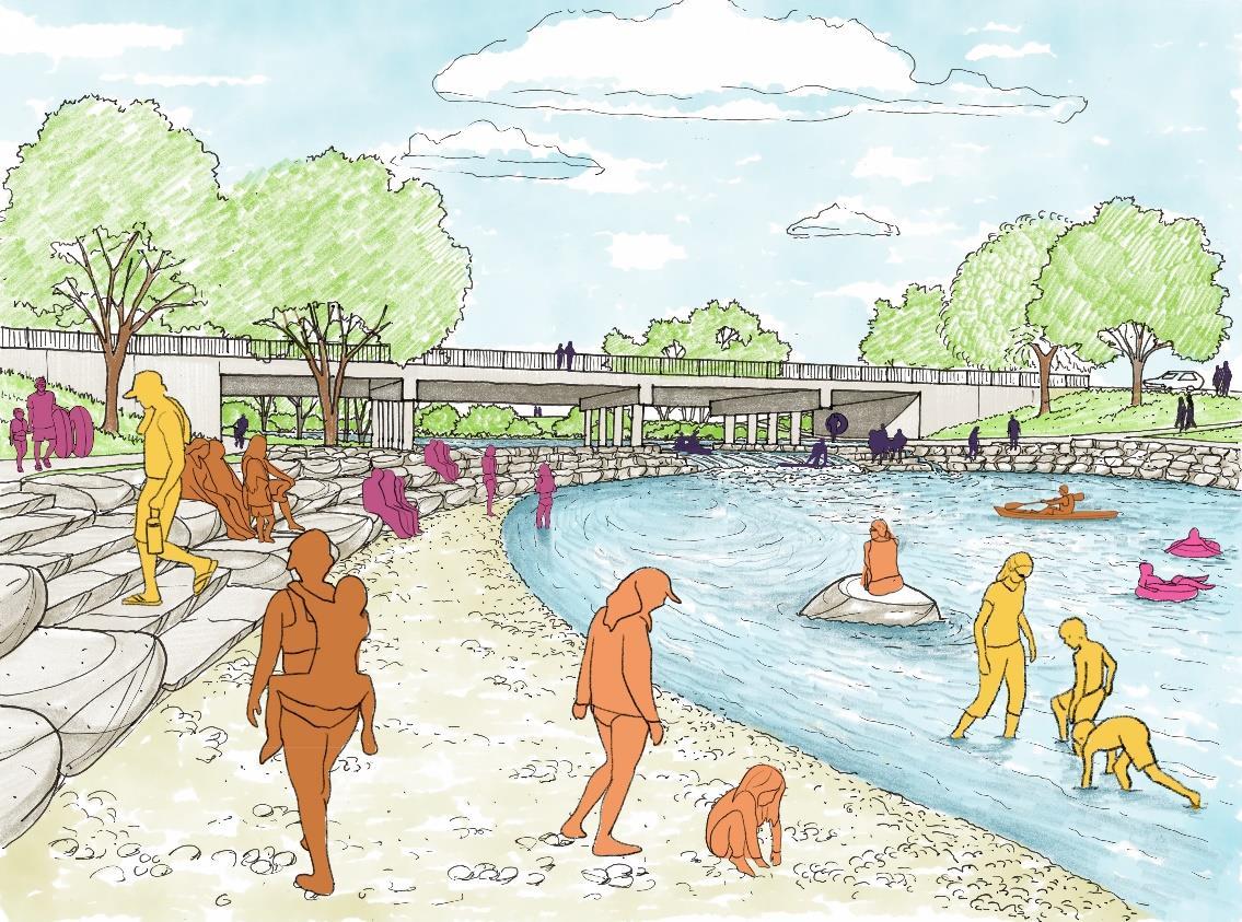 Existing 4th Avenue Dam
Proposed River Recreation Park
Perspective Conceptual Rendering
Existing 4th Avenue Dam
Proposed River Recreation Park
Perspective Conceptual Rendering
Design features of the conceptual design include:
The proposed river recreation park incorporates five instream drop structures to replace the existing 4th Avenue Dam.
The drop structures are intended to function across the range of anticipated flows. The character of the whitewater features would change, with low flows being more accessible to beginners but less desirable for advanced users.
The upstream-most drop structure (Drop 1) is designed to hold a similar water surface elevation of the Mill Pond that the existing dam holds at various river flows.
The amount of (dry) drop per drop structure varies from 1.5’ to 3’. The amount of hydraulic drop per structure will vary with the flow in the river.

Three drop structures are located upstream of the existing dam, with the first one located at the existing pedestrian bridge. The fourth and largest structure is located at the existing dam and will anchor to the existing foundation. One small drop structure is proposed downstream of the existing dam.
The primary whitewater feature or “surf wave” in the park with the most drop will be at the location of the existing dam. This feature will likely be the location that draws most paddlers and spectators, and where competitive events could be held.
The proposed drop structures will be constructed of large (3’ minimum diameter) natural stone with grout.
The three upstream-most structures would likely be anchored to the existing riverbed with sheet pile.
The stone “wings” of the drop structures also serve as river access points for anglers and floaters and create hang-out areas for dry users.
Upstream low flow fish passage channels are proposed at each drop structure. These would be constructed using un-grouted natural stone.
The pools between each drop structure are approximately 200’ long.
Extensive stone bank terracing at Pools 4 and 5. This area is anticipated to have the highest spectator and bank user concentration in the park.
Recreation Engineering and Planning | 485 Arapahoe Ave | Boulder, CO, 80302 www.repwhitewaterparks.com | info@boaterparks.com | (303) 545-5883 16
CedarRiverRecreationParkFeasibilityStudy
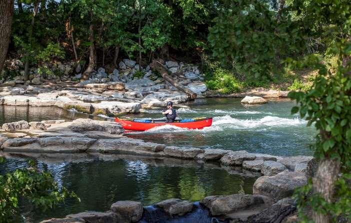
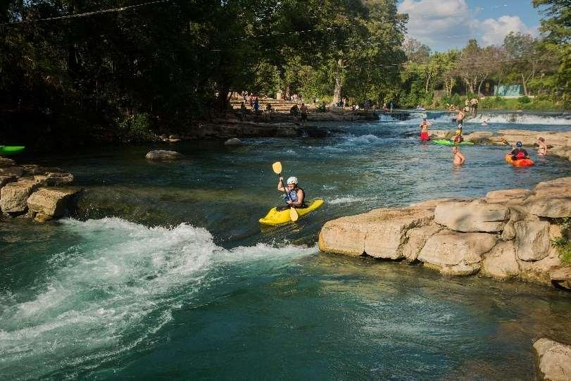
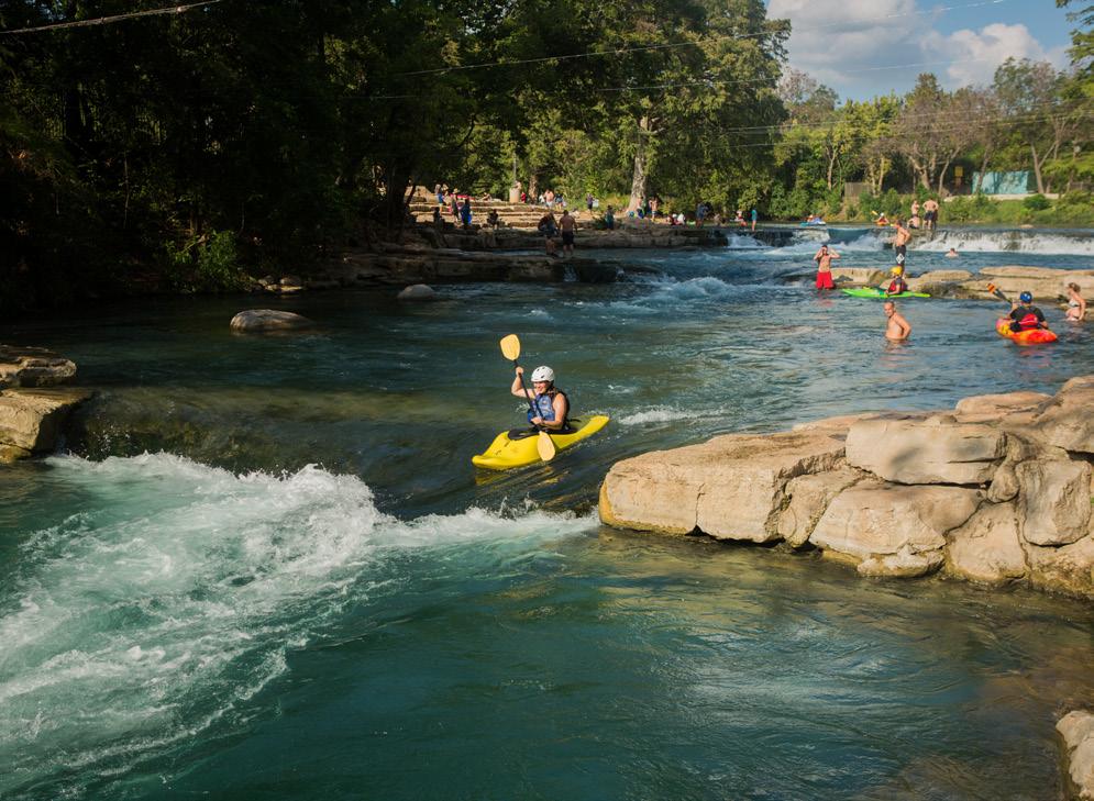
Figure19.Abeginnerkayaker descendsarecreationaldrop structureinSanMarcos,TexasdesignedbyREP.Thesestructures performtogetherwith,andareanchoredtoadefunctmilldam,a commonsitescenarioandopportunityforriverrecreation.
CedarRiverRecreationParkFeasibilityStudy

The west riverbank below the dam will be pushed back into the parking area at Pools 4 and 5. This is to provide high quality areas for bank users, instream splashers, and users with disabilities. This will also help to create large pools for swimmers and paddlers. At this location in the park, it is important to have significant seating area, river access, and calm shallow water.
Attractive stone river access steps at strategic locations within the stone bank terracing.
Instream river or “random” boulders that break up the current to create instream aquatic habitat as well as people places.
Riverside concrete ADA accessible shareduse paths that extend the length of the project and connect to the existing paths in the vicinity of the project area. To enhance river access, utility, and safety, the paths are designed to be close to the river’s edge on both banks of the river and pass underneath the existing road bridges. These trails will provide access to all areas of the river park, as well as enhance viewing opportunities and circulation.
Trail underpasses on both banks at both the 4th Avenue and 2nd Avenue road bridges.
Multiple ADA accessible river access points and fishing access. Two upstream of Drop 1, one at the main parking area, and one downstream of the 2nd Avenue bridge.
The river access points at the Mill Pond and at Lions Park will serve as primary put-in and take-out locations for floaters and paddlers that want to descend the full park and walk back up the trail and repeat.
Maintain most vegetation in the project area. Bank vegetation will remain on both banks upstream of the dam, except at the locations of the drop structures where access is important. Bank vegetation downstream of the dam on the east bank will remain except for where the proposed trail passes. Bank vegetation downstream of the dam on the west bank will mostly be cleared, but new vegetation is proposed with the improvements there.
Maintain existing useful infrastructure and facilities to the extent practicable. This includes all trails, roads, bridges, the majority of the
Recreation Engineering and Planning | 485 Arapahoe Ave | Boulder, CO, 80302 www.repwhitewaterparks.com | info@boaterparks.com | (303) 545-5883 17
existing large parking
Figure20.Stoneterracingand riveraccessatadam modificationprojectin Calgary,Alberta
CedarRiverRecreationParkFeasibilityStudy
lot at the Riverside Arena, and various utilities including multiple stormwater outfalls in the project area.
Although not specifically described in this conceptual design, upland amenities including bathrooms and picnic tables can be added to the project.
Construction Cost Estimate

Based on the conceptual design, REP developed a planning-level construction quantity and cost estimate. At this project stage, the construction cost estimate is considered a Class 4 estimate (AACE Cost Estimate Classification System), which have a typical accuracy range of +50% to -30% of actual construction costs. As the project is further defined and the design progressed, updated construction cost estimates would become more accurate as better estimates of material quantities and project elements are available.
The construction cost estimate is shown on the following page, broken out into the various project elements. The total cost is estimated at nearly $10 million. Based on typical accuracy ranges for cost estimates at this early level of design, actual construction costs may be between $7 million and $15 million (-30% / +50%). This includes all elements included in the conceptual design including the dam modification, drop structures, riverbank terracing, trail improvements, etc.
Further site investigation, design and analysis will provide more detail and greater certainty on the cost estimates. Areas of the river park will require significant anchoring to the existing riverbed to ensure longevity of the structures, especially upstream of the 4th Avenue Dam. The construction cost estimate assumes that no bedrock is encountered during excavation. Based on the height of the dam crest above the riverbed, it is anticipated that the depth to bedrock would be greater than the excavation depths. Bedrock was observed downstream of the dam on the east riverbank. A geotechnical investigation is recommended to identify bedrock elevations in the project area.
Recreation Engineering and Planning | 485 Arapahoe Ave | Boulder, CO, 80302 www.repwhitewaterparks.com | info@boaterparks.com | (303) 545-5883 18
Figure21.Acasualriversurfsceneatadammodificationproject inDayton,Ohio.Thissurfstructureshownisanchored directlytoa defunctlow-headdam.
Cedar River Recreation Park, Austin, MN
CONCEPTUAL LEVEL - OPINION OF PROBABLE CONSTRUCTION COSTS
Notes:
1. This is a planning-level construction cost estimate based on conceptual plans dated 7/31/2023. No site survey or detailed design has been performed, and the quantity and cost estimate can be expected to change substantially upon further design and analysis. The expected accuracy range for cost estimates at this stage is +50% to -30%.
2. Grand Total rounded to the nearest $1,000.
3. Soft costs including engineering design, permitting, survey, geotechnical investigation, etc. are not included in this cost estimate.
Item Quantity Unit Unit Price Cost Cedar River Recreation Park, Austin, MN 4th Ave Dam Modification, River Structures & River Access Water Control & Dewatering 1 LS $450,000.00 $450,000 Construction Survey & Staking 1 LS $14,000.00 $14,000 Structure Demo & Removal (Dam, Walls, Curb & Gutter, Asphalt, Etc.) 2,000 CY $200.00 $400,000 Tree Removal 0.50 AC $25,000.00 $12,500 Excavation 2,000 CY $20.00 $40,000 Embankment (Fill) 5,000 CY $20.00 $100,000 Steel Sheet Pile 15,000 SF $90.00 $1,350,000 Structural Concrete River Structures 400 CY $400.00 $160,000 Grouted Boulders 6,000 CY $380.00 $2,280,000 Ungrouted Riprap (6") 3,300 CY $140.00 $462,000 Ungrouted Riprap (18") 4,500 CY $170.00 $765,000 Flagstone Access Steps 100 SY $1,400.00 $140,000 River Boulders 10 EA $1,600.00 $16,000 Miscellaneous Equipment Hours 200 HR $300.00 $60,000 Trails, Underpasses, Pocket Park & Fishing Access Upland Concrete Paths 4,400 SY $120.00 $528,000 Structural Concrete 120 CY $400.00 $48,000 Curb & Gutter 550 LF $60.00 $33,000 Excavation 6,500 CY $20.00 $130,000 Embankment (Fill) 2,000 CY $21.00 $42,000 Grouted Boulders 500 CY $380.00 $190,000 Ungrouted Riprap (6") 200 CY $140.00 $28,000 River Boulders 2 EA $1,600.00 $3,200 Planting Pocket (Tree) 25 EA $1,200.00 $30,000 Planting Pocket (Shrub) 45 EA $200.00 $9,000 Re-Vegetation 2,500 SY $30.00 $75,000 Topsoil Blanket Seed 600 SY $20.00 $12,000 Split Rail Fencing 500 LF $40.00 $20,000 CONSTRUCTION SUBTOTAL $7,397,700 BONDING AND INSURACE (2%) $147,954 MOBILIZATION / DEMOBILIZATION (8%) $591,816 CONTINGENCY (25%) $1,849,425 GRAND TOTAL $9,987,000
Construction Cost Estimate 7/31/2023 REP
CedarRiverRecreationParkFeasibilityStudy
Floodplain Feasibility
The Cedar River in Austin has a history of flooding, and many of the original homes and businesses were constructed in the floodplain. After major flooding in the late 1900s, the City began buying and demolishing properties and buildings in the floodplain. The worst flooding on record in Austin occurred in the spring of 2000, and additional protective dikes were added as a result. Today the dikes have been incorporated into the park and concrete trails have been constructed on top of the dikes.
Due to Austin’s history of flooding, the floodplain is an important issue. For this reason, a floodplain feasibility study was incorporated in the concept design of this proposed river recreation project to ensure the proposed project can be built without causing adverse impacts to the regulatory floodplain.
The feasibility level hydraulic analysis is detailed in a separate technical memorandum titled “Cedar River Recreation Park Feasibility Study” dated July 31, 2023. A conceptual level proposed conditions hydraulic model was created to represent the 4th Avenue Dam modification and river recreation park concept, and water surface elevation results were compared to the effective model for the reach. Model results suggest the project concept can be implemented without adverse impacts to the floodplain. To conduct a formal floodplain analysis, a topographic / bathymetric survey will be required, and the design will need to be progressed to at least the 60% design level.
Regulatory Context
REP engineers and City staff met with members of the Minnesota Division of Natural Resources (DNR) to discuss the permitting process for the proposed river recreation project at the 4th Avenue Dam in Austin. At this point in the process, REP is aware that the permitting process will include but may not be limited to acquiring the following permits:
USACE 404 Permit for discharge into waters of the US.
State Permits:
o Public Water Work (PWW) Permit: required for any in-channel work.
o Dam Safety Program: Approval for dam modification. This will be combined with the PWW permit.
o Floodplain: Part of the PWW permit. Hydraulic modeling is needed for no-rise certification. LOMR needed for any decrease in the floodplain height greater than 0.1ft or width of Special Flood Hazard Area greater than 25ft.
The process will trigger a local Environmental Assessment Worksheet (EAW) that will look at the natural resources impact and require a natural heritage review.
Cedar River Watershed District Permit: Required for a project with more than 50 cubic yards of fill proposed in the river.
Recreation Engineering and Planning | 485 Arapahoe Ave | Boulder, CO, 80302 www.repwhitewaterparks.com | info@boaterparks.com | (303) 545-5883 20
CedarRiverRecreationParkFeasibilityStudy
Conclusions and Next Steps
Based on the assessment described in this report, a river recreation park in downtown Austin at the 4th Avenue Dam is feasible from a technical perspective, as shown in the conceptual design developed. Next steps include securing funding for survey data collection, further design, and eventual construction, initiating the detailed design process, and engaging with all regulatory agencies.
Below is a summary of the typical technical steps required to bring the design through construction:
Detailed Site Survey: A survey of the existing project area by a professional land surveyor, a wetland delineation of any wetlands at the site, and other data collection as necessary. Water level data collection is recommended to support subsequent design and hydraulic analysis. A geotechnical investigation will likely be necessary to characterize soils in the project area, determine bedrock elevations, inform structure anchoring / sheet pile requirements, etc.
Preliminary Design: The preliminary design phase includes compiling technical data about the site, including the site survey, and developing preliminary design plans based on existing elevations and site features. The preliminary design can also be referred to as the 30% design.
Hydraulic Modeling: Hydraulic modeling of the proposed design is performed during the development of the preliminary and 60% designs. Modeling is required to evaluate the design for hydraulic performance, scour protection, etc., as well as additional no-rise conditions confirmation in the regulatory floodway.
60% Design: The design is refined based on feedback on the preliminary design, and many of the technical details related to the design are developed. 60% design plans generally contain sufficient detail for regulatory permit applications.
Regulatory Permitting: Required permits include, but are not limited to, US Army Corps of Engineers Section 404 permit, Minnesota DNR PWW permit and associated dam modification and floodplain permitting, as well as local and Cedar River environmental permits. Continued early coordination and communication with regulatory agencies will be important to the success of the project.
Final Design: The final design phase takes inputs from the permitting phase and refines the design to the bidding and construction level.
Construction Phase Services: Bidding assistance and letting of a contract for construction, contractor construction of the project. Engineering oversight during construction will be required.
Recreation Engineering and Planning | 485 Arapahoe Ave | Boulder, CO, 80302 www.repwhitewaterparks.com | info@boaterparks.com | (303) 545-5883 21
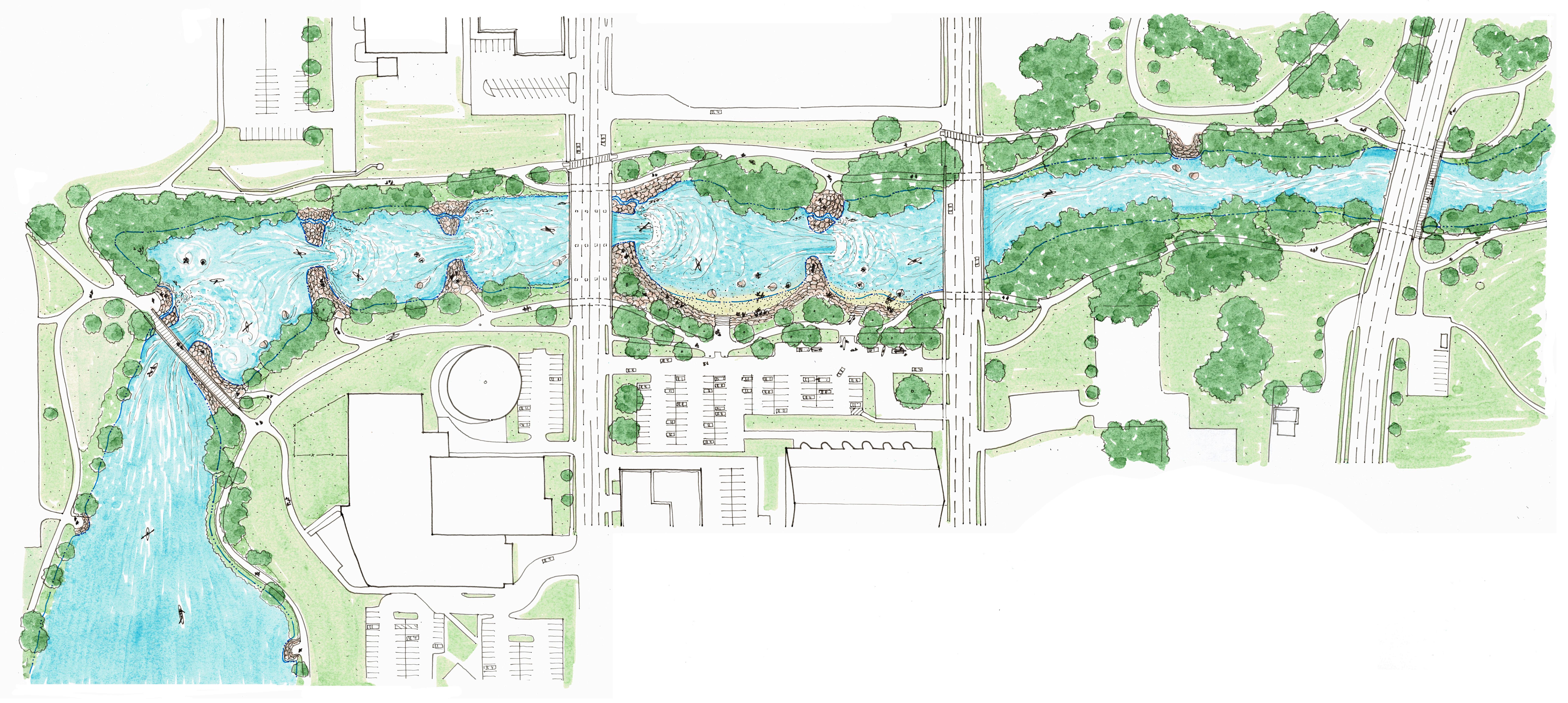

Drop Structures Stone Terracing / River Access Stone Terracing / Seating Pedestrian Underpasses 1. New Trail 2. New Trail Underpass 3. New River Access 4. New ADA River Access 5. River Access Pathway 6. Constructed Stone River Recreation ‘Drop Structure’ 7. 4th Avenue Dam Modification / River Recreation Feature 8. Surf Wave 9. Fish Passage Channel 10. Stone Terracing and Seating 11. New Riverside Park Space 12. Boater Parking and Access Area 13. River Boulder Pool 1 Pool 2 Pool 3 Pool 4 Pool 5 4th Avenue 2nd Avenue Oakland Avenue Illustration by: 6th Street 5th Avenue To Downtown YMCA Riverside Arena Austin City Building Lions Park 4 4 6 5 5 9 2 3 2 2 2 2 2 9 8 8 6 7 13 13 3 3 12 1 1 1 1 1 1 1 P P P 1 12 11 10 10 NOTES TO SHEET C E D A R R I V E R C E D A R R I V E R
N 50 100 ft.
CEDAR RIVER RECREATION PARK, Austin, MN
