


CORRIDOR IMPLEMENTATION PLAN
DECEMBER 2023

A partnership between:

City of Indianapolis, Department of Metropolitan Development
Develop INDY
Indianapolis Airport Authority (IAA)
PREPARED BY:


The City of Indianapolis, Develop Indy, and the Indianapolis Airport Authority partnered to provide a vision and a detailed strategy to implement economic development for the West Washington Street Corridor.
The West Washington Street Corridor Study builds upon the 2018 West Side Vision Plan, narrowing the focus to parcels fronting West Washington Street, bounded by I-465 to the east and the Hendricks County line to the west. This study emphasizes property owned by the Indianapolis Airport Authority as a catalyst to create a visible impact along the West Washington Street Corridor and leverage the adjacency of the Indianapolis International Airport.
This plan is characterized by a phased development strategy for the corridor with actionable next steps to enable transformative change. This implementation plan combines strategy, process, and action items. It outlines the steps needed to achieve a shared objective. The purpose for this plan is to introduce this strategy to staff, major stakeholders, and elected and appointed officials with the City of Indianapolis, Develop Indy, and the Indianapolis Airport Authority on communicating this strategy.
This study provides a roadmap for implementation, documenting several months of in-depth study. The Client Team, composed of representatives from the City of Indianapolis, Develop Indy, and the Indianapolis Airport Authority, collaborated closely with the Consultant Team to create this strategy. In addition, the team engaged with a Stakeholder Committee of political, non-profit, educational, and business leaders in the community and made several presentations to neighborhood organizations.
Much has changed since the completion of the 2018 West Side Vision Plan: the Client Team entities working in collaboration; the Indianapolis Airport Authority stepping forward to guide and support this initiative; a focus on applying for statewide funding through the READI Grant process; and the potential for innovative implementation along this corridor.
This study provides a roadmap for immediate-, shortterm, and long-term projects and initiatives designed to advance economic development opportunities in the study area. These projects and initiatives have the power to enable transformative change and uplift the community.
Key components of this study include:
• Lessons from Previous Planning
• Study Area Conditions
• Stakeholder Input
• Proposed Big Moves
• Vision
• Site and Property Analysis and Recommendations
• Market Analysis and Recommendations
• Utility and Infrastructure Analysis and Recommendations
• Development Recommendations
• TIF Recommendations
• Phased Implementation
This planning process is built upon the vision plan with a focus on providing concrete steps to advance economic development in this area. This process incorporates market, TIF, infrastructure, and land use analysis to develop a strong vision for how this area of Indianapolis could be transformed through strategic investments.
This planning process included three phases focused on advancing this work:
• Integration and Assessment - Built a solid foundation of knowledge from previous plans including testing the feasibility of recommendations and opportunities unaddressed during the prior planning, recording key changes that have taken place over the subsequent time, and making updates to recommendations within these plans. We also analyzed studies and projects in the pipeline; existing physical, demographic, socioeconomic, and market conditions; IndyGo Blue Line route plans; TOD zoning overlay; employment, residential, and commercial development trends; current TIF resources and commitments; and existing assessed and increment value by land use type.
• Redevelopment Plan - Developed a robust vision for the study area and formed actionable recommendations and strategies for the study area. We prepared catalytic site strategies and development concept alternatives for the redevelopment of IAA-owned properties and other surrounding parcels along West Washington Street, bounded by I-465 on the east and the Hendricks County line on the west. We forecasted TIF revenues and expenses and developed priority criteria for use of TIF investment and redrawn TIF districts.
• Implementation and Public Finance Strategy - Synthesized planning with creative funding and investment strategies. These strategies will provide short-, mid-, and long-range actions, with an emphasis on catalyst projects and the different actors—public, private, and institutional sectors—needed to realize the potential of the corridor. This work also included a strategy for a new TIF district replacing the Airport TIF which is expiring in 2025.
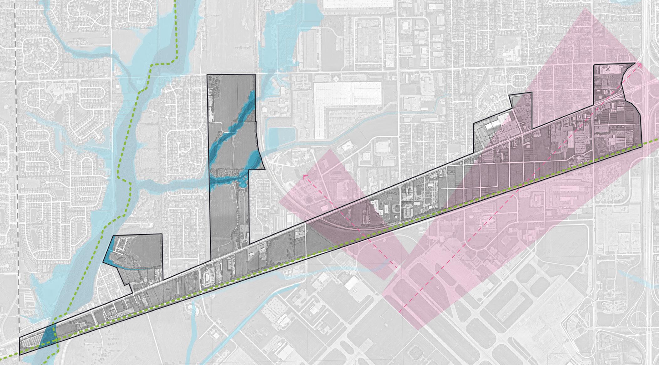
The study area includes approximately 885 acres in area (property, easements, and right-of-way) on the West Side of Indianapolis, immediately north of the Indianapolis International Airport. The Indianapolis Airport Authority (IAA) owns 105 parcels within the study area totaling around 185 acres with the remaining land consisting of 194 acres of vacant, undeveloped land and 506 acres of improved land.
The study area includes parcels fronting West Washington Street on the north and south sides, bounded by I-465 to the east and the Hendricks County line to the west. West Washington Street is the main east-west corridor bisecting the study area, paralleled to the north by West Morris Street and the south by North Perimeter Road. South High School Road, South Girls School Road, and Bridgeport Road run perpendicular to the site, providing north-south access to the West Washington Street Corridor. The West Washington Street Corridor is adjacent to I-465, providing both direct access and visibility from the interstate. South Minnesota Street and South Sigsbee Street are contained within the study area.
The Indianapolis Airport Authority (IAA) is a primary stakeholder in the West Washington Street Corridor as it owns a large portion of the land that is prime for development within the study area.
Two flight paths are designated in the study area by the Federal Aviation Administration (FAA). The flight paths determine guidelines for the development occurring within their boundaries to provide and maintain a safe and efficient airspace. Restrictions on the flight path include no development or standing water on the approach path and no standing water on the departure path. In addition, property acquired by the IAA is prohibited from residential redevelopment.
Current land use in the study area is characterized by vacant and underutilized land, highway commercial, and light industrial. Low- and medium- density residential neighborhoods, such as Ben Davis and Chapel Hill, surround the study area to the north. Ben Davis University High School is an important institution in the community located near the study area. Administrative offices of the Metropolitan School District (MSD) of Wayne Township, another key stakeholder, is included in the study area along the West Washington Street Corridor.
Once completed, the White Lick Creek Greenway and Vandalia Trail will provide critical multi-modal trail infrastructure in the area. The White Lick Creek Greenway will continue to run north adjacent to the study area, following the White Lick Creek and running parallel to the Jameson Camp. The Vandalia Trail will run parallel to north Perimeter Road along the southern border of the study area.
The team engaged with area stakeholders, the business community, residents, and the development community to solicit feedback and hear about the needs and opportunities along the corridor. The team developed a stakeholder group of area institutions, community groups, and city officials that are working towards the revitalization of the corridor, which included Ben Davis Christian Church, City/County Council, Develop Indy, the Indianapolis Airport Authority, Indianapolis Department of Metropolitan Development, Indy Gateway, Mayors Neighborhood Advocate, Merchants West, MSD Wayne Township, Wayne Township Trustee, West Side Chamber of Commerce, White Lick Creek and Vandalia Trail Alliance, and business owners.
Common themes emerged through stakeholder and community engagement. The community desires to make the West Washington Street a place people wanted to visit and stay, establishing an identity for the area, and creating a brand that reflects the West Side’s history. Several elements might contribute to that identity, including the historic Interurban Railroad which ran east to west on Washington Street, strong support for Ben Davis High School and athletics, the Bridgeport area, and general regard for the Indianapolis International Airport as a significant asset. All of these themes blended with the identification of Ben Davis Station and Bridgeport as brands for the two bookends of this corridor.
Other desires for the redevelopment of the corridor included:
• Safe pedestrian facilities along West Washington Street and new trails to connect beyond the corridor
• New park spaces, bandshell, and picnic spots
• Retaining the small-town scale established by current short setbacks from the roadway
• Art, landscaping, decorative lighting, signage standards, façade improvements, and other aesthetic improvements
• Public green spaces connected to trails
• Reestablishing a community garden
• Grocery and urgent care facilities
• Mixed-use development and housing
• Trail access with new developments
• Small business incubation
The community also noted concerns for the corridor that ranged from aesthetics to livability to safety, which included:
• Lack of destination/activities along the corridor
• Need for more significant employment along the corridor to improve IndyGo bus frequency
• Non-contributing businesses/property owners
• Properties/buildings with condition and maintenance issues
• Lack of connectivity and pedestrian facilities
• Lack of traffic enforcement
• Lack of amenities (grocery, shopping, restaurants, etc.)
• Lack of aesthetic standards
• Excess of used car lots and empty storefronts
There is a need for community services and amenities as community members expressed having to travel to surrounding areas to do everyday shopping and access basic needs.
The community also provided feedback on the development concepts which helped inform the strategy for the corridor. The community was supportive of moving forward with redevelopment as a tool to make a highly visible impact and increase employment and tax-base along the corridor. Specifically, they favored mixed use and diverse residential development as well as using development opportunities to create connections to trails and open space.
The team engaged with the developers and site selectors to discuss the opportunities in the corridor and learn of any past issues that have hindered development. Developers identified the amount of adjacent land, proximity to the airport and rail, and highway access as unique characteristics of this study area. Developers further identified that property control, utility upgrades, and proactive rezoning would improve the marketability of this area. These findings reflected the market analysis conducted as part of the study. They expressed the amount of potential interest following the direction of the West Washington Street Corridor Implementation Plan.
“Big Moves” are defined as enabling steps for development along the West Washington Street Corridor:
The West Washington Street Corridor is an autocentric thoroughfare with harsh pedestrian conditions and a lack of accessible infrastructure. Corridor improvements on this INDOT-regulated corridor are needed to enhance the pedestrian experience and implement safety measures, including streetscape improvements, sidewalk installation, signalized intersections, multi-use paths, and access to area trails.
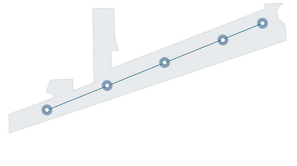
The airport controls significant land along the West Washington Street Corridor. Leveraging this ownership positions the authority to advise on future development and promote projects vital to the corridor’s redevelopment. There is an opportunity for strategic land acquisition adjacent to airport authority owned property to increase the frontage along West Washington Street and create visible and accessible economic growth.
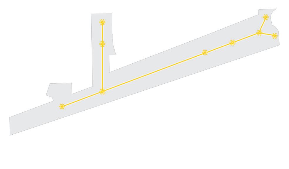
The quantity of contiguous airport-proximate land under one owner with Interstate highway accessibility significantly increases the marketability of this property. This area is highly valuable as a catalytic driver of investment focused on innovation and employment. Strategically focusing on sites for large-scale development promotes the marketability of the corridor and will serve as an impetus for future growth within the study area.
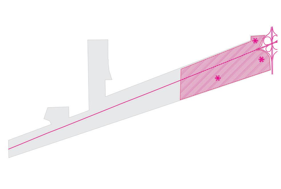
Ben Davis Station at the intersection of West Washington Street and High School Road as a gateway transforms the entrance to the corridor, promotes a sense of identity, and creates a buzz to attract community-serving development to the corridor. Bridgeport as the gateway at the intersection of Bridgeport Road and West Washington Street can potentially create airport accessibility and further the corridor’s identity. These individual gateways along with an overall corridor brand develop a sense of cohesion, uniting the corridor as a place ready for economic development.

The proximity to the airport is a major anchor for investment along the corridor. Leveraging the proximity to the airport can attract innovative investments from industries that benefit from the efficiencies of the location and airport accessibility. This includes local and regional focuses on innovation, research and development, life sciences, pharmaceutical manufacturing and storage, and regionally significant uses. Many similarly sized airports nationwide are seeing substantial investments in innovation-focused industries and regionally significant uses with a user experience focus nearby.
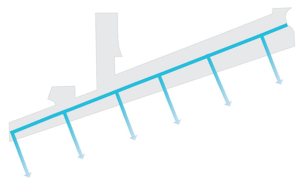
Developing larger anchor sites can spur economic investment in smaller infill sites throughout the corridor with complementary employment and commercial uses. These sites will expand the impact of the gateway and catalytic sites. Infill development can be used to diversify the types of businesses supporting entrepreneurship and flexibility in business growth while complementing the existing uses along the corridor.

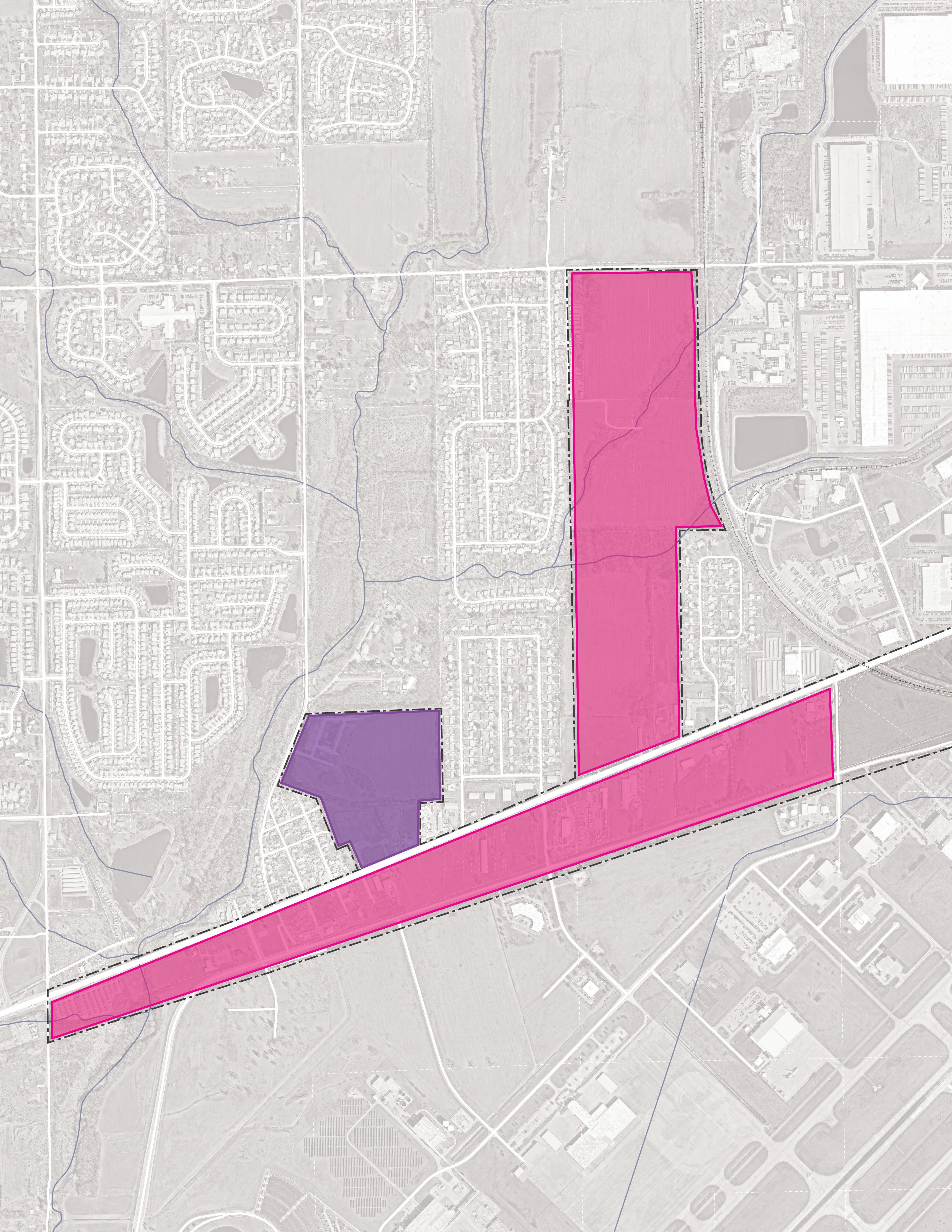
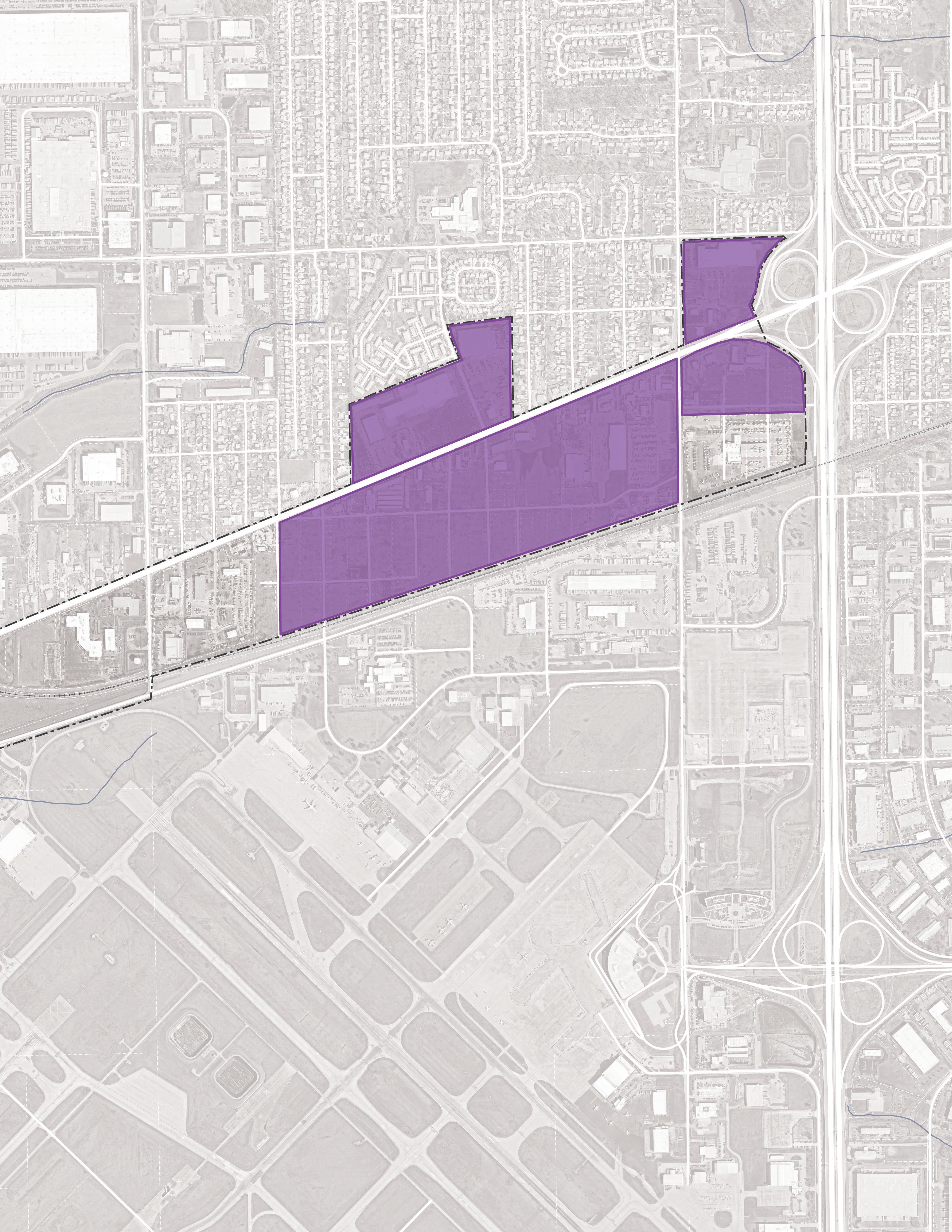
Areas of Impact include two subcategories - Primary Areas of Impact that can develop in a way that will transform this corridor and neighborhood and Secondary Areas of Impact that will support this transformation. These designations direct development activity and other targeted investments based on proximity and relationship to the corridor.
Sites were identified based on land ownership, vacancy, and opportunities for higher and better uses. A deep dive study of Primary Areas of Impact— including evaluating market support and demand, unique X-factors that could change the trajectory of development, branding, and placemaking, future land use and development opportunities, zoning, utilities, TIF proforma analysis, and phasing—was conducted on Sites A, B, C, and D as the future “Ben David Station” Site, and Sites E and F as the future “Bridgeport” Site. For all remaining Secondary Areas of Impact, a higher-level study focused on future land use, zoning, and utilities.
For purposes of this study, individual sites may have been grouped to demonstrate synergy among sites for development potential.
Site A is 15.8 acres under 5 property owners, the largest amount of land being owned by the Emporium 40 Flea Market at 12.5 acres. This site is immediately adjacent to the I-465 interchange and West Washington Street, with prime visibility and access from High School Road. The site benefits from its location, relative scale, and the fact that the site could be aggregated for redevelopment with relatively few owners. There is already an undeveloped outlot on this property that has been marketed for hotel development. Factors, such as the site’s proximity to Ben Davis University High School, adjacency to residential areas, and the potential for enhanced IndyGo Bus service in the future, could support development of this site as a prime walkable, mixed-use anchor of the West Washington Street Corridor. As such, the City should steer development towards a walkable village mixeduse district as this area redevelops.
Site B is 12.9 acres and is owned by IAA and others. The site is located southwest of the I-465 interchange, south of West Washington Street, and east of South High School Road. The location of the site falls within the FAA flight path which subjects IAAowned property to certain development restrictions including no standing water as part of stormwater detention and no residential development. The site is accessible from West Washington Street, South High School Road, and Howard Street. Redevelopment of properties identified by the community, such as the Regal 8 Hotel, should be prioritized to make the site more attractive as a gateway to the corridor. Site B has the potential for mixed-use opportunities and could host research and development/employment uses.
Site C is 33.2 acres and is owned by multiple property owners. The site is located north of West Washington Street and is intersected by South Sigsbee Street. MacAllister Rentals and Goodwill Outlet occupy a large portion of the site along with a few smaller commercial entities fronting West Washington Street. There is potential for this site to develop in the future to serve as a residential transition between the commercial corridor and the existing neighborhoods. This site would develop as the market changes based on the surrounding catalytic sites.
Site D is 100.8 acres and is owned by IAA and others. It is bounded on the north by West Washington Street, on the east by High School Road, on the south by Perimeter Road, and on the west by existing office and light industrial employment developent. The site is accessible by these boundary streets as well as by Minnesota Street which bisects the site from east to west. The location of the site falls within the FAA flight path which subjects IAA-owned property to certain development restrictions including no standing water as part of stormwater detention and no residential development. The site is adjacent to the planned Vandalia Trail alignment. Land assemblage and frontage acquisition adjacent to the majority of IAAowned property would create a large development opportunity with direct access to the Indianapolis International Airport.
Site E is 138.4 acres with multiple property owners. A portion of the site is within the 100-year floodplain. The site has access from West Washington Street on the south and Morris Street on the north. Site E will likely interface with the planned White Lick Creek Greenway. Site E has the largest acreage and depth of sites along the corridor and could add a diverse range of housing stock to the corridor while providing north-to-south access to West Washington Street from Morris Street.
Site F is 42.7 acres and has two primary ownersJameson Camp and MSD Wayne Township. The site is adjacent to White Lick Creek and immediately south of Jameson Camp. The site is accessible from West Washington Street and Bridgeport Road. The site will likely interface with the planned White Lick Creek Greenway. There is a potential for synergy on Site F with a mix of trail-oriented residential and commercial development, Jameson Camp, and potential recreational or open space uses.
Site G is 93.5 acres and is owned by IAA and others. The site contains scattered commercial development and vacant land located between West Washington Street and Perimeter Road. The site falls partially in the floodplain and interfaces with the planned White Lick Creek Greenway and Vandalia Trail. There is an opportunity for infill development among the existing businesses on the site. The parcels on either side of Bridgeport Road could serve as a western gateway to both the West Washington Street corridor and the airport.
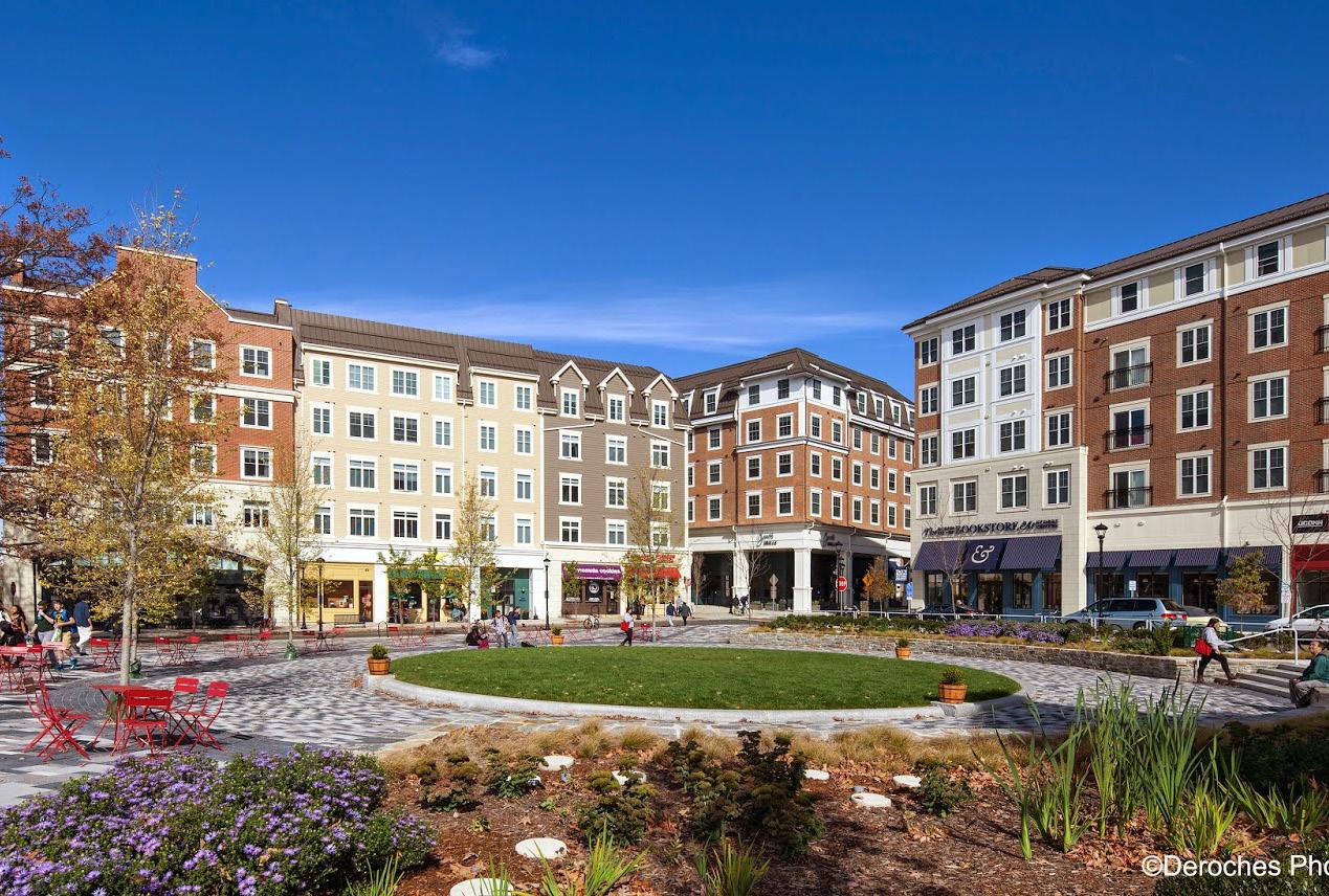
Place Types are not prescriptive of future land use or zoning but instead describe the vision for creating a place along the West Washington Street corridor with a vibrant ecosystem that is walkable, has IndyGo bus transit access, and a diverse range of employment locations, businesses, destinations, and housing. These descriptions have an overarching intent statement and describe typical land uses and goals for how development or redevelopment could occur in each of these areas. Short statements are paired with character imagery from other similar places to help visualize these places. This information is included in more detail on pages 14-15 and are intended to inform the quality of development sought for major sites explored in more detail on pages 22-31.
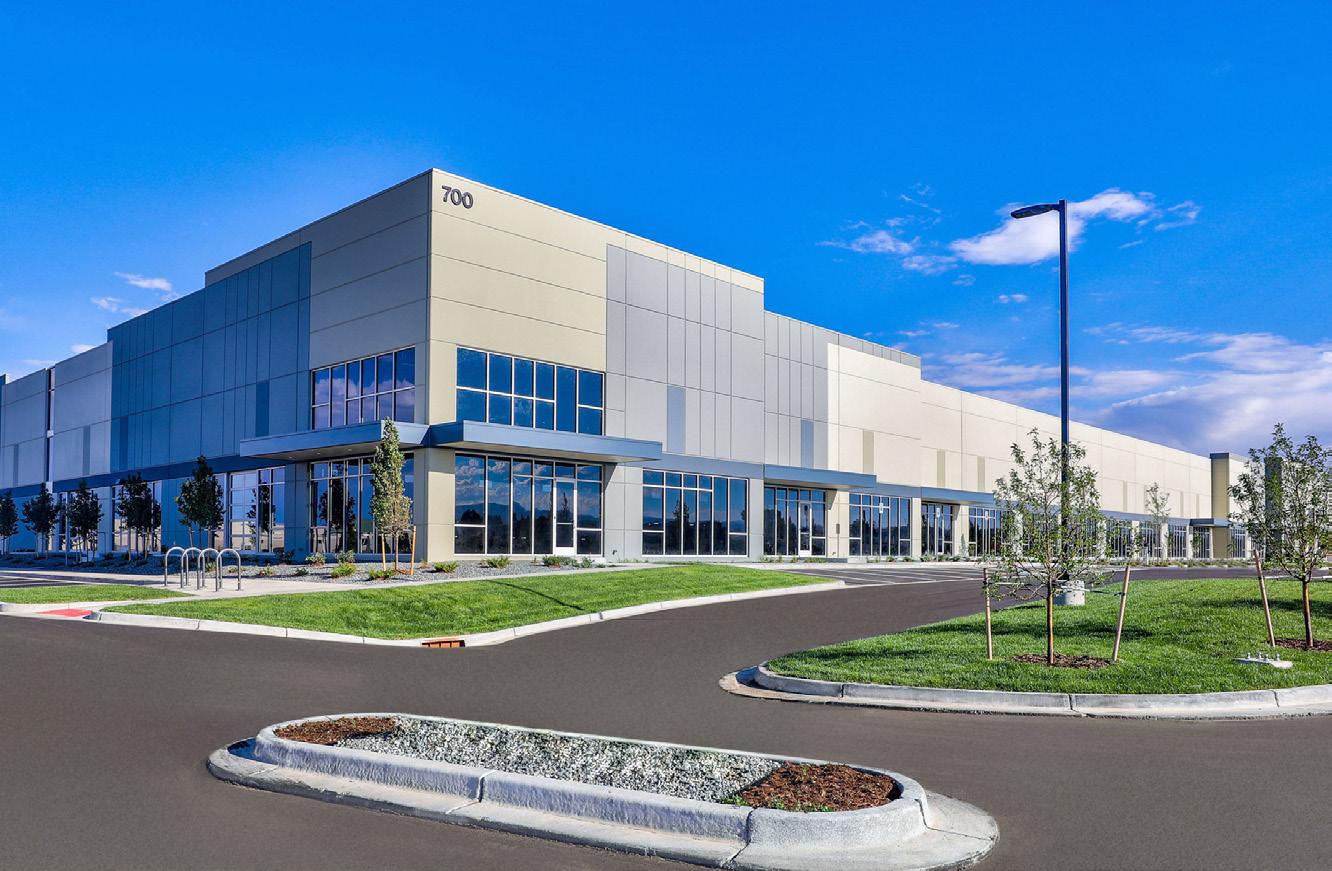
Walkable development focused on the clustering of complementary employment uses including research and development, corporate headquarters, airport-oriented uses, advanced manufacturing and support industries, and commercial.
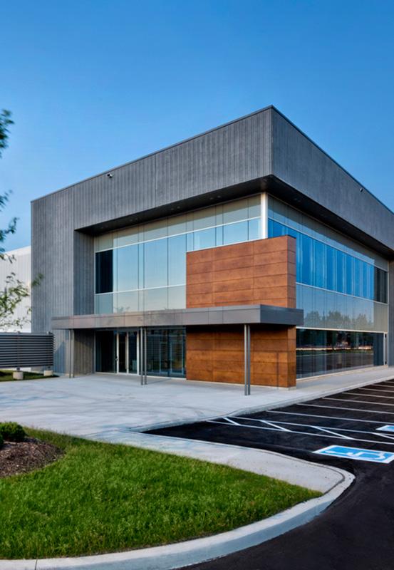
Typical Land Uses
Secondary Land Uses
Advanced Manufacturing; Research and Development; Pharmaceutical Manufacturing and Cold Storage; Light Industrial; Artisan Manufacturing/Food Production; Corporate Headquarters; Regionally Significant Anchor; Airport Supportive Use; Flex Office; Retail/Office/ Services; Entertainment
Pocket Parks/Plazas; Greenways/Trails; Recreation Facilities; Cultural/Civic; Stormwater Best Management Practices (BMPs); Surface and Structured Parking
Parking
Transportation
Shared Parking Lots and/or Structures; Short- and Long-Term Bike Parking
Interconnected Street Grid with Wide Sidewalks, Bike Facilities, and Frequent Bus/Transit Connections
Typical Building Heights/Density
Other
Considerations
Varies in Heights and Density
Any Redevelopment Should Occur in a Sustainable Manner that Minimizes Impacts on Natural Areas, Incorporates Proper Stormwater Management, and Mitigates Potential Hazards to Air or Water Quality. Due to the Flight Path, Restrictions on Open Water Apply to Stormwater Areas.
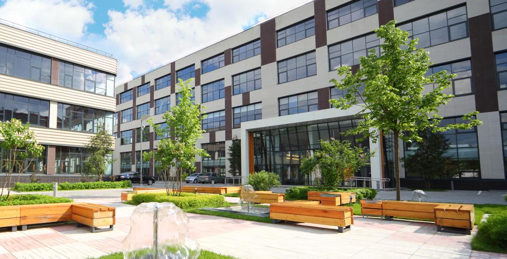
Compact, walkable areas with scaled mixed-use buildings that engage and support an active public realm serving the nearby community.
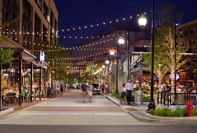
Typical Land Uses
Secondary Land Uses
Multi-Family Housing; Supportive Housing; Attached Housing; Retail/Offices/Services; Flex Office/ Employment; Medical Offices/Services; Government/ Public Facilities; Hospitality; Entertainment; Mixed-Use (vertically and horizontally integrated)
Pocket Parks/Plazas; Greenways/Trails; Recreation Facilities; Cultural/Civic; Religious, Education, and Assembly Facilities; Stormwater BMPs; Preservation/ Conservation Area; Surface and Structured Parking
Parking
Transportation

Typical Building Heights/Density
On-street Parking with Limited Clustered Off-Street Parking; Shared Parking Structures; Short- and Long-Term Bike Parking
Interconnected Street Grid with Wide Sidewalks, Bike Facilities, and Frequent Bus/Transit Connections
Medium Density of 6-25 Dwelling Units Per Acre; Anticipated Average Height of 1-4+ Stories
Other Considerations
Any Redevelopment Should Occur in a Sustainable Manner that Minimizes Impacts on Natural Areas, Incorporates Proper Stormwater Management, and Mitigates Potential Hazards to Air or Water Quality


The planning process included a focused market analysis to update the less detailed analysis performed for the 2018 West Side Vision Plan. This analysis evaluated the type and pace of employment-based development that could be expected regionally over the next decade and a realistic capture of this demand for the corridor. The analysis also evaluated demographic and economic trends and regional economic development objectives to assess the corridor’s geographic context and marketability, including its strengths, weaknesses, opportunities, and threats.
Building on the site context understanding, the market analysis—an analysis of real estate supply and demand—determined the specific scope of possibilities in terms of present and future opportunities to supply unmet demand for different consumer groups, residents, and employers. While the analysis focused on employment-based development, it also explored complementary uses such as housing, retail, and hospitality.
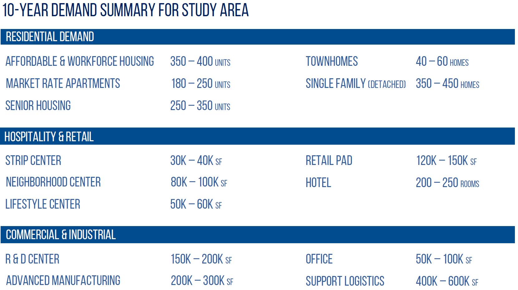
The development program established for the market identifies a significant amount of real estate that could be developed over a 10-year period, assuming certain market barriers were addressed.

The market strategy is built upon the baseline market analysis to identify key development objectives and a framework changing the market trajectory of the corridor. This analysis considered development typologies, optimal sites and arrangement of uses, anchors, catalyst sites, differentiation, district definition, public space, quality, character, amenities, and mixed-use synergies and complementarity uses. The utility of the market strategy was to build consensus, create tools for communicating strategic development objectives for the community at large, and inform the implementation plan.
Through this process, what development problems are we trying to solve, and what are the development goals?
While somewhat fundamental, it is critical to document and communicate the key development barriers and the strategy for overcoming them in order to create alignment among stakeholders and establish long-term community support and buy-in. The corridor needs a highly visible strategy focused on upgrading infrastructure, positioning underperforming real estate for redevelopment, and creating a buzz to activate the market in support of high-quality development for new jobs, amenities, services, and housing.
Where along the corridor do we want to see changes? What type of development should be built and how much?
At the highest level, the following goals were established to guide the strategic redevelopment planning process:
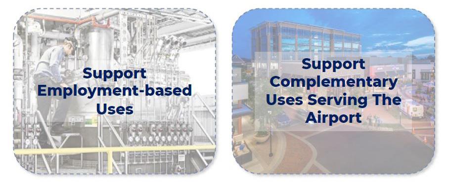
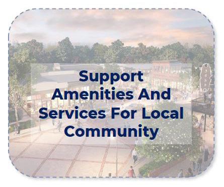
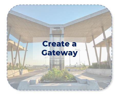

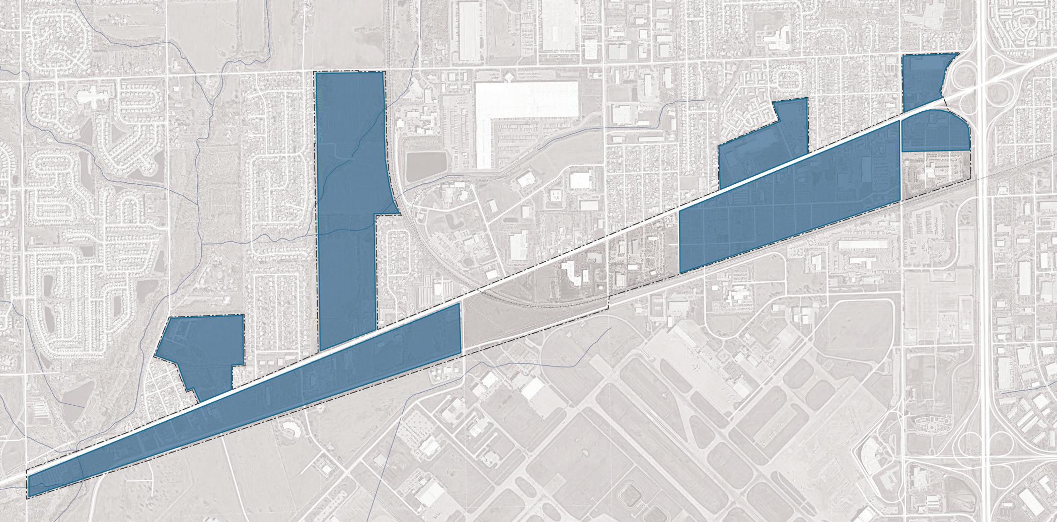
The corridor has several different subareas characterized by mixed-use and residential development that include more community-facing development north of West Washington Street, more employment-based development south of West Washington Street, and the primary gateways on the east at Ben Davis Station (High School Road and West Washington Street), and on the west at Bridgeport (Bridgeport Road and West Washington Street). These distinct subareas demonstrate appropriateness for certain types of uses and development based on location and site configurations. At this level, parcel configuration and ownership should not deter a future vision for future development, although current use, vacancy, and obsolescence were considered in establishing these sites. Seven potential sites, totaling around 525 acres, with the most catalytic redevelopment potential were established within the study area. In other words, investment in these areas would have the greatest influence on changing the market potential and trajectory of the area.
From a strategic standpoint, it was determined that the areas to the east had the greatest potential to support broader economic development initiatives and spur transformative change along the corridor. In contrast, the areas further west have opportunities for smaller-scale projects. Given the linkages to the primarily residential neighborhoods to the north, future development on the north side of the corridor would be best positioned to serve the local community, while the areas to the south would better serve the strategic goals of the airport.
What are the key industry clusters and who are the anchor employers to attract?
Given the importance of this corridor to the strategic positioning of the airport and regional economic development efforts, it is critical to identify sectors that would value proximity to the airport and that best align with regional, state, and national economic development interests.
The airport provides added value and marketability for developing or redeveloping proximate parcels for certain uses and sectors.
• Supply chain access is one of the top reasons for airport-adjacent development to reduce logistics times (e.g., “plane-to-truck” times)
• Access to efficient regional and international airports can also increase access to talent and business connections, which support employment-based uses for knowledge sectors and advanced manufacturing
• Leisure travelers can also support enhanced retail tourism and hospitality-based uses
There is an opportunity to align future redevelopment in the study area with strategic global, national, state, and regional economic development goals.
• Post-pandemic, there has been a greater emphasis on improving supply chains globally, and airports continue to be economic engines
• There has been an increasing push for re-shoring nationally—or bringing jobs back to the United States from overseas—to enhance national security, support supply-chain risk management, increase global competitiveness, and expand investments in advanced manufacturing and life sciences
• The State of Indiana ranks 22nd nationally in reshored jobs and has captured 22 percent of reshored jobs in the Midwest. The airport can and should support the state’s efforts to increase the number of re-shored jobs over the next decade.
According to the Indiana Economic Development Corporation (IEDC), the state’s target clusters include life sciences, agribusiness, aerospace, defense, advanced manufacturing, and logistics and transportation.
Within the study area, there is a great opportunity to attract significant economic development focused on these clusters. Specifically, site selectors and developers confirmed that focusing on life sciences— particularly specialty pharmaceutical production and storage—is important as this mix of location factors ,such as proximity to the airport and Fed-Ex shipping facilities, exists nowhere else in the region. Further attraction could occur in other allied uses for airportadjacent development and regionally significant users such as racing headquarters and experiences.
Promoting real estate development that supports the life sciences and advanced manufacturing sectors would support strategic regional economic development goals; however, these real estate products tend to have much higher development costs and pose more risk than developing conventional manufacturing or logistics and warehousing spaces. As such, strategic partnerships, programming, incentives, and subsidies will be needed to encourage this investment.
• There are a number of sectors and uses that would value land proximate to an airport
• Among these sectors, there are growing national, state, and regional interests in supporting life sciences and advanced manufacturing
• Attracting real estate investment in these sectors will require a more comprehensive approach, including strategic uses, infrastructure investment, and site control

How will this district be integrated within the region?
There is an overall “market readiness” for the expansion of the life sciences cluster in the Indianapolis region and the State of Indiana supported by the expansion of Eli Lilly as part of the LEAP Lebanon development. The region has made great progress in creating the needed inputs and support for this sector. The study area provides an opportunity to fully integrate the life sciences sector regionally, nationally, and internationally with strategic real estate and infrastructure investment.
The strategic positioning of the study area as an innovation hub will be most successful if it is integrated within the broader statewide and regional network of tech parks, institutions, and innovation and entrepreneurial ecosystem.
What uses will support existing residents and attract new residents?
Key steps for overcoming marketability challenges within the corridor include investments in people, places, and community amenities that will have a net positive impact on the community as a whole. As stated previously, market conditions have not been conducive to new residential or commercial development due to the corridor’s condition from an infrastructure and real-estate perspective; therefore, additional public and community sector interventions will be needed.





An overall West Washington Street Corridor vision was developed outlining the development and investment potential within the corridor study area. Areas of Impact are opportunity sites with the greatest development potential. Characteristics such as cleared sites, underutilized land or surface parking lots, buildings suitable for adaptive reuse, or consolidated and airport land ownership were important factors in determining certain sites’ development potential.
A development program was established to determine a reasonable amount of market-supported real estate investment that the corridor area could attract over the next decade, assuming key investments in the built environment and infrastructure and acquisition strategy.



• Site A: Mixed-use node with retail serving the local community and lower density multifamily and attached single-family housing. The site is very marketable given excellent visibility from and access to aerial roadways.
• Site B: High-visibility regionally significant site for specialty uses, corporate headquarters, light industrial, research and development, and office with supportive retail uses
• Site C: Redevelopment sites for primarily residential uses, including mixed-income multifamily and attached single-family housing. The site included areas with frontage on West Washington Street that are ideal for commercial uses.
• Site D: Primarily employment-based uses, including light industrial, research and development, and office with supportive retail uses. Other potential civic uses could include workforce training, institutional uses, or open space uses.
• Site E: Primarily a mix of residential and community uses, including open space uses
• Site F: Primarily a mix of residential and community uses, including recreational facilities and supportive retail uses
• Site G: Light industrial, office, and employment uses to support other more intensive uses further east and south
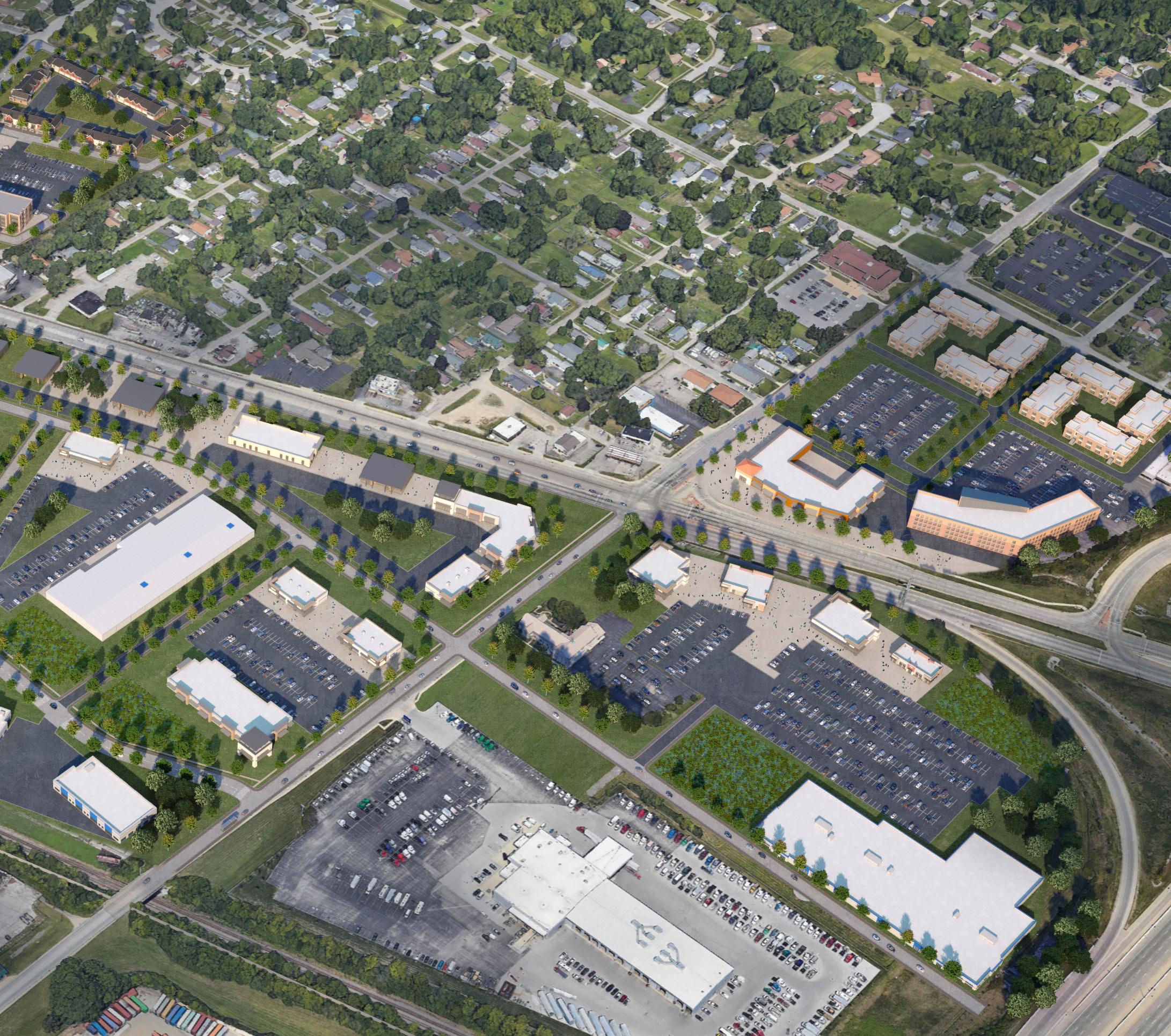
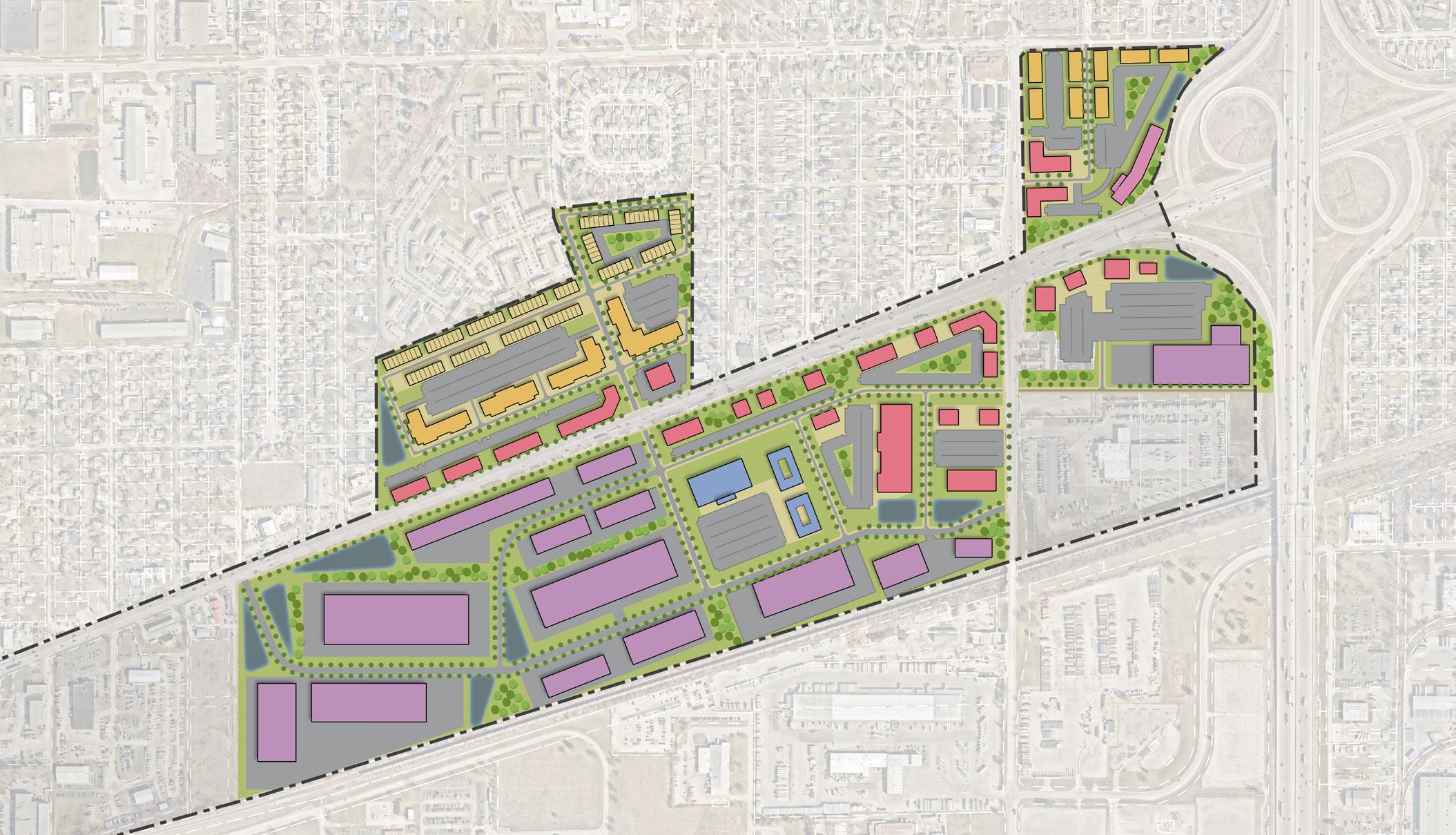
Ben Davis Station is a neighborhood brand conceived through this study to leverage the past and future of this neighborhood anchor as a transit-oriented development served by an interurban rail in the past and by IndyGo bus service today. This brand also pays homage to the area’s strong history of Ben Davis High School. Ben Davis Station consists of 163 acres and is a gateway to the West Washington Street Corridor from I-465, the north side of the airport, and High School Road. The site currently hosts an array of commercial uses, some vibrant and contributing to the neighborhood and some that are in disrepair. Notable commercial businesses include MacAllister Rentals, Goodwill Outlet, Royal Pins, Emporium 40 Flea Market, Regal 8 Motel, fast food chain restaurants, commercial offices, small-scale industrial users, and auto-centric businesses. Significant vacant land in the Ben Davis Station sites is owned by the airport and is identified as a catalytic site for future development along the corridor.
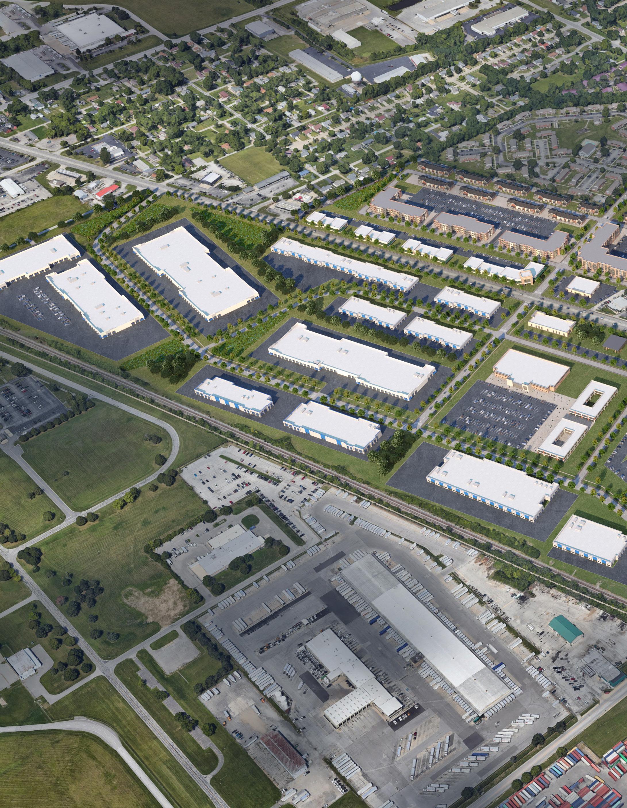
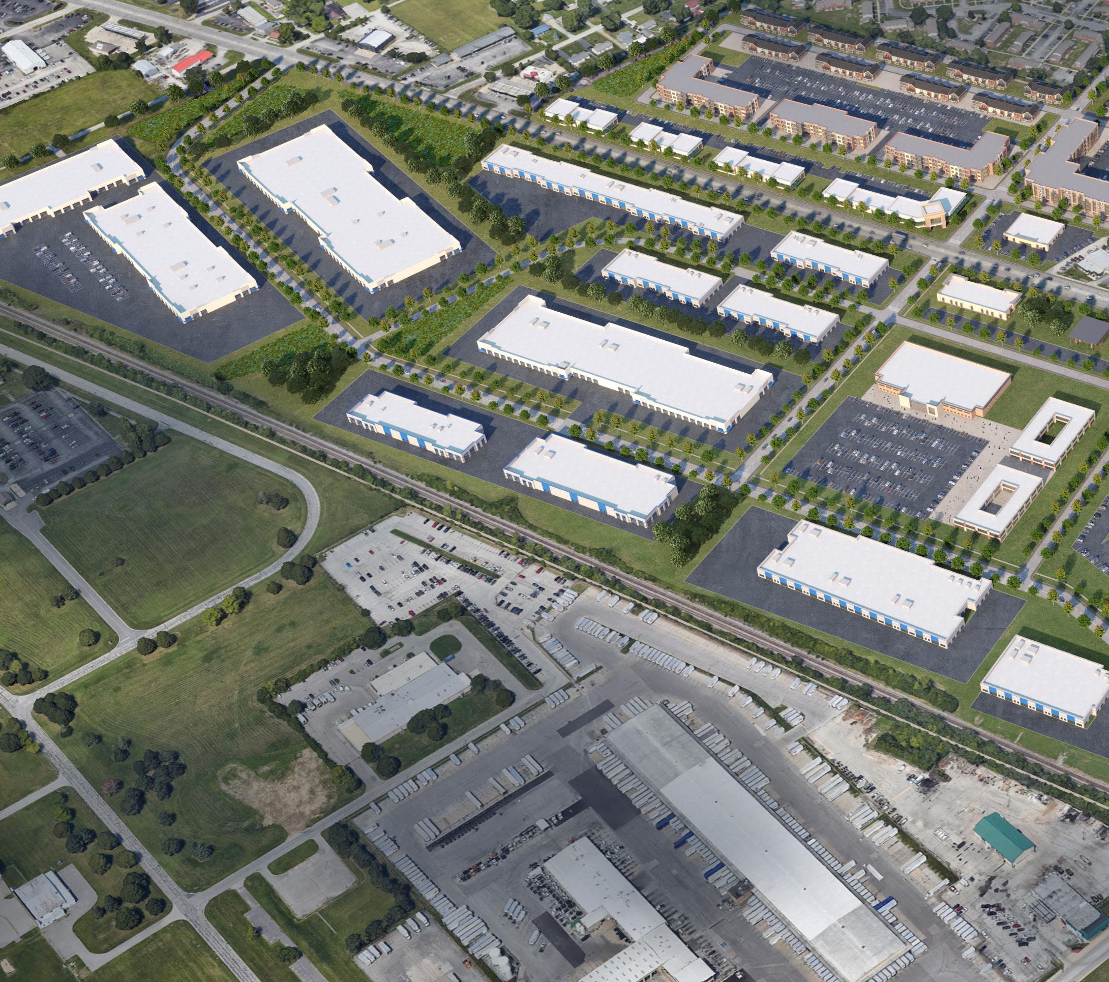
Ben Davis Station is envisioned as a neighborhood anchor that will attract significant mixed-use and multi-family residential development, airportsupportive uses, research and development, advanced manufacturing, life science/pharmaceutical manufacturing and storage, and other light industrial uses. Potential mixed-use and multi-family residential development will be concentrated north of West Washington Street. Employment-focused uses and supportive commercial uses will occur south of West Washington Street, backing up to the railroad and Perimeter Road.
While the airport controls much of the property in site D south of West Washington Street and west of High School Road, approximately 26 acres of additional property acquisition will be required to support additional phases of development in support of this plan. In addition, property acquisition will be needed to support the redevelopment of property directly north and south of West Washington Street within sites A and B, east of High School Road, amounting to 23 acres. Throughout this process, stakeholders indicated that a strategy for revitalization should focus on several underperforming assets, such as the Regal 8 Motel and the Emporium 40 Flea Market.
Property acquisition is recommended as a strategy to enable transformative economic development to occur along this corridor and should be considered as part of grant applications such as the State’s READI Grant Program.
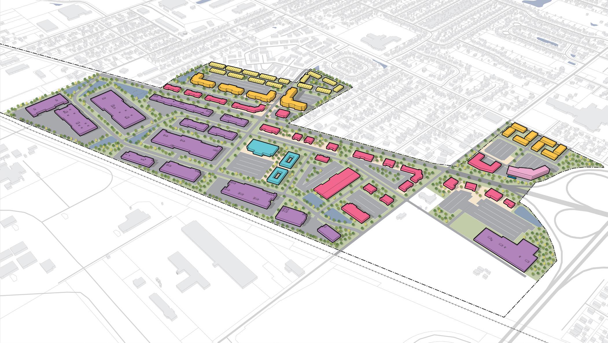
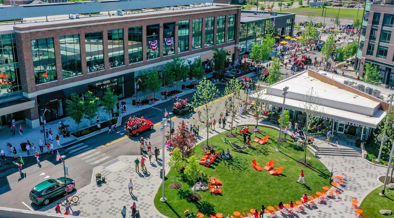
Future development at Ben Davis Station focuses on attracting businesses and industries that will benefit from the adjacency to the airport, I-465, and FedEx, including advanced manufacturing, light industrial, research and development, tech uses, anchor institutions, and corporate headquarters.
This site will also serve as the gateway to the West Washington Street corridor with community amenities, mixed-use development, and a hotel. Residential development is proposed on the northern portions of the site to tie in with the existing neighborhoods.
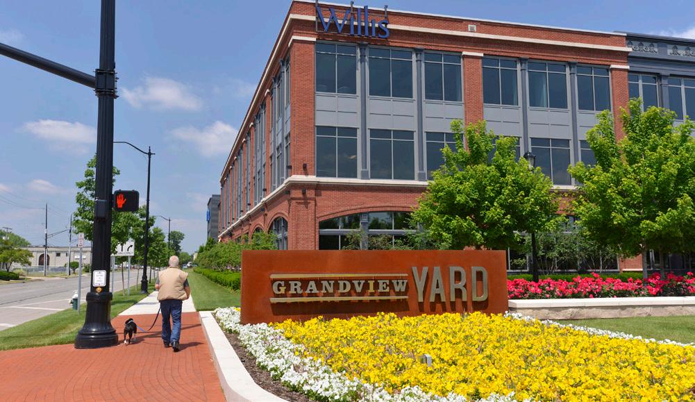
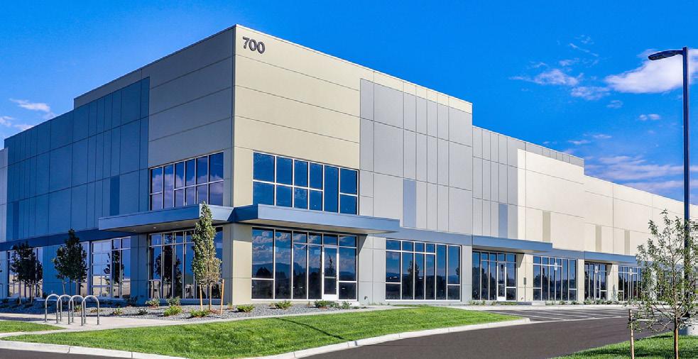
Anchor Employer

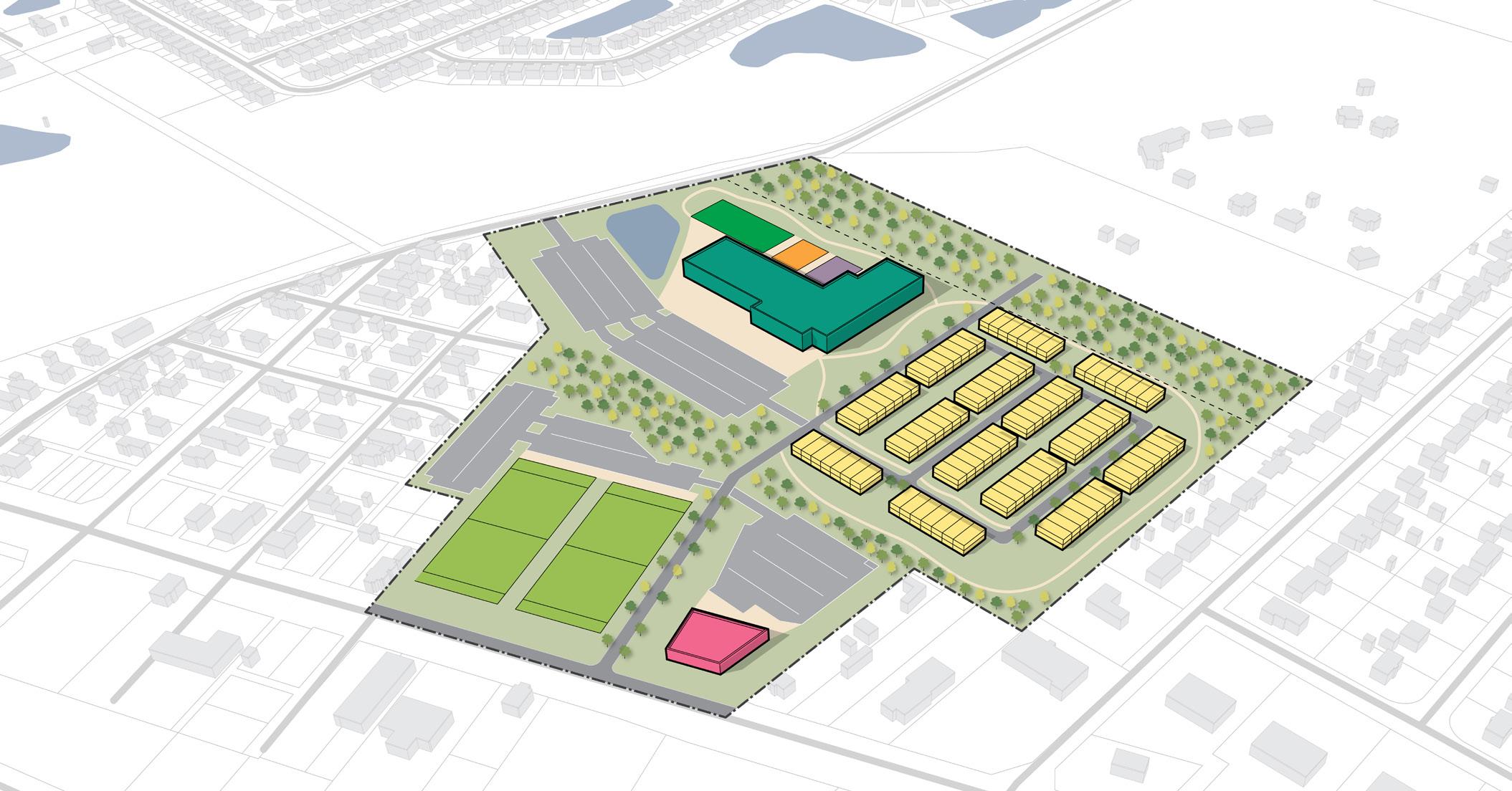
Bridgeport is a neighborhood brand conceived through this study to pay homage to the former Bridgeport Elementary School and neighborhood. The 43-acre Bridgeport site contains land owned by the MSD Wayne Township and Jameson Camp. Currently vacant, this site has served as a community garden and could further serve the community as a recreational use blended with community services, neighborhood commercial, and a mix of residential housing characterized by townhomes, senior independent living, and multi-family housing.
Site E is 139 acres and is a more naturalized vacant area that acts as a buffer between the residential uses on the west side of the site and the industrial uses on the east side. This area could maintain the natural buffer while adding diverse housing stock to the surrounding neighborhoods. This site has previously been evaluated for a mix of townhome and multifamily residential development.
Site F is 94 acres and is envisioned to attract office flex and light industrial employment uses characterized by relatively modest-sized lots and good accessibility to the airport. The strategy for this area is for remaining vacant land to develop and fill in the gaps of commercial activity to create a cohesive corridor along the western portion of the study area. This area creates an opportunity for a unique gateway to the airport and into the West Washington Street corridor for the West Side.
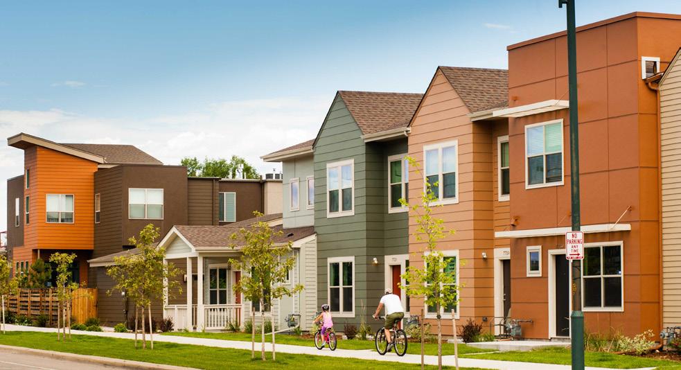
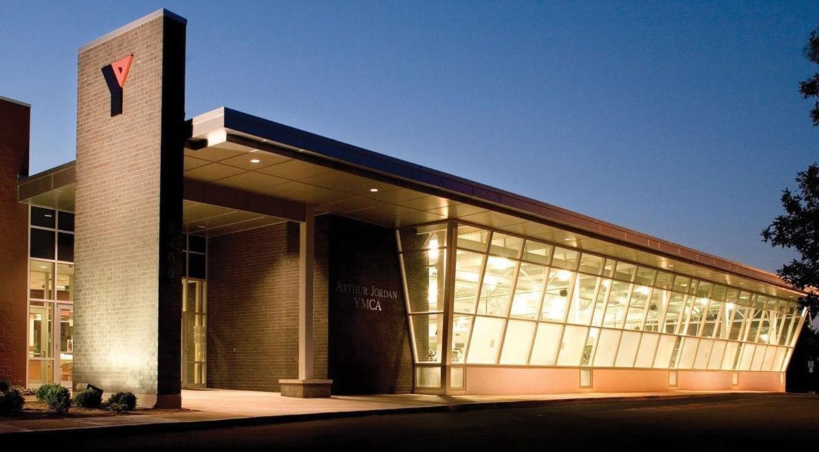
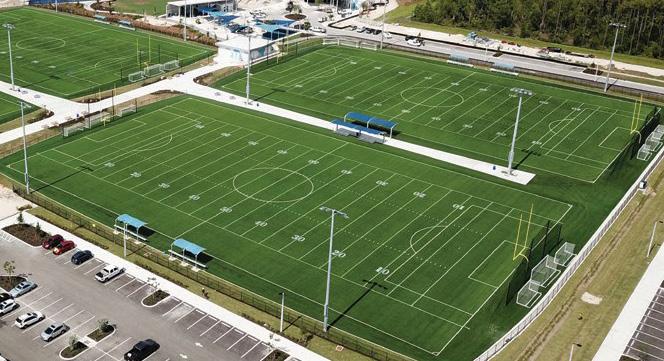
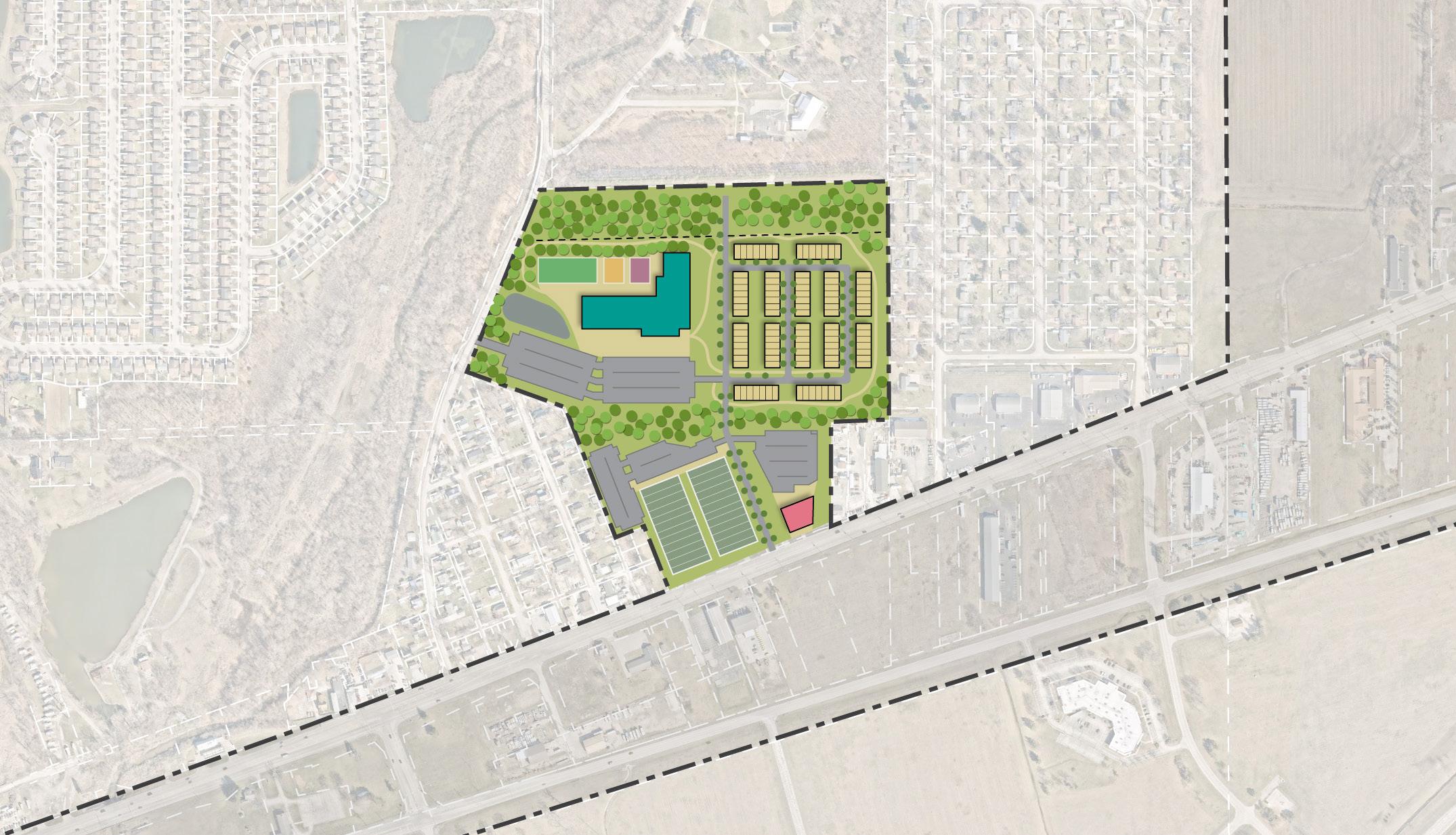
The Bridgeport Site will offer community connections and services to the surrounding area. With its location immediately south of Jameson Camp, this site has the potential to attract community-oriented uses, such as a recreation facility, sports complex, and athletic fields. A residential neighborhood is proposed on the site’s east side to create cohesion with the existing neighborhood.

Phasing of the Ben Davis Station Site is envisioned to occur in three parts. Phase 1 will focus on the identified catalytic sites proposing light industrial on IAA-owned property and a community-oriented commercial and mixed-use district proposed on the sites immediately west of I-465. These sites are development-ready, and the adjacency to the airport makes them attractive for investment. Phase 1 will provide the backing for the land assemblage that needs to occur for the Phase 2 development, mainly fronting West Washington Street.
Phase 2 will bring in new commercial frontage and contribute to the growth heading west along the corridor. The redesign of Minnesota Street will occur in this phase to accommodate future development and allow for better access. Depending on how development occurs, Minnesota Street may be vacated to allow for a larger developable site.
Phase 3 is a longer-term phase, looking at how potential residential development could occur north of West Washington Street. The residential development will tie in with the existing neighborhood along Sigsbee Street.
Phase 3 is a longer-term phase, looking at how potential residential development could occur north of West Washington Street and office flex and light industrial uses in infill adjacent to the airport south of West Washington Street. This area could be anchored further by commercial or community sports uses with additional residential development.
Ben Davis Station Site

Advancing available infrastructure to encourage economic development is integral to this implementation plan. A deep dive analysis of utility, roadway, and stormwater infrastructure throughout the study area was conducted as part of this study. Analysis concluded that some of the biggest barriers to transformative development in this area are aged and undersized sewer utilities provided by the Ben Davis Conservancy District, poor conditions of roadway infrastructure, and needed upgrades to the stormwater system to support development. In addition, water, gas, electric, and fiber utilities were evaluated and found that capacity exists within this area, but some upgrades would likely be needed as development occurs.
The West Washington Street Corridor was examined to determine the conditions of existing utility infrastructure, including sanitary sewer. After thorough analysis, it was determined that sufficient gas, water, and fiber exist throughout the corridor to supply the development envisioned by this study, with user tap-on occurring as development occurs. Electrical infrastructure exists in sufficient supply throughout the corridor, but a new substation will be needed as large-scale development occurs. Stormwater will need to be provided on-site, but within the FAA Flight Path zones, no standing water is permitted, so storage will have to be underground. While these considerations are important as development occurs, the primary barrier to development along West Washington Street is the availability of sufficient sanitary sewer capacity. Currently, sanitary sewer is provided by the Ben Davis Conservancy District with undersized infrastructure to supply the development envisioned by the study. As such, the primary focus of the utility study was on providing options for extending sanitary sewer to this area. Cost estimates have been prepared for each of the utility upgrades described in this section.
The upgrades to sanitary sewer along this corridor are recommended as a strategy to enable transformative economic development to occur along this corridor and should be considered as part of grant applications such as the State’s READI Grant Program.
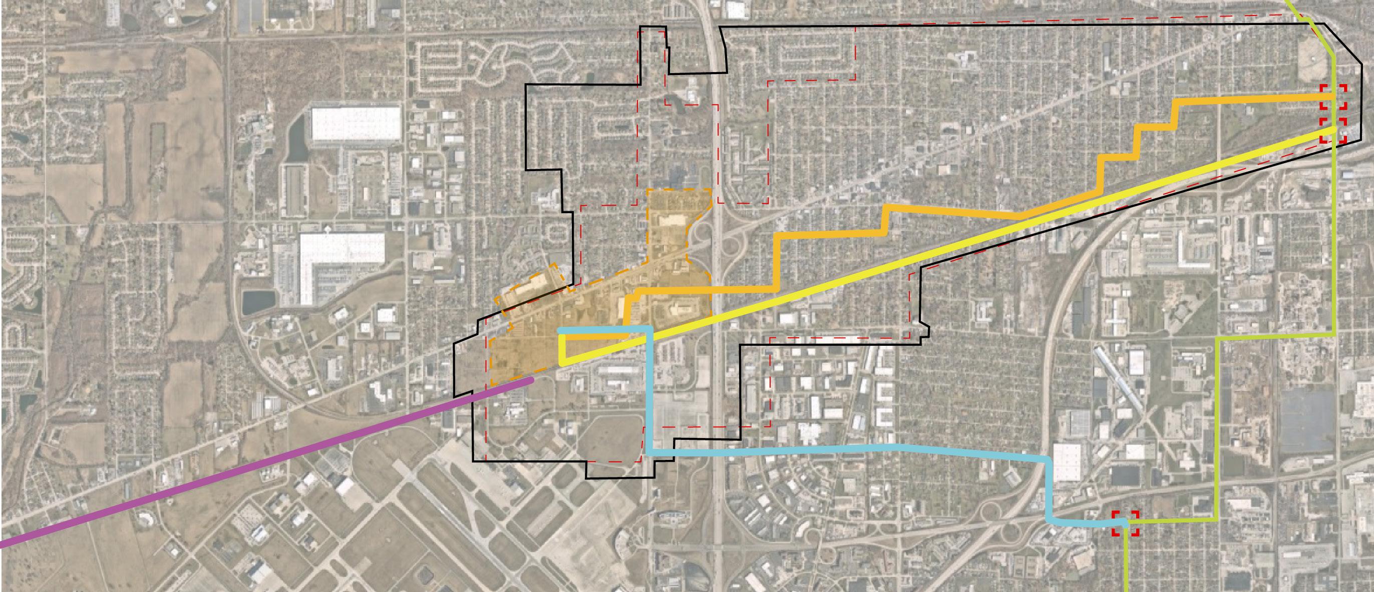
Several options to upgrade sanitary sewer service were examined, and cost estimates were prepared. It was determined that Option 3, Raymond Street, is the preferred option as it directly services the site envisioned for the first phase of development, minimizes easement acquisition, and services the area for the best cost. This option also allows for sanitary sewer upgrades to be continued further west on Washington Street to service this entire district.
Option 1: Utilization of the existing Ben Davis Conservancy District line - This line winds through the BDCD and connects to the 66’ Tibbs interceptor (West Marion Line).
Option 2: Construction of a new sanitary sewer line running parallel to the railroad - This line runs northeast and connects to the 66’ Tibbs interceptor (West Marion Line).
Option 3 Raymond Street: Connects to the CEG sewer line south of the site and railroad - This line runs west to east and connects to the 66’ Tibbs interceptor (West Marion Line). This is the preferred alternative.
Option 4: Construction of a new sanitary sewer line running parallel to the railroad. This line runs southwest and connects to the Plainfield sewer system.

West Washington Street serves as a main east-west thoroughfare connecting the surrounding West Side area to downtown Indianapolis.
The current conditions include two travel lanes in each direction as well as a center turning lane. Few traffic lights or traffic calming measures along the corridor causes high vehicular speeds on West Washington Street. There are minimal and inconsistent sidewalks that exist along the corridor, making it difficult and unsafe for pedestrians to navigate the corridor.
Improvements to West Washington Street explored here will enable transformative development to occur and are an opportunity for a partnership with INDOT.
The first proposed alternative design for West Washington Street recommends installing sidewalks on both sides of the road throughout the corridor. A buffer between the sidewalk and the roadway would not only separate pedestrians from vehicles, but they would present an opportunity for landscaping and street trees or other streetscape elements that would create a more comfortable and inviting experience along the corridor. In some locations, this design would require land to be returned to the right-ofway that has been encroached upon by existing businesses.
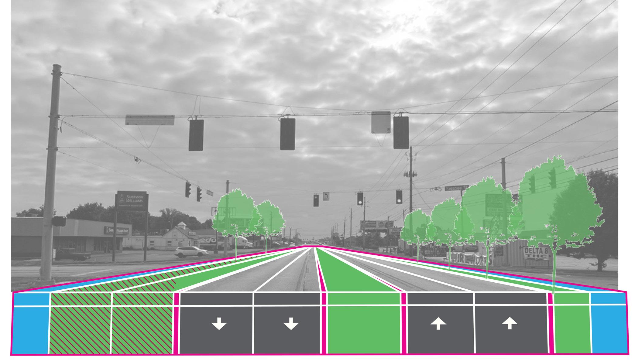
The second proposed alternative plans for future increased IndyGo bus service in the study area. Designing the West Washington Street corridor to accommodate future transit amenities is important to alleviate future infrastructure costs and provide for more mobility options as they arise over time.
Implementing a bus pull-off area with a station platform and a bus lane would allow for efficient bus service of the highly-used BRT that does not hinder traffic flow on the roadway. Designing this versatility into the redesign of the corridor would make the corridor more adaptable and accommodating to future transit and development. A redesigned West Washington Street that considers future transit needs and accommodates multi-modal travel increases access for all users of the corridor.


Minnesota Street bisects Site D in an east to west alignment which connects to West Washington Street and High School Road. Today, Minnesota Street consists of one vehicular lane in each direction without sidewalks on either side, with a main service towards vehicular traffic. The proposed alignment would add a 10-foot multi-use trail on one side, sidewalk, and landscaped lawn to buffer the sidewalk from the roadway. This design would improve access to the site and accommodate both vehicular and pedestrian traffic anticipated as a result of future proposed development. These improvements would make Minnesota Street more accessible and safe for multiple modes of transportation, especially pedestrians along Minnesota Street. Minnesota Street may be vacated as the site is developed to enable a larger site.
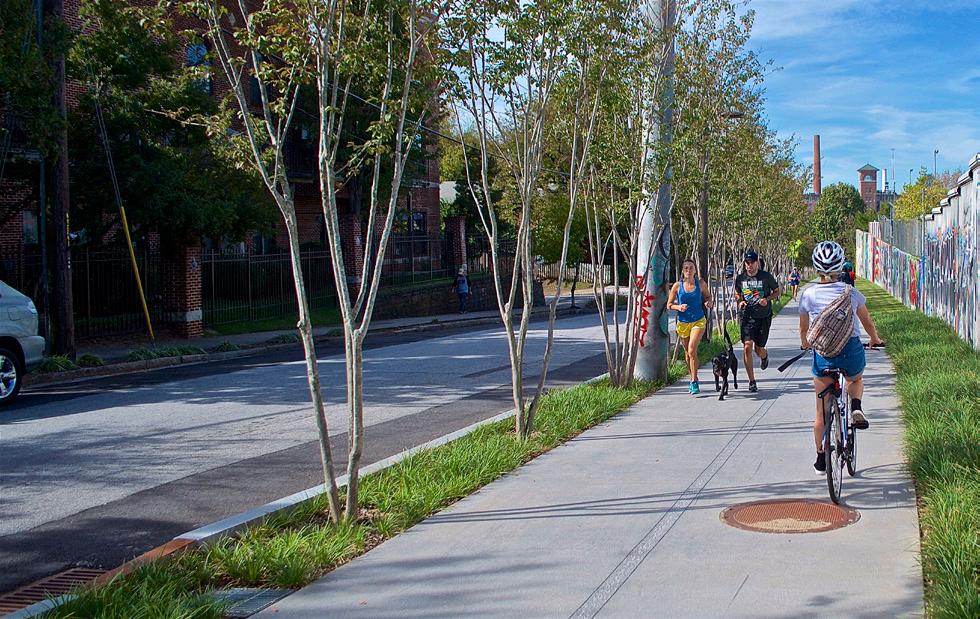

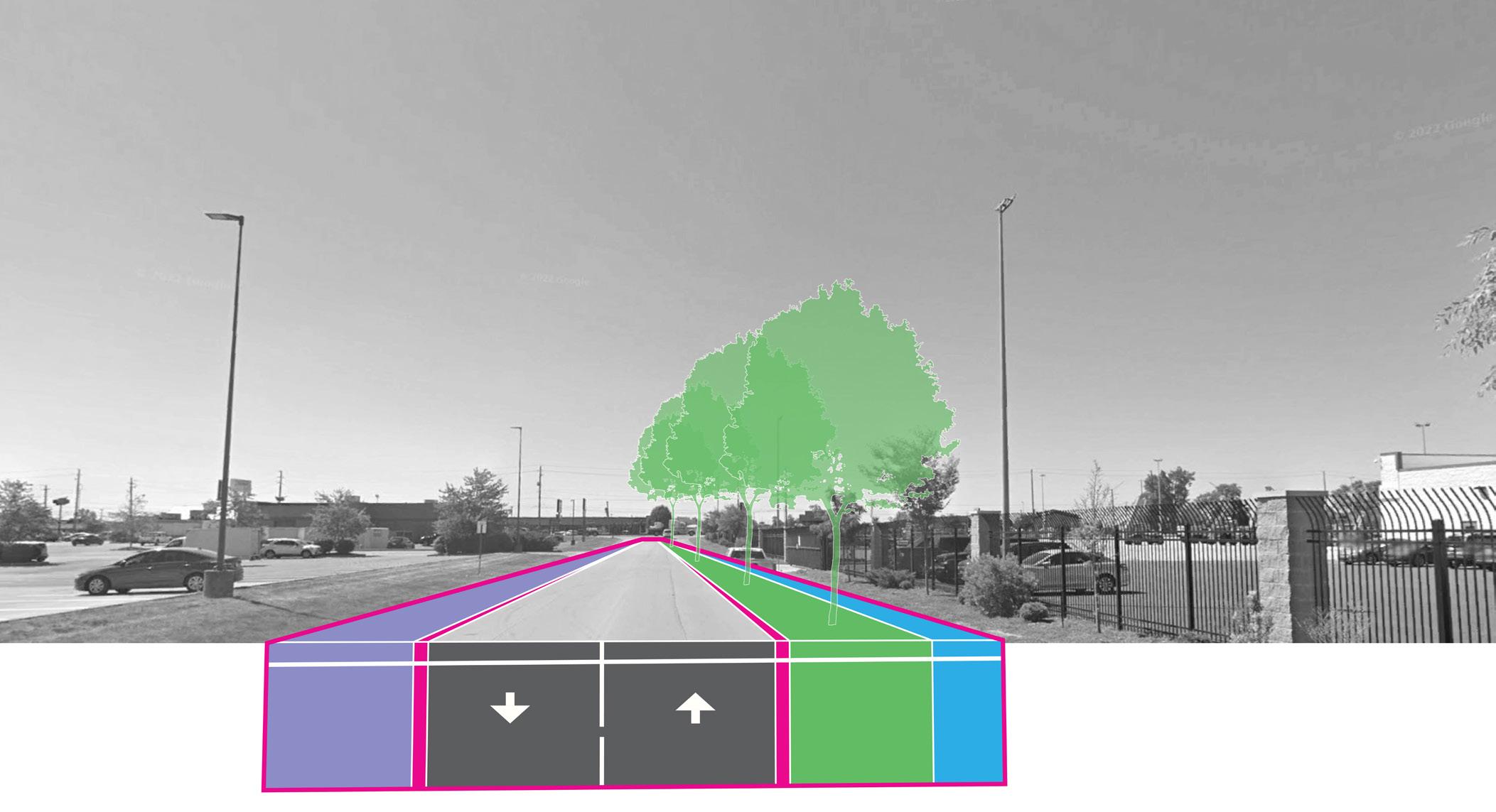
Sigsbee Street runs north to south and provides access to Site C and D. Like Minnesota Street, today Sigsbee Street consists of one travel lane in each direction and no sidewalks on either side, with a main service towards vehicular traffic. The proposed alignment includes a 10-foot multi-use trail on one side, sidewalk, and landscaped lawn to buffer the sidewalk from the roadway. Consolidation of access points along West Washington Street would make Sigsbee Street a main access point and primary connection into Site D. The improvements would also provide access to the West Washington Street corridor from the existing neighborhoods and future residential development in Site C.

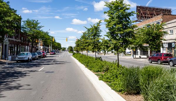

Girls School Road was recommended for Complete Streets improvements as part of the 2018 West Side Vision Plan. This corridor connects West Washington Street to Rockville Road, and is in need of sidewalk and drainage improvements to accommodate pedestrians utilizing IndyGo bus and walking to work. A minimum of a five-foot sidewalk is recommended for the east side of the corridor, but if possible, the sidewalk should be upgraded to a 10-foot multi-use path. Crosswalks should be installed with a pedestrian cycle at signalized intersections along this corridor. A Rectangular Rapid Flashing Beacon (RRFB) signal and crosswalk should also be considered at the intersection of Girls School Road and McCarty Street.

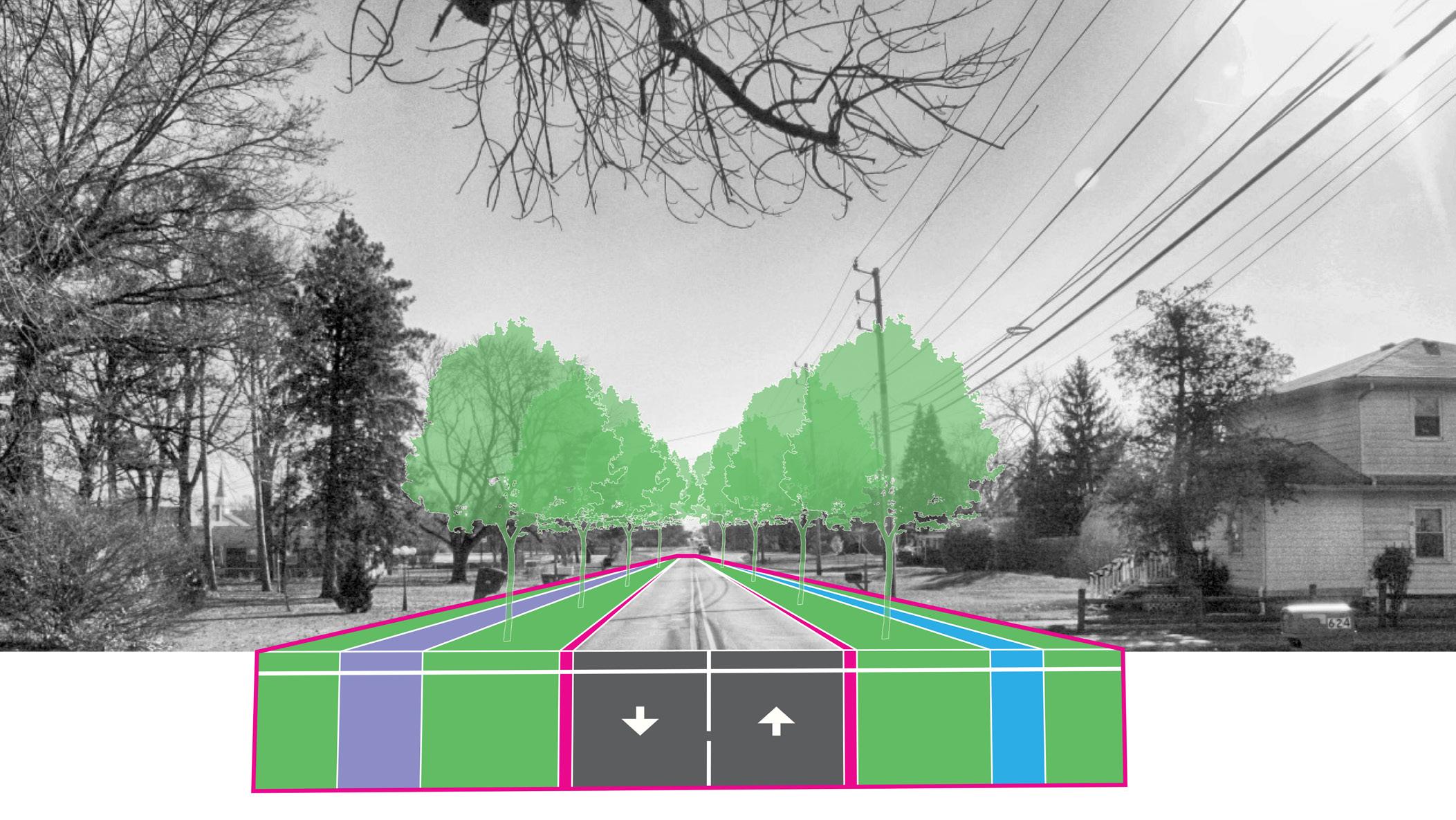
High School Road was recommended for Complete Streets improvements as part of the 2018 West Side Vision Plan. This corridor connects West Washington Street to Morris Street, and is in need of pedestrian connectivity and drainage improvements to improve access in support of a mixed-use center on the east side of the street. These improvements will further connect this area to Krannert Park, create a vital pedestrian link for IndyGo bus riders and students walking from Ben Davis University, and create a walkable destination from nearby neighborhoods. A minimum of a five-foot sidewalk is recommended for the east side of the corridor, and a ten-foot multi-use path is recommended on the West Side. Crosswalks should be installed with a pedestrian cycle at signalized intersections along this corridor. A Rectangular Rapid Flashing Beacon (RRFB) signal and crosswalk should also be considered at the entrance to Krannert Park.

Both the Vandalia Trail and White Lick Creek Greenway planning efforts have been considered in this plan. The Vandalia Trail is anticipated to run parallel to West Washington Street along Perimeter Road, and the White Lick Creek Greenway will run north following the White Lick Creek waterway.
The White Lick Creek Greenway will provide a more naturalized trail experience, aiming to protect and conserve the White Lick Creek and the surrounding wooded environment.
The Vandalia Trail is part of the National Road Heritage Trail (NRHT) following former rail corridors. It is planned as a cross-state multi-use trail connecting 30 communities from Terre Haute to Richmond, Indiana.
The Vandalia Trail and White Lick Creek Greenway converge on the westernmost portion of the study area, creating an opportunity for a trailhead and/ or connection point. Creating trail connections provides access to alternative transportation routes and recreational activities for residents and creates efficiencies in the trail network for visitors.
The IAA supports the Vandalia Trail extension by providing easements along Perimeter Road - this allows for a significant benefit in implementing this trail. Other Complete Streets improvements should connect to this trail infrastructure. This approach will greatly improve the ability of pedestrians to travel to this area and create amenities for future development in the surrounding area.
Infrastructure improvements along High School Road and Girls School Road will improve conditions in the public right-of-way and allow for access to development along the north-south corridors.
The multi-use path along Girls School Road will create north and south connections to the West Washington Street Corridor and the Vandalia Trail from Rockville Road.
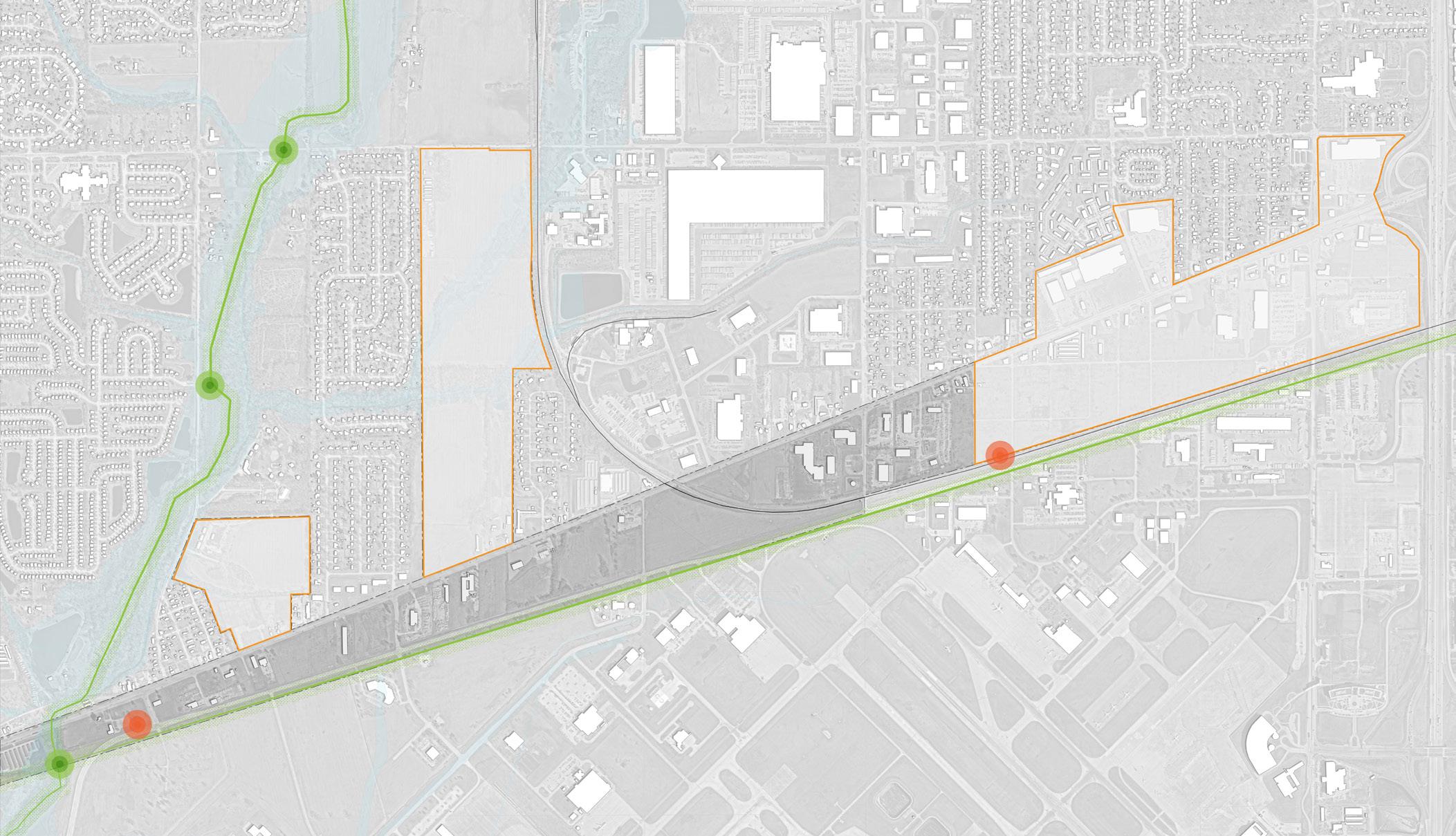
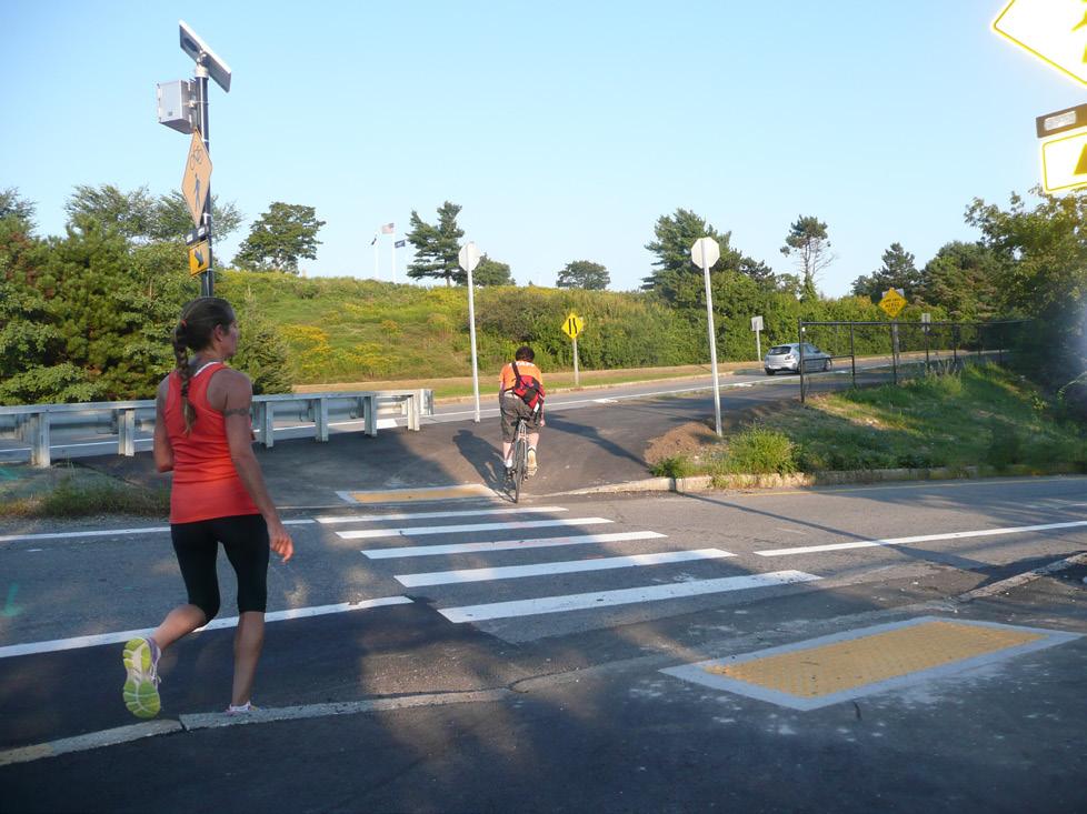

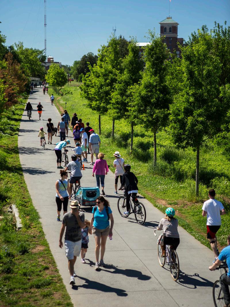
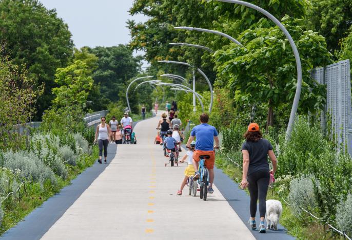
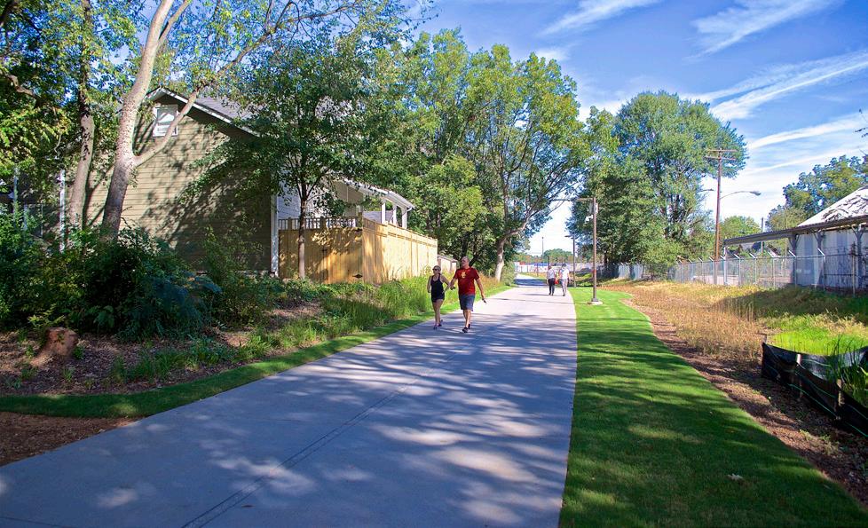

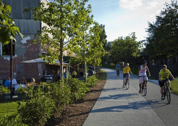
Primarily functions for vehicular travel but ensures adequate access and safety for all other modes along the corridor, connects to other facilities in the community
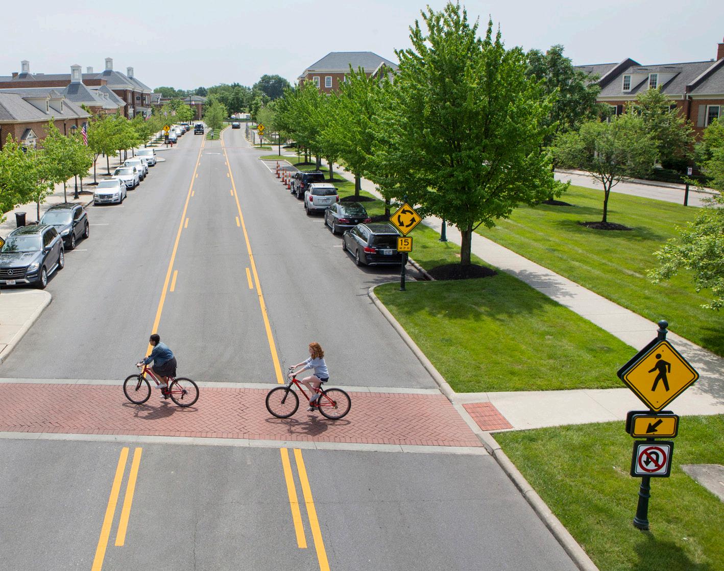
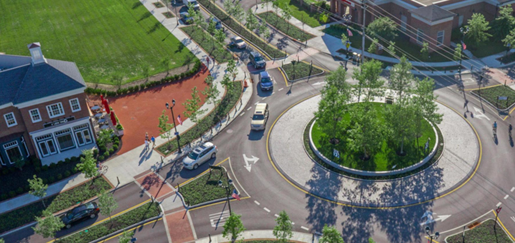
Key Vehicular Routes serve areas of moderate density and transition areas to more residential or neighborhood scale areas of the community. These corridors are more auto-oriented, linking residents to major community destinations, services, and amenities, but should still contribute to the network of safe and comfortable pedestrian and bicycle facilities. Transit service may be less frequent on these thoroughfares, but should still be accessible to important transit routes. Vehicular speeds are low along these thoroughfares, and the public realm may be less formal in design, especially in residential areas. However, quality design should still contribute to a sense of place along these corridors. New development should establish a high level of public realm and prevent or mitigate any vehicular conflicts through access management interventions. Parking is typically provided on-street, and access to development blocks or off-street parking should not occur directly from the thoroughfare.

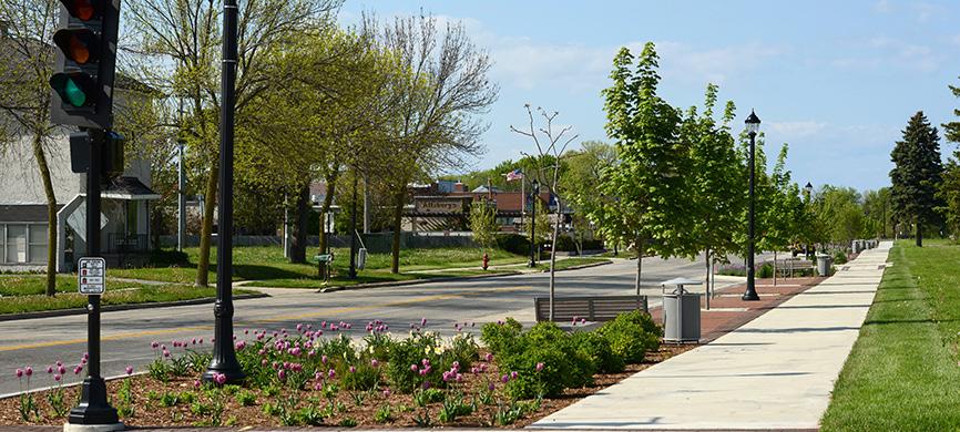
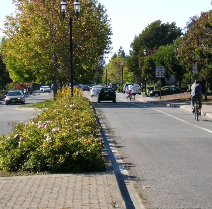
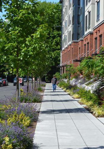
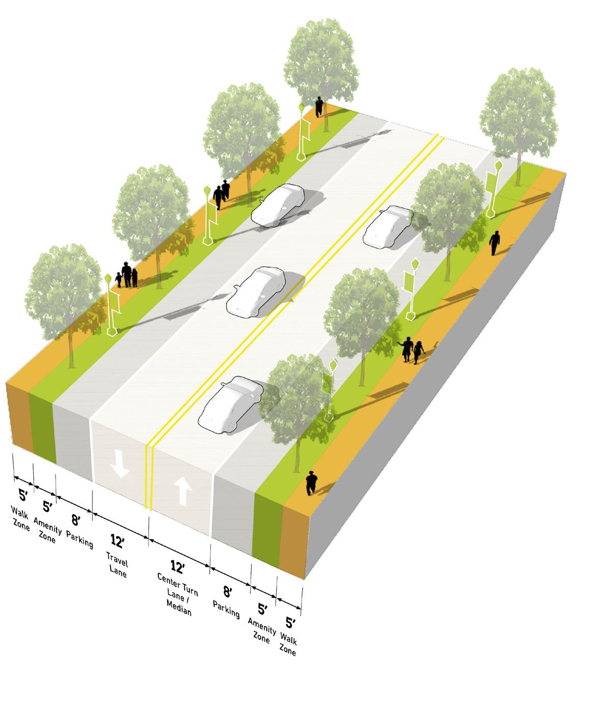
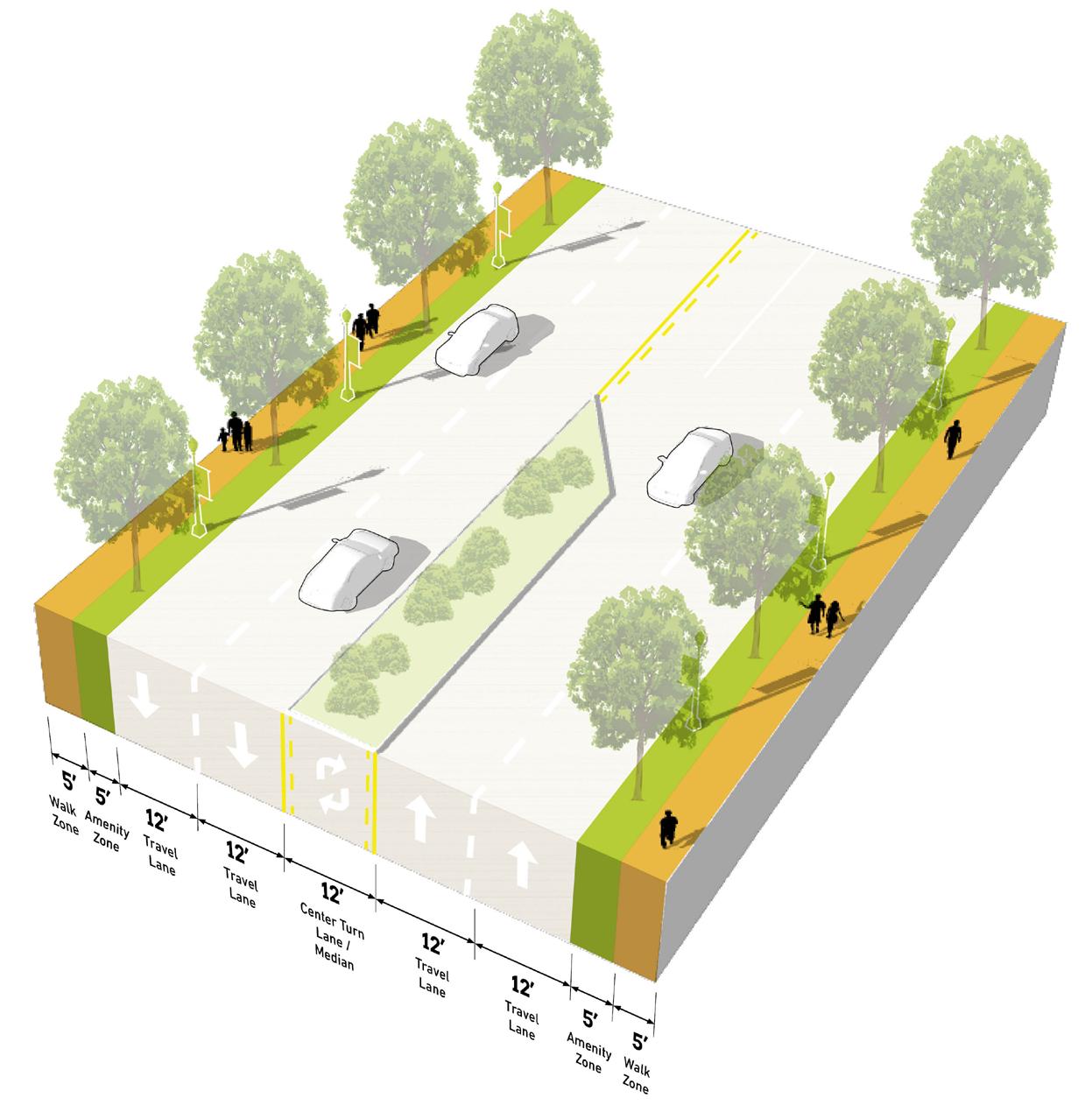
Number of Lanes Speed 2 lanes in each direction
Non-motorized Facilities
Bus/transit Facilities
Access Management
Sidewalks, trail integration, and crosswalks at signalized intersections
Enhanced transit stops with side-load platforms that link to the Blue Line BRT
Redundant curb-cuts should be consolidated as development occurs, no-new curb cuts outside of signalized intersections should be allowed on the corridor
Public Realm Design/ Amenities
Opportunity to work with INDOT to implement a high-quality streetscape that is durable, low maintenance, but still creates a welcoming environment for residents, people working at the district, and those driving through.
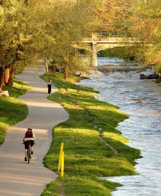
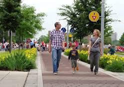
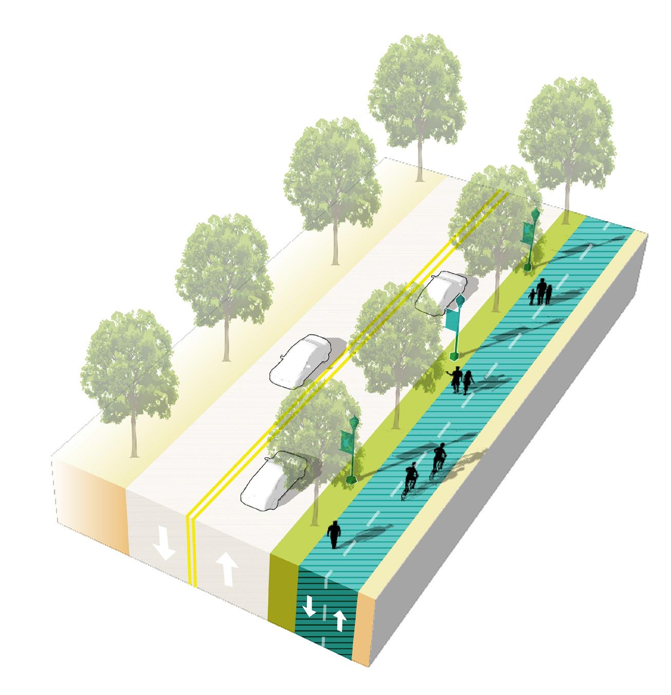
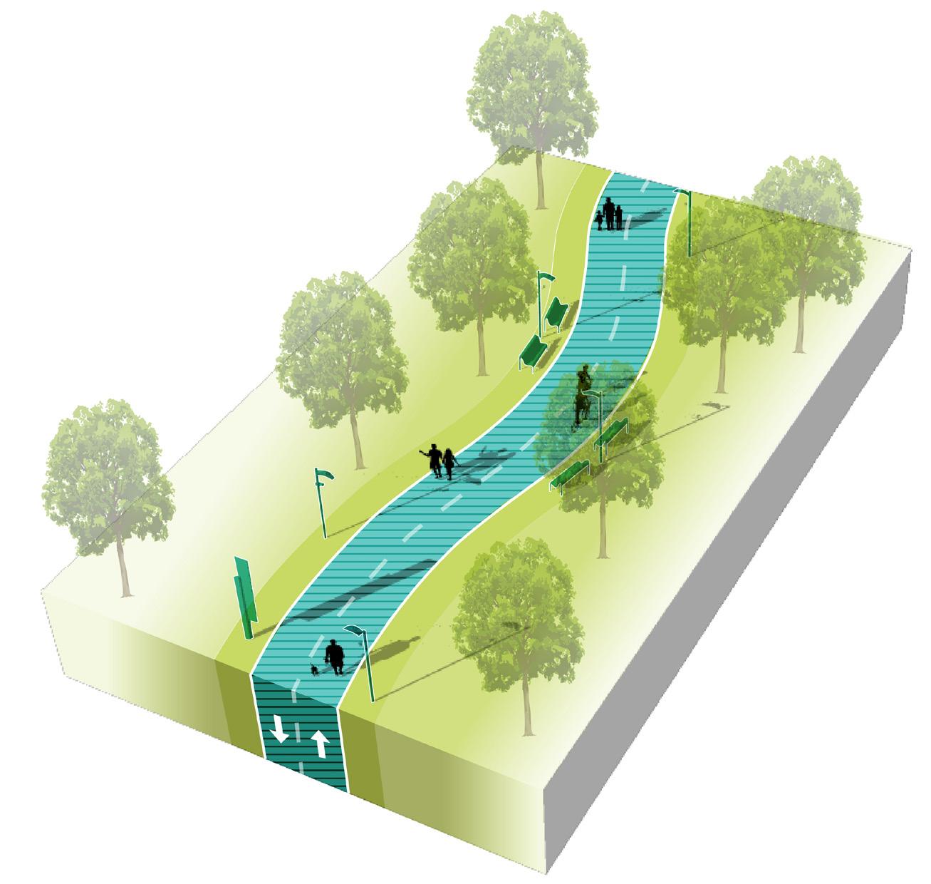
Functions primarily for pedestrians, typically as a highly-designed pathway or as a trail or greenway, and may also accommodate bicyclists
Key Pedestrian Routes primarily serve pedestrians to connect to key destinations, transit access, and the Station Area. These routes may exist alongside vehicular corridors or they may exist in the form of a pedestrian pathway or trail. In the case of a trail, bicycles may also be accommodated. Amenities and landscaping should be designed at pedestrian-scale and either contribute to the surrounding character or to a particular brand if part of a larger trail network. Wayfinding and signage is particularly important to highlight access points and destinations across the community. New Key Pedestrian Routes should be planned to avoid vehicular conflicts such as driveways, and these conflicts should be reduced to the extent possible along existing Key Pedestrian Routes.



Number of Lanes/Target Speed N/A or Varies
Non-motorized
Facilities
Bus/transit
Facilities
Completing gaps of existing facilities and access to enhanced facilities (sidewalks, multi-use paths, and well-designed and enhanced crossings where intersecting with roadways); may exist along roadways or as a separate facility like a path or trail
Some bus/transit facilities, less frequent but enhanced transit stops; stops should be well-connected by a complete network of pedestrian facilities
Parking
Parking areas, on-street or off-street, should be located near trailheads. Pedestrian routes may connect parking areas to other destinations in the community.
Limited driveways intersecting with pedestrian routes to reduce conflicts with vehicle entries/ exits and maximize pedestrian safety. New pedestrian routes should be planned along corridors with minimal driveway conflicts, or access management interventions may be implemented.
Public Realm
Amenities along pedestrian routes should be tailored to pedestrians (or bicyclists if a multi-use path or trail); design should be reflective of the community character and identity; local or regional trails may be designed with individual branding

Tax Increment Financing (TIF), governed by state statute (IC 36-7-15.1), is a development and redevelopment tool that utilizes prospective development to fund infrastructure and economic development initiatives related to the prospective development. TIF operates by “capturing” the property tax revenues produced by new investment within a defined geographic area (district).
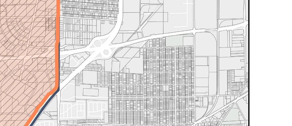
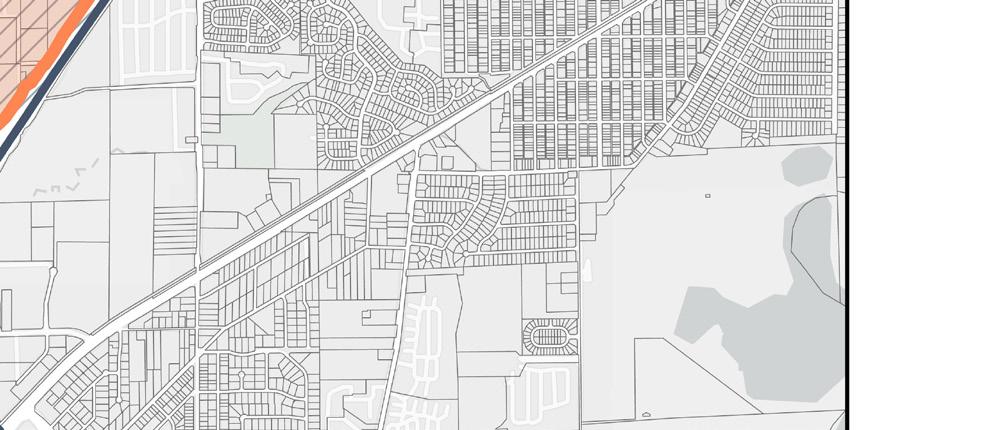
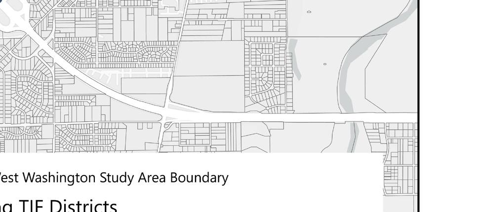
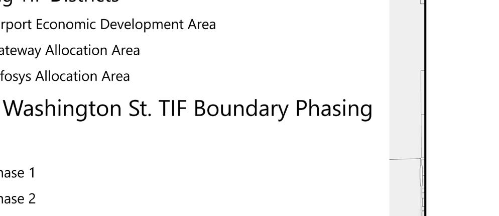
The study area, which extends west on Washington Street from I-465 to the county line, overlaps with three existing TIF allocation areas: the Airport Economic Development Area (EDA), Washington Street Gateway Allocation Area, and Infosys Allocation Area.
This section provides a roadmap focused on the following:
• Existing TIF districts in the study area
• Potential phased approach towards TIF expansion
• Updated Airport TIF
• TIF increment potential
A majority of the Airport TIF, established in 1991, will expire in 2025 so a phased TIF strategy is important to encourage economic development. The team conducted a deep dive study into potential development within the study area and the existing Airport TIF and recommends a phased approach towards creating a new TIF that takes advantage of relatively low assessed value on IAAowned properties along the West Washington Street Corridor.
The objective of the TIF strategy is (1) to provide an estimate of the anticipated TIF revenues available to finance the infrastructure necessary for the re-development of the West Washington Street Corridor and (2) to provide options for the implementation of the TIF district boundary and allocation area in a way that maximizes the collection and use of TIF dollars.

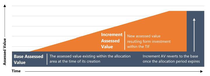
Dollars in Millions

TIF districts capture assessed value from new investment within an allocation area. The property tax revenue generated from the increment assessed value is used to fund the economic development or redevelopment efforts described in the area plan.
For taxes payable in 2023, the Airport EDA and Infosys Allocation Area have captured a combined total of $615.5 million in increment assessed value. As of 2023, there is no increment assessed value captured in the Washington Street Gateway Allocation Area.
Increment Revenue History in Existing TIF Districts
Dollars in Millions
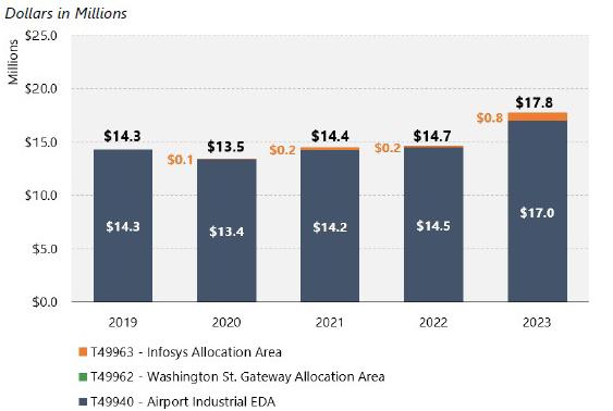
The prevailing property tax rate is applied to the increment assessed value to generate increment revenue. Increment revenue can be used within the TIF district for allowable uses specified in state statute, including bond financing for projects directly related to the allocation area. The increment revenue of the existing TIF areas near the West Washington Street Corridor totaled $17.8 million for calendar year 2023.
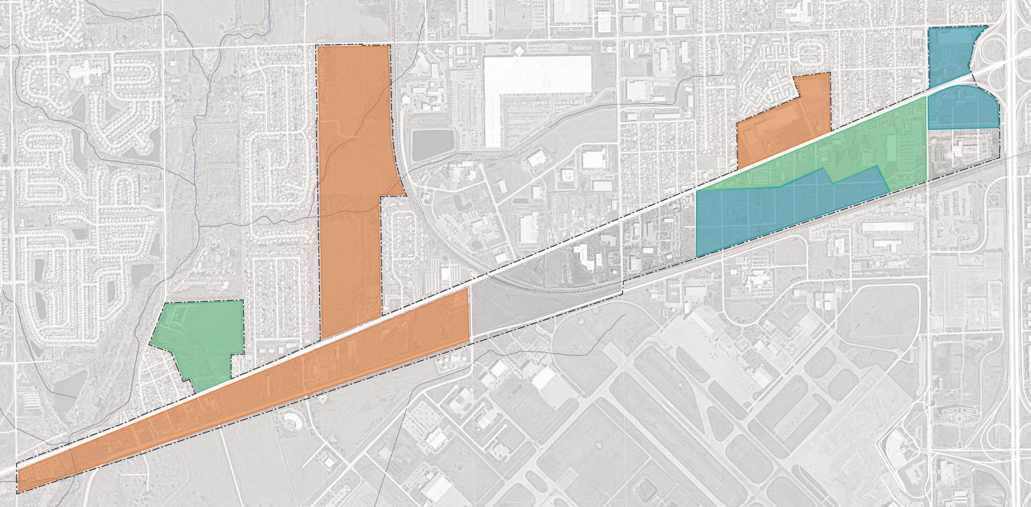
The West Washington Street Corridor Implementation Plan combined market information, stakeholder input, and site characteristics into a strategic development plan. This analysis estimates potential increment assessed value and increment revenues resulting from the implementation of the development plan.
The study area is divided into seven development sites. Each site is envisioned to contain a mix of commercial, industrial, and residential development, depending on the characteristics and market potential of the site. Site E also includes 272 singlefamily residential units, which do not generate any increment assessed value and were excluded from the analysis. The development assumptions include over 430,000 square feet of commercial and office, about 1.07 million square feet of industrial/light manufacturing, 180,000 square feet of research and development building area, 1,215 multi-family units, and a potential hotel development with 220 keys.
Construction on the West Washington Street Corridor is assumed to take place in three phases over the following development horizons:
• Phase 1: Years 1-5 of development horizon
• Phase 2: Years 6-15 of the development horizon
• Phase 3: Years 16-20 of the development horizon
The actual timing of West Washington Street Corridor development has implications for the size and scope of TIF increment revenues available for redevelopment.
Dollars in Millions
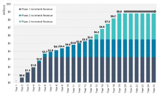
New investment within the TIF district will be captured in the TIF increment. Property tax assessments for potential developments were estimated using valuations from comparable properties near the study area. Comparable properties were used to calculate multipliers, including Gross Assessed Value (GAV) per square foot and GAV per unit. The resulting multipliers were integrated with the development assumptions to provide an estimate of increment assessed value captured by the TIF. Several parcels within the study area are currently classified as tax exempt with an assessed value of $0. Once tax exempt land is purchased and re-classed, the increased assessed value will be captured in the TIF increment. Land was valued using the comparable assessed value of land in the same area.
Upon completion of the proposed development projects, increment assessed value within the TIF is estimated to total $350 million. This includes the increment in assessed value from the conversion
of tax exempt land and new depreciable personal property. Assessed value, after completion of Phase 1, is estimated to be $127.3 million. Phase 2 is estimated to produce $88.2 million in increment assessed value. Phase 3 is estimated to add another $132.5 million in increment assessed value.
Increment property tax revenue was calculated using the estimated assessed value and current (Fiscal Year 2023) property tax rates for the study area. In total, the development scenarios produce an estimated $8.8 million annually in increment property tax revenue after full completion. Phases 1, 2, and 3 are estimated to annually produce $3.2 million, $2.3 million, and $3.3 million, respectively.
A present value analysis is helpful to estimate the inflation adjusted revenues produced by the project and approximate the amount of bond principal that could theoretically be supported by the project. The present value of revenues over 25 years of potential TIF capture (per phase), is estimated to total $73.9 million.
Revenues generated from the TIF district are expected to be used to fund infrastructure enhancements and economic development incentives necessary to catalyze capital investment within the study area. The following proposed investments are included in the development plan:
Phase 1:
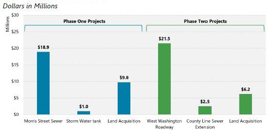
• Raymond Street Sewer Reconstruction – To provide the required level of sanitary sewer service to the Phase 1 development sites
• Stormwater Retention Tank – To provide required levels of stormwater retention while redeveloping the project sites
• Land Acquisition – Funding to assemble land for strategic development
Phase 2:
• West Washington Street – Major reconstruction of West Washington Street west of I-465. This is assumed to be a multi-jurisdictional partnership with a 50 percent local match.
• County Line Sewer Extension – To extend sewer services west toward the Hendricks County line to support additional site enhancements
• Land Acquisition – Funding to assemble land for strategic development
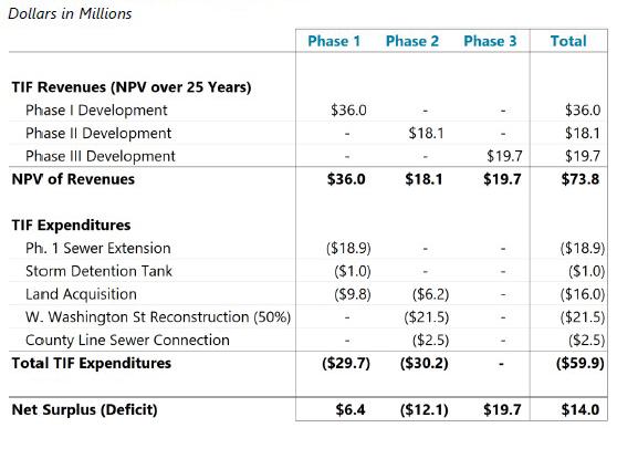
The estimated present value of revenues generated by the development is $73.8 million. Accounting for total infrastructure expenditures, with a total cost of $59.9 million, the project is estimated to provide a net surplus of $14 million.
Estimated Infrastructure Costs
Dollars in Millions
Summary of Revenues and Expenditures
Dollars in Millions
A multi-step TIF phasing approach is recommended to maximize the potential revenues available for the implementation of the development plan.
The current Airport EDA expires in 2025. Any investment that is captured in the current TIF will only generate increment assessed value through that time. In order to maximize the revenue available for the West Washington Street redevelopment, the parcels that comprise the Phase 1 development should first be removed from the current Airport TIF. This will require a due diligence and disclosure process to verify that current bondholders will not be impacted. This step should take place in 2024.
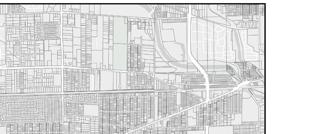
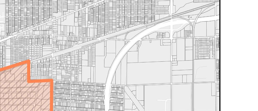
Once the Phase 1 parcels are removed from the Airport TIF, a new TIF should be established to capture the investment from the Phase 1 development. An illustrative TIF boundary is shown on the map below. The Declaratory Resolution for the new allocation area should be adopted after Step 1 is complete but prior to the end of 2024.
After the current Airport EDA expires in 2025, the City has the option of renewing the TIF. If this happens, the increment assessed value currently captured within the Airport TIF would flow to the tax base of the local taxing units. The base assessed value would be re-established at tax year 2026 levels, and any new assessed value would flow to the increment. The boundaries of the re-established TIF should be designed in a way that aligns with the economic development policy objectives of the City at that time. If desired, the Declaratory Resolution to re-establish the Airport TIF should be adopted after July 1, 2025, but before December 31, 2025.
As the potential for development expands beyond the initial phases, the TIF boundaries may need to be expanded from time to time to capture appropriate investments.
A variety of potential options are available to fund the infrastructure investments needed to catalyze development on West Washington Street. Several options available to the City are summarized below.
• TIF Financing on Phase 1 Development –Could be structured as either a bond or a bond anticipation note
• Existing TIF Reimbursement – Fund initial expenditures from Airport TIF or Infosys TIF and reimburse funds from Phase 1 development through 2025
• Supplemental Airport Development – Bring TIF proceeds from projects outside of the study area, but within the Airport TIF into the financing
• General Obligation Bond – Use a property tax or income tax supported bond to fund initial investment, likely reimbursed by Phase 1 TIF proceeds in the future
• READI Grant Award – Use READI grant funds to supplement TIF proceeds or other public funding
• FAA Funding Reimbursement – Subject to regulations, fund initial expenditure with FAA dollars, later reimbursed by TIF proceeds
• Public-Private Partnership – Use private dollars to fund initial development, incorporated into a total incentive package (could include a developer-backed bond)




Implementation strategies are outlined in three timeframes and are defined below:
Immediate Next Steps
Actions to take quickly to get recommendations set up for implementation
Short-Term Strategies
Tasks and projects that can be executed in a 1-5 year timeframe
Long-Term Strategies
Tasks and projects that require additional work to execute and can be completed in 5 or more years
• Submit the Executive Summary created as part of this planning process for incorporation into the Central Indiana RDA’s READI Grant submission in Fall 2023
• Create a 501(c)(6) Land Development Entity to hold, purchase, sell, and develop properties within this study area. Maintain a property database and land-acquisition strategy. Evaluate the use of READI Grant and other funds to purchase property and pay for required sewer infrastructure.
• Approach targeted property owners such as the Emporium 40 Flea Market and Regal 8 Motel to get them under contract with a negotiated sale price. Continue to monitor City of Indianapolis Police and BNS information for “flagged” incidents to build leverage points for purchase.
• Present Executive Summary to developers, site selectors, and other stakeholders who have been approached as part of this study for evaluation and next steps. Evaluate the potential of a follow-up to solidify further developer interest in providing proformas for sites identified as part of this process.
• As part of the ongoing Comprehensive Land Use Plan update being completed by the Department of Metropolitan Development, update future land use along the West Washington Street Corridor to reflect recommendations within this plan.
» Site A: Village Mixed-Use with Transit Oriented Development (TOD) or Town Center Overlay Future Land Use
» Site B: Keep as Office/Industrial Mixed-Use Future Land Use
» Site C: Village Mixed-Use with TransitOriented Development (TOD) Overlay Future Land Use
» Site D: Keep areas identified for future Advanced Manufacturing and Research and Development as Office/ Industrial Mixed-Use (Business Park) with TOD Overlay. Modify areas identified as Community Commercial to add the TOD Overlay
» Site E: Consider transitioning this area’s Future Land Use to Suburban Neighborhood with TOD Overlay as further analysis of this area, its access, and residential adjacencies prove difficult to develop in this manner
» Site F: Since these are smaller, more one-off sites, consider transitioning this area to Light Industrial Future Land Use with the TOD Overlay
» Site G: Keep as Village Mixed-Use Future Land Uses. Since these are smaller, more one-off sites, consider transitioning this area to Light Industrial with the TOD Overlay.
• Initiate a Council/ Metropolitan Development Commission rezone of Sites A, B, and D to prepare areas for redevelopment and prevent further undesirable development that is not aligned with the vision of this plan. In the future, if the Blue Line BRT is extended to this area, zoning will be subject to the City’s TOD Overlay.
» Site A: Rezone as Mixed-Use 2 Zoning
» Sites B, D, and G: Rezone as a Development Plan Zoning (similar to a PUD) would be advisable to create standards applicable to this area. Applicable standards from Industrial Districts and Commercial Districts would be integrated.
• Use this plan to create a “brand” for this district. Use Ben Davis Station as a starting point.
» Identify locations for signage and branding opportunities at the east and west gateways to the West Washington Street Corridor to begin to establish the “brand” and pay homage to the existing surrounding neighborhoods
• Use this plan to prioritize tasks for development readiness, site acquisition, marketing, and development tasks
• Utilize the guidance provided by the IAA’s legal council on creating a land development entity and evaluate the potential to do so in either a 501c3 or 501c6 in order to support the creation of a revolving loan fund that potentially could be supported by IEDC. This revolving loan fund could be used for development incentives, infrastructure match, and land acquisition. There is potential to include this as part of the READI Grant.
• A READI Grant application is recommended for two potential projects along the Washington Street Corridor. The first is to use READI Grant dollars to acquire targeted properties for redevelopment that would be part of a catalytic strategy to redevelop highly visible underperforming sites such as the Regal 8 Motel and Emporium 40 Flea Market. Alternatively, READI Grant dollars could be used to purchase IAA-owned property at market rate and sold at a discount to a developer as part of an incentive. The second is to use READI Grant dollars to support bond payments for the Washington Street Sanitary Sewer upgrades that will enable Phase 1 development. Once development occurs and TIF increment is generated the bond payments could shift to being supported by TIF.
• If the READI Grant is successful, use funds to acquire property identified in the Phase 1 Acquisition Strategy, and transition ownership to the Land Development Entity. This may be an ongoing task.
• If READI Grant is successful, potentially use funds to support bond payments for the Sanitary Sewer upgrades to enable Phase 1 development on site. Once Phase 1 development is completed, use TIF funds to pay remaining bond payments.
• Prepare an RFQ for 660,000 square feet sites to select a developer or user, or if Phase 1 Acquisition Strategy is further along, pivot to select a master developer.
• If the READI Grant is successful, prepare RFQ (one or more) to develop the remainder of Sites A, B, and D
• Explore the potential to host an informational “Industry Day” to seek further developer interest
• Convene a meeting with IEDC and Develop Indy to leverage target industries for marketing to seek further interest
• Create an Industrial “HOA” type organization, similar to what the IEDC and City of Indianapolis created for the GM Stamping Plant, to pay for stormwater, common areas, and maintenance
• Execute Phase 2 Acquisition Strategy and transition ownership to the Land Development Entity. This may be an ongoing task. Properties identified in Phase 2 may slide to Phase 1 if they become available on the market.
• Prepare an RFQ for 660,000 square feet sites to select a developer or user, or if Phase 1 Acquisition Strategy is further along, pivot to select a master developer.
• Develop sites in accordance with this plan
• Market the success in creating this district
• Initiate a Council/ Metropolitan Development Commission rezone of Sites C, E, and F commensurate with a developer and property interest to prepare areas for redevelopment and prevent further undesirable development that is not aligned with the vision of this plan.
» Site C: Rezone as Mixed-Use 2 Zoning
» Site E: Rezone as Mixed-Use 2 or a Development Plan (D-P)
» Site F: Rezone as Mixed-Use 3 Zoning
• Evaluate and confirm existing road right-ofway (ROW) along West Washington Street that is owned by INDOT and other entities. Use the analysis contained within this plan to understand where future ROW acquisition might be needed for Complete Streets improvements between High School Road and Girls School Road. As funding becomes available, prioritize West Washington Street improvements between High School Road and Sigsbee Street for Complete Streets and IndyGo transit improvements. Use updated cost estimates to advance funding conversations about the project.
• Coordinate with DPW and the Indianapolis MPO to include trail and roadway improvements recommended within this plan in the regional Transportation Improvement Plan (TIP)
• Prioritize Complete Streets implementation for High School Road and Girls School Road outlined in the 2018 West Side Vision Plan. Use updated cost estimates to advance funding conversations about the project.
» Identify opportunities to add beautification and safety elements, such as enhanced and decorative lighting, to the High School Road Complete Streets implementation project in order to benefit the existing neighborhoods north of the West Washington Street Corridor
• Formalize the trail easement between the Indianapolis Airport Authority and Vandalia Trail Alliance for the Vandalia Trail. Use the cost estimates contained within this study to advance funding conversations between all parties and other potential funding sources.
• Advance further infrastructure study/analysis to preliminary engineering to confirm cost and routing for recommended Raymond Street sanitary sewer connections to service this study area and planned development. Apply for READI Grant funds to fund sewer improvements in 2023.
• Reengage with interested developers and site selectors from this process to confirm infrastructure assumptions around development studied within this plan
• This development strategy outlines the consolidation of vehicular access points/ driveways along the north and south sides of West Washington Street. This should be prioritized as properties are acquired for development. Where possible, entrances are recommended to be aligned with signalized intersections or otherwise encouraged shared access from one access point/driveway with adjacent uses.
• Evaluate and execute the recommendations for the redesign of Sigsbee Street and Minnesota Street to include an upgraded roadway, multiuse trail, sidewalk, and landscaping to improve vehicular and pedestrian access to Sites C and D. Advance further infrastructure/analysis to preliminary engineering to confirm cost and routing for Complete Streets improvements. Evaluate the potential to fund this project through a developer agreement or BuildOperate-Transfer agreement with a private entity.
• Evaluate alternative Complete Streets improvements for West Washington Street for upgraded IndyGo bus infrastructure in collaboration with DPW, utility providers, INDOT, and IndyGo. Determine state and federal funding sources for improvements and potential cost share aligned with INDOT’s schedule for future maintenance or improvements.
• Coordinate infrastructure investments to ensure appropriate sewer, roadway, and bus investments occur at the same time
• Reserve appropriate ROW for streetscape improvements identified in this study for when property acquisition occurs
• Confirm and acquire locations for potential trailheads along the Vandalia Trail and connections to the north to other Complete Streets
• Coordinate with utility providers on user tap-on fees or other upgrades such as power substations based on future development recommendations including, water, gas, electric and communications
• Advance further infrastructure study/analysis to preliminary engineering to confirm the cost and location of a potential stormwater tank to service Site D. Due to FAA restrictions, wet stormwater ponds are prohibited in the flight path.
• If the READI Grant is successful, use TIF dollars and/or grant funding to finalize engineering, costing, and permits, and construct the recommended Raymond Street sanitary sewer connections to service this study area and planned development.
• Use TIF dollars and/or cost share with INDOT or other funding sources to finalize engineering, costing, and permits, and construct the recommended Complete Streets improvements to West Washington Street between High School Road and Sigsbee Street (as Phase 1) and between Sigsbee Street and the County Line (as Phase 2). As part of this process, reserve ROW for future IndyGo use.
• As development occurs, coordinate with IndyGo to reserve appropriate areas for enhanced bus service and seek federal funding for implementation. Explore how future BRT plans on the corridor could operate along the curbs and establish bus stops along the curb lines in the outside lanes.
• As development occurs, or as West Washington Street improvements are implemented, extend upgraded sanitary sewers west from Site D to the County Line
• Present TIF proforma and phasing strategy to City of Indianapolis leadership and Indianapolis Airport Authority leadership for consideration
• Carve out and establish the sites identified as Phase 1 development as part of the Gateway Allocation Area TIF in advance of the sunset of the Airport TIF
• Follow the TIF strategy to evaluate Phase 1 TIF expenditures such as sanitary sewer, property acquisition, stormwater infrastructure, and incentives
• Evaluate TIF proforma for a re-established Airport TIF including Phase 1 development within this plan. Establish further potential TIF increment revenue prior to the sunset of the Airport TIF in 2025.
• Follow the TIF strategy to evaluate Phase 2 and Three TIF expenditures such as sanitary sewer, property acquisition, stormwater infrastructure, and incentives
• Establish the sites identified as Phase 1 and Phase 2 development as part of the re-established Airport TIF. If development is occurring, also include Phase 3 within the re-established Airport TIF.
• Establish a capital project plan tied to the recommendations in this plan
• Continue to revisit infrastructure costs in accordance with construction escalators and maintain a capital project plan tied to the recommendations in this plan
This page is intentionally blank.
The West Washington Street Corridor Implementation Strategy sets forth the steps to achieve transformative investment for the betterment of the West Side and its residents. To implement this strategy, several priority projects have been outlined that will ready real estate for a change, signal to the market that the time is right to invest, and catalyze transformative economic development within this corridor focused on growing an equitable, dense, mixed-use, employment based and walkable and transit-connected, neighborhood commercial development near a major employment anchor.
Once fully implemented, this strategy will help the City of Indianapolis and the IAA to strengthen this corridor, encourage economic development and revitalization of this corridor. The following page outlines the first phase of projects envisioned to enable the revitalization of the West Washington Street Corridor.
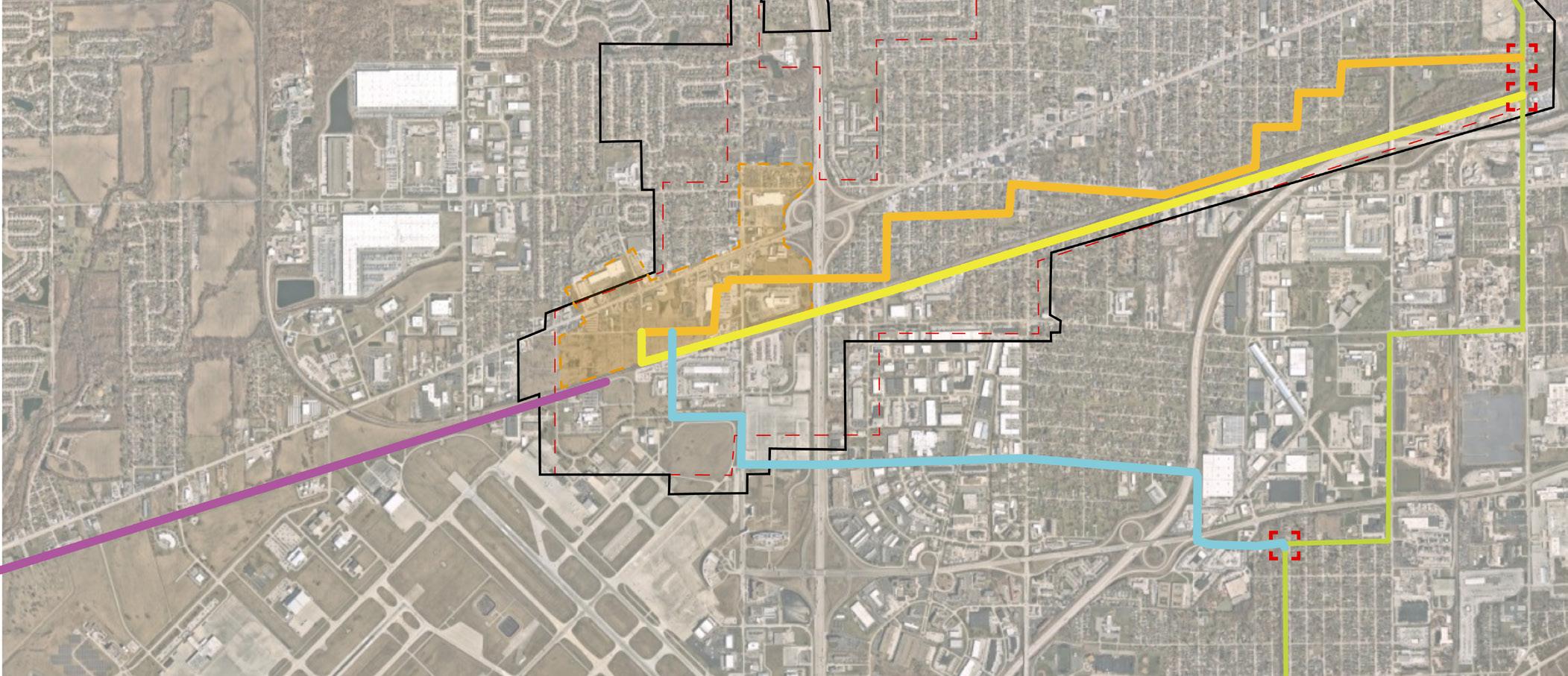
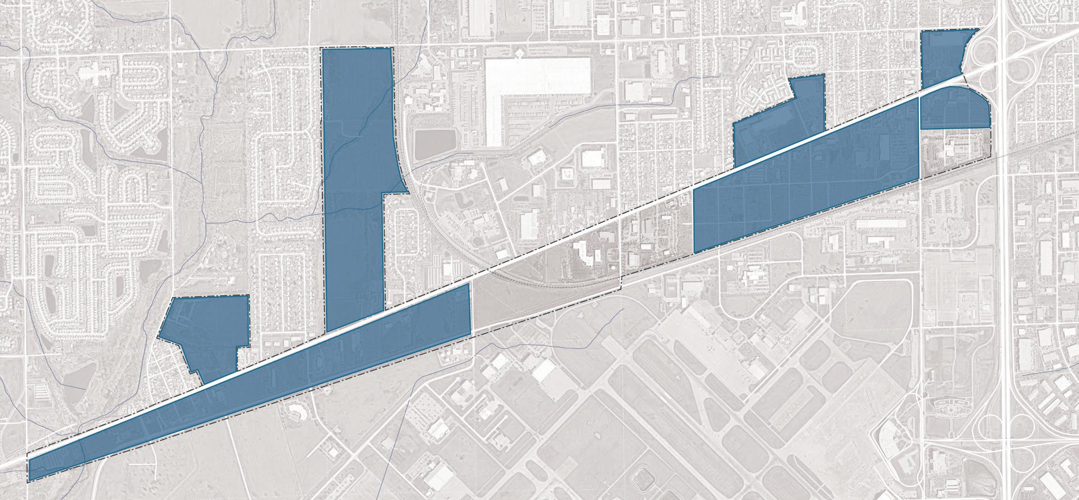
A. Sanitary Sewer - Option 3 Raymond Street
$14.5-18.9 m
B. West Washington Street Improvements $21 m
C. Sewer connection west to County Line along West Washington Street or rail ROW $2.5 m
D. Vandalia Trail $5.5 m
E. Sigsbee Street Improvements $8 m
F. Minnesota Street Improvements $8 m
G. Electrical Substation
H. Minnesota Street Stormwater Tank
m
Covered by TIF and potential READI Grant (CEG will cover some percentage of this as O+M – potentially 25%)
INDOT and/or federal grants paying 50% of the total $43 m cost - this does not include IndyGo improvements
Extension could occur coordinated with West Washington Street improvements
Full trail alignment along Perimeter Road
Complete Streets improvements between Minnesota and Morris Streets -potential developer driven cost
Complete Streets improvements within development site - potential developer driven cost.
Substation to serve development areapotential utility driven cost
Stormwater tank with sufficient capacity to supply the entire Minnesota Street site - potential developer driven cost. I. Girls School Road Improvements
Multi-use pathway - funded by existing TIF J. High School Road Improvements
- 65.9 m
High School Road Sites (north and south of West Washington Street, east of High School Road
Multi-use pathway - funded by existing TIF
m - 9.75 m Covered by TIF and potential READI Grant
