
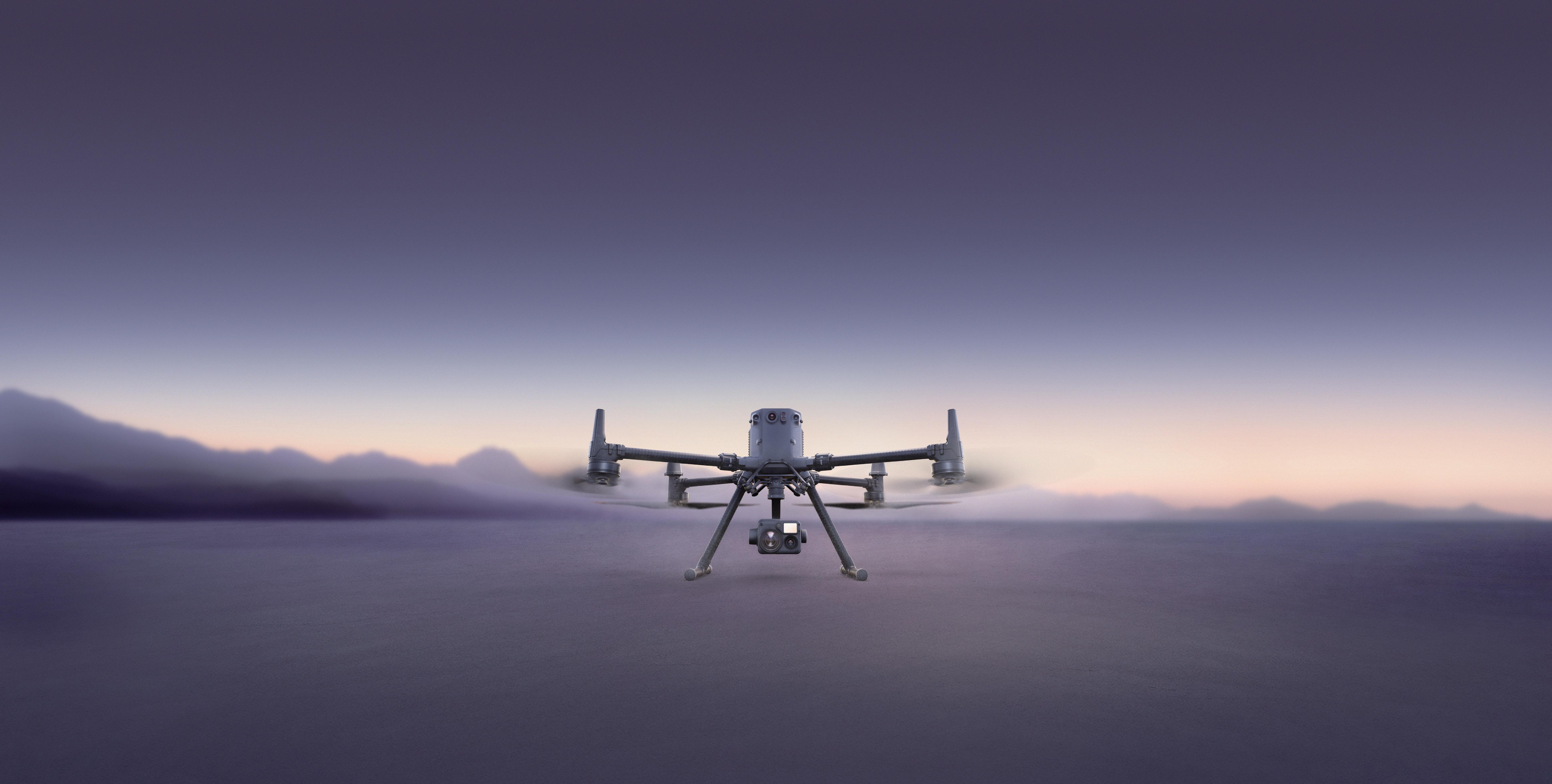
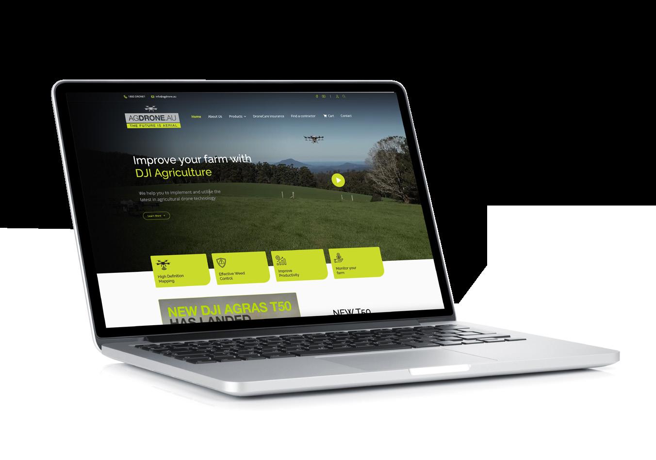
Improve your farm with DJI Agriculture
Let AgDrone.au be your trusted partner in innovation and success.

Improve your farm with DJI Agriculture
Let AgDrone.au be your trusted partner in innovation and success.
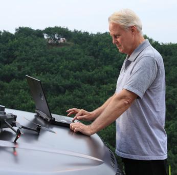
AgDrone.au stands as a pioneering force in the realm of drone solutions, specialising in precision agriculture and serving diverse sectors. Driven by cutting-edge technology and a commitment to excellence, we empower our clients to soar to new heights of success.
Our core competency lies in precision agriculture, where we harness advanced DJI drone technologies to reshape farming practices. From pinpoint spraying and precise seeding to strategic fertilisation and comprehensive crop monitoring, AgDrone.au leads the charge in optimising agricultural efficiency and sustainability with the reliability of DJI equipment.
As pioneers in the drone industry, we redefine industry standards through our aerial imaging and mapping capabilities. High-resolution aerial imagery, powered by DJI technology, empowers sectors like mining and real estate, with crucial data for resource management and strategic planning.
We offer a partnership grounded in trust and dependability. Our comprehensive services encompass drone sales, unwavering post-sale support, repairs, and maintenance, ensuring our clients derive maximum value from their investment in DJI equipment.
Safety, compliance, and quality underscore our operations. Our adept drone pilots and technical experts uphold industry-leading standards, ensuring secure and efficient drone operations tailored to our clients’ diverse needs while leveraging the excellence of DJI products.
AgDrone.au takes pride in its environmentally conscious approach. Our drone solutions, utilising DJI technology, promote sustainability by minimising chemical usage and reducing environmental impact, charting a course for a greener future.
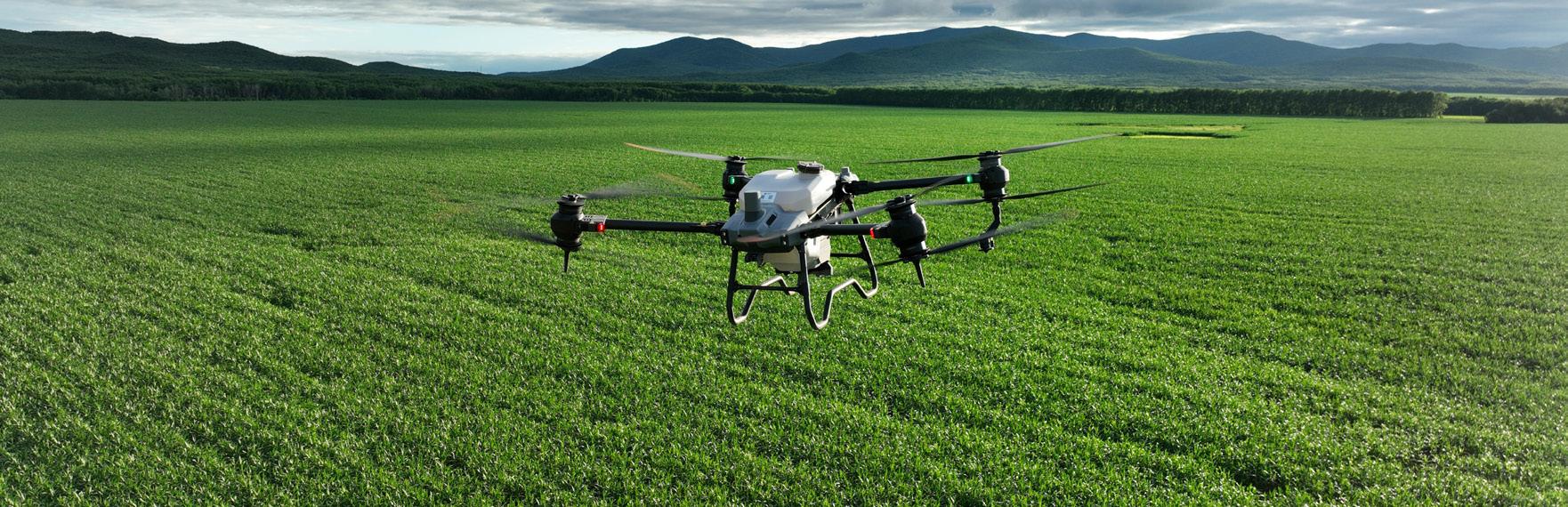
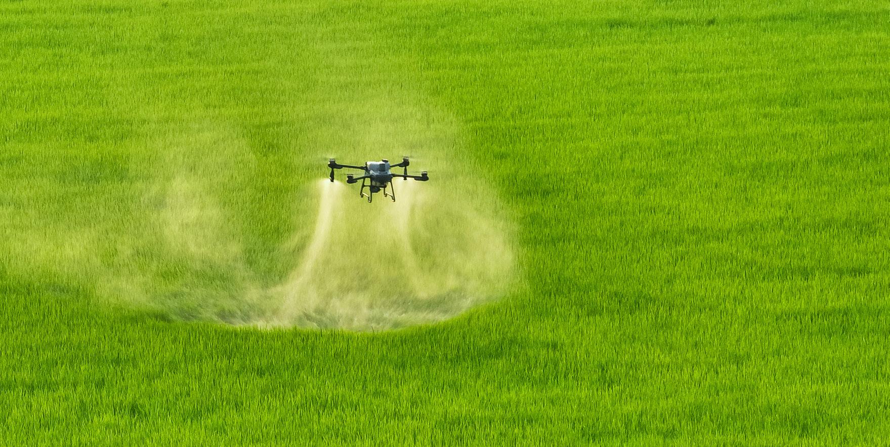
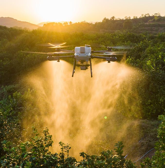
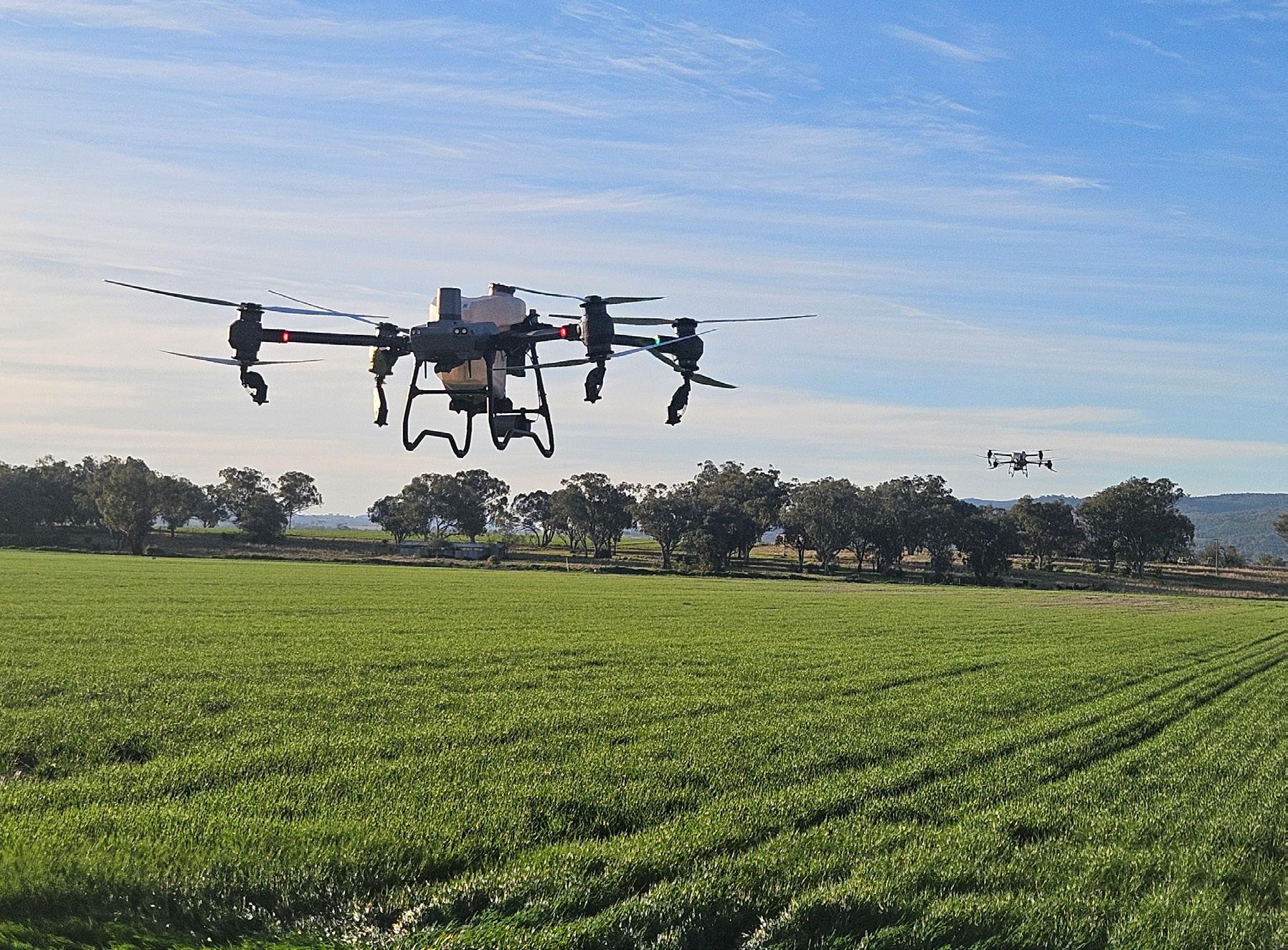
Agricultural drones can play an important part throughout the lifecycle of a crop.
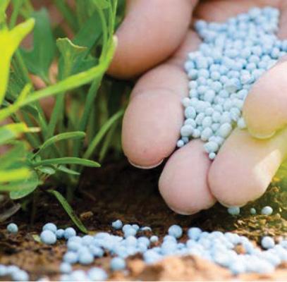
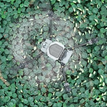
DJI Agricultural drones are suitable for multiple application scenarios, such as grassland reseeding, granular fertiliser spreading, and spreading feed for aquatic animals like fish and shrimp. Installation of the spreading system can be completed in under three minutes, proving that Agras drones are always ready for the task at hand.
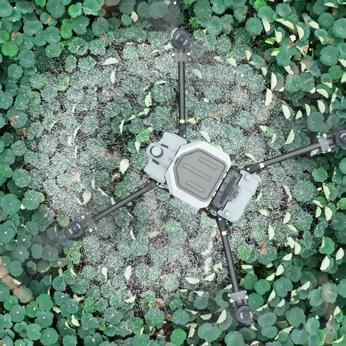
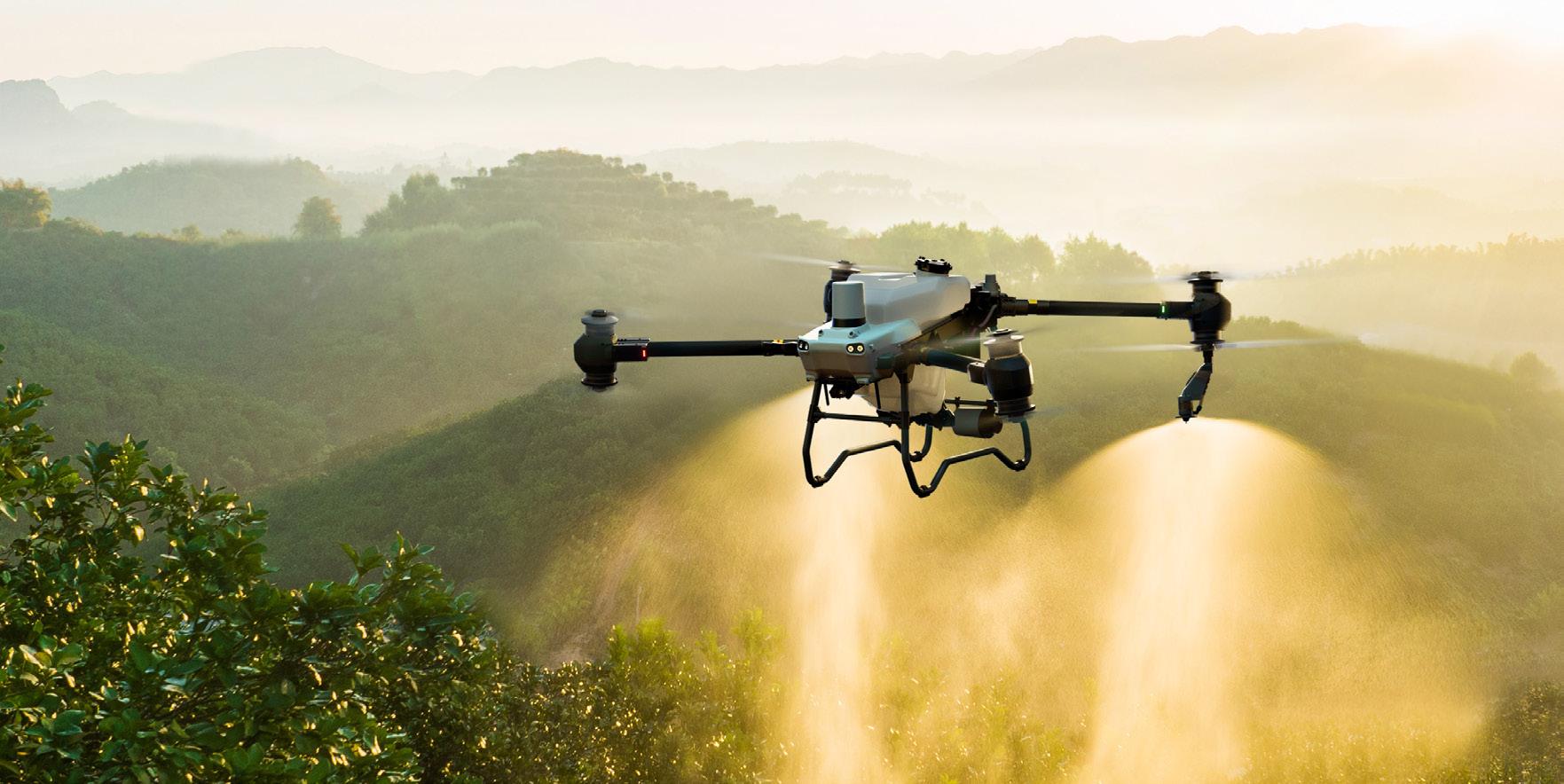
DJI Agricultural drones spray more accurately and evenly thanks to their automated features and precision spraying systems. Agricultural drones can effortlessly operate over challenging terrain that is typically hard for large machines, such as tractors and fixed-wing aircraft. Moreover, agricultural drones save chemicals and water, which effectively minimises the risk of chemical run-off and ensures the conservation of water resources.
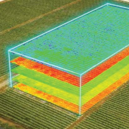
Farmers can use DJI aerial platforms such as the Mavic 3 Multispectral imaging system to gather precise crop data, perform diverse agricultural tasks, monitor the environment, and more.
Manual mapping has become a thing of the past with the Mavic 3 Multispectral, which performs aerial mapping 100 times faster than manual operations. The entire mapping process is displayed on screen, ensuring that planning and editing are done accurately.
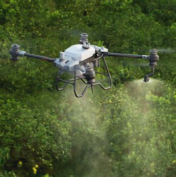
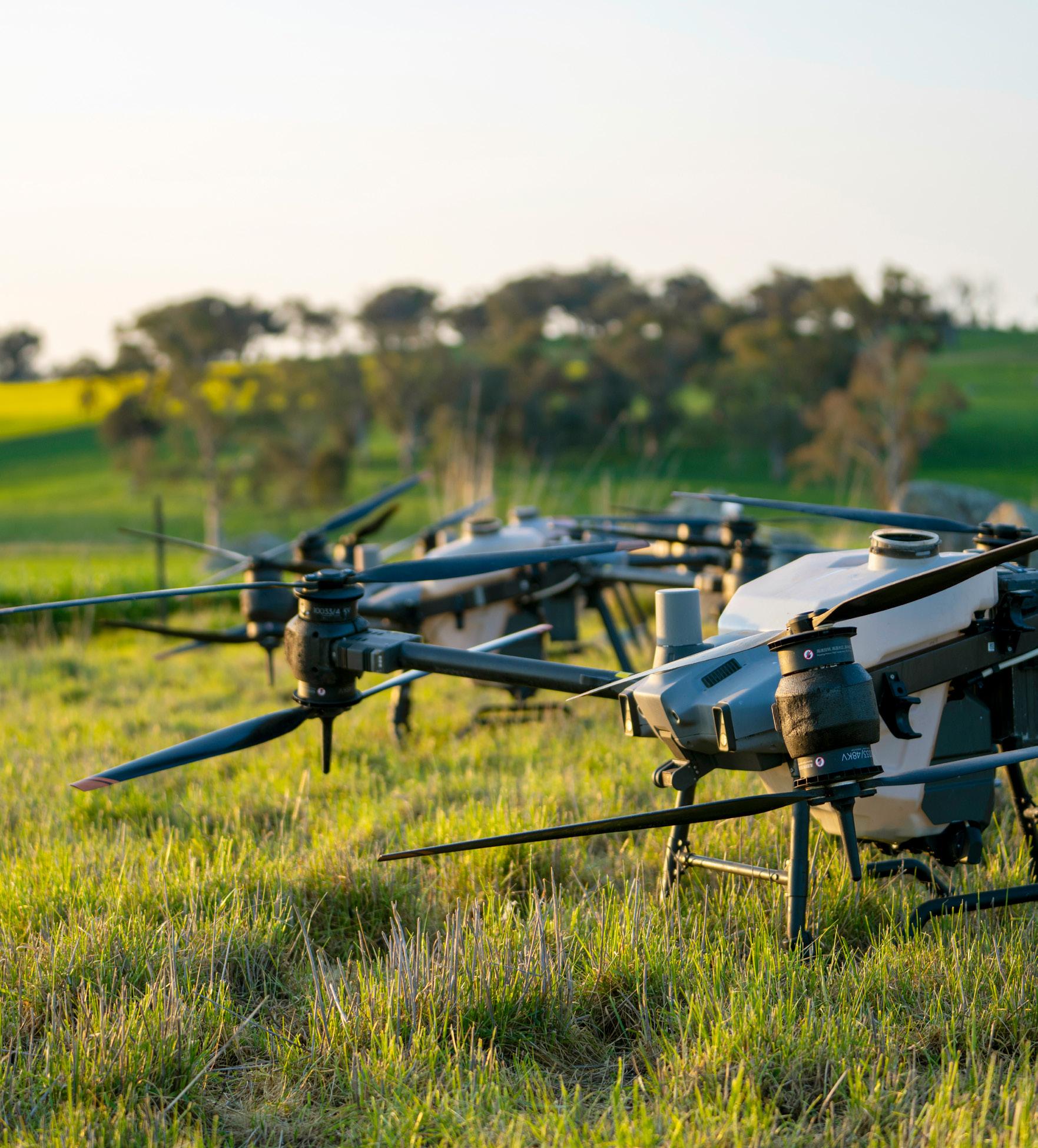
The flagship of efficiency and stability, born from a deep understanding of the demands of largescale farming, the Agras T50 inherits a coaxial dual-rotor design and 54-inch propellers for next-level stability. The T50’s dual atomisation spraying system is ideal for a variety of applications from fields to orchards. Easily converted to its spreading configuration, the T50 can carry 50kg of dry granules and spread at a flow rate of up to 108 kg/min. This combination of power, precision, and versatility sets it as the top choice in agricultural drones.
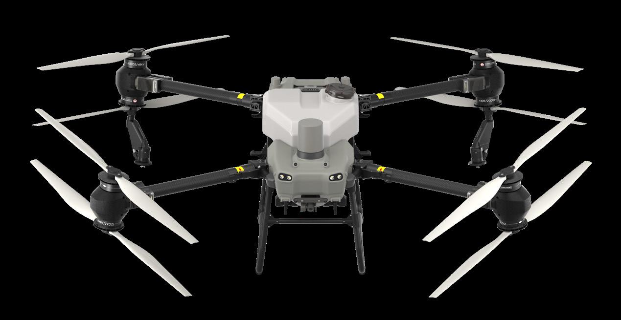
50kg spreading and 40kg spraying payload 1
Dual active phased radar array, two sets of binocular vision
Dual atomiser and optional four sprinkler kit
Auto/manual operation, variable rate application
Terrain following, omnidirectional obstacle avoidance
Upgraded quad-antenna O3 transmission for stable connection
Increased spray rate, up to 24l/min
- Larger magnetic drive impeller pumps
- Dual atomiser setup 16l/min flow rate
- Optional four sprinkler kit for up to 24l/min flow rate
- Dual atomising centrifugal nozzles with fully adjustable droplet size from 50-500 micron2
- New anti-drip solenoid valve
- Reverse directional spraying
Upgraded T50 spreading system
- 75L max capacity, expanded loading gate
- Spreading flow rate up to 108kg/min3
- Increased torque spreader motor
- Spiral flow spinner for even spread pattern
- Monitoring of payload in real time
- Simple design for quick disassembly and easy cleaning or maintenance
Double the sensors, double the peace of mind
- Two sets of active phased array radars, with double the detection range
- Two sets of binocular vision, accurately detecting obstacles and terrain4
- Comprehensive 360° perception with omnidirectional obstacle avoidance5
- Active terrain following up to 50° of slope
- 12-megapixel adjustable FPV camera for real-time data collection
- Surveying with obstacle bypassing and terrain following up to 20° of slope6
- RTK correction generates accurate 3D flight routes7
- 7-inch touch screen with an array of physical buttons to suit all users
- 8-core processor for smooth operation
- Upgraded quad-antenna O3 transmission system for stable connection, 2km range8
- Can be connected to the DJI relay to improve signal quality when required
- Increased capacity C8000 Intelligent Charger delivering maximum charging power of up to 7200W
- Upgraded DB1560 battery with 30000mAh capacity
- Standard 3-battery kit allows continuous flight operation
1. Data was measured at sea level. The payload weight is greatly affected by the ambient temperature and altitude. The payload weight needs to be reduced by 10kg for every 1,000m increase in altitude. The DJI Agras app will recommend the payload weight according to the current status and surroundings of the aircraft. When adding materials, the maximum weight should not exceed the recommended value, otherwise flight safety may be compromised.
2. Droplet testing has been conducted in Australia in conjunction with the University of Queensland
3. Measured using urea with a diameter of 4mm. The particle size, density, and surface smoothness of different fertilisers are different, and the maximum flow rate will be different.
4. The effective sensing range and its ability to avoid and bypass obstacles will vary depending on the ambient light, rain, fog, and the material, position, shape, and other properties of the obstacles. It is
recommended that linear objects such as wires or inclined lines be planned as obstacles. Downward sensing is used for Terrain Follow and Altitude Stabilisation. The sensing in other directions is used for Obstacle Avoidance.
5. Obstacle Bypassing is supported in the forward direction. Obstacle Bypassing features are not supported at night or in low light environments. Fly with caution. Obstacle Bypassing is not recommended around electric or guy wires.
6. To ensure a high success rate of surveying and mapping, DJI AGRAS T50 can automatically adjust its flight speed based on the hill slope. The steeper the slope, the slower its speed.
7. AgDrone.au recommend utilising the DJI Mavic 3 or Matrice 350 RTK for data collection and DJI Terra for 3D map reconstruction.
8. Measured at a flight altitude of 2.5 metres, without obstruction or electromagnetic interference.
The Agras T25 packs all the advanced features of the T50 into a smaller, portable design. It can carry a 20 litre spraying or 25kg spreading payload and includes the T50’s top features like multidirectional obstacle avoidance, Terrain Following, ultra-fast battery charging, one-tap takeoffs, and automatic operations. This makes it perfect for solo use in small to medium-sized farms.
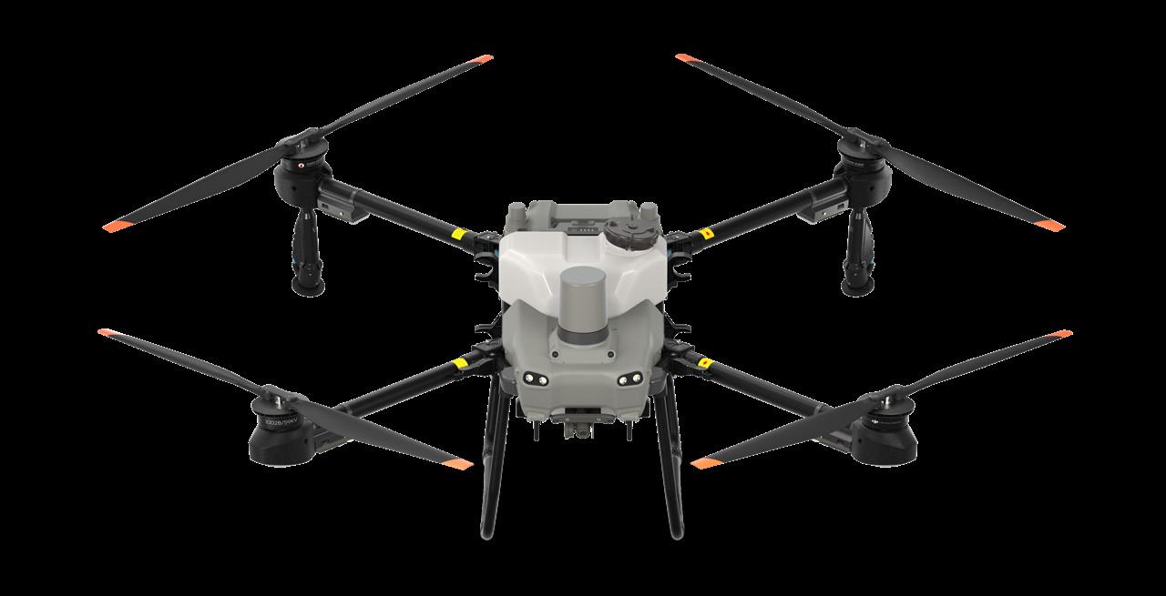
25KG
20L spraying, 25kg spreading Light weight, compact and foldable
Dual atomiser spraying system (up to 16l/min), Optional four sprinkler kit.
Auto/manual operation, variable rate application
Multidirectional Obstacle Avoidance terrain following up to 50°
Offline operations 2km O3 Transmission Optional DJI Relay
- Easy folding, lightweight design for ease of operation and transport
- 21% reduction in unfolded footprint –convenient take-off /landing in tight areas1
- Drone body 25.4kg excluding the battery
Higher flow, no leaks
- Larger magnetic drive impeller pumps
- Dual atomiser setup 16l/min flow rate
- Optional four sprinkler kit allows up to 24l/min flow rate
- Dual atomising centrifugal nozzles, fully adjustable droplet size from 50-500 micron2
- New anti-drip solenoid valve
- Reverse directional spraying
Double the sensors, double the peace of mind
- Two sets of active phased array radars, with double the detection range
- Two sets of binocular vision, accurately detecting obstacles and terrain3
- Comprehensive 360° perception with omnidirectional obstacle avoidance4
- Active terrain following up to 50° of slope
1. Compared to the T20P
2. Droplet testing has been conducted in Australia in conjunction with the University of Queensland
3. The effective sensing range and its ability to avoid and bypass obstacles will vary depending on the ambient light, rain, fog, and the material, position, shape, and other properties of the obstacles. It is recommended that linear objects such as wires or inclined lines be planned as obstacles. Downward sensing is used for Terrain Follow and Altitude Stabilisation. The sensing in other directions is used for Obstacle Avoidance.
4. Obstacle Bypassing is supported in the forward direction. Obstacle Bypassing features are not supported at night or in low light environments. Fly with caution. Obstacle Bypassing is not recommended around electric or guy wires.
5. To ensure a high success rate of surveying and mapping, DJI AGRAS T50 can automatically adjust its flight speed based on the hill slope. The steeper the slope, the slower its speed.
6. AgDrone.au recommend utilising the DJI Mavic 3 or Matrice 350 RTK for data collection and DJI Terra for 3D map reconstruction.
7. Measured at a flight altitude of 2.5 meters, without obstruction or electromagnetic interference
8. Measured using urea with a diameter of 4mm. The particle size, density, and surface smoothness of different fertilizers are different, and the maximum flow rate will be different.
Adjustable high-resolution camera
- 12-megapixel adjustable FPV camera allowing real-time data collection
- Surveying with obstacle bypassing and terrain following at up to 20° of slope5
- RTK correction to generate accurate 3D flight routes6
Widescreen Remote Controller
- 7-inch touch screen with physical buttons
- 8-core processor for smooth operation
- Upgraded quad-antenna O3 transmission system for stable 2km range7 connection
- Connected to the DJI relay to improve signal quality
25kg spreader payload
- 35L volume with expanded loading gate
- Product flow rate up to 72kg/min for more efficient spreading8
- Spiral flow spinner for even spread pattern
- Weight sensors for monitoring remaining payload in real time
- Quick disassembly, easy cleaning and maintenance
A variety of upgrades to the spreading system for DJI Agras T50 and T25 enhance their ability to effectively spread fertiliser, seed and a variety of other granular products.
Spiral flow disc
Real time payload monitoring
Simple design
Quick disassembly
Increased torque spreader motor
Expanded lid for easy filling
Auto/manual operation
OPTIMISED ACCURACY. ULTIMATE RELIABILITY.
D-RTK 2 Mobile Station is DJI’s upgraded high-precision GNSS receiver that supports all major global satellite navigation systems, providing real-time differential corrections that generate centimetrelevel positioning data for improved relative accuracy.
Centimetre-Level
D-RTK 2 Mobile Station fully supports GPS, GLONASS, Beidou, and GALILEO signals. Easy and quick to set up, the D-RTK 2 Mobile Station provides real-time differential data for drones to achieve centimetre-level positioning accuracy. The built-in high gain antenna offers better signal reception from more satellites even when obstructions are present.
D-RTK 2 Mobile Station supports communication via 4G, OcuSync, WiFi, and LAN, ensuring uninterrupted, stable data transmission under any application scenario. Up to five remote controllers can be connected to the D-RTK 2 Mobile Station simultaneously when used with DJI Agras drones and the Mavic 3 Enterprise range. When used with the Matrice 300/350 RTK, it can be connected to multiple aircraft, making coordinated operations involving multiple drones a possibility and significantly improving efficiency.
Featuring IP65 level ingress protection and a lightweight carbon fiber body, the D-RTK 2 Mobile Station is ultraportable and up for any task, no matter how tough. The built-in IMUs monitor movements and calibrate the tilt sensors to alert the operator of any abnormalities during the mission, minimising risks.
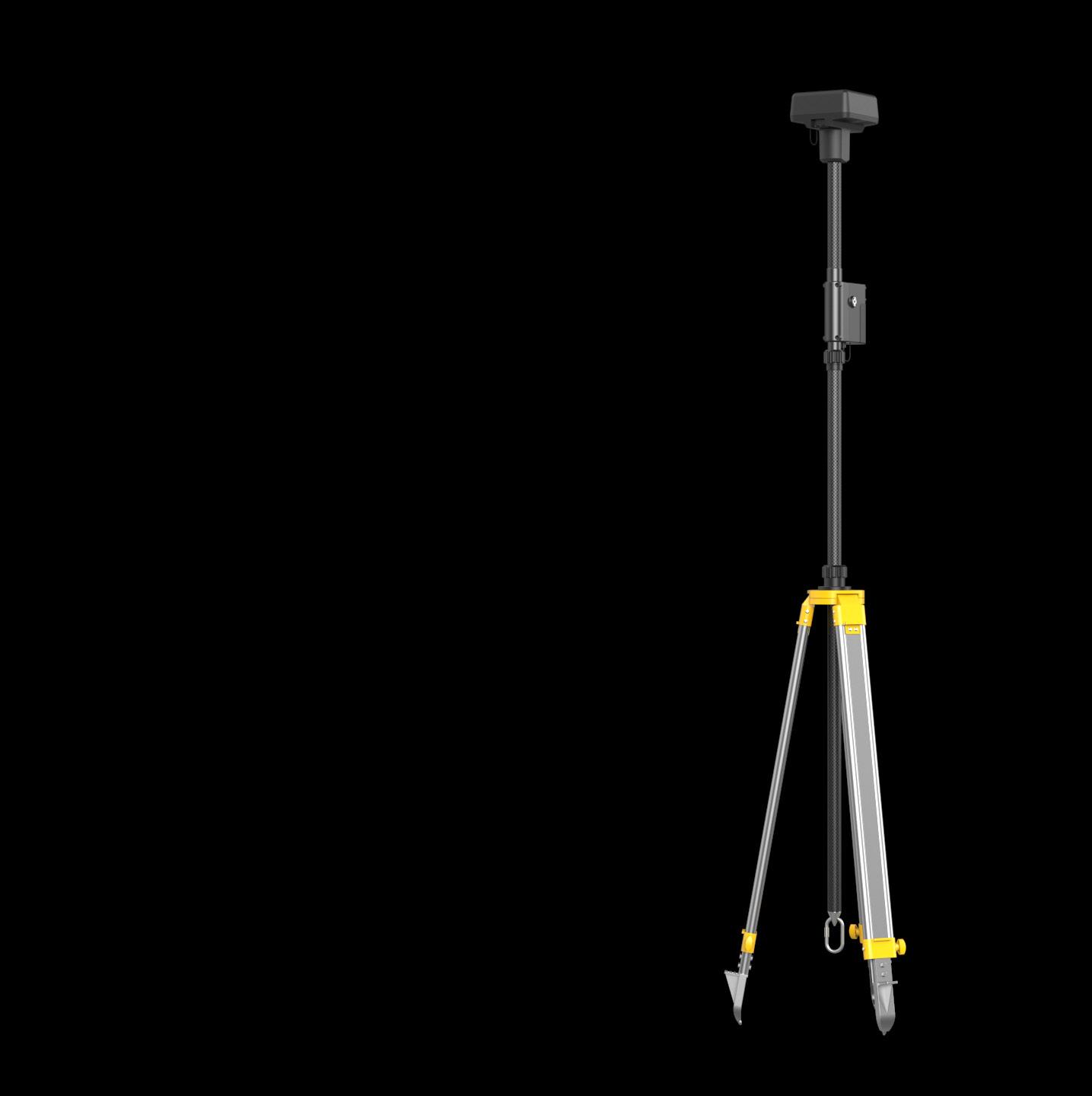
Introduced as an accessory module for the T40, the DJI Relay increases transmission strength between the drone and controller. In areas with more difficult terrain, more obstacles, and more interference, the DJI Relay acts as a linking point to keep your drone connected. DJI Academy.
The DJI Relay runs off a 6500mAh internal battery, with a battery life of up to 4 hours. Charging via a standard USB-C connection, the DJI Relay can be connected to an external power bank to increase run time and ensure a smooth connection in the field for longer.
The DJI Relay comes with a tripod connection, allowing you to attach it to a suitable tripod. By choosing a location with unobstructed views to both drone and controller, the DJI Relay greatly enhances the signal between the two, ensuring seamless operation in the most challenging of environments.

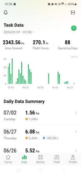
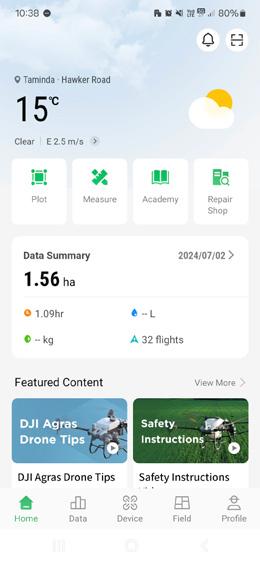
The DJI SmartFarm app streamlines daily drone operations for crop protection and plot management with enhanced data visualisation and reporting, a dynamic device management dashboard, and easy access to after sales support and learning resources on DJI Academy.
Multidimensional data made easy
Generate daily or custom operational summaries on equipment usage, modes, locations, and teams. Easily review flight paths and operational parameters on a map, and seamlessly share real-time updates with your team.
Dynamic device management
Stay up to date with the operating status of your devices with a dashboard that keeps essential info at your fingertips.

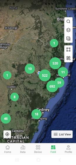
Field creation and management
Create fields on your phone utilising HD satellite imagery. Tap to add field boundaries, obstacles and non-spray zones. Easily import fields into your Agras controller, or share with other users.
Service, knowledge and support
Find your nearby authorised DJI repair centres via the app. Learn about drones, maintenance, operation parameters and use-cases through the DJI Academy.
Weather alerts
The DJI SmartFarm app now integrates a weather function, keeping you in the loop with wind and weather conditions in your current location.
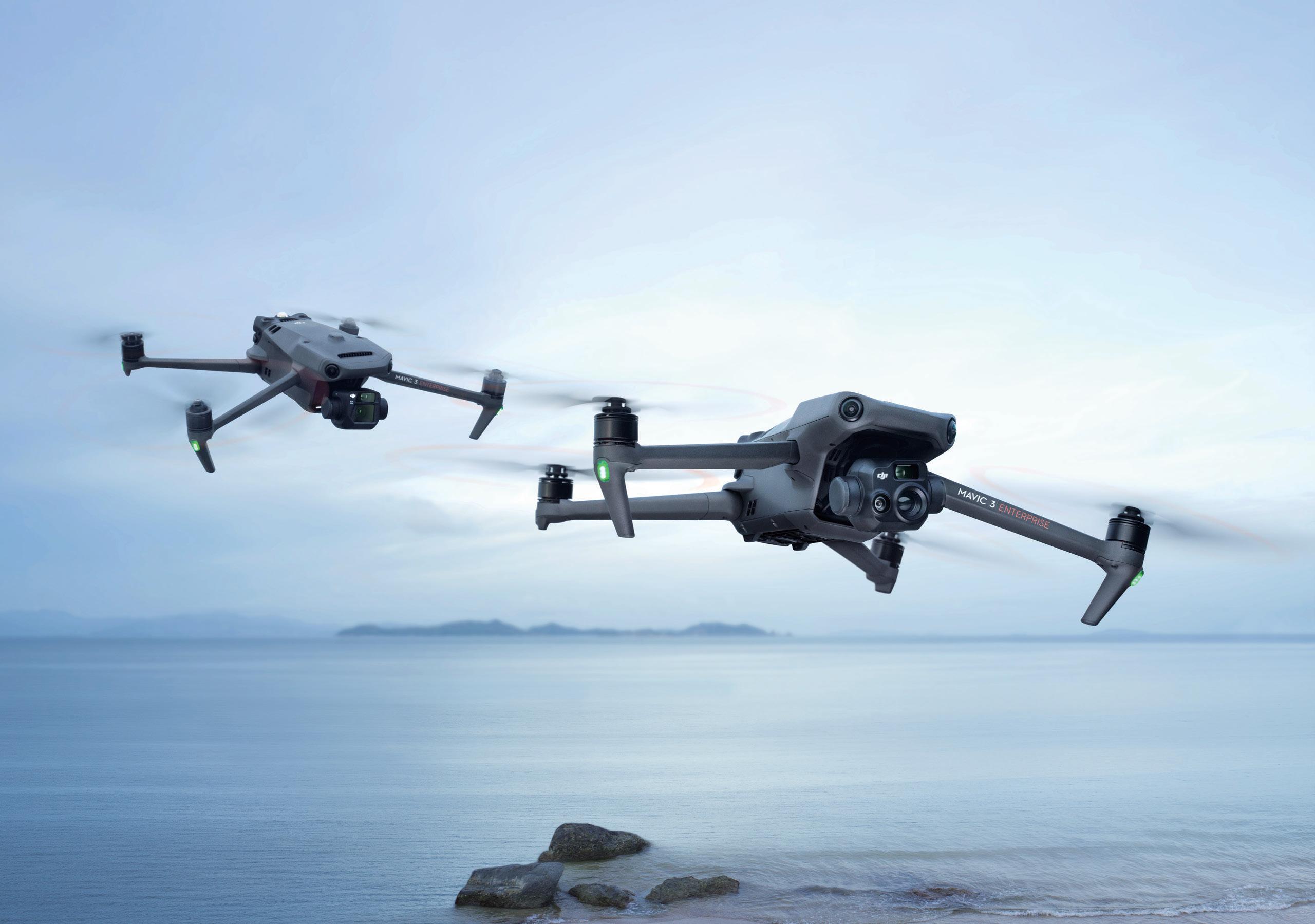
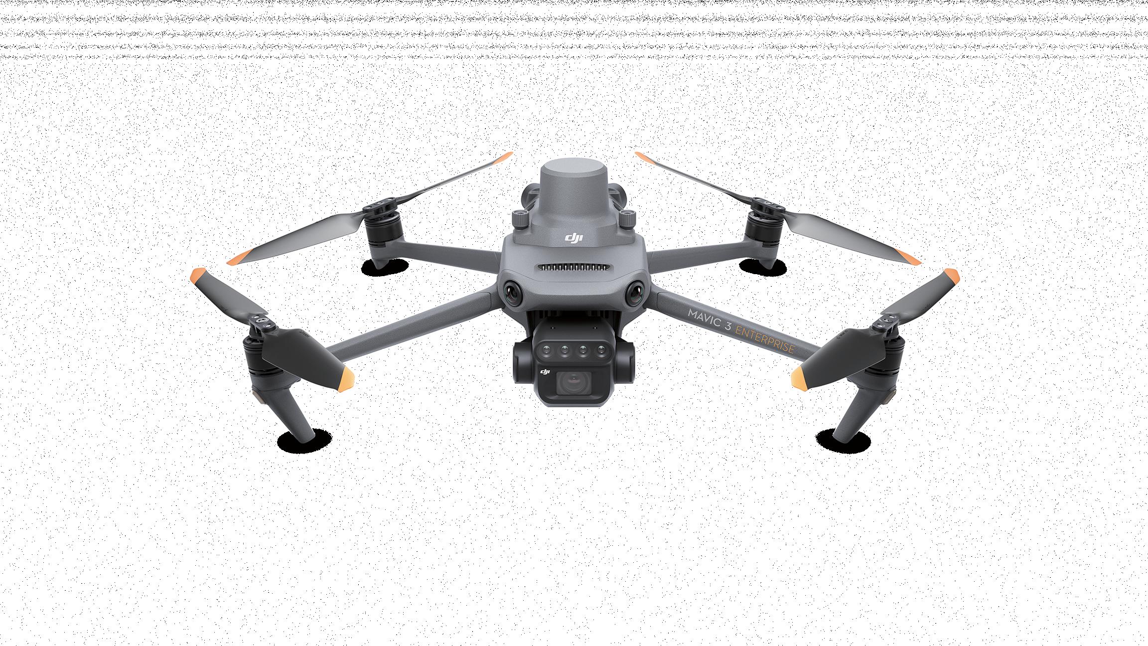
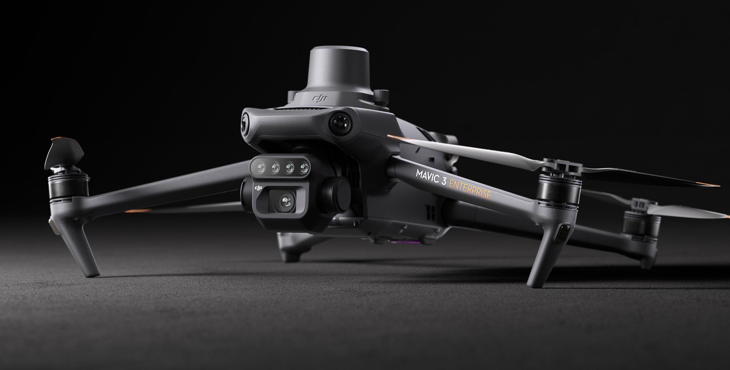
The Mavic 3 Enterprise redefines industry standards for small commercial drones. With a mechanical shutter, a 56x zoom camera, and an RTK module for centimetre-level precision, the Mavic 3E brings mission efficiency to new heights. A thermal version is available for firefighting, search and rescue, inspections and night operations.
DJI MAVIC 3E
Wide: 4/3 CMOS, 20 MP, Mechanical Shutter
Zoom: Equivalent Focal Length 162mm, 12MP, 56× Hybrid Zoom
Wide: Equivalent Focal Length 24mm, 48MP
Zoom: Equivalent Focal Length 162mm, 12MP, 56× Hybrid Zoom Thermal 1: DFOV: 61°, Equivalent Focal Length 40mm, Resolution 640 × 512
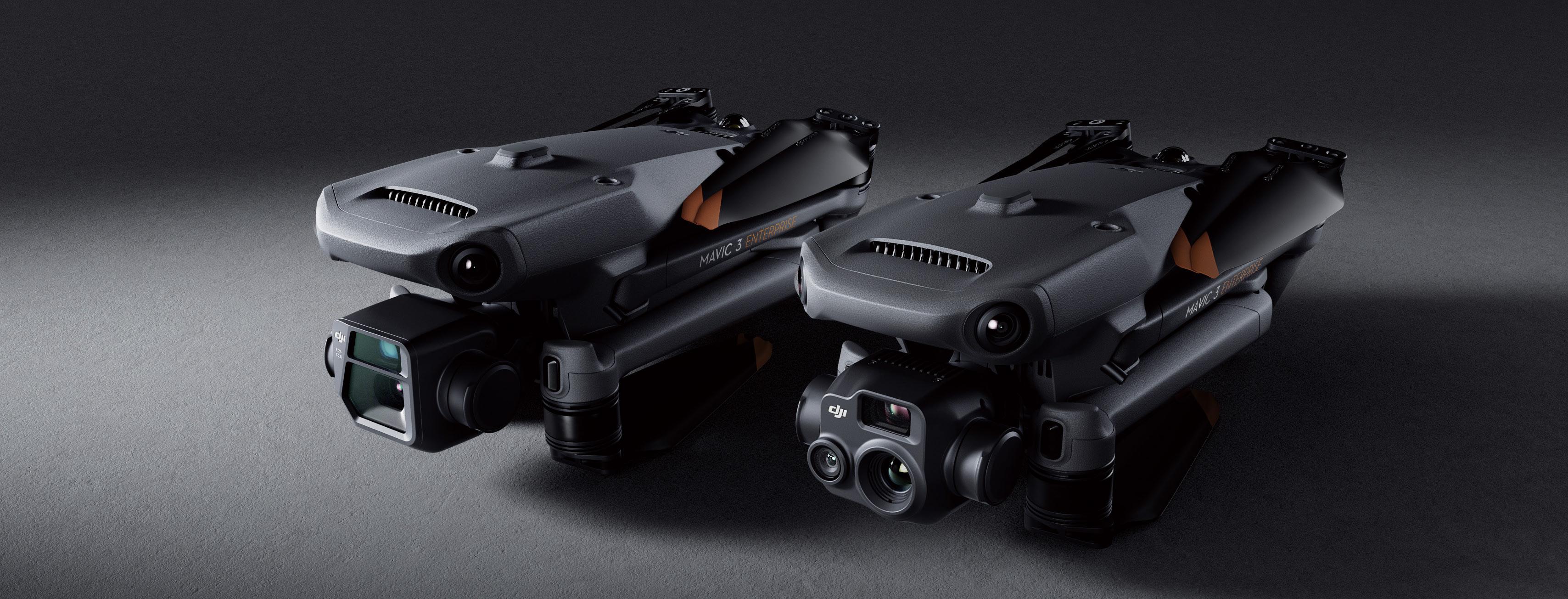
Enterprise redefines industry standards for small commercial drones. With a mechanical shutter, a 56× zoom camera, module for centimeter-level precision, the Mavic 3E brings mission efficiency to new heights. A thermal version is available search and rescue, inspection, and night operations.

Premium camera performance
- HD wide camera
- Smart low light photo
- Thermal
- Synchronised split-screen zoom
Compact and portable
- Lightweight 915g/920g airframe 2
- Compact body that fits in the palm of your hand
- Perfect for beginners and veteran pilots alike
Ultra-long battery life
- 45 minute max flight time 3
- 100W charging hub for fast charging batteries
- 88W drone direct charging
1. DO NOT expose the thermal camera lenses to strong sources of energy such as the sun, lava, or a laser beam. Otherwise, the camera sensor may be burned leading to permanent damage.
Flagship flight safety
- Wide-angle lenses for omnidirectinoal obstacle sensing with zero blind spots 4
- Advanced RTH
- APAS 5.0 for automatic rerouting around obstacles 5
Abundant accessories
- DJI RC Pro Enterprise 6
- RTK Module 7
- Loudspeaker 7
- D-RTK 2 Mobile Station 7
Full software suite
- DJI Pilot 2
- DJI FlightHub 2
- DJI Terra
- DTAT 3.0
5. Supported in manual flight mode only. Caution is recommended when flying in hazardous environments.
6. Currently available only with the purchase of DJI Mavic 3 Enterprise Series.
2. DJI Mavic 3E (with propellers) 915 grams; DJI Mavic 3T (with propellers) 920 grams.
3. Measured at 32.4km/h uniform speed at sea level in a windless environment until battery was fully drained to 0%.
4. Omnidirectional sensing capability is limited by environmental conditions like weather and electromagnetic interference. Please fly with caution when working in challenging conditions (e.g. wind speeds over 12m/s).
7. Accessories sold separately.
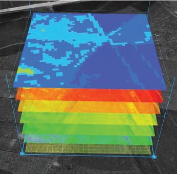
Effective aerial surveying needs to see the invisible. That’s why Mavic 3 Multispectral has two forms of sight. It combines an RGB camera with a multispectral camera to scan and analyse crop growth
COMPACT AND PORTABLE
Foldable for easy storage
Highly integrated imaging system
MULTISPECTRAL CAMERA
4 x 5 MP G/R/RE/NIR
RGB CAMERA
20 MP 4/3 CMOS, mechanical shutter
Centimeter-level RTK positioning
PRECISE POSITIONING
Synchronization at microsecond level
Centimetre level RTK positioning
Synchronisation at microsecond level
SAFE AND STABLE
Omnidirectional
Lightweight and portable, highly integrated
- Small and foldable for easy storage
- Integrates RGB and multispectral cameras
RGB camera
- 4/3 CMOS, 20 MP
- 1/2000 second mechanical shutter in order with no rolling shutter
- 0.7 second, high speed, burst shooting when shooting with RGB camera only
Multispectral camera
- Four 5MP multispectral cameras
- Green (G) 560 nm ± 16nm
- Red (R) 650 nm ± 16 nm
- Red edge (RE) 730 nm ± 16 nm
- Near-infrared (NIR) 860 nm ± 26 nm
- Light sensor, NDVI is more accurate
Accurate images, capturing every pixel
- RTK centimetre level positioning
- Microsecond level time synchronisation
- Phase-less aerial surveying
1. DO NOT fly in severe weather conditions, such as in strong winds (wind speeds of 12m/s or more), snow, rain, or lightning. DO NOT fly in areas that are 6,000m or higher above sea level. DO NOT fly the aircraft in environments where the temperature is below -10°C (14°F) or above 40°C (104°F). DO NOT take off from moving objects, such as cars and ships. DO NOT fly close to reflective surfaces, such as water or snow. Otherwise, the vision positioning system may not work properly. When the GNSS signal is weak, fly the aircraft in environments with good lighting and visibility. The vision system may not work properly in poor light conditions. Be aware of flight safety when flying near sources of electromagnetic interference. Common sources of electromagnetic interference include highvoltage power lines, high-voltage transmission stations, radar stations, cell phone base stations, broadcast towers, Wi-Fi hotspots, routers, and Bluetooth devices.
2. The 15km transmission distance can only be achieved under the FCC standard when measured in an outdoor environment without interference. The SRRC standard is adopted in mainland China, and the furthest transmission distance is 8km. The above data are the
Extra-long battery life, highly efficient aerial surveying
- 43 minute flight time 4
- Aerial surveying of up to 200 hectares per flight
- 100W Battery Charging Hub, 88W fast charging
Stable image transmission, omnidirectional obstacle sensing
- 15km image transmission, stable signal 2
- Omnidirectional obstacle sensing 1 , terrain-follow aerial surveying 5
Extensive applications
- Aerial surveying of farmland, mountains, and orchards
- Multispectral aerial surveying to guide variable operations
- Smart field patrols to monitor crop status
- Environmental monitoring and natural resource surveying
Open ecosystem
- Cloud API, access to third party platforms
- MSDK, an exclusive app
furthest communication distances for one-way, non-return flights under each standard. Please pay attention to return prompts in the DJI Pilot 2 app during flight.
3. Specific test conditions: In a sunny environment without wind, the orthographic flight aerial photography is obtained with a flight speed of 15m/s, a flight altitude of 217m, a ground sampling distance (GSD) of 5.73cm for visible and 10cm for multispectral, a fore-and-aft overlap rate of 70%, and a side overlap rate of 60%.
4. Data was measured using a DJI Mavic 3M flying at a constant speed of 36kph at sea level in a windless environment until 0% power remained. It is for reference only. Please pay attention to Return to Home prompts on the DJI Pilot 2 app during flight.
5. Terrain-Follow Aerial Surveying supports aerial surveying 80 – 200m from the ground. Low light, water, electrical towers, glass structures, buildings with large, repeated patterns, and other areas with dynamic obstacles may present risks. Please use caution.
55-Min Max Flight Time*
O3 Enterprise Transmission IP55 Rating DJI RC Plus
400 Battery Cycles* 6-Directional Sensing & Positioning
55 minute maximum flight time*
Night-Vision FPV Camera Multi-Payload Support
IP55 Rating 20KM DJI O3 Enterprise Transmission
* Tested in a controlled environment. Actual results may vary depending on the environment, usage, and firmware version. For details, please refer to the product page on the official DJI website.
400 battery cycles* 6 directional sensing and positioning
Night-Vision FPV Camera DJI RC Plus Multi-Payload Support
Powerful Operation Performance
- 55 minute maximum flight time
- IP55 Rating
- -20° to 50°C operating Temperature
- 7000m maximum flight altitude
- 2.7kg maximum payload
Upgraded Battery System
- 400 battery cycles 2
- Battery hot swapping
- Battery station storage mode/ Ready-to-Fly mode
- 360° movement battery station wheels
Enhanced Flight Safety
- Arm lock indicator
- Six directional sensing and positioning
- Night-vision FPV camera
- CSM radar support
Enhanced Video Transmission Performance
- Four antenna O3 Enterprise transmission
- Triple-channel 1080p transmission
New Control Experience
- DJI RC Plus
- DJI Pilot 2
Intelligent Operation
- Centimetre level, high precision mapping without GCPs
- AI spot-check for automated precision inspection
- Cloud based, real time situation sharing for air-to-ground coordination 3
1. Tested in a controlled environment. Actual results may vary depending on the environment, usage, and firmware version. For details, please refer to the product page on the official DJI website.
2. Up to 400 cycles if the accumulative duration of battery level ≥ 90% is less than 120 days within 12 months.
3. DJI FlightHub 2 required.
Equipped with a 7-inch high-bright screen, DJI RC Plus supports Dual Operator Mode and comes with a standard WB37 external battery that offers an operating time of up to six hours, meeting various operation needs.

DJI Terra is 3D model reconstruction software that has photogrammetry as its core technology. It supports a range of accurate and efficient 2D and 3D reconstruction of visible light, and data processing through DJI LiDAR. DJI Terra is a perfect solution for mapping and generating 3D flight paths for DJI Agras drones.
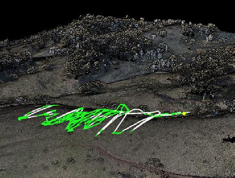
Capable of creating centimetre-level accurate high resolution maps, identification of target spray areas and easily avoiding non spray and obstacle, DJI Terra is a key tool for effectively utilising DJI Agriculture drones. Photogrammetry missions with the Mavic 3 Multispectral or Matrice 300 RTK are easily reconstructed, managed and modified, giving you complete control of where and how your drone will fly.
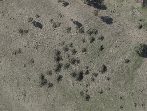
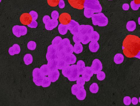
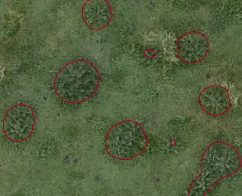
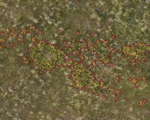
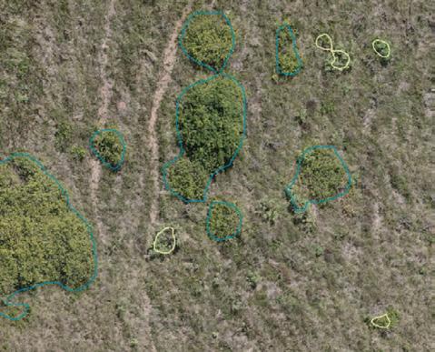
A challenge put before the AgDrone.au team has been the integration of AI detection into the DJI Terra system. Now, utilising our own third party software package, AgDrone.au can offer a range of AI detection services and several modification functions to the DJI Terra system.
An ever evolving AI detection model has been built in to our software, allowing the detection of a variety of weed species. Further, integration of other third party detection files into the Terra system has been made possible. Allowing quick and easy mass-modification of detection areas within Terra, we can quickly change the classification of different objects, whilst also creating accurate buffer zones around these classification areas. Aircraft safety has also been accounted for, through our ability to ‘smooth’ the 3D flight path around obstacles. Finally, a compression function allows you to reduce your orthomosaic map, making it much easier to share or upload.
info@agdrone.au