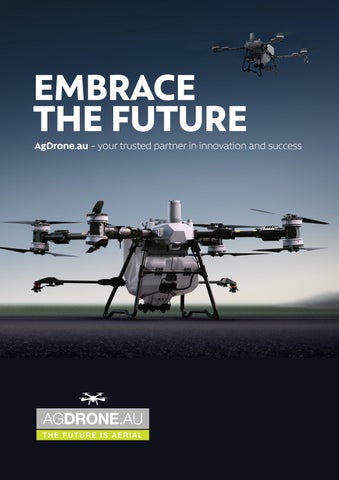

EMBRACE THE FUTURE
AgDrone.au – your trusted partner in innovation and success
SPECIALISING IN PRECISION AGRICULTURE
AgDrone.au – a pioneering force for drone solutions
Specialising in precision agriculture and serving diverse sectors. Driven by cutting-edge technology and a commitment to excellence, we empower our clients to soar to new heights of success.
Our core competency lies in precision agriculture, where we harness advanced DJI drone technologies to reshape farming practices. From pinpoint spraying and precise seeding to strategic fertilisation and comprehensive crop monitoring, AgDrone.au leads the charge in optimising agricultural efficiency and sustainability with the reliability of DJI equipment.
As pioneers in the drone industry, we redefine industry standards through our aerial imaging and mapping capabilities. High-resolution aerial imagery, powered by DJI technology, empowers sectors like mining and real estate, with crucial data for resource management and strategic planning.
AGDRONE.AU OFFERING MORE THAN SOLUTIONS
We offer a partnership grounded in trust and dependability. Our comprehensive services encompass drone sales, unwavering post-sale support, repairs, and maintenance, ensuring our clients derive maximum value from their investment in DJI equipment.
Safety, compliance, and quality underscore our operations. Our adept drone pilots and technical experts uphold industry-leading standards, ensuring secure and efficient drone operations tailored to our clients’ diverse needs while leveraging the excellence of DJI products.
AgDrone.au takes pride in its environmentally conscious approach. Our drone solutions, utilising DJI technology, promote sustainability by minimising chemical usage and reducing environmental impact, charting a course for a greener future.
Agricultural drones can play an important role throughout the


WHY AGRICULTURAL DRONES?
Granular spreading
DJI Agricultural drones are suitable for multiple application scenarios, such as: grassland reseeding granular fertiliser spreading spreading aquatic feed
Installation of the spreading system can be completed in under three minutes, proving that Agras drones are always ready for the task.
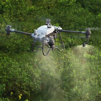
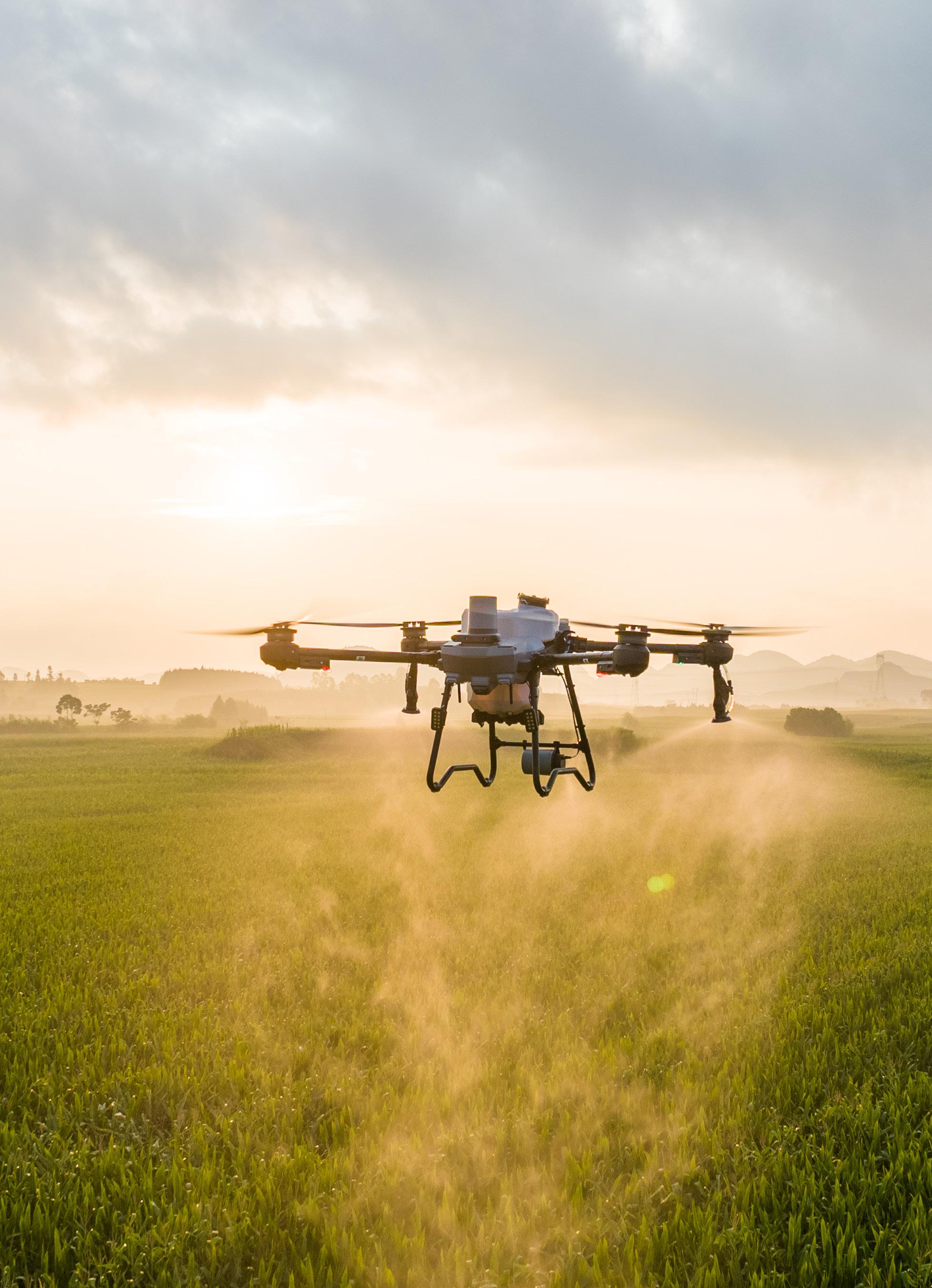
Crop spraying
DJI Agricultural drones spray more accurately and evenly thanks to their automated features and precision spraying systems. These drones: effortlessly operate over challenging terrain save on water, conserving water resources save on chemical, minimising the risk of chemical run-off.

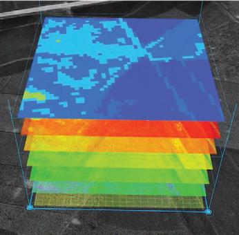
Crop health monitoring
Farmers can use DJI aerial platforms such as the Mavic 3 Multispectral imaging system to: gather precise crop data perform diverse agricultural tasks monitor the environment, and more.
Field mapping/surveying
Manual mapping has become a thing of the past with the Mavic 3 Multispectral which performs aerial mapping 100 times faster than manual operations. The entire mapping process is displayed on screen, ensuring that planning and editing are done accurately.

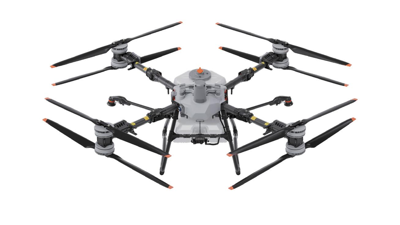
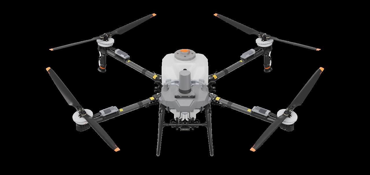
DJI AGRAS T100
BIG DRONE, BIG JOBS.
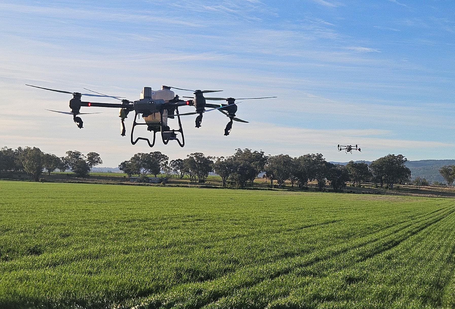
The T100 Agricultural Drone, a groundbreaking creation twelve years in the making, boasts a maximum payload of 100 kilograms. Its operational efficiency is doubled, supporting multiple application scenarios, including spraying, spreading, and lifting tasks. Featuring industry-leading safety systems and advanced algorithms, it delivers unparalleled safety performance and an intelligent operational experience.


High volume spraying, high efficiency
- 100L Iarge capacity
- Regular 13m spray width, 20 m/s speed
- 30L/min high flow rate (standard dual spray)
- 40L/min high flow rate (optional 4 spray)
- Water-cooled misting with 4 nozzles, droplet size range 50-500um (optional)
Large capacity for fast spreading
- 150L capacity
- 400kg/min high flow rate
- New screw feeder, double flow rate precision
- 10m effective spreading width
- Spreading efficiency increased by 66%
Industry-leading safety system
- LiDAR + millimetre-wave radar
- Penta-Vision System
- Smart trap-escape
- Obstacle type detection
- Automatic obstacle position memory, increasing safety with every flight
- AR safety assist display
Your transport assistant
- 100kg large load capacity
- Real-time weighing and auto balance control
- Marking loading/unloading points by mobile
- Supports single battery/dual battery lift kit
Fast charging, economical, energy-saving
- Battery 41 Ah
- 500 A high-power connector
- Front-mounted battery, corrosion-resistant
- 1 year or 1,500-cycle warranty
- Triple air-channel cooling system for rapid heat dispersion
Strong signal, fearless of obstructions
- 04 Transmission resists interference, providing smooth and stable images
- 04 Relay, unaffected by mountain obstructions
- D-RTK 3 AG enabling plug-and-play centimetre-level positioning without the need to configure coordinates
Dimensions
Unfolded: 3220mm × 3224mm × 975mm
Folded: 1105mm × 1265mm × 975mm
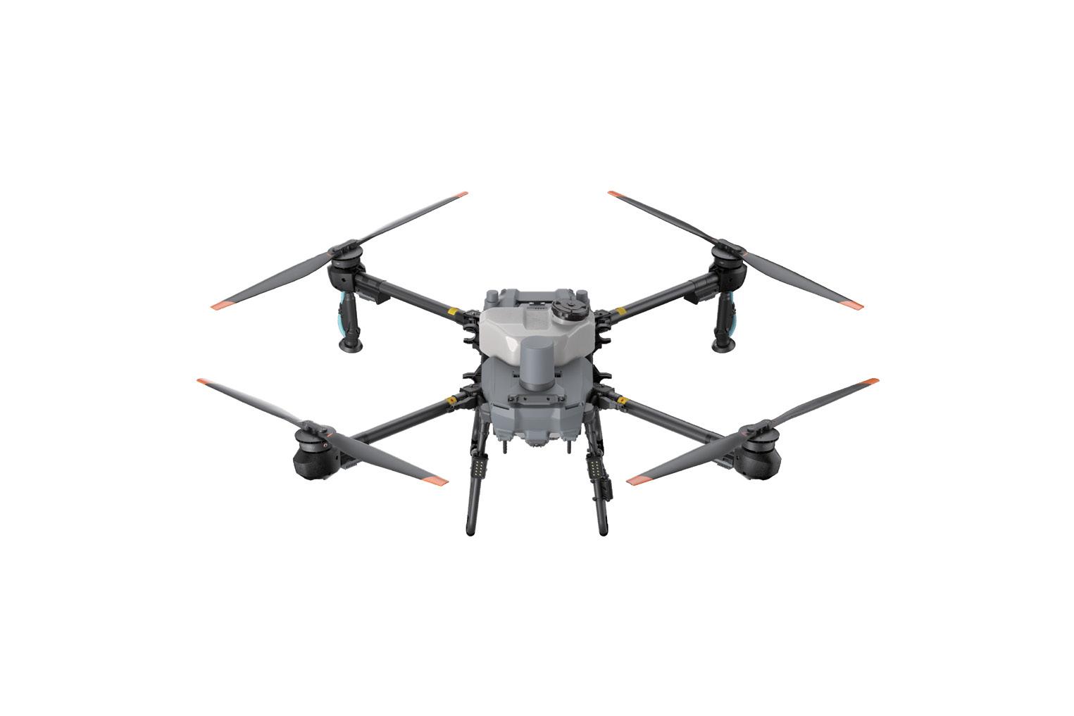
DJI AGRAS T70P EFFICIENCY EXPERT.
The DJI Agras T70P agricultural drone is newly upgraded to support spraying, spreading, and lifting in various operational scenarios, with a maximum payload capacity of 70kg It delivers enhanced efficiency while featuring Safety System 3.0 and advanced algorithms for comprehensive, round-the-clock protection.


Exceptional spraying efficiency
- 70L spraying capacity
- 20m/s spraying flight speed
- 30 L/min high flow rate (standard dual spray)
- 40 L/min max. flow rate (optional quad spray)
- Water-cooled misting with 4 nozzles, droplet size range 50-500um
A spreading workhorse
- 100L hopper capacity
- 400kg/min maximum flow rate
- Spreader system 4.0 introducing the brand new screw feeder for greater precision
- 10m effective spreading width
- 20m/s spreading speed
Industry-leading safety system
- LiDAR + millimetre-wave radar
- Penta-Vision System
- Smart Trap-Escape
- Obstacle Type Detection
- Automatic Obstacle Position Memory, increasing safety with every flight
- AR safety assist Display
Your transport assistant
- 65 kg payload capacity
- Real-time weighing
- Automatic balance control
- Loading and unloading points by mobile
Fast charging, economical, energy-saving
- Battery 41 Ah
- 500 A high-power connector
- Front-mounted battery, corrosion-resistant
- 1 year or 1,500-cycle warranty
- Triple air-channel cooling system for rapid heat dispersion
- Ergonomic handle
Strong signal, fearless of obstructions
- 04 Transmission resists interference, providing smooth and stable images
- 04 Relay, unaffected by mountain obstructions
- D-RTK 3 AG enabling plug-and-play centimetre-level positioning without the need to configure coordinates
Dimensions
Unfolded: 3200mm × 3520mm × 960mm
Folded: 1160mm × 900mm × 960mm
DJI AGRAS T25P
FLY SOLO.
The DJI Agras T25P drone retains its compact, foldable design, featuring 20kg spraying, an upgraded 25kg high-precision screw feeder spreading system 4.0, and Safety System 3.0. It excels in aerial mapping and plant protection, offering flexible operations and convenient mobility, making it ideal for solo operations.

Spraying and Spreading system
- 20 kg spraying, 16 L/min flow rate
- 25 kg spreading, 190 kg/min flow rate
- New Screw Feeder, double flow rate precision
- Adjustable droplet size for spraying 50-500um
Single-person operation
- Foldable body, easy to transfer
- Small unfolded size, easier take-off and landing
- Optional 4 nozzles, manual spraying without turning
Fully automated operations
- Auto aerial survey for farmland and orchards
- Block and obstacle boundaries detection
- One-touch takeoff, auto operation/return
- Terrain-following operation without aerial survey in mountainous areas
- Continuous operation across multiple blocks
Safety System 3.0
- Two sets of millimetre-wave radars and tri-vision
- Intelligent obstacle avoidance, horizontal omnidirectional obstacle avoidance
- 75-watt night navigation light, night vision mode
- Virtual gimbal, full-color night vision FPV
Fast charging, economical, energy-saving
- Battery 15.5 Ah
- Power adaptive protection
- 1500w AC output
- 1 year or 1,500 cycles warranty
Strong signal, fearless of obstructions
- 04 Transmission resists interference, providing smooth and stable images
- 04 Relay, unaffected by mountain obstructions
- D-RTK 3 AG, enabling plug-and-play centimetre-level positioning without the need to configure coordinates
Dimensions
DJI AGRAS T50
READY. STEADY. GO.
The Agras T50 inherits a coaxial dual-rotor design and 54-inch propellers for next-level stability. The T50’s dual atomisation spraying system is ideal for a variety of applications from fields to orchards. Easily converted to its spreading configuration, the T50 can carry 50kg of dry granules and spread at a flow rate of up to 108 kg/min.


Increased spray rate, up to 24l/min
- Large magnetic drive impeller pumps
- Dual atomiser setup 16l/min flow rate
- Optional four sprinkler kit for up to 24L/min flow rate
- Dual atomising centrifugal nozzles with adjustable droplet size from 50-500um
- Anti-drip solenoid valve
- Reverse directional spraying
Upgraded T50 spreading system
- 75L max capacity, expanded loading gate
- Spreading flow rate up to 108kg/min3
- Increased torque spreader motor
- Spiral flow spinner for even spread pattern
- Monitoring of payload in real time
- Quick disassembly, easy cleaning or maintenance
Double the peace of mind
- Two sets of active phased array radars, with double the detection range
- Two sets of binocular vision
- Comprehensive 360° perception with omnidirectional obstacle avoidance
- Active terrain following up to 50° of slope
Adjustable high-resolution camera
- 12-megapixel adjustable FPV camera for real-time data collection
- Surveying with obstacle bypassing and terrain following up to 20° of slope
- RTK correction generates accurate 3D flight routes
Widescreen Remote Controller
- 7-inch touch screen with an array of physical buttons to suit all users
- 8-core processor for smooth operation
- Quad-antenna O3 transmission system for stable connection, 2km range
- Can be connected to the DJI relay to improve signal quality when required
Fast charging batteries
- C8000 Intelligent capacity charger delivering maximum charging power of up to 7200W
- DB1560 battery with 30000mAh capacity
- Standard 3-battery kit allows continuous flight operation
Dimensions
Unfolded: 2800mm × 3085mm × 820mm
Folded: 1115mm × 750mm × 900mm

50KG
50kg spreading and 40kg spraying payload 1
Dual active phased radar array, two sets of binocular vision
Dual atomiser and optional four sprinkler kit
Auto/manual operation, variable rate application
Terrain following, omnidirectional obstacle avoidance
Quad-antenna O3 transmission for stable connection
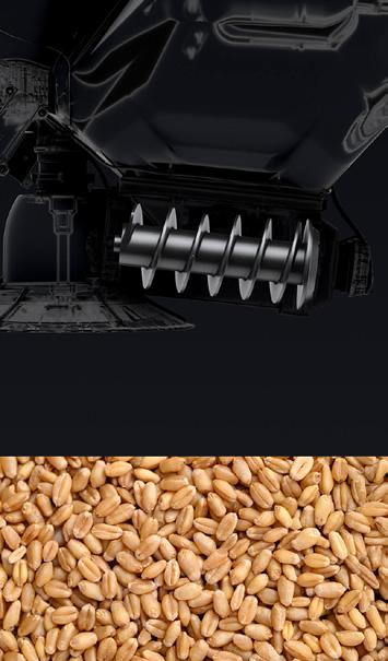
DJI SPREADER SYSTEM 4.0
The DJI Spreader System 4.0 is a cutting-edge centrifugal disc spreading solution for DJI Agras drones, optimised for distributing dry granules such as fertilisers, seeds, and feed. Equipped with a high-precision screw feeder, it ensures accurate control, achieving high discharge rates (up to 400 kg/min) and adjustable spreading widths. Supporting granule sizes from 0.5 – 10mm with multiple auger options, it enhances efficiency with larger tank volumes for low-density materials, delivering uniform coverage for precision agriculture.


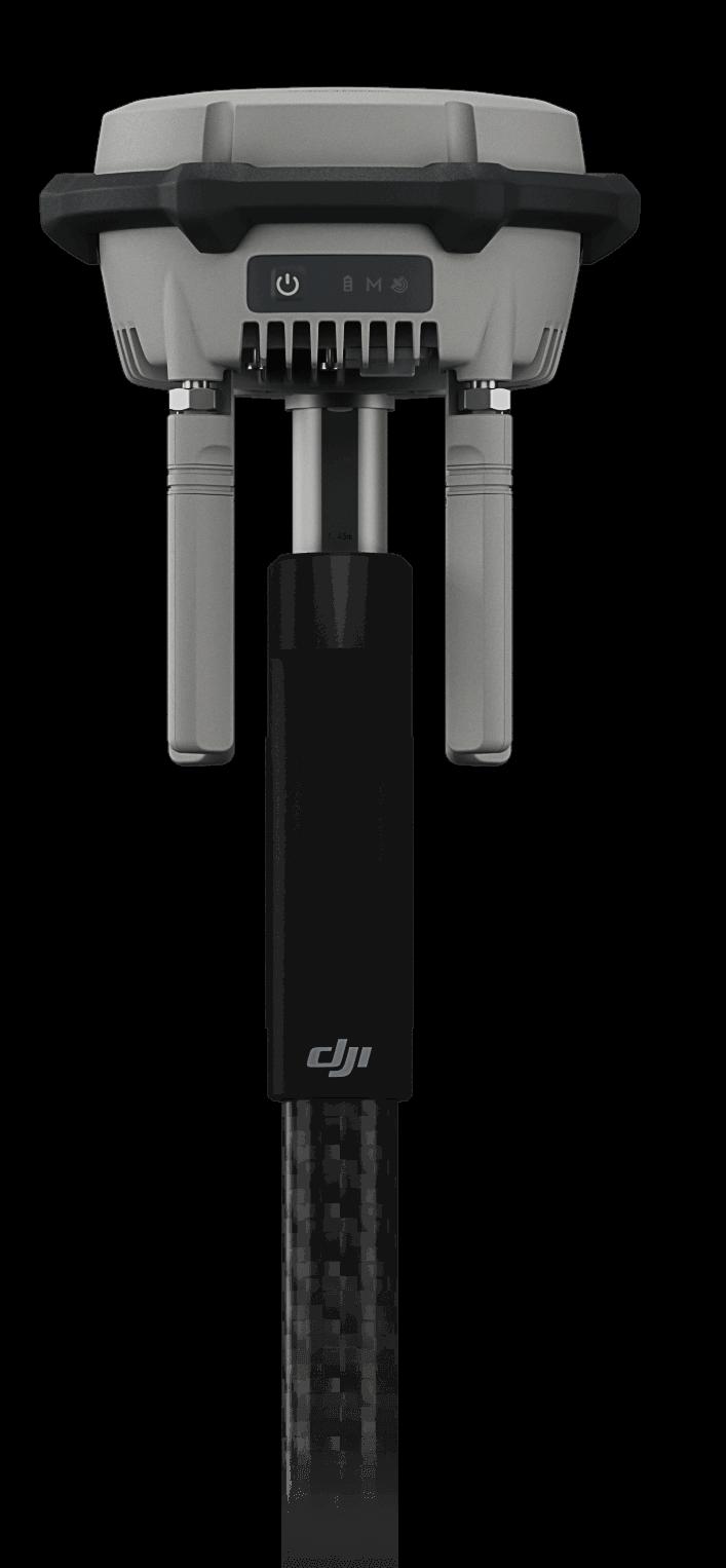
D-RTK 3 MULTIFUNCTIONAL STATION HIGH-PRECISION POSITIONING AND RELAY SYSTEM
MAXIMISED PRECISION, ENHANCED RANGE.
The new D-RTK 3 Multifunctional Station integrates high-performance antennas and receiver modules capable of tracking and resolving data from major global satellite navigation systems, and it supports multiple data transmission links. With these outstanding features, it can serve as a base station to provide centimeter-level positioning for multiple drones simultaneously or extend the operational range of drones in relay station mode. Additionally, the new rover station mode, combined with the DJI Enterprise app and DJI Terra, provides a comprehensive solution for highprecision aerial surveying applications, ensuring a secure and accurate operation.


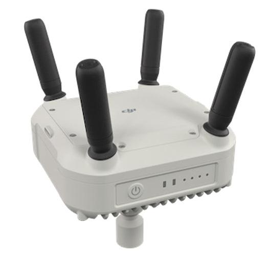
DJI 04 RELAY EXTENDED RANGE AND SIGNAL RELIABILITY
MAXIMISED PRECISION, ENHANCED RANGE.
The DJI Relay Module enhances remote controller signal transmission by acting as a middle relay point between the RC and your DJI Agras drone. Perfect for hilly terrain, large properties, and situations with line-of-sight interference.
Improves signal stability over long distances
Enables communication in obstructed or uneven terrain
Easily mountable and quick to set up in the field
Essential for mission-critical spraying and mapping
Rugged, lightweight and weather-ready for all farm conditions
Compatible with DJI AGRAS T50, T70P, T100 and T25P

DJI SMARTFARM APP YOUR ESSENTIAL ASSISTANT

The DJI SmartFarm app streamlines daily drone operations for crop protection and plot management with enhanced data visualisation and reporting, a dynamic device management dashboard, and easy access to after sales support and learning resources on DJI Academy.
Multidimensional data made easy
Generate daily or custom operational summaries on equipment usage, modes, locations, and teams. Easily review flight paths and operational parameters on a map, and seamlessly share real-time updates with your team.
Dynamic device management
Stay up to date with the operating status of your devices with a dashboard that keeps essential info at your fingertips.

Field creation and management
Create fields on your phone utilising HD satellite imagery. Tap to add field boundaries, obstacles and non-spray zones. Easily import fields into your Agras controller, or share with other users.
Service, knowledge and support
Find your nearby authorised DJI repair centres via the app. Learn about drones, maintenance, operation parameters and use-cases through the DJI Academy.
Weather alerts
The DJI SmartFarm app now integrates a weather function, keeping you in the loop with wind and weather conditions in your current location.

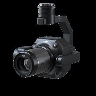
DJI MATRICE 4 SERIES INTELLIGENT FLIGHT
Lightweight and highly efficient, the DJI Matrice 4 Series represents DJl’s latest generation of flagship intelligent multi-sensor compact drones. This series includes two models: Matrice 4T and Matrice 4E.
With advanced features such as intelligent detection and laser annotation/ measurement, they boast significantly enhanced imaging capabilities and a more secure and reliable flight system, with a comprehensive upgrade in accessories.


VISIBLE LIGHT CAMERA
Image Sensor
Min. Photo Interval
Max Video Bitrate
DJI Matrice 4T: 1/1.3” CMOS, 48MP, 24mm/70mm equiv. focal length (Wide/Medium Tele). 1/1.5” CMOS, 48 MP, 168mm equiv. focal length (Telephoto)
DJI Matrice 4E: 4/3” CMOS, 20 MP, 24mm equiv. focal length (Wide). 1/1.3” CMOS, 48 MP, 70mm equiv. focal length (Medium Tele). 1/1.5” CMOS, 48 MP, 168mm equiv. focal length (Telephoto)
DJI Matrice 4T: 0.7 s
DJI Matrice 4E: 0.5 s
DJI Matrice 4T: H264 60Mbps
DJI Matrice 4E: H265 40Mbps
Video Formal MP4 (MPEG-4 AVCiH.264)
Digital Zoom Telephoto:16x (112x hybrid zoom)
NIR AUXILIARY LIGHT (MATRICE 4T)
Infrared Illumination FOV: 5.7°±0.3° M4E / M4T
The Matrice 4T excels in various scenarios such as emergency response, firefighting, inspections, water conservation, and forestry. Meanwhile, the Matrice 4E is tailored for high efficiency, highprecision professional mapping. Together, they herald a new era of intelligent aerial operations.
Intelligent operation functions
- Vehicle/boat detection and statistics
- Supports custom subject detection models
- Real-time laser annotation/meas./sharing
- Real-time recording of observed areas
- FlyTo/POI/Smart Track/Cruise Features
Excels in low-light environments
- Night scene mode
- Smart low-light photo
- NIR illumination
- Thermal imaging
- High-definition low-light fisheye omnidirectional sensing
Clear vision and stable images
- Medium Tele Camera, detects screws and cracks From 10m away, Tele Camera detects license plates from 250m
- Foreground stabilisation for stable telephoto imagery
- One-tap de-hazing
High-efficiency precision mapping
- 0.5-second timed photography
- 5-directional oblique capture and 3-directional ortho capture
- Smart 3D capture/geometric/slope Route
- DJI Terra distortion correction 2.0 .
Enhanced Flight Safety
- GNSS+Vision Fusion positioning and navigation system
- Automatic obstacle data acquisition
- 5-directional vision assist view
- 25km 04 video transmission, strong antiinterference
- 4G enhanced transmission for more stable signals
Comprehensive Accessory Upgrades
- Gimbal-following spotlight
- Real-time voice speaker
- Integrated broadcasting and lighting
- D-RTK 3 multifunctional station
- DJI RC Plus 2 Enterprise
LASER MODULE
Rangefinding Meas. Range: 1800 m (1 Hz). Oblique Incidence Range(l :5 Oblique Distance): 600 m (1 Hz) Blind Zone: 3-1 m. Distance Measurement Accuracy: 1-3 m: System Error <0.3 m, Random Error <0.1meters @1. Other Distances: ±(0-2+0.0015D)
INFRARED THERMAL CAMERA (MATRICE 4T)
Resolution/Zoom
Telephoto: 16x (112x hybrid zoom). Digital Zoom: 28x
Frame Rate 30 Hz
Sensitivity <50mk@F1.0
Temperature
Measurement
Method: Spot Meter, Area Measurement
Range: High Gain: -20°C to 150°C / Low Gain: 0°C to 550°C
Infrared Accuracy: ±2°C or ±2%/±5°C or ±3% (High Gain/Low Gain)
Video Resolution 1280 x 1024@30fps (Super Resolution enabled, Night Mode not activated). Other conditions: 640 x 512@30fps
Still Photography Modes: Single: 1280 x 1024/640 x 512. lnterval: 1280 x 10241640 x 512.
JPEG: 0.7/1/2/3/5/7/10/15/20/30/60 s
Resolution: 1280 x 1024 (Super Res on). 640 x 512 (Super Res. off)
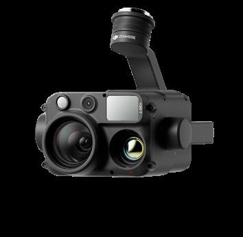
DJI MATRICE 4D SERIES
4D AND 4TD
The all-new DJI Matrice 4D and 4TD can pair with DJI RC Plus 2 Enterprise for manual flight and standalone operation. When integrated with DJI Dock 3, they also support remote, automated operations. The Matrice 4D Series features extended flight endurance, IP55-rated dust and water resistance, and is the first DJI drone series to introduce airborne relay functionality.


Both DJI Matrice 4D Series drones are equipped with a wide-angle camera, a medium tele camera, a tele camera, and a Laser Range Finder.
Matrice 4D is equipped with a mechanical shutter, highly effective for professional high-precision mapping and detailed surface inspections. Matrice 4TD is equipped with an infrared thermal camera and a new NIR auxiliary light, making it suitable for a wide range of applications, such as infrastructure inspections, emergency response, and public safety.
IP55 Dust and Water Resistance
- Operates from -20°C to 50°C
- Low-noise and anti-ice propellers.
54-Min Forward Flight Time
- Significantly boosts work efficiency.
- Confident operation over long distances.
Airborne Relay
- Ensures smooth video transmission without a 4G signal or in obstructed conditions.
- Significantly extends the transmission range, making it ideal for a wide range of scenarios, including SAR tasks and inspections.
Obstacle Sensing Module
- Combines rotating LiDAR and millimetrewave radar technologies.
- Achieves precise 12mm wire-level obstacle avoidance at speeds up to 15 m/s.
- Enhances positioning in low-light conditions.
Intelligent Operation
- Detects and counts vehicles and vessels using RGB and infrared thermal cameras.
- Supports AR projection of maps and the Return-to-Home (RTH) route.
- Supports custom object detection models.
- Real-time laser marking, measurement, and sharing.
Excels in Day or Night
- The medium tele camera can detect screws and cracks from a distance of 10 metres.
- The tele camera can capture details, like signs, from up to 250 metres away.
- Upgraded stabilisation keeps foreground subjects clear during telephoto shots.
- New Night Scene mode.
- New NIR auxiliary light.
- High-resolution, low-light fisheye vision sensor.
Efficient, High-Precision Surveying
- Rapid 0.5-second interval shooting.
- Five-direction oblique photography function, three-direction orthophoto photography.
- Smart 3D Capture routes, geometric routes, and slope routes.
- DJI Terra Distortion Correction 2.0.
Comprehensive Accessory Upgrades
- Obstacle sensing module (IP55 protection).
- Gimbal-following spotlight (IP55 protection).
- Real-time voice speaker (IP55 protection).
- Integrated broadcasting and lighting (IP55 protection).
- DJI RC Plus 2 Enterprise.
DJI DOCK 3 BE EMPOWERED
Equipped with Matrice 4D or Matrice 4TD high-performance drones, DJI Dock 3 empowers 24/7 remote operations and, for the first time, supports mobile vehicle-mounted deployment, effortlessly adapting to various environments. The drones utilise the same cameras as the Matrice 4 Series but offer improved flight and protection performance. They can also pair with DJI RC Plus 2 Enterprise for standalone use. With DJI FlightHub 2’s intelligent features, pilots can significantly cut down on operational time and labor costs, maximising efficiency and savings.


Master all environments
- -20° to 50°C operating temperature
- Drones standard equipped with low-noise anti-ice propellers
- Drones can achieve stable takeoff and landing in winds as strong as 12 m/s
- DJI Dock 3: IP56; Matrice 4D and 4TD: IP55.
Flexible deployment, ultra-long transmission
- The new D-RTK 3 relay station allows for flexible site selection of Dock 3.
- DJI Dock 3 is DJI’s first Dock to support mobile vehicle-mounted deployment. Two docks can be deployed on a single vehicle simultaneously, achieving a significant efficiency boost.
High-performance drones
- 54-min forward flying 47-min hovering
- New Obstacle Sensing Module provides precise wire-level obstacle avoidance
- Excels in low-light environments with the new Night Scene mode
- Matrice 4TD supports UHR Infrared Image mode and new NIR auxiliary light
- Upgraded medium tele camera, tele camera and foreground stabilisation
- High-precision surveying
- New airborne relay for mountainous terrains
Efficient operation, intelligent features
- The new automated flight route allows the drone to automatically detect and capture images or videos of the subject and send notifications to the operators.
- The intelligent change detection feature enables efficient periodical analysis of changes in an area.
Enhanced experience, advanced software
- Take off quickly
- Low-latency live view
- Transmit while flying, with model generated rapidly
- Smart Track
Secure and compliant, open ecosystem
- FlightHub 2 custom permission management
- FlightHub 2 achieves ISO 27001 certification
- 4G enhanced video transmission and its private deployment
- C6 Label (Europe)
Custom AgDrone.au deployment
- Trailer mounted for mobility
- Solar system keeps Dock powered remotely
- Starlink for remote connection
- Exclusion barrier to prevent livestock and wildlife interference
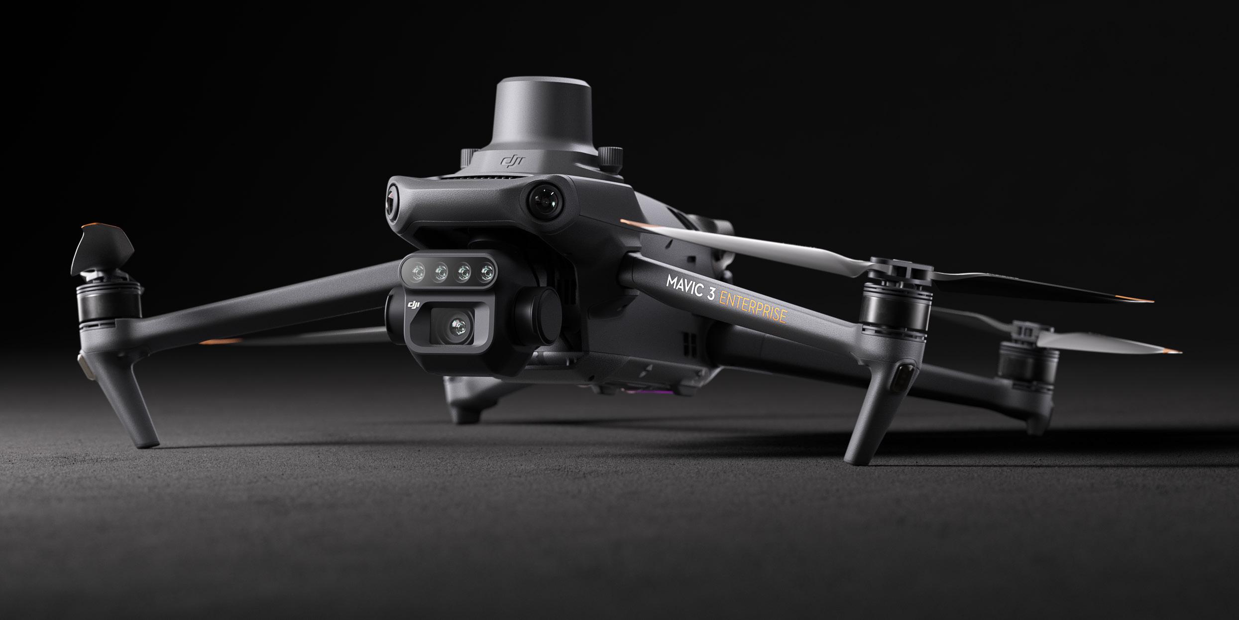
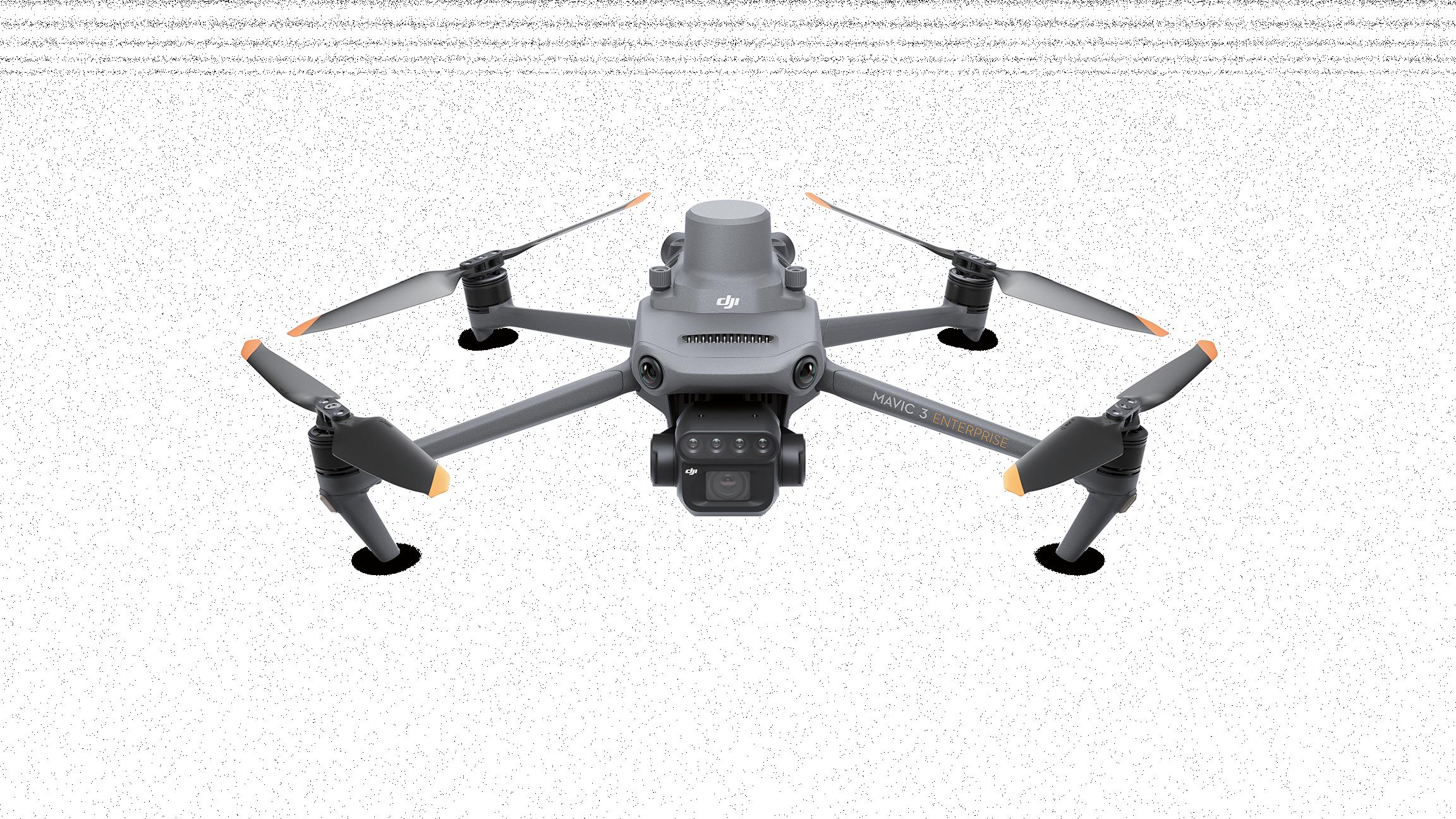
DJI MAVIC 3M WORK SMARTER
Effective aerial surveying needs to see the invisible. That’s why Mavic 3 Multispectral has two forms of sight. It combines an RGB camera with a multispectral camera to scan and analyse crop growth with total clarity. Agricultural production management requires precision and data, and Mavic 3M delivers both.
COMPACT AND PORTABLE
Foldable for easy storage
Highly integrated imaging system
PRECISE POSITIONING
Centimetre level RTK positioning
Synchronisation at microsecond level

MULTISPECTRAL CAMERA
4 x 5 MP G/R/RE/NIR
SAFE AND STABLE
Omnidirectional obstacle avoidance 15km transmission distance
RGB CAMERA
20 MP 4/3 CMOS, mechanical shutter
EFFICIENT AERIAL SURVEYING
Up to 200 hectares per flight
Lightweight and portable, highly integrated
- Small and foldable for easy storage
- Integrates RGB and multispectral cameras
RGB camera
- 4/3 CMOS, 20 MP
- 1/2000 second mechanical shutter in order with no rolling shutter
- 0.7 second, high speed, burst shooting when shooting with RGB camera only
Multispectral camera
- Four 5MP multispectral cameras
- Green (G) 560 nm ± 16nm
- Red (R) 650 nm ± 16 nm
- Red edge (RE) 730 nm ± 16 nm
- Near-infrared (NIR) 860 nm ± 26 nm
- Light sensor, NDVI is more accurate
Accurate images, capturing every pixel
- RTK centimetre level positioning
- Microsecond level time synchronisation
- Phase-less aerial surveying
Extra-long battery life, highly efficient aerial surveying
- 43 minute flight time
- Aerial surveying of up to 200 hectares per flight
- 100W Battery Charging Hub, 88W fast charging
Stable image transmission, omnidirectional obstacle sensing
- 15km image transmission, stable signal
- Omnidirectional obstacle sensing, terrain-follow aerial surveying
Extensive applications
- Aerial surveying of farmland, mountains, and orchards
- Multispectral aerial surveying to guide variable operations
- Smart field patrols to monitor crop status
- Environmental monitoring and natural resource surveying
Open ecosystem
- Cloud API, access to third party platforms
- MSDK, an exclusive app
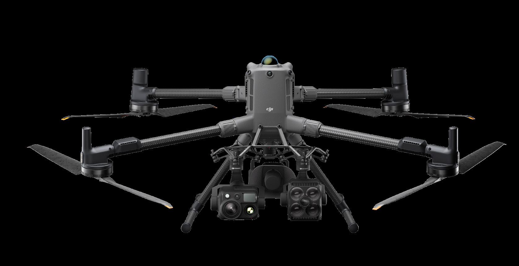
DJI MATRICE 400 VERSATILE
DJI Matrice 400, the enterprise flagship drone platform, boasts an impressive 59-minute flight time, a payload capacity of up to 6kg, and integrated rotating LiDAR and mmWave radar for power-line-level obstacle sensing. It also supports the O4 Enterprise Enhanced Video Transmission System and Airborne Relay Video Transmission ensuring safer handling and easier operations. Combining Smart Detection with visible and thermal imaging, AR projection, ship-based takeoff/landing, and advanced automation, Matrice 400 excels in emergency response, power inspections, mapping, and AEC.

Flight and performance
- 59-min max flight time (with H30T)
- 25m/s max horizontal speed
- 10m/s max ascent speed
- 8m/s max descent speed
6kg payload with versatile compatibility
- Supports up to 7 payloads simultaneously
- Compatible with Manifold 3, Zenmuse S1 Spotlight and V1 Speaker
- Open data interfaces for Drone payloads, LiDAR, and mmWave Radar
Safe and reliable flight
- IP55 rating, 0perates from -20°C to 50°C
- Power-Line-Level Obstacle Sensing with LiDAR and mmWave Radar
- O4 Enterprise Enhanced Transmission: Dual Cellular Dongle 2/sub2G channels support
- Airborne relay video transmission for overmountain operations
- Fusion positioning
Enhanced intelligence and efficiency
- Visual/thermal imaging model detection
- AR projection of maps, power lines, and return paths
- Real-time manual terrain follow
- Take-off and landing on ships
- FlyTo, Cruise, Smart Track, POI
Easier automated operations
- Power line follow with Zenmuse L2
- Slope route
- Geometric route
Comprehensive Accessory Upgrades
- TB100 battery with up to 400 charge cycles
- BS100 battery station with 3-battery cycle charging
- Compatible with TB100C tethered battery
- DJI Cellular Dongle 2
- DJI RC Plus 2 enterprise enhancedCloud API, access to third party platforms
- MSDK, an exclusive app
MATRICE 400 PAYLOADS
P1: Efficient and accurate RGB camera, designed for photogrammetry

L2: High precision aerial LiDAR system for accurate and efficient 3D data collection
H30 and H30T: All-weather, multi sensor solution for a variety of operations, including infrared thermal option

S1: High brightness spotlight with long illumination distance

V1: A high volume, long distance speaker, designed for multi-payload drone platforms
DJI TERRA THE WORLD
IS YOUR DIGITAL
ASSET
DJI Terra is 3D modeling software equipped with next-generation reconstruction technologies, including 3D Gaussian Splatting. It supports accurate and efficient 2D and 3D reconstruction from visible light imagery, and processes data collected by DJI LiDAR. When integrated with DJI drones, Terra delivers a unified hardware and software solution for data acquisition, processing, and application, streamlining aerial surveying workflows for greater efficiency and accuracy. DJI Terra also provides the perfect solution for creating 3D flight paths for DJI Agras drones.


Capable of creating centimetre-level accurate high resolution maps, identification of target spray areas and easily avoiding non spray and obstacle, DJI Terra is a key tool for effectively utilising DJI Agriculture drones. Photogrammetry missions with the Mavic 3 Multispectral or Matrice 400 are easily reconstructed, managed and modified, giving you complete control of where and how your drone will fly.
AGDRONE.AU CUSTOM SOFTWARE
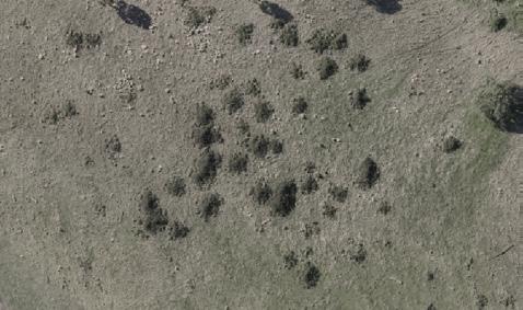
A challenge put before the AgDrone.au team has been the integration of AI detection into the DJI Terra system. Now, utilising our own third party software package, AgDrone.au can offer a range of AI detection services and several modification functions to the DJI Terra system.
An ever evolving AI detection model has been built in to our software, allowing the detection of a variety of weed species. Further, integration of other third party detection files into the Terra system has been made possible. Allowing quick and easy mass-modification of detection areas within Terra, we can quickly change the classification of different objects, whilst also creating accurate buffer zones around these classification areas. Aircraft safety has also been accounted for, through our ability to ‘smooth’ the 3D flight path around obstacles. Finally, a compression function allows you to reduce your orthomosaic map, making it much easier to share or upload.

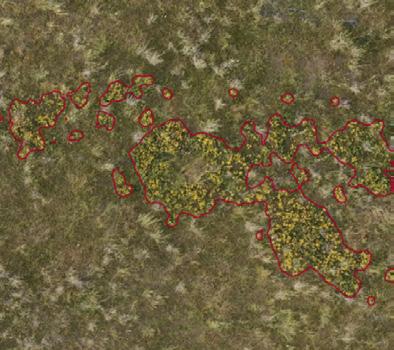
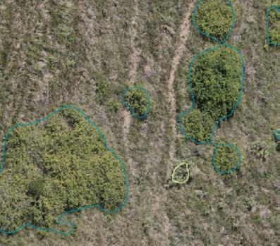

Thistle detection St John’s Wort detection Mixed woody weed detection
AGDRONE.AU ACCESSORIES
CUSTOM ACCESSORIES
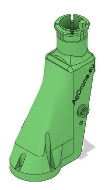
AgDrone.au specialises in custom 3D-printed accessories for DJI Agras drones, enhancing your precision agriculture options.
Our innovative products include shielded line spraying units for precise application, laminar flow CDA discs for uniform droplet distribution, and durable T50 spray lances for reliable performance. These high-quality, tailored solutions optimise drone functionality, ensuring efficient and effective crop management. Head to our website to view these products, or get in touch to discuss your own custom solution.

BATCH MIXER SYSTEM
AgDrone.au’s Batch Mixer enhances dronebased agriculture with a precise batching system for all spraying drones.
Available in sizes up to 1000L capacity, it allows accurate preparation of agricultural chemicals, optimising concentration and minimising waste. Perfect for mixing liquid and granular herbicides, the Batch Mixer simplifies chemical preparation for efficient drone operations. Designed for precision farming, it delivers reliable batching to streamline your workflow. Fitted with a high capacity pump, the Batch Mixer effectively agitates and efficiently fills your drone.

AGDRONE.AU SERVICES PARTS AND REPAIRS
AgDrone.au, an authorised DJI warranty repair centre, provides expert repair services for DJI agricultural drones from our locations in Tamworth NSW and Mareeba QLD.
Our certified technicians ensure fast, reliable repairs to minimise downtime, using genuine DJI spare parts from our extensive inventory. This guarantees quick access to components for efficient maintenance and optimal drone performance.
Trust AgDrone.au for top-tier DJI warranty repairs and readily available parts, supporting precision agriculture across Australia.

DRONE TRAINING
Get hands-on with DJI Agras drones and become flight-ready with confidence.
Whether you’re new to spraying drones or upgrading your fleet, our 5-day Agras training course gives you real-world flight time, technical knowledge, and practical spraying skills.
Delivered by experienced instructors in Mareeba (QLD) and Tamworth (NSW), this course is built for serious operators, contractors, and ag professionals.
Partnered with UAS Pacific, get in touch today to book your spot in one of our monthly training and licencing courses. Scan the QR code to find out more.


DroneCare Online is a leading provider of specialised insurance for agricultural drones, powered by Agile Underwriting Solutions.
As a trusted partner of AgDrone.au, they ensure seamless protection for your drone operations, combining expertise in precision agriculture with comprehensive coverage options.
Their user-friendly platform allows quick submission of drone details for instant assessments and tailored plans, covering liability, hull damage, and more. With expert guidance and rapid quotes, DroneCare Online simplifies compliance and risk management, letting you focus on farming innovation.
Partner with DroneCare Online for reliable, efficient insurance that safeguards your investments and supports sustainable agribusiness growth. Scan the QR code for more information, or to request a quote, and let DroneCare Online give you peace of mind in the skies.
INSURANCE FINANCE
Asset Finance Group is a premier provider of flexible financing solutions for agricultural drones and equipment, specialising in tailored loans and leasing options to support modern farming needs.
As a valued partner of AgDrone.au, they enable seamless acquisition of advanced drone technology, preserving cash flow while accelerating adoption of precision agriculture tools.
Their intuitive platform facilitates quick applications, competitive rates, and customised plans covering purchases, upgrades, and maintenance. With dedicated support and fast approvals, Asset Finance Group empowers farmers to invest confidently without upfront burdens. Scan the QR code to find out more.


FJDynamics is a global robotics leader offering autonomous solutions for industries such as agriculture, forestry, construction, and more.
AUTOMATE WITH ACCURACY
Welcome to FJDynamics, where innovation meets efficiency. Explore our cutting-edge range of autosteering systems, robotic lawnmowers, and 3D LiDAR scanners— designed to revolutionise agriculture, landscaping, and geospatial applications. Our advanced solutions harness AI, GNSS, RTK, and SLAM technologies to deliver unparalleled precision, sustainability, and productivity for professionals and enthusiasts alike.
AUTOSTEERING SYSTEMS
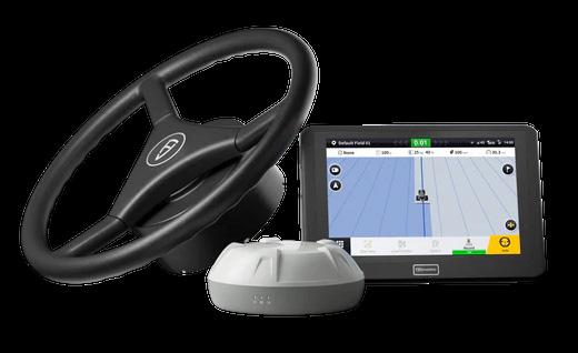
Transform your farming operations with FJDynamics’ autosteering kits, including the AT1 and AT2 systems.
Achieve 2.5cm pass-to-pass accuracy across diverse terrains using GNSS and RTK technology. Compatible with 90% of tractor brands, our systems optimise planting, fertilising, and harvesting while reducing overlaps, fuel consumption, and labour costs. Seamlessly integrate with ISOBUS-compatible implements and enhance efficiency with features like U-turn auto-driving and terrain compensation.


ROBOTIC LAWNMOWERS
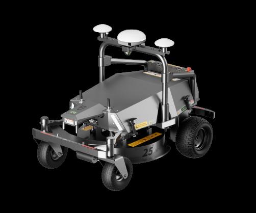
Redefine lawn care with FJDynamics’ intelligent, battery-powered robotic mowers, such as the FR4000, RM21, FV2000, and Z42P.
Equipped with industrial RTK and vision systems, these mowers deliver centimetrelevel precision without perimeter wiring. Tackle complex landscapes, steep slopes, and large areas up to 10,000m2 with ease. Enjoy low-noise operation, zero emissions, and appcontrolled customisation for professionalgrade results in residential, commercial, and industrial settings.
3D LIDAR SCANNERS
Capture reality with unmatched accuracy using FJDynamics’ Trion P1 and S1 3D LiDAR scanners.
Powered by SLAM technology, these lightweight, handheld devices create detailed 3D models, floor plans, and BIM for applications in construction, forestry, and geospatial analysis. With a point cloud capability of up to 320,000 points per second and 2cm accuracy, our scanners streamline workflows and enhance decision-making across industries.

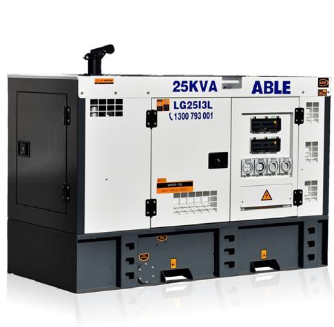
AGDRONE.AU POWERING YOUR AGRAS
At AgDrone.au, we understand the need for an effective, reliable power source to keep your drone batteries charged and your drones in the air.
Get in touch with the AgDrone.au team to get expert recommendations and order yourself a generator today. We can source a variety of generators, be it a silent diesel unit or a more compact petrol generator. As suppliers of Gentech and Able Sales generators, we know which generator will best suit your individual needs and setup.