Intermediate Climbing School (ICS) is an intensive, challenging, fun experience in which students see their climbing skills advance dramatically in a relatively short time span.
ICS goes beyond basic mountaineering concepts and teaches the skills needed to become an independent climber. ICS grads are well prepared to be competent participants or assistance on more advanced climbs.
Skills learned include:
■ Rock and Snow Anchors
■ Crevasse Rescue
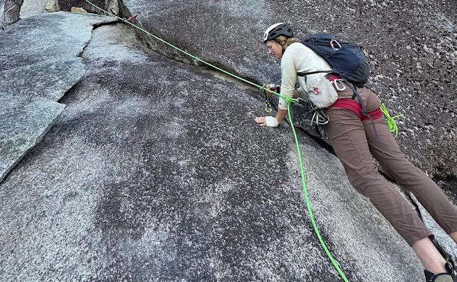
■ Intro to Trad Climbing
■ Lead Belay
■ Avalanche Awareness
■ Steep Snow Techniques
Applications close: July 29
Course dates: Aug. 26, 2025–March 1, 2026
Go to mazamas.org/ics for more info
Oregon's Wild Waters: A Rafter's Paradise, p. 14
The Perseid Meteor Shower, p. 18
The Patience and Kindness of Teachers, p. 20
Picture This: Thru-Hiking the Oregon Coast Trail, p. 24
Travel Diary: The Best of Northern New Mexico Hikes, p. 28
Viva La Bike Shuttle!, p. 32
Around the Mountains We Will Go, p. 36
Columbia River Gorge Trails Update, p. 39
Beyond the Burn: Five Mt. Jefferson Hikes, p. 40 Turns All Year, p. 44
Executive Director’s Message, p. 4
President’s Message, p. 5
Upcoming Courses, Activities & Events, p. 8
Mazama Supporters, p. 10
Successful Climbers, p. 12
New Members, p. 13
Letter from the Editor, p. 13
Mazama Library, p. 27
Looking Back, p. 34
Board of Directors Minutes, p. 46
Cover: Day one of Wonderland Trail 2019: descending from Reflection Lakes and looking north toward Ohanapecosh Glacier on the east flank of Mt. Rainier.
Rock 2025.
As an organization, we don’t just run trips or host events—we build relationships.” p. 4
Volume 107
Number 4
July/August 2025
Oregon’s river portfolio reads like a whitewater enthusiast’s dream catalog.” p. 14
I knew only that I didn’t want to be right here, right now.” p. 20
Summer skiing means long approaches on foot, short ski runs, and a bit of research into where to go.”
p. 44
by Rebekah Phillips, Mazama Executive Director
Summer adventure means long days, open trails, and the thrill of exploring the unknown. It’s a season for acting on long-held dreams, bringing our best energy forward, and giving our goals everything we’ve got.
June marked my second anniversary with the Mazamas, and it has indeed been an adventure. The highlight? Our people. I’ve cherished the chance to meet so many of our members—spanning seven generations—and to better understand the unique rhythms of this vibrant community. I’ve especially valued working alongside the volunteers who make this organization tick. The extraordinary affection for the Mazamas is evident—as are the growing pains, challenges, and frustrations that naturally arise in a community of nearly 3,000. Serving you, our members, remains an honor and a privilege.
The Mazamas is a complex and multifaceted engine. We serve thousands of individuals each year—both members and nonmembers—through a blend of mission-driven programming, educational offerings, and volunteer-led adventures. Our workforce is lean: a small team of professionals alongside hundreds of dedicated volunteers. We’re in the midst of evolving from a historic, member-run club into a modern nonprofit—an essential shift if we’re to remain relevant and impactful in the years ahead.
For decades, we’ve done things a certain way—and often for good reason. But the landscape is changing. Participation patterns are shifting. Expectations are evolving. Costs continue to rise. And the capacity of our staff and volunteers is stretched beyond sustainable limits. We cannot maintain momentum without adapting.
You’ve probably heard the phrase, “If you don’t innovate, you evaporate.” That’s the crossroads we’re at. The world around us is moving quickly. As an example, our younger members—the future of the Mazamas—are engaged, excited, and ready to contribute. But they’re also telling us: what we offer doesn’t always work for them. If we can’t adapt, we risk losing not just their participation, but the future leadership they represent.
Real talk: We’re at a financial inflection point. After years of budget deficits and dipping into reserves, we’re out of room to delay decisions. At the leadership level, we’re weighing difficult choices. One path scales us back to match our shrinking resources. The other calls for courageous investment—in our staff, our systems, and our programs. Investments that would allow us to meet the moment, expand our reach, and truly thrive. Which direction we go depends, in part, on you.
To close our recurring budget gap, I’ve identified the need for a $3 million endowment—a fund that could provide consistent operating support through annual earnings. To position ourselves for growth and long-term impact, I estimate a $5 million goal. A multi-year campaign would not be launched without essential and significant foundational financial commitments to ensure its success; if you—or someone in your network—might be positioned to play a leading role, I would welcome a conversation.
If you believe in this community—if a Mazama class, climb, or trail has ever made a lasting impact in your life—I ask you to consider how you might support our future. That could mean becoming a sustaining donor, encouraging a friend to join, volunteering your time, or sharing an idea. However you show up, know this: the Mazamas will be shaped by those who do.
Let’s make this summer one of bold choices, shared purpose, and renewed adventure—together.

“We’re in the midst of evolving from a historic, member-run club into a modern nonprofit—an essential shift if we’re to remain relevant and impactful in the years ahead.”
by Debbie Dwelle, Mazama President
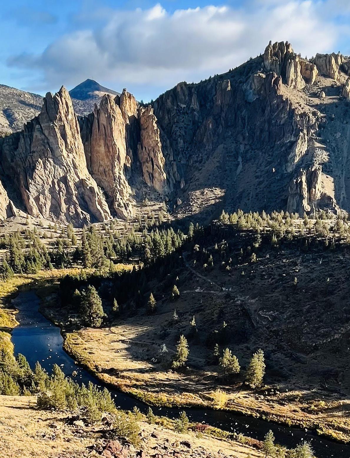
This past weekend, under a clear blue sky on a very warm day at Smith Rock, some people from our community gathered for a day of climbing, conversation, and connection. Chalk dust floated in the air like pollen, laughter echoed across the crag, and somewhere between the belay calls and shared snacks, something deeper took root.
At the end of the day, as gear was packed and goodbyes exchanged, several people—new faces and familiar ones alike—reflected on what had stood out most. It wasn’t just the routes climbed or the views from the top. It was the feeling of being part of something. A few newcomers shared that they felt welcomed, safe, and seen. “This feels like a real community,” one person commented.
Others spoke more personally. They shared how hard life has felt lately. For many, simply being outside for a day, surrounded by like-minded people and the steady rhythm of climbing, was cathartic. “I didn’t know how much I needed this until I got here,” someone admitted quietly. There was a sense of collective exhale.
Moments like these remind us why we do what we do.
As an organization, we don’t just run trips or host events—we build relationships. We create spaces where people feel empowered to explore, supported to grow, and invited to heal. There is something powerful about stepping into nature with others who share your respect for wild places. The mountains and trails don’t ask you to be anything other than present, and the right community will meet you there—with care, patience, and encouragement.
Summer is an incredibly active season and is alive with potential. From alpine scrambles to after-work cragging, from street rambles to sunrise hikes to trail tending, every outing is an opportunity
to strengthen the web of community. It’s in the small things: someone offering a helmet to a new climber, a quiet “you got this” when someone is struggling, a shared thermos of coffee at a trailhead.
Whether you’re joining us for your first group hike or returning for your twentieth summit, what we hope you find is not just a trail or a challenge—but people who will meet you where you are, and invite you to be part of something larger than yourself.
At the heart of our work is a mission: to build a community that inspires everyone to love and protect the mountains. We believe that love grows through shared experiences—and that the best way to protect wild places is to create meaningful, lasting connections to them.
That means getting our boots dirty and showing up for stewardship days. It means holding space for beginners and pushing each other to grow. It means recognizing that the strength of any rope team, like the strength of a community, lies in trust, communication, and care.
As we step into the height of summer, our calendar is full of ways to get involved: climbing days, volunteer trail work, street rambles, hikes, alpine adventures, social nights, educational classes, etc. Whether you’re brand new to the outdoors or a seasoned mountaineer, we invite you to come spend time with us—to move your body, meet good people, and reconnect with the land in ways that feel meaningful to you.
This isn’t just about what we do in our shared adventures. It’s about who we become because of them—and how we carry that sense of connection, strength, and peace back into our daily lives.
So come join us. Tie in. Lend a hand. Share a meal. Let this summer be the start of something deeper. Because now more than ever, we need each other.
“Whether you’re joining us for your first group hike or returning for your twentieth summit, what we hope you find is not just a trail or a challenge—but people who will meet you where you are, and invite you to be part of something larger than yourself.”
Thanks to the 686 current members and 138 nonmembers who shared invaluable insights into the Mazama experience. In addition to updated demographic data, the survey illuminated trends around why people join (or leave), what they value, and where they see room for growth. Here are a few early highlights:
Why people join (and why some leave)
The Mazamas empowers people to lead fuller outdoor lives—on their own, with friends, and within the organization. Most members join to learn new skills and find community. However, some members and nonmembers noted:
• Difficulty connecting or integrating
• Concerns about fairness and access to activities
• Lack of options for those with limited time or shifting interests
Nonmembers cite time, cost, and accessibility— not lack of interest—as barriers. Lapsed members primarily pointed to limited access and expressed lower regard for the organization overall.
The personal impact
Over 70% of members reported gains in physical and mental health, social connection, and appreciation for nature. More than 80% of volunteers and members under 30 also cited personal development and a stronger sense of belonging.
Opportunities by age group
Under 30s are enthusiastic, especially missionaligned, and eager for more field sessions and flexible learning formats. 50+ members want more peer-led activities and online instruction.
Education programs
All segments requested more hands-on learning, shorter courses, and skill-builder sessions. Instructors seek more training and clearer educational standards.
Volunteers
Highly committed, volunteers asked for a centralized system to find roles, track hours, and stay connected.
What members want
Over 200 comments surfaced four key needs:
• Better understanding of participant selection process
• Improved digital tools and infrastructure
• More affordable and accessible gear opportunities
• Stronger onboarding for newcomers
What’s next?
Leadership will explore these findings in more depth through summer focus groups. However, as a community, members are always encouraged to pursue opportunities and ideas— want to help? Get in touch!
We’re proud to share the 2024 Annual Impact Report, a comprehensive look at the year’s milestones, member engagement, and organizational growth. From welcoming over 640 new members to offering more than 700 volunteer-led activities, 2024 reflected our community’s deep commitment to adventure, education, and stewardship.
The report celebrates the 1,060+ individuals who advanced their outdoor skills through Mazama education programs, as well as the nearly 500 volunteers who made our programs possible. It highlights progress in inclusivity, conservation, and governance, along with new initiatives. You’ll also find highlights from community partnerships, grantmaking, risk management improvements, and our strategic priorities for 2025–2027.
Visit mazamas.org to read the full report, and learn how your support shaped a year of meaningful impact— and where we’re headed next!

Mazama Mountaineering Center 527 SE 43rd Ave., Portland, OR, 97215
Phone: 503-227-2345
Email: help@mazamas.org
Hours: Tuesday–Thursday, 10:30 a.m.–4 p.m.
Mazama Lodge
30500 West Leg Rd., Government Camp, OR 97028
Hours: Closed
Editor: Mathew Brock, Bulletin Editor (mazama.bulletin@mazamas.org)
Members: Darrin Gunkel, chair; Patti Beardsley, Peter Boag, David Bumpers, Theo Cantalupo, Aimee Frazier, Ali Gray, Brian Hague, Owen Lazur, Ryan Reed, Michele Scherer Barnett, Jen Travers. (publications@mazamas.org)
MATHEW BROCK
Director of Special Collections and Media Mazama Bulletin Editor mathew@mazamas.org
RICK CRAYCRAFT Building Manager facilities@mazamas.org
REBEKAH PHILLIPS Executive Director rebekahphillips@mazamas.org
for the love of the mountains
Learn more about how you can integrate charitable giving to support the Mazamas.
Whether you’re considering a bequest in your will, setting up a charitable remainder trust, or exploring other options, by including a planned gift in your legacy, you’ll secure our continued success while ensuring that your passion endures for generations to come.
If you’ve already decided to include the Mazamas in your estate plans, we invite you to let us know. You’ll want to be sure that you’ve recorded the Mazamas with the Tax ID (EIN) 93-0408077.
Even ordinary people can make an extraordinary difference.
CONTACT US: Lena Toney, Development Director 971-420-2505 | lenatoney@mazamas.org
BRENDAN SCANLAN Operations & IT Manager brendanscanlan@mazamas.org
LENA TONEY Development Director lenatoney@mazamas.org
CATHY WILDE Finance & Administration Manager cathywilde@mazamas.org
For additional contact information, including committees and board email addresses, go to mazamas.org/contactinformation.
MAZAMA (USPS 334-780): Advertising: mazama.bulletin@mazamas.org. Subscription: $15 per year. Bulletin material must be emailed to mazama.bulletin@mazamas.org.
The Mazama Bulletin is currently published bi-monthly by the Mazamas—527 SE 43rd Ave., Portland, OR 97215. Periodicals postage paid at Portland, OR. POSTMASTER: Send address changes to MAZAMAS, 527 SE 43rd Ave., Portland, OR 97215. The Mazamas is a 501(c)(3) Oregon nonprofit corporation organized on the summit of Mt. Hood in 1894. The Mazamas is an equal opportunity provider.
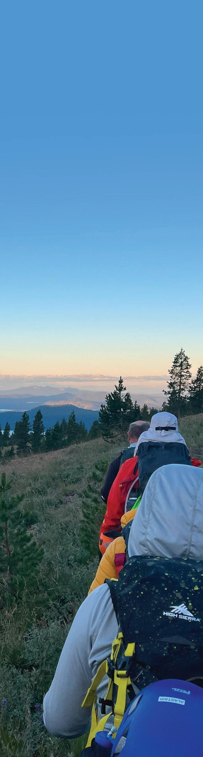
Dates: Aug. 17–23, 2025
Registration closes: July 7
Join us as we hike around majestic Glacier Peak. This 82.7 mile, 22,500 feet net elevation gain trek circumnavigates Glacier Peak largely on maintained trails, with about half the distance on the Pacific Crest Trail and a relatively short 5 mile use trail section. There will be numerous passes and a few stream crossings along the way. Glacier Peak Wilderness is a remote and rugged landscape with varying terrain from thick old growth forests to alpine splendor.
The six to eight participants will need to be in good physical condition and have experience on at least one 50 mile (or greater) trek. We will be traveling light and fast, up to 18.5 miles per day with daily elevation gains varying from 2,500 – 6,800 feet. The terrain will be challenging at times with brush and scree in the use trail portion.
There will be no fees for this outing. Participants will need to cover their share of costs for lodging, which will be arranged by the leader, and carpooling. We will be staying in a hotel the night before and after the trek. Contact the leader Gary Bishop (gbish90@hotmail.com) for more information.
Dates: Aug. 26, 2025–March 1, 2026
Applications open: July 9
Applications close: July 29
Cost: $1,875 members / $2,150 nonmember More info: www.mazamas.org/ICS
Intermediate Climbing School (ICS) is an intensive, challenging, fun, and rewarding experience. At no other point in your climbing career are you likely to see your climbing skills advance more dramatically within a single, relatively short span of time.
ICS builds on your beginning climbing experience. ICS teaches the skills necessary to organize private climbs and be a competent assistant or participant on advanced climbs. For those who choose, ICS is a path into Mazama Climb Leader Development.
The course takes place over two intensive sessions of 9–11 weeks—one in the fall and one in the winter—and includes lectures, field sessions, and social activities. Commitment to these sessions is crucial for success in the class.
AUGUST 2025 SESSION
Date: August 19
Time: 6–9:30 p.m.
Applications open: July 1
Applications close: Aug. 5
Cost: $220 members / $250 nonmember
More info: www.bit.ly/IMCAug2025
SEPTEMBER 2025 SESSION
Date: Sept. 10–14
Time: 6–9:30 p.m.
Applications open: July 23
Applications close: Aug. 27
Cost: $220 members / $250 nonmember
More info: www.bit.ly/IMCSept2025
This short course provides education and training for multipitch rock climbing through a three-hour training session at the MMC, followed by climbing the 10-pitch alpine rock route Acker Rock, Peregrine Traverse. The course targets climbers with basic rock skills, minimal outdoor climbing experience, and possibly some lead belaying experience, but no multipitch background.
All participants attend the training session and climb on either Saturday or Sunday (coordinator determines day). Participants climb on top-rope only in teams of three: two participants and one assistant instructor/lead climber. Teams climb independently but remain in close proximity to each other.
Dates: Oct. 3–12, 2025
Applications open: July 18
Applications close: Aug. 18
Cost: $995 members / $1,350 nonmember More info: www.mazamas.org/wfr
This will be a hybrid WFR course offered through Base Medical. The Base Medical WFR curriculum follows Wilderness Medicine Society standards for wilderness medicine courses. Students who successfully complete the Base Medical WFR training course will earn a Wilderness First Responder nationally recognized qualification. A Mazamas WFR badge will also be granted. The WFR certification is valid for two years.
The course will be for a maximum of 20 participants. Priority acceptance will be given for applicants with demonstrated leadership in outdoor recreation. All applicants are requested to update their Mazamas profile at registration with details of experience/involvement as a leader in outdoor recreation.
Have you considered becoming a Stop the Bleed (STB) Instructor? The Mazama First Aid Committee is looking to expand our first aid skill-builder mini-course offerings. The Mazamas recently applied to become a national STB education center and are applying for an STB instructional material grant. Having more STB instructors and more classes helps with our application and provides a community benefit. Goto www.bit.ly/MazFASTB and see if you are eligible to become an STB instructor. The list of eligible health care and non-health professionals includes: WFR, Ski Patrol, OSHA instructors, lifeguard, dietician, pharmacist, and law enforcement, to name a few.
If you check your eligibility and are committed to becoming an STB instructor, send an email to firstaid@mazamas.org.
Thank you for considering becoming a part of the Mazama First Aid community!
Help us reduce our environmental footprint by opting out of receiving the printed Mazama Bulletin. By choosing the digital-only version, you'll:
■ Save trees and reduce paper waste
■ Decrease carbon emissions from printing and shipping
■ Access the same great content instantly on any device
■ Support our commitment to responsible environmental stewardship
The digital Bulletin offers enhanced features like searchable text, clickable links, and high-resolution photos while helping preserve the natural spaces we all cherish.
Ready to make the switch?
Simply visit tinyurl.com/ MazBulletinOptOut. Thank you for helping us protect the environment we love to explore.

We envision a vibrant, inclusive community united by a shared love for the mountains, advocating passionately for their exploration and preservation.
We value every member of our community and foster an open, respectful, and welcoming environment where camaraderie and fun thrive.
We prioritize physical and psychological safety through training, risk management, and sound judgment in all activities.
We promote learning, skillbuilding, and knowledgesharing to deepen understanding and enjoyment of mountain environments.
We celebrate teamwork and volunteerism, working together to serve our community with expertise and generosity.
We champion advocacy and stewardship to protect the mountains and preserve our organization’s legacy.
Building a community that inspires everyone to love and protect the mountains.
We gratefully acknowledge contributions received from the following generous friends between May 1, 2024 – May 15, 2025. If we have inadvertently omitted your name or listed it incorrectly, please notify Lena Toney, Development Director, at 971-420-2505.
Anonymous (26)
David W Aaroe and Heidi A Berkman
Patricia Akers
Louis Allen
Stacy Allison
Jerry O Andersen
Dennis H Anderson
Edward L Anderson
Peggy B Anderson
Justin Andrews
Alice Antoinette
Carol M Armatis
Jerry Arnold
Kamilla Aslami
Chuck Aude
Brad Avakian
Gary R Ballou
Tom Bard
Dave Barlow
Jerry E Barnes
Michele Scherer Barnett
John E Bauer
Scott R Bauska
Tyler V Bax
Larry Beck
Steven Benson
Daven Glenn Berg
Erwin Bergman
Bonnie L Berneck
Bert Berney
Joesph Bevier
Rachel Bieber
Ken and Nancy Biehler
James F Bily
Pam J. Bishop
Gary Bishop
Bruce H Blank
Anna N. Blumenkron
Peter Boag
Tom G Bode
Andrew Bodien
Barbara Bond
Mike Borden
Jeffrey F Boskind
Brookes Boswell
Steve Boyer
Bob Breivogel
Rex L Breunsbach
Scott P. Britell
Alice V Brocoum
Elizabeth Bronder
Richard F Bronder
Amy Brose
Jann O Brown
Anna Browne & Barry Stuart
Keller
Barry Buchanan
Carson Bull
Eric Burbano
Joel Burslem
Neil Cadsawan
Keith Campbell
Lars Campbell
Patty F Campbell
Ann marie Caplan
Jeanette E. Caples
Riley Carey
Kenneth S Carlson
Emily Carpenter
John D Carr
Ken Carraro
Marc Carver
Jacob Case
Susan K Cassidy
Rita Charlesworth
Nancy Church
Catherine Ciarlo
Matt Cleinman
William F Cloran
Kathleen Cochran
Jeff Coffin
Justin (JC) Colquhoun
Charles Combs
Kristy J Comstock
Brendon Connelly
Toby Contreras
Elisabeth Cooper
Patti Core Beardsley
Doug Couch
Lori Coyner
Darrel M Craft
Adam Cramer
Rick Craycraft
Mark Creevey
Cynthia Cristofani
Tom F Crowder
Liz A. Crowe
George Edward Cummings
Julie Dalrymple
Ellen Damaschino
Gail Dana-Sheckley
Alexander S. Danielson
Betty L Davenport
Larry R. Davidson
Tom E Davidson
Howie Davis
Chris Dearth
Edward Decker
Alexander Dedman
Richard G Denman
Sumathi Devarajan
Brad Dewey
D. Keith Dickson
Sue B Dimin
Jonathan Doman
MaLi Dong
Mark Downing
Robyn Drakeford Wonser
Keith S Dubanevich
Deborah Driscoll
Keith S Dubanevich
Debbie G. Dwelle
Richard R Eaton
Heather Eberhardt
John Egan
Rich Eichen
Toni Eigner
Donna Ellenz
Kent Ellgren
Roland Emetaz
Becky Engel
Mary L Engert
Stephen R Enloe
Bud Erland
Kate Sinnitt Evans
Shelley Everhart
Joshua Ewing
John Facendola
William F Farr
Patrick Feeney
Travis Feracota
Darren Ferris
Aimee Diane Filimoehala
Lilie Chang Fine
Jonathon Fisher
Steven Fisher
Erin Fitzgerald
Ben Fleskes
Peter C Folkestad
Diana Forester
Caroline Foster
Dyanne Foster
Mark Fowler
Joe Frank
Daisy A. Franzini
Aimee Frazier
Michael C. French
Trudi Raz Frengle
Ardel Frick
Hans Eugene Friedrich
Brinda Ganesh
Matthew Gantz
Becky Garrett
Kevin Gentry
Paul R Gerdes
Pamela Gilmer
Lise Glancy
Drew Glassroth
John Godino
Richard Goldsand
Sandy Gooch
Diana Gordon
Ali Gray
Dave M Green
Kanjunac Gregga
Leora Gregory
Shannon Hope Grey
Tom & Wendy Guyot
Jacob Wolfgang Haag
Jeff L Hadley
Dan Hafley
Sohaib Haider
Noma L Hanlon
Martin Victor Hanson
José A Haro
Terrance Heath Harrelson
Brook B. Harris
Duncan A Hart
Freda Sherburne & Jeff
Hawkins
Marcus Hecht
Lisa Hefel
Amy Hendrix
Gary Hicks
Elizabeth Hill
Marshall Hill-Tanquist
Natasha Hodas
Frank Hoffman
Gregg A Hoffman
Rick Hoffman
Sue Holcomb
Lehman Holder
Mike Holman
Kris Holmes
Patty H Holt
Steven Hooker
Michael Hortsch
Charles R Houston
Hal E Howard
Nathan Howell
John A Hubbard
Flora Huber
Chip Hudson
Valoree Hummel
Michael Hynes
Kirsten Jacobson
Rahul Jain
Irene M James-Shultz
Chris Jaworski
Scott Jaworski
Joanne Jene
Brita Johnson
Megan Johnson-Foster
Truth Johnston
Greg J. Jones
Mark Jones
Thomas Jones
Julia Jordan
Nathan Kaul
George Alan Keepers
Joe Kellar
Barry Stuart Keller
Jill Kellogg
Shawn Kenner
Charles R Kirk
Sergey Kiselev
Ray Klitzke
Dana S. Knickerbocker
Susan E Koch
Craig Koon
Chris Kruell
Martin Kreidl
Dennis V Kuhnle
Cathy Kurtz
Lori S LaDuke
Richard A LaDuke
Lori A Lahlum
Brenda Jean Lamb
Carol Lane
Jackson Lang
Donald E Lange
Barbara Larrain
Sándor Lau
Nathan Laye
Thuy Le
Petra D LeBaron-Botts
Seth Leonard
Diane M. Lewis
Ernest (Buzz) R Lindahl
Jason N. Linse
Natalie Linton
Margery Linza
Jacob Lippincott
Jeff Litwak
Craig H Llewellyn
Vlad Lobanov
Robert W Lockerby
Meredith K. Long
Bill E. Lowder
John L MacDaniels
Alexander L. Macdonald
Joan MacNeill
Patti Magnuson
Ted W Magnuson
Barbara Marquam
Bartholomew “Mac” Martin
Bridget A Martin
Ted and Kathryn Maas
Laurie Mapes
Larry G Mastin
James Mater
Donald C. Mather
Allan McAllister
Adam Marion
Robert A McClanathan
Margaret McCue
Mike McGarr
Jamie K. McGilvray
Reed Davaz McGowan
Wesley McNamara
Wilma McNulty
Melanie Means
Jeff I Menashe
Forest Brook Menke-
Thielman
George T. Mercure
Barbara A Meyer
Daniel J Mick
Dick Miller
James (Jim) Miller
Thomas M. Miller
Keith Mischke
Gerald G Mock
Gordy James Molitor
Michael Jeffrey Mongerson
Mary Monnat
Alex Montemayor
Yukiko Morishige
Joanne Morris
Kristen Mullen
Dawn Murai
Megan Nace
Cheryl Nangeroni
Stephan P. Nelsen
Rachael Nelson
David L Nelson
Leah Nelson
Veronika and Jerry Newgard
Kirk Newgard
Kae Noh
Cait Norman
Patricia M Norman
Ray North
Jim Northrop
Andy A. Nuttbrock
Jennifer Oechsner
Christine Olinghouse
Kathy Olson
Michael Olson
Jim Orsi
Kim Osgood
Nell Ostermeier
Brent Owens
John B Palmer
Alan James Papesh
Jooho Park
Nimesh “Nam” Patel
Thomas Pauken
Kellie Peaslee
Ryan Peterson
Phillip Petrides
Theo Pham
Rebekah Phillips
Cindy L Pickens
Robert T Platt
Steve Polansky
Richard Pope
David Posada
Bronson Potter
Atalanta Powell
Devyn W Powell
William J. Prendergast
Morgan Prescott
Rosemary Prescott
Joe Preston
Frances Prouse
Walker Pruett
Emily Grace Pulliam
Michael Quigley
Sarah Raab
Kathy Ragan-Stein
Sandy Ramirez
Cullen Raphael
Walter Raschke
Rahul K Ravel
Stacey M. Reding
Ally Reed
Elizabeth Reed
Ryan Reed
Steph Reinwald
Kristina Rheaume
Anne Richardson
Judy Ringenson
Gary T Riggs
Lisa F Ripps
Echo River
Andy Robbins
Reigh Robitaille
Margaret Rockwood
Jeffery V. Roderick
David Roethig
Kirk C. Rohrig
John Rowland
Steven Ruhl
Gerald Runyan
Mark R Salter
Ellen Satra
Janice E Schermer
Liz Schilling
Bill Schlippert
Janice Schmidt
Ron Schmidt
Michael Schoenheit
Lewis G Scholl
Caleb Schott
Donna Schuurman
Leigh Schwarz
Diana R Schweitzer
Colby Schweitzer
Greg A Scott & Bonnie
Paisley Scott
Marty Scott
Tim Scott
James E Selby
Astha Sethi
Lucy Shanno
Roger D Sharp
Shahid Sheikh
Joanne Shipley
Rob Shiveley
Richard B Shook
Gary Shumm
Ellen P. Simmons
Patricia Ann Sims
Liz Sinclaire
Suresh P Singh
Joan D Smith
Rachel Smith
Joseph Hoyt Snyder
Monica Solmonson
Dorothy Sosnowski
Cassie Soucy
Mark Soutter
Carrie Spates
Tony and Mary F Spiering
Tullan Spitz
Mark S Stave
Paul Steger
Bill Stein
Steve Stenkamp
John Sterbis
Lenhardt Stevens
Lee C. Stevenson
Scott Stevenson
John Stewart
Melissa M Stewart
Linda Stoltz
George Stonecliffe
Peter W Stott
Celine T Stroinski
Lawrell Studstill
Carol Stull
MaryAnn Sweet
Roger W Swick
Heidi Tansinsin
John G Taylor
Claire Tenscher
Ned Thanhouser
Amanda Carlson Thomas
Jodi Thompson
Lena Toney
Jen Travers
Seth Truby
Gerry Tunstall
Kenneth Umenthum
David A. Urbaniak
Katrin Valdre
Stephen A. Wadley
Harlan D Wadley
Jean Waight
Benjamin Ward
Cheryl L Weir
Donald G Weir
Dick B Weisbaum
William B Wells
Steve Wenig
Jeffrey W Wessel
Joe Westersund
Guy Wettstein
James P Whinston
Brian White
David White
Joe Whittington
Robin A Wilcox
Gordon Wilde
Debra A Wilkins
Thomas J. Williams
Scott C Willis
Harry Wilson
Richard Wilson
Fendall G Winston
Verena Winter
David Winterling
Gordy Winterrowd
Ingeborg Winters
Liz Wood
Joanne Wright
Jordan Young
Cam (Caroline) M Young
Roberta Zouain
Jason Zuchowski
Yun Long Ong, by Anonymous
Katie Barker, by Charles and Louis E Barker
Fred Blank, by Bruce H Blank
Edith Clarke, by Joesph Bevier
Jane Dennis, by Robyn Drakeford Wonser
Brian Holcomb, by Sue Holcomb
Marlin Icenogle, by Dick B Weisbaum
Werner & Selma Raz, by Trudi Raz Frengle
Jeff Skoke, by Seth Truby
Ray Mosser, by Keith Mischke
David Schermer, by Janice E Schermer
IN HONOR OF
Elva Coombs, by Joanne Shipley
Martin Hanson, by Steven Bensen & Lisa Brice
Greg Scott!, by Deborah Driscoll
Rodney Keyser, by William J. Prendergast
Greg Scott, by Anonymous
Andrew Bodien and Vanessa Valdez, by Peter Boag
Ray Sheldon, by Mary F Spiering”
Colleen- , by Jodi Thompson
Rocky Shorey, by Susan E Koch
Cecilia M, by Jason Zuchowski
George Sweet, by MaryAnn Sweet
Anthony Wright, by Joanne Wright
Robert Skeith Miller, by James (Jim) Miller
Ralph & Ellen Core, by Patti Core Beardsley
Jean Fitzgerald, by Erin Fitzgerald
Krista and Neil, by Sara A Miller
Brian White, by Brian White
Andrew Robin, by Tullan Spitz
Sharon Herner, by Reed Davaz McGowan
Jean Fitzgerald, by Louise Allen
Katie Foehl
Robert A. Wilson Expedition Grant Fund
Alice Yetka (Byrnes)
Anonymous (3)
Bob Breivogel
Liz A. Crowe and Grant
Garrett
Debbie G. Dwelle
Kate Sinnitt Evans
Peter and Mary Green
Tom & Wendy Guyot
Martin Victor Hanson
Duncan A Hart
Jeff Hawkins
Chris Jaworski
Eric Jones
David L Nelson
Elizabeth Reed
Richard Sandefur
Greg A Scott
John Sheridan
Steve Stenkamp
Claire Tenscher
Lena Toney
David A. Urbaniak
William B Wells
Owen Wozniak
CORPORATE SUPPORT & MATCHES
Apple
Applied Materials
Broadcom
CGC Financial Services LLC
Edward Jones
Glacier House
Intel
KEEN
Lam Research
McKinstry Charitable Foundation
Microsoft Rewards / Give with Bing
Nike
Oakshire Beer Hall
Household
Paypal Giving Fund
Portland General Electric
Ravensview Capital Management
Rock Haven Climbing
Springwater Wealth Management
The Standard Timberline Lodge
Wildflower Meadows, LLC
Zillow Group
CORPORATE IN-KIND
Best Day Brewing
Better Bar
Broadway Floral and Gifts
Johns Marketplace
Never Coffee Lab
Mountain Shop
Portland Syrups
Trailhead Coffee Roasters
Westward Whiskey
Apr 4, 2025 - Mt. Hood (Wy’east), East Crater Wall. Pushkar Dixit, Leader; Rob Sinnott, Assistant Leader. Kamilla Aslami, Mafe Gonzalez, Byung Gi Han, Frank Liao, Leesa Tymofichuk.
Apr 13, 2025 - Mt. Ellinor, SE Chute. Joe Preston, Leader; Aaron Kaufman, Assistant Leader. JJ Bjordahl, Lauren Bray, Evan Carlson, Joshua Ewing, Truth Johnston, Alexa Nickola Ovchinnikov, Elise (Elizabeth) Rupp.
Apr 13, 2025 - Mt. Hood (Wy’east), Leuthold Couloir. Darren Ferris, Leader; Ryan Reed, Leader; Michael Schoenheit, Assistant Leader. Gregory Blachly, Chris Reigeluth, Leesa Tymofichuk, Sabrina Wolfe.
Apr 18, 2025 - Mt. Hood (Wy’east), South Side. Pushkar Dixit, Leader; Rob Sinnott, Assistant Leader. Zack Daar, Matthew Delgado, Luke Horvath, Corey Johns, Tyler Lob, Addy Martinez, Cait Norman, James Ringelman.
Apr 20, 2025 - Mt. Shasta, Avalanche Gulch. Nimesh “Nam” Patel, Leader; Byung Gi Han, Assistant Leader. Brandon Ziemba.
Apr 21, 2025 - Mount St. Helens, Swift Creek Worm Flows. Kevin Ritscher, Leader; Joe Preston, Assistant Leader. Zack Crandell, Andy Hargis, Alex Kunsevich, Ellen Satra, Bryan Thieme.
Apr 23, 2025 - Coldwater Peak. Jen Travers, Leader; Jennifer Bergstrom, Assistant Leader. Mark Creevey, Douglas Filiak, Andy Kish, Christie Lok, Evan McDowell, Beatrice Robinson.
Apr 25, 2025 - Mt. Hood (Wy’east), South Side. Shane Harlson, Leader; Stephanie Nelson, Assistant Leader. Colin Baker, Pratyush Buragohain, Nicole Diggins, Karthik Periagaram, Ashley Yang.
Apr 26, 2025 - Mt. Hood (Wy’east), South Side Walker McAninch-Runzi, Leader; David Gross, Assistant Leader. Andy Hargis, Matthew Meyer, Ellen Satra.
May 4, 2025 - Mount St. Helens, Swift Creek Worm Flows. Shane Harlson, Leader; Stephanie Nelson, Assistant Leader. Jesse Banks, Keith Dechant, Nikki diNino, Phil Evans, Mike Harley, Wajma Niazi, Olga Roshet, Kayla Sanford, Tim Spengler, Daniel Wright.
May 4, 2025 - Mount St. Helens, Butte Camp. Linda Mark, Leader; Erin Reaksecker, Assistant Leader. Alex Cant, Matthew Haglund, Linda Musil, Erin Reaksecker, Kristofel Simbajon, Alec Studier.
May 7, 2025 - Mt. Hood (Wy’east), South Side. Tim Scott, Leader; Agreen Ahmadi, Assistant Leader. Matthew David Barbisan, Alex Brauman, Daniel Bryan, Julia Grabowski, Brandon Hopkins, Evan McDowell, Joe Robinson, Lauren Walker, Jake Wolf, Richard Zheng.
May 9, 2025 - Unicorn Peak, Snow Lake. Pushkar Dixit, Leader. Sarah Connor, Matthew Delgado, Matthew Gordon, Alyssa Koida, Tyler Lob, Cait Norman, Kayla Marie Sanford, Alexa Smith-Rommel, Edward Stratton, Andrew Weygandt.
May 10, 2025 - Mt. Hood (Wy’east), South Side. Guy Wettstein, Leader; Conrad Cartmell, Assistant Leader. Jon Brown, Tim Clark, Kirby Kern, Scott McClure, Daksha Sharma, Grant Stanaway.
May 10, 2025 - Mount St. Helens, Swift Creek Worm Flows. Duncan Hart, Leader; Stephanie Nelson, Assistant Leader. Alexei Bibik, Alastair Cox, Lisa Creamer, Jackson Lang, Matthew Lewinsohn, Kara McCrossen, Scott Nasello, Chloe Nicolet, Jordan Williams.
May 10, 2025 - Mt. Hood (Wy’east), Sunshine. Ryan Reed, Leader; Matthew Gantz, Assistant Leader. Byung Gi Han, Chris Reigeluth.
May 12, 2025 - Mt. Hood (Wy’east), South Side. Janelle M Klaser, Leader; Kevin Ritscher, Assistant Leader. Jacy Clare, Shey Dunlop, Alexander Madej, Walker Pruett, Kelsey Sullivan, Kylie Madison Wells.
May 23, 2025 - Mt. Hubris (The Ogre), Cosmic Wall. Aimee Diane Filimoehala, Leader; Pam J. Bishop, Assistant Leader. Patricia Akers, Paxton Alsgaard, Jason Lewis, Frank Liao.
May 24, 2025 - Mt. Hubris (The Ogre), Cosmic Wall. Janelle Klaser, Leader; Ann Marie Caplan, Assistant Leader. Rahul Jain, Theo Pham, Christin Ritscher, Kevin Ritscher.
May 25, 2025 - Mt. Adams, South Side Nimesh Patel, Leader; Scott Nasello, Assistant Leader. Benjamin Goff.
May 25, 2025 - Whitehorse Mountain, Lone Tree Pass. Ryan Reed, Leader; Thomas Clarke, Assistant Leader. Gerrid Ball, Jonathan Doman, Andres Malavasi, Kyle Mangione, Tyler Sievers, Jennifer Solís, Matt Van Eerden.
May 25, 2025 - Mt. Rainier, Ingraham Direct. Pushkar Dixit, Leader; Rob Sinnott, Assistant Leader. Alex Aguilar, Read Caulkins, Matthew Delgado, Byung Gi Han, Toby Morus, Ryan Zubieta.
May 25, 2025 - Mt. Deception, Royal Basin. Daniel Mick, Leader; Stephanie Nelson, Assistant Leader. Dan Birkholz, Matt Egeler, Benjamin Fitch, Melanie Means, Chris Reigeluth.
May 30, 2025 - Unicorn Peak, Snow Lake. Gary Bishop, Leader; Jeremiah Biddle, Assistant Leader. Margo Conner, Ian Edgar, Karl Kabeiseman, Echo River, Alison Roberts, Katrina Rodakowski.
May 30, 2025 - Mt. Ellinor, SE Chute. Thomas Clarke, Leader; Duncan Hart, Assistant Leader. Lindsay Ang, Colin Baker, Heather Brech, Sarah Connor, Priya Mangesh Kandharkar, Casey McCreary, Julia Ronlov, Thomas Schwenger.
May 31, 2025 - Unicorn Peak, Snow Lake. Janelle Klaser, Leader; Kelsey Sullivan, Assistant Leader. Colin Baker, Jacy Clare, Donald Kennard, MaryBeth Morris, Frank Squeglia, John Sullenbarger, Kylie Wells.
May 31, 2025 - Pinnacle Peak, East Ridge. Ann marie Caplan, Leader; Theo Pham, Assistant Leader. Saad Ahmed, Emma Guth, Elena Ivanova, Nisha Krishnan, Julie Reed, Elise (Elizabeth) Rupp, Alli Sayre, Lynn Skinner, Sathya Viswanathan.
Between April 1, 2024, and May 31, 2025, the Mazamas welcomed 101 new members. Please join us in welcoming them to our community!
Anne Adler
Mark Allen
Lindsay Ang
Daniel Angerer
Tracy Baldwin
Gerrid Ball
Dizzy Bargteil
Paul Bierly
Beth Blackford
Patrice Blakeway
Annika Bowman
Ethan Bracken
Jocelyn Brackney
Jon Brown
Lumin Burtraw
Lorena Caulkins
Britni Childs
Tim Clark
Heidi Cluff
Lara Comer
Joe Constantine
Audrey De Paepe
Jason DeBaugh
Ramesh
Dhandapani
Devin Dimeo-Ediger
Nikki diNino
Robert Eccles
Pam Erdy
Paul Erdy
Kristen Ertischek
Phil Fargason
Bex Gottlieb
Vijay Pothi Raj Govindaraj
Catherine Gray
MJ Guidetti
Emma Guth
Rosalind HatchPirkl
Anthony Hayes
Dylan Hayes
Michael Heifets
Cydney Heims
Brandon Hopkins
Glenn Jacklyn
Karl Kabeiseman
Edward Kaiser
Christopher Kemple
Isabelle Kennedy
Hemen Khanna
Christof Knorr
Katie Koenig
Spencer Leek
Gary Leifeld
Matthew Lewinsohn
Jason Lewis
Joshua Lieb
Leland Mason
Warren McCarthy
Nat McFarland
Carolyn Meisner
Matthew Meyer
Kayla Miles
Elaine Miller
Spencer Miller
Jessica Murgel
Eriq Nelson
Katie Newcomer
Wajma Niazi
Vicki Niu
Daniel Ogden
Edward Pierpont
Jennifer Rafanan
Roy Rafanan
Kayla Reopelle
Lily Roller
Damon Sawyer
Molly Schick
Nichole Schimanski
Gregory Schrupp
Colby Schweitzer
Rachel Sitler
Mary Solywoda
Tullan Spitz
Lawrell Studstill
Timothy Tata
Diep Tran
Sheryl Tullis
Steve Tullis
Corbin Ulibarri
Ashley Valsin
Pauline Van Backle
Amrita Vatsal
Ashish Vatsal
Miranda Wade
Tyler Walsh
Bob Welch
Eric Whitbeck
Camden Whittington
Jake Wolf
by Mathew Brock, Mazama Bulletin Editor
The sun shines brightly, and the weather is beautiful. The summer edition of the Mazama Bulletin is here, ready to inspire your next adventure. As always, we begin with two crucial updates from our executive director and board president.
Our feature articles kick off with Stephanie Doshier’s exploration of Oregon’s rafting opportunities. Next, I share my insights on the Perseid Meteor Shower, a celestial event that graces our skies every August. Sohaib Haider then shares his experience learning from some of our incredible Mazama instructors.
Aimee Frazier takes us on an exploration of the Oregon Coast Trail, while Elise Englert shares her favorite northern New Mexico hikes. Jan Travers delves into the benefits of hiking with a bike shuttle, and Patti Beardsley explores the various popular circumnavigations of the Pacific Northwest.
We conclude the issue with feature articles on Mt. Jefferson hikes courtesy of Matt Reeder and explore the concept of year-round skiing with Brian Hague.
Throughout the issue, you’ll find all the regular columns you’ve come to expect: New Members, Successful Climbers, Looking Back, and the Mazama Library Corner. The Mazama Publications Committee and I hope this issue inspires you to embark on your next summer adventure. Happy adventuring!
YOUR SUMMER GUIDE TO OREGON’S PREMIER WHITEWATER DESTINATIONS
by Stephanie Doshier
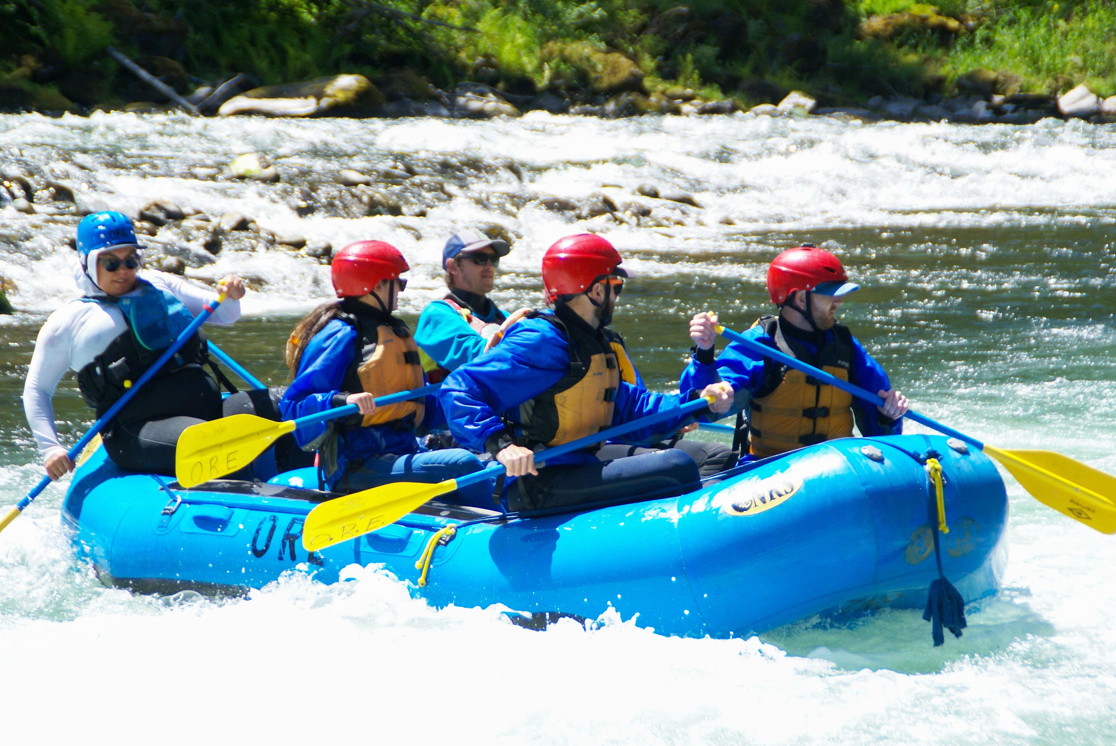
Picture yourself plunging through whitewater, rushing down a technical Class IV rapid with Douglas firs towering overhead as water crashes around your raft. Welcome to Oregon, where some of the Pacific Northwest’s most spectacular whitewater adventures await. From the legendary Rogue River’s wilderness canyons to the technical challenges of the upper Clackamas River, the state offers incredible diversity that caters to everyone from weekend warriors to seasoned river runners.
Oregon’s river portfolio reads like a whitewater enthusiast’s dream catalog. Whether you’re looking to hone your Class III skills on a day trip or tackle a multiday expedition through remote canyons, Oregon delivers experiences that will leave
you planning your next trip before you’ve even dried off.
Portland’s Backyard Playground: Just an hour from Portland, the Clackamas River’s Three Lynx to North Fork section offers legitimate Class III-IV rapids. Oregon River Experiences and Blue Sky Rafting run guided trips March through September, though Forest Service day-use passes are required. The technical nature makes it perfect for serious whitewater without the long drive.
Willamette Valley Gems: The North Santiam’s Packsaddle Park to Mehama Bridge run delivers Class II-III+ whitewater through intimate Cascade foothills. Oregon River Experiences and eNRG Kayaking provide guided options April through August, with optimal flows around 2,0002,500 cubic feet per second.
The McKenzie River’s Finn Rock to Hayden Bridge section combines Class II-III+ rapids with stunning scenery. The river’s famous clarity reveals every
underwater feature while old-growth corridors create an almost mystical environment. Horse Creek Outfitters and Oregon Whitewater Adventures guide this run April through August.
Central Oregon’s Consistent Flows: The Deschutes River offers reliability with dam-regulated flows May through September. Options range from the approachable Class III Big Eddy run near Sunriver to the technical Maupin to Sandy Beach stretch. Sun Country Tours, River Drifters, and Imperial River Co. guide trips, but all Deschutes boating requires a free boater pass.
Southern Oregon’s Crown Jewels: The North Umpqua River’s Steamboat to Gravel Bin section winds through oldgrowth forest, delivering consistent Class III action April through July. The cathedrallike conifer setting and legendary clarity make this area special. Ouzel Outfitters
Above: Charging through rapids on the Clackamas River—just a short drive from Portland, but a world away from the everyday.
All photos: Stephanie Doshier
Clackamas Three Lynx to North Fork
North Santiam Packsaddle Park to Mehama Bridge
North Umpqua Steamboat to Gravel Bin
Deschutes Big Eddy (Sunriver); Maupin to Sandy Beach
McKenzie Finn Rock to Hayden Bridge
Rogue Nugget–Powerhouse (near Gold Hill)
Snake (Day Run) Hells Canyon Dam to Kirkwood
and North Umpqua Outfitters guide this permit-free section.
The Rogue River’s Nugget-Powerhouse Run near Gold Hill provides reliable Class III-IV action May through September thanks to dam regulation. Orange Torpedo and Rogue Rafting Co. are among outfitters running this excellent warm-up for the wilderness section downstream.
Eastern Oregon’s Hidden Gem: The Snake River through Hells Canyon offers spectacular scenery on the Hells Canyon Dam to Kirkwood section, combining Class III-IV rapids with views of North America’s deepest river gorge. Hells Canyon Adventures and OARS guide this May through September run.
Oregon’s multi-day rivers separate casual rowers from serious river runners. These expeditions require advance planning, specialized equipment, and sometimes a healthy dose of luck in permit lotteries. But for those willing to invest the effort, these rivers offer some of North America’s premier wilderness experiences.
The Lottery Rivers: The Rogue River’s Wild Section remains Oregon’s most
III–IV Yes (Oregon River Experiences, Blue Sky Rafting)
II–III+ Yes (eNRG Kayaking, Oregon River Experiences)
III Yes (Ouzel Outfitters, North Umpqua Outfitters)
III–III+ Yes (Sun Country Tours, River Drifters, Imperial River Co.)
II–III+ Yes (Horse Creek Outfitters, Oregon Whitewater Adventures)
III–IV Yes (Orange Torpedo, Rogue Rafting Co., others)
III–IV Yes (Hells Canyon Adventures, OARS)
March–Sept. Yes – Day-use pass required at Forest Service access areas
April–Aug. No permit required for day use
April–July No permit required for day use
May–Sept. Yes – Free Boater Pass required
April–Aug. No permit required for day use
May–Sept. No permit required for day use
May–Sept. Yes – BLM permit required for private groups only
coveted permit. The May 15 through October 15 primary season operates on a lottery system through Recreation.gov, with applications accepted only December 1 through January 31. This designated Wild and Scenic River combines world-class Class III-IV whitewater with untouched wilderness camping and incredible biodiversity including black bears, river otters, and bald eagles.
Professional outfitters handling all permits include Oregon River Experiences and ROW Adventures (3-5 day lodge-tolodge or camping trips), Morrisons Rogue Wilderness Adventures (Orvis-endorsed fly-fishing trips), Momentum River Expeditions (glamping-style gourmet experiences), plus Arrowhead River Adventures and OARS.
Hells Canyon on the Snake River operates under similar lottery systems during its primary season from the Friday before Memorial Day through September 10. ROW Adventures and OARS offer multi-day expeditions, while Momentum River Expeditions provides small-group trips and Hells Canyon Raft operates from their canyon rim location after 31 years of experience.
continued on next page

Wild Waters, continued from previous page.
Rogue River (Wild & Scenic) Yes – Lottery (May 15–Oct. 15), Self-issue (Oct. 16–May 14)
Snake River (Hells Canyon) Yes – Lottery (primary), Self-issued (secondary)
Deschutes River (Lower) Yes – Boater Pass required yearround No
John Day River Yes – Required year-round (Service Creek to Tumwater Falls) No
Recreation.gov or Smullin Visitor Center at Rand
Recreation.gov or major launch sites
Recreation.gov
Recreation.gov
Illinois River Yes – Self-issued No Selma Market kiosk (Selma, OR)
Grande Ronde River
River
North Umpqua River
Klamath River
Reservation Rivers: The Deschutes River requires year-round Boater Passes through Recreation.gov, reservable up to 26 weeks in advance. This system offers more planning flexibility than lotteries while managing river traffic. River Drifters and Arrowhead River Adventures provide multi-day guided trips combining excellent Class II-III whitewater with high desert scenery and world-class trout fishing.
The John Day River between Service Creek and Tumwater Falls requires yearround permits through Recreation.gov. This gentle river flows through remote high desert country, offering a completely different experience from forest-corridor runs. Ouzel Outfitters, Oregon River Experiences, and Arrowhead River Adventures all provide guided options.
Self-Issued Systems: Several rivers offer self-issued permits for spontaneous trip planning. The Illinois River provides permits at the kiosk in front of Selma Market, while the Grande Ronde offers permits at public access points. Rivers & Oceans Rafting guides Illinois River trips, while Ouzel Outfitters, Oregon River
Experiences, and Winding Waters River Expeditions run Grande Ronde adventures.
No-Permit Rivers: Some of Oregon’s best multi-day experiences require no river-specific permits. The McKenzie River offers excellent 2-3 day sections through old-growth corridors with consistent Class II-III whitewater. The North Umpqua provides technical multi-day runs through forest-lined banks with challenging Class III-IV rapids. The Klamath River system allows extended wilderness expeditions through diverse ecosystems from mountain forests to desert canyons.
Oregon Whitewater Adventures and Oregon River Experiences offer McKenzie trips, Ouzel Outfitters and North Umpqua Outfitters specialize in North Umpqua adventures, while Orange Torpedo Trips, OARS, and Momentum River Expeditions provide Klamath River system expeditions.
While seasoned paddlers often relish the freedom of self-guided adventures— setting their own pace, choosing campsites, and crafting personalized wilderness
experiences—professional outfitters deliver convenience and expertise. They navigate the intricate permit process, supply gear, implement safety protocols, orchestrate camp operations, and share knowledge of river conditions, natural history, and local flora and fauna. These guided multi-day journeys frequently make treasured family milestones, where every detail is handled, leaving you free to immerse yourself completely in Oregon’s wild river magic rather than wrestling with logistics and camp chores.
Success on Oregon’s rivers depends on matching your group’s technical skills with appropriate difficulty levels. Be honest about your abilities—Oregon’s rivers demand respect, and conditions can change rapidly with weather and releases. Secure permits well in advance for regulated systems, as lottery applications require careful attention to deadlines while reservation systems book up quickly during peak season. Having backup plans helps when permits don’t come

through. Consider starting with day trips or no-permit multi-day rivers to build skills before tackling lottery rivers, since the techniques and experience gained on accessible runs translate directly to more challenging expeditions.
Essential gear requirements vary by river, but Oregon Waterway Access Permits are required for most non-motorized
watercraft, and Forest Service areas often require additional day-use passes. All regulated multi-day rivers require groover waste systems and fire pans, reflecting Oregon’s commitment to preserving river corridors. Oregon’s diverse rivers ensure excellent adventures for every skill level and schedule—from gentle family floats to world-class wilderness expeditions,
the state offers a lifetime of paddling experiences. The challenge isn’t finding good rivers, it’s choosing between so many incredible options.
Happy rafting, and remember: Oregon’s rivers reward those who come prepared, and are respectful and ready for adventure.
Above: Guides prep dinner riverside as the sun sets on camp—good food, sandy toes, and stories under the stars.

by Mathew Brock, Mazama Director of Special Collections and Media;
Rose City Astronomers Volunteer Librarian.
The Perseid meteor shower stands as one of the most reliable and spectacular astronomical events of the year, painting the night sky with brilliant streaks of light each August. This cosmic display has captivated observers for over 2,000 years, making it a perfect introduction to meteor watching for newcomers and a beloved annual tradition for seasoned stargazers. While the peak of this year’s Perseid show will be overshadowed by a bright moon (just a few days after full), the brightest of the Perseid will still be visible and more than worth the show.
The Perseid meteors originate from Comet Swift-Tuttle, officially designated 109P/Swift-Tuttle. This massive comet, roughly 16 miles in diameter, orbits the Sun approximately every 133 years, leaving behind a trail of debris in its wake. Each year in mid-to-late August, Earth's orbit intersects with this debris stream, creating what we observe as the Perseid meteor shower.
When these tiny particles—think of a mix of grape nuts and grains of sand for scale—enter Earth's atmosphere at speeds of about 37 miles per second, friction with atmospheric molecules causes them to heat up and glow, creating the brilliant streaks of light we call meteors. The characteristic green color often seen in Perseids comes from excited oxygen atoms, while blues and purples indicate magnesium.
The shower appears to radiate from the constellation Perseus (hence the name), though meteors can appear anywhere in the sky. The radiant point sits between the constellations Perseus and Cassiopeia, rising in the northeast after 10 p.m. in early August and earlier each night as the month progresses.
The Perseid shower typically peaks around August 11–13, with rates of 50–100 meteors per hour under ideal conditions. The Pacific Northwest offers exceptional viewing opportunities due to its highelevation locations and often clear August skies. Here are some prime viewing spots: Mt. Rainier National Park offers spectacular dark skies, particularly at Paradise and Sunrise areas. The high elevation (around 5,400 feet at Paradise) reduces atmospheric interference, while the park's distance from major cities minimizes light pollution.
Crater Lake's rim drive represents one of the region's premier dark-sky locations. The caldera's elevation (6,000-8,000 feet) and minimal light pollution create ideal conditions.
North Cascades National Park features some of the darkest skies in the continental United States. Blue Lake and
continued on page p. 43
Above: Origin in the night sky of the Perseids at 9:30 p.m. on August 12, 2025. Image: SkySafari Pro 7

by Sohaib Haider
My mouth was dry, my legs were shaking, I was unable to move, frozen. I felt hotter and sweatier than the mid-April sun warranted. I had no clear thoughts. I knew only that I didn’t want to be right here, right now. Every human being has felt it, but I think climbers experience this overwhelming physical and mental sensation with more intimacy and frequency than others. I’m talking about fear.
This was my first real encounter with fear in climbing. I wasn’t about to pull the roof above the slippery crack on Spiderman (a moderate trad route at Smith Rock), nor was I six feet above the bolt on a run-out sport route (Manifest Destiny, Red Rocks). I was not second-guessing the sticks of my ice tools before placing an ice screw in the headwall of North Ridge of Koma Kulshan/
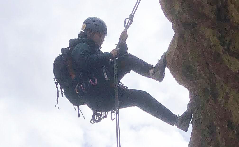
Mt. Baker, nor was I about to jump over a three-foot-wide crevasse that flared into a deep blue abyss on Emmons Glacier on Tahoma/Mt. Rainier. I was simply trying to rappel, from a big ledge, on a low fifth-class route at Horsethief Butte. It was my first ever rappel in the wild, during the rock skills field trip of Basic Climbing Education Program (BCEP) 2021, and I remember it as if it were ten minutes ago.
My description of the scene sounds like I was alone and helpless, but that’s just a trick fear plays on us. I was, in fact, with the best instructor I could’ve had on that particular day. His name was David Carrier. I remember him sitting comfortably at the ledge, tethered to the anchor, though I had almost forgotten that he was there. I don’t know how long I stayed stuck, fidgeting with my belay device with one hand, holding the two strands of the rope with the other, doing a sit-stand motion, half-step back, one step forward. Was it three minutes, five minutes, or more, I don’t know. It seemed like an eternity.
And then I heard David’s voice, soft and clear, saying something along the lines of: What’s going on, Sohaib? Realizing that I
was not alone, I relaxed a bit, and replied, “I feel unsafe on this ledge.” David responded without missing a beat, and years later I remember his exact words, because they changed my life. In a calm and almost comforting voice, David asked, “Is it your body or is it your mind that is unsafe on this ledge?” Everything within me became still, quiet. In hindsight, I know now that this stillness is the precursor and harbinger of an insight, the light bulb moment. A light in the darkness of fear. The calm in David’s voice convinced me of its truth. David had challenged me to reason through my fear. I looked at the anchor and the rope threaded through the rings. I had done my BARK test (the mnemonic for Buckle, Anchor, Rappel setup, and Knots, taught in BCEP).
I tugged hard on my third hand again, the rope couldn’t slip even an inch in the wraps of my autoblock. I started to gain clarity with all the thinking and all the follow-up tests. It dawned on me that I was actually physically safe on the ledge and on the
Above: Sohaib Haider on Mt. Hood, Old Chute, June 16, 2021. All photos: Sohaib Haider.
rappel system. I was just afraid to commit to the move, the rappel.
After a deep breath I took a step back, looked over my shoulder down the 25 feet of low 5th class terrain, and I could see the rope on the ground. I looked up, and took another step back—I was leaning back at the ledge. One more step, and I was almost perpendicular to the ledge. One more step, and my feet were against the vertical wall and my back towards the ground. I could see the rope go smoothly through my belay device while I fed more rope through my third hand. Holy smokes, I was rappelling. David must’ve said something encouraging at this point, but I don’t remember—I didn’t hear any sound in the world. All I could see was my feet on the rock wall and the rope strands feeding through my belay device. Then I started to breathe and move with more comfort. By the time I reached the ground, I was actually enjoying the motion. I had successfully executed the first rappel of my life in the outdoors, and in the process David had given me a phenomenal framework to deal with challenges of climbing, and of life itself: is it my mind or is it my body that is unsafe in any situation.
All of my close friends and several of my BCEP students have heard this story, some multiple times. I only saw David once after this field trip. It was again during the BCEP 2021 Snow Skills session at the White River Sno Park. As we practiced selfarrest and steep snow travel techniques, David kept looking at Wy’east/Mt. Hood on that bright sunny day and explained the mountain features like Hogsback and Illumination Saddle to me. He had a love for the mountain. I could hear it in his voice and see it in his eyes. I almost envied this love. David told me that he could summit the mountain in less than 4 hours, and I was envious of that too. In 2021, I was dying to summit Wy’east/Mt. Hood, in fact summiting it was the only reason I had signed up for BCEP. But the summit now seemed like a daunting task. BCEP had humbled me, and I was afraid of the mountain and the challenge it came with. I kept hearing stories of climbers that have to turn around due to conditions and fitness challenges.
I never saw David again. He passed away in August 2022 in a climbing accident. However, I have used David’s line and approach of being patient with climbing

students quite a few times, and I believe David’s knowledge and kindness lives on.
I did get on that Wy’east/Mt. Hood climb only a few days after my BCEP graduation, on June 16, 2021. My own BCEP team’s Hood climb didn’t go due to weather and I was desperate to get on another. I was thinking of paying guides, but it was June and I thought it might already be too late. Then Tim Scott saw a weather window and put up a Thursday morning climb. I applied, and he accepted me. I guess the universe was conspiring in my favor.
The Wy’east/Mt Hood climb was my first climb ever, not just my first after BCEP. I had been running and hiking a decent amount that spring and I knew I had the endurance to pull it off. But when I first stepped on the snow under the moonlight on a cold mid-June night at midnight, I was in an unfamiliar world. And I felt the fear again. There were five of us, three climbers,
Scott, the
and Gavin
the
leader. There was a mild breeze, almost pleasant, but there was no sound other than our crampons crunching on crystallized bootpack.
There were not many climbers out on that school night climb. We were together as a team, but I felt like each of us was on an island, lost in our own thoughts, each of us climbing an inner mountain. I wondered if the other two climbers also felt fear. What if one of us bonks, what if I bonk, what if I am too afraid on the steep snow? I shook my head and told myself to think positive thoughts.
The climb went well, I was feeling good. The sun came out and we made it to Devil’s
continued on next page Above left to right: Gavin Boggs, Tim Scott, and Gordon Wilde on Mt. Hood, June 16, 2021.
Teachers, continued from previous page.
Kitchen by 6 a.m. On Hogsback, Tim did a quick demo of steep snow technique, as he always does on Wy’east/Mt Hood climbs for the first timers. It was just a few degrees below freezing and I had been wearing my down jacket the entire night, so it was now wet with sweat. The water in my backpack’s bladder had frozen. Tim gave us an option to leave our backpacks behind on the Hogsback. I was glad to go light and dump my backpack. I attached my Nalgene to my harness and shoved a trail mix packet into my pocket, and on we went to the Old Chute via the Hot Rocks.
I have summited Wy’east/Mt Hood a few times and I will swear that the Old Chute was at least 500 feet longer than usual that day. It felt never-ending. I was following Tim’s boot pack. One uphill step, rest step, uphill step, switch the ice axe to the uphill side, use the ice axe to pivot my body, make the turn, one uphill step, rest, repeat. My quads had started to feel it, but I kept moving. About 150 feet below the summit, I felt a sharp, painful contraction in my left hamstring. I tried to move up and then I felt it in my left quad. I froze—this time not with fear but with the shooting pain of a severe cramp. I had been running and hiking all spring and I had never cramped until then. Tim turned around to make an uphill turn and probably saw the pain on my face or my awkward stance. He immediately sensed that something was wrong. He asked me, I told him, I am cramping. He walked over. I felt helpless. I looked up at the summit, I could see climbers making final steps up on the Old Chute and then disappearing on the ridge. I thought I may not summit after all. I failed on the only chance I had this year. I felt devastated. Then I realized Tim was standing in front of me. Talking to me. He was asking me how much water I had. Gavin was sweeping some thirty feet below us behind the other two climbers. Sensing that something was wrong, he literally flew up towards me, using both tools for the first time on the climb.
Tim looked concerned, but he was calm. He asked me to drink water and eat something. I did both. In a moment of foresight, I had put electrolyte in my water bottle when I had dumped my backpack, and I drank a third of it. I don’t remember what Gavin and Tim were saying to me at that moment, but I knew they’d help me
get down if it came to that. I felt better. My cramp was gone. I forced a smile and said I wanted to continue. I told myself that I could not give up on the climb, especially with the summit so close, even if I go at a snail’s pace.
And that’s what happened. Tim kept looking over his shoulder at me. As the slope steepened we transitioned to high dagger movement, which took most of the stress off of my quads and hamstrings. One step after another, one ice axe stick after another, and soon I felt the terrain mellowing, and I could stand up and walk to the summit. I looked up and saw Tim standing tall at the ridge smiling at us. One step, then another, and soon I too was standing on the ridge. The feeling was indescribable. My first thought was, I can’t believe I just did this. All the emotions came rushing in. I wanted to sit down and cry, not from exhaustion or fear but from pure joy. But surrounded by such sturdy and tough climbers, I decided not to show my emotions; I wiped that one tear from my cheek and soon had a big summit grin plastered on my face.
In that moment I experienced a paradigm shift, an identity change. I had gone through fear of the unfamiliar, physical exertion, and made it through to the jubilation of a dream come true. I have not had that feeling again and I am sure it won’t happen again. That was the moment I became a climber.
I have summited Wy’east/Mt Hood multiple times since (and many hours faster than my first summit time). But that night I began learning my lessons as a climber: how to layer properly and hydrate on cold nights, how to train for uphill travel. But the most important lesson was that the fear never goes away. Nor should it. Fear is not an emotion or a state in itself. Fear is a resistance to a perceived outcome in the future, a subjective and objective evaluation of consequences of actions you can take in the given moment. There are phantom fears and real fears. The key to safe climbing is to identify which kind of fear we are facing and how accurate our subjective evaluation of consequences is. Healthy fear will prolong and enrich our lives, while unhealthy subjective fears will make us miserable and hold us back from reaching our true potential.

And on this intimate journey of facing fears and climbing, I soon faced another nemesis, something that I still struggle with: the good ol’ fear of lead falls. This time I was in the Intermediate Climbing School (ICS), having our lead belay clinic with climbing instructor Juan Rodriguez. I could climb and clip bolts fine, but when it came to taking a lead fall from a bolt at my waist level, the fear took hold of me. I couldn’t breathe, I’d sweat, I’d hold on too tight, and at the final moment of taking a fall, I would down climb a hold or two and then gently let go, almost making it a toprope fall. I saw my course mates effortlessly take lead falls. I used David’s framework, is it my body or is it my brain that is unsafe letting go, but at the moment of taking the fall, my rationality left me, the survival brain took over, and I would do anything except trust the system and let go. And then I realized I may need to do something different. I chatted with Juan and decided to do one-on-one sessions with him.
I remember it was December of 2021, and Juan offered me a timeslot of 6–7 a.m. I would wake up at 5:30 a.m., have a coffee and a banana, and drive over to the climbing gym in Beaverton in the typical rainy, pitch-black Pacific Northwest winter mornings. On the drive over, I would wonder why I signed up to experience misery and fear in a climbing gym, and at such an early hour. But with Juan’s experience and insight, he quickly figured out my problem and started me with some very basic steps. My first task was to climb half way up a 5.9 gym route on a top rope, and then take a fall on light slack. Sounds easy. I went up the route and couldn’t let go initially. After some encouragement from Juan and some self-talk, I was able to let go of the hold and took a tiny top rope fall. OK, that wasn’t so bad. We repeated this several times with more and more slack until I started to trust the top rope, Juan, and most importantly, myself.
In the second session we practiced mock lead falls, in the third session we practiced five lead falls with a relatively tight rope. And then came the moment of truth, the final session: my task was to climb a few moves above the bolt and then take a lead fall. I was still tentative, holding my breath; for the first few falls, I couldn’t go above the bolt. I would hold on to the hold until I would fall because of the pump, instead of actually letting go— and then something snapped in
me. I was tired physically and I was tired mentally of being afraid every time. I climbed above the bolt and immediately let go. My first clean lead fall above the bolt. I heard Juan instantaneously yell “Sick!” I knew this was a genuine compliment and not an encouragement, because he sounded almost surprised at my sudden, newfound courage. And to this day that ‘Sick’ from Juan is one of the best and most memorable compliments that I have ever received in climbing.
It wasn’t all smooth sailing after that class with Juan. I still take my sweet time to take a lead fall, I still don’t want to take a fall on trad gear (even though I know the piece I have placed is bomber). Whenever I am nervous or pumped on a route, I do a take to figure out the crux moves before committing to them. I may not be the finest rock climber around, but I am no longer embarrassed about the soft grades I lead. And I do know I have come a very long way from where I had started, thanks to Juan. There is a saying that how you do one thing is how you do everything. I truly believe that climbing and life itself are synonymous. The lessons of discipline and grit that I learned in life, I have applied to climbing, and I’ve applied the frameworks that I learned in climbing—to deal with the phantom fears and limiting beliefs—to life itself. I grew up in a rural town of the agricultural flatlands of Pakistan without any exposure to mountains or endurance sports. I thought mountain climbers are another species. When I was in graduate school in Atlanta, two dozen of my classmates ran the Atlanta Half Marathon, and I thought they were all professional athletes, because until then I did not know anyone who had run such a distance. In short, I had so many limiting beliefs about myself and my abilities that I couldn’t once imagine myself doing things that I can do today.
I still have a hard time calling myself a climber. A non-climber friend recently referred to me as an athlete and I was shocked (and very pleased afterwards). My Pakistani friends and community members have asked me multiple times why I climb mountains and endure harsh elements and physical discomfort. I have thought of and given many answers to this question, but the truth is that I didn’t always know why. But one day I visited Portland for a job interview and saw Wy’east/Mt. Hood, and knew I wanted to summit this mountain. I
think climbing Wy’east/Mt. Hood was my destiny, and I did not really have a choice.
But I know now the real reason why I wanted to climb. I saw the mountain and the mountain spoke to me in a language that I could not understand. I felt that the only way I could communicate back with the mountain was by going to its summit. So I went to the summit of Wy’east/Mt Hood and then I went to the summit of many other mountains. And I learned that the path to the summit of the mountain is a path through fear, a journey to oneself, revealing intimate and intricate learnings. Some of these learnings can be communicated, while some can only be experienced and not explained. As the saying goes, the art changes the artist. Let’s just say that climbing makes a climber out of a non-climber.
But I know one thing very clearly: I didn’t become a climber by myself. Every step of the way there were mentors, teachers, and climbers who showed me the way, who taught me something about climbing and about myself every single time I showed up. I am grateful to all of them. But I am most grateful to the teachers and mentors who were patient with me, who allowed me the grace and time to get comfortable with the uncomfortable at my own pace, who believed in my abilities when I didn’t, who encouraged me to take the sharp end of the rope when I second-guessed myself. You all made me a climber and you all changed my life. Thank you.
Dedicated to the memory of David Carrier. May his soul rest in peace and may I (and all of us) be able to always channel his patience and kindness in teaching and climbing.

by Aimee Frazier
Imagine: you’re a thru-hiker on the Oregon Coast Trail. The sun is out, but the air is cool. Seagulls glide overhead, their familiar caws echoing down the beach. The rhythmic crash of ocean waves rolls in from your right, while to your left, sea grasses in hues of green and wheat dance on a sand dune. A north breeze brushes against your back, tinged with the scent of salt and sea life.
Your hiking boots are snug and laced up to your ankles, short gaiters keeping sand at bay. Your pack hugs your hips, carrying a lightweight tent, sleeping bag, water, tide table, map, and a few soon-to-be well-earned snacks. For the next month, a patchwork of coastal campgrounds and quaint inns will be your home. This is the Oregon Coast Trail (OCT)—a lesserknown gem that stretches the full length of Oregon’s rugged and scenic shoreline.
Chances are, if you’ve ever strolled along the Oregon coast, you’ve unknowingly walked a stretch of this trail. Despite its international reputation among thru-hikers, the OCT remains a surprising discovery for many Oregonians. Spanning over 400 miles from the Columbia River to the California border, it weaves through a variety of landscapes—wide-open beaches, mist-laced cliffside forests, charming seaside towns, historic lighthouses, and stretches of highway. It’s a journey that offers the best of both worlds: solitude and civilization, wildness and comfort.
My own relationship with the trail has been forged through day hikes with my kids, backpacking trips with adventureloving friends, and solo explorations along the quieter southern sections. My longest day of backpacking on the OCT? Fifteen miles—motivated less by ambition and more by the realization while setting up camp that I’d left a box of wine in my car in the parking lot many miles back. It was worth doing the hike twice.
To better understand what it’s like to thru-hike the OCT, I sat down with Bonnie Henderson, author of Hiking the Oregon Coast Trail and the trail’s most seasoned voice. Her stories bring the trail to life—flagging down crabbing boats to ferry across bays, rising at dawn to cross rivers at the lowest tides, and even the misadventure of stepping off a boat onto what she thought was shore, only to find herself on a vanishing sandbar (spoiler: she made it out just fine thanks to a second boat rescue).
Unlike the Pacific Crest Trail, with its bustling trail communities and wellworn paths, the OCT is a quieter, more contemplative trek. The hikeable season is short, generally from mid-June through September—due to river crossings that become impassable from fall through spring. As a result, and due to its relatively low foot traffic, OCT hikers often find themselves walking alone, nestled between ocean and town, stitching together nights at public beach sites (where permitted), established campgrounds, and local inns.

Planning ahead is crucial. “This trail is like a puzzle you have to solve,” Bonnie told me. Tides can render key stretches impassable. River mouths and headlands require perfect timing. Apps like NOAA’s tide charts or printed local tide tables are just as essential as your map. River crossings and boat ferries must be coordinated with precision—or you’ll be stuck waiting, or worse, wading (that was a joke—please don’t actually wade across dangerous waters!).
Navigation can be another challenge. Though there is marked signage, it’s easy to miss key turn-offs, especially when transitioning from beach to bluff. Bonnie recommends using the FarOut app, an interactive trail map that helps hikers to track their route. She also pointed out the neon yellow beach access signs you’ll see along the way. “These aren’t mile markers,” she explained. “They’re emergency reference points, but they can be helpful for wayfinding.”
Even the trail’s mileage is flexible. Depending on whether you opt to ferry across bays or hike around them (where possible), the total distance can range from about 400–425 miles. Some hikers arrange boat rides with locals; others detour inland when needed. Every version of the trail is slightly different—just one of the ways the OCT is more of a choose-yourown-adventure than a rigid route.

the north winds at your back and keep the sand out of your eyes.”
continued on next page
And don’t forget your rain gear. “Even in the summer months, it can get soggy,” Bonnie warned. “This is a trail where you really need to do your homework. The tide, camping rules, crossings—they can all make or break your experience. It’s also crucial to walk from north to south to have
Above top: Looking North from the OCT in the Samuel H Boardman State Scenic Corridor, just to the North of Natural Bridges.
Photo: Aimee Frazier
Above inset: Hiking the Oregon Coast Trail by Bonnie Henderson.

OR Coast Trail, continued from previous page.
Planning Resources & Information
■ Planning Resources
□ Guidebook: Hiking the Oregon Coast Trail by Bonnie Henderson. Mazama Library call #
□ Trailkeepers of Oregon OCT overview is the best online resource for trip planning: trailkeepersoforegon.org/oct/
□ FarOut Guides Interactive Map: faroutguides.com/oregon-coasttrail-map/
□ Oregon Coast Trail Facebook Group
■ Camping & Lodging Tips
□ Beach Camping: Permitted in certain areas, primarily on the southern coast. Restrictions apply near state parks, certain cities, and snowy plover nesting zones.

■ Safety & Navigation
□ Tide Awareness: Some trail sections are only passable at low tide. Always consult tide tables before planning your day’s hike.
□ Campgrounds: Numerous state parks along the trail offer hiker/ biker campsites.
□ Inns & Lodges: Many hikers opt for a mix of camping and stays in local accommodations. Advance reservations are recommended during peak season.
□ Trail Signage: While signage exists, it’s not always consistent. Utilize GPS apps and maps for accurate navigation.
□ Emergency Markers: Neon yellow beach access signs are used as emergency reference points but are not mile markers.
Learn more about the Library & Historical Collection at mazamas.org/library.
Established in 1915, the Mazama Library is nationally recognized as holding one of the top mountaineering collections in the country. Located on the ground floor of the Mazama Mountaineering Center, the library is a fantastic resource for members and the general public to find information on hiking, climbing, camping, and exploring the rich history of regional and global mountaineering culture.
• That dogs cause more hiking injuries than any other animal.
• There have been no confirmed fatal wolf attacks on hikers in the contiguous United States.
• There are over 3,000 hiking trails in Oregon, and over 88,000 trails in the United States.
The Story of Mont Blanc, Albert Smith, 1853
The Story of Mont Blanc is a detailed account of Albert Smith’s journey to ascend the highest peak in the Alps. The book describes the challenges and dangers Smith faced during his climb, including treacherous weather conditions and difficult terrain. Beyond his personal experiences, Smith provides readers with a comprehensive history of Mont Blanc and the surrounding region, including geological and natural history, as well as the cultural significance of the mountain to local inhabitants.
CENTRAL OREGON BOULDERING, 2ND EDITION, JASON CHINCHEN, 2022
• This expanded second edition showcases the diverse bouldering opportunities throughout Central Oregon’s high desert, from the volcanic formations near Bend to hidden basalt gems in the Cascades foothills. Chinchen provides comprehensive coverage of established areas while unveiling new developments, complete with detailed maps, seasonal considerations, and environmental ethics guidelines for this rapidly growing climbing region. Best for: Local Oregon climbers and visiting boulderers interested in exploring high-quality problems away from the crowds, suitable for all skill levels. Library call # 917.95 C43
CENTRAL OREGON ROCK, DAVE MCRAE, 2025
• The most current comprehensive guide to sport and traditional climbing in Central Oregon, covering iconic formations like Smith Rock and emerging areas throughout the region. McRae combines decades of local knowledge with modern route development, providing detailed topos, gear recommendations, and approach information for hundreds of climbs ranging from single-pitch sport routes to multi-day trad adventures. Best for: Rock climbers seeking both classic and contemporary routes in Central Oregon, from sport climbers looking for steep limestone to trad climbers pursuing crack systems and alpine objectives. Library call # 197.95 Mc24
BEYOND POSSIBLE: ONE MAN, 14 PEAKS, AND THE MOUNTAINEERING ACHIEVEMENT OF A LIFETIME, NIMSDAI PURJA, 2023
• An extraordinary mountaineering memoir chronicling Purja’s seemingly impossible mission to summit all fourteen of the world’s 8,000-meter peaks in record time. Through gripping firsthand accounts, Purja shares the extreme physical challenges, life-threatening conditions, and emotional highs and lows of his historic expedition. Beyond the adventure narrative, the book offers profound insights into his military background, Nepali heritage, and the mental fortitude required to push human limitations in the death zone of the world’s highest mountains, ultimately inspiring readers to reconsider what they believe is possible in their own lives. Library call # 920 P67
• Oregon’s Ancient Forests: A Hiking Guide, Chandra LeGue, 2019. Call # 917.95 L53
• Waterfall Lover’s Guide: Pacific Northwest, 5th ed., Gregory Plumb, 2013. Call # 917.95 P72
• Hiking the Pacific Crest Trail: Oregon, Eli Boschetto, 2016. Call # 917.9 B65
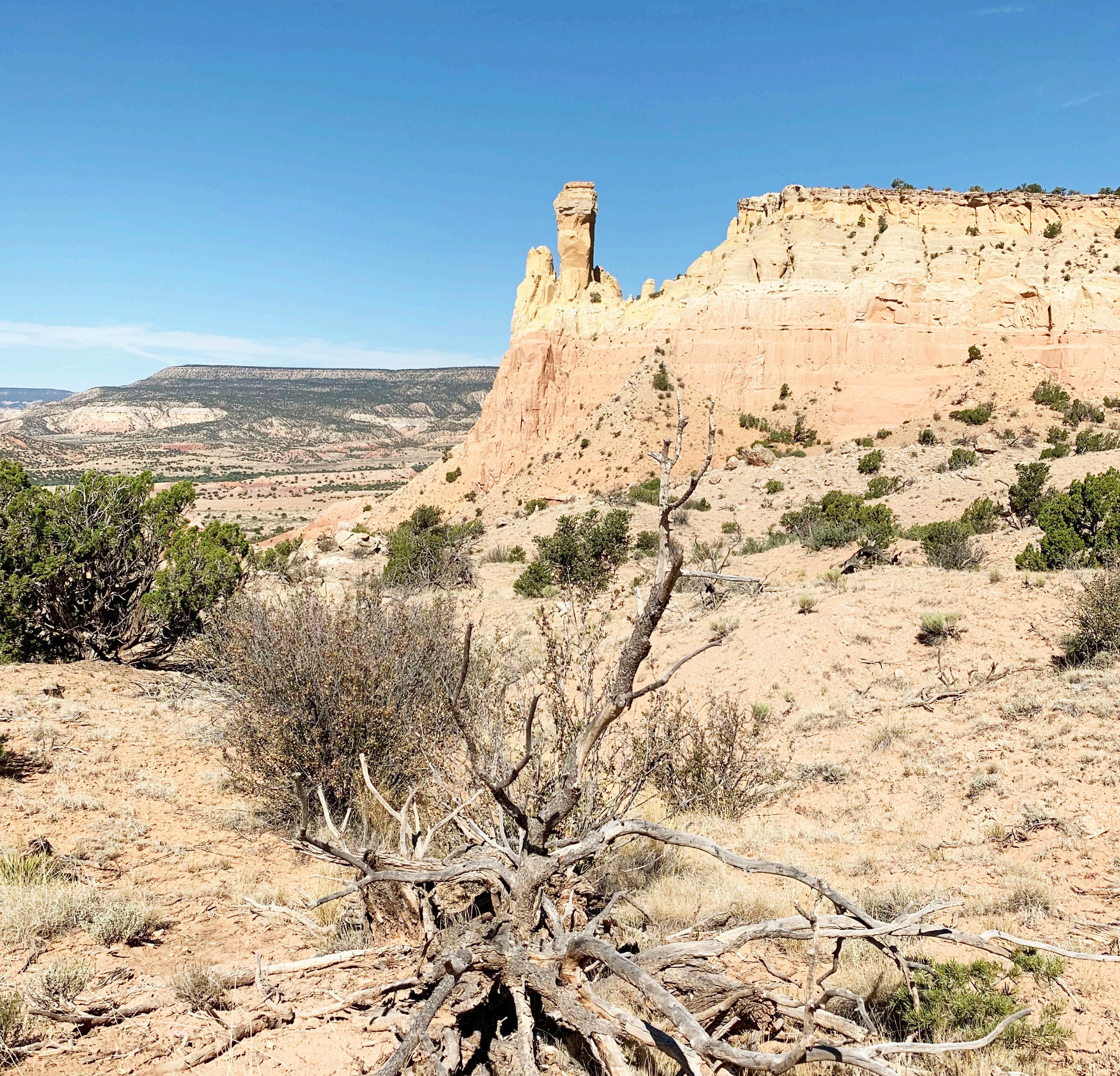
by Elise Englert
Well known for enchantment, green chile, and having the highest rate of violent crime per capita of any state in the country, New Mexico has a surprisingly vast
array of hiking terrain, from exposed sun-baked canyons to alpine forests. From a home base of Santa Fe (elevation 7,199 feet), most of these hikes are within an hour's drive or less and offer a variety of ambiance, elevation gain, and total distance, and are
accessible enough for someone packing along a body full of sealevel-acclimatized red blood cells. A word of guidance from my own trials and errors—one beer equals three at elevation.
Rock.
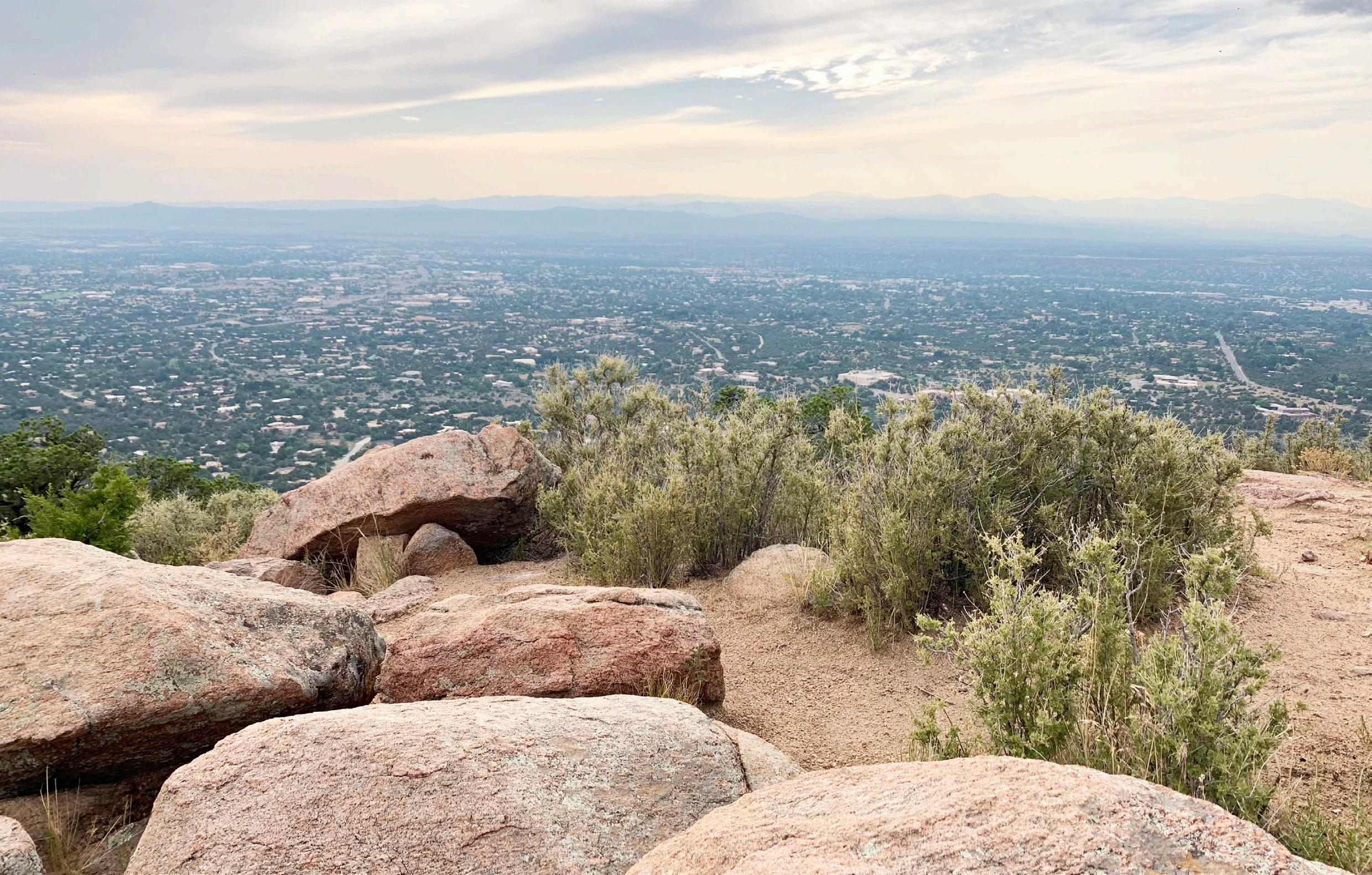
■ Length: 4.4–6.2 miles
■ Elevation Gain: 1,555–1,797 feet
■ Peak Elevation: 9,125 feet
If the trailhead gods smile upon you (or if you are hiking midweek outside of tourist season) you might find a spot at Upper Atalaya Trailhead, shortening this hike significantly. However, the 6.2-mile hike starting at St. John’s College is a pleasant extension of the trail; it offers a cozy little meander through arroyos and neighborhoods, and up hillsides with lovely views until you connect with the main trail and start a sweaty ascent to the peak. Atalaya is a playground for adorable horned lizards, colloquially referred to as “horny toads,” who serve up reptile side-eye like none other as your presence jars them out of perfectly-camouflaged hiding. A popular spot for trail runners and mountain bikers with perplexing amounts of athleticism, the trail is luckily open enough to spot these svelte top performers well before they flatten your limp, oxygen-deprived body. The peak offers beautiful views of Santa Fe and the Sangre de Cristo Mountain Range, and boulders nestled amid the ponderosa pines are a scenic place to bask in your accomplishment (or Google if there are long-term health risks associated with living at elevation).
■ Length: 1.6 miles
■ Elevation Gain: 734 feet
■ Peak Elevation: 7,950 feet
Part of the cozy duo of Sun and Moon Mountain, Sun Mountain is a quick, low-mileage hike with a big reward in views. Perfect for a date when you’re not willing to be trapped for multiple hours, or a quick dose of exercise while acclimatizing to the altitude, Sun Mountain offers cholla flowers in summer, purple asters in fall, and giant mud puddles and patches of snow in winter. The beginning of the trail weaves through cholla, pines, and a few homes before heading up switchbacks. It’s easy to meander off the trail slightly as the terrain turns rocky, but if you end up doing some light bouldering that’s part of the fun.
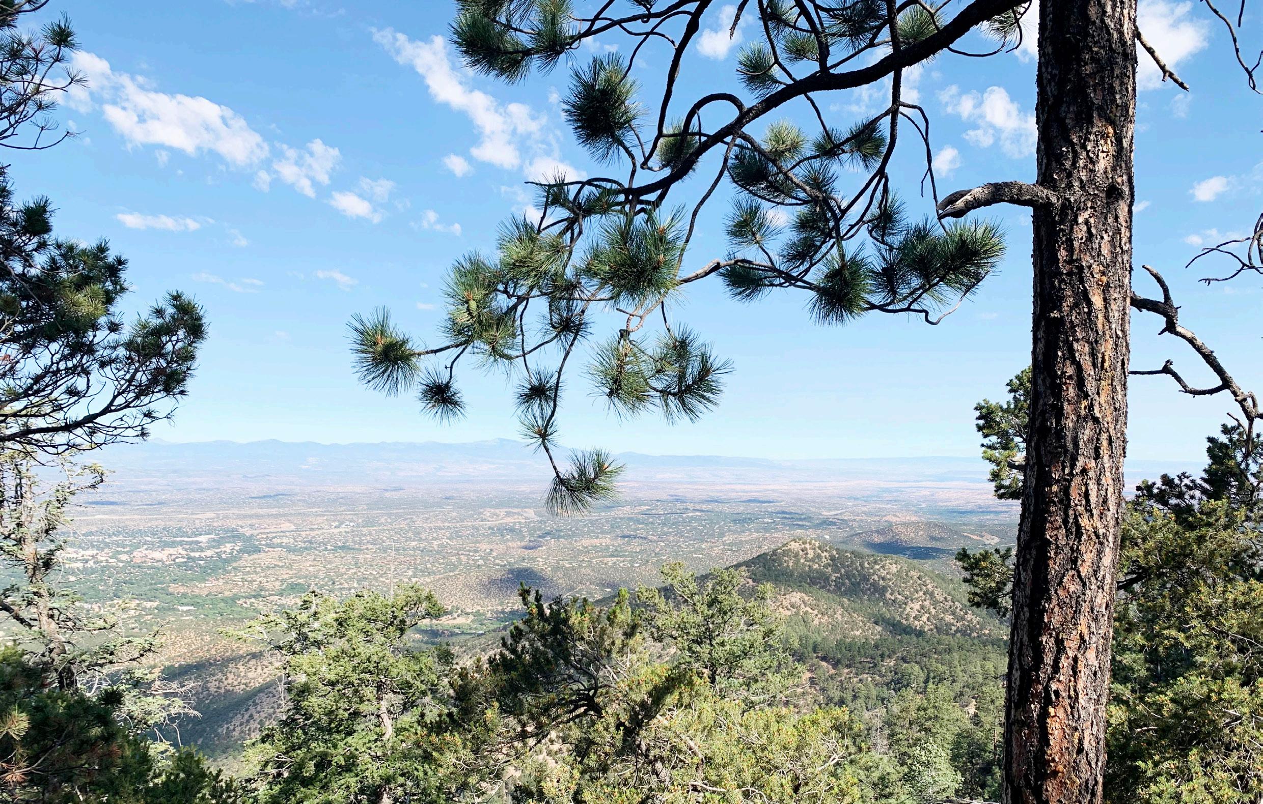
continued on next page
New Mexico, continued from previous page.
■ Length: 6.3 miles
■ Elevation Gain: 2,057 feet
■ Peak Elevation: 11,310 feet
Popular with mountain bikers, hikers, and free-roaming cattle, this high-elevation hike is a sweaty wooded wonder with a dash of creek-side meandering that requires a careful eye on the GPS. For your efforts, you’ll be rewarded with a grove of aspens in the final mile, and a beautiful alpine lake surrounded by dramatic rock walls as your destination. When I hiked to Nambé Lake in August the lake was full of juvenile Tiger Salamanders that resembled axolotls. Watching them wriggle through the low water was the perfect entertainment to accompany some almond butter and jelly sandwiches. Final mileage varies from guide to guide, as well as in practice—I fully assume that has something to do with the multiple times we found ourselves off-trail and had to backtrack.
■ Length: 2.5 miles + 3.8 miles
■ Elevation Gain: 633 feet + 741 feet
■ Peak Elevation: 7,080 feet
Ghost Ranch is a significant geological, historical, artistic, and paleontological site where longtime resident Georgia O’Keeffe painted the surrounding landscapes, including Pedernal Mountain where her ashes are scattered. Landforms and canyons layered in brilliant red and glowing white showcase 130 million years of geologic activity, and the views are made even more impressive by the stories of murders, dinosaurs, and other fascinating discoveries at this gem of a place, all accessible with a $10 per day use fee.
Chimney Rock Trail guides you around and then on top of a mesa with views overlooking the bulbous majesty that is its namesake, plus great views of the ranch, Lake Abiquiu, and Pedernal Mountain. Cross back through the Ghost Ranch grounds to the Kitchen Mesa Trailhead (past a labyrinth which I highly recommend). The Kitchen Mesa Trail offers treat after treat, starting with a paleontology site where a Coelophysis quarry was discovered in 1947. Views on this hike are captivating from start to finish: The trail guides you up the canyon wall with green tins as markers, and a scramble at the rim brings you to the top of the mesa, finishing with a walk through the white gypsum that covers the mesa. I cried y’all. This place is special.
■ Length: 1.25 miles
■ Elevation Gain: 80 feet
■ Peak Elevation: around 7,000 feet
This hike is flat, full of historical gems, and teeming with adorable lizards (a personal priority for me). A great option for a quick leg stretcher on a road trip day, or as a warm-up for other great hikes in the area, the Ancestral Sites Trail takes you on a tour through the remains of the Pecos Pueblo and a 1717 Spanish mission church. Some areas are offlimits for preservation, but others—like the church—allow you to walk around inside. You can also climb down a ladder into the cool, shaded interior of a kiva, a Puebloan ceremonial chamber. This trail is fully exposed, so an early morning adventure is best to avoid the heat.
Contact us to learn more about advertising in the Mazama Bulletin! mazama.bulletin@ mazamas.org


Altitude Training


• 10% off for all Mazamas members
• 50% off for climb leaders!
650 square ft Altitude Training room with altitudes from 10,000’ to 13,000’
Benefits of Altitude Training:
• Improved sea level or at altitude performance
• Improved aerobic fitness
• Increased strength
• Pre-acclimation to high altitude locations
• Accelerated recovery and return from injuries
• Maintenance of fitness while injured
• Increased fat metabolism
• Increased mitochondria production
• Increased energy production
• Increased capillary density
• Increased oxygen delivery
by Jen Travers
I’m a looper. I just don't like going back the way I came. That’s why I always keep my eye out for a bike shuttle option when researching a trip. A bike shuttle allows you to connect two different trailheads, and makes your trip more of an adventure.
There are multiple ways you can set up a bike shuttle, but the general idea is to leave a bike in one spot, your car in another at the beginning or end of the hike, then connect the two ends via bike.
My ideal set up is to 1) Drive to upper trailhead and leave the bike. You can lock your bike at the trailhead, but I prefer not to have it in view, it would be easy pickings for car prowlers. I recommend hiding the bike in the woods a short distance away from the parking area. 2) Drive to lower trailhead and start hike. 3) Finish hike at upper trailhead and ride back down to the car at lower trailhead.
Alternatively you could drive to the upper trailhead, and bike down to the
lower trailhead first. I usually do this when the connecting road has some intermittent climbing. I prefer doing that first with fresh legs. Then stash your bike at the lower trailhead and start your hike. Just don't forget to pick your bike back up at the end of the day! (Yes, I have forgotten about picking up my bike after a long such adventure, and had to return the following week to get it)
Advantages of the bike shuttle:
■ Allows you to make creative loops by connecting two trailheads on a bike. You can cover more new trail miles on foot
■ Increases the adventure factor
■ Hiking downhill can get tedious, biking downhill is joyful!
■ Works well with just one or two people
Disadvantages:
■ Takes extra time and driving to set up
■ Have to transport your bike
■ Bike theft concerns
■ For more than two people, it can be a challenge to set up, you could designate just one biker to retrieve the car, while the rest of the group waits.
Here are some bike shuttle ideas for you.
Paved road connections (can connect with a road bike):
■ Wilson River Trail: can connect many trailheads using Highway 26.
■ Rooster Rock (S Santiam): connect the Trout Creek Trail with the Rooster Rock Trail in the Menagerie Wilderness via Highway 20. *
■ McKenzie River Trail: many trailheads to connect using Highway 126 from Clear Lake to McKenzie Bridge. The trail is also bikeable, rated intermediate to expert.
■ Clackamas River Trail- currently closed due to fire.*
■ Oak Ridge/Surveyors Ridge trail: leave bike at southern terminus of the Surveyor’s Ridge trail and start hike from Oak Ridge trail. Bike back down using FS 44 and Highway 35.
■ Historic Columbia River Highway State Trail: there are currently three
Above: Bike shuttle connector road, from north end of Augsperger Trail.
Photo: Jen Travers.
disconnected sections of this trail. You can use them to connect trails from Nesmith to Mosier. Careful research is required as some the trails in the gorge are still closed from the 2019 fire (see p. 39).
■ Cascade Locks/Herman Creek: Leave bike at either Bridge of the Gods or Herman Creek TH. Hike the PCT between the two and return to car biking through the town of Cascade Locks.*
■ Paradise Park to Timberline: Leave car at Timberline, start hike from Paradise Park trail on FS 2639. Bomb down the Timberline Road to Highway 26. If you have a mountainbike, you could take the Westleg Road or the Timberline to Town trail down to Government Camp.
■ Polallie to Bluegrass ridge to Elk Meadows: Leave bike at Elk Meadows TH. Hike from Tamanawas Falls TH to the Elk Meadows trail. Bike back to car using Highway 35. *
■ June Lake to Ape Canyon: Leave bike at Ape Canyon, hike from June Lake
to the Loowit Trail, go CCW to Ape Canyon. Bike back on FS 83.*
Gravel road connections (need gravel or mountain bike):
■ Dog Mountain or Cook Hill: Leave bike at north end of Augsperger Trail. Use either Berge Road to the west or Little Rock Creek Road to the east.*
■ Grassy Knoll to Huckleberry Mountain: Leave bike at PCT FS 28 junction. Hike the Grassy Knoll trail to the PCT, then turn south at Big Huckleberry.
■ Monte Cristo traverse: Leave the bike at the northern terminus on FS 1840080. Car at Oklahoma Campground, hike up trail 52 to Monte Carlo, then proceed north to Monte Cristo.*
■ Indian Heaven: SW Corner. Leave bike at Falls Creek Horse Camp on FS 65. Start hike from Red Mount LO road on FS 60. Hike up to the lookout, then down the north side of Red Mountain to pick up the PCT at Indian Racetrack, and head north over Berry mountain. Head west off trail from the PCT into
the Berry Lakes basin, then take the Berry Lakes trail west to Falls Creek Horse Camp.*
■ Coldwater Lake to Johnston Ridge: Johnston Ridge is currently closed but scheduled to reopen next year. Leave bike well hidden at Johnston Ridge. Take Coldwater Lake or Coldwater Ridge trail to the Boundary trail to Johnston Ridge. *
■ Rooster Rock (Molalla): In the Table Rock Wilderness, leave bike at Rooster Rock trailhead, start hike at Old Bridge trailhead.*
Next time you’re planning a hike, consider turning it into a bike shuttle, and happy adventuring!
*Indicates bike shuttles done by the author.
by Mathew Brock, Director of Special Collections and Media
Welcome to “Looking Back,” an occasional column that delves into the rich history of the Mazamas. As your guide through the annals of time, we’ll embark on a journey back to revisit the remarkable events, happenings, and adventures that have shaped the organization’s legacy. From awe-inspiring mountaineering triumphs to community milestones, this column serves as a nostalgic look back at the moments that have shaped the Mazamas.
The July 2000, Bulletin featured several notable personal mountaineering stories. Josh Lockerby’s “Adventurous Young Mazama” piece chronicled his personal journey as a beginner climber, sharing the challenges and experiences that shaped his development within the Mazama community, offering insights into how young climbers find their footing in the world of technical climbing. The bulletin also explored the fascinating intersection of climbing and human physiology through an article examining the balance system, delving into how climbers physically and mentally adapt to navigate challenging terrain and maintain stability during technical ascents. Rounding out the items of interest was a recap of the Inventa Everest 2000 expedition that not only summited the peak, but also worked to rid Everest of its shameful nickname, “world’s highest garbage dump,” by removing over 500 used and abandoned oxygen bottles and more than a ton of trash.
In August 2000, the Mazamas demonstrated their commitment to
environmental advocacy through a powerful statement delivered by thenMazama President Chris Mackert at the Oregon Convention Center during a US Forest Service public meeting. Speaking on behalf of the organization’s then 106-year legacy of wilderness protection, Mackert voiced strong support for President Clinton’s roadless area initiative, emphasizing that these pristine landscapes represent irreplaceable national treasures that must be protected from logging and development for future generations. Meanwhile, the organization prepared for its annual elections by profiling five qualified candidates: Dave Sauerbrey, Martin Hanson, Brian Holcomb, Lee Stevenson, and Mary Stadler, each bringing decades of experience and organizational leadership to their campaigns. The Mazama Lodge hosted successful summer weddings and events while the Lodge Committee focused on facility improvements and maintenance projects. However, the climbing community faced ongoing challenges as the three-year battle to save the Madrone Wall from potential quarrying operations continued, with
Clackamas County still delaying crucial decisions on conditional use permits that would determine the fate of one of Portland’s closest climbing destinations.
The Mazamas conducted an innovative air-drop ski mountaineering climb at Mount St. Helens on May 28, where ten members were transported by airplane and successfully completed their ascent despite challenging weather conditions including fog, hard snow, and limited visibility.
The Lodge Committee announced that caretakers Gladys and Carl Snook would be available all summer for meal service, with advance registration required. A work trip was scheduled for July 8–9 offering halfprice meals and free lodging to volunteers helping with Lodge maintenance and improvements. The “Do You Know?” section shared various member updates including Bob Osvold’s job hunting trip
Above: Members of the 1925 Mazama Outing to the Crooked River Canyon. Image: VM2005.010 John Scott Collection
through Arizona and Texas, recent journeys by members to Detroit, and graduation ceremonies for several Mazama families. The Mazama Council meeting minutes from May 9 reported strong organizational health with a balance of $3398.82, successful completion of mountaineering classes with 26 new summit certificates issued, ongoing planning for ski mountaineering programs, and John Scott appointed as the new Annual editor.
In August, the Nominating Committee presented candidates for Executive Council positions to be elected at the annual meeting on October 2, with nominations including Gwen Francisco, Thaddis T. Gable, and several other members. The Lodge Committee announced plans for an Old-Timers Party (now known as the Classics). The “Do You Know?” section shared numerous member updates including Margie Moore’s return to Portland after four years working with Kaiser-Frazer in Michigan, recent marriages including David Francisco to Ernestine Schulenberg and Bill Prentiss to Marion Wilson. The Mazama Council meeting minutes from June 6 reported a successful completion of climbing programs, while also approving new memberships and authorizing the House Committee to purchase a 16mm sound projector for program use.
This occasional column began with a look back at 25, 75, and 125 years. However, due to a gap in our historical collections and the fact that the Mazama Bulletin didn’t start publishing until 1923, I’ve jumped ahead to 1925 and will recount the events of 100 years ago.
In July 1925, the Mazamas undertook several memorable expeditions that showcased both Oregon’s natural wonders and historical significance. The most adventurous was the “Bully Trip” to Crooked River Canyon, where sixteen members led by “Pop” and Dora Vallient traveled by train to Bend, encountered colorful local characters like A.W. Culver, and explored the canyon’s crystal pools and geological formations while camping under challenging conditions with scarce firewood. Earlier that spring, J.L. Teesdale had led over 75 Mazamas to the historical site of Champoeg, where in 1843 Oregon settlers cast the pivotal vote that aligned Oregon Country with the United States
rather than Great Britain—a decision that shaped the region’s future when French Canadian F.X. Matthieu cast the tie-breaking vote for America. Meanwhile, member Helen Hartley prepared for an international adventure, sailing to Finland for a nursing conference with plans to travel throughout Scandinavia and possibly France.
The August 1925 Mazama Bulletin featured an article on John Scott’s Mt. Jefferson scouting expedition that revealed the raw challenges of wilderness exploration, as his party battled through snow-covered passes, navigated treacherous creek crossings, and carved paths through dense underbrush and fallen timber, all while mapping routes for future climbers. In contrast, the Spirit Lake-St. Helens trip on July 4 offered a
more leisurely celebration of nature’s beauty, with Mazamas enjoying camping beside the pristine lake, exploring wooded hills, and marveling at the volcanic landscape in perfect weather that made participants feel, as one noted, “good to be alive.” Meanwhile, the annual Mt. Hood climb, on its way to becoming a Mazama tradition, helped transform the simple act of climbing Oregon’s iconic peak into a journey of a lifetime for some. From the fragrant rhododendron and fir forests at lower elevations to the stark beauty of the summit, the new climbers experienced both the physical triumph of the ascent and the sublime moment of standing atop the mountain that has defined this organization since 1894.
Support a cause that aligns with your company’s values. Corporate sponsorship with the Mazamas offers meaningful visibility and impact. To learn more about customized sponsorship opportunities, contact Lena Toney, Development Director, at 971-420-2505 or lenatoney@mazamas.org.
by Patti Beardsley
Summer is indeed the time for adventure, for exploring all that we have looked down upon from the summit of many peaks. Throughout our descent (and, truthfully, looking up from below as well), the question lingers in our minds “how can we explore all sides of this mountain?” Day hikes and weekend trips can reveal many wonders, but how about walking all the way around these mountains in one circular adventure?
Ali Gray’s article in the July/August 2023 Mazama Bulletin (pp10-12) Around and Around and Around wonderfully explores circumnavigating Mt. Hood, Mount St. Helens, and the Three Sisters.
This year, we review the other Pacific Northwest Cascade adventures to hike “Around the Mountain” or “Trail and Bushwhack” around the mountain.
We’ll start with a quick visual of many of the key peaks in the Pacific Northwest, followed by brief introductions to each peak and conclude with links for more information.
Mt. Baker
The northernmost volcanic peak in the Pacific NW (last erupted in 1843), is one of the “Trail and Bushwhack” circumnavigations approximating 75 miles, 22,000 feet elevation gain (and loss), and multiple scenic ridges and stream crossings. Research and preparation are the key for this adventure.
The Glacier Peak Circuit (loop trail from White River Trailhead) is one of the routes around this peak and reported to be 96 miles, 20,000 feet in ups and down, with steep ridges and stream crossings ( www.darnoldhiking.com/glacier-peak-
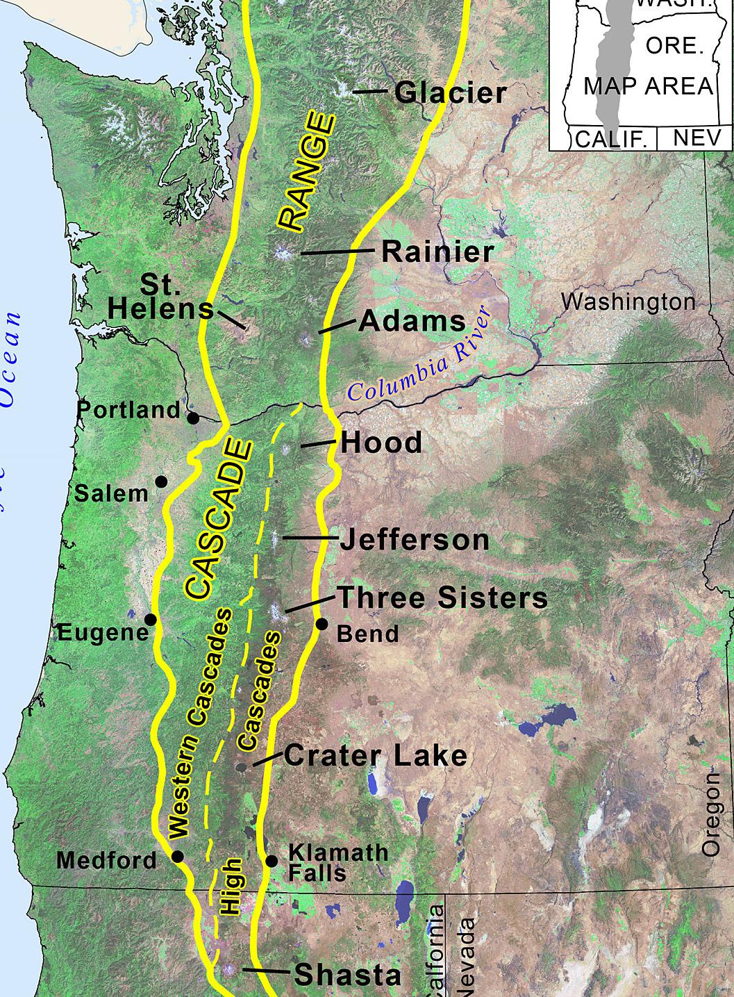
wilderness.html). Geology indicates an explosive eruption at the end of the last ice age ejecting more than five times as much tephra as the May 18, 1980 Mount St. Helens eruption. Lucky are those who are ready to go on the Mazama outing’s 83 mile route around Glacier Peak from August 17–23.
Mt. Rainier’s Wonderland Trail is a truly wonderful and quintessential “Around the Mountain” experience. Permits are required but early February application for the lottery by each person in your party dramatically increases your chances of being able to book a group time of your
choice. This 93+ mile trail with over 20,000 feet elevation is an endless delight of mountain views, creek crossings, glacier sightings, meadows, and critters. We were fortunate to have a family member meet us twice (where the trail passed through Mowich1 and White River campgrounds) to provide home cooked food, beverages and resupplies for the next three days. Again, advanced research helps ensure that you are planning appropriate mileage every day.
Above: Cascade Peaks Map from the Oregon Encyclopedia, Oregon Historical Society.
1 Washington SR165 to Carbon River and Fairfax Bridge is currently closed, with no access to Carbon River or Mowich Lake.
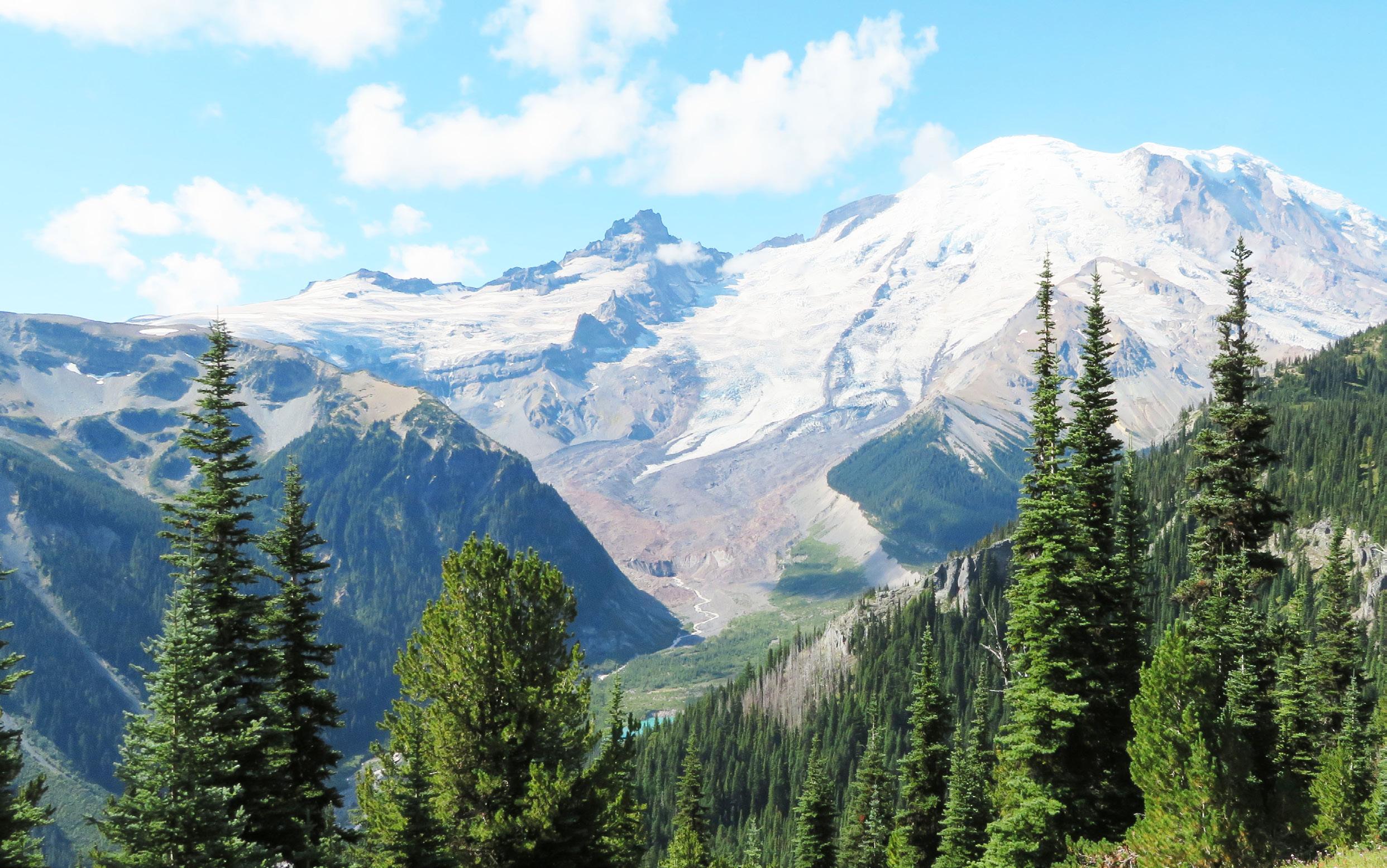
The Loowit Trail provides first hand experiences with recent volcanic activity and the phenomenal regrowth. In Ali’s article Around and Around and Around, she describes the 30+ mile (6,500 feet) hike as challenging and “incredible, offering upclose views of the otherworldly landscape.”
Mt. Adams is one of the greater “Trail and Bushwhack” opportunities noted to be over 30 miles and crossing through the Yakama Nation which may require permits. Views of peaks and ranges are plentiful all the way around the peak, as are views and experiences of recent fire events. There is no specific trail defined all the way around, so research is necessary every year.
Mt. Hood’s Timberline Trail (42 miles, 10,000 feet elevation gain) is a staple for adventurers of all ages (Girls Scouts to oldsters included) and is another great hike to share with non-hiking families who are inclined to resupply you at any of the several back road crossings. Again,
Ali’s 2023 article provides a wonderfully descriptive account.
Mt. Jefferson circumnavigation is another “Trail and Bushwhack” adventure. There are a variety of routes on the west side from north to south (or vice versa) all requiring permits during the June–October high season, but the east side crosses the Warm Springs Reservation which also requires permits for camping and through hikers. There is also a more rugged but shorter 30 mile high route that includes a lot of trail finding.
The Three Sisters Wilderness provides endless possibilities including a “30 miles in 30 hours” Elk Lake to McKenzie Pass Pacific Crest Trail (PCT) hike, and the Three Sisters Marathon (Pole Creek Loop or Pole Creek to Devil’s Lake or Obsidian Trailhead to Devil’s Lake). These routes provide more opportunities to involve friends and family in a car shuttle and celebration of success. Again, Ali’s Around and Around and Around has a wonderful
account of the 57-mile circumnavigation of the Three Sisters PLUS Broken Top Diamond Peak
Diamond Peak has several Around the Mountain options (20–30 miles) all of which include side trails to lakes or to the summit, and all of which include time on the PCT. Permits are required during the June–October high season. It’s truly magical to be atop Diamond Peak surrounded by migrating Monarch Butterflies in late summer.
Crater Lake is best known for the road around the rim, but there is a sweet 23 mile hiking trail, the Lightning Trail/PCT Loop, on the west side (permits required, no dogs). And, if you’re so inclined, it is a challenging yet spectacular 33 mile bike ride with the potential reward of sunset on the lodge deck at the end of the day (ride clockwise to maximize views and pull offs). And, if you can start early (5:30 a.m.) on
continued on next page Above: Mt. Rainier and Emmons Glacier from Sunrise on the northeast side of the mountain.
Photo: Patti Beardsley
continued from previous page.
Crater Lake Marathon day, you can ride most of the way around while the road is closed to cars—as long as you stay way ahead of the runners.
Mt. Shasta, although not technically in the Pacific Northwest, draws hikers and climbers from around the globe because of its dozens of trails and ascent routes. However, this is truly a “Trail and Bushwack” adventure and an opportunity for future development of a true “Around the Mountain Trail” for those who are inclined to tie the existing trails together.
In addition to these explorations around our favorite peaks, there are unlimited other adventures in the West from the North Cascades to the Olympics to areas south of Mt. Shasta. What are your favorite loop trips? And, what are your best reference sites? Please build on this knowledge base by sending your stories to stories@mazamas.org and we’ll include them in future Mazama Bulletins
In the meantime, here are some resources to plan your adventures:
■ Pacific Crest Trail Association, where are permits required:
□ www.pcta.org/discover-the-trail/ permits/local-permits/
■ The Circumnavigation Project
□ www.mountbakerexperience.com/ stories/360-degrees,874?
■ Circumnavigation of Mt. Baker
□ www.mountbakerexperience.com/ stories/the-miracle-route-an-offtrail-circumnavigation-of-mtbaker,750
■ Glacier Peak Trails
□ www.nps.gov/glac/planyourvisit/ upload/Wilderness-CampgroundMap-2024_accessible.pdf
■ Mt. Adams
□ www.reddit.com/r/Ultralight/ comments/pjbptf/highline_loop_ mt_adams_washington_94_52021/
■ Mt. Jefferson east side accessibility
□ www.peakvisor.com/park/warmsprings-indian-reservation.html
■ Mt. Jefferson High Route
□ www.cascadeclimbers.com/forum/ topic/107551-mt-jefferson-highloop/
□ www.medium.com/@jrit/mtjefferson-high-loop-9c441b1ec586
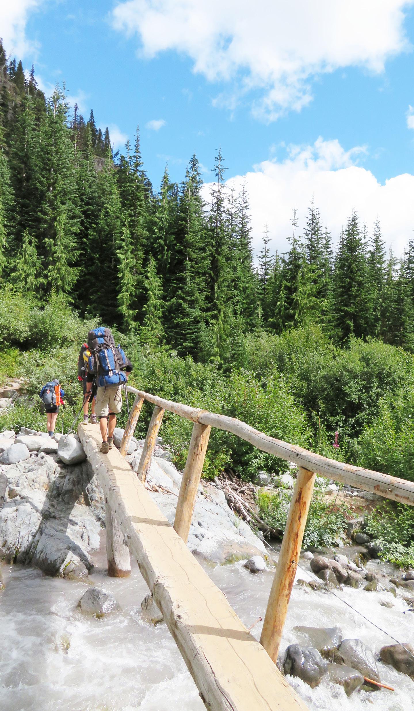
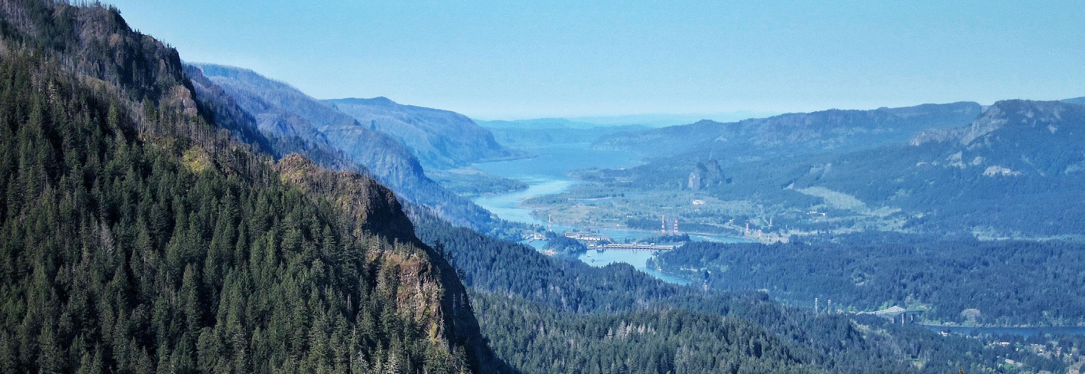
by Kathy Dragich
In September of 2017, the Eagle Creek fire caused the closure of many hiking trails on the Oregon side of the Columbia River Gorge. Since then, volunteer trail organizations and the Forest Service have worked steadily to restore and rebuild many of these fire-damaged trails. The vast majority of trails in the Gorge reopened in 2018, a year after the fire. Eagle Creek, where the fire originated, reopened in 2021. Other badly damaged trails, such as Oneonta Trail, Franklin Ridge, Nesmith, and Wyeth reopened later in 2021 and in subsequent years. By the end of 2024, nearly all of the trails and public land within the Eagle Creek Fire burn scar had officially reopened.
The following is a list of remaining closed trails and areas:
■ Ruckel Creek #405
■ Tanner Butte Trail #401
■ Tanner Butte #401C
■ Tanner Springs #401E
■ Dublin Lake #401B
■ Tanner Creek Cutoff #448
■ Tanner Creek Trail #431
■ Eagle Tanner #433
■ Moffett Creek #430
■ Oneonta Gorge (Note: This is the route where people hiked within Oneonta Creek itself, leaving from the Historic Columbia River Highway and ending at Oneonta Falls).
Please note a couple of caveats about the open trails and areas within the Eagle Creek burn scar. Some official trails, like Eagle-Benson #434 and Benson Way #405B, are open. However, these trails have significant burn within them and have received no trail restoration efforts. If you choose to hike these trails, expect some or all of the trail tread to be lost in downed trees and vegetation. The same caveat holds true if you endeavor to hike previously known unofficial or “user” trail routes such as Ruckel Ridge, Rock of Ages, etc. These routes are likely to be enveloped in heavy brush and downed trees and will be unlike the route you may remember hiking in the past.
The following is a non-exhaustive list of the trails that are open and the year that each trail fully reopened:
Reopened 2018:
■ Mt. Defiance Trail #413, Starvation Ridge Trail #414 and surrounding network (Bear Lake #413C, North Lake #423, Rainy Lake #423A, Warren Lake 417A),
■ Rainy Wahtum Trail #409 and surrounding network (Wahtum Express #406H, Anthill #406B),
■ Mitchell Point, Wygant Trail
■ Pacific Crest Trail #2000 and trails on the Benson Plateau (Benson Ruckel #405A, Benson Way #405B, Benson Spur #405C)
■ Nick Eaton #447, Herman Creek #406, Gorton Creek #408 and connecting trails (Herman Bridge #406E, Green Point Ridge #418, Herman Creek Cutoff #410, Mud Lake #406A, Plateau Cutoff #412, Ridge Cutoff #437)
■ Angel’s Rest #415, Devil’s Rest #420C, Return Trail #442, Wahkeena #420, Vista Point #419, Larch Mountain #441 and surrounding trails from Sherrard Point (Multnomah Spur #446, Multnomah Creek Way #444)
Reopened 2019:
■ Wahclella Falls
Reopened 2021:
■ Eagle Creek #440, Oneonta Trail #424, Franklin Ridge #427, entire Gorge #400 trail, Wauna Viewpoint trail
Re-opened 2022:
■ Nesmith #428, Wyeth #411
Reopened 2024:
■ Bell Creek #459, Horsetail Creek #425, Eagle-Benson #424 (no restoration, completely “lost” trail).
Above: Bonneville from the Columbia River Gorge.

by Matt Reeder
Igrew up in the shadow of Mt. Jefferson, in Salem. We moved from Illinois to Oregon when I was seven years old, and before long my stepdad and I were exploring the Majestic Mt. Jefferson region on a regular basis. When I moved back to Oregon in 2005, I set about exploring this area again. This culminated in spending the spring, summer and fall of 2014 and 2015 researching and writing my guidebook 101 Hikes in the Majestic Mount Jefferson Region.
Writing this book was a dream of a lifetime, and I still regard it as the best of my four guidebooks. Unfortunately, the area covered in this book—from the Bull of the Woods Wilderness to the Old Cascades and from Olallie Lake to the eastern side of the Mt. Jefferson Wilderness—has burned repeatedly since the publication of my book. The Opal Creek area burned particularly hot, and the whole canyon is now completely unrecognizable. With so much damage and so much of this area
scarred by fire, my plans to publish a second edition of 101 Hikes are on hold indefinitely.
That being said, there are still many places in this beautiful area that have escaped the ravages of the past decade! Here are five of my favorite places where you can still hike in forest that is mostly unburned, and all five are emblematic of how this entire area looked during my childhood, when I fell in love with the Majestic Mt. Jefferson region. The following hikes I have done in the past two years as I return to this area to explore once again.

Hike stats: 3.2 miles out and back with 300 feet of elevation gain. This hike can be extended into a much longer day as desired, but eventually you will hit fire damage as you hike deep into the Bull of the Woods Wilderness.
Hike notes: When I first moved to Portland some twenty years ago, Bagby
Hot Springs was among the most popular destinations in the state of Oregon. The place had taken on a mythical status, as many hot springs do. Visiting the springs was not without hazard; rumors of car break-ins abounded, and many folks got lost trying to find the place as Google Maps directed them on a long series of forest roads far above the peaceful valley where the springs are located. Over the years, Bagby lost its reputation; the hot springs became notorious for bad behavior, and then a concessionaire took over management of the springs, further adding to the confusion surrounding the place. The fires in 2020 closed much of the Clackamas River canyon and burned over the upper reaches of the Bagby Trail, further driving people away from the area.
The Bagby canyon never burned, however. It still looks as beautiful as it ever has, with massive Douglas-firs and Western
Red-cedars towering over the trail. With nearby Opal Creek burning to the ground and the valleys of Elk Lake Creek, Dickey Creek, and Pansy Basin scarred by fire, the valley that holds the hot springs remains the only valley that has mostly avoided fire damage. Better yet, a concessionaire is now operating the hot springs, and there is someone watching the trailhead at all times throughout the summer, so the break-ins that plagued this trailhead in the past are no longer an issue. The much-loved bathhouse was condemned, and other accommodations are in the process of being built. It is a fascinating place. If you’re planning on a soak, you’ll need to stop at the Ripplebrook store or at the trailhead itself and pay $5 per person. If you aren’t planning on a soak, you won’t need to pay anything. Beyond the hot springs, the trail enters the Bull of the Woods Wilderness and becomes narrower, a true wilderness trail. Trail crews cleared the trail in 2024 and as of this writing, most of the trail is in the best shape it’s been in a long time. Hiking though the ancient forest is soothing and deeply peaceful—may it remain so for all times.
Hike stats: 5.6 miles out and back with 1,800 feet of elevation gain. This hike can be extended in every direction, as there are trails spreading out in every direction from the trailhead.
Hike notes: The trail up to the summit of Battle Ax is one of the most beautiful hikes in the Central Oregon Cascades. Here the Cascades spread out from Mt. Rainier to Diamond Peak, while wildflowers carpet the slopes profusely throughout the summer, especially in July. Elk Lake shimmers below you, with Mt. Jefferson close behind on the horizon. The summit of Battle Ax was an island in the 2020 and 2021 fires, and the forests below mostly survived intact. Exploration further from Battle Ax will lead you to some of the few pockets of ancient forest that survived in this area. While everything around here burned, this area is still achingly beautiful. The only downside is the awful road to the trailhead. Any car as sturdy as a Subaru Outback can handle the drive to
Elk Lake, but it isn’t pleasant. Once you are there though, you won’t want to leave. Follow the old mining road to the Bagby Trailhead (the southern terminus of the Bagby Trail above) and continue up the old road, now a trail, to Beachie Saddle at 1 mile. The loop begins here. The trail to the summit of Battle Ax gains 1,200 feet in 1.6 miles but is mostly well-graded. The views from the summit, an old lookout site, are every bit as spectacular as advertised. To complete the loop, follow the narrow trail north from the summit through dense woods until the trail intersects the Bagby Trail. From here, you’ll turn right to hike back to the trailhead you passed earlier. Along the way you pass great views to the summit of Battle Ax, hike through a

dense swamp where brush crowds the trail, and finally, an excellent view down to Elk Lake and out to Mt. Jefferson.
continued on next page
Jefferson, continued from previous page.

Hike notes: These two peaks just south of Detroit Lake both offer incredible displays of July wildflowers and fantastic views of Mt. Jefferson and all up and down the Cascades. Each makes for a satisfying destination on its own but combined, it is truly the best of all worlds. There are two other trailheads for Bachelor Mountain that also offer longer, spectacular hikes, but then you would not have the pleasure of also hiking Coffin Mountain. Both hikes missed the 2020 fires as they were just south of the burn –you’ll see lots of damage to the north, but none to the south.
For Coffin Mountain, you’ll hike up a steep trail into the huge meadows below the mountain’s summit. In some years, the display of beargrass in these meadows is
truly breathtaking, and among the most impressive in the entire Oregon Cascades. The trail reaches the summit at 1.5 miles, where you will see a lookout that is staffed in the summer. The staffer may come out to say hello but otherwise do not bother them while they work. A better job would be hard to imagine.
For Bachelor Mountain, you’ll drive another 0.7 mile up the road and turn left on the narrow road that leads to the Bachelor Mountain Trailhead. The trail climbs first through the woods and then through huge meadows with views of Mt. Jefferson, less than ten miles to the east. The flower display here is tremendous, with dozens of species of flowers growing together in great profusion – more than I could ever list here. A side trail leads steeply uphill to the summit, where the view is just as good as it is at Coffin Mountain.
Hike stats: 6.2 miles out and back with 1,200 feet of elevation gain
Hike notes: Marion Lake is the largest, deepest, and arguably the most spectacular lake in the Mt. Jefferson Wilderness. The lake has a long and storied history. Once the site of summer cabins and boats kept in the lake year-round, the lake is now a crossroads in the wilderness and an immensely popular destination. You’ll need a permit to hike here, for day use or overnight, until the middle of October. But Marion Lake is always worth it! In addition to the lake, there is also a spectacular waterfall, verdant and mossy forest, and excellent views of Mt. Jefferson if you know where to look.
From the trailhead, the Marion Lake Trail passes through deep forest and begins climbing, reaching scenic Lake Ann at 1.4 miles. Continue past the lake and reach a fork at 1.8 miles. Left leads you directly to the lake but I prefer to take the scenic route, so turn right. In just 0.2 mile, look for an unsigned but obvious path on the right.
If you wish to visit Marion Falls (whose lower tier is sometimes called Gatch Falls), turn right here and follow this unmaintained and unofficial trail to Marion Creek, then turn right and descend to Marion Falls. The lower tier is much more exposed but still relatively easy to access if you don’t mind some exposure. Back on the trail, follow it to a bridge over Marion Creek. To continue the loop, turn left. But if you’re looking for a view of Mt. Jefferson, turn right and cross the bridge. Continue another 0.2 mile across a talus slope until you see a trail heading back towards the lake. This takes you to a campsite. For a view of the mountain, scramble down the slope to lake level, where the mountain absolutely towers over the lake. This is a nice lunch spot, away from most of the crowds you’ll

encounter here. From here, return to the loop trail and hike it around the lake. When you reach a four-way junction at the northwest shore of Marion Lake, turn left to hike 2.2 miles back to the trailhead.

Hike stats: 7.9 mile semi-loop, 1,600 feet of elevation gain
Hike notes: Canyon Creek Meadows is one of the most spectacular spots in the Mt. Jefferson Wilderness. The lower reaches of this hike were scorched in the massive B+B Fire in 2003, but all these years later, the forest is coming back, and the burn damage
Sahale Arm provide excellent vantage points, though access requires hiking.
Mt. Hood area locations like Timberline Lodge and the ski areas offer good viewing, though slightly more light pollution from the Portland metro area may be visible. Snow Park parking lots also offer excellent locations for stargazing and meteor shower viewing.
Portland Metro area adjacent locations like Stub Stewart and Rooster Rock State Parks offer decent views under less than ideal conditions due to the significant light pollution from the city. For optimal viewing, arrive at your chosen location well before midnight. The best viewing should occur between midnight and 5 a.m, when Perseus is highest in the sky and the moon is lowest.
Be sure to check both the moon rise and weather forecast. As mentioned earlier, the full moon on August 9 will slightly diminish the best views. And as we all know, weather in the Pacific Northwest mountains can be
is less noticeable with each passing year. The area around Canyon Creek Meadows at the foot of Three-Fingered Jack never burned and the meadows and views here are among the most spectacular in the Oregon Cascades. As with Marion Lake, this place is extremely popular, and you’ll need a permit for both day hiking and for backpacking.
The hike begins at Jack Lake, once the site of a primitive campground. If you’re camping, look for sites away from the lake. Follow the trail for 0.4 mile to a fork in the trail. Turn left here. You’ll hike uphill through recovering forest until the trail drops into the valley holding Canyon Creek Meadows, where you’ll leave the burn behind for the time being. At a junction at 2.2 miles, turn left on the unofficial but heavily used Glacier View Trail. This trail soon enters the meadows for which this area is famous, with ThreeFingered Jack towering over the trail. The
Glacier View Trail gets a little faint but continues up the side of a glacial moraine to viewpoint of a turquoise lake at the base of the mountain, at the terminus of Three-Fingered Jack’s now extinct glacier. The trail continues steeply uphill to a pass at 3.8 miles, elevation 6,500 feet. The view here is eye-popping! The Three Sisters and Broken Top dominate the skyline to the south, while Mt. Jefferson rises to the north. The upper slopes of Three-Fingered Jack tower over this pass. Mountain goats are frequently seen in this area. You’ll want to take your time and really savor this place –I’ve been many times, and it never gets old. It never could.
To continue your loop, return to Glacier View junction in the meadow and continue south. Mosquitoes can be a major nuisance here. Before long you’ll enter more fire damage from the B+B Fire, but as with the other part of the trail, this area is beginning to recover nicely. You’ll reach a junction with the Old Summit Trail at 6.3 miles. Turn right here to hike 1.6 miles back to the trailhead.
unpredictable; always check forecasts and prepare for temperature drops after sunset. Many mountain areas require permits or have seasonal restrictions, so research access requirements in advance. Popular locations may become crowded during peak nights, so consider exploring lesserknown high-elevation areas.
Remember that the Perseids continue for several weeks before and after the peak, offering multiple opportunities for viewing and photography. While peak nights produce the highest meteor rates, clear skies are more important than perfect timing—a clear night a few days off-peak often provides better viewing than an overcast or hazy peak night. For 2025, expect the first Perseids around midJuly (July 14–17), with activity gradually building through August until the peak on August 12–13, then quickly tapering off through late August and into early September.
The Perseid meteor shower represents one of nature's most accessible astronomical phenomena, requiring no special equipment beyond warm clothing
and patience. To locate the center, or radiant, of the Perseid meteor show, first locate the constellation of Perseus. To find it, use the Big Dipper by using the bottom left and top right stars in the pan and drawing a line through them continuing on roughly another four times the distance between the two stars, and this will take you straight to Perseus.
Whether you're watching with the naked eye from a mountain meadow or attempting to capture meteors through your camera lens, the Perseids offer a profound connection to the cosmos and a reminder of Earth's place in the vast universe.

by Brian Hague
As summer reaches full swing in June and July, ski season becomes a relatively distant memory for many Pacific Northwest adventurers. While folks move their ski quiver into storage and exchange snow gear for backpacking gear, a determined few make it their mission to ski all the way through summer and into the fall. The phenomenon? Turns All Year.
Turns All Year (TAY) is exactly what it sounds like: a description and rallying cry for folks who want to ski year-round. Adhering to TAY means to ski at least once every month of the year. Neurobiologist and Seattle native Charles Eldridge coined the term and created a website (turns-allyear.com) for folks dedicated to year-round skiing. It was perhaps inevitable that the phrase would be coined here. We are lucky to have many glaciers and permanent snow fields that make year-round skiing possible. While it’s easiest to do TAY in the Pacific Northwest, it’s a phenomenon that’s since spread to other areas such as Colorado and Canada. And skiing every month of the year likely puts you in an elite group of a few thousand folks who obsess over skiing.
Skiers need some dedication to commit to the challenge. Summer skiing means long approaches on foot, short ski runs, and a bit of research into where to go. Some challenges that come with TAY include the obvious: ski resorts melt out during the summer. This requires most TAY enthusiasts to hike to the snow, at which point backcountry skiers can at least skin up snowfields and glaciers. A less obvious challenge is climate change. As permanent snowfields shrink and disappear, skiers must climb higher and search farther for their craving. Utahns are already accepting the fact that TAY may no longer be possible in the Wasatch Range. Luckily, Oregonians and Washingtonians have plenty of places to get their turns in.
All that said, our snowfields and glaciers do melt out over the summer and
Left: Skiing down from Devil’s Kitchen on Mt. Hood.
Photo: Brian Hague.

fall. September and October will be some of the tougher months to find turns, forcing skiers to hike up further and be more careful as glaciers become dry.
Looking to keep making “wiggles” with your skis? Here are some locations where you can squeeze in your summer and fall turns.
■ Palmer Snowfield (Mt. Hood):
Formerly a glacier, this snowfield is probably the one most Mazamas are familiar with. Accessible from Timberline Lodge, you can access the snowfield either via an expensive summer lift ticket, or by hiking/ skinning up depending on time of year. Most famously, folks skin up the snowfield to Illumination Rock to celebrate the summer solstice every year. That said, this snowfield is receding quickly and will result in short runs during the fall months.
■ Muir Snowfield (Mt. Rainier): Starting from Paradise, WA, you can access the Muir Snowfield with a bit of hiking/ carrying. The snowfield usually lasts
well into the summer and fall, perfect for finding those elusive October turns.
■ Inter Glacier (Mt. Rainier): Starting from the Glacier Basin Trailhead, skiers can hike in their skis and ski Inter Glacier, which is part of the Emmons climbing route below Camp Schurman. Note that this glacier is crevassed (although minimally) and requires caution as the snow recedes during the summer.
■ South Side (Mt. Adams): Mt. Adams tends to hold snow well into the summer and fall along the south side route. While ski carries will almost certainly be required in August and September, it’s a popular summer route for ski mountaineers.
■ Others
□ Mt. Bachelor
□ Obstruction Point (Olympic National Park)
□ Coleman Deming Glacier (Mt. Baker)
□ Sulphide Glacier (Mt. Shuksan)
□ East Ridge (Eldorado Peak)

Other recommendations
■ If you have CalTopo Pro or Gaia, you can access recent satellite imagery in order to find snow. In CalTopo, access the “Live Satellites” map layers such as Sentinel Weekly. In Gaia, access the FreshSat map layers.
■ Socialize and post trip reports with folks on turns-all-year.com, as well as forums such as TAY - Turns All Year on Facebook.
Above left: Skiers hiking up to Camp Muir on Mt. Rainier.
Photo: Rachel O’Grady.
Above right: Illumination Saddle, with Illumination Rock in the background.
Photo: Sarah Gale.
Attending: Petra LeBaron Botts, Debbie Dwelle (President), Marty Hanson, Chris Jaworski, Chris Kruell (Secretary), Jessica Minifie, Matthew Sundling (Vice President), Claire Tenscher, Robin Wilcox; Staff: Rebekah Phillips (Executive Director), Lena Toney (Development Director); Absent: Liz Crowe (Treasurer).
■ The meeting was called to order at 6:03 p.m. by President Debbie Dwelle.
■ A quorum was present.
■ Approval of March 4, 2025 Meeting Minutes
□ Debbie moved to approve the March 4, 2025 meeting minutes; Robin seconded. The motion carried unanimously, with one abstention (Chris J).
■ The Executive Director briefly discussed the uncertain world that our members are experiencing and that the Mazamas provides activities that provide a respite from the world around us. The Mazama mission also actively helps build community that strengthens us all in a healthy manner.
■ The ED is working toward finalizing insurance applications for renewal effective April 15, 2025. A special board meeting will be held before then to approve the coverage and budget for renewal.
■ Social campaigns targeted seniors and climbers, generating strong engagement, while membership revenue is tracking ahead of last year but remains below target. A membership renewal campaign resulted in 705 calls so far to lapsed members, yielding 53 renewals to date and insights into non-renewal reasons. Additionally, 48 new members joined in March 2025.
■ The Mazama Lodge was open to members three weekends in March; four key events have been identified in partnership with the Lodge Committee. The director noted the upcoming past presidents’ luncheon on April 15 and one-on-one meetings to engage stakeholders and discuss the
organization’s challenges. The director also noted that a fundraising campaign is beginning soon.
■ A budget reforecast has been prepared, acknowledging a larger revenue shortfall compared to previous budget. An investment account drawdown of $240,000 will need to occur in two phases to fund operations for 2025, including the reforecasted deficit and insurance premium prepays for 2026. The drawdown is expected to take place in two tranches: $170,000 in April and $70,000 in June.
□ The board voted unanimously in favor of the drawdown, with Chris J. abstaining.
■ Lena Toney, Development Director, presented an overview of development and development activities. 2025 priorities include Foundational/Grant Giving, development systems setup, and tracking and reporting. Lena also noted that our existing software infrastructure does not allow for recurring gifts.
■ Revenue. Chris K. summarized the revenue team’s work, taking place in several stages, mentioning that the team was currently looking at peer/similar organizations to compare our revenue sources to see if there’s a benchmark to be achieved.
■ Programming. Petra briefly discussed the role of BCEP plus the need for a broader conversation regarding programmatic issues. There are people willing to help with board and staff support. A brief discussion about whether Programs should stay in the strategic plan resulted in consensus that it needs to stay.
■ Member/volunteer engagement. Rebekah presented on the team’s activities to address burnout. One need is that volunteer programs need a structure. Rebekah also noted that post-pandemic motivations are different and the Mazamas have not kept pace. The value of membership needs to be addressed and defined. A member survey will take place soon to learn more.
■ Facilities. Robin stated that the Strategic Plan document was up to date with the
team’s goals and tactics, with a focus on the Mazama Lodge for this year, deferring MMC- and website-focused activities until next year.
■ Board Development. Matt shared that this team recently reviewed the Governance Committee (GC) priorities, objectives, and tasks.
□ Governance Committee Function: Matt S.
□ Charter Review: Matt S.
□ Board Education: Petra L-B.
□ Board/Organizational Policy Review: Jessica M.
□ Continuity of Operations Plan (COOP): Robin W. & Greg Scott
□ Board Calendar: Robin W.
□ Board Handbook: Robin W.
□ Nominating Group: Greg Scott
□ The Governance Committee Charter will be sent to the Board for review and approval in April 2025.
■ Rebekah asked that board members weigh in on the strategic plan summary routed to the board so a document could be created and sent to the membership as part of our commitment to share strategic plan progress.
■ The meeting was adjourned at 7:59 p.m.
Attending: Petra LeBaron Botts, Liz Crowe (Treasurer), Debbie Dwelle (President), Marty Hanson, Chris Jaworski, Chris Kruell (Secretary), Jessica Minifie, Matthew Sundling (Vice President), Robin Wilcox; Staff: Rebekah Phillips (Executive Director); Absent: Claire Tenscher.
WELCOME & CALL TO ORDER
■ The meeting was called to order at 6:02 p.m. by President Debbie Dwelle.
■ A quorum was present.
MEETING AGENDA
■ Approval of Meeting Minutes
□ Meeting minutes for both the April 1, 2025 Board Meeting and the April 10, 2025 special Board Meeting were unanimously approved. Matt moved to approve both sets of minutes and Petra seconded the motion.
EXECUTIVE DIRECTOR’S UPDATE
■ Fundraising. The spring fundraising campaign exceeded its goal of $45,000
with donations totaling $48,500. The Intel corporate volunteer match brought in over $12,000. Mazama member Peter Green hosted a small fundraising event featuring mountaineering books from his private collection as well as Director of Special Collections & Media Mathew Brock presenting books from the Mazamas collection.
■ Strategic plan. The strategic plan was communicated to the Mazamas membership with positive reception, including positive feedback from the Murdock Foundation.
■ Lodge status. So far, three groups, with one pending, have booked the lodge for exclusive use in the summer. A wedding will also take place this fall. We have also fielded inquiries for 2026. The lodge has opened for member weekends ahead of schedule, and weekends are currently available through June. The Lodge Committee and Executive Director are collaborating on scheduling special member events for the remainder of 2025, including the upcoming Memorial Day Weekend.
■ Conservation Committee. The committee recommends awarding a total of $7,000 to six organizations.
■ Expeditions Committee. The committee recommends two awards of $9,000 and $4,000. Note that a total of $81,000 was requested.
■ Research Committee. The committee recommends two awards of $2,500 each.
■ Matt moved to approve the grants as recommended by the committees. Robin seconded the motion. The motion was approved unanimously.
■ Revenue. Chris K reported on the revenue team’s work, which has recently focused on comparing the Mazamas to peer organizations, including a conversation that Rebekah had with the ED of the Colorado Mountain Club.
■ Member/volunteer engagement. Chris K reported on the team’s work, including a focus on defining the value of membership, which will be supported by a membership survey scheduled to go out the week of May 5.
■ Board development. Petra and Greg Scott have proposed bringing in Kaleen Deatherage to further define the roles of the board and E.D.. Board policies are being organized into categories, such as board, organization, and committee, with the upcoming task of figuring out how to manage the policy review workload. The Board Handbook development is continuing. The nominating group is working to identify candidates for board recruitment.
■ Programs. Christin Richter, Lindsay Higa, and Melinda Hugo will start to meet with Rebekah to discuss learnings from recent BCEP classes and identify how to improve the program, such that ICS and AR are simultaneously enhanced.
■ How can we improve cross-team communications? A brief discussion led to the need to continuously update existing status documents, as well as the establishment of a Discord channel.
■ Liz suggests that we start discussing what will be presented at the annual meeting.
■ Cash reforecast was completed, which includes the April $170,000 investment account drawdown and the upcoming $70,000 drawdown, the timing of which is yet to be determined. The low point in cash flow will be in August at $70,000. The end of year cash balance is forecasted to be $190,000.
■ The current run rate has us running out of unrestricted net assets at the end of 2027. As we think about the upcoming 2026 budget process, the Board needs to decide what level of deficit we are willing to approve for the 2026 budget.
■ The Facilities Working Group recommends that two of the four identified paths forward for the Mazama Lodge be approved by the board for further exploration in 2025 and that two of the options be tabled. The options and votes are as follows:
□ Contracted support as needed + volunteer operation. This is how the lodge is operating now; the goal is to solidify our understanding of how this could work long-
term. Matt moved that the Board authorize a study to evaluate the feasibility of lodge management using a combination of volunteer involvement with contracted support and present the findings to the Board for review and further action.
■ Chris K seconded the motion. Unanimous approval.
□ Hybrid Management. This option would issue an RFQ to operate the lodge under the guidance of the Mazamas E.D.. Chris K moved that the board take no further action or study at this time regarding the hybrid management of the lodge.
■ Matt seconded the motion. Unanimous approval. Chris J abstained.
□ Lease to Private Operator/ Contracted Management. Petra moved that the Board authorize a study to evaluate the viability and potential benefits for contracting out the management of Mazama Lodge and present the results to the Board for review and further action.
■ Liz seconded the motion. Unanimous approval.
□ Sale of the lodge. Matt moved that the Board take no further action or conduct a study at this time regarding the sale of the lodge.
■ Chris K seconded. Unanimous approval.
■ Jessica moved to create a Facilities and Property committee of the Board. The committee charter, which includes composition of the committee, will be approved by the Board. The committee would provide strategic and operational oversight of Mazamas physical facilities.
□ Liz seconded the motion. Unanimous approval.
■ Chris K moved to approve the lodge budget as put forth by the E.D. on May 6, 2025. Robin seconded the motion.
□ Unanimous approval. Chris J abstained.
■ Meeting adjourned at 8:26 p.m.