Copyright © 2023 All Rights Reserved
Manchester School of Architecture

Manchester Metropolitan University University of Manchester
Supervisor: Eamonn
Author: Malhar
Canniffe
A. Ambekar
No part of this publication may be reproduced, stored in a retrieval system, or transmitted in any form or by any means, electronics, mechanical, photocopying, recording, or otherwise, without prior permission of the copyright owner.
1 2 3 4 5 6 7 8
MUMBAI ANALYSIS & MAPPING
STRATEGY CONCEPT & MASSING PRECEDENTS MASTERPLAN PROPOSAL
SPACE SYNTAX BIBLIOGRAPHY
Malhar A. Ambekar
CONTENTS
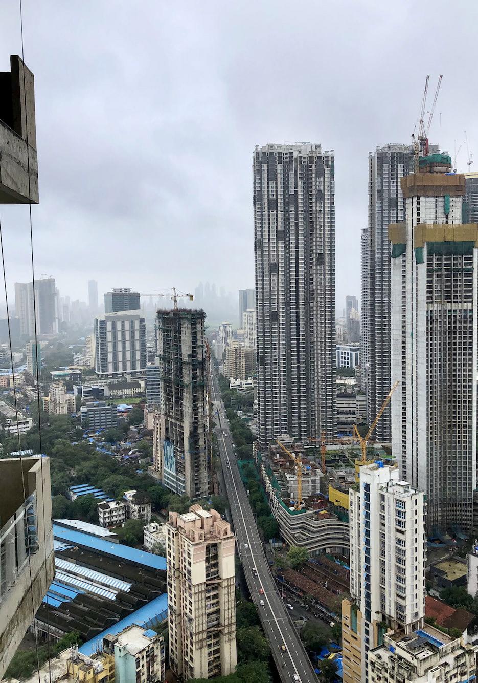
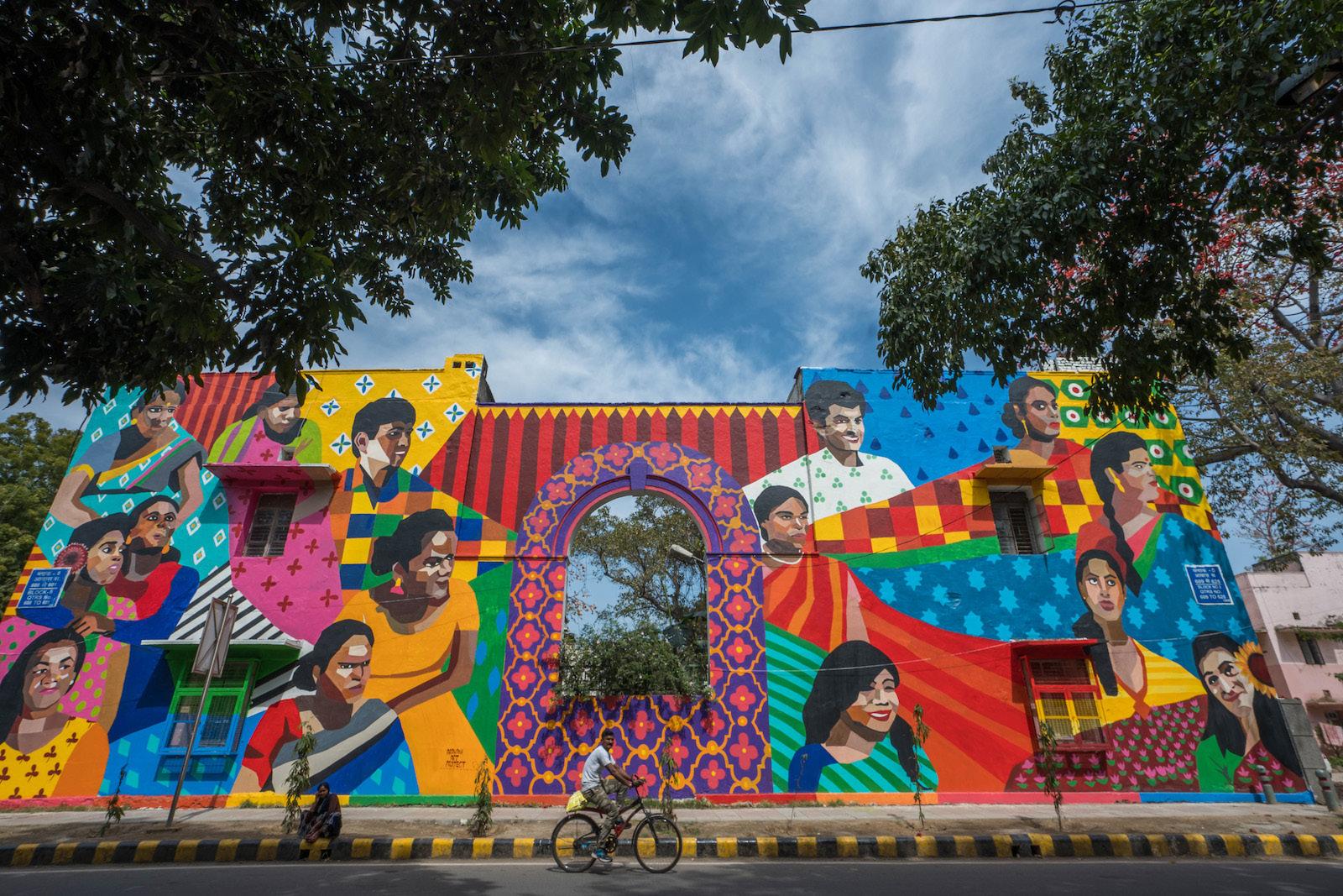
The economic capital of India, Mumbai has always been on the forefront of development and front runner of a urbanization. One of the important cities in the global south and Asian sub continent its role it shapping India’s worldwide presence has been undeniably significant. Particularly post the colonial period in India, Mumbai has advanced itslef in a rapid progression and has absorbed almost every new modes of urban regeneration and development thereby making itself an important economic player overall.
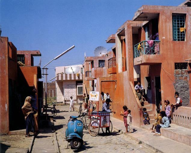
However, the constant deliberate attempts of rapid urbanization that have eventualized as a result of this strive for a global city, the repurcussions have been observed in the overcrowding and consequent informal settlements and less prioritization towards the existing communities and economies.
MUMBAI
MUMBAI
Malhar A. Ambekar
Photo of Senapati Bapat Marg, Mumbai by Sanket Shah @ Unsplash
2km. 10km
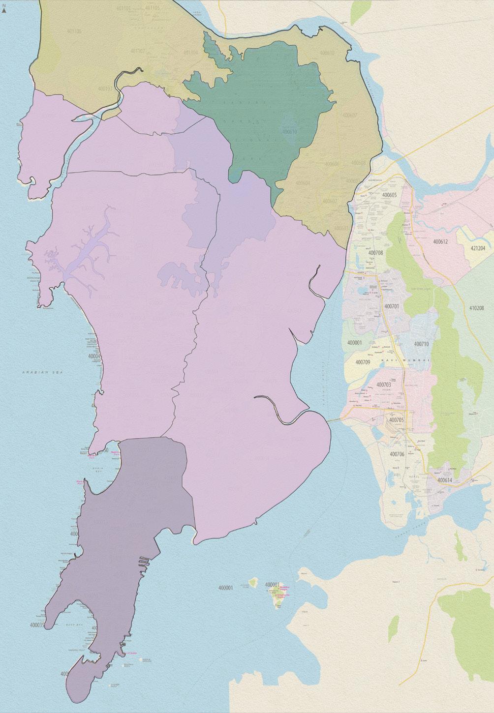
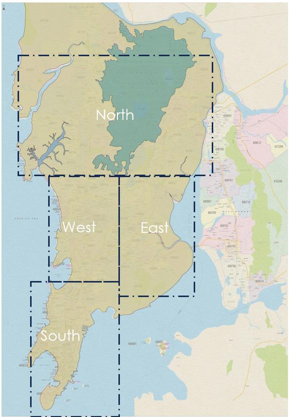
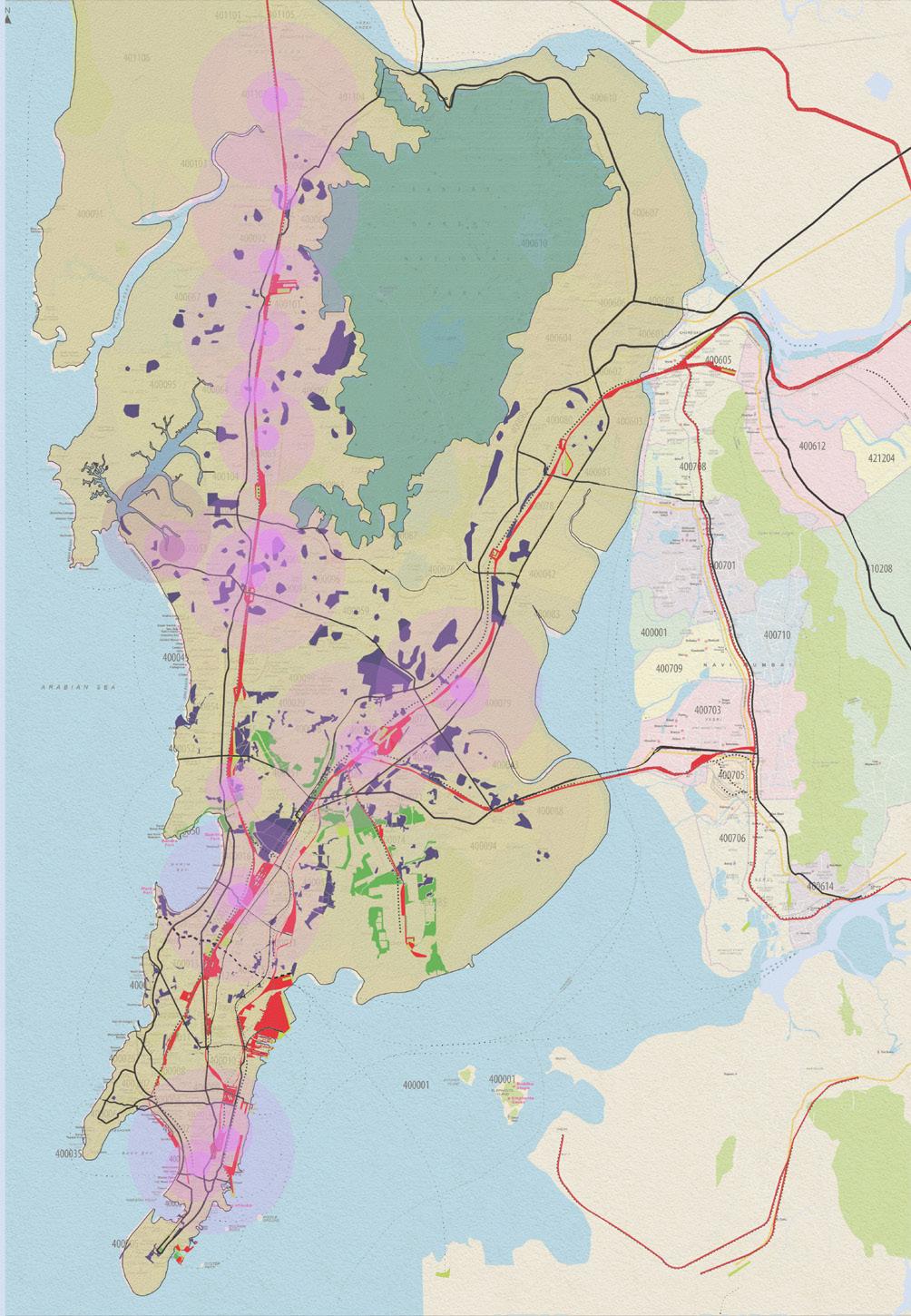
Maps showing the geographical urban subdivisions of Mumbai.
MUMBAI MUMBAI
Urban Development
Informal Settlement
Open Spaces
7520 - 14800
14900 - 25800
25900 - 41500
41600 - 59900
60000 - 92300
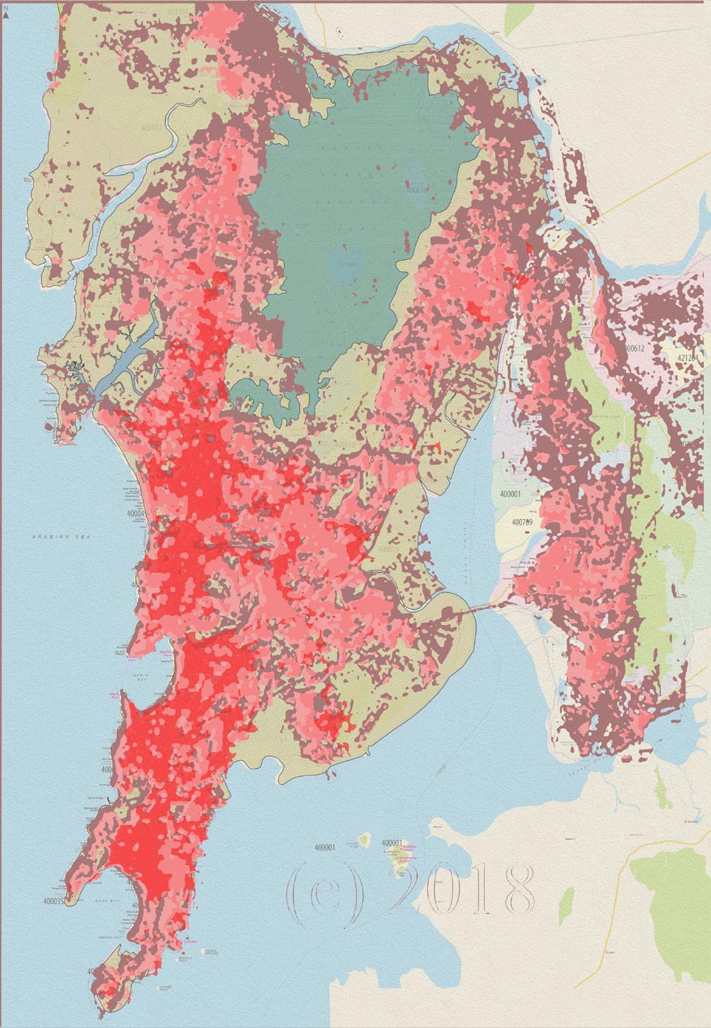
As an effect of the urban development and the consequent transport network, the urban sprawl along with the population density identifies itself as a supporting response to it. However, a close look informs the lack of urban development in the north western part of the city,
1970s
1990s
2010
2018
Railway Stations
Railway Infrastructure
Informal Settlement
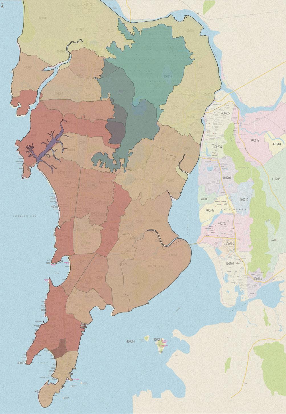
The process of urban development when mapped with a timeline suggests its spread from the island city in the south of Mumbai and finding its way with time towards the Western & Eastern suburbs. Consequently the transport network supplements to this spread of development.
 Malhar A. Ambekar
2km. 10km Population Density
Malhar A. Ambekar
Malhar A. Ambekar
2km. 10km Population Density
Settlements
Source: Maps from Nikhil Jain, Abhijeet Ekbote
2km. 10km Urban Development Railway
Source: Maps from Nikhil Jain, Abhijeet Ekbote
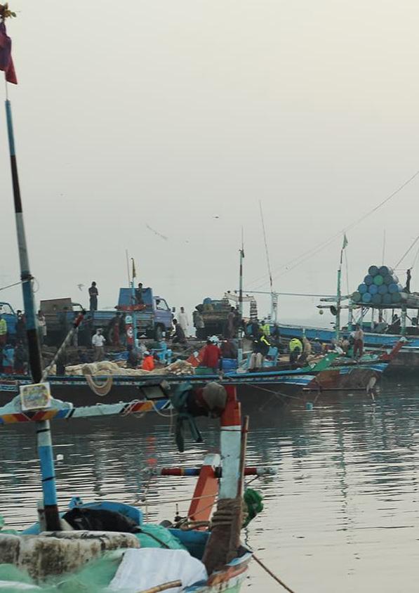
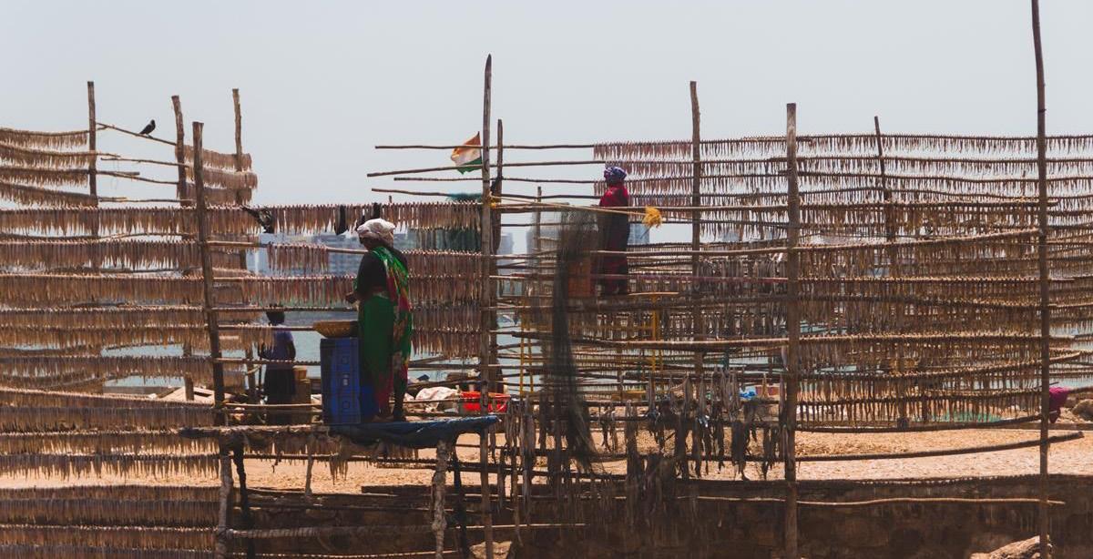
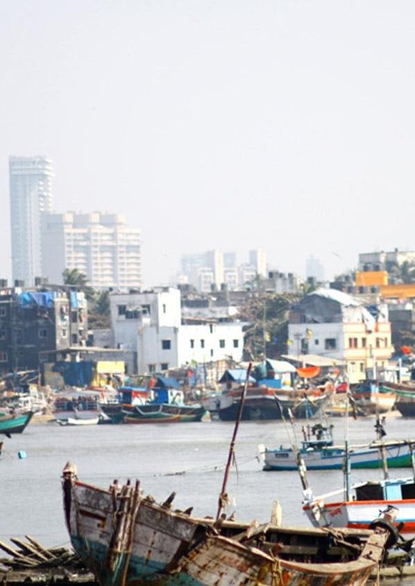
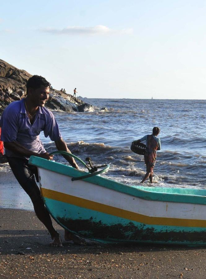
Being a coastal city was always an advantage for the city that it utlized to its fullest potential in not only being the ports of trade during the colonial times, but also in the fishing activity and the consequent economy as one of its earliest occupations.
Mumbai also houses one of the largest industries which is the Indian film industry that not only contributes largely towards the city’s and nation’s economy but is also responsible for a unique recognition worlwide

ANALYSIS & MAPPING ANALYSIS & MAPPING
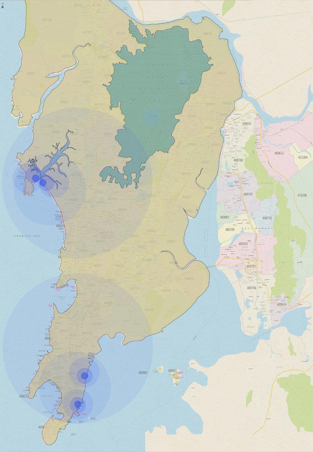
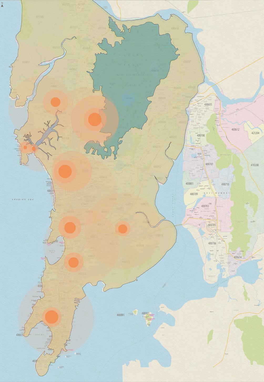
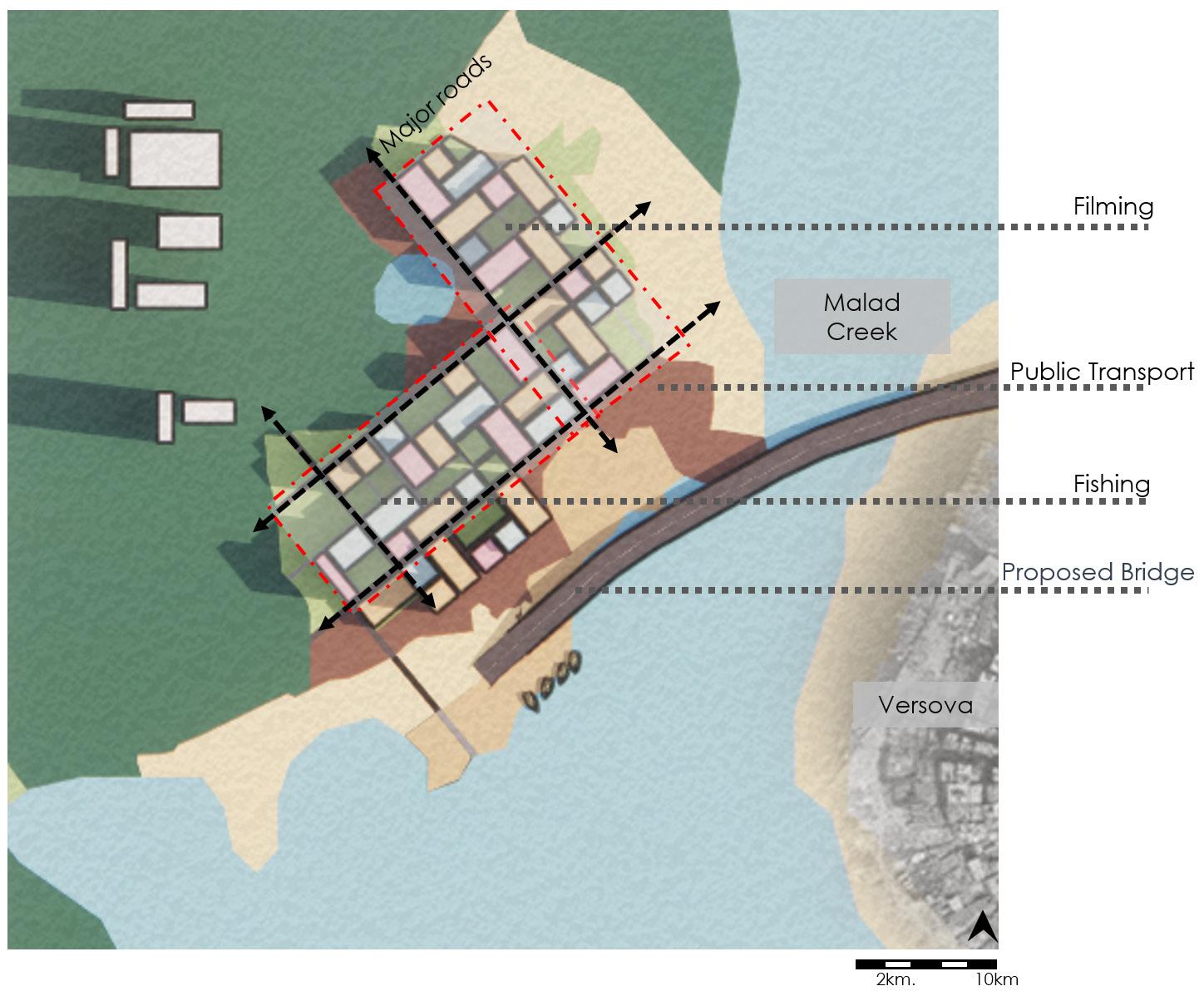
An attempt of mapping the several film shoot locations which not only consist of potential locations scouted and utlized for filmings, but also production offices and studios with allied services facilitating these actitivities, and the most accessed ports for local fishing supplies and economies show that both of these acitivities have their presence in the north western suburbs of Mumbai.
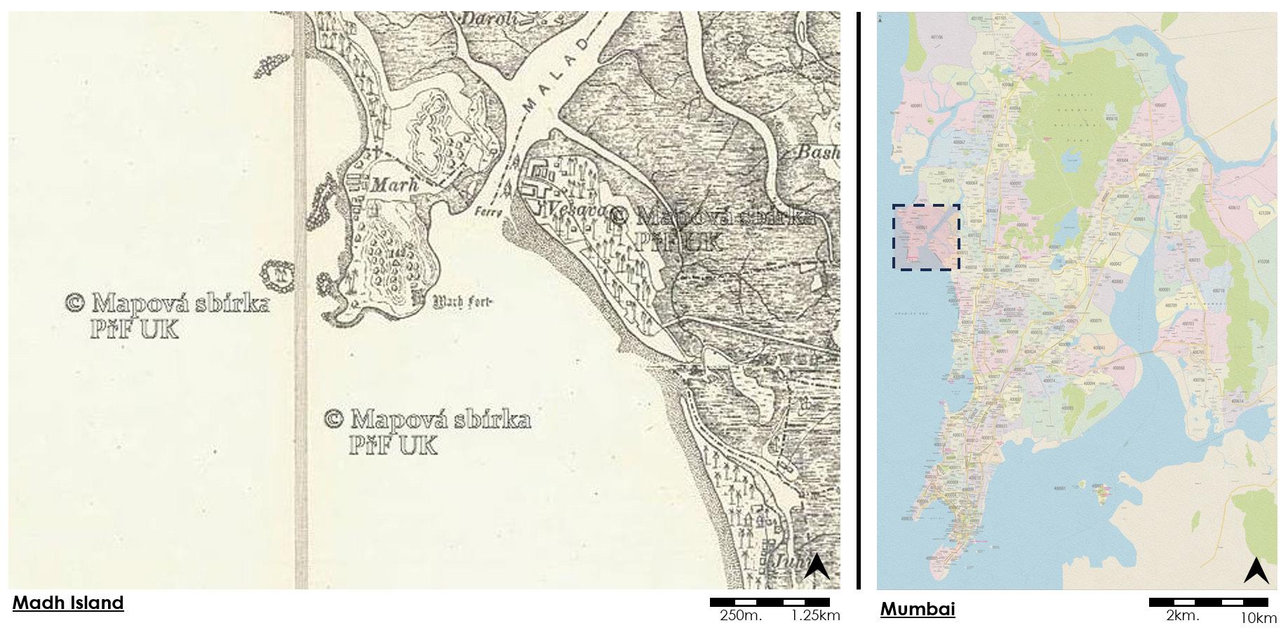
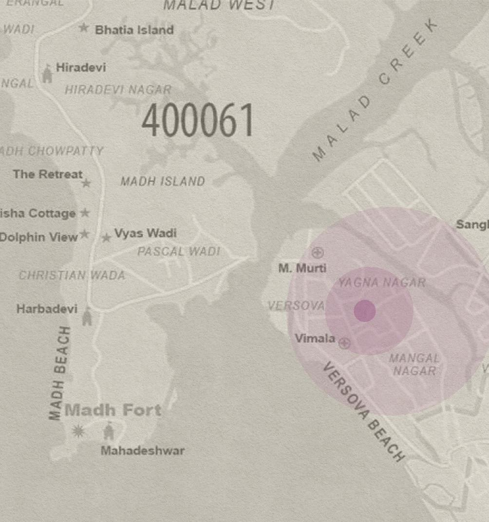
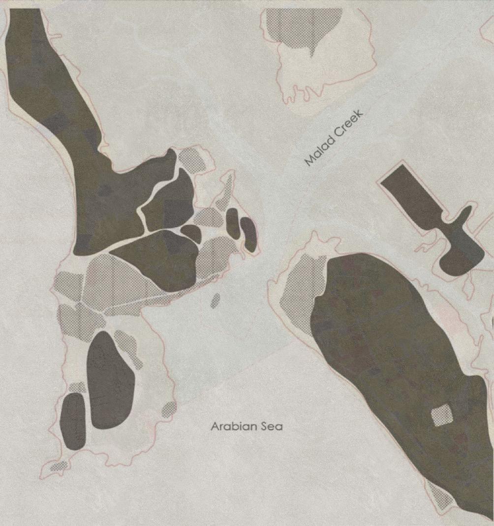
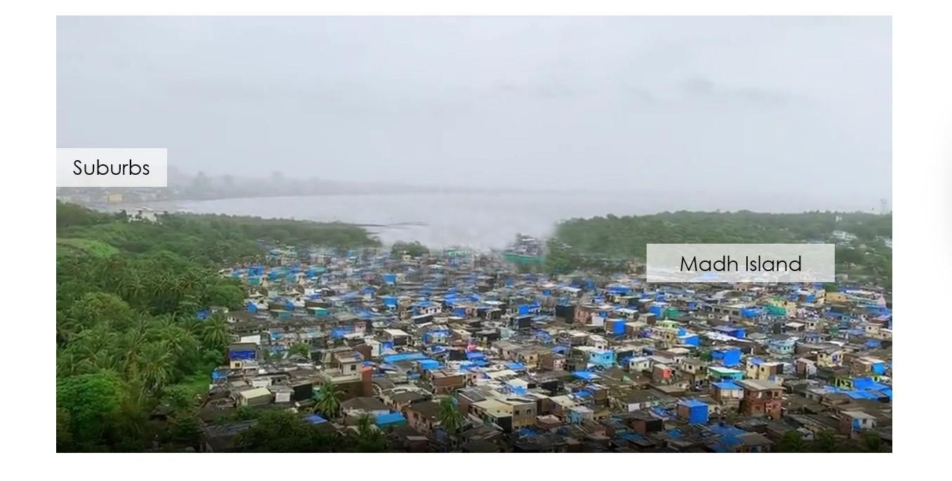
Madh Island is an area separated from the mainland Mumbai suburb by a creek. It is also known as a fishing village and a preferred location for film shoots for the Indian film industry.
Source: Bombay National Archives
Malhar A. Ambekar
Shoot Locations Fishing Film Shoot Locations Fishing 2km. 10km
Malhar A. Ambekar
Film
Source: Maps from Nikhil Jain, Abhijeet Ekbote, Film Companion
ANALYSIS & MAPPING ANALYSIS & MAPPING
A closer look into the area informs of the Versova & Madh Island circuit that is actively involved in fishing and also consist of potential locations for film shoots. A widely observed phenomenon in this category is the leasing of houses for filming. Nearest rail network for Madh Island is the Versova metro station. Versova connects with Madh by means of a ferry via the creek.
Source: Urban Design Research Institute (UDRI), Mumbai
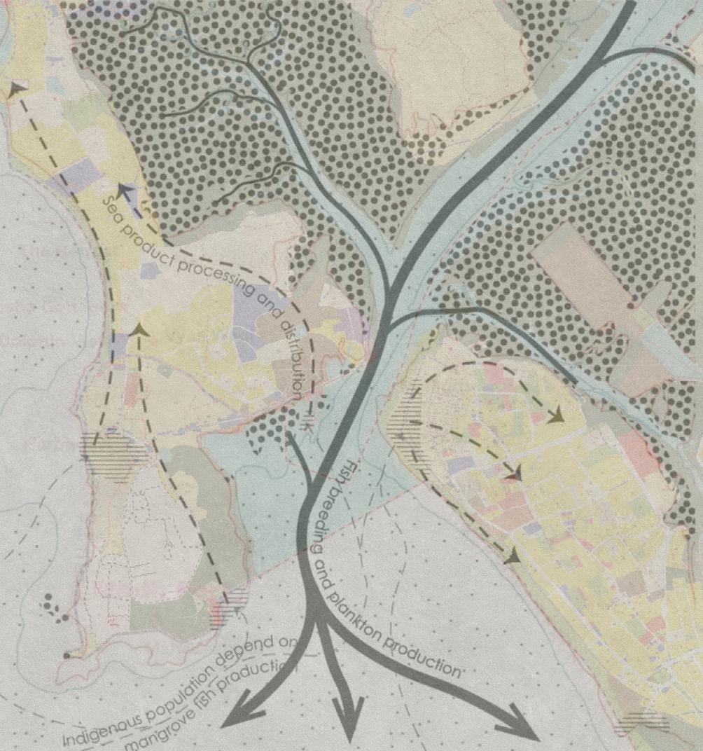
A subsequent attempt of mapping the urban sprawl in the area along with the network of the fishing acitivity with regards to its inward supplies to the city.
 Malhar A. Ambekar
Nearest Rail station
Film Shoot Locations
Nearest Rail station
Film Shoot Locations
Malhar A. Ambekar
Malhar A. Ambekar
Nearest Rail station
Film Shoot Locations
Nearest Rail station
Film Shoot Locations
Formal Settlement Informal Settlement Fishing Activity Settlement
ANALYSIS & MAPPING ANALYSIS & MAPPING
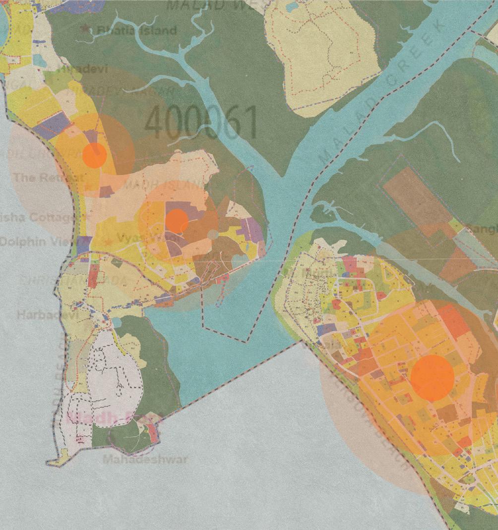
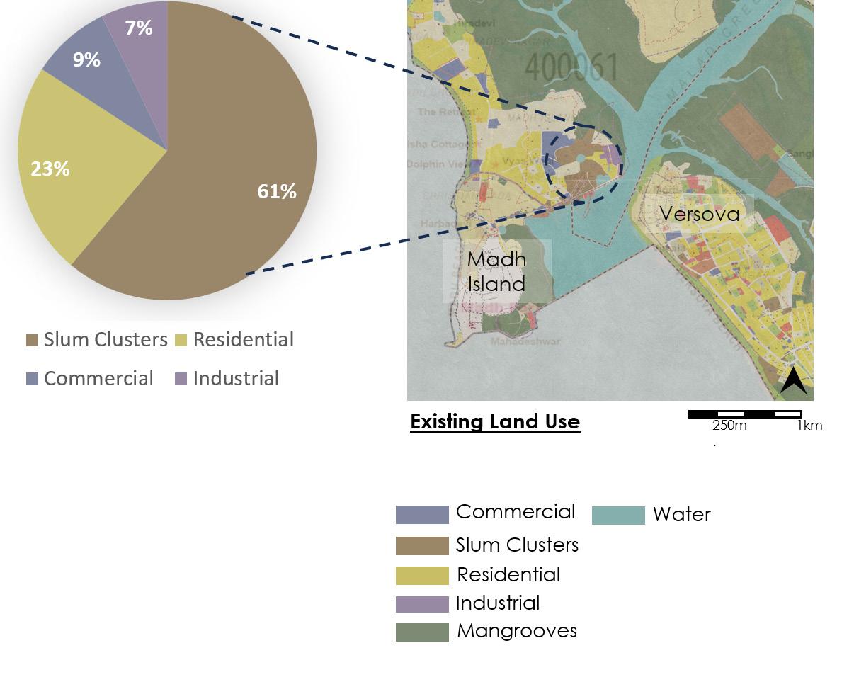
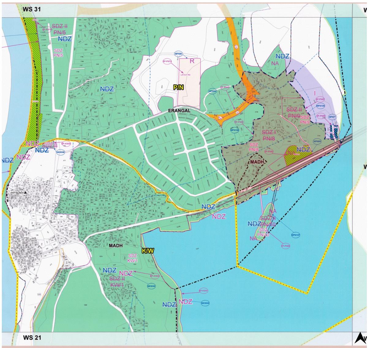
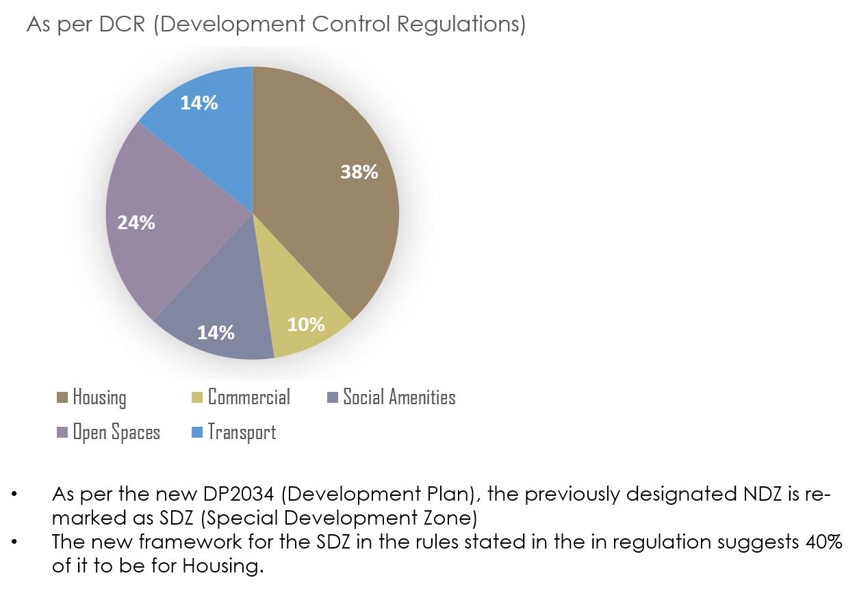
The municipal authoriy of Mumbai along with reagional and town planning department in its proposed development plan DP2034 has released certain portions of the land in the city for future development also with an attempt to accommodate the growing population in the city.
Source: UDRI, MCGM 2020
However, a closer look into the existing land use of the area suggests the slum clusters and also supplements to the the informal settlement previously observed.
Source: UDRI, MCGM 2020
 Malhar A. Ambekar
Malhar A. Ambekar
Malhar A. Ambekar
As a history of urbnization in Mumbai suggests. its repurcussions reflected upon the existing settlements have resulted in evacuation of the communities and informalized settlements.
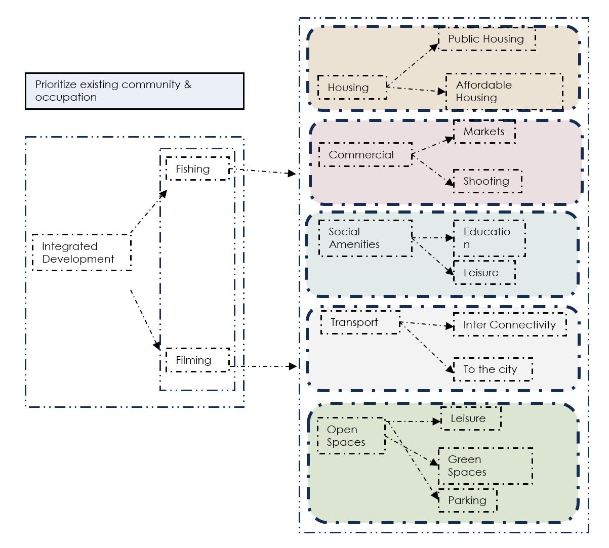
Although a proposed development is much welcomed by the communities of Madh Island and the migrating population, it is important for the urban regenration to be priortized with the exisiting communities and economies that would not only formalize the settlements but also provide a better lifestyle for them.
S T R A T E G Y
Malhar A. Ambekar
PRECEDENTS PRECEDENTS
The theoritical underpinnings and precedents for a design language and the practicality of the proposed urban formalized sprawl, particularly with the juxtaposition of the housing blocks, urban commons and the built and unbuilt responses priotized for a local community..
The theoritical underpinnings and precedents for a design language and the practicality of the proposed urban formalized sprawl, particularly with the juxtaposition of the housing blocks, urban commons and the built and unbuilt responses priotized for a local community.
 Malhar A. Ambekar
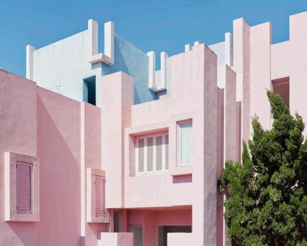
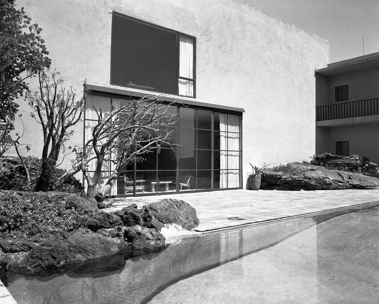
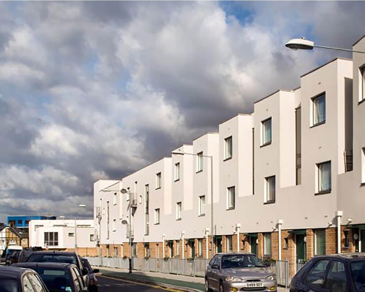
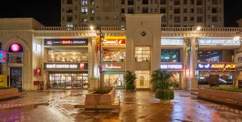
Tanner Street Gateway / Peter Barber Preito Lopez House/ Luis Baragan
La Muralla Roja/ Ricardo Bofill
Asian Games Villages/ Raj Rewal
Source: Barragan Foundation, Ricardo Bofill Projects, Raj Rewal Projects, Peter Barber Architects
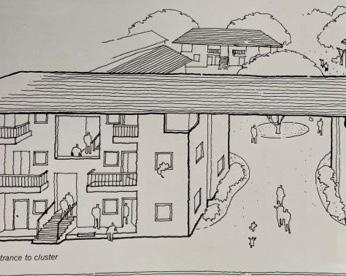
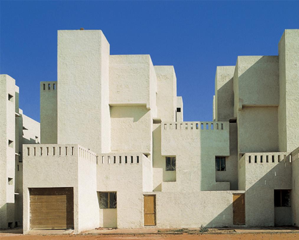
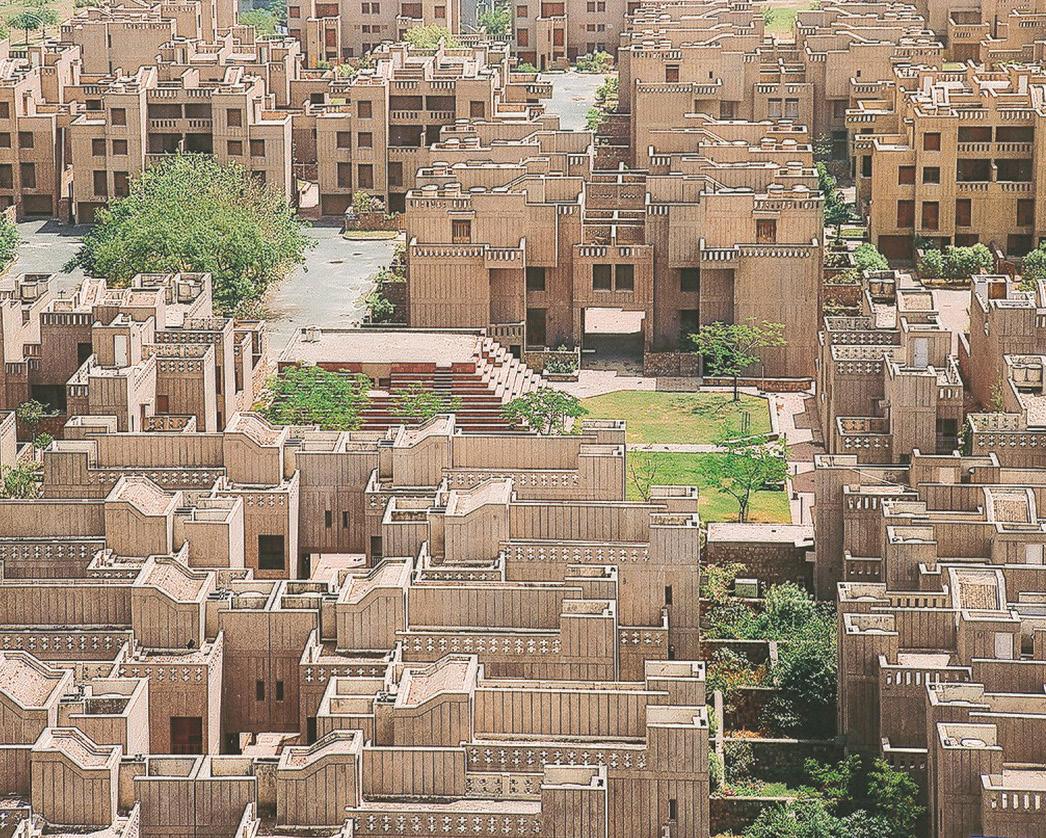
Aranya Community Housing/ BV Doshi
Sheikh Sarai Housing/ Raj Rewal
Titan Township/ Charles Correa
Low income housing/ Charles Correa
Source: B.V. Doshi Projects, Raj Rewal Projects, Housing & Urbanization: Charles Correa
Malhar A. Ambekar
Malhar A. Ambekar
Tanner Street Gateway / Peter Barber Preito Lopez House/ Luis Baragan
La Muralla Roja/ Ricardo Bofill
Asian Games Villages/ Raj Rewal
Source: Barragan Foundation, Ricardo Bofill Projects, Raj Rewal Projects, Peter Barber Architects
Aranya Community Housing/ BV Doshi
Sheikh Sarai Housing/ Raj Rewal
Titan Township/ Charles Correa
Low income housing/ Charles Correa
Source: B.V. Doshi Projects, Raj Rewal Projects, Housing & Urbanization: Charles Correa
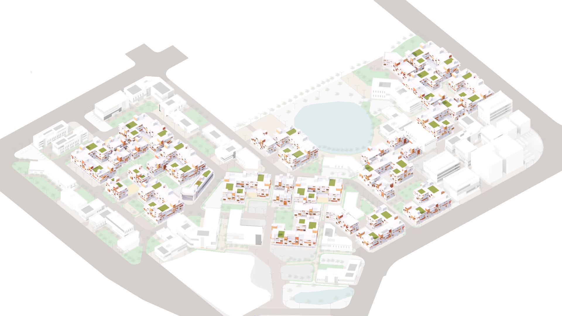
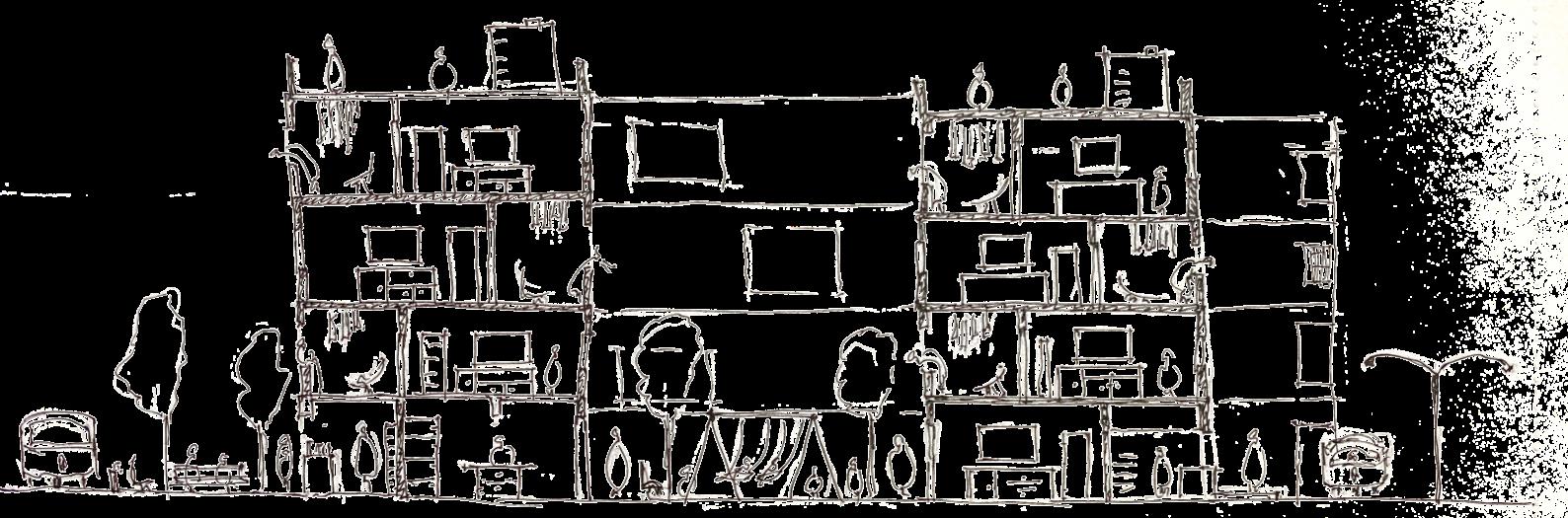
CONCEPT & MASSING CONCEPT & MASSING
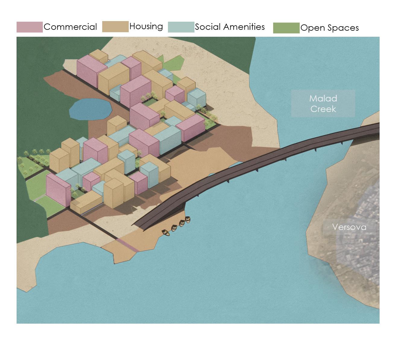
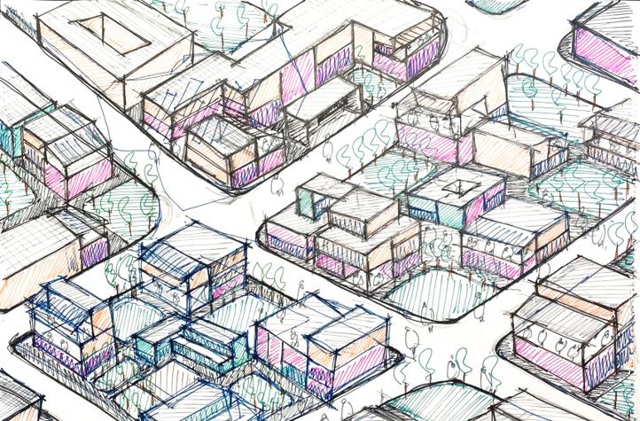
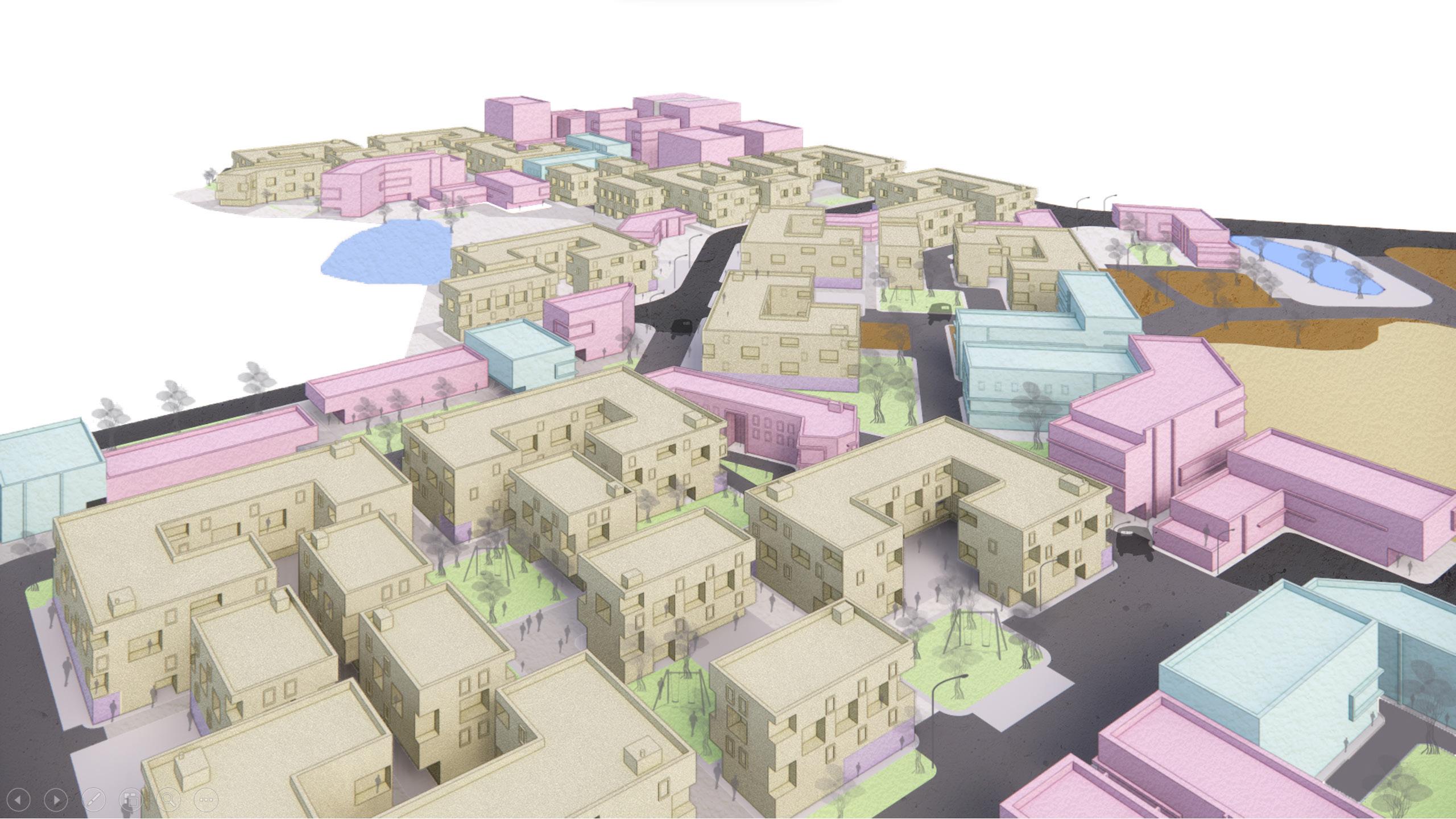
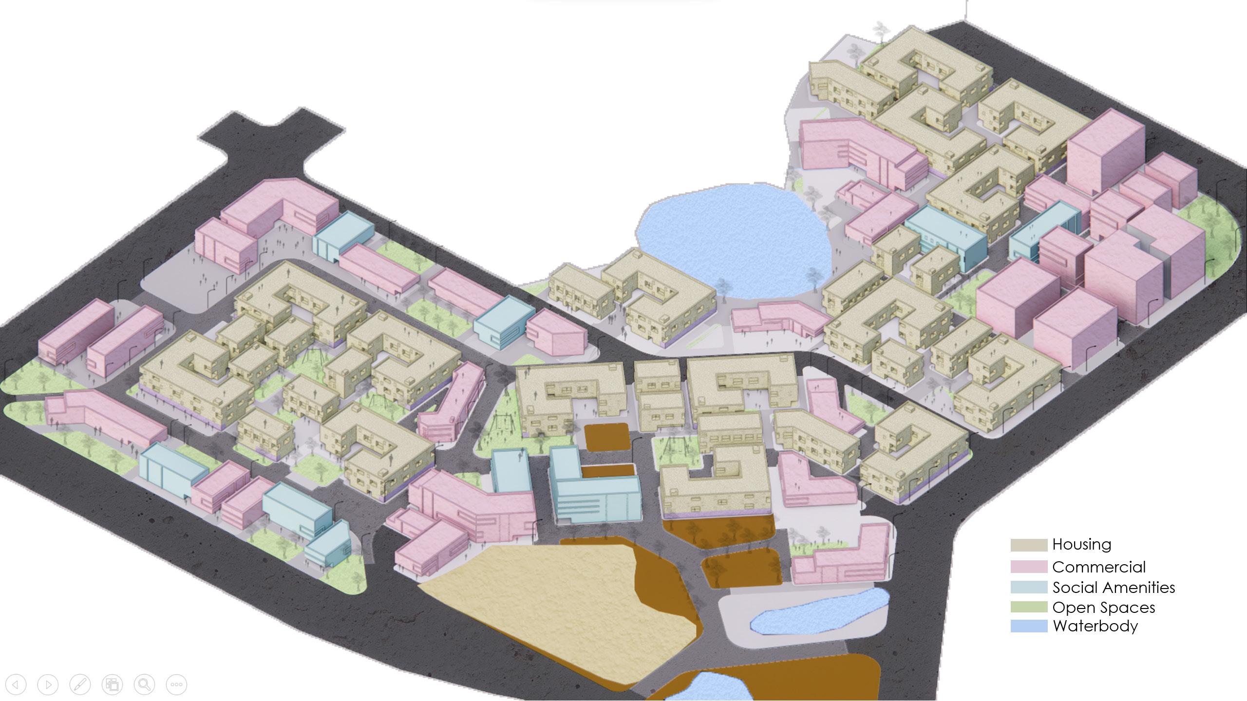
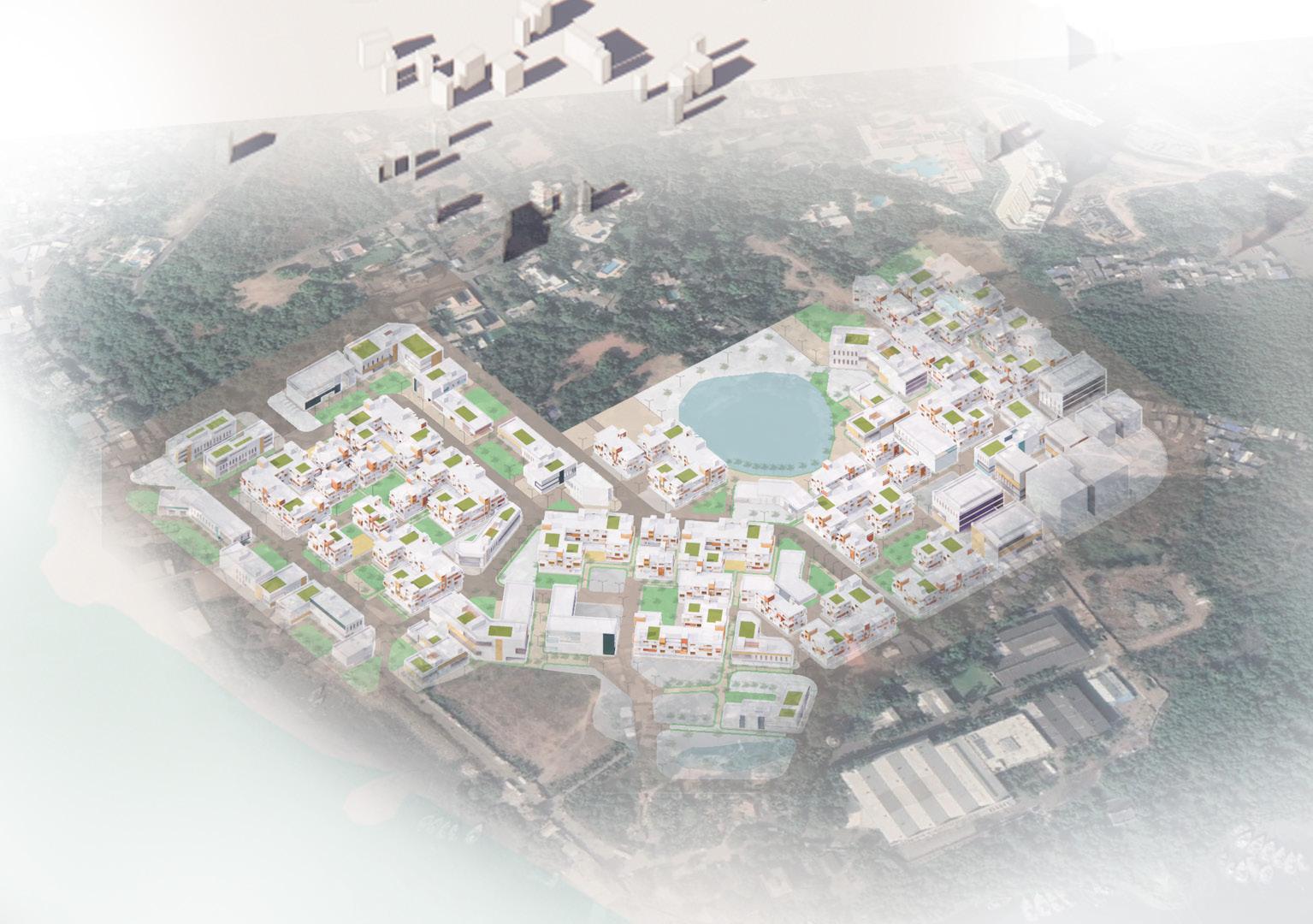
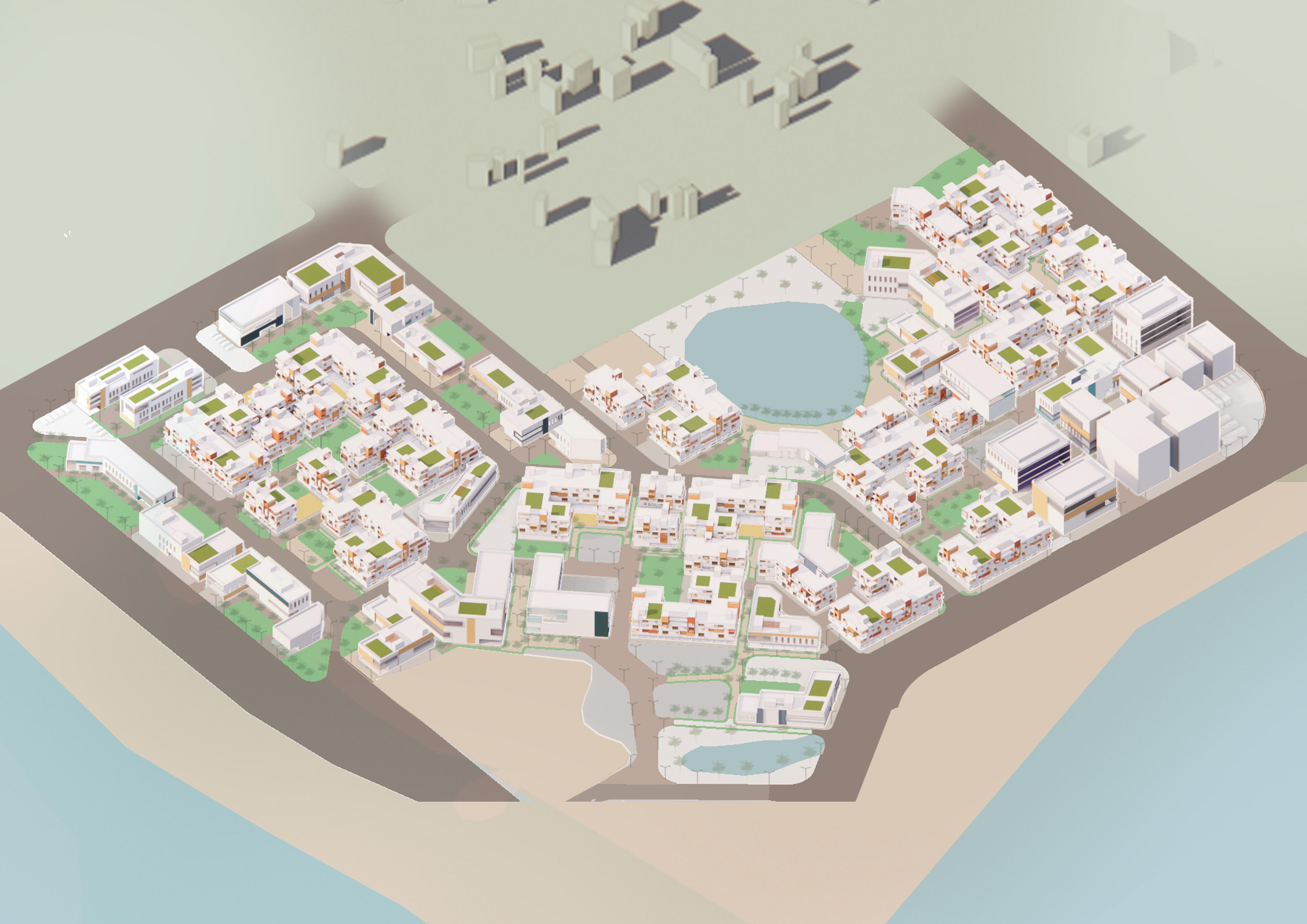
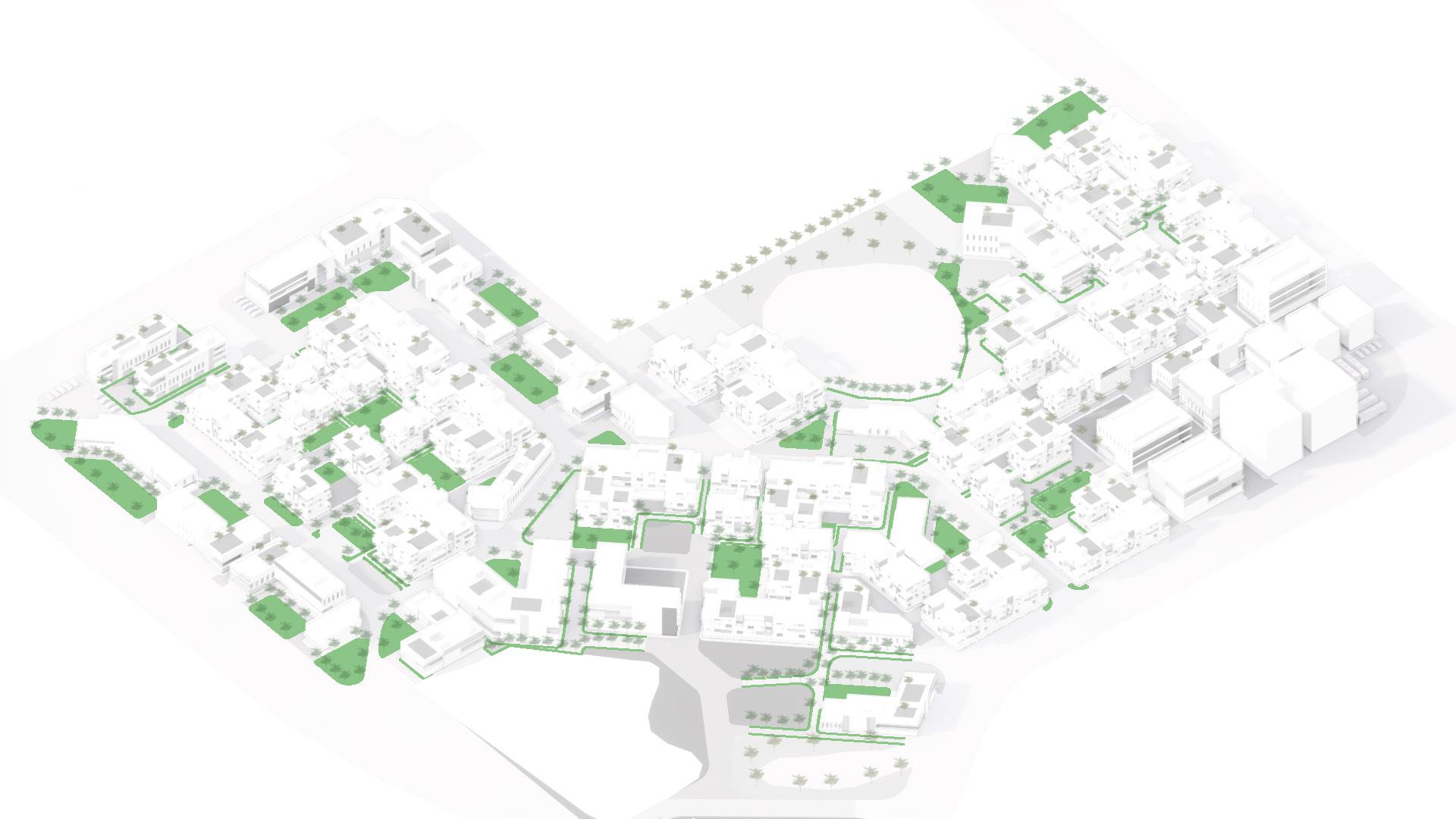
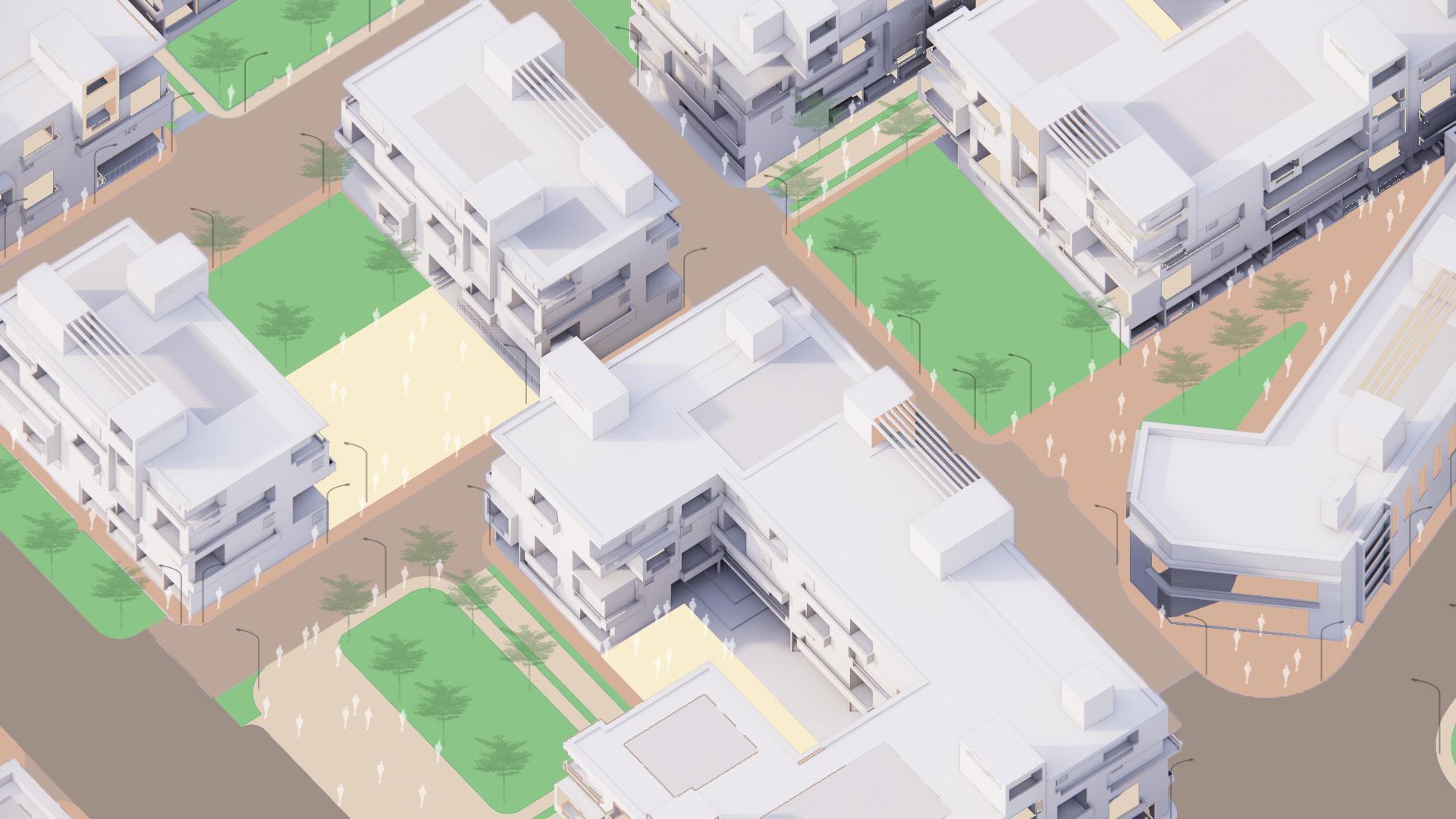
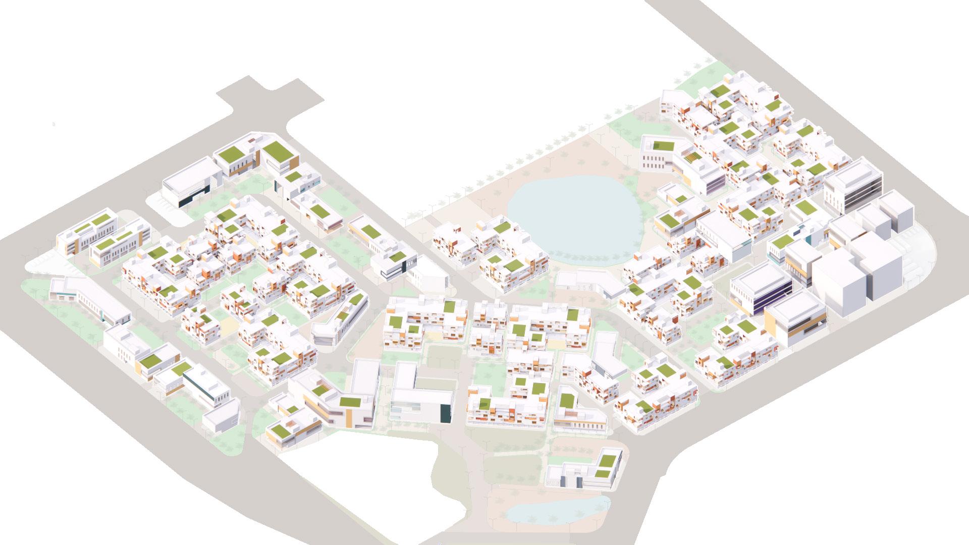
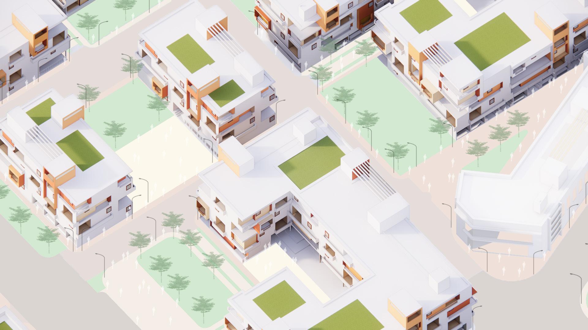
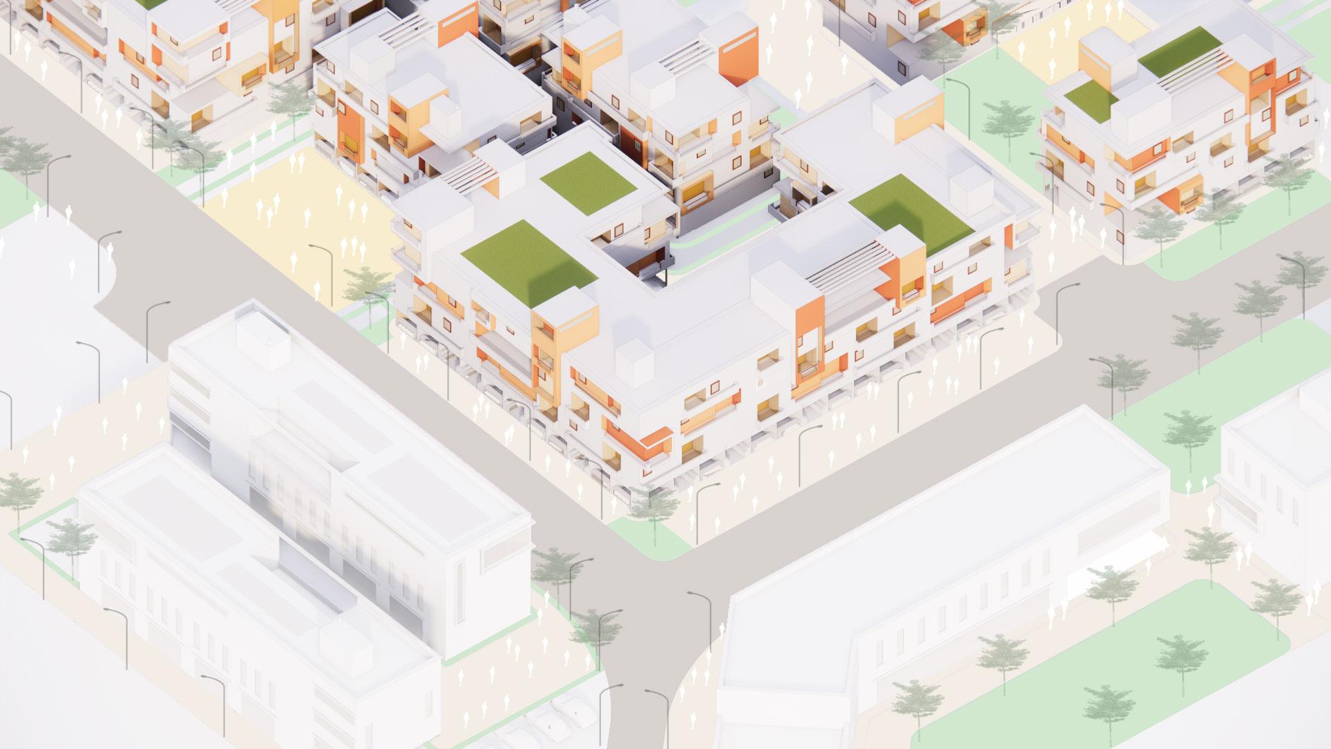
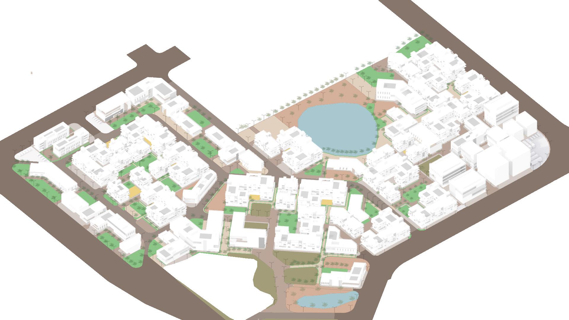
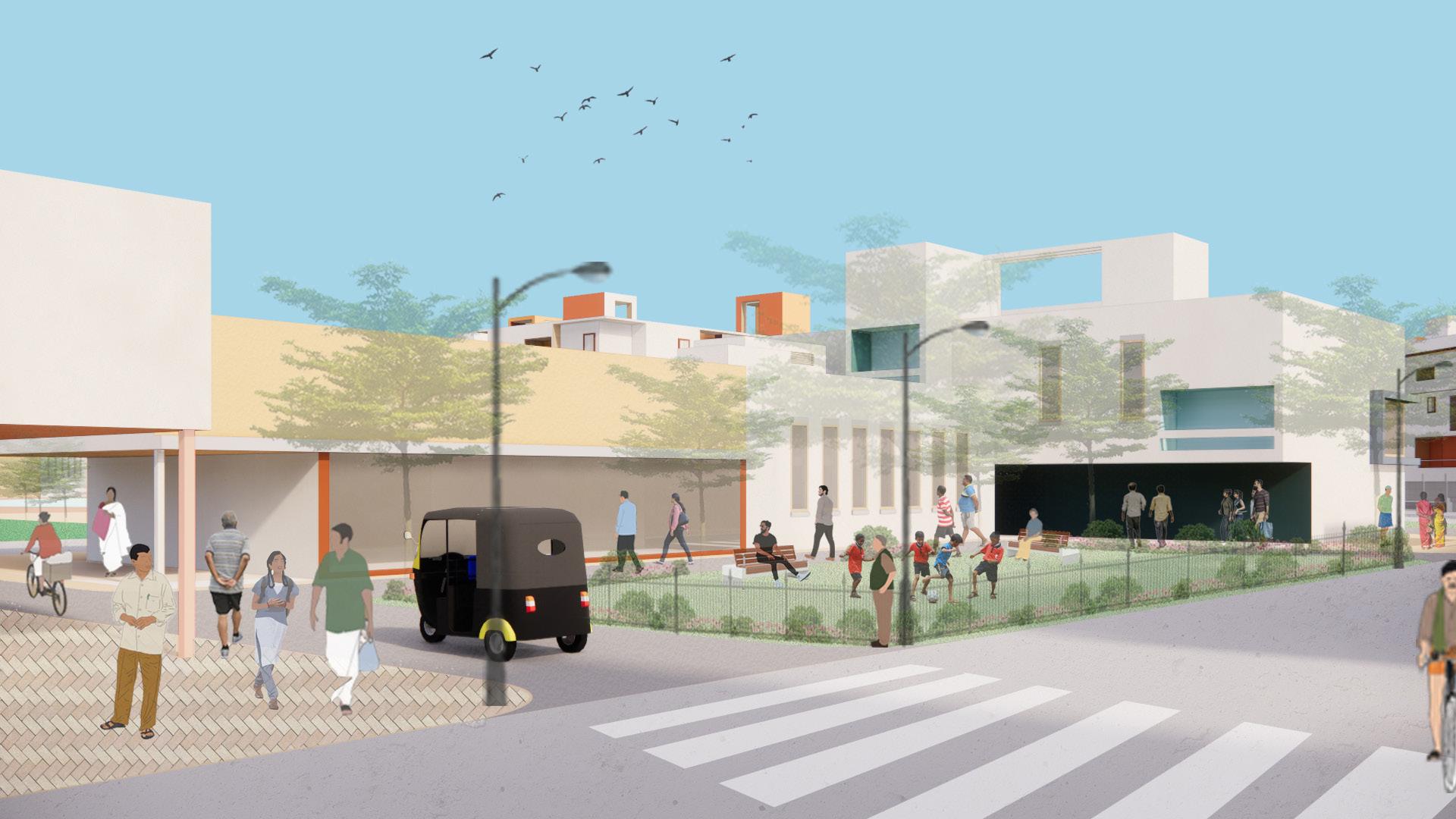
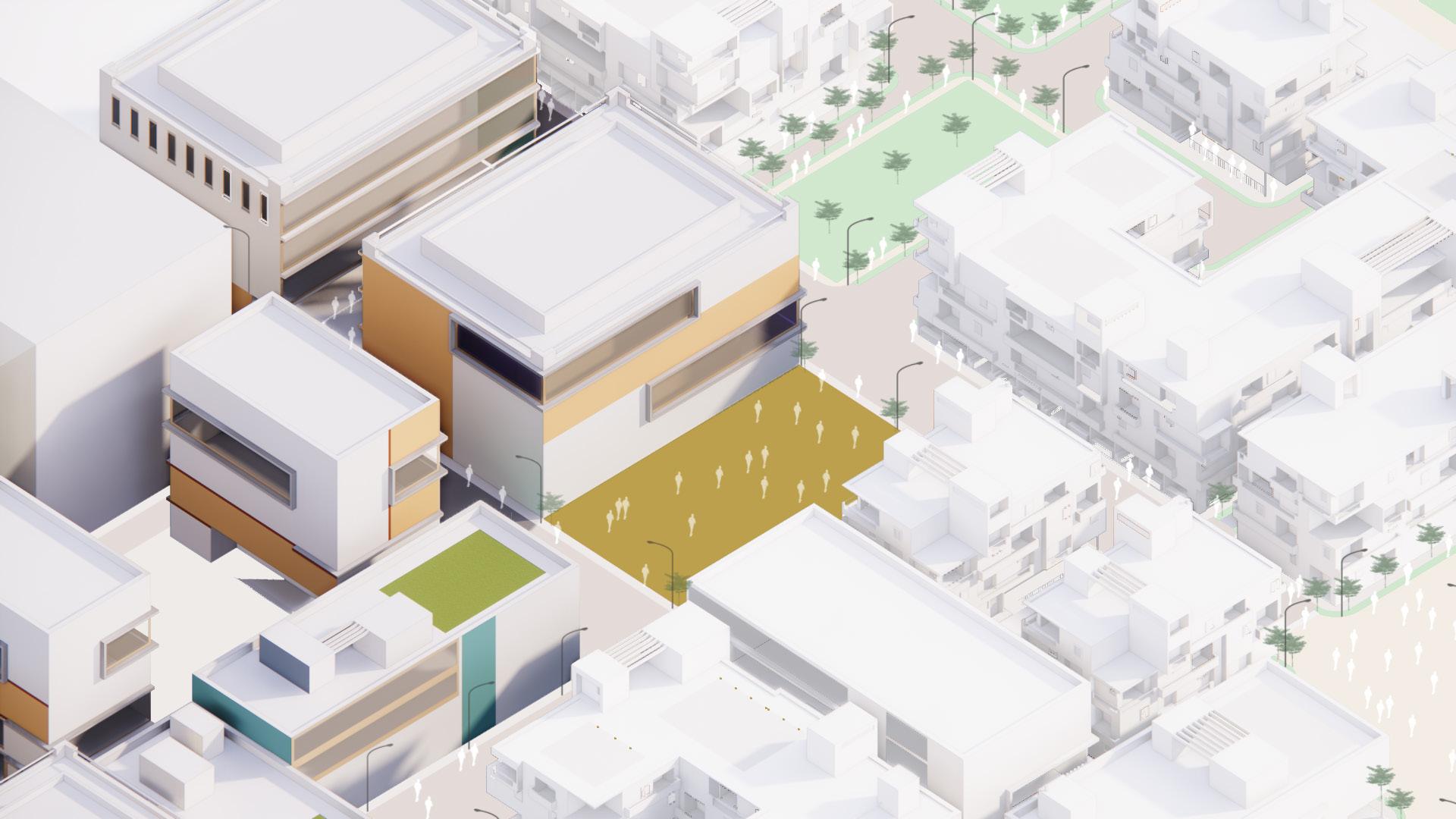
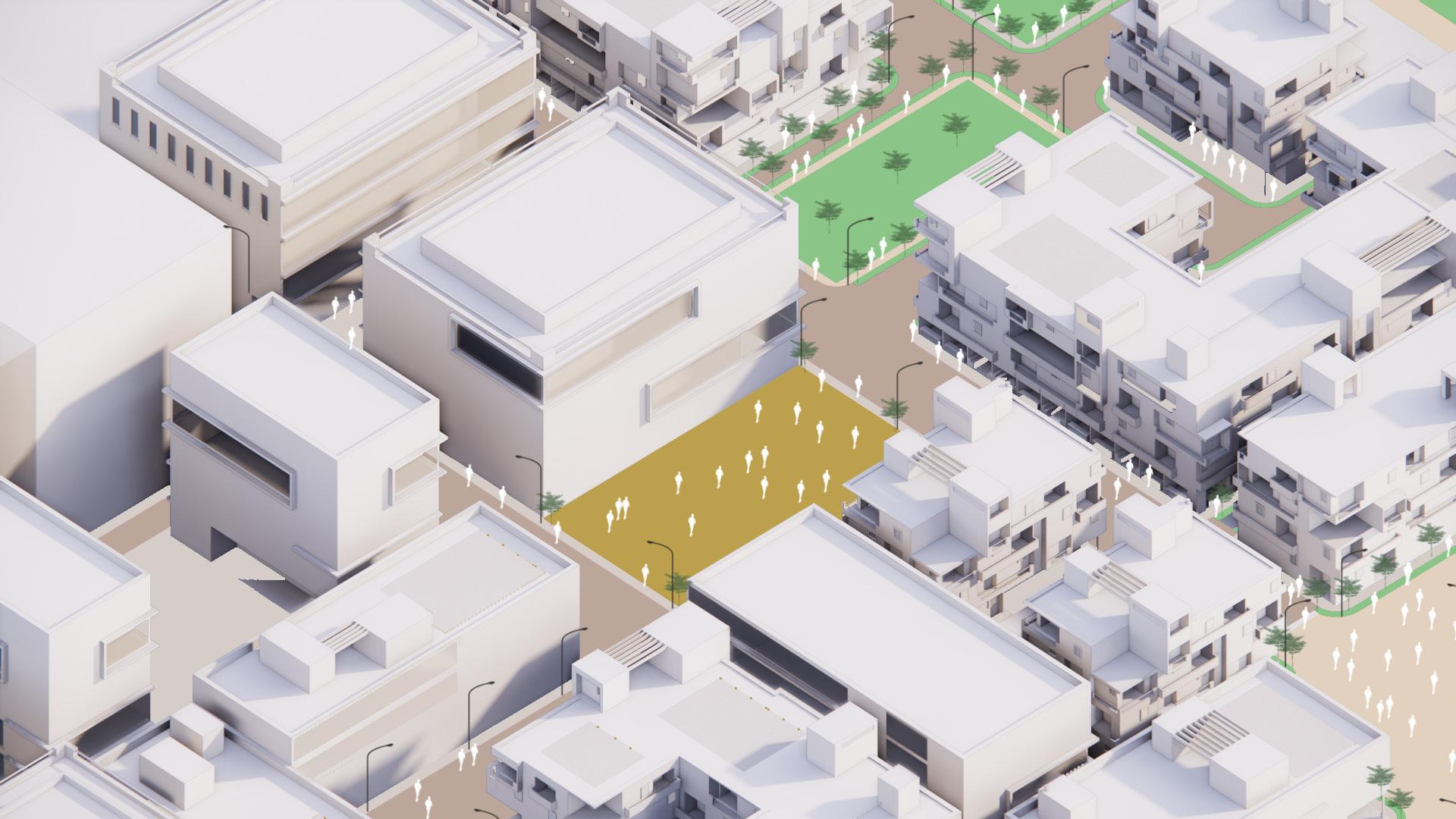
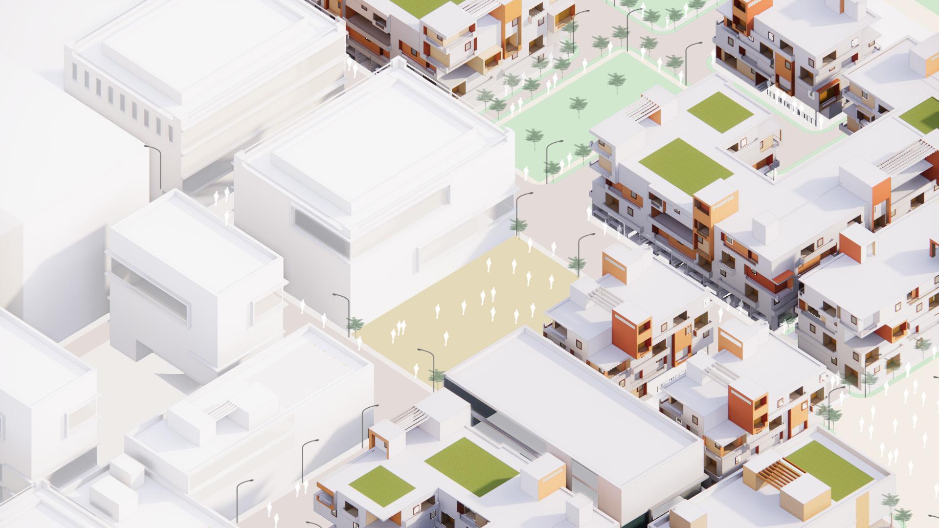
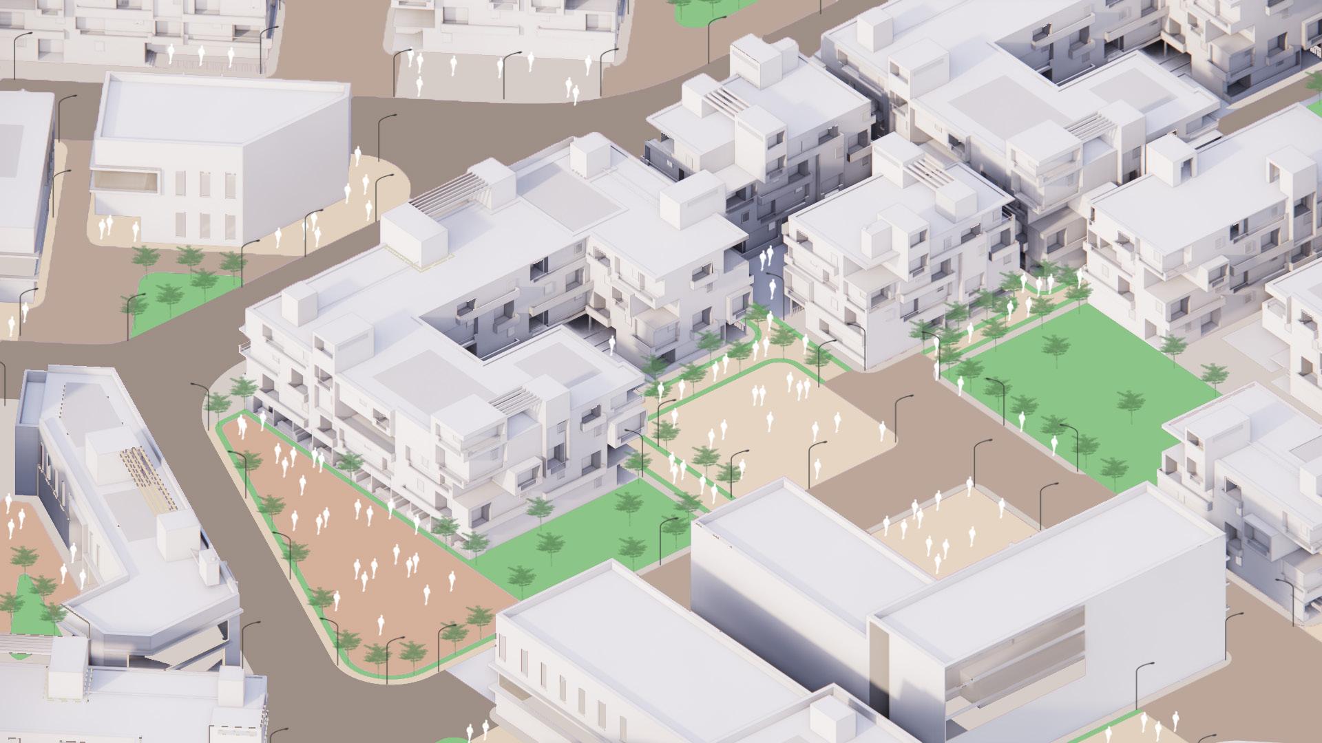
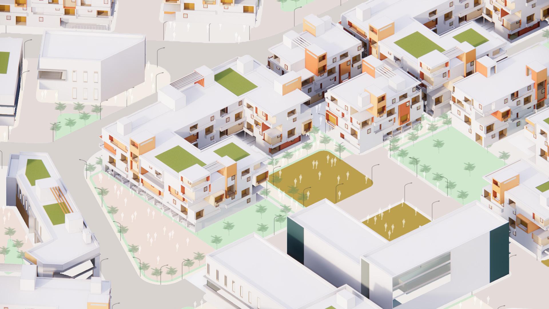
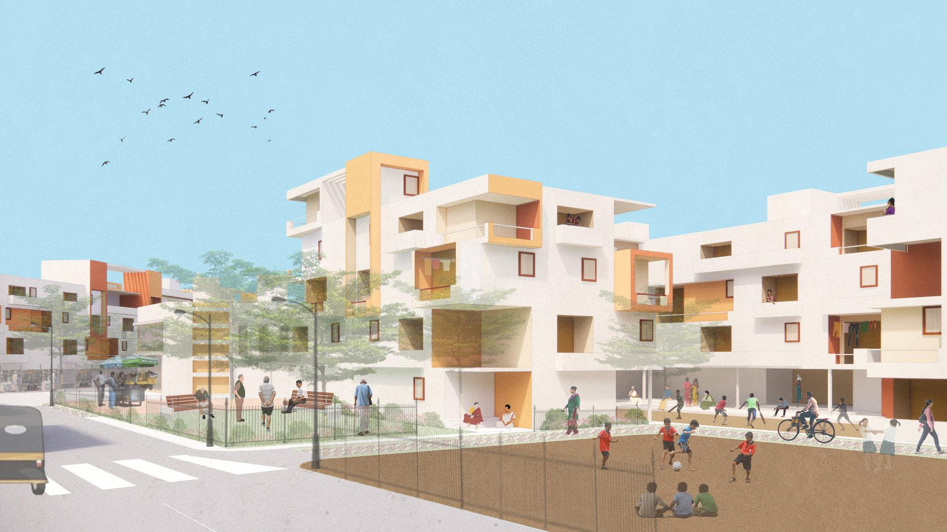
Considering the two active occupations within the area i.e. fishing and filming, the masterplan stragtegizes on housing these communities and along with the migrating population working within these sectors. Although the masterplan inteds to be integrated with the several verticals of amenties for development, for its effeciency the sectors would be distinctly placed in the geography as illustrated.
Different alterations with permutations and combinations of the housing blocks orientations with the open spaces and urban commons.
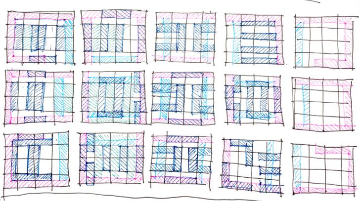
Malhar A. Ambekar Malhar A. Ambekar
CONCEPT & MASSING CONCEPT & MASSING
 Malhar A. Ambekar
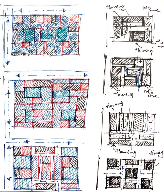
A more refined illustration suggesting integrated and mixed use development within these sectors.
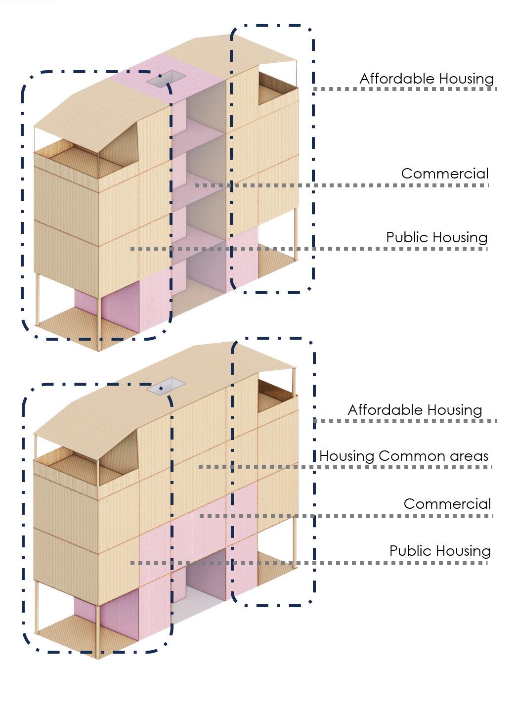
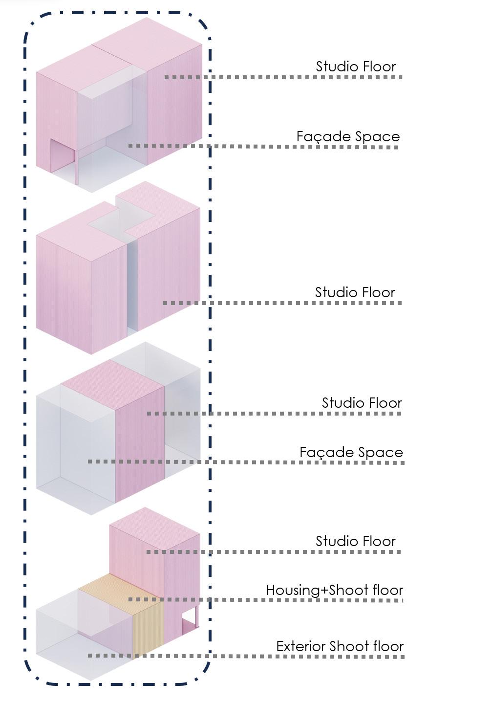
A masterplan massing and alternatives illustrating combinations of the housing blocks for affordable and public housing and different ways of developing the studio floor spaces for the filming sector considering the usage.
Malhar A. Ambekar
Malhar A. Ambekar
A more refined illustration suggesting integrated and mixed use development within these sectors.
A masterplan massing and alternatives illustrating combinations of the housing blocks for affordable and public housing and different ways of developing the studio floor spaces for the filming sector considering the usage.
CONCEPT & MASSING
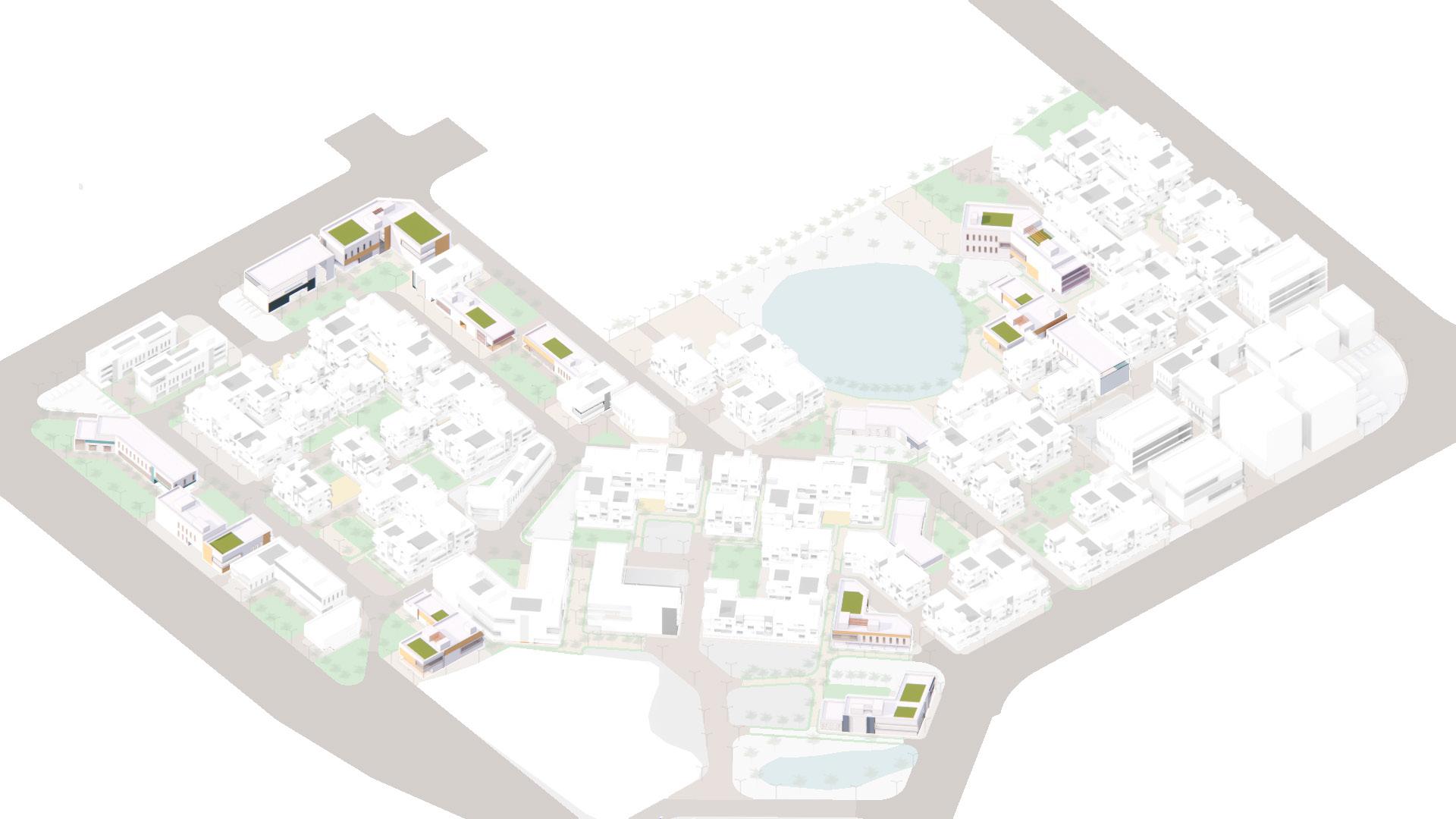
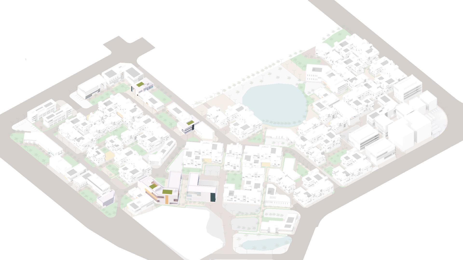
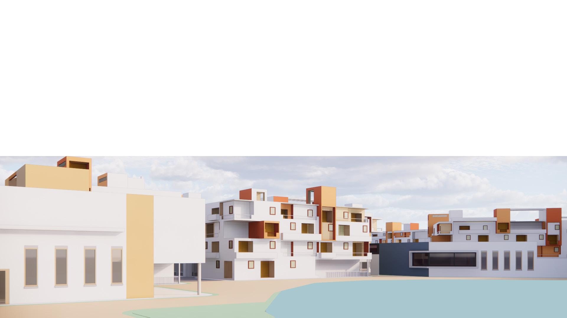
PROPOSAL MASTERPLAN
 Malhar A. Ambekar
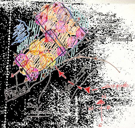
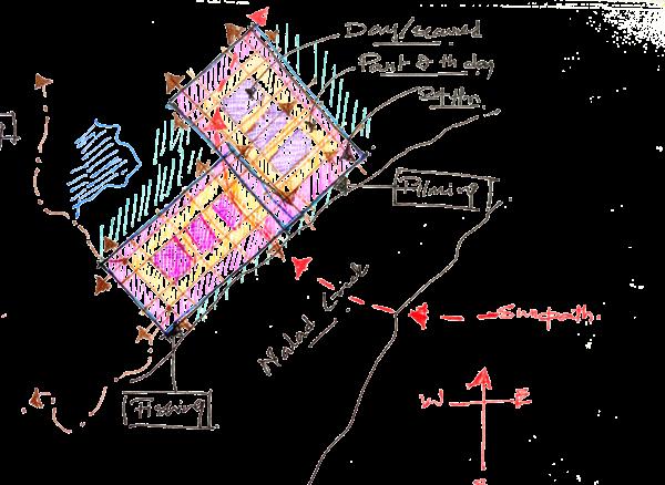
 Madh Jetty drop off point
Pascal Wadi
Malad Creek
Madh Jetty drop off point
Pascal Wadi
Malad Creek
20m 60m
Raheja Exotica
10m 30m Malhar A. Ambekar
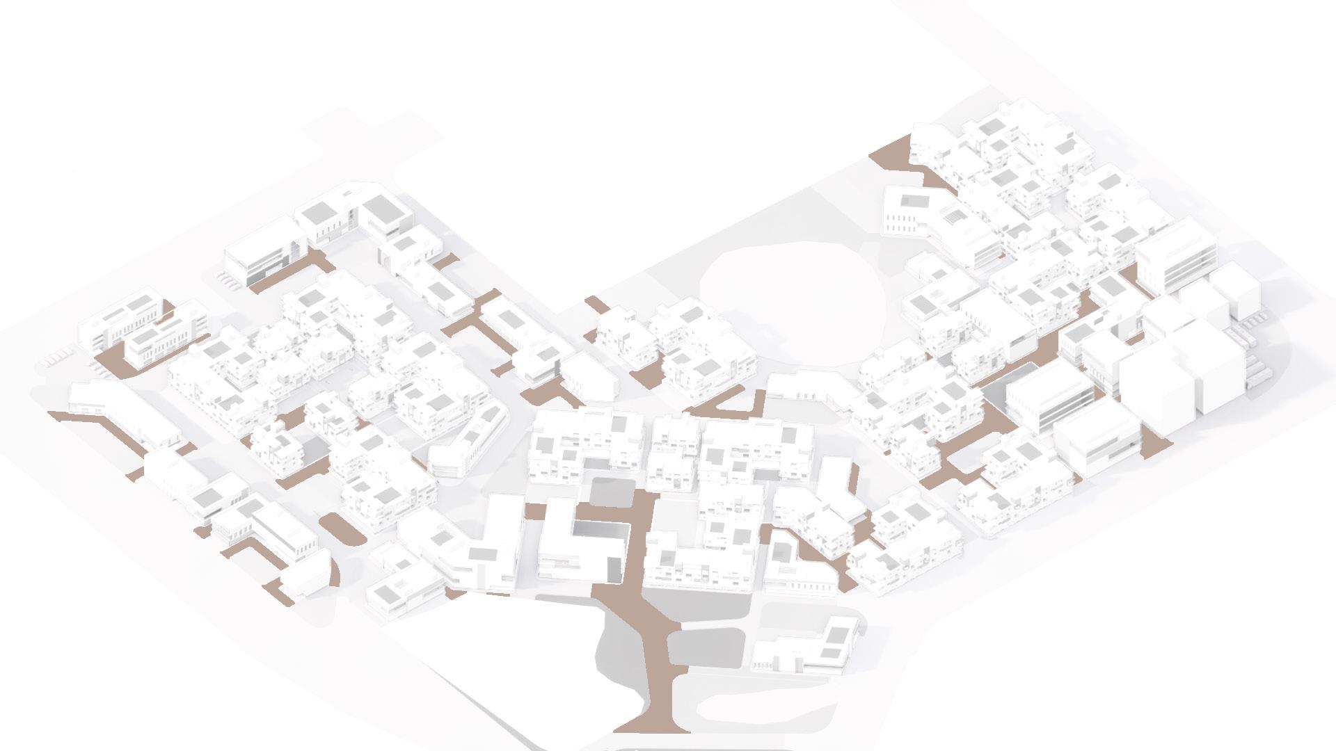
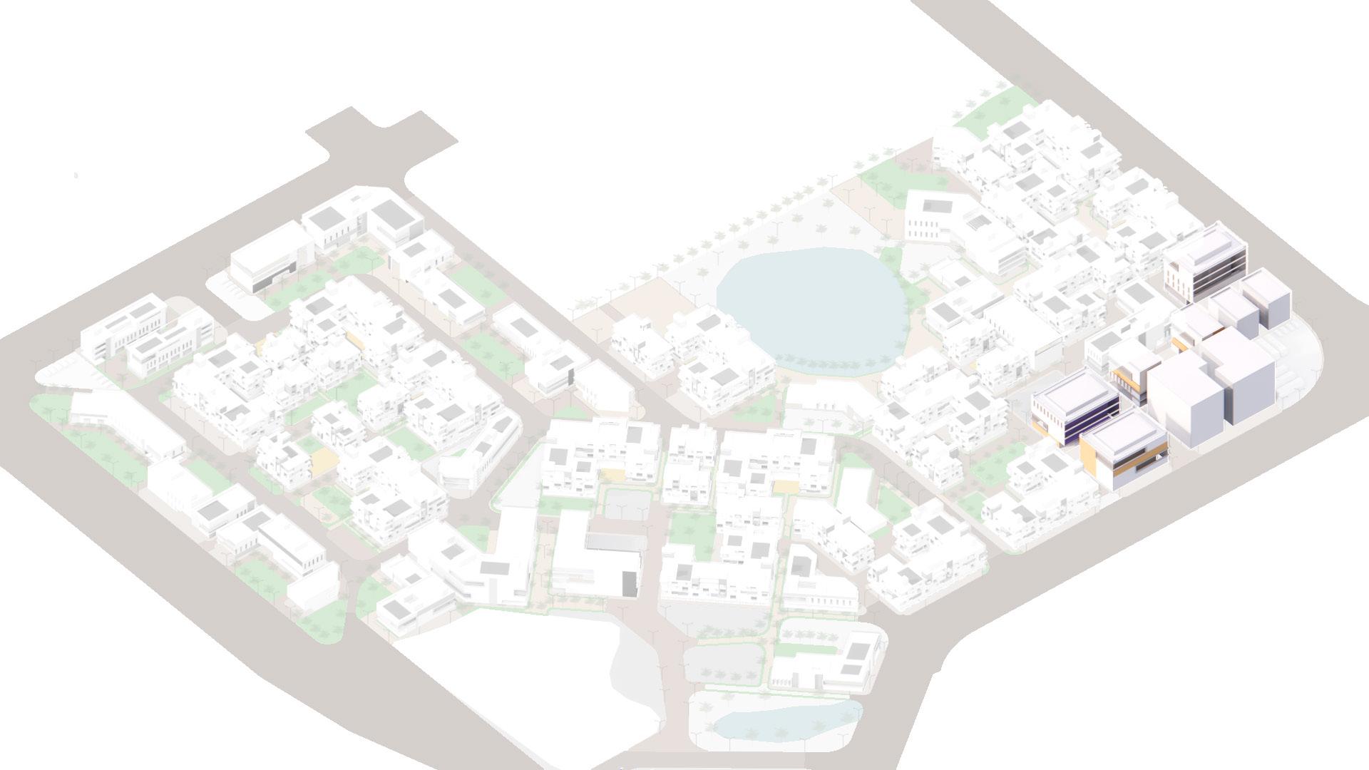
TRANSPORT TRANSPORT

10m 40m
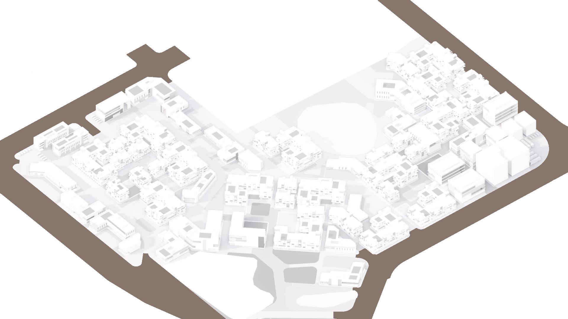
Main road connecting the proposed area to other parts of Madh island and the Western Suburbs of Mumbai via the proposed birdge.
10m 40m
Light Locomotive Vehicle (HMV) route for the three-seator tuktuk/autorik shaws in Mumbai. Route also accessible for cars and other smaller vehicals including bicycles & bikes

10m 40m
Hight Locomotive Vehicle (HMV) route for bus, trucks etc. routing and encircling the sectors and connecting at designated points .


10m 40m


 Malhar A. Ambekar
Malhar A. Ambekar
Malhar A. Ambekar
Bus Stops
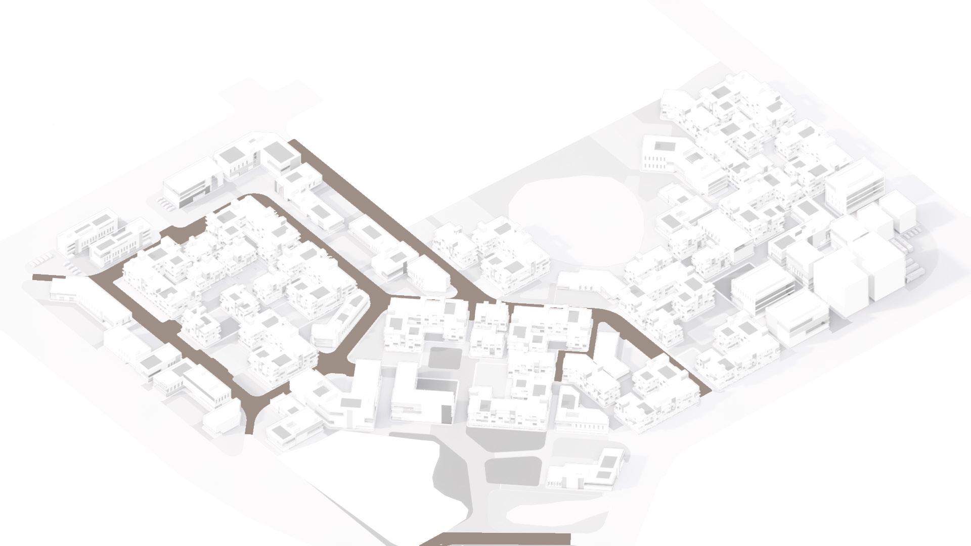
Pedestrian route within the built structure and open spaces network.
Tuktuk/Autorikshaw Stands
GREEN SPACES
UNBUILT SPACES
10m 40m
10m 40m
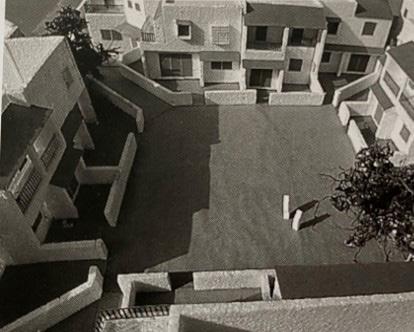
Open space within housing blocks//private open community space


10m 40m
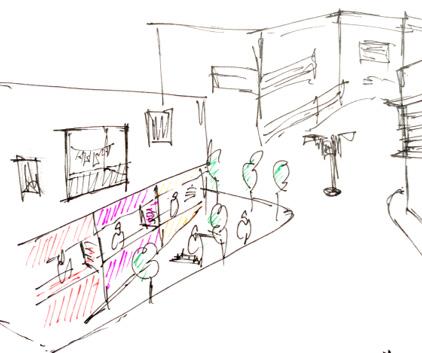
Private open spaces within the housing blocks are accessible open spaces but intimate to be extensively utilised by the community housed withing the blocks. It is also a secured open spaces, identifying itself as a verandah to the houses around it.
10m 40m

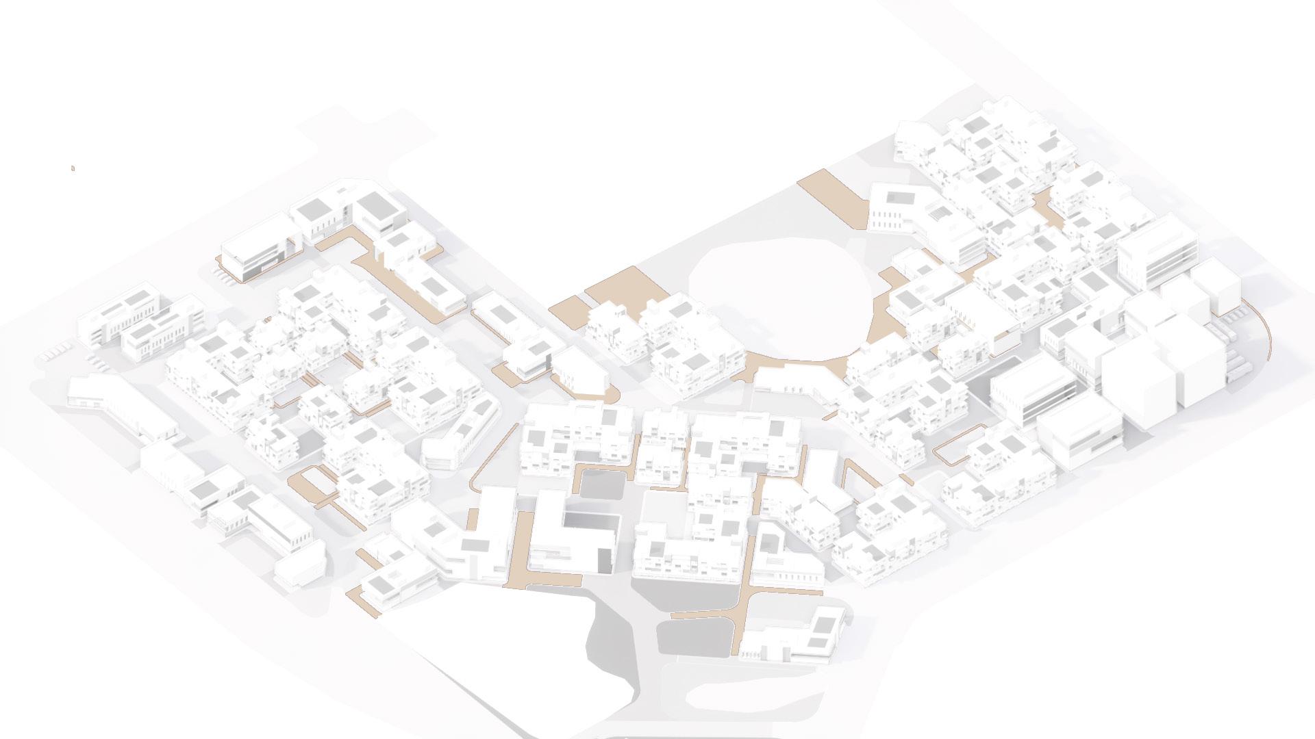
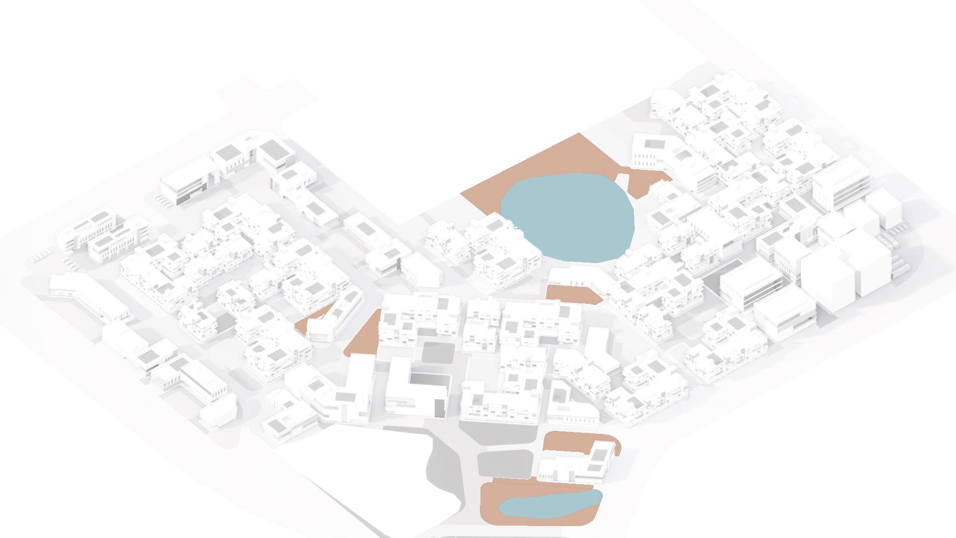
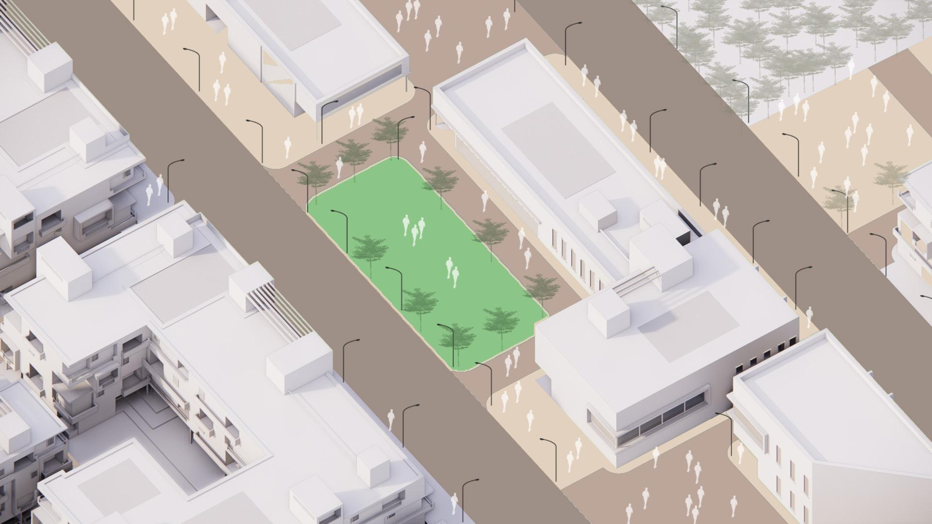
The positioning of the urban commons is intended to allow it to be accessed by communities from the both the sectors within an equal time and distance, also becoming a strategies intersection for the communities. The urban plazas and hardscaped open spaces would balance the built environment around responding and stituating itself amidst green spaces also as a material interjection.
 Malhar A. Ambekar
Public parks & Playgrounds
Urban Commons // Festivals & Community gatherings
Plazas and open arenas // Hardscaped open spaces
Ref: Hiranandani, Mumbai
Ref: Ganesh Festival, Mumbai
Malhar A. Ambekar
Malhar A. Ambekar
Public parks & Playgrounds
Urban Commons // Festivals & Community gatherings
Plazas and open arenas // Hardscaped open spaces
Ref: Hiranandani, Mumbai
Ref: Ganesh Festival, Mumbai
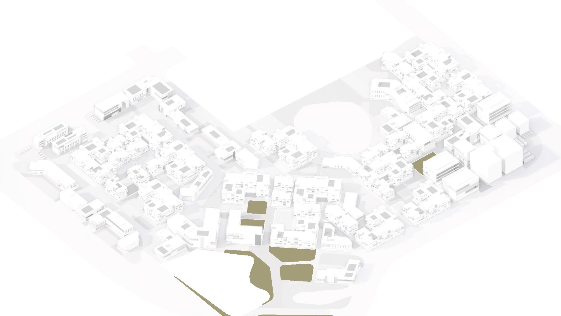
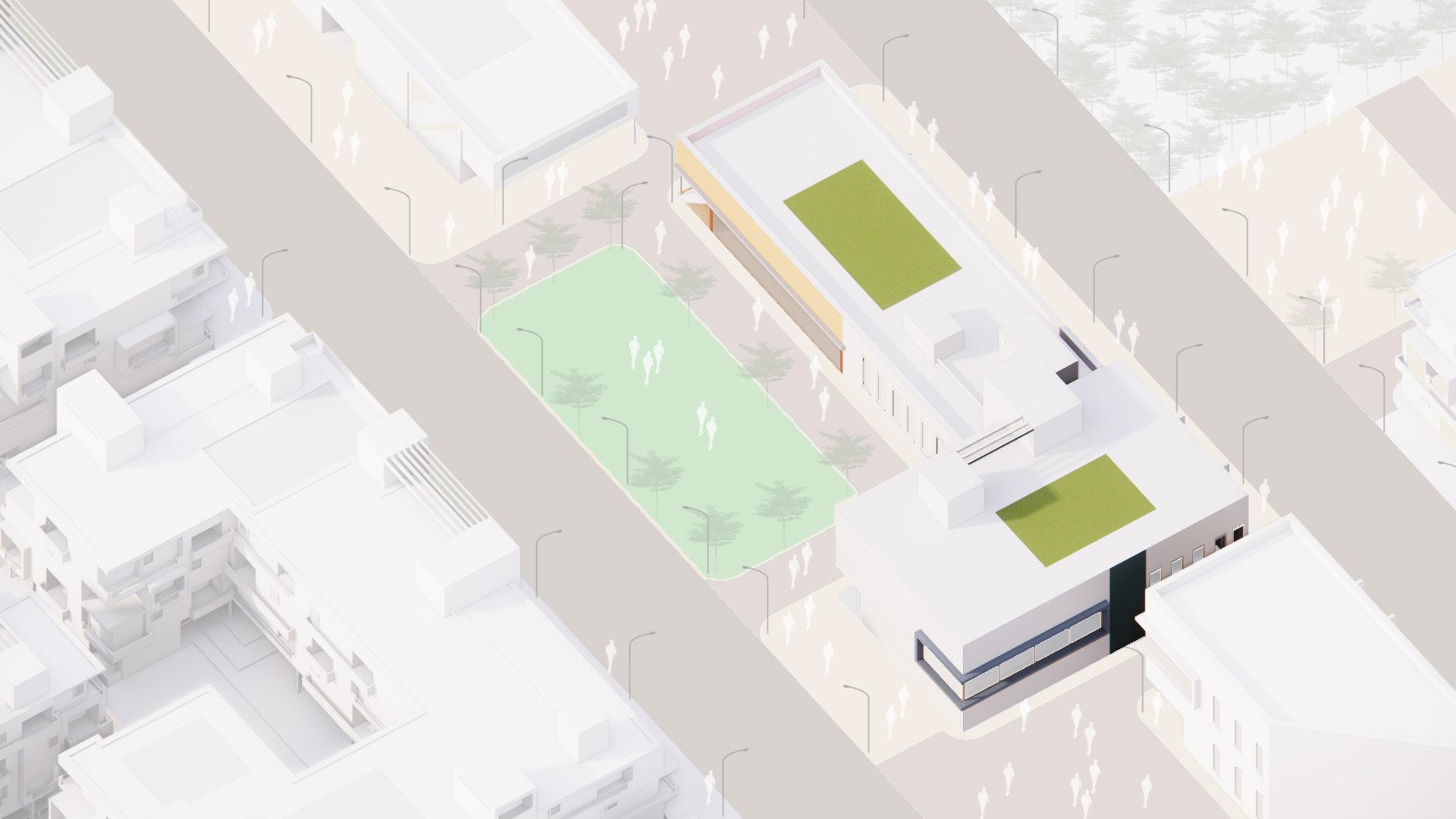
BUILT STRUCTURES BUILT STRUCTURES
Cafes
Market
Shopping Complex
Cafes & Restaurant//Leisure
Bank
Offices / Theatre
Production offices & Theatres
Shopping Complex
Offices
Parking for the shooting activity
Shooting Studios // Varying sizes and accessible facades

Malhar
Malhar A. Ambekar
A. Ambekar
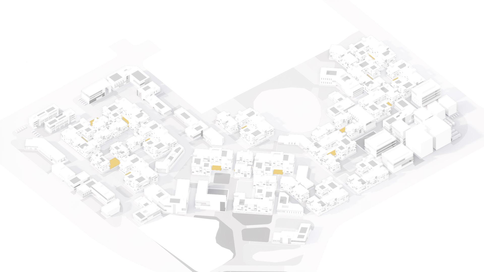
Public & Affordable Housing School Hospital
Social Amenities Other Social Amenities 10m 40m 10m 40m
Housing Blocks //
Other
Market
Shopping Complex
& Restaurant//Leisure Offices
10m 40m 10m 40m


CONCEPT
Malhar A. Ambekar Pedestrian Walkway Housing Block with mix use Housing Block with mix use Public Parks/Urban Commons Pedestrian Walkway LMV Route HMV Route Housing Block with mix use Commercial 2.5M Wide 2.5M Wide 10M Wide SYNTAX SPACE
& MASSING
UNBUILT SPACES
 Malhar A. Ambekar
HMV route
Pedestrian
Walkways LMV route
Plaza Private Open Space Public Parks 10m 40m
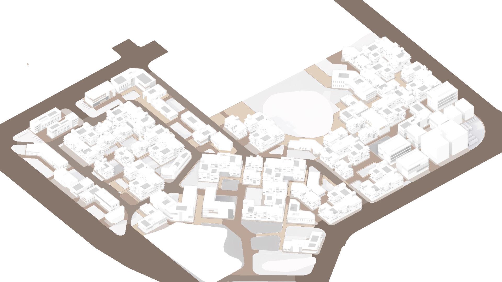
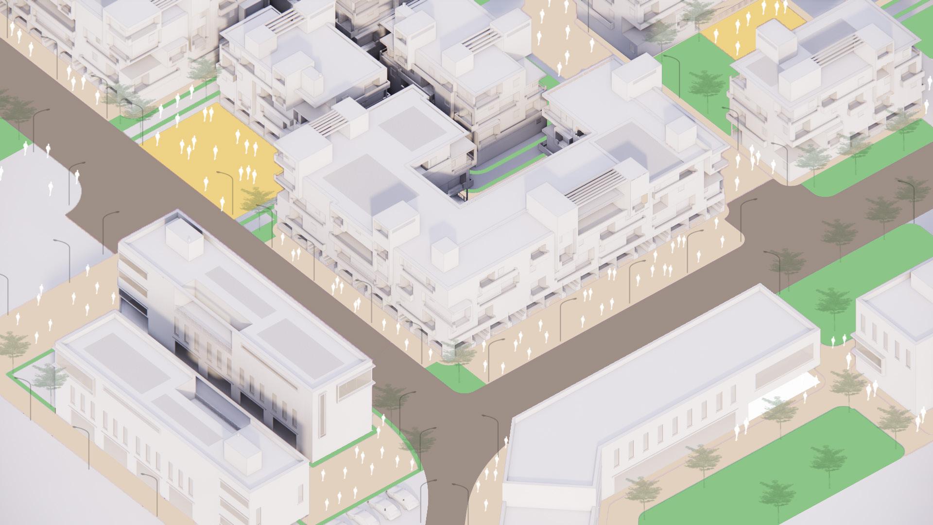
A balanced proposition of road networks within a cluster of built and unbuilt spaces.
The road network grades itself from the main road to road designated for heavy vehicles and then funnelling into light vehicular roads which further dessimates into pedestrian only network. Malhar A. Ambekar
BUILT STRUCTURES
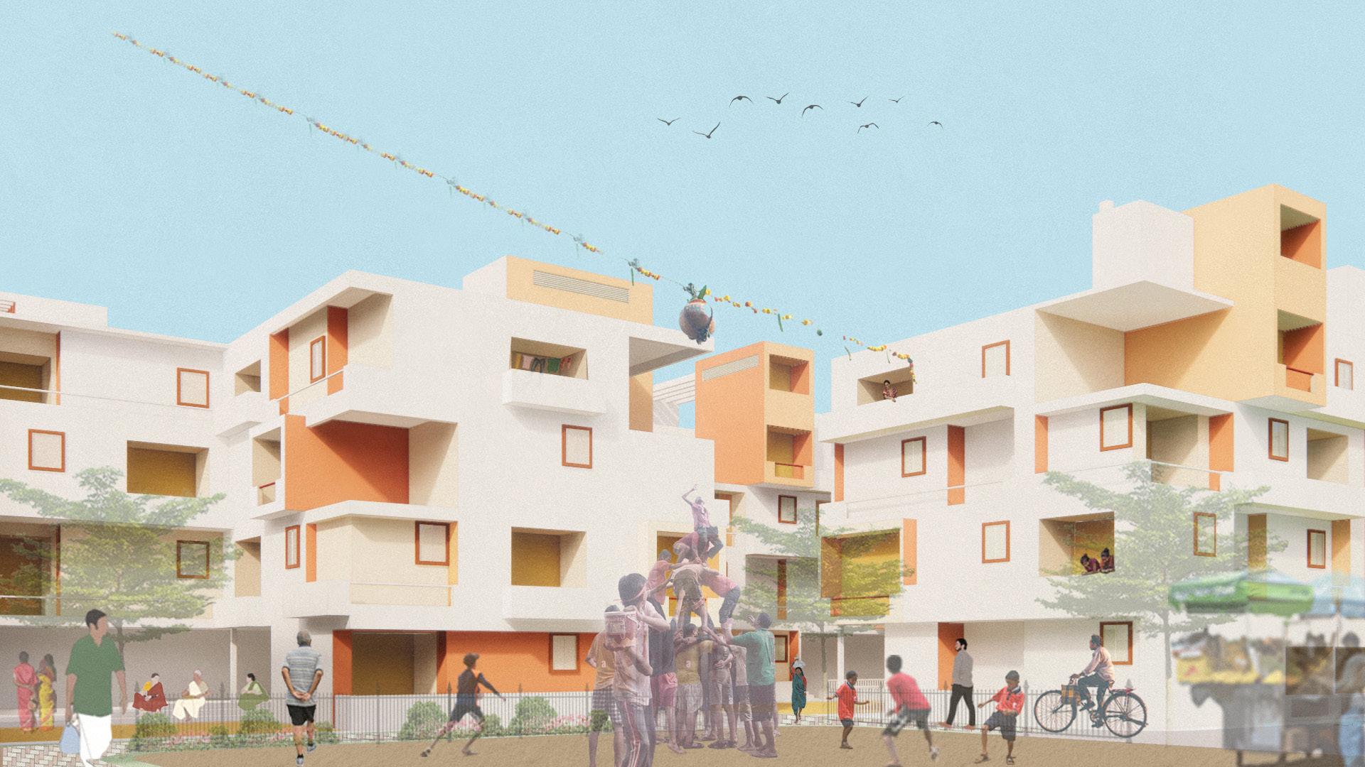
The housing blocks to have terrace gardens advantaged by the flat terraces. The terrace garden would facilitate into rainwater harvesting and also maintain the environment and balance out the green spaces in the city. In a city like Mumbai, these terraces are also accessed as community spaces for various functions and festivals, particularly kite-flying festival during the onset of spring season.
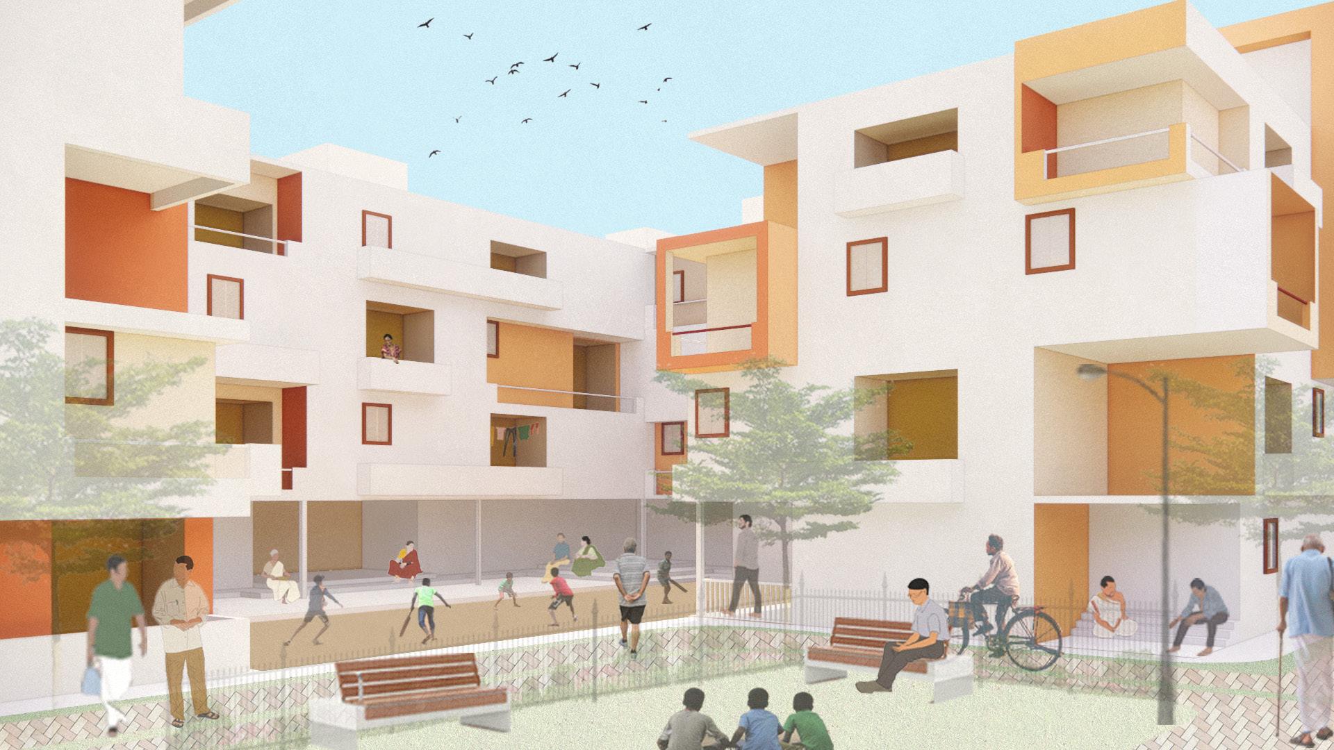
The open spaces grade themselves from public parks and community gardens to private and intimate verandah-like open spaces within housing blocks.
Housing Private Open Space Commercial Public Parks/ Urban Commons Pedestrian Walkway LMV Route Public Parks/ Urban Commons Pedestrian Walkway Housing Block with mix use 10m 40m
Malhar A. Ambekar
Malhar A. Ambekar
UNBUILT SPACES
BUILT STRUCTURES
The road network grades itself from the main road to road designated for heavy vehicles and then funnelling into light vehicular roads which further dessimates into pedestrian only network.
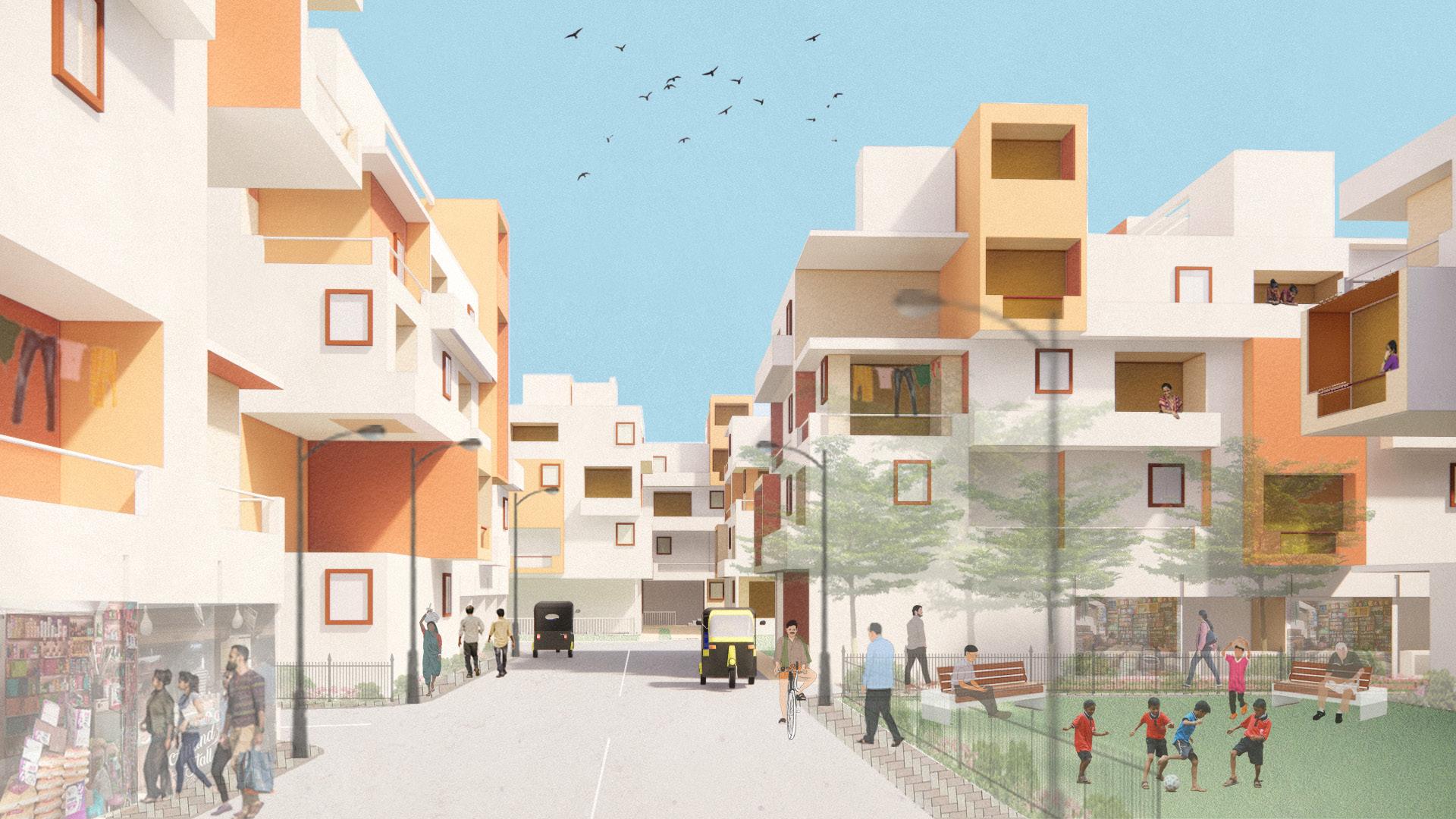
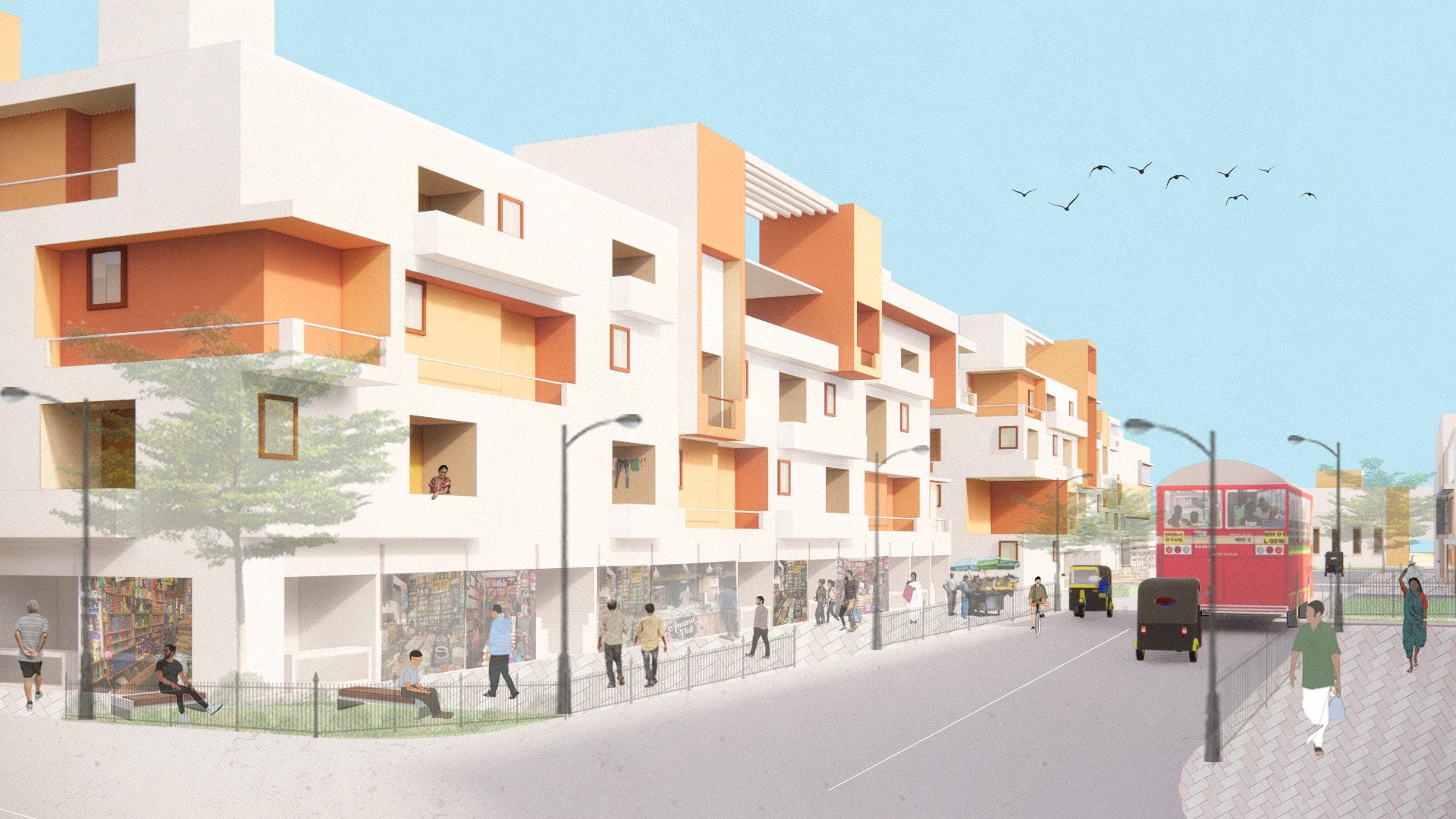
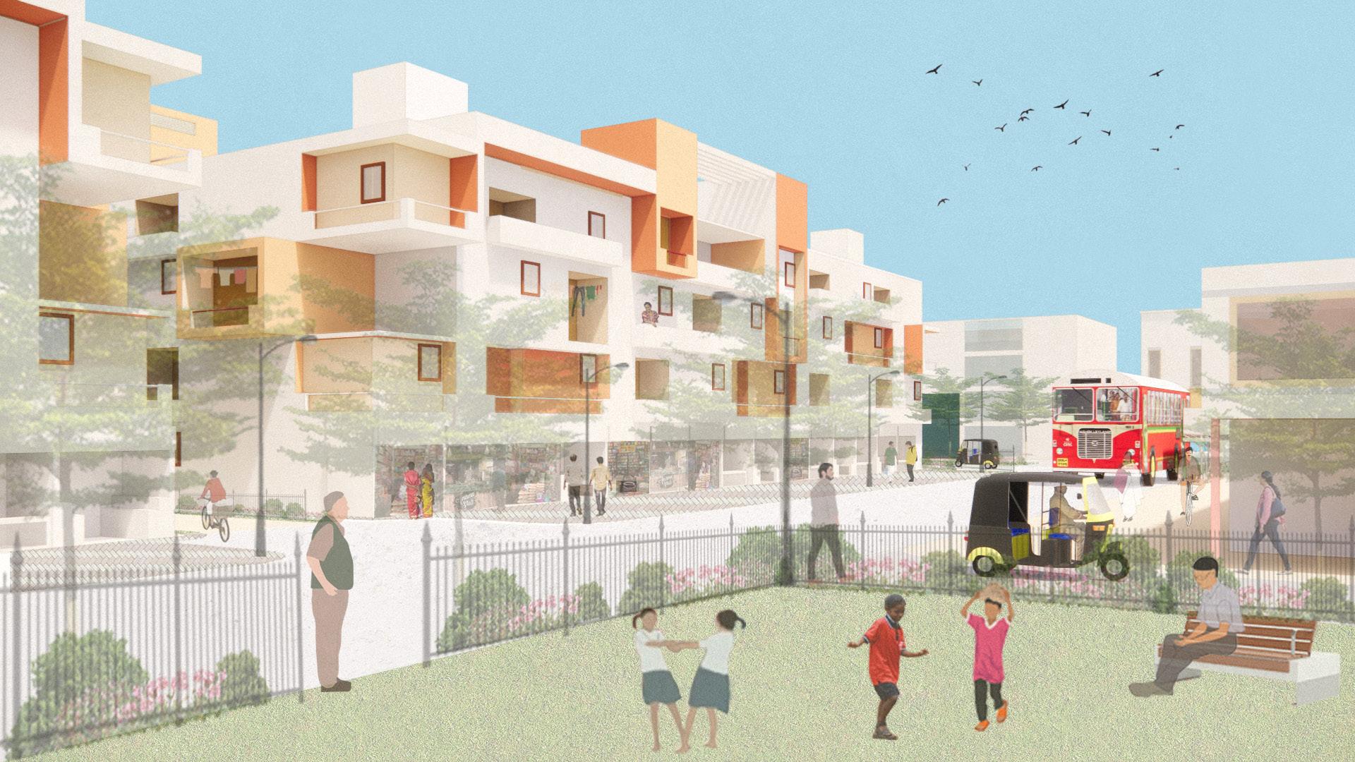
A housing block arrangement carefully seperated from the commercial blocks and grading itself slowly into the housing by means of a mixed-use shops and other amenities under the appartments.
 Malhar A. Ambekar
Pedestrian Walkways LMV route
HMV route
10m 40m
Malhar A. Ambekar
Malhar A. Ambekar
Pedestrian Walkways LMV route
HMV route
10m 40m
Housing Market
10m 40m
TRANSPORT
Malhar A. Ambekar
Mix use (shops)
Conceptual sketch indicating mix use shops on the ground floor of the housing block along with the other side of the block having a flexible utility for the community .
Community utility space
Malhar A. Ambekar
Pedestrian Walkways LMV route
HMV route
Public Parks
10m 40m
BUILT STRUCTURES Malhar A. Ambekar Malhar A. Ambekar Bank Other commercial areas Shopping Complex 10m 40m
The overall masterplan of the complex with its integrations of commercial, social amenities and particularly mixed use facilitating the existing communities and the migrating population would not intend to generate an identity for the area but also effectively submit to the economic sustainancy of the overall complex thereby also making it self sufficient in several ways.
BUILT STRUCTURES
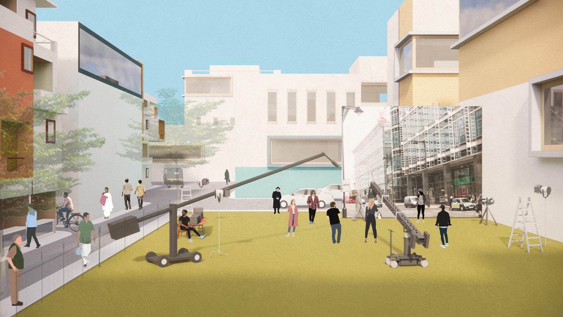
The facades of the studio spaces also become potential backdrops for film sets and locations. The urban commons onto the studios would provide for a flexible use for structures and unbuilt spaces such as these. Activities within these realms would be effective means of economic sustainability of the complex.
 Malhar A. Ambekar
Production offices & Theatres
Shooting Studios // Varying sizes and facades
Open air filming arenas
10m 40m
Malhar A. Ambekar
Malhar A. Ambekar
Production offices & Theatres
Shooting Studios // Varying sizes and facades
Open air filming arenas
10m 40m
BUILT STRUCTURES
The housing bocks within the fillming sector would also potentially be accessed for its geography for filmings and city-like ambiences for locations. The houses would not only lease out for film shoots but essentially house the working community withing the sector and allow an economy to generate as well.
The facades of the studio spaces also become potential backdrops for film sets and locations. The urban commons onto the studios would provide for a flexible use for structures and unbuilt spaces such as these.
UNBUILT SPACES
Malhar A. Ambekar
Housing
Malhar A. Ambekar
Production offices & Theatres
10m 40m
Pedestrian Walkway
HMV route
LMV route
10m 40m
Facades such as these to be flexibly accessed by artists working within the film sector and living in the housing complexes within the area. This would also contribute effectively towards social sustainability of the overall complex.
UNBUILT SPACES
 Malhar A. Ambekar
Pedestrian Walkway
HMV route
Plaza Public Parks
Malhar A. Ambekar
Malhar A. Ambekar
Pedestrian Walkway
HMV route
Plaza Public Parks
10m 40m
LMV route Public Parks
BUILT STRUCTURES
Urban Commons
 Malhar A. Ambekar
Plazas and areas of urban commons along with public parks grading themselves into the private and intimate community spaces within the housing blocks.
Malhar A. Ambekar
Malhar A. Ambekar
Plazas and areas of urban commons along with public parks grading themselves into the private and intimate community spaces within the housing blocks.
Malhar A. Ambekar
Housing School 10m 40m
BIBLIOGRAPHY
Anon., 2021. Solutions to Informal Housing in Mumbai: An Investigation into Sustainable and Accessible Planning. [Online]
Available at: https://storymaps.arcgis.com/stories/dfe285a0777e4e6abe658a56231cc7ef
Anon., n.d. Coolgeography UK. [Online]
Available at: https://www.coolgeography.co.uk/A-level/AQA/Year%2013/World%20Cities/ Mumbai/Mumbai.htm
Anon., n.d. Correa, C. (2000) Housing and urbanisation. London: Thames & Hudson.. s.l.:s.n.
Anon., n.d. Old Maps of Mumbai. [Online]
Available at: https://www.oldmapsonline.org/en/Mumbai#bbox=72.67271119999998,18.81318045499097,72.99271119999997,19.13314057970757&q=&date_ from=0&date_to=9999&scale_from=&scale_to=
Anon., n.d. The National Archives. [Online]
Available at: https://discovery.nationalarchives.gov.uk/details/r/C2752786
Architects, P. B., n.d. TANNER STREET GATEWAY. [Online]
Available at: https://www.peterbarberarchitects.com/tanner-street-gateway
Bofill, R., n.d. Ricardo Bofill projects. [Online]
Available at: https://ricardobofill.com/projects/la-muralla-roja/
Devale, A., 2020. Urban Development in Mumbai and its Effect on Coastal Communities. [Online]
Available at: https://www.urbanet.info/urban-development-mumbai-effect-on-coastal-communities/
Ekbote, A., n.d. City Resource. [Online]
Available at: http://www.cityresource.in/index.html
Foundation, B., n.d. Prieto López House. [Online]
Available at: https://www.barragan-foundation.org/works/list/prieto-lopez-house
Guha, S. B., 2010. New Urbanism, Neoliberalism, and Urban Restructuring in Mumbai. India’s New Economic Policy.
Institute, U. D. R., n.d. Publications. [Online]
Available at: https://www.udri.org/udri-publications/
Jain, N., n.d. Nikhil Jain Projects. [Online]
Available at: https://nikhiljain.myportfolio.com/projects
Maharashtra, G. o., n.d. Mumbai Archives. [Online]
Available at: http://www.maharashtra-archives.org/mumbai_archives_records.html
Manoharmayum Devi, V. S. M. X. L. S., 2019. Trawl fisheries with special reference to catch composition along Mumbai coast, Maharashtra. Fishery Technology.
Markapwar, C., n.d. Times of India. [Online]
Available at: https://timesofindia.indiatimes.com/city/mumbai/rooftop-gardens-may-soon-bemandatory-for-all-new-bldgs-in-city-spread-over-2000-sq-m/articleshow/89812194.cms
Malhar A. Ambekar
Plazas and areas of urban commons along with public parks grading themselves into the private and intimate community spaces within the housing blocks.
Malhar A. Ambekar
BIBLIOGRAPHY
Mehbub Sahana, S. D. H. S., 2018. Assessing land transformation and its relation with land surface temperature in Mumbai city, India using geospatial techniques. International Journal of Urban Sciences.
Singh, V., n.d. Reality.com. [Online]
Available at: https://realty.economictimes.indiatimes.com/news/residential/no-developmentzones-to-host-plots-for-affordable-housing-in-mumbai/57527988?redirect=1
Shibaji Bose, U. G. H. K. C. N. C. N. D. P., 2018. Uncertainties & Vulnerability among Koli fisheries in Mumbai. Indian Anthropologiest Vol. 48 No. 2.
UDD, 2018. DCPR 2034 & Notification, s.l.: Government of Maharashtra- Urban Development Department.
MCGM, 2020. Chief Engineer- Development Plan. [Online]
Available at: https://www.mcgm.gov.in/irj/portal/anonymous/qldeptmanua
Nallathiga, R., 2006. Integrating Environment, Tourism, Heritage and Culture into the development of cities : A case of Mumbai. Institute of Town Planners, India.
To understand economic impacts of urban regenration and consequent gentrifications particularly with the process of rapid urbanization, and as a supplementary discourse for this design project, can read more at my dissertation:
‘The Economic Implications of urban regeneration: The gentrification of Madh Island, Mumbai’
-Malhar A. Ambekar
Malhar A. Ambekar
