Planning Project 3: Transforming City Project Post Code
Movin the Maine ’ ’
TOWNSHIP ANALYSIS
Planning Project 3: Transforming city
Master of Urban Planning and Design
Monash Univiersity
Eliza Kane
Hillary Namitala
Rochelle Fernandez
June 2025
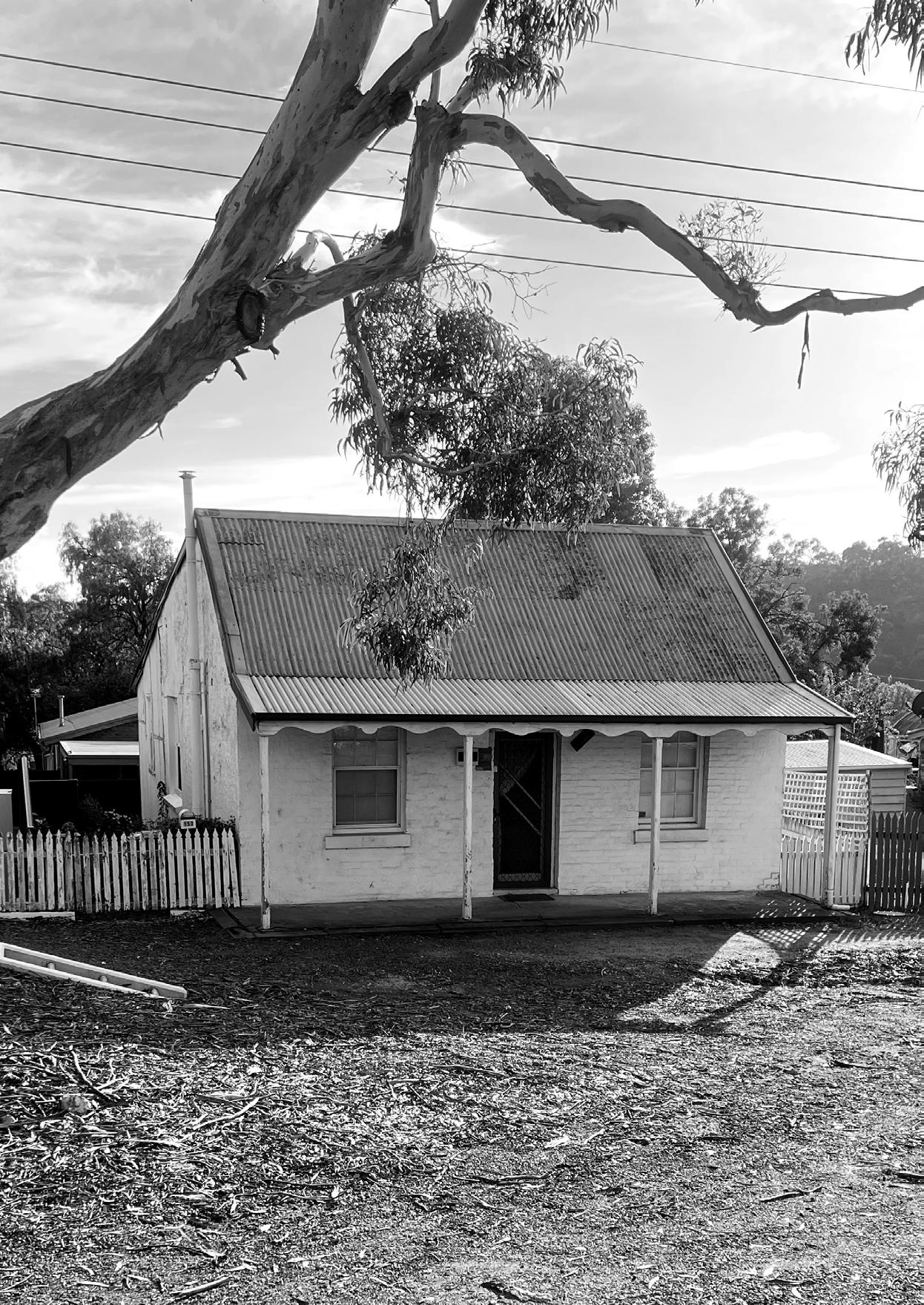
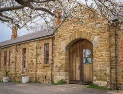
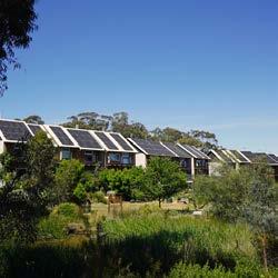
Housing in Castlemaine (photo credit: Eliza Kane); Cover image (overleaf) (photo credit: Eliza Kane)
Executive Summary
Improving regional mobility and accessibility go beyond strategies for transport networks and transport infrastructure. Where people live impacts their ability to access transport services, as well as other essential amenities and services to meet daily needs. It can also exacerbate the consequences of inadequate transport networks –resulting in an increase in private car ownership and usage.
So, what if increasing housing density could be the driver to justify greater investment in mobility options and community infrastructure and amenities?
Housing as a key to unlock regional mobility and spatial accessibility
Historical, social and spatial analysis and research indicates that housing location and typologies in the Castlemaine Township inhibits spatial accessibility.
Examining the current housing stock, as well as existing community infrastructure and transport and mobility options, provides an insight into constraints and the challenges the region is facing - but also highlights opportunities to deliver housing in a way that can also improve spatial accessibility.
Townships as neighbourhoods
To undertake this analysis, the Castlemaine ‘Township’ scale has been reframed as a collection of
neighbourhoods. Focusing on specific neighbourhoods enables a deeper analysis and understanding of place. This provides an insight into the strategies and actions which could be deployed to improve spatial accessibility in response to the different categories of neighbourhoods which are characteristic of regional townships.
Rethinking the planning approachProject Postcode
Project Postcode - as a planning project - takes a holistic view of and approach to enhancing spatial accessibility. It centres on housing as a resource to provide opportunities for neighbourhood mobility, and as a lever to drive investment in community infrastructure.
This report summarises the research and analysis of the Castlemaine Township and key ‘neighbourhoods’the Castlemaine town centre, McKenzie Hill and Wesley Hill, which provide an evidence-base foundation for Project Postcode.
It details how the planning project is informed by and responds to stakeholder and community engagement, and how experiences in Castlemaine have informed the Project Postcode as a planning project.
Finally it details the Project Postcode ‘toolkit’ - strategies and actions covering housing, neighbourhood mobility, community infrastructure and environment and climate resilience - to keep Castlemaine connected.
Acknowledgment of Country
We acknowledge the Traditional Owners, the Djaara people of the Kulin nation, as the original custodians of the lands and water on which the Castlemaine Township is located.
We pay our deep respects to Indigenous communities and to Elders past and present. We recognise and value the ongoing contribution of Indigenous people to the sustainable development that supports our communities.
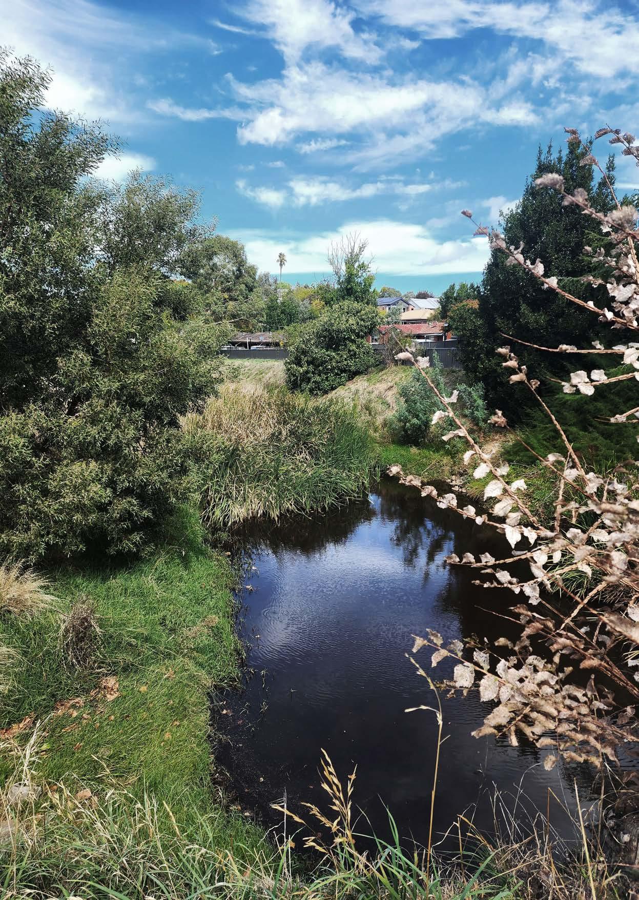
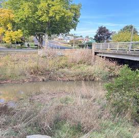
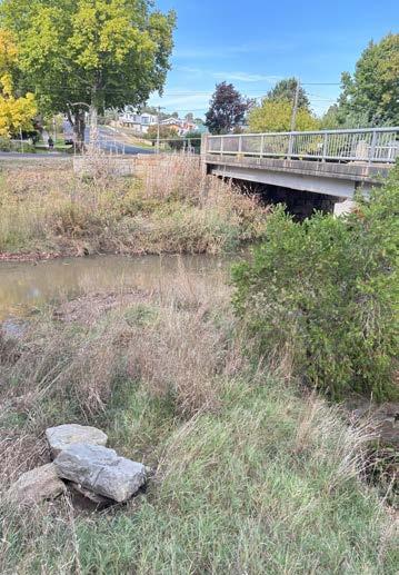
Barkers Creek (Photo credit: Rochelle Fernandez).
Listening to Country
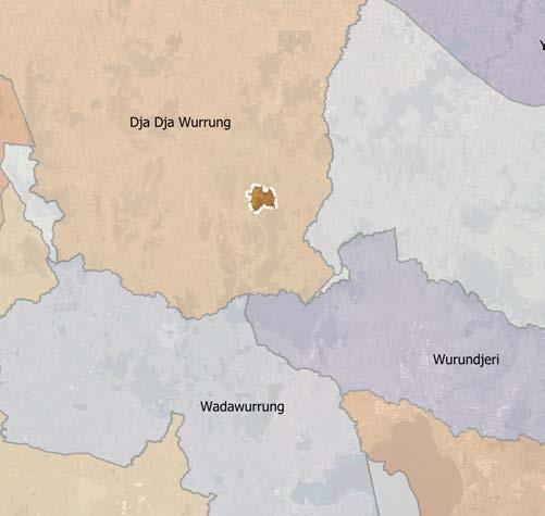
The Castlemaine Township is situated on Dja Dja Wurrung Country— the lands of the Djaara people, who have administered care for tens of thousands of years. These lands, waters, skies, and stories are living, interconnected systems, deeply embedded with meaning and cultural significance.
Here, we focus on ‘Listening to Country’—an act that goes beyond a symbolic gesture. It is an active process of paying attention, of learning from the knowledge embedded in landscape and memory, and of rethinking how we relate to the places we live and plan for.
“Country is known ...it has its stories that are taught, learned and told. ...It has its rituals. It can be painted, ... and one can care for and love it...”
-
Michael Dodson. (Excerpt from Hromek, 2020)
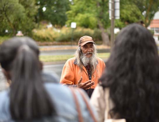
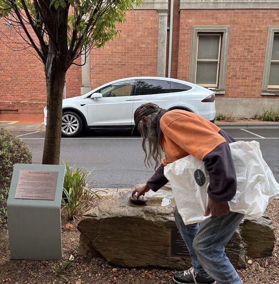
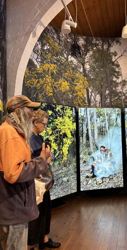
The group had the privilege of doing a walking on Country tour with Uncle Rick Nelson, a respected Aboriginal Djaara Elder and cultural leader in Castlemaine. Uncle Rick’s stories and reflections offered a powerful lens through which to see the town’s past and future. He shared insights about the ecological and cultural changes the Castlemaine Town and surrounding landscapes had undergone, especially during the Gold Rush, and emphasised the importance of water, Country, and kinship and foundational elements of life.
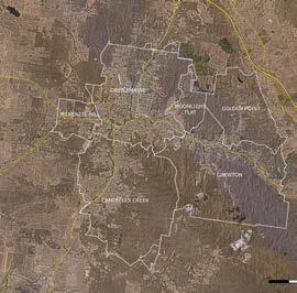
Castlemaine RAP map (photo credit: Rochelle Fernandez, using QGIS)
Relation to water
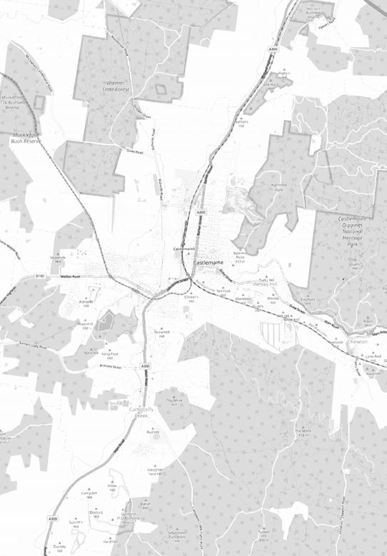
One of the most striking lessons we learned was about the relationship between Castlemaine’s development and its waterways. Creeks and waterholes are not only ecological lifelines but also deeply spiritual and cultural sites for the Djaara people. The development of Castlemaine during and after the Gold Rush disrupted these systems, often irreversibly. Creeks were ‘shifted’ to make place for roads and infrastructure.
‘Upside down’ Country
Uncle Rick spoke about the landscape being turned “upside down”—a phrase that powerfully captures the impact of gold mining, which quite literally involved digging through Country in search of gold. This violent inversion of the land had long-lasting effects on both ecological systems and cultural heritage (eg. the sinkholes).
The concept of ‘upside down Country’ resonates deeply with the work of scholars and designers such as Dr. Danièle Hromek, who writes that engaging with Country is about learning from it as a teacher, rather than treating it as a resource.
In her article ‘An Approach for Engaging with Country’, Hromek (2020), foregrounds Country as a living entity, and that design and planning practices should seek to understand and respond to its values, stories, and needs rather than imposing deliberate frameworks upon it—shaping development to respect and regenerate land and not the other way around.
Map highlighting Castlemaine’s creeks and roads (photo credit: Rochelle Fernandez, using QGIS)
Uncle Rick Nelson: Walking on Country. (photo credit: Yiming Liu)
Relational approach (Image credit: Hromek, 2020)
Castlemaine
Campbells Creek
Country
McKenzie Hill
Chewton
Project Postcode on Country
In planning for Castlemaine’s future, while Project Postcode focuses on connecting people and building communities, it also seeks to link people back to place and develop an identity that recognises indigenous heritage. In doing so, Project Postcode hopes to contribute to a vision of Castlemaine that learns from past experiences and respects Country’s never-ending presence.
Lastly, listening to Country is also about humility. Recognising that Aboriginal knowledge holders have stewarded these lands far longer than any other settlers is essential along with acknowledging their understanding of how to live sustainably with Country. To plan responsibly, we must listen to these stories—not just with our ears, but with our minds and actions.
Project Postcode in place: McKenzie Hill case study
1 Introduction
The Township Scale and Context
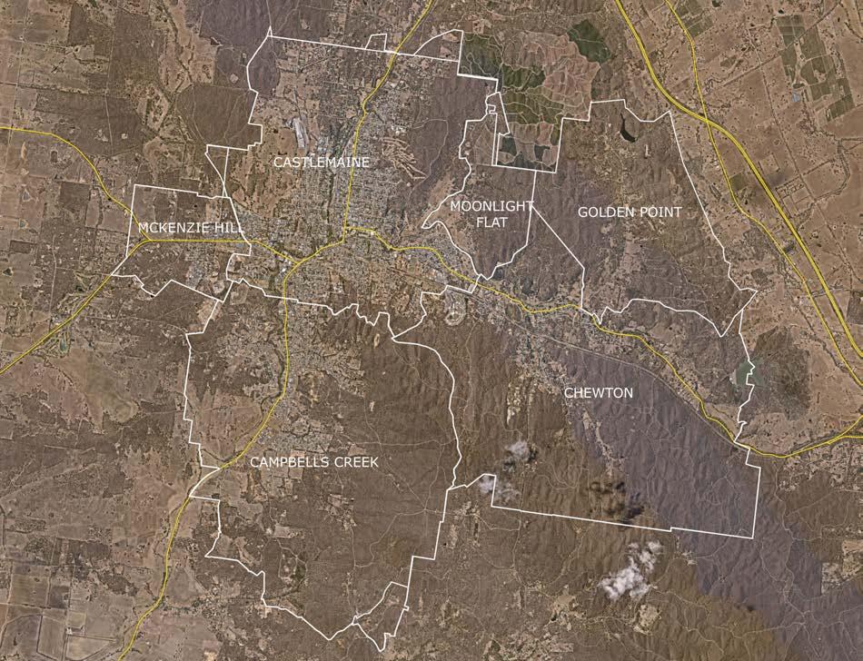
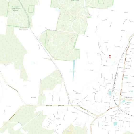
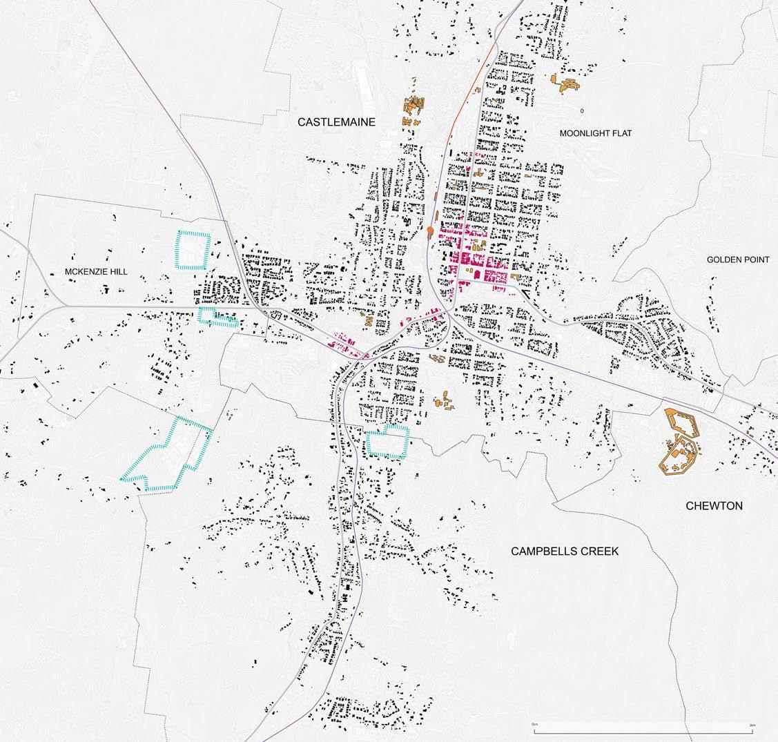
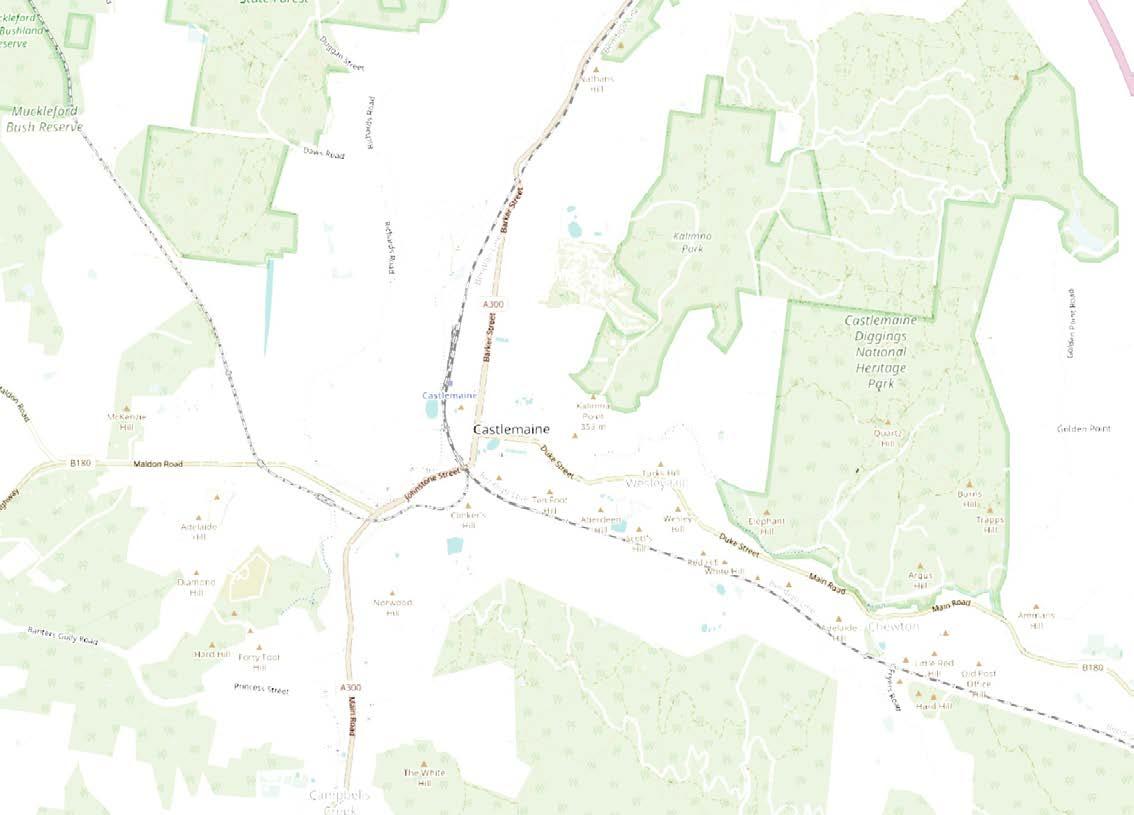
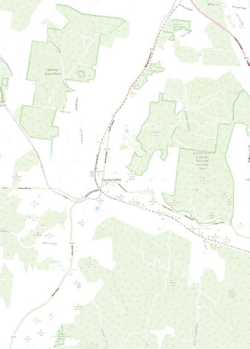
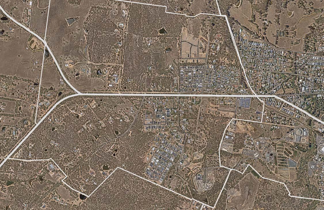
The Castlemaine Township is the primary urban and economic centre of Mount Alexander Shire, encompassing the central town of Castlemaine along with the neighboring suburbs of Chewton, Campbells Creek, McKenzie Hill, Golden Point, and Moonlight Flat (see image above).
As per ABS (2021), population of the Castlemaine Township region was recorded at 11,352 people (accounting for over 55% of the Mount Alexander Shire population). This highlights the
CastlemaineTownship scale map (image credit: ABS (2021), Rochelle Fernandez, using QGIS and Nearmap)
critical role of the area in supporting the daily needs of more than half the Shire’s residents.
The significance of the township scale lies in its spatial and functional connectedness with its surrounding neighborhoods. It represents not just a population core, but a shared catchment for education, health services, employment, retail, and a variety of cultural activities. The towns constituting the township are distinct yet interdependent on one another, contributing to a collective urban identity.
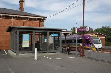
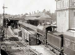
Castlemaine Railway Station (photo credit: Michael Yuen)
Key Planning Issues
‘Centreless’ towns
Historical and contemporary urban development has influenced the urban layout of the Castlemaine Township, which focuses on the Castlemaine town centre as its core ‘hub’. Investment in the town centre has led to commercial and community facilities largely being confined in a limited area of the Township. Over time, residential areas have emerged spreading radially out from the town centre. Subsequently, these residential areas lack the amenities to create ‘centres’ and build strong place identity and community connections.
Housing
Another key planning issue concerns housing - specifically where it is located around the Castlemaine town centre, and the diversity (or lack thereof) of housing which is being delivered in the Castlemaine Township.
Despite planning policy direction to increase housing diversity and encourage infill development (Mount Alexander Shire Council, 2004), planning has not achieved the desired outcomes. This has flow-on effects for mobility and spatial accessibility within the region.
CASTLEMAINE TOWNCENTER
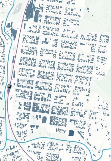
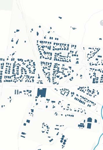
Development patterns influencing formation of Centreless Towns like McKenzie Hill and Wesley Hill (image source/ credit: Geoscape (n.d.), DEECA (2025), ABS (2021), DTP (2024). Rochelle Fernandez, using QGIS and Nearmap)
LEGEND
Roads/ Transport routes 0 km 1 km
Creeks
WES LEY HILL
MCKENZIE HILL
Towards Harcourt
Towards Chewton
Towards Campbells Creek
Towards Maldon
Spatial accessibility
Patterns of urban development and the delivery of housing ultimately impact spatial accessibility within the Castlemaine Township. This is to the extent that a concentration of amenities and services, and lack of appropriate housing, affects the ability of residents to meet their daily needs and reliance increases on private car use to do so.
It is important to recognise that what it means for an area to be ‘well-serviced’ by amenities and essential services in Regional Victoria is not the same as what this may require in metropolitan areas (Regional Cities Victoria, 2025).
LEGEND
Roads/ Transport networks
Education facilities
Recreational open spaces
Community facilities
Health facilities
Train Station
Grocery/ shopping
Sports facilities
Despite this, improving spatial accessibility— by bringing more services to people in place— can reduce the burden of inadequate transport systems and the need to rely on private car use within the region. Simultaneously, this can be used to strengthen community connections by bringing more people together, closer to where they live.
Distribution of services/ amenities within the township (photo source/ credit: DTP (2025), Rochelle Fernandez, using QGIS, Google Maps)
Planning for regional townships, as an area centering around a commercial hub, rather than as a collection of neighbourhoods, influences the location and diversity of housing, limits spatial accessibility, and exacerbates regional mobility issues.
The symptoms of this planning approach have broader implications — affecting social and community ties and the ability to create place identity and connection to place.
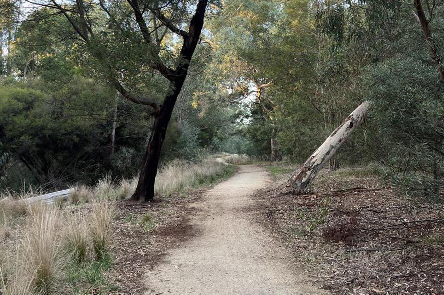
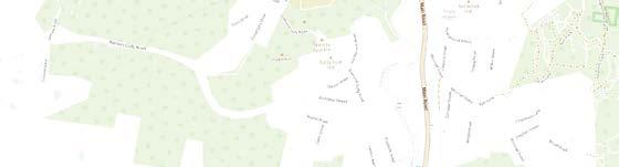
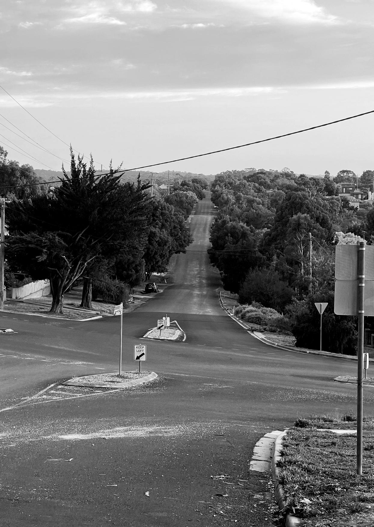
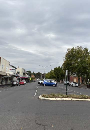
Long road to the Castlemaine town centre (photo credit: Eliza Kane)
Project overview: Project Postcode
Project Postcode is a planning initiative focused on addressing the challenges of spatial accessibility and housing development across the Castlemaine township. Drawing from research into the region’s planning history, transport networks and connectivity, and housing pressures, the project responds to the emergence of ‘centreless towns’— neighborhoods devoid of a clear identity, accessible services, and infrastructure connectivity.
At the core of project is the idea of ‘Housing as a resource’—housing as a catalyst for change. Rather than viewing housing solely as a response to demand, the project repositions it as an asset to shape better planning outcomes.
The project also recognises the importance of reconciliation with ecology. It advocates for a planning model that not only improves connectivity and accessibility for its residents, but also restores and strengthens the built environment’s relation to water and landscapes, previously affected by colonial and extractive land uses.
In considering restoring relations to the environment while planning for liveability, Project Postcode emerges as a holistic approach to enhancing both community well-being and spatial accessibility, giving neighborhoods a renewed identity and a stronger connection to services, people, and place.
Project Postcode envisions a connected Castlemaine by strengthening neighbourhood identities, enhancing mobility, and improving spatial accessibility—ensuring that all residents, regardless of location, are linked to place, each other, and the broader township.
Project Postcode: Key Elements
The implementation of Project Postcode is based on a set of tools consisting of tactical urban planning and design interventions for the township to keep Castlemaine connected This ‘toolkit’ is centered around four interrelated elements:
1. Housing:
The key driver of change; increasing affordable and accessible housing options that support inclusive growth while serving as anchors for neighborhood identity.
2. Neighborhood mobility:
Improving spatial accessibility through diverse mobility options, better transport links, walkability, and local access, enabling residents to connect easily to services, and each other.
3. Community infrastructure:
Strengthening local infrastructure to build resilient, well-serviced neighborhoods that can function as local centres and enhance residents’ quality of life.
4. Environment and climate resilience:
Integrating ecological restoration and climate-sensitive planning to support both environmental health and community wellbeing.
While each of these themes addresses distinct challenges, they are designed to work together to deliver holistic and adaptable planning outcomes. Project Postcode aims to implement these strategies across different township neighbourhoods, ensuring tailored yet cohesive responses to local needs.
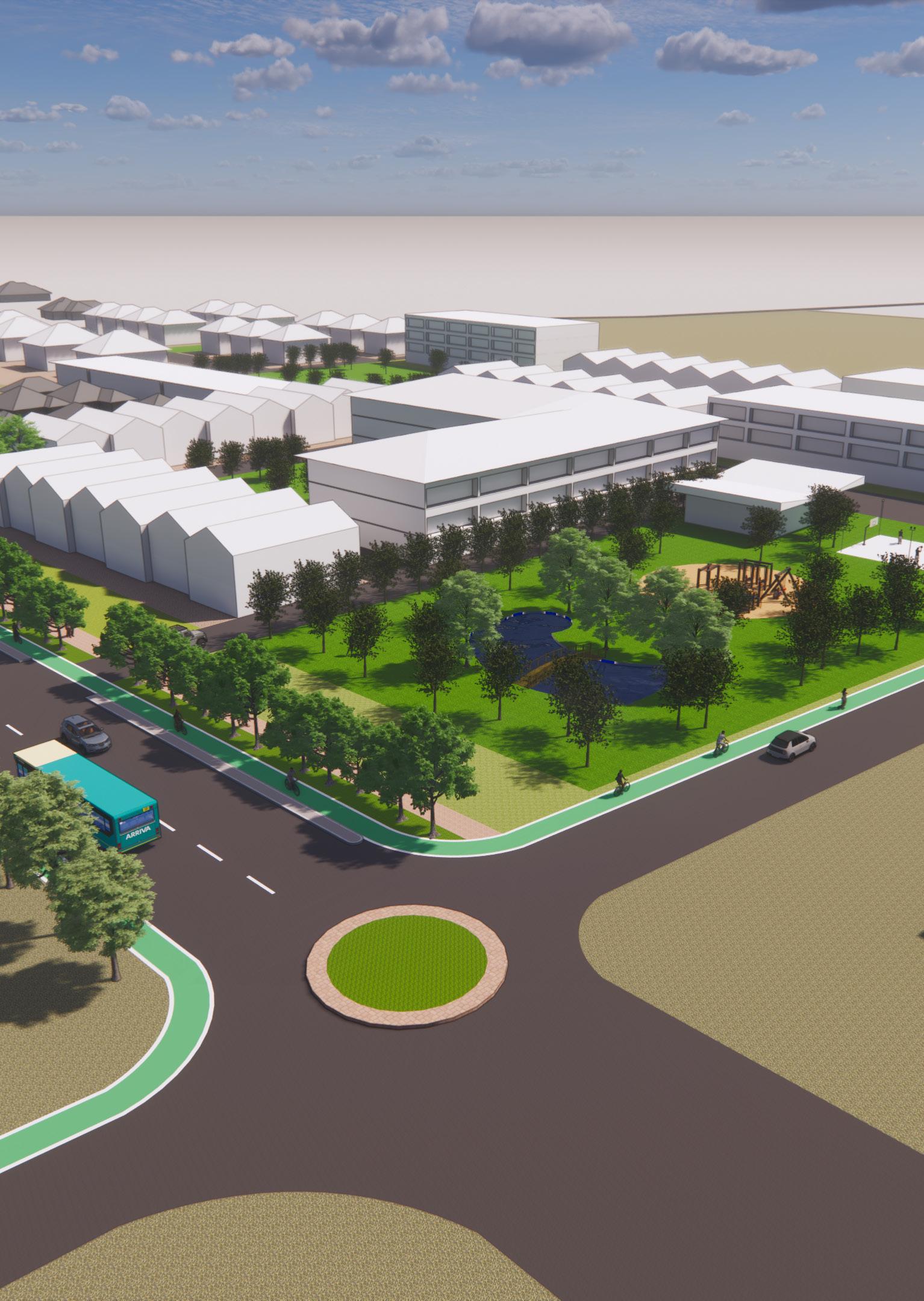
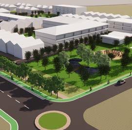
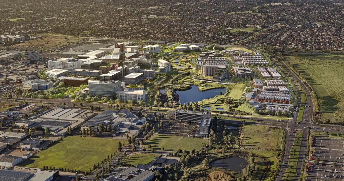
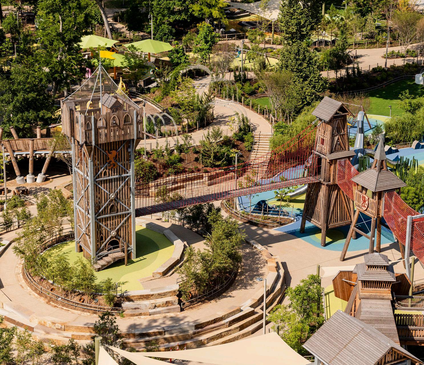
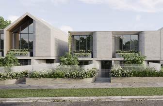
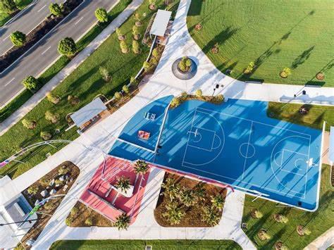
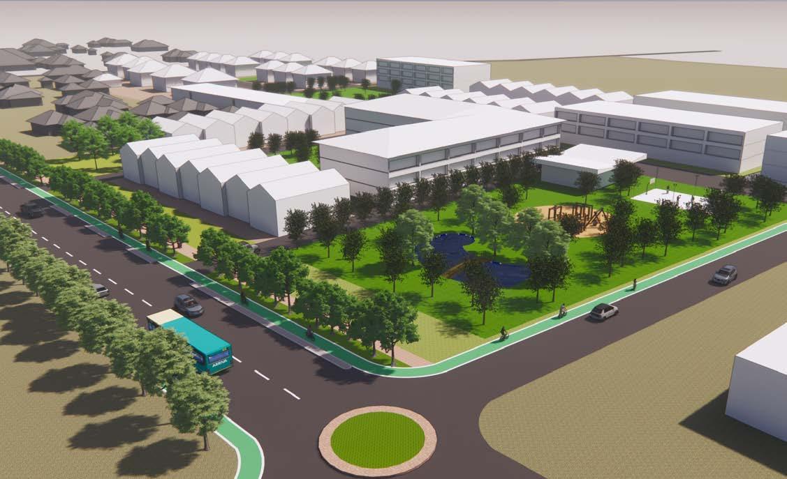
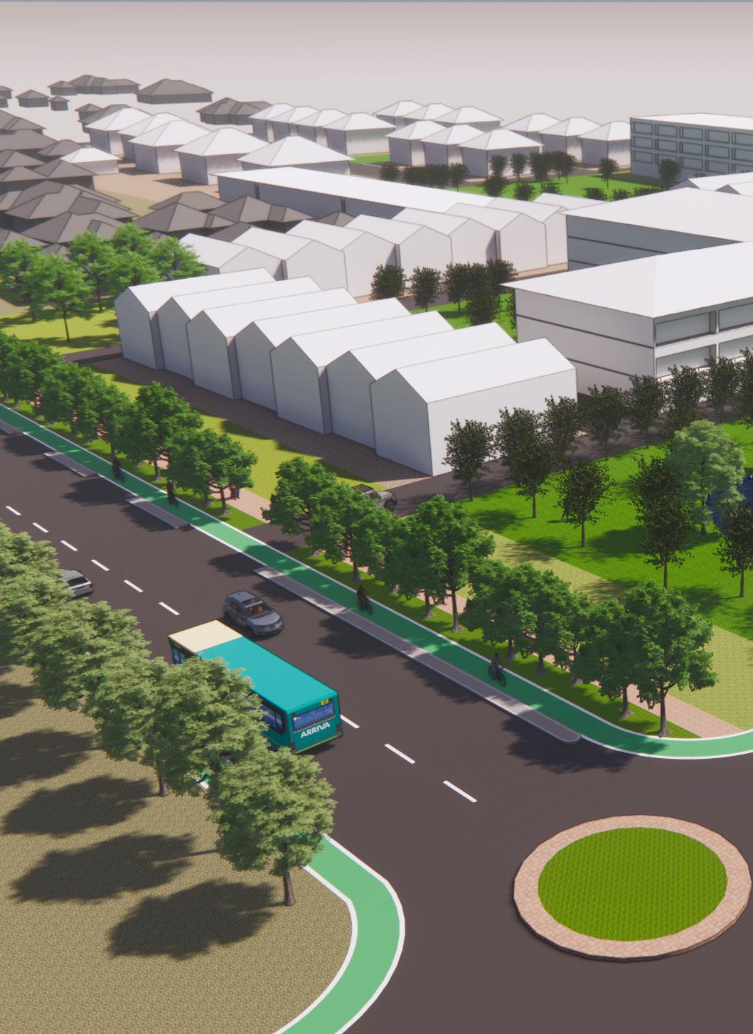
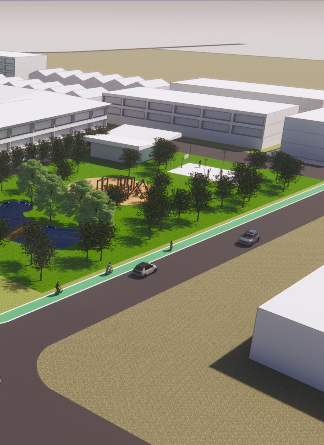
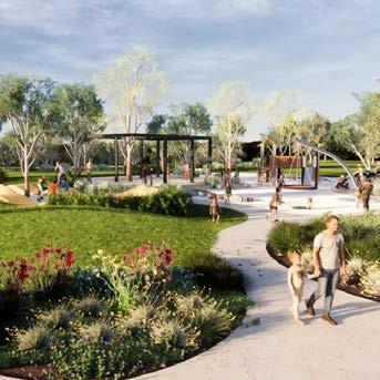
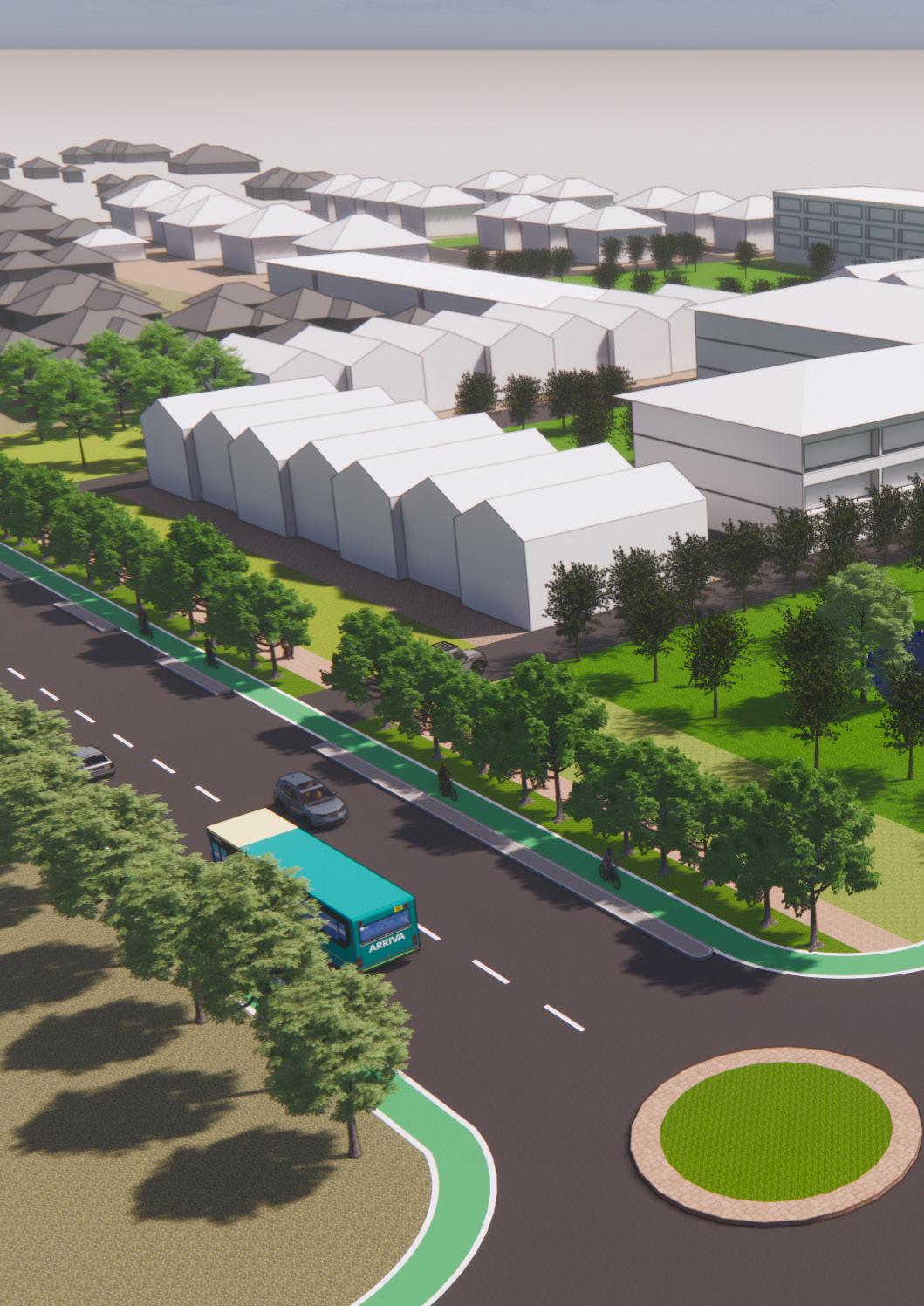
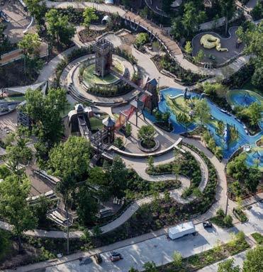
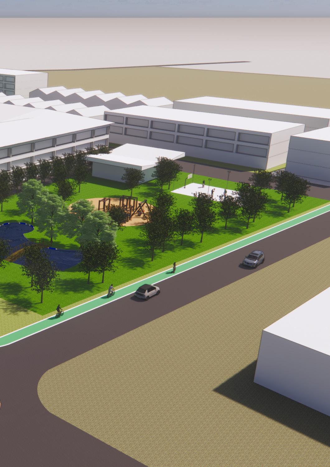
Diverse housing typologies to increase density, facilitate aging in place, etc.
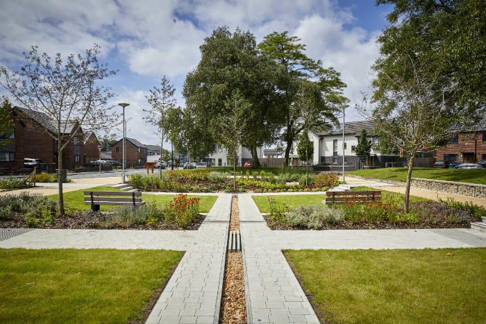
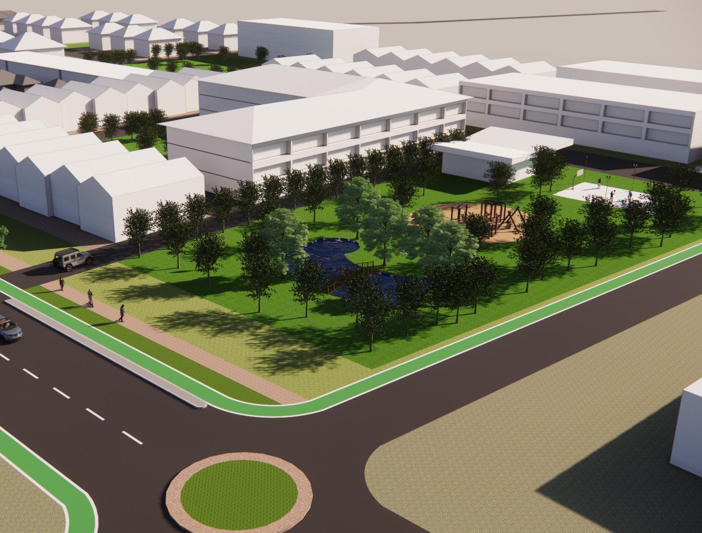
Public open green space with allocations for different recreational acitvities.
Shared mobility options to support diverse and sustainable mobility and ease household transport costs.
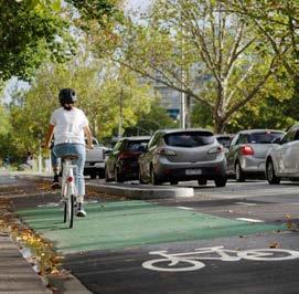
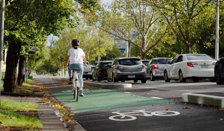
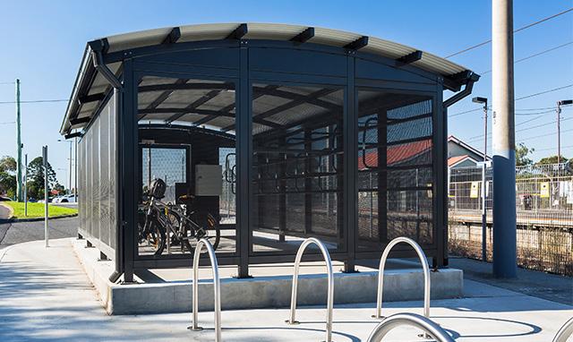
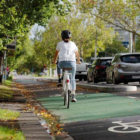
Separated bike paths and footpaths with nature strips to encourage and enhance active mobility.
In-between shared open spaces to facilitate low-traffic neighborhoods and access to nature.
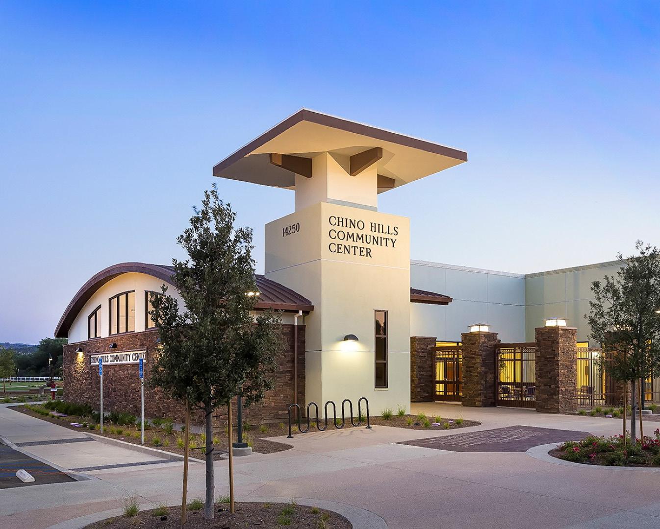
Multipurpose community facility to encourage community activities and social relations.
Improved bus services to optimise public transport networks and enhance accessibility /mobility.
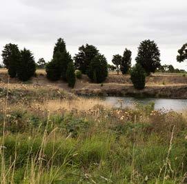
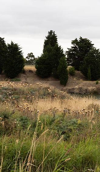
Constructed wetland as an element of WSUD* to restore ecological connections.
Report overview
This report is comprised of the following:
1. Planning analysis - this section details the findings of the historical, social and spatial analysis. It first sets out the research and analysis which covers the broader Castlemaine Township. Second, the analysis focuses in on the different study areas within the township - being the Castlemaine town centre, McKenzie Hill and Wesley Hill - to understand the different conditions, constraints and opportunities that are present in these study areas.
2. What we learned - this section sets out the insights gained in a real life context (community engagement and site observations) as well as from planning concepts and case study and precedent projects. It describes how these have informed the direction and outcomes of the planning project.
3. Planning Project: Project Postcode - finally, this section details the planning project and the Project Postcode Toolkit, along with strategies and actions for implementing the toolkit.
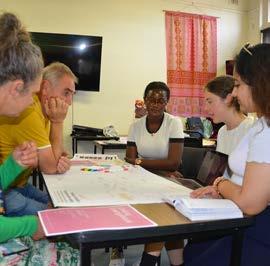
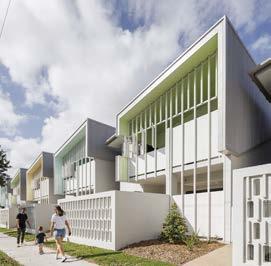
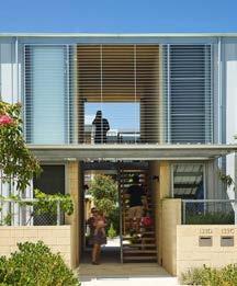
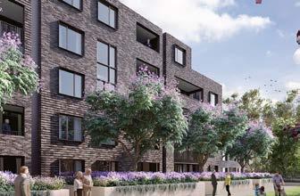
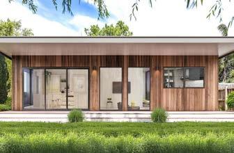
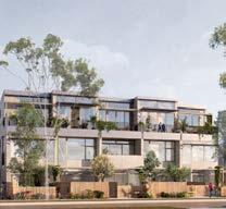
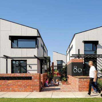
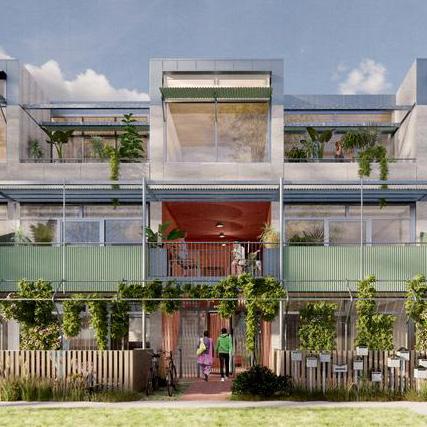
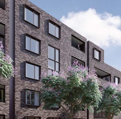
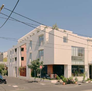
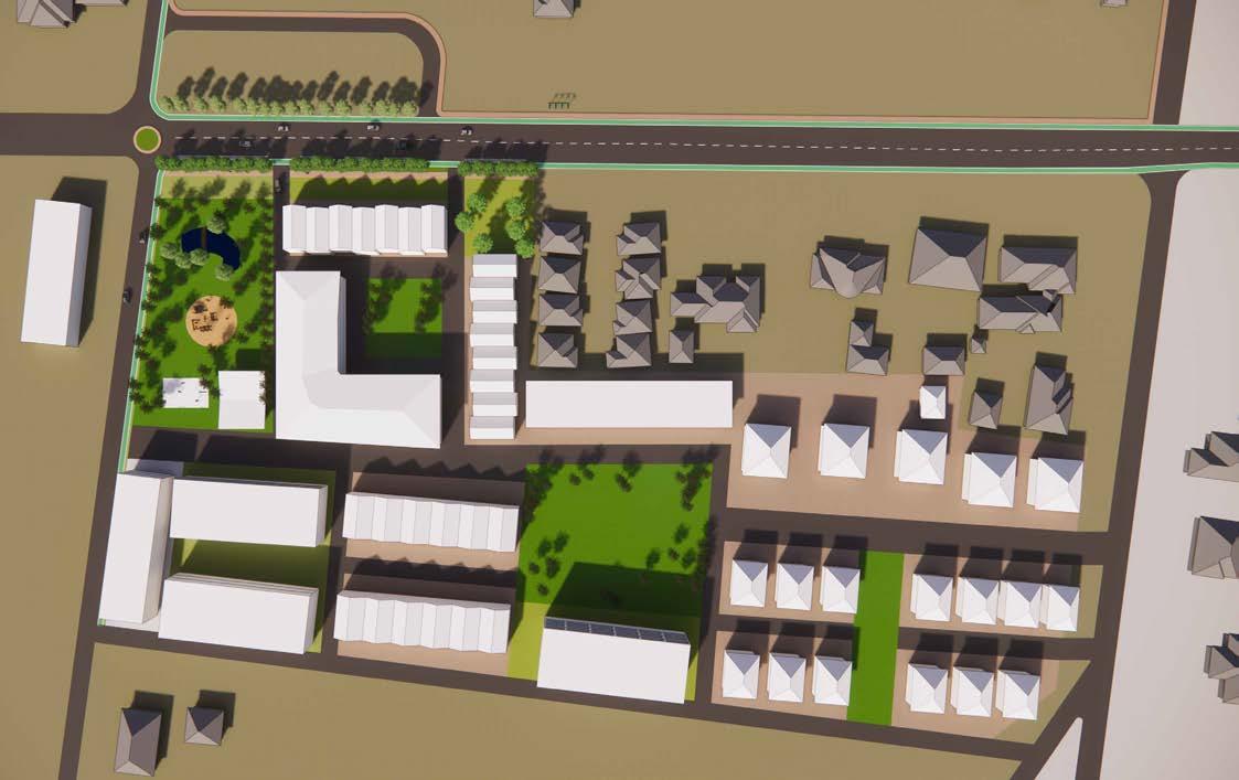
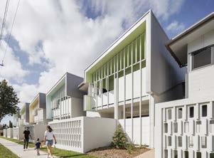
From top: Map of Castlemaine Township produced in research and analysis phase (image source: Rochelle Fernandez); Project Postcode group engaging with local stakeholder group representatives (photo credit: James Whitten); Mundingburra Housing Project used as a precedent (photo credit: Andrew Rankin, n.d.); Project Postcode new housing model (image source: Rochelle Fernandez)
Phase 1
Preliminary research February
Phase 2 Community engagement
Phase 3
Scope and refine the project
Phase 4 Present the project
Phase 5
Finalise the project
The report details the process and the activities undertaken over a number of months to research, understand, scope and refine the planning project.
The content of the report outlines and reflects the holistic approach adopted by the group to develop a deep understanding of not only the symptoms of the mobility and accessibility issues that regional towns such as Castlemaine
face, but the underlying causes contributing to these issues.
This is critical in order to develop rational and workable, but still ambitious and innovative, solutions to improve regional mobility and accessibility.
Timeline of the planning project process (image source: Eliza Kane)
2 Planning Analysis
Planning Analysis
The planning analysis investigates the development patterns and spatial inequalities across Castlemaine’s Town Centre, McKenzie Hill, and Wesley Hill to understand how different planning legacies are continuing to shape urban outcomes. These three areas are selected as case studies due to their contrasting urban conditions, Castlemaine as the established civic and commercial centre, Wesley Hill as a peripheral area with emerging community needs, and McKenzie Hill as a growing residential fringe lacking a defined centre.
The analysis is framed around four key themes: historical influence, transport and mobility, housing patterns, and environmental and climate challenges. Through this lens, the analysis explores how infrastructure distribution, environmental constraints, and legacy growth patterns are producing uneven access to housing, services, and transport.
It also examines why development is unfolding in particular ways, what environmental risks and planning controls are shaping growth, and where accessibility opportunities are arising through infill and greenfield diversification. This work underpins Project Postcode by revealing how gaps between housing, services, and jobs drive affordability and access issues, and points to targeted solutions for each area.
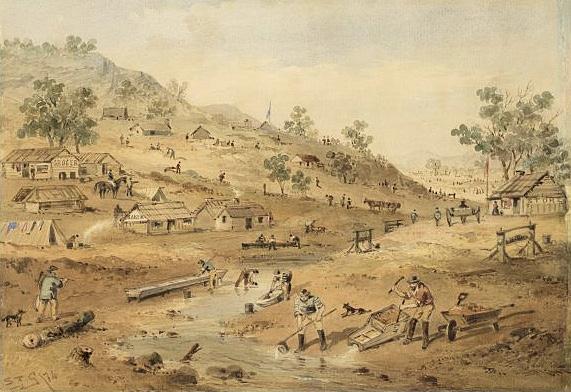
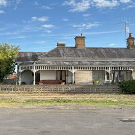
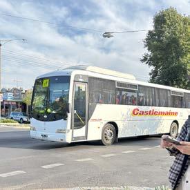
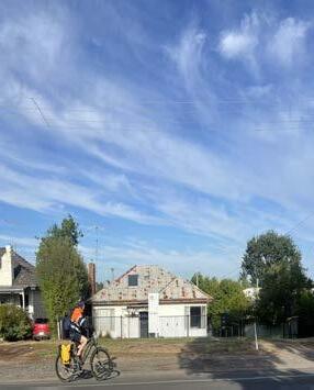
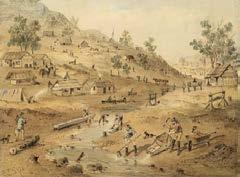
From top: Historic mining activity, a typical house in Castlemaine, Castlemaine local bus, Barkers Creek. Image source/ credit (from top): Parks Victoria, 2024; Hillary Namitala
The Commercial Hub
The Growth Area
The In-between
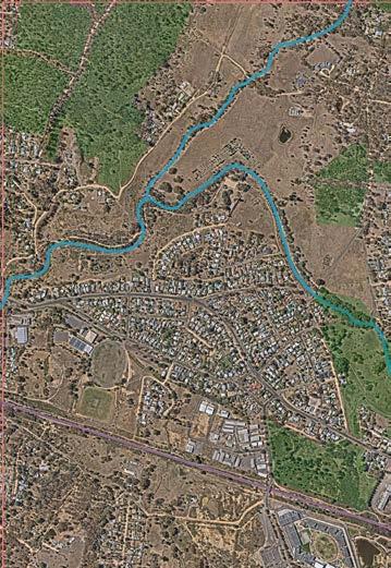
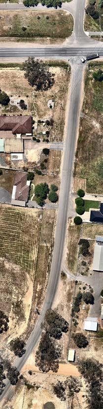
Wesley Hill aerial view (image credit: DEECA (2025), Nearmap, Hillary Namitala using QGIS)
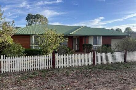
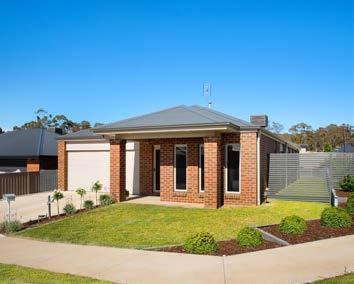
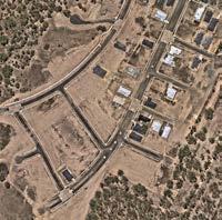
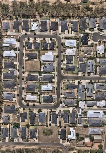
McKenzie Hill Neighborhood (photo credit: Realestate.com.au, n.d)
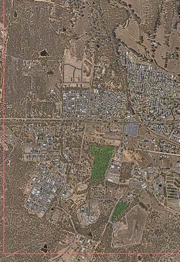
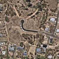
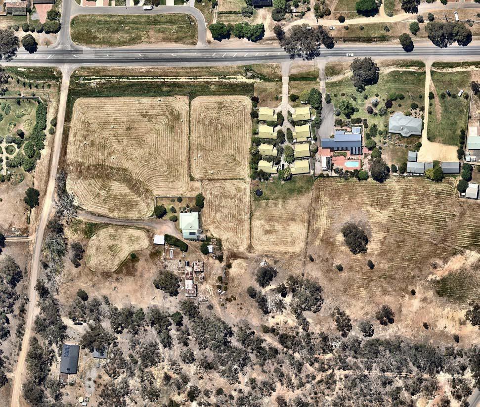
McKenzie Hill aerial view (image credit: DEECA (2025), Nearmap, Hillary Namitala using QGIS)
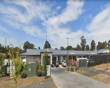
Arcare McKenzie Hill (photo credit:Google street view)
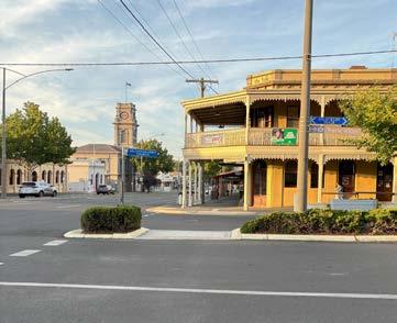
Castlemaine town centre (photo credit: Hillary Namitala)
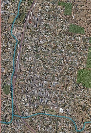
Castlemaine Town Center aerial view (image credit: DEECA (2025), Nearmap, Hillary Namitala using QGIS)
Castlemaine Town centre (photo credit: Hillary Namitala)
Castlemaine Town Centre
McKenzie Hill
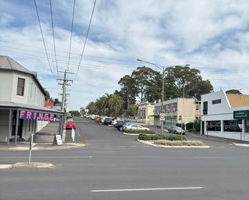
Wesley Hill
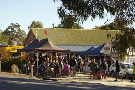
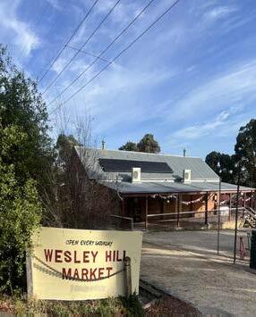
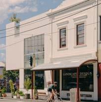
Wesley Hill neighborhood (photo credit: Eliza Kane)
Wesley Hill Market (photo credit: Eliza Kane)
How has history shaped urban development?
Town formed quickly around mining camps and trade routes.
1900 1850
Infrastructure such as roads and waterways laid the urban fabric.
Settlement Patterns
1950
Adaptive reuse of old buildings for cafes, galleries, and local businesses.
2000s
Castlemaine reemerges as a creative and cultural hub with strong community identity.
The towns developed organically around the mines unlike planned towns therefore early roads, buildings, and services were positioned near creeks and diggings, rather than following a structured layout. The mining sites were created around elements of the natural landscape which left a gap in the urban fabric of the townships (Harper, 2016).
The town’s expansion was dictated by gold-bearing areas, leading to irregular land subdivision and fragmented property ownership, which still impacts development today.
From top (Image source: Parks Victoria, 2024; State Library Victoria, n.d., Goldfields Guide Victoria, n.d., Hillary Namitala)
Mining at Castlemaine diggings
Castlemaine Railway Station
Abandoned buildings
Current State
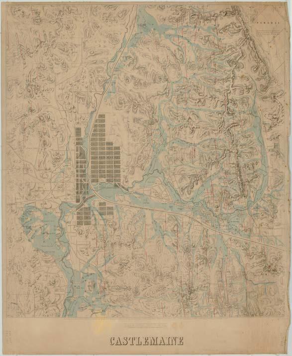
Castlemaine’s rectilinear grid, enabled clear land division and zoning, shaping the town’s orderly structure today.
A historic map of Castlemaine in 1890 (image source: State Library Victoria, n.d.)
Castlemaine
Wesley Hill
McKenzie Hill
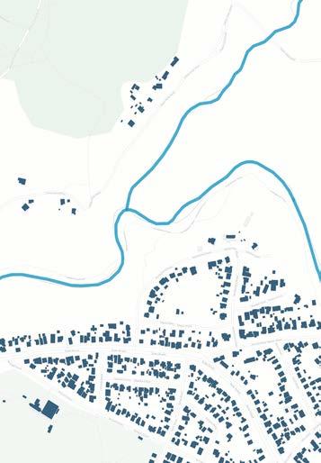
Building footprints
Fire, Flood, and Futureproofing
Castlemaine’s urban development has long been shaped by its natural environment, with factors like topography, environmental risks, and past mining activities creating both opportunities and constraints. The town’s settlement patterns, infrastructure, and land use have had to adapt to challenges such as flooding, bushfire risk, and landscape fragmentation, often leading to an uneasy balance between growth and environmental preservation.
Historical mining and development disrupted natural drainage in Castlemaine, heightening flood risk. Climate change has worsened this by increasing extreme rainfall, complicating urban planning (Castlemaine Gold Rush Relics, 2025).
In contrast, McKenzie Hill and Wesley Hill, located on the fringe, are exposed to bushfire risk due to their proximity to dense bushland and vegetated ridgelines. These areas developed through incremental subdivision and housing on the urban-rural fringe, often without coordinated fire management or access planning. The result is a vulnerable urban edge, where bushfire overlays restrict further development and pose challenges. As Castlemaine continues to grow, managing these risks while supporting sustainable development will be essential to ensure long-term resilience and safety.
Map highlighting environmental and ecological factors (image source: Hillary Namitala)
Castlemaine
Chewton
McKenzie Hill
Campbells Creek
LEGEND Creeks Rail line Parks Building footprints
Open Space and Environmental Features in Castlemaine Township Playgrounds
Flooding and bushfire poses risks for urban development, and highlights considerations for future development
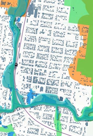
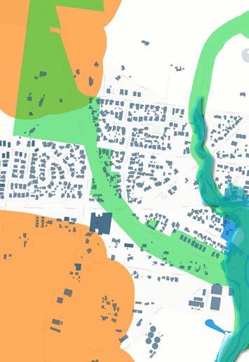
Wesley Hill’s Environment risk map (image credit: Microsoft (2020), DEECA (2025), Hillary Namitala using QGIS)
Campbell’s creek (photo credit: Hillary Namitala)
McKenzie Hill’s Environment risk map (image credit: Microsoft (2020), DEECA (2025), Hillary Namitala using QGIS)
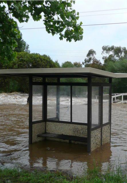
Town centre during the 2022 flood (image source: VICSES, 2020)
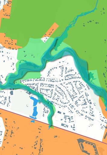
Castlemaine’s Environment risk map (image credit: Microsoft (2020), DEECA (2025), Hillary Namitala using QGIS)
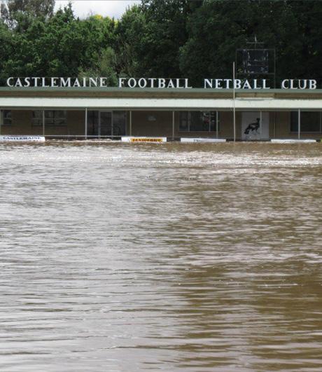
Castlemaine Football club during the 2022 flood (image source: VICSES, 2020)
Castlemaine Township demographics
Demographic characteristics and trends, including age, family composition and needs for assistance, provide key insights into the diversity and needs of the current and future population - in particular, needs for housing, accessibility options and community infrastructure and essential services.
Age profile
The Castlemaine Township has an older, aging population. This is reflected in the population’s median age of 50 years old, and the dominant age cohort being persons aged between 65 to 69 years old (ABS, 2021).
Family composition
The dominant family structure is couples with no children (ABS, 2021) (refer figure overleaf), being almost 50% of all families. This is consistent with what would be expected of a region with an the aging population. Relevantly, however, a significant proportion of families have children, of which more than 18% are single parent families (ABS, 2021).
Needs for assistance
In line with the trend of an aging poulation, Castlemaine Township has experienced an increase in the proportion of the population recording a need for assistance with core activities (ABS, 2016; ABS, 2021).
Census data highlights a potential relationship between age and increasing needs for assistance to undertake daily activities, with more than 50% of people requiring assistance being 65 years and older (ABS, 2021).
Icons sourced from The Noun Project, Nico Bokenkroger, Bailey, Kevin and Adrien Coquet, accessed 23 March 2025
Castlemaine TownshipDemographic Stats (Source: ABS, 2011, 2016, 2021 and 2024)
50 years old (median age)
Largest increase in age profiles (2011 - 2021): 65-69, 70-74, 95-99
Increase in % of population with needs for assistance for all Castlemaine Township localities (2016 to 2021)
Almost 50% of family structures are couples with no children
>18% of families are single parent families
Castlemaine Township has an aging population and a diversity of family structures
Change in age profiles (over 10 years) in Castlemaine Township localities: age profile data highlights that between 2011 and 2021 there has been an increase in older age cohorts, specifically 65-69, 70-74 and 95-99 years old. At the same time, younger demographics, between 1519 and 20-24 years old have decreased.
Graph of Change in Age Profiles in Castlemaine Township (2011 - 2021) (image source: Eliza Kane, data source: ABS, 2011 and 2021)
Change in Age Profiles (%)
Family composition across the Castlemaine Township: the dominant family composition in almost all localities within the Castlemaine Township is couples with no children.
Graph of family composition in Castlemaine township (2021) (image source: Eliza Kane; data source: ABS, 2021)
Castlemaine ChewtonCampbells CreekGolden PointMoonlight FlatMcKenzie Hill Couple family with no children Couple family with children One parent families Other family Family composition
Household and dwelling composition
Analysis of dwelling typologies, dwelling structure, household composition, and building approvals indicate that the current (and future) housing stock does not meet the diversity or needs of the current and future population of the Castlemaine Township - contributing to a housing mismatch.
Dwelling structure and composition
Separate private houses comprise the majority of housing typologies in the Castlemaine township. In certain localities, this proportion is greater than 90% - for example, in Chewton, McKenzie Hill and Moonlight Flat (ABS, 2021). Three and four bedroom houses also make up a majority of residential dwellings in the Castlemaine township (~66% of all housing stock) (ABS, 2021).
Household composition
Lone and two-person households are a significant proportion of households within the Castlemaine Township (ABS, 2021), with lone person households comprising as high as 39.7% of all households in Castlemaine.
Approvals for new dwellings
Despite the mismatch between existing dwelling structure and household composition, building approvals data reflects that this trend will continue.
92% of building approvals in the broader Castlemaine region were for separate private houses. This is compared with only 8% of building approvals for dwellings being other private residential development (ABS, 2024).
Icons sourced from The Noun Project, Atif Arshad, Adrien Coquet, PC-SSH, and Sophia, accessed 23 March 2025
Castlemaine TownshipHousing Stats (Source: ABS, 2021 and 2024)
~34.3% of households are lone person households
3+ bedrooms is the dominant dwelling structure
~85% of housing stock is separate dwellings ~92% of building approvals for private houses between 2019-2024 were single separated dwellings
Housing does not match the diversity or needs of households
Household composition vs dwelling structure: lack of appropriate housing for lone person and twoperson households, and an excess of three and four bedroom dwellings.
Graph of household composition vs. dwelling structure in Castlemaine township, 2021 (image source: Eliza Kane; data source ABS, 2021)
Building approvals (dwellings): number of building approvals for dwellings between 2019 and 2024 have predominantly been for single, separated dwellings (houses).
Graph of building approvals for private dwellings (houses and excluding houses in Castlemaine SA2) 2019 - 2024 (image source: Eliza Kane; data source: ABS, 2024)
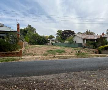
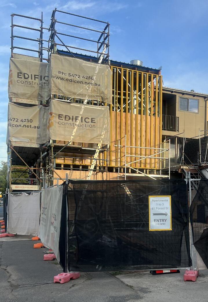
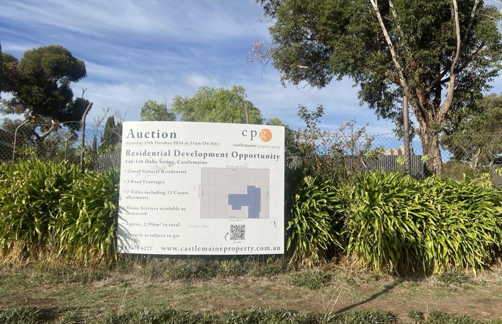
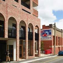
Vacant block in Castlemaine, likely to be redeveloped as single, separated dwelling (photo credit: Eliza Kane)
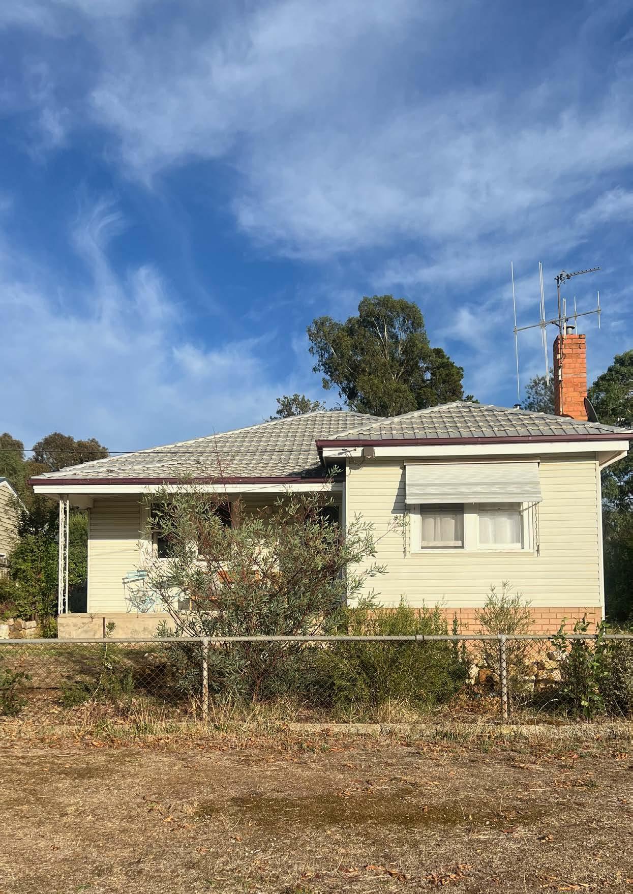
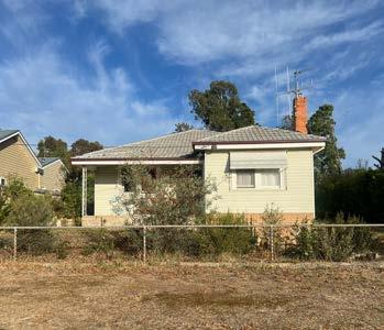
Single, separated dwelling in Castlemaine (photo credit: Eliza Kane)
Common housing typology in Castlemaine (photo credit: Eliza Kane)
Housing and rental affordability
The result of the housing mismatch is a housing stock which is inappropriate and expensive for many people in the Castlemaine Township region - for example, houses that are too big and therefore unaffordable for people to purchase, rent or otherwise continue to live in.
Mortgage and rental stress
The housing mismatch is likely to have contributed to a significant proportion of households within the Castlemaine Township experiencing mortgage and rental stress - which arises as a result of housing costs being a significant portion of household income (REMPLAN, 2025).
Affordable dwellings and rentals
Affordable housing sold and rented is declining across Castlemaine (including Moonlight Flat and McKenzie Hill) and the Mount Alexander Shire more broadly (REMPLAN, 2025), reflecting a lack of availability of affordable dwellings within the region.
Economic and social consequences of the housing mismatch
The housing mismatch and lack of appropriate and affordable housing have wide ranging consequences, include:
• Inability for local employers to attract and retain staff (D’Agostino, 2022).
• Childcare access, (which has implications for ability to work or study) (Mount Alexander Shire Council, 2024).
• Introduces systemic barriers to economic participation and community ties (Mount Alexander Shire Council, 2024).
Mt Alexander Castlemaine (and surrounds) Chewton Campbells Creek
Table of median property prices and rents (data source: REMPLAN, 2025)
Region
Mortgage and rental stress: the housing mismatch contributes to high rates of people experiencing mortgage or rental stress.
Graph of mortgage and rental stress in Castlemaine township localities, 2021 (image source: Eliza Kane; data source: REMPLAN, 2025)
Affordable dwellings sold: the graph indicates that there has been a general downward trend in the number of affordable dwellings sold in Castlemaine, Chewton and Campbells Creek.
Graph of number of affordable dwellings sold - MAS vs Castlemaine, Chewton and Campbells Creek, 2015-2024 (image source: Eliza Kane; data source: REMPLAN, 2025)
Affordable rentals: the graph indicates that there has been an increase in the number of affordable rentals from 2021 to 2022. However, this number has been declining since.
Graph of number of affordable rentals - MAS vs Castlemaine, Chewton and Campbells Creek, 2015-2024 (image source: Eliza Kane; data source: REMPLAN, 2025)
Significant efforts are being made within the Castlemaine Township and broader Mount Alexander Shire region to address the housing mismatch, and the symptoms and consequences of this issue (such as housing affordability.
Initiatives are being undertaken by community, non-profit organisations, as well as the local government. This covers both policy and strategic planning interventions, as well as facilitating and delivering new models of housing to improve diversity of housing stock and affordability for Castlemaine residents.
Examples of these initiatives include:
• Housing affordability strategies developed Mount Alexander Shire Council, as well as community organisation, My Home Network.
• Delivering affordable housing on Council-owned land.
• Establishment of charitable trust to hold affordable housing in perpetuity.
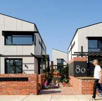
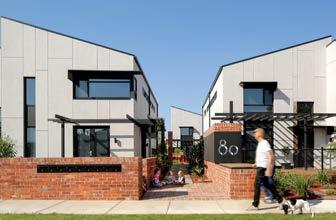
• Private and community-led housing developments, which have a focus on community and sustainability, such as The Paddock and Munro Court.
From top: My Home Network (image source: Midland Express, 2022); Proposed Council-led affordable housing site (image source: Google Street View, accessed June 4, 2025); Wintringham affordable housing in Castlemaine (image source: Wintringham, accessed June 4, 2025); Munro Court sustainable housing development (photo credit: Andrew Lackey, n.d.); The Paddock Ecovillage in Castlemaine (image source: Bush Project, n.d.)
Current and future residential development across Castlemaine Township
Expanding residential development
In addition to innovative housing initiatives being implemented in and around the Castlemaine Township, housing in the future will be supplied by way of greenfield development in areas such as McKenzie Hill, and Campbells Creek. Greenfield developments are expected to supply 700 lots for housing across Mount Alexander Shire (Mount Alexander Shire Council, 2023).
This reflects the reality that infill development will not be able to meet all regional housing needs and that developing outside of town centres has different implications for regional areas, compared with metropolitan areas (Regional Cities Victoria, 2025).
However, careful planning is required to ensure that continuing to develop housing outside of town centres does not compromise mobility and spatial accessibility for future residents.
Map of current housing stock and residential areas under development in Castlemaine Township (image credit/ source (above): Geoscape (n.d.), DTP (2019, 2024), Mount Alexander Shire Council (2023), Eliza Kane and Rochelle Fernandez, using QGIS NearMap, )
Transport and mobility
An analysis of transport and mobility patterns within the Castlemaine Township show significant gaps in both public and active transport networks. These deficiencies are particularly evident in the outer, centreless towns such as Wesley Hill and McKenzie Hill, where limited spatial accessibility is further strained by the region’s carcentric development patterns.
Car dependency and transport network gaps
As per ABS (2021) Census data, 54.2% of residents travelling to the Castlemaine Township for work rely on private vehicles, and 92% of households in the region reported owning at least one car. While these numbers represent only a few parameters/ measures (Place of Work data), assumptions can be made to the general characteristics of high car-dependency in the region. This also reflects the nature of public transport service available. Infrequent local bus operations (refer to map on next page) render them inadequate to meet mobility needs. Similarly, with the active transport networks, while strategic cycling routes are present within Castlemaine, they often lack continuity, and do not extend reliably to the outer towns. This coupled with road safety concerns and the absence of essential infrastructure such as bike storage or parking, makes active transport less viable, further exacerbating spatial accessibility.
Community-led mobility systems
Another implication of the inadequacy of transport networks is the subtle pressure on informal modes of mobility led by neighbors and the community, such as car-pooling and community-run buses. While these forms of transport help bridge the gap to some extent, without appropriate measures to make them reliable, they risk becoming unsustainable or equitable long-term solutions.
A potential to optimise existing networks arises from increasing housing density and stimulating urban activity to activate neighbourhood centres, and make transport networks more efficient. The analysis suggests that improving mobility infrastructure alongside housing interventions can create more accessible and connected communities.
Travelling to work (Place of workCastlemaine Township)
Castlemaine
Deficiencies in PT and AT networks exacerbate spatial accessibility issues.
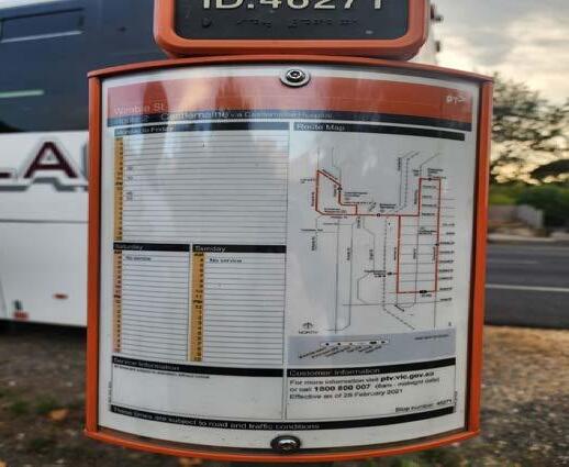
Bus Route 3 (Castlemaine to Harcourt)
- 3 buses (Mon-Fri), 8 stops
Bus Route 2 (Castlemaine Townloop)
- 5 buses (Mon-Fri), 15 stops
Bus Route 4 (Castlemaine to Maldon)
- 3 buses (Mon-Fri), 9 stops
Bus Route 6 (Castlemaine to Chewton via. Loddon Prison)
- 5 buses (Sat-Sun), 11 stops
Bus Route 5 (Castlemaine to Taradale via. Chewton)
- 5 buses (Mon-Fri), 13 stops
Bus Route 1 (Castlemaine to Campbells Creek)
- 3 buses (Mon- Fri), 25 stops
LEGEND
Regional bus routes Existing cycling routes Proposed cycling routes
From top: Map of transport networks and bus services in the Castlemaine Township; Active transport network map (image source/ credit: DTP (2020, 2024), Rochelle Fernandez, using QGIS,), Bus route 2 schedule (photo credit: Rochelle Fernandez).
Accessibility analysis
Walkability is a crucial aspect of equitable and sustainable neighbourhood design, influencing health, accessibility, and community interaction. In Castlemaine and its fringe areas such as McKenzie Hill and Wesley Hill, walkability varies significantly due to differences in urban form, infrastructure investment, and topography. The town centre benefits from a fine-grain street network, flat terrain, and proximity of services, allowing for convenient pedestrian movement.
In contrast, McKenzie Hill and Wesley Hill are characterised by dispersed residential development, limited footpath networks, and low street connectivity, which reduce the feasibility and appeal of walking for daily needs.
Catchment analysis indicates that many residents in fringe suburbs are located beyond a comfortable 10-minute (800m) walking distance from key community infrastructure such as childcare centres, libraries, and recreation spaces. Topographic constraints, like hills and uneven paths, further limit walkability, particularly for older residents and those with mobility aids.
The lack of shaded footpaths, lighting, and safe crossings also contributes to car dependency, even for short trips.
Improving walkability in these areas requires targeted interventions: adding continuous footpaths, creating flat and accessible green corridors, and clustering services within emerging neighbourhood centres. These improvements can encourage more active lifestyles, reduce transport disadvantage, and strengthen local ties, especially for families and older residents that consistently highlighted mobility challenges during community engagement sessions.
LEGEND
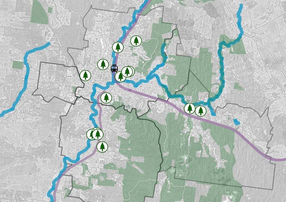
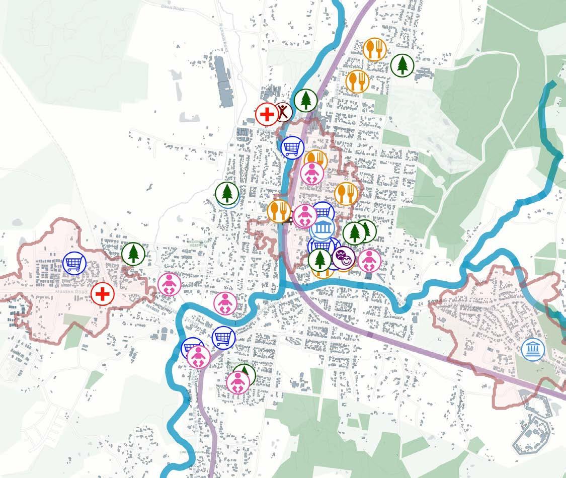
A 10 minute walkability catchment analysis was undertaken for Castlemaine Town Centre, McKenzie Hill, and Wesley Hill to assess proximity to key community and social infrastructure. In Castlemaine’s town centre, most residents fall within a 10-minute walk of essential services, including the library, restaurants, schools, parks, and civic facilities demonstrating strong access and compact urban form.
10 minute walking catchment of community infrastructure in the Castlemaine township (image credit: Geoscape (n.d.), DEECA (2025), DTP (2025), Hillary Namitala)
Castlemaine
Wesley Hill
McKenzie Hill
Campbells Creek
Catchment analysis
The catchment analysis helps identify how accessible community infrastructure is to residents across the township. This includes facilities such as community halls, early childhood centres, parks, and libraries which are critical for social cohesion, wellbeing, and equitable development (Planwisely, n.d.).
Catchment analysis provides valuable insights into the demographics and mobility patterns around a specific location revealing who lives or works nearby, how they access the area, and by what means, making it a vital tool for planners and related professionals across diverse projects (Planwisely, n.d.).
Using an 800-metre buffer which is equivalent to a 10-minute walk, the research is analysing the spatial distribution of key infrastructure within the township. The analysis revealed that Castlemaine Town Centre is well served by a concentration of amenities, including Victory Park, the Castlemaine Library, a community hall, and multiple gathering spaces. However, McKenzie Hill, is experiencing significant housing growth, lack walkable access to childcare, recreational facilities, and community hubs. Residents in these areas often
rely on private vehicles, highlighting a mismatch between residential development and infrastructure delivery (Infrastructure Victoria, 2021).
Furthermore, the absence of nearby agefriendly infrastructure in McKenzie Hill, such as accessible paths or healthcare services, affects older adults’ ability to age in place, a challenge exacerbated by topography and poor public transport (Wesley Hill Hall Committee, 2024).
Families also face a shortage of nearby playgrounds and public gathering spaces, as noted during community workshops. This analysis supports Project Postcode’s strategy to embed neighbourhood centres, walkable hubs with essential services into growing areas like McKenzie Hill. It provides an evidence base for addressing spatial inequalities and enhancing liveability beyond the town centre.
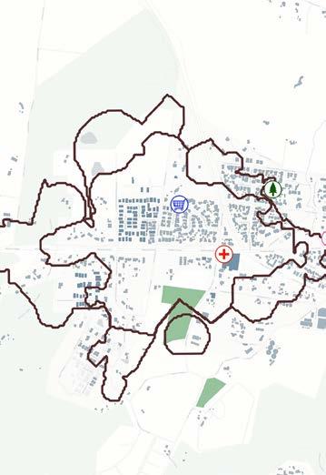
Most facilities in Castlemaine are concentrated in the Castlemaine Town Centre, creating a centralised hub for services, amenities, and community activity.
(image credit: DEECA (2025), Geoscape (n.d.), Hillary Namitala using QGIS
Creeks Rail line Playgrounds
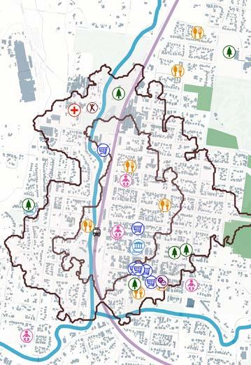
With no established town centre and very limited local infrastructure, McKenzie Hill residents face significant barriers to accessible, everyday services.
(image credit: DEECA (2025), Geoscape (n.d.), Hillary Namitala using QGIS)
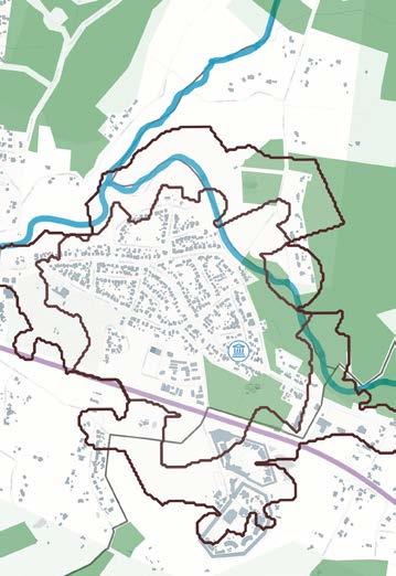
Wesley Hill hosts only a handful of scattered amenities, with limited pedestrian infrastructure—making everyday access difficult for those without a car.
(image credit: DEECA (2025), Geoscape (n.d.), Hillary Namitala using QGIS)
Childcare centres 10-Minute Walking Catchment
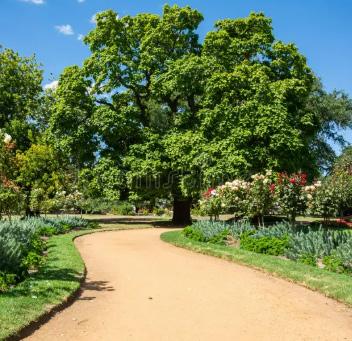
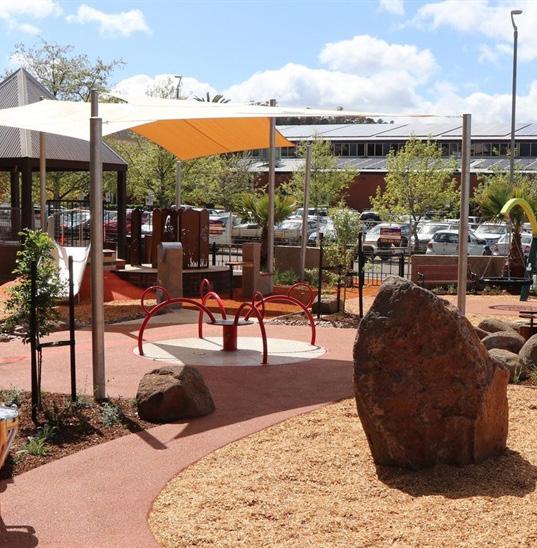
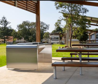
From left to right: (Image sources Zeytun Images, n.d., Mount Alexander Shire Council, n.d, Castlemaine Boutique Accommodation, n.d)
Castlemaine Botanical Gardens
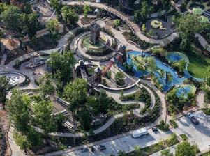
Castlemaine Victory park playground
Victory Park barbeque spot
Planning controls (zones + overlays)
Planning controls across the three study areas highlight the considerations, barriers and opportunities, that arise for the purpose of delivering new models of housing and the provisions of other services in the broader Castlemaine Township.
Planning Zones
• Castlemaine town centre: Residential zones surrounding the town centre commercial area highlights opportunities to integrate more housing into commercial areas, to seamlessly transition between commercial and residential land uses.
• McKenzie Hill: Largely residential zoning reflective of the limited community and commercial amenities in the area to service residents.
• Wesley Hill: Concentration of residential land uses highlights potential to strengthen community ties, and connection to surrounding environment (conservation areas).
Planning Overlays
• Castlemaine town centre: There are a significant number of heritage places within the Castlemaine town centre. This highlights the importance of housing development to be responsive to heritage character (if required).
• McKenzie Hill: Development controls, in particular, Development Plan Overlays, are failing to achieve sustainable subdivision and built form outcomes. This is observable, for example, in approved subdivision plans for sites which are subject to the Development Plan OverlaySchedule 1. This highlights the potential to bolster development built form controls to achieve more sustainable outcomes (see below).
• Wesley Hill: There are limited built form controls which apply to Wesley Hill residential area. This indicates the potential for increased density through infill development. Similarly, this highlights that built form controls could be applied to guide built form outcomes for future housing stock.
Subdivision plan for 34 Ireland Street and 7 Martin Street prepared in accordance with Development Plan Overlay - Schedule 1 provides limited sustainability or built form outcomes.
Extract of approved Subdivision Plan (image source: Spiire, 2021)
Zoning not delivering higher density or diversity of housing stock
Castlemaine town centre - zoning map (image source/ credit: DEECA (2024), DEECA (2025), Eliza Kane and Rochelle Fernandez using QGIS)
McKenzie Hill - zoning map (image source/ credit: DEECA (2024), DEECA (2025), Eliza Kane and Rochelle Fernandez using QGIS)
Wesley Hill - zoning map (image source/ credit: DEECA (2024), DEECA (2025), Eliza Kane and Rochelle Fernandez using QGIS)
Planning controls not facilitating desired housing and development outcomes - but suggests potential and opportunities to implement these tools more effectively
Castlemaine town centre - overlays map (image source/ credit: DEECA (2024), DEECA (2024), Eliza Kane and Rochelle Fernandez using QGIS)
McKenzie Hill - overlays map (image source/ credit: DEECA (2024), DEECA (2024), Eliza Kane and Rochelle Fernandez using QGIS)
Wesley Hill - overlays map (image source/ credit: DEECA (2024), DEECA (2024), Eliza Kane and Rochelle Fernandez using QGIS)
Lot size / site coverage
An analysis of the diversity of lot size and site coverage between and within the study areas provides an insight into the models of housing which could be implemented in the different residential areas within the Castlemaine Township.
Castlemaine town centre: Smaller lots and higher density of site coverage in the Castlemaine town centre highlight opportunities for infill development (e.g. shop-top housing). Larger lots around the edge of the town centre, and close to the train station may provide opportunities for higher density developments, including mid-size (three to four storey) apartment buildings which are in keeping with its heritage character, but appropriate in light of the more developed nature of the town centre.
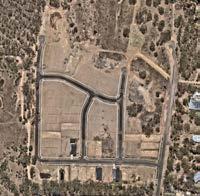
McKenzie Hill: As a newer residential area, McKenzie Hill contains larger lots which reflect its “growth area” character. A number of these larger lots are subject to development / subdivision plans, indicating the future greenfield
development which will occur in this area. To date, this development is largely characterised by large lots with single, separated dwellings. As the area is being progressively developed as a residential area, however, there is potential for these greenfield areas to accommodate higher density development and encourage the community infrastructure and essential services this growth area requires to transform it into a neighbourhood centre.
Wesley Hill: Residential blocks in Wesley Hill are characterised by large lot sizes, with limited site coverage (large areas of open space and street setbacks). This indicates opportunities to discretely increase density in the area through infill development, including by way of subdivision, smaller secondary dwellings and internal divisions in Wesley Hill.
Lot size highlights potential for increased housing density and diversity of housing models which could be deployed
Castlemaine town centre - lot sizes (image source/ credit: DEECA (2024), Geoscape (n.d.), Eliza Kane and Rochelle Fernandez using QGIS)
LEGEND (LOT SIZES)
Smaller, built up lots provide opportunities for infill development (e.g. shop-top housing and apartments) in the Castlemaine town centre. (photo credit: Eliza Kane)
McKenzie Hill - lot sizes (image source/ credit: DEECA (2024), Geoscape (n.d.), Eliza Kane and Rochelle Fernandez using QGIS)
Wesley Hill - lot sizes (image source/ credit: DEECA (2024), Geoscape (n.d.), Eliza Kane and Rochelle Fernandez using QGIS)
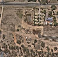
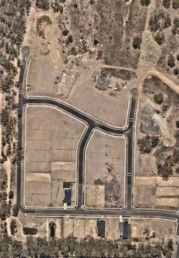
Large lot sizes reflective of ‘growth area’ character of McKenzie Hill and opportunities for greenfield development (image source: NearMap, accessed June 3, 2025)
Larger lots, with low site coverage and ample setbacks, in Wesley Hill provide opportunities for subdivision, additions and infill development (photo credit: Eliza Kane)
Tree density
While vegetation is not intuitively related to regional and neighbourhood mobility, tree density is closely tied to connection to nature, biodiversity and climate resilience – all of which are critical elements underpinning urban and transport planning strategies to ensure that we can plan and design for a more sustainable future.
Patterns of tree vegetation and density across the Castlemaine Township provide an insight into the impact of urban development on the natural environment. It also provides important context for the housing and spatial accessibility strategies that Project Postcode proposes to implement.
Castlemaine town centre: Consistent with more developed, urbanised town centres, tree density within the Castlemaine town centre is medium to sparse to effectively non-existent. This has important implications for how people move within the centre, for example, to the extent it compromises shade and protection from urban heat.
McKenzie Hill: The farming areas of dense tree coverage transition to medium and sparse coverage, to completely cleared of trees in areas which have been recently developed as greenfield residential areas. Prioritising landscaping and biodiversity in greenfield areas can assist to achieve a balance between residential development and the natural environment, and strengthen connections to nature for residents.
Wesley Hill: Similar to McKenzie Hill, Wesley Hill is an predominantly urban area, which is surrounded by dense vegetation and conservation areas. Large trees are accommodate on larger residential blocks and within ample setbacks. Increasing density (including through infill development) in Wesley Hill must be carefully designed and implemented to avoid compromising residents’ connection to nature and biodiversity.
Urban development influences patterns of tree density across the Township
Castlemaine town centre - tree density (image source/ credit: DEECA (2025), Geoscape (n.d.), Eliza Kane and Rochelle Fernandez using QGIS)
LEGEND (TREE DENSITY)
Built up commercial precinct contributes to limited tree density in the Castlemaine town centre (photo credit: Retno Palupi)
McKenzie Hill - tree density (image source/ credit: DEECA (2025), Geoscape (n.d.), Eliza Kane and Rochelle Fernandez using QGIS)
Wesley Hill - tree density (image source/ credit: DEECA (2025), Geoscape (n.d.), Eliza Kane and Rochelle Fernandez using QGIS)
Trees and vegetation cleared to make way for new McKenzie Hill housing development (image source: NearMap, accessed June 3, 2025)
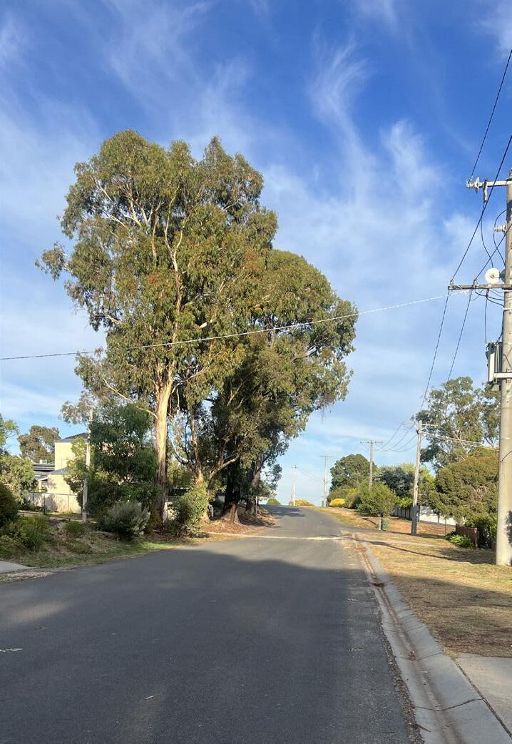
Canopy trees connect residential areas of Wesley Hill to the surrounding conservation areas in Wesley Hill (photo credit: Eliza Kane)
Dense Medium Sparse
3 What we learned
Elements of community-led mobility plan
In addition to research and analysis of the Castlemaine Township providing a solid evidence-base for the proposed planning project, Project Postcode has been informed and guided by the insights gained from the stakeholder and community engagement workshops.
Further, site observations from the studio trip to Castlemaine back in March 2025 provided critical experience of the township and the communities that we are planning for.
Research and analysis can provide a foundation for what planning and urban design interventions work to improve regional and neighbourhood mobility. The insights from the community and experiences of being in Castlemaine, however, also provide justification for why these interventions fit the Castlemaine township context - and therefore have greater chance of creating sustainable change within the Castlemaine region.
Planning concepts, precedents and case studies (detailed further in this section) provides further support for the viability of Project Postcode strategies and interventions. This also increases the potential to implement the Project Postcode toolkit in other regional areas, to improve mobility and accessibility.
Defining
the ‘centre’ of a town
A key takeaway from the stakeholder and community engagement workshops was the value that residents place on community connection and social ties. While the township is centred around a dominant commercial hub (that is, the Castlemaine Town Centre), there was a clear desire for a greater sense of connection between residents, outside of a traditional precinct.
Project Postcode is founded on the idea of creating ‘neighbourhood centres’by increasing urban density (that is, housing), it is possible to create more activity and greater connections. The Castlemaine town centre performs, and will continue to perform, an important function for residents. It is not necessary to create an additional ‘town centre’.
Project Postcode moves away from focusing on the town centre as the sole resource for the region. It instead proposes to create disagregated centres. This is in response to community members’ desire to build upon the existing connections within the region. The aim is to bring more services and activities to people in place, as a way to improve neighbourhood mobility and spatial accessibility.
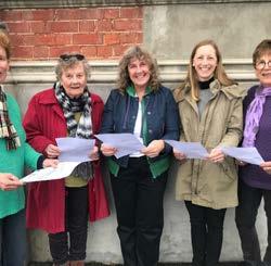
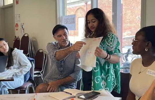
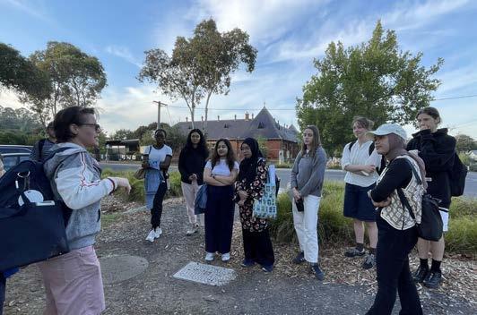
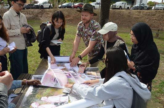
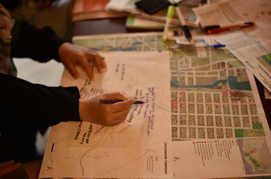
Images right, from top: Project Postcode group presenting with community members in Castlemaine (photo credit: James Whitten); UPD students listening to resident talk about access and safety around school (photo credit: James Whitten); UPD students meeting with Council officer (photo credit: James Whitten); Sketching in community engagement workshop (photo credit: Yiming Liu); sticky notes from community engagement activities (photo credit: Eliza Kane)
“As soon as this happens, they’re disconnected... [this has a] significant impact on the community and [it’s] social fabric...” Quote:
What we learnt about housing
Housing can be just as much a mobility and accessibility issue as transport networks are.
Through our engagement with the community, it became clear how passionate residents and stakeholders are about where they live and finding ways to improve and enhance connections within their neighbourhoods.
Relevant to regional and neighbourhood mobility, we began to understand where and how people live can play a key role to reduce the number of people who are underserved by existing transport infrastructure and connectivity (or at least mitigate the impacts of the gaps in transport infrastructure).
Housing provides people with access to employment, social and community amenities. Beyond this, the stakeholder and community engagement workshops emphasised how secure and stable housing is critical to “social fabric” of a township.
A critical turning point from the engagement workshops came from hearing about a common occurrence in the Castlemaine area, which connected the dots between housing, mobility and community and social connections. This was about the experience of people unable to stay in Castlemaine due to
losing their rental or who cannot afford to stay in Castlemaine. Without a car or access to public transport, the loss of their house had broader ramifications - affecting their employment, social connections, and access to essential services.
It was stories like this which emphasised the importance of rethinking how housing is delivered in and around the Castlemaine township. Further, by implementing strategies to improve housing for residents, how housing could be a resource to improve neighbourhood mobility and spatial accessibility for the current and future populations.
There is a hesitancy to change the ‘vibe’ of Castlemaine
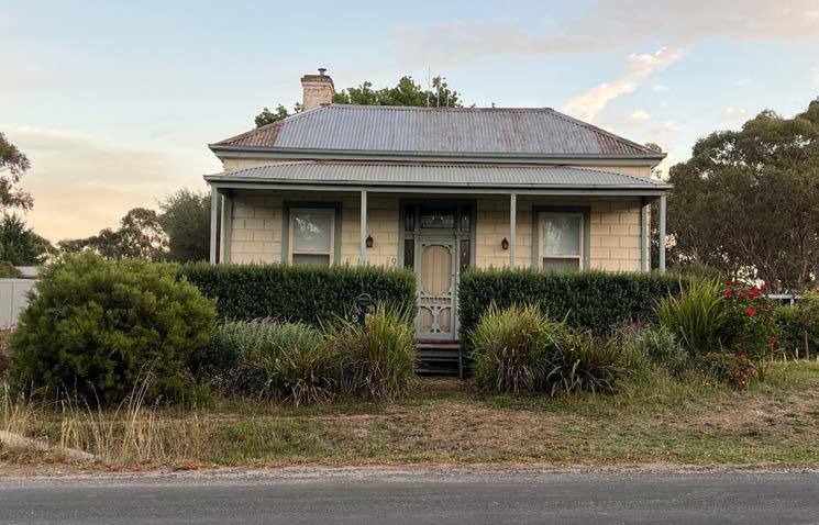
While the current housing stock is not meeting the needs or diversity of households in and around the Castlemaine township, residential development contributes to the “vibe” of the regional township. Sentiment from the community and stakeholder engagement workshops was that this is valued by residents and that, in general, there is a reluctance to change this. Many people are attracted to the area and to live in houses with large front and backyards, being a style of house which characterises much of residential development in the region.
...but there is a desire to do things differently
Despite this, residents and stakeholders expressed an understanding that in order to meet the needs of current and future populations, things will need to be done differently. There is also a desire to change the way that people live, from traditional single separated (and sometimes, isolated) dwellings. This came through from discussions with residents who expressed concerns about the impact of certain population groups living independently (in particular, single older women). Residents expressed a need for initiatives which encourage
and facilitate aging in place and multigenerational living as a means to both build and strengthen community ties and to enable people to be supported to live where they would like to.
...and there is potential to deliver new models of housing, and good local examples to learn from
Being in Castlemaine enabled us to observe where there was potential to deliver new housing models, and what types of housing might be suited to both the residents and the ‘vibe’ of Castlemaine.
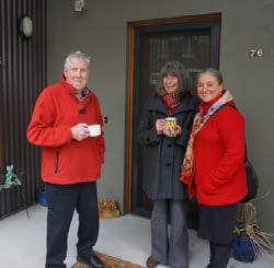
Further, we were able to learn about, and experience, initiatives being implemented in the region to address the housing mismatch. In addition to those discussed as part of our housing analysis (such as the Paddock EcoVillage - refer page 38), representatives from the Castlemaine Institute introduced us to different housing innovations. This included “Home Share” - a service to match people looking for accommodation with people who have spare rooms in their houses. This provided critical insight into the important connection between community and housing.
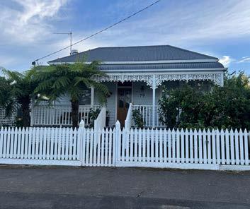
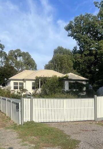
Single, separated dwellings contribute to Castlemaine’s distinct ‘vibe’.
House in Castlemaine (photo credit: Eliza Kane)
There are opportunities within existing residential areas to showcase new ways of delivering housing - to increase density and build good neighbourhoods.
Development opportunity in Wesley Hill (photo credit: Eliza Kane)
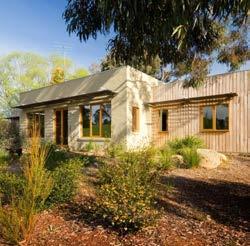
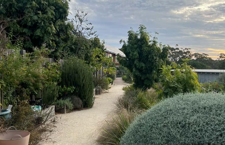
The Paddock EcoVillage is an example of delivering housing density in regional Victoria, without compromising landscaping and connection to nature and community.
The gardens at the Paddock Eco-Village (photo credit: Eliza Kane)
What we learnt about accessibility & mobility
Through the community engagements and field trip to Castlemaine, a number of key themes and lived experiences emerged around mobility and accessibility. These reflections not only highlight the current limitations of the transport and mobility systems but also reveal opportunities for improving equitable and inclusive access across the broader Castlemaine Township.
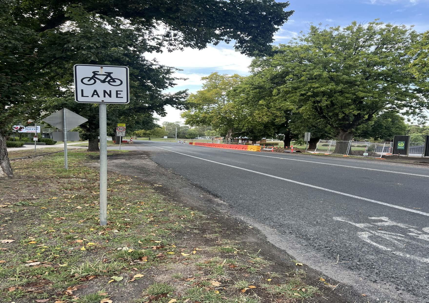
Walking and biking are loved, but safety is a concern…
A strong community desire for walking and cycling was evident throughout the engagement process. Multiple participants expressed how much they valued active transport—both for environmental and health benefits. However, there was a shared concern about road safety. People felt unsafe walking or cycling due to high-speed vehicle traffic, inadequate bike lanes, and poorly maintained footpaths. For many, the fear of accidents, often based on past experiences, acted as a significant barrier—demonstrating that simply providing infrastructure isn’t enough without addressing perception, behaviour, and design quality.
Barriers
to inclusive mobility
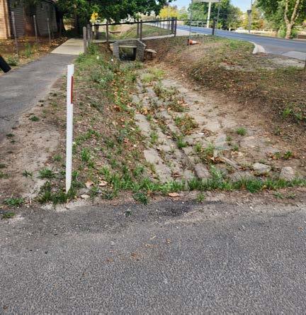
Several comments focused on how existing infrastructure limits mobility for people with disabilities, older residents, and young children. A striking example was the presence of large open gutters
(image below), which especially present obstacles for people using mobility aids or prams. These observations reinforce the need for universal design principles that cater to people of all ages and abilities.
Weather
affects people’s decisions to use active transport
Extremely cold winter mornings and scorching hot summer afternoons identified as barriers for active transport, particularly for school children and elderly individuals. Such factors exemplify the need to improve public transport networks, especially since these groups may also have restricted access to cars. Improving the public transport networks assists in facilitating independent mobility for these demographic groups, which means more independence for family members (or parents, in the case of school children).
Narrow bike lane (posing safety concerns) (photo credit: Eliza Kane), Wide gutters (Goldfields characteristics), hindering movement for people with disabilities (image credit: Rochelle Fernandez)
Nature as an enabler of active transport
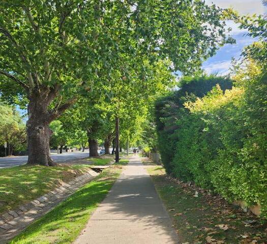
Community members voiced the positive difference that trees planted along the streets and footpaths made to their experience in walking and cycling. Nature strips were recognised not only as environmental assets, but also a vital factor in enabling enjoyable and feasible active transport journeys. This observation aligns with Project Postcode’s broader aims of improving climate resilience and liveability through nature-based planning.
…my kids have activities after school, and without bus services post 3pm on most days, I am forced to drive them.
- Penny (from the community workshop, who lives in McKenzie Hill)
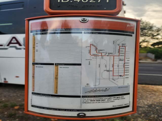
Most community members noted that, while bus routes technically exist, service frequency and operating hours were major drawbacks of the network. Buses commonly run only between 9am and 3pm on weekdays, with few or no services on weekends. This makes them unviable for after-school activities, work shifts, or social outings—particularly for those without cars. These limitations make reliance on buses impractical, especially for families and people living in fringe areas.
Balancing nature with footpaths- a means of enhacing walkability for users. (words: Lexi from EcoDev during the community workshop (image credit: Rochelle Fernandez)
Bus route schedule highlighting infrequent services (image credit: Rochelle Fernandez)
Cultural views and resource-based barriers
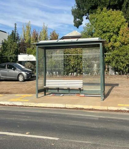
Beyond infrastructure, deeper cultural and social issues were also raised. For example, some residents shared that the condition and location of bus stops in inaccessible areas (like on top of a slope) discouraged them from even attempting to use public transport. Others highlighted that attitudes toward public transport—including a preference for cars due to convenience or necessity— also play a role in mobility choices.
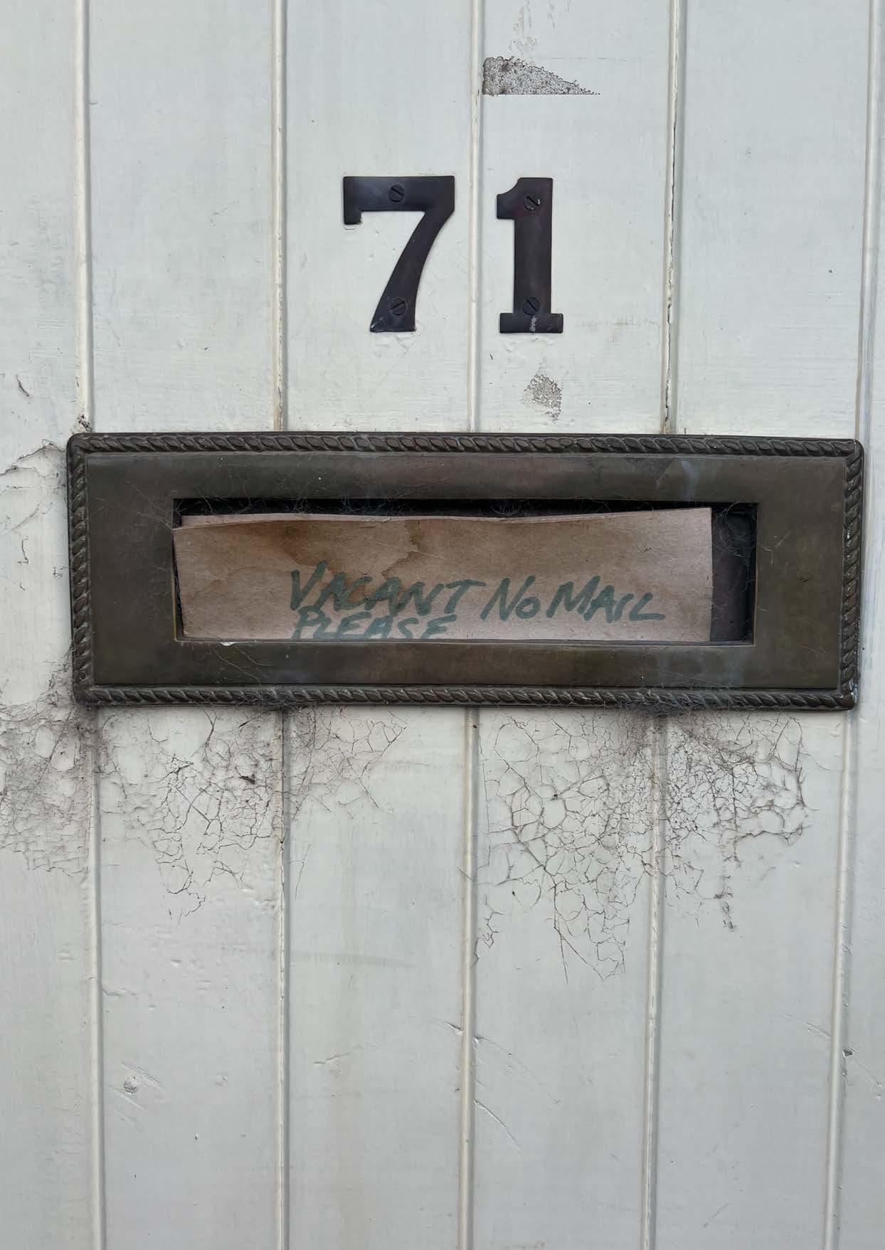
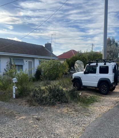
One recurring theme was the way in which rising housing costs are pushing people out of Castlemaine’s core, distancing them from essential services like healthcare, education, and shops. As people move to more affordable areas on the town’s periphery, the gaps in transport and mobility infrastructure become more visible and pressing. This directly supports the need for improved spatial accessibility and more complete neighborhoods.
These community insights show that mobility and accessibility challenges in Castlemaine are multi-dimensional— shaped by physical infrastructure, social context, environmental conditions, and personal experiences. Addressing them will require integrated strategies that go beyond transport alone, supporting the wider goals of Project Postcode to build more connected, inclusive, and resilient neighborhoods.
Bus stop with a fallen sign indicating the poor maintenance of infrastructure (image credit: Eliza Kane)
House with access to a car in Wesley Hill assuming housing affordability connections with inadequate PT networks (image credit: Eliza Kane)
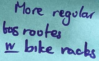
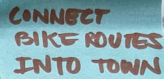
Transport and mobility related suggestions from community engagement (image credit: Eliza Kane)
The Mill Castlemaine is one of the social interaction hubs (photo credit: Hillary Namitala)
What we learned about community infrastructure
There is a need for community hubs in the centreless towns...
The workshop gave participants a chance to share with the team some of the challenges they face with community infrastructure. They expressed gratitude for the inclusive design engagement process and shared genuine enthusiasm for the initiative. Many voiced strong support for placemaking initiatives and highlighted the importance of “aging in place,” ensuring that community infrastructure supports people across all life stages. A recurring concern was the lack of essential services and facilities in areas beyond the Castlemaine town centre particularly in Wesley Hill and McKenzie Hill. Participants identified limited childcare options, no formal child play spaces in Wesley Hill, and the need to increase the capacity of the Wesley Hill Hall. Others advocated for a dedicated structure for the local market to improve access, shelter, and usability. Residents from McKenzie Hill noted the absence of a community centre and the challenge of having to travel into Castlemaine for most daily needs, compounded by limited mobility and transport options.
Accessibility of community facilities is hard for residents...
In a conversation with community advocate and member Margaret, she highlighted the emotional and cultural value of shared spaces. She reflected on how local cafés, gardens, and public meeting spots create essential opportunities for connection and
belonging. For Margaret and others, it’s not just about buildings, it’s about creating social bonds and a shared sense of place within the community. Residents noted the lack of local barbecue areas and expressed concern over the poor maintenance of local public swimming pools, making them less appealing and usable. As a result, many choose to travel to Chewton for better swimming facilities, underscoring the need for improved aquatic infrastructure within their own community.
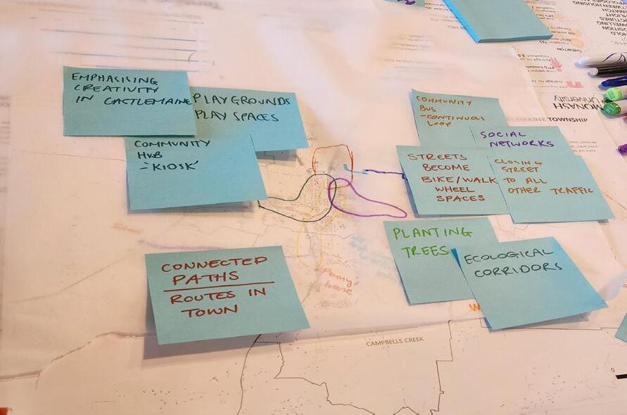
Sticky notes from community consultation (photo credit: Eliza Kane)
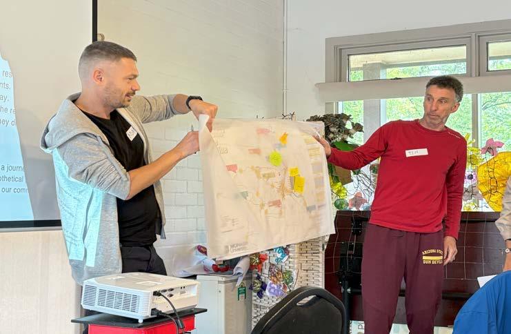
The world building exercise
Presentation after session (photo credit: Hillary Namitala)
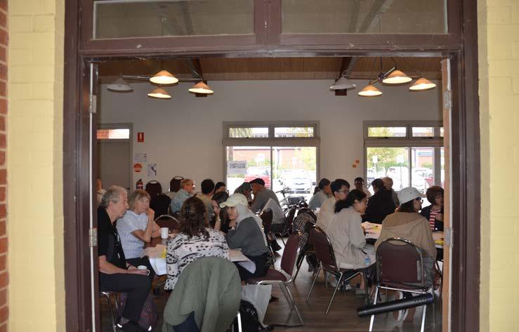
Workshop held at Victory Park Castlemaine
Students during the workshop (photo credit: James Whitten)
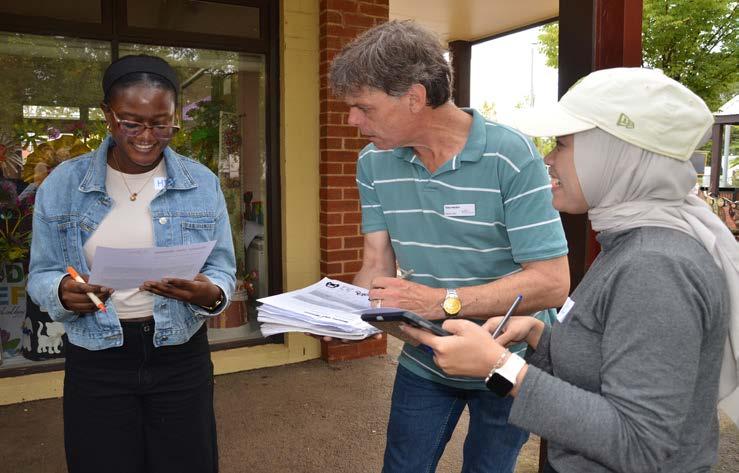
Mobility bingo session
Students participating (photo credit: James Whitten)
Parents would love to take their kids to play but there are no play areas...
As part of our engagement, we held a “Day in the Life Of” session where participants shared their daily routines, revealing how they interact with local infrastructure and services. Penny, a mother living in McKenzie Hill, described the challenges of accessing leisure and sporting facilities for her children, most of which are located in Castlemaine. Although she would prefer to cycle, the distance and lack of safe routes compel her to rely on a car. Her children also lack independent mobility, requiring her to drive them to various destinations.
The elderly population rely on community spaces for social interaction but there aren’t any in some neighborhoods...
Margaret, a retiree, shared how older residents rely on access to shops, medical facilities, cafés, and parks not only for practical needs but also to support their mental health and overall wellbeing. Daily routines that include social interactions, gentle walks, or a visit to a café are vital for maintaining a sense of purpose and connection. However, many in her age group face mobility challenges, making walking difficult and cycling unfeasible. As a result, driving becomes the default, even for short trips. Those using mobility aids require flat, accessible surfaces, often travelling to Victory Park or the Botanic Gardens spaces that offer comfort and social opportunities. Wesley Hill,
however, lacks equivalent facilities, limiting options for older residents and contributing to social isolation. The need for inclusive, accessible public spaces in neighbourhoods like Wesley Hill is not just about convenience, it’s essential for sustaining mental health, independence, and community connection in later life.
Underserved communities are seeking more local facilities...
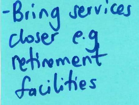
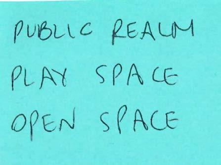
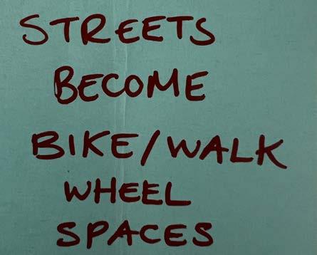
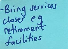
During the world-building exercise, participants shared aspirations for improved local infrastructure in the underserved areas like Wesley Hill and McKenzie Hill. Key suggestions included upgrading the Wesley Hill Market, establishing a neighbourhood community hub in McKenzie Hill, and increasing access to child play areas and public open spaces. There was a strong desire to reduce reliance on travel into Castlemaine by bringing essential services such as retirement facilities, community amenities, and recreational spaces closer to where people live. Participants also expressed interest in integrating ecological corridors to support both environmental health and community wellbeing through connected, nature-based design.
Learning from elsewhere
Developing at the ‘neighbourhood’ scale
A core principle underpinning Project Postcode is the importance of planning and designing for ‘neighbourhoods’, as a means to improve housing diversity and affordability, and enhance spatial accessibility.
Project Postcode is informed by research which considers the benefits of developing at the neighbourhood scale. In particular, research conducted by the Australian Housing and Urban Research Institute (AHURI) into delivering ‘mixed tenure’ housing (Khor et al., 2023) and ‘sustainable’ housing at the neighbourhood scale (Dhur et al., 2023).
‘Mixed Tenure’ Neighbourhoods
Snapshot: ‘Mixed tenure’ (MT) refers to a “variety of dwelling products across a range of dwelling tenures, and is usually delivered on government-owned land” (Khor et al., 2023a, p. 7). Research conducted by AHURI (Khor et al., 2023) into MT neighbourhoods (distinct from with individual MT developments) follows earlier research which demonstrated the benefits of planning, designing at this scale (Khor et al., 2023).
Developing at a neighbourhood scale brings greater attention to the appropriate mix and location of dwelling types (Khor et al., 2023), as well as to the community amenities and infrastructure required to ensure the viability of increasing housing density and achieve neighbourhood
renewal.
Key lessons: MT neighbourhoods provide advantages for the delivery of more social and affordable housing, such as enabling social housing developments to be cross-subsidised, and deliver greater diversity of dwellings (Khor et al., 2023, p.2) in an urban area.
A coordinated approach, however, is required to “[maximise] the social and economic uplift” (Khor et al., 2023, p. 2) of MT neighbourhoods.
This is because ownership and governance structures of MT neighbourhoods involve a high degree of complexities, due to the number of actors involved in the development and delivery process (Khor et. al, 2023).
Relevance to Castlemaine Township: Principles and strategies for the delivery of MT neighbourhoods can be applied to areas within the Castlemaine Township to increase housing diversity and, importantly for Castlemaine residents, improve housing affordability.
This model provides a framework for Council to work with government and non-government actors (including community organisations), to coordinate the delivery of housing and community infrastructure.
By taking a staged, but coordinated, approach to development could also help to overcome resourcing and financing constraints that regional councils and towns face.
Sustainable housing at the neighbourhood scale
Snapshot: Developing at the ‘neighbourhoods scale’ provides advantage for delivering sustainable housing. Benefits go beyond improving the sustainability of individual buildings, to being able to reduce waste, energy and water use at scale, as well as encouraging sustainable communities.
Key lessons: Similar to MT neighbourhoods, more sustainable neighbourhoods requires the coordination of a significant and diverse group of stakeholders. In addition to regulatory and policy reform, education and engagement are key pillars of a holistic approach to achieving more sustainable outcomes in the built environment - these include to bring
stakeholders and community along the journey to reduce the risks associated with “untypical developments” (Dhur, 2023, p. 3).
Relevance to Castlemaine Township: Sustainability principles and bestpractice are, and continue to, be embedded into the frameworks, strategies and planning controls which guide future development. This is particularly important for those which apply to developing growth (greenfield) areas. This is to the extent these areas will be the source of a significant proportion of housing in the Castlemaine Township in the future (Mount Alexander Shire Council, 2023) and also provide opportunity for development at the neighbourhood scale.
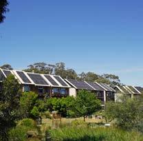
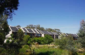
Witchcliffe Eco-Village - a case study sustainable neighbourhood (image source: Witchcliffe Ecovillage, 2024)
Learning from elsewhere
Sustainably increasing housing density
A core element underpinning Project Postcode is that densifying housing can act as a key to unlock regional mobility. Project Postcode also recognises the need to densify housing sustainability (particularly in the context of the increasingly worsening climate crisis).
Two case studies from White Gum Valley, Western Australia provide an insight into how sustainable density could be achieved in the Castlemaine Township.
Case study: White Gum Valley, WA
Snapshot: A residential development located on a 2.2 hectare site in White Gum Valley in Western Australia. The site, which has also been identified as an example of MT development (Khor et al., 2023), has been developed as a result of different delivery models (cooperative led, competition-led and private partnerships) (Martin, 2021). It demonstrates a variety of higher density residential developments which embrace principles of affordability, community and sustainability.
Key lessons: Departing from traditional ways of developing housing is not without its challenges, particularly at a neighbourhood scale. Having a space in which to experiment with housing and sustainability initiatives, plays an important role in understanding how these solutions can be deployed in different regions.
Government intervention plays a key role in establishing the framework which facilitate the development of housing prototypes (Dhur et al., 2021).
Relevance to Castlemaine Township:
Demonstration projects could play a crucial role in showcasing how density can achieve positive outcomes for the community, as well as from a sustainability perspective.
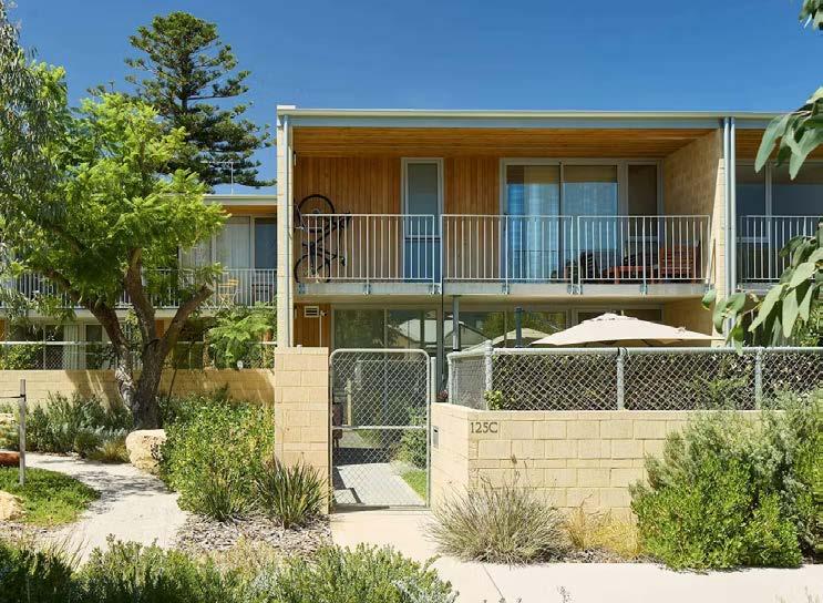
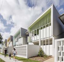
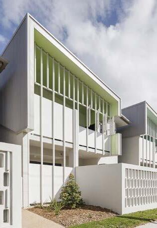
Case study: Hope Street Housing, White Gum Valley, WA
Snapshot: A medium density housing project in White Gum Valley, WA. The development is comprised of 28 dwellings and prioritises landscaping to promote connection to nature and biodiversity (2024 National Architecture Awards Jury, 2024).
Key lessons: The considered siting of the townhouses enabled landscaping to be incorporated into setbacks and secluded open space so that increasing density does not compromise good design outcomes (MDC Architects, 2024).
Relevance to Castlemaine Township:
Residential development in growth areas has come at the expense of native vegetation (see discussed on page 50). Leveraging planning policies and urban design tools can avoid these outcomes for future housing developments.
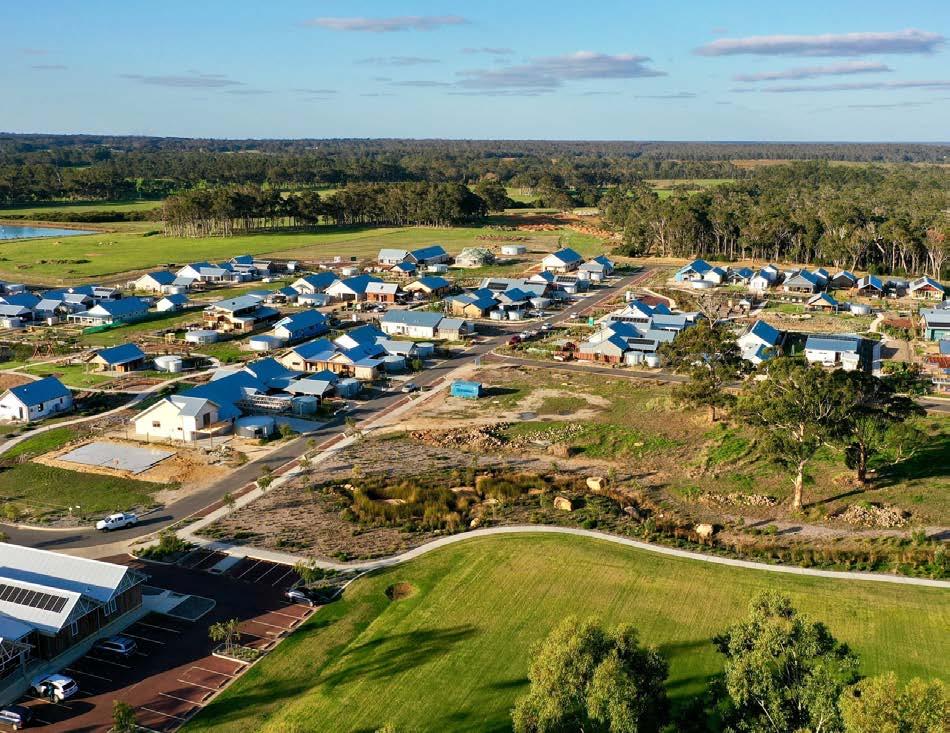
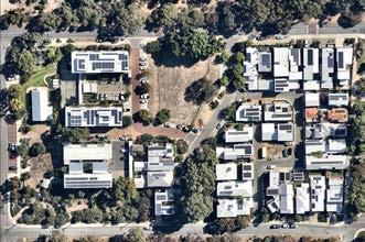
White Gum Valley is an “experimental” (Martin, 2021) residential development located on 2.2 hectare site in Western Australia, featuring different and innovative models of housing.
Aerial image of White Gum Valley sustainable residential development (image source: NearMap, accessed June 7, 2025)
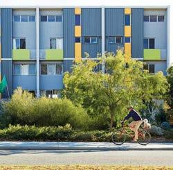
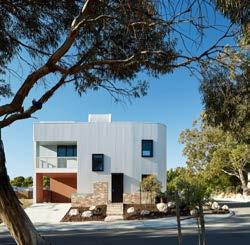
Two models of housing at WGV: (1) Sustainable Housing for Artists and Creatives and (2) David Barr Architects’ affordable housing units.
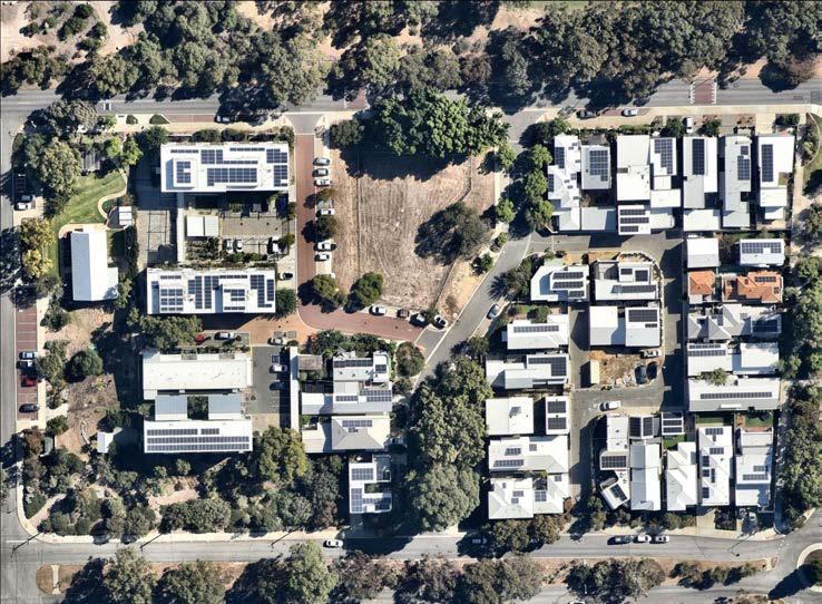
Not far from the White Gum Valley sustainable housing development is Hope Street Housing - an example of higher density living (townhouses) which balance “increasing yield and ensuring amenity for its inhabitants and neighbours” (2024 National Architecture Awards Jury, 2024).
Hope Street Housing, White Gum Valley, Western Australia (photo credit: Robert Firth, n.d.)
From left: SHAC (photo credit: Robert Firth, n.d.); Gen Y Housing Demonstration Project (photo credit: Robert Firth, n.d.)
Learning from elsewhere
Sustainable, equitable mobility
A key objective of Project Postcode is enhancing spatial accessibility, and building connected, resilient neighborhoods. This is done to reduce car-dependency, and subsequent transport costs on households, along with ensuring efficient public transport service and quality active transport infrastructure.
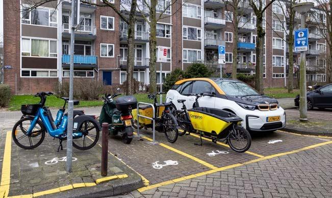
Research on the challenges small, underserviced towns like McKenzie Hill and Wesley Hill face, highlight barriers in mobility and the subsequent financial burdens on households with respect to owning private cars. In view of this, initiatives for shared mobility like carshare, bike-share or car-pooling, as well as intermodal transportation systems and low traffic neighborhoods are explored. While these initiatives ensure spatial accessibility at affordable costs, they also recognise Project Postcode’s aim to be environmental-friendly by ensuring equitable, inclusive, and sustainable mobility options for everyone.
Case study 1: Integrating shared mobility (ShareDiMobiHub Project, Europe)
Snapshot
The ShareDiMobiHub project is a crossborder initiative implemented across pilot locations in Belgium and the Netherlands. Co-funded under the Interreg North Sea Region Programme, the project aimed to
test and implement neighbourhood-scale shared mobility hubs—small, integrated nodes offering access to shared bikes, e-scooters, cargo bikes, cars, and public transport information (EU Urban Mobility Observatory, 2025).
Key Interventions
• Pilots across 10 cities, including urban centres and smaller communities, with emphasis on inclusive access, particularly for those without private vehicles or digital literacy.
Key Outcomes and Lessons Learned
• Users encouraged to shift from private cars to more sustainable options, especially for short trips.
• Placing hubs in lower-density and underserved areas, helped reduce transport disadvantages and improve local accessibility.
• Low-cost modularity and integration with existing public transport systems make the hubs highly replicable across European towns.
Relevance to Project Postcode/ Castlemaine Township
The project’s focus on mobility equity, digital access, and localisation aligns with Project Postcode’s goal of reducing spatial inequality and improving links between housing, services, and environment. Mobility hubs can help bridge the gap between infrequent public transport and the needs of residents in low-density townships—without large infrastructure investments.
Case Study 2: Low Traffic Neighborhoods (Walthamstow Village, London)
Snapshot
Walthamstow Village in the London Borough of Waltham Forest was one of the first areas in London to implement a Low Traffic Neighbourhood (LTN) under the borough’s Mini Holland program in 2015. The scheme involved restricting through-traffic by using modal filters, calming traffic on residential streets, improving active transport infrastructure, and enhancing the public realm (Waltham Forest, n.d.).
Key Interventions and outcomes:
• Modal filters (such as planters and bollards), to prevent through-traffic on smaller residential streets resulting in motor traffic reduction (up to 44%).
• Re-allocation of road space for walking and cyling infrastructure resulting in increased activity (walking increased by 32% and cycling by 18%). (Liveable Cowley, n.d.).
• Air pollution decreased; fewer car journeys were reported.
Lessons for the Castlemaine Township:
Walthamstow shows how reducing car dominance can restore local identity and walkability—goals shared by Project Postcode. LTNs enhance accessibility for non-drivers (e.g. children, the elderly, people with disabilities), especially critical in regions with limited public transport (like in McKenzie Hill). Additionally, the example highlights how transport planning can double as community building and climate resilience.
From left: ShareDiMobiHub Project (image source: Polis, n.d); Closed street in Waltham Forest. (Photo credit: Carl Court)
Learning from elsewhere
Integrated Community Infrastructure
The rapid expansion of Australia’s urban areas, particularly in greenfield sites, has often prioritized housing development without adequate investment in essential social and community infrastructure (Pawson, Randolph, & Troy, 2021). This oversight has led to more communities with limited access to vital services such as schools, healthcare facilities, and recreational spaces, thereby impacting residents’ quality of life and social cohesion.
Randolph et al., 2020 in Ahuri’s report underscores the critical importance of embedding social infrastructure planning within the early stages of residential development. The report highlights that in rapidly growing areas of Sydney, Brisbane, and Perth, the provision of social infrastructure frequently lags behind housing construction, resulting in accessibility challenges for residents just like Castlemaine. For instance, the study found that access to schools and hospitals within a 30-minute transit ride was significantly lower in these growth areas compared to established urban regions.
Project Postcode adopts an approach that encourages the design of neighbourhoods and new estates to embed community infrastructure from the outset, rather than retrofitting it later.
Case Study
A strong precedent for this is the Oak Rise Housing project by Cumulus Studio in West Hobart, Tasmania. This project integrates high-quality housing with shared green spaces, communal gardens, and accessible pathways that encourage social connection and a sense of belonging (Cumulus Studio, 2025). Similarly, Project Postcode aims to promote developments that include play areas, local gathering spaces, walking trails, and essential services within walking distance of homes. By embedding infrastructure such as childcare facilities, neighbourhood hubs, and ecological corridors into the initial planning, new communities particularly in fringe areas like Wesley Hill and McKenzie Hill can grow in a more equitable, sustainable, and connected way.
Developed in partnership with Housing Choices Tasmania and the Department of Communities, the project delivers 48 single storey homes organized around shared green spaces and pedestrian-friendly pathways. The layout encourages passive surveillance, incidental social interaction, and a strong sense of place which are critical elements for building resilient communities.
Key design features such as communal open spaces, accessible pathways, and integration with nature landscapes highlight how infrastructure and housing can be codeveloped to support social connection, active lifestyles, and inclusivity.
For Castlemaine’s fringe areas, such as Wesley Hill and McKenzie Hill, Oak Rise demonstrates how new developments can embed community infrastructure from the start. As residents in these areas face limited access to parks, childcare, play spaces, and local hubs, a place-based design model like Oak Rise offers a blueprint for delivering both housing and vital community assets together to reduce car dependency and improve everyday livability.
An image of the Oak Rise project (image source: (Cumulus Studio, n.d.)
Community spaces designed to be adaptable, and flexible to support various uses, from community meetings and fitness classes to performances and social gatherings to be adopted Project Postcode.
Creating stormwater management areas in residential neighborhoods to provide access to blue infrastructure.
River lee’s New Epping (image source: (Riverlee, n.d.)
The Dulwich Community Centre (image source: (Lowe, 2023)
Project Postcode aims to embed community “centres” directly within residential neighborhoods, ensuring social spaces are accessible, inclusive, and locally grounded. Two key precedents; Gathering Place in Tulsa, USA, and Riverlee’s New Epping in Victoria demonstrate how integrated public spaces can support wellbeing, cultural connection, and environmental resilience. Gathering Place offers a rich blend of play areas, walking trails, and event spaces that foster civic pride, while New Epping reimagines an urban renewal site with health, housing, and green infrastructure. Project Postcode can adopt similar principles: co-locating services, designing
for multi-generational use, and prioritizing walkable, welcoming, and ecologically sensitive environments. There is also a need to create blue infrastructure through integration of water systems like wetlands, ponds, and waterways into the project to manage stormwater sustainably while enhancing ecological and social value. Rather than relying solely on underground drainage, this approach uses natural and engineered systems to slow, store, and treat runoff. Features such as raingardens, and retention basins help reduce flooding, improve water quality, and support biodiversity.
The Tulsa Gathering place (image source: (Barber, 2018))
4 Planning Project: Project Postcode
Housing Diversity
Neighbourhood Mobility
Community
Infrastructure
Environment and Climate
Resilience
Project Postcode Keeping Castlemaine Connected
Project Postcode as a planning project takes a holistic approach and centres on the idea of a township being a composite of ‘neighbourhoods’. It focuses on housing as a key to unlock spatial accessibility and enhance place identity and community connections.
As a practical solution, Project Postcode is a toolkit of urban planning and design strategies and actions, which covers the following elements:
1. Housing diversity
2. Neighborhood mobility
3. Community infrastructure
4. Environment and climate resilience.
The strategies and actions are informed by and respond to the local context and the historical, social and spatial analysis of the three study areas. The toolkit identifies how different elements may be implemented in the distinct study areas.
Using McKenzie Hill as a case study brings Project Postcode to life. A masterplan re-imagines how this area could be and highlights how implementing the toolkit could deliver improved outcomes for housing, accessibility and services for the Castlemaine township. It also showcases how these different interventions could fit into the broader context, including for the Castlemaine town centre and Wesley Hill.
From top: Mundingburra Townhouses (photo credit: Andrew Rankin, n.d.); Separated bike lanes (photo credit: State Government of Victoria, 2023) Dulwich Community Centre (photo credit: Jonathon VDK, n.d.) Riverlees New Epping (image source: Riverlee, n.d.). Icons sourced from
Project Postcode: Housing
Overview
Project Postcode’s housing strategy seeks to:
• Facilitate the development of diverse housing models which are appropriate and affordable, and increase housing density sustainably.
• Deliver community-oriented housing, which leverages the Castlemaine Township’s strong social capital.
• in line with the environment and climate resilience aspect of Project Postcode balance built form outcomes with climate resilience and sustainability, to connect people to nature, as well as recognise the implications of planning and developing housing in the context of a worsening climate crisis.
It provides a toolkit of housing typologies and procurement models and depicts how the toolkit could be deployed in response to the urban and environmental context of the three study areasthe Castlemaine town centre, McKenzie Hill and Wesley Hill.
To facilitate the delivery of the proposed housing solutions and achieve desired density and built form outcomes, this section proposes practical urban planning and design strategies, which respond to the Castlemaine Township context, as well as the desires expressed by community members and stakeholders.
From top: Nightingale Ballarat (photo credit: Kate Longley and Derek Swalwell, n.d.); Mundingburra Housing (photo credit: Andrew Rankin, n.d.); The Paddock EcoVillage (image source: The Bush Project, n.d.); The Nursery on Brunswick (photo credit: Tom Ross, n.d.); Clyde Street Mews (photo credit: Alice Hutchison, n.d.).
Housing toolkit
Housing typologies
Procurement models
1
Eco-village
Shop-top housing
2
Additions / subdivisions
3
Private / market led housing Government led or funded housing Community led housing
Townhouse
Apartment
Castlemaine Town Centre
Castlemaine town centre’s established urban core can accommodate larger, higher-density housing typologies, such as apartments building, which would be in keeping with the existing urban scale. There are also existing opportunities to integrate housing into the commercial precinct, such as through shop-top housing.
Smaller scale housing developments, which could be achieved through lot consolidations and subdivisions, are suitable to be implemented to increase density in the existing residential areas surrounding the commercial centre.
A combination of private, Council and community-led housing projects could assist to achieve diverse housing options within the precinct.
Subdivision, small secondary dwellings and lot consolidation suitable for low density residential areas surrounding Castlemaine town centre commercial hub.
Apartments fit within core town centre (e.g. Council’s proposed affordable housing developments on Templeton Street) and proximate to train station.
Shop-top housing suitable for above commercial precincts, to bring residential dwellings (and activity) into the town centre.
From top: Clyde Street Mews (photo credit: Alice Hutchison, n.d.); Nightingale Ballarat (photo credit: Kate Longley and Derek Swalwell, n.d.); The Nursery on Brunswick (photo credit: Tom Ross, n.d.). Right: Map of Castlemaine town centre and proposed housing models (image source/ credit: DEECA (2024), Eliza Kane and Rochelle Fernandez, using QGIS)
Templeton
Castlemaine
McKenzie Hill
Large lot sizes in McKenzie Hill provide opportunity to rethink greenfield housing development and to increase housing density through a variety of housing typologies.
Planning controls, including more rigourous Development Plan Overlays and Design and Development Overlays could be implement to guide larger scale housing developments. This would respond to the challenges that the area is currently facing to deliver appropriate housing to meet the needs of the current population (including smaller and therefore more affordable dwellings).
Larger lots provide opportunities for different stakeholders to collaborate to deliver different housing options (as seen with White Gum Valley in WA).
Townhouses can be developed along key transport corridors and can maximise large lots sizes - which are currently being developed as single, separate dwellings.
Apartments provide opportunities to increase density and maximise available space on large blocks - including alternative retirement dwellings for aging in place.
Large lots also provide opportunities to create ‘neighbourhoods’ through higher density and sustainable housing models, villages and pilot projects (e.g. White Gum Valley).
From top: Hope Street Housing (photo credit: Robert Firth, Acorn, n.d.); Render of Levande Oak Grange retirement living apartments (image credit: CGIKite, Plus Architecture, n.d.); White Gum Valley neighbourhood (image source: NearMap). Right: Map of McKenzie Hill and proposed housing models (image source/ credit: DEECA (2024), Eliza Kane and Rochelle Fernandez, using QGIS)
Wesley Hill
Increasing housing density in Wesley Hill is ‘density by stealth’, where housing typologies remain low-scale to ensure harmony with the existing streetscapes and respect neighbourhood character.
This approach is based on environmental and urban analysis, where larger lots provide opportunities for subdivisions on individual plots or consolidation of lots for townhouse developments. It also recognises the potential to increase infill development through owner-led initiatives (i.e. ‘mum and dad’ developers).
Limited planning controls (overlays) in the area provide flexibility with built form, but also means there is potential to apply controls to encourage desired development and built form outcomes.
Large lots with less site coverage provide opportunities for infill development (subdivisions, lot consolidation, additions)
Townhouses along main road can existing complement commercial uses. Ensuring townhouses are designed to respect neighbourhood character and heritage.
Eco-village style development could be accommodated on larger lots and maximise connection to the surrounding nature and conservation areas.
From top: Bawa Granny Flat (image source: Garden Studios, n.d.); Render of proposed Riverview townhouses (image source: Plus Architecture, n.d.); The Paddock Eco-Village (image source: The Bush Project, n.d.). Right: Map of Castlemaine town centre and proposed housing models (image source/ credit: DEECA (2024), Eliza Kane and Rochelle Fernandez, using QGIS)
Project Postcode Housing: strategies and actions
The Project Postcode housing strategies and actions combine strategic and statutory planning tools, as well as advocacy and engagement, to achieve the desired housing quality, diversity and density outcomes:
Strategy 1: Develop and implement strategic frameworks and policies to provide direction for the delivery of appropriate and affordable housing.
Action: Develop appropriate strategic framework documents and guidelines to guide the delivery of housing in the Castlemaine Township.
Strategic documents and frameworks can be adopted to set out housing objectives and guide the delivery of housing (as well as other community facilities and public realm) for the Castlemaine Township and / or particular neighbourhoods over the long term.
Masterplans and precinct structure plans can provide flexibility to ensure that longer term planning and design decisions can respond and adapt to the needs of the community change over time. Similarly, implementing urban design frameworks could facilitate design and built form outcomes, and also balance important neighbourhood character and heritage considerations (for example, in areas such as Wesley Hill).
Strategic frameworks could leverage
and embed results and findings from successful housing projects and initiatives currently being implemented across the Township (as discussed on page 46), and / or from Council-led projects (such as the proposed Templeton Street affordable housing developments), to strengthen the actions set out in policy and strategic planning documents.
Strategy 2: Implement and leverage existing regulatory tools to streamline planning processes and achieve desired quality, sustainability and built form outcomes.
Action: Apply and update Development Plan Overlays to enforce strategic planning objectives, and to guide subdivision and development processes and other built form requirements.
Action: Apply and update Design and Development Overlays to enforce strategic priorities and guide desired design and built form outcomes.
Development Plan Overlays have not, in all circumstances, delivered desired housing outcomes in the Castlemaine Township (for example, as discussed on page # in relation to McKenzie Hill).
Implementing and / or updating DPOs provides an opportunity to achieve strategic planning objectives, including with respect to climate resilience, sustainability, diversity of lot sizes and
Realise strategic planning frameworks through planning controls
DEVELOPMENT PLAN OVERLAY DESIGN AND DEVELOPMENT OVERLAY CLAUSE
Implement or amend controls to align with strategic objectives, and guide built form and housing diversity
for planning reforms
Support for council
Adopt tools to streamline housing planning processes and facilitate housing diversity and built form outcomes
mum and dad developers
for government funding Engage with community
Engage in broader actions to support Council and community achieve desired housing outcomes
housing models and increased public realm.
For example, DPOs which are implemented to guide the planning and development of growth areas (such as McKenzie Hill) could adopt principles from the Council Alliance Sustainable Built Environment (CASBE) Sustainable Subdivision Frameworks (CASBE, n.d.) to facilitate more sustainable and community orientated outcomes, as opposed to simple subdivisions of more single, separated dwellings.
Design and Development Overlays could be implemented to facilitate strategic planning objectives, including to guide built form and siting of buildings. DDOs can also promote quality and sustainable design outcomes. City of Melbourne’s proposed Amendment C376 - Sustainable Building Design Amendment seeks to introduce a DDO to facilitate sustainable outcomes (including energy efficiency, waste, ecology and urban heat island considerations) (City of Melbourne, n.d.). In the context of the climate crisis, and the environmental risks that the Castlemaine Township is facing, embedding sustainability requirements into planning controls is an important safeguard to ensure that developments balance housing objectives and the need for climate resilience.
Action: Leverage planning scheme processes which provide streamlined
planning approvals for developments which promote quality and sustainable design practices and higher density outcomes.
Recent planning reforms as set out in Clause 53.24: Future Homes; Clause 53.25: Great Design Fast Track; and Clause 55: Two Dwellings or more on a lot (Townhouse and Low-Rise Code) (see detail overleaf), seek to streamline planning approval processes for housing developments which deliver higher quality outcomes in higher density models.
These provisions and planning processes can be leveraged to promote higher density housing - by offering fast-tracked approval processes for developments which comply with the design and density requirements. Encouraging and working with developers to pursue these streamlined planning approvals also means there is greater certainty of higher quality built form outcomes that are currently not being achieved across the Township.
Strategy 3: Advocate and provide support for Council, community and developers to achieve high quality, higher density housing.
Action: Advocate for planning reforms to achieve higher density, and more affordable housing.
Action: Advocate for funding to support the Mount Alexander Shire Council
Right (from top): Future Homes design B by LIAN Architects (image source: State Government of Victoria, 2025); Mundingbarra Townhouses, an exemplar of good design recognised under the Great Design Fast Track design principles (photo credit: Andrew Rankin, n.d); Potential outcome for townhouse development under new Townhouse and Low-Rise Code (image source: Ratio Consultants, 2025)
to develop and implement strategic frameworks, implement planning scheme amendments and to deliver housing within the Castlemaine Township.
Action: Support, collaborate and engage with community members and organisations and developers to continue delivering housing initiatives in the Castlemaine Township.
Advocating for planning reforms, such as inclusionary zoning which mandate affordable housing requirements (Regional Cities Victoria, 2025) can help deliver more affordable housing across the Township. Further, advocating to expand Future Homes eligibility
requirements (beyond areas surrounding train stations) could also assist facilitate better design outcomes for housing.
Achieving better outcomes in terms of housing tenure and affordability also requires collaboration between a diversity of government, non-government and community stakeholders (Khor et al., 2023). As part of this process, providing support for developers, including ‘mum and dad’ developers, to undertake housing development could fill gaps, to the extent that Council will be unable to deliver all housing to meet the needs of the popluation.
Streamlined planning approval process for three-storey apartment developments (State Government of Victoria, 2025). Process applies to eligible developments which adopt ‘Examplar Designs’ to achieve good quality design and livability.
Streamlined planning process for apartments and townhouses (at least eight dwellings) which meet design principles targeted at delivering sustainable, quality and denser housing (State Government of Victoria, 2025).
Includes ‘deemed to comply’ requirements (e.g. setbacks, tree coverage and bedroom sizes) for townhouses and low-rise apartments (three-storeys) to streamline approvals process (State Government of Victoria, 2025).
Project Postcode: Neighborhood Mobility
Overview
In line with the vision to ‘keep Castlemaine connected’, Project Postcode’s Neighborhood Mobility element is centered around the ideas of sustainable, inclusive, and equitable mobility to create better-connected neighborhoods. It is designed to respond to the challenges of spatial inaccessibility and limited mobility options that Castlemaine and surrounding centreless towns like Mckenzie Hill and Wesley Hill face, and is formulated to highlight the following objectives:
• Enhance spatial accessibility by linking housing, services, and public spaces through efficient, inclusive mobility networks.
• Enable equitable mobility for all age groups and abilities, especially ageing populations, children, and people with disabilities.
• Promote sustainable travel behaviour through improved public and active transport options and shared mobility systems.
Shared mobility initiatives to reduce car-reliance and offer flexible, sustainable mobility options for residents.
ShareDiMobiHub Project (image source: Polis, n.d)
Safe and improved cycling and walking interventions to encourage active transport mobility.
Separated bike lanes. (Image source:Victoria’s Big Build, 2023)
Upgraded bus stop infrastructure to support active transport mobility.
Secured bike shelter at bus stop (image source: ODS, 2022)
Neighborhood Mobility: McKenzie Hill
McKenzie Hill, with its greenfield development potential, presents opportunities to strengthen neighborhood mobility parallelly with future housing growth by increasing housing densities through diverse residential developments. Through this, the area can leverage intensification to advocate for improved transport infrastructure and services— ultimately boosting spatial accessibility.
Shared mobility interventions
Proposals for neighborhood-scale shared mobility models include car-share and bikeshare schemes adapted from examples like Hiyacar’s closed loop car sharing program (Hiyacar, n.d.), and Mobi-bike in Vancouver (Sheppard, 2016). These initiatives can be embedded within new housing precincts, particularly medium density townhouses or apartment typologies, and supported by strata or community-led management systems. In doing so, this could reduce household transport costs, and pressure on parking infrastructure, while providing residents with sustainable, flexible alternatives to private car ownership.
Public transport interventions
The Martin Street/Maldon Road bus stop currently operating in Mckenzie Hill presents an opportunity for service frequency upgrades. Improving this route would enable independent mobility especially for children and aged residents. Simultaneously, upgrading the bus stop with secure bike storage and bike racks in buses helps supporting multi-modal connections.
Map highlighting transport interventions based on proposed housing interventions in Mckenzie Hill. (image source/ credit: DEECA (2024), Rochelle Fernandez and Eliza Kane,
Active transport interventions
In terms of active transport, proposals include introducing separated bike lanes along Maldon Road and enhancing footpaths with nature strips to improve comfort, safety, and environmental outcomes. These interventions are targeted to improve walking and cycling while restoring links to the Castlemaine town centre, and support broader climate and health objectives.
Low-traffic neighborhoods
Proposals for mixed housing diversity developments also possess potential to be developed as low-traffic neighborhoods that prioritise pedestrians and cyclists, while discouraging through traffic. For example, Merri-bek Council’s shared zones on Albert Street in Brunswick East (Merribek City Council, n.d.), and international cases like Walthamstow Village in London (Waltham Forest, n.d.).
Transport interventions
Proposed re-routed bike path
Key moves Existing bus stop with proposed bike storage and parking
Car-share, bike-share systems
Housing typology
Apartment
Townhouse
Eco-village
Shop-top housing
Addition/ subdivision
LEGEND
Residential lots
using QGIS)
Maldon Rd./ Pyrenees Hwy
Ireland St.
Ireland
St.
Neighborhood Mobility: Wesley Hill
Enhancing accessibility in Wesley Hill presents opportunities to build on its existing public and active transport networks.
Public transport interventions
The presence of multiple bus stops makes it a strong candidate for targeted public transport improvements. Proposals include upgrading selected stops with facilities such as secure bike storage as well as bus mounted bike racks to encourage intermodal travel. Increasing bus frequency especially during peak hours and weekends, and extending beyond current operating times (9am –3pm), would ensure the system is a more viable alternative to car travel.
Shared mobility hub model
Wesley hill has the potential to replicate a shared mobility hub model inspired by projects like the ShareDiMobiHub Project in Europe (EU Urban Mobility Observatory, 2025). A locally managed scheme (such as a Mobility as a Service (MaaS) platform), supported through community organisations or partnerships with mobility providers, as well as residents with vehicles, could enable participation and access to shared bikes and carshare options. This helps to reduce cardependency and subsequent pressures of private-car ownership and transport costs on households, while offering flexible, climate-conscious mobility solutions.
Active transport interventions
The strategic cycling corridor along Duke Street in Wesley Hill currently lacks separation from high-speed traffic, creating safety concerns that discourage regular cycling. To address this, a re-routing of the path to a quieter inner road like Baird Street is proposed. This move offers a safer, more comfortable route, encouraging uptake among school children, older residents, and less confident cyclists.
To further promote sustainable travel, the introduction of e-bikes and charging station is also recommended. These additions would reduce physical and time barriers to cycling, especially in hilly terrain or for those with limited mobility, and align with broader climate resilience goals.
Map highlighting transport interventions based on proposed housing interventions in Wesley Hill. (image source/ credit: DEECA (2024), Rochelle Fernandez and Eliza Kane, using QGIS)
Key moves
Transport interventions
Proposed re-routed bike path
Existing bus stop with proposed bike storage and parking
E-bikes with charging station
Housing typology
Townhouse
Eco-village
Addition/ subdivision
LEGEND
Residential lots
Existing strategic cycling route
Existing bus stop
DukeSt. Baird St.
Neighborhood mobility: Implementation
The implementation of Project Postcode’s neighborhood mobility element presents a set of strategies with actions that employ a place-based approach acknowledging the unique mobility needs of underserviced towns like McKenzie Hill and Wesley Hill, as well as the broader Castlemaine township. Successful delivery builds upon cross-sector collaborations between state and local government, community groups, and mobility service providers. The actions and strategies have been articulated to align with the specific needs of the region as well as broader regional planning objectives.
Strategy 1 (Public Transport): Leverage existing public transport networks (bus routes) to enhance efficiency through increasing frequency of services.
Action 1.1: Conduct public transport accessibility assessments (including population growth, demographic change, and housing development patterns) to determine priority route upgrades.
Action 1.2: Establish Development Contributions Plans/ Infrastructure Contributions Plans, especially in growth areas (like McKenzie Hill) to support funding for bus network reforms, including funding to increase frequency of bus services, provision of secure bike storage, and improvements in bus shelters.
Action 1.3: Include public transport improvements as a key requirement in proposed Precinct Structure Plans (in alignment with the Project Postcode housing strategy).
Strategy 2 (Active Transport):
Ensure the delivery of safe, connected active transport networks (cycling routes and footpaths) to promote sustainable mobility outcomes.
Action 2.1: Conduct feasibility assessments to identify key active transport corridors to prioritise development/ improvement.
Action 2.2: Embed the principles of Clause 18.02-1S (Walking) and Clause 18.02-2S (Cycling) of the Victorian Planning Provisions (VPP) in structure plans to implement separated bike lanes, wide footpaths, and tree plantings.
Action 2.3: Advocate for funding of infrastructure delivery (bike lanes, and quality footpaths) from state and federal governments, and potential developers.
Action 2.4: Engage with community members and encourage them to participate in tree planting and maintenance.
Strategy 3 (Shared Mobility):
Encourage and advocate for shared mobility and micromobility initiatives to support inclusive and equitable mobility solutions for all users.
Action 3.1: Collaborate partnerships with car-share and micromobility providers (e.g. e-bike companies) to pilot schemes in the town centre and neighbourhood hubs like McKenzie Hill and Wesley Hill.
Action 3.2: Facilitate community coownership models by encouraging local residents (especially car owners) to participate in neighborhood-based car- share initiatives, and explore models for shared vehicle leasing or insurance cooperatives.
Action 3.3: Advocate for and help secure financial subsidies for households participating in car-share schemes or switching to shared e-bikes (like discounted memberships, parking fee exemptions, or upfront e-bike purchase incentives).
Project Postcode: Community infrastructure
Project Postcode envisions embedding community infrastructure directly within neighbourhoods, and McKenzie Hill presents an opportunity for such integration. As a rapidly growing area, McKenzie Hill currently lacks essential community facilities, compelling residents to travel to the Castlemaine town centre for services and amenities.
Recent initiatives, such as the planned 3.6 km shared cycling and pedestrian pathway connecting McKenzie Hill to Castlemaine (Mount Alexander Shire Council, 2025), aim to improve active transport options and accessibility for residents. This represents more than just improved mobility, it lays a foundation for the development of a neighbourhood centre by connecting residents to key community destinations.
However, to truly enhance liveability, Project Postcode advocates for the development of local community hubs within McKenzie Hill. These hubs would serve as focal points (neighbourhood centres) for social interaction, providing spaces for childcare, recreational activities, and community events, thereby reducing the need for residents to commute for such services.
Implementing community infrastructure in McKenzie Hill aligns with broader objectives of designing sustainable, connected, and resilient neighbourhoods. By prioritizing local facilities, Project Postcode aims to create a more inclusive and vibrant environment that caters to the diverse needs of its residents.
Proposed community multipurpose hall
Proposed community park integrated within new neighborhoods
West Gorton community park Manchester UK (image source: Labour LGA Climate Emergency, n.d.)
A vibrant community park featuring open green space, and inclusive recreation facilities
(JMD Design, 2022))
The Dulwich Community Centre (image source: (Lowe, 2023)
Julia Reserve Youth Park (photo credit:
What is a neighborhood centre?
In regional growth areas like McKenzie Hill, the absence of a defined town centre often leaves communities without easy access to essential services or communal spaces. While a town centre typically refers to a large, commercial hub with retail shops, banks, and civic institutions concentrated in the heart of a township like Castlemaine town centre, a neighbourhood centre offers a more localised, human-scaled alternative embedded within residential areas.
Project Postcode defines a neighbourhood centre as a walkable, low-intensity community hub designed to serve the everyday needs of residents in their immediate area. Rather than focusing on commerce, these centres prioritise community-building and wellbeing, including:
• Local-scale amenities such as a flexible community hall, small café, park/playground, co-working spaces, and green gathering areas.
• Non-commercial services like a shared tool library, library kiosk, maternal and child health visits, food exchange, or pop-up markets.
• Inclusive design features, such as accessible paths, sheltered areas for older residents, and child-friendly spaces.
These centres are not “downtowns”, they are social anchors for neighbourhoods, providing spaces for interaction, support, and everyday life.
Their integration within walking or cycling distance of homes ensures equitable access to services, especially for those without cars, such as the elderly, children, or low-income families. In this way, Project Postcode aims to create a network of small, connected centres across McKenzie Hill and similar areas to foster resilience, inclusion, and community identity.
This approach aligns with the principles outlined in the Queensland Government’s Neighbourhood Centres initiative, which emphasises the role of such centres in building community connection and cohesion by providing accessible services and supports within local areas . Additionally, the Victorian Department of Transport and Planning’s guide on Neighbourhood Activity Centres supports the development of these hubs to enhance liveability and accessibility in suburban areas.
Chino Hills Community Center (photo credit: Crane Architectural Group, n.d.
Table showing community infrastructure types mapped against user groups, governance models, and their relevance across the study areas
Infrastructure Type Groups Served Governance / Procurement Model
Childcare Centre Young families, working parents Local Council / Public-Private Partnership
Community Hall
General public, seniors, youth Local Council / Community managed
Library Node Children, students, retirees Council / State Government
Health Outreach Room Elderly, lowincome residents State Health Services / NGO partnerships
Playground & Public Park Children, families, carers
Applies to Study Area
McKenzie Hill, Wesley Hill
All three
Castlemaine Town Centre, McKenzie Hill
McKenzie Hill, Wesley Hill
Local Council McKenzie Hill, Wesley Hill
BBQ and Picnic Facilities Families, social groups Council-managed McKenzie Hill
Co-working Space Remote workers, young adults Private / Community Enterprise
Youth Hub Teens, young adults NGO or State Youth Services
Castlemaine Town Centre
Castlemaine Town Centre
Men’s Shed / Senior Space Retirees, social support groups Community-led / Grants Wesley Hill, Castlemaine Town Centre
Ecological Corridors Whole community / environment Council / Environmental Trusts
(image source:Created by Hillary using (Local Government Victoria, n.d.))
All three
Justification for Proposed Uses
Demographic analysis of McKenzie Hill reveals a community composed of young families, retirees, and a significant proportion of low- to moderate-income households. This mix of age and income groups creates a diverse set of needs that are currently underserved.
For example, families require access to nearby childcare, play areas, and open space to support children’s development, while older residents benefit from aged care-friendly housing, accessible walking paths, and local gathering places to combat isolation and support aging in place.
Project Postcode responds by proposing flexible facilities community halls, colocated childcare, health outreach rooms, and parks that reflect the social and demographic needs of McKenzie Hill. These aim to meet immediate needs while strengthening long-term community wellbeing.
Delivering shared community facilities requires a collaborative and wellstructured approach. According to Local Government Victoria (n.d.), successful shared facilities rely on clear governance, early user engagement, and formal agreements. Partnerships between councils, schools, and not-for-profits can improve access and resource efficiency, while adaptable design ensures facilities remain relevant as needs evolve.
Promoting aging in place.
Project Postcode responds to the need for more diverse and accessible housing by supporting aging in place and enabling housing turnover. As older residents in McKenzie Hill seek to downsize from larger family homes, there is a clear demand for smaller, well-located, agefriendly dwellings with nearby services. By introducing compact housing types integrated with neighbourhood centres close to green space, health services, and social opportunities the project allows older adults to remain in their community as their needs change. This, in turn, frees up family-sized homes for younger households, easing pressure on the local housing market and promoting generational renewal. The co-location of community infrastructure and housing enhances this dynamic, creating inclusive neighbourhoods where people can live across all life stages.
PLANNING CONSIDERATIONS
Spatial Location
• Provide a number of parks throughout a neighbourhood (based on the population catchment) and cater to a range of uses.
• Ensure all dwellings have access to neighbourhood parks within 400m or a 5 minute walk for a pocket park and up to 800m or a 10 minute walk for playing fields (Sunjara, 2008).
• Where appropriate, locate in distinctive parts of the landscape such as riparian corridors and hilltops.
• Ensure the walking and cycling network connects the park to the broader open space network as the network of parks may form a key component of a journey through a neighbourhood (Parks and Leisure Australia, n.d.).
• Co-locate with other community facilities to enable dual use of the space and multi-use destinations such as children’s play equipment located adjacent to a community hall.
Transport Network and Design
• Locate on the walking and cycling network.
• Provide safe access to parks such as lights and crossings.
• Enable recreational walking and cycling around the park, where size and function permits.
• Ensure surrounding development overlooks open space.
• Maximise opportunities for children and youth to safely access and play at parks without needing to be accompanied by an adult (Parks and Leisure Australia, n.d.).
Project Postcode in place
Case Study: McKenzie Hill
The McKenzie Hill case study brings the Project Postcode toolkit to life by re-imaging a master plan for an existing greenfield site with an approved development plan.
The purpose of this case study is to demonstrate how elements of the toolkit could be implemented to effectively increase housing density and diversity and improve spatial accessibility in place - while also maintaining connection to nature and strengthening community connections.
As identified in this report, McKenzie Hill is a key growth area in the Castlemaine township and has different urban and environmental characteristics to the town centre and low density residential areas such as Wesley Hill.
In this respect, the ‘Project Postcode in place’ case study uses the re-iterated masterplan to demonstrate how the different housing models and community and accessibility infrastructure and facilities set out in the toolkit can be implemented on a greenfield site such as in McKenzie Hill.
In doing so, however, Project Postcode tools have been strategically selected to bring to bring the housing models and other amenities to life that could be deployed across the Castlemaine township.
Map of McKenzie Hill highlighting identified greenfield site to implement Project Postcode (Photo credit: Rochelle Fernandez, using QGIS and Nearmaps)
Re-imagined McKenzie Hill development (Photo credit: Rochelle Fernandez)
Clyde Street Mews, Thornbury (8 dwellings)
Hope Street
Housing, White Gum Valley (28 apartment dwellings)
Future Homes Demonstration (Braybrook) (12 apartments)
Housing diversity: The McKenzie Hill case study demonstrates how different elements of the Project Postcode housing toolkit could be implemented in the Castlemaine township. While large lots and greenfield sites in McKenzie Hill provide opportunities for higher density housing, delivered through a variety of different housing models, the case study also identifies how these different housing models which could be implemented in other areas within the township. For example, apartments and shop-top housing which would suit commercial areas (such as Castlemaine town centre) and townhouse dwellings and lot consolidation projects which could be implemented on larger lots in in-between residential areas (such as Wesley Hill).
Diversity of housing developments (Photo credit (L-R): Robert Frith, Acorn, n.d.; Alice Hutchison n.d.; Andrew Rankin, n.d., Lian, n.d. CGIKite, Plus Architecture, n.d.; Tom Ross, n.d.; Base image: Rochelle Fernandez).
Levande Oak Grange (retirement living) (+200 units)
Mundingburra Housing, Townsville (18 dwellings)
The Nursery on Brunswick (shoptop) (6 apartments)
The Wedge Public Open Space, WA
(Shared open green spaces promoting social and environmental benefits)
Separated bike lanes and pedestrian walkways alongside nature strips to enhance active transport mobility.
Gathering Place for Tulsa, Oklahoma. (Communal park)
Connecting Communities: The community infrastructure and mobility strategies of Project Postcode aim to enhance spatial accessibility and social connectedness by integrating housing developments with high-quality green and blue public spaces. These elements not only support environmental resilience and social interaction but also promote active lifestyles and aging in place. Diverse, flexible mobility options—including walking, cycling, car-share, and bike-share initiatives—intend to reduce reliance on private vehicle ownership and lower household transport costs. By leveraging existing public transport networks (bus), and fostering car-sharing as a way for neighbours to support one another, the model contributes to more equitable, connected, and sustainable communities.
Community and transport interventions (Photo credit (L-R): Victoria State Government, 2023; TDL, n.d.; Michael Van Valkenburgh Associates Inc n.d., VDK, 2021. Srinu, 2022. Base image: Rochelle Fernandez)
Dulwich Community Center, SA. (Multipurpose community space)
mate
McKenzie Hill: Before vs After
OPEN SPACE W. COMMUNITY INFRASTRUCTURE + ECOLOGICAL ELEMENTS
Community Hall/ Multipurpose space Constructed wetland
34 IRELAND STREET PLANNING PERMIT APPLICATION PA212/2020
7 MARTIN STREET APPROVED RESIDENTIAL SUBDIVISION - PLANNING PERMIT PA277/2018
Approved development plan- 34 Ireland St. & 7 Martin St., McKenzie Hill (Image source: Spiire, 2021)
MALDON ROAD BUS STOP
ROAD/ PYRENEES HWY
COURTYARD HOUSING (MIX OF APARTMENTS + TOWNHOUSES)
MEDIUM DENSITY HOUSING
COMMERCIAL + RETAIL CENTRAL OPEN SPACE
SEPARATED BIKE PATHS
SEPARATED, SINGLE DWELLINGS
Re-imagined McKenzie Hill master plan indicating diverse housing typologies, transport links, community infrastructure, and green and blue infrastructure. (Image credit: Rochelle Fernandez)
MALDON
Bus route 4: Castlemaine to Maldon
MARTIN
34 IRELAND STREET & 7 MARTIN STREET, MCKENZIE HILL (Site Area: 44,736.36 sqm.)
Open Space
Approved development plan New proposed master plan
2,065 sqm. (5% site coverage) 9,288.85 sqm. (21% site coverage)
Lots / Dwellings 48 lots, 48 dwellings (81% site coverage) 54 lots, 250+ dwellings (62% site coverage)
Housing types
Community infrastructure
Single, separate dwellings
None
‘Re-imagined McKenzie Hill’- Key outcomes
Apartment, townhouse, separate dwellings.
Community hall, sport facilities etc.
Table comparing outcomes of both plans (Credit: Rochelle Fernandez)
The current development plans for the identified greenfield site in McKenzie hill feature large lots primarily intended for single, separate dwellings, reflecting the prevalent nature of development in the region. To promote investment in transport and community infrastructure, the new master plan reimagines this approach by introducing increased density, aiming to achieve more sustainable and integrated urban outcomes.
Images (L-R): Rankin, n.d.; Srinu, 2022; Michael Van Valkenburgh Associates Inc n.d.
References
ABS (Australian Bureau of Statistics). 2016. Castlemaine 2016 Census All Persons QuickStats. https://abs.gov.au/census/find-census-data/quickstats/2021/202021027.
ABS (Australian Bureau of Statistics). 2021. Castlemaine 2021 Census All Persons QuickStats. https://abs.gov.au/census/find-census-data/quickstats/2021/202021027.
ABS (Australian Bureau of Statistics). 2021. Castlemaine 2021 Census Community Profile. https://abs.gov.au/census/find-census-data/quickstats/2021/202021027.
ABS (Australian Bureau of Statistics). 2016. Castlemaine 2016 Census Community Profile. https://abs.gov.au/census/find-census-data/quickstats/2016/202021027.
ABS (Australian Bureau of Statistics). 2011. Castlemaine 2011 Census All Persons QuickStats. https://abs.gov.au/census/find-census-data/quickstats/2011/202021027.
ABS (Australian Bureau of Statistics). 2021. Castlemaine 2021 Census Community Profile. https://abs.gov.au/census/find-census-data/quickstats/2021/202021027.
ABS (Australian Bureau of Statistics). 2021. Chewton 2021 Census All Persons QuickStats. https://abs.gov.au/census/find-census-data/quickstats/2021/SAL20547.
ABS (Australian Bureau of Statistics). 2021. Chewton 2021 Census Community Profile. https://abs.gov.au/census/find-census-data/community-profiles/2021/SAL20547.
ABS (Australian Bureau of Statistics). 2016. Chewton 2016 Census All Persons QuickStats. https://abs.gov.au/census/find-census-data/quickstats/2016/SSC20544.
ABS (Australian Bureau of Statistics). 2011. Chewton 2011 Census All Persons QuickStats. https://abs.gov.au/census/find-census-data/quickstats/2011/SSC20286.
ABS (Australian Bureau of Statistics). 2021. Chewton 2021 Census All Persons QuickStats. https://abs.gov.au/census/find-census-data/quickstats/2021/SAL20547.
ABS (Australian Bureau of Statistics). 2021. Campbells Creek 2021 Census All Persons QuickStats. https://abs.gov.au/census/find-census-data/quickstats/2021/SAL20457.
ABS (Australian Bureau of Statistics). 2016. Campbells Creek 2016 Census All Persons QuickStats. https://abs.gov.au/census/find-census-data/quickstats/2016/SSC20455
ABS (Australian Bureau of Statistics). 2011. Campbells Creek 2011 Census All Persons QuickStats. https://abs.gov.au/census/find-census-data/quickstats/2011/SSC20240
ABS (Australian Bureau of Statistics). 2021. Campbells Creek 2021 Census Community Profile.https://abs.gov.au/census/find-census-data/community-profiles/2021/
SAL20457.
ABS (Australian Bureau of Statistics). 2021. Greater Melbourne 2021 Census Community Profile. https://abs.gov.au/census/find-census-data/quickstats/2021/ SAL21628.
ABS (Australian Bureau of Statistics). 2021. McKenzie Hill 2021 Census All Persons QuickStats. https://abs.gov.au/census/find-census-data/quickstats/2021/SAL21628.
ABS (Australian Bureau of Statistics). 2016. McKenzie Hill 2016 Census All Persons QuickStats. https://abs.gov.au/census/find-census-data/quickstats/2016/SSC21617.
ABS (Australian Bureau of Statistics). 2011. McKenzie Hill 2011 Census All Persons QuickStats. https://abs.gov.au/census/find-census-data/quickstats/2011/SSC20859.
ABS (Australian Bureau of Statistics). 2021. McKenzie Hill 2021 Census Community Profile. https://abs.gov.au/census/find-census-data/community-profiles/2021/ SAL21628.
ABS (Australian Bureau of Statistics). 2021. Moonlight Flat 2021 Census All Persons QuickStats. https://abs.gov.au/census/find-census-data/quickstats/2021/SAL21744.
ABS (Australian Bureau of Statistics). 2016. Moonlight Flat 2016 Census All Persons QuickStats. https://abs.gov.au/census/find-census-data/quickstats/2016/SSC21732.
ABS (Australian Bureau of Statistics). 2011. Moonlight Flat 2011 Census All Persons QuickStats. https://abs.gov.au/census/find-census-data/quickstats/2011/GL_VIC2987.
ABS (Australian Bureau of Statistics). 2021. Moonlight Flat 2021 Census Community Profile. https://abs.gov.au/census/find-census-data/community-profiles/2021/ SAL21744
ABS (Australian Bureau of Statistics). 2021. Mount Alexander Shire 2021 Census Community Profile. https://abs.gov.au/census/find-census-data/communityprofiles/2021/SAL21744
ABS (Australian Bureau of Statistics). 2021. Golden Point 2021 Census All Persons QuickStats. https://abs.gov.au/census/find-census-data/quickstats/2021/SAL21057.
ABS (Australian Bureau of Statistics). 2016. Golden Point 2016 Census All Persons QuickStats. https://abs.gov.au/census/find-census-data/quickstats/2016/SSC21050.
ABS (Australian Bureau of Statistics). 2011. Golden Point 2011 Census All Persons QuickStats. https://abs.gov.au/census/find-census-data/quickstats/2011/GL_VIC2987.
ABS (Australian Bureau of Statistics). 2021. Golden Point 2021 Census Community Profile. https://abs.gov.au/census/find-census-data/quickstats/2021/ SAL21057.
ABS TableBuilder (Australian Bureau of Statistics TableBuilder). 2021. Census of
Population and Housing, 2021.
ABS TableBuilder (Australian Bureau of Statistics TableBuilder). 2016. Census of Population and Housing, 2016.
ABS TableBuilder (Australian Bureau of Statistics TableBuilder). 2011. Census of Population and Housing, 2011.
ABS (Australian Bureau of Statistics Data by Region). October 31, 2024. Region summary: Castlemaine. https://dbr.abs.gov.au/region.html?lyr=sa2&rgn=202021027.
Australian Bureau of Statistics. (2021). Australian Statistical Geography Standards Main Structure & Greater Capital City Statistical Areas - 2021 - Geopackage (GDA2020). https://www.abs.gov.au/statistics/standards/australian-statistical-geography-standardasgs-edition-3/jul2021-jun2026/access-and-downloads/digital-boundary-files.
Allen, N. (2018). Concepts of neighbourhood: A review of the literature (Working Paper 18-02). Building Better Homes, Towns and Cities National Science Challenge.
2024 National Architecture Awards Jury. (November 7, 2024). Hope Street Housing by Officer Woods Architects and MDC Architects. Architecture,Au. https://architectureau. com/articles/2024-National-Commendation-for-Urban-Design/.
Build Australia. (n.d.). New Epping sets a global standard in land regeneration. https:// www.buildaustralia.com.au/projects/new-epping-sets-a-global-standard-in-landregeneration/.
Bush Projects. (n.d.). The Paddock Eco Village. https://www.bushprojects.com.au/ landscape-designs/the-paddock-eco-village.
Castlemaine Boutique Accommodation. (n.d.). 25 must-see attractions & activities in Castlemaine in 2025. https://castlemaineaccom.com.au/news/things-to-do-incastlemaine/.
CGIKITE, Plus Architecture. (n.d.). Levande Oak Grange. https://www.plusarchitecture. com.au/retirement-living-community#/levande-oak-grange/. Retrieved May 26, 2025.
Cheng, L. (December 7, 2016). Density by stealth: A house for Gen Y. Architecture, Au. https://architectureau.com/articles/gen-y-demonstration-housing-project/.
City of Melbourne. n.d. “Amendment C376: Sustainable Building Design.” Participate Melbourne. Retrieved June 14, 2025. https://par- ticipate.melbourne.vic.gov.au/ amendment-c376.
Council Alliance Sustainable Built Environment. (n.d.). Sustainable Subdivision Framework Explained. https://casbe.wpenginepowered.com/wp-content/ uploads/2022/11/Sustainable-Subdivisions-Framework-Explained-2022-update.pdf. Retrieved June 2, 2025.
Court, Carl. 2023. “My borough shows low-traffic neighbourhoods are a roaring success”. The New Statesman. https://www.newstatesman.com/spotlight/economicgrowth/regional-development/transport/2023/08/low-traffic-neighbourhoods-successstory.
Cumulus Studio. (2025). Oak Rise Housing. https://www.cumulus.studio/projects/oakrise-housing
D’Agostino, E. (July 20, 2022). Apartments proposed for Castlemaine to alleviate affordable housing strain. ABC News. https://www.abc.net.au/news/2022-07-20/ apartments-proposed-for-castlemaine-affordable-housing/101251342.
Department of Energy, Environment and Climate Action. (February 28, 2025). Ecological Vegetation Class (EVC) Benchmarks – Victoria. VicData. Vicmap Vegetation - Dataset - Victorian Government Data Directory.
Department of Energy, Environment and Climate Action. (February 28, 2025). Vicmap Planning - Planning Scheme Zone Polygon. DataVic. https://discover.data.vic.gov.au/ dataset/vicmap-planning-planning-scheme-zone-polygon.
Department of Energy, Environment and Climate Action. (June 12, 2024). Vicmap Planning - Planning Scheme Overlay Polygon. DataVic. https://discover.data.vic.gov. au/dataset/vicmap-planning-planning-scheme-overlay-polygon.
Department of Energy, Environment and Climate Action. (June 13, 2024). Vicmap Property - Parcel Polygon with Parcel Detail. DataVic. https://discover.data.vic.gov.au/ dataset/vicmap-property-parcel-polygon-with-parcel-detail.
Department of Energy, Environment and Climate Action. (February 28, 2025). Vicmap Vegetation - Tree Density Polygon. DataVic. https://discover.data.vic.gov.au/dataset/ vicmap-vegetation-tree-density-polygon.
Department of Transport and Planning. (November 25, 2020). Principal Bicycle Network.
Department of Transport and Planning. (December 16, 2019). Traffic Volume. DataVic. https://discover.data.vic.gov.au/dataset/traffic-volume.
Department of Transport and Planning. (February 28, 2025). Vicmap FeaturesFeatures of Interest (FOI) Point. VicData. https://discover.data.vic.gov.au/dataset/ vicmap-features-features-of-interest-foi-point.
Department of Energy, Environment and Climate Action. (February 28, 2025). Vicmap Hydro – Watercourse Line. Vicmap Hydro - Dataset - Victorian Government Data Directory
Department of Transport and Planning. (February 28, 2025). Vicmap Transport. VicData. https://discover.data.vic.gov.au/dataset/vicmap-transport.
Dühr, S., Berry, S. & Moore, T. (2023). Sustainable housing at a neighbourhood scale, AHURI Final Report No. 396, Australian Housing and Urban Research Institute Limited, Melbourne, https://www.ahuri.edu.au/research/final-reports/396, doi: 10.18408/ ahuri3228101.
EU Urban Mobility Observatory. 2025. “Shared mobility hubs – lessons learnt from the ShareDiMobiHub project.” European Commission. Accessed June 13, 2025. https:// urban-mobility-observatory.transport.ec.europa.eu/resources/case-studies/sharedmobility-hubs-lessons-learnt-sharedimobihub-project_en?utm_source=RicardoAEA%20Ltd&utm_medium=email&utm_campaign=14967424_ELTIS%20 Newsletter%20-%20April%202025&dm_i=DA4,8WSXS,JGAWUY,115B5K,1.
Finlayson, T. & McKenzie, R. (March 7, 2025). Examining the new Low Rise Code: What it means for residential development. Ratio. https://ratio.com.au/low-rise-townhousecode/.
Frith, R. (n.d.). Hope Street Housing. Officer Woods Housing. https://www.officerwoods. com.au/work/58-stevens-street-narrow-rr4ff. Retrieved May 26, 2025.
Garden Studios. (February 28, 2024). Small Second Home in Victoria. https://www. gardenstudios.com.au/news-and-tips/small-second-home-in-victoria/.
Geoscape. (n.d.). Building Footprints.
Goldfields Guide. n.d. “Castlemaine Botanical Gardens.” Goldfields Guide- Exploring the Victorian Goldfields. Accessed June 09, 2025. https://www.goldfieldsguide.com.au/ explore-location/478/castlemaine-botanical-gardens/.
Hiyacar. n.d. “Closed Loop Car Sharing.” Hiyacar. Accessed June 14, 2025. https:// www.hiyacar.co.uk/closed-loop-car-sharing.
Hutchison, A. (n.d.). Clyde Street Mews. 6 Degrees Architects. https://www.sixdegrees. com.au/projects/clyde-street-mews/. Accessed May 26, 2025.
Hromek, Daniele. 2020. Aboriginal Cultural Values: An Approach for Engaging with Country. Djinjama Cultural Design and Research. Department of Planning, Industry and Environment.
JMD Design. (2022, February 3). Julia Reserve Youth Park by JMD Design. Landezine. https://landezine.com/julia-reserve-youth-park-by-jmd-design/https://liveablecowley. org.uk/lessons-from-an-established-ltn/.
KPMG. (2018). The value of community sport infrastructure. Sport Australia.
Kerr, Natalie. 2020. “Castlemaine Health maternity service suspension leaves Victorian community anxious.” ABC News. June 19. https://www.abc.net.au/news/2020-06-19/ birthing-suspended-castlemaine-health-pending-review-outcome/12370642.
Khor, L., Taylor, L., Glackin, S., Rowley, S., Siebel, S., Tinios, D., & Aziz, R. (2023). From mixed tenure development to mixed tenure neighbourhoods, AHURI Final Report No. 412, Australian Housing and Urban Research Institute Limited, Melbourne, https:// www.ahuri.edu.au/research/final-reports/412, doi: 10.18408/ahuri5229701.
Lackey, A. (n.d.). Munro Court. Lifehouse Design. https://lifehousedesign.com.au/ project/munro-court/. Retrieved June 5, 2025
Labour LGA Climate Emergency. (n.d.). Manchester City Council – West Gorton Community Park. Retrieved June 15, 2025, https://www.lgalabourclimateemergency. com/case-study/manchester-city-council-west-gorton-community-park/
Lian. (n.d.). Future Homes Demonstration Project. https://lian.com.au/Future-HomesDemonstration. Retrieved May 26, 2025.
Liveable Cowley. N.d. “Lessons from an established LTN.” Cowley (blog).
Local Government Victoria. (n.d.). A Guide to Governing Shared Community Facilities. Retrieved from https://www.localgovernment.vic.gov.au/__data/assets/pdf_ file/0018/165051/Guide-to-Governing-Shared-Community-Facilities.pdf
Longley, K., & Swalwell, D. (n.d.). Nightingale Ballarat. Nightingale. https://www. nightingalehousing.org/project/nightingale-ballarat. Retrieved June 5, 2025
Martin, D., J. (August 24, 2021). Testing new ground in housing: WGV. Architecture,Au. https://architectureau.com/articles/wgv/
MDC Architects. (June 13, 2024). Our Hope Street housing project recently won multiple awards. https://mdcarchitects.com.au/news/our-hope-street-housing-projectrecently-won-multiple-awards/.
Merri-bek City Council. n.d. “Albert and Victoria Streets Shared Zones.” Merri-bek City Council. Accessed June 14, 2025. https://conversations.merri-bek.vic.gov.au/albertand-victoria-streets-shared-zones.
Michael Van Valkenburgh Associates Inc. “Gathering Place for Tulsa.” Michael Van Valkenburgh Associates Inc. Accessed June 03, 2025. https://www.mvvainc.com/ projects/gathering-place2.
Midland Express. (June 21, 2022). It takes a village. https://midlandexpress.com.au/ featured/2022/06/21/10-year-housing-strategy-launch/
Mount Alexander Shire Planning Scheme, 2025.
Mount Alexander Shire Council. (2025, February 27). New shared cycling and walking path on the way for McKenzie Hill. https://www.mountalexander.vic.gov.au/Council/ News-and-updates/New-shared-cycling-and-walking-path-on-the-way-for-McKenzieHill
Mount Alexander Shire Council. (2024). Economic Development Strategy. https://www. mountalexander.vic.gov.au/files/assets/public/v/2/files/3.-council/council-information/ polices-publications-amp-strategies/council-plans-amp-stategies/economicdevelopment-strategy.pdf.
Mount Alexander Shire Council. (2023). Apartments in Templeton Street. Shape Mount Alexander. https://shape.mountalexander.vic.gov.au/affordable-housing/air-rightstempleton-street.
Mount Alexander Shire Council. (2023). Draft Housing and Neighbourhood Character Strategy | Castlemaine, Campbells Creek and Chewton.
Mount Alexander Shire Council. (2004). Mount Alexander Urban Living Study Stage Two Report. https://www.mountalexander.vic.gov.au/files/assets/public/v/1/ files/4.-planning-amp-building/planning-for-the-future/planning-scheme-backgrounddocuments/mount_alexander_urban_living_study.pdf.
Mount Alexander Shire Council. (n.d.). “Wesley Hill Community Market.” Mount Alexander Shire Council. Accessed June 09, 2025. https://www.mountalexander. vic.gov.au/Explore-the-shire/Community-events-and-things-to-do/Wesley-HillCommunity-Market.
Mount Alexander Shire Council. (n.d.). Victory Park [Photograph]. Mount Alexander Shire Council. https://www.mountalexander.vic.gov.au/Community-and-Wellbeing/ Community-buildings-and-facilities/Venues-for-hire/Victory-Park NearMap.
ODS (Outdoor Design Source). 2022. “Secure Bike Shelter at Beaconsfield.” ODS. Accessed June 15, 2025. https://www.outdoordesign.com.au/news-info/secure-bikeshelter-at-beaconsfield/9216.htm.
Planwisely. (n.d.). 4 powerful ways to use catchment analysis. https://www.planwisely. io/insights/article/4-powerful-ways-to-use-a-catchment-analysis.
Polis. n.d. “ShareDiMobiHub.” Polis. Accessed June 13, 2025. https://www.polisnetwork. eu/project/sharedimobihub/.
Rankin, A. (n.d.). Mundingburra Housing. Counterpoint. https://www.cpoint.com.au/ mundingburra-housing. Retrieved May 26, 2025.
Randolph, B., Troy, L., Milligan, V., van den Nouwelant, R., & Spinney, A. (2020). Delivering social and community infrastructure in Australia’s growing cities (AHURI Final Report No. 356). Australian Housing and Urban Research Institute Limited. https://www.ahuri.edu.au/sites/default/files/migration/documents/PES-356-Deliveringsocial-and-community-infrastructure-in-Australias-growing-cities.pdf.
Realestate.com.au. (n.d.). 51A Ireland Street, McKenzie Hill, Vic 3451. Belle Property. https://www.realestate.com.au/sold/property-house-vic-mckenzie+hill-132601158.
Regional Cities Victoria. (March 31, 2025). Submission No. 89 – Inquiry into the supply of homes in Regional Victoria. https://www.parliament.vic.gov.au/496f1f/contentasset s/174b7dd0a11346198da97c3e7ae19dbd/submission-documents/89.-regional-citiesvictoria-01-04-2025-final-copy.pdf.
REMPLAN. (2025). Mount Alexander Housing and Property Market Insights. https:// app.remplan.com.au/mountalexander/housing/overview. Retrieved May 21, 2025.
Ross, T. (n.d.). The Nursery on Brunswick. Clare Cousins Architects. https://clarecousins. com.au/projects/the-nursery-on-brunswick/. Retrieved June 5, 2025.
Sarkar, S., Moylan, E., Wu, H., Shrivastava, R., Gurran, N., & Levinson, D. (2021). New housing supply, population growth and access to social infrastructure (AHURI Final Report No. 356). Australian Housing and Urban Research Institute Limited.
Sheppard, Jenni. 2016. “Mobi: Everything you need to know about the new Vancouver bike share (PHOTOS).” DH News. Accessed April 15, 2025. https://dailyhive.com/ vancouver/mobi-vancouver-bike-share-how-to-photos.
Spiire. (2021). Development Plan 34 Ireland Street & 7 Martin Street McKenzie Hill. Approved Development Plans. https://www.mountalexander.vic.gov.au/files/assets/ public/v/2/files/4.-planning-amp-building/planning-for-the-future/development-plans/ approved-development-plans/endorsed-development-plan-7-martin-street-and-34ireland-street-pa277-2018.pdf.
Srinu, Bavani. “ The A To Z of Car Sharing in Australia: Your 2022 Guide.” Drive mate, August 24, 2022. https://drivemate.au/blog/the-a-to-z-of-car-sharing-in-australia-your2022-guide-cl777bin1148281po1jfcruuvy/.
State Government of Victoria (Department of Transport and Planning). (May 12, 2025). Great Design Fast Track. https://www.planning.vic.gov.au/guides-and-resources/ strategies-and-initiatives/great-design-fast-track.
State Government of Victoria (Department of Transport and Planning). (April 4, 2025). Future Homes. https://www.planning.vic.gov.au/guides-and-resources/strategies-andinitiatives/future-homes.
State Government of Victoria (Department of Transport and Planning). (February 25, 2025). New townhouse and low-rise code enabling better outcomes and faster permits. https://www.planning.vic.gov.au/news/articles/new-townhouse-and-low-rise-code
TDL (Tim Davies Landscaping). n.d. “ The Wedge Public Open Space.” Tim Davies Landscaping. Accessed June 05, 2025. https://timdavieslandscaping.com.au/portfolioitem/the-wedge-public-open-space/.
Victoria’s Big Build. “Separated bike lanes open on St Kilda Road.” Victoria State Government. August 01, 2023. https://bigbuild.vic.gov.au/news/roads/separated-bikelanes-open-on-st-kilda-road.
Victoria State Emergency Service. (2020, September). Castlemaine, Campbells Creek, Chewton local flood guide (LFG). https://www.ses.vic.gov.au/ documents/8655930/9320163/Castlemaine%2C+Campbells+Creek%2C+Chewton +Local+Flood+Guide+%28LFG%29+-+Sept+2020.pdf/b8e3e97f-1f71-a315-46697b892b02e8e7?t=1624611461006.
VDK, Jonathan. 2021. “ The Dulwich Community Centre is now complete.” Jon Lowe Architect. Accessed June 05, 2025 https://www.jonlowearchitect.com.au/journal/thedulwich-community-centre-is-now-complete.
Waltham Forest. n.d. “Walthamstow Village Transport Scheme.” Waltham Forest. Accessed June 13, 2025. https://www.walthamforest.gov.uk/parking-roads-andtravel/active-and-sustainable-transport-schemes/past-schemes/walthamstow-villagetransport-scheme.
Wesley Hill Hall Committee. (2024). Wesley Hill Hall Master Plan Report.
West End Community House. (2011). Strengthening people and places: The role and value of community and neighbourhood centres. Published on behalf of Benarrawa Community Development Association, Sherwood Neighbourhood Centre, Acacia Ridge Community Support Inc, Yeronga Flood Recovery Centre, Communify, and New Farm Neighbourhood Centre.
Witchcliffe Ecovillage. (January 24, 2024). Photos [Facebook Page]. Facebook. Retrieved June 12, 2025, from https://www.facebook.com/photo.php?fbid=88667719 0130652&set=pb.100063651366772.-2207520000&type=3.
Zeytun Images. (n.d.). Path in Castlemaine Botanical Gardens in Castlemaine, Victoria, Australia [Photograph]. Dreamstime. https://www.dreamstime.com/path-castlemainebotanical-gardens-castlemaine-victoria-australia-castlemaine-botanical-gardenscastlemaine-victoria-image158758254.