
Acknowledgement of Country
We at Monash University would like to acknowledge the Traditional Owners of the land on which we are working on, The Bunurong people of the Kulin nation, The Wurundjeri Woi Wurrung people of the Kulin nation, and that sovereignty was never ceded. We respectfully acknowledge their ancestors and elders, past and present, we also extend this respect to all Indigenous Australians. There will be some photos of Indigenous people who have passed in this presentation.
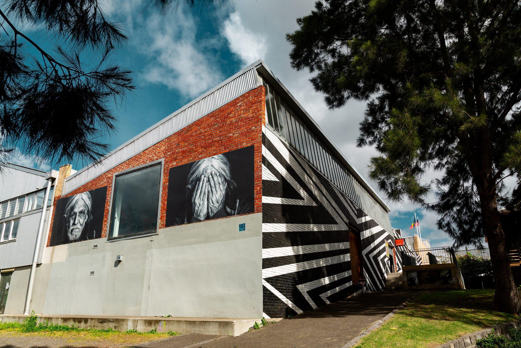
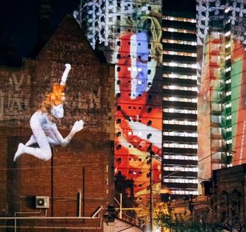
Daniela Rodriquez, 2018, Uncle Larry
Captured by Gianna Rizzo
Located at Footscray Community Arts Warehouse
Executive Summary
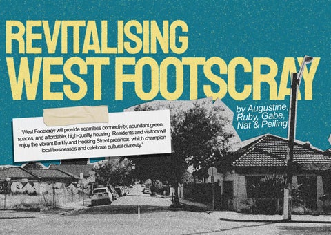
Revitalising West Footscray
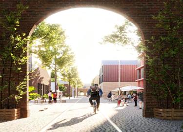
This report outlines a strategic framework to guide the revitalisation of the West Footscray Activity Centre, supporting Maribyrnong City Council’s vision to create ‘an inclusive, progressive city that cares for both its residents and its environment.’
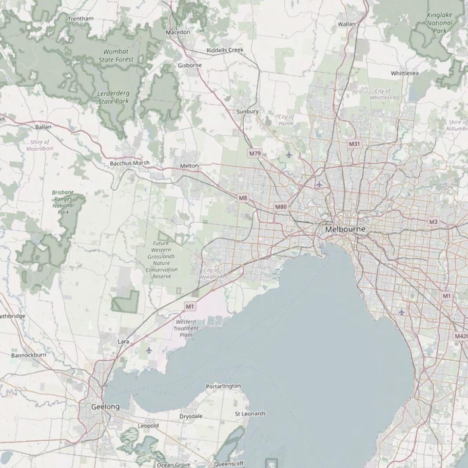
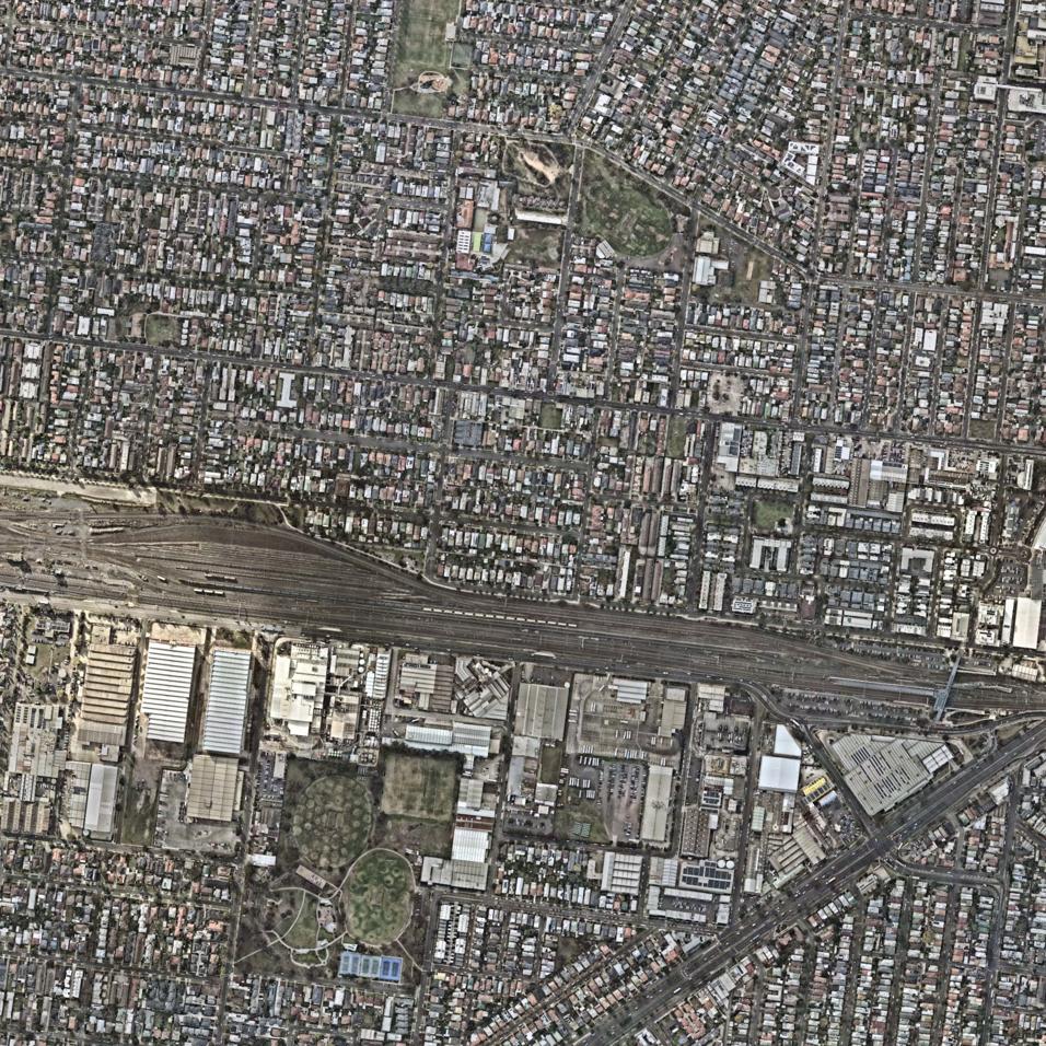
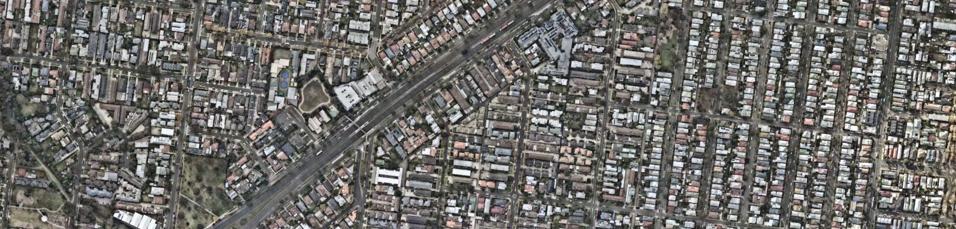
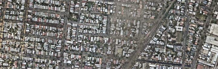
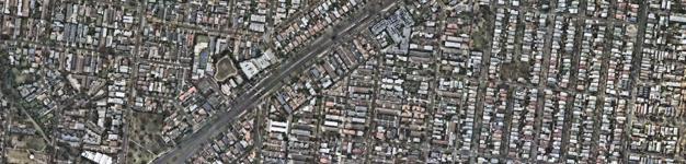
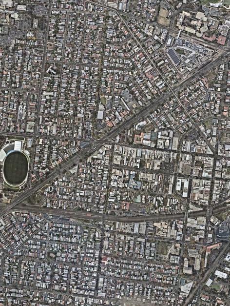
Located approximately 7km west of Melbourne’s CBD, the West Footscray Activity Centre is a key urban precinct within the Maribyrnong City Council area. It encompasses a 15-minute walking radius around West Footscray Train Station, and includes parts of West Footscray to the west of the rail corridor, Footscray to the northeast, Kingsville to the south, and Seddon to the southeast.
The precinct is physically divided by the central rail corridor, creating both a challenge and an opportunity for urban cohesion, access, and connectivity.
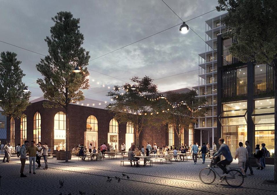
Our vision is for West Footscray to become a place defined by seamless connectivity, abundant green spaces, and affordable, high-quality housing. Residents and
visitors will enjoy the vibrant Barkly and Hocking St precincts, which champion local businesses and celebrate local identity.
To achieve this, we have developed five bold, integrated strategies:
1. Increasing Housing Density and Diversity
2. Connecting Neighbourhoods Safely
3. Increasing Access to Green Spaces
4. Creating Employment and Retail Hubs
5. Celebrating Local Identities
Together these strategies and their associated actions will support the Maribyrnong City Council to revitalise West Footscray and establish the area as a sustainable, affordable and liveable Activity Centre that celebrates its past but also looks forward to the future.
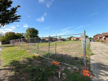
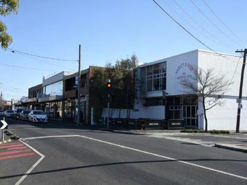
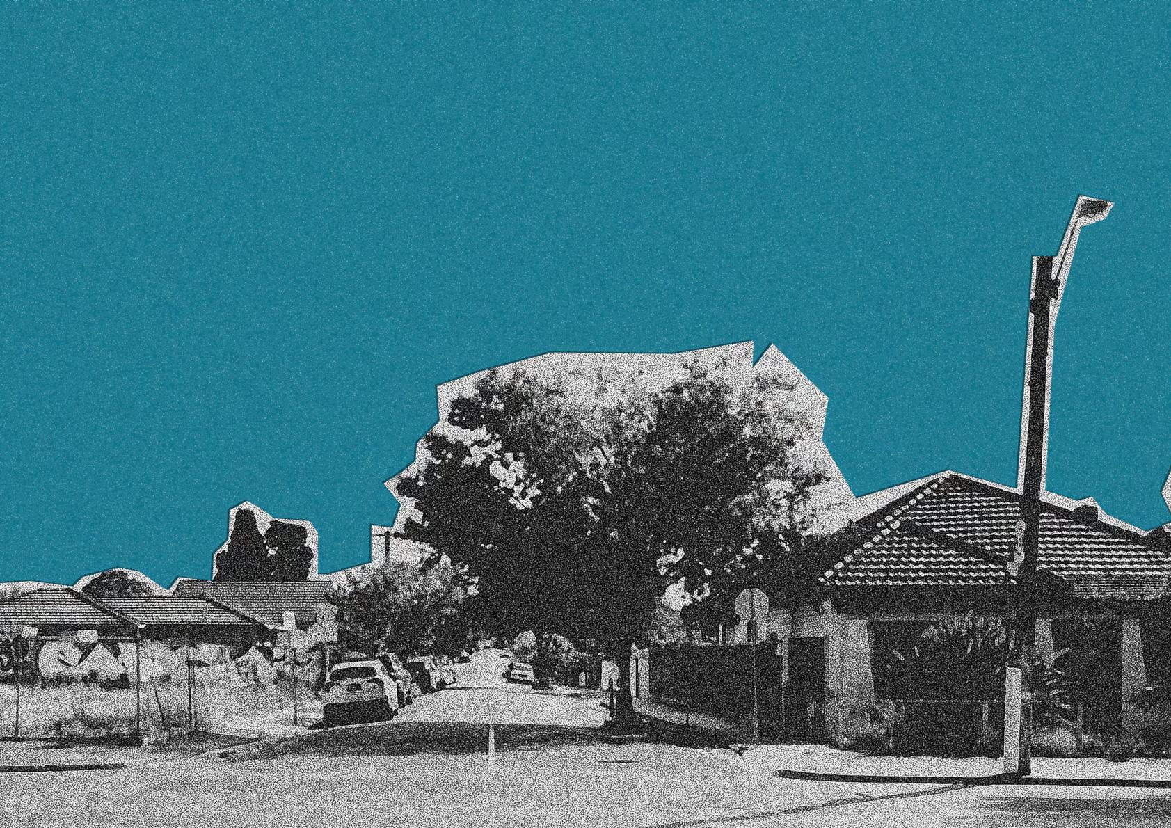
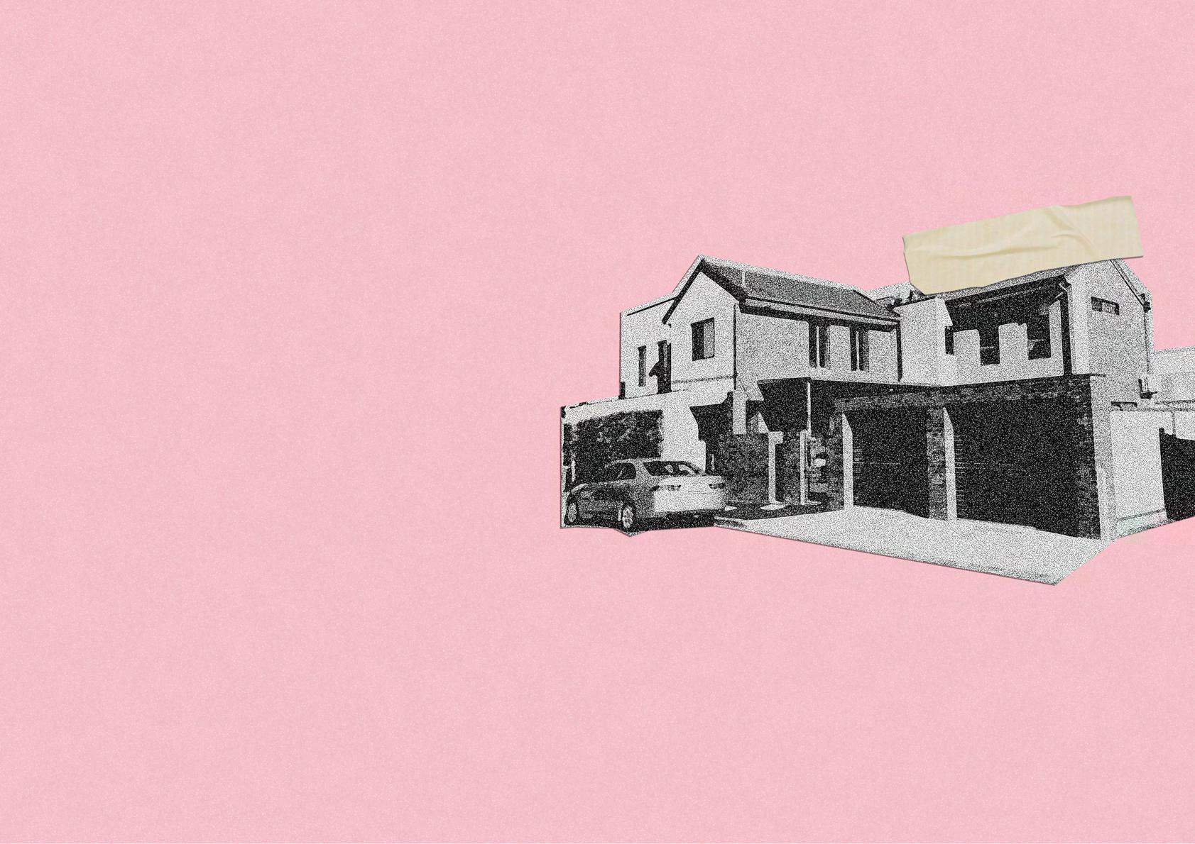
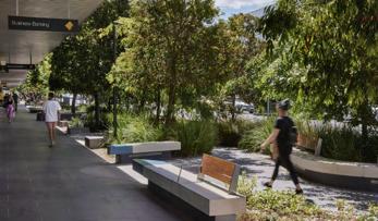
West Footscray Station, a vacant block on Barkly Street and the Harley & Rose Restaurant.
1
Client
Maribyrnong City Council
Date of Issue
10 Jun 2025
Team
Gabriel Menuel
Ruby Thompson
Natalie Tizi
Augustine Vergara
Peiling Yan
Supervisors
Katherine Sundermann
Suzanne Barker
Subject UPD4001
Planning Project 1: The Compact City

4
2
3

1 introduction
1.1 Purpose of Document
Challenging the Victorian Government’s Activity Centre Program with a more place-sensitive approach to planning and designing for more homes.
Recently, the West Footscray area was identified as 1 of 60 ‘Activity Centres’ by the Victorian Government, which aims to support the construction of more housing in places that people want to live. The Activity Centre Program is a heavily ‘top-down’ approach to planning, as new zoning and overlays have been imposed in areas mostly around train stations, increasing building height limits. Alarmingly, the government-led program lacks thoughtful consideration of other elements that make up an inviting, sustainable living environment.
In recognition, this document offers a more holistic, ‘bottom-up’ approach to plan and design for more housing in the West Footscray Activity Centre.
Alongside initiatives for more housing are others with the rationale of stimulating cultural activity, expanding plant cover and open green space, promoting active transport, and supporting local retail and employment. The entire project is informed by a deep understanding of the neighbourhood’s tangible and intangible qualities across time, based from desktop research and physical exploration of the project area. This has ensured that the final vision, strategies, and targets are strongly personalised for the activity centre, yet still ambitious. An explicit list of ‘catalyst projects’ is provided to accelerate the realisation of the vision.
1.2 Brief: Our Client and Key Partners
Our Client is the Maribyrnong City Council, the local Government authority of the West Footscray area.
Key Partners:
• Victorian State Government
• Wurundjeri Woi Wurrung Cultural Heritage Aboriginal Corporation
• Bunurong Land Council Aboriginal Corporation
• Victoria University
• VicTrack
• Residents
• Business and land owners
Issues identified by Client:
• Limited retail and commercial uses along Barkly Street and in the West Footscray Railway station precinct
• Poor connectivity between north and south of the station and rail corridor
• Car dominance on Barkly Street, which is not bike/pedestrian friendly; cars travel too fast despite 40km/hr zones
• Minimal open public spaces
As identified by Council Officers who were consulted and Section 11.03-1L-08 in the Maribyrnong Planning Scheme the following ambitions and objectives were identified:
• Create a safe network of eastwest and north-south pedestrian and cycle routes to better connect residents and visitors
• Encourage residential and commercial developments on Barkly Street and the station precinct
• Transform large, vacant lots, car dealerships, single home dwelling lots, and warehouse sites into new quality mixed use residential and working environments
• Create high-quality public realm that is attractive, safe and walkable, and community facilities that meet the needs of growing population
• Facilitate a transport mode shift towards walking, cycling and public transport
• Strengthen street level activity with retail/commercial uses at ground level
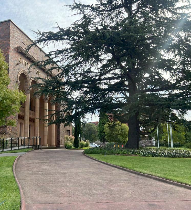
Maribyrnong City Council Offices
Ruby

Melbourne CBD Maribyrnong
Braybrook
Maidstone
Tottenham
Footscray West Footscray
Yarraville
Seddon Kingsville
Melbourne Airport
Port Phillip Bay
Geelong CBD Maribyrnong City Council
Whitten Oval
Existing Footscray Hospital
New Footscray Hospital
Victoria University
Footscray Park Campus
Victoria University
Footscray Nicholson Campus
Hansen Reserve
Shorten Reserve
Barkly St Shopping Village
Footscray Central Business Distrcit
Middle Footscray Station
Footscray Station
Seddon Station
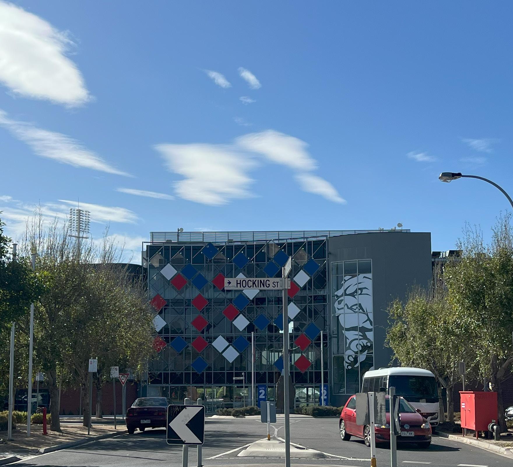
West Footscray Station
by Ruby
2 context
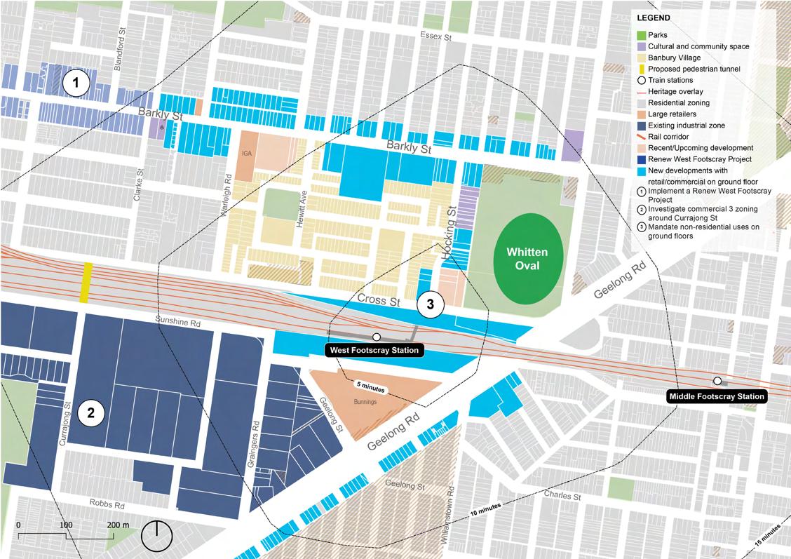
2.1 Activity Centre Context
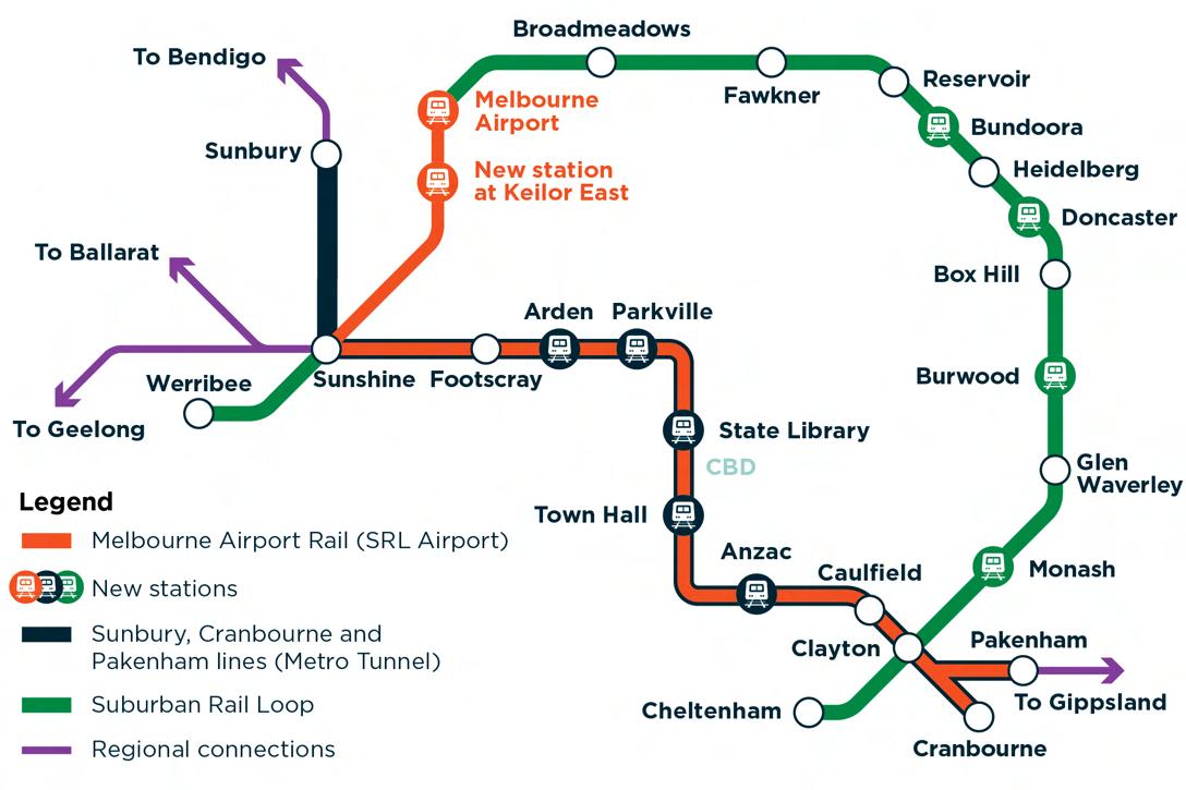
In October 2024, the Victorian Government announced its expansion of the Activity Centre Program.
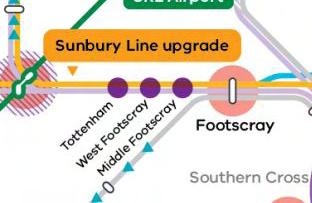
West Footscray was identified as one of 60 activity centres, connecting the Sunbury Line to the Cranbourne-Pakenham Line using the Metro Tunnel. Along with Tottenham, Middle Footscray, and Footscray Stations, West Footscray Station will form part of the Footscray Activity Centre cluster. These four train stations will be the only Activity Centres located in Melbourne’s inner west.
These locations were chosen based on an analysis of transport capacity, market viability, access to jobs and services, and environmental considerations. By planning for more housing in activity centres, the Victorian Government says it is supporting more Victorians to live closer to jobs, services, public transport and green, open space.
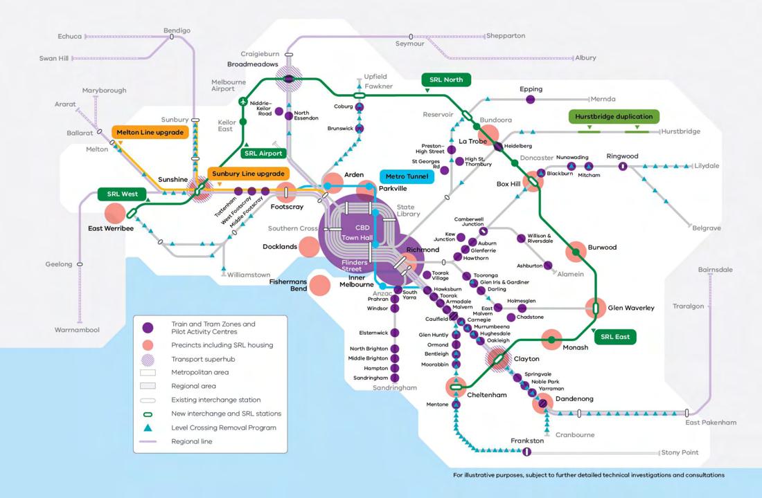
Map of activity centres expansion, Victorian State Government 2025
Maribyrnong City Council Monash University
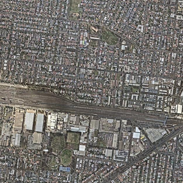
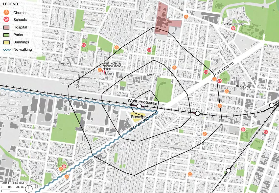
2.2 The West Footscray Activity Centre
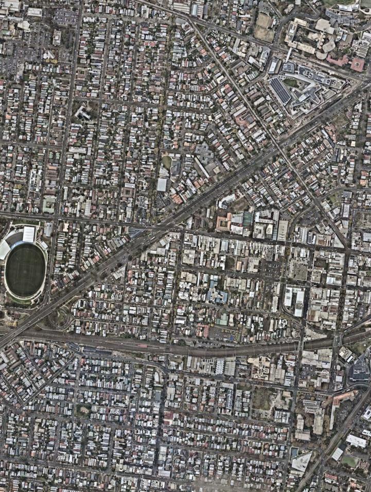
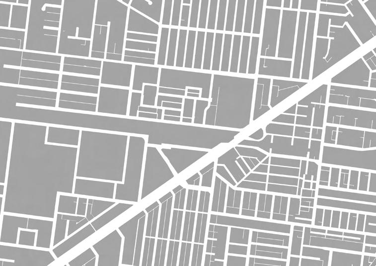
The West Footscray Activity Centre is a 15-minute walking radius surrounding West Footscray Train Station.
It is divided by the rail corridor through the centre, and encompasses the suburbs of West Footscray to the West, Footscray to the North East, Kingsville to the South, and Seddon to the South East.
The area is located in the innerWestern suburbs of Melbourne, and is approximately 7km West of the CBD. The West Footscray Activity Centre falls under the jurisdiction of Maribyrnong City Council.
This region acts as a gateway to Melbourne’s outer Western suburbs and to regional Victoria, as 70% of Victoria’s V Line services run through this section of the Sunbury Line.
Map of West Footscray Activity Centre, by Ruby West Footscray
Seddon
Kingsville
Footscray
Maribyrnong City Council Monash
2.3 Melbourne Airport Rail
Earlier this year, both the state and federal governments, along with Melbourne Airport, have committed to delivering Melbourne’s Airport Rail link.
The Airport Rail is planned to run through part of the Sunbury line through the new Sunshine station superhub. This will have a major impact on West Footscray and surrounding suburbs, delivering more frequent services and opening the region up to tourism.
West Footscray
Source: ABC 2025; Victoria’s Big Build 2025
2.4a Strategic Policy Context
Strategic Policies have helped inform us and provided us with existing frameworks and inspiration to come up with our changes for the West Footscray Activity Centre.
List Of Strategic Policies: - STATE
1. Plan For Victoria/Plan Melbourne - VIC Gov
2. Pedestrian Underpass Design Guideline - NSW Gov
3. Activity Centre Program - VIC Gov
4. 20-minute neighbourhoodsVIC Gov - LOCAL
1. Maribyrnong Planning Scheme
2. Barkly Village Streetscape Improvement Plan Inclusive Of Clarke Street Park
3. Maribyrnong Housing Scheme
4. West Footscray Neighbourhood Plan
5. Maribyrnong City Council Bicycle Strategy 2020 – 2030
6. Urban Forest Strategy December 2018/Urban Forest 2024 Update
diagram,


Strategic context
by Gabe Menuel
2.4b Strategic Policy Context
State Planning Documents
- Plan Melbourne, is a strategic planning document that is meant to last right up until 2050(Victorian State Government, 2017)
- It is a framework to keep supporting the job, housing and transport growth in the city while keeping the qualities that make Melbourne, Melbourne
- The plan includes:
- “9 principles to guide policies and actions”
- “7 outcomes to strive for in creating a competitive, liveable and sustainable city”
- “ 32 directions outlining how these outcomes will be achieved”
- “90 policies detailing how these directions will be turned into action”
- “In addition, a 5 year implementation plan with 112 actions has been developed.”
(Victorian State Government, 2017)
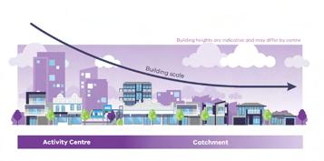
- The activity centre program is a state government policy where they want to bring in 300,000 new homes in 60 activity centres by 2051, with increases to public transport connections and services (Department Of Transport And Planning, 2024)
- “Through this program of new activity centres, the vision is for taller buildings in the immediate ‘core’ where the train station and built-up commercial centre is located.”
(Department Of Transport And Planning, 2024)
- West Footscray was announced in the 2nd round of activity centre announcements in october 2024 as part of the sunbury line upgrade with the new metro tunnel that will be operational this year. (Department Of Transport And Planning, 2024)
- The catchment is the surrounding are that is about 10 minutes walk from the core of the activity centre.
(Department Of Transport And Planning, 2024)
- Plan For Victoria is a central planning document for the state government, where it sets a vision for how victoria will grow overtime
- Plan for Victoria is setup around 5 key pillars:
1. Self determination and caring for country
2. housing for all victorians
3. accessible jobs and services
4. great suburbs, places and towns
5. sustainable enviroments
- It takes over Plan Melbourne, which was a planning document that was central to state governement planning policy in 2017 (Victorian State Government, 2024)
- The target is to build 2.24 million homes in the next 30 years
(Victorian State Government, 2024)
Activity Centre, 2024
Plan For Victoria, 2024
Plan Melbourne, 2017
2.4c Strategic Policy Context
State Planning Documents
The 9 design principles that guide the design and planning practices for underpasses from the Pedestrian underpass design guide, 2023

Pedestrian underpass design guideline, 2023 20-Minute Neighourhood, 2017
- The pedestrian underpass design guideline is an urban design document to guide the best practice when designing underpasses, but at the same does a lot to emphasize alternative methods such as viaducts or combined vehicle/pedestrian tunnels for crossings that are not heavy rail or road crossings.
- The 20-Minute Neighborhood is a key principle of Plan Melbourne
- The 20-Minute Neighborhood is similar to the 15 minute city idea, where the 20-minute neighborhood is about living locally and enabling people to meet most of their daily needs within a 20 minute return walk from home (Department of Transport and Planning 2023)
- It contains 6 important Hallmarks
- 1. Safe, accessible and well connected
- 2. Thriving local communities
- 3. Services and destinations
- 4. Climate resilient
- 5. High quality public realms
- 6. Viable densities (Department of Transport and Planning 2023)
2.4d Strategic Policy Context
Local Planning Documents
Barkly Village Streetscape Improvement Plan inclusive of Clarke Street Park, 2023
- The Barkly Village Streetscape Improvement Plan is an initiative designed to make public realm improvements along Barkly Street in a particular area known as Barkly village, with it wanting to upgrade the area with specific improvements that are listed below
- The Barkly Village Streetscape Improvement Plan aims to promote both the daytime and evening economy in the area
- provide more local gathering places
- Better Cater for active transport modes
- Support public transport users
- create a greener and cooler enviroment
- The Barkly Village Streetscape Improvement Plan also includes the plan to make the Clarke Street Park Permanent. (City Of Maribyrnong, 2023)
- The Maribyrnong Housing Strategy is a strategic document that sets out a vision for the future of housing within Maribyrnong until 2031, with some of the key objectives and strategies being:
- To support housing development that is comfortable to live in and provide residents with a high level of amenity
- Maintain equitable development opportunities for land still to be developed adjacent to development sites
- To increase the supply of affordable, public and social housing in the City
- Require a contribution of 10% of housing units to be used for affordable housing in areas currently. (City Of Maribyrnong, 2018)
- subject to a Development Plan Overlay
- The Maribyrnong Planning schmeme is a statutory planning document that is to help guide council officers how to plan for land use, development in the City of Maribyrnong council, which includes the chosen activity centre suburb of West Footscray.
- The purposes of the planning scheme include:
- To provide a clear and consistent framework within which decisions about the use and development of land can be made.
- To express state, regional, local and community expectations for areas and land uses.
- To provide for the implementation of State, regional and local policies affecting land use and development. (City Of Maribyrnong, 2025)
Maribyrnong Housing Strategy, 2018
Maribyrnong Planning Scheme, 2025
2.4e Strategic Policy Context
Local Planning Documents

The West Footscray neighbourhood plan is an urban planning document made by the City of Maribyrnong to help develop West Footscray, these 4 points were what we thought was the most important:
- A thriving village encouraging mixed retail, commercial and residential development
- Easy Access with well-connected walking, cycling and transport networks.
- Upgraded green spaces and roadside plantings and redevelopment of sporting facilities
- Ensure that development along Barkly St includes a vertical mix of uses prioritising retail and other commercial uses at a ground level with residential above.
(City Of Maribyrnong, 2022)
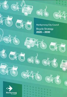
-The Maribyrnong bicycle strategy is a strategic planning document that was developed by the City of Maribyrnong.
- It has 3 specific outcomes that it wants to achieve:
- “• Safe and improved conditions for bicycle riding, including routes and areas separated from vehicles.
• Safer vehicle speeds/ 30 km’s per hour.
• Fewer vehicles on the roads.”
(City of Maribyrnong, 2018)
- They’ve also come up with a symbolic rider, as a definition for them to help them determine appropriate strategies for this framework (City of Maribyrnong, 2018)
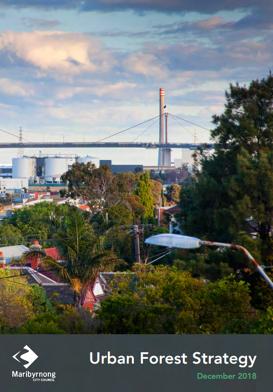
- The Maribyrnong Urban Forest Strategy (2018) is a strategic environmental planning document produced by the Maribyrnong City Council.
- The targets in the strategy are:
-“•Increase canopy cover in the public realm to 20% by 2040
• Seek gains in canopy cover on private land and at a minimum achieve no net loss.”
(City of Maribyrnong, 2018)
- This strategy is particularly important as improved greenery will help migitate the effects of the urban heat effect that plagues the western surbubs of Melbourne due to the loss of greenery over the years.
Bicycle strategy 2020-2030, 2018
Urban Forest Strategy, 2018
West Footscray Neighbourhood Plan, 2022
West Footscray Neighbourhood Plan
Maribyrnong City Council
Maribyrnong City Council Monash University
2.6 Indigenous Context
60,000 years of continuous connection to Country
1.0% of West Footscray population
The Maribyrnong river was where the First Nations lived, catching eels and hold corrobes on the riverbanks
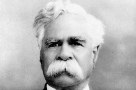
William Cooper
(Bonmarat Leewik (Strong ancestors) Project, 2014).
40000 - 60,000 years to the present day: home to the Wurundjeri Woi Wurrung and the Bunurong People of the Kulin Nation
William Cooper, one of the most important First Nations political and community leaders established the Australian Aborigines League while residing in West Footscray from 1933 to 1940 (Bonmarat Leewik (Strong ancestors) Project, 2014).
As secretary of the Australian Aborigines League, he wrote many important letters and even petitioned the king for change (Bonmarat Leewik (Strong ancestors) Project, 2014).
The important work done by William cooper led to the 1967 referendum, where over 90% of the people of Australia voted for the Aboriginal people to have citizenship, but it took until 1971 for all the changes to be reflected in state laws (Living Museum, 2022).
West Footscray has the highest percentage of Aboriginal or Torres Strait Islander people descent in Maribyrnong, with it being 1.0% (Informedecisions, 2021)
The term Maribyrnong is actually an anglicised version of an Aboriginal term that translates to ‘I can hear a ring-tail possum’
This map below is to show the current land council boundaries between the Wurundjeri and Bunurong people, who still currently reside in West Footscray. However, this is a modern land council boundary and it is paramount to recognize that it was a place of trade, connections and respect for country.
*Land Council boundaries, Often had shared spaces and respected each others’ people
LEGEND
Wurundjeri Woi Wurung Land
Bunurong Land
Post contact history
Drawing, by Peiling
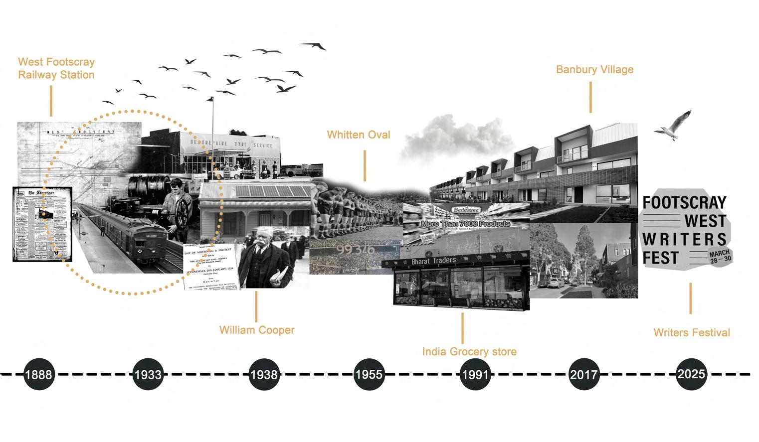
West Footscray
Railway Station
Opened
Beaurepaire’s
Olympic Tyre Company opened its factory, west of Footscray West Railway Station
Aboriginal Activist William Cooper lives in West Footscray from Jan 1938 to Nov 1940
Record Crowd at Whitten Oval of 42,354Round 12, VFL: Footscray v Collingwood
Bharat Traders opens, the first Indian retail Grocery store to open in Melbourne
Banbury Village established in the former Olympic Tyres factory precinct, adding 250 new dwellings to the area
First Footscray West Writers Festival takes place aiming to revitalise the Barkly Street precinct
2.8a Place DNA: Understanding West Footscray
West Footscray is home to a diverse community of residents, vibrant businesses and local initiatives.
While the area retains workingclass roots it has undergone a big transformation in recent years becoming a creative, thriving, multicultural community.
West Footscray is centrally located in Melbourne’s inner west and is a relatively quiet neighborhood where people love to live due to the pretty streets, Barkly Street shopping and hospitality, and its close proximity to Melbourne CBD.
South of the rail corridor sees a cultural and land use shift with the area divided by Geelong Road, a major barrier for connectivity. Kingsville is predominately suburban with very few amenities while the area closest to the train station and railway is mostly industrial and employment land. A large Bunnings is the only retail in the area.
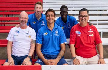
Whitten Oval, home to the Western Bulldogs football teams, brings crowds to the area for AFL Women’s games which are hosted there. It is an icon that looms near West Footscray station.
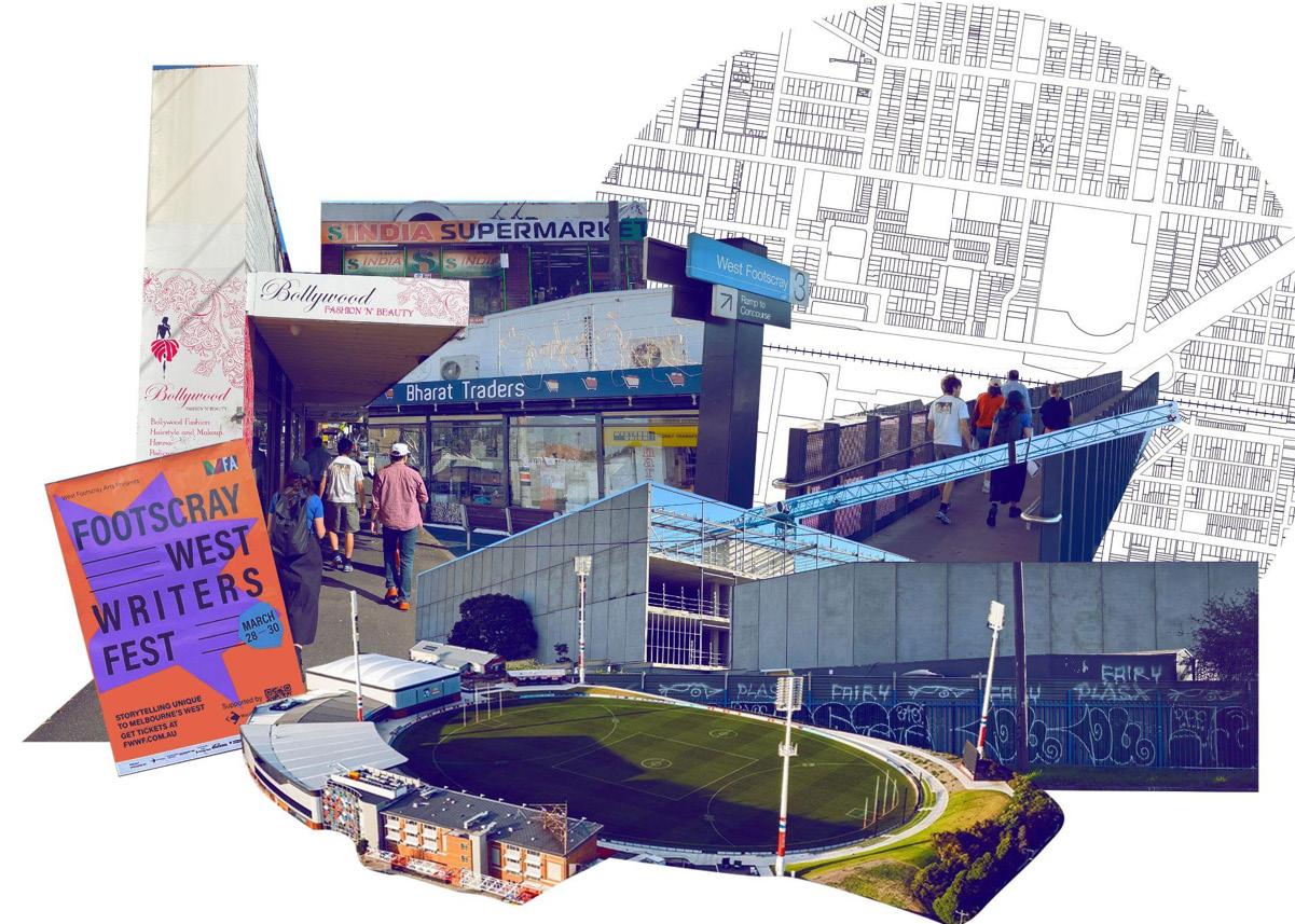
DNA of West Footscray collage by Augustine highlighting key attributes of the neighbourhood
2.8b Place DNA: Understanding West Footscray
Western Bulldogs Community Foundation
The Western Bulldogs Community Foundation delivers health and wellbeing, and youth and diversity programs to locals in the west.
Two flagship programs, Sons of the West and more recently, Daughters of the West aim to empower men and women to lead healthier lives by providing education, physical activity opportunities and a supportive social network.
The Western Bulldogs football team, and the Community Foundation, play an important role in community advocacy for the area, as they facilitate events and raise awareness about West Footscray, and its surrounds. They work closely with the State and Federal Government and Victoria University to deliver programs for locals that drive positive, lasting change.
and Sons of the West Participants. Source: westernbulldogs.com.au
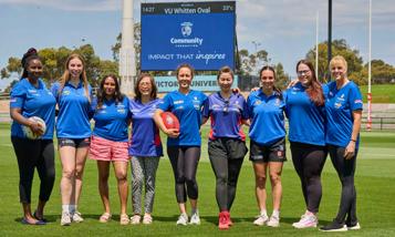
Western Bulldogs Players and Daughters of the West Participants. Source: westernbulldogs.com.au
“I am aware of my mental issues and am learning to control my anger or anxiety emotions for the benefit of me and my family. I have improved my demeanour quite a lot with the help supplied by the Sons of the West.” – Sons of the West 2023 participant
A short walk away on Barkly Street...
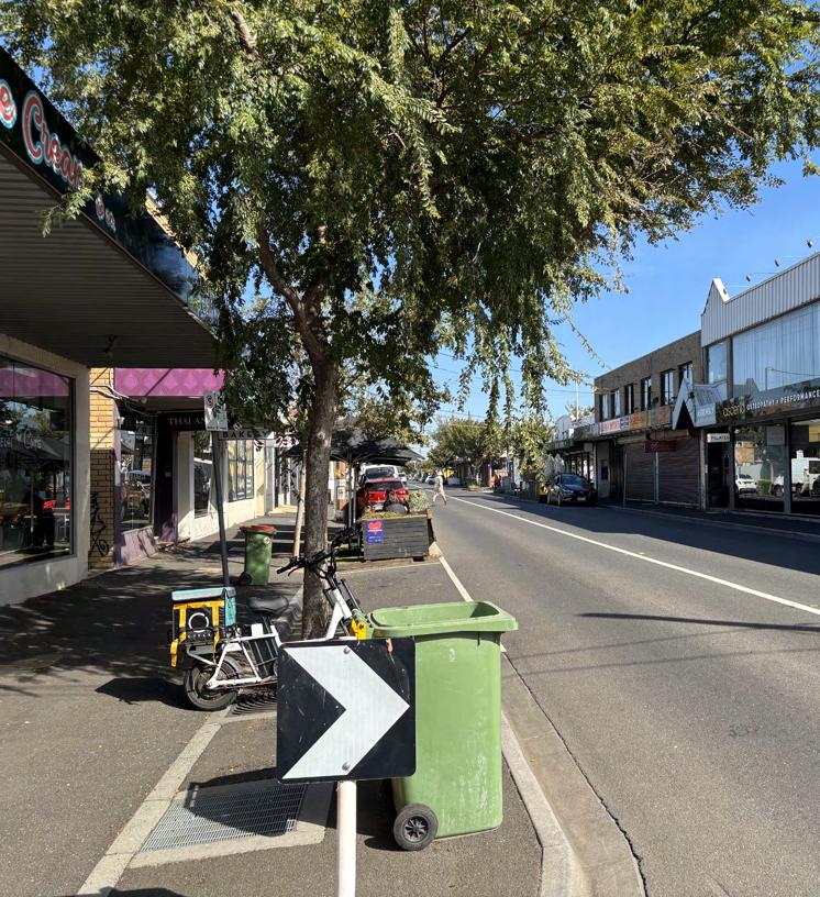
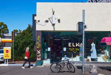
You will a host of find a host of cafes and retail shops, such as Bharat Traders, Melbourne’s first Indian supermarket, and Migrant Café a women-owned and run business famous for its bagels with a Filipino, Thai and Islander twist.
Up the street there is The Chestnut Tree Bookshop a much-loved local independent bookshop founded by Reem Sweid who firmly believes “that a vibrant local community is vital for healthy living…and books bring people together.”
The Chestnut Tree Bookshop and other venues along Barkly Street hosted its first Writers Festival earlier this year in March. The Footscray West Writers Fest welcomed celebrated authors from the area and beyond for a celebration of storytelling in the west.

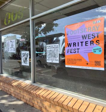
Reem the Founder & Owner of The Chestnut Tree Bookshop & Cafe. Source: thechestnuttree. com.au
Western Bulldogs Players
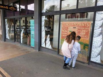
Empty shopfront on Barkly Street with posters
2.9a Demographics
The West Footscray Activity Centre is a young, educated, and professional Victorian suburb.
The following data has been extracted from the 2021 Australian Census, and combines the suburbs West Footscray, Footscray, and Kingsville-Seddon.
Melbourne’s West is the fastest growing region in Australia, and is expected to accommodate more than 40% of metropolitan Melbourne’s population growth over the next 40 years.
In 2021, the combined population was 38,107. This area is forecast to increase by 82% to 69,370 people by 2051, largely due to development in Footscray.
The median age in this region is 35, compared to the state of Victoria which is 38. 44.0% of the population hold a Bachelor’s Degree or above, compared to 29.2% of Victorians.
Source: West Footscray, Footscray, Kingsville-Seddon, ABS 2021; Forecast.id 2025; Maribyrnong City Council 2018
Total Population Education
Median Age
Occupation
2.9b Demographics
Country of
(other than Australia)
West Footscray is multicultural and multilingual.
West Footscray, as a suburb, has a culturally diverse population, most notably from Vietnam and India, compared to that of Victoria.
6.1% of the population were born in Vietnam, compared to 1.4% of Victorians.
8.2% of the population speak Vietnamese at home, compared to 1.8% of Victorians.
1.4% speak Telugu (an Indian dialect) at home, compared to 0.4% of Victorians.
Language spoken at home (other than English)
2.10a Global Context
Climate Emergency
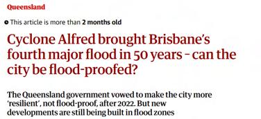
One of the main global drivers for change that has informed some of our strategic objectives in West Footscray is the climate emergency.
Across the world climate change is impacting urban life, sea levels are rising, and extreme weather events are increasing. Although the climate emergency disproportionately affects people from low-socio economic backgrounds or those in the ‘global south’, no city or individual is immune from the negative impacts of climate change.
In January this year, wildfires in LA killed 30 people, and displaced 150,000 residents. 2024 was the hottest year on record in Europe, with 44,000 people losing their lives due to extreme heat. Whereas in Australia we are experiencing 1 in 50 and 1 in 100-year rain events, like Cyclone Alfred, rendering some of our largest cities increasingly unliveable and also un-insurable.
All these examples show the need to embed climate resilient policies in our urban planning and design.
What does this mean for West Footscray?
Creating climate resilient cities should be a priority for the Activity Centre program, and with our Strategy: Increasing Access to Green Spaces we intend to create a cool, greener West Footscray that serves both people and wildlife. Targets around tree canopy will be established along with new pollinator corridors and water sensitive urban design.
With our Connecting Neighbourhoods Safely Strategy, we envision a West Footscray that prioritises cycling and pedestrian infrastructure and encourages public transport use to transition away from cars, reducing CO2 emissions from car pollution and congestion.
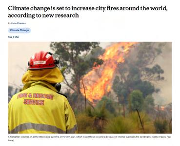
Source: The Guardian
Source: ABC News
Source: The Guardian
2.10b Global Context
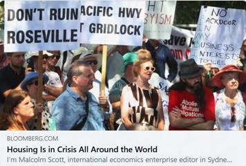
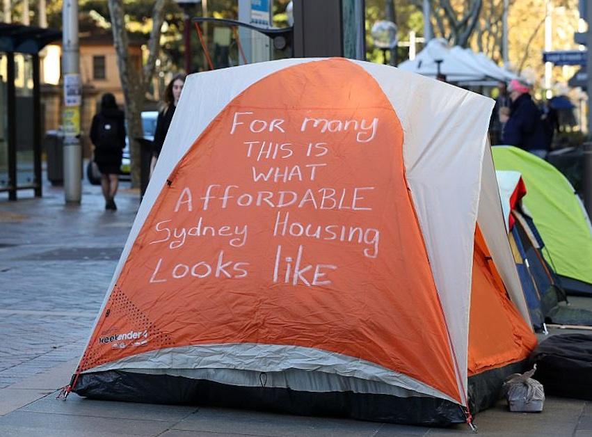
Housing Crisis
The Housing Crisis is also a global crisis, with different cities and governments taking different approaches to plan for population growth in innovative ways.
Approximately 1.6 billion people globally do not have access to adequate housing (Purton, 2024). In every city across the world demand for affordable housing surpasses supply (Bracken, 2025).
For example, in Austria all Austrians pay a housing tax of about 1% of their income which is then distributed to the different cities to use on housing (Kohler, 2024).
Some Governments are now planning and zoning for more apartments and higher density near transit nodes (Kohler, 2024).
What does this mean for West Footscray?
The main objective of Victoria’s Activity Centre Program is to increase affordable housing (300,000 new homes to be built by 2051) around tram and train lines and other services.
To meet this mandate, our Increasing Housing Density and Diversity strategy aims to promote inclusive, affordable housing with a target of building 5000 new homes in West Footscray by 2051 with 20% being affordable.
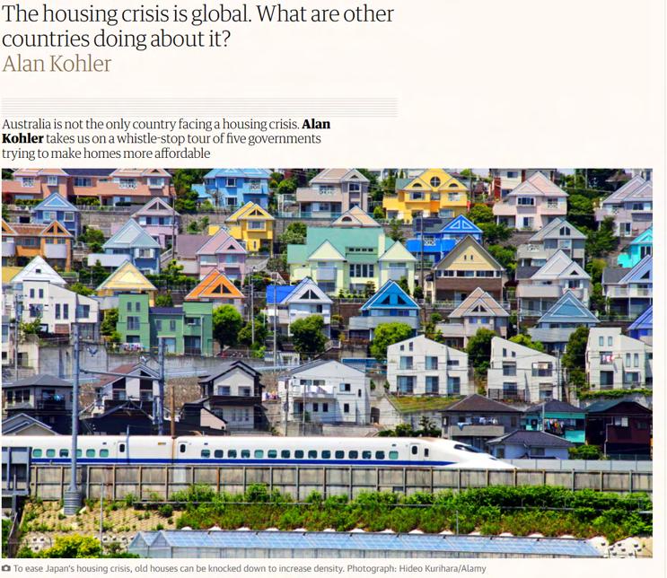
Source: The Guardian
2.10c Global Context
Deindustrialisation
Although industrialisation and deindustrialisation have been transforming our cities for the last 200 years, globally we are still not immune to its effects as we still have a need for industrial jobs to support infrastructure booms and the growth of our cities.
We have also witnessed the impacts to people’s livelihoods when a major local industry dies, such as in America’s Rust Belt cities.
Countries like Germany with an manufacturing-based economic model are realising how increasingly precarious that model has become as household names like Volkswagen and Miele are needing to cut tens of thousands of jobs, close down factories and move labour ‘off shore’. (The Economist, 2024).
What does this mean for West Footscray?
The West Footscray Precinct Framework Plan 2020 aims to encourage innovative industrial and commercial land uses around the industrial zoned precinct south of the rail corridor to enhance a range of employment opportunities in the area.
Our Creating Employment and Retail Hubs Strategy aims to retain the majority of this existing industrial area as employment land but investigate the opportunity for new commercial 3 zoning for potential mixed-use development at some select sites.
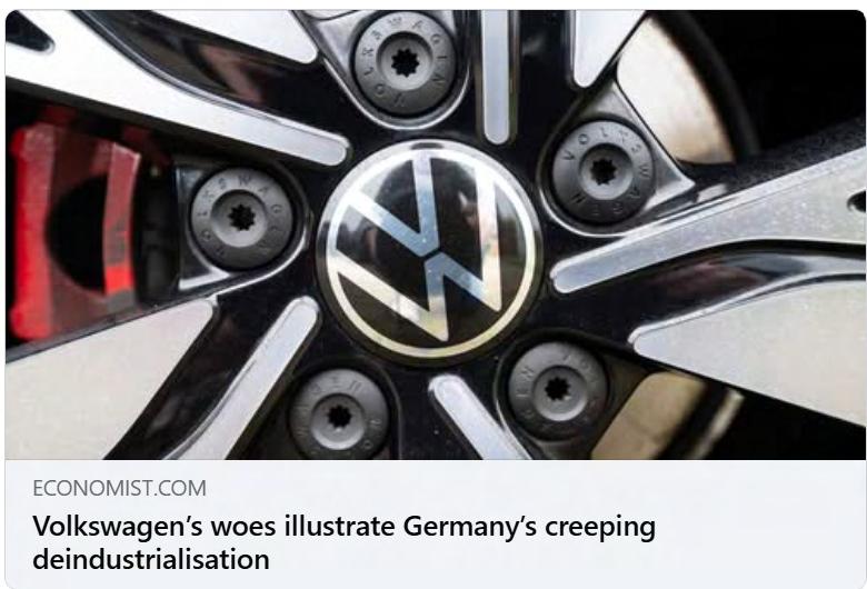
Part of our Celebrating Local Identities Strategy is to champion the working class heritage of West Footscray
2.11a National Housing Crisis
The activity center program is a result of a housing crisis that has become central to Australian politics, with it shifting away from typical housing growth policies of the past with a focus on better built, higher density housing surrounding transport hubs.
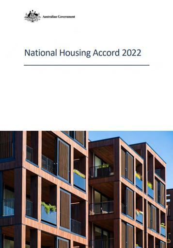
Housing accord: The Accord includes an initial aspirational target agreed by all parties to build one million new well-located homes over 5 years from mid-2024. (Australian Federal Government, 2023)
(StreetSmart Australia, 2017)
2.11b National Housing Crisis
- The Commonwealth and states and territories agreed to update this target at National Cabinet in August 2023 to 1.2 million new well-located homes over 5 years from mid-2024.
- National Cabinet also endorsed the Commonwealth providing $3.5 billion in payments to state, territory and local governments to support the delivery of new homes towards this target..
- As part of the Accord the Commonwealth has committed $350 million over 5 years from 2024-25 to support the delivery of 10,000 affordable homes.
- State and territory governments have agreed to build on this commitment to support delivery of up to an additional 10,000 affordable homes.
- This enables delivery of a combined total of up to 20,000 affordable homes under the Accord. (Australian Federal Government, 2023)
- Housing affordability has deteriorated over the past year to reach its worst level since records began in 1995.
- First home buyers now rely on wealthy families or high-income jobs to enter the market, according to the latest housing affordability report from PropTrack.
- Driven by high mortgage rates and increasing home prices, affordability further deteriorated this financial year to the point where a medianincome household earning about $112,000 could afford just 14% of homes sold – the smallest share since records began. This share has declined from 43% in just three years. (Kelly, 2024)
- Affordability was worst in New South Wales where a medianincome household could afford just 10% of homes sold, and Tasmania, with 9%.
- In Victoria, 12% of homes met that threshold.
- The most affordable state was Western Australia, where 26% of homes were affordable for a median-income household. (Kelly, 2024)
What does this mean for West Footscray?
Our goal for West Footscray shows that we want to build an additional 5,000 homes, with 20% of them being affordable, so about 1,000 of them. In comparison to the targets set to the national housing accord, they have only 20,000 affordable homes out of 1.2 million, so their target is about 1.67% of them being affordable (Australian Federal Government, 2023). Which shows the federal governments priorities as to be building for profit housing, despite the fact that housing affordability in Australia has dropped to record lows as of 2024, where a median income household could only afford 14% of homes sold (Kelly, 2024), showing that affordable homes need to be higher on the priority list when it comes to national housing policy, not just as an afterthought.
(Australian Federal Government, 2022)
(Kelly, 2024)
2.11c National Housing Crisis
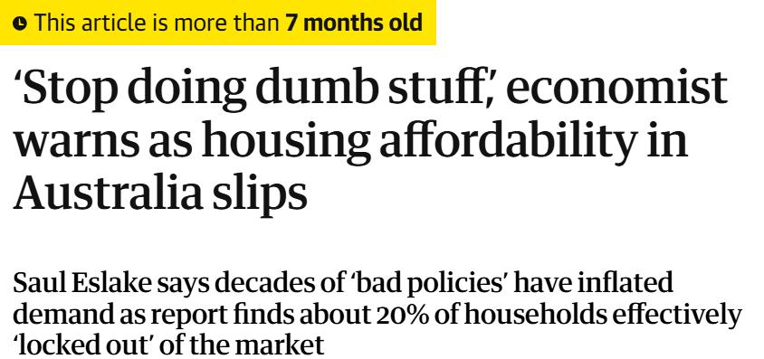
What does this mean for West Footscray?
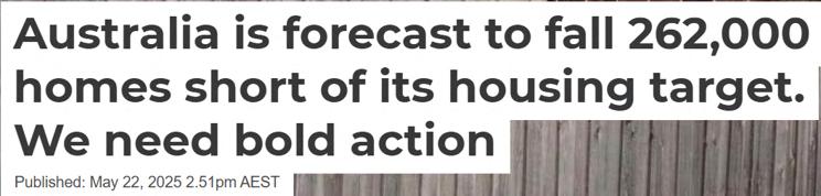
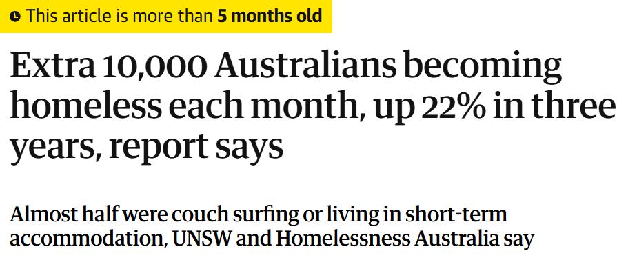
With our Target of building 5,000 more homes in the West Footscray activity centre over the next 26 years, the fact we will be short by 262,000 homes for the goal of the national housing accord shows the difficulty of building a lot of homes very quickly (Fahrurriza, 2025), while granted our goals are over a longer period of time, it means ambitious targets needs bold actions to meet and we won’t be able to just meet them by just giving a bit of money and crossing our fingers. With our goal of increasing coverage by 21.7% to 30% tree canopy coverage in the City of Maribyrnong by 2051, this goal is paramount to mitigate the urban heat island effect, as the article states that it can reduce surface temperatures up to 40% (Wood, 2020). As Australia keeps breaking average temperature records and having hottest days on records, having urban greenery initiatives is paramount to cooling down West Footscray and mitigating climate change impacts. Finally, our housing goal of 20% of the new dwellings to be affordable is needed to combat the homelessness crisis in australia, as an extra 10,000 australians becoming homeless each month is the same amount as the federal government’s 10,000 affordable dwellings commitment from the housing according, puts the issue into perspective (Kelly, 2024).
Article 1:
- Australia’s plan to build 1.2 million new homes by 2029 is in trouble. A new report by the National Housing Supply and Affordability Council (NHSAC) shows we are likely to miss this ambitious target by a huge margin.
- At the current pace, the council forecasts we will fall about 262,000 homes short of the goal. In other words, for every five homes we need, we’re only on track to build about four.
- No state or territory is building enough to meet its share. This is more than just a number; it means the housing affordability crisis will continue unless we act fast. (Fahrurriza, 2025)
Article 2:
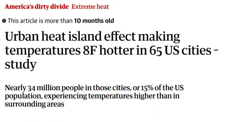
- Australian cities are increasingly becoming concrete jungles as trees and canopy coverage disappear, according to experts who warn this is contributing to an urban “heat island” effect.
- Data shows canopy coverage has declined in almost every state
- Urban design experts are calling for a 30 per cent increase in city greenery.
- Governments are being urged to introduce incentive schemes to prompt residents to plant more
-“We know a tried and tested strategy is the introduction of more trees and green roofs in urban spaces, reducing surface temperatures by up to 40 per cent,” Griffith University urban and environmental planner Tony Matthews said. (Wood, 2020)
Article 3:
- Ten thousand extra Australians are becoming homeless each month – a 22% increase in the past three years – according to a new report from UNSW and Homelessness Australia.
- It comes as those on the frontline say they are seeing an uptick in people with employment coming in for housing help, including part-time teachers and nurses.
- Homelessness services across the country help 95,000 people each month, with the number of new clients who were already homeless before seeking support increasing 9% over the three years to 2023-24, and now exceeding 10,000 a month. (Kelly, 2024)
(Fahrurriza, 2025)
(Wood, 2020)
(Kelly, 2024)
2.12a Local Context
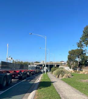
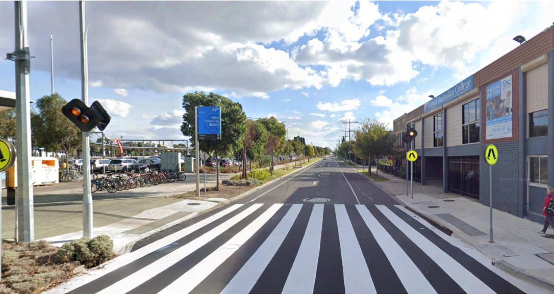
West Footscray and the surrounding areas have had issues with new developments in recent years, with council pushbacks on new developments and also a recent death on Geelong Road in West Footscray highlighting the need for better pedestrian infrastructure.
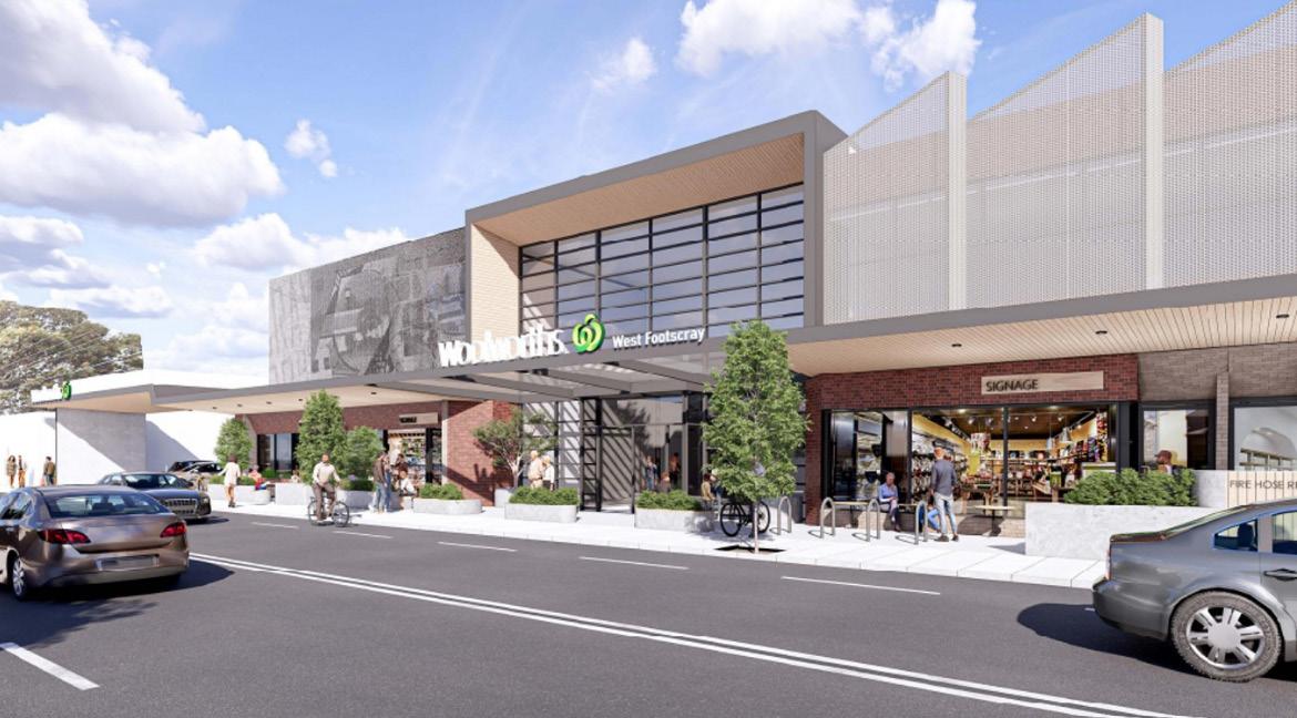
- In 2023, Woolworths put forward a proposal for a two story building to be built in West Footscray (Marc Pallisco, 2025)
- It were to be a mixed development, “containing a Woolworths supermarket, Bottle shop, Childcare Facility, Medical Centre, Gym, Office space, and 8 Retail Tenancies” (Marc Pallisco, 2025)
- The council decided not to support the proposal based on numerous grounds, for e.g it is an underdevelopment of the site and it would not produce a net community benefit and refused to issue a permit (City Of Maribyrnong, 2025)
- However, VCAT overturned the council’s decision in 2025 and said they had to grant a permit (City Of Maribyrnong, 2025)
(Marc Pallisco, 2025)
2.12b Local Context
What does this mean for West Footscray?
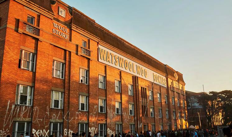
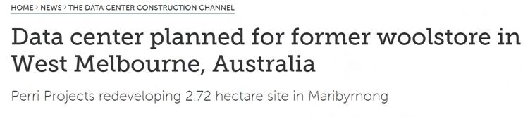
The recent plan put forward by perri projects for the data centre to be put in West Footscray shows the importance of West Footscray as a place to build new businesses for economic growth and opportunity with the important industrial land on the southside of the West Footscray train station, however the Woolstore is now an iconic music venue, with artists such Dom Dolla playing there in 2024 and an important heritage site in West Footscray. The death on Geelong road highlights the need for updated pedestrian infrastructure and the lowering of speed limits on major arterial roads in West Footscray so that the risk of a fatal accident can be lowered and to further save lives.
- In 2025, a plan was put forward by Perri Projects for a data center to be put in West Footscray (Swinhoe, 2025)
- “The proposal is for a new fourstory data center on a 2.72-hectare site at 1 McArthur Street and 63 Sunshine Road. The site is currently home to a four-story warehouse, known as the Goldsbrough Mort and Co Ltd Woolstore building.” (Swinhoe, 2025)
- It has already been granted a subdivision permit by the council (Swinhoe, 2025)
- It is looking to redevelop where the current woolstore building is, which is heritage listed but part of it has already been approved for development by perri before. (Swinhoe, 2025)
- On Geelong road in West Footscray, an elderly pedestrian was struck at 8:20 am in the morning of may 12th 2025, and later passed away in hospital (starweekly, 2025)
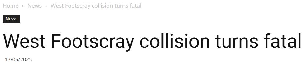
(starweekly, 2025)
(Swinhoe, 2025)
The Woolstore, West Footscray

3 vision
West Footscray will provide seamless connectivity, abundant green spaces, and affordable, high-quality housing. Residents and visitors will enjoy the vibrant Barkly and Hocking Street precincts, which champion local businesses and celebrate cultural diversity.
Vision and Strategies
West Footscray will provide seamless connectivity, abundant green spaces, and affordable, high-quality housing. Residents and visitors will enjoy the vibrant Barkly and Hocking Street precincts, which champion local businesses and celebrate cultural diversity.
Increasing Housing Density and Diversity Connecting Neighbourhoods Safely
Improving Access to Green Spaces
Creating Employment and Retail Hubs
Celebrating Local Identities
Promoting inclusive, affordable housing and mixed-use development to increase density, improve design quality, and ensure accessibility for residents.
Prioritising cycling and pedestrian infrastructure alongside equitable access to public transport across the rail corridor and major roads.
Creating new green spaces that support biodiversity and foster a cooler environment, serving both people and wildlife.
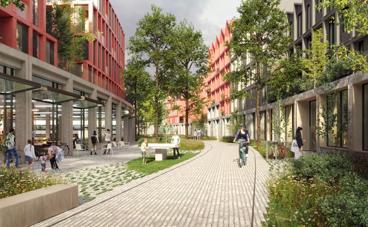
Establishing Barkly St, Hocking St and West Footscray Station as vibrant places that connect residents, businesses and visitors to the area.
Stimulating local community partnerships that celebrate First Nations culture and champion the cultural heritage of West Footscray through existing and new spaces.
Targets
Increasing Housing Density and Diversity Connecting Neighbourhoods Safely Improving Access to Green Spaces
Creating Employment and Retail Hubs
Celebrating Local Identities
2025: 6,000 dwellings
(Source: Maribyrnong City Council 2021)
2051: 11,000 dwellings, with 20% being affordable
2025: 3.3% of people cycle to work, with 54.8% driving to work as either the driver or passenger (Source: ABS 2016)
2025: Maribyrnong current canopy coverage 8.3%
(Source: Maribyrnong City Council 2018)
2025: ~40% occupancy of Barkly St
2051: 11% of people to cycle to work in West Footscray, with 30% of people driving to work as either the driver or passenger
2051: 30% tree canopy coverage
2051: 100% occupancy of Barkly St
2025: Existing library and Neighbourhood House on Barkly St
2051: New cultural hub

4 strategies & actions
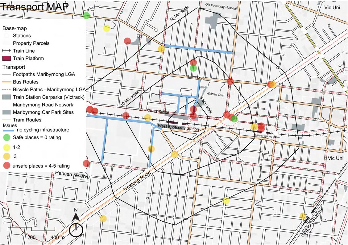
4.1a Key Issues and Challenges
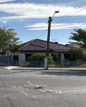
Housing Density and Diversity
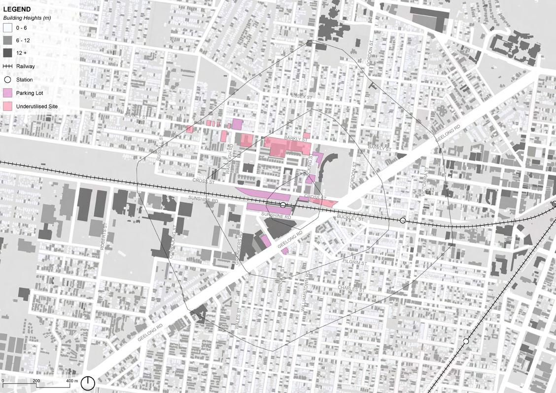
Multiple key parcels are underutilised or vacant, lowering density potential.
Housing stock lacks diversity, with 55% single-family homes.
High prices make housing unaffordable for low- and middleincome residents.
436 Barkly St, West Footscray, VIC 3012
Maribyrnong
4.1b Key Issues and Challenges
Neighbourhood
Connectivity
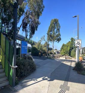
Only one bridge connects both sides of the rail line, limiting movement. Very limited pedestrian and cycling infrastructure.
Large parking lots dominate valuable public realm.
Many areas rate poorly for walkability and safety.
West Footscray Train Station, Sunshine Road, West Footscray, Victoria 3012, City of Maribyrnong, Australia
4.1c Key Issues and Challenges
Access to Green Spaces
Minimal tree canopy on key arterial roads contributes to urban heat, such as Geelong Rd and Barkly St.
Many residential areas lack nearby public green space.
Little ecological connectivity, limited urban wildlife presence.
Reserve on a busy truck route, Buckley St
Revitalising West Footscray Semester 1, 2025
Maribyrnong City Council Monash University
Ecology Issues Map, by Ruby
4.1d Key Issues and Challenges
Employment and Retail
Gaps in retail activation along Barkly Street.
Few retail and services south of West Footscray Station.
Low daytime footfall and poor passive surveillance around activity hubs.
Victoria Government employment land limits residential amenity nearby.

Mixed use residential and retail on Barkly Street
Maribyrnong City Council Monash University
4.1e Key Issues and Challenges
Local Culture & Identity
Fragmented pedestrian network due to major roads and railway, isolating north and south.
Only one neighbourhood house limits community service reach.
Lack of dedicated cultural facilities weakens identity and local expression.
Roads and rail corridors are massive barriers
Community Infrastructure Map, by Peiling
strategies & actions

4.2 Increasing Housing Density and Diversity
4.3 Connecting Neighbourhoods Safely
4.4 Improving Access to Green Spaces
4.5 Creating Employment and Retail Hubs
4.6 Celebrating Local Identities
4.2a Strategy: Increasing Housing Density and Diversity
Precedents
Strategy Map, by Augustine
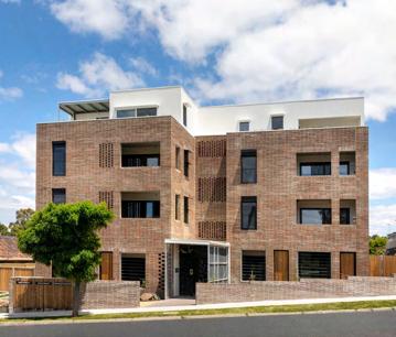
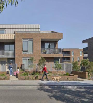
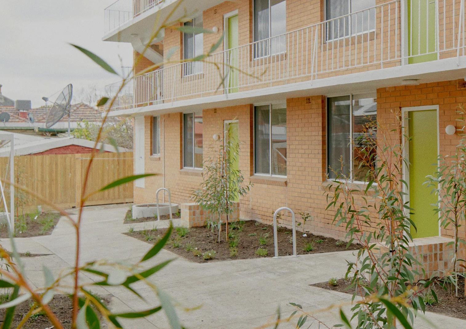
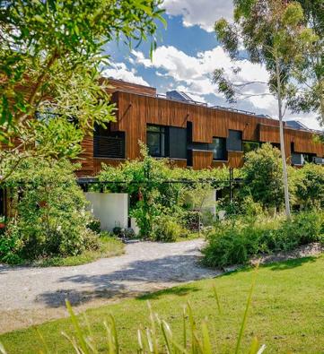
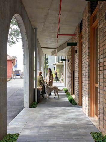
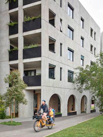
Aboriginal Housing Victoria – Affordable Housing Project, Reservoir, VIC, Breathe Architecture
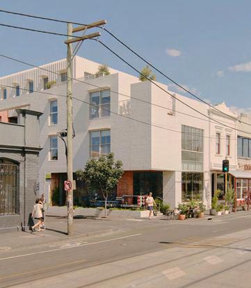
The Nursery on Brunswick, VIC, Clare Cousins Architects
4.2b Actions: Increasing Housing Density and Diversity
Actions promoting inclusive, affordable housing and mixed-use development to increase density, improve design quality, and ensure accessibility for residents.
1
Update Maribyrnong Planning Scheme
Increase building height controls up to 4 or 6 stories for sites along Barkly St, Hocking St and Curajong St and Geelong Road (illustrated on page 46).
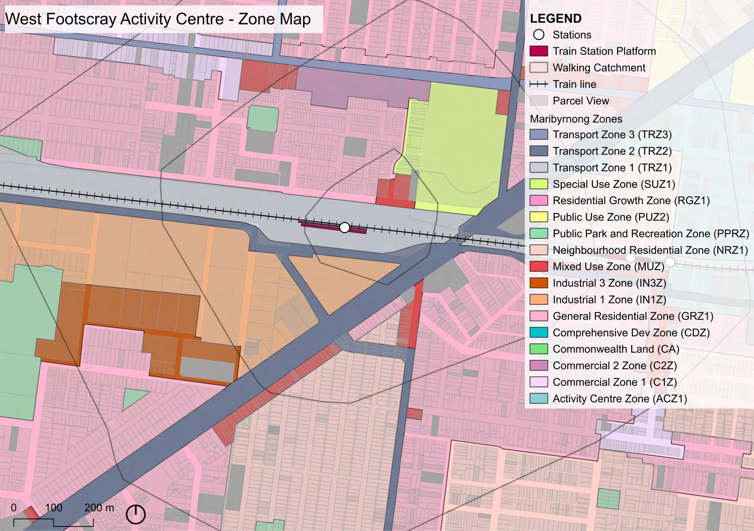
The affected Commercial 2 and Special Use zoned land (page 19) should be rezoned to Mixed Use to support more housing closer to the train station.
Land with new height controls will also have mandated Floor Area Ratio (FAR) of 2.5:1, with some having a further 20% Floor Area Uplift (FAU) bonus if 15% affordable housing is provided.
Land containing recent constructions (page 82) or significant for employment is intentionally excluded from the new controls.
2
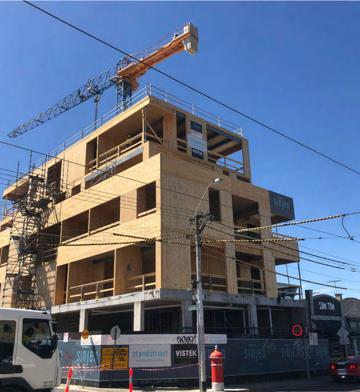
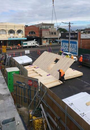
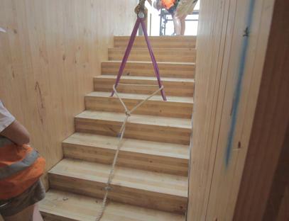
Lead an affordable, mass-timber housing demonstration project
A housing project on government land that will represent to stakeholders and the broader market the ideal level of densification for the Activity Centre. It must promote future development that is sustainable and elevates to the liveability of the neighbourhood, through provision of community amenities (e.g. ground-level retail, community garden).
Mass-timber buildings produce a substantially lower carbon footprint, less wastage and is faster to construct with compared to conventional materials. For further information see pages X and X.
The preferred site location is illustrated on pages 46 and 62
3
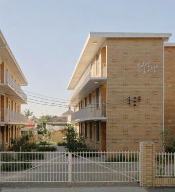
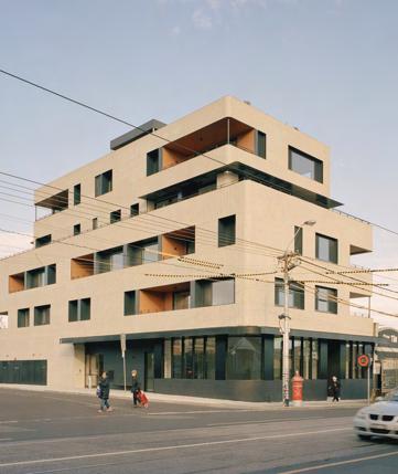
Advocate for retrofitting exisiting walk-up apartments
Several residential buildings across West Footscray are suitable to be retrofitted over the long-term. Retrofitting is an attractive solution to preserve local character and extend the lifespan of existing building stock, reducing material wastage.
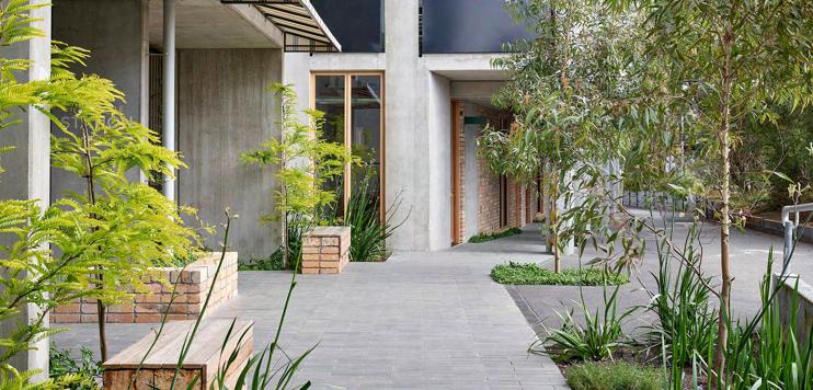
Pictured above is ‘Park Street’, a precedent in Brunswick, which benefitted residents with electrified heating and cooling, updated kitchens and transformed the concrete car park into a communal outdoor area.
High Street Apartments,Thornbury, VIC, Gardiner Architects
High Street Apartments,Thornbury, VIC, Gardiner Architects
Markham Avenue, Ashburton, VIC, Architectus
Park Street, Brunswick, VIC, Breathe
Park Street by Milieu, Brunswick, VIC
Captured by Ben Moynihan, August 2023
4.3a Strategy: Connecting Neighbourhoods Safely
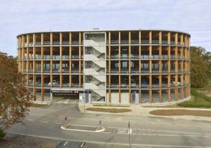
Wooden Parking Garage Wendlingen, Germany, Herrmann+Bosch
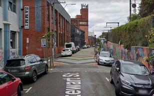
Stewart Street, Richmond, VIC, City of Yarra
Footscray
St Kilda Road, Melbourne, VIC, City of Port Phillip
Cuyperspassage, Amsterdam, Noord-holland, Netherlands, Benthem Crouwel
4.3b Actions: Connecting Neighbourhoods Safely
Actions
prioritising cycling and pedestrian infrastructure alongside equitable access to public transport across the rail corridor and major roads.
1 Build new cycling infrastructure
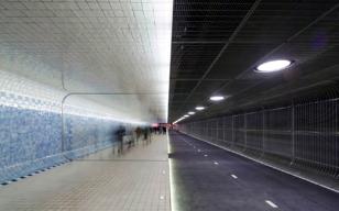
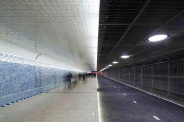
As it stands, West Footscray station’s bridge is the only connection for pedestrians and cyclists between the north and south of the train and also between West Footscray station and Tottenham station for about 1.8 Kilometers. This means that it is paramount for another connection to be introduced for pedestrians and cyclists to be able to cross the train line, so that the south and north of the activity centre can feel more connected. Unfortunately the train lines going into West Footscray station are so wide that we feel it is impossible to design a bridge for both cyclists and pedestrians to over them, and are left with making a tunnel to go under.
- The Cuyperpassage is a cycling/ walking tunnel that was designed by Benthem Crouwel and opened in 2016 (Castro 2016)
- The tunnel is 110 meters long, ten meters wide and three meters high (Castro 2016)
- The way the tunnel separates the cycling and Pedestrian path is interesting, with the pedestrian part being raised higher than the cycling part, to be able to differentiate each path (Castro 2016)
- The design has the pedestrian side surrounded by tiles to make it feel more welcoming, with the cycling having asphalt and steel grazings (Castro 2016)
- It runs under Amsterdam centraal, the major train station in the capital.
This precedent is to show the possibility of making a cycling/walking tunnel that is of high design quality but also provides design elements to mitigate the feeling of being unsafe in a tunnel, with the tile design and clear separation of the cycling and walking paths to ensure the safety of both the cyclists and pedestrians when using the tunnel. Combined with the high quality lighting in the tunnel, the Cuyperpassage provides an excellent precedent for a tunnel to solve the connection problems for the north and south of West Footscray station.
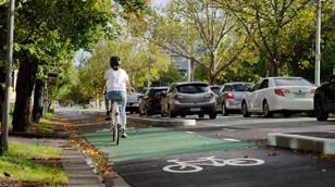
- The cycle route is painted with separated bike islands to protect the cyclists from cars and other private vehicles (Victoria’s Big Build, 2023)
- Hook turns have also been introduced for bikes as priority movements at intersections with traffic lights (Victoria’s Big Build, 2023)
-”The state government has reported an increase of 220% in the number of riders using the thoroughfare compared to the same period in 2021-2022.” (Bicycle Network 2024)
In West Footscray with data taken from 2016, 3.3% of people cycled to work, with 54.8% drove to work as either the driver or passenger. With the current climate crisis upon us and the need for a shift away from cars as a primary mode of transport, The City of Maribyrnong has made a bicycle strategy from 2020-2030. It includes 3 specific actions that it wants to take:
• Safe and improved conditions for bicycle riding, including routes and areas separated from vehicles.
• Safer vehicle speeds/ 30 km’s per hour.
• Fewer vehicles on the roads. (City of Maribyrnong, 2018)
- On St Kilda Road in Melbourne, the state victorian government decided to implement separated bike lanes, with the project being completed in 2023 (Victoria’s Big Build, 2023)
- The entire route is 4.5 kilometers long (Victoria’s Big Build, 2023)
- The bikes lanes were delivered by major road projects victoria and rail projects victoria due to the metro tunnel (Victoria’s Big Build, 2023)

This precedent is an example of what the high protection bike lanes from the Maribyrnong bicycle strategy could look like, with the high quality design resulting in a large amount of people using them and a higher amount of confidence in using them, rather than just the traditional painted lanes. We envision that this strategy would medium-long term length, as would need consultation and engineering work.
Cuyperspassage, Amsterdam, Noord-holland, Netherlands, Benthem Crouwel, 2016, Photo by Jannes Linders.
St Kilda Road, Melbourne, VIC, City of Port Phillip, State Government of Victoria, 2023
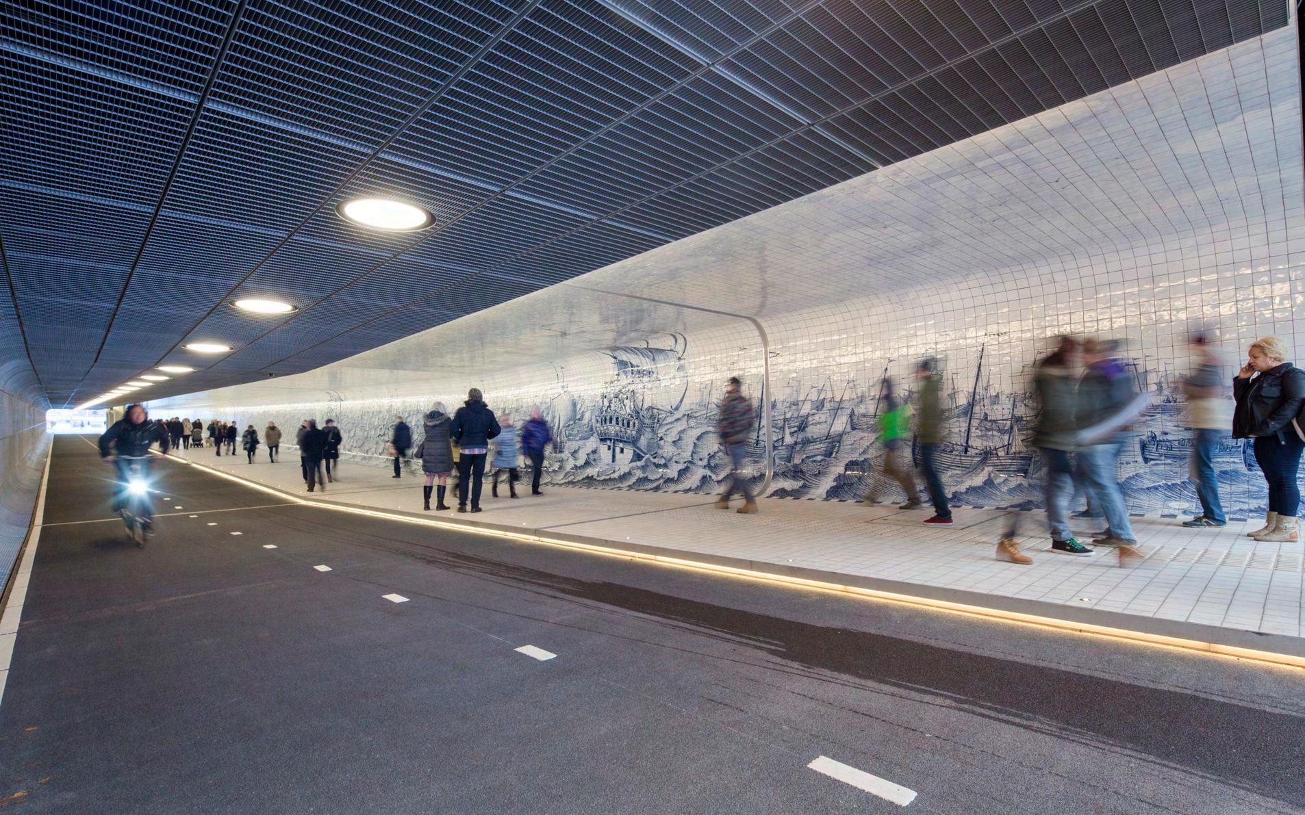
Cuyperspassage, Amsterdam, Noord-holland, Netherlands, Benthem Crouwel, 2016, Photo by Jannes Linders.
4.3c Actions: Connecting Neighbourhoods Safely
2 Introduce mobility hubs
As West Footscray has been announced as part of the state government of Victoria’s activity Centre program that focuses on transit oriented development, which means increased density around the train station. However, West Footscray station currently has inadequate parking facilities to deal with the proposed increased density. The existing carparks at West Footscray station are very long, with a distinct lack of greenery and a lot of bitumen contributing to the urban heat island effect. There is also only one large bike parking facility on the north side of the station, with none on the south side and there is also no electric car or e-bike charging facilities.
- Developed by Hermann+Bosch architekten, this parking garage provides 349 car parking spaces on 5 levels (Koshta 2025)
- It also comes with numerous charging points for electric bicycles and cars, and a further 200 parking spots for bicycles (Koshta 2025)
- Rather than using steel or concrete for construction, they used environmentally friendly timber (Koshta 2025)
- Only the stairwells are made out of concrete due to fire safety reasons (Koshta 2025)
- The building has no composite materials used, with the connections being plugged and screwed, meaning the building is easy to take apart and put back together, making sure that the materials are easily reusable (Koshta 2025)
We want to introduce these new mobility hubs with something like the precedent to be near the station for both visitors and residents, to help with the increased density surrounding the station so that the people living there can park their car or bike in a sustainable structure, it’ll also include electric car charging. We envision that building the mobility hubs will be a medium to long term action, with various consulting and construction needed.

3 Lower speed limits
The City of Maribyrnong is home to some of the most unsafe roads for cyclists and pedestrians in Melbourne. With a recent pedestrian death on Geelong road in 2025 and the fact that Geelong road is also home to one of the top 10 road safety camera infringement sites for infringements issued in Victoria according to data from the Victorian State Government, at the intersection between Geelong road and Barkly street, highlighting the need to make changes to modify drivers behavior to make it safer in the suburbs of the City of Maribyrnong.
- The shared zone on Stewart street Richmond was constructed due to a lack of pedestrian infrastructure on the street, with the pedestrians experiencing vehicles traveling faster through there than what was appropriate (“TAC Local Government Grants” 2024)
- The Length of the pedestrian zone is 70 meters (“TAC Local Government Grants” 2024)
- It caters to the area around Richmond station, a major train station on the Melbourne train network
- “Key to this project is the provision of a street environment that does not feel or function like a traditional road where motor vehicles have priority. To achieve this, the design includes thresholds treatments, pavement patterns, landscaping (vertical garden) at the station entrance and urban design features to differentiate the Shared Zone from the connecting local roads” (“TAC Local Government Grants” 2024)
This precedent is what we imagine our Catalyst project on Hocking Street looking like, allowing for safe pedestrian and cycling travel in a street very close to the centre of the activity centre with quality urban design and infrastructure improvements to improve greenery and transport connections in the area.
Stewart Street, Richmond, VIC, City of Yarra, Google Maps, 2020
Wooden Parking Garage Wendlingen, Germany, Herrmann+Bosch, 2016, Photo by Achim Birnbaum
4.4a Strategy: Improving Access to Green Spaces
Precedents
Strategy Map, by Ruby
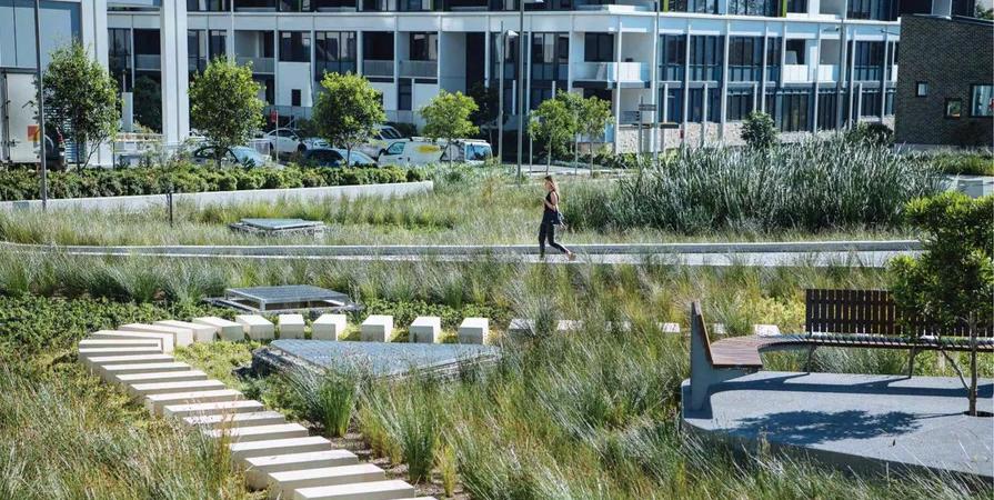
Gardens Raingarden, Fitzroy North, GHD
Pollinator corridor, South Melbourne, Streets Alive Yarra
Malop St Green Spine, Geelong, Outlines
4.4b Actions: Improving Access to Green Spaces
Actions creating new green spaces that support biodiversity and foster a cooler environment, serving both people and wildlife.
1
Establish urban greening initiatives
Maribyrnong City Council has had a historically low tree canopy cover, which was measured at only 8.3% in 2018. This has resulted in a hotter, drier urban landscape, known as the Urban Heat Island Effect, where heat is retained in hard surfaces and radiated out at night. This exacerbates extreme heat events which have serious impacts on human and animal wellbeing.
Mirroring Geelong’s recent Malop St redevelopment, a green spine along Barkly St aims to simultaneously provide a denser tree canopy cover while also providing bike infrastructure upgrades.
Streets Alive Yarra have a vision for Melbourne’s pollinator corridor, which will stretch 8km and connect the Royal Botanical Gardens to Westgate Park through South Melbourne, with flowering gardens on naturestrips to provide habitats for pollinators such as native bees, flies and beetles. This is enabled through the City of Port Phillip’s Nature Strip and Street Gardening Guidelines, which allows residents to plant freely on their nature strip, as long as it is in accordance with their guidelines.
We plan to connect Hansen and and Shorten Reserves via a 1.5km pollinator corridor by removing Maribyrnong City Council’s permit requirement to plant on naturestrips.
Source: Maribyrnong City Council 2018; Streets Alive Yarra n.d.
2
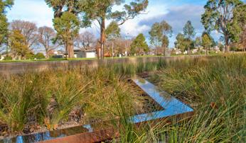
Introduce Water Sensitive Urban Design measures
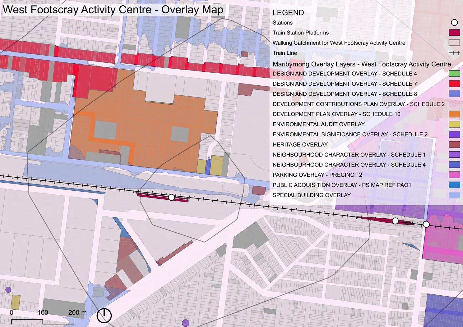
Cross St is an area in our Activity Centre which we plan on rezoning to encourage high density development. It also sits on a Special Building Overlay, meaning that the area is prone to stormwater or overland flooding when the capacity of the drainage system is exceeded.
The dominant approach to stormwater management in apartment buildings in Australia is to use cartridge filtration systems located in basements, without any integration of water management into the landscape. In this context, stormwater management is seen as solely the domain of engineers. This approach fails to achieve a wide range of benefits, including cooling, biodiversity, and visual and physical connections with the natural environment.
We plan to establish rain gardens along this section of Cross St, to minimise flooding risk in the area, as well as reduce pollutants from running into the surrounding waterways such as Stony Creek and the Maribyrnong River.
Source: Melbourne Water 2025; Melbourne Water 2022; David Knights 2025
Discovery Point development rain garden, Sydney, Turf Design Studio
Pollinator corridor, South Melbourne, Streets Alive Yarra
Local Waterways Map

StonyCreek
MaribyrnongRiver
Yarra River
by Ruby
4.4c Actions: Improving Access to Green Spaces
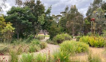
3 Develop new open spaces
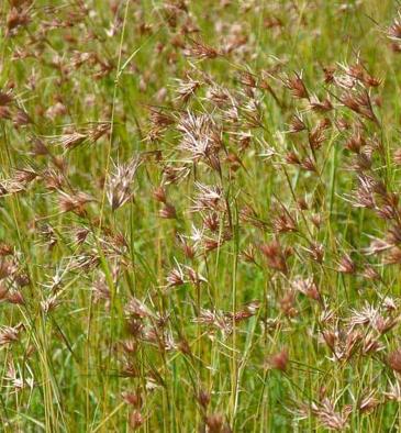
Maribyrnong City Council sits on Victoria’s Volcanic Plain Bioregion. Specifically, the West Footscray Activity Centre covers two Ecological Vegetation Classes: EVC 132 Plains Grassland, and EVC 897 Plains Grassy Woodland Mosaic.
Trees and shrubs are largely absent in these grasslands, which are dominated by native perennial tussock grasses such as kangaroo grass, spear grass, and wallaby grass. Grasslands were formerly extensive across this plain, but less than 5% of it remains today, mostly as small and highly fragmented remnants.
Leading with our catalyst project of extending Spurling Reserve, we hope to integrate more native grass in the West Footscray Activity Centre through mandated open space requirements for new developments.
Source: DSEWPC 2011

Heller St Park & Residences, Brunswick, Six Degrees Architects
Kangaroo Grass (themeda australis)
Raingarden incorporating native grass at Site 68 in Sydney Olympic Park, Sydney, Turf Design Studio & Bates Smart
Maribyrnong City Council Monash University
Ecological Vegetation Class (EVC) Map by Ruby
Precedents 1 2 3 Strategy Map, by Nat
City of Melbourne PopUp Shop Program. Source: Inside Local Government
Artist Rendering of Jernbanebyen, Copenhagen. Source: Cobe Architects.
Neometro Commercial Spaces on Ground Floor. Source: RealCommercial Real Estate Listings, 2025
4.6b Actions: Creating Employment and Retail Hubs
Actions establishing Barkly St, Hocking St and West Footscray Station as vibrant places that connect residents, businesses and visitors to the area.
1
Implement a Renew West Footscray Project
Implement a Renew West Footscray Project for increased occupancy in the empty shop fronts in retail precincts like Barkly Street with co-working and creative studio spaces
We believe this would be a mediumterm project that would require collaboration with land owners, residents, business owners, artists and creative organisations.
Precedent for this action is found in the Renew Australia movement that was born with Renew Newcastle and more recently has been applied to Geelong and Docklands.
City of Melbourne have also piloted a pop-up program for empty shopfronts filling these spaces with creative businesses and bespoke displays. This took place from 2022 - 2023 in Melbourne CBD, Carlton and North Melbourne.
2
Investigate commercial 3 zoning - Currajong St
Investigate commercial 3 zoning around the Currajong St industrial zone to allow for commercial, hospitality, retail and increased housing
This is a short-term project that would require widespread consultation with business owners, the state government and other landowners in the precinct to explore whether some industrial sites can be re-zoned with new commercial 3 zoning to allow for different uses.
A key precedent is Jernbanebyen,(The Railway District), which is one of the last undeveloped industrial sites of Central Copenhagen. The proposed masterplan for the industrial site is to transform the area into mostly car free green neighbourhood with 4,500 new homes but also workplaces for up to 8,000 people. This will ensure that the area continues to be a site of production within a framework of a healthy, urban every day life.
3
Mandate non-residential uses on ground floors
Mandate non-residential uses on ground floors for well-located buildings.
A short to medium term project that the Council could enforce that ensures that the first two floors of new developments are designated for retail, hospitality or commercial uses.
For example, the recent Nightingale Laak development in Brunswick, well located across the road from Anstey station has 26 commercial spaces available across the first two floors of the development. The rest of the building is residential, featuring 98 apartments from studios, 1 bedrooms to 2 bedrooms.
The new Neometro developments on Wilson Avenue in Brunswick are also precedents of mutli-level residential with creative commercial and office space on the first two floors.
Renew Geelong Project, VIC, Renew Australia Jernbanebyen artist render, Copenhagen, Cobe Architects Osoi Cafe on the ground floor of Nightingale Laak, VIC, Nightingale Housing
Artist Rendering of Jernbanebyen, Copenhagen. Source: Cobe Architects.
Precedents
Strategy Map, by Peiling
Maribyrnong City Council Monash University
Surry Hills Library & Community Centre, Surry Hills, NSW, fjcstudio
Gertrude Street Projection Festival, Fitzroy, VIC, City of Yarra
4.7a Actions: Celebrating Local Identity
Actions stimulating local community partnerships that celebrate First Nations culture and champion the cultural heritage of West Footscray through existing and new spaces.
1
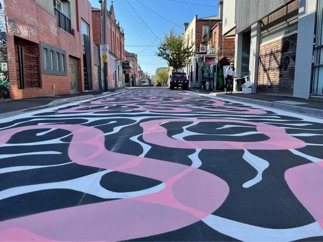
Transform Hocking St into a shared zone and celebrate local identity and culture with a painted artwork on the surface.
Transform Hocking Street into a shared neighborhood, not only a passage space for vehicles but also a street accessible to people. Draw artistic patterns on the ground to showcase community stories and create characteristic blocks, such as Rose Street.
2
Redevelop existing childcare site on Hocking St to a combined childcare and community centre.
It is suggested that the childcare on Hocking St be transformed into a center integrating child care and community functions, providing more space for communication and support for families in the area.
3
Celebrate local culture through an art project which celebrates Barkly St.
Celebrate Barkley Street through a public art project that will reflect the local culture and diversity, inviting local artists, architects, residents and store owners to participate in its design and implementation. Similar to the Burlinga Cultural Center.
Park Street, Brunswick, VIC, Breathe
Rose Street, Fitzroy, VIC, Architectus
Burrinja Cultural Centre, VIC, Yarra Ranges Council
Greening Gertrude St Project, People of Gertrude St, Fitzroy

5 implementation
5.1 Implementation Guide for Maribyrnong City Council
TypeStaging*External Stakeholders
Rezone well-located site for increasing housing density
Demonstration project of affordable, mass-timber housing
Advocate retrofitting of old apartments
Reduce speed limits in key locations (Barkly St and Hocking St)
Improve cycling infrastructure
Introduce mobility hubs near the station
Establish urban greening initiatives
Introduce Water Sensitive Urban Design (WSUD)
Develop new open spaces
Implement a Renew West Footscray Project for increased occupancy in retail precincts
Investigate Commercial 3 zoning around Curajong St industrial zone
Mandate non-residential uses on ground floors for well-located buildings
Hocking St road pavement artwork
Redevelop Hocking st childcare into combined childcare and community centre
Art project celebrating Barkly St
Department of Transport and Planning (DTP), Homes
Victoria, Residents, Business Owners, Architects, Engineers, Developers
DTP, Public Transport
Victoria (PTV), VicTrack, Residents, Business Owners, Western Bulldogs, Victoria University
DTP, PTV, Residents, Business Owners, Western Bulldogs, Victoria University
DTP, Residents, Business Owners
Residents, Business Owners, Architects, Artists
5.2 Catalyst Masterplan: Hocking St Precinct
5 key projects that Maribyrnong City Council should prioritise delivering
Demonstration mass timber housing project, which will guide further sustainable intensification throughout the activity centre.
Expansion of Spurling Reserve so it can cater for an increasing population and support local biodiversity
10km shared zone along Hocking St to better accommodate active modes of transport and create a safer environment for pedestrians
New employment and retail spaces close to West Footscray Station, creating more activity and passive surveillance on street level
Western Bulldogs road pavement art along Hocking St, functioning as a wayfinding tool to Whitten Oval, supporting AFL pride and encouraging slower driving
by Augustine
*The proposed Mobility Hubs along Cross St must be designed to enable future conversion into residential, retail and/or office uses (precedent: Wooden Parking Garage Wendlingen by herrmann+bosch architekten).
Whitten Oval
STATION
BARKLY ST
SOUTER CRES
Masterplan
5.3 Street Section: Hocking St
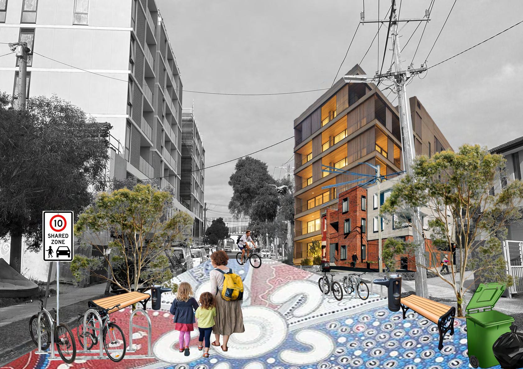
A reimagined, pedestrianfriendly Hocking St.
This cross section drawing shows our reimagined Hocking St, with a shared 10km/h zone for cars, pedestrians and cyclists, wide 3m footpaths solely for pedestrians, and generous building setbacks of 3m. It incorporates urban greening initiatives such as tree planting and native shrubbery and grass along the footpaths and nature strips. Ideally, buildings will be 6 storeys high, with two extra storeys granted to developments who include affordable housing.


Hocking St Street Section, by Ruby
5.3 Hocking St
Current 8-story development in construction is quite uninspired from a design standpoint and does not fit with the neighborhood character
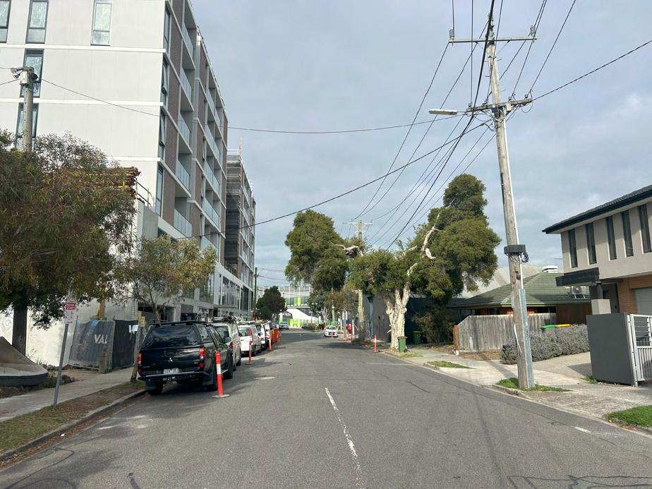
Increase greenery in the area by planting native Flora and Fauna such as this Eucalyptus tree along the new shared zone.
Noticeable lack of greenery in the area makes the street feel quite hostile
Change the speed limit to 10KMH to create a shared zone for pedestrians, cyclists and cars to use, with amenities such as benches and bubbler’s
Hocking Street is currently unwelcoming for cyclists with no visible bike lanes and parking all along the street.
New 6 story apartment blocks with climate-friendly timber construction to increase housing supply and density in the area, with option for 8 stories if affordable housing included. Increase density with also new affordable 4 story housing in the area.
Currently, Hocking street mainly has 1-2 story detached houses in the area, meaning low density
Paint the road with the West Bulldogs 2025 Indigenous Jersey design by Kamilya Lowana White, whose cousin Liam Jones plays for the Western Bulldogs to highlight the Indigenous and sporting connections that West Footscray has.
(Transformed) Looking South on Hocking St towards West Footscray Station, by Gabe
5.4 Street section: Cross St
A reimagined, pedestrianfriendly Cross st.
This cross section drawing shows our reimagined Cross st, with a total width of 22.5m.
The street layout has a 2.5m footpath and a 3m green strip on the east. There’s a 7m road for two-way traffic, this space can also become a shared zone with colourful artwork on the ground to show off local culture and identity. There’s another green strip on the west, a 3m path for both bikes and people, and a 3.5m rain garden.
ldeally, buildings will be 6 storeys high, with two extra storeys granted to developments who include affordable housing.
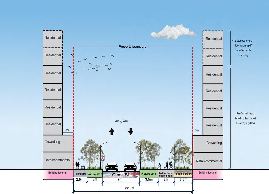

Street section B-B
Revitalising West Footscray Semester 1, 2025
Crossing St Cross Section Drawing by Peiling
Maribyrnong City Council Monash University
5.5 Collage: Cross St
Before
This section of Cross St will see the existing car park next to the rail corridor transformed into a vibrant hub of residential homes, commercial, coworking, retail and hospitality right next to the station.
With 37.6% of residents in West Footscray working from home (ABS 2021 Census Data) in professional occupations, there is a need for co-working office space easily accessible by bike and train for nearby residents. Having well designed office space right next to the station would also be desirable for employers looking to set up offices outside of the CBD.
We propose two designated mobility hubs that book end the station to the west and east. These Mobility Hubs will be a multi-deck car par with electric vehicle charging bays, bike storage, publicly available end of trip facilities, and car spaces available to lease for neighbouring apartment owners. An above ground Mobility Hub allows for future redevelopment into housing once cars are further phased out.
We envision the transformed Cross Street precinct to be an excellent opportunity for the Victorian Government to invest in a mass timber demonstration project, a catalyst for sustainable building design. As the existing car parks are government land these would be appropriate sites for acquisition and development. Timber will be used for the 6-8 story apartment blocks, the mobility hubs and other retail and commercial spaces along Cross St.
Cross St will be a lively dining precinct for visitors, workers and residents. A place to grab a bite to eat with friends before an WAFL game, or a coffee before residents head to work by train.
Cross St will be a slow car zone of 1030km/hr to prioritise pedestrian and cycling in the area. It will connect with the new Currajong St underpass better connecting north and south of the rail corridor.
Cross St will also include water sensitive urban design measures, like rain gardens, to support the flooding overlay in the area
Looking West on Cross Street with West Footscray Station to your left and Hocking Street to the right (behind)
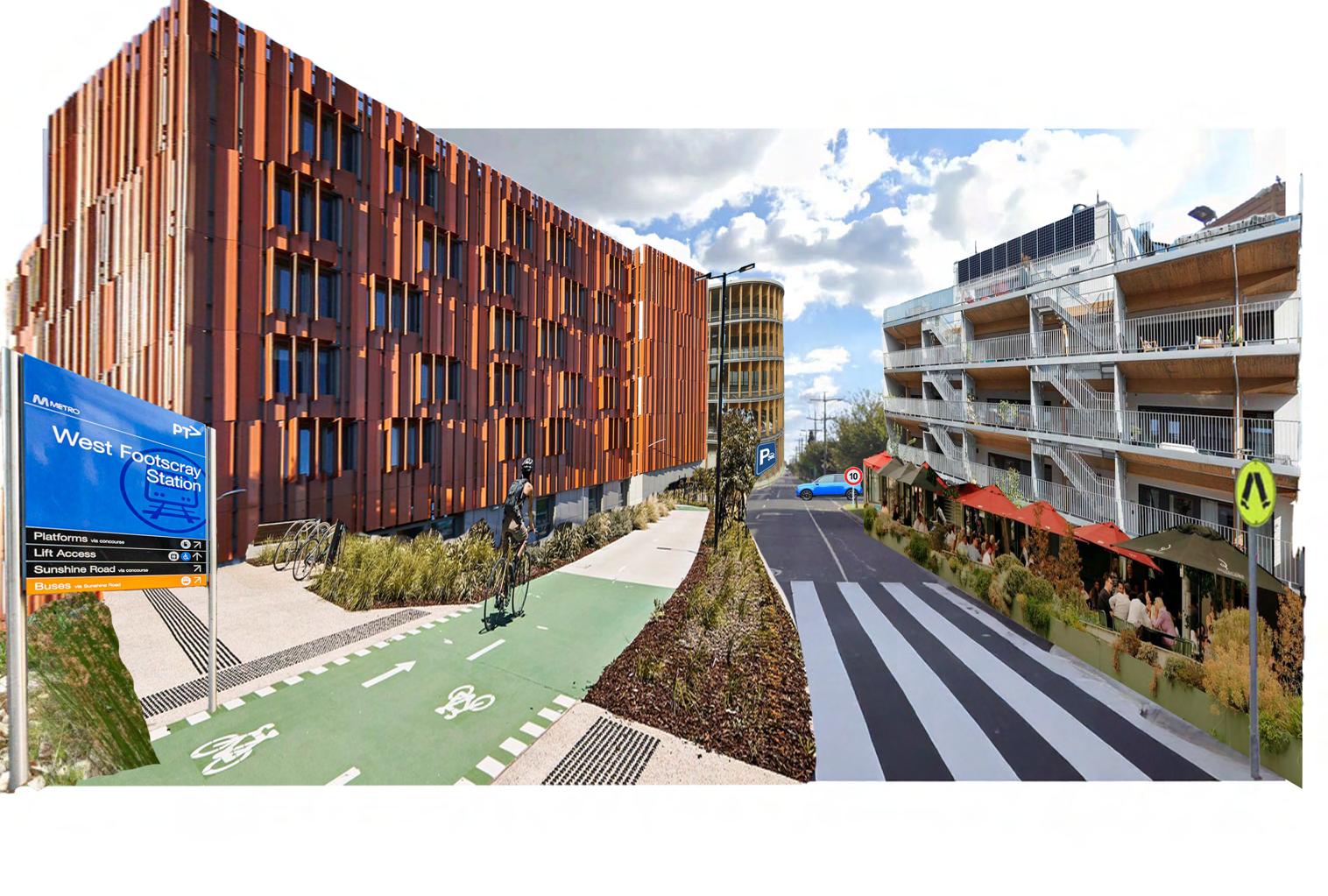
(Transformed) Looking West towards Clarke Street from West Footscray Station by Natalie
5.6 Collage: Spurling Reserve Extension
Western Bulldogs themed playground.
Wide road separating the existing Spurling Reserve playground from the rest of the reserve.
Heritage protected Palm trees along the Barkly St side of the reserve.
Lack of native vegetation; lawnstyle turf grass along Barkly St boundary.
Maribyrnong City Council
Looking South West towards Spurling Reserve from Barkly St
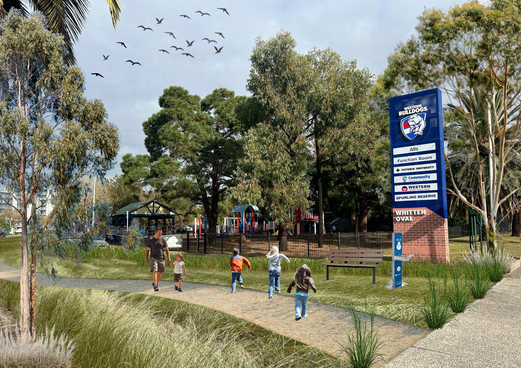
(Transformed) Looking South West towards Spurling Reserve from Barkly St, by Ruby
5.7 Reflections
What does this project mean for West Footscray, and how could it be applied elsewhere?
We have implemented a place-based approach to densifying the West Footscray Activity Centre to complement the State Government’s top-down Activity Centre Program. We have prioritised retaining the unique character of the neighbourhood while also providing support and opportunities for increased housing.
Our low density, gentle transformation of West Footscray can be applied to other suburban neighbourhoods where a high density, radical transformation is not feasible. Our redevelopment of Hocking St into a mixed use precinct adjacent to the train station, with a shared-zone, 6-8 storey buildings, and employment and retail spaces on ground-floor, can set a precedent for other Activity Centres.
On a wider scale, our project reinforces the role of Footscray as a significant node between Melbourne’s CBD and regional West Victoria, attracting new people to stay closer to local health and education precincts.
Maribyrnong City Council Monash University
6 appendices
Appendix A Case Study: Nightingale Housing
The Nightingale Housing Model provides welllocated, higher-density dwellings and focuses on people, not profit.
There are clever ideas from this housing model that Maribynong City Council could advocate to local developers, addressing critical need for affordability of dwellings. Some include:
Nightingale Housing is a not-for-profit organisation established in 2016 that aims to deliver “socially, financially and environmentally sustainable” housing. Its philosophy was conceived by Jeremy McLeod and other architects who sought to provide higher density housing that equally addresses affordability, sustainability and liveability. This approach diverged from existing high density developments across Melbourne. (Moore and Doyon 2018)
One example is ‘Nightingale Anstey’ (completed 2022), an eight-storey residential building located directly east of Anstey train station. Like its counterparts, it emphasises the idea of ‘communal living’ by providing shared ammenities on the rooftop, including a laundry, bath house and veggie patches. Furthermore, 11 dwellings were pre-allocated for community housing.(Nightingale n.d.)
• Ensuring homes are thermally efficient and include passive design, reducing or even eliminating reliance on air-conditioning or heating.
• Allocating a minimum percentage of dwelling stock for affordable housing.
• Restricting resale prices of homes - the original price + % increase in median house price for the suburb since year of purchase.
(Nightingale n.d.)
Nightingale Anstey, 2022, BREATHE Architects, Brunswick, VIC
Appendix B Case Study: High Street Apartments
A local mass-timber housing project.
Located in Thornbury, VIC, High Street Apartments is the outcome of designing with sustainability and longevity at front of mind. It contains a restaurant and parking on ground level, and thirteen apartments above.
Cross-laminated-timber (CLT) was the main construction material, which allowed for greater variety in the apartment layouts.
Environmentally, the use of timber is carbon neutral and produces minimal wastage, as pieces are prefabricated into exact sizes before delivery to site for assembly.
Compared to steel and concrete, CLT is lighter which reduces requirements for building foundations, which then reduces materials and labour needed to construct. In this instance, the cost to build using CLT was cheaper by 8% compared to conventional methods.
More broadly, other materials were used in their natural form to ensure the building endures into the future, with little maintenance required.
The project was successfully executed by collaborators (Gardiner Architects, Sinjen Builders, XLam and Vistek Engineers) who worked closely to stay within budget while meeting the client’s brief. The involved organisations have demonstr ated experience in constructing with CLT, making them potential partners that Maribyrnong City Council can engage with.
As the construction industry moves towards reducing its emissions in recognition of the global climate emergency, there is strong opportunity to adopt mass-timber on a large scale, including use for future developments in the West Footscray Activity Centre.
(Gardiner Architects 2023; Vistek 2023)
High Street Apartments, Thornbury, VIC, Gardiner Architects, VISTEK
Appendix C Case Study: Wilam Ngarrang Retrofit
A useful apartment retrofitting example, located in Victoria.
Designed by Kennedy Nolan Architects, the project is the retrofitting of a 1970s apartment block in Fitzroy, which is a type of housing commonly found across inner Melbourne, including the Footscray area. The project demonstrates a financially viable approach to retrofitting that Maribyrnong City Council can endorse.
Considering the present housing and environmental crisis, it more ethical and sustainable to extend the lifespan of ageing housing infrastructure, instead of completely demolishing and rebuilding.
Possibly, the most significant moves of the Wilam Ngarrang Retrofit was upgrading the building’s envelope (improving its thermal performance), replacing the concrete carpark with a new communal space and repurposing the buildings old materials elsewhere in the project.
To stay within their budget of $2.2 million, the project stakeholders created a list of all initiatives that were considered, with each one categorised as ‘have to do’ or having environmental and/or social benefits. Then each item was repeatedly evaluated across the preliminary and construction stages, factoring cost and achievement of project targets. This technique of using a priorities list meant easier decisionmaking to save costs where possible, while ensuring a quality project outcome.
Environmental consultants Finding Infinity estimate that cities could reduce emissions by more than 40% if the following were applied at scale:
1. Electrification of buildings
2. Energy efficiency upgrades including to building fabric and equipment
3. Providing solar panels on buildings (NSW Government 2024; Kennedy Nolan n.d.)

Wilam Ngarrang Retrofit, Ngargo/Fitzroy, VIC, Kennedy Nolan Architects
Wilam Ngarrang Retrofit, Fitzroy, VIC, Kennedy Nolan Architects
Appendix D Case Study: The 3-30-300 Rule for Healthier and Greener Cities
The 3-30-300 Rule offers benchmarks for cities to promote equitable access to nature.
Developed by Dutch urban forestry expert Cecil Konijnendijk, the Rule recommends that every resident should be able to see at least three trees from their home, their neighbourhood should have a 30% tree canopy cover, and they should live within 300m from the nearest park or green space.
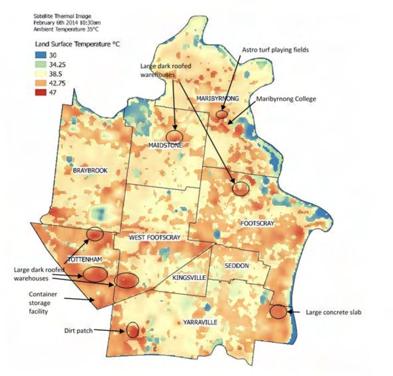
Urban nature is inextricably linked to human health and wellbeing; people are more likely to suffer from depression, anxiety, obesity, and heatstroke in urban areas with fewer trees and parks.
West Footscray, and Maribyrnong City Council more broadly, has had a historically low canopy cover due to its large industrial areas, narrow streets, and small parcels of parkland. In 2018, the total canopy cover was measured at 8.3%. This has resulted in the Urban Heat Island effect, where heat is retained in the hard surfaces of the urban landscape and radiated out at night.
Using the 3-30-300 Rule as a guide, we plan to improve access to green spaces in the West Footscray Activity Centre by establishing urban greening initiatives such as a pollinator corridor and green spine, and developing new open spaces. This benchmark will help guide the Activity Centre to our target of a 30% tree canopy cover by 2051, simultaneously improving biodiversity and improving health outcomes for people and animals.
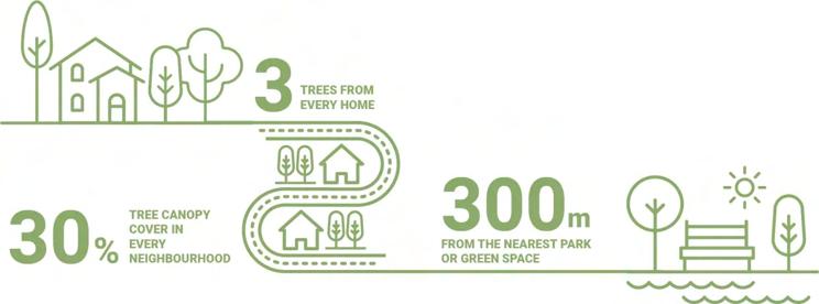
Source: Maribyrnong City Council 2018; M.H.E.M. Browning, D.H. Locke, C. Konijnendijk et al. 2024
Maribyrnong City Council heat map, Maribyrnong City Council 2018
The 3-30-300 Rule, UNECE 2023
Berlin street trees, Cecil Konijnendijk
Appendix E Case Studies: NSW Transport Oriented Development Program
The NSW Transport Oriented Development (TOD) Program is a strategic initiative aimed at fostering sustainable, mixed-use development around transport hubs to create vibrant, walkable communities.
Key Features:
- Accelerated Precincts: Eight master-planned precincts within 1,200m of metro and heavy rail stations, with state-led rezoning proposals.
- New Planning Controls: Applies to land within 400m of 31 train/ metro stations, allowing higherdensity residential and commercial development.
- Affordable Housing: Up to 15% of new homes in accelerated precincts dedicated to affordable housing.
- Fast-Track Development: Temporary state significant development (SSD) pathway for residential projects over $60 million until 2027.
- Infrastructure Integration: Aligns land use with transport networks
to reduce car dependency and enhance connectivity.
This program is designed to accelerate housing supply while ensuring urban growth is well-integrated with transport infrastructure.
This program is designed to accelerate housing supply while ensuring urban growth is well-integrated with transport infrastructure.
Some criticisms of the project include whether the plan includes enough affordable housing (ABC 2024).
The Victorian Government’s Activity Centre Program has been inspired by TOD programs like the NSW one. When we apply it to West Footscray, one key strategy is to meet the housing mandate by promoting inclusive, affordable housing with a target of building 5000 new homes in West Footscray by 2051 with 20% being affordable.
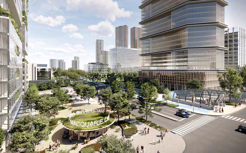
TODS Precinct boundary maps for Homebush (left) and Bankstown (right), 2024, Planning NSW, NSW Government
Artist render of Macquarie Park which will host more than 9,000 new homes.(Source: NSW government)
Appendix F Case Studies: Revitalising Central Geelong Action
The Revitalising Central Geelong Action Plan outlines a strategic vision for transforming central Geelong into a vibrant, economically strong, and sustainable city.
Developed by the Victorian Government, the plan emphasises attracting investment, fostering creativity, and enhancing livability.
Key initiatives include:
- Strengthening the CBD: Creating jobs, improving laneways, and establishing a new civic precinct.
- Encouraging city living: Supporting housing development and community infrastructure.
- Smart city growth: Expanding education, health, and cultural facilities.
- Improving mobility: Enhancing transport networks and station precincts.
- Green Spine: Developing a landmark linear park to connect major precincts.
Funding of $5.5 million was allocated in the 2016/17 budget to begin implementation, complementing over $170 million in previous allocations.
Collaboration between local and state authorities, businesses, and the community is key to realizing this vision.
The Malop Street Green Spine Catalyst project has informed our Revitalising West Footscray green spine action along Currajong St, Barkly St and Clarke St as outlined in our Increasing Access to Green Spaces Strategy.
The Revitalising Central Geelong Action Plan is a key case study that highlights the importance of liveability catalysts and measures in revitalising neighbourhoods.
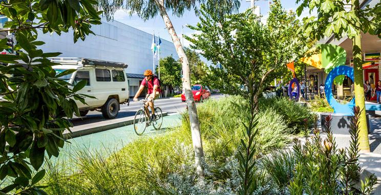
Malop Street Green Spine and bike path, Geelong, Landscape Architecture in Australia
Appendix G Case Study: Sunlight to Parks and Footpaths
The Sunlight to parks and footpaths policy aims to balance development with the need for a liveable, vibrant and sunny public environment.
The policy controls building heights and new construction shading to ensure that parks and footpaths are illuminated during critical periods. The chart shows existing and critical shading areas.
One example is Melbourne Planning Scheme Amendment C278melb Sunlight to Parks.
Winter Sunlight
Melbourne has a rule that no additional shade can be added to specific parks between 10am and 3pm during winter.
No Additional Overshadowing
Prevent new development or building renovations from increasing the amount of shade on parks and sidewalks during critical winter months
Importance
Sunlight in parks and sidewalks can also enhance the enjoyment of public spaces
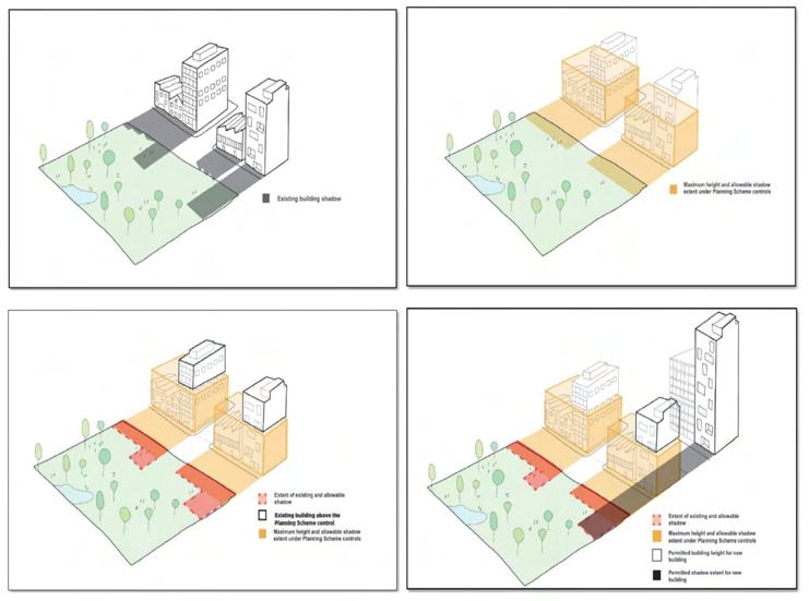
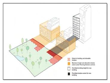
Illustration of existing and allowable shadow
Appendix G Case study: Transport Strategy 2030
- So the document is the Transport strategy 2030, which is from the City of Melbourne council and that is where it is applied
- This case study is to address the issues surrounding modes of transport in Melbourne, and transforming Melbourne with a new transport strategy to continue to combat the rise of population in Melbourne so that for the future it is still easy to travel round the CBD - The focus is on cycling
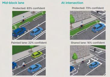
Here are the some of the actions and policies created by the City of Melbourne Council for their biking strategy,
- Action 10: deliver 50 KM of connected, physically protected bicycle lanes over 10 years to improve safety and get more people riding each day
- Action 11: work with the Victorian government to enable further 40km of high quality, physically protected bicycle lanes on managed
- Action 12: work with neighbourhood municipalities to develop a bicycle network model which can identify gaps and show the benefits of a connected bicycle network
Make every street safer for cycling
- Policy 7: apply the bike lane design guidelines to provide the safest and highest standard bicycle lane appropriate for each context on all future projects and make intersections safer for cycling
(City Of Melbourne, 2019)
- The City of Melbourne has revealed its proposals for new separated bike lanes along Kavanagh Street in Southbank, part of a plan for better links between South Melbourne, Port Melbourne and the city.
- The two-metre-wide lanes on each side of the street will run from Southbank Boulevard to Balston Street, and provide a connection to the recently installed lanes in Moray Street.” (Hunter, 2020)
- The dimensions of the Kavanagh Street Bicyle mid-block lanes that were proposed and installed during 2020 were
-Roadway designed to allow future installation of 1.8m wide tree islands in center of road.
- A painted median strip will be installed short-term, to improve safety for pedestrians crossing the road.
- Kerbside bike lanes will be 2m wide, adjacent to 0.8m wide separator islands. (City Of Melbourne, 2019)
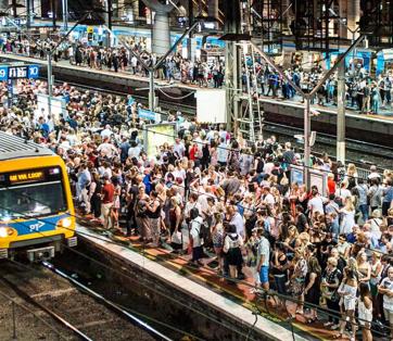
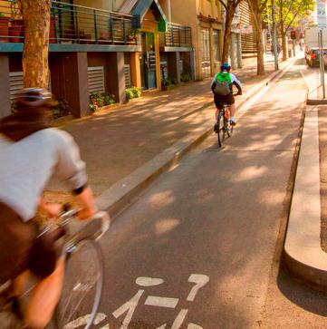
Challenges with applying this tool: There has been some opposition from businesses in the Melbourne CBD, as they believe that the bike lanes has hurt their businesses, particularly on Exhibition street, “It’s badly affected our trade,” a café worker said. “Customers are complaining they can’t stop the car to grab a quick coffee because they can’t find a parking spot.” (Rees, 2022)
One of the goals from the transport strategy 2030, states that it limits urban sprawl and makes it easier to live without a car. For West Footscray, it is in a position to do so as it is close to the CBD in the context of Melbourne and is flat, with some of the suggestions such having Dedicated cycling Infrastructure like the example shown on Kavanagh street on Barkly street could make a big difference to the cycling infrastructure in West Footscray
Kavanagh Street Cycling PATH, City Of Melbourne, 2020
Overcrowding on Melbourne PT, Herald Sun, 2019
Cover Page, Transport Srategy 2030
Survey of bike rider confidence when using separated bike lanes vs painted lanes/shared lanes, Transport Strategy 2030, City Of Melbourne
Appendix H Site Suitability Analysis: Development Considerations
Investigating the likelihood of sites to undergo future development within the West Footscray Activity Centre.
The map shown (right) illustrates properties within the Activity Centre that contain buildings constructed less than 10 years ago, heritage overlay, or Crown Land. These factors make it more difficult to transform or develop within the timing of proposed actions. Under the Increasing Housing Density and Diversity strategy, the proposed alterations to the Maribyrnong Planning Scheme (Built Form, FAR, FAU controls) mostly avoid areas with the existing limitations mentioned above.
The exception is the increased density designated for the northern West Footscray Station carpark. Close partnership would be required between Maribyrnong City Council and State Government (VicTrack) to fully realise the land’s potential to support more housing and provide amenity for the neighbourhood.
Appendix I Site Suitability Analysis: Lot Sizes
The current state of property parcels within the West Footscray Activity Centre.
Most lots within the Activity Centre are up to 800m², narrow and long. The larger sites (typically suited for mass development) are significant open green space, commercial use or Crown Land. These factors combined restrict the range of building typologies that can be constructed, and would ultimately hinder achievement of the housing target (11,000 total dwellings by 2051, up from 6,000 currently).
As such, it would be ideal for land parcels to be consolidated in existing residential areas proposed for higher building density. Lot consolidation allows for a more streamlined planning approval process, making constructing low to medium rise buildings more appealing for developers. (Greater Melbourne Surveyors 2024)
To encourage this, the council could research into a policy framework for simplifying the lot consolidation/ subdivision process
Footscray Activity Centre - Lot sizes (m²), by Augustine
references & contributions
References
Contributions
and AI Statement
Contributions Breakdown and AI Statement
Augustine Gabriel Peiling
• Cover Page & Section Dividers
• Contents & Colophon
• Purpose of Document
• Post Contact History (Research)
• Implementation Table
• Increasing Housing Density & Diversity
• Catalyst Masterplan
• Case Studies: Nightingale Housing, High Street Apartments, Wilam Ngarrang Retrofit
• Site Suitability Testing: Development Considerations, Lot Sizes
• Acknowledgement of Country
• Strategic Policy Context
• Indigenous Context
• National Housing Crisis
• Local Context
• Connecting Neighbourhoods Safely
• Collage: Hocking St
• Case Study: CoM Transport Strategy
Natalie Ruby
• Executive Summary
• Brief
• Zones Map
• Overlays Map
• Place DNA
• Global Context
• Creating Employment & Retail Hubs
• Collage: Cross St
• Case Study: Revitalising Central Geelong, TODs (NSW)
• Location Maps
• Role of Footscray Activity Centre
• Demographics of focus area
• Vision, Strategies & Targets
• Increasing Access to Green Spaces
• Street Section: Hocking St
• Collage: Spurling Reserve
• Case Study: 3-30-300
• Reflections
• Post Contact History (Design & Formatting)
• Key Issues & Challenges
• Celebrating Local Identities
• Street Section: Cross St
• Case Study: Sunlight to Footpath
AI Statement
We declare that Microsoft Co-pilot was used to aid the development and refinement of our emerging vision and principles for West Footscray. This tool was also used for the editing and proofing of written text for grammar, spelling and expression.
Gemini was used as a research and brainstorming tool. Specifically, to understand and clarify complex planning concepts, explore practical application scenarios, and investigate policy implications and precedents.
ChatGPT was used to translate research between English and Mandarin.
We critically evaluated and/or modified all AI-generated content, ensuring the ideas are our own.
Bibliography
2Construct. “Malop Street Green Spine Streetscape Construction – Stage 1.” 2Construct. August 2018. https://www.2construct.com.au/projects/malop-street-green-spine-streetscape-construction-stage-1.
ABC News. “Melbourne Airport and both governments commit to delivering Airport Rail Link.” ABC News. 20 March 2025. https://www.abc.net.au/news/2025-03-20/melbourne-airport-rail-link-memorandum-of-understanding/105074492.
ABC News. “City Fires Set to Increase Around the World over Climate Change.” March 4, 2025. https://www.abc.net.au/news/2025-03-04/city-fires-set-to-increase-around-the-world-over-climatechange/105002212.
Al Koshta, Hadir. “Wooden Parking Garage Wendlingen / Herrmann+Bosch Architekten.” ArchDaily. 2 March 2025. https://www.archdaily.com/1026856/wooden-parking-garage-wendlingen-herrmann-plus-bosch-architekten?ad_source=search&ad_medium=projects_tab.
Atlas.ID. “City of Maribyrnong: People of Aboriginal or Torres Strait Islander origin.” Atlas.ID. 2021. https://atlas.id.com.au/maribyrnong/aboriginal-torres-strait-islander?MapNo=aboriginal-torres-strait-islander.
Aubrey, Sophie. “Quiet, Windswept, Devoid of Trees: The ‘Disaster’ Neighbourhood Created by Too Much Housing.” The Sydney Morning Herald. 24 September 2024. https://www.smh.com.au/national/ victoria/quiet-windswept-devoid-of-trees-the-disaster-neighbourhood-created-by-too-much-housing20240918-p5kbpn.html.
Australian Bureau of Statistics (ABS). “Footscray Census QuickStats.” Australian Bureau of Statistics. 2021. Accessed April 16, 2025. https://www.abs.gov.au/census/find-census-data/quickstats/2021/ SAL20935.
Australian Bureau of Statistics (ABS). “Seddon-Kingsville Census QuickStats.” Australian Bureau of Statistics. 2021. Accessed April 16, 2025. https://www.abs.gov.au/census/find-census-data/quickstats/2021/213031350.
Australian Bureau of Statistics (ABS). “West Footscray Census QuickStats.” Australian Bureau of Statistics. 2021. Accessed April 16, 2025. https://www.abs.gov.au/census/find-census-data/quickstats/2021/ SAL22756.
Australian Government. “National Housing Accord 2022.” Ministers Treasury Portfolio. 2022. https://ministers.treasury.gov.au/sites/ministers.treasury.gov.au/files/2022-10/national-housing-accord-2022.pdf.
Australian Government. “Delivering the National Housing Accord .” Ministers Treasury Portfolio. 2022. https://treasury.gov.au/policy-topics/housing/accord.
Benthem Crouwel Architects. “Amsterdam Central Station Cuyperspassage.” Benthem Crouwel. 2015. https://www.benthemcrouwel.com/projects/cuyperspassage.
Bicycle Dutch. “A Public Transport Hub in the Forest; Station Driebergen-Zeist.” Bicycle Dutch. 2 November 2021. https://bicycledutch.wordpress.com/2021/11/03/a-public-transport-hub-in-the-forest-stationdriebergen-zeist/.
Bicycle Dutch. “Submerged Bicycle Bridge in Haarlem.” Bicycle Dutch. 18 September 2013. https://bicycledutch.wordpress.com/2013/09/19/submerged-bicycle-bridge-in-haarlem/.
Bicycle Network. “St Kilda Road Route Now Complete.” Bicycle Network. Bicycle Network. 11 September 2024. https://bicyclenetwork.com.au/newsroom/2024/09/11/st-kilda-road-route-now-complete/.
Bonmarart Leewik. “73 Southhampton Street, Footscray.” Bonmarart Leewik (Strong Ancestors) Project, 2014. https://www.bonmarartleewik.com.au/places/73-southhampton-street-footscray.
Bonmarart Leewik. “Cummeragunga.” Bonmarart Leewik (Strong Ancestors) Project. 17 September 2018. https://www.bonmarartleewik.com.au/places/cummeragunga.
Bonmarart Leewik. “Lynch Cooper.” Bonmarart Leewik (Strong Ancestors) Project. 17 September 2018. https://www.bonmarartleewik.com.au/people/lynch-cooper.
Bonmarart Leewik. “William Cooper.” Bonmarart Leewik (Strong Ancestors) Project, 2014. https://www. bonmarartleewik.com.au/people/william-cooper.
Burgess, Annika. “Sydney and Melbourne among major cities failing 3-30-300 tree canopy goals”. ABC, 20 November 2024. https://www.abc.net.au/news/2024-11-20/sydney-melbourne-cities-fail-tree-canopycover-study-green-space/104614210.
Carter, Adrian. “‘An Authentic Architecture of Materiality’: M3565 Main Beach Apartments.” ArchitectureAu. 2018. https://architectureau.com/articles/main-beach-apartments/.
Castro, Fernando. “Cuyperspassage / Benthem Crouwel Architects.” ArchDaily. 26 January 2016. https:// www.archdaily.com/780990/cuyperspassage-benthem-crouwel-architects.
City of Melbourne. “Transport Strategy 2030.” City of Melbourne. 2019. https://www.melbourne.vic.gov. au/transport-strategy-2030.
City of Port Phillip. “Nature Strip and Street Gardening Guidelines”. City of Port Phillip. August 2022. https://www.portphillip.vic.gov.au/media/tggjf0eh/nature-strip-guidelines-2022.pdf.
Cobe. “Jernbanebyen.” Cobe. Accessed 9 June 2025. https://www.cobe.dk/projects/jernbanebyen.
Croeser, Thami. “We rated the urban forests of 8 global cities – only Singapore passed the 30% canopy test”. The Conversation. 19 November 2024. https://theconversation.com/we-rated-the-urban-forests-of8-global-cities-only-singapore-passed-the-30-canopy-test-243829.
Cushing, Helen. “The Pollinator Corridor That’s Transforming Melbourne’s Streets.” Rewilding Magazine. 2024. Accessed 16 April 2025. https://www.rewildingmag.com/the-pollinator-corridor-thats-transforming-melbournes-streets/.
Department of Climate Change, Energy, Environment and Water (DCCEEW). “Nationally Threatened Ecological Communities of the Victorian Volcanic Plain: Natural Temperate Grassland & Grassy Eucalypt Woodland.” DCCEEW. 2011. https://www.dcceew.gov.au/sites/default/files/documents/grasslands-victoria.pdf.
Department of Energy, Environment and Climate Action (DEECA). “Bioregions and EVC benchmarks.” Victoria State Government. 2024. Accessed 26 May 2025. https://www.environment.vic.gov.au/biodiversity/bioregions-and-evc-benchmarks.
Department of Planning. “Bankstown: TOD Rezoning.” NSW Government. 27 November 2024. https:// www.planning.nsw.gov.au/plans-for-your-area/priority-growth-areas-and-precincts/bankstown.
Bibliography
Department of Transport and Planning. “Activity Centres Program.” Victorian State Government. 23 February 2025. https://www.planning.vic.gov.au/guides-and-resources/strategies-and-initiatives/activity-centres-program.
Department of Transport and Planning. “Expanding the Activity Centres Program.” Victorian State Government. May 2025. Accessed 2 June 2025. https://www.planning.vic.gov.au/guides-and-resources/ strategies-and-initiatives/activity-centres-program/expanding-the-activity-centres-program.
Department of Transport and Planning. “20-Minute Neighbourhoods.” 20-Minute Neighbourhoods. Victorian State Government. 9 June 2023. https://www.planning.vic.gov.au/guides-and-resources/strategies-and-initiatives/20-minute-neighbourhoods.
Department of Transport and Planning. “Maribyrnong planning scheme.” Victorian State Government. 2025. https://planning-schemes.app.planning.vic.gov.au/Maribyrnong/ordinance.
Department of Transport and Planning. “Melbourne industrial and commercial land use plan.” Victorian State Government. 9 June 2024. https://www.planning.vic.gov.au/guides-and-resources/strategies-and-initiatives/melbourne-industrial-and-commercial-land-use-plan.
Department of Transport and Planning. “The Plan.” Victorian State Government. 9 June 2023. https:// www.planning.vic.gov.au/guides-and-resources/strategies-and-initiatives/plan-melbourne/the-plan.
Department of Transport and Planning. “Plan Melbourne 2017-2050.” Victorian State Government. 2017. https://www.planning.vic.gov.au/guides-and-resources/strategies-and-initiatives/plan-melbourne.
Department of Transport and Planning. “Plan for Victoria.” Victorian State Government. 28 February 2025. https://www.planning.vic.gov.au/planforvictoria.
Dewar, Peter. “A History of Indigenous Activism in the Western Suburbs.” The Westsider. 5 July 2023. https://thewestsider.com.au/a-history-of-indigenous-activism-in-the-western-suburbs/.
The Economist. “Volkswagen’s Woes Illustrate Germany’s Creeping Deindustrialisation.” October 31, 2024. https://www.economist.com/business/2024/10/31/volkswagens-woes-illustrate-germanys-creeping-deindustrialisation.
FJC Studio. “Surry Hills Library & Community Centre.” FJC Studio. n.d. https://fjcstudio.com/projects/ surry-hills-library/.
Forecast.id Consulting. “About Forecast Areas – Maribyrnong.” Forecast.id. 2025. Accessed 16 April 2025. https://forecast.id.com.au/maribyrnong/about-forecast-areas?WebID=500.
Gagliardi, Luisa, Enrico Moretti, and Michel Serafinelli. “The World’s Rust Belts: The Heterogeneous Employment Effects of Deindustrialisation.” VoxEU, December 4, 2023. https://cepr.org/voxeu/columns/ worlds-rust-belts-heterogeneous-employment-effects-deindustrialisation.
Gardiner Architects. “High Street Apartments.” Gardiner Architects. July 11, 2023. Accessed June 1, 2025. https://gardinerarch.com.au/works/highstapartments.
Garrard, Georgia. “Biodiversity Sensitive Urban Design: The Future of Cities.” Threatened Species Recovery Hub. 11 March 2021. Accessed 16 April 2025. https://www.nespthreatenedspecies.edu.au/newsand-media/latest-news/biodiversity-sensitive-urban-design-the-future-of-cities.
Gertrude St Projection Festival. “Contributions from Gertrude Street Projection Festival.” Google Maps. July 2016. https://www.google.com/maps/contrib/115732257831910089853/photos/@-37.8059533,1 44.9799357,3a,75y,90t/data=!3m7!1e2!3m5!1sAF1QipMTMWVKbNXfzMcQ9IFasaiMQ6ra_YsMFfHFe8CC!2e10!6shttps:%2F%2Flh3.googleusercontent.com%2Fp%2FAF1QipMTMWVKbNXfzMcQ9IFasaiMQ6ra_YsMFfHFe8CC%3Dw365-h547-k-no!7i2755!8i4133!4m3!8m2!3m1!1e1?entry=ttu&g_ep=EgoyMDI1MDYwNC4wIKXMDSoASAFQAw%3D%3D.
Gilbert, Catherine, and Nicole Gurran. “Planning for Diverse and Affordable Housing Supply? A Survey of 200 Australian Planning Schemes.” Journal of Planning Education and Research 42, no. 3 (2022): 386–400. https://doi.org/10.1177/0739456X18818278.
Greater Melbourne Surveyors. “Unlocking the Benefits of Land Parcel Consolidation in Melbourne.” Greater Melbourne Surveyors. November 12, 2024. Accessed June 1, 2025. https://greatermelbournesurveyors.com.au/unlocking-the-benefits-of-land-parcel-consolidation-in-melbourne/.
The Guardian. “Brisbane’s Flood-Proof Housing Developments: The Pillars Holding Up the City’s Newest Homes.” March 15, 2025. https://www.theguardian.com/australia-news/2025/mar/15/brisbane-flood-proof-housing-developments.theguardian.com
The Guardian. “The Housing Crisis Is Global – What Are Other Countries Doing About It?” September 28, 2024. https://www.theguardian.com/books/2024/sep/28/the-housing-crisis-is-global-what-are-othercountries-doing-about-it.
The Guardian. “Urban Heat Island Effect Making Temperatures 8F Hotter in 65 US Cities – Study.” July 10, 2024. https://www.theguardian.com/us-news/article/2024/jul/10/heat-us-cities-study.theguardian.com
Hatch, Patrick. 2023. “‘Trying to Cross Is Just Mayhem’: The Deadliest Roads for Pedestrians in Melbourne.” The Age. 12 March 2023. https://www.theage.com.au/national/victoria/trying-to-cross-is-justmayhem-the-deadliest-roads-for-pedestrians-in-melbourne-20230309-p5cqrq.html.
Herald Sun. “Why It’s Harder than Ever to Get a Seat on the Train.” Herald Sun. https://www.heraldsun. com.au/news/victoria/thousands-of-commuters-battle-worsening-evening-train-crush/news-story/a6b3099cecc702f916d50e190fb01cdf.
Hivisgroup. 2025. “10km Shared Zone Sign.” HIVIS Group. 2025. https://hivis.com/products/sharedzone.
Horrie, Helen . 2021. “Solid Touchstone: Goulburn Street Housing.” ArchitectureAu. 2021. https://architectureau.com/articles/goulburn-street-housing-cumulus-studio/.
Hunter, Nikk. “New Southbank Separated Lane Revealed.” Bicycle Network. 6 February 2020. https:// bicyclenetwork.com.au/newsroom/2020/02/06/new-southbank-link-revealed/.
id. “Household Income Profile – Maribyrnong.” profile.id. 2025. Accessed 17 April 2025. https://profile. id.com.au/maribyrnong/household-income?WebID=160.
Inside Local Government. “Melbourne Pumps up Pop-Ups Program.” Inside Local Government. Last modified February 19, 2024. https://insidelocalgovernment.com.au/melbourne-pumps-up-pop-ups-program/.
Kennedy Nolan. “Wilam Ngarrang Retrofit.” Kennedy Nolan. Accessed June 1, 2025. https://www.kennedynolan.com.au/work/wilam-ngarrang-retrofit.
Bibliography
Kelbaugh, Doug. “Cool Microclimates and Urban Trees.” In Urban Climate Challenges in the Tropics: Rethinking Planning and Design Opportunities, edited by Rohinton Emmanuel and Matthew J. Burke, 61–75. Abingdon, UK: Routledge, 2019.
Kelly, Cait. 2024a. “‘Stop Doing Dumb Stuff,’ Economist Warns as Housing Affordability in Australia Slips.” The Guardian. September 20, 2024. https://www.theguardian.com/australia-news/2024/sep/21/ housing-affordability-proptrack-report-first-home-buyers-renters-mortgage-holders.
Kelly, Cait. 2024b. “Extra 10,000 Australians Becoming Homeless Each Month, up 22% in Three Years, Report Says.” The Guardian. December 8, 2024. https://www.theguardian.com/society/2024/dec/09/extra-10000-australians-becoming-homeless-each-month-up-22-in-three-years-report-says.
Koshta, Hadir Al. 2025. “Wooden Parking Garage Wendlingen / Herrmann+Bosch Architekten.” ArchDaily. March 2, 2025. https://www.archdaily.com/1026856/wooden-parking-garage-wendlingen-herrmann-plus-bosch-architekten.
Konijnendijk, Cecil. “The 3:30:300 Rule Takes Root.” New York State Urban Forestry Council, 2023. Accessed 4 June 2025. https://nysufc.org/the-330300-rule-takes-root/2023/10/16/#:~:text=The%20 3%3A30%3A300%20rule%20builds%20on%20the%20latest%20evidence,three%20hundred%20thirty%20yards)%20from.
Konijnendijk, Cecil. “Threes for Trees”. Nature Based Solutions Institute. Webinar. May 2021. https://nbsi. eu/wp-content/uploads/2021/05/Web_Konijnendijk_AA_webinar_May_2021_330300-1.pdf.
Knights, David. “Wetland dreaming: Water in high-density developments.” Landscape Australia. 16 April 2025. https://landscapeaustralia.com/articles/wetland-dreaming-water-in-high-density-developments/#.
Ladybird Nursery. “Kangaroo Grass (Themeda australis).” Ladybird Nursery. n.d. https://www.ladybirdnursery.com.au/kangaroo-grass-themeda-australis/.
Landezine. “Edinburgh Gardens Raingarden.” Landezine. 6 October 2012. https://landezine.com/edinburgh-gardens-raingarden-by-ghd-pty-ltd/.
Landscape Architecture Projects. “Malop Street Green Spine.” Landscape Architecture Projects. Last modified January 24, 2020. https://www.landscapearchitectureprojects.com/projects/2020/1/24/malopstreet-green-spine.
Lucas, Cade. “Woolworths in West Footscray VCAT Win.” StarWeekly. 6 May 2025. https://maribyrnonghobsonsbay.starweekly.com.au/news/woolworths-in-west-footscray-vcat-win/.
Lydon, Mike, and Ton Dassen, eds. The City at Eye Level: Second and Extended Version. Amsterdam: STIPO, 2018. https://www.researchgate.net/publication/327793080_The_City_at_Eye_Level_Second_ and_Extended_Version.
Marc Pallisco . 2025. “Woolies Approved to Replace Ex-Reception Centre.” Realestatesource. May 7, 2025. https://www.realestatesource.com.au/woolies-approved-to-replace-ex-reception-centre/.
Maribyrnong City Council. “Barkly Village and Clarke Street Park Improvements.” Maribyrnong City Council. 2021. https://www.maribyrnong.vic.gov.au/Building-and-Planning/Works-and-Projects/Barkly-Village-and-Clarke-Street-Park-Improvements.
Maribyrnong City Council. “Bicycle Strategy 2020-2030.” Maribyrnong City Council. 2019. https://www maribyrnong.vic.gov.au/Building-and-Planning/Planning-Services/Current-and-future-planning/Strate-
gies-Plans-and-Policies/Maribyrnong-Bicycle-Strategy-2020-2030.
Maribyrnong City Council. “Crafting a New Strategy for Arts, Culture and Creativity.” Maribyrnong City Council. 27 August 2024. Accessed 17 April 2025. https://www.maribyrnong.vic.gov.au/News/ Arts-and-Culture-Strategy.
Maribyrnong City Council. “Funding announcement for the rail link to Melbourne Airport.” Maribyrnong City Council. 23 July 2018. https://www.maribyrnong.vic.gov.au/News/Airport-Rail-Link.
Maribyrnong City Council. “Maribyrnong Housing Strategy Summary Report.” Maribyrnong City Council. 5 June 2018. https://www.maribyrnong.vic.gov.au/files/assets/public/planning-services-documents/ city-strategy/current-projects/housing-strategy/maribyrnong-housing-strategy-summary-report-5-june2018-draft-endorsed-26-june-2018.pdf.
Maribyrnong City Council. “Medium Density Design Guidelines.” Maribyrnong City Council. n.d. Accessed 17 April 2025. https://www.maribyrnong.vic.gov.au/Building-and-Planning/Planning-Services/Current-and-future-planning/Strategies-Plans-and-Policies/Medium-Density-Design-Guidelines.
Maribyrnong City Council. “Naturestrip Landscape Policy and Guidelines.” Maribyrnong City Council. n.d. Accessed 26 May 2025. https://www.maribyrnong.vic.gov.au/Building-and-Planning/Planning-Services/ Current-and-future-planning/Strategies-Plans-and-Policies/Naturestrip-Landscape-Policy-and-Guidelines.
Maribyrnong City Council. “Public Roads Register.” City Of Maribyrnong. January 2025. https://www. maribyrnong.vic.gov.au/files/assets/public/infrastructure-services/public-road-register.pdf.
Maribyrnong City Council. “Safety in the City of Maribyrnong“. Maribyrnong City Council. July 2021. https://www.maribyrnong.vic.gov.au/files/assets/public/community-services-documents/leisure-health-and-wellbeing/safety-in-maribyrnong-fact-sheet-yourground-results.pdf.
Maribyrnong City Council. “Urban Forest Strategy.” Maribyrnong City Council. 2018. https://www. maribyrnong.vic.gov.au/Building-and-Planning/Planning-Services/Current-and-future-planning/Strategies-Plans-and-Policies/Urban-Forest-Strategy.
Maribyrnong City Council. “West Footscray Neighbourhood Plan.” Maribyrnong City Council. 2018. https://www.maribyrnong.vic.gov.au/Building-and-Planning/Works-and-Projects/West-Footscray-Neighbourhood-Plan.
Maribyrnong City Council. “Woolworths - 495-507 Barkly Street, Footscray.” Maribyrnong City Council. 6 May 2025. https://www.maribyrnong.vic.gov.au/Building-and-Planning/Works-and-Projects/Woolworths495-507-Barkly-Street-Footscray.
Media, Western Bulldogs. 2025. “2025 First Nations Guernsey Revealed.” Official AFL Website of the Western Bulldogs. 5 May 2025. https://www.westernbulldogs.com.au/news/1774442/2025-first-nationsguernsey-revealed.
Melbourne Water. “Flood planning controls explained.” Melbourne Water. 2025. Accessed 26 May 2025. https://www.melbournewater.com.au/building-and-works/flooding-information-and-advice/flood-planning-controls-explained.
Melbourne Water. “Introduction to WSUD.” Melbourne Water. 2017. Accessed 26 May 2025. https://www. melbournewater.com.au/building-and-works/stormwater-management/introduction-wsud.
Bibliography
Melbourne Water. “Maribyrnong River.” Melbourne Water. 2022. https://www.melbournewater.com.au/ water-and-environment/water-management/rivers-and-creeks/maribyrnong-river.
Melbourne Water. “Raingardens.” Melbourne Water. 2022. Accessed 26 May 2025. https://www. melbournewater.com.au/building-and-works/stormwater-management/options-treating-stormwater/raingardens.
Melbourne’s Living Museum of the West. “Footscray Wharves and Environs.” Living Museum, 27 September 2022. https://livingmuseum.org.au/footscray-pathways/.
Melbourne’s Living Museum of the West.“Still Here – a Brief History of Aboriginal People in Melbourne’s West.” Living Museum. 12 September 2022. https://livingmuseum.org.au/still-here-introduction/.
M.H.E.M. Browning, D.H. Locke, C. Konijnendijk, et al. “Measuring the 3-30-300 rule to help cities meet nature access thresholds,” Science of The Total Environment. 2024. no. 907. https://doi.org/10.1016/j. scitotenv.2023.167739.
Murray, Tom. “NSW Government Pushes ahead with Transport-Oriented Development to Ease Housing Crisis.” ABC News, November 27, 2024. https://www.abc.net.au/news/2024-11-27/sydney-transport-oriented-development-accelerated-precincts/104645038.
Nightingale Housing. “Nightingale Housing.” Nightingale Housing. Accessed 12 April 2025. https://www nightingalehousing.org/.
Nightingale Housing. “Nightingale Anstey Station.” Nightingale Housing. Accessed 12 April 2025. https:// www.nightingalehousing.org/project/nightingale-anstey-station.
Nightingale Housing. “Principles – Housing Approach.” Nightingale Housing. Accessed 12 April 2025. https://www.nightingalehousing.org/approach/principles#hou.
Noroozinejad, Ehsan. “Australia Is Forecast to Fall 262,000 Homes Short of Its Housing Target. We Need Bold Action.” The Conversation. 22 May 2025. https://theconversation.com/australia-is-forecast-to-fall262-000-homes-short-of-its-housing-target-we-need-bold-action-257246.
NSW Department of Planning, Housing and Infrastructure. “Transport Oriented Development Program.” Accessed June 9, 2025. https://www.planning.nsw.gov.au/policy-and-legislation/housing/transport-oriented-development-program.
NSW Government. Wilam Ngarrang Fitzroy Ngarrango Victoria Case Study. June 2024. Accessed June 1, 2025. https://www.planning.nsw.gov.au/sites/default/files/2024-06/wilam-ngarrang-fitzroy-ngar-go-victoria-case-study.pdf.
Outlines. “Malop Street Green Spine.” Outlines. Accessed June 9, 2025. https://www.outlinesla.com.au/ project/malop-street-green-spine/.
Participate Melbourne. “Bike Lanes for Kavanagh Street.” City of Melbourne, September 2019. https:// participate.melbourne.vic.gov.au/kavanagh-street.
Participate Melbourne. “Changes to Kavanagh Street.” City of Melbourne. 2020. https://participate.melbourne.vic.gov.au/kavanagh-street/proposed-changes.
Port Phillip & Western Port Regional Catchment Strategy. “Traditional Owners and Aboriginal Victorians.” Port Phillip & Western Port Regional Catchment Strategy. 2025. https://portphillipwesternport.rcs.vic.gov. au/themes/traditional-owners/.
People of Gertrude St. “Greening Gertrude: enhancing the liveability and vibrancy of our precinct.” People of Gertrude St. n.d. Accessed 10 June 2025. https://www.peopleofgertrudestreet.com.au/greening-gertrude.
Pettett, Loni. “Reflections from Melbourne’s Bike Paths: Part Two.” Bicycle NSW. November 5, 2024. https://bicyclensw.org.au/reflections-on-melbournes-bike-infrastructure-part-two/.
Public Space. “Cuyperspassage.” Public Space. 2016. https://www.publicspace.org/works/-/project/ k187-cuyperspassage.
Real Commercial. “9 Wilson Avenue, Brunswick, VIC 3056.” Accessed June 9, 2025. https://www.realcommercial.com.au/for-sale/property-9-wilson-avenue-brunswick-vic-3056-504604328.
Rees, Brendan. “Trader’s Feel the Pinch as Bike Lanes Impact Business.” CBD News. 23 March 2022. https://www.cbdnews.com.au/traders-feel-the-pinch-as-bike-lanes-impact-business/.
Scott, Malcolm, and Chris Anstey. “World Economy Latest: Global Housing Crisis.” Bloomberg, March 14, 2024. https://www.bloomberg.com/news/newsletters/2024-03-14/world-economy-latest-global-housing-crisis.
Sims, Matthew. “Protecting a key part of Aboriginal history in Footscray.” StarWeekly. 22 March 2023. https://maribyrnonghobsonsbay.starweekly.com.au/news/protecting-a-key-part-of-aboriginal-history-infootscray/.
Six Degrees Architects. “Heller St Park & Residences.” Six Degrees Architects. Accessed 2 June 2025. https://www.sixdegrees.com.au/projects/heller-st-park-residences/.
StarWeekly. “Police Investigate West Footscray Critical Collision.” StarWeekly. 12 May 2025. https:// maribyrnonghobsonsbay.starweekly.com.au/news/police-investigate-west-footscray-critical-collision/.
Street Smart. “What is Causing the Homelessness Crisis?” Street Smart. 2 August 2017. Accessed 10 June 2025. https://streetsmartaustralia.org/what-is-causing-the-homelessness-crisis/.
Streets Alive Yarra. “Melbourne Pollinator Corridor.” Streets Alive Yarra. n.d. Accessed 26 May 2025. https://streets-alive-yarra.org/melbourne-pollinator-corridor/.
Streets Alive Yarra. “Shared Zones.” Streets Alive Yarra. 2025. https://streets-alive-yarra.org/sharedzones/.
Swinhoe, Dan. “Data Center Planned for Former Woolstore in West Melbourne, Australia.” Data Center Dynamics. 27 January 2025. https://www.datacenterdynamics.com/en/news/data-center-planned-for-former-woolstore-in-west-melbourne-australia/.
TimeOut. “The Wool Store.” TimeOut. 10 December 2021. Accessed 10 June 2025. https://www.timeout. com/melbourne/music/the-wool-store.
Transport Accident Commission (TAC). “TAC Local Government Grants.” TAC. 2024. https://www.tac.vic. gov.au/__data/assets/pdf_file/0009/275085/Successful-Projects-Info-Sheet-and-Application-Checklist. pdf.
Transport for NSW. 2023. “Pedestrian Underpass Design Guideline.” NSW Government. 2023. https:// www.transport.nsw.gov.au/system/files/media/documents/2023/pedestrian-underpass-guideline.pdf.
Bibliography
Uncle Larry Daniela Rodriguez. “Uncle Larry.” Footscray Community Arts. 2018. https://footscrayarts. com/plan-your-visit/public-art/.
United Nations Economic Commission for Europe (UNECE). “Sustainable Urban and Peri-urban Forestry: An Integrative and Inclusive Nature-Based Solution for Green Recovery and Sustainable, Healthy and Resilient Cities.” UNECE. 2023. Accessed 2 June 2025. https://unece.org/sites/default/files/2023-03/ Urban%20forest%20policy%20brief_final_0.pdf.
United Nations Environment Programme. “Cities and Climate Change.” Accessed June 9, 2025. https:// www.unep.org/explore-topics/resource-efficiency/what-we-do/cities-and-climate-change.
Victorian Government. “Central Geelong.” Accessed June 9, 2025. https://www.vic.gov.au/central-geelong.
Victorian State Government. “Fishermans Bend Framework: The next chapter in Melbourne’s growth story.” Victorian State Government. 2018. https://www.vic.gov.au/sites/default/files/2025-04/Fishermans-Bend-Framework.pdf.
Victoria’s Big Build. “Melbourne Airport Rail (SRL Airport)”. Victoria’s Big Build. Accessed 26 May 2025. https://bigbuild.vic.gov.au/projects/melbourne-airport-rail.
Victoria’s Big Build. “Separated Bike Lanes Open on St Kilda Road.” Victoria’s Big Build. 1 August 2023. https://bigbuild.vic.gov.au/news/roads/separated-bike-lanes-open-on-st-kilda-road.
Victoria’s Big Build. “St Kilda Road Bike Lanes.” Victoria’s Big Build. 4 September 2022. https://bigbuild. vic.gov.au/projects/roads/st-kilda-road-bike-lanes.
Victorian State Government. “Train and tram zone activity centres.” Victorian State Government. 4 March 2025. https://www.vic.gov.au/train-and-tram-zone-activity-centres.
Victorian State Government. “Statistics – Quarter 4 2023–24.” Victorian State Government. 24 January 2025. https://www.vic.gov.au/statistics-quarter-4-2023-24.
Vistek. “752 High St CLT Apartments.” Vistek. September 18, 2023. Accessed June 1, 2025. https://www. vistek.com.au/portfolio-items/752-high-st-clt-apartments/.
Walsh, Larry. “Still Here – a Brief History of Aboriginal People in Melbourne’s West - Living Museum.” Melbourne’s Living Museum of the West. 12 September 2022. https://livingmuseum.org.au/still-here-panel-2/.
World Economic Forum. “There Is a Global Housing Crisis – Here Are 5 Practical Solutions.” Last modified June 4, 2024. https://www.weforum.org/stories/2024/06/global-housing-crisis-practical-solutions/.
Wood, Patrick. “How Trees Can Be a ‘Cheap and Effective’ Alternative to Air-Conditioners.” ABC. 12 February 2020. https://www.abc.net.au/news/2020-02-13/climate-warning-over-heat-island-effect-as-citygreenery-decline/11923890.
The Westsider. “Sons of the West Registrations Now Open.” The Westsider, 1 February 2021. https:// thewestsider.com.au/sons-of-the-west-registrations-now-open/.
Wheel Easy. Royal Park Nature Play Playground. Wheel Easy. 9 January 2023. https://wheeleasy.org/ explore/royal-park-nature-play-playground/melbourne/parks-gardens.
Wheeler, Stephen M. Planning for Sustainability: Creating Livable, Equitable and Ecological Communities. 2nd ed. New York: Routledge, 2013.
Wurundjeri Woi Wurrung Cultural Heritage Aboriginal Corporation. “Registered Aboriginal Party (RAP).” Wurundjeri Woi Wurrung Cultural Heritage Aboriginal Corporation. 2007. https://www.wurundjeri.com.au/ services/cultural-heritage/rap/.
Your City Your Voice. “Housing Strategy and Neighbourhood Character.” Maribyrnong City Council. 2024. https://www.yourcityyourvoice.com.au/housing.
Your Say Yarra. “30km Speed Limit Trial in Fitzroy and Collingwood.” City of Yarra. 2024. https://yoursayyarra.com.au/30km.