This report is a production of work by Suraya Yiming Michael Millie under the guidance of Katherine Sundermann and Dr Suzanne Barker
Produced 24th May 2024
We acknowledge the Traditional Owners of the land, the Wurundjeri Woi Wurrung and Bunurong peoples of the Kulin Nation and pay respect to their Elders, past and present.
Executive Summary
After consultation with council and investigation of the Footscray Riverfront site, this report represents the proposal and vision for the site, including a way forward, specifically in the face of the housing crisis and with the intention of directing the site toward a more liveable future.
Nestled within an area of expansion and change, the Riverfront precinct holds a profound significance, serving as a cherished landscape to Indigenous communities who have tended to its shores for thousands of years. Despite its rich history, the Maribyrnong River has endured years of industrial misuse, tarnishing its once pristine reputation and contributing to the area's challenges. The site faces challenges to densification, but its features lend itself to providing life and nature to nearby residents, especially with improved transit.
Yet, amidst these trials, there remains a glimmer of hope—a vision for transformation and renewal. With a commitment to nurturing its native flora and fostering connections with nature, the precinct stands poised to blossom into a vibrant sanctuary, harmonizing contemporary needs with the enduring legacy of its Indigenous custodians. Anchored by significant public transport and boasting excellent connectivity, the precinct has a lot to offer.
“Resilient Riverfront is the lungs of the community amidst urban intensification; it is enriched by the culturally connected Maribyrnong and the revitalised industrial and creative sectors.
Residents, workers and visitors travel to the riverfront by walking or cycling to soak in the rich history, open space and public realm experience offered along the Maribyrnong River.”
Resilient Lungs Of Footscray
Executive Summary
Targets will be 30% more lush
First Nations Connection to Country is referenced daily Moreland Street will host 10 events every year children ride to school independently 1500 new residents call the Riverfront home By 2050...
Catalyst Project 1 : Maribyrnong St Wetland
An at-grade carpark turned urban wetland for play, imagination and rest.
Catalyst Project 2 : Napier St Redevelopment
A new mixed-use precinct on a former petrol station.
CONTENTS
1 Introduction
• 1.1 Purpose of Document
• 1.2 Brief
• 1.3 Location of focus area
2 Context
• 2.1 Role of Footscray Activity Centre within Melbourne
• 2.2 Strategic Policy Context
• 2.3 Statutory Planning Context
• 2.4 Key attributes of focus area
• 2.5 Indigenous context
• 2.6 Post contact history
• 2.7 Key Issues
3 Vision
• 3.1 Vision
• 3.2 Strategies
• 3.3 Target
4 Strategies & Action
• 4.1 Resilient Lungs of Footscray
• 4.2 Cultural Heart
• 4.3 Creative and Productive Economy
• 4.4 Safe and Connected Neighbourhood
• 4.5 Targeted Housing Intensification
5 Implementation
• 5.1 Timeline
• 5.2 Catalyst Projects
• 5.3 Reflection & Conclusion
Appendix 1: Issues and opportunities
Appendix 2: Learning from elsewhere
Appendix 3: References
1. Introduction
1.1 Purpose of Document
City of Maribyrnong is preparing a strategic document for the Riverfront Precinct in Footscray to imagine a vision for the future of the riverfront, facilitate improvements and guide its future development.
This strategic work takes a place-based approach to understand the context and unique existing character of the precinct by delving deep into the Indigenous connection to the land, the transformation of the riverfront, Footscray’s history as an industrious working class neighbourhood at the beginning of settler colonialism as well as recent strategic policy documents prepared by local and state government.
Key issues impacting liveability and resilience are identified and broken down into themes of land use and culture, housing, transport and movement as well as ecology and landscape.
A holistic vision is curated to support the Riverfront precinct to become a high quality creative and resilient precinct of the west. Key strategies have been developed to aid Riverfront's transition towards a resilient future that is adaptable to climate emergency, prepared for residntial growth, and supports active transport as the prefered and main mode of movement.
1.2.1 Key Partners
This policy document is prepared for the City of Maribyrnong to complement their planning for the city’s future. The purpose is to identify key issues and opportunities to achieve a resilient, liveable and creative Riverfront.
This area has undergone significant change with the development of the Riverina precinct, public realm improvements to the Footscray Wharf and the construction of the West Gate Tunnel Project over the Maribyrnong River. This document seeks to guide the planning of the precinct to ensure the Riverfront maintains an attractive place for people to live, work and visit.
Key partners such as the Department of Transport and Planning, the Wurundjeri Woi-wurrung Registered Aboriginal Party, Footscray Community Arts Centre and local residents and workers will be brought into the fold of the main project group to integrate their vision.
Figure 2. Client and Key Partners of the report.
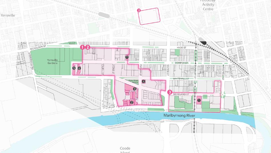
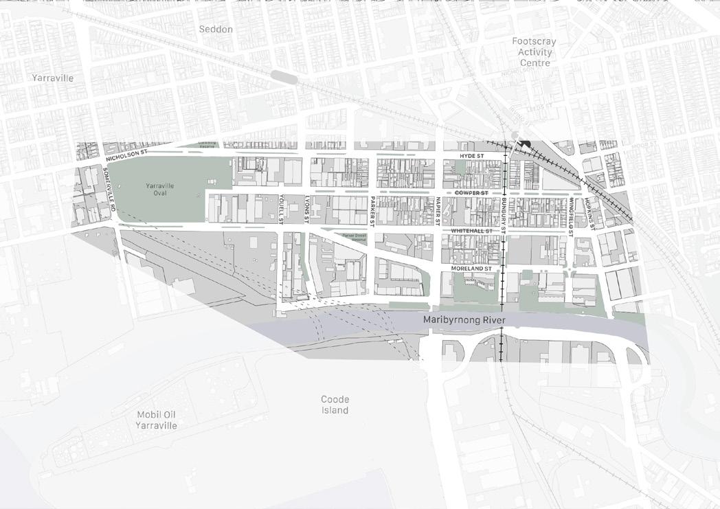
1.3 Location of focus area
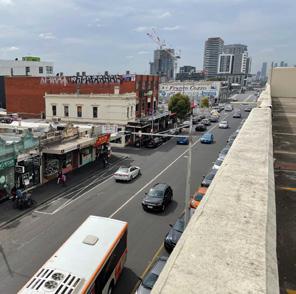
The Riverfront precinct is located south-west of Footscray Activity Centre (FAC), oriented parallel to the Maribyrnong River. It is positioned between FAC, Coode Island and Port Melbourne, Melbourne’s seaport transport gateway.
The precinct is framed by Dynon Road to the north, Maribyrnong River to the east, Somerville Road to the south and Hyde Street to the west.
The Maribyrnong River is a key feature of the precinct. The river flows from Riddells Creek and meets the Yarra River to form part of Port Phillip Bay. The river provides an ecological corridor that attracts various flora and fauna.
Major arterial roads and train lines punctuate through the precinct, reinforcing its function as a transit corridor for carrying goods and services. The Footscray train station at the top left corner of our site provides residents and workers access to 3 different metro lines as well as regional V-line networks. The opening of the West Gate Tunnel will be the main transport corridor for heavy vehicles between industrial areas and to the port, providing a much needed relief for local roads which disturbs the amenity of suburbs and the wellbeing of the residents.
Figure 3. Riverfront precinct location and proximity area.
2. Context
Melbourne CBD
Footscray Community Arts Centre
Coode Island
Bunbury Railway Bridge
M01 Footscray Business Precinct - Regional Context Map
2.1
Role of Footscray Activity Centre
Footscray has been identified as a Major Activity Centre in Melbourne to perform as an important hub of employment, education, commercial activities and housing growth within the backdrop of a strong public transport network.
Footscray plays an integral role as a transit hub with its strong arterial routes between industrial districts in the western suburbs and the Port of Melbourne.
The opening of the Metro Tunnel will enable a direct train route from Melbourne Airport to Melbourne’s Central Business District via Footscray and Sunshine. This critical transport infrastructure will connect Footscray to national employment and innovation clusters and significant precincts such as Arden, Caulfield and Dandenong. Therefore, Footscray has the right settings to become a vibrant compact city with economic, social, and housing opportunities for growing population.
Footscray Regional Context Map
Figure 4. Role of Footscray Activity Centre within Melbourne (Victorian State Government, 2021)
2.2 Strategic Policy Context
The Creative State emerged out of the decimation of the arts during covid lockdowns. The document outlines the process for the recovery of the industry throughout Victoria.
OPPORTUNITY & DIRECTIONS
The Opportunity and Directions Paper identified the potential of Footscray to become a creative center of the west and recommended efforts to stimulate the job market in creative industries, social enterprises and emerging technologies.
Victoria’s Housing Statement
Plan Melbourne has set Footscray as a Metropolitan Activity Centre, defining it as a hub for employment, housing, retail, commercial and civic services (VicGov). Future investment will continue to support Footscray’s growth as a strong compact city, with the opening of the Metro Tunnel connecting the suburb to various other education precincts around Melbourne.
The Housing Statement is a policy document strategising Victoria’s ambitious goals to meet housing growth in amenity-rich locations, close to jobs, services, education and transit. Footscray is chosen as a Priority Precinct to deliver a portion of 60 000 new homes by 2040.
Figure 6. Victoria State Government, Plan Melbourne 2017-2050.
Figure 8. Victoria State Government, Victoria’s Housing Statment 2024-2034.
Figure 7. Victoria State Government, Opportunity & Directions Paper 2021.
Figure 5. Victoria State Government, Creative State 2025.
2.2.1 State Planning Policy
2.2 Strategic Policy Context
2.2.2 Water-based Planning Policy
Water-based planning policies are integral to the Riverfront precinct’s vision, which revolves around the Maribyrnong riverfront, from both the amenity it offers as well as its ecology and its protection. This focus underscores the precinct’s commitment to integrating and enhancing the river’s natural features. While much of the strategic context extends beyond the precinct’s boundaries, it is crucial to consider the broader scale.
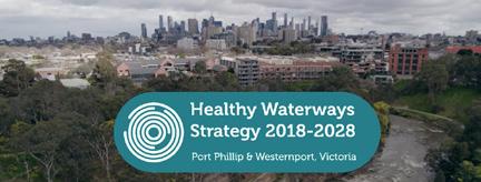
The Healthy Waterways Strategy serves as a tool for assessing and monitoring the health of water bodies, including the Maribyrnong River in Footscray, at a catchment scale. Its purpose is to provide an overview of key metrics, to aid in making informed decisions regarding river management and conservation efforts.
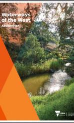
The Waterways of the West Action Plan is an exhaustive reference of the aims and future of the waterways of the West. Most relevant to this is the intention to identify the Maribyrnong river as a legal entitiy and that it specifies both short and long term goals that are relevant to the integration and connection of the western waterways, including the Maribyrnong River.
The Melbourne Water Strategy lays out a roadmap for sustainable water management, directly impacting initiatives like the Footscray Riverfront Precinct. Prioritizing conservation and resilience, it guides efforts to ensure the Maribyrnong River’s health and vitality, crucial for the precinct’s development and community well-being. With a particular focus on preserving access to green spaces and clean water in a densified Melbourne.
The Maribyrnong Waterfront – A Way Forward, presents background context and a vision for the entire river area - including this precinct. The vision includes themes and principles to guide development and looks at both ecology and built form. Pertinently, it includes reference of Indigenous voices and knowledge as the groundwork for furthering the urban design.
Figure 10. Melbourne Water, Melbourne Water System Strategy.
Figure 11. Victoria State Government, Waterways of the West, 2021.
Figure 12. City of Melbourne, Maribyrnong Waterfront A Way Forward, 2020.
2.2 Strategic Policy Context
2.2.3 Local Planning Policy
Footscray Structure Plan
The Industrial Land Strategy provides a framework for managing industrial land to preserve employment opportunities and industrial function. The Riverfront precinct, which overlaps with the “Yarraville Precinct,” falls under the Core Employment Area (CEA) designation in the document.
The Footscray Structure Plan has planned for the Riverside precinct to be a cultural and recreational area of the Footscray Activity Centre. Council has considered future investment into arts infrastructure such as an incubator hub, an art walk and a community hub to strengthen the identity of the creative precinct.
The Urban Forest Strategy acknowledges the challenges the municipality faces in managing the impacts of climate change. In particular, the strategy has identified that the Riverside precinct only possess 9-18% tree canopy cover and records high temperatures due to an excess of hard surfaces.
The Maribyrnong Open Space Strategy outlines how the open spaces in the area should be preserved, maintained and connected.
The Bicycle Strategy has acknowledged the role that the Riverside precinct plays as a thoroughfare for commuters to travel between the Melbourne Central Business District and western suburbs. The Seddon to Dynon Road major projects investment which runs through the precinct aims to increase the uptake of bike riding by community members.
Urban Forest Strategy
Figure 13. Maribyrnong City Council, Footscray Structure Plan 2014.
Figure 16. Maribyrnong City Council, Open Space Strategy.
Figure 14. Maribyrnong City Council, Urban Forest Strategy 2018.
Figure 17. Maribyrnong City Council, Bicycle Strategy 20202030.
Maribyrnong
Figure 15. Maribyrnong City Council, Maribyrnong Economic and Industrial Development Strategy.
City of Maribyrnong Open Space Strategy
2.3 Statutory Planning Context
2.3.1 Zoning
The north portion of the precinct is zoned Activity Center Zone Schedule 1 (ACZ1)with a key objective to encourage housing growth, economic development, prioritisation of public and active transport over motor vehicles.
The Special Use Zone Schedule 3 (SUZ3) seeks to protect the operations of the adjacent Port of Melbourne by maintaining land use of manufacturing industry and encouraging commercial offices.
The Industrial Zone Schedule 1 (IN1Z) provides a manufacturing industrial service.
The Industrial Zone Schedule 3 acts as a buffer between sensitive land uses such as residential and community infrastructure to mitigate the impacts of heavy industries.
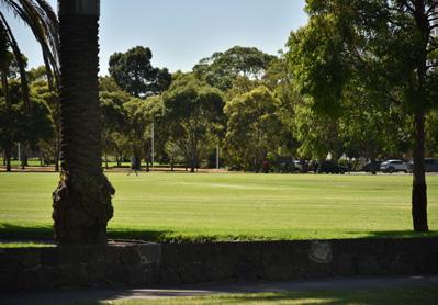
Public parks in our site such as Yarraville Oval and Parker Street Reserve as well as the Maribyrnong River from the north of Napier Street is zoned Public Park and Recreation Zone (PPRZ).
2.3 Statutory Planning Context
2.3.2 Overlays
Environment and Landscape
Environmental Significance Overlay
Schedule 1 (ESO1)
• The ESO1 between Napier St, Lyons St and Moreland St seeks to protect the functional integrity of the Port of Melbourne by prohibiting land uses that will compromise its viability.
• The ESO2 scattered around the precinct seeks to protect significant trees that are identified in the Maribyrnong Significant Tree Register.
Significant Landscape Overlay Schedule 1 and 3 (SLO1 and SLO3)
• The objective of the SLO1 and SLO3 over the Maribyrnong River and the Footscray Wharf and Promenade are to protect the riparian ecological corridor of the Maribyrnong River.
2.3 Statutory Planning Context
Heritage and Built Form
Heritage Overlays
• There are many heritage overlays in the precinct that cover residential, transport, industrial and riverfront areas. They seek to protect the significance of these sites that characterises the early beginnings and importance of Footscray as an industrial and transport hub.
Development Plan Overlay Schedule 16
• This overlay covers the Ryco Precinct which requires the developer to provide a detailed response on how it complies with the vision of council’s Concept Plan before a permit is granted.
Design and Development Overlay Schedule 14
• The DDO14 seeks to protect the West Gate Tunnel from any works that may impact the structural integrity.
2.3 Statutory Planning Context
Land Management
Land Subject to Inundation Overlay
• The LSIO identifies areas that may be impacted during a 1 in 100 year flood and to reduce the severity to life and building. The LSIO covers part of Coode Island and Joseph Road Precinct of our site.
Floodway Overlay
• The floodway overlay covers part of the Footscray Wharf and Promenade.
Special Building Overlay
• The Special Building Overlay identify areas that may flood from drainage systems, in particular around the areas of the Billy Button Creek.
2.3 Statutory Planning Context
Other Overlays
Environment Audit Overlay
• The Environmental Audit Overlay ensures new land uses considers the impacts of operating on potentially contaminated land.
Parking Overlay
• The Parking Overlay considers balancing the needs of supplying parking and prioritising the provision of active and public transport to curb traffic congestion and private motor vehicle ownership.
Development Contributions Plan Overlay
• The DCPO sets contributions to developers to supply new infrastructure and services to compensate population growth.
2.4 Key Attributes of Focus Area
There are many notable destinations within our precinct:
• The Maribyrnong River is the heart of the Riverfront Precinct and it has undergone major transformations from a meeting point for Indigenous communities to an industrial wasteland in the beginning of British colonialism.
• The Footscray train station is a 500m walk fron the river, which connects residents and workers transit superhub.
• The Footscray Community Arts Centre play a pivotal role in the creative identity of the precinct.
• The Lonely Plant and Cotton Mills building also hosts an array of commercial offices, light manufacturing and creative workshops.
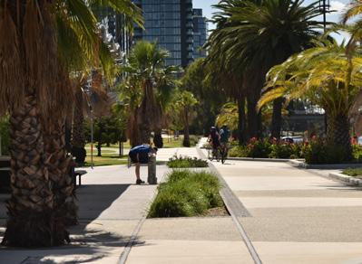
• The Footscray Wharf has recently been revitalised as a high quality open space that reinforces the patronage of the riverfront.
• The future wetland delivered by the West Gate Tunnel Project will connect the Yarraville Oval and Footscray Wharf, creating a continuous open space network to Footscray Park.
2.4 Key Attributes of Focus Area
Figure 20. Footscray Station
Figure 21. Local cafe and bike repair shop
Figure 22. Footscray Wharf and Promenade
Figure 23. Construction of the West Gate Tunnel Project
Figure 18. Footscray Community Arts Centre
Figure 19. Bunbury Street Tunnel and Bridge
2.5 Indigenous Context
Ecological Vegetation Class in 1750
Before European colonization, the Maribyrnong riverfront thrived as a grassy landscape, home to a rich array of flora and fauna. For over 40,000 years, the Wurundjeri Woi Wurrung and Bunurong peoples of the Kulin Nation cared for and protected this land. The junction of the Maribyrnong and Yarra rivers held special significance, symbolizing the unity of groups traveling along these waterways.
The name "Maribyrnong" is derived from the Aboriginal term ‘Mirring-gnay-bir-nong,’ which translates to ‘I can hear a ringtail possum.’ This name reflects not only the environmental richness of the area but also the Indigenous peoples' intimate connection to the land.
The meeting point of the Maribyrnong and Yarra rivers served as a central gathering place for trade, cultural exchange, and community interaction, highlighting the importance of rivers in Indigenous life and history.
Acknowledging and respecting the Indigenous heritage of the Maribyrnong riverfront is essential for fostering reconciliation and building strong relationships with Indigenous communities. Preserving this cultural legacy while promoting sustainable land management practices is crucial for honouring the deep connection between Indigenous peoples and their ancestral lands.
MARIBYRNONG RIVER
Plains Grassland/
Pains Grassy Woodland Mosaic
Brackish Wetland
Swamp Scrub
Brackish Grassland
Maribynong River
Figure 24. First Nations gathering
Figure 25. George Gilbert, ‘Maribyrnong River’
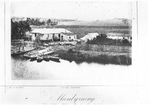
2.6 Post Contact History
The first recorded visit by a European to the area was by Charles Grimes, Deputy Surveyor-General of New South Wales, in February 1803. Grimes and followers are thought to have stepped ashore somewhere near the reserve that is named after him at the corner of Napier and Maribyrnong Streets, Footscray.
In 1839 a punt was established on ‘Saltwater River’ (Maribyrnong River) near its junction with the Yarra to provide a crossing point for travellers to Williamstown, Geelong and beyond. A settlement known as ‘Saltwater’ evolved around the punt. This site soon grew into the city of Footscray, named after an English town. During the second half of the 19th century, Footscray developed into the centre of Melbourne’s industrial wealth.
As settlers inhabited the region, the Maribyrnong became a dumping ground for noxious waste and biohazardous industries as people viewed it as free drainage. From around the 1850s, it was used for abattoirs and tanneries and Footscray developed a reputation for being foul and smelly. As time has progressed, these industries have moved out of Footscray and it has developed a thriving creative scene, with many old factories, warehouses and mills being converted into creative studios.
Figure 26: European artists impression of Aboriginal life on the river (1865)
Figure 27: A Photo of 'Saltwater River'
2.7 Key Issues
A polluted river
Similar to one of the challenges the Yarra River faces, as the city continues to urbanize and population continues to increase, pollution is one of the major problems that the riverfront area houses the urban section of the Maribyrnong River.
The problem of pollution is evident based on the sub-catchment information provided by Melbourne Water with dissatisfactory waterway conditions ratings and threatened animal species like the endangered growling grass frog. The management of the river requires a holistic approach with collaboration between different local governments, environmental authorities and public participation. It is challenging to pose recommendations only on the Riverfront precinct, without considering the river system as a whole spanning many municipalities.
Our proposal provides a snapshot of targeted treatments that needs to be integrated as a whole to restore natural habitats of flaura and fauna and mitigate the impacts of flooding due to increase rainfall.
Figure 29. Maribyrnong River Catchment
Figure 32. Minimal local fauna along the river
Figure 30. Sign on the river
Figure 31. Industrial precinct adjacent the river
2.7 Key Issues
Climate Emergency
The Riverfront precinct is facing significant challenges due to increased frequency of extreme weather events that is impacting the liveability and resilience of this area. Spatial evidence shows that the Riverfront suffers from low tree canopy cover which increases the urban heat island effect. Parts of the promenade and creative industries will also often face coastal indundation during storm surges coupled with sea level rise by 2100.
The industrial area, southside of the riverfront site, is significantly impacted with the lack of tree canopy.
A significant portion of our site experiences high surface temperatures, endangering health of residents and workers in the area.
Frequent heavy rain due to climate change will cause parts of the promenade and industrial area to be inundated with flooding. City
City of Maribyrnong, Urban Forest Strategy 2018
of Maribyrnong, Urban Forest Strategy 2018
2.7 KEY ISSUES
Housing Crisis
The whole map of the riverfront area has been examined, and limited opportunity for lot consolidation and intensification can be identified. Additionally, with a significant extent of heritage overlay, a lot of development potential is limited and cannot be achieved in a straightforward manner. Perhaps, other part of Footscray, e.g. western Footscray, has a bigger role to play for providing the 60000 new homes target by 2040 as detailed in Victoria’s Housing Statement 2024-2034.
Zoning and Overlay
Potential for redevelopment
Centre Zone
Zone
overlays
chance of change
chance of change
chance of change
Figure 33. Existing module
3. VISION
Resilient Riverfront is the lungs of the community amidst urban intensification; it is enriched by the culturally connected Maribyrnong and the revitalised industrial and creative sectors.
Residents, workers and visitors travel to the riverfront by walking or cycling to soak in the rich history, open space and public realm experience offered along the Maribyrnong River.
3.2 Strategies
Description Aim Strategy
Forefront First Nations knowledge and custodianship to develop an open space and waterway system that is resilient, biodiverse and connected
Reinforce the Riverfronts' story of significant cultural transformation from Indigenous, Colonial, Industrial to Creative
Encourage creative and manufacturing industries to invest and flourish along the Riverfront
Given the increasing pressures on space and the surge in residential development within this area, the ample open space here is poised to take on a more significant role as the vibrant heart of Footscray. It will serve as the community's lungs, infusing vitality into the neighbourhood and providing a verdant, inviting sanctuary for residents to enjoy and connect with nature and each other. Additional adaption towards increasing tree canopy.
Renowned for its creative energy, this precinct boasts the esteemed Footscray Community Arts Centre, currently undergoing substantial enhancement thanks to both state and local investments. Beyond this iconic institution, lesser-known creative hubs thrive, encompassing adapted studios, workshops, and a myriad of small creative enterprises. Through the proposed initiatives, strategic way-finding and targeted investments will forge connections among these diverse creative spaces, enriching both the experiences of artists and the broader community.
This precinct contains some of the final reserves of industrially zoned land within inner Melbourne. Under the pressures of the housing crisis, much of industrial land is undergoing conversion to residential developments. In the Riverfront precinct, we advocate for the preservation, safeguarding, and enhancement of this industrial area to sustain its economic function both presently and in the long run. This proposition aims to investigate opportunities to encourage innovative transformations in these spaces which elevates the creative and manufacturing industries.
Prioritise active transport mobility to allow safe and sustainable connections to key destinations
With the surge in population placing strain on the transportation network and growing motivations to reduce reliance on automobiles, this precinct stands as an ideal candidate to lead Melbourne's shift towards sustainable transportation systems. The presence of key freight routes and highspeed roads, alongside a considerable volume of cyclists and pedestrians, underscores the urgency for substantial reforms to establish safe thoroughfares. This proposal aims to bridge existing gaps and integrate disparate bike paths into a cohesive network, fostering safer and more accessible routes for all commuters.
Encourage incremental housing growth in significant heritage precinct and target major growth in key strategic site.
Despite being designated as an activity centre and included in a high-growth zone; this specific section of Footscray encounters numerous obstacles in achieving substantial increases in residential density. Challenges such as small land parcels, recent high-rise constructions, heritage preservation areas, and already developed medium-density apartment units offering affordable rents pose significant barriers for intensification. In response, our proposal advocates for incremental increases in density in heritage precincts and targeted major growth in specific strategic sites. This is a considered and responsive approach to the sensitivities of the precinct, and acknowledge growing partnerships with community organisations and private business to reimagine future mixed-use residential development for major residential growth.
3.3 Targets
4.
Key Strategies & Actions
4.1 Resilient Lungs of Footscray
First Nations knowledge and custodianship to develop an open space and waterway system that is resilient, biodiverse and connected.
ACTIONS
1. Develop a First Nations governance structure to lead future revegetation of the riverbanks and precinct area.
2. Advocate to legislate the Maribyrnong River as a legal and living entity
3. Prepare a masterplan for the Green Spine to be porous and adaptable to frequent rain and floods
• Maribyrnong St Wetland
• Yarraville Park Reserve
4. Implement Healthy Street program for tree planting, ground cover landscaping and porous road cover along key streets to increase shade, biodiversity and water sensitivity.
Precedents
Yarra River Protection (Wilip-gin Birrarung murron) Act 2017
2. Advocate to legislate the Maribyrnong River as a legal and living entity
In Victoria, the Yarra River was legally considered a ‘single living and integrated natural entity’ in the Yarra River Protection (Wilip-gin Birrarung murron) Act 2017 (the Act). Apart from the symbolism of this, the Act mandated that there be an advisory body (the Birrarung Council) which must include at least two Wurundjeri Woiwurrung members to serve as advisors and advocates for the river.
The concept of granting legal personhood to natural entities has gained traction internationally, with precedents set in various parts of the world. These initiatives reflect a growing awareness in Western cultures of the need to reframe our relationship with the environment, particularly waterways, through a lens that respects their value as well as the rights of Indigenous communities who have historically stewarded them.
Reimagining Moonee Ponds Creek, Melbourne Water & City of Moonee Valley
3. Prepare a masterplan for the Green Spine to be porous and adaptable to frequent rain and floods
This renovation project of the waterway includes removing concrete channels and replacing it with staggered rocks. and new native plantings to create a healthier riparian corridor.
4.2. Cultural Heart
Reinforce the Riverfront's story of significant cultural transformation from Indigenous, Colonial, Industrial to Creative.
ACTIONS
1. Advocate a First Nations framework on Connecting to Country for the Maribyrnong River
2. Develop an interpretive placemaking and wayfinding program demonstrating cultural transformation of the riverfront
3. Fund a community arts program through the Footscray Community Arts Centre to encourage public participation in the storytelling of culture.
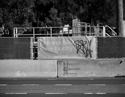
4. Plan and develop a Footscray Great Bicycle Ring, a continuous active transport loop that connects key destinations along the river and within the municipality.
PRECEDENTS
Water is Life Roadmap, Traditional Owner Acess to Water Roadmap
1. Advocate a First Nations framework on
2. Develop an interpretive placemaking and wayfinding program demonstrating cultural transformation of the riverfront
A framework for Traditional Owners to be involved in making decisions on water management. It is a just step forward to repairing the damage that has been inflicted to our waterways and to Indigenous communities. Caring for Country and traditional ecological methods of managing the waterway systems will positively reflect on the health, wellbeing, economic and environmental .. of our systems.
Wayfinding design to improve navigation around the Botanic Gardens. It embeds the International Indigenous Design Charter (IIDC) and First Peoples-led approach to the signage. It reflects the garden's commitment to reconciliation, and anchoring visitors to the 60 000+ years of connection to country. It represent an inspiring once-in a lifetime oppotunity to move away from white western world of design to address the colonised nature of land. We reckon this is an appropriate approach for interpretive wayfinding along the Riverfront, at a place where colonisation first began and the establishment of Footscray began.
Royal Botanic Gardens Melbourne: Wayfinding Design
Royal Botanic Gardens Victoria Victorian State Government
Royal Botanic Gardens Victoria
Connecting to Country for the Maribyrnong River
4.3 Creative and Productive Economy
Encourage creative and manufacturing industries to invest and flourish along the Riverfront
ACTIONS
1. Develop a Creative Precinct strategy to elevate the identity of creative industries
2. Review and update Industrial Strategy in collaboration with Victoria University, to aid transition into a knowledge-based manufacturing economy.
3. Develop and fund a Creative Events 5 Year Strategy to encourage more events around the Footscray Community Arts Centre
1. Footscray Community Arts Centre
2. Former Lonely Planet
The Cotton Mills
Good Ideas
Kindred Studios
Footscray Maker Lab
The Art Room
University
PRECEDENTS
Creative Darebin Arts Strategy 2014-2020, Darebin City Council
1. Develop a Creative Precinct strategy to elevate the identity of creative industries
The Creative Darebin Arts Strategy sets to frame a whole of Council approach of fostering a culture of creativity that thrives in the municipality. It aims to support best practices of encouraging diverse representation of art and culture of the community. The strategy is premised by three goals:
1. Improve social cohesion, wellbeing and connectedness through arts and creative experiences for those who live, work, study or play in the City of Darebin
2. Create the environment and conditions that encourage creative endeavour and enterprise to proliferate
3. Set the strategic agenda for facilitating the growth of a creative culture across the Northern Metropolitan region
The strategy also sets out measurable goals to determine the success of their actions, by measuring number of new businesses in the municipality, increased level of participation and access by the community and increased perception of value by the private sector.
Merri-bek Industrial Land Strategy 2015-2030, Merri-bek City Council
2. Review and update Industrial Strategy in collaboration with Victoria University, to aid transition into a knowledge-based manufacturing economy.
The Merribek Industrial land Strategy seeks to provide certainty for existing businesses and to ensure continuous supply of land that contributes to job security. This strategy seeks to protect the industrial land away from pressures seeking to transform towards residential . The changing workforce also looks at increased value add manufacturing including bespoke small scale manufacturing with strong inner city markets. Industrial strategy that is grounded in place, and planning for the future.
4.4 Safe and Connected Neighbourhood
Prioritise active transport mobility to allow safe and sustainable connections to key destinations
ACTIONS
1. Prepare a continuous micromobility path along the Green Spine to connect to other destinations along the Maribyrnong River
2. Create micromobility lanes along Hyde St, Bunbury St and Moreland St to connect key destinations
3. Develop and implement safe intersection upgrades along Hopkins St, Moreland Stm Cowper St and Wingfield St.
4. Incorporate minimum bicycle parking spaces for new developments
Potential Project
Footscray Great Bicycle Ring
1. Prepare a continuous micromobility path along the Green Spine to connect to other destinations along the Maribyrnong River via the
Great Bicycle Ring
The Footscray Great Bicycle Ring is a great initiative to highlight the numerous destinations that Maribyrnong has to offer through a continous cycling link.
Precedents
Moray St, South Melbourne City of Port Phillip
3. Develop and mplement safe intersection upgrades along Hopkins St,
St, Cowper St and Wingfield St
The Moray St bike path is a north-south connector bike path in South Melbourne. Vulnerable road users such as pedestrians and cyclists are prioritised in the road hierarchy, with safe and separated infrastructure built along roads and along intersections. This ensures vulnerable road users have clear right of way.
Footscray
Moreland
Bicycle Network, 2018
4.5 Targeted housing intensification
Encourage incremental housing growth in significant heritage precincts and target major growth in key strategic sites.
ACTIONS
1
1. Prepare framework and design guidelines for incremental density in heritage lots
2
2. Create a Development Plan Overlay for key strategic sites which includes mandatory provision of affordable and social housing
3
3. Develop design guidelines to promote high quality co-housing outcomes
Precedents
Bluefield Housing; An alternative infill for the suburbs
Damian Madigan
3. Develop design guidelines to promote high quality co-housing outcomes
Bluefield Housing is a method of infill housing that aims to encourage gentle addition of new housing behind existing lots, to preserve the character of single housing while providing greater housing diversity in urban infill areas. The smaller addition of housing ensures that open space and tree canopy cover is retained on the lot, which improves sustainability outcomes. The increased housing diversity also allows for people to age in place and reduces social isolation by allowing more people to live together.
West Melbourne Structure Plan; Special Use Zone Schedule 6
2. Create a Development Plan Overlay for key strategic sites which includes mandatory provision of affordable and social housing
The West Melbourne Structure Plan has implemented a mandatory requirement in the City of Melbourne Planning Scheme to provide 6% affordable housing in all new developments.
Damian Madigan Bluefield Housing, 2024
City of Melbourne, 2024
5. Implementation
It takes time for plants to grow and the environment of the area to improve. In order to mitigate the heat island effect quickly, the development of First Nations governance structure and implementation of Healthy Street program will commence as soon as possible. There are multiple hurdles for advocating to legislate the Maribyrnong River as a legal and living entity. It could be a long-term process as discussion takes place at the State government level and advice is sought from organizations like Environmental Justice Australia and Maribyrnong River & Waterways Association.
Resilient Lungs of Footscray
Timeline
Funding for community arts program through the Footscray Community Arts Centre to encourage public participation should be easy to implement and could be implemented in the short term. Similarly, the infrastructure required for the Footscray Great Bicycle Circuit i.e. protected bicycle paths is mostly available and the circuit could be available in the short term. It is foreseen that cultural transformation of the riverfront will continue to take place for the next five to eight years as such we set the interpretive placemaking and wayfinding program as a medium-term goal. We recognize the First Nations frame on Connecting to Country for the Maribyrnong River might require long-term effort.
Cultural Heart
The development of a Creative Precinct strategy and the review and update of Industrial Strategy in collaboration with Victoria University are can be completed within a short time. The development and funding of a Creative Events 5-year strategy would require more resources and coordination from multiple stakeholders so it is classified as a medium-term goal.
5.1.1 Timeline
The implementation of micromobility lanes should be carried out as soon as possible as it covers the the major path between the train station and heart of cultural centre of the riverfront area. Given the number of pedestrian accidents that continued to happen near the Joseph Road precinct, the implementation of safe inersection upgrades is given high-priority and will continue to be reviewed in the short to medium term. The incorporation of minimum bicycle parking spaces for new developments require State level support. While we hope it can be in place as soon as possible, the advocacy, review and legislative process can take a long time. Safe & Connected Neighbourhood
Targeted housing intensification
The lack of land for housing development remains a challenge in the riverfront area. Heritage overlay and potential sites that can be added to Development Plan Overlay require lengthy expert and community consultation and strategy planning before implementation can take place. As such, they are classified as medium to long-term actions.
5.2 Catalysts
Two sites in the Riverfront area are selected as catalyst projects to demonstrate potential transformation of the site to support our vision.
Mixed Use Redevelopment
Maribyrnong Street Urban Park
5.2 Catalyst Projects
Maribyrnong Street Urban Park
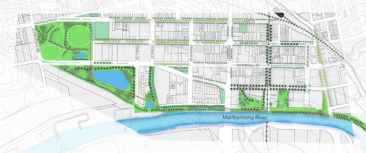
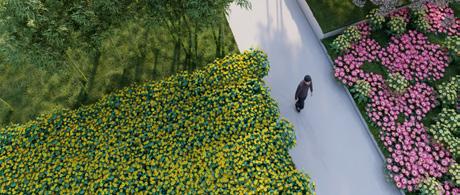
Maribyrnong Street Urban Park is a new urban park within the Green Spine that acts a linear connector and a wetland during heavy rain. This location is chosen as it is a missing link within the Green Spine corridor between Yarraville Gardens and Footscray Wharf and Promenade with limited public interaction with the river and open space. This transformation from a car park into an urban park will extend the public realm experience from the river to the new linear park, with new seating, extensive revegetation and play spaces.
First, we reduced the at-grade car parking area and concrete pavement to be replaced with landscaping, permeable paving and recreational spaces. We then transformed the original hard riverbank into a highly landscaped edge, with native plants. We would collaborate with First Nations elders on appropriate native vegetation suitable for the Maribyrnong River to reintroduce flora and fauna here.
The new skate park in the linear park also functions as a swale. It can accomodate the spread of water during times of flooding due to heavy rain. There is a continuous pedestrian and cycling route that connects users from Yarraville Gardens to Footscray Park via the Footscray Great Bicyle Ring.
This design aims to provide a new open space that is responsive to climate change and is well-loved by residents, workers and visitors.
Basketball half-courts
Linear park with skatepark swales
Revegetated riverbank
Extensive tree planting
Active transport routes
Figure 35. Maribyrnong St Urban Park
Figure 36. Revegetated riverbank
Figure 37. Extensive tree planting on side streets
5.2 Catalyst Projects
Axonometric Diagram
Section A-A’
Skateparks
Section B-B’
5.2 Catalyst Projects
Mixed-use Precinct Development Plan Overlay
This project is a new mixed-use precinct in collaboration with the Croatian Club and Phillipine House. Replacing a former petrol station, the site has made way for medium-rise apartments, open spaces, retail hubs and multi-deck carpark with a rooftop garden. This is delivered through a Development Plan Overlay, written by City of Maribyrnong.
The 5-storey residential buildings can provide housing for more than 100 families. The community facility building can provide space for small organizations such as studios, gyms, and restaurants. On the ground floor of the Multi-deck carpark is the relocation area for Philippine House. The ground floor edge has active retail uses to encourage public interaction with the street. The Phillipine House has also been relocated to the ground floor of the building.
Figure 38. Aerial view of mixed-use precinct
Figure 40. Aerial view of mixed-use precinct
Figure 41. Shared open space
Figure 42. Community facility
Figure 43. Shared open space
Figure 39. Rooftop garden
5.2 Catalyst Projects
Axonometric Diagram
What does this project mean for Footscray
5.3 Reflection and Conclusion
The Resilient Riverfront will impact Footscray's future positively. It not only signifies a significant shift towards honoring indigenous wisdom but also promises to redefine the urban landscape in a way that reconnects residents with nature. By enhancing and integrating green spaces, the plan aims to offer both locals and visitors a chance to experience nature and reap all the mental and physical benefit.
The catalyst projects specifically, are set to improve the area in two distinct ways. The development plan overlay and other housing initiatives promote quality housing, which is desperately needed across the whole city. Secondly, the focus on water management will not only enhance flood protection for residents all along the Maribyrnong River but also mitigate the risks posed by rising sea levels. This proactive approach reflects a commitment to safeguarding the community and the environment.
Footscray is an area of significant historic transformation, first from a lush landscape that housed and was cared for by Indigenous people for thousands of years to an industrial hub with a bad reputation filled with environmental hazards. The suburb is entering a new chapter as it transforms into a vibrant and diverse cultural center. The riverfront and its famous arts locations and beautiful scenery is a large part of it. This plan seeks to foster and enhance the potential of the precinct to contribute to the transformation while being sensitive to its history, fostering creativity, community spirit, and a renewed appreciation for the river's significance.
Furthermore, the plan's emphasis on connectivity extends beyond aesthetics. By linking fragmented bike lanes across the region, Footscray will boast a comprehensive network of pathways, promoting sustainable transportation options and enhancing accessibility for all using the disparate pathways across the suburb and city.
In essence, the Resilient Riverfront Plan heralds a promising future for an already vibrant and changing Footscray, where nature, culture, and community converge to create a thriving urban environment.
Appendix 1 Issues and opportunities
3.1 Key Issues and Challenges
• The Joseph Road precinct is a densely populated zone without much coordination among developers. The buildings are built very close to each other causing shadowing issues. Open space is scarce given the combined population in these buildings.
• Adjacent to these residential buildings is Hopkins Street, which is one of the two major roads that connects to Melbourne CBD. The road is always busy and causes air and noise population to the residents who live in Joseph Road precinct. The two traffic lights are far apart from each other making it inconvenient for pedestrians to cross the road.
• Unlike west Footscray, the riverfront area is not a major residential zone within Footscray. However, it will still share some of the predicted population growth in Footscray and will have to provide more housing.
Figure 38. Highly-densed residential complexes in Joseph Road precinct.
Figure 39. One park under construction for all Joseph Road precinct residents.
Figure 40. Incoherent design: Multi-storey car park opposite to apartment units.
Figure 41. Busy Hopkins Street can be dangerous and inconvenient for pedestrians.
3.1 Key Issues and Challenges
• The Westgate Tunnel project has brought great challenges to the Footscray riverfront in multiple aspects. The construction has definitely been adversely affecting the ecological environment of the urban section of the Maribyrnong River, as shown by the sub-catchment information in the Co-Designed Catchment Program for the Maribyrnong Region.
• The Tunnel will increase the traffic flow in Footscray riverfront, potentially worsening existing congestion issues and creating more danger to cyclists and pedestrians.
• The existing freight network and predicted increase in traffic poses a great challenge to the effectiveness of the Maribyrnong Bicycle Strategy which details a comprehensive bike network throughout Footscray by 2029.
Figure 42. Westgate Tunnel under construction.
Figure 44. With greater traffic and population comes greater responsibility.
Figure 45. Change in residential form & preference, a work in progress.
Figure 43. Advertisement of the new veloway.
3.2 Ecology, Landscape and Public Realm
3.2.1 Existing Conditions
• The vegetation in this area is mainly concentrated on both sides of the river.
• Public activity spaces are mainly located in the southern part of the site. The environmental protection area is mainly in the north.
• The vegetation is not evenly distributed. Some places have very low vegetation cover, while others, such as riversides, have a lot of vegetation.
• As the water of the Maribynong River rises, the surrounding area is at risk of flooding.
Public Park and
Significant Landscape Overlay
Environmental Audit Overlay
Environmental Significance Overlay
Special Building Overlay
Land Subject to Inundation Overlay
Floodway Overlay
Maribynong River
3.2 Ecology, Landscape and Public Realm
3.2.2 Environment & Landscape Conditions
Figure 46. Riverbank without many vegetation.
Figure 47. Areas lacking canopy cover and public space.
Figure 48. Crowded and chaotic places.
Figure 49. A park built along abandoned railway lines. Figure 50. Parks for residents.
Figure 51. Landscapes made of public art.
3.2 Ecology, Landscape and Public Realm
3.2.3 Issues and Opportunities
• Issue 1 - Lack of Biodiversity
• Issue 2 - Flooding
• Issue 3 - Not Enough Trees: Urban heat island effect & Landscape
Issue 1: Lack of Biodiversity
Human activities have severely affected the biodiversity of the region. The vegetation community in this area have largely retreated to the banks of the Maribynong River. Also, native plants have been replaced by exotic plants.
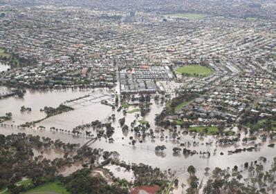
Issue 2: Flooding
Residents of Maribynong was greatly affected by the floods (the most recent of which was in 2022). Residences, property, and people’s lives and wellbeing were seriously threatened. The floods came from the rise of the Maribynong River, and the accumulation of water in the centre of the area.
Issue 3: Not Enough Trees: Urban heat island effect & Landscape
The distribution of vegetation and canopy in the area is uneven, and some roads or sections have little vegetation coverage, resulting in some people not being able to enjoy the landscape and shade brought by vegetation and canopy. However, the vegetation along the river is more abundant, but it can only be easily used by the residents near the river. In addition, the lack of vegetation can exacerbate the urban heat island effect.
Figure 52. Maribyrnong Street riveside.
Figure 53. 2022 Flooding.
Figure 54. Concrete ground traps heat.
Opportunity 1: Re-wilding - Reimagine
Maribyrnong as a living being
Rewilding rivers can give more space to affected species, especially native species. In addition, the situation of river pollution and other conditions can be improved through biological means.
The flood storage area can effectively store water when the river water rises due to sudden weather, so that the buildings can be protected from flooding and destruction. In addition, the flood storage area can also be used as the terminus of the drainage system, so that rainwater from the road surface does not accumulate.
Opportunity 3: Increasing canopy cover
By increasing the number of trees, we can effectively use their transpiration to lower temperatures. Trees and other species of plants have a certain ornamental value and form part of the landscape. In addition, trees can block the entry of dust from transport vehicles into residential areas.
Figure 57. Rapid urbanization has reduced canopy cover.
3.3 Transport, Connectivity and Parking
3.3.1 Existing Conditions
• The area is well connected with the Footscray train station at the intersection of Hyde Street and Bunbury Street. The area is also serviced by three bus routes: 216, 220 & 406.
• The area enables freight routes between Port Melbourne and western Victoria. Heavy congestion is observed on Napier St, Moreland St and Whitehall St during peak hours.
• There is a lack of protected bike lanes in the area. With reference to the Maribyrnong Bicycle Strategy 2020-2030, certain protected bicycle lanes (Hopkins St, Hyde St, Bunbury St, Moreland St) were planned to be completed between 2019 to 2025 but have not been completed during our site visit in March 2024.
• There are ample street parking on most streets within the area. There is a train station car park and another car park nearby but they play a minor role for providing parking spaces in this area.
3.3 Transport, Connectivity and Parking
3.3.2 Issues and Opportunities
• Issue 1 - Tunnel induced congestion
• Issue 2 - Increased traffic danger
• Issue 3 - Low active transport consciousness
Issue 1: Tunnel induced congestion
The West Gate Tunnel exit on Mackenzie Road will create more challenges in terms of traffic congestion. Footscray Road is the primary passage for vehicles to re-enter Footscray after they exit the tunnel (red arrow). Given Moreland Street, Napier Street and Whitehall Street are already under heavy traffic from 8am to 5pm on weekdays according to Google’s traffic indicator, the congestion issue might become worse on those roads.
Site visit was conducted to observe whether pedestrian bridge or tunnel can be used to improve traffic condition at the Moreland Street/Napier Street intersection and Whitehall Street/Napier Street intersection. It seems there is not enough space for building such infrastructure (see next page).
With the completion of the Westgate Tunnel Project, the projected increase in the number of residents in Footscray and the continual development of the riverfront cultural zone, the roads in the riverfront area will become busier and it poses a greater danger to cyclists if the roads are not modified accordingly to accommodate them. Given the facilitation of freight routes is one of the riverfront area’s major functions, there is an inherent difficulty to create or improve the active transport paths on every street in the region. However, human safety should be given top priority.
According to .ID statistics 2021, car ownership in the City of Maribyrnong is at a lower level than that in Greater Melbourne. The figures in Australia are, however, still among the highest in the world. In fact, car ownership rate in Australia is the fifth highest in the world according to 2020 statistics.
Issue 3: Low active transport consciousness
Issue 2: Increased traffic danger
Figure 58. Victoria State Government, primary pathway after tunnel exit re-entering Footscray, 2017.
Figure 59. 123RF, Car and bike accident.
Figure 60. Visual Capitalist, Highest Car Ownership Rates Worldwide, 2020.
During site visit, we observed insufficient space for building pedestrian infrastructure (bridge/tunnel).
Figure 61. Google, Napier Street and Moreland Street intersection, 2023.
Figure 62. Google, Napier Street and Whitehall Street intersection, 2022.
Opportunity 1: Active transport network extension / Better connectivity
While there is not a direct antidote for the tunnel induced congestion yet, the West Gate Tunnel project will strengthen the active transport network in the riverfront area. A new shared use path will be built as a part of the project, and this provides walkers and cyclists another safe option to commute in addition to the existing shared path along Whitehall Street and Moreland Street.
The Tunnel also brings better connectivity to the Westgate Freeway for road vehicles.
Opportunity 2: Active transport lane upgrade
With an extensive protected bike network that is detailed in the Maribyrnong Bicycle Strategy 20202030, we can provide better connection to the new dedicated shared use path brought by the West Gate Tunnel project.
Several specific measures are proposed:
1.The position of the bike lane and parking space can be swapped to create a safer riding experience for cyclists (see next page).
2.The planting strip of some roads can be pushed back to create a bike lane (see page after next).
3.30km/h vehicle speed limit can be imposed on most of the roads in the northern riverfront area (northside of Napier Street)since active transport will become the major mode of transport in that area.
Opportunity 3: E-Scooter program
The current E-Scooter Metro Trial program has just been extended to October 4 2024 and the Allan government claimed the program would stay after the trial. Given all three council districts under the trial program are in central Melbourne, Footscray is a very logical candidate if the State Government decides to extend the coverage of the program. Footscray riverfront will be seamlessly integrated into the current e-scooter trial area with the newly proposed protected path ‘veloway’, connecting the suburb to the west side of Melbourne CBD.
Figure 63. Victoria State Government, New protected shared use path in pink.
Figure 64. Maribyrnong City Council, Pilgrim St. protected bike lane demonstration.
Figure 65. Lime, E-Scooters trial is still ongoing as of April 2024.
Active Transport Lane Upgrade 1: Hyde Street modification
Figure 66. Nearmap, Hyde Street and Lawson Place intersection aerial view.
Figure 67. Nearmap, 632-636 St Kilda Road aerial view as a precedent how bike lane protection can improve.
Active Transport Lane Upgrade 2: Moreland Street modification
Figure 68. Nearmap, Moreland Street and Bunbury Street intersection aerial view.
Figure 69. Google, Moreland Street street view (unutilized road space highlighted in pink), 2022.
3.3 Transport, Connectivity and Parking
3.3.4 Further Opportunities with Victorian State Government support
1. Financial Incentive for Active Transport
Financial incentive is provided by various European governments for promoting active transport usage.
Here are a few examples:
• France: Residents in France can receive a state subsidy of up to €2,000 for purchasing an e-bike. The subsidy is part of the French Government’s 2023 to 2027 cycling and walking plan.
• Netherlands: Bike-riding commuters are awarded a €0.19 per km tax-free mileage allowance from employers. A person who cycles 10km per day five days a week to work could earn around €450 a year from the allowance program.
• Belgium: Similar to the Netherlands, employees in Belgium are able to claim a €0.24 per km mileage allowance.
• United Kingdom: Employees can purchase bike through their employers and receive up to 32% of the cost by tax deduction.
• The Victorian Government can also consider imposing similar financial incentive measures as this will greatly stimulate the uptake of active transport. This can also alleviate issues like traffic congestion, air and noise pollution, etc.
Figure 70. Cyclic Electric, French Bike Purchase Incentive Chart, 2024.
Figure 71. Cycle Scheme UK, Cycling to Work saves the environment and your time too.
Figure 72. Cycle Scheme UK, Number of people participate in cycle to work scheme annually.
2. EU Bicycle Parking Space Legislation
• On 7 December 2023, the provisional agreement between the European Parliament and the Council on the Energy Performance of Buildings Directive set out a minimum bicycle parking requirement for all types of buildings. Once the directive is formally adopted, member states will have 24 months to transpose the EU directive into national law.
• Some key requirements to which member states of the European Union should conform include:
– At least two bicycle parking spaces for every residential building unit are required for new residential buildings and those undergoing major renovation.
– Bicycle parking spaces should represent 10% of the total user capacity of the building for new non-residential buildings and those undergoing major renovation.
• Such measures have a significant impact on encouraging the use of active transport in Europe and can also be considered by the Victorian Government. Infrastructural support for active transport in buildings are helpful in ascertaining the newly built shared bike paths are put to good use.
Figure 73. European Cyclists’ Federation, bike storage inside a residential building.
3.4 Built Form, Housing & Typology
3.4.1 Existing Conditions
• There is a range of built form typologies located within the precinct, from fine-grain detached dwellings, larger industrial blocks, mediumrise walk up apartments to 20 storey high rise apartments.
• Older housing stock between Parker St and Hopkins St are typically 1-2 storey Victorian cottages and 3-4 storey walk up apartments.
• Residential developments have typically favoured multistorey apartment blocks on large strategic sites, such as the Joseph Road precinct, Cowper St Residences and the up-coming Ryco redevelopment.
• The industrial built form is typified of large low-rise blocks built to the boundary.
Figure 79. High rise apartments in Joseph Road Precinct.
3.4 Built Form, Housing & Typology
3.4.2 Issues
• Issue 1 - Lack of strategic sites for redevelopment
• Issue 2 - Heritage Overlay restricting development
• Issue 3 - Lack of diverse housing choices catered for families
Issue 1: Lack of strategic sites for redevelopment
Most large sites in the precinct have undergone or are in the process of redevelopment. Majority of the residential area within the Activity Centre Zone is comprised of fine grained lots (8-10m frontages) with detached houses. Fine-grained lots with separate ownerships is a challenge to transform into mediumdensity development as it reguires agreements from many parties.
A large part of our Activity Centre Zone is covered by various heritage overlays which restricts intensification. This creates a challenge to meet the demands of housing when the stock of housing is regulated to be largely unchanged.
Issue 3: Lack of diverse housing choices catered for families
There is an oversupply of 1-2 bedroom dwellings in the precinct, and low supply of 3-4 bedroom dwellings that could accomodate a growing family and larger households to age in place (profileID, 2021). Families with children require more space, therefore planning incentives are needed to create appropriate housing typologies for families to live within inner city Melbourne.
Figure 80. Fine grain residential lots.
Figure 81. Heritage house along Bunbury Street. Figure 82. High rise apartments within the Joseph Road.
Opportunity 1: Consolidation of lots
enhances the amenity of existing neighbourhoods by provision of shared open spaces, walking and cycling links, reduced car park spaces, and increased canopy cover.
Opportunity 2: Heritage Reform
Maribyrnong Council has set a progressive precedent of abandoning restrictive heritage overlays in residential areas that may restrict intensification. Further study could be undertaken to understand the significance of existing heritage overlays and the possibility of amending the overlays to benefit current and future residents by allowing substantial changes to the built form and housing typology.
Opportunity 3: Diverse housing choices catered for families
Design guidelines for family-oriented housing could help provide clarity on the design of private dwellings and shared spaces. Mandatory requirements and levies can provide a clear guide and an incentive to build more 3-4 bedroom units for families to grow in.
Figure 83. Greening the Greyfields (Maroondah City Council, 2021)
Figure 84. Yimby Melbourne, 2023
Figure 85. Austin Maynard Architects, 2023
3.5 Land Use
3.5.1 Existing Conditions
• To the south and east of the precinct there are industrial areas.
• Residential use is split up with other uses, including hospitality, retail and community.
• There are a high proportion of arts uses throughout the precinct, although they are relatively spread out.
• The train station is the most notable community land use.
• The precinct has a sizable amount of green open space along the riverfront as well as a couple of parks.
xx Land use diagram of the riverfront pre-
Figure
3.5 Land Use
3.5.2 Issues
• Issue 1 - Creative zones and open space not sufficiently integrated
• Issue 2 - Contaminated land poses threats / Pressure to increase housing density
• Issue 3 - Limited Indigenous connection to the land
Figure xx Land use diagram of the riverfront pre-
Issue 1: Creative zones and open space not sufficiently integrated
While the riverfront precinct boasts ample open space and holds the title of a creative precinct, anchored by the renowned Footscray Community Arts Center set for a significant upgrade, the current layout presents a challenge.
Despite these rich offerings, the creative precincts remain disjointed from one another and disconnected from the surrounding open space. This fragmentation hampers the community’s ability to fully immerse themselves in either aspect of the precinct.
Issue 2: Contaminated land poses threats / Pressure to increase housing density
A large part of the precinct has been designated as a growth area, which has resulted in intense development. Notably, the Josephs Road precinct has seen increases in high-density residential housing with limited access to open space.
A history of industrial uses and waste disposal has left the southern portion of the site at high risk of contamination. Additionally, the existing industrial land (which is in short supply near the CBD) has potential to limit the suitability of adjacent land to sensitive uses.
Population growth and pressure to intensify threatens the industrial land, and the corresponding jobs. Additionally, the pressure on the industrial land poses safety concerns relating to the contamination and buffer zone.
Opportunity 1: Consolidation of lots Opportunity 2: Heritage Reform
Issue 3: Limited Indigenous connection to the land
The lack of Indigenous conenction in the Footscray riverfront precinct poses a significant land-use problem, reflecting historical marginalization and exclusion of Indigenous perspectives in urban planning.
The Wurundjeri people have deep cultural, spiritual, and historical connections to the Maribyrnong River. The absence of meaningful representation and engagement with Indigenous peoples in the development of the riverfront precinct perpetuates a disconnect from traditional lands and erases Indigenous narratives and knowledge.
Opportunity 3: Diverse housing choices for families
Figure 86. Footscray Community Arts Centre Signage.
Figure 88. Concrete Paving along the Maribyrnong.
Figure 87. Industrial Shipping Containers in the Precinct.
Opportunity 1: Integrate the arts and open space space network
The Westgate Tunnel promises to enhance Footscray’s open space network, by creating a continuous green corridor from Yarraville Oval to Footscray Park. The proximity of this connected open space to the existing arts facilities of the Riverfront Precinct offers a unique chance to integrate cultural and outdoor leisure activities, fostering a vibrant arts precinct that seamlessly exists within a lush natural environment.
By integrating improvements in transportation, ecology, and public spaces, with wayfinding opportunities, the once somewhat inhospitable area can be revitalized into an inviting workplace that attracts artists and encourages collaboration.
Opportunity 2: Preserve the industrial zone and encourage arts
The scarcity of industrial space, especially in proximity to Melbourne’s CBD, underscores the importance of preserving and enhancing these areas. Cementing the zone as light industrial does not only protect existing industries but also ensures their continued viability. This approach does not only transform the area into a desirable workspace but also promotes economic vibrancy while preserving the unique character of Footscray’s industrial heritage.
Opportunity 3: Empower Indigenous decision making and design guidance
Forefront Indigenous knowledge is in all design processes, consistent with the Maribyrnong River Structure Plan.
This issue requires proactive efforts to recognize and respect Indigenous heritage, incorporate Indigenous voices in decision-making processes, and prioritize cultural sensitivity in land-use planning to ensure that the riverfront precinct reflects the diverse identities and histories of the community it serves.
Figure 89. Photo of park space in the precinct.
Figure 90. Photo of the converted cotton mills.
Figure 91. Aboringal Flag.
Appendix 2
Learning from elsewhere
4.1 Understanding the City Resilience Index (CRI) Framework and Exploring how Flood impacts Resilience
4.1.1
CRI Assessment & Qualtitative Resilience Profile - Liverpool
• City resilience reflects the overall ‘capacity of a city (individuals, communities, institutions, businesses and systems) to survive, adapt and thrive no matter what kinds of chronic stresses or acute shocks they experience’(Rockefeller Foundation).
• The CRI is a framework developed by Arup supported by the Rockefeller Foundation.
• The development of the framework involved a review of more than 150 references, 14 city case studies on secondary data sources and primary research in 6 cities globally.
• A Resilience Profile is generated based on responses from city stakeholders to 156 questions. The profile helps reveal the strengths and weaknesses of the city across the 4 dimensions, 12 goals, and 52 indicators of the CRI.
• Liverpool is the forth highest risk city in the UK for surface water flooding (Merseysideprepared, UK). We will discuss how the flood can affect various CRI indicators in the next sub-section.
Figure 93. The Sun UK, Flood on Deysbrook Lane, Liverpool, 2020.Figure 94. Liverpool World UK, Flood in Liverpool, 2022.
4.1 Understanding the City Resilience Index (CRI) Framework and Exploring how Flood impacts Resilience
4.1.2 CRI indicators and flood implication
• While CRI is often used to assess a city as a whole and we cannot employ it to assess the Footscray riverfront area directly. We would like to demonstrate Liverpool, United Kingdom as a sample city to illustrate how the CRI can be used to assess a city’s resilience. The city achieves satisfactory scores in most of the 52 resilience indicators.
• In the event of flooding, we can observe many indicators would be adversely affected (as shown by the red boxes).
• How the government handles flood in terms of monitoring, prevention and deployment of emergency services can also impact some of the indicators.
• As the Footscray riverfront area is in close proximity to the 2022 Maribyrnong flood event. We will explore the event and some of the aftermath development in the next section.
Figure 95. Arup, 52 resilience indicators categorized in 4 core dimensions for Liverpool (indicators affected by flood in red
4.2 Melbourne Water Flood Review
4.2.1 Findings from the Melbourne Water Flood Review
• The Footscray riverfront area is within both the 2022 Maribyrnong HEC-RAS modelled 1% AEP flood extent and the Melbourne Water modelled 1% AEP flood extent. The spatial extent of the 2022 flood event is within the 1% AEP design flood event modelled by Melbourne Water.
• AEP: Annual Exceedance Probability, 1% AEP: the percentage of likelihood of a flood of a given size or larger occurring in any given year is one in 100
4.2.2 Criticism on the Melbourne Water Flood Review
• Outdated flood-modelling software was used for the review which did not reflect real-world flood behaviour.
• There was a failure to include consideration of the climate change impact of flood modelling.
• Flood modelling did not include the impact of the Flemington Racecourse flood wall.
Figure 97. The Australian, flood within the urban catchment of the Maribyrnong River, 2022.
Figure 98. SBS, flood on Raleigh street in Maribyrnong, 2022.
4.2 Melbourne Water Flood Review
4.2.3 Key future development on flood research and prevention
• Melbourne Water agrees and would implement all 15 of the Independent Review Panel’s recommendation.
• Melbourne Water commits to provide a new flood model for every catchment in Melbourne by the end of 2026; more detailed modelling supports long-term planning decisions.
• The impact of the Flemington Flood Wall will be studied using a new hydraulic model.
• Melbourne Water will investigate long term sustainable flood mitigation options once the new flood model is available in April 2024.
Greening the Greyfields is a policy framework proposed by Maroondah City Council to provide a design alternative from business-as-usual intensification.
Business as usual intensification is typified by a micro lot by lot change where one house is demolished to make way for three new smaller houses. As a consequence, permeable front and back gardens full of established trees and vegetation are replaced by driveways and carparking. This significantly impacts the amenity of existing neighbourhoods by increasing the urban heat island effect from hard surfaces and dark roofs.
Precinct scale regeneration proposed by Greening the Greyfields proposes intensification through consolidation of multiple lots to provide diverse housing choices, communal open spaces, walkable streets and increase in tree canopy cover. This model seeks to leverage understanding between planners, landowners and developers to encourage larger macro scale intensification for positive built form outcomes for residents and the neighbourhoods.
Business as usual intensification Precinct scale regeneration
4.4 Yarra River Protection (Wilip-gin Birrarung murron) Act
In Victoria, the Yarra River was legally considered a ‘single living and integrated natural entity’ in the Yarra River Protection (Wilip-gin Birrarung murron) Act 2017 (the Act). Apart from the symbolism of this, the Act mandated that there be an advisory body (the Birrarung Council) which must include at least two Wurundjeri Woiwurrung members to serve as advisors and advocates for the river.
The concept of granting legal personhood to natural entities has gained traction internationally, with precedents set in various parts of the world. These initiatives reflect a growing awareness in Western cultures of the need to reframe our relationship with the environment, particularly waterways, through a lens that respects their value as well as the rights of Indigenous communities who have historically stewarded them. Indigenous Australians have long known the importance of respecting and caring for country and seeing rivers and catchments for the whole connected entities that they are. As a Wurundjeri Elder put it “Country cannot speak for itself, and with so many now relying on it, so we must speak on its behalf.” (Nicholson and Jones 2019).
Using these legal approaches in Australian waterways can support a more cohesive approach to waterway planning and enhance the opportunity for Indigenous knowledge to inform and guide rehabilitation and revitalisation. Water governance in Victoria and all of Australia is fragmented and complicated, reducing the opportunity for synergistic development and limiting the potential and efficiency of design. Hart, Francey et al. (2022) suggests that there is a need for the authorising environment and culture around water to change in Melbourne if we are to handle the challenges that we are facing in our urban environments.
The legal recognition of the Maribyrnong River as a living entity presents an opportunity to forge a more equitable, sustainable and effective future for both the river and its surrounding communities. Like the Yarra, Maribyrnong River has been a site of neglect and abuse since Australia’s colonisation, having been used as a drain for noxious industry and abattoirs. The Yarra case study is a demonstration of a symbolic title compared to international case studies, and has faced criticism for not doing enough (O’Bryan 2019). However, the enshrined voice in the state legislature offers a promising step forward. Additionally, international examples have faced harsh public reactions to more strong legal recognition for their rivers that the Yarra example has managed to largely avoid (O’Donnell 2020).
In Waterways of the West, an intention to seek legal recognition for the Maribyrnong and its associated waterways is made clear. Council should look to the Yarra as inspiration and advocate to state and associated local governments for an acceleration of this action. As well as make sure that the approach is heavily influenced by Indigenous knowledge and input.
Figure 100. Coverpage of Connecting the yarra (bir-
4.5 Reimagining Moonee Ponds Creek
Rewilding of creek
The Reimagining Moonee Ponds Creek project is transforming a section of your much loved creek in Strathmore and Oak Park into a more naturalised waterway. Now the renovation has begun and is still underway.
The project includes a variety of initiatives,such as removing concrete structures, covering the concrete base of the channel with rockwork to create a meandering creek, increasing the green areas and canopy covers, constructing new shared paths and a new bridge, and creating public spaces.
This project will effectively improve water quality and biodiversity of Ponds Creek, increase public spaces of this area, and provide landscapes and a healthier environment for residents.
Construction status
Project Vision
Figure 101. Reimagining Moonee Ponds Creek Project
4.6 Creative Active Transport Use
• The Footscray riverfront area is the local creative and cultural zone with interesting sites like the Community Arts centre, Townhall and other heritage buildings. It is also very close to the vibrant Footscray central activity centre and other areas with a lot of street art and attraction sites. Footscray as a whole and all the important sites could benefit from a collective active transport network.
• In fact, the concept of creative and sight-seeing active transport use has quite a few precedents.
• Rome: “Great Bicycle Ring Road (GRAB)” network is a 45km cycling and pedestrian network that connect many landmarks, arts zones, parks and historical sites.
• Athens: “Cycling through History and Art” program is a project launched by Greece’s Cities for Cycling to integrate active transport into Athen’s cultural scene. A network of museums, galleries and cultural spaces will include new infrastructure to facilitate cycling visitors.
Figure 102. ESRI, Grande Raccordo Anulare delle Bici (GRAB).
Figure 103. Cities for Cycling Greece, Athens Bike Routes.Figure 104. Proposed “Footscray Great Bicycle Ring (FGB)” highlighted in orange, a fully protected active transport passage connecting Central Actvitiy Zone, Highpoint Shopping Centre, attraction sites, parks, heritage buildings and cultural centres.
Some of the sites of the Footscray Great Bicycle Ring
Figure 105. Jack’s Magazine.
Figure 106. Heavenly Queen Temple Melbourne.
Figure 107. Footscray Community Arts.
Figure 108. Street Art on Pilgrim St Footscray.
Figure 109. Maribyrnong Aquatic Centre.
Figure 110. Highpoint Shopping Centre.
“An artist’s version of the finish of the Clarke Cup, three mile race, 1882.” Melbourne’s Living Museum of the West Inc. Accessed March 30, 2024. https://livingmuseum.org.au/wp-content/uploads/2022/09/site-sports-Clarke-Cup1.jpeg.
Armstrong, Rebecca. “Guide to the Cycle to Work scheme for employers.” Cycling UK. Accessed April 9, 2024. https://www. cyclinguk.org/article/guide-cycle-work-scheme-employers#:~:text=It%20works%20as%20a%20salary,which%20is%20usually%20 12%20months.
“Athens Bike Routes, 2024.” Cities for Cycling Greece. Accessed April 11, 2024. https://citiesforcycling.gr/wp-content/ uploads/2022/09/foto_xartis-2048x1448.jpg
Australian Bureau of Statistics (2021) ‘All private dwellings’, 2021, Tenure type. Accessed 30 March 2024. https://www.abs.gov.au/ census.
Australian Bureau of Statistics (2021) ‘Country of Birth’, 2021, Country of Birth. Accessed 30 March 2024. https://www.abs.gov.au/ census.
Australian Bureau of Statistics (2021) ‘Number of people per household’, 2021, Number of people per household. Accessed 30 March 2024. https://www.abs.gov.au/census.
Australian Bureau of Statistics (2021) ‘Tenure type’, 2021, Tenure type. Accessed 30 March 2024. https://www.abs.gov.au/census.
Australian Bureau of Statistics (2022-base---2071), Population Projections, Australia, ABS Website. Accessed 30 March 2024. https://www.abs.gov.au/census.
v
Barak, W. “Wurundjeri Figures in possum skin cloaks, 1898.” Melbourne’s Living Museum of the West Inc. Accessed March 29, 2024. https://livingmuseum.org.au/wp-content/uploads/2022/09/site-abor-barak.jpeg.
Bicycle Network. “Infrastructure Victoria backs bike incentives.” Newsroom. Jan 20, 2021. https://bicyclenetwork.com.au/ newsroom/2021/01/20/infrastructure-victoria-backs-bike-incentives.
Christofides, Froso. “Cycling through history and art - new project by Cities for Cycling brings the bicycle to Athens’ cultural scene.” European Cyclist’ Federation. Feb 20, 2024. https://ecf.com/news-and-events/news/cycling-through-history-andart%E2%80%94-new-project-cities-cycling-brings-bicycle.
City of Melbourne. Maribyrnong Waterfront - A Way Forward. Victoria, VIC: City of Melbourne, 2020. https://www.melbourne.vic.gov.au/SiteCollectionDocuments/maribyrnong-waterfront-a-way-forward.pdf.
City of Moonee Valley. Maribyrnong River Master Plan. Victoria, VIC: City of Moonee Valley, 2011. https://mvcc.vic.gov.au/mycouncil/upgrades-and-plans/maribyrnong-river-master-plan.
Cogne, F. “Views of Melbourne and Victorian Scenery, 1865.” Melbourne’s Living Museum of the West Inc. Accessed March 26, 2024. https://livingmuseum.org.au/wp-content/uploads/2022/09/site-abor-camp.jpeg.
Donnell, E. (2020). “Should Rivers Have Legal Rights?” Accessed 14/04/2024 2024. https://law.unimelb.edu.au/news/MLS/shouldrivers-have-legal-rights
“Flood on Deysbrook Lane, Liverpool, 2020.” The Sun UK. Accessed April 11, 2024. https://www.thesun.co.uk/wp-content/ uploads/2020/12/NINTCHDBPICT000624537585.jpg?strip=all&w=960.
“Footscray Community Arts enhancement illustration.” Footscray Arts. Accessed April 9, 2024. https://footscrayarts.com/cms/wpcontent/uploads/2022/03/Cam1_Render_Post-scaled.jpg.
Footscray Historical Society. “1875 Melbourne Regatta, Maribyrnong River, 1875.” Picture Victoria. Accessed March 26, 2024. https://www.picturevictoria.vic.gov.au/site/maribyrnong/miscellaneous/5282.html.
Glackin, Stephen & Newton, Peter. “Greening the Greyfields.” Cities People Love. Aug, 2022. https://citiespeoplelove.co/article/ greening-the-greyfields-precinct-scale-regeneration-in-the-urban-greyfields.
“Growling grass frog, 2017.” Victorian National Parks Association. Accessed April 11, 2024. https://vnpa.org.au/wp-content/ uploads/2017/02/Growling-grass-frog-its-a-wildlife.jpg.
Gt G Precinct. “Greening The Greyfields, 2018.” Maroondah Council. Accessed April 6, 2024. https://yoursay.maroondah.vic.gov.au/ gtg1/widgets/219177/photos/52831.
Hart, B. T., et al. (2022). “Management of urban waterways in Melbourne, Australia: 2 – integration and future directions.” Australasian Journal of Water Resources: 1-22.
“Healthy Waterways Strategy : A Melbourne Water Strategy for Managing Rivers, Estuaries and Wetland” Melbourne: Melbourne Water, 2018.
Hevesi, Bryant. “Victoria’s e-scooter trial extended by a further six months but Allan govt insists they are ‘here to stay’ in the state.” Skynews. Apr 4, 2024. https://www.skynews.com.au/australia-news/victorias-escooter-trial-extended-by-a-further-six-monthsbut-allan-govt-insists-they-are-here-to-stay-in-the-state/news-story/cfa12750f4ca04c8c5f74d960f21b2ed.
“Highpoint Shopping Centre.” Electro Light. Accessed April 9, 2024. https://electrolight.com/project/highpoint-shopping-centre.
“Jack’s Magazine.”Only Melbourne. Accessed April 9, 2024. https://www.onlymelbourne.com.au/image/ico-jacksmagazine.jpg.
Küster, Fabian. “Two bicycle parking spaces per apartment set to become new European norm.” European Cyclists’ Federation. Dec 15, 2023. https://ecf.com/news-and-events/news/two-bicycle-parking-spaces-apartment-set-become-new-european-norm.
“Liverpool flood photo, 2022.” Liverpool World. Accessed April 11, 2024. https://www.liverpoolworld.uk/jpim-static/ image/2022/09/09/11/newFile.jpg?width=1200&enable=upscale.
“Maribyrnong Aquatic Centre.” Ceramic Solutions. Accessed April 9, 2024. https://www.ceramicsolutionspools.com.au/poolproject-showcase/maribyrnong-aquatic-centre.
Maribyrnong City Council. Amendment C181 - Removal of interim Heritage Overlay. Victoria, VIC: Maribyrnong City Council, 2023 https://www.maribyrnong.vic.gov.au/Building-and-Planning/Planning-Services/Current-and-future-planning/Planning-SchemeAmendments/Recently-determined-planning-scheme-amendments/Planning-Scheme-Amendment-C181-Removal-of-interimHeritage-Overlay-from-West-Footscray-and-Surrounds-Heritage-Precincts
Maribyrnong City Council. Bicycle Strategy 2020-2030. Victoria, VIC: Maribyrnong City Council, 2020.
Maribyrnong City Council. City of Maribyrnong Maribyrnong Economic and Industrial Development Strategy. Victoria, VIC: Maribyrnong City Council, 2011.
Maribyrnong City Council. City of Maribyrnong Open Space Strategy. Victoria, VIC: Maribyrnong City Council, 2014. https:// www.maribyrnong.vic.gov.au/files/assets/public/planning-services-documents/city-design/strategies/maribyrnong-open-spacestrategy.pdf.
Maribyrnong City Council. Footscray Planning Scheme Amendment C125. Victoria, VIC: Maribyrnong City Council, 2015. https:// www.maribyrnong.vic.gov.au/files/assets/public/planning-services-documents/city-strategy/amendments/c125/maribyrnong_ c125_acz_schedule_1.pdf.
Maribyrnong City Council. Footscray Structure Plan. Victoria, VIC: Maribyrnong City Council, 2014. https://www.maribyrnong.vic. gov.au/files/assets/public/v/1/planning-services-documents/city-strategy/reference-and-incorp-documents/footscray_structure_ plan-2014.pdf.
“Maribyrnong flood near Flemington Racecourse, 2022.” The Australian. Accessed April 11, 2024. https://content.api.news/v3/ images/bin/56e7a4123f9066390b76fd551d6b8f2c.
Melbourne Water. Co-Designed Catchment Program for the Maribyrnong Catchment Region (including Moonee Ponds Creek). Victoria, VIC: Melbourne Water, 2018. https://www.melbournewater.com.au/about/what-we-do/publications/healthywaterways-strategy.
Mettleton, C. “Maribyrnong River.” Moonee Valley Family & Local History Blog. Accessed March 26, 2024. https:// mooneevalleyfamilylocalhistory.blogspot.com/2010/10/maribyrnong-river.html.
Neufeld, Dorothy. “Who Owns the Most Vehicles per Capita, by Country?” Visual Capitalist. Feb 21, 2024. https://www. visualcapitalist.com/vehicles-per-capita-by-country/.
O’Mara, B. “Footscray Stinks? Wake Up, Smell the Coffee.” Benomara.com. https://benomara.com/story-footscray-stinks.
Nicholson, M. and D. Jones (2019). Wurundjeri-al Narrm-u (Wurundjeri’s Melbourne): Aboriginal living heritage in Australia’s urban landscapes. The Routledge Handbook on Historic Urban Landscapes in the Asia-Pacific, Routledge: 508-525.“Qualitative Resilience Profile - Liverpool.” City Resilience Index. Accessed March 30, 2024. https://www.cityresilienceindex.org/#/city-profiles.
O’Bryan, K. (2019). “The changing face of river management in Victoria: The Yarra River Protection (Wilip-gin Birrarung murron) Act 2017 (Vic).” Water International 44(6-7): 769-785.
O’Mara, B. “Footscray Stinks? Wake Up, Smell the Coffee.” Benomara.com. Accessed April 6 April, 2024. https://benomara.com/ story-footscray-stinks
Raadik, Tarmo. “Australian Grayling.” Fishes of Australia. Accessed April 11, 2024. https://fishesofaustralia.net.au/images/image/ PrototroctMaraen2TarmoRaadik.jpg.
Ross, J. “SES searching floodwaters along Raleigh street in Maribyrnong, Melbourne, 2022.” SBS News. Accessed April 11, 2024. https://www.sbs.com.au/news/podcast-episode/major-to-record-flooding-across-victoria-tasmania-and-new-south-wales/ rgkfe3w7w.
Saduskas, Andrew. ““Greening the Greyfields” might just be a great idea, say property groups.” The Fifth Estate. Aug 8, 2022. https://thefifthestate.com.au/urbanism/planning/greening-the-greyfields-might-just-be-a-great-idea-say-property-groups.
San Diego Zoo Wildlife Alliance. “Ringtail Possum.” Pinterest. Accessed March 26, 2024. https://www.pinterest.com.au/pin/ mammals--416864509258032897.
Serisier, Gillian. “Walking Country together at Heide. Indesign Live. Jan 10, 2023. https://www.indesignlive.com/ideas/heide-walkcountry-together.
Sutton, Mark. “France’s €2,000 e-bike subsidy goes live, adds a second-hand option.” Cycling Electric. Jan 12, 2024. https://www. cyclingelectric.com/news/e-bike-subsidy-france#:~:text=The%20French%20Government%20has%20now,sold%20by%20a%20 professional%20outlet.
Velolove. “Map of GRAB Grande Raccordo Anulare delle Bici.” Velolove. Accessed March 29, 2024. https://www.velolove.it/grab.
Victoria State Government. Creative State 2025. Victoria, VIC: Victoria State Government 2021. https://creative.vic.gov.au/__data/assets/pdf_file/0005/2099678/Creative-State-2025-1.pdf.
Victoria State Government. Footscray Opportunity and Directions Paper. Victoria, VIC: Victoria State Government, 2021. https:// content.vic.gov.au/sites/default/files/2023-09/Footscray-Opportunity-Directions-Paper_0.pdf.
Victoria State Government. Maribyrnong Planning Scheme. Victoria, VIC: Victoria State Government, 2024. https://planningschemes.app.planning.vic.gov.au/MARIBYRNONG/ordinance.
Victoria State Government. Plan Melbourne 2017-2050. Victoria, VIC: Victoria State Government, 2017. https://www.planning.vic. gov.au/__data/assets/pdf_file/0025/654550/Plan_Melbourne_2017-2050_Strategy_.pdf.
Victoria State Government. Victoria’s Housing Statement 2024-2034. Victoria, VIC: Victoria State Government, 2023. https:// content.vic.gov.au/sites/default/files/2023-09/DTP0424_Housing_Statement_v6_FA_WEB.pdf.
Victoria State Government. West Gate Tunnel Project Environment Effects Statement Map Book. Victoria, VIC: Victoria State Government, 2017. https://www.vgls.vic.gov.au/client/en_AU/search/asset/1295494/0.
Victoria State Government. West Gate Tunnel Project Summary. Victoria, VIC: Victoria State Government, 2017. https://www.dtf. vic.gov.au/sites/default/files/2018-01/West-Gate-Tunnel-Project-Summary.pdf.
Victoria State Government. Waterways of the West: Action Plan. Victoria, VIC: Department of Enviroment, Land Water and Planning, 2021. https://www.water.vic.gov.au/waterways/waterways-of-the-west-action-plan#:~:text=The%20Waterways%20of%20 the%20West%20Action%20Plan%20ensures%20Melbourne’s%20western,Mirrangbamurn%20%2F%20Maribyrnong%20River
Yarra River Protection (Wilip-gin Birrarung murron) Act 2017 (VIC). February 24, 2022. https://content.legislation.vic.gov.au/sites/ default/files/2022-02/17-49aa008%20authorised.pdf.
“Young man lying on the road after a bicycle accident.” 123RF. Accessed March 30, 2024. https://www.123rf.com/photo_84640454_ accident-car-crash-bicycle-on-bike-lane-injurious-damage.html.