We acknowledge the Traditional Owners of the land, the Wurundjeri Woi Wurrung and Bunurong people of the Kulin Nation. We pay our respects to their Elders past, present and emerging.
Stony Creek
1 Introduction
2 Context
4
Studio Title: UPD4001 - Compact City - Targeting a more liveable Footscray
Lecturers: Katherine Sundermann
Suzanne Barker
Prepared By:
Tasmim Wahhab
Fahima Namaganda
Jason Whalley E-Gene Chew
Date of Issue: 10 June 2025
Executive Summary
3 Vision
5
6 Strategies and Actions Implementation Appendices
Executive Summary
After a thorough investigation of Footscray’s suburb of Tottenham, this report identifies the area as a critical focal point for intensification under the Activity Centre Program. The strategic report emphasises a forwardthinking approach to urban renewal. Tottenham’s unique position presents a compelling opportunity to reimagine its site with environmental revitalisation and community well-being.
This report focuses on the strategic vision and plan for the site; these actions and precedents are significant to develop and implement for the interest of the Communities, the protection of employment land alongside the ecology that inhabits Tottenham.
As this report outlines, despite its rich industrial and cultural history has long grappled with longterm challenges related to land use, safety, limited connectivity, and ecology. However, Tottenham Acivity centre offers an opportunity for growth to be transformed to support these very challenges through its employment retail innovatio,n and renewal, revitalisation of ecological and open spaces, building on residential needs, and ensuring a connected and safe area, alongside the emerging legacy of its indigenous custodians
Vision:
The Tottenham Activity Centre is to; “dramatically transform into a centre for economic and residential growth and ecological renewal while respecting its industrial roots. It will transform into a thriving community-led precinct that is safe and enjoyable to wander.”
Strategies:
Biodiverse and Ecological Diverse Housing and Community
Connected and Safe
Employment & Retail’s Innovation & Renewal
Targets:
Catalyst Projects Executive Summary
Green Corridor
By combining urban and ecological structures, the green corridor intends to promote biodiversity and healthy cohabitation of ecosystems, wildlife, and people.
Central West Shopping Centre
Revitalisation
Converting Central West into a mixed-use precinct to promote employment, housing access, connectivity, and vibrant community spaces.
Creativity and Innovation Hub
Transforming Tottenham’s industrial spaces into a vibrant creative hub to foster entrepreneurship, collaboration, sustainability, and economic growth.
Tottenham Underpass Upgrade
Upgrading Tottenham’s underpass to enhance safety, accessibility, and connectivity for pedestrians and cyclists.
Fig1: Section of the green corridor. Credit: Tasmim Wahhab Fig2: Revitalising central west. Credit: Tasmim Wahhab
Fig3: Creativity and innovation hub. Credit: Jason Whalley
Fig4: Tottenham underpass upgrade. Credit: Fahima Namaganda
Introduction
1.1 Purpose
The Tottenham Activity Centre is one of Melbourne’s largest industrial and employment precincts that also acts as a principal freight network.
This strategic report highlights the vison, key strategies and actions for the Tottenham Activity Centre.
This report outlines the implementation of strategies and actions informed by the vision for Tottenham as a futurefocused industrial and employment precinct. The vision positions Tottenham as a centre for economic development, residential growth, and ecological renewal that is defined by a safe, vibrant, and community-led environment. This work builds on work completed to date and identifying key issues and opportunities within the precinct, while also considering on relevant projects, theories, and case studies.
The vision for the employment and industrial precinct aims to achieve through four primary strategies and their corresponding actions. These strategies focus on housing, employment, transport and environment to support a more liveable, inclusive, and connected Tottenham, in line with the goals of Plan Melbourne 2017-2050.
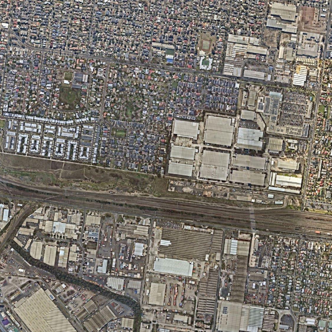
Tottenham Employment and Industrial Precinct
Fig5: Tottenham Activity Centre - Employment and Industrial Precinct. Data Sourced from DEECA Credit: E-Gene Chew
Client & Key Partners
Client
This report has been prepared for Maribyrnong City Council, which has identified issues with poor connectivity between North and South areas of Tottenham station, limited open space, vacant land and industrial buildings. Improvements to the area are needed, with the Activity Centre program being the main driver for this change, aiming to create a better living and working environemnt for current and future residents of the Tottenham Activity Centre.
To achieve the outcomes outlined in the document, Maribyrnong City Council will work in collaboration with key partners, including the Victoria planning authority, Department of Transport and Planning, Department of Health, Department of Jobs, skills, industry and regions, VicTrack, Bunurong Land Council, Wurundjeri Woi-Wurrung Land Council, as well as the local community and industries within Tottenham Activity Centre, whose visions will be integrated into the project.
Fig6: Client & Key partners
1.3 Role of Tottenham Activity Centre
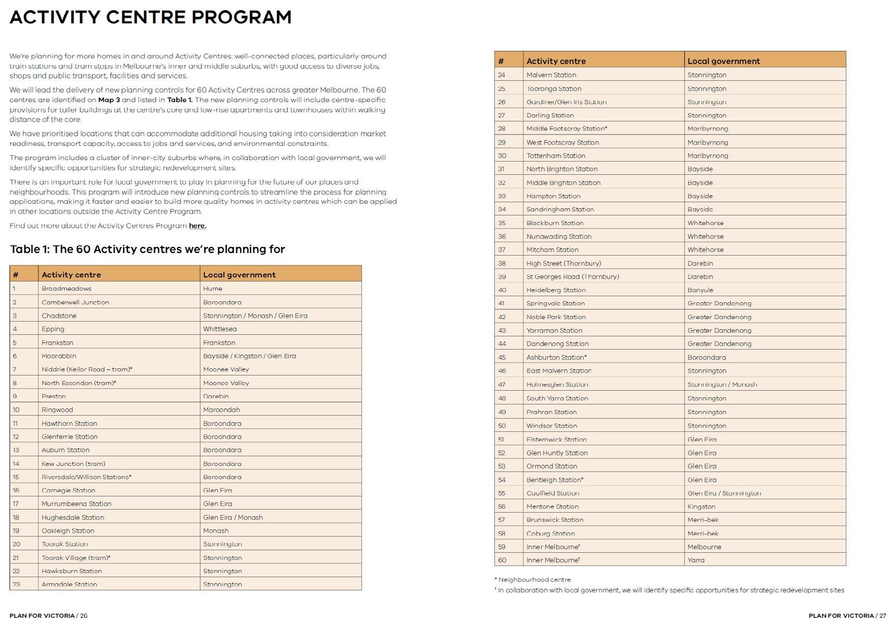
The Activity Centres Program is a State Government driven initiative to deliver more homes in activity centres, in close proximity to public transport, jobs and services. By 2051, the program aims to deliver over 300,000 new homes across more than 60 strategically identified activity centres across Metropolitan Melbourne. This program supports more Victorians to live closer to jobs, services, public transport and green and open spaces.
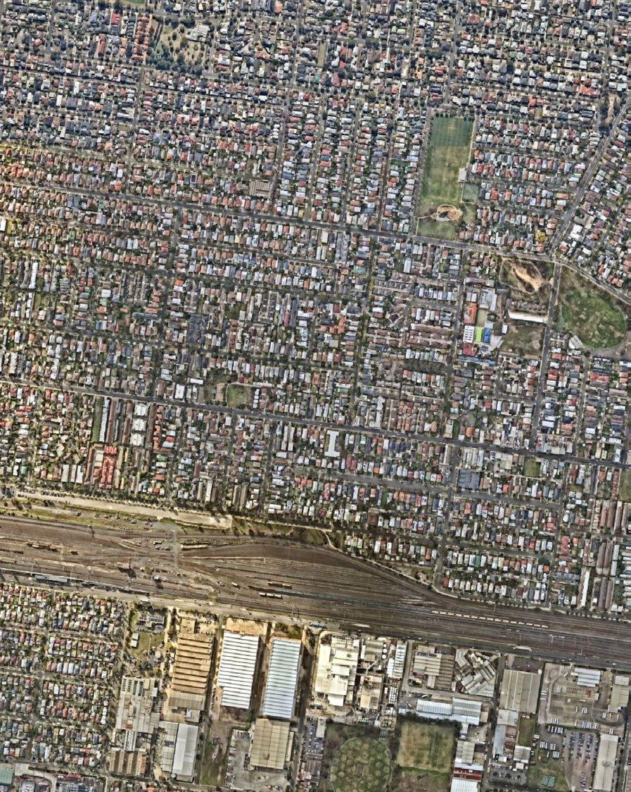
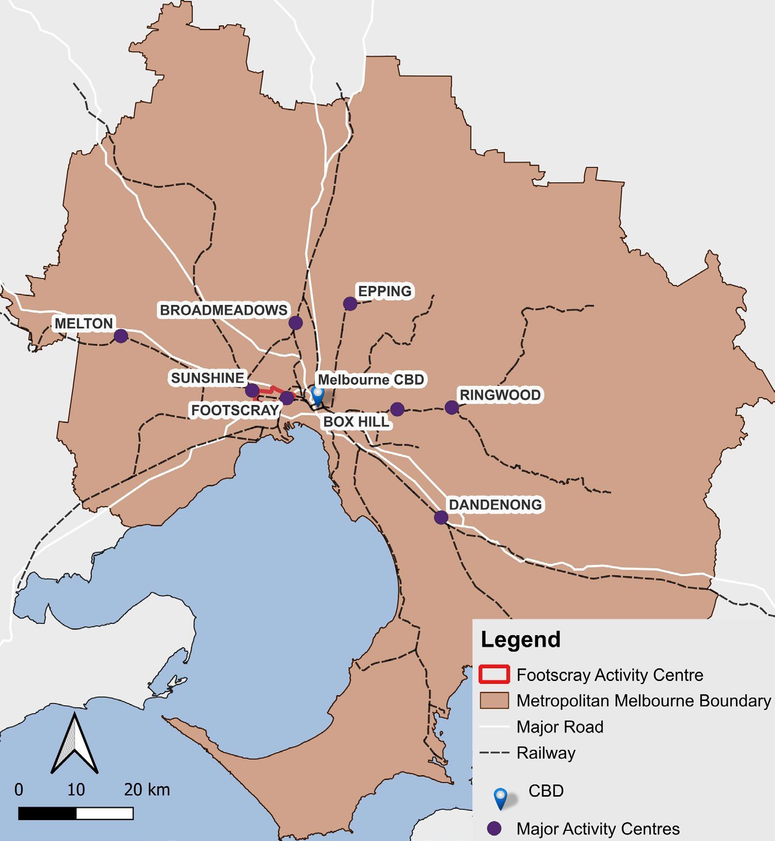
Footscray Activity Centres within Greater Melbourne context
Fig7: Footscray Activity Centres at a Greater Melbourne scale. Data Sourced from DEECA Credit: E-Gene Chew
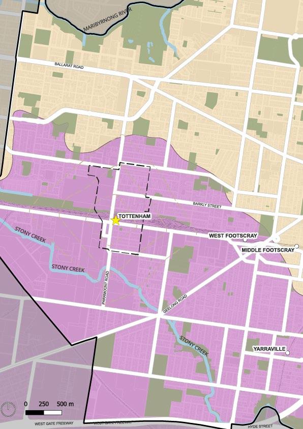
Context
2.1 Role of Tottenham Activity Centre
Tottenham is one of four Activity Centres in the west of Melbourne identified by the Victorian Government as part of the expanded Metropolitan Activity Centres Program. This makes the area a key investment priority to support the growing population of Melbourne’s western suburbs, while nurturing local jobs, sustaining the community’s industrial heritage and encouraging diverse, affordable housing options.
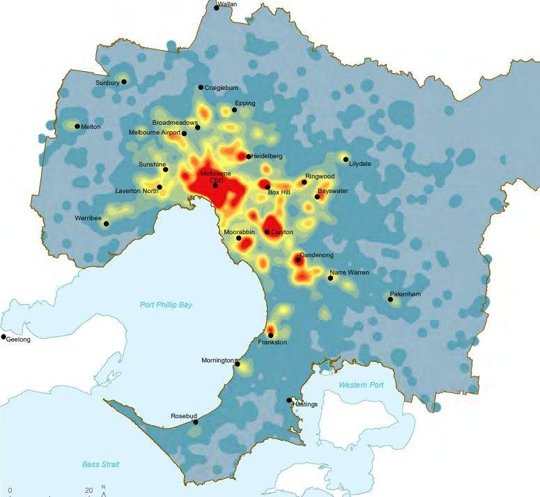
The State Government’s Plan Melbourne 2017–2050 identifies the spatial distribution of jobs across the city. Employment is predominantly located in Melbourne’s central and inner areas, while ongoing urban sprawl has contributed to an unequal distribution of jobs across the metropolitan region. (see Figure 8)
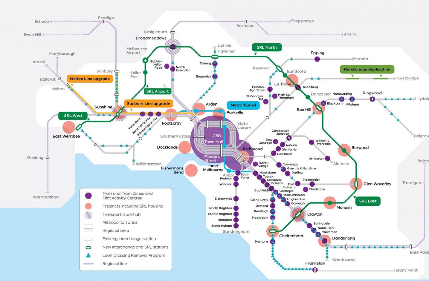
The Metropolitan Activity Centre Program focuses on planning to provide more homes in and around the places we live, work, socialise, and shop. The Metro Tunnel project’s completion later this year and the existing public transport network will better connect people to homes, shops and work in Melbourne’s west and south-eastern suburbs.
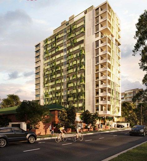
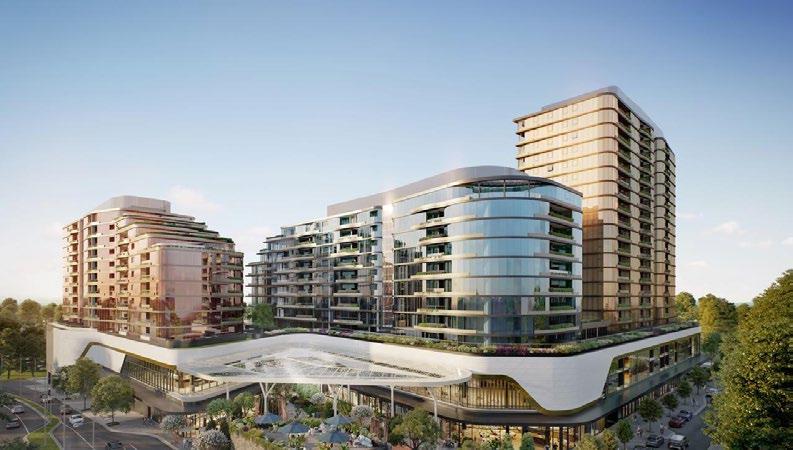
As a Metropolitan Activity Centre, Tottenham has the potential to provide more employment opportunities, housing, and open spaces that are well connected to public transport services to support Melbourne’s western suburbs to Melbourne’s CBD. Tottenham is located just nine kilometres from the Melbourne CBD and six kilometers from the Port of Melbourne, offering strong potential as a location for residential, employment, recreational, and investment opportunities.
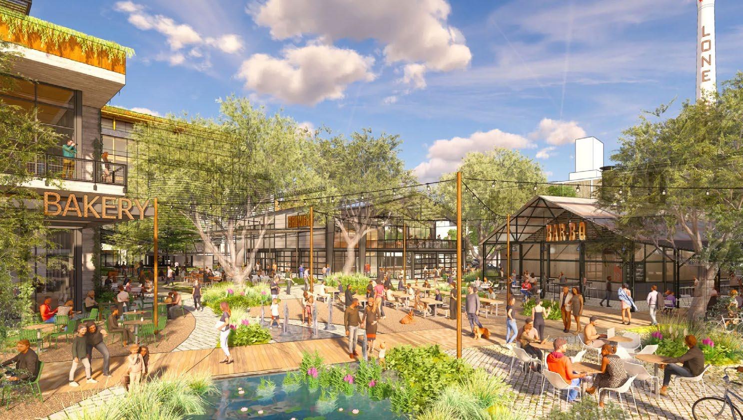
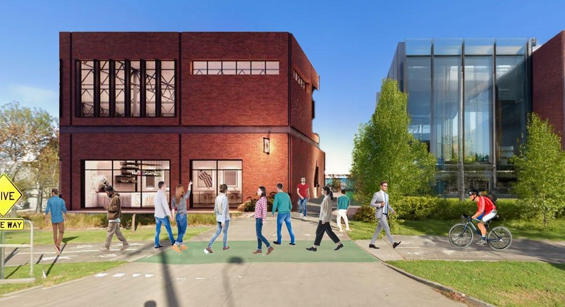
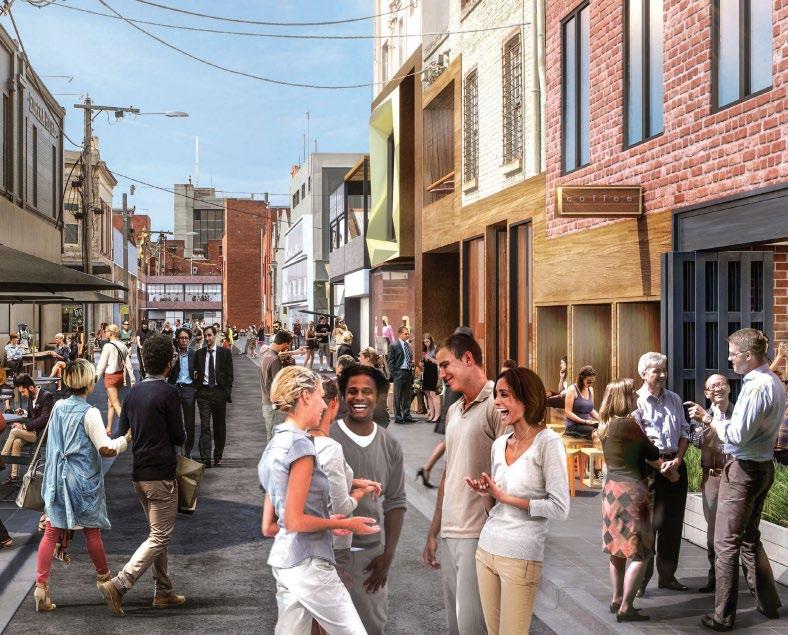
Fig9: Inspirational Render for Central West Precinct (Lake Flato 2025)
Fig8: Melbourne Job Density Heat Map (Victorian Government 2017)
2.1 Role of Tottenham Activity Centre
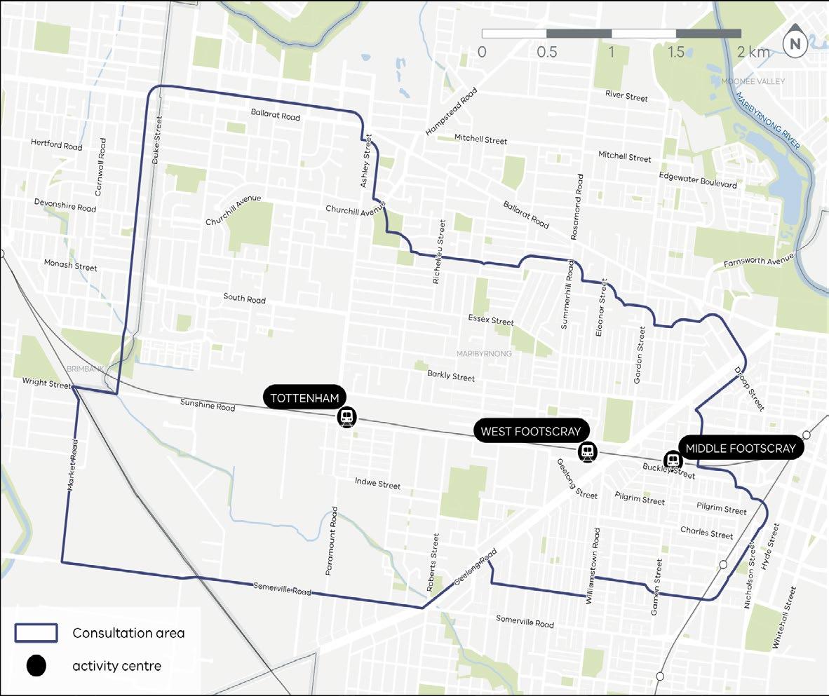
Fig11: Footscray Activity Centres (Engage Victoria 2025)
Fig10: Expanded Activity Centre Program (Planning Victoria 2025)
Fig12: Tottenham Activity Centre, Data Sourced from DEECA
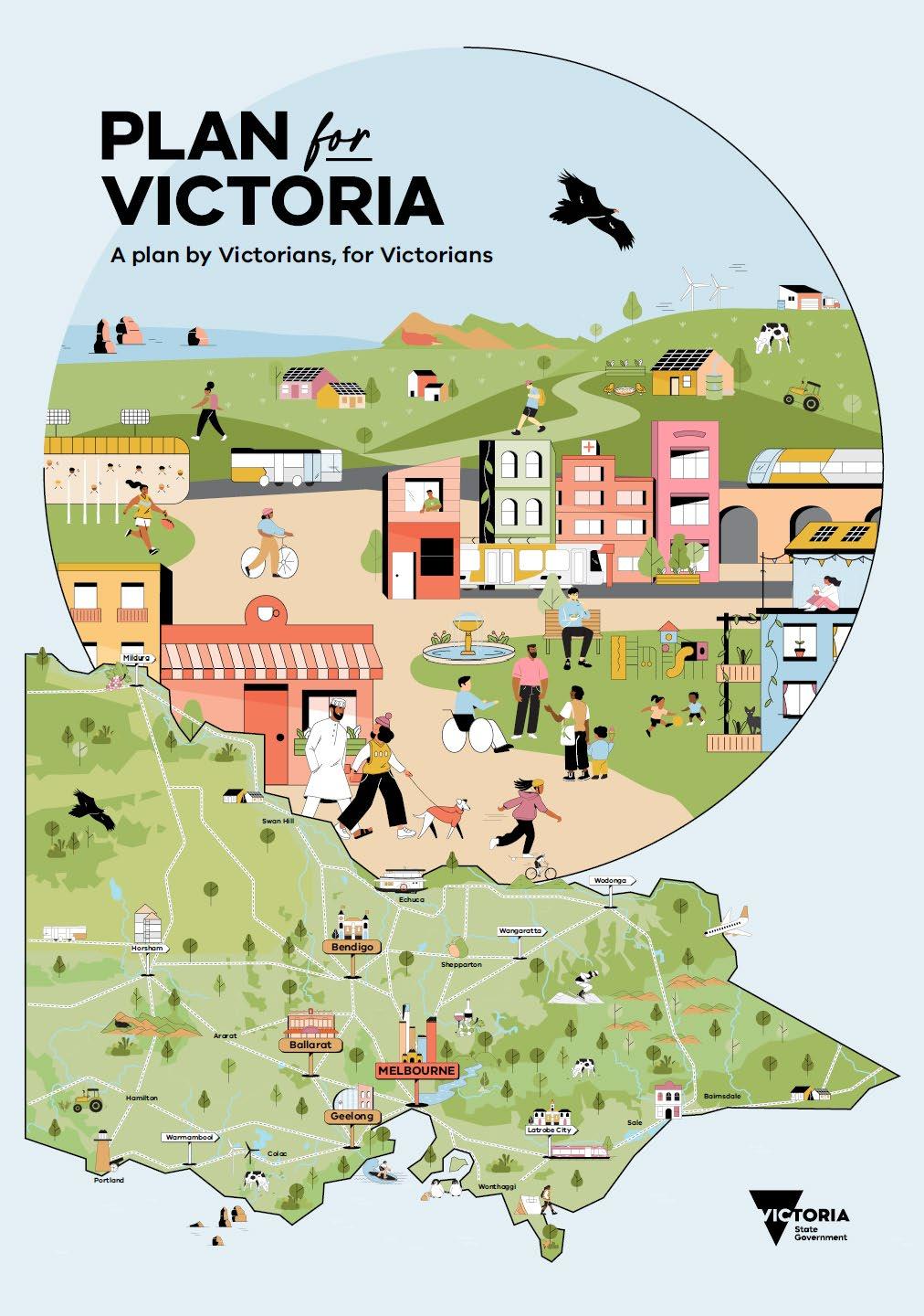
Plan for Victoria is the state vision on how Victoria will grow over time and aims to provide Victorians with quality housing, transport and employment by catering for their unique needs. The Activity Centre Program, as stated in Plan for Victoria is the main driver for the Tottenham Activity Centre project and plans for more homes around train stations, with Tottenham being identified as one of the three activity centres in West Melbourne. The housing target for Maribyrnong local government area is 48,000 homes.
Fig13:Plan for Victoria
Outlines strategies for managing industrial and commercial land to support economic growth and protect key industrial areas.
Statement outlines strategies to increase housing supply around activity centres and improve affordability.
Fig14:Melbourne Industrial and Commercial Land Use Plan
Fig15:Victoria’s Housing Statement 2024-2034
Identifies the role of Industrial precincts and outlines planning changes to support investment and development.
The strategy outlines providing additional, and improving existing open spaces to make them safe and accessible to the public.
Outlines improving quality of transport and creating a high quality environment in the activity centre.
Policy aims to protect and support industries in Tottenham while enhancing safety, and accessibility for works and public in the precinct.
Fig16: Maribyrnong Economic and Industrial Development Strategy October 2011
Fig17: City of Maribyrnong Open Space Strategy
Fig18: Central West Major Activity Centre April 2008
Fig19: Tottenham Employment Precinct Framework Plan For Maribyrnong City Council
2.3 Statutory Planning
Zoning
Industrial 1 Zone (IN1Z) - Zone designated for general industrial uses including logistics, warehousing and large-scale manufacturing.
Industrial 3 Zone (IN3Z) - functions as a buffer between industrial activities and residential zones usually accommodating light industrial use.
General Residential Zone (GRZ1)Supports multiple housing types including medium density housing and retention of neighbourhood character. It limits development to 11 meters and 3 storeys in height.
Commercial 1 Zone (C1Z) - Encourages mixed use commercial centres for retail, office, business, entertainment and community uses and residential services complementary to the scale of commercial centres.
Commercial 2 Zone (C2Z) - Encourages manufacturing, industries, bulk goods retailing, offices and other retail uses that do not affect safety of area.
Public Park and Recreation Zone (PPRZ) - Areas designated for public recreation and open space.
Mixed Use Zone (MUZ) - Supports a range of commercial, industrial and residential uses.
Public Use Zone (PUZ) - Land for public purposes such as services, health, utility.
Fig20:Land zones & Heritage overlay
2.3 Statutory Planning
Overlays
Land Subject to Inundation Overlay
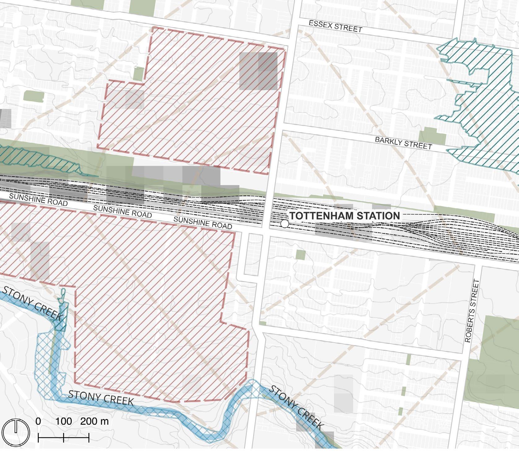
- The Stony Creek and its immediate surroundings have the land subject to inundation overlay. It applies to land that is flood prone and ensures that development is well-suited for the flood hazard. The overlay establishes guidance and standards on how sites respond to flood risk.
Special Building Overlay - The west and east of Tottenham station have a special building overlay. It identifies areas that are prone to flooding when drainage system capacity is exceeded, and ensures that development in these areas does not obstruct the passage of flood water.
Heritage Overlay - Highlights structures that protected for thier historical and development significance to Victoria, including industrial buildings shown on the map protected for their historical purpose and architectural style.
Fig21: Overlays map
Activity Centre Boundary Heritage Overlay
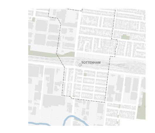
2.4 Tottenham Activity Centre
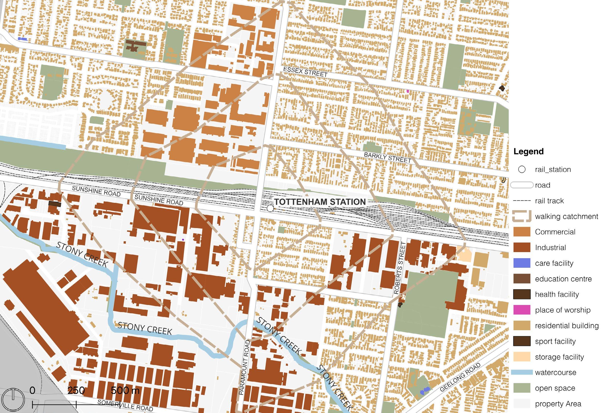
Land Use
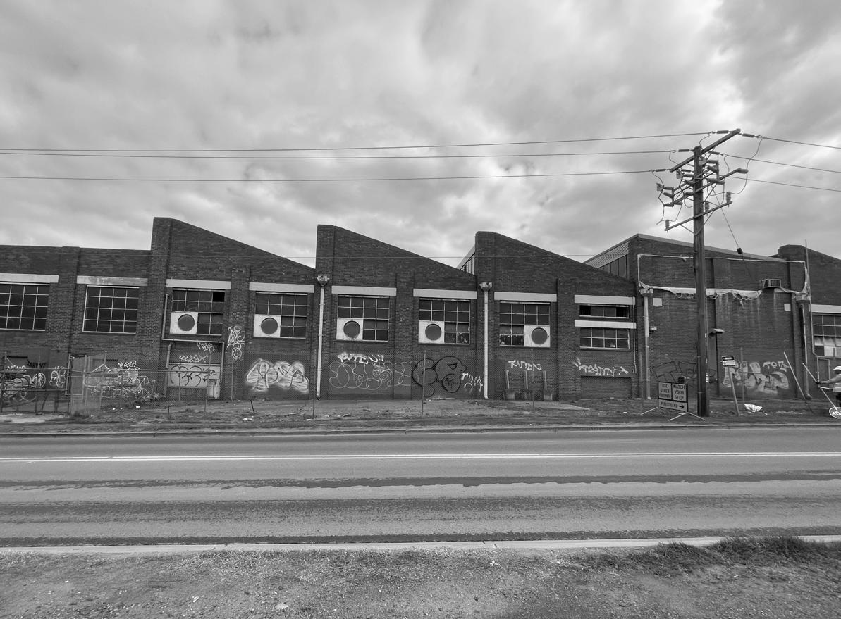
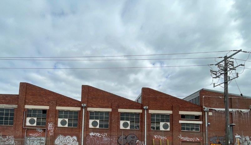
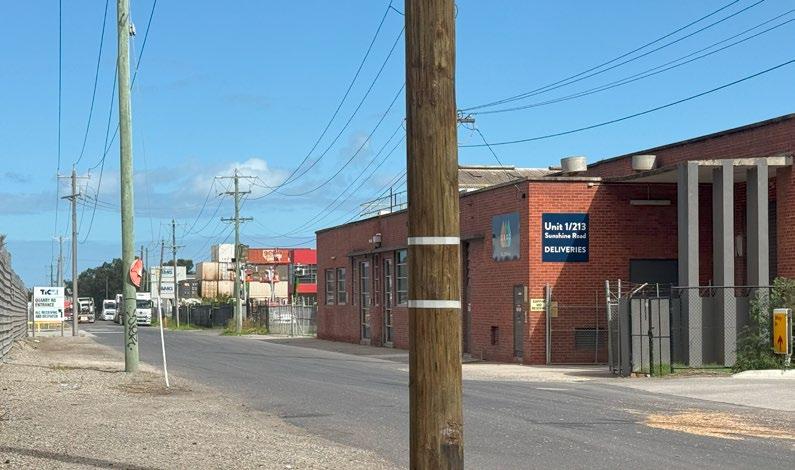
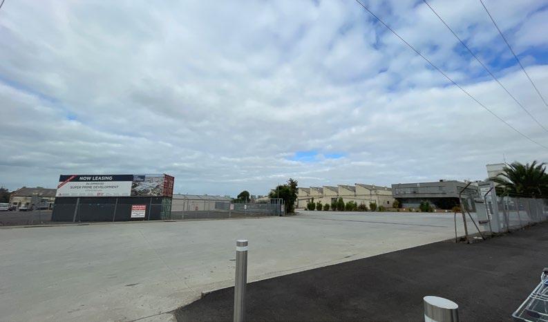
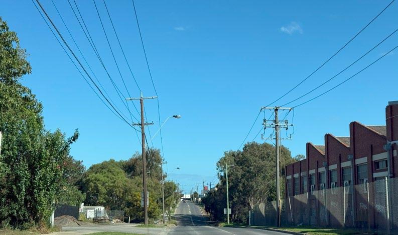
Manufacturing, logistics, and warehouse facilities define Tottenham, Victoria, a largely industrial area. With substantial industrial estates strengthening regional supply chains, its land use demonstrates a significant emphasis on employment. Tottenham offers chances for urban redevelopment despite its industrial setting by including mixed-use projects and sustainable infrastructure to improve environmental resilience and connectivity.
Braybrook and the Central West precinct, which are close to Tottenham, have a variety of commercial, residential, and industrial land uses. Redevelopment initiatives in the area have included better transportation connections and activity center layout. Braybrook is developing into a more integrated urban setting with an increasing focus on mixed-use zones, striking a balance between modern development and industrial heritage to promote community involvement and economic prosperity.
Fig22: Land use map of Tottenham Activity Centre. Credit: Tasmim Wahhab
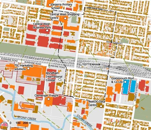
2.5 Key Attributes
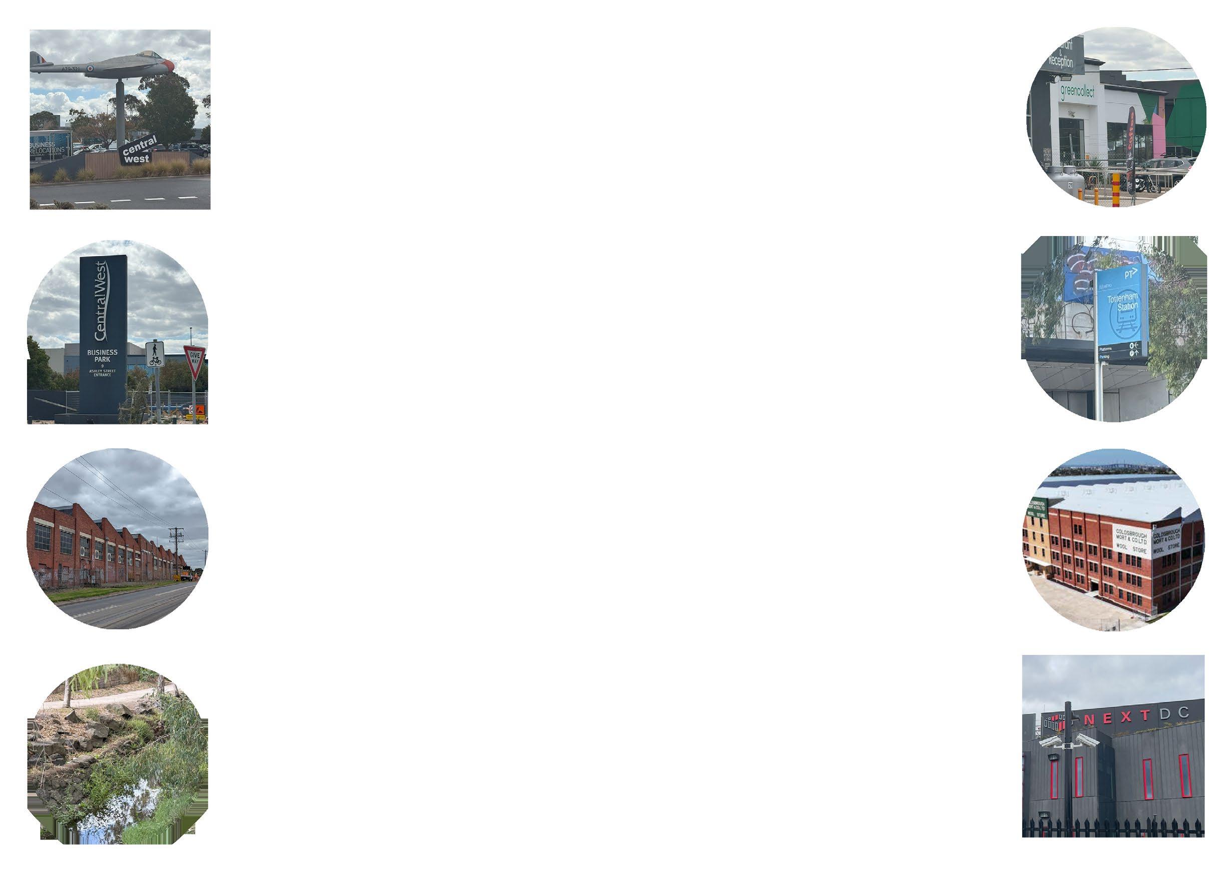
The Tottenham Activity Centre is defined by a range of key attributes, including strategic transport links, significant industrial precincts, heritage sites and commercial infrastructure.
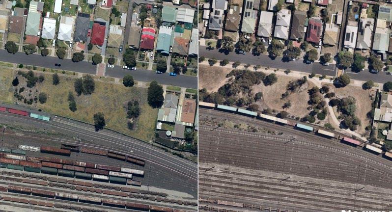
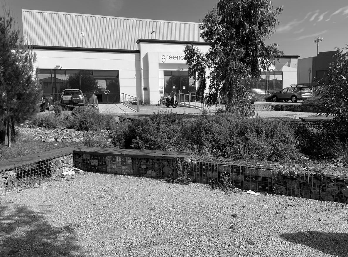
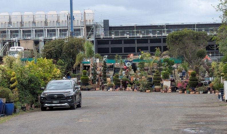
Tottenham Activity Centre is serviced by Tottenham station and is primarily industrial land. It includes two key industrial/ employment precincts, the Tottenham employment precinct and the Braybrook-Central Ashley street precinct which play a significant role in the area’s economy. Located 9 km west of Melbourne’s central business district, this area is well-positioned for logistics and freight operations. Central West Business park is a key employment hub containing both commercial and light industrial uses, while Central West shopping centre serves as a vibrant retail plaza providing amenities and services to nearby residents.
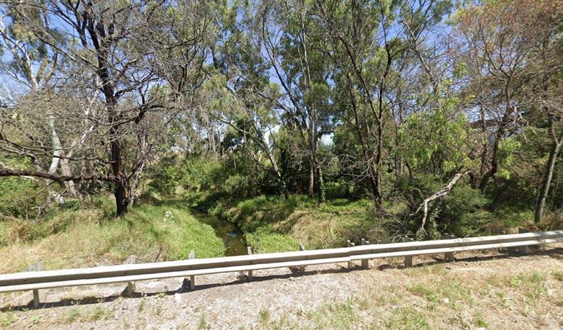
Stony creek runs through the south of Tottenham precinct, contributing to the local biodiversity. It is publicly accessible east of Paramount Road. The area also features the Goldsbrough Mort Wool store, a heritage listed building of regional significance due to its architectural style and historical purpose.
Fig23:Key attributes of activity centre
Tottenham Station
Next DC Data Centre Stony Creek
Business Park
Shopping Centre Braybrook Industrial Precinct
Tottenham Employment Precinct
Goldsbrough Mort& Co
Activity Centre Boundary
Tottenham Employment Precinct
Braybrook-Central West Activity Centre Open Space
Indigenous Context
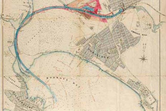
Tottenham is located on the lands of the Wurudjeri Woi Wurrung and Boon Wurrung Bunurong people of the Kulin Nation. A connection to country continuously for 40,000 years and emerging. Their meeting points between the Maribrynong river and the Stony Creek served as a significant place to meet, trade and engage in cultural exchanges.
The name Maribrynong originates from the term; ‘Mirring-gnay-birnong’, translating to ‘I can hear the ringtail possum.’ the name highlights the connection to land, country and the environment they steward.
Understanding indigenous culture is essential in shaping a Tottenham that supports ecological diversity and fosters respectful, sustainable land management through a deep connection to ancestral lands.
Registered Aboriginal Parties in Maribrynong
Photo of a large Eucalyptus Tree neighboring the Stony Creek. (Local Council, 2025)
Fig24:Aboriginal parties map
Place History
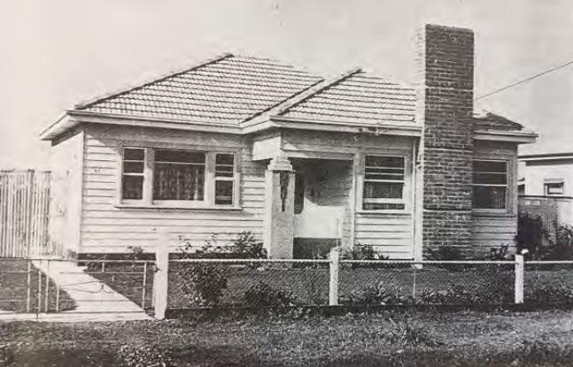
Tottenham has had a long history of being a centreplace for employment since the early 20th century, heavy industry expanded. Major chemical engineering factories, wool trade centres and transport hubs were built along the north and south side of the railway track. Thereafter becoming a major residential precinct with postwar development.
Moreover, the identity associated with Tottenham to this day and continued to be as a backbone of transportation and warehousing for businesses, but there has been a decline in the use of heavy industries with the lack of demand for chemicals related to explosives in the area, now staying as a major warehousing area due to its strategic point between the port and the CBD.
The direction of Tottenham, with the land use and diverse growth of other sectors such as data centres build a character of ambiguity and potential for what Tottenham can be in the future, under the background of highly diverse cultures, age groups and professions for the future.
Source: Facebook; Old Time photos of yesteryear
1839 a punt was established on 'Saltwater River'
Tottenham railway station was built and opened for passage traffic Railway Marshaling and gravitation yards established in the area 1910 residential development of Footscray West
1891
1956
Decline of heavy industry and rise of warehousing
- 1980S 1990S - 2010S
Post-war industrial development
Fig25:Timeline
Source: Maribrynong City Council
Source: Sunshine Historical Society
2.8 Demographics
The demographics between Tottenham and Greater Melbourne highlights why Tottenham can be a key employment and industrial precinct within Melbourne’s west.
Tottenham’s population is forecasted to grow by 40% by 2051. The precinct is a key driver of industrial activity, supporting future job opportunities for local residents. The development and revitalisation of industrial areas such as the Central West Business Park will generate a diverse range of employment options. This growth underscores the importance of providing appropriate housing for workers within the employment and industrial precinct.
Comparing the demographics between Greater Melbourne and Tottenham* (see Figure 26), it identifies key characteristics of the local population. The median age in Tottenham is 35 slightly lower than that of Greater Melbourne of 37. Additionally, tertiary education is the most attended educational institutions in Tottenham (30%) and Greater Melbourne (27%). This implies the need to also provide affordable housing for the nearby Victoria University students.
Comparing the diversity between Greater Melbourne and Tottenham (see Figure 27 and 28), it reveals the slight decline in overseas-born residents in Tottenham (from 45% in 2016 to 40% in 2021), whilst Greater Melbourne remained relatively unchanged. While Australian-born residents in Tottenham continued to be the most prevalent, their share increased by 6% (55% to 61%). This highlights shifts in Tottenham’s cultural composition over time, which may suggest a stabilising migrant population or changes in settlement patterns.
*There was insufficient ABS data for Tottenham alone, thus ABS data from West Footscray-Tottenham was used Understanding the changing demographics is essential to inform future urban planning and design in the area.
Fig27&28: Country of Birth Comparison 2016 & 2021; Data Sourced from ABS
Fig26: Demographic Infographic; Data Sourced from ABS
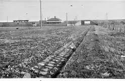
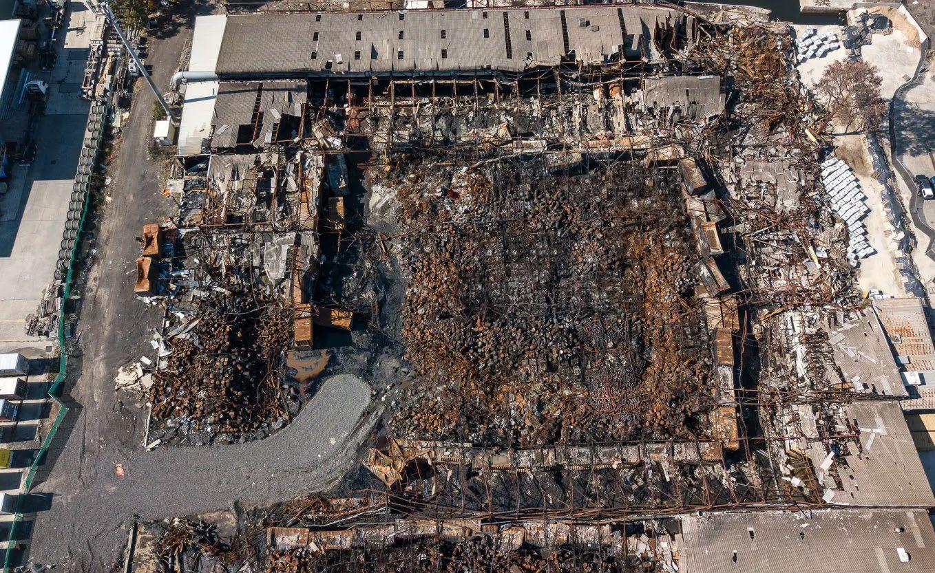
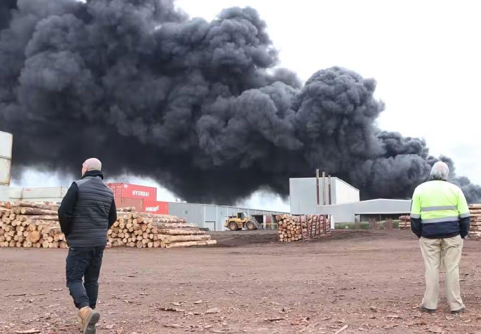
Tottenham Industrial Fire
In August 2018, Tottenham experienced a significant industrial fire that originated in an illegal chemical storage facility.
The blaze, which burned for several days, released a wide trange of hazardous substances into the air, including solvents, paint thinners, and toxic industrial waste. The event underscored the dangers of unregulated chemical storage and poor oversight in industrial zones, particularly those in close proximity to residential neighbourhoods.
The fire’s environmental impact was particularly devastating for Stony Creek, a key ecological corridor in the area. The waterway, which serves as a natural habitat for a variety of species, was severely affected by the runoff and airborne pollutants. Chemicals seeped into the creek and surrounding soil, leading to fish kills, habitat destruction, and a reduction in the ecological integrity of the area. The incident highlighted the vulnerability of urban ecosystems situated near industrial land uses.
For residents, the fire triggered acute concerns regarding air quality and long-term exposure to contaminants. Many inhabitants reported respiratory discomfort, and the psychological toll of living in such proximity to toxic plumes was considerable. The incident revealed deep-seated challenges in land-use planning, particularly the need for stronger environmental protections, industrial regulation, and community safeguards in suburbs like Tottenham.
Fig29: The site of the chemical fire in Tottenham. Credit: Justin McManus
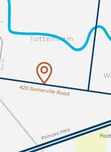
Fig30: Location of the fire incident, Source: EPA Victoria
Fig31: The fire incident resulted in black fume, Source: AAP
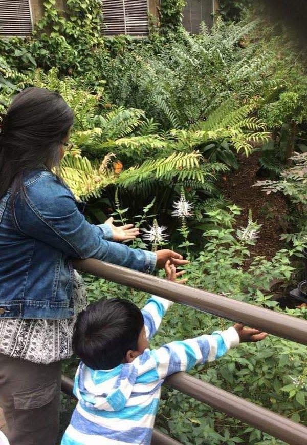
Story of Shamima and her son
Despite the convenience of living near the city, the environmental risks associated with Tottenham’s industrial character have remained an ongoing source of anxiety for her as a parent.
Shamima, a long-time resident of Rupert Street, has lived adjacent to North Street and the Tottenham Station for over sixteen years. Originally from Bangladesh, Shamima migrated to Australia with hopes of securing a better future for herself and her son. She values the convenience of inner-suburban life—proximity to services, employment, and active transport options. Working at Woolworths and commuting primarily on foot or by public transport, she has developed a strong sense of attachment to her local neighbourhood.
However, the 2018 chemical fire brought a wave of uncertainty and concern into her life. She vividly recalls the thick, dark smoke rising from the industrial site and the sharp chemical odours that lingered for days. Since then, Shamima has questioned whether the air her son breathes is truly safe. Despite the convenience of living near the city, the environmental risks associated with Tottenham’s industrial character have remained an ongoing source of anxiety for her as a parent.
Beyond environmental concerns, Shamima has also expressed unease about the Tottenham Station precinct. The underpass and adjacent areas have often felt unsafe or poorly maintained, discouraging her from letting her son walk alone. Over the years, she has witnessed some positive changes—like the transformation of Lions Park, which was once an unlandscaped patch of greenery into a more walkable and welcoming space. Yet, for Shamima, these improvements are just the beginning of what the neighbourhood truly needs.
Fig33: Location of Shamima’s home where she’s been living for the last 16 years
Fig32: Lions Park 2010 (left) vs 2025 (right)
Fig34: Shamima and her Son
Vision
“Tottenham Activity Centre will dramatically transform into a centre for economic and residential growth and ecological renewal, while respecting its industrial roots. it will transform into a thriving community-led precinct that is safe and enjoyable to wander.”
1. Biodiverse and Ecological
A community that is well integrated with its natural ecosystem, is environmentally sustainable and wellprepared for the impacts of climate change.
2. Diverse Housing and Community
A connected community that celebrates its diversity and has easy access to a wide range of activities, services and retail.
3. Connected and Safe
A community that has strong connections between facilities and residential areas and has easy access to public transport and wider region.
4. Employment Retail Innovation and Renewal
A community with a strong sense of place that celebrates the area’s natural assets with high quality public realm and built form design.
7% green canopy
Lack of open space north of the station 49.6% are in low density residential homes
dwellings
poor connection to north and south of the train station
Unsafe underpass and streets from the station
85% of people working in the commercial precinct drive to work 49.3% of the commercial precinct is utilised as warehousing space
Introduce a minimum 17% canopy cover and open space
enriched biodiversity along the rail corridor and Stony Creek
Addition of 20% affordable housing
Increase number of medium density dwellings by 3500
Consolidate parking spaces by 20%
Fully uplift and upgrade Tottenham Station Underpass
Decrease journey to work by 30%
Increase commercial and retail employment per hectare by 50%
Strategies and Actions
4.1 Key Issues
Transport and Connectivity
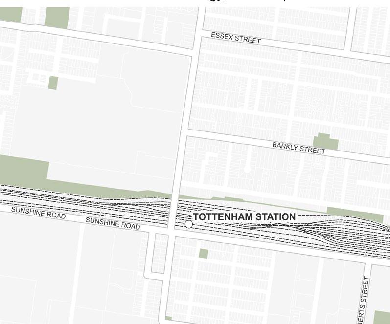
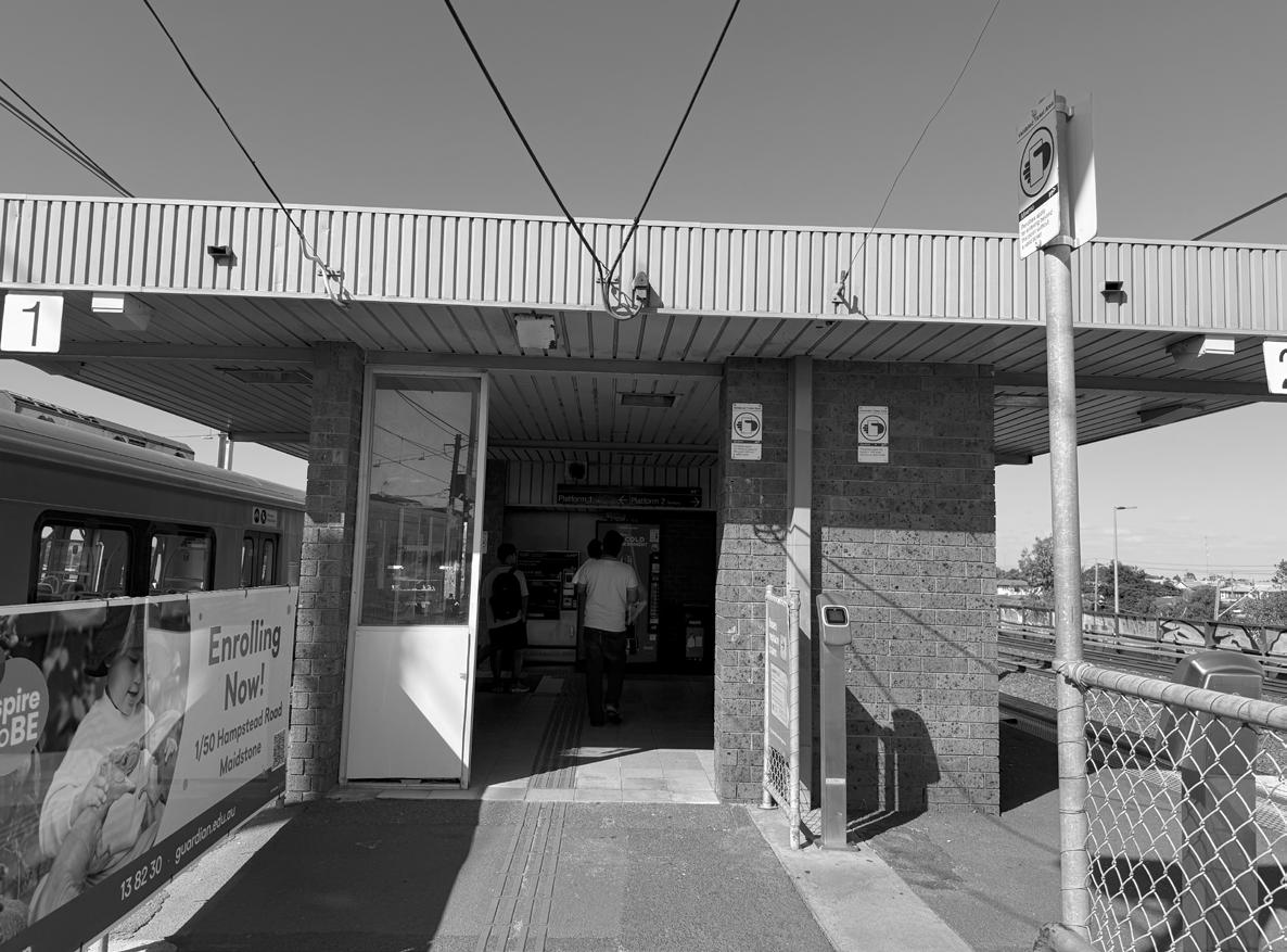
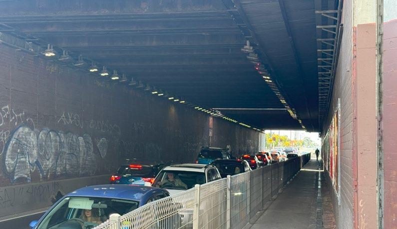
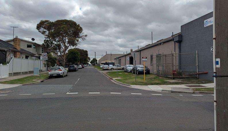
Tottenham station and the underpass are outdated and feel unsafe for users passing through and generally lack a pedestrian focus. The underpass only has one two-way path for both pedestrians and cyclists making connection between North and South of the station poor.
Land use
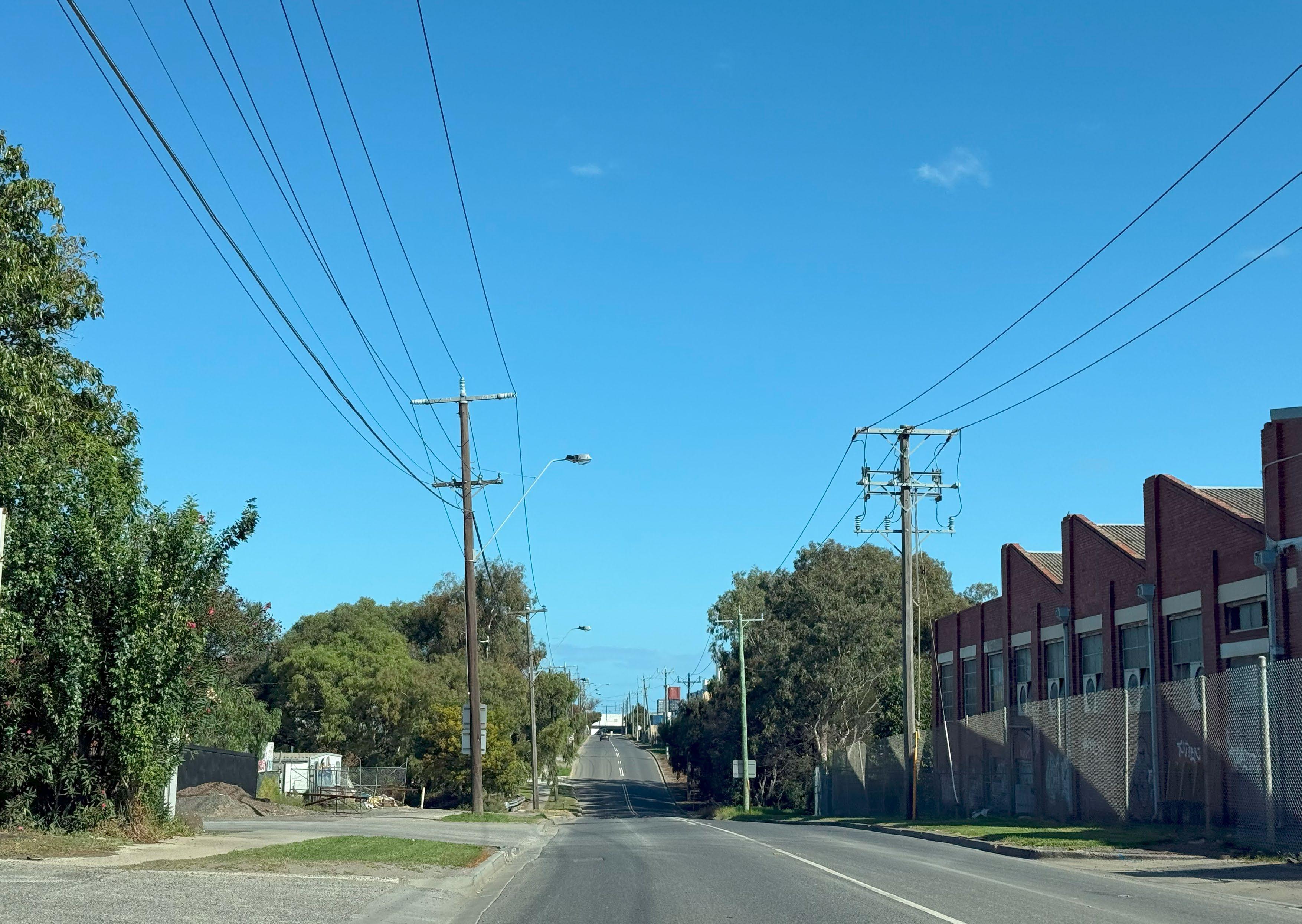
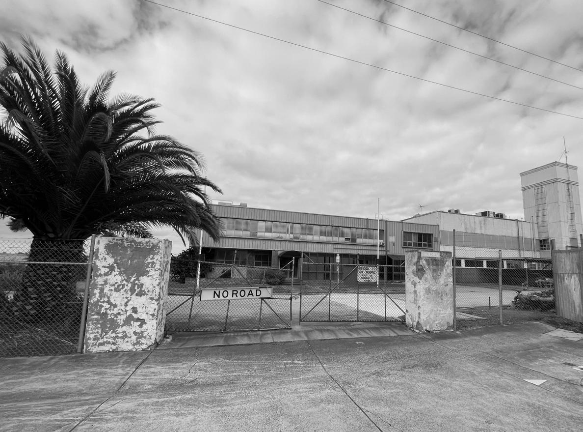
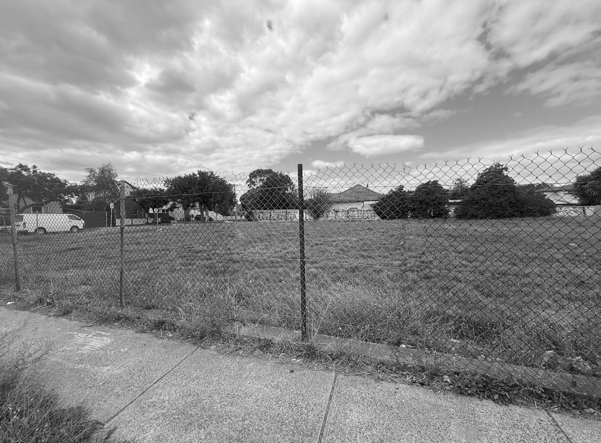
There are some unused plots of land nestled between existing housing along Paramount road and Barkly street that have the potential to support new housing development. There’s also an issue of vacant industrial buildings in Tottenham.
Transport & Connectivity
Land Use
Fig35:Tottenham Station
Fig37:Unused land along Paramount Road
Fig38:Vacant industrial building along Paramount Road
Fig36:Tottenham industrial area
4.1 Key Issues
Open spaces
The area has limited open spaces with some like Stoney Creek restricted to the public and employees, as ownership around this area of the creek is private. Tottenham only has 4% open space and 6309 trees, (Urban Forest, 2024) with the area experiencing urban heat island effect.
Built form & Typology
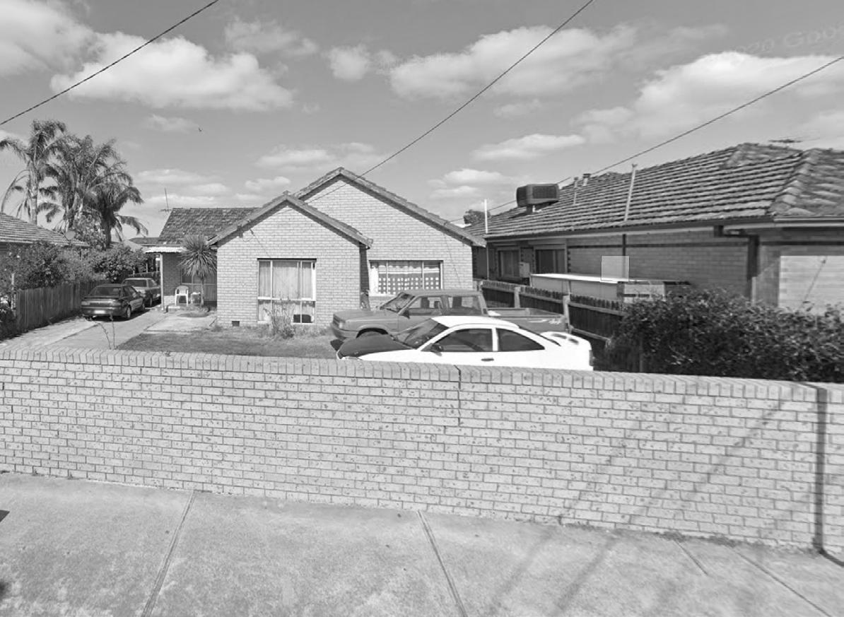
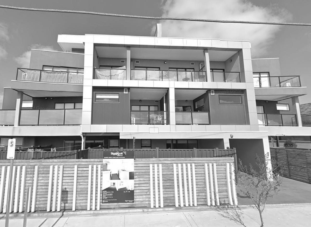
Majority of the housing in Tottenham and Braybrook is low rise, single family housing as witnessed along Barkly Street. Some of the newer housing has a generic style that does not fit into this area. Future housing to reflect the character of this area.
Open Space
Built Form & Typology
Fig39:Inustrial area, Braybrook Ashley Street
Fig41:House along Barkly Street
Fig42:Apatments along Barkly Street
Fig40:Stony Creek
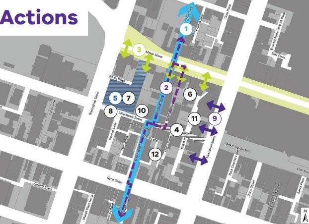
4.2 Strategies and Actions
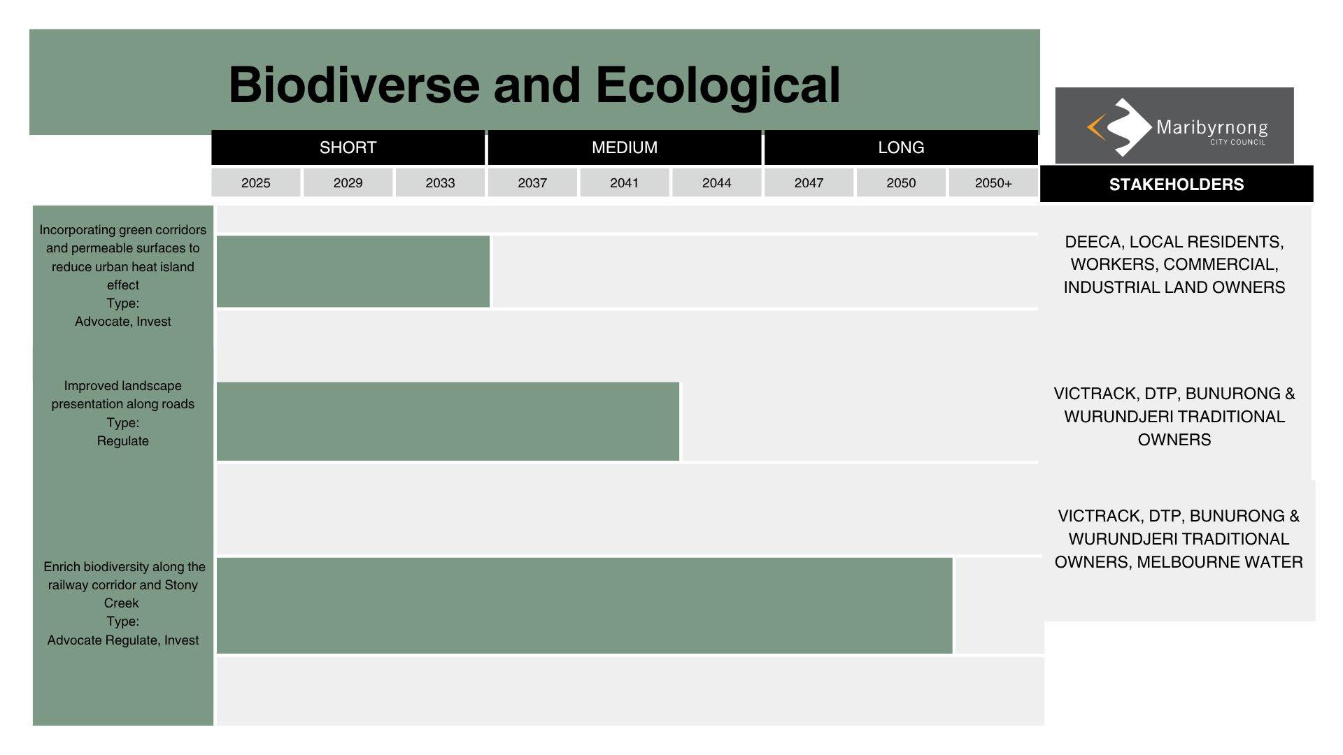
Biodiverse and Ecological
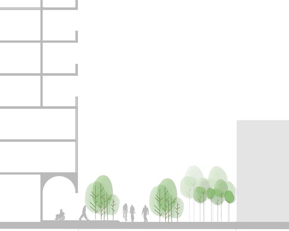
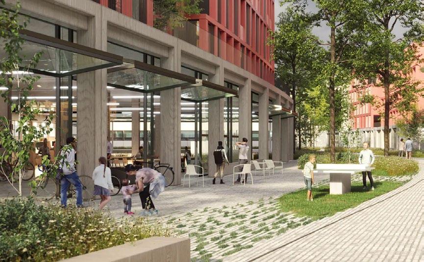
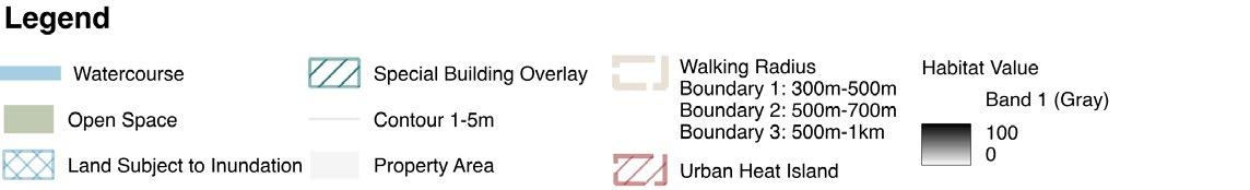
Strategy 1 - Incorporating green corridors and permeable surfaces will reduce the urban heat island effect. The proposed ecological corridors will run through the industrial land from the south-west of the station and the commercial land, north-west to the station. The proposed permeable pedestrian walkways will help to absorb and filter the stormwater.
Strategy 2 - Enriching biodiversity along the railway corridor and Stony Creek will help to increase the habitat value. The green corridor will connect the Braybrook Grassland and Stony Creek to the currently underutilised and parking space situated north of the station. All the built forms in this region will contribute to boost the biodiversity in the vertical layer as well.
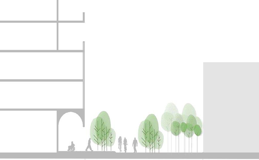
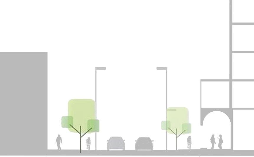
Strategy 3 - Improved landscape presentation along the Ashley St that becomes Paramount road near the Stony Creek in the south of the station, Barkly St, Stanhope St in the north of the station will create a unified identity of the space, connecting the north and south of the station through similar landscaping.
Fig45: Improved landscape presentation along roads. Credit: Tasmim Wahhab
Fig44: Enrich biodiversity along the railway corridor and Stony Creek. Credit: Tasmim Wahhab
Fig43: Incorporating green corridors and permeable surfaces (Cobe 2021)
Fig46: Biodiverse and Ecological Strategy Map. Credit: Tasmim Wahhab
Diverse Housing and Community 4.3 Strategies and Actions
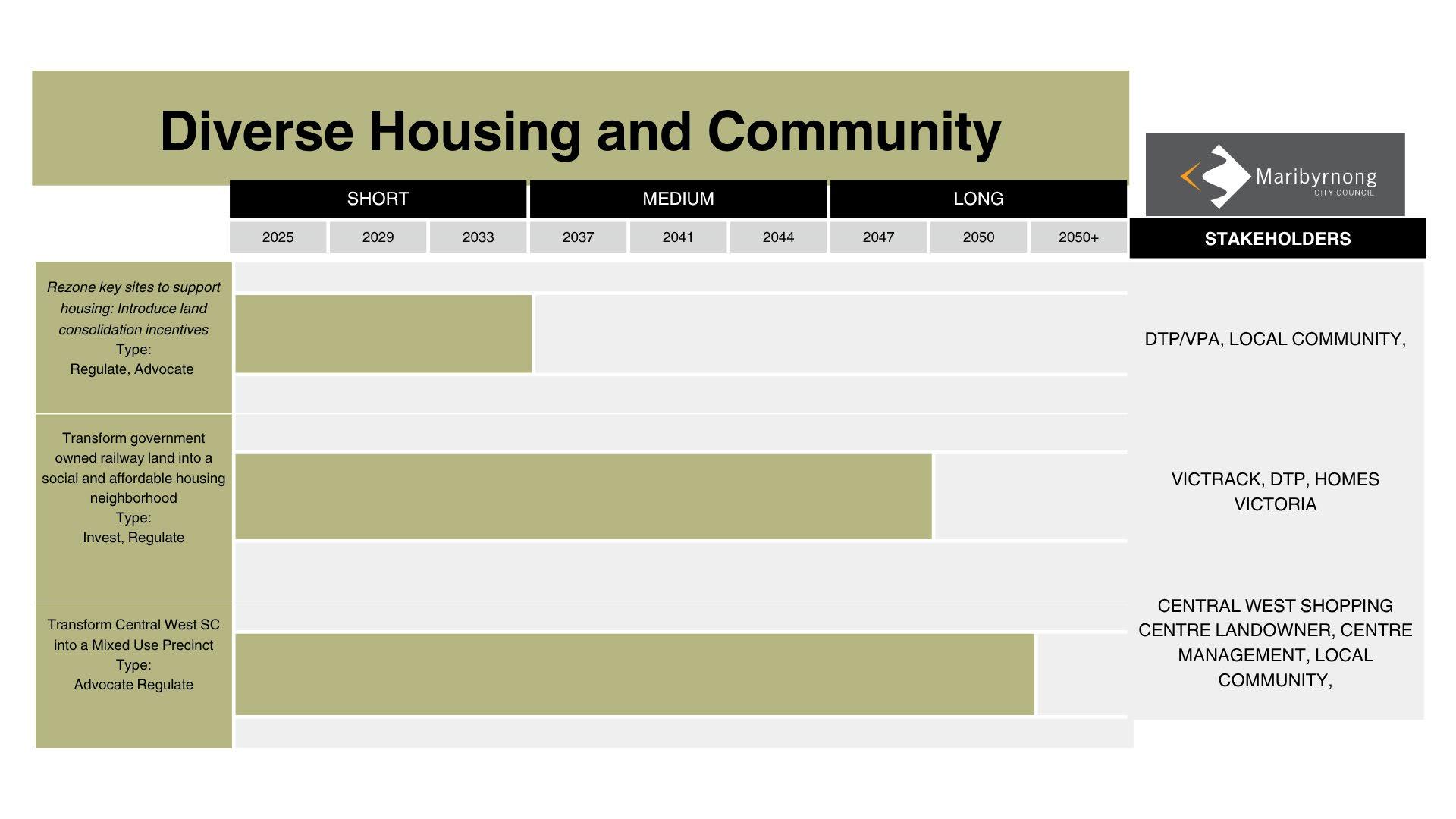
Action 1 - Rezoning key sites along Barkly Street to support housing. Introducing land consolidation incentives supports coordinated redeveopment, enabling mediumdensity housing and mixed use projects to foster stronger sense of community.
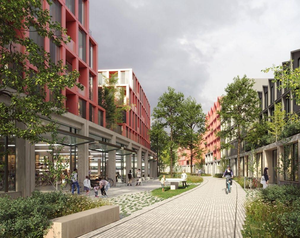
Action 2 - Transforming underutilsed government owned railway land into a high-density social and affordable housing neighbourhood. This contributes to the housing targets set out by the State Government for the Maribyrnong municipality and to provide diverse housing and foster a stronger sense of community throughout the activity centre.
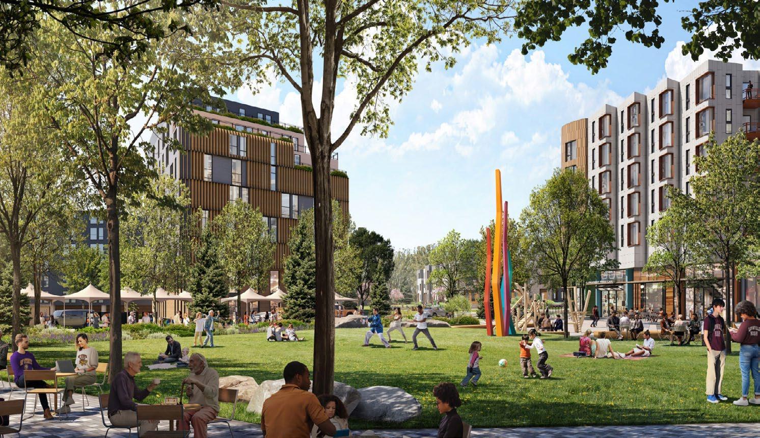
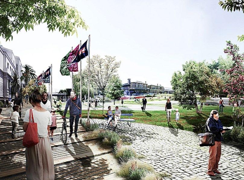
Action 3 - Transforming Central West Shopping Centre into a mixed-use precinct integrates medium-density housing, community facilities, and diverse commercial uses, helping to activate the area, support local jobs, and improve access to services, public space, and transport for surrounding industrial and residential communities.
Fig49: Inspiration render of Central West Shopping Centre transformation into a Mixed-Use Zone (MUZ) (Stonestown Reimagined 2025)
Fig48: Transforming underutilised railway for affordable housing (Clarke 2018)
Fig47: Land Consolidation incentives to support housing (QLD Government n.d.)
Fig50: Diverse Housing and
4.4 Strategies and Actions
Connected and Safe
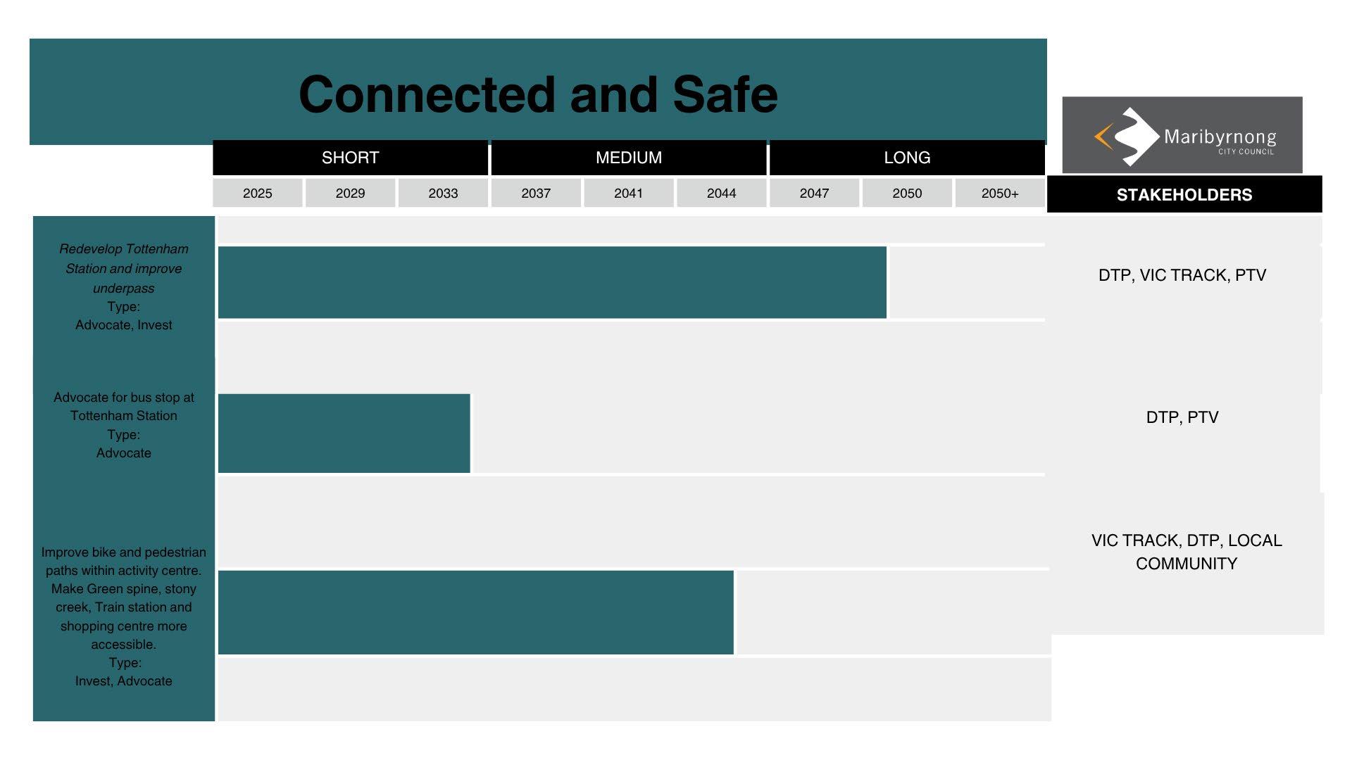
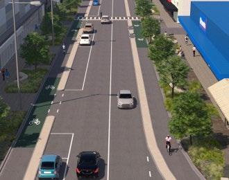
Action 1 - Upgrade Tottenham train station and the underpass to improve pedestrian safety, accessibility and connectivity. The development includes enhanced lighting, signage and separated bike and pedestrian lanes. It also presents the opportunity to incorporate art on the underpass walls and shops to improve pedestrian experience, and reduce anti-social behaviour.
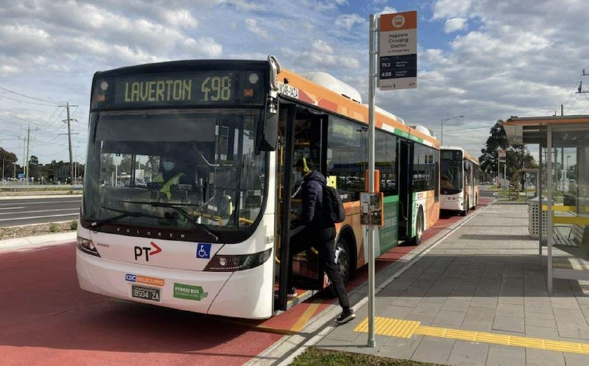
Action 2 - Advocate for a bus stop at Tottenham station to enhance public transport connectivity. This would ensure a smooth transition between bus and train services making the station more accessible for commuters.
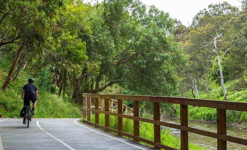
Action 3 - Improve bike and pedestrian paths within the activity centre to support safe and accessible active travel. This offers the opportunity to make the portion of Stony creek that runs through the industrial zone accessible to the public, and introduce a shared pedestrian and bike path.
Fig53:Yarra Trail (Lug+Carrie 2022)
Fig52:Hoppers Crossing Station Bus Stop. (ABC News: Margaret Paul 2022)
Fig51: Macdonaldtown station upgrade render (NSW Transport, 2025)
Fig54: Connected and safe map
4.5 Strategies and Actions
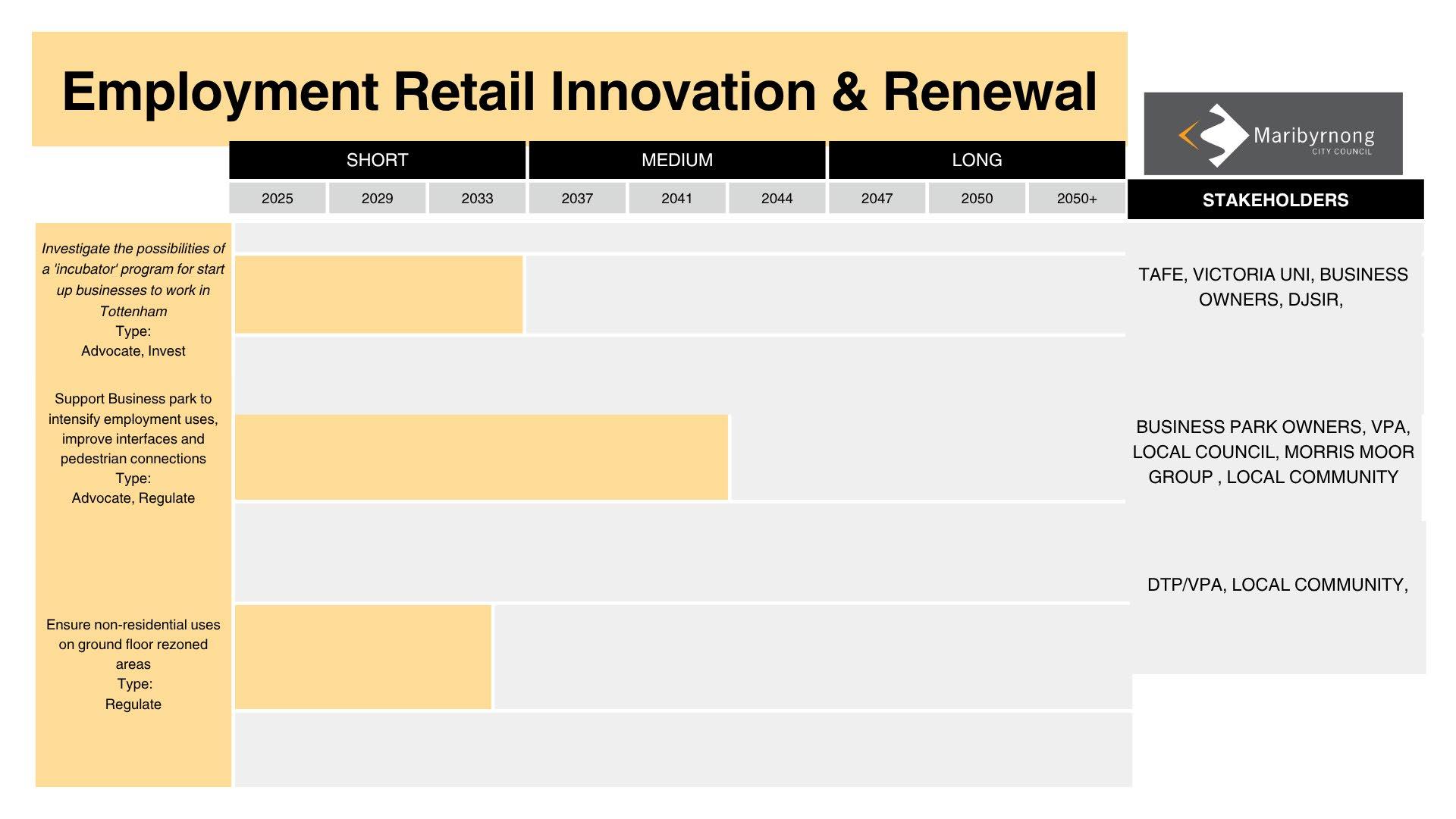
Employment Retail Innovation and Renewal
Strategy 1 - Investigate the possibilities of a ‘incubator’ program for start up businesses to work in Tottenham, an incubator program is a dedicated initiative aimed at nurturing early-stage businesses and fostering local innovation. This incubator would catalyse economic development, job creation, and community empowerment through a common commercial retail space within the precinct.
Strategy 2 - Support business park to intensify employment uses, improve interfaces and pedestrian connections; This presents an opportunity to enhance walkability and reintroduce to the western end of Ashley Street, specifically toward the station. These improvements can strengthen accessibility and connectivity for commercial businesses and locals within the commercial precinct and extend benefits to similar intersections south of the station.
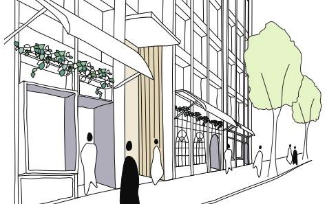
Strategy 3 - Ensure non-residential uses on ground floor rezoned areas; Mandating these uses on the ground floors of mixed-use zones, particularly in the Central West Commercial and Retail precinct. Activating the public Realm, from ground-floor commercial, retail, or community uses, it encourages pedestrian activity, and fosters a sense of place.
Fig58: Employment Retail Innovation and Renewal
Fig57: Ensuring ground floor use in daytime and nighttime use. (Planning.Vic, 2025)
Fig55: Potential space to turn into a creative hub for this program (Council, 2025)
Fig56: Example of good ground level interfacing (Central Melbourne Design Guide, 2025)
Implementation
5.2 Implementation
Timeline
While the full ecological benefits of large-scale planting take time to be fully realised, particularly in terms of fauna growth and habitat establishment, immediate action is essential to begin mitigating the urban heat island effect. In the short term, the creation of green corridors through widespread planting of local and indigenous flora should be prioritised.
Improving the landscape presentation along key roadways is a complex, medium-term goal. It will require coordinated planning, regulatory support, and collaboration with various stakeholders, especially given the number of streets involved and the jurisdictional responsibilities of different landowners and partners. Strategic replanting and streetscape enhancements must be carefully staged to ensure consistency and long-term maintenance.
Enriching biodiversity along the rail corridor presents a significant longterm opportunity. This will demand a multi-stakeholder approach involving regulation, advocacy, and investment. The successful establishment of a biodiverse rail corridor will depend not only on planting but also on habitat connectivity, ecological monitoring, and ongoing stewardship.
Fig59: Bio Diverse and Ecological Strategy Timeline
5.3 Implementation
Timeline
Rezoning key sites to support housing supply will require land consolidation incentives, through strong regulation and advocacy. While this process can begin immediately, its implementation is likely to span the medium term through a consultative approach with landowners and local residents. Securing alignment among stakeholders will be essential to ensure that rezoning efforts are equitable, and responsive to community needs.
The transformation of governmentowned land into social and affordable housing represents a longer-term initiative. This process involves not only the construction of housing but also significant investment in landscaping, infrastructure, and regulatory alignment. Integrating these developments with broader green corridor strategies to ensure that environmental and social housing are achieved.
The redevelopment of Central West into a mixed-use precinct will be a complex, long-term undertaking. It will require extensive coordination with existing landowners and businesses to ensure a smooth transition. Advocacy for rezoning approvals to support increased residential development must be paired with tailored regulatory frameworks that accommodate current uses while guiding future growth.
Fig60: Diverse Housing and Community Strategy Timeline
5.1 Implementation
Timeline
Redeveloping Tottenham Station and upgrading the adjacent underpass is a significant long-term initiative, primarily due to the complexity of coordinating with key stakeholders and the substantial financial investment required. However, due to the scale and cost, this project will require careful planning, implementation, and advocacy.
Advocating for the introduction of a new bus stop near the station represents a more immediate and achievable action. As surrounding projects increase demand for public transport, a strategically placed bus stop could significantly improve local connectivity.
Improving pedestrian and cycling infrastructure within the activity centre is a high-priority, medium-term task. Enhancing active transport links will make Tottenham more accessible and encourage sustainable travel. However, this requires advocacy and negotiation, as proposed paths could intersect with multiple landowners, road networks, and existing infrastructure. Initial investment in design and delivery will be necessary in the connectedness of Tottenham.
Fig61:Connected and Safe strategic timeline
5.4 Implementation
Timeline
Exploring the potential for a local business incubator program presents a valuable opportunity to stimulate the local economy in the short term through targeted advocacy and investment. However, its success will depend on sustained collaboration with educational institutions, local councils, and community organisations to ensure long-term relevance and impact.
Supporting the evolution of the business park through increased density and improved public interfaces will require a coordinated mediumterm effort. This includes advocating for regulatory changes that enable more intensive land use. This involves modifying privately held land and altering established patterns of use, careful stakeholder engagement and planning will be essential.
Ensuring active, non-residential uses at ground level particularly within the west central shopping precinct. Developing a robust planning framework. However, the success of this initiative will ultimately depend on the support and buy-in of key stakeholders, including property owners, tenants, and local businesses.
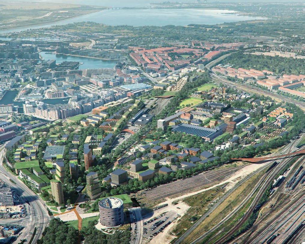
Effective master planning relies on microzoning and detailed spatial considerations, ensuring each area is developed with cultural sensitivity and functional integration. The Tottenham Activity Centre Masterplan establishes distinct zones to support mixed-use development, economic growth, biodiversity, and enhanced connectivity.
The mixed-use zone, located on the existing footprint of Central West Shopping Centre, will feature 6–10 storey buildings with podium-level retail and business spaces to activate the streetscape. Permeable pedestrian walkways will improve accessibility and encourage foot traffic. At its core, a community space will provide a focal point for social engagement, while a north-south open space corridor will optimize daylight access to surrounding residences. Ground-level human-scale design will foster a welcoming and interactive public realm.
Situated south of the mixed-use zone, the creativity and innovation hub will be seamlessly integrated through landscaped connections, encouraging collaboration and entrepreneurship. This hub will directly link to the green corridor, a 100% affordable housing precinct, designed as a co-living environment that harmonizes human habitation, nature, and wildlife. This approach prioritizes ecological health, ensuring sustainable land stewardship while creating a diverse and inclusive residential community.
The final intervention focuses on upgrading the Tottenham Station underpass, improving safety, accessibility, and pedestrian connectivity. This enhancement will transform the underpass into a more inviting, well-lit, and pedestrianfriendly urban link.
Fig63: Tottenham Activity Centre Masterplan. Credit: Tasmim Wahhab
5.5 Tottenham Activity Centre Masterplan
Catalyst Projects
By combining urban and ecological structures, the green corridor intends to promote biodiversity and healthy cohabitation of ecosystems, wildlife, and people.
Central West Shopping Centre Revitalisation
Converting Central West into a mixed-use precinct to promote employment, housing access, connectivity, and vibrant community spaces.
Transforming Tottenham’s industrial spaces into a vibrant creative hub to foster entrepreneurship, collaboration, sustainability, and economic growth.
Upgrading Tottenham’s underpass to enhance safety, accessibility, and connectivity for pedestrians and cyclists.
Fig63: Tottenham Activity Centre Masterplan. Credit: Tasmim Wahhab
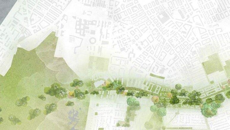
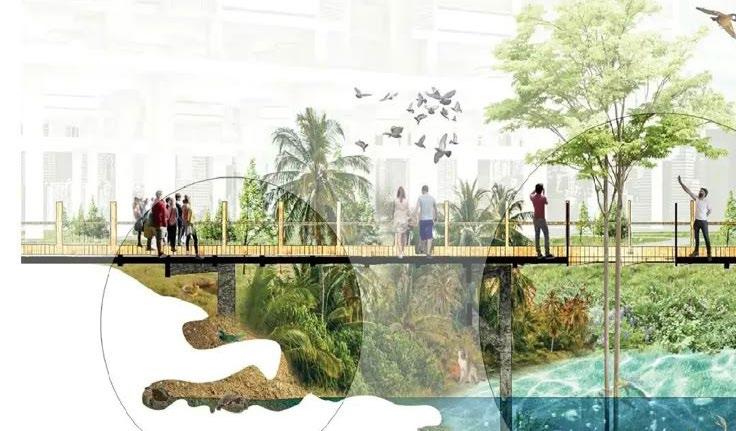
The proposed green corridor is envisioned as a co-living environment that seamlessly integrates human habitation, nature, and wildlife, fostering a balanced and sustainable urban ecosystem. This initiative prioritizes biodiversity enhancement, ensuring that every element of the built environment serves as an opportunity to increase the habitat value of the region.
Drawing inspiration from Cobe’s approach to urban biodiversity, the project will incorporate elevated green spaces on parking structures and residential buildings to maximize ecological benefits. Cobe’s Opera Park and DR Byen neighborhood demonstrate how integrating vegetation into built forms, such as rooftop gardens, vertical greenery, and permeable surfaces can enhance biodiversity and improve urban resilience. Similarly, the green corridor will feature adaptive landscapes, permeable walkways, and green infrastructure, ensuring interconnected habitats that support local flora and fauna.
This project will provide continuous green linkages, reinforcing sustainable land stewardship while fostering community engagement. Public spaces will be designed to encourage interaction with nature, ensuring that biodiversity remains a core principle of urban development. This approach establishes a resilient framework, reinforcing the ecological health of the urban environment while enhancing the wellbeing of its inhabitants.
Fig66: Section through the green corridor. Credit: Tasmim Wahhab
Fig64: Utilising built forms as an element to boost biodiversity by Cobe.
5.7 Catalyst Project
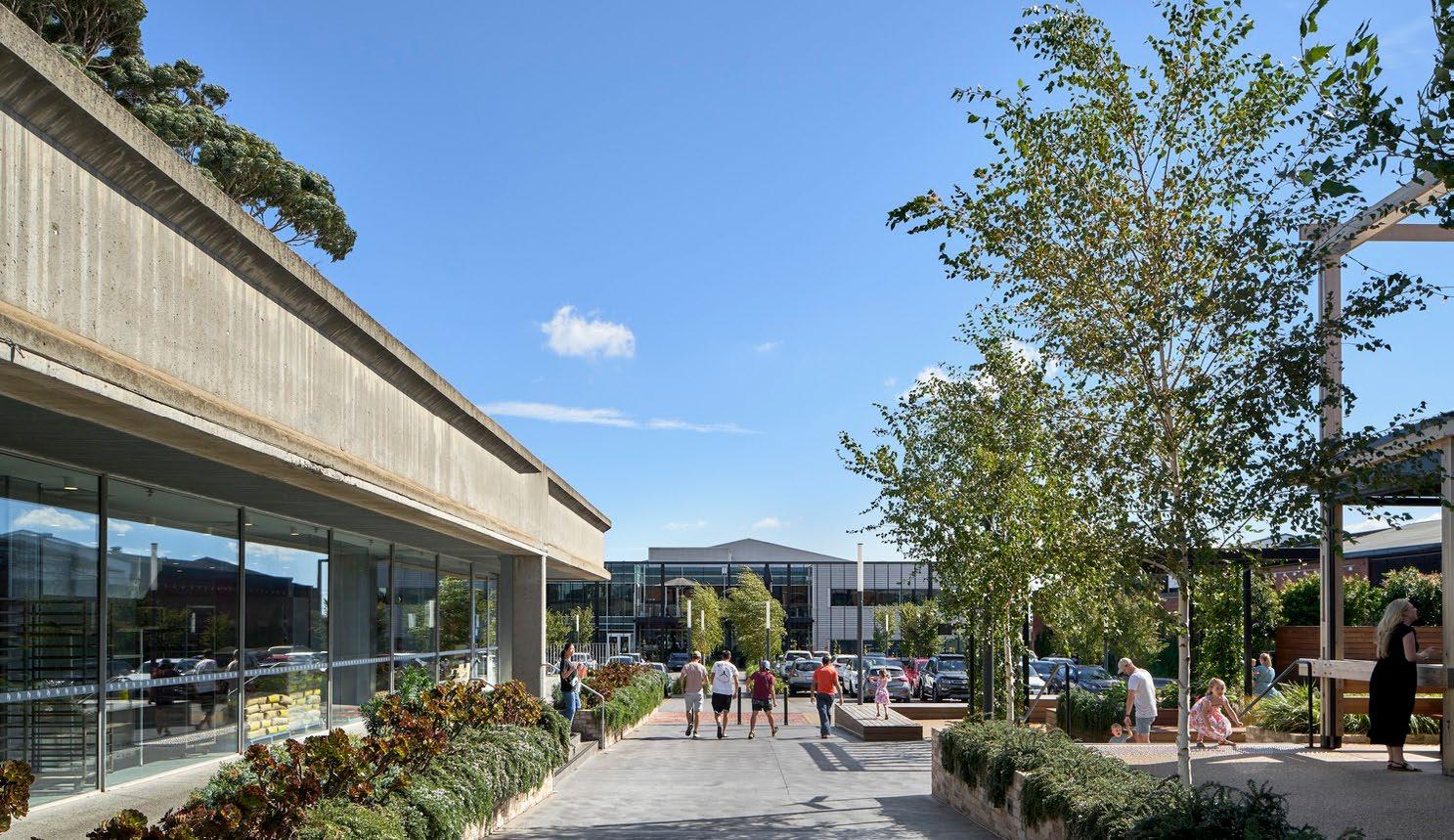
Central West Shopping Centre Revitalisation
Revitalising Central West Shopping Centre into a mixeduse precinct, creates a vibrant hub that integrates residential, commercial, and community spaces which encourages allday activities, supports local jobs and services, improves access to housing, and fosters a more walkable and connected neighbourhood.
The redevelopment and revitalisation of the Shopping Centre integrates elements from San Fransisco’s Stonestown redevelopment project (see Fig.67), where large surface level parking areas would be relocated and converted into multi-deck parking better utilising the land to support the development of residential, commercial, office and community spaces to foster a more vibrant and liveable neighbourhood.
The project would require rezoning to facilitate the proposed changes to Central West SC. A new community centre along with open spaces and green corridors, would be introduced to enhance biodiversity and support a diverse community (see Fig68). The revitalised retail precinct reinforce its role as a retail hub for nearby suburbs while maintaining the area’s industrial and employment identity.
Fig67: Inspirational Render of Central West SC Residental precinct (Brookfield Properties 2025)
Fig68: Inspirational Render of Central West SC retail precinct with Green Corridor (Mysterio Publishing 2019)
5.8 Catalyst Project
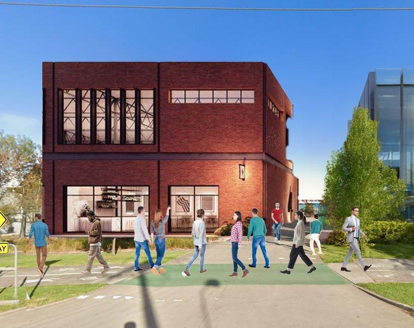
Creativity and Innovation Hub
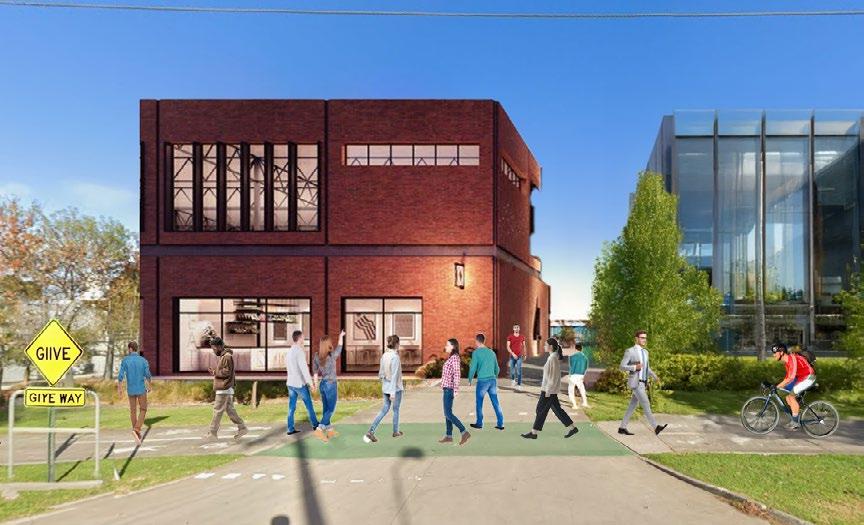
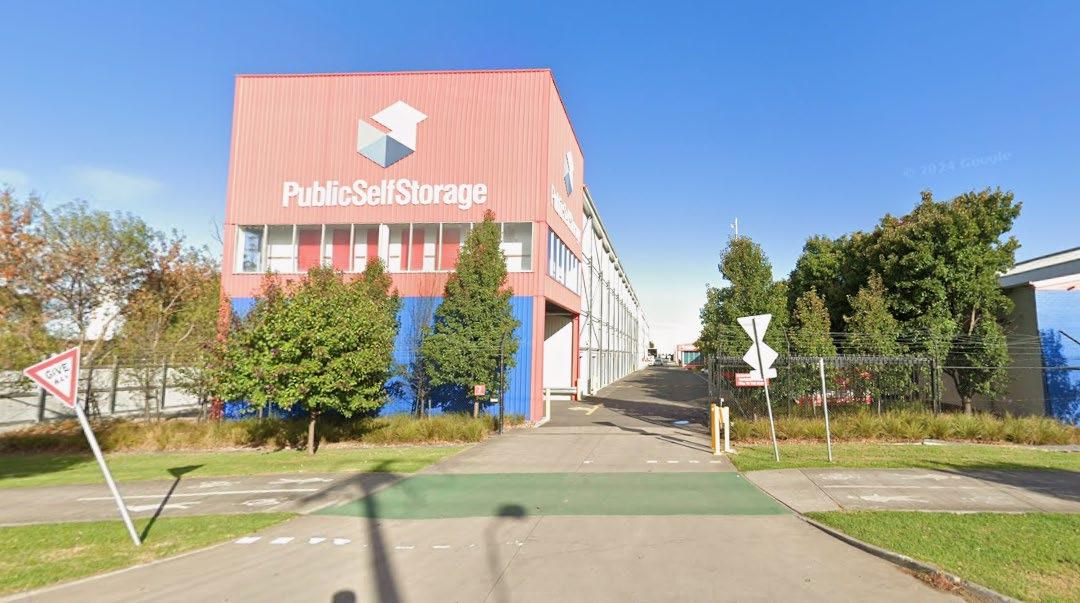
Transforming a key site north of the train station into a hub for creativity presents a unique opportunity to revitalise underutilised industrial spaces and foster a future-focused local economy.
By repurposing existing warehouses such as self-storage and commercial buildings into medium-scale flexible workspaces, studios, co-working spaces, and collaborative offices, Tottenham can attract a diverse mix of startups, creatives, and small-scale manufacturers. This adaptive reuse approach not only preserves the area’s industrial character but also injects a new energy and economic activity into the precinct.
A Tottenham innovation hub could also integrate hospitality, retail, and community spaces to create a dynamic, mixed-use environment that encourages interaction and crosspollination of ideas through a shared area.
With the additional strategic investment in public realm improvements, green spaces, and transport connectivity, particularly links to Sunshine and the broader western and southern corridor, the precinct could become a magnet for talent and entrepreneurship.
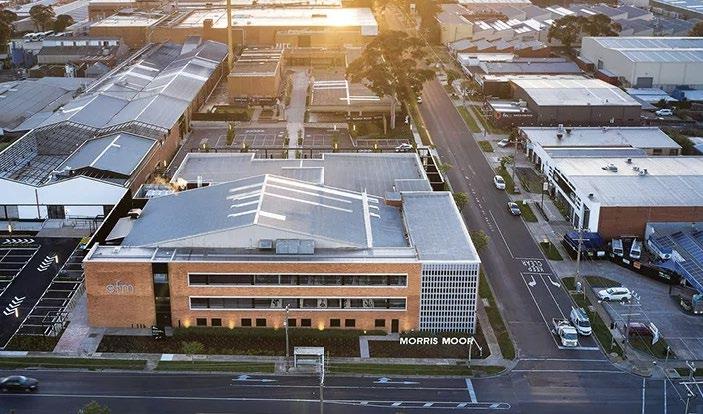
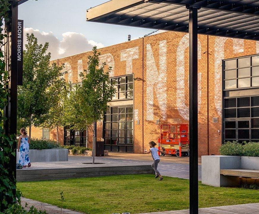
Drawing inspiration from Morris Moor’s blend of heritage architecture and the newest of modern amenities, Tottenham’s innovation hub across from the business and retail precinct has the potential to evolve into a thriving destination for innovation, culture, and community.
Fig69: Views on the possibility of reusing buildings for mixed development south of business park (Local Council, 2025)
5.9 Catalyst Project
Tottenham Station Underpass
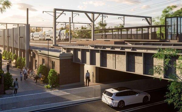
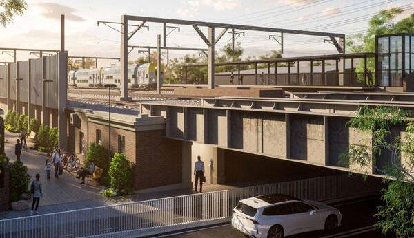
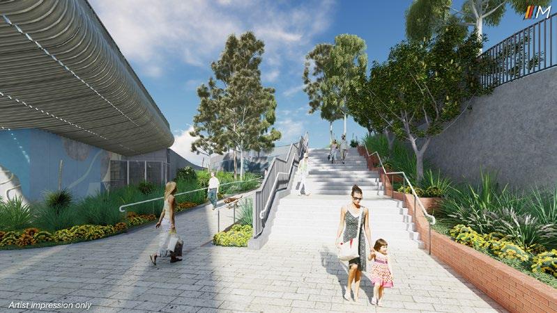
Tottenham Station underpass upgrade will enhance safety, accessibility and connectivity for pedestrians and cyclists. It will improve safety by increasing surveillance which will minimise antisocial behaviour.
The station underpass upgrade will include widening the tunnel to create a dedicated bi-directional path for cyclists and pedestrians. The path will be slightly lowered helping to reduce vehicle speed and increase safety. Improved lighting and the addition of a skylight will increase visibility and create a welcoming environment.
There is an opportunity to feature community murals along the underpass walls, making it engaging to the public. The inclusion of small shops will activate the area, making it safer and improving links between the north and south of the station.
Fig70: Tottenham station underpass - current
Fig71: Tottenham station underpass - After Upgrade
6.1 Appendices: Issues and Opportunities
Ecology, Landscape and Public Realm
Issue 1 - Tottenham’s limited green space, just 8% of the suburb, stems from past planning favoring industry over ecology. This lack of habitat diversity and connectivity is evident in local biodiversity maps, highlighting poor ecological value.
Issue 2 - Tottenham’s concretedominated landscape intensifies urban heat, as satellite data reveals significant hotspots. Impermeable surfaces hinder water absorption, increasing runoff and flood risks, particularly along Stony Creek, which requires ongoing flood management due to its inundation overlay designation.
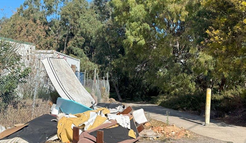
Issue 3 - Unauthorized dumping at Stony Creek’s entrance highlights poor public realm stewardship, degrading the environment and disconnecting communities. A comprehensive ecological revitalization strategy is essential to restore biodiversity and strengthen connections between people and nature.
Fig74: Unauthorised Waste Disposal
Fig73: Urban Heat Island Effect. Data sourced from Urban Forest Strategy.
Fig72: Lack of Green, Biodiversity. Data sourced from NatureKit, Credit: Tasmim Wahhab
Fig_75 Map of Ecology, Landscape and Public Realm. Credit: Tasmim Wahhab
6.1 Appendices: Issues and Opportunities
Landscape and Public Realm
Opportunity 1 - Tottenham’s underutilized land offers a chance to create a green corridor, linking Braybrook Grasslands, the station precinct, Central West, and Stony Creek, fostering ecological restoration and community connectivity.
Opportunity 2 - The green corridor reconnects fragmented spaces, restoring habitats, introducing shaded walkways, cycling paths, and cooling benefits, addressing biodiversity loss and enhancing environmental resilience in a hardscape-dominated area.
Opportunity 3 - The green corridor enhances quality of life by reducing pollution, fostering inclusive spaces, supporting well-being, and redefining urban redevelopment with nature and community at its core, shifting industrial neglect toward ecological opportunity.
Fig76: Green Corridor, Amager Beach Park in Copenhagen
Fig78: Better Environmental Quality, illustration by Zhang Ruijia
Fig79: Map of Ecology, Landscape and Public Realm. Credit: Tasmim Wahhab
6.2 Appendices: Issues and Opportunities
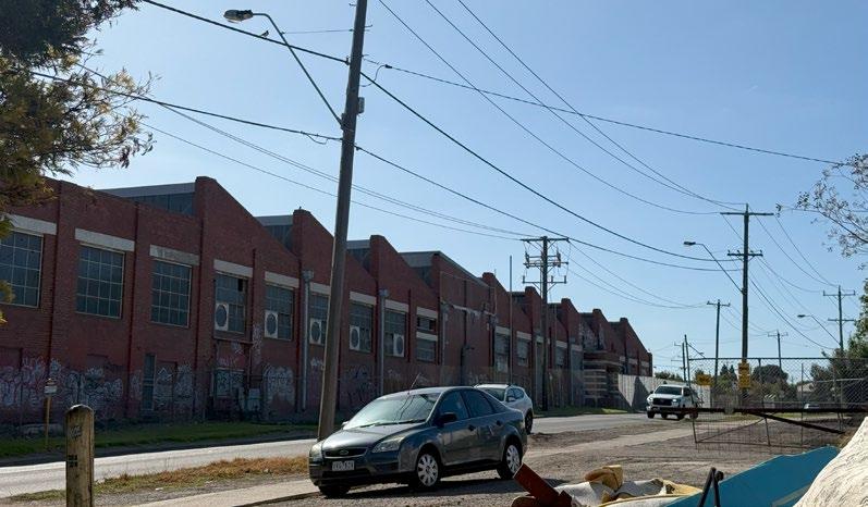
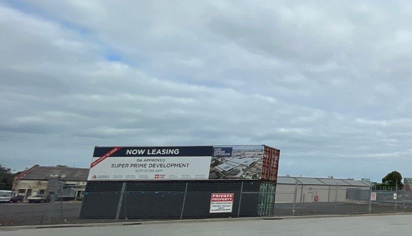
Issue 1 - Several industrial parks and facilities to the south of the railway station are under utilised, with many up for lease.
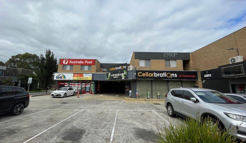
Issue 2 - Street level mixed-use retail area opposite the station contains a tobacconist and a liquor store. This promotes and encourage anti-social behaviour around the precinct.
Issue 3 - Many industrial facilities are left vacant in a major industrial precinct. These facilities have been left abandoned or poorly maintained, where the industrial facility has broken windows notable in Figure x.
Fig82: Abandoned/Run down Industrial Buildings
Fig81: Liquor and Tobacco Store opposite station
Fig80: Various Industrial Parks for lease
STONYCREEK
Fig83: Land Use Issues Map; Data Sourced from DECCA n.d.
6.2 Appendices: Issues and Opportunities
Land Use
Opportunities 1 - Transforming the Central West Shopping Precinct into an area like the Glen Shopping Centre where there are apartments above the shopping centre that provides residents with access to shops and other essential services
Opportunities 2 - Constructing a multi-level car park opposite the train station at part of the current street level car parking to cater towards train commuters’ vehicles.
Opportunities 3 - Converting remaining land of current street level parking to develop highdensity housing close to the railway station such as what has been planned at Raleigh Street, Windsor.
Fig86: Proposed new High Density Housing in close proximity railway (Goldfields Group 2024)
Fig85: New Multi-level Car Parking; Collage by E-Gene Chew
Fig84: Central West transformation (Herald Sun, 2021)
Fig87 Land Use Opportunities Map: Data Sourced from
6.3 Appendices: Issues & Opportunities
Transport & Connectivity
Issue 1 - Outdated station and unsafe underpass. Tottenham station is isolated and this contributes to it becoming a site for antisocial behaviour. The underpass also feels unsafe for both cyclists and pedestrians as they share a two-way path.
Issue 2 - Limited internal access and active transport options through Tottenham precinct. Restriction on through access of the site makes it challenging for freight trucks and pedestrians to navigate the site.
Issue 3 - Restricted access to the creek through the industrial sites. The land around the creek in the area is privately owned making it hard for employees and public to access this open space.
Fig91:Transport and connectivity Issues map
Fig90:Stony Creek
Fig89:Quarry Road
Fig88:Tottenham staion underpass
6.3 Appendices: Issues & Opportunities
Transport & Connectivity
Opportunity 1 - Upgraded station and underpass. An upgrade will ensure a safe and efficient environment for pedestrians and cyclists. It will also significantly improve connectivity between North and South of the station.
Opportunity 2 - Improvement of existing road infrastructure and creating new internal roads with active transport routes will enhance connectivity through the industrial precinct, creating a better experience for people passing through.
Opportunity 3 - Unrestricted access to the creek. Making the creek accessible to the public and establishing a pedestrian and cycling route will support biodiversity, and will strengthen community connection to the creek.
Fig95:Transport and connectivity map
Fig94: Seventh Hospital of Zhongshan, Xinbeitou River
Fig93:Industrial area in Moorabbin, Victoria
Fig92: Macdonaldtown station upgrade render (NSW Transport, 2025)
6.4 Appendices: Issues & Opportunities
Built Form
Issue 1 - There has been issues with a lack of access for walkable and safe streets, with warehousing being the dominant due to the need for significantly less staff on site compared to other industries, The lack of cycling lanes for nearby residences and workers to stroll and move across Tottenham.
Issue 2 - Amenities have been lacking especially on the south side of Tottenham, the closest major community centre is central west, which can be a 20 minute walk. There are few available cafes, shops or places to be surrounded by the local community.
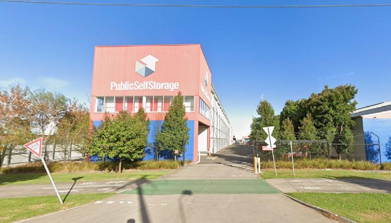
Issue 3 - A number of buildings have been unoccupied or underutilized in the employment precinct, specifically on paramount road do not have buildings with major use or have become dilapidated since the 80s.
Fig97: Lack of Amenities (Local Council, 2025)
Fig99: Map of building heights and built form
Fig98: Building Vacancy & Obscolence (Local Council, 2025)
Fig96: Access Difficulties (Local Council, 2025)
6.4 Appendices: Issues & Opportunities
Built Form
Opportunity 1 - There is an opportunity to create pathways to Stony Creek with the use of green corridors, building and serving multiple communities, by revitalising Stony Creek and offering an ease of access into stony creek and nearby future amenities.
Opportunity 2 - The strategic point of tottenham provides ample opportunity to build mixed use buildings that cater to the needs of the west and nearby precincts of Tottenham, with major roads such as Paramount rd, Somerville rd and Sunshine Road, there is a key opportunity to increase densification through the employment district.
Opportunity 3 - With the amount of unused and unconsolidated land, there is a significant opportunity to build large scale mixed-used business corridors similar to Morris Moor that gives developers prime opportunity to build big and deliver economic incentives to live in Tottenham.
Proximity from Port to CBD (Local
High
Fig100: Active Links for Green Corridors(Vic,2022) Plan)
Fig101:
Council) 2025)
Fig102:
Scopability for Intensive Site Development (Local Council, 2025)
Fig103: Map of building heights and built form
6.5 Appendices: Learning From Elsewhere
Case Study 1
Central Geelong’s Vision 2
Location: Geelong, Victoria
Year: 2013
Vision 2, is an idealised strategic masterplan that identifies on-set sites as critical opportunities to developing and growing central geelong. These projects act as momentum for a series of projects that managed to convert their waterfront and key site into a vibrant recreation centre. They fell under 6 catalyst projects in one or several areas of these activities to develop Central Geelong; investment attraction, land development, planning certainty, infrastructure design, as well as people and place. To achieve the outcome of a fully sustainable site by 2031.
With Tottenham, utilising Vision 2 can make for a strong case to redevelop an area in a number of ways that make for a thriving area. Leveraging their own key indusrial warehousing and adjacent mixed commercial hubs Vision 2 offers the opportunity to create and imagine a set of key sites or initiatives that can be catalyst projects seem to be highly effective ways to transform and showcase redevelopment in an area. Like Central Geelong, Tottenham should leverage their key strengths such as the emerging data centre to incentivize external groups in joining this sustainable and vibrant future.
Fig105: Map with actions to improving interfaces (Vicgov, 2023)
Fig107: Vision 2’s Green Spine Project (Vicgov, 2023)
Fig104: Perspective on one of the key waterfronts in Geelong (Common, 2014)
Fig106:Vision 2: Laneways project (Vicgov, 2023)
6.6 Appendices: Learning From Elsewhere
Case Study 2
Morris Moor in Moorabin
Location: Moorabin, Victoria
Year: 2016
The Morris Moor project reinvents the Morris factory into a vibrant commercial precinct that connects the community and celebrates local heritage. Morris Moor stands as a compelling example of adaptive reuse, where a former warehousing facility has been transformed into an all-encompassing co-working and community precinct. This project is a redefinition of space that prioritizes community connection, collaboration, and sustainability at its core.
The project exemplifies how industrial and commercial spaces, considered underutilised, can be revitalised to serve contemporary urban needs. By integrating flexible workspaces, local businesses, hospitality venues, and green open spaces, Morris Moor fosters a sense of belonging and shared purpose among its users. This design encourages interaction across disciplines and demographics, creating a dynamic ecosystem that supports innovation, renewal, and social cohesion.
It offers a blueprint to Tottenham’s commercial land near the train station, as well as other underutilised parcels, presents a great opportunity for similar transformation. By embracing adaptive reuse of land, these spaces can be reimagined as inclusive, multi-functional hubs that breathe new life into the community.
Fig108:Community Centre, A portion of Morris Moor, along with mixed use office space and care facilities. (ArchitectueAu, 2025)
6.7 Appendices: Learning From Elsewhere
Jernbanebyen (The Railway District)
Location: Copenhagen, Denmark
Year: 2021
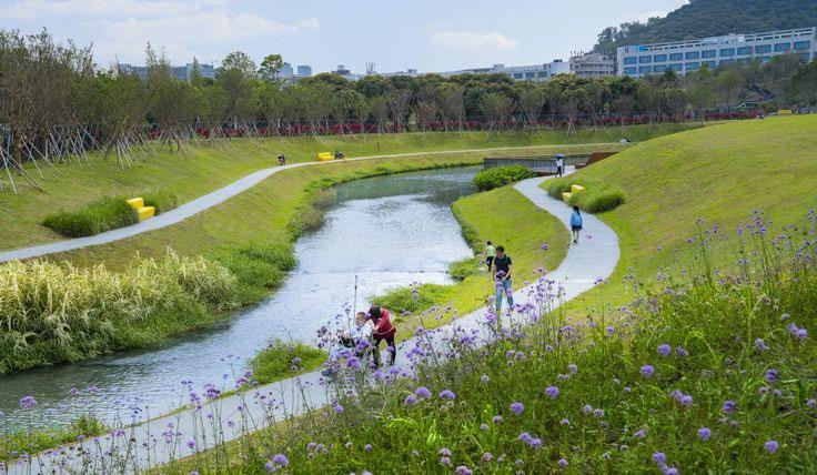
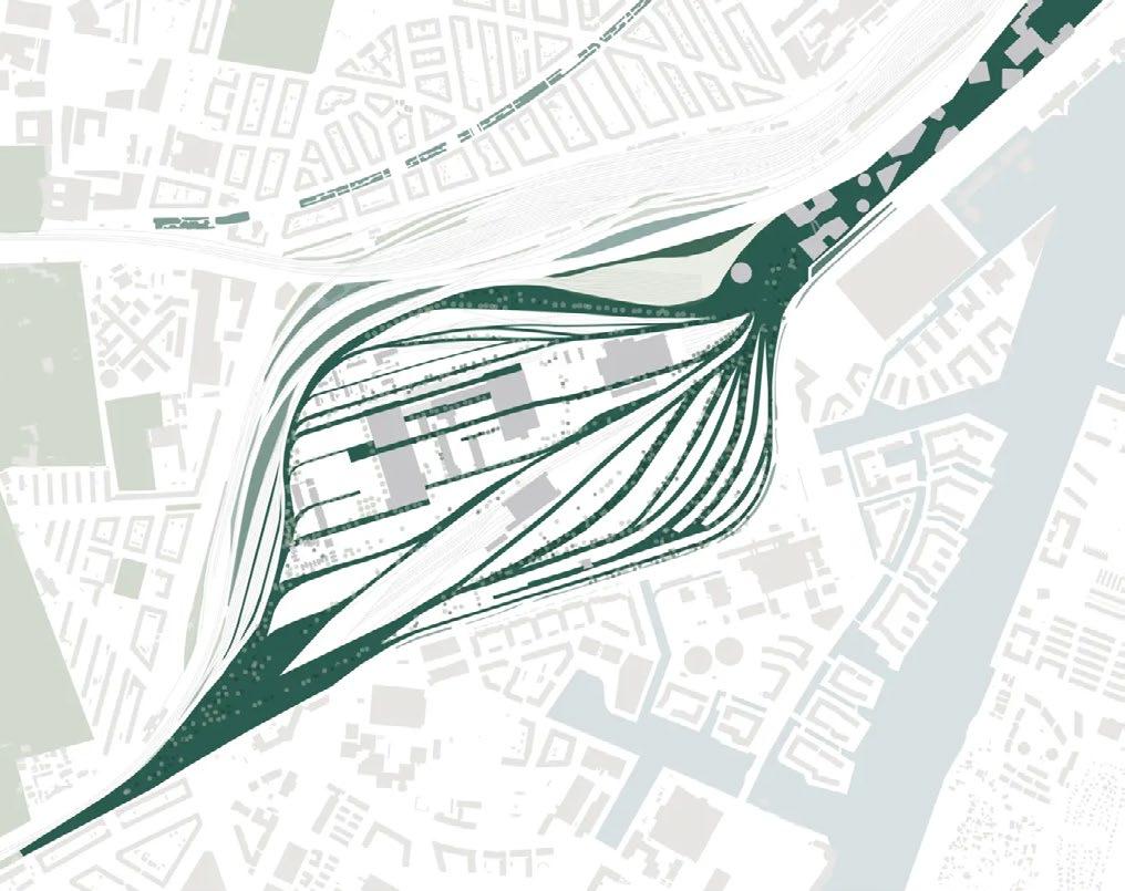
Copenhagen’s Jernbanebyen Green Corridor is a revolutionary revitalization project created by the Danish architectural firm Cobe. Through the integration of green urban areas with heritagelisted industrial structures, this proposal transforms a former railroad yard into a zone that is mostly car-free. The master plan places a high priority on infrastructure that is suitable for cycling and pedestrians, substituting connected natural spaces for conventional streets. Jernbanebyen sets the standard for future urban developments by integrating nature into the urban fabric, promoting sustainability, biodiversity, and community wellbeing.
Jernbanebyen is distinguished by its system of green spaces that provide the neighborhood structure and improve livability. All households will be close to nature as the plan includes 8 hectares of green streets and 11 hectares of green areas. The initiative also emphasizes adaptive reuse, converting industrial structures into hubs of creativity. This strategy upholds Copenhagen’s commitment to sustainable urban development by striking a balance between social inclusion, economic vibrancy, and ecological restoration.
Fig112: An aerial photo (after) of the place by Cobe
Fig111: An aerial photo (before) of the place by Cobe
Fig110: Updated green spaces masterplan by Cobe
Fig109: Lush greenery amidst the housing corridor by Cobe
6.8 Reflection
The Tottenham Activity Centre Program offers a transformative opportunity to address long-standing social and environmental challenges in Tottenham and its surrounding suburbs. A generation affected by fire-related trauma continues to live with uncertainty, while parents question if they are raising children in a safe, healthy environment. This program can begin to make things right.
Through the creation of quality open space, restoration of biodiversity, and enhancement of the public realm, this initiative can significantly uplift community wellbeing and ecological resilience. This revitalisation can serve as a benchmark for activity centre planning across Victoria, demonstrating how thoughtful urban renewal can heal, restore, and inspire sustainable futures for all communities.
Contributions & AI Statement
E-Gene
-Purpose of Report
-Map of Tottenham as an Industrial and Employment
Precinct
-Role of Activity Centre
-Map of Activity Centre in Greater Melbourne Context
-Demographics
-Diverse Housing and Community Strategy
-Catalyst Project for Strategy
-Land Use Issues and Opportunities Maps
Jason
-Executive summary for visions and strategies
-Indigenous context
-Post Contact History
-Vision page
-Targets
-Employment & retail strategy
-Implementation timelines
-Built form - issues and opportunities
-Catalyst project - Innovation hub
Tasmim
-Microstory Tottenham Fire
-Executive summary catalyst projects
-Microstory Shamima and her son
-Tottenham Land Use Map
-Biodiverse and ecological strategy
-Ecology, Landscape and Public Realm issues and opportunities
-Catalyst Master Plan
-Catalyst Project - Green corridor
-Case Study- Jernbanebyen
-Cover page collage
Fahima
-Brief
-Strategic policy
-Key attributes
-Issues and challenges
-Connected and safe strategy
-Catalyst Project - Tottenham underpass
-Transport & connectivity - Issues and opportunities
-Principles
-Compiling report
-Report template layout
AI declaration:
We used indesign AI and Microsoft Copilot in refining and revising to prepare the body text for the report. We used Copilot to help revise and refine the timeline, executive summary, case studies, strategies and the catalyst project (4 iterations), and then InDesign and photoshop (1 iteration) to make the visuals look more professional and complete. We further edited the presentation adding appropriate citations.
6.9 Appendices: References
Brookfield Properties. 2025. Stonestown Town Square. https://sfyimby.com/wp-content/uploads/2022/11/Stonestown-town-square-rendering-courtesy-BrookfieldProperties-2048x1153.jpg
Engage Victoria. 2025. “Middle Footscray to Tottenham | Activity Centres Program Expansion – Phase 1: Understanding Place.” Engage Victoria. 2025. https:// engage.vic.gov.au/project/activity-centres-program/page/middle-footscray-tottenham.
Goldfields Group. 2024. “The Raleigh | Goldfields.” The Raleigh. Goldfields Group. December 5, 2024. https://goldfieldsgroup.com.au/projects/the-raleighwindsor/.
Herald Sun. 2021. “The Glen: Sky Garden Glen Waverley Project Complete on Shopping Centre | Herald Sun.” Herald Sun, February 11, 2021. Lake Flato. 2025. “Lone Star District — Lake Flato.” Lakeflato.com. 2025. https://www.lakeflato.com/project/lone-star-district/.
Planning Victoria. 2025. “Expanding the Activity Centres Program.” Planning Victoria. February 28, 2025. https://www.planning.vic.gov.au/guides-and-resources/ strategies-and-initiatives/activity-centres-program/expanding-the-activity-centres-program.
Queensland Government. n.d. Homes for Queenslanders: A New Housing Plan for Our State. Accessed May 15, 2025. https://www.housing.qld.gov.au/__data/ assets/pdf_file/0022/48163/homes-for-queenslanders.pdf.
“Amendment C308: Urban Design in Central Melbourne.” 2025. City of Melbourne. 2025. https://www.melbourne.vic.gov.au/amendment-c308-urban-designcentral-melbourne.
“Central Geelong.” 2025. Vic.gov.au. January 14, 2025. https://www.vic.gov.au/central-geelong.Elkadi, H, Michael Sharman, and Yolanda Esteban. 2024. “Vision 2 Original Design Work - Thematic Concepts.” Figshare, June. https://hdl.handle.net/10536/DRO/DU:30102821. “Facebook.” 2023. Facebook.com. 2023. https://www.facebook.com/FriendsOfStonyCreek/.
“Footscray West | Victorian Places.” 2014. Victorianplaces.com.au. 2014. https://www.victorianplaces.com.au/footscray-west.
“Industrial Districts and Creative Production | Cities People Love.” 2025. Citiespeoplelove.co. 2025. https://citiespeoplelove.co/article/industrial-districts-andcreative-production.
“Maribyrnong Economic and Industrial Development Strategy Part 2 -Industrial Land Strategy Maribyrnong City Council.” 2011a. https://www.maribyrnong.vic.gov. au/files/assets/public/v/1/planning-services-documents/city-strategy/reference-and-incorp-documents/meids_part_2_-_industrial_development_strategy.pdf.
“Maribyrnong Economic and Industrial Development Strategy Part 2 -Industrial Land Strategy Maribyrnong City Council.” 2011b. https://www.maribyrnong.vic.gov. au/files/assets/public/v/1/planning-services-documents/city-strategy/reference-and-incorp-documents/meids_part_2_-_industrial_development_strategy.pdf.
“Morris Moor by ClarkeHopkinsClarke Architects.” 2025. ArchitectureAu. 2025. https://architectureau.com/directory/clarkehopkinsclarke-architects/morris-moor/.
“5.1 Buildings in Activity Centres.” Planning. June 9, 2023. https://www.planning.vic.gov.au/guides-and-resources/guides/urban-design-guidelines-for-victoria/ buildings/buildings-in-activity-centres.
“Railway Station - Tottenham (1891-Curren | Sunshine Historical.” 2016. Sunshine Historical. 2016. https://www.sunshinehistoricalsociety.org.au/railway-stationtottenham-1891-current.
“To Implement the State Planning Policy Framework and the Local Planning Policy Framework, Including the Municipal Strategic Statement and Local Planning Policies.” n.d. https://www.planning.vic.gov.au/__data/assets/pdf_file/0015/64131/Draft-Clause-32.04-Mixed-Use-Zone.pdf.
“Tottenham - Place - EMelbourne - the Encyclopedia of Melbourne Online.” 2025. Emelbourne.net.au. School of Historical Studies Department of History, The University of Melbourne. 2025. https://www.emelbourne.net.au/biogs/EM01502b.htm.Victoria, Environment Protection Authority. n.d.
“Tottenham Industrial Fire | Environment Protection Authority Victoria.” Www.epa.vic.gov.au. https://www.epa.vic.gov.au/for-community/incidents/tottenham-fire. Cobe. n.d. “Jernbanebyen.” Accessed June 9, 2025. 2.
UBM Development. n.d. “Jernbanebyen: New Green District in Copenhagen.” Accessed June 9, 2025. 3.
Arcgency. n.d. “Jernbanebyen.” Accessed June 9, 2025. 4.
“Melbourne Industrial and Commercial Land Use Plan.” n.d. https://www.planning.vic.gov.au/__data/assets/pdf_file/0029/652196/MICLUP-FINAL-20042020-WEBPart-A.pdf.
“Open Space Strategy.” n.d. www.maribyrnong.vic.gov.au. https://www.maribyrnong.vic.gov.au/Building-and-Planning/Planning-Services/Current-and-futureplanning/Strategies-Plans-and-Policies/Open-Space-Strategy.
“Stony Creek Future Directions Plan 2020.” 2020. Vic.gov.au. 2020. https://www.maribyrnong.vic.gov.au/Building-and-Planning/Planning-Services/Current-andfuture-planning/Strategies-Plans-and-Policies/Stony-Creek-Future-Directions-Plan-2020.
“Tottenham Precinct Framework Plan.” 2020. Maribrynong City Council. January 2020.
Victoria State Government. 2023. “The Plan.” Planning. June 9, 2023. https://www.planning.vic.gov.au/guides-and-resources/strategies-and-initiatives/planmelbourne/the-plan.
“Victoria’s Housing Statement.” 2024. Vic.gov.au. November 27, 2024. https://www.vic.gov.au/victorias-housing-statement-0.
“Central West Major Activity Centre.” 2008. https://www.maribyrnong.vic.gov.au/files/assets/public/planning-services-documents/city-strategy/reference-and-incorpdocuments/central-west_structureplan_april2008.pdf.
“Maribyrnong Economic and Industrial Development Strategy Part 2 -Industrial Land Strategy Maribyrnong City Council.” 2011. https://www.maribyrnong.vic.gov. au/files/assets/public/v/1/planning-services-documents/city-strategy/reference-and-incorp-documents/meids_part_2_-_industrial_development_strategy.pdf.