
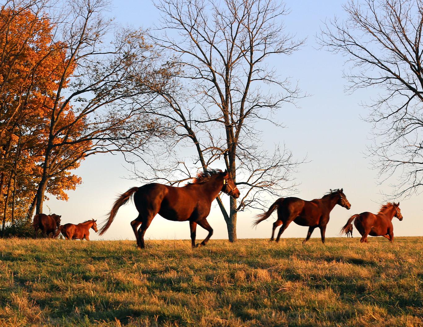
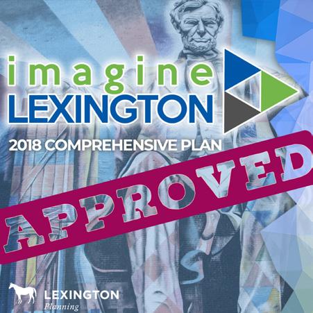
The 2018 Comprehensive Plan, Imagine Lexington, seeks to provide flexible yet focused planning guidance to ensure equitable development of our community’s resources and infrastructure that enhances our quality of life, and fosters regional planning and economic development. This will be accomplished while protecting the environment, promoting successful, accessible neighborhoods, and preserving the unique Bluegrass landscape that has made Lexington-Fayette County the Horse Capital of the World.
LFUCG Division of Planning
101 E Vine St Lexington, KY 40507
imagine@lexingtonky.gov
Lexington is a growing, vibrant city – a city with an iconic identity worth preserving, and vast potential to extend that quality of life to newcomers and visitors alike.
Imagine Lexington, created after two years of study, deliberation, and public input, creates a path forward for the next 20 years to unlock that potential. This is a plan designed for Lexington by the people of Lexington, and is an ambitious yet attainable vision for what the future could hold. There is, without question, an inspired forward momentum in Lexington. It is reflected in the projects underway and a collaborative spirit that seeks to accommodate the inevitable growth that comes from Lexington’s desirability, while preserving the Bluegrass identity that creates it.
Comprehensive Plans are required by state law for those engaging in land use regulations, influencing land use decisions, policy and ordinance changes, as well as community facility development.
Therefore Imagine Lexington directly impacts the everyday lives of Lexingtonians, touching each of the vital components of the community, and laying out a road map for all of them

to work together in concert. This plan has been made possible only through the rich and progressive planning history that came before it. In 1931, Lexington developed its first comprehensive
A sampling of aspects considered as part of Imagine Lexington, our city’s comprehensive plan update
plan, only a few short years after the 1925 adoption of the nation’s first comprehensive plan, for Cincinnati, Ohio. Since that time, each Comprehensive Plan has been setting the stage for future

growth and development, each building from the last, retaining what is working, discarding the outdated and unsuccessful, and applying new industry standards.
In that vein, Imagine Lexington is an extension of the 2013 Comprehensive Plan, with many of the same emphases, and most importantly, carrying over the idea of a “policy-based plan.” In 2013, the Planning Commission decided to move away from predetermining the future land uses of all properties in Lexington on a map in favor of a more robust and flexible approach to land use. This plan further refines this tactic, realizing that placemaking, context, and site layout are much more important in modern times than individual land uses. Ensuring that new developments create desirable and intentional places, while enhancing the existing neighborhoods, is of paramount concern.
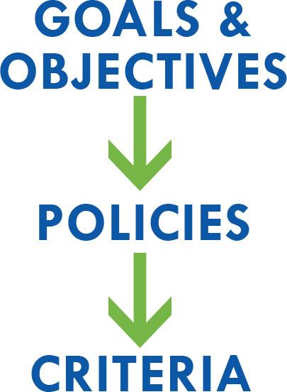
The Comprehensive Plan has two very distinct components, each with their own different and statutorilydriven process. Phase I, the Goals & Objectives, are developed through the recommendation of Planning Commission, but are
ultimately approved and adopted by the Urban County Council. These are the skeleton of the plan and provide a framework, setting the direction and the tone for the rest of the document. The balance of the plan must be created to follow this Council-led vision.
Lexington has always given very careful consideration to the Goals & Objectives throughout the Comprehensive Planning process, and Imagine Lexington was no different, taking almost the entirety of 2017 to complete. This datadriven process considered a host of data sources, including a vacant land inventory, a housing demand study, a greenspace survey, a myriad of other city studies and plans, and an unprecedented public engagement process that involved over 10,000 people from diverse backgrounds.
If the Goals & Objectives are the skeleton framework, the Elements are the flesh that fills out the plan and gives it substance; they also provide a means to accomplish the goals set out by the local legislative body. State law requires a comprehensive plan to address land use, transportation, and community facilities at a minimum, but Lexington has
historically taken the opportunity to address housing, environmental considerations, historic preservation issues, and many other facets of the community.
Realizing that each of these elements are dependent upon each other and involve so much interplay, Imagine Lexington is structured, as the 2013 plan was, into cross-cutting “Themes” that reflect the true nature of how the community operates and interacts. Though a particular topic or recommendation may be mentioned in multiple locations throughout the plan, each is inevitably approaching it from a different angle or community interest. It is crucial these connections are made to show the many reasons why a particular recommendation should be pursued.
Though this update to the Comprehensive Plan carries forward the theme structure from 2013, new to this version is the inclusion of “Pillars” to provide organization and emphasis within each theme. Themes have been subdivided into three pillars, each of which are critical to its vision and intended to illustrate key concepts fundamental to its implementation. Every individual
pillar has its own vision statement that clearly lays the foundation for the recommendations within the chapter.
These recommendations come in the form of “Policies” that provide explicit direction in either an internally or externally focused way. Internally focused policies are directed at staff, the Planning Commission, Council, or another government entity for process or ordinance improvements, or to direct further study or plan development. Specific implementation items derived from these policies are called “Action Items” and are denoted throughout the plan by action item icons.
Externally focused policies are directed at the development community and are meant to provide guidance for how development should occur on a site-specific basis to further broad community goals. As Lexington is within a self-imposed constrained growth environment to maintain fiscal responsibility, it is increasingly more important that each and every new project promote good stewardship of the finite resources available. It is also imperative that the iconic Bluegrass identity, the historic built environment, and the existing residents of Lexington
benefit from this development as well. The policies within Imagine Lexington direct applicants’ proposals to do just that.
The centerpiece of Imagine Lexington is a new concept for placemaking and contextsensitive development called “The Placebuilder.” This tool for evaluating development proposals offers clarity and certainty of process for all interested parties by succinctly demonstrating what it means to be “in agreement with the adopted comprehensive plan” (KRS 100.213). Using this method, applicants should be able to understand how the Comprehensive Plan applies to their proposal and neighbors should recognize what to expect out of development near them; ultimately, this will give the Urban County Council, the Planning Commission, and their staff the ability to apply all aspects of
the plan consistently. Several concerns were raised throughout the two year Imagine Lexington process that the removal of the future land use map from the 2013 Comprehensive Plan left too much ambiguity and uncertainty; The Placebuilder was developed in response to those concerns.
One of the primary purposes for moving away from the map, however, was to provide opportunities for innovation and creativity through flexibility, and that spirit still remains. In an environment where infill development becomes increasingly challenging, a menu of options is provided for developers, again recognizing that the use is of less importance than the form new development takes. A wide range of possibilities are available through each of the place-types shown, with the understanding that great places offer diversity and enhance the existing development
around them. They should build bridges to, rather than walls around, nearby neighborhoods. Each individual new development should add a building block to the defined place, an incremental improvement that creates quality experiences and continues to improve Lexington as a highly desirable community overall.
The full body of the Placebuilder criteria is essentially a distillation of the externally focused policies from Imagine Lexington. The title of each criterion is coded to link back to the individual policy from which it came. This is important, as the policies will provide further guidance on how an applicant is expected to address an issue. It is also important because this provides the linkage to the Goals & Objectives that Council passed in 2017. Each of the policies
included in the plan further at least one goal or objective, though most further far more than that.
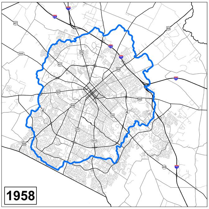
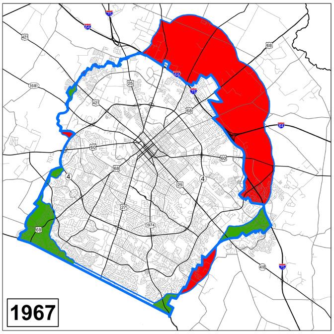
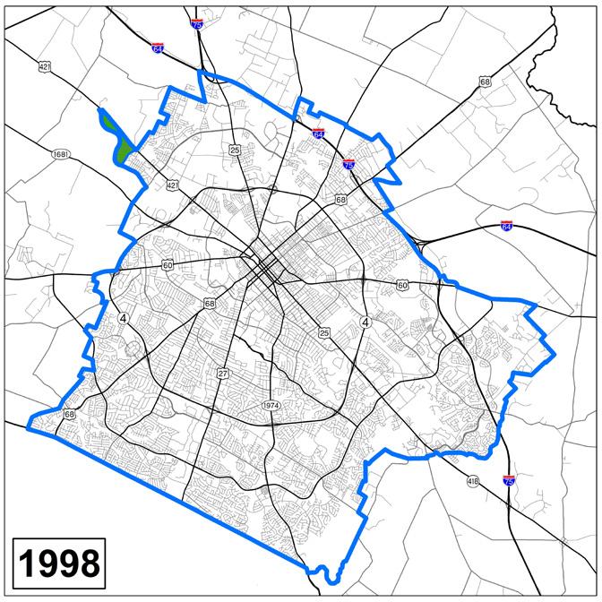
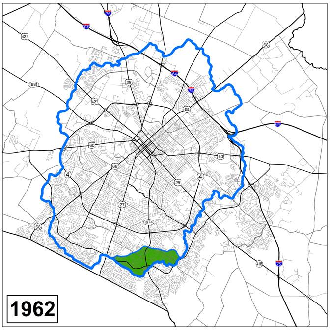
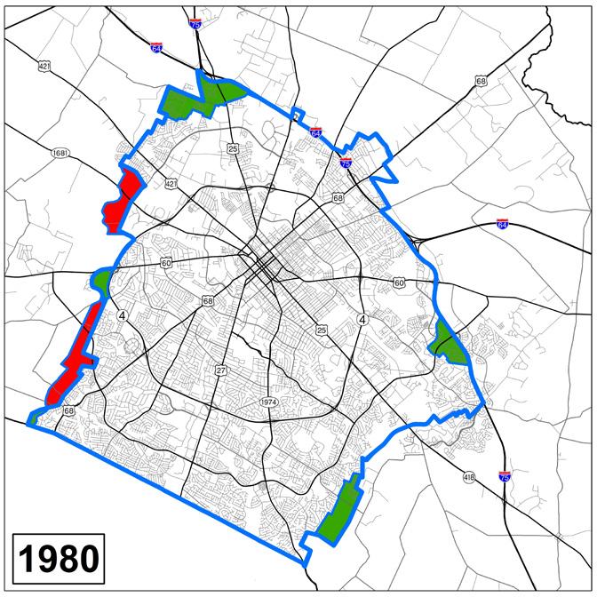
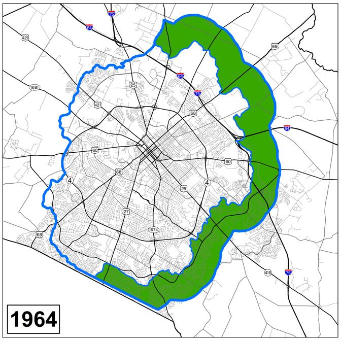
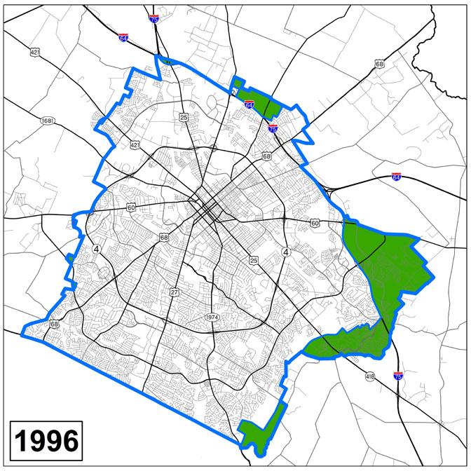
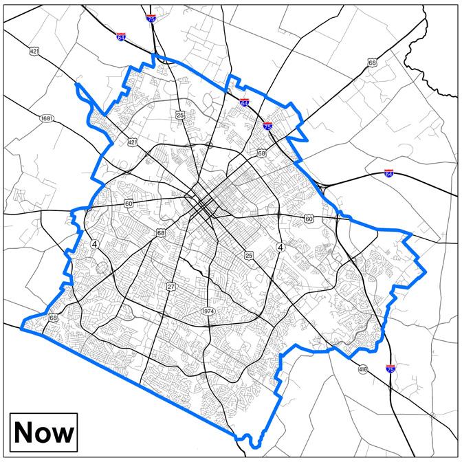
Lexington’s progressive planning history extends beyond the first comprehensive plan in 1931, and in fact the first urban service boundary in the nation was established in this city in 1958. This mechanism, more than any other, has helped shape Lexington’s physical development by directing growth in a fiscally responsible development pattern toward the city center. The wonderful result has been the preservation of Lexington’s Bluegrass identity as the Horse Capital of the World, by restricting growth in the rural area. Agriculture continues to be an important part of the economy through production and job creation, but also for the tourism draws that result as well.
All of this is the byproduct of an intentional effort to manage growth through sustainable methods. Throughout the years, the Urban Service Boundary has undergone many evolutions, expanding and contracting, but for over 20 years the line has effectively remained static. This plan continues to
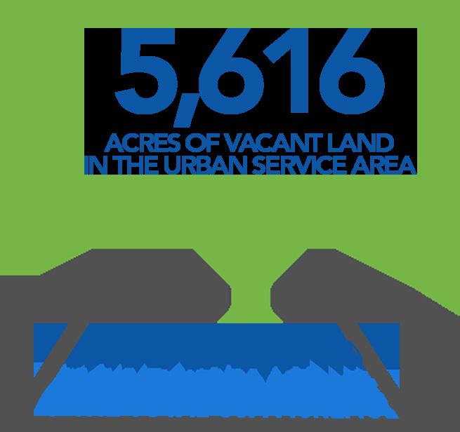
maintain the boundary, after an intense amount of public input and data collection. It was clear through the process that, overwhelmingly, the general public supports the idea of maintaining the boundary. A greenspace survey found that over 70% of respondents oppose expansion of the boundary, and the vast majority of comments received through other public input venues bore that out. Additionally, a vacant land inventory identified over 5,600 acres of vacant land, an underutilized property analysis showed vast development potential, and, ultimately, scenario planning showed that, if the Imagine Lexington vision for new development is followed, there will be ample opportunity to house the additional 80,000 people expected in the next 20 years within the current boundary.
It is obvious, however, that there will be opportunities in the future where expansion of the Urban Service Area may be required to meet specific community goals, and so a long-range plan must be in place to ensure sustainability. Theme E, Accountability Policy #1 calls for the creation of this plan and a new process for determining long-term decisions involving the Urban Service Boundary and
Rural Activity Centers. This may be the single most important policy in the entire plan.
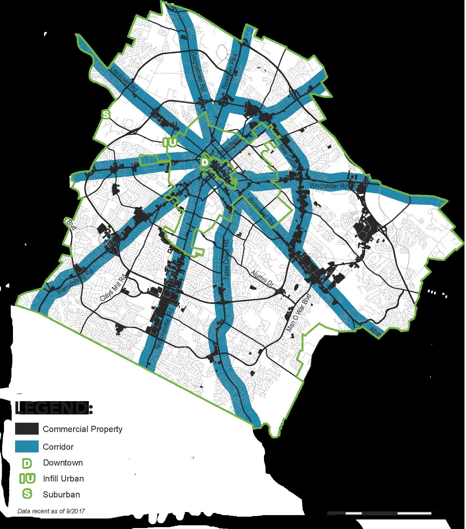
Working within the existing Urban Service Area requires reimagining many existing areas to maximize their potential and leverage them to meet other community goals. Lexington’s corridors provide ample opportunity for redevelopment, particularly given the changing retail landscape. Big-box stores are on the decline nationwide, and can provide gaping holes in the community if there is not a plan in place for them. Imagine Lexington sees these as potential new hubs for multi-use activity, including a significant housing component. Placing residents and destinations along the corridors will enhance mass transit options and make bus rapid transit a much more viable possibility, which in turn will reduce congestion and help contribute to transportation network reliability. Theme D, Placemaking Policy #12 calls for an analysis of underutilized commercial property through corridor land use and transportation studies.
Lexington’s Zoning Ordinance was last updated comprehensively
in 1983, and, while meaningful regulations have been added in a piecemeal fashion since that time, the ordinances have been slow to respond to change within the community. Imagine Lexington calls for a more strategic and intentional approach to implementing the community’s vision. A consistent implementation plan for text amendments is built into the work program of this comprehensive plan to address walkability, placemaking, new housing opportunities, greenspace, and a variety of other topics. Theme E Accountability Policy #2 calls for this process, and numerous policies address it more specifically throughout the plan.
Collaboration is the key to Imagine Lexington’s success, both in the development process, and the global planning process. Theme D, Placemaking Policy #7 calls for a more collaborative predevelopment process to assist in the success of development projects in meeting the needs of the developer, the adjoining neighborhoods, and the community as a whole. The more communication can take place on the front end, the better chance there is for an end product that meets those goals.
The Planning Commission will also benefit from additional public input. With the scope of the public input throughout the Imagine Lexington process, it was obvious that there is a community desire to contribute. Theme E, Accountability Policy #6 calls for the creation of a citizens’ advisory panel to build upon the diverse
set of voices that contributed to the development of this plan. It will ensure input is representative of all facets of Lexington, develop future neighborhood leaders, improve the level of civic discourse, and offer education to ensure input is not solely based on emotional reactions.
Ensuring access to opportunity for all Lexington residents is a thread woven throughout this comprehensive plan, and is called out as a specific pillar in Theme A. It is crucial that all policy decisions are viewed through this lens to minimize unintended consequences from well-intended actions. Equity considerations should be given to housing throughout Lexington, available transportation options, and enforcement actions, among other issues. Theme A, Equity Policy #1 states that Lexington should aim to meet the demand for housing across all income levels.
Imagine Lexington creates development opportunities throughout the city, recognizing that land use is not as important
as how development relates to and enhances the surrounding areas. There is potential, therefore, to develop neighborhood supportive uses and additional housing near and within existing stable neighborhoods. Theme D, Placemaking Policy #2 calls for retrofitting incomplete suburban developments to incorporate elements that create complete neighborhoods; in addition, Theme A, Design Policy #4 states that development should be provided so that it is sensitive to the surrounding context.
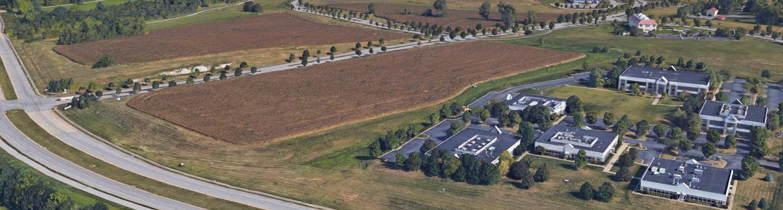
During the development of the Goals & Objectives, community leader input and data sources indicated a need for a publiclycontrolled business park. In
response, a land swap was established between the City and the University of Kentucky, giving the City control over 250 acres at the Coldstream Research Campus. This will provide immense potential for attracting employers to Lexington. Theme C Prosperity Policy #12 calls for a long-range plan to be developed with the Mayor’s office and other related entities to adequately provide for maximizing the land’s potential.
Imagine Lexington covers far more than can possibly be described here, and there are many more important policies that are not listed in this summary. Every person is welcome to explore this document from beginning to end, though it may be easier to simply pick a pillar or theme
you are interested in and start there. Additionally, the Division of Planning staff is always eager to discuss, explain, or otherwise engage in conversation and education regarding any and all of the concepts described in this plan. Please feel free to use them as a resource as you explore the community’s vision for the next 20 years. It is certainly an exciting time to be in Lexington, Kentucky!

Kabby Akers
Catholic Action Center and BUILD
Dennis Anderson
Anderson Communities
Susan Bachner
Senior Services Commission
Debbie Boian
Fayette County Public Schools
Rick Clewett
Central KY Council for Peace and Justice
Walt Gaffield
Fayette County Neighborhood Council
Colleen Hall
Lexington Public Library
Andrew Hawes
Housing Partnership, Inc.
Michelle Kosieniak
LFUCG Division of Parks and Recreation
Kristina Stambaugh
Director of Aging and Disability Services
Kelly Weber
Executive Director of Ashland Terrace
Holly Wiedemann
AU Associates
THEME B
P. Headley Bell
Horse Country Inc.
Steve Blanford
USDA / Natural Resources Conservation Service
W. Doug Burton
Director, LFUCG Division of Engineering
James Bush
LFUCG Environmental Service Energy Initiatives
Greg Butler
Chair, Greenspace Commission
Nick Carter
Ag and Natural Resources, Extension Agent in Fayette County
Chris Dent
LFUCG Division of Water Quality
Maria Koetter
Louisville Metro Government, Office of Sustainability
Tresine Logsdon
Fayette County Public Schools, Energy & Sustainability Curriculum Coordinator
Charles Martin
Director, LFUCG Division of Water Quality
Susan Plueger
Director, LFUCG Division of Environmental Services
John Saylor
LFUCG Division of Environmental Services,
Natural Resource Operations & Urban Forestry
Scott Southall
USGBC-KENTUCKY
Susan Speckert
Fayette Alliance
Lynn Winter
Trees Lexington!
Ashton Wright
LFUCG Local Food Coordinator, Bluegrass Farm-to-Table
Kevin Atkins
LFUCG Economic Development, Mayor’s Office
David Boggs
Opportunity for Work & Learning, Lexington Manufacturing Center
Dr. Kenny Burdine
University of Kentucky
Ray Clere
University of Kentucky Stuckert Career Center
Alison Davis, PhD
University of Kentucky, Community and Economic Development
Elodie Dickinson
LFUCG Workforce Development, Mayor’s Office
Gina Greathouse
Commerce Lexington
Tim Guthrie
Base 110
Pam Hatcher
Bluegrass Community and Technical College, Workforce Development
Robert Heil
Community Ventures, Business Development
Patricia Knight
VisitLex
Sherita Miller
LFUCG Purchasing, Minority Business Enterprise Program
Chauncey Morris
KY Thoroughbred Association & KY Thoroughbred Owners & Breeders, Inc.
David O’Neill
Fayette County PVA
Rob Perez
DV8 Kitchen and Saul Good Restaurants
Lynn Phillips, PhD, AICP
University of Kentucky, Geography Department
Shawn Rogers
Bluegrass Small Business Development Center
Scott Secamiglio
Kentucky Center for Education and Workforce Statistic
George Ward
University of Kentucky Coldstream Research Park
Amy Baker
Program Coordinator, Substance Abuse & Violence Intervention, LFUCG
Carrie Butler
General Manager, LexTran
Aida Copic
Director of Planning, Transit Authority of River City
Chris Ford
Commissioner of Social Services, LFUCG
J.R. Ham
Kentucky Transportation Cabinet, District 7
Lori Houlihan
Director of Arts & Cultural Affairs, Mayor’s Office
Ethan Howard
Downtown Lexington Partnership
Casey Kaucher
Traffic Engineering Manager, LFUCG Traffic
Engineering
Bettie Kerr
Director of Historic Preservation, LFUCG
Myron Thompson
Chief Operating Officer, Fayette County Public Schools
Theme E
Scott Davidson Langley Properties
Mark Day
Director of Engineering & Maintenance, Bluegrass Airport
Andrea James
S & A Strategies
Todd Johnson
Building Industry Association of Central Kentucky
Justin Landon
CEO, Lexington-Bluegrass Association of Realtors
Beth Overman
Director, LFUCG Purchase of Development Rights
Don Robinson
Winter Quarter Farm
Lynn Phillips, PhD, AICP
University of Kentucky, Geography Department
Jeff Stidham
Stidham Commercial Partners
Rena Wiseman
South Hill Neighborhood
Krista Wood
Bayer Properties

Jim Duncan, AICP, Director
Pam Whitaker
LONG RANGE PLANNING (PRIMARY AUTHORS)
Chris Woodall, AICP, Manager
Grace Coy
Stephanie Cunningham
Cindy Deitz*
Valerie Friedmann
Meghan Jennings*
Chris Taylor
Lauren Weaver, GISP
Janice Westlund, AICP*
Keyu Yan, AICP, LEED ND AP*
PLANNING SERVICES
Traci Wade, AICP, Manager
Hal Baillie, AICP
Denice Bullock
Cheryl Gallt
Lauren Hedge
Tom Martin, AICP
Debbie Woods
Christine Wu
TRANSPORTATION PLANNING
Max Conyers, Manager
Joseph David
Jimmy Emmons, AICP
Kenzie Gleason
Sam Hu
Stuart Kearns
Parker Sherwood, Esquire
Scott Thompson
Brenda Whittington
ZONING COMPLIANCE
Jim Marx, Manager
Jan Bolton
Pam Brown
Autumn Goderwis
Jim Hume
David Jarman
Donna Lewis
Tammye McMullen
Barbara Rackers*
Greg Walker
Headley Bell
Will Berkley
Patrick Brewer
Mike Cravens*
David Drake*
Larry Forester
Karen Mundy
Bruce Nicol
Mike Owens
Frank Penn
Carolyn Plumlee
Graham Pohl
Carolyn Richardson*
William Wilson
Linda Gorton, Mayor
Jim Gray, Mayor*
Amanda Mays Bledsoe
Fred Brown
James Brown
Chuck Ellinger II
Angela Evans
Bill Farmer Jr.
Jake Gibbs
Peggy Henson*
Steve Kay
Susan Lamb
Josh McCurn
Richard Moloney
Jennifer Mossotti
Kathy Plomin
Jennifer Reynolds
Jennifer Scutchfield*
Joe Smith*
Kevin Stinnett*
Preston Worley
Derek Paulsen, Commissioner of Planning, Preservation & Development
*Denotes former staff/Planning Commission/ Urban County Council members
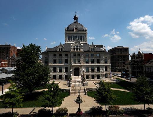
Cover photo by Don Sniegowski, July 24, 2016 flic.kr/p/KmZsoA
Select images provided by Lexington local, Nash Werner. See his work on pgs. 239-240, 241, & 253.
Approved February 28, 2019


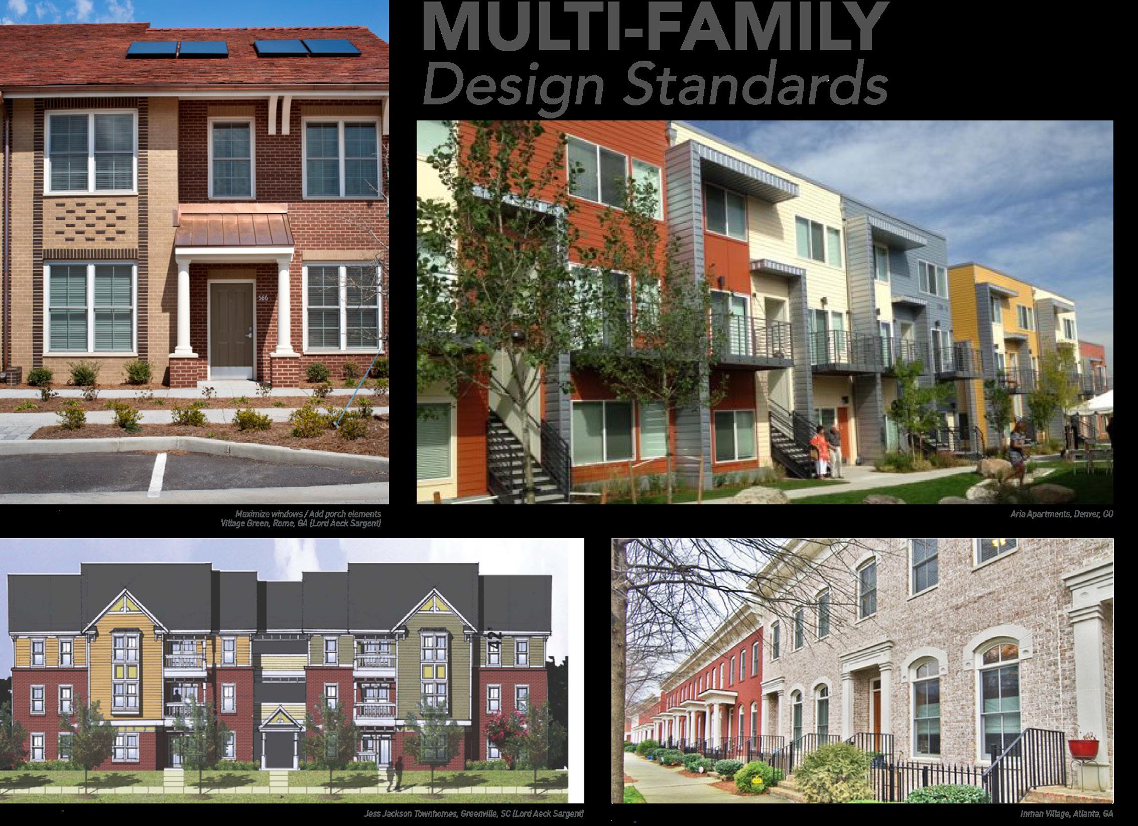
APPENDIX A MULTI-FAMILY DESIGN STANDARDS
APPENDIX B TOWN BRANCH COMMONS STRATEGIC MASTER PLAN APPENDIX C PUBLIC INPUT REPORT
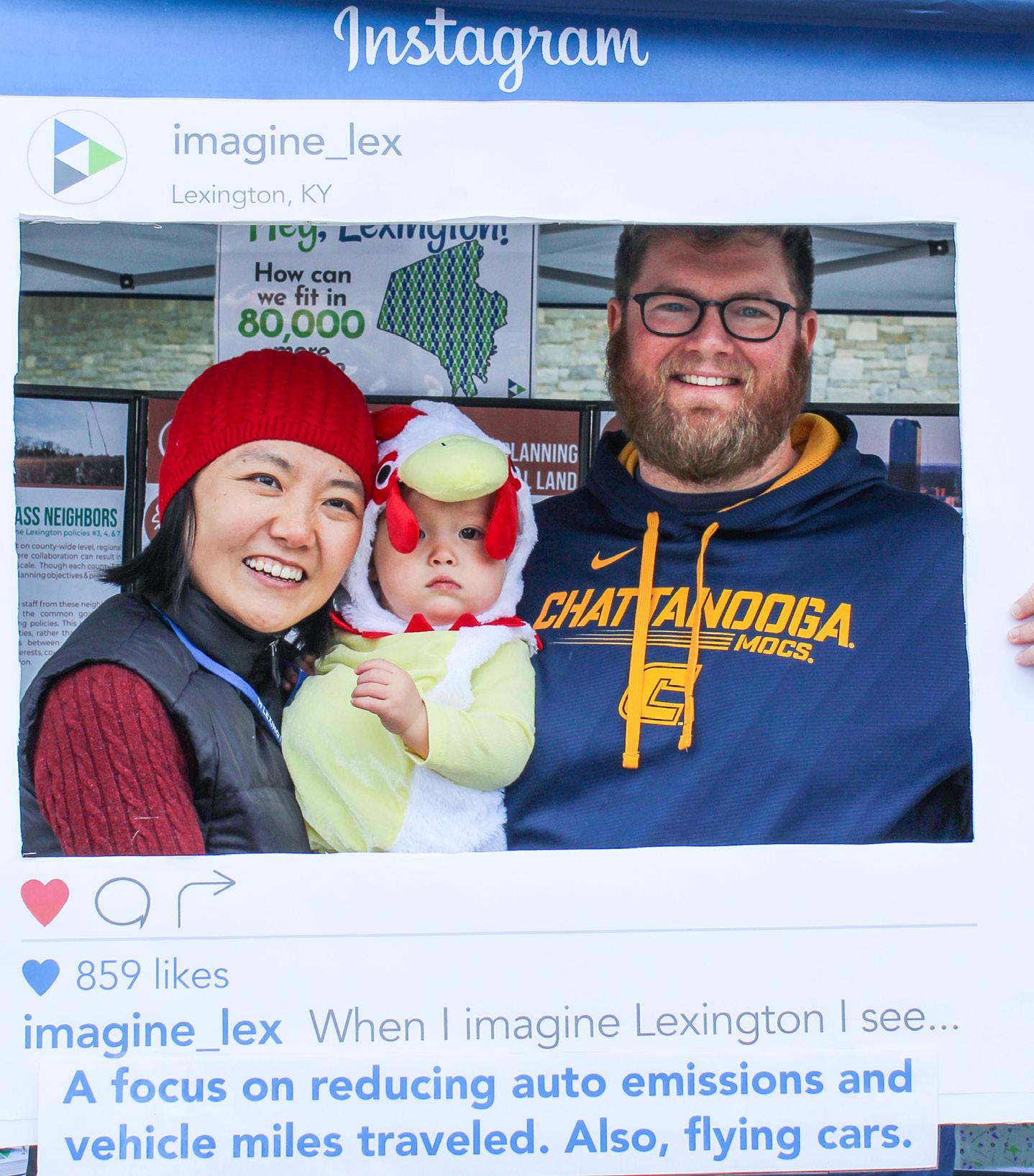
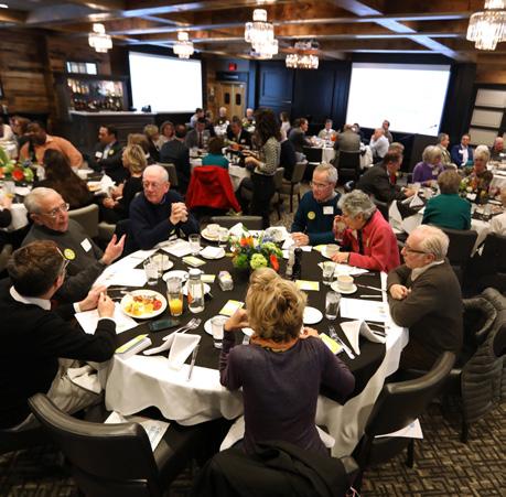
Over 10,000 contributors from all walks of life participated in the development of Imagine Lexington. A concerted effort was made to involve as many people as possible through new innovative strategies, and the result was an unprecedented response from the community. The philosophy is simple – the more input received, the higher the quality of the end product. Planning staff, Planning Commission, and Council heard from individuals, and representatives of community organizations throughout the twoyear process, and incorporated the feedback into the plan. The final product is reflective of the broad community interests and though not every individual request
could be honored, it is a far better plan for the input received.
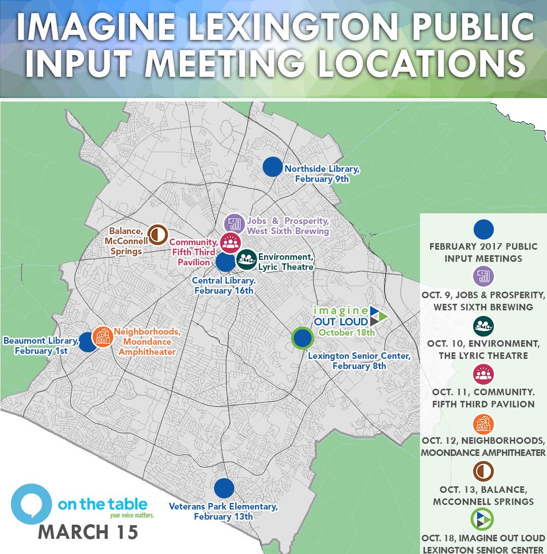
2017 kicked off with five public input meetings throughout the city in February. These were deliberately geographically scattered to provide everyone a convenient opportunity to attend and contribute. Advertisement for the meetings was provided through traditional media outlets, but also through newly minted social media accounts on Instagram, Twitter, and Facebook. The open house style format allowed engagement with staff to occur one-on-one, providing maximum
interaction to participants, while also allowing them to contribute in a variety of ways.
The principle method for input was an open-ended fillable form that was available both at the meetings, and also online at www. imaginelexington.com. This new website was the Division of Planning’s first site dedicated exclusively to the comprehensive plan; it was designed to be a clearinghouse for all data and information pertinent to the plan’s development.
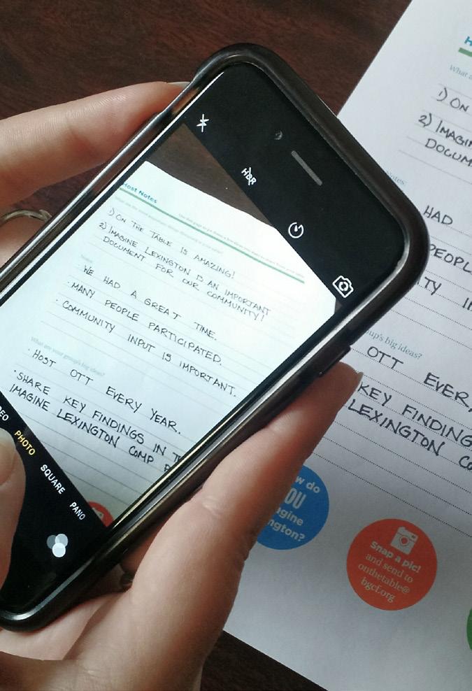
The second part of the Phase I public input was a massive undertaking executed in partnership with the Blue Grass
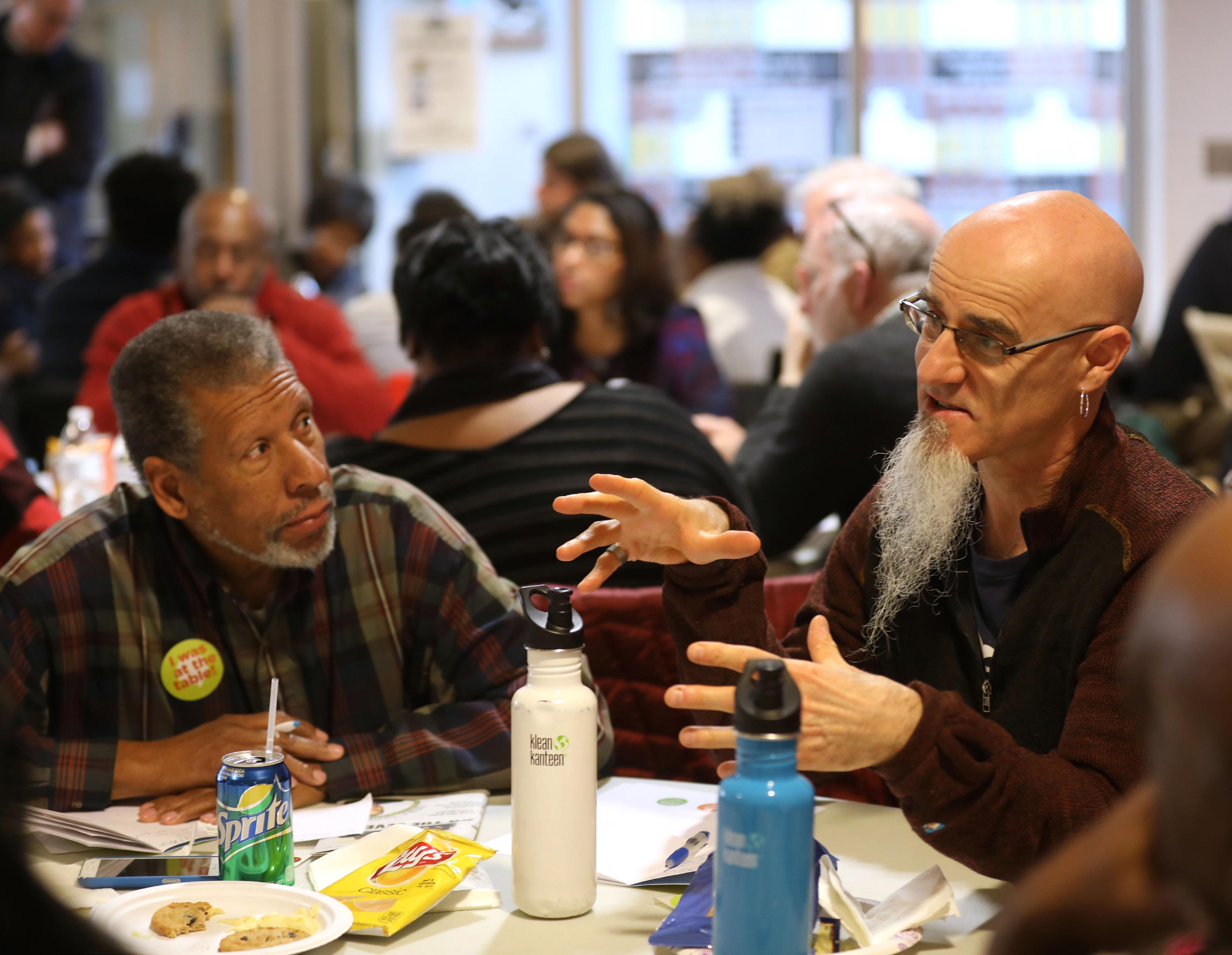
Community Foundation, Leadership Lexington, Fayette County Public Schools, the Lexington Public Library, and many others, called “On the Table.” On March 15, 2017, over 10,000 people gathered in locations around Lexington to discuss the future of the city. These self-led small group conversations contributed over 500 pages of notes that helped set the future vision for Lexington.
In addition to the individual public input, the Planning Staff solicited input from any community organization willing to give it. Over 60+ timeslots, bookable online, were made available to any community-minded organization willing to take the time to present

their ideas or concerns. Six organizations came forward and offered information to staff.
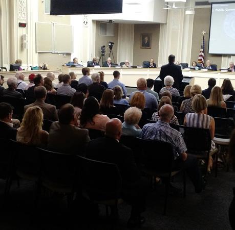
All of the public input from these mechanisms, and a handful of other small public input offerings in 2017 were synthesized into a full 79 page Public Input Report, which is available in Appendix C. The Planning Commission and Council considered this input as they deliberated and reviewed it along with the other data and information presented to them throughout the process. At the conclusion, a public hearing was held by the Planning Commission on August 31, 2017 with a final vote on September 7, 2017 approving the Goals & Objectives. These Goals &
Objectives were further amended through a Council Committee of the Whole process in September and October of 2017, resulting in a public hearing on October 24th. The Goals & Objectives in this Imagine Lexington were fully adopted by the Council on November 16, 2017.
The second half of the Imagine Lexington process included more opportunities for public engagement, including an active role for outside expert advisors. Nearly 70 different consultants from the private sector, public sector, and quasi-governmental
agencies lent their expertise to the development of the plan. They represented development, affordable housing, agricultural, economic development, transit, real estate, neighborhood, interests and more, and were instrumental in assisting staff in determining industry best practices and community needs. These are the contributors who are listed at the outset of this plan.
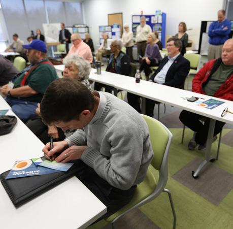
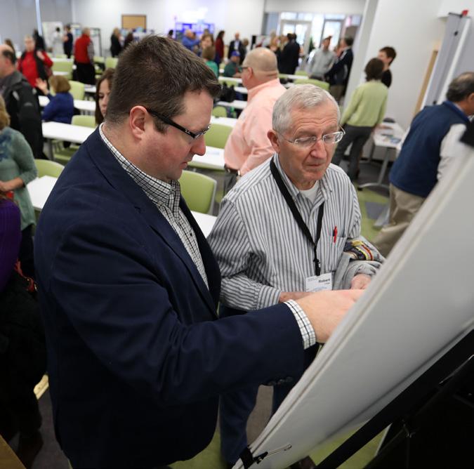
Imagine Lexington also reached out to the general public once again to hear their ideas, experiences, and opinions. From October 9 –13, 2018, the first ever “Imagine Lexington Week” was held at well-known events throughout town, to engage with citizens and gather input. Each day of the week was dedicated to a specific Theme in the plan and included a brief survey, display board, and summary video. Staff interacted with hundreds of people and were able to raise the visibility of the Comprehensive Plan through these events leading up to the main public input event, “Imagine Out Loud,” held on October 18th at the Lexington Senior Center.
“Imagine Out Loud” provided an opportunity for the community to come together in a nontraditional way. Unlike a typical
stodgy public input meeting, this event had live music, food, games for children, and an open house format that encouraged conversation. All the display boards, surveys, and summary videos were available at this event as well, and provided the backdrop for fascinating and enlightening conversations between staff and attendees. Though the number of participants was counted in the hundred and not thousands for Phase II, there were still many meaningful interactions.
A public hearing was held on December 10th and 13th in front of the Planning Commission; at the hearing on the 13th, the Planning Commission voted to continue the hearing in order to allow more discussion on The Placebuilder. Over the next two months, staff met with development professionals, citizens, and Planning Commission members, holding focus groups, a panel discussion, and a demonstration of the Placebuilder. The final document was approved on February 28, 2019.

10,000+ PARTICIPANTS
14 PUBLIC INPUT MEETINGS/ HEARINGS
67 OUTSIDE EXPERT ADVISORS CONSULTED
500+ PAGES OF PUBLIC INPUT COMMENTS
60+ COMMUNITY ORGANIZATION INPUT TIME SLOTS MADE AVAILABLE ESTABLISHED SOCIAL MEDIA PRESENCE
FIRST DEDICATED COMPREHENSIVE PLAN WEBSITE
FIRST EDUCATIONAL VIDEO SERIES
ONLINE PUBLIC INPUT FORM

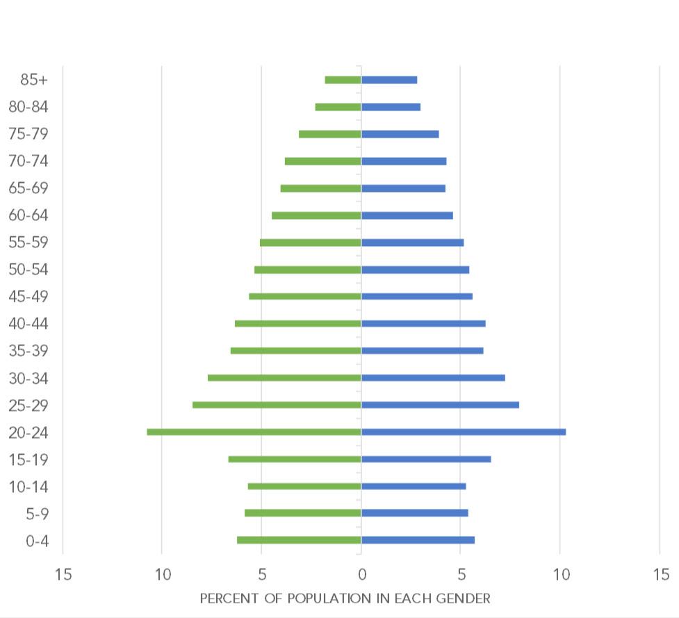
2015 POPULATION ESTIMATE
2035 POPULATION PROJECTIONS

$50,661 MEDIAN HOUSEHOLD INCOME

56.5% WITH BACHELORS DEGREE OR HIGHER %


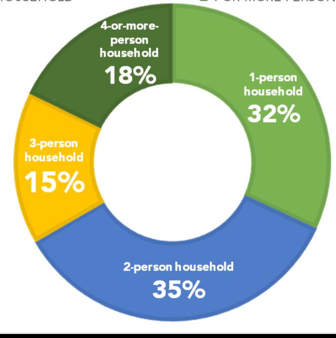
50.5% FILLED BY RESIDENTS
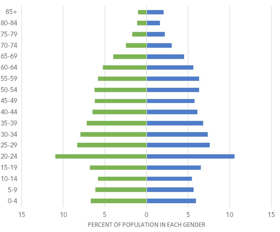
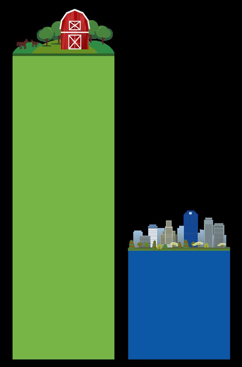
70% of Lexington’s total area is considered to be rural, but contains only about 7% of the population
30% of Lexington’s total area is considered to be urban but contains about 93% of the population
196,379 JOBS IN LEXINGTON

49.5% FILLED BY COMMUTERS
Work session to explore baseline data & trends
Imagine Lexington website launched
On the Table event gathered input for 10,000+ participants
Public Input Report presented
Planning Commission public hearing, recommending approval of the Goals & Objectives to Urban County Council
5 public input meetings held throughout Lexington
Input solicited from local community organizations

Community organizations addressed the Planning Commission
Urban County Council unanimously approves the Goals & Objectives
Urban County Council Committee of the Whole meets to discuss recommendations OCT/NOV

67 outside experts provide consult to inform the content of Imagine Lexington
Proposed content for Theme B (Environment) discussed JUN
Proposed content for Theme A (Neighborhoods) discussed
Proposed content for Theme D (Community) discussed APR


AUG/SEP
JAN ‘19
Proposed content for Theme C (Prosperity) discussed
Placebuilder concept discussed

Complete draft of Imagine Lexington presented
Placebuilder Focus Groups & panel discussion


Public input (Imagine Lexington Week/ Imagine Out Loud Plan edits made
Public hearing on complete draft of plan
Proposed content for Theme E (Balance) discussed FEB ‘19
Planning Commission approves Imagine Lexington
To ensure that the urban growth boundary policies and other long-range planning issues address the expected needs for new urban development and contribute to the prosperity of Lexington-Fayette County, these goals and objectives have been drafted based upon the projected community needs of today with the confidence that they will continue to be reviewed and revised as necessary on the five-year review cycle mandated by state statute. Anytime in the interim, the Planning Commission may recommend that Council amend the Goals and Objectives, and any recommendation shall be presented for consideration, amendment, and adoption by the Council.


Objectives:
a. Pursue incentives and regulatory approaches that encourage creativity and sustainability in housing development.
b. Accommodate the demand for housing in Lexington responsibly, prioritizing higher-density and mixture of housing types.
c. Plan for safe, affordable and accessible housing to meet the needs of older and/or disadvantaged residents.
d. Create and implement housing incentives that strengthen the opportunities for higher-density and housing affordability.
Objectives:
a. Identify areas of opportunity for infill, redevelopment, adaptive reuse, and mixed-use development.
b. Respect the context & design features of areas surrounding development projects & develop design standards & guidelines to ensure compatibility with existing urban form.
c. Incorporate adequate greenspace and open space into all development projects, which serve the needs of the intended population.
d. Implement innovative programs, such as the public infrastructure fund and land bank programs, to facilitate sustainable development, including, but not limited to, housing, affordable at all income levels, and commercial and economic activity.
e. Create materials that educate the public about infill and redevelopment.
Objectives:
a. Enable existing and new neighborhoods to flourish through improved regulation, expanded opportunities for neighborhood character preservation, and public commitment to expand options for mixed-use and mixed-type housing throughout LexingtonFayette County
b. Strive for positive & safe social interactions in neighborhoods, including, but not limited to, neighborhoods that are connected for pedestrians & various modes of transportation.
c. Minimize disruption of natural features when building new communities.
d. Promote, maintain, and expand the urban forest throughout Lexington.
Objectives:
a. Incorporate schools, libraries, and other community-focused educational institutions into neighborhoods in order to maximize safe routes for all pedestrians and bicyclists.
b. Plan for equitable and accessible social services and healthcare facilities that address the needs of all residents, maximizing the opportunity to reach geographically under-served areas throughout the community.
c. Establish and promote road network connections in order to reduce police, EMS, and fire response times.

GOAL 1: CONTINUE TO IMPLEMENT THE CONSENT DECREE, INCLUDING THE CAPACITY ASSURANCE PROGRAM, AS DIRECTED BY THE ENVIRONMENTAL PROTECTION AGENCY.

GOAL 2: REDUCE LEXINGTONFAYETTE COUNTY’S CARBON FOOTPRINT.
Objectives:
a. Continue programs and initiatives to improve energy efficiency.
b. Anticipate the community’s needs by encouraging environmentally sustainable uses of natural resources.
c. Provide incentives for green building, sustainable development, and transitoriented development with civic agencies leading by example through the use of green building standards.
d. Prioritize multimodal options that de-emphasize singleoccupancy vehicle dependence.
GOAL 3: APPLY ENVIRONMENTALLY SUSTAINABLE PRACTICES TO PROTECT, CONSERVE & RESTORE LANDSCAPES & NATURAL RESOURCES.
Objectives:
a. Support the funding, planning and management of a green infrastructure program.
b. Identify and protect natural resources and landscapes before development occurs.
c. Incorporate green infrastructure principles in new plans and policies, including, but not limited to, land use and transportation.
d. Coordinate interrelated planning, programs and activities that impact the protection, conservation and restoration of landscapes and natural resources.


GOAL 1: SUPPORT & SHOWCASE LOCAL ASSETS TO FURTHER THE CREATION OF A VARIETY OF JOBS.
Objectives:
a. Strengthen efforts to develop a variety of job opportunities that lead to prosperity for all.
b. Strengthen regulations and policies that propel the agricultural economy, including, but not limited to, local food production and distribution, agritourism and the equine industry that showcase Lexington-Fayette County as the Horse Capital of the World.
c. Collaborate with institutions of higher learning to foster a capable and skilled work force while engaging agencies that address the lack of prosperity for residents by reducing joblessness.
d. Encourage development that promotes and enhances tourism.
e. Encourage developers of government-funded or subsidized projects to employ residents in the vicinity.
GOAL 2: ATTRACT THE WORLD’S FINEST JOBS, ENCOURAGE AN ENTREPRENEURIAL SPIRIT, & ENHANCE OUR ABILITY TO RECRUIT & RETAIN A TALENTED, CREATIVE WORKFORCE BY ESTABLISHING OPPORTUNITIES THAT EMBRACE DIVERSITY WITH INCLUSION IN OUR COMMUNITY.
Objectives:
a. Prioritize the success and growth of strategically-targeted employment sectors (healthcare, education, high-tech, advanced manufacturing, agribusiness, agritourism, and the like), and enable infill and redevelopment that creates jobs where people live.
b. Improve opportunities for small business development and workers who rely on personal technology.
c. Review and improve regulations and policies that attract and retain high paying jobs through close collaboration with agencies that focus on economic development.
d. Provide entertainment and other quality of life opportunities that attract young, and culturally diverse professionals, and a work force of all ages and talents to Lexington.
GOAL 3: IDENTIFY, PROVIDE & SUSTAIN READILY AVAILABLE PUBLICLY-CONTROLLED ECONOMIC DEVELOPMENT LAND TO MEET FAYETTE COUNTY’S NEED FOR JOBS, AMENDING THE COMPREHENSIVE PLAN AS NECESSARY TO ENSURE IT REMAINS AN UP-TO-DATE & WORKABLE FRAMEWORK FOR ECONOMIC DEVELOPMENT.

GOAL 1: WORK TO ACHIEVE AN EFFECTIVE & COMPREHENSIVE TRANSPORTATION SYSTEM.
Objectives:
a. Support the Complete Streets concept, prioritizing a pedestrian-first design that also accommodates the needs of bicycle, transit and other vehicles.
b. Develop a viable network of accessible transportation alternatives for residents and commuters, which may include the use of mass transit, bicycles, walkways, ride-sharing, greenways and other strategies.
c. Concentrate efforts to enhance mass transit along our corridors in order to facilitate better service for our growing population, as well as efficiencies in our transit system.
d. Improve traffic operation strategies.
GOAL 2: SUPPORT A MODEL OF DEVELOPMENT THAT FOCUSES ON PEOPLE-FIRST TO PROVIDE ACCESSIBLE COMMUNITY FACILITIES AND SERVICES TO MEET THE HEALTH, SAFETY & QUALITY OF LIFE NEEDS OF LEXINGTON-FAYETTE COUNTY’S RESIDENTS & VISITORS.
Objectives:
a. Encourage public safety and social sustainability by supporting Secured-by-Design concepts and other policies and programs for the built and natural environments of neighborhoods to help reduce opportunities for crimes.
b. Collaborate with educational and healthcare entities to meet the needs of Lexington-Fayette County’s residents and visitors.
c. Collaborate with service providers about how their community facilities should enhance existing neighborhoods.
GOAL 3: PROTECT & ENHANCE THE NATURAL & CULTURAL LANDSCAPES THAT GIVE LEXINGTON-FAYETTE COUNTY ITS UNIQUE IDENTITY & IMAGE.
Objectives:
a. Protect historic resources and archaeological sites.
b. Incentivize the renovation, restoration, development and maintenance of historic residential and commercial structures.
c. Develop incentives to retain, restore, preserve and continue use of historic site and structures, rural settlements and urban and rural neighborhoods.
GOAL 4: PROMOTE, SUPPORT, ENCOURAGE & PROVIDE INCENTIVES FOR PUBLIC ART.


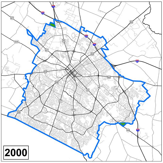
GOAL 1: UPHOLD THE URBAN SERVICE AREA CONCEPT.
Objectives:
a. Continue to monitor the absorption of vacant and underutilized land within the Urban Service Area.
b. Ensure all types of development are environmentally, economically, and socially sustainable to accommodate the future growth needs of all residents while safeguarding rural land.
c. Emphasize redevelopment of underutilized corridors.
d. Maximize development on vacant land within the Urban Service Area and promote redevelopment of underutilized land in a manner that enhances existing urban form and/or historic features.
e. Pursue strategies to activate large undeveloped landholdings within the Urban Service Area.
GOAL 2: SUPPORT THE AGRICULTURAL ECONOMY, HORSE FARMS, GENERAL AGRICULTURAL FARMS & THE RURAL CHARACTER OF THE RURAL SERVICE AREA.
Objectives:
a. Protect and enhance the natural, cultural, historic and environmental resources of Lexington-Fayette County’s Rural Service Area and Bluegrass farmland to help promote the general agricultural brand and ensure LexingtonFayette County remains the Horse Capital of the World.
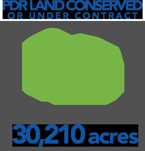
b. Support the Purchase of Development Rights and private sector farmland conservation programs to protect, preserve and enhance our signature agricultural industries, historic structures, cultural landscapes, natural environments and community welfare.
GOAL 3: MAINTAIN THE CURRENT BOUNDARIES OF THE URBAN SERVICE AREA & RURAL ACTIVITY CENTERS; & CREATE NO NEW RURAL ACTIVITY CENTERS. TO ENSURE LEXINGTON IS RESPONSIVE TO ITS FUTURE LAND USE NEEDS, THIS GOAL SHALL BE SUPERSEDED & NO LONGER IN EFFECT UPON COMPLETION OF THEME E, GOAL 4, OBJECTIVE D.
GOAL 4: PROTECT LEXINGTON’S INVALUABLE RURAL RESOURCES & INFORM LONG-RANGE PLANNING FOR INFRASTRUCTURE, COMMUNITY FACILITIES & ECONOMIC DEVELOPMENT THROUGH THE CREATION OF A NEW PROCESS FOR DETERMINING LONG-TERM LAND USE DECISIONS INVOLVING THE URBAN SERVICE BOUNDARY & RURAL ACTIVITY CENTERS.
Objectives:
a. Establish the process via a study, involving diverse stakeholders and constituents, that meets the projected needs of the agricultural and development communities, by preserving key agricultural resources from development pressures and identifying land for future urban development.
b. Ensure the study designates rural land for long-term preservation, identifies land for potential future urban development and specifies triggers, thresholds and timing for the addition of the identified urban land into the Urban Service Boundary, keeping infill and land use efficiency as the continued primary objectives.
c. Complete the study with the assistance of a consultant by July 1, 2020.
d. Implement the process resulting from the study as an amendment to the Comprehensive Plan, superseding Theme E, Goal 3 at time of adoption by the Planning Commission.

THE RESIDENTS OF LEXINGTONFAYETTE COUNTY IN THE PLANNING PROCESS.
Objectives:
a. Pursue all venues of communication, including, but not limited to, electronic and social media to involve residents.
b. Establish early and continuous communication with residents.
c. Develop a network of diverse contacts and a means to engage them.
d. Build on the On the Table initiative and continue to engage in partnerships with community organizations to reach underrepresented populations.
Objectives:
a. Establish a continually updated series of metrics to mark progress implementing the 2018 Comprehensive Plan.
b. Create a website to host the metrics, updating the general public on progress while providing transparency and supporting data.
c. Develop criteria, based upon the goals and objectives, to guide zone map amendment decisions.
Objectives:
a. Set the standard through leadership and engagement to identify and resolve regional issues.
b. Support legislative efforts and cross-border actions that improve regional planning, including, but not limited to, developing regional policies; sharing information; and planning for regional systems of transportation, open space, water supply and infrastructure.


The Elements are the strategy that provides a means to accomplish the Goals & Objectives. State law requires a comprehensive plan to address land use, transportation, and community facilities at a minimum, but Lexington has historically taken the opportunity to address housing, environmental considerations, historic preservation issues, and many other facets of the community. These elements are structured within crosscutting “THEMES” that reflect the true nature of how the community operates and interacts. Each theme also has “PILLARS” which provide organization and emphasis within each theme. Within the pillars are “POLICIES” that provide explicit direction in either an internally or externally focused way. Specific internally focused implementation items derived from these policies are “ACTION ITEMS” that serve as a work program for Planning Staff. Externally focused policies are concentrated into criteria for proposed development that are housed within “THE PLACEBUILDER”.


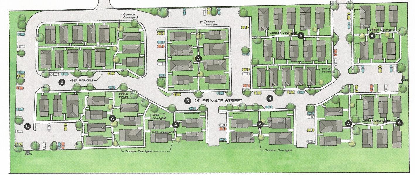
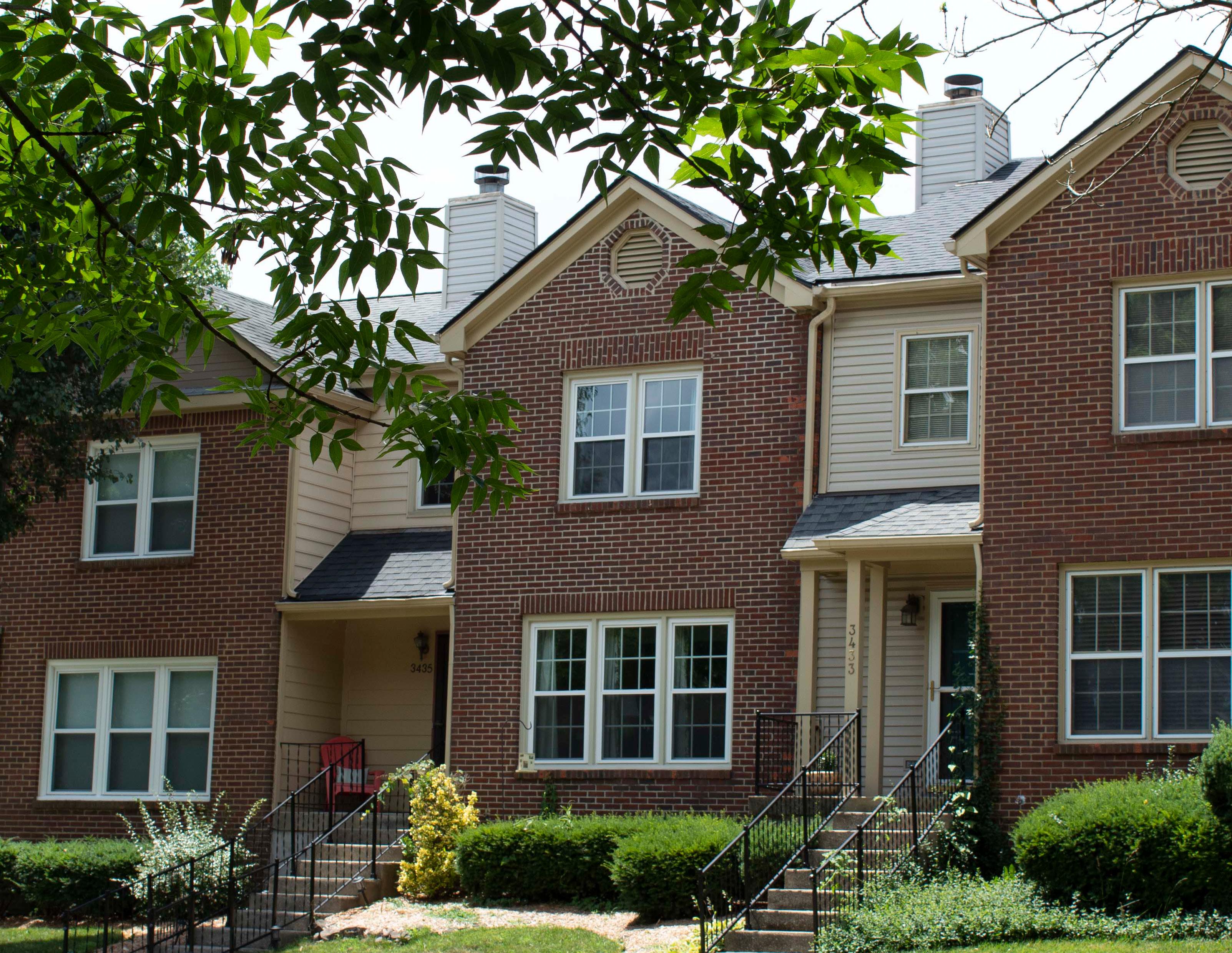
Successful neighborhoods are the building blocks of a desirable community, and the logical starting point for a comprehensive plan. Lexington’s neighborhoods, and more importantly the neighbors themselves, make up the foundation of the city. Creating diversity within these neighborhoods is key to their long-term sustainability and success. Diversity within housing types, housing affordability, land uses, transportation options, and recreational opportunities is crucial, as is creating welcoming spaces for people of all races, ethnicities, and age groups. Imagine Lexington envisions inviting neighborhoods that can serve residents throughout all stages of their lives.
Lexington is undeniably a growing city, and it is vitally important to ensure that this growth results in community. This continued urbanization of what was once considered a small university town needs to be properly managed, and great care should be taken to guarantee existing
neighborhoods are enhanced by this growth. Consciously and carefully directed growth and development will strengthen already successful neighborhoods and create vibrant new ones with a high standard of design and a focus on communitybuilding amenities.
Lexington’s growth and continued prosperity are the unmistakable signs of a desirable community. This growth is not something to be feared, but rather a unique opportunity to capitalize on forward momentum.
“DIVERSITY IN PEOPLE, HOUSING OPTIONS, & OPPORTUNITIES.”
-LEXINGTON RESIDENT

Lexington’s neighborhoods are among the community’s strongest assets. The historic downtown areas, the more traditional suburban singlefamily oriented neighborhoods, and the more recent mixeduse developments are all part of the overall landscape. If you were to ask someone what constitutes a “successful neighborhood,” you would likely receive a variety of answers based upon each individual’s own personal experience. The one consistent theme, however, would be a sense of community or belonging. Imagine Lexington seeks to foster this sense of community through new and exciting developments, but also by leveraging the quality attributes of stable existing neighborhoods.
Historically, Lexington’s neighborhood development has followed very Euclidean patterns, focusing on the separation of uses in order to minimize potential conflict. Traditionally, this was a standard practice, one which many progressive and developing cities are starting to move past with the implementation of form-based codes, design criteria, and more modern mixed-use zones. This is not to say that stable, primarily single-family neighborhoods cannot be desirable, but as they have been the predominant development product since postWorld War II, their continued development at that rate is unsustainable and consumes significant land and resources. More recently, walkable, mixeduse neighborhoods are popular
among the two fastest-growing age groups in Lexington, young professional-aged residents and senior citizens.
Lexington’s historic utilization of the Euclidean zoning scheme has in many ways contributed to an ingrained wariness of integrating mixed-use zoning and neighborhood-scale business within primarily residential areas. Recent comprehensive plans have called for more neighborhoodscale commercial, but only recently has the Zoning Ordinance been updated to accommodate this type of development in an appreciable way. Adaptive reuse and the Form-Based Neighborhood Business (B-1) options have allowed broader flexibility in smallerscale commercial development.
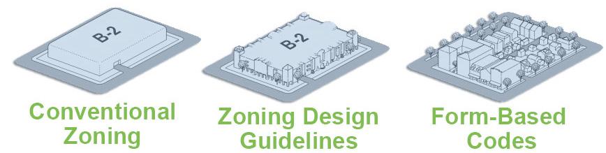
In many ways, Lexington’s initial attempts at mixed-use zoning have been unsuccessful on the neighborhood level. When Lexington created three new mixed-use zoning classifications, they were but a minor shift away from standard Euclidean zoning, and resulted in requirements that made it very difficult to implement on small sites. In turn, the most neighborhood-oriented mixeduse classification has never been used. However, the community conversation that led to the creation of those zones made it possible for the later adoption of the Form-Based B-1. Also, successful larger mixed-use (MU-2 and MU-3 zoned) projects illustrated how these spaces could be desirable on a neighborhood level. Today, the public is largely seeking more walkable commercial, and Lexington must continue to expand the available options for this type of development.
As the public perception changes and the demand for units grows, there are increasingly more residential plans that contain at least two housing types. In many cases, multi-family residential is being included in single-family developments. The local demand for multi-family housing has been
strong since the last recession. These new market-rate apartments help keep rents low, as older units lower their prices to remain competitive. However, it’s not just that increasing supply that works to improve housing affordability. Through a process called ‘filtering’ where housing ages, it becomes relatively more affordable. A significant share of affordable housing is hand-me-down housing according to a study on The LongTerm Dynamics of Affordable Rental Housing (Weicher et. al. 2017), as much as 45% of units to renters making less than 50% of the area median income, were units which were at one time owner-occupied or higher rent.
This initial shift in demand for alternative development types has started to nudge new urban development toward utilizing elements of best planning practice. Imagine Lexington hopes to reinforce this trend to offer a variety of options to Lexington residents. Providing these mixeduse and mixed-housing type developments will supplement the successful existing neighborhoods throughout Lexington and diversify the housing stock.
“AFFORDABLE SENIOR HOUSING IS GOING TO BECOME A MUCH LARGER PROBLEM. WITH 30,000 MORE SENIORS PROJECTED BY 2035, SOMETHING NEEDS TO BE DONE.”
-LEXINGTON RESIDENT


design density equity


As Lexington continues to mature and urbanize, it is important to develop in a way that builds community. Development which may accomplish goals of infill, density, and utilization of vacant or underutilized property, but is not executed in a way that meets the other goals of the Comprehensive Plan, is not desirable. Allowing this type of development would be a missed opportunity to both grow and enhance the community at the same time. One of the major shifts in the
2013 Comprehensive Plan was the exclusion of a land use map for the first time. While many were clearly concerned about the absence of this longstanding mainstay from the plan, the Planning Commission thought it important to provide some flexibility in the process to allow for innovative development solutions. Imagine Lexington will further refine this concept and provide additional focus on the policies that will shape the types of developments proposed. Design plays a large role in this
and takes on additional emphasis in this Plan. Ensuring contextsensitive design that follows best practices and provides quality opportunities to enjoy greenspace and open space will guarantee successful neighborhoods that stand the test of time and benefit Lexington as a whole.
Throughout the process of completing the small area plans called for in the 2013 Comprehensive Plan, it became clear that many neighborhoods are
not nearly as opposed to multifamily housing if they believe the design adds something attractive to the neighborhood fabric. As part of the Winburn Small Area Plan, a set of design standards were developed in order to raise the bar and improve upon the housing stock in the area. The standards were drafted to be portable and evergreen to multifamily development throughout Lexington, covering basic concepts that will activate streets and make sites safer for all residents in the neighborhood. They were not
“BUILD OWNEROCCUPIED, HIGHER-DENSITY, MULTI-FAMILY DWELLINGS [THAT ARE] FUNCTIONAL, ATTRACTIVE, & WORTHY OF OWNING.”
-LEXINGTON RESIDENT
aimed at reducing density or dictating construction materials. Developers in the study area on subsequent zone changes found the guidance useful in reassuring the adjacent neighborhoods about what residents should expect to see in the future. This is the type of design guidance Imagine Lexington seeks to provide for the entire community.
As neighborhoods and houses are where people spend the majority of their time, they must be welldesigned, and new neighborhoods should be incorporated into adjacent developments in ways that enhance the existing. Commercial developments should support the nearby community in an intentional way; multi-family housing should be designed such that it complements its surroundings; streets should be planned to accommodate all users, starting with the pedestrian first; and single-family housing should
minimize the impact of garages and driveways on the streetscape. New, more compact forms of single-family detached development should be accommodated by the zoning ordinance in order to reflect the fact that, while that type of housing is still a vital component of our housing strategy, it too must evolve.
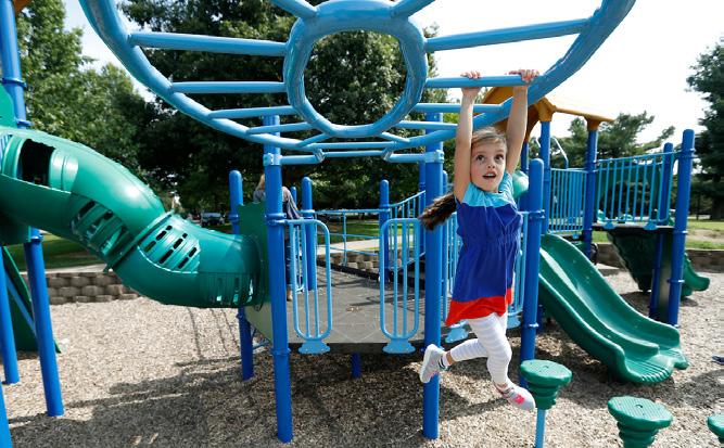
As important as well-designed living spaces are to residents, it is also necessary to incorporate strong design principles into a wider array of neighborhood amenities. First and foremost, there must be amenities in close proximity to all residents. New developments should provide usable and appropriate greenspace that is not simply an afterthought – or the non-developable remnant of a piece of property. Whether programmed or not, greenspace should be thoughtfully designed for those within the neighborhood as well as those nearby. Neighborhood
parks are an important component of a desirable community, and Imagine Lexington seeks to bolster the goal of Parks & Recreation to provide all residents a park within a 10-minute walk.
These types of greenspace and parks can often serve as a neighborhood focal point, a concept introduced in the 2013 Comprehensive Plan and carried forward in this one. Residents need common open space where they can congregate and socialize and children can play. These areas should be safe, highly visible, and integrated within neighborhoods. In the past, schools and public parks have partially fulfilled this goal; however, there is clearly a need to create additional spaces so all residents have access to this component of successful neighborhoods. New developments should incorporate these types of focal points.
With regard to community facilities, there is an acknowledgment that Parks has facilities, but not programming; and that the Library has programming but lacks a way to provide it for the residents who need it. Schools have ample space, but also lack after-school programming. In meetings with representatives
from Parks and Recreation, Lexington Public Library and Fayette County Public Schools, there was a willingness to explore the sharing of facilities and programming in order to serve a much wider range of constituents and share facilities costs. Innovative solutions like these that better serve residents and taxpayers should be explored.
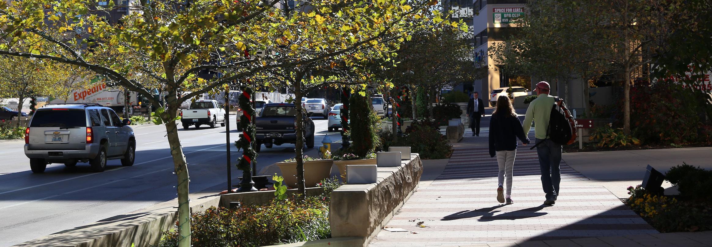
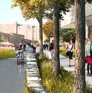
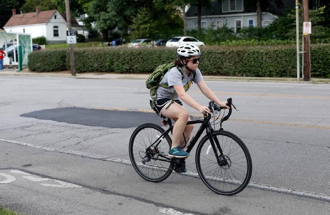
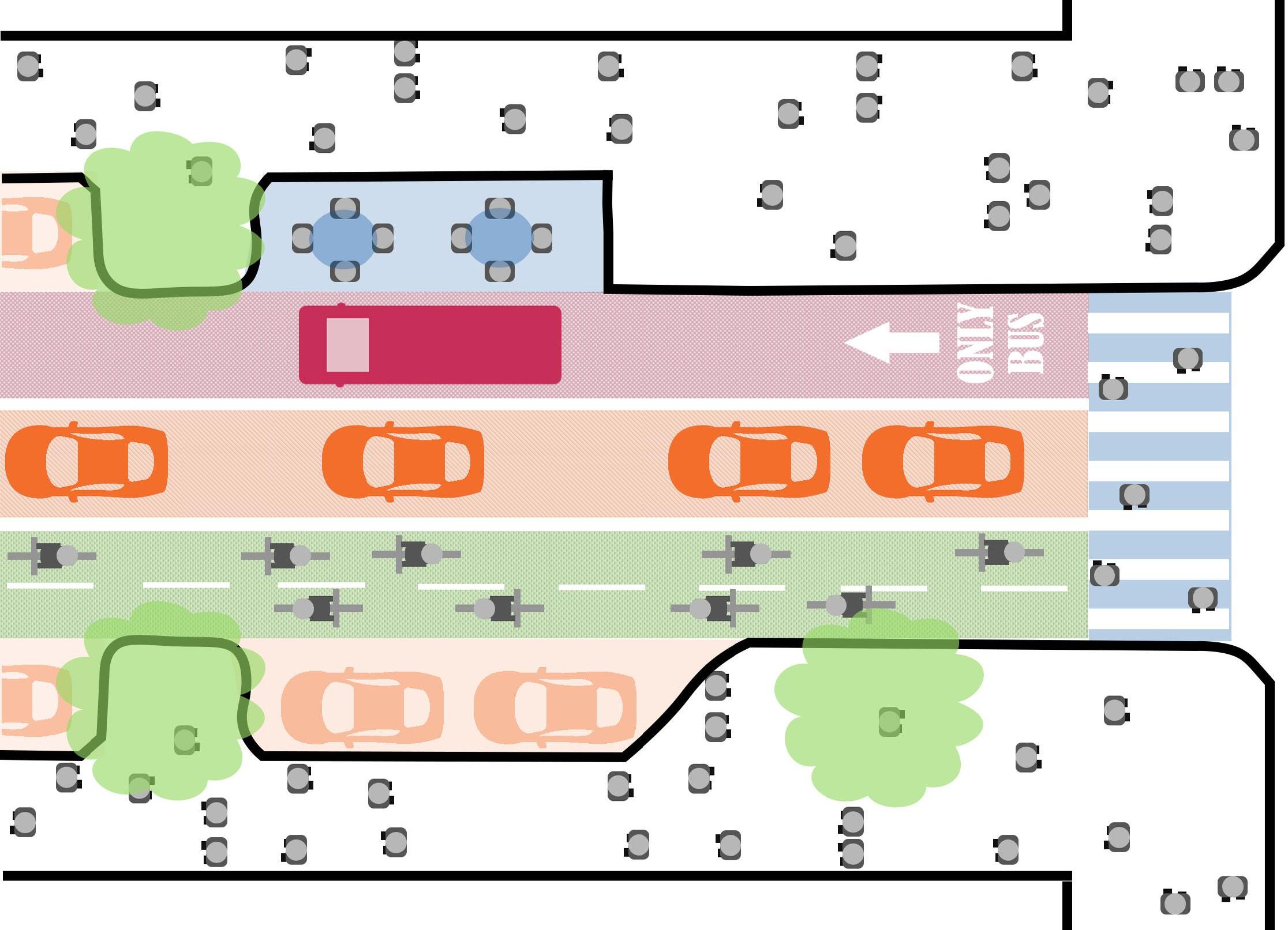
In addition to the provision of amenities and destinations for neighborhoods new and old, consideration must be given to the transportation options that allow residents access to them. Thoughtful connections are key, and the need to provide better facilities for pedestrians and bicyclists to put them on par with vehicle drivers is of critical importance. The ability for residents to walk to destinations near their neighborhood is something many people are looking for when choosing a place to live. Wider sidewalks and bike facilities are crucial to the next great neighborhood.
UTILIZE A PEOPLE-FIRST DESIGN, ENSURING THAT ROADWAYS ARE MOVING PEOPLE EFFICIENTLY & PROVIDING EQUITABLE PEDESTRIAN INFRASTRUCTURE.
People-first neighborhood design requires the provision of transit/ transportation infrastructure that places pedestrians, bicycle riders and mass transit users on the same level as automobiles. Mass transit infrastructure should be considered essential. Proposed developments on current transit lines or future expected routes should enhance existing infrastructure to accommodate the new or increased ridership. Shelters and seating options should be scaled, added or improved accordingly. Development should provide direct pedestrian and bicycle linkages to transit. Pedestrian infrastructure should include wide sidewalks on both sides of streets and separated bike lanes wherever possible. Further, a people-first design should ensure
that pedestrian and bicycle users’ safety is assured by the incorporation of traffic calming measures that slows traffic and increases driver awareness.

AMEND SUBDIVISION REGULATIONS STREET STANDARDS. ACTION ITEM
“STREETS ARE OUR MOST COMMON PUBLIC SPACE, BUT THEY CURRENTLY SERVE ONLY ONE FUNCTION. ALLOWING STREETS TO BECOME MULTI-FUNCTIONAL/MULTI-PURPOSE WILL BENEFIT THE CITY." -LEXINGTON RESIDENT


ENSURE PROPER ROAD CONNECTIONS ARE IN PLACE TO ENHANCE SERVICE TIMES & ACCESS TO FIRE & POLICE SERVICES FOR ALL RESIDENTS.
There is often opposition to connecting roads between developments, as residents believe that the increased traffic will negatively affect their property. However, it is important to note that there are many benefits to
the increased connectivity that further the health, safety, and welfare of the community.
“Providing a strong connected network of roads and pedestrian facilities can help distribute traffic,
reduce travel distances and times, improve routing for transit and reduce walking distances. Good connectivity also provides better routing opportunities for emergency and delivery (solid waste, recycling, mail) vehicles. All
of these effects can play a positive role in reducing congestion on the street network.” - Kentucky Transportation Cabinet
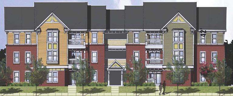
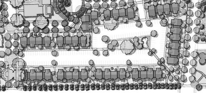
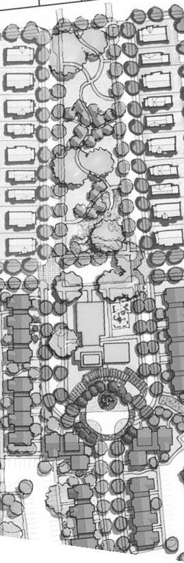
Connected vs. cul-de-sac street design. Source: Transportation & Growth Management Oregon Guide for Reducing Street WidthsMULTI-FAMILY RESIDENTIAL DEVELOPMENTS SHOULD COMPLY WITH THE MULTI-FAMILY DESIGN STANDARDS IN APPENDIX A.
In the Winburn Small Area plan, design standards were created in order to address neighborhood concerns and to ensure that many of the problems historically created through poor design would not be repeated in the future. Special attention was paid during the creation of the standards to ensure that new multi-family developments will be properly oriented for pedestrians and site safety, and will create a strong sense of place. The design standards were developed with the intention of being portable for inclusion in the 2018 Comprehensive Plan. The same design principles established to create desirable multi-family development in Winburn, are also applicable throughout Lexington.
-LEXINGTON RESIDENT
THE BENEFITS OF CONTEXT-SENSITIVE SITE PLANNING & DESIGN
LAGRO, J. A. (2013). SITE ANALYSIS: INFORMING CONTEXT-SENSITIVE AND SUSTAINABLE SITE PLANNING AND DESIGN. JOHN WILEY & SONS. P.11
PROVIDE DEVELOPMENT THAT IS SENSITIVE TO THE SURROUNDING CONTEXT.
Context-sensitive development is compatible and complementary to adjacent neighborhoods and communities. It enhances the existing neighborhoods through land uses and development patterns that are sensitive to the nearby built and natural environments. This does not mean all developments should be homogeneous or that Lexington should continue its history of highly separated land uses and residential densities, but rather new development should be connected to existing neighborhoods in a meaningful way that brings a higher quality of life to all residents by creating a sense of place. These connections can be made through providing complementary uses (neighborhood-serving retail, places of employment, community greenspaces and open areas, and other neighborhood focal points), as well as physical multimodal connections. The connection of uses should be done through an appropriate scale that makes them accessible and not out of place or intrusive. Intensity stepdowns and buffers (where necessary) should be used to ensure compatibility.
PROVIDE PEDESTRIAN-FRIENDLY STREET PATTERNS & WALKABLE BLOCKS TO CREATE INVITING STREETSCAPES.
Street design matters. Creating a neighborhood environment that is not only able to be walked, but is actually inviting and walkable is vital to providing a safe way for people to move from place to place. When designing the street facilities, developers should, “consider how to keep people walking separate from people driving vehicles; keep traffic speeds low; ensure sidewalks and curb ramps are accessible to people with disabilities; and clarify where each road user should be expected to travel” (Dangerous by Design, 2016).
Traffic speeds dramatically affect a pedestrian’s actual and perceived sense of safety, as well as the quality of life in neighborhoods. Likewise, speeding is a common concern for residents. The same 2016 publication above reported that pedestrians struck by a motor vehicle traveling at 40 miles
per hour are fatally injured 65 percent of the time. Speeds at 30 mph reduce the risk of death to 18 percent. Only 6 percent of pedestrians struck by vehicles traveling at 20 mph are fatally injured. It is important, therefore, to reduce vehicle speeds in high pedestrian activity areas, such as neighborhoods, commercial areas, schools and parks.
Vehicle speeds are heavily influenced by roadway design, regardless of the posted speed limit. Narrow, curvilinear streets with on-street parking and street trees help to slow traffic and create a pedestrian-friendly atmosphere. Residential streets that are overly wide and straight and lack a vertical edge, such as trees or buildings, enable fast-moving traffic. It is also important to consider land uses and their relationship to the streets within the neighborhood. Thoughtful attention should be given to ensuring there is a people-first building orientation, and pedestrian-oriented uses activating the ground level.
Placemaking and walkability are important to the success of Lexington and its neighborhoods. A variety of best-practice reviews
show that property values tend to be higher in more walkable neighborhoods that contain a mix of nearby destinations connected by pedestrianfriendly streets. Additionally, research shows that this type of development is particularly desirable for the senior and young professional-aged populations that comprise the majority of Lexington’s future growth.
“PROVIDE
TO SERVICES & BUSINESSES WITHOUT THE USE OF A CAR OR PUBLIC TRANSIT."-LEXINGTON RESIDENT
ADHERE TO THE RECOMMENDATIONS OF THE LEXINGTON AREA MPO BIKE/ PEDESTRIAN MASTER PLAN, ADOPTED IN 2018.
The 2018 Bike/Pedestrian Plan, called ConnectLex, envisions
“a network of high quality walkways and bikeways that connects communities and fosters economic growth and regional collaboration. People of all ages and abilities will have access to comfortable and convenient walking and biking routes, resulting in true mobility choice, improved economic opportunity, and healthier lifestyles. Across the region, a culture of safety and respect is cultivated for people traveling by foot or bike, whether for transportation or recreation.” The plan identifies a multitude of bicycle and pedestrian projects that should be addressed throughout the duration of this Comprehensive Plan.
DESIGN CAR PARKING AREAS SO AS NOT TO BE THE PRIMARY VISUAL COMPONENT OF THE NEIGHBORHOOD.
New residential development should minimize the visual appearance of parking lots on streets to preserve that space for use that will activate the front yards and sidewalks for pedestrians and bicyclists. This can be achieved by placing parking lots to the rear or interior of the site, so that the building fronts along a public street. This increases the structure’s visual aesthetic, the walkability of the development, and allows for better integration into the existing pattern of the area. For areas where this is not feasible, screening and buffering with trees and shrubs can soften the impact of parking areas on adjacent properties.
For parking structures, providing an active ground level with uses such as retail, restaurants, or visually compelling or interactive art installations can positively impact the structure’s integration into the surrounding area and help it to achieve harmony with adjacent buildings.
PROVIDE VARIED HOUSING CHOICE.
By providing housing choices within a neighborhood, residents of a community have greater options of where to live, particularly when the components of housing choice include access to jobs and schools, affordability, and housing type. Diverse neighborhoods feature town-homes, apartments,condominiums and duplex housing adjacent to and mixed with single-family homes. They provide the opportunity for more personal interaction and security. The added population of higher-density residential development increases the viability of neighborhood-serving commercial development as well.
“MIX RESIDENTIAL, OFFICE, & RETAIL. MIX INCOME LEVELS & SIZES OF HOMES."-LEXINGTON RESIDENT


 Gonzales Gardens MP, Columbia, SC (Lord Aeck Sargent)
PROVIDE ADEQUATE GREENSPACE FOR ALL NEIGHBORHOODS WITHIN WALKING DISTANCE.
Greenspace is key to successful neighborhoods. It has the benefits of improving air quality, providing social interactions, and improving public health. An interconnected and accessible greenspace system consisting of vibrant and attractive public spaces, healthy natural areas and plentiful recreational opportunities create neighborhoods where people want to live.
Over the years, greenspace has evolved far beyond the definition of rural landscapes. Greenspace encompasses public parks, trails, boulevards, activity lawns, schoolyards, public plazas, amphitheaters, stormwater basins, the arboretum, cemeteries, etc. Based on the input from the Greenspace Survey in 2016, people have a strong desire for accessible greenspace. People have a preference to reside close to greenspace
that they are able to walk to. Since 2007, when green infrastructure was introduced in the Comprehensive Plan, it has continued to play a strong role in protecting Lexington’s cultural landscape and urban forms. At the same time, it was a sustainable tool for stormwater management, and was incorporated into the Stormwater Manual as a requirement in 2016. Nevertheless, green infrastructure has become an important part of the greenspace system.
Regional parks such as Masterson Station and the Kentucky Horse Park have big venues, functional for large events, while people also desire neighborhood pocket parks where they can enjoy and gather on a regular basis.
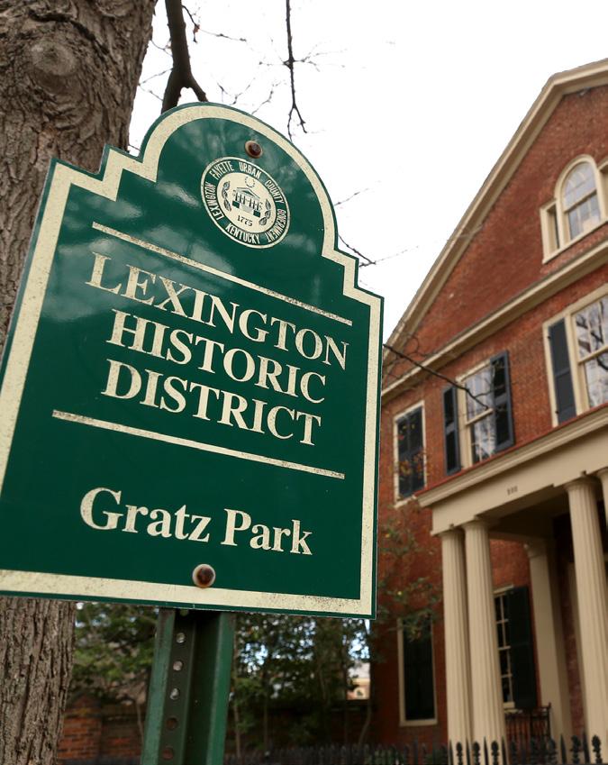
As shown from Your Parks Our Future city survey by LFUCG Parks and Recreation, the recreational greenspace opportunities that made the priority list are walking and hiking trails, natural areas/ nature parks, small neighborhood parks, paved bike trails and indoor swimming pools. Successful neighborhoods such as Gratz Park, Bell Court, Woodland Park, Ashland Park and Downtown are all recognized by their accessible greenspace, inevitably contributing
to the overall Bluegrass identity. Indicative of Lexington’s roots, settlement patterns for these older neighborhoods are characterized by narrower interconnected streets and sidewalks, with structures oriented toward the street or park, which create a vibrant relationship with the public domain.
In the ongoing Your Parks Our Future, Parks is planning to take a systematic approach and meet ambitious goals. The Strategic Plan recommends an increase in the population served within a tenminute walk of a Neighborhood Park (or larger) from the current 40% to 65%, and to increase the population served within a fiveminute drive of a Community Park (or larger) from the current 70% to 85%, through development of existing parkland and new parks in growing areas.
ACTION ITEM
AMEND ZONING ORDINANCE TO REDEFINE OPEN SPACE REQUIREMENTS.
“SHORT DISTANCES/ EASY ACCESS TO PARKS & NATURE."
-LEXINGTON RESIDENT
 Gonzales Gardens Master Plan, Columbia, SC (Lord Aeck Sargent)
PROVIDE NEIGHBORHOOD FOCAL POINTS ACCESSIBLE TO ALL RESIDENTS.
Neighborhood focal points can be a gathering space such as a park, greenspace, a shopping center, a community center or public square. To the extent possible, new residential development should be developed with new focal points in mind by allowing for easy, multimodal access from the neighborhood instead of development that turns its back on the community hub.
ACTION ITEM
INVENTORY EXISTING NEIGHBORHOOD FOCAL POINTS & PERFORM GAP ANALYSIS.
“NEED
NEIGHBORHOOD 'PLACE-MAKING' ATTRACTIONS & ACTIVITIES FOR ALL AGES." -LEXINGTON RESIDENT
SINGLE-LOADED STREETS
SHOULD BE UTILIZED IN ORDER TO ESTABLISH CLEAR PUBLIC ACCESS TO NEIGHBORHOOD FOCAL POINTS.
Even passive greenspace requires clear, visible access in order to fulfill the needs of a neighborhood. A focal point should be clearly delineated from private lots in order to be welcoming to all residents. Development of focal points on single loaded streets removes any opportunity for them to be tucked away unsafely in the backyards of private homes.
SUPPORT NEIGHBORHOOD-LEVEL COMMERCIAL AREAS.
In many neighborhoods developed decades ago, the commercial areas designated to serve as neighborhood focal points have become poorly utilized or have slowly deteriorated and need additional investment. Proactively rezoning these sites from Neighborhood Business (B-1) to Commercial Center Zone (B-6P) would afford new flexibility at a neighborhood scale. Providing opportunities to increase residential density and professional/commercial intensity that could spur economic investment is an important step that the Government could take, using that opportunity to re-establish a new or better community focal point.
Providing better multi modal access integration for all commercial developments from adjacent neighborhoods can transform underutilized properties into continually active areas, becoming the
neighborhood focal points that their communities need them to be, while also creating better access to goods and services for residents.
AMEND ZONING ORDINANCE TO ENCOURAGE RESIDENTIAL DEVELOPMENT WITHIN EXISTING NEIGHBORHOODSERVING BUSINESS DISTRICTS.
DEVELOPMENT SHOULD CONNECT TO ADJACENT STUB STREETS & MAXIMIZE THE STREET NETWORK.
Connected streets provide direct, continuous routes and multiple route options. This reduces response times for emergency vehicles and improves access and efficiency for transit, school buses, and service vehicles, including solid waste trucks and street sweepers. Creating a robust street system with multiple routes to neighborhood destinations is unquestionably a best planning practice. Dispersing the traffic of an entire area onto multiple collector and local streets makes every street in a neighborhood desirable, and none too overburdened.
Stub streets are closed-end streets that do not contribute to the critical connectivity described above. Stub streets are similar to cul-de-sacs except that they provide no turnaround circle at their closed end, and they are only acceptable as a temporary street condition. Planning staff will undertake additional revisions to the subdivision regulations to require signage at all stub streets to alert neighborhood residents that future roadway connections will be made, and how they may discuss the timing and impacts with staff.

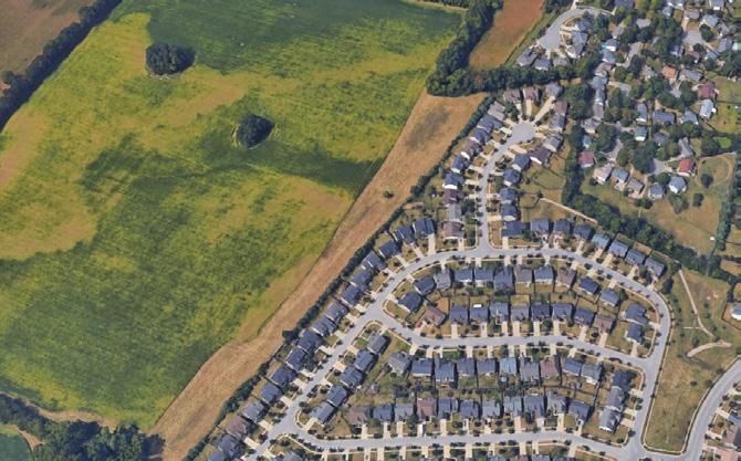
Throughout Imagine Lexington’s Goals and Objectives extensive public outreach effort, it was clear that the overwhelming opinion of the community is to maintain the Urban Service Boundary in its current location. However, the implications are that development within the Urban Service Boundary must become more compact and efficient as Lexington continues to grow consistently. With roughly 90% of the area within the boundary developed, Lexington must make the most of the remaining 10%, as well as maximize redevelopment efforts.
With this more compact development pattern comes inherent benefits to the community, beyond simply the preservation of agricultural land. These developments provide for more efficient use of infrastructure, more walkable spaces, enhanced transit opportunities, affordable housing opportunities, and numerous environmental
benefits as well. Though these principles of efficient use of land and sustainable development patterns should be implemented across Lexington, it should be noted that the majority of the redevelopment and infill efforts are recommended to be located along major commercial corridors, downtown, and targeted transitional areas. This plan does not advocate for the dismantling of stable single-family neighborhoods, but rather creating a more complete community.
A complete community is one that meets people’s needs for everyday living, to include a mix of housing (with regard to type and affordability), local services, community infrastructure, jobs, schools, and recreation/open space for the residents. Complete streets, efficiency of land use, livability and sustainability (now and for future generations) are its main characteristics. A complete community is, in effect, a mixed-use development on a

community-wide scale that helps to create a sense of place.
This compact development reduces costs for buildings and infrastructure, as communities can use the same roads, water, sewers and utilities to serve both existing and new development, rather than providing new infrastructure. Provision of services such as fire and police protection is also more effective and efficient. Compact development also has economic benefits; it has been documented in several instances that compact development increases tax revenue (i.e., generates more income per acre) for communities that develop at higher densities.
Research has shown that, in the projected population increase of 80,000 new residents, the largest demographics represented will be young professionals and senior citizens.. It is important to note that national data indicates that housing preferences for these two age groups include products that are walkable and require limited maintenance. Providing developments that support these land use patterns
will ensure Lexington remains responsive to the future needs of these populations.
While many citizens promote maintaining the Urban Service Boundary throughout the Imagine Lexington process, a disconnect appears to be present in the implementation of the types of compact development required to do so. Infill development, which occurs when vacant land is developed within the Boundary, is often met with resistance from adjoining neighborhoods; residents cite traffic, density, and degradation of greenspace as some of their many reasons for opposition. While many of the concerns are legitimate, this Plan seeks to correct those issues through design – again ensuring that new development enhances existing neighborhoods. As Lexington continues to improve in this area, and as Planning fortifies and improves education about infill and redevelopment policies, residents should gain a better understanding of how these policies help to meet the vision of the community on a number of levels.
“OUR CITY IS UNIQUE BECAUSE OF THE BEAUTIFUL FARMS SURROUNDING OUR VIBRANT CITY. BY MAINTAINING THE USB, WE CAN MAXIMIZE URBAN 'INFILL' & NEIGHBORHOOD REDEVELOPMENT.”
Data recent as of 12/31/2016
THE HIGHEST DENSITY OF OUR RESIDENTIAL DEVELOPMENT SHOULD BE DIRECTED TO OUR MAJOR CORRIDORS & DOWNTOWN.
Given Lexington’s ever-increasing population, the community’s expressed desire to create exciting walkable places, and the goal of preserving valuable agricultural land, density is very important. However, high density development is not appropriate in every context. As stressed within the “Design” vision and policies, density should address the context of its surroundings.
Imagine Lexington intends to direct the highest density/intensity development to the major corridors and downtown area to bolster the viability of an enhanced transit service. Doing so also ensures that the bulk of the highest density residential development occurs outside of existing thriving neighborhoods. Where corridor development and thriving neighborhoods merge, transitions and step-downs should mitigate intrusion. Corridor development should also include multimodal connections to adjacent developments and neighborhoods, incorporating them into the context of the neighborhood.
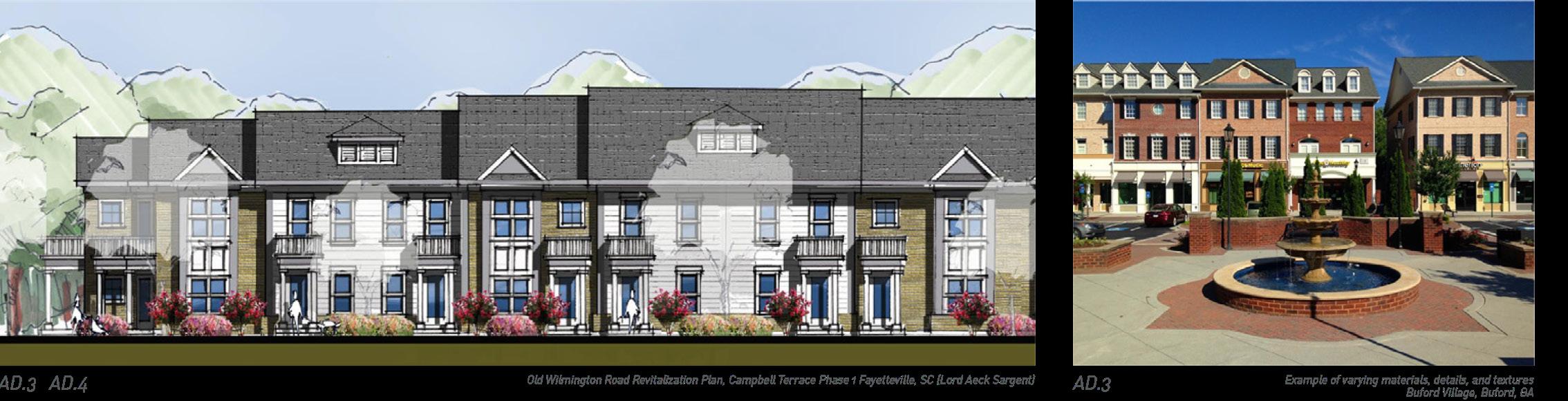
OLD WILMINGTON ROAD REVITALIZATION PLAN, CAMPBELL TERRACE PHASE 1 FAYETTEVILLE, SC (LORD AECK SARGENT)
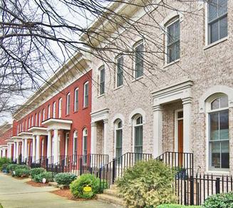
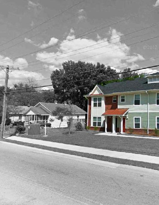
INFILL RESIDENTIAL CAN & SHOULD AIM TO INCREASE DENSITY WHILE ENHANCING EXISTING NEIGHBORHOODS THROUGH CONTEXT SENSITIVE DESIGN.
In areas where the preservation of existing neighborhood design characteristics is of high importance, infill residential should apply the recurring building patterns of the area. It is wholly possible to add residential units while matching the consistent rhythm of existing development, so that the new seamlessly blends in with the old. Significant contrasts in scale, massing and design should be minimized while attempting to not impact the density of a proposed development.
EXAMPLE OF TRANSITION IN HEIGHT TO EXISTING NEIGHBORHOOD
CAMPBELL TERRACE PHASE 1 FAYETTEVILLE, SC (LORD AECK SARGENT)
EVALUATE & AMEND RESIDENTIAL ZONES TO ALLOW GREATER HOUSING OPPORTUNITIES.
INMAN VILLAGE, ATLANTA, GACREATE OPPORTUNITIES FOR ADDITIONAL NEIGHBORHOOD SUPPORTIVE USES, ESPECIALLY IN AREAS WHERE SERVICES ARE LACKING.
Ideal neighborhoods include not only a mix of housing types, but also a mix of uses, including neighborhood-serving businesses and opportunities for work and leisure. Incorporating more of these uses into existing neighborhoods as well as new developments should be encouraged. Not all commercial development proposals near residential neighborhoods should be considered supportive, but those that also respond to the “Design” and “Equity” policies, and provide a clear neighborhood need, can be. Additionally, commercial development near residential neighborhoods should not be rejected because it might generate activity near that neighborhood. Vibrant neighborhoods include a range of uses.
Previous efforts to grow neighborhoodscale commercial areas came at a time when traditional anchor retailers were continually closing smaller stores to concentrate their efforts on larger big-box style footprints in higher traffic
areas. Competition among retailers nationally meant that scale was the driving factor, and neighborhood business zones were no longer suitable for their needs. The loss of anchor tenants reduced the overall viability of the commercial spaces. Given the shifting nature of retail in an e-commerce era, businesses must re-imagine the way they are meeting the needs of the neighborhood.
Today’s successful neighborhood commercial has a much stronger sense of place, where residents of the area prioritize convenience over cost. Restaurants, personal services, and boutique shopping with integrated community social spaces are the hallmarks of successful small-scale commercial areas like Romany Road and the ever-evolving Southland Drive. Redevelopment of existing commercial centers should focus primarily on creating a space for people to spend time, and smaller spaces for people to shop and work. Including new residential units can in turn complement the space and provide a transition to the surrounding neighborhood.
PERFORM GAP ANALYSIS OF EXISTING NEIGHBORHOODS TO IDENTIFY ENHANCEMENT OPPORTUNITIES FOR NEW SUPPORTIVE USES.
GENERALLY, LOCATE HIGH-DENSITY AREAS OF DEVELOPMENT ALONG HIGHER CAPACITY ROADWAYS (MINOR ARTERIAL, COLLECTOR) TO FACILITATE FUTURE TRANSIT ENHANCEMENTS.
This plan recommends that the highest density development should be concentrated toward the major corridors and downtown to facilitate transit-oriented development that would begin to support Bus Rapid Transit opportunities. In a similar fashion,
where high density apartment development occurs outside of those areas, it should be generally focused toward the minor arterials and collectors so that they can be more easily served by future transit service. Additionally, reducing the number of automobile trips on local streets lowers associated infrastructure maintenance costs. As most parks and schools are located on collector streets and minor arterials, this places the higher density units, which lack private open space, closer to community gathering places.
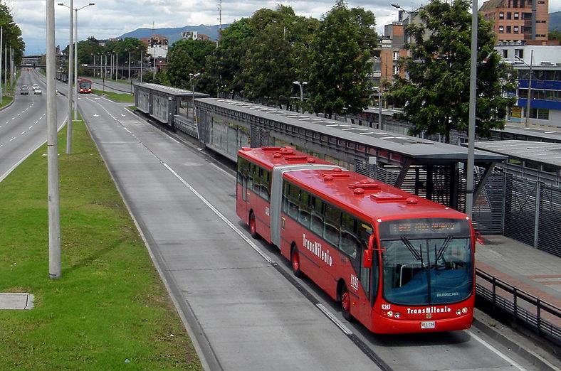
PROVIDE AFFORDABLE AND/OR COMPACT RESIDENTIAL OPTIONS THROUGH ACCESSORY DWELLING UNITS.
An Accessory Dwelling Unit (ADU) is defined as a second, smaller detached dwelling on the same property, or one that is attached to an existing singlefamily house, such as a basement or over-the-garage apartment. As Lexington continues to grow, ADUs can play a role in meeting the overall housing demand.
ADUs are not a new idea, and examples of them can be found throughout the United States. Old alley apartments in DC, or carriage houses in fine old Seattle homes, have been around for a long time, but they fell out of favor in the middle of the 20th century.
Now they are an increasingly popular and important housing option in urbanizing cities today. Where Lexington has traditionally had a significant portion of its development controlled by a handful of developer/builders, ADUs essentially create a whole
new market (a ‘cottage’ industry, if you will) for small builders to construct a housing product the community needs. There is tremendous opportunity to enhance existing neighborhoods by building new context sensitive ADUs. In areas where property values have increased dramatically and tear-down/rebuilds have started to shift the appearance of the neighborhood, the creation of an accessory dwelling unit could make retention of an existing principal structure more economically viable. Cities and neighborhoods are always changing and evolving. They are either improving or declining. Enhancing existing neighborhoods means not preserving them exactly as they have always been; rather, steering their evolution in a way that benefits those residents, while making it accessible to as many people as possible.
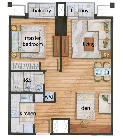
Lexington needs more housing of all types as its population continues to grow. The 2017 Housing Demand Study shows that single-family residential options continue to be popular and will be for the foreseeable future. However, the paradigm for providing these single-family homes is shifting from the larger suburban model lots to a more compact and urban form of single-family home, such as townhomes, fourplexes, and others.
One way to provide for this type of development would be amending the regulations to allow group residential developments that include single-family housing. This compact type of development allows for shared common space and reduced maintenance, which are ideal for the senior and youngprofessional aged populations. Compact lots mean less time and money for maintenance, more opportunities for social interactions in shared open spaces, more economic efficiency for infrastructure services, and safer neighborhoods. Other innovative and new solutions that incorporate efficiently designed singlefamily housing as a component of an overall development should be explored as well.
TOTAL INCREMENTAL UNITS REQUIRED IN 2025 2017 FAYETTE COUNTY HOUSING DEMAND STUDY; DATE SOURCE: URBAN PARTNERS
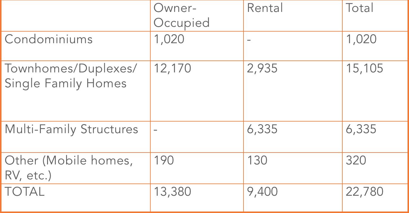

Equity and equality sound similar, but are very different concepts. Equality means sameness, while equity refers to access and opportunity. It is not the goal of the Comprehensive Plan to provide equality in housing, such that all residents would have the same size house, or purchase a home instead of renting. To the extent that public policy can eliminate the opportunity gap for Lexington’s underprivileged, it is time to address the issue, with full acknowledgment that the private market does not typically accommodate that need unless incentivized or regulated. Inequity in communities exists for numerous reasons, many of
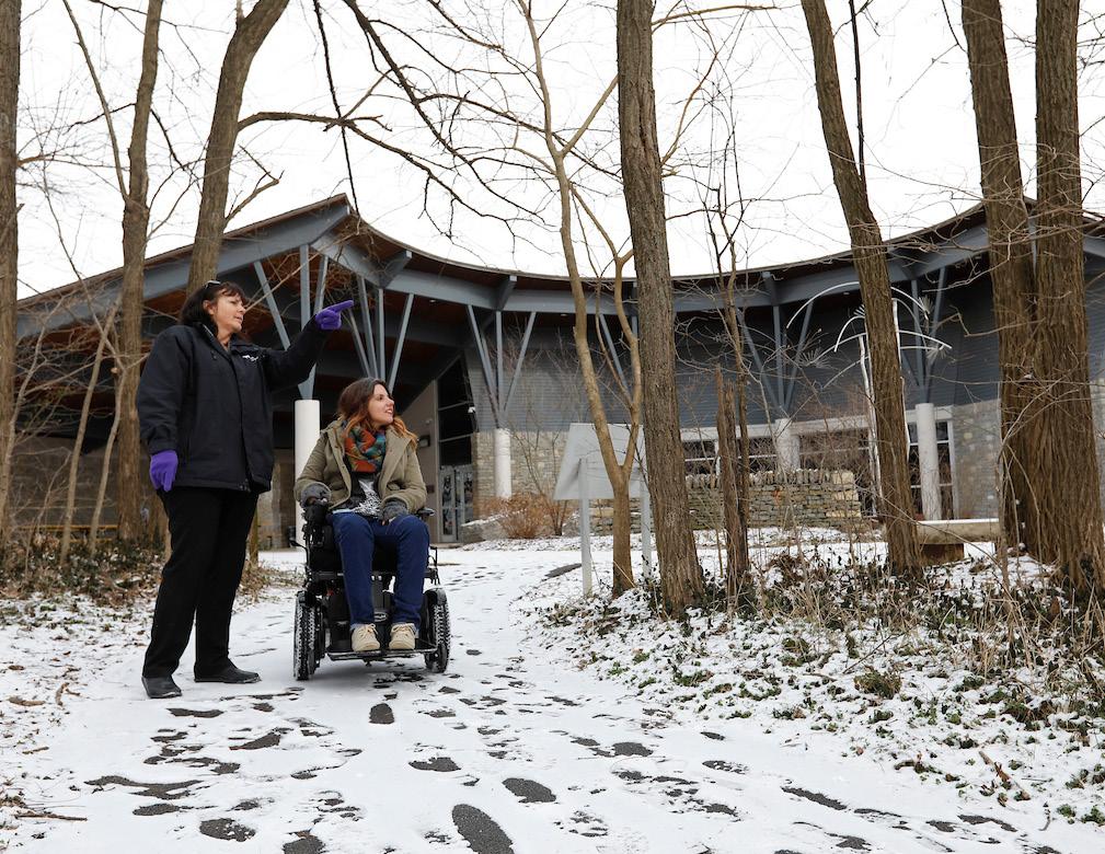
which are outside of Planning’s regulatory sphere. There is much that can be done, however, through day-to-day review of zoning applications, if equity is given as much weight as design and density.
Lexington is a very desirable place to live. The unfortunate byproduct of this desirability is that housing becomes less and less affordable as demand pressures intensify. Over 60% of Lexington’s housing stock is comprised of single-family detached, the most expensive housing type available. This is an indicator that equity in housing is an issue in this city which, if not addressed, will fuel the wealth gap and exacerbate
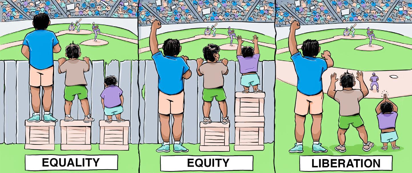
historically rooted segregation. As the demand for housing in traditionally minority and disadvantaged communities becomes stronger and more desirable, there will be serious issues caused by the gentrification of those neighborhoods for the existing residents. An equitable housing policy is suggested to mitigate the effects and ensure there are places for existing residents to live within the community they know so well. Lexington’s housing policies can and should address the displacement caused by the market forces of gentrification. Because regulations are unable to react at the pace of these market
forces, efforts are best focused on having a plan to provide housing to everyone, in all areas of the city. Ensuring an adequate supply of units, and more importantly, creating the regulatory framework to allow it, should help alleviate the effects of market-driven gentrification. Additionally, the City has created a “Neighborhoods in Transition” task force to address the impacts of neighborhood redevelopment and transformation as this occurs.
Lexington’s proportion of singlefamily detached homes relative to the overall mix of housing is larger than in other urbanized cities of similar size. In these areas, the
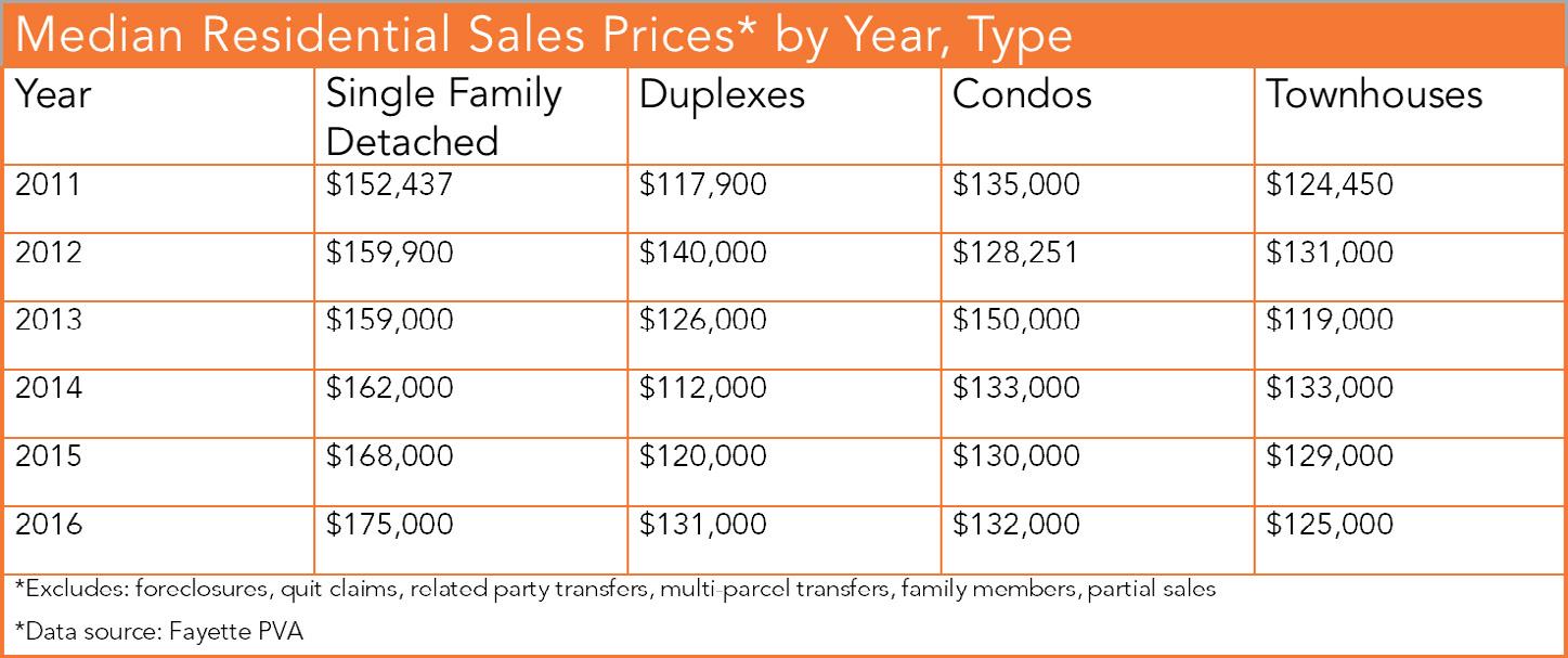
suburbs outside of the city limits have absorbed more and more of the singlefamily detached homes, and the city itself has provided less new housing of this type relative to the overall mix. This is not unlike the single-family developments appearing in Jessamine, Scott, and Lexington’s other adjacent counties. Fayette County’s proportion of overall residential building permits has remained fairly consistent over the years, yet the proportion of single-family building permits has decreased. This trend is expected to continue, as Lexington is just beginning to see increased densification of its urban core and arterials. It is important to note that this does not indicate a cessation in the production of single-family detached housing, but rather an emphasis in the production of other housing types.
Providing this mix of housing types, diversifying housing stock, and producing increasingly more units will result in greater housing affordability across the board as Lexington evolves and matures as a city. This will require that townhouses, condominiums and multi-family dwelling units replace single-family detached as the primary housing type of new construction. This is not the death knell of a great city; dying cities do not have the problem of where to house new residents. Rather, dying cities are trying to find new
residents. Lexington’s urbanization is the sign of a vibrant, attractive city that is growing responsibly and in a manner that the local government can afford to provide adequate public infrastructure. Providing options for residents, both current and future, will address equity in Lexington and ensure it continues to grow and prosper.
Equity policies will not only address housing, but also transit and code enforcement; all policy areas where public investment will yield the greatest impact. Equity also includes the ability of the community to provide at-risk citizens with access to the services they need: essential community facilities, age-friendly residential options, and walkable commercial areas. The everyday community assets many take for granted are completely unavailable to a substantial number of residents, and planning policy should address these issues where possible. In many cases, this will require Planning to evaluate zone change applications in a way that ensures that equity is just as important as density and design. In other cases, where groups like the Community Land Trust and Office of Homelessness are better equipped to make a meaningful impact, this plan seeks to create policies that will support and call attention to their respective missions.
FAYETTE CO. PORTION OF ALL BUILDING PERMITS (SEVEN-COUNTY REGION)
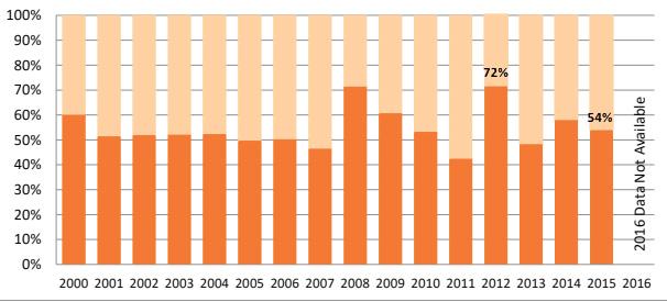
“[LEXINGTON NEEDS] MORE AFFORDABLE HOUSING SPREAD OUT THROUGH THE ENTIRE CITY WITH SERVICES & PUBLIC TRANSPORTATION."
-LEXINGTON RESIDENT
FAYETTE CO. PORTION OF SINGLE-FAMILY BUILDING PERMITS (SEVEN-COUNTY REGION)
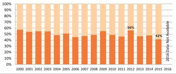 U.S. CENSUS BUREAU
U.S. CENSUS BUREAU
U.S. CENSUS BUREAU
MEET THE DEMAND FOR HOUSING ACROSS ALL INCOME LEVELS.
This Comprehensive Plan does not seek to be antagonistic toward
growth and new residential development; on the contrary, continued growth is vitally important and Lexington should encourage intense (re)development in the most appropriate areas to provide housing for all. Lexington must provide overall housing affordability, primarily through an abundant supply of new
construction that puts a downward pressure on rents of existing units. Imagine Lexington implementation calls for a top-down review of the Zoning Ordinance and Subdivision Regulations in an attempt to create new housing opportunities, as well as to streamline permitting and review processes. This process began
in 2017 with the amendments to the Commercial Center (B-6P) zone, as well as changes to how Final Record Plats are reviewed.
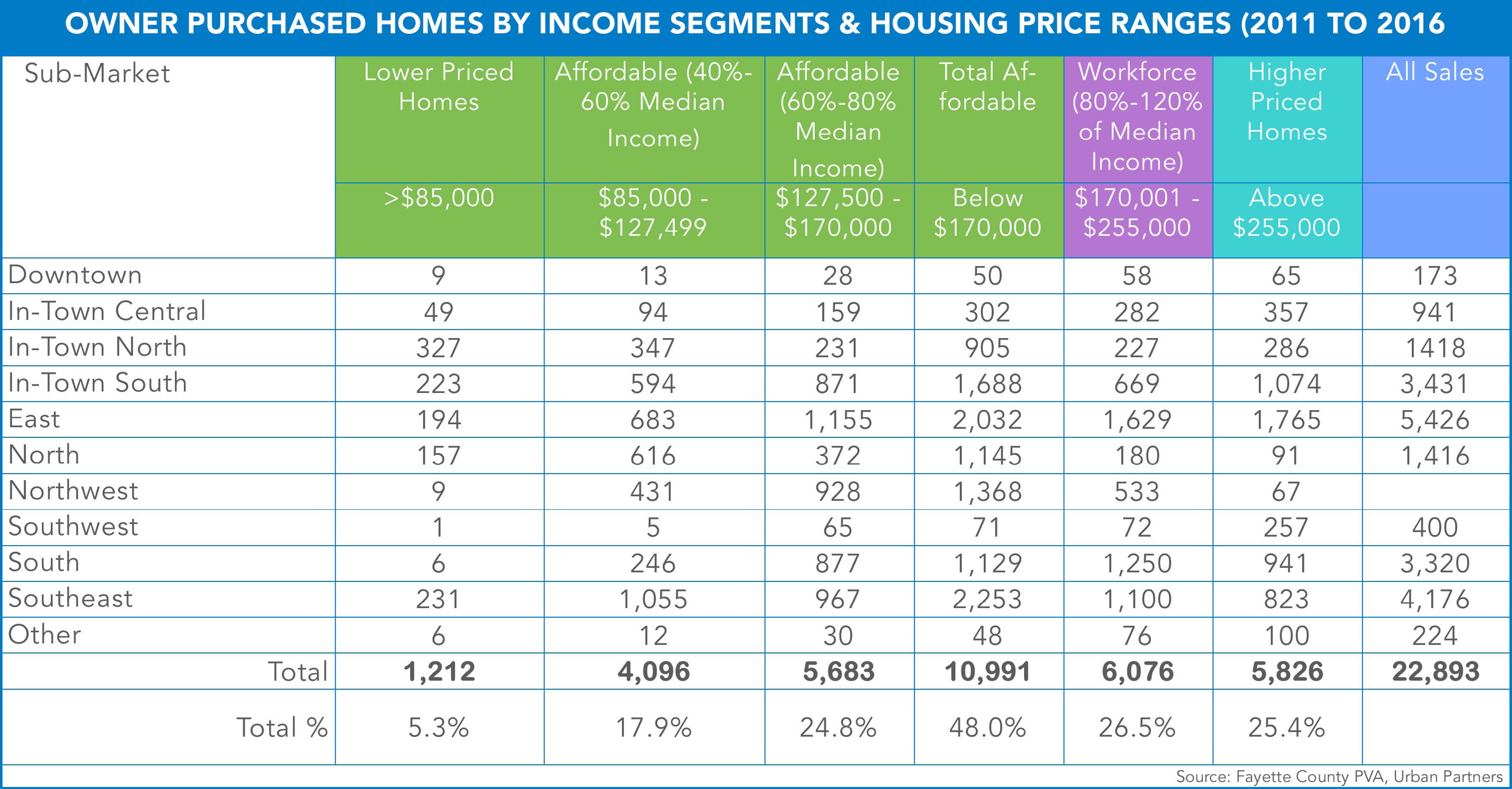
PROVIDE AFFORDABLE
HOUSING ACROSS ALL AREAS, AFFIRMATIVELY FURTHERING FAIR
HOUSING, COMPLYING WITH HUD GUIDANCE.
According to the Department of Housing and Urban Development, Affirmatively Furthering Fair Housing (AFFH) is a legal requirement that federal agencies and federal grantees further the purposes of the Fair Housing Act. HUD's AFFH rule provides an effective planning approach to aid program participants in taking meaningful actions to overcome historic patterns of segregation, promote fair housing choice, and foster inclusive communities that are free from discrimination.
Specifically, affirmatively furthering fair housing means taking meaningful actions that, taken together, address significant disparities in housing needs and in access to opportunity, replacing segregated living patterns with truly integrated and balanced living patterns, transforming racially and ethnically concentrated areas of poverty into areas of opportunity, and fostering and maintaining compliance with civil rights and fair housing laws. The duty to affirmatively further fair housing extends to all
PERCENT OF HOUSEHOLDS OWNER OCCUPIED BY RACE
U.S. CENSUS BUREAU, 2016 ACS
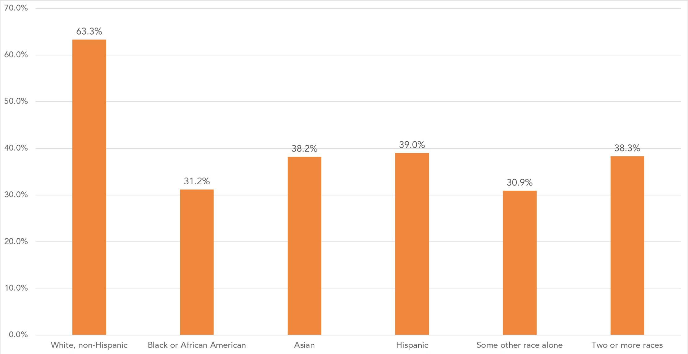
housing and urban development activities and programs.
Specifically, Lexington will seek to promote affordable housing throughout the community. Access to safe, affordable housing should exist in all neighborhoods. However, this plan shall also continue to support significant investment in existing low-income areas so as not to shut out distressed areas from further public investment or speed up the economic displacement of low-income residents due to traditional market forces.
REVIEW FUNDING OPPORTUNITIES FOR COMPREHENSIVE PLAN PRIORITIES. ACTION ITEM
"HAVE AVAILABLE HOUSING FOR RESIDENTS AT ALL INCOME LEVELS THAT MEET VARIED LIFE STYLES." -LEXINGTON RESIDENT
ADD RESIDENTIAL OPPORTUNITIES BY PROACTIVELY UP-ZONING AREAS NEAR TRANSIT FOR POPULATIONS WHO RELY SOLELY ON PUBLIC TRANSPORTATION.
In transit opportunity areas identified in subsequent corridor studies, the government should consider up-zoning properties to allow and encourage more intense uses that support transit. Where neighborhoods already exist along these corridors, appropriate transitions and step-downs should be used, but should not otherwise deter development of additional housing. To avoid adverse effects on low and medium density neighborhoods, transitoriented development should be accommodated as much as possible on commercially zoned land along major arterials. B-6P zoning should be considered along these major arterials.
PRESERVE & ENHANCE EXISTING AFFORDABLE HOUSING THROUGH THE LAND BANK, COMMUNITY LAND TRUST & VACANT LAND COMMISSION.
Previous Comprehensive Plans laid the groundwork for the currently existing program infrastructure to serve our affordable housing needs. Subsequent steps need to address the ongoing funding and identify methods for making sure these programs reach the critical mass of assets needed to become self-sufficient.
PROTECT AFFORDABLE HOUSING TENANTS THROUGH IMPROVED CODE ENFORCEMENT POLICIES.
A rental property registration program to proactively address substandard housing conditions would help alleviate the current culture where residents are wary of contacting Code Enforcement to report violations for fear that they may lose the roof over their head. Louisville, Covington, and Erlanger have all taken this proactive approach to this serious issue.
comprehensive, equitable housing policy must address existing housing as well as new construction.
"AFFORDABLE HOUSING IN THE CITY IS A NEED CRYING FOR RELIEF."
-LEXINGTON RESIDENT
The goal of this approach is to identify problem properties and utilize random inspections to keep landlords from delaying maintenance or poorly managing their units. Cities both large and small across the country use rental registration programs and their tangible successes are well documented. As Lexington moves towards becoming a larger metropolitan city, it is incumbent upon the government to ensure all residents are afforded the opportunity to live in safe, code compliant homes. A
There are additional benefits on the landlord/property owner side as well. In preliminary meetings with housing stakeholders, developers with a proven track record of strong property management indicated that the most important factor in their decision to make a purchase in a given area was the upkeep and maintenance of that neighborhood by other landlords. They felt it was impossible to overcome the inertia of neighborhood decline without other good faith actors. A proactive approach to code enforcement, driven by random inspections, will ensure that it is possible to invest in all areas where a return can be achieved by making all neighborhoods more desirable.
Read about the successes of rental registration in Austin, TX: https://law.utexas.edu/wp-content/uploads/ sites/11/2015/07/2013-07-ECDC-An-Analysisof-Rental-Property-Registration-in-Austin.pdf
WORK WITH COUNCIL TO REVIEW TENANT PROTECTIONS
WORK WITH COUNCIL TO CREATE A RENTAL REGISTRATION PROGRAM ACTION ITEMS
PROVIDE FLEXIBILITY FOR SENIOR HOUSING THROUGH ACCESSORY DWELLING UNITS.
Accessory Dwelling Units (ADUs) provide significant opportunities for older residents to age in place. They allow them to retain their
properties through subsidizing their incomes with rental revenue, while they continue to inhabit the property. When attempting to address the senior housing need in Lexington, it is important to provide a myriad of opportunities, allowing a variety of solutions. ADUs will inevitably provide a small percentage of the needed units; but for many who take advantage of them, it could be the difference between staying in their homes, and having to sell them.
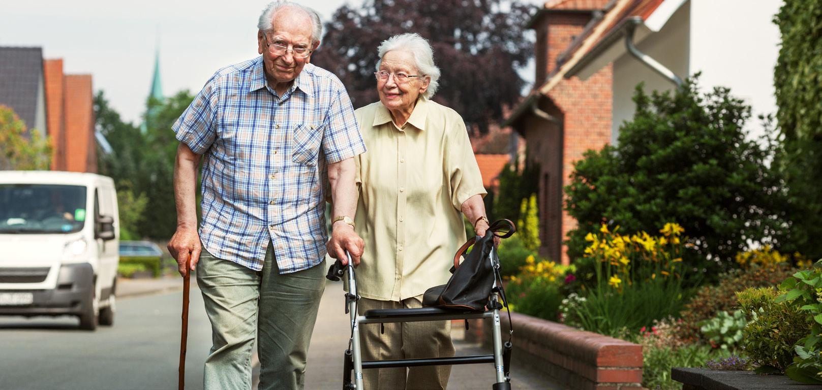
Planning should continue to look for community partners to assist in implementing this policy, and the Senior Services Commission has already taken an active role in its development. The goal is to create an Accessory Dwelling Unit manual to provide reassurance to existing neighborhoods about how the program would operate, as well as guidance to prospective builders. This would ideally include proposed models that are both contextually designed and cost effective.
Streamlining the permit process and reducing the administrative cost in order to make ADUs an attractive housing option for homeowners should be important considerations.
PARTNER WITH SENIOR SERVICES COMMISSION TO DEVELOP & IMPLEMENT ACCESSORY DWELLING UNIT ZONING OPTIONS ACTION ITEM

"CONSIDERATION MUST BE GIVEN TO THE GROWING SENIOR POPULATION & THE HOUSING & SERVICES THEY WILL NEED IN THE NEXT DECADE."
-LEXINGTON RESIDENT


COMMUNITY FACILITIES SHOULD BE WELL INTEGRATED INTO THEIR RESPECTIVE NEIGHBORHOODS.
School sites should be appropriately sized for the needs of the community and designed to be an integral part of the community, rather than sequestered and closed off. Ensuring neighborhood access to these sites is important, so they can act as community-building entities.
Neighborhood-level healthcare and social service options are important, especially for areas where there is a low level of automobile ownership. While it is vitally important to preserve access and opportunity to these facilities in all areas, it is also critical that they be good neighbors to the neighborhoods they serve. The city, service providers and neighborhoods should work together to ensure that those in need of services have adequate transportation to and from facilities, and that public
safety in the respective areas be evaluated on an ongoing basis.
Parks, greenspace, and neighborhood focal points should be available to all neighbors. Steps should be taken to provide adequate access during their creation, and opportunities for retrofit access should be explored to address inadequate access to current sites.

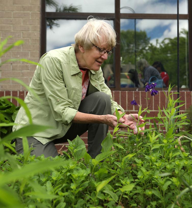
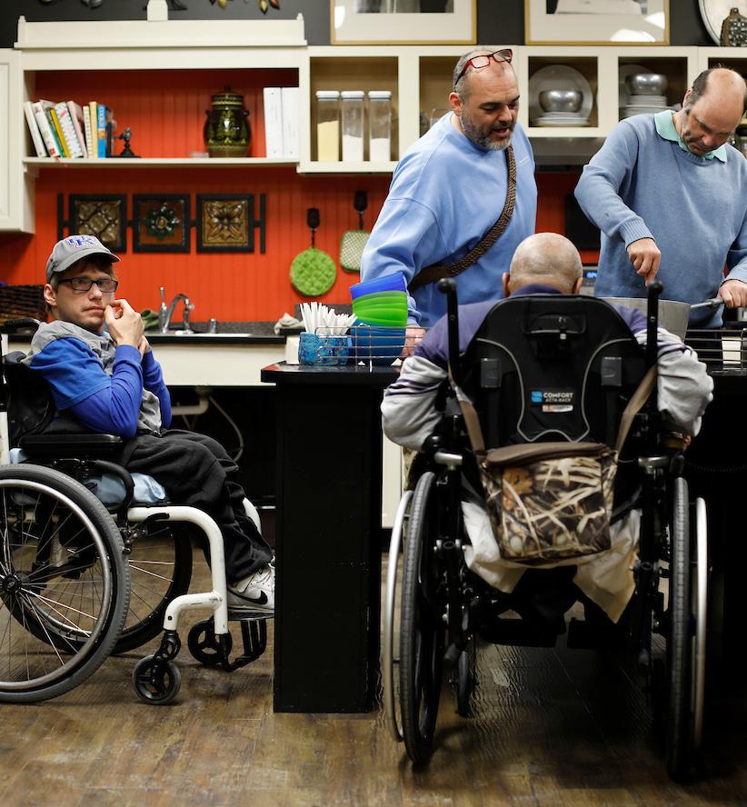
HOUSING DEVELOPMENTS SHOULD IMPLEMENT UNIVERSAL DESIGN PRINCIPLES ON A PORTION OF THEIR UNITS.
In order to support aging in place and recognize the increasing senior housing need, Universal Design principles should be incorporated into neighborhood developments where possible. Seven principles were developed by a diverse group of professional designers to create environments that are easily accessible, understood, and used by as many people as possible. Additionally, the creation of an agefriendly development plan should be explored in order to address inequities in both public and private facilities and to raise awareness about the opportunities to improve. The city of Pittsburgh has developed a model program that Lexington should look to emulate.
PARTNER WITH THE SENIOR SERVICES COMMISSION TO DEVELOP AN AGEFRIENDLY PLAN AS PART OF THE AARP AGEFRIENDLY COMMUNITIES INITIATIVE
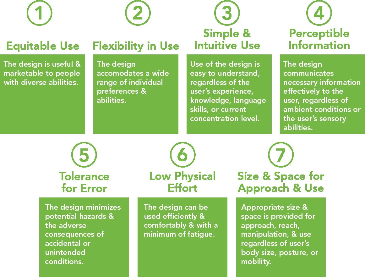
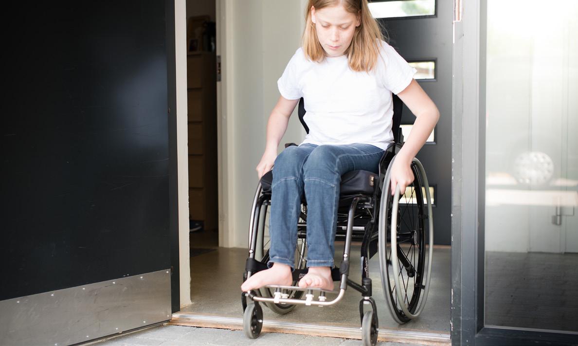
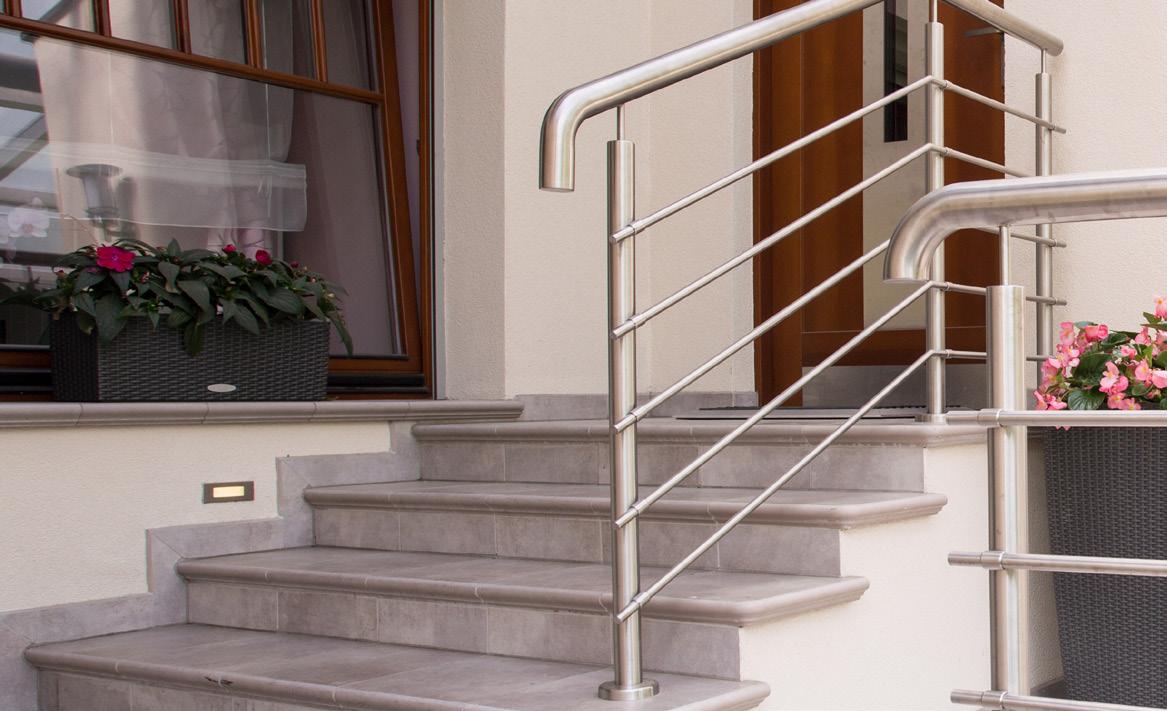


The environment is part of every life: it is the air humans breathe, the food humans eat, the water humans drink, the open space where humans entertain, the land humans live on. Undoubtedly, the health of the environment has great impact on health and quality of life. Fortunately, through science and studies, people are led to a better understanding of how their daily activities impact the environment, and vice versa. There is a growing effort to implement and maintain sustainability practices for the benefit of generations to come.
Lexington depends on its natural environment. The urban area is surrounded by thousands of acres of farms and natural lands, with the landmark protection of the 1958 Urban Service Boundary, which is largely supported by the community. Within the Urban Service Area, urban greenspace has become increasingly desirable among neighborhoods. Following the 2013 Comprehensive Plan, the community is continuing to build green infrastructure principles into its planning
activities; increasing transit options and street connectivity; and managing water quality through the Capacity Assurance Program, Municipal Separate Storm Sewer System (MS4) Permit, and multiple incentive grants. The results of those efforts include creating tree protection areas, community gardens, multi-use trails, and naturalized riparian parks.
Planning and management of the environment benefit the overall economy, public health and community. Therefore, the sustainability of the landscape and natural resources is inextricably linked to the community’s values and needs. This theme of Imagine Lexington assesses the impacts of development on the environment, and recommends policies and practices that minimize the negative impacts of land use and development. The policies focus on protecting valuable natural resources, taking a sustainable approach to development activities, and restoring the environment within the urban fabric.
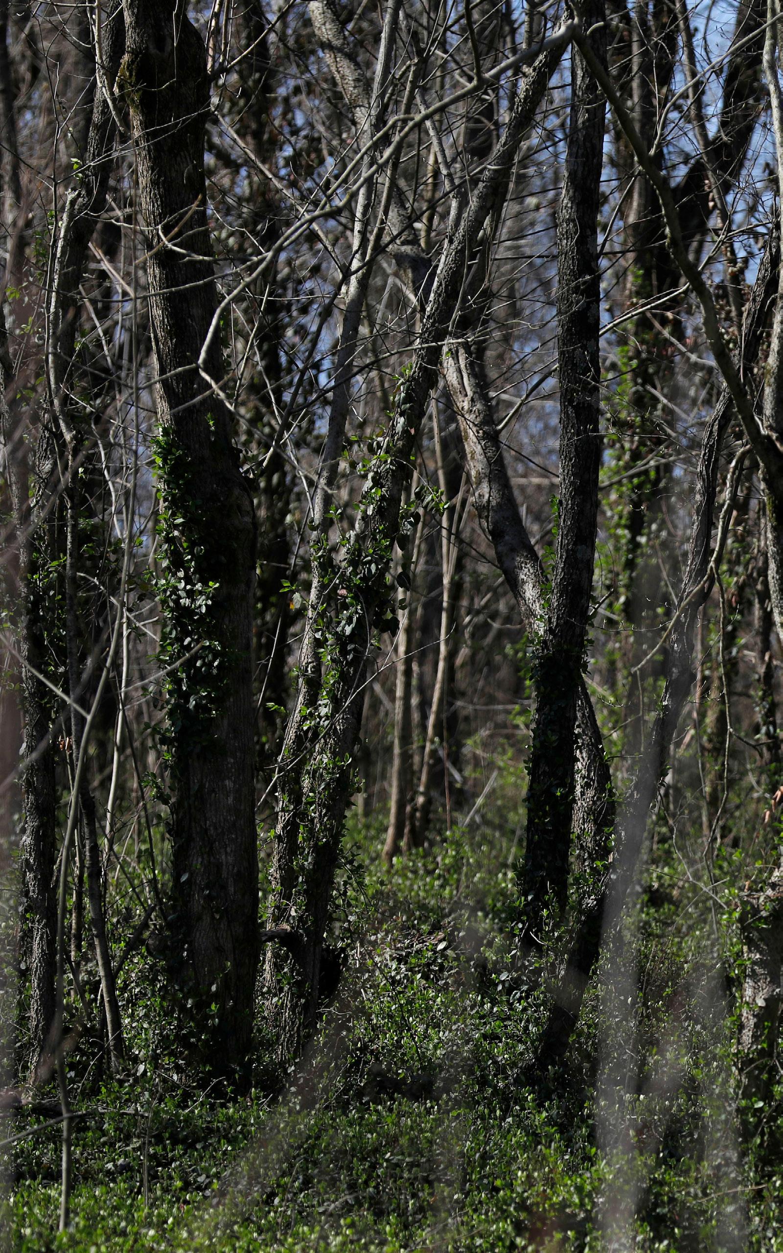
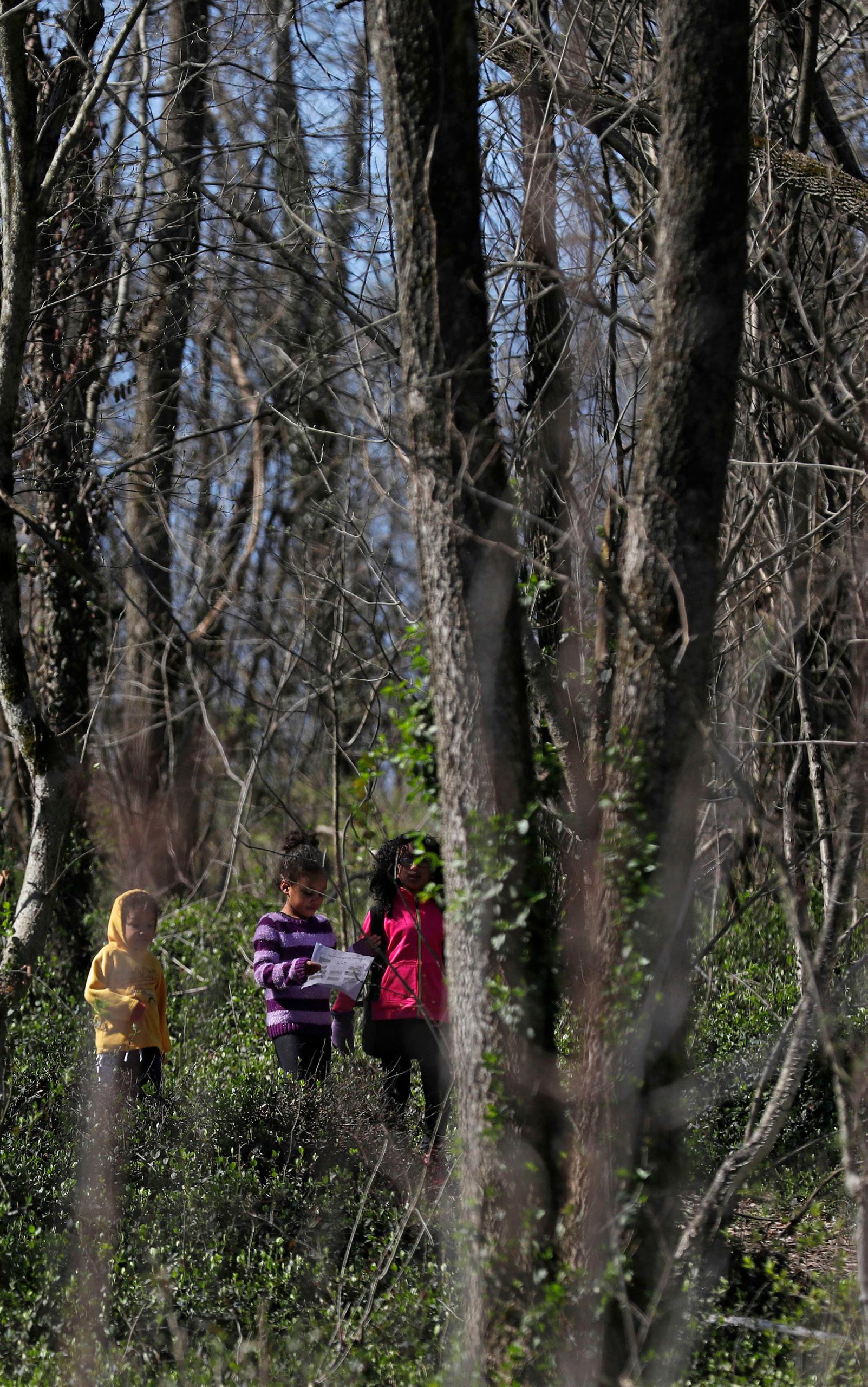
“THE CARE OF THE EARTH IS OUR MOST ANCIENT & MOST WORTHY, & AFTER ALL OUR MOST PLEASING RESPONSIBILITY. TO CHERISH WHAT REMAINS OF IT AND TO FOSTER ITS RENEWAL IS OUR ONLY HOPE.”
– WENDELL BERRY
Water, air, land are the fundamental parts of the natural environment, and they have great impact on individual health and daily life. Limestone, bluegrass and abundant headwater streams contribute to Lexington’s overall identity, as well as supporting signature industries such as thoroughbred breeding and bourbon distilling.
Fayette County’s drinking water source is the Kentucky River, with intake pools and treatment plants in Fayette and Owen Counties.
The 20-Year Comprehensive Water Supply Plan recommends that the Kentucky River and its tributaries should be protected from dumping, discharges, spills and undesirable development for a minimum of one mile upstream of the intake pools. The Royal Spring Aquifer is the source of Georgetown’s drinking water. Eighty percent of the aquifer recharge area is in Fayette County, which includes 1,624 acres of the Cane Run Watershed and extends to Seventh Street near downtown. The Royal Spring Aquifer Wellhead Protection Plan
calls for appropriate containment of runoff from development in the recharge area. Additional regulations related to water quality are in the Stormwater Manual and Article 19 of the Zoning Ordinance. The Stormwater Incentive Grant Program provides financial assistance for projects that improve water quality, reduce stormwater runoff and educate citizens about stormwater and water quality issues in the community. At the same time, grassroots non-profits like Friends of Wolf Run have volunteers to work on initiatives to protect the watershed. For decades, Lexington lived the consequences of ignoring the
development impact on water quality and quantity. Since entering into the consent decree in 2011 with the EPA, the LFUCG Division of Water Quality has continued
PRIMARY CONTACT RECREATION IMPAIRMENTS
2010-2014 INTEGRATED REPORT COMPOSITE FAYETTE COUNTY, KY
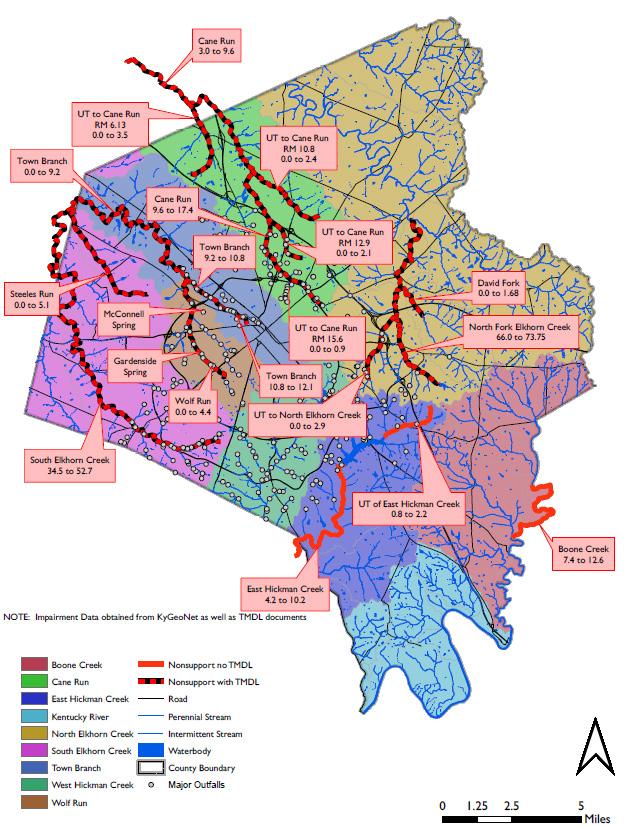
to monitor sanitary sewer capacity through the Capacity Assurance Program (CAP). Stormwater management has been incorporated into the development technical committee discussion and requires a sign-off, which helps to build a layer of protection for water quality and quantity control before construction happens. In-stream water quality impairments come from both point and non-point source pollutants. Lexington’s MS4 program monitors non-point source pollutants and identifies illegal point discharges; the Remedial Measures Projects provide sanitary sewer capacity and abate we weather sanitary sewer overflows. Both programs are part of the efforts to monitor and recover water quality. The LFUCG Division of Water Quality continues to undertake improvements, perform routine monitoring, and identify sources of pollutants.
Clean air is essential for good health, both physically and emotionally. Air pollution is a collective term for many types of airborne contaminants, but the major focus of most pollution reduction efforts are ground level ozone, particulate matter (both coarse and fine), oxides of nitrogen,
and greenhouse gases such as carbon dioxide and methane.
As outlined in the 2040 Metropolitan Transportation Plan (updated in 2014), two future issues that are likely to become national air quality priorities are Mobile Source Air Toxics (MSAT) and Greenhouse Gas Emissions (GHG). As suggested by their names, MSAT are pollutants that may cause cancer or other serious health effects, such as reproductive problems or birth defects. Examples of toxic air pollutants include benzene, found in gasoline; perchloroethylene, emitted from some dry cleaning facilities; and methylene chloride, used as a solvent by a number of industries. Greenhouse gases trap heat within the earth’s atmosphere. Although GHG emissions occur naturally, human activities are responsible for almost all of the increase in greenhouse gases in the atmosphere over the last 150 years (EPA). Carbon dioxide (CO2) emissions account for more than 80% of U.S. GHG emissions. In contrast to most pollution trends, emissions of GHG have been rising from all sources. The largest source of greenhouse gas emissions from human activities is from burning fossil fuels for electricity, heat, and transportation.
The Lexington Area MPO monitors local air quality, warns the public when poor air quality is predicted in the coming days, and promotes ways people can work to reduce air pollution.
In November 1990, Fayette and Scott Counties were designated by the United States Environmental Protection Agency (USEPA) as a “non-attainment” air quality area for the pollutant ozone because of violations of National Ambient Air Quality Standards (NAAQS).
In November 1995, the area was re-designated to “attainment” but is required to maintain standards by showing conformity to the State Implementation Plan (SIP). The Lexington Area MPO’s transportation projects, programs, and plans were also tested to ensure that they did not contribute to violations of the standards. The Lexington area has maintained attainment of the ozone standard to date; however, ozone concentration readings are trending close to the new standard.
Lexington’s land resource is gradually changing, with development happening over time. Thanks to the Urban Service
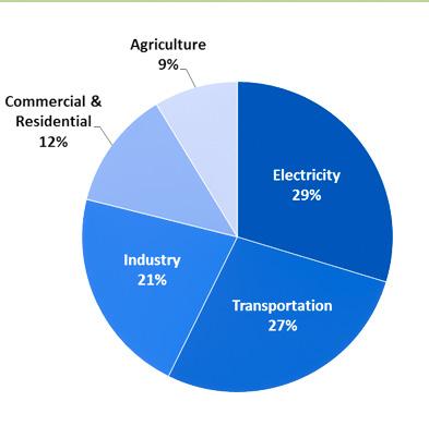
2015
U.S. ENVIRONMENTAL PROTECTION AGENCY
Boundary, the community’s rural land has been largely protected from development activities. However, with a growing population, developments within the Urban Service Area consume green space, encroach on floodplains, and reduce tree canopy and forested areas. Without proper policies and control, the urban land will be disrupted, impacting the function of the overall ecological system, making the community vulnerable to pollution and reducing the aesthetic qualities and comfort of neighborhoods. Thanks to Lexington’s infill and redevelopment initiatives, land absorption is largely controlled. Many recent developments maintained those principles, using existing structures or built land.
Fayette County’s agricultural land is protected by the Urban Service Boundary and the PDR program. While agricultural exports are a major source of income, it is important to keep as much food as possible within the county to feed its residents. Kentucky can offer organic produce during the summer season; however, due to high rainfall and humidity in Kentucky, it is difficult to grow organic produce throughout the other seasons. Large scale organic
production requires more stable weather. Fayette County has the consumer base who are willing to pay more for locally grown organic products, but there are not enough farms that can successfully produce enough supply to meet the demand. Kentucky’s cattle industry is successful, but farmers are forced to export their products for processing due to lack of space and production infrastructure. Fayette County’s farm land is largely devoted to equine operations. Many farms that serve Fayette County are from adjacent counties in the central Kentucky region.
While LFUCG has an energy initiatives team to monitor the government’s internal energy usage, city-wide monitoring and
“PROTECT OUR UNIQUE GEOLOGICAL TOPOGRAPHY, PASTURES, & SURROUNDING FARMS. PRESERVE OUR GREEN SPACE.” -LEXINGTON RESIDENT
transparency on energy usage is yet to come. Creating energy awareness is the community’s first step in the process to take action and start conserving.
Compared to neighboring cities Louisville and Cincinnati, where there are Sustainability Offices, Lexington lacks an umbrella agency or entity for communitywide sustainability efforts.
Fayette County Public Schools is a local leader in sustainability initiatives. By implementing multiple programs within the school system,young supporters are actively engaged in energy efficiency programs, with the hope that their effects will spread to their parents and families.
Locust Trace AgriScience Center is the newest career and technical high school in Lexington with energy and the environment being key factors in the facility design, and agriculture as the educational focus. The school is designed to be net-zero in energy usage through the use of photovoltaic solar panels, and net-zero in waste disposal through the utilization of constructed wetlands. The school is also minimally dependent on the municipal water system. All rain water is collected from the classroom building and the
equine barn/arena to be utilized for all crop irrigation and livestock watering. An on-site well has been accessed to back up the rain water collection system, in case of a drought. Sustainable agriculture is a focus in all programs.
The University of Kentucky also has a robust Sustainability Program, which not only supports academic research, but also provides services and management for campus operations.
A community-led voluntary plan, Empower Lexington, was presented and supported by council in 2012. The plan made many valuable recommendations, and action plans are needed to implement them. As the community becomes more aware of the benefits of green buildings and alternative energy, support for these programs will grow.

The 2017 Rural Land Management Plan has a thorough update on numerous adopted plans, ordinances, regulations, studies and reports on the Rural Service Area since the 1999 Rural Service Area Land Management Plan. Many specific aspects and elements contribute to the importance of the Rural Service Area, including the agricultural economy, tourism, long-term preservation, sustainability, the rural landscape and cultural heritage. Protecting the rural area sustains not only the environment, but the Agricultural Cluster, which is also one of Lexington’s major economic drivers. A study of The Influence of the Agricultural Cluster on the Fayette County Economy was published in May 2017, written by Dr. Alison Davis and Simona Balazs from the University of Kentucky College of Agriculture, Food and Environment. Based on the study, one out of every 12 jobs in Fayette County is directly or indirectly associated with the Ag Cluster (agricultural inputs, food processing and manufacturing, finance, veterinary, recreation, transportation, communications, as well as wholesale and retail businesses);
generating approximately $2.3 billion in output annually, and $1.3 billion in additional income, profits and dividends.
As the Horse Capital of the World, Lexington has always lived up to the spirit of celebrating the cultural landscape of horse farms and racing. Other agriculture activities are also protected under multiple policies, including the PDR program. For years, Lexington residents have appreciated living near the beautiful rural land protected by the Urban Service Boundary; recently, initiatives and programs are helping create closer connections between the community and the rural land. Horse Country Inc.,a tour company, was planned for five years before finally being implemented in 2015. It is another channel connecting the urban community to the rural land area, especially the horse farms. Blue Grass Farm to Table,
Community Shared Agriculture (CSA), and the popular farmers market also bring local food and products to urban families.
In addition to the natural areas of the Urban Service Boundary, healthy urban trees are a significant part of the environmental quality, economics and beauty of the community.
LFUCG Environmental Services has made significant strides in last four years with the Urban Forestry Program - more than tripling the budget and adding a City Arborist, two new forestry crews led by certified arborists, and major initiatives related to street tree care and tree planting. In addition, grassroots nonprofit organizations like Trees Lexington! are implementing smaller community planting projects., and gaining tremendous community support.
“MAINTAIN THE USB, SUPPORT AGRICULTURE, PROMOTE HORSE FARMS & AGRICULTURE-RELATED TOURISM, & IMPROVE THE QUALITY OF URBAN ENVIRONMENT WITHIN USB .” -LEXINGTON RESIDENT

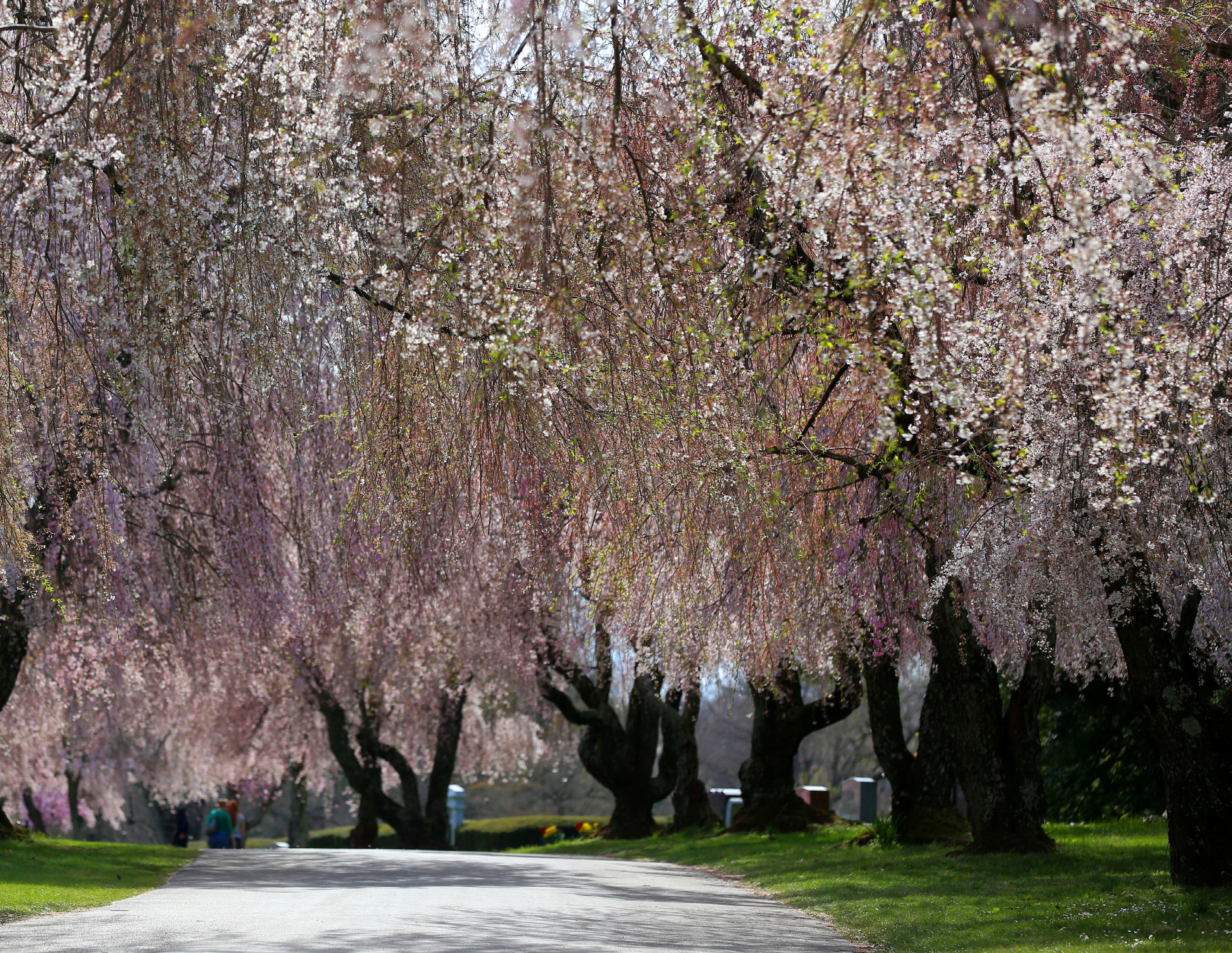
"IN THE END, WE WILL ONLY CONSERVE WHAT WE LOVE. WE LOVE ONLY WHAT WE UNDERSTAND. WE WILL UNDERSTAND ONLY WHAT WE ARE TAUGHT.”
-BABA DIOUM


Kentucky’s own Wendell Berry wisely remarked that “the Earth is what we all have in common.” Likewise, on a local level, the natural environment of Lexington is what we all have in common. It is incumbent upon each to do their part to protect it, and it is crucial that the Comprehensive Plan lay out actionable strategies for safeguarding these valuable resources that are the key to the health and welfare of the community. As the city continues to grow and develop, it becomes even more important to be cognizant of the immediate and long-range effects land use decisions will have on the environment.
One of the vital components of environmental protection and a historic lynch-pin of the growth management strategy for Lexington is the Urban Service Boundary, which delineates the areas where urban growth can occur within the city. Both the public input gathered in 2017 and the 2016 Greenspace Survey include broad support for
maintaining the current Urban Service Boundary. This plan maintains the Urban Service Boundary in its current location, as copious data, research, and scenarios have also supported the public sentiment. There are numerous environmental benefits gained by retaining a compact urban form, and emphasizing the protection of Lexington’s unique bluegrass landscape continues to be a priority for environmental protections. According to the 2017 Rural Land Management Plan (RLMP), the Rural Service Area (outside of the Urban Service Area, shown on the following map) is comprised of 88% prime farmland and soils of statewide significance. Additionally, the RLMP showed that just under 30% of the Rural Service Area are considered Environmentally Sensitive Areas (stream corridors, karst areas, steep slopes, wetlands, mature tree stands, etc.). These areas are important and are worth protecting.
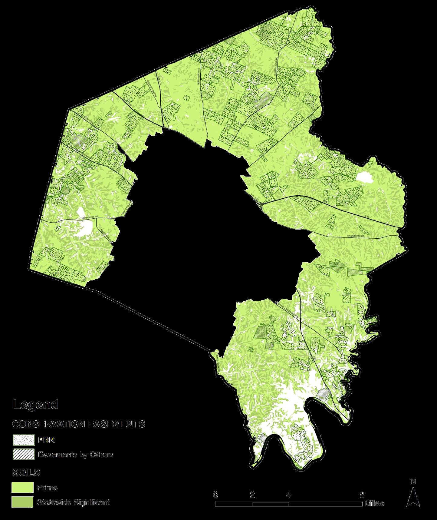

Though there are numerous environmental protection
considerations for the Rural Service Area, there are protections needed inside the Urban Service Boundary as well. In 2011, the City of Lexington entered into a Consent Decree with the U.S. Environmental Protection Agency and the Commonwealth of
Kentucky to resolve violations of the Clean Water Act associated with the sanitary sewer and storm sewer systems by the year 2026. A Remedial Measures Program has been established to evaluate the sanitary sewer system to identify a cost-effective
efficient improvement plan to address recurring sanitary sewer overflows. Additionally, a Capacity Assurance Program has been instituted as a way of managing access to the sanitary sewer system. Through a combination of capacity credits and system improvements, development will be able to continue at a monitored and measured pace. Growth and development are important to Lexington’s maturation as a city, but must be done in a way that respects the natural environment. As urban development intensifies,
“I’M CONCERNED ABOUT THE EFFECTS OF GROWTH ON THE ENVIRONMENT, SPECIFICALLY WATER QUALITY & STORM SEWERS.” -LEXINGTON RESIDENT
the city must also intensify protections of the natural ecosystems within the Urban
Service Boundary through our conservation greenways. The 2004 Greenway Master Plan designates streams, floodplains, riparian vegetation, and associated environmentally sensitive or geologic hazard areas as conservation greenways to improve water quality, provide wildlife habitat, and control flooding. Combining existing with recorded and future greenways, there is potential for 1,400 acres of LFUCG greenways, of which 1,000 acres could function as both conservation and trail greenways. The protection and proper utilization of these greenways should be a priority, and the development that occurs around them should be complementary and use them as an amenity for the entire community to enjoy. The Greenway Master Plan should be consulted and followed for all development that affects these sensitive areas of the community.
Greenways and other green and open spaces are valuable for their ecological benefits, but also for their impacts on livability and tourism. It is apparent from the 2017 Greenspace Survey that Lexington residents overwhelmingly appreciate and visit greenspace. Open land areas with lawn and trees, such as parks, dog parks,
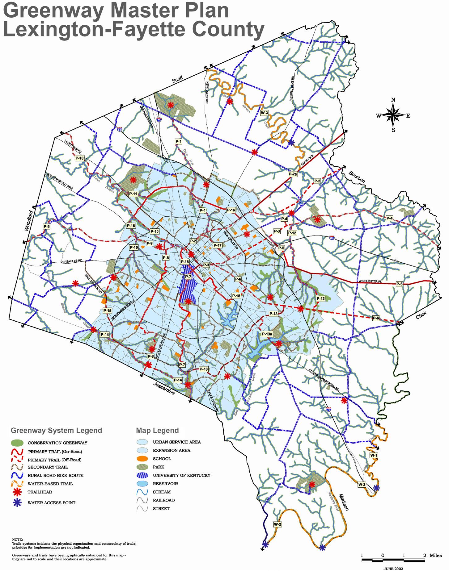
the arboretum, and school and church yards ranked the highest, with 95% of respondents indicating that have utilized one of these facilities. Additionally, 65% of respondents stated they visit a
public greenspace once a week or more, utilizing greenspace most often to relax, socialize, picnic, exercise the dog, fly a kite, etc. (86%) or to appreciate nature (85%). The types of greenspace rated
highest in importance are open land (84%), nature parks or sanctuaries (83%), neighborhood and park trails (83%) and farms and scenic rural roads (80%). Interest is highest for participation in the rural area in nature recreation (76%), events and festivals (74%), farm, winery & botanical garden tours (74%), homegrown restaurants (73%) and biking, hiking and equestrian trails (73%). Overall, it is clear that Lexington residents highly value their greenspaces of all types, and more greenspace opportunities to meet these public desires should be encouraged. These valuable greenspaces
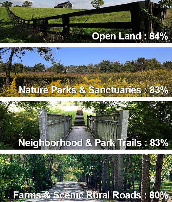
within Lexington should be protected, but, it is also critical to optimize their effectiveness and encourage new and innovative spaces throughout the Urban Service Area. Imagine Lexington makes it clear throughout the plan that safeguarding greenspace for health, social
and environmental benefits is paramount to the success and sustainability of the city.
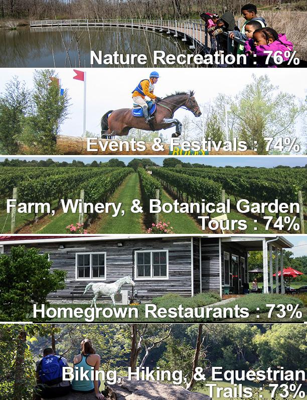
CONTINUE THE SANITARY SEWER CAPACITY ASSURANCE PROGRAM (CAP) & ENCOURAGE THE STORMWATER INCENTIVE GRANT PROGRAM TO REDUCE IMPACTS OF DEVELOPMENT ON WATER QUALITY.
LFUCG Division of Water Quality oversees the storm sewer system of over 800 miles of underground pipelines; 50,000 structures; and over 1,000 wet ponds and detention basins; the sanitary sewer system of over 1,400 miles of underground pipelines; and 28,000 manholes, with nearly 80 pumping stations conveying sewage throughout the Urban Service Area. There are two treatment plants capable of treating over 60 million gallons of sewage each day. Since entering into the consent decree with EPA in 2011, the division continues to monitor the water impact of new development, and has been incorporated into the development plan review process with a required sign-off. The Government’s challenge is to provide capacity when a proposed new development or redevelopment is considered to be in the best interest of the
community. The Consent Decree also requires that a Remedial Measures Program is established for the Lexington-Fayette Urban County sanitary sewer system. This program will evaluate the sanitary sewer system to identify a costeffective, efficient improvement plan to address recurring sanitary sewer overflows. Further control is recommended to notify and communicate with CAP capacity when a conditional use or change of use is proposed, as well as at the time of a preliminary zone change. The process should be documented in zoning compliance letters.
The Stormwater Quality Projects Incentive Grant Program provides financial assistance for projects that improve water quality, reduce stormwater runoff and educate citizens about stormwater and water quality issues in our community. There are three types of grants, including infrastructure, education and neighborhood. Since 2011, the Division of Water Quality has managed the grant awards totaling between $1.2 and $1.7 million each year. Application to the grant is encouraged and should be promoted through community outreach and the development process.
LFUCG Division of Water Quality Capacity Tracking IMS
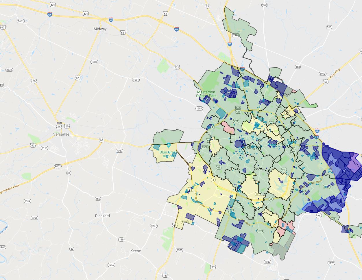
< 2,500 credits
2,500-- 20,000 credits > 20,000 credits
COORDINATE WITH THE DIVISION OF WATER QUALITY TO PRIORITIZE SEWER CAPACITY PROJECTS THAT WILL FACILITATE AREAS OF EXPECTED GROWTH ACTION ITEM
CONSERVE ENVIRONMENTALLY SENSITIVE AREAS, INCLUDING SIGNIFICANT NATURAL HABITATS, WETLANDS & WATER BODIES.
Protecting significant natural habitats, within the Rural Service Area and within the Urban Service Area where feasible, maintains biodiversity and protects habitat, native biota, and wildlife corridors. Linking greenways, tree protection areas, stream corridors, stream conservation greenways, and/ or significant tree canopies allows wildlife and flora to travel and thrive in a more ecologically diverse environment in both the Rural Service Area and the Urban Service Area, where feasible. Seeing flora (plant life) and fauna (animals) are good for reducing stress, and ecological diversity plays a part in providing places where bees can feed. As of August 2017, Lexington has 28,953 acres of Rural Service Area farmland conserved with PDR easements. The purpose of the PDR easements is to preserve farmland and environmentally sensitive land in the Rural Service Area. The farmland preserved provides food security for Lexington and surrounding areas,
since the valuable agricultural soil is protected from development. If land is preserved for farming but bee populations are not sufficient to pollinate plants, then production of food could be very limited. Therefore, safe places for bees is another reason for protecting natural habitats and flora. In 1999, the Land Capability Analysis defined the boundaries of environmentally sensitive areas, which equaled about 30% of the Rural Service Area.
The Natural Area (NAT) identified on page 51 of the 2017 Rural Land Management Plan, contains about 8,500 acres and is located in the extreme southeastern part of the county. It includes floodplains, riparian vegetation, steep slopes, and canopy coverage, and is home to a wide variety of aquatic and wildlife. Agriculture does occur in portions of the NAT. Echoing the 2017 Rural Land Management Plan, “…the preservation and enhancement of the land, vegetation and water in a natural state with a minimum of intrusions” is a policy emphasized.
The Rural Land Management Plan lists “Special Natural Protection Areas”, which are located all over the RSA, not just in the NAT. The lists describe mapped areas of high priority and slightly lower priority for
preservation, and include sites with rare species of plants, large blue ash trees, rare bird sites, river slopes, and natural bodies of water. The Rural Land Management Plan identified special natural protection areas; the “A” sites are those with the highest priority for preservation, and the “B” sites are those with a slightly lower priority for preservation.
For development applications inside the USA, a process should be established to identify and quantify endangered species on a proposed development site. New developments are suggested to avoid dividing floodplains
into private ownership with flood insurance. Care should be taken during the development process to provide additional protection areas around floodplains and to incorporate them into accessible greenspace. Singleloaded streets could provide more open accessibility to the residents in the vicinity, and are recommended to be utilized.
DEVELOP AN INVENTORY OF SPECIAL NATURAL PROTECTION AREAS WITHIN THE USB ACTION ITEM
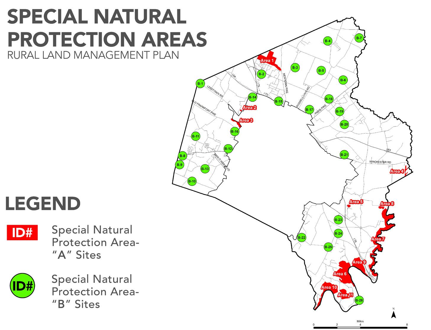
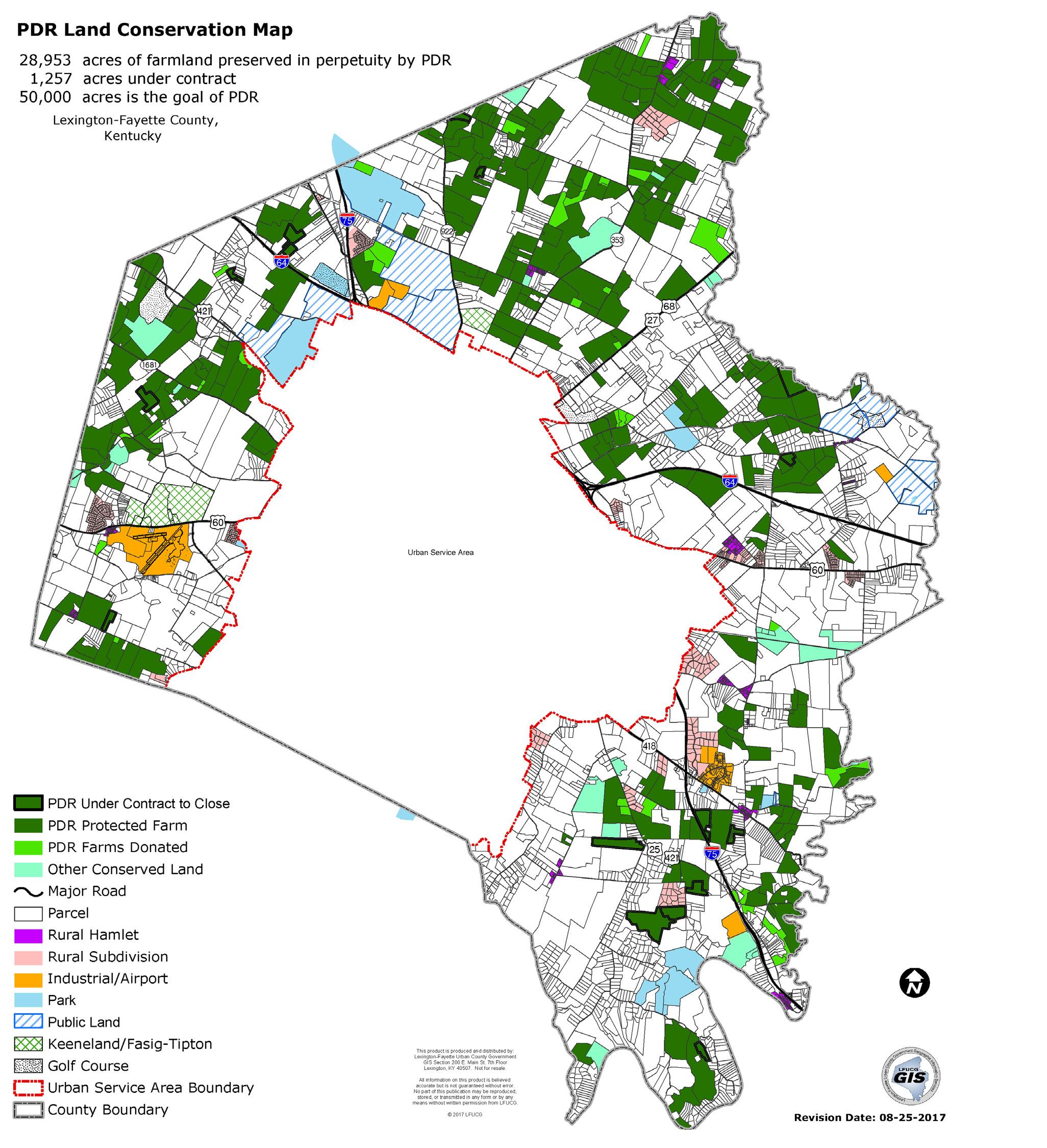
CONTINUE TO IMPLEMENT PDR PROGRAM TO SAFEGUARD LEXINGTON’S RURAL LAND.
As outlined in the 2017 Rural Land Management Plan, Lexington has had a long history of taking positive action to ensure the community’s rural heritage is preserved from unmanaged suburban sprawl. In 1958, the Urban Service Area Boundary was created to manage development, and has become a pioneering landmark for planning across the nation. In 2000, the Purchase of Development Rights Ordinance was adopted.
As of August 25, 2017, there were 28,953 acres of farmland in Fayette County preserved in perpetuity by PDR, and another 1,257 acres under contract. There are 261 farms permanently protected by PDR. The goal of the PDR program is to conserve 50,000 acres of land.
CONSERVE ACTIVE AGRICULTURE LAND IN THE RURAL SERVICE AREA WHILE PROMOTING A CREATIVE FOOD CHAIN NETWORK.
In 2012, Fayette County had 718 farm operations on 114,857 acres, which represented 63.3% of the total land within the county. In comparison, Kentucky’s farm operations made up 51.6% of the state’s total land area, and U.S. farm operations made up 40.5% of total land area in the country. The percentage of total farm acres used for
cropland is 35.1%; the remaining acreage is mostly horse farms.
The 2017 Rural Land Management Plan listed 90,774 acres in 1,080 parcels in Agricultural Use in the Rural Service Area, and the Fayette County PVA assessed 1,736 properties in the Rural Service Area as agriculture or “farms.” A report named “Rural Land Use Inventory, Fayette County, Kentucky,” June 2017 by Lynn Roche Phillips, PhD., AICP, and Priyanka Ghosh, PhD., University of Kentucky, Department of Geography, indicates that 108,248 acres of Fayette’s Rural Service Area is used for agriculture. The 2012 Ag Census, which combined the Urban Service Area and Rural Service Areas, reports 718 farms covering 114,857 acres.
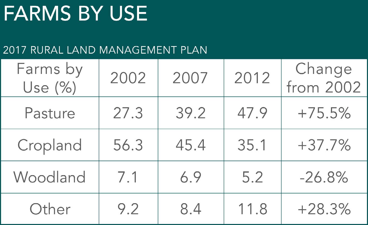
2017 RURAL LAND MANAGEMENT PLAN
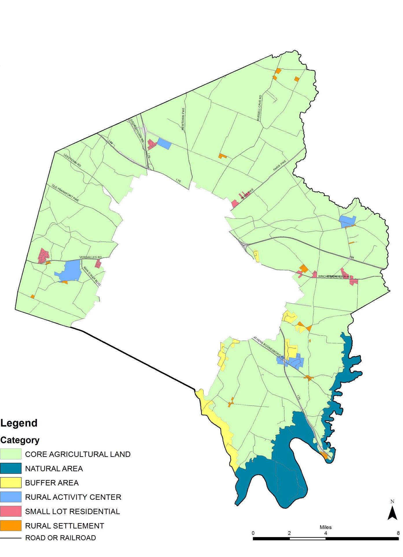
The farms within the USA are expected to develop eventually. In 2007, the Ag Census reported that there were 810 farms and 135,969 acres in farms. The 2017 Ag Census results will be released in 2019, and will be informative regarding the acreage of agricultural use by farm type and changes in agricultural land use between 2012 and 2017.
The development of farms within the USA, such as The Summit at Fritz Farm development at the corner of Man O’ War Boulevard and Nicholasville Road, may account for some small portion of this decrease in farms between the 2007 and 2012 Ag Censuses. The Summit at Fritz Farm was formerly the Fritz farm for decades; however, this farm was located inside the Urban Service Area, with high visibility, at one of the busiest intersections (according to trip generation data) in Lexington. The Summit at
Fritz Farm is a good example of promoting the food chain network in Lexington. It has one of the five locations of the Lexington Farmers Market, a Whole Foods store with locally grown produce and meat available for sale, and locally owned restaurants featuring locally grown produce and meat.
While equine operations are the dominant farm type in Fayette County, the 2017 Rural Land Use Inventory by Phillips and Ghosh cited above found that there were numerous farm operations that were non-equine related or mixed with equine: 31,424 acres “general agriculture,” 11,898 acres “general agriculture and cattle,” and 27,027 acres “equine farm and general agriculture.”
The Kentucky Department of Agriculture Business Directory includes Fayette County farms that are raising goats, free range chickens, eggs, sheep, cattle, grass-fed beef, vegetables, fruit,
and vineyards, and other nonfood products related such as landscaping plant materials.
The Bluegrass Stockyards’ Lexington location, named the Blue Grass Regional Marketplace, is one of seven live sale locations in their entire Bluegrass Stockyards network, and is a significant contributor to Lexington’s local food chain network. The Lexington market handles $200$250 million in business annually, selling 100,000-125,000 heads of cattle a year. It accounts for more than any of their other six locations in the region, with a total of about 500,000 heads of cattle sold annually. The Blue Grass Regional Marketplace not only sells cattle; it also has: a farmers market on Saturdays; a restaurant; a butcher counter selling locally sourced beef, pork, lamb, and more; retail stores selling farrier supplies; outfitters; bourbon and horse country items; meeting,
event, and classroom spaces; and a museum and learning center.
There are a number of other efforts in promoting locally grown food: Farm to School programs, Food Chain, SeedLeaf, Field to Table dinner, and CSA Farm to table.
Ashton Wright, Ph.D, Lexington’s Local Food Coordinator, reported that there are at least eight farms offering CSAs in Fayette, and that Lexington has five farmers markets and two Fresh Stop markets. Of the 47 vendors in the Lexington Farmers Market, nine are Fayette County businesses, making products such as cheese, pasta, olive oils, kettle corn, etc. and three of the Fayette County vendors sell produce: sweetcorn, honey, vegetables, and shrimp. The Bluegrass Farmers Market has 27 vendors, with four of them being from Fayette County.
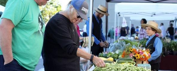
PROMOTE & CONNECT LOCAL FARMS WITH THE COMMUNITY THROUGH INTEGRATED PARTNERSHIPS.
Bluegrass Farm-to-Table was founded in 2015 with a mission to promote the development of a more vibrant local food economy by supporting food-related agricultural development. It has 21 partners including the government, universities, schools, farms, private entities throughout the community. Supporting the local food system has important implications for consumers, farmers, food-related businesses and entrepreneurs, and the community as a whole.
Environmental Benefits include (Reference: http://www.cmap.illinois. gov/livability/local-food/about):
• Farmland is an important economic asset. As cities develop, they often infringe upon and fragment farmland. Therefore, it is important to preserve productive farmland to maintain the integrity of Lexington’s unique rural landscape and identity
and support agricultural productivity as an important piece of the local economy.
• Purchasing food grown locally reduces food miles-the distance food travels from the farm to your table- and has a positive impact on the environment. The average food item travels 1,500 miles, compared to the average locally-produced item, which travels only 56 miles.
• Supporting local food systems can help reduce waste. Approximately 41 percent of U.S. food waste goes to landfills. Instead of taking up space in the landfill, the valuable nutrients in wasted food could be composted and used for a variety of purposes, including local food production.
Trees Lexington! is working on a project to install a food forest at One Parent Scholar House at the Hope Center. Horse Country, Inc., promotes tours of horse farms, equine medical facilities, and equine suppliers. There are 150 horse farms in Fayette County. Nine of the tours offered by Horse Country are located in Fayette County, while the remaining are in other counties.


PROMOTE CONTEXT- SENSITIVE AGRITOURISM IN THE RURAL SERVICE AREA.
The 2017 Rural Land Management Plan has a thorough summary of the recent tourism developments in the rural service area. Year after year, visitors surveyed by VisitLEX say that they come to the Bluegrass for the horses, landscape and bourbon. The two major attractions, which draw more than a million visitors a year to the Rural Service Area, are the Kentucky Horse Park and Keeneland. There are numerous
for-profit tour companies and Horse Country, a non-profit coalition of farms that provide visitors from all over the world with access to these destinations. As of July 2017, Horse Country had 35 member farms, clinics and a feed mill participating, with 24 of them offering tours, and in the first two years, there have been over 80,000 visitors. The community now has the opportunity to enjoy an authentic experience with horses, which further allows them to promote Lexington as a regional attraction.
In 2016, a text amendment was approved to allow agritourism and ecotourism as a conditional use in the Rural Service Area. Agritourism activities allowed in the A-R and
A-N zones include corn mazes, farm gift shops, educational classes related to agricultural products or skills, horse shows involving more than 70 participants and seasonal activities. For A-B zones, children’s rides are also listed. Other agritourism and equine-related activities, such as wineries, hayrides, petting zoos, youth camps, and bed and breakfast establishments were already principal, accessory or conditional uses in the agricultural zones (KRS 100). Racetracks and historic house museums are allowed as conditional uses in the A-R zone.
Ecotourism allowed in the A-R zone includes equine trails, botanical gardens and nature preserves. In the A-B and A-N zones, ecotourism includes
commercial hiking and bicycling trails, equine trails, tree canopy tours, canoeing and kayaking launch sites, botanical gardens, nature preserves and recreational outfitters limited to equipment rental only. The A-B zone adds zip-line trails and removes recreational outfitters from the list.
While fun and prosperous activities are encouraged as agritourism uses, it is necessary for them to be context-sensitive in order to maintain Lexington’s unique cultural landscape.
REVIEW THE ZONING ORDINANCE FOR NEW AGRITOURISM & ECOTOURISM OPPORTUNITIES ACTION ITEM
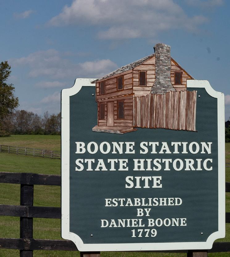


PROTECT SENSITIVE STREAMS, NATURAL HABITATS & WILDLIFE IN THE URBAN SERVICE AREA; PROTECT THE URBAN FOREST, & SIGNIFICANT TREE CANOPIES AS CRUCIAL ECOLOGICAL NETWORKS.
Enhancing and strengthening the current Planning process to increase protection and responsible development when environmentally sensitive areas and/or trees are involved would help increase protection of tree stands, rare trees, natural habitats and wildlife within the urban service area in appropriate areas. The Urban Service Area concept uses land wisely for development while protecting valuable soils and farms in the Rural Service Area. When feasible and appropriate, the community should work to protect the natural habitats and trees within the USA; not only for the enjoyment of the people experiencing them, but for environmental and economical sustainability reasons. Conserving these habitats and trees in developments in the USA land reduces the heat island effect, as well as protecting rare and
endangered species of trees and other flora and wildlife for diversity.
Providing connections to other greenways, tree stands, and stream corridors increases the linear ecological network, providing wildlife corridors and a diverse ecosystem.
When trees are planted as part of development, grouping trees helps create microclimates, which increases the survivability of the trees. Trees play not only an environmental role, but also an economical one; they are assets to the community, as they capture stormwater runoff and reduce energy costs of cooling and heating buildings.
Preserving trees can prove difficult, however, since 84% of the USA land is in private ownership. Public education is important to get the word out to property owners about how valuable their trees are and how to ensure their proper care. In 2012, the Davey Resource Group performed an assessment of Lexington’s urban tree canopy using aerial photographic data. This assessment showed that Lexington’s urban tree canopy coverage was 24.6%. In addition, the Davey Resource Group reported the data by council district and by watershed, and gave guidance on actions that need to be taken to preserve and increase our tree canopy.
“FORESTS ARE THE LUNGS OF OUR LAND, PURIFYING THE AIR & GIVING FRESH STRENGTH TO OUR PEOPLE.”
-FRANKLIN D. ROOSEVELT
UPDATE ZONING ORDINANCE TO REFLECT NATIONAL BEST PRACTICES ON FLOODPLAIN PROTECTIONS
INTEGRATE THE GREENSPACE PLAN INTO URBAN & RURAL AREA.
Availability and accessibility of greenspace is essential for human growth and development. As suggested in the 1994 Greenspace Plan, the benefits of creating a comprehensive greenspace system go far beyond leisure and aesthetics, and are fundamental to the future economy and quality of the environment of this community and the entire Bluegrass Region. Protecting our remaining greenspace is not a luxury; it is a necessity for maintaining the quality of life that Bluegrass residents have always enjoyed and will continue to desire for the future.
Greenspace is more than horse farms, parks, and rock fences; it also encompasses natural environments such as streams, sinkholes, and the Kentucky River, valuable resources such prime soils; buildings that recall the community’s founding and history; the experience of the city or countryside from an automobile; and the ability to travel safely by bicycle or on foot. The Greenspace system
refers to the rich fabric of these qualities woven together throughout the community, giving it a coherent identity. Greenspace benefits to environmental quality include safeguarding water quality; supporting biodiversity in the urban and rural area; and educating present and future stewards of the environment.
“DISTURB AS LITTLE OF THE NATURAL ENVIRONMENT AS POSSIBLE. THAT MEANS DEVELOPING A MORE DENSELYUSED URBAN ENVIRONMENT. IT WILL REQUIRE
RESPECT THE GEOGRAPHIC CONTEXT OF NATURAL LAND, ENCOURAGE DEVELOPMENT TO PROTECT STEEP SLOPES; & LOCATE BUILDING STRUCTURES TO REDUCE UNNECESSARY EARTH DISRUPTION.
Lexington’s Zoning Ordinance (Subdivision Regulations Section 6-11) requires developers to evaluate a site’s geographic and topographic characteristics, including steep slopes and sinkholes, as part of the development planning process. New development is recommended to study the site’s geographic context in contours and watershed distributions before making master plans. Extensive disturbance to earth with man-made grading for building structures has proven to be harmful to the environment, with the potential to force adjacent areas to be disturbed in a domino effect. Sustainable planning practices recommend that large developments only be allowed on land area with less than 15% slope, with modest development like trails and pathways below 30% slope.

INSTALL ICONIC RURAL FENCELINES AROUND MAJOR GREENWAYS TO ENHANCE THEIR NATURAL BEAUTY.
As Horse Capital of the World, horse farm style plank fences have become part of the cultural landscape of the Lexington Bluegrass region. Large portions of the major greenways are owned and maintained by LFUCG, and efforts should be expanded to incorporate horse farm style plank fences. The public should also explore partnership opportunities for other privately managed greenway areas to maintain Lexington’s identity.
“PRESERVING THE BEAUTIFUL LANDSCAPES/HORSE FARMS THAT DEFINE THE BLUEGRASS REGION AND ENHANCES THE QUALITY OF LIFE AND MAKES THIS AREA ATTRACTIVE PLACE TO LIVE. ” -LEXINGTON RESIDENT
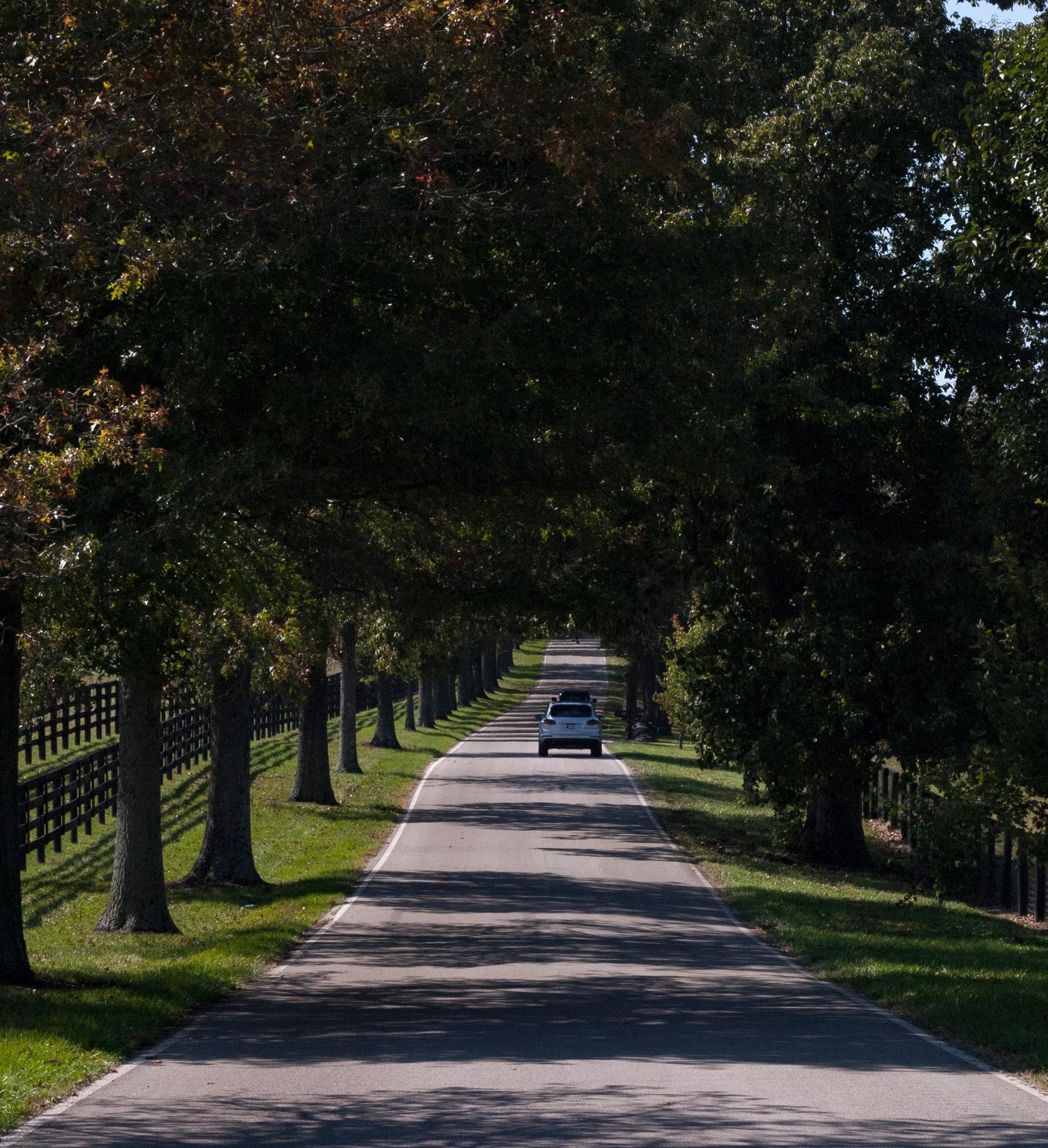
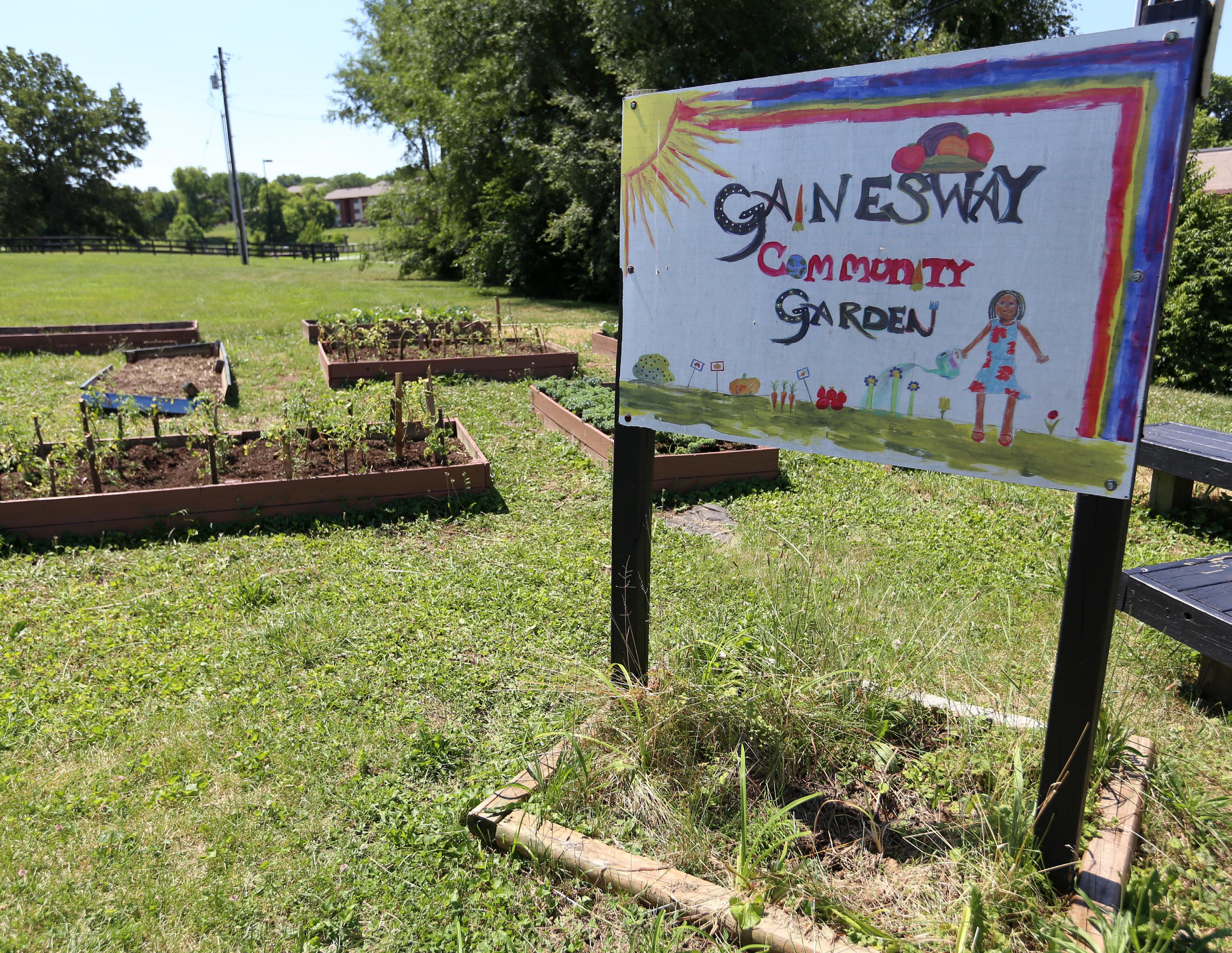

In 1987, an independent World Commission on Environment and Development released a report defining sustainable development as, “meeting the needs of the present without compromising the ability of future generations to meet their own needs.” This may not be a new idea, and that definition has been used in countless sustainability documents since it was released, but the relevance of the concept persists. As Lexington continues to attract more residents, a concerted effort must be made by current residents to be good stewards of their natural resources. This also requires strong leadership with foresight to champion good development and to disapprove land development patterns that are counterintuitive to the long-range vision set out in this plan. Through solid decision-making and a strong policy framework, Lexington can continue to provide for the generations that follow.
Sustainability, though simply and broadly defined above, is actually very complex and multi-faceted. One way sustainable principles can be applied is through providing a healthy multimodal transportation
network that encourages alternative transportation options and reduces the single-occupancy vehicle’s footprint on the city. In addition to creating a more efficient use of land, it also reduces vehicle miles traveled, which decreases congestion and vehiclerelated emissions. Lexington is a long way from relinquishing the automobile as the primary mode of transportation for the majority of residents, but, by creating a framework for the other modes to succeed, inroads can be made toward increasing the number who take advantage of them. This also has positive health benefits for the community and individual users.
Providing transportation options positively affects the environment in a variety of capacities, but it is not the sole component to a sustainable community. Other impactful changes can be made to the way stormwater is handled through green infrastructure principles. Green infrastructure is an interconnected network of landscapes and natural resources that contributes to environmental health and the health and quality of life for the citizens of Lexington, and offers nature-based solutions to development issues. These solutions improve water
quality and solve runoff issues in a way that works with, and not against, nature. The 2013 Comprehensive Plan introduced these principles for the first time, and this plan seeks to further implement them, transitioning them from the novel exception to becoming the standard practice.
Creating more environmentallyfriendly site design is incredibly important, but so are energy efficient and “green” building practices. The United States Green Building Council includes a set of Leadership in Energy and Environmental Design (LEED) standards that “provide a framework to create healthy, highly efficient and cost-saving green buildings” (www. new.usgbc.org/leed). Though not all buildings in Lexington will achieve an official LEED certification anytime soon, incentives should be explored to encourage builders to construct new structures that aspire to meet these principles. Additionally, adaptive reuse and historic preservation are tools to re-purpose and utilize existing structures that can also reduce Lexington’s carbon footprint and provide sustainability for Lexington. Developers should be encouraged to consider these options as well.
There are many groups and organizations throughout Lexington that are interested in furthering these sustainability practices (and the numerous others that exist), and interest and community engagement in this subject is surging. However, in discussions with experts representing these groups throughout the Imagine Lexington process, it was clear that a void exists for an umbrella partnership organization that could help coordinate their efforts. Models for this type of entity exist elsewhere, and this should be pursued. All of the groups do important work, but a harmonized strategy could take it to a new level and could leverage their individual strengths for a greater impact.
Coordinating individual efforts is the exact embodiment of sustainability. Every small piece of the puzzle plays a part in the overall success and environmental health of the community, and an intentional strategy is required to ensure future generations can enjoy the fullness of all Lexington has to offer.
DEVELOP A MULTIMODAL TRANSPORTATION NETWORK & INFRASTRUCTURE; SEEK COLLABORATION WITH REGIONAL TRANSIT PARTNERS FOR THE COMMUTING PUBLIC.
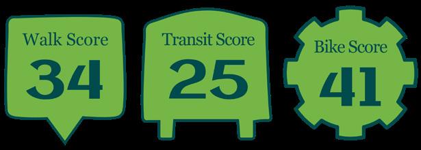
When people decide how to get from one point to another, it is very important to provide them safe and competitive options. According to walkscore.com, Lexington has an average walk score of 34, indicating a community car-dependent, where most errands require a car; a transit score of 25, demonstrating that only a few nearby public transportation options exist; and a bike score of 44, which falls within the lowest range, meaning Lexington is only somewhat bikeable, with minimal bike infrastructure.
Vehicles (or mobile sources) are a significant contributor to urban air pollution. Technology (cleaner vehicles and cleaner fuels) will continue to reduce vehicle pollution, but more people living in an area generally
equates to more vehicles on the road. Recent national trends show a decrease in personal vehicle miles of travel per person, and it is likely that this trend will continue. However, the population is also increasing, and the economy is entering a period of growth. Thus, it is anticipated that overall travel demand will continue to grow. If the community does not meet this increased demand in an efficient and multimodal manner, additional congestion may ensue, potentially compromising air quality.
From the public input analysis of the Lexington Area Bicycle & Pedestrian Master Plan in 2017, results show more than 60% of Lexington residents are interested in biking, but are concerned about using bicycles in the urban area. People report that biking seems difficult and dangerous, due to driver behaviors such as speeding, inattention, failure to yield at intersections, etc. Most people think biking is important for transportation and recreation, and they praised projects like Legacy Trail and the Town Branch Trail.
Mass transit options should be competitive in terms of economic value, comfort level and time consumption. Transit parking facilities, development within walking distance and pedestrian accessibility to transit stops are some
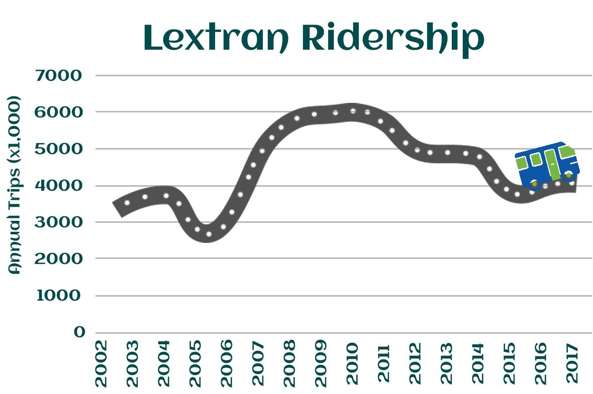
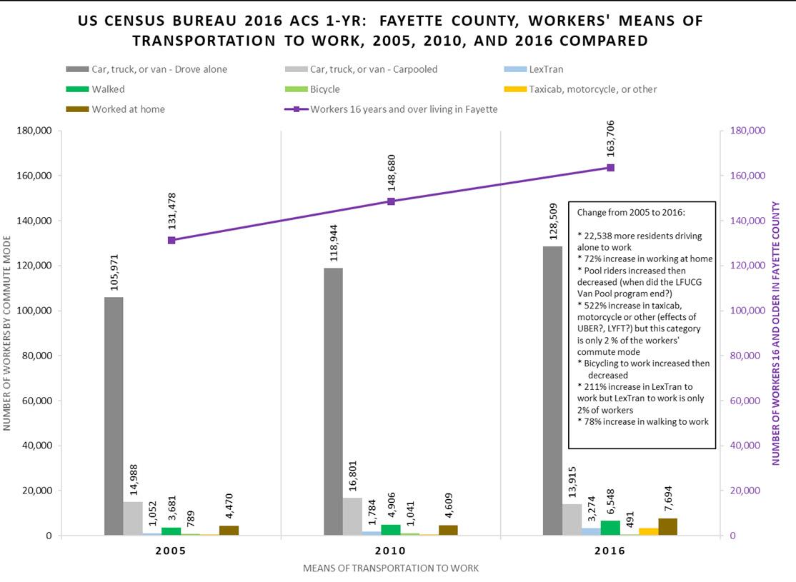
of the tools to encourage people to take advantage of the mass transit option for commuting.
Regional commuting tools have great potential to expand those options, and additional organizations to collaborate on regional commuting should be explored. Lexington is a major employment hub for the Bluegrass area. In estimates from 2015 census data, 49.5% of Lexington workers live outside of Fayette county and commute into Lexington every day, while 50.5% are employed and living in Lexington-Fayette County. Commutes into and out of Fayette County primarily take place along the major arterials leading into and out of Lexington. As population and employment growth continues into the future, these major arterials will
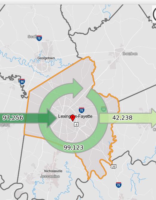
continue to serve these commuting patterns at the regional level. Recent data shows Lexington workers still rely highly on single-occupant vehicle driving. The infrastructure for multimodal commuting is in the MPO plan of the 2040 Metropolitan Transportation Plan.
Developers and employers should explore options to provide priority parking spaces for car-share vehicles, design for safe and easy ingress/ egress during peak hours, and provide shuttles for residents to and from transit stops. New transit stop shelters should be designed with improved user comfort, such as clean, durable and comfortable seating, weather protection, and police signs to avoid illegal behaviors.
PROMOTE ROADWAY, PEDESTRIAN & BICYCLE CONNECTIVITY.
Development is encouraged to locate near high connectivity areas with connected street networks and diverse community uses (Infill and Redevelopment Area), so that the adjacent amenities can be fully utilized and supported by customers. Within
developments, projects should be designed and built such that internal connectivity is maximized, balancing the geographic terrain.
Connected street networks have proven benefits to reduce the environmental and public health consequences of sprawl; reduce development pressure beyond the limits of existing development; and conserve the natural and financial resources required for infrastructure.
Connectivity reduces the travel time from one point to another in an overall scheme, leading to a reduction in air pollution.
“INTERCONNECTED GREEN SPACES & PARKS; SHOPPING, RESTAURANTS & RECREATION (POOLS, GYMS) WITHIN WALKING DISTANCE; HEALTHY TREE CANOPY; A VARIETY OF HOUSING
-LEXINGTON RESIDENT
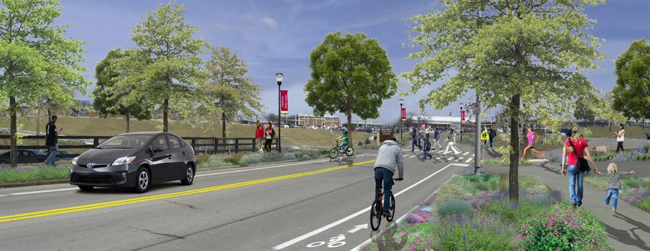
ENCOURAGE TRANSIT-ORIENTED DEVELOPMENT, INCREASE DENSITY ALONG MAJOR CORRIDORS & IN THE INFILL & REDEVELOPMENT AREA TO SUPPORT TRANSIT RIDERSHIP, THUS REDUCING VEHICLE MILES TRAVELED (VMT).
Transit-Oriented Development (TOD) refers to communities with high quality public transit services, good walkability, and compact, mixed land use. This type of development allows people to choose the best option for each trip: walking and cycling for local errands, convenient and comfortable public transit for travel along major urban corridors, and automobile travel to more dispersed destinations. People who live and work in such communities tend to own fewer vehicles, drive less, and rely more on alternative modes. TOD provides multiple health and environment benefits:
REDUCE CONGESTION & VEHICLERELATED EMISSION: 30-50% reductions in per capita annual congestion delay are typical between transit-oriented cities and comparable size automobile-oriented cities.
OCCUPIED FOR ROADWAY & PARKING FACILITIES:
TOD improves stormwater infiltration in a natural setting, rather than via engineering methods. Ultimately, it will also save the cost on roadway / parking infrastructure.
ENERGY & REDUCE ENERGY-GENERATING EMISSION:
Residents of transit-oriented communities tend to consume 2040% less transportation energy than they would in more automobiledependent communities.
TRANSIT SYSTEM:
Neighborhood patterns and transportation go hand in hand. TOD with well-designed land use and alternative infrastructure will encourage residents to use mass transit and stabilize transit ridership, thus
reducing transportation cost to families and to the environment.
Transit users are four times as likely to achieve the target of 20 minutes or more of walking per day, as opposed to people who do not use transit on a particular day.
Residents of transit-oriented communities have about a quarter of the per-capita traffic fatality rate compared to residents of automobiledependent sprawl, taking into account all traffic deaths, including pedestrians and transit passengers.
There are also more benefits of TOD in neighborhood, community and economics aspects, which will be explored in the related themes of imagine Lexington. In Lexington,
major transit lines are focused along urban corridors and the Infill and Development area. Increased density in these areas will have the similar benefits to those of TOD.
“IT WOULD BE AMAZING IF SOME OF LEXINGTON’S EXCESS PARKING LOTS WERE TURNED INTO PARKS, HOUSING, OR RETAIL.”
-LEXINGTON RESIDENT
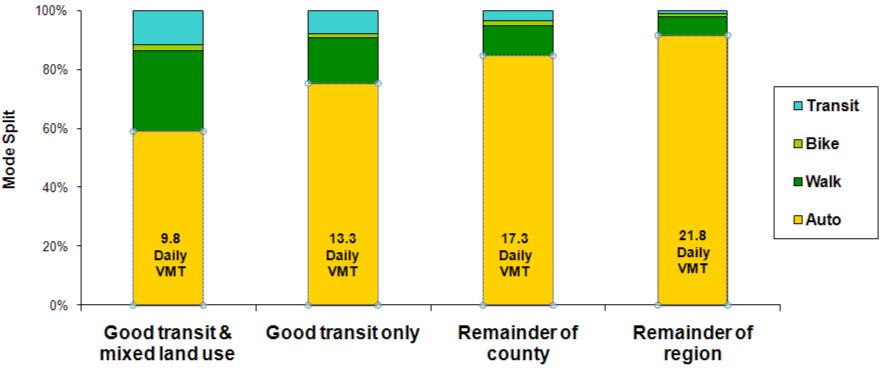
LOCATE NEW RESIDENTIAL UNITS WITHIN WALKING DISTANCE OF EXISTING GREENSPACE / COMMUNITY CENTERS, OR CREATE GREEN SPACE / COMMUNITY CENTERS WITHIN WALKING DISTANCE OF EXISTING RESIDENTIAL.
Development should provide greenspace or other community gathering spaces within
walking distance of residents, especially if these amenities are not otherwise provided.
Strategic and walkable placement of amenities and greenspace is important as it provides for a high quality of life, but also because it reduces the vehicle miles traveled. Additionally, it helps lessen incidences of obesity, heart disease, and hypertension by encouraging daily physical activity associated with walking and biking. Multiple surveys suggest Lexington citizens would like to see better walking/ biking trails to connect urban areas.

There are many areas throughout the city where residents do not have easy access to greenspace, community centers, or other neighborhood focal points. Developers should be encouraged to find opportunities in these areas to provide these amenities, which would not only provide increased livability, and general health, but would help to improve air quality by reducing greenhouse gas emissions.
New development should also be encouraged to make connections to existing greenway/public space
projects, such as the Legacy Trail, Town Branch Commons, McConnell Springs, and other regional and neighborhood parks, through well-paved and maintained walkways and bikeways.
“EQUITABLE ACCESS TO GREENSPACE IS NEEDED.”
-LEXINGTON RESIDENT
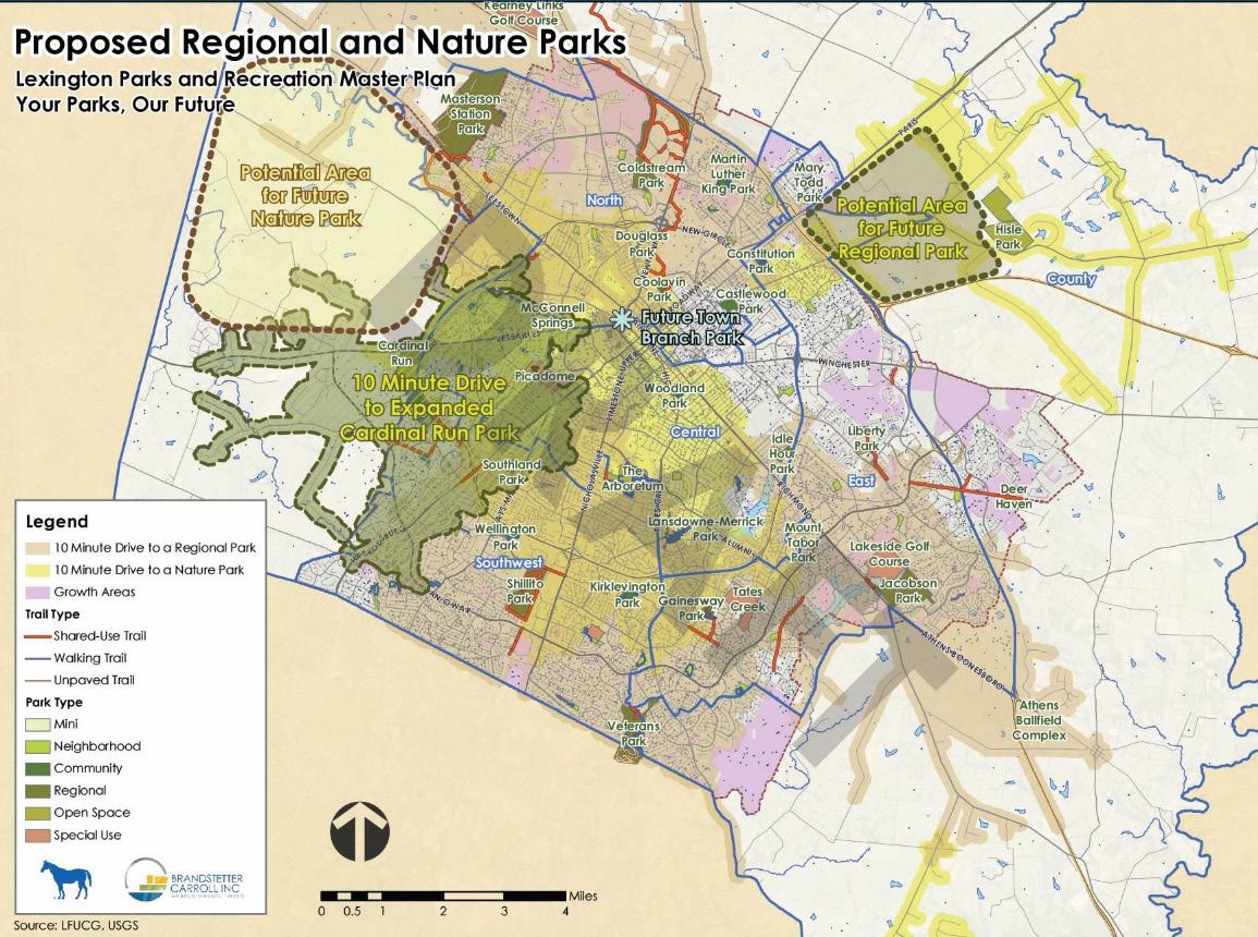
REDUCE / DISCOURAGE VEHICLE-ORIENTED DEVELOPMENT PATTERNS, SUCH AS DRIVE-THROUGH BUSINESSES WITHIN THE URBAN SERVICE BOUNDARY, ESPECIALLY IN THE URBAN CORE AREAS. REDUCE PARKING FOOTPRINTS.
Vehicle idling for more than 10 seconds uses more fuel and produces more CO2 compared to restarting the engine. Countries around the world are concerned with the impact of transportation on the environment and human health. Messages to reduce unnecessary idling are therefore a key component of many national sustainability programs. In Europe, the recommended guidelines for turning engines off are 10 seconds in Italy and France; 20 seconds in Austria; 40 seconds in Germany; and 60 seconds in the Netherlands. In the United States, the Environmental Protection Agency’s Smartway and Drive Wise programs both recommend turning the engine off if the driver is stopped for more than 30 seconds. Avoiding unnecessary idling is a universal approach to reduce the environmental impact of vehicles.
Drive-through businesses and traffic congestion produce most of the car idling, which have a great impact on the environment. Unnecessary idling not only creates air pollution, it also increases fuel costs. Currently in the Lexington Urban Service Area, drive-throughs are still widespread. In addition, some new developments include space for outlot sales to potential drive-through businesses, which should be discouraged.
Excessive asphalt or concrete parking areas also encourage more driving, and reduce stormwater infiltration into the natural system, which creates environmental pressure. Some developments within the high-density areas and around University of Kentucky are encouraging separate parking spot sales from property sales, or parking rental fees in addition to residential leases, in order to encourage residents to strategize on vehicle uses. New development or redevelopment within the urban core area with essential needs for new parking should be encouraged to incorporate pervious paving solutions or partnership with existing parking infrastructure.
OVERHAUL PARKING STANDARDS THROUGHOUT THE ZONING ORDINANCE
APPLY TRAFFIC MITIGATION PROGRAMS, SUCH AS COMMUNICATION WITH EMPLOYERS, TO ENCOURAGE FLEXIBLE WORK SCHEDULES OR TELECOMMUTING.
Traffic creates headaches for commuters. At the same time, it generates more air pollution than drivers may realize. However, improving available technology and sustainable initiatives by corporations, such as telecommuting and flexible work schedules away from rush hour, have come into play in many areas. The MPO is working on multiple plans to mitigate potential increasing congestions in the Lexington region.
IMPLEMENT AN OUTREACH PROGRAM THROUGH EMPLOYERS TO INFORM & INCENTIVIZE EMPLOYEES TO REDUCE SINGLE-OCCUPANCY COMMUTING
TIME INDEX BY HOUR/DAY U.S. BUREAU OF TRANSPORTATION
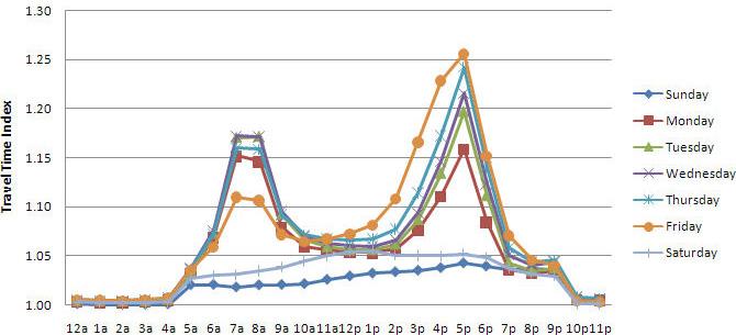
The maps below show what vehicle congestion levels would look like on the existing street network in 2040 if no other transportation projects were built (beyond short-range committed projects) compared to congestion levels if the long range 2040 MTP projects are implemented. (2017 Bike & Pedestrian Master Plan)
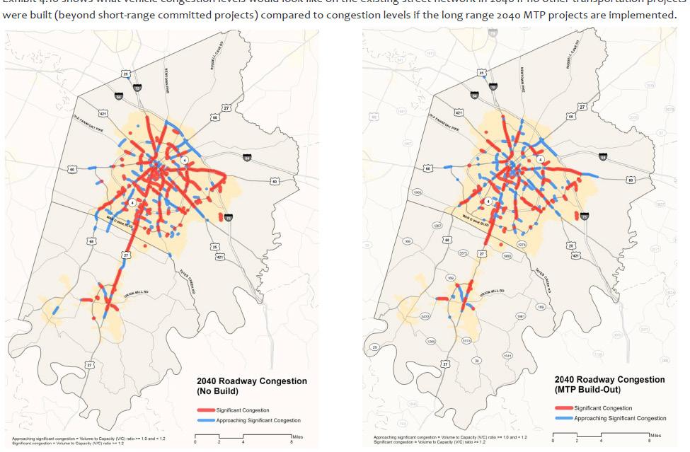
CONTINUE & EXPAND ENERGY EFFICIENCY INITIATIVES, PROMOTE ENERGY EFFICIENT BUILDINGS BY SUPPORTING GRANTS & PUBLIC RECOGNITION.
LFUCG Energy Initiatives work closely with divisions across government to implement the city’s Energy Management Plan, which was established in 2004 to reduce consumption of utility and fuel resources, promote conservation, and realize cost savings. Energy efficiency criteria is used to guide purchasing decisions in new buildings, repairs and retrofits. Account-by-account rate analysis has identified less expensive options for many utility accounts, saving taxpayer dollars. To complement these efforts, LFUCG has
established the Energy Improvement Fund – an internal revolving loan program that allows utility savings from energy management activities to be applied to future projects.
A community-led voluntary plan, Empower Lexington, was put into action by the Urban County Council in 2012 via resolution #0439-12 which approved the plan and allowed implementation of its recommendations. The responsibilities for implementation of the varied recommendations are sometimes with the local government as the lead agency, while other times a non-profit assumes the responsibility, and is sometimes implemented by public/private partnerships.
The LFUCG Department of Environmental Quality and Public Works reports each year to the Urban County Council the progress of the program and energy consumption reductions. The plan’s recommendations cover five sectors:
• Residential Sector
• Industrial/Commercial/ Institutional Sector
• Land Use, Food and Agriculture Sector
• Transportation Sector
• Waste Sector
In 2016, LFUCG launched the Green Check Program, recognizing businesses for their green initiatives and helping them expand their sustainability efforts. As of August 2018, 14 businesses have become certified, and eight more are in the process. More recognition and awards programs can be explored, such as green neighborhood awards, green business operation pilot programs, etc.
The Lexington-Fayette Urban County Council approved legislation in the spring of 2018 to create a county-wide Energy Project Assessment District (EPAD) for commercial, non-profit, multi-
family, agricultural, and industrial property owners to acquire special financing called PACE (Property Assessed Clean Energy) financing, for improvements and upgrades resulting in energy-efficiency. EPADs were created by legislation passed by the Kentucky General Assembly in 2015, allowing local governments to create EPADs. The PACE financing may be used for 100% of the energy upgrades, both hard and soft costs, such as solar panels, energy efficient air conditioning and heating, water conservation, and LED lighting. The PACE loan is repaid through voluntary assessment on the property owner’s tax bill, requires no down payment, and it is a long term loan with a fixedrate. Other counties in Kentucky, including Louisville-Jefferson County, have created EPADs.
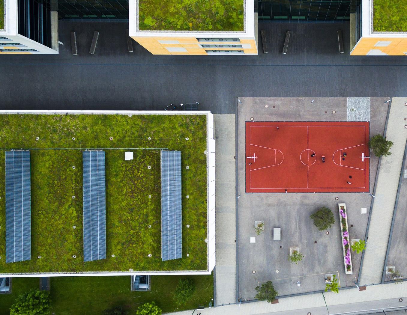
“WE ARE EXCITED TO SEE SUCH DIVERSITY REPRESENTED IN THIS INAUGURAL CLASS OF GREEN CHECK MEMBERS. THE CERTIFICATION PROCESS IS RIGOROUS, BUT FLEXIBLE, TO ENSURE THAT ANY BUSINESS WHO WANTS TO MAKE A GREATER COMMITMENT TO SUSTAINABILITY CAN PARTICIPATE. WE CAN’T WAIT TO SEE GREEN CHECK MEMBER STICKERS
- DOWELL HOSKINS-SQUIER, FORMER ENVIRONMENTAL QUALITY & PUBLIC WORKS COMMISSIONER

ENCOURAGE LEXINGTON TO JOIN THE STAR COMMUNITY RATING PROGRAM.
STAR Communities is a nonprofit organization that works to evaluate, improve, and certify sustainable communities. They administer the STAR Community Rating System
(STAR), the nation’s first framework and certification program for local sustainability. Cities and counties use STAR to measure their progress across social, economic and environmental performance areas. Louisville entered the Star Community program and has gained a 4-star rating with measurable and informative improvement potential.
ACTION ITEM
PURSUE STAR COMMUNITY CERTIFICATION
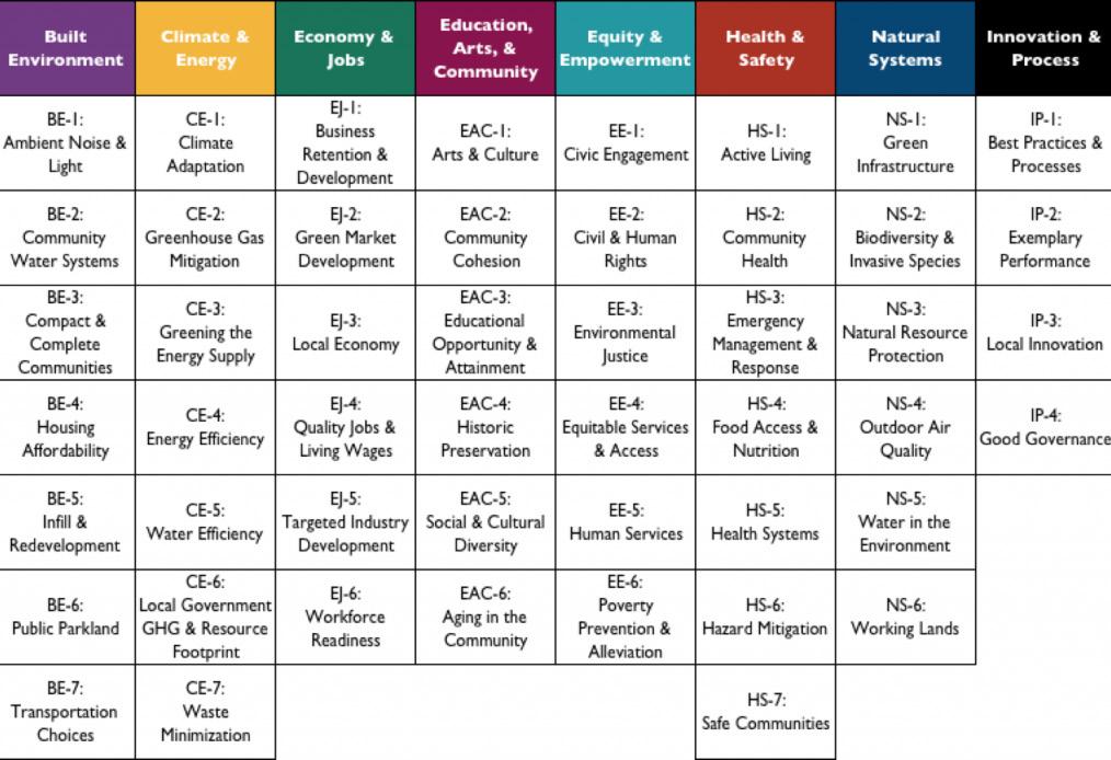
“PRIORITIZE
DEVELOP & PROACTIVELY SHARE EDUCATIONAL MATERIALS & PROGRAMS TO INCREASE
PUBLIC AWARENESS OF ENERGY EFFICIENCY BENEFITS & SERVICES.
Materials should provide a consistent message about sustainable practices and be tailored to each individual audience’s needs, such as school students, workplaces, realtors, appraisers, contractors, designers, architects, engineers, etc. The bottom line is emphasizing the cost-saving effects for energy efficiency in a life-cycle scheme, which also puts less pressure to the environment.
The more that people familiarize themselves with energy efficiency and conservation programs, the more likely they will implement the recommendations. An aggressive marketing effort can highlight the benefits of energy efficiency, which translates not only to reduced energy consumption, but real cost savings to business owners and consumers. This marketing campaign should utilize print, television, and social media strategies to communicate the benefits of energy efficiency measures. Programs should encourage ENERGY STAR buildings, appliances, and mechanical systems.
PERFORM ANALYSIS OF GREEN BUILDING BEST PRACTICES & IDENTIFY OPPORTUNITIES TO IMPLEMENT ACTION ITEM

ENHANCE LEXINGTON’S RECYCLING & WASTE MANAGEMENT PROGRAMS.
Some environmental benefits of recycling include:
• Reducing the amount of waste sent to landfills and incinerators
• Conserving natural resources such as timber, water and minerals
• Increasing economic security by tapping a domestic source of materials
• Preventing pollution by reducing the need to collect new raw materials
• Saving energy
• Supporting American manufacturing and conserves valuable resources Lexington is serviced both by a municipal waste management program, as well as private haulers. The City of Lexington has a fully functioning municipal recycling facility (MRF) to sort recycled waste and separate it with machines, compared to some adjacent counties. The City also holds many special events throughout the year to assist
citizens in waste disposal and other needs, such as household hazardous waste, paper shredding, the “Gobble Grease Toss” and mulch giveaways. Lexington also has a composting program for residential yard waste. Such events promote community engagement and education in addition to their environmental benefits. These programs should be continued and expanded.
Effective waste management is equally as important to keep the Bluegrass beautiful as building attractive neighborhoods, and builds quality of life while improving the health and the appearance of the community. Additionally Lexington’s curbside pick-up makes recycling more convenient, and should be continued and expanded into other areas where not currently available or less frequent.
“THERE IS A TREMENDOUS IMPORTANCE FOR RECYCLING & RECYCLING EDUCATION FOR THE PUBLIC.”
-LEXINGTON RESIDENT
CONTINUE TO REQUIRE GREEN INFRASTRUCTURE ELEMENTS FOR NEW DEVELOPMENT, & REQUIRE DURING REDEVELOPMENT WHERE APPROPRIATE.
Since 2016, the stormwater manual has required the use of green infrastructure for stormwater management for both volume and water quality control. Below is a list of green infrastructure practices approved for use in Fayette County for volume control.
Green infrastructure plays a key role for the urban environment and public health in the Lexington-Bluegrass region, especially when using nature-based solutions to preserve natural capital. Creating and improving the knowledge base remains one of the main strategic developments for the implementation of the manual and site design practice. Starting with school education efforts, more planning, landscape architecture and engineering programs are incorporating green infrastructure as a trend and recommended practice.
UPDATE THE GREEN INFRASTRUCTURE ELEMENTS IN THE ENGINEERING MANUALS TO REFLECT CURRENT BEST PRACTICES.
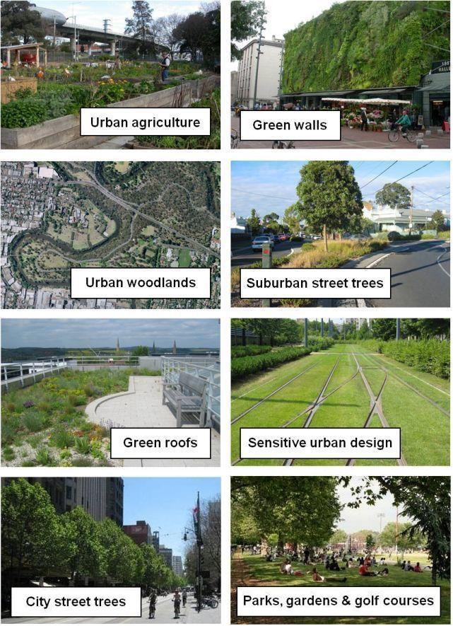
ENCOURAGE & EXPLORE INCENTIVES FOR GREEN BUILDING PRACTICES FOR NEW DEVELOPMENT & REDEVELOPMENT.
Incentives should be explored to encourage new development or redevelopment to achieve green building standards. New development is encouraged to locate building structures at optimum conditions for the use of solar energy, and
to consider sunlight impacts to adjacent dwelling units at preliminary development stage.
Provide incentives for development to incorporate renewable energy into the new proposals, such as solar, wind, geothermal, small-scale or micro-hydroelectric, energystar equipment and systems, monitoring devices, etc. Achieving net-zero community status has become a common interest and trend both nationwide and globally, as more residents and consumers start to choose an eco-conscious living style. Lexington has a large eco-friendly
market, especially among young professionals. Designing ecofriendly energy systems into development has proven to be economically efficient in the long run as well as environment friendly, which is encouraged in Lexington. Encourage development to design on-site water management to reuse grey water and develop standards in the engineering manuals.
EXPLORE PERMITTING INCENTIVES FOR GREEN BUILDING DESIGN
“PROVIDE INCENTIVES FOR BEST PRACTICES THAT INCREASE ENERGY EFFICIENCY, MITIGATE STORM WATER, & REDUCE IMPERVIOUS SURFACES SUCH AS PARKING LOTS.”
-LEXINGTON RESIDENT
EXPAND COLLABORATION FOR EXISTING ENVIRONMENTALLYFOCUSED AGENCIES ON SUSTAINABILITY PROGRAMS & FOLLOW THROUGH ON IMPLEMENTATION.
Lexington’s neighboring cities have excellent examples for sustainability partnerships. The Partnership for a Green City represents a collaborative effort to improve sustainability internally and in the community by four of Louisville’s largest public entities, including Louisville Metro Government, University of Louisville, Jefferson County Public Schools and Jefferson Community & Technical College. The partnership, which began in 2004, employs over 30,000 people; enrolls over 135,000 students; owns more than 531 buildings with 30 million square feet of space; operates and maintains 7,000 fleet vehicles; and manages 25,135 acres of land in Louisville Metro, which is one-tenth of the land in the merged city-county. To the north of Lexington in Cincinnati, OH, the Green Umbrella is the
leading alliance that facilitates collaboration among over 200 area non-profits, businesses, educational institutions and governmental entities focused on the environmental aspects of sustainability for the Greater Cincinnati area.
Based on these models, Bluegrass Forever Green, under Bluegrass Tomorrow, shares information and best practices while focusing on maximizing the collective impact of regional governments, organizations, non-profits, educational institutions and businesses in central Kentucky dedicated to environmental sustainability and improving quality of life and economic development in the Bluegrass. Bluegrass Forever Green focuses on local foods, clean water, energy, outdoor recreation and green spaces, waste, and recycling and transportation. Its mission is to further the goals of Bluegrass Tomorrow, a coalition of business, education, farming, development, and preservation interests dedicated to developing a regional unified vision. They focus on education, land use, job growth, and quality of life innovations, which leads to an environment
that develops creative talent and where young professionals and entrepreneurship thrive.
The summit of Bluegrass Forever Green Sustainability Partnership was introduced in 2015, in collaboration with Bluegrass Greensource, and continues to sustain Bluegrass Forever with conservation, preservation and sustainability initiatives. Through the summit discussion, consensus was reached that the partnership would move forward with working teams focusing on: 1) Land, which includes the Equine Agriculture Initiative, visioning for the community’s next great land preservation program, and the National Park Service Rivers Trails Conservation Assistance Program, which plans for trails and greenways; 2) Water, including work with the Kentucky River Water Trails Alliance and River Blast Events; 3)Waste and recycling; 4) Energy; and 5) Local food and agriculture. The most recent summit on local food was held in December 2017, and the Regional Food Council Initiative was formed to help expand local food in the Bluegrass Region.
Fayette County Public Schools, University of Kentucky, LFUCG Environmental Services and the Mayor’s office. Collaboration needs to be expanded as the programs continue to grow. Through the coordination of efforts and cooperation, a partnership between the largest stakeholders could realize real results that will have a long-term impact on the health, education, and wellbeing of Lexington citizens.
Responsibility to manage and maintain sustainable programs should be clarified. HOAs should be established to plant and maintain a lush landscape, which can help create a consistent and welcoming community. In the Lexington Urban Service Area, 84% land and trees are controlled by private property owners. Communicate with Planning and Urban Forestry to review 1-year or 5-year landscape status after development occurs, to ensure the plan is followed through and maintenance is in place.
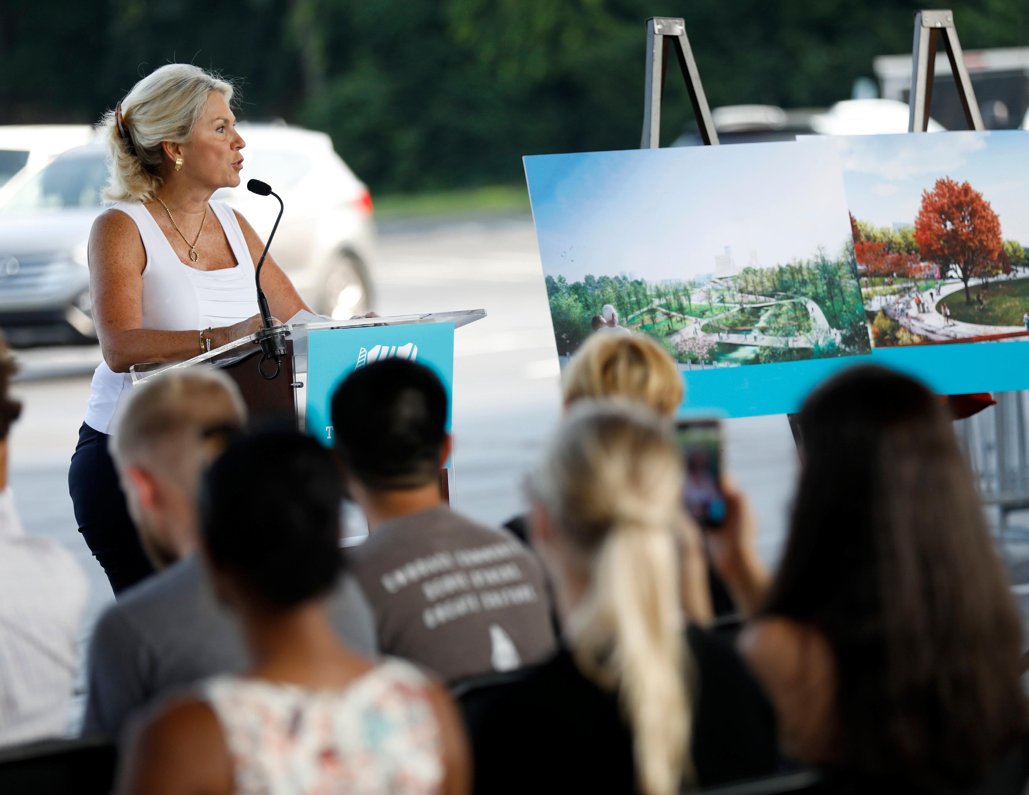
Lexington has strong programs focused on sustainability across the community, with
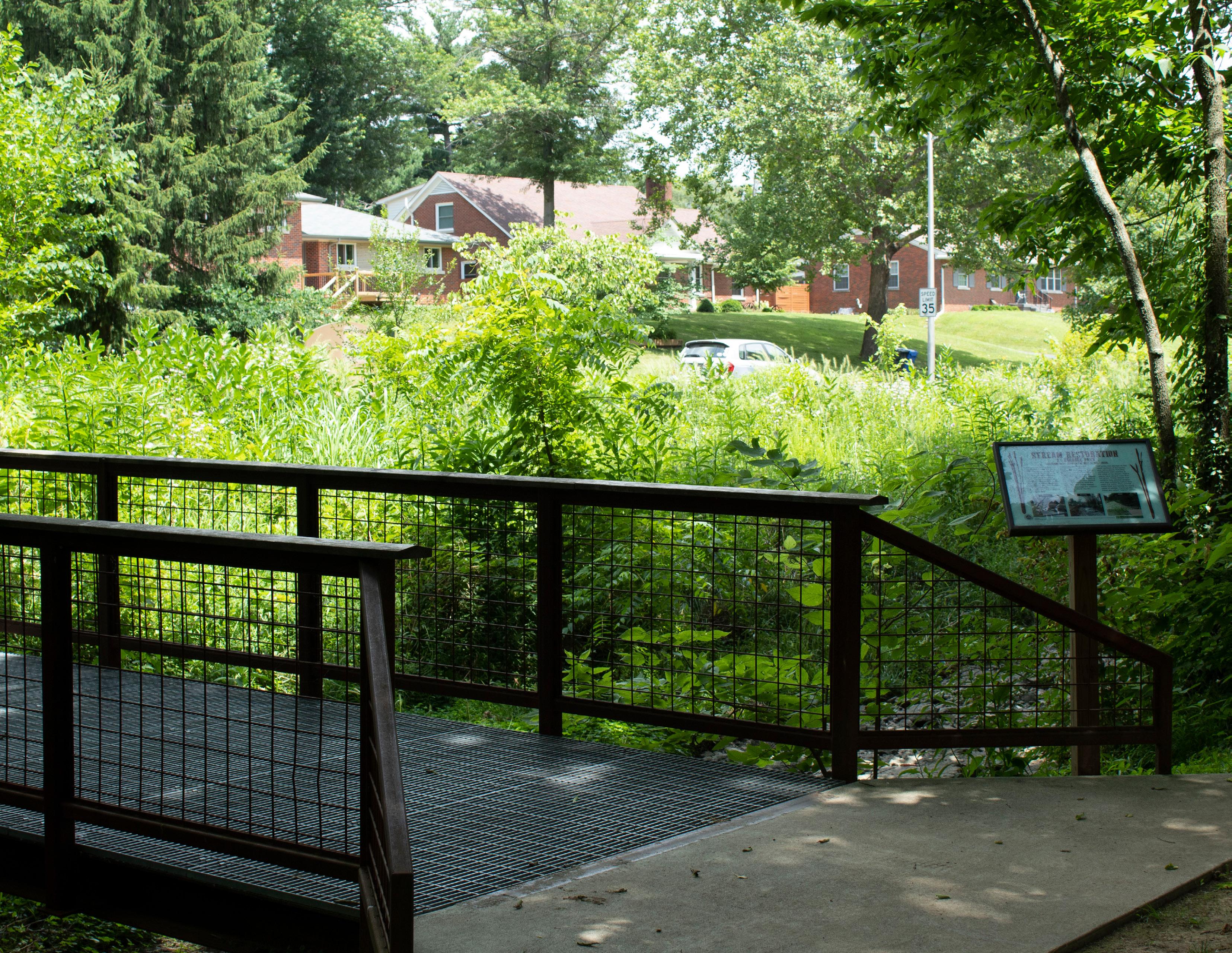

“Restoration” is the third pillar strategically, as it should be seen as the last resort. When the first two pillars, “Protection” and “Sustainability” are properly executed, the need to restore the environment should be minimal. However, opportunities exists to restore environmental damage caused by historic development practices and patterns. Measures should be taken to reestablish the environment where degradation has taken place, but must be paired with strong new policies that combat the root of the issues.
Trees are a highly effective way to protect and maintain an urban ecosystem. They reduce the heat island effect, clean the air, absorb carbon dioxide, slow and absorb water runoff, help control soil erosion, increase property values, and provide visual and wind buffers. The Urban Forestry Management Plan indicates that Lexington has been creating an urban tree canopy coverage over the last half century, increasing it from about 4% in 1967 to approximately 25% today. While
that is marked progress, the LFUCG Urban Forestry Management Plan sets clear goals, objectives, and action items to help preserve quality canopy and expand further with a healthy, native, and diverse canopy in coming years. While focusing on the urban canopy, there should also be efforts to preserve and protect our significant rural tree stands. Programs should be continued to add street trees in areas where many have died or were never planted, which assist property owners in care and replacement of street trees. Trees are an important part of our natural history and environment, and the benefits they contribute are innumerable.
Lexington continues to expand the greenway network through acquisitions after new development. Opportunities for restoration of certain areas in native grasses, plants and trees, as well as improvements to streams, sinkholes, and other aquatic assets, are being pursued by the city through the Division of Environmental Services.
Enforcing the EPA Consent Decree mentioned in the “Protection” pillar is likely the most significant ongoing governmental restoration activity. Correcting overflows and infiltration of Lexington’s sanitary sewer system is a vitally important task. The impact on the streams and creeks in Fayette County over the years has been substantial, and repairing the damage done will pay off for many future generations. New sewer projects are providing additional sewer capacity for the Urban Service Area as well as providing opportunities for future growth.
Restoring air quality is also vitally important to the city. The Lexington MPO monitors the air quality data. On November 15, 1990, the United States Environmental Protection Agency (USEPA) designated Fayette and Scott Counties together as a “NonAttainment” air quality district for the pollutant ozone. This was or violating National Ambient Air Quality Standards (NAAQS) in the period 1987-1989. Based on the severity of violations, the
area was designated a “Marginal Non-Attainment” area. In the years following this designation, the Kentucky Natural Resources and Environmental Protection Cabinet’s Division of air Quality submitted a re-designation request for the area due to consistent good air quality monitoring readings. On November 13, 1995, the USEPA agreed and re-designated the area to “Attainment” but required the area to maintain the good standard by demonstrating good air quality results within the require limits for ozone and other pollutants.
Since then, Lexington has remained in “Attainment” status. Lexington Area Metropolitan Planning Area (Fayette and Jessamine Counties) projects, programs, and plans are tested regularly to ensure that they did not contribute to violations of the standards. In April 2004, USEPA revised standards to be more stringent and again in May of 2008. Lexington maintained “Attainment” of standards even though pollutant readings trended close to the new standards at times. There are four main types
of air pollution sources:
• Mobile sources – such as cars, buses, planes, trucks, and trains
• Stationary sources – such as power plants, oil refineries, industrial facilities, and factories
• Area sources – such as agricultural areas, cities, and wood burning fireplaces
• Natural sources – such as wind-blown dust, wildfires, and volcanoes
Although there are different percentages of these sources in every community across the U.S., it is important to take steps to mitigate them for the health of the people. Many factors contribute to or help alleviate pollutants in an area. Among the most significant are the land use patterns that influence travel demand, as well as the transportation activities of the people and the transportation system on which they travel. Multimodal options, efficient traffic operations, and a connected and well-maintained transportation system are critical for reducing mobile source air pollutants. The urban service boundary, along with a progressive and effective transportation planning process in Lexington, has contributed significantly to keeping the area’s air quality
status in within “Attainment.”
Many of the policies of the Federal, State and Local Metropolitan Transportation Plan are focused on addressing air quality. Primarily focusing on minimizing Vehicle Miles Traveled (VMT), this is a significant method of improving air quality and lowering the heat island effects in an automobileoriented city. Policies throughout this Comprehensive Plan are aimed at lowering the number of miles citizens must drive in order to meet basic needs. Chief among the reasons that these policies are important is that addressing and restoring the air quality in Lexington is an obligation for future generations. These policies are good for residents’ personal health, by encouraging walking and biking, but also beneficial for the environmental health of the city.
Whether it be for the benefit of the air, water, or land, any efforts to restore or improve the condition of Lexington’s environment is worthwhile and encouraged, but Imagine Lexington advocates for proactive protection and sustainable development. This policy-driven approach to environmental protection is vastly superior to a reactionary strategy and will benefit all residents, current and future.
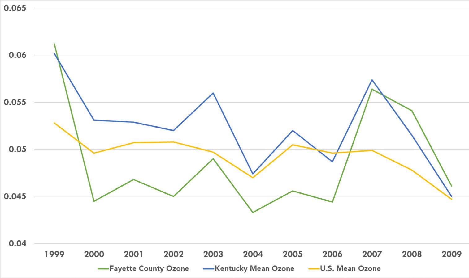
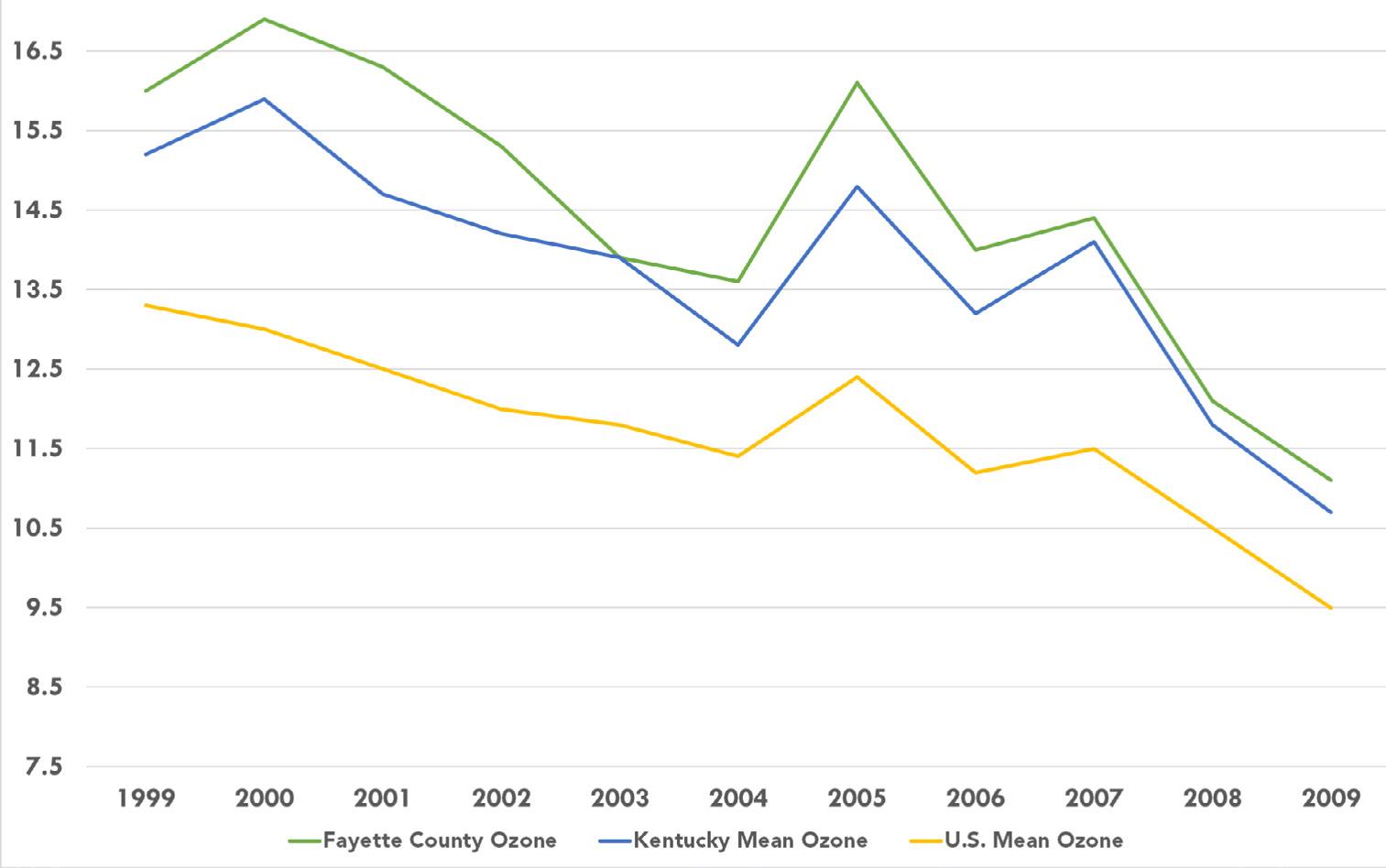
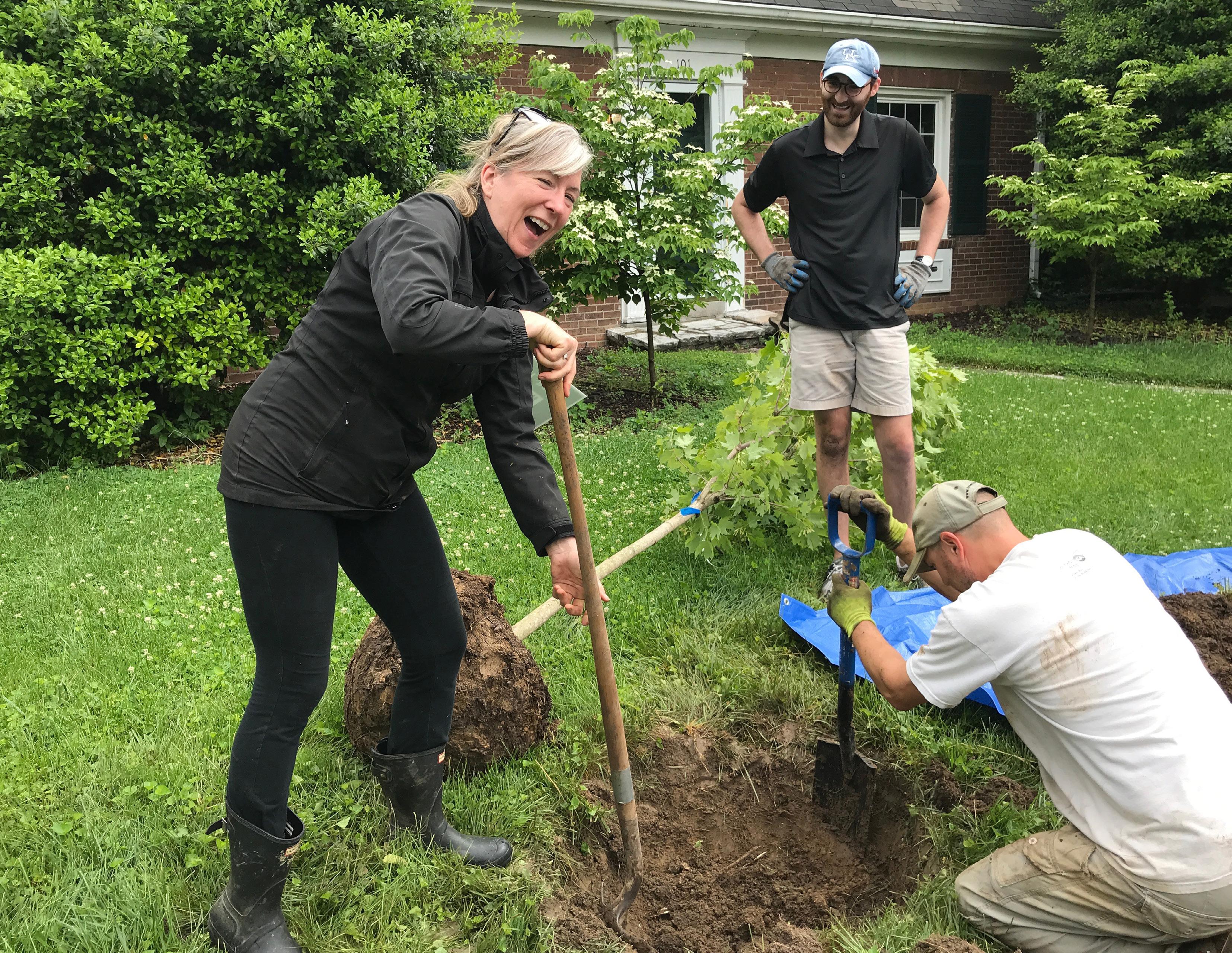
PROTECT & RECOVER
LEXINGTON’S URBAN FOREST BY STRATEGICALLY PLANTING NEW TREES & CREATING WALKABLE STREETSCAPES.
The urban forest plays an important role in supporting and improving the quality of life in urban areas. A tree’s shade and beauty contributes to the community’s health and softens the often hard appearance of urban landscapes and streetscapes. When properly maintained, trees provide abundant environmental, economic, and social benefits to a community, far in excess of the time and money invested in their planting, pruning, protection, and removal.
Lexington’s Urban Forestry Management Plan has a statement of, “achieving a sustainable urban forest in Lexington.” This mission encompasses the broad issues concerning the health and vitality of urban forests. A canopy made up of trees that are native, hardy, diverse, and compatible with
conditions and climate, properly planted and maintained and protected, makes for a healthy, long-lived, and thus sustainable urban forest, with all of its benefits. For example, studies suggest that tree-lined streets are safer, with reduced traffic speeds and reduced driver stress (from 2013 Urban Tree Canopy Assessment and Planting Plan, by Davey Resource Group). Trees have also been proven to increase residential property values 3-7% when present in the yard, and 9% when adjacent as street trees. Additionally, consumers have been found to spend more time and have a more favorable view of businesses when the business district has a vibrant landscaping plan with many trees.
Lexington’s Zoning Ordinance has established standards for Commercial Landscaping ( Article 18 ) and Tree Protection ( Article 26). These ordinances set minimum tree canopy coverage standards for commercial and residential zones. Steps to review and update these ordinances are part of the Urban Forestry Management Plan, and are reinforced in Imagine Lexington.
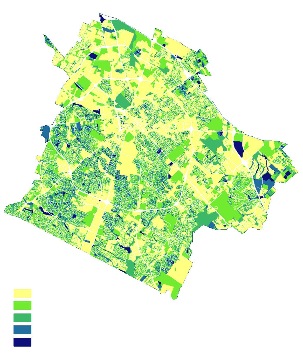
In Lexington, 16% of all land is publicly owned, and 84% is
privately owned, according to the 2013 Urban Tree Canopy Assessment. In order to “achieve a sustainable urban forest in Lexington”, it is therefore important to engage both the public and the private sectors in the stewardship of the urban forest. This requires mechanisms for educating and encouraging private sector engagement in urban forestry. Updating tree inventory on a continuous basis, and supplementing with a comprehensive urban tree canopy assessment every 10 years, along with tracking all completed action items, will provide opportunity for evaluation and adjustments.
Tree protection is required in the development process. Contacting the urban forester is required by the ordinances and the procedures manual. The benefits associated with the conservation of trees, tree stands, and greenspaces as a part of new development planning is well documented. According to the 2016 Greenspace Survey, 92% of respondents feel developers should be responsible for greenspace creation as basic infrastructure, while 78% feel that there should be additional protection for trees of significant species, size and condition.
LFUCG currently has initiatives to increase public participation in care and planting of trees on public property through Reforest the Bluegrass. Grassroots non-profit organization Trees Lexington! has also gained tremendous momentum in the community, and has been advocating for increased urban tree canopy. Lexington has
established a well-stocked plant nursery at Hisle Park, where trees, shrubs, and other plants will be grown and propagated for installation on public properties, including parks, greenways, and facilities. It is time to move trees forward on the budget list.
IMPLEMENT RECOMMENDATIONS FROM THE URBAN FORESTRY MANAGEMENT PLAN
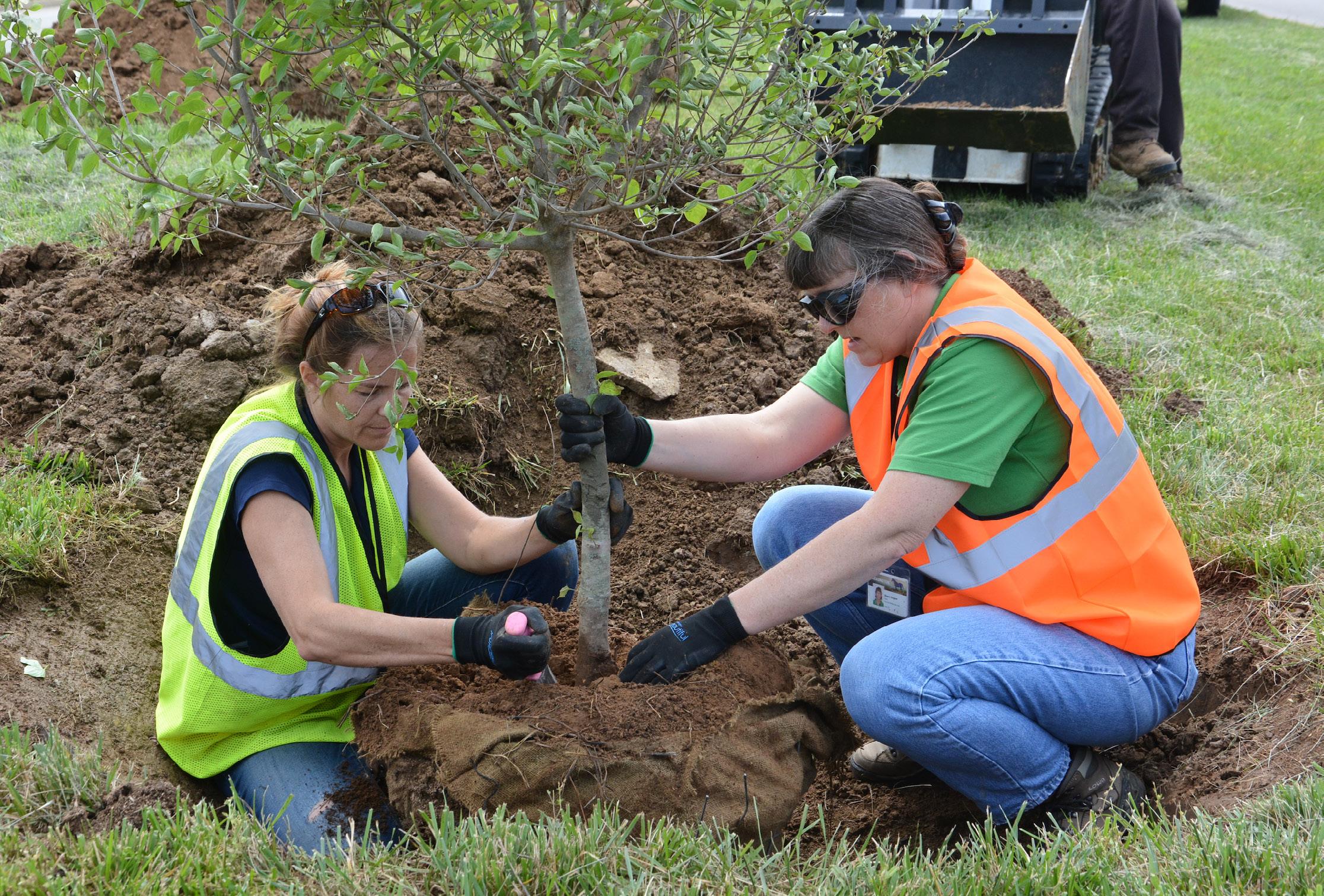
“TREES
ITS VALUE BY 15% OR MORE.” -ARBOR DAY FOUNDATION
USE GREEN INFRASTRUCTURE TO BRIDGE GAPS IN THE GREENSPACE NETWORK.
Green infrastructure provides numerous environmental benefits, such as stormwater management, with limited disruption to natural land. It can serve as an urban oasis in the regional ecological system and create linkages within the greenspace network. The 2004 Greenway Master Plan identified several conservation greenways in the county which are a crucial component of the greenspace network within our region. Development within or adjacent to these greenways should consider incorporating green infrastructure as a means of creating and/or maintaining connections to the network. Doing so will provide effective stormwater mitigation, habitat preservation/enhancement, and increased environmental quality.

SUPPORT COMMUNITY GARDENS & URBAN AGRICULTURE TO RESTORE NATURAL RESOURCES WITHIN THE URBAN SERVICE AREA
Lexington allows community gardens on public property such as parks and greenways, in areas where appropriate. Seedleaf was founded in 2007 with a mission to nourish communities by growing and sharing food in Lexington. The nonprofit grew three gardens in 2008, 10 gardens in 2009, and has grown steadily since then. While neighbors come together to produce local food and improve social connections, the process also restores natural resources within the urban area, leaving ecological benefits for the environment. Seedleaf cultivates 15 free u-pick community gardens throughout Fayette County’s food deserts, areas deemed by the USDA to have problematic access to fresh local food. Seedleaf also picks up compost at 35 area restaurants and kitchens through their Compost Partners Program, a partnership with the Lexington Fayette Urban County
Government’s Division of Waste Management. Much of that food waste is composted at or near community gardens.
Urban farming has become popular in multiple cities. With growing population and urbanization, suitable agricultural soil is diminishing within the urban area. However, market demand for organic locally grown food is dramatically increasing for health and economic reasons. New solutions are popping up, including rooftop farming. Lexington has a community base for organic locally grown agriculture, in which new development could play a major role.
“Soaring prices and concerns about chemical-laden fruits and vegetables increasingly drive us to grow our own healthy food close to home. In cities, however, vanishing ground space and contaminated soils spur farmers, activists, and restaurateurs to look to the skyline for a solution. The hunger for local food has reached new heights, and rooftops can provide the space that cities need to bring fresh, organic produce to tables across North America.”
- Lauren Mandal, EAT UP These inspiring solutions
will help restore the urban environment and benefit all residents of Lexington.
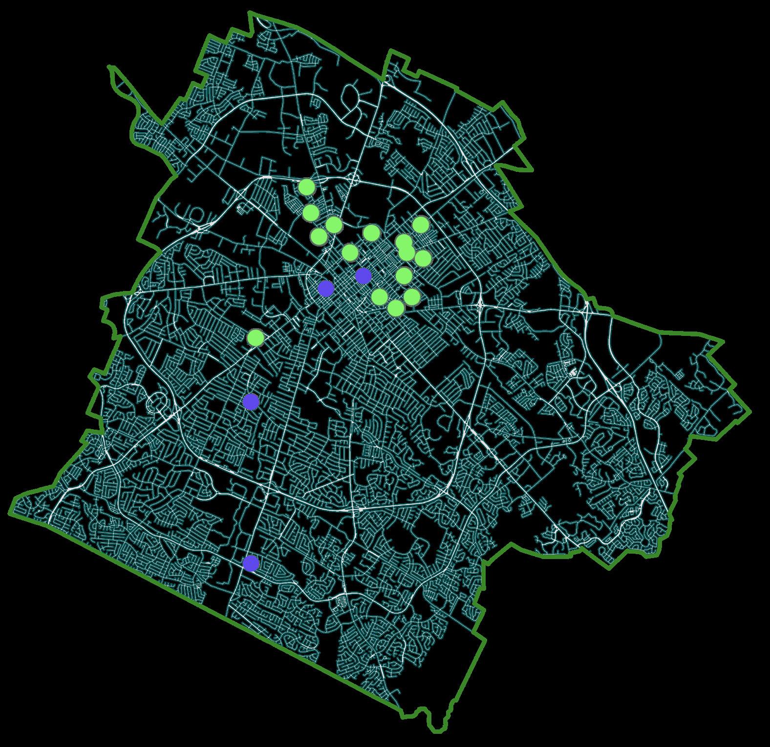 SEEDLEAF COMMUNITY GARDENS
LEXINGTON FARMER’S MARKET
SEEDLEAF COMMUNITY GARDENS
LEXINGTON FARMER’S MARKET
IMPROVE AIR QUALITY BY REDUCING VEHICLE MILES TRAVELED (VMT).
Reduction of vehicle miles traveled (VMT) is an official goal of the U.S. Government policy, as stated in sections of the Clean Air Act (CAA). Vehicles (or mobile sources) are a major contributor to urban air pollution. Technology (cleaner vehicles and cleaner fuels) will continue to reduce vehicle pollution, but more people living in an area generally equates to more vehicles
on the road. Recent national trends show a decrease in personal vehicle miles of travel per person and it is likely that this trend will continue. However, the population is also increasing and the economy is entering a period of growth. Thus, it is anticipated that overall travel demand will continue to grow. If demand is not met in an efficient and multimodal manner, additional congestion may ensue, potentially compromising air quality.
Lexington is a relatively vehicledependent city and some damage to air quality has already taken place. The Lexington Area MPO monitors local air quality and promotes ways to reduce air pollution.
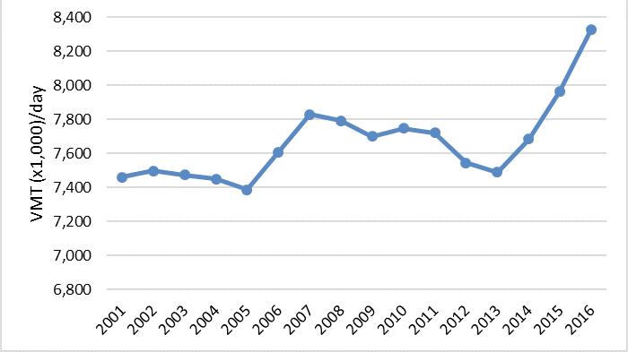
Advisory has included:
• Reduce driving and fuel consumption by using public transportation, walking, carpooling, or riding a bike;
• Ask employers to consider flexible work schedules or telecommuting;
• Trip-chain (plan daily trips or errands to reduce excess driving);
• Fill gas tanks during cooler evening hours to cut down on evaporation;
• Avoid spilling gas and don’t “top off” the tank. Replace gas tank cap tightly;
• Avoid waiting in long drivethru lines, for example, at fast-food restaurants or banks. Park vehicles and go inside.
Other incentive programs that can be explored include:
• Employer pay-to-park program. Employers offer parking passes but reimburse in compensation for employees who opt not to use parking passes. Multiple cities have used this method to encourage employees to commute using alternative transportation rather than single occupant vehicles.
• Explore policies including VMT tax, tolls, or congestion pricing in downtown areas
• Implement parking pricing schemes
• Reduce the availability of on and off street parking to encourage alternate forms of transportation
• Create alternatives to single occupancy vehicle travel through the improvement of multimodal transportation options, including carpools, vanpools, public transit, and active transportation – any self-propelled, human-powered mode of transportation.
“WE NEED MAJOR COMMITMENT TO POLLUTION REDUCTION, INCLUDING SUPPORT FOR SIGNIFICANT INCREASES IN WALKING, BIKING, & PUBLIC TRANSPORTATION FOR DAILY COMMUTES.” -LEXINGTON RESIDENTLEXINGTON AREA MPO
“IF DEMAND IS

Lexington is well established as the Horse Capital of the World, and that title plays a large part in creating jobs and prosperity. There is a storied past, a thriving present, and a promising future associated with the many horse farms that call Lexington home. Many people choose to live in or visit Lexington because of the beautiful greenbelt of farms and the horse-related entertainment (Keeneland, Kentucky Horse Park, Horse Country Tours, etc.), yet there are also a myriad of other draws like the University of Kentucky, Bourbon and Brewgrass Trails, wineries, restaurants, healthcare, schools, and so many other attractions that bring residents and visitors to the area. Many businesses also choose to locate in Lexington for these same livability reasons, and Imagine Lexington seeks to capitalize on opportunities to build on these existing strengths. Lexington is a city with a diverse economy, providing many employment options. That diverse economy is led by the Healthcare and Social Assistance industry, which accounts for the largest quantity of jobs and provides the most payroll tax revenue. Retail

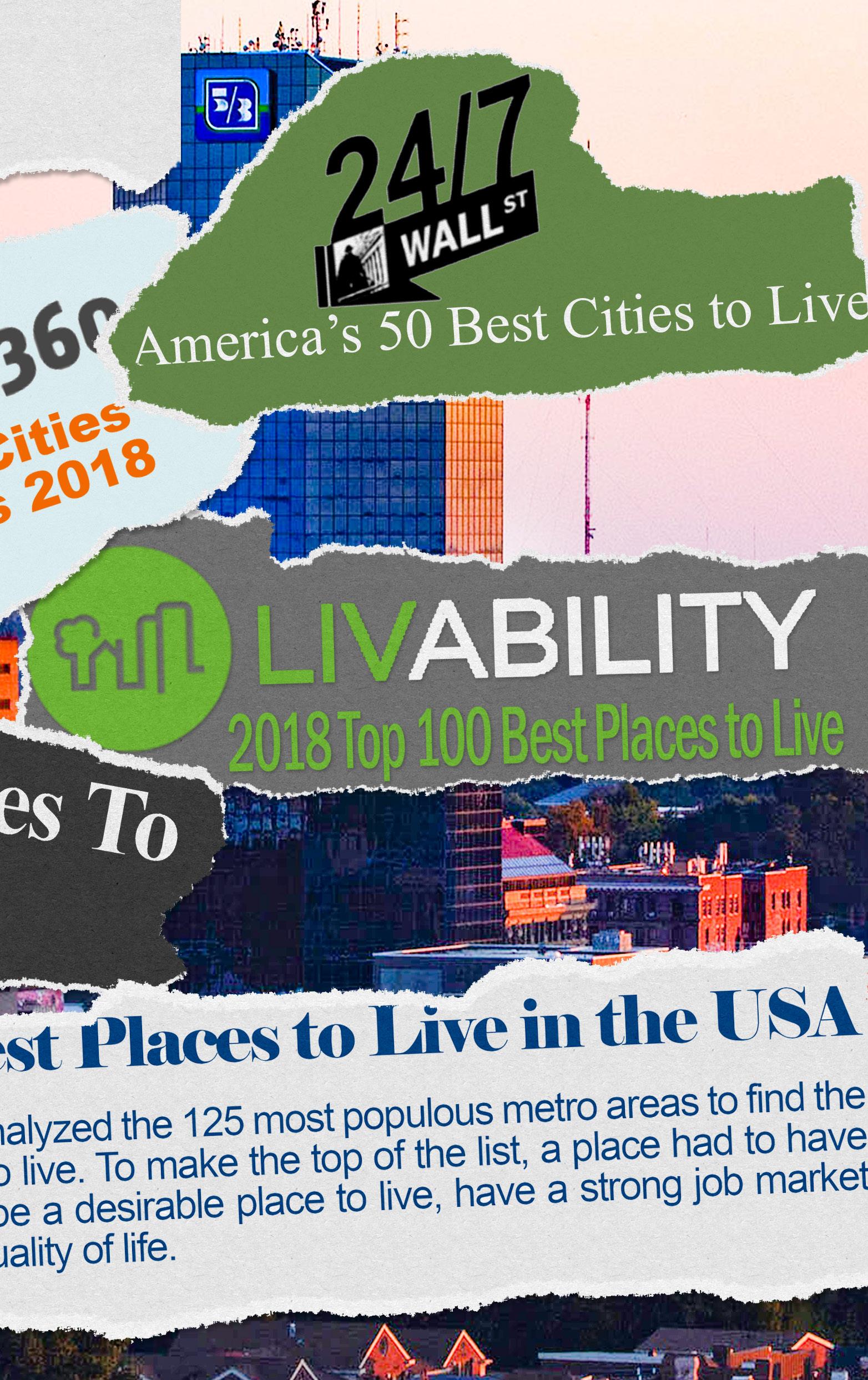
Trade and Accommodations and Food Services follow with the second and third most jobs, while Wholesale Trade and Professional, Scientific, and Technical Services provide the second and third highest payroll tax revenue. Maintaining that diversity in industries and occupations, while increasing opportunities for higher wages, will help provide longterm sustainability as markets and the global economy change. Continuing to recruit employers, especially industries with higherpaying jobs, will be beneficial to Lexington’s revenue flow and should provide upward mobility opportunities for employees in industries with lesser paying jobs.
Recently, Lexington has been appearing on more and more “topranked city” lists for everything from, “Best City for New Grads” to “Best City to Retire.” It is important for Lexington to leverage this momentum and take the city to the next level as far as desirability is concerned.
Clearly the evidence points toward Lexington being poised to take the next step in creating an even more desirable place to live, work, and visit. As more employers look to livability and quality of workforce in their locational criteria, this city will continue to be an attractive option to bring businesses of all sizes and industries to the area.
• #2 - “Top 12 Global Destinations to Visit in 2018,” Newsday
• #2 - “Best Mid-Size Cities for New Grads 2018,” The Degree 360, 2017
• #3 - “Best Cities with the Highest Salaries, and Lowest Costs of Living,”GoBankingRates, 2018
• #10 - “Top 10 Destinations on the Rise - USA,” Trip Advisor, 2018
• #14 - “25 Best Places to Retire,” Forbes, 2018
• #21 - “Best Place to Live,” U.S. News & World Report, 2018
• #31 - “America’s 50 Best Cities to Live” 24/7 Wall St, 2017
• #50 - “Top 100 Best Places to Live,” Livability, 2018
Fayette County’s Rural Service Area (RSA) makes up 200 square miles of the 285.5 square mile county. In the recent Rural Land Use Inventory, Fayette County, Kentucky report (June 6, 2017), by Lynn Roche Phillips, PhD., AICP, and Priyanka Ghosh, PhD., University of Kentucky, Department of Geography, roughly 86% of Fayette County’s rural lands are used for agriculture and more than 50%, or 101.43 square miles, are dedicated to equine only operations (59.2 sq. mi.), and combined equine and crop operations (42.23 sq. mi.). This 2017 inventory resulted in a total of 108,248 acres being utilized for agricultural uses within the RSA.
Obviously agriculture is the dominant land use in Lexington; it embodies local heritage and provides a world-renowned sense of place, but it is also a key component in the Lexington economy. According to the May 2017 report, The Influence of the Agricultural Cluster on the Fayette
County Economy, by Alison Davis, PhD., and Simona Balazs, MS, with the Community and Economic Development Initiative of Kentucky, College of Agriculture, Food, and Environment, University of Kentucky:
“1 out of every 12 jobs [in Fayette County] is directly or indirectly associated with the Ag Cluster.”
“… the Ag Cluster contributes approximately $8.5 million to the local tax base through the 2.25% occupational tax rate.”
“the Ag Cluster generates approximately $2.3 billion in output annually and $1.3 billion dollars in additional income, profits, and dividends.”
The “Ag Cluster,” as defined in this report, includes standard agricultural production impacts, as well as a variety of supporting operations such as feed mills, breweries, private riding schools, tourism, etc. Each of these are vital components of the Cluster
and play a role in Lexington’s overall economy. The report is a wonderful resource for providing a comprehensive look at the impacts of this portion of the economy. Another key resource in inventorying and discussing the rural area is the Rural Land Management Plan, completed in 2017 as an element of the 2013 Comprehensive Plan, and carried over to Imagine Lexington.
Nearly everyone equates Lexington with horses, and while horses are not the only thing that define this city, they are a critical component of the economy and a primary driver of why many choose to live in and visit Lexington. Lexington’s picturesque farmland adds to the livability factor that attracts people and businesses to the city. Every effort should be made to ensure continued support of the equine industry.
“CONTINUE TO FOCUS ON INITIATIVES
& LOCAL FARMERS MARKETS.” -LEXINGTON RESIDENT

The success and identity of the horse farms and natural beauty of Lexington’s agricultural areas factor high in the burgeoning tourism industry. Equine events and racing, tours of all kinds including horse farms, pumpkins and corn mazes, the Bourbon Trail, hotels, and restaurants are some, but not all, of the ways agriculture is connected to tourism and the overall Lexington economy. In particular, the horse farm tours are increasing; one company, Horse Country Inc., has about 34 tours to choose from, including horse farms and equine related facilities, such as an equine hospital. In the past, many had remarked about the general public’s lack of accessibility to the iconic horse farms. Whether real or perceived, it was a barrier to drawing tourists and locals alike to experience the inner workings of these operations, and contributed to an atmosphere of inaccessibility and disconnect between urban Lexington and the rural area. New endeavors such as Horse Country have come online recently to bridge the gap, and have made huge strides.
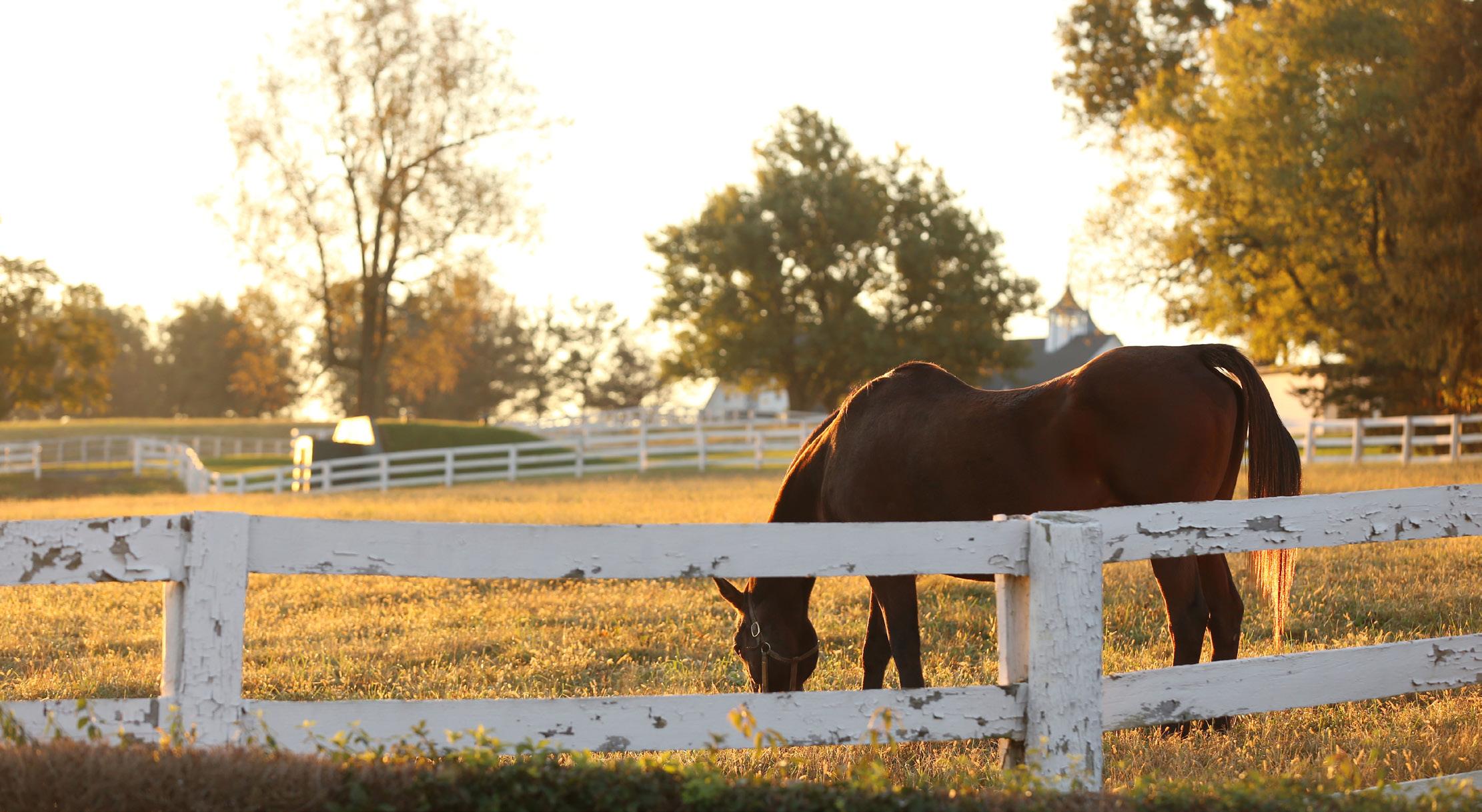
In addition to the increased access to horse farms, tourism has been boosted by both bourbon
distilleries and craft breweries that have been growing in both number and popularity. These have manufacturing, agricultural, retail, and entertainment components, and have proven to be a big draw to both Lexington and the Bluegrass Region. The Bourbon and Brewgrass Trails take visitors through Lexington’s scenic roadways; many have said that it is as much about the journey as it is the destination. Yet another reason protecting the rural service area is important for economic, as well as historic, and cultural purposes.
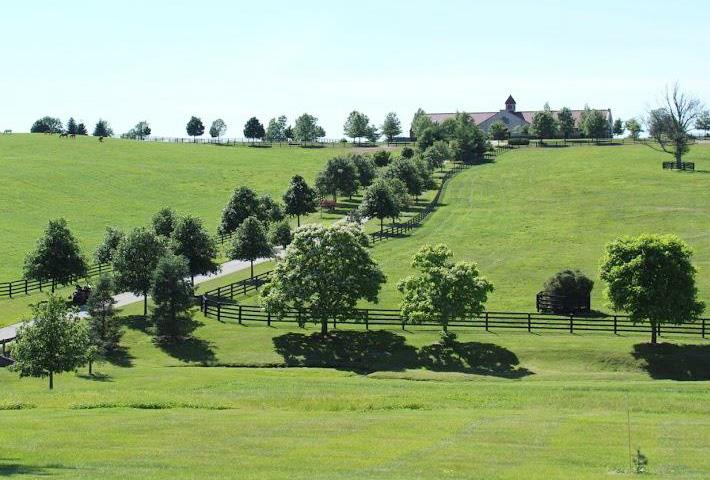 GODOLPHIN AT JONABELL FARM, LEXINGTON, KY
Lexington has 29 companies, listed on the next page, employing 250 or more employees, totaling 62,111 employed. Approximately 32.3% of Lexington workers work for employers employing 250 or more. The University of Kentucky, combining the school’s employment and UK Healthcare’s employment, is the single largest employer in Fayette County.
Retaining and growing these large employers is very important, as they are vital to Lexington’s economy, but retaining and growing the smaller businesses is also important. The vast majority (67.7% of all Lexington’s workforce, or 130,294 workers) are employed in smaller businesses, which underscores the need to support these enterprises, and create an environment where entrepreneurs can thrive. While most of the workforce works resides at places employing fewer than 250 people, loss or layoff from one of the larger employers has a trickle-down effect on the medium and small businesses due to less disposable income and less business activity between businesses. The symbiotic relationship between all sizes and types of businesses needs to be supported and proliferated. Many
of these smaller businesses grow into larger businesses, and further contribute to the overall economy.
Fifty percent of the small businesses with fewer than 250 employees in Fayette County have only one to four employees. The majority of businesses with fewer than 250 employees (83%) have fewer than 20 employees.
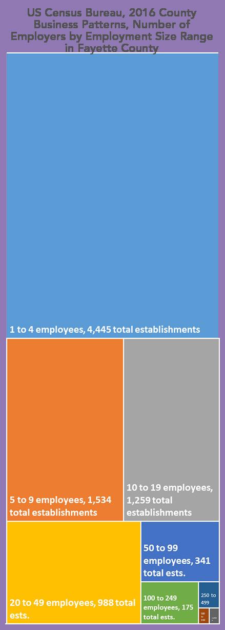
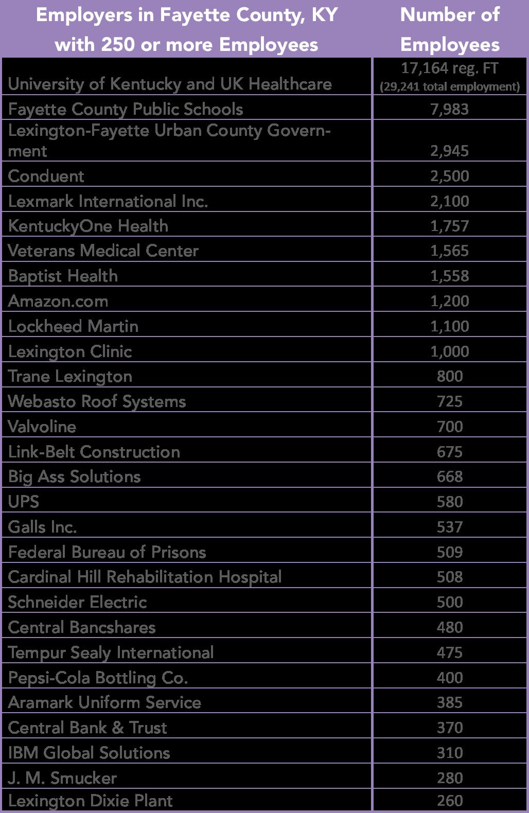
Lexington’s main source of revenue is the 2.25% payroll withholding tax, which made up 56.1%, or $194.1 million, of the total revenues for FY 2017. Combining the payroll tax revenue with the 2.25% tax on businesses’ net profits for FY 2017 at $39.2 million, or 11.3%, these two together equaled 67.4%, or $233.3 million, of the FY 2017 total revenues of about $346 million from which the city uses to operate. This revenue generated from employment and businesses located in Lexington is crucial for general operating expenses and fulfilling the project and programming needs of the city as it continues to improve overall quality of life.
The US Census Bureau supplies the County Business Patterns (CBP) data each year, reporting employment and payroll dollars by industry. For the year 2016, the CBP shows Healthcare and Social Assistance to be both the leading payroll contributor and the leading employment provider at 31,875 employees. Since CBP categories do not include government employment at any level, UK Healthcare and the Veterans Hospital are not counted, indicating an ever larger impact
on the local economy. Wholesale Trade brought in the second most payroll dollars, but was seventh in number of jobs. Professional, Scientific, and Technical Services jobs brought in the third highest payroll amount, and was fourth in number of people employed.
Wholesale Trade jobs are much higher-paying on average, but there are less than half as many
Wholesale jobs as Retail. Retail Trade had the second most jobs at 20,823, and Accommodations and Food Services had the third most at 19,999, but both of these categories have the lowest average pay. Finance and Insurance are the second-highest paid jobs on average, with only 4,830 jobs, and Construction jobs were third-highest payroll
on average, with 9,717 jobs. In the following chart, increasing employment in the industries labeled with a green dollar sign would have a larger impact on increasing revenues for the city than the other industry categories, since those industries have higher paying jobs on average.
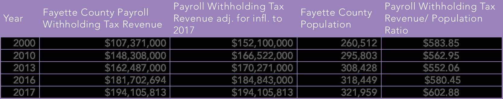
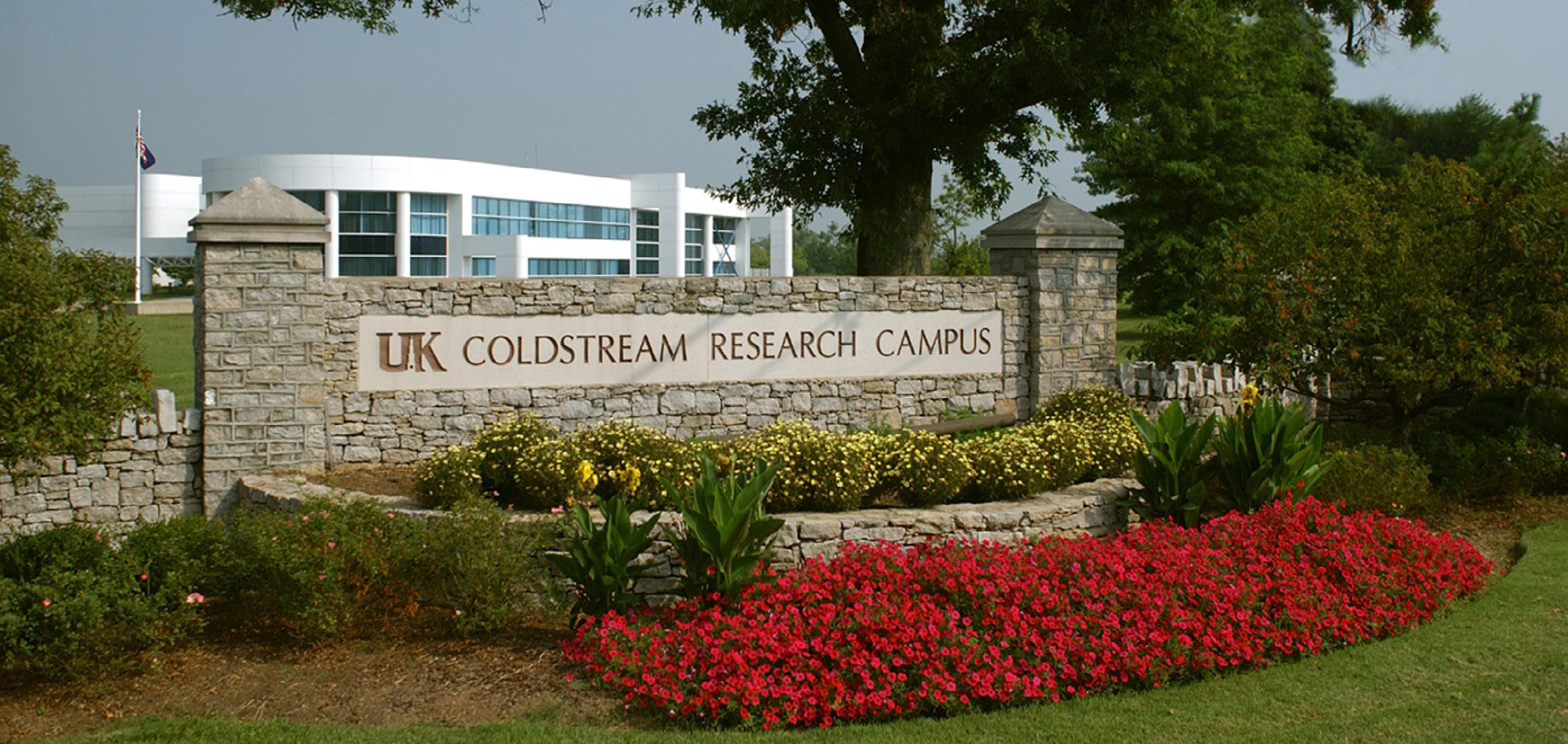
In looking at the gains and losses in employment and payroll by industry in Fayette County from 2011 and 2016, the county experienced the highest increase in payroll from Construction employment, followed by the second-highest payroll increase in Professional, Scientific, and Technical Services, with the third-highest payroll increase in Healthcare and Social Assistance. As far as the highest increases in jobs by industry, Healthcare and Social Assistancegrew the most, with 4,437 jobs. Accommodation and Food Services had the second-highest increase in jobs at 3,432, and Professional, Scientific, and Technical Services experienced the third-highest.
In looking at CBPs for the time period 2007-2011, the effects of the recession are evident. There were only four industries that had an increase: Wholesale, with the highest increase in jobs and payroll; then Healthcare and Social Assistance, and a slight increase in Educational Services and Transportation and Warehousing. Wholesale rocketed during this time period, with an increase in payroll of about $380 million and about 2700 new jobs. During 2007-2011,
Manufacturing lost the most in payroll dollars, while Construction lost the most jobs and the second most in payroll dollars.
When looking at the overall time period 2007-2016, Manufacturing still has the highest payroll and job loss. Manufacturing has only gained back $30 million of the $300 million in payroll jobs lost during the recession, and has only recuperated about 900 of the 1,900 manufacturing jobs lost during that same time period. Construction has gained back most of the jobs lost during the recession, and has increased the payroll dollars from Construction by about $65 million more than was lost during the recession.
$ BETWEEN 2011-2016 BY INDUSTRY CATEGORY
 2016 COUNTY BUSINESS PATTERNS, US CENSUS BUREAU, FAYETTE COUNTY, KY
In comparing Fayette County to its surrounding counties and Kentucky, Scott County has the highest median household income; while it is almost $14,000 higher than Fayette County, Fayette has 13% more people with a Bachelor’s degree or higher.
Fayette County has a very high educational attainment. The University of Kentucky, Bluegrass Community and Technical College, Transylvania University, and other colleges in Lexington confer more degrees each year than the number of new jobs in Fayette. Many of these graduates leave Lexington, the Bluegrass area, and the state to find employment, as there were 52,323 more degrees awarded than new jobs created in Fayette County.
In Lexington, the percentage of people aged 16-64 not participating in the labor force in 2016 was about the same percentage as in 2000. However, because the population has grown by about 58,000 people since 2000, the number of people aged 16-64 not participating in the labor force is growing, indicating more people relying
on government aid and services. As the “Baby Boomer” generation finishes retiring, there will be a need for a younger workforce to replace them. This means the need to reduce barriers to employment, assist in childcare costs, and provide training becomes more important, along with the need to recruit and retain young professionals in Lexington.
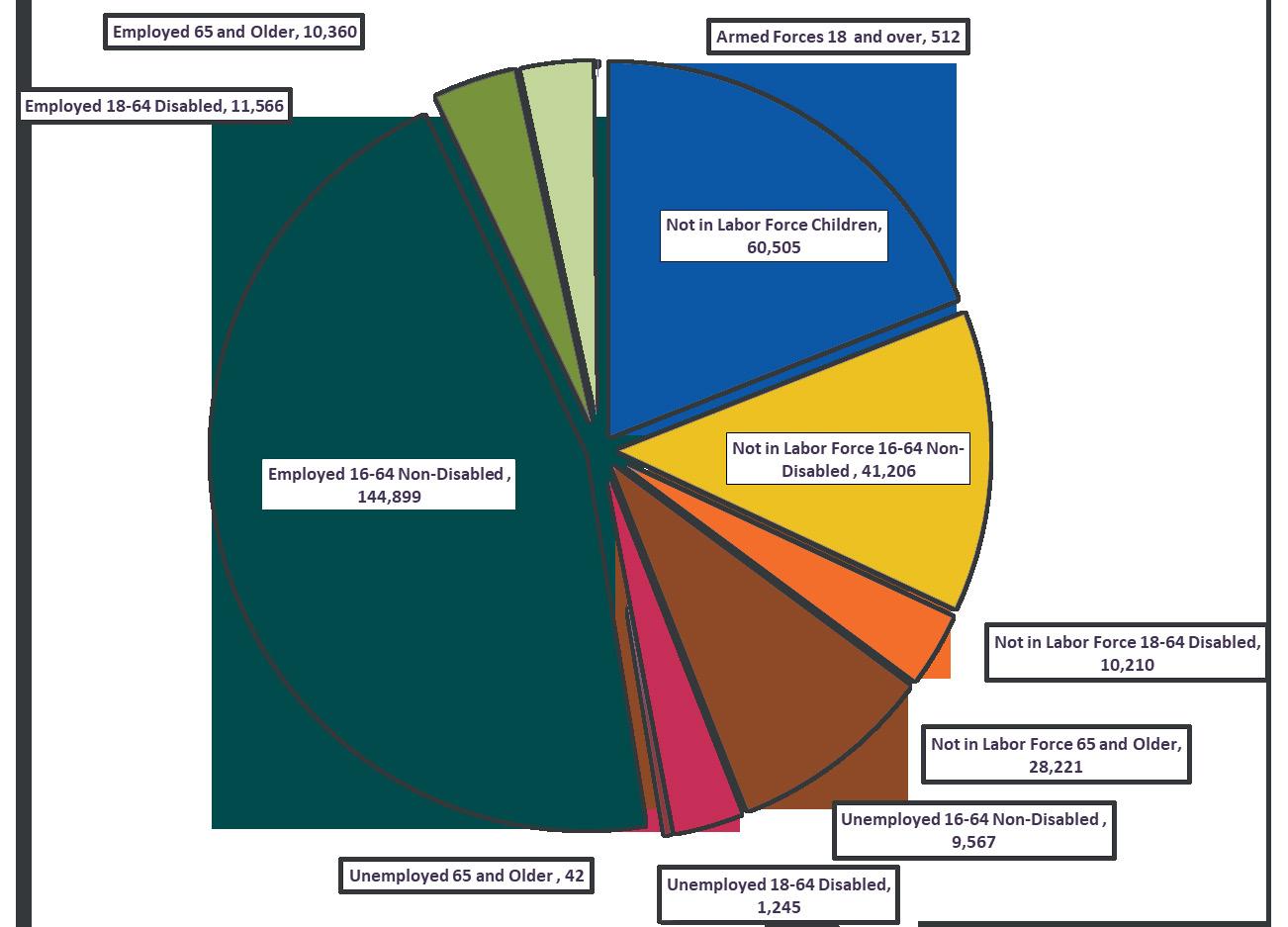
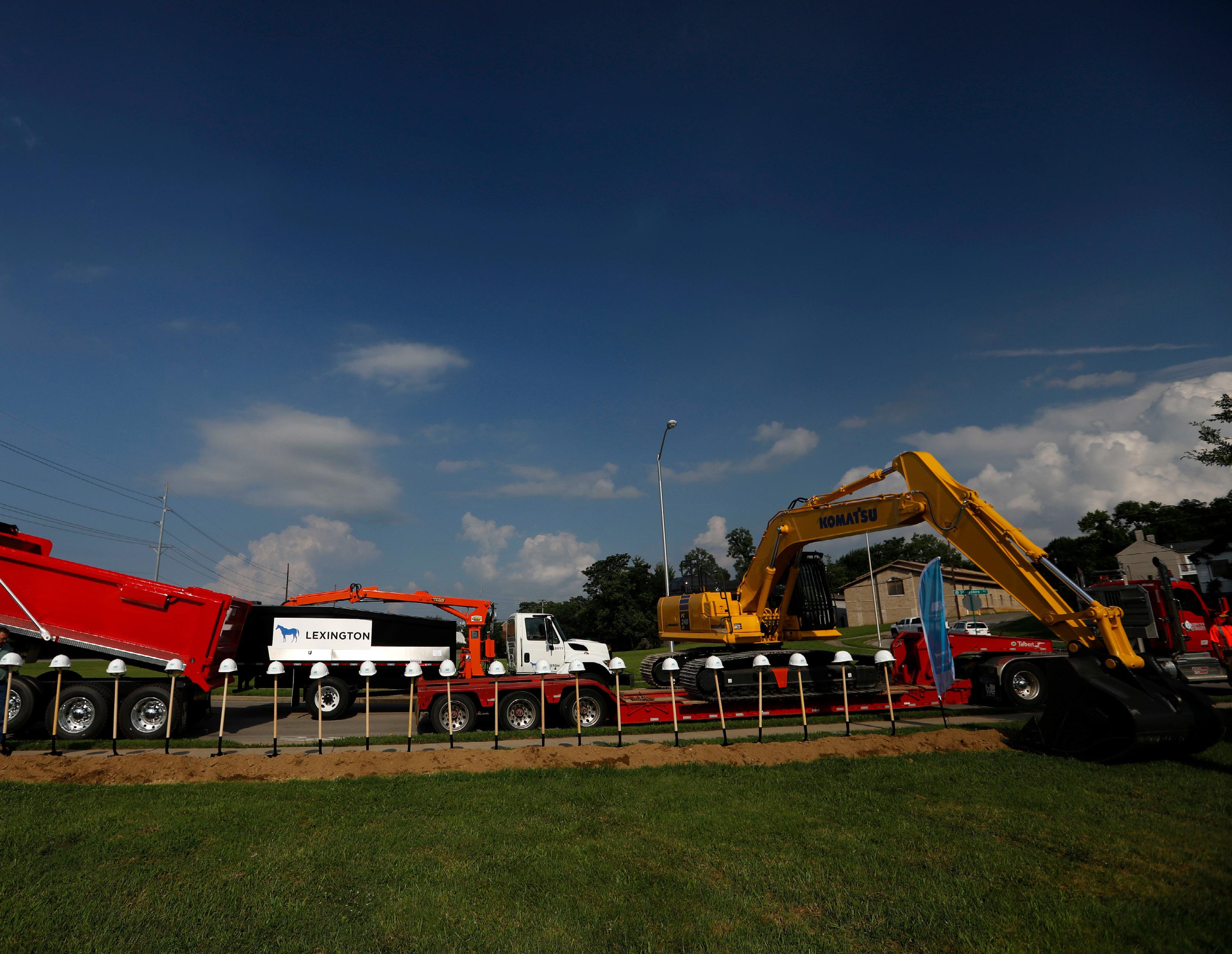


There are a number of reasons why corporations may locate to a city, but according to an annual survey of corporate executives put out by Area Development magazine in 2016, “quality of life” ranks third in the list of the top factors in determining where a new site should go, only behind “availability of skilled labor” and “highway accessibility”. Locating in a livable place where their employees will want to reside is key to employee satisfaction; corporate decisionmakers are also unlikely to select a location where would be unwilling to spend time. Additionally, recently trends have shown that millennials and young professionals specifically are choosing locations first and then finding employment. Desirable places attract people.
Quality of life is synonymous with “livability.” The American Association of Retired Persons (AARP) has developed a Livability Index for people to measure how livable their community is. They consider livability through the lenses of housing, neighborhood, transportation,
environment, health, engagement, and opportunity, and gauge access to opportunities in each of these categories.
HOUSING: It is crucial to have the full spectrum of housing options available for those in all phases of life. This means pursuing more compact housing types that constitute the “missing middle” of the housing stock in Lexington, as well as senior housing options that might not already be available, such as accessory dwelling units.
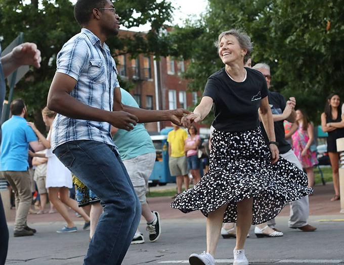
that, “Compact neighborhoods make it easier for residents to reach the things they need most.”
TRANSPORTATION: A livable transportation system is all about equitable options. Providing opportunities for people to access their jobs, parks, grocery stores, healthcare, etc., via a variety of modes is key.
ENVIRONMENT: Clean air and water, a robust tree canopy, green infrastructure components, and available open space are all crucial to a livable community.
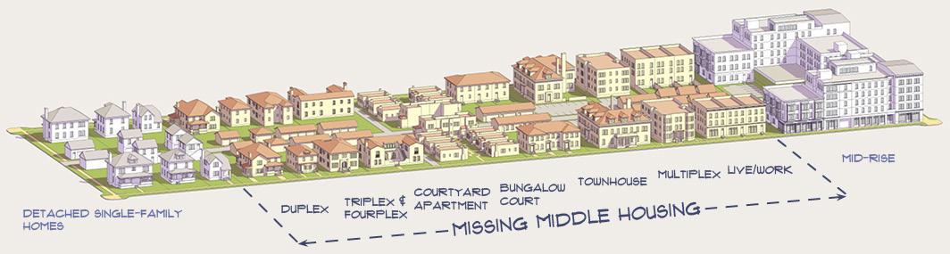
NEIGHBORHOOD: Complete neighborhoods include the full range of goods, services and uses within close proximity. AARP lists two important qualities of livable neighborhoods: access and convenience. They further state
HEALTH: The welfare and health of Lexington is dependent on the environment and development patterns, as well as medical opportunities for all citizens. Preventative and as-needed healthcare opportunities need
to be accessible to residents throughout the city.
ENGAGEMENT: Opportunities for social interaction are crucial for a successful community. Parks and common spaces that facilitate this help to make Lexington a strong city. Communication is the primary way to break down barriers and build community.
OPPORTUNITY: Equity is crucial in making sure that all citizens of Lexington have access to opportunities for quality employment, housing, entertainment, and all facets of the community.
All of the factors above contribute to the overall livability of the city. To the extent Lexington is able to improve in these areas, it will be increasingly successful in attracting world-class talent and employers to boost the economy.
ENCOURAGE ECONOMIC OPPORTUNITIES FOR A WIDE ARRAY OF AGRITOURISM WHILE PRESERVING THE BLUEGRASS IDENTITY.
Agritourism is an increasingly important part of Lexington tourism, and with recent developments like the creation of Horse Country, which has accounted for over 70,000 horse farm tours alone since its inception, and Boone Creek Outdoors zip line canopy tours, the timing is right to continue with that momentum. Efforts should be made to ensure that the local Fayette County extension office and the Kentucky USDA know about the agritourism uses allowed in Lexington’s rural service area, so farmers are aware of the options they may have for additional revenue streams. These opportunities have the potential to supplement farmers’ primary business operations and may allow some farms to remain viable, where it might otherwise be difficult.
conditional uses closely scrutinized, using the Rural Land Management Plan as a guide. It is important that tourism uses for the agricultural land do not have a negative impact on the farming practices that are vital to the Lexington economy. It is possible to have a thriving agritourism industry while maintaining the integrity of the agricultural area, and it should be encouraged as a primary component of Lexington’s tourism strategy.
The zoning ordinance for the A-R Agricultural Rural, A-B Agricultural Buffer, and A-N AgriculturalNatural Areas zones currently allow several accessory uses that are related to agritourism. Further, tourism-related conditional uses are currently listed as options in the A-R zone with Board of Adjustment approval; while some are permitted in the A-B and A-N zones, others require environmental approval.
“STOP FIGHTING AGRITOURISM! INSTEAD, WE SHOULD ENCOURAGE IT!”

• Farm tours
• Hayrides
• Petting zoos
• Parking areas
• Tasting rooms for wine samples
• Sale of drink or bottle of wine
• Roadside stands or agricultural products or valueadded product sales
• Horse race tracks with accessory restaurants, serving of alcohol, horse riding, and/or training
• Horse Sales
• Recreational facilities
• Sportsman’s farms
• Animal game preserves
• Rodeos
• Fishing lake
• Hunting and trapping
• Airports
However, these opportunities should be monitored and
-LEXINGTON RESIDENT

• Bed & Breakfast
• Special events, live entertainment at wineries
• Historic home museum
• Corn mazes
• Farm gift shops
• Agricultural educational classes
• Horse shows with more than 70 participants
• Equine trails
• Botanical gardens, nature preserves
• Youth camps
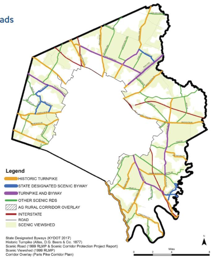
EMPHASIZE THE PRESERVATION, PROTECTION, & PROMOTION OF THE ICONIC BLUEGRASS LANDSCAPE ALONG RURAL GATEWAYS & ROADWAYS SERVING AS PRIMARY TOURIST ROUTES.
Visitors to Lexington frequently remark about the scenic beauty observed while driving through
the farmland on the way to a destination. Trips to horse farms, distilleries, breweries, or any of the other tourist hot spots become as much about the journey as the destination. The experience draws people in, and, in some cases, influences visitors’ decisions to locate themselves or their businesses to Lexington permanently. Foals frolicking in a pasture, great blue herons perched on the banks of the Elkhorn, green rolling hills of bluegrass and crops, and historic dry-laid stone fences all add to the
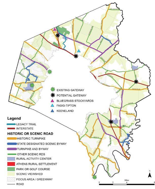
Bluegrass experience and make the case for preserving one of the world’s most iconic landscapes.
The map above from the 2017 Rural Land Management Plan (RLMP) shows historic turnpikes, State Designated Scenic Byways, turnpikes and byways, and other scenic roads, as well as scenic view sheds and the Paris Pike Overlay area. The detailed lists of these roads are on pages 82 and 83 of the RLMP.
Gateways identified by the
RLMP are shown below, and the recommendations described in pages 87 through 90 of the RLMP should be followed. From the RLMP:
“First impressions for those entering the Rural Service Area should be favorable and lasting, whether arriving at the county line, Urban Service Boundary, interstate or airport. Gateway planning and design should reflect the values of the community to protect the beauty of the rural landscape while welcoming visitors.”
CREATE A LARGE REGIONAL ATHLETIC FIELD COMPLEX FOR ECONOMIC DEVELOPMENT & TO ENHANCE LEXINGTON’S EXISTING FACILITIES.
According to the 2018 Parks and Recreation Master Plan:
“The Bluegrass Sports Commission previously approached the city about a partnership for the development of a sports complex to promote economic development. They produced a feasibility study, Lexington Sports
Complex Market and Feasibility Analysis, in 2015 outlining the benefits of such a facility.”
The proposed sports complex was to be at Cardinal Run North, owned by Lexington and managed by the Bluegrass Sports Commission. Similar arrangements in Elizabethtown have created a cottage industry around tournament sports, while also meeting the local needs for parks infrastructure. While traffic and access concerns regarding the Cardinal Run North complex brought progress to a halt on that site, unquestionably there is a need in the community, and the economic impacts could be significant.
The Parks Master Plan recommends a number of regional (regions of Fayette County) sports complexes to meet the needs of the residents. It also says “a potential Tournament Sports Complex should be evaluated based on its merits as a driver of economic development…A tournament complex may be advantageous to Lexington for its potential to promote tourism, benefit local businesses, and generate additional tax revenue.”
WORK WITH PARKS & RECREATION & PRIVATE ORGANIZATIONS TO FACILITATE THE CREATION OF A REGIONAL SPORTS COMPLEX
“IF LEXINGTON CAN INCREASE CULTURAL ACTIVITIES & RECREATIONAL SPORTS ACTIVITIES WE CAN CREATE A MORE VIBRANT COMMUNITY THAT WILL ATTRACT MORE JOBS.”
-LEXINGTON RESIDENT
CONTINUE TO COORDINATE TRANSPORTATION LOGISTICS & TRAFFIC CONTROL FOR RECURRING SPECIAL EVENTS, FESTIVALS, & PARADES.
The Lexington Area MPO regularly meets with the Traffic Safety Coalition subcommittee, the Transportation Technical Coordinating Committee, Bicycle Pedestrian Advisory Committee, and the Transportation Coordination Committee to review security of the transportation systems. On-the-ground coordination with the Divisions of Police and Traffic Engineering for special events provides safety enhancements when roads are closed or traffic patterns are otherwise altered. The high point of these coordination efforts came during the World Equestrian Games, as the normal agencies added LexTran and private businesses to the mix to ensure that patrons were all efficiently ferried to and from the Kentucky Horse Park for events. By any measurable standard, the traffic and transportation efforts
during the games were successful, as many citizens utilized those services and the overall impact to Lexington traffic was minimal. Longer term coordination through the Lexington MPO comes in the form of contributions roughly of $600k a year for operations, which goes to traffic engineering. Use of those funds covers safety improvements, operations for events and infrastructure for traffic efficiency. The Lexington MPO was one of the first, and is still one of the few, MPOs to fund projects like this out of their annual budget. Staring in the late 1980s, this funding has covered everything from replacing aging traffic controllers to providing the startup budget for the Traffic Management Center.

ENHANCE PROGRAMS & ACTIVITIES BY LEXINGTON’S PARKS & RECREATION DEPARTMENT, & SUPPORT
PUBLIC EVENT PLANNING, COMMUNITY EVENTS, & FESTIVALS.
Many of the festivals, parades, and events that Parks and Recreation hold are in the same location each year. Events, festivals, parades, and the like are important in celebrating holidays, cultures, and community celebrations. These activities add to the livability of the city, attract tourists, and provide entertainment options that appeal to millennials, as well as people of all ages. Increasing the scope of these events, and even creating a citywide festival, should be considered. The special site needs for these annual events should be supported in planning complementary land uses, such as restaurants and hotels, as well as improving infrastructure such as roads, trail access, lighting, and etc.
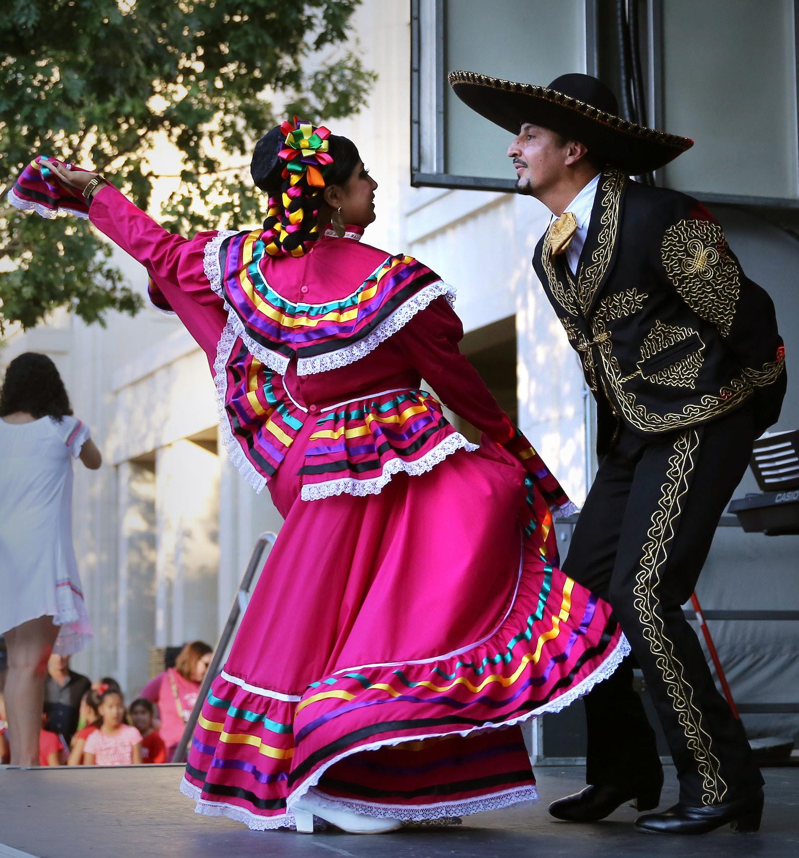
ATTRACT & RETAIN YOUNG PROFESSIONALS BY IMPROVING AFFORDABLE HOUSING OPPORTUNITIES, AMENITIES, & ENTERTAINMENT OPTIONS THAT ARE ATTRACTIVE TO THEM.
In 2017, a survey titled “The Experience Movement: How Millennials are Bridging Cultural & Political Divides Offline” was conducted by Eventbrite and Harris Poll. It revealed that most millennials would rather spend their money on experiences or events than on tangible things. Millennials have a common fear of missing out on an enjoyable event or experience that others are having. Many of this age feel their best memories are from their shared experiences.
These young professionals make up much of the current workforce and, as the baby boomers retire, they will soon comprise the majority of the workforce. Sixty-nine percent of millennials felt that attending events made them feel more connected to the community and the people in it.
Lexington has tremendous restaurant options, while it also has the free events, music concerts, etc. aimed at keeping our young workforce in Lexington. There are also the popular and free downtown events such as Thursday Night Live, free concerts at Moondance Amphitheater, a free Thriller Parade, and many other events that attract people of all ages.
An academic article, “Beyond the Jobs versus Amenities Debate: Understanding the Migration of Educated Workers and Implications for Planning”, by Marla Nelson and Renia Ehrenfeucht, delved into understanding why educated workers move to other places and how to retain talent. The study found that economic motivations extended beyond wage and employment differentials. Having meaningful and rewarding opportunities within a culturally rich community were more important, and where compactness of a city creates relatively affordable housing and more accessible amenities, the social networks facilitated from public socializing significantly helped retain talent.
to find meaningful work, while some that left did so to advance their career because there were limited long-term opportunities in their respective locations. Some workers turned to entrepreneurship in order to remain in the cities that otherwise provided the benefits
they wanted. The study found that having a diverse, robust economy can attract new workers and help retain talent, and that building on a place’s unique cultural amenities helps recruit and retain workers.
“CREATE PUBLIC OR PRIVATE PARTNERSHIPS TO ENCOURAGE SMART, SUCCESSFUL YOUNG PROFESSIONALS TO STAY IN LEXINGTON & DEVELOP THEIR BUSINESS IDEAS.” -LEXINGTON RESIDENT
The study found that many relocated because they were able

CONTINUE TO CREATE A TRUE MULTIMODAL & MIXED-USE COMMUNITY WITH SAFE & QUALITY ACCESS TO COMMUNITY FACILITIES, GREENSPACE, EMPLOYMENT, NEIGHBORHOOD BUSINESSES, SHOPPING, & ENTERTAINMENT.
Walkscore is a website that scores neighborhoods based on a formula that assesses a neighborhood’s walkability, bikeability, and multimodal service on a scale from 1 to 100. In reviewing local Lexington scores, some areas scored much higher in walk and bike scores than others. For example, Aylesford Place-Woodland Park has a walk score of 85 and a bike score of 90. Downtown has a walk score of 88 and a bike score of 83. Columbia Heights has a walk score of 85 with a bike score of 92. University of Kentucky’s walk score is 80, and bike score was 89, and most errands can be accomplished on foot. These are examples of neighborhoods in Lexington that are very walkable.
However, overall Lexington received a Walk Score of 34, a Transit Score of 25, and a Bike Score of 44. These numbers indicate that the city is cardependent and that most errands
require a car. Though the website may have included the rural area, thereby skewing the results to the non-walkable side, it still indicates that there is plenty of room to improve in this area.
Walkability is important for many reasons. Walking to amenities, employment, etc. from home is good for the environment, public health, and personal budgets, also, a walkable communities drive real estate values higher. Studies also indicate that millennials want to be able to walk or bike to work, restaurants, and retail. According to Smart Growth America’s “Foot Traffic Ahead: 2016”, the most walkable urban metros are also the most socially equitable, since the better access to employment and lower transportation costs (no car expense) offset the higher costs of housing.
In addition to providing a walkable and bikeable environment, it is important to also increase the level of service for our transit operations. The best way to do this is to increase ridership and make land use decisions that put people near the areas that are most easily served by transit, and encourage transit-oriented development patterns along our major corridors. This will be studied through comprehensive corridor studies executed through a partnership between Long-Range Planning and the Metropolitan Planning Organization (MPO) referenced elsewhere in this plan.

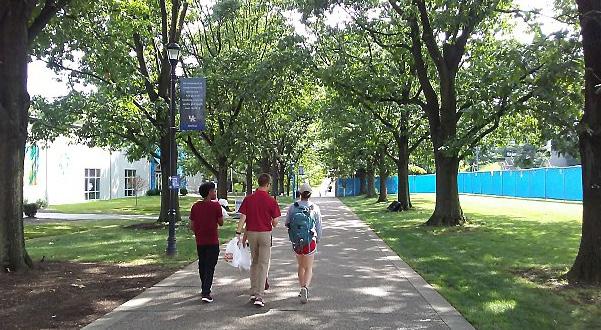

PROMOTE QUALITY OF LIFE ASPECTS, INCLUDING GREENSPACE, AS AN ATTRACTION TO NEW BUSINESSES & RESIDENTS.
The design of a city, its public spaces, and public infrastructure have important correlations with quality of life, social development, and other key components of human wellbeing. Likewise, appealing cities are more likely to attract a creative, innovative, and skilled workforce, and the investments that are needed to drive the urban economy. The urban design practice in the modern world is not only for building layouts, but includes an additional focus on the goals of making urban areas functional, attractive, and sustainable.
One great example of city-wide amenities that improved the quality of life is the Legacy Trail system through Lexington. Many new businesses and residents factor the trail systems in when making their company and home location decisions. This type of regional greenspace is largely well-received by citizens. Another regional greenspace project underway is the Town Branch Commons, a world class greenway and park for downtown Lexington. It will be a 2.5-mile linear park that follows
the historic route of the Town Branch Creek, currently located in a culvert under modern day Vine Street. This system will provide continuous bike and pedestrian connections, a lush green band through downtown, connections to new and existing parks, and improvements to water quality. Town Branch Commons will also connect the Legacy and Town Branch Trails, completing a 22-mile trail network that can be used for far more than just recreation. A project of this scale needs support from all community stakeholders with public and private partnership. The project is already energizing multiple facets of private developments along the corridors, with increasing interest among new businesses and residents.
During comprehensive plan community discussions, the general public indicated broad support for the overall concept of continuing to preserve the outlying horse farms that are widely represented as Lexington’s identity. As has been mentioned before, these farms are not only pretty to look at, but are vital in direct and indirect impacts to Lexington’s economy. In recent years, the horse farms have started to embrace connections with the urban population, opening up their doors with Horse Country tours. This creates a personal connection between the urban and rural areas and strengthens Lexington’s identity, which assists in bringing more people and businesses to Lexington.
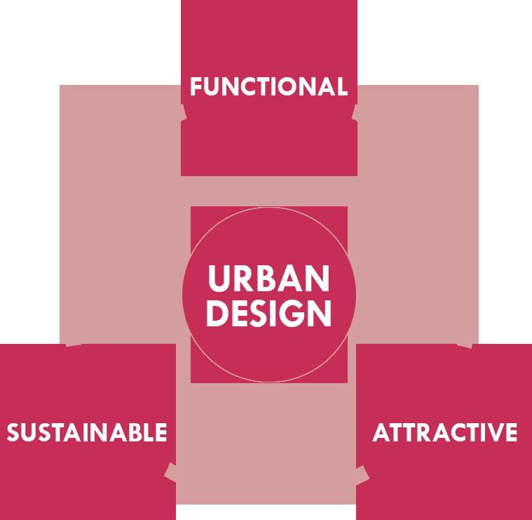
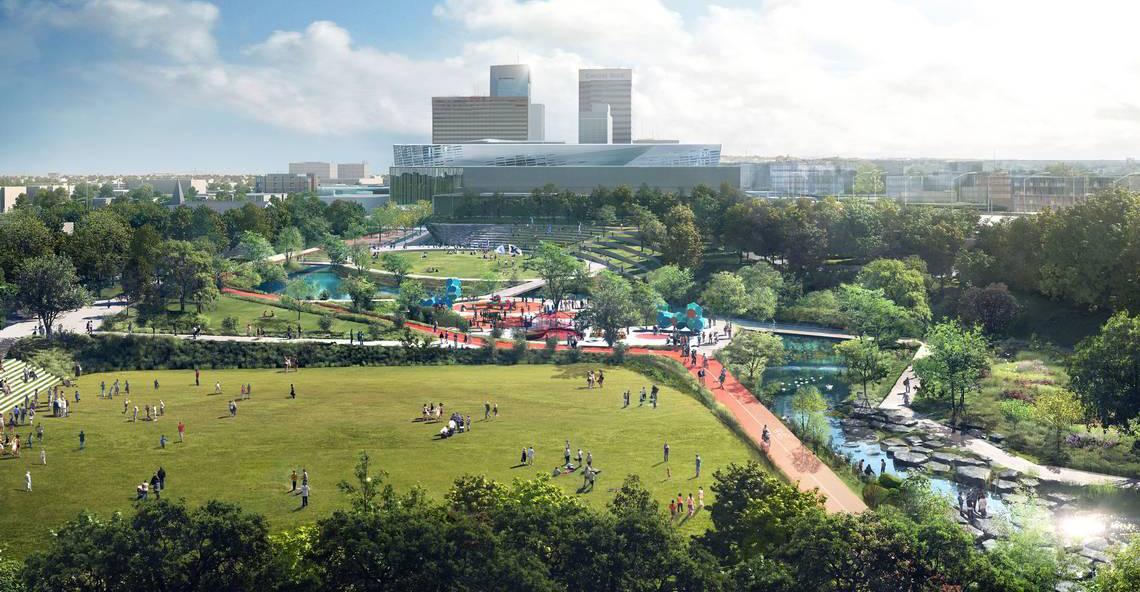
PROMOTE ECONOMIC DEVELOPMENT THROUGH THE PRESERVATION OF STRATEGICALLY & APPROPRIATELY LOCATED INDUSTRIAL & PRODUCTION ZONED LAND.
The creation of adaptive reuse regulations was an acknowledgment that many of Lexington’s older industrial zoned sites were no longer suited for modern economic development purposes. As those properties became vacant and dilapidated, it presented opportunities to support the urban core with businesses and residential options better suited for their urban environment. However, it is still critical to provide a base of industrial zoned land, in strategic locations well served by appropriately scaled infrastructure and available transit service. Where sites have existing historically significant structures that can be reused or updated, all care should be taken to do so.
places that can accommodate a wide mix of uses, industrial and production land stands out uniquely in that there should be little encroachment by residential land on these areas, and vice versa. Just as important as preserving the industrial land is closely monitoring the adjacent land use development patterns. Appropriate buffering and transitions should be applied so that there can be minimal use restrictions applied on these industrial properties. It is important that production land remain flexible and wide-ranging in the uses allowed. The vast majority of heavier industrial and production uses are not suited to be within close proximity to residential and retail areas.
they are located. While it may not initially sound intuitive, full multimodal transit infrastructure is of the highest importance.
All new development and redevelopment proposals should consider other design elements so that all industrial land can be as efficiently used as possible, thus ensuring there is growth potential for the future. Minimizing parking, appropriate landscaping and providing ample
connectivity are all a part of taking a strategic approach to economic development areas.
INVENTORY & ANALYZE EXISTING INDUSTRY & PRODUCTION LAND, IDENTIFYING AREAS TO ENHANCE OR RE-PURPOSE BASED ON MARKET & LOCATIONAL FACTORS.
While Imagine Lexington is in large part focused on designing
Other common themes of Imagine Lexington, however, are still very much a factor in future industrial and production growth. These areas should pay special attention to their design features as well. In meeting and discussing issues with industrial business owners, transportation for their workforce was identified as a serious hurdle they have to find unique ways to overcome. Many of the problems identified have their origins in the initial site design and location of the industrial corridor in which
“WE NEED TO CONSIDER THE DEVELOPMENT OF A HIGH-WAGE, HIGH-TECH INDUSTRIAL PARK TO CREATE JOBS. THIS WOULD BE IMMENSELY BENEFICIAL, BUT ONLY IF DONE IN A THOUGHTFUL WAY.”
-LEXINGTON RESIDENT
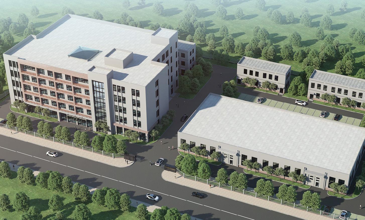

There is strength in diversity. Diversity in Lexington’s population and workforce affords citizens the opportunity to learn from different viewpoints, experience other cultures, and supplement their weaknesses with others’ strengths. Diversity in an investment portfolio provides safety and security, knowing that if one investment should falter, the others should be there to be the equalizing force to keep the overall performance meeting expectations. Similarly, diversity in Lexington’s employment opportunities and industry types offers a resiliency for the community that would not be there if the economy were singularly focused on one particular industry.
Examples abound of cities that were so heavily invested in a particular industry or corporation that they were dealt an unrecoverable blow when that company decided to relocate, or that particular industry was disrupted in such a way that the jobs dried up. Lexington
is fortunate to not be in a situation where the economy is monopolized by such a situation; however, it is important to remember that the city’s economy is comprised of many parts, and it is incumbent on policy makers and economic development professionals to ensure they pursue all angles. Horse farms and the agricultural industry are significant, but so are the healthcare and education industries. The blossoming tech and research and development industries are becoming more significant, but the service sector jobs that support consumer spending habits of those fortunate to have more expendable income are important too.
It is also of note that, while Lexington has 29 companies that employ over 250 people, 68% of the workforce is still employed by smaller business. Diversity exists, therefore, not only in industry type, but also in company size. It is critical to have large employers that serve as the bedrock on which the economy is based,
such as University of Kentucky, which employs 15% of Lexington’s workforce, but also smaller businesses that provide a variety of options for employees to pursue.
Small business assistance should be a high priority as Lexington looks to encourage entrepreneurs and facilitate the growth of these smaller entities into the bedrock corporations of tomorrow.
The variety of jobs that accompany the diverse employment sectors create job opportunities across the board for all types of people. This diversity in workforce helps create a healthy and desirable community. It is key to maintain these job opportunities, while continuing to focus on adding high-paying jobs. Providing the ability for all to have upward mobility, especially those in the retail sector positions that are among the lowest-paying, is a key component to increasing quality of life across the board.
Part of facilitating that upward mobility is providing training and educational opportunities for
those who need it, particularly vulnerable populations who may have grown up in impoverished situations, have disabilities, or may be re-entering the workforce after incarceration or rehabilitation from addiction. It is also important to provide not just training, but jobs for those individuals after they complete the training, hopefully in close proximity to where they live. Concerted efforts to provide these services as a way make the most of every citizen’s potential should be a priority, and will help Lexington leverage its diversity to continue to strengthen the economy and the community as a whole.
“ENCOURAGE A DIVERSE RANGE OF JOBS AVAILABLE TO ALL CITIZENS THAT HAVE HIGH EARNING POTENTIAL.”
-LEXINGTON RESIDENT
CREATE OPPORTUNITIES FOR INCUBATORS. SEEK INCENTIVES FOR OWNERS OF VACANT OFFICE/LABORATORY SPACE, & FOR DEVELOPERS WHO BUILD INCUBATOR SPACE FOR STARTUPS & FOR GROWING BUSINESSES.
Lexington needs additional space to encourage more startup businesses, as well as for startups who have outgrown their original space. As new ventures, there are barriers that these young companies must overcome, such as a lack of credit and a need for mid-level space of about 1,000 square feet or larger.
Some companies engaging in research and development may require more specialized and larger (around 5,000 square feet) spaces with water, hoods, etc., while some only require Wi-Fi and a small space to occupy. New modern co-working spaces like Base 110 in downtown Lexington provide flexible office space with shared common areas for like-minded professionals to work and collaborate. Additional similar creative working spaces should be pursued to encourage entrepreneurs and new small businesses.
University of Kentucky’s oncampus business incubator, Advanced Science & Technology Commercialization Center (ASTeCC), houses new and rising technologybased companies located within the engineering complex. ASTeCC has
80,000 square feet, and was funded by the Economic Development Administration and Small Business Administration. It currently has about twenty-five companies, two-thirds of which are owned by UK faculty; the rest are from out-ofstate. Fifty-nine companies have ‘graduated’ from ASTeCC since it began in 1994. The companies have access to other shared-use facilities on University of Kentucky’s campus, such as the Electron Microscopy Center, Center for Nanoscale Science and Engineering, and Mass Spectrometry Facility.
The Bluegrass Small Business Development Center (SBDC) serves Fayette and 14 counties in the region. The Bluegrass SBDC helps make dream businesses come true by providing business consultants
to assist with strategic market research, access to capital and loan packaging assistance, business and strategic plan development, and analysis and start-up assistance, among other services. The consulting is free of charge.
Commerce Lexington assists in placing businesses, not only on new sites, but also in all types of existing buildings. Commerce Lexington keeps an inventory of available locations and works with businesses and other agencies to place businesses looking for space to rent. Landlords of large professional office spaces may be hesitant to divide up those spaces to accommodate a business looking for smaller footprints. However, there is an abundance of vacant office options of many sizes throughout Lexington.
ENCOURAGE A DIVERSE ECONOMIC BASE TO PROVIDE A VARIETY OF JOB OPPORTUNITIES, ALLOWING UPWARD MOBILITY FOR LOWER INCOME RESIDENTS OF FAYETTE COUNTY.
Unemployment is low in Lexington, but many jobs are concentrated
in industries of less than average pay. When looking at the mix of employment in Lexington, excluding government jobs, the top three industries with the most employment were Healthcare and Social Assistance, Retail Trade, and Accommodation and Food Services. The average employee income for Healthcare and Social Assistance was $49,229; for Retail Trade, the average income was $25,187; and for Accommodations and Food Services, average
income was $16,805. While there are opportunities within these industries to advance to higherpaying jobs, overall they have a higher percentage of lowerpaying jobs. These vital jobs should be retained, but those in higher-paying employment sectors should remain the focus of Lexington’s economic development strategy. These more lucrative jobs attract young professionals from surrounding areas, help retain local graduates,
“ATTRACT EMPLOYERS THAT CAN OFFER A VARIETY OF
or encourage movement from existing lower-paying positions.
Funding and supporting research and development campuses should also continue to be a priority, as they attract high-paying jobs and new talent, help retain local talent, and create spaces for incubator businesses. Collaboration should continue between the City, the University of Kentucky, and Commerce Lexington to seek capital investment in this sector.
-LEXINGTON RESIDENT
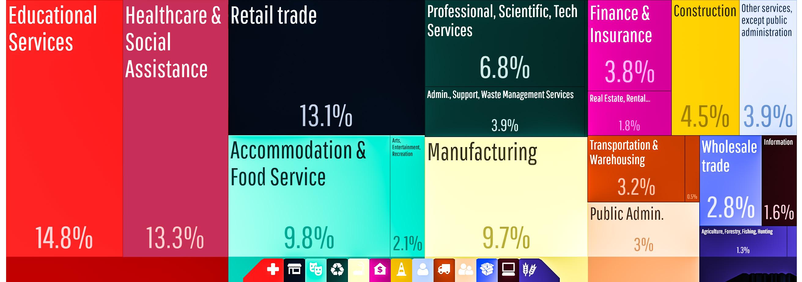
SUPPORT FULL FUNDING & ADEQUATE STAFF FOR THE MINORITY BUSINESS ENTERPRISE PROGRAM (MBEP) WHICH INCREASES DIVERSIFICATION OF CITY VENDORS THROUGH PROMOTING AN INCREASE IN MINORITY, VETERAN, & WOMENOWNED COMPANIES DOING BUSINESS WITH THE CITY.
Minority, veteran, and womenowned businesses are underrepresented in Lexington, and the MBEP, as well as other agencies, are making efforts to help lessen this disproportion. From the Minority Business Enterprise Program (MBEP) webpage:
“The Minority Business Enterprise Program is in place to help minority, women, and veteranowned businesses participate in the city’s procurement process. The success of minority-owned businesses is vital to the community because they contribute to the overall success and economic viability of Lexington.”
Lexington’s Central Purchasing processes millions of dollars of purchasing contracts for the city of Lexington. The city has established a “Ten Percent Goal Plan” to increase the number of minority, women, and veteranowned businesses participating in the procurement process. The MBEP exceeded its 10% goal for MBE and WBE combined in 2017; that percentage may increase further as the remaining 2017 contracts are awarded. The goal for Veteran participation is 3%, but that number cannot be tracked at this time. See the following chart from the MBEP:
The MBEP offers a long list of services to assist minority, womenowned, and veteran-owned businesses including, but not limited to, events for networking, classes on the procurement process, assistance with certification, training programs, communications about bid opportunities, and individual appointments.
“WE NEED MORE
MUNICIPAL SUPPORT FOR WOMEN & MINORITY BUSINESSES.”
-LEXINGTON RESIDENT
PERCENTAGES OF MBE/WBE CONTRACTS AWARDED IN 2015-2017
SOURCE: SHERITA MILLER, MINORITY BUSINESS ENTERPRISE PROGRAM, LFUCG PURCHASING
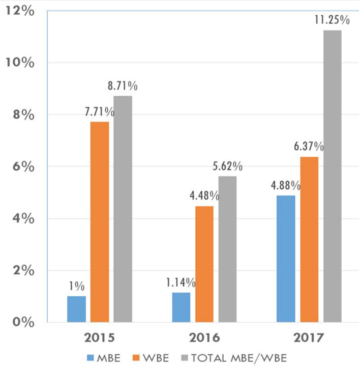
ENCOURAGE TRAINING, PROGRAMS, & WORKFORCE INCLUSION OPPORTUNITIES FOR PEOPLE WITH DISABILITIES OR JUDICIAL RECORDS, OR WHO HAVE UNDERGONE REHABILITATION FROM ADDICTION.
The Opportunity for Work & Learning (OWL) is a non-profit organization that has helped 26,000 people since 1961 to overcome mental and physical disabilities or prior incarceration to achieve growth in their personal, as well as professional lives. OWL offers individualized support and programming, including practical occupational training, such as customer service and fork lift certifications. Their services extend to eleven counties. OWL also owns the for-profit Lexington Manufacturing Center (LMC); many of the participants in the OWL program are hired by LMC.
Another company helping to remove barriers to second-entry employment is DV8 Kitchen, a ‘fast-casual restaurant and bakery’ started by the owners of the Saul Good restaurants in Lexington. The
company provides fresh, natural food designed to “change your life.” According to Rob Perez, one of the owners of DV8 Kitchen, there are barriers to people trying to make a second-entry into the workforce after addiction or incarceration. Some of the employers do not want to pay for training for what they think will be short term employment, they worry about provision liability for workman’s compensation coverage (even though it is already figured into liability insurance), and they have practicality issues. Mr. Perez believes an employee certification program would alleviate many of these barriers by providing such things as required weekly drug tests, counseling, 12-step programs, etc. He also indicated a need for government incentives to educate employers about providing opportunities for jobs for these members of society, as opposed to precluding them from employment entirely. The DV8 Kitchen’s goal is for one-third of their staff to be second-chance employees. Imagine Lexington advocates for encouraging employers to provide job opportunities, returning hope to members of
society who are struggling to recover from past circumstances.
Additionally, to help remove barriers to employment from felony records, the 2016 General Assembly passed House Bill 40, which provides for a process that permits application to have a Class D felony conviction expunged. Clean Slate Kentucky has resources to help people expunge their criminal records, both misdemeanors and Class-D felonies. Every opportunity to spread the word about this program should continue to be explored and expanded.

MAXIMIZE CONTEXTSENSITIVE EMPLOYMENT OPPORTUNITIES WITHIN THE OPPORTUNITY ZONE TRACTS, PROVIDING EQUITABLE COMMUNITY DEVELOPMENT, & PRIORITIZING LOCAL RESIDENTS FOR ADVANCEMENT OPPORTUNITIES.
Established by Congress in 2017, the Opportunity Zones program allows investors in certain communities to qualify for preferential tax treatment. Communities that are eligible to become Opportunity Zones are in areas determined to be economically disadvantaged and must be nominated by the state. The main goal of Opportunity Zones is to drive economic development, as they have the potential to catalyze growth in the local economy and the job market resulting from the influx of investor funds. By encouraging investment from people both in and outside of the target area, Opportunity Zones create positive growth and development that can aid in elevating
distressed neighborhoods, while simultaneously promoting community-wide connectivity and partnership. For more information on Opportunity Zones, individuals should look to Treasury.gov and IRS.gov.
Lexington’s Opportunity Zones are located downtown, north of downtown, to the southwest and northwest of downtown, and in older areas within New Circle Road.
There are some small to medium vacant properties within the areas, but the majority of the development potential will be adaptive reuse of existing buildings. This should provide ample opportunities for creative place making that will enhance the existing neighborhood while providing new employment prospects that are walkable, bikeable, or on a transit route. Redevelopment should be context-sensitive by prioritizing businesses and employment that can be utilized by existing residents and respecting the vernacular architecture to enhance the surrounding neighborhood.
U.S. TREASURY DEPARTMENT CERTIFIED OPPORTUNITY ZONE TRACTS IN FAYETTE COUNTY
EXPLORE RECOMMENDATIONS TO PROMOTE DEVELOPMENT AT SPECIFIC SITES WITHIN OPPORTUNITY ZONES, WHILE MINIMIZING DISPLACEMENT. ACTION ITEM
“PROVIDE MORE LOW-INCOME HOUSING, ACCESS TO SERVICES & SHOPPING. PROMOTE JOBS CLOSER TO THESE NEIGHBORHOODS BY OFFERING TAX INCENTIVES & OTHER INCENTIVES FOR DEVELOPMENT IN THESE AREAS.” -LEXINGTON RESIDENT
INCREASE FLEXIBILITY ON TYPES OF HOME OCCUPATIONS ALLOWED.
The advances in communication and information technology, especially the impact of home computers and the internet, allow for more mobile businesses and working from home. Eliminating the commute to work, avoiding the cost of leasing or owning space for a business, and being near loved ones are among the reasons that make working from home attractive.
The U.S. Census Bureau states in its report, Working at Home is on the Rise, that the number of home-based workers increased by 4.2 million between 1997 and 2010. In addition, the American Community Survey, by the U.S. Census Bureau, shows that, between 2010 and 2017, the number of home-based workers increased by another 2 million.
The report also states that there has been a 69% increase in homebased work in the computer,
engineering, and science occupations. However, one in four home-based workers, which equals about 3.4 million workers in the United States, are employed in the management, business, and financial occupations. The U.S. Census Bureau defines “home-based worker” as a person who works exclusively or part of the time from home.
Zoning Ordinance allows home occupations, as an accessory use in its agriculture zones and as a conditional use in other zones, and home offices, as an accessory use in many zones. Technology, services, and products are continually changing, so reviewing and updating the Zoning Ordinance, especially the definitions for home office and home occupation, would be advantageous for Lexington’s economic development to ensure as many types of home offices and home occupations may be incorporated as can be suitable and compatible.
UPDATE ZONING ORDINANCE REGULATIONS RELATED TO HOME OCCUPATIONS AND HOME OFFICES
"ELIMINATING
AMONG THE REASONS THAT MAKE WORKING FROM HOME ATTRACTIVE."
-LEXINGTON

Thriving communities achieve prosperous economies in a number of ways, including attracting new businesses, taking care of existing companies, developing a highly-skilled local workforce, being imaginative and creative with existing land and facilities, finding available land for new economic development activity, and attracting a young and enthusiastic workforce. A multifaceted approach is necessary, because local economies are complex, with many moving pieces that each require different levels of attention, and specifically tailored solutions.
Attracting new businesses: In addition to the livability factors mentioned earlier that are increasingly important for bringing in new businesses, incentives also play a role. It is important, especially in a progressively more competitive market, to provide the “icing on the cake” that may eventually win Lexington the deal. Incentives are not normally a primary factor for a business deciding to locate into a particular market, but they certainly
can be a separator in a very close competition. Any federal, state or local incentives that can be leveraged should be, as studies have shown that economic development land use has a much higher dollar per dollar return on investment than residential land uses that consume more services and pay less tax.
Taking care of existing companies:
Retaining an existing corporation is clearly not as flashy and does not grab the headlines quite like landing a big new business, but economic development professionals will tell you that is a huge part of their job. Lexington cannot take for granted the investment these existing companies already have in the community and the City needs to do whatever they can within reason to ensure they are prospering and getting what they need.
Developing a highly-skilled workforce: This is of critical importance for both of the headers above. The number one reason listed for why companies choose to locate in a specific area
is because of the presence of a highly-skilled workforce. It is also vitally important for the existing companies to be able to fill the open positions they have. Efforts to match college and vocational school students’ curriculum to specific local employment needs would be mutually beneficial for the students, the employers, and the City. Concerted efforts should also be made to train lesserskilled employees and vulnerable populations to allow them to achieve more financial stability.
Being imaginative and creative with existing land and facilities: As Lexington continues to urbanize and develop, it is becoming more of an infill and redevelopment community. There are many opportunities to utilize existing space for economic development purposes, whether that be adaptive reuse, flexible parking arrangement, shared office space, or redevelopment of underutilized property. It is important that these always be the first options when looking to accommodate a new or expanded business.
Finding available land for new economic development: Economic development professionals often say there is a lack of inventory for larger clients who may want to locate to Lexington. The creative 250-acre land swap between UK and the City of Lexington should help to alleviate this issue and allow prime development land to be controlled by the city. It is important that there is available land to bring in higher-paying jobs that will benefit the community.
Attracting a young and enthusiastic workforce: Creating a livable city is an important part of attracting the millennial workforce. They crave experiences and place making and interesting, unique, and authentic cultures. Lexington does have a unique culture and one that can be expanded through branding opportunities. The beauty of the horse farms and the juxtaposition of urban and rural are attractors that ought to be protected and valued. They play a large part in creating a prosperous Lexington.
PROMOTE HIRING LOCAL RESIDENTS, & RECRUIT EMPLOYEES LIVING IN AREAS OF CONSTRUCTION PROJECTS.
Hiring workers that live in the vicinity of a construction project builds a sense of ownership and empowerment in community development. It may also allow some workers to walk or bike to work. If there is a lack of training, working with local agencies and training programs to get workers trained before construction begins would increase economic sustainability of the area and its residents. Projects involving special financing, such as TIF, have to meet certain conditions to qualify for the financing; those conditions include 40% of the households being of low-income. Residents of Opportunity Zones could benefit through jobs created by construction, but also from future employment in development projects.
The Building Industry Association of Central KY has started a Building Institute of Central Kentucky to train workers in certified Trades programs in HVAC, Plumbing, Electrical, Carpentry, and Facility Maintenance. Students in the HVAC, Plumbing, and Electrical programs will be eligible to take state licensure tests.
SUPPORT THE CONTINUED FUNDING FOR ECONOMIC DEVELOPMENT GRANTS & THE COMMONWEALTH INFRASTRUCTURE FUND, AS WELL AS LEXINGTON’S PUBLIC INFRASTRUCTURE FUND.
The Lexington-Fayette Urban County Council started an Economic Development Grant to help with “funding projects that
will positively impact economic and workforce development in the City of Lexington.” The funding will be used for training/ retraining, entrepreneurial support, employment re-entry, work-based learning and/or skills certification scholarships, and/or potentially other services related to economic development.
Another incentive provided by the Lexington-Fayette Urban County Government is the Jobs Fund, for which businesses may apply in return for a commitment to creating and retaining a minimum
number of jobs for a particular time period. Priority is given to those businesses involved in advanced manufacturing, technology, professional shared service operations, or healthcare. Industrial revenue bonds are also available for application through the Economic Development office for the City of Lexington.
Six Kentucky banks have launched the $150 million Commonwealth Infrastructure Fund (CIF), which is a private fund to support publicprivate partnership (P3) projects in Kentucky. The P3 was passed
last year (HB309) to establish a process for local governments to partner with private firms to finance large capital projects that might not be otherwise possible. The funds can be used to repair and replace roads and bridges, water and sewer systems, student housing, and treatment centers. Further, funding for Lexington’s own Public Infrastructure Fund, which has been stalled recently, should also be strongly considered as a method to help promote the Comprehensive Plan’s infill and redevelopment priorities.
CONTINUE TO PROTECT THE AGRICULTURAL CLUSTER & EQUINE INDUSTRY, & SUPPORT EXISTING AGRICULTURAL USES, WHILE PROMOTING NEW INNOVATIVE AGRICULTURAL USES IN THE RURAL SERVICE AREA.
Before the beginning of the 21st century, with world-renowned soils and the risk of losing farmland to large lot residential and other development, Lexington started a Purchase of Development Rights (PDR) program. The program has been in existence for nearly 20 years, with PDR easements protecting farmland for food security and for conservation of environmentally sensitive lands. Currently, 23% of the Rural Service Area (28,953 acres) is protected by PDR easements, with a stated end goal of 50,000 total acres, or 39% of the Rural Service Area, to be protected. Fayette County has committed millions to pay for PDR easements, which protects soils for the future. According to Beth Overman, Director of the PDR Program, most of the
PDR easements are equine farms. These famous soils in the Rural Service Area, with many acres protected by PDR, provide nutrients that grow vigorous crops, as well as healthy, strong horses, cattle, and other livestock.
Bluegrass soil produces quality racehorses, which result in big purchase prices. Keeneland sales showed a rebound from the recession in 2011 and 2013 sales, but a leveling off between 2013 and 2017, with a slight upward turn in 2017. When adjusting the Keeneland sales for inflation over 17 years, the sales in 2017 were $374,900,540 lower than they were in the year 2000, or about half as much in Keeneland sales dollars in 2017 as there were in 2000. Sales appear to be holding steady, but have yet to approach pre-recession levels. Hopefully, initiatives like Horse Country tours, which are trying to build a new base of race fans, will help to bolster sales and increase interest in the sport.
Horse Country’s website states that their mission is to, “Connect guests to the horse, land, and people through experiences that inspire love of the animal and Kentucky.”
Over the past three years, Horse Country, Inc., has sold 72,222 tour
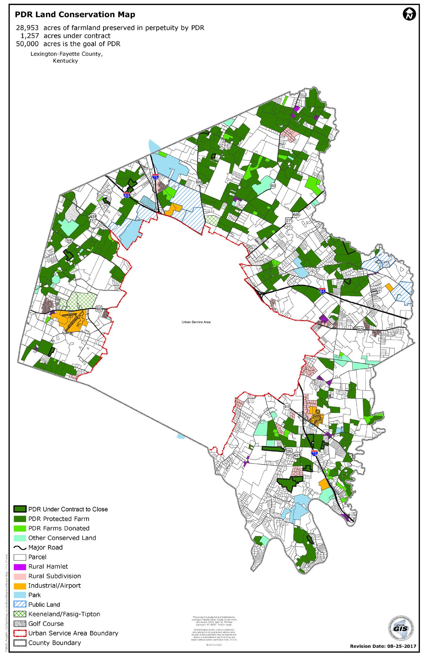
tickets to horse farms in Lexington and four other counties. There are a number of other tour companies, as well as individual horse farms that give tours. These tours should be publicized as much as possible, since they showcase a unique asset in Lexington that is not found anywhere else in the world.
Another driver of the agricultural economy in Lexington is The Bluegrass Stockyards, founded in 1946. The Bluegrass Stockyards’ new facility, located on Iron
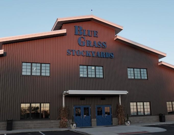
Works Pike, was built after the company’s original Lisle Industrial Avenue facility was destroyed by an accidental fire in January 2016. Bluegrass Stockyards employs about 50 people at the Lexington location; the company also currently operates seven live sale locations and an internet sale system, with a total employment of over 200.
The Lexington market “will handle $200-$250 million in business annually,” and sells 100,000-
SOURCE OF KEENELAND SALES $: 2003-2017 WWW.KEENELAND.COM, AND 2000-2002 KENNETH BURDINE, PHD., AG ECONOMICS, COLLEGE OF AGRICULTURE, UNIVERSITY OF KENTUCKY. SOURCE OF HORSES SOLD AT KEENELAND: WWW.KEENELAND.COM. SOURCE OF INFLATION CALCULATION: BUREAU OF LABOR STATISTICS, INFLATION CALCULATOR.
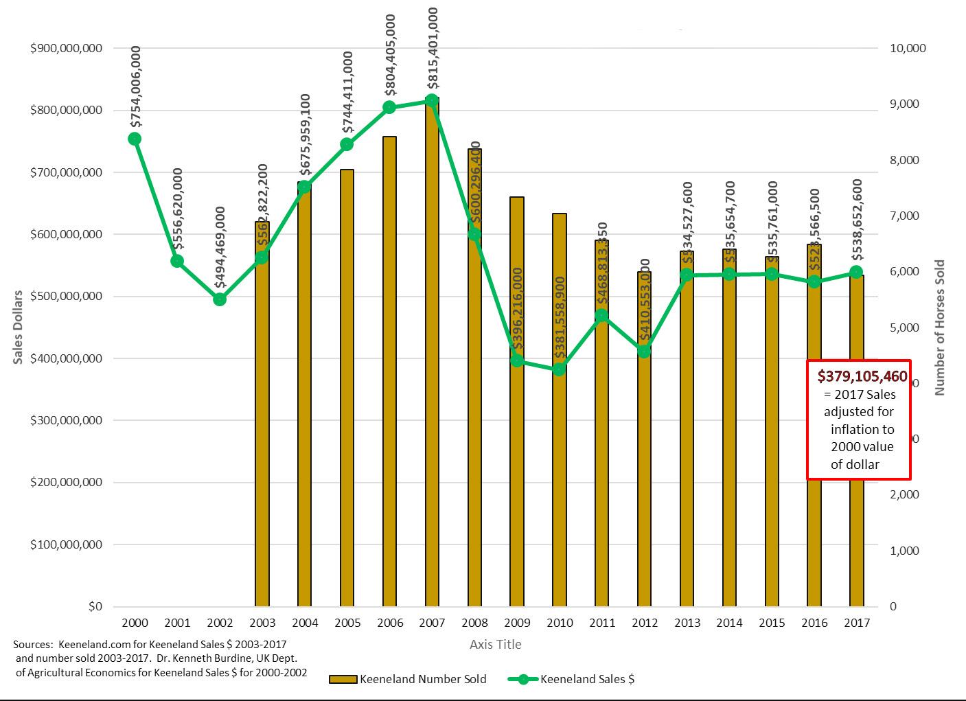
125,000 heads of cattle a year, with the entire network of seven live sale locations and internet sales selling about 500,000 heads of cattle annually, collectively. The Bluegrass Stockyards will handle over $600 million in transactions overall, with a customer base from 90 counties in Kentucky and eight surrounding states. Hogs, goats, and sheep are sold at other locations outside of Lexington.
The Kentucky Commissioner of Agriculture, Ryan Quarles, supports expanding Kentucky’s diverse agricultural portfolio to include industrial hemp, hops, and other crops. Kentucky Department of Agriculture has an Industrial Hemp Research Pilot Program, which is authorized by state and federal law. Industrial Hemp remains a Schedule I Controlled Substance under state and federal law. Individuals and businesses that wished to be considered to join the Hemp program to grow, handle, process, or market hemp were required to apply for a license by established deadlines. To date, more than 50 processors/ handlers have obtained licenses in the KDA Hemp Program, which began in 2014. In 2017, there were 3,200 acres planted, with 2,300 acres harvested. Additionally,
opportunities may exist to build on the craft brewing trend and the distilleries close by, with the potential for growing hops for beer production and corn for bourbon.
Lexington is not only a popular destination for drinks, but also for the variety of restaurant offerings including ethnic, organic, and locally grown menu items. Millennials are attracted to eating out more than at home,particularly to restaurants offering sustainable, locally-grown and organic food. Locally-grown food should continue to be promoted in Lexington and sold in Lexington grocery stores and restaurants. Ashton Wright, PhD., is Lexington’s first Local Food Coordinator. She manages the Bluegrass Farm to Table program, works with Fayette County Public Schools, and helps get local fruits and vegetables onto the plates of low-income residents with a program to provide SNAP vouchers to increase the amount of local produce benefits. Lexington farms can make value-added products from the produce items they raise; in addition, farm owners can apply for a conditional use to run a gift shop where they could sell their locally made products.
ENCOURAGE INSTALLATION OF FIBER-OPTIC BROADBAND INFRASTRUCTURE FOR HIGH-TECH & OTHER INDUSTRIES.
Nearly every aspect of modern society is becoming increasingly web-dependent and, like the Interstate highway system connects communities, digital broadband infrastructure is essential for any 21st
century community to thrive in areas of commerce, health, education, entertainment, and government. Broadband fiber, also known as fiberoptic cables, transmit huge amounts of data, literally at the speed of light. Even as wireless technologies improve, and the community prepares for the next generation of 5G wireless technologies, the backbone of that digital network is still going to need to have a landline.
KyWired, a public-private partnership, is positioning Kentucky to be a national leader in high-
capacity internet service connections and is in the process of providing the backbone of the service lines to all 120 counties. Improved internet service will promote economic development, enhance education and research capabilities, ensure public safety, improve healthcare delivery, and augment connectivity for libraries and communities across the Commonwealth. KyWired’s work is still in progress in Fayette County.
Lexington has quietly been building a fiber-optic network over the last 30 years to service its traffic
operations and signal timing system, and that long-term investment has positioned the city to be ready for the next wave of smart technologies, generally referred to as the Intelligent Transportation Systems (ITS). As cities become smarter, and with a future of connected vehicles and self-driving cars, the digital infrastructure will allow streets to function more efficiently, such as traffic signals that adapt in real time to amount of congestion on the street. This is just the beginning of the potential benefits that high speed digital infrastructure will bring to Lexington.
MetroNet has a franchise agreement with the City to install fiber-optic network inside the Urban Service Area boundary, making gigabit speeds available to nearly all residences and businesses. When complete, Lexington will be the largest city in the country with a citywide fiber-optic network. Gigabit speeds move data at 1,000 megabits per second.
MetroNet began its construction in Lexington in January of 2018 in the northeastern part of the city, and began providing service to its first customers in late summer of 2018. Construction of the network is expected to be completed within three years.
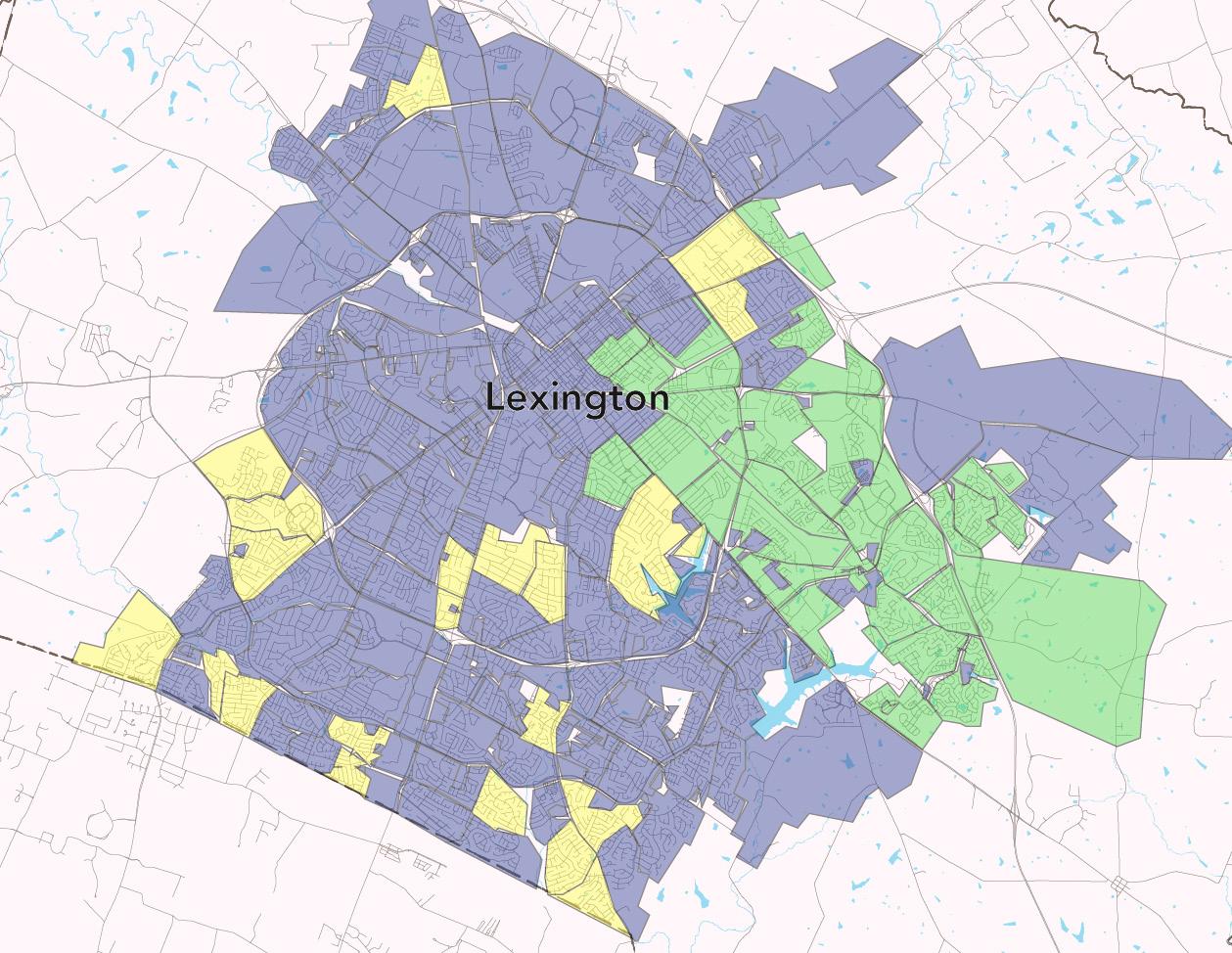
CONTINUE TO RAISE AWARENESS OF FARMS & FARM TOURS.
VisitLex’s 2018 Visitors Guide and the VisitLex website are packed with information about attractions, accommodations, dining, tours, and events of all kinds, plus great maps, with one of them showing the locations of horse farms. The VisitLex website includes horse farms in both Fayette and other counties, which is beneficial for regional tourism. Lexington benefits when visitors stop in from other destinations, and is generally the home base for people exploring the central Kentucky region, meaning the bulk of the travel dollars are spent in Lexington’s local economy. Horse Country, Inc. horse farm and
horse business tours are getting very popular. Ticket sales data shows that from October 2015 to June 2018 there have been a total of 72,222 tickets sold, or an average of 21,688 ticketed tours per year by Horse Country, Inc. That number does not include other horse farm tours by other tour agencies’ sales.
Marketing and advertising for horse farm tourism in Fayette County should be maximized and prioritized. With 59.2 square miles of equine farm land in the Rural Service Area, and another 42.23 square miles of farms with an equine and crop mix, that is a total of 101.4 square miles. In future printed visitor guides, adding more about the individual horse farm tours, corn mazes, etc. on farms located in Fayette County could help raise awareness of farms in Lexington. Additional partnerships between farms and VisitLex should be considered.
PROMOTE KENTUCKY PROUD & LOCAL LEXINGTON PRODUCTS USING UNIFIED BRANDING.
The Kentucky Department of Agriculture’s Kentucky Proud program is funded by the 1998 Tobacco Settlement. Registered members get marketing assistance, promotional materials at cost, grants opportunities, no-cost meat grading, international marketing, cost-share for wineries, veterans program, and restaurant reimbursements for using Kentucky Proud foods. The logo is wide-spread and has become quite recognizable throughout the Commonwealth.

Lexington/Fayette County should consider a logo program to identify locally grown/produced products and experiences. This logo could help identify products and tours specifically from Lexington.

SUPPORT & INCREASE NETWORKING OPPORTUNITIES FOR CAREER RELATED INSTITUTIONS, ORGANIZATIONS, & AGENCIES.
As part of the Imagine Lexington process, staff met with representatives from many of the agency-types listed above to help inform the Plan’s
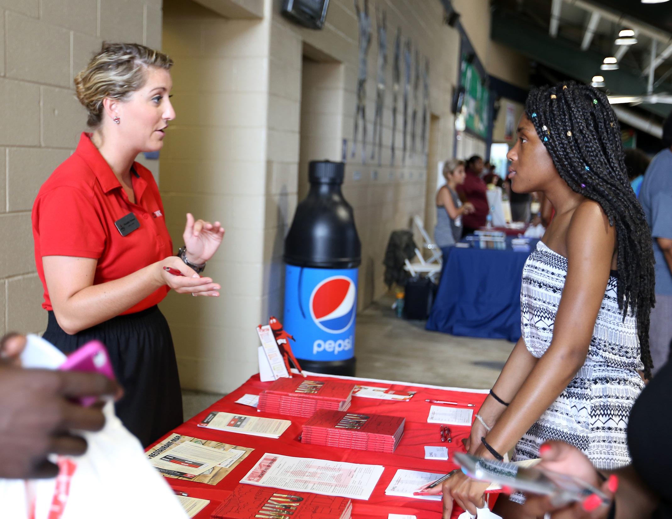
recommendations. At the time, multiple stakeholders indicated that they would like to have regular meetings together to network, discuss, and brainstorm.
There was a concern that career path introductions need to be incorporated into the high school education to help students understand the demand for employment and the day-to-day demands of full-time employment. An unmet demand for skilled trade/industrial maintenance jobs
that usually require a vocational trade certificate/licensure or associate degree was also pointed out. Additionally, there was a concern that high school students felt they only had a binary choice of attending college or not, and that vocational trade and technical career paths were not considered. Education and outreach efforts should be increased to publicize the demand for technical positions and the pay for those jobs. Meetings between Planning, Commerce Lexington, LFUCG
Economic Development and Purchasing, VisitLex, educational and training providers, and small business development agencies will continue to be beneficial for business recruitment, workforce development, and economic sustainability as Lexington’s economy grows.
PROVIDE EMPLOYMENT OPPORTUNITIES THAT MATCH THE GRADUATING MAJORS FROM LOCAL COLLEGES & VOCATIONAL TRAINING INSTITUTIONS.

Lexington has public and private post-secondary education institutions awarding thousands of degrees and certificates each year. Some of these graduates find jobs in their career fields in Lexington, some in other counties, some other states, etc. If a graduate desires to stay in Lexington but cannot find jobs in their desired field, it is either because there are not enough jobs in their field, or the degrees are not matching the job demand.
In looking at the degrees conferred from University of Kentucky and Bluegrass Community and Technical College over the years 2006-2016, a total of 68,777 college degrees were awarded, but only an increase of 16,454 jobs over that same time span. This did not take into consideration all the degrees awarded from private colleges in the area. Making sure there are degree programs for occupations with existing or
projected demand is important to fill the job openings in Lexington.
The James W. Stuckert Career Center at University of Kentucky has a main office and three satellite offices: Engineering College, Business School, and College of Agriculture, Food, and Environment. The career center is making efforts to recruit college students during junior and senior year of high school’ advise students
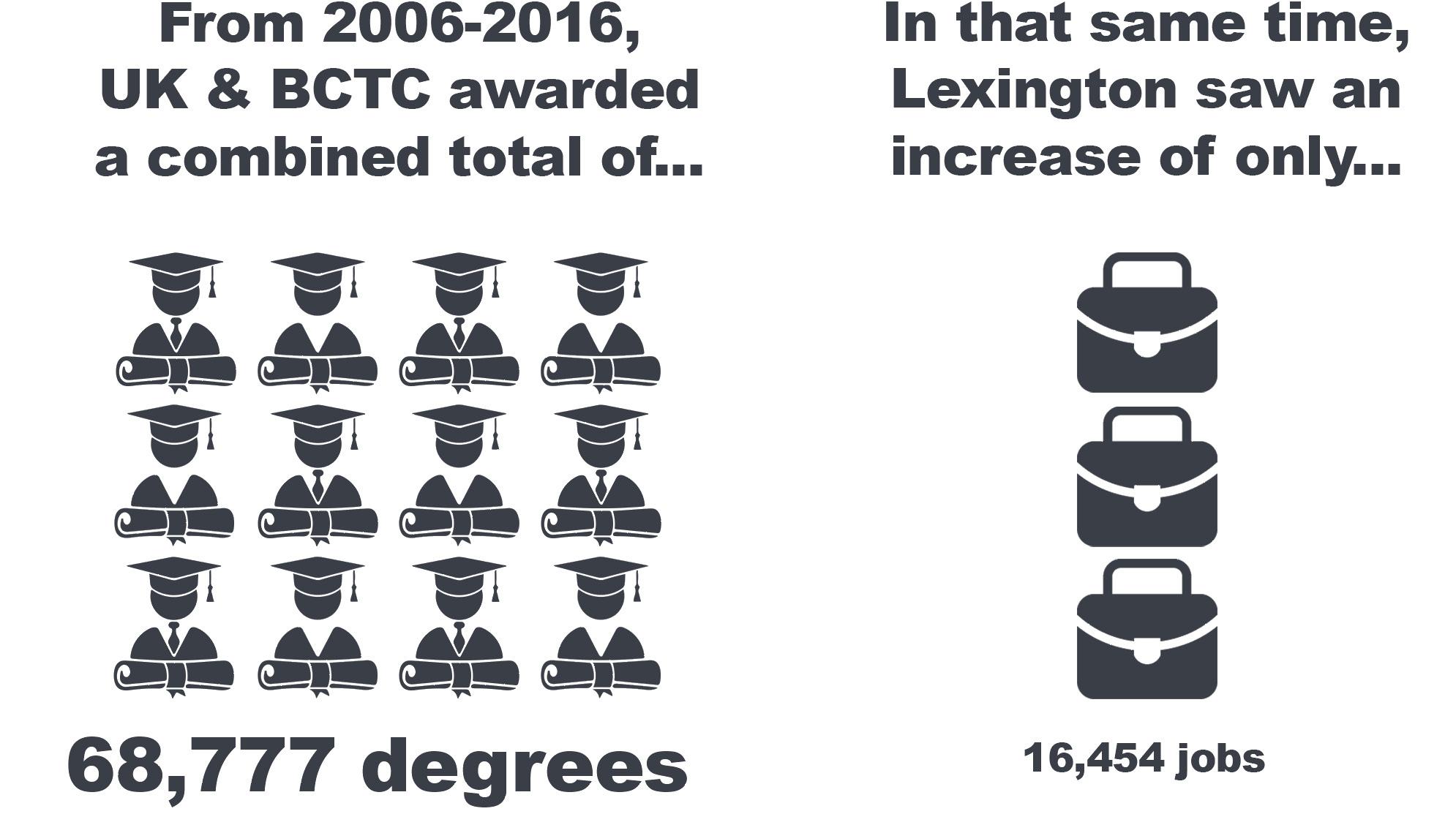
to help them pick a major and finish a degree in a timely manner; provide student internships and co-op opportunities; and hold several large job fairs in the fall, plus several smaller ones throughout the year.
Comparing trends in college degrees to which industries students report working in after school reveals insights
into the jobs that are available, and which industries should be promoted to retain more college graduates in Lexington.
The chart below (LEFT) from the Kentucky Education Cabinet shows that Retail Trade and Accommodation and Food Services industries are the top industries where the 2010 Fayette County high school
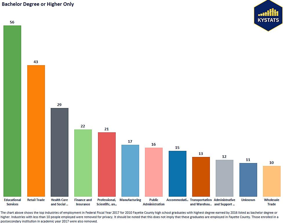
graduates work after completing some college or an Associate’s degree. Both of those industries have low wages on average.
The following chart (RIGHT) shows where the 2010 Fayette County high school graduates work after completing a bachelor’s degree or higher degree. Retail trade is still prominent, but Educational Services is now the highest employer.
Noteably Accommodation has fallen, and some of the higher paying professional industries have surpassed it.
PERFORM ANALYSIS OF EXISTING EMPLOYMENT OPPORTUNITIES & GRADUATE SUPPLY FROM AREA INSTITUTIONS ACTION ITEM
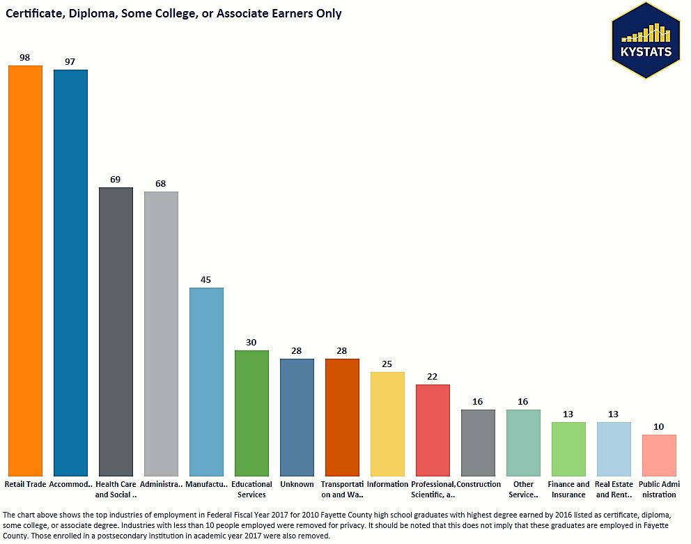
RECRUIT PROFESSIONAL SERVICES THAT UTILIZE VACANT OFFICE SPACE.
According to several industry professionals in Lexington, there is a surplus of vacant professional office space. Reviewing NAI Isaac’s 2017 Market Repor t, the vacancy rate for office space is around 12%, with over a million square feet of available space throughout the urban service area. This is a significantly higher vacant rate than either industrial or retail. Market trends indicate a change in the demands for office space that utilizes less square
footage per employee. Many of Lexington’s existing office users are likely consolidating space faster than new businesses are being found to absorb that space. This market correction is likely to continue for the next few years. In the meantime, Lexington should look to find new types of uses that can share some of that space, as well as seek to modify some of the square footage to other uses that might be complementary to the existing businesses.
FLEXIBLE PARKING & SHARED PARKING ARRANGEMENTS.
Parking demands operate on a peak and off-peak schedule depending on related land use. Taking advantage of distinct but complementary patterns, such as office parking that is generally empty in the evenings and on weekends, and residential parking that is generally utilized more in the evenings, offers an opportunity for Lexington to better satisfy residents and commuters without increasing parking supply. Shared parking is a land use/
development strategy that optimizes parking capacity by allowing complementary land uses to share spaces, rather than producing separate spaces for separate uses.
Shared or flexible parking with adjacent users may offer opportunities to better streamline maintenance costs, provided that the operational challenges of sharing such a critical resource can be alleviated. On the horizon, driverless cars and mass transit options may alleviate this problem altogether; but, for now, shared and flexible parking should be encouraged. Continued development of autonomous vehicle policies throughout the next few years should lead to further zoning ordinance text changes to reflect the evolving market for that technology.
EXPAND JOB OPPORTUNITIES
THROUGH EDUCATION & TRAINING TO RETAIN EXISTING BUSINESSES & ATTRACT NEW ONES.
One of Bluegrass Community and Technical College’s (BCTC) 45 programs of study is an Advanced Manufacturing Technician program, which prepares students for high-wage, high-demand manufacturing maintenance technician jobs. These students work part-time for their sponsoring employers, taking classes two days a week in mechanics, robotics, electricity, fabrication, and fluid power. Upon completion, they graduate with an Associate in Applied Science degree in less than two years. BCTC also has a Computerized Manufacturing and Machining program.
Some students may qualify for completely free tuition in the Work Ready Scholarship program, where they can receive
training for a higher paying, indemand job in four months or less, tuition-free. The Kentucky Community and Technical College System has over 80 such programs, and BCTC has Work Ready programs in Advanced
Manufacturing (39 programs), Business and IT (31 programs), Construction (21 programs), Healthcare (22 programs), and Transportation and Logistics (3 programs), available for qualifying students. Educational
and training opportunities like these should be expanded upon to maximize their impact, and new programs and ideas should be developed to continue to grow the talented workforce so many employers are seeking.

WORK WITH THE MAYOR’S OFFICE TO CREATE A LONGRANGE PLAN FOR THE 250 ACRES OF LEXINGTON’S PUBLICLY-CONTROLLED ECONOMIC DEVELOPMENT LAND AT COLDSTREAM RESEARCH CAMPUS.
During the development of Imagine Lexington’s Goals
& Objectives in 2017, amidst conversations with economic development professionals and a study of existing opportunities, a call was made for a publiclycontrolled business park. In response to Theme C Goal 3, city officials worked with the University of Kentucky (UK) to execute a land swap addressing Lexington’s need for employment land. The result was a transfer from UK of 50 acres that are “shovel ready” within the confines of the existing research park, as well as an additional 200 acres, currently
used as a dairy cow research farm directly adjoining the park. The site located between Georgetown Road and Newtown Pike offers a location near the interstate ideal for attracting high-wage jobs, creating employment options for Lexington and generating payroll revenue for the city.
Given this new vehicle for economic development, Imagine Lexington recommends a long-range plan to study the possible uses, infrastructure, layouts, synergies with the
existing Coldstream Master Plan and design criteria, and other opportunities for the site to maximize its potential.
CREATE A LONG RANGE PLAN FOR THE 250 ACRE ECONOMIC DEVELOPMENT SITE AT COLDSTREAM ACTION ITEM
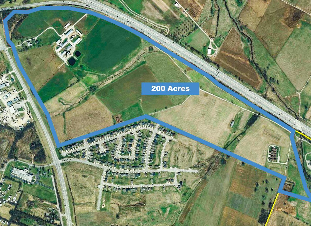
PROMOTE INCREASING THE SUPPLY OF FARM WORKERS, & THE AVAILABILITY & AFFORDABILITY OF USING AGRICULTURAL TECHNOLOGY, & AGRICULTURAL EQUIPMENT.
According to a 2017 report by Lynn Roche Phillips, PhD., AICP, and Priyanka Ghosh, PhD., University of Kentucky, Department of Geography, titled “Rural Land Use Inventory, Fayette County, Kentucky,” Lexington is utilizing 108,248 acres, or 86% of its Rural Service Area for agriculture. Having adequately trained farm labor is crucial to continuing the success of this important part of Lexington’s overall economy. Nationwide there are two jobs in agriculture for every new agriculture job seeker. Hiring has become increasingly difficult, and while there is increasing reliance on new agricultural technology, there is both a need for skilled, trained workers to operate the equipment, and a need for skilled farm workers doing manual farm labor. Larger operations are more likely to use agricultural technology
due to the cost of the equipment, while smaller operations or very specialized operations rely more on skilled manual farm labor.
Additionally, recently increased immigration enforcement compounds the concerns of the ongoing lack of farm labor. To legally bring farm workers from other countries to provide farm labor, the Federal H-2A program enables farm employers to recruit foreign nationals to the United States for temporary work. However, some smaller operations don’t have enough work to go through the trouble of using the H-2A program. Larger operations, however, are using the H-2A program successfully. Many larger farms hire an H-2A broker to do the paperwork and process for them. Kentucky is 7th of all the states for the number of farm workers that come under the H2A Visa program according to the Office of Foreign Labor Certification.
Examples of efforts to increase the supply of farm workers that could be done locally (some presently undertaken), would be to recruit or continue to recruit seasonal/ temporary farmworkers from students enrolled or graduating from Locust Trace AgriScience
Center, UK College of Agriculture, and other agriculture related education and training programs throughout the United States. Another possible source may be second-entry workers trying to re-establish their lives after rehabilitation from addiction or from having judicial records. There are also farm therapy programs for military veterans using agricultural therapy. Examples of such programs are the West Virginia Veterans and Warriors to Agriculture program through the WV state agriculture department where veterans learn about Ag practices to harvest crops and grow food.
Also, though not universally applicable due to costs, agricultural technology and equipment could be an answer to a shortage of farm workers for some types of farms. Programs and agencies that provide financial assistance to farms in acquiring technology and equipment should be promoted. Educational and training programs that train farmworkers how to care for use agricultural technology and agricultural equipment should be maintained and increased.


Building an even more desirable community requires policies to exceed all that Lexington has done in the past. It requires constantly raising the bar on both the public and private sector to deliver ever better outcomes. Lexington residents have come to expect a community that is continually seeking to raise their standard of living through planning policy. That is the both the burden and the benefit of having been a progressive leader in urban planning since the 1950’s.
How Lexington chooses to raise the bar is an important statement about the values of the community. Through numerous public input processes, the public has made it clear that they want more places and ways to connect with each other - more areas for social interaction.
As the global retail economy shifts and spaces are being reconceived, it is vital that Lexington
assure those community preferences are considered and addressed. Building a community that continues to attract new residents is critical to sustained economic growth.
As the population of Lexington continues its steady growth, policies must also assure the economy does not leave lower income residents behind.
Lexington has long grown in ways that more greatly benefit single-occupancy vehicle drivers because there was no overriding need to do otherwise. However, in the intervening years, Lexington’s citizens have demonstrated time and again that suburban expansion is not something they are interested in pursuing, that Lexington’s natural and environmental resources are too important to consume for just more of the same. That conscious policy choice has a great impact on the policy needs of the future.
“[I IMAGINE LEXINGTON AS] A SAFE PLACE WITH A SENSE OF COMMUNITY.” -LEXINGTON RESIDENT


The path to a desirable community is never ending. Lexington is continually looking to improve the quality of life for its residents. Many cities do not have the same environmental and natural constraints as Lexington, and feel more empowered to continue the onward march of suburban expansion. This is not the reality of a city with rich soil and heritage to uphold, and in some respects, this is constraining; however, the very qualities that make Lexington a planning and public policy challenge are what make it unique and special. Those challenges and constraints are opportunities for innovation. They lend urgency to the need to be progressive and innovative in our solutions, and call for leadership and vision by appointed and elected officials to implement those solutions.
Connecting people by creating opportunities for Lexington’s citizens to interact with each other through better transportation infrastructure is a fundamental way
to improve the overall community. A great effort has been expended so far to build out a robust trail systems for pedestrians and bicyclists. The dividends are realized through national attention and rankings in various livability categories; however, that effort has not reached into all areas yet. That type of economic investment must be continued, expanded and enhanced to serve all Lexington residents.
Significant projects are in the works and on the horizon to continue to improve this important aspect. For example, Lexington has committed itself to various public investment projects that create unique spaces for people to enjoy. Over the coming years, the Town Branch Trail will serve as an economic engine based on attracting activity downtown, whether it be individuals or businesses. Connecting all of Lexington to the Town Branch Trail will be critical to its success and a tremendous statement about Lexington’s commitment to equity.


connectivity placemaking support


Designing a connected street system is about improving the livability of a city on a number of fronts. While many residents feel that traffic is a concern, Lexington commute times are over 20% lower than the national average, according to the U.S. Census Bureau.
Lexington’s relatively low commute times have not been by accident. Lexington's high quality of life has been achieved through a consistent land use planning framework focused on connectivity and policies focused on containing sprawl.
Imagine Lexington organizes the connectivity pillar around two central ideas: First, that appropriate transportation infrastructure
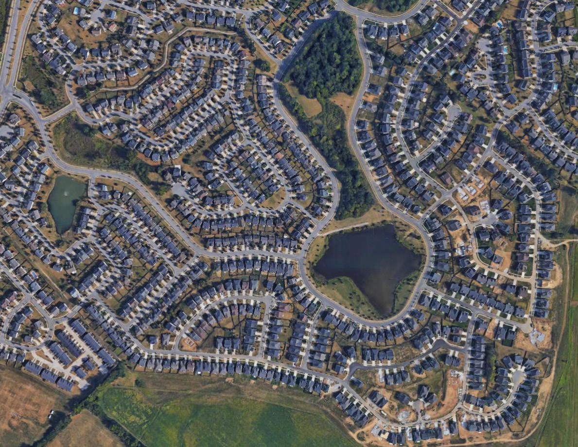
should be dependent upon what place-type is desired, and the intended uses and users; and second, that the design of the public realm include all users and modes of transit, resulting in the creation of safe, efficient streets.
The Linkage between Land Use & Transportation Infrastructure
Land development patterns have largely been reactive to transportation trends over the years. Early on, it was out of necessity that people lived in close proximity to their places of employment and centers of commerce, due to a lack of efficient and affordable transportation options. This resulted in the creation of dense
“EVALUATE, DESIGN & CONSTRUCT MORE MULTIMODAL
city centers and central business districts designed for, and centered around, people. The development of the streetcar began to increase the distance people could live from their jobs, and ultimately the wide affordability and availability of the automobile really began to shape modern development. Typical post-World War II street design and development site layouts have been planned primarily with cars in mind, and little to no thought given to the people using the space. Imagine Lexington hopes to depart from this model and utilize a more multimodal approach, design for all users, and incorporate people-first design. To accomplish this, the undeniable
link between transportation and land use must be acknowledged. Good street design begets desirable land uses and active, vibrant spaces that add to quality of life. Well-designed streets become desirable spaces that provide better travel experiences for motorists, walkers, and bicyclists. Elements including street trees, landscaping, shade, lighting, building scale, building orientation, setbacks, and buffers from traffic contribute to that design quality. Streets designed for cars alone do not create an environment conducive to walkable spaces due to high design speeds, destinations that are too far removed from any pedestrian access points by parking
THIS IS A DYNAMIC
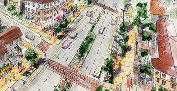
lots, a lack of crossing locations at viable distances, lighting that is out of scale with pedestrians, etc. The type of development designed for is the type of development that can be expected.
Differentiating Streets & Roads
Streets are fundamentally different from roads. “Streets” should be designed to be part of the public realm, and when that is accomplished, they attract a variety of diverse uses and people. They are places with gravity to them, an attractiveness that draws people to explore, to spend time, and even money. Unique cities are often defined by their streets, as they are focal points for culture, development, and activity.
Conversely, “roads” are designed for vehicle efficiency and expedience. Roads are really only appropriate on major arterials or limited access highways. Road design is relatively simple, as it serves a very basic well-defined purpose of moving automobile traffic. Street design is profoundly more complex, since streets must be designed to account for form, space, and order with a particular consideration paid to the surrounding context and land use.
judgment. However, the elements described below highlight key complete street elements that should be considered along recommended complete street projects.
There are many elements that make a street complete and it’s not always a one size fits all approach. Rather, complete street principals are context sensitive and require engineering judgment. However, the elements described below highlight key complete street elements that should be considered along recommended complete street projects.
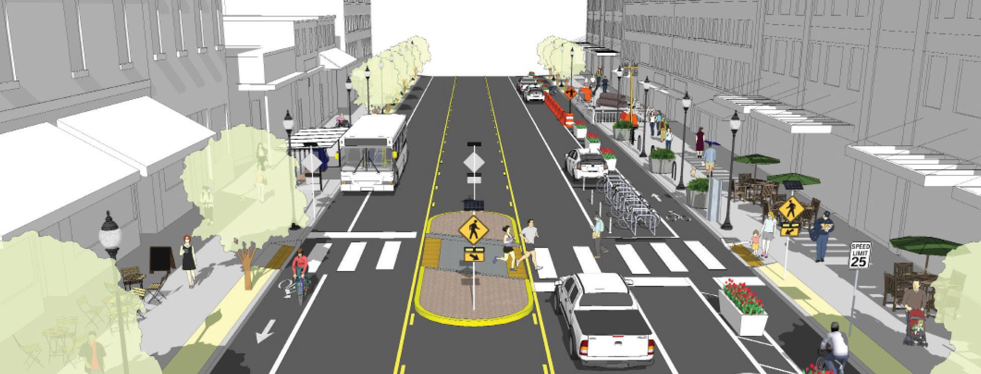
Adopt a Vision Zero Strategy
Vision Zero is the concept that no loss of life is acceptable on our roadways. Jurisdictions across the nation and across the world are adopting Vision Zero policies to eliminate preventable traffic deaths.
Vision Zero is the concept that no loss of life is acceptable on our roadways. Jurisdictions across the nation and across the world are adopting Vision Zero policies to eliminate preventable traffic deaths.
Establish Speed Reduction Policies Update Land use and Development Codes Create Safe Walkways and Bikeways in Construction Zones
Vision Zero is the concept that no loss of life is acceptable on our roadways. Jurisdictions across the nation and across the world are adopting Vision Zero policies to eliminate preventable traffic deaths.
Local codes that encourage or require short block lengths, mixed use developments with street-fronting retail, and a connected network of streets with high-quality sidewalks form the bedrock of livable communities.
Local codes that encourage or require short block lengths, mixed use developments with street-fronting retail, and a connected network of streets with high-quality sidewalks form the bedrock of livable communities.
Local codes that encourage or require short block lengths, mixed use developments with street-fronting retail, and a connected network of streets with high-quality sidewalks form the bedrock of livable communities.
Walkways in construction zones should be routed on the same side of the street, run on or parallel to the closed sidewalk, and must comply with the Americans with Disabilities Act and the Manual on Uniform Traffic Control Devices.
Walkways in construction zones should be routed on the same side of the street, run on or parallel to the closed sidewalk, and must comply with the Americans with Disabilities Act and the Manual on Uniform Traffic Control Devices.
Walkways in construction zones should be routed on the same side of the street, run on or parallel to the closed sidewalk, and must comply with the Americans with Disabilities Act and the Manual on Uniform Traffic Control Devices.
Parking policy reform includes better management of existing parking, pricing that reflects demand, lowering parking requirements for commercial and residential development, and bike parking minimums.
Traffic speed disproportionately threatens people walking and biking so speed should be managed through speed limit enforcement and traffic calming where appropriate.
Adopt a Complete Street Policy
Traffic speed disproportionately threatens people walking and biking so speed should be managed through speed limit enforcement and traffic calming where appropriate.
Parking policy reform includes better management of existing parking, pricing that reflects demand, lowering parking requirements for commercial and residential development, and bike parking minimums. Adopt a Complete
Traffic speed disproportionately threatens people walking and biking so speed should be managed through speed limit enforcement and traffic calming where appropriate.
A complete street policy asserts that all new street projects should accommodate all people who use the street, whether traveling on foot, bike, transit, or car.
street policy asserts that all new street
accommodate
whether
In the recent past, transportation planning has not made the distinction between these two very different types of facilities. Streets that would be better served with lower speeds, were designed at the outset with many wide lanes and few visual cues to alert the drivers to slow down. If these streets were designed from the start for the desired travel speed, it would encourage drivers to obey the speed limit, thus reducing injuries and fatalities for vehicular and non-vehicular users. Employing techniques such as narrow streets, medians, street trees, and reduced building setbacks eliminates the need for costly traffic calming
retrofits after the fact. Pedestrian and bike usage of rights-of-way are not problems to be solved. They should be equal partners included in the design and construction of the public realm.
At the most fundamental level, streets are public rights-of-way, and therefore are public spaces just like parks. They belong to everyone, not just automobile users. Significant improvements are not expensive or time consuming. The responsibility for those improvements does not just fall on private development, but also on LFUCG to target and identify the areas most in need of improvements.
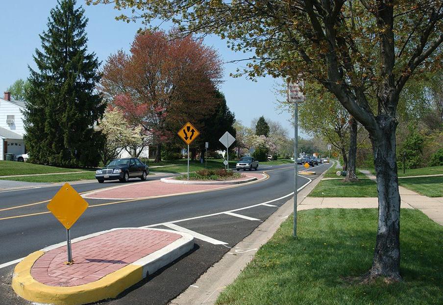
Finally, it is important to remember that every person is, was, or will be a pedestrian. Not everyone is a driver. The cyclist is a pedestrian. The transit user is a pedestrian. The right-of-way elements need to create a street that serves all users. These are not ‘additional or ‘special’ design features, but are critical infrastructure to a community similar to pavement and curb inlets. Shifting public thought processes about multimodal infrastructure starts at the highest conceptual levels. No transportation element should be finalized without considering the full context of its application.
Implementing a fully integrated street network is more than just connecting the streets. While that may be one critical element, it is much more. It requires a total commitment to connecting land use, desired place-types, the built environment, and all users with a complete transportation system. Imagine Lexington intends to direct policy in such a way that, over time, this approach becomes a natural and intuitive process. There are significant implementation steps required to get there that will take community, development industry and political support to achieve.
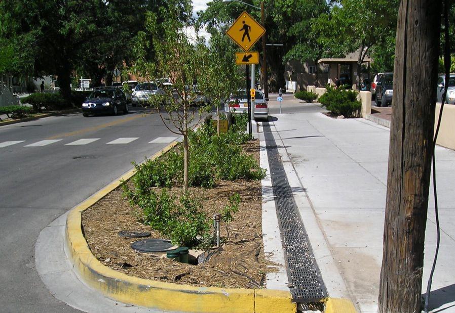 Example of curb extension used to increase pedestrian viability & safety. Urban Street Design Guide nacto.org
Bicycle Boulevard
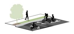
• Local
• Residential collector
Shared Roadway
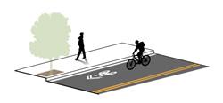
On-Street Bike Lane

Buffered Bike Lane
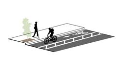
One-Way Separated Bike Lane
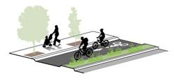
Two-Way Separated Bike Lane
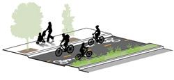
• Local • Commercial Main Street
• • Identification signage and pavement markings
• 85th percentile speed <25 mph
• ADT <3000
• Crossing treatments at local streets, avenues and boulevards
• Works best on streets with speeds of 30 mph or lower. May be used on streets up to 35 mph
• Minimum placement of shared lane marking is 11 feet from curb where on-street parking is present (4 feet from edge of curb with no parking)
• Local
• Collector
• Commercial Main Street
• Collector
• Commercial Main Street
• Arterial
• 6’- 7’ preferred bike lane width
• 5’ minimum bike lane width (when adjacent to parking)
• • Use access management and speed reduction tools to achieve desired motor vehicle volumes and speeds.
• Collector
• Commercial Main Street
• Arterial
• 5’ minimum bicycle travel area
• 18” minimum buffer area
• Shared lane markings pair well with Bikes May Use Full Lane (R4-11) signs.
• Modifications to signal timing help induce a bicycle-friendly travel speed for all users
• Lane narrowing
• Travel lane reconfiguration
• Parking lane reconfiguration
• Lane narrowing
• Travel lane reconfiguration
• Parking lane reconfiguration
• 7’ travel area
• 3’ or wider buffer
• 18” minimum buffer adjacent to travel lanes
• 3’ minimum buffer adjacent to parking lanes
• Collector
• Commercial Main Street
• Arterial
• 12’ preferred operating width
• 10’ minimum travel width (8’ width in constrained conditions)
• 3’ minimum buffer adjacent to parking lanes
• Lane narrowing
• Travel lane reconfiguration
• Parking lane reconfiguration
• Curb reconstruction
• Lane narrowing
• Travel lane reconfiguration
• Parking lane reconfiguration
• Curb reconstruction
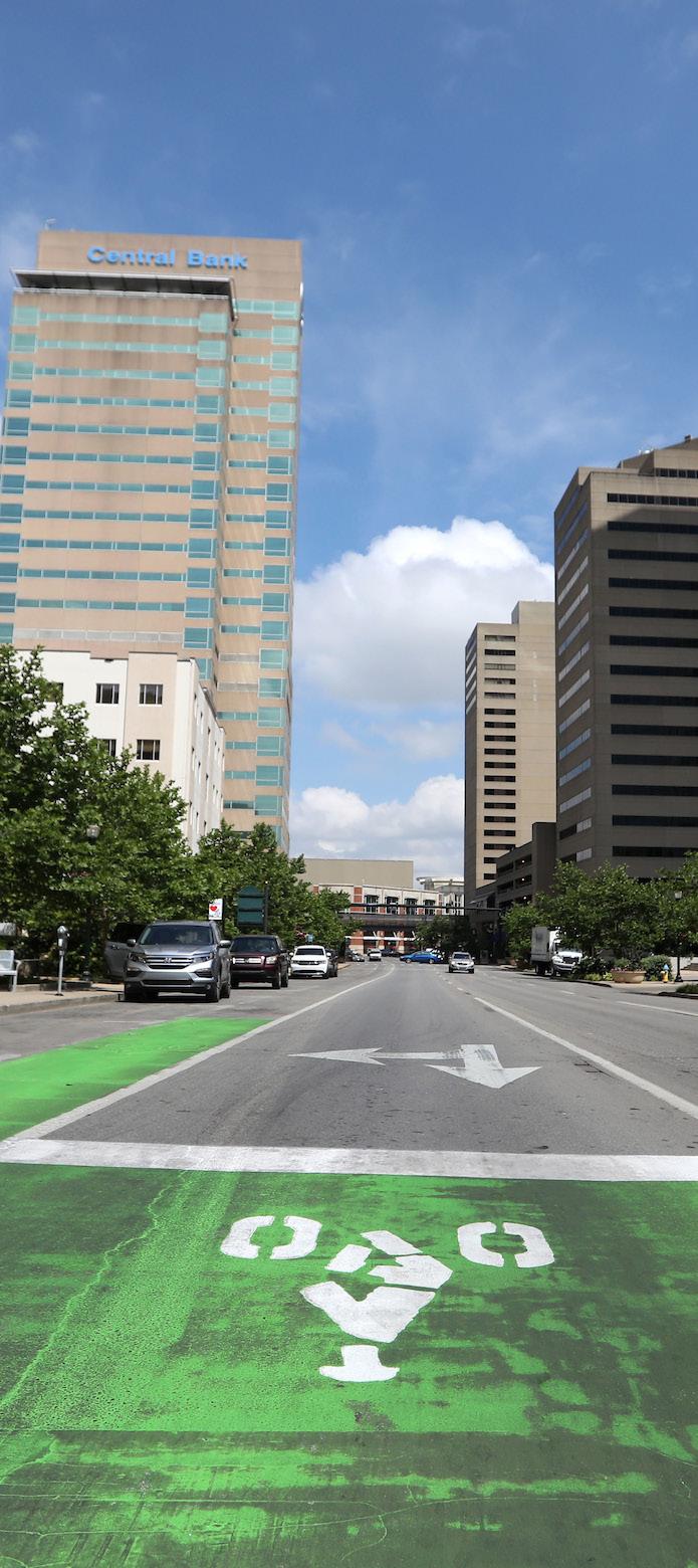
STREET DESIGN SHOULD REFLECT & PROMOTE THE DESIRED PLACETYPE.
Designers of the built street environment must work to address the functionality of the space to ensure compatibility with surrounding land uses as well as transportation network connections. True multimodal street designs must acknowledge how adjacent land uses and building forms influence user perceptions, needs, and safety. Understanding these contextual relationships leads to improved street design. When designing or modifying a street, it is crucial to consider the current and potential future adjacent land uses for the site and block.
Different land uses generate varying amounts of vehicular traffic and onstreet parking, and have different frontage and multimodal needs. The land uses adjoining a street are integral to predicting the volume of multimodal demand and the best allocation of right-of-way to support those needs. Consideration should be given to both existing
and potential future land uses. Although many neighborhoods and corridors currently have auto-oriented land use patterns and site designs, the development of multimodal street networks is intended to change the city’s transportation system and travel patterns over time. That focus on multimodal transportation is designed to work in conjunction with infill and redevelopment efforts that emphasize a greater mix of uses, walkabilty, transit-oriented development and community centers with proximity to destinations. As neighborhoods and corridors evolve over time, emphasis should be placed on creating opportunities for walkability, even in areas where the full potential has yet to be realized.
Streets should be not be singularly designed for automobile efficiency, but should give due consideration to the surrounding context, and the goals for the place-type where it is located. They should add to an area’s sense of place and promote desired development patterns, rather than discourage them with designs that are out of scale and counterproductive to the preferred result. AMEND SUBDIVISION REGULATIONS STREET STANDARDS ACTION ITEM
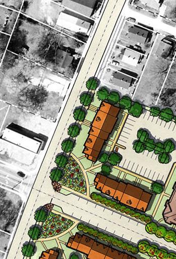
CREATE MULTIMODAL STREETS THAT SATISFY ALL USER NEEDS.
A safe, fully-connected multimodal transportation system is not about moving vehicles, but about moving people and supporting the community by improving the quality of life for everyone. Achieving this goal requires all modes of transportation be considered equally during the design of rights-of-way. From the
earliest stages of development, it should be acknowledged that bicyclists, pedestrians, transit users and automobile drivers are all entitled to safe and accessible transportation options.
Since 2009, the Centers for Disease Control has strongly advocated for improved multimodal infrastructure, due to the over 100 studies that have shown the strong connection between obesity and automobile dependence. It is not the goal of Imagine Lexington to end car culture, but is absolutely a goal that Lexington become known
for its abundant transportation options that encourage safe, healthy behaviors.
Changing behaviors does not happen simply because people know there is a healthier alternative. When each new development incorporates safe and convenient transportation options, and as needed retrofits are completed, the multimodal network becomes more robust and alternative forms of transportation become more attractive. Providing convenient transit options and alternatives makes individual neighborhoods
more desirable—and creating neighborhoods that are more desirable makes Lexington more attractive to employers and employees alike.
IMPLEMENT PROJECTS FROM THE LEXINGTON AREA MPO BIKE & PEDESTRIAN MASTER PLAN ACTION ITEM
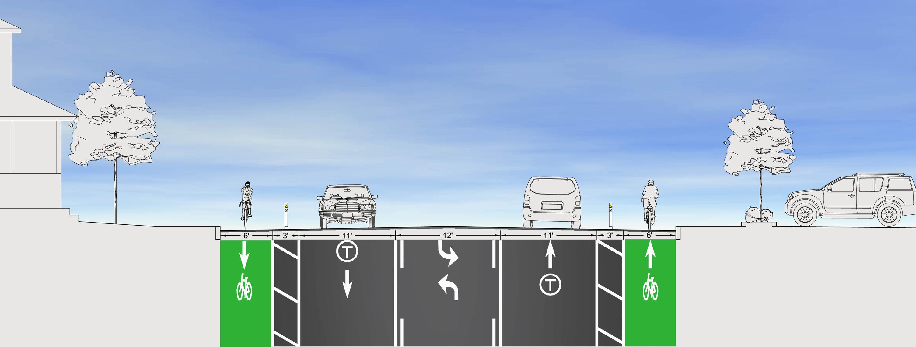
PROVIDE EQUITABLE MULTIMODAL ACCESS FOR THOSE WHO DO NOT DRIVE DUE TO AGE, DISABILITY, EXPENSE, OR CHOICE.
Mobility, social interaction, and physical activity enhance the quality of life of children, the aging population, persons with disabilities and the economically disadvantaged. The removal of barriers to independent travel reduces the need for more costly alternatives such as paratransit, private transportation services, and ‘hazard’ busing for school students. Accessibility to transportation options is an equity issue; designing streets for only one user group assumes that everyone has access to that mode of transportation. A multimodal approach is preferable, because it allows people of all means and abilities to have viable and connected transportation opportunities.
A successful transportation network connects people to places. Some areas still lack sufficient connections between public streets and building entrances. This inadequacy in
meeting Americans with Disabilities Act requirements can affect the ability of some residents to be independent. All new developments and modifications to existing facilities should be designed with these users in mind.
Some important considerations in addressing equity:
• Streets should be designed such that they are safe, enjoyable, accessible and comfortable for ages 8-80 and those with limited mobility.
• Incorporate design elements that enhance walkability, which include sidewalks wide enough for two people to walk side-by-side, shade from street trees, and short, direct, connected routes.
• Commercial and mixed-use areas should incorporate narrower streets lined with buildings that have little to no setback, frequent and safe crossings, pleasing furnishings, store fronts, pedestrian scale lighting, and buildings oriented toward and adjacent to the street and sidewalk.
should be proportioned to the pedestrian when designing streets.
• The 2018 Bicycle and Pedestrian Master Plan has a design matrix to
• Horizontal and vertical scale
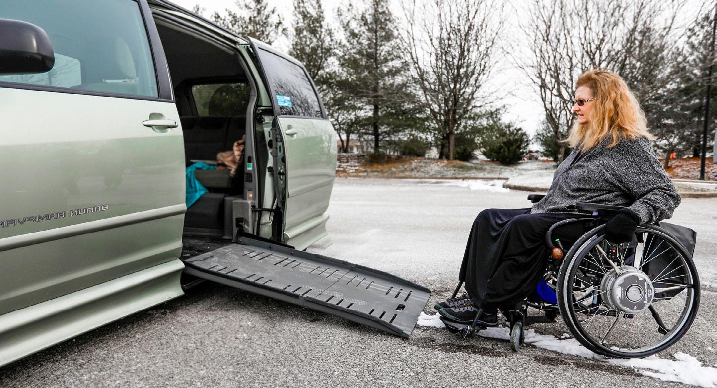
50% more than 65% fewer trips are made to visit family, friends, or go to church by seniors who no longer drive; many report they do not like to ask for rides.
help with establishing the minimum starting point to inform the decision making process on necessary transportation infrastructure. of older Americans who do not drive stay home on a given day because they lack transportation options.
DESIGN STREET NETWORKS THAT PROVIDE ALTERNATIVE ROUTE OPTIONS, WHICH REDUCES TRAFFIC CONGESTION.
Public surveys consistently identify traffic congestion as a major perceived concern in Lexington. In general, there is insufficient understanding by the public on how a more connected street network could help alleviate traffic congestion.
Within disconnected street networks, traffic is concentrated
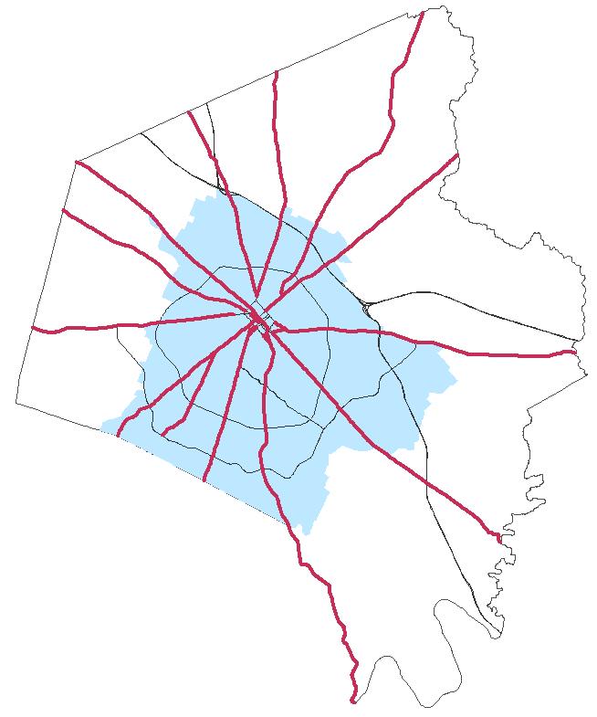
along major roads because there are not alternative route options for commuters. Alternatively, well-connected streets provide direct, continuous routes and multiple route options, and this has proven to effectively reduce roadway congestion. Connectivity also reduces response times for emergency vehicles and improves access and efficiency for transit, school buses, and service vehicles, including solid waste trucks and street sweepers.
When traffic is concentrated to fewer roads, these roads are widened and additional lanes are added to accommodate the large volumes of traffic. Wider streets encourage faster speeds,
making them more dangerous to travel as a pedestrian or bicyclist, and crossing a wider street is difficult—especially for children, the elderly, and the disabled. Of pedestrians killed in 2007 and 2008, more than 50% died on wide roadways (Earnst & Shoup, 2009).
Instead of wider streets with multiple lanes, roadway capacity should be in-creased by providing multiple, smaller parallel streets. With a more connected street network, traffic will be dispersed along alternative routes, and the demand for wider streets will lessen.
For the above reasons, and in order to lessen traffic congestion

and make Lexington’s street network safer for all modes of transportation, deadend streets and cul-de-sacs should be discouraged except where connections are not topographically or environmentally feasible. In places where connections are not feasible for topographic reasons, safe non-vehicular access should still be provided. As stressed in Theme A, roadway connections are imperative, and should be pursued wherever possible.

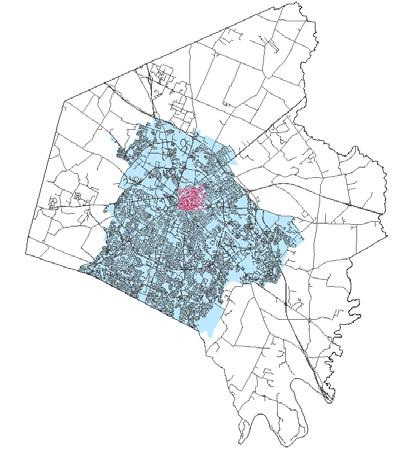
STREETS SHOULD BE DESIGNED FOR THE DESIRED SPEED, USING BUILT-IN TRAFFIC
CALMING MEASURES SUCH AS ROUNDABOUTS, NARROWER STREET WIDTHS, CHICANES, MEDIANS, ETC.
In Lexington, speeding is a common complaint on wider streets, particularly those classified as collectors. These streets, which are wider by design, create faster vehicle speeds, regardless of the posted speed limit, due to the driver’s perception of a wide open space. In contrast, streets should be designed such that bicyclists, pedestrians, and mass transit riders feel comfortable and encouraged to freely share the space with automobiles. This can be accomplished through the appropriate use of traffic calming features such as roundabouts, medians, street trees, chicanes, reduced building setbacks, shorter block lengths, and narrower street widths.
and fatalities for both vehicular and non-vehicular users alike.
Employing traffic calming techniques such as those listed above increases motorists’ attentiveness to the surrounding context, and if considered early in the design process, they carry the additional benefit of eliminating the need for costly traffic calming retrofits.
Studies have shown that each 1-mph reduction in average traffic speed reduces vehicle collision rates by 3 to 6 percent. Additionally, studies have shown that 80 percent of pedestrians struck by a car going 40 mph will suffer a fatality, while at 30 mph, the likelihood of death is reduced to 40 percent. At 20 mph, that figure drops to just 5 percent, illustrating the importance vehicle speed plays in pedestrian safety. The likelihood of a pedestrian collision occurring at lower speeds is also reduced due to shorter braking distances.
Rather than addressing Lexington’s roadways after the fact, designs should be initiated at the development and planning phase to create the appropriate street width to restrict vehicle speed.
“[I IMAGINE
Reductions in vehicle speed significantly decrease injuries
OF INJURIES & FATALITIES BASED ON INCREASING MEAN VEHICLE SPEED
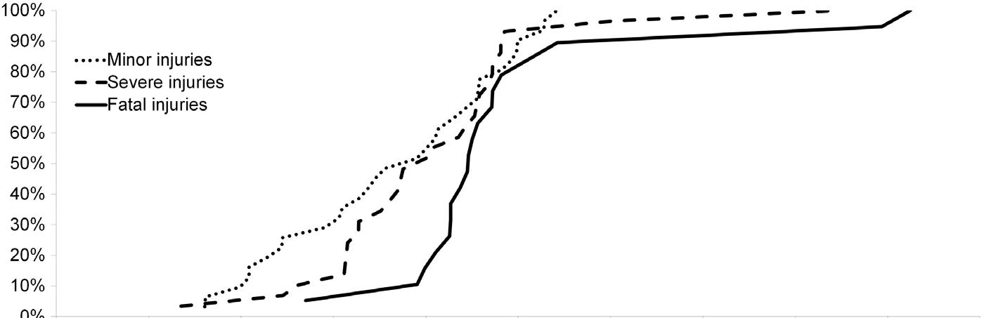
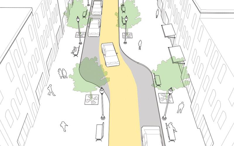
CHICANES: CURB EXTENSIONS THAT ADD CURVE IN THE ROAD; PROVIDE MORE PUBLIC SPACE & SLOW DOWN TRAFFIC
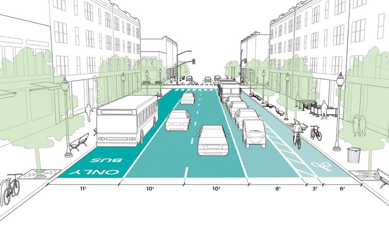
NARROWER LANES: PROVIDE TRAFFIC CALMING EFFECT & ALLOW FOR SPACE FOR ALL USER NEEDS (BIKE LANES, SIDEWALK, ETC.)
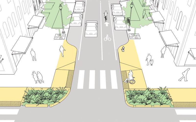
GATEWAY: CURB EXTENSION AT THE ENTRANCE OF A LOW SPEED STREET THAT HELPS INDICATE TRANSITION TO INCOMING CARS
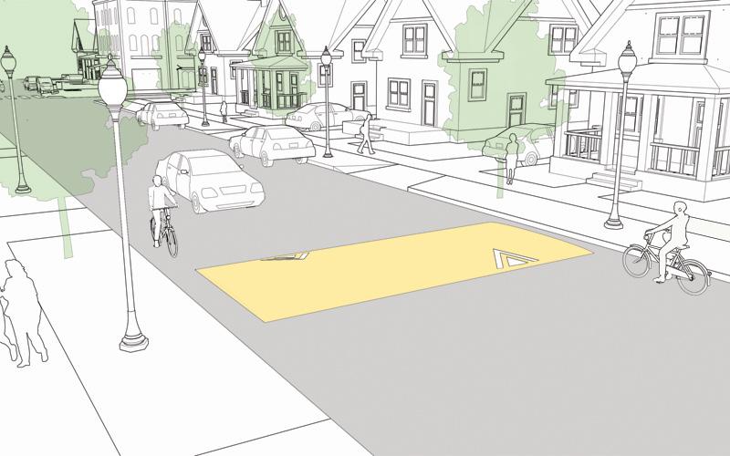
SPEED HUMP: SLOW SPEEDS ON LOW VOLUME, LOW SPEED ROADS. REDUCE SPEEDS TO 15-20 MPH.
Source: Urban Street Design Guide, National Association of City Transportation Officials
TAKE A HOLISTIC APPROACH TO DESIGNING CONTEXT-SENSITIVE STREETS, ADDRESSING THEM WITHIN THE FRAMEWORK OF THE COUNTYWIDE NETWORK, LAND USE CONTEXT & THE NEEDS OF ALL USERS.
The benefits of context-sensitive multimodal street design are many, but all encompass the responsibilities that designers ensure the health, safety and welfare of the people who will use this public space. These benefits include:
The safety of all users is a priority, whether they use a car, bus, bicycle, wheelchair, stroller, cane, or walk.
Whether used to commute to work or school, to run errands, to visit friends, to go to a park, or to recreate and exercise close to home, streets must be designed with all users in mind. Connected streets provide multiple route options and continuous, convenient facilities without gaps, while reducing delays and congestion—creating a more efficient network.
Improved accessibility and independence. By improving
access for all, complete streets enable greater freedom of travel for people who do not drive due to age, disability, expense, or choice.
Connected multimodal streets save individuals money on direct transportation costs by making less costly alternatives to the automobile more readily available, including biking, walking, and transit. Increased physical activity from biking or walking may also save individuals on health-related costs.
Governments and communities save money with the implementation of complete streets. With more travel options and a more connected network, public vehicles may travel fewer miles and reduce
REALIZING THE FULL BENEFITS OF CONTEXT SENSITIVE STREETS
backtracking along discontinuous routes. Allowing more people to walk and bike can reduce health costs paid by the government. Less traffic, less pavement, and more street trees reduce the costs associated with cleaning polluted air and water. Dispersed traffic lessens the need for expensive road widening. Less pavement saves in maintenance costs. Connectivity saves infrastructure costs. Smart growth development practices generally require less initial cost to construct and maintain, as they are more compact and require fewer public services annually.
Connected multimodal streets save developers money, as shorter blocks and narrower streets generally result in less pavement.
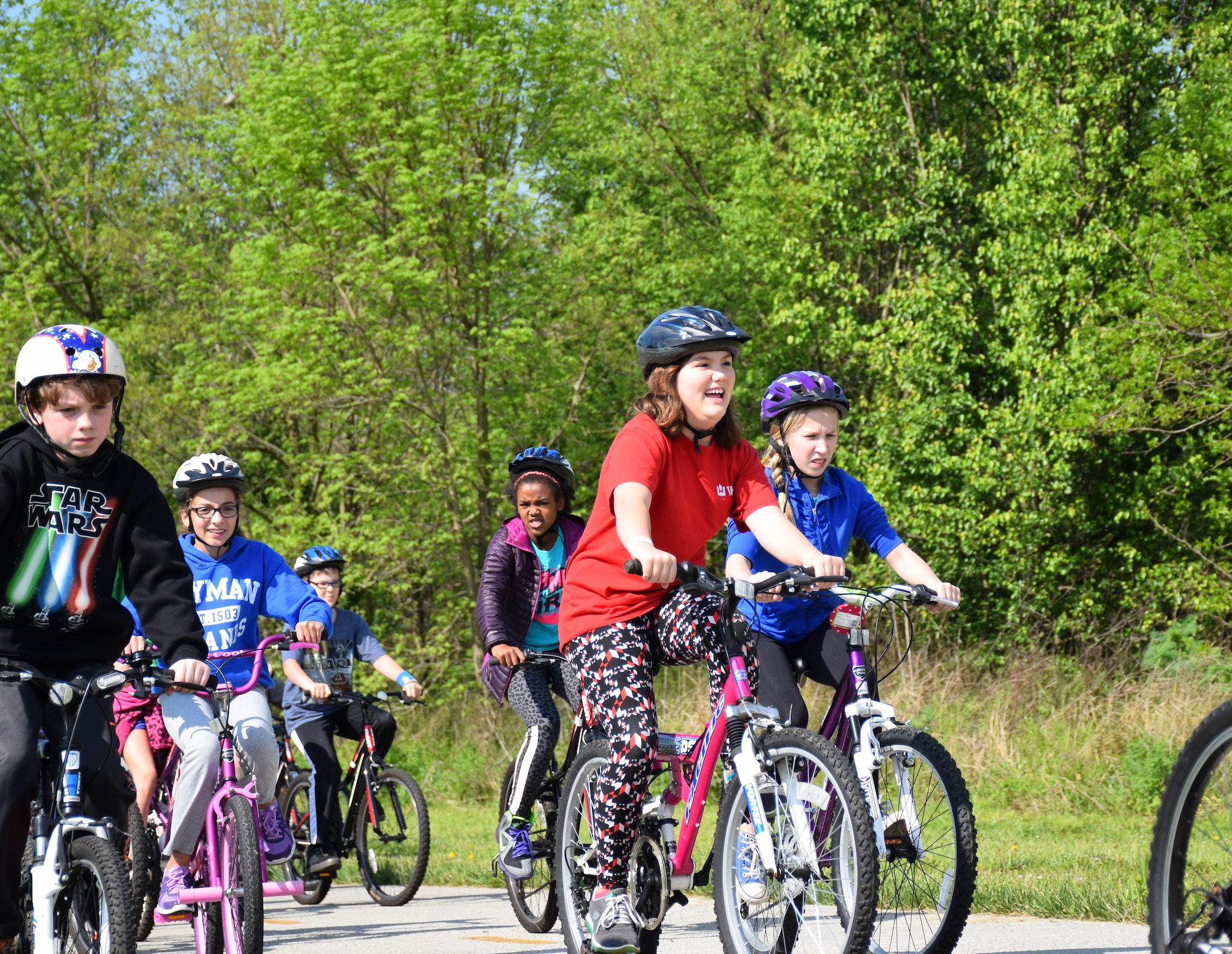
Accessibility to businesses on foot or by bike can increase patronage from passersby. Creating a sense of place and livability attracts new business and helps retain existing business. Transportation cost savings for businesses allows for reallocating or increasing profit.
Connected multimodal streets create an environment that fosters walking and biking, resulting in more daily activity and more healthy lifestyles. This can help combat the rising rates of obesity, asthma, and stress. Less pavement leaves more land available for additional development or greenspace, which provide additional opportunities for physical activity.
By dispersing traffic, providing efficient route options, and encouraging alternative modes of transportation, a network of multimodal streets reduces congestion and trip lengths—and therefore noise pollution, energy consumption, and emissions. Multimodal streets generally require less pavement, which reduces stormwater runoff and the heat island effect. They can also improve water quality,, through the use of green stormwater
practices within the right-of-way.
Connected multimodal streets provide direct, continuous routes and multiple route options. This reduces response times for emergency vehicles and improves access and efficiency for transit, school buses, and service vehicles, including solid waste trucks and street sweepers. Appropriately-sized streets can accommodate large service vehicles while promoting safe driving speeds without the use of speed humps that can slow emergency response time.
A safe, attractive, and welcoming street is crucial to encouraging residents to walk and bike. Using surrounding land use and context to inform their design, complete streets satisfy user needs and street functions in a context-sensitive manner. Well-designed streets become quality places that provide better travel experiences for motorists, walkers, and bicyclists. Elements including street trees, landscaping, shade, lighting, building scale, building orientation, setbacks, and buffers from traffic contribute to design quality.

Imagine Lexington is the evolution, an iteration, of Lexington’s policybased Comprehensive Plan, eschewing the traditional land use map in order to focus on creating quality places and sustaining them. The 2013 Comprehensive Plan fell short of fully laying out how to achieve the goals and objectives that drive the plan. With Imagine Lexington, the goal is to turn the concept of placemaking into a fully fleshed-out policybased set of principles that will clearly define future growth.
Realizing these principles starts with understanding that this is a fundamental shift in the way development is conceived and implemented.
Despite objections to the contrary, Placemaking does not rely on a ‘sense’ of place. A place is more than an emotional feeling of whether a particular space is enjoyable. It can be defined, it can be replicated. If formulas and algorithms can be created to predict how people will shop and
vote, then defining a formula for creating places that people use and interact with is well within the collective ability of policymakers.
The always stiff competition for jobs and workers has cities around the world addressing what they can do to attract residents. People unquestionably choose to live in cities with high quality places that they can afford; this is especially true of talented workers. Communities with quality places are an asset to businesses looking to locate in an area. From an economic development standpoint, developing quality places is critical to future growth. Big demographic shifts are driving the need for placemaking, as younger workers are seeking active urban centers with good transit, while the aging population is looking for easy access to amenities that include activities.
Quality places rarely happen accidentally, though they can develop over time organically as a result of dozens of small,
1. The community is the expert.
2. You are creating a place, not a design.
3. You can't do it alone.
4. They'll always say, "It can't be done."
5. You can see a lot just by observing.
6. Develop a vision.

7. Form supports function.
8. Triangulate.
9. Start with the petunias.
10. Money is not the issue.
11. You are never finished
For more information, visit: www.pps. org/reference/11steps.
 Source: Content from the Michigan Sense of Place Council. Figure by the Land Policy Institute, Michigan State University, 2014.
seemingly inconsequential decisions by policymakers and citizens. Imagine Lexington seeks to accelerate that time-frame, and replicate the outcomes, through a careful implementation process called Placemaking. The outcomes of this process are quality public and private spaces that complement each other in order to provide opportunities for social interaction. The private sector builds and operates the private spaces, while the public sector is involved in the design and operation of the public spaces, which provide access to private spaces.
Quite simply defined, placemaking is the process of creating quality places where people want to live, work, play, shop, learn, and visit.
There are four types of placemaking:
This is the catch-all term that covers the other three more specialized areas. Each type of placemaking requires BOTH projects AND activities. It is the scope type of both of those keys that define the other types of placemaking.
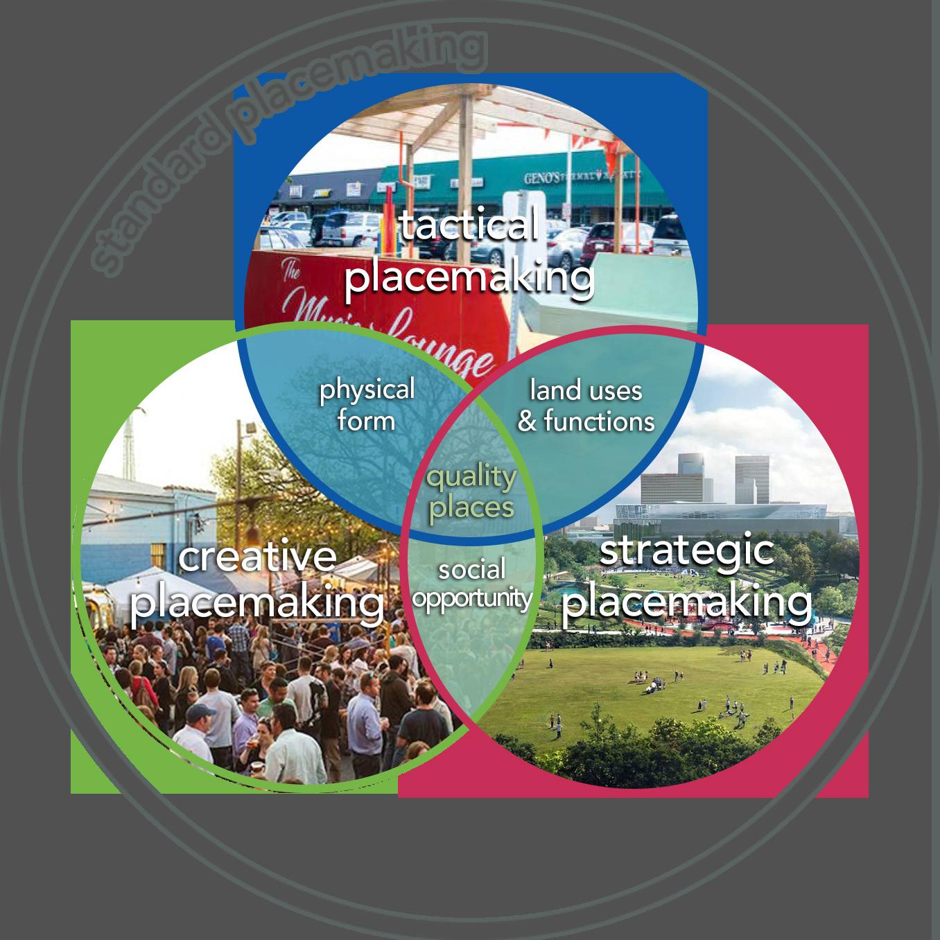
This type of placemaking involves a short-term commitment that can begin almost immediately by focusing on a public space. It includes a number of small, low cost projects that are used to build a constituency for more substantive placemaking projects.
According to the ‘Creative Placemaking’, written for the National Endowment for the Arts and the Mayor’s Institute on City Design in 2010, this type of placemaking is defined as “partners from public, private, nonprofit, and community sectors strategically shaping the physical and social character of an area around arts and cultural activities.” The focus of Creative Placemaking is to “bring diverse people together to celebrate, inspire and be inspired.” This form of placemaking attempts to provide sustaining activity in underutilized public spaces.
This type of placemaking includes a comparatively small range of specialized projects and activities that must be pursued by the public, nonprofit, and private sectors of 5 to 15 years. These
are large projects targeted in downtowns and key nodes along major corridors. These projects are the keys to attracting talented workers over the long term and result in job retention and creation in the near term.
The necessity of creating quality spaces requires that the development process include the public at an earlier stage and collaborate on the types of spaces that people will utilize. All forms of successful placemaking depend on broad citizen support and engagements in the design of projects and activities. The public should be at the forefront of developing quality places in their community, with their ideas and vision incorporated into the development plans or studies that will drive implementation by the private sector.
According to a study published in 2017, knowledge and creative based jobs follow talented workers. Highly skilled and talented people have the ability to pick where they want to live and then create new businesses and attract new
companies to the area. The study also finds that both people and jobs are attracted to natural and cultural amenities. The reason ranks highly on so many ‘best of’ lists is because publications use a 2002 index created by Richard Florida called the Bohemian Index that measures the ratio of knowledge and creative professionals to the overall population. There is no question that Lexington has long been attractive to these workers, largely due to the University of Kentucky. The very strong correlation of high Bohemian Index Score to Urban Growth makes it crystal clear that continuing to capitalize on Lexington’s natural and cultural advantages will produce significant economic development gains for the community.
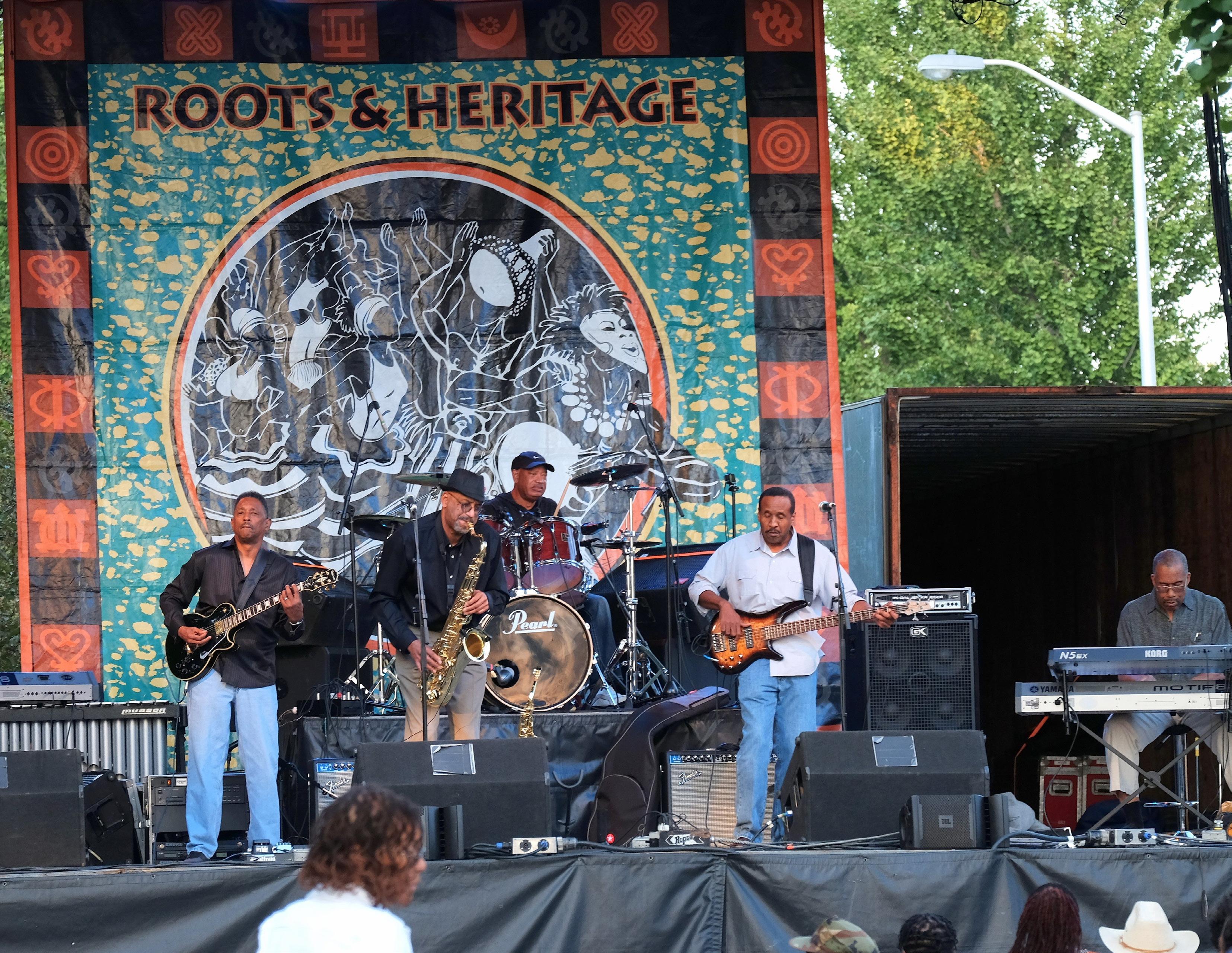
“PROVIDE VARIED PLACE-MAKING ATTRACTIONS & ACTIVITIES FOR ALL AGES: ARTS, ENTERTAINMENT VENUES, BREWPUBS, & RESTAURANTS, WITH A DISTINCTIVE CHARACTER OR BRAND.”
-LEXINGTON RESIDENT
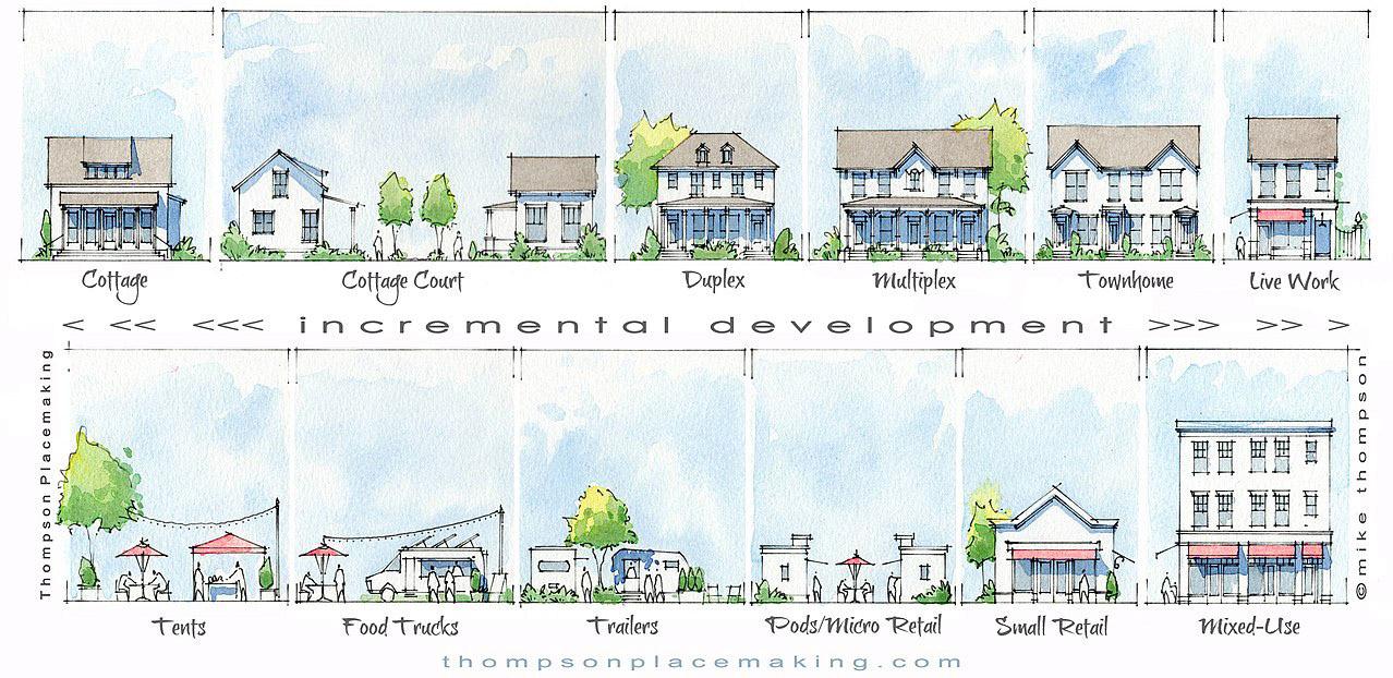
IMPLEMENT THE TOWN BRANCH COMMONS
STRATEGIC MASTER PLAN (APPENDIX B) AS AN ELEMENT OF THE COMPREHENSIVE PLAN.
Town Branch Commons will be a strip of Bluegrass running through downtown Lexington, roughly following the path of Town Branch, Lexington’s first water source. It will link the city's two major trails, Town Branch Trail and the Legacy Trail, to provide 22 miles of uninterrupted trail connecting downtown to the rural landscape. The Town Branch Commons is allinclusive of the Town Branch Park, Town Branch Trail, immediately adjacent parks, pedestrian spaces, and connections to other downtown parks/plazas/etc. To establish Town Branch Commons as the centerpiece of the community, the following critical pieces need to be ensured and safeguarded, particularly as future development occurs along the trail:
Limit the number of access
points to maintain the safety and aesthetics of the multi-use trail, and ensure the fewest potential conflict points between vehicles and pedestrians or cyclists.
Establish design guidelines for existing and future development adjacent to the corridor that strengthen the City’s zoning and further lay out key elements, such as: encouraging pedestrian entrances and facades that face rather than turn their backs to the multi-use trail system; defining appropriate and inappropriate uses along the corridor (e.g. back of house or dumpster locations, drive-thrus, etc.); and ensuring access to surrounding open space and trail systems.
Perform a study to determine the direct economic impact of potential redevelopment along the entire corridor, as well as the potential social and economic impact to the surrounding neighborhoods and downtown as a whole. This study should also explore incentive feasibility and policy changes that may assist and guide future development along the corridor.
Continue to make design and development decisions that work to improve the overall water quality and urban ecology of the surrounding properties which directly feed into the Town Branch Commons infrastructure and help to maintain the performative landscape established in the Master Plan.
Enhance the experience of Town Branch Commons through ongoing way-finding and educational signage that highlights not only the history of Town Branch itself but the surrounding neighborhoods, people, and public spaces.
ESTABLISH LAND USE & TRANSPORTATION DESIGN GUIDELINES FOR DEVELOPMENT
ADJACENT TO TOWN BRANCH COMMONS
PERFORM A STUDY TO DETERMINE THE ECONOMIC & SOCIAL IMPACTS OF TOWN BRANCH COMMONS
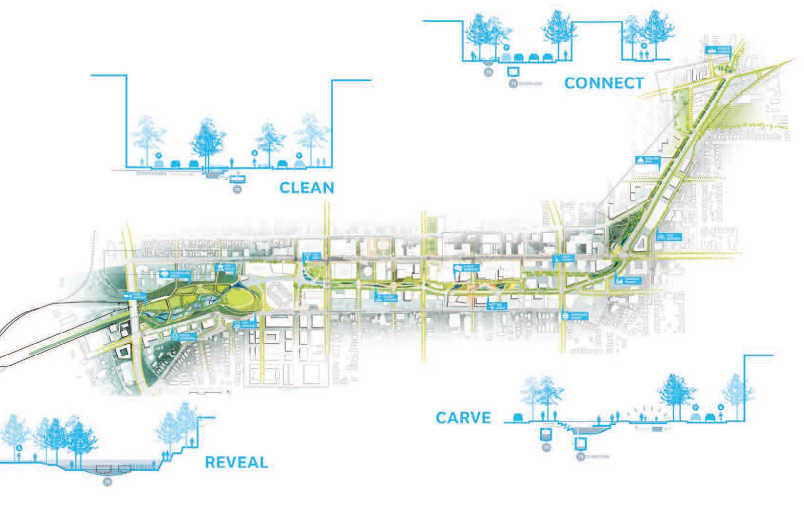
RETROFIT INCOMPLETE SUBURBAN DEVELOPMENTS, INCORPORATING ELEMENTS THAT CREATE COMPLETE NEIGHBORHOODS.
For decades, Lexington embraced strong Euclidian zoning as a way to protect residential uses from the negative externalities of incompatible land uses. However, the market has seen a significant shift in residential consumer preferences, to which Lexington must respond and address with more modern zoning regulations. Primarily, Lexington’s economy, like the national economy, has shifted away from many of the most incompatible land uses, while at the same time, there has been a boom in the services and retail sectors. Today, people are also seeking to live in areas where they can get all their needs met without being forced to drive as far, or in some cases, at all. A complete neighborhood should contain residential, employment, commercial, recreational and civic uses that serve the overall needs of the area. Where these do not exist, Imagine Lexington advocates for complementary infill and development to meet those needs.
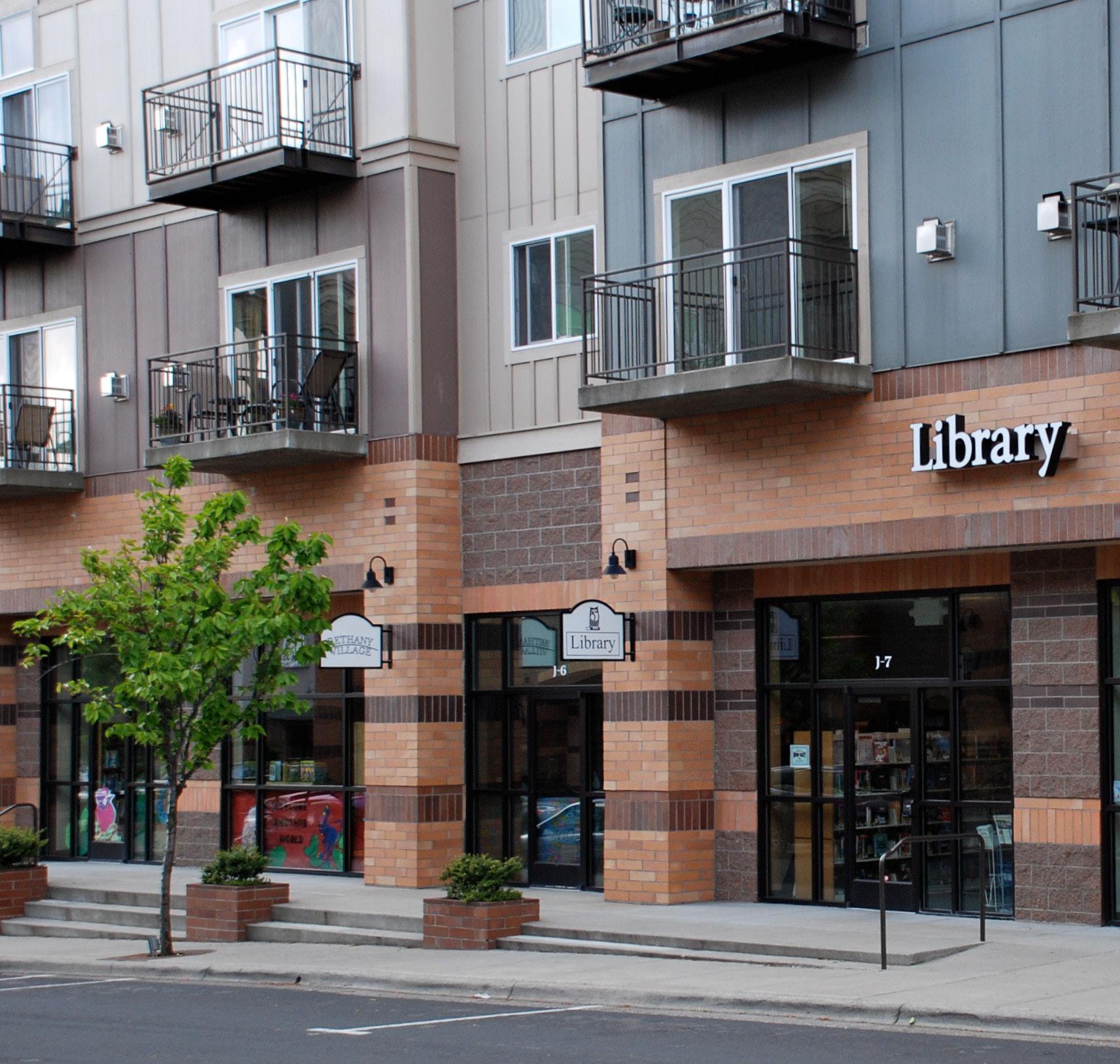 Library in the Bethany area of Washington County, in the Portland metropolitan area, Oregon. It is located in the ground floor of a three-story mixeduse building, with apartments above, in the Bethany Village development (by Steve Morgan).
Having thoughtful design standards that are both flexible and responsive to diverse conditions is an essential component of moving toward a community filled with special places that are inviting and memorable. Such standards are needed for the benefit of government projects involving public spaces, as well as for private entities striving to build quality developments on adjoining private lands. Without comprehensive standards that address both the public and private realms, even hard work and the best intentions will frequently not result in the high level of quality “placemaking” that the community expects and deserves.
Within the public realm, street and sidewalk design, landscaping and progressive storm water management, usable and calming pockets of greenspace, street life and art, festivals, celebrations and other special events, and transportation connections and destinations are all important. In the private realm, there is an equally long list of design issues that must be addressed, including building mass
and height, building orientation toward public spaces, provision of usable open space, design of streetscape features, location and orientation of garages and off-street parking, integration of mixed uses and diverse housing choices, and relationships to adjoining and/ or surrounding land uses. For both public and private land development, accommodating the needs of bikers and pedestrians in addition to vehicles is an increasingly important challenge.
Historically, government regulations and policies relating to development have been fairly rigid and not responsive to diverse conditions. That needs to change. Also, in many instances there are conflicting goals between different arms of government that ultimately discourage rather than encourage the creation of special places. That also needs to change. These elements of change, which will likely require amendments to the Zoning Ordinance and Land Subdivision Regulations (and related regulations and policies), should be pursued with a high expectation of what needs to be accomplished as both public and private lands are developed.
AMEND THE ZONING ORDINANCE TO INCLUDE PLACEMAKING ELEMENTS ACTION ITEM
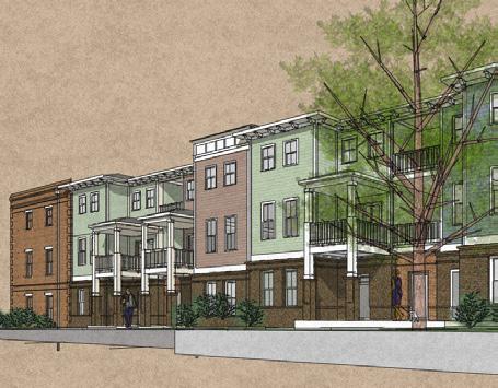
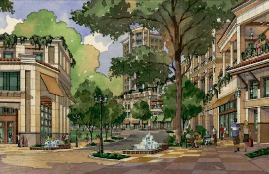 Hitch Homes, Savannah, GA (Lord Aeck Sargent
79 West Paces Ferry Road, Atlanta, GA (Lord Aeck Sargent)
Hitch Homes, Savannah, GA (Lord Aeck Sargent
79 West Paces Ferry Road, Atlanta, GA (Lord Aeck Sargent)
CREATE QUALITY & USABLE OPEN SPACE FOR ALL DEVELOPMENTS OVER ONE ACRE.
Open space is key for livable, sustainable communities. Whether a commercial development or residential neighborhood, how people will interact and move within a space needs to be considered. Successful, usable open space requires both private and public open space areas, designed and incorporated intentionally into the fabric of all development. Currently, “usable” open space
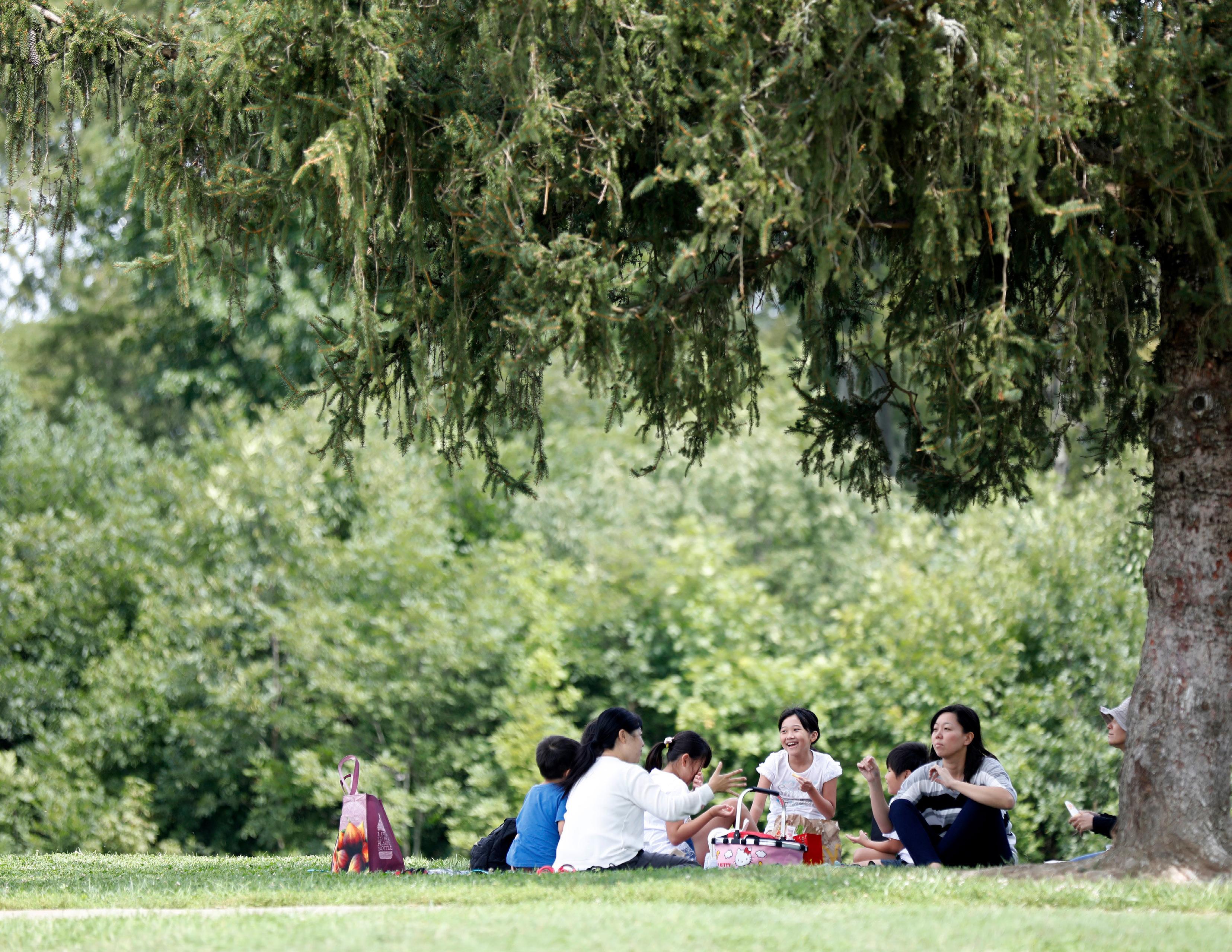
is subjective, and there needs to be a diligent effort to establish criteria to define such a space. In practice, any non-paved/ built area is permitted to be considered open space. Truly usable open space needs to be appropriately sized and needs to address different users’ demands through design. A public open space within an assisted living facility is not necessarily the same type of open space that is most suitable for a mixed-use development. During the design of a property’s development, the best open space design needs to be considered for the projected user.
Ordinance-based text needs to be updated in order to ensure implementation of usable open
space. The current definition for open space is lacking emphasis on its importance, and because of this, open space is not always implemented in the most purposeful way. A definition that emphasizes the many benefits and necessary characteristics of open space is needed. These benefits and characteristics include social interaction, recreation and leisure, health, safety, education, natural or cultural resource protection, sense of place and economic vitality. These benefits and characteristics will vary by user group and will need to be assessed and personalized for each development.
When it comes to reviewing development, an updated
definition is key, but more regulations would provide staff, developers and community members guidance as to what to expect for the provision and design of open space. These regulations should address size requirements, the provision of both public and private open space, and user-tailored design, as well as restrictions, exclusions and exceptions to a development’s provision of open space. Providing a more clear vision for what constitutes usable open space will result in a livable, sustainable community that serves the needs of all people.
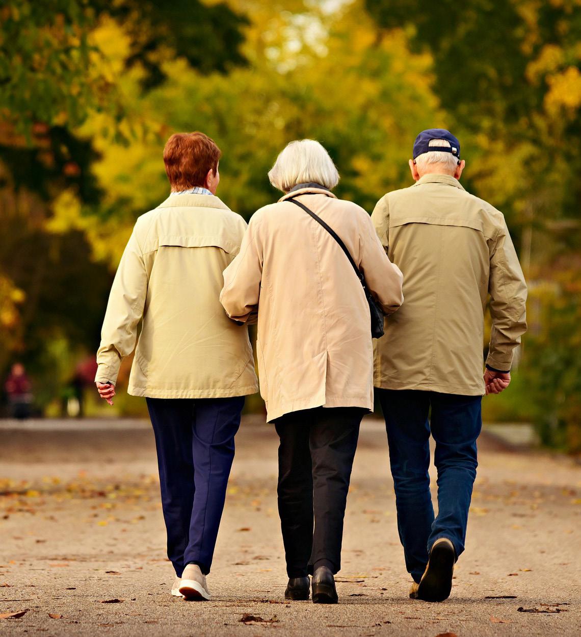
REVIEW ZONING ORDINANCE & SUBDIVISION REGULATIONS TO CREATE MORE WALKABLE
As was prominently discussed in Theme A, from a standpoint of developing great neighborhoods, there should be a focus on creating pedestrian-friendly streets and walkable blocks that make traversing them on foot a desirable activity. Reducing setbacks and shortening block lengths will make it easier for people to get around their neighborhoods and access the public and private amenities close to them. The full argument for implementing these principles is laid out clearly in Theme A. While the policy in that chapter places the impetus on the developer to submit plans that address the issue, this policy is for Planning and other divisions to address the underlying regulations that may hold back pedestrian-friendly development. It is important to ensure that revising and updating regulations be done with a purpose and a sharp focus on solving a problem. A full review of the Zoning Ordinance and Subdivision Regulations are needed with an aim to answer a singular question: Will a change make it easier or harder for people to connect pedestrians to destinations?
AMEND THE EXPANSION AREA MASTER PLAN TO UPDATE THE REMAINING RESIDENTIAL AREA TO REFLECT THE 2018 COMPREHENSIVE PLAN’S GOALS & OBJECTIVES.
The adoption of the Expansion Area Master Plan (EAMP) in 1996 created a framework for zoning and public infrastructure that was entirely new to Lexington. However, there has been a significant shift in development patterns and land costs since that plan was adopted. Four comprehensive plans later, with all of Expansion Area 1 still to be developed, there is still time to reopen the EAMP and examine that area with fresh eyes against the needs of Lexington today. Providing for a more appropriate mix of housing options, creating a complete community (see Placemaking Policy #2) as well as taking a fresh look at the transportation infrastructure needs of the entire area would be the primary goals of the plan.
Similarly, this would give Lexington the ability to reevaluate the exaction fee program as it relates to the Economic Development (ED) zone. As laid out in previous chapters, jobs land generates a significantly higher tax return per acre than residential growth, which makes finding methods to incentivize development of ED land a priority of this plan.
The 2013 Comprehensive Plan called for a workgroup to look at the broader ED issue, and while that work did result in a zoning ordinance text amendment, it was clear that further work must be done on the cost side to address the issue more fully.
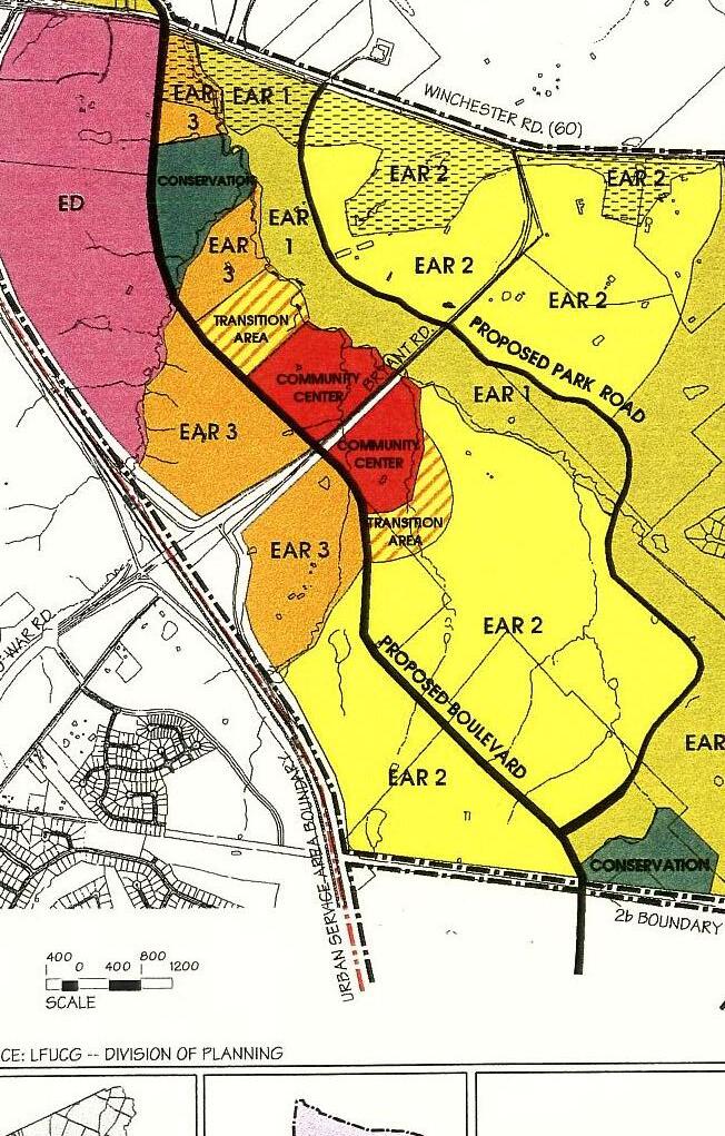
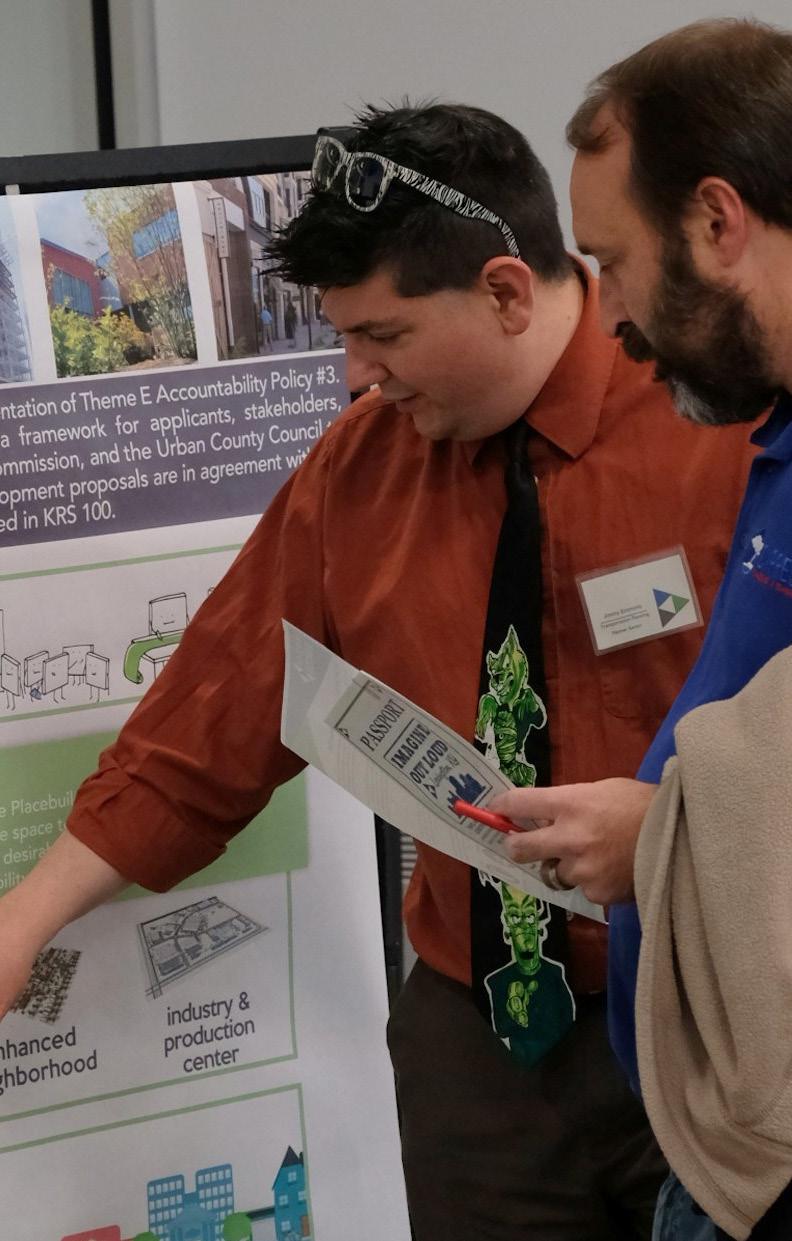
CULTIVATE A MORE COLLABORATIVE PREDEVELOPMENT PROCESS, INCORPORATING COMMUNITY FEEDBACK BEFORE DEVELOPMENT IS FORMALLY SUBMITTED FOR REVIEW.
When developers submit proposed developments, affected communities often hear about them for the first time through required public notice. Though some developers do communicate in advance, it does not always result in a productive conversation. With additional efforts put forth to ensure community awareness and support from the outset, considerable time and expense may be cut from all facets of the development process.
From the very beginning, applicants should clearly lay out the economic realities of their property, and neighbors should express the needs of their community. Going forward, there is an expectation that applicants will engage in good faith with neighborhoods in a
visioning process about how the needs of the developer and the community can be met together.
The first steps in creating this collaborative system have been taken by the Division of Planning via The Placebuilder (p 261) and Buildingeye (lexingtonky. buildingeye.com). A key purpose of The Placebuilder is to start the conversation between developers, neighbors, and Staff by strongly encouraging engagement at the beginning of the process and providing guidance for development justifications. Buildingeye is an online application that allows anyone with an account to track and review development activity throughout Fayette County. The application allows users to create alerts regarding development in their area and provides an efficient way to track the status of projects from Development Plan submittal to Certificate of Occupancy. In addition to these tools, Planning Staff should always be available in a support role to explain process, the Zoning Ordinance, and adherence to the Comprehensive Plan.
DEVELOP A TACTICAL PLACEMAKING PROGRAM WITHIN THE DIVISION OF PLANNING TO WORK WITH INTERESTED NEIGHBORHOODS & AID IN THE ORGANIZATION OF ACTIVITIES.
According to Placemaking as an Economic Development Tool by Michigan State University in 2015, “Tactical placemaking” is a process
of creating quality places that uses a deliberate, often phased approach to physical change or new activation of space that begins with a short-term commitment and realistic expectations that can start quickly (and often at low cost). It targets public spaces (right of way, plazas, etc.) that are low risk, with the possibility of high rewards. It can be used continuously in neighborhoods, with many stakeholders. It includes a mix of small projects and shortterm activities; over a long period of time, tactical placemaking projects can transform an area.
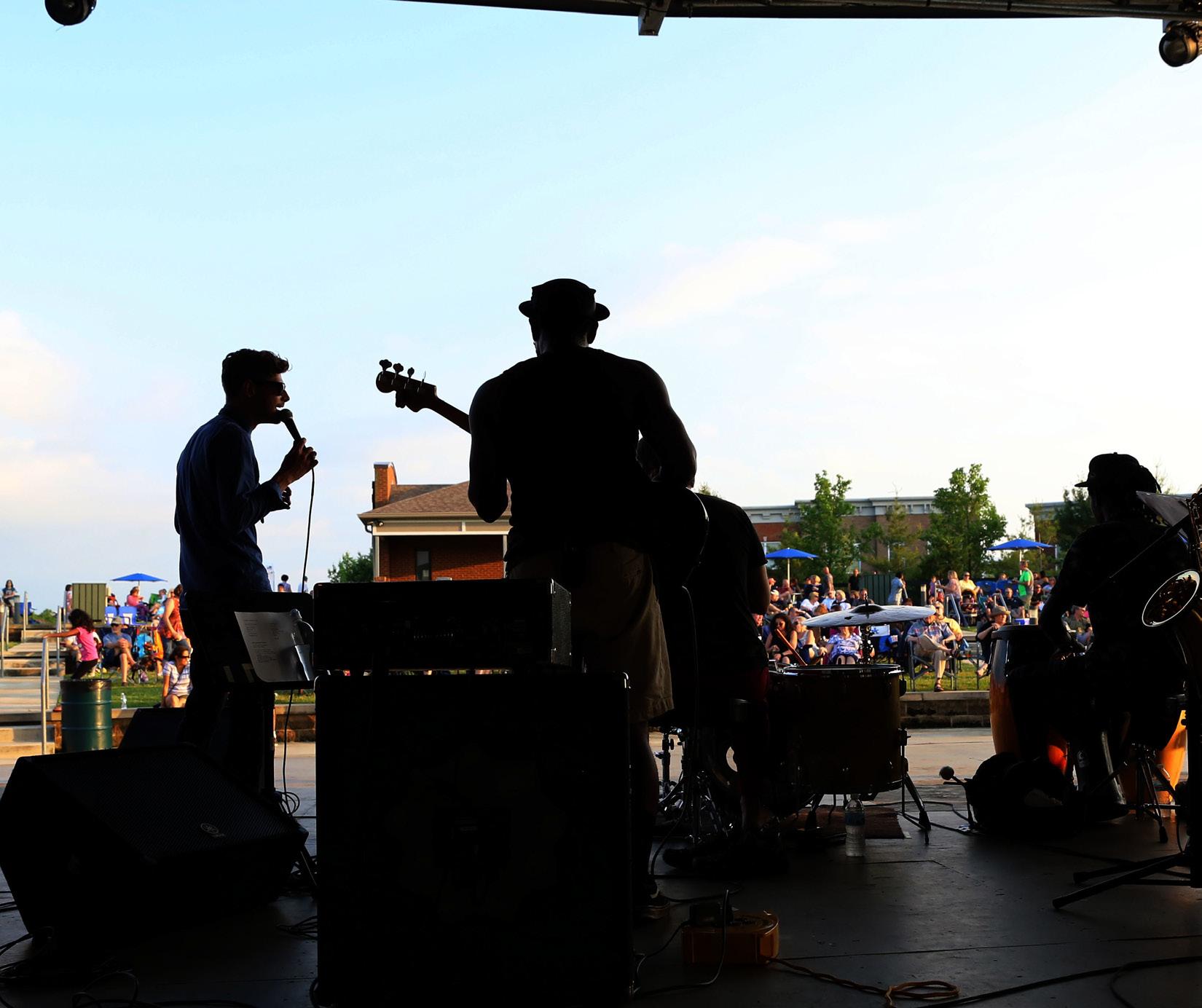
Positive impacts may be slow to materialize, but they often come at a much lower cost. This form of placemaking can also be used to build consistent demand for more substantive or long-term standard, creative, or strategic placemaking projects or activities.
In Lexington, the NoLi CDC’s Night Market is a good example of placemaking to activate an underused public space. Over the past few years, the Night Market has grown into a bigger space, with more vendors, more attendees, and more vibrant
programs, with the community’s support. Interested neighborhoods are encouraged to initiate similar activities, which will be supported by Division of Planning. Further, the Division is looking to encourage tactical placemaking activities and be an active partner with interested neighborhoods.
WORK WITH COUNCIL TO INCREASE STAFFING TO DEVELOP A TACTICAL PLACEMAKING PROGRAM WITH THE DIVISION ACTION ITEM
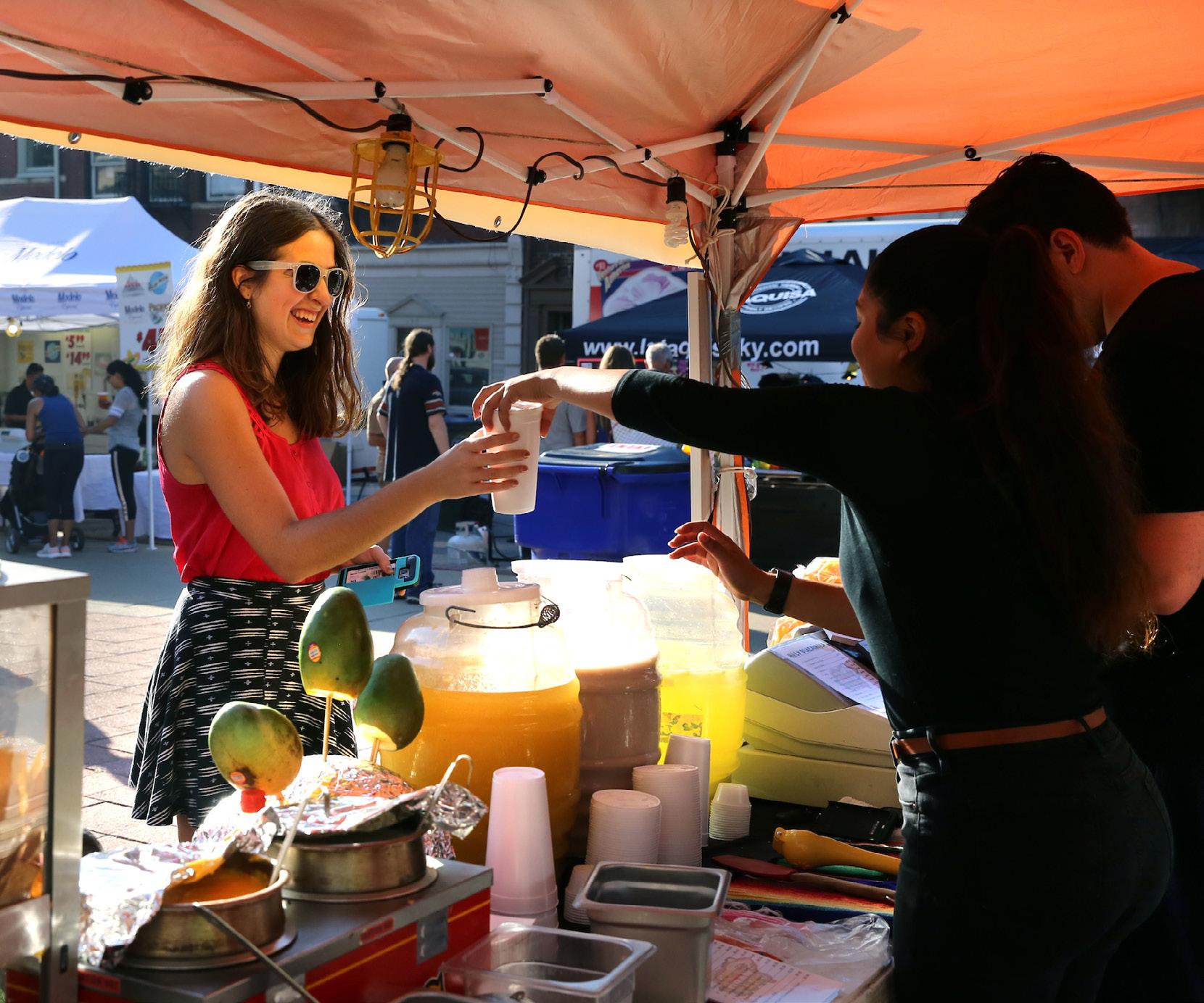
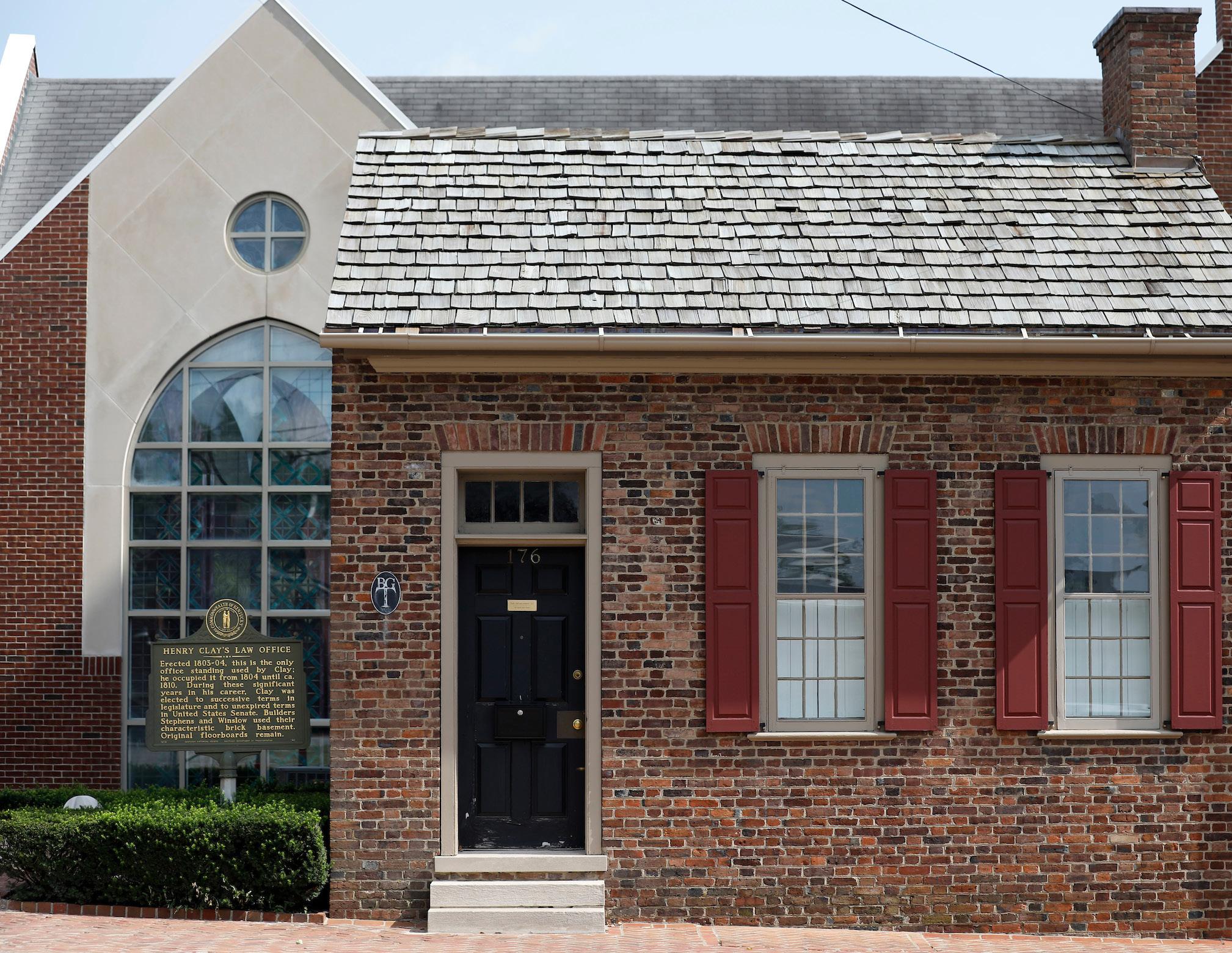
HONOR LEXINGTON’S HISTORY BY REQUIRING NEW DEVELOPMENT & REDEVELOPMENTS TO ENHANCE THE CULTURAL, PHYSICAL, & NATURAL RESOURCES THAT HAVE SHAPED THE COMMUNITY.
Lexington’s history can be told in many ways, but none better than to look around and see the cultural places, the important structures, and the natural landscapes that created this community. In order for the community to continue to move forward, there must be recognition of the importance of the past, ensuring that it lives on for future generations.
Lexington and rural Fayette County have a rich and diverse cultural history that began before statehood. This heritage is evidenced in the natural environment of the County’s rural landscape and the built environment of its urban areas. The cultural landscape includes agricultural and horse farms, landscape features, barns, outbuildings, fences, and archaeological sites.
Historic and architecturally significant buildings are important in that they create a unique place to live and work. A wellplanned community incorporates both the new and the historic; a balance that attracts businesses, residents, and tourists who seek a unique environment. Historic properties and sites are resources that provide citizens not only with places to experience and enjoy, but also economic development and tourism opportunities.
The preservation of historic buildings, neighborhoods, landscapes and other cultural resources provide benefits to the citizens that in many ways cannot be measured. These benefits include:
• Sense of Place provides a visible symbol of our heritage, a connection to the past, and a source of pride. Historic buildings, neighborhoods, significant rural landscapes and other places have unique characteristics, define the community, and have qualities that are, in many cases, indefinable. These buildings, neighborhoods, rural landscapes and other places are resources that are important to protect and preserve.
• Cultural Tourism, which includes historic, cultural, and preserved sites, is one of the major reasons that people travel to selected destinations.
The rich historic and cultural heritage of Lexington includes a variety of sites making it a prime destination for cultural tourism.
• Economic Benefits from historic preservation accrue in a variety of ways. Federal and State Historic Tax Credits may be available as an incentive for historic restoration and to offset some of the costs. Preserved buildings can be put to use as economic generators, for both public and private use, as the renovated Courthouse Square demonstrates.
• Community Pride & Accomplishment are byproducts of preservation efforts as citizens of the community become involved in projects that protect or enhance important symbols of their heritage.
Lexington has protected assets through National Register designation of historic districts (25), landmarks (3) and individually listed properties. Numerous
other structures throughout the community have been voluntarily preserved, and recognized by the Blue Grass Trust for Historic Preservation, a local non-profit organization that strives to protect, revitalize and promote the special historic places in our community in order to enhance the quality of life for future generations.
Lexington designated its first local historic district in 1958, with the protection of Gratz Park, a small near-downtown neighborhood between West Second and West Third Streets. Since that time, 15 districts and two landmarks have been so designated, and are under the jurisdiction of the Board of Architectural Review. The districts are as follows: Ashland Park, Aylesford, Bell Court, Cadentown, Constitution, Elsmere Park, Fayette Park, Gratz Park, Mulberry Hill, Northside, Seven Parks, South Ashland/Central Avenue, South Hill, Western Suburb, Woodward Heights. The two locally protected landmarks are Helm Place in the Rural Service Area and St. Paul A.M.E Church located on N. Upper Street near West Third Street.
The community has continued to designate local historic districts at the pace of about two per decade,
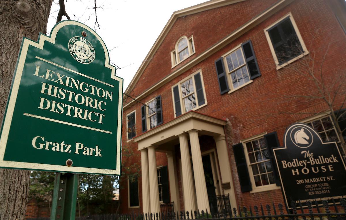
and in recent years, even expanded the Western Suburb local historic district. Although local historic district designation is one way to protect historic structures and the neighborhoods that surround them, the community should continue to work to encourage preservation of structures that have value within the community, and to support adaptive reuse or incorporation of such structures into redevelopment projects. Consideration should also be given to existing historic neighborhoods that are adjacent to proposed development. Infill and redevelopment projects should take extra care to acknowledge the architectural character, materials, height and mass, scale and connectivity
Stone fences continue to be a resource along rural corridors, and even within the farms around the community. These limestone fences were built by hand, many by slaves, and have been used in new developments to create a connection to the past. Such fences are often on state
rights-of-way and are expensive to maintain; however, stone fences have also been found within central Kentucky farms, and such fences should be identified and preserved because they are an important asset to the cultural history of the community.
of historic neighborhoods, and create developments that enhance these areas.
A number of roadways throughout the community have been recognized for their cultural and scenic value. Such designation includes scenic byways, historic turnpikes, scenic roadways and corridors, and rural scenic roads. These corridors are a critical asset to the community’s aesthetic and branding as the Horse Capital of the World, and should continue to be protected through building setbacks, maintenance of stone fences and preservation of tree canopy, all of which add to the quality of these roadways and corridors.
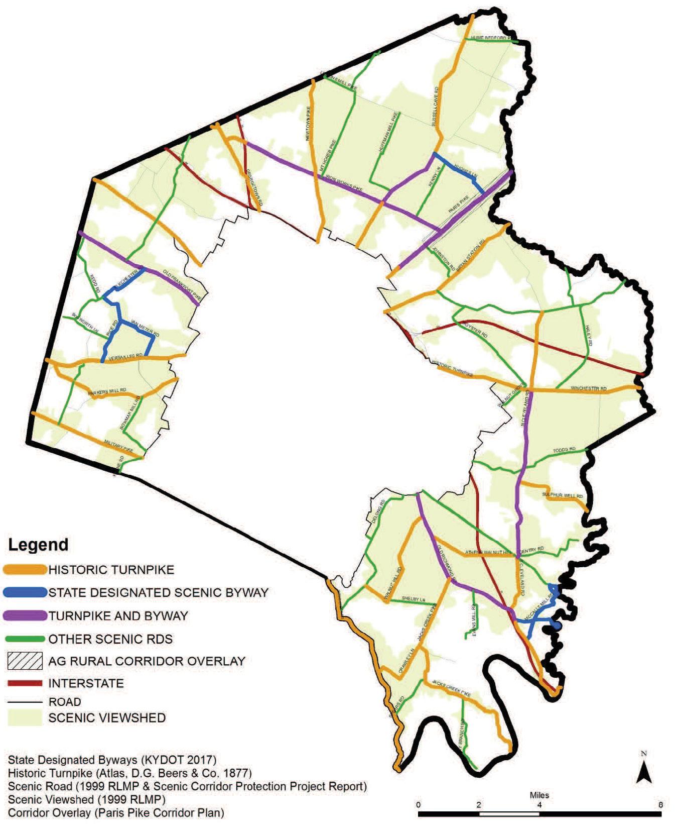
COORDINATE WITH THE PUBLIC ART COMMISSION TO DESIGNATE PUBLIC ART EASEMENTS ON NEW DEVELOPMENT THAT WOULD BE CURATED BY THE COMMISSION.
The creation of the adaptive reuse ordinance in 2008 was the first time the Zoning Ordinance considered any provision for public art on private property. Since that time, public art in Lexington has become a substantial part of the urban fabric. Having the public art commission work with HOAs or neighborhood groups to designate locations in existing development, as well as rotate public art installations for display, would assist those groups that are interested in supporting the arts but are not sure where to begin. Further engagement with the Public Arts Commission to curate areas designated on development plans for public art would allow for the promotion of new artists in the community and keep those spaces fresh and popular for visitors.
INITIATE DISCUSSIONS WITH THE PUBLIC ART COMMISSION ABOUT POTENTIAL ORDINANCE REVISIONS TO INCREASE PUBLIC ART OPPORTUNITIES
"OUR PUBLIC ART NEEDS TO BE INCREASED TO DEMONSTRATE MORE OF OUR DIVERSITY IN OUR HISTORY. THIS SHOULD INCLUDE A CITY-WIDE EVALUATION OF THE CONTENT & POSITIONING OF ARTWORK."
UPDATE THE ADAPTIVE REUSE ORDINANCE.
The creation of the Adaptive Reuse provisions in the Wholesale Warehouse (B-4) and Light Industrial (I-1) zones was a boon to Lexington’s economy. Adaptive reuse projects were typically located in areas where the original land uses were no longer desirable because of their lack of proximity to major travel corridors. Many of these older industrial areas are also located very close to well established neighborhoods, because housing within walking distance of these major employers was highly desirable. Over time,
some of these places were long forgotten by the public and written off as “old industrial areas”, or worse, perceived to be vacant brownfields or blighted areas that residents feared to drive through. However, there were others who had a vision for renovation and reinvigoration, but they were hampered by the zoning requirements at the time, especially because of onerous suburban parking provisions that would otherwise have led to the demolition of existing buildings simply to provide for more surface parking. The Adaptive Reuse provisions have allowed underutilized areas to find new life as retail, residential and commercial space, softening the blow to the local economy by relatively quickly returning that land to productive and desirable land uses.
The Zoning Ordinance was modified in 2006 to permit industrial mixed-use projects to implement a concept and recommendation of the Newtown Pike Extension Corridor Plan, which was adopted by the Planning Commission in 2002. The adaptive reuse provisions were later adopted in 2008, as a logical progression of that concept, which allowed for the creation of the Distillery District and, later, the West Sixth Brewery. Both projects sparked a redevelopment along their respective corridors that continues today.
While the enabling ordinance for these projects has clearly been successful, some adaptive reuse projects have also created unintended consequences that are not being adequately addressed
through the development plan process, specifically nuisance issues for neighboring properties and a lack of quality pedestrian improvements in the corridors to encourage alternatives for people to access these popular areas. Like any good regulating document, the Ordinance should be periodically reviewed to ensure that the community’s desired outcomes are being met. The Zoning Ordinance--specifically the locational and project criteria, the list of permitted uses, and the parking requirements--should be reviewed and updated to account for the subsequent policy shifts of the last two comprehensive plans.
UPDATE THE ADAPTIVE REUSE ORDINANCE ACTION ITEM
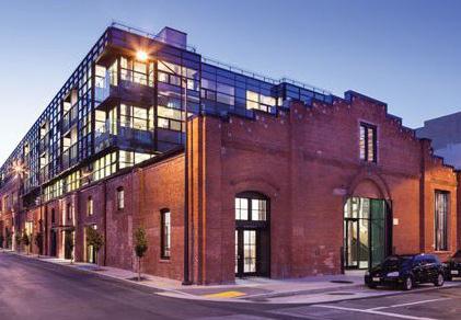
ANALYZE UNDERUTILIZED COMMERCIAL PROPERTY THROUGH CORRIDOR LAND USE & TRANSPORTATION STUDIES.
The goals and objectives of this comprehensive plan very plainly call for an intensification of the major corridors. Other proposed policies throughout the document have taken aim at the regulatory side of the equation. Another critical aspect of this policy framework is to engage the public along these corridors about these issues and what forms these intensifications may take. Long Range Planning has already begun meeting with various commercial landowners, developers and property managers about their visions for their sites and how they can take advantage of the already modified zoning tools.
Corridor studies will be a partnership between the Division of Planning, the Metropolitan Planning Organization and the respective corridor’s commercial stakeholders about future land uses and transportation needs.
The public involvement will be critical to cultivating buy-in, just as it has been on every previous small area plan. Of the utmost importance will be setting milestones to achieve a level of commercial and residential intensity to support mass transit along these corridors. The goal will be to think big and for the long term, while allowing policymakers to act incrementally. These studies will very likely continue over the next 10 to 15 years, with implementation lasting even longer. However, the guidance of these studies will be long lasting for LexTran and the property owners in how they plan their future growth and development.
ACTION ITEM PERFORM CORRIDOR STUDIES ALONG ARTERIAL ROADWAYS THAT EXAMINE LAND USE & TRANSPORTATION ELEMENTS
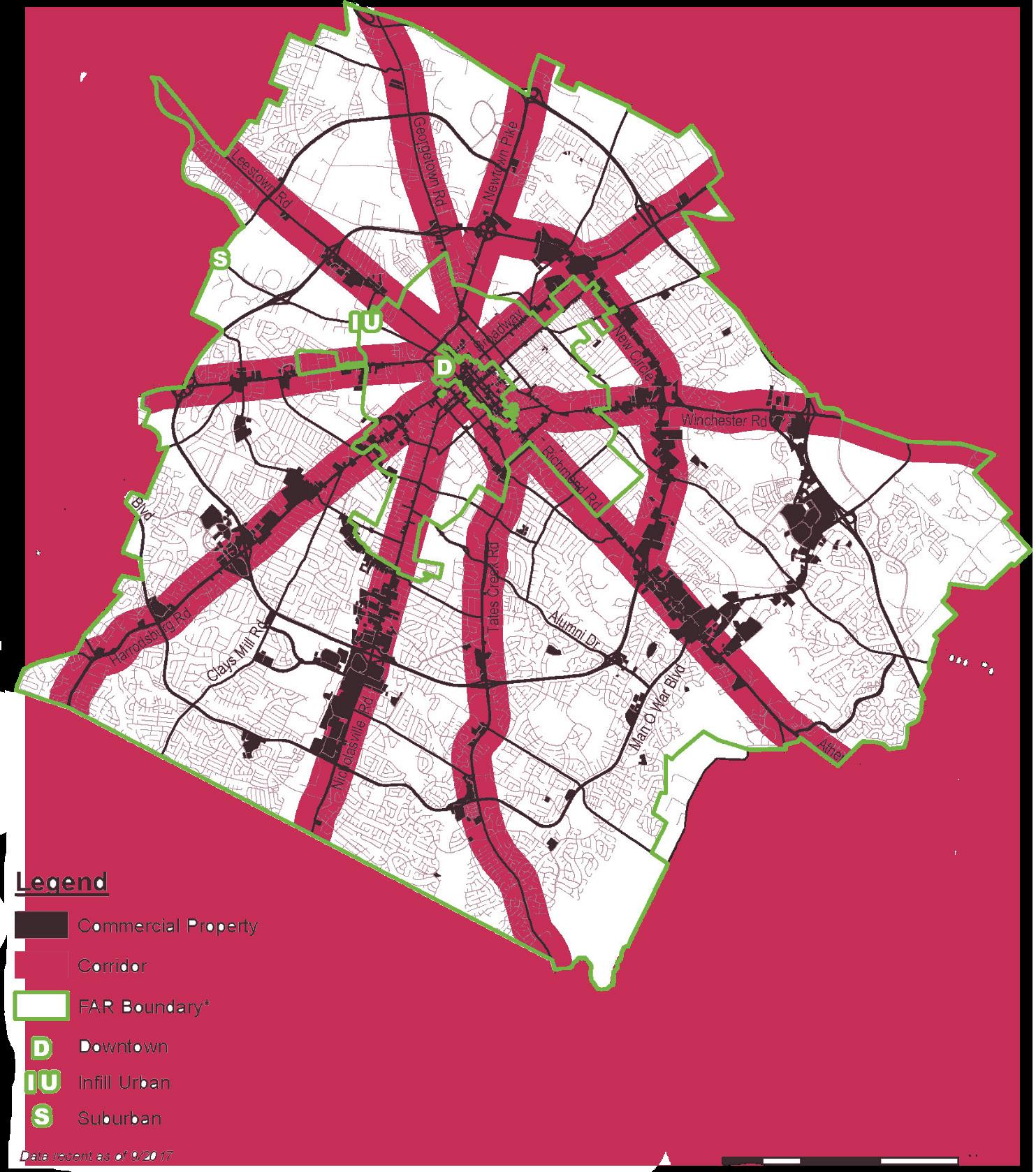
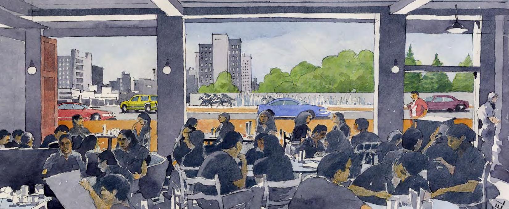
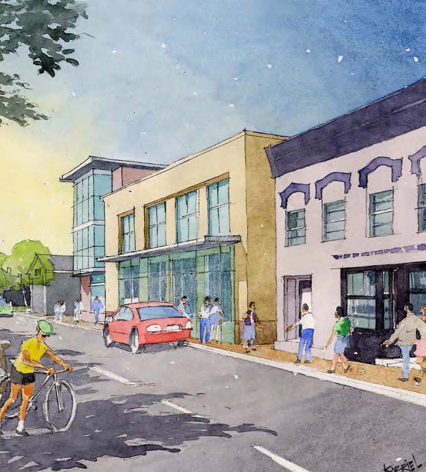 Prepared by
Ayers / Saint / Gross ARCHITECTS + PLANNERS
Prepared by
Ayers / Saint / Gross ARCHITECTS + PLANNERS
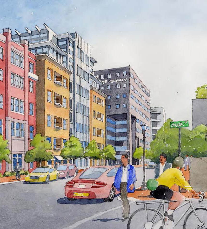
UPDATE THE DOWNTOWN
PLAN.
The current Downtown Master Plan focused largely on specified projects and proposed infill locations. Since its adoption, the identified projects have largely either been completed or jettisoned for one reason or another. Further, the broad focus on infill lot identification did little to provide guidance on how those properties should develop. A more refined approach to look at use and form is overdue, as is a deep dive on how infill projects will fit in and enhance their surrounding areas.
UPDATE DOWNTOWN MASTER PLAN ACTION ITEM
PURSUE A REGIONAL PARK SYSTEM.
Regional parks can provide multiple community-wide benefits relating to public health, recreation and environmental protection. They serve the city as a whole, in comparison to smaller parks, which meet local needs. Such parks are typically fairly large in terms of acreage, and often include significant environmental features such as waterbodies, floodplains, forests or sensitive natural habitats.
According to Your Parks, Our Future, Regional Parks and Nature Parks tend to be located regionally, while serving citywide needs. The LFUCG Division of Parks and Recreation currently operates five (5) Regional Parks: Coldstream, Jacobson, Masterson Station, Shillito, and Veterans. Although these parks are well distributed, gaps exist in the northeastern and western portions of Lexington. The city also has three Nature Parks (four counting The Arboretum), which are also distributed throughout the county, but none are located in the north
or west. Raven Run and McConnell Springs experience heavy use, which could lead to negative impact on the character of the sites and user experiences. More natural areas and more nature parks like Raven Run in other parts of the county are requested among the Parks Master Plan citizen surveys.
Your Parks, Our Future also recommends proposed regional and nature parks, and identifies four new or expanded parks in Lexington that would help to meet the needs of the growing population of the city. These improvements represent the development of one existing park, one private park, and two long-term acquisition areas. Although the need for the development of the new parks is long-term, the acquisition of the land of these potential parks should be considered before the necessary land is no longer available or becomes cost-prohibitive. Lexington should investigate opportunities for the acquisition of land for a future Regional Park in the northeast portion of Fayette County to meet the needs of a growing and underserved area. The city should similarly explore potential acquisition of land for a new Nature Park (or preserve) to be located to the west of the Urban Service
Boundary to meet expanding regional demand and to prevent overuse of existing natural areas.
Expansion of Cardinal Run to a Regional Park would address the gap in service for Regional Parks in the western portion of Lexington. The City of Lexington and the Division of Parks and Recreation also continue on the efforts for proposed Town Branch Park, with public and private partnership. This park would provide a muchneeded regional recreational attraction in downtown Lexington.
Other parks could be integrated into the expanding system of public greenways and trails scattered throughout the county, and located to complement those private rural lands that are being preserved through the Purchase of Development Rights (PDR) program. While a thorough study and analysis of potentially available priority land will ultimately be needed, certain areas that include prominent creek watersheds immediately come to mind as possibly offering excellent opportunities, such as Boone Creek, North and South Elkhorn Creeks and Town Branch Creek.
but that alone should not serve as a defining deterrent. Many determined communities across the country have responded to funding needs in creative and progressive ways. Through a combination of local government investment, support from the development review and approval process, and citizen/corporate contributions via establishment of private foundations, an outstanding array of parks at a regional scale can be created.
IMPLEMENT THE RECOMMENDATION FROM THE PARKS MASTER PLAN, YOUR PARKS, OUR FUTURE ACTION ITEM
Funding for a regional park system will be a major challenge,
“LEXINGTON SHOULD WORK TO BETTER INTERCONNECT WITH SURROUNDING COUNTIES, HOPEFULLY LEADING TO MORE REGIONAL PLANNING IN THE FUTURE.”
-LEXINGTON RESIDENT
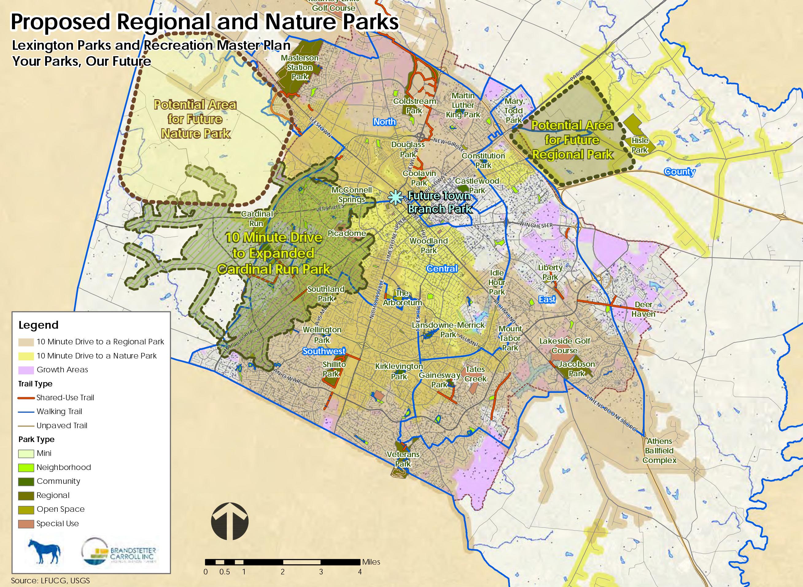
LEXINGTON PARKS & RECREATION MASTER PLAN
YOUR PARKS, OUR FUTURE
DEVELOP A NEW CITYWIDE FESTIVAL TO ENTICE VISITORS & PROVIDE ADDITIONAL DRAW DURING THE TOURISM OFF-SEASON.
In late 2017, VisitLex shared their Destination Development Plan with the Council at a work session, and recommended the creation of a major festival. Many communities around the United States and the world have unique festivals that draw visitors from around the globe. Examples like the Jazz & Heritage festival in New Orleans, the Sundance Film Festival in Park City Utah, and the more obscure Ostrich Festival in Chandler, Arizona, show that there is a lot of latitude when determining the focus of the festival. However, Lexington is fortunate to already have internationally recognized quantities in the horse and bourbon industries, and would not need to reinvent the wheel for a unique and authentic experience. Festivals draw in visitors from all around, but also pull the community together through a shared experience and celebration of culture. There is a massive amount of potential to follow through with a world-class festival that, through a large marketing effort, could have widespread national and international appeal.


Desirable communities are not that way by accident, and there are many very tangible and obvious aspects of communities that are apparent to the casual observer that create this desirability; however, there are many other components that provide the less visible foundation. These “support” services and crucial infrastructure for a community create a base for desirable communities to thrive. Education, healthcare, public safety, and social services are among these facets of a community that can truly determine its success, long-term viability, and ability to retain and attract residents, visitors, and employees.
Early in its formative years, Lexington was coined the “Athens of the West” for its advanced culture and educational offerings, illustrating that the city has always placed a priority on providing a quality education. Times and educational methods have changed over the years, but schools still play a pivotal role,
not only in imparting knowledge to young students, but also as community centers of activity and neighborhood cornerstones.
As Lexington continues to grow, additional school facilities will be required to educate the 13,000+ new school-aged children expected in the next twenty years. These new schools will be places of instruction, recreation, after school activities, and community gathering spaces, and must be accessibly designed with connections to the neighborhoods. Transportation is key for connecting students and families to schools and other services. Alternative modes of transportation should be encouraged via walking and biking for those living nearby, but also through variations on that, through concepts like walking school buses that promote pedestrian activity though walking in groups with adult chaperones. In order for these new concepts to be effective, the sites must be designed appropriately with pedestrian
accessibility as a priority. Site design is fundamentally important to integrating a school site into a neighborhood, but with a disheartening and upsetting rash of recent mass school shootings, including one in Marshall County, KY, schools must continue to find ways to accomplish this while ensuring the security of its facilities.
Fayette County Public Schools have been very sensitive to this and proactively assembled a task force to make recommendations to address these issues of school

safety, resulting in a 10-Point Safety Investment Plan. In addition to these important points, it is critical to avoid walling schools off entirely from the community where they reside. Schools should continue to be welcoming spaces conducive to learning and should avoid becoming cold institutional spaces. This is a delicate balance, but in the redevelopment of the Sandy Hook Elementary School in Newtown, Connecticut, in the wake of a deadly shooting the community, the architects and the school decided to rebuild

with a sense of openness that provides both the security of daylight, and eyes on the campus, but also an inviting space.
In addition to building with openness, Sandy Hook also incorporated natural components in their new design to allow the building to seamlessly fit into the surroundings. Another benefit of this design to students is the calming effects of the natural components, as mental health becomes another issue that has risen to the forefront of discussion. There are numerous studies that extol the benefits of trees and nature on both physical and mental health, and where schools can incorporate these features, they should. Taking care of the most vulnerable populations in Lexington is also a
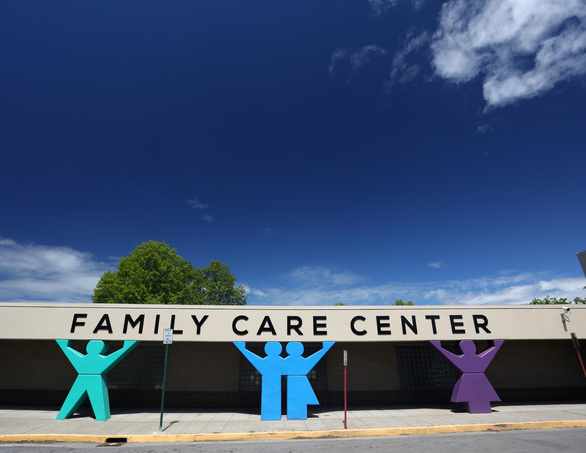
priority, and ensuring the needed social services are accessible and available to these citizens is key. The opioid epidemic, abuse of other substances, and homelessness are real issues
in Lexington, and should be recognized and addressed headon. The City of Lexington and a number of non-profit organizations are offering quality services in a variety of ways, but there are
improvements that can be made as the issues become more critical and exacerbated. It is crucial to treat the root problems and not only address the symptoms. Programs are needed that provide permanent housing solutions, transitional housing, temporary housing, substance use prevention, and harm reduction strategies that minimize the harmful effects of substance abuse while use continues.
Building on the “Connectivity” pillar, ensuring access to social services to the populations that need them is the critical issue. A great many of the individuals requiring services for substance abuse, homelessness, etc., rely on public transit or alternative means of transportation, as they do not
LEXINGTON OVERDOSE DEATHS BYhave access to an automobile. It is imperative to ensure these facilities are adequately served with transit, as it has been reported that there are marked increases in customers for these services after scheduled Lextran drop-off times nearby. It is also important to provide extra care and thought into the pedestrian accommodations surrounding these sites and the destinations to which they might connect. It is incumbent upon the city to provide safety for this clientele that is more likely than most to utilize these other modes of transportation.
Another strong support element for Lexington on a number of levels is the healthcare industry, which has continued to see strong growth in both the public and private realm since the 2013 Comprehensive Plan. The
University of Kentucky has a $265 million research facility expected to open in 2018, according to UK Healthcare’s 2017 Annual report. In 2015, Baptist Health Lexington opened a $240 million expansion to serve the needs of Lexington and surrounding communities. In 2016, HealthFirst Bluegrass opened a 34,000 square-foot facility on Southland Drive in order to better serve the at-risk population that does not live in the downtown area. The expansion of health services across many areas of Lexington is important in improving access to healthcare in general.
The demographic trends show, and it has been repeated in multiple themes in Imagine Lexington, that seniors will continue to be the fastest-growing sector of the population. In 2016, in
anticipation of this, and due to an outdated facility on Nicholasville Road, LFUCG opened a brandnew Senior Citizens Center in Idle Hour Park. This has seen a tremendous increase in usage, thanks to its substantially more accessible location and ability to host many more programs, while being physically much larger to accommodate larger classes. Support services for the aging population will only become more important as Lexington continues to grow.
This growth also comes with the need for improved infrastructure. More and more, the provision of high-speed and high-quality internet is considered essential infrastructure, as technology continues to rapidly evolve and is integrated into all aspects of daily life. In 2013, the Comprehensive

Plan discussed the concept of municipal fiber optic broadband as a way to bring lower-cost and higher-speed internet access to businesses and low income residents. In 2017, LFUCG announced that a new internet service provider, MetroNet, planned build out a city-wide fiber optic network to provide additional competition to the city’s traditional single provider model. Build-out began in 2018 and will continue through 2021.
Support is a broad term and encompasses a great many services and components of the community; and, though they may not all be physically visible at all times, they are vitally important to the success of a desirable community.

ENSURE SCHOOL SITES ARE DESIGNED TO INTEGRATE WELL INTO THE SURROUNDING NEIGHBORHOOD.
Theme A (Growing Successful Neighborhoods) highlights the large role that design plays in successful neighborhoods, whether it be on a large or a small scale, and Lexington’s schools are no exception. The design and integration of schools into the surrounding neighborhood is as important to the desirability of an area as is the design, layout and architecture of the streets and residences.
The school property itself, as well as its location within and its relationship to the surrounding neighborhood, is crucial and should be accessible, visually as well as physically. Elementary and middle
schools should locate in residential neighborhoods on local streets with provisions for safe pedestrian and bicycle accessibility. This will minimize walking distances and reduce traffic congestion in these areas. High schools and small higher education campuses, which produce a higher volume of schoolgenerated traffic, should locate along collector streets. Schools with frontage along single-loaded streets, whether local or collector, are strongly encouraged, as they provide better public access, improved visibility, and a means for buffering adjacent residential properties. The site design of each school should facilitate all modes of transport to and from the school property and should include sidewalks, shared-use paths, and roadways that can accommodate the bus and vehicle traffic associated with the site.
Site design for publicly owned properties, whether they be government properties, utilities or public schools, require
a Public Facility Review to determine compliance with the Comprehensive Plan. Typically, an applicant, such as Fayette County Public Schools (FCPS), Bluegrass Field (airport) or some other public entity, provides a site plan, along with a detailed description of the project, for the Planning staff to review as it relates to the current Comprehensive Plan’s goals and objectives, as well as text. At this stage in the process, the staff reacts to the general land use and the site design. FCPS and Planning staff always communicate during the Public Facility Review process; prior to that, however, input by the Planning staff into the site design would help to ensure compliance with the Comprehensive Plan on multiple levels – not just with regard to the use of the land as a public school. Imagine Lexington calls for building upon existing collaboration between FCPS and Planning, and engaging earlier in the process to continue to serve the needs of Lexington’s students, neighborhoods, and community.
“ENCOURAGE FULL INTEGRATION OF PEOPLE & PLACES; LOCAL PARKS & GREENSPACE, NEIGHBORHOOD SCHOOLS, & INTERACTION AMONG NEIGHBORS.”
-LEXINGTON RESIDENT
ACTION ITEM
ENGAGE WITH FAYETTE COUNTY
PUBLIC SCHOOLS TO ALIGN PRIORITIES IN SITE SELECTION & DESIGN
INCORPORATE NATURAL COMPONENTS INTO SCHOOL SITE DESIGN TO FURTHER THE GOALS OF THEME B (PROTECTING THE ENVIRONMENT), BUT ALSO TO PROVIDE CALMING ELEMENTS THAT REDUCE STUDENT STRESS & ANXIETY.
With many Fayette County schools due for expansion and/or renovations in the coming year(s) and the additional group of new schools slated for construction, consideration
must be given to the significance of site design that extends beyond the building and into the natural landscape that immediately surrounds the property. While emphasis must be placed on creating classroom spaces with layouts and technology that support students’ intellectual growth, it is just as important to consider the influence of the natural landscape in creating an ecosystem where students can foster growth and resilience.
It has become increasingly apparent that a fast-paced, urban environment can have significant effects on students’ mental health. With children spending a greater amount
of time indoors and in front of electronic screens – both at home and at school – there has been a marked increase in levels of stress, anxiety, and mental fatigue. If those concerns are left unmitigated, students may not be able to maintain the vigor, motivation, and attitude that is necessary for them to achieve a productive school day. The relatively costeffective and surface-level solution of incorporating visible and usable greenspace on schools’ property has shown to foster a deep impact on student attitude and performance.
Studies have shown that classroom views and experiences with nearby
nature may have a causal relationship to students’ mental wellness, cognitive performance, and overall resiliency to stress and anxiety. In February of 2018, the United States Forest Service published a research summary that synergized the findings of multiple studies for the purpose of effectively communicating the health benefits of both urban trees and greenspace. While much of the findings therein apply to people of all ages, particularly the linkages between natural areas, active living, and physical health, the relationship between children and nature was a topic of targeted investigation. The significant outcomes in multiple studies alluded to nature access
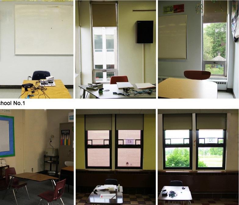
as a potential vehicle for the improvement of cognitive function and stress recovery, specifically within the school setting.
One study, conducted by researchers at the University of Illinois Department of Landscape Architecture, found that classroom views of green landscapes can promote attention restoration and stress recovery. The results were obtained by placing students in different classrooms, without windows or with windows, which revealed either a build space or a green space. They were then subjected to various conditions that simulated classroom tasks
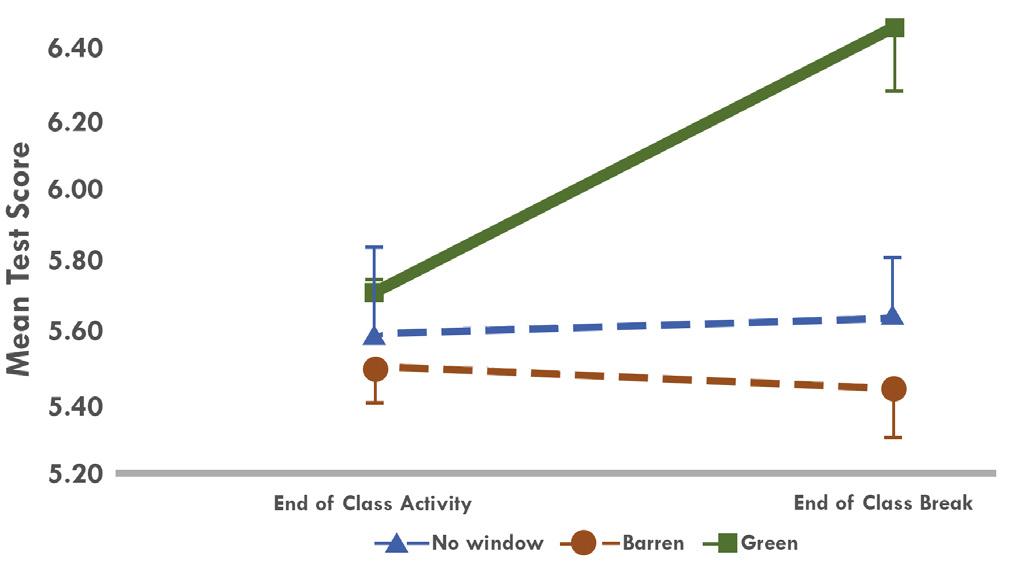
and activities and completed questionnaires and attention tests to assess attention restoration and stress recovery. The study found that students with a green window view scored “significantly higher on tests of attentional functioning and recovered significantly faster for a stressful experience than their peers who were assigned to rooms without view to green spaces.” Such results have major impact on the importance of thinking quite literally outside of the box when it comes to school design.
Qualitative studies have highlighted these effects as well by narrating the positive mental impacts of
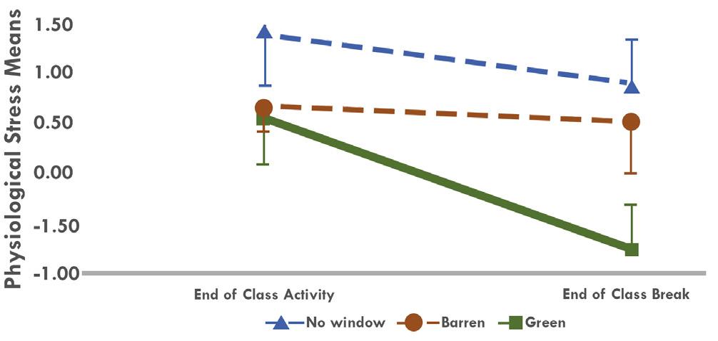
schoolyard nature play through the lens of student experiences. In 2014, a study out of the University of Colorado used direct observations and interviews with students in different age groups to emphasize how the natural components surrounding their schools helped them find havens from stress, increase competence, and form healthy social interactions with their peers. For this reason, a balance of both active and passive recreation opportunities that involve interaction with nature within the schoolyard can yield measurable benefits.
In tuning into the implications presented by research in this area,
Imagine Lexington gives weighted consideration of how greenery in the urban landscape, and the multi-faceted benefits it provides, plays an important role in shaping our future generations. There is great opportunity for renovation and expansion of Lexington’s centers of learning to further reflect environments that are conducive to the intellectual growth and emotional well-being of the students who learn and play in these spaces each day. Equal importance should be placed on creating and maintaining both built and natural components that inspire young minds.
D. Li, W.C. Sullivan / Landscape and Urban Planning 148 (2016) 149–158 D. Li, W.C. Sullivan / Landscape and Urban PlanningSUPPORT THE MAINTENANCE & EXPANSION OF A ROBUST WIRELESS COMMUNICATIONS NETWORK CREATING RELIABLE SERVICE THROUGHOUT LEXINGTON’S URBAN & RURAL AREAS.
In the last several Comprehensive Plans, as well as in the Rural Land Management Plan, the importance of wireless communication has been recognized as integral to the safety and welfare of the community – in both the Urban Service Area and the Rural Service Area. Having become a critical form of infrastructure in the last several years (as much as water, gas or electricity), it is important to be able to provide wireless service for use by residents, commercial entities, and emergency services. It has been stated in multiple articles regarding e911 as it relates to wireless service that a reliable e911 system can only exist if a reliable wireless service system is in place. This supports (and is supported by) the current as well as past Comprehensive Plans.
While wireless communication infrastructure is incredibly important as noted above, it is also crucial to minimize the intrusion and negative aesthetic impacts they can bring.
Cell towers come in many shapes and sizes, but the technology to camouflage them through stealth concealments has existed for many years. When new public or private applications come in for new towers the applicants need to show how they propose to camouflage the facility. Every situation will be different, but every application should illustrate how the tower will either blend into the existing surroundings through contextsensitive camouflaging, or how it can function as a piece of public art that will complement the surrounding area. Given how prevalent these facilities have become, it is vital they do not detract from the landscape, but enhance it or have zero impact. If an applicant does not feel they can utilize these camouflaging techniques, they must be able to demonstrate a compelling and legitimate reason, other than strictly financial, that they are unable to do so. Design elements should be considered with any type of development in Lexington, including cell towers.
PROVIDE EQUITABLE HEALTHCARE OPPORTUNITIES THROUGHOUT LEXINGTON TO ALLOW FOR THE WIDE RANGE OF MEDICAL NEEDS OF ALL POPULATIONS.
The healthcare industry is one of Lexington’s primary economic drivers, because it is a hub for medical services of all levels – from clinics and doctor’s offices to hospitals and the regional trauma center at Chandler Medical Center. Providing healthcare to all citizens should be an easy task to accomplish as these facilities seem to be available, but there are broader issues that prevent access to healthcare, all of which cannot be address through the Comprehensive Plan. A greater understanding of the existing barriers to healthcare will help develop a healthier community.
According the County Health Rankings and Roadmaps, provided by the University of Wisconsin Population Health Institute, Fayette County is ranked 8th in the state for health outcomes (length and quality of life) and 11th in the state for health factors (health behaviors, clinical care, social and economic factors, and the physical environment). This demonstrates that there is still room for improvement.
A HEALTHY COMMUNITY HAS THREE BASIC ELEMENTS:
It starts with a healthy environment in which to live and work; one with clean air and water, opportunities for physical exercise and open space for citizens to enjoy and relax. On a national level, public health officials and planners have been working to develop tools and information to help plan communities to support physical activity.
A healthy community also includes preventive health, which means that citizens seek healthcare throughout their lives in order to stay healthy. Preventive health initiatives will ensure our citizens attain high-quality, longer lives free of preventable disease, disability, injury, and premature death.
Lastly, a healthy community includes healthcare services of various types, to address various needs. Lexington does have a range of healthcare services that have recently been expanded or are in the process of expanding, which will help to achieve health equity, eliminate disparities, and improve the health of all groups.
A partnership with the LexingtonFayette County Health Department should be forged to develop planning initiatives that will improve the community’s public health.
PROVIDE EQUITY IN SOCIAL SERVICES BY ENSURING THOSE IN NEED ARE SERVED BY SOCIAL SERVICE COMMUNITY FACILITIES THAT ADDRESS HOMELESSNESS, SUBSTANCE ABUSE, MENTAL HEALTH, & OTHER SIGNIFICANT ISSUES.
The typical community facilities that serve Lexington-Fayette County, including libraries, schools, fire and police stations, sanitary sewers and stormwater facilities, have been addressed in planned documents and discussed over the course of many decades. The social service community facilities addressing homelessness, substance abuse, mental health and other significant issues have not been addressed in the same manner. Although the Division of Social Services exists,
its interaction with the Planning Commission and the Division of Planning has been minimal over this same time period.
However, the social needs and their physical locations within the community must be addressed to ensure a high quality of life for all citizens. The distances people must travel to get to social service agencies such as the Lexington-Fayette County Health Department or the Social Security Administration office, and the concentration of such services in certain areas has been a concern for residents and providers for many years. Further research is necessary to determine where gaps exist and how such services should be distributed in an equitable manner that improves the overall health and well-being of the citizens. Where gaps do exist, barriers to providing social services should be removed.

ENSURE ALL SOCIAL SERVICE & COMMUNITY FACILITIES ARE SAFELY ACCESSIBLE VIA MASS TRANSIT, BICYCLE, & PEDESTRIAN TRANSPORTATION MODES.
While connectivity and accessibility are important for all places within the community, they are especially vital for the places that provide services to our more vulnerable populations. A great many people that require social services rely on alternative forms of transportation aside from single-occupancy vehicles.. The connections between those modes of transportation and the services and facilities themselves can make receiving services easier for these populations.
All community and social service facilities should be accessible via sidewalks and should be within easy walking distance of a transit stop or shelter. For cyclists, they should also include adequate “end-of-trip” facilities such as lockers and racks. Lexington’s community service providers should labor to improve their sites and facilities, and new locations should incorporate these standards into their plans. If a transit line does not serve these sites, discussions with LexTran should be initiated to ensure safe access. Properties owned by the city should all be improved in this manner.
In addition to on-site improvements, the linkages to other common destinations should also be considered.
“WE NEED MORE INVESTMENTS IN PUBLIC HOUSING & SOCIAL SERVICES NEAR THE URBAN CORE WOULD IMPROVE ACCESS TO THOSE CURRENTLY UNDERSERVED AS WELL AS PROVIDE FOR A RICHER & MORE DIVERSE URBAN EXPERIENCE.” -LEXINGTON RESIDENT
CONTINUE TO SUPPORT THE PROVISION OF HIGH SPEED INTERNET SERVICES THROUGHOUT LEXINGTON.
Quality and dependable high speed internet is vital to top-tier businesses, small entrepreneurs, and private personal device users alike. As of late 2017, the Council voted to approve a 10-year franchise agreement to MetroNet, a company new to the Lexington market, to provide gigabit speed internet service. This would drastically increase speeds available to Lexington citizens and should help with retaining and attracting businesses. Construction began in early 2018 on the southeastern portion of Lexington, and will continue at no up-front cost to the City. Planning should continue to facilitate upgrades to Lexington’s internet infrastructure.
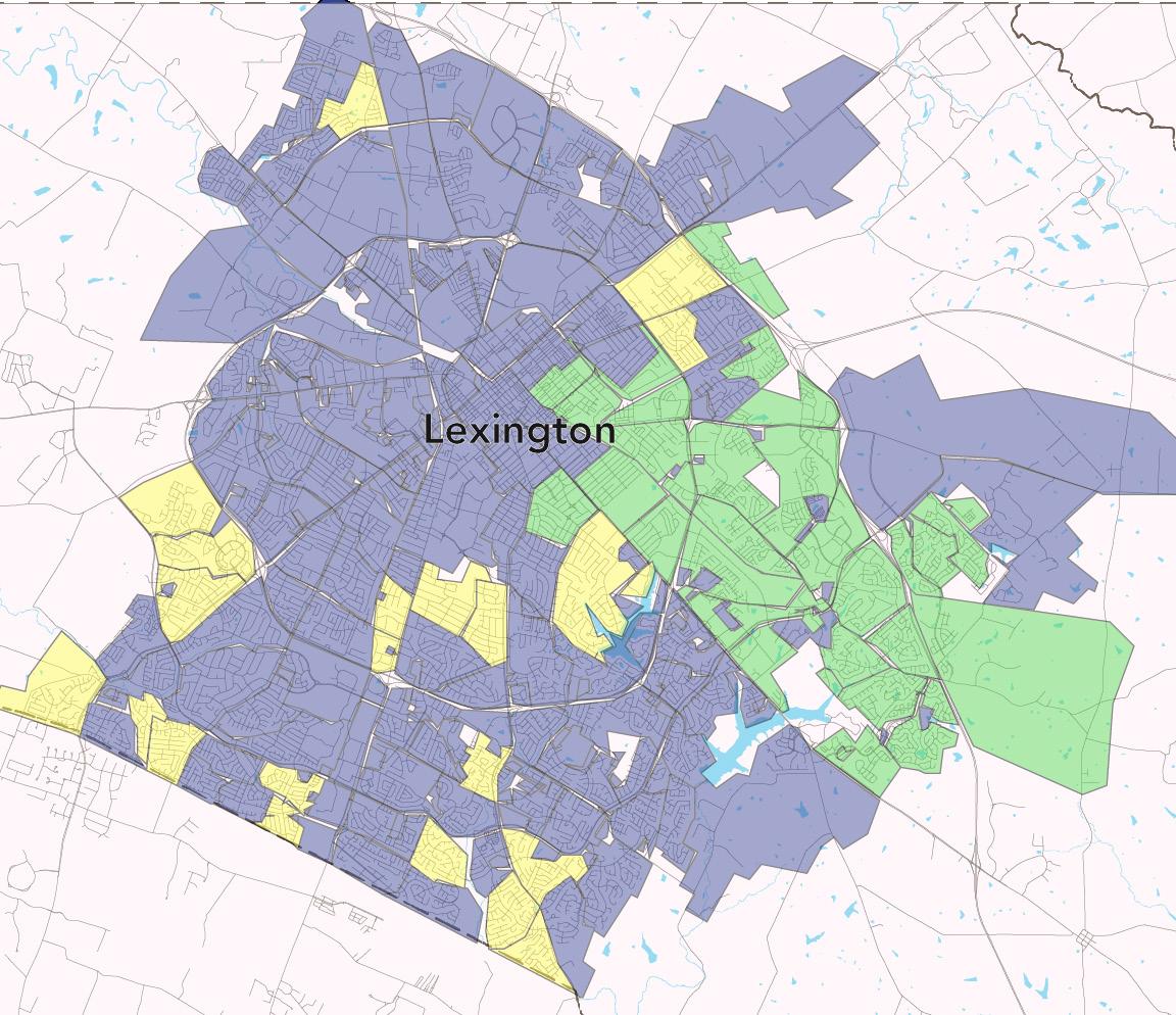
BUILD UPON THE SUCCESS OF THE SENIOR CITIZENS’ CENTER TO PROVIDE IMPROVED QUALITY OF LIFE OPPORTUNITIES FOR THE LARGEST GROWING POPULATION DEMOGRAPHIC.
As increasing numbers of “Baby Boomers” choose to the leave the workforce, the need for meaningful social interaction opportunities for seniors will be increasingly important. The Lexington Senior Center and its three satellite sites (Charles Young Center, Bell House, and Eldercrafters at the Black and Williams Center) serve residents of Fayette County 60 years and older. Each center is unique in its specific offerings, but all provide a safe and inviting environment for senior adults to spend their leisure time enjoying recreation, social, art and educational opportunities in a place that preserves their dignity and values each as individuals.
The expansion of services and programs that serve people as they age, and those of all
ages with disabilities, will be important for the community. Lexington’s actions and inclusion in the AARP Age Friendly Communities network should be supported throughout planning and in all projects. Additionally, development throughout the city should include age-friendly amenities and development patterns that provide opportunities to improve the quality of life for Lexington citizens at all stages of their lives.
"AGE-FRIENDLY
-LEXINGTON RESIDENT

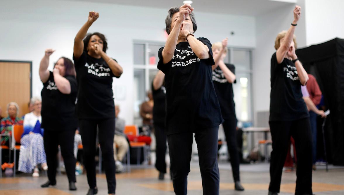
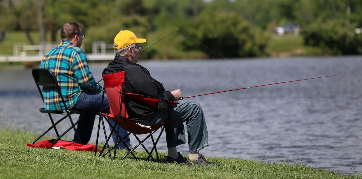
IMPLEMENT CREATIVE HOUSING OPPORTUNITIES THAT ARE BOTH ACCESSIBLE & AFFORDABLE FOR SENIORS & PEOPLE WITH DISABILITIES.
The “baby boom” generation has historically not conformed to status quo; instead, this group has been trailblazers for the types of social change that tend to give the individual more autonomy in all things. For instance, this group changed the way childbirth was perceived. Prior to the “baby
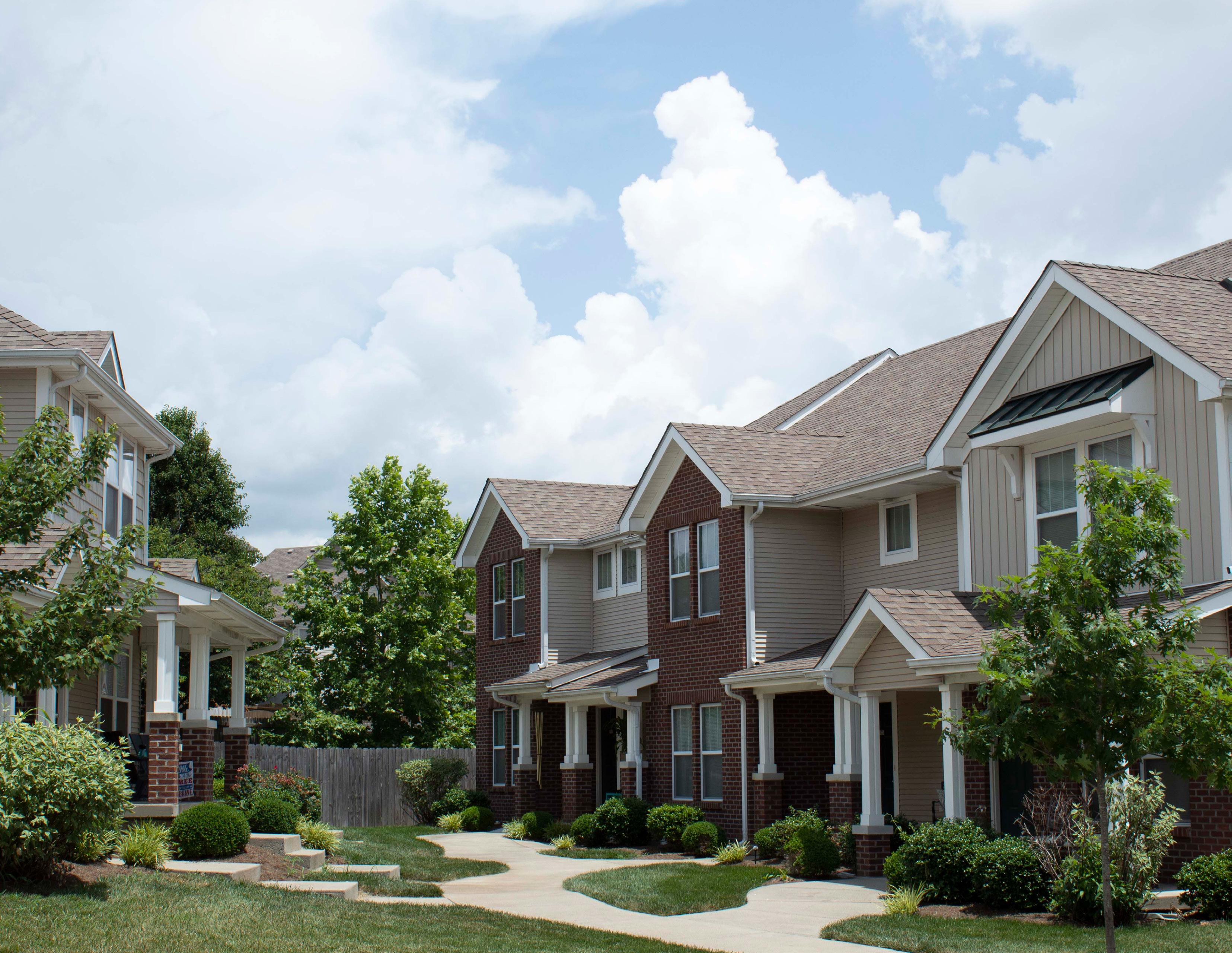
boomers” coming of age, childbirth was seen as a medical condition and husbands and families were excluded from the birthing process. This did not sit well with the “boomers” who demanded changes to this archaic practice, instead viewed childbirth as an inclusive family celebration. This is just one of many impacts this generation has contributed to society. The disability movement as well as the creation of the Rehabilitation Act and ADA, were also largely driven by “boomers” who demanded equality.
As trailblazers who have routinely bucked previous trends these “baby boomers” want and need a variety of options as they begin considering
their future housing needs. There are good examples of creative housing models elsewhere that are appealing and need to be employed so that Lexington may accommodate the growing senior population and individuals with disabilities. Lexington policy-makers and developers should embrace alternatives to homogeneous detached singlefamily home development patterns in favor of communities with a variety of housing and living arrangement options. These could include co-housing, shared housing environments, planned communities for persons of a certain age, and accessory dwelling units to provide flexibility and affordability.
It is routinely noted that “baby boomers” and “millennials” share many of the same traits and preferences, so investing in options to serve the seniors and disabled persons of today will support the needs of future populations in this demographic. Providing developments that age well is important to make aging-inplace a possibility. It is important for Lexington to provide ample housing that is accessible, provides barrier free access, connection to services, wider doorways and hallways, and restrooms and sinks accessible to citizens with limited abilities. Lexington should be an age-friendly and ability-friendly community in all respects.
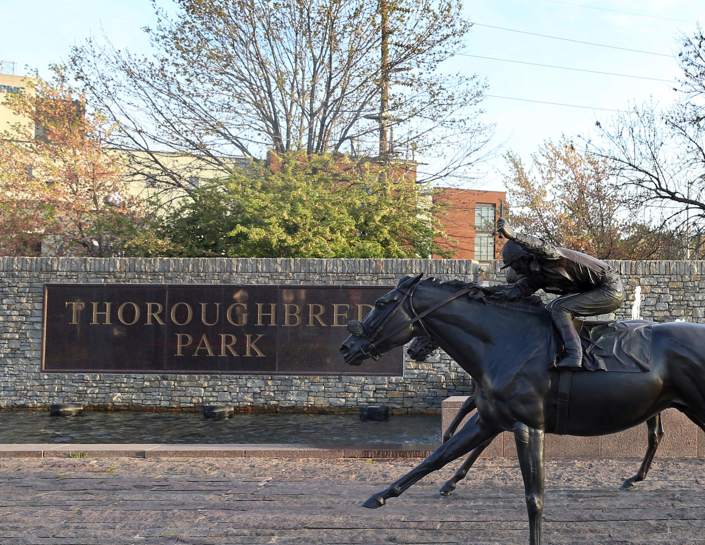
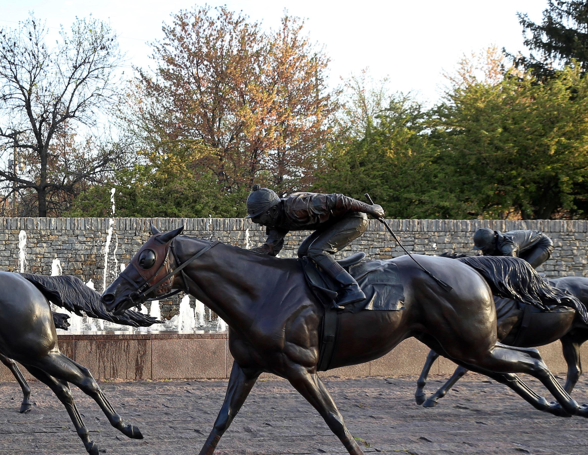
At the heart of every discussion about the future of Lexington is the balance between urban growth and rural protection and preservation. This has been a consistent fact for decades and is no surprise to its citizens or policymakers. Every theme throughout Imagine Lexington has touched on this in some form or fashion and it is a constant thread present in all goals, objectives, and policies in this Plan. Lexington is a growing city and Lexington has agricultural assets worth preserving, but how can both be achieved? The answer is by growing intelligently through compact, fiscally responsible development patterns, the foundation of the nation’s first urban service boundary, established in this city.
This development pattern type has numerous benefits, including infrastructure cost savings, desirable placemaking opportunities, multimodal transportation options, enhanced connectivity, healthier communities, vibrant neighborhood-serving businesses, preservation of irreplaceable
farmland, and many others as well. Smart growth patterns and rural preservation go hand-inhand; therefore, growth is not inherently a bad thing. In fact, when accommodated in this way, growth becomes a boon to the economy, the environment, and society at large. Vibrant cities are growing, declining cities are dying.
Implementing this strategy, though, is not always easy. There are a myriad of concerns over how new development can coexist with existing neighborhoods and historic assets. Some of these are legitimate concerns that this Plan seeks to address through contextually appropriate development; however there are often misunderstandings about the goals and benefits of this type of development. The Division of Planning must increase education and outreach efforts; elected and appointed officials must uphold the vision of this document, even when highly organized but narrowly focused interests are advocating for a different future. Imagine Lexington calls for the government to be
held accountable for upholding the vision, be good stewards of Lexington’s precious agricultural, historic, environmental, economic and cultural resources, and allow and encourage the city to grow and evolve according to this Plan.
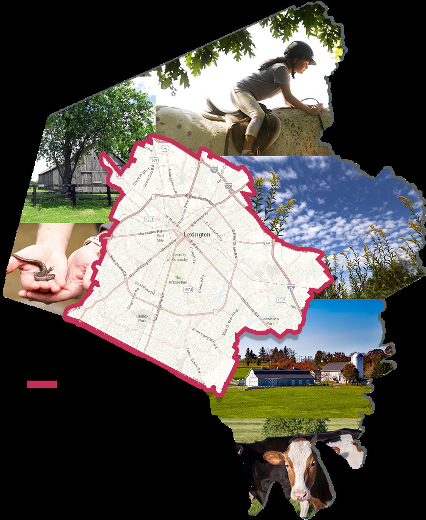


As of 2017, the U.S. Census estimated that the City of Lexington had a population of 321,959, a figure that has been consistently increasing over the years. Evidence of a desirable community, this pattern of urban growth has historically been coupled with rural protections that have resulted in a dynamic community that is unlike any other. Lexington has received international recognition for its horse industry, and a growing following of visitors who are drawn to the beautiful scenery, historic resources and the variety of amenities and entertainment options. It is a city deeply rooted in history with a thoughtful, consistent planning strategy. Lexington’s long history is showcased in the many historic properties throughout the city. From Boone Station State Historic Site, where Daniel Boone and his family lived for 10 years in the rural area near Athens, to the historic Lexington Courthouse in the middle of downtown, there are historically significant assets throughout the city. These important assets must
be protected as the community continues to grow. Proactively and comprehensively identifying these icons and historically contributing buildings, sites, and districts should be an integral part of the planning process before development applications are proposed. New development should be required to enhance and supplement them, writing the next chapter in Lexington’s storied history.
This new development will primarily take the form of infill and redevelopment, as it has been and will continue to be the foremost development strategy for the city. Many new developments throughout the urban area can attest to the success of that strategy.
The city of Lexington is comprised of 285.5 square miles, 85 squares miles of which are included in the Urban Service Boundary. That means that Lexington’s urban development must generally take place within 30% of the city’s land. This boundary has kept development
patterns relatively compact and has minimized many of the typical sprawling suburban developments that have been occurring throughout the United States. Additionally, roughly ¼ of the remaining 200 square miles are protected by the Purchase of Development Rights program that protects farmland for food security and conservation of environmentally sensitive lands. Eventually the city hopes to conserve 50,000 acres, or almost 40% of the Rural Service Area. These protections have largely contributed to the city’s identity and its relatively fiscally responsible development patterns.
The amount of vacant land available for infill projects throughout the city is roughly 10% of the Urban Service Area, meaning there are development opportunities of all types, though some are perhaps more complicated than others. There are also significant redevelopment opportunities, primarily in the underutilized property concentrated on the
city’s major arterial corridors. There are sites on almost every major roadway that could see increases in floor area ratio to better utilize the land for residential, retail, professional office, and other mixed-use developments.
Utilizing transportation corridors in this way would create opportunities for enhanced mass transit that would transform the options available for Lexingtonians to move around the city. Additionally, the retail industry has seen major shifts recently with the success and convenience of online shopping. Consumer preferences have changed, and it is evident with the recent closings of significant local anchor stores K-mart, Toys-R-Us, and Walmart. This is indicative of national trends and offers momentous opportunities for redevelopment.
Additionally, these redevelopment opportunities could allow new and exciting housing options. The 2017
Housing Demand Study noted that there is a need for almost 2,300 new housing units annually over the next 10 years, which far outstrips recent production. This housing shortage is reflective of national trends, and needs to be addressed with an influx of units on the market. Also noteworthy is that senior citizens will account for the greatest percentage of Lexington’s projected population increase. This particular demographic has very specific desires and needs for housing, and Lexington should look to accommodate their interests.
Overall, Lexington is a growing and vibrant community that has historically provided a very healthy balance between urban development and rural interests. The result is a desirable community with a much more fiscally responsible development pattern than is typical of other Kentucky counties and suburban areas throughout the United States.


Imagine Lexington is a product of the people of Lexington, and its implementation should reflect the best interests of the citizens it was created by and created for. Ensuring the outlined vision is followed is crucial, and placing safeguards and checks to make that a reality is important to protecting the integrity of the Plan. The responsibility of upholding the vision lies with the Division of Planning, the Planning Commission, and the Urban County Council. Imagine Lexington is designed to be crystal-clear as to the expectations of this policy-based plan; if followed, even when difficult decisions are necessary, it should result in a livable community that is desirable and forward-thinking.
The ultimate source of accountability for this plan is the citizens of Lexington, who should have an active role in its development. It is no secret that the city is rapidly growing and changing, and public participation is necessary as this
occurs. Creating a citizen advisory panel to provide input into its implementation, to contribute educated and informed opinions from diverse backgrounds, demographics, and geographies, is of the utmost importance. As an extension of the massive 2017 public input mechanism, On the Table, this panel will provide the input, buy- in, education, and advocates this city needs.
Another way this Plan provides for accountability is in the increased accessibility of information.
The Imagine Lexington website serves as a clearinghouse for all information related to the comprehensive plan itself, growth and development metrics, public information and input opportunities, and all other data; it will provide a one-stop shop for citizens, developers, and public officials. This regularly reported information should be easy to find, interpret, and use for all interested parties.
This information will be of
great interest as development changes occur throughout the city, but also as the Division of Planning undertakes one of the more significant projects since the development of the nation’s first urban service boundary in 1958 – the creation of a new process for determining longterm land use decisions involving that boundary. Currently the state-mandated comprehensive planning process, which takes place every five years, is heavily dominated by the question of whether or not to modify the existing growth boundary that has kept the city relatively compact in its development patterns. This current model is inefficient, unsustainable long-term, and short-sighted. A true long-range plan and process is required to ensure future smart growth patterns, efficient infrastructure use, and the preservation of farmland. This is a bedrock policy of this comprehensive plan.
Another cornerstone of Imagine Lexington is the Placebuilder,
which includes criteria for zone change applications to ensure compliance with all applicable portions of the comprehensive plan. Feedback from neighbors, the Planning Commission, and even Planning staff indicated that there was a need to more explicitly spell out what it means to be “in agreement with the adopted comprehensive plan,” as required by state statute. The criteria included in this plan focuses on building places, rather than separating land uses. Through context-sensitive design and appropriate placemaking, these standards will build upon the well-documented momentum that shows Lexington nationally trending as a desirable location. The Placebuilder, paired with intentional and incremental text amendments that set the regulatory boundaries for development, will further reflect the Imagine Lexington vision.
"THE
THIS
CREATE A NEW PROCESS FOR DETERMINING LONGTERM LAND USE DECISIONS INVOLVING THE URBAN SERVICE BOUNDARY (USB) & RURAL ACTIVITY CENTERS.
The 2018 Goals & Objectives for Imagine Lexington call for creating a new process for determining the when, where, why, and how of future USB modifications. This advocacy for a new way of looking at the USB is the cornerstone of this Comprehensive Plan, and is the next evolution of the nation’s
first urban service boundary. It should be a revolutionary take on the concept, which could create a nationally replicable model. Council has already appropriated $150,000 to hire a consultant to assist in the creation of this process, which will determine the elements listed below.
It will also separate the question of whether or not to modify the USB from the Comprehensive Plan, and will create a long-term plan for Lexington’s sustainability.
The Urban Service Area concept, while instrumental in retaining Lexington’s compact form and preserving farmland, is not without
its drawbacks. Throughout the years, there have been many contentious debates about the size and location of the boundary. The same conversations have been occurring for years, with development interests insisting there is not enough land to develop, while others advocate for preserving farmland and halting suburban sprawl. In fact, the debate begins anew every five years with the state statute-required update to the Comprehensive Plan. Increasingly, these deliberations dominate the proceedings, and, though vitally important, they distract from many of the other crucial issues that face a city with steady
• A rural preserve to set land that will be off-limits for development for generations;
• A future urban development area between the rural preserve and the current boundary that is designated for future potential urban development;
• Triggers to determine when modifications to the boundary are warranted (based on metrics and current development patterns);
• Thresholds for ensuring new development proposals are meeting expectations;
• Limits on how much land can be added to the Urban Service Area in a given timeframe; and
• Many other, yet-to-be determined, components.
growth and trending desirability. The conversations turn from how Lexington should grow, to whether or not the USB should be modified, with each interested property owner in the Rural Service Area making their individual pitch. The resulting plans are not as robust as they could otherwise be if additional time were dedicated to other important topics and issues. It also increases the overall time required to spend on the update. Now, staff spends roughly two years updating the plan, leaving only three years to implement.
Additional difficulties exist with expanding the Urban Service Boundary through the current five-
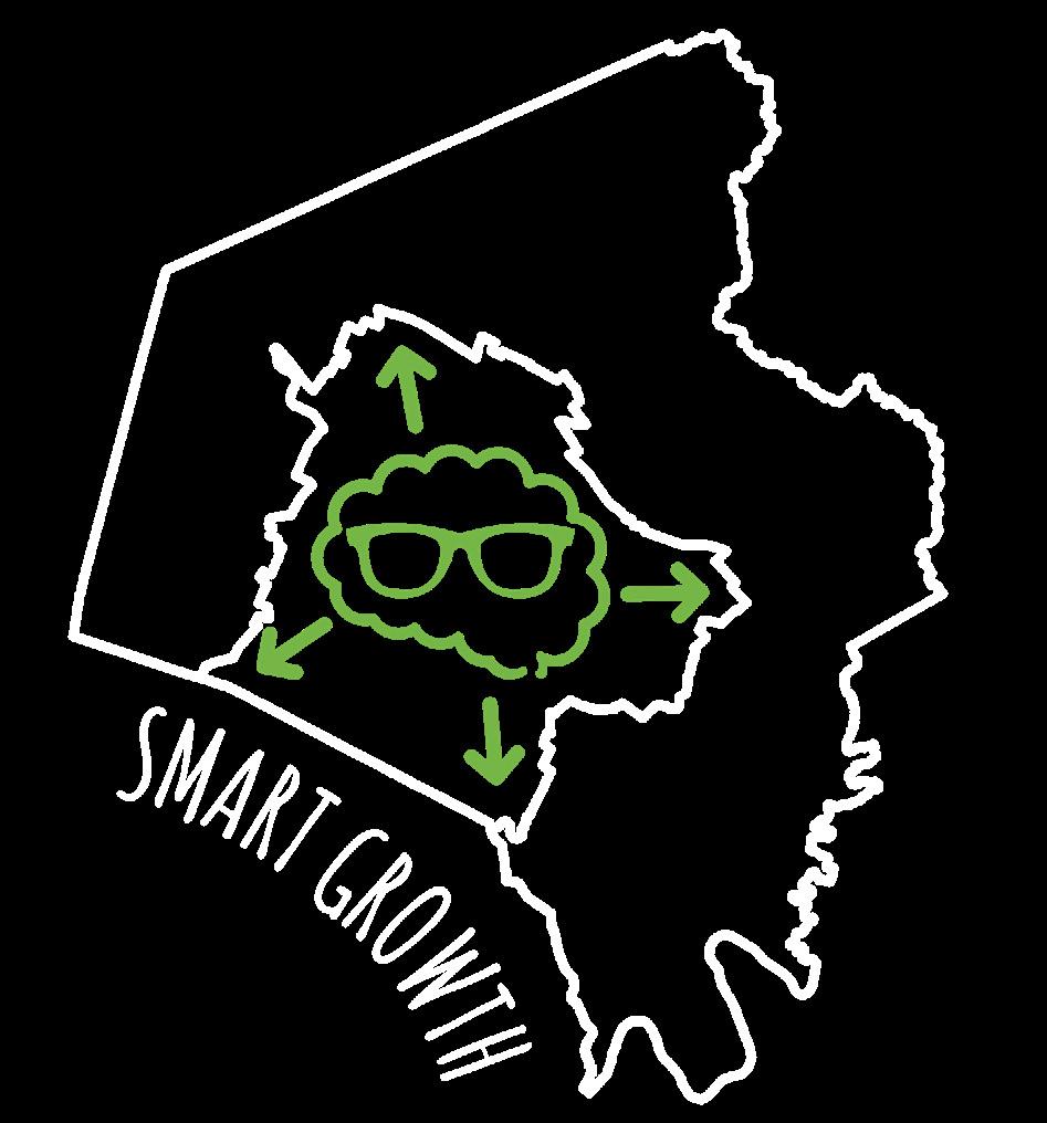
year structure. There is uncertainty on all sides of the issue, and therefore a heightened sense of anxiety and concern. Also, given that several major landholdings within the USB are currently held by a few large developers, some of the development interests believe that expanding the USB could provide additional opportunities for the smaller developers or builders to work. However, there is no indication that simply adding new land to the USB would alleviate this concern, as many of the same large landholders would have the means to acquire those properties as well.
However, the primary issue with the current system of determining whether or not to modify the USB is the unsustainability of the method long-term. This system will eventually lead to consuming all land in Lexington for development, even if that is decades or centuries
in the future. It is crucial to create a long-range plan now; if Lexington continues to make adhoc decisions about whether or not to alter the boundary without such a plan in place, city leaders and citizens might not realize the potential negative impacts of additional development until it is too late. Instead, a controlled release of smaller amounts of land as truly needed to meet the Comprehensive Plan goals and objectives, understanding ahead of time which land can be used and which land is offlimits, will create a much more intentional development pattern. Infrastructure can be more efficiently planned, and everyone will understand what the future of Lexington development is to look like.
In 1958, Lexington created the nation’s first Urban Service Boundary. Throughout the years,
this boundary has seen many evolutions; it has been expanded, it has been contracted, and it has been effectively maintained for over 20 years. The American Planning Association designated the Urban Service Boundary as a “National Planning Landmark” in 1991, an award for projects at least 25 years old that are “historically significant, initiated a new direction in planning or impacted American planning, cities or regions over a broad range of time or space.” Fewer than 100 of these landmark awards have been granted nationwide, illustrating the significance of the boundary and the impact it has had nationwide, as well as locally.
The Urban Service Boundary has served Lexington well and has provided a number of benefits over the years. Most people immediately recognize the role it has played in preserving the
signature horse farmland for which Lexington is internationally known; however, it has, first and foremost, provided for more compact development patterns that reduced suburban sprawl, created infrastructure efficiencies and budgetary savings, and resulted in more sustainable development overall. For these reasons, this mechanism has been replicated in areas all over the United States and is one of the urban planning profession’s standard growth management tools. Improving how Lexington addresses such a critical part of what defines the community is one of the most important policy goals of Imagine Lexington.
ESTABLISH A NEW PROCESS FOR LONG-TERM LAND USE DECISIONS INVOLVING THE URBAN SERVICE BOUNDARY ACTION ITEM
"THE BOUNDARY SHOULD BE ANALYZED TO DETERMINE HOW MUCH OF THE USABLE LAND IS DEVELOPED OR IN PROCESS. IF THERE ARE MAJOR SECTS OF THE AREA THAT ARE UNDERDEVELOPED, A PLAN SHOULD BE MADE TO SEE THEIR DEVELOPMENT IF FINANCIALLY FEASIBLE FOR THE CITY & DEVELOPERS."
-LEXINGTON RESIDENT
MODERNIZE THE ZONING ORDINANCE TO REFLECT THE DIRECTION OF THE 2018 COMPREHENSIVE PLAN, PROACTIVELY PLANNING FOR THE NEXT 20 YEARS OF GROWTH.
The last major overhaul of Lexington’s Zoning Ordinance in 1983, much needed in the wake of the City and County merger, also included significant revisions to the Land Subdivision Regulations. There was a focus on raising the bar for future development and ensuring that public infrastructure be built to standards that more adequately

addressed public health and safety. Much has changed in the community since that time, but the ordinance has only seen many small revisions to accommodate those significant changes. The last major changes to the Zoning Ordinance created provisions for infill and redevelopment in 2009.
Imagine Lexington is attempting to mark a significant shift in Lexington’s planning direction, one toward facilitating urban growth, enhancing existing places, and creating new desirable areas. Realizing these goals will require modernizing the Zoning Ordinance to make new projects feasible. Creating abundant new opportunities for varied housing types in order to attract new residents and businesses will be
critical, and will require a top-tobottom review of every section of the ordinance. Many of the past iterations need to be evaluated for efficacy, as well as reviewing the ordinance in light of Imagine Lexington’s focus on equity.
There is no question that, over the last 20 years, changes to the Zoning Ordinance have taken on a more design-based approach, once again raising the bar for future growth. Residents are increasingly more concerned with the quality of the place they live in. Revisions to the Zoning Ordinance will focus on creating great new places for people to live, work and experience. These text amendments are called for throughout the adopted 2018 Comprehensive Plan. To
facilitate the comprehensive and imposing effort required to amend these ordinances in a meaningful way over the coming years, text amendments emanating from Imagine Lexington will first be presented for formal consideration at the Planning Commission committees. The text amendments will follow the remainder of the process as directed by KRS 100 and the Zoning Ordinance, including mailed notice, a public hearing with the Planning Commission, and final adoption by the Urban County Council.
ITEM
UPDATE THE ZONING ORDINANCE TO REFLECT IMAGINE LEXINGTON PRIORITIES.
IMPLEMENT THE PLACEBUILDER, WHICH INCLUDES CRITERIA FOR ZONE CHANGE APPLICATIONS, BASED UPON THE GOALS & OBJECTIVES, TO ENSURE DEVELOPMENT COMPLIANCE WITH THE COMPREHENSIVE PLAN.
Imagine Lexington is full of policies that guide how development should occur throughout the city, and all of them are important. However, it can be difficult to ascertain by simply glancing at the text of the plan what developers should be aiming for with new proposed development or redevelopment. Additionally, adjacent property owners
should also be aware of which policies should be considered for a particular application, and what types of development they can expect. The Placebuilder, as the centerpiece of Imagine Lexington, is designed to catalyze conversations about how proposals further urban planning best practices, and to help define what it means to be “in agreement with the adopted comprehensive plan,” per state statute.
Rooted in the Goals & Objectives and the policies of the plan, The Placebuilder illustrates the types of development that are appropriate in various contexts, and it offers a menu of development and placetype options for applicants to choose from. This differs from a traditional land use map, because
the goal is no longer about the separation of uses, but instead the building of places. Each type of development has a list of criteria that should be addressed, or shown to be inapplicable, to illustrate how proposals will meet the Comprehensive Plan. Every site is different, with its own opportunities, constraints, and challenges, and not every criterion will apply to every site. The criteria are not a checklist, but they are meant to ensure conversations occur regarding the concepts present throughout Imagine Lexington. In 2013, the decision was made to remove the land use map that had been a mainstay of previous comprehensive plans to create flexibility and adaptability for the city of Lexington, as infill continued to be the preeminent development
strategy. Imagine Lexington, as an update to the 2013 plan, looks to provide additional focus to this strategy: the development criteria create more direction as a policy-based plan. The Placebuilder provides additional guidance to neighborhoods and developers alike.
HOST A PLACEBUILDER WORKSHOP & TRAINING FOR DEVELOPERS, PLANNING COMMISSIONERS, & ANY OTHER INTERESTED PARTIES CREATE A PUBLIC OUTREACH PROGRAM FOR ONGOING COMMUNITY EDUCATION ON IMAGINE LEXINGTON & THE PLACEBUILDER ACTION ITEMS
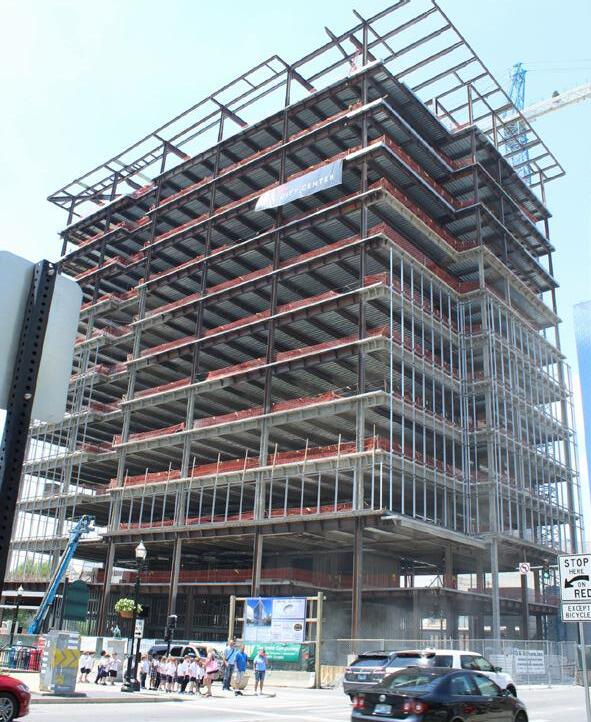
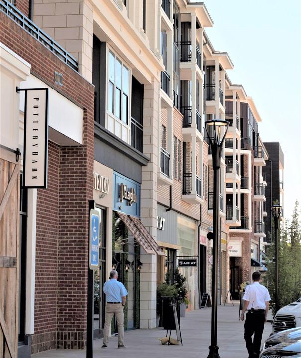
DEVELOP GROWTH BENCHMARKS & DETERMINE BEST MEASURABLE METHODS TO MONITOR THEM & REPORT PROGRESS ON A REGULAR BASIS.
Plans are only as good as their ability to gauge measurable results in a timely fashion. To know if a plan is reaching desired outcomes, it is imperative to track the successes and failures so future adjustments can be made and successes replicated. Imagine Lexington is crafted as a policybased plan with very specific goals in mind. Basic metrics are included as a component of this comprehensive plan, but should be supplemented by additional benchmarks identified in the process discussed in Accountability Policy #1.
Also, a more robust effort to further develop a comprehensive set of measurables should be undertaken in the coming years, finding more detailed ways to track progress. This will be beneficial for the Planning Commission and staff in determining the realization
of the stated Goals & Objectives; just as importantly, it will be an accountability measure, allowing the general public to follow along, be informed, and take ownership of their plan. Progress should be reported on a regular basis on the Imagine Lexington website so that all interested parties can follow along with the latest data.
DEVELOP A SERIES OF COMPREHENSIVE PLAN METRICS.

"MAINTAIN A FUNCTIONAL WEBSITE THAT CLEARLY COMMUNICATES THE PROGRESS OF THE PLAN."-LEXINGTON RESIDENT
INCREASE DEDICATED BIKE LANES, PEDESTRIAN & TRANSIT FACILITIES IN THE EXISTING RIGHT-OF- WAY, FOCUSING ON MOVING PEOPLE RATHER THAN EXCLUSIVELY SINGLEOCCUPANCY VEHICLES.
Historically, public infrastructure has been focused on creating the easiest and fastest means of transit for single-occupancy vehicles. This resulted in abundant wide lanes of paved asphalt, but limited pathways for pedestrians, cyclists or transit riders. However, an increasing number of people use these streets in different ways; some by personal choice, others because of various constraints. There are many benefits of alternative transportation, such as biking, walking and public transit, some of which are illustrated in the Lexington Area Bicycle & Pedestrian Master Plan 2018. The study showed 30% of all car trips could be easily covered by a 10-minute bike ride or a 30-minute walk. Providing a safe and comfortable environment for non-vehicle travelers is essential to meet those needs.
In order to provide equity to all Lexington residents, city infrastructure must be required to ensure enough space is granted for all users, including pedestrians, cyclists, and transit riders, within the right-of-way. New rightsof-way should be designed for all users from the outset, but it is also important to retrofit existing facilities to correct for the years of emphasis placed on the single-occupancy vehicle.

PARTNER WITH OTHER AGENCIES LIKE THE LEXINGTON PUBLIC LIBRARY TO CREATE A PUBLIC OUTREACH OPPORTUNITY THAT PROVIDES DECISIONMAKERS WITH INPUT & CREATES NEIGHBORHOOD LEADERS ACROSS ALL DEMOGRAPHICS & GEOGRAPHIES.
In 2017, as part of a partnership with the Blue Grass Community Foundation, Leadership Lexington, Fayette County Public Schools, and many other organizations, the Division of Planning sought input into this Imagine Lexington plan with On the Table. This innovative outreach tool changed the dynamic of civic engagement for Lexington and leveraged powerful partnerships to hear from active citizens who were hungry for both food and meaningful conversation.
It provided an accessible way for people to gather informally over a meal to discuss Lexington’s positive attributes and issues, as well as bold ideas and solutions to make it an even better place.
Initially, this initiative had a stretch goal of engaging 5,000 people to participate; that goal was not only surpassed, but more than doubled, with over 11,000 people contributing. The roughly 10,000 comments that resulted from the input-gathering tools employed by the Division of Planning through this and other methods were synthesized into a Public Input Report (See APPENDIX C) that served as a key component to inform this plan. This public outreach initiative engaged far more people than previous comprehensive plan efforts,which typically brought out a couple hundred individuals. Perhaps equally significant is the diverse representation On the Table contributed. The Division
of Planning heard from a much more varied group of people representing a host of viewpoints that are perhaps not always heard in civic engagement. This was only possible through the partnerships that strengthened the effort.
To build on this momentum, Imagine Lexington calls for a more permanent and ongoing way to connect the general public to decision-makers. By utilizing partnerships to create a citizen advisory panel, this plan hopes to achieve the following goals:
• Ensure input is heard from voices that are representative of the city at large, and not only highlyorganized interests;
• Develop future neighborhood leaders;
• Improve the level of civic discourse;
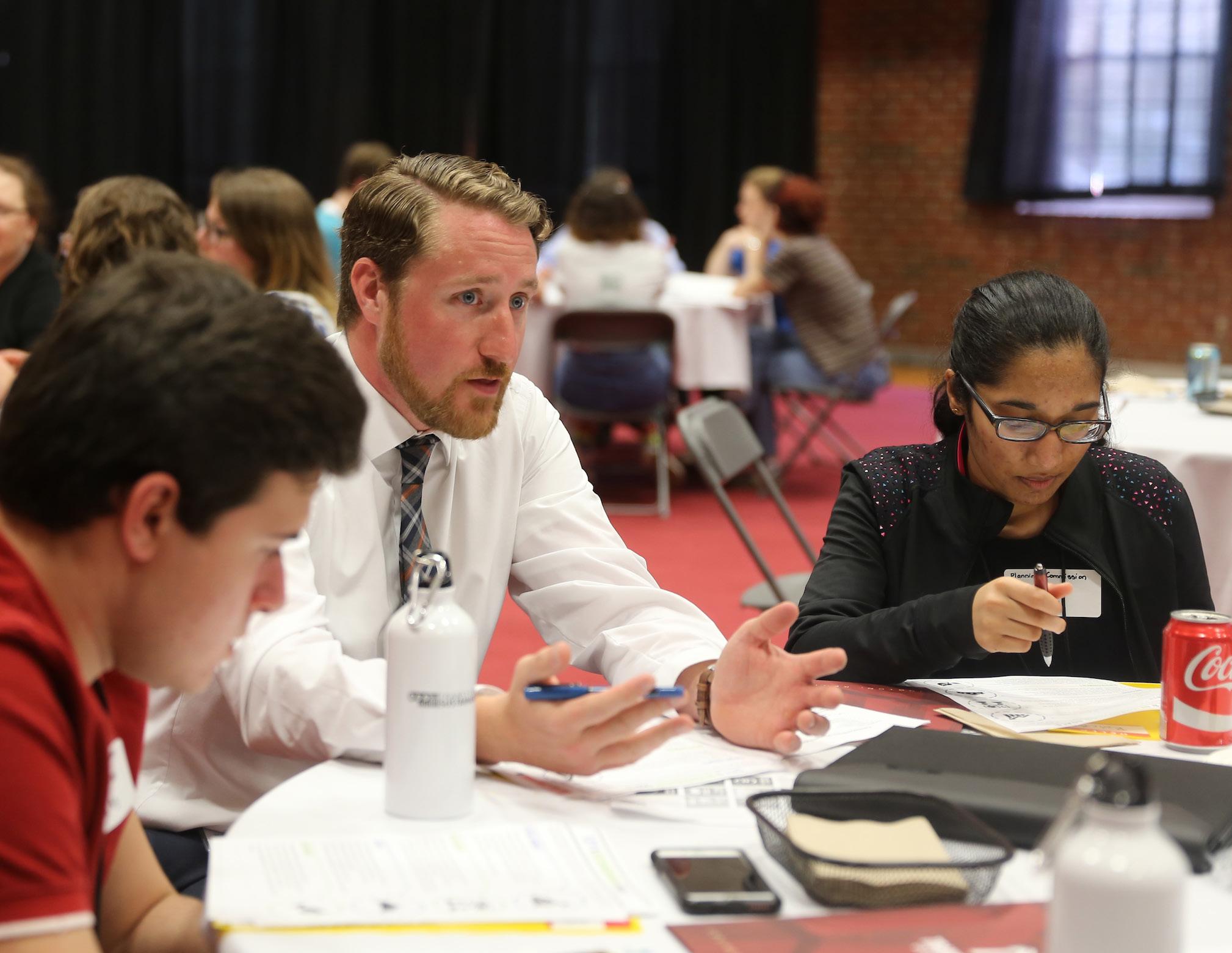
• Offer educational opportunities so input is informed and not solely emotional.
In order to achieve these goals, the panel will be randomly selected across all demographics and geographies to serve lengthy terms as advisors to the Division of Planning and the Planning Commission. They will provide ongoing input into planning implementation items and decisions, and will be educated on current process and best practice. This will be a productive environment to discuss and test future process and outreach improvements, and a valuable tool to consistently provide ongoing public input throughout the implementation of Imagine Lexington.
CREATE A CITIZEN ADVISORY PANEL ACTION ITEM
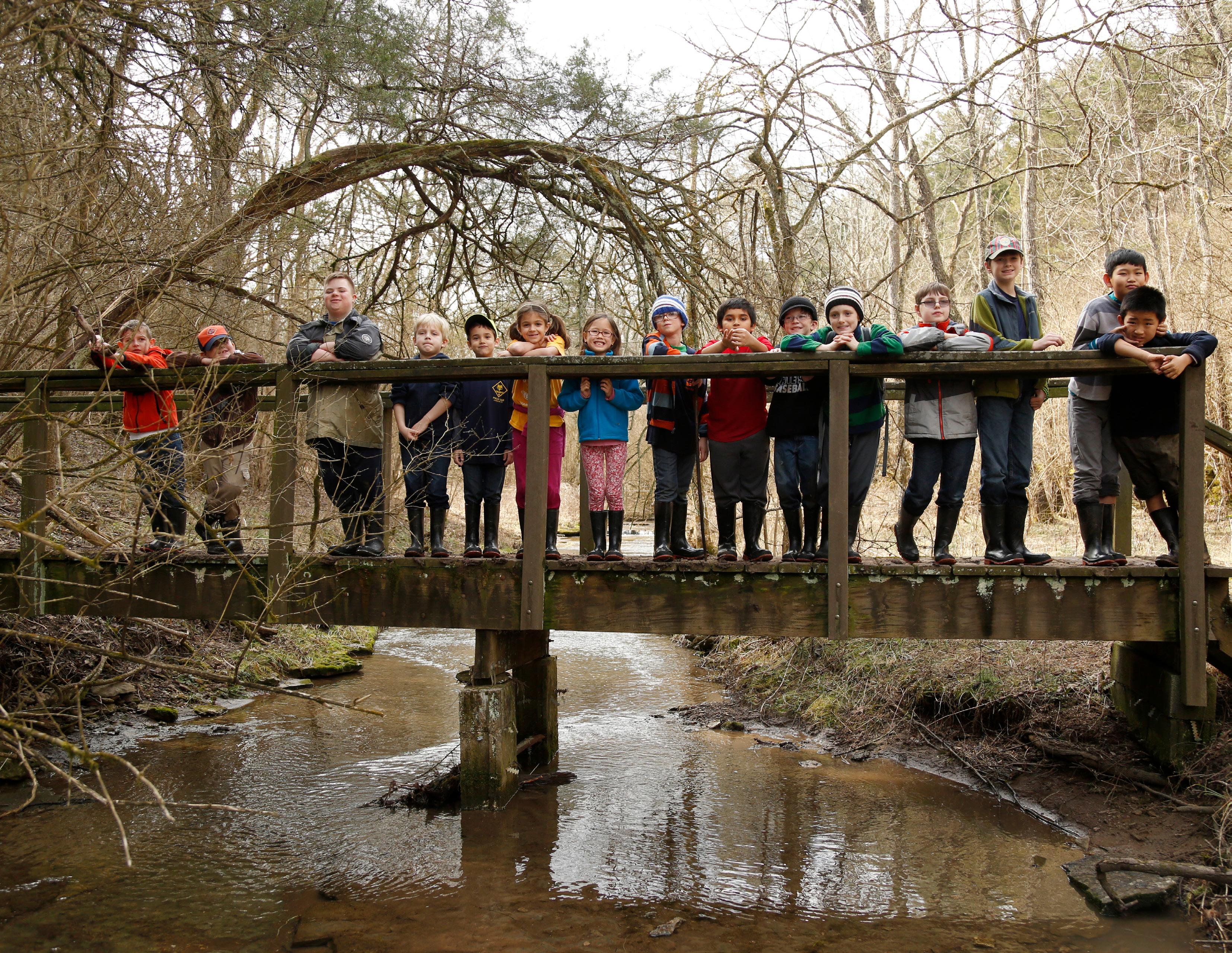

Lexington was founded in 1775, meaning there have been almost 250 years of rich history that came before the current inhabitants, and there will inevitably be many more to follow in the future. Each generation of Lexingtonians is tasked with protecting the land and being good stewards of the available resources. Lexington has a long history of proactive planning, from the first comprehensive plan in 1931 (Imagine Lexington is the 87-year update), to the nation’s first urban service boundary in 1958. The thoughtfulness that went into the forward-thinking policies of the past should be continued as this generation plans for the future.
Sustainable development is perhaps the best way to discuss stewardship of Lexington’s land and resources. The Goals & Objectives of this Plan call for all future development to be sustainable from an economic, environmental, and social standpoint. This means providing for the needs of current citizens without compromising the needs of those in the future. Development that is economically
sustainable provides patterns that are fiscally responsible with taxpayer dollars and that provide employment opportunities for the community. Environmentally sustainable development is the result of responsible use of the community’s natural and built resources. Ensuring the continued availability of clean air, water, and soils, and protecting the signature farmland, are vital to an environmentally sustainable community. The third leg of the sustainability stool is social sustainability, which requires equitable land use policies. Ensuring opportunities exist for all citizens of Lexington to thrive is critically important, as is considering the unintended consequences of all policies and land use decisions.
In addition to sustainable development on a local level, regional planning is an important concept where collaboration can result in improved land stewardship on a larger scale. This is an idea that has been long discussed, but has lacked in long-term execution and tangible results. Recently
progress has been made by Bluegrass Tomorrow to connect the Bluegrass Region’s counties through a shared set of goals, but there is still a lot of work to be done.
Imagine Lexington makes recommendations for connecting the economic hubs of the nearby communities, focusing on transportation, tourism, and mutual interests between planning staffs. More progress needs to happen to allow for broader protections for the region as a whole.
The primary collective elements binding the Bluegrass Region are the quality agricultural land and historic farming culture. In Lexington, it is critically important to protect and preserve these assets that are important to the city’s economy, identity, quality of life, and international acclaim.
The Urban Service Boundary is the first line of defense locally for this, and Imagine Lexington commits to maintaining the current boundary in its existing location after careful study, deliberation, and public input. Steadfast stewardship of Lexington’s
rural landscape through requiring a compact, efficient, and fiscally responsible growth pattern is one of the key components of this Plan.
Another tool in preserving precious agricultural assets is to make full use of the existing Rural Activity Centers, rural areas that are already slated for urban uses and have defined boundaries. These should be seen as opportunities to accommodate growth in the community, and should be fully explored before other options for new urban land are pursued. Developing these sites fully could relieve development pressure on rural properties, similar to the focus on infill and redevelopment within the Urban Service Boundary.
There are a number of tools at the disposal of the community to protect and preserve agricultural land, while simultaneously enhancing the urban area of Lexington. Being faithful stewards of this land, as generations were before, is one of the most compelling reasons to utilize these tools and carefully employ sound planning principles.
UPDATE LEXINGTON’S STONE FENCE INVENTORY, & PURSUE ADDITIONAL PROTECTIONS FOR THIS ICONIC & HISTORIC CULTURAL ASSET.
Stone fences are iconic to the historic and cultural landscape of Lexington’s rural heritage. They play a unique role in the region’s identity and contribute to the scenic views, rural corridors and rolling hills. Despite the role stone fences play in defining the sense of place within the Inner Bluegrass Region, they are in critical danger of being lost to development and neglect.
Stone fences are made of Kentucky Limestone collected from fields, streams, or quarries and demonstrate sustainable farming practices from the 1800s. The 1990 Stone Fences of Fayette County study estimated that 90% of the stone fences in the region are gone. The development of adjacent properties has been the primary reason for their demise since 1950.
located in the public right-of-way from demolition. However, as the 2017 Rural Land Management Plan finds, “the fate of stone fences remains in peril.”
An inventory was conducted for the 1990 study, and found 247 stone fences with a total length of 38.7 miles. This was a 25% loss from the 49.6 miles identified in a 1967 study. The 1990 inventory was catalogued using a measuring wheel and plotting the stone fences on a 1981 Tree Stand Atlas map sheet.
The stone fence inventory should be updated to catalogue their condition and reflect their current status. Advancements in technology should be utilized to digitally map the stone fences through Geographic Information System (GIS). Other issues concerning stone fences identified by the 2017 Rural Land Management Plan should be considered when updating current policies and regulations protecting limestone fences.
The 1994 Stone Fence Ordinance protects those stone fences
UPDATE THE 1990 STONE FENCE INVENTORY ACTION ITEM

CAPITALIZE ON THE DIVERSE ECONOMIC DEVELOPMENT, HOUSING, & TOURISM OPPORTUNITIES THROUGHOUT THE BLUEGRASS REGION & ENGAGE IN DISCUSSIONS TO FURTHER CONNECT REGIONAL ECONOMIC HUBS.
As Lexington’s economic and social capital grows, there will be impacts on surrounding counties and cities. The latent effects of these successes can change neighboring communities in a variety of ways, including their economies, housing stock, and industrial development. In an effort to produce a regional vision for the future which allows all communities to benefit, a policy of collaboration should be developed with Lexington’s neighboring cities. The initial step toward the development of a comprehensive regional planning initiative can be done by first connecting economic hubs or centers of economic activity, which are generally located in the downtowns of communities.
be done on two separate levels: economically, through principles of business cooperation and coordination, and physically, through the establishment of transit that provides multimodal opportunities for citizens to move between communities (see Stewardship Policy #3). By linking Lexington with the nearby economic hubs or the downtowns of surrounding communities, the city will be able to better tie the economic interests of the Bluegrass Region and develop a collaborative planning process. Regional perspective has already been initiated within the tourist industry (see Stewardship Policy #4) and through Commerce Lexington’s regional marketing, but there is still room for improvement through additional promotion of other opportunities and industries.
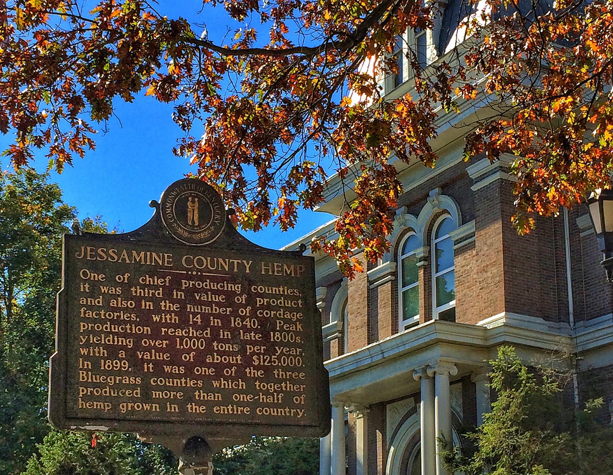
Connecting economic hubs can
Through partnerships with organizations like the Bluegrass Area Development District and their Bluegrass Regional Planning Council, as well as direct collaboration with surrounding economic hubs like Nicholasville, Paris, Winchester, and Georgetown, Lexington can begin to develop lasting planning relationships that benefit the
region. The development of an inter-city summit, focused on fostering dialogue between communities, can be the first step in such a relationship. The establishment of downtown collaboration between Lexington and surrounding communities can also lead to additional economic development, planning, and infrastructure cooperation in the future.
Furthermore, by connecting business opportunities, the Bluegrass Region can begin to increase levels of economic security through a diverse economic base, reducing instability caused during periods of downturn. While it is imperative to have a diversity of industries within Lexington, collaborating with surrounding communities can also entice diverse industries that link the communities and utilize the full advantages of the region. By nurturing regionally inclusive initiatives, Lexington and the surrounding communities can also seek to avoid population dislocation and dispersal out of the region through the provision of superior employment opportunities across all skill and education levels.
"UNDERSTAND, PLAN FOR, & BEGIN WORKING ON A REGIONAL APPROACH TO ECONOMIC DEVELOPMENT; LEXINGTON IS THE HUB FOR THIS PART OF THE STATE."
-LEXINGTON RESIDENT
TRANSPORTATION
COOPERATION & PURSUE
MULTIMODAL TRANSPORTATION
OPTIONS, TO FACILITATE INTERCOUNTY CONNECTIVITY.
A regional transportation network provides for the movement of goods and people though a multimodal system, which includes trains, trucks, buses, cars, bikes, and pedestrian options. As the regional transportation network grows, a viable system of accessible transportation alternatives should be implemented for residents and commuters alike. This includes complete
ScottCounty FayetteCounty
streets that give consideration to bicycle and pedestrian traffic in addition to cars, trucks, buses, and ride sharing options while utilizing the latest innovative advancements in technology.
In order to facilitate and maintain an effective and comprehensive transportation system, cross-border actions should be encouraged and implemented through regional transportation planning. The economic success of Lexington and the region depends upon the accessibility and connectivity of the regional transportation network. The city’s transportation network penetrates urban and rural boundaries as well as political borders. Regional transportation planning through continuing,
cooperative, and comprehensive planning with the surrounding counties should be pursued, as transportation links Lexington to the rest of the world politically, economically, and socially. Transportation transcends all levels of governmental units and is vital to economic growth.
As Lexington’s population and economic activity continue to increase, so too will the demand for the movement of goods and people. Approximately half of the city’s labor force commutes from outside of the county, a trend that is expected to continue as populations in Scott, Madison, and Jessamine Counties grow at rapid rates. This will result in more people and vehicles making daily commutes, on
already well-traveled arterials and thoroughfares. In addition to more commuters, an increase in trucks and freight movement is also anticipated as online shopping continues to increase and home delivery becomes more readily available.
Currently, the Lexington Area Metropolitan Planning Organization (MPO) functions as the transportation planning unit for the city, while also serving as the regional organization that covers Jessamine County and a very small portion of Scott County. However, Lexington should look to foster increased regional transportation planning amongst all of its surrounding counties.
"A REGIONAL TRANSPORTATION PLAN IS NECESSARY TO PROVIDE A TRANSIT SYSTEM BETWEEN LEXINGTON & NEIGHBORING CITIES."
-LEXINGTON RESIDENT
COORDINATE WITH SURROUNDING COUNTIES TO CAPITALIZE ON THE INHERENT TOURISM DRAWS OF THE BLUEGRASS REGION.
Lexington is not alone in reaping the natural and historical benefits of the Bluegrass Region, as the surrounding counties all have similar assets, as well unique cultural and historic draws that make the region an attractive tourist destination.
Some of the attractions cross county boundaries, such as the bluegrass landscape, horse farm tours, the Bourbon Trail, and the Brewgrass trail; while others are locally specific, such as Shaker Village in Mercer County or the Kentucky Castle in Woodford County. Together, they all create a regional experience that is unlike any other; in order for them to be most effective, they must be marketed together as such.
Visit Lex already incorporates regional showpieces into their marketing materials, including their pre-planned itineraries and “top
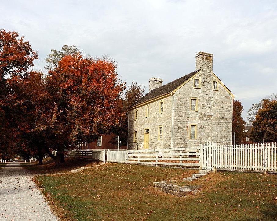
10 things to do” list. It could be mutually beneficial for all involved for Lexington to continue conversations with the goal of increasing tourist traffic for Fayette and outlying counties. Those counties would receive visitors who may be coming due to the larger draw of the urban amenities Lexington has to offer, and Lexington would likely benefit, as those who are traveling for attractions in outlying counties will probably stay and spend a good portion of their tourism money in the city. Additionally, the added visibility and attractiveness of the region creates
enhanced livability and amenities for employers in all counties.
Land development, primarily in Lexington’s job-creating industries. Opportunities for industrial and professional office growth are present, and, as land constraints continue to tighten, the city should look creatively to these areas for employment solutions. These should be pursued, but with constant consideration given to the integrity of the rural service area.
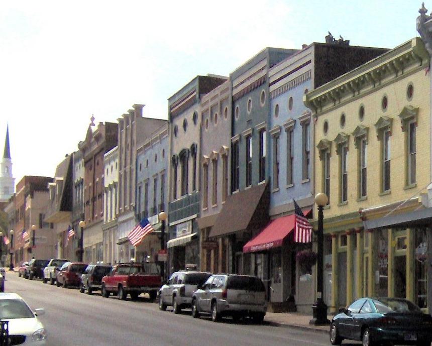 SHAKER VILLAGE OF PLEASENT HILL, HARRODSBURG, KYL
FULLY REALIZE THE DEVELOPMENT POTENTIAL WITHIN LEXINGTON’S RURAL ACTIVITY CENTERS WHILE AVOIDING NEGATIVE IMPACTS TO SURROUNDING AGRICULTURE, RURAL SETTLEMENTS, & VIEWSHEDS.
The 2017 Rural Land Management Plan has a stated policy emphasis for the Rural Activity Centers (RACs) to “maximize their potential for jobs while maintaining their boundaries and minimizing impacts to the rural area.” The Rural Service Area (RSA) includes 1,562 acres dedicated to the four RACs: Blue Sky Industrial Park, Avon (Blue Grass Station), Spindletop Research
Park, and the Blue Grass Airport.
Blue Sky is underutilized, with much of its area occupied by surface car lots; it can accommodate industrial uses, and is the only RAC not in public ownership. Its recommended uses are primarily for warehousing, light industrial, and interstate commercial development. There are significant opportunities to more fully realize the potential of this site, and a small area plan should be undertaken for more specific recommendations. At 271 acres, Avon is under control of the Commonwealth of Kentucky, with the exception of 79 acres that are privately held. This RAC includes several tenants, such as Lockheed Martin, which contracts for the U.S. Department of Defense.
Spindletop’s Research Campus is an office park owned by the
Commonwealth of Kentucky, which includes tenants such as the Council of State Governments and the Asphalt Institute. This Rural Activity Center is zoned for professional office uses. There are opportunities there for additional professional office developments which would be well suited for corporate headquarters, as the land is already zoned for professional office. Economic development opportunities should be pursued though amendments to the City’s agreement with the Commonwealth of Kentucky regarding sanitary sewer provision would be required.
The Blue Grass Airport is largest of the RACs, at 707 acres. This RAC includes warehousing and office uses to support the airport facilities, as well as a shooting range for Lexington Police. The Airport Board
also acquired another 314 acres and constructed an additional runway outside the RAC; however, the boundary was not expanded, in order to avoid complications that could arise through future property sales.
While the RACs make up a relatively small percentage of the RSA, they still provide for growth and development, primarily in Lexington’s job-creating industries. Opportunities for industrial and professional office growth are present, and, as land constraints continue to tighten, the city should look creatively to these areas for employment solutions. These should be pursued, but with constant consideration given to the integrity of the rural service area.
CONDUCT A BLUE SKY SMALL AREA PLAN
IDENTIFY NEW COMPATIBLE AGRITOURISM & ECOTOURISM LAND USES THAT WOULD ENHANCE LEXINGTON’S ECONOMY & PROVIDE ADDITIONAL INCOMEGENERATING POSSIBILITIES FOR LOCAL FARMERS.
The Agritourism Zoning Ordinance Text Amendment was important in further establishing protections for the horse industry, as well as other agriculture industries. The impact of that text amendment should be monitored to identify opportunities to add further complementary uses that expand tourism options without negatively affecting existing industries. There remains considerable rural land that is geographically and topographically unsuitable for standard agricultural uses that should be considered for additional agritourism uses. While the community was not prepared during the last text amendment to make those changes, Imagine Lexington envisions a future where those opportunities will become more acceptable, when coupled with sufficient protections to the rest of the agricultural area.
UPDATE THE ZONING ORDINANCE PROVISIONS FOR AGRITOURISM ACTION ITEM
CONSULT WITH PLANNING DEPARTMENTS OF ADJACENT COUNTIES TO FIND COMMON
COMPREHENSIVE PLAN GOALS, OBJECTIVES & IMPLEMENTATION ITEMS WHERE SHARED BENEFITS COULD BE GAINED BY WORKING TOGETHER.
Regional planning efforts in the past have been difficult endeavors for many reasons; however, there is a shared goal among staff from all of Lexington’s regional neighbors to advance the basic principles of urban planning. While there are significant differences in the underlying ordinances that control zoning from county to county, all of the neighboring counties have adopted comprehensive plans, which share many goals and objectives.
Developing a rapport with the planning staff from these neighboring planning departments and identifying common goals and objectives would allow for shared efforts in implementing policies. This would foster a commonality that highlights similarities, rather than focusing on differences.
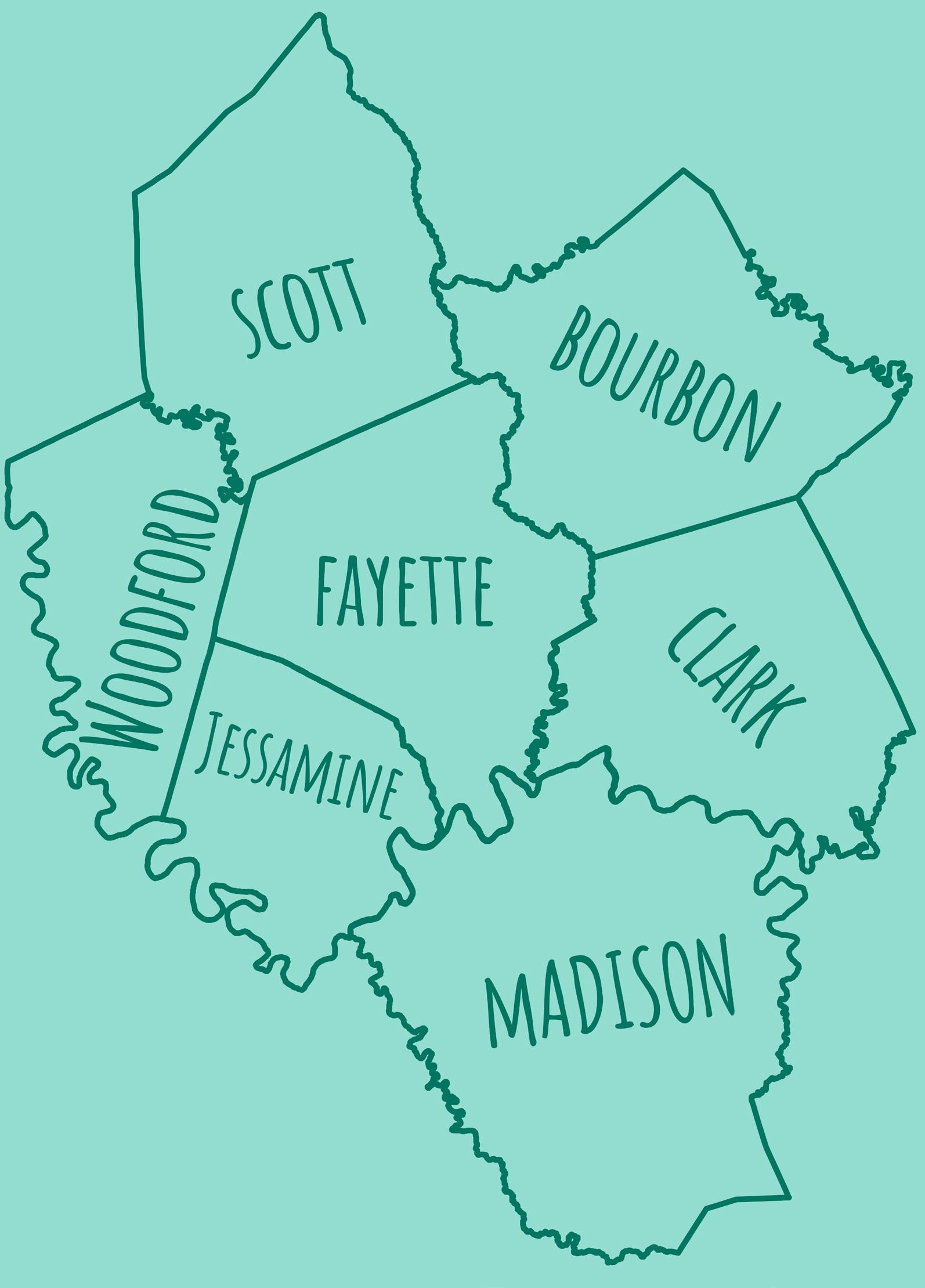
ADDRESS ECONOMIC, ENVIRONMENTAL, & SOCIAL SUSTAINABILITY OF NEW DEVELOPMENT TO THOUGHTFULLY UTILIZE LEXINGTON’S RESOURCES FOR PRESENT NEEDS WHILE CONSIDERING THOSE OF FUTURE GENERATIONS.
The focus of sustainable development is to raise the standard of living for current residents without precluding

the same opportunity to future generations. There are three facets to sustainability through which all proposed development should be reviewed: Economic, Social, and Environmental. It is indeed possible to promote growth in a sustainable way by ensuring that goods and services can be easily distributed and that there are sufficient jobs to support the provision of government services. At the same time, reducing the fiscal impact of growth must be considered as well. Imagine Lexington is committed to promoting and implementing policies and regulations that will yield development patterns
that save taxpayer dollars.
From an environmental perspective, land uses and new development should support their surrounding ecosystems. Improving upon Lexington’s commitment to sustainable growth will require implementing guidelines for measuring the impact of new development. Lexington should be a city that encourages growth that is durable, healthy and energy efficient. Lexington should be a leader in green building construction practices.
Social Sustainability emphasizes
the creation of equitable land use policies that promote access to social and economic resources. Imagine Lexington aims to address public transportation, the needs of the homeless population, healthcare and mental wellness programs, and policies for inclusivity, as well as community engagement through additional zone change criteria.
A commitment to sustainability involves the private sector rethinking how it develops, as well as how government approaches community issues, realizing that the interrelationship between policies and actions often affect much more than just their intended focus.
FOLLOW & IMPLEMENT THE RECOMMENDATIONS OF THE 2007 STUDY OF FAYETTE COUNTY’S SMALL RURAL COMMUNITIES & THE 2017 RURAL LAND MANAGEMENT PLAN TO PROTECT & PRESERVE LEXINGTON’S RURAL SETTLEMENTS.
Lexington has 19 rural settlements that are essential to the history and fabric of the rural landscape. Three of the historic settlements, Bracktown, Cadentown, and Jonestown, have been absorbed into the Urban Service Area, while 16 reside in the Rural Service Area, totaling 505 acres.
The majority of the rural settlements were settled by free African-Americans after the Civil
War. Many descendants of those who first settled these communities still remain on the same land today and operate small farms and businesses. The rural settlements also comprise a significant portion of the African-American homeownership in Fayette County.
A three-year study of Fayette County’s rural settlements, begun in 2002, documented their character and history and gave policy recommendations to protect each of their unique identities, all of which were included in the 2007 Comprehensive Plan While some actions have been taken as a result of these policy recommendations, many of these small rural settlements remain threatened. Threats include potential urban expansion, population decline, possible gentrification if redeveloped, and loss of unique identity.
To protect and preserve Lexington’s rural settlements:
• The current lotting patterns should be maintained, unless the action taken would restore the parcel’s historic condition;
• New housing opportunities on vacant lots should be promoted to ensure the longevity of the rural settlements;
• An ND-1 or H-1 overlay, tailored to the needs of these individual communities, should be considered;
• Infrastructure measures that both improve the quality of life for residents of the rural settlements and are compatible with the Rural Service Area should be explored, including transportation and public
transit, tourism, and internet/ Wi-Fi connection;
• Consider adjusting the PDR program’s evaluative point system so applications which include farmland adjacent to rural settlements are awarded additional points;
• Identify local land use advocacy groups to partner as stakeholders in the development of policy and education/outreach efforts within rural settlements;
• The policy recommendations for rural settlements from the 2007 Study of Fayette County’s Small Rural Communities and the 2017 Rural Land Management Plan should be implemented.
"THREATS

There are many challenges and opportunities related to urban growth in Lexington, but ultimately growth is inevitable, encouraged, and invited, as it is an indicator of a vibrant and desirable community. Imagine Lexington has made mention of Lexington’s well-documented and consistent growth in numerous locations throughout the plan, realizing that many approach this fact with trepidation; however, if proper planning and implementation are executed, it should enhance the community on the macro and micro levels. Neighborhoods can become more complete with a mix of uses and amenities to provide for quality of life for all citizens throughout all seasons of their lives; development patterns can be fiscally responsible with taxpayer dollars; overall community health can improve with multimodal options; and, through these practices, Lexington can protect its signature farmland.
The 2013 Comprehensive Plan expanded the scope of what
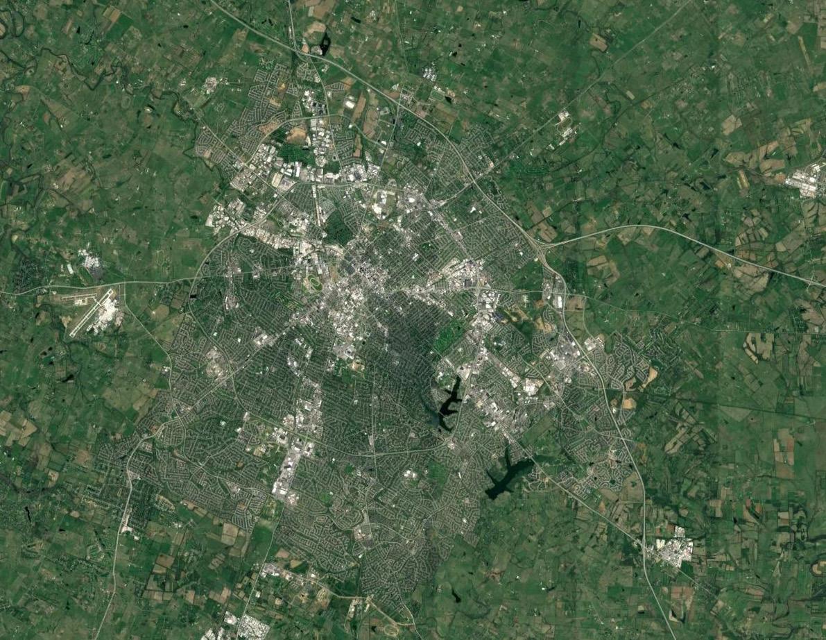
the community considers “infill” development, moving from simply developing vacant parcels within the Infill and Redevelopment regulatory barrier, to a more holistic approach including development opportunities throughout the Urban Service Area. Imagine Lexington continues this approach, realizing that the community’s land use policies make all development within the community vitally important, and that every development must achieve specific community goals. Unfortunately, many of the ordinances and regulations setting the parameters for development throughout the city are outdated, reflecting a more suburban model that does not comport with current realities and vision. It is important to revise these as expeditiously as possible, in an incremental manner, to ensure the desired development is possible.
However, the more traditional infill and redevelopment is critical as well, and the specific regulations tailored to this should also be
revisited. Staff should study the results of the existing ordinances to understand if the desired outcomes for adaptive reuse of buildings and infill are occurring. There is fantastic momentum taking place in Lexington’s downtown, from Town Branch Commons, to the completion of City Center, and every effort should be taken to capitalize on this to improve the vitality and desirability of the urban core.
Inevitably, the success of the downtown area places pressure on the historically significant resources located there; in fact, much of the desirability of these areas comes from the integrity and quality of the historic assets that give it a unique sense of place. Every effort must be made to protect these crucial pieces of Lexington’s story, while allowing for the next chapters to be written. Historic resources should not halt progress, but should be respected and enhanced by new opportunities and new neighbors.
As all of this growth and urban development is exciting and important to the success of Lexington, it is also necessary to remember that open space is a basic human need. Public input for this comprehensive plan very clearly indicated that this is a priority for the citizens of the city. It is key to ensure that the open space provided by new developments is designed so
as to maximize the utility of the space. Making open space and greenspace provision a primary objective of developments, and not simply an afterthought, is crucial to making the most of the land within the Urban Service Boundary, and regulations must be modified to specifically reflect that.
No statement on growth within Imagine Lexington would be complete without discussing the importance of the major corridors to the overall development strategy. This Plan calls for the study of Lexington’s major arterial corridors, to identify opportunities for redevelopment that will support mass transit initiatives and account for the changing reality of the retail industry. As more and more retail dollars go to online shopping, and consumers become increasingly interested in finding unique experiences at their brick and mortar stores, it is incumbent upon the City to take a proactive look at the future of these sites. This means reaching out to property owners and managers, initiating comprehensive studies of the areas, and embarking upon government-initiated zone changes to spur redevelopment activity. If there is a desired outcome for the city, every effort
should be taken to proactively clear hurdles to that outcome.
Retail is not the only industry that is seeing a rapid change to its foundational practices; transportation is as well. Autonomous vehicles are proving to be a disruptive technology that will drastically alter the landscape in the future. Experts in the field are indicating that these vehicles may soon be the norm, rather than the exception. Driverless vehicles are already making appearances throughout the nation, and preliminary autonomous options are being installed as standard equipment on some new models. This radical shift in transportation will have significant effects on the way Lexingtonians navigate the city, but will also have sweeping impacts on land uses as well. This city has an opportunity to be a leader in planning for these technologies, and should strive to be on the cutting edge.
With all of the changes anticipated in the next 20 years, the opportunities for Lexington are immense. Preemptive planning through the vision outlined in Imagine Lexington will continue the city along a path that builds on the past, but also embraces the future.
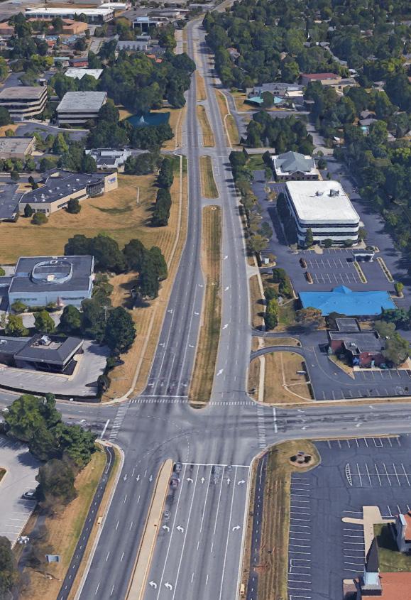
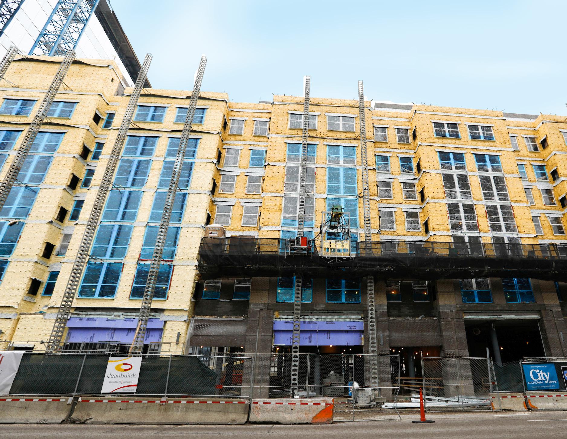
REVISIT INFILL & REDEVELOPMENT AREA REGULATIONS TO ENSURE THEY ARE COMPATIBLE WITH IMAGINE LEXINGTON & ARE ENCOURAGING DESIRED DEVELOPMENT.
The first Infill & Redevelopment Committee was created in 1996, which led to the 2001 Residential I/R Study, official adoption of the defined Infill & Redevelopment Area in the 2001 Comprehensive Plan, and subsequent regulatory changes to implement the Plan. The I/R Area boundary is based on the 1934 urbanized area of Lexington and its surroundings, which was primarily developed in traditional patterns prior to the adoption of the Zoning Ordinance. The special provisions in the Zoning Ordinance for this defined area are designed to complement those historical patterns, by allowing and promoting opportunities for compatible growth in older neighborhoods.
Prior to the I/R changes, there were many concerns about inappropriate infill in some areas of town, and lack of infill opportunities in others. The changes were intended to promote development that enhances the livability of the neighborhood, add appropriate density, and promote affordable housing, all while adding value to areas of town that were previously overlooked because the primarily suburban Zoning Ordinance provisions were out of place in these neighborhoods.
Throughout the years, the provisions of the Zoning Ordinance related to infill and redevelopment have been modified to ensure they were accomplishing these goals. It is time to revisit these regulations with a context-sensitive approach to assess whether they are in line with the stated Goals and Objectives, or if they are producing undesirable development within the I/R Area.
UPDATE THE ZONING ORDINANCE TO REFLECT IMAGINE LEXINGTON’S INFILL POLICIES ACTION ITEM
CAPITALIZE ON THE CURRENT MOMENTUM OF DOWNTOWN DEVELOPMENT & IMPROVEMENTS BY WORKING TO IDENTIFY & ENHANCE OPPORTUNITIES FOR REDEVELOPMENT.
The implementation of the infill and redevelopment boundary and its corresponding special zoning provisions was a boon to downtown growth, coming at a time when citizens began to take interest, once again, in living in a more urban setting. Demographically, Baby Boomers were looking to downsize, along with new young professionals beginning to demand smaller housing types located closer to
amenities. Recent developments near downtown do not indicate any anticipated shift in these preferences. Current and proposed projects like Town Branch Commons, the Krikorian entertainment complex, and the Lexington Convention Center will be catalytic in spurring additional smaller developments downtown, and Imagine Lexington should anticipate ways to encourage those projects.
A new Downtown Master Plan that specifically focuses on identifying opportunities for redevelopment along with supported strategies is needed to continue revitalizing the urban core. This should be led by the Downtown Lexington Partnership, with strong collaboration with Planning, additional governmental and quasi-governmental agencies, and other critical stakeholders
like downtown neighborhoods and businesses. A revised plan will hopefully be a catalyst for attracting new development, while also meeting the needs of existing downtown interests.
Downtown residents have repeatedly expressed a desire for more neighborhood-serving commercial development. Turning those wishes into reality requires working with Lexington’s urban neighborhoods to address the provision of additional housing to support further commercial opportunities. With the substantial private investment in student housing in the near-campus areas, Lexington has seen commensurate development of new commercial options intended to serve residents. The redevelopment of the Euclid Kroger and the planned construction of the five/six story mixed-use Hub developments on
Pine Street/Upper Street (shown below) and Virginia Avenue/South Limestone Street indicate that providing substantial housing opportunities does attract further economic development.
The growth in the university population, in this case, is having a positive impact in attracting businesses that students and neighborhood residents need, and that increase their quality of life. Acknowledging the need to provide additional future student housing in the near-campus area is critically important, in that it serves to relieve housing pressures from adjacent neighborhoods. However, part of the process of identifying new opportunities will be analyzing existing areas that have already seen substantial irreversible change and may be in need of full redevelopment.
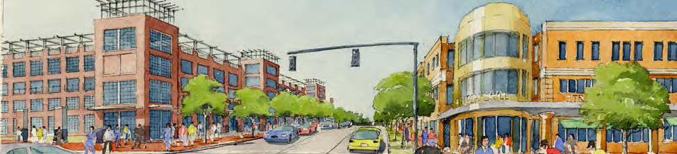
PROVIDE VARIED, ABUNDANT, & CONNECTED GREENSPACES
THROUGHOUT LEXINGTON’S URBAN & RURAL AREAS.
The Bluegrass identity sets Lexington apart from the rest of the world. It is vital that this identity be preserved and maintained through the designation and preservation of greenspace; growth should strike a harmonious balance between development and preservation. Lexington has and should continue to provide abundant new greenspace and greenways, while preserving existing natural areas that continue to foster and promote growth.
Greenspace and greenways are essential to the quality of life expected by Lexington’s citizens and are imperative to attracting new businesses and skilled workers. Greenspace should not be subjugated to the rural service area; rather, greenspace and greenways should play a prominent role in how the urban service area is developed. As the community continues to grow, more projects such as the Legacy and Town Branch Trails should
be considered and implemented, and more neighborhood parks should be created.
Greenspace is more than horse farms, parks, and forests; it also includes streams, sinkholes, the Kentucky River, and the prime soils provided by Lexington’s karst topography. Greenways are linear corridors, not unlike roads and trails, which can provide critical linkage and protection of natural and cultural resources.
Both new and existing corridors should be made complete with green infrastructure.
The natural topography of the Bluegrass offers abundant
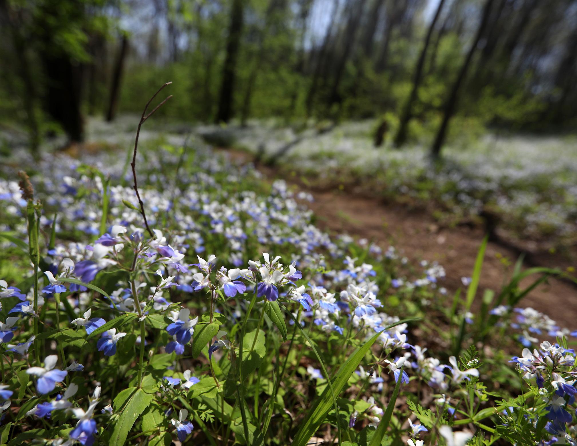
opportunities within the urban service area for greenspace. Greenspaces provide for recreational tourism, healthier living habits, and socially equitable open spaces. The scenic, environmental, and cultural impact of allocating greenspace and greenways is vital to a healthy and thriving urban environment.
The issues, concerns, and policy recommendations of both the 1994 Greenspace Plan and the 2007 Greenway Master Plan should continue to be considered and implemented. Both plans should be updated, taking into account new advancements in technology, growth, and development.
PROMOTE THE ADAPTIVE REUSE OF EXISTING STRUCTURES.
Structures often outlive the function that they were built to serve, and there is nothing new about stabilizing and rehabbing an old structure; however, under modern Zoning Ordinance provisions, refitting an old building for a new use is often problematic, particularly given the existing suburban parking requirements. The most drastic examples of this in Lexington were in the older industrial areas located within the defined Infill & Redevelopment Area.
Historically, major employers wanted to be near railroad access and housing that would allow their employees to walk to work, which is in contrast to more recent suburban-style priorities of having easy highway access and separation from residential properties. Many older industrial buildings nationally have become highly underutilized, due to the need for most new industrial uses to locate in large buildings that
are more cost-effective when built new, with better access to transportation corridors. Several small users could utilize the abundant vacant square footage, but a common problem was that the combined parking requirements of several small users could rarely be met onsite, or even in the general vicinity, without major demolition to provide new surface parking lots.
In 2012, the city partnered with the developers of the Distillery District and National Avenue to pass a first-of-its-kind Zoning Ordinance provision that would allow flexible uses and lower parking standards, providing a type of redevelopment flexibility second only to the core downtown zones. From inception, the adaptive reuse provisions of the Zoning Ordinance were designed to further the Goals and Objectives of the Comprehensive Plan, promoting the sustainable practice of reusing existing buildings, minimizing the need, in some cases, for new construction. The provisions were written with large-scale corridor redevelopment in mind, allowing phasing of the development to occur, recognizing that largescale redevelopment projects rarely happen overnight. Since the
adoption of the new regulations, these Adaptive Reuse Projects have generally been successful for large-scale redevelopmentwith some unintended negative consequences, such as the lack of options for multimodal access, resulting in overcrowded parking.
It is time to revisit this ordinance and strengthen it to achieve the current Goals and Objectives of the Comprehensive Plan, ensuring that adaptive reuse projects enhance their surrounding neighborhoods, provide more opportunities and options for a livable and walkable environment, and become anchors
for re-investment in existing neighborhoods. A possible approach to strengthen the adaptive reuse provisions is to create a context- sensitive design methodology, with differing guidelines for large corridors and individual projects; and, perhaps, the ability to apply the adaptive reuse principles to properties other than industrially-zoned areas.
UPDATE THE ADAPTIVE REUSE PROVISIONS IN THE ZONING ORDINANCE ACTION ITEM
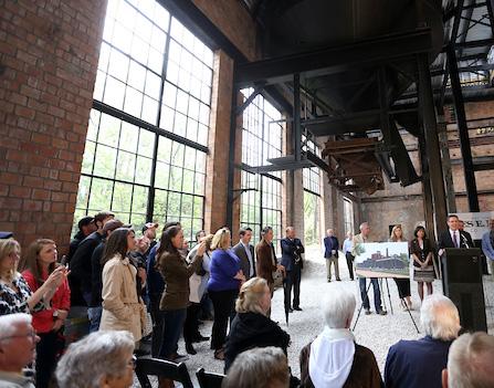
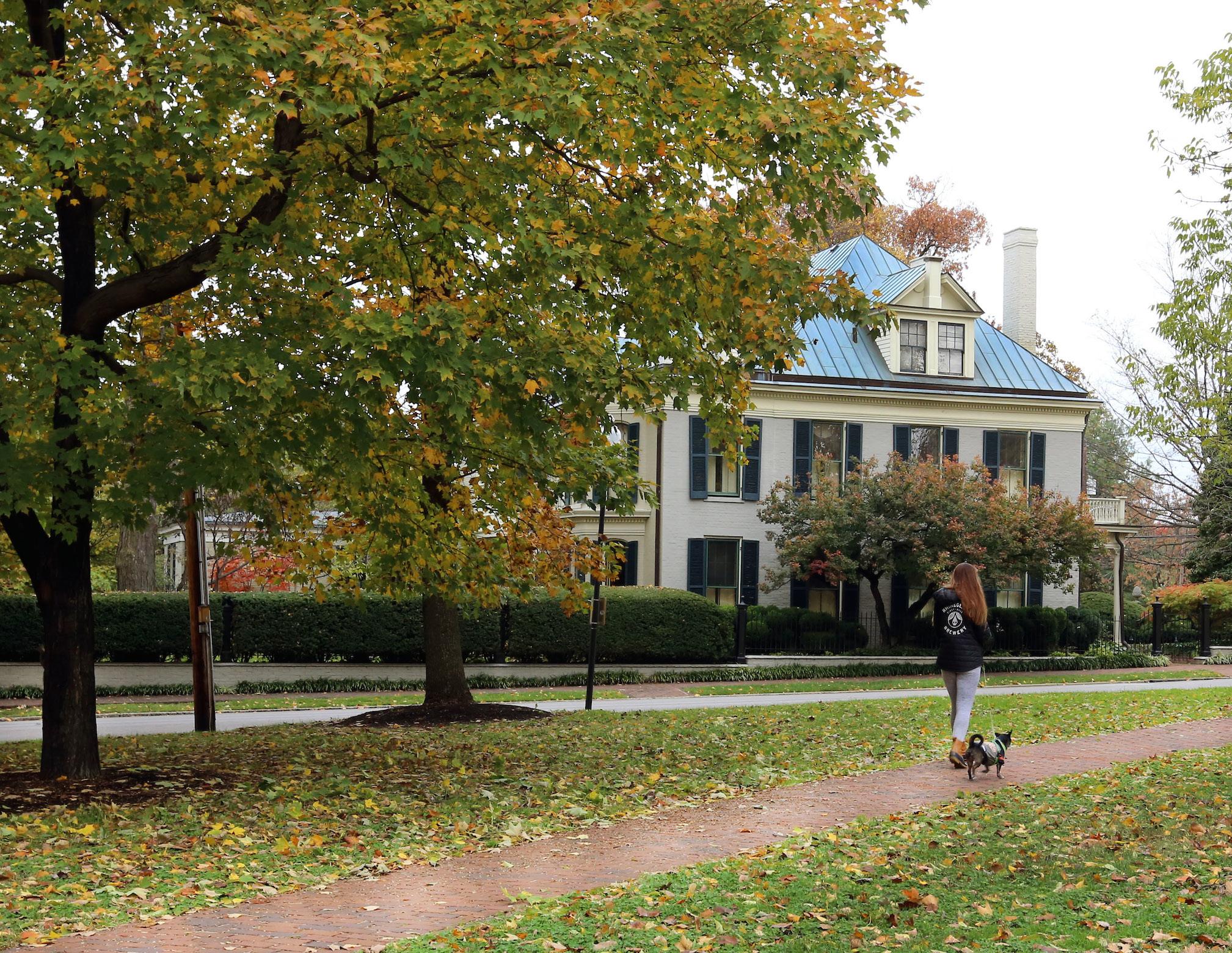
UTILIZE CRITICAL EVALUATION TO IDENTIFY & PRESERVE LEXINGTON’S HISTORIC ASSETS, WHILE MINIMIZING UNSUBSTANTIATED CALLS FOR PRESERVATION THAT CAN HINDER THE CITY’S FUTURE GROWTH.
With any future development of Lexington, reverence and critical review of the city’s history is imperative. Through the utilization of existing preservation policies, specifically through the Division of Historic Preservation, and through partnership with organizations like the Blue Grass Trust for Historic Preservation and the National Register of Historic Places, Lexington can protect, preserve, and enhance its stock of historic properties, which act as a bridge between present day and Lexington’s 243-year history.
While the preservation of Lexington’s historic properties is important, it is equally critical to distinguish between properties that contribute to the historical record, and those that are less
significant historically. During the development process, the age of properties is frequently utilized as a guideline for preservation in opposition to new construction. However, the 50-year test, which is often referred to as the test of longevity, must be corroborated with levels of historic significance. Historical significance of a site considers the impact on or importance to American history, architecture, archeology, engineering, and/or culture, and can be attributed to districts, sites, buildings, structures, and/ or objects (National Register Criteria for Evaluation).
The significance of the property can generally be broken down into four primary criteria of influence: an area of important events, association with significant persons, a unique or distinctive type, or the potential to yield important information. Furthermore, the property must possess high levels of integrity regarding location, design, setting, materials, workmanship, feeling, and association. These criteria for preservation and/ or enhancement of a structure should be employed to analyze the importance to the history and character of Lexington.
Through this crucial evaluation process, properties and districts that contribute to the historical record, as well as representative samples of architectural stylings, will be preserved for future generations to experience. However, without a critical review of a property’s contribution, Lexington will see a proliferation of unsubstantiated calls for preservation that can hinder the growth and densification within the urban service boundary.
Additionally, a proactive and comprehensive inventory of historic assets should be undertaken by the Department of Planning, Preservation, and Development to identify architecturally and historically significant properties. This should result in the initiation of additional H-1 Districts, as appropriate, to supplement the 15 existing districts that fundamentally contribute to Lexington’s urban fabric. Ideally, this assessment should be completed prior to development proposals to eliminate confusion as potential developments are evaluated.
CREATE A PROACTIVE & COMPREHENSIVE INVENTORY OF HISTORIC ASSETS
ADDRESS NEW DEVELOPMENT CONTEXT ALONG THE BOUNDARIES OF EXISTING HISTORIC DISTRICTS TO ENHANCE HISTORIC AREAS WHILE ENCOURAGING INFILL & REDEVELOPMENT.
Traditionally, the application of zoning has been almost universally about softening the edges of varying land uses against each other. American economic shifts have resulted in less need for stepdown
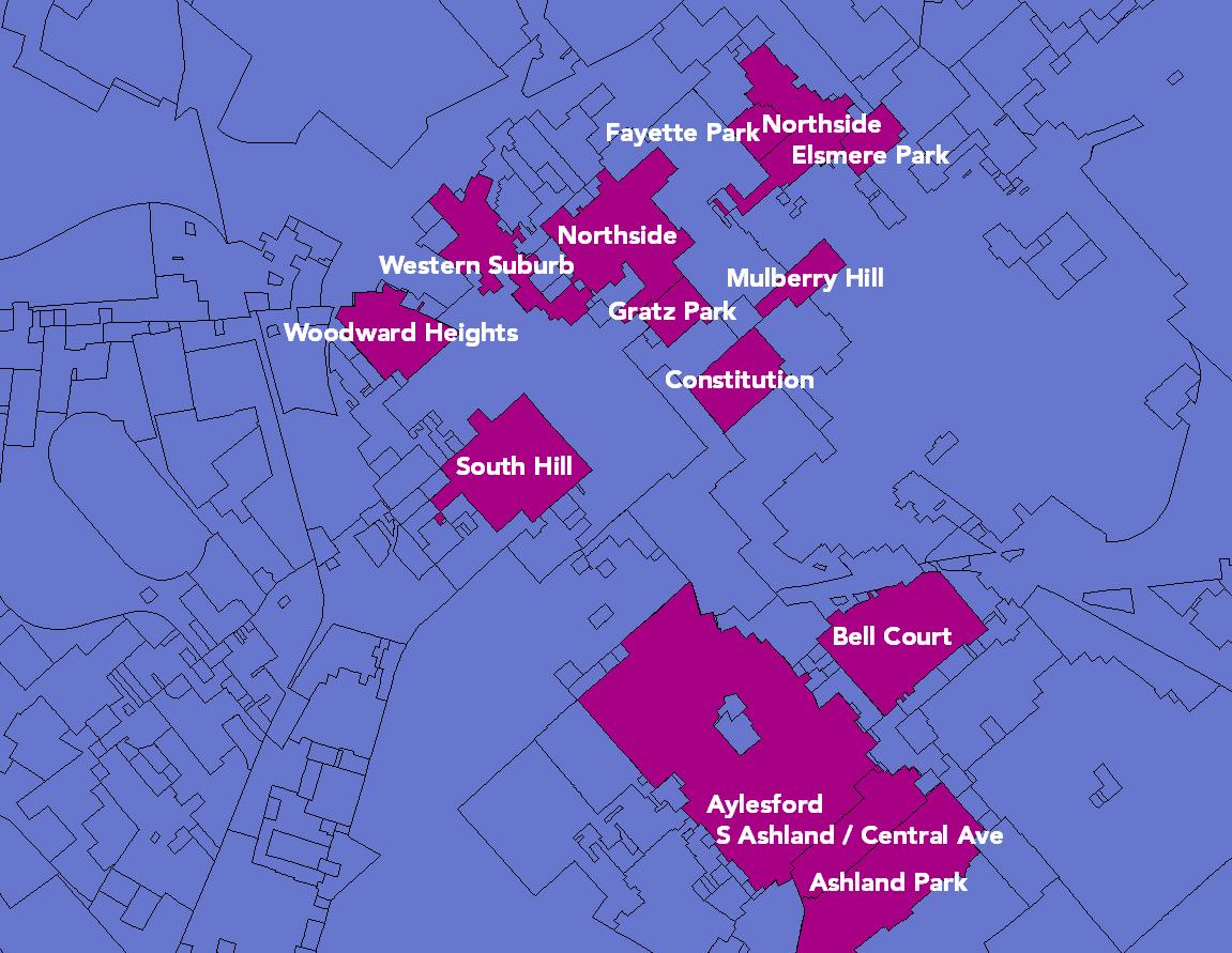
zoning, as today planners are less likely to need to address mitigating the impacts of manufacturing and industrial uses on less intense areas directly adjacent. On the other hand, preservation efforts of the last few decades have increased the desire to mitigate issues of context between old and new. Lexington’s local economy has undergone a similar transformation over the last few decades. While the tobacco industry has waned, the city’s service and healthcare industries have grown significantly. The more urban land uses of the new economy are increasingly complementary to existing residential land use patterns. Greater consideration to site
design can make those transitions even more complementary and of greater benefit to neighborhoods.
Redevelopment of older industrial sites near historic areas creates an opportunity to enhance those spaces. Historic preservation efforts have succeeded in making some areas attractive for new growth around them, a testament to their success. However, creating a market for new projects is not without its own issues to monitor. Imagine Lexington absolutely supports preservation of existing historic districts, while encouraging new infill and redevelopment projects in areas around them.
Development criteria within Imagine Lexington will seek to address some of these contextual issues in order to better provide guidance to historic property owners and developers about what to expect along the boundaries of historic zones. The primary goal will be to enhance the historic areas by creating new dynamic places where people will want to live, work and visit, while not attempting to mimic or recreate the past. In the urban core, increases in land use intensity are to be expected, while still enhancing the aesthetic of directly adjacent historic areas.
LEXINGTON SHOULD BE PROACTIVE, HIGHLY AGILE, & ADAPTABLE IN PURSUING CHANGES TO TRANSPORTATION & LAND USE POLICY THAT HARNESS THE BENEFITS OF AUTONOMOUS VEHICLES (AV) & LIMIT THE POTENTIAL DETRIMENTS.
While computer technology has improved rapidly and dramatically over the last 20 years, conversely, automobiles have traditionally followed a much more deliberately slow-paced and methodical development process, primarily to ensure that safety is enhanced with every iteration of advancement. But as cars have become more like computers, there has been a shift in the design process, from designing a car that can withstand a crash to designing a car that avoids the crash in the first place. With prices dropping and the availability of driver-assistance technology increasing, it is evident that the future of transportation will be tied to a smart connected city infrastructure, known in the industry as Intelligent Transportation Systems (ITS). This, in turn, will
allow future innovations that will create more travel options.
Just as computer technology, the internet, and smart phones have transformed almost every aspect of daily lives, connected and automated vehicles will change the way citizens navigate and pay for travel. There are many experts that have envisioned a utopian future of low cost electric vehicles transporting people from door to door, while others see a dystopia of clogged streets and negative impacts on health, as fewer choose to walk. The truth is likely to be found somewhere in between these two visions, with both new benefits and unforeseen consequences. What is clear is that change is coming, and it is coming faster than ever expected. Automated and connected vehicles will affect the economy, land use decisions, data sharing, pricing, safety, available travel options, congestion, customer service, retail establishments, employment, and many other aspects of daily lives. Irrespective of the projections about how fast the full adoption of these services will be at full market saturation, the time to plan for them is now.
places make people. Whatever the mobility options, Lexington should adopt a “people first” attitude when preparing for a shift in land use patterns, and ensure that the thrill of a new technology enables a better future, rather than having it dictate behaviors. Lessons should be learned from society’s last major transportation shift, where singleoccupancy vehicles dictated the landscape with very little regard to the unintended consequences.
There are a great many unknowns when it comes to the full spectrum of impacts autonomous vehicles will have on transportation, land use, and society as a whole. What is clear is that Lexington needs to strive to be proactive in anticipating these changes, leveraging them for their positive attributes while minimizing the negative. This new technology should be not be feared but embraced, and Lexington should look to be a leader in the state, region, and nation in this regard.
It is important to remember, first, that people make places and
In order to prepare for the future of autonomous vehicles, Lexington should be increasingly flexible in parking requirements, favoring those high-intensity uses that are well-suited as mobility hubs to aggregate and provide seamless transfers between a growing number of mobility options and ownership models. It will also be important to consider designated curbside or private drop-off and pickup areas in lieu of traditional surface parking spaces, as parking in close proximity to destinations will be less crucial. Additionally, Lexington must prepare for AV technologies to change the needs of private industries, particularly freight and retail, with less space dedicated to showrooms and increased demand for warehouses and logistical square footage.
UPDATE THE ZONING ORDINANCE TO ACCOMMODATE & ANTICIPATE AUTONOMOUS VEHICLES
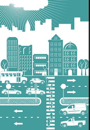
IDENTIFY CATALYTIC REDEVELOPMENT
OPPORTUNITIES TO PROACTIVELY REZONE PROPERTIES, CLEAR REGULATORY HURDLES, & EXPEDITE REDEVELOPMENT IN KEY AREAS THAT WILL IGNITE FURTHER ECONOMIC GROWTH.
Previous small area plans, which contained future land use recommendations, have been critical to facilitating future development in those locations. Recommendations in the South Nicholasville Road Small Area Plan led the way for The Summit at Fritz Farm, an area that had been the subject of numerous failed zone change attempts in the past. While in the WinburnRussell Cave Small Area Plan, specific recommendations for public improvements were immediately implemented through Urban County Council action, approving funds for constructing the completion of Winburn Drive to Citation Boulevard.
Looking forward, as the planned corridor studies that are a major component of Imagine Lexington are completed, property owners interested in implementing the recommendations should be afforded an opportunity to take part in a Planning Commission initiated Zone Map Amendment.
Leveraging the partnerships forged during the study period, a government sponsored zone change that reflects the recommendations would expedite the land use changes needed along the respective corridors. If the City has a desired outcome in these areas, proactive measures should be taken to lay the groundwork for their implementation.
Taking steps to clear the path for future development can signal to the development community that there is substantial buy-in on the planned path forward, minimizing both the risk and cost associated with redevelopment projects. Part of the corridor study process would include engagement with the associated Urban County Councilmembers to ensure a broad overall desire to implement the plans.
HOUSING” TYPES THROUGHOUT LEXINGTON.
Historically, Lexington and many other cities were built with a mix of housing types that included single-family homes, small fourplexes, carriage houses, stacked duplexes, courtyard apartments, and larger apartment clusters, all with fewer off-street parking spaces in walkable neighborhoods that were the fundamental building blocks of the city. Many of these neighborhood features became non-conforming uses and slowly disappeared, for a variety of regulatory, social and economic reasons, as the development community and the Zoning Ordinance became more focused on suburban expansion, which favored the automobile and separation and isolation of uses.
activities, due to their ability to provide amenities like walkability and achieving a higher density without the perception of overcrowding. As this type of housing in these and other neighborhoods becomes more popular, there will be additional opportunities to provide compatible housing, new uses such as live-work units, and walk-to businesses to support the residents. The lowintensity business uses need to be integrated with the existing neighborhood, and should favor mixed-use corridors, such as Jefferson Street or Loudon Avenue, where they add neighborhood character and become focal points for neighborhood gatherings.
WORK WITH THE PLANNING COMMISSION & COUNCIL TO PROACTIVELY PURSUE GOVERNMENT-INITIATED ZONE CHANGES RECOMMENDED BY CORRIDOR STUDIES
Today those remaining neighborhoods, such as Chevy Chase and Kenwick (commonly known as the “Missing Middle Housing”), are highly sought after for infill and redevelopment
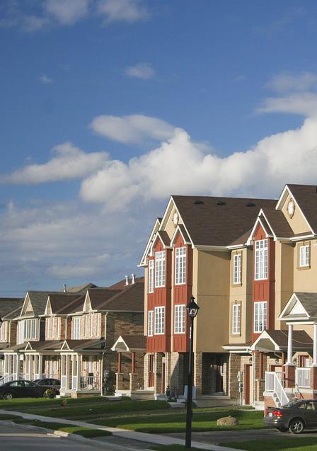
SUPPORT THE ENHANCEMENT, REUSE, AND/OR REDEVELOPMENT OF UNDERUTILIZED PROPERTY TO FIT THE CHANGING RETAIL LANDSCAPE, INCREASE DEVELOPMENT VIABILITY, & BOLSTER ENHANCED MASS TRANSIT OPTIONS.
Since the beginning of the century, the United States has seen significant growth in annual e- commerce sales. Shifts in consumer behavior, particularly among millennials, have contributed to a near 15% increase in online sales revenue every year since 2010. While e-commerce only makes up about 10% of the U.S.’s total retail annual revenue (with the remaining 90% coming from
traditional brick and mortar stores), its unprecedented growth and accessibility has some forecasting e-commerce’s eventual reign over the retail sector. Such a changeover will likely cause traditional brick and mortar businesses, such as strip malls and big box stores, to become a less prominent component of the landscape.
To put Lexington’s commercial retail landscape into perspective, the city is currently home to 71 square feet of retail space per capita, about 1.5 times the national average of 46.6 square feet. Lexington also has a higher percentage of retail space as compared to similarly sized cities and other industrialized countries. As a city with a larger than average retail footprint, it is fair to assume Lexington will be disproportionately affected by changes in the retail market. In recent years, Lexington has already experienced the trickling effects brought on by
shifting consumer habits and preferences, with the closure of several prominent national retailor locations. In response, Imagine Lexington brings to the forefront the flexibility and creativity needed to facilitate the reuse, revitalization, and/or enhancement of existing retail space, both utilized and underutilized.
Recommendations to allow for a greater range in development types, particularly high-density residential, are supported by this policy, and the B-6P and mixed use zones in particular provide these opportunities.
Other U.S. cities have already begun finding innovative ways to
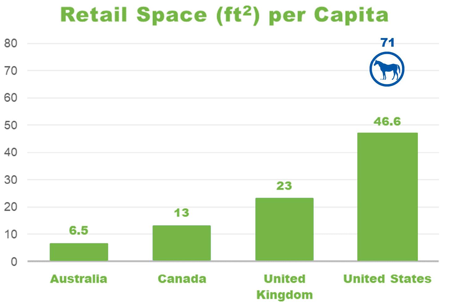
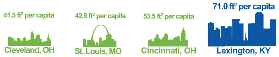
revamp their underutilized retail spaces to better accommodate the needs of the surrounding population. One of the most noteworthy cases of adaptive reuse of retail property occurred in America’s first mall, the Providence Arcade Building in Rhode Island (built in 1828). After years of decline, the majority of this space has been converted into a community of micro-apartments, marketed to young professionals seeking affordable housing. The design features small retail businesses on the first floor, while the top two floors are composed of residential units. In another example of the revitalization of a declining shopping mall, the Main Line Health Center in Exton, Pennsylvania implemented an adaptive reuse
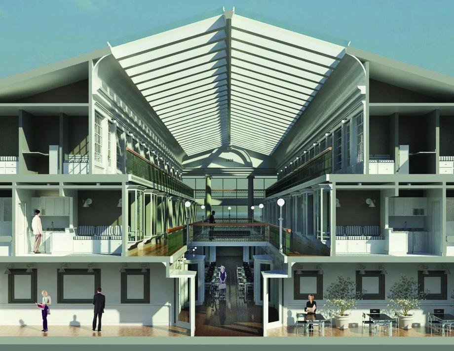
project that converted the space into an active healthcare facility.
One of the central themes of these projects is the concept of filling a specific need of the local consumer base. In the case of Lexington, the increased need for housing units, such as what was achieved with the Providence Arcade project, could present an opportunity for developers and community designers to encourage residential uses on existing retail properties, whether by adding on to an existing property or implementing an adaptive reuse of an underutilized building. As most large retail centers are located along major hightraffic corridors, incorporating this residential component into existing developments will also increase the
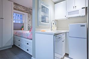
viability of enhanced mass transit by increasing potential ridership.
This type of redevelopment can be mutually beneficial for the city, the future tenants, and the property owners. This additional development opportunity will allow the landowners greater return on their properties, and should also bolster the success of the remaining retail entities on the site, building in a customer base within close, walkable proximity, as well as connecting other parts of the city to the development through enhanced transit. Existing retail developers interested in strengthening their customer base should consider the incorporation of not only residential uses, but less traditional retail services such
as small groceries, pharmacies, gym/fitness centers, and locations for medical and senior care. As mentioned throughout previous themes, a growing number of residents now prefer to live and spend time in areas that are walkable and well-incorporated. Retail spaces that are within close proximity to housing, restaurants, public spaces, and entertainment opportunities could create the communitybased customer experience that people are looking for.
UPDATE LEXINGTON'S COMMERCIAL ZONES TO INCLUDE MORE VARIED USES TO ACCOMMODATE THE SHIFTING RETAIL MODEL

IMAGINE LEXINGTON
ANTICIPATES A VARIETY OF LAND USE CHANGES WILL OCCUR THROUGHOUT THE URBAN SERVICE AREA & RECOMMENDS THOSE THAT ARE IN AGREEMENT WITH THE GOALS, OBJECTIVES, & POLICIES WITHIN THIS COMPREHENSIVE PLAN. LAND USE CHANGES ALONE IN AN AREA ARE NOT SUFFICIENT TO CONSTITUTE MAJOR CHANGES OF AN

ECONOMIC, PHYSICAL, OR SOCIAL NATURE AS PROVIDED IN STATE STATUTE FOR THE APPROVAL OF A ZONE MAP AMENDMENT.
State statue provides direction on the findings necessary for proposed map amendments or zone changes. The primary threshold to clear is that the proposal must be in agreement with the adopted comprehensive plan. However, it also allows that, in the absence of such a finding, the Planning Commission can approve an application if there have been, “major changes of an economic, physical, or social nature within
the area involved which were not anticipated in the adopted comprehensive plan and which have substantially altered the basic character of such an area.” Due to the adaptive and flexible nature of Imagine Lexington, this should be a very difficult argument to make successfully. Imagine Lexington not only anticipates land use changes throughout much of the urban service area, it calls for and recommends them.
Applicants justifying a zone map amendment with language regarding unanticipated changes must do so with evidence outside of land use changes approved by
the Planning Commission, which should speak to much larger economic, physical or social shifts from forces greater than local planning decisions.
Land use changes are expected to occur throughout Lexington as infill and redevelopment continues as the primary strategy. These changes will occur and be approved primarily based upon their ability to demonstrate compliance with the Goals and Objectives and associated policies, as well as the zone change criteria of Imagine Lexington.

"LAND
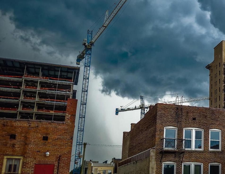

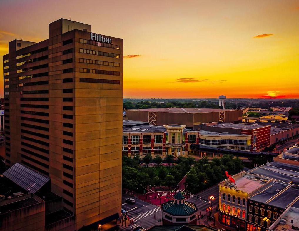


GROWING SUCCESSFUL
NEIGHBORHOODS THEME A
DESIGN
DENSITY

PROTECTING THE ENVIRONMENT

PROTECTION

SUSTAINABILITY


EQUITY
CREATING JOBS & PROSPERITY
LIVABILITY
DIVERSITY

RESTORATION

PROSPERITY


IMPROVING


• POLICY 1: Utilize a people-first design, ensuring that roadways are moving people efficiently and providing pedestrian infrastructure that is context sensitive to the vehicle environment and land uses.
• POLICY 2: Ensure proper road connections are in place to enhance service times and access to fire and police services for all residents.
• POLICY 3: Multi-family residential developments must comply with the Multi-family Design Standards in Appendix 1.
• POLICY 4: Provide development that is sensitive to the surrounding context.
• POLICY 5: Provide pedestrian friendly street patterns and walkable blocks to create inviting streetscapes.
• POLICY 6: Adhere to the recommendations of the Lexington Area MPO Bike/Pedestrian Master Plan, adopted in 2018.
• POLICY 7: Design car parking areas so as not to be the primary visual component of the neighborhood.
• POLICY 8: Provide varied housing choice.
• POLICY 9: Provide adequate greenspace for all neighborhoods within walking distance.
• POLICY 10: Provide neighborhood focal points accessible to all residents.
• POLICY 11: Single loaded streets should be utilized in order to establish clear public access to neighborhood focal points.
• POLICY 12: Support neighborhood level commercial areas.
• POLICY 13: Provide connections to all stub streets into proposed developments and maximize street connections.
• POLICY 1: The highest density of our residential development should be directed to our major corridors and downtown.
• POLICY 2: Infill residential can and should aim to increase density while enhancing existing neighborhoods through context sensitive design.
• POLICY 3: Create opportunities for additional neighborhood supportive uses, especially in areas where services are lacking.
• POLICY 4: Generally, locate high-density areas of development along higher capacity roadways (minor arterial, collector) to facilitate future transit enhancements.
• POLICY 5: Provide affordable and/or compact residential options through Accessory Dwelling Units.
• POLICY 6: Allow and encourage new compact single-family housing types.

• POLICY 1: Meet the demand for housing across all income levels.
• POLICY 2: Provide affordable housing across all areas, affirmatively furthering fair housing, complying with HUD guidance.
• POLICY 3: Add residential opportunities by proactively up-zoning areas near transit for populations who rely solely on public transportation.
• POLICY 4: Preserve and enhance existing affordable housing through the land bank, community land trust and vacant land commission.
• POLICY 5: Protect affordable housing tenants through improved code enforcement policies.
• POLICY 6: Provide flexibility for senior housing through Accessory Dwelling Units.
• POLICY 7: Community facilities should be well integrated into their respective neighborhoods.
• POLICY 8: Housing developments should implement Universal Design principles on a portion of their units.
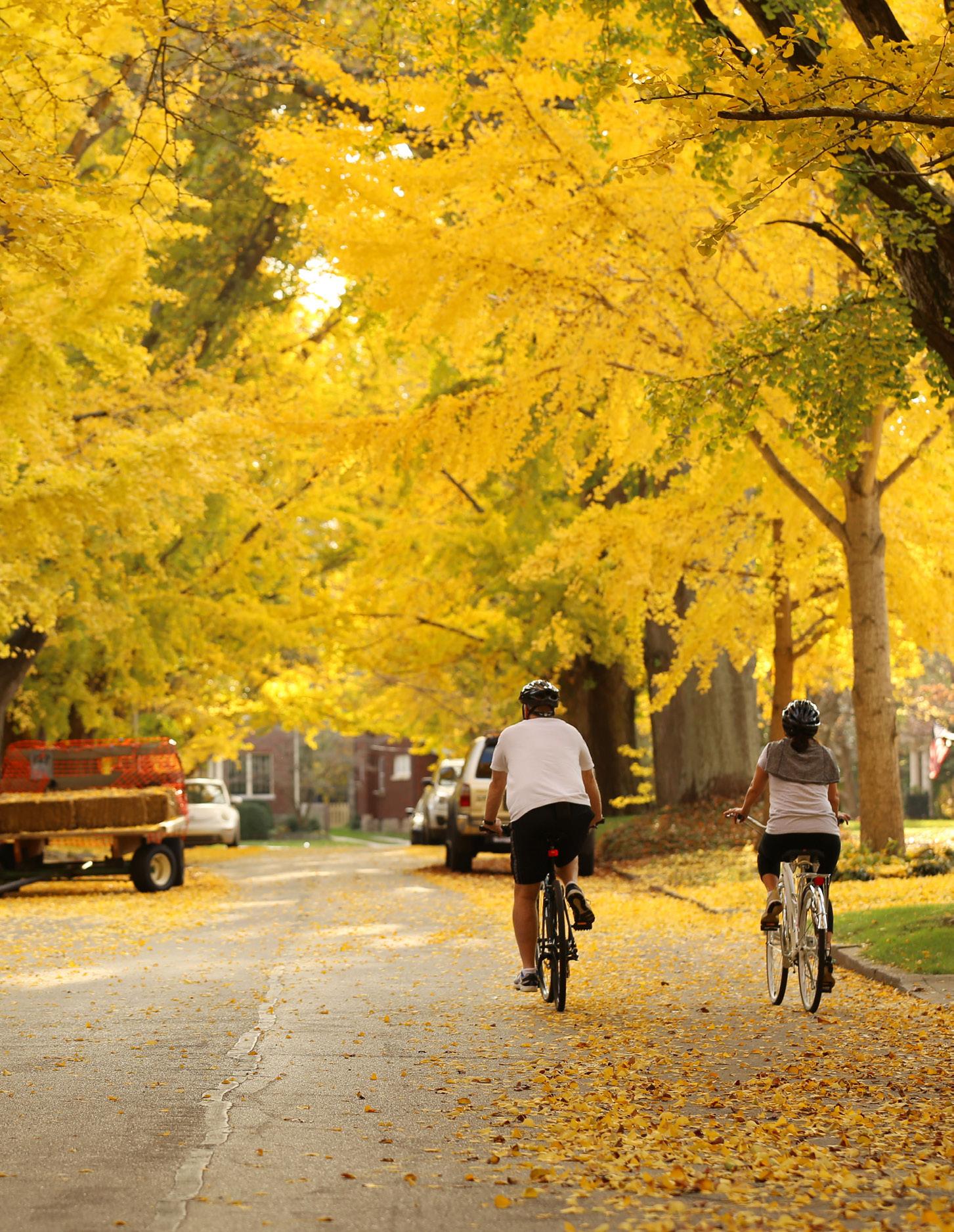


POLICY 1: Continue the Sanitary Sewer Capacity Assurance Program (CAP) and encourage the Stormwater Incentive Grant program to reduce impacts of development on water quality.
POLICY 2: Conserve environmentally sensitive areas, including significant natural habitats, wetlands and water bodies.
POLICY 3: Continue to implement PDR program to safeguard Lexington’s rural land.
POLICY 4: Conserve active agriculture land in the Rural Service Area while promoting a creative food chain network.
POLICY 5: Promote and connect local farms with the community through integrated partnerships.
POLICY 6: Promote context- sensitive agritourism in the Rural Service Area.
POLICY 7: Protect sensitive natural habitats and wildlife in the Urban Service Area, protect the urban forest, and significant tree canopies in crucial ecological networks.
POLICY 8: Integrate the Greenspace Plan into urban and rural area.
POLICY 9: Respect the geographic context of natural land, encourage development to protect steep slope; and locate building structures to reduce unnecessary earth disruption.
POLICY 10: Install iconic rural fencelines around major greenways and creeks to enhance their natural beauty.

POLICY 1: Develop a multi-modal transportation network and infrastructure; seek collaboration with regional transit partners for the commuting public.
POLICY 2: Promote roadway, pedestrian and bicycle connectivity.
POLICY 3: Encourage Transit-Oriented Development, increase density along major corridors and in the Infill and Redevelopment Area to support transit ridership, thus reducing vehicle miles traveled (VMT).
POLICY 4: Make recommendations to locate new development within walking distance of existing greenspace / community centers, or create greenspace / community centers within walking distance of residential uses.
POLICY 5: Reduce / discourage vehicle oriented development patterns, such as drive-through businesses within the Urban Service Boundary, especially in the urban core areas. Reduce parking footprints.
POLICY 6: Apply traffic mitigation programs, such as communication with employers to encourage flexible work schedules or telecommuting.
POLICY 7: Continue and expand energy efficiency initiatives, promote energy efficient buildings by supporting grants and public recognition.
POLICY 8: Encourage Lexington to join the STAR Community rating program.
POLICY 9: Develop and proactively share educational materials and programs to increase public awareness of energy efficiency benefits and services.
POLICY 10: Enhance Lexington’s recycling and waste management programs.
POLICY 11: Require green infrastructure elements for new development, and require during redevelopment where appropriate.
POLICY 12: Encourage and explore incentives for green building practices for new development and redevelopment.
POLICY 13: Develop an overarching entity / organization for existing environmentally-focused agencies to collaborate on sustainability programs and follow through on implementation.

POLICY 1: Follow the LFUCG Urban Forestry Management Plan, protecting and recovering Lexington’s urban forest by strategically planting new trees and creating walkable streetscapes.
POLICY 2: Use green infrastructure to bridge gaps in the greenspace network.
POLICY 3: Support community gardens and urban agriculture to restore natural resources within the Urban Service Area.
POLICY 4: Improve air quality by reducing vehicle miles traveled (VMT).
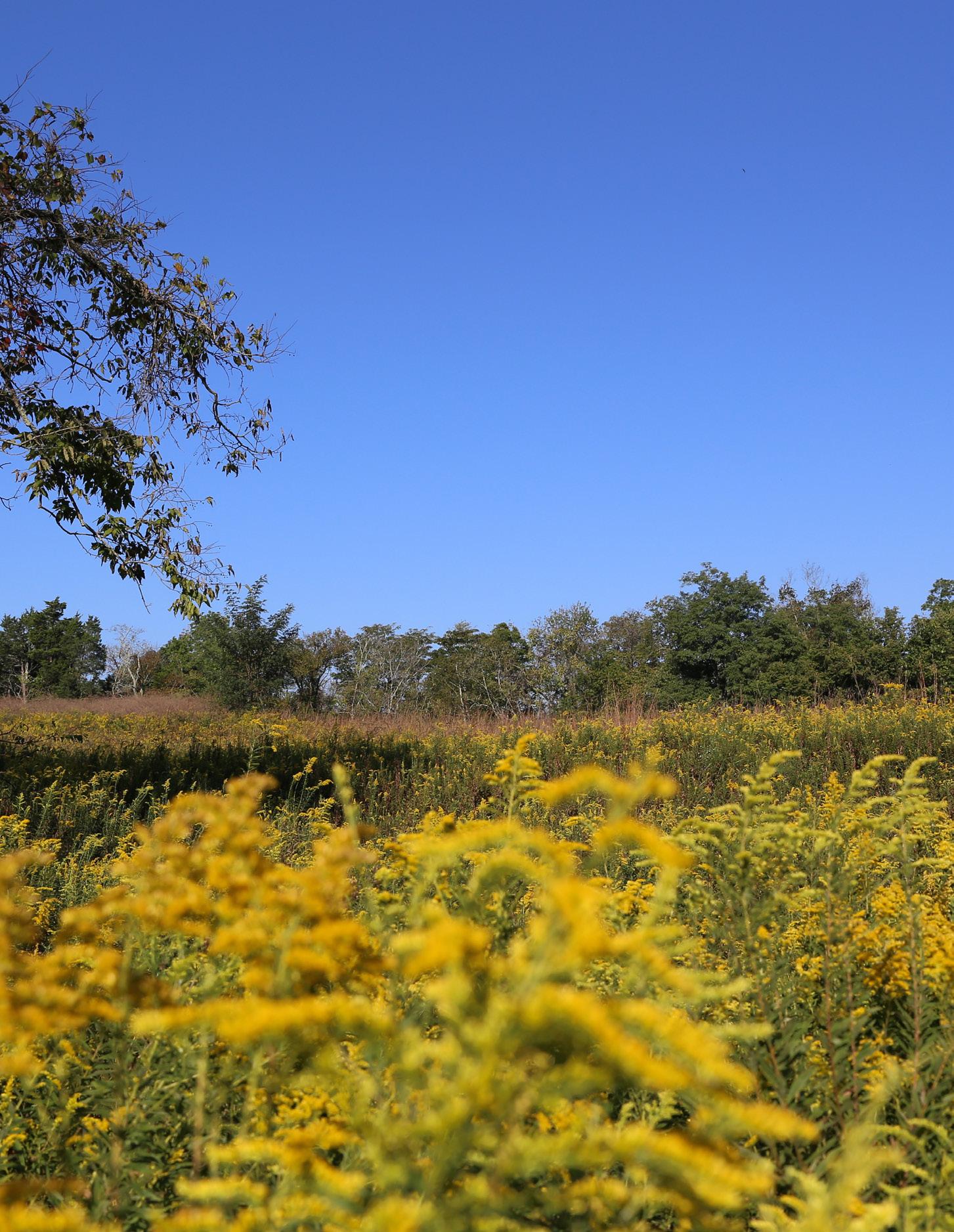


POLICY 1: Encourage economic opportunities for a wide array of agritourism while preserving the Bluegrass identity.
POLICY 2: Emphasize the preservation, protection, and promotion of the iconic Bluegrass landscape along rural gateways and roadways serving as primary tourist routes.
POLICY 3: Create a large regional athletic field complex for economic development and to enhance Lexington’s existing facilities.
POLICY 4: Continue to coordinate transportation logistics and traffic control for recurring special events, festivals, and parades.
POLICY 5: Enhance programs and activities by Lexington’s Parks and Recreation Department, and support public event planning, community events, and festivals.
POLICY 6: Attract and retain young professionals by improving affordable housing opportunities, amenities, and entertainment options that are attractive to them.
POLICY 7: Continue to create a true multimodal and mixed-use community with safe and quality access to community facilities, greenspace, employment, neighborhoods businesses, shopping, and entertainment.
POLICY 8: Promote quality of life aspects, including greenspace, as an attraction to new businesses and residents.
POLICY 9: Promote economic development through the preservation of strategically and appropriately located industrial and production zoned land.

POLICY 1: Create opportunities for incubators. Seek incentives for owners of vacant office/laboratory space, and for developers who build incubator space for startups and for growing businesses.
POLICY 2: Encourage a diverse economic base to provide a variety of job opportunities, allowing upward mobility for lower income residents of Fayette County
POLICY 3: Support full funding and adequate staff for the Minority Business Enterprise Program (MBEP) which increases diversification of city vendors through promoting an increase in minority, veteran, and women-owned companies doing business with the city.
POLICY 4: Encourage training, programs, and workforce inclusion opportunities for people with disabilities or judicial records, or who have undergone rehabilitation from addiction.
POLICY 5: Maximize context-sensitive employment opportunities within the Opportunity Zone tracts, providing equitable community development, and prioritizing local residents for advancement opportunities.
POLICY 6: Increase flexibility on types of home occupations allowed.

POLICY 1: Promote hiring local residents, and recruit employees living in areas of construction projects.
POLICY 2: Support the continued funding for Economic Development grants and the Commonwealth Infrastructure fund, as well as Lexington’s Public Infrastructure Fund.
POLICY 3: Continue to protect the Agricultural Cluster and equine industry, and support existing agricultural uses, while promoting new innovative agricultural uses in the Rural Service Area.
POLICY 4: Encourage installation of fiber-optic broadband infrastructure for high-tech and other industries.
POLICY 5: Continue to raise awareness of farms and farm tours.
POLICY 6: Promote Kentucky Proud and local Lexington products using an identifying branding to be incorporated in: farm signage, distilleries, wineries, breweries, local destinations on tours, locally grown businesses, local produce, etc.
POLICY 7: Support and increase networking opportunities for career related institutions, educators, small business development agencies, workforce agencies, economic development and commerce organizations, tourism organizations, and state and local government.
POLICY 8: Provide employment opportunities that match the graduating majors from local colleges and vocational training institutions
POLICY 9: Recruit professional services that utilize vacant office space.
POLICY 10: Encourage flexible parking and shared parking arrangements.
POLICY 11: Expand job opportunities through education and training to retain existing businesses and attract new ones.
POLICY 12: Work with the Mayor’s Office to create a long-range plan for the 250 acres of Lexington’s publicly-controlled economic development land at Coldstream Research Campus.
POLICY 13: Promote increasing the supply of farm workers, and the availability and affordability of using agricultural technology, and agricultural equipment.


POLICY 1: Street design should reflect and promote the desired place-type.
POLICY 2: Create multimodal streets that satisfy all user needs.
POLICY 3: Provide equitable multi-modal access for those who do not drive due to age, disability, expense, or choice.
POLICY 4: Designstreet networks that provide alternative route options, which reduces traffic congestion.
POLICY 5: Streets should be designed for the desired speed, using builtin traffic calming measures such as roundabouts, narrower street widths, chicanes, medians, etc.
POLICY 6: Take a holistic approach to designing context-sensitive streets, addressing them within the framework of the countywide network, land use context and the needs of all users.

POLICY 1: Implement the Town Branch Commons Strategic Master Plan as an element of the Comprehensive Plan.
POLICY 2: Retrofit incomplete suburban developments, incorporating elements that create complete neighborhoods.
POLICY 3: Establish design standards for placemaking.
POLICY 4: Create quality and useable open space for all developments over one acre.
POLICY 5: Review Zoning Ordinance and Subdivision Regulations to create more walkable places.
POLICY 6: Amend the Expansion Area Master Plan to update the remaining residential area to reflect the 2018 Comprehensive Plan’s Goals and Objectives.
POLICY 7: Cultivate a more collaborative pre-development process, incorporating community feedback before development is formally submitted for review.
POLICY 8: Develop a tactical placemaking program within the Division of Planning to work with interested neighborhoods and aid in the organization of activities.
POLICY 9: Honor Lexington’s history by requiring new development and redevelopments to enhance the cultural, physical, and natural resources that have shaped the community.
POLICY 10: Coordinate with the Public Art commission to designate public art easements on new development that would be curated by the Commission.
POLICY 11: Update the Adaptive Reuse Ordinance
POLICY 12: Analyze underutilized commercial property through corridor land use and transportation studies.
POLICY 13: Update the Downtown Master Plan.
POLICY 14: Pursue a regional park system.
POLICY 15: Develop a new citywide festival to entice visitors and provide additional draw during the tourism off-season.

POLICY 1: Ensure school sites are designed to integrate well into the surrounding neighborhood.
POLICY 2: Incorporate natural components into school site design to further the goals of Theme B (Protecting the Environment), but also to provide calming elements that reduce student stress and anxiety.
POLICY 3: Support the maintenance and expansion of a robust wireless communications network creating reliable service throughout Lexington’s urban and rural areas.
POLICY 4: Provide equitable healthcare opportunities throughout Lexington to allow for the wide range of medical needs of all populations.
POLICY 5: Provide equity in social services by ensuring those in need are served by social service community facilities that address homelessness, substance abuse, mental health, and other significant issues.
POLICY 6: Ensure all social service and community facilities are safely accessible via mass transit, bicycle, and pedestrian transportation modes.
POLICY 7: Continue to support the provision of high speed internet services throughout Lexington.
POLICY 8: Build upon the success of the Senior Citizens’ Center to provide improved quality of life opportunities for the largest growing population demographic.
POLICY 9: Implement creative senior housing opportunities that are both accessible and affordable.


POLICY 1: Create a new process for determining long-term land use decisions involving the Urban Service Boundary (USB) and Rural Activity Centers.
POLICY 2: Modernize the Zoning Ordinance to reflect the direction of the 2018 Comprehensive Plan, proactively planning for the next 20 years of growth.
POLICY 3: Implement the Placebuilder, which includes criteria for zone change applications, based upon the goals and objectives, to ensure development compliance with the Comprehensive Plan.
POLICY 4: Develop growth benchmarks and determine best measurable methods to monitor them and report progress on a regular basis.
POLICY 5: Increase dedicated bike lanes, pedestrian and transit facilities in the existing right-of-way, focusing on moving people rather than exclusively single-occupancy vehicles.
POLICY 6: Partner with other agencies like the Lexington Public Library to create a public outreach opportunity that provides decision-makers with input and creates neighborhood leaders across all demographics and geographies.

POLICY 1: Update Lexington’s stone fence inventory, and pursue additional protections for this iconic and historic cultural asset.
POLICY 2: Capitalize on the diverse economic development, housing, and tourism opportunities throughout the Bluegrass Region and engage in discussions to further connect regional economic hubs.
POLICY 3: Increase regional transportation cooperation and pursue multimodal transportation options, to facilitate inter-county connectivity.
POLICY 4: Coordinate with surrounding counties to capitalize on the inherent tourism draws of the Bluegrass Region.
POLICY 5: Fully realize the development potential within Lexington’s Rural Activity Centers while avoiding negative impacts to surrounding agriculture, Rural Settlements, and viewsheds.
POLICY 6: Identify new compatible agritourism and ecotourism land uses that would enhance Lexington’s economy and provide additional incomegenerating possibilities for local farmers.
POLICY 7: Consult with planning departments of adjacent counties to find common Comprehensive Plan goals, objectives and implementation items where shared benefits could be gained by working together.
POLICY 8: Address economic, environmental, and social sustainability of new development to thoughtfully utilize Lexington’s resources for present needs while considering those of future generations.
POLICY 9: Follow and implement the recommendations of the 2007 Study of Fayette County’s Small Rural Communities and the 2017 Rural Land Management Plan to protect and preserve Lexington’s rural settlements.

POLICY 1: Revisit Infill and Redevelopment Area regulations to ensure they are compatible with Imagine Lexington and are encouraging desired development.
POLICY 2: Capitalize on the current momentum of downtown development and improvements by working to identify and enhance opportunities for redevelopment.
POLICY 3: Provide varied, abundant, and connected greenspaces throughout Lexington’s urban and rural areas.
POLICY 4: Promote the adaptive reuse of existing structures.
POLICY 5: Utilize critical evaluation to identify and preserve Lexington’s historic assets, while minimizing unsubstantiated calls for preservation that can hinder the city’s future growth.
POLICY 6: Address new development context along the boundaries of existing Historic Districts to enhance historic areas while encouraging infill and redevelopment.
POLICY 7: Lexington should be proactive, highly agile, and adaptable in pursuing changes to transportation and land use policy that harness the benefits of autonomous vehicles (AV) and limit the potential detriments.
POLICY 8: Identify catalytic redevelopment opportunities to proactively rezone properties, clear regulatory hurdles, and expedite redevelopment in key areas that will ignite further economic growth.
POLICY 9: Support the “Missing Middle Housing” types throughout Lexington.
POLICY 10: Support the enhancement, reuse, and/or redevelopment of underutilized property to fit the changing retail landscape, increase development viability, and bolster enhanced mass transit options.
POLICY 11: Imagine Lexington anticipates a variety of land use changes will occur throughout the Urban Service Area and recommends those that are in agreement with the goals, objectives, and policies within this Comprehensive Plan. Land use changes alone in an area are not sufficient to constitute major changes of an economic, physical, or social nature as provided in state statute for the approval of a zone map amendment.
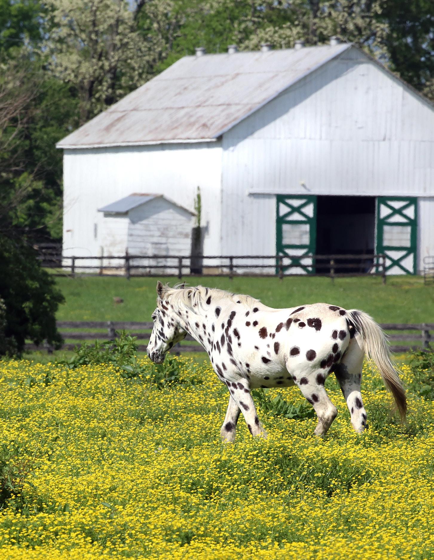
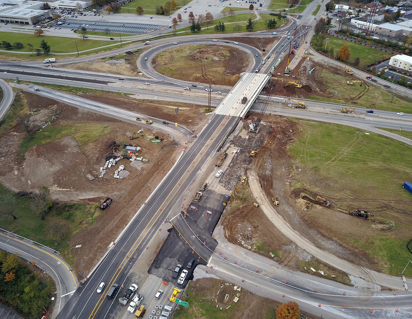
Also listed throughout the policies of Imagine Lexington, the following implementation items stand as short- and long-term tasks for the Planning Division once Imagine Lexington is put into action. Progress on these items will be tracked and actively updated to promote public awareness of our progress.
A Design 9 Amend Zoning Ordinance to redefine open space requirements. B-SU-4, D-PL-4, C-LI-8
A Design 10 Inventory existing neighborhood focal points and perform gap analysis.
A Design 12 Amend Zoning Ordinance to encourage residential development within existing neighborhood serving business districts.
Ongoing A Density 2 Evaluate and amend residential zones to allow greater housing opportunities.
Ongoing A Density 3 Perform gap analysis of existing neighborhoods to identify enhancement opportunities for new supportive uses.
A Equity 5 Work with Council to create a rental registration program.
A Equity 6 Partner with Senior Services Commission to develop and implement Accessory Dwelling Unit zoning options.
A Equity 7 Inventory and map existing social services and healthcare facilities. D-SU-4, D-SU-5, D-SU-6
A Equity 8 Partner with the Senior Services Commission to develop an age-friendly plan as part of the AARP Age-Friendly Communities Initiative.
B Protection 1 Coordinate with the Division of Water Quality to prioritize sewer capacity projects that will facilitate areas of expected growth.
B Protection 2 Develop an inventory of Special Natural Protection Areas within the Urban Service Area.
B Protection 6 Review the Zoning Ordinance for new agritourism and ecotourism opportunities. C-LI-1 Planning Long
B Protection 7 Update Zoning Ordinance to reflect national best practices on floodplain protections. Planning, Environmental Services Mid
B Sustainability 5 Overhaul parking standards throughout the Zoning Ordinance. C-PR-10, A-DS-7
B Sustainability 6 Implement an outreach program through employers to inform and incentivize employees to reduce single-occupancy commuting.
B Sustainability 8 Pursue STAR Community certification.
B Sustainability 9 Perform analysis of green building best practices and identify opportunities to implement.
Planning Near
Planning Near
Planning Long
Planning Mid
B Sustainability 11 Update the green infrastructure elements in the Engineering Manuals to reflect current best practices. Planning, Engineering Mid
B Sustainability 12 Explore permitting incentives for green building design. B-SU-7 Planning Long
B Restoration 1 Implement recommendations from the Urban Forestry Management Plan. B-PR-7
B Restoration 3 Work with Parks & Recreation and private organizations to facilitate the creation of a regional sports complex.
C Livability 9 Inventory and analyze existing industry and production land, identifying areas to enhance or repurpose based on market and locational factors.
C Diversity 5 Explore recommendations to promote development at specific sites within Opportunity Zones, while minimizing displacement.
Planning Near
Planning Mid
C Diversity 6 Update Zoning Ordinance regulations related to home occupations and home offices. Planning Mid
C Prosperity 8 Perform analysis of existing employment opportunities and graduate supply from area institutions. Planning Ongoing
C Prosperity 9 Study the efficacy of the Professional Office zone, looking for ordinance revisions aimed at reducing vacancy rate. Planning Ongoing
C Prosperity 12 Create a Long Range Plan for the 250 acre Economic Development site at Coldstream.
Planning Mid
THEME PILLAR POLICY ACTION ITEM
D Connectivity 1 Amend Subdivision Regulations street standards. A-DS-1. A-DS-2, A-DS-5, A-DS-11, A-DS-13, B-SU-1, D-CO-2, D-CO-3, D-CO-4, D-CO-5, D-CO-6
Planning Ongoing
D Connectivity 2 Implement Projects from the Lexington Area MPO Bike and Pedestrian Master Plan. B-SU-1, B-RE-4, A-DS7 Planning Ongoing
D Placemaking 1 Establish land use and transportation design guidelines for development adjacent to Town Branch Commons. Planning Near
D Placemaking 1 Perform a study to determine the economic and social impacts of Town Branch Commons. Planning Near
D Placemaking 3 Amend the Zoning Ordinance to include placemaking elements. D-PL-5 Planning Ongoing
D Placemaking 6 Update the Expansion Area Master Plan. Planning Mid
D Placemaking 7 Host workshops with development and neighborhood interests to create a collaborative pre-development process. Planning Near
D Placemaking 8 Work with Council to increase staffing to develop a tactical placemaking program within the Division. Planning Near
D Placemaking 10 Initiate discussions with the Public Art Commission about potential ordinance revisions to increase public art opportunities. Planning Mid
D Placemaking 11 Update the Adaptive Reuse Ordinance. Planning Mid
D Placemaking 12 Perform corridor studies along arterial streets that examine land use and transportation elements. A-DS-1, B-SU-3 Planning Near
D Placemaking 13 Update the Downtown Master Plan. Planning, Downtown Lex Partnership Mid
D Placemaking 14 Implement the recommendations from the Your Parks, Our Future Parks Master Plan. C-LI-5 Planning Mid
D Support 1 Engage with Fayette County Public Schools in order to align priorities in site selection and design. D-SU-2 Planning Near
E Accountability 1 Establish a new process for long-term land use decisions involving the Urban Service Boundary. Planning Near
E Accountability 2 Update the Zoning Ordinance to reflect Imagine Lexington priorities. Planning Ongoing
E Accountability 3 Host a Placebuilder workshop and training for developers, Planning Commissioners, and any other interested parties.
E Accountability 3 Create a public outreach program for ongoing community education on Imagine Lexington and the Placebuilder.
E Accountability 4 Develop a series of Comprehensive Plan metrics.
E Accountability 6 Create a Citizen Advisory Panel.
E Stewardship 1 Update the 1990 Stone Fence Inventory.
E Stewardship 5 Conduct a Blue Sky Small Area Plan.
E Stewardship 6 Update the Zoning Ordinance provisions for Agritourism.
E Growth 1 Update the Zoning Ordinance to reflect the Imagine Lexington’s infill policies.
E Growth 4 Update the Adaptive Reuse provisions in the Zoning Ordinance.
E Growth 7 Update the Zoning Ordinance to accommodate and anticipate autonomous vehicles.
E Growth 8 Work with the Planning Commission and Council to proactively pursue government-initiated zone changes recommended by corridor studies.
E Growth 10 Update Lexington’s Commercial Zones to include more varied uses to accommodate the shifting retail model.
Planning Near
Planning Near
Planning Near
Planning Near
Planning Long
Planning Long
Planning Long
Planning Ongoing
Planning Mid
Planning Mid
Planning Mid
Planning Ongoing

PAGE INTENTIONALLY BLANK
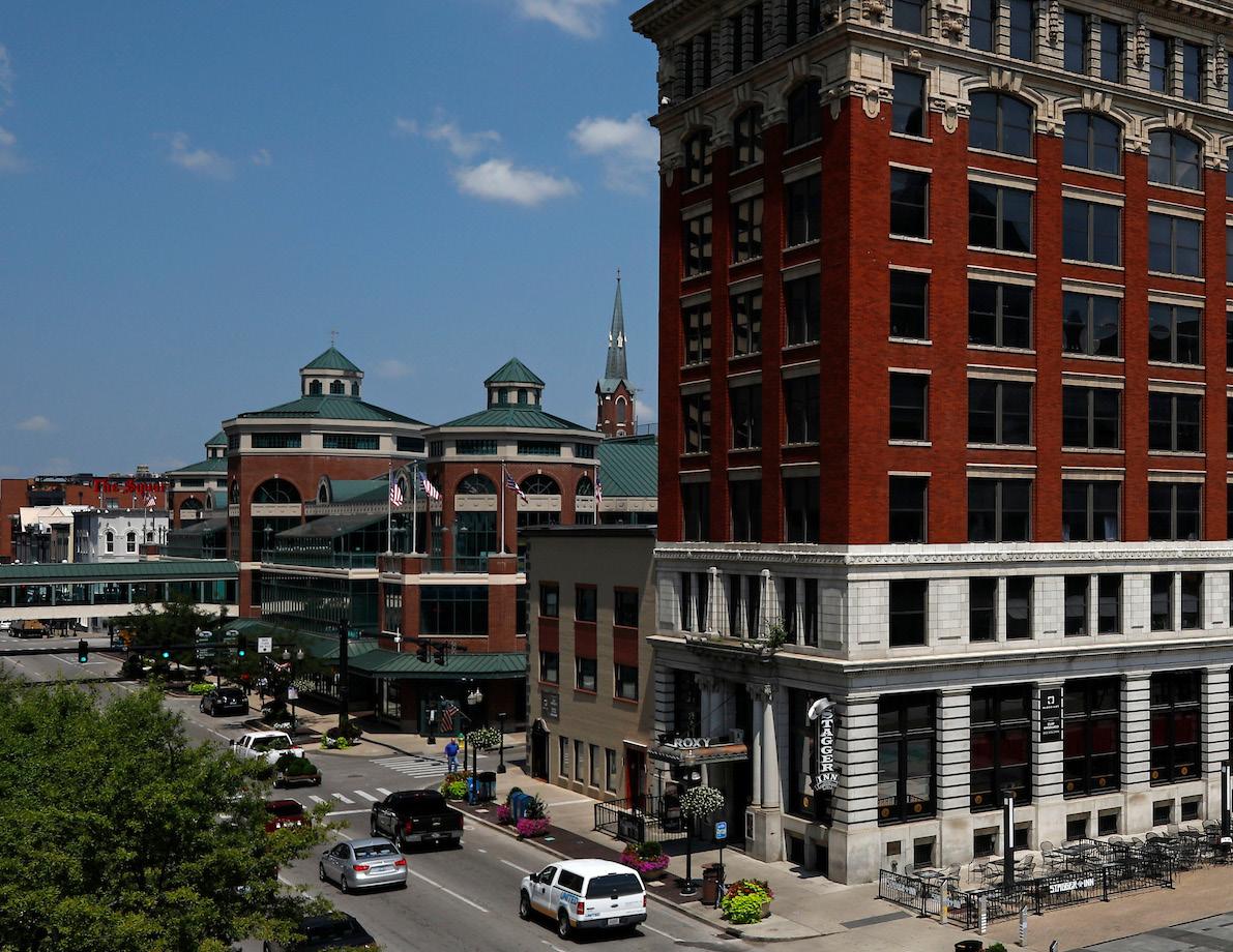
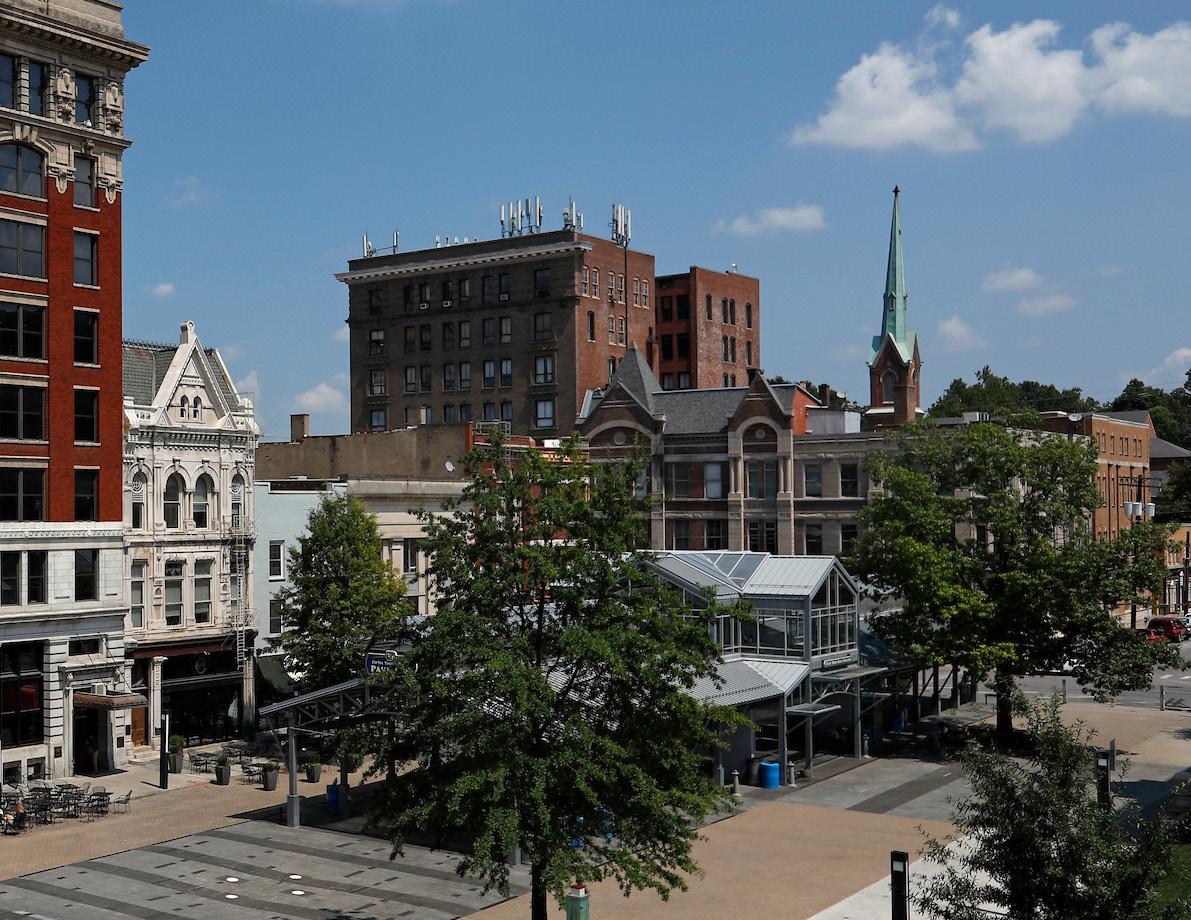
The Placebuilder is a compilation of the urban planning best practices found in the policies throughout this Comprehensive Plan. It sorts these best practices into development criteria that are applicable to proposed developments seeking a zone change. In addressing the development criteria, applicants demonstrate that they are in agreement with the Comprehensive Plan, and that their individual developments work toward implementing the broader Goals and Objectives developed by the community.
The two and a half year Imagine Lexington process gathered input from over 10,000 people and almost 70 expert advisors. The Placebuilder portion of this public input was held from October 2018 to January 2019, and included one open house style meeting (Imagine Out Loud event), two 3-hour-long focus group sessions, and one panel discussion with Planning staff. This public input created an opportunity for detailed refinement to the Placebuilder, and ultimately a better end product. However, there were many questions and comments throughout this process that made it clear additional clarification was required. Several of these recurring questions are addressed below:
The Placebuilder simplifies the application process by summarizing the applicable policies for a development proposal into two pages. Rather than having to comb through the entire plan to find out what applies to a specific development, the discussion points are already highlighted for the benefit of the applicants, the Planning Commission, the staff, and the surrounding neighbors.
The Placebuilder applies to zone change applications.
Neighborhood voices expressed a desire for more stringent restrictions on smaller parcels to protect against incompatible adjacent development, while development interests conveyed a concern that applying The Placebuilder to smaller sites would limit infill development feasibility. The Placebuilder is designed to be flexible and applicable to a wide range of parcels and contexts. Applicants will likely not be able to meet all development criteria on all sites – especially those with lot size restrictions or
other similar constraints. Where development criteria are not feasible, it is up to the applicant to make the case that they do not apply.
No, and no. Again, every site is different, each with their own opportunities, constraints, and challenges. The criteria within are meant to catalyze conversations about how proposals further the policies and concepts throughout the plan. It is not a mandatory list to be met on all developments. The
Placebuilder is meant to hone the salient issues for a site in order to facilitate development that meets the needs of the full community, as well as providing contextsensitive projects that enhance the surrounding neighborhood.
WILL APPLICANTS BE REQUIRED TO SUBMIT LENGTHY WRITTEN JUSTIFICATIONS FOR EVERY CRITERIA?
No. The application of the concepts on the proposed plan is of primary concern. Some criteria can be addressed in batches in notes referring to specific portions of the development plan. The justifications
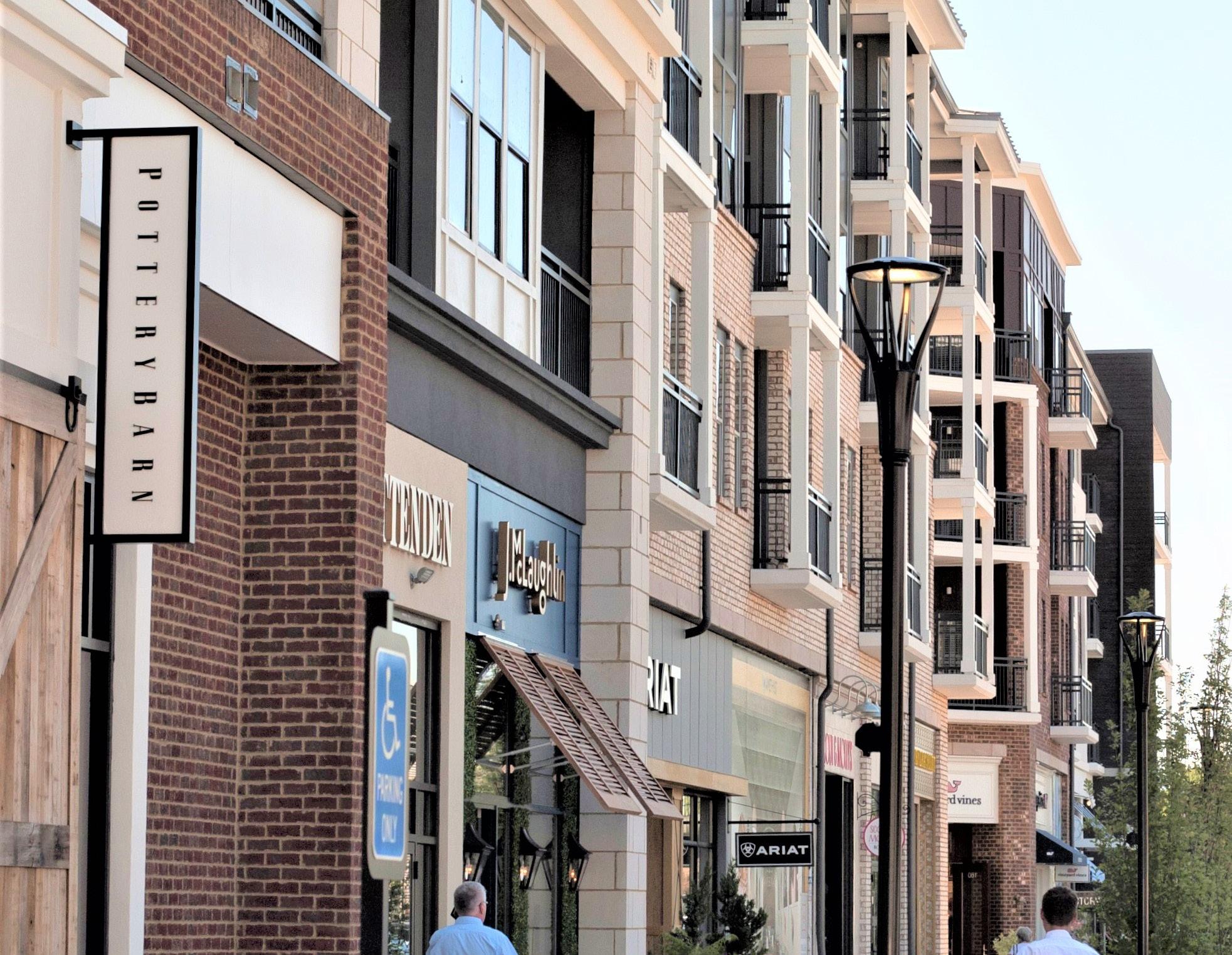
are most important when an applicant feels they are unable to meet a specific criterion.
WILL APPLICANTS BE REQUIRED TO SUBMIT DETAILED RENDERINGS OF PROPOSALS?
No. The criteria in The Placebuilder are directed at site layout and design. Staff will not require additional architectural or design renderings at the time of submission, though they are certainly permitted.
Under previous Comprehensive Plans, justifications generally addressed broad Goals & Objectives, without much support from the remainder of the document. Under The Placebuilder, justifications and development plans will be reviewed in accordance with the policies of the plan, which provide more specific guidance on how to further the Goals & Objectives.
Place-Type summary pages include descriptions, priorities, recommended zones, and example imagery. This is meant to provide guidance on which Place-Type to apply. It is possible that there may be some overlap between the types (Corridor & Regional Center for example), and it is up to the
applicant to make the case for which they choose. The pre-application meeting with Planning staff can provide guidance on this front.
Lexington is a growing city, and development is important to provide housing, jobs, goods, and services for current and future residents. It is also important that this growth results in a cohesive community through enhancing the existing neighborhoods, and providing enriched quality of life for all. The Placebuilder creates transparency surrounding the policies and concepts found throughout the Comprehensive Plan on an individual plan level. This transparency is needed to create a middle ground, and an avenue for conversations among all stakeholders.
The Zoning Ordinance and Subdivision Regulations are the laws that must be followed regarding land use in Lexington. If sitespecific conflicts arise between The Placebuilder and these laws, the laws will prevail. Conflicts found between
the laws and the goals and aspirations of the Comprehensive Plan may be addressed through a public process to amend the laws to meet Imagine Lexington’s vision.
Single-family detached houses are an important part of Lexington’s neighborhoods and will continue to be. The Placebuilder does not prohibit single-family housing, even includes criteria that address and enhance it, but notes that as the city continues to urbanize, single-family housing may take on a different form and represent a smaller percentage of the new construction. Currently 61.2% of all units in Lexington are single-family detached, and another 6.3% are single-family attached.
Proposed development always brings about concerns from nearby neighbors, and inevitably questions and issues will arise. The Placebuilder is designed to focus these conversations so they can be more productive and centered on furthering the Goals, Objectives, and policies of Imagine Lexington, reducing spurious or emotion-driven arguments on all sides.
Yes. The Placebuilder is simply a summary of the elements permitted in state statute KRS 100, that provides additional clarity on what the Comprehensive Plan is trying to achieve. It is not mandatory, but an aspirational compilation of best practices. Further, it addresses Theme F, Goal 2, Objective C (“Develop criteria, based upon the goals and objectives, to guide zone map amendment decisions.”) that was unanimously approved by the Urban County Council in November 2017.
Absolutely! The Planning staff has committed to an “Action Item” in Theme F, Accountability Policy #3 that calls for a workshop and training for any interested parties on The Placebuilder, and ongoing community education on both the Comprehensive Plan and The Placebuilder.

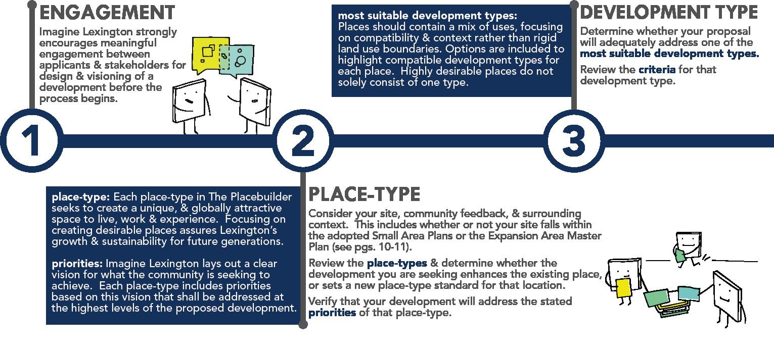
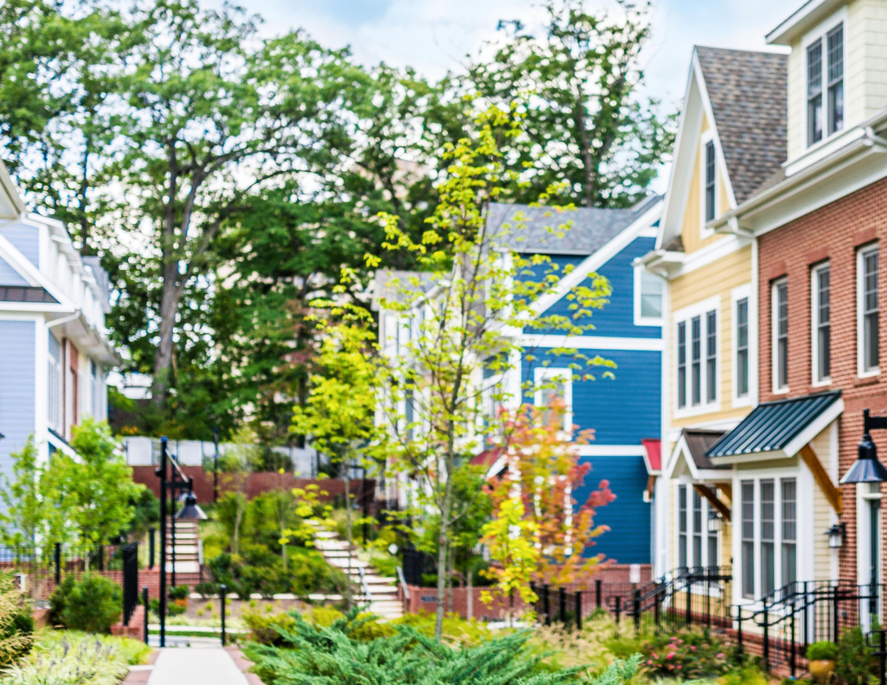
The Placebuilder is a set of development criteria to be addressed by applicants in their zone change application justifications. It is intended to provide transparency to applicants, stakeholders, the Planning Commission, and the Urban County Council in how development proposals are evaluated for their compliance with the Comprehensive Plan as required in KRS 100.
Not all criteria may be applicable to every proposal, however every zone change justification should address each one, noting why certain criteria may or may not apply. No zone change application will satisfy every single criterion, and the Placebuilder is not a checklist. The applicability of criteria will be assessed through the development review process.

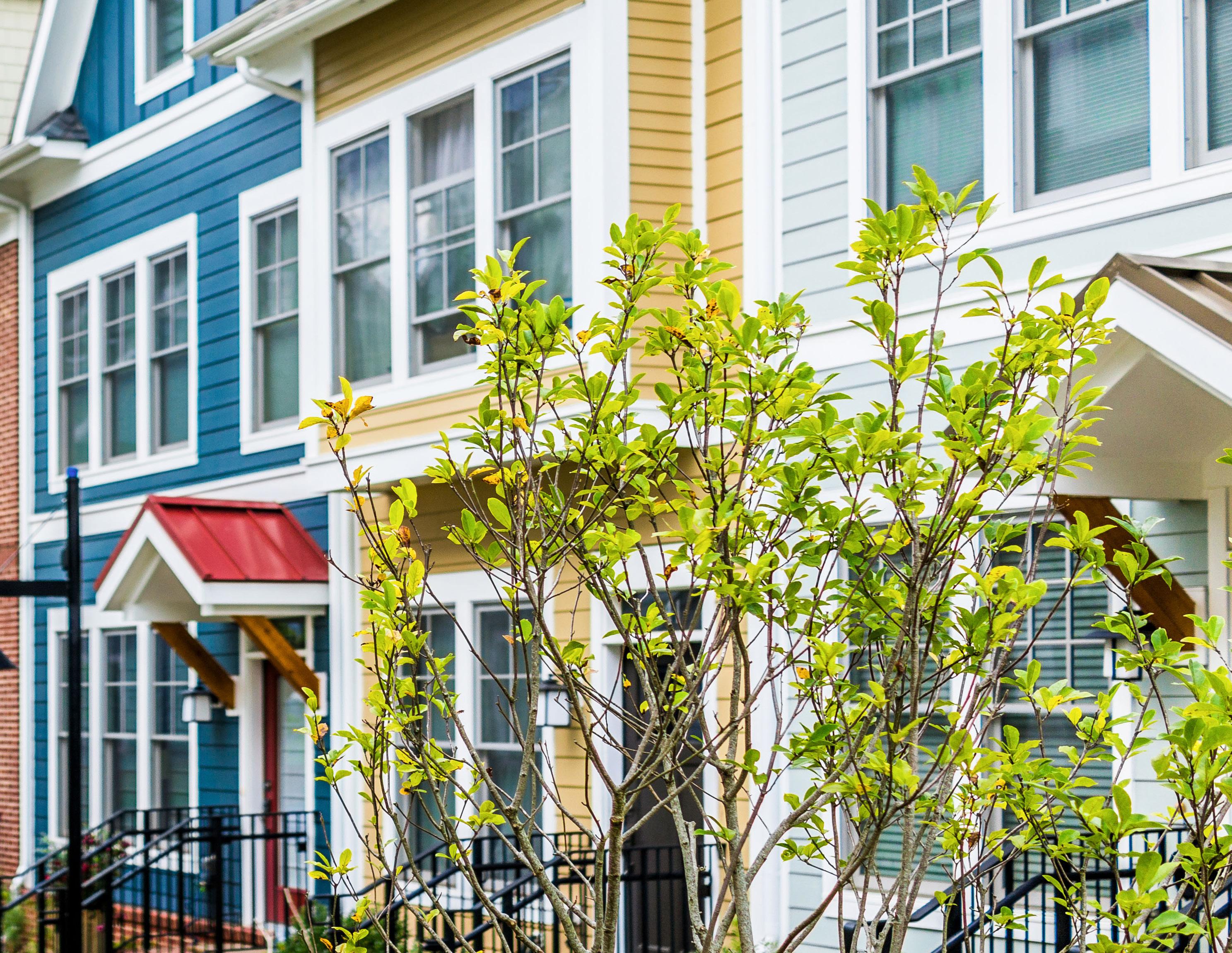
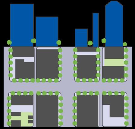
DOWNTOWN
The urban epicenter of commerce and entertainment. The core should be anchored by high-rise structures with activated ground-levels. They are surrounded by mid-rise buildings that increasingly offer dense residential uses. A mix of uses and variety of transportation options should be prioritized, and parking should be addressed as a shared urban core asset.*
pages 273-278
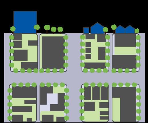
2ND TIER URBAN
Where significant infill and redevelopment opportunities exist to complement the urban core. While not expected to be as intensely developed as the downtown core, high-rise opportunities are not precluded provided that they are context-sensitive. The forward trend for development in the 2nd tier urban areas should be towards increased walkability and intensity.*
pages 279-290
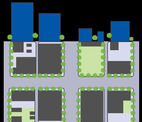
A REGIONAL CENTER IS...
A vibrant hub of commerce, employment, diverse housing opportunities, & entertainment. They include larger buildings with active ground levels, intentional open spaces, & walkable transportation networks, all to provide the user/resident with a unique experience. It is often located at major intersections & along primary corridors.*
pages 291-302

A CORRIDOR IS...
Lexington’s major roadways focused on commerce and transportation. The overriding emphasis of Imagine Lexington is significantly overhauling the intensity of the major corridors. The future of Lexington’s corridors lies in accommodating the shifting retail economic model by incorporating high density residential and offering substantial flexibility to available land uses.*
pages 303-314
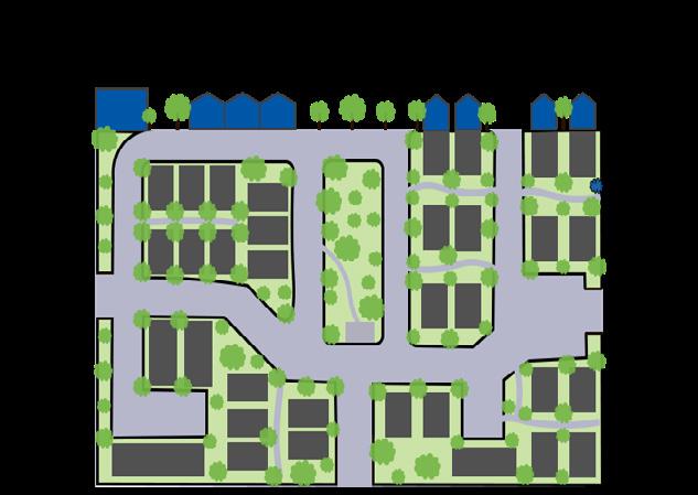
Undeveloped areas designed to provide housing in a sustainable format. These areas should include neighborhoodserving retail, services, & employment options, as well as town centers. Accessible greenspace, neighborhood focal points, & a multimodal transportation network should be provided to add a sense of place & connectivity.* pages 315-326
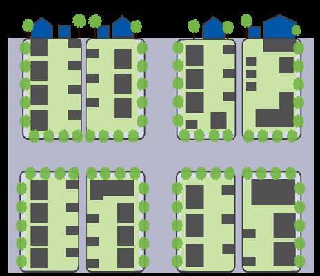
An existing residential area to be enhanced with additional amenities, housing types, and neighborhoodserving retail, services, and employment options. Development should be context-sensitive to surrounding areas and should add to the sense of place. Incorporating multimodal connections is crucial to neighborhood success and viability.* pages 327-336
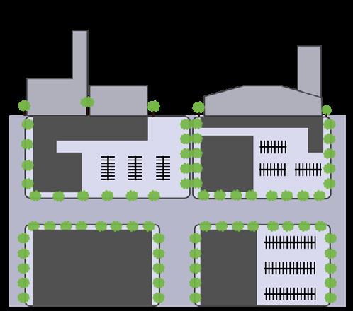
& PRODUCTION CENTER IS...
Where Lexington’s most intense types of economic development and job creation occur. These places should be located near major corridors to facilitate efficient and affordable shipping and transportation of goods throughout the region. Developments should minimize negative impacts on adjoining lower intensity uses.* pages 337-339
TYPES: AN

THEME A
A
GROWING SUCCESSFUL NEIGHBORHOODS
DESIGN (DS)

PROTECTING THE ENVIRONMENT
PROTECTION (PR)

DENSITY (DN)
SUSTAINABILITY (SU)

EQUITY (EQ)
RESTORATION (RS)


D
IMPROVING A DESIRABLE COMMUNITY
CONNECTIVITY (CO)


PLACEMAKING (PL)

SUPPORT (SP)

E
CREATING JOBS & PROSPERITY
LIVABILITY (LI)
DIVERSITY (DI)
PROSPERITY (PS)
URBAN & RURAL BALANCE
ACCOUNTABILITY (AC)
STEWARDSHIP (ST)
GROWTH (GR)


A fundamental goal of Imagine Lexington is to revitalize our city’s neighborhoods in ways that make them more sustainable and livable. In some areas, achieving a neighborhood’s vision for improvement requires an informed, strategic approach scaled to that specific community. Responding to this need, a set of small area plans were adopted as elements of the 2007 and 2013 Comprehensive Plans and have since taken effect in six Lexington neighborhoods within the Urban Service Boundary.
Based on an extensive community engagement process, the small area plans identify community needs, opportunities, and other planning issues of their respective communities, which help to inform strategies for undertaking policy changes and project implementation. Further, the concepts and recommendations outlined in the plan are directly informed by the area’s defining characteristics, such as demographics, land use, development patterns, housing, health, mobility, etc. This provides a strong foundation comprised of the community’s existing assets and amenities from which to build.
Proposed developments within the boundaries of these small area plans should adhere to the recommendations therein to ensure the results are compatible with the stated vision for that neighborhood. These considerations should be in addition to, and not in place of, the Placebuilder process and criteria.

Adopted by the Planning Commission in 1996 as an element of the Comprehensive Plan, the Expansion Area Master Plan (EAMP) is a regulatory document that is intended to guide growth within the identified Expansion Areas along the periphery of the Urban Service Boundary. The EAMP sets up standards and criteria that act as land use regulations to control the character, location and magnitude of development within the designated land use categories. It achieves this by:
• Encouraging innovative design and a range of uses which are integrated into the development.
• Promoting development which is sensitive to the topographic features and the unique rural character of the Bluegrass.
• Advising that new development within the Expansion Area should function as a “community” with a mix of uses, housing types and land for economic development and community facilities, including parks, public facilities, and community centers.
The necessary regulations prescribed within the EAMP should influence any decisions made regarding place type, development type, and zoning preference for future development within these areas. These considerations should be in addition to, and not in place of, the Placebuilder process and criteria.
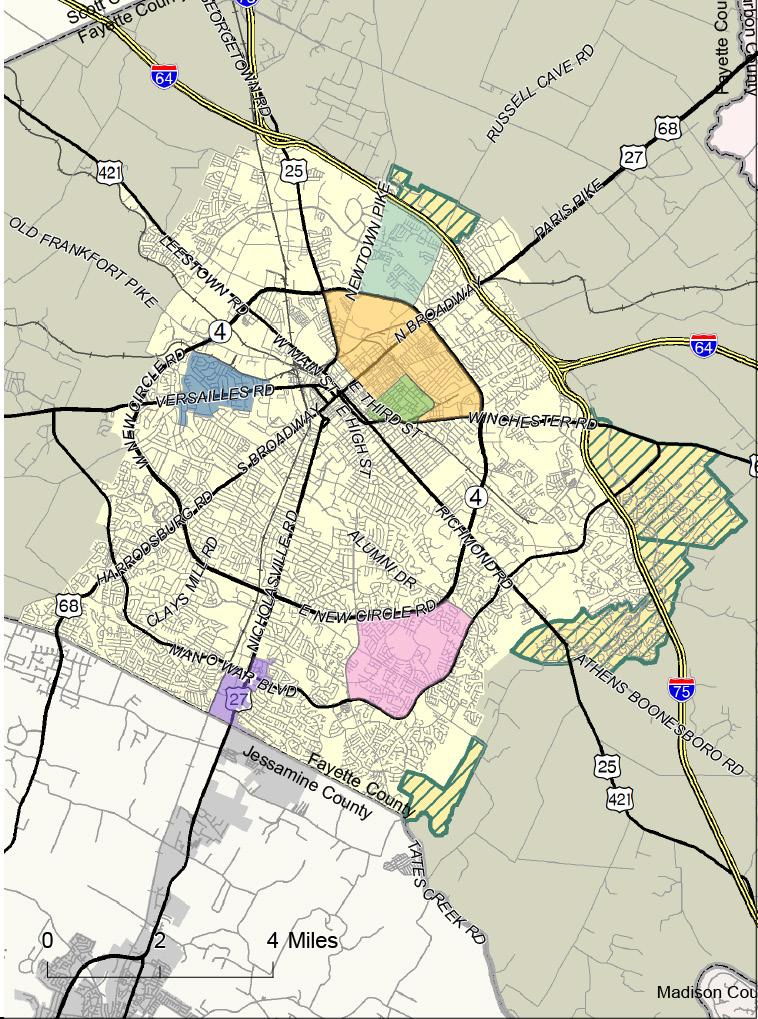

Development within the Rural Service Area (RSA) should consider the unique assets and opportunities offered by Lexington’s agricultural landscape. For this reason, the 2017 Rural Land Management Plan (RLMP), in tandem with applicable policies from Imagine Lexington listed below, should act as the primary guide for all rural development endeavors and should be directly addressed in development proposals within the RSA.
Due to the distinct difference between urban place-types and rural area considerations, the RLMP is better suited to guide the limited development within the RSA than the criteria set out in the Placebuilder. Additionally, the numerous policies, goals, and objectives within Imagine Lexington focusing on rural development link directly to the goals and objectives laid out by the RLMP These provide additional support for defining the intended nature of rural development and its impacts on the agricultural community.
• Design Policy #6:
• Protection Policy #2:
• Protection Policy #3:
• Protection Policy #4:
• Protection Policy #5:
• Protection Policy #6:
• Protection Policy #8:
• Protection Policy #10:
• Sustainability Policy #7:
• Sustainability Policy #11:
• Sustainability Policy #12:
• Restoration Policy #2:
• Livability Policy #1:
• Livability Policy #2:

Adhere to the recommendations of the Lexington Area MPO Bike/ Pedestrian Master Plan, adopted in 2018.
Conserve environmentally sensitive areas, including significant natural habitats, wetlands and water bodies.
Continue to implement PDR program to safeguard Lexington’s rural land.
Conserve active agriculture land in the Rural Service Area while promoting a creative food chain network.
Promote and connect local farms with the community through integrated partnerships.
Promote context- sensitive agritourism in the Rural Service Area.
Integrate the Greenspace Plan into urban and rural area.
Install iconic rural fencelines around major greenways and creeks to enhance their natural beauty.
Continue and expand energy efficiency initiatives, promote energy efficient buildings by supporting grants and public recognition.
Require green infrastructure elements for new development, and require during redevelopment where appropriate.
Sustainability Policy #12 - Encourage and explore incentives for green building practices for new development and redevelopment.
Use green infrastructure to bridge gaps in the greenspace network.
Encourage economic opportunities for a wide array of agritourism while preserving the Bluegrass identity.
Emphasize the preservation, protection, and promotion of the iconic Bluegrass landscape along rural gateways and roadways serving as primary tourist routes.
• Prosperity Policy #3:
• Prosperity Policy #5:
• Prosperity Policy #6:
Continue to protect the Agricultural Cluster, horse industry, and support existing agricultural uses while promoting new innovative agricultural uses in the Rural Service Area.
Continue to raise awareness of farms and farm tours.
Promote Kentucky Proud and local Lexington products using an identifying branding to be incorporated in: farm signage, distilleries, wineries, breweries, local destinations on tours, locally grown businesses, local produce, etc.
• Placemaking Policy #9:
Honor Lexington’s history by requiring new development and redevelopments to enhance the cultural, physical, and natural resources that have shaped the community.
• Placemaking Policy #14:
• Stewardship Policy #1:
Pursue a regional park system.
Update Lexington’s stone fence inventory, and pursue additional protections for this iconic and historic cultural asset.
• Stewardship Policy #3:
Increase regional transportation cooperation and pursue multimodal transportation options including transit and bicycle connections to facilitate inter-county connectivity.
• Stewardship Policy #5:
Fully realize the development potential within Lexington’s Rural Activity Centers while avoiding negative impacts to surrounding agriculture, Rural Settlements, and viewsheds.
• Stewardship Policy #9:
Follow and implement the recommendations of the 2007 Study of Fayette County’s Small Rural Communities and the 2017 Rural Land Management plan to protect and preserve Lexington’s rural settlements.
• Growth Policy #3:
Provide varied, abundant, and connected greenspaces throughout Lexington’s urban and rural areas.
In addition to the 2018 Comprehensive Plan, there are various plans and studies that have been adopted in order to guide growth, land use management, and context-sensitive development in Lexington. Some of these plans are focused on specific areas within the county, while others are overarching and should be considered for all place-types. These plans are intended to complement the goals, objectives, and policies within Imagine Lexington and should be used to further inform development proposals. These considerations should be in addition to, and not in place of, the Placebuilder process and criteria. Each of these is listed to the right.
Additionally, new developments should incorporate any applicable recommendations or requirements outlined in other ordinances approved by the Urban County Council. This includes those specific to landscaping and development along Lexington’s major corridors.
DOWNTOWN MASTER PLAN
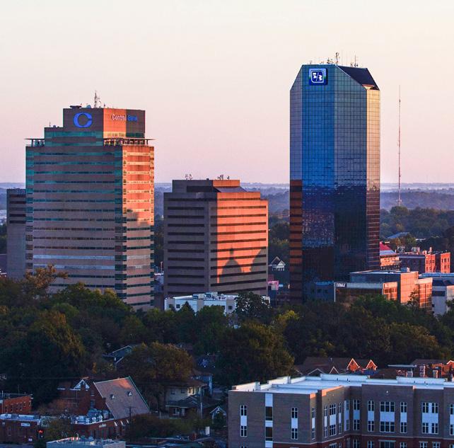
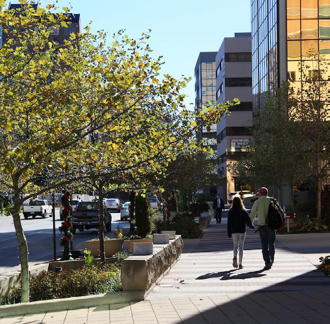
DOWNTOWN STREETSCAPE MASTER PLAN
2018 BICYCLE & PEDESTRIAN MASTER PLAN
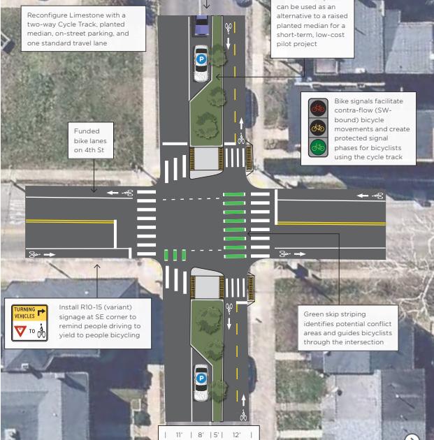
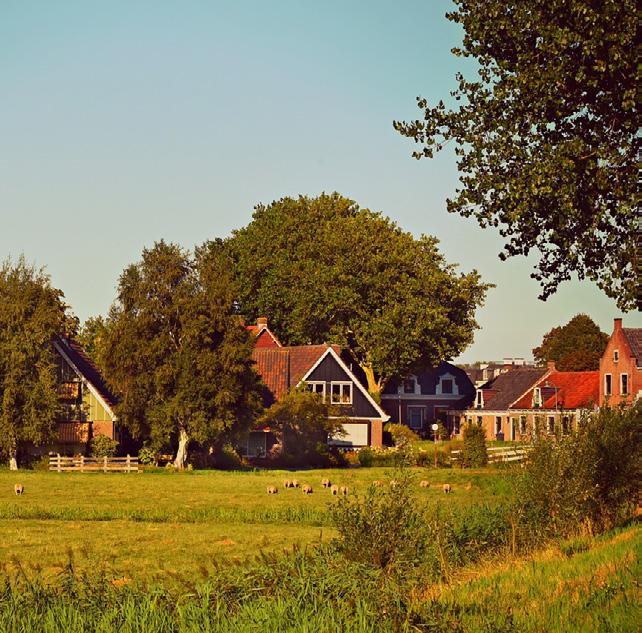
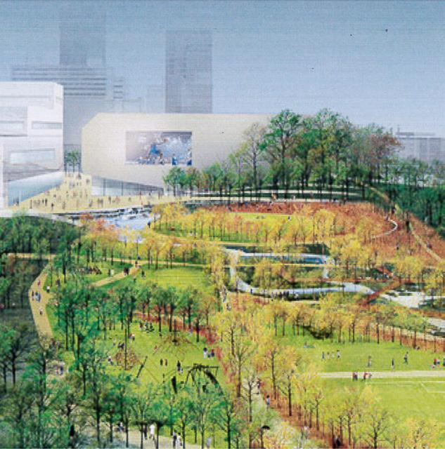
TOWN BRANCH COMMONS MASTER PLAN & DESIGN STANDARDS YOUR PARKS, OUR FUTURE MASTER PLAN
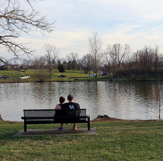
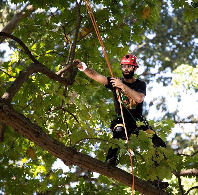


Primarily attached and detached singlefamily homes of varying formats, including accessory dwelling units.
Homogeneous neighborhoods that do not include a mix of housing types should be avoided. Low density residential is only appropriate as a component of “Enhanced Neighborhoods” and “New Complete Neighborhoods”, and should be supplemented by a variety of uses and housing options to create sustainable places.

Multimodal network connections, including connected streets, are required to keep an efficient transportation network that provides viable options for all users.
Primarily attached and multi-family units.
Primarily multi-family units.
Primarily high-rise multi-family units.
Multi-family units should complement and enhance existing development through quality design and connections.
Multi-family units should complement and enhance existing development through quality design and connections.
Nearby commercial/employment uses and greenspaces should be easily accessible, and bicycle and pedestrian modes should be maximized to connect residents to destinations.

These developments should include intentional open space designed to fit the needs of area residents, and be in walking distance of nearby neighborhood-serving commercial/employment uses.
These developments should include intentional open space designed to fit the needs of area residents, and a variety of neighborhood-serving commercial/ employment uses.
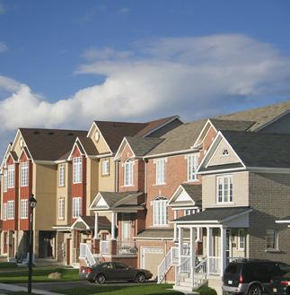
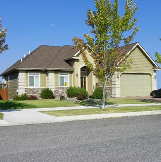
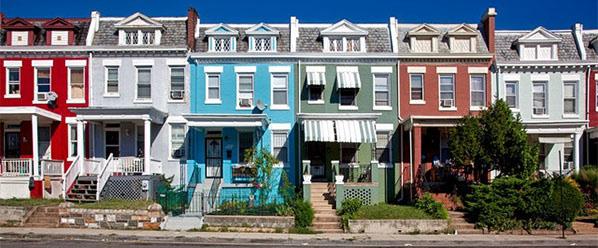
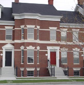
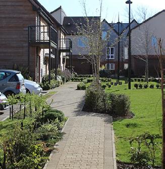
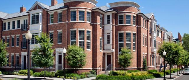
Access to these developments is typically through streets designated with the collector classification or above. Mass transit infrastructure should be provided along transit routes through collaboration with Lextran, and bicycle and pedestrian facilities should be plentiful to provide multimodal options.
These developments should include intentional open space designed to fit the needs of area residents, and a variety of neighborhood-serving commercial/ employment uses.
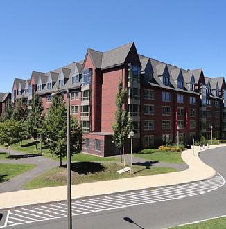
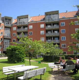
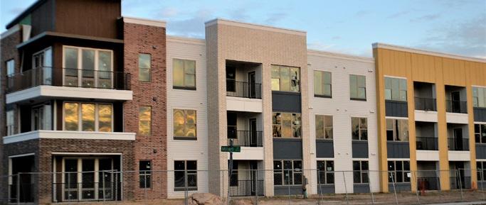
This type of development is generally reserved for the most intensely developed areas in Lexington, with the infrastructure to support it. Where these developments abut existing or historic neighborhoods, appropriate step-downs or contextsensitive elements should be used to minimize intrusion.
Mass transit infrastructure should be provided along transit routes through collaboration with Lextran, and bicycle and pedestrian facilities should be plentiful to provide multimodal options. Parking should be minimized in favor of multimodal options, and where necessary, should be predominantly accommodated within garages.
Open space and greenspace opportunities should be adequate within the area to support the residents, or should be provided creatively on-site utilizing plazas, rooftop space, or other means that accomplish the goal, but still allow for high Floor Area Ratios.
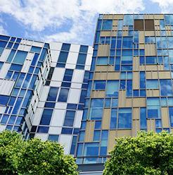
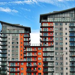
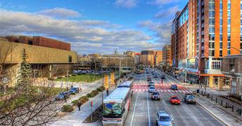

low density nonresidential / mixed-use
Primarily neighborhood-serving commercial uses, services, places of employment, and/or a mix of uses within low to midrise structures appropriately scaled to the surrounding neighborhood.
Mixed-use structures can include a mix of residential, commercial, services, and/or employment uses, and an activated and pedestrian-scale ground level should be provided. Developments with a residential component are generally non-residential on the ground-floor with units above, providing opportunities for live/work arrangements.
The retail/service options typically include boutique-type establishments, neighborhood restaurants or pubs, and/ or neighborhood-serving services like dentists, daycares, etc., and the places of employment are small offices.
Bicycle and pedestrian connections to adjoining neighborhoods, and buildings oriented to the street are required to ensure the non-residential enhances nearby neighborhoods by creating a truly walkable environment.
Parking should be minimized and where necessary, located internally.
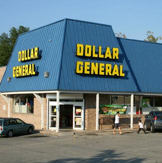
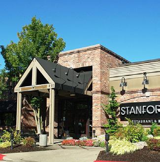
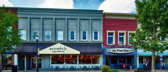
medium density nonresidential / mixed-use
Primarily community-serving commercial uses, services, places of employment, and/ or a mix of uses within mid-rise structures with a higher Floor Area Ratio.
Mixed-use structures typically include more multi-family residential units and places of employment, and retail and commercial options generally draw from a larger geographic area. An activated and pedestrian-scale ground level should be provided.
These developments may include more employment space for professional office and can include some larger entertainment spaces.
Though they draw more external users, they should still include multimodal connections allowing for easy neighborhood access. Mass transit infrastructure is to be provided on par with that of other modes, and the higher-density housing types should be located in close proximity.
The buildings should be oriented to the street, and developments should avoid over-parking, with provided parking located internally.
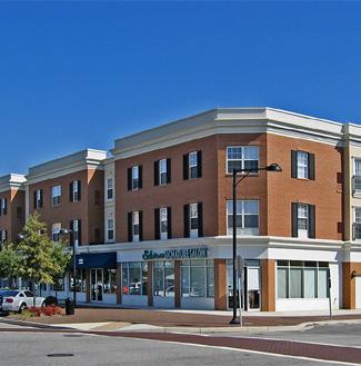
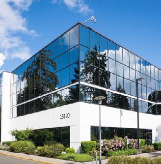
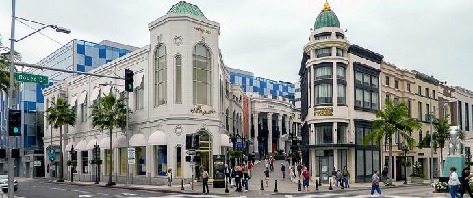
high density nonresidential / mixed-use
Primarily regional-serving commercial uses, services, places of employment, and/or a mix of uses within high-rise structures with a high Floor Area Ratio.
Mixed-use structures typically include an abundance of multi-family residential units, places of employment, and entertainment options, and the retail and commercial options generally draw from a regional geographic area.
Screening and buffers should be provided to adjoining lower-density residential developments, however those adjoining neighborhoods should retain convenient access to the development.
These developments are generally located along higher intensity roadways. Mass transit infrastructure, on par with that of other modes, should be provided, and bicycle and pedestrian connections to adjoining developments are required. Internal multimodal connectivity throughout the development is critical.
Parking is generally provided in structures with activated ground levels.
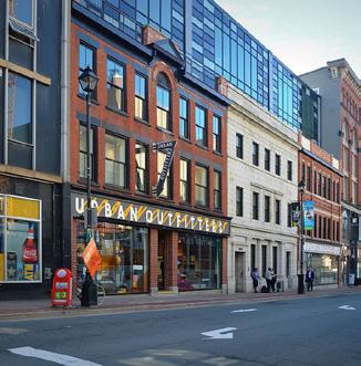
industrial & production non-residential / mixed-use
Primarily employment land dedicated to the most intense types of employment-centric development. This is the only category where uses are inherently incompatible and are best separated from adjacent uses.
These uses are best suited in areas where they already exist, collocating to utilize industrial-scale infrastructure to serve the needs of the users. Environmental protection measures should be taken to minimize impacts.
These uses are also heavy employers and should incorporate mass transit infrastructure, on par with that of other modes, to connect residents to their jobs.
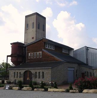
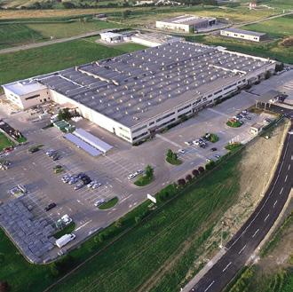
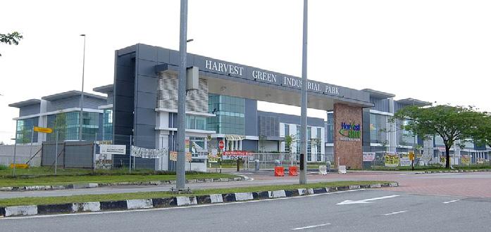
DOWNTOWN IS...
MOST SUITABLE DEVELOPMENT TYPES
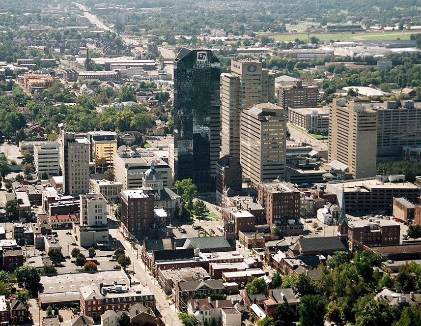
The urban epicenter of commerce and entertainment. The core should be anchored by high-rise structures with ground-level pedestrian engagement opportunities surrounded by mid-rise buildings increasingly offering dense residential uses. Lexington’s Downtown should continue to be notable for its mix of uses and variety of transportation options. Parking should be addressed as a shared urban core asset, eliminating dedicated surface parking lots in favor of structures.
SITE PRIORITIES
• Dense residential options
• Ground level pedestrian engagement
• Economic development and job creation
• Minimizing parking in favor of multimodal options
• Appropriate transitions to 2nd tier urban and historic neighborhoods
RECOMMENDED ZONE(S)
Zones for this place-type are not limited to the listed zones; other zones can be considered with proper justification.
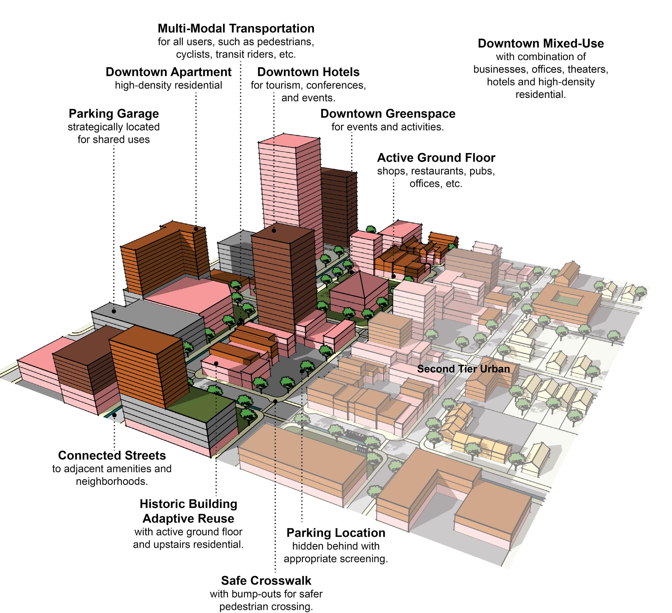

A-DS3-1 Multi-family residential developments should comply with the Multi-family Design Standards in Appendix 1.
A-DS4-2 New construction should be at an appropriate scale to respect the context of neighboring structures; however, along major corridors, it should set the future context in accordance with other Imagine Lexington corridor policies and Placebuilder priorities.
A-DS5-3 Building orientation should maximize connections with the surrounding area and create a pedestrian-friendly atmosphere.
A-DS5-4 Development should provide a pedestrian-oriented and activated ground level.
A-DS7-3 Parking structures should activate the ground level.
A-DS10-1 Residential units should be within reasonable walking distance to a focal point.
A-DN1-1 High density residential development (HR) should be located on corridors and downtown.
A-DN2-1 Infill residential should aim to increase density.
A-DN3-2 Development should incorporate residential units in commercial centers with context sensitive design.
A-EQ7-1 School sites should be appropriately sized.
B-SU5-1 Vehicle-oriented development, such as drive-through businesses, should not locate in the downtown area.
B-SU11-1 Green infrastructure should be implemented in new development. (E-GR3)
C-LI6-1 Developments should incorporate multi-family housing and walkable commercial uses into development along arterials/corridors.
C-LI7-1 Developments should create mixed-use neighborhoods with safe access to community facilities, greenspace, employment, businesses, shopping, and entertainment.
C-PS10-2 Developments should explore options for shared and flexible parking arrangements for currently underutilized parking lots.
C-PS10-3 Over-parking of new developments should be avoided. (B-SU5)
D-PL7-1 Stakeholders should be consulted to discuss site opportunities and constraints prior to submitting an application.
D-PL9-1 Historically significant structures should be preserved.
D-PL10-1 Activate the streetscape by designating public art easements in prominent locations.
D-SP3-1 Adequate right-of-way, lease areas and easements for infrastructure, with emphasis on wireless communication networks should be provided to create reliable service throughout Lexington.
D-SP3-2 Cellular tower antennae should be located to minimize intrusion and negative aesthetic impacts, and stealth towers and landscaping should be used to improve the visual impact from the roadway and residential areas.
E-GR4-1 Developments should incorporate reuse of viable existing structures.
E-GR5-1 Structures with demonstrated historic significance should be preserved or adapted.
E-GR9-4 Development should intensify underutilized properties and develop vacant and underutilized gaps within neighborhoods. (E-GR6)
E-GR10-1 Developments should include multi-family residential components in B-6P and other Mixed Use Zones.
E-GR10-2 Developments should provide walkable service and amenity-oriented commercial spaces.
E-GR10-3 Shared common space in commercial developments should be provided to encourage experiential retail programming.
A-DS1-1 Mass transit infrastructure such as seating and shelters should be provided/enhanced along transit routes. (A-EQ7).
A-DS1-2 Direct pedestrian linkages to transit should be provided.
A-DS4-1 A plan for a connected multimodal network to adjacent neighborhoods, greenspaces, developments and complementary uses should be provided. (A-DS2, A-DN1, B-SU1, B-SU2, C-LI7, E-AC5)
A-DS5-1 Adequate multimodal infrastructure should be provided to ensure vehicular separation from other modes of transport.
A-DS5-2 Roadways should provide a vertical edge, such as trees and buildings.
A-DS10-2 New focal points should be designed with multimodal connections to the neighborhood.
A-EQ3-2 Development on corridors should be transit-oriented (dense & intense, internally walkable, connected to adjacent neighborhoods, providing transit infrastructure & facilities). (B-SU3)
A-EQ7-2 Multimodal transportation options for healthcare and social services facilities should be provided. (E-ST3)
B-SU4-1 Where greenspace/community centers are not located within walking distance of a new development, applicants should attempt to incorporate those amenities. (A-DS9)
Criteria that include additional policy items in parentheses refer to companion policies that will provide additional context to the related criteria.
C-PS10-1 Flexible parking and shared parking arrangements should be utilized.
D-CO1-1 Rights-of-way and multimodal facilities should be designed to reflect and promote the desired place-type.
D-CO2-1 Safe facilities for all users and modes of transportation should be provided.
D-CO2-2 Development should create and/or expand a safe, connected multimodal transportation network that satisfies all users’ needs, including those with disabilities.
D-CO4-2 Roadway capacity should be increased by providing multiple parallel streets, which alleviate traffic and provide multiple route options, in lieu of additional lanes.
D-CO5-1 Streets should be designed with shorter block lengths, narrower widths, and traffic calming features.
D-SP1-3 Developments should provide multimodal transportation infrastructure to school sites, including sidewalks, shared-use paths, and roadways that can accommodate the bus and vehicle traffic associated with the site.
E-ST3-1 Development along major corridors should provide for ride sharing pick up and drop off locations along with considerations for any needed or proposed park and ride functions of the area. (E-GR10, E-GR7)
A-DS4-3 Development should work with the existing landscape to the greatest extent possible, preserving key natural features.
A-EQ7-3 Community open spaces should be easily accessible and clearly delineated from private open spaces.
B-PR2-1 Impact on environmentally sensitive areas should be minimized within and adjacent to the proposed development site.
B-PR2-2 Dividing floodplains into privately owned parcels with flood insurance should be avoided.
B-PR2-3 Floodplains should be incorporated into accessible greenspace, and additional protection should be provided to areas around them.
B-PR7-1 Connections to greenways, tree stands, and stream corridors should be provided.
B-PR7-2 Trees should be incorporated into development plans, prioritize grouping of trees to increase survivability.
B-PR7-3 Developments should improve the tree canopy.
B-RE1-1 Developments should incorporate street trees to create a walkable streetscape.
B-RE2-1
Green infrastructure should be used to connect the greenspace network.
E-GR3-1 Physical and visual connections should be provided to existing greenway networks.
E-GR3-2
New focal points should emphasize geographic features unique to the site.
Criteria that include additional policy items in parentheses refer to companion policies that will provide additional context to the related criteria.
A-DS4-2 New construction should be at an appropriate scale to respect the context of neighboring structures; however, along major corridors, it should set the future context in accordance with other Imagine Lexington corridor policies and Placebuilder priorities.
A-DS5-3 Building orientation should maximize connections with the surrounding area and create a pedestrian-friendly atmosphere.
A-DS5-4 Development should provide a pedestrian-oriented and activated ground level.
A-DS7-3 Parking structures should activate the ground level.
A-DS10-1 Residential units should be within reasonable walking distance to a focal point.
A-DS12-1 Medium–high density development should be located nearest to neighborhood-serving commercial areas.
A-DN1-1 High density residential development (HR) should be located on corridors and downtown.
A-DN2-1 Infill residential should aim to increase density.
A-DN2-2 Development should minimize significant contrasts in scale, massing and design, particularly along the edges of historic areas and neighborhoods. (D-PL9, E-GR6)
A-DN3-2 Development should incorporate residential units in commercial centers with context sensitive design.
A-EQ7-1 School sites should be appropriately sized.
B-SU5-1 Vehicle-oriented development, such as drive-through businesses, should not locate in the downtown area.
B-SU11-1 Green infrastructure should be implemented in new development. (E-GR3)
C-DI1-1 Consider flexible zoning options that will allow for a wide range of jobs.
C-DI5-1 In Opportunity Zones with a clearly defined local context, consider adaptive reuse to enhance the existing context.
C-LI6-1 Developments should incorporate multi-family housing and walkable commercial uses into development along arterials/corridors.
C-LI7-1 Developments should create mixed-use neighborhoods with safe access to community facilities, greenspace, employment, businesses, shopping, and entertainment.
C-PS9-2 Modify current office space to include complementary uses.
C-PS10-2 Developments should explore options for shared and flexible parking arrangements for currently underutilized parking lots.
C-PS10-3 Over-parking of new developments should be avoided. (B-SU5)
D-PL7-1 Stakeholders should be consulted to discuss site opportunities and constraints prior to submitting an application.
D-PL9-1 Historically significant structures should be preserved.
D-PL10-1 Activate the streetscape by designating public art easements in prominent locations.
D-SP3-1 Adequate right-of-way, lease areas and easements for infrastructure, with emphasis on wireless communication networks should be provided to create reliable service throughout Lexington.
E-GR4-1 Developments should incorporate reuse of viable existing structures.
E-GR5-1 Structures with demonstrated historic significance should be preserved or adapted.
E-GR9-4 Development should intensify underutilized properties and develop vacant and underutilized gaps within neighborhoods. (E-GR6)
E-GR10-1 Developments should include multi-family residential components in B-6P and other Mixed Use Zones.
E-GR10-2 Developments should provide walkable service and amenity-oriented commercial spaces.
E-GR10-3 Shared common space in commercial developments should be provided to encourage experiential retail programming.
A-DS1-1 Mass transit infrastructure such as seating and shelters should be provided/enhanced along transit routes. (A-EQ7).
A-DS1-2 Direct pedestrian linkages to transit should be provided.
A-DS4-1 A plan for a connected multimodal network to adjacent neighborhoods, greenspaces, developments and complementary uses should be provided. (A-DS2, A-DN1, B-SU1, B-SU2, C-LI7, E-AC5)
A-DS5-1 Adequate multimodal infrastructure should be provided to ensure vehicular separation from other modes of transport.
A-DS5-2 Roadways should provide a vertical edge, such as trees and buildings.
A-EQ3-2 Development on corridors should be transit-oriented (dense & intense, internally walkable, connected to adjacent neighborhoods, providing transit infrastructure & facilities). (B-SU3)
Criteria that include additional policy items in parentheses refer to companion policies that will provide additional context to the related criteria.
A-EQ7-2 Multimodal transportation options for healthcare and social services facilities should be provided. (E-ST3)
B-SU4-1 Where greenspace/community centers are not located within walking distance of a new development, applicants should attempt to incorporate those amenities. (A-DS9)
C-PS10-1 Flexible parking and shared parking arrangements should be utilized.
D-CO1-1 Rights-of-way and multimodal facilities should be designed to reflect and promote the desired place-type.
D-CO2-1 Safe facilities for all users and modes of transportation should be provided.
D-CO2-2 Development should create and/or expand a safe, connected multimodal transportation network that satisfies all users’ needs, including those with disabilities.
D-CO4-2 Roadway capacity should be increased by providing multiple parallel streets, which alleviate traffic and provide multiple route options, in lieu of additional lanes.
D-CO5-1 Streets should be designed with shorter block lengths, narrower widths, and traffic calming features.
D-SP1-3 Developments should provide multimodal transportation infrastructure to school sites, including sidewalks, shared-use paths, and roadways that can accommodate the bus and vehicle traffic associated with the site.
D-SP6-1 Social services and community facilities should be accessible via mass transit, bicycle and pedestrian transportation modes. (A-EQ7)
E-ST3-1 Development along major corridors should provide for ride sharing pick up and drop off locations along with considerations for any needed or proposed park and ride functions of the area. (E-GR10, E-GR7)
A-DS4-3 Development should work with the existing landscape to the greatest extent possible, preserving key natural features.
A-EQ7-3 Community open spaces should be easily accessible and clearly delineated from private open spaces.
B-PR2-1 Impact on environmentally sensitive areas should be minimized within and adjacent to the proposed development site.
B-PR2-2 Dividing floodplains into privately owned parcels with flood insurance should be avoided.
B-PR2-3 Floodplains should be incorporated into accessible greenspace, and additional protection should be provided to areas around them.
B-PR7-1 Connections to greenways, tree stands, and stream corridors should be provided.
B-PR7-2 Trees should be incorporated into development plans, prioritize grouping of trees to increase survivability.
B-PR7-3 Developments should improve the tree canopy.
B-RE1-1 Developments should incorporate street trees to create a walkable streetscape.
B-RE2-1 Green infrastructure should be used to connect the greenspace network.
D-SP2-1 Visible, usable greenspace and other natural components should be incorporated into school sites.
D-SP2-2 Active and passive recreation opportunities should be provided on school sites.
E-GR3-1 Physical and visual connections should be provided to existing greenway networks.
E-GR3-2 New focal points should emphasize geographic features unique to the site.
Where significant infill and redevelopment opportunities exist in order to complement the urban core, generally situated within the established Infill and Redevelopment Boundary. While not expected to be as intensely developed as the downtown core, high-rise opportunities are not precluded provided that measures are taken to address the adjacent context. The forward trend for development in the 2nd tier urban areas should be towards more walkability, intensity, and appropriate stewardship of the available opportunities that will accommodate Lexington’s future growth, first and foremost.
• Medium, medium/high and high density residential
• Mix of uses
• Walkability
• Economic development and job creation
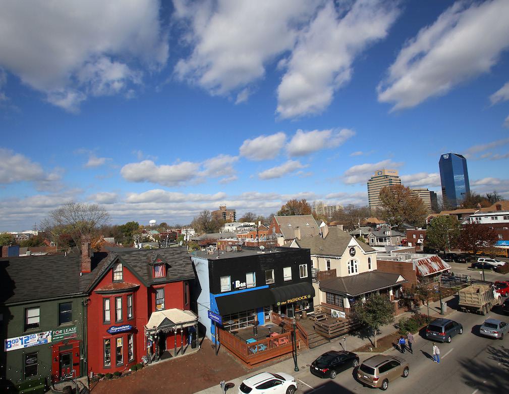
• Minimizing parking in favor of multimodal options
• Relation to surrounding historic context
RECOMMENDED ZONE(S)
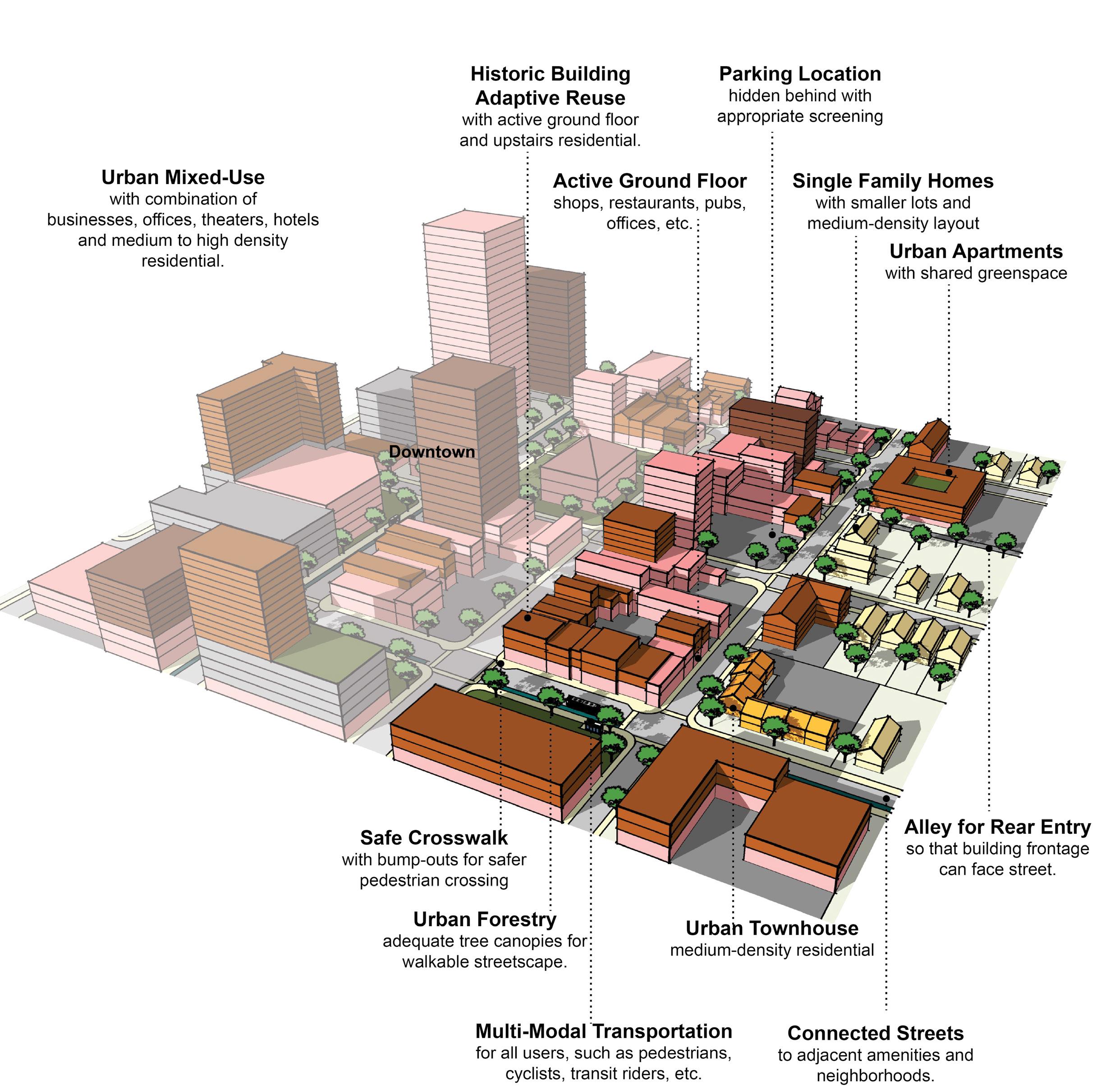
A-DS3-1 Multi-family residential developments should comply with the Multi-family Design Standards in Appendix 1.
A-DS4-2 New construction should be at an appropriate scale to respect the context of neighboring structures; however, along major corridors, it should set the future context in accordance with other Imagine Lexington corridor policies and Placebuilder priorities.
A-DS5-3 Building orientation should maximize connections with the surrounding area and create a pedestrian-friendly atmosphere.
A-DS5-4 Development should provide a pedestrian-oriented and activated ground level.
A-DS7-1 Parking should be oriented to the interior or rear of the property for nonresidential or multi-family developments.
A-DS7-2 Any non-residential or multi-family parking not buffered by a building should be screened from the streetscape view and adjacent properties.
A-DS7-3 Parking structures should activate the ground level.
A-DS8-1 At the individual street level, medium density housing types should be interspersed with single-family detached units and should be context sensitive.
A-DS10-1 Residential units should be within reasonable walking distance to a focal point.
A-DS11-1 Common public uses that serve as neighborhood focal points, such as parks and schools, should be on single loaded streets.
A-DN2-1 Infill residential should aim to increase density.
A-DN2-2 Development should minimize significant contrasts in scale, massing and design, particularly along the edges of historic areas and neighborhoods. (D-PL9, E-GR6)
A-DN3-2 Development should incorporate residential units in commercial centers with context sensitive design.
A-DN6-1 Allow and encourage new compact single-family housing types.
A-EQ3-1 Development should create context sensitive transitions between intense corridor development and existing neighborhoods.
A-EQ7-1 School sites should be appropriately sized.
B-PR9-1 Minimize disturbances to environmentally sensitive areas by utilizing the existing topography to the greatest extent possible.
B-SU11-1 Green infrastructure should be implemented in new development. (E-GR3)
C-LI6-1 Developments should incorporate multi-family housing and walkable commercial uses into development along arterials/corridors.
C-LI6-2 ADUs and/or affordable housing options should be incorporated into existing and new single-family residential development. (A-DN5)
C-LI7-1 Developments should create mixed-use neighborhoods with safe access to community facilities, greenspace, employment, businesses, shopping, and entertainment.
C-PS10-2 Developments should explore options for shared and flexible parking arrangements for currently underutilized parking lots.
C-PS10-3 Over-parking of new developments should be avoided. (B-SU5)
D-PL7-1 Stakeholders should be consulted to discuss site opportunities and constraints prior to submitting an application.
D-PL9-1 Historically significant structures should be preserved.
D-PL10-1 Activate the streetscape by designating public art easements in prominent locations.
D-SP3-1 Adequate right-of-way, lease areas and easements for infrastructure, with emphasis on wireless communication networks should be provided to create reliable service throughout Lexington.
D-SP3-2 Cellular tower antennae should be located to minimize intrusion and negative aesthetic impacts, and stealth towers and landscaping should be used to improve the visual impact from the roadway and residential areas.
D-SP9-1 Encourage co-housing, shared housing environments, planned communities and accessory dwelling units for flexibility and affordability for senior adults and people with disabilities.
E-GR4-1 Developments should incorporate reuse of viable existing structures.
E-GR5-1 Structures with demonstrated historic significance should be preserved or adapted.
E-GR9-1 Live/work units should be incorporated into residential developments.
E-GR9-3 Less intense multi-family residence types (duplexes, four-plexes, courtyard apartments, etc.) should be incorporated into primarily single-family areas.
E-GR9-4 Development should intensify underutilized properties and develop vacant and underutilized gaps within neighborhoods. (E-GR6)
A-DS1-1 Mass transit infrastructure such as seating and shelters should be provided/enhanced along transit routes. (A-EQ7).
A-DS1-2 Direct pedestrian linkages to transit should be provided.
Criteria that include additional policy items in parentheses refer to companion policies that will provide additional context to the related criteria.
A-DS4-1 A plan for a connected multimodal network to adjacent neighborhoods, greenspaces, developments and complementary uses should be provided. (A-DS2, A-DN1, B-SU1, B-SU2, C-LI7, E-AC5)
A-DS5-1 Adequate multimodal infrastructure should be provided to ensure vehicular separation from other modes of transport.
A-DS5-2 Roadways should provide a vertical edge, such as trees and buildings.
A-DS10-2 New focal points should be designed with multimodal connections to the neighborhood.
A-EQ3-2 Development on corridors should be transit-oriented (dense & intense, internally walkable, connected to adjacent neighborhoods, providing transit infrastructure & facilities). (B-SU3)
B-SU4-1 Where greenspace/community centers are not located within walking distance of a new development, applicants should attempt to incorporate those amenities. (A-DS9)
D-CO1-1 Rights-of-way and multimodal facilities should be designed to reflect and promote the desired place-type.
D-CO2-1 Safe facilities for all users and modes of transportation should be provided.
D-CO2-2 Development should create and/or expand a safe, connected multimodal transportation network that satisfies all users’ needs, including those with disabilities.
D-CO4-2 Roadway capacity should be increased by providing multiple parallel streets, which alleviate traffic and provide multiple route options, in lieu of additional lanes.
D-CO5-1 Streets should be designed with shorter block lengths, narrower widths, and traffic calming features.
D-SP1-3 Developments should provide multimodal transportation infrastructure to school sites, including sidewalks, shared-use paths, and roadways that can accommodate the bus and vehicle traffic associated with the site.
D-SP6-1 Social services and community facilities should be accessible via mass transit, bicycle and pedestrian transportation modes. (A-EQ7)
E-ST3-1 Development along major corridors should provide for ride sharing pick up and drop off locations along with considerations for any needed or proposed park and ride functions of the area. (E-GR10, E-GR7)
A-DS4-3 Development should work with the existing landscape to the greatest extent possible, preserving key natural features.
A-EQ7-3 Community open spaces should be easily accessible and clearly delineated from private open spaces.
B-PR2-1 Impact on environmentally sensitive areas should be minimized within and adjacent to the proposed development site.
B-PR2-2 Dividing floodplains into privately owned parcels with flood insurance should be avoided.
B-PR2-3 Floodplains should be incorporated into accessible greenspace, and additional protection should be provided to areas around them.
B-PR7-1 Connections to greenways, tree stands, and stream corridors should be provided.
B-PR7-2 Trees should be incorporated into development plans, prioritize grouping of trees to increase survivability.
B-PR7-3 Developments should improve the tree canopy.
B-RE1-1 Developments should incorporate street trees to create a walkable streetscape.
B-RE2-1 Green infrastructure should be used to connect the greenspace network.
D-SP2-1 Visible, usable greenspace and other natural components should be incorporated into school sites.
D-SP2-2 Active and passive recreation opportunities should be provided on school sites.
E-GR3-1 Physical and visual connections should be provided to existing greenway networks.
E-GR3-2 New focal points should emphasize geographic features unique to the site. Criteria that include additional policy items in parentheses refer to companion policies that will provide additional context to the related criteria.
A-DS3-1 Multi-family residential developments should comply with the Multi-family Design Standards in Appendix 1.
A-DS4-2 New construction should be at an appropriate scale to respect the context of neighboring structures; however, along major corridors, it should set the future context in accordance with other Imagine Lexington corridor policies and Placebuilder priorities.
A-DS5-3 Building orientation should maximize connections with the surrounding area and create a pedestrian-friendly atmosphere.
A-DS5-4 Development should provide a pedestrian-oriented and activated ground level.
A-DS7-1 Parking should be oriented to the interior or rear of the property for nonresidential or multi-family developments.
A-DS7-2 Any non-residential or multi-family parking not buffered by a building should be screened from the streetscape view and adjacent properties.
A-DS7-3 Parking structures should activate the ground level.
A-DS10-1 Residential units should be within reasonable walking distance to a focal point.
A-DS11-1 Common public uses that serve as neighborhood focal points, such as parks and schools, should be on single loaded streets.
A-DS12-1 Medium–high density development should be located nearest to neighborhood-serving commercial areas.
A-DN2-1 Infill residential should aim to increase density.
A-DN2-2 Development should minimize significant contrasts in scale, massing and design, particularly along the edges of historic areas and neighborhoods. (D-PL9, E-GR6)
A-DN3-2 Development should incorporate residential units in commercial centers with context sensitive design.
A-DN4-1 Medium–high density development should be located nearest to neighborhood focal points.
A-EQ3-1 Development should create context sensitive transitions between intense corridor development and existing neighborhoods.
A-EQ7-1 School sites should be appropriately sized.
B-PR9-1 Minimize disturbances to environmentally sensitive areas by utilizing the existing topography to the greatest extent possible.
B-SU11-1 Green infrastructure should be implemented in new development. (E-GR3)
C-LI6-1
Developments should incorporate multi-family housing and walkable commercial uses into development along arterials/corridors.
C-LI6-2 ADUs and/or affordable housing options should be incorporated into existing and new single-family residential development. (A-DN5)
C-LI7-1 Developments should create mixed-use neighborhoods with safe access to community facilities, greenspace, employment, businesses, shopping, and entertainment.
C-PS10-2 Developments should explore options for shared and flexible parking arrangements for currently underutilized parking lots.
C-PS10-3 Over-parking of new developments should be avoided. (B-SU5)
D-PL7-1 Stakeholders should be consulted to discuss site opportunities and constraints prior to submitting an application.
D-PL9-1 Historically significant structures should be preserved.
D-PL10-1 Activate the streetscape by designating public art easements in prominent locations.
D-SP3-1 Adequate right-of-way, lease areas and easements for infrastructure, with emphasis on wireless communication networks should be provided to create reliable service throughout Lexington.
D-SP3-2 Cellular tower antennae should be located to minimize intrusion and negative aesthetic impacts, and stealth towers and landscaping should be used to improve the visual impact from the roadway and residential areas.
E-GR4-1 Developments should incorporate reuse of viable existing structures.
E-GR5-1 Structures with demonstrated historic significance should be preserved or adapted.
E-GR9-4 Development should intensify underutilized properties and develop vacant and underutilized gaps within neighborhoods. (E-GR6)
A-DS1-1 Mass transit infrastructure such as seating and shelters should be provided/enhanced along transit routes. (A-EQ7).
A-DS1-2 Direct pedestrian linkages to transit should be provided.
A-DS4-1 A plan for a connected multimodal network to adjacent neighborhoods, greenspaces, developments and complementary uses should be provided. (A-DS2, A-DN1, B-SU1, B-SU2, C-LI7, E-AC5)
A-DS5-1 Adequate multimodal infrastructure should be provided to ensure vehicular separation from other modes of transport.
A-DS5-2 Roadways should provide a vertical edge, such as trees and buildings.
Criteria that include additional policy items in parentheses refer to companion policies that will provide additional context to the related criteria.
A-DS10-2 New focal points should be designed with multimodal connections to the neighborhood.
A-EQ3-2 Development on corridors should be transit-oriented (dense & intense, internally walkable, connected to adjacent neighborhoods, providing transit infrastructure & facilities). (B-SU3)
B-SU4-1 Where greenspace/community centers are not located within walking distance of a new development, applicants should attempt to incorporate those amenities. (A-DS9)
C-PS10-1 Flexible parking and shared parking arrangements should be utilized.
D-CO1-1 Rights-of-way and multimodal facilities should be designed to reflect and promote the desired place-type.
D-CO2-1 Safe facilities for all users and modes of transportation should be provided.
D-CO2-2 Development should create and/or expand a safe, connected multimodal transportation network that satisfies all users’ needs, including those with disabilities.
D-CO4-2 Roadway capacity should be increased by providing multiple parallel streets, which alleviate traffic and provide multiple route options, in lieu of additional lanes.
D-CO5-1 Streets should be designed with shorter block lengths, narrower widths, and traffic calming features.
D-SP1-3 Developments should provide multimodal transportation infrastructure to school sites, including sidewalks, shared-use paths, and roadways that can accommodate the bus and vehicle traffic associated with the site.
E-ST3-1 Development along major corridors should provide for ride sharing pick up and drop off locations along with considerations for any needed or proposed park and ride functions of the area. (E-GR10, E-GR7)
A-DS4-3 Development should work with the existing landscape to the greatest extent possible, preserving key natural features.
A-EQ7-3 Community open spaces should be easily accessible and clearly delineated from private open spaces.
B-PR2-1 Impact on environmentally sensitive areas should be minimized within and adjacent to the proposed development site.
B-PR2-2 Dividing floodplains into privately owned parcels with flood insurance should be avoided.
B-PR2-3 Floodplains should be incorporated into accessible greenspace, and additional protection should be provided to areas around them.
B-PR7-1 Connections to greenways, tree stands, and stream corridors should be provided.
B-PR7-2 Trees should be incorporated into development plans, prioritize grouping of trees to increase survivability.
B-PR7-3 Developments should improve the tree canopy.
B-RE1-1 Developments should incorporate street trees to create a walkable streetscape.
B-RE2-1 Green infrastructure should be used to connect the greenspace network.
D-SP2-1 Visible, usable greenspace and other natural components should be incorporated into school sites.
D-SP2-2 Active and passive recreation opportunities should be provided on school sites.
E-GR3-1 Physical and visual connections should be provided to existing greenway networks.
E-GR3-2 New focal points should emphasize geographic features unique to the site.
Criteria that include additional policy items in parentheses refer to companion policies that will provide additional context to the related criteria.
A-DS3-1 Multi-family residential developments should comply with the Multi-family Design Standards in Appendix 1.
A-DS4-2 New construction should be at an appropriate scale to respect the context of neighboring structures; however, along major corridors, it should set the future context in accordance with other Imagine Lexington corridor policies and Placebuilder priorities.
A-DS5-3 Building orientation should maximize connections with the surrounding area and create a pedestrian-friendly atmosphere.
A-DS5-4 Development should provide a pedestrian-oriented and activated ground level.
A-DS7-1 Parking should be oriented to the interior or rear of the property for nonresidential or multi-family developments.
A-DS7-2 Any non-residential or multi-family parking not buffered by a building should be screened from the streetscape view and adjacent properties.
A-DS7-3 Parking structures should activate the ground level.
A-DS10-1 Residential units should be within reasonable walking distance to a focal point.
A-DN1-1 High density residential development (HR) should be located on corridors and downtown.
A-DN2-1 Infill residential should aim to increase density.
A-DN2-2 Development should minimize significant contrasts in scale, massing and design, particularly along the edges of historic areas and neighborhoods. (D-PL9, E-GR6)
A-DN3-1 Pedestrian-oriented commercial opportunities should be incorporated within residential neighborhoods.
A-DN3-2 Development should incorporate residential units in commercial centers with context sensitive design.
A-EQ3-1 Development should create context sensitive transitions between intense corridor development and existing neighborhoods.
A-EQ7-1 School sites should be appropriately sized.
B-PR9-1 Minimize disturbances to environmentally sensitive areas by utilizing the existing topography to the greatest extent possible.
B-SU11-1 Green infrastructure should be implemented in new development. (E-GR3)
C-LI6-1 Developments should incorporate multi-family housing and walkable commercial uses into development along arterials/corridors.
C-LI7-1 Developments should create mixed-use neighborhoods with safe access to community facilities, greenspace, employment, businesses, shopping, and entertainment.
C-PS10-2 Developments should explore options for shared and flexible parking arrangements for currently underutilized parking lots.
C-PS10-3 Over-parking of new developments should be avoided. (B-SU5)
D-PL7-1 Stakeholders should be consulted to discuss site opportunities and constraints prior to submitting an application.
D-PL9-1 Historically significant structures should be preserved.
D-PL10-1 Activate the streetscape by designating public art easements in prominent locations.
D-SP3-1 Adequate right-of-way, lease areas and easements for infrastructure, with emphasis on wireless communication networks should be provided to create reliable service throughout Lexington.
D-SP3-2 Cellular tower antennae should be located to minimize intrusion and negative aesthetic impacts, and stealth towers and landscaping should be used to improve the visual impact from the roadway and residential areas.
E-GR4-1 Developments should incorporate reuse of viable existing structures.
E-GR5-1 Structures with demonstrated historic significance should be preserved or adapted.
E-GR9-4 Development should intensify underutilized properties and develop vacant and underutilized gaps within neighborhoods. (E-GR6)
E-GR10-1 Developments should include multi-family residential components in B-6P and other Mixed Use Zones.
E-GR10-2 Developments should provide walkable service and amenity-oriented commercial spaces.
E-GR10-3 Shared common space in commercial developments should be provided to encourage experiential retail programming.
A-DS1-1 Mass transit infrastructure such as seating and shelters should be provided/enhanced along transit routes. (A-EQ7).
A-DS1-2 Direct pedestrian linkages to transit should be provided.
A-DS4-1 A plan for a connected multimodal network to adjacent neighborhoods, greenspaces, developments and complementary uses should be provided. (A-DS2, A-DN1, B-SU1, B-SU2, C-LI7, E-AC5)
Criteria that include additional policy items in parentheses refer to companion policies that will provide additional context to the related criteria.
A-DS5-1 Adequate multimodal infrastructure should be provided to ensure vehicular separation from other modes of transport.
A-DS5-2 Roadways should provide a vertical edge, such as trees and buildings.
A-DS10-2 New focal points should be designed with multimodal connections to the neighborhood.
A-EQ3-2 Development on corridors should be transit-oriented (dense & intense, internally walkable, connected to adjacent neighborhoods, providing transit infrastructure & facilities). (B-SU3)
A-EQ7-2 Multimodal transportation options for healthcare and social services facilities should be provided. (E-ST3)
B-SU4-1 Where greenspace/community centers are not located within walking distance of a new development, applicants should attempt to incorporate those amenities. (A-DS9)
C-PS10-1 Flexible parking and shared parking arrangements should be utilized.
D-CO1-1 Rights-of-way and multimodal facilities should be designed to reflect and promote the desired place-type.
D-CO2-1 Safe facilities for all users and modes of transportation should be provided.
D-CO2-2 Development should create and/or expand a safe, connected multimodal transportation network that satisfies all users’ needs, including those with disabilities.
D-CO4-2 Roadway capacity should be increased by providing multiple parallel streets, which alleviate traffic and provide multiple route options, in lieu of additional lanes.
D-CO5-1 Streets should be designed with shorter block lengths, narrower widths, and traffic calming features.
D-SP1-3 Developments should provide multimodal transportation infrastructure to school sites, including sidewalks, shared-use paths, and roadways that can accommodate the bus and vehicle traffic associated with the site.
E-ST3-1 Development along major corridors should provide for ride sharing pick up and drop off locations along with considerations for any needed or proposed park and ride functions of the area. (E-GR10, E-GR7)
A-DS4-3 Development should work with the existing landscape to the greatest extent possible, preserving key natural features.
A-EQ7-3 Community open spaces should be easily accessible and clearly delineated from private open spaces.
B-PR2-1 Impact on environmentally sensitive areas should be minimized within and adjacent to the proposed development site.
B-PR2-2 Dividing floodplains into privately owned parcels with flood insurance should be avoided.
B-PR2-3 Floodplains should be incorporated into accessible greenspace, and additional protection should be provided to areas around them.
B-PR7-1 Connections to greenways, tree stands, and stream corridors should be provided.
B-PR7-2 Trees should be incorporated into development plans, prioritize grouping of trees to increase survivability.
B-PR7-3 Developments should improve the tree canopy.
B-RE1-1 Developments should incorporate street trees to create a walkable streetscape.
B-RE2-1 Green infrastructure should be used to connect the greenspace network.
E-GR3-1 Physical and visual connections should be provided to existing greenway networks.
E-GR3-2 New focal points should emphasize geographic features unique to the site. Criteria that include additional
items in parentheses refer to companion policies that will provide additional context to the related criteria.
A-DS3-1 Multi-family residential developments should comply with the Multi-family Design Standards in Appendix 1.
A-DS4-2 New construction should be at an appropriate scale to respect the context of neighboring structures; however, along major corridors, it should set the future context in accordance with other Imagine Lexington corridor policies and Placebuilder priorities.
A-DS5-3 Building orientation should maximize connections with the surrounding area and create a pedestrian-friendly atmosphere.
A-DS5-4 Development should provide a pedestrian-oriented and activated ground level.
A-DS7-1 Parking should be oriented to the interior or rear of the property for nonresidential or multi-family developments.
A-DS7-2 Any non-residential or multi-family parking not buffered by a building should be screened from the streetscape view and adjacent properties.
A-DS7-3 Parking structures should activate the ground level.
A-DS8-1 At the individual street level, medium density housing types should be interspersed with single-family detached units and should be context sensitive.
A-DS10-1 Residential units should be within reasonable walking distance to a focal point.
A-DS11-1 Common public uses that serve as neighborhood focal points, such as parks and schools, should be on single loaded streets.
A-DN2-1 Infill residential should aim to increase density.
A-DN2-2 Development should minimize significant contrasts in scale, massing and design, particularly along the edges of historic areas and neighborhoods. (D-PL9, E-GR6)
A-DN3-1 Pedestrian-oriented commercial opportunities should be incorporated within residential neighborhoods.
A-DN3-2 Development should incorporate residential units in commercial centers with context sensitive design.
A-EQ3-1 Development should create context sensitive transitions between intense corridor development and existing neighborhoods.
A-EQ7-1 School sites should be appropriately sized.
B-PR9-1 Minimize disturbances to environmentally sensitive areas by utilizing the existing topography to the greatest extent possible.
B-SU11-1 Green infrastructure should be implemented in new development. (E-GR3)
C-DI1-1 Consider flexible zoning options that will allow for a wide range of jobs.
C-DI5-1 In Opportunity Zones with a clearly defined local context, consider adaptive reuse to enhance the existing context.
C-LI6-1 Developments should incorporate multi-family housing and walkable commercial uses into development along arterials/corridors.
C-LI6-2 ADUs and/or affordable housing options should be incorporated into existing and new single-family residential development. (A-DN5)
C-LI7-1 Developments should create mixed-use neighborhoods with safe access to community facilities, greenspace, employment, businesses, shopping, and entertainment.
C-PS9-2 Modify current office space to include complementary uses.
C-PS10-2 Developments should explore options for shared and flexible parking arrangements for currently underutilized parking lots.
C-PS10-3 Over-parking of new developments should be avoided. (B-SU5)
D-PL2-1 Developments should aim to provide a neighborhood-serving use that does not already exist in the vicinity, or that fills a specific need.
D-PL7-1 Stakeholders should be consulted to discuss site opportunities and constraints prior to submitting an application.
D-PL9-1 Historically significant structures should be preserved.
D-PL10-1 Activate the streetscape by designating public art easements in prominent locations.
D-SP3-1 Adequate right-of-way, lease areas and easements for infrastructure, with emphasis on wireless communication networks should be provided to create reliable service throughout Lexington.
D-SP3-2 Cellular tower antennae should be located to minimize intrusion and negative aesthetic impacts, and stealth towers and landscaping should be used to improve the visual impact from the roadway and residential areas.
D-SP9-1 Encourage co-housing, shared housing environments, planned communities and accessory dwelling units for flexibility and affordability for senior adults and people with disabilities.
E-GR4-1 Developments should incorporate reuse of viable existing structures.
E-GR5-1 Structures with demonstrated historic significance should be preserved or adapted.
E-GR9-1 Live/work units should be incorporated into residential developments.
E-GR9-2 Low-intensity business uses that will provide neighborhood amenities should be incorporated into existing neighborhoods.
Criteria that include additional policy items in parentheses refer to companion policies that will provide additional context to the related criteria.
E-GR9-3 Less intense multi-family residence types (duplexes, four-plexes, courtyard apartments, etc.) should be incorporated into primarily single-family areas.
E-GR9-4 Development should intensify underutilized properties and develop vacant and underutilized gaps within neighborhoods. (E-GR6)
E-GR10-2 Developments should provide walkable service and amenity-oriented commercial spaces.
E-GR10-3 Shared common space in commercial developments should be provided to encourage experiential retail programming.
A-DS1-1 Mass transit infrastructure such as seating and shelters should be provided/enhanced along transit routes. (A-EQ7).
A-DS1-2 Direct pedestrian linkages to transit should be provided.
A-DS4-1 A plan for a connected multimodal network to adjacent neighborhoods, greenspaces, developments and complementary uses should be provided. (A-DS2, A-DN1, B-SU1, B-SU2, C-LI7, E-AC5)
A-DS5-1 Adequate multimodal infrastructure should be provided to ensure vehicular separation from other modes of transport.
A-DS5-2 Roadways should provide a vertical edge, such as trees and buildings.
A-DS10-2 New focal points should be designed with multimodal connections to the neighborhood.
A-EQ3-2 Development on corridors should be transit-oriented (dense & intense, internally walkable, connected to adjacent neighborhoods, providing transit infrastructure & facilities). (B-SU3)
A-EQ7-2 Multimodal transportation options for healthcare and social services facilities should be provided. (E-ST3)
B-SU4-1 Where greenspace/community centers are not located within walking distance of a new development, applicants should attempt to incorporate those amenities. (A-DS9)
C-PS10-1 Flexible parking and shared parking arrangements should be utilized.
D-CO1-1 Rights-of-way and multimodal facilities should be designed to reflect and promote the desired place-type.
D-CO2-1 Safe facilities for all users and modes of transportation should be provided.
D-CO2-2 Development should create and/or expand a safe, connected multimodal transportation network that satisfies all users’ needs, including those with disabilities.
D-CO4-2 Roadway capacity should be increased by providing multiple parallel streets, which alleviate traffic and provide multiple route options, in lieu of additional lanes.
D-CO5-1 Streets should be designed with shorter block lengths, narrower widths, and traffic calming features.
D-SP1-3 Developments should provide multimodal transportation infrastructure to school sites, including sidewalks, shared-use paths, and roadways that can accommodate the bus and vehicle traffic associated with the site.
E-ST3-1 Development along major corridors should provide for ride sharing pick up and drop off locations along with considerations for any needed or proposed park and ride functions of the area. (E-GR10, E-GR7)
A-DS4-3 Development should work with the existing landscape to the greatest extent possible, preserving key natural features.
A-EQ7-3 Community open spaces should be easily accessible and clearly delineated from private open spaces.
B-PR2-1 Impact on environmentally sensitive areas should be minimized within and adjacent to the proposed development site.
B-PR2-2 Dividing floodplains into privately owned parcels with flood insurance should be avoided.
B-PR2-3 Floodplains should be incorporated into accessible greenspace, and additional protection should be provided to areas around them.
B-PR7-1 Connections to greenways, tree stands, and stream corridors should be provided.
B-PR7-2 Trees should be incorporated into development plans, prioritize grouping of trees to increase survivability.
B-PR7-3 Developments should improve the tree canopy.
B-RE1-1 Developments should incorporate street trees to create a walkable streetscape.
B-RE2-1 Green infrastructure should be used to connect the greenspace network.
D-SP2-1 Visible, usable greenspace and other natural components should be incorporated into school sites.
D-SP2-2 Active and passive recreation opportunities should be provided on school sites.
E-GR3-1 Physical and visual connections should be provided to existing greenway networks.
E-GR3-2 New focal points should emphasize geographic features unique to the site.
Criteria that include additional policy items in parentheses refer to companion policies that will provide additional context to the related criteria.
A-DS4-2 New construction should be at an appropriate scale to respect the context of neighboring structures; however, along major corridors, it should set the future context in accordance with other Imagine Lexington corridor policies and Placebuilder priorities.
A-DS5-3 Building orientation should maximize connections with the surrounding area and create a pedestrian-friendly atmosphere.
A-DS5-4 Development should provide a pedestrian-oriented and activated ground level.
A-DS7-1 Parking should be oriented to the interior or rear of the property for nonresidential or multi-family developments.
A-DS7-2 Any non-residential or multi-family parking not buffered by a building should be screened from the streetscape view and adjacent properties.
A-DS7-3 Parking structures should activate the ground level.
A-DS10-1 Residential units should be within reasonable walking distance to a focal point.
A-DS12-1 Medium–high density development should be located nearest to neighborhood-serving commercial areas.
A-DN1-1 High density residential development (HR) should be located on corridors and downtown.
A-DN2-1 Infill residential should aim to increase density.
A-DN2-2 Development should minimize significant contrasts in scale, massing and design, particularly along the edges of historic areas and neighborhoods. (D-PL9, E-GR6)
A-DN3-1 Pedestrian-oriented commercial opportunities should be incorporated within residential neighborhoods.
A-DN3-2 Development should incorporate residential units in commercial centers with context sensitive design.
A-EQ3-1 Development should create context sensitive transitions between intense corridor development and existing neighborhoods.
A-EQ7-1 School sites should be appropriately sized.
B-PR9-1 Minimize disturbances to environmentally sensitive areas by utilizing the existing topography to the greatest extent possible.
B-SU11-1 Green infrastructure should be implemented in new development. (E-GR3)
C-DI1-1 Consider flexible zoning options that will allow for a wide range of jobs.
C-DI5-1 In Opportunity Zones with a clearly defined local context, consider adaptive reuse to enhance the existing context.
C-LI6-1
Developments should incorporate multi-family housing and walkable commercial uses into development along arterials/corridors.
C-LI7-1 Developments should create mixed-use neighborhoods with safe access to community facilities, greenspace, employment, businesses, shopping, and entertainment.
C-PS9-2 Modify current office space to include complementary uses.
C-PS10-2 Developments should explore options for shared and flexible parking arrangements for currently underutilized parking lots.
C-PS10-3 Over-parking of new developments should be avoided. (B-SU5)
D-PL7-1 Stakeholders should be consulted to discuss site opportunities and constraints prior to submitting an application.
D-PL9-1 Historically significant structures should be preserved.
D-PL10-1 Activate the streetscape by designating public art easements in prominent locations.
D-SP3-1 Adequate right-of-way, lease areas and easements for infrastructure, with emphasis on wireless communication networks should be provided to create reliable service throughout Lexington.
D-SP3-2 Cellular tower antennae should be located to minimize intrusion and negative aesthetic impacts, and stealth towers and landscaping should be used to improve the visual impact from the roadway and residential areas.
E-GR4-1 Developments should incorporate reuse of viable existing structures.
E-GR5-1 Structures with demonstrated historic significance should be preserved or adapted.
E-GR9-4 Development should intensify underutilized properties and develop vacant and underutilized gaps within neighborhoods. (E-GR6)
E-GR10-1 Developments should include multi-family residential components in B-6P and other Mixed Use Zones.
E-GR10-2 Developments should provide walkable service and amenity-oriented commercial spaces.
E-GR10-3 Shared common space in commercial developments should be provided to encourage experiential retail programming.
A-DS1-1 Mass transit infrastructure such as seating and shelters should be provided/enhanced along transit routes. (A-EQ7).
A-DS1-2 Direct pedestrian linkages to transit should be provided.
Criteria that include additional policy items in parentheses refer to companion policies that will provide additional context to the related criteria.
A-DS4-1 A plan for a connected multimodal network to adjacent neighborhoods, greenspaces, developments and complementary uses should be provided. (A-DS2, A-DN1, B-SU1, B-SU2, C-LI7, E-AC5)
A-DS5-1 Adequate multimodal infrastructure should be provided to ensure vehicular separation from other modes of transport.
A-DS5-2 Roadways should provide a vertical edge, such as trees and buildings.
A-EQ3-2 Development on corridors should be transit-oriented (dense & intense, internally walkable, connected to adjacent neighborhoods, providing transit infrastructure & facilities). (B-SU3)
A-EQ7-2 Multimodal transportation options for healthcare and social services facilities should be provided. (E-ST3)
B-SU4-1 Where greenspace/community centers are not located within walking distance of a new development, applicants should attempt to incorporate those amenities. (A-DS9)
C-PS10-1 Flexible parking and shared parking arrangements should be utilized.
D-CO1-1 Rights-of-way and multimodal facilities should be designed to reflect and promote the desired place-type.
D-CO2-1 Safe facilities for all users and modes of transportation should be provided.
D-CO2-2 Development should create and/or expand a safe, connected multimodal transportation network that satisfies all users’ needs, including those with disabilities.
D-CO4-2 Roadway capacity should be increased by providing multiple parallel streets, which alleviate traffic and provide multiple route options, in lieu of additional lanes.
D-CO5-1 Streets should be designed with shorter block lengths, narrower widths, and traffic calming features.
D-SP1-3 Developments should provide multimodal transportation infrastructure to school sites, including sidewalks, shared-use paths, and roadways that can accommodate the bus and vehicle traffic associated with the site.
D-SP6-1 Social services and community facilities should be accessible via mass transit, bicycle and pedestrian transportation modes. (A-EQ7)
E-ST3-1 Development along major corridors should provide for ride sharing pick up and drop off locations along with considerations for any needed or proposed park and ride functions of the area. (E-GR10, E-GR7)
A-DS4-3 Development should work with the existing landscape to the greatest extent possible, preserving key natural features.
A-EQ7-3 Community open spaces should be easily accessible and clearly delineated from private open spaces.
B-PR2-1 Impact on environmentally sensitive areas should be minimized within and adjacent to the proposed development site.
B-PR2-2 Dividing floodplains into privately owned parcels with flood insurance should be avoided.
B-PR2-3 Floodplains should be incorporated into accessible greenspace, and additional protection should be provided to areas around them.
B-PR7-1 Connections to greenways, tree stands, and stream corridors should be provided.
B-PR7-2 Trees should be incorporated into development plans, prioritize grouping of trees to increase survivability.
B-PR7-3 Developments should improve the tree canopy.
B-RE1-1 Developments should incorporate street trees to create a walkable streetscape.
B-RE2-1 Green infrastructure should be used to connect the greenspace network.
D-SP2-1 Visible, usable greenspace and other natural components should be incorporated into school sites.
D-SP2-2 Active and passive recreation opportunities should be provided on school sites.
E-GR3-1 Physical and visual connections should be provided to existing greenway networks.
E-GR3-2 New focal points should emphasize geographic features unique to the site.
Criteria that include additional policy items in parentheses refer to companion policies that will provide additional context to the related criteria.
A vibrant hub of commerce, employment, housing opportunities, and entertainment. These are places that include larger buildings with human-scale active ground levels, intentional open spaces and plazas, and walkable transportation networks, all to provide the user/resident with a unique experience. A mix of uses is required to cultivate a sustainable center that is adaptable to future conditions, and they should increasingly include higher-density residential options. They are most often located at the intersection of major roadways and along primary corridors.
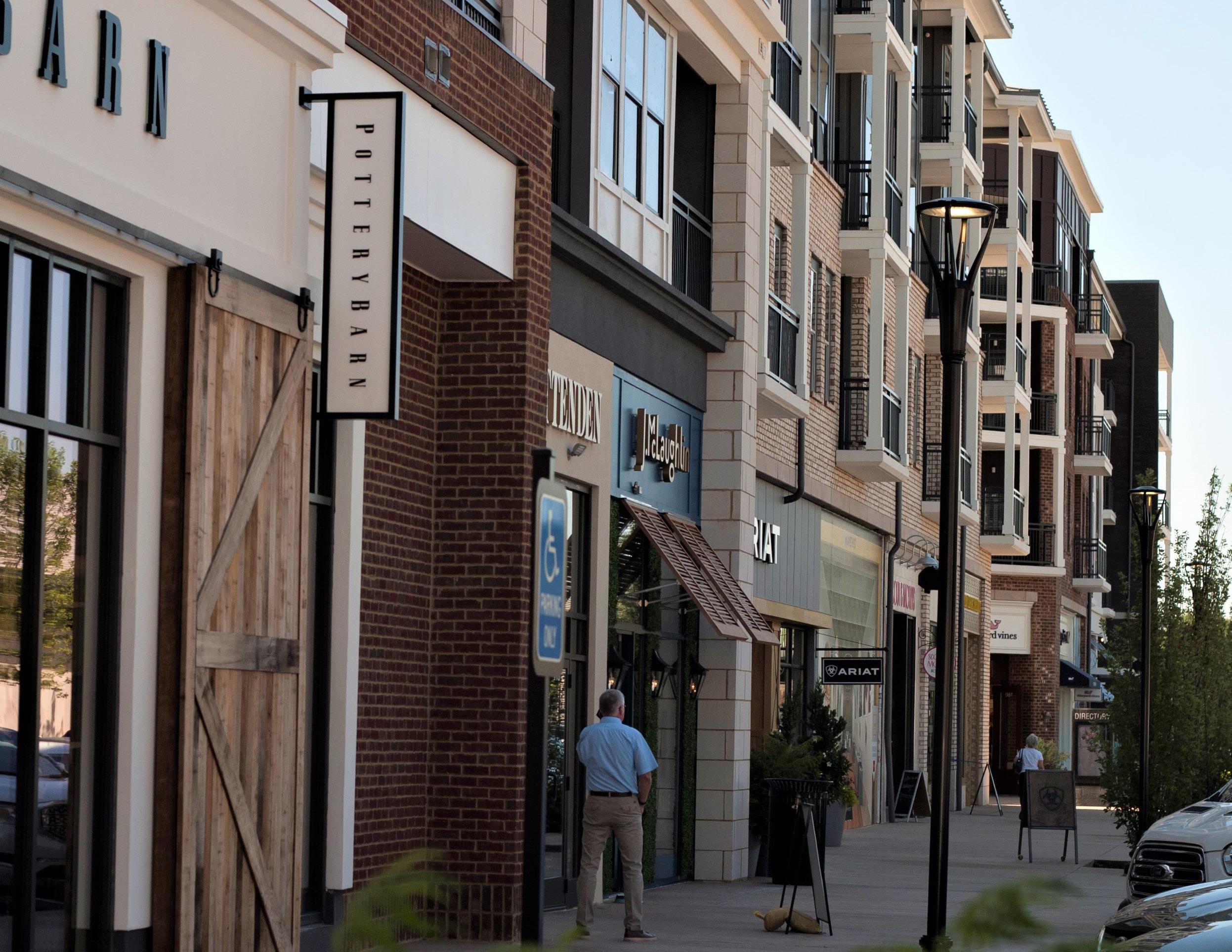
• Placemaking
• Internal connectivity
• Walkability
• Creating jobs where people live
• Proper design/orientation of buildings and streets
• Minimizing parking in favor of multimodal options
• Relation to surrounding neighborhood context.
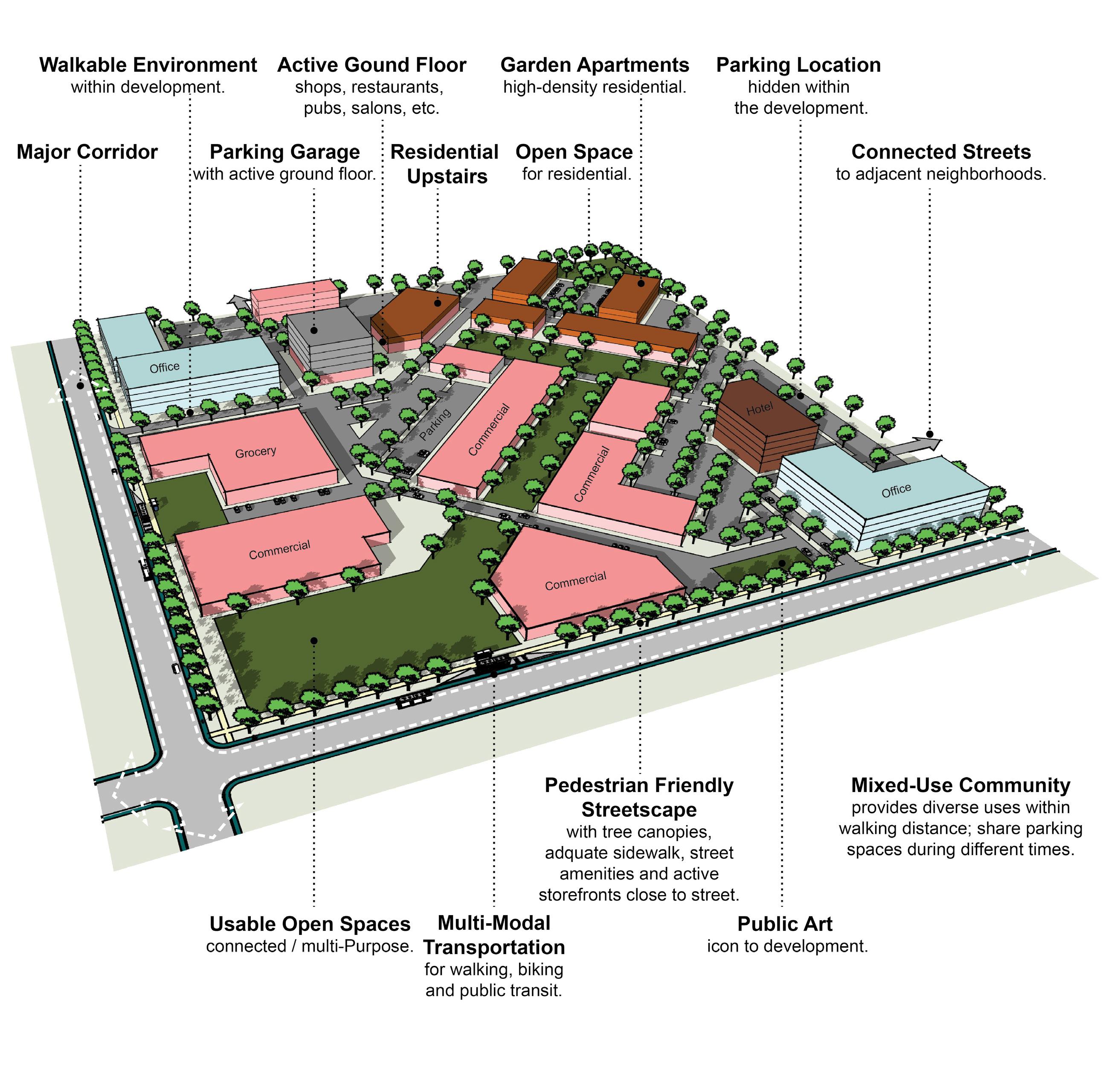
A-DS3-1 Multi-family residential developments should comply with the Multi-family Design Standards in Appendix 1.
A-DS4-2 New construction should be at an appropriate scale to respect the context of neighboring structures; however, along major corridors, it should set the future context in accordance with other Imagine Lexington corridor policies and Placebuilder priorities.
A-DS5-3 Building orientation should maximize connections with the surrounding area and create a pedestrian-friendly atmosphere.
A-DS5-4 Development should provide a pedestrian-oriented and activated ground level.
A-DS7-1 Parking should be oriented to the interior or rear of the property for nonresidential or multi-family developments.
A-DS7-2 Any non-residential or multi-family parking not buffered by a building should be screened from the streetscape view and adjacent properties.
A-DS7-3 Parking structures should activate the ground level.
A-DS8-1 At the individual street level, medium density housing types should be interspersed with single-family detached units and should be context sensitive.
A-DS10-1 Residential units should be within reasonable walking distance to a focal point.
A-DS11-1 Common public uses that serve as neighborhood focal points, such as parks and schools, should be on single loaded streets.
A-DN2-1 Infill residential should aim to increase density.
A-DN2-2 Development should minimize significant contrasts in scale, massing and design, particularly along the edges of historic areas and neighborhoods. (D-PL9, E-GR6)
A-DN3-2 Development should incorporate residential units in commercial centers with context sensitive design.
A-DN6-1 Allow and encourage new compact single-family housing types.
A-EQ3-1 Development should create context sensitive transitions between intense corridor development and existing neighborhoods.
A-EQ7-1 School sites should be appropriately sized.
B-PR9-1 Minimize disturbances to environmentally sensitive areas by utilizing the existing topography to the greatest extent possible.
B-SU11-1 Green infrastructure should be implemented in new development. (E-GR3)
C-LI6-1 Developments should incorporate multi-family housing and walkable commercial uses into development along arterials/corridors.
C-LI7-1 Developments should create mixed-use neighborhoods with safe access to community facilities, greenspace, employment, businesses, shopping, and entertainment.
C-PS10-2 Developments should explore options for shared and flexible parking arrangements for currently underutilized parking lots.
C-PS10-3 Over-parking of new developments should be avoided. (B-SU5)
D-PL7-1 Stakeholders should be consulted to discuss site opportunities and constraints prior to submitting an application.
D-PL9-1 Historically significant structures should be preserved.
D-PL10-1 Activate the streetscape by designating public art easements in prominent locations.
D-SP3-1 Adequate right-of-way, lease areas and easements for infrastructure, with emphasis on wireless communication networks should be provided to create reliable service throughout Lexington.
D-SP3-2 Cellular tower antennae should be located to minimize intrusion and negative aesthetic impacts, and stealth towers and landscaping should be used to improve the visual impact from the roadway and residential areas.
D-SP9-1 Encourage co-housing, shared housing environments, planned communities and accessory dwelling units for flexibility and affordability for senior adults and people with disabilities.
E-GR4-1 Developments should incorporate reuse of viable existing structures.
E-GR5-1 Structures with demonstrated historic significance should be preserved or adapted.
E-GR9-1 Live/work units should be incorporated into residential developments.
E-GR9-4 Development should intensify underutilized properties and develop vacant and underutilized gaps within neighborhoods. (E-GR6)
A-DS1-1 Mass transit infrastructure such as seating and shelters should be provided/enhanced along transit routes. (A-EQ7).
A-DS1-2 Direct pedestrian linkages to transit should be provided.
A-DS4-1 A plan for a connected multimodal network to adjacent neighborhoods, greenspaces, developments and complementary uses should be provided. (A-DS2, A-DN1, B-SU1, B-SU2, C-LI7, E-AC5)
Criteria that include additional policy items in parentheses refer to companion policies that will provide additional context to the related criteria.
A-DS5-1 Adequate multimodal infrastructure should be provided to ensure vehicular separation from other modes of transport.
A-DS5-2 Roadways should provide a vertical edge, such as trees and buildings.
A-DS10-2 New focal points should be designed with multimodal connections to the neighborhood.
A-DS13-1 Stub streets should be connected. (D-CO4)
A-EQ3-2 Development on corridors should be transit-oriented (dense & intense, internally walkable, connected to adjacent neighborhoods, providing transit infrastructure & facilities). (B-SU3)
B-SU4-1 Where greenspace/community centers are not located within walking distance of a new development, applicants should attempt to incorporate those amenities. (A-DS9)
D-CO1-1 Rights-of-way and multimodal facilities should be designed to reflect and promote the desired place-type.
D-CO2-1 Safe facilities for all users and modes of transportation should be provided.
D-CO2-2 Development should create and/or expand a safe, connected multimodal transportation network that satisfies all users’ needs, including those with disabilities.
D-CO4-2 Roadway capacity should be increased by providing multiple parallel streets, which alleviate traffic and provide multiple route options, in lieu of additional lanes.
D-CO4-3 Street pattern and design should consider site topography and minimize grading where possible.
D-CO5-1 Streets should be designed with shorter block lengths, narrower widths, and traffic calming features.
D-SP1-3 Developments should provide multimodal transportation infrastructure to school sites, including sidewalks, shared-use paths, and roadways that can accommodate the bus and vehicle traffic associated with the site.
D-SP6-1 Social services and community facilities should be accessible via mass transit, bicycle and pedestrian transportation modes. (A-EQ7)
E-ST3-1 Development along major corridors should provide for ride sharing pick up and drop off locations along with considerations for any needed or proposed park and ride functions of the area. (E-GR10, E-GR7)
A-DS4-3 Development should work with the existing landscape to the greatest extent possible, preserving key natural features.
A-EQ7-3 Community open spaces should be easily accessible and clearly delineated from private open spaces.
B-PR2-1 Impact on environmentally sensitive areas should be minimized within and adjacent to the proposed development site.
B-PR2-2 Dividing floodplains into privately owned parcels with flood insurance should be avoided.
B-PR2-3 Floodplains should be incorporated into accessible greenspace, and additional protection should be provided to areas around them.
B-PR7-1 Connections to greenways, tree stands, and stream corridors should be provided.
B-PR7-2 Trees should be incorporated into development plans, prioritize grouping of trees to increase survivability.
B-PR7-3 Developments should improve the tree canopy.
B-RE1-1 Developments should incorporate street trees to create a walkable streetscape.
B-RE2-1 Green infrastructure should be used to connect the greenspace network.
D-SP2-1 Visible, usable greenspace and other natural components should be incorporated into school sites.
D-SP2-2 Active and passive recreation opportunities should be provided on school sites.
E-GR3-1 Physical and visual connections should be provided to existing greenway networks.
E-GR3-2 New focal points should emphasize geographic features unique to the site.
Criteria that include additional policy items in parentheses refer to companion policies that will provide additional context to the related criteria.
A-DS3-1 Multi-family residential developments should comply with the Multi-family Design Standards in Appendix 1.
A-DS4-2 New construction should be at an appropriate scale to respect the context of neighboring structures; however, along major corridors, it should set the future context in accordance with other Imagine Lexington corridor policies and Placebuilder priorities.
A-DS5-3 Building orientation should maximize connections with the surrounding area and create a pedestrian-friendly atmosphere.
A-DS5-4 Development should provide a pedestrian-oriented and activated ground level.
A-DS7-1 Parking should be oriented to the interior or rear of the property for nonresidential or multi-family developments.
A-DS7-2 Any non-residential or multi-family parking not buffered by a building should be screened from the streetscape view and adjacent properties.
A-DS7-3 Parking structures should activate the ground level.
A-DS10-1 Residential units should be within reasonable walking distance to a focal point.
A-DS11-1 Common public uses that serve as neighborhood focal points, such as parks and schools, should be on single loaded streets.
A-DN2-1 Infill residential should aim to increase density.
A-DN2-2 Development should minimize significant contrasts in scale, massing and design, particularly along the edges of historic areas and neighborhoods. (D-PL9, E-GR6)
A-DN3-2 Development should incorporate residential units in commercial centers with context sensitive design.
A-DN4-1 Medium–high density development should be located nearest to neighborhood focal points.
A-EQ3-1 "Development should create context sensitive transitions between intense corridor development and existing neighborhoods."
A-EQ7-1 School sites should be appropriately sized.
B-PR9-1 Minimize disturbances to environmentally sensitive areas by utilizing the existing topography to the greatest extent possible.
B-SU11-1 Green infrastructure should be implemented in new development. (EGR3)
C-LI2-4 Setbacks, signage, and screening should complement the iconic Bluegrass landscape along Historic Turnpikes, Scenic Byways, Turnpikes, and other scenic roads listed in the RLMP.
C-LI6-1 Developments should incorporate multi-family housing and walkable commercial uses into development along arterials/corridors.
C-LI7-1 Developments should create mixed-use neighborhoods with safe access to community facilities, greenspace, employment, businesses, shopping, and entertainment.
C-PS10-2 Developments should explore options for shared and flexible parking arrangements for currently underutilized parking lots.
C-PS10-3 Over-parking of new developments should be avoided. (B-SU5)
D-PL7-1 Stakeholders should be consulted to discuss site opportunities and constraints prior to submitting an application.
D-PL9-1 Historically significant structures should be preserved.
D-PL10-1 Activate the streetscape by designating public art easements in prominent locations.
D-SP3-1 Adequate right-of-way, lease areas and easements for infrastructure, with emphasis on wireless communication networks should be provided to create reliable service throughout Lexington.
D-SP3-2 Cellular tower antennae should be located to minimize intrusion and negative aesthetic impacts, and stealth towers and landscaping should be used to improve the visual impact from the roadway and residential areas.
E-GR4-1 Developments should incorporate reuse of viable existing structures.
E-GR5-1 Structures with demonstrated historic significance should be preserved or adapted.
E-GR9-4 Development should intensify underutilized properties and develop vacant and underutilized gaps within neighborhoods. (E-GR6)
A-DS1-1 Mass transit infrastructure such as seating and shelters should be provided/enhanced along transit routes. (A-EQ7).
A-DS1-2 Direct pedestrian linkages to transit should be provided.
A-DS4-1 A plan for a connected multimodal network to adjacent neighborhoods, greenspaces, developments and complementary uses should be provided. (A-DS2, A-DN1, B-SU1, B-SU2, C-LI7, E-AC5)
A-DS5-1 Adequate multimodal infrastructure should be provided to ensure vehicular separation from other modes of transport.
Criteria that include additional policy items in parentheses refer to companion policies that will provide additional context to the related criteria.
A-DS5-2 Roadways should provide a vertical edge, such as trees and buildings.
A-DS10-2 New focal points should be designed with multimodal connections to the neighborhood.
A-DS13-1 Stub streets should be connected. (D-CO4)
A-EQ3-2 Development on corridors should be transit-oriented (dense & intense, internally walkable, connected to adjacent neighborhoods, providing transit infrastructure & facilities). (B-SU3)
B-SU4-1 Where greenspace/community centers are not located within walking distance of a new development, applicants should attempt to incorporate those amenities. (A-DS9)
C-PS10-1 Flexible parking and shared parking arrangements should be utilized.
D-CO1-1 Rights-of-way and multimodal facilities should be designed to reflect and promote the desired place-type.
D-CO2-1 Safe facilities for all users and modes of transportation should be provided.
D-CO2-2 Development should create and/or expand a safe, connected multimodal transportation network that satisfies all users’ needs, including those with disabilities.
D-CO4-2 Roadway capacity should be increased by providing multiple parallel streets, which alleviate traffic and provide multiple route options, in lieu of additional lanes.
D-CO4-3 Street pattern and design should consider site topography and minimize grading where possible.
D-CO5-1 Streets should be designed with shorter block lengths, narrower widths, and traffic calming features.
D-SP1-3 Developments should provide multimodal transportation infrastructure to school sites, including sidewalks, shared-use paths, and roadways that can accommodate the bus and vehicle traffic associated with the site.
E-ST3-1 Development along major corridors should provide for ride sharing pick up and drop off locations along with considerations for any needed or proposed park and ride functions of the area. (E-GR10, E-GR7)
A-DS4-3 Development should work with the existing landscape to the greatest extent possible, preserving key natural features.
A-EQ7-3 Community open spaces should be easily accessible and clearly delineated from private open spaces.
B-PR2-1 Impact on environmentally sensitive areas should be minimized within and adjacent to the proposed development site.
B-PR2-2 Dividing floodplains into privately owned parcels with flood insurance should be avoided.
B-PR2-3 Floodplains should be incorporated into accessible greenspace, and additional protection should be provided to areas around them.
B-PR7-1 Connections to greenways, tree stands, and stream corridors should be provided.
B-PR7-2 Trees should be incorporated into development plans, prioritize grouping of trees to increase survivability.
B-PR7-3 Developments should improve the tree canopy.
B-RE1-1 Developments should incorporate street trees to create a walkable streetscape.
B-RE2-1 Green infrastructure should be used to connect the greenspace network.
D-SP2-1 Visible, usable greenspace and other natural components should be incorporated into school sites.
D-SP2-2 Active and passive recreation opportunities should be provided on school sites.
E-GR3-1 Physical and visual connections should be provided to existing greenway networks.
E-GR3-2 New focal points should emphasize geographic features unique to the site.
Criteria that include additional policy items in parentheses refer to companion policies that will provide additional context to the related criteria.
A-DS3-1 Multi-family residential developments should comply with the Multi-family Design Standards in Appendix 1.
A-DS4-2 New construction should be at an appropriate scale to respect the context of neighboring structures; however, along major corridors, it should set the future context in accordance with other Imagine Lexington corridor policies and Placebuilder priorities.
A-DS5-3 Building orientation should maximize connections with the surrounding area and create a pedestrian-friendly atmosphere.
A-DS5-4 Development should provide a pedestrian-oriented and activated ground level.
A-DS7-1 Parking should be oriented to the interior or rear of the property for nonresidential or multi-family developments.
A-DS7-2 Any non-residential or multi-family parking not buffered by a building should be screened from the streetscape view and adjacent properties.
A-DS7-3 Parking structures should activate the ground level.
A-DS10-1 Residential units should be within reasonable walking distance to a focal point.
A-DN1-1 High density residential development (HR) should be located on corridors and downtown.
A-DN2-1 Infill residential should aim to increase density.
A-DN2-2 Development should minimize significant contrasts in scale, massing and design, particularly along the edges of historic areas and neighborhoods. (D-PL9, E-GR6)
A-DN3-2 Development should incorporate residential units in commercial centers with context sensitive design.
A-EQ3-1 Development should create context sensitive transitions between intense corridor development and existing neighborhoods.
A-EQ7-1 School sites should be appropriately sized.
B-PR9-1 Minimize disturbances to environmentally sensitive areas by utilizing the existing topography to the greatest extent possible.
B-SU11-1 Green infrastructure should be implemented in new development. (E-GR3)
C-LI2-2 Non-agricultural uses at or near potential and existing gateways, as mapped in the Rural Land Management Plan, should be buffered.
C-LI2-3 Design should create a positive gateway character at existing and proposed gateways as identified in the Rural Land Management Plan.
C-LI2-4 Setbacks, signage, and screening should complement the iconic Bluegrass landscape along Historic Turnpikes, Scenic Byways, Turnpikes, and other scenic roads listed in the RLMP.
C-LI6-1 Developments should incorporate multi-family housing and walkable commercial uses into development along arterials/corridors.
C-LI7-1 Developments should create mixed-use neighborhoods with safe access to community facilities, greenspace, employment, businesses, shopping, and entertainment.
C-PS10-2 Developments should explore options for shared and flexible parking arrangements for currently underutilized parking lots.
C-PS10-3 Over-parking of new developments should be avoided. (B-SU5)
D-PL7-1 Stakeholders should be consulted to discuss site opportunities and constraints prior to submitting an application.
D-PL9-1 Historically significant structures should be preserved.
D-PL10-1 Activate the streetscape by designating public art easements in prominent locations.
D-SP3-1 Adequate right-of-way, lease areas and easements for infrastructure, with emphasis on wireless communication networks should be provided to create reliable service throughout Lexington.
D-SP3-2 Cellular tower antennae should be located to minimize intrusion and negative aesthetic impacts, and stealth towers and landscaping should be used to improve the visual impact from the roadway and residential areas.
E-GR4-1 Developments should incorporate reuse of viable existing structures.
E-GR5-1 Structures with demonstrated historic significance should be preserved or adapted.
E-GR9-4 Development should intensify underutilized properties and develop vacant and underutilized gaps within neighborhoods. (E-GR6)
E-GR10-1 Developments should include multi-family residential components in B-6P and other Mixed Use Zones.
E-GR10-2 Developments should provide walkable service and amenity-oriented commercial spaces.
E-GR10-3 Shared common space in commercial developments should be provided to encourage experiential retail programming.
Criteria that include additional policy items in parentheses refer to companion policies that will provide additional context to the related criteria.
A-DS1-1 Mass transit infrastructure such as seating and shelters should be provided/enhanced along transit routes. (A-EQ7).
A-DS1-2 Direct pedestrian linkages to transit should be provided.
A-DS4-1 A plan for a connected multimodal network to adjacent neighborhoods, greenspaces, developments and complementary uses should be provided. (A-DS2, A-DN1, B-SU1, B-SU2, C-LI7, E-AC5)
A-DS5-1 Adequate multimodal infrastructure should be provided to ensure vehicular separation from other modes of transport.
A-DS5-2 Roadways should provide a vertical edge, such as trees and buildings.
A-DS10-2 New focal points should be designed with multimodal connections to the neighborhood.
A-DS13-1 Stub streets should be connected. (D-CO4)
A-EQ3-2 Development on corridors should be transit-oriented (dense & intense, internally walkable, connected to adjacent neighborhoods, providing transit infrastructure & facilities). (B-SU3)
A-EQ7-2 Multimodal transportation options for healthcare and social services facilities should be provided. (E-ST3)
B-SU4-1 Where greenspace/community centers are not located within walking distance of a new development, applicants should attempt to incorporate those amenities. (A-DS9)
C-PS10-1 Flexible parking and shared parking arrangements should be utilized.
D-CO1-1 Rights-of-way and multimodal facilities should be designed to reflect and promote the desired place-type.
D-CO2-1 Safe facilities for all users and modes of transportation should be provided.
D-CO2-2 Development should create and/or expand a safe, connected multimodal transportation network that satisfies all users’ needs, including those with disabilities.
D-CO4-2 Roadway capacity should be increased by providing multiple parallel streets, which alleviate traffic and provide multiple route options, in lieu of additional lanes.
D-CO4-3 Street pattern and design should consider site topography and minimize grading where possible.
D-CO5-1 Streets should be designed with shorter block lengths, narrower widths, and traffic calming features.
D-SP1-3 Developments should provide multimodal transportation infrastructure to school sites, including sidewalks, shared-use paths, and roadways that can accommodate the bus and vehicle traffic associated with the site.
E-ST3-1 Development along major corridors should provide for ride sharing pick up and drop off locations along with considerations for any needed or proposed park and ride functions of the area. (E-GR10, E-GR7)
A-DS4-3 Development should work with the existing landscape to the greatest extent possible, preserving key natural features.
A-EQ7-3 Community open spaces should be easily accessible and clearly delineated from private open spaces.
B-PR2-1 Impact on environmentally sensitive areas should be minimized within and adjacent to the proposed development site.
B-PR2-2 Dividing floodplains into privately owned parcels with flood insurance should be avoided.
B-PR2-3 Floodplains should be incorporated into accessible greenspace, and additional protection should be provided to areas around them.
B-PR7-1 Connections to greenways, tree stands, and stream corridors should be provided.
B-PR7-2 Trees should be incorporated into development plans, prioritize grouping of trees to increase survivability.
B-PR7-3 Developments should improve the tree canopy.
B-RE1-1 Developments should incorporate street trees to create a walkable streetscape.
B-RE2-1 Green infrastructure should be used to connect the greenspace network.
E-GR3-1 Physical and visual connections should be provided to existing greenway networks.
E-GR3-2 New focal points should emphasize geographic features unique to the site.
Criteria that include additional policy items in parentheses refer to companion policies that will provide additional context to the related criteria.
A-DS3-1 Multi-family residential developments should comply with the Multi-family Design Standards in Appendix 1.
A-DS4-2 New construction should be at an appropriate scale to respect the context of neighboring structures; however, along major corridors, it should set the future context in accordance with other Imagine Lexington corridor policies and Placebuilder priorities.
A-DS5-3 Building orientation should maximize connections with the surrounding area and create a pedestrian-friendly atmosphere.
A-DS5-4 Development should provide a pedestrian-oriented and activated ground level.
A-DS7-1 Parking should be oriented to the interior or rear of the property for nonresidential or multi-family developments.
A-DS7-2 Any non-residential or multi-family parking not buffered by a building should be screened from the streetscape view and adjacent properties.
A-DS7-3 Parking structures should activate the ground level.
A-DS8-1 At the individual street level, medium density housing types should be interspersed with single-family detached units and should be context sensitive.
A-DS10-1 Residential units should be within reasonable walking distance to a focal point.
A-DS11-1 Common public uses that serve as neighborhood focal points, such as parks and schools, should be on single loaded streets.
A-DN2-1 Infill residential should aim to increase density.
A-DN2-2 Development should minimize significant contrasts in scale, massing and design, particularly along the edges of historic areas and neighborhoods. (D-PL9, E-GR6)
A-DN3-1 Pedestrian-oriented commercial opportunities should be incorporated within residential neighborhoods.
A-DN3-2 Development should incorporate residential units in commercial centers with context sensitive design.
A-EQ3-1 Development should create context sensitive transitions between intense corridor development and existing neighborhoods.
A-EQ7-1 School sites should be appropriately sized.
B-PR9-1 Minimize disturbances to environmentally sensitive areas by utilizing the existing topography to the greatest extent possible.
B-SU11-1 Green infrastructure should be implemented in new development. (E-GR3)
C-DI1-1 Consider flexible zoning options that will allow for a wide range of jobs.
C-DI5-1 In Opportunity Zones with a clearly defined local context, consider adaptive reuse to enhance the existing context.
C-LI2-2 Non-agricultural uses at or near potential and existing gateways, as mapped in the Rural Land Management Plan, should be buffered.
C-LI2-3 Design should create a positive gateway character at existing and proposed gateways as identified in the Rural Land Management Plan.
C-LI2-4 Setbacks, signage, and screening should complement the iconic Bluegrass landscape along Historic Turnpikes, Scenic Byways, Turnpikes, and other scenic roads listed in the RLMP.
C-LI6-1 Developments should incorporate multi-family housing and walkable commercial uses into development along arterials/corridors.
C-LI7-1 Developments should create mixed-use neighborhoods with safe access to community facilities, greenspace, employment, businesses, shopping, and entertainment.
C-PS9-2 Modify current office space to include complementary uses.
C-PS10-2 Developments should explore options for shared and flexible parking arrangements for currently underutilized parking lots.
C-PS10-3 Over-parking of new developments should be avoided. (B-SU5)
D-PL7-1 Stakeholders should be consulted to discuss site opportunities and constraints prior to submitting an application.
D-PL9-1 Historically significant structures should be preserved.
D-PL10-1 Activate the streetscape by designating public art easements in prominent locations.
D-SP3-1 Adequate right-of-way, lease areas and easements for infrastructure, with emphasis on wireless communication networks should be provided to create reliable service throughout Lexington.
D-SP3-2 Cellular tower antennae should be located to minimize intrusion and negative aesthetic impacts, and stealth towers and landscaping should be used to improve the visual impact from the roadway and residential areas.
D-SP9-1 Encourage co-housing, shared housing environments, planned communities and accessory dwelling units for flexibility and affordability for senior adults and people with disabilities.
E-GR4-1 Developments should incorporate reuse of viable existing structures.
E-GR5-1 Structures with demonstrated historic significance should be preserved or adapted.
E-GR9-1 Live/work units should be incorporated into residential developments.
E-GR9-4 Development should intensify underutilized properties and develop vacant and underutilized gaps within neighborhoods. (E-GR6)
Criteria that include additional policy items in parentheses refer to companion policies that will provide additional context to the related criteria.
E-GR10-2 Developments should provide walkable service and amenity-oriented commercial spaces.
E-GR10-3 Shared common space in commercial developments should be provided to encourage experiential retail programming.
A-DS1-1 Mass transit infrastructure such as seating and shelters should be provided/enhanced along transit routes. (A-EQ7).
A-DS1-2 Direct pedestrian linkages to transit should be provided.
A-DS4-1 A plan for a connected multimodal network to adjacent neighborhoods, greenspaces, developments and complementary uses should be provided. (A-DS2, A-DN1, B-SU1, B-SU2, C-LI7, E-AC5)
A-DS5-1 Adequate multimodal infrastructure should be provided to ensure vehicular separation from other modes of transport.
A-DS5-2 Roadways should provide a vertical edge, such as trees and buildings.
A-DS10-2 New focal points should be designed with multimodal connections to the neighborhood.
A-DS13-1 Stub streets should be connected. (D-CO4)
A-EQ3-2 Development on corridors should be transit-oriented (dense & intense, internally walkable, connected to adjacent neighborhoods, providing transit infrastructure & facilities). (B-SU3)
A-EQ7-2 Multimodal transportation options for healthcare and social services facilities should be provided. (E-ST3)
B-SU4-1 Where greenspace/community centers are not located within walking distance of a new development, applicants should attempt to incorporate those amenities. (A-DS9)
C-PS10-1 Flexible parking and shared parking arrangements should be utilized.
D-CO1-1 Rights-of-way and multimodal facilities should be designed to reflect and promote the desired place-type.
D-CO2-1 Safe facilities for all users and modes of transportation should be provided.
D-CO2-2 Development should create and/or expand a safe, connected multimodal transportation network that satisfies all users’ needs, including those with disabilities.
D-CO4-2 Roadway capacity should be increased by providing multiple parallel streets, which alleviate traffic and provide multiple route options, in lieu of additional lanes.
D-CO4-3 Street pattern and design should consider site topography and minimize grading where possible.
D-CO5-1 Streets should be designed with shorter block lengths, narrower widths, and traffic calming features.
D-SP1-3 Developments should provide multimodal transportation infrastructure to school sites, including sidewalks, shared-use paths, and roadways that can accommodate the bus and vehicle traffic associated with the site.
E-ST3-1 Development along major corridors should provide for ride sharing pick up and drop off locations along with considerations for any needed or proposed park and ride functions of the area. (E-GR10, E-GR7)
A-DS4-3 Development should work with the existing landscape to the greatest extent possible, preserving key natural features.
A-EQ7-3 Community open spaces should be easily accessible and clearly delineated from private open spaces.
B-PR2-1 Impact on environmentally sensitive areas should be minimized within and adjacent to the proposed development site.
B-PR2-2 Dividing floodplains into privately owned parcels with flood insurance should be avoided.
B-PR2-3 Floodplains should be incorporated into accessible greenspace, and additional protection should be provided to areas around them.
B-PR7-1 Connections to greenways, tree stands, and stream corridors should be provided.
B-PR7-2 Trees should be incorporated into development plans, prioritize grouping of trees to increase survivability.
B-PR7-3 Developments should improve the tree canopy.
B-RE1-1 Developments should incorporate street trees to create a walkable streetscape.
B-RE2-1 Green infrastructure should be used to connect the greenspace network.
D-SP2-1 Visible, usable greenspace and other natural components should be incorporated into school sites.
D-SP2-2 Active and passive recreation opportunities should be provided on school sites.
E-GR3-1 Physical and visual connections should be provided to existing greenway networks.
E-GR3-2 New focal points should emphasize geographic features unique to the site.
Criteria that include additional policy items in parentheses refer to companion policies that will provide additional context to the related criteria.
A-DS4-2 New construction should be at an appropriate scale to respect the context of neighboring structures; however, along major corridors, it should set the future context in accordance with other Imagine Lexington corridor policies and Placebuilder priorities.
A-DS5-3 Building orientation should maximize connections with the surrounding area and create a pedestrian-friendly atmosphere.
A-DS5-4 Development should provide a pedestrian-oriented and activated ground level.
A-DS7-1 Parking should be oriented to the interior or rear of the property for nonresidential or multi-family developments.
A-DS7-2 Any non-residential or multi-family parking not buffered by a building should be screened from the streetscape view and adjacent properties.
A-DS7-3 Parking structures should activate the ground level.
A-DS10-1 Residential units should be within reasonable walking distance to a focal point.
A-DS12-1 Medium–high density development should be located nearest to neighborhood-serving commercial areas.
A-DN1-1 High density residential development (HR) should be located on corridors and downtown.
A-DN2-1 Infill residential should aim to increase density.
A-DN2-2 Development should minimize significant contrasts in scale, massing and design, particularly along the edges of historic areas and neighborhoods. (D-PL9, E-GR6)
A-DN3-2 Development should incorporate residential units in commercial centers with context sensitive design.
A-EQ3-1 Development should create context sensitive transitions between intense corridor development and existing neighborhoods.
A-EQ7-1 School sites should be appropriately sized.
B-PR9-1 Minimize disturbances to environmentally sensitive areas by utilizing the existing topography to the greatest extent possible.
B-SU11-1 Green infrastructure should be implemented in new development. (E-GR3)
C-DI1-1 Consider flexible zoning options that will allow for a wide range of jobs.
C-LI2-1 The design should not obstruct the view of the gateway features of the three existing gateways mapped in the Rural Land Management Plan (RLMP).
C-LI2-2 Non-agricultural uses at or near potential and existing gateways, as mapped in the Rural Land Management Plan, should be buffered.
C-LI2-3
Design should create a positive gateway character at existing and proposed gateways as identified in the Rural Land Management Plan.
C-LI2-4 Setbacks, signage, and screening should complement the iconic Bluegrass landscape along Historic Turnpikes, Scenic Byways, Turnpikes, and other scenic roads listed in the RLMP.
C-LI6-1 Developments should incorporate multi-family housing and walkable commercial uses into development along arterials/corridors.
C-LI7-1 Developments should create mixed-use neighborhoods with safe access to community facilities, greenspace, employment, businesses, shopping, and entertainment.
C-PS9-2 Modify current office space to include complementary uses.
C-PS10-2 Developments should explore options for shared and flexible parking arrangements for currently underutilized parking lots.
C-PS10-3 Over-parking of new developments should be avoided. (B-SU5)
D-PL7-1 Stakeholders should be consulted to discuss site opportunities and constraints prior to submitting an application.
D-PL9-1 Historically significant structures should be preserved.
D-PL10-1 Activate the streetscape by designating public art easements in prominent locations.
D-SP3-1 Adequate right-of-way, lease areas and easements for infrastructure, with emphasis on wireless communication networks should be provided to create reliable service throughout Lexington.
D-SP3-2 Cellular tower antennae should be located to minimize intrusion and negative aesthetic impacts, and stealth towers and landscaping should be used to improve the visual impact from the roadway and residential areas.
E-GR4-1 Developments should incorporate reuse of viable existing structures.
E-GR5-1 Structures with demonstrated historic significance should be preserved or adapted.
E-GR9-4 Development should intensify underutilized properties and develop vacant and underutilized gaps within neighborhoods. (E-GR6)
E-GR10-1 Developments should include multi-family residential components in B-6P and other Mixed Use Zones.
E-GR10-2 Developments should provide walkable service and amenity-oriented commercial spaces.
E-GR10-3 Shared common space in commercial developments should be provided to encourage experiential retail programming.
Criteria that include additional policy items in parentheses refer to companion policies that will provide additional context to the related criteria.
A-DS1-1 Mass transit infrastructure such as seating and shelters should be provided/enhanced along transit routes. (A-EQ7).
A-DS1-2 Direct pedestrian linkages to transit should be provided.
A-DS4-1 A plan for a connected multimodal network to adjacent neighborhoods, greenspaces, developments and complementary uses should be provided. (A-DS2, A-DN1, B-SU1, B-SU2, C-LI7, E-AC5)
A-DS5-1 Adequate multimodal infrastructure should be provided to ensure vehicular separation from other modes of transport.
A-DS5-2 Roadways should provide a vertical edge, such as trees and buildings.
A-DS13-1 Stub streets should be connected. (D-CO4)
A-EQ3-2 Development on corridors should be transit-oriented (dense & intense, internally walkable, connected to adjacent neighborhoods, providing transit infrastructure & facilities). (B-SU3)
A-EQ7-2 Multimodal transportation options for healthcare and social services facilities should be provided. (E-ST3)
B-SU4-1 Where greenspace/community centers are not located within walking distance of a new development, applicants should attempt to incorporate those amenities. (A-DS9)
C-PS10-1 Flexible parking and shared parking arrangements should be utilized.
D-CO1-1 Rights-of-way and multimodal facilities should be designed to reflect and promote the desired place-type.
D-CO2-1 Safe facilities for all users and modes of transportation should be provided.
D-CO2-2 Development should create and/or expand a safe, connected multimodal transportation network that satisfies all users’ needs, including those with disabilities.
D-CO4-2 Roadway capacity should be increased by providing multiple parallel streets, which alleviate traffic and provide multiple route options, in lieu of additional lanes.
D-CO4-3 Street pattern and design should consider site topography and minimize grading where possible.
D-CO5-1 Streets should be designed with shorter block lengths, narrower widths, and traffic calming features.
D-SP1-3 Developments should provide multimodal transportation infrastructure to school sites, including sidewalks, shared-use paths, and roadways that can accommodate the bus and vehicle traffic associated with the site.
D-SP6-1 Social services and community facilities should be accessible via mass transit, bicycle and pedestrian transportation modes. (A-EQ7)
E-ST3-1 Development along major corridors should provide for ride sharing pick up and drop off locations along with considerations for any needed or proposed park and ride functions of the area. (E-GR10, E-GR7)
A-DS4-3 Development should work with the existing landscape to the greatest extent possible, preserving key natural features.
A-EQ7-3 Community open spaces should be easily accessible and clearly delineated from private open spaces.
B-PR2-1 Impact on environmentally sensitive areas should be minimized within and adjacent to the proposed development site.
B-PR2-2 Dividing floodplains into privately owned parcels with flood insurance should be avoided.
B-PR2-3 Floodplains should be incorporated into accessible greenspace, and additional protection should be provided to areas around them.
B-PR7-1 Connections to greenways, tree stands, and stream corridors should be provided.
B-PR7-2 Trees should be incorporated into development plans, prioritize grouping of trees to increase survivability.
B-PR7-3 Developments should improve the tree canopy.
B-RE1-1 Developments should incorporate street trees to create a walkable streetscape.
B-RE2-1 Green infrastructure should be used to connect the greenspace network.
D-SP2-1 Visible, usable greenspace and other natural components should be incorporated into school sites.
D-SP2-2 Active and passive recreation opportunities should be provided on school sites.
E-GR3-1 Physical and visual connections should be provided to existing greenway networks.
E-GR3-2 New focal points should emphasize geographic features unique to the site.
Criteria that include additional policy items in parentheses refer to companion policies that will provide additional context to the related criteria.
A CORRIDOR IS...
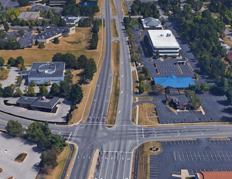
Lexington’s major roadways focused on commerce and transportation. The overriding emphasis of Imagine Lexington is significantly overhauling the intensity of the major corridors. The future of Lexington’s corridors lies in accommodating the shifting retail economic model by incorporating high density residential and offering substantial flexibility to available land uses. Adding a mix of land uses to support the existing retail will provide a built-in customer base, create a more desirable retail experience, and allow a greater return on investment for landholders. Additional focus is on increasing the viability of enhanced mass transit, thereby reducing the reliance on single-occupancy vehicles and improving Lexington’s overall transportation efficiency.
• Transit Oriented Development
• High density residential
• Community
• Redevelopment of underutilized property
spaces
RECOMMENDED ZONE(S)
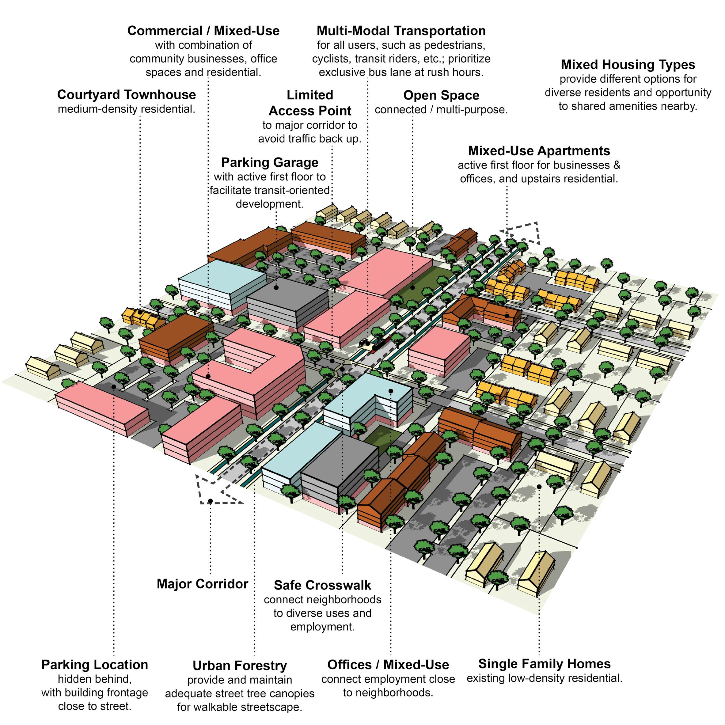
A-DS3-1 Multi-family residential developments should comply with the Multi-family Design Standards in Appendix 1.
A-DS4-2 New construction should be at an appropriate scale to respect the context of neighboring structures; however, along major corridors, it should set the future context in accordance with other Imagine Lexington corridor policies and Placebuilder priorities.
A-DS5-3 Building orientation should maximize connections with the surrounding area and create a pedestrian-friendly atmosphere.
A-DS5-4 Development should provide a pedestrian-oriented and activated ground level.
A-DS7-1 Parking should be oriented to the interior or rear of the property for nonresidential or multi-family developments.
A-DS7-2 Any non-residential or multi-family parking not buffered by a building should be screened from the streetscape view and adjacent properties.
A-DS7-3 Parking structures should activate the ground level.
A-DS8-1 At the individual street level, medium density housing types should be interspersed with single-family detached units and should be context sensitive.
A-DS10-1 Residential units should be within reasonable walking distance to a focal point.
A-DS11-1 Common public uses that serve as neighborhood focal points, such as parks and schools, should be on single loaded streets.
A-DN2-1 Infill residential should aim to increase density.
A-DN2-2 Development should minimize significant contrasts in scale, massing and design, particularly along the edges of historic areas and neighborhoods. (D-PL9, E-GR6)
A-DN3-2 Development should incorporate residential units in commercial centers with context sensitive design.
A-DN6-1 Allow and encourage new compact single-family housing types.
A-EQ3-1 Development should create context sensitive transitions between intense corridor development and existing neighborhoods.
A-EQ7-1 School sites should be appropriately sized.
B-PR9-1 Minimize disturbances to environmentally sensitive areas by utilizing the existing topography to the greatest extent possible.
B-SU11-1 Green infrastructure should be implemented in new development. (E-GR3)
C-LI6-1 Developments should incorporate multi-family housing and walkable commercial uses into development along arterials/corridors.
C-LI7-1 Developments should create mixed-use neighborhoods with safe access to community facilities, greenspace, employment, businesses, shopping, and entertainment.
C-PS10-2 Developments should explore options for shared and flexible parking arrangements for currently underutilized parking lots.
C-PS10-3 Over-parking of new developments should be avoided. (B-SU5)
D-PL7-1 Stakeholders should be consulted to discuss site opportunities and constraints prior to submitting an application.
D-PL9-1 Historically significant structures should be preserved.
D-PL10-1 Activate the streetscape by designating public art easements in prominent locations.
D-SP3-1 Adequate right-of-way, lease areas and easements for infrastructure, with emphasis on wireless communication networks should be provided to create reliable service throughout Lexington.
D-SP3-2 Cellular tower antennae should be located to minimize intrusion and negative aesthetic impacts, and stealth towers and landscaping should be used to improve the visual impact from the roadway and residential areas.
D-SP9-1 Encourage co-housing, shared housing environments, planned communities and accessory dwelling units for flexibility and affordability for senior adults and people with disabilities.
E-GR4-1 Developments should incorporate reuse of viable existing structures.
E-GR5-1 Structures with demonstrated historic significance should be preserved or adapted.
E-GR9-1 Live/work units should be incorporated into residential developments.
E-GR9-4 Development should intensify underutilized properties and develop vacant and underutilized gaps within neighborhoods. (E-GR6)
A-DS1-1 Mass transit infrastructure such as seating and shelters should be provided/enhanced along transit routes. (A-EQ7).
A-DS1-2 Direct pedestrian linkages to transit should be provided.
A-DS4-1 A plan for a connected multimodal network to adjacent neighborhoods, greenspaces, developments and complementary uses should be provided. (A-DS2, A-DN1, B-SU1, B-SU2, C-LI7, E-AC5)
A-DS5-1 Adequate multimodal infrastructure should be provided to ensure vehicular separation from other modes of transport.
A-DS5-2 Roadways should provide a vertical edge, such as trees and buildings.
Criteria that include additional policy items in parentheses refer to companion policies that will provide additional context to the related criteria.
A-DS10-2 New focal points should be designed with multimodal connections to the neighborhood.
A-DS13-1 Stub streets should be connected. (D-CO4)
A-EQ3-2 Development on corridors should be transit-oriented (dense & intense, internally walkable, connected to adjacent neighborhoods, providing transit infrastructure & facilities). (B-SU3)
B-SU4-1 Where greenspace/community centers are not located within walking distance of a new development, applicants should attempt to incorporate those amenities. (A-DS9)
D-CO1-1 Rights-of-way and multimodal facilities should be designed to reflect and promote the desired place-type.
D-CO2-1 Safe facilities for all users and modes of transportation should be provided.
D-CO2-2 Development should create and/or expand a safe, connected multimodal transportation network that satisfies all users’ needs, including those with disabilities.
D-CO4-2 Roadway capacity should be increased by providing multiple parallel streets, which alleviate traffic and provide multiple route options, in lieu of additional lanes.
D-CO5-1 Streets should be designed with shorter block lengths, narrower widths, and traffic calming features.
D-SP1-3 Developments should provide multimodal transportation infrastructure to school sites, including sidewalks, shared-use paths, and roadways that can accommodate the bus and vehicle traffic associated with the site.
D-SP6-1 Social services and community facilities should be accessible via mass transit, bicycle and pedestrian transportation modes. (A-EQ7)
E-ST3-1 Development along major corridors should provide for ride sharing pick up and drop off locations along with considerations for any needed or proposed park and ride functions of the area. (E-GR10, E-GR7)
A-DS4-3 Development should work with the existing landscape to the greatest extent possible, preserving key natural features.
A-EQ7-3 Community open spaces should be easily accessible and clearly delineated from private open spaces.
B-PR2-1 Impact on environmentally sensitive areas should be minimized within and adjacent to the proposed development site.
B-PR2-2 Dividing floodplains into privately owned parcels with flood insurance should be avoided.
B-PR2-3 Floodplains should be incorporated into accessible greenspace, and additional protection should be provided to areas around them.
B-PR7-1 Connections to greenways, tree stands, and stream corridors should be provided.
B-PR7-2 Trees should be incorporated into development plans, prioritize grouping of trees to increase survivability.
B-PR7-3 Developments should improve the tree canopy.
B-RE1-1 Developments should incorporate street trees to create a walkable streetscape.
B-RE2-1 Green infrastructure should be used to connect the greenspace network.
D-SP2-1 Visible, usable greenspace and other natural components should be incorporated into school sites.
D-SP2-2 Active and passive recreation opportunities should be provided on school sites.
E-GR3-1 Physical and visual connections should be provided to existing greenway networks.
E-GR3-2 New focal points should emphasize geographic features unique to the site.
**Criteria that include additional policy items in parentheses refer to companion policies that will provide additional context to the related criteria.
A-DS3-1 Multi-family residential developments should comply with the Multi-family Design Standards in Appendix 1.
A-DS4-2 New construction should be at an appropriate scale to respect the context of neighboring structures; however, along major corridors, it should set the future context in accordance with other Imagine Lexington corridor policies and Placebuilder priorities.
A-DS5-3 Building orientation should maximize connections with the surrounding area and create a pedestrian-friendly atmosphere.
A-DS5-4 Development should provide a pedestrian-oriented and activated ground level.
A-DS7-1 Parking should be oriented to the interior or rear of the property for nonresidential or multi-family developments.
A-DS7-2 Any non-residential or multi-family parking not buffered by a building should be screened from the streetscape view and adjacent properties.
A-DS7-3 Parking structures should activate the ground level.
A-DS10-1 Residential units should be within reasonable walking distance to a focal point.
A-DS11-1 Common public uses that serve as neighborhood focal points, such as parks and schools, should be on single loaded streets.
A-DN2-1 Infill residential should aim to increase density.
A-DN2-2 Development should minimize significant contrasts in scale, massing and design, particularly along the edges of historic areas and neighborhoods. (D-PL9, E-GR6)
A-DN3-2 Development should incorporate residential units in commercial centers with context sensitive design.
A-DN4-1 Medium–high density development should be located nearest to neighborhood focal points.
A-EQ3-1 Development should create context sensitive transitions between intense corridor development and existing neighborhoods.
A-EQ7-1 School sites should be appropriately sized.
B-PR9-1 Minimize disturbances to environmentally sensitive areas by utilizing the existing topography to the greatest extent possible.
B-SU11-1 Green infrastructure should be implemented in new development. (E-GR3)
C-LI2-4 Setbacks, signage, and screening should complement the iconic Bluegrass landscape along Historic Turnpikes, Scenic Byways, Turnpikes, and other scenic roads listed in the RLMP.
C-LI6-1 Developments should incorporate multi-family housing and walkable commercial uses into development along arterials/corridors.
C-LI7-1 Developments should create mixed-use neighborhoods with safe access to community facilities, greenspace, employment, businesses, shopping, and entertainment.
C-PS10-2 Developments should explore options for shared and flexible parking arrangements for currently underutilized parking lots.
C-PS10-3 Over-parking of new developments should be avoided. (B-SU5)
D-PL7-1 Stakeholders should be consulted to discuss site opportunities and constraints prior to submitting an application.
D-PL9-1 Historically significant structures should be preserved.
D-PL10-1 Activate the streetscape by designating public art easements in prominent locations.
D-SP3-1 Adequate right-of-way, lease areas and easements for infrastructure, with emphasis on wireless communication networks should be provided to create reliable service throughout Lexington.
D-SP3-2 Cellular tower antennae should be located to minimize intrusion and negative aesthetic impacts, and stealth towers and landscaping should be used to improve the visual impact from the roadway and residential areas.
E-GR4-1 Developments should incorporate reuse of viable existing structures.
E-GR5-1 Structures with demonstrated historic significance should be preserved or adapted.
E-GR9-4 Development should intensify underutilized properties and develop vacant and underutilized gaps within neighborhoods. (E-GR6)
A-DS1-1 Mass transit infrastructure such as seating and shelters should be provided/enhanced along transit routes. (A-EQ7).
A-DS1-2 Direct pedestrian linkages to transit should be provided.
A-DS4-1 A plan for a connected multimodal network to adjacent neighborhoods, greenspaces, developments and complementary uses should be provided. (A-DS2, A-DN1, B-SU1, B-SU2, C-LI7, E-AC5)
A-DS5-1 Adequate multimodal infrastructure should be provided to ensure vehicular separation from other modes of transport.
A-DS5-2 Roadways should provide a vertical edge, such as trees and buildings.
Criteria that include additional policy items in parentheses refer to companion policies that will provide additional context to the related criteria.
A-DS10-2 New focal points should be designed with multimodal connections to the neighborhood.
A-DS13-1 Stub streets should be connected. (D-CO4)
A-EQ3-2 Development on corridors should be transit-oriented (dense & intense, internally walkable, connected to adjacent neighborhoods, providing transit infrastructure & facilities). (B-SU3)
B-SU4-1 Where greenspace/community centers are not located within walking distance of a new development, applicants should attempt to incorporate those amenities. (A-DS9)
C-PS10-1 Flexible parking and shared parking arrangements should be utilized.
D-CO1-1 Rights-of-way and multimodal facilities should be designed to reflect and promote the desired place-type.
D-CO2-1 Safe facilities for all users and modes of transportation should be provided.
D-CO2-2 Development should create and/or expand a safe, connected multimodal transportation network that satisfies all users’ needs, including those with disabilities.
D-CO4-2 Roadway capacity should be increased by providing multiple parallel streets, which alleviate traffic and provide multiple route options, in lieu of additional lanes.
D-CO5-1 Streets should be designed with shorter block lengths, narrower widths, and traffic calming features.
D-SP1-3 Developments should provide multimodal transportation infrastructure to school sites, including sidewalks, shared-use paths, and roadways that can accommodate the bus and vehicle traffic associated with the site.
E-ST3-1 Development along major corridors should provide for ride sharing pick up and drop off locations along with considerations for any needed or proposed park and ride functions of the area. (E-GR10, E-GR7)
A-DS4-3 Development should work with the existing landscape to the greatest extent possible, preserving key natural features.
A-EQ7-3 Community open spaces should be easily accessible and clearly delineated from private open spaces.
B-PR2-1 Impact on environmentally sensitive areas should be minimized within and adjacent to the proposed development site.
B-PR2-2 Dividing floodplains into privately owned parcels with flood insurance should be avoided.
B-PR2-3 Floodplains should be incorporated into accessible greenspace, and additional protection should be provided to areas around them.
B-PR7-1 Connections to greenways, tree stands, and stream corridors should be provided.
B-PR7-2 Trees should be incorporated into development plans, prioritize grouping of trees to increase survivability.
B-PR7-3 Developments should improve the tree canopy.
B-RE1-1 Developments should incorporate street trees to create a walkable streetscape.
B-RE2-1 Green infrastructure should be used to connect the greenspace network.
D-SP2-1 Visible, usable greenspace and other natural components should be incorporated into school sites.
D-SP2-2 Active and passive recreation opportunities should be provided on school sites.
E-GR3-1 Physical and visual connections should be provided to existing greenway networks.
E-GR3-2 New focal points should emphasize geographic features unique to the site.
Criteria that include additional policy items in parentheses refer to companion policies that will provide additional context to the related criteria.
A-DS3-1 Multi-family residential developments should comply with the Multi-family Design Standards in Appendix 1.
A-DS4-2 New construction should be at an appropriate scale to respect the context of neighboring structures; however, along major corridors, it should set the future context in accordance with other Imagine Lexington corridor policies and Placebuilder priorities."
A-DS5-3 Building orientation should maximize connections with the surrounding area and create a pedestrian-friendly atmosphere.
A-DS5-4 Development should provide a pedestrian-oriented and activated ground level.
A-DS7-1 Parking should be oriented to the interior or rear of the property for nonresidential or multi-family developments.
A-DS7-2 Any non-residential or multi-family parking not buffered by a building should be screened from the streetscape view and adjacent properties.
A-DS7-3 Parking structures should activate the ground level.
A-DS10-1 Residential units should be within reasonable walking distance to a focal point.
A-DN1-1 High density residential development (HR) should be located on corridors and downtown.
A-DN2-1 Infill residential should aim to increase density.
A-DN2-2 Development should minimize significant contrasts in scale, massing and design, particularly along the edges of historic areas and neighborhoods. (D-PL9, E-GR6)
A-DN3-2 Development should incorporate residential units in commercial centers with context sensitive design.
A-EQ3-1 Development should create context sensitive transitions between intense corridor development and existing neighborhoods.
A-EQ7-1 School sites should be appropriately sized.
B-PR9-1 Minimize disturbances to environmentally sensitive areas by utilizing the existing topography to the greatest extent possible.
B-SU11-1 Green infrastructure should be implemented in new development. (E-GR3)
C-LI2-2 Non-agricultural uses at or near potential and existing gateways, as mapped in the Rural Land Management Plan, should be buffered.
C-LI2-3 Design should create a positive gateway character at existing and proposed gateways as identified in the Rural Land Management Plan.
C-LI2-4 Setbacks, signage, and screening should complement the iconic Bluegrass landscape along Historic Turnpikes, Scenic Byways, Turnpikes, and other scenic roads listed in the RLMP.
C-LI6-1 Developments should incorporate multi-family housing and walkable commercial uses into development along arterials/corridors.
C-LI7-1 Developments should create mixed-use neighborhoods with safe access to community facilities, greenspace, employment, businesses, shopping, and entertainment.
C-PS10-2 Developments should explore options for shared and flexible parking arrangements for currently underutilized parking lots.
C-PS10-3 Over-parking of new developments should be avoided. (B-SU5)
D-PL7-1 Stakeholders should be consulted to discuss site opportunities and constraints prior to submitting an application.
D-PL9-1 Historically significant structures should be preserved.
D-PL10-1 Activate the streetscape by designating public art easements in prominent locations.
D-SP3-1 Adequate right-of-way, lease areas and easements for infrastructure, with emphasis on wireless communication networks should be provided to create reliable service throughout Lexington.
D-SP3-2 Cellular tower antennae should be located to minimize intrusion and negative aesthetic impacts, and stealth towers and landscaping should be used to improve the visual impact from the roadway and residential areas.
E-GR4-1 Developments should incorporate reuse of viable existing structures.
E-GR5-1 Structures with demonstrated historic significance should be preserved or adapted.
E-GR9-4 Development should intensify underutilized properties and develop vacant and underutilized gaps within neighborhoods. (E-GR6)
E-GR10-1 Developments should include multi-family residential components in B-6P and other Mixed Use Zones.
E-GR10-2 Developments should provide walkable service and amenity-oriented commercial spaces.
E-GR10-3 Shared common space in commercial developments should be provided to encourage experiential retail programming.
Criteria that include additional policy items in parentheses refer to companion policies that will provide additional context to the related criteria.
A-DS1-1 Mass transit infrastructure such as seating and shelters should be provided/enhanced along transit routes. (A-EQ7).
A-DS1-2 Direct pedestrian linkages to transit should be provided.
A-DS4-1 A plan for a connected multimodal network to adjacent neighborhoods, greenspaces, developments and complementary uses should be provided. (A-DS2, A-DN1, B-SU1, B-SU2, C-LI7, E-AC5)
A-DS5-1 Adequate multimodal infrastructure should be provided to ensure vehicular separation from other modes of transport.
A-DS5-2 Roadways should provide a vertical edge, such as trees and buildings.
A-DS10-2 New focal points should be designed with multimodal connections to the neighborhood.
A-DS13-1 Stub streets should be connected. (D-CO4)
A-EQ3-2 Development on corridors should be transit-oriented (dense & intense, internally walkable, connected to adjacent neighborhoods, providing transit infrastructure & facilities). (B-SU3)
A-EQ7-2 Multimodal transportation options for healthcare and social services facilities should be provided. (E-ST3)
B-SU4-1 Where greenspace/community centers are not located within walking distance of a new development, applicants should attempt to incorporate those amenities. (A-DS9)
C-PS10-1 Flexible parking and shared parking arrangements should be utilized.
D-CO1-1 Rights-of-way and multimodal facilities should be designed to reflect and promote the desired place-type.
D-CO2-1 Safe facilities for all users and modes of transportation should be provided.
D-CO2-2 Development should create and/or expand a safe, connected multimodal transportation network that satisfies all users’ needs, including those with disabilities.
D-CO4-2 Roadway capacity should be increased by providing multiple parallel streets, which alleviate traffic and provide multiple route options, in lieu of additional lanes.
D-CO5-1 Streets should be designed with shorter block lengths, narrower widths, and traffic calming features.
D-SP1-3 Developments should provide multimodal transportation infrastructure to school sites, including sidewalks, shared-use paths, and roadways that can accommodate the bus and vehicle traffic associated with the site.
E-ST3-1 Development along major corridors should provide for ride sharing pick up and drop off locations along with considerations for any needed or proposed park and ride functions of the area. (E-GR10, E-GR7)
A-DS4-3 Development should work with the existing landscape to the greatest extent possible, preserving key natural features.
A-EQ7-3 Community open spaces should be easily accessible and clearly delineated from private open spaces.
B-PR2-1 Impact on environmentally sensitive areas should be minimized within and adjacent to the proposed development site.
B-PR2-2 Dividing floodplains into privately owned parcels with flood insurance should be avoided.
B-PR2-3 Floodplains should be incorporated into accessible greenspace, and additional protection should be provided to areas around them.
B-PR7-1 Connections to greenways, tree stands, and stream corridors should be provided.
B-PR7-2 Trees should be incorporated into development plans, prioritize grouping of trees to increase survivability.
B-PR7-3 Developments should improve the tree canopy.
B-RE1-1 Developments should incorporate street trees to create a walkable streetscape.
B-RE2-1 Green infrastructure should be used to connect the greenspace network.
E-GR3-1 Physical and visual connections should be provided to existing greenway networks.
E-GR3-2 New focal points should emphasize geographic features unique to the site.
Criteria that include additional policy items in parentheses refer to companion policies that will provide additional context to the related criteria.
A-DS3-1 Multi-family residential developments should comply with the Multi-family Design Standards in Appendix 1.
A-DS4-2 New construction should be at an appropriate scale to respect the context of neighboring structures; however, along major corridors, it should set the future context in accordance with other Imagine Lexington corridor policies and Placebuilder priorities.
A-DS5-3 Building orientation should maximize connections with the surrounding area and create a pedestrian-friendly atmosphere.
A-DS5-4 Development should provide a pedestrian-oriented and activated ground level.
A-DS7-1 Parking should be oriented to the interior or rear of the property for nonresidential or multi-family developments.
A-DS7-2 Any non-residential or multi-family parking not buffered by a building should be screened from the streetscape view and adjacent properties.
A-DS7-3 Parking structures should activate the ground level.
A-DS8-1 At the individual street level, medium density housing types should be interspersed with single-family detached units and should be context sensitive.
A-DS10-1 Residential units should be within reasonable walking distance to a focal point.
A-DS11-1 Common public uses that serve as neighborhood focal points, such as parks and schools, should be on single loaded streets.
A-DN2-1 Infill residential should aim to increase density.
A-DN2-2 Development should minimize significant contrasts in scale, massing and design, particularly along the edges of historic areas and neighborhoods. (D-PL9, E-GR6)
A-DN3-1 Pedestrian-oriented commercial opportunities should be incorporated within residential neighborhoods.
A-DN3-2 Development should incorporate residential units in commercial centers with context sensitive design.
A-EQ3-1 Development should create context sensitive transitions between intense corridor development and existing neighborhoods.
A-EQ7-1 School sites should be appropriately sized.
B-PR9-1 Minimize disturbances to environmentally sensitive areas by utilizing the existing topography to the greatest extent possible.
B-SU11-1 Green infrastructure should be implemented in new development. (E-GR3)
C-DI1-1 Consider flexible zoning options that will allow for a wide range of jobs.
C-DI5-1 In Opportunity Zones with a clearly defined local context, consider adaptive reuse to enhance the existing context.
C-LI2-2 Non-agricultural uses at or near potential and existing gateways, as mapped in the Rural Land Management Plan, should be buffered.
C-LI2-3 Design should create a positive gateway character at existing and proposed gateways as identified in the Rural Land Management Plan.
C-LI2-4 Setbacks, signage, and screening should complement the iconic Bluegrass landscape along Historic Turnpikes, Scenic Byways, Turnpikes, and other scenic roads listed in the RLMP.
C-LI6-1 Developments should incorporate multi-family housing and walkable commercial uses into development along arterials/corridors.
C-LI7-1 Developments should create mixed-use neighborhoods with safe access to community facilities, greenspace, employment, businesses, shopping, and entertainment.
C-PS9-2 Modify current office space to include complementary uses.
C-PS10-2 Developments should explore options for shared and flexible parking arrangements for currently underutilized parking lots.
C-PS10-3 Over-parking of new developments should be avoided. (B-SU5)
D-PL7-1 Stakeholders should be consulted to discuss site opportunities and constraints prior to submitting an application.
D-PL9-1 Historically significant structures should be preserved.
D-PL10-1 Activate the streetscape by designating public art easements in prominent locations.
D-SP3-1 Adequate right-of-way, lease areas and easements for infrastructure, with emphasis on wireless communication networks should be provided to create reliable service throughout Lexington.
D-SP3-2 Cellular tower antennae should be located to minimize intrusion and negative aesthetic impacts, and stealth towers and landscaping should be used to improve the visual impact from the roadway and residential areas.
D-SP9-1 Encourage co-housing, shared housing environments, planned communities and accessory dwelling units for flexibility and affordability for senior adults and people with disabilities.
E-GR4-1 Developments should incorporate reuse of viable existing structures.
E-GR5-1 Structures with demonstrated historic significance should be preserved or adapted.
E-GR9-1 Live/work units should be incorporated into residential developments.
Criteria that include additional policy items in parentheses refer to companion policies that will provide additional context to the related criteria.
E-GR9-4 Development should intensify underutilized properties and develop vacant and underutilized gaps within neighborhoods. (E-GR6)
E-GR10-2 Developments should provide walkable service and amenity-oriented commercial spaces.
E-GR10-3 Shared common space in commercial developments should be provided to encourage experiential retail programming.
A-DS1-1 Mass transit infrastructure such as seating and shelters should be provided/enhanced along transit routes. (A-EQ7).
A-DS1-2 Direct pedestrian linkages to transit should be provided.
A-DS4-1 A plan for a connected multimodal network to adjacent neighborhoods, greenspaces, developments and complementary uses should be provided. (A-DS2, A-DN1, B-SU1, B-SU2, C-LI7, E-AC5)
A-DS5-1 Adequate multimodal infrastructure should be provided to ensure vehicular separation from other modes of transport.
A-DS5-2 Roadways should provide a vertical edge, such as trees and buildings.
A-DS10-2 New focal points should be designed with multimodal connections to the neighborhood.
A-DS13-1 Stub streets should be connected. (D-CO4)
A-EQ3-2 Development on corridors should be transit-oriented (dense & intense, internally walkable, connected to adjacent neighborhoods, providing transit infrastructure & facilities). (B-SU3)
A-EQ7-2 Multimodal transportation options for healthcare and social services facilities should be provided. (E-ST3)
B-SU4-1 Where greenspace/community centers are not located within walking distance of a new development, applicants should attempt to incorporate those amenities. (A-DS9)
C-PS10-1 Flexible parking and shared parking arrangements should be utilized.
D-CO1-1 Rights-of-way and multimodal facilities should be designed to reflect and promote the desired place-type.
D-CO2-1 Safe facilities for all users and modes of transportation should be provided.
D-CO2-2 Development should create and/or expand a safe, connected multimodal transportation network that satisfies all users’ needs, including those with disabilities.
D-CO4-2 Roadway capacity should be increased by providing multiple parallel streets, which alleviate traffic and provide multiple route options, in lieu of additional lanes.
D-CO5-1 Streets should be designed with shorter block lengths, narrower widths, and traffic calming features.
D-SP1-3 Developments should provide multimodal transportation infrastructure to school sites, including sidewalks, shared-use paths, and roadways that can accommodate the bus and vehicle traffic associated with the site.
E-ST3-1 Development along major corridors should provide for ride sharing pick up and drop off locations along with considerations for any needed or proposed park and ride functions of the area. (E-GR10, E-GR7)
A-DS4-3 Development should work with the existing landscape to the greatest extent possible, preserving key natural features.
A-EQ7-3 Community open spaces should be easily accessible and clearly delineated from private open spaces.
B-PR2-1 Impact on environmentally sensitive areas should be minimized within and adjacent to the proposed development site.
B-PR2-2 Dividing floodplains into privately owned parcels with flood insurance should be avoided.
B-PR2-3 Floodplains should be incorporated into accessible greenspace, and additional protection should be provided to areas around them.
B-PR7-1 Connections to greenways, tree stands, and stream corridors should be provided.
B-PR7-2 Trees should be incorporated into development plans, prioritize grouping of trees to increase survivability.
B-PR7-3 Developments should improve the tree canopy.
B-RE1-1 Developments should incorporate street trees to create a walkable streetscape.
B-RE2-1 Green infrastructure should be used to connect the greenspace network.
D-SP2-1 Visible, usable greenspace and other natural components should be incorporated into school sites.
D-SP2-2 Active and passive recreation opportunities should be provided on school sites.
E-GR3-1 Physical and visual connections should be provided to existing greenway networks.
E-GR3-2 New focal points should emphasize geographic features unique to the site.
Criteria that include additional policy items in parentheses refer to companion policies that will provide additional context to the related criteria.
A-DS4-2 New construction should be at an appropriate scale to respect the context of neighboring structures; however, along major corridors, it should set the future context in accordance with other Imagine Lexington corridor policies and Placebuilder priorities.
A-DS5-3 Building orientation should maximize connections with the surrounding area and create a pedestrian-friendly atmosphere.
A-DS5-4 Development should provide a pedestrian-oriented and activated ground level.
A-DS7-1 Parking should be oriented to the interior or rear of the property for nonresidential or multi-family developments.
A-DS7-2 Any non-residential or multi-family parking not buffered by a building should be screened from the streetscape view and adjacent properties.
A-DS7-3 Parking structures should activate the ground level.
A-DS10-1 Residential units should be within reasonable walking distance to a focal point.
A-DS12-1 Medium–high density development should be located nearest to neighborhood-serving commercial areas.
A-DN1-1 High density residential development (HR) should be located on corridors and downtown.
A-DN2-1 Infill residential should aim to increase density.
A-DN2-2 Development should minimize significant contrasts in scale, massing and design, particularly along the edges of historic areas and neighborhoods. (D-PL9, E-GR6)
A-DN3-2 Development should incorporate residential units in commercial centers with context sensitive design.
A-EQ3-1 Development should create context sensitive transitions between intense corridor development and existing neighborhoods.
A-EQ7-1 School sites should be appropriately sized.
B-PR9-1 Minimize disturbances to environmentally sensitive areas by utilizing the existing topography to the greatest extent possible.
B-SU11-1 Green infrastructure should be implemented in new development. (E-GR3)
C-DI1-1 Consider flexible zoning options that will allow for a wide range of jobs.
C-DI5-1 In Opportunity Zones with a clearly defined local context, consider adaptive reuse to enhance the existing context.
C-LI2-1 The design should not obstruct the view of the gateway features of the three existing gateways mapped in the Rural Land Management Plan (RLMP).
C-LI2-2 Non-agricultural uses at or near potential and existing gateways, as mapped in the Rural Land Management Plan, should be buffered.
C-LI2-3 Design should create a positive gateway character at existing and proposed gateways as identified in the Rural Land Management Plan.
C-LI2-4 Setbacks, signage, and screening should complement the iconic Bluegrass landscape along Historic Turnpikes, Scenic Byways, Turnpikes, and other scenic roads listed in the RLMP.
C-LI6-1 Developments should incorporate multi-family housing and walkable commercial uses into development along arterials/corridors.
C-LI7-1 Developments should create mixed-use neighborhoods with safe access to community facilities, greenspace, employment, businesses, shopping, and entertainment.
C-PS9-2 Modify current office space to include complementary uses.
C-PS10-2 Developments should explore options for shared and flexible parking arrangements for currently underutilized parking lots.
C-PS10-3 Over-parking of new developments should be avoided. (B-SU5)
D-PL7-1 Stakeholders should be consulted to discuss site opportunities and constraints prior to submitting an application.
D-PL9-1 Historically significant structures should be preserved.
D-PL10-1 Activate the streetscape by designating public art easements in prominent locations.
D-SP3-1 Adequate right-of-way, lease areas and easements for infrastructure, with emphasis on wireless communication networks should be provided to create reliable service throughout Lexington.
D-SP3-2 Cellular tower antennae should be located to minimize intrusion and negative aesthetic impacts, and stealth towers and landscaping should be used to improve the visual impact from the roadway and residential areas.
E-GR4-1 Developments should incorporate reuse of viable existing structures.
E-GR5-1 Structures with demonstrated historic significance should be preserved or adapted.
E-GR9-4 Development should intensify underutilized properties and develop vacant and underutilized gaps within neighborhoods. (E-GR6)
E-GR10-1 Developments should include multi-family residential components in B-6P and other Mixed Use Zones.
E-GR10-2 Developments should provide walkable service and amenity-oriented commercial spaces.
E-GR10-3 Shared common space in commercial developments should be provided to encourage experiential retail programming.
Criteria that include additional policy items in parentheses refer to companion policies that will provide additional context to the related criteria.
A-DS1-1 Mass transit infrastructure such as seating and shelters should be provided/enhanced along transit routes. (A-EQ7).
A-DS1-2 Direct pedestrian linkages to transit should be provided.
A-DS4-1 A plan for a connected multimodal network to adjacent neighborhoods, greenspaces, developments and complementary uses should be provided. (A-DS2, A-DN1, B-SU1, B-SU2, C-LI7, E-AC5)
A-DS5-1 Adequate multimodal infrastructure should be provided to ensure vehicular separation from other modes of transport.
A-DS5-2 Roadways should provide a vertical edge, such as trees and buildings.
A-DS13-1 Stub streets should be connected. (D-CO4)
A-EQ3-2 Development on corridors should be transit-oriented (dense & intense, internally walkable, connected to adjacent neighborhoods, providing transit infrastructure & facilities). (B-SU3)
A-EQ7-2 Multimodal transportation options for healthcare and social services facilities should be provided. (E-ST3)
B-SU4-1 Where greenspace/community centers are not located within walking distance of a new development, applicants should attempt to incorporate those amenities. (A-DS9)
C-PS10-1 Flexible parking and shared parking arrangements should be utilized.
D-CO1-1 Rights-of-way and multimodal facilities should be designed to reflect and promote the desired place-type.
D-CO2-1 Safe facilities for all users and modes of transportation should be provided.
D-CO2-2 Development should create and/or expand a safe, connected multimodal transportation network that satisfies all users’ needs, including those with disabilities.
D-CO4-2 Roadway capacity should be increased by providing multiple parallel streets, which alleviate traffic and provide multiple route options, in lieu of additional lanes.
D-CO5-1 Streets should be designed with shorter block lengths, narrower widths, and traffic calming features.
D-SP1-3 Developments should provide multimodal transportation infrastructure to school sites, including sidewalks, shared-use paths, and roadways that can accommodate the bus and vehicle traffic associated with the site.
D-SP6-1 Social services and community facilities should be accessible via mass transit, bicycle and pedestrian transportation modes. (A-EQ7)
E-ST3-1 Development along major corridors should provide for ride sharing pick up and drop off locations along with considerations for any needed or proposed park and ride functions of the area. (E-GR10, E-GR7)
A-DS4-3 Development should work with the existing landscape to the greatest extent possible, preserving key natural features.
A-EQ7-3 Community open spaces should be easily accessible and clearly delineated from private open spaces.
B-PR2-1 Impact on environmentally sensitive areas should be minimized within and adjacent to the proposed development site.
B-PR2-2 Dividing floodplains into privately owned parcels with flood insurance should be avoided.
B-PR2-3 Floodplains should be incorporated into accessible greenspace, and additional protection should be provided to areas around them.
B-PR7-1 Connections to greenways, tree stands, and stream corridors should be provided.
B-PR7-2 Trees should be incorporated into development plans, prioritize grouping of trees to increase survivability.
B-PR7-3 Developments should improve the tree canopy.
B-RE1-1 Developments should incorporate street trees to create a walkable streetscape.
B-RE2-1 Green infrastructure should be used to connect the greenspace network.
D-SP2-1 Visible, usable greenspace and other natural components should be incorporated into school sites.
D-SP2-2 Active and passive recreation opportunities should be provided on school sites.
E-GR3-1 Physical and visual connections should be provided to existing greenway networks.
E-GR3-2 New focal points should emphasize geographic features unique to the site.
Criteria that include additional policy items in parentheses refer to companion policies that will provide additional context to the related criteria.
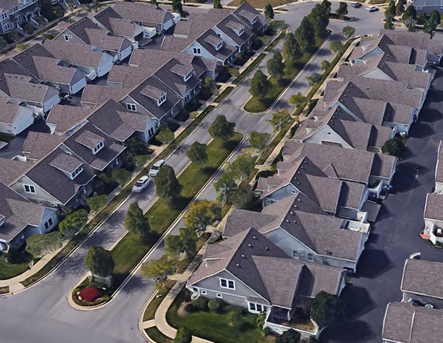
Currently undeveloped areas designed to provide housing within a sustainable format. Including a mix of uses such as neighborhood-serving retail, services, and employment options, as well as larger town centers, will allow citizens to fully realize their day-to-day needs without having to leave their immediate area. Providing a wider variety of housing options rather than large homogeneous sections dedicated to a single type, will ensure that residents of all income levels can afford a home. Intentional greenspaces and neighborhood focal points accessible to all residents should also be provided to add to the sense of place and community. A well-connected multimodal transportation network is also a key component of a New Complete Neighborhood’s success.
• Neighborhood-serving retail, services, and employment
• Mixed housing types
• Shared, accessible greenspace and parks
• Well integrated public facilities
• Multimodal integration with sufficient linkages to higher levels of transit
RECOMMENDED ZONE(S)
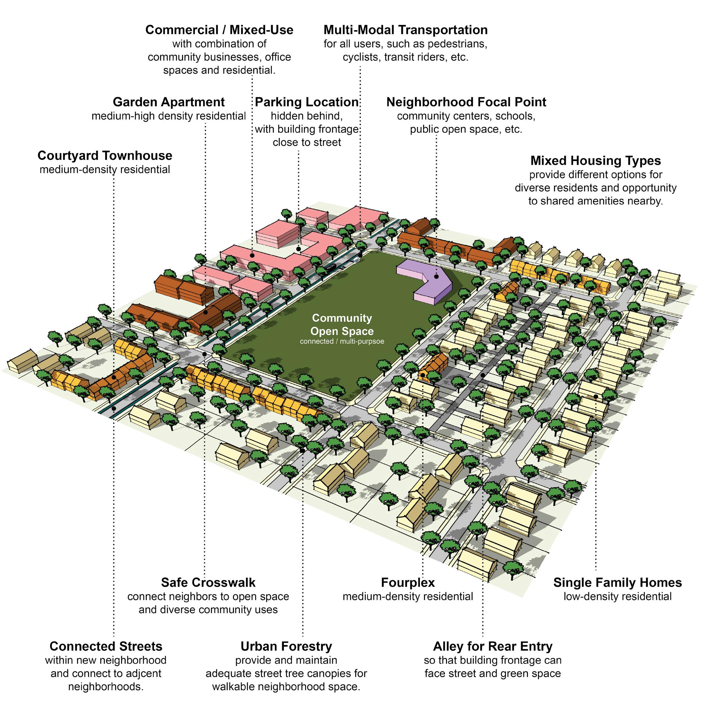
A-DS5-3 Building orientation should maximize connections with the surrounding area and create a pedestrian-friendly atmosphere.
A-DS7-1 Parking should be oriented to the interior or rear of the property for nonresidential or multi-family developments.
A-DS7-2 Any non-residential or multi-family parking not buffered by a building should be screened from the streetscape view and adjacent properties.
A-DS10-1 Residential units should be within reasonable walking distance to a focal point.
A-DS11-1 Common public uses that serve as neighborhood focal points, such as parks and schools, should be on single loaded streets.
A-DN2-1 Infill residential should aim to increase density.
A-DN6-1 Allow and encourage new compact single-family housing types.
A-EQ7-1 School sites should be appropriately sized.
B-PR9-1 Minimize disturbances to environmentally sensitive areas by utilizing the existing topography to the greatest extent possible.
B-SU11-1 Green infrastructure should be implemented in new development. (E-GR3)
C-LI6-2 ADUs and/or affordable housing options should be incorporated into existing and new single-family residential development. (A-DN5)
C-LI7-1 Developments should create mixed-use neighborhoods with safe access to community facilities, greenspace, employment, businesses, shopping, and entertainment.
C-PS10-3 Over-parking of new developments should be avoided. (B-SU5)
D-PL7-1 Stakeholders should be consulted to discuss site opportunities and constraints prior to submitting an application.
D-PL9-1 Historically significant structures should be preserved.
D-SP1-1 Elementary and middle schools should be located within residential neighborhoods, and high schools primarily along collector streets. (A-EQ7)
D-SP1-2 An open and inviting school campus/locale should utilize frontage on single-loaded streets (also true for other support facilities, like parks, community centers, social services, healthcare).
D-SP3-1 Adequate right-of-way, lease areas and easements for infrastructure, with emphasis on wireless communication networks should be provided to create reliable service throughout Lexington.
D-SP3-2 Cellular tower antennae should be located to minimize intrusion and negative aesthetic impacts, and stealth towers and landscaping should be used to improve the visual impact from the roadway and residential areas.
D-SP9-1 Encourage co-housing, shared housing environments, planned communities and accessory dwelling units for flexibility and affordability for senior adults and people with disabilities.
E-GR5-1 Structures with demonstrated historic significance should be preserved or adapted.
E-GR9-1 Live/work units should be incorporated into residential developments.
E-GR9-3 Less intense multi-family residence types (duplexes, four-plexes, courtyard apartments, etc.) should be incorporated into primarily single-family areas.
A-DS1-1 Mass transit infrastructure such as seating and shelters should be provided/enhanced along transit routes. (A-EQ7).
A-DS1-2 Direct pedestrian linkages to transit should be provided.
A-DS4-1 A plan for a connected multimodal network to adjacent neighborhoods, greenspaces, developments and complementary uses should be provided. (A-DS2, A-DN1, B-SU1, B-SU2, C-LI7, E-AC5)
A-DS5-1 Adequate multimodal infrastructure should be provided to ensure vehicular separation from other modes of transport.
A-DS5-2 Roadways should provide a vertical edge, such as trees and buildings.
A-DS10-2 New focal points should be designed with multimodal connections to the neighborhood.
A-DS13-1 Stub streets should be connected. (D-CO4)
B-SU4-1 Where greenspace/community centers are not located within walking distance of a new development, applicants should attempt to incorporate those amenities. (A-DS9)
D-CO1-1 Rights-of-way and multimodal facilities should be designed to reflect and promote the desired place-type.
D-CO2-1 Safe facilities for all users and modes of transportation should be provided.
D-CO2-2 Development should create and/or expand a safe, connected multimodal transportation network that satisfies all users’ needs, including those with disabilities.
D-CO4-1 Dead-end streets and Cul-de-sacs should be discouraged except where connections are not topographically or environmentally feasible.
D-CO4-2 Roadway capacity should be increased by providing multiple parallel streets, which alleviate traffic and provide multiple route options, in lieu of additional lanes.
Criteria that include additional policy items in parentheses refer to companion policies that will provide additional context to the related criteria.
D-CO4-3 Street pattern and design should consider site topography and minimize grading where possible.
D-CO5-1 Streets should be designed with shorter block lengths, narrower widths, and traffic calming features.
D-SP1-3 Developments should provide multimodal transportation infrastructure to school sites, including sidewalks, shared-use paths, and roadways that can accommodate the bus and vehicle traffic associated with the site.
A-DS4-3 Development should work with the existing landscape to the greatest extent possible, preserving key natural features.
A-EQ7-3 Community open spaces should be easily accessible and clearly delineated from private open spaces.
B-PR2-1 Impact on environmentally sensitive areas should be minimized within and adjacent to the proposed development site.
B-PR2-2 Dividing floodplains into privately owned parcels with flood insurance should be avoided.
B-PR2-3 Floodplains should be incorporated into accessible greenspace, and additional protection should be provided to areas around them.
B-PR7-1 Connections to greenways, tree stands, and stream corridors should be provided.
B-PR7-2 Trees should be incorporated into development plans, prioritize grouping of trees to increase survivability.
B-PR7-3 Developments should improve the tree canopy.
B-RE1-1 Developments should incorporate street trees to create a walkable streetscape.
B-RE2-1 Green infrastructure should be used to connect the greenspace network.
D-SP2-1 Visible, usable greenspace and other natural components should be incorporated into school sites.
D-SP2-2 Active and passive recreation opportunities should be provided on school sites.
E-GR3-1 Physical and visual connections should be provided to existing greenway networks.
E-GR3-2 New focal points should emphasize geographic features unique to the site.
that include additional policy items in parentheses refer to companion policies that will provide additional context to the
A-DS3-1 Multi-family residential developments should comply with the Multi-family Design Standards in Appendix 1.
A-DS4-2 New construction should be at an appropriate scale to respect the context of neighboring structures; however, along major corridors, it should set the future context in accordance with other Imagine Lexington corridor policies and Placebuilder priorities.
A-DS5-3 Building orientation should maximize connections with the surrounding area and create a pedestrian-friendly atmosphere.
A-DS5-4 Development should provide a pedestrian-oriented and activated ground level.
A-DS7-1 Parking should be oriented to the interior or rear of the property for nonresidential or multi-family developments.
A-DS7-2 Any non-residential or multi-family parking not buffered by a building should be screened from the streetscape view and adjacent properties.
A-DS7-3 Parking structures should activate the ground level.
A-DS8-1 At the individual street level, medium density housing types should be interspersed with single-family detached units and should be context sensitive.
A-DS10-1 Residential units should be within reasonable walking distance to a focal point.
A-DS11-1 Common public uses that serve as neighborhood focal points, such as parks and schools, should be on single loaded streets.
A-DN2-1 Infill residential should aim to increase density.
A-DN2-2 Development should minimize significant contrasts in scale, massing and design, particularly along the edges of historic areas and neighborhoods. (D-PL9, E-GR6)
A-DN3-2 Development should incorporate residential units in commercial centers with context sensitive design.
A-DN6-1 Allow and encourage new compact single-family housing types.
A-EQ7-1 School sites should be appropriately sized.
B-PR9-1 Minimize disturbances to environmentally sensitive areas by utilizing the existing topography to the greatest extent possible.
B-SU11-1 Green infrastructure should be implemented in new development. (E-GR3)
C-LI6-1 Developments should incorporate multi-family housing and walkable commercial uses into development along arterials/corridors.
C-LI6-2 ADUs and/or affordable housing options should be incorporated into existing and new single-family residential development. (A-DN5)
C-LI7-1 Developments should create mixed-use neighborhoods with safe access to community facilities, greenspace, employment, businesses, shopping, and entertainment.
C-PS10-3 Over-parking of new developments should be avoided. (B-SU5)
D-PL7-1 Stakeholders should be consulted to discuss site opportunities and constraints prior to submitting an application.
D-PL9-1 Historically significant structures should be preserved.
D-PL10-1 Activate the streetscape by designating public art easements in prominent locations.
D-SP3-1 Adequate right-of-way, lease areas and easements for infrastructure, with emphasis on wireless communication networks should be provided to create reliable service throughout Lexington.
D-SP3-2 Cellular tower antennae should be located to minimize intrusion and negative aesthetic impacts, and stealth towers and landscaping should be used to improve the visual impact from the roadway and residential areas.
D-SP9-1 Encourage co-housing, shared housing environments, planned communities and accessory dwelling units for flexibility and affordability for senior adults and people with disabilities.
E-GR5-1 Structures with demonstrated historic significance should be preserved or adapted.
E-GR9-1 Live/work units should be incorporated into residential developments.
E-GR9-3 Less intense multi-family residence types (duplexes, four-plexes, courtyard apartments, etc.) should be incorporated into primarily single-family areas.
A-DS1-1 Mass transit infrastructure such as seating and shelters should be provided/enhanced along transit routes. (A-EQ7).
A-DS1-2
Direct pedestrian linkages to transit should be provided.
A-DS4-1 A plan for a connected multimodal network to adjacent neighborhoods, greenspaces, developments and complementary uses should be provided. (A-DS2, A-DN1, B-SU1, B-SU2, C-LI7, E-AC5)
A-DS5-1
Adequate multimodal infrastructure should be provided to ensure vehicular separation from other modes of transport.
A-DS5-2 Roadways should provide a vertical edge, such as trees and buildings.
Criteria that include additional policy items in parentheses refer to companion policies that will provide additional context to the related criteria.
A-DS10-2 New focal points should be designed with multimodal connections to the neighborhood.
A-DS13-1 Stub streets should be connected. (D-CO4)
B-SU4-1 Where greenspace/community centers are not located within walking distance of a new development, applicants should attempt to incorporate those amenities. (A-DS9)
D-CO1-1 Rights-of-way and multimodal facilities should be designed to reflect and promote the desired place-type.
D-CO2-1 Safe facilities for all users and modes of transportation should be provided.
D-CO2-2 Development should create and/or expand a safe, connected multimodal transportation network that satisfies all users’ needs, including those with disabilities.
D-CO4-1 Dead-end streets and Cul-de-sacs should be discouraged except where connections are not topographically or environmentally feasible.
D-CO4-2 Roadway capacity should be increased by providing multiple parallel streets, which alleviate traffic and provide multiple route options, in lieu of additional lanes.
D-CO4-3 Street pattern and design should consider site topography and minimize grading where possible.
D-CO5-1 Streets should be designed with shorter block lengths, narrower widths, and traffic calming features.
D-SP1-3 Developments should provide multimodal transportation infrastructure to school sites, including sidewalks, shared-use paths, and roadways that can accommodate the bus and vehicle traffic associated with the site.
D-SP6-1 Social services and community facilities should be accessible via mass transit, bicycle and pedestrian transportation modes. (A-EQ7)
A-DS4-3 Development should work with the existing landscape to the greatest extent possible, preserving key natural features.
A-EQ7-3 Community open spaces should be easily accessible and clearly delineated from private open spaces.
B-PR2-1 Impact on environmentally sensitive areas should be minimized within and adjacent to the proposed development site.
B-PR2-2 Dividing floodplains into privately owned parcels with flood insurance should be avoided.
B-PR2-3 Floodplains should be incorporated into accessible greenspace, and additional protection should be provided to areas around them.
B-PR7-1 Connections to greenways, tree stands, and stream corridors should be provided.
B-PR7-2 Trees should be incorporated into development plans, prioritize grouping of trees to increase survivability.
B-PR7-3 Developments should improve the tree canopy.
B-RE1-1 Developments should incorporate street trees to create a walkable streetscape.
B-RE2-1 Green infrastructure should be used to connect the greenspace network.
D-SP2-1 Visible, usable greenspace and other natural components should be incorporated into school sites.
D-SP2-2 Active and passive recreation opportunities should be provided on school sites.
E-GR3-1 Physical and visual connections should be provided to existing greenway networks.
E-GR3-2 New focal points should emphasize geographic features unique to the site.
Criteria that include additional policy items in parentheses refer to companion policies that will provide additional context to the related criteria.
A-DS3-1 Multi-family residential developments should comply with the Multi-family Design Standards in Appendix 1.
A-DS4-2 New construction should be at an appropriate scale to respect the context of neighboring structures; however, along major corridors, it should set the future context in accordance with other Imagine Lexington corridor policies and Placebuilder priorities.
A-DS5-3 Building orientation should maximize connections with the surrounding area and create a pedestrian-friendly atmosphere.
A-DS5-4 Development should provide a pedestrian-oriented and activated ground level.
A-DS7-1 Parking should be oriented to the interior or rear of the property for nonresidential or multi-family developments.
A-DS7-2 Any non-residential or multi-family parking not buffered by a building should be screened from the streetscape view and adjacent properties.
A-DS7-3 Parking structures should activate the ground level.
A-DS10-1 Residential units should be within reasonable walking distance to a focal point.
A-DS11-1 Common public uses that serve as neighborhood focal points, such as parks and schools, should be on single loaded streets.
A-DS12-1 Medium–high density development should be located nearest to neighborhood-serving commercial areas.
A-DN2-1 Infill residential should aim to increase density.
A-DN2-2 Development should minimize significant contrasts in scale, massing and design, particularly along the edges of historic areas and neighborhoods. (D-PL9, E-GR6)
A-DN3-2 Development should incorporate residential units in commercial centers with context sensitive design.
A-DN4-1 Medium–high density development should be located nearest to neighborhood focal points.
A-EQ7-1 School sites should be appropriately sized.
B-PR9-1 Minimize disturbances to environmentally sensitive areas by utilizing the existing topography to the greatest extent possible.
B-SU11-1 Green infrastructure should be implemented in new development. (E-GR3)
C-LI6-1 Developments should incorporate multi-family housing and walkable commercial uses into development along arterials/corridors.
C-LI6-2
ADUs and/or affordable housing options should be incorporated into existing and new single-family residential development. (A-DN5)
C-LI7-1 Developments should create mixed-use neighborhoods with safe access to community facilities, greenspace, employment, businesses, shopping, and entertainment.
C-PS10-3 Over-parking of new developments should be avoided. (B-SU5)
D-PL7-1 Stakeholders should be consulted to discuss site opportunities and constraints prior to submitting an application.
D-PL9-1 Historically significant structures should be preserved.
D-PL10-1 Activate the streetscape by designating public art easements in prominent locations.
D-SP3-1 Adequate right-of-way, lease areas and easements for infrastructure, with emphasis on wireless communication networks should be provided to create reliable service throughout Lexington.
D-SP3-2 Cellular tower antennae should be located to minimize intrusion and negative aesthetic impacts, and stealth towers and landscaping should be used to improve the visual impact from the roadway and residential areas.
E-GR5-1 Structures with demonstrated historic significance should be preserved or adapted.
E-GR5-1 Structures with demonstrated historic significance should be preserved or adapted.
E-GR9-1 Live/work units should be incorporated into residential developments.
E-GR9-3 Less intense multi-family residence types (duplexes, four-plexes, courtyard apartments, etc.) should be incorporated into primarily single-family areas.
A-DS1-1 Mass transit infrastructure such as seating and shelters should be provided/enhanced along transit routes. (A-EQ7).
A-DS1-2 Direct pedestrian linkages to transit should be provided.
A-DS4-1 A plan for a connected multimodal network to adjacent neighborhoods, greenspaces, developments and complementary uses should be provided. (A-DS2, A-DN1, B-SU1, B-SU2, C-LI7, E-AC5)
A-DS5-1 Adequate multimodal infrastructure should be provided to ensure vehicular separation from other modes of transport.
A-DS5-2 Roadways should provide a vertical edge, such as trees and buildings.
Criteria that include additional policy items in parentheses refer to companion policies that will provide additional context to the related criteria.
A-DS10-2 New focal points should be designed with multimodal connections to the neighborhood.
A-DS13-1 Stub streets should be connected. (D-CO4)
B-SU4-1 Where greenspace/community centers are not located within walking distance of a new development, applicants should attempt to incorporate those amenities. (A-DS9)
C-PS10-1 Flexible parking and shared parking arrangements should be utilized.
D-CO1-1 Rights-of-way and multimodal facilities should be designed to reflect and promote the desired place-type.
D-CO2-1 Safe facilities for all users and modes of transportation should be provided.
D-CO2-2 Development should create and/or expand a safe, connected multimodal transportation network that satisfies all users’ needs, including those with disabilities.
D-CO4-1 Dead-end streets and Cul-de-sacs should be discouraged except where connections are not topographically or environmentally feasible.
D-CO4-2 Roadway capacity should be increased by providing multiple parallel streets, which alleviate traffic and provide multiple route options, in lieu of additional lanes.
D-CO4-3 Street pattern and design should consider site topography and minimize grading where possible.
D-CO5-1 Streets should be designed with shorter block lengths, narrower widths, and traffic calming features.
D-SP1-3 Developments should provide multimodal transportation infrastructure to school sites, including sidewalks, shared-use paths, and roadways that can accommodate the bus and vehicle traffic associated with the site.
A-DS4-3 Development should work with the existing landscape to the greatest extent possible, preserving key natural features.
A-EQ7-3 Community open spaces should be easily accessible and clearly delineated from private open spaces.
B-PR2-1 Impact on environmentally sensitive areas should be minimized within and adjacent to the proposed development site.
B-PR2-2 Dividing floodplains into privately owned parcels with flood insurance should be avoided.
B-PR2-3 Floodplains should be incorporated into accessible greenspace, and additional protection should be provided to areas around them.
B-PR7-1 Connections to greenways, tree stands, and stream corridors should be provided.
B-PR7-2 Trees should be incorporated into development plans, prioritize grouping of trees to increase survivability.
B-PR7-3 Developments should improve the tree canopy.
B-RE1-1 Developments should incorporate street trees to create a walkable streetscape.
B-RE2-1 Green infrastructure should be used to connect the greenspace network.
D-SP2-1 Visible, usable greenspace and other natural components should be incorporated into school sites.
D-SP2-2 Active and passive recreation opportunities should be provided on school sites.
E-GR3-1 Physical and visual connections should be provided to existing greenway networks.
E-GR3-2
New focal points should emphasize geographic features unique to the site.
the related criteria.
A-DS4-2 New construction should be at an appropriate scale to respect the context of neighboring structures; however, along major corridors, it should set the future context in accordance with other Imagine Lexington corridor policies and Placebuilder priorities.
A-DS5-3 Building orientation should maximize connections with the surrounding area and create a pedestrian-friendly atmosphere.
A-DS5-4 Development should provide a pedestrian-oriented and activated ground level.
A-DS7-1 Parking should be oriented to the interior or rear of the property for nonresidential or multi-family developments.
A-DS7-2 Any non-residential or multi-family parking not buffered by a building should be screened from the streetscape view and adjacent properties.
A-DS10-1 Residential units should be within reasonable walking distance to a focal point.
A-DS11-1 Common public uses that serve as neighborhood focal points, such as parks and schools, should be on single loaded streets.
A-DS12-1 Medium–high density development should be located nearest to neighborhood-serving commercial areas.
A-DN2-1 Infill residential should aim to increase density.
A-DN2-2 Development should minimize significant contrasts in scale, massing and design, particularly along the edges of historic areas and neighborhoods. (D-PL9, E-GR6)
A-DN3-1 Pedestrian-oriented commercial opportunities should be incorporated within residential neighborhoods.
A-DN3-2 Development should incorporate residential units in commercial centers with context sensitive design.
A-EQ7-1 School sites should be appropriately sized.
B-PR9-1 Minimize disturbances to environmentally sensitive areas by utilizing the existing topography to the greatest extent possible.
B-SU11-1 Green infrastructure should be implemented in new development. (E-GR3)
C-DI1-1 Consider flexible zoning options that will allow for a wide range of jobs.
C-LI6-2 ADUs and/or affordable housing options should be incorporated into existing and new single-family residential development. (A-DN5)
C-LI7-1 Developments should create mixed-use neighborhoods with safe access to community facilities, greenspace, employment, businesses, shopping, and entertainment.
C-PS10-3 Over-parking of new developments should be avoided. (B-SU5)
D-PL2-1 Developments should aim to provide a neighborhood-serving use that does not already exist in the vicinity, or that fills a specific need.
D-PL7-1 Stakeholders should be consulted to discuss site opportunities and constraints prior to submitting an application.
D-PL9-1 Historically significant structures should be preserved.
D-PL10-1 Activate the streetscape by designating public art easements in prominent locations.
D-SP1-1 Elementary and middle schools should be located within residential neighborhoods, and high schools primarily along collector streets. (A-EQ7)
D-SP1-2 An open and inviting school campus/locale should utilize frontage on single-loaded streets (also true for other support facilities, like parks, community centers, social services, healthcare).
D-SP3-1 Adequate right-of-way, lease areas and easements for infrastructure, with emphasis on wireless communication networks should be provided to create reliable service throughout Lexington.
D-SP3-2 Cellular tower antennae should be located to minimize intrusion and negative aesthetic impacts, and stealth towers and landscaping should be used to improve the visual impact from the roadway and residential areas.
D-SP9-1 Encourage co-housing, shared housing environments, planned communities and accessory dwelling units for flexibility and affordability for senior adults and people with disabilities.
E-GR5-1 Structures with demonstrated historic significance should be preserved or adapted.
E-GR9-1 Live/work units should be incorporated into residential developments.
E-GR9-3 Less intense multi-family residence types (duplexes, four-plexes, courtyard apartments, etc.) should be incorporated into primarily single-family areas.
E-GR10-2 Developments should provide walkable service and amenity-oriented commercial spaces.
E-GR10-3 Shared common space in commercial developments should be provided to encourage experiential retail programming.
A-DS1-1 Mass transit infrastructure such as seating and shelters should be provided/enhanced along transit routes. (A-EQ7).
A-DS1-2 Direct pedestrian linkages to transit should be provided.
Criteria that include additional policy items in parentheses refer to companion policies that will provide additional context to the related criteria.
A-DS4-1 A plan for a connected multimodal network to adjacent neighborhoods, greenspaces, developments and complementary uses should be provided. (A-DS2, A-DN1, B-SU1, B-SU2, C-LI7, E-AC5)
A-DS5-1 Adequate multimodal infrastructure should be provided to ensure vehicular separation from other modes of transport.
A-DS5-2 Roadways should provide a vertical edge, such as trees and buildings.
A-DS10-2 New focal points should be designed with multimodal connections to the neighborhood.
A-DS13-1 Stub streets should be connected. (D-CO4)
B-SU4-1 Where greenspace/community centers are not located within walking distance of a new development, applicants should attempt to incorporate those amenities. (A-DS9)
C-PS10-1 Flexible parking and shared parking arrangements should be utilized.
D-CO1-1 Rights-of-way and multimodal facilities should be designed to reflect and promote the desired place-type.
D-CO2-1 Safe facilities for all users and modes of transportation should be provided.
D-CO2-2 Development should create and/or expand a safe, connected multimodal transportation network that satisfies all users’ needs, including those with disabilities.
D-CO4-1 Dead-end streets and Cul-de-sacs should be discouraged except where connections are not topographically or environmentally feasible.
D-CO4-2 Roadway capacity should be increased by providing multiple parallel streets, which alleviate traffic and provide multiple route options, in lieu of additional lanes.
D-CO4-3 Street pattern and design should consider site topography and minimize grading where possible.
D-CO5-1 Streets should be designed with shorter block lengths, narrower widths, and traffic calming features.
D-SP1-3 Developments should provide multimodal transportation infrastructure to school sites, including sidewalks, shared-use paths, and roadways that can accommodate the bus and vehicle traffic associated with the site.
D-SP6-1 Social services and community facilities should be accessible via mass transit, bicycle and pedestrian transportation modes. (A-EQ7)
A-DS4-3 Development should work with the existing landscape to the greatest extent possible, preserving key natural features.
A-EQ7-3 Community open spaces should be easily accessible and clearly delineated from private open spaces.
B-PR2-1 Impact on environmentally sensitive areas should be minimized within and adjacent to the proposed development site.
B-PR2-2 Dividing floodplains into privately owned parcels with flood insurance should be avoided.
B-PR2-3 Floodplains should be incorporated into accessible greenspace, and additional protection should be provided to areas around them.
B-PR7-1 Connections to greenways, tree stands, and stream corridors should be provided.
B-PR7-2 Trees should be incorporated into development plans, prioritize grouping of trees to increase survivability.
B-PR7-3 Developments should improve the tree canopy.
B-RE1-1 Developments should incorporate street trees to create a walkable streetscape.
B-RE2-1 Green infrastructure should be used to connect the greenspace network.
D-SP2-1 Visible, usable greenspace and other natural components should be incorporated into school sites.
D-SP2-2 Active and passive recreation opportunities should be provided on school sites.
E-GR3-1 Physical and visual connections should be provided to existing greenway networks.
E-GR3-2 New focal points should emphasize geographic features unique to the site. Criteria that include additional policy items in parentheses refer to companion policies that will provide additional context to the related criteria.
A-DS3-1 Multi-family residential developments should comply with the Multi-family Design Standards in Appendix 1.
A-DS4-2 New construction should be at an appropriate scale to respect the context of neighboring structures; however, along major corridors, it should set the future context in accordance with other Imagine Lexington corridor policies and Placebuilder priorities.
A-DS5-3 Building orientation should maximize connections with the surrounding area and create a pedestrian-friendly atmosphere.
A-DS5-4 Development should provide a pedestrian-oriented and activated ground level.
A-DS7-1 Parking should be oriented to the interior or rear of the property for nonresidential or multi-family developments.
A-DS7-2 Any non-residential or multi-family parking not buffered by a building should be screened from the streetscape view and adjacent properties.
A-DS7-3 Parking structures should activate the ground level.
A-DS8-1 At the individual street level, medium density housing types should be interspersed with single-family detached units and should be context sensitive.
A-DS10-1 Residential units should be within reasonable walking distance to a focal point.
A-DS11-1 Common public uses that serve as neighborhood focal points, such as parks and schools, should be on single loaded streets.
A-DN2-1 Infill residential should aim to increase density.
A-DN2-2 Development should minimize significant contrasts in scale, massing and design, particularly along the edges of historic areas and neighborhoods. (D-PL9, E-GR6)
A-DN3-1 Pedestrian-oriented commercial opportunities should be incorporated within residential neighborhoods.
A-DN3-2 Development should incorporate residential units in commercial centers with context sensitive design.
A-EQ7-1 School sites should be appropriately sized.
B-PR9-1 Minimize disturbances to environmentally sensitive areas by utilizing the existing topography to the greatest extent possible.
B-SU11-1 Green infrastructure should be implemented in new development. (E-GR3)
C-DI1-1 Consider flexible zoning options that will allow for a wide range of jobs.
C-LI6-1
Developments should incorporate multi-family housing and walkable commercial uses into development along arterials/corridors.
C-LI6-2 ADUs and/or affordable housing options should be incorporated into existing and new single-family residential development. (A-DN5)
C-LI7-1 Developments should create mixed-use neighborhoods with safe access to community facilities, greenspace, employment, businesses, shopping, and entertainment.
C-PS10-3 Over-parking of new developments should be avoided. (B-SU5)
D-PL2-1 Developments should aim to provide a neighborhood-serving use that does not already exist in the vicinity, or that fills a specific need.
D-PL7-1 Stakeholders should be consulted to discuss site opportunities and constraints prior to submitting an application.
D-PL9-1 Historically significant structures should be preserved.
D-PL10-1 Activate the streetscape by designating public art easements in prominent locations.
D-SP3-1 Adequate right-of-way, lease areas and easements for infrastructure, with emphasis on wireless communication networks should be provided to create reliable service throughout Lexington.
D-SP3-2 Cellular tower antennae should be located to minimize intrusion and negative aesthetic impacts, and stealth towers and landscaping should be used to improve the visual impact from the roadway and residential areas.
D-SP9-1 Encourage co-housing, shared housing environments, planned communities and accessory dwelling units for flexibility and affordability for senior adults and people with disabilities.
E-GR5-1 Structures with demonstrated historic significance should be preserved or adapted.
E-GR9-1 Live/work units should be incorporated into residential developments.
E-GR9-3 Less intense multi-family residence types (duplexes, four-plexes, courtyard apartments, etc.) should be incorporated into primarily single-family areas.
E-GR10-2 Developments should provide walkable service and amenity-oriented commercial spaces.
E-GR10-3 Shared common space in commercial developments should be provided to encourage experiential retail programming.
Criteria that include additional policy items in parentheses refer to companion policies that will provide additional context to the related criteria.
A-DS1-1 Mass transit infrastructure such as seating and shelters should be provided/enhanced along transit routes. (A-EQ7).
A-DS1-2 Direct pedestrian linkages to transit should be provided.
A-DS4-1 A plan for a connected multimodal network to adjacent neighborhoods, greenspaces, developments and complementary uses should be provided. (A-DS2, A-DN1, B-SU1, B-SU2, C-LI7, E-AC5)
A-DS5-1 Adequate multimodal infrastructure should be provided to ensure vehicular separation from other modes of transport.
A-DS5-2 Roadways should provide a vertical edge, such as trees and buildings.
A-DS10-2 New focal points should be designed with multimodal connections to the neighborhood.
A-DS13-1 Stub streets should be connected. (D-CO4)
A-EQ3-2 Development on corridors should be transit-oriented (dense & intense, internally walkable, connected to adjacent neighborhoods, providing transit infrastructure & facilities). (B-SU3)
A-EQ7-2 Multimodal transportation options for healthcare and social services facilities should be provided. (E-ST3)
B-SU4-1 Where greenspace/community centers are not located within walking distance of a new development, applicants should attempt to incorporate those amenities. (A-DS9)
C-PS10-1 Flexible parking and shared parking arrangements should be utilized.
D-CO1-1 Rights-of-way and multimodal facilities should be designed to reflect and promote the desired place-type.
D-CO2-1 Safe facilities for all users and modes of transportation should be provided.
D-CO2-2 Development should create and/or expand a safe, connected multimodal transportation network that satisfies all users’ needs, including those with disabilities.
D-CO4-1 Dead-end streets and Cul-de-sacs should be discouraged except where connections are not topographically or environmentally feasible.
D-CO4-2 Roadway capacity should be increased by providing multiple parallel streets, which alleviate traffic and provide multiple route options, in lieu of additional lanes.
D-CO4-3 Street pattern and design should consider site topography and minimize grading where possible.
D-CO5-1 Streets should be designed with shorter block lengths, narrower widths, and traffic calming features.
D-SP1-3 Developments should provide multimodal transportation infrastructure to school sites, including sidewalks, shared-use paths, and roadways that can accommodate the bus and vehicle traffic associated with the site.
A-DS4-3 Development should work with the existing landscape to the greatest extent possible, preserving key natural features.
A-EQ7-3 Community open spaces should be easily accessible and clearly delineated from private open spaces.
B-PR2-1 Impact on environmentally sensitive areas should be minimized within and adjacent to the proposed development site.
B-PR2-2 Dividing floodplains into privately owned parcels with flood insurance should be avoided.
B-PR2-3 Floodplains should be incorporated into accessible greenspace, and additional protection should be provided to areas around them.
B-PR7-1 Connections to greenways, tree stands, and stream corridors should be provided.
B-PR7-2 Trees should be incorporated into development plans, prioritize grouping of trees to increase survivability.
B-PR7-3 Developments should improve the tree canopy.
B-RE1-1 Developments should incorporate street trees to create a walkable streetscape.
B-RE2-1 Green infrastructure should be used to connect the greenspace network.
D-SP2-1 Visible, usable greenspace and other natural components should be incorporated into school sites.
D-SP2-2 Active and passive recreation opportunities should be provided on school sites.
E-GR3-1 Physical and visual connections should be provided to existing greenway networks.
E-GR3-2 New focal points should emphasize geographic features unique to the site.
Criteria that include additional policy items in parentheses refer to companion policies that will provide additional context to the related criteria.
AN ENHANCED NEIGHBORHOOD IS...
An existing residential area that could be enhanced with additional amenities, housing types, and neighborhood-serving retail, services, and employment options that contribute to a sustainable neighborhood. Vibrant neighborhoods include a range of uses. The development that occurs in this place-type should be context-sensitive to the surrounding area and implemented in a way that adds to the sense of place. Multimodal connections from new elements within enhanced neighborhoods are crucial to their success and long-term viability.
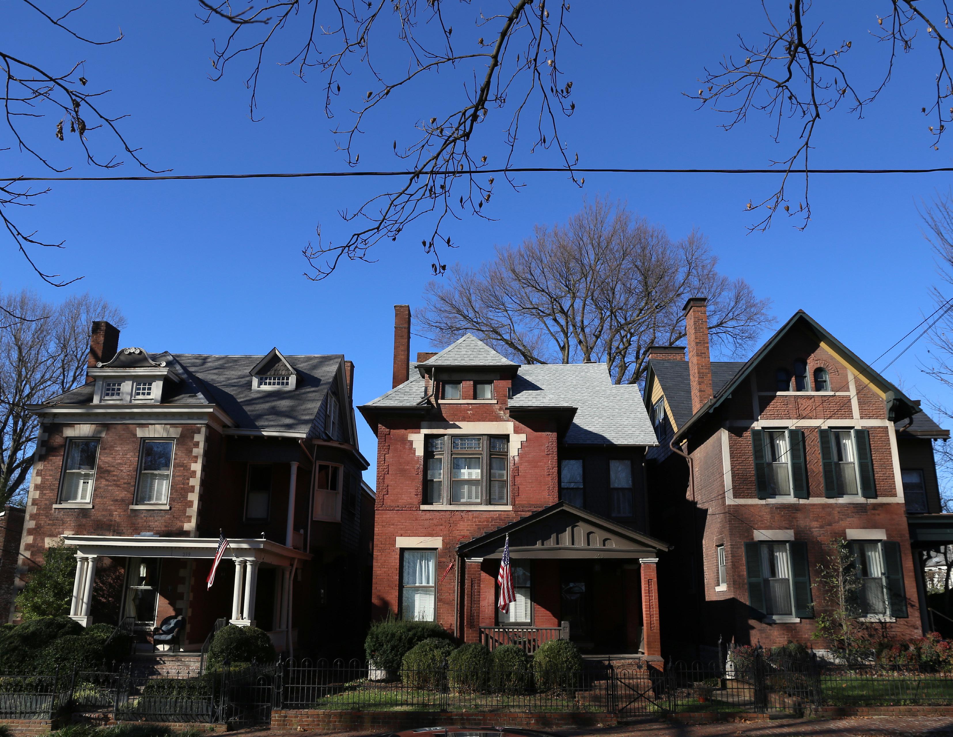
SITE PRIORITIES
• Neighborhood-serving retail, services, and employment
• Mixed housing types
• Context-sensitive development
• Connected multimodal network
• Well integrated public facilities and greenspaces
RECOMMENDED ZONE(S)
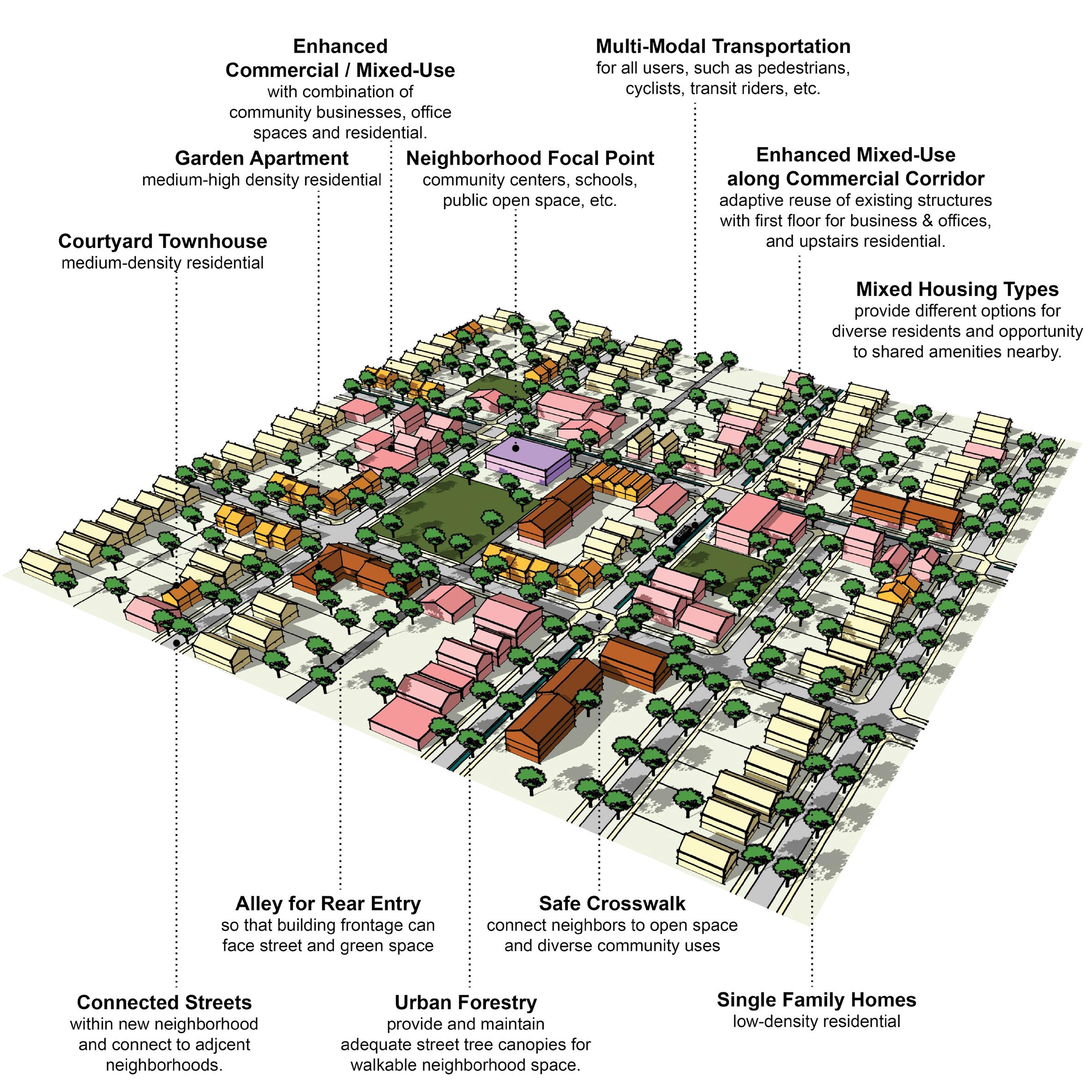
A-DS5-3 Building orientation should maximize connections with the surrounding area and create a pedestrian-friendly atmosphere.
A-DS7-1 Parking should be oriented to the interior or rear of the property for nonresidential or multi-family developments.
A-DS7-2 Any non-residential or multi-family parking not buffered by a building should be screened from the streetscape view and adjacent properties.
A-DS10-1 Residential units should be within reasonable walking distance to a focal point.
A-DS11-1 Common public uses that serve as neighborhood focal points, such as parks and schools, should be on single loaded streets.
A-DN2-1 Infill residential should aim to increase density.
A-DN6-1 Allow and encourage new compact single-family housing types.
A-EQ7-1 School sites should be appropriately sized.
B-PR9-1 Minimize disturbances to environmentally sensitive areas by utilizing the existing topography to the greatest extent possible.
B-SU11-1 Green infrastructure should be implemented in new development. (E-GR3)
C-LI6-2 ADUs and/or affordable housing options should be incorporated into existing and new single-family residential development. (A-DN5)
C-LI7-1 Developments should create mixed-use neighborhoods with safe access to community facilities, greenspace, employment, businesses, shopping, and entertainment.
C-PS10-2 Developments should explore options for shared and flexible parking arrangements for currently underutilized parking lots.
C-PS10-3 Over-parking of new developments should be avoided. (B-SU5)
D-PL7-1 Stakeholders should be consulted to discuss site opportunities and constraints prior to submitting an application.
D-PL9-1 Historically significant structures should be preserved.
D-SP1-1 Elementary and middle schools should be located within residential neighborhoods, and high schools primarily along collector streets. (AEQ7)
D-SP1-2 An open and inviting school campus/locale should utilize frontage on single-loaded streets (also true for other support facilities, like parks, community centers, social services, healthcare).
D-SP3-1 Adequate right-of-way, lease areas and easements for infrastructure, with emphasis on wireless communication networks should be provided to create reliable service throughout Lexington.
D-SP3-2 Cellular tower antennae should be located to minimize intrusion and negative aesthetic impacts, and stealth towers and landscaping should be used to improve the visual impact from the roadway and residential areas.
D-SP9-1 Encourage co-housing, shared housing environments, planned communities and accessory dwelling units for flexibility and affordability for senior adults and people with disabilities.
E-GR4-1 Developments should incorporate reuse of viable existing structures.
E-GR5-1 Structures with demonstrated historic significance should be preserved or adapted.
E-GR9-1 Live/work units should be incorporated into residential developments.
E-GR9-3 Less intense multi-family residence types (duplexes, four-plexes, courtyard apartments, etc.) should be incorporated into primarily single-family areas.
E-GR9-4 Development should intensify underutilized properties and develop vacant and underutilized gaps within neighborhoods. (E-GR6)
A-DS1-1 Mass transit infrastructure such as seating and shelters should be provided/enhanced along transit routes. (A-EQ7).
A-DS1-2 Direct pedestrian linkages to transit should be provided.
A-DS4-1 A plan for a connected multimodal network to adjacent neighborhoods, greenspaces, developments and complementary uses should be provided. (A-DS2, A-DN1, B-SU1, B-SU2, C-LI7, E-AC5)
A-DS5-1 Adequate multimodal infrastructure should be provided to ensure vehicular separation from other modes of transport.
A-DS5-2 Roadways should provide a vertical edge, such as trees and buildings.
A-DS10-2 New focal points should be designed with multimodal connections to the neighborhood.
A-DS13-1 Stub streets should be connected. (D-CO4)
B-SU4-1 Where greenspace/community centers are not located within walking distance of a new development, applicants should attempt to incorporate those amenities. (A-DS9)
D-CO1-1 Rights-of-way and multimodal facilities should be designed to reflect and promote the desired place-type.
D-CO2-1 Safe facilities for all users and modes of transportation should be provided.
Criteria that include additional policy items in parentheses refer to companion policies that will provide additional context to the related criteria.
D-CO2-2 Development should create and/or expand a safe, connected multimodal transportation network that satisfies all users’ needs, including those with disabilities.
D-CO4-1 Dead-end streets and Cul-de-sacs should be discouraged except where connections are not topographically or environmentally feasible.
D-CO4-2 Roadway capacity should be increased by providing multiple parallel streets, which alleviate traffic and provide multiple route options, in lieu of additional lanes.
D-CO4-3 Street pattern and design should consider site topography and minimize grading where possible.
D-CO5-1 Streets should be designed with shorter block lengths, narrower widths, and traffic calming features.
D-SP1-3 Developments should provide multimodal transportation infrastructure to school sites, including sidewalks, shared-use paths, and roadways that can accommodate the bus and vehicle traffic associated with the site.
A-DS4-3 Development should work with the existing landscape to the greatest extent possible, preserving key natural features.
A-EQ7-3 Community open spaces should be easily accessible and clearly delineated from private open spaces.
B-PR2-1 Impact on environmentally sensitive areas should be minimized within and adjacent to the proposed development site.
B-PR2-2 Dividing floodplains into privately owned parcels with flood insurance should be avoided.
B-PR2-3 Floodplains should be incorporated into accessible greenspace, and additional protection should be provided to areas around them.
B-PR7-1 Connections to greenways, tree stands, and stream corridors should be provided.
B-PR7-2 Trees should be incorporated into development plans, prioritize grouping of trees to increase survivability.
B-PR7-3 Developments should improve the tree canopy.
B-RE1-1 Developments should incorporate street trees to create a walkable streetscape.
B-RE2-1 Green infrastructure should be used to connect the greenspace network.
D-SP2-1 Visible, usable greenspace and other natural components should be incorporated into school sites.
D-SP2-2 Active and passive recreation opportunities should be provided on school sites.
E-GR3-1 Physical and visual connections should be provided to existing greenway networks.
E-GR3-2 New focal points should emphasize geographic features unique to the site.
Criteria that include additional policy items in parentheses refer to companion policies that will provide additional context to the related criteria.
A-DS3-1 Multi-family residential developments should comply with the Multi-family Design Standards in Appendix 1.
A-DS4-2 New construction should be at an appropriate scale to respect the context of neighboring structures; however, along major corridors, it should set the future context in accordance with other Imagine Lexington corridor policies and Placebuilder priorities.
A-DS5-3 Building orientation should maximize connections with the surrounding area and create a pedestrian-friendly atmosphere.
A-DS5-4 Development should provide a pedestrian-oriented and activated ground level.
A-DS7-1 Parking should be oriented to the interior or rear of the property for nonresidential or multi-family developments.
A-DS7-2 Any non-residential or multi-family parking not buffered by a building should be screened from the streetscape view and adjacent properties.
A-DS7-3 Parking structures should activate the ground level.
A-DS8-1 At the individual street level, medium density housing types should be interspersed with single-family detached units and should be context sensitive.
A-DS10-1 Residential units should be within reasonable walking distance to a focal point.
A-DS11-1 Common public uses that serve as neighborhood focal points, such as parks and schools, should be on single loaded streets.
A-DN2-1 Infill residential should aim to increase density.
A-DN2-2 Development should minimize significant contrasts in scale, massing and design, particularly along the edges of historic areas and neighborhoods. (D-PL9, E-GR6)
A-DN3-2 Development should incorporate residential units in commercial centers with context sensitive design.
A-DN6-1 Allow and encourage new compact single-family housing types.
A-EQ7-1 School sites should be appropriately sized.
B-PR9-1 Minimize disturbances to environmentally sensitive areas by utilizing the existing topography to the greatest extent possible.
B-SU11-1 Green infrastructure should be implemented in new development. (E-GR3)
C-LI6-1 Developments should incorporate multi-family housing and walkable commercial uses into development along arterials/corridors.
C-LI6-2 ADUs and/or affordable housing options should be incorporated into existing and new single-family residential development. (A-DN5)
C-LI7-1 Developments should create mixed-use neighborhoods with safe access to community facilities, greenspace, employment, businesses, shopping, and entertainment.
C-PS10-2 Developments should explore options for shared and flexible parking arrangements for currently underutilized parking lots.
C-PS10-3 Over-parking of new developments should be avoided. (B-SU5)
D-PL7-1 Stakeholders should be consulted to discuss site opportunities and constraints prior to submitting an application.
D-PL9-1 Historically significant structures should be preserved.
D-PL10-1 Activate the streetscape by designating public art easements in prominent locations.
D-SP3-1 Adequate right-of-way, lease areas and easements for infrastructure, with emphasis on wireless communication networks should be provided to create reliable service throughout Lexington.
D-SP3-2 Cellular tower antennae should be located to minimize intrusion and negative aesthetic impacts, and stealth towers and landscaping should be used to improve the visual impact from the roadway and residential areas.
D-SP9-1 Encourage co-housing, shared housing environments, planned communities and accessory dwelling units for flexibility and affordability for senior adults and people with disabilities.
E-GR4-1 Developments should incorporate reuse of viable existing structures.
E-GR5-1 Structures with demonstrated historic significance should be preserved or adapted.
E-GR9-1 Live/work units should be incorporated into residential developments.
E-GR9-3 Less intense multi-family residence types (duplexes, four-plexes, courtyard apartments, etc.) should be incorporated into primarily single-family areas.
E-GR9-4 Development should intensify underutilized properties and develop vacant and underutilized gaps within neighborhoods. (E-GR6)
A-DS1-1 Mass transit infrastructure such as seating and shelters should be provided/enhanced along transit routes. (A-EQ7)
A-DS1-2 Direct pedestrian linkages to transit should be provided.
A-DS4-1 A plan for a connected multimodal network to adjacent neighborhoods, greenspaces, developments and complementary uses should be provided. (A-DS2, A-DN1, B-SU1, B-SU2, C-LI7, E-AC5)
A-DS5-1 Adequate multimodal infrastructure should be provided to ensure vehicular separation from other modes of transport.
Criteria that include additional policy items in parentheses refer to companion policies that will provide additional context to the related criteria.
A-DS5-2 Roadways should provide a vertical edge, such as trees and buildings.
A-DS10-2 New focal points should be designed with multimodal connections to the neighborhood.
A-DS13-1 Stub streets should be connected. (D-CO4)
B-SU4-1 Where greenspace/community centers are not located within walking distance of a new development, applicants should attempt to incorporate those amenities. (A-DS9)
D-CO1-1 Rights-of-way and multimodal facilities should be designed to reflect and promote the desired place-type.
D-CO2-1 Safe facilities for all users and modes of transportation should be provided.
D-CO2-2 Development should create and/or expand a safe, connected multimodal transportation network that satisfies all users’ needs, including those with disabilities.
D-CO4-1 Dead-end streets and Cul-de-sacs should be discouraged except where connections are not topographically or environmentally feasible.
D-CO4-2 Roadway capacity should be increased by providing multiple parallel streets, which alleviate traffic and provide multiple route options, in lieu of additional lanes.
D-CO4-3 Street pattern and design should consider site topography and minimize grading where possible.
D-CO5-1 Streets should be designed with shorter block lengths, narrower widths, and traffic calming features.
D-SP1-3 Developments should provide multimodal transportation infrastructure to school sites, including sidewalks, shared-use paths, and roadways that can accommodate the bus and vehicle traffic associated with the site.
D-SP6-1 Social services and community facilities should be accessible via mass transit, bicycle and pedestrian transportation modes. (A-EQ7)
A-DS4-3 Development should work with the existing landscape to the greatest extent possible, preserving key natural features.
A-EQ7-3 Community open spaces should be easily accessible and clearly delineated from private open spaces.
B-PR2-1 Impact on environmentally sensitive areas should be minimized within and adjacent to the proposed development site.
*Theme Letter - Pillar Abbreviation & Policy Number – Criteria Number Ex: from Theme A, Design Pillar, Policy #1, Criteria #1: A-DS1-1. Full decoder on page ###
B-PR2-2 Dividing floodplains into privately owned parcels with flood insurance should be avoided.
B-PR2-3 Floodplains should be incorporated into accessible greenspace, and additional protection should be provided to areas around them.
B-PR7-1 Connections to greenways, tree stands, and stream corridors should be provided.
B-PR7-2 Trees should be incorporated into development plans, prioritize grouping of trees to increase survivability.
B-PR7-3 Developments should improve the tree canopy.
B-RE1-1 Developments should incorporate street trees to create a walkable streetscape.
B-RE2-1 Green infrastructure should be used to connect the greenspace network.
D-SP2-1 Visible, usable greenspace and other natural components should be incorporated into school sites.
D-SP2-2 Active and passive recreation opportunities should be provided on school sites.
E-GR3-1 Physical and visual connections should be provided to existing greenway networks.
E-GR3-2 New focal points should emphasize geographic features unique to the site.
**Criteria that include additional policy items in parentheses refer to companion policies that will provide additional context to the related criteria.
A-DS3-1 Multi-family residential developments should comply with the Multi-family Design Standards in Appendix 1.
A-DS4-2 New construction should be at an appropriate scale to respect the context of neighboring structures; however, along major corridors, it should set the future context in accordance with other Imagine Lexington corridor policies and Placebuilder priorities.
A-DS5-3 Building orientation should maximize connections with the surrounding area and create a pedestrian-friendly atmosphere.
A-DS5-4 Development should provide a pedestrian-oriented and activated ground level.
A-DS7-1 Parking should be oriented to the interior or rear of the property for nonresidential or multi-family developments.
A-DS7-2 Any non-residential or multi-family parking not buffered by a building should be screened from the streetscape view and adjacent properties.
A-DS7-3 Parking structures should activate the ground level.
A-DS10-1 Residential units should be within reasonable walking distance to a focal point.
A-DS11-1 Common public uses that serve as neighborhood focal points, such as parks and schools, should be on single loaded streets.
A-DS12-1 Medium–high density development should be located nearest to neighborhood-serving commercial areas.
A-DN2-1 Infill residential should aim to increase density.
A-DN2-2 Development should minimize significant contrasts in scale, massing and design, particularly along the edges of historic areas and neighborhoods. (D-PL9, E-GR6)
A-DN3-2 Development should incorporate residential units in commercial centers with context sensitive design.
A-DN4-1 Medium–high density development should be located nearest to neighborhood focal points.
A-EQ7-1 School sites should be appropriately sized.
B-PR9-1 Minimize disturbances to environmentally sensitive areas by utilizing the existing topography to the greatest extent possible.
B-SU11-1 Green infrastructure should be implemented in new development. (E-GR3)
C-LI6-1 Developments should incorporate multi-family housing and walkable commercial uses into development along arterials/corridors.
C-LI6-2
ADUs and/or affordable housing options should be incorporated into existing and new single-family residential development. (A-DN5)
C-LI7-1 Developments should create mixed-use neighborhoods with safe access to community facilities, greenspace, employment, businesses, shopping, and entertainment.
C-PS10-2 Developments should explore options for shared and flexible parking arrangements for currently underutilized parking lots.
C-PS10-3 Over-parking of new developments should be avoided. (B-SU5)
D-PL7-1 Stakeholders should be consulted to discuss site opportunities and constraints prior to submitting an application.
D-PL9-1 Historically significant structures should be preserved.
D-PL10-1 Activate the streetscape by designating public art easements in prominent locations.
D-SP3-1 Adequate right-of-way, lease areas and easements for infrastructure, with emphasis on wireless communication networks should be provided to create reliable service throughout Lexington.
D-SP3-2 Cellular tower antennae should be located to minimize intrusion and negative aesthetic impacts, and stealth towers and landscaping should be used to improve the visual impact from the roadway and residential areas.
E-GR4-1 Developments should incorporate reuse of viable existing structures.
E-GR5-1 Structures with demonstrated historic significance should be preserved or adapted.
E-GR9-4 Development should intensify underutilized properties and develop vacant and underutilized gaps within neighborhoods. (E-GR6)
A-DS1-1 Mass transit infrastructure such as seating and shelters should be provided/enhanced along transit routes. (A-EQ7).
A-DS1-2 Direct pedestrian linkages to transit should be provided.
A-DS4-1 A plan for a connected multimodal network to adjacent neighborhoods, greenspaces, developments and complementary uses should be provided. (A-DS2, A-DN1, B-SU1, B-SU2, C-LI7, E-AC5)
A-DS5-1 Adequate multimodal infrastructure should be provided to ensure vehicular separation from other modes of transport.
A-DS5-2 Roadways should provide a vertical edge, such as trees and buildings.
Criteria that include additional policy items in parentheses refer to companion policies that will provide additional context to the related criteria.
A-DS10-2 New focal points should be designed with multimodal connections to the neighborhood.
A-DS13-1 Stub streets should be connected. (D-CO4)
B-SU4-1 Where greenspace/community centers are not located within walking distance of a new development, applicants should attempt to incorporate those amenities. (A-DS9)
C-PS10-1 Flexible parking and shared parking arrangements should be utilized.
D-CO1-1 Rights-of-way and multimodal facilities should be designed to reflect and promote the desired place-type.
D-CO2-1 Safe facilities for all users and modes of transportation should be provided.
D-CO2-2 Development should create and/or expand a safe, connected multimodal transportation network that satisfies all users’ needs, including those with disabilities.
D-CO4-1 Dead-end streets and Cul-de-sacs should be discouraged except where connections are not topographically or environmentally feasible.
D-CO4-2 Roadway capacity should be increased by providing multiple parallel streets, which alleviate traffic and provide multiple route options, in lieu of additional lanes.
D-CO4-3 Street pattern and design should consider site topography and minimize grading where possible.
D-CO5-1 Streets should be designed with shorter block lengths, narrower widths, and traffic calming features.
D-SP1-3 Developments should provide multimodal transportation infrastructure to school sites, including sidewalks, shared-use paths, and roadways that can accommodate the bus and vehicle traffic associated with the site.
A-DS4-3 "Development should work with the existing landscape to the greatest extent possible, preserving key natural features.
"
A-EQ7-3 "Community open spaces should be easily accessible and clearly delineated from private open spaces.
"
B-PR2-1 Impact on environmentally sensitive areas should be minimized within and adjacent to the proposed development site.
B-PR2-2 Dividing floodplains into privately owned parcels with flood insurance should be avoided.
B-PR2-3 Floodplains should be incorporated into accessible greenspace, and additional protection should be provided to areas around them.
B-PR7-1 Connections to greenways, tree stands, and stream corridors should be provided.
B-PR7-2 Trees should be incorporated into development plans, prioritize grouping of trees to increase survivability.
B-PR7-3 Developments should improve the tree canopy.
B-RE1-1 Developments should incorporate street trees to create a walkable streetscape.
B-RE2-1 Green infrastructure should be used to connect the greenspace network.
D-SP2-1 Visible, usable greenspace and other natural components should be incorporated into school sites.
D-SP2-2 Active and passive recreation opportunities should be provided on school sites.
E-GR3-1 Physical and visual connections should be provided to existing greenway networks.
E-GR3-2 New focal points should emphasize geographic features unique to the site.
A-DS4-2 New construction should be at an appropriate scale to respect the context of neighboring structures; however, along major corridors, it should set the future context in accordance with other Imagine Lexington corridor policies and Placebuilder priorities.
A-DS5-3 Building orientation should maximize connections with the surrounding area and create a pedestrian-friendly atmosphere.
A-DS5-4 Development should provide a pedestrian-oriented and activated ground level.
A-DS7-1 Parking should be oriented to the interior or rear of the property for nonresidential or multi-family developments.
A-DS7-2 Any non-residential or multi-family parking not buffered by a building should be screened from the streetscape view and adjacent properties.
A-DS10-1 Residential units should be within reasonable walking distance to a focal point.
A-DS11-1 Common public uses that serve as neighborhood focal points, such as parks and schools, should be on single loaded streets.
A-DS12-1 Medium–high density development should be located nearest to neighborhood-serving commercial areas.
A-DN2-1 Infill residential should aim to increase density.
A-DN2-2 Development should minimize significant contrasts in scale, massing and design, particularly along the edges of historic areas and neighborhoods. (D-PL9, E-GR6)
A-DN3-1 Pedestrian-oriented commercial opportunities should be incorporated within residential neighborhoods.
A-DN3-2 Development should incorporate residential units in commercial centers with context sensitive design.
A-EQ7-1 School sites should be appropriately sized.
B-PR9-1 Minimize disturbances to environmentally sensitive areas by utilizing the existing topography to the greatest extent possible.
B-SU11-1 Green infrastructure should be implemented in new development. (E-GR3)
C-DI1-1 Consider flexible zoning options that will allow for a wide range of jobs.
C-DI5-1 In Opportunity Zones with a clearly defined local context, consider adaptive reuse to enhance the existing context.
C-LI6-2 ADUs and/or affordable housing options should be incorporated into existing and new single-family residential development. (A-DN5)
C-LI7-1
Developments should create mixed-use neighborhoods with safe access to community facilities, greenspace, employment, businesses, shopping, and entertainment.
C-PS9-2 Modify current office space to include complementary uses.
C-PS10-2 Developments should explore options for shared and flexible parking arrangements for currently underutilized parking lots.
C-PS10-3 Over-parking of new developments should be avoided. (B-SU5)
D-PL2-1 Developments should aim to provide a neighborhood-serving use that does not already exist in the vicinity, or that fills a specific need.
D-PL7-1 Stakeholders should be consulted to discuss site opportunities and constraints prior to submitting an application.
D-PL9-1 Historically significant structures should be preserved.
D-PL10-1 Activate the streetscape by designating public art easements in prominent locations.
D-SP1-1 Elementary and middle schools should be located within residential neighborhoods, and high schools primarily along collector streets. (AEQ7)
D-SP1-2 An open and inviting school campus/locale should utilize frontage on single-loaded streets (also true for other support facilities, like parks, community centers, social services, healthcare).
D-SP3-1 Adequate right-of-way, lease areas and easements for infrastructure, with emphasis on wireless communication networks should be provided to create reliable service throughout Lexington.
D-SP3-2 Cellular tower antennae should be located to minimize intrusion and negative aesthetic impacts, and stealth towers and landscaping should be used to improve the visual impact from the roadway and residential areas.
D-SP9-1 Encourage co-housing, shared housing environments, planned communities and accessory dwelling units for flexibility and affordability for senior adults and people with disabilities.
E-GR4-1 Developments should incorporate reuse of viable existing structures.
E-GR5-1 Structures with demonstrated historic significance should be preserved or adapted.
E-GR9-1 Live/work units should be incorporated into residential developments.
E-GR9-2 Low-intensity business uses that will provide neighborhood amenities should be incorporated into existing neighborhoods.
E-GR9-3 Less intense multi-family residence types (duplexes, four-plexes, courtyard apartments, etc.) should be incorporated into primarily single-family areas.
Criteria that include additional policy items in parentheses refer to companion policies that will provide additional context to the related criteria.
E-GR9-4 Development should intensify underutilized properties and develop vacant and underutilized gaps within neighborhoods. (E-GR6)
E-GR10-2 Developments should provide walkable service and amenity-oriented commercial spaces.
E-GR10-3 Shared common space in commercial developments should be provided to encourage experiential retail programming.
A-DS1-1 Mass transit infrastructure such as seating and shelters should be provided/enhanced along transit routes. (A-EQ7).
A-DS1-2 Direct pedestrian linkages to transit should be provided.
A-DS4-1 A plan for a connected multimodal network to adjacent neighborhoods, greenspaces, developments and complementary uses should be provided. (A-DS2, A-DN1, B-SU1, B-SU2, C-LI7, E-AC5)
A-DS5-1 Adequate multimodal infrastructure should be provided to ensure vehicular separation from other modes of transport.
A-DS5-2 Roadways should provide a vertical edge, such as trees and buildings.
A-DS10-2 New focal points should be designed with multimodal connections to the neighborhood.
A-DS13-1 Stub streets should be connected. (D-CO4)
B-SU4-1 Where greenspace/community centers are not located within walking distance of a new development, applicants should attempt to incorporate those amenities. (A-DS9)
C-PS10-1 Flexible parking and shared parking arrangements should be utilized.
D-CO1-1 Rights-of-way and multimodal facilities should be designed to reflect and promote the desired place-type.
D-CO2-1 Safe facilities for all users and modes of transportation should be provided.
D-CO2-2 Development should create and/or expand a safe, connected multimodal transportation network that satisfies all users’ needs, including those with disabilities.
D-CO4-1 Dead-end streets and Cul-de-sacs should be discouraged except where connections are not topographically or environmentally feasible.
D-CO4-2 Roadway capacity should be increased by providing multiple parallel streets, which alleviate traffic and provide multiple route options, in lieu of additional lanes.
D-CO4-3 Street pattern and design should consider site topography and minimize grading where possible.
D-CO5-1 Streets should be designed with shorter block lengths, narrower widths, and traffic calming features.
D-SP1-3 Developments should provide multimodal transportation infrastructure to school sites, including sidewalks, shared-use paths, and roadways that can accommodate the bus and vehicle traffic associated with the site.
D-SP6-1 Social services and community facilities should be accessible via mass transit, bicycle and pedestrian transportation modes. (A-EQ7)
A-DS4-3 Development should work with the existing landscape to the greatest extent possible, preserving key natural features.
A-EQ7-3 Community open spaces should be easily accessible and clearly delineated from private open spaces.
B-PR2-1 Impact on environmentally sensitive areas should be minimized within and adjacent to the proposed development site.
B-PR2-2 Dividing floodplains into privately owned parcels with flood insurance should be avoided.
B-PR2-3 Floodplains should be incorporated into accessible greenspace, and additional protection should be provided to areas around them.
B-PR7-1 Connections to greenways, tree stands, and stream corridors should be provided.
B-PR7-2 Trees should be incorporated into development plans, prioritize grouping of trees to increase survivability.
B-PR7-3 Developments should improve the tree canopy.
B-RE1-1 Developments should incorporate street trees to create a walkable streetscape.
B-RE2-1 Green infrastructure should be used to connect the greenspace network.
D-SP2-1 Visible, usable greenspace and other natural components should be incorporated into school sites.
D-SP2-2 Active and passive recreation opportunities should be provided on school sites.
E-GR3-1 Physical and visual connections should be provided to existing greenway networks.
E-GR3-2 New focal points should emphasize geographic features unique to the site. Criteria that include additional policy items in parentheses refer to companion policies that will provide additional context to the related criteria.
AN INDUSTRY & PRODUCTION CENTER IS...
Where Lexington’s most intense types of economic development and job creation occur. These places should be located near major corridors to facilitate efficient and affordable shipping and transportation of goods throughout the region while minimizing the impact on the traffic infrastructure throughout the rest of the community. Special care should be taken to address the environmental impact of these places as well as their impact on residents.
industry & production non-residential
RECOMMENDED ZONE(S)
• Economic Development and job creation
• Intense industrial uses
• Substantial buffers from residential uses
• Environmental protection
• Locational priority on major shipping transportation corridors
I-1 I-2 P-2
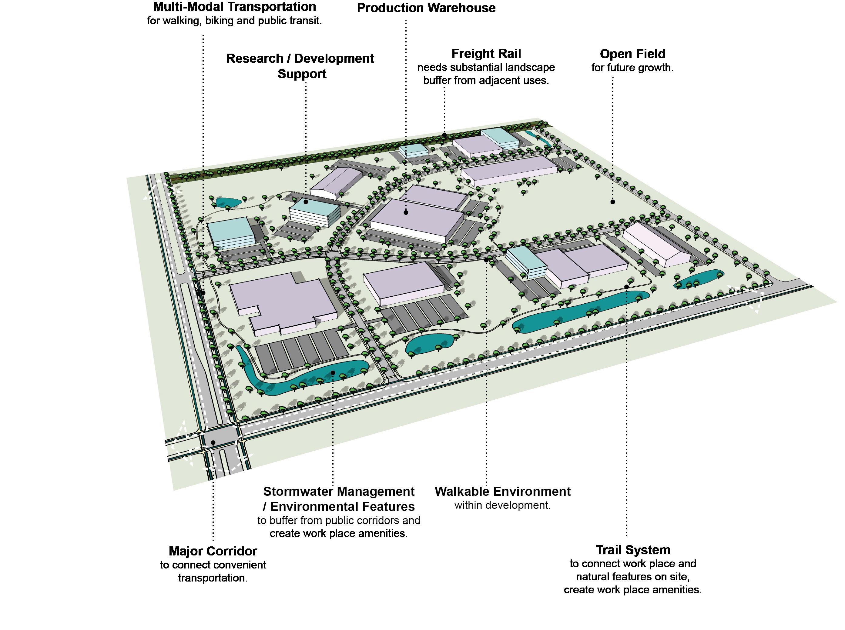
B-PR9-1 Minimize disturbances to environmentally sensitive areas by utilizing the existing topography to the greatest extent possible.
B-SU11-1 Green infrastructure should be implemented in new development. (E-GR3)
C-DI1-1 Consider flexible zoning options that will allow for a wide range of jobs.
C-DI5-1 In Opportunity Zones with a clearly defined local context, consider adaptive reuse to enhance the existing context.
C-PS3-1 Development potential in the Rural Activity Centers should be maximized. (E-ST5)
C-PS8-1 Opportunities for industry and special trade employment should be increased.
C-PS10-2 Developments should explore options for shared and flexible parking arrangements for currently underutilized parking lots.
C-PS10-3 Over-parking of new developments should be avoided. (B-SU5)
D-PL7-1 Stakeholders should be consulted to discuss site opportunities and constraints prior to submitting an application.
D-PL9-1 Historically significant structures should be preserved.
D-SP3-1 Adequate right-of-way, lease areas and easements for infrastructure, with emphasis on wireless communication networks should be provided to create reliable service throughout Lexington.
D-SP3-2 Cellular tower antennae should be located to minimize intrusion and negative aesthetic impacts, and stealth towers and landscaping should be used to improve the visual impact from the roadway and residential areas.
E-GR4-1 Developments should incorporate reuse of viable existing structures.
E-GR5-1 Structures with demonstrated historic significance should be preserved or adapted.
C-PS10-1 Flexible parking and shared parking arrangements should be utilized.
D-CO1-1 Rights-of-way and multimodal facilities should be designed to reflect and promote the desired place-type.
D-CO2-1 Safe facilities for all users and modes of transportation should be provided.
D-CO2-2 Development should create and/or expand a safe, connected multimodal transportation network that satisfies all users’ needs, including those with disabilities.
D-CO4-1 Dead-end streets and Cul-de-sacs should be discouraged except where connections are not topographically or environmentally feasible.
D-CO4-2 Roadway capacity should be increased by providing multiple parallel streets, which alleviate traffic and provide multiple route options, in lieu of additional lanes.
D-CO4-3 Street pattern and design should consider site topography and minimize grading where possible.
D-CO5-1 Streets should be designed with shorter block lengths, narrower widths, and traffic calming features.
E-ST3-1 Development along major corridors should provide for ride sharing pick up and drop off locations along with considerations for any needed or proposed park and ride functions of the area. (E-GR10, E-GR7)
A-DS4-3 Development should work with the existing landscape to the greatest extent possible, preserving key natural features.
A-EQ7-3 Community open spaces should be easily accessible and clearly delineated from private open spaces.
B-PR2-1 Impact on environmentally sensitive areas should be minimized within and adjacent to the proposed development site.
B-PR2-2 Dividing floodplains into privately owned parcels with flood insurance should be avoided.
B-PR2-3 Floodplains should be incorporated into accessible greenspace, and additional protection should be provided to areas around them.
B-PR7-1 Connections to greenways, tree stands, and stream corridors should be provided.
B-PR7-2 Trees should be incorporated into development plans, prioritize grouping of trees to increase survivability.
B-PR7-3 Developments should improve the tree canopy.
B-RE1-1 Developments should incorporate street trees to create a walkable streetscape.
B-RE2-1 Green infrastructure should be used to connect the greenspace network.
E-ST5-1 Increased intensity in the Rural Activity Centers should not negatively impact surrounding rural areas.
E-GR3-1 Physical and visual connections should be provided to existing greenway networks.
E-GR3-2 New focal points should emphasize geographic features unique to the site.
Criteria that include additional policy items in parentheses refer to companion policies that will provide additional context to the related criteria.
PAGE INTENTIONALLY BLANK
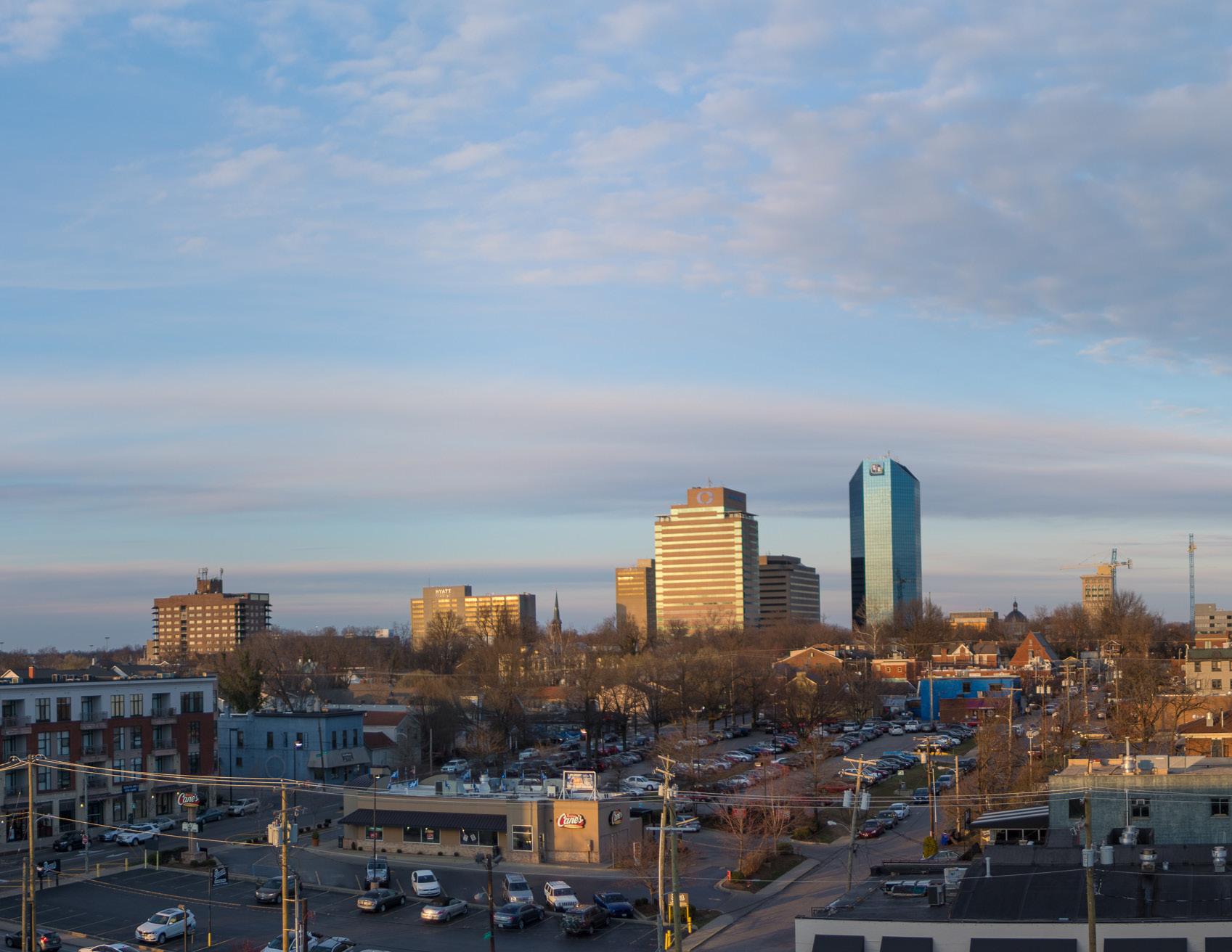
Activate/activated: To activate a space means to intentionally provide and arrange engaging amenities for a specific user group or the broader community. Spaces are activated through built form, planned uses, and community engagement. For example, activated environments are designed and built to garner a sense of civic pride, planned uses such as retail located on the first floor of a building or parking structure attract people, and permanent or temporary community collaboration measures, varying from art installations to pop-up markets, provide engagement.
Adaptive reuse: The process of adapting abandoned, vacant or underutilized buildings and structures for new purposes, which amounts to a change in the structure’s primary purpose, a significant change in the way in which the structure is incorporated into and operates within the exterior environment, or which incorporates a nontraditional yet compatible combination of purposes or uses within the site plan. The adaptive reuse should incorporate changes that rejuvenate and/or increase the sustainability of the site and/or neighborhood while retaining historic features of the original building(s) and/or structure(s).
LFUCG Zoning Ordinance; Article 1 (Amended through September, 2018)
Context Sensitive Development (CSD): Context Sensitive Development (CSD) is a collaborative, interdisciplinary approach to developing projects that involve the public and affected agencies early and continuously to ensure that projects meet the needs of the users, the neighboring communities, and the environment. CSD integrates projects into the context or setting in a sensitive manner through careful planning, consideration of different perspectives, and tailoring designs to particular project circumstances. This could include, among other considerations, compatibility with scale, massing, and height step-downs between existing and proposed buildings, but does not necessarily infer replicating adjacent development characteristics.
Environmentally sensitive areas: Any area which, due to its natural or physical setting, may have environmental problems with regard to development. Areas included are (but are not limited to) areas of steep slope (over 15%), floodplains, sinkholes, areas of poor soil, improper fills, wetlands, any significant tree or significant tree stands, aquifer recharge areas, and similar areas. LFUCG Land Subdivision Regulations; Article 1 (updated March 2017)
Experiential Retail (ER): Experiential Retail (ER) is a type of marketing that shifts focus from the “functional features-and-benefits” of products to a focus on customer experiences. ER takes into account shifting trends due to the rise of online retail shopping. By creating a more immersive retail experience, where services, activities, and ambiance are offered in addition to merchandise, ER attracts people to stores and ensures they leave not just with products but also memories.
Green infrastructure: Infrastructure and stormwater control design approaches and technologies that mimic the natural hydrologic cycle processes of rainfall infiltration, evapotranspiration and reuse. LFUCG Land Subdivision Regulations; Article 1 (updated March 2017)
Neighborhood Focal Point: A Neighborhood Focal Point is a hub-like setting that is accessible to a large number of people in a geographical area. In urban areas, they often function as compact, easily walkable nodes for eating, drinking, socializing, and the selling of goods and services. School sites, parks, libraries, and other types of community centers are also examples of Neighborhood Focal Points.
Screen/screened: The use of landscaping and vegetation or structures such as walls and berms to conceal or reduce the potentially adverse visual and aural impacts of certain land uses or activities of adjoining, dissimilar land uses.
Single-Loaded Street: A single-loaded street is a roadway that provides access to private property on one side and public access to an amenity, such as a park or school site, on the other side.
Stub street: Stub streets are local or collector, closed-end streets that are only acceptable as a temporary street condition. Stubs are similar to cul-desacs except that they provide no turnaround circle at their closed end. Stub streets shall only be used when a future continuation is planned. LFUCG Land Subdivision Regulations; Article 1 (updated March 2017)
Vertical edge: In roadway design, a vertical edge is a visual traffic calming device which may include street trees, buildings, or other vertical design elements within drivers’ field of vision along roadways.
ARRANGED BY THEME


A-DS1-1
A-DS1-2
A-DS3-1
A-DS4-1
A-DS4-2


Mass transit infrastructure such as seating and shelters should be provided/enhanced along transit routes. (A-EQ7).
Direct pedestrian linkages to transit should be provided.
Multi-family residential developments should comply with the Multi-family Design Standards in Appendix 1.
A plan for a connected multimodal network to adjacent neighborhoods, greenspaces, developments and complementary uses should be provided. (A-DS2, A-DN1, B-SU1, B-SU2, C-LI7, E-AC5)
New construction should be at an appropriate scale to respect the context of neighboring structures; however, along major corridors, it should set the future context in accordance with other Imagine Lexington corridor policies and Placebuilder priorities.
A-DN2-2
A-DN3-1
A-DN3-2
A-DN4-1
A-DN6-1
A-EQ3-1
A-EQ3-2
A-EQ7-1
A-EQ7-2
A-DS4-3
A-DS5-1
A-DS5-2
A-DS5-3
A-DS5-4
A-DS7-1
A-DS7-2
A-DS7-3
A-DS8-1
A-DS10-1
A-DS10-2
A-DS11-1
A-DS12-1
A-DS13-1
A-DN1-1
A-DN2-1
Development should work with the existing landscape to the greatest extent possible, preserving key natural features.
Adequate multimodal infrastructure should be provided to ensure vehicular separation from other modes of transport.
Roadways should provide a vertical edge, such as trees and buildings.
Building orientation should maximize connections with the surrounding area and create a pedestrian-friendly atmosphere.
Development should provide a pedestrian-oriented and activated ground level.
Parking should be oriented to the interior or rear of the property for non-residential or multi-family developments.
Any non-residential or multi-family parking not buffered by a building should be screened from the streetscape view and adjacent properties.
Parking structures should activate the ground level.
At the individual street level, medium-density housing types should be interspersed with single-family detached units and should be context sensitive.
Residential units should be within a half mile of a focal point.
New focal points should be designed with multimodal connections to the neighborhood.
Common public uses that serve as neighborhood focal points, such as parks and schools, should be on single loaded streets.
Medium–high density development should be located nearest to neighborhoodserving commercial areas.
Stub streets should be connected. (D-CO4)
High density residential development (HR) should be located on corridors and downtown.
Infill residential should aim to increase density.
A-EQ7-3


B-PR2-1
B-PR2-2
B-PR2-3
B-PR7-1
B-PR7-2
B-PR7-3
B-PR9-1
B-SU4-1
B-SU5-1
B-SU11-1
B-RE1-1
B-RE2-1
Development should minimize significant contrasts in scale, massing and design, particularly along the edges of historic areas and neighborhoods. (D-PL9, E-GR6)
Pedestrian-oriented commercial opportunities should be incorporated within residential neighborhoods.
Development should incorporate residential units in commercial centers with context sensitive design.
Medium–high density development should be located nearest to neighborhood focal points.
Allow and encourage new compact single-family housing types.
Development should create context sensitive transitions between intense corridor development and existing neighborhoods.
Development on corridors should be transit-oriented (dense & intense, internally walkable, connected to adjacent neighborhoods, providing transit infrastructure & facilities). (B-SU3)
School sites should be appropriately sized.
Multimodal transportation options for healthcare and social services facilities should be provided. (E-ST3)
Community open spaces should be easily accessible and clearly delineated from private open spaces.


Impact on environmentally sensitive areas should be minimized within and adjacent to the proposed development site.
Dividing floodplains into privately owned parcels with flood insurance should be avoided.
Floodplains should be incorporated into accessible greenspace, and additional protection should be provided to areas around them.
Connections to greenways, tree stands, and stream corridors should be provided.
Trees should be incorporated into development plans; prioritize grouping of trees to increase survivability.
Developments should improve the tree canopy.
Minimize disturbances to environmentally sensitive areas by utilizing the existing topography to the greatest extent possible.
Where greenspace/community centers are not located within walking distance of a new development, applicants should attempt to incorporate those amenities. (A-DS9)
Vehicle-oriented development, such as drive-through businesses, should not locate in the downtown area.
Green infrastructure should be implemented in new development. (E-GR3)
Developments should incorporate street trees to create a walkable streetscape. Green infrastructure should be used to connect the greenspace network.
Criteria that include additional policy items in parentheses refer to companion policies that will provide additional context to the related criteria. Theme Letter - Pillar Abbreviation & Policy Number – Criteria Number Ex: from Theme A - Design Pillar & Policy #1 - Criteria #1 = A-DS1-1. Full decoder on page ###


C-LI2-1
C-LI2-2
C-LI2-3
C-LI2-4
C-LI6-1
C-LI6-2
C-LI7-1
C-DI1-1
C-DI5-1
C-PS3-1
C-PS8-1
C-PS9-1
C-PS10-1
C-PS10-2
C-PS10-3


D-CO1-1
D-CO2-1
D-CO2-2
D-CO4-1


D-CO4-2
D-CO4-3
Roadway capacity should be increased by providing multiple parallel streets, which alleviate traffic and provide multiple route options, in lieu of additional lanes.
Street pattern and design should consider site topography and minimize grading where possible.
The design should not obstruct the view of the gateway features of the three existing gateways mapped in the Rural Land Management Plan (RLMP).
Non-agricultural uses at or near potential and existing gateways, as mapped in the Rural Land Management Plan, should be buffered.
Design should create a positive gateway character at existing and proposed gateways as identified in the Rural Land Management Plan.
Setbacks, signage, and screening should complement the iconic Bluegrass landscape along Historic Turnpikes, Scenic Byways, Turnpikes, and other scenic roads listed in the RLMP.
Developments should incorporate multifamily housing and walkable commercial uses into development along arterials/corridors.
ADUs and/or affordable housing options should be incorporated into existing and new single-family residential development. (A-DN5)
Developments should create mixed-use neighborhoods with safe access to community facilities, greenspace, employment, businesses, shopping, and entertainment.
Consider flexible zoning options that will allow for a wide range of jobs.
In Opportunity Zones with a clearly defined local context, consider adaptive reuse to enhance the existing context is strongly recommended.
Development potential in the Rural Activity Centers should be maximized. (E-ST5)
Opportunities for industry and special trade employment should be increased.
Where possible, developments should modify current office space to include complementary uses.
Flexible parking and shared parking arrangements should be utilized.
Developments should explore options for shared and flexible parking arrangements for currently underutilized parking lots.
Over-parking of new developments should be avoided. (B-SU5)


Rights-of-way and multimodal facilities should be designed to reflect and promote the desired place-type.
Safe facilities for all users and modes of transportation should be provided.
Development should create and/or expand a connected multimodal transportation network that satisfies all users’ needs, including those with disabilities.
Dead-end streets and Cul-de-sacs should be discouraged except where connections are not topographically or environmentally feasible.
Theme Letter - Pillar Abbreviation & Policy Number – Criteria Number Ex: from Theme A, Design Pillar, Policy #1, Criteria #1: A-DS1-1. Full decoder on page ###
D-CO5-1
D-PL2-1
D-PL7-1
D-PL9-1
D-PL10-1
D-SP1-1
D-SP1-2
D-SP1-3
D-SP2-1
D-SP2-2
D-SP3-1
D-SP3-2
D-SP6-1
D-SP9-1
Streets should be designed with shorter block lengths, narrower widths, and traffic calming features.
Developments should aim to provide a neighborhood-serving use that does not already exist in the vicinity, or that fills a specific need.
Stakeholders should be consulted to discuss site opportunities and constraints prior to submitting an application.
Historically significant structures should be preserved.
Activate the streetscape by designating public art easements in prominent locations.
Elementary and middle schools should be located within residential neighborhoods, and high schools primarily along collector streets. (A-EQ7)
An open and inviting school campus/locale should utilize frontage on single-loaded streets (also true for other support facilities, like parks, community centers, social services, healthcare).
Developments should provide multimodal transportation infrastructure to school sites, including sidewalks, shared-use paths, and roadways that can accommodate the bus and vehicle traffic associated with the site.
Visible, usable greenspace and other natural components should be incorporated into school sites.
Active and passive recreation opportunities should be provided on school sites.
Adequate right-of-way, lease areas and easements for infrastructure, with emphasis on wireless communication networks should be provided to create reliable service throughout Lexington.
Cellular tower antennae should be located to minimize intrusion and negative aesthetic impacts, and stealth towers and landscaping used to improve the visual impact from the roadway and residential areas.
Social services and community facilities should be accessible via mass transit, bicycle and pedestrian transportation modes. (A-EQ7)
Encourage co-housing, shared housing environments, planned communities and accessory dwelling units for flexibility and affordability for senior adults and people with disabilities.
Criteria that include additional policy items in parentheses refer to companion policies that will provide additional context to the related criteria.


THEME E

E-ST3-1
E-ST5-1
E-GR3-1
E-GR3-2
E-GR4-1
E-GR5-1
E-GR9-1
E-GR9-2
E-GR9-3
E-GR9-4
E-GR10-1
E-GR10-2
E-GR10-3

ACCOUNTABILITY (AC) STEWARDSHIP (ST) GROWTH (GR)
Development along major corridors should provide for ride sharing pick up and drop off locations along with considerations for any needed or proposed park and ride functions of the area. (E-GR10, E-GR7)
Increased intensity in the Rural Activity Centers should not negatively impact surrounding rural areas.
Physical and visual connections should be provided to existing greenway networks.
New focal points should emphasize geographic features unique to the site.
Developments should incorporate reuse of viable existing structures.
Structures with demonstrated historic significance should be preserved or adapted.
Live/work units should be incorporated into residential developments.
Low-intensity business uses that will provide neighborhood amenities should be incorporated into existing neighborhoods.
Less intense multi-family residence types (duplexes, four-plexes, courtyard apartments, etc.) should be incorporated into primarily single-family areas.
Developments should incorporate reuse of viable existing structures.
Developments should include multi-family residential components in B-6P and other Mixed Use Zones.
Developments should provide walkable service and amenity-oriented commercial spaces.
Shared common space in commercial developments should be provided to encourage experiential retail programming.
Criteria that include additional policy items in parentheses refer to companion policies that will provide additional context to the related criteria.
PAGE INTENTIONALLY BLANK