THE CROSSINGS CORRIDOR
Master Plan
GRETNA, NEBRASKA
Adopted May 3, 2022


GRETNA, NEBRASKA
Adopted May 3, 2022
» Mike Evans / Mayor
» Bill Proctor / Council President
» Jason Stahr / Council Member
» Logan Herring* / Council Member
» Kara Alexander / Council Member
*Logan’s last day as City Council member was March 14, 2022.
» Josh Dethlefsen / Chairman
» Doug Clark / Commission Member
» Susan Horst / Commission Member
» Jeff Johnson / Commission Member
» Jordan Stabenow / Commission Member
» Mandy Homan / Commission Member
» Jim Foley / Commission Member
» Nathan Munger / Alternate
» Mike Evans, Mayor of Gretna
» Kara Alexander / City Council Member
» Mandy Homan / Planning Commission Member
» Dan Giittinger / Development Services Director
» Steve Perry / City Engineer, Olmsted and Perry
» Paula Dennison / City Administrator


The purpose of The Crossings Corridor Master Plan is to identify a unified vision and a plan for the future growth and development of the Highway 31 and I-80 corridor area. The Crossings Corridor represents a rare opportunity for the City of Gretna to create a unique and vibrant addition to the community - providing new housing, businesses, retail, and recreational amenities for not only Gretna residents but for the entire Omaha metro.
In the Fall of 2021, City of Gretna began the process to craft a new vision and master plan for The Crossings Corridor in response to recent growth activity and development interests. The resulting master plan details the desired mix of land uses, design criteria, and infrastructure needs to achieve the community’s unified vision for this corridor, and outlines recommendations to help seek funding for improvements identified.
The Crossings Corridor Master Plan was completed over a six-month process, from November 2021 to April 2022. Both data-based research and community-driven input influenced the planning process to determine key issues, establish project goals, create initial land use ideas, and develop plan recommendations to secure the highest and best uses for The Crossings Corridor. A project Steering Committee comprised of key city staff and elected officials was formed to provide ongoing feedback and ideas throughout the project.
The Steering Committee, community residents, project partners and key stakeholders were involved at multiple stages of the planning process. This included both in person meetings and online engagement opportunities.
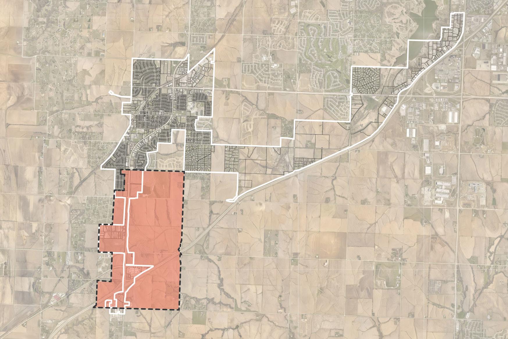
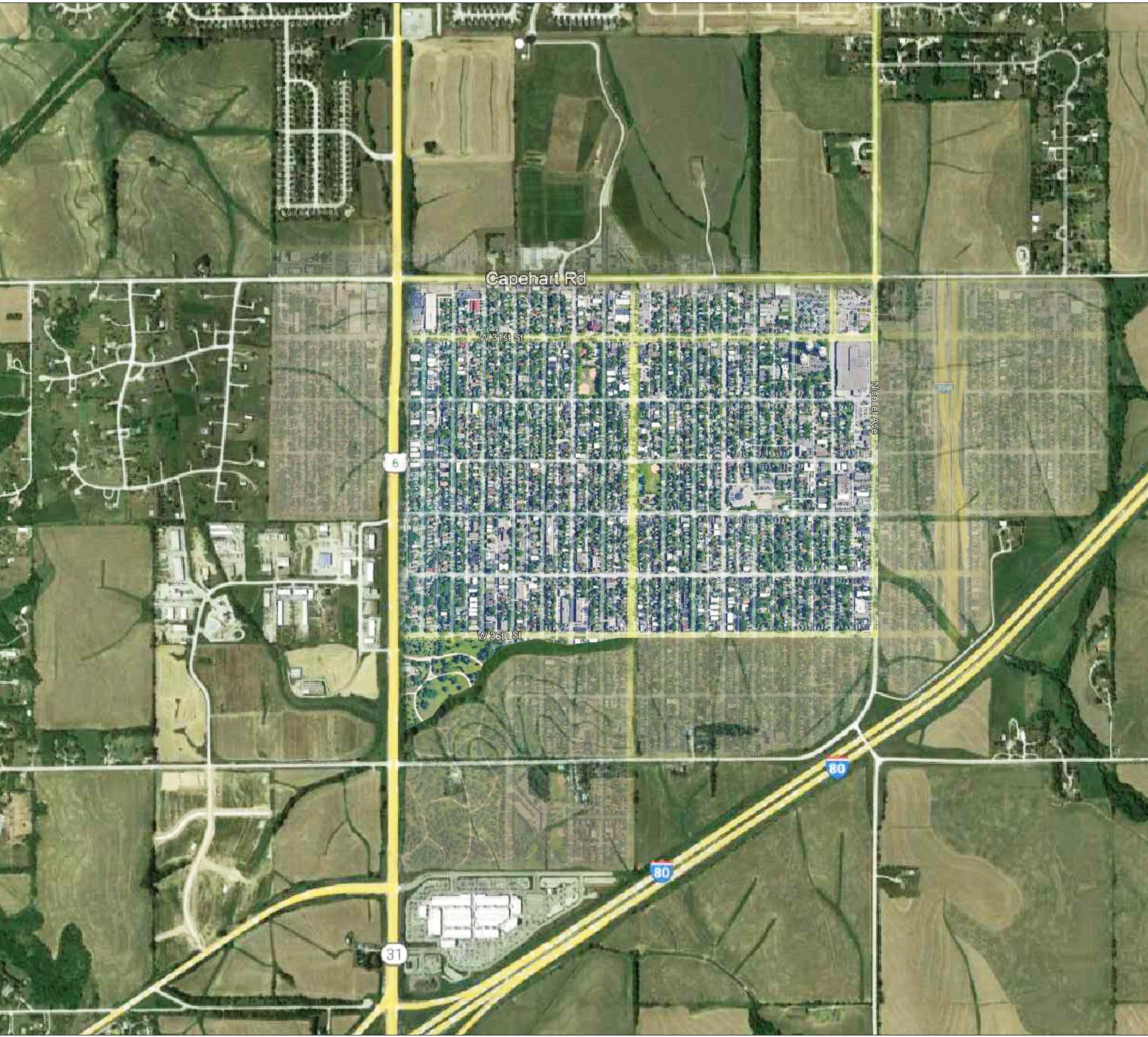
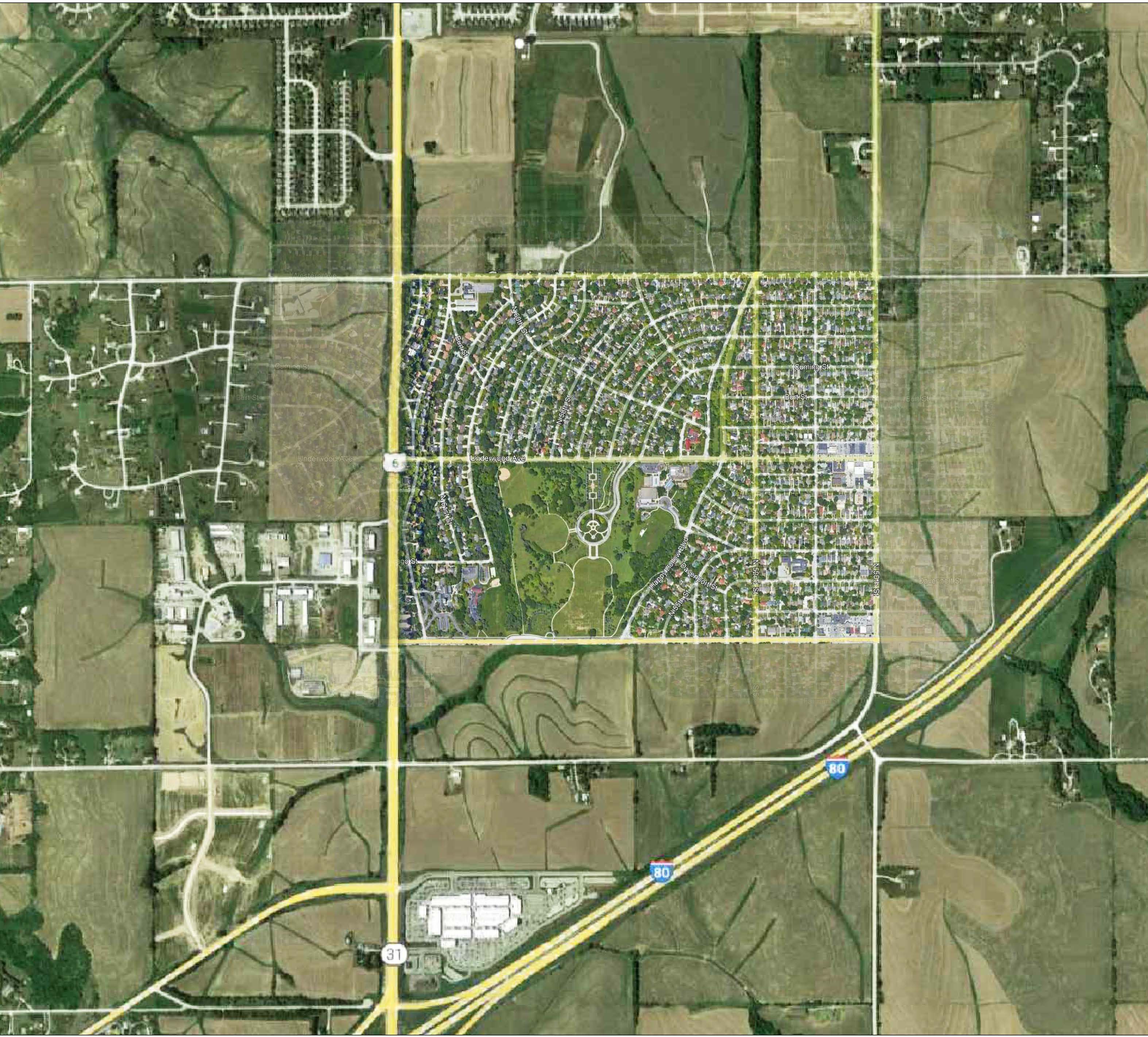
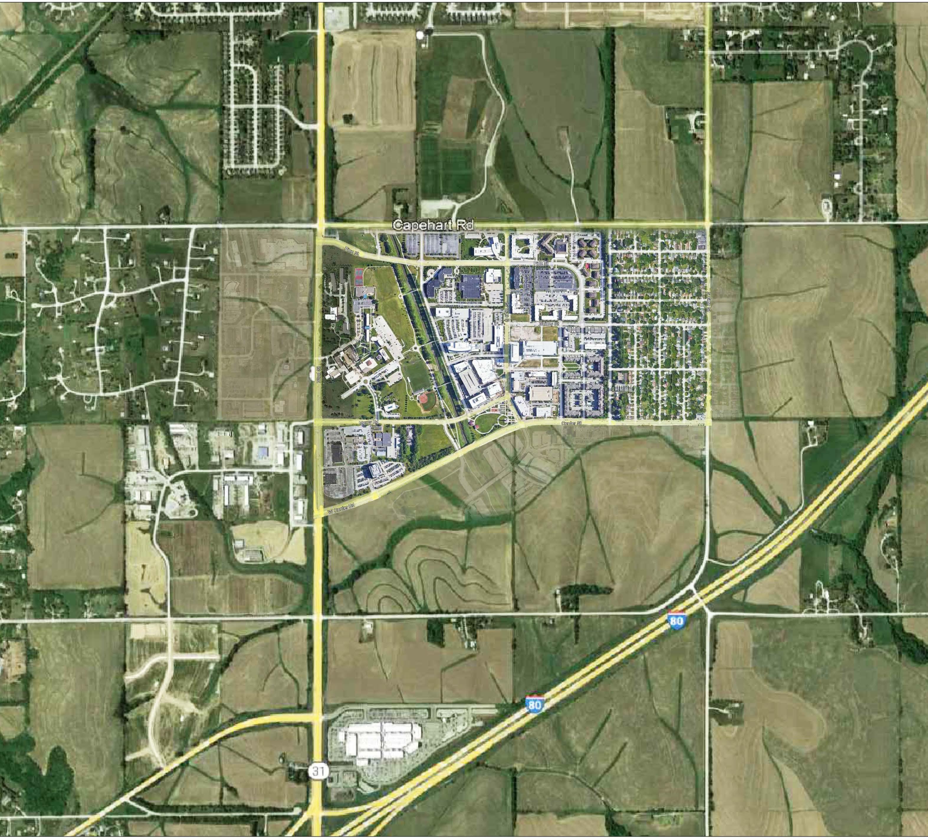
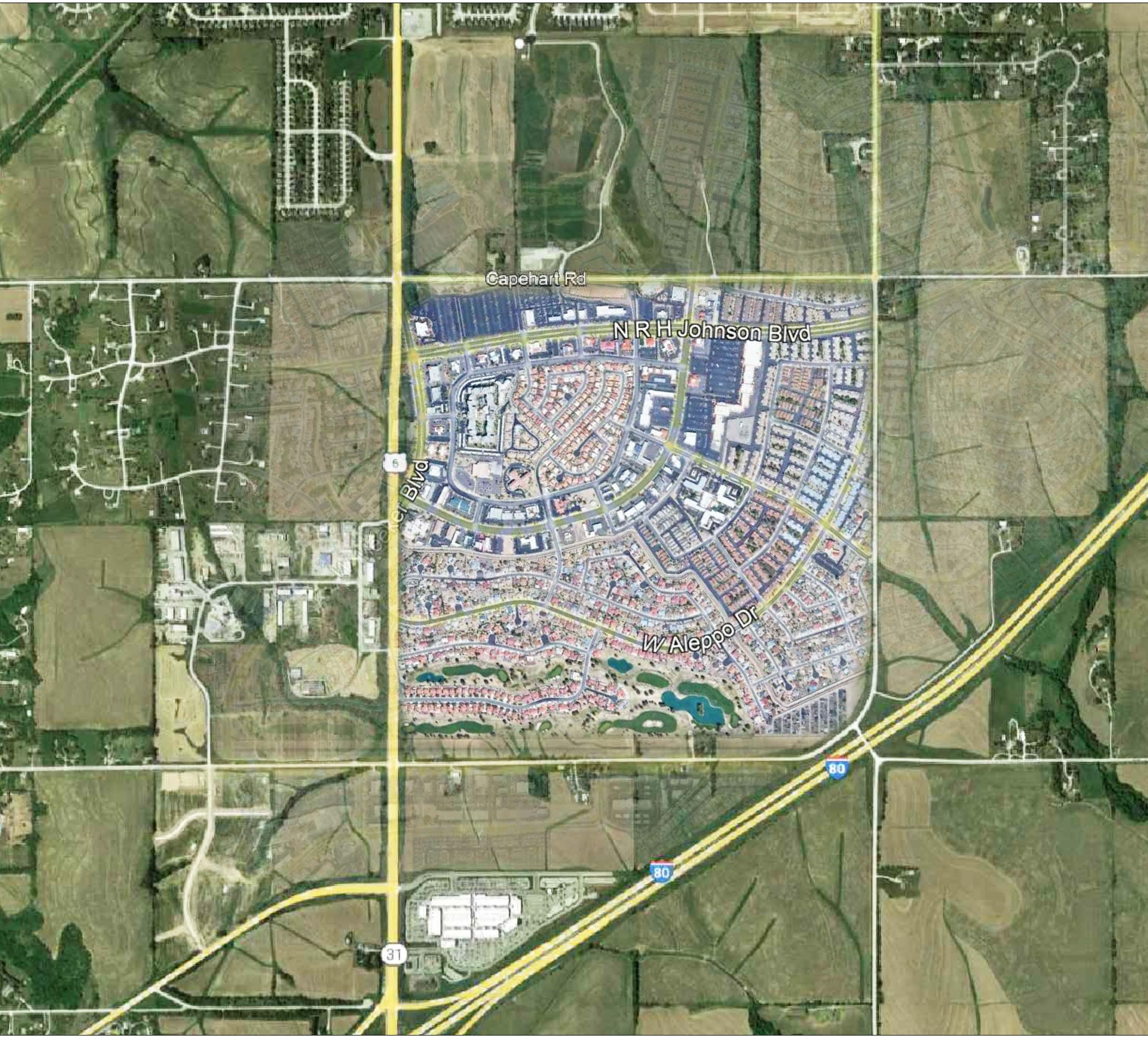
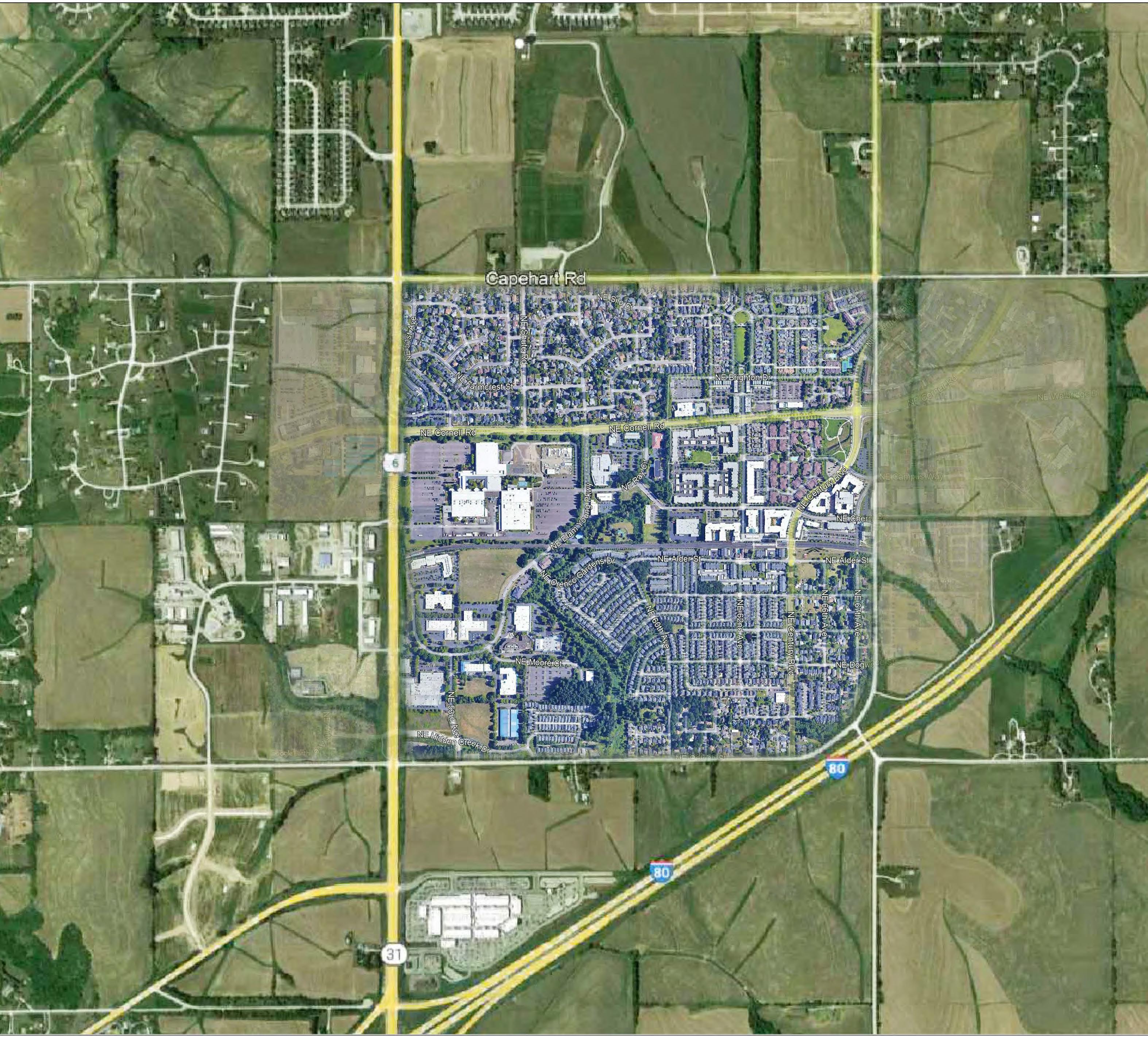
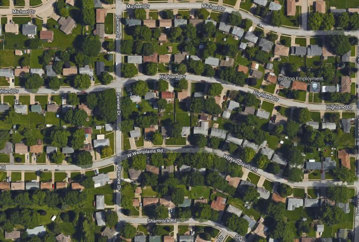
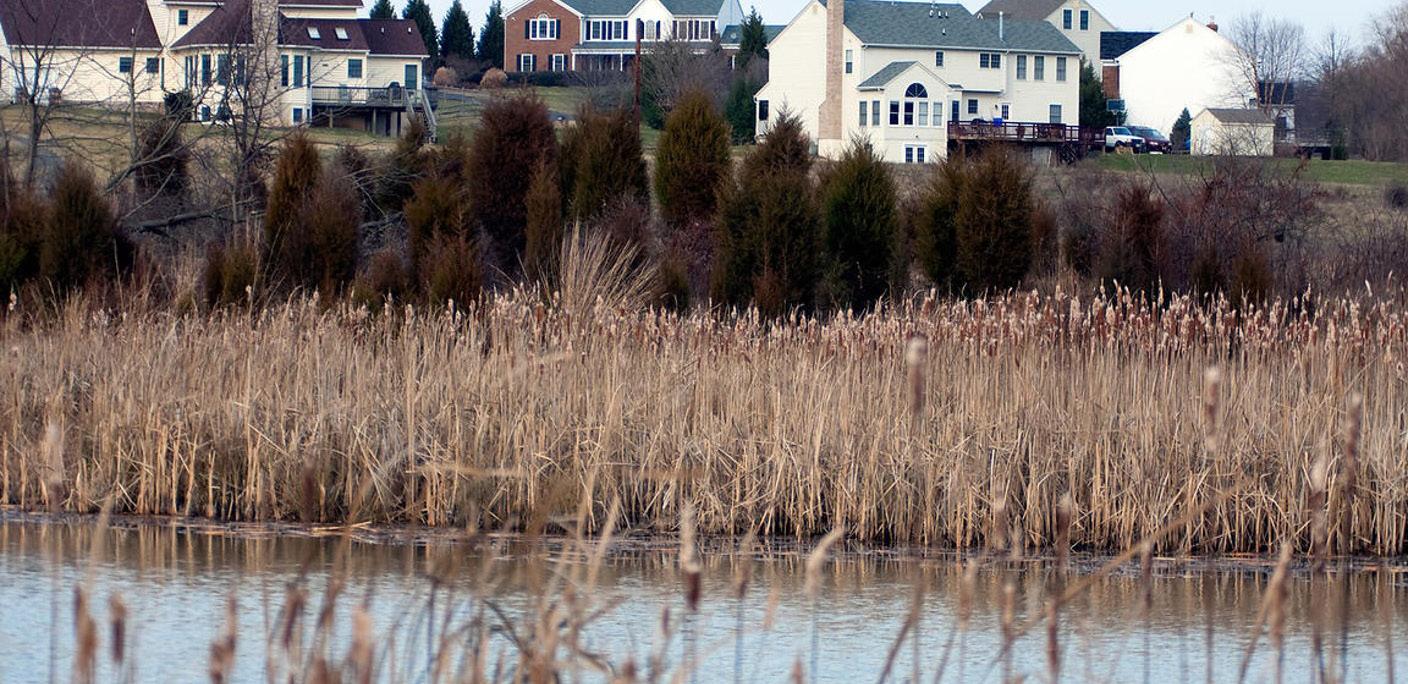
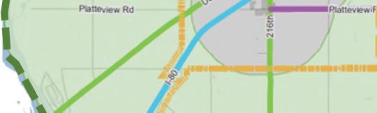
The City of Gretna, Nebraska is located on the southwest edge of the Omaha metropolitan area. Although slightly closer to the Omaha metro, its location along the I-80 corridor positions the community for quick access to Lincoln and Omaha, as shown to the right. The community has long been a rural, bedroom community, offering great schools and small town living within just a short drive to either Lincoln or Omaha.
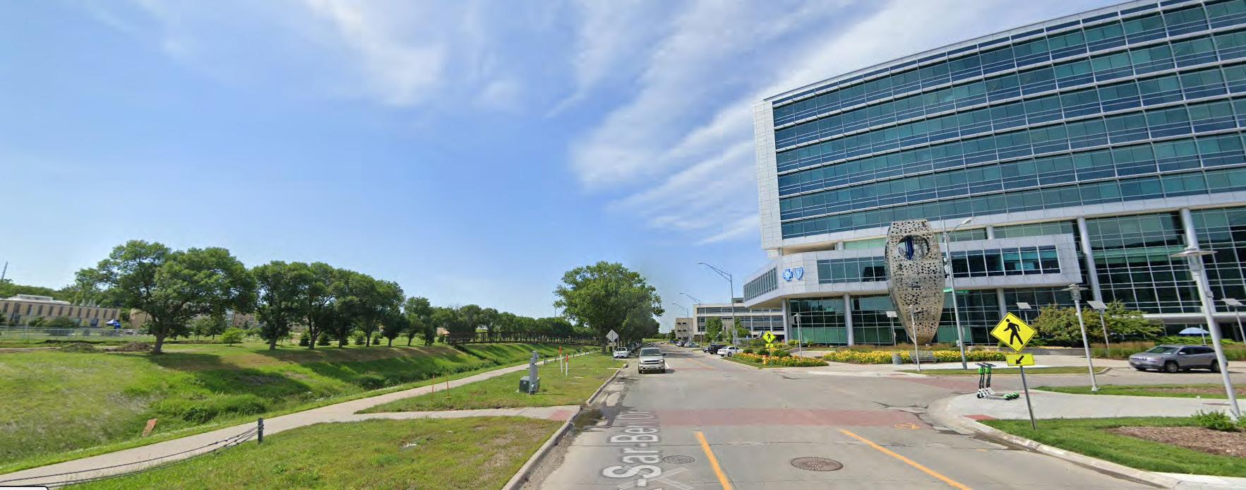
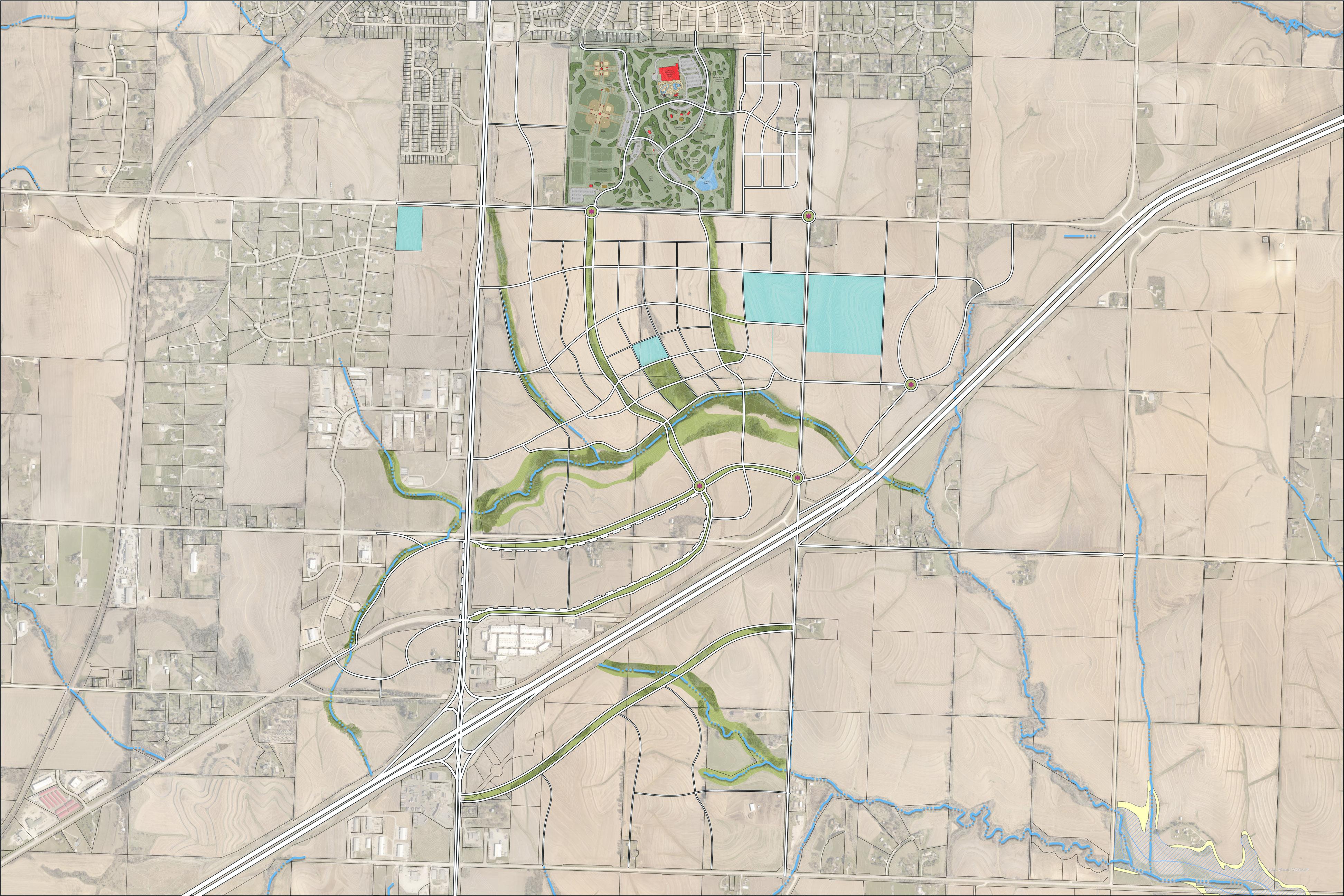
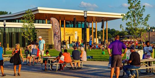
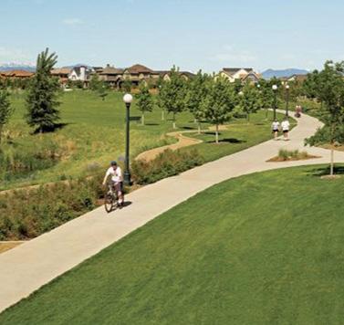
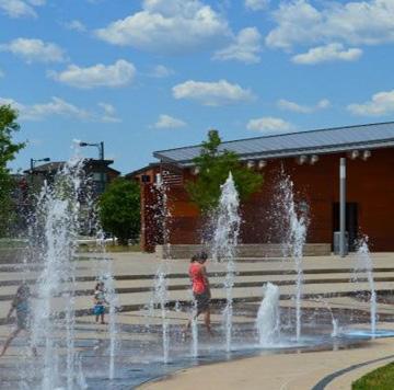
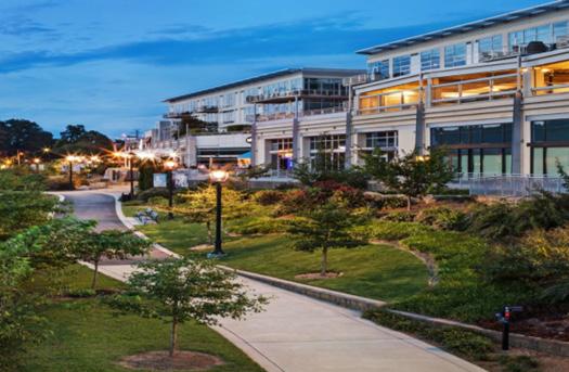
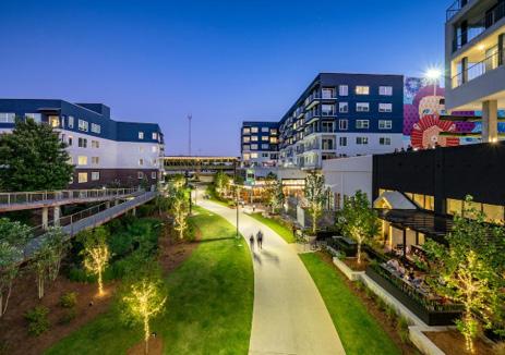
In recent years, the community’s dynamic has started to evolve as Omaha metro continues to grow west and south. The Nebraska Crossing Mall is a huge attraction to the area regionally, serving as Nebraska’s premier shopping experience. One mile north is the recently invested in Gretna Crossing Park. The $53 million community park will be a park for all ages, users, and abilities, hosting a state-ofthe-art Recreation and Aquatics Center, regulation softball, baseball, and multipurpose fields, walking trails, an outdoor amphitheater, frisbee golf, dog park, fishing pond and outdoor pavilions.
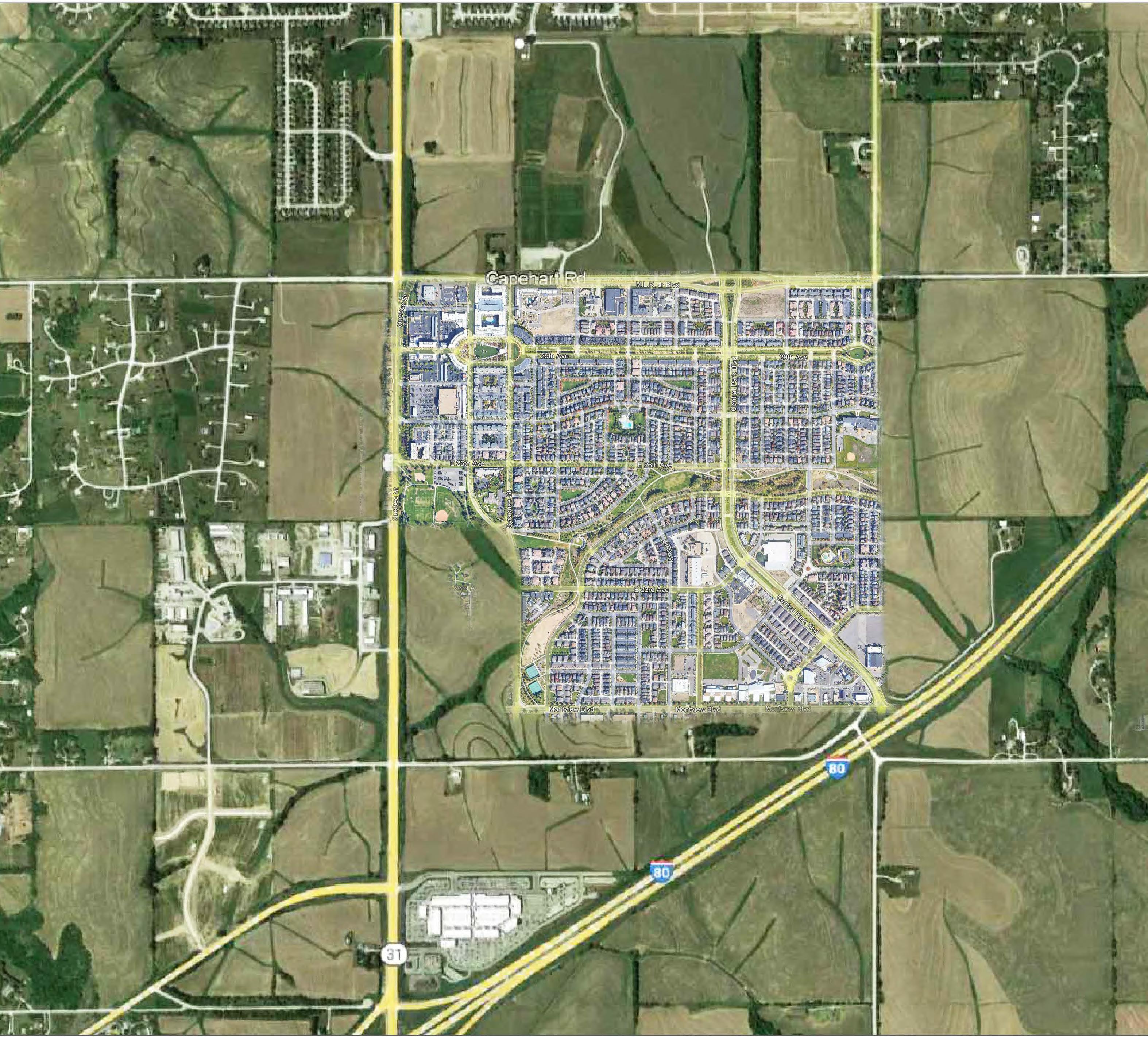
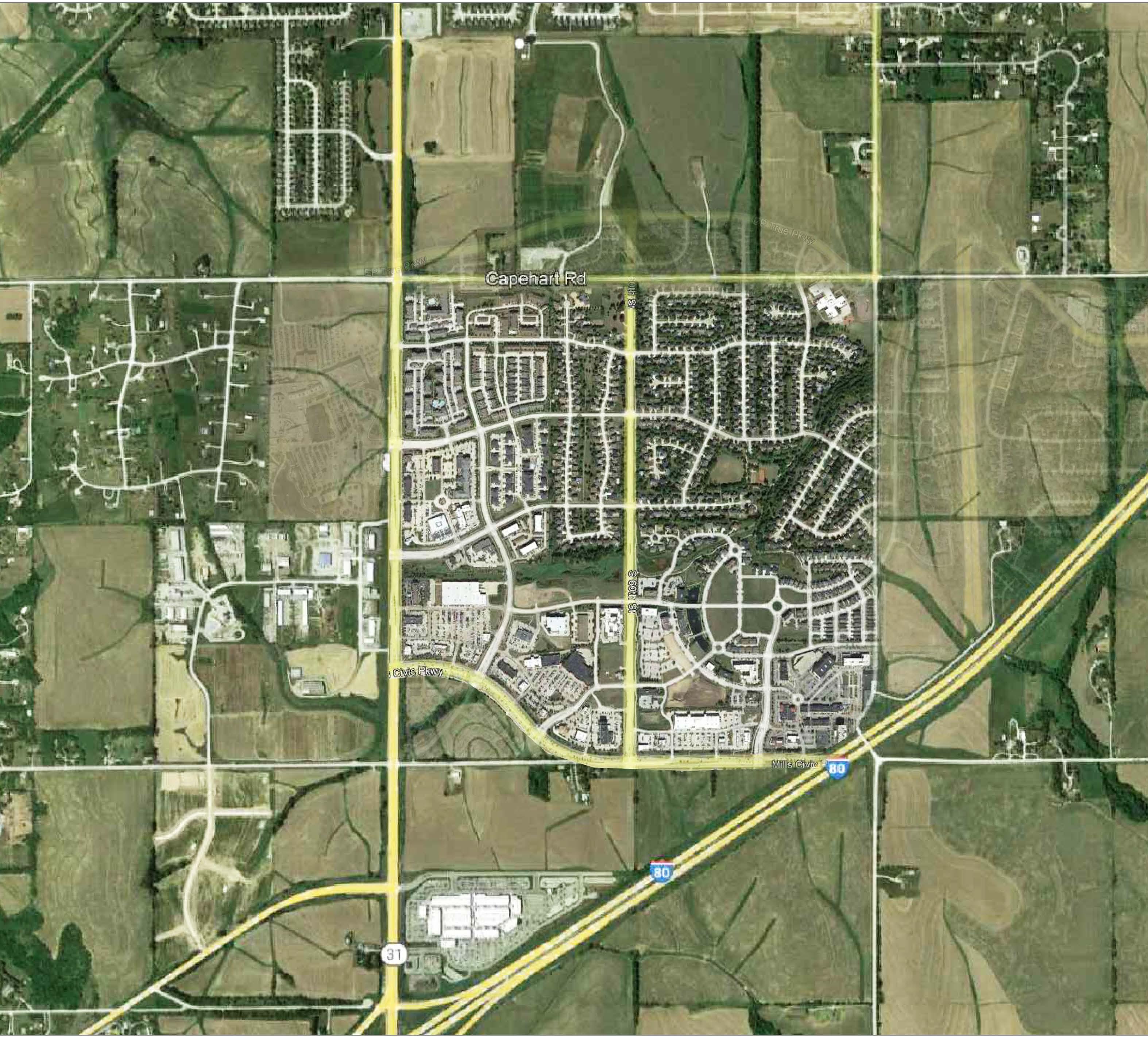
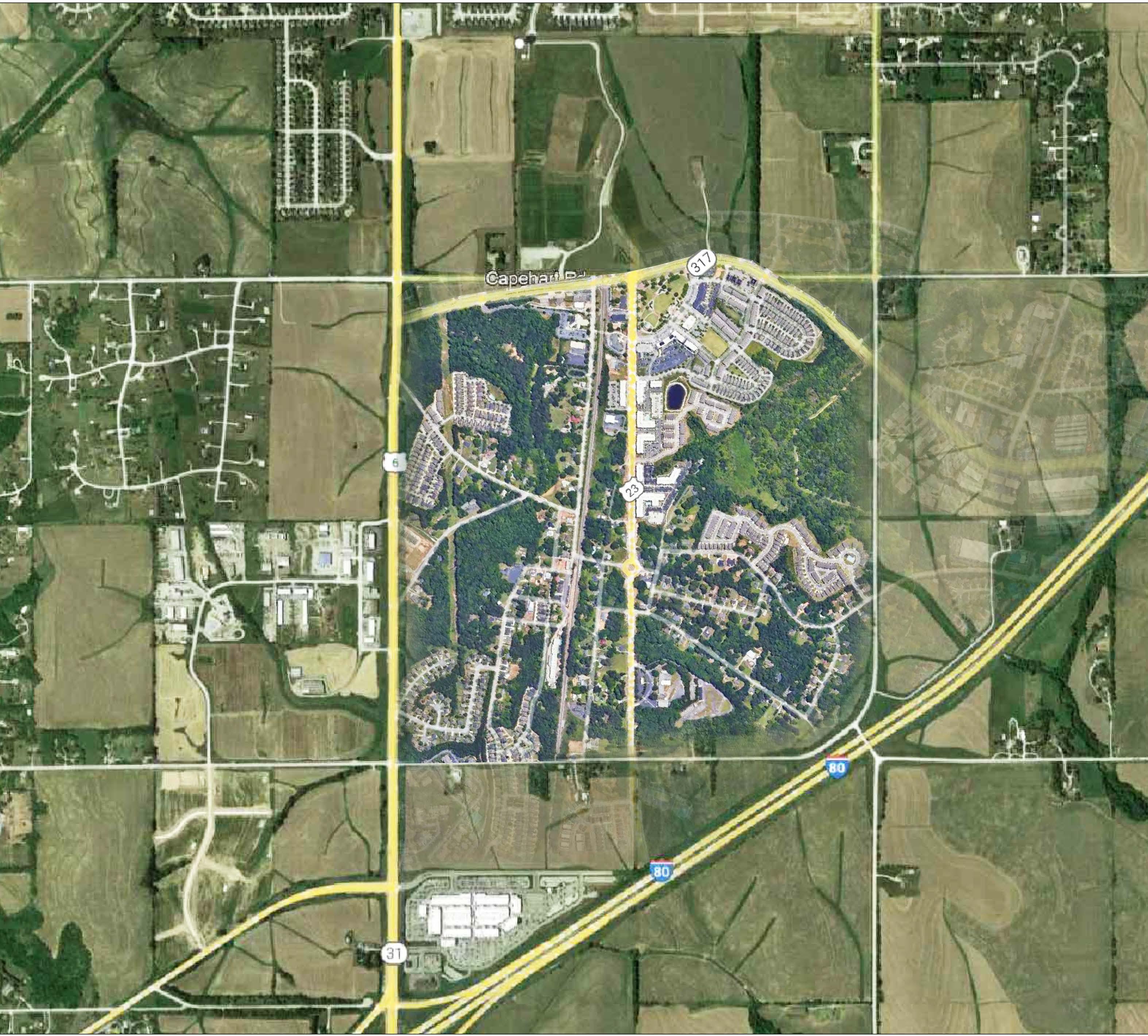
The Gretna Crossings Corridor Plan includes the new Gretna Crossing Park and the Nebraska Crossing Mall. The study area is generally 204th Street along the east boundary, one mile north of Capehart Road serves as the north boundary, ½ mile west of Highway 31 as the west boundary, and Platteview Road to the south. For study purposes, the future land use plan includes some parcels outside of this boundary.
The plan is organized into four chapters with an appendix.
01 Project Understanding
Provides and overall background of the plan and its relevance.
02 Vision Plan
Illustrates the overall goals and outcomes created for this plan.
03 Market & Economic Demand Analysis
Studies the economic and social aspects of Gretna.
04 Recommendations
Outlines a set of recommendations that relate to the project goals.
05 Implementation / Prioritization
Provides an implementation matrix to help execute the plan recommendations.
An appendix is included at the end of this plan to provide additional and supporting resources and images that were gathered during the entirety of the process. They are labeled in reference to the section of the plan to which they are applicable.
Through an extensive collaborative process, community leaders, citizens, design professionals and economic specialists worked together to fully understand the opportunities and constraints currently present within The Crossings Corridor. As part of the site and market analysis and stakeholder input process, key themes surfaced - see themes listed to the right.
While The Crossings Corridor is nearly a blank canvas, it must also serve the community and citizens of Gretna and this plan expresses their desires for a vibrant, connected Corridor. Through creating a more welcoming experience while also increasing the multi-modal activity throughout The Crossings Corridor, this area can become even more attractive for development and can play a significant role in improving the quality of life for those that live, work, and visit Gretna.
To achieve the outcomes mentioned above, a set of goals were developed.
» Residential mix
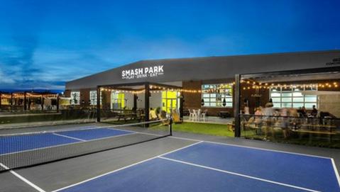
» Recreation and entertainment
» Parks and public gathering spaces
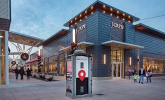
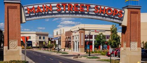
» Local and regional retail
» Restaurants
» Office and businesses
» Connectivity to the entire community
» Pedestrian and bike circulation
» Local trails and regional connections
» Meet the need for senior oriented and multi-family housing
» Provide missing middle housing options including townhomes, starter-homes and smaller lot single-family residential lots
Infrastructure
» Roadway improvements
» Sewer and water improvements
» Funding sources and mechanisms
1 2 3 4
Leverage the proximity of Interstate I-80 and the community’s position between Omaha and Lincoln to help ensure the long-term fiscal health of Gretna.
Create a unique identity for Gretna Crossings that is welcoming to all, by being respectful of Old Town Gretna while looking to the future.
Enhance Gretna’s quality of life by promoting walkability and bikeability through a diverse mix of commercial and residential development within Gretna Crossings that is for residents, workers, and visitors.
Enhance the recent park and recreation investment to connect the surrounding Gretna community through recreation and trail systems, allowing this to be the core of the community’s fabric.
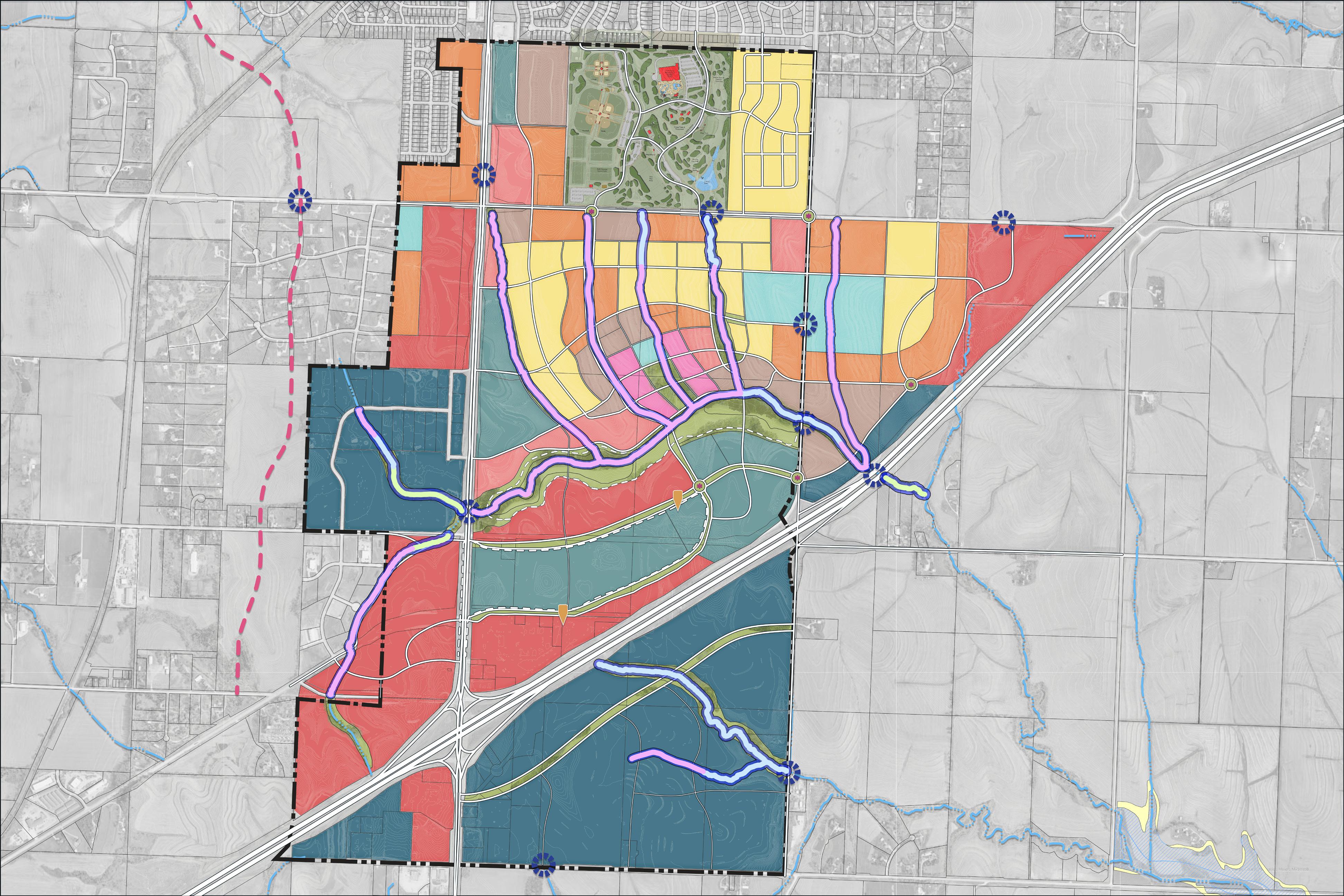
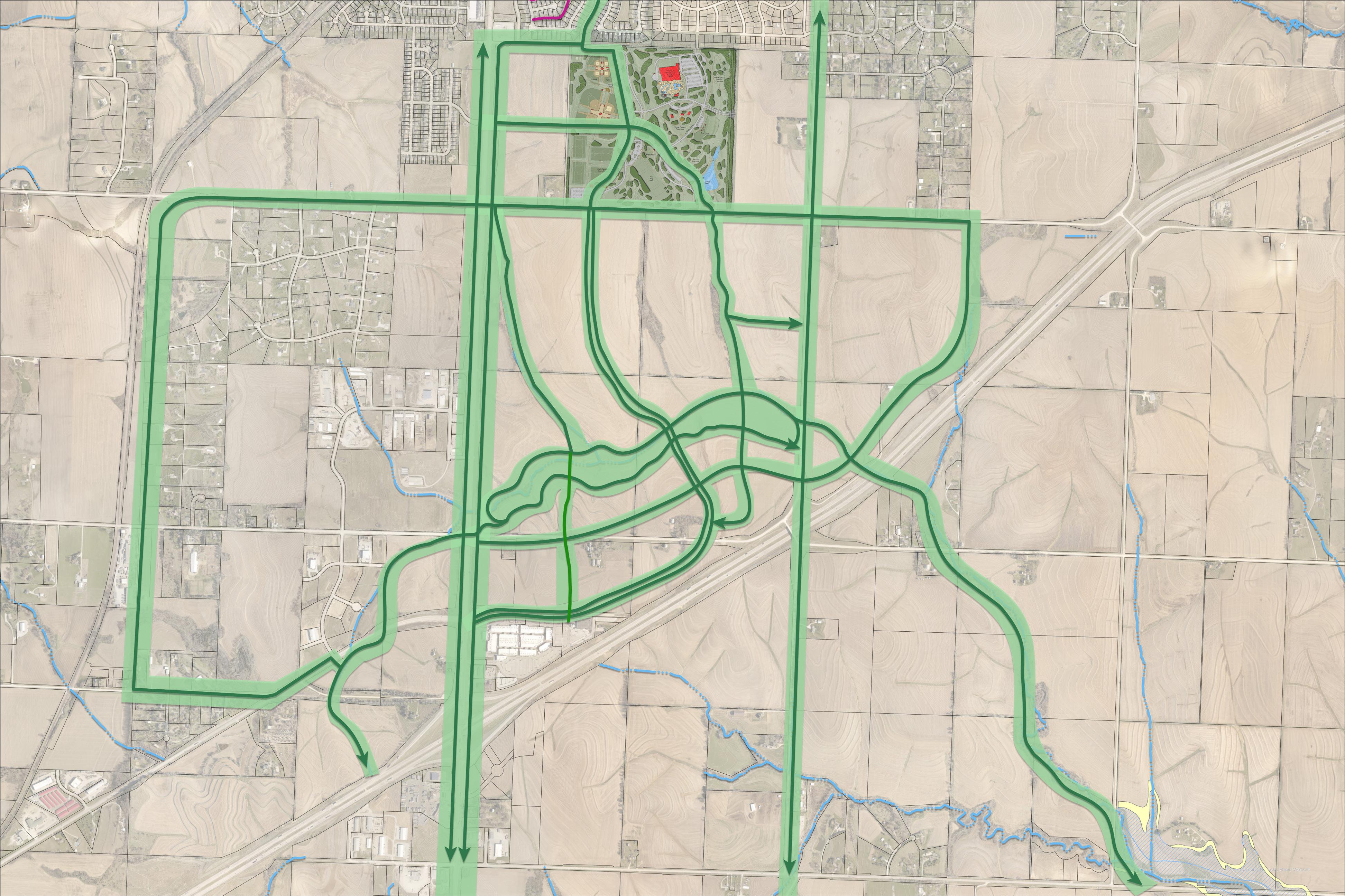
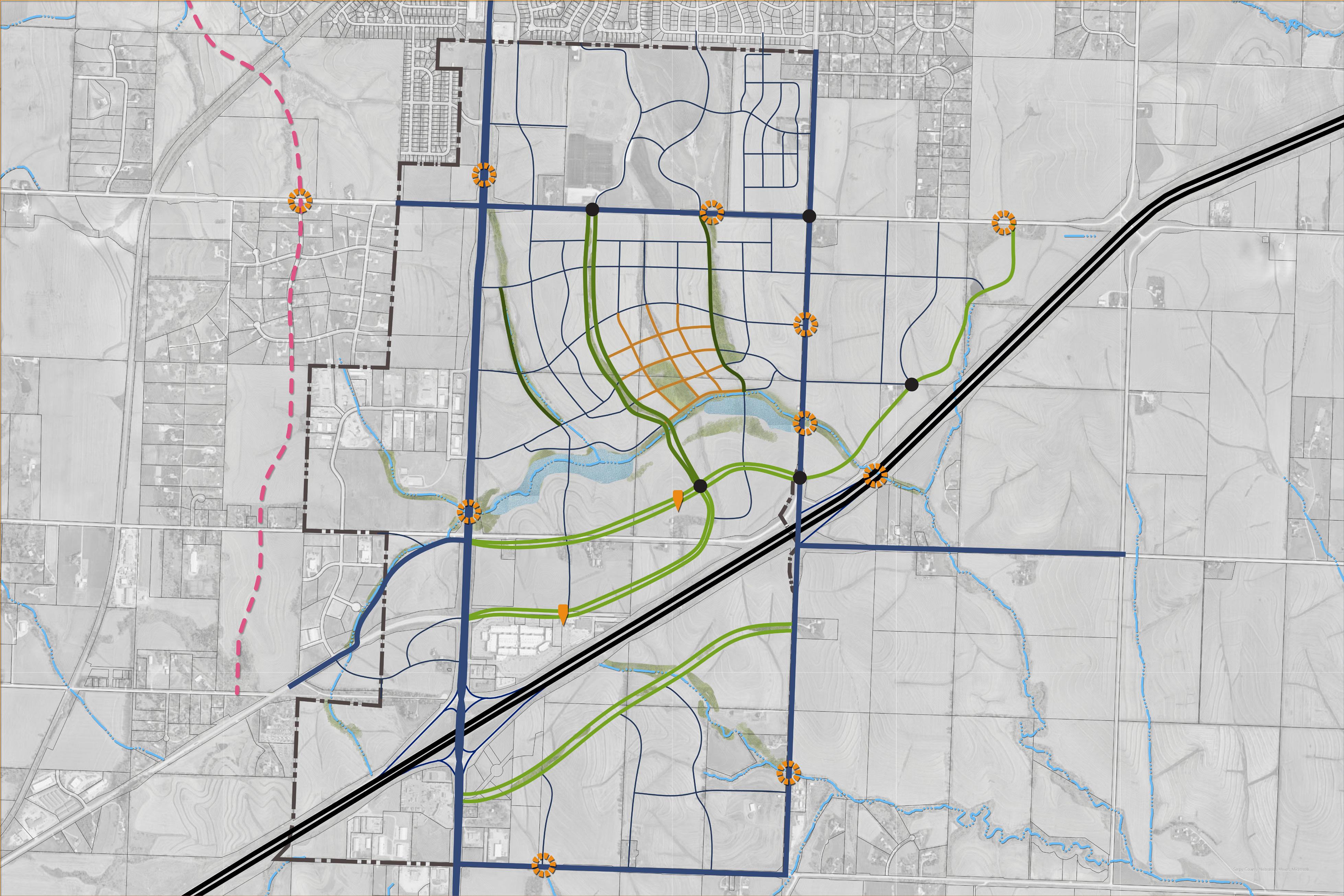
Goal: Figure 2.00 / Crossings Corridor Greenway Network
Enhance the recent park and recreation investment to connect the surrounding Gretna community through recreation and trail systems, allowing this to be the core of the community’s fabric.
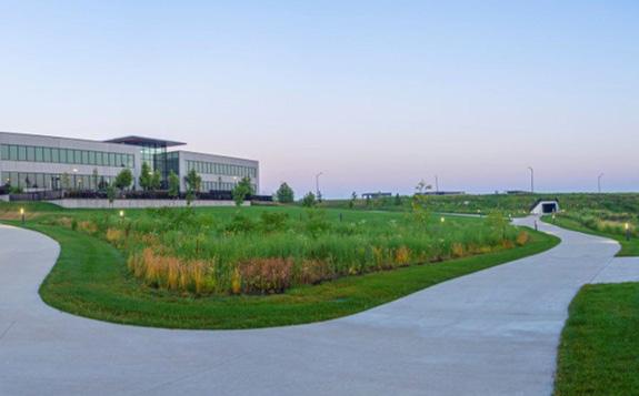
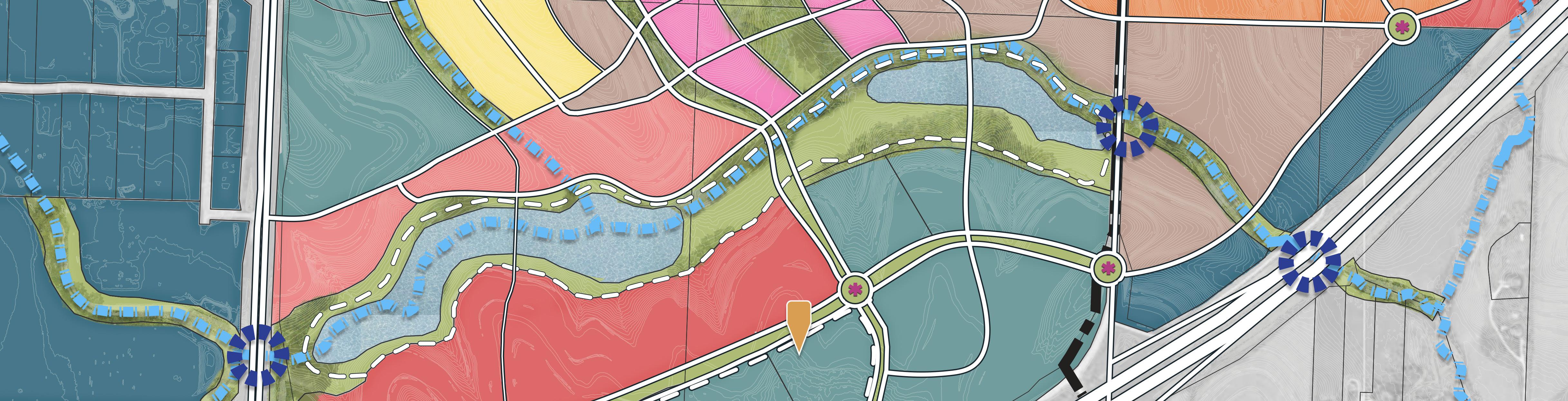
A Foundational component of The Crossings Corridor Master Plan is to connect Gretna Crossing Park to neighborhoods with parkways and greenways. This is an environmentally sound practice giving space to our natural creeks and greenways. This is also a way to give the City of Gretna a distinguishing characteristic – a Wow Factor…… solidly confirming that Gretna is a great place to be.
Parkways, Greenways and curvilinear streets follow the contours of the area, protecting the streams and connecting Gretna Crossing Park to a new civic center just north of the Buffalo Creek Greenway and south to the existing NEX shopping center and future office and retail destination. The Buffalo Creek Greenway is proposed as a place to store stormwater and provide a 2 mile long looping trail, a rather magical length for recreationalist to get a great, little walk. It also provides a place for nature to permeate our built environment.
Grade separated pedestrian crossings are provided across major streets and the interstate at an interval of once per mile. These grade separated structures are generally planned to pair with a stream crossing to take advantage of a naturally occurring grade difference and need to be designed to be wide and bright. It is also important to plan and build these crossings with the advent of road improvements or adjacent land development.
The Greenways and Parkways also provide a physical connection from the new Crossings Park to Old Town Gretna through trail system and active transportation.

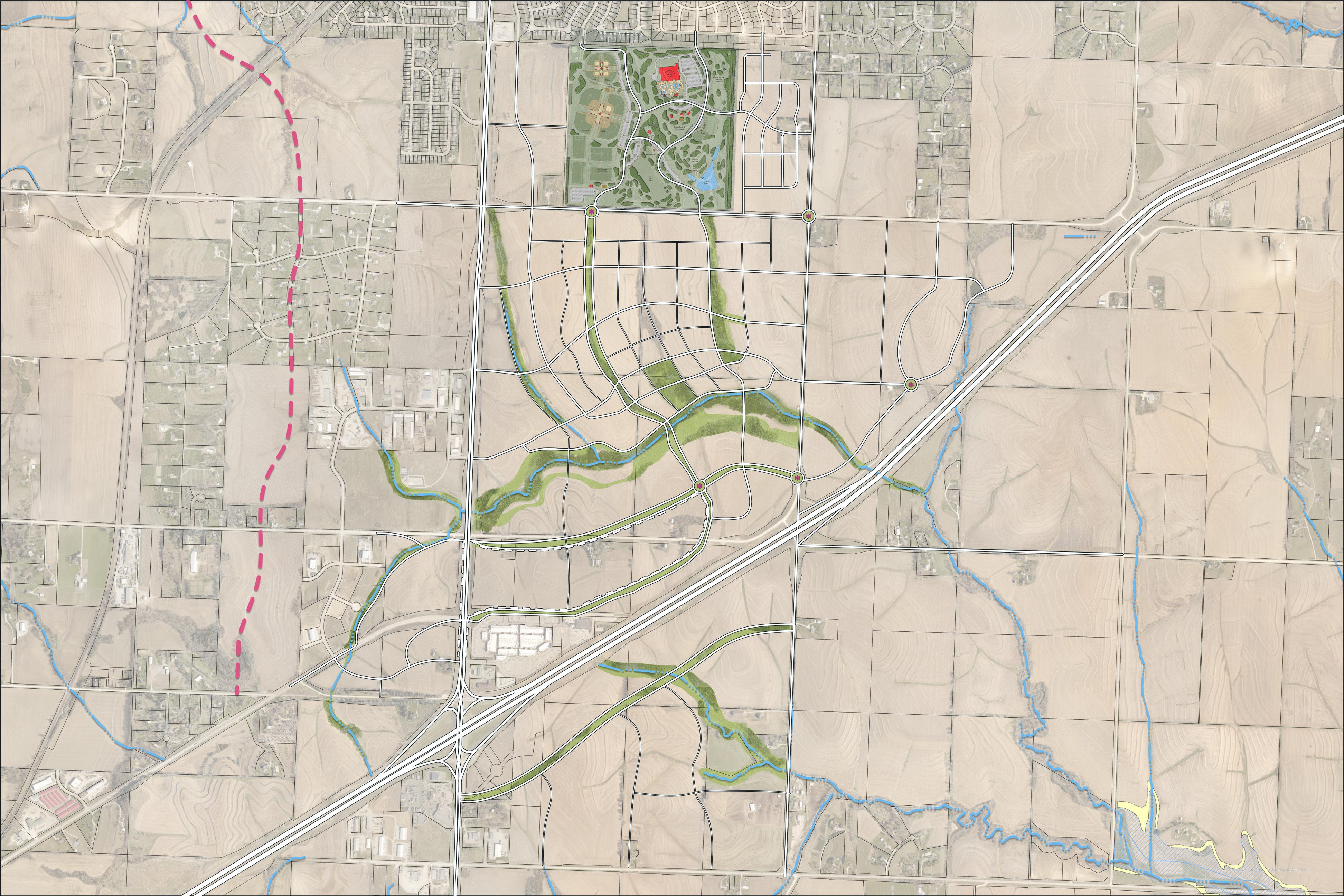
Goal: Figure 2.01 / Crossings Corridor Trails Network
Enhance Gretna’s quality of life by promoting walkability and bikeability through a diverse mix of commercial and residential development within Gretna Crossings that is for residents, workers, and visitors.
This plan demonstrates a fine-grained fabric of mixed land uses connected by frequent streets and trails ensuring The Crossings Corridor will be walkable and bikeable as citizens make their daily trips from home to work to entertainment and shopping. Continuous, connected through streets provide convenient access throughout.
Greenways and Parkways highlight stormwater and natural systems as part of public infrastructure and place these facilities well within the public realm, giving citizens a daily dose of stress reducing nature. In addition to grade separated, wide and bright, connections across major streets and interstate at an interval of once per mile this plan asks that major barrier streets include walkways, trails and signalized crossings that accommodate pedestrians as a priority.

Create a unique identity for Gretna Crossings that is welcoming to all, by being respectful of Old Town Gretna while looking to the future.
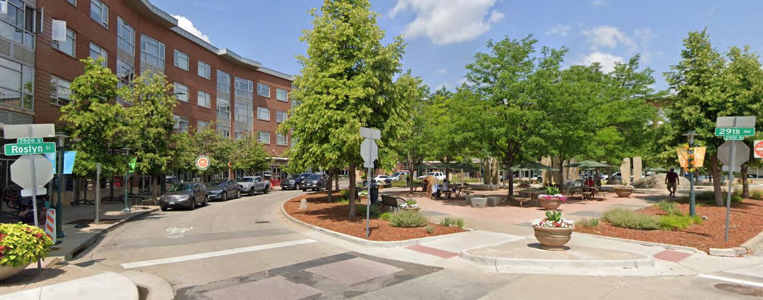
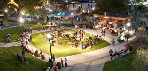
Just north of and connected to the new Buffalo Creek Greenway, this plan proposes a new civic center paired with downtown scaled buildings and businesses at the heart of the new development. The Civic Center may include a city hall, library, community meeting spaces, and town square. The Civic Center is also surrounded by higher density residential areas, providing the needed energy to keep a Civic Center strong.
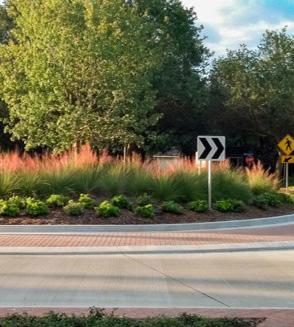
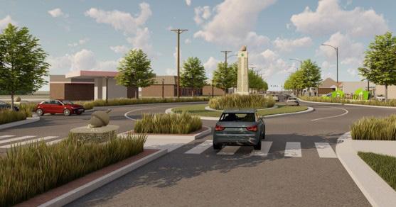
Parkways, a new town square, and roundabouts provide ample opportunity for integration of art, beautiful landscaping and memorable moments. These public facilities are prominent places for Gretna to celebrate the values of the community.
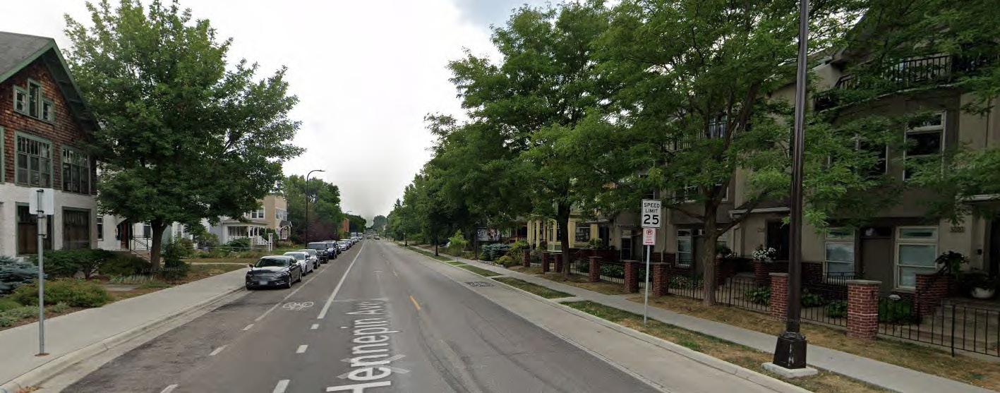
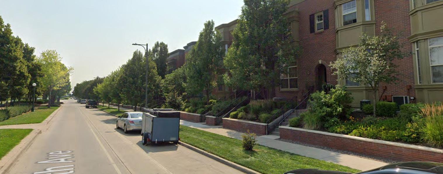
The Crossings Corridor Master Plan is largely modeled after the Old Town Gretna development patterns of frequent blocks and higher densities. These development patterns promote unintentional personal intersections of neighbor to neighbor and there is no better way to enhance the sense of community citizens of Gretna all know and love.
Leverage the proximity of Interstate I-80 and the community’s position between Omaha and Lincoln to help ensure the long-term fiscal health of Gretna.

The area north of the interstate and south of the Buffalo Creek Greenway is reserved for regional retail and office placemaking destinations and the south side of the interstate is reserved for land uses that require more truck traffic. This reservation of land for the highest and best land uses will ensure that Gretna takes full advantage of their geographical position within the region. The businesses that occupy this quickly growing regional center will provide tax revenue for decades to come.
Dense commercial and regional office uses paired with a regional transit loop will support Gretna as a destination. Gretna needs to advocate for the development of this regional transit loop.
Throughout both regional areas north and south of the interstate, continue the parkways and roundabouts throughout as they provide ample opportunity for integration of art, beautiful landscaping and memorable moments and will foster long term investment.

This section highlights the key demographics, economics, site attributes, and other factors that will combine to shape the market support for potential development within the corridor study area. Topics summarized here can be explored in greater detail in the more complete market analysis report found in the Appendix.
The Gretna Corridor study area enjoys a number of notable market advantages that combine to create a significant long term development opportunity across a variety of land use categories. Most notably, those advantage include,
» In the path of robust regional population and employment growth,
» Attractive income and education demographics,
» Strong private sector development momentum
» Major infrastructure investments in utilities and cultural/recreation by Gretna
» A strategically favorable gateway interstate location convenient to both Omaha and Lincoln urban centers
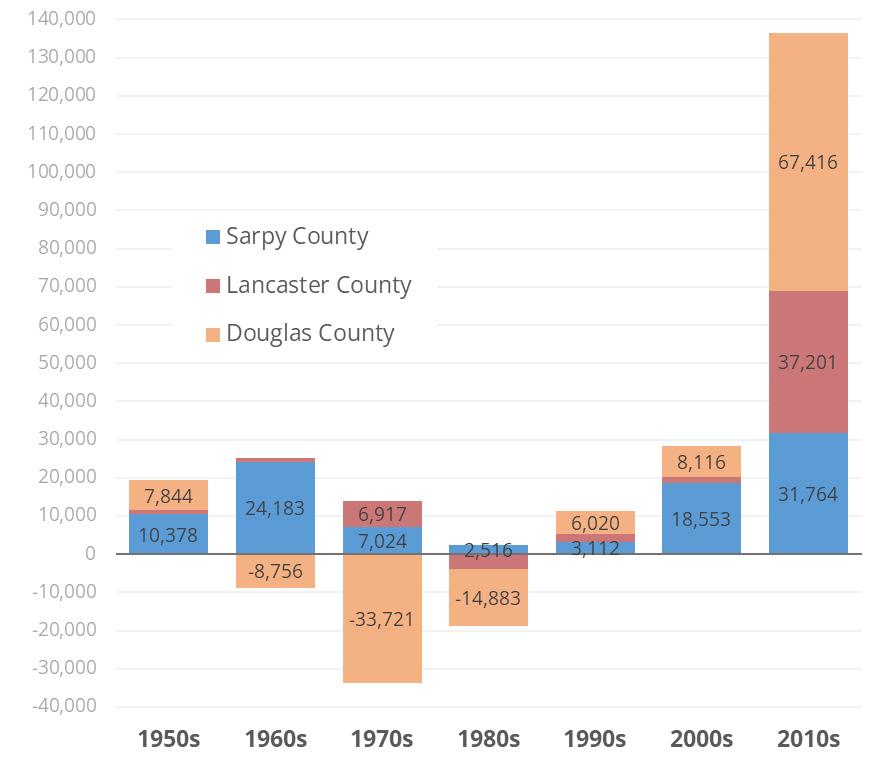
Most of eastern Nebraska’s population and economic activity is found in Lancaster County (home of Lincoln, Douglas County (home of Omaha), and Sarpy County – long primarily a bedroom community south of Omaha, built around Offutt Air Force Base and spread across suburbs to the west, including Gretna.
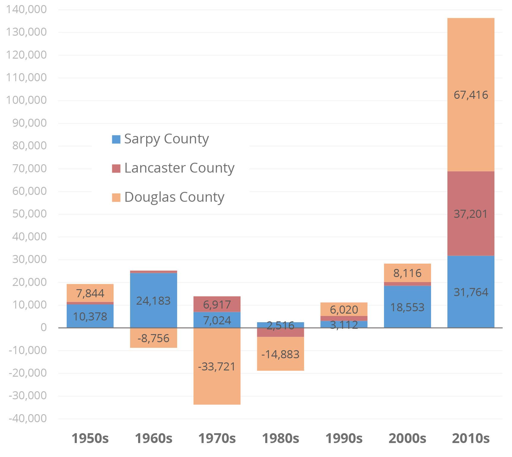
While Sarpy has managed positive population growth every decade since the 1950s, it struggled along with the main urban centers through the 1980s and 1990s, rebounding during the 2000s and positively booming over the past decade, adding nearly 100,000 people in the Douglas/Sarpy area alone.
In fact, Sarpy’s growth over the last decade was disproportionate to its relative size. Despite starting the decade with just 23-percent of the Douglas/ Sarpy population and 17-percent of area jobs, Sarpy County accounted for 32-percent of new residents and 30-percent of new jobs.
Not only is the growth strong in Sarpy County -Gretna is squarely in the path of some of the metro area’s most active westward expansion.
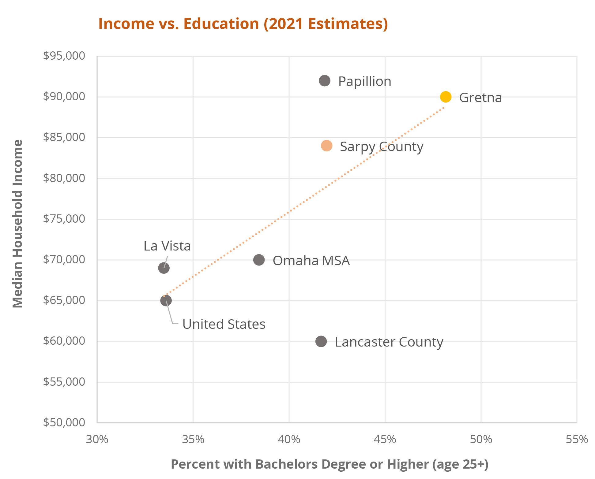
Not surprisingly, higher education levels are correlated with higher incomes, and Gretna has both. Gretna has the highest percentage of adults with at least a 4-year college degree in Sarpy County –also higher than Douglas County, the Omaha Metro, and the U.S. overall Among major Sarpy suburbs, only Papillion has slightly higher incomes than Gretna (despite somewhat lower educational attainment).
In general, highly-educated, high-earning residents, such as those found in Sarpy County and Gretna make it an attractive market for more upscale retailers and homebuilders. The high educational attainment (coupled with an excellent local school district) make the area potentially attractive to desirable employers looking for the rare combination of brain power and housing that is still affordable relative to many other urban areas.
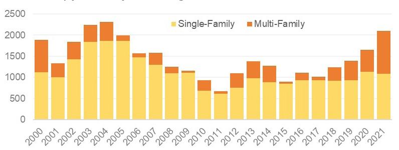
The hottest real estate sector for the past several years, both nationally and in the Omaha metro area has been residential, with multi-family construction especially well in recent years. 2021 surpassed 2,000 total residential units permitted in 2020, a 15-year high and the first year for multifamily to account for half of total units underway.
Figure 3.04 shows a sampling of known multifamily developments in the pipeline for the southern half of the Omaha metro as of 2021. While activity has yet to extend as far southwest as Gretna, the trajectory of apartment projects is clearly following the suburban edge and headed towards the study area.
The office sector has also shown considerable strength regionally with nearly 900,000 square feet of new development in the Southwest Metro Omaha submarket either completed or under construction in 2021. As shown in this map, most office employment and recent growth (as of 2019) was still occurring to the north in Douglas County. The study area corridor, however is well positioned as a significant long-term office development prospect, especially as the supply of premium commercial land dwindles around Omaha and employers seek options closer to the south- and westward shifting educated labor force.

The Gretna study area location is perhaps the strongest asset in favor of its strong market position as a long-term development opportunity. From both a “50,000 feet” regional perspective and up close, the study area features some desirable attributes. At the regional scale, Gretna’s position as the outermost southwestern suburb of Omaha on the primary interstate route between Omaha and Lincoln (unusually large for a university town, owing to its dual status as state capital) makes is a viable location for prospective residents desiring some flexibility in their potential future commute destination.
That edge location also gives Gretna, and the study area in particular, a (safely permanent) prime gateway location for travel between the two urban areas – the first place travelers see upon arriving in the Omaha area and the last place they pass departing for Lincoln. This gateway location already plays to the advantage of the successful Nebraska Crossings lifestyle center. Having already weathered the Covid-related retail challenges of 2020 and 2021, that center is already looking at a major tenant addition in 2022 with REI.
The importance of I-80 to Sarpy County is not limited to retail, residential, or longer-term office potential. 2021 proved to be a record-shattering year for industrial development in the form of distribution/ logistics and data facilities. Two massive West Sarpy projects-for Facebook and Amazon-alone accounted for 3.3 million out of the total 3.5 million square feet of industrial space delivered in 2021 for all the Omaha metro area market.
Finally, the study area location is an intriguing site selection prospect for very large super-regional retailers. As urban areas approach the one-millionperson threshold for metro area population, they begin to appear on the radar for the type of larger retail flagships that typically seek out only one location per market. While the Omaha MSA (including Sarpy County) is still just below that mark as of 2021, the convenient access to Lancaster County and Lincoln from Gretna helps to make an argument for considering the combined 1.3 million Lancaster-Douglas-Sarpy area as one cohesive market. Those types are retail developments are difficult to predict as the cast of national megatenants tends to shift periodically, along with their site selection criteria.
Cities across Sarpy County’s western half have made significant investments recently in civic, cultural, and recreational amenities–Papillion and La Vista both have major mixed-use developments underway, both involving substantial civic amenities and involving public-private partnerships in laying the necessary infrastructure groundwork. For its relatively small existing population (just passing 10,000 in 2020-21), Gretna has committed an especially large municipal investment in future residential quality-of-life in the form of a new $50+ million, 150-acre park-recreation center complex currently under construction just north of Capehart Road within the study area.
Less sexy, but also quite ambitious, Gretna’s recent commitment to extending its trunk infrastructure for sewer service southward across challenging topography has opened up thousands of acres of land to potential development adjacent to both the new Gretna Crossing Park and the valuable intersection of I-80 and two major arterials.
The demographic and other factors highlighted here, and discussed in more detail in the Appendix, were used by Leland Consulting Group to develop preliminary projections of development demand that could be captured within the Crossings Corridor study area. Those demand forecasts are presented in Table 3.05 in ranges from low (conservative) to high (target/attainable). Actual performance will, of course, be subject to a wide range of factors, many outside the control of the City or its potential development parcels. That said, the “high” demand range shown should not be considered a maximum. With high quality design, favorable national market timing, and careful strategic infrastructure investments, the pace of attainable development could well exceed the high range for one or more land use types.
The future land use plan component of The Crossings Corridor Master Plan is intended to be adopted as part of the City’s Comprehensive Plan and serve as the basis for zoning decisions (see Figure 4.00). Should a desired project or rezoning not match the land use designation, the future land use map should be amended as part of the proposed rezoning.
This plan was developed around the key themes and goals identified for this corridor and influenced by the market analysis and input of community stakeholders. As part of the process in crafting this land use plan, the following land use categories have been defined. The first listed categories are similar in nature to those defined within Gretna’s current Comprehensive Plan.

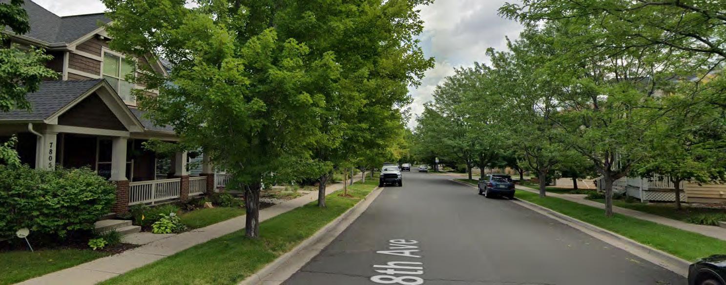
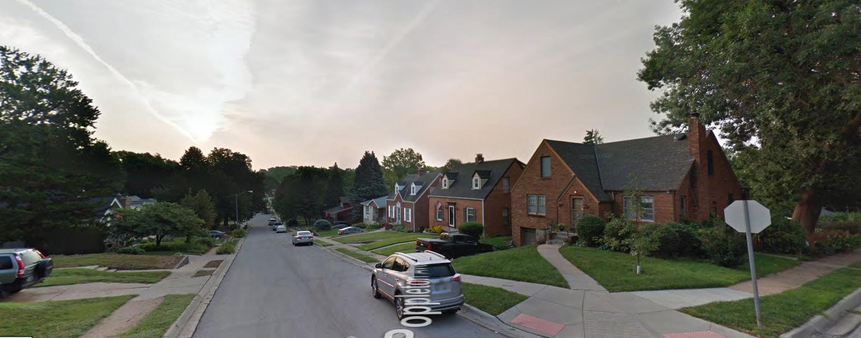
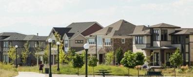
This land use category is for detached, single family homes and bi-attached single family homes within residential subdivisions with lots ranging in size from 7,500 square feet up to one-acre.
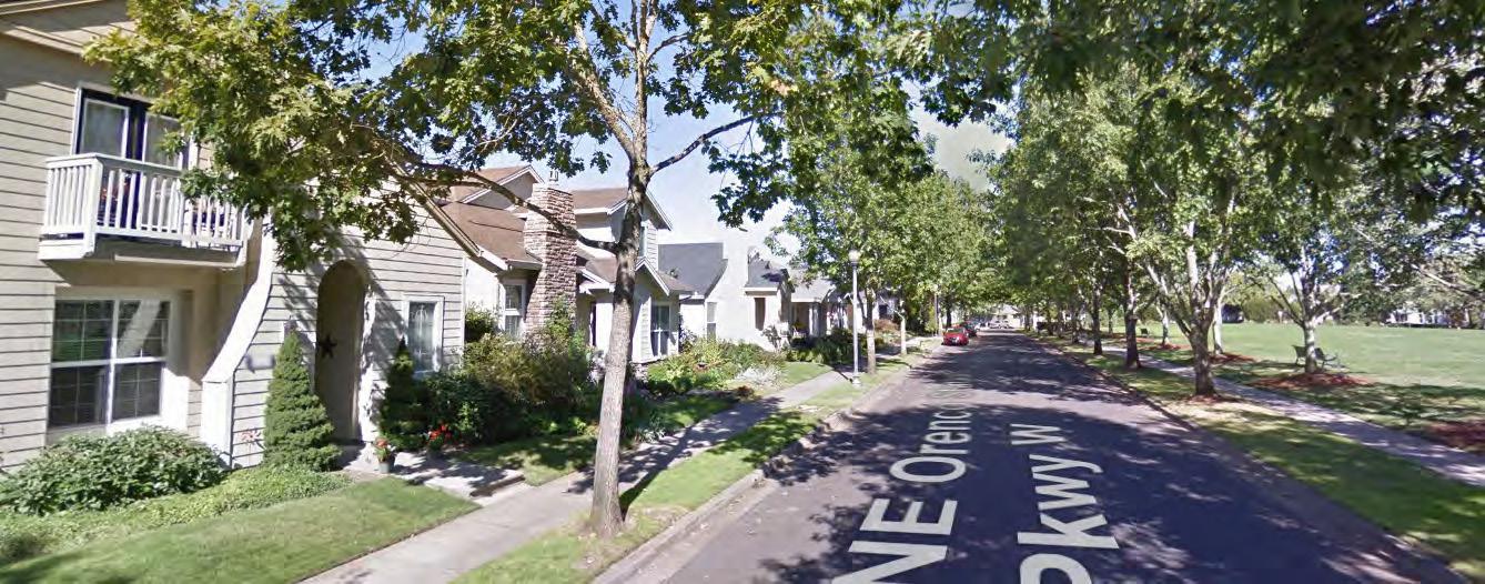
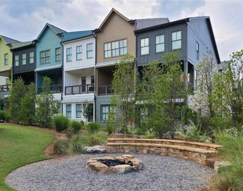
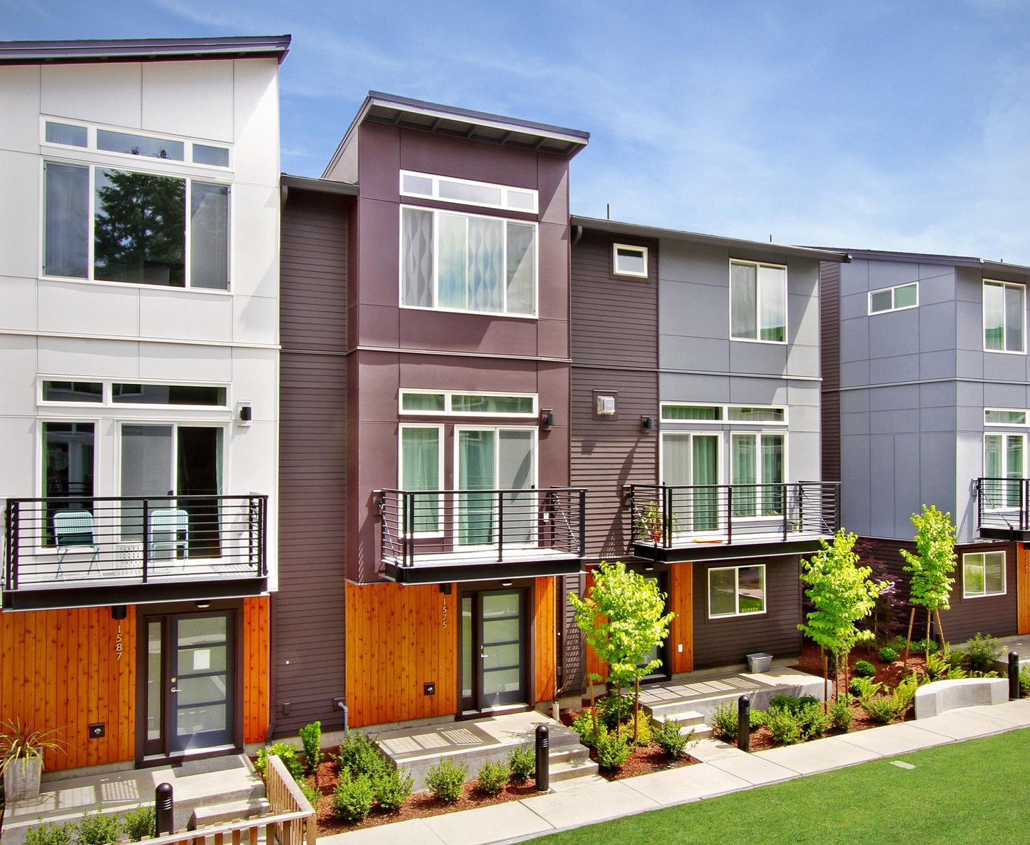
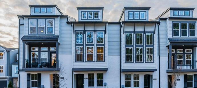
This land use category is for townhomes, rowhouses, and bi-attached dwellings (horizontally attached residential) with densities ranging from 3 to 10 dwelling units per acre and may include planned development with very small lots for detached single family homes.
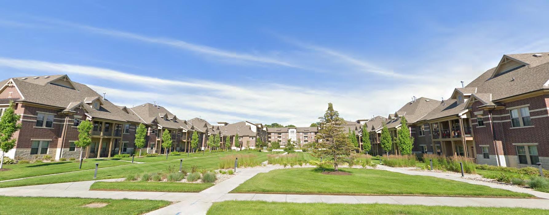
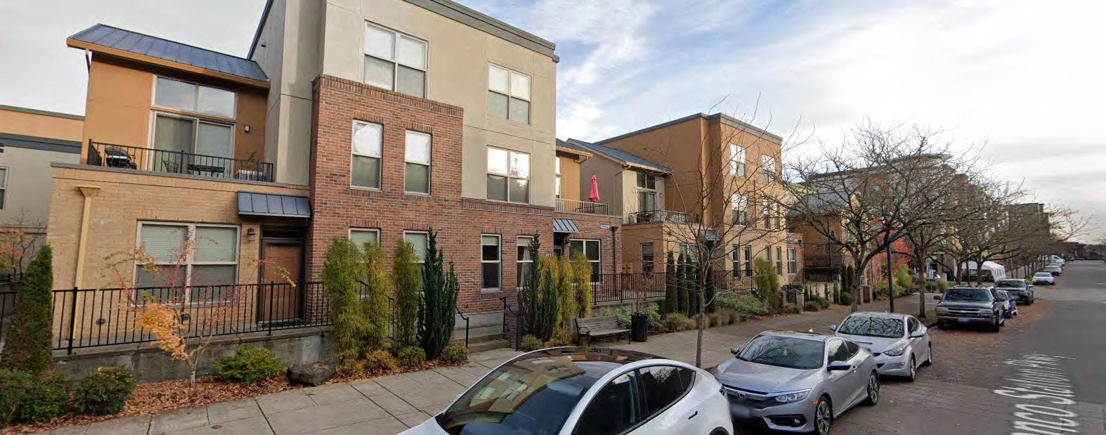
This land use category is designated for apartments and condominiums (vertically attached residential) with densities ranging from 9 to 15+ dwelling units per acre and may include higher density, attached residential developments. Buildings are generally three to five stories in height.
This land use category covers property owned by the City, County, School District or other governmental agency and includes schools, library, government buildings, and civic campuses. These uses may be compatible within any future land use category.
This land use category contains land located within the floodplain or areas with wetlands, nature preserves, steep slopes, drainage ways, or significant tree cover intended to be preserved. Uses may include parks, recreation centers and sport fields, pools and aquatic centers, golf courses, landscaped buffers, pasture, and row crop farming. This land use also includes city or county managed green spaces and greenbelts providing limited or no recreational activities.
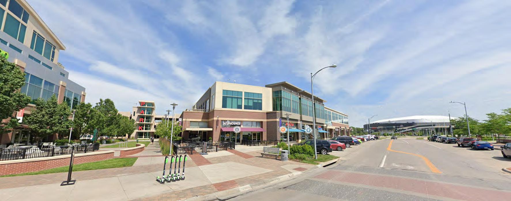
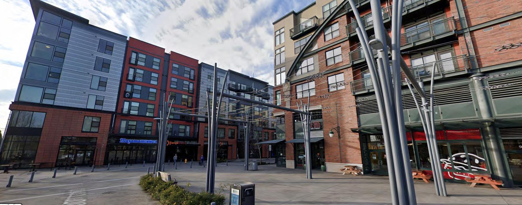
This land use category includes areas developed with multi-story buildings containing a combination of residential, retail, and office uses. Retail uses are located on the first floor, street facing façade with residential and offices uses restricted to the upper floors. Any first floor residential should be first floor rear facades. The number of dwelling units per acre is generally over 12. Buildings should be between three to five stories in height with shared parking that is either on-street or within structured parking located within, under, or rear to the building.
This land use category is reserved for professional offices, medical centers, research and development and testing facilities, and corporate campuses consisting of single or multi-tenant buildings that are one or more stories tall. There is limited truck traffic to these uses with no storage, distribution, manufacturing, or assembly permitted. Limited office support type retail uses (including restaurants, office supply stores, coffee shops, and dry cleaners) may be allowed. Site sizes can range from small single tenant building lots to large corporate campuses. This land use can serve as a transition to buffer low and medium density uses from more intense uses and major highways.

This land use category is designed to accommodate commercial uses and smaller, less intensive industrial uses including shipping and distributions centers, indoor warehouse facilities, and the light manufacturing and assembly of goods not generating smoke, gas, odor, dust, vibrations, soot, or significant noise. Uses may further include those listed for the Office future land use category. Sites should be located on arterial or collector streets.

The following land use categories are in addition to those found within Gretna’s current Comprehensive Plan and are special to The Crossings Corridor.
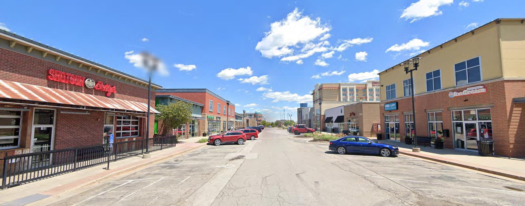
This land use category is for areas located along major highways and near highway interchanges. The intent of providing retail products and commercial services to both the local community and the greater regional trade area. Typical uses include grocery stores, pharmacies, hardware stores, lawn and garden centers, department stores, clinics and medical center, restaurant, hotels, banks, and convenience stores. Truck stops, travel plazas, campgrounds, and service or sales centers for trucks, RVs, and other large vehicles and equipment should not be included within this land use. Developments may include small to medium size single tenant buildings (5,000 to 50,000 square feet), multi-tenant buildings and retail centers, as well as large-box stores and malls (50,000 to 100,000+ square feet). Buildings are generally one to two stories with banks and hotels ranging from two to five+ stories in height.
This land use category is for smaller scale, neighborhood-focused retail and office uses located next to residential areas and are intended to serve the daily retail needs for the local residents. Retail buildings are typically one to two stories tall and less than 30,000 sq. ft. for single-tenant buildings and less than 60,000 sq. ft. for multi-tenant buildings. Sites are generally five to 10 acres in size.
In order to best implement the vision identified for The Crossings Corridor and ensure it reaches its full potential, the City should consider adopting a basic set of design guidelines to cover the corridor area. The intent of these guidelines is to establish clear expectations on the minimum building design and site standards required for new development. These guidelines can further help the corridor develop in a uniform manner, with unified elements, and maintain a long-term value for the City, its residents, and property owners.
Generally single-family and two-family residential dwellings would have limited standards with a higher level of standards placed on multi-family, commercial, offices, and industrial uses. .
The following are typical components found in design guidelines.
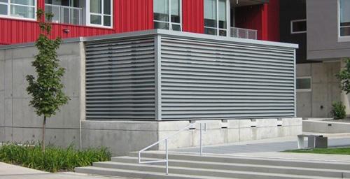
All ground mounted and all roof-top building HVAC and mechanical equipment, vents, piping and utility meters shall be screened from view from adjacent public street and residential property. Screening shall be accomplished via a combination of landscaping, walls, and building structure.
Building Design Standards
» Architectural Design Elements
» Exterior Building Materials
» Building Lighting
» Entrances and Pedestrian Scale
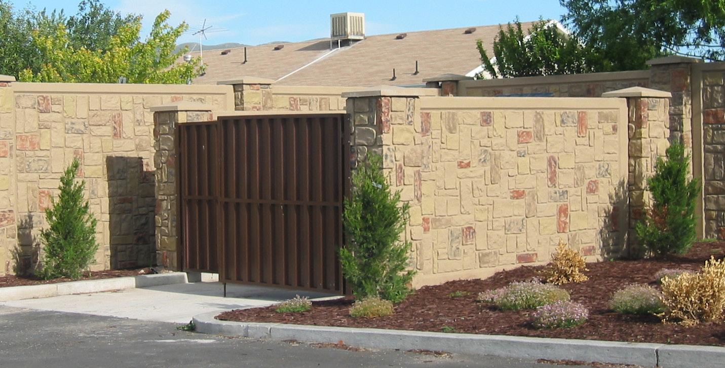
All outdoor trash and recycling receptacles, dumpsters, and grease collection containers shall be opaquely screened on all sides by the use of a permanent enclosure, with gates for disposal truck access. The enclosure shall be constructed of permanent materials such as textured block, split faced concrete block, brick or stone. Colors shall be compatible with the dominant architectural materials of buildings on site and shall be integral to a building on site whenever possible. The enclosure shall be located out of public view and constructed to visibly screen the views from the adjoining properties.
Site Design Standards
» Building Siting and Orientation
» Bulk Regulations
NORTH SCOTT CORRIDOR OVERLAY DISTRICT + GUIDELINES
» Landscaping and Ground Cover
LANDSCAPING AND BUFFERING
» Buffering Between Uses
» Site Lighting
All ground mounted and all roof-top building HVAC and mechanical equipment, vents, piping and utility meters shall be screened from view from adjacent public street and residential property. Screening shall be accomplished via a combination of landscaping, walls, and building structure.
» Screening Equipment and Trash Receptacles
All new structures, buildings and parking lots and all building additions and parking lot and paving expansions shall comply with the City’s Landscaping and Screening requirements contained within the City’s Unified Development Code, except as modified herein below.
» Parking and Loading Areas
• The minimum landscaped area for all properties is 20% of the total lot area, not including public street rights-of-way.
» Pedestrian and Bike Circulation and Facilities
» Outdoor Displays, Sales and Seating
» Stormwater Management
Signage
• All areas not paved or covered by structures shall be landscaped with a combination of turf grass, prairie grass, plant beds, shrubs and trees. Wood mulch shall be used around all plantings and in all plant beds. Large areas of wood mulch that does not contain plantings is not permitted, except when used around play structures. Rock and chip brick are not allowable ground covers except in limited applications.
» Building Wall Signs
LARGE SITE LANDSCAPING REQUIREMENTS
» Freestanding Signs
» Wayfinding Signs
New development within this overlay district on lots 10 acres or greater in size shall comply with the landscape standards as provided for in appendix “A”. This large site standard allows for greater creativity and design flexibility in developing a site landscape plan.
Unifying Elements
» Streetscape Standards
» Intersection Treatments
» District Signage
» Public Art
16 PAGE
All outdoor trash and recycling receptacles, dumpsters, and grease collection containers shall be opaquely screened on all sides by the use of a permanent enclosure, with gates for disposal truck access. The enclosure shall be constructed of permanent materials such as textured block, split faced concrete block, brick or stone. Colors shall be compatible with the dominant architectural materials of buildings on site and shall be integral to a building on site whenever possible. The enclosure shall be located out of public view and constructed to visibly screen the views from the adjoining properties.
All ground mounted and all roof-top building HVAC and mechanical equipment, vents, piping and utility meters shall be screened from view from adjacent public street and residential property. Screening shall be accomplished via a combination of landscaping, walls, and building structure.
All outdoor trash and recycling receptacles, dumpsters, and grease collection containers shall be opaquely screened on all sides by the use of a permanent enclosure, with gates for disposal truck access.
The enclosure shall be constructed of permanent materials such as textured block, split faced concrete block, brick or stone. Colors shall be compatible with the dominant architectural materials of buildings on site and shall be integral to a building on site whenever possible.
The enclosure shall be located out of public view and constructed to visibly screen the views from the adjoining properties.
16 PAGE
masonry wall curb opaque doors bollards
bollards
opaque doors
42” min.
concrete apron
concrete apron
step with 4” wide painted white stripe concrete walk to curb accessible ramp
side entry
side entry
concrete walk to curb accessible ramp
The zoning recommendations for this corridor will be critical to implementing the plan, policies, and recommendations for the Gretna Crossing Corridor. The zoning will need to be more specific in this area as opposed to the remaining portions of the community. Implementation of the zoning will need to be different than most parts of the OmahaCouncil Bluffs Metropolitan Area.
The first option for the City to consider is adopting a zoning overlay district for all or a portion of this Corridor. The City is very familiar with overlay districts since there are several established within the existing zoning code. An overlay district can:
1. Ensure the goals of the Corridor plan are upheld;
2. Be the mechanism to trigger specific use types within specific zoning districts; and,
3. Be the trigger for all design guidelines implemented, including:
» Building Design Standards
» Site Design Standards
» Special signage
» Unifying elements
Option 2 includes the adoption of new zoning districts to be applied within the Corridor. Specific use regulations and design standards can be listed within the these new zoning districts.
Option 3 involves the creation of design guidelines and use regulations that can be applied within the Corridor via Planned Unit Development (PUD). As a property within the Corridor begins the development process, it can be rezoned as a PUD and reference the design guidelines as one of its development standards.
The successful movement of people, goods, and services to, through, and within the community relies on a transportation network created and maintained to welcome and safely support all modes of travel for Gretna’s residents, working professionals, and visitors. Transportation infrastructure ties the community together, while transportation planning can also provide a positive experience for people traveling between destinations. Coordinated transportation design and operational support for each mode of travel will help achieve the enhanced quality of life and long-term fiscal health that define the future development and regional attractiveness of The Crossings Corridor.
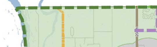
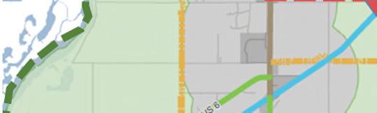
The transportation network of The Crossings Corridor complements the regional transportation infrastructure plans, studies, and future investments necessary to support projected highway and interstate traffic demand. Regional transportation planning for Interstate 80 interchanges, Highways 6, 31, and 370 alignments, and the Platteview Road Expressway construction will accommodate intensifying traffic patterns that bisect the City of Gretna. This demand is primarily influenced by outside factors but will also usher greater numbers of visitors and unique development opportunities to the front door of Gretna. The potential regional roadway network shown in Figure 4.02 is based on several ongoing or recently completed studies and projects by NDOT, MAPA, and Sarpy County.
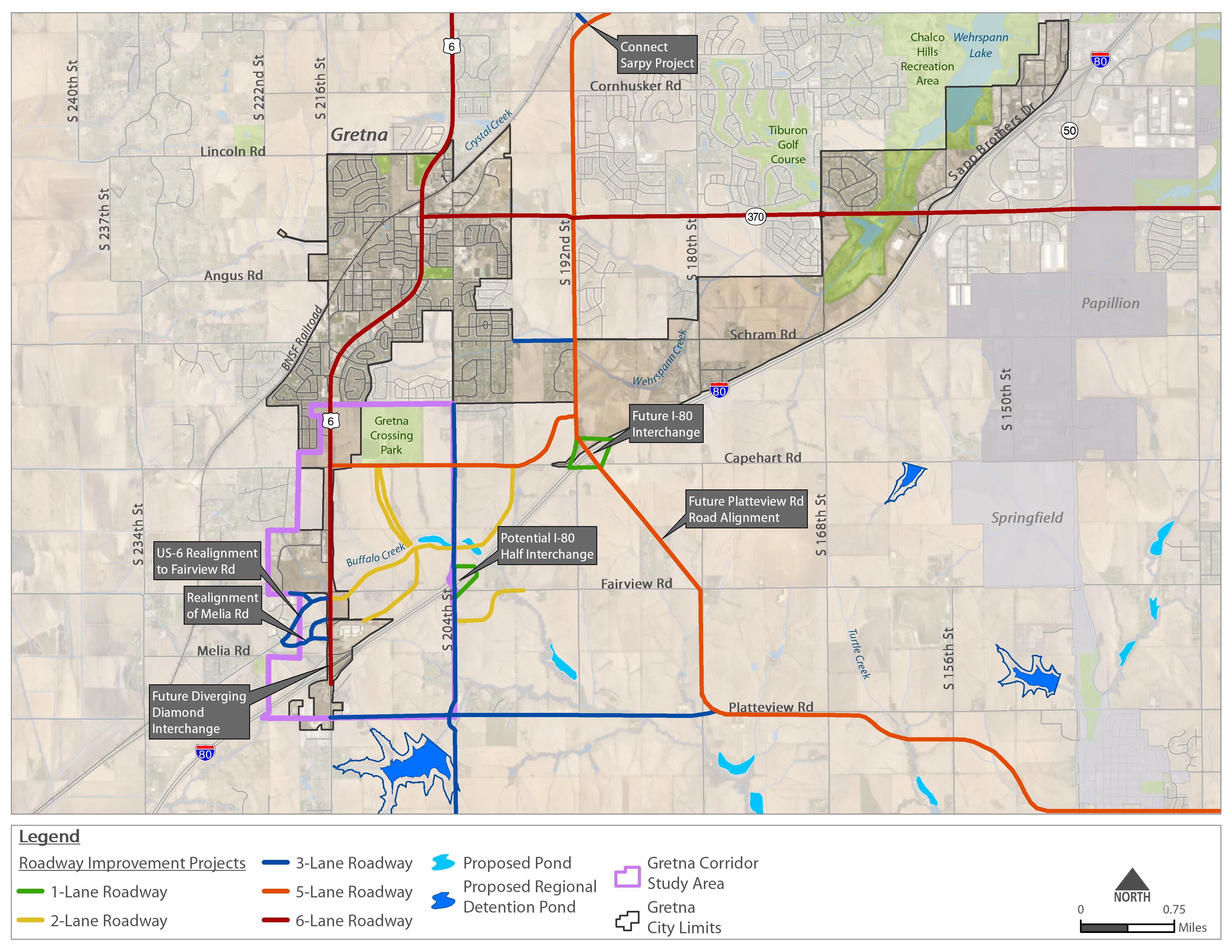
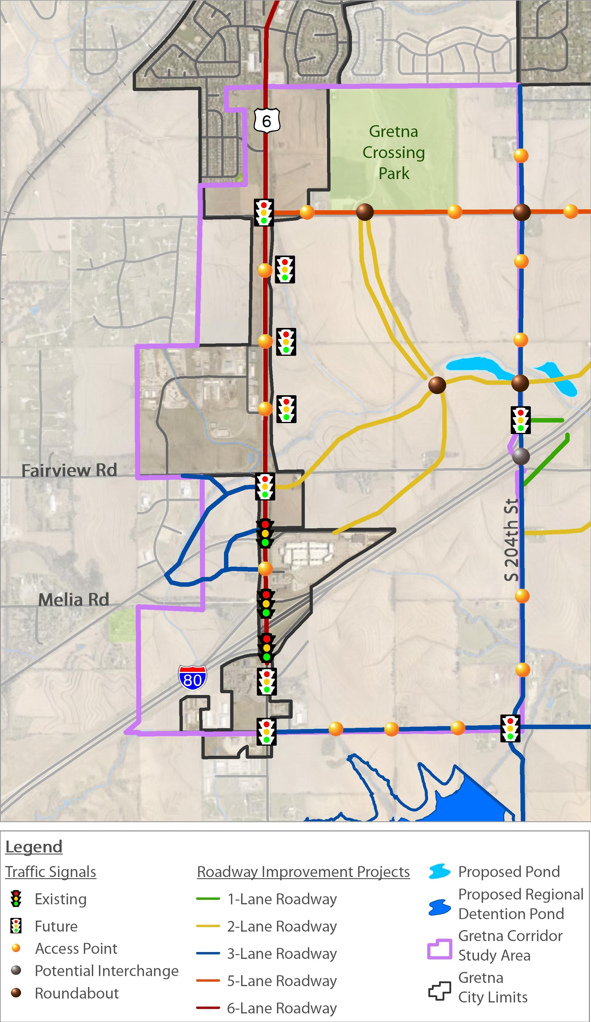
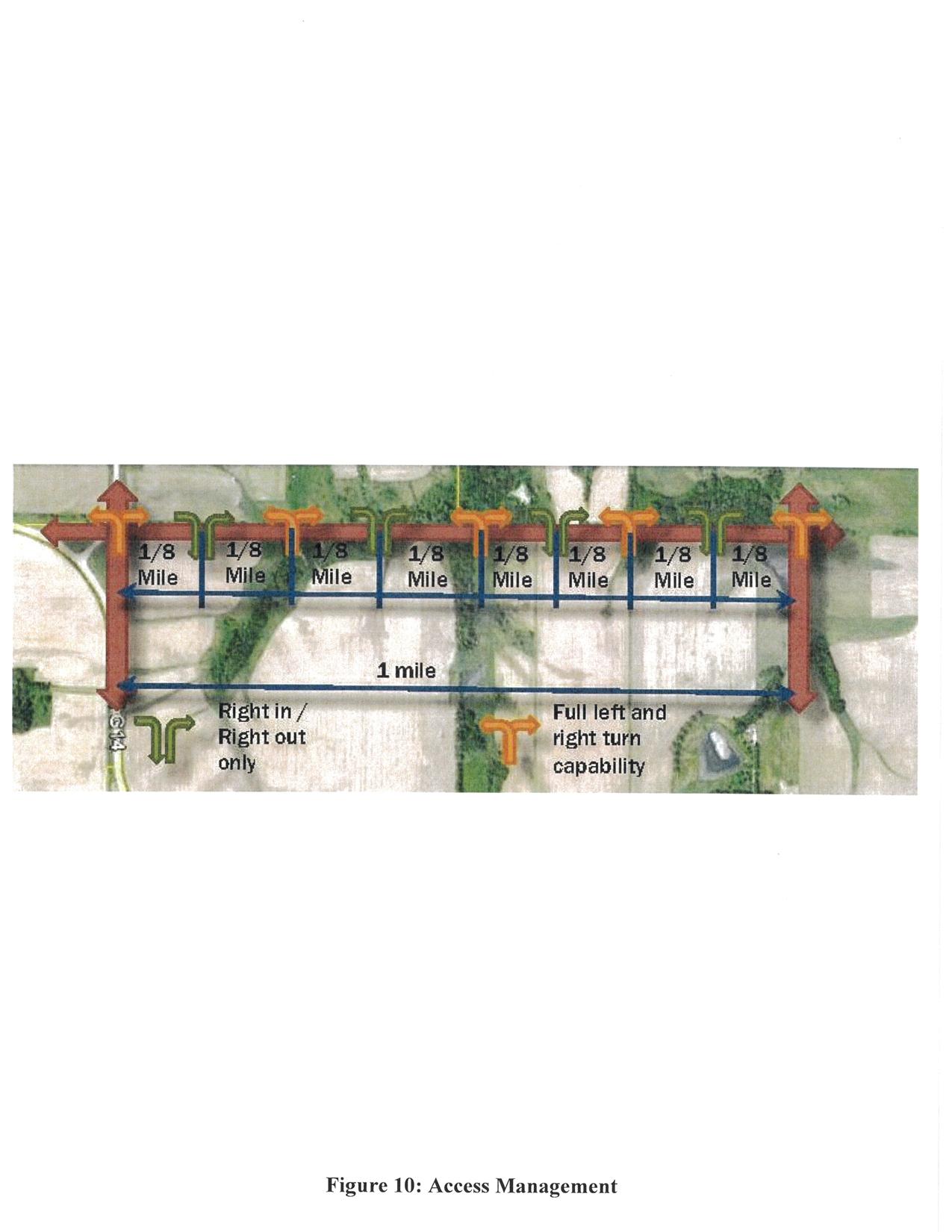
Access controls along these corridors influence the safe and efficient movement of cars. The City of Gretna Comprehensive Plan and the NDOT Access Control policy recommend no more than three access points (1/4 mile spacing) per mile of roadway. The general location of these access points and potential traffic control are identified in the figure to the right. A combination of stop-controlled, signalized, and roundabout controlled intersections are proposed along the major roadway network. Access along N-31/US-6 will be provided via signalized intersections. Roundabouts are proposed along Capehart Road, 204th Street and internally within the study area.
Therefore, the multi-modal transportation network for The Crossings Corridor recognizes and addresses the need to work with NDOT to address common barriers created for active transportation users, see Figure 4.03. These conflicts discourage active transportation when regional growth funnels large amounts of cars and heavy trucks along major roadways through the community. This master plan’s transportation corridors will establish an integrated network of sidewalks, sidepaths, and trails that complements the roadway network. Complete Streets will provide connectivity and access for land uses on both sides of major transportation corridors, reduce dependence on automobile use for short trips, and intentionally maintain the continuity between Old Town Gretna and The Crossings Corridor. Trail Oriented Development (TROD) will support the active lifestyle promoted within the area while expanding the economic development opportunities and civic pride of the community.
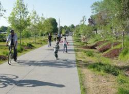
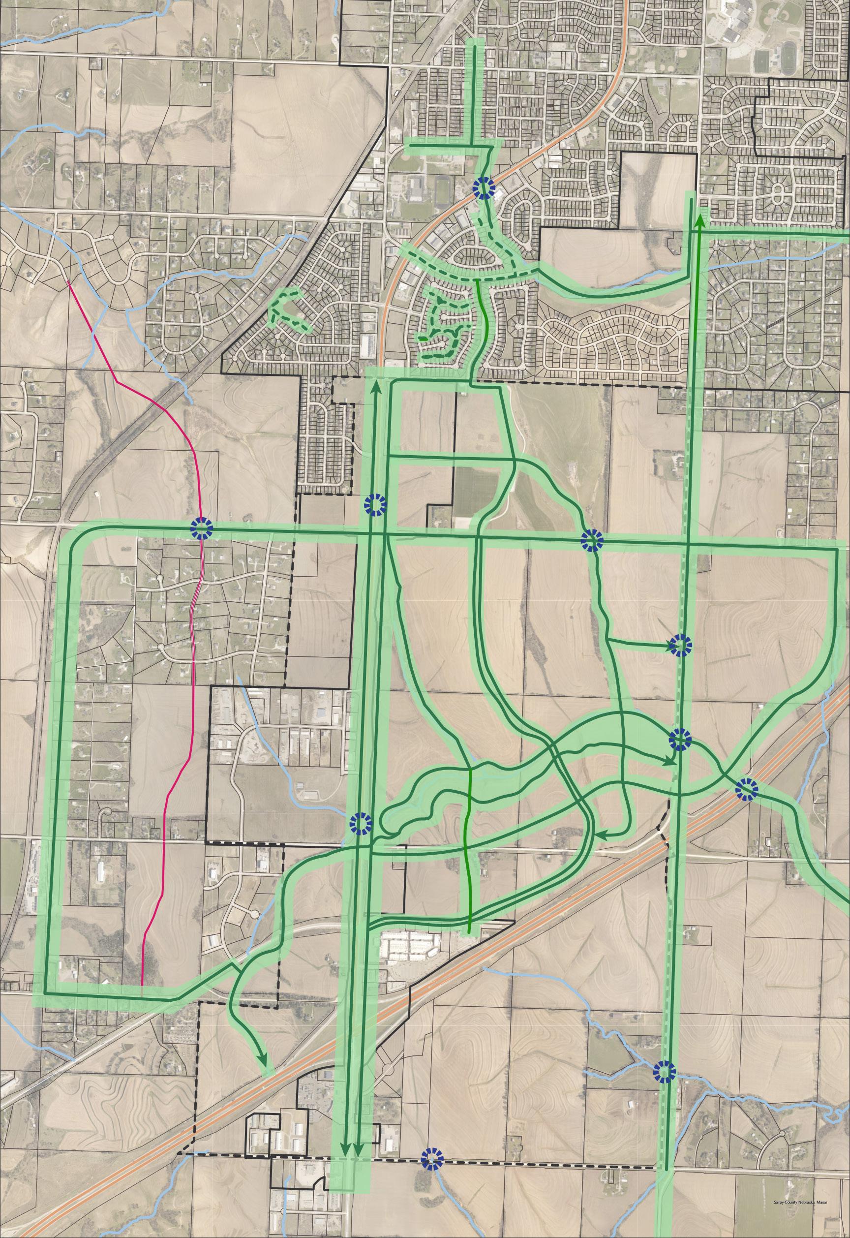
The City of Gretna is proud of the existing trails system that provides mobility opportunities for residents of all ages and abilities. Gretna will significantly expand the trail system through The Crossings Corridor to support vital connections to the regional trails network.
To the north, trails will strengthen the connections between The Crossings Corridor and Old Town Gretna. Trails will serve as essential links for development and regional trails such as the MoPac Trail south of Interstate 80 in southwest Sarpy County as well. Trails will also support connections west of Highway 6 and 31 and S. 204th Street, ideally with grade separated crossings, that lower the barrier to using active transportation for trips of three miles or less. Figure 4.04 shows the study area’s planned pedestrian and trail network.
The use of The Crossings Corridor Green Streets described on the following pages will ensure the recommended trails network is established. This network includes greenway and parkway trails as well as the Buffalo Creek Loop Trail. Coordinating with NDOT to provide grade separated trail connections under Highway 6 and 31 as well as over Interstate 80 with the design of future interchanges are critical steps to creating a regionally connected trail network. The City of Gretna cannot make these essential, grade separated trail connections without collaboration and support from NDOT.
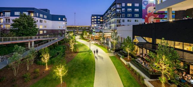
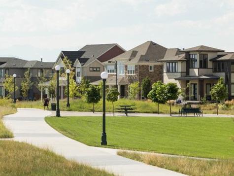
Higher intensity land uses that back up to a multiuse trails have the benefit of attracting travelers from both road side parking and trail side connections. Gretna recognizes the unique opportunity to support businesses that can activate trail users with Trail Oriented Development (TROD).
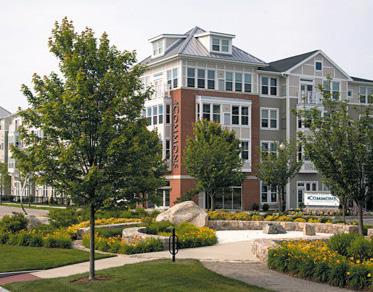
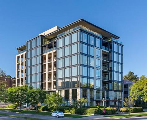
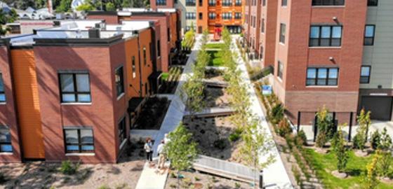
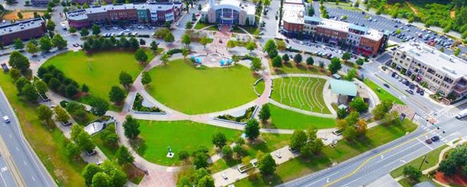
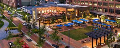
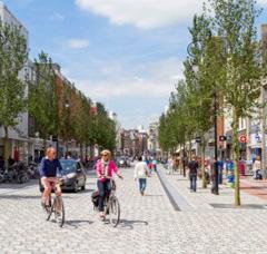
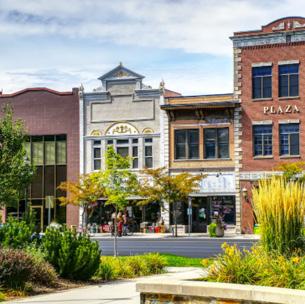
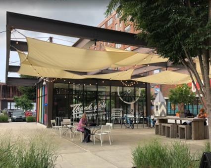
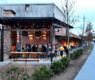
Standards for TROD have not been established but are recommended by The Crossings Corridor Master Plan for urban design review to support the subdivision and building permit approval process. Figure 4.05 shows precedent examples of TROD.
In general, TROD provides overt connections for trail side users that want to access high density residential, mixed use, business office, retail development, and civic spaces. Trail connections and landscaping will integrate with the trail system to create a welcome invitation to access the trails for recreational uses, or to depart from the trail to access residences, employment, or entertainment.
The Crossings Corridor has the potential to offer world class TROD that integrates with a new town center and create a thriving source of active transportation energy throughout the year.

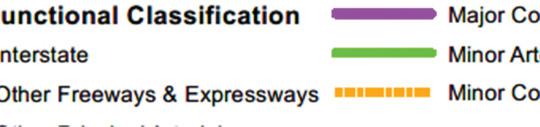
The City of Gretna supports a street classification system for a hierarchy of street facilities and improvements that are influenced by land use patterns. The system is consistent with regional and federal standards necessary for need-based project development and funding. The classifications allow Gretna to actively coordinate with NDOT and MAPA to complete regionally significant projects, share respective costs, and seek additional federal funding sources when available. The land use plan for The Crossings Corridor Master Plan does not modify the street classification system adopted by the Gretna Comprehensive Plan.
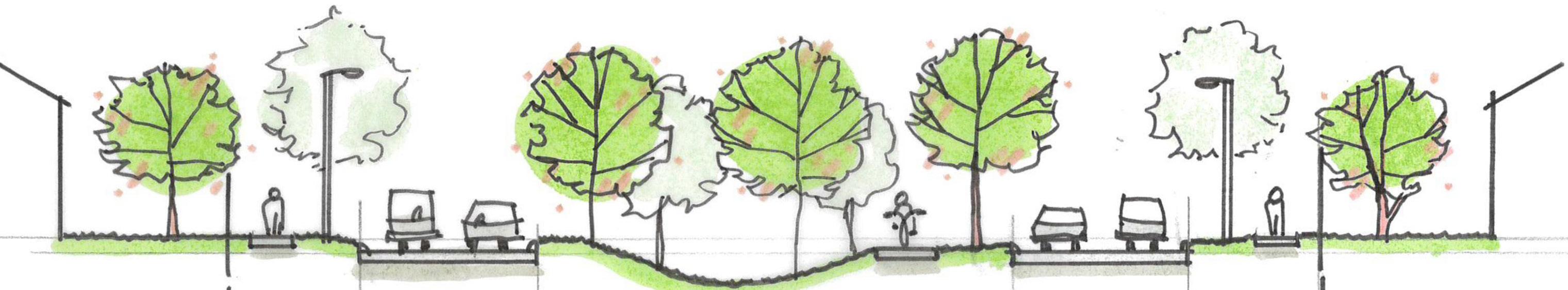
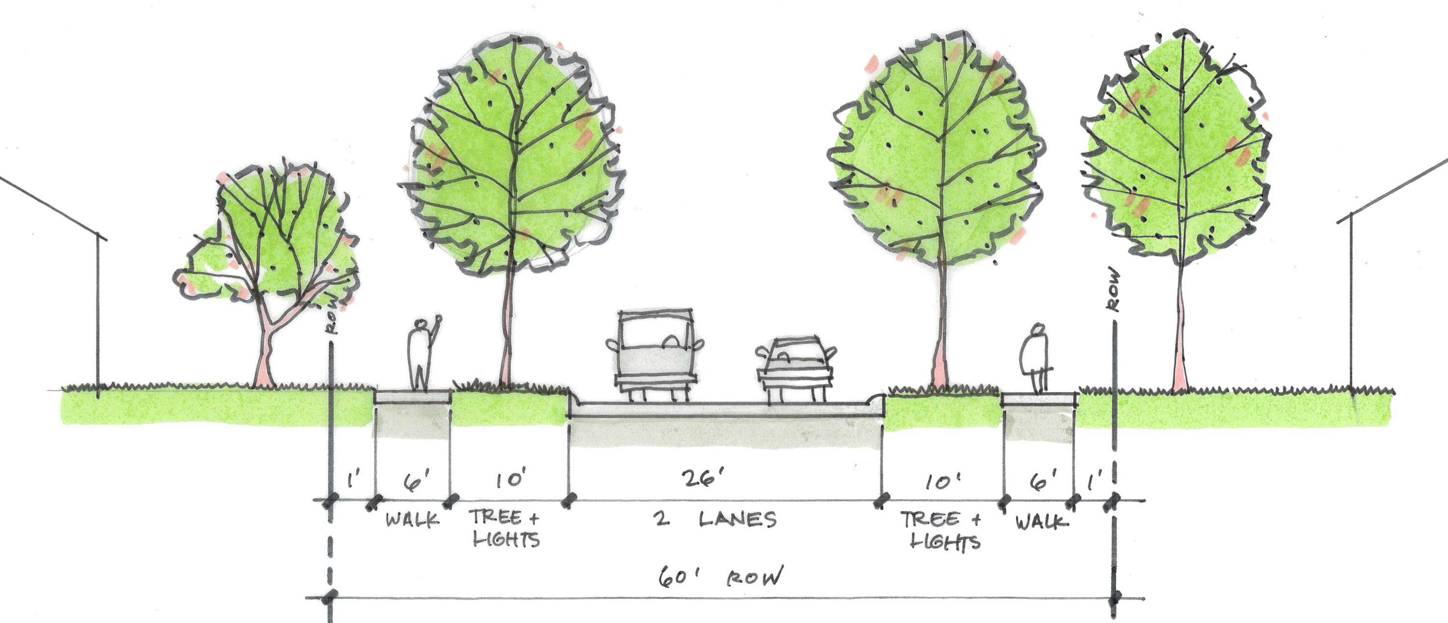
The City of Gretna has also adopted minimum Green Street standards in the Comprehensive Plan. The Crossings Corridor Master Plan embraces and further enhances these ideas. Greet Street cross sections are illustrated on the following pages. These green streets extend a park-like appearance into the context of all roadways throughout The Crossings Corridor and provides welcoming travel options for different mode types. Design elements, associated amenities, and typical cross-sections of Green Streets are supported by subdivision planning requirements. The Crossings Corridor Master Plan expands Gretna’s minimum Green Street standards for application to this area. The Crossings Corridor Green Street sections listed in the table on the following page are recommended for infrastructure planning and subdivision review and approval.

Sarpy County Jurisdiction
Municipal ETJ

Municipal Boundaries
River / Water body
Local
Federal Functional
Interstate
Other Freeways & Expressways
Other Principal Arterials
Major Collector
Minor Arterial
Minor Collector
The Crossings Corridor Study Area


Design elements, associated amenities, and typical cross-sections of Green Streets are supported by subdivision planning requirements. The Crossings Corridor Master Plan expands Gretna’s minimum Green Street standards for application to this area.
The Crossings Corridor Green Street sections listed in the Table 4.07 and Figure 4.08 are recommended for infrastructure planning and subdivision review and approval.
* Sidewalks integrate adjacent sidepaths and trails into Trail Oriented Development ** See typical sections for additional detail/reference

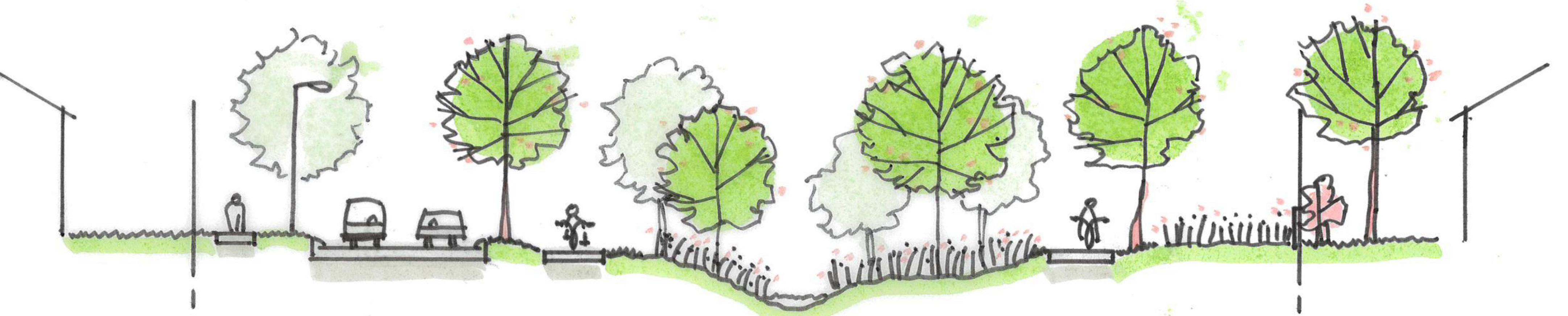
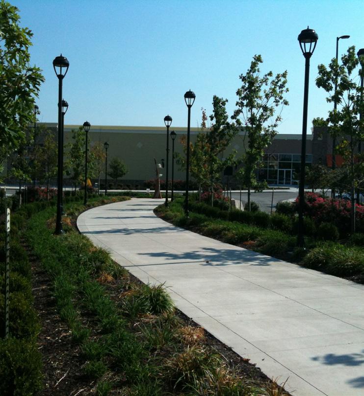
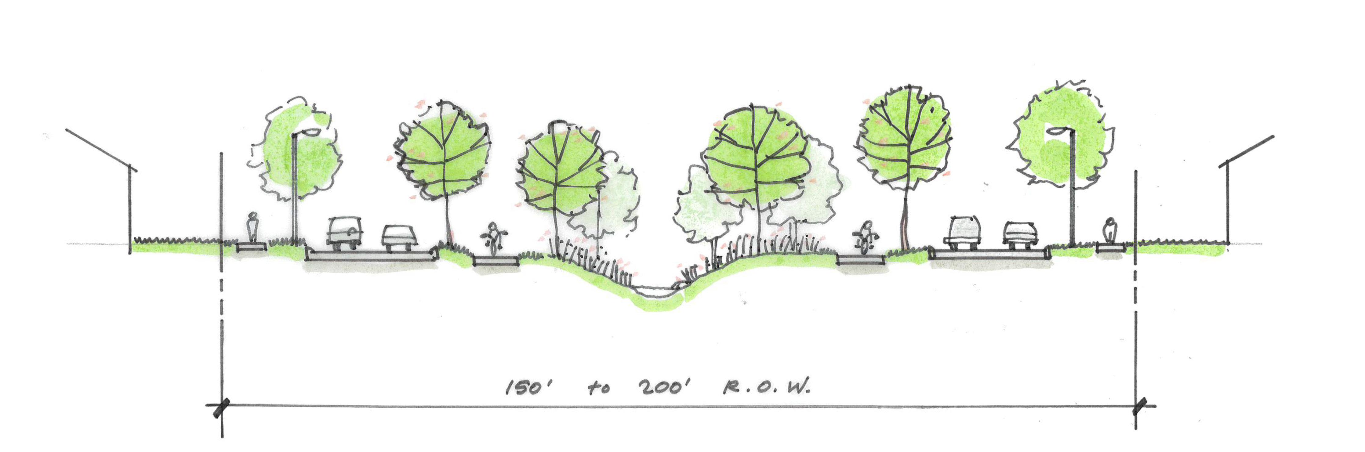
The Crossings Corridor Neighborhood and Boulevard Green Streets (as shown in Figure 4.08) will be distinguished by the separation distance of sidewalks from the back of curb. The wider lawn space of the Boulevard will support shared use path connections to schools and parks, stormwater management, healthy growing environment for street trees with appropriate soil volume, pollinator gardens, and dwell spaces for benches to reinforce a pedestrian friendly environment.
Transit stops are also recommended along the large boulevard street transit loop, and personal vehicles are conveyed to covered parking or parking lots which include a public/private park and ride lot near one of the transit pull outs.
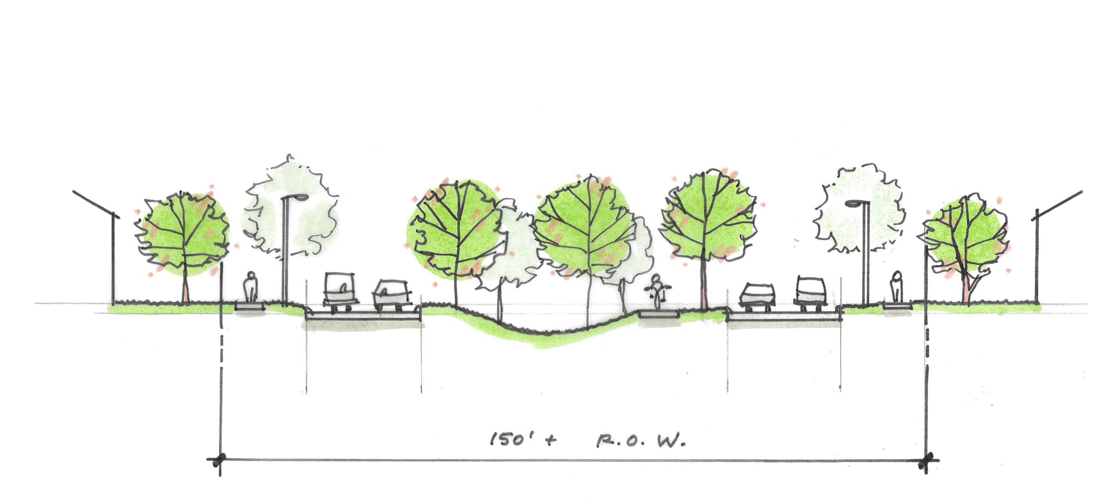
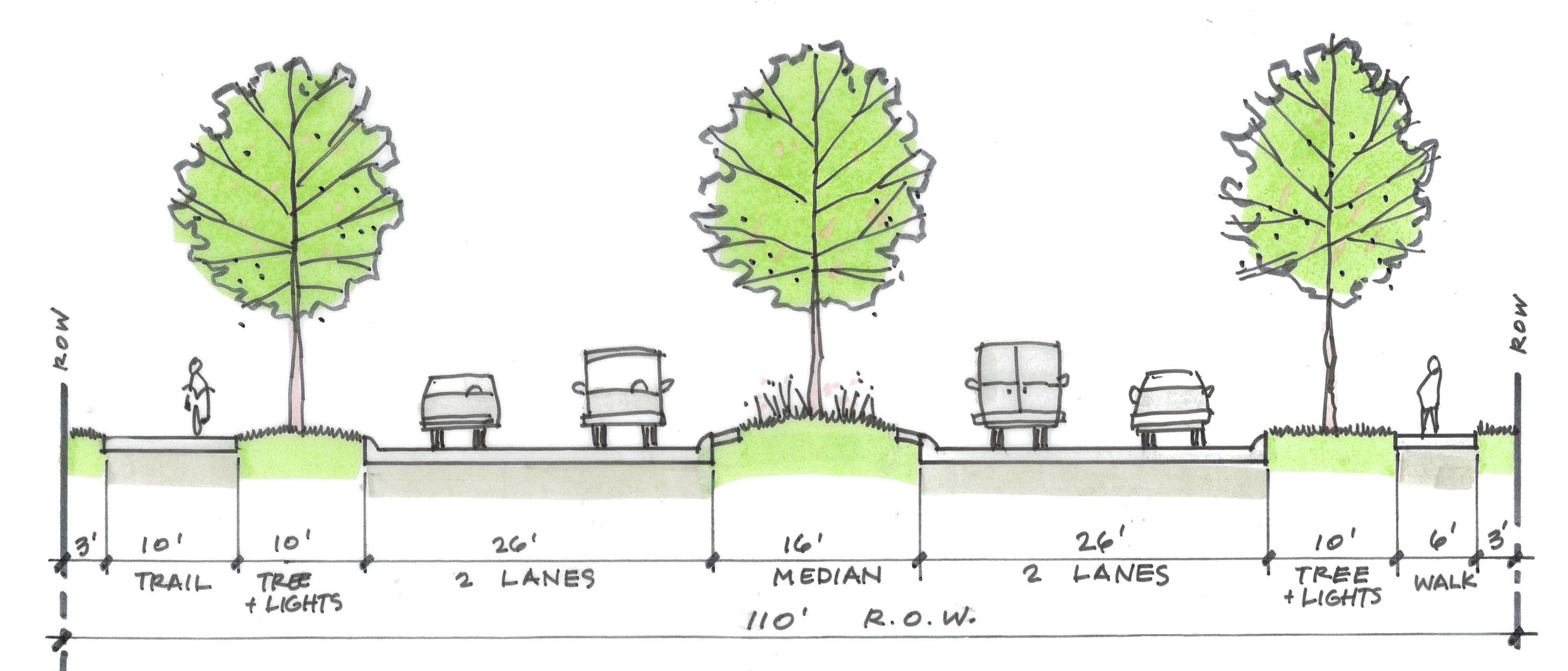
Three collector streets within The Crossings Corridor will support a park-like traveling experience between Capehart Road and Buffalo Creek. The east and west tributaries will be supported by a Residential Greenway Green Street providing a twolane roadway oriented on one side and residential property backing to a trail (as shown in Figure 4.08). The middle tributary will be flanked by one-lane roadways with on-street parking. This segment will abut high intensity residential and commercial land uses that can support TROD that prioritizes active transportation movement between development and the trail by placing raised intersections or mid-block crossings with continuous sidewalk for pedestrians and bicyclists to use.
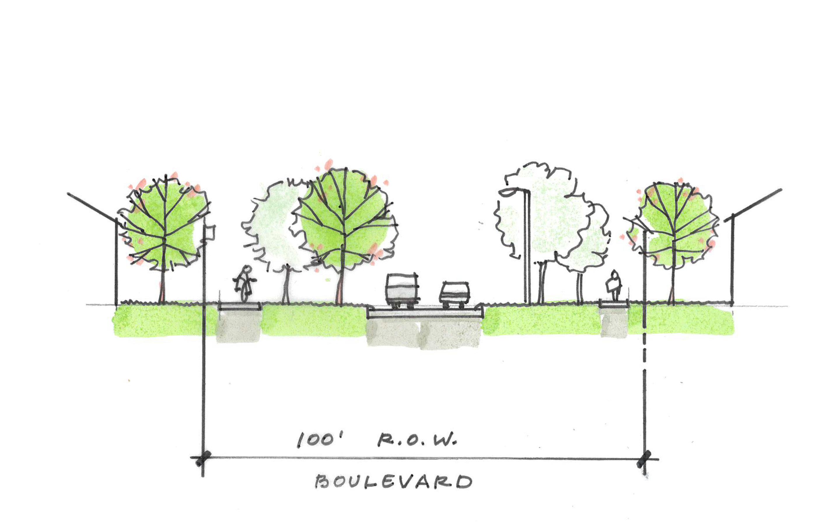
Parkway

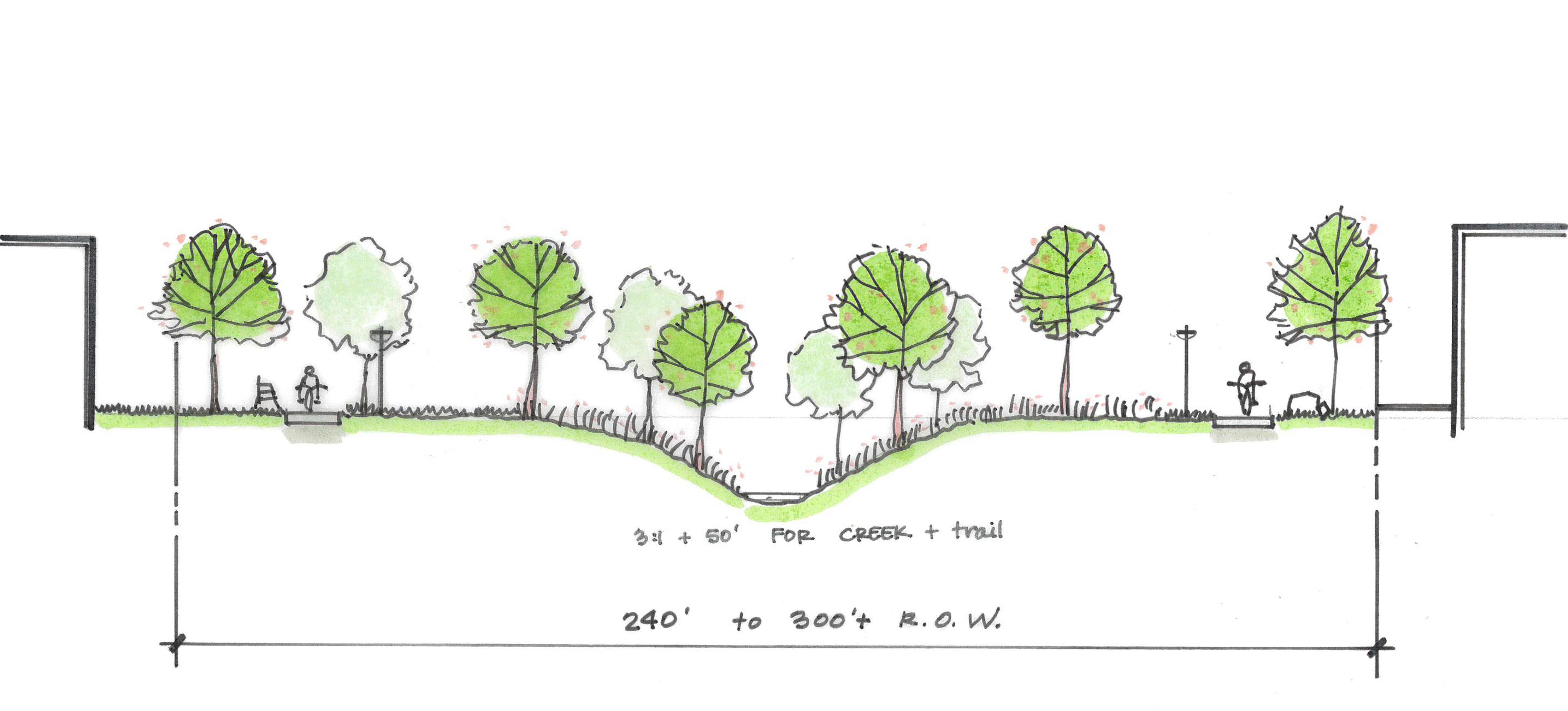
The Buffalo Creek Greenway is proposed as a linear stormwater management corridor and riparian park with a two-mile loop trail that has no atgrade crossings for trail users (as shown in Figure 4.08).Riparian corridor protection standards will dictate the required minimum width of a drainage easement. This cross-section proposes to use the easement to construct a paved loop trail that connects to the regional trail network, including grade separated crossings under Highway 6/31 and S. 204th Street. Bridge locations recommended to cross above the trail where The Crossings Corridor Parkway connect to the Main Street sections. The adjacent land uses to the Buffalo Creek Greenway include civic space, regional retail, business park, and mixed use, which are all strongly supported by TROD opportunities that blur the line separating parkland and developed spaces.
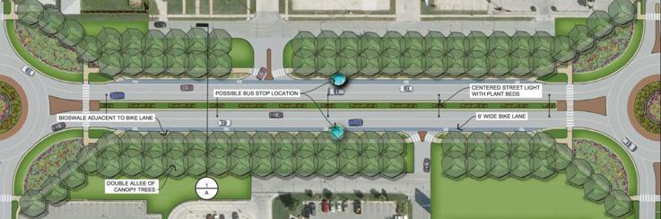
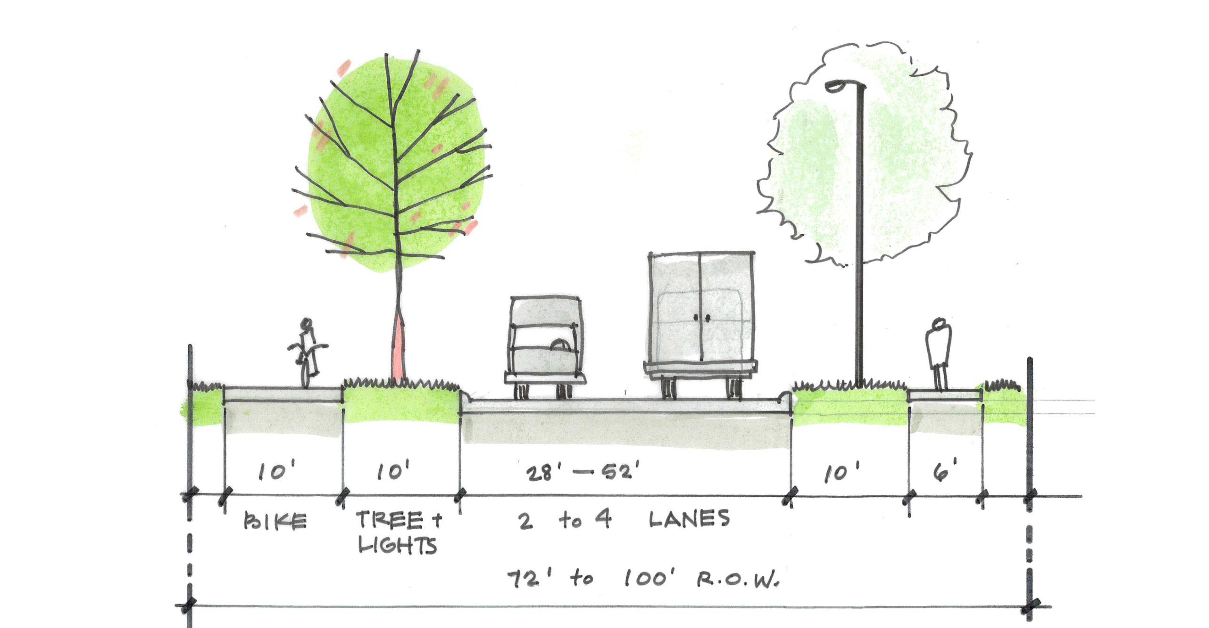
Arterials and Collector streets within The Crossings Corridor apply the Connector Green Street section (as shown in Figure 4.08). Capehart Road, Fairview Road, Platteview Road, and 204th Street are each anticipated to require specific cross-sections to address future traffic volumes. Each roadway is recommended to include a 16-foot vegetated raised median with protected left-turn lanes, a minimum 10-foot tree lawn, shared use pathway or trail on one side, and 6-foot sidewalk on the other. Connectors link personal vehicles to the interstate and freeway system, but they must also lower the barrier for active transportation by safely conveying users to designated crossing locations and points to access the regional trail network.
The Flex Space land uses will require a wider travel lane for anticipated truck circulation and access controls. These uses will benefit from applying The Crossings Corridor Industrial Road Green Street section. A two-way center turn lane may be introduced where needed, but the tree lawn, shared use pathway or trail, and sidewalk are necessary to provide continuity of the active transportation network that also connects to the Flex Space uses.
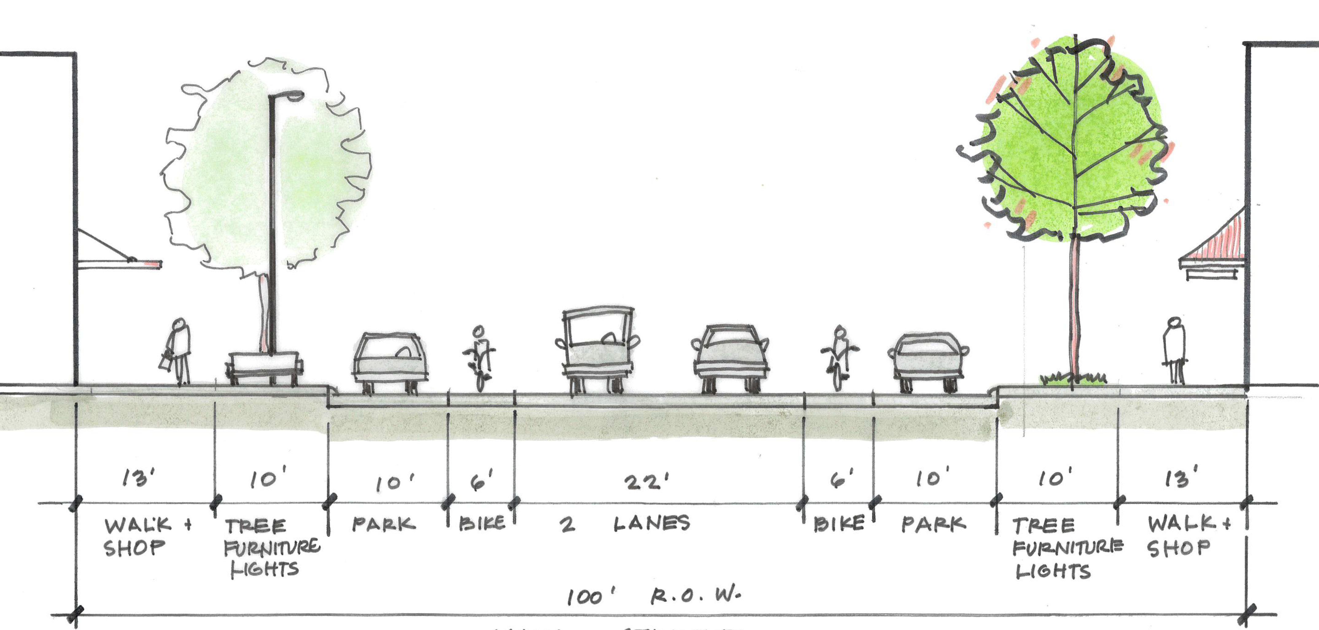
Land uses adjacent to the new town center provide opportunities to introduce The Crossings Corridor Main Street Green Street section (as shown in Figure 4.08). Circulation patterns for local vehicle traffic can be supported but also calmed by providing a welcoming and attractive spaces for pedestrians along main street. Street trees, benches, wayfinding, lighting, and monuments fit between the pedestrian way and on street parking. Painted bike lanes convey bicycle users from the trail to designated bike parking areas without imposing on the pedestrian walkway.
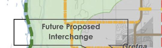
State highways and the interstate system will provide the primary truck route circulation. This includes Highway 370 and Highway 6 and 31 through Gretna. New interchange locations along Interstate 80 will also circulate freight traffic but are not recommended to carry additional truck traffic north through The Crossings Corridor Master Plan. Alignment of the Platteview Road is expected to carry significant truck traffic off the interstate at a new interchange near S 192nd Street if constructed. An interchange at 204th Street can also support development in Gretna and southwest Sarpy County. Figure 4.09 shows the proposed freight routes overlaid on the proposed roadway network.
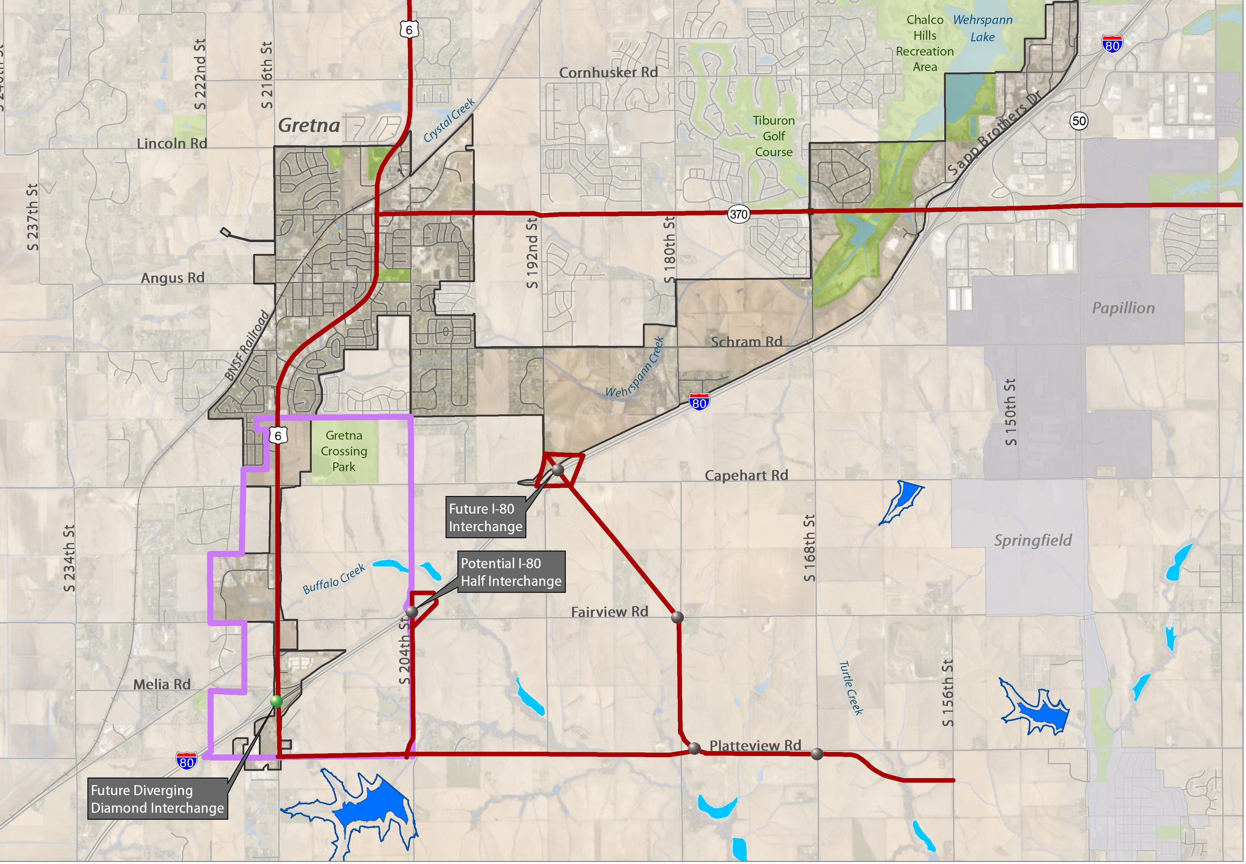
Interstate interchanges provide limited connections for local and regional traffic circulation. Interchanges are designed to move vehicles and trucks safely and efficiently on and off the interstate system. Reconstruction of existing interchanges and construction of new interchanges is anticipated and must address the need for active transportation circulation as well. This can be accomplished at Highway 31, S. 204th Street, and S. 192nd Street interchanges. Coordination with NDOT is necessary for these active transportation accommodations to be considered during environmental review and design.
Highway, Arterial, and Collector intersections are organized around access control standards. Street type influences the traffic operations and the type of stop controls that are needed for vehicles to move through the intersections. Beyond these standards, The Crossings Corridor Master Plan prioritizes safe and efficient movement for pedestrians and bicyclists within the area as well as for those connecting to adjacent land uses. Stop and traffic signal controlled intersections will incorporate pedestrian crosswalks. Rectangular Rapid Flashing Beacons (RRFB) or Pedestaling Hybrid Beacons (PHB) will be considered for at-grade crossings near school and park crossings and are preferred over traditional traffic signal designs.
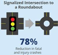
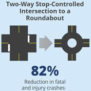
Roundabouts are an intersection design option recommended in the Greta Comprehensive Plan. The intersection design is recommended for new intersections because of the lower lifetime cost of maintenance and increased safety. Roundabouts will best support traffic operations along Capehart Road at the S. 204th Street and the Parkway entrance to The Crossings Corridor. An additional roundabout is recommended on S. 204th Street as the east gateway to The Crossings Corridor. Roundabout designs that incorporate vegetated medians with thematic elements that highlight and reinforce the City of Gretna branding are preferred. Pedestrian refuge islands will also be incorporated into the design of roundabouts to best support active transportation users crossing multiple lanes of traffic.

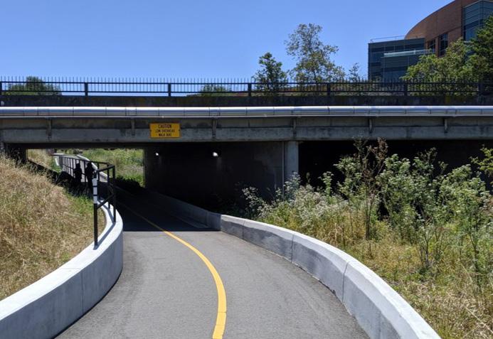
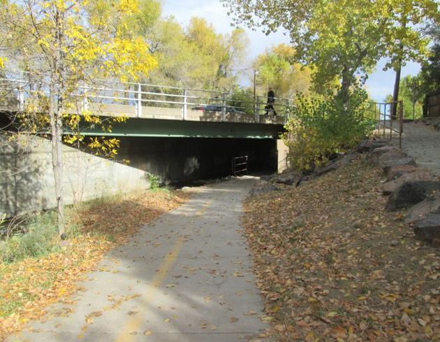
Grade separations are transportation infrastructure options that lower barriers for active transportation users to cross major roadways. Highway 6 and 31 is a four lanes roadway, but NDOT plans to widen to the facility to six lanes in the future based on regional traffic demand. This cross section, with associated turn lanes will discourage active transportation between Old Town Gretna and The Crossings Corridor. Wide intersection crossings are prohibitive for many users who will likely defer to personal vehicles for these short trips across town instead of walking or taking a bike. Drainage ways that cross under the highway and other major roadways provide opportunities to consider installing grade separations under a roadway. Wehrspann Creek, located north of The Crossings Corridor, and Buffalo Creek through The Crossings Corridor should include a trail under the highway using a bridge or wide box culvert. Coordination with NDOT is needed to develop adequate funding and appropriate design for highway grade separations for trails. Similar riparian under crossings are recommended at the intersection of Buffalo Creek with S 204th Street and the Capehart Road intersection with the east Residential Greenway connecting the Buffalo Creek Loop Trail and Gretna Crossing Park.
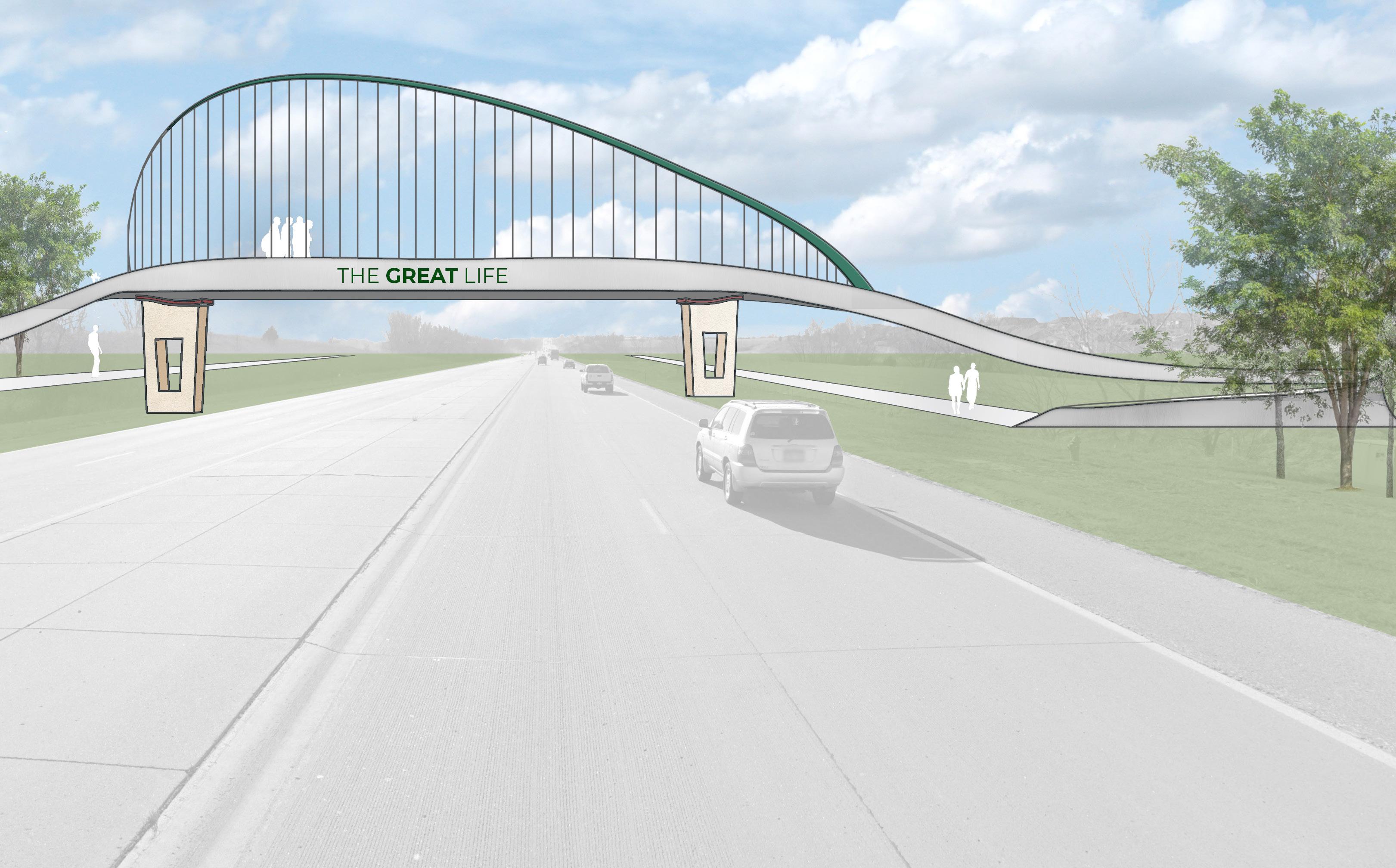
A pedestrian overpass is preferred to only providing at-grade crossings along highway 6 and 31 to promote walking and biking to Gretna Crossing Park and the regional trail network. This overpass connection can be provided between Chestnut Ridge Park and Gretna Crossing Park. The option of a grade separated bridge also provides Gretna with another opportunity for an architectural community gateway. See Figure 4.10 for a conceptual overpass illustration.
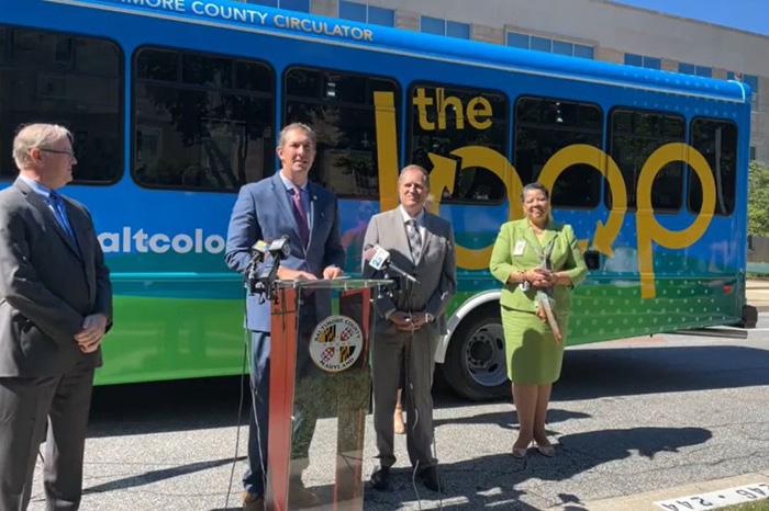
monitor the opportunity to support METRO Omaha Transit. Gretna supports a route that serves the future mobility needs of travelers that reduces traffic on Highway 6 and 31. Providing transportation options that can reduce the number of single occupancy vehicles is important to the community.
Figure 4.11 / The Crossings Corridor Proposed Transit LoopBikes and scooters that can be checked out and returned at different locations within The Crossings Corridor will be supported. The combination of active transportation-focused infrastructure included with The Crossings Corridor Green Street cross-sections will support users that want to walk or bike between short destinations. Shared Mobility is encouraged to reduce the number of these short trips between community destinations such as Gretna Crossing Park and Nebraska Crossing Outlet. Bike share operations have demonstrated success supporting trips of three miles or less in Lincoln and Omaha. An operation such as Heartland Bike Share can deploy bike share kiosks as the area develops. A shared mobility ordinance is needed for the City of Gretna as the infrastructure options for shared mobility begin to emerge.
The Crossings Corridor is located between Lincoln and Omaha and will provide a regional draw for a variety of visitors driving electric vehicles. The City of Gretna supports NDOT and plans to deploy Electric Vehicle (EV) infrastructure along Interstate 80 as an Alternative Fuel Corridor (AFC). The Crossings Corridor developer agreements will create an EV charging oasis that can serve the Fast Charging needs of through-travelers. Gretna also encourages developers to include infrastructure to support Slow Charging needs that can be served during longer shopping trips and work days. The electrification infrastructure can serve Fast and Slow charging needs and be located where traffic circulation can be well managed. Charging options are needed for almost every mode of transportation. Charging stations for pedestrians and bicyclists on mobile devices will be provided at strategic TROD locations along the Buffalo Creek Loop Trail. Bike share kiosks and shelters will support the recharging needs of electric assist bikes. Transit and Freight charging is also anticipated to be supported in The Crossings Corridor Master Plan area. Advanced Mobility for the wave of electrification will be built into the development of The Crossings Corridor.
The following information is taken directly from the Gretna Transportation, Streets, and Trails Infrastructure Development and Financing Policy. The excerpted text is in italics.
The purpose of this Transportation, Streets, and Trails Infrastructure Development and Financing Policy is to formally adopt into City Policy form, the Transportation Plan of the Gretna Comprehensive Plan Update 2021 and its street classifications, street designations, general right-of-way requirements, street projects, future projects, pedestrian systems and trails, and transportation policies components.
Transportation networks tie a community together and link a community to the outside world. Adequate circulation systems are essential for the safe and efficient flow of vehicles and pedestrians to all parts of the community. Communities need to be able to provide adequate transportation services to move people and goods around and through the community. In addition, access to facilities, industries, and businesses should facilitate efficient traffic patterns while minimizing conflicts between vehicular and pedestrian traffic.
Land use and transportation work together to create the pattern for future development. An improved or new transportation route generates a greater level of accessibility and determines how adjacent land may be utilized. Land use shapes the demand for transportation routes and alternatives, while transportation projects can direct new development locations and intensities to areas where the transportation infrastructure can best accommodate their needs.
Consistent with the water and wastewater improvement policies, new development should provide the necessary right-of-way and either construct or pay for their pro rata share of the cost of new roads and trails. In many cases, local streets and trails will be fully funded by the development. However, it is recognized that certain major roadway improvement projects may be too large to be fully or primarily funded by one or more individual developments and will require federal, state, and local funding. New development within the Crossings Corridor will need to work with the City to
The City of Gretna has had a water main extension and pioneering policy in place since the summer of 2009. The General Policy Statement is as follows:
“The City of Gretna has established policies and procedures for extending the existing municipal water works system to serve new areas of development both inside and outside the corporate limits of the City, which fall within its water service area. These policies and procedures provide for the City to plan, engineer, and construct water main extensions and system additions to serve new development and growth within the water service area. These policies and procedures also provide for a system of allocating costs to new development based on the capacity impact that a new development will have in the water works system and benefit to be derived from becoming a water customer of the Gretna water works system.
City may elect to implement to allow for the pioneering of water main extensions external to its water service area, to serve new development. This pioneering policy provides for a system of equity in allowing a “pioneer” to finance the extension of a water main to a new development outside of the water service area and to receive subsequent future contributions from other adjacent developers who will benefit from the “pioneered” main extension.”
Any development within the Crossings Corridor will need to work with the City to identify the needs for an internal water system as well as any water main extensions necessary to the feed the specific development and potentially other neighboring developments. Based upon the City’s policy and subject to the availability of City funds, new development must either:
» (1.) reimburse the City for their pro rata share of the cost to construct needed water system improvements; or,
» (2.) upfront the entire cost of the necessary water system improvements to later be reimbursed for the portion that is above their pro rata share by contributions from future developments.
The City of Gretna has policies related to the extension and development of wastewater infrastructure. Priority is given to sewer improvement projects based on how quickly and at what percentage the City can recover its construction costs. The availability of City funding is also a deciding factor. The following is taken directly from the Gretna Sub-Basin Sewer development Policy. Additional details are contained within the full policy. The excerpted text is in italics.
The City of Gretna owns and maintains a sanitary sewer interceptor system...An established interceptor sewer service area has been established, which identifies the areas that can be served by the system. The City charges all customers within the service area a special municipal interceptor sewer connection fee for use of the interceptor to transport sewage to the City of Omaha’s Papillion Creek Plant for treatment. It is the intent that the interceptor sewer system will service the entire area within the Gretna sewer service area boundary.
Within the Gretna interceptor sewer service area are several sub-basins which have or will require sub-basin interceptor sewers to be constructed for connection and conveyance to the City’s main interceptor sewer. Sub-basin extensions will require additional investment and partnering... The costs of these sub-basin interceptor sewer extensions may require a specific sub-basin connection fee...
Development of a sub-basin sewer service for the Gretna interceptor sewer service area may be permitted and supported by the City of Gretna...the City is the entity that will design and construct sub-basin interceptor sewers.
Similar to water systems, any development within the Crossings Corridor will need to work with the City to identify the sanitary sewer improvements needed to serve this development as well as any neighboring properties and developments. Based upon the City’s policy and subject to the availability of City funds, new development must either:
» (1.) reimburse the City for their pro rata share of the cost to construct needed water system improvements; or,
» (2.) upfront the entire cost of the necessary water system improvements to later be reimbursed for the portion that is above their pro rata share by contributions from future developments.
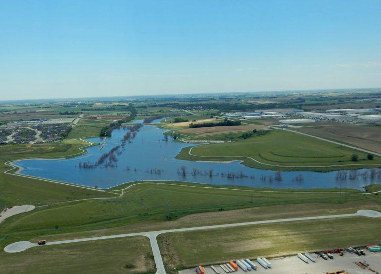
The Buffalo Creek Watershed, of which this plan is entirely contained, is currently under study by the South Sarpy Watershed Partnership. They are identifying both locations for and funding and ownership of stormwater detention facilities. In addition, work is ongoing to bring about policy changes and physical improvements within the watershed to stabilize the existing creeks and drainage ways, preventing accelerated degradation or head cutting.
Stable streams and drainage ways along with areas that store stormwater during large rain events are important assets within a community and are most effective on both a site and regional level. The Crossings Corridor Master Plan promotes the idea of establishing adequate real estate to perform these critical functions as well as a way to improve our quality of life by incorporating nature in our everyday world. As the Buffalo Creek travels across this study area, from Highway 6 to the Interstate, flood control structures and stabilization should be part of the Buffalo Creek Greenway.
Streams within the Douglas County and Sarpy County area are typically preserved with a setback of 50’ plus the area equal to 3 to 1 proportion to the bottom of the stream. This plan advocates for the continuation of that policy but encourages these streams and drainage ways to be made a part of the public realm, with public access, rather being hidden behind adjacent land uses.
The Crossings Corridor has a tremendous upside for development owing to its favorable big-picture location and a coming together of local and regional investments. This plan represents a vision for realizing that great potential; getting there will require a combination of strategic ingredients.
Protecting and complementing superregional/lifestyle retail at Nebraska Crossing
Nebraska Crossing is by far the most important engine for fiscal health in Gretna. After weathering the tremendous challenges posed for retailers by the 2020 Covid lockdowns and subsequent restrictions, Nebraska Crossing is returning to vibrancy and poised to grow with exciting new tenants. Any public investments made within the study area should be planned to maximize continued support for that shopping center –avoiding disruptions to access or visibility while ensuring that retail additions are carefully positioned to complement rather than cannibalize Nebraska Crossing’s key retail offerings.
Like other prosperous edge suburbs, Gretna’s current housing mix tends towards larger, lower-density detached homes. The vision for the Crossings Corridor represents an excellent opportunity for Gretna to step up its transition from bedroom community to a more well-rounded and balanced city. Part of that maturation will require a shift towards a broader array of housing choices –a careful blending of continued singlefamily growth with an injection of more compact ownership homes and participation in Sarpy County’s expanding rental market. Adding a variety of residential rooftops helps attract and retain employers seeking to offer commuting convenience to a range of wage earners, provides spending support for a growing retail base, and helps reduce traffic impacts by bringing homes and destinations closer together.
Gretna has invested millions of public dollars in an ambitious expansion of wastewater capacity and a state-of-the-art park/recreation center. Those investments will only continue as the city adds new school sites, relocates its civic/municipal offices, and expands its network of bicycle and pedestrian trails. While the sewer capacity provides the literal groundwork for growth throughout the study area, the park, rec center, trails, and civic anchors will provide the connective tissue to help ensure that what emerges at the Crossings Corridor is a cohesive, well-rounded total package appealing to residents, employers, and retailers alike.
Maintaining land-use discipline: eyes on the prize
Gretna has already proven that it is a natural location for extending metro Omaha’s westward edge growth towards Lincoln. Perimeter suburban growth is naturally focused on single-family detached homes and the services that go with them. Filling out Gretna’s remaining land capacity with more of the same would be the path of least resistance for development, but would lack the mix of economic ingredients needed to maximize the full vision for the site and the city overall. Because The Crossings Corridor’s highest value land uses may take the longest to fully realize, preserving the land best suited to them may mean foregoing some easy suburban expansion early on.
There are several different tools available to developers and the City to help fund the cost of infrastructure improvements necessary for new residential and commercial development. Some are ideal for residential and not commercial and vice versa.
Assessment districts are an approach not used significantly in the Omaha-Council Bluffs Metropolitan Area. However, it is an effective technique where the developer and city work together to pay for infrastructure upfront and then assesses the costs to the adjacent lots, typically on a running foot basis. Assessment districts may be used for water, sanitary sewer, paving and other infrastructure improvements.
The upside to this technique is that the property owners pay the costs associated with the infrastructure buildout like other techniques to be discussed herein. However, the downside to this approach is any properties owned by the developer will need the developer to pay these costs until the property is sold.
Assessment Districts are a means to pass the costs associated with the infrastructure unto the property owners. However, the developer does have some risk if the market is soft. As far as the city’s situation, the development can be annexed into the community immediately without having to absorb the debt load like a Sanitary Improvement District.
Sanitary improvement districts are a development/ financing tool for the development community established by NRS §31-727. SIDs are created through the district court system in Nebraska. The only thing a community may have to say about the SID is through the subdivision process. SIDs also are given the jurisdiction to impose a property tax on the lots in the area to pay for infrastructure. Once an SID is in place the only way a city can annex the area is by assuming the debt load of the SID. The SID process is extremely popular in the Gretna area, typically developers will not even discuss development without the SID tool.
In rapidly growing areas like Gretna, the SID can become a major barrier to quality, contiguous, planned growth. If an SID is not adjacent to the corporate limits of a community, the SID provides for a means for “leapfrog” development. In these cases, once the community reaches the SID the condition of the infrastructure may be lacking due to the aging process and the SID becomes expensive to annex.
In theory, SIDs should be eliminated from within the zoning jurisdiction of Gretna. However, this will not likely be the case. Whenever an SID subdivision comes before the City of Gretna a number of items need to be included in the Subdivision Agreement:
» Limitations on debt service by the SID board
» Debt service should be eliminated in a specific number of years, for example 10 years, so the City is in position to annex the area at a minimum buydown of the debt.
» All streets should be designed to the City’s standards
» All infrastructure should be designed to meet the City’s standards
Tax Increment Financing is another solid tool for redevelopment and development within a community like Gretna. TIF allows the City to capture the difference in property taxes paid at predevelopment and the new property taxes post-development. Once the City captures the difference, all other taxing authorities maintain what they had been receiving prior to the redevelopment/new development BUT go without the increment for a maximum of 15 years.
TIF, in areas like Gretna, is good for commercial and industrial developments but is very unpopular for residential development. Since the public schools go without the increment for up to 15 years, school districts similar to Gretna Public Schools (GPS) see large increases in students without the additional revenue source. Commercial and industrial projects do not have the same impact.
However, if the City and GPS could find a means to work with TIF on residential development it could begin to minimize the use of SIDs in the area.
Creativity and flexibility in funding of the infrastructure necessary to support new development will be critical to the ability of Gretna to grow its corporate boundary and tax base.
Assessment districts are the fairest means to develop. The subdivision becomes a part of the community and pays property taxes to the City while the residents are paying down the debt load of the development. The one negative side to this approach is the developer has some additional risk without the safety net called an SID.
In reality, SIDs do not provide the ability for Gretna to grow either the corporate boundary or tax base quickly. SIDs stall the growth of the community by at least a decade, while the residents of the SIDs use the streets and other amenities without contributing to their upkeep. From a planning standpoint, SIDs are not a way to properly grow a community. At some point it would be best if this tool was eliminated from the developer’s toolbox in the Gretna area. There needs to be a carrot the City can use to entice the development community to abandon this mechanism.
Unless the City and GPS can come to a workable agreement regarding the use of TIF on residential developments, TIF should only be used on commercial and industrial redevelopment/ development.
No Recommend a ti on Resp onsi b i l i ty Ti mefra me Bud get Source M ea sure
Land Use / Zoning
1 Adopt the future land use plan as a part of your comprehensive plan. PC + CC Immediate
2 Amend the Crossings Corridor ordinance to remove "development" within the Corrdor and direct future development to the amended comprehensive plan. PC + CC Immediate
3 Adopt design guidelines that apply to The Crossings Corridor. PC + CC 6 months / 2-3 months
Stormwater and Open Space
4 Continue to participate with South Sarpy Watershed Partnership and the Papio Missouri River Resources District in providing a regional stormwater system. Ongoing Natural Resources Conservation Service (NRCS) Plan improved
5 Modify Linear Corridor system - is flood control needed?
6 Gain access to streams and corridors as a public greenway as property develops and plats. CC Ongoing Adopt Policy or Plan
NDOT Coordination
7 Encourage all reasonable measures to be pursued by NDOT that would eliminate the need to widen Highway 6 and 31 through Gretna.
Mayor, City Engineer, City Staff Ongoing NDOT
4-Lane Highway preserved / not widened
8 Provide pedestrian crossings at major intersections along Highway 6 and 31. City Engineer, NDOT Ongoing Developer sidewalk, curb ramps, signal heads, crosswalk
9 Coordinate limitations on freight movements north of Interstate 80 from interchanges at 204th and 192nd Streets. City Planning 0-7 years
10 Pursue funding and design for grade separations under Highway 6 and 31 at Buffalo Creek and Wehrspann Creek.
11 Pursue funding and design support for grade separation overpass of Highway 6 and 31 north of Capehart Road.
12 Support planning and construction processes for new Interstate 80 interchanges considered by this plan to include trail connections with designs at S. 192nd Street.
13 Support planning and construction processes for new Interstate 80 interchanges considered by this plan to include trail connections with designs at S. 204th Street.
14 Support planning and construction processes for new Interstate 80 interchanges considered by this plan to include trail connections with designs at Highway 31.
Mayor, City Engineer, City Staff DiscretionaryTAP Secure funding or alternative transportation methods built.
Mayor, City Engineer, City Staff DiscretionaryTAP Secure funding or alternative transportation methods built.
Mayor, City Engineer, City Staff 0-7 years NDOT
Mayor, City Engineer, City Staff 7-15 years NDOT Legislative appropriation
Mayor, City Engineer, City Staff 7-12 years NDOT
15 Coordinate realignment and actively seek funding of Highway 6 to intersect with a modified intersection with Fairview Road. Developer Developer Relocated
16 Coordinate with NDOT to support Advance Mobility deployment of electric vehicle charging stations within the Crossings Corridor.
The Crossings Corridor Green Streets and Roundabouts
Mayor, City Engineer, City Staff, Nebraska Community Energy Alliance (NCEA) NDOT, Developers and NCEA
17 Apply recommended Green Street cross sections for all subdivision reviews and approval processes for The Crossings Corridor. City Engineer, City Staff
18 Preserve the minimum corridor width for all public streets consistent with the City of Gretna transportation policy for right of way.
19 Support increased density as development incentives to obtain public right of way that exceeds the minimum corridor width. City Engineer, City Staff
20 Coordinate with MAPA and Sarpy County for the design and construction of three roundabouts along S. 204th Street and Capehart Road. City Engineer City
21 Include roundabouts in the internal circulation network of The Crossings Corridor. City Engineer Developer
Trail System
policy or standards
Recommend for CC adoption
22 Integrate trails within The Crossings Corridor Green Streets roadways as an integrated network. CC Ongoing Adopt policy or standards
23 Coordinate with MAPA and Sarpy County to expand the regional trails network through The Crossings Corridor. City Planning DiscretionaryTAP
24 Coordinate with NDOT to fund and construct grade separation trail crossings at Highway 6 and 31 and active transportation facilities over Interstate 80. Mayor, City Engineering, City Planning DiscretionaryTAP
25 Coordinate grade separation undercrossings at Capehart Road to connect Gretna Crossing Park as well as at S. 204th Streets to connect land uses east of The Crossings Corridor. Mayor, City Engineering, City Planning DiscretionaryTAP
Trail Oriented Development
26 Establish minimum Trail Oriented Development standards that address connectivity with development adjacent to The Crossings Corridor trails system. CC Ongoing Adopt policy or standards
27 Incorporate development density incentives with standards that helps the City obtain right of way that exceeds the minimum right of way width included in the transportation policy. CC Ongoing Adopt policy or standards
28 Apply Trail Oriented Development standards to subdivision review and approval processes. CC Ongoing Adopt policy or standards
Shared Mobility, Transit and Rail
29 Prepare and adopt a shared mobility ordinance to address the management of bikes and scooters deployed throughout the City of Gretna. CC Adopt policy or standards
30 Encourage partnerships between developers and shared mobility operators to address the costs of deployment and operations.
31 Support METRO regional transit authority and encourage routes that connect Gretna with the region.
32 Support NDOT and regional efforts to establish an intercity transit service by preserving locations within The Crossings Corridor that can support a transit loop.
City Planning, Developers Developer
Mayor and City Planning
METRO would need regional transit authority first then local tax to support
Mayor and City Planning NDOT Legislative appropriation
33 Document new railroad crossing for north/south connector west of Highway 6 and 31 and initiate coordination with railroad to plan new at grade crossing with quiet zone design standards. City Planning 0-7 years City and State RR diagnostic safety analysis and design
The 2010s have been a massive rebound decade for the Gretna region and Sarpy County overall. Sarpy County has been the only county in the region with consistent growth each decade since 1950. Until the 2010s, Sarpy County had never added more than 25,000 residents in one decade. The previous record was during the heyday of the Offutt Air Force Base (AFB) and widespread national exodus from urban centers.
Unless otherwise noted, the market analysis is focused on the region’s “Big 3” counties:
» Sarpy County (including Gretna, Papillion, La Vista, etc.)
» Lancaster County (including Lincoln)
» Douglas County (including Omaha)
Within the Douglas County / Sarpy County heart of the Omaha Metro, Sarpy County has historically played more of a bedroom community role.
Sarpy County has 37% of the two-county population, but just 18% of total jobs. However, over the past decade, Sarpy County has outpaced its larger neighbor in both employment and population growth. Sarpy County added jobs at more than double the annual rate of Douglas County with 2.3% per year, versus 1.1%, respectively. Douglas County is also outpaced for population growth with a 1.8% annual growth rate for Sarpy County versus 1.1% annually for Douglas County.
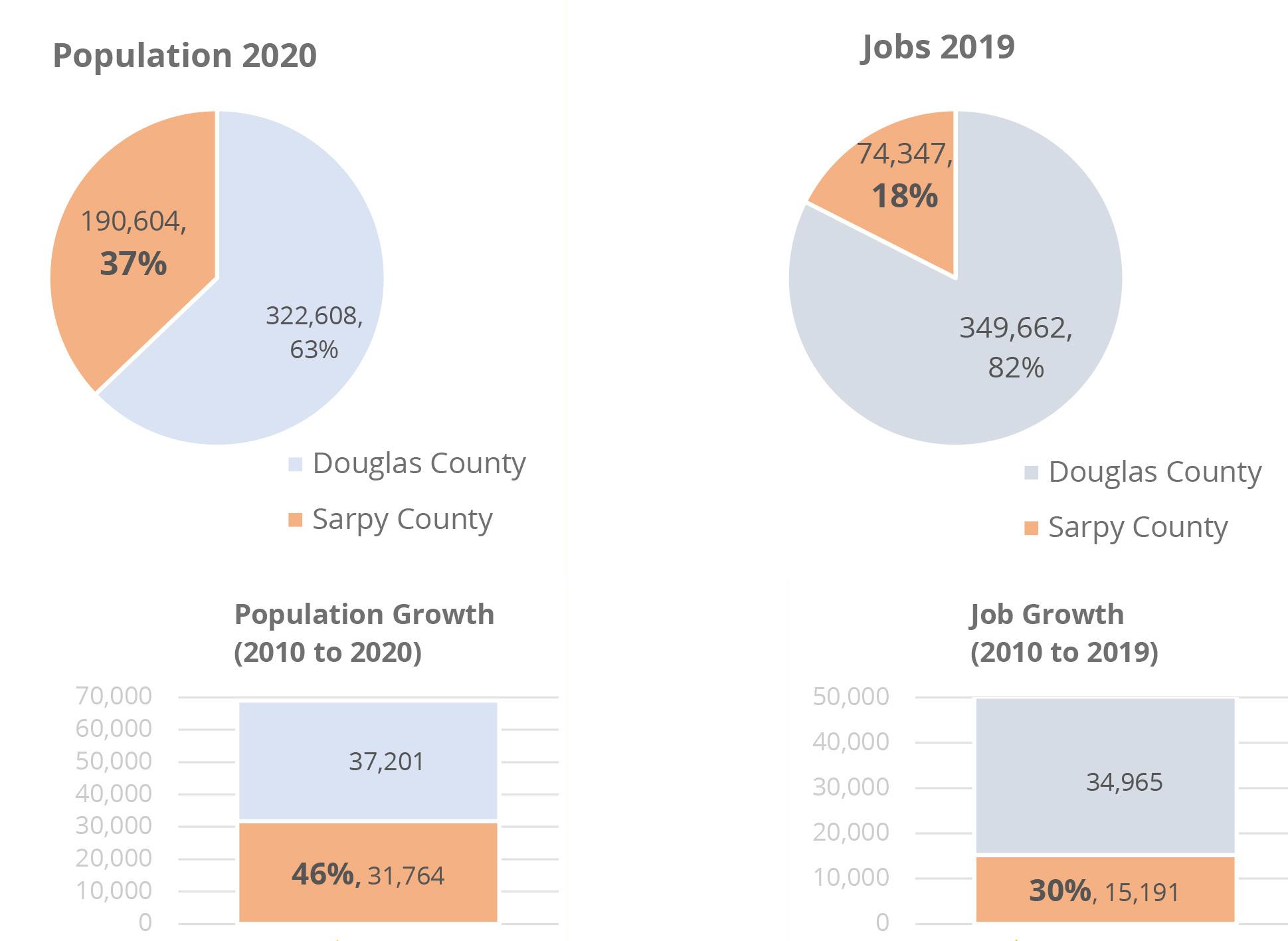
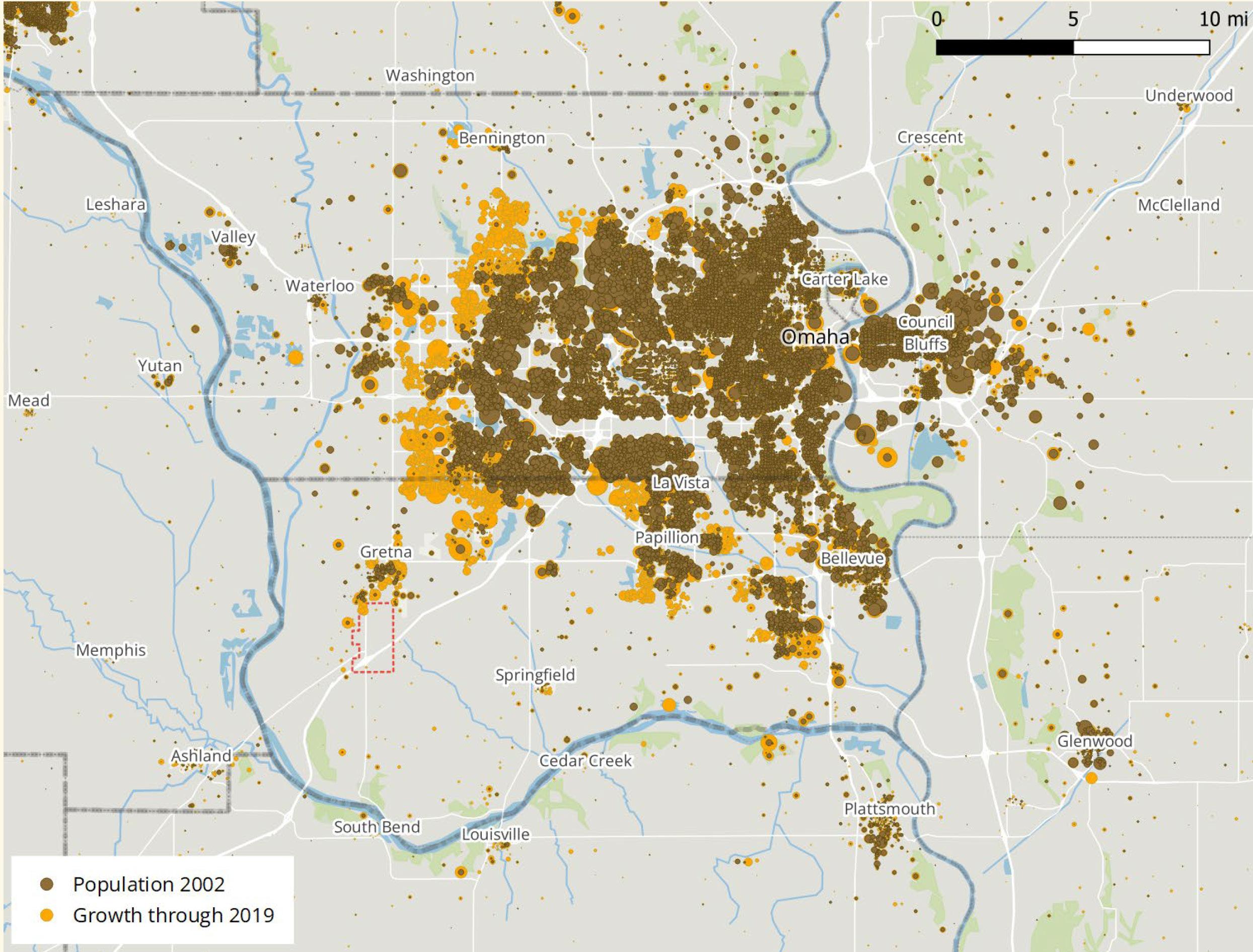
Figure 6.03 shows residential and residential growth density in the Omaha metro area. Residential density in 2002 is shown in brown and residential growth between 2002 to 2019 is shown in gold.
The map illustrates the concentration of growth along the western and southern edges of the Omaha area. It should be noted, there is a relative lack of growth on the Iowa side. While far eastern Council Bluffs has some small pockets of added population, the primary momentum is clearly westward.
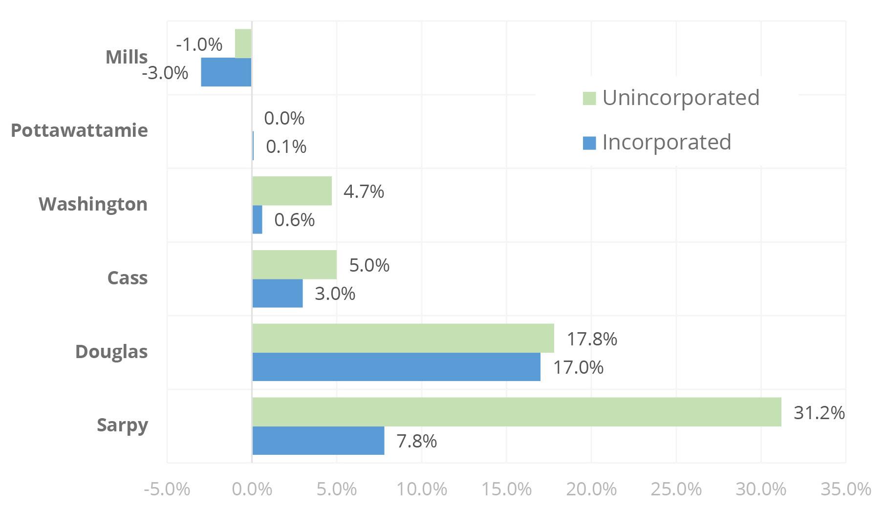
Figure 6.04 compares the total percentage change in population that has occurred since 2010 in incorporated versus unincorporated places across 6 counties in the Omaha-Council Bluffs metro, highlighting the prevalence of unincorporated growth in Sarpy County. Unincorporated areas in Sarpy County grew at approximate quadruple the rate of its incorporated areas.
Note, that there was little growth at all outside Douglas and Sarpy Counties. The Metro Area Planning Association, MAPA, attributes this difference to a preference for lower density housing in suburban areas. While this is likely true to an extent, the practice of relying on SIDs as a financing and governance mechanism for subdivisions prior to annexation, found across the state, is perhaps most common in Sarpy County.
On most income metrics, Sarpy County and Gretna are more affluent than the Omaha MSA, which is comparable the US overall. Within Sarpy County, Gretna is similar to Papillion on income measures and has higher incomes than La Vista. Lancaster County skews lower income than the Omaha Metro (in part because of Lincoln’s student population).
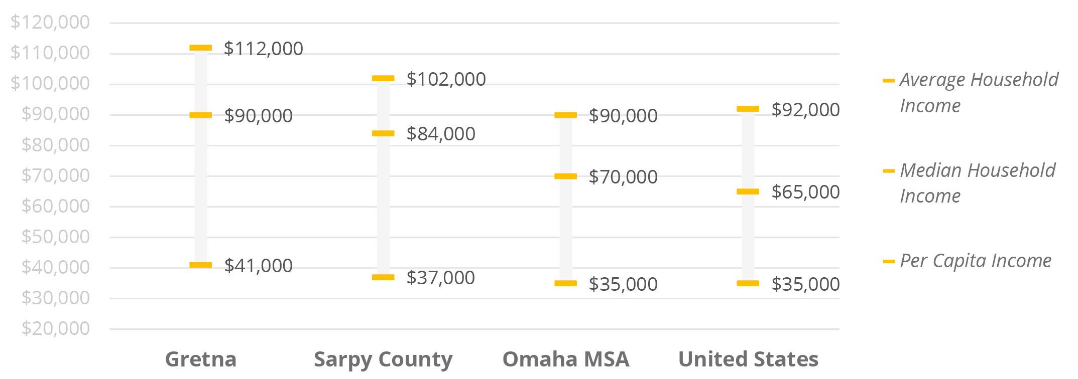
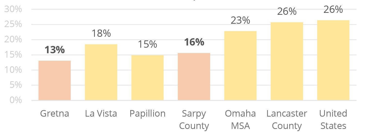
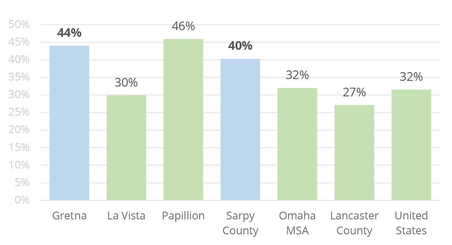
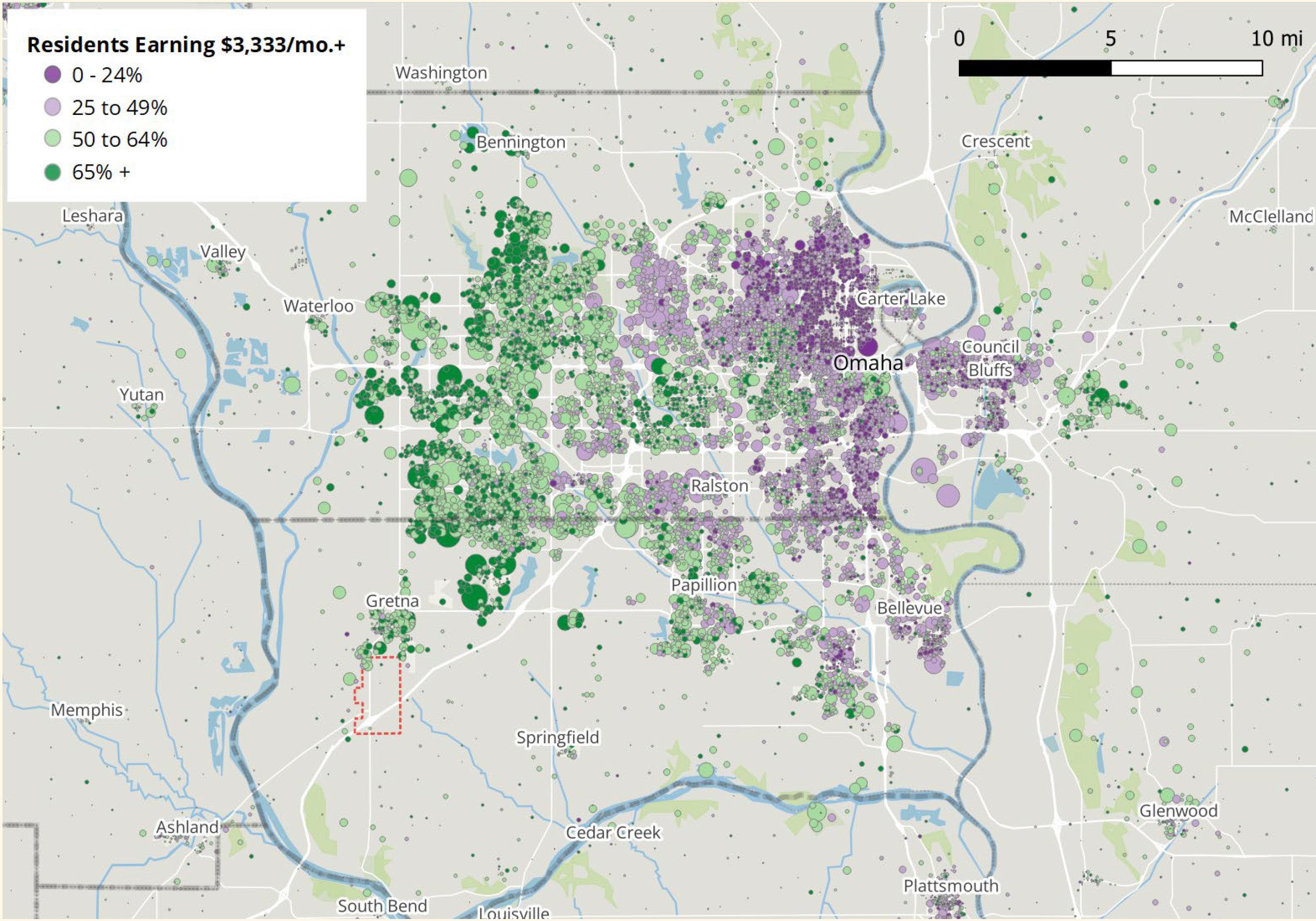
Figure 6.08 is shaded to show the share of higherwage earners by place of residence. The map illustrates a distinct clustering of metro residents by income.
The lowest concentrations of higher wage earners are in older portions of the city in east and northeast Omaha on either side of US Highway 75.
Top wage-earners are clustered within areas of high growth along the western edge of development, along with a swath of established neighborhoods extending west from downtown along Pacific Street.
Not surprisingly, higher education levels are correlated with higher incomes. Gretna has the highest percentage of adults with at least a 4-year college degree and higher incomes than the county, metro, and nation. In this comparison group, only Papillion has slightly higher incomes than Gretna (despite somewhat lower educational attainment).
Lancaster County is a bit of an outlier, with education levels comparable to Sarpy County, but the lowest median incomes in this group (not uncommon in college towns).
In general, the highly-educated, high-earning residents of Sarpy County and Gretna make it an attractive market for more upscale retailers and homebuilders.
Home ownership tends to correspond to larger average household sizes. Sarpy County has an overall average household size of over 2.71 people –second only to the City of Gretna in this comparison group, with 2.76. Gretna also has the highest home ownership rate at 74% (or 26% renter). La Vista has the highest share of renters, at nearly 45%.
As with many other demographics, metro Omaha is very comparable to the U.S. on both measures, with 2.53 people per household and nearly 35% renters. Papillion’s size and rent/own characteristics are similar to Sarpy County overall but with slightly smaller households.
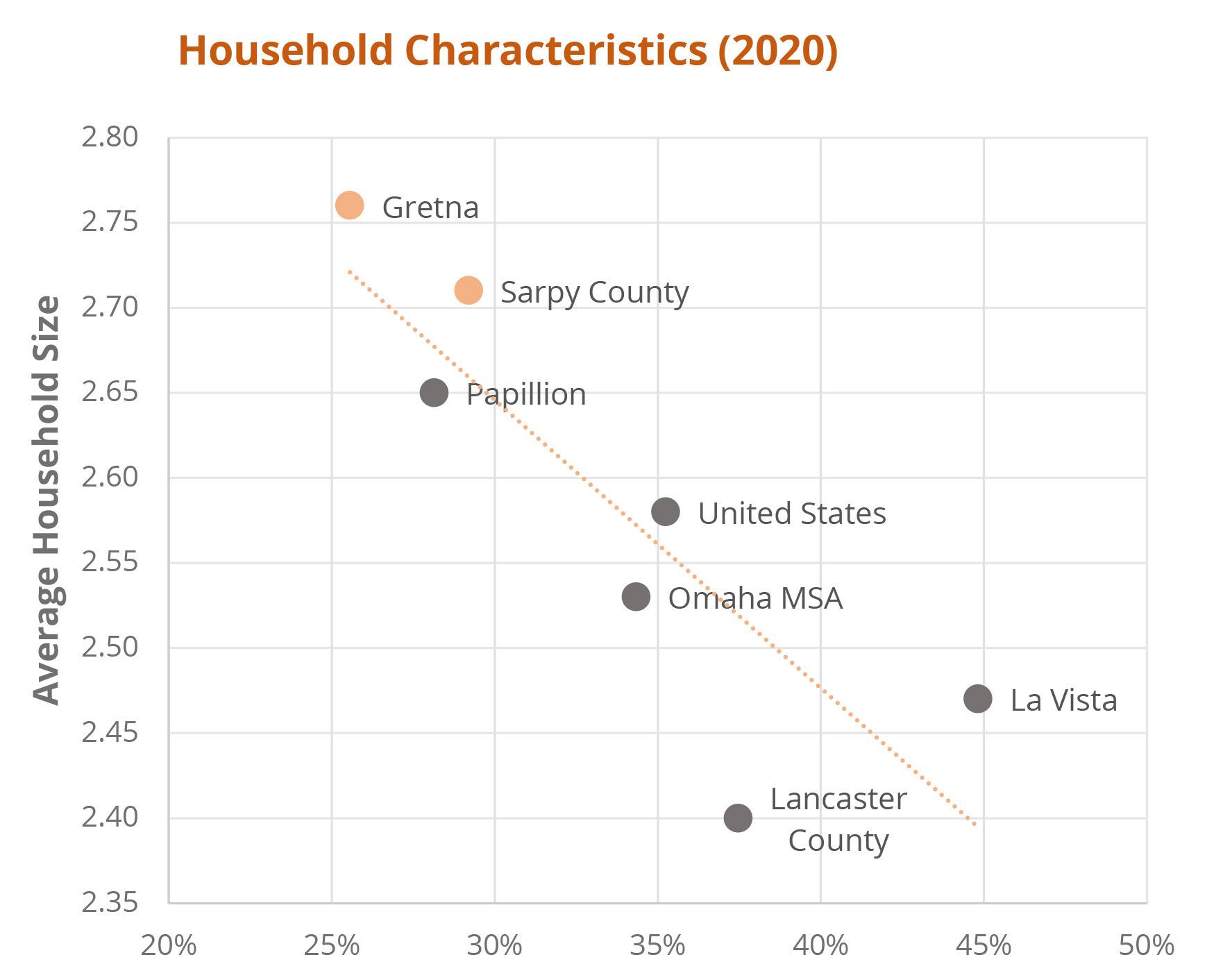
Sarpy County’s current population curve by age peaks in the 35 to 39 age bracket. As those Millennials age forward over the next decade, UNO projects a slight loss of population across the 30-something age groups, with growth moving into the 40’s. Other substantial growth continues to follow the Boomer population bulge aging into late retirement years and beyond.
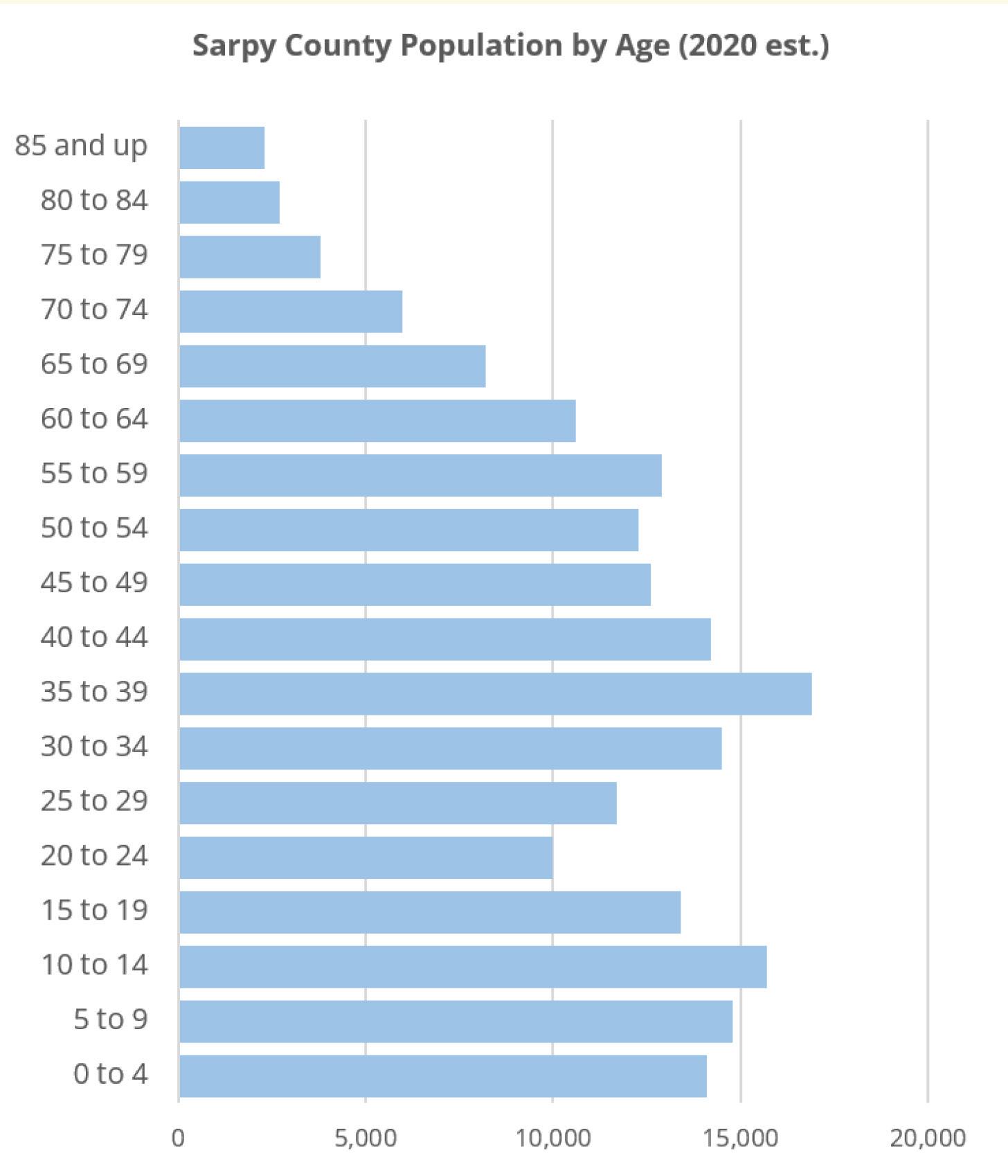
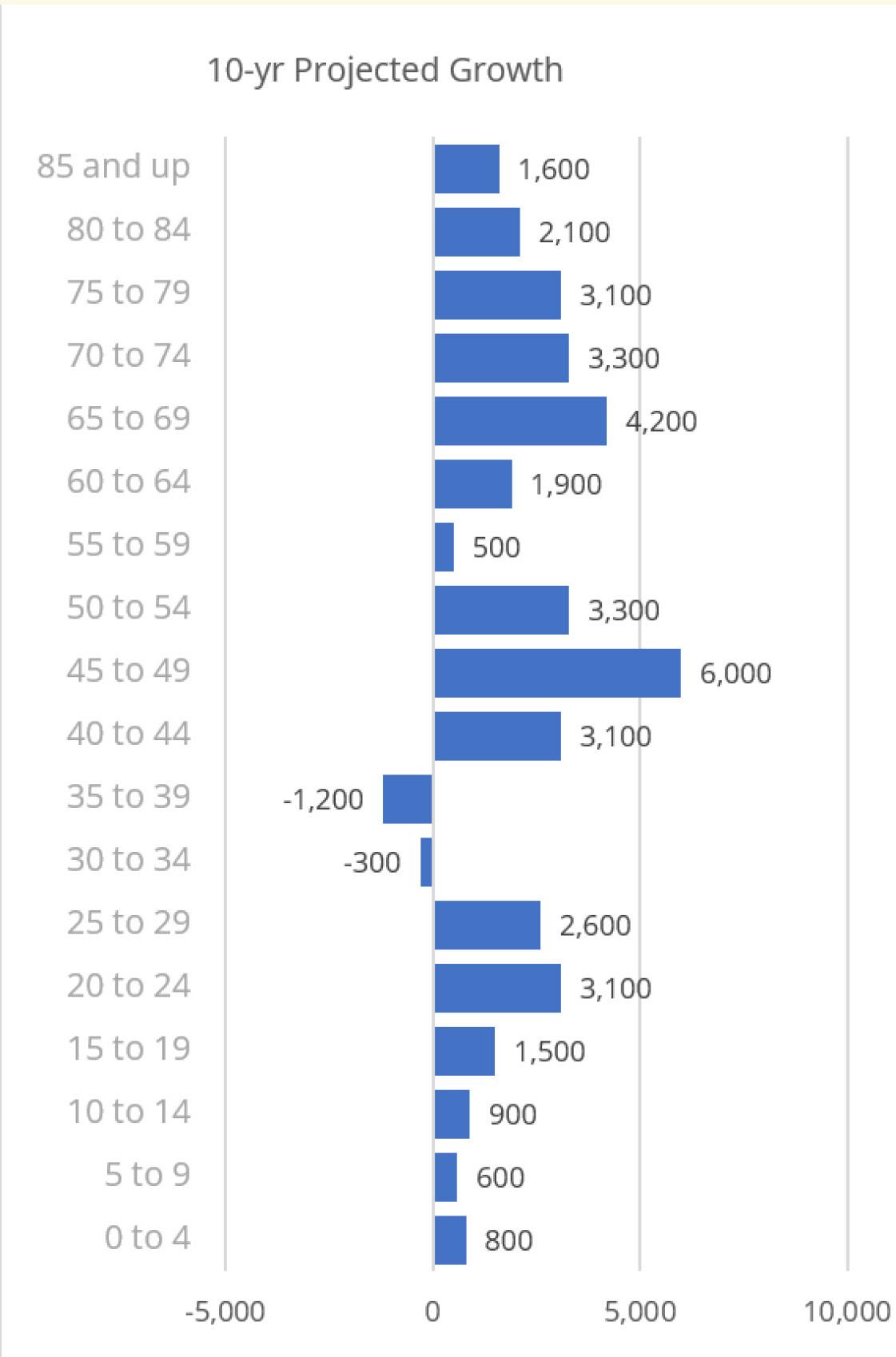
In 2021, over 6,100 units were permitted for construction across Nebraska’s Big 3 counties.
Since 2000, Sarpy and Lancaster County have produced a similar number of single-family units, hovering around 1,000 annually since the 2009 recession. For comparison, Douglas County saw approximately 1,500 per year. All three experienced a boom in production in the early 2000s, peaking around 2004-05.
While Douglas and Lancaster County had an early boom in apartment permits in the past decade, Lancaster County’s production has waned somewhat recently. After a quiet mid-decade, Sarpy County surged to a record in multifamily permits last year, topping 1,000 for the first time.
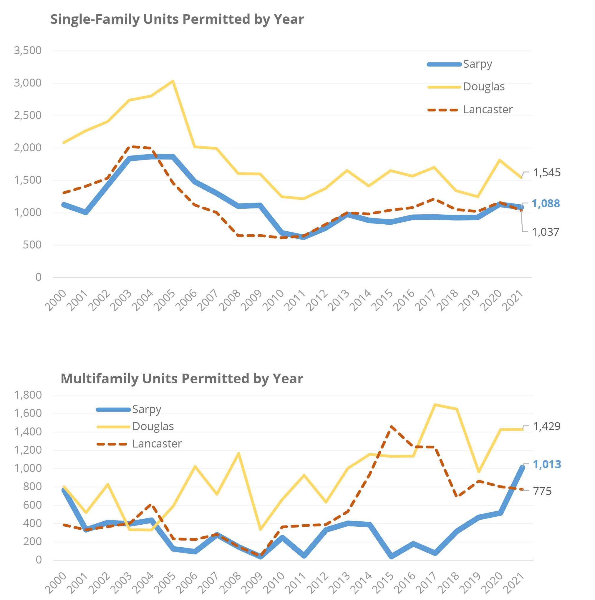
The City of Gretna has generally fluctuated between 7% and 20% of total units permitted in Sarpy County since 2000. The City briefly topped 22% back in 2001, a recession year with considerable drop-off in production regionally and nationally. Gretna’s share of county permits fell below 8% from 2007 to 2012 (from the tail end of a national economic boom to the beginning of the recovery).
Importantly, Figure 6.15 understates the share of Sarpy County development occurring within Gretna’s planning jurisdiction. Since a significant share of new residential development occurs within Sanitary Improvement Districts (SIDs) located near municipal boundaries but tend to remain unincorporated while the infrastructure bonds are gradually paid down by the districts–usually a 20-year process. On or before bond retirement, subdivisions within SIDs are typically annexed by adjacent municipalities –resulting in an effective lag in data for permitting and population for those cities.
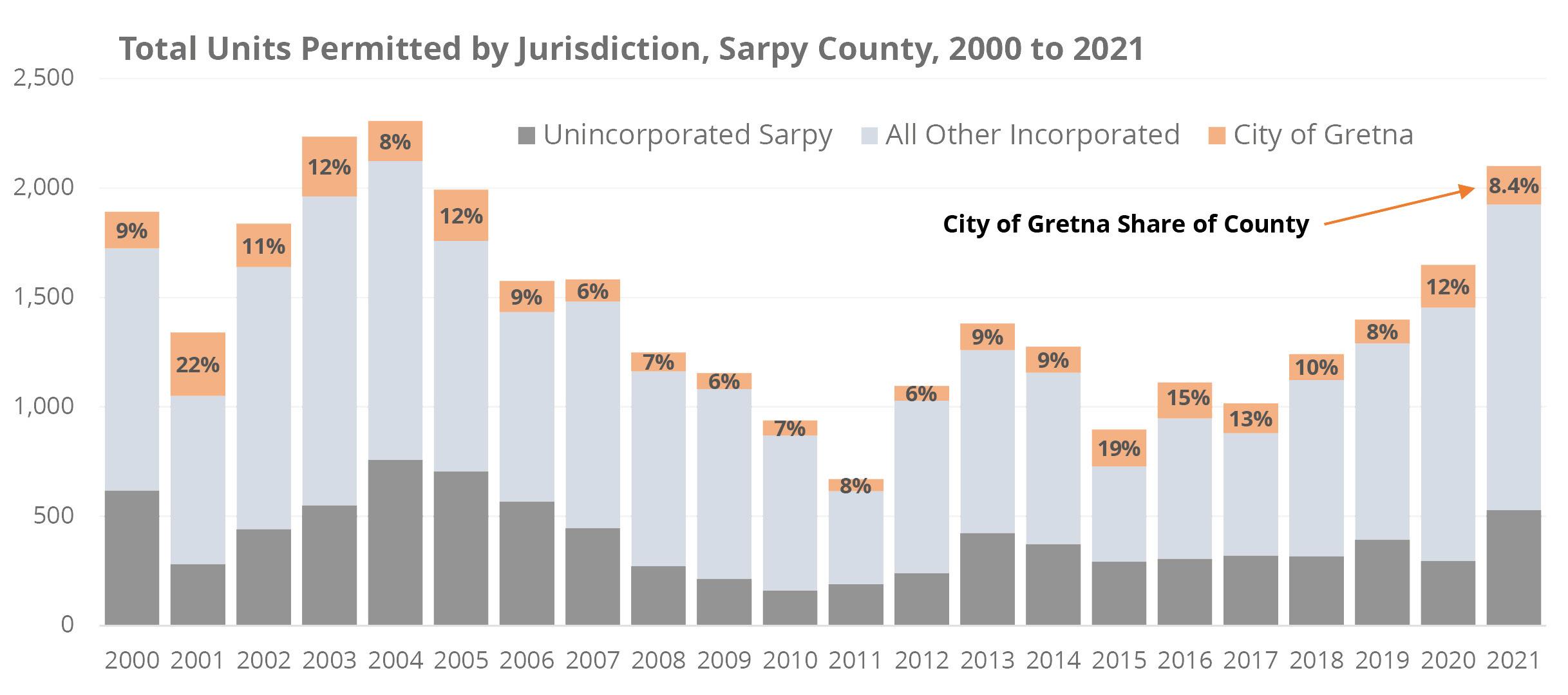
Figure 6.16 shows recent (past month) sales of all new construction for-sale homes in the OmahaLincoln region. Though just a small timeframe, it highlights the western and southern edge focus of recent growth around Omaha (and the northeasterly push of growth coming from Lincoln).
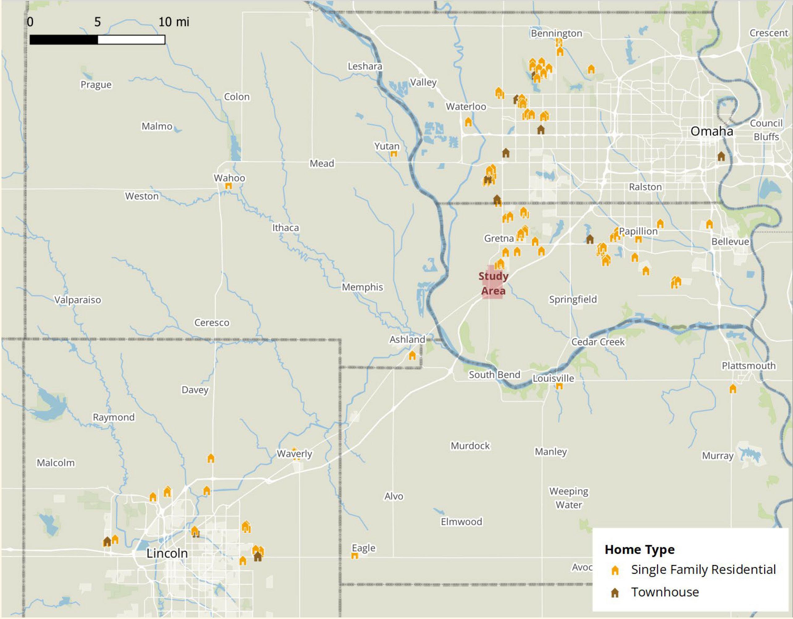
Figure 6.17 shows apartments tracked by Costar, built after 2017, under construction, or in late planning stages. Note the considerable recent activity in west Papillion, along the north side of 360 east of Gretna. The Avenue One mixed use development in west Omaha is a massive project now underway with a total of 2,000 units planned (large red dot).
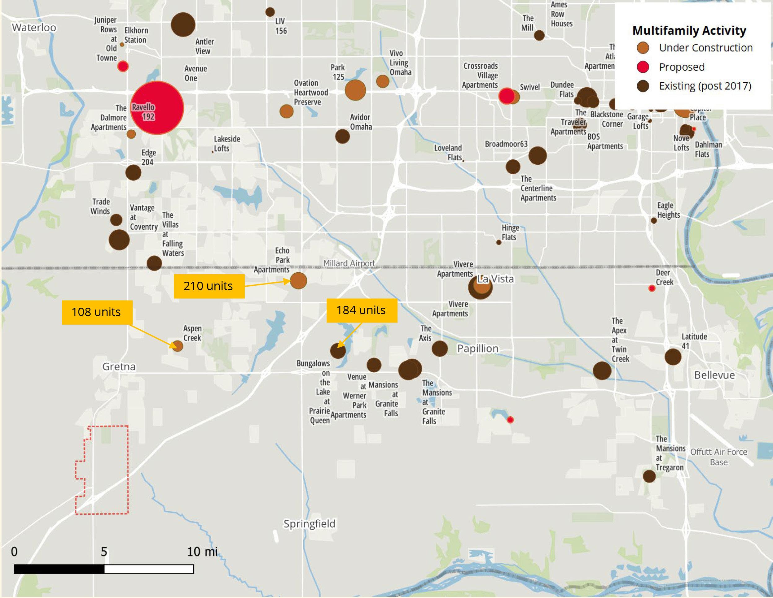
We assume that the Gretna Crossing study area will capture some portion of the housing demand projected for Sarpy County overall. Households are distributed across income brackets and assumed to growth at 1.75% annually for years 1-10, slowing slightly to 1.70% per year for the following decade. At those rates, Sarpy County should add approximately 14,000 units over the coming decade and 16,000 in the following decade.
Income distribution (held in 2020 dollars) is used on the next slide to estimate the shares of renter and owner units and to calibrate the expected capture rates (market share) for the Gretna Crossing Study Area (assumed to hold constant through the forecast period).
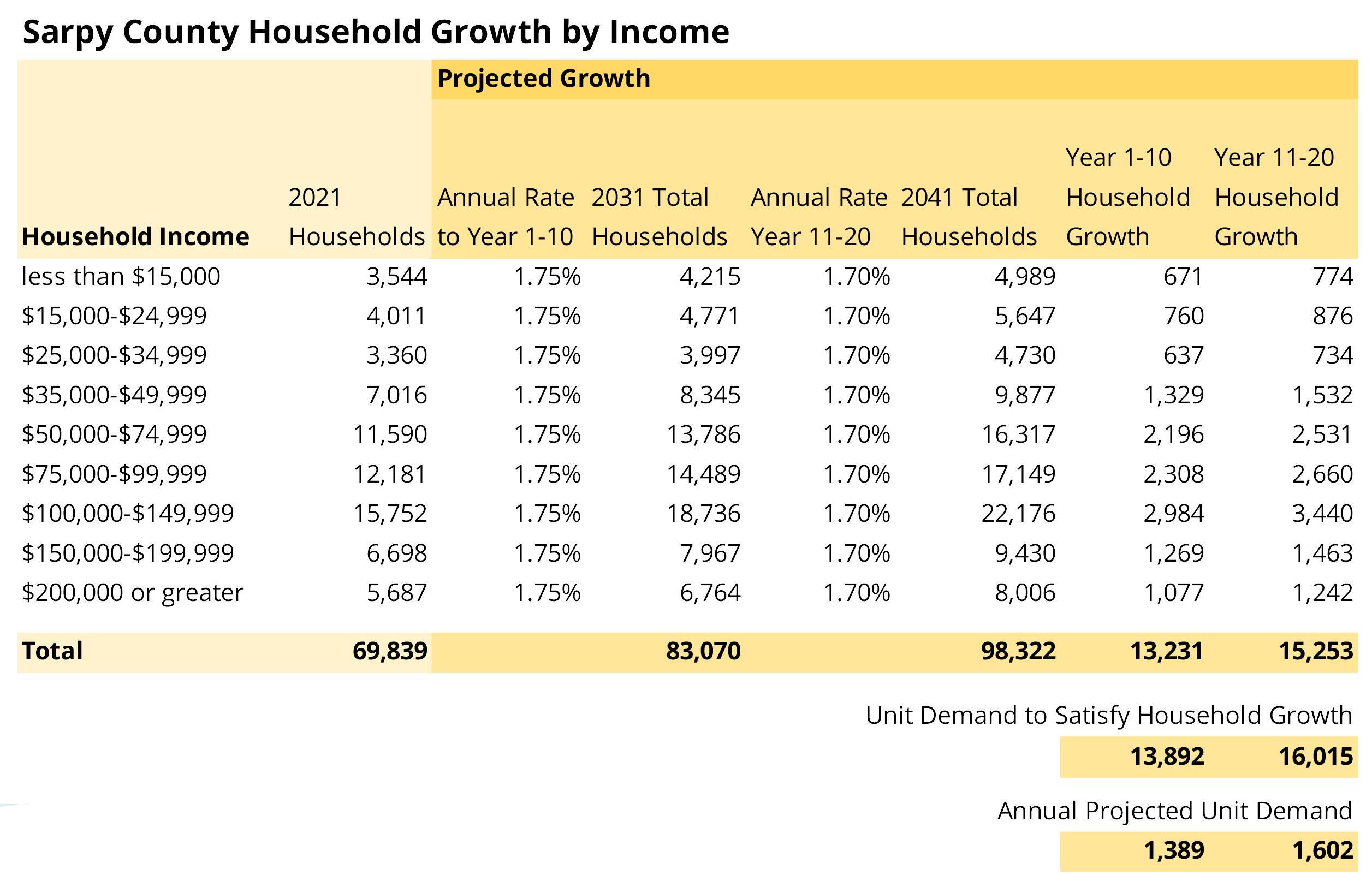
We calibrated a sliding scale of rent/own splits across income groups and applied a variable capture rate for the Gretna Study Area across income brackets. Low and High capture rate scenarios were reviewed, which ranged from 9% to 15% of total county unit production across 20 years. This resulted in an approximate demand for between 650 and 1,100 rental units and 2,100 to 3,300 ownership units by 2041.
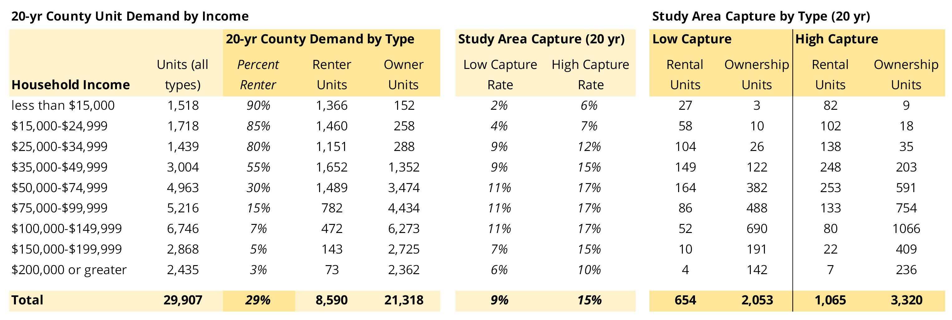
Although Gretna is experiencing rapid growth in residential development and is poised to expand its retail offering, the city is still far from most metro area office sector employment.
and
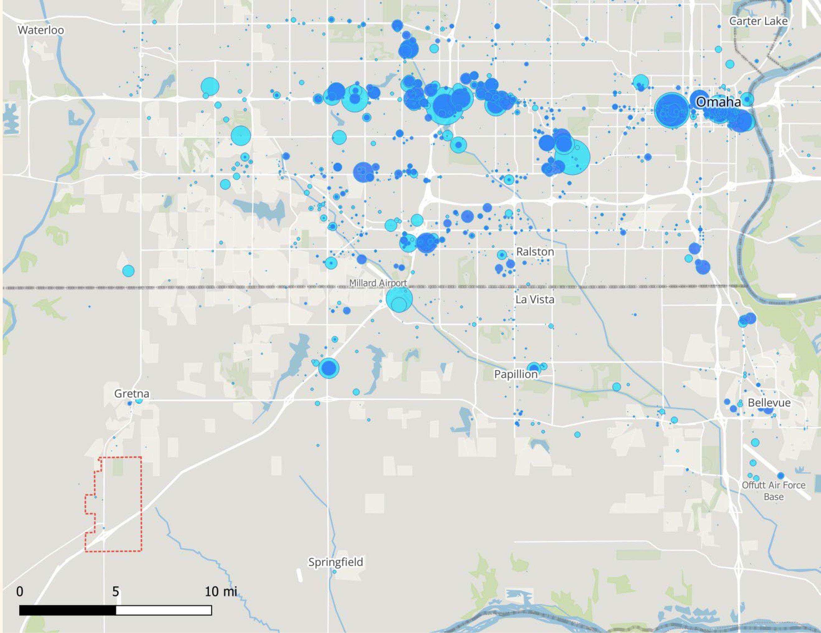
Figure 6.21 shows 2002 employment and growth through 2019 in the healthcare and social service sector. As with office sector jobs, most activity lies to the north and east, especially concentrated between Pine and Dodge extending west from downtown Omaha.
Some smaller, but significant development has occurred in Sarpy County between Bellevue and Papillion along 360, including a few employers in Gretna.
Though the proportions vary considerably across communities, between one-fourth and one-half of healthcare jobs take place in private sector medical office buildings, with the remainder in hospitals, clinics and other institutional properties.
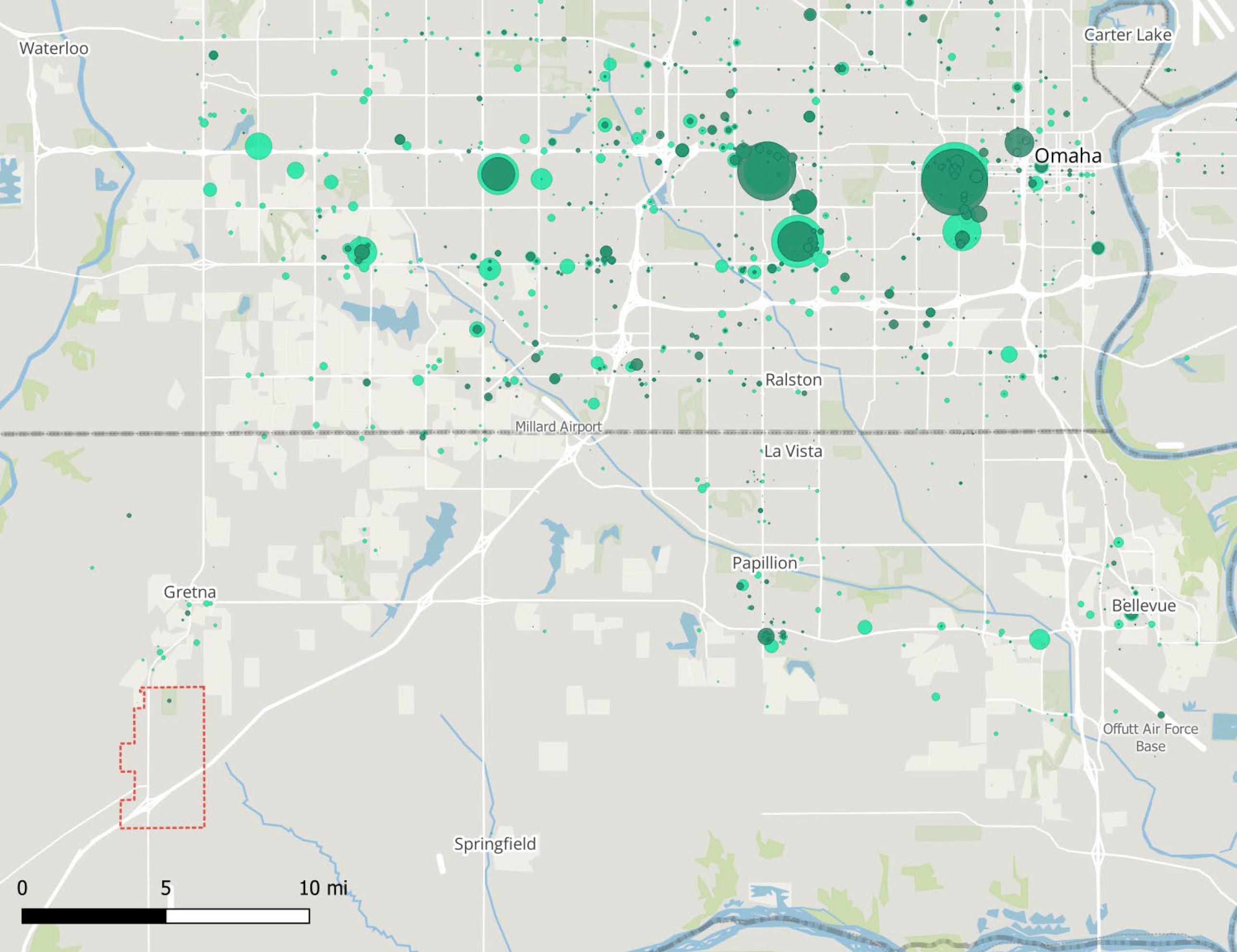
Industrial sector jobs are plentiful across the metro, especially along the south side of I-80 through Omaha and extending to the major cluster in north Sarpy County near the convergence of northeast Gretna and northwest Papillion
Logistics development is in a major expansion mode, thanks largely to Amazon distribution facilities. Gretna’s interstate location and gateway position relative to Lancaster county should be very attractive to those potential users.
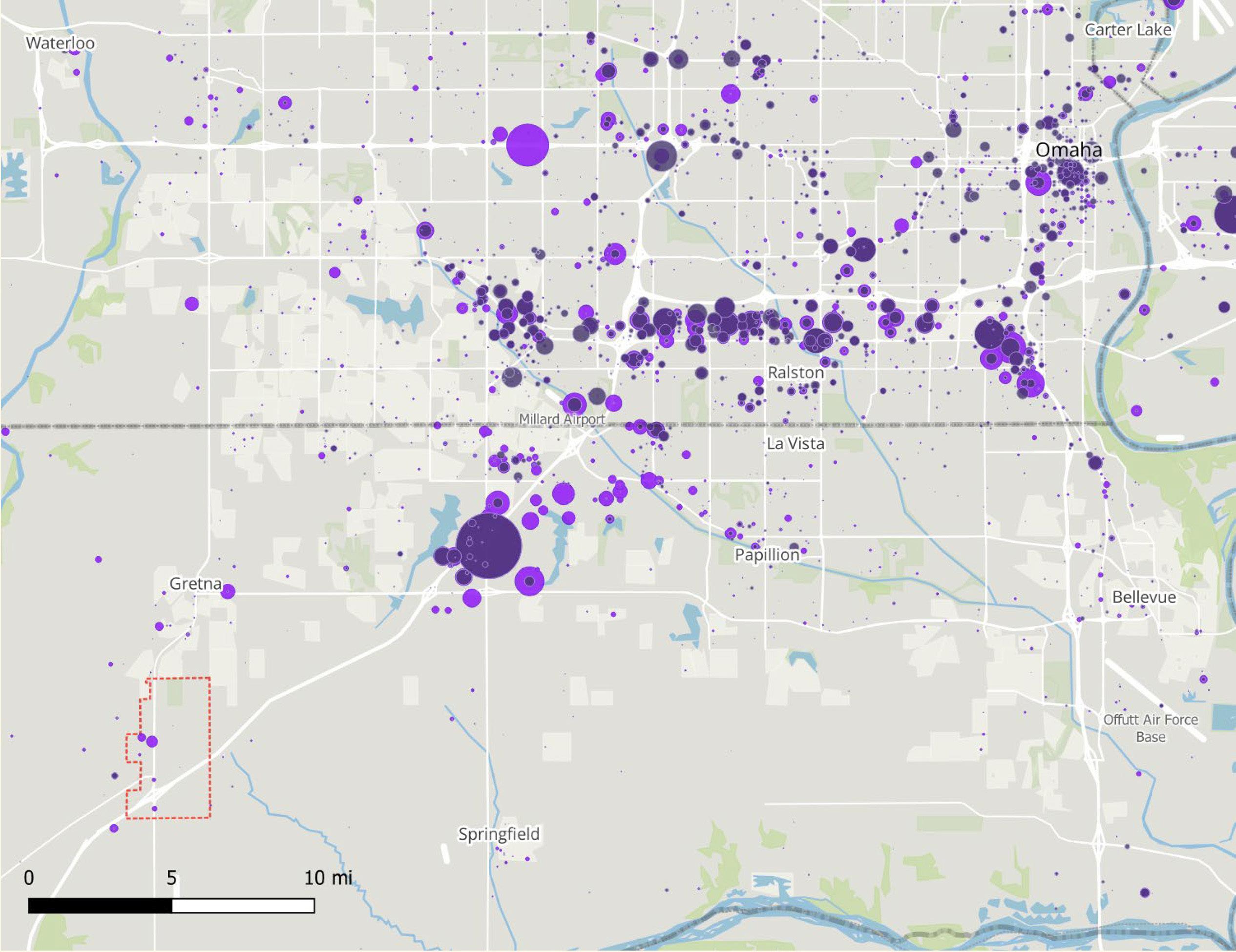
Figure 6.23 shows 2019 job totals by county for Douglas and Sarpy across all industry sectors, with Sarpy’s share of 2-county jobs labeled. Like many major American urban areas, retail and healthcare sectors have come to dominate the employment landscape across this 2-county core of metro Omaha.
Recall that Sarpy County had 37% of the 2-county population in 2019, but just 18% of jobs. Given that, we see Sarpy disproportionately well-represented in transportation and warehousing, with over half of the 10,000 jobs in Douglas/Sarpy –along with almost a third of Wholesaling jobs.
Douglas county is most dominant in white collar office categories including finance/insurance, professional services, management, and admin. support.
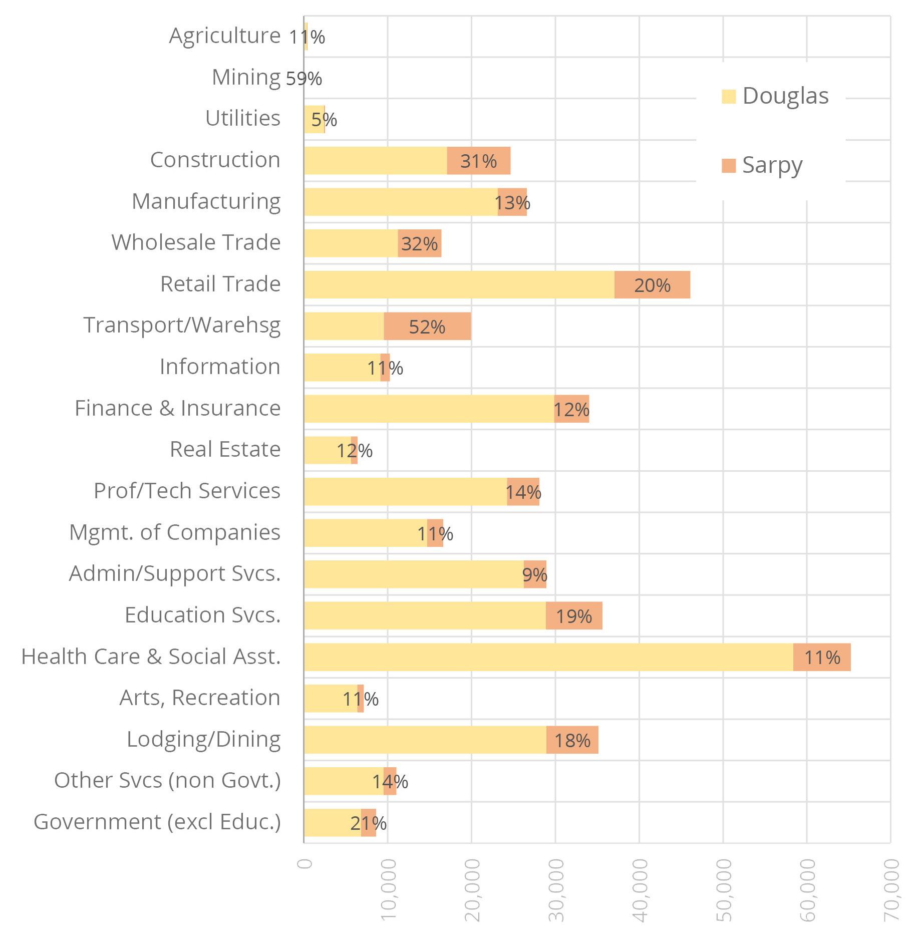
Figure 6.24 shows job growth by sector since 2010 shows how Sarpy strengthened its regional position in wholesaling and retail sectors and equaled Douglas in construction job gains, thanks largely to residential growth.
Interestingly, Sarpy County actually lost556 transportation/warehousing jobs since 2010 but still maintained disproportionate share of that sector. Douglas County saw very substantial gains in some high-paying sectors including healthcare, management, and finance/insurance.
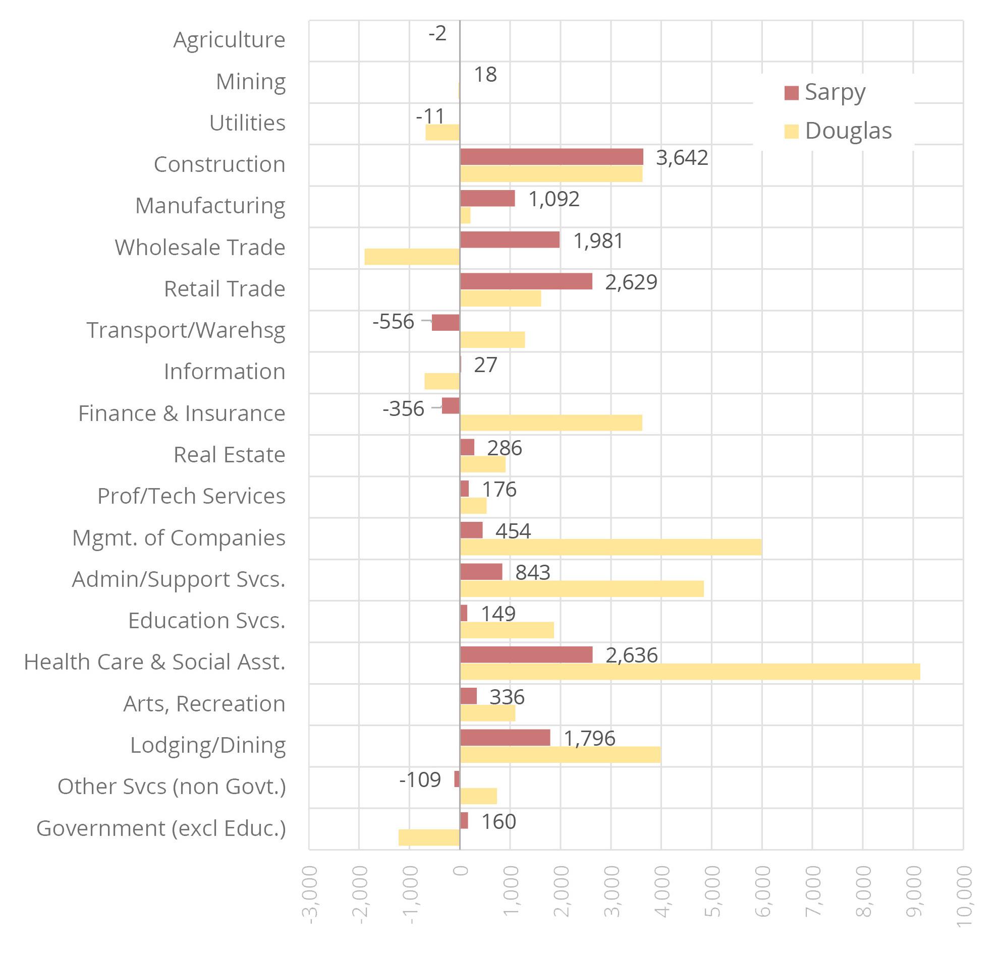
Here we apply 10-year industry growth rate projections developed by the State to estimate the demand for new office space across the 2-county area.
Assumptions for office space penetration (percent of jobs by industry likely to be housed in office buildings) and office square footage per job are calibrated against Costar figures for actual standing inventory.
Based on those inputs, we project 10-year demand for almost 3.5 million square feet of new office space across the two counties, adding to the 42M s.f. of standing space.
The SW Omaha submarket, which includes Gretna, has just 12% of the metro’s standing office inventory, but has produced 33% of delivered square footage over the past year and accounts for fully 64% of the nearly 800K s.f. now under construction –helping to justify an estimated capture rate of 7 to 15% for the Gretna Crossing study area.
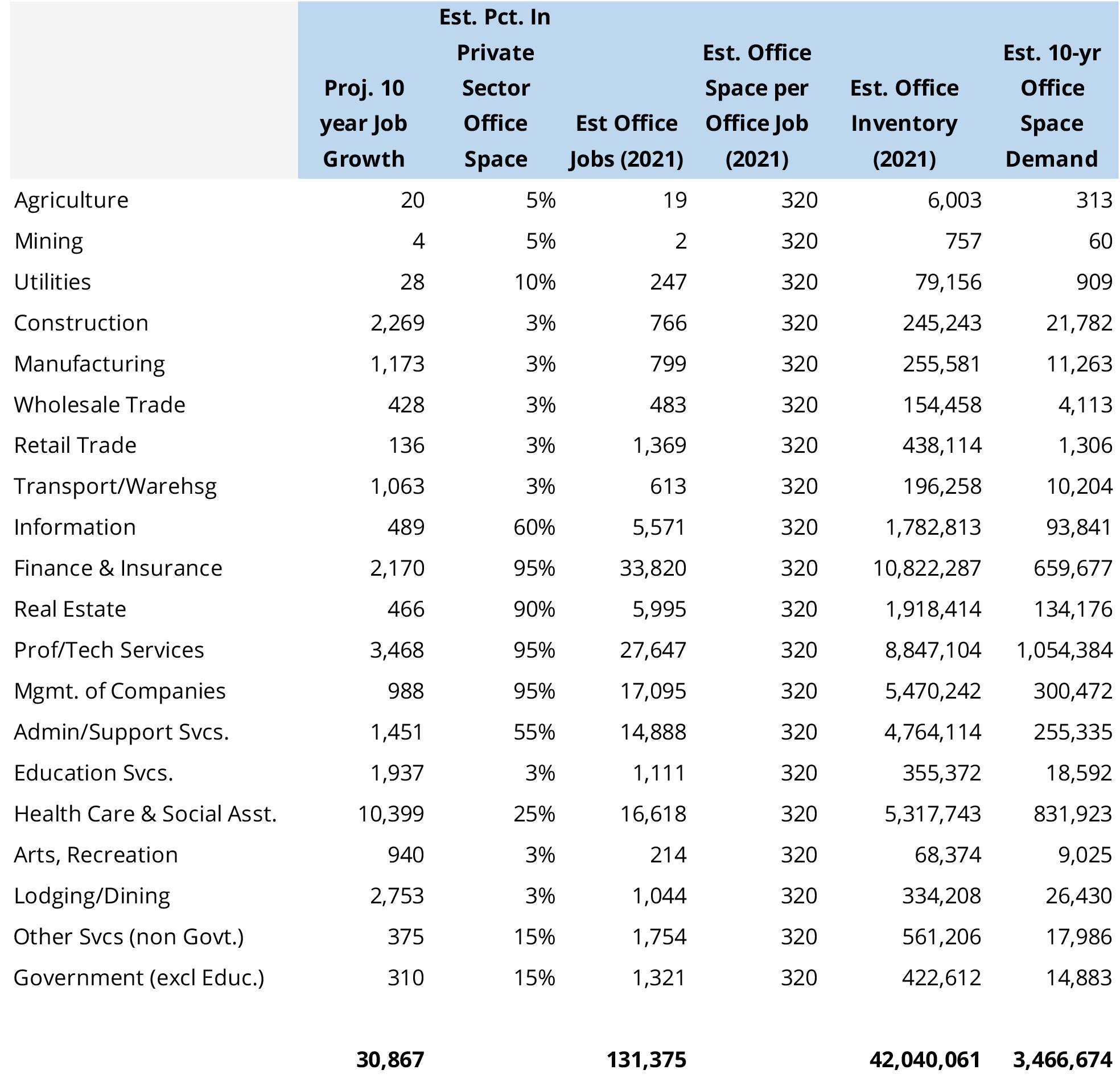
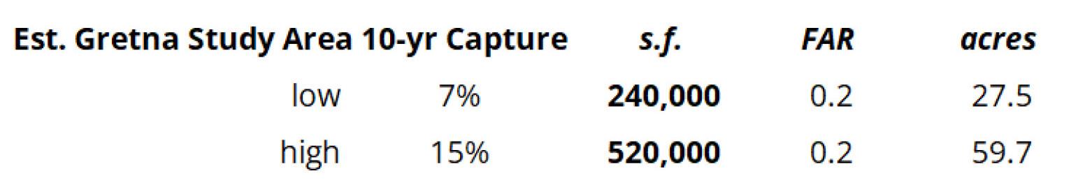
Using the same methodology as for office, we develop estimates of demand for industrial/flex development over the next decade.
Based on State estimates of industry growth rates over the next 10 years for metro Omaha we expect the standing 80M s.f. inventory of industrial/flex space to grow by approximately 3.7M s.f.–an amount similar to projected office space growth.
As with office space, the share of development taking place in Gretna’s submarket (in this case, Sarpy West) dwarfs its share of standing inventory –Sarpy West accounted for 3.3M million out of the 3.5M s.f. of metro-wide space delivered in the past 12 months
In fact, Sarpy West has seen such a perfect storm of development, led by massive Amazon and Facebook facilities, that last year’s completions alone would account for the entire 10 years of demand forecasted for the metro area.
That anomaly makes it particularly difficult to arrive at a justifiable long-term estimate of study area attainable capture.
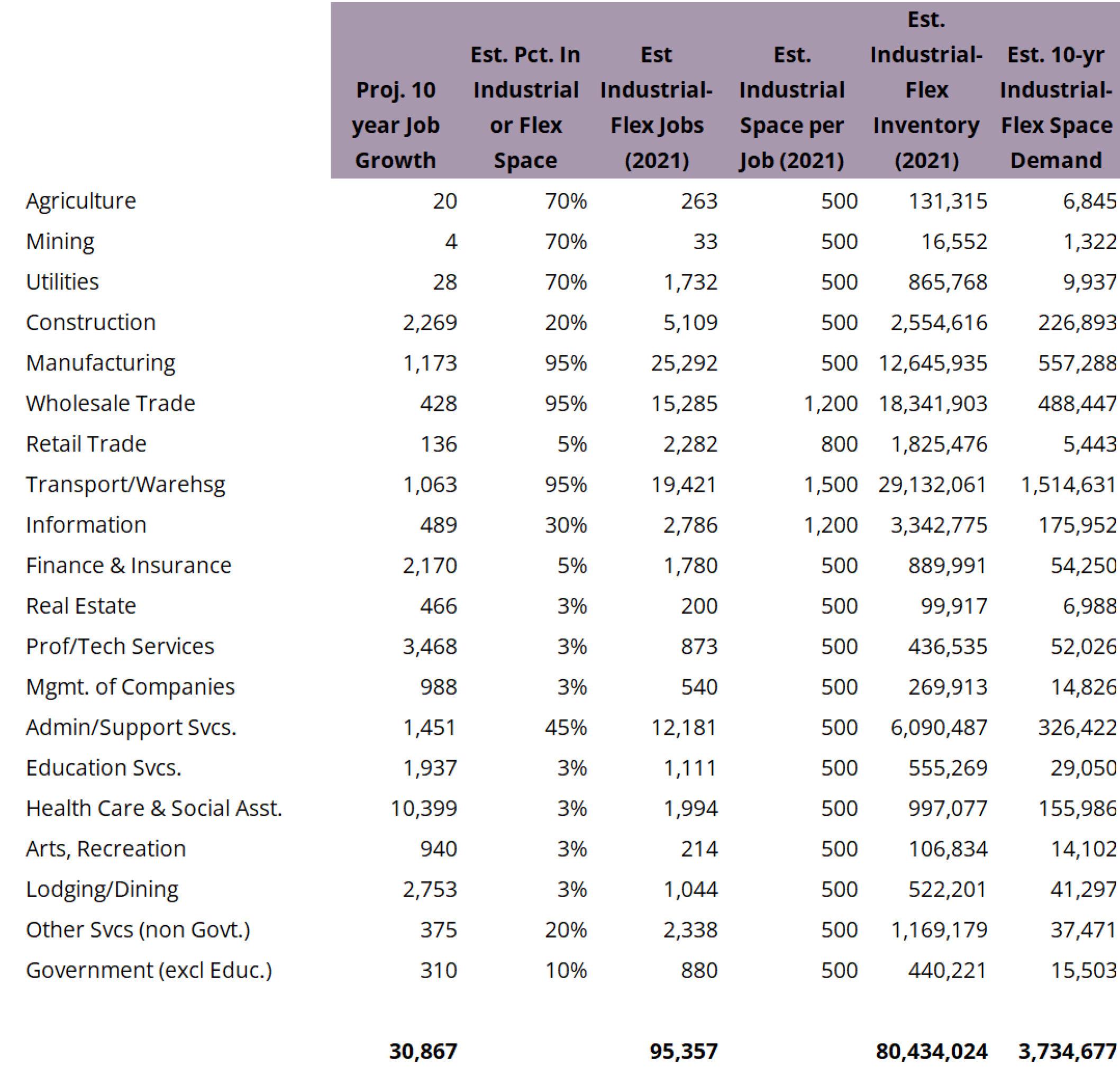
Figure 6.27 shows 2002 jobs in retail and entertainment/arts sectors, along with growth occurring through 2019.
Retail jobs are fairly evenly spaced through the metro, populating major arterial intersection nodes. Retail development follows rooftops, so much recent growth has tracked along with residential expansion into edge locations of the metro.
Gretna will see future neighborhood-scale retail centers (primarily grocery-anchored centers) paced along with household growth. Significant retail expansion serving more regional-scale markets is also likely over time for Gretna, taking advantage of the gateway interstate location and potential reach into Lincoln.
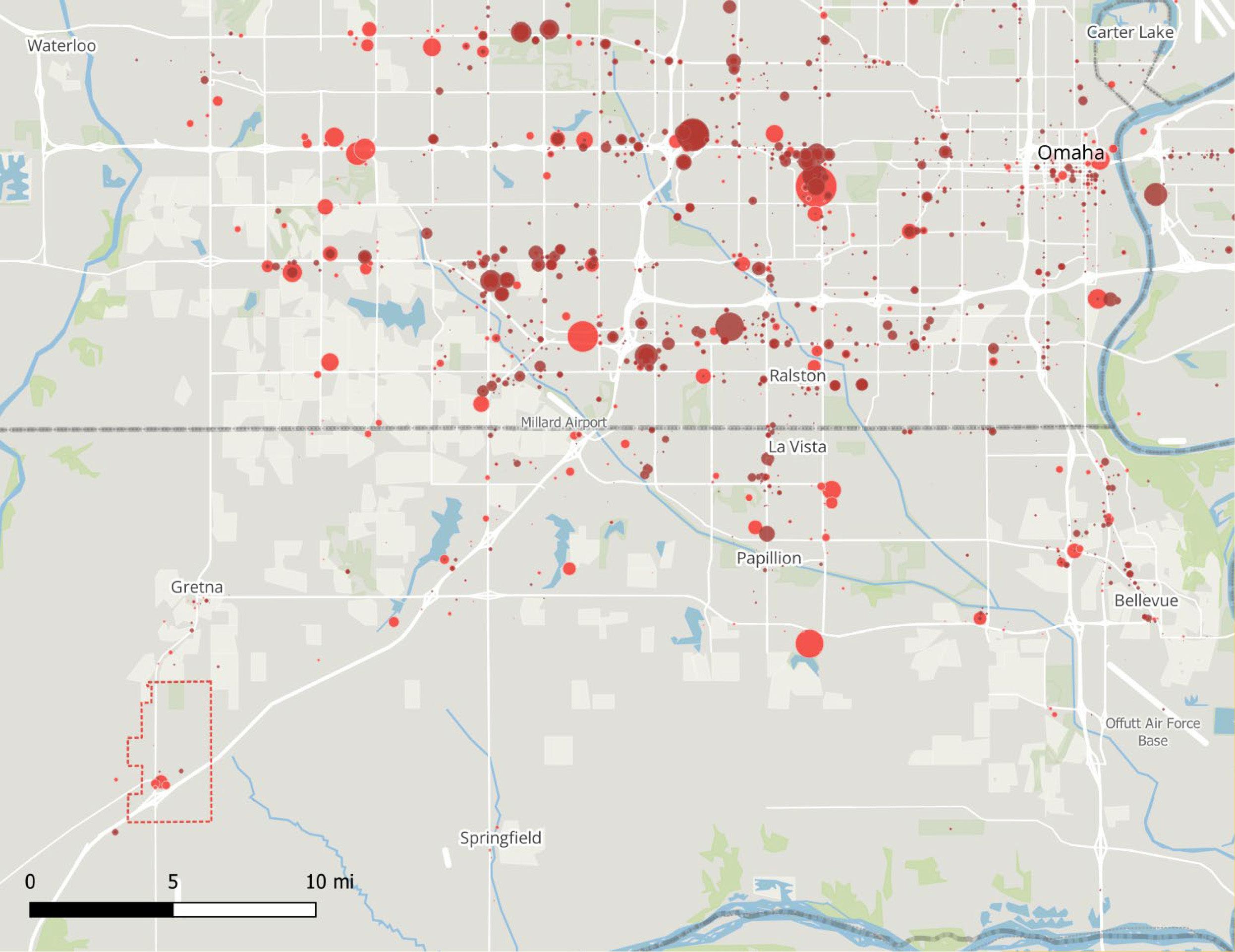
The Omaha market weathered a bump in vacancy (peaking at 6.5%) early in the Covid pandemic with rents maintaining their highest levels since 2007.
Sarpy West remains at the top of metro submarkets in terms of average rents, at $18.42/sf/yr., behind only the West Dodge Corridor.
Sarpy West has 1.1M sf of inventory, almost half of which is taken up by Nebraska Crossings hybrid outlet/lifestyle center adjacent to the study area, making it one of the smaller submarkets in the 64M sf Omaha market.
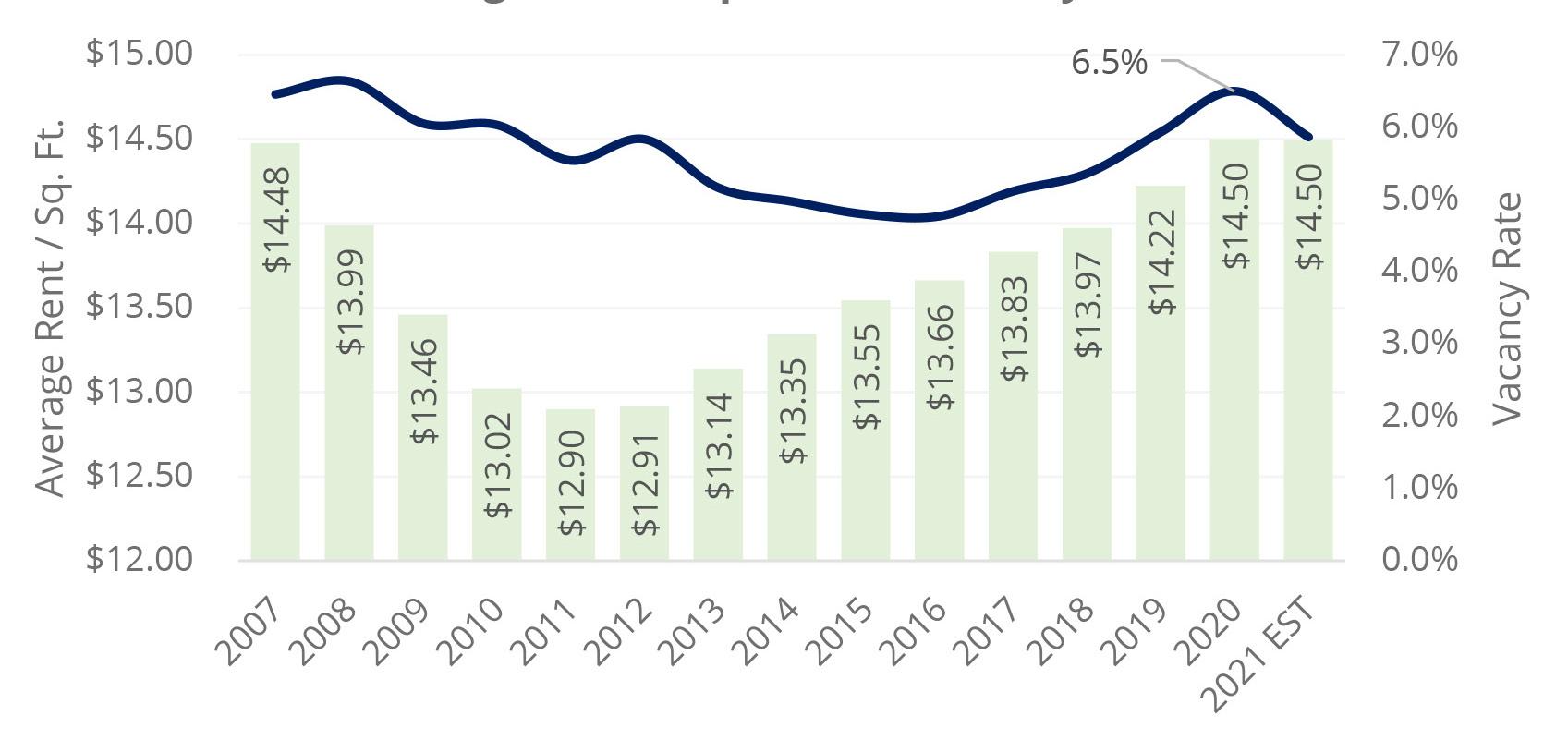
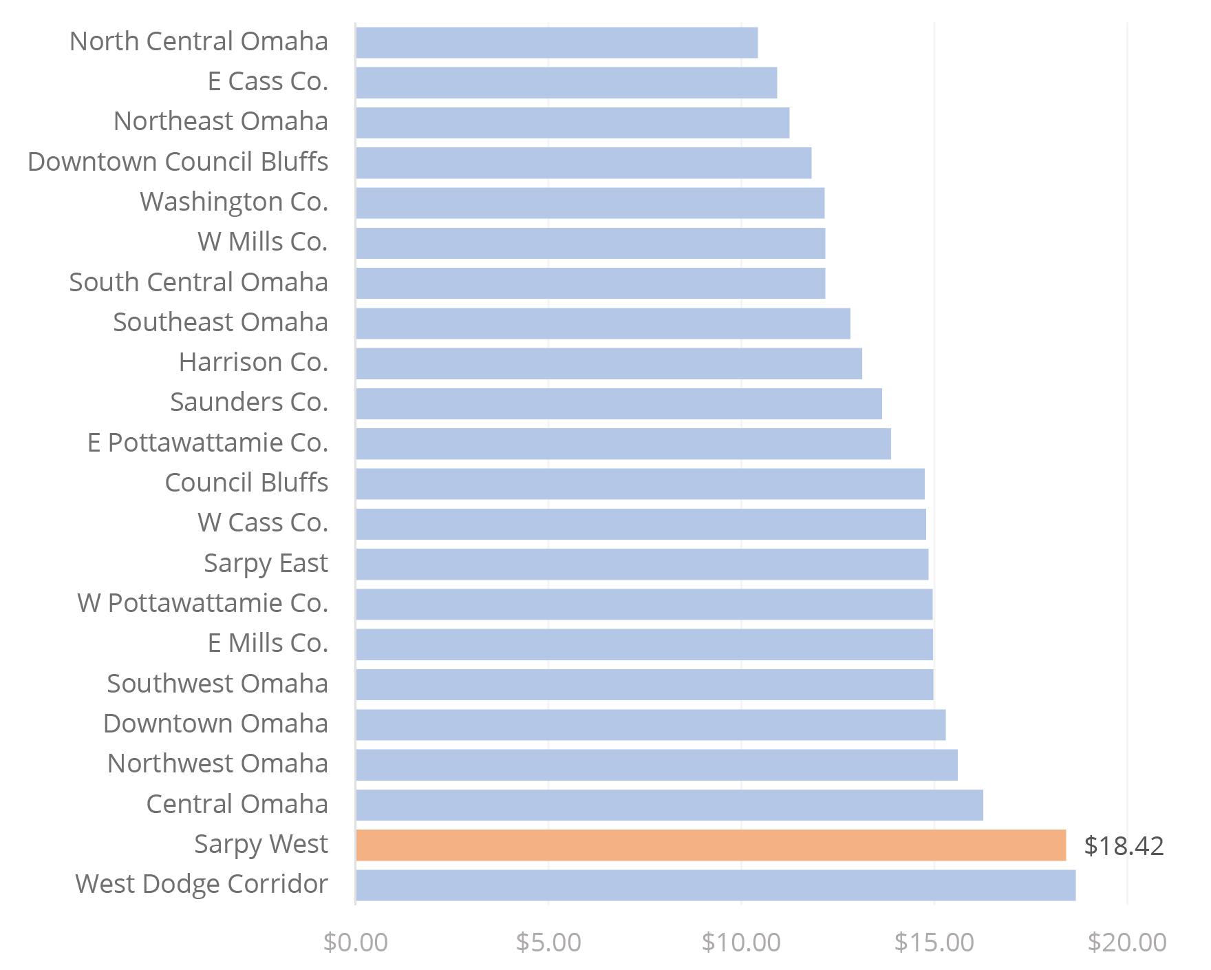
Whereas long-term industrial and office demand is modeled using employment growth projections, retail space needs are driven primarily by expected population growth.
In addition, the geography of interest for projected population growth can be different for each retail category and center type under consideration.
Grocery-anchored neighborhood retail is the most straightforward category to forecast, with a geographic market area ranging from a 1-2 mile radius in urban areas and 3 or more miles in suburban locations like Gretna.
Hy-Vee and Fareway are both currently underway developing grocery stores in Gretna, potentially totaling over 100,000 sf.
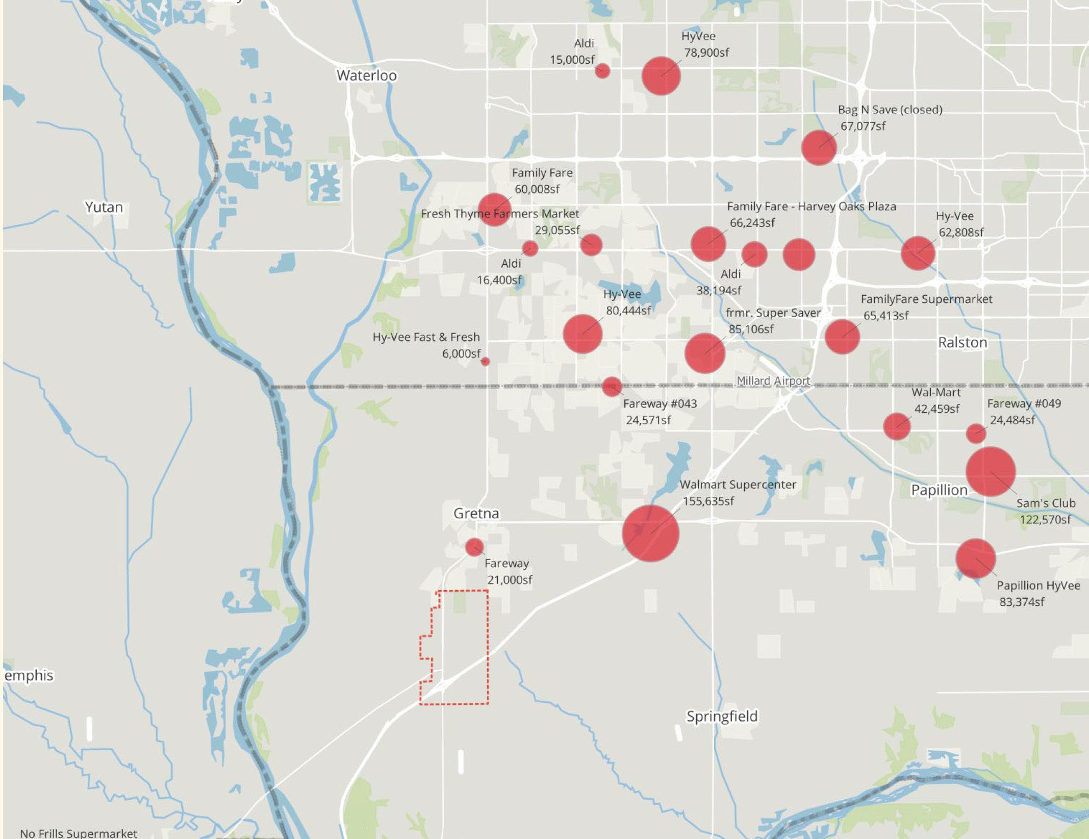
Because of its far southwest I-80 location, the Study Area has no direct competitors, but several projects in various pipeline stages will have to share demand to some extent across some land use categories Avenue One, West Omaha
The $1.2 billion mixed-use projects will cover about 50 square blocks of farmland and will feature 800,000 square feet of office space, 700,000 square feet of retail space, a hotel, and 2,000 residential units and 6 miles of walking trails. Marketed as “Omaha’s Western Gateway”.
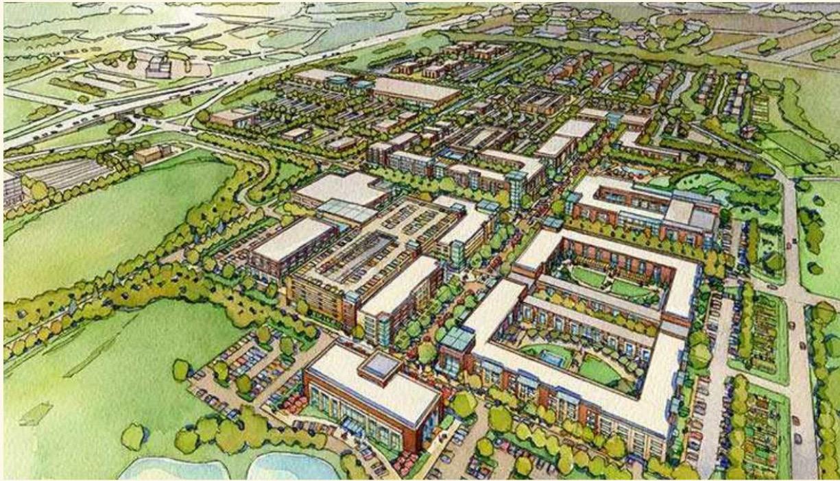
34-acre former Wal-Mart property will include amenities such as retail shopping, dining, living and office space that will cover approximately 300,000 square feet. The development will eventually include over 350 residential units with plans for an office building and possibly a hotel.
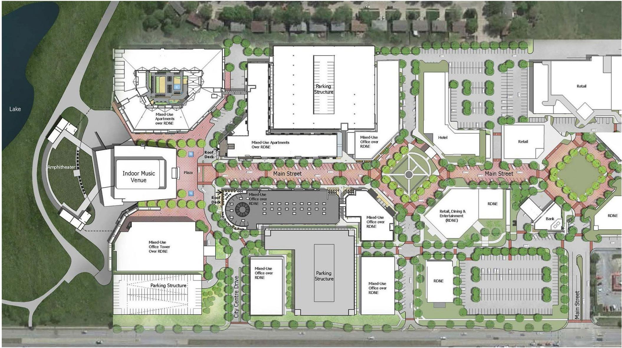
“Generations,” Werner Park area, Papillion
BHI Development, Inc. is working on a 60-acre, mixed-use project that would fill in the vacant land between Highway 370 and the baseball stadium. 400 apartments, office space, condos, hotels and two parking garages. $550 million project.
Crossroads mixed-use redevelopment, Central Omaha
Plans call for a mixed-use project spanning 40 acres with 350,000 square feet of retail and restaurants; 250 apartment units; up to 500,000 square feet of office space and senior living; a 150-room hotel; and 2.5 acres of public space. An existing Target store will remain in place.
Project costs are estimated at $553 million. The city anticipates using $12.5 million in redevelopment bonds to pay for infrastructure costs in and around the development, which will be known as The Crossroads. The developers also anticipate applying for an Enhanced Employment Area occupation tax recoup some of their project’s costs. Completion is slated for late 2024..
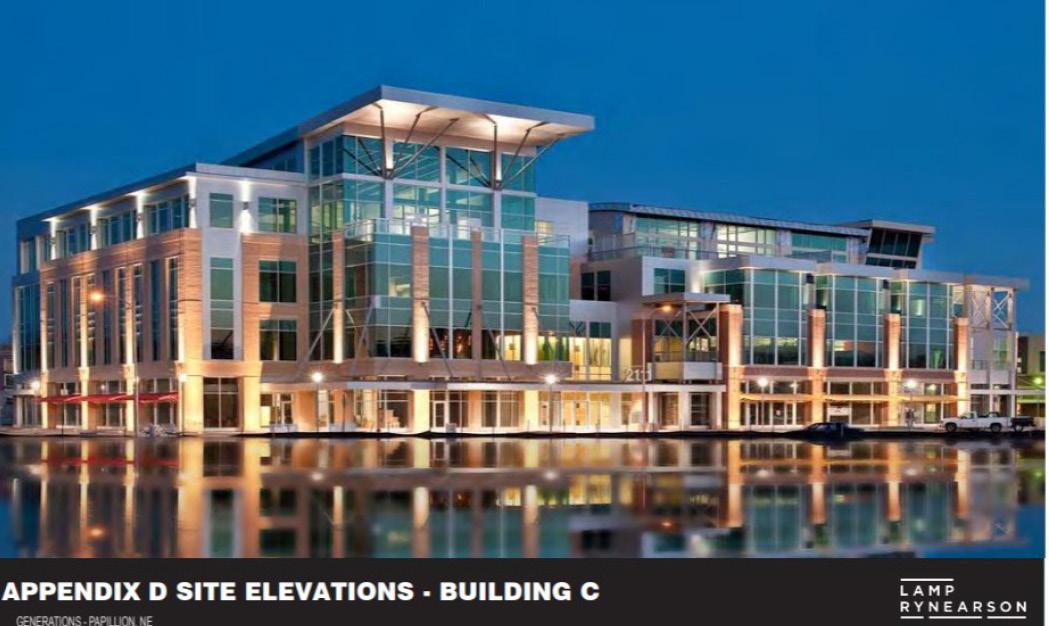
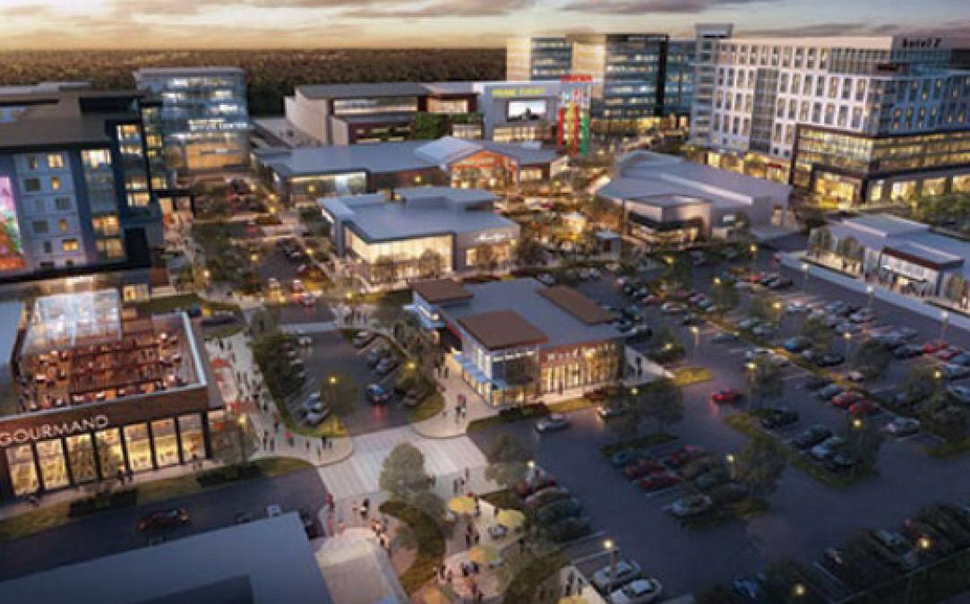
Papillion Commons (“Tower District”)
A 110-acre development at the northwest corner of 84th & 370. It is a New Urbanist [sort-of] project that includes “multi-family housing, a hotel, an assisted living facility, daycare facility as well as a trail system and a park.
There would also be 164,000 square feet of retail, “no store larger than 40,000 square feet”, as well as 80,000 square feet of office space.
The total investment will be $50 million with funds coming from a public/private partnership. Two phases will be fully complete by open in 2026. 16 artificial turf infield baseball/softball fields, 6 artificial turf multi-purpose fields. One championship artificial turf multi-purpose field (Soccer/Football/Lacrosse), 3 natural grass multi-purpose fields. The complex is projected to attract more than 900,000 visitors over a 35-week outdoor sports season each year. Parking for up to 3,000 vehicles.
A $27 million which will seat 2,500 people
StreckLaboratories
An 84-unit apartment development planned for 117th & Harrison Street in La Vista near its headquarters and manufacturing plant. The “oncampus” apartments are designed to help Streck attract and retain talent in a tight labor market by providing discounted rents to employees.
A senior-living property. Construction is planned to begin in 2022 on the planned for 34 acres at Highway 6 and Schofield Drive in Gretna. The $87 million project would cater to residents ages 55 and up. The main building would 175,000 sq. ft. with 82 apartments.
Figure 6.31 shows a large-scale view of the study area. The red line outlines the growth boundary for the City of Gretna. The black dashed line highlights the study area. Existing Gretna city limits are shown in the solid white line.
The study area is located south of the existing city limits and well within the identified growth boundary for the community.
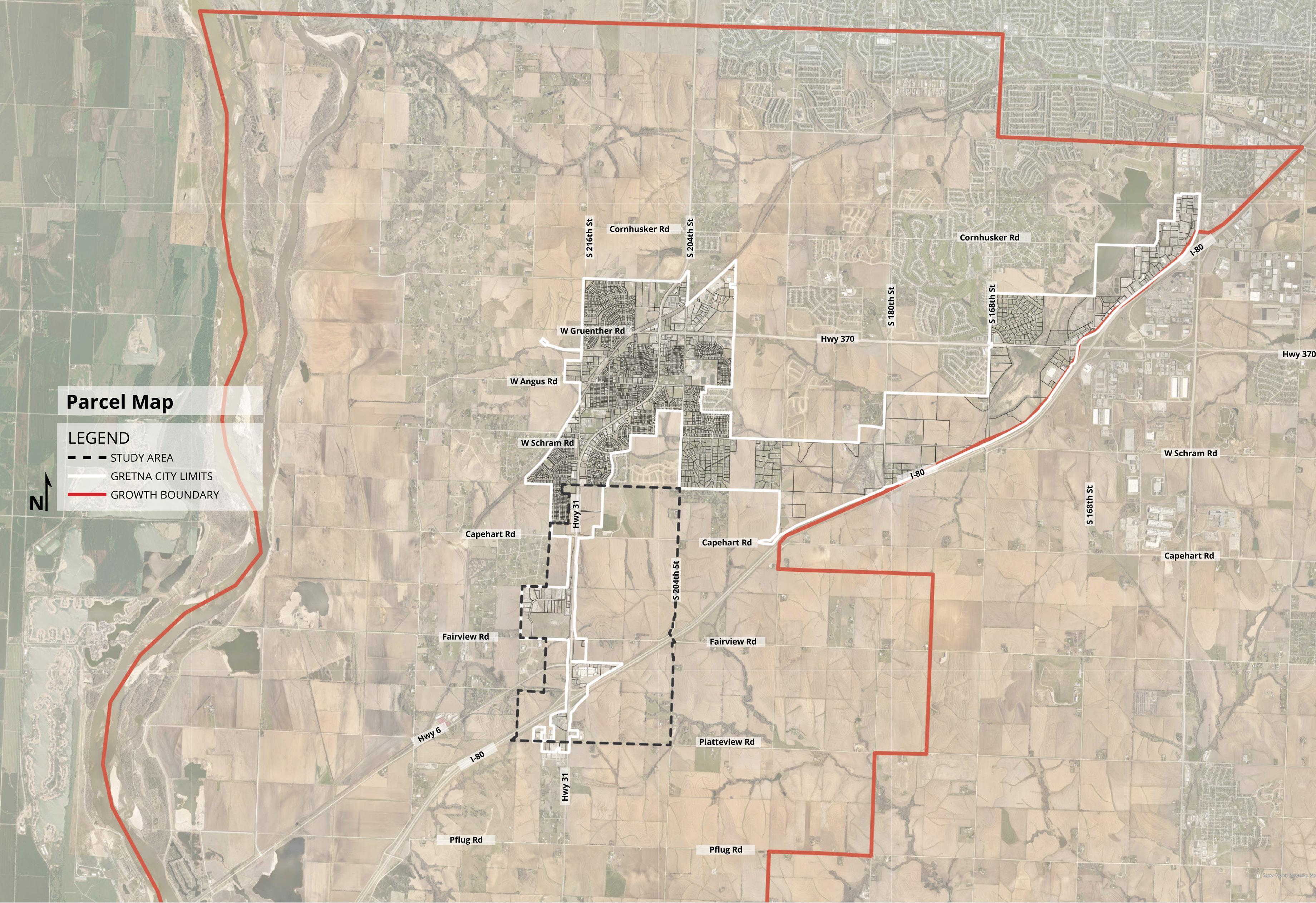
Figure 6.32 shows the existing land use within the study area as well as the existing city limits of Gretna. Most of the study area is undeveloped / agricultural with a few areas of industrial and commercial land uses. Also shown in Figure 6.32 is the 100-year and 500-year floodplain in blue hatch and light yellow, respectively.
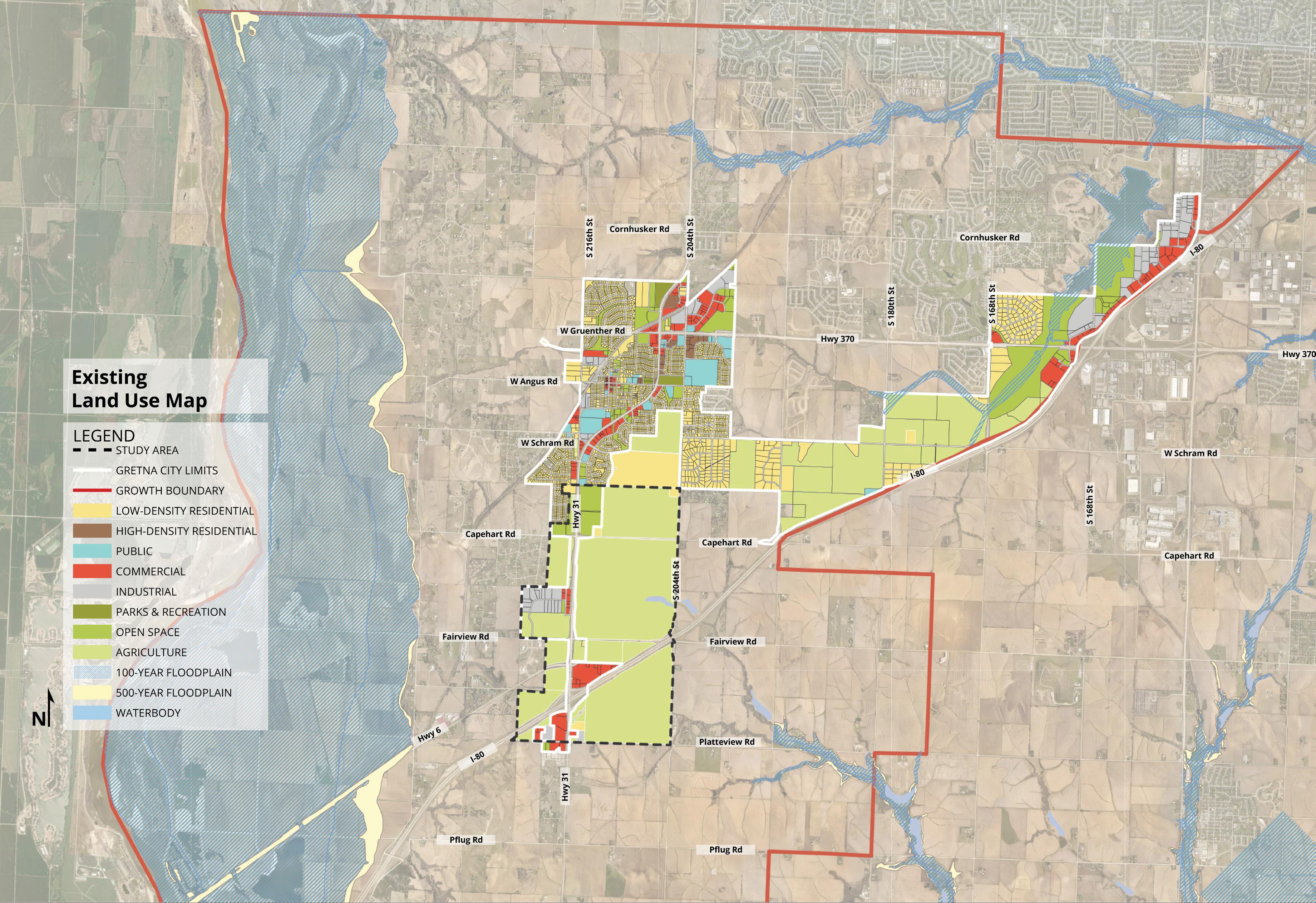
Figure 6.33 shows a large-scale view of the study area. The red line outlines the growth boundary for the City of Gretna. The black dashed line highlights the study area. Existing Gretna city limits are shown in the solid white line. This figure also shows the future land use map when the project started.
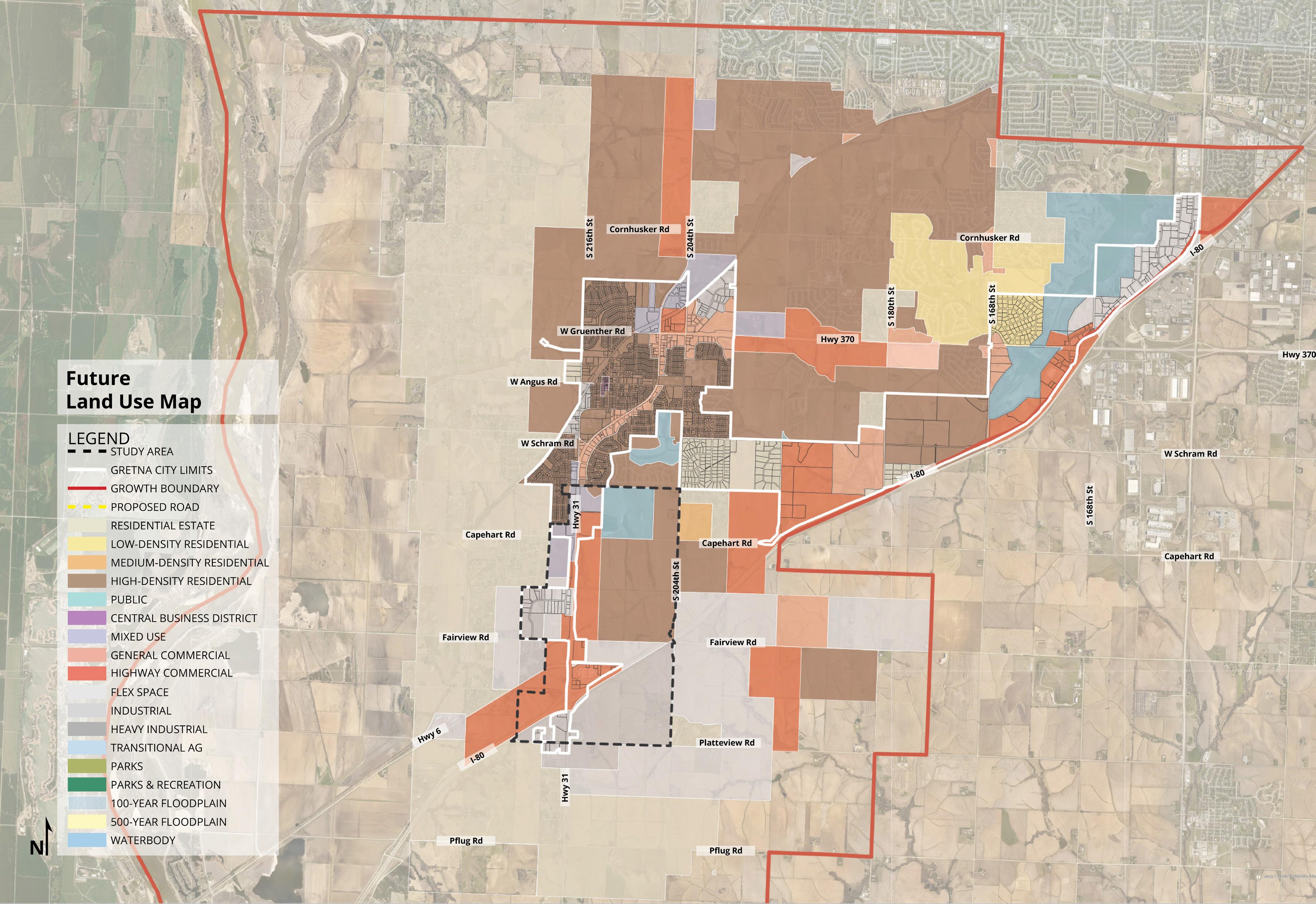
Figure 6.34
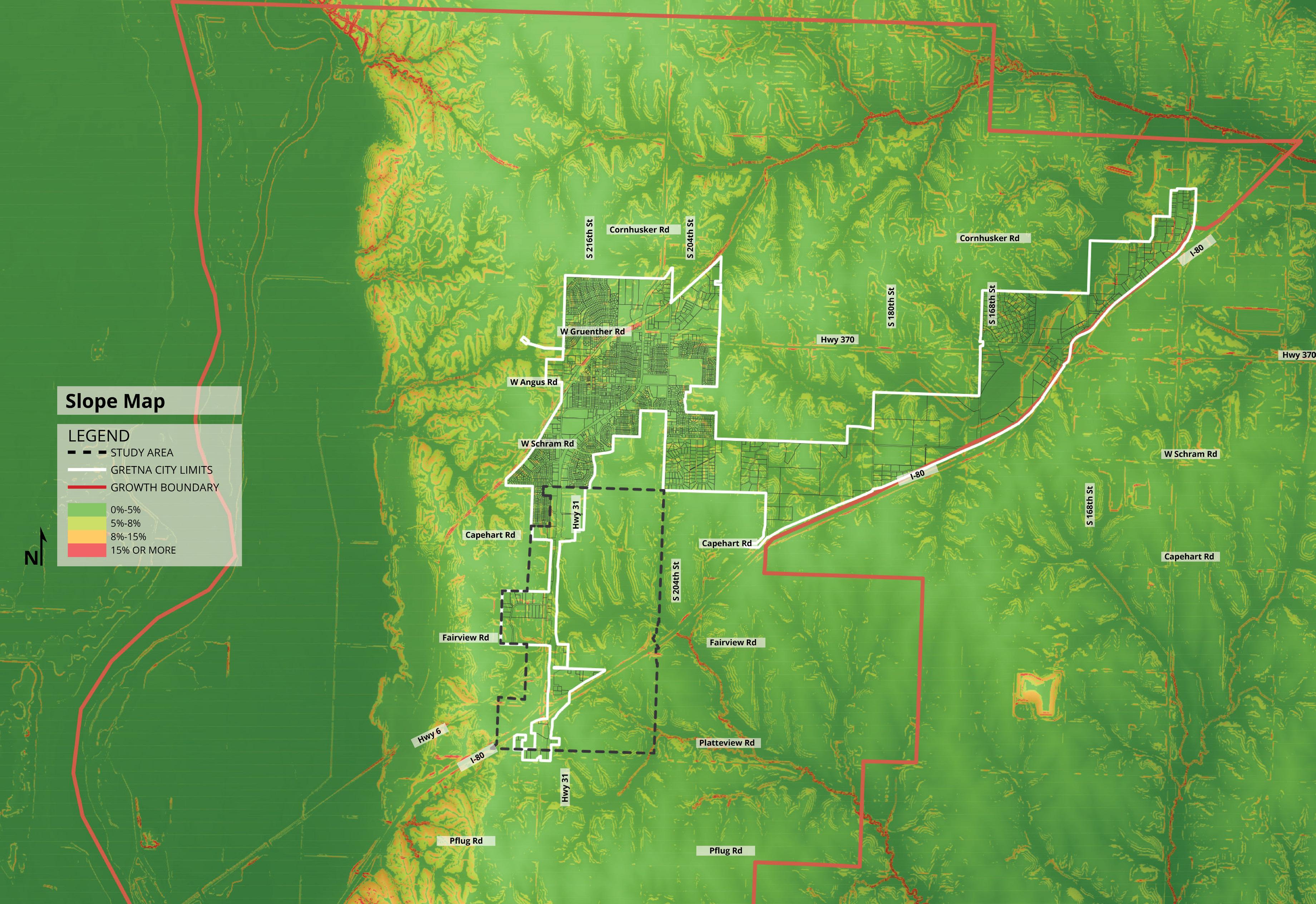
Figure 6.35 shows a close-up view of the study area with an aerial background and the parcel layer activated. Most of the study area is composed of larger 20 to 40-acre parcels. The agricultural land currently within the site has some existing tree cover along the creeks and tributaries that run through the study area.
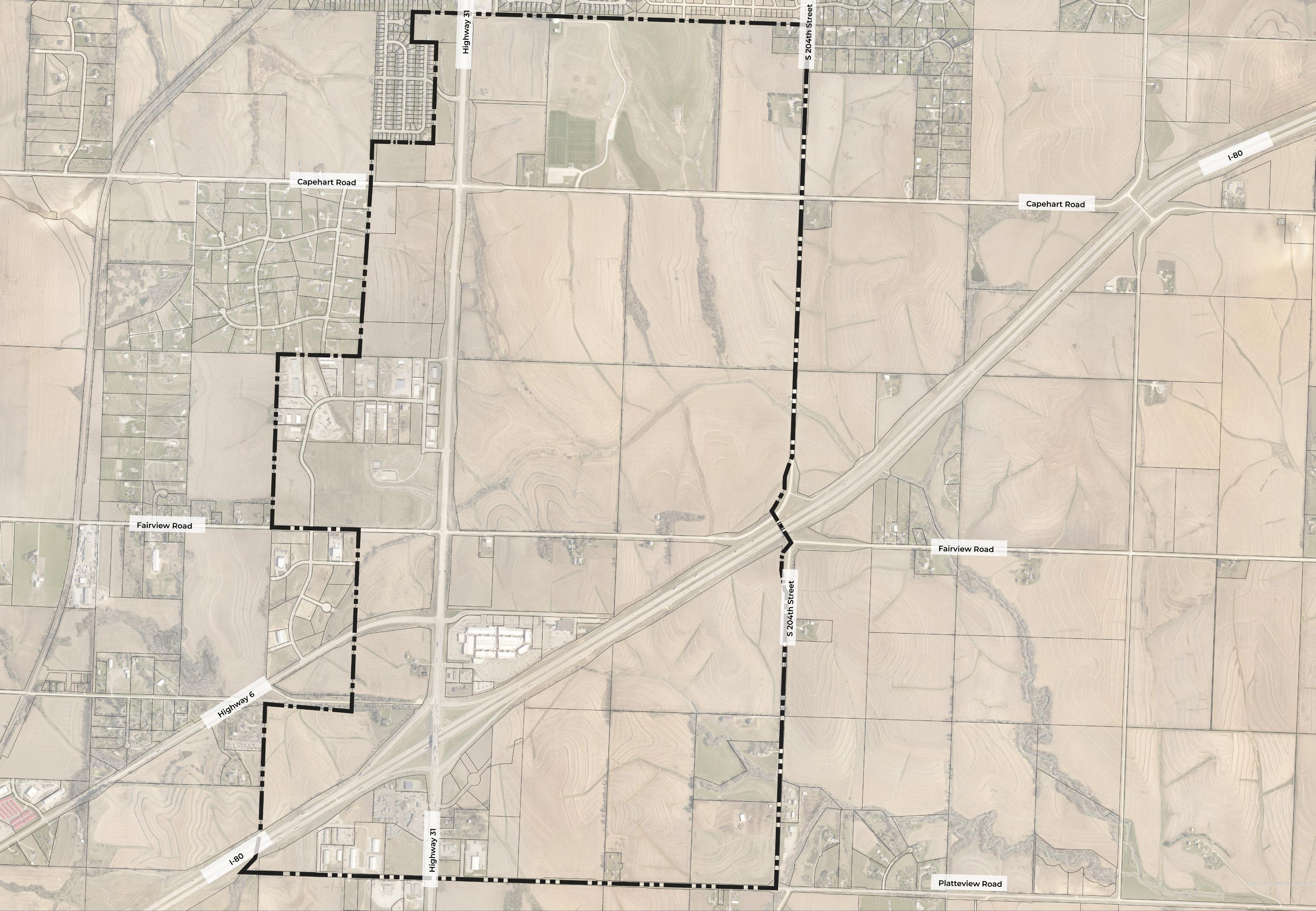
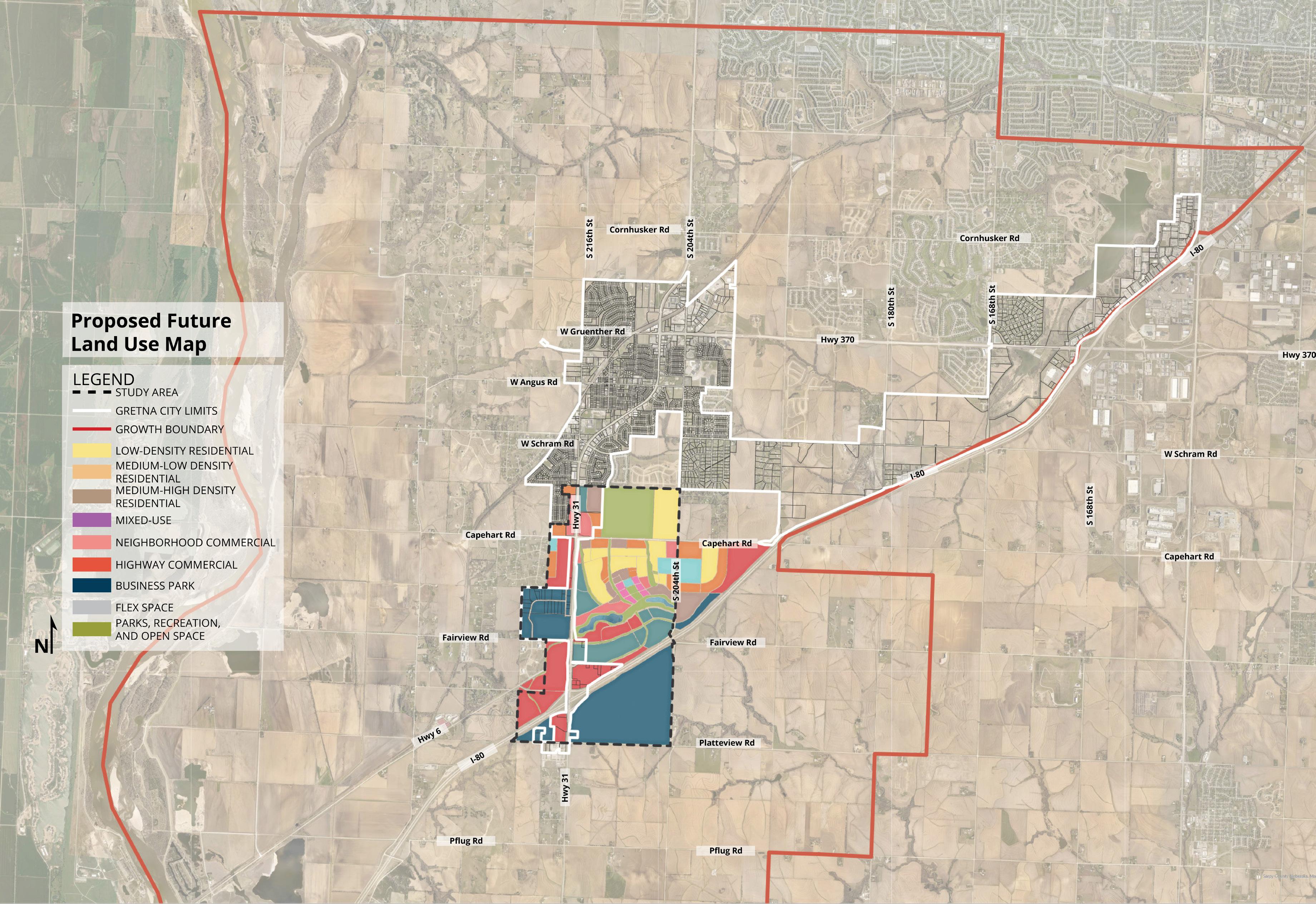
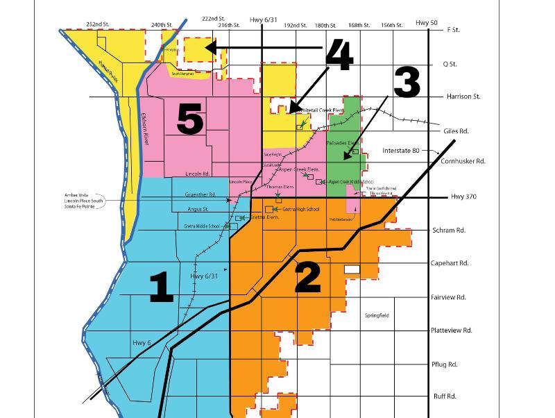
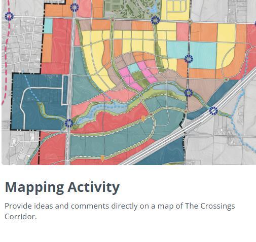
17
800+ Participants
32 December 8th – January 31, 2021
Participants Participants

• Think big and outside the box
• The significance of some of the proposed projects are huge and would put Gretna on the map and start a snowball effect
• Be picky – hold the line on quality or risk becoming a bunch of disconnected subdivisions and commercial sites only accessible by car from hostile state highways
• With the right plan and patience, Gretna could create a truly walkable, semi-urban place that’s more than just a regional shopping destination
• Potential to become a new urbanist type community that is a first of its kind in Omaha
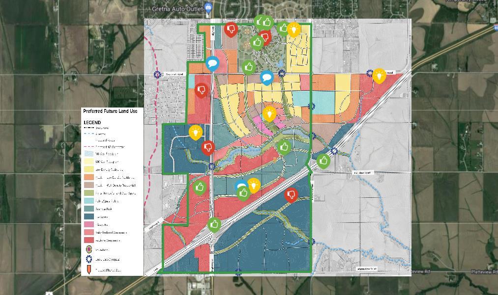
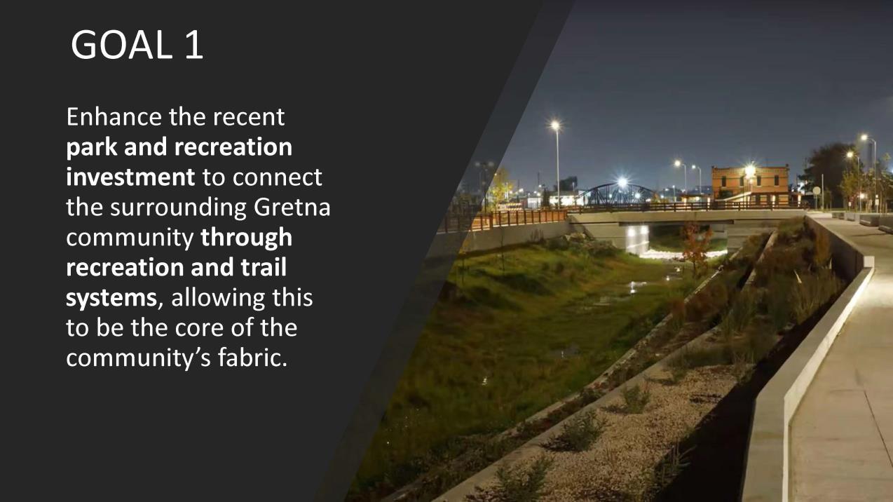
Goal 1 Support


86%
Not supportive Neutral Supportive
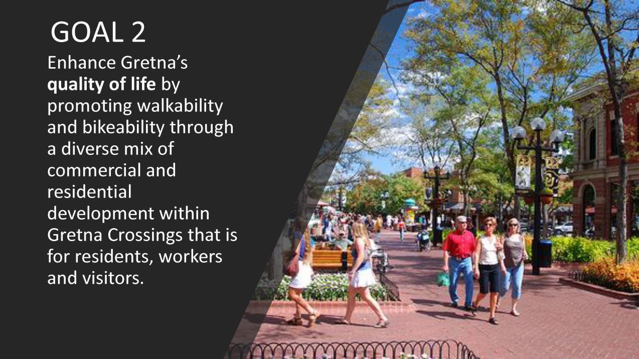
Goal 2 Support
Not supportive Neutral Supportive
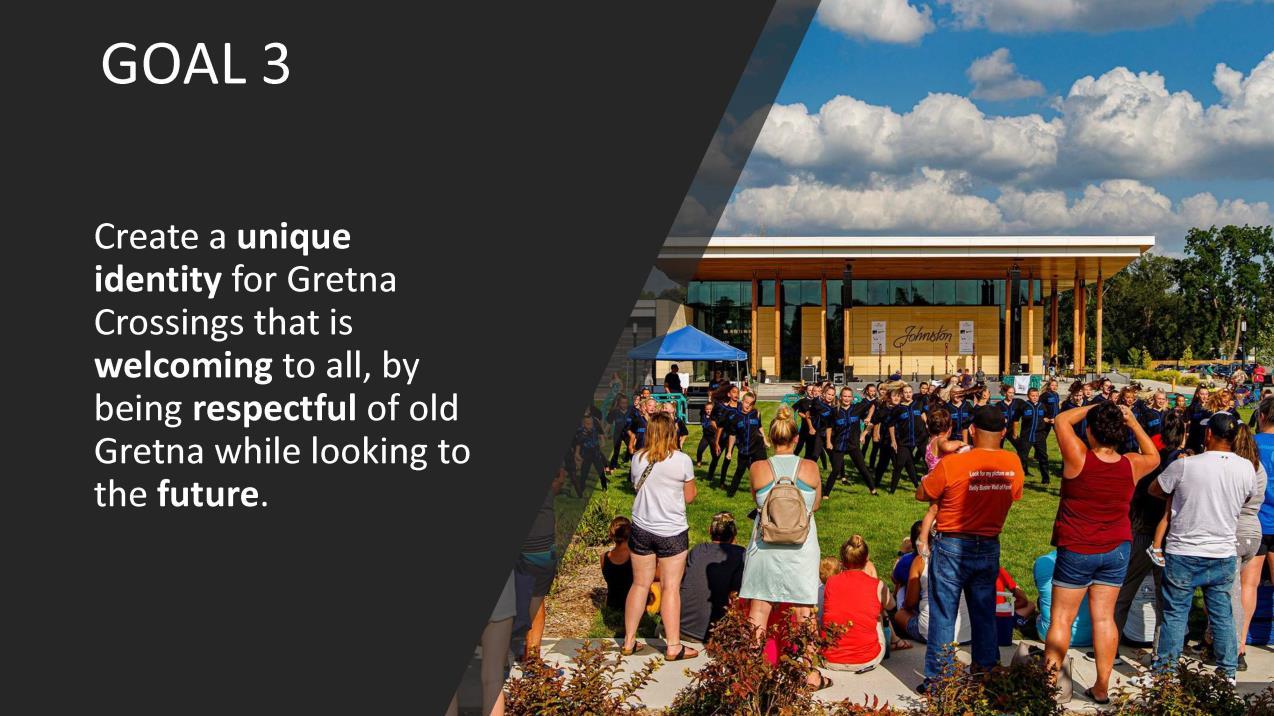
Goal 3 Support

Not supportive Neutral Supportive

Goal 4 Support
89%
Not supportive Neutral Supportive
Do you support the Future Land Use Plan?

14%
72%
14%


Not supportive Neutral Supportive

• Overall general support and excitement for the plan and its goals!
• Incorporate affordable housing
• Don’t forget downtown + character
• Traffic control
• Support for sidewalks, bike trails + connectivity regionally
Prior to finalizing the future land use plan for the study area, multiple plans were explored. Figure 6.37 illustrates the initial ideas explored.
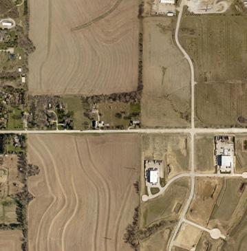
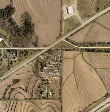
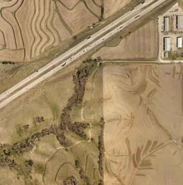
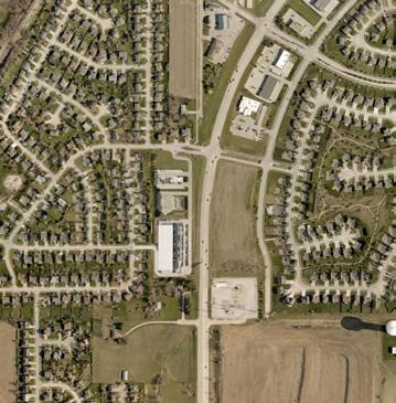
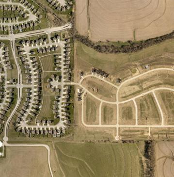
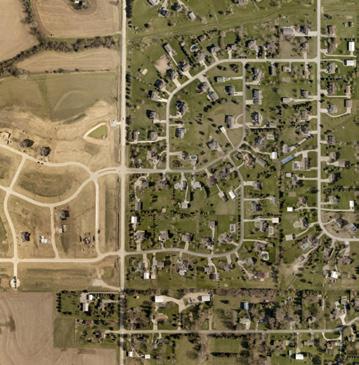
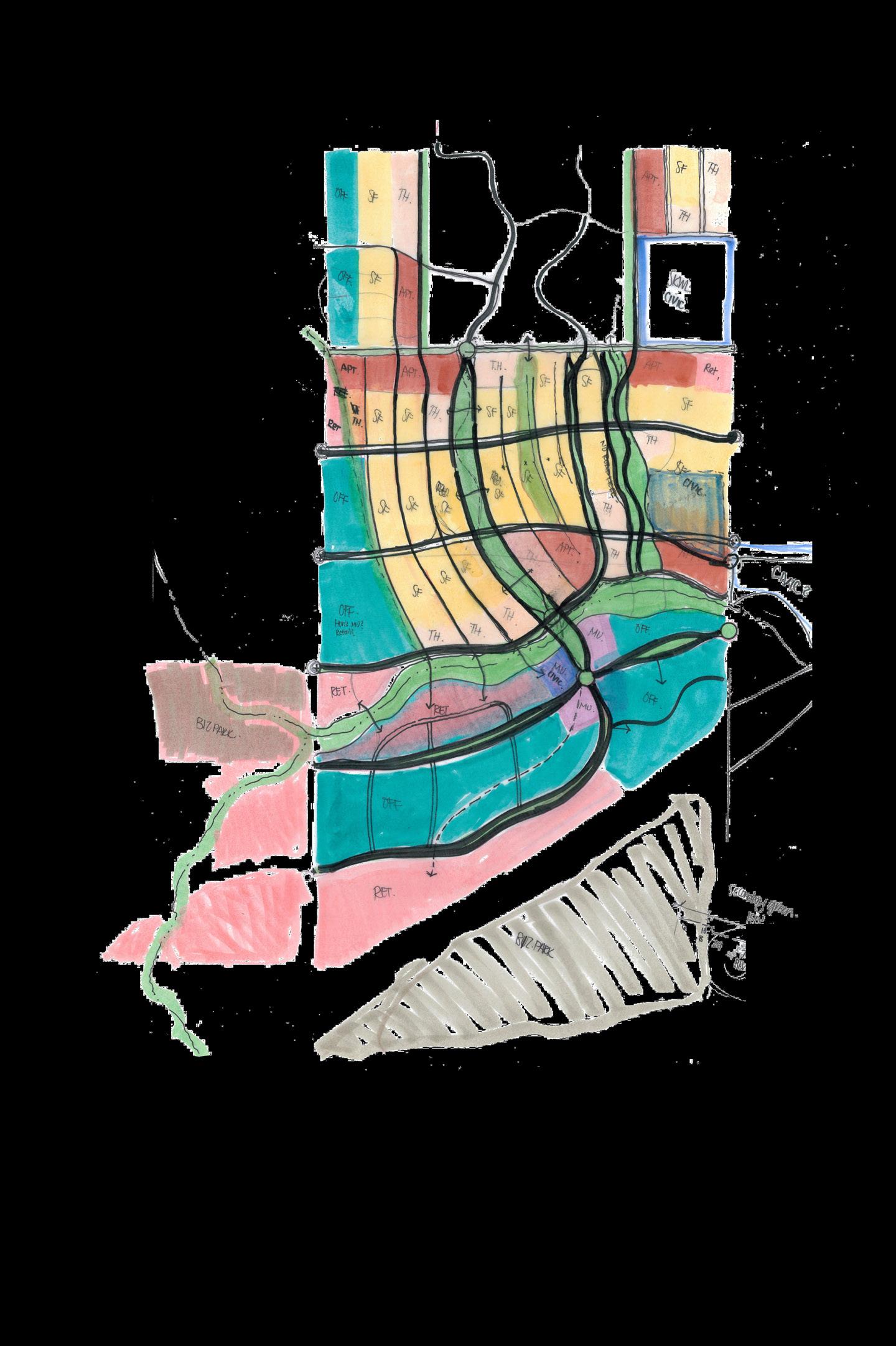
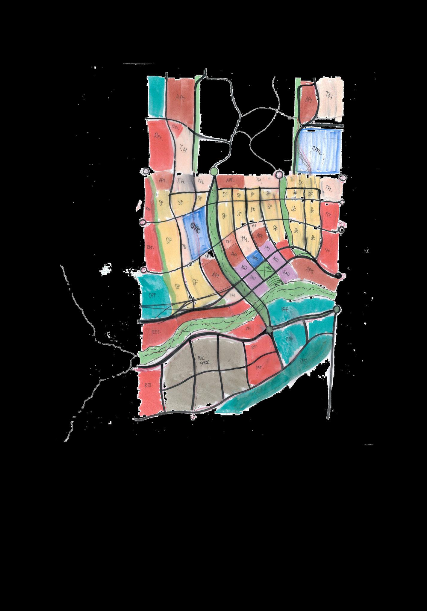
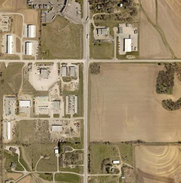
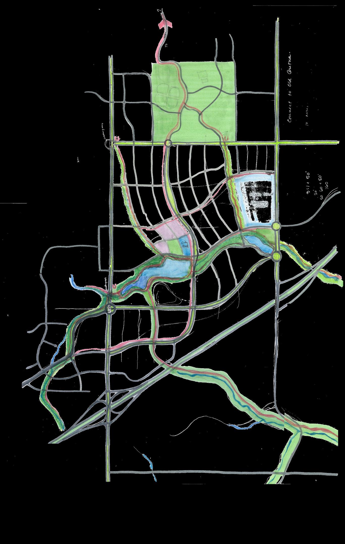
Master Plan - Gretna, Nebraska
To understand key stakeholder development styles and amenity preferences, multiple development examples were shared and overlay atop the study area. This allows an approximate understanding of size and scale of different development styles and densities which were used to inform the land use definitions.