CITY OF HICKMAN, NEBRASKA
Lancaster County, Nebraska
Zoning Regulations
Ordinance #


Lancaster County, Nebraska
Zoning Regulations
Ordinance #
This Ordinance shall be known, and may be cited and referred to, as the Zoning Regulations of the City of Hickman, Nebraska. This document may be amended, and sections or words repealed, replaced, or added through the passage of additional Ordinances. Collectively the original ordinance and each amending ordinance will be known as “this Ordinance”. This document is also commonly known as Zoning Regulations or Zoning Ordinance.
This ordinance has been made in accordance with a comprehensive plan and to promote the health, safety, and general welfare of the community; to lessen congestion in streets; to secure safety from fire and other dangers; to provide adequate light and air; to promote the distribution of population, land classifications and land development to support provisions for adequate transportation, water flows, water supply, drainage, sanitation, recreation, and other public requirements; to protect property against blight and depreciation; and to secure economy in governmental expenditures.
These zoning ordinances are designed to implement various elements of the comprehensive plan as required by state statutes. Any amendment to the district ordinances or map shall conform to the comprehensive plan adopted by the governing body.
These Regulations are adopted under the authority of Chapter 19 of the Nebraska State Statues, as amended.
The provisions of this Ordinance shall apply within the corporate limits of the City of Hickman, Nebraska, and within the territory beyond said corporate limits as now or hereafter fixed, for a distance of one mile, as established on the map entitled "The Official Zoning Map of the City of Hickman, Nebraska", and as may be amended by subsequent annexation.
These Regulations are adopted for the purposes set forth in Nebraska State Statute §19-901, as amended, including:
1. To promote the orderly growth and development of the City in accordance with the adopted Comprehensive Development Plan of the City of Hickman.
2. To promote the health, safety, and general welfare of the community, lessening congestion in the streets, prevent the overcrowding of land, avoid undue concentration of population, provide for light and air, and to facilitate the adequate provision for transportation, water, sewerage, schools, parks, and other public improvements.
3. To divide the City into zoning districts with considerations as to the character of each district and its suitability for particular uses, so as to conserve the value of property and buildings and promote the most appropriate use of land throughout the City.
4. To protect historic factors and existing and potential groundwater and drinking water supplies of the City.
5. To assure that proper provision is made for sedimentation control and the control of erosion caused by wind or water.
6. To encourage the development of housing opportunities, including opportunities for multiple dwelling units, consistent with soil types, terrain, and infrastructure capacity.
7. To promote housing choice and economic diversity in housing, including housing for both lowand moderate-income households, and shall encourage the development of housing which will meet identified housing needs.
8. To encourage energy efficient patterns of development, the use of renewable forms of energy, and energy conservation.
For the purpose of this ordinance, the following rules shall apply:
1. Words and numbers used singularly shall include the plural. Words and numbers used in the plural shall include the singular. Words used in the present tense shall include the future.
2. The word "persons" includes a corporation, members of a partnership or other business organization, a committee, board, council, commission, trustee, receiver, agent or other representative.
3. The word "shall" is mandatory. The word “may” is permissive.
4. The words "use", "used", "occupy" or "occupied" as applied to any land or building shall be construed to include the words "intended", "arranged" or "designed" to be used or occupied.
5. The word "commission" shall refer to the Planning Commission of Hickman, Nebraska.
6. Undefined words or terms not herein defined shall have their ordinary meaning in relation to the context.
7. In the case of any real or apparent conflict between the text of the Ordinance and any illustration explaining the text, the text shall apply.
For purposes of these Regulations this section contains a listing of abbreviations and acronyms used throughout this document.
ADA = Americans with Disabilities Act
AU = Animal Unit
CFR = Code of Federal Regulations
DU = Dwelling Unit
DNR= Department of Natural Resources
FAA = Federal Aviation Administration
FCC = Federal Communication Commission
FEMA = Federal Emergency Management Agency
FT = Foot or Feet
HUD = US Department of Housing and Urban Development
KV = Kilovolt
KW = Kilowatt
NDEE= Nebraska Department of Environmental and Energy
NDOT= Nebraska Department of Transportation
NEMA= Nebraska Emergency Management Agency
NHHS= Nebraska Department of Health and Human Services
NPDES = National Pollutant Discharge Elimination System
NRCS = Natural Resources Conservation Service
SF = Square Foot or Square Feet
SY = Square Yard
USC = United States Code
USACE = United States Army Corps of Engineers
USDA = United States Department of Agriculture
YD = Yard
AABANDONMENT shall mean to cease or discontinue a use or activity without intent to resume as distinguished from short term interruptions such as during periods of remodeling, maintenance, or normal periods of vacation or seasonal closure.
ABUT shall mean to border on, be contiguous with or have common property or district lines, including property separated by a public street or alley
ACCESS or ACCESS WAY shall mean the place, means, or way by which pedestrians and vehicles shall have safe, adequate and usable ingress and egress to a property or use as required by this Regulation.
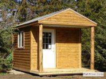
ACCESSORY BUILDING shall mean a building, such as a shed or detached garage, that is incidental to and customarily associated with a specific principal use or building on the same site. An accessory building is an accessory structure. Customary accessory buildings include farm buildings, garages, carports, and storage sheds but not portable storage containers.
ACCESSORY DWELLING UNIT shall mean a separate, complete housekeeping unit with a separate entrance, kitchen, sleeping area, and full bathroom facilities, which is an attached or detached extension to an existing single -family structure, also referred to as “Granny Flats”.
ACCESSORY LIVING QUARTERS shall mean living quarters within an accessory building located on the same premises with the main building, for use by temporary guests of the occupant of the premises, such quarters having no kitchen facilities and not rented or otherwise used as a separate dwelling unit.
ACCESSORY STRUCTURE shall mean a structure that is incidental to and customarily associated with a specific principal use or building on the same site. Customary accessory structures include fences and swimming pools.
ACCESSORY USE shall mean a use incidental, related, appropriate and clearly subordinate to the main use of the lot or building.
ACRE shall mean an area containing 43,560 square feet.
ACREAGE shall mean any tract or parcel of land, used for single-family residential purposes, that does not qualify as a farm or farmstead.
ADJACENT shall mean having lot lines or district boundaries in common, including property separated by a public street or alley; used interchangeably with "abutting or contiguous.

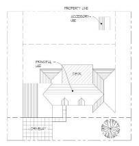
Building Accessory Use
Example of an Agricultural Cooperative Production/ Distribution Facility
ADVERSE EFFECT shall mean a zoning ordinance or zoning decision that has a material effect on neighboring properties or use of neighboring properties including, but not limited to property values, rights of way, easements, setbacks, or height and area of structures.
ADVERTISING STRUCTURE shall mean any structure used as an outdoor display, regardless of size and shape, for the purposes of making anything known, the origin or place of sale of which is not on the property with such Advertising Structure.
AGENT OR OWNER shall mean any person showing written verification that he/she is acting for, and with the knowledge and consent of, a property owner.
AGRICULTURAL CHEMICAL USE shall mean the storage, application or use of chemicals, fertilizers, petroleum for agricultural purposes (not for resale).
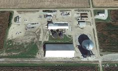
AGRICULTURAL COOPERATIVE PRODUCTION/DISTRIBUTION
FACILITY: shall mean any facility owned and operated by a cooperative or other corporation for the purpose of manufacturing, distributing, and storage of fertilizers, herbicides and grain. This includes the offices, scales and parking areas necessary for trucks and other vehicles.
AGRICULTURAL OR FARM BUILDINGS shall mean any building or structure which is necessary or incidental to the normal conduct of a farming operation, including but not limited to, residence of hired persons, barns, buildings and sheds for housing livestock, poultry and farm machinery, buildings for the storage or shelter of grain, hay and other crops, silos, windmills and water storage tanks.
AGRICULTURAL INDUSTRIES shall mean establishments or uses engaged in the large-scale storage or initial processing of agricultural products and supplies that cannot be otherwise categorized as light, general, or heavy industries, some of which may involve storage of potentially hazardous materials. Typical uses include grain elevators and anhydrous ammonia storage facilities.
AGRICULTURAL PROCESSING PLANT shall mean a facility used for the cooking, dehydrating, refining, bottling, canning, or other treatment of agricultural products which changes the naturally grown product for consumer use. May include warehousing and packaging as secondary uses.
AGRICULTURAL RELATED PROCESSING AND MARKETING shall mean those commercial activities which provide direct primary support to the farm community, including, but not limited to feed, fuel, agricultural chemicals, farm supply sales and repair, custom butcher shop, and animal health. Agricultural related processing and marketing shall not be construed to include farm markets as defined herein.
AGRICULTURAL RESEARCH FARM shall mean a demonstration farm, or model farm, is a farm which is used primarily to research or demonstrate various agricultural techniques.
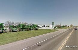
AGRICULTURAL SALES AND SERVICE shall mean an establishments or places of business engaged in sale from the premises of feed, grain, fertilizers, farm equipment, pesticides and similar goods or in the provision of agriculturally related services with incidental storage on lots other than where the service is rendered. Typical uses include nurseries, hay, farm implement dealerships, feed and grain stores, and tree service firms.
AGRICULTURE shall mean the use of land for agricultural purposes, for obtaining a profit by raising, harvesting, and selling crops or by the feeding, breeding, management, and sale of, or the produce of, livestock, poultry, furbearing animals, or honeybees, or for dairying and the sale of dairy products, or any other agricultural or horticultural use.
ALLEY shall mean a public or private thoroughfare which affords only a secondary means of access to property abutting thereon.
ALTERATION shall mean any change, addition or modification to the construction or occupancy of an existing structure.
ALTERATION, HISTORICAL shall mean any act or process that changes one or more of the exterior architectural features of any landmark or property within a landmark district, exclusive of interior renovation or remodeling. Alteration includes demolition of a landmark or property within a landmark district or new construction within a landmark district.
AMENDMENT shall mean a change in the wording, context, or substance of this Ordinance, or an addition, deletion or change in the district boundaries or classifications upon the Official Zoning Map.
AMUSEMENT ARCADE shall mean a building or a part of a building where five or more pinball machines, video games, or other similar player-orientated amusement devices are available and are maintained for use.
ANIMAL, DOMESTIC see Household Pet.
ANIMAL FEEDING OPERATION (AFO): shall mean any farming operation in a confined area where grazing is not possible, and where the confined area is for more than six months in any one calendar year, and where the number of animals so maintained exceeds 1,000 Animal Units as defined below. The confined area of the AFO shall include the pens, corrals, sheds, buildings, feed storage areas, waste disposal ponds, and related facilities. Such facilities shall be constructed and operated in

conformance with applicable county, state, and federal regulations. Two or more AFO's under common ownership are deemed to be a single AFO if they are adjacent to each other and utilize a common area of system for the disposal of livestock wastes. Each operation type shall be classified in one of four levels according to total number of A.U. in the operation at any one time. Levels will include:
Class I Facility = 301-1,000 animal units;
Class II Facility = 1,001-5,000 animal units; Class III Facility = 5,001-10,000 animal units; and Class IV Facility = 10,001 or more animal units.
AFOs having more than one type feeding operation at one location shall be categorized according to the total number of animal units.
ANIMAL GROOMING SERVICE: shall mean any place or establishment, public or private, where animals are bathed, clipped, or combed for the purpose of enhancing their aesthetic value or health and for which a fee is charged.
ANIMAL HOSPITAL shall mean a place where animals are given medical care and the boarding of animals is limited to short-term care incidental to the hospital use.
ANIMAL HUSBANDRY shall mean the branch of agriculture concerned with animals that are raised for meat, fiber, milk, eggs, or other products. It includes day-to-day care, selective breeding and the raising of livestock.
ANIMAL SHELTER shall mean a place where stray, lost, abandoned or surrendered animals – mostly dogs and cats – are housed temporarily.
ANIMAL UNIT shall mean any farming operation or the feeding, farrowing, or raising cattle, swine, sheep, poultry, or other livestock, in a confined area where grazing is not possible, and where the confined area is for more than 6 months in any one calendar year, and where the number of animals so maintained exceeds 300 Animal Units as defined below. The confined area of the Animal Feeding Operation (AFO) shall include the pens, corrals, sheds, buildings, feed storage areas, waste disposal ponds, and related facilities. Such facilities shall be constructed and operated in conformance with applicable county, state, and federal regulations. Two or more AFO's under common ownership are deemed to be a single AFO if they are adjacent to each other or if they utilize a common area of system for the disposal of livestock wastes. Animal Units (A.U.) are defined as follows:
One (1) A.U. = One Cow/Calf combination;
One (1) A.U. = One Slaughter, Feeder Cattle;
One (1) A.U. = One-half Horse;
One (1) A.U. = Seven Tenths Mature Dairy Cattle;
One (1) A.U. = Two and One Half Swine (55 lbs. or more);
One (1) A.U. = Twenty-Five Weaned Pigs (less than 55 lbs.);
One (1) A.U. = Two Sows with Litters;
One (1) A.U. = Ten Sheep;
One (1) A.U. = One Hundred Chickens;
One (1) A.U. = Fifty Turkeys;
One (1) A.U. = Five Ducks.
ANTENNA shall mean any attached or external system of wires, poles, rods, reflecting disks or similar devices used for the transmission or reception of electromagnetic waves. Also, see Satellite Dish Antenna and Tower.
ANTIQUE SHOPS shall mean a place offering primarily antiques for sale. An antique for the purpose of this ordinance shall be a work of art, piece of furniture, decorative object, or the like, that is at least 30 years old.
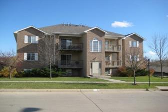
APARTMENT shall mean a room or a suite of rooms within an apartment house or multiple family dwelling arranged, intended or designed as a place of residence for a single family or group of individuals living together as a single housekeeping unit, including culinary accommodations. Also, see Dwelling Unit.
APARTMENT COMPLEX shall mean a building or buildings containing apartments used as a place of residence for more than two households.
APARTMENT HOUSE see Dwelling, Multiple.
APIARY a place where bee colonies are kept.
APPLICANT shall mean the owner or duly designated representative of land proposed to be subdivided, or for which a Conditional use permit, conditional use permit, temporary use permit, zoning amendment, variance, appeal, building permit, or certificate of occupancy and other similar administrative permits has been requested. Consent shall be required from the legal owner or their legal representative in writing except for building permits.
APPROPRIATE shall mean fitting the context of the site and the whole community.
APPURTENANCES shall mean the visible, functional objects accessory to and part of buildings.
AQUACULTURE shall mean land and/or buildings devoted to the hatching, raising, and breeding of fish or other aquatic plants or animals for sale or personal use.
ARBORETUM shall mean a place where trees, shrubs, and herbaceous plants are cultivated for scientific and educational purposes.
ARBORIST shall mean an individual trained in arboriculture, forestry, landscape architecture, horticulture, or related fields and experienced in the conservation and preservation of native and ornamental trees.
of an Apartment Complex

Example of Aquaculture Source: www.bing.com


ARCHITECTURAL APPEARANCE shall mean the architectural character and general composition of the exterior of a structure, including but not limited to the kind, color, and texture of the building material and the type, design, and character of all windows, doors, light fixtures, signs, and appurtenant elements.
ARCHITECTURAL CHARACTER see Architectural Concept
ARCHITECTURAL COMPOSITION shall mean the scale, height, mass, proportion, color, form, style, detail, treatment, construction material, and roof design of a project or building.
ARCHITECTURAL CONCEPT shall mean the basic aesthetic idea of a building, or group of buildings or structures, including the site and landscape development that produces the architectural character.
ARCHITECTURAL CONCRETE PANELS shall mean precast panels with etched or exposed aggregates, scored or inlaid patterns with definition, inlaid thin brick, inlaid
architectural concrete block and stone texture and accents. Standard tooled and water/air-blasted concrete finish does not meet this definition.
ARCHITECTURAL CONCRETE UNITS shall mean concrete masonry units of standard mix, design, and density with a modified face exposure of a scored pattern, flute, or rock texture. Integral color, marbled color, solid high glaze color patterns and ground faces (exposed aggregate) are part of this definition.
ARCHITECTURAL FEATURE shall mean a prominent or significant part or element of a building, structure, or site. Architectural features may include special lines, massing, and/or texture.
1. Lines: visual elements of the building, either within the façade or on the building edge, which are in linear form either horizontally or vertically and may be composed of masonry, glass, or other related materials.
2. Mass: volume or bulk of a building or structure.
3. Texture: the quality of a surface, ranging from mirror finish, smooth, to course and unfinished.
ARCHITECTURAL PROJECTIONS shall mean any projection which is not intended for occupancy and which extends beyond the face of an exterior wall or a building but shall not include signs.
ARCHITECTURAL STYLE shall mean the characteristics form and detail, as of buildings of a particular historic period.
ARTISAN PRODUCTION SHOP shall mean a building or portion thereof used for the creation of original handmade works of art or craft items by more than three but less than six artists or artisans, as either a principal or accessory use.
ARTIST STUDIO shall mean a place designed to be used, or used as, both a dwelling place and a place of work by an artist, artisan, or craftsperson, including persons engaged in the application, teaching, or performance of fine arts such as, but not limited to, drawing, vocal or instrumental music, painting, sculpture, and writing.
ATHLETIC FIELD shall mean a piece of land prepared or used for practicing or playing a game.
ATTACHED shall mean a foundation, wall or roof of a building or structure which is connected to and supported by the foundation, wall, or roof of another building or structure.
ATTACHED PERMANENTLY shall mean attached to real estate in such a way as to require dismantling, cutting away, unbolting from permanent foundation or structural change in such structure in order to relocate it to another site.
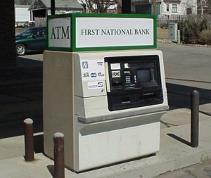
Example of a stand-alone ATM
AUCTION FACILITY shall mean an indoor area for the buying and selling of assets, such as but not limited to works of art and collectibles with price bidding.
AUTO BODY REPAIR shall mean the Repair, painting, or refinishing of the body, fender, or frame of automobiles, trucks, motorcycles, motor homes, recreational vehicles, boats, tractors, construction equipment, agricultural implements, and similar vehicles or equipment. Typical uses include body and fender shops, painting shops, and other similar repair or refinishing garages.
AUTO SERVICES shall mean the provision of fuel, lubricants, parts and accessories, and incidental services to motor vehicles; and washing and cleaning and/or repair of automobiles, noncommercial trucks, motorcycles, motor homes, recreational vehicles, or boats, including the sale, installation, and servicing of equipment and parts. Typical uses include service stations, car washes, muffler shops, auto repair garages, tire sales and installation, wheel and brake shops, but excluding dismantling, salvage, or body and fender repair services.
AUTOMATIC TELLER MACHINE (ATM) shall mean an automated device that performs banking or financial functions at a location remote from the controlling financial institution.
AUTOMOBILE RENTAL AND SALES shall mean sale or rental of automobiles, noncommercial trucks, motorcycles, motor homes, recreational vehicles or boats, including incidental storage, maintenance, and servicing. Typical uses include new and used car dealerships; motorcycle dealerships; and boat, trailer, and recreational vehicle dealerships.
AUTOMOBILE WRECKING YARD shall mean any lot, or the use of any portion of a lot, for the dismantling or wrecking of automobiles, tractors, farm machinery, or other motor vehicles, or for the storage or keeping for sale of parts and equipment resulting from such dismantling or wrecking.
AUTOMOTIVE AND MACHINERY REPAIR SHOP shall mean a building used for the repair of motor vehicles or machinery, when such repair shall be wholly within a completely enclosed building. This definition also includes body repair and painting.
AUTOMOTIVE SALES AREA shall mean an open area, other than a street, used for display or sale of new or used motor vehicles and trailers by one required to be licensed as a motor vehicle dealer by the State of Nebraska, and where no repair work is done except minor incidental repair of motor vehicles or trailers to be displayed and sold on the premises.
BBAR shall mean any establishment whose principal business is serving alcoholic beverages at retail for consumption on the premises. Also, see Nightclub and Tavern.
BARN shall mean an accessory structure upon a lot customarily used for the housing of livestock or for the storage of crops or machinery used in bona fide agricultural activities.
BARN, POLE shall mean a nonresidential structure where wooden post and beam act as the main structural support for roof and walls. No concrete/masonry support under posts; walls and roof covered with metal skin.
BASE FLOOD shall mean the flood, from whatever source, having a one percent chance of being equaled or exceeded in any given year, otherwise referred to as the 100-year flood.
BASE FLOOD ELEVATION shall mean that elevation, expressed in feet above mean sea level, to which flooding can be expected to occur on a frequency of once in every 100 years, or which is subject to a one percent or greater chance of flooding in any given year.
BASE ZONING DISTRICT shall mean a district established by this Ordinance that prescribes basic regulations governing land use and site development standards.
BASEMENT shall mean the substructure or foundation of a building, the lowest habitable story of a building, usually below ground level. A basement used for independent dwelling or business purposes shall be considered a story for the purposes of height measurement.
BEACON shall mean any light with one or more beams directed into the atmosphere or directed at one or more points not on the same zone lot as the light source; also, any light with one or more beams that rotate or move.
BED AND BREAKFAST INN shall mean a dwelling that is used for the purpose of offering overnight lodging and meals to travelers for a fee which dwelling has unique structural and/or site characteristics which create the appearance of an Inn type setting. Such dwelling shall have a maximum of six guest rooms available for travelers lodging and no more than 12 guests may stay at any time. Guests who stay at the bed and breakfast shall not remain for a period of more than 30 consecutive days.
BEDROOM shall mean a room within a dwelling unit planned and intended for sleeping, separable from other rooms by a door.
BEER GARDEN shall mean a permanent establishment which includes any area out-of-doors and not completely contained within a building in which alcoholic beverages or food is served.
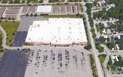
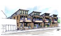
Example of Big Box Retail Store
Source: Google Earth

Example of a Block
Example of Block Frontage
BEGINNING OF CONSTRUCTION shall mean that site grading is the beginning of construction.
BERM shall mean a raised form of earth to provide screening or to improve the aesthetic character.
BEST INTERESTS OF COMMUNITY shall mean interests of the community at large and not the interest of the immediate neighborhood.
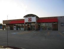
BIG BOX RETAIL shall mean a singular retail or wholesale user. These uses typically include membership wholesale clubs emphasizing large bulk sales, discount stores, pharmacies, grocery stores, especially warehouse style point sale concepts and department stores.
1. Large Big Box Retail shall mean a big box retail establishment occupying no less than 200,000 sf of gross floor area
2. Medium Big Box Retail shall mean a big box retail establishment occupying no less than 120,000 square feet of gross floor area.
3. Small Big Box Retail shall mean a big box retail establishment occupying no less than 40,000 square feet of gross floor area.
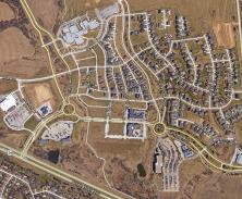
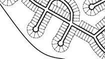
BLOCK shall mean a parcel of land platted into lots and bounded by public streets or by waterways, rights-of-way, non-platted land, City or County boundaries, or adjoining property lines.
BLOCK FRONTAGE shall mean that section of a block fronting on a street between two intersecting streets or another block boundary.
BOARD OF ADJUSTMENT shall mean that Board that has been created by the City, and which has the statutory authority to hear and determine appeals from, interpretations of, and variances to the zoning regulations.
BOARDING OR ROOMING HOUSE shall mean a building other than a hotel or motel but containing a single dwelling unit and provisions for three but not more than 20 guests, where lodging is provided with or without meals for compensation.
BOTTLING shall mean a facility for filling and sealing beverages in a bottle.
BOUNDARY see Corporate Boundary, plat boundary, building boundary, district boundary.
BREEZEWAY: shall mean a roofed open passage connecting two otherwise detached buildings. Breezeway connections shall not be construed to alter the detached status of the buildings so connected.
BREW-ON PREMISES STORE shall mean a facility that provides the ingredients and equipment for a customer to use to brew malt liquor at the store. Brew-on-premises stores do not include the sale of intoxicating liquor, unless
the owner of the brew-on-premises store holds the appropriate liquor license.
BREW PUB shall mean a restaurant or hotel which includes the brewing of beer as an accessory use. The brewing operation processes water, malt, hops, and yeast into beer or ale by mashing, cooking, and fermenting. By definition, these establishments produce no more than 10,000 barrels of beer or ale annually. The area, by definition, used for brewing, including bottling and kegging shall not exceed 25 percent of the total floor area of the commercial space. Also see Brewery, Craft.
BREWERY shall mean a facility for brewing ales, beers, meads and/or similar beverages on site. Breweries are classified as a use that manufactures more than 20,000 barrels of beverage (all beverages combined) annually.
BREWERY, CRAFT shall mean a brew pub or a microbrewery.
BREWERY, MICRO shall mean a facility for the production and packaging of malt beverages of low alcoholic content for distribution, retail or wholesale, on or off premises, with a capacity of not more than 20,000 barrels per year. The development may include other uses such as standard restaurant, bar, or live entertainment as otherwise permitted in the zoning district.
BREWERY, REGIONAL shall mean a brewery with an annual beer production of between 15,000 and 6,000,000 barrels.
BREWERY, TAPROOM shall mean a professional brewery that sells 25 percent or more of its beer on-site and does not operate significant food services. The beer is brewed primarily for sale in the taproom and is often dispensed directly from the brewery’s storage tanks. Where allowed by law, taproom breweries often sell beer to-go and/or distribute to off-site accounts.
BUFFER shall mean a strip of land established to protect one type of land use from another incompatible land use or between a land use and a private or public road.
BUFFER AREA shall mean an open and unobstructed ground area of a plot in addition to any no building zones or street widening around the perimeter of any plot where required.
BUFFERYARD shall mean a landscaped area intended to separate and partially obstruct the view of two adjacent land uses or properties from one another.
BUILD-THROUGH ACREAGE (see Ghost Platting)
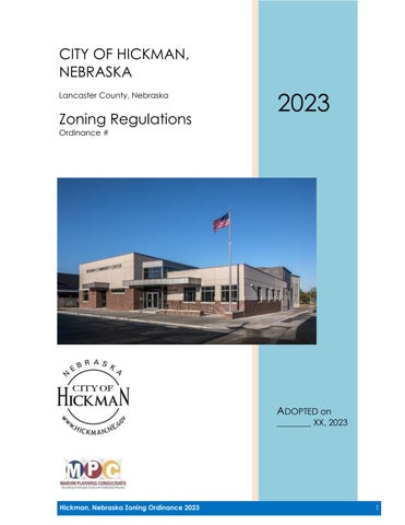
BUILDABLE AREA shall mean that part of a zoning lot not included within the required yards or subject to other restrictions herein required.
BUILDING shall mean any structure built and maintained for the support, shelter or enclosure of persons, animals,
Buildable Area


chattels, or property of any kind, but shall not include temporary buildings as defined in "Structure, Temporary". Trailers, with or without wheels, shall not be considered buildings.
BUILDING AREA shall mean the total square feet of the ground area occupied by all buildings and structures on a lot.
BUILDING CODE shall mean the various codes of the City of Hickman that regulate construction and require building, electrical, mechanical, plumbing and other permits to as well as other codes adopted by the City that pertain to building construction.
BUILDING, COMMERCIAL shall mean any structure used for and housing a commercial use.
BUILDING COVERAGE shall mean the area of a site covered by buildings or roofed areas, excluding allowed projecting eaves, balconies, and similar features.
BUILDING ENVELOPE shall mean the three-dimensional space within which a structure is permitted to be built on a lot after all zoning and other applicable municipal requirements have been met.
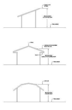
BUILDING HEIGHT shall mean the vertical distance above grade to the highest point of the coping of a flat roof or to the deck line of a mansard roof, or to the average height of the highest point of a gable, hip, or shed roof, measured from the highest adjoining sidewalk or ground surface within a five feet horizontal distance of the exterior wall of the building.
BUILDING LINE shall mean the outer boundary of a building established by the location of its exterior walls.
BUILDING MATERIALS shall mean indoor and outdoor retail sales lumber, hardware, another construction materials.
BUILDING OFFICIAL, CHIEF shall mean the designee of the City Council, responsible for the enforcement of the building and land use regulations of the City of Hickman.
BUILDING, PUBLIC shall mean any building held, used, or controlled exclusively for public purposes by any department or branch of government, state, county, or municipal, without reference to the ownership of the building or of the realty upon which it is situated. A building belonging to or used by the public for the transaction of public or quasi-public business.
BUILDING, SEMI-PUBLIC shall mean structures principally of an institutional nature and serving a public need, such as churches, hospitals, museums, but not including the operation of a public bar, restaurant, or recreational facility as a commercial enterprise.
BUILDING SETBACK LINE shall mean the required zoning distance between a building and the lot line.
BULK REGULATIONS shall mean regulations controlling the size and relationship of structures and uses to each other and to open areas and lot lines. Bulk regulations include regulations controlling: (1) maximum height (2) maximum lot coverage and (3) minimum size of yard and setbacks.
BUSINESS shall mean activities that include the exchange or manufacture of goods or services on a site.
BUSINESS CENTER shall mean a building containing more than one commercial business, or any group of nonresidential buildings within a common development, characterized by shared parking and access.
BUSINESSINCUBATOR shall mean a facility dedicated to the start-up and growth of small businesses, accomplished through management and facility support systems. For purposes of this definition, management support systems include access to professional advice, information on small business regulations, management, advertising, promotion, marketing, sales, inventory, employees, labor relations, and financial counseling. Facility support systems include clerical and reception staff, cleaning and building security, and access to copy machines, computers, faxes, and other electronic equipment.
BUSINESS SERVICES shall mean uses providing services to people, groups, businesses, dwellings and other buildings. Business services shall include janitorial services, carpet and upholstery cleaning, painting and decorating, building maintenance, swimming pool maintenance, security service, graphics/advertising agency, photocopying/ duplication, quick print shops, printing, blueprinting, sign painting, non-vehicle equipment rental, photographic studios.
BUSINESS SUPPORT SERVICES shall mean establishments or places of business primarily engaged in the sale, rental or repair of equipment, supplies and materials or the provision of services used by office, professional and service establishments to the firms themselves but excluding automotive, construction and farm equipment; or engaged in the provision of maintenance or custodial services to businesses. Typical uses include office equipment and supply firms, small business machine repair shops or hotel equipment and supply firms, janitorial services, photography studios, and convenience printing and copying.
BUTCHER shall mean someone who cuts and sells meat in a shop or who kills animals and prepares their meat to be eaten.
BUTCHER SHOP, CUSTOM shall mean the incidental keeping and processing of farm animals for retail trade.


CCABIN shall mean a small one-story house built and designed for temporary use.
CABIN, HUNTING AND FISHING shall mean buildings used only during hunting and fishing season as a base for hunting and fishing, and outdoor recreation.
CAMPER shall mean any coach, cabin, house trailer, house car or other vehicle or structure intended for or capable of temporary occupancy as living and sleeping quarters as is primarily required during camping or vacation travels. Such facility has characteristics similar to a mobile home in that it can be conveyed on the streets. However, in no way is it intended to become a residence.
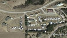
CAMPGROUND shall mean a parcel of land intended for the temporary occupancy of tents, campers, and major recreational vehicles for which the primary purpose is recreational and having open areas that are natural in character.
CAR WASH shall mean a building or structure or an area of land with machine or hand operated facilities for the cleaning, washing, polishing, or waxing of motor vehicles.
CARPORT shall mean a permanent roofed structure with not more than two enclosed sides used or intended to be used for automobile shelter and storage.
CELLAR shall mean a building space having less than onehalf of its height below the average adjoining grade lines.
CEMETERY shall mean land used or intended to be used for the burial of the dead and dedicated for such purposes, including columbariums, crematoriums, and mausoleums.
CEMETERY, PET shall mean land, together with any structures, facilities, or buildings appurtenant thereto provided to members of the public for use or reservation for use for the individual interment, above or below ground, of pet remains.
CERTIFICATE OF OCCUPANCY shall mean an official certificate issued by the Building Official or their/her designee, upon finding of conformance with the zoning regulations and other applicable ordinances of the City and authorizing legal use of the premises for which it is issued.
CHANNEL shall mean the geographical area located within either the natural or the artificial banks of a watercourse or drainageway.
CHARITABLE shall mean a public or semi-public institutional use of a philanthropic, charitable, benevolent, religious, or eleemosynary character, but not including sheltering or caring of animals.
CHEMICAL DISTRIBUTION shall mean the storage of chemical, petroleum, fertilizer or other hazardous materials in storage of resale.
CHIEF BUILDING OFFICIAL see building official, chief
CHIEF EXECUTIVE see Mayor
CHIEF LEGISLATIVE BODY see City Council
CHILD CARE CENTER shall mean an establishment other than a public or parochial school, which provides day care, play groups, nursery schools or education for nine or more children under age 13, at any one time, from families other than that of the provider. In addition to these regulations, Child Care Centers shall meet all requirements of the State of Nebraska.
CHILD CARE HOME shall mean an operation in the provider's place of residence, which serves at least four, but not more than eight children at any one time from families other than that of the provider. A Family Child Care Home provider may be approved to serve no more than two additional school-age children during non-school hours. In addition to these regulations, Child Care Homes shall meet all requirements of the State of Nebraska.
CHURCH see Religious Assembly
CHURCH, STOREFRONT see Religious Assembly
CITY shall mean the City of Hickman, Nebraska. Also, “City Council” or “Governing Body.”
CITY ATTORNEY shall mean the City Attorney of the City of Hickman or their authorized deputy, agent or representative.
CITY COUNCIL shall mean the City Council of Hickman, Nebraska.
CITY ENGINEER shall mean the City Engineer as hired or appointed by the Mayor and City Council or their authorized deputy, agent or representative.
CITY LIMITS shall mean the established corporate boundary of the City of Hickman.
CLEAR VIEW ZONE See Sight Triangle.
CLUB shall mean an association of persons (whether or not incorporated), religious or otherwise, for a common purpose, but not including groups which are organized primarily to render a service carried on as a business for profit.
CLUBHOUSE, COMMERCIAL see Recreational Facility
CLUBHOUSE, RESIDENTIAL SPACE shall mean facilities accessory to a private residence(s) used only by the owner, residents, and guests.

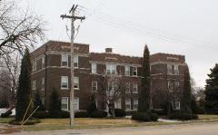
Example of a Church

of Compost
Example of an Outdoor Composting
CLUSTERED DEVELOPMENT shall mean a development design technique that concentrates buildings in specific areas on a site to allow remaining land to be used for recreation, common open space, or the preservation of historically or environmentally sensitive features.
CODE shall mean the Municipal Code of the City of Hickman, Nebraska.
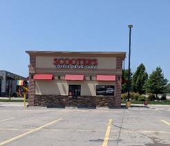
COFFEE KIOSK shall mean a retail food business in a freestanding building that sells coffee, or other nonalcoholic beverages, and premade bakery goods from a drive-through window to customers seated in their automobiles for consumption off the premises and that provides no indoor or outdoor seating.
COLLEGE AND UNIVERSITY FACILITIES shall mean an educational institution of higher learning which offers a course of study designed to culminate in the issuance of a degree certified by a generally recognized accrediting organization.
COMMISSION shall mean the Planning Commission of Hickman, Nebraska.
COMMON AREA OR PROPERTY shall mean a parcel or parcels of land, together with the improvements thereon, the use and enjoyment of which are shared by the Owners of the individual building sites in a Planned Development or condominium development.
COMMON DEVELOPMENT shall mean a development proposed and planned as one unified project not separated by a public street or alley.
COMMON OPEN SPACE shall mean land within or related to a development that is not individually owned or dedicated for public use, designed and generally intended for the common use of the residents of the development.
COMMUNICATION SERVICES shall mean establishments primarily engaged in the provision of broadcasting and other information relay services accomplished through the use of electronic and telephonic mechanisms but excludes those classified as Utilities. Typical uses include television studios, telecommunication service centers, telegraph service offices, or film and sound recording facilities.
COMMUNITY CENTER shall mean a place, structure, or other facility used for and providing religious, fraternal, social, and/or recreational programs generally open to the public and designed to accommodate and serve various segments of the community.
COMMUNITY GARDEN shall mean any piece of land gardened by a group of people, utilizing either individual or shared plots on private or public land. The land may produce fruit, vegetables, and/or ornamentals.
COMPATIBILITY shall mean harmony in the appearance of two or more external design features in the same vicinity.
COMPATIBLE USE shall mean the degree to which two or more different land use types are able to exist together in close proximity, with no one use having significant negative effects on any other use.
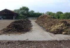
COMPOST shall mean decomposed organic material resulting from the composting process. Used to enrich or improve the consistency of soil.
COMPOSTING shall mean processing waste in a controlled environment to produce a stable product by microbiologically degrading organic matter under aerobic conditions.
COMPREHENSIVE PLAN shall mean the Comprehensive Development Plan of Hickman, Nebraska as adopted by the City Council, setting forth policies for the present and foreseeable future community welfare as a whole and meeting the purposes and requirements set forth in the Neb. Rev. Stat. §19-903.
CONDITIONAL USE PERMIT shall mean a permit issued by the Planning Commission and City Council that authorizes the recipient to make a conditional use of property in accordance with the provisions of Article 6 and any additional conditions placed upon or required by said permit.
CONDOMINIUM shall mean real estate, portions of which are designated for separate ownership and the remainder of which is designated for common ownership solely by the owners of those portions, pursuant to the Nebraska Condominium Act, as set forth in Neb. Rev. Stat. §§ 76-825 to 76-894 (R.R.S.1997).
CONFLICTING LAND USE shall mean the use of property which transfers over neighboring property lines negative economic or environmental effects, including, but not limited to, noise, vibration, odor, dust, glare, smoke, pollution, and water vapor, or consists of mismatched land uses, density, height, mass, or layout of adjacent uses, or results in a loss of privacy.
CONGREGATE HOUSING shall mean a residential facility for four or more persons aged 55 years or over and their spouses, providing living and sleeping facilities including meal preparation, dining areas, laundry services, room cleaning and common recreational, social, and service facilities for the exclusive use of all residents including resident staff personnel who occupy a room or unit in the residential facility. Also, see Life Care Facility.
CONSERVATION shall mean the management of natural resources to prevent waste, destruction, or degradation.
CONSERVATION AREA shall mean an area of environmentally sensitive and valuable lands protected from any activity that would significantly alter their ecological integrity, balance or character, except in the case of an overriding public interest, including but not limited to: wetlands, floodways, flood plains, drainage ways, river or stream banks, and areas of significant biological productivity or uniqueness.
CONSERVATION DEVELOPMENT shall mean a development design technique that concentrates buildings in specific areas on a site to allow remaining land to be used for recreation, common open space, or the preservation of historically or environmentally sensitive features.
CONSERVATION EASEMENT shall mean an easement granting a right or interest in real property that is appropriate to retaining land or water areas predominantly in their natural, scenic, open, or wooded condition and retaining such areas as suitable habitat for fish, plants, or wildlife, or maintaining existing land uses.
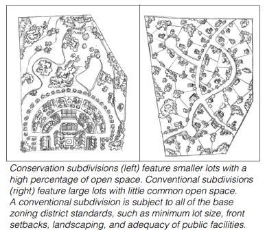
CONSERVATION SUBDIVISION shall mean wholly or in majority, a residential subdivision that permits a reduction in lot area, setback, or other site development regulations, provided 1) there is no increase in the overall density permitted for a conventional subdivision in a given zoning district, and 2) the remaining land area is used for common space.
CONSTRUCTION BATCH PLANT shall mean a temporary demountable facility used for the manufacturing of cement, concrete, asphalt, or other paving materials intended for specific construction projects.
CONSTRUCTION YARDS shall mean establishments housing facilities of businesses primarily engaged in construction activities, including incidental storage of materials and equipment on lots other than construction sites. Typical uses are building contractor's yards.
CONVALESCENT SERVICES shall mean a use providing bed care and inpatient services for persons requiring regular medical attention but excluding a facility providing surgical or emergency medical services and excluding a facility providing care for alcoholism, drug addiction, mental disease, or communicable disease. Typical uses include nursing homes.
CONVENTIONAL SUBDIVISION shall mean a subdivision which literally meets all nominal standards of the Subdivision Ordinance for lot dimensions, setbacks, street frontage, and other site development regulations.
CONVENIENCE STORE shall mean a one-story, retail store containing floor area that is designed and stocked to sell primarily food, beverages, and other household supplies, and may also sell gasoline, to customers who purchase only a relatively few items (in contrast to a "supermarket.")
It is dependent on and is designed to attract and accommodate large volumes of stop-and-go traffic.
CONTIGUOUS see Abut.
CORPORATE LIMITS shall mean all land, structures and open space that has been annexed into the City’s jurisdiction. This does not include the extraterritorial jurisdiction of the City.
COTTAGE INDUSTRY BUSINESSES shall mean a business in a residential area conducted primarily by the residents of the property manufacturing artistic, handicraft, and other craft items.
COWORKER SPACE shall mean a shared flexible office space designated for businesses or business oriented developments.
COURT shall mean an open, unoccupied space, other than a yard, on the same lot with a building or buildings and bounded on two or more sides by such building or buildings.
COURT, INNER shall mean a court enclosed on all sides by the exterior walls of a building or buildings.
COURT, OUTER shall mean a court enclosed on all but one side by exterior walls of building or buildings or lot lines on which fences, hedges, or walls are permitted.
COURTYARD shall mean an open, unoccupied space, bounded on two or more sides by the walls of the building.
CREATIVE SUBDIVISION shall mean a subdivision that, while complying with the Subdivision Ordinance, diverges from nominal compliance with site development regulations in the Subdivision Ordinance. Creative subdivisions imply a higher level of pre-planning than conventional subdivisions. They may be employed for the purpose of environmental protection or the creation of superior community design. Types of Creative Subdivisions include Cluster Subdivisions and New Urban Residential Districts.
CROP PRODUCTION shall mean the raising and harvesting of tree crops, row crops for field crops on an agricultural or commercial basis. This definition may include accessory retail sales under certain conditions.
CUL-DE-SAC shall mean a short public way, which has only one outlet for vehicular traffic and terminates in a vehicular turn-around.
CULTURAL SERVICES shall mean a library, museum, or similar registered nonprofit organizational use displaying, preserving and exhibiting objects of community and cultural interest in one or more of the arts and sciences.
CURVE LOT see Lot, Curve.


CRYPTO MINING shall mean the process of digitally searching for Bitcoin and/or digital tokens. Crypto mining may occur in a specially design building similar to a data center.
DDATA CENTER shall mean an establishment primarily involved in the compiling, storage, and maintenance of documents, records, and other types of information in digital form utilizing mainframe computers and storage devices. This term does not include general business offices, computer-related sales establishments, and business or personal services.
DATE OF SUBSTANTIAL COMPLETION shall mean the date certified by the Chief Building Official or zoning administrator when the work, or a designated portion thereof is sufficiently complete, so the owner may occupy the work or designated portion thereof for the use for which it is intended.
DECIDUOUS SCREEN shall mean landscape material consisting of plants which lose their leaves in winter and eventually will grow and be maintained at six feet in height, at least.
DECK shall mean a flat, floored, roofless structure. Roofless does not include a roll-out awning or a canopy provided that all the vertical sides, other than the residential structure are open.
DENSITY shall mean the number of dwelling units per gross acre of land.
DENTENTION BASIN shall mean a facility for the temporary storage of stormwater runoff.
DENTENTION FACILITY, JUVENILE shall mean an institution operated by a political subdivision or political subdivisions for the secure detention and treatment of persons younger than eighteen years of age, including persons under the jurisdiction of a juvenile court, who are serving a sentence pursuant to a conviction in a county or district court or who are detained while waiting disposition of charges against them. Juvenile detention facility does not include any institution operated by the department;
DENTENTION FACILITY, CRIMINAL shall mean any institution operated by a political subdivision or a combination of political subdivisions for the careful keeping or rehabilitative needs of adult or juvenile criminal offenders or those persons being detained while awaiting disposition of charges against them. Criminal detention facility does not include any institution operated by the Department of Correctional Services. Criminal detention facilities shall be classified as follows:
(a) Type I Facilities means criminal detention facilities used for the detention of persons for not more than twenty-
four hours, excluding nonjudicial days;
(b) Type II Facilities means criminal detention facilities used for the detention of persons for not more than ninetysix hours, excluding nonjudicial days; and
(c) Type III Facilities means criminal detention facilities used for the detention of persons beyond ninety-six hours;
DEVELOPER shall mean any person, corporation, partnership, or entity that is responsible for any undertaking that requires a building or zoning permit, conditional use permit or sign permit.
DEVELOPMENT shall mean any manmade change to improved or unimproved real estate, including but not limited to buildings or other structures, mining, dredging, filling, grading, paving, excavation, or drilling operations for which necessary permits may be required.
DEVELOPMENT CONCEPT PLAN see Site Plan.
DEVELOPMENT REVIEW shall mean the review, by the City, of subdivision plats, site plans, rezoning requests, or permit review.
DISTRICT OR ZONE shall mean a section or sections of the Zoning Area for which uniform regulations governing the use of land, the height, use, area, size, and intensity of use of buildings, land, and open spaces are established.
DOG DAY CARE FACILITY shall mean a facility providing such services as canine day care for all or part of a day, obedience classes, training, grooming, or behavioral counseling, provided that overnight boarding is not permitted.
DOG KENNEL see Kennel, Boarding or Training, and Kennel, Commercial.
DOG PARK shall mean a specifically designated and fenced off for the exercise of canines and other domestic animals.
DOMESTIC ANIMALS see Household Pet.
DOWNZONING shall mean a change in zoning classification of land to a less intensive or more restrictive district, such as from commercial district to residential district or from a multiple family residential district to single family residential district.
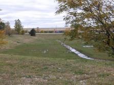
DRAINAGEWAY shall mean any depression two feet or more below the surrounding land serving to give direction to a current of water less than nine months of the year, having a bed and well-defined banks; provided, that when there is doubt as to whether a depression is a watercourse or drainageway, it shall be presumed to be a watercourse.

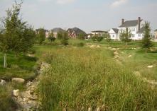
of a Drainageway or Surface Drain
Example of Live-work Units
Example of a Dwelling, Manufactured Home
Source: http:// transportablehomesspecialist.com/

Example of a Duplex
Example of Dwelling, Courtyard Building
DRIVEWAY shall mean any vehicular access to an off-street parking or loading facility.
DUMP shall mean a place used for the disposal, abandonment, discarding by burial, incineration, or by any other means for any garbage, sewage, trash, refuse, rubble, waste material, offal or dead animals. Such use shall not involve any industrial or commercial process.
DUPLEX see Dwelling, Two Family.
DWELLING shall mean any building or portion thereof, which is designed and used exclusively for single family residential purposes, excluding mobile homes.
DWELLING, CONDOMINIUM shall mean a multiple dwelling as defined herein whereby the title to each dwelling unit is held in separate ownership, and the real estate on which the units are located is held in common ownership solely by the owners of the units, with each owner having an undivided interest in the common real estate.
DWELLING, COTTAGE COURT shall mean a residential form for either renter-occupied or owner-occupied which contains multiple units, likely grouped in pairs around an open space or courtyard.
DWELLING, COURTYARD BUILDING (MULTI-FAMILY) shall mean a residential structure where the units have internal excess and are built around an outer or inner courtyard.
DWELLING, LIVE-WORK UNIT shall mean a small- to mediumsized attached or detached structure consisting of one dwelling unit above or behind a ground floor space accommodating a non-residential use.
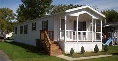
DWELLING, MANUFACTURED HOME shall mean a factorybuilt structure which is to be used as a place for human habitation, which is not constructed or equipped with a permanent hitch or other device allowing it to be moved other than to a permanent site, which does not have permanently attached to its body or frame any wheels or axles, and which bears a label certifying that it was built in compliance with standards promulgated by the HUD. In order to be considered the same as a stick-built residential dwelling unit, the following standards shall be met:
A. The home shall have no less than 900 sf of floor area, above grade, for single story construction.
B. The home shall have no less than an 18 ft exterior width.
C. The roof shall be pitched with a minimum vertical rise of two and one-half inches for each 12 inches of horizontal run.
D. The exterior material shall be of a color, material and scale comparable with existing site-built, single-family residences.
E. The home shall have a non-reflective roof material that is or simulates asphalt or wood shingles, tile, or rock.
However, standing seam roofs are allowable provided it’s non-reflective.
F. The home shall be placed on a continuous permanent foundation and have wheels, axles, transporting lights, and removable towing apparatus removed, and
G. The home shall meet and maintain the same standards that are uniformly applied to all single-family dwellings in the zoning district.
H. The home shall have a permanent foundation, to be constructed from either poured concrete or laid masonry block or brick on a footing to be placed a minimum of 42 inches below the final ground level.
DWELLING, MULTIPLE-FAMILY (APARTMENT BUILDINGS) shall man a building or portion thereof containing three or more dwelling units.
DWELLING, MOBILE HOME shall mean any prefabricated structure, composed of one or more parts, used for living and sleeping purposes, shipped or moved in essentially a complete condition and mounted on wheels, skids or rollers, jacks blocks, horses, skirting or a permanent or temporary foundation or any prefabricated structure which has been or reasonably can be equipped with wheels or other devices for transporting the structure from place to place, whether by motor power or other means. The term mobile home shall include trailer home and camp car, but the definition shall not apply to any vehicle lawfully operated upon fixed rails.
a. Permanently Attached: Attached to real estate in such a way as to require dismantling, cutting away, unbolting from permanent continuous foundation or structural change in such mobile home in order to relocate it on another site in accordance to manufacturers recommendations.
b. Permanent Foundation: Base on which building rests, to be constructed from either poured concrete or laid masonry block or brick on a footing to be placed a minimum of 42 inches below the final ground level.
DWELLING, MODULAR shall mean any dwelling whose construction consists entirely of or the major portions of its construction consist of a unit or units not fabricated on the final site for the dwelling unit, which units are movable or portable until placed on a permanent foundation and connected to utilities, pursuant to the Nebraska Uniform Standards for Modular Housing Units Act, as set forth in Neb. Rev. Stat. §§ 71-1557 to 71-1568.01 (Cum.Supp.2000). Further, such dwelling must also meet or be equivalent to the construction criteria set forth in the Nebraska Uniform Standards for Modular Housing Units Act. Such dwelling is considered to be a conventional type single-family dwelling, and those that do not meet the above criteria shall be considered a mobile home. In order to be considered the same as a stick-built residential dwelling unit, the following standards shall be met:
a. The home shall have no less than 900 square feet of floor area, above grade, for single story construction.

b. The home shall have no less than a 18 feet exterior width;
c. The roof shall be pitched with a minimum vertical rise of two and one-half inches for each 12 inches of horizontal run.
d. The exterior material shall be of a color, material and scale comparable with existing site-built, single-family residences.
e. The home shall have a non-reflective roof material that is or simulates asphalt or wood shingles, tile, or rock. However, standing seam roofs are allowable provided it’s non-reflective.
f. The home shall be placed on a continuous permanent foundation and have wheels, axles, transporting lights, and removable towing apparatus removed, and
g. The home shall meet and maintain the same standards that are uniformly applied to all single-family dwellings in the zoning district.
h. The home shall have a permanent foundation, to be constructed from either poured concrete or laid masonry block or brick on a footing to be placed a minimum of 42 inches below the final ground level.
DWELLING, MODULAR (HOME SEAL) shall mean a device or insignia issued by the Nebraska Department of Health to be displayed on the exterior of the modular housing unit to evidence compliance with departmental standards.
DWELLING, MULTIPLE shall mean a building or buildings designed and used for occupancy by three or more families, all living independently of each other, and having separate kitchen and toilet facilities for each family.
DWELLING, SINGLE FAMILY shall mean a building having accommodations for or occupied exclusively by one family.
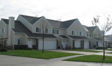
DWELLING, SINGLE-FAMILY ATTACHED (GROUP, ROW AND TOWNHOUSES) shall mean a residential building joined horizontally to another residential building at one or more sides by a party wall or walls.
DWELLING, TWO FAMILY (DUPLEX) shall mean a residential building containing two dwelling units, either attached or detached.
DWELLING, TWO FAMILY STACKED shall mean a residential building with two units stacked one on the other. These can be an older single-family dwelling unit converted into two separate units.
DWELLING, TRIPLE STACKED shall mean a residential structure containing three to six units stacked through three stories.
DWELLING UNIT shall mean one or more rooms connected together, constituting a separate, independent housekeeping establishment for owner occupancy or lease on a weekly, monthly, or longer basis, and physically
separate from any other rooms or dwelling units which may be in the same structure, and containing independent cooking, toilet and sleeping facilities.
DWELLING UNIT, SPECIAL TYPES shall mean any dwelling type consisting of single-family detached; single-family attached, multi-family, mobile home that is not meet the typical construction style of traditional stick framed structures.
1. Cargo Container Dwelling: a dwelling unit constructed of one or more new or used cargo containers used for multi-modal shipping.
2. Grain Bin Dwelling Unit: A dwelling unit constructed of one or more grain bins, new or used meeting the definition of dwelling unit above.
3. Quonset home: A home constructed beneath and in a structure referred to as a Quonset.
4. Shouse: A combination of a dwelling unit and machine shed under a common or connect roofing system.
5. Tiny House: A structure containing living spaces including sleeping and kitchen areas which measure 500 square feet or less in area. Tiny houses can be either portable, on wheels similar to a recreational vehicle, or on a permanent foundation.
4. Tree House: A dwelling unit where the primary structure of the unit is based on one or more tree clusters.
EEARTHEN HOME shall mean a home built into a berm or hillside covered by earth on three sides and on the roof.
EASEMENT shall mean a grant, made by a property owner, to the use of their land by the public, a corporation, or persons, for specific purposes, such as access to another property or the construction of utilities, drainage ways or roadways.
EDUCATIONAL INSTITUTION shall mean a public or nonprofit institution or facility which conducts regular academic instruction at preschool, kindergarten, elementary, secondary, and collegiate levels, including graduate schools, universities, junior colleges, trade schools, nonprofit research institutions and religious institutions. Such institutions must either: (1) Offer general academic instruction equivalent to the standards established by the State Board of Education; or (2) Confer degrees as a college or university or undergraduate or graduate standing; or (3) Conduct research; or (4) Give religious instruction. Private schools, academies, or institutes incorporated or otherwise, which operate for a profit, and commercial or private trade schools are not included in this definition.
EFFECTIVE DATE shall mean the date that this chapter shall have been adopted, amended, or the date land areas became subject to the regulations contained in this chapter as a result of such adoption or amendment.


Example of an Easement
EMERGENCY RESIDENTIAL SERVICES shall mean a facility or use of a building to provide a protective sanctuary for victims of crime or abuse, including emergency housing during crisis intervention for victims of rape, abuse, or physical beatings.
ENCROACHMENT shall mean an obstruction or illegal or unauthorized intrusion into a delineated floodway, right-ofway, or adjacent property.
ENLARGEMENT shall mean the expansion of a building, structure, or use in volume, size, area, height, length, width, depth, capacity, ground coverage, or in number.
EQUIPMENT RENTAL AND SALES shall mean the sale or rental of trucks, tractors, construction equipment, agricultural implements, mobile homes, and similar heavy equipment, including incidental storage, maintenance, and servicing. Typical uses include truck dealerships, construction equipment dealerships, and mobile home sales establishments.
EQUIPMENT REPAIR SERVICES shall mean the Repair of trucks, tractors, construction equipment, agricultural implements, and similar heavy equipment. Typical uses include truck repair garages, tractor and farm implement repair services, and machine shops, but exclude dismantling, salvage, or body and fender repair services.
ERECTED shall mean constructed upon or moved onto a site.
ETHANOL PLANT shall mean a facility where the conversion of biomass into an alcohol fuel product is undertaken. The facility also includes the processing of certain by-products resulting from the fermentation and distillation process.
EVERGREEN OR CONIFEROUS SCREEN shall mean landscape material consisting of plants which retain leaves or needles throughout the year which eventually will grow and be maintained at six feet in height, at least.
EXOTIC BIRDS OR ANIMALS shall mean birds or animals not commonly kept domestically or that are not native to Nebraska and/or the United States. Exotic birds or animals includes, but are not limited to, bears, lions, tigers, cougars, wolves, half-breed wolves, and snakes. Birds in the ratite family, llamas and buffalo or bison shall not be considered as exotic birds or animals.
EXPANSION shall mean the enlargement of a building, structure, or use in volume, size, area, height, length, width, depth, capacity, ground coverage, or in number.
EXTRATERRITORIAL JURISDICTION shall mean the area beyond the corporate limits of the City, in which the State has granted the City the power to exercise zoning jurisdiction and building regulations.
FFAÇADE shall mean the exterior wall of a building exposed to public view from the building’s exterior.
FACTORY shall mean a structure or plant within which something is made or manufactured from raw or partly wrought materials into forms suitable for use.
FAMILY shall mean one or more persons living together and sharing common living, sleeping, cooking, and eating facilities within an individual housing unit, no more than 4 of whom may be unrelated. The following persons shall be considered related for the purpose of this title:
1. Persons related by blood, marriage, or adoption.
2. Persons residing with a family for the purpose of adoption.
3. Not more than eight persons under 19 years of age, residing in a foster house licensed or approved by the State of Nebraska.
4. Not more than eight persons 19 years of age or older residing with a family for the purpose of receiving foster care licensed or approved by the State of Nebraska.
5. Person(s) living with a family at the direction of a court.
FAMILY CHILD CARE HOME I shall mean a childcare operation in the provider’s place of residence which serves between four and eight children at any one time. A Family Child Care Home I provider may be approved to serve no more than two additional school-age children during non-school hours. In addition to these regulations, a Child Care Home shall meet requirement of the State of Nebraska.
FAMILY CHILD CARE HOME II shall mean a childcare operation either in the provider’s place of residence or a site other than the residence, serving twelve or fewer children at any one time. In addition to these regulations, a Child Care Home shall meet requirement of the State of Nebraska.
FARM an area containing at least 20 acres or more which is used for growing or storage of the usual farm products such as vegetables, fruit, and grain, as well as for the raising thereon of the usual farm poultry and farm animals, and which produces 1,000 dollars or more per year of farms products raised on the premises. The term farming includes the operating of such area for one or more of the above uses with the necessary accessory uses for treating or storing the produce and the feeding of livestock as hereinafter prescribed provided such accessory uses do not include the feeding of garbage or offal to swine or other animals.
FARMER’SMARKET shall mean an occasional or periodic market held in an open area or in a structure where groups of sellers offer for sale to the public such items as fresh produce, seasonal fruits, fresh flowers, arts and crafts items, and food and beverages (but not to include


secondhand goods) dispensed from booths located onsite.
FEDERAL shall mean the federal government of the United States of America.
FEEDLOT, COMMERCIAL shall mean a lot or building, or combination of lots and buildings intended to be used for the confined feeding, breeding, raising or holding of animals and specifically designed as a confinement area in which manure may accumulate, or where the concentration of animals is such that a vegetation cover cannot be maintained in the enclosure. This definition does not include the pasturing of livestock.
FENCE shall mean a structure serving as an enclosure, barrier or boundary above ground.
FENCE, INVISIBLE shall mean an electronic pet containment system that includes the burying of wire and the use of transmitters for complete enclosure of a yard or creating sectional areas within a yard.
FENCE, OPEN shall mean a fence, including gates, which has 50 percent or more of the surface area in open spaces, which affords direct views through the fence.
FENCE, SOLID shall mean any fence, which does not qualify as an open fence.
FINANCIAL SERVICES shall mean the provision of financial and banking services to consumers or clients. Walk-in and drive-in services to consumers are provided on site. Typical uses include banks, savings and loan associations, savings banks, and loan companies.
FIREWORKS STAND shall mean any tent used for the retail sale of fireworks, on a temporary basis.
FIREWORKS STORAGE shall mean any permanent building and/or structure where fireworks are stored for any portion of a year provided there is no retail sales made from the storage location. Said storage facility may also be used for the delivery and distribution of fireworks on a wholesale basis.
FLOOD shall mean a general and temporary condition of partial or complete inundation of normally dry land areas from: (1) The overflow of inland or tidal waters, or (2) The unusual and rapid accumulation of runoff of surface waters from any source.
FLOODPLAIN shall mean any land area susceptible to being inundated by water from any source.
FLOOD PROOFING shall mean any combination of structural and non-structural additions, changes, or adjustments to structures, which reduce or eliminate flood damage to real estate or improved real property, water and sanitary facilities, structures and their contents.
FLOODWAY shall mean the channel of a watercourse and the adjacent land areas that must be reserved in order to discharge the base flood without cumulatively increasing the water surface elevation more than a designated height.
FLOOR AREA shall mean the square feet of floor space within the outside line of the walls, including the total of all space on all floors of the building. Floor area shall not include porches, garages, or spaces in a basement, cellar, or attic.
FLORIST shall mean a retail business whose principal activity is the selling of plants which are not grown on the site and conducting business within an enclosed building.
FOOD SALES shall mean establishments or places of business primarily engaged in the retail sale of food or household products for home consumption. Typical uses include groceries, delicatessens, meat markets, retail bakeries, and candy shops.
FOOT CANDLE shall mean a unit of illumination. Technically, the illumination of all points one-foot distance from a uniform point source of one candle power
FOUNDATION shall mean that part of a building or wall, wholly or partly below grade, that constitutes a structural base for such building or wall.
FREESTANDING CANOPY shall mean a permanent, freestanding, unenclosed roof structure, typical of gas stations and financial institutions, designed to provide patrons shelter from the elements.
FRONTAGE shall mean that portion of a parcel of property that abuts a dedicated public street or highway.
FRONTAGE ROAD: shall mean a street parallel and adjacent to a major arterial or collector, primarily for service to the abutting properties, and being separated from the major street by a di-viding strip.
FUEL STATION shall mean a designated facility offering the sale gasoline, diesel fuel and propane.
FUELSTORAGE shall mean tanks used to storage fuel either above- or below-ground as part of an agricultural operation.
FUNERAL HOME OR MORTUARY shall mean a building used for the storage, preparation, and display of the deceased and for the performance of rituals and ceremonies connected therewith be-fore burial or cremation. Crematoriums are permitted as an accessory use to a funeral home or mortuary.

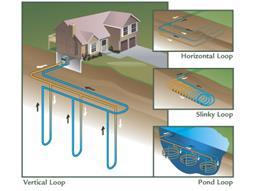
Examples of Geothermal Heat Pump System
GGARAGE, PRIVATE shall mean a detached accessory building, including carports, on the same lot as a dwelling, used to house vehicles of the occupants of the dwelling. Private garages shall not have any sort of repair service facilities or function as a location where motor vehicles are kept for rental or sale.
GARAGE, PUBLIC shall mean any garage other than a private garage designed or used for equipment, repairing, hiring, servicing, selling, or storing motor driven vehicles.
GARAGE, REPAIR shall mean a building designed and used for the storage, care, repair, or refinishing of motor vehicles including both minor and major mechanical overhauling, paint, and body work. Also, see Service Station.
GARAGE, STORAGE shall mean a detached accessory building on the same lot as a dwelling, used to house vehicles, recreational vehicles, and other consumables owned by the occupants of the dwelling.
GARBAGE shall mean any waste food material of an animal or vegetable nature, including that which may be used for the fattening of livestock.
GARDEN CENTER shall mean a building or premises used for the retail sale of plant materials or items useful in the growing or display of lawns, gardens, and plants is considered general retail with outdoor storage
GAS STATION CONVENIENCE STORE shall mean any building, structure, or parcel primarily used for the dispensing, selling, or offering for retail sale gasoline, diesel fuel, or kerosene. A retail store which sells convenience items such as groceries and alcoholic beverages and may also have restaurant facilities accessory to the sale of the fuel. This shall not include any repair or service to an automobile or vehicle, and it shall not include the sale of parts for said repair.
GENERAL OFFICES shall mean the Use of a site for business, professional, or administrative offices. Typical uses include real estate, insurance, management, travel, or other business offices; organization and association offices; banks or financial offices; or professional offices.
GEOTHERMAL HEAT PUMP SYSTEM shall mean a well, constructed for the purpose of utilizing the geothermal properties of the earth.
1. Open Loop Heat Pump well shall mean a well that transfers heat via pumped ground water which is discharged above and/or below ground.
2. Closed Loop Heat Pump well shall mean a well, constructed for the purpose of installing the underground closed loop pipe necessary to recirculate heat transfer fluid.
3. Horizontal Closed Loop means a trench or pit
essentially parallel to the horizon and into which a closed loop pipe is placed for the purpose of heat transfer.
4. Vertical Closed Loop means a borehole essentially perpendicular to the horizon into which a closed loop pipe is placed for the purpose of heat transfer.
GHOST PLAT (also known as Build-Through Acreage) shall mean a subdivision or resubdivision concept plan illustrating possible future lot layout, street networks, and utility systems for oversized lots, outlots, or undeveloped land within or adjoining a preliminary plat.
GOLF COURSE shall mean a multiple hole course for playing golf, including any accessory driving range, clubhouse, office, restaurant, concession stand, picnic tables, pro shop, maintenance building, restroom facility or similar accessory use or structure. This term shall not include miniature golf courses as a principal or accessory use, nor shall it include driving ranges which are not accessory to a golf course. See RECREATIONAL Facility
GOLF COURSE, MINITURE shall mean indoor or outdoor facility for an informal version of golf played on a series of short constructed obstacle courses.
GOVERNING BODY see City Council.
GOVERNMENTAL USE shall mean a building, use or structure providing administrative, clerical, or public contact services that deal directly with the citizen and/or the incidental storage and maintenance of necessary vehicles. Typical uses include federal, state, county, and city offices.
GRADE shall mean a reference plane representing the average of finished ground level adjoining the building at exterior walls. Where the finished ground level slopes away from the exterior walls, the reference plane shall be established by the lowest points within the area between the building and the lot line or, where the lot line is more than 6 feet from the building, between the building and a point 6 feet from the building. the slope of the ground, a road, street, or other public way specified in percentage terms.
GRADE, FINISHED shall mean the final slope of the ground after development, expressed in a percent.
GRADE, NATURAL shall mean the slope of the ground in its natural state, before construction, filling, or excavation, expressed in a percent.
GRADING shall mean any activity, which removes or covers the vegetative surface, including, but not limited to: excavation, stripping, fill, or any combination thereof (and the conditions resulting from any excavation, stripping or fill), tree removal, clearing, filling, or the removal of topsoil or fill.
Grading, Cut/Fill Example

GRAIN BIN shall mean a structure for storage of agricultural crop production.
GRAIN ELEVATOR or SILO shall mean a structure or group of structures whose purpose is limited to the receiving, processing, storage, drying and transporting of bulk grain.
GRAPHIC ELEMENT shall mean a letter, illustration, symbol, figure, insignia, or other device employed to express and illustrate a message or part thereof.
GRASSLANDS shall mean land in which the dominant plant species are native grasses.
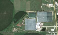
GREEN BUILDING shall mean structures that incorporate the principles of sustainable design in which the impact of a building on the environment will be minimal over the lifetime of that building. Green buildings incorporate principles of energy and resource efficiency, practical applications of waste reduction and pollution prevention, good indoor air quality and natural light to promote occupant health and productivity, and transportation efficiency in design and construction, during use and reuse. A building shall be considered “green” if it meets the requirements of the most current LEED certification criteria or any other nationally recognized green building certification program.
GREEN ROOF shall mean a roof covering of vegetation material, typically consisting of the following components: an insula-tion layer, a waterproof membrane to protect the building from leaks, a root barrier to prevent roots from pene-trating the waterproof membrane; a drainage layer, usually made of lightweight gravel, clay, or plastic; a geotex-tile or filter mat that allows water to soak through but prevents erosion of fine soil particles; a growing medium; plants; and, sometimes, a wind blanket.
GREEN ROOF, EXTENSIVE shall mean a green roof system that ranges from as little as one to five inches in soil depth. Extensive green roof systems generally add less load and require less maintenance than intensive green roof systems.

GREEN ROOF, INTENSIVE shall mean a green roof system that requires a minimum of one foot of soil depth to create a more traditional rooftop garden, with large trees, shrubs and other manicured landscapes. They are multiple layer con-structions, often including elaborate irrigation and drainage systems, adding considerable load to a structure, and requiring intensive maintenance.
GREENHOUSE shall mean a building or premises used for growing plants, preparing floral arrangements for off-site delivery to customers, cold storage of flowers or dry storage of materials used for agricultural or horticultural purposes.
GREENHOUSE, COMMERCIAL shall mean a greenhouse for the raising and sale of agricultural and horticultural commodities for wholesale distribution and/or direct sale.
GREENHOUSE, NONCOMMERCIAL shall mean a building constructed primarily of glass, plastic or similar material in which temperature and humidity can be controlled for the cultivation of fruit, herbs, flowers, vegetables or other plants intended for private use and not for sale.
GREENWAY shall mean a parcel or parcels of land, together with the improvements thereon, dedicated as an easement for access and/or recreation; usually a strip of land set-aside for a walkway, bicycle trail, bridle path, or other similar access-way.
GROSS FLOOR AREA shall mean the total enclosed area of all floors of a building, measured to the inside surfaces of the exterior walls. This definition excludes the areas of basements, elevator shafts, airspaces above atriums, and enclosed off-street parking and loading areas serving a principal use.
GROUNDCOVER shall mean plant material used in landscaping which remains less than 12 inches in height at maturity.
GROUNDWATER shall mean water naturally occurring beneath the surface of the ground that fills available openings in the rock or soil materials such that they may be considered saturated.
GROUP CARE HOME shall mean a home, which is operated under the auspices of an organization which is responsible for providing social services, administration, direction, and control for the home which is designed to provide 24-hour care for individuals in a residential setting.
GROUP HOME shall mean a dwelling with resident staff shared by four or more handicapped persons who live together as a single housekeeping unit and in a long term, family-like environment in which staff persons provide care, education, and participation in community activities for the residents with the primary goal of enabling the residents to live as independently as possible in order to reach their maximum potential. As used herein, the term "handicapped" shall mean having: (1) A physical or mental impairment that substantially limits one or more of such person's major life activities so that such person is incapable of living independently; or (2) A record of having such an impairment.
GROUP HOUSING shall mean two or more separate buildings on a lot, each containing one or more dwelling units.
GUEST ROOM shall mean a room, which is designed to be occupied by one or more guests for sleeping purposes, having no kitchen facilities, not including dormitories.
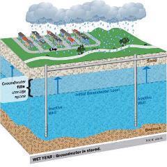

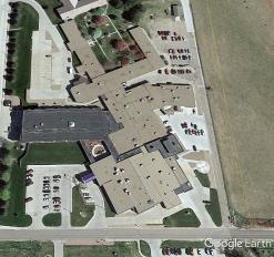
GUN CLUB see Sportsman’s Club.
GUNSMITH shall mean a shop that designs, makes, or repairs small firearms.
HHALF-STORY shall mean a story under a sloped roof which has the intersection of the roof line and exterior wall face not more than three feet above the floor of such story.
HALFWAY HOUSE shall mean a licensed home for individuals on release from more restrictive custodial confinement or initially placed in lieu of such more restrictive custodial confinement, living together as a single housekeeping unit, wherein supervision, rehabilitation and counseling are provided to mainstream residents back into society, enabling them to live independently.
HAZARDOUS WASTE shall mean any discarded material, refuse, or waste products, in solid, semisolid, liquid, or gaseous form, that cannot be disposed of through routine waste management techniques because they pose a present or potential threat to human health, or to other living organisms, because of their biological, chemical, or physical properties.
HEALTH CLUB shall mean a privately owned facility operated for profit, such as gymnasiums, athletic clubs, health clubs, recreational clubs, reducing salons, and weight control establishments.
HEDGE shall mean a plant or series of plants, shrubs or other landscape material, so arranged as to form a physical barrier or enclosure.
HELIPORT shall mean any landing area used for the landing and taking off of helicopters, including all necessary passenger and cargo facilities, fueling, and emergency service facilities.
HELISTOP shall mean an area designed to be used for the landing or takeoff of one helicopter, the temporary parking of one helicopter, and other facilities as may be required by federal and state regulations, but not including operation facilities such as maintenance, storage, fueling, or terminal facilities.
HIGHWAY DEPARTMENT shall mean the Lancaster County Highway Department.
HISTORIC SITES shall mean a structure or place of outstanding historical and cultural significance and designated as such by State or Federal government or by a local government or local nonprofit historical society or foundation.
HISTORIC STRUCTURE shall mean any structure that is:
1. Listed individually in the National Register of Historic Places (a listing maintained by the department of interior) or preliminarily determined by the secretary of the interior as meeting the requirements for individual listing on the National Register;
2. Certified or preliminarily determined by the secretary of the interior as contributing to the historical significance of a registered historic district or a district preliminarily determined by the secretary to qualify as a registered historic district;
3. Individually listed on a state inventory of historic places in states with historic preservation programs which have been approved by the secretary of the interior; or
4. Individually listed on a local inventory of historic places in communities with historic preservation programs that have been certified either:
a. By an approved state program as determined by the secretary of the interior; or
b. Directly by the secretary of the interior in states without approved programs.
HOME IMPROVEMENT CENTER shall mean a business which sells, primarily at retail, supplies and equipment for home improvements, including hardware, housewares, lumber, lighting and electrical fixtures, appliances, and lawn and garden center products.
HOME OCCUPATION shall mean an “in-home” or “home based” or entrepreneurial business operating from a residential dwelling within Hickman. Any portion of a residential property, including a home phone, computer, mailing address, etc., used in deriving income or sales, will require a resident to obtain a Home Occupation Permit. Child Care Homes and Child Care Centers are not considered a Home Occupation.
HOMEOWNERS ASSOCIATION shall mean a private, nonprofit corporation or association of homeowners of properties in a fixed area, established for the purpose of owning, operating, and maintaining various common properties and facilities.
HORTICULTURE shall mean the growing of horticultural and floricultural specialties, such as flowers, shrubs, or trees intended for ornamental or landscaping purposes. This definition may include accessory retail sales under certain conditions. Typical uses include wholesale plant nurseries and greenhouses.
HOSPICE shall mean a facility serving as a medical and residential facility for end-of-life treatment, providing inpatient services and support services for families of the residents and patients.
HOSPITAL shall mean an institution providing medical and surgical treatment and nursing care for sick or injured people.
HOTEL shall mean a building or portion thereof, or a group of buildings, offering transient lodging accommodations on a daily rate to the general public and providing services associated with restaurants, meeting rooms, and recreational facilities. The word "hotel" includes but is not limited to motel, inn, automobile court, motor inn, motor lodge, motor court, tourist court, and motor hotel.
HOT TUB/SPA shall mean a body of water in an artificial or semi-artificial receptacle or other container, such as a hot tub, a whirlpool designed for recreational use, or a therapy pool for medical use which is designed not to be drained, cleaned, and refilled after each individual use. It may include, but is not limited to, hydro jet circulation, hot water, cold water, mineral baths, air induction systems, or any combination thereof. Any hot tub/spa that exceeds 95 inches in width or length and/or 36 inches in depth shall be considered a swimming pool.
HOUSEHOLD PET shall mean an animal that is customarily kept for personal use or enjoyment within the home. Household pet shall include but not be limited to domestic dogs, domestic cats, domestic tropical birds, fish, and rodents.
IIMPERVIOUS COVERAGE shall mean the total horizontal area of all buildings, roofed or covered spaces, paved surface areas, walkways and driveways, and any other site improvements that decrease the ability of the surface of the site to absorb water, expressed as a percent of site area. The surface water area of pools is excluded from this definition.
IMPERVIOUS SURFACE shall mean a surface that has been compacted or covered with a layer of material making the surface highly resistant to infiltration by water, such as compacted sand, rock, gravel, or clay and conventionally surfaced streets, roofs, sidewalks, parking lots, and driveways.
IMPROVEMENT shall mean any change to a structure, object, fence, gate, wall, work of art or parcel from its natural state, which includes, but is not limited to, the installation of drainage ditches, roadways, parkways, sidewalks, pedestrian ways, land for schools or other public uses, off-street parking areas, and the construction of structures.
INCIDENTAL USE shall mean the use of the premises which is dependent on or affiliated with the principal use of such premises.
INDUSTRIAL USES shall mean the manufacture, fabrication, processing, reduction or destruction of any article, substance or commodity, or any other treatment thereof in such a manner as to change the form, character, or appearance thereof, and any storage facilities operated
in conjunction with an industrial use or for a fee, including storage elevators, truck storage yards, warehouses, wholesale storage and other similar types of enterprise.
INDUSTRIAL, GENERAL shall mean enterprises engaged in the processing, manufacturing, compounding, assembly, packaging, treatment or fabrication of materials and products from prepared materials or from raw materials without noticeable noise, odor, vibration, or air pollution effects across property lines.
INDUSTRIAL, HEAVY shall mean enterprises involved in the basic processing and manufacturing of products, predominately from raw materials, with noticeable noise, odor, vibration, or air pollution effects across property lines; or a use or process engaged in the storage of or processes involving potentially or actually hazardous, explosive, flammable, radioactive, or other commonly recognized hazardous materials.
INDUSTRIAL, LIGHT shall mean establishments engaged in the manufacture or processing of finished products from previously prepared materials, including processing, fabrication, assembly, treatment, and packaging of such products, and incidental storage, sales, and distribution. These establishments are characterized by having no major external environmental effects across property lines and include no unscreened or unenclosed outdoor storage. Typical uses include commercial bakeries, dressed beef processing plants, soft drink bottling, apparel assembly from fabrics, electronics, manufacturing, print shops and publishing houses.
INFILL DEVELOPMENT shall mean the construction of a building or structure on a vacant parcel located in a predominantly built-up area.
INFILL SITE shall mean any vacant lot, parcel or tract of land within developed areas of the City and where water, sewer, streets, schools, and fire protection have already been constructed or are provided. a predominately builtup area.
INFRASTRUCTURE shall mean facilities and services needed to sustain industry, residential, commercial, and all other land-use activities, including water lines, sewer lines, and other utilities, streets and roads, communications, and public facilities such as fire stations, parks, schools, etc.
INGRESS AND EGRESS shall mean an entrance or access and exit, respectively.
INOPERABLE MOTOR VEHICLE shall mean any motor vehicle which: (1) Does not have a current state license plate; or, (2) Which is disassembled or wrecked in part or in whole, or is unable to move under its own power; or, (3) is not equipped as required by Nebraska State Law for operation upon streets or highways. A vehicle that is wholly or
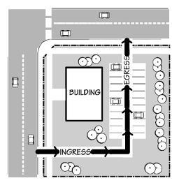
of Ingress and Egress

partially dismantled shall not be considered inoperable when said vehicle is inside a completely enclosed building.
INSTITUTION shall mean a nonprofit corporation or nonprofit establishment for public use.
INTENSITY shall mean the degree to which land is used referring to the levels of concentration or activity in uses ranging from uses of low intensity being agricultural and residential to uses of highest intensity being heavy industrial uses. High intensity uses are normally uses that generate concentrations of vehicular traffic and daytime population and are less compatible with lower intensity uses.
INTENT AND PURPOSE shall mean that the Commission and Council by the adoption of this Ordinance, have made a finding that the health, safety, and welfare of the Community will be served by the creation of the District and by the regulations prescribed therein.
JJUNK shall be any worn-out, cast-off, old, or discarded articles of scrap, copper, brass, iron, steel, rope, rags, batteries, paper, trash, rubber, debris, waste, dismantled or wrecked automobiles, or parts thereof, and other old or scrap ferrous or nonferrous material.
JUNK YARD shall mean any lot, land parcel, building, or structure or part thereof for storage, collection, purchase, sale, salvage, or disposal of machinery, farm machinery, and including motor vehicles, parts and equipment result from dismantling or wrecking, or keeping of junk, including scrap metals or other scrap materials, with no burning permitted. For motor vehicles, see "Automobile Wrecking Yard".

KKENNEL, BOARDING, or TRAINING shall mean a use on any lot or premises in which dogs, cats or any other household pets, at least four months of age, are raised, boarded, bred, or trained.
KENNEL, COMMERCIAL shall mean an establishment where three or more dogs or cats, or any combination thereof, other household pets, or non-farm/non-domestic animals at least four months of age, excluding vicious animals, are raised, bred, boarded, trained, groomed or sold as a business
KENNEL, DOMESTIC shall mean the keeping, breeding, raising, fostering, showing, or training of (3) three or less dogs, over six months of age for personal enjoyment of the owner or occupants of the property, and for which commercial gain is not the primary objective. Domestic kennels are not subject to a kennel license.
KENNEL, PRIVATE shall mean an establishment where three or more dogs or cats, or combination thereof, other
household pets, or non-farm/non-domestic animals at least four months of age, excluding vicious animals, are raised, bred, or boarded
KITCHEN FACILITIES shall mean a room or area equipped for the preparation and cooking of food when it has all of the following: 1. Kitchen sink, 2. Burner, cook stove, or microwave oven, and 3. Refrigerator.
LLABORATORY shall mean a facility used for testing and analyzing medical and dental samples from off-site locations. Testing laboratories shall refer to soil and geotechnical research and analysis. Laboratories do not include human or animal research / testing facilities.
LAGOON shall mean a wastewater treatment facility that is a shallow, artificial pond where sunlight, bacterial action, and oxygen interact to restore wastewater to a reasonable state of purity. This includes both human and livestock wastes. All lagoons shall meet the minimum design criteria established by the NDEE and the NHHS. All lagoons shall have the proper permits approved prior to starting construction.
LANDFILL, CONSTRUCTION MATERIAL shall mean the use of a site as a depository for solid wastes that do not readily undergo chemical or biological breakdown under conditions normally associated with land disposal operations. Typical disposal material would include ashes, concrete, paving wastes, rock, brick, lumber, roofing materials and ceramic tile.
LANDFILL, SOLID WASTE shall mean the use of a site as a depository for any solid waste except hazardous and toxic waste as defined by the EPA and/or the State of Nebraska. Typical disposal material would include non-putrescible wastes; and putrescible wastes such as vegetation, tree parts, agricultural wastes (garbage) and manure.
LANDMARK shall mean any single building, site, structure, object, or improvement which has special historical or cultural significance to the City, state, or nation, or an integrated group of same on a single lot or parcel that has been designated as such, pursuant to the provisions of this Ordinance.
LANDMARK DISTRICT shall mean an area or section of the City containing a significant number of buildings, sites, structures, objects, or improvements which, considered as a whole, possess historical or cultural significance to the City, state, or nation pursuant to the provisions of this Ordinance.
LANDSCAPE shall mean plant materials, topography, and other natural physical elements combined in relation to one another and to man-made structures.
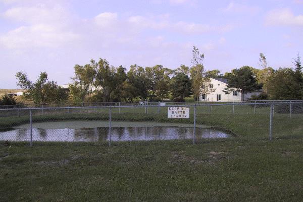
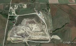
LANDSCAPED AREA shall mean the area within the boundaries of a given lot, site or common development consisting primarily of plant material, including but not limited to grass, trees, shrubs, vines, ground cover, and other organic plant materials; or grass paver masonry units installed such that the appearance of the area is primarily landscaped.
1. Perimeter Landscaped Area: Any required landscaped area that adjoins the exterior boundary of a lot, site or common development.
2. Interior Landscaped Area: Any landscaped area within a site exclusive of required perimeter landscaping.
LANDSCAPING shall include the original planting of suitable vegetation in conformity with the requirements of this Regulation and the continued maintenance thereof.
LAUNDRY, SELF SERVICE shall mean an establishment that provides home-type washing, drying, and/or ironing facilities for customers on the premises.
LAWFUL shall mean not in conflict with any laws, ordinances, or statutes existing at the time of the enactment of this Ordinance.
LEAPFROG DEVELOPMENT shall mean a new development separated from existing development by substantial vacant land.
LEED shall mean a professional credential that means Leadership in Energy and Environmental Design as administered and regulated by the United States Green Building Council.
LEED-ND shall mean a professional credential within the overall LEED program meaning Leadership in Energy and Environmental Design – Neighborhood Design as administered and regulated by United States Green Building Council.
LIFE CARE FACILITY shall mean a facility for the transitional residency of the elderly and/or disabled persons, progressing from independent living to congregate apartment living where residents share common meals, culminating in full health, and continuing care nursing home facility. Also, see Congregate Housing.
LIMITS OF GRADING shall mean the outermost edge of the area in which the existing topography is to be altered by cutting and/or filling.
LIQUOR SALES shall mean Establishments or places of business engaged in retail sale for off-premises consumption of alcoholic beverages. Typical uses include liquor stores, bottle shops, or any licensed sales of liquor, beer or wine for off-site consumption.
LIVESTOCK, RANCH shall mean an area of land, including various structures, given primarily to the practice of ranching, the practice of raising grazing livestock such as
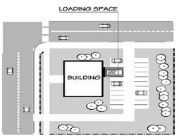
Example of Loading Area/Space
cattle or sheep for meat or wool. Ranches generally consist of large areas but may be of nearly any size. Ranches may be a combination of privately owned land supplemented by grazing leases on land under the control of the federal Bureau of Land Management. If the ranch includes arable or irrigated land, the ranch may also engage in a limited amount of farming, raising crops for feeding the animals, such as hay and feed grains.
Ranches that cater exclusively to tourists are called guest ranches or, colloquially, "dude ranches." Most working ranches do not cater to guests, though they may allow private hunters or outfitters onto their property to hunt native wildlife, and may include horseback rides, cattle drives or guided hunting.
LIVESTOCK SALES shall mean the use of a site for the temporary confinement and exchange or sale of livestock. Typical uses include sale barns.
LOADING AREA/SPACE shall mean an off-street space or berth on the same lot with a main building, or contiguous to a group of buildings, for the temporary parking of commercial vehicles while loading or unloading, and which abuts a street, alley, or other appropriate means of ingress and egress.
LOT shall mean a parcel or tract of land which is or may be occupied by a use herein permitted, together with yards, and other open spaces herein required, that has frontage upon an improved street, and is a part of a recorded subdivision plat or has been recorded prior to the adoption of the Regulation, or a parcel of real property delineated on an approved record of survey, lot-split or parceling map as filed in the office of the Lancaster County Register of Deeds and abutting at least one improved public street or right-of-way, two thoroughfare easements, or one improved private road.
Examples of Lot Types
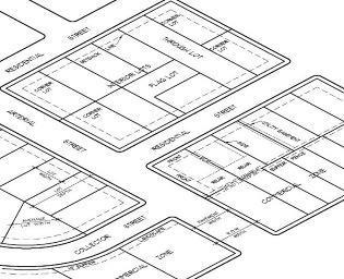
LOT, CORNER shall mean a lot located at the intersection of two or more streets at an angle of not more than 135 degrees. If the angle is greater than 135 degrees, the lot shall be considered an "Interior Lot". The setbacks for a front yard shall be met on all abutting streets.
LOT, DOUBLE FRONTAGE, or THROUGH shall mean a lot having a frontage on two non-intersecting streets as distinguished from a corner lot.
LOT, FLAG shall mean an interior lot, the majority of which has frontage and access provided by means of a narrow corridor.
LOT, INTERIOR shall mean a lot other than a corner lot.
LOT AREA shall mean the total area, on a horizontal plane, within the lot lines of a lot.
LOT COVERAGE shall mean the portion of a lot or building site which is occupied by any building or structure, excepting paved areas, walks and swimming pools, regardless of whether said building or structure is intended for human occupancy or not.
LOT DEPTH shall mean the horizontal distance between the front and rear lot lines measured in the mean direction of the side lot lines.
LOT FRONTAGE shall mean the side of a lot abutting on a legally accessible street right-of-way other than an alley or an improved county road. For the purposes of this definition, on corner lots, all sides of a lot adjacent to streets or roads shall be considered frontage.
LOT LINE shall mean the property line bounding a lot.
LOT LINE, FRONT shall mean the property line abutting a street.
LOT LINE, REAR shall mean a lot line not abutting a street which is opposite and most distant from the front lot line.
LOT LINE, SIDE shall mean any lot line not a front lot line or rear lot line.
LOT, NONCONFORMING shall mean a lot having less area or dimension than that required in the district in which it is located and which was lawfully created prior to the zoning thereof whereby the larger area or dimension requirements were established, or any lot, other than one shown on a plat recorded in the office of the Lancaster County Register of Deeds, which does not abut a public road or public road right-of-way and which was lawfully created prior to the effective date of this Regulation.
LOT OF RECORD shall mean a lot or parcel of land, the deed to which has been recorded in the records of the Lancaster County Register of Deeds at the time of the passage of a regulation establishing the zoning district in which the lot is located.
LOT WIDTH shall mean the average horizontal distance between the side lot line, measured at right angles to the lot depth at a point midway between the front and rear lot lines.
MMANUFACTURED HOME see Dwelling, Manufactured Home.
MANUFACTURING shall mean the mechanical or chemical transformation of materials or substances into new products. Manufacturing uses are usually described as plants, factories, or mills and characteristically use power driven machines and materials handling equipment. Assembling component parts of manufactured products is also considered manufacturing if the new product is neither a structure nor other fixed improvement. Also
included is the blending of material such as lubricating oils, plastics, resins, or liquors. Manufacturing production is usually carried on for the wholesale market, for interplant transfer, or to order for industrial users, rather than for direct sale to the domestic consumer.
MANUFACTURING, CUSTOM shall mean an establishment primarily engaged in the on-site production of goods by hand manufacturing, within enclosed structures, involving: 1. The use of hand tools, or 2. The use of domestic mechanical equipment not exceeding 2 horsepower, or 3. A single kiln not exceeding 8 KW or equivalent.
This category also includes the incidental direct sale to consumers of only those goods produced on site. Typical uses include ceramic studios, custom jewelry manufacturing, and candle making shops.
MASSAGE THERAPY/SPA shall mean an establishment other than a regularly licensed and established hospital or dispensary where non-medical manipulative exercises or devices are practiced upon the human body manually or otherwise by any person other than a licensed physician, surgeon, dentist, occupational or physical therapist, chiropractor or osteopath with or without the use of therapeutic, electrical, mechanical, or bathing devices. Also, see Adult Uses.
MASTER FEE SCHEDULE shall mean a fee schedule maintained by the City of Hickman and passed, and amended periodically, which establishes the required fees to be collected for specific Planning, Zoning, and Subdivision activities.
MATERIAL EFFECT shall mean an effect on a financial product that a reasonable person would expect to influence someone’s decision to acquire or dispose of the financial product.
MAYOR shall mean the chief executive of the municipality (City of Hickman).
MECHANICAL EQUIPMENT shall mean equipment, devices, and accessories, the use of which relates to water supply, drainage, heating, ventilating, air conditioning, and similar purposes.
MEDIAN see Parkway.
MEDICAL CLINICS/OFFICES shall mean the use of a site for facilities which provide diagnoses and outpatient care on a routine basis, but which does not provide prolonged, inhouse medical or surgical care. Medical offices are operated by doctors, dentists, or similar practitioners licensed for practice in the State of Nebraska.
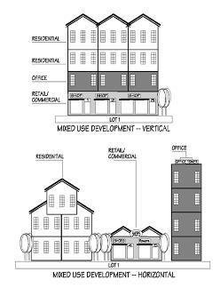
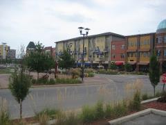
MEDICAL MARIJUANA DISPENSARY shall mean a place of business where marijuana is dispensed or sold at retail to qualifying patients and primary caregivers, and for which the Nebraska State regulatory body has issued a dispensary facility permit or license to an applicant in accordance with Nebraska State Statute, as amended.
MEDICAL MARIJUANA PRODUCTION FACILITY shall mean a secure, indoor facility where the production of marijuana occurs, and that is operated by a person to whom the State of Nebraska regulatory body has issued a producer license in accordance with Nebraska State Statute, as amended.
MINI-STORAGE OR MINI-WAREHOUSE see Self-Service Storage Facility.
MINOR as in IMPROVEMENT, AMENDMENT, CHANGE, USE OR MODIFICATION shall mean a slight or small difference that does not change the intent of the regulation.
MISCELLANEOUS STRUCTURES shall mean structures, other than buildings, visible from public ways. Examples are memorials, staging, antennas, water tanks and towers, sheds, shelters, fences, and walls, kennels, and transformers.
MIXED USE shall mean properties where various uses, such as office, commercial, institutional, and residential are combined in a single building or on a single site in an integrated development project with significant functional interrelationships and a coherent physical design.
MIXED USE BUILDING shall mean a building or structure that incorporates two or more use types within a single building or structure, provided that each use type is permitted within the individual Base Zoning District in which the building or structure is to be located.
MIXED USE DEVELOPMENT shall mean a single development that incorporates complementary land use types into a single development.
MOBILE FOOD UNIT shall mean a temporary food service establishment that is a vehicle-mounted and is designed to be readily movable.
MOBILE HOME see Dwelling, Mobile Home.
MOBILE HOME PARK shall mean a parcel of land under single ownership that has been planned and improved for the placement of manufactured or mobile housing used or to be used for dwelling purposes and where manufactured or mobile home spaces are not offered for sale or sold. The terms "manufactured home park" or “mobile home park” do not include sales lots on which new or used manufactured or mobile homes are parked for the purposes of storage, inspection, or sale. The terms "manufactured home park" or “mobile home park” shall
include the term “trailer camp”, as defined in the Hickman Code.
MOBILE HOME SUBDIVISION shall mean a parcel of land that has been subdivided and used or intended to be used for the purpose of selling lots for occupancy by manufactured or mobile homes.
MODULAR HOME shall mean a dwelling unit approved by the Nebraska Department of Public Health and composed of elements substantially assembled in a manufacturing plant and transported to the building site for final assembly on a permanent foundation. The term does not include manufactured (mobile) homes.
MONASTERY shall mean a building or complex of buildings comprising the domestic quarters and workplaces of monastics, monks, or nuns, whether living in communities or alone. A monastery generally includes a place reserved for prayer which may be a chapel, church, or temple.
MOTEL see Hotel.
MOTOR FREIGHT TERMINAL shall mean a building or area in which freight brought by motor truck is received, assembled or stored and dispatched for routing by motor truck which may include motor truck storage.
MOTOR VEHICLE shall mean every self-propelled land vehicle, not operated upon rails, except self-propelled wheelchairs.
MUNICIPALITY OR MUNICIPAL shall mean or relate to a city of the second and/or first class. In this document it means and relates to the City of Hickman, Nebraska.
NNATIONAL REGISTER OF HISTORIC PLACES shall mean the nation’s official list of properties worthy of preservation. Properties so designated have local, state, or national significance. The National Register is maintained by the U.S. Department of the Interior, National Park Service and is promulgated under federal regulations set out in 36 C.F.R. Part 60.
NEBRASKA STATE HISTORIC PRESERVATION OFFICER shall mean the governor’s appointed official for all matters related to federal historic preservation programs in Nebraska as administered by the Nebraska State Historical Society.
NIGHTCLUB shall mean a commercial establishment dispensing beverages for consumption on the premises and in which dancing is permitted or entertainment is provided. Also, see Bar.
NONCOMMUNITY WATER SUPPLY SYSTEM shall mean any public water supply system that is not a community water supply system.
NONCONFORMING BUILDING/DEVELOPMENT shall mean a building or portion thereof which was lawful when established but which does not conform to subsequently established zoning or zoning regulations.
NONCONFORMING LOT shall mean a lot which was lawful prior to the adoption, revision, or amendment of this zoning ordinance but that fails by reason of such adoption, revision, or amendment to conform to the present requirements of the zoning ordinance. No action can be taken which would increase the non-conforming characteristics of the lot.
NONCONFORMING SIGN shall mean a sign that was legally erected prior to the adoption, revision, or amendment of this zoning ordinance but that fails by reason of such adoption, revision, or amendment to conform to the present requirements of the zoning ordinance.
NONCONFORMING STRUCTURE shall mean a structure which was lawful prior to the adoption, revision, or amendment of this zoning ordinance but that fails by reason of such adoption, revision, or amendment to conform to the present requirements of the zoning ordinance. No action can be taken which would increase the non-conforming characteristics of the structure.
NONCONFORMING USE shall mean any use existing and lawful at the time of adoption of these regulations occupying a building, structure or land but is no longer allowed.
NONCONVERSION AGREEMENT shall mean a recorded agreement, which shall run with the land identified in an attached legal description, between a property owner and Floodplain Administrator to document a property owner's understanding of the limitations on construction and use of a structure's enclosed area located below the identified flood protection elevation, when said structure is located within a Special Flood Hazard Area.
NONFARM BUILDINGS shall mean all buildings except those buildings utilized for agricultural purposes on a farm.
NONFARM DWELLING shall mean any dwelling that is not a part of a farm regardless of lot size.
NUISANCE shall mean anything that interferes with the use or enjoyment of property, endangers personal health or safety, or is offensive to the senses such as noise, dust, odor, smoke, gas, pollution, congestion, lighting, and litter.
NURSERY shall mean the use of a premises for the propagation, cultivation, and growth of trees, shrubs, plants, vines, and the like from seed or stock, and the sale thereof, and including the sale of trees, shrubs, plants, vines, and the like purchased elsewhere and transplanted into the soil of the premises. In connection with the sale of plants, such fungicides, insecticides, chemicals, peat moss,
humus, mulches, and fertilizers as are intended to be used in preserving the life and health of the plants may be sold.
NURSING HOMES OR CONVALESCENT HOMES shall mean an institution or agency licensed by the State of Nebraska for the reception, board, care, or treatment of three or more unrelated individuals, but not including facilities for the care and treatment of mental illness, alcoholism, or narcotics addiction.
OOFFICE shall mean a building or a portion of a building wherein services are performed involving, primarily, administrative, professional, or clerical operations.
OFFICIAL ZONING DISTRICT MAP shall mean a map delineating the boundaries of zoning districts which, along with the zoning text, is officially adopted by the Hickman City Council.
OFF-STREET PARKING AREA shall mean all off street areas and spaces designed, used, required, or intended to be used for parking, including driveways or access ways in and to such areas.
OPEN LOTS shall mean pens or similar concentrated areas, including small shed-type areas or open-front buildings, with dirt, or concrete (or paved or hard) surfaces, wherein animals or poultry are substantially or entirely exposed to the outside environment except for possible small portions affording some protection by windbreaks or small shedtype areas.
OPEN SPACE shall mean a parcel or parcels of land, together with the improvements thereon, primarily set aside for recreational use and enjoyment, exclusive of land areas used for streets, alleys, roads, driveways, parking areas, structures, and buildings.
OPEN SPACE, COMMON shall mean a separate and distinct area set aside as open space within or related to a development, and not on individually owned lots or dedicated for public use, but which is designed and intended for the common use or enjoyment of the residents of the development. Rights-of-way, private streets, driveways, parking lots or other surfaces designed or intended for vehicular use or required yards are not included as common open space.
OUTDOOR ADVERTISING see Advertising Structure and Sign.
OUTDOOR STORAGE shall mean the storage of materials, parts, or products that are related to the primary use of a site for a period exceeding three days.

OUTDOOR STORAGE, COMMERCIAL shall mean the storage of products for sale to the public, not impeding a public sidewalk or public way. This does not include storage units for rent (See Storage, Self-Service Facility).
1. Next to Building – Items for Sale to Public are permitted in commercial
2. Special Temporary Sales in the Parking Lot – Temporary Use permit required
3. Not for sale items such as storage of excess shelving units not permitted
OUTDOOR STORAGE CONTAINERS See Storage Container
OUTDOOR STORAGE, INDUSTRIAL shall mean the storage of items that are related to the primary use of a site, however, not impeding a public sidewalk or public way. This does not include storage units for rent.
OUTDOOR STORAGE STRUCTURE shall mean any permanent structure, enclosed or semi enclosed, used for the storage of vehicles, materials, or other items necessary for the operation of the commercial or industrial use. Semienclosed structures are to be screened from view from public ways. This does not include storage units for rent.
OUTLOT shall mean a lot remnant or parcel of land left over after platting, which is intended as open space or reserved for future development, for which no building permit shall be issued unless parcel is replatted.
OVERLAY DISTRICT shall mean a district in which additional requirements are imposed upon a use, in conjunction with the underlying zoning district. The original zoning district designation does not change.
OWNER shall mean an individual, firm, association, syndicate, partnership, or corporation having sufficient proprietary interest to seek development of land.
OWNER OF RECORD shall mean a fee simple owner or owner’s authorized agent, a corporation which owns real estate, partnership owning real estate, limited liability corporation, or other device constituting ownership of real estate.
PPACKAGE LIQUOR STORE shall mean an establishment in which alcoholic beverages in original containers are sold for consumption off the premises.
PAINTBALL COURSE shall mean a commercial recreational park containing obstacle courses for the purpose of staging paintball battles. Said facility generally collects a fee, either as membership or on a visit-by-visit basis that allows individuals to participate in paintball activities.
PARCEL shall mean a lot or a contiguous group of lots in single ownership or under single control, which may be considered as a unit for purposes of development.
PARK shall mean any public or private land available for recreational, educational, cultural, or aesthetic use.
PARKING AREA, PRIVATE shall mean an area, other than a street, used for the parking of automotive vehicles capable of moving under their own power and restricted from general public use.
PARKING AREA, PUBLIC shall mean an area, other than a private parking area or street used for the parking of vehicles capable of moving under their own power, either free or for remuneration.
PARKING LOT shall mean an area consisting of one or more parking spaces for motor vehicles together with a driveway connecting the parking area with a street or alley and permitting ingress and egress for motor vehicles.
PARKING, REMOTE shall mean a supply of off-street parking at a location not on the site of a given development.
PARKING SPACE, AUTOMOBILE shall mean an area, other than a street or alley, reserved for the parking of an automobile, such space having a dimension not less than nine feet by 20 feet, plus such additional area as is necessary to afford adequate ingress and egress.
PARKWAY shall mean a strip of land situated within the dedicated street right-of-way and (1) located between the roadway and right-of-way line; (2) a median located between the roadways; or (3) landscaped.
PAVED shall mean permanently surfaced with poured concrete, concrete pavers, or asphalt.
PERFORMANCE GUARANTEE shall mean a financial guarantee to ensure that all improvements, facilities, or work required by this chapter will be completed in compliance with these regulations as well as with approved plans and specifications of a development.
PERFORMANCE STANDARD (CRITERIA) shall mean an approved level of performance thresholds, requirements, or expectations that must be met to be appraised at a particular level of conformance.
PERGOLA shall mean an outdoor structure consisting of columns that support a roofing grid of beams and rafters. This roofing grid may be left open or covered so as to create an area sheltered from the elements. Pergolas may be freestanding or attached to a house.
PERMANENT FOUNDATION shall mean a base constructed from either poured concrete or laid masonry rock or brick and placed on a footing located below ground level to a point below the frost line upon which a building or structure is permanently attached.
PERMANENT STORAGE shall mean the long-term storage on -site within an accessory building or structure.

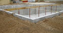
PERMITTED USE shall mean any land use allowed without condition within a zoning district.
PERMANENTLY ATTACHED shall mean attached to real estate in such a way as to require dismantling, cutting away, unbolting from permanent foundation or structural change in such structure in order to relocate it to another site.
PERSON shall mean an individual, firm, co-partnership, joint venture, association, social club, fraternal organization, corporation, estate, trust, receiver, syndicate, City, County, special district or any other group or combination acting as an entity, except that it shall not include Hickman, Nebraska.
PERSONAL SERVICES shall mean uses providing human services exclusively to private individuals as the ultimate consumer. Personal services shall not be limited to but including grocery shopping services, tailoring and alterations, hair salons, spas, nail salons, barber shops, private household services and temporary personal inhome care.
PET SHOP shall mean a retail establishment primarily involved in the sale of domestic animals, such as dogs, cats, fish, birds, and reptiles, excluding exotic animals and farm animals.
PHARMACY see Medical Clinics/Offices.
PLANNING COMMISSION shall mean the Planning Commission of Hickman, Nebraska.
PLANT MATERIALS shall mean trees, shrubs, vines, ground covers, grass, perennials, annuals, and bulbs and other such vegetation.
PLAT shall mean a map showing the location, boundaries, and legal description of individual properties.
POLE BUILDING shall mean a structure built with no foundation or footings, using poles embedded directly in the ground as its primary support to hold metal, plastic, fiberglass or wood covering to form the building.
POLICY shall mean a statement or document of the City, such as the comprehensive plan, that forms the basis for enacting legislation or making decisions.
PORCH, UNENCLOSED shall mean a roofed or unroofed open structure projecting from an exterior wall of a building and having no enclosed features more than thirty inches above its floor other than wire screening and a roof with supporting structure.
PREFABRICATED HOME shall mean to manufacture (a building or section of a building, for example) in advance, especially in standard sections that can be easily shipped and assembled.
PREMISES shall mean a tract of land, consisting of one lot or irregular tract, or more than one lot or irregular tract, provided such lots or tracts are under common ownership, contiguous, and used as a single tract. A building or land within a prescribed area.
PRE-PROJECT CONDITION shall mean a condition that impacts erosion, sediment, or stormwater runoff characteristics of a site prior to start of construction activity. The pre-project condition shall be based on the predominant land use for the past five years. For example, if a site has been cropland for four (4) of the past five (5) years and in grass just prior to development, the land use would be cropland for the pre-project condition.
PRESERVATION shall mean the act of protecting an area, parcel of land, or structure from being changed or modified from the present character to another that is not representative of a specific period or condition.
PRINCIPAL STRUCTURE shall mean the main building or structure on a lot, within which the main or primary use of the lot or premises is located.
PRINCIPAL USE shall mean the main use of land or structure, as distinguished from an accessory use.
PROFESSIONAL SERVICES shall mean services provided by physicians, surgeons, chiropractors, osteopaths, physical therapists, dentists, architects, engineers, lawyers, and accountants.
PROHIBITED USE shall mean any use of land, other than nonconforming, which is not listed as a permitted use, conditional use or accessory use within a zoning district.
PROMOTIONAL DEVICE shall mean any sign intended to be displayed either with or without a frame, with or without characters, letters, illustrations, or other material, on a fabric of any kind. National flags, flags of political subdivisions, or symbolic flags of any institutions or business shall be considered a promotional device for the purpose of this definition. Banners, pennants, inflatable characters, streamers, or fringe-type ribbons or piping shall be considered as a promotional device.
PROPERTY, HISTORIC PRESERVATION shall mean a building, site, structure, object, or improvement designated or proposed for designation as a landmark or within a landmark district.
PROTECTED ZONE shall mean all lands that fall outside the buildable areas of a parcel, all areas of a parcel required to remain in open space, and/or all areas required as landscaping strips according to the provisions of the Zoning Regulation.
PUBLIC UTILITY shall mean any business which furnishes the general public telephone service, telegraph service, electricity, natural gas, water and sewer, or any other
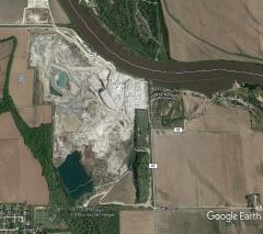
An Aerial of a Mining and Mineral Extraction Site and Quarry
business so affecting the public interest as to be subject to the supervision or regulation by an agency of the state or federal government.
PUBLIC WATER SUPPLY shall mean a water supply system designed to provide public piped water fit for human consumption, if such system has at least 15 service connections or regularly serves at least 25 individuals. This definition shall include: (1) Any collection, treatment, storage, or distribution facilities under the control of the operator of such system and used primarily in connection with such system; and (2) Any collection or pretreatment storage facilities not under such control which are used primarily in the connection with such system.
PUBLIC WAY shall mean any sidewalk, street, alley, highway, easement, or other public thoroughfare.
QQUARRY shall mean an open pit from which building stone, sand, gravel, mineral, or fill is taken to be processed for commercial purposes.
QUARRY REHABILITATION shall mean to provide slopes that will be covered with a layer of top soil.
QUONSET HOME, see Dwelling Unit, Special Types
RRAILROAD shall mean the land use including the right-ofway abutting railroad properties occupied by uses pertinent to the railroad operation and maintenance, but not including properties owned by the railroad and leased for use by others.
RECREATION, INDOOR shall mean a facility for relaxation, diversion, amusement or entertainment where such activity occurs within a building or structure.
RECREATION, OUTDOOR shall mean a facility for relaxation, diversion, amusement or entertainment in which some or all of the activities occur on the exterior but within the property of the facility.
RECREATIONAL FACILITY shall mean facilities for the use by the public for passive and active recreation including tennis, handball, racquetball, basketball, track and field, jogging, baseball, soccer, skating, swimming, or golf. This shall include country clubs and athletic clubs, but not facilities accessory to a private residence used only by the owner and guests, nor arenas or stadiums used primarily for spectators to watch athletic events. In addition, recreational facilities shall mean museums, amphitheaters, race tracks (including all motor powered vehicles) and wildlife conservation areas (used for public viewing), and theme parks.
RECREATIONAL VEHICLE (RV) shall mean a vehicular unit primarily designed as a temporary living quarters for recreational camping or travel use having either its own power or designed to be mounted on or drawn by a motor vehicle. Recreational vehicle includes motor home, truck camper, travel trailer, camping trailer, and fifth wheel.
RECREATIONAL VEHICLE (RV) PARK shall mean a tract of land upon which two or more recreational vehicle sites are located, established, or maintained for occupancy by recreational vehicles of the general public as temporary living quarters for recreation or vacation purposes by campers, vacationers, or travelers.
RECYCLING CENTER shall mean a building in which used material is separated and processed prior to shipment to others who will use those materials to manufacture new products. The facility is not junkyard.
RECYCLING COLLECTION shall mean a collection point for small refuse items, such as bottles and newspapers, located either in a container or small structure.
RECYCLING DROP OFF SITE shall mean a collection point for small refuse items, such as bottles and newspapers, located either in a container or small structure.
RECYCLING PROCESSING shall mean any site which is used for the processing of any postconsumer, nondurable goods including, but not limited to glass, plastic, paper, cardboard, aluminum, tin, or other recyclable commodities.
REDEVELOPMENT shall mean the act of preserving and/or rehabilitating existing buildings. In extreme cases, a building or structure could be demolished for the purpose of a new use or building.
RELIGIOUS ASSEMBLY shall mean a building or group of buildings used or proposed to be used for conducting organized religious services and accessory uses associated with the use.
RELIGIOUS ASSEMBLY, STOREFRONT shall mean a religious facility contained within a store or similar structure not typically used for religious activities that are now used as a meeting place for a congregation, including but not limited to, barns, stores, warehouses, old public buildings.
REMOTE PARKING shall mean a supply of off-street parking at a location not on the site of a given development.
RENDERING PLANT shall mean a plant for reduction of dead animals, or slaughtered animals not suitable for human consumption, to byproducts, such as hide, skin, grease, bones, glue, and soap, and for the storage of such by-products.


Example of Renewable Energy

Example of Resource Extraction
RENEWABLE ENERGY shall mean energy sources including wind, solar power, biomass, and hydropower, that can be regenerated and that is much less polluting than nuclear or fossil fuels.
RENEWABLE RESOURCE shall mean a natural resource that is able to regenerate, either by itself or with human assistance, over a short to moderate time period, including food crops and trees.
RESERVE STRIP shall mean a narrow strip of land overlying a dedicated street reserved to the City for control of access until such time as additional right-of-way is accepted by the City for continuation or widening of the street.
RESIDENCE shall mean a building used, designed, or intended to be used as a home or dwelling place for one or more families.
RESIDENTIAL CLUBHOUSE SPACE see CLUBHOUSE, RESIDENTIAL SPACE
RESTAURANT shall mean a public eating establishment operated for profit at which the primary function is the preparation and serving of food primarily to persons seated within the building.
RESTAURANT, DRIVE-IN shall mean a restaurant establishment that has the facilities to serve prepared food and/or beverages to customers seated within motor vehicles for consumption either on or off the premises.
RESTAURANT, ENTERTAINMENT shall mean a restaurant establishment where food and drink are prepared, served, and consumed, within a building or structure that integrally includes electronic and mechanical games of skill, simulation, and virtual reality, play areas, video arcades or similar uses, billiards, and other forms of amusement.
RESTAURANT, FAST FOOD shall mean a restaurant establishment whose principal business is the sale of food and/or beverages in ready-to- consume individual servings, for consumption either within the establishment, for carryout, or drive-in; and where food and/or beverages are usually served in paper, plastic, or other disposable containers.
RESOURCE EXTRACTION shall mean a use involving on-site extraction of surface or subsurface mineral products or natural resources, excluding the grading and removal of dirt. Typical uses are quarries, borrow pits, sand and gravel operations, mining.
RETAIL shall mean the sale of goods to the public in relatively small quantities for use or consumption rather than for resale.
RETAIL, BIG BOX (see Big Box Retail).
RETAIL, RESTRICTED SALES shall mean a retail facility that requires a government issued permit of license for regulated goods (i.e., firearms, liquor, tobacco, or medical marijuana dispensary).
RETAIL SALES shall mean establishments engaged in selling of goods or merchandise to the general public for personal or household consumption.
RETAIL SERVICES shall mean establishments engaged in selling of goods or merchandise including household cleaning and maintenance products; drugs, cards, stationery, notions, books, tobacco products, cosmetics, and specialty items; flowers, plants, hobby materials, toys, and handcrafted items; apparel jewelry, fabrics and like items; cameras, photograph services, household electronic equipment, records, sporting equipment, kitchen utensils, home furnishing and appliances, art supplies and framing, arts and antiques, paint and wallpaper, hardware, carpeting and floor covering; interior decorating services; office supplies; mail order or catalog sales; bicycles; and automotive parts and accessories (excluding service and installation).
RETENTION BASIN shall mean a pond, pool, or basin used for the permanent storage of stormwater runoff.
RETIREMENT RESIDENCE shall mean a building or group of buildings which provide residential facilities for more than four residents of at least sixty-two years of age, or households headed by a householder of at least sixty-two years of age. A retirement residence may provide a range of residential building types and may also provide support services to residents, including but not limited to food service, general health supervision, medication services, housekeeping services, personal services, recreation facilities, and transportation services. The retirement residence may accommodate food preparation in independent units or meal service in one or more common areas. Retirement residences may include additional health care supervision or nursing care.
REVERSE SPOT ZONING shall mean an arbitrary zoning or rezoning of a small tract of land that is not consistent with the comprehensive land use plan and that uniquely burdens an individual owner largely to secure some public benefit. Reverse spot zoning usually results from downzoning a tract of land to a less intensive use classification than that imposed on nearby properties.
REZONING shall mean an amendment to or change in the zoning regulations either to the text or map or both.
REZONING, PIECEMEAL shall mean the zoning reclassification of individual lots resulting in uncertainty in the future
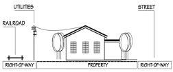

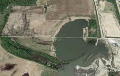
RIGHT-OF-WAY shall mean a strip of land, generally linear, occupied or intended to be occupied by a system that conveys people, traffic, fluids, utilities, or energy from one point to another. Rights-of-way may include streets and roads, crosswalks, bicycle paths, recreational trails, railroads or fixed guideway transit, electric transmission lines, gas pipelines, water mains, or sewer mains.
ROAD, PRIVATE shall mean a way, other than driveways, open to vehicular ingress and egress established for the benefit of certain, adjacent properties. Also, see Right-ofway and Street.
ROAD, PUBLIC shall mean all public rights-of-way reserved or dedicated for street or road traffic. Also, see Right-ofWay and Street.
ROADSIDESTAND shall mean a structure for the display and sale of products on a temporary or seasonal basis.
ROOM shall mean an unsubdivided portion of the interior of a dwelling unit, excluding bathroom, kitchen, closets, hallways, and service porches.
SSAFETY SERVICES shall mean facilities for conduct of public safety and emergency services including police and fireprotection services and emergency medical and ambulance services.
SALVAGE SERVICES shall mean places of business engaged in the storage, sale, dismantling or other processing of used or waste materials which are not intended for reuse in their original forms.
SAND OR GRAVEL PIT shall mean land used for the extraction of sand and/or gravel for public and/or commercial use.
SANITARY LANDFILL shall mean a type of operation in which garbage and refuse, or garbage, or refuse is deposited by a plan on a specified portion of land, and is compacted by force applied by mechanical equipment, and then is covered by compacted suitable covering material to a depth of at least six to twelve inches over individual cells of garbage and/or refuse, which are closed at the end of each day, and to a depth of at least twenty-four inches over the finished land fill.
SANITARY TRANSFER STATION shall mean a collection point for temporary storage of refuse. No processing of refuse would be allowed. The transfer station must be in conformance with the requirements of all State and Federal Agencies.
SATELLITE DISH ANTENNA shall mean a round, parabolic antenna incorporating a reflective surface that is solid, open mesh, or bar configured and is in the shape of a shallow dish, or cone and used to transmit and/or receive radio or electromagnetic waves.
SCHOOL, BUSINESS OR TRADE shall mean a use providing education or training in business, commerce, language, or other similar activity or occupational pursuit, and not otherwise defined as a home occupation, college or university, or public or private educational facility.
SCHOOL, DAY, PRE-, OR NURSERY shall mean a school or center for children under school age, whether licensed as a day care center or not. Such shall be approved by the Nebraska State Fire Marshall as being in conformance with safety provisions pursuant to the National Fire Protection Association, Pamphlet 101, known as the Life Safety Code and shall be approved by the Nebraska Department of Health and Welfare as meeting their health and welfare standards.
SCHOOL, PRIVATE shall mean a school or educational institution that is not supported by public tax dollars and is owned and operated by a religious or private entity.
SECRETARY, HISTORIC PRESERVATION COMMISSION shall mean the staff member appointed by the City Administrator to serve the Historic Preservation Commission.
SECRETARY OF THE INTERIOR’S “STANDARDS FOR EVALUATION AND REGISTRATION” shall mean criteria and procedures for the evaluation and designation of historic properties promulgated by the U.S. Department of the Interior, National Park Service, set out in 48 F.R. 44716.
SECRETARY OF THE INTERIOR’S “STANDARDS FOR IDENTIFICATION” shall mean criteria and procedures for the survey of landmarks or landmark districts promulgated by the U.S. Department of the Interior, National Park Service, set out in 48 F.R. 44716.
SECRETARY OF THE INTERIOR’S “STANDARDS FOR REHABILITATION” shall mean the ten standards promulgated by the U.S. Department of the Interior to guide alterations to a landmark or property within a landmark district, set out in 36 C.F.R. Part 67.
SCREENING shall mean a structure or planting that conceals from public view the area behind such structure or planting.
SELF-SERVICE STATION shall mean an establishment where motor fuels are stored and dispensed into the fuel tanks of motor vehicles by persons other than the service station attendant and may include facilities available for the sale of other retail products.

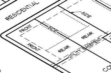
Setback Lines
SELF-SERVICE STORAGE FACILITY shall mean a building or group of buildings containing individual, compartmentalized, and controlled access stalls or lockers for storage.
SEPARATE OWNERSHIP shall mean ownership of a parcel of land by a person who does not own any of the land abutting such parcel.
SEPTIC SITE shall mean the area bounded by the dimensions required for the proper location of the septic tank system.
SERVICE STATION shall mean buildings and premises where the primary use is the supply and dispensing at retail of motor fuels, lubricants, batteries, tires, and motor vehicle accessories and where light maintenance activities such as engine tune-ups, lubrications, and washing may be conducted, but not including heavy maintenance and repair such as engine overhauls, painting, and body repair.
SETBACK shall mean the minimum distance, as prescribed by this regulation, measured from the edge of the eve or other similar building component located closest to the lot line.
SETBACK LINE, FRONT YARD see Yard, Front
SETBACK LINE, REAR YARD see Yard, Rear
SETBACK LINE, SIDE YARD see Yard, Side
SHOPPING CENTER, COMMERCIAL STRIP shall mean a commercial development, usually one store deep, fronting on a major street for a distance of one city block or more. Includes individual buildings on their own lots, with or without on-site parking and small linear shopping centers with shallow on-site parking in front of the stores.
SHORT-TERM RENTALS shall mean any dwelling or condominium or portions thereof, in which the owner does not reside, that is available for use or is used for accommodations or lodging of guests, paying a fee or other compensation for a period of less than thirty consecutive days.
SHRUB shall mean a multi-stemmed woody plant other than a tree.
SIDEWALK CAFÉ shall mean an area adjacent to a street level eating or drinking establishment located adjacent to the public pedestrian walkway and used exclusively for dining, drinking, and pedestrian circulation. The area may be separated from the public sidewalk by railings, fencing, or landscaping or a combination thereof.
SIGHT TRIANGLE shall mean an area at a street intersection in which nothing shall be erected, placed, planted, or allowed to grow in such a manner as to materially impede vision between a height of two and one-half feet and 10 feet above the grades of the bottom of the curb of the intersecting streets, measured from the point of intersection of the centerline of the streets along the centerline of the streets.
SIGN shall mean and include any outdoor sign, display, declaration, device, figure, drawing, illustration, message, placard, poster, billboard, insignia, or other things which are designed, intended, or used for direction, information, identification, or to advertise, to inform, or to promote any business, product activity, service, or any interest.
SIMILAR USE shall mean the use of land, buildings, or structures of like kind or general nature with other uses within a zoning district as related to bulk, intensity of use, traffic generation and congestion, function, public services requirements, aesthetics or other similarities.
SITE shall mean the parcel of land to be developed or built upon. A site may encompass a single lot; a portion of a lot; or a group of lots developed as a common development under overlay districts provisions of this ordinance.
SITE BREAK shall mean a structural or landscape device used to interrupt long vistas and create visual interest in a site development.
SITE PLAN shall mean a plan, prepared to scale, showing accurately and with complete dimensioning, the boundaries of a site and the location of all buildings, structures, uses, drives, parking, drainage, landscape features, and other principal site development improvements for a specific parcel of land.
SKATE, IN-LINE shall mean a boot-type device, which is placed on an individual’s feet. In-line skates contain wheels on the bottom of the boot, which are attached in linear fashion.
SKATE PARK shall mean a recreational facility containing skateboard ramps and other obstacle courses and devices for the use with skateboards and in-line skates.
SKATE RINK shall mean a facility with an expanse of ice artificially made for skating, or a floor used for roller skating.
SKATEBOARD shall mean a foot board mounted upon four or more wheels and is usually propelled by the user who sometimes stands, sits, kneels, or lies upon the device while it is in motion.
SKATEBOARD or HALF PIPE shall mean an outdoor structure that is shaped into a half circle or oval that is designed and principally intended to permit persons on skateboards to move continuously from one side to the other.

SKATEBOARD RAMP shall mean an outdoor structure with an upward inclined surface, essentially one of the sides of a pipe, which are designed and principally intended to permit persons on skateboards to move from horizontal to vertical and back to horizontal.
SLAUGHTERHOUSE shall mean any building or premises used for the killing or dressing of cattle, sheep, swine, goats or horses, and the storage, freezing and curing of meat and preparation of meat products, not to be considered a custom butcher shop.
SLUDGE shall mean solids removed from sewage during wastewater treatment and then disposed of by incineration, dumping, burial, or land application.
SOLID WASTE shall mean waste materials consisting of garbage, trash, refuse, rubble, sewage, offal, dead animals, or paunch manure.
SOLID WASTE COMPANY shall mean any company or firm that takes away, removes, or transfers solid wastes from one location to another through the use of vehicles or rail cars.
SPECIAL FLOOD HAZARD AREA (SFHA) shall mean the floodplain area on a flood insurance rate map delineated into zones based on the level of flood risk. The SFHA is the area where the National Flood Insurance Program's (NFIP's) floodplain management regulations must be enforced and the area where the mandatory purchase of flood insurance applies.
SPORTING FACILITIES, EXTREME shall mean a facility for individual sports including axe throwing, target shooting with either firearms or bow equipment, golf, and similar uses. The facility may or may serve food, non-alcoholic beverages, or alcoholic beverages.
SPORTSMAN'S CLUB is a recreational area or facility, and its accessory retail sales and services, containing space used for hunting, shooting, or firing rifles, shotguns, pistols, skeet or traps, fishing, and other similar sports.
SPOT ZONING shall mean an arbitrary zoning or rezoning of a small tract of land that is not consistent with the comprehensive land use plan and primarily promotes the private interest of the owner rather than the general welfare. Spot zoning usually results from an upzoning to a more intensive use classification.
STABLE AND/OR RIDING ACADEMIES shall mean the buildings, pens and pasture areas used for the boarding and feeding of horses, llamas, or other equine not owned by the occupants of the premises. This use includes instruction in riding, jumping, and showing or the riding of horses/equine for hire.
An equestrian facility is created and maintained for the purpose of accommodating, training, or competing
equids, especially horses. Based on their use may be known as a barn or stables, riding hall, and may include commercial operations described by terms such as a boarding stable, livery yard, or livery stable.
Larger facilities may be called an equestrian center and co-located with complementary services such as a riding school, farriers, vets and tack shops or equipment repair.
STANDARD SYSTEM shall mean a sewage treatment system employing a building sewer, septic tank, and a standard soil absorption system.
STOCKPILING shall mean the accumulation of manure in mounds, piles, or other exposed and non-engineered site locations for storage or holding purposes for a period of not more than one year.
STORAGE shall mean the keeping, in a roofed or unroofed area, of any goods, junk, material, merchandise, or vehicles on the same tract or premises for more than 30 days.
STORAGE CONTAINER, PORTABLE shall mean any container that can be loaded onto the chassis of a semi-trailer for the purpose of hauling materials and commodities. Portable storage containers are intended to be used as a load on-site and haul-off for storage off-site. Another name for these containers is Portable On Demand Storage.
STORM DRAIN shall mean a conduit that carries natural storm and surface water drainage but not sewage and industrial wastes, other than unpolluted cooling water.
STORMWATER DETENTION shall mean any storm drainage technique that retards or detains runoff, such as a detention or retention basin, parking lot storage, rooftop storage, porous pavement, dry wells, or any combination thereof.
STORMWATER MANAGEMENT shall mean the collecting, conveyance, channeling, holding, retaining, detaining, infiltrating, diverting, treating, or filtering of surface water, or groundwater, and/or runoff, together with applicable managerial (non-structural) measures.
STORMWATER RETENTION AREA shall mean an area designed by a licensed professional engineer and approved by the City to retain water to control the flow of stormwater.
STORMWATER RUNOFF shall mean surplus surface water generated by rainfall that does not seep into the earth but flows over land to flowing or stagnant bodies of water.
STORY shall mean a space in a building between the surface of any floor and the surface of the floor above, or if there is not floor above, then the space between such floor and the ceiling or roof above.

STREET shall mean a public thoroughfare or right-of-way dedicated, deeded, or condemned for use as such, other than an alley, which affords the principal means of access to abutting property including avenue, place, way, drive, lane, boulevard, highway, road and any other thoroughfare except as excluded in this Regulation.
STREET, ARTERIAL shall mean a street designed with the primary function of efficient movement of through traffic between and around areas of a City or county with controlled access to abutting property.
STREET, COLLECTOR shall mean a street or highway, which is intended to carry traffic from minor streets to major streets. Collector streets are usually the principal entrance streets to residential developments and the streets for circulation within the development.
STREET, COURT shall mean an approved private right-ofway which provides access to residential properties and meets at least three of the following conditions:
• Serves twelve or fewer housing units or platted lots.
• Does not function as a local street because of its alignment, design, or location, Is completely internal to a development. Does not exceed 600 feet in length.
STREET, CURVILINEAR shall mean local streets that deviate from straight alignment and change direction without sharp corners or bends.
STREET, LOCAL shall mean a street designed for local traffic that provides direct access to abutting residential, commercial, or industrial properties.
STREET, LOOPED shall mean a continuous local street without intersecting streets and having its two outlets connected to the same street.
STREET, MAJOR shall mean a street or highway used primarily for fast or high-volume traffic, including expressways, freeways, boulevards, and arterial streets.
STREET, PRIVATE shall mean an open, unoccupied space, other than a street or alley dedicated to the public, but permanently established as the principal means of vehicular access to abutting properties. The term "private street" includes the term "place".
STREET, SIDE shall mean that street bounding a corner or reversed corner lot and which extends in the same general direction as the line determining the depth of the lot.
STREET CENTERLINE shall mean the centerline of a street right-of-way as established by official surveys.
STREET FRONTAGE shall mean the distance for which a lot line of a zone lot adjoins a public street, from one lot line intersecting said street to the furthest distant lot line intersecting the same street.
STREET, FRONTAGE ACCESS shall mean a street parallel and adjacent to a major street, major inter-regional highway, or major collection road and primarily for service to the abutting properties and being separated from the major street by a dividing strip.
STREET HARDWARE shall mean man-made objects other than buildings that are part of the streetscape. Examples include but are not limited to lamp posts, utility poles, traffic signs, benches, litter containers, planting containers, letter boxes, and fire hydrants.
STREET LINE shall mean a dividing line between a lot, tract, or parcel of land and the contiguous street.
STREETSCAPE shall mean the scene as may be observed along a public street or way composed of natural and man-made components, including buildings, paving, plantings, street hardware, and miscellaneous structures.
STRUCTURE shall mean anything constructed or built, any edifice or building of any kind, or any piece of work artificially built up or composed of parts joined together in some definite manner, which requires location on the ground or is attached to something having a location on the ground, including swimming and wading pools and covered patios, excepting outdoor areas such as paved areas, walks, tennis courts, and similar recreation areas.
STRUCTURAL ALTERATION shall mean any change in the support members of a building, such as in a bearing wall, column, beam or girder, floor or ceiling joists, roof rafters, roof diaphragms, foundations, piles, or retaining walls or similar components.
SUBDIVISION shall mean the division of land, lot, tract, or parcel into two or more lots, parcels, plats, or sites, or other divisions of land for the purpose of sale, lease, offer, or development, whether immediate or future. The term shall also include the division of residential, commercial, industrial, agricultural, or other land whether by deed, metes, and bounds description, lease, map, plat, or other instrument.
SUBDIVISION REGULATIONS shall mean the official Subdivision Regulations of the City of Hickman.
SUBORDINATE USE shall mean a subordinate use incorporates the requirement that the accessory use be minor in relation to the permitted primary use. Common factors to consider in determining whether a use is subordinate
• Area devoted to the use.
• Frequency of the use.
• Active versus passive activities.
• Number of employees and work hours.
• Whether the use is truly subordinate to the primary use or whether it is a different, alternative, additional use.
SUBSTANTIAL COMPLETION shall mean the point where the owner can make use of the building or facility and ordinarily only minor work remains, i.e., punch list items.
SUBSTANTIAL IMPROVEMENT shall mean any repair, reconstruction, or improvement of a structure, the cost of which equals or exceeds 50% of the market value of the structure either,
1. Before the improvement or repair is started, or
2. If the structure has been damaged and is being restored before the damage occurred. For purposes of this definition, “substantial improvement” is considered to occur when the first alteration of any wall, ceiling, floor, or other structural part of the building commences, whether or not that alteration affects the external dimensions of the structure. The term does not, however, include any alteration to comply with existing state or local health, sanitary, building or life safety codes or regulations.
SUBSTANTIAL INCREASE shall mean 50 to 100 percent.
SUBSTANTIAL PERFORMANCE shall mean fulfillment of the obligations agreed to, with only slight variances from the exact terms and/or unimportant omissions or minor defects.
SUBSTANTIAL PROGESS shall mean that which satisfies its purpose or objective even though its formal requirements are not complied with.
SUBSTATIONS shall mean any electrical facility to convert electricity produced by wind turbines to a voltage greater than 35,000 (35,000 KV) for interconnection with high voltage transmission lines.
SURFACE WATERS shall mean all waters within the jurisdiction of this state, including all streams, lakes, ponds, impounding reservoirs, marshes, wetlands, watercourses, waterways, springs, canal systems, drainage systems, and all other bodies or accumulations of water, natural or artificial, public or private, situated wholly or partly within or bordering upon the state.
SURPLUS SALES shall mean businesses engaged in the sale of used or new items, involving regular, periodic outdoor display of merchandise for sale. Typical uses include flea markets and factory outlets or discount businesses with outdoor display.
SWIMMING POOL, PRIVATE shall mean a pool which is an accessory use to a residence and for the exclusive use of the occupants of the residential building and their guests.
TTANNING STUDIO shall mean any business that uses artificial lighting systems to produce a tan on an individual’s body. These facilities may be either a standalone business or as an accessory use in spas, gymnasiums, athletic clubs, health clubs, and styling salons. This use is not included with any type of adult establishment.
TATTOO PARLOR/BODY PIERCING STUDIO shall mean an establishment whose principal business activity is the practice of tattooing and/or piercing the body of paying customers.
TAVERN see Bar.
TAXIDERMY SERVICES shall mean an operation conducted solely within an enclosed building to include on-site preparation, stuffing, and mounting of heads and skins of animals. Exterior storage or processing of carcasses or parts of animals shall be prohibited.
TEMPORARY SHELTER shall mean a structure used as a day facility or temporary dwelling for abuse victims, transient or homeless individuals, but not including orphanages or foster homes, operated by a nonprofit religious, educational, or philanthropic institution.
TEMPORARY USE shall mean a use intended for limited duration to be located in a zoning district not permitting such use.
TEMPORARY WALKWAY shall mean a walkway is provided for any time a sidewalk is taken out of commission due to construction. It is required to be wide enough for safe passage, accessible for people in wheelchairs, protected from construction debris, signage that directs people, temporary wooden ramps where needed and generic barriers that protect pedestrians walking in the street.
TERRACE shall mean a raised earthen embankment with the top leveled. A terrace may be supported by a retaining wall.
THEATER shall mean a building or structure used for dramatic, operatic, motion pictures, or other performance, for admission to which entrance money is received and limited audience participation or meal service.
THEATER, DRIVE-IN shall mean an establishment (such as a theater or restaurant) or a place where people can watch movies outdoors while sitting in their cars.
TINY HOUSE, see Dwelling Unit, Special Types
TOWER shall mean a structure situated on a site that is intended for transmitting or receiving television, radio, or telephone communications.
(Source: Yodock.com)
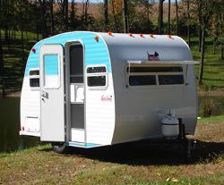
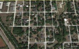
TOWNHOUSE shall mean a one-family dwelling unit, with a private entrance in a group of three or more units where the unit and land are in the ownership of the same owner, which part of a structure whose dwelling units are attached horizontally in a linear arrangement and having a totally exposed front and rear wall to be used for access, light, and ventilation.
TRACT shall mean a lot or contiguous group of lots in single ownership or under single control, usually considered a unit for purposes of development.
TRAILER shall mean a vehicle without motive power, designed to carry property and be drawn by a motor vehicle. Trailers up to 20 feet in length as measured from the tongue to the rear of the trailer shall be considered Recreation Vehicles. Trailers that exceed 20 feet as measured from the tongue to the rear of the trailer shall be considered Heavy Commercial Vehicles. Trailers are typically categorized as:
1. FIFTH-WHEEL TRAILER - A travel trailer designed to be affixed to, and towed by, a vehicle with a special hitch that attaches near the axel of the vehicle.
2. FOLDING CAMPER TRAILER - A light-weight unit with sides that collapse for towing or storage and is sometimes referred to as a fold-down camper, pop-up trailer or tent trailer.
3. HAULING TRAILER – A flatbed or box trailer designed to carry property and to be drawn by a motor vehicle, excluding a boat trailer with a boat on it.
4. TRAVEL TRAILER – A trailer designed and constructed to be used primarily for temporary living quarters for recreational purposes.
TRANSITIONAL HOUSING shall mean a community-based residential facility that provides short-term (120 days or less) room and board in a supervised living environment utilizing counseling and rehabilitation services for persons with a history of juvenile delinquency, behavioral disorders, alcoholism, or drug abuse.
TREE COVER shall mean an area directly beneath the crown and within the dripline of the tree.
TREE PROTECTION DEVICES shall be structural measures, such as retaining walls or aeration devices that are designed to protect the tree and its root systems throughout its lifetime.
TRUCK REPAIR shall mean the repair, including major mechanical and body work, straightening of body parts, painting, welding, or other work that may include noise, glare, fumes, smoke, or other characteristics to an extent greater than normally found in gasoline service stations, of trucks having a hauling capacity of over one ton and buses but excluding pickups and other vehicles designed for the transport of under eight passengers.
TRUCK WASH shall mean a mechanical facility for the washing, waxing, and vacuuming of heavy trucks and buses.
UUPPER STORY HOUSING shall be defined as one or more dwelling units located above the first floor of a building, where allowed, within a commercial district.
UPZONING shall mean a change in zoning classification of land to a more intensive or less restrictive district such as from residential district to commercial district or from a single-family residential district to a multiple family residential district.
USE shall mean the purpose or activity for which land or buildings are designed, arranged, or intended or for which land or buildings are occupied or maintained.
USE, BEST shall mean the recommended use or uses of land confined in an adopted comprehensive plan. Such use represents the best use of public facilities, and promotes health, safety, and general welfare.
USE, CONDITIONAL shall mean a use permitted in a particular zoning district upon showing that such use in a specified location will comply with all the conditions and standards for the location or operation of the use as specified in the zoning ordinance and authorized by the approving agency.
USE, HIGHEST shall mean an appraisal or real estate market concept that identifies the use of a specific tract of land that is most likely to produce the greatest net return on investment.
USE, NON-CONFORMING shall mean any use of a building or premises which on the effective date of this ordinance does not, even though lawfully established, comply with all of the applicable use regulations of the zoning district in which such building or premises shall be located.
USE, PRINCIPAL shall mean the main use of land or building as distinguished from a subordinate or accessory use.
USE, PROHIBITED shall mean any use of land, other than nonconforming, which is not listed as a permitted use or conditional use within a zoning district.
USE, TEMPORARY shall mean impermanent uses of an occasional nature not exceeding six months maximum duration. Tem-porary uses shall not involve the use of permanent structures, permanent signs or portable signs. Uses of a sea-sonal nature that recur periodically on a regular basis on the same site and reoccupy the same permanent build-ing shall not be considered temporary uses.
USED MATERIALS YARD shall mean any lot or a portion of any lot used for the storage of used materials. This shall not include "Junk Yards" or "Automobile Wrecking Yards".
UTILITARIAN STRUCTURE shall mean a structure or enclosure relating to mechanical or electrical services to a building or development.
UTILITY EASEMENT see Easement
UTILITY HARDWARE shall mean devices such as poles, crossarms, transformers and vaults, gas pressure regulating assemblies, hydrants, and buffalo boxes that are used for water, gas, oil, sewer, and electrical services to a building or a project.
UTILITIES, OVERHEAD OR UNDERGROUND "LOCAL DISTRIBUTION SYSTEM OF” shall mean the local service distribution circuit or lines and related appurtenances served from a substation, town border station, reservoir, or terminal facility which is served from a main supply line, main transmission line, or main feeder line as may be applicable to electric, communications, gas, fuel, petroleum, fertilizer, or other chemical utilities. Local electric distribution systems shall include all lines and appurtenances carrying a primary voltage of less than 161 KV from an electric transformer substation to the consumer. The local telephone distribution system shall be limited to include the local exchange lines, the local toll lines, and the local communications equipment facilities structure.
UTILITIES, OVERHEAD OR UNDERGROUND "TRANSMISSION LINE, SUPPLY LINE, WHOLESALE CARRIER OR TRUNK LINE, MAIN FEEDER LINE", or other applicable designation shall mean the main supply or feeder line serving a local distribution system of utilities and shall include but is not limited to pumping stations, substations, regulating stations, generator facilities, reservoirs, tank farms, processing facilities, terminal facilities, towers, and relay stations, and treatment plants.
UTILITY SERVICE shall mean any device, including wire, pipe, and conduit, which carries gas, water, electricity, oil and communications into a building or development.
VVALUE shall mean the estimated cost to replace a structure in kind, based on current replacement costs.
VARIANCE shall mean a relief from or variation of the provisions of this Ordinance, other than use regulations, as applied to a specific piece of property, as distinct from rezoning.
VEGETATIVE COVER shall mean trees, perennial bunchgrasses and grasslands, legumes, and shrubs with an expected life span of at least 5 years.
VEGETATION shall mean trees, shrubs, and vines.
VEHICLE, COMMERCIAL (HEAVY) shall mean any vehicle other than a personal vehicle or Recreation Vehicle as defined herein. Heavy commercial vehicles, include but are not limited to, Class A motor homes, farm machinery, tractor trailers, trailers over 20 feet in length, and vehicles over 10 tons gross weight.
VEHICLE BODY SHOP shall mean a facility which provides vehicle collision repair services, including body frame straighten-ing, replacement of damaged parts, and painting, but does not include mechanical engine or power train repair.
VEHICLE SALES shall mean the storage and display for the retail or wholesale sale, rental, or lease of more than two new or used vehicles, and which may include facilities for the incidental repair or body work of vehicles.
VEHICLE SERVICE OR REPAIR shall mean a facility providing major vehicle repair such as tire capping, bodywork, frame straightening, welding, painting, storage of nonoperable vehicles and the sale of motor fuels, tires and lubricants for retail sale directly to the motorist consumer. As an accessory use, the selling of vehicles with salvage titles may occur on a limited basis provided they are stored in a building. Vehicles with salvage titles may be stored in the rear yard of the property provided the vehicles are not stacked on top of other vehicles and materials and are permanently screened from view to a height of at least six feet with at least 50 percent opacity. The sale of used parts other than as an incidental part of the business is prohibited.
VEHICLE, COMMERCIAL (LIGHT) shall mean a personal vehicle used for home occupations, or any other business purposes as indicated by the display of logos, business names, and/or modification of the vehicle to carry business-related equipment.
VEHICLE, PERSONAL shall mean a passenger car, passenger van, minivan, sport utility vehicle, pickup truck, and/or motorcycle that is: (1) licensed for use on public streets, (2) designed primarily for the transportation of people as opposed to equipment, freight, or other vehicles, and (3) sold primarily to individuals for personal use.
VEHICLE, MOTOR see Motor Vehicle.
VEHICLE STORAGE shall mean storage of operating or nonoperating vehicles for a period of no more than 21 days. Typical uses include storage of private parking towaways or impound yards but exclude dismantling or salvage.
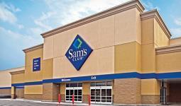
Example of Warehouse Club Operation
VEHICLE STORAGE, LONG TERM shall mean storage of operating or nonoperating vehicles for a period exceeding 21 days. Typical uses include storage of private parking tow-aways or impound yards but exclude dismantling or salvage.
VENDING MACHINE shall mean any unattended selfservice device that, upon insertion of a coin, coins, tokens, debit and/or credit cards or by similar means, dispenses food, beverage, goods, rental materials, wares, merchandise, or services.
VENDING MACHINE, REVERSE shall mean an automated mechanical device that accepts at least one or more types of empty beverage containers, including but not limited to aluminum cans and glass or plastic bottles and that issue a cash refund or a redeemable credit, provided that the entire process is enclosed within the entire machine. A reverse vending machine may be designed to accept more than one container at a time, paying by weight instead of the container.
VETERINARY SERVICES shall mean services and hospitals for animals. Typical uses include pet clinics, dog and cat hospitals, and veterinary hospitals for livestock and large animals.
VISUAL OBSTRUCTION shall mean any fence, hedge, tree, shrub, wall, or structure exceeding two feet in height, measured from the crown of intersecting or intercepting streets, alleys, or driveways, which limit the visibility of persons in motor vehicles on said streets, alleys, or driveways. This does not include trees kept trimmed of branches below a minimum height of eight feet.
WWAREHOUSE shall mean a building used primarily for the storage of goods and materials.
WAREHOUSE CLUB OPERATION shall mean an establishment or place of business primarily engaged in selling and/or distributing merchandise to retailers; to industrial, commercial, institutional, or professional business users, or to other wholesalers; or acting as agents or brokers and buying merchandise for, or selling merchandise to, such individuals or companies. This is not considered a general commercial use.
WAREHOUSE AND DISTRIBUTION shall mean a use engaged in storage, wholesale, and distribution of manufactured products, supplies, and equipment.
WAREHOUSING (ENCLOSED) shall mean uses including storage, warehousing, distribution, and handling of goods and materials within enclosed structures. Typical uses include wholesale distributors, storage warehouses, and van and storage companies.
WAREHOUSING (OPEN) shall mean uses including open air storage, distribution, and handling of goods and materials. Typical uses include monument yards, materials yards, open storage.
WASTEWATER LAGOON see Lagoon.
WATERCOURSE shall mean natural or once naturally flowing water, either perennially or intermittently, including rivers, streams, creeks, and other natural waterways. Includes waterways that have been channelized, but does not include manmade channels, washes, ditches, and underground drainage and sewage systems.
WATERS OF THE STATE shall mean all waters within the jurisdiction of this state, including all streams, lakes, ponds, impounding reservoirs, marshes, wetlands, watercourses, waterways, wells, springs, irrigation systems, drainage systems, and all other bodies or accumulations of water surface or underground, material, or artificial, public, or private, situated wholly within or bordering upon the state.
WATER WELL shall mean any excavation that is drilled, cored, bored, washed, driven, dug, jetted, or otherwise constructed for the purpose of exploring for ground water, monitoring ground water, utilizing the geothermal properties of the ground, obtaining hydrogeologic information, or extracting water from or injecting fluid as defined in section 81-1502 into the underground water reservoir.
WATER WELL, IRRIGATION shall mean any excavation made for any purpose if ground water flows into the excavation under natural pressure and a pump or other device is placed in the excavation for the purpose of withdrawing water from the excavation for irrigation. For such excavations, construction means placing a pump or other device into the excavation for the purpose of withdrawing water for irrigation.
WELL, GEOTHERMAL shall mean any excavation that is constructed or used for the thermal properties of the resource contained within, or which is constructed or used for returning such resource to an under-ground reservoir. In Nebraska a Geothermal Well is considered a Water Well by definition.
WELL, PRIVATE shall mean any excavation that is drilled, cored, bored, washed, driven, dug, jetted, or otherwise constructed for the purpose of exploring for ground water for purposes of potable or non-potable purposes on private property.
WELLFIELD shall mean a tract of land that contains a number of existing or proposed wells for supplying water as specified in the wellfield protection maps.
WETLAND shall mean an area that is inundated or saturated by surface water or ground water at a

frequency and duration sufficient to support, and that, under normal circumstances, does support, a prevalence of vegetative cover typically adapted for life in saturated soiled conditions, commonly known as hydrophytic vegetative cover.
WETLAND, SALINE shall mean an area that is saturated by salty soils and water at a frequency and duration sufficient to support, and that, under normal circumstances, does support a prevalence of salt-tolerant vegetative cover typically adapted for life in saturated soiled conditions, commonly known as hydrophytic vegetative cover.
WHOLESALE ESTABLISHMENT shall mean an establishment for the on-premises sales of goods primarily to customers engaged in the business of reselling the goods.
WHOLESALE TRADE shall mean the selling merchandise to retailers; to industrial, commercial, institutional, farm or professional business users; or to other wholesalers; or buyers acting as agents or brokers in buying merchandise for or selling merchandise to such persons or companies. The principal types of establishments included are: Merchant wholesalers; sales branches and sales offices (but not retail stores) maintained by manufacturing enterprises apart from their plants for the purpose of marketing their products; agents, merchandise or commodity brokers, and commission merchants; petroleum bulk storage, assemblers, buyers, and associations engaged in cooperative marketing of farm products. The chief functions of uses in wholesale trade are selling goods to trading establishments, or to industrial, commercial, institutional, farm and professional; and bringing buyer and seller together. In additional to selling, functions frequently performed by wholesale establishments include maintaining inventories of goods; extending credit; physically assembling, sorting, and grading goods in large lots, breaking bulk, and redistribution in smaller lots; delivery; refrigeration; and various types of promotion such as advertising and label designing.
WINE shall mean any alcoholic beverage obtained by the fermentation of the natural contents of fruits and vegetables, contain sugar, including such beverages when fortified by the addition of alcohol or spirits.
WINERY, FARM shall mean any enterprise which produces and sells wines produced from grapes, other fruit, or other suitable agricultural products of which at least seventy-five percent of the finished product is grown in this state or which meets the requirements of section §53-123.13 R.R.S. Neb. (1943).s.
XERISCAPING shall mean landscaping characterized by the use of vegetation that is drought-tolerant or a low water use in character.
YYARD shall mean any open space on the same lot with a building or a dwelling group, which open space is unoccupied and unobstructed from the ground upward to the sky, except for building projections or for accessory buildings or structures permitted by this Regulation.
YARD, FRONT shall mean a space between the front yard setback line and the front lot line or highway setback line, and extending the full width of the lot.
YARD, REAR shall mean a space between the rear yard setback line and the rear lot line, extending the full width of the lot.
YARD, SIDE shall mean a space extending from the front yard or from the front lot line where no front yard is required by this Regulation, to the rear yard, or rear lot line, between a side lot line and the side yard setback line.
YURT shall mean a permanently built on a wooden platform using modern materials such as steam-bent wooden framing or metal framing, canvas or tarpaulin, plexiglass dome, wire rope, or radiant insulation.
ZERO LOT LINE shall mean the location of a building on a lot in such a manner that one or more of the building's sides rests directly on a lot line.
ZONING ADMINISTRATOR shall mean the person or persons authorized and empowered by the City to administer and enforce the requirements of this chapter.
ZONING DISTRICT see District
ZONING DISTRICT, CHANGE OF shall mean the legislative act of removing one or more parcels of land from one zoning district and placing them in another zoning district on the zone map of the City.
ZONING LOTS, ODD SHAPED SCENARIOS shall mean lots not conforming to a standard shape and configuration.
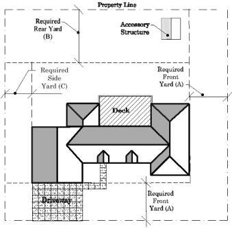
Example of different Yard Requirements
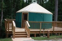
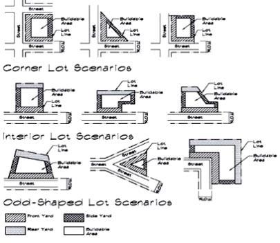
Zoning Lots, Odd Shaped Scenarios
In order to regulate and restrict the height, location, size and type of buildings, structures and uses allowed on land in the City and the area within one mile of the corporate boundaries, the City is hereby divided into districts.
1. The City is hereby divided into districts, as shown on the Official Zoning Map, which, together with all explanatory matter thereon, is hereby adopted by reference and declared to be a part of this Ordinance. The Official Zoning Map shall be identified by the signature of the Mayor, attested by the City Clerk, and bearing the seal of the City under the following words: "This is to certify that this is the Official Zoning Map referred to in Section 3.02 of Ordinance No. (___) of the City of Hickman, Nebraska", together with the date of the adoption of this Ordinance. If, in accordance with the provisions of this Ordinance, changes are made in the district boundaries or other matter portrayed on the Official Zoning Map, such changes shall be entered on the Official Zoning Map promptly after the amendment has been approved by the City Council.
2. In the event that the Official Zoning Map becomes damaged, destroyed, lost or difficult to interpret because of the nature or number of changes and additions, the City Council may by resolution adopt a new Official Zoning Map. The new Official Zoning Map may correct drafting or other errors or omissions in the prior Official Zoning Map, but no such correction shall have the effect of amending the original Official Zoning Map or any subsequent amendment thereof. The new Official Zoning Map shall be identified by the signature of the Mayor attested by the City Clerk and bearing the seal of the City under the following words: "This is to certify that this Official Zoning Map supersedes and replaces the Official Zoning Map adopted (Ordinance No. (****)) of the City of Hickman Nebraska." Unless the prior Official Zoning Map has been lost, or has been totally destroyed, the prior map or any significant parts thereof remaining shall be preserved, together with all available records pertaining to its adoption or amendment.
Pursuant to Neb. Rev. Stat. §19-901, it shall be the purpose of the Planning Commission to hold public hearings upon, and make recommendation to the legislative body, regarding proposed amendments to the comprehensive plan and zoning regulations within the jurisdiction of the City.
The Commission shall make a preliminary report and hold public hearings thereon before submitting its final report, and the City Council shall not hold its public hearings or take action until it has received the final report of the Commission.
No such regulation, restriction, or boundary shall become effective until after a public hearing in relation thereto, at which parties in interest and citizens shall have an opportunity to be heard. Notice of the time and place of such hearings shall be given by publication thereof in a paper of general circulation in the City at least one time ten days prior to such hearing.
In their interpretation and application, the provisions of this Ordinance shall be held to be minimum requirements, adopted for the promotion of the public health, safety, morals, or general welfare. Whenever the provisions of this Ordinance are in conflict with the provisions of any other ordinance or municipal law, the ordinance or municipal law with the most restrictive provisions shall govern.
No building or land shall hereafter be used or reused, and no building or part thereof shall be erected, moved or altered unless for a use expressly permitted by and in conformity with the regulations herein specified for the district in which it is located, except that any structure damaged or destroyed may be restored if such structure does not involve a non-conforming use.
1. Every building hereafter erected, reconstructed, converted, moved or structurally altered shall be located on a lot or lot of record and in no case shall there be more than one principal building on a lot unless otherwise provided.
2. More than one principal building of a single permitted use may be located upon a lot or tract in the following instances if recommended by the Planning Commission and approved by the City Council.
A. Institutional buildings
B. Public or semi-public buildings
C. Multiple-family dwellings
D. Commercial or industrial buildings
E. Home for the aged
F. Agricultural buildings
G. Planned Unit Developments
No lot, even though it may consist of one or more adjacent lots of record, shall be reduced in area so that yards, lot area per family, lot width, building area, or other requirements of this Ordinance are not maintained. This section shall not apply when a portion of a lot is acquired for a public purpose.
On a corner lot, within the area formed by the center line of streets there shall be no obstruction to vision between a height of two and one-half feet and a height of 10 feet above the grades of the bottom of the curb of the intersecting streets, measured from the point of intersection of the centerline of the streets. The following table shall be used in order to determine the required distances at an intersection.
1. Yard requirements shall be set forth under the Schedule of Lot, Yard, and Bulk Requirements for each zoning district. Front, side and rear yards shall be provided in accordance with the regulations hereinafter indicated and shall be unobstructed from the ground level to the sky, except as herein permitted.
2. No part of a yard, or other open space, or off-street parking or loading space, required in connection with any building for the purpose of complying with this regulation, shall be included as part of a yard, open space, or offstreet parking or loading space required for another building and or lot.
3. No yard or lot existing at the time of passage of this regulation shall be reduced in dimension or area below the minimum requirements set forth herein. Yards or lots created after the effective date of this regulation shall meet the minimum requirements herein.
4. All accessory buildings when connected to the principal building (e.g., attached garages) shall comply with the yard requirements of the principal building, unless otherwise specified.
5. The Zoning Administrator may permit a relaxation in front yard setbacks to allow new or relocated structures to conform to the average existing setback provided that 1.) More than 30 percent of the frontage on one side of a street between intersecting streets is occupied by structures on the effective date of this Ordinance, and 2.) A minority of such structures have
observed or conformed to an average setback line, see illustration for different provisions.
6. Any side or rear yard in a residential district which is adjacent to any existing industrial or commercial use shall be no less than 25 feet and the owner shall install and maintain landscaping and planting suitable to provide effective screening.
7. Any yard for a commercial use located within any Commercial Zoning District, which is adjacent to any residential use, or district shall be increased to a minimum of 25 feet and shall contain landscaping and planting suitable to provide effective screening; except in the Downtown Commercial District.
8. Any yard for an industrial use located within any Industrial Zoning District, which is adjacent to any residential use, or district shall be increased to a minimum of 40 feet and shall contain landscaping and planting suitable to provide effective screening; except in the Downtown Commercial District.
No building, structure, or use shall be erected on any land and no change shall be made in the existing contours of any land, including any change in the course, width, or elevation of any natural or other drainage channel, that will obstruct, interfere with, or substantially change the drainage from such land to the detriment of neighboring lands.
Anyone desiring to build or otherwise change the existing drainage situation shall be responsible for providing to the City or their designated agent that such changes will not be a detriment to the neighboring lands.
The following shall not be considered to be obstructions when located in the required yards; except when within the prescribed sight triangle:
1. All Yards:
• Steps and accessibility ramps used for wheelchair and other assisting devices which are four feet or less above grade which will not exceed minimum requirements of the Americans with Disabilities Act are necessary for access to a permitted building or for access to a lot from a street or alley.
• Chimneys projecting 24 inches or less into the yard.
• Playground and other recreational equipment.
• Clothes lines.
• Approved freestanding signs.
• Arbors and trellises.
• Flag poles.
• Window air conditioners projecting not more than 18 inches into the required yard; and
• Fences or walls subject to applicable height restrictions are permitted in all yards.
2. Rear, Street Side Yard, and Side Yards:
• Open off-street parking spaces
• Outside elements of central air conditioning systems, projecting not more than 36 inches into the required yard.
• Emergency egress systems for basements on any structure.
3. Double Frontage Lots: The required front yard shall be provided on each street, unless access is restricted by the City onto the higher street classification.
4. Building Groupings: For the purpose of the side yard regulation a group of business or industrial buildings separated by a common party wall shall be considered as one building occupying one lot.
1. No accessory building or structure shall be constructed on a lot without a principal building or structure.
2. In no event shall a portable storage container be used as permanent storage/accessory building within any residential district, unless they meet the criteria found in Section 4.23.
3. No detached accessory building or structure shall exceed the maximum permitted height allowed in the individual district, unless otherwise provided.
4. No accessory building shall be constructed in the required front yard.
5. No accessory building shall be erected in or encroach upon the required front yard on a corner lot or the front yard of a double frontage lot (see Section 4.10 (3)).
6. Detached accessory buildings or structures shall be located no closer to any other accessory or principal building than six feet.
7. When a detached garage or other outbuilding is built within the required setback for a principal structure, the principal structure and detached building shall remain as separate structures and maintain the required separation distances found in Section 4.12.06 above.
8. When a detached garage has access to an alley, the rear yard setback shall be increased to 10 feet for garages directly accessing the alley from the garage and door is parallel to the alley. Otherwise, it shall be a minimum of five feet.
9. Temporary and portable carports may be allowed in designated zoning districts provided the following criteria shall be met:
A. The carport shall be anchored to the ground.
B. Carport shall not be allowed to have more than two sides covered with a siding material.
C. Siding material shall match the style of the primary structure on the lot.
D. Shall meet all minimum setbacks.
Air-Pollution Prevention Devices
Belfries
Chimneys
Church Spires
Conveyors
Cooling Towers
Ornamental Towers and Spires
Public Monuments
Radio/Television Towers less than 125 feet tall
Silos and grain elevators
Smokestacks
Stage Towers or Scenery Lots
Elevator Bulkheads Storage Tanks
Commercial Elevator Penthouses
Fire Towers
Flag Poles
Ham radio antennae
Water Towers and Standpipes
Web cameras and meteorological equipment
Individual wind turbines and solar panels
10. Detached private garages and outbuildings in the R-2 and R-O Districts within the corporate limits of Hickman for automobiles and/or storage use and other structures customary and appurtenant to the permitted uses and detached accessory garages shall be constructed to meet the following:
A. Be constructed of materials that are in good repair,
B. The square footage shall be limited to 75% of the square footage of the main floor area of the primary structure ,
C. The sidewalls of said building shall not exceed 15 feet in height,
D. Garages shall have an overhang of at least six inches,
E. Garages shall have a maximum width of 40 feet,
11. Regulation of accessory uses shall be as follows:
A. Except as herein provided, no accessory building shall project beyond a required yard line along any street.
1. The height limitations of this Ordinance shall not apply to: Provided the appropriate yard setbacks are increased by one foot for every two feet in excess of the maximum height requirement for the given zoning district.
2. When permitted in a district, public or semi-public service buildings, hospitals, institutions, or schools may be erected to a height not exceeding 75 feet when each required yard line is increased by at least one foot for each one foot of additional building height above the height regulations for the district in which the building is located.
No basement or cellar shall be occupied for residential purposes until the remainder of the building has been substantially completed and a certificate of occupancy has been issued by the City, and any required emergency egress requirements of the City of Hickman have been installed as required per state and life-safety codes.
It is the intent of this ordinance to permit lawful non-conformities to continue until they are removed, but not encourage their survival. Such uses are declared by this ordinance to be incompatible with permitted uses in the districts involved. It is further the intent of this ordinance that non-conformities shall not be enlarged upon, expanded or extended nor be used as grounds for adding other structures or uses prohibited elsewhere in the same district except as may be authorized in this title.
In any district, notwithstanding limitations imposed by other provision of this ordinance, a primary structure and customary accessory buildings may be erected on any single lot of record at the effective date of adoption or amendment of this ordinance. This provision shall apply even though such lot fails to meet the requirements for area or width, or both that are generally applicable in the district provided that the yard dimensions and other requirements not involving area or width, or both, of the lot shall conform to the regulations for the district in which such lot is located. Variance of yard requirements shall be obtained only through action of the Board of Adjustment.
1. Authority to continue: Any structure which is devoted to a use which is permitted in the zoning district in which it is located, but which is located on a lot which does not comply with the applicable lot size requirements and/or the applicable bulk regulations, may be continued, so long as it remains otherwise lawful, subject to the restrictions of this section.
2. Enlargement, Repair, Alterations: Any such structure described in Section 4.16.01 may be enlarged, maintained, repaired or remodeled, provided, however, that no such enlargement, maintenance, repair or remodeling shall either create any additional nonconformity or increase the degree of existing nonconformity of all or any part of such structure, except that as to structures located on a lot that does not comply with the applicable lot size requirements, the side yard requirements shall be in conformance with this section, and unless otherwise permitted by conditional use permit unless otherwise approved or as specified in the Residential District.
3. Damage or Destruction: In the event that any structure described in Section 4.16.01 is damaged or destroyed, by any means other than intentional destruction, to the extent of more than 50 percent of its structural value, such structure shall not be restored unless it shall thereafter conform to the regulations for the zoning district in which it is located; provided that structures located on a lot that does not comply with the applicable lot size requirements in Section 4.16, shall not have a side yard of less than five feet. When a structure is damaged to the extent of less than 50 percent of its structural value, no repairs or restoration shall be made
unless a building permit is obtained, and restoration is actually begun within one year after the date of such partial destruction and is diligently pursued to completion.
Complete reconstruction of a nonconforming structure may be allowed through a Conditional Use Permit if the structure is damaged or destroyed by natural means and not through intentional destruction or actions of the property owner or tenant. Reconstructed structures shall not be allowed to increase the level of nonconformity with regard to setbacks or lot coverage.
4. Moving: No structure shall be moved in whole or in part for any distance whatever, to any other location on the same or any other lot unless the entire structure shall thereafter conform to the regulations of the zoning district in which it is located after being moved.
1. Nonconforming Uses of Land: Where at the effective date of adoption or amendment of this ordinance, lawful use of land exists that is made no longer permissible under the terms of this ordinance as enacted or amended, such use may be continued so long as it remains otherwise lawful, subject to the following provisions:
A. No such non-conforming use shall be enlarged or increased, nor extended to occupy a greater area of land than was occupied at the effective date of adoption or amendment or this ordinance.
B. No such nonconforming use shall be moved in whole or in part to any other portion of the lot or parcel occupied by such use at the effective date of adoption or amendment of this ordinance.
C. If any such nonconforming use of land ceases for any reason for a period of more than 12 consecutive months, any subsequent use of such land shall conform to the regulations specified by this ordinance for the district in which such land is located.
2. Nonconforming Uses of Structures: If a lawful use of a structure, or of structure and premises in combination, exists at the effective date of adoption or amendment of this ordinance, that would not be allowed in the district under the terms of this ordinance, the lawful use may be continued so long as it remains otherwise lawful subject to the following provisions:
A. No existing structure devoted to a use not permitted by this ordinance in the district in which it is located shall be enlarged, extended, constructed, reconstructed, moved or structurally altered except in changing the use of the structure to a use permitted in the district in which it is located.
B. Any nonconforming use may be extended throughout any parts of a building which were manifestly arranged or designed for such use at the time of adoption or amendment of this ordinance, but no such use shall be extended to occupy any land outside such building.
C. If no structural alterations are made, any nonconforming use of a structure or structures and premises may be changed to another nonconforming use provided that the board of adjustment either by general rule or by making findings in the specific case, shall find that the proposed use is equally appropriate or more appropriate to the district than the existing nonconforming use. In permitting such change, the board of adjustment may require appropriate conditions and safeguard in accord with the provisions of this ordinance.
D. Any structure, or structure and land in combination, in or on which a nonconforming use is superseded by a permitted use, shall thereafter conform to the regulations for the district in which such structure is located and the nonconforming use may not thereafter be resumed.
E. When a nonconforming use of a structure or structure and premises in combination is discontinued or abandoned for 12 consecutive months, the structure or structure and premises in combination shall not thereafter be used except in conformance with the regulations of the district in which it is located.
F. Where nonconforming use status is applied to a structure and premises in combination, removal or destruction of the structure shall eliminate the nonconforming status of the land.
1. On any building devoted in whole or in part to any nonconforming use, work may be done in any period of 12 consecutive months on ordinary repairs or on repair or replacement of nonbearing walls, fixtures, wiring or plumbing provided that the cubic content of the building as it existed at the time of passage of amendment of this ordinance shall not be increased.
2. Nothing in this ordinance shall be deemed to prevent the strengthening or restoring to a safe condition of any building or part thereof declared to be unsafe by any official charged with protecting the public safety, upon order of such official.
1. Any building, house or structure erected or structurally altered shall maintain the characteristics and integrity of the district in which it is located.
2. No building, house or structure shall be erected or structurally altered unless the architectural design and materials used in such construction conform to the provisions of this Ordinance and/ or are considered acceptable in common or practiced construction.
3. No unsightly building, house or structure shall be erected nor shall buildings, houses, or structures be allowed to remain in an unfinished condition for a period of more than 60 days without substantial improvement.
4. No building, house or structure shall be allowed to remain in an unsafe, demolished, or dangerous condition in any zoning district for a period of more than 60 days.
Any use for which a conditional use has been issued as provided in previous ordinances shall not be deemed a nonconforming use but shall without further action be deemed a conforming use in such district.
The rear yard setback may be the lesser of the required setback in a district or 20% of the depth of the lot.
1. All above ground over three feet in height or in ground swimming pools constructed within the zoning jurisdiction of the City of Hickman shall be constructed in compliance with all local, state and federal codes.
2. In addition to the above, the area encompassed by the swimming pool shall have a permanent fence, including locking gate at a height of six feet constructed of opaque material.
3. Drainage of said swimming pool must not be onto adjoining property.
4. There shall be no drainage of said swimming pool into the sanitary sewer system of the City.
5. Drainage may be permitted into the storm sewer provided the chemicals contained in said swimming pool are first diluted.
6. All chemicals for said swimming pool must be stored in a secure area.
1. All containers shall be attached to a permanent foundation.
2. Containers used as storage shall be painted to:
A. Cover all existing markings
B. Meet the colors of the primary structure,
3. Containers used as a residence or accessory dwelling unit shall meet the requirements found in Section *****
All uses which are not specifically permitted or are not permissible as a Conditional Use throughout each district of this Ordinance are prohibited until such time as the Ordinance is amended accordingly.
The payment of any and all fees for any zoning or subdivision related action or permit request shall be required prior to the issuance or investigation of any said action or permit request. Such fees shall be adopted and published by the City Council by separate Resolution.
For the purpose of this Chapter, the Municipality is hereby divided into 12 districts, designated as follows:
(TA-1) Transitional Agricultural District (RE) Residential Estates District
(R-1) Low Density Residential District (R-2) Medium Density Residential District (R-3) High Density Residential District (R-O) Original Residential District (R-M) Mobile Home Residential District (M-U) Mixed Use District (C-1) Central Business District (C-2) General Commercial District (I-1) Light Industrial District (I-2) Heavy Industrial District
The boundaries of the districts are hereby established as shown on the map entitled "Official Zoning Map of the City of Hickman, Nebraska." Said maps and all explanatory matter thereon accompany and are hereby made a part of this Ordinance as if fully written herein. The Official Zoning District Map shall be identified by the signature of the Mayor and attested by the City Clerk. No changes shall be made on the Zoning District Map except as may be required by amendments to this Ordinance. Such changes shall be promptly indicated on the Zoning District Map with the Ordinance number, nature of change, and date of change noted on the map.
1. Where uncertainty exists as to the boundaries of districts as shown on the Official Zoning Map, the following rules shall apply:
2. Boundaries indicated as approximately following the center lines of streets, highways, or alleys shall be construed to follow such center lines.
3. Boundaries indicated as approximately following platted lot lines shall be construed as following such lot lines.
4. Boundaries indicated as approximately following City limits shall be construed as following such City limits.
5. Boundaries indicated as following railroad lines shall be construed to be midway between the main tracks.
6. Boundaries indicated as following shorelines shall be construed to follow such shorelines, and in the event of change in the shore line shall be construed as moving with the actual shore line;
7. Boundaries indicated as approximately following the center lines of streams, rivers, canals, lakes,
or other bodies of water shall be construed to follow such center lines.
8. Boundaries indicated as parallel to, or extensions of features indicated in subsections (1) to (6) above shall be so construed. Distances not specifically indicated on the Official Zoning Map shall be determined by the scale of the map.
9. Where physical or cultural features existing on the ground are at variance with those shown on the Official Zoning Map, or in other circumstances not covered by subsections (1) to (7) above, the Board of Zoning Adjustment shall interpret the district boundaries.
10. Where a district boundary line divides a lot which was in single ownership at the time of passage of this Ordinance, The Board of Zoning Adjustment may permit the extension of the regulations for either portion of the lot not to exceed 50 feet beyond the district line into the remaining portion of the lot.
11. When a district boundary line splits a lot, tract, or parcel that is in sole ownership, the zoning district with the most restrictive requirements may be extended over the entire property without amending the zoning map through the public hearing process.
12. When a lot, tract, or parcel is bisected by the extraterritorial jurisdiction boundary line, the jurisdiction with the greatest portion of the property shall have controlling interest.
The Matrix found in Section 5.07 of this Ordinance is a listing of uses that may be allowed within the variety of Zoning Districts.
1. The different uses are grouped into specific “Land Use Categories”.
2. The “Land Use Categories” are listed in each of the Zoning Districts in lieu of specific uses. It is important to note, if a “Land Use Category” is listed within a specific Zoning District, it DOES NOT indicate every use in the “Land Use Category” is allowed within the specific District.
The different uses within Section 5.07 are Permitted (P), Allowed upon approval of a Conditional Use Permit (C), Temporary (T) or not permitted (-).
In order to determine if a specific use is allowed in a Zoning District, the following steps need to be followed:
1. Find the Use Type that matches your application
2. Look across the table and determine which of the Zoning Districts it may be allowed.
3. Determine any special criteria for the use(s) by referring to the specific District.
4. Determine where the specific Zoning Districts are by reviewing the Official Zoning Map.
5. Determine the necessary procedures to receive required permits after the land or property is the control of the applicant.
6. When doubt, please confer with Planning staff.
The Table in Section 5.07 also lists Accessory Uses which may be allowed or not allowed in any specific Zoning District. The Accessory Use listing can be found at the end of the Table.
1. When the use regulations are ambiguous, use classifications will likely be strictly construed in favor of the landowner.
2. Refer to and rely on the definitions in the zoning ordinance.
3. When classifying a use, all possible uses within the district should be considered.
4. Use classifications should not be based on the proposed use's proximity to other uses.
5. The activity itself, not the activity's accoutrements, determine the type of use.
6. Whether a use is appropriate in the district may not be considered.
7. Use classifications must be based on legitimate land use considerations, and not on illegitimate or personal reasons.
8. For uses of structures, look to their function rather than their form.
9. The use itself, not the owner or the nature of the owner, should determine the classification.
10. When the use regulations are ambiguous, the purpose and intent of the district should be considered.
Determining whether a use is accessory.
Common Factors to Consider in Determining Whether a Use is Subordinate.
E = Exempt from Permits
P = Permitted
C = Conditional Use Permit
T = Temporary
A=Accessory building or use
“ - “= not permitted
*1 = Floodplain regulations shall be met
and service
research farm
Agriculture feed mixing and blending, seed sales and grain handling operations
centers and stables/Commercial
E = Exempt
P = Permitted C = Conditional
T = Temporary A=Accessory
=
E = Exempt from Permits
P = Permitted
C = Conditional Use Permit
T = Temporary
A=Accessory building or use
“ - “= not permitted
*1 = Floodplain regulations shall be
E = Exempt from Permits
P = Permitted
C = Conditional Use Permit
T = Temporary
A=Accessory building or use
“ - “= not permitted
*1 = Floodplain regulations shall be met
Artisan production shop and studio, including pottery, painting, stain glass, etc.
Bridal sales & services
Custom Butchers and meat lockers
Clothing & accessories
Computer hardware/software sales
Dance studios & schools
Electronic/appliance sales & service
Equipment sales/storage/rental
Equipment repair services
Fabric and sewing supply stores
Market
Firearms and ammunition sales
Florists
Food store (specialty) including bakeries, delicatessen, not a full-service grocery
Funeral homes and mortuaries, including crematoriums
Garden center, including lawn and garden equipment sales and service
Hardware store
Heating and cooling sales and services
Photographic equipment & supplies
Religious book, card and articles stores
Secondhand store, thrift or consignment store
Self-service laundry and Laundromat
Tanning Studio
Taxidermy Services
E
E = Exempt from Permits
P = Permitted C = Conditional Use Permit
T = Temporary A=Accessory building or use
“ - “= not permitted *1 = Floodplain regulations shall be met
E = Exempt from
P = Permitted
C = Conditional Use Permit
T =
E = Exempt from Permits
P = Permitted
C = Conditional Use Permit
T = Temporary
A=Accessory building or use
“ - “= not permitted
*1 = Floodplain regulations shall be met
Bins, silos, grain storage
Grain Bins used as gazebos or other accessory
Decks, gazebos, patios (elevated or on-grade)
Fuel storage
Fuel tanks and dispensing equipment
Garages, Private
Greenhouses, Non-commercial
Portable on-demand storage containers
Porch, unenclosed
sheds
Storage building using multiple storage containers
Swimming pools
Tennis and other sports courts/fields
1. Area devoted to the use.
2. Frequency of the use.
3. Active versus passive activities.
4. Number of employees and work hours.
5. Whether the use is truly subordinate to the primary use or whether it is a different, alternative, additional use.
Common Factors to Consider in Determining Whether a Use is Customary.
1. The size of the parcel.
2. The nature of the primary use of the parcel.
3. The use made of the adjacent parcels.
4. The economic structure of the area.
5. Whether the proposed use is customary within the locality and the region.
Section 5.06 Annexation and Conformance with the Land Use Plan
Areas annexed into the corporate limits of Hickman shall be zoned to conform to the Future Land Use Plan.
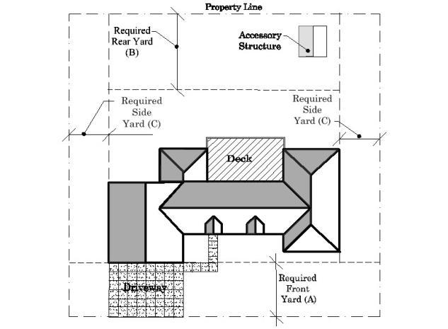
Footnotes
* Percentage applies to the buildable area of the lot.
** Front yard setback shall be 83 feet from the centerline of a County Road or shall be 50 feet when abutting any other platted street, road or highway.
*** Rear yard setback shall be 83 feet from the centerline of a County Road or shall be 50 feet abutting any other platted street, road or highway or interior property line.
**** Side yard setback shall be 53 feet from the centerline of a County Road or shall be 20 feet when abutting any other platted street, road, or highway or interior property line.
5.08
5.08.01 Intent:
The Transitional Agricultural District is established for preserving agricultural resources that are compatible with adjacent urban growth. It is not intended for commercial feedlot operations for livestock or poultry.
5.08.02 Permitted Uses:
Permitted Uses are allowed outright provided the uses and/or structure meet the minimum bulk requirements of the District.
5.08.03 Conditional Uses:
The following uses are subject to any conditions listed in this section as well as any conditions relating to the placement of said use on a specific tract of ground in the TA District as recommended by the Planning Commission and approved by the City Council.
5.08.04 Temporary Uses:
Temporary uses may be permitted provided a Temporary Use Permit is obtained and said temporary use is eliminated at the expiration of the permit. See Article 8.
5.08.05 Accessory Uses and Structures:
Refer to the definitions of Accessory Uses and Structures, as well as Table 5.06 and Article 4 for more detail.
5.08.06 Height and Lot Requirements:
The height and minimum lot requirements shall be as follows:
5.08.07
1. The following uses shall be a minimum of 2,640 feet from any residential, commercial, industrial, or public use, as measured from the nearest point on the lot line.
A. Commercial auction yards or barns.
B. Commercial production and husbandry of poultry, fish, and small animals.
C. Commercial feedlots.
D. Mining and extraction of natural resources.
E. Feed mills.
F. Auto wrecking yards, junk yards, salvage yards, and scrap processing yards.
G. Storage and distribution of anhydrous ammonia, fuel, fertilizer, and other chemicals.
2. Public and private stables and riding clubs, provided:
A. No structure or building used to house horses or other animals is located closer than three hundred (300) feet to any residential use or district.
B. Minimum lot area of four acres.
3. Private or commercial kennels and facilities for the raising, breeding, and boarding of dogs and other small animals, provided:
A. No structure or building is located closer than 300 feet to any residential use or district.
4. Cemeteries:
A. All structures are located at least 25 feet from all property lines.
5. No new residential, commercial, industrial, or public use shall be located nearer than 3,960 feet to any existing use listed in Section 3.12.07 (1)
6. Parking of Boats, Trailers, Campers and RVs, see Section 05 Recreational Vehicle (RV) Storage in Article 9.
Footnotes
* Percentage applies to the buildable area of the lot.
** Front yard setback shall be 83 feet from the centerline of a County Road or shall be 50 feet when abutting any other platted street, road or highway.
*** Rear yard setback shall be 83 feet from the centerline of a County Road or shall be 50 feet abutting any other platted street, road or highway or interior property line.
**** Side yard setback shall be 53 feet from the centerline of a County Road or shall be 20 feet when abutting any other platted street, road, or highway or interior property line.
5.10.01 Intent:
This district is intended to provide for large lot residential and compatible uses within the Low Density areas as identified on the Future Land Use Map. These areas are within the 20-year growth pattern of the Hickman City Limits and are identified to be within the best public interest for future intensive urban development.
1. New subdivisions requesting the R-1 Residential zoning district will be required to meet ghostplatting requirements as provided in the Hickman Subdivision Regulations.
2. R-1 is only available for Low Density areas as identified on the Future Land Use Map as adopted by the Hickman City Council.
5.10.02 Permitted Uses:
Permitted Uses are allowed outright provided the uses and/or structure meet the minimum bulk requirements of the District.
5.10.03 Conditional Uses:
The following uses are subject to any conditions listed in this section as well as any conditions relating to the placement of said use on a specific tract of ground in the R-1 District as recommended by the Planning Commission and approved by the City Council.
5.10.04 Temporary Uses:
Temporary uses may be permitted provided a Temporary Use Permit is obtained and said temporary use is eliminated at the expiration of the permit. See Article 8.
5.10.05 Accessory Uses and Structures:
Refer to the definitions of Accessory Uses and Structures, as well as Table 5.06 and Article 4 for more detail.
5.10.06 Height and Lot Requirements:
The height and minimum lot requirements shall be as follows:
Footnotes
5.11.01 Intent:
This district is intended to provide single to four family residential development in areas with adequate public facilities and supporting uses near population centers.
5.11.02 Permitted Uses:
Permitted Uses are allowed outright provided the uses and/or structure meet the minimum bulk requirements of the District.
5.11.03 Conditional Uses:
The following uses are subject to any conditions listed in this section as well as any conditions relating to the placement of said use on a specific tract of ground in the R-2 District as recommended by the Planning Commission and approved by the City Council.
5.11.04 Temporary Uses:
Temporary uses may be permitted provided a Temporary Use Permit is obtained and said temporary use is eliminated at the expiration of the permit. See Article 8.
5.11.05 Accessory Uses and Structures:
Refer to the definitions of Accessory Uses and Structures, as well as Table 5.06 and Article 4 for more detail.
5.11.06 Height and Lot Requirements:
The height and minimum lot requirements shall be as follows:
Footnotes
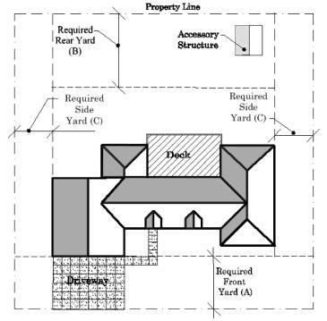
5.12.01 Intent:
This district is intended to provide high-density residential development in areas providing all public facilities and supporting facilities to maintain a sound and pleasant environment for the inhabitants.
5.12.02 Permitted Uses:
Permitted Uses are allowed outright provided the uses and/or structure meet the minimum bulk requirements of the District.
5.12.03 Conditional Uses:
The following uses are subject to any conditions listed in this section as well as any conditions relating to the placement of said use on a specific tract of ground in the R-3 District as recommended by the Planning Commission and approved by the City Council.
5.12.04 Temporary Uses:
Temporary uses may be permitted provided a Temporary Use Permit is obtained and said temporary use is eliminated at the expiration of the permit. See Article 8.
5.12.05 Accessory Uses and Structures:
Refer to the definitions of Accessory Uses and Structures, as well as Table 5.06 and Article 4 for more detail.
5.12.06 Height and Lot Requirements:
The height and minimum lot requirements shall be as follows:
Footnotes
* Percentage applies to the buildable area of the lot.
** The lot width applies to all interior lots, any exterior/ end lots shall be a minimum of 45 feet.
5.12.07
1. Townhouses, Condominiums, and Rowhouses
A. Each unit is separated by a two-hour fire rated wall from the lowest level and continuing through the roof structure.
B. Each unit shall be serviced by separate facilities.
C. When each unit is in separate ownership, any common green space or outlot(s) shall not be in common ownership with any individual unit.
2. Hospitals and clinics provided the following and/or other conditions and standards are met:
A. Building shall not occupy more than 40% of the total lot area,
B. Building setbacks from all yards shall not be less than one foot per foot of building height.
Section 5.13 R-O: Original Residential District
5.13.01 Intent:
This zone is designed to promote revitalization, infill, and flexibility to existing residential structures in the Original Hickman Plat area.
5.13.02 Permitted Uses:
Permitted Uses are allowed outright provided the uses and/or structure meet the minimum bulk requirements of the District.
5.13.03 Conditional Uses:
The following uses are subject to any conditions listed in this section as well as any conditions relating to the placement of said use on a specific tract of ground in the R-3 District as recommended by the Planning Commission and approved by the City Council.
5.13.04 Temporary Uses:
Temporary uses may be permitted provided a Temporary Use Permit is obtained and said temporary use is eliminated at the expiration of the permit. See Article 8.
5.13.05 Accessory Uses and Structures:
Refer to the definitions of Accessory Uses and Structures, as well as Table 5.06 and Article 4 for more detail.
5.13.06 Height and Lot Requirements:
The height and minimum lot requirements shall be as follows:
Footnotes
* Percentage applies to the buildable area of the lot.
** The lot width applies to all interior lots, any exterior/ end lots shall be a minimum of 45 feet.
Section 5.4 Mobile Home Residential District
5.14.01 Intent:
This district recognizes that mobile home development, properly planned, can provide important opportunities for affordable housing. It provides opportunities for mobile home development within planned parks or subdivisions, along with the supporting services necessary to create quality residential neighborhoods.
5.14.01 Permitted Uses:
Permitted Uses are allowed outright provided the uses and/or structure meet the minimum bulk requirements of the District.
5.14.03 Conditional Uses:
The following uses are subject to any conditions listed in this section as well as any conditions relating to the placement of said use on a specific tract of ground in the RM District as recommended by the Planning Commission and approved by the City Council.
5.14.04 Temporary Uses:
Temporary uses may be permitted provided a Temporary Use Permit is obtained and said temporary use is eliminated at the expiration of the permit. See Article 8.
5.14.05 Accessory Uses and Structures:
Refer to the definitions of Accessory Uses and Structures, as well as Table 5.06 and Sections within Article 4 for more detail.
5.14.06 Special Design Criteria for this District
1. A mobile home development shall have a lot area of not less than two acres. No mobile homes or other structures shall be located less than 65 feet from the road centerline when contiguous to or having frontage to a County Road or 25 feet when contiguous from a State Highway. The setback on all other court property lines shall be 10 feet. These areas shall be landscaped. The minimum lot depth in a mobile home court shall be 200 feet.
2. Each lot provided for occupancy of a single mobile home dwelling shall have an area of not less than 4,000 square feet, excluding road right-of-way, and a width of not less than 40 feet. Each individual lot shall have:
A. Side yard setback shall not be less than five feet, except that on corner lots, the setback for all buildings shall be a minimum of 25 feet on the side abutting a street/road.
B. Front yard setback shall not be less than 25 feet.
C. Rear yard setback of not less than 25 feet.
3. There shall be a minimum livable floor area of 500 square feet in each mobile home.
4. Height of buildings shall be:
A. Maximum height for principal uses shall be 35 feet.
B. Maximum height for accessory uses shall be 10 feet.
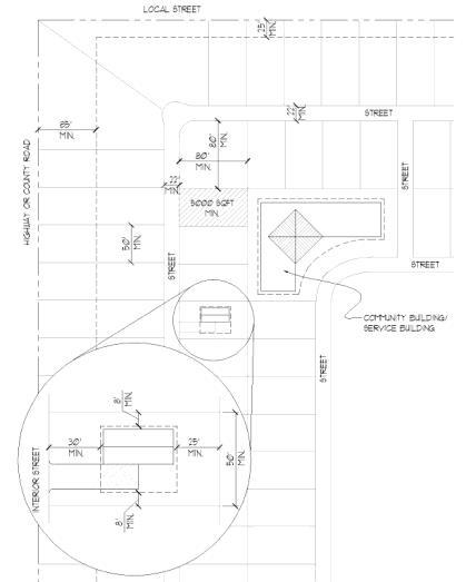
Example of a Mobile Home Park
5. Each lot shall have access to a hard surfaced drive not less than 24 feet in width, excluding parking.
6. Community water and community sewage disposal facilities shall be provided with connections to each lot, in accordance with design standards for the City. The water supply shall be sufficient for domestic use and for fire protection.
7. Service buildings including adequate laundry and drying facilities. Common toilet facilities for mobile homes which do not have these facilities within each unit may be provided.
8. Storm shelters shall be required and shall meet the following criteria:
A. Shelter space equivalent to two persons per mobile home lot,
B. Designed in conformance with “National Performance Criteria for Tornado Shelters” by the Federal Emergency Management Agency (FEMA) and any other referenced material by FEMA,
C. Shelters shall be sited in order to provide maximum protection to park occupants and so that residents may reach a shelter within the maximum safe time frame as directed by FEMA.
9. All trailer pad locations shall be hard surfaced with properly reinforced Poured in Place Concrete.
10. Not less than 10 percent of the total court area shall be designated and used for park, playground and recreational purposes.
11. Each mobile home dwelling shall be provided with a paved patio or equivalent, other than parking spaces, of not less than 150 square feet.
5.14.07 Special Requirements
1. All lots must be platted in accordance with the Subdivision Regulations of the City of Hickman and shall also contain the following information:
A. A complete plan of the mobile home development shall be submitted showing:
B. A development plan and grading plan of the court.
C. The area and dimensions of the tract of land.
D. The number, location, and size of all mobile home spaces.
E. The area and dimensions of the park, playground and recreation areas.
F. The location and width of roadways and walkways.
G. The location of service buildings and any other proposed structures.
H. The location of water and sewer lines and sewage disposal facilities.
I. Plans and specifications of all buildings and other improvements constructed or to be constructed within the mobile home court.
Section
5.15.01 Intent:
The Mixed Use (M-U) District is intended to accommodate projects that combine several compatible land uses into an integrated development and to allow for flexibility in the siting of buildings and the layout of lots. The district permits mixing residential areas with workplaces and services. Development in the M-U District must accommodate diverse transportation systems, including pedestrian and bicycle movement, and integrate them with surrounding environments. All projects developed in an M-U District are subject to approval of a development agreement.
5.15.02 Permitted Uses:
1. A Change of Zone ordinance establishing an M-U District shall define the use types permitted within its boundaries. Reference to a Mixed-Use Development Agreement is acceptable to meet this requirement so long as the Change of Zone ordinance and the Mixed-Use Development Agreement are approved contingent upon each other.
2. Each M-U District should contain use types within at least two use categories. Use categories shall be limited to residential, civic, office, and commercial uses. No single use category should account for more than 80% of the building area or net developable land area of an M-U District.
Net developable land area includes the land area of a development excluding dedicated public streets, private streets, or other dedicated public land.
5.15.03 Site
1. Prior to the issuance of any building permits or other authorization, all projects in the M-U District shall receive approval by the City Council through the adoption of a Mixed-Use Development Agreement.
2. Applications for a Mixed-Use Development Agreement must contain at a minimum the following information:
A. A detailed site map, including:
1) A boundary survey.
2) Site dimensions.
3) Contour lines at no greater than five-foot intervals.
4) Adjacent public rights-of-way, transportation routes, and pedestrian and bicycle systems.
5) Description of adjacent land uses.
6) Utility service to the site and easements through the site.
7) Description of other site features, including drainage, soils, environmental factors, or other considerations that may affect development.
B. A development plan, including:
1) A site layout, including the location of proposed buildings, parking, open space, and other facilities.
2) Location, capacity, and conceptual design of parking facilities.
3) Description of the use of individual buildings.
4) Description of all use types to be included in the project or area, and maximum floor area devoted to each general use.
5) Maximum height of buildings.
6) Schematic location and design of open space on the site, including a landscaping plan.
7) Vehicular and pedestrian circulation plan, including relationship to external transportation systems.
8) Schematic building elevations and sections if required to describe the project.
9) Grading plans.
10) Proposed sewer and utility improvements.
11) Location, size, and type of all proposed signage.
C. Specific proposed development regulations for the project, including:
1) The specific use types permitted within the proposed district.
2) Maximum floor area ratios.
3) Front, side, and rear yard setbacks.
4) Maximum height.
5) Maximum building and impervious coverage.
6) Design standards applicable to the project.
D. A traffic impact analysis, if required by the City.
E. See Section 10.19.02 for specific design criteria for this district.
F. An application for a Mixed-Use Development Agreement shall include an editable draft agreement (in Microsoft Word format, unless otherwise approved by the Zoning Administrator). Attachments, such as maps and illustrations, may be provided as separate files in any digitally reproducible format approved by the Zoning Administrator.
1. The Planning Commission and City Council shall review and evaluate each proposal or application for an M-U District. The City may impose reasonable conditions as deemed necessary to ensure that projects within an M-U District are compatible with adjacent land uses, will not overburden public services and facilities and will not be detrimental to public health, safety, and welfare of the community.
2. The Planning Commission, after proper notice, shall hold a public hearing and act upon each application.
3. The Planning Commission may recommend amendments to M-U District applications.
4. The recommendation of the Planning Commission shall be transmitted to the City Council for final action.
5. The City Council, after proper notice, shall hold a public hearing and act upon any ordinance establishing an M-U District. Proper notice shall mean the same notice established for any other zoning amendment.
6. An ordinance adopting an M-U District shall require a favorable simple majority of the City Council for approval; however, the favorable vote of three-fourths of the City Council shall be required if the Planning Commission has recommended denial to the change of zone to the MU District.
7. Any approval of an M-U District shall be contingent upon the approval by City Council of a Mixed-Use Development Agreement.
8. The City shall not issue a building permit, certificate of occupancy or other permit for a building, structure or use within an M-U District unless it complies with the approved Mixed Use Development Agreement, including any approved amendments.
The Zoning Administrator is authorized at their discretion to approve minor amendments to an approved development plan within a Mixed-Use Development Agreement provided that:
1. A written request, amendment application, and fee are filed with the City Clerk, along with information specifying the exact nature of the proposed amendment.
2. The amendment is consistent with the provisions of this article.
3. The amendment does not materially alter the approved site regulations of the development plan and does not materially alter other aspects of the plan, including traffic circulation, mixture of use types and physical design.
Section 5.16 C-1: Downtown Commercial Limited District
5.16.01 Intent:
This district is intended to provide appropriate development regulations for Downtown Hickman. Mixed uses are encouraged within the C-1 District, without allowing activities that would have a negative effect on the downtown area. The grouping of uses is designed to strengthen the downtown’s role as a center for trade, service, and civic life.
5.16.02 Permitted Uses:
Permitted Uses are allowed outright provided the uses and/or structure meet the minimum bulk requirements of the District.
5.16.03 Conditional Uses:
The following uses are subject to any conditions listed in this section as well as any conditions relating to the placement of said use on a specific tract of ground in the C-1 District as recommended by the Planning Commission and approved by the City Council.
5.16.04 Temporary Uses:
Temporary uses may be permitted provided a Temporary Use Permit is obtained and said temporary use is eliminated at the expiration of the permit. See Article 8.
5.16.05 Accessory Uses and Structures:
Refer to the definitions of Accessory Uses and Structures, as well as Table 5.06 and Article 4 for more detail.
5.6.06 Height and Lot Requirements:
The height and minimum lot requirements shall be as follows:
5.16.07 Use Limitations:
1. When adjacent to any residential district, no parking, drives, or signs shall be allowed in the required front yard with fifteen (15) feet of such residential district.
2. When adjacent to any residential district, new construction shall provide permanent screen with a height of six feet if a fence, in order to minimize impacts on residentially zoned property, pursuant to Section 9.06.
3. No unscreened outdoor storage, except the display of merchandise for sale to the public, shall be permitted.
4. Exterior lighting fixtures shall be shaded wherever necessary to avoid casting direct light on any property located in a residential or manufactured (mobile) home district. In addition, no glare shall be visible to any traffic on any public street.
5. All business, service, repair, processing, storage, or merchandise display on property abutting or
facing a lot in a residential district shall be conducted wholly within an enclosed building, unless screened from the residential district by a sight-obscuring fence permanently maintained at least six feet in height.
6. Openings to structures on sides adjacent to or across the street from a residential district shall be prohibited if such access or openings will cause glare, excessive noise, or other adverse effects on residential properties.
7. Motor vehicle, boat, or trailer rental or sales lots shall be drained and surfaced with crushed rock or pavement, except in those portions of the lot maintained as landscape area.
8. All new primary buildings/structures constructed within the District shall have a brick or concrete/ plaster style façade on front face of the building.
9. Uses with specific basic conditions required:
Convenience store with limited fuel sales provided the following minimum requirements be met:
A. The use has a minimum lot area of 10,000 square feet.
B. All surfaces associated with the sale of gasoline shall be on an all-weather (concrete, paved, rock or gravel) surface.
Service station and minor automobile repair services provided the following minimum requirements be met:
A. The use has a minimum lot area of 10,000 square feet.
B. All surfaces associated with the sale of gasoline shall be on an all-weather (concrete, paved, rock or gravel) surface.
Mortuaries and funeral chapels.
A. Minimum lot area of 12,000 square feet.
Section 5.17 C-2: General Commercial District
5.17.01 Intent:
This district accommodates a variety of commercial, office, and service uses in Hickman’s commercial areas outside of the town center. Uses and developments in the C-2 District may develop substantial increases in traffic, creating potential land use conflicts with adjacent residential areas, requiring provision of adequate buffering. This district is most appropriately located along major arterial streets or in areas that can be adequately buffered from residential districts.
5.17.02 Permitted Uses:
Permitted Uses are allowed outright provided the uses and/or structure meet the minimum bulk requirements of the District.
5.17.03 Conditional Uses:
The following uses are subject to any conditions listed in this section as well as any conditions relating to the placement of said use on a specific tract of ground in the C-2 District as recommended by the Planning Commission and approved by the City Council.
5.17.04 Temporary Uses:
Temporary uses may be permitted provided a Temporary Use Permit is obtained and said temporary use is eliminated at the expiration of the permit. See Article 8.
5.17.05 Accessory Uses and Structures:
Refer to the definitions of Accessory Uses and Structures, as well as Table 5.06 and Article 4 for more detail.
5.17.06 Height and Lot Requirements:
The height and minimum lot requirements shall be as follows:
5.17.07 Use Limitations:
1. When adjacent to any residential district, no parking, drives, or signs shall be allowed in the required front yard with 15 feet of such residential district.
2. When adjacent to any residential district, new construction shall provide permanent screen with a height of six feet if a fence, in order to minimize impacts on residentially zoned property, pursuant to Section 9.06.
3. No unscreened outdoor storage, except the display of merchandise for sale to the public, shall be permitted.
4. Exterior lighting fixtures shall be shaded wherever necessary to avoid casting direct light on any property located in a residential or manufactured (mobile) home district. In addition, no glare shall be visible to any traffic on any public street.
5. All business, service, repair, processing, storage, or merchandise display on property abutting or facing a lot in a residential district shall be conducted wholly within an enclosed building, unless screened from the residential district by a sight-obscuring fence permanently maintained at least six feet in height.
6. Openings to structures on sides adjacent to or across the street from a residential district shall be prohibited if such access or openings will cause glare, excessive noise, or other adverse effects on residential properties.
7. Motor vehicle, boat, or trailer rental or sales lots shall be drained and surfaced with crushed rock or pavement, except in those portions of the lot maintained as landscape area.
8. All new primary buildings/structures constructed within the District shall have a brick or concrete/ plaster style façade on front face of the building.
9. Uses with specific basic conditions required: Convenience store with limited fuel sales provided the following minimum requirements be met:
A. The use has a minimum lot area of 10,000 square feet.
B. All surfaces associated with the sale of gasoline shall be on an all-weather (concrete, paved, rock or gravel) surface.
Service station and minor automobile repair services provided the following minimum requirements be met:
A. The use has a minimum lot area of 10,000 square feet.
B. All surfaces associated with the sale of gasoline shall be on an all-weather (concrete, paved, rock or gravel) surface.
Mortuaries and funeral chapels.
A. Minimum lot area of 12,000 square feet.
5.18.01 Intent:
The intent of the I-1 light industrial zone is to provide for wholesale and warehousing uses as well as those industrial uses that include fabrication, manufacturing, assembly, or processing of materials that are in refined form and that do not in their transformation create smoke, gas, odor, dust, noise, vibration of earth, soot or lighting to a degree that is offensive when measured at the property line of subject property.
5.18.02 Permitted Uses:
Permitted Uses are allowed outright provided the uses and/or structure meet the minimum bulk requirements of the District.
5.18.03 Conditional Uses:
The following uses are subject to any conditions listed in this section as well as any conditions relating to the placement of said use on a specific tract of ground in the I-1 District as recommended by the Planning Commission and approved by the City Council.
5.18.04 Temporary Uses:
Temporary uses may be permitted provided a Temporary Use Permit is obtained and said temporary use is eliminated at the expiration of the permit. See Article 8.
5.18.05 Accessory Uses and Structures:
Refer to the definitions of Accessory Uses and Structures, as well as Table 5.06 and Article 4 for more detail.
5.18.06 Height and Lot Requirements:
The height and minimum lot requirements shall be as follows:
5.18.07 Use Limitations:
1. When adjacent to any residential district, no parking, drives or signs shall be allowed in the required front yard within 15 feet of such residential district.
2. When adjacent to any residential district, new construction shall provide permanent screen with a height of six feet four inches if a fence, in order to minimize impacts on residentially zoned property, pursuant to Section 9.06.
3. Exterior lighting fixtures shall be shaded wherever necessary to avoid casting direct light on any property located in a residential or manufactured (mobile) home district. In addition, no glare shall be visible to any traffic on any public street.
4. All business, service, repair, processing, storage, or merchandise display on property abutting or facing a lot in a residential district shall be conducted wholly within an enclosed building, unless
screened from the residential district by a sight-obscuring fence permanently maintained at least six feet in height.
5. Openings to structures on sides adjacent to or across the street from a residential district shall be prohibited if such access or openings will cause glare, excessive noise, or other adverse effects on residential properties.
6. Motor vehicle, boat, or trailer rental or sales lots shall be drained and surfaced with crushed rock or pavement, except in those portions of the lot maintained as landscape area.
5.18.08 Performance Standards:
1. See Supplemental Regulations, Section 8.09, for those I-1 lots not located in the corridor overlay.
Section 5.19 I-2: Heavy Industrial District
5.19.01 Intent:
This district is intended to accommodate a wide variety of industrial uses, some of which may have significant external effects. These uses may have operating characteristics that create conflicts with lower intensity surrounding land uses. The district provides the reservation of land for these activities and includes buffering requirements to reduce incompatibility.
5.19.02 Permitted Uses:
Permitted Uses are allowed outright provided the uses and/or structure meet the minimum bulk requirements of the District.
5.19.03 Conditional Uses:
The following uses are subject to any conditions listed in this section as well as any conditions relating to the placement of said use on a specific tract of ground in the I-2 District as recommended by the Planning Commission and approved by the City Council.
5.19.04 Temporary Uses:
Temporary uses may be permitted provided a Temporary Use Permit is obtained and said temporary use is eliminated at the expiration of the permit. See Article 8.
5.19.05 Accessory Uses and Structures:
Refer to the definitions of Accessory Uses and Structures, as well as Table 5.06 and Article 4 for more detail.
5.19.06 Height and Lot Requirements:
The height and minimum lot requirements shall be as follows:
5.19.07 Use Limitations:
1. When adjacent to any residential district, no parking, drives or signs shall be allowed in the required front yard within 15 feet of such residential district.
2. When adjacent to any residential district, new construction shall provide permanent screen with a height of six feet four inches if a fence, in order to minimize impacts on residentially zoned property, pursuant to Section 9.06.
3. Exterior lighting fixtures shall be shaded wherever necessary to avoid casting direct light on any property located in a residential or manufactured (mobile) home district. In addition, no glare shall be visible to any traffic on any public street.
4. Gas station provided the minimum lot area of 10,000 square feet and all surfaces associated with the sale of gasoline shall be on an all-weather surface.
5. All business, service, repair, processing, storage, or merchandise display on property abutting or
facing a lot in a residential district shall be conducted wholly within an enclosed building, unless screened from the residential district by a sight-obscuring fence permanently maintained at least six feet in height.
6. Openings to structures on sides adjacent to or across the street from a residential district shall be prohibited if such access or openings will cause glare, excessive noise, or other adverse effects on residential properties.
7. Motor vehicle, boat, or trailer rental or sales lots shall be drained and surfaced with crushed rock or pavement, except in those portions of the lot maintained as landscape area.
5.19.08 Performance Standards:
1. See Supplemental Regulations, Section 8.09, for those I-2 lots not located in the corridor overlay.
Page intentionally left blank
Section 6.01 Identified Overlay and Special Districts (C-O) Corridor Overlay (D-O) Downtown Overlay (FP/FW) Floodplain/Floodway Fringe Overlay
PUD Planned Unit Development Special District
Section 6.02 General Purpose
1. The Overlay and Special Districts recognize the presence of special community characteristics that traditional zoning districts do not adequately address.
A. Overlay Districts are to be used in combination with base districts to modify or expand base district regulations. Overlay Districts are adapted to special needs of different parts of the City of Hickman.
B. Special Districts provide for base districts that allow multiple land uses and flexible development, with the requirement a specific plan for the area be submitted by applicants.
A. To recognize special conditions in parts of the City which require specific regulation.
B. To provide flexibility and encourage innovative design through comprehensively planned projects.
An overlay district is applied over one or more previously established zoning districts, establishing additional or stricter standards and criteria for covered properties in addition to those of the underlying zoning district. Overlay zones should be used to protect special features, community identity and aesthetics. Overlay zones can also be used to promote specific development projects that meet the needs of the community.
6.04
A special district that delineates conditions, which must be met before that zoning district can be approved for an existing piece of land. Rather than being placed on the zoning map as traditional zones are, however, the special zone is simply written as an amendment in the zoning ordinance. Thus, the district "floats" until a development application is approved, when the district is then added to the official zoning map. Special districts can be used to plan for future land uses that are anticipated or desired in the community, but are not confirmed, such as alternative housing, shopping centers, planned unit developments, and urban development projects.
The Overlay and Special Districts are designed to achieve the following objectives:
1. To recognize special conditions in parts of the City which require specific regulation.
2. To provide flexibility and encourage innovative design through comprehensively planned projects.
Any use or structure permitted in the base zoning district where this district is overlain, provided all buildings, structures and other obstacles comply with the height restrictions.
Any conditional use permitted in the base zoning district where this district is overlain where such conditional use has been duly authorized by the City Council in accordance with the requirements and procedures specified in this Ordinance, provided all buildings, structures and other obstacles comply with the height restrictions set forth in Article 5, Minimum Height, Lot Area, Lot Coverage and Yard Setback Requirements.
Any accessory use or structure permitted in the base zoning district where this district is overlain, provided all buildings, structures and other obstacles comply with the height restrictions established and shall be constructed of materials complimentary and suitable to the primary use. All dumpsters
or trash bins shall maintain a solid six feet tall enclosure around each unit. Said enclosure shall be constructed of materials complimentary and suitable to the primary use.
Section 6.09 Special Definitions Applying to this Article
Adobe Bricks - Bricks formed out of mud or clay and baked in a kiln or under the sun. Adobe bricks are often bonded together with mud- or lime-mortar joints, and coats of lime-and-sand stucco often cover adobe walls to prevent them from eroding in the rain.
Arcade - A series of arches supported by columns or other vertical elements.
Arch - A curved or pointed structural element that is supported at its sides.
Architectural Symmetry - A characteristic (particularly of classical architecture) by which the two sides of a facade or architectural floor plan of a building present mirror images of one another.
Archway - An opening with a curved or pointed top.
Attic Window - A window lighting an attic story, and often located in a cornice.
Balcony - A platform that projects from the wall of a building, and which is enclosed on its outer three sides by a balustrade, railing, or parapet.
Baluster - A short pillar or column in a series supporting a rail or coping.
Balustrade - A railing consisting of a row of balusters supporting a rail.
Bay - A section of a building distinguished by vertical elements such as columns or pillars. Often, a bay will protrude from the surface of the wall in which it is situated, thus creating a small, nook-like interior space, often of a rectangular or semi-hexagonal outline. See bay window.
Bay Window - A projecting bay that is lit on all of its projecting sides by windows. See bay.
Board-and-batten - A wooden siding treatment in which wide, vertically oriented boards are separated by narrower strips of wood called “battens,” which form the joints between the boards. This is a technique common to American folk architecture.
Bow Window - A curved bay window. See bay window and bay.
Bell Roof - A roof shaped like a bell, and typically situated on top of a round tower. The bell roof has origins in Normandy, toured extensively by Stanford White, who incorporated bell roofs into many of historic Shingle Style houses and buildings.


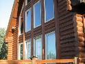


Belvedere - A small, square cupola that functions as a lookout tower, located at the top of a building. Belvederes are characteristic of Italianate houses.
Bollard - A bollard is a sturdy, short, vertical post usually concrete. Generally used to protect equipment or the public from vehicles. Commonly placed along walkways and across building entrances when they are connected to a parking area or street and a change in elevation is not present.
Bousillage - A form of plaster made of mud, clay and moss used in poteaux-en-terre construction in French Colonial architecture, particularly in Louisiana.
Brace - A reinforcing and/or stabilizing element of an architectural frame.
Bracket - A projection from a vertical surface that provides structural and/or visual support for overhanging elements such as cornices, balconies, and eaves.
Cantilever - A cantilever is a beam anchored at only one end. The beam carries the load to the support the overhanging section of the building.
Casement Window - A window frame that is hinged on one vertical side, and which swings open to either the inside or the outside of the building. Casement windows often occur in pairs.
Central Hallway - A passageway that cuts through the center of a building, from front to back, and off of which rooms open to the sides.
Chalet - A timber dwelling, cottage, or lodge with a gable roof and wide eaves, indigenous to the Swiss Alps, but now found worldwide.
Chimney Stacks and Bundles - Chimney flues visible from the exterior of a house, and sometimes very decorative.
CMU -Concrete Masonry Unit: A large rectangular brick used in construction and made from cast concrete.
Colonnade - A range of columns that supports a string of continuous arches or a horizontal entablature.
Column - A supporting pillar consisting of a base, a cylindrical shaft, and a capital on top of the shaft. Columns may be plain or ornamental.
Cone-shaped Roof - A roof shaped like a cone.
Cornice - A crowning projection at a roof line, often with molding or other classical detail.
Cornice Molding - A decorative strip of wood running just below the eaves of a building. A cornice molding is a cross between a cornice and a molding – a cornice is a crowning projection at a roof line, while a molding is a decorative strip of wood.
Courtyard - An open space, usually open to the sky, enclosed by a building, often with an arcade or colonnade.
Crenellation - A sequence of alternating raised and lowered wall sections at the top of a high exterior wall or parapet. Crenellations were originally employed for defensive purposes (one could hide behind a raised wall section, while shooting down at enemies from over a lowered wall section) but were later used for decoration. Also known as a battlement.
Cupola - A small dome, or hexagonal or octagonal tower, located at the top of a building. A cupola is sometimes topped with a lantern. A belvedere is a square-shaped cupola.
Curlicue - A spiral or looping line.
Decorative Motif - A repeated pattern, image, idea, or theme. In classical architecture, series of urns and continuous or repeated swags of garlands are common decorative motifs.
Dentils - Small rectangular blocks that, when placed together in a row abutting a molding, suggest a row of teeth.
Dormer Window - A perpendicular window located in a sloping roof; triangular walls join the window to the roof. Dormer windows are sometimes crowned with pediments, and they often light attic sleeping rooms; “dormer” derives from “dormir,” French for “to sleep.”
Double Doors - Two adjacent doors that share the same door frame, and between which there is no separating vertical member. Double doors are often referred to as “French doors”.
Double-hung Sash Windows - A window with two sashes that move independently of each other.
Downspout - See Gutter.
Eaves of a roof - The part of a roof that overhangs the exterior of a house. They usually project beyond the walls of the building to carry away rainwater.
Elevation - A view of a building looking directly at a side.
Exposed Rafters - Rafters that are exposed to the outside of a building. Rafters are the inclined, sloping framing members of a roof, and to which the roof covering is affixed.
Façade - An exterior wall, or face, of a building. The front facade of a building contains the building’s main entrance, the rear facade is the building’s rear exterior wall, and the side facades are a building’s side exterior walls.


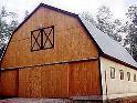


Fan Light - A semi-circular or semi-elliptical window, with wedge-shaped panes of glass separated by mullions arranged like the spokes of a wagon wheel. Fan lights are usually found over entrance doors and windows, particularly in Federal and Greek Revival homes.
Fireplace Surround - A molding about a fireplace, often highly decorated.
Fenestration - The design, construction, or presence of openings in a building.
Flared Roof - A roof with a bell-shaped profile. It is sloped with concave curves at the top, and with convex curves at the bottom.
Floor Plan - The arrangement of rooms in a building.
Fluting - Shallow, vertical grooves in the shaft of a column or pilaster.
Free-flowing Floor Plan - A floor plan in which there are no (or few) hallways, and rooms open directly onto one another, often through wide doorways.
French Doors - Two adjacent doors that share the same door frame, and between which there is no separating vertical member. French doors are often referred to as “double doors.”
Frieze - A band of richly sculpted ornamentation on a building.
Gable Roof - A roof with two slopes – front and rear–joining at a single ridge line parallel to the entrance façade. When the ridge line of a gable-roofed house is perpendicular to the street, the roof is said to be a “gable-end roof.”
Gallerie - A wide, wrap-around covered porch lined with columns on one side, and common to French Colonial architecture of Louisiana. A gallerie connects interior rooms together, much like a hallway.
Gambrel Roof - A ridged roof with two slopes at each side, the lower slopes being steeper than the upper slopes.
Grilles - Ventilation panels, often highly decorative.
Gutter & Downspout - A Gutter gathers water from the roof and the water travels down a downspout to drain away from the house.
Hardware - The metal fittings of a building, such as locks, latches, hinges, handles, and knobs.
Hipped Roof - A roof with four sloped sides. The sides meet at a ridge at the center of the roof. Two of the sides are trapezoidal in shape, while the remaining two sides are triangular, and thus meet the ridge at its endpoints.
Hood Molding - A molding projecting above a door, window, or archway to throw off rain. A hood molding is also referred to as a “drip molding.”
Jack Arch - A structural element that provides support over an opening in a masonry wall (i.e., made of brick or stone). Jack arches are not actually arch-shaped, but are, instead, flat, and made of individual wedgeshaped bricks or stones held in place through compression.
Jettied Story - An upper story of a building that projects out over the story beneath it, common in Colonial American architecture.
Lattice-work - A wooden grid of boards overlaid atop an exterior surface. See stick-work.
Mansard Roof - A four-sided hipped roof featuring two slopes on each side, the lower slopes being very steep, almost vertical, and the upper slopes sometimes being so horizontal that they are not visible from the ground.
Masonry - Being of stone, brick, or concrete.
Molding - A decorative strip of wood.
Mullions - The structural units that divide adjacent windows.
Muntins - Dividing bars between panes of glass.
Ogee Arch - An arch consisting of two opposing “S”curves meeting in a point at the apex. An “S”-curve is itself made up of two curves: a concave curve in its lower half, and a convex curve in its upper half.
Oriel - A projecting window of an upper floor, supported from below by a bracket.
Over-hanging Rafters - Rafters that extend beyond the eaves of a roof. Rafters are the inclined, sloping framing members of a roof, to which the roof covering is affixed.
Pagoda - A tiered tower with multiple roof layers, constructed about a central axis pole. Indigenous to Asia (particularly to China, Japan, and Korea), and typically located there within Buddhist temple precincts, pagodas were built as decorative garden structures in the United States and Europe during the 18th and 19th centuries.
Palladian Window - An arched window immediately flanked by two smaller, non-arched windows, popularized by Andrea Palladio in northern Italy in the 16th century, and frequently deployed by American architects working in the American Georgian and American Palladian styles in the 17th and 18th centuries.
Panel - A smooth surface, usually rectangular (or sometimes circular) in shape and framed by a molding, and often featuring decorative, sculptural carving.


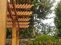


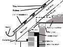


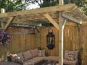


Parapet - A low wall, located at the top of any sudden drop, such as at the top of the facade of a building.
Patio - Similar to a terrace, a patio is an outdoor extension of a building, situated above the ground level, and open to the sky. Colloquially, a patio is a more informal space than a terrace.
Pavilion - A small but prominent portion of a building that juts out from a main building, either above its roof line, or to the side, and which is identified by a unique (usually diminutive) height and individual roof type. A pavilion may also stand alone, separate from a larger building, or may be connected to a main building by a terrace or path.
Pediment - A decorative triangular piece situated over a portico, door, window, fireplace, etc. The space inside the triangular piece is called the “tympanum,” and is often decorated.
Peek-a-boo Window - A very small window, often circular.
Pergola - A garden structure built up over a path or narrow terrace, lined with evenly spaced columns or posts that support a wooden-framed roof without sheathing. Often, vines are trained around the wooden framework of a pergola, and the pergola may lead from one building to another.
Pilaster - A shallow, non-structural rectangular column, attached to, and projecting only slightly from, a wall surface.
Pillar - A structural support, similar to a column, but larger and more massive, and often without ornamentation. Pillars can be round or square in section, and are most often made of brick, stone, cement, or other masonry, although substantial wooden timbers can be formed into pillars.
Pitch - Degree of roof slant stated in inches rise per foot.
Pointed Arch - An arch that is pointed at its apex, rather than rounded; common in Gothic and Gothic Revival architecture.
Portico - An entrance porch with columns or pilasters and a roof, and often crowned by a triangular pediment.
Projection - A side wing, tower, or window bay that protrudes from a building.
Quoins - Large, prominent masonry units outlining windows, doorways, segments, and corners of buildings.
Rafters - The inclined, sloping framing members of a roof, and to which the roof covering is affixed.
Retaining wall - A wall that holds back earth or water on one side of it. It is designed to restrain soil to unnatural slopes.
Ridge - Line on a roof, where two slopes intersect on top
Roof Ridge - The horizontal intersection of two roof slopes at the top of a roof.
Roofline - The part of a building that rises above the building’s eaves. Rooflines can be highly decorative, with balustrades, pediments, statuary, dormer windows, cross gables, etc.
Round-arched Window - A window that is fully arched at its top.
Roundel - A small, circular panel or window.
Rubble Brick - Rough-edged brick, often of variegated colors.
Saltbox Roof - A gable roof whose rear slope is longer than its front slope. The rear slope often very nearly meets the ground. Saltbox roofs are common to the architecture of Colonial New England.
Sculptural Forms - Architectural elements that have the appearance of having been sculpted.
Section - A section or cross section is a term used in architectural drawing for describing when a vertical line cuts through an object In the drawing, the dark line represents the floor cutting through the building’s walls.
Segmental Arch - An arch whose arc is shorter than that of a full semi-circle.
Setback - A step-like recession in a wall.
Shutters - Pairs of solid or slatted window coverings, traditionally hinged to the exterior of a building to either side of a window, used to block light or wind from the interior of a building.
Side Light - A fixed window positioned to the side of a doorway or window.
Slate - A finely grained, foliated rock, native to Pennsylvania, Vermont, and New York, and found in many colors. Slate has been used to roof buildings in the United States since the colonial era.
Spire - A slender, pointed construction atop a building, often a church.
Stained Glass - Colored glass. Stained glass windows are fitted with pieces of colored glass, which often depict a picture or scene.
Stick-work - A wooden grid of boards overlaid atop an exterior surface. See latticework.


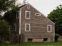


Striated Brick - Brickwork made up of rows of bricks of alternating colors, typically red and white.
Stucco - A plaster used as a coating for walls and ceilings, and often used for decoration; it is common to many parts of the world, particularly to the Mediterranean region and to the regions of the United States once colonized by Spain (i.e., Florida and California).
Terrace - An outdoor extension of a building, situated above the ground level, and open to the sky. See patio.
Thatched Roof - A roof covered with straw, which is layered so as to shed rain quickly and effectively.
Tile Roof - A roof covered with tiles that are usually hollow and half-cylindrical in shape and made out of clay. Tile roofs are common in many parts of the world, including the Mediterranean and the Southwestern United States.
Tile Inset - A panel of clay or ceramic tile.
Tower - An exceptionally tall portion of a building.
Transom Light - A narrow window, sometimes hinged at the top, positioned over a doorway or larger window.
Truss - A rigid framework, as of wooden beams or metal bars, which supports a structure, such as a roof.
Turret - A small tower that pierces a roofline. A turret is usually cylindrical and is topped by a conical roof.
Valley - Line where two slopes on a roof intersect on the sides.
Veranda - An open, roofed porch, usually enclosed on the outside by a railing or balustrade, and often wrapping around two or more (or all of the) sides of a building.
Window Sash - The movable frames in a window in which windowpanes are set.
Wooden Clapboards - Long slats of wood that are nailed to an exterior surface in a horizontal fashion, overlapping one another from top to bottom. Clapboards are a traditional weather-proofing device.
Wooden Shingles - Small, rectangular-shaped slats of wood that are nailed to an exterior surface, overlapping one another from top to bottom. Shingling is a traditional weather-proofing method for building.

6.10.01 Intent:
The City of Hickman has established basic site and building development criteria to be implemented within the boundaries of this overlay district. The Corridor Overlay District has been established in order to implement the policies and guidelines developed by the City of Hickman. These criteria include but are not limited to the following: landscaping, building material selection, lighting, and road development. The purpose for regulating these items is to provide for a cohesive and properly developed corridor along existing and future arterial streets. Guiding development in this manner promotes the general health, safety, and welfare of the residents within the zoning jurisdiction of Hickman by providing quality design and construction, which also aids in the protection of past and future investment in the corridors. The regulations in the overlay district are in addition to those of the underlying base zoning district for the property and affect all new or expanded (20% or more of original footprint) public, commercial, industrial, multi-family residential, residential subdivisions, and mixed-use buildings and properties. Where regulations are in direct conflict with other regulations in this Ordinance, the stricter shall apply.
6.10.02 Purpose:
The purpose of these criteria is to establish a checklist of those items that affect the physical aesthetics of Hickman. Pertinent to appearance is the design of the site, building and structures, planting, signs, and miscellaneous other objects that are observed by the public. The minimum criteria contained herein are not intended to restrict imagination, innovation, or variety but rather to assist in focusing on design principles that can result in creative solutions that will develop a satisfactory visual appearance within the City, preserve taxable values, and promote the public health, safety, and welfare.
6.10.03 Geographic Area:
The Corridor Overlay District extends generally from the right-of-way line up to 600 feet on either side of an existing or future arterial street. Entrance nodes should also be recognized on all four sides of the City. If a building or structure is, or proposed to be, partially covered by said overlay district, then the entire portion facing the corridor is to be covered by these regulations. For a graphically defined area, see the Official Zoning Map. In no case extends greater than six hundred fifty (650) feet from the centerline of an arterial, or future arterial, street.
6.10.04 Permitted and Conditional Uses:
All Permitted and Conditional Uses contained in the Land Use Matrix, Section 5.07, are permitted unless specifically noted in these regulations, Mixed Use Development agreement or a Planned Unit Development Agreement, subject to any conditions listed in this Ordinance and other conditions as recommended by the Planning Commission and approved by the City Council.
6.10.05 Criteria for Application:
1. Structures Required for Review
A. All developments and properties consisting of one principal building with single or mixed uses shall comply with the design criteria of this section.
B. All developments and properties consisting of more than one principal building, mixed-uses, multiple-pad development, and/or similar developments shall comply.
C. Rehabilitation. The design standards shall apply to existing, conforming development within the corridor when rehabilitation is proposed to a structure or a site that will meet or exceed the standard of either 20 percent increase of the existing size or cost are more than 50 percent of the current appraised value of the structure or site. Rehabilitation is renovation, restoration, modification, addition or retrofit. Rehabilitation costs or measurements shall be aggregated over a five-year period to determine whether the rehabilitation is subject to the design standards. Rehabilitation projects shall conform to the model design standards to the greatest extent possible. Where conformance is not possible for any part of a standard, the applicant shall provide a written explanation for each area(s) of noncompliance to be considered with the application.
2. Process.
A. Subdivision, Conditional Use, and/or Building Permit Approval: All Commercial, Industrial, and Multi-Family building projects within the Corridor Overlay District of the City of Hickman
are required to receive appropriate subdivision, conditional use permit, and/or building permit approval. As a condition of its subdivision, conditional use permit, and/or permit approval, all commercial, industrial, and multi-family building projects within the required geographic region shall comply with the Corridor Overlay District regulations and Corridor Overlay District Design Guideline Booklet. The Developer shall place maintenance provisions required by this section within all restrictive covenants.
B. Pre-application Conference: A pre-application conference with the Zoning Administrator is required to give the applicant an opportunity to discuss plans before a great deal of time or money is expended. The applicant shall schedule and attend a pre-application conference with the City no more than 60 days prior to the submitting a complete site plan application. Site plan information shall be submitted to the City at least 14 business days prior to the preapplication conference in a form identified by the City.
C. Application for Design Review: The applicant shall fill out the "Application for Certificate of Approval" and submit it along with the required submittals and design review fee. See Corridor Overlay District Design Guideline Booklet for a listing of required submittals.
D. Design Review: The Zoning Administrator (or Design Review Board/Architect) will review the submittal documents for compliance with regulations and intent of the overlay district and those identified in the Corridor Overlay District Design Guideline Booklet. When an outside consultant for design review is determined to be in the best interest of the public, all fees associated with the review shall be borne by the applicant.
E. Certificate of Approval: Upon a successful review, the City of Hickman will issue to the applicant a Certificate of Approval. A copy of this shall be included with the Building Permit documents in order to receive a Building Permit. Any changes or amendments to the building design and/or site plan will require another review of the City and depending on the changes may warrant another full review application process and fee.
F. Appeals: In the event where the Applicant, the Zoning Administrator, and City Design Review Board/Architect cannot come to an agreement, the applicant may appeal the decision by requesting an amendment to the Subdivision Agreement (if appropriate) from the Hickman City Council.
G. Certificate of Occupancy Permit: After the building permit is issued, all design requirements must be completed as approved in order for a Certificate of Occupancy to be issued.
H. Maintenance of Design requirements: The property owner is required to maintain the design requirements of the project. Neglect in maintaining the structure’s appearance, landscaping, lighting, and other design requirements may result in the revocation of the Occupancy Permit.
I. Fees: Fees may apply to each step as established in the City’s Master Fee Schedule.
3. Factors for Evaluation.
The following factors and characteristics that affect the appearance of a development will govern the evaluation of a design submission:
A. Conformance of regulations and the Building Design Criteria provided for in Section 4.09.06 and consistent with the Corridor Overlay District Design Guideline Booklet.
B. Logic of design.
C. Exterior space utilization.
D. Architectural character.
E. Attractiveness of material selection.
F. Harmony and compatibility.
G. Circulation-vehicular and pedestrian.
H. Maintenance aspects.
I. Protection of natural features, resources, historical and cultural aspects, and sensitive areas.
1. Relationship of Buildings to Site. The site shall be planned to accomplish a desirable transition with the streetscape and to provide for adequate planting, safe pedestrian movement, and parking areas.
A. Site planning in which setbacks and yards are in excess of standard zoning restrictions is encouraged to provide an interesting relationship between buildings.
B. Parking areas shall be treated with decorative elements, building wall extensions, plantings, berms, or other innovative means so as to screen parking areas from view from public ways.
C. Without restricting the permissible limits of the applicable zoning district, the height and scale of each building shall be compatible with its site and existing (or anticipated) adjoining buildings.
D. Newly installed utility services and service revisions necessitated by exterior alterations shall be underground.
E. Refuse and waste removal areas, service yards, storage yards, loading areas, and exterior work areas shall be oriented to the rear of the building away from public right-of-way or properly and permanently screened from view from public ways and from residential zoned properties using materials and berming as stated in criteria for equipment screening.
2. Relationship of Buildings and Site to Adjoining Area (Outside of subdivision or developments)
A. Adjacent buildings of different architectural styles shall be made compatible by such means as screens, sight breaks, and materials.
B. Attractive landscape transitions shall be designed to be compatible to adjoining properties, particularly residential zoned properties.
C. Harmony in texture, lines, and masses is required. Monotony shall be avoided.
3. Landscape and Site Treatment. Landscape elements included in these criteria consist of all forms of planting and vegetative cover, ground forms, rock groupings, water patterns, and all visible construction except buildings and utilitarian structures. Upon installation of required landscape materials, each owner shall take actions to ensure continued health and maintenance of such. Required landscaping that does not remain healthy shall be replaced consistent with these regulations.
A. Where natural or existing topographic patterns contribute to beauty and utility of a development, they shall be preserved and developed. Modification to topography will be permitted where it contributes to good site design and development.
B. Grades of walks, parking spaces, terraces, and other paved areas shall provide an inviting and stable appearance for walking and, if seating is provided, for sitting.
C. Landscape treatments shall be provided to enhance architectural features and provide shade. Large landscape features with spectacular effects shall be reserved for special locations only.
D. Unity of design shall be achieved by repetition of certain plant varieties and other materials and by correlation with adjacent developments.
E. Plant material shall be selected for interest in its structure, texture, and color and for its ultimate growth. Plants that are indigenous to the area and others that will be hardy, harmonious to the design, and of good appearance shall be used. See Corridor Overlay District Design Guideline Booklet for a listing of preferred plant materials.
1) Unity of design shall be achieved by repetition of certain plant varieties and other materials and by correlation with adjacent developments. One tree at least every 40 feet shall be planted and maintained on the property along all street frontages. All projects shall use a minimum of the following listed plant varieties. See Corridor Overlay District Design Guideline Booklet for a listing of those plant materials.
a. A minimum of two species listed under the deciduous tree category.
b. A minimum of one species listed under the coniferous tree category.
c. A minimum of one species listed under the deciduous shrub category.
d. A minimum of one species listed under the coniferous shrub category.
F. Parking areas and traffic ways shall be hard surfaced and striped and shall be enhanced with landscaped spaces containing trees or tree groupings and shrubs to provide shade, direction, and aesthetics. Plant material within the right of way shall meet the applicable standards of County or City depending on location.
G. Screening of service yards and other places such as mechanical equipment, trash dumpsters, or other items that tend to be unsightly shall be accomplished by use of screen walls (brick, stone, ironwork, or some other accepted material finish), fencing, planting, or combinations of those. Screening shall be equally effective in winter and summer months. Screening shall be taller than the item to be screened.
H. Exterior lighting, when used, shall enhance the building design and the adjoining landscape. Building fixtures shall be of a design and size compatible with the building and adjacent areas. Such building lighting shall be downward facing and be similar in appearance and quality level as those in the Corridor Overlay District Design Guideline Booklet. Lighting standards and fixtures for pedestrian ways, parking areas, and drives within the commercial,
industrial, and multi-family building area shall be similar in appearance and quality level as those in the Corridor Overlay District Design Guideline Booklet. Lighting shall be restrained in design and excessive brightness avoided. Lighting shall be designed to a standard that does not impact and adversely affect adjoining properties, especially residential areas. Lighting within the right of way shall meet the applicable requirements of County or City depending on location and shall be of aesthetic quality where possible.
I. No residential fencing within this Corridor Overlay District shall exceed six feet in height and perimeter fencing within the subdivision shall match in style and color. If multiple styles and colors exist prior to the adoption of these regulations, then any new fence shall be similar to that style and color used most.
J. Fencing used for screening within the Corridor Overlay District and/or as part of a commercial or industrial development shall be required to be a solid fence. Chain link fences, with or without slats, shall not be used to satisfy this screening requirement. All industrial and commercial fencing shall follow the established fencing regulations of the zoning ordinance but shall not exceed eight feet within the Corridor Overlay District.
K. Whenever possible, all off street parking shall be to the rear of the building, and all such parking shall have a six feet wide planting buffer and berming, plantings, and/or screen wall at the public right of way or nearest exterior lot line.
L. Screen walls shall either be brick, stone, ornamental ironwork, or some other accepted material finish. All parking in the front of the building shall require berming and/or landscaping that screens the parking from public right-of-way.
M. Outdoor vending machines, ATMs, group mailboxes, or other accessory structures shall be properly screened from public right-of-way by landscaping screens.
N. Any proposed shopping cart storage and returns shall be identified on the site plan and considered in the overall design process.
4. Building Design
A. Each commercial, civic, industrial, business, and multi-family development shall create its own identity with unique design themes based on a palette of compatible rooftops, materials, and colors. Such identity shall be developed according to these base design guidelines but may go above and beyond. Once a theme is developed, all buildings in the development shall share the common architectural and landscaping themes, materials, and styles. See Corridor Overlay District Design Guideline Booklet for examples of developments or buildings considered meeting this preferred concept. Evaluation of the appearance of a project shall be based on the quality of its design and relationship to surroundings.
B. Buildings shall have good scale and be in harmonious conformance with permanent neighboring development. Buildings with multiple heights or section levels shall orient the shorter to the public right-of-way.
C. The primary building material of all portions of the structures shall be negotiated with the City; however, sample materials shall include, but not be limited to, preferred materials of high quality such as brick (clay), stucco, wood, glass, precast concrete, split faced concrete masonry units (CMU) with integrated color pigmentation, and stone material native to Eastern Nebraska. The materials shall be similar and compatible throughout the entire development. Other primary building materials (of good architectural character, i.e., standard CMU, pre-engineered metal building panels) will be allowed if a minimum of 30 percent of the street side façade(s) is of a preferred material. Changes in use from industrial to another use shall require preferred materials improvements to the building. Other secondary building materials shall have good architectural character and shall be selected for harmony of the building with adjoining buildings.
D. Materials shall be selected for suitability to the type of buildings and the design in which they are used. Buildings shall have the same materials, or those that are architecturally harmonious, used for all building walls and other exterior building components wholly or partly visible from public ways.
E. Materials shall be of durable quality.
F. In any design in which the structural frame is exposed to view, the structural materials shall be compatible within themselves and harmonious with their surroundings.
G. Building components, such as windows, doors, eaves, and parapets, shall have good
proportions and relationships to one another.
H. Colors shall be harmonious and use only compatible accents.
I. Building material colors (including painted) shall be of low reflectance, subtle, neutral, or earth tones and shall not be of high-intensity or metallic colors unless the colors are true to the materials beings used and are aesthetically pleasing. See Corridor Overlay District Design Guideline Booklet for examples of preferred colors.
J. Mechanical equipment or other utility hardware on roof, ground, or buildings shall be screened from public view with materials harmonious with the building such as plant material, walls, fences, and parapets, or they shall be so located as not to be visible from any public ways and/or residential zoned properties.
K. Exterior lighting shall be part of the architectural concept. Fixtures, standards, and all exposed accessories shall be harmonious with building design. Such building fixtures shall be down lighting and consistent with style of lighting used for parking and pedestrian ways. See Section Error! Reference source not found. and Corridor Overlay District Design Guideline Booklet for examples of preferred fixtures and standards for the identified corridors/areas.
L. Monotony of design in single or multiple building projects shall be avoided. Variation of detail, form, and siting shall be used to provide visual interest. In multiple building projects, variable siting of individual buildings may be used to prevent a monotonous appearance. Measures shall be taken to break up the flatness of all buildings and reduce the scale of large buildings using windows and architectural building design and techniques. No streetfacing façade may have a continuous length of 50 feet or over without an offset in the building elevation equal to a dimension of at least five feet and minimum change in plane of 24 inches. One of the following is also required in the building design to break up the monotonous appearance:
1) Changes in color, graphical patterning, changes in texture, or changes in material(s);
2) Windows and fenestration;
3) Arcades and pergolas;
4) Towers;
5) Gable projections;
6) Horizontal/vertical breaks; or
7) Other similar techniques
M. Building orientation shall be toward a street unless it is demonstrated that this would not be feasible. All sides of a building facing public rights-of-way shall be designed as a building front and each building shall have clearly defined, highly visible customer entrances featuring at least three of the following elements:
1) Canopies or porticoes;
2) Overhangs;
3) Recesses or projections;
4) Arcades;
5) Arches;
6) Peaked roof forms;
7) Outdoor patios;
8) Display windows;
9) Architectural tile work or moldings integrated into the building design;
10) Integrated planters or wing walls that incorporate landscaped areas or seating areas.
N. Drive-thru windows should not face any arterial or collector streets/highways unless screened with landscaping or separated with an access/frontage road.
O. Pitched or gabled roofs shall have a minimum roof slope equal to one foot of vertical height to every three feet of horizontal distance. Flat roofs on buildings shall have parapets. Permitted roof materials may include asphalt shingles, slate or simulated slate shingles, standing seam metal, or other similar roof materials.
P. Buildings shall not be allowed to have visible exterior metal supports.
Q. All openings in the façade of a building (windows, doorways, etc.) shall be proportioned to reflect pedestrian scale and designed in a manner that encourages interest at the street level. Window area on each façade shall be equal to at least 20% of the area of the façade. Main or primary entrances to buildings must be delineated through the use of architectural detailing appurtenant to the architectural style of the building.
R. Windows shall maintain the architectural character of the structure of which they are a part.
S. Awnings or canopies shall be made of metal or cloth material and when over entries shall not be over nine feet high (pedestrian height).
T. Building gutters and downspouts shall be located on the side of the buildings instead of the front and said gutters and downspouts shall be interior instead of exterior whenever possible.
U. Walkway coverings shall be of sheet metal, metal shingles, standing-seam construction, or canvas or cloth.
V. Planter boxes and screening walls, when used, shall be compatible with the primary structure.
W. Franchise architecture that meets these minimum standards is allowed. National “standard”, prototype, or trademark designs shall be adapted to be compatible with these standards.
X. Multi-family residential developments shall provide a minimum thirty (30) feet of open space between principal buildings. Multi-family structures taller than two stories shall provide a gradual height transition by “stepping-down” to meet the approximate height of adjacent single-family homes or other structures of lesser height.
A. Intent Create a safe and efficient vehicular circulation system that avoids traffic congestion. Create a safe, continuous pedestrian and bicycle network that minimizes conflict with vehicular movement while promoting a convenient option for movement within and between developments.
B. Standards All city and/or county vehicular and pedestrian circulation standards shall apply unless otherwise provided herein.
C. All multifamily and nonresidential developments shall provide pedestrian and vehicular connections to each adjoining public street.
D. Primary circulation and access to and from multifamily and nonresidential use areas shall be oriented toward predominately non-single-family residential streets.
E. All on-site sidewalks and pedestrian walkways shall be a minimum width of five feet unless part of a city trail system where such walks shall adhere to such standards.
F. All sidewalks and pedestrian walkways shall be aligned and connected with those on adjacent properties and public rights-of-way.
G. Except for single family dwellings, private full movement driveways giving access to development sites shall be aligned across public streets to contribute to circulation efficiency unless determined otherwise by the City Engineer.
H. On-site sidewalk systems (or identified walkways) shall provide pedestrian connections that do not require walking across grass, landscaped areas, or the drive lanes of parking areas.
I. Each point at which the system of sidewalks or walkways must cross an internal street, drive, or parking lot shall be clearly marked through the use of change in paving materials, height, or distinctive colors.
J. The hardscape features described in this section, e.g., sidewalks, driveways, etc., shall seek to minimize imperviousness whenever possible and be designed to complement the LID (low impact development) stormwater management features on the site.
K. All parking requirements shall meet the minimum standards for the use of the property and parking, and related drive-thru uses shall be designed to promote efficient circulation.
A. Intent. Parking areas shall be designed and located to minimize negative visual impacts particularly as viewed from an existing or future arterial street, frontage streets, and residential development.
B. Standards
1. All applicable local minimum off-street parking and loading requirements shall be met, and all off-street parking shall be hard surfaced and striped.
2. No more than 35 percent of a site’s frontage along 1) existing Arterial Street, 2) future Arterial Street, or 3) residential development shall be occupied by parking. If a property has dual or reverse frontage on both arterial streets and a frontage road, this standard shall apply to the frontage on the arterial street.
3. Garage entries, carports, and parking structures shall be internalized in building groupings or oriented away from street frontage to the maximum extent feasible.
4. The number of contiguous parking spaces shall be limited to 20, and each block of 20 shall be separated from each other by at least one of the following methods:
a. A landscaped island that separates the blocks and is at least nine feet wide;
b. A pedestrian walkway or sidewalk within a landscaped median that is at least nine feet wide;
c. A decorative fence or wall, a minimum of three feet in height, bordered by five feet of landscaping on at least one side;
d. An access drive or public street bordered by five feet of landscaping on at least one side; or
e. A building or buildings.
5. All of the required landscaped areas must contain a minimum of seventy-five (75) percent living and irrigated landscaping material with a maximum of twenty-five (25) percent nonliving landscaping material. Approved sidewalks are not counted toward the nonliving landscape material percentage.
6. Parking lot design shall incorporate terminal islands at the end of parking row. Divider strips between parking rows shall be used to help disperse the required landscaping throughout the entire parking lot.
7. Large areas of parking (50 or more spaces) shall be distributed between the back or sides of a building with not more than 50 percent of the parking for the entire property remaining between the principal building and the primary abutting street.
8. The perimeter of all parking areas shall be buffered from adjacent streets, public rights-of -way, public open space, and adjacent uses by at least one of the following methods:
a. A berm three feet high with a maximum slope of 3:1 in combination with evergreen and deciduous trees and shrubs;
b. A hedge at least three feet high, consisting of a double row of shrubs planted three feet on center along 75 percent of the perimeter length; or
c. A fence or wall at least three feet high in combination with landscaping.
9. All plant materials (see Corridor Overlay District Design Guideline Booklet for a listing of preferred plant materials) shall be installed in the following minimum sizes:
a. Deciduous shade trees – 2-inch caliper
b. Ornamental trees – 2-inch caliper
c. Evergreen trees – 5 feet high
d. All shrubs – 5-gallon container
e. Groundcover, annuals, and perennials – 1 gallon container
6.10.06 Penalties.
Any person, firm, corporation or agency acting as principal, agent, and employee or otherwise, who fails to comply with the provisions of this article, shall fall under ARTICLE 1, General Provisions
6.11.01 Intent:
The Downtown Overlay District enables the adoption of special performance and development standards in combination with site development regulations of a base district for areas located within and around the downtown district of the City of Hickman. The district is intended to guide new construction and to promote small-scale pedestrian-oriented development to service both the surrounding businesses and residential areas. Conformance of regulations and the Building Design Standards provided for in Section 4.10.07 and consistent with the Downtown Overlay District Design Guideline Booklet.
6.11.02 Purpose:
The character of the Downtown Overlay District reflects a dense, pedestrian-oriented building pattern with structures set upon or near the front lot line, a high ratio of building coverage to site, and a single or two-story building facade pattern that is architecturally articulated to the scale of a traditional pedestrian environment.
6.11.03 Geographic
The Downtown Overlay District applies to an area within the City of Hickman's zoning jurisdiction originally platted as Hickman Addition, Blocks 15 – 27, and all lots contained therein. Generally located south of 3rd Street, east of Main Street, west of Elm Street, and north of the railroad tracks.
6.11.04 Criteria for
The provisions of the overlay district shall apply to all new development and existing, conforming development when rehabilitation is proposed that will meet or exceed the standard of either 20 percent increase of the existing size or and expenditure more than 50 percent of the current appraised value of the structure or site. Rehabilitation is renovation, restoration, modification, addition or retrofit. Rehabilitation costs or measurements shall be aggregated over a five year period to determine whether the rehabilitation is subject to the design standards. Rehabilitation projects shall conform to the model design standards to the greatest extent possible. Where conformance is not possible for all or any part of a standard, the applicant shall provide written explanation for each area of noncompliance, substantial improvement or enlargement on each lot or site.
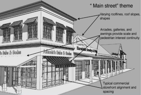
6.11.05 Permit Requirements and Exceptions:
1. Anyone wishing to erect, construct, reconstruct, repair, or establish any building.
2. Exception: Single Family Residential established prior to the adoption of this ordinance.
1. All dumpsters or trash bins shall be screened from public view with elements such as trees, shrubs, or fence a minimum of six feet in height, unless it can be demonstrated that this is not feasible.
A. Each commercial, civic, industrial, business, and multi-family development shall create its own identity with unique design themes based on a palette of compatible rooftops, materials, and colors. Such identity shall be developed according to these base design guidelines but may go above and beyond. Once a theme is developed, all buildings in the development shall share the common architectural and landscaping themes, materials, and styles. See Downtown Overlay District Design Guideline Booklet for examples of developments or buildings considered meeting this preferred concept. Evaluation of the appearance of a project shall be based on the quality of its design and relationship to surroundings.
B. Buildings shall have good scale and be in harmonious conformance with permanent neighboring development.
C. The primary building material of all portions of the structures shall be negotiated with the City; however, sample materials shall include, but not be limited to, preferred materials of high quality such as brick (clay), stucco, wood, glass, precast concrete, split faced concrete masonry units (CMU) with integrated color pigmentation, and stone material native to Eastern Nebraska. The materials shall be similar and compatible throughout the entire development. Other primary building materials (of good architectural character, i.e., standard CMU, pre-engineered metal building panels) will be allowed provided a minimum of 30 percent of the street side façade(s) is of a preferred material. Changes in use from industrial to another use shall require preferred materials improvements to the building. Other secondary building materials shall have good architectural character and shall be selected for harmony of the building with adjoining buildings.
D. Materials shall be selected for suitability to the type of buildings and the design in which they are used. Buildings shall have the same materials, or those that are architecturally harmonious, used for all building walls and other exterior building components wholly or partly visible from public ways.
E. Materials shall be of durable quality.
F. In any design in which the structural frame is exposed to view, the structural materials shall be compatible within themselves and harmonious with their surroundings.
G. Building components, such as windows, doors, eaves, and parapets, shall have good proportions and relationships to one another.
H. Colors shall be harmonious and use only compatible accents.
I. Building material colors (including painted) shall be of low reflectance, subtle, neutral, or earth tones and shall not be of high-intensity or metallic colors unless the colors are true to the materials beings used and are aesthetically pleasing. See Downtown Overlay District Design Guideline Booklet for examples of preferred colors.
J. Mechanical equipment or other utility hardware on roof, ground, or buildings shall be screened from public view with materials harmonious with the building such as plant material, walls, fences, and parapets, or they shall be so located as not to be visible from any public ways and/or residential zoned properties, unless it can be demonstrated that it is not feasible.
K. Exterior lighting shall be part of the architectural concept. Fixtures, standards, and all exposed accessories shall be harmonious with building design. Such building fixtures shall be down lighting and consistent with style of lighting used for parking and pedestrian ways. The maximum height of lighting standards shall be the lesser of 25 feet or not to exceed the height of the building. The exterior lighting of buildings shall be limited to low-level spotlights, floodlights, and similar illuminating devices hooded in such a manner that the direct beam of any light sources will not glare upon adjacent property or public streets. See Downtown Overlay District Design Guideline Booklet for examples of preferred fixtures and standards for the identified Downtown areas.
L. Monotony of design in single or multiple building projects shall be avoided. Variation of
detail, form, and siting shall be used to provide visual interest. In multiple building projects, variable siting of individual buildings may be used to prevent a monotonous appearance. Measures shall be taken to break up the flatness of all buildings and reduce the scale of large buildings using windows and architectural building design and techniques. No streetfacing façade may have a continuous length of 50 feet or over without an offset in the building elevation equal to a dimension of at least five feet and minimum change in plane of 24 inches. One of the following is also required in the building design to break up the monotonous appearance:
1) Changes in color, graphical patterning, changes in texture, or changes in material(s);
2) Windows and fenestration;
3) Arcades and pergolas;
4) Towers;
5) Gable projections;
6) Horizontal/vertical breaks; or
7) Other similar techniques
M. Building orientation shall be toward a street unless it is demonstrated that this would not be feasible. All sides of a building facing public rights-of-way shall be designed as a building front and each building shall have clearly defined, highly visible customer entrances featuring at least three of the following elements:
1) Canopies or porticoes;
2) Overhangs;
3) Recesses or projections;
4) Arcades;
5) Arches;
6) Peaked roof forms;
7) Outdoor patios;
8) Display windows;
9) Architectural tile work or moldings integrated into the building design;
10) Integrated planters or wing walls that incorporate landscaped areas or seating areas.
N. Pitched or gabled roofs shall have a minimum roof slope equal to one foot of vertical height to every three feet of horizontal distance. Flat roofs on buildings shall have parapets. Permitted roof materials may include asphalt shingles, slate or simulated slate shingles, standing seam metal, or other similar roof materials.
O. Buildings shall not be allowed to have visible exterior metal supports.
P. All openings in the façade of a building (windows, doorways, etc.) shall be proportioned to reflect pedestrian scale and designed in a manner that encourages interest at the street level. Window area on each façade shall be equal to at least 20 percent of the area of the façade. Main or primary entrances to buildings must be delineated through the use of architectural detailing appurtenant to the architectural style of the building. The main or primary entrances shall be oriented toward the front or side street setback.
Q. Windows shall maintain the architectural character of the structure of which they are a part.
R. Awnings or canopies shall be made of metal or cloth material and when over entries shall not be over nine feet high (pedestrian height).
S. Building gutters and downspouts shall be located on the side of the buildings instead of the front and said gutters and downspouts shall be interior instead of exterior whenever possible.
T. Walkway coverings shall be of sheet metal, metal shingles, standing-seam construction, or canvas or cloth.
U. Planter boxes and screening walls, when used, shall be compatible with the primary structure.
V. Franchise architecture that meets these minimum standards is allowed. National “standard”, prototype, or trademark designs shall be adapted to be compatible with these standards.
6.11.08 Penalties:
Any person, firm, corporation, or agency acting as principal, agent, and employee or otherwise, who fails to comply with the provisions of this article, shall fall under Section 1.13 Violations and penalties.
6.12.01 Purpose:
Purpose It is the purpose of this Ordinance to promote the public health, safety, and general welfare and to minimize those losses described in this section by applying the provisions of this Ordinance to:
1. Restrict or prohibit uses that are dangerous to health, safety, or property in times of flooding or cause undue increases in flood heights or velocities.
2. Require that uses vulnerable to floods, including public facilities that service such uses, be provided with flood protection at the time of initial construction.
3. Reduce financial burdens from flood damage borne by the community, governmental units, residents, and businesses by preventing excessive and unsafe development in areas subject to flooding.
4. Assure that eligibility is maintained for property owners in the community to purchase flood insurance from the National Flood Insurance Program.
6.12.02 Establishment of Floodplain Overlay District:
The Floodplain (FP) is divided into the two areas: a Floodway (FW) area and a Flood Fringe (FF) area as identified in the Flood Insurance Study amended April 16, 2013, and on accompanying FIRM panels.
6.12.03 Special Flood Hazard
Along watercourses where a floodway (FW) has been established, the area surrounding the FW is mapped and labeled the Special Flood Hazard Area (SFHA). The SFHA area is divided into zones: A, AE, AH, AO, AR, A99, V and VE on the map based on level of risk. The SFHA map highlights areas subject to inundation by the one (1%) percent annual chance flood (100-year flood) and two (0.2%) percent annual chance of flood (500-year flood). See Diagrams 6-2 & 6-3.
Diagram 6-2 100-Year Floodplain with Floodway and Fringe
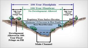
Diagram 6-3 Example a FIRM Panel Map mapping the SFHA
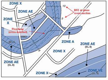
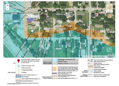
6.12.04 Statutory Authorization, Findings of Fact, And Regulations:
1. Statutory Authorization. The Legislature of the State of Nebraska has delegated the responsibility to local governmental units to adopt zoning regulations designed to protect the public health, safety, general welfare, and property of the people of the state. The Legislature, in Nebraska Revised Statutes Sections 31-1001 to 31-1023 (as amended), has further assigned the responsibility to adopt, administer, and enforce floodplain management regulations to the county, city, or village with zoning jurisdiction over the floodprone area. Therefore, the City Council of Hickman, Nebraska ordains as follows:
2. Findings of Fact.
A. Flood Losses Resulting from Periodic Inundation. The flood hazard areas of Hickman, Nebraska are subject to inundation that results in loss of life and property, health and safety hazards, disruption of commerce and governmental services, extraordinary public expenditures for flood protection and relief, and impairment of the tax base, all of which adversely affect the public health, safety, and general welfare.
B. General Causes of the Flood Losses. These flood losses are caused by the cumulative effect of obstructions in floodplains causing increases in flood heights and velocities as well as the occupancy of flood hazard areas by uses vulnerable to floods or hazardous to others that are inadequately elevated or otherwise unprotected from flood damages.
3. Adherence to Regulations. The regulations of this Ordinance are in compliance with the National Flood Insurance Program Regulations as published in Title 44 of the Code of Federal Regulations and the Nebraska Minimum Standards for Floodplain Management Programs as published in the Nebraska Administrative Code Title 455, Chapter 1.
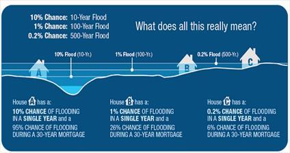
6.12.05 General Provisions:
1. Lands to Which Ordinance Applies This Ordinance shall apply to all lands within the jurisdictions of Hickman identified on the Flood Insurance Rate Map (FIRM) panels 0444G, 0445G, 0463G, 0557G, 0575G, and 0576G dated April 16, 2013, as shown on the FIRM Map Index 31109CIND0B dated April 16, 2013, as Zones A, A1-30, AE, AO, or AH and within the FP/FW Districts established in Section 4.11 of this Ordinance. In all areas covered by this Ordinance, no development shall be allowed except upon the issuance of a floodplain development permit to develop, granted by the Floodplain Administrator or the City Council under such safeguards and restrictions as the City Council or the designated representative may reasonably impose for the promotion and maintenance of the general welfare, health of the inhabitants of the community and where specifically noted in Sections 6.12.05 and 6.12.06.
2. Rules for Interpretation of Overlay District Boundaries The boundaries of the FW and FF areas shall be determined by scaling distances on the official zoning map of the effective Flood Insurance Rate Map. Where interpretation is needed to the exact location of the boundaries of the districts as shown on the zoning or other community map, the Floodplain Administrator shall make the necessary interpretation. In such cases where the interpretation is contested, the Board of Adjustments will resolve the dispute. The regulatory flood elevation for the point in question shall be the governing factor in locating the district boundary on the land. The person contesting the location of the district boundary shall be given a reasonable opportunity to present their case to the Board of Adjustments and to submit their own technical evidence, if so desired.
3. Compliance Within identified floodplains of this community, no development shall be located, extended, converted, or structurally altered without full compliance with the terms of this Ordinance and other applicable regulations.
4. Abrogation and Greater Restrictions This Ordinance does not intend to repeal, abrogate, or impair any existent easements, covenants, or deed restrictions. However, where this Ordinance imposes greater restrictions, the provision of this Ordinance shall prevail. All other ordinances inconsistent with this Ordinance are hereby repealed to the extent of the inconsistency only.
5. Interpretation In their interpretation and application, the provisions of this Ordinance shall be held to be minimum requirements and shall be liberally construed in favor of the City Council and shall not be deemed a limitation or repeal of any other powers granted by state statutes.
6. Warning And Disclaimer of Liability The degree of flood protection required by this Ordinance is considered reasonable for regulatory purposes and is based on engineering and scientific methods of study. Larger floods may occur or the flood height may be increased by manmade or natural causes, such as ice jams and bridge openings restricted by debris. This Ordinance does not imply that areas outside floodway and flood fringe district boundaries or land uses permitted within such districts will be free from flooding or flood damage. This Ordinance shall not create liability on the part of The City of Hickman or any officer or employee thereof for any flood damages that may result from reliance on this Ordinance or any administrative decision lawfully made thereunder.
7. Severability If any section, clause, provision, or portion of this Ordinance is adjudged unconstitutional or invalid by a court of competent jurisdiction, the remainder of this Ordinance shall not be affected thereby.
6.12.06
1. Designation of Floodplain Administrator. The Floodplain Administrator is hereby designated/ appointed by City Council as the community’s local Floodplain Administrator. The Floodplain Administrator is authorized and directed to administer, implement, and enforce all provisions of the Floodplain Ordinance. The designated Floodplain Administrator shall, within one (1) year of being designated as such shall become a Certified Floodplain Manager. If the local Floodplain Administrator position is unfilled, the City Administrator shall assume the duties and responsibilities herein.
2. Permits Required. A floodplain development permit shall be required before any development, construction, or substantial improvement is undertaken. No person, firm, corporation, government agency, or other entity shall initiate any floodplain development without first obtaining a floodplain development permit.
3. Duties of the Floodplain Administrator. Duties of the Floodplain Administrator shall include, but not be limited to the following:
A. Review, approve, or deny all applications for floodplain development permits.
B. Review all development permit applications to assure that sites are reasonably safe from flooding and that the permit requirements of this Ordinance have been satisfied.
C. Review applications for proposed development to assure that all necessary permits have been obtained from those federal, state, or local government agencies from which prior approval is required.
D. Review all subdivision proposals and other proposed new development, including mobile home parks or subdivisions, to determine whether such proposals will be reasonably safe from flooding.
E. Notify adjacent communities and the Nebraska Department of Natural Resources prior to any alteration or relocation of a watercourse and submit evidence of such notification to the Federal Emergency Management Agency.
F. Assure that maintenance is provided within the altered or relocated portion of the watercourse so that the flood carrying capacity is not diminished.
G. Verify, record, and maintain record of the actual elevation (in relation to mean sea level) of the lowest floor, including basement, of all new or substantially improved structures in the floodplain.
H. Verify, record, and maintain record of the actual elevation (in relation to mean sea level) to which all new or substantially improved structures have been floodproofed.
I. Verify, record, and maintain record of all improved or damaged structures to ensure compliance with standards in applicable sections. Track value of improvements and market value with permits. Also, ensure consistent market value estimations to evaluate against damaged or improved values.
J. Ensure comprehensive development plan as amended is consistent with this Ordinance.
K. In the event the Floodplain Administrator discovers work done that does not comply with applicable laws or ordinances, the Floodplain Administrator shall revoke the permit and work to correct any possible violation in accordance with this Ordinance.
4. Application for Permit and Demonstration of Compliance.
A. To obtain a floodplain development permit, the applicant shall first file an application in writing on a form furnished for that purpose. Every such application shall:
1) Identify and describe the proposed development and estimate cost of the job covered by the floodplain development permit.
2) Describe the land by lot, block, tract, and house address, or similar description that will readily identify and locate the proposed building or development.
3) Indicate the use and occupancy of the proposed development.
4) Be accompanied by plans and specifications for proposed construction.
5) Be signed by the permittee and authorized agent who may be required to submit evidence to indicate such authority.
B. If any proposed development is located entirely or partially within a floodplain, applicants shall provide all information in sufficient detail and clarity to enable the Floodplain Administrator to determine that:
1) All such proposals are consistent with the need to minimize flood damage;
2) All utilities and facilities such as sewer, gas, water, electrical, and other systems are located and constructed to minimize or eliminate flood damage;
3) Structures will be anchored to prevent flotation, collapse, or lateral movement;
4) Construction materials are flood resistant;
5) Appropriate practices to minimize flood damage have been utilized; and
6) Electrical, heating, ventilation, air conditioning, plumbing, and any other service facilities have been designed and located to prevent entry of floodwaters.
C. For all new and substantially improved structures, an Elevation Certificate based upon the finished construction certifying the elevation of the lowest floor, including basement, and other relevant building components shall be provided to the Floodplain Administrator and be completed by a licensed surveyor, engineer, or architect.
D. When floodproofing is utilized for an applicable structure, a Floodproofing Certificate shall be provided to the Floodplain Administrator and be completed by a licensed professional engineer or architect.
E. For all development proposed in the floodway, no-rise certification shall be provided to the Floodplain Administrator and be completed by a licensed professional engineer.
F. Any other such information as reasonably may be required by the Floodplain Administrator shall be provided.
5. Flood Data Required.
A. All Zone A areas on the FIRM are subject to inundation of the base flood; however, the base flood elevations are not provided. Zone A areas shall be subject to all development provisions of this Ordinance. If Flood Insurance Study data is not available, the community shall utilize any base flood elevation or floodway data currently available from federal, state, or other sources, including from a study commissioned by the applicant pursuant to best technical practices.
B. Until a floodway has been designated, no development or substantial improvement may be permitted within the floodplain unless the applicant has demonstrated that the proposed development or substantial improvement, when combined with all other existing and reasonably anticipated developments or substantial improvements, will not increase the water surface elevation of the base flood more than one (1) foot at any location as shown in the Flood Insurance Study or on base flood elevation determinations.
6. Variance and Appeals Procedures.
A. The Board of Adjustments as established by The City of Hickman shall hear and decide appeals and requests for variances from the requirements of this Ordinance.
B. The Board of Adjustments shall hear and decide appeals when it is alleged that there is an error in any requirement, decision, or determination made by the Floodplain Administrator in the enforcement or administration of this Ordinance.
C. Any person aggrieved by the decision of the Board of Adjustments or any taxpayer may appeal such decision to the District Court as provided in Nebraska Revised Statutes Section 23-168 (for counties) and Nebraska Revised Statutes Section 19-192 (for municipalities).
D. In evaluating such appeals and requests, the Board of Adjustments shall consider technical evaluation, all relevant factors, standards specified in other sections of this Ordinance, and:
1) The danger to life and property due to flooding or erosion damage;
2) The danger that materials may be swept onto other lands to the injury of others;
3) The susceptibility of the proposed facility and its contents to flood damage and the effect of such damage on the individual owner, future owners, and neighboring properties;
4) The importance of the services provided by the proposed facility to the community;
5) The necessity of the facility to have a waterfront location, where applicable;
6) The availability of alternative locations that are not subject to flooding or erosion damage for the proposed use;
7) The compatibility of the proposed use with existing and anticipated development;
8) The relationship of the proposed use to the comprehensive plan and the floodplain management program for that area;
9) The safety of access to the property in times of flood for ordinary and emergency vehicles;
10) The expected heights, velocity, duration, rate of rise, and sediment transport of the floodwaters and the effects of wave action, if applicable, expected at the site; and,
11) The costs of providing government services during and after flood conditions including emergency management services and maintenance and repair of public utilities and facilities such as sewer, gas, electrical, water systems, streets, and bridges.
7. Conditions for Variances
A. Variances shall only be issued upon a showing of good and sufficient cause and also upon a determination that failure to grant the variance would result in an exceptional hardship to the applicant.
B. Variances shall only be issued based upon a determination that the granting of a variance will not result in increased flood heights.
C. Variances shall only be issued based upon a determination that the granting of a variance will not result in additional threats to public safety, extraordinary public expense, create nuisances, cause fraud on or victimization of the public, or conflict with existing local laws or ordinances.
D. Generally, variances may be issued for new construction and substantial improvements to be erected on a lot of one-half acre or less in size contiguous to and surrounded by lots with existing structures constructed below the base flood level, providing items 5-9 below have
been fully considered. As the lot size increases beyond one-half acre, the technical justification required for issuing the variance increases.
E. Variances may be issued for the repair or rehabilitation of historic structures upon a determination that the proposed repair or rehabilitation will not preclude the structure’s continued designation as an historic structure on the National Register of Historic Places and the variance is the minimum necessary to preserve the historic character and design of the structure.
F. Variances shall not be issued within any designated floodway if any increase in water surface elevations along the floodway profile during the base flood discharge would result.
G. Variances shall only be issued upon a determination that the variance is the minimum necessary, considering the flood hazard, to afford relief.
H. The applicant shall be given a written notice over the signature of a community that the issuance of a variance to construct a structure below the base flood elevation will result in increased premium rates for flood insurance and also that such construction below the base flood elevation increases risks to life and property. Such notification shall be maintained with the record of all variance actions as required by this Ordinance.
I. All requests for variances and associated actions and documents, including justification for their issuance, shall be maintained by the community.
8. Enforcement.
A. Violations. Failure to obtain a floodplain development permit or the failure of a structure or other development to be fully compliant with the provisions of this Ordinance shall constitute a violation. A structure or other development without a floodplain development permit, Elevation Certificate, certification by a licensed professional engineer of compliance with these regulations, or other evidence of compliance is presumed to be in violation until such time as documentation is provided.
B. Notices. When the Floodplain Administrator or other authorized community representative determines, based on reasonable grounds, that there has been a violation of the provisions of this Ordinance, the Floodplain Administrator shall give notice of such alleged violation as hereinafter provided. Such notice shall:
1) Be in writing;
2) Include an explanation of the alleged violation;
3) Allow a reasonable time for the performance of any remedial act required;
4) Be served upon the property owner or their agent as the case may require; and
5) Contain an outline of remedial actions that, if taken, will bring the development into compliance with the provisions of this Ordinance.
C. Penalties. Violation of the provisions of this Ordinance or failure to comply with any of its requirements (including violations of conditions and safeguards established in connection with grants of variances or special exceptions) shall constitute a misdemeanor. Any person, firm, corporate, or other entity that violates this Ordinance or fails to comply with any of its requirements shall upon conviction thereof be fined, and in addition, shall pay all costs and expenses involved in the case. Each day such violation continues shall be considered a separate offense.
1) The imposition of such fines or penalties for any violation or noncompliance with this Ordinance shall not excuse the violation or noncompliance or allow it to continue. All such violations or noncompliant actions shall be remedied within an established and reasonable time.
2) Nothing herein contained shall prevent the City of Hickman or other appropriate authority from taking such other lawful action as is necessary to prevent or remedy any violation.
6.12.07
1. General Provisions.
A. Alteration or Relocation of a Watercourse
1) A watercourse or drainage way shall not be altered or relocated in any way that in the event of a base flood or more frequent flood will alter the flood carrying characteristics of the watercourse or drainage way to the detriment of upstream, downstream, or adjacent locations.
2) No alteration or relocation shall be made until all adjacent communities that may be
affected by such action and the Nebraska Department of Natural Resources have been notified and all applicable permits obtained. Evidence of such notification shall be submitted to the Federal Emergency Management Agency.
B. Encroachments
1) When proposing to permit any of the following encroachments, these standards shall apply:
a. Any development that will cause a rise in the base flood elevations within the floodway; or
b. Any development in Zones A, A1-30, and Zone AE without a designated floodway that will cause a rise of more than one (1) foot in the base flood elevation; or
c. Alteration or relocation of a stream; then
2) The applicant shall:
a. Apply to FEMA for conditional approval of such action via the Conditional Letter of Map Revision process (as per Title 44 of the Code of Federal Regulations, Chapter 1, Part 65.12) prior to the permit for the encroachments; and
b. Supply the fully approved package to the Floodplain Administrator including any required notifications to potentially affected property owners.
C. Floodway Area
1) Standards for the Floodway Area
a. New structures for human habitation are prohibited.
b. All encroachments, including fill, new construction, substantial improvements, and other development must be prohibited unless certification by a registered professional engineer or architect is provided demonstrating that the development shall not result in any increase in water surface elevations along the floodway profile during the occurrence of the base flood discharge. These developments are also subject to all the standards of Section 6.12.06.
c. In Zone A areas, obtain, review, and reasonably utilize any flood elevation and floodway data available through federal, state, or other sources, including studies done under Section 6.12.07 “Subdivisions”, in meeting the standards of this section.
2) Only uses having a low flood-damage potential and not obstructing flood flows shall be allowed within the Floodway Area to the extent that they are not prohibited by any other ordinance. The following are recommended uses for the Floodway Area:
a. Agricultural uses such as general farming, pasture, nurseries, and forestry.
b. Residential uses such as lawns, gardens, parking, and play areas.
c. Nonresidential uses such as loading areas, parking, and airport landing strips.
d. Public and private recreational uses such as sports field(s), archery ranges, picnic grounds, parks, and wildlife and nature preserves.
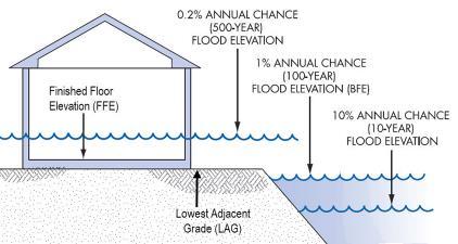
2. Elevation and Floodproofing Requirements
A. Residential Structures
1) In Zones A, AE, A1-30, and AH, all new construction and substantial improvements shall have the lowest floor, including basement, elevated to or above one (1) foot above the
base flood elevation. See Diagram 6-5.
2) In Zone AO, all new construction and substantial improvements shall have the lowest floor, including basement, elevated above the highest adjacent grade at least as high as one (1) foot above the depth number specified in feet on the FIRM or, if no depth number is specified on the FIRM, at least as high as three (3) feet.
3) In the floodway, new structures for human habitation are prohibited.
4) All manufactured (mobile) homes placed in Special Flood Hazard Areas (SFHAs) have to be elevated to or above the BFE, except those being placed in an existing manufactured (mobile) home park or subdivision. Manufactured (mobile) homes placed on a site in an existing manufactured (mobile) home park or subdivision must be elevated on at least 3-foot reinforced piers or equivalent foundations, or to or above the BFE if that is lower. If a manufactured (mobile) home had previously been substantially damaged on a specific site, new placements on that site must be elevated to or above the BFE.
a. Anchoring Systems:
i. Anchoring systems are a critical component of a manufactured (mobile) home installation. Anchoring systems generally consist of ties (straps) and anchors. The ties are generally of two types: over-the-top ties and frame ties which connect the I-beam to the anchor.
ii. Ties are secured to either a ground anchor, which may be a screw auger or concrete deadman anchor, or to a slab anchor, or to the foundation itself.
iii. Anchors must be sufficiently embedded to account for saturated soil conditions which accompany flooding.
iv. To anchor a manufactured (mobile) home to a pier foundation, frame ties connect the I-beams to an anchor set into the ground below the home. For posts or piles, the I-beams can be anchored directly to the horizontal beam of the foundation.
B. Nonresidential Structures
1) In Zones A, AE, A1-30, and AH, all new construction and substantial improvements shall have the lowest floor, including basement, elevated to or above one (1) foot above the base flood elevation or, together with attendant utility and sanitary facilities, floodproofed so that below one (1) foot above the base flood elevation:
a. The structure is watertight with walls substantially impermeable to the passage of water and
b. The structure has structural components with the capability of resisting hydrostatic and hydrodynamic loads and effects of buoyancy.
c. A registered professional engineer or architect shall certify that the standards of this subsection are satisfied. A Floodproofing Certificate shall be provided to the Floodplain Administrator as set forth in Section 6.12.05.
2) In Zone AO, all new construction and substantial improvements shall have the lowest floor elevated above the highest adjacent grade at least as high as one (1) foot above the depth number specified in feet on the FIRM or, if no depth number is specified on the FIRM, at least as high as three (3) feet; or, together with attendant utility and sanitary facilities, floodproofed so that below one (1) foot above the base flood elevation:
a. The structure is watertight with walls substantially impermeable to the passage of water and
b. The structure has structural components with the capability of resisting hydrostatic and hydrodynamic loads and effects of buoyancy.
c. A registered professional engineer or architect shall certify that the standards of this subsection are satisfied. A Floodproofing Certificate shall be provided to the Floodplain Administrator.
C. Critical Facilities
1) New construction or substantial improvement of any critical facility is prohibited in all areas of the floodplain and the 0.2% annual chance floodplain, unless all of the following provisions are met:
a. No feasible alternative site exists for the construction of an equivalent facility within the corporate or extraterritorial jurisdiction boundaries of Hickman;
b. The facility has the lowest floor, including basement, of all structures elevated to one
(1) foot above the 0.2% annual chance flood elevation or, together with attendant utility and sanitary facilities, floodproofed so that below one (1) foot above the 0.2% annual chance flood elevation:
i. The structure is watertight with walls substantially impermeable to the passage of water and
ii. The structure has structural components with the capability of resisting hydrostatic and hydrodynamic loads and effects of buoyancy.
iii. A registered professional engineer or architect shall certify that the standards of the subsection are satisfied. Such certification shall be provided to the Floodplain Administrator.
c. If the 0.2% annual chance floodplain is not identified, the facility shall have the lowest floor, including basement, elevated to three (3) feet above the base flood elevation or be floodproofed to three (3) feet above the base flood elevation.
d. The facility has at least one (1) access road connected to land outside the 0.2% annual chance floodplain that is capable of carrying emergency support vehicles and the top of the access road is no lower than the 0.2% annual chance flood elevation.
1) Fully enclosed areas below the lowest floor and below the base flood elevation shall be used solely for the parking of vehicles, building access, or limited storage of readily removable items.
2) Fully enclosed areas below the lowest floor and below the base flood elevation shall be designed to automatically equalize hydrostatic flood forces on exterior walls by allowing for the entry and exit of floodwaters. Designs for meeting this requirement must either be certified by a registered professional engineer or architect or meet or exceed the following minimum criteria:
a. A minimum of two openings having a net total area of not less than one (1) square inch for every one (1) square foot of enclosed space,
b. The bottom of all openings shall not be higher than one (1) foot above grade, and
c. Openings may be equipped with screens, louvers, valves, or other coverings or devices provided that they allow the automatic entry and exit of floodwaters. See Diagram 6-6.
Diagram 6-6 Elevation Diagram
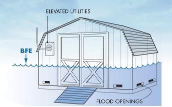
1) Structures accessory to a principal building may have the lowest floor below one (1) foot above base flood elevation provided that the structure complies with the following requirements:
a. The structure shall not be used for human habitation.
b. The use of the structure must be limited to parking of vehicles or storage of items readily removable in the event of a flood warning.
c. The floor area shall not exceed 400 square feet.
d. The structure shall have a low damage potential.
e. The structure must be adequately anchored to prevent flotation, collapse, or other
lateral movement.
f. The structure shall be designed to automatically provide for the entry and exit of floodwaters for the purpose of equalizing hydrostatic forces. Designs for meeting this requirement must either be certified by a registered professional engineer or architect or meet or exceed the following minimum criteria:
i. A minimum of two (2) openings having a net area of not less than one (1) square inch for every one (1) square foot of enclosed space,
ii. The bottom of all openings shall not be higher than one (1) foot above grade, and
iii. Openings may be equipped with screens, louvers, valves, or other coverings or devices provided that they allow the automatic entry and exit of floodwaters.
g. No utilities shall be installed in the structure, except electrical fixtures which must be elevated or floodproofed to one (1) foot above base flood elevation.
h. The structure shall be constructed and placed on the building site so as to offer the minimum resistance to the flow of floodwaters.
i. If the structure is converted to another use, it must be brought into full compliance with the minimum standards governing such use.
F. Manufactured (mobile) homes within any floodplain shall be prohibited.
G. Existing Structures
1) The provisions of this Ordinance do not require any changes or improvements to be made to lawfully existing structures. However, when an improvement is made to a structure in the floodplain, a floodplain development permit is required and the provisions below shall apply:
2) Any addition, alteration, reconstruction, or improvement of any kind to an existing structure where the costs of which would equal or exceed fifty (50) percent of the preimprovement market value shall constitute a substantial improvement and shall fully comply with the provisions of this Ordinance.
3) Any addition, alteration, reconstruction, or improvement of any kind to an existing structure in the floodway shall comply with the provisions of 6.12.06.
4) Any addition, alteration, reconstruction, or improvement of any kind to an existing structure that will change the compliance requirements of the building shall require applicable documentation including an Elevation Certificate, Floodproofing Certificate, or No Rise Certification.
6.12.08 Design and Construction Standards:
1. Anchoring
A. All buildings or structures shall be firmly anchored to prevent flotation, collapse, or lateral movement of the structure resulting from hydrodynamic and hydrostatic loads, including the effects of buoyancy.
2. Building Materials and Utilities
A. All buildings or structures shall be constructed with materials and utility equipment resistant to flood damage. All buildings or structures shall also be constructed by methods and practices that minimize flood and flood-related damages.
B. All buildings or structures shall be constructed with electrical, heating, ventilation, plumbing, air conditioning equipment, and other service facilities that are designed and/or located so as to prevent water from entering or accumulating within the components during conditions of flooding.
3. Drainage
A. Within Zones AO and AH, adequate drainage paths around structures on slopes shall be required in order to guide floodwaters around and away from proposed structures.
4. Water Supply and Sanitary Sewer Systems
A. All new or replacement water supply and sanitary sewer systems shall be located, designed, and constructed to minimize or eliminate flood damages to such systems and the infiltration of floodwaters into the systems.
B. All new or replacement sanitary sewage systems shall be designed to minimize or eliminate discharge from the system into floodwaters.
C. On-site waste disposal systems shall be located and designed to avoid impairment to them or contamination from them during flooding.
D. New septic systems in the floodplain are prohibited. Existing septic systems may be replaced.
5. Other Utilities
A. All other utilities such as gas lines, electrical, telephone, and other utilities shall be located and constructed to minimize or eliminate flood damage to such utilities and facilities.
6. Storage of Materials
A. The storage or processing of materials that are in time of flooding buoyant, flammable, explosive, or could be injurious to human, animal, or plant life is prohibited.
B. The storage of other material or equipment may be allowed if not subject to major damage by floods and firmly anchored to prevent flotation or if readily removable from the area within the time available after flood warning.
7. Recreational Vehicles and Recreational Vehicle Parks
A. Recreational vehicles to be placed on sites within the FF shall meet the elevation and anchoring requirements for manufactured (mobile) homes of this Ordinance, unless it: 1) is on site for fewer than one hundred and eighty (180) consecutive days; or 2) fully licensed and ready for highway use, which shall mean it is on its wheels or jacking system, is attached to the site by only quick-disconnect type utilities and security devices, and no permanently attached additions.
B. Recreational vehicles to be placed on sites within the FW shall be prohibited.
C. Recreational vehicle parks within any FW shall be prohibited.
8. Subdivisions
A. Subdivision proposals and other proposed new development, including mobile home parks or subdivisions, shall require assurance that:
B. All such proposals are consistent with the need to minimize flood damage;
C. All public utilities and facilities such as sewer, gas, electrical, and water systems are located, elevated, and constructed to minimize or eliminate flood damage;
D. Adequate drainage is provided so as to reduce exposure to flood hazards; and
E. Proposals for development of five (5) acres or fifty (50) lots, whichever is less, where base flood elevation data are not available, shall be supported by hydrologic and hydraulic analyses that determine base flood elevations and floodway information. The analyses shall be prepared by a licensed professional engineer in a format required by FEMA for Conditional Letters of Map Revision and a Letters of Map Revision.
6.12.09
1. A structure or use of a structure or premises that was lawful before the passage or amendment of this Ordinance, but that is not in conformity with the provisions of this Ordinance may be continued subject to the following conditions:
A. If such use is discontinued or abandoned for 12 (twelve) consecutive months, any future use of the building premises shall conform to this Ordinance. The Utility Department shall notify the Floodplain Administrator in writing of instances of nonconforming uses where utility services have been discontinued for a period of 12 (twelve) months.
B. Uses or adjuncts thereof that are or become nuisances shall not be entitled to continue as nonconforming uses.
2. If any nonconforming use or structure is destroyed by any means, including flood, it shall not be reconstructed if the cost is more than fifty (50) percent of the market value of the structure before the damage occurred except that if it is reconstructed in conformity with the provisions of this Ordinance. This limitation does not include the cost of any alteration to comply with existing state or local health, sanitary, or safety code or regulations or the cost of any alteration of a structure listed on the National Register of Historic Places, provided that the alteration shall not preclude its continued designation.
6.12.10
1. The regulations, restrictions, and boundaries set forth in this Ordinance may be amended, supplemented, changed, or appealed to reflect any and all changes in federal, state, or local regulations provided, however, that no such action may be take until after a public hearing in relation thereto, at which citizens and parties in interest shall have an opportunity to be heard. Notice of the time and place of such hearing shall be published in a newspaper of general circulation in the City of Hickman. At least 10 (ten) days shall elapse between the date of this
publication and the public hearing.
2. A copy of such amendments will be provided to the Nebraska Department of Natural Resources and the Federal Emergency Management Agency for review and approval before being adopted.
6.12.11 Definitions
Unless specifically defined below, words or phrases used in this Ordinance shall be interpreted so as to give them the meaning they have in common usage and to give this Ordinance it’s most reasonable application:
0.1%- or one-hundred-year flood - The 100-year floodplain is the land that is predicted to flood during a 100-year storm, which has a 1% chance of occurring in any given year. You may also hear the 100-year floodplain called the 1% annual chance floodplain or base flood. Areas within the 100year floodplain may flood in much smaller storms as well.
0.2%- or five-hundred-year flood - The 500-year floodplain is the land that is predicted to flood during a 500-year storm, which has a 0.2% chance of occurring in any given year. You may also hear the 500-year floodplain called the 2% annual chance floodplain or base flood. Areas within the 500-year floodplain may flood in much smaller storms as well.
Zone A - The Special Flood Hazard Area (except coastal V Zones) shown on a community's Flood Insurance Rate Map.
These are types of A Zones:
A: SFHA where no base flood elevation is provided.
A1-30 Numbered A Zones, SFHA where the FIRM shows a base flood elevation in relation to NGVD.
AE: SFHA where base flood elevations are provided. AE Zone delineations are now used on new FIRMs instead of A# Zones.
AO: SFHA with sheet flow, ponding, or shallow flooding. Base flood depths (feet above grade) are provided.
AH: Shallow flooding SFHA. Base flood elevations in relation to NGVD are provided.
AR: Areas with a temporarily increased flood risk due to the building or restoration of a flood control system (such as a levee or a dam). Mandatory flood insurance purchase requirements will apply, but rates will not exceed the rates for unnumbered A zones if the structure is built or restored in compliance with Zone AR floodplain management regulations.
A 99: Areas with a 1% annual chance of flooding that will be protected by a Federal flood control system where construction has reached specified legal requirements. No depths or base flood elevations are shown within these zones.
Zone D - Area of undetermined but possible flood hazard.
Zone V - The Special Flood Hazard Area subject to coastal high hazard flooding. There are three types of V Zones: V, V1-30, and VE, and they correspond to the A Zone designations.
Zone X - Newer Flood Insurance Rate Maps show Zones B and C as Zone X. There are two types of X zones, shaded (formally Zone B) and unshaded (formally zone C).
Shaded X Zones are areas that have a 0.2% probability of flooding every year (also known as the "500-year floodplain"). Properties in Shaded Zone X are areas of moderate flood hazard, usually the area between the limits of the 100‐ year and 500‐year floods. Also used to designate base floodplains of lesser hazards, such as areas protected by levees from 100‐year flood, or shallow flooding areas with average depths of less than one foot or drainage areas less than 1 square mile.
Unshaded X Zones Area of minimal flood hazard, usually depicted on FIRMs as above the 500‐year flood level. May have ponding and local drainage problems that don't warrant a detailed study or designation as base floodplain. Zone X is the area determined to be outside the 500‐
year flood and protected by levee from 100‐ year flood.
Appurtenant Structure shall mean a structure on the same parcel of property as the principal structure, the use of which is incidental to the use of the principal structure. Also, shall be known as “accessory structure.”
Area of Shallow Flooding means a designated AO or AH zone on a community's Flood Insurance Rate Map (FIRM) with a one percent or greater annual chance of flooding to an average depth of one to three feet where a clearly defined channel is unpredictable and where velocity flow may be evident. Such flooding is characterized by ponding or sheet flow.
Base Flood means the flood having one (1) percent chance of being equaled or exceeded in any given year.
Base Flood Elevation (BFE) means the elevation to which floodwaters are expected to rise during the base flood.
Basement means any area of the building having its floor subgrade (below ground level) on all sides.
Building means “structure.” See definition for “structure.”
Critical Facility means any property that, if flooded, would result in severe consequences to public health and safety. Critical facilities include, but are not limited to: facilities that produces, use, or store hazardous materials; hospitals, convalescent services, and housing likely to contain vulnerable populations; emergency support function facilities like police stations, fire stations, vehicle and equipment storage facilities, and emergency operations centers; public and private utility facilities vital to maintaining or restoring normal services to flooded areas before, during, and after a flood.]
Development means any man-made change to improved or unimproved real estate, including but not limited to the construction, reconstruction, renovation, repair, expansion or alteration of buildings or other structures; the placement of manufactured (mobile) homes; streets and other paving; utilities; filling, grading, and excavation; mining; dredging; drilling operations; storage of equipment or materials; or obstructions.
Existing Manufactured (mobile) home Park or Subdivision means a manufactured (mobile) home park or subdivision for which the construction of facilities for servicing the lots on which the manufactured (mobile) homes are to be affixed (including, at a minimum, the installation of utilities, the construction of streets, and either final site grading or the pouring of concrete pads) is complete before the effective date of the floodplain management regulations adopted by a community.
Expansion to an Existing Manufactured (mobile) home Park or Subdivision means the preparation of additional sites by the construction of facilities for servicing the lots on which the manufactured (mobile) homes are to be affixed (including the installation of utilities, the construction of streets, and either final site grading or the pouring of concrete pads).
Flood or Flooding means a general and temporary condition of partial or complete inundation of normally dry land areas.
Flood Fringe is that area of the floodplain, outside of the floodway, that has a one (1%) percent chance of flood occurrence in any one year.
Flood Insurance Rate Map (FIRM) means an official map of a community, on which the Flood Insurance Study has delineated the SFHA (special flood hazard area) boundaries and the risk premium zones applicable to the community.
Flood Insurance Study (FIS) is the official report provided by the Federal Emergency Management Agency. The report contains flood profiles, as well as the Flood Insurance Rate Map and the water surface elevation of the base flood.
Floodplain means any land area susceptible to being inundated by water from any source (see definition of "flooding"). Floodplain includes flood fringe and floodway. The SFHA (special flood hazard area) is the floodplain delineated into zones based of flood risk.
Floodplain Administrator means the person designated or appointed by City Council as the community’s local Floodplain Administrator. The Floodplain Administrator is authorized and directed to administer, implement, and enforce all provisions of this Ordinance.
Floodproofing means any combination of structural and nonstructural additions, changes, or adjustments to structures that reduce or eliminate flood damage to real estate or improved real property, water and sanitary facilities, and structures and their contents.
Floodway or Regulatory Floodway (FW) means the channel of a river or other watercourse and the adjacent land areas that must be reserved in order to discharge the base flood without cumulatively increasing the water surface elevation more than one (1) foot.
Freeboard means a factor of safety usually expressed in feet above a flood level for purposes of floodplain management. "Freeboard" tends to compensate for the many unknown factors that could contribute to flood heights greater than the height calculated for a selected size flood and floodway conditions, such as wave action, clogged bridge openings, and the hydrological effect of urbanization of the watershed.
Habitation means area used for living, sleeping, cooking, or eating purposes, or any combination thereof.
Highest Adjacent Grade means the highest natural elevation of the ground surface prior to construction next to the proposed walls of a structure.
Historic Structure means any structure that is: (a) Listed individually in the National Register of Historic Places (a listing maintained by the Department of Interior) or preliminarily determined by the Secretary of the Interior as meeting the requirements for individual listing on the National Register; (b) Certified or preliminarily determined by the Secretary of the Interior as contributing to the historical significance of a registered historic district or a district preliminarily determined by the Secretary to qualify as a registered historic district; (c) Individually listed on a state inventory of historic places in states with historic preservation programs which have been approved by the Secretary of the Interior; or (d) Individually listed on a local inventory of historic places in communities with historic preservation programs that have been certified either: (1) By an approved state program as determined by the Secretary of the Interior or (2) Directly by the Secretary of the Interior in states without approved programs.
Lowest Floor means the lowest floor of the lowest enclosed area (including basement). An unfinished or flood-resistant enclosure, usable solely for parking of vehicles, building access or storage, in an area other than a basement area, is not considered a building's lowest floor, provided that such enclosure is not built or modified so as to render the structure in violation of the applicable non-elevation design requirements of this Ordinance.
Manufactured (mobile) home means a structure, transportable in one (1) or more sections, which is built on a permanent chassis and is designed for use with or without a permanent foundation when attached to the required utilities. The term "manufactured (mobile) home" does not include a "recreational vehicle".
Mobile Home Park or Subdivision (R-M District) means a parcel (or contiguous parcels) of land divided into two (2) or more manufactured (mobile) home lots for rent or sale.
New Construction for floodplain management purposes, "new construction" means structures for which the "start of construction” commenced on or after the effective date of the floodplain management regulation adopted by a community and includes any subsequent improvements to such structures.
New Mobile Home Park or Subdivision means a manufactured (mobile) home park or subdivision for which the construction of facilities for servicing the lots on which the manufactured (mobile) homes are to be affixed (including at a minimum, the installation of utilities, the construction of streets, and either final site grading or the pouring of concrete pads) is completed on or after the effective date of floodplain management regulations adopted by a community.
Obstruction means any wall, wharf, embankment, levee, dike, pile, abutment, projection, excavation (including the alteration or relocation of a watercourse or drainage way), channel rectification, bridge, conduit, culvert, building, stored equipment or material, wire, fence, rock, gravel, refuse, fill, or other analogous structure or matter which may impede, retard, or change the direction of the flow of water, either in itself or by catching or collecting debris carried by such water, or that is placed where the natural flow of the water would carry such structure or matter downstream to the damage or detriment of either life or property. Dams designed to store or divert water are not obstructions if permission for the construction thereof is obtained from the Department of Natural Resources pursuant to the Safety of Dams and Reservoirs Act (Nebraska Revised Statutes 46-1601 to 46-1670 as amended).
Overlay District is a district in which additional requirements act in conjunction with the underlying zoning district(s). The original zoning district designation does not change.
Post-FIRM Structure means a building that was constructed or substantially improved after December 31, 1974, or on or after the community’s initial Flood Insurance Rate Map dated March 18, 1980, whichever is later.
Pre-FIRM Structure means a building that was constructed or substantially improved on or before December 31, 1974, or before the community’s initial Flood Insurance Rate Map dated March 18, 1980, whichever is later.
Principally Above Ground means that at least fifty-one (51%) percent of the actual cash value of the structure is above ground.
Recreational Vehicle means a vehicle which is (i) built on a single chassis; (ii) 400 square feet or less when measured at the largest horizontal projections; (iii) designed to be self-propelled or permanently towable by a light duty truck; and (iv) designed primarily not for use as a permanent dwelling but as temporary living quarters for recreational, camping, travel, or seasonal use.
Regulatory Flood Elevation means the base flood elevation (BFE) plus a freeboard factor as specified in this Ordinance.
Special Flood Hazard Area (SFHA) The floodplain area on a flood insurance rate map delineated into zones based on the level of flood risk. The SFHA is the area where the National Flood Insurance Program's (NFIP's) floodplain management regulations must be enforced and the area where the mandatory purchase of flood insurance applies.
Start of Construction means the date the floodplain development permit was issued, provided the actual start of construction, repair, reconstruction, rehabilitation, addition, placement, or other improvement was within one hundred-eighty (180) days of the permit date. “Start of construction” also includes substantial improvement, and means the date the building permit was issued, provided the actual start of construction, repair, reconstruction, rehabilitation, addition, placement, or other improvement was within one hundred-eighty (180) days of the permit date. The actual start means the first placement of permanent construction of a structure on a site, such as the pouring of slab or footings, the installation of piles, the construction of columns, or any work beyond the stage of excavation; or the placement of a manufactured (mobile) home on a foundation. Permanent construction does not include land preparation, such as clearing, grading, and filling; nor does it include the installation of streets and/or walkways; nor does it include excavation for a basement, footings, piers, or foundations or the erection of temporary forms; nor does it include the installation on the property of accessory buildings, such as garages or sheds not occupied as dwelling units or not part of the main structure. For a substantial improvement, the actual start of construction means the first alteration of any wall, ceiling, floor, or other structural part of a building, whether or not the alteration affects the external dimensions of the building.
Structure means a walled and roofed building that is principally above ground, as well as a manufactured (mobile) home and a gas or liquid storage tank that is principally above ground.
Subdivision means the division or re-division of a lot, tract, or parcel of land by any means into two (2) or more lots, tracts, parcels, or other divisions of land including changes in existing lot lines for the purpose, whether immediate or future, of lease, partition by the court for distribution to heirs or devisees, transfer of ownership, or building or lot development.
Substantial Damage means damage of any origin sustained by a structure whereby the cost of restoring the structure to its before-damage condition would equal or exceed fifty (50%) percent of the market value of the structure before the damage occurred.
Substantial Improvement means any reconstruction, rehabilitation, addition, or other improvement of a structure, the cost of which equals or exceeds fifty (50%) percent of the market value of the structure before "start of construction" of the improvement. This includes structures which have incurred "substantial damage," regardless of the actual repair work performed. The term does not, however, include either. (1) any project for improvement of a structure to correct existing violations of state or local health, sanitary, or safety code specifications which have been identified by the Chief Building Official and which are the minimum necessary to assure safe living conditions, or (2) any alteration of a "historic structure," provided that the alteration will not preclude the structure's continued designation as a "historic structure."
Variance is a grant of relief to an applicant from the requirements of this Ordinance that allows construction in a manner otherwise prohibited by this Ordinance where specific enforcement would result in unnecessary hardship.
Violation means a failure of a structure or other development to be fully compliant with the community’s floodplain management regulations. A structure or other development without the Elevation Certificate, other certifications, or other evidence of compliance required in this Ordinance is presumed to be in violation until such time as that documentation is provided.
Walkout Basement or Daylight Basement means a basement that incorporates a wall with doors and windows on the ground level. Typically, a building site that has a slope to the rear of the property has a walkout basement that accesses the back yard.
Watercourse means any depression two (2) feet or more below the surrounding land that serves to give direction to a current of water at least nine months of the year and that has a bed and welldefined banks.
6.13.01 Purpose:
The purpose of the Planned Unit Development (PUD) District is to offer an alternative zone to permit multiple uses within a single use district, which are at variance with the area zoning requirements. This section is intended to permit flexibility of site design, architecture for the conservation of land and open space through clustering of buildings and activities and as an incentive to developers to plan creatively by providing density bonuses. This flexibility can be achieved by waiving provisions of this Ordinance including uses, setbacks, heights, and similar regulations. Planned Unit Developments (PUD) are characterized by central management, integrated planning, and architecture, joint or common use of parking, open space and other facilities, and a harmonious selection and efficient distribution of uses.
6.13.02 Intent:
Planned Unit Developments shall include all development having two or more principal uses or structures on a single parcel of land; and may include town homes, apartments involving more than one building, residential subdivision submitted under cluster zoning provisions, multi-use structures such as an apartment building with retail at ground floor level, commercial development, industrial development, mixed residential and commercial development, and similar projects.
6.13.03 General Requirements:
1. The Planning Commission, in its minutes, shall set forth its reasons for recommendation of approval or denial of the application for a PUD plan approval, along with specific evidence and facts showing that the proposal meets or does not meet the following conditions.
A. Said PUD shall be in general conformity with the provisions of the City of Hickman Comprehensive Plan.
B. Said PUD shall not have an adverse effect on the development of the neighboring area.
C. The minimum overall area required for a PUD District by type of use shall be as follows: Residential (only), three acres; Residential - Commercial (combination), five acres.
D. Height, bulk, and yard requirements shall be reflected on the Development Plan and shall promote an efficient and creative use of land.
2. Use Limitations: In a PUD no building, structure, land, or premises shall be used, and no building shall be erected, constructed, or altered, except for any use permitted in this District. All uses must be approved as shown on the Development Plan as specified in this division.
3. Standards and conditions for development: A development proposed for land classified as the PUD district shall be consistent with the following general standards for use of land, and the use, type, bulk, and location of buildings, the density or intensity of use, open space, public facilities, and the Development Plan shall, where applicable, reflect compliance.
A. The applicant shall satisfy the Planning Commission and City Council that there is the ability to carry out the proposed plan, including financial assurances and the phasing of the project, and shall prepare and submit a schedule of construction, if necessary. The proposed construction shall begin within a period of 12 consecutive months following the approval of the final application by the City Council. A minimum of 50 percent of the total planned construction shown on the final plan shall be completed within a period of five years following such approval or the approval shall expire. If the approval expires under this section, the applicant shall show good cause to the City Council to extend the plan approval.
B. The developer shall provide and record easements and covenants, shall make such other arrangements, and shall furnish such performance bonds, escrow deposit, or other financial guarantees for public improvements as may be determined by the City Council to be reasonably required to assure performance in accordance with the Development Plan and to protect the public interest in the event of abandonment of said plan before completion.
C. The site shall be accessible from public roads that are adequate to carry the traffic that will be imposed upon them by the proposed development. The streets and driveways on the site of the proposed development shall be adequate to serve the residents or occupants of the proposed development.
D. The development shall not impose an undue burden on public services and facilities, such as fire and police protection.
E. The entire tract or parcel of land to be occupied by the PUD shall be held in single
ownership or control, or if there are two or more owners, the application for such PUD shall be filed jointly by all owners. This provision may be waived provided that the land contains existing improvements.
F. The location and arrangement of structures, parking areas, walks, lighting, and appurtenant facilities shall be compatible with the surrounding land uses, and any part of a PUD not used for structures, parking and loading areas, or access ways shall be landscaped or otherwise improved as shown on the Development Plan.
G. Off-street parking and loading shall be provided in accordance with the parking and loading regulations of the City of Hickman.
H. When a commercial use within a PUD District abuts a residential district, the Development Plan shall reflect screening consisting of landscaping and/or fencing provided adjacent to any adjoining residential district, except in the event the adjacent residential use and the commercial use are separated by a street right-of-way.
I. All residential and commercial buildings shall set back not less than 25 feet from the perimeter of the land zoned PUD. Additional setback from a heavily traveled thoroughfare may be required, when found reasonable by the Planning Commission for protection of health, safety, and general welfare.
J. Building coverage area shall not exceed the following percentages of the net developable area of each individual parcel of the total development:
1) Residential: 60 percent maximum.
2) Commercial: 50 percent maximum.
K. A minimum of 20 percent of the net area of a PUD reserved for residential use, shall be provided for Common Areas, of which a minimum net area of 10 percent shall be useable open space.
L. The PUD District shall include such provisions for the ownership and maintenance of the Common Areas as are reasonably necessary to ensure its continuity, care, conservation, and maintenance, and to ensure that remedial measures will be available to the City Council if the common open space is permitted to deteriorate or is not maintained in a condition consistent with the best interests of the planned unit development or of the entire community. The applicant shall submit any protective covenants and organizational documents of the homeowner’s association with the Development Plan.
M. No residential use shall have direct access onto an arterial street unless approved by the City Council in the Development Plan.
N. Any commercial use must reflect its traffic flow on the Development Plan. All commercial areas must have indirect access via a collector or arterial street; however, no individual commercial use may have direct access onto collector or arterial streets.
O. Pedestrian Access. Sidewalks shall be built to City specifications along all public and private streets within the City Right-of-Way (ROW). An alternative surface may be used for pedestrian access within the PUD when it is not placed in the ROW and is not maintain by the City of Hickman. Connections to useable open space shall be provided by the developer and noted on the development plan.
6.13.04 Application for approval of Planned Unit Development:
1. An application for a PUD shall be handled in the same manner prescribed for amending this Ordinance. The same requirements for notice, advertisement of public hearing, protests, and adoption shall be required as zoning changes
2. The applicant shall prepare and submit three copies; plus, one electronic copy of the “Development Plan” of the proposed development in the PUD District for review and approval by the Planning Commission.
3. The Development Plan shall include:
A. A drawing of the property legally surveyed and stamped by a Registered Land Surveyor in the State of Nebraska.
B. A site plan showing:
1) Contours at intervals of two feet or spot elevations on a 100 foot grid shall be required on flat land (where contours at the two foot interval will not be present on a drawing);
2) Location, size, height, and use of all proposed structures and proposed yards on each lot;
3) All points of ingress and egress, driveways, circulation aisles, parking lots, parking spaces, and service areas;
4) All streets adjoining subject property and the width of the existing right-of-way;
5) Areas set aside for Common Areas with the type of use or recreational facilities planned for each;
6) Designation of individual parcels if the proposed development is to be set up in separate construction phases;
7) Designation of individual lots if such lots are proposed to be sold to individual owners;
8) Location of required screening;
9) Location of natural features such as ponds, tree clusters, and rock outcropping;
10) Existing development on adjacent properties within 300 feet.
C. The above-described site plan shall also include a section designated as "general provisions," and said section shall include the following when, said items are applicable:
1) Net area in square feet of the development.
2) Density of dwelling units per acre or the total dwelling units for the entire plan.
3) Building coverage of the net area or the development by individual parcel or total development.
4) The percentage of the Development Plan provided for common area as defined by this regulation.
5) If more than one parcel is proposed, a statement relating to the sequence of development shall be included.
6) Required number of parking spaces and location.
7) Gross floor area proposed for commercial buildings.
8) All proposed land uses shall be listed by parcel.
D. A statement or adequate drawings shall be included describing the manner for the disposition of sanitary waste and storm water.
E. The full legal description of the boundaries of the property or properties to be included in the PUD and shown on an official land survey as required.
F. A vicinity map showing the general arrangement of streets within an area of 1,000 feet from the boundaries of the proposed PUD.
G. An elevation drawing of the general characteristics of the proposed buildings may be submitted if the applicant desires.
H. When a PUD includes provisions for common space and/or recreational facilities, a statement describing how such open space and/or facility will be owned and maintained when not under the ownership of a governmental entity. A homeowner association or other controlling entity shall provide the City of Hickman with copies of the proposed articles of incorporation and bylaws of such entity.
3. The Planning Commission shall meet within 45 days of a complete application being filed. Plans shall be filed with the City at least 28 days prior to a scheduled Planning Commission meeting. After the application for a PUD is filed, the Planning Commission shall hold a public hearing on said development after giving required notice for hearings in amendments. After the conclusion of said public hearing, the planning commission shall prepare and transmit to the City Council and the applicant specific findings of fact with respect to the extent which the Development Plan complies with those regulations, together with its recommendations in respect to the action to be taken on the Development Plan and PUD requirements. The planning commission may recommend disapproval, approval, or approval with amendments, conditions, or restrictions.
4. The City Council shall or shall not approve the Development Plan and authorize the submitting of the final Development Plan.
5. Substantial modifications in the preliminary plat and PUD design shall only be made after rehearing and re-approval unless the modifications were required by the Planning Commission and/or the City Council.
6.13.05
1. After approval of a Development Plan and prior to the issuance of any building permit or zoning permit, the applicant shall submit an application for final approval with the PUD Compliance Review Committee (CRC). The PUD CRC shall consist of two members each of the Hickman Planning Commission and Hickman City Council or their designated representative, the Zoning Administrator, the Hickman City Engineer or their designated representative; and/or any other
individual deemed necessary to the review process. This committee will be assembled only on an as needed basis. Said final application may include the entire PUD District or may be for a unit or section thereof as set forth in the approval of the preliminary plan. The application shall include three copies; plus, one electronic copy of such drawings, specifications, covenants, easements, conditions, and any other conditions including but not limited to performance bonds. As set forth in the approval of the Development Plan preliminary plan and in accordance with the conditions established in this Ordinance for a PUD District. The final plan shall include the same information, as the preliminary plan except the following shall also be provided:
A. A surveyor's certificate certifying to the accuracy of the boundary surveys shown.
B. Location, names, tangent lengths, centerline radius of each curve and its interior width and angle of all proposed public right-of-way;
C. All easements and appropriate building setback lines;
D. All lot lines, and lot dimensions including chord distances for curvilinear lot lines;
E. Lot and/or parcel numbers;
F. Location, size, height, and use of all proposed or present buildings;
G. Dedication of all streets, public highways, or other land intended for public use, signed by the owner and by all other parties who have a mortgage or lien interest in the property, together with any restrictions or covenants which apply to the property.
H. A waiver of claim by the applicant for damages occasioned by the establishment of grades or the alteration of the surface of any portion of streets and alleys to conform to grades established.
2. A plan submitted for final approval shall be deemed to be in substantial performance with the plan previously given tentative approval, provided any modification of the Development Plan does not:
A. Vary the proposed gross residential density or intensity of use by more than five percent or involve a reduction in the area set aside for common open space, nor the relocation of such area; nor
B. Increase by more than 10 percent the floor area proposed for nonresidential use; nor
C. Increase by more than five percent the total ground area covered by buildings or the height of buildings.
D. Substantial performance of the design and plan shall be adhered to, so as not to alter:
1) Pedestrian or vehicular traffic flow.
2) The juxtaposition of different land uses.
3) The relation of open space to residential development.
4) The proposed phasing of construction.
5) Proposed use of one or more buildings to a more intensive use category as delineated in this Ordinance.
3. A public hearing shall be held for the approval of a final plan. The Planning Commission shall review the final plan for compliance with the approved preliminary plan. Upon review approval, said final plan shall be filed with the City Council for final approval and acceptance.
4. In the event that the final plan submitted contains changes in excess of those permitted under Subparagraph (2) above, applicant shall resubmit the original plan. The Development Plan shall be modified in the same manner prescribed in this division as for original approval.
6.13.06
To further the mutual interest of the residents and owners of the PUD and of the public in the preservation of the integrity of the PUD plan, as finally approved, and to insure that modifications, if any, in the plan shall not impair the reasonable reliance of the said residents and owners upon the provisions of the plan, nor result in changes that would adversely affect the public interest, the enforcement and modification of the provisions of the plan as finally approved, whether recorded by plan, covenant, easement or otherwise, shall be subject to the following provisions:
1. The use of land and the use, bulk, and location of buildings and structures; and
2. The quality and location of common space; and
3. The intensity of use or the density of residential units shall run in favor of the City and 4. Shall be enforceable in law or in equity, by the City, without limitation on any powers or regulation otherwise granted by law. The development of any land pursuant to an approved Development Plan shall be constructed in accordance with the requirements of Section 5.18 and the approved Development Plan.
6.13.07 Amendments:
The PUD District agreement or an approved Development Plan may be amended in the same manner prescribed in this division for approval of a preliminary or final plan. Application for amendment may be made by the homeowner's association or 51 percent of the owners of the property within the PUD District.
6.13.08 Platting:
For unplatted tracts or tracts being replatted, the approval of the Development Plan shall be considered as the approval of a preliminary plat. To complete the platting process, the applicant need only submit a final plat. Said final plat shall be in accordance with the subdivision regulations.
6.13.09 Fees:
1. Development Plan, filing fee shall be set by the City Council by separate ordinance; 2. Final plan, filing fee shall be set by the City Council by separate ordinance. These fees are separate and do not include any Preliminary Plat, Final Plat, Future Land Use Map Amendment and/or Change of Zone Fees required by the City of Hickman.
6.13.09 PUD Definitions:
Building coverage area is the area covered by building(s) or structure(s) on each individual lot or parcel (not including such impervious improvements such as but not limited to walkways, driveways, patios etc.).
Net developable area shall be the area of each parcel and the net of any required yard required under the Development Plan. The Development Plan shall reflect the calculations used to demonstrate compliance with this requirement.
Common Area shall be defined as playgrounds, street medians, landscaped green space, or other similar areas designed to be used by the residents of the development in common with each other.
Common Areas for the leisure and recreation of development residents shall be owned and maintained in common by them, through a homeowner's association.
Useable Open Space shall mean the net area used for open space calculation which has at least one means of ingress and egress to a public street. The net area contains no slope greater than 10 percent in any direction of the portion used for calculation. The area is to be dedicated to the public for use and enjoyment. Connecting existing pedestrian access to the area must be provided by the developer.
1. The City Council may authorize and permit conditional uses as designated in the use regulations of each district (Article 5), after the following:
A. A Planning Commission Public Hearing, B. Referral by the Planning Commission; and C. Conducting a City Council Public Hearing.
2. Approval, denial, or modified approval shall be based on findings that the location and characteristics of the use will not be detrimental to the health, safety, morals, and general welfare of the area and following all codes and zoning.
3. Allowable uses may be permitted, enlarged, or altered upon application for a conditional use permit in accordance with the rules and procedures of this Ordinance. The City Council may grant or deny a conditional use permit in accordance with the intent and purpose of this Ordinance.
4. In granting a conditional use permit, the City Council may:
A. Authorize the use and
B. May prescribe and impose appropriate conditions, safeguards, and a specified time limit for the implementation of the identified conditional use permit.
1. A request for a conditional use permit (CUP) or modification of a conditional use permit may be initiated by a property owner or their authorized agent by filing an application with the City upon forms prescribed for the purpose.
2. The application shall be accompanied by a drawing or site plan and other such plans and data showing the dimensions, arrangements, descriptions, data, and other materials constituting a record essential to an understanding of the proposed use and proposed modifications in relation to the provisions set forth herein. A plan as to the operation and maintenance of the proposed use shall also be submitted.
3. The application shall be accompanied with a nonrefundable fee as established by the Master Fee Schedule as set and approved by City Council.
1. Before issuance of any conditional use permit, both the Planning Commission and City Council shall hold Public Hearings after proper and legal notice of the time, place, and purpose of the hearing has been given by publication in a legal paper of general circulation in the City of Hickman, one time at least 10 days prior to said hearings.
2. The City Council will consider the application for the Conditional Use Permit together with the recommendations of the Planning Commission.
1. A majority vote of the City Council members shall be necessary to approve or deny a Conditional Use Permit application.
2. The applicant shall have 12 months from the approval of the Conditional Use Permit to commence the use unless the City Council specifically grants a longer period of time upon the recommendation of the City Planning Commission. If the use stated within the Conditional Use Permit has not been commenced within 12 months, or approved time period, said Permit shall become invalid and any activity shall be required to re-apply and pay an application fee for a new Conditional Use Permit.
3. All decisions by the City Council and the recommendations of the Planning Commission shall be required to provide findings of fact for their decision for either approval or denial.
1. Any approved Conditional Use Permit is automatically transferable upon sale of the property from the original applicant to another party, unless otherwise noted on the original CUP. The new owner shall assume the responsibility for complying with:
A. The standards for conditional use and any additional conditions listed on the granted permit,
B. The use shall not change or be expanded unless a new Conditional Use Permit is approved,
C. Failure to comply with the standards and conditions of the permit shall subject the new owner to the revocation process of this Article.
2. However, any Home Occupation requiring a Conditional Use Permit shall not transfer said CUP to a new owner. The new owner must apply for, and be granted, their own CUP prior to use.
1. Any approved Conditional Use Permit may be revoked for failure to comply with the conditions approved by the City Council. Revocation shall require the City to notify the applicant of any noncompliance, in writing, and provide the applicant 30 days to correct the issue(s).
2. Failure to comply with the notice shall cause a Public Hearing to be scheduled by the Planning Commission, to review the permit and the approved conditions and the failure to act by the applicant. If the applicant is found to be noncompliant with the issued permit and conditions, the Planning Commission shall make a recommendation on the subject permit to City Council, provided applicant will not or cannot come into compliance with the conditions of the permit. Upon a recommendation being forwarded to the City Council, the City Council shall hold a Public Hearing and shall act on the revocation including the revocation of the permit and order the use to cease and desist. Failure to follow a Cease-and-Desist order shall cause action to be filed by the City Attorney in District Court.
3. Revocation may also occur if the City documents that the use has ceased operations for 12 consecutive months. The City shall notify the applicant of the revocation in writing. The permit shall become invalid in 30 days from date of notification.
7.07
1. The Planning Commission and/or City Council reserve the right to review any Conditional Use Permit for compliance either on an annual basis or upon a written complaint from any individual.
1. No Conditional Use Permit shall be granted unless the City Council has found:
A. That the establishment, maintenance, or operation of the conditional use will not be detrimental to or endanger the public health, safety, moral, comfort, or general welfare of the community.
B. That the conditional use will not be injurious to the use and enjoyment of other property in the immediate vicinity for the purpose already permitted, nor substantially diminish and impair property values within the neighborhood.
C. That the establishment of the conditional use will not impede the normal and orderly development of the surrounding property for uses permitted in the district.
D. That adequate on site utilities, access roads, drainage, and/or necessary facilities have been or are being provided.
E. Adequate measures have been or will be taken to provide ingress and egress on the property, so designed as to minimize traffic congestion in the public streets.
F. The use shall not include noise, which is objectionable due to volume, frequency, or beat unless muffled or otherwise controlled.
G. The use shall not involve any pollution of the air by fly-ash, dust, vapors, or other substance which is harmful to health, animals, vegetative cover, or other property or which can cause soiling, discomfort, or irritation.
H. The use shall not involve any malodorous gas or matter, which is discernible on any adjoining lot or property.
I. The use shall not involve any direct or reflected glare, which is visible from any adjoining property or from any Public Street, road, or highway.
J. The use shall not involve any activity substantially increasing the movement of traffic on public streets unless procedures are instituted to limit traffic hazards and congestion.
K. The use shall not involve any activity substantially increasing the burden on any public utilities or facilities unless provisions are made for any necessary adjustments.
L. Applicants shall also be required to follow the criteria of SITE PLAN REVIEW in Article 12 of this regulation.
See Section 5.08 for the Land use Matrix to determine temporary uses.
1. The Zoning Administrator shall issue temporary use permits (TUP) for buildings to be constructed and used for incidental storage for construction of buildings on the property and for signs advertising a subdivision or tract of land or the lots thereon. The permits shall not exceed 180 days in duration unless the following conditions apply:
A. Development sales offices. Such offices may remain in place until 90% of the lots or units within the development are sold and may not be located within a manufactured (mobile) home/structure.
B. Construction site offices, if located on the construction site itself.
C. Construction Batch Plants, provided that:
1) No plant may be located within 600 feet of a developed residential use, park, or school.
2) The facility is located no more than one mile from its job site. The Zoning Administrator may extend this distance to two miles if such extension avoids use of local streets by plant-related vehicles.
3) Hours of operation do not exceed 12 hours per day.
4) The duration of the plant's operation does not exceed 180 days but may be extended by the Planning Commission.
1. Each site shall be left free of debris, litter, or other evidence of the use upon its completion or removal.
2. The Zoning Administrator may establish other conditions which he/she deems necessary to ensure compatibility with surrounding land uses.
1. An application to conduct a temporary use shall be made to the Zoning Administrator and shall include at a minimum a description of the proposed use; a diagram of its location; information regarding hours and duration of operation; and other information necessary to evaluate the application.
2. The Zoning Administrator may authorize a temporary use only if he/she determines that:
A. The use will not impair the normal operation of a present or future permanent use on the site.
B. The use will be compatible with surrounding uses and will not adversely affect the public health, safety, and welfare.
3. The duration of the permit shall be explicitly stated on the permit.
Section 8.04 Transferability
Any Approved Temporary Use Permit shall not be able to transfer to a new owner. The new owner must apply for, and be granted, their own TUP prior to use.
Section 8.05 Revocation
1. Any approved Temporary Use Permit may be revoked for failure to comply with the conditions approved by the Zoning Administrator or Chief Building Official. Revocation shall require the City to notify the applicant of any noncompliance, in writing, and provide the applicant five business days to correct the issue(s).
2. Failure to comply with the notice shall cause abatement of the temporary use and cost to abate such use assessed to the property owner.
Section 8.06 Prohibited
All uses which are not specifically permitted or are not permissible as a Temporary Use throughout each district of this Ordinance, are prohibited until such time as this Ordinance is amended accordingly.
Section 8.07 Fees
The payment of any and all fees for any zoning or subdivision related action or permit request shall be required prior to the issuance or investigation of any said action or permit request. Such fees as established by Ordinance and approved by City Council.
Section 9.01 Purpose:
The Off-Street Parking Regulations require developments provide parking in proportion to the need created by each use. The regulations further establish standards for the functional design of parking facilities. These regulations are intended to accommodate vehicles in a functionally satisfactory manner and to minimize external effects on neighboring properties.
Section 9.02 General Applications:
1. Applicability.
Off-street parking shall be provided for any new building constructed; for new uses or conversions of existing buildings; or for enlargements of existing structures.
2. Exemptions.
Commercial use within the C-1 Downtown Commercial Limited District is exempt from the offstreet parking requirements. Residential uses shall provide parking per this Section.
Section 9.03 Schedule of Off-Street Parking Requirements:
Parking facilities for each use shall be provided in accordance with the minimum requirements set forth in Table 9-1.
1. Computation Guidelines
A. When a computation of required parking results in a fraction, the requirement shall be rounded up to the next whole number.
B. Unless indicated in Table 8-1, minimum parking requirements for all buildings constructed in Hickman shall be one space per 300 square feet of gross floor area.
C. The Chief Building Official shall compute capacity and/or occupancy when needed to determine parking requirements.
Section 9.04 Parking Area Location :
1. Residential Parking
A. Off-street parking for residential uses shall be located on the same lot or on a site within 600 feet as the residential use. Long term site control of off-site parking shall be demonstrated by applicant.
B. For multi-family residential uses, separately leased, detached garages may be used to satisfy parking requirements for such uses, parking incorporated into the design of multifamily buildings, or within parking structures, shall be counted toward fulfillment of parking requirements.
2. Nonresidential Parking.
Off-street parking for nonresidential uses shall be located on the same lot or site as the use, or within 300 feet of that use if the parking site is within a zoning district that permits the Off-Street Parking use type. Control of ownership or use rights to the remote off-street parking must be demonstrated as a condition of permission.
the provisions of
in
where
and
patterns
described below:
A. A five foot-wide planter between the drive-through aisle and the parking area that includes shade trees consistent with those used in the parking area
B. A minimum three foot-tall, maximum four foot-tall planter with low shrubs that screens the drive-through aisles from the abutting public right-of-way shall be used to minimize the visual impact of reader board signs and directional signs. At no time shall this landscape barrier be pruned in a manner that allows the vehicle headlights from the drive-through lane to be visible from abutting street rights-of-way. Plantings should also be designed to discourage potential safety issues (e.g., persons lying in wait) (see Figure 9-08).
2. Pedestrian Access and Crossings. Pedestrian access shall be provided from each abutting street to the primary entrance with a continuous five foot-wide sidewalk or delineated walkway. Pedestrian walkways should not intersect the drive-through drive aisles, but where they do the walkways shall have clear visibility and shall be delineated by textured and colored paving.
3. Hours of Operation. When located on a site within 100 feet of any residential property (measured from the nearest property lines), hours of operation for the drive-up/drive-through service shall be limited from 6:00 a.m. to 10:00 p.m. daily. If the use is located greater than 100 feet from a residential use, then there are no restrictions on the hours of operation.
4. Signs. Signs shall be permitted in accordance with the provisions of Article 9. Double drivethrough aisles shall be restricted to two menu/order board signs.
5. Parking. The provision of drive-through service facilities shall not justify a reduction in the number of required off-street parking spaces for the accompanying use.
6. Noise. Any drive-up or drive-through speaker system shall emit no more than 50 decibels and at no time shall any speaker system be audible above daytime ambient noise levels beyond the property lines of the site. The system shall be designed to compensate for ambient noise levels in the immediate area.
9.06
1. In conformance with the Americans with Disabilities Act (ADA) and the Nebraska Accessibility Guidelines, if parking spaces are provided for self-parking by employees or visitors, or both, then accessible spaces shall be provided in each parking area in conformance with the table in this section. Spaces required by the table need not be provided in the particular lot. They may be provided in a different, if equivalent or greater accessibility, in terms of distance from an accessible entrance, cost and convenience, is ensured.
Table 9.2: Minimum Accessible Spaces Required
Total Parking Spaces Required Minimum Number of Accessible Spaces
1 to 25 1
26 to 50 2
51 to 75 3
76 to 100 4
101 to 150 5
151 to 200 6
201 to 300 7
301 to 400 8
401 to 500 9
501 to 1,000 2 percent of the total 1,001 and over 20 plus 1 for each 100 over 1,000
Figure 9-1: Parking LayoutAccessible Spaces
Source: http://www.ada.gov/adastd94.pdf
2. The following shall be followed when designing accessible parking spaces within a off-street parking lot.
A. Access aisles adjacent to accessible spaces shall be 60 inches wide at a minimum.
B. One in every eight accessible spaces, but not less than one, shall be served by an access aisle 96 inches wide minimum and shall be designated “van accessible” as required by Section 9.06 (2)(D) of this Ordinance. The vertical clearance at such spaces shall comply with 9.06 (2)(E) of this Ordinance. All such spaces may be grouped on one level of a parking structure.
C. Parking access aisles shall be part of an accessible route to the building or facility entrance. Two accessible parking spaces may share a common access aisle.
D. Parked vehicle overhangs shall not reduce the clear width of an accessible route.
E. Parking spaces and access aisles shall be level with slopes not exceeding two percent in all directions.
F. If passenger-loading zones are provided, then at least one passenger loading zone shall comply with 9.06 (2)(F) of this Ordinance.
G. At facilities providing medical care and other services for persons with mobility impairments, parking spaces complying with 8.06 of this Ordinance shall be provided in accordance with 9.06 (2)(A) of this Ordinance; except as follows:
1) Outpatient units and facilities: 10 percent of the total number of parking spaces provided serving each such outpatient unit or facility;
2) Units and facilities that specialize in treatment or services for persons with mobility impairments: 20 percent of the total number of parking spaces provided serving each such unit or facility.
H. Valet parking: valet parking facilities shall provide a passenger loading zone complying with 9.06 (2)(F) of this Ordinance located on an accessible route to the entrance of the facility. Sections 9.06 (2)(A), 9.06 (2)(B), and 9.06 (2)(C) of this Ordinance do not apply to valet parking.
3. Location of accessible parking spaces serving a particular building shall be located on the shortest accessible route of travel from adjacent parking to an accessible entrance.
A. In parking facilities that do not serve a particular building, accessible parking shall be located on the shortest accessible route of travel to an accessible pedestrian entrance of the parking facility.
B. In buildings with multiple accessible entrances with adjacent parking, accessible parking spaces shall be dispersed and located closest to the accessible entrances.
4. Signage of accessible parking spaces shall be designated as reserved by a sign showing the symbol of accessibility. Spaces complying with Section 9.06 (2)(A) shall have an additional sign stating the stall is “Van Accessible” mounted below the symbol of accessibility. Such signs shall be located so they cannot be obscured by a vehicle parked in the space.
5. Minimum vertical clearance of 114 inches at accessible passenger loading zones and along at least one vehicle access route to such areas from site entrance(s) and exit(s). At parking spaces complying with 8.06 (2)(A), provide minimum vertical clearance of 98 inches at the parking space and along at least one vehicle access route to such spaces from site entrance(s) and exit(s).
6. Passenger Loading Zones shall provide an access aisle at least 60 inches wide and 240 inches long adjacent and parallel to the vehicle pull-up space. If there are curbs between the access aisle and the vehicle pull-up space, then a curb ramp complying with accessibility standards shall be provided. Vehicle standing spaces and access aisles shall be level with surface slopes not exceeding two percent in all directions.
1. Purpose and Applicability.
The purpose of this article is to regulate drive-in/drive-through facilities with development standards to ensure that the design and operation of such uses effectively mitigate associated problems with traffic, congestion, excessive pavement, litter, and noise.
2. Permit Requirements.
Drive-in/drive-through facilities are permitted or conditionally permitted in designated zoning districts as described in Article 5, Zoning Districts, Permitted Uses.
3. Development Standards.
The development standards in this section are intended to supplement the standards in the underlying zoning district for drive-in and drive-through uses. In the event of conflict between these standards and the underlying zoning district standards, the provisions of this section shall apply.
4. Drive-Through Aisles.
A. The minimum standards for drive-through aisles are as follows:
B. Drive-through aisles shall have a minimum 10'-0" foot interior radius at curves and a minimum 12'-0" foot width.
C. Drive-up windows and remote tellers shall provide stacking distances pursuant to Table 9-3. As measured from the service window or unit to the entry point into the drive-up lane.
D. Each drive-through entrance/exit shall be at least 50'-0" feet from an intersection of public rights-of-way, measured at the closest intersecting curbs, and at least 25'-0" feet from the curb-cut on an adjacent property. Exceptions may be granted by the designated approving authority when drive-through pull-out spaces are provided.
E. Each entrance to an aisle and the direction of traffic flow shall be clearly designated by signs and pavement markings.
F. Each drive-through aisle shall be separated from the circulation routes necessary for ingress or egress from the property, or access to a parking space.
Section 9.08 Stacking Requirements for Drive-thru Services:
1. Commercial establishments providing drive-in or drive-through services shall provide minimum on-site stacking distances as provided by Table 9.3.
2. The Zoning Administrator may adjust these requirements for specific projects, provided that the applicant can present a traffic study prepared by a professional traffic engineer demonstrating that such reduction is appropriate to the function of the project. A reduction must also be recommended by the City Engineer.
3. Drive-through services must provide adequate alternative runaround access for vehicles not in a drive-through queue.
Table 9.3 Off-Street Stacking Requirements for Drive Through Services:
Financial services with drive-up tellers
vehicles per window or kiosk Financial services with drive-up ATM
Self-service or automatic car wash
Fast-food restaurant and coffee shop*
Drive-up pharmacies, dry-cleaning, or other drive-up personal services
Gas stations
Gated parking lot, community entrance, or overhead door
vehicles per ATM station
Entrance: 4 vehicles per bay
Exit: 1 vehicle per bay
• Without menu boards: 4 vehicles in front of service windows
• With separate menu boards and service windows: a sum of 6 vehicles behind the menu board plus 2 behind the first service windows
2 vehicles per service window
2 vehicles per pump
1 vehicle per gate or door on local streets
2 vehicles per gate or door on collector streets
Note: Required vehicle stacking shall not block driveways or required parking. Each vehicle stacking unit shall be 22 feet long with a minimum vehicle lane width of 12 feet.
Section 9.09 Off-Street Parking Design Criteria:
Standard Parking Space Dimensions shall not be less than nine feet by 18 feet, plus the necessary space for maneuvering into and out of the space. Where the end of the parking space abuts a curbed area at least five feet in width (with landscaping or sidewalk), an
1. overhang may be permitted which would reduce the length of the parking space by two feet. Such overhang shall be measured from the face of the curb. For standard parking lots, minimum dimensions shall be as follows:
2. Parallel Parking Space Dimensions. Minimum dimensions for a parallel parking space shall be eight feet by 22 feet.
3. Other Dimensions. Minimum parking dimensions for other configurations or for parking lots with compact car spaces shall be determined upon recommendation of the City Engineer.
4. Visibility. Parking facilities shall be designed to provide visibility of and between pedestrians and vehicles when circulating within or entering or leaving the facility; and shall not create blind, hidden, or hazardous areas.
5. Accessibility. Spaces designated for the disabled shall meet 8.06 and be designed in compliance with the standards of the Americans with Disabilities Act.
6. Circulation Patterns. Circulation patterns shall be designed in accord with accepted standards of traffic engineering and safety upon recommendation of the City Engineer.
7. Maintenance. All parking facilities shall be maintained to assure the continued usefulness and compatibility of the facility. Acceptable maintenance includes keeping the facility free of refuse, debris, and litter; maintaining parking surfaces in sound condition; and providing proper care of landscaped areas, adjacent sidewalks, and drainage areas.
8. Lighting:
A. Any lighting used to illuminate any off-street parking area shall be arranged to direct light away from adjoining properties in any residential district.
B. Lighting standards shall not exceed 15 feet in height and shall be equipped with top and side shields when necessary to prevent glare onto adjacent properties.
C. The average maintained lighting levels for multi-family units shall not exceed 10 foot-candles at buildings/parking lots/other areas within a residential district. The maximum to average ratio shall not exceed 2.5 to 1.
9. Turning Bays. In all parking facilities, turning bays shall comply with the minimum dimension of 16 feet 6 inches, as shown in Figure 9.3. For two-way traffic flow, the minimum turning bay width shall be 24 feet.
10. Maximum lot coverage. Paved parking areas and drives shall not exceed the maximum impervious coverage limit for the lot.
11. Pavement and Drainage.
A. Required off-street parking facilities shall be surfaced with concrete, asphalt, asphaltic concrete, or brick and shall be maintained with materials sufficient to prevent mud, dust, or loose material except as provided below:
1) Sites within the TA, and RE and Districts are exempt from this requirement.
2) In existing residential areas, all parking spaces and driveways used for parking shall be concrete or asphalt.
3) In Industrial Districts, the paving requirement for certain parking and loading areas more than 100 feet back from any public right-of-way may be waived, following review and approval of a specific site plan by the Zoning Administrator.
B. Off-street parking facilities shall be designed and built to prevent the free flow of water onto adjacent properties.
C. Drainage shall be sloped to storm drain and piped offsite.
Section 9.10 Bicycle Parking:
1. Parking Requirements
A. Each parking area providing 50 spaces or more shall provide parking accommodations for bicycles as provided by the Table 8.4.
B. Bicycle parking facilities shall include bicycle racks secured to prevent easy removal, bicycle lockers, or bicycle posts or bollards expressly designed for the secure storage.
C. The location of bicycle parking facilities should be at least as convenient to the main entrance of the primary use as the most convenient automobile parking not reserved for use by disabled people.
D. Bicycle parking should be located to prevent hazards or obstructions to the normal flow of pedestrians into a use.
Table 9.4 Bicycle
Section 10.01 Compliance with Sign Regulations
All signs constructed, erected, modified or moved after the effective date of this Ordinance shall comply with the regulations herein, unless expressly exempted.
Section 10.02 Sign Definitions
The following are the definitions relating to signs within the Hickman zoning jurisdiction.
ABANDONED SIGN shall mean a sign, including sign face and supporting structure, which refers to a discontinued business, profession, commodity, service, or other activity or use formerly occupying the site; or which contains no sign copy on all sign faces for a continuous period of six months.
ADVERTISING SIGN shall mean a sign which directs attention to any product, activity, or service; provided, however, that such sign shall not be related or make reference to the primary use, business activity, or service conducted on the premises.
AESTHETICS shall mean elements of signage that project a particular level of beauty and value, including aspects of design, color, form, and quality of craftsmanship that appeal to a viewer’s artistic sensibilities.
ANIMATED SIGN shall mean any sign that uses movement or change of lighting to depict action or create a special effect or scene.
ANNOUNCEMENT SIGN shall mean a small sign, not over six square feet in area, except that an announcement sign or bulletin board not over 18 square feet in area, set back at least 20 feet from any highway, street, road, or roadway easement may be erected in connection with any of the permitted principal uses of a nonresidential nature.
ARCHITECTURAL CANOPY SIGN shall mean an enclosed, illuminated or non-illuminated structure that is attached to the wall of a building with the face of the sign approximately parallel to the wall and with the sign's area integrated into its surface.
ATHLETIC FIELD SIGNS shall mean banners for team and league sponsors may be placed on perimeter fences facing toward the field of play.
ATTACHED SIGN shall mean a sign, which is structurally connected to a building or depends upon that building for support.
AUXILIARY DESIGN ELEMENTS shall mean terms, which describe secondary characteristics of a sign, including its method of illumination and other features within the bounds of its basic shape.


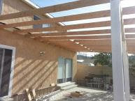


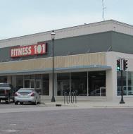
AWNING OR CANOPY SIGN shall mean any sign that is a part of or attached to an awning, canopy, or other fabric, plastic, or structural protective cover over a door, entrance, window, or outdoor service area. A marquee is not a canopy.
BACKLIGHTED LETTERS shall mean channel lettering, open-backed or translucent and lit from within or behind, that throws light back onto the support surface to create a halo effect around the letters. (Sometimes called silhouette or halo lettering.)
BALLAST shall mean the electrified structure that secures and powers fluorescent lamps.
BANNERS shall mean portable signage made of a light, flexible material like cloth, vinyl, plastic, etc., that is hung or strung from hooks or cord. Often used to announce events and openings, banners function well for shortterm signage and in-home use, or can be fabricated out of durable materials for long-term reuse indoors and out. See also Street Pole Banner.
BENCH SIGNS shall mean lettering and imagery applied to the back section or other surfaces of public seating, for instance on park benches and bus-stop seating.
BILLBOARD SIGN shall mean a sign that identifies or communicates a commercial or noncommercial message related to an activity conducted, a service rendered, or a commodity sold at a location other than where the sign is located.
BUILDING FASCIA shall mean the exterior wall of a building, rising from ground level to the roofline eaves and extending across the full width of the structure.
BUILDING SIGN shall mean any sign supported by, painted on or otherwise attached to any building or structure.
BUILDING MARKER SIGN shall mean any sign indicating the name of a building and date and incidental information about its construction, which sign is cut into a masonry surface or made of bronze or other permanent material.
BUILDING MOUNTED SIGNS shall mean signage hung from or affixed to the wall or roof of a building, see also wall sign.
BULLETIN BOARDS shall mean a Sign Box used as housing from the external elements so as to preserve written or printed shared information of a timely matter for religious assembly, civic or school use.
CABINET SIGNS shall mean the frame or external structure of a box-like sign that encloses the various functional elements of the design, whether electrical or dimensional components.
CAMPAIGN, See Political Campaign Sign.
CANOPY SIGNS shall mean sign, like a marquee, constructed or affixed to a building in such a way that it serves as a canopy over the space below; or a sign affixed to a canopy.
CARVED SIGNS shall mean signs made of wood or synthetic materials with lettering and graphics deeply gouged into the surface of the substrate.
CENTER IDENTIFICATION SIGN shall mean a sign which pertains to the use of a premises and which contains information about the owner or operator of that use; the type of business being conducted or the principal brand name of a commodity sold on the premises; and other information relative to the conduct of the use.
CHANGEABLE COPY PANELS shall mean a section of an otherwise permanent sign that allows the message to be amended, updated, or otherwise modified using track lettering or dry erase, etc. Popular uses include Aframes and menu boards.
CHANGEABLE COPY SIGN shall mean a sign or portion thereof with characters, letters, or illustrations that can be changed or rearranged without, altering the face or the surface of the sign. A sign on which the message changes more than eight times per day shall be considered an animated sign and not a changeable copy sign for purposes of this ordinance. A sign on which the only copy changes is an electronic or mechanical indication of time or temperature shall be considered a “time and temperature” portion of a sign and not a changeable copy sign for purposes of this ordinance.
CHANNEL LETTERS shall mean three-dimensional letters, often hollow, and may or may not incorporate a light source within.
CITY ENTRANCE SIGNS shall mean signs owned by the City and placed on city property or within the public right-of-way for the announcement of entrance within the City limits. Such signs may be relocated as extension of city boundaries occurs. Including ground or pole mounted signage such as city entrance announcement and date established, city limits designation, population, and ordinances enforced.
CIVIC OR COMMUNITY SIGN shall mean a sign containing information, name, or logo of a business or civic organization. Temporary signs are intended to communicate information to the public as to upcoming activities in the community. Community or civic signs are owned and operated by the City, Chamber of Commerce, local Civic Organization or Nonprofit Entity.


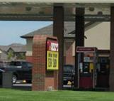

CLEARANCE shall mean the distance from the bottom of a sign face elevated above grade and the grade below.
CLOSED SIGN shall mean a sign in which more than 50 percent of the entire area is solid or tightly closed or covered.
COMMERCIAL MESSAGE SIGN shall mean any sign wording, logo, or other representation that, directly or indirectly, names, advertises, or calls attention to a business, product, service, or other commercial activity.
COMMEMORATIVE SIGN shall mean any sign erected to identify and/or discuss a local, state, or national historic event.
CONFORMING SIGN shall mean a sign that is constructed and installed in compliance with design, material, and construction regulations issued by the City in which it appears.
CONSTRUCTION SIGN shall mean any sign identifying construction activity on a site including the contractors, funding sources, and/or architects and engineers.
CONTRAST shall mean the relative difference or variance in tone and color between elements in a sign that allow each element to stand out; for instance, light colors on a dark background, dark type on light background, or overlays of similar colors from pale to deep tones.
COPY shall mean the text message words contained in a sign.
COPY AREA shall mean the sections of a sign that contain text message as opposed to imagery or pictorial elements.
DECALS shall mean a printed film, usually made of vinyl, with a pressure sensitive adhesive.
DESTINATION SIGN shall mean a sign used to inform and direct the public to important public places and buildings, landmarks, and historical sites in the most simple, direct, and concise manner possible.
DETACHED SIGN shall mean a sign, which is selfsupporting and structurally independent from any building/structure.
DIGITAL BILLBOARDS shall mean a billboard sign or menu board that offers static messages that rotate every few seconds with typically six to eight advertisers or screens sharing the same location.
DIGITAL SIGNAGE shall mean a remotely managed digital display typically tied in with sales, advertising and marketing that are centrally managed and individually addressable for the display of text, animated or video messages for advertising, information, entertainment and merchandising to targeted audiences. Popular applications range from monument signs to gas station
TVs. See also Screen-Smart Device Interaction (SSI).
DIMENSIONAL LETTERS shall mean cast, molded, fabricated, or cut-out lettering or design (logo) applied to create a raised image on signage.
DIRECTIONAL SIGNS shall mean signage that help drivers and pedestrians to navigate a given location or event, whether interior or exterior. For example, parking signs, signs featuring destinations with arrows, etc.
DIRECTORY SIGNS shall mean signage listing names and locations for multiple business tenants in a building, or the companies in an industrial or office park.
DOUBLE FACED SIGN shall mean any sign setup to advertise the same or different messages on two distinct sides.
ELECTRIC SIGNS shall mean signage that contains moving or lighted elements wired for electricity.
ELECTRONIC MESSAGE BOARD SIGN shall mean a sign that uses changing lights to form a sign message or messages wherein the sequence of messages and the rate of change is electronically programmed and can be modified by electronic processes.
EXTERIOR ILLUMINATED SIGNS shall mean signs lit by a light source apart from and aimed at the face of the sign (not lit from within).
FACE shall mean the “front” of a sign, where the message is carried.
FASCIA SIGNS shall mean a sign mounted on a building face (wall).
FLASHING SIGN shall mean a sign, which, by method or manner of illumination, flashes on or off, winks, or blinks with varying light intensity, shows motion, or creates the illusion of being on or off.
FLAT CUTOUT LETTERS shall mean dimensional letters cut from a broad sheet of metal or composite.
FLEET GRAPHICS shall mean a vehicle graphic or wrap template applied to multiple vehicles operated by one company.
FLUORESCENT LAMP OR TUBE shall mean the glass tube in fluorescent lighting that contains luminescent vapor that lights up when electrified. Fluorescent lamps are manufactured to fit into standard ballast sizes or electrical receptacles.
FONT shall mean a unified design for a set of letters, numbers, and punctuation marks, incorporating specifications for standard roman typeface, boldface, italic, and all combinations of these (e.g., bold italic).


FREESTANDING SIGN shall mean any sign supported by uprights or braces placed on or in the ground, which is used principally for advertising or identification purposes and is not supported by any building.
FRONTAGE shall mean the length of a property line of any one premise abutting and parallel to a public street, entrances or exits from private property, or court.
FRONT-LIGHTED LETTERS shall mean channel letter illuminated from behind or containing a light source, with translucent face that conveys light forward.
GRAPHIC WINDOW SIGN shall mean graphics applied directly to the window; often adhesive backed vinyl permanently affixed to the interior of the glass.
GROUND MONUMENT SIGN shall mean a sign mounted directly to the ground with a maximum height not to exceed six feet.
ILLUMINATED SIGN shall mean a sign illuminated in any manner by an artificial light source.
ILLUMINATION shall mean lighting sources installed for the primary purpose of lighting a specific sign or group of signs.
INCANDESCENT BULBS shall mean a vacuum sealed lamp (bulb) that directs an electrical charge through a filament, which glows hot and gives off light.
INCIDENTAL SIGN shall mean a sign, generally informational, that has a purpose secondary to the use of the zone lot on which it is located, such as “no parking,” “entrance,” “loading only,” “telephone,” and other similar directives. No sign with a commercial message legible from a position off the zone lot on which the sign is located shall be considered incidental.
INTEGRAL SIGNS Shall mean signs for churches or temples, or names of buildings, dates of erection, monumental citations, commemorative tablets, and other similar signs when carved into stone, concrete or other building material or made of bronze, aluminum, or other permanent type of construction and made an integral part of the structure to which they are attached.
LEGIBILITY shall mean ability to decipher lettering and message elements based on design and fabrication quality of signage. How well a sign can be seen and read.
LOGO shall mean a unique design composed of text, letters, and/or images that represent a company’s brand or identity.
MARQUEE shall mean a permanent canopy attached to and supported by a building, often of wood, metal, and/ or glass components constructed to overhang an entrance to define the space and provide shelter to those entering and leaving.
MARQUEE SIGN shall mean any permanent roof-like structure projecting beyond a building or extending along and projecting beyond the wall of the building, generally designed and constructed to provide protection from the weather.
MAXIMUM PERMITTED SIGN AREA shall mean the maximum permitted combined area of all signs allowed on a specific property.
MENU BOARDS shall mean changeable copy signs, typically used by retailers to list items and prices of good currently offered, or by food service and restaurateurs to describe daily meals offered. Menu boards can be installed as wall signs outside a walk-up window, on a pole alongside a drive thru vehicle lane, or mounted on the interior of a building.
MOBILE SIGNS shall mean sign mounted on a flatbed or other vehicle for transportation to various locations where it is temporarily being used.
MONUMENT SIGNS shall mean a freestanding, low-profile ground sign.
MULTI-PRISM INDEXING SIGN shall mean a sign made with a series of triangular vertical or horizontal sections that turn and stop, or index, to show one of three pictures or messages at a time within a defined sign face area. Such signs shall change their picture and/or message no more frequently than once every 20 seconds and includes no more than one double-faced sign in any single location, excluding back-to-back installations. In no case shall more than one multi-prism indexing sign be visible to the approaching vehicular and/or pedestrian traffic or to the public in general per frontage.
MURAL shall mean works of graphic art painted or applied to building walls, which contain no advertising or business identification messages.
NAMEPLATE SIGN shall mean a sign not exceeding 2 square feet for each dwelling.
NEON SIGNS shall mean a sign fashioned from continuous hollow tubing bent in the shape of letters or images, filled with gases that glow when an electrical current is passed through the tubing.
NEON TUBING shall mean hollow tubing that is bent into shape and filled with various inert gases that glow different colors when electrical current is passed through them.
NON-CONFORMING SIGN shall mean any sign that does not conform to the requirements of this ordinance.


OBSCENE TEXT OR IMAGERY shall mean a sign, display or graphic contained or considered to be one of the following: disgusting to the senses, repulsive; abhorrent to morality or virtue; specifically designed to incite; containing language regarded as taboo in polite usage; repulsive by reason of crass disregard of moral or ethical principles; or so excessive as to be offensive.
OBSOLETE SIGN shall mean a sign that advertises a business no longer in existence or a product no longer offered for sale and has advertised such business or product for a period of six months after the termination of the existence of such business or the termination of sale of the product advertised.
OFF-PREMISES SIGN shall mean a sign including the supporting sign structure which directs the attention of the general public to a business, service, or activity not usually conducted, or a product not offered or sold, upon the premises where such sign is located.
ON-PREMISE SIGN shall mean a sign, display, or deviceadvertising activities conducted on the property on which such sign is located.
OPEN CHANNEL LETTERS shall mean dimensional letters with open fronts that, when illuminated, reveal the light source. At times, open channel letters use a sheet of transparent material to protect any interior elements.
OPEN SIGN shall mean a sign attached to or hung from a marquee, canopy, or other covered structure, projecting from and supported by the building and extending beyond the building wall, building line, or street lot line.
Painted wall signs shall mean a wall-mounted building sign with lettering and imagery on face surface.
PAN CHANNEL LETTERS shall mean three-dimensional letter with sides and back constructed to hold embossed or debossed panel for front of letter.
PAN FACES shall mean a three-dimensional sign face (front) that includes molded raised or inset design elements; sometimes called embossed or debossed face.
PENNANT SIGN shall mean any lightweight plastic, fabric, or other material, whether or not containing a message of any kind, suspended from a rope, wire, or string, usually in series, designed to move in the wind.
PERMANENT SIGNS shall mean a durable signage mounted or affixed for long-term use, not easily removed, and resistant to weather and other wear and tear.
POINT OF PURCHASE SIGNS (POP; ALSO POINT OF SALE, POS) shall mean signage posted at the location of goods and services offered for sale, advertising items or special sales.
POLE SIGN shall mean a sign that is mounted on a freestanding pole or other support so that the bottom edge of the sign face is six feet or more above grade.
POLITICAL CAMPAIGN SIGNS shall mean a temporary Signs announcing candidates seeking public political office or pertinent political issues.
PORTABLE SIGN shall mean a sign, usually of a temporary nature, not securely anchored to the ground or to a building or structure and which obtains some or all of its structural stability with respect to wind or other normally applied forces by means of its geometry or character. Examples are: menu and sandwich board signs, balloons used as signs, umbrellas used for advertising, and signs attached to or painted on vehicles parked and visible from the public right-of-way, unless said vehicle is used in the normal day-to-day operations of the business.
POST AND PANEL SIGNS shall mean a sign installed by mounting on a single or multiple support posts.
PREMISES shall mean a tract of one or more lots or sites, which are contiguous, and under common ownership or control.
PROJECTING SIGN shall mean a projecting sign attached to a building in such a manner that its leading edge extends more than eight inches beyond the surface of such building or wall.
PUBLIC SIGNS shall mean a signs of a noncommercial nature and in the public interest, erected by or upon the order of a public officer in the performance of their public duty. Such as safety signs, danger signs, trespassing signs, traffic signs, memorial plaques, signs of historical interest and other similar signs, including signs designating hospitals, libraries, schools and other institutions or places of public interest.
PUSH-THROUGH shall mean lettering or logo image cut through the sign face and backing material and mounted or inlaid so the sign looks as if the lettering or image had been “pushed through, up, and out” of the sign. Sometimes push-through lettering is backlit through the sign, or the fascia of the lettering is translucent to allow lighting the imagery from behind.
PYLON SIGNS shall mean a freestanding sign with visible supporting posts or other foundational structure.
RACEWAYS shall mean electrical signs, the enclosure that holds sign elements, which may also be the structural element that is mounted on a wall or other support element.
READABILITY (ALSO CALLED“CONSPICUITY”) shall mean how well the sign can be perceived and understood by viewers; the level of clarity that allows the message to come through.


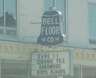
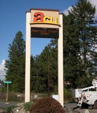
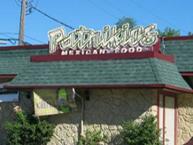
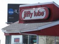

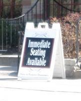
RESIDENTIAL SIGN shall mean a small detached or attached sign located on a residential premise, conveying a message communicated by the owner of the property.
RETURNS shall mean the sides of channel letters.
ROOF SIGN shall mean a sign identifying the name of a business, enterprise, or the product sold on the premises and erected on and over the roof of a building and extending vertically above the highest portion of the roof.
ROOF (Integral) SIGN shall mean any sign erected or constructed as an integral or essentially integral part of a normal roof structure of any design, such that no part of the sign extends vertically above the highest portion of the roof and such that no part of the sign is separated from the rest of the roof by a space of more than six inches.
SEASONAL DECORATIONS shall mean signs pertaining to recognized national holidays and national observances.
SIDEWALK/SANDWICH SIGNS shall mean a portable and relatively lightweight signage constructed to stand independently, not mounted or affixed to its location, often fabricated as A-frame.
SIGN shall mean graphic, symbolic, or visual display fixed upon a building, vehicle, structure, or parcel of land, which is intended to convey information about a product, business, activity, place, person, institution, candidate, or political idea.
SIGN AREA shall mean the entire area including the background of a sign on which copy can be placed but not including the minimal supporting framework or bracing. The area of individually painted letter signs, individual letter signs or directly or indirectly illuminated individual letter signs, shall be calculated on the basis of the smallest geometric figure that will enclose the entire copy area of the sign. Any such calculation shall include the areas between the letters and lines, as well as the areas of any devices, illuminated or non-illuminated.
SIGN BAND shall mean the area above the entrances to a tenant space in a multi-tenant complex where the tenants can post signage specific to their occupancy.
SIGN SETBACK shall mean the horizontal distance from the property line to the nearest projection of the existing or proposed sign.
SIGNAGE shall mean the aggregate of signs for a particular use or location.
SINGLE-FACE SIGNS shall mean a sign with only one side carrying the message.
SCREEN-SMART DEVICE INTERACTION (SSI) shall mean new technology developed as a sub-branch of Digital Signage, used for drive thru menu boards, way finding signage, in store displays, and self-service kiosks. It allows end users to
interact the displayed digital content via Touch Screens, Body Sensor or QR code via smartphones. Digital signs can interact with mobile phones using SMS messaging and Bluetooth. SMS can be used to post messages on the displays, while Bluetooth allows users to interact directly with what they see on screen.
STATIONARY SIGNS shall mean a sign that is mounted in a permanent manner, usually including electrical power service that makes it difficult to move the sign without specific tools or equipment.
STICKERS shall mean a printed film, usually made of vinyl, with a pressure sensitive adhesive.
STREET POLE BANNER shall mean street pole banners mounted on city-owned streetlight poles which do not accommodate a traffic signal or electrical distribution.
STREET FACADE shall mean any separate external face of a building, including parapet walls and omitted wall lines, oriented to, and facing a public street, entrances or exits from private property, or court. Separate faces oriented in the same direction or within 45 degrees of one another are considered part of the same street facade.
SUBDIVISION SIGN identification shall mean a sign erected on a subdivision identification lot that identifies the platted subdivision where the sign is located.
SIGN SURFACE shall mean the entire area of a sign.
SUSPENDED SIGN shall mean a sign that is suspended from the underside of a horizontal plane surface and is supported by such surface.
TEMPORARY SIGN shall mean a sign constructed of cloth, fabric, or other material with or without a structural frame intended for a limited period of display, including displays for holidays or public demonstrations. Temporary signs shall include portable signs as defined in this section.
TIME AND TEMPERATURE DISPLAY shall mean an electrified sign with a variable lighted message showing the current time interchanged with the current temperature, often displayed as elements in larger signs created for banks, corporations, institutions, or organizations.
TRANSFORMERS shall mean electrical equipment that takes available voltage and current at a site and converts it to the levels required by elements in the signage.
UNDER-CANOPY SIGNS shall mean a sign designed to be mounted under a canopy.
VARIABLE MESSAGE SIGNS shall mean a sign similar to a changeable message sign, one that is designed to convey differing messages at different times. Also includes changeable message, changeable copy, time and temperature sign, electronic message center, and menu board.


VARIANCE shall mean permission from the city for signage or installation to vary from regulated sign specifications. Variances are awarded or denied following a hearing before appropriate boards and commissions with authority to review sign design and usage requests.
VEHICLE LETTERING shall mean text, graphics or logos applied to the doors, sides, hood, roof, windows or tailgates of cars, vans, or trucks.
VEHICLE WRAPS shall mean graphically designed vinyl configured and cut to fit a specific vehicle that, when installed, encases the vehicle in the graphic design to create a dynamic, eye-catching, mobile advertisement.
VISIBILITY shall mean as in readability, how well the sign can be perceived and understood by viewers; how well the sign can be seen against its surroundings.
WALL SIGN shall mean any sign attached parallel to, but within eight inches of, a wall, painted on the wall surface of, or erected and confined within the limits of an outside wall of any building or structure, which is supported by such wall or building, and which displays only one sign surface.
WAYFINDING shall mean as with directional signage, that which assists viewers or travelers in finding their way to a destination.
WINDOW SIGN shall mean any sign, pictures, symbol, or combination thereof, designed to communicate information about an activity, business, commodity, event, sale, or service, that is placed inside a window or upon the window panes or glass and is visible from the exterior of the window.
Section 10.03 Method of Measurement
1. Maximum Permitted Sign Area
Maximum permitted sign area for a premise is set forth as a numerical limit or as a function of the frontage of the premises on a street or entrances or exits from private property. For properties with frontage on more than one street or entrances/exits from private property, the total frontage shall be calculated as the longest frontage plus one-half the length of all additional frontages.
2. Sign Area
A. Sign area includes the entire area within the perimeter enclosing the extreme limits of the sign, excluding any structure essential for support or service of the sign, or architectural elements of the building.
B. The area of double-faced signs is calculated on the largest face only.
C. The sign area for ground signs, monument signs, and architectural sign bands are calculated as the area enclosing the extreme limits of the copy only.
D. In the case of individual letters mounted to a wall, only the total area of the letters themselves is included within the sign area.
E. In the case of a multi-prism indexing sign, sign area is calculated as the area within the perimeter enclosing the extreme limits of the sign face, regardless of the number of individual messages displayed on the sign.
3. Height
The height of a sign is measured from the average finished grade below the sign to the topmost point of the sign or sign structure.
4. Setback
The setback of a sign is measured from the property line to the line projected to the ground plane of the nearest portion of the sign.
Section 10.04 Sign and Street Graphics Regulations
1. Compliance.
Each sign or part of a sign erected within the zoning jurisdiction of the City of Hickman must comply with the provisions of this Ordinance, other relevant provisions of the City of Hickman's Municipal Code, and applicable building codes.
2. Resolution of Conflicting Regulations.
This Ordinance is not meant to repeal or interfere with enforcement of other sections of the City of Hickman's Municipal Code. In cases of conflicts between Code sections, State or Federal Regulations, the more restrictive regulations shall apply.
3. Prohibited Signs.
The following signs are prohibited in all zoning districts:
A. Obsolete Signs. Signs that advertise an activity, business, product, or service no longer conducted on the premises on which the sign is located or in the jurisdiction for the City of Hickman, in such cases as off-premises signs.
B. Signs or sign structures which resemble or conflict with traffic control signs or devices, which mislead or confuse persons traveling on public streets, or which create a traffic hazard.
C. Signs that create a safety hazard by obstructing the clear view of pedestrians or vehicles, or which obscure official signs or signals.
D. Portable Signs. Signs that are not permanently anchored or secured to either a building or the ground except as provided by Section 10.04 (5) Temporary civic or commercial signs.
E. Signs shall be perceived and understood by viewers. The sign shall be clearly readable and legible and not be viewed as obscene.
F. Off-premises Signs on Public Property. Off-premises signs located in the public right-of-way.
G. Flashing Signs. No flashing, blinking, or rotation lights shall be permitted for either permanent or temporary signs.
H. Moving Signs. No sign shall be permitted any part of which moves by any mechanical or electronic means. The prohibition of moving signs does not include multi-prism indexing or
digital signs as defined by Section 10.02.
I. Painted Wall Signs. Off-premises painted wall signs mounted on building walls.
J. Signs painted or applied to building walls, which contain advertising or business identification.
The following signs are permitted in any zoning district and are exempt from other provisions of this Ordinance provided they so not create a hazard as described in Section 10.04 (3):
A. Residential Real Estate or Residential Construction Signs. One non-illuminated sign, not to exceed six square feet, shall be permitted on each premise. Such signs shall not extend higher than four feet above average finished grade and shall be located within the property lines. Such signs shall be removed within seven days after the disposition of the premises.
B. Commercial Real Estate Signs. One non-illuminated sign, not to exceed 32 square feet, shall be permitted on each premise. Such signs shall not extend higher than eight feet above average finished grade or be closer than two feet from any property line unless located on the wall of a building. Such signs shall be removed within seven days after the disposition of the premises.
C. Construction Signs. One non-illuminated sign not to exceed 50 square feet shall be permitted per street frontage. Such sign shall not extend higher than 10 feet above average finished grade and meet the front yard requirement for a principal structure unless located on the wall of a building on the premises or on a protective barricade surrounding the construction. Such signs shall be removed within seven days following completion of construction.
D. Political Campaign Signs. Such signs shall be placed on private property and not within any right-of-way, and are subject to the following regulations:
1. Residential Districts. Temporary signs six square feet in area or less, located within the property line and do not obstruct traffic.
2. Corridor Overlay, Commercial and Industrial Districts. Temporary signs, located in the City limits, must be less than nine square feet in area. Temporary signs, located in the extraterritorial jurisdiction may be over nine square feet but under 32 square feet in area and do not obstruct traffic.
3. All Political Campaign Signs shall be removed within seven days from the completion of any election date.
E. Street Pole Banners. Banners shall be made of durable material. If fabric is used, it be made of marine grade fabrics, resistant to ultraviolet rays, mold, and mildew. Each banner shall have reinforced hems and grommets. Banner fabricator shall determine if wind scallops are necessary. All banners shall be printed on both sides of the banner fabric. Mounting height: When projecting over the street the banner height above the street shall be 20 feet minimum; when projecting over the sidewalk, turf, or landscape beds, banner height above the ground shall be 10 feet minimum. Banners shall not be located within 50 feet of a stop sign or traffic signal device.
F. Seasonal Decorations.
G. Public Informational Signs.
H. Integral Signs. Permanent type of construction and made an integral part of the structure to which they are attached.
I. Window Signs. Neon window signs shall be permitted only in those districts where neon signs are permitted.
J. Works of graphic art when painted or applied to building walls, which contain no advertising or business identification messages. Art must be approved by City Council and/ or Arts Council.
K. Residential signs under two square feet in area.
L. Neighborhood or subdivision identification signs under 50 square feet in area.
M. Signs which are not visible from a public right-of-way, entrances or exits from private property, or court or from a property other than that on which the sign is installed.
N. Bulletin boards for religious assembly and school use, provided that they have a maximum area of 32 square feet.
O. Athletic Field Signs. Banners for team and league sponsors may be placed on perimeter
fences facing toward the field of play. Such banners shall only be placed one hour prior to through one hour following the athletic event and shall be immediately removed in the event of a windstorm. Such banners shall not promote alcohol, drugs, or tobacco products in any way.
P. Semi-permanent sponsor recognition board. Boards may be used in place of banners with the approval of the City Council. Recognition boards may be attached to existing structures or mounted on semi-permanent supports. Such recognition boards shall be limited to 32 square feet in aggregate size and shall not exceed eight foot in total height. Such recognition boards shall be maintained in an attractive condition and all lettering shall be of professional quality. The league using the board/boards may be identified with removable lettering not to exceed four inches in height. Sponsor lettering shall contain only the sponsor’s name, not exceed two and one-half inches in height and be removable. Logos or other forms of advertising shall not be permitted. The promotion of alcohol, drugs or tobacco products on this board is prohibited. Semi-permanent recognition boards and supports may be erected no sooner than one week prior to the league season and must be removed no later than one week following the league season.
Q. Seasonal banners for team and league sponsors. Banners may be placed on perimeter fences of athletic fields facing toward the field of play when approved by the City Council. Such banners shall not promote alcohol, drugs, or tobacco products in any manner.
R. Scoreboard. Permanent off-premises signs may be included as part of a scoreboard or other similar permanent fixtures for any athletic field when approved by the City Council.
5. Temporary Civic or Commercial Signs
A. Permit Required. All temporary civic or commercial signs not listed in Section 10.04 (4) but falling within the definition of temporary signs shall be classified as Temporary civic or commercial signs.
B. A temporary civic or commercial sign may remain in place for a period of six months from the date of erection unless otherwise specified below, with the option of one renewal by Zoning Administration per sign.
C. Size Limitations of Temporary Signs. The location of temporary civic, or commercial signs shall comply with the following regulations:
1) The total amount of temporary signage permitted on any premise shall be the lesser of five percent of the area of all street facades or 100 square feet. Street facades include any building facades visible from and oriented to public streets.
2) The maximum size of a temporary sign shall be 50 square feet in area. Temporary civic or commercial signs shall be no smaller than eight square feet.
3) The size of a temporary portable sign mounted on wheels or a trailer without wheels shall not exceed 32 square feet of sign area. Such signs may be located on a parcel or lot, for a maximum of 30 consecutive days and shall be located on any single parcel or lot, no more than two times per year.
D. Location Requirements for Temporary civic or commercial signs.
1) Temporary signs shall not be attached to any public utility pole or trees on either public or private property.
2) Temporary civic or commercial signs are prohibited in any public right-of-way or property, including streets, sidewalks, parks, and public facilities.
3) Temporary signs shall not be located within the Vision Clearance Triangle.
4) Temporary signs shall not interfere with any public right-of-way, driveway or access way, or any means of access or egress to any building.
5) Any temporary sign attached to a building shall be affixed only to vertical facades and shall not be attached to roofs, roof extensions, cornices, overhangs, or other building extensions.
E. Condition of Temporary Civic or Commercial Signs.
1) All temporary signs shall be maintained in sound condition. Any sign that exhibits deterioration of structure or materials may be removed subject to the provisions of this section.
2) The City Administrator and their authorized officers shall order the removal of any sign not in compliance with any provisions of this section. If the owner of the premise on which such sign is located, or the owner of the sign if unlawfully located on public
property, fails to remove such sign, the City Administrator and their officers shall be authorized to remove the sign. Any costs of removal of a sign on private property shall be assessed to the owner of the property. Any such removal shall also result in the immediate cancellation of any outstanding temporary civic or commercial sign permit.
F. Application for a Temporary Civic or Commercial Sign Permit.
1) An applicant shall complete a form developed by the City and shall pay a fee for such permit as established by Ordinance on the City’s Master Fee Schedule.
2) The application shall include a photograph of all street facades along with the dimensions of all such facades.
3) The Zoning Administrator shall verify this information as required and establish on the permit the maximum area of temporary signage that may be installed on the premises.
G. Temporary or portable signs for grand openings, sales, and special events are permitted in Commercial and Industrial zoning districts, subject to the following requirements:
1) Such signs are subject to the permit procedures set forth in this section.
2) The size of such signs does not exceed the limitations set forth in Table 10.3.
3) No more than one such sign is permitted at any single premises.
4) Temporary or portable signs may be present at any single premises for a maximum of 60 days per year.
6. Maintenance
A. All signs shall be maintained in sound condition, including, but not limited to, the structural components, the lighting, if any, the portion attaching the sign to the ground or structure, and the surface features.
B. All signs and billboards shall be maintained in a neat and presentable condition. In the event their use shall cease, the sign or billboard shall be removed promptly and the area restored to a condition free from refuse and rubbish. After 30 days’ notice and failure to do so, the City shall remove the sign and assess the charges to the owner.
C. The City Administrator and their authorized officers shall order the removal of any sign not in compliance with any provisions of this section. Any costs of removal of a sign on private property shall be assessed to the owner of the property. Any such removal shall also result in the immediate cancellation of any outstanding sign permits.
7. Nonconformance and Amortization
Where a sign exists at the effective date of this Ordinance, or later codified with this Ordinance, and could not be built under the terms of this Ordinance by reason of restrictions on area, use, height, setback, or other characteristics of the sign or its location on the lot, such sign may be continued so long as it remains otherwise lawful, subject to the following provisions:
A. No such sign may be enlarged or altered which increases its nonconformity; however, reasonable repairs and alterations may be permitted.
B. Should such a sign be destroyed by any means to an extent 50 percent or greater of either sign area or replacement value, it shall not be reconstructed except in conformity with the provisions of this Ordinance.
C. Within any zoning district, all premise identification signs or other signage that pertains to the premises on which such sign is located shall comply fully with the provisions of this Ordinance, unless otherwise provided, within 15 years after the effective date of this Ordinance. This amortization provision does not apply to outdoor advertising signs, provided that such signs remain in continuous use.
D. Any nonconforming outdoor advertising sign that remains unused for a continuous period of 180 days shall forfeit its right to continue as a nonconforming use. The City Administrator and their authorized officers shall order the removal of any sign not in compliance with any provisions of this section. Any costs of removal of a sign on private property shall be assessed to the owner of the property. Any such removal shall also result in the immediate cancellation of any outstanding sign permits.
1. Conformance Required
Except as may be hereinafter specified, no sign shall be erected, placed, maintained, converted, enlarged, reconstructed, or structurally altered which does not comply with all of
the regulations established by
2. Maintenance
All signs shall be maintained in sound condition, including, but not limited to, the structural components, the lighting, if any, the portion attaching the sign to the ground or structure, and the surface features.
3. Nonconformance and Amortization
Where a sign exists at the effective date of adoption or amendment of this Ordinance codified in this Ordinance that could not be built under the terms of this Ordinance by reason of restrictions on area, use, height, setback, or other characteristics of the sign or its location on the lot, such sign may be continued so long as it remains otherwise lawful, subject to the following provisions:
A. No such sign may be enlarged or altered in, a way which increases its nonconformity; however, reasonable repairs and alterations may be permitted.
B. Should such a sign be destroyed by any means to an extent of 60 percent or more of its replacement cost at time of destruction, it shall not be reconstructed except in conformity with the provisions of this Ordinance.
C. Within any zoning district, all signage shall comply fully with the provisions of this Ordinance, unless otherwise provided, within 15 years after the effective date of this Ordinance.
1. Applicability
A. A sign permit, approved by the Zoning Administrator, shall be required before the erection, construction, alteration, placing, or locating of all signs conforming to this Ordinance.
B. A permit shall not be required for repainting without changing permanent wording, composition, colors, or nonstructural repairs.
2. Plans Submittal
A copy of plans and specifications shall be submitted to the Zoning Administrator for each sign regulated by this Ordinance. Such plans shall show sufficient details about size of the sign, location, and materials to be used and such other data as may be required for the Zoning Administrator to determine compliance with this Ordinance.
3. Appeals
Any person or persons aggrieved by the decision of the Zoning Administrator to approve or disapprove a sign permit, as provided by this Ordinance, may appeal such decision to the Board of Adjustment as provided by Article *** of this Ordinance.
4. Application Fees
Each application for a sign permit shall be accompanied by any applicable fees, which shall be established by the City Master Fee Schedule.
Table 10.2 Attached Signs by Type and Zoning District
permitted -: not permitted
Permitted for Civic Uses
Table 10.3 Miscellaneous Signs by Type and Zoning District
Table 10.4 Auxiliary Design Elements by Type and Zoning District
Note 1: 200 square feet for civic or commercial uses, 2 square feet for residential uses, including home occupations.
Note 2: 50 square feet for project identification signs; 32 square feet for civic uses, 2 square feet for residential uses, including home occupations.
Note 3: 32 square feet for civic uses, 50 square feet for project identification signs for multi-family or manufactured (mobile) home developments and for nonresidential uses when permitted, 2 square feet for residential uses, including home occupations.
Note 4: Maximum limits apply to nonresidential premises only. On premises with primary residential use, 50 square feet for project identification signs for multi-family developments, 2 square feet for residential uses, including home occupations.
Note 5: One Business Center Identification Sign with a maximum area of 100 square feet is permitted in addition to the Maximum Total Square Feet established subject to the regulations set forth by Table 10.6.
X See Table 10.5 for maximum sign sizes
Note 1: In addition to its total permitted sign area, each premises used for a business center may have one detached center identification sign, subject to the following conditions:
a. The maximum area for a center identification sign shall be 100 square feet.
b. No center identification sign shall be within 300 feet of any other center identification sign or within 150 feet of any other detached sign on the same or adjacent premises.
c. The sign shall display no more than the name and location of the business center.
d. Each sign shall be subject to all other regulations for detached signs or graphics set forth in this Article.
Note 2: The size of building or wall signs may be increased in proportion to the setback if the building setback is more than 120 feet from the street frontage lot line, by one-half percent increase per foot of setback beyond such 120 foot line, with a maximum increase of 50 percent. This permitted increase is in addition to the overall premise sign size indicated in Table 8.5; however, the entire premise signs combined size shall not exceed 1,000 feet.
Note 3: If the premise has more than one street frontage, then the detached sign provisions apply separately to each frontage, within the overall sign size.
Section 11.01 Home Occupations and Home Based Businesses
11.01.01 Intent:
A home occupation or home-based business shall be allowed when said occupation or business is conducted on agriculturally used and/or zoned property and is considered customary, traditional, and incidental to the primary use of the premises as a residence and shall not be construed as a business.
11.01.02 Allowed home occupations:
1. Workrooms for dressmaking, millinery, sewing, weaving, tailoring, ironing, washing, jewelry making, custom home furnishings work, carpentry work, and furniture repair.
2. Offices for professionals such as, but not limited to, attorneys, architects, engineers, planners, real estate agents, insurance, notary public, manufacturer’s representative, clergy, journalists, painters, photographers, dentists, doctors, draftspersons, insurance agents, accountants, editors, publishers, psychologists, contract management, graphic design, construction contractor services, landscape design, surveyors, cleaning services, salespersons, and travel agents.
3. Child Nurseries or Child Care.
4. Personal services, including Barber and Beauty Shops (limited to one chair), manicure and pedicure shops, pet grooming, catering, and chauffeuring services.
5. Instructional services, including music, dance, art and craft classes and tutoring.
6. Repair services, including watch and clock, small appliances, computers, electronic devices, lawnmowers including small engines, and motor vehicles (limited to no more than two at one time).
7. Offices and shops in association to one another, including motorized and non-motorized racing vehicles, construction services with equipment storage and maintenance, monument sales and engraving, freight hauling with equipment storage and maintenance (not including warehousing of freight), aerial spraying with equipment storage and maintenance, welding, and excavating services with equipment storage and maintenance.
8. Distribution and sales of products such as cosmetics, home/health care products, mail order, and other similar uses.
9. Offices for services provided outside the home such as lawn care, snow removal, and other similar uses.
10. Warehousing and storage of products associated with agri-businesses, including seed sales, fertilizer sales (as allowed by state and federal regulations), and herbicide and pesticide sales (as allowed by state and federal regulations). Allowed only within the TA-1 District.
11. Welding services only within the TA-1 District.
12. Other agricultural support services only within the TA-1District.
11.01.03 Prohibited home occupations:
1. Medical clinics and hospitals.
2. Restaurants, clubs, drinking establishments.
3. Undertaking and funeral parlors.
4. Adult Entertainment Uses
11.01.04 Allowed home based businesses:
1. Workrooms for dressmaking, millinery, sewing, weaving, tailoring, ironing, washing, jewelry making, custom home furnishings work, carpentry work, and furniture repair.
2. Offices for professionals such as, but not limited to, attorneys, architects, engineers, planners, real estate agents, insurance, notary public, manufacturer’s representative, clergy, journalists, painters, photographers, dentists, doctors, draftspersons, insurance agents, accountants, editors, publishers, psychologists, contract management, graphic design, construction contractor services, landscape design, surveyors, cleaning services, salespersons, and travel agents.
3. Child Nurseries or Child Care.
4. Personal services, including Barber and Beauty Shops (limited to one chair), manicure and pedicure shops, pet grooming, catering, and chauffeuring services.
5. Instructional services, including music, dance, art and craft classes and tutoring.
6. Repair services, including watch and clock, small appliances, computers, electronic devices, lawnmowers including small engines, and motor vehicles (limited to no more than two at one time).
7. Offices and shops in association to one another, including motorized and non-motorized racing vehicles, construction services with equipment storage and maintenance, monument sales and engraving, freight hauling with equipment storage and maintenance (not including warehousing of freight), aerial spraying with equipment storage and maintenance, welding, and excavating services with equipment storage and maintenance.
8. Distribution and sales of products such as cosmetics, home/health care products, mail order, and other similar uses.
9. Offices for services provided outside the home such as lawn care, snow removal, and other similar uses.
10. Warehousing and storage of products associated with agri-businesses, including seed sales, fertilizer sales (as allowed by state and federal regulations), and herbicide and pesticide sales (as allowed by state and federal regulations). Allowed only within the TA-1 District.
11. Welding services only within the TA-1 District.
12. Other agricultural support services only within the TA-1District.
11.01.05 Prohibited home based businesses:
1. Medical clinics and hospitals.
2. Restaurants, clubs, drinking establishments.
3. Undertaking and funeral parlors.
4. Adult Entertainment Uses
11.01.06 Performance Standards for Home Occupations and Home Based Businesses:
1. The primary use of the structure or dwelling unit shall remain residential, and the operator of the home occupation shall remain a resident in the dwelling unit.
2. The operator conducting the home occupation shall be the sole entrepreneur, and the operator shall not employ any other person other than a member of the immediate family residing on the premises.
3. No structural additions, enlargements, or exterior alterations changing the residential appearance to a business appearance shall be permitted.
4. No more than 25 percent of the floor area of any one story of the dwelling unit shall be devoted to such home occupation when contained within the principal structure, unless allowed within the TA-1 District.
5. Home occupations within the TA-1 District may be located within an accessory structure including machine sheds, barns, and garages. Said accessory structure shall be required to meet all pertinent State codes for Life Safety including electrical wiring depending upon the nature of the business.
6. When a home occupation is located in an accessory structure there shall not be any additional storage allowed in the open. All storage shall be contained within appropriate facilities and out of site.
7. Home occupations focused on repairs and maintenance of vehicles and motors shall not be allowed to store damaged, unlicensed, salvaged, vehicles or parts on site and outside the structure where said home occupations are taking place.
8. When storage of chemicals associated with agricultural businesses, within the TA-1 District, are stored on site, the storage shall comply with all state and Federal regulations and shall be kept in a place that is secured, dry and locked from general access.
9. Additional and/or separate entrance(s) that do not match the residential structural design shall not be constructed for the purpose of conducting the home occupation or home-based business.
10. Additional off-street parking or loading facilities, including additional driveway construction, other than the requirements for the permitted residence, shall be permitted.
11. The display of goods and/or external evidence of the home occupation shall not be permitted, except for one non-animated, non-illuminated, non-flashing announcement plate, indicating not more than the name and address of the resident. Said plate shall be attached flat against the wall of the residence and shall not exceed two sq. ft. in total surface area.
12. No offensive noise, vibration, smoke, odor, heat, or glare shall be noticeable at or beyond the property line.
13. No electrical or mechanical equipment shall interfere with local radio communications and television reception, or cause fluctuation in line voltage off the premises.
14. All businesses related to Child Care Homes and Child Care Centers shall be in accordance with Nebraska State Statutes.
15. No permit for a Home Occupation or Home-based Business shall supersede any State or Federal requirements for permits and licenses.
11.01.07 Revocation:
1. Conditions. A home occupation and home-based business is allowed based upon the provisions of this section may be required to cease to exist if the Zoning Administrator makes any of the following findings:
A. That any condition of the home occupation or home-based business has violated these provisions.
B. That the use has become detrimental to the public health or safety or is deemed to constitute a nuisance.
C. That the condition of the premises, or the district of which it is a part, has changed so that the use may no longer be justified under the purpose and intent of this section.
2. Appeal. Within five working days of a revocation, an appeal may be made to the Hickman Board of Adjustment. The Zoning Administrator within ten working days of the receipt of an appeal of their revocation actions, shall report their findings of fact and decision to the Hickman Board of Adjustment. The Hickman Board of Adjustment shall determine the facts and may revoke, modify or allow to remain unchanged the home occupation or home-based business permit in accordance with the Board’s final determination.
Section 11.02 Radio, Television and Wireless Communication Towers
11.02.01 Intent:
Based upon the Communications Act of 1934, as amended by the Telecommunications Act of 1996 and the Spectrum Act of 2012 (the Act) grants the Federal Communications Commission (FCC) exclusive jurisdiction over certain aspects of telecommunication services. This section is intended to regulate towers, telecommunications facilities and antennas in the City in conformance with the Act without prohibiting or tending to prohibit any person from providing wireless telecommunication service. Telecommunication facilities, towers and antennas in the City, to protect residential areas and land uses from potential adverse impact of installation of towers and antennas through careful design, siting, and camouflaging, to promote and encourage shared use/collocation of towers and other antenna support structures rather than the construction of additional single use towers, to avoid potential damage to property caused by towers, telecommunications facilities and antennas by ensuring such structures are soundly and carefully designed, constructed, modified, maintained, repaired and removed when no longer used or are determined to be structurally unsound and to ensure that towers and antennas are compatible with surrounding land uses.
11.02.02 Definitions:
All terms in this Section which are not specifically defined herein shall be construed in accordance with the Communications Act of 1934, the Telecommunications Act of 1996, the Spectrum Act of 2012 and the Rules and Regulations of the Federal Communications Commission (FCC). As used in this Section, the following terms shall have the following meanings:
Base Station shall mean a structure that supports or houses an antenna, transceiver, or other associated equipment that constitutes part of a base station at the time of the application is filed.
Broadcasting Tower shall mean a structure for the transmission or broadcast of radio, television, radar, microwaves or other electromagnetic frequencies which exceeds the maximum height permitted in the district in which it is located; provided, however, that noncommercial towers not exceeding 50 feet in height shall not be considered broadcast towers.
Collocation shall mean the mounting or installation of transmission equipment on an eligible support structure for the purpose of transmitting and/or receiving radio frequency signals for communications purposes.
Conforming commercial earth station shall mean a satellite dish which is two meters or less in diameter and is located in an area where commercial or industrial uses are generally permitted under this regulation.
Eligible facilities request is defined as any request for modification of an existing wireless tower or base station that involves (a) collocation of new transmission equipment; (b) removal of transmission equipment; or (c) replacement of transmission equipment.
In Writing refers to the means in which an applicant for a telecommunications tower is notified. The “in writing” clause has been defined to include the minutes of the governing body’s proceedings including findings of fact.
Owner shall mean any person with a fee simple title or a leasehold exceeding ten years in duration to any tract of land within the zoning jurisdiction of the City who desires to develop, construct, modify, or operate a tower upon such tract of land.
Replacement shall mean the removal and upgrade of transmission equipment and not the structure on which it is located.
Specific and absolute timeframe this refers to the timeframe allowed for processing a telecommunication application under Section 6409 (a) of the Spectrum Act of 2012.
Stealth shall mean any telecommunications facility, tower, or antenna which is designed to enhance compatibility with adjacent land uses, including, but not limited to, architecturally screened roof-mounted antennas, antennas integrated into architectural elements, and towers designed to look other than a tower, such as light poles, power poles and trees.
Telecommunications Facilities shall mean any cables, wires, lines, waive guides, antennas, or any other equipment or facilities associated with the transmission or reception of communications which a person seeks to locate or has installed upon or near a tower or antenna support structure. However, telecommunications facilities shall not include: a. Any Conforming Commercial Earth Station antenna two meters or less in diameter. b. Any earth station antenna or satellite dish antenna of one meter or less in diameter.
Tower shall mean any structure built for the sole or primary purpose of supporting any Commissionlicensed or authorized antennas and their associated facilities.
Tower owner shall mean any person with an ownership interest of any nature in a proposed or existing tower.
Transmission Equipment shall mean any equipment that facilitates transmission for any Commissionlicensed or authorized wireless communication service, including, but not limited to, radio transceivers, antennas and other relevant equipment associated with and necessary to their operation, including coaxial or fiber-optic cable, and regular and backup power supply.
11.02.03
Tower Construction Standards:
Listed below are tower construction standards.
1. Towers shall be permitted conditional uses of land in only those zoning districts where specifically listed and authorized in this regulation.
2. No person shall develop, construct, modify or operate a tower upon any tract of land within the zoning jurisdiction of the City prior to approval of its application for a Conditional Use Permit by the City Council and issuance of the permit by the City.
3. All towers, telecommunications facilities and antennas on which construction has commenced within the zoning jurisdiction of the City after the effective date of this regulation shall conform
to the Building Codes and all other construction standards set forth by the City, County, federal, and state law and applicable American National Standards Institute (ANSI). Upon completion of construction of a tower and prior to the commencement of use, an engineer’s certification that the tower is structurally sound and in conformance with all of the aforementioned applicable regulatory standards shall be filed with the Zoning Administrator.
1. Prior to commencement of development or construction of a tower, an application shall be submitted to the Zoning Administrator for a Conditional Use Permit and shall include the following:
A. Name, address, and telephone number of the owner and if applicable, the lessee of the tract of land upon which the tower is to be located. Applicants shall include the owner of the tract of land and all persons having an ownership interest in the proposed tower. The application shall be executed by all applicants.
B. The legal description and address of the tract of land on which the tower is to be located.
C. The names, addresses and telephone numbers of all owners of other towers or useable antenna support structures within a one-mile radius of the proposed tower, including publicly and privately owned towers and structures.
D. An affidavit attesting to the fact that the applicant has made diligent but unsuccessful efforts to obtain permission to install or collocate the applicants’ telecommunications facilities on a tower or useable antenna support or written technical evidence from an engineer that the applicants’ telecommunications facilities cannot be installed or collocated on another tower or useable antenna support structure.
E. Written technical evidence from an engineer that the proposed tower will meet the established Building Code, and all other applicable construction standards set forth by the City Council and federal and state and ANSI standards.
F. Color photo simulations showing the proposed location of the tower with a photo-realistic representation of the proposed tower as it would appear viewed from the nearest residentially used and / or zoned property and nearest roadway, street or highway.
G. Descriptions and diagrams of the proposed tower, telecommunications facilities and/or antenna, manufacturers literature, appurtenances such as buildings, driveways, parking areas, and fences or other security enclosures with significant detail to allow persons reviewing the application to understand the kind and nature of the proposed facility.
H. The application, based upon the specific and absolute timeframe established by the FCC, shall be processed and decided within 60 days of the application becoming completed. However, the 60-day application processing period may be extended only:
1) By mutual agreement between the City of Hickman and the applicant, or 2) By Hickman’s determination that the application is incomplete.
a. If the City of Hickman deems the application to be incomplete, the City shall notify the applicant of the incompleteness within 30 days of the initial filing.
b. The City shall clearly and specifically delineate writing the missing information
c. The clock shall resume when the information is provided, but may tolled again if the City of Hickman notifies the applicant within 10 days that the application remains incomplete.
d. The City shall not request new information beyond what is already required.
3) If the application is not acted upon within 60 days, the application shall be deemed to be approved by the governing body.
Listed below are setbacks and separation requirements for towers and exception to height restrictions of towers.
1. All towers up to 50 feet in height shall be setback on all sides a distance equal to the underlying setback requirement in the applicable zoning district. Towers in excess of 50 feet in height shall be set back one additional foot for each foot of tower height in excess of 50 feet. The height of the tower shall be measured from the grade at the foot of the base pad to the top of any telecommunications facilities or antennas attached thereto. Setback requirements shall be measured from the base of the tower to the property line of the tract of land on which it is located.
2. Freestanding and guyed towers shall be located so that the distance from the base of the tower to any adjoining property line or the supporting structure of a separate neighboring tower is a minimum of 100 percent of the tower height. The Planning Commission and City Council may reduce the setback with a conditional use permit if it determines that such reduction does not constitute a hazard to safety or property on adjacent properties or rights-of-way.
3. Towers exceeding 100 feet in height may not be located in any residentially zoned district and must be separated from all residentially zoned districts and occupied structures other than those utilized by the tower owner, by a minimum of 200 feet or 100 percent of the height of the proposed tower, whichever is greater.
4. Towers of 100 feet or less in height may be located in residentially zoned districts provided said tower is separated from any residential structure, school, church, and/or occupied structures other than those utilized by the tower owner, by a minimum of 100 percent of the height of the tower.
5. Towers must meet the following minimum separation requirements from other towers:
A. Monopole tower structures shall be separated from all other towers, whether monopole, selfsupporting lattice, or guyed by a minimum of 750 feet.
B. Self-supporting lattice or guyed towers shall be separated from all other self-supporting lattice or guyed towers by a minimum of 1,500 feet.
6. Towers shall be held to all height requirements as prescribed in the Airport Hazard Area District.
7. As part of its conditional use approval process, the Planning Commission and City Council may, after public notice and hearing, permit the tower to exceed the height restrictions otherwise allowable in the district.
11.02.06
The Structural Standards for Steel Antenna Towers and Antenna Supporting Structures, 1991 Edition (ANSI/EIA/TIA 222-E-1991) is hereby adopted, together with any amendments thereto as may be made from time to time, except such portions as are hereinafter deleted, modified, or amended by regulation and set forth in this Article of the Zoning Regulation.
11.02.07 Illumination and Security Fences:
1. Towers shall not be artificially lighted except as required by the FAA. Any tower subject to this Section that is required to be lit under FAA requirements and using a strobe light shall be equipped with dual mode lighting. In no case shall said tower be allowed to operate a strobe lighting system after sunset and before dawn.
2. All self-supporting lattice or guyed towers shall be enclosed within a security fence or other structure designed to preclude unauthorized access. Monopole towers shall be designed and constructed in a manner which will preclude to the extent practical, unauthorized climbing of said structure.
11.02.08 Exterior Finish:
Towers not requiring FAA painting or marking shall have an exterior finish which enhances compatibility with adjacent land uses, subject to review and approval by the Planning Commission and City Council as part of the application approval process. All towers that must be approved as a conditional use shall be stealth design unless stealth features are impractical or the cost of such features represents an undue burden on the applicant.
11.02.09 Landscaping:
All tracts of land on which towers, antenna support structures, telecommunications facilities and/or antennas are located shall be subject to the landscaping requirements of the City.
11.02.10 Prohibitions
According to the FCC, “[A] state or local government may not deny, and shall approve, any eligible facilities request for a modification of an existing wireless tower or base station that does not substantially change the physical dimensions of such tower or base station.”
11.02.11 Substantial Change
The City of Hickman may only require an amended conditional use permit for changes/ modifications on a telecommunication tower/system that are defined by the FCC as substantial.
1. Substantial Change shall mean any of the following:
A. Towers outside the public right-of-way, a “substantial change”
• increases the height of the tower by more than 10 percent, or by the height of one additional antenna array with separation from the nearest existing antenna not to exceed 20 feet, whichever is greater, or
• Protrudes from the edge of the tower more than 20 feet, or more than the width of the tower structure at the level of the appurtenance, whichever is greater.
B. Towers in the right-of-way, and all base stations, a “substantial change”
• increases the height of the tower or base station by more than 10 percent or 10 feet, whichever is greater, or
• protrudes from the edge of the structure more than 6 feet
C. All Towers and base stations, a substantial change:
• involves installation of more than the standard number of new equipment cabinets for the technology involved, but not to exceed four cabinets;
• entails any excavation or deployment outside the current site of the tower or base station;
• defeats the existing concealment elements of the tower or base station; or
• does not comply with conditions associated with the prior approval of construction or modification of the tower or base station unless the non-compliance is due to any of the “substantial change” thresholds identified above.
2. Changes in Height
A. Changes in height are to be measured from the original support structure in cases where the deployments are or will be separated horizontally.
B. In other circumstances, changes in height are to be measured from the dimensions of the original tower or base station and all originally approved appurtenances, and any modifications approved prior to the passage of the Spectrum Act.
C. Note, the changes are measured cumulatively; otherwise a series of small changes could add up to a cumulative change that exceeds the “substantial change” threshold.
11.02.12 Inspections
The City reserves the right to conduct inspection of towers, antenna support structures, telecommunications facilities and antenna upon reasonable notice to the tower owner or operator to determine compliance with this Section and to prevent structural and equipment failures and accidents which may cause damage, injuries or nuisances to the public. Inspections may be made to determine compliance with the City’s Zoning Regulations and any other construction standards set forth by the City, federal, and state law or applicable ANSI standards. Inspections shall be made by either an employee of Hickman’s Zoning Office, or a duly appointed independent representative of the City.
11.02.13 Maintenance
The towers, antenna support structures, telecommunications facilities and antennas shall at all times be kept and maintained in good condition, order and repair so that the same does not constitute a nuisance to or a danger to the life or property of any person or the public.
If any tower shall cease to be used for a period of one year, the Zoning Administrator shall notify the tower owner that the site will be subject to determination by the Zoning Administrator that the site has been abandoned. Upon issuance of written notice to show cause by the Zoning Administrator, the tower owner shall have 30 days to show preponderance of evidence that the tower has been in use or under repair during the period of apparent abandonment. In the event the tower owner fails to show that the tower has been in use or under repair during the relevant period, the Zoning Administrator shall issue a final determination of abandonment of the site and the tower owner shall have 75 days thereafter to dismantle and move the tower. In the event the tower is not dismantled and removed, the tower shall be declared a public nuisance by the Zoning Administrator, or their designee and a written request shall be directed to the City Attorney to proceed to abate said public nuisance pursuant to authority of the Revised Nebraska State Statutes and City of Hickman codes, and charge the costs thereof against the real estate on which the tower is located or the owner of record of the said real estate.
11.02.15 Approval Denial Procedures for Tower Development Permit
1. Any decision to deny an application to place, construct or modify a wireless facility must be “in writing” and supported by substantial evidence contained in a written record.
2. The regulation of placement, construction, and modification of personal wireless services facilities by the City of Hickman shall not unreasonably discriminate among providers of functionally equivalent services;
3. The regulation of the placement, construction, and modification of personal wireless service facilities by the City of Hickman shall not prohibit or have the effect of prohibiting the provision of personal wireless services;
4. The City of Hickman shall not regulate the placement, construction, or modification of personal wireless service facilities on the basis of environmental effects of radio frequency emissions to the extent that such emissions comply with FCC regulations;
Section 11.03 Fences, Screening and Retaining Walls
11.03.01 Fences, Screening and Retaining Walls Subject to this Section
No fence or retaining wall (four feet in height or greater) shall be constructed within the zoning jurisdiction of the City of Hickman unless a permit therefore is approved (unless otherwise stated) by the zoning administrator and is constructed in conformance with the following requirements.
11.03.02 Temporary Fences
1. A temporary fence shall not require a permit from the City.
2. A temporary fence may be erected for up to 120 days every 12 consecutive months. Typical temporary uses include a garden fence, household pet enclosure, sunshade, or snow fence.
3. Temporary fences may not obstruct sight views or pose a threat to public safety.
4. A temporary fence not in compliance with the provisions of this ordinance is declared to be a nuisance.
11.03.03 Permanent Fence
Permanent fences shall require a permit from the City. In addition, they shall meet the following criteria.
1. Placement
A. Fences are not allowed in the road right-of-way or roadway easement, unless used as a tree protection device. Tree protection devices shall be removed at the same time as the tree it is protecting is removed.
B. In no case shall the fence obstruct sight views or pose a threat to public safety.
C. It shall be the property owner's responsibility to know where the property boundaries are located. Fences may be constructed up to six inches from the property boundary, provided no other fence location restriction applies.
D. Prohibited Locations. No fence shall be erected within:
1) The site triangular area required for clear vision of vehicles and pedestrians in relationship to adjacent sidewalks, trails, driveways, streets, or intersections.
2) Ten feet from the opening side of all pad-mounted electrical equipment, and one foot from the non-opening sides.
3) Three feet from all sides of an electrical power pedestal.
E. Each permit application to construct a fence across/within a public utility easement is an agreement allowing full and free access by the city to the public utility easement.
F. Any gate in the public utility easement shall not be locked or secured in any manner that prohibits access by the city, and public utility providers, to the easement area.
G. Fences placed in easements are at risk of being damaged or destroyed by utility personnel or equipment at any time. The city or any other utility may not be held responsible for damage done to any fence in an easement.
H. Any fence constructed in whole or in part on any public utility easement within the zoning jurisdiction of the city without express permission by the city and in full compliance with the provisions of this ordinance is declared to be a nuisance.
I. Provisions must be made to contain stormwater and prevent erosion on the subject property and to protect all adjoining properties from the same during and after construction.
J. Drainage to and from adjoining properties may not be altered by the placement of the fence; unless improvements are agreed upon by all parties affected by the change.
K. All fences shall be located inside the boundaries of the property upon which constructed except where two or more adjacent property owners, pursuant to written agreement filed with the City, agree to build one fence on the common lot line of adjacent side yards or back yards.
2. Height Limitations
A. The height limit for fences shall be 76 inches unless otherwise noted in this ordinance. Height of a fence shall be determined by the vertical distance measured from the established grade level at the nearest sidewalk, top of curb, or other public right-of-way to the top of the highest part of the fence. Earth berms, whether manmade or not, terraces, and retaining walls that elevate the fence shall be considered a part of the fence and shall be included in the height of the fence.
B. Fences constructed within the required front yard setback shall not exceed 50 inches in height and follow site triangle requirements.
C. Fences constructed within the street side yard setback shall not exceed 76 inches in height and follow site triangle requirements.
D. Fences constructed along lot lines separating a Residential lot from a Commercial or Industrial lot shall not exceed 100 inches in height.
E. Where it is demonstrated that for security purposes the perimeter fencing around a building located in an area zoned Industrial District must be higher than 100 inches in height may be approved by through a Conditional Use Permit.
F. Fences constructed along and parallel to rear or side lot lines adjoining arterial streets, as designated by the Hickman Transportation Map, shall not exceed 100 inches in height.
3. Design Criteria
A. Fences located within the front yard of a residential lot must qualify within the definition of an open fence.
B. Vegetation, shrubbery or trees shall not be allowed to grow through a fence if growth extends beyond the property line.
C. All fences shall be maintained in good repair.
11.03.04 Prohibited Materials for Permanent Fences
Prohibited materials shall include but not be limited to:
1. Sheet metal;
2. Metal building siding and roofing materials;
3. Corrugated metal or fiberglass;
4. Barbed Wire. The use of barbed wire for any fence is prohibited except:
A. Perimeter security fencing of buildings constructed in an Industrial District. The plans and specifications for any such fencing must be approved by the City before commencement of construction.
B. Farm fencing constructed for agricultural purposes on parcels of land five acres or more in the Transitional Agriculture or Agriculture District, provided they don’t abut a residential zoning district.
5. Plywood;
6. Scrap wood;
7. Scrap metal;
8. Cast-off, secondhand, or other materials not originally intended to be used for constructing or maintaining a fence;
9. Stock fences; and/or
10. Flexible material (snow), chicken wire, canvas, nylon or other.
11. Animal pens within the City Limits are not allowed.
11.03.05 Types Restricted
1. Within city limits, barbed wire, or charged with electricity, fences shall not be erected or maintained, if constructed of barbed wire or charged with electricity.
2. Outside of city limits, barbed wire, or electrically charged, fences may be erected or allowed to remain when such fences are demonstrated to be used for agricultural purposes and built at
least 36 inches inside the lot line when adjacent to a public: street, outlot, trail, sidewalk or rightof-way.
3. Perimeter and/or security fencing of property/buildings constructed within the corridor overlay shall not be chain link.
4. Perimeter and/or security fencing of property/buildings constructed in an Industrial District may be constructed of customary fence types for the use. The fence plans and specifications must be approved by the city before commencement of construction.
11.03.06 Exception
Invisible fence systems used for containment of household pets are exempt from fence regulations when placed within private property.
11.03.07 Facing
The finished surface of all fences shall face toward adjoining property or street frontage. However, in the case of two or more property owners wishing to share a common fence line between their properties, said property owners shall jointly determine upon which side of the common fence line the finished face of the fence shall be placed. Such determination shall be consistent for the entire length of the common fence line.
11.03.08 Fences in Existence as of the Date of Adoption of this Ordinance
Any existing fence which was in conformity with the provisions of any previous ordinance, and which was in place as of the date of adoption of this Ordinance may remain without change. However, any replacement or change of said existing fence, or addition of a new fence, shall meet the requirements of this Ordinance.
11.03.09 Screening
1. Approved materials. The Chief Building Official must approve all screening material prior to installation. Materials typically used for screening are heavy cloth, wood, metal, slats in chain link fencing, evergreens, earthen knoll, stone, brick, masonry or in combination.
2. Height. (In required zoning district screening) Screening shall be installed to a minimum height of between six to 12 feet above finish grade, at the direction of the Chief Building Official, to visually obscure a particular use from all public rights-of-way.
3. Garbage containers, used cooking oil containers, refuse containers, and dumpsters. Screening shall be required for trash enclosures, garbage containers, used cooking oil containers, refuse containers, and dumpsters.
4. Outdoor Storage
Screening may be required for outside storage areas and all other uses and activities not conducted entirely within an enclosed building in C-1, C-2, I-1 and I-2 zoning districts.
5. Exceptions.
A. Properly licensed dealer sales lots in full compliance with all applicable regulations.
B. Seasonal storage of bulk items related to the business as approved by city official.
C. Special sales related to the business as approved by city official.
D. Conditional use permit approvals.
11.03.10
1. Permits as required in §271-259
A. A separate retaining wall permit is required for all retaining walls which are 24 inches in height or greater.
B. A permit is not required for improvements that involve repairs of a minor nature as determined by the Chief Building Official, or a retaining wall 24 inches or less in height, unless construction of the wall will result in a material change of grade or surface water flow that may affect other properties. In that event, a retaining wall permit is required.
2. Zoning requirements for new retaining walls as per §271-260. .
A. The minimum setback from a lot line for a retaining wall below grade of the public right-ofway shall be 10 feet.
B. A minimum setback from a lot line for new retaining walls that rise above the grade of the public right-of-way shall be one foot of distance for each one foot of height.
C. For retaining walls over 24 inches in height visible from the road or adjacent property, the
use of a smooth concrete wall shall not be permitted. The exterior of all such walls shall be natural materials, decorative wall blocks or textured concrete, to minimize the negative visual impact of the wall. The treatment of these walls shall be indicated on the site plan and construction drawings.
D. Retaining walls over 30 inches in height that create a walkable surface behind the top of the retaining wall shall have a guard or fence at least 48 inches in height at the top of the wall to ensure safety. Retaining walls that are multitiered shall have a guard or fence installed on the highest tier. Lower tiers that are accessible shall be protected with fencing, guard, or landscaping to prohibit access at each end.
E. Retaining walls of any height are not permitted in any utility easement.
F. Building permit applications for new retaining walls must include, in addition to all other requirements:
1) Construction drawings designed, signed, and sealed by a professional engineer or registered architect duly licensed by the State of Nebraska, indicating type of wall and construction details.
2) Signed and sealed calculations showing that the wall is designed to prevent overturning, sliding, excessive foundation pressure and water uplift. Retaining walls must be designed for a safety factor of 1.5 for lateral sliding and overturning.
3) A site plan indicating:
(a) The location of the wall on the property.
(b) Property lines and easements.
(c) The dimensions of the proposed wall.
(d) All drainage components.
(e) The location of all utilities, existing or proposed
(f) The direction of all surface water flow.
(g) Location and detail of erosion control components.
(h) All existing trees in or near the area of construction and including all trees to be removed and methods of protection for trees to remain.
3. Retaining wall design as per § 271-261. .
A. A new retaining wall or single tier of a multitiered wall shall not exceed four feet in height. The height is to be measured from the lowest point on the adjoining grade.
B. A minimum horizontal distance of four feet is required between walls installed in a tiered installation. The area between the tiers shall be graded with no more slope than needed to facilitate shedding of surface waters and must be landscaped with natural material and be properly maintained.
C. A retaining wall cannot exceed the height of the adjoining grade that it supports or retains.
D. Provisions must be made to contain stormwater and prevent erosion of the subject property and to protect all adjoining properties from the same during and after construction.
E. Permission to enter upon and/or disturb any adjoining property must be obtained from the property owner prior to the issuance of a building permit. Any adjoining property disturbed by the installation of a retaining wall must be restored to its previous condition.
F. Retaining walls will not be permitted when the installation will destabilize or cause the removal of trees on an adjoining property, regardless of property line location, unless prior written permission is granted by the adjoining property owner and a tree removal permit is issued.
G. Standard concrete block and untreated landscape ties are not permitted.
4. Repairs and replacement of existing retaining walls as per § 271-262. .
A. All major repairs of an existing retaining wall of any full-height section of the wall over two feet in height shall require a permit. For all repairs over 4 feet in height, plans must be submitted, signed and stamped by a duly licensed construction design professional who may be an architect or engineer.
B. Not needing a permit include repairs of a minor nature, not limited to, patching cracks in concrete retaining walls, replacement of rotted landscape ties that will not cause the removal of entire wall sections and correction of settlement in masonry unit walls that will not disturb the geotextile or footings.
C. Retaining walls shall be inspected annually by the owner for signs of tipping, clogged drains or soil subsidence. If such conditions exist, they should be corrected immediately. The City of
Hickman Building Official shall have the authority to require any necessary repairs to a retaining wall that jeopardizes public health, safety, and property.
D. Existing retaining walls may be replaced, in the existing configuration, without conforming to § 271-261 A and B.
Retaining Walls in Utility Easements. Retaining walls cannot be placed in utility easements without first filing an affidavit with the County Register of Deeds holding the City of Hickman blameless for the removal, damage, or disruption of such retaining wall when necessary to access the utility easement.
11.04.01 Intent:
This section is intended to provide minimum design standards to ensure that where industrial development occurs with other development types that the industrial structures are designed in keeping with the overall development pattern.
11.04.02 Standards:
1. Building Design
A. Concrete tilt-up buildings are allowed subject to the following standards:
1) Panels shall be embossed with reveals that repeat a common pattern.
2) All elevations visible from a public or private street shall include variable parapet heights and two feet minimum projections with the distance between not to exceed 60 feet.
3) All main entries (or storefronts) shall be identified by the use of an arcade, covered entry, spandrel glass, or other similar architectural feature.
B. Metal is prohibited as a primary exterior surface material on industrial buildings (including manufacturing, storage, distribution, or assembly buildings) on the side of the building oriented to the corridor or other public street. Metal may be used as a trim material on the side of the building oriented to the corridor or other public street, covering no more than 30 percent of the façades of such buildings.
2. Landscaping. Exterior Boundaries A landscaped buffer of a minimum of 25 feet in width shall be maintained within and along the exterior boundaries of any industrial development or industrial park, except those portions of the boundaries adjacent to dedicated public streets and alleys.
3. Landscaping. Developed Lots All of a developed lot except that portion covered by buildings, parking lots, and driveways, shall be landscaped. Landscaping may consist of grass, trees, decorative walls, screenings, terraces, fountains, pools, or other landscaping approved by the local jurisdiction. Landscaping in accordance with the exhibits approved final plat and subdivision agreement.
4. Outdoor Waste Storage. Screened From View Outdoor storage of waste material or refuse and all refuse collection bins, cans, or other containers shall be concealed from view such that the same cannot be seen from any point under ten feet in height outside of the Industrial district, or from any point, indoors or outdoors, on adjoining property within the Industrial district.
5. Landscaping. Interior Property Lines A landscaped buffer of a minimum of ten feet in width shall be established and maintained along the interior of property lines of all lots in any industrial park, except for those areas used for ingress and egress to the property through curb-cuts opening onto dedicated public streets and alleys.
11.04.02 Performance Standards for Industrial Uses:
1. Physical Appearance:
All operations shall be carried on within an enclosed building except that new materials or equipment in operable condition may be stored in the open. Normal daily wastes of an inorganic nature may be stored in containers not in a building when such containers are not readily visible from a street. The provisions of this paragraph shall not be construed to prohibit the display of merchandise or vehicles for sale or the storage of vehicles, boats, farm machinery, trailers, mobile homes, or similar equipment when in operable condition.
2. Fire hazard:
No operation shall involve the use of highly flammable gasses, acid, liquids, grinding processes, or other inherent fire hazards. This provision shall not be construed to prohibit the use of normal heating fuels, motor fuels and welding gasses when handled in accordance with other
regulations of the City of Hickman.
3. Noise:
No operation shall be carried on which involves noise in excess of the normal traffic noise of the adjacent street at the time of the daily peak hour of traffic volume. Noise shall be measured at the property line and when the level of such noise cannot be determined by observation with the natural senses, a suitable instrument may be used and measurement may include breakdowns into a reasonable number of frequency ranges.
A. Maximum Permitted Sound Levels Adjacent to Residential Zoning Districts
The following displays the maximum permitted sound levels that may be generated by uses in the I-1, or I-2 zoning districts where adjacent to residential zoning districts. All measurements shall be taken at or within the boundary between the originating district and the adjacent residential zoning district with a sound level meter meeting ANSI specifications for a Type II or better general purpose sound level meter. The A-weighted response shall be used.
Table 11.04.1
Maximum Permitted Sound Levels at Residential Boundaries
Leq is the constant sound level that, in a given situation and time period, conveys the same sound energy as the actual time-varying A-weighted sound. It is the average sound level and accurately portrays the sound the human ear actually hears.
Originating Zoning District
One Hour Leq* (dbA)
Table 11.04.2 Separation Distances
4. Separation distances for specific uses to dwellings, See Table 11.04.2. Distances shall be measured to property line to the listed uses.
Table 11.04.2 Separation Distances
5. Sewage and Liquid Wastes:
No operation shall be carried on which involves the discharge into a sewer, water course, or the ground, liquid waste of any radioactive or poisonous nature or chemical waste which are
Shooting Ranges
Landfills (all types)
Racetracks including horse racetracks, auto and motorcycle
Mining or Resource Extraction
Salvage Yard
Schools, colleges, trade schools, and/or athletic fields
Private Air Strips not including landowners residence
Commercial storage of flammable products or fuel including
Commercial storage of hazardous waste or hazardous
mile
detrimental to normal sewage plant operation or corrosive and damaging to sewer pipes and installations.
6. Air Contaminants:
A. Air Contaminants and smoke shall be less dark than designated Number One on the Ringleman Chart as published by the United States Bureau of Mines, except that smoke of a
density designated as Number One shall be permitted for one four-minute period in each one-half hour. Light colored contaminants of such a capacity as to obscure an observer's view to a degree equal to or greater than the aforesaid shall not be permitted.
B. Particulate matter of dust as measured at the point of emission by any generally accepted method shall not be emitted in excess of two tenths (0.2) grains per cubic foot as corrected to a temperature of 500 degrees Fahrenheit, except for a period of four minutes in any onehalf hour, at which time it may equal but not exceed six tenths (0.6) grains per cubic foot as corrected to a temperature of 500 degrees Fahrenheit.
C. Due to the fact that the possibilities of air contamination cannot reasonably be comprehensively covered in this section, there shall be applied the general rule that there shall not be discharged from any sources whatsoever such quantities of air contaminants or other material in such quantity as to cause injury, detriment, nuisance, or annoyance to any considerable number of persons or to the public in general; or to endanger the comfort, repose, health, or safety of any such considerable number of persons or to the public in general, or to cause, or have a natural tendency to cause injury or damage to business, vegetation, or property.
D. Odor: The emission of odors that are generally agreed to be obnoxious to any considerable numbers of persons, shall be prohibited. Observations of odor shall be made at the property line of the establishment causing the odor. As a guide to classification of odor it shall be deemed that strong odors of putrefaction and fermentation tend to be obnoxious and that such odors as associated with baking or the roasting of nuts and coffee shall not normally be considered obnoxious within the meaning of this Regulations.
E. Gasses: The gasses sulphur dioxide and hydrogen sulphide shall not exceed five parts per million (5ppm), carbon monoxide shall not exceed five parts per million (5ppm). All measurements shall be taken at the zoning lot line.
F. Vibration: All machines including punch presses and stamping machines shall be so mounted as to minimize vibration and in no case shall such vibration exceed a displacement of three thousandths of an inch (0.003”) measured at the zoning lot line. The use of steam or broad hammers shall not be permitted in this zone.
G. Glare and heat: All glare, such as welding arcs and open furnaces shall be shielded so that they shall not be visible from the zoning lot line. No heat from furnaces or processing equipment shall be sensed at the zoning lot line to the extent of raising the temperature of air or materials more than five degrees Fahrenheit.
1. The applicant may be required to provide a traffic impact analysis, in accordance with the Institute of Transportation Engineers requirements for traffic impact studies. Such analysis shall evaluate traffic generated by a proposed development and its probable impact on existing roads and intersections in the area for:
A. Any proposed nonresidential development containing a gross floor area of 100,000 square feet or more;
B. Any development which, in the City Engineer’s judgment, could generate high levels of traffic, exacerbate existing traffic conditions, or create a traffic safety issue; or
C. Any intersection that would have 100 or more vehicles trips in a peak hour.
2. The traffic analysis shall be prepared by a professional traffic engineer and shall include:
A. Past and present roadway conditions including location and number of accidents;
B. Existing and projected traffic volumes (average daily traffic, peak A.M., and P.M.),
C. Existing roadway capacity; volume & capacity ratios;
D. Proposed sight lines; and
E. All calculations shall be based on facts and reasonable generation factors of the site, affected road net- works, and intersections.
3. In analyzing potential traffic impacts, the City Engineer shall consider:
A. The effect of the proposed development on traffic conditions on abutting streets and any nearby intersections that would have 100 or more vehicle trips in a peak hour;
B. The patterns of vehicular circulation in relation to the adjoining street system;
C. The adequacy of:
1) traffic signalization, traffic channelization, left-turn lanes, and roadway widths of adjoining streets;
2) vehicular stacking lanes and/or distances;
3) pedestrian drop-off areas; and
4) other traffic or transportation facilities to accommodate the proposed development.
4. A significant traffic impact shall be presumed where the projected traffic volume:
A. Will cause the study area intersections to exceed the projected volume/ capacity ratio of nine-tenths (0.9);
B. Increases the study area intersection/ roadway peak hour volume by 15 percent or more; or
C. Reduces the projected peak hour Level of Service to “D” or lower for the overall intersection as defined by the Transportation Research Board (TRB) Highway Capacity Manual (HCM) for automobiles.
5. The Planning Commission shall not approve a proposed development with a significant traffic impact unless:
A. The Planning Commission finds that the development satisfies the Zone Change or a Conditional Use Permit criteria and would enhance the character surrounding neighborhood, or
B. The proposal is revised to mitigate the adverse impacts (such as limiting the number of curb cuts along heavily trafficked roads, widening roadway lanes, adding roadway lanes, adding turning lanes, providing signal modifications, providing traffic signalization, or similar improvements).
11.06.01 Purpose
It is the purpose of this regulation to promote the safe, effective and efficient use of small wind energy systems installed to reduce the on-site consumption of utility supplied electricity.
11.06.02 Definitions
The following are defined for the specific use of this section.
Small Wind Energy System shall mean a wind energy conversion system consisting of a wind turbine, a tower, and associated control or conversion electronics, which has a rated capacity of not more than 100 kW and which is intended to primarily reduce on-site consumption of utility power.
Tower Height shall mean the height above grade of the first fixed portion of the tower, excluding the wind turbine itself.
11.06.03 Requirements
Small wind energy systems shall be permitted as an Accessory Use within any district where the use is listed and allowed. Certain requirements as set forth below shall be met:
1. Tower Height
A. For property sizes between ½ acre and one acre the tower height shall be limited to 80 feet.
B. For property sizes of one acre or more, there is no limitation on tower height, except as imposed by FAA regulations.
2. Setbacks
A. No part of the wind system structure, including guy-wire anchors, may extend closer than 10 feet to the property lines of the installation site.
3. Noise
A. Small wind energy systems shall not exceed 60 dBA, as measured at the closet neighboring inhabited dwelling unit.
B. The noise level may be exceeded during short term events such as utility outages and/or severe wind storms.
4. Approved Wind Turbines
A. Small wind turbines must have been approved under the Emerging Technologies program of the California Energy Commission or any other small wind certification program recognized by the American Wind Energy Association.
5. Compliance with Building and Zoning Codes
A. Applications for small wind energy systems shall be accomplished by standard drawings of the wind turbine structure, including the tower base, and footings.
B. An engineering analysis of the tower showing compliance with official building code of the governing body and/or the State of Nebraska and certified by a licensed professional engineer shall also be submitted.
C. The manufacturer frequently supplies this analysis.
D. Wet stamps shall not be required.
6. Compliance with FAA Regulations
A. Small wind energy systems must comply with applicable FAA regulations, including any necessary approvals for installations close to airports.
7. Compliance with National Electrical Code
A. Permit applications for small wind energy systems shall be accompanied by a line drawing of the electrical components in sufficient detail to allow for a determination that the manner of installation conforms to the National Electrical Code.
B. The manufacturer frequently supplies this analysis.
8. Utility Notification
A. No small wind energy system shall be installed until evidence has been given that the utility company has been informed of the customer’s intent to install an interconnected customerowned generator.
B. Off-grid systems shall be exempt from this requirement.
9. Setbacks
All towers shall adhere to the setbacks established in table 11.07.01
* The setback shall be measured from any future Rights-of-Way if a planned change or expanded right-of-Way is known.
Section 11.07 Commercial/Utility Grade Wind Energy Systems
11.08.01 Purpose
It is the purpose of this ordinance to promote the safe, effective and efficient use of commercial/ utility grade wind energy systems within the zoning jurisdiction of the City of Hickman.
11.08.02 Definitions
The following are defined for the specific use of this section.
A-weighted Sound Level (dbA) shall mean a measurement of sound pressure level, which has been filtered or weighted to progressively de-emphasize the importance of frequency components below 1,000 Hz and above 5,000 Hz. This reflects the fact that human hearing is less sensitive at low frequencies and at extremely high frequencies, relative to the mid-range of the frequency spectrum. This area of sensitivity also corresponds to the human speech band. This measurement is the most commonly used filter in both industrial noise applications (governed by OSHA) and community noise regulations.
Aggregate Project shall mean projects that are developed and operated in a coordinated fashion, but which have multiple entities separately owning one or more of the individual CWECS within the larger project. Associated infrastructure such as power lines and transformers that service the facility may be owned by a separate entity but are also part of the aggregated project.
Blade Glint shall mean the intermittent reflection of the sun off the gloss surface of wind turbine blades.
Building-Mounted Wind Turbine (BMWT) shall mean a wind energy conversion system consisting of a wind turbine mounting system and associated control or conversion electronics and which is mounted to a building and intended to primarily reduce on-site consumption of utility power.
Commercial WECS (CWES) shall mean a wind energy conversion system of equal to or greater than 100 kW in total name plate generating capacity.
Decibel (db) shall mean the measurement of a sound pressure relative to the logarithmic conversion of the sound pressure reference level often set as 0 dbA. In general, this means the quietest sound we can hear is near 0 dbA and the loudest we can hear without pain is near 120 dbA. Most sounds in the typical day-to-day environment range from 30 dbA to 100 dbA. Normal
speech at three feet averages about 65 dbA.
FAA shall mean the Federal Aviation Administration.
Fall Zone shall mean the area, defined as the furthest distance from the tower base, in which a guyed tower will collapse in the event of a structural failure. This area is less than the total height of the structure.
FCC shall mean the Federal Communications Commission.
Feeder Line shall mean any power line that carries electrical power from one or more wind turbines or individual transformers associated with individual wind turbines to the point of interconnection with the electric power grid, in the case of interconnection with the high voltage transmission systems the point of interconnection shall be the substation serving the wind energy conversion system.
Furling shall mean a design characteristic of a wind turbine intended to limit its power output in high winds by changing the rotor’s plane of rotation to a plane that is not perpendicular to the prevailing wind direction.
Hub Height shall mean the distance measured from ground level to the centerline of the rotor.
Ice Throw shall mean ice build-up that is thrown by the spinning turbine blades.
Meteorological Tower shall mean, for purposes of this ordinance, a tower which is erected primarily to measure wind speed and directions plus other data relevant to siting a Wind Energy Conversion System. Meteorological towers do not include towers and equipment used by airports, the Nebraska Department of Transportation, or other applications to monitor weather conditions.
Micro-Wind Energy Conversion System shall mean a Wind Energy Conversion System of 1 kW nameplate generating capacity or less and utilizing supporting towers of 40 feet or less.
Nacelle shall mean a cover housing that holds all of the generating components of a WECS, such as the gearbox, drive train, rotor shaft, and brake assembly.
Operator shall mean the person or entity responsible for the day-to-day operation and maintenance of the WECS.
Public Conservation lands shall mean land owned in fee title by state or federal agencies and managed specifically for conservation purposes, including but not limited to State Wildlife Management Areas, State Parks, Federal Wildlife Refuges and Waterfowl Production Areas. For purposes of this ordinance, public conservation lands will also include lands owned in fee title by non-profit conservation organizations, public conservation lands will also include private lands upon which conservation easements have been sold to public agencies or non-profit conservation organizations.
Pure Tone shall mean a sound whose instantaneous sound pressure is a simple sinusoidal function of the time and is characterized by a single frequency or singleness of pitch. For the purpose of these regulations, a pure tone shall exist if the one-third octave band sound pressure level in the bandwidth of the tone exceeds the arithmetic average of the sound pressure levels on the two contiguous one-third octave bands by five db for center frequencies of 500 Hz and above, and eight db for center frequencies between 160 and 400 Hz, and by 15 db for center frequencies less than or equal to 125 Hz.
Residential Wind Energy Conversion System (RWECS) shall mean a wind energy conversion system consisting of a wind turbine, tower, and associated control or conversion electronics, and which is intended to primarily reduce on-site consumption of utility power. A system is considered a residential wind energy system only if it supplies electrical power solely for on-site use, except that when a parcel on which the system is installed also receives electrical power supplied by a utility company, excess electrical power generated and not presently needed for on-site use may be
used by the utility company.
Rotor shall mean the rotating part of a turbine, including the blades.
Rotor Diameter shall mean the diameter of the circle described by the moving rotor blades.
Sensitive Receptor shall mean structures that have occupants on a routine basis and whose occupants could be negatively affected by noise, vibration, shadow, or flicker, including those structures intended for four season human habitation (whether inhabited or not), public parks, state designated wildlife areas, the manicured areas of private recreational establishments such as golf courses or the campsites in a state approved campground, schools, daycare centers, elderly care facilities, hospitals, places of public assembly, and businesses.
Shadow Flicker shall be the effect of the sun (low on the horizon) shining through the rotating blades of a wind turbine, casting a moving shadow. It will be perceived as a “flicker” due to the rotating blades repeatedly casting the shadow.
Small Wind Energy System shall mean a wind energy conversion system consisting of a wind turbine, a tower, and associated control or conversion electronics, which has a rated capacity of not more than 100 kW and which is intended to primarily reduce on-site consumption of utility power.
Stall Control shall mean a braking mechanism on wind turbines where the rotor blades are bolted onto the hub at a fixed angle. The rotor blade profile is aerodynamically designed to ensure that the moment the wind speed becomes too high it creates turbulence on the side of the rotor blade which is not facing the wind. This stall prevents the lifting force of the rotor blade from acting on the rotor.
Substations shall mean any electrical facility to convert electricity produced by wind turbines to a voltage greater than 35,000 (35,000 KV) for interconnection with high voltage transmission lines.
Total Height shall mean the highest point, above ground level, reached by a rotor tip or any other part of the Wind Energy Conversion System.
Tower shall mean the vertical structures that support the electrical, rotor blades, or meteorological equipment.
Tower Height shall mean the total height of the Wind Energy Conversion System exclusive of the rotor blades.
Transmission Line shall mean the electrical power lines that carry voltages of at least 69,000 volts (69 KV) and are primarily used to carry electric energy over medium to long distances rather than directly interconnecting and supplying electric energy to retail customers.
Turbine, or Wind Turbine see “Wind Energy Conversion System.”
Upwind Rotor shall mean a design in which the rotor on a wind turbine tower faces into the wind.
Well-designed Braking System shall mean the primary braking system, which uses a mechanical brake, pitch-control of the turbine blades, or stall-control to bring the turbine to a stop in such a way that stall-induced vibrations/noise are avoided.
Wind Energy Conservation System shall mean an electrical generating facility comprised of one or more wind turbines and accessory facilities, including but not limited to: power lines, transformers, substations and meteorological towers that operate by converting the kinetic energy of wind into electrical energy. The energy may be used on-site or distributed into the electrical grid.
Wind Turbines shall mean any piece of electrical generating equipment that converts the kinetic energy of blowing wind into electrical energy using airfoils or similar devices to capture the wind.
A Commercial Wind Energy Conversion System (CWECS) may be allowed in the TA-1 District by conditional use permit under the conditions listed below:
1. In cases where CWECS wind turbines are part of a unified plan, parcels which are separated from one another only by the presence of public right-of-way may be combined into one conditional use permit application. When a conditional use permit covers multiple premises, the lease or easement holder may sign the application rather than the lot owner.
2. Turbines shall meet all FAA requirements, including but not limited to lighting and radar interference issues. Strobe lighting shall be avoided if alternative lighting is allowed. Color and finish shall be white, gray or another non-obtrusive, non-reflective finish. There shall be no advertising, logo, or other symbols painted on the turbine other than those required by the FAA or other governing body. Each turbine shall have onsite a name plate which is clearly legible from the public right-of-way and contains contact information of the operator of the wind facility.
3. Each application shall have a decommissioning plan outlining the means, procedures and cost of removing the turbine(s) and all related supporting infrastructure and a bond or equivalent enforceable resource to guarantee removal and restoration upon discontinuance, decommissioning or abandonment. Each tower shall be removed within one year of decommissioning or revocation of the special permit. Upon removal of the tower, there shall be four feet of soil between the ground level and former tower’s cement base.
4. Any proposed turbine which is within half mile of any non-participating dwelling shall provide shadow flicker modeling data showing the expected effect of shadow flicker on nonparticipating properties. Shadow flicker shall not fall upon any non-participating dwelling, or other building which is occupied by humans, for more than a total of 30 hours per any calendar year. If shadow flicker exceeds these limits, measures shall be taken to reduce the effects of shadow flicker on buildings, which may include shutting the turbine down during periods of shadow flicker. If a turbine violates this standard on a non-participating dwelling unit, constructed after the turbine is approved, then the turbine becomes a non-conforming use.
5. Construction and operation shall not adversely impact identified state or federal threatened or endangered species such as saline wetlands, or rare natural resources such as native prairie and grasslands.
6. No turbine shall obstruct or impair an identified view corridor or scenic vista of public value, as mapped in the Lincoln/Lancaster County Comprehensive Plan and Hickman Comprehensive Plan . The views from prominent environmental areas shall also be protected from adverse visual or noise impacts. Any application which, upon initial review, poses a possible impact to these views will be required to be relocated or provide view shed mapping, and visual simulations from key observation points for review and approval by the City of Hickman.
7. Setbacks to the turbine base:
A. For the purposes of this section, “turbine height” shall be equal to hub height plus the rotor radius.
B. For a non-participating property, the setback shall be two times the turbine height measured to the property line, or three and one-half (3.5) times the turbine height, measured to the closest exterior wall of the dwelling, whichever is greater, but at a minimum 1,000 feet to the property line.
C. For participating dwelling, the setback shall be two times the turbine height measured to the closest exterior wall of the dwelling.
D. The setback to any public right-of-way or private roadway shall be no less than the turbine height.
E. Setbacks to the external boundary of the conditional use permit area shall be no less than as stated above, except that the owner of the adjacent property may sign an agreement allowing that setback to be reduced to the rotor radius plus the setback of the zoning district.
8. Noise: No CWECS or combination of CWECS turbine(s) shall be located as to cause an exceedance of the following noise level standards. The noise level shall be measured at the closest exterior wall of any dwelling located on the property. If a turbine violates a noise standard on a dwelling, constructed after the turbine is approved, then the turbine becomes a non-conforming use.
For nonparticipating properties, the noise level shall have a 42 dBA maximum 10 minute Leq for all hours of the day and night, or a three dBA maximum 10 minute Leq above background level as determined by a pre-construction noise study.
For participating properties, the noise level shall have a 50 dBA maximum 10 minutes Leq for all hours of the day and night.
Each application shall include a professional third-party pre-construction noise study which includes all property within at least one mile of a tower support base and must be able to demonstrate compliance with the noise standards in subparagraph 8. The protocol and methodology for such studies shall be submitted to the City for review and approval. Such studies shall include noise modeling for all four seasons and include typical and worst-case scenarios for noise propagation. The complete results and full study report shall be submitted to the City for review and approval.
9. Prior to the commencement of construction of any turbine, pre-construction noise monitoring may be conducted to determine ambient sound levels in accordance with procedures acceptable to the City.
10. Prior to the commencement of construction of any turbine, the applicant shall enter into an agreement with the City Engineer and County Engineer regarding use of County roads during construction.
11. Post-construction noise level measurements shall be performed in accordance with procedures acceptable to the City within one year of completion of construction to determine if the permittee is in compliance with this title and the terms of its Conditional Use Permit. Noise level measurements shall be taken by third party professional acousticians or engineering firms specializing in noise measurements and in accordance with procedures as approved by the City and shall be performed at the expense of the holder of the Conditional Use Permit. Any report, information or documentation produced in accordance with such study or measurements shall be provided to the City and shall be a public document subject to Nebraska's public records laws.
12. All noise complaints regarding the operation of any CWECS shall be referred to the City Council. The City Council shall determine if noise monitoring in addition to that required under the paragraph above shall be required to determine whether a violation has occurred. If the City Council determines such noise monitoring shall be required, it shall be done at the expense of the holder of the Conditional Use Permit in accordance with procedures and by third party professional acousticians or engineering firms specializing in noise measurement approved by the City. The results of such monitoring shall be provided directly from the party or parties conducting the monitoring to the City for review and reporting.
Management Areas and State Recreational Areas
Wetlands, USFW Types III, IV, and V
Other structures adjacent to the applicant’s sites
Other existing WECS not owned by the applicant.
River Bluffs
11.08
Salvage yard facilities and salvage of materials may be allowed in identified districts; provided the following minimum conditions are met (additional conditions may be required depending upon the operation and the proposed location):
1. Construction and operation shall comply with the Hickman Municipal Code and any other applicable codes.
2. Receiving areas for junk or salvage material shall be designed to avoid the depositing of salvage material outside a building or outside screened (solid fence) storage areas.
3. Salvage yards and the salvage of materials shall contain a minimum of two acres and shall not be located within a designated 100-year floodplain area as identified by FEMA.
4. Salvage Yards or the salvage material kept outside a building or buildings shall not be located closer than 500 feet from any designated State or Federal highway, or locally designated Expressway, Major Arterial, and Other Arterial as per the State of Nebraska Department of Roads or subsequent successor agency.
5. Salvage materials kept outside a building or buildings shall not be located in the required front yard.
6. All motor vehicles shall have all fluids drained prior to placement within the facility.
7. Screening:
A. The perimeter of each new facility shall be fully enclosed by opaque, freestanding fencing or screen walls. Minimum height of this enclosure shall be eight feet. Any such enclosure shall be constructed behind required landscaped buffer yards.
B. Each existing salvage services facility shall be screened from public right-of-way as provided above within one year of the effective date of this Ordinance.
8. Storage of materials within any salvage services facility may not be higher than the height of the surrounding screen fence or wall.
9. No Salvage service use may be established within 500 feet of the nearest property line of any pre-established civic use, or within ¼ mile (1,320 feet) of the nearest property line of an R-1, R-2, R-3, or R-M District.
No solar panel, neighborhood solar or solar farm shall be installed or constructed within the zoning jurisdiction of Hickman unless a Conditional Use Permit has been issued. All solar units shall be constructed in conformance with all state and national building and fire codes. For those devices that include electrical, plumbing and/or heating constructions, the applicable permits shall also be obtained. Solar panels shall meet the requirements found in this section.
Accessory Solar Energy Systems shall mean any photovoltaic, concentrated solar thermal, or solar hot water devices that are accessory to, and incorporated into the development of an authorized use of the property, and which are designed for the purpose of reducing or meeting on-site energy needs.
Concentrated Solar Power shall mean a solar conversion system (SCS) that generates power by using mirrors or lenses to concentrate a large area of sunlight, or solar thermal energy, unto a small area. These include but are not limited to the following technologies: Parabolic trough, Solar power tower, enclosed trough, Fresnel reflectors and Dish Stirling.
Development shall mean any plat, subdivision, or planned unit development created under the Hickman Zoning Ordinance.
Electric Utility shall mean the public electric utility providing retail service to a given area.
Net Excess Generation: On an ISCS, net excess generation means the net amount of energy, if any, by which the output of a qualified facility exceeds a customer-generator's total electricity requirements during a billing period.
Net Metering shall mean a system of metering electricity in which a local distribution utility:
1. Credits a customer-generator at the applicable retail rate for each kilowatt-hour produced by a qualified facility during a billing period up to the total of the customer-generator's electricity requirements during that billing period. A customer-generator may be charged a minimum monthly fee that is the same as other noncustomer-generators in the same rate class but shall not be charged any additional standby, capacity, demand, interconnection, or other fee or charge; and
2. Compensates the customer-generator for Net Excess Generation during the billing period at a rate equal to the electric utility avoided cost of electric supply over the billing period. The
monetary credits shall be applied to the bills of the customer-generator for the preceding billing period and shall offset the cost of energy owed by the customer-generator. If the energy portion of the customer-generator's bill is less than zero in any month, monetary credits shall be carried over to future bills of the customer-generator until the balance is zero. At the end of each annualized period, any excess monetary credits shall be paid out to coincide with the final bill of that period.
Solar Access shall mean the ability to receive sunlight across real property for any solar energy device.
Solar Access Easement shall mean a right, expressed as an easement, covenant, condition, restriction or other property interest in any deed, will or other instrument executed by or on behalf of any landowner or in any order of taking, appropriate to protect the solar skyspace of a solar collector at a particularly described location to forbid or limit any or all of the following where detrimental to access to solar energy: structures on or above ground; vegetation on or above ground; or other activities. Such right shall specifically describe a solar skyspace in threedimensional terms in which the activity, structures or vegetation are forbidden or limited or in which such an easement shall set performance criteria for adequate collections of solar energy at a particular location.
Solar Conversion System (SCS) shall mean an assembly, structure, or design, including passive elements, used for gathering, concentrating or absorbing direct or indirect solar energy, specifically designed for holding a substantial amount of useful thermal energy and to transfer that energy to a gas, solid or liquid or to use that energy directly; this may include, but is not limited to, a mechanism or process used for gathering solar energy through thermal gradients, or a component used to transfer thermal energy to a gas, solid or liquid or to convert into electricity.
Solar Conversion System, Commercial shall mean a commercial solar conversion system (CSCS) is a series of solar panels and equipment connected together in order to commercially supply the converted energy to a community and/or power grid. A CSCS shall have a one-way connection to the power grid.
Solar Conversion System, Ground-Mounted shall mean any SCS which is directly supported and attached to the ground.
Solar Conversion System, Individual shall mean an individual solar conversion system (ISCS) shall be for the specific use of an individual residential, commercial, public or industrial use.
Solar Conversion System, Neighborhood shall mean a neighborhood solar conversion system (NSCS) is a series of solar panels and equipment connected together in order to supply converted energy to a specific neighborhood and its uses.
Solar Conversion System, Large: multiple CSCSs and any related supporting infrastructure that primarily provide off-site power, have a rated capacity of 100 kilowatts (kW) (ac) or more, and is the primary use on a premises.
Solar Conversion System, Structure-Mounted shall mean any SCS which is directly connected to and supported by a building.
Solar Skyspace shall mean the maximum three-dimensional space extending from a solar collector to all positions of the sun necessary for efficient use of the collector:
1. Where a solar energy system is used for heating purposes only, solar skyspace shall mean the maximum three-dimensional space extending from a solar energy collector to all positions of the sun between nine o'clock (9:00) A.M. and three o'clock (3:00) P.M. local apparent time from September 22 through March 22 of each year.
2. Where a solar energy system is used for cooling purposes only, solar skyspace shall mean the maximum three-dimensional space extending from a solar collector to all positions of the sun between eight o'clock (8:00) A.M. and four o'clock (4:00) P.M. local apparent time from March 23 through September 21 of each year.
Solar Oriented Subdivision shall mean a subdivision in which a minimum of 65 percent of the lots are solar-oriented lots.
South or South-Facing shall mean True South, Or 20 Degrees East of Magnetic South.
11.09.02
The following provisions shall apply, typically, to two or more of the different solar conversion systems in this Section
1. For commercial and neighborhood SCS:
Applicant shall provide evidence that the project meets commonly accepted management practices for avian, wildlife, and environmental protections in place at the time of application.
2. For commercial and neighborhood SCS:
Applicant shall comply with specific requirements of the local fire department.
3. Maintenance:
All system and components shall be kept in operational condition, including appearance of all components; plus, the ground beneath the SCS shall be kept in a presentable manner based upon the ground cover decided.
4. Decommissioning:
All systems when they are no longer generating power and will no longer be used shall follow a decommissioning plan that has been agreed to upfront by the City of Hickman, the electric utility, and the owner/developer.
5. Repowering:
If any SCS is no longer operating for purposes of Repowering, replacement, or maintenance, Decommissioning provisions will not apply for up to six months. However, an SCS that is not operating or is operating at a substantially reduced capacity for more than six months will be considered abandoned and Decommissioning provisions will apply.
A. Repowering does not require a new Conditional Use permit or permit amendment if the footprint of the SCS is the same or reduced. Any increase in the footprint of the facility will require a permit amendment.
6. Any applicant for a SCS project shall meet with and shall indicate they have met the requirements of the electric utility and have in place an interconnection agreement with the electric utility.
7. All NSCS and CSCS operations shall have located at key access points signage stating specific language as outlined by the electric utility.
8. SCS may be installed in the floodway fringe subject to Section 4.17, as may be amended from time to time, given that all components are installed a minimum of one foot above base flood elevation and subject to written authorization of the Floodplain Administrator.
9. No SCS shall be constructed in the identified Floodway.
10. Concentrated Solar Power (CSP) systems are prohibited within the City of Hickman’ jurisdiction.
11. Financial assurances shall be in place as part of the Decommissioning Plan.
1. General Requirements for ISCS:
A. ISCS’s shall conform to the required front, side and rear lot setback requirements except as provided herein:
B. An SCS which is attached to an integral part of the principal building shall meet all local, state, and federal codes for building, electrical, plumbing, and accessibility.
C. A ground-mounted SCS may be located only in the required rear yard provided it does not exceed 12-feet in height and is located not less than five feet from the rear lot line and not closer than one foot to any existing easement as measured from the closest point of the structure including its foundation and anchorage.
D. No ground mounted SCS shall be located in the required side yard or front yard.
E. All ISCS’s shall have an agreed to solar access easement, on the south side of the yard, from any neighboring properties. Said easement shall be filed as an instrument to each property’s deed and said easement shall stay in place as long as the ground mounted SCS is in place and operational.
F. The applicant for any ISCS shall provide evidence that they have a working Net Metering agreement with the electric utility.
2. Structural Requirements:
The physical structure and connections to existing structures shall conform to the applicable local, state, and federal codes.
3. Plot Plan:
The application for a permit shall be accompanied by a plot plan drawn to scale showing property lines, existing structures on the lot, proposed solar panel location with respect to property lines, and dimensions of the proposed solar panel.
4. Preexisting Solar Panels:
Notwithstanding noncompliance with the requirements of this section, a solar panel erected prior to the adoption of these Regulations, pursuant to a valid building permit issued by the City of Hickman, may continue to be utilized so long as it is maintained in operational condition.
5. Decommissioning
A. Whenever an SCS ceases operation on a property, it shall be required to report this to the City and the electric utility.
B. Whenever, a ground mounted SCS is no longer operating, the property owner shall have six months to completely remove the structure and wiring. The location of the SCS shall be returned to a usable state based upon the surrounding property.
11.09.04
1. General Requirements for NSCS:
A. NSCS’s shall meet the following requirements as provided herein:
B. An NSCS shall be set on its own lot within the neighborhood/development.
C. The NSCS shall be designed and constructed for no more than the anticipated maximum solar usage in the designated neighborhood or development.
D. No excess power generated shall be sold or given to a user outside the agreed upon neighborhood or development, except via a Net Metering agreement.
E. The developer shall provide the City with all solar easements established; however, Hickman shall not be responsible for enforcing said easements.
F. All solar easements shall be enforced by an establish Homeowners Association for the development/neighborhood.
G. A ground mounted NSCS shall be protected with fencing and/or bollards.
H. All connections to the uses within the neighborhood shall be made underground.
I. An access agreement between the developer, Homeowners Association, and any other necessary other entity and the electric utility shall exist in case of an emergency.
J. A Net Metering agreement between the developer, Homeowners Association, and any other entity and the electric utility shall exist in case of excess electricity; and
K. All ground mounted NSCS’s shall have an agreed to solar access easement from any neighboring properties. Said easement shall be filed as an instrument to each property’s deed and said easement shall stay in place as long as the ground- mounted NSCS is in place and operational.
2. Structural Requirements:
The physical structure and connections to existing structures shall conform to the applicable local, state, and federal codes.
3. Solar Oriented Subdivision/Plot Plan:
A. Whenever a NSCS is part of a proposed new subdivision, the developer shall outline the specific lot or outlot where the NSCS will be placed.
B. Specific developments/neighborhoods initially designed with an NSCS shall identify all solar easements on the preliminary and final plats and shall be recorded the same as other utility easements. In addition, the subdivision plats shall indicate, in addition to all other requirements in the subdivision regulations, the location of all proposed underground conduits serving the other lots in said subdivision.
C. The application for a permit shall be accompanied by a plot plan drawn to scale showing property lines, existing structures on the lot, proposed solar panel location with respect to
property lines, and dimensions of the proposed solar panel.
D. The developer shall install all underground wiring as prescribed by the electric utility.
E. All underground wiring shall be protected by a utility easement or located within prescribed rights-of-way.
F. The developer shall provide the City with As-builts of the wiring locations within the subdivision.
A decommissioning plan shall be required to ensure that facilities are properly removed after their useful life. Decommissioning of solar panels must occur in the event they are not in use for 12 consecutive months. The plan shall include provisions for removal of all structures and foundations, restoration of soil and vegetation and a plan ensuring financial resources will be available to fully decommission the site. The City may require the posting of a bond, letter of credit or the establishment of an escrow account to ensure proper decommissioning.
A CSCS may be allowed by Conditional Use Permit under the following conditions:
1. The CSCS shall use photovoltaic cells to convert solar energy into electricity.
A. No electrical substation owned or operated by a private electric supplier, or any other facility owned or operated by a private electric supplier to support the generation, transmission or distribution of electricity for a CSCS, shall be located as to cause an exceedance of the following noise level standards.
1) From the hours of 10 pm to 7 am: Fifty (50) dBA maximum 10-minute LAeq
2) From the hours of 7 am to 10 pm: Sixty (60) dBA maximum 10-minute LAeq
2. For the purposes of determining compliance with these standards, noise levels shall be measured at the closest exterior wall of any dwelling unit located on the property that submitted the noise complaint. If an electrical substation(s) owned or operated by a private electric supplier violates a noise standard at a dwelling unit constructed after the electrical substation(s) is approved, then the electrical substation becomes a non-conforming use. Electrical substations owned by public electric suppliers shall not be subject to the noise level standards herein.
A. Obtain an approved erosion control plan from the Lower Platte South Natural Resources before receiving building permits.
3. The CSCS shall provide visual screening for adjacent non‐participating residential uses, public park uses, and school uses, through setbacks as otherwise required in the County Zoning Regulations and/or other techniques to address the site-related impacts of the CSCS on adjacent non-participating properties.
4. The applicant shall use fences, walls, berming, vegetation, or some combination thereof to provide visual screening. Fencing, walls or berming may be used to supplement other screening methods but shall not account for over 50 percent of the screening. Existing natural features, topography and vegetation may be used to achieve visual screening if provided in accordance with the visual screening requirements provided herein.
A. If the visual screening is for adjacent non-participating residential uses, it shall be provided as follows:
B. The screen shall only be required if the closest exterior wall of the dwelling is within 300 feet of the property line adjacent to the CSCS.
C. If the screen is required, the screen shall cover 100 percent of the surface area of a vertical plane extending along the property line adjacent to the CSCS at an amount equal to or greater than the surface area of the dwelling to be visually screened, plus 75 feet in both directions or until it reaches a public road right-of-way, whichever comes first, and from the ground to a height of at least eight feet above the adjacent ground.
D. If the visual screening is for adjacent non-participating public park or school uses, it shall be provided as follows:
1) The screen shall cover at least 70 percent of a vertical plane extending along the entire property line adjacent to the CSCS, from the ground to a height of at least eight feet above the adjacent ground.
E. If the visual screening is achieved through a fence or wall, it shall be provided along the property line as follows:
1) Acceptable fence and wall materials for visual screening include masonry, stone, and wood, but exclude chain link fences (with or without slats). Alternative fence materials being used for screening must be approved by the Planning Director.
F. If the visual screening is achieved through berming, it shall be provided along the property line as follows:
1) The side slopes shall not exceed 3 to 1, horizontal to vertical.
G. The mounded ground surface shall be protected to prevent erosion though the use of turf lawn or other alternative groundcovers.
H. If the visual screening is achieved through vegetation, it shall be provided and maintained along the property line as follows:
1) At a rate of at least four trees every 100 linear feet. Of the four trees every 100 linear feet, at least one shall be a deciduous shade tree and three shall be evergreen or ornamental trees. The trees shall be evenly distributed within each 100 linear feet section.
I. At least 2/3, but no more than 3/4 of the total ornamental/evergreen trees along the property line shall be made up of evergreen trees.
J. Each tree shall have a minimum mature height of 15 feet.
K. The planting shall be maintained and dead or diseased vegetation shall be replaced promptly during the growing season of April to October.
L. Visual screening is not required along the property line adjacent to a Participating Property.
M. Each application shall have a decommissioning plan (removal of equipment/improvements and restoration of lands) that is reviewed and approved by the Planning Department prior to beginning operations. The decommissioning plan shall provide the following:
1) A plan outlining the means, procedure, and costs of removing the CSCS, including, but not limited to, the solar panels and collectors, electrical wiring/cabling, fencing, and any related supporting infrastructure to a minimum depth of three feet.
2) At the expense of the permittee, a cost estimate for the decommissioning of the CSCS and any estimated resale and salvage value shall be prepared by a professional engineer. The permittee shall provide to the Planning Department a revised and updated decommissioning cost estimate every five years from the date of approval to cover the cost of meeting this obligation. The decommissioning cost estimate shall explicitly detail the cost, any estimated resale and salvage values, shall account for inflation, cost and value changes, and advances in decommissioning technologies and approaches.
3) The estimated decommissioning cost, less any resale and salvage value, shall be guaranteed in one of the following forms: (i) surety bond, (ii) cash to be held in escrow by the County Treasurer at a Bank, or (iii) a letter of credit from a financial institution reasonably acceptable to the County which shall be irrevocable unless replaced with cash or other form of security reasonably acceptable to County. The owner of the CSCS shall provide the decommissioning cost guaranty no later than the end of the 15th year of operation, and shall maintain the financial security thereafter for as long as the CSCS is in existence or upon discontinuance, decommissioning, or abandonment of the CSCS Such financial security shall be updated every five years to cover the costs associated with the updated decommissioning cost estimates.
4) For purposes of this Section, discontinuance, decommissioning, or abandonment shall mean the CSCS has produced no energy for 12 consecutive months. The owner or operator shall have 12 months to complete decommissioning of the CSCS. If the owner or operator of the CSCS fails to remove the installation in accordance with the requirements of this permit or within 12months following discontinuance, decommissioning, or abandonment, the County may collect the bond or other financial security and the County or a hired third party may enter the property to physically remove the installation.
11.03.06
1. A Large Solar Facility may be allowed in the TA-1 Districts under the following conditions:
A. The Large Solar Facility shall use photovoltaic cells to convert solar energy into electricity.
B. No electrical substation owned or operated by a private electric supplier, or any other facility owned or operated by a private electric supplier to support the generation,
transmission or distribution of electricity for a Large Solar Facility, shall be located as to cause an exceedance of the following noise level standards.
C. From the hours of 10 pm to 7 am: 50 dBA maximum 10-minute LAeq
D. From the hours of 7 am to 10 pm: 60 dBA maximum 10-minute LAeq
E. For the purposes of determining compliance with these standards, noise levels shall be measured at the closest exterior wall of any dwelling unit located on the property that submitted the noise complaint. If an electrical substation(s) owned or operated by a private electric supplier violates a noise standard at a dwelling unit constructed after the electrical substation(s) is approved, then the electrical substation becomes a non-conforming use. Electrical substations owned by public electric suppliers shall not be subject to the noise level standards herein.
F. Obtain an approved erosion control plan from the Natural Resources District before receiving building permits.
G. The Large Solar Facility shall provide visual screening for adjacent non‐participating residential uses, public park uses, and school uses, through setbacks as otherwise required in the Hickman Zoning Ordinance and/or other techniques to address the site-related impacts of the Large Solar Facility on adjacent non-participating properties.
1) The applicant shall use fences, walls, berming, vegetation, or some combination thereof to provide visual screening. Fencing, walls or berming may be used to supplement other screening methods but shall not account for over 50% of the screening. Existing natural features, topography and vegetation may be used to achieve visual screening if provided in accordance with the visual screening requirements provided herein.
a. If the visual screening is for adjacent non-participating residential uses, it shall be provided as follows:
i. The screen shall only be required if the closest exterior wall of the dwelling is within 300 feet of the property line adjacent to the Large Solar Facility.
ii. If the screen is required, the screen shall cover 100% of the surface area of a vertical plane extending along the property line adjacent to the Large Solar Facility at an amount equal to or greater than the surface area of the dwelling to be visually screened, plus 75 feet in both directions or until it reaches a public road right-of-way, whichever comes first, and from the ground to a height of at least eight feet above the adjacent ground.
b. If the visual screening is for adjacent non-participating public park or school uses, it shall be provided as follows:
i. The screen shall cover at least 70% of a vertical plane extending along the entire property line adjacent to the Large Solar Facility, from the ground to a height of at least eight feet above the adjacent ground.
c. If the visual screening is achieved through a fence or wall, it shall be provided along the property line as follows:
i. Acceptable fence and wall materials for visual screening include masonry, stone, and wood, but exclude chain link fences (with or without slats). Alternative fence materials being used for screening must be approved by the City.
d. If the visual screening is achieved through berming, it shall be provided along the property line as follows:
i. The side slopes shall not exceed three to one (3 to 1), horizontal to vertical.
ii. The mounded ground surface shall be protected to prevent erosion though the use of turf lawn or other alternative groundcovers.
e. If the visual screening is achieved through vegetation, it shall be provided along the property line as follows:
i. At a rate of at least four trees every 100 linear feet. Of the four trees every 100 linear feet, at least one shall be a deciduous shade tree and three shall be evergreen or ornamental trees. The trees shall be evenly distributed within each 100 linear feet section.
ii. At least 2/3, but no more than 3/4 of the total ornamental/evergreen trees along the property line shall be made up of evergreen trees.
iii. Each tree shall have a minimum mature height of 15 feet.
f. Visual screening is not required along the property line adjacent to a Participating Property.
H. Each application shall have a decommissioning plan (removal of equipment/improvements and restoration of lands) that is reviewed and approved by the City prior to beginning operations. The decommissioning plan shall provide the following:
1) A plan outlining the means, procedure, and costs of removing the Large Solar Facility, including, but not limited to, the solar panels and collectors, electrical wiring/cabling, fencing, and any related supporting infrastructure to a minimum depth of three feet.
2) At the expense of the permittee, a cost estimate for the decommissioning of the Large Solar Facility and any estimated resale and salvage value shall be prepared by a professional engineer. The permittee shall provide to the City a revised and updated decommissioning cost estimate every five years from the date of approval to cover the cost of meeting this obligation. The decommissioning cost estimate shall explicitly detail the cost, any estimated resale and salvage values, shall account for inflation, cost and value changes, and advances in decommissioning technologies and approaches.
3) The estimated decommissioning cost, less any resale and salvage value, shall be guaranteed in one of the following forms: (i) surety bond, (ii) cash to be held in escrow by the City at a bank, or (iii) a letter of credit from a financial institution reasonably acceptable to the City which shall be irrevocable unless replaced with cash or other form of security reasonably acceptable to City. The owner of the Large Solar Facility shall provide the decommissioning cost guaranty no later than the end of the 15th year of operation, and shall maintain the financial security thereafter for as long as the Large Solar Facility is in existence or upon discontinuance, decommissioning, or abandonment of the Large Solar Facility Such financial security shall be updated every five years to cover the costs associated with the updated decommissioning cost estimates.
4) For purposes of this Section, discontinuance, decommissioning, or abandonment shall mean the Large Solar Facility has produced no energy for 12 consecutive months. The owner or operator shall have 12 months to complete decommissioning of the Large Solar Facility. If the owner or operator of the Large Solar Facility fails to remove the installation in accordance with the requirements of this permit or within 12 months following discontinuance, decommissioning, or abandonment, the City may collect the bond or other financial security and the City or a hired third party may enter the property to physically remove the installation.
I. The Large Solar Facility shall meet the following setback requirements:
Non-Participating Property with a Dwelling
Non-Participating Property without a Dwelling
Participating Property with a Dwelling
Participating Property with a Dwelling
Public or Private Roadway
feet
feet
feet
1. Minimum lot size of the Self-Storage facility shall be 5,000 square feet.
2. Activities within the facility shall be limited to the rental of storage cubicles and the administration and maintenance of the facility.
3. All driveways, parking, loading and vehicle circulation areas shall be surfaced with concrete, asphalt, asphaltic concrete, crushed rock or other approved rock other than gravel. All driveways within the facility shall provide a hard surface with a minimum width of 25 feet.
4. All storage must be within enclosed buildings and shall not include the storage of hazardous materials.
5. No storage may open into the front yards.
6. The total area covered by buildings shall not exceed 50 percent of the site.
7. The storage of hazardous, toxic, or explosive substances, including, but not limited to, hazardous waste, industrial solid waste, medical waste, municipal solid waste, septage, or used oil.
8. Facilities must maintain landscape buffer yards of 50 feet adjacent to any public Right-of-Way and 20 feet adjacent to other property lines, unless greater setbacks are required, a total of 35
percent of all yards shall be landscaped.
9. Site development shall include provisions for stormwater management in accordance with the Regulations of the City of Hickman
10. Height limitations shall require a maximum height of 20 feet for any structure in the facility.
1. Where permitted in commercial districts, all repair activities must take place within a completely enclosed building. Outdoor storage is permitted only where incidental to Auto Repair and Body Repair, provided that such storage is completely screened so as not to be visible from residential areas or public rights-of-ways.
2. Any spray painting must take place within structures designed for that purpose and approved by the Building Official.
1. All outdoor display areas for rental and sales facilities shall be hard surfaced.
2. Body repair services are permitted as an accessory use to automobile rental and sales facilities, provided that such repair services shall not exceed 25 percent of the gross floor area of the building.
1. Each automated auto washing facility shall provide 100 feet of stacking capacity per washing lane on the approach side of the washing structure and 40 feet of stacking vehicles on the exit side.
2. Each self-service auto washing facility shall provide 60 feet of stacking space per bay on the approach side and 20 feet per bay on the exit side of the building.
Bed and Breakfasts shall meet the following requirements:
1. Maintain a residential exterior appearance
2. Rooms may not be rented for more than seven consecutive days and no more than 14 days per person in any 30-day period.
3. Breakfast must be served on premises and included within the room charge for guest of the facility and shall be the only meal provided.
1. Sidewalk cafes and outdoor dining areas shall be accessory to the immediately abutting primary use, and the items sold for consumption in the outdoor dining area shall be sold in the immediately abutting primary use.
2. The use shall not include any open flames or other safety or health hazards, with the exception of tabletop candles.
3. If the use is located on a public sidewalk, all of the following requirements shall be met.
A. Any outdoor dining area must maintain a minimum clear path of four or six feet, depending on adjacent roadway classification in order to maintain use of the public sidewalk for all users.
B. Any outdoor dining area shall not be allowed on sidewalks less than eight feet in width.
C. The owner or operator of the immediately abutting primary use shall be required to obtain a revocable permit from the City that establishes the boundaries of the area permitted for this use.
D. Before and after the immediately abutting primary business’s operating hours, all furniture, equipment, and goods shall be removed from the sidewalk area or otherwise secured to prevent movement by natural elements or by unauthorized persons.
E. Outside of the operating hours of the immediately abutting primary business, the outdoor dining area shall be cleaned of all dining materials and waste.
4. Outdoor dining areas where alcohol is consumed must meet all applicable Nebraska Liquor law requirements. If this results in the construction of a wall, fence, or similar barrier around the perimeter and the wall, fence, or similar barrier is located on the sidewalk, all of the following requirements shall be met.
A. The owner or operator of the immediately abutting primary use shall be required to obtain a
revocable permit from the City.
B. A decorative wall, fence, or similar barrier shall be limited to between three feet and four feet in height and shall be located at least six feet from any building standpipe, hydrant, crosswalk, drive aisle, alleyway, access ramp, parking meter, landscape bed, street tree, sign post, utility pole, or similar obstacle.
C. The depth of the area enclosed by a wall, fence, or barrier shall not be greater than 50 percent of the width of the sidewalk, measured from back of curb to the building edge closest to the sidewalk, and shall leave a clear pedestrian passage area at least six feet in width.
D. The area enclosed by a wall, fence, or barrier shall not contain any utility vault.
It shall be unlawful for any owner or owners or property to extract, mine, quarry, or remove soil for commercial purposes without the proper permits except soil donated for use by a municipality, county, or state for public roadway purposes.
1. When soil is sold, removed, and transported to be used for public roadway purposes, it shall be the responsibility of the property owner to meet the following conditions:
A. The application shall include a grading map showing contours, proposed extraction contours, and proposed final grade contours;
B. The applicant shall identify the effect of the extraction on the groundwater table of the adjoining properties;
C. Erosion controls, including retention and sediment basins shall be provided during extraction to prevent a change in the character of runoff onto adjacent land;
D. The application shall identify proposed vehicle and equipment storage areas;
E. The surface shall be maintained in such a manner that surface waters do not collect or pond, unless specifically approved. Underground drainage may be supplied if it connects to an existing facility;
F. Topsoil shall be collected and stored for redistribution on the site at termination of the operation;
G. Excavation shall be conducted in such a way as not to constitute a hazard to any persons, nor to the adjoining property. All cuts shall be returned to a slope of less than 3:1 as soon as possible. Safety screening shall be required at the outer boundary of the site; visual screening will also be required where said boundary is adjacent to residential or recreational land;
H. Within one year after completion of the excavation on any portion of the site, the topography and soils shall be stabilized, and the land shall be graded, seeded, and sodded so as to prevent erosion and siltation, and to protect the health, safety, and general welfare of the public;
I. The owner of the property shall obtain adequate insurance to cover any of the damages, which may occur as a result of this operation and shall assume all liability for any damages. A copy of such insurance or other proof of such insurance shall be submitted to the Zoning Administrator’s office prior to issuing a Conditional Use Permit;
J. To assure that all of these conditions are met by the owner, a bond contingent on the size of the operation, removal, or extraction may be required to be posted with the City and County.
2. Exceptions
A. Sections 11.16 (1) (A-J) do not apply to removals, extractions, and operations that remove less than 100 cubic yards from a given location.
B. Sections 11.16 (1) (A-J) do not apply to owners who donate soil to a municipality, county, or state. Further, this section does not apply to sand and gravel quarries, or the commercial removal of soil not used for road purposes.
1. Mobile Vendor are allowed in specific zoning districts; however, these uses shall be required to abide by the following requirements:
A. All vendors shall be located on private property zoned C-1 and C-2, except when allowed on Public Property per Municipal Code and Procedure. On private property, mobile food vendors are not allowed to operate between the hours of 3:00 a.m. and 6:00 a.m. daily.
B. All vendors shall only operate during hours identified on the temporary permit. In no case shall a unit be open for more than one hour after the legal closing time of local bars.
C. Street driving vendors need a solicitor’s permit only to motorize throughout the City streets and vend directly from the unit per Municipal Code.
D. All refuse shall be transported off-site daily unless an agreement with the property owner is submitted to the City.
E. No units shall be allowed to use intense lights or sound in order to attract customers.
F. No offensive noise or smell is to be emitted from the unit.
G. Health and Human Services Requirements. Mobile food vendors shall comply with the minimum public health and safety requirements determined by the State of Nebraska Department of Health.
H. It shall be unlawful for any person to engage in mobile vending as a mobile vendor on public or on private property within this City of Hickman and its extraterritorial zoning jurisdiction, without first obtaining all applicable state and municipal permits and licenses.
I. Prohibited Conduct. No mobile vendor shall:
1) Vend on the public right-of-way within 150 feet of a licensed restaurant property line or 150 feet from a sidewalk patio, whichever is greater, unless the restaurant is closed for business or written approval has been issued by said restaurant or a Conditional use permit has been issued by the City.
2) Operate a mobile vending unit within 300 feet of any sanctioned event held in the City of Hickman without obtaining permission from the event sponsor.
3) Operate in or abutting a city park without proper permissions and permits from the City of Hickman and specific approval from Hickman City Council.
4) Place any object that blocks the pedestrian pathway.
5) Utilize signage in addition to what is already permanently displayed on the mobile food vending unit unless additional signage sandwich board signage is permitted through the Municipal Permit.
J. Operate without commercial license plates and registration.
K. Erect or construct structures or seats that are not removed when the mobile food vending unit is not in operation on the site.
L. Self Contained Food Trucks/Trailers and Utilities. No mobile food vending unit permit shall be issued unless the applicant is operating with a self-contained food truck or trailer, not relying on, or using other water or sewer services and operating in that manner. Food waste and grease must be disposed of in accordance with City of Hickman Municipal Code and other applicable laws. If operating on public right of way, no other utilities other than the food truck or trailer shall be used. If operating on private property, no utilities from off-site shall be used.
M. Mobility of Vending Unit. Mobile vending units must be operational as a licensed and registered mobile truck/vehicle, or a trailer pulled by another licensed and registered.
11.18.01 Multi-family Residential and Commercial Development Minimum Design Standards
1. These standards are intended to apply to developments outside of the Corridor Overlay Zone or approved Planned Unit Development and focus on creating a cohesive development pattern for multi-family development that reflects local design themes and provides an inviting living area for residents.
A. Multi-family developments in the CO Overly Zone shall utilize the CO Design Standards.
B. Multi-family developments in an Approved PUD shall follow the standards for that development.
2. Standards
A. Multi-family development should be located within High Density areas on the Future Land Use Map.
1) Multi-family development should be generally located and set back from the corridor and local interchanges by at least 1320 feet.
2) Multi-family development should be buffered and screened from the corridor with landscape or fencing materials.
3) Landscape materials shall comply with Landscaping and Buffer regulations in this Ordinance.
4) Fencing shall be of uniform design and materials for each subdivision adjacent to the corridor.
3. Open Area Standards
A. A minimum of 30 percent of the gross development area within a subdivision plat or site plan shall be designated as open areas. The open areas shall be located to:
1) Protect the types of areas identified in the Natural Features, Resources, and Sensitive Areas;
2) Comply with local landscaping regulations; and
3) Create courtyards or other internal configurations whenever possible.
B. All groupings of 25 or more multi-family units shall have access to at least one the following amenities and all groupings of 50 or more multi-family units shall have access to at least two of the following amenities:
1) A recreational facility, such as a tennis court, picnic area, or volleyball court.
2) A swimming pool.
3) A plaza area with benches focused on a water feature or work of art.
4) Residential clubhouse space.
5) Playground/play area.
4. Parking Design
A. To minimize exterior surface parking, at least 40 percent of residential parking shall be in garages.
B. Where detached garages are used, they shall be faced with the same mix and percentage of materials as the primary structure.
5. Building Design
A. Massing and Articulation
1) All multi-family buildings shall be designed to provide complex massing configurations with a variety of different wall planes and roof planes. Large multi-family structures shall provide changes in wall and roof planes in 50-foot intervals.
2) Buildings shall be horizontally and vertically articulated at every two floors through the use of decorative banding, a change in siding material and/or color, or sloping roof planes.
3) The façades of single-family attached townhouses or rowhouses shall be articulated and provided with different façades to differentiate individual units.
B. Building Length
1) The maximum length of any multi-family residential building shall not exceed 200 feet.
2) No more than four single-family attached townhouses or rowhouses may be attached in a single row or building cluster.
C. Four-Sided Design
1) All sides of a building open to view by the public, whether from public or private property, shall display a similar level of quality and architectural interest.
D. Windows
1) All elevations on multi-family buildings shall contain windows.
2) Windows shall be of a similar size, shape, and architectural character to those traditionally found in the neighborhood or community.
E. Additional Standards
1) Multifamily structures taller than two stories shall provide a gradual height transition by “stepping-down” to meet the approximate height of adjacent single-family homes or other structures of a lesser height.
2) Exposed concrete foundations shall not be permitted where visible from the street unless architectural treatment is applied per the Design Guidelines.
3) Roof forms and treatments shall be similar to those found on similar structures in the neighborhood or community.
11.18.02
1. These standards are applicable to areas outside of the Corridor Overlay and approved Planned Unit Development districts and focus on the development of commercial and mixed-use development at a scale that meets local needs with design elements that are geared to a human scale with a site balance between pedestrian and vehicle preferences.
A. Preferred Location for Commercial and Mixed-Use development should be concentrated in areas designated as Commercial or Mixed Use on the Future Land Use Map. These uses shall not be developed in a linear strip along frontage roads.
B. Building Design
1) Exterior Building Materials
a. Permitted exterior building materials shall be high quality, durable materials that include, but are not limited to, brick; native or manufactured stone (Renaissance stone or similar masonry materials); integrally colored, burnished, textured, or glazed concrete masonry units; prefinished metal panel systems; quality metals such as copper; high quality pre-stressed concrete systems; tilt-up concrete panels with an architectural finish; and drainable (water managed) EIFS.
b. The following exterior materials are prohibited: split shakes, rough-sawn wood; painted concrete block; tilt-up concrete panels without an architectural finish; fieldpainted or prefinished standard corrugated metal siding; standard single- or doubletee concrete systems; or barrier type EIFS. The Zoning Administrator may permit the use of these materials, up to a total of 10 percent of any façade as an accent material.
c. Materials on all sides of the building shall be consistent with materials and colors of the front façade when visible from public streets public parks, trails, and adjacent residential areas.
d. These guidelines are not intended to inhibit creativity and innovation in building design. The Zoning Administrator may permit the use of any building material if the applicant demonstrates that the use of such materials will result in a building that gives a sense of quality and permanence. Reference Design Guideline Booklet for additional guidance
• A minimum of 75 percent of the primary building material from the permitted materials list shall be utilized in the exterior façade.
• To promote visual diversity, all commercial units shall incorporate a minimum of three and maximum of five materials from the permitted materials list.
C. Pedestrian Scale Details. To promote a sense of human scale, special accent materials and design details shall be incorporated into all first-floor façades and paving areas abutting pedestrian walkways. Such features shall include, but are not limited to:
1) Changes in paving patterns and materials at pedestrian building entrances and other significant pedestrian locations.
2) Special decorative wall patterns, textures, accent materials, or graphics;
3) Reveals is the depth between the exterior wall and the window surface of window openings, either recessed or projected;
4) Special architectural features marking pedestrian entries; and
5) Display windows. – Darkly tinted and mirrored windows are prohibited as ground floor windows or doorways
6) All pedestrian circulation design shall be ADA compliant
7) The development and layout of internal street systems shall promote pedestrian linkage, accessibility, and interconnectivity among commercial uses within a development.
8) All pedestrian walkways shall be designed to maximize access to commercial entryways, places of social interaction, parks, and parking areas.
D. Common Architectural Theme. All use, buildings, and areas in a commercial or mixed-use development shall share common architectural and landscaping themes, materials, and styles. Each commercial or mixed-use development shall create its own identity with unique design themes based on a palette of compatible rooftops, materials, and colors. Both pads and anchor stores shall incorporate all such thematic design, materials, landscaping, roof types, and colors.
1) Primary commercial entryways are required to incorporate canopies, awnings, outdoor patios, arcades, display windows, and/or overhangs.
2) All new commercial buildings shall be constructed with a base; middle; and top. Each component shall be articulated through horizontal and/or vertical articulation, which may consist of changes in the wall plane, use of openings and projections, material changes, and/or color variations.
E. Building Height. Structures shall not exceed the local height requirement. Where there is no local height requirement, all commercial units shall maintain existing scale of surrounding structures.
F. Building Orientation. The main or front façade of all commercial units shall orient to a public street.
3. Big Box Retail Standards
A. Applicability. These standards are applicable to all single-story retail buildings containing 65,000 square feet or more of gross floor area.
B. Façade Articulation. Each façade greater than 100 feet in length, measured horizontally, shall incorporate wall plane projections or recesses having a depth of at least two feet and extending at least 20 percent of the length of the building.
C. Façade Design. Each building façade shall have a repeating pattern of at least three of the four instances and a minimum of one of those elements shall repeat horizontally at an interval of no more than 30 feet:
1) Color change;
2) Texture change;
3) Material change; or
4) Expression of an architectural or structural bay through a change in plane no less than 12 inches in width.
D. Concealing Equipment. Each building shall have either (i) overhung eaves extending at least three feet past supporting walls, or (ii) parapets to conceal rooftop equipment from public view. If parapets are incorporated, they shall have an average height of no more than 15 percent of the supporting wall, a maximum height at any point equal to 33 percent of the height of the supporting wall, and three-dimensional cornice treatments.
E. Customer Entrances. Each building shall have clearly defined, highly visible customer entrances featuring at least three of the following elements:
1) Canopies or porticoes;
2) Overhangs;
3) Recesses or projections;
4) Arcades;
5) Arches;
6) Peaked roof forms;
7) Outdoor patios;
8) Display windows;
9) Architectural tile work or moldings integrated into the building design; or
10) Integrated planters or wing walls that incorporate landscaped areas or seating areas.
F. Trash Receptacles screened from public view. Chain link is not acceptable.
G. Parking Lot lighting – no light trespass allowed beyond the property line.
11.19.01 Purpose; Findings and Rationale
1. Purpose. It is the purpose of this ordinance to regulate adult establishments in order to promote the health, safety, and general welfare of the citizens of the City, and to establish reasonable and uniform regulations to prevent the deleterious secondary effects of adult establishments within the City. The provisions of this resolution have neither the purpose nor effect of imposing a
limitation or restriction on the content or reasonable access to any communicative materials, including sexually oriented materials. Similarly, it is neither the intent nor effect of this resolution to restrict or deny access by adults to sexually oriented materials protected by the First Amendment, or to deny access by the distributors and exhibitors of sexually oriented entertainment to their intended market. Neither is it the intent nor effect of this resolution to condone or legitimize the distribution of obscene material.
2. Findings and Rationale. Based on evidence of the adverse secondary effects of adult uses presented in hearings and in reports made available to the City Council, and on findings, interpretations, and narrowing constructions incorporated in the cases of City of Littleton v. Z.J. Gifts D-4, L.L.C., 541 U.S. 774 (2004); City of Los Angeles v. Alameda Books, Inc., 535 U.S. 425 (2002); City of Erie v. Pap’s A.M., 529 U.S. 277 (2000); City of Renton v. Playtime Theatres, Inc., 475 U.S. 41 (1986); Young v. American Mini Theatres, 427 U.S. 50 (1976); Barnes v. Glen Theatre, Inc., 501 U.S. 560 (1991); California v. LaRue, 409 U.S. 109 (1972); N.Y. State Liquor Authority v. Bellanca, 452 U.S. 714 (1981); Sewell v. Georgia, 435 U.S. 982 (1978); FW/PBS, Inc. v. City of Dallas, 493 U.S. 215 (1990); City of Dallas v. Stanglin, 490 U.S. 19 (1989); and Farkas v. Miller, 151 F.3d 900 (8th Cir. 1998); Jakes, Ltd. v. City of Coates, 284 F.3d 884 (8th Cir. 2002); BZAPS, Inc. v. City of Mankato, 268 F.3d 603 (8th Cir. 2001); SOB, Inc. v. County of Benton, 317 F.3d 856 (8th Cir. 2003); Scope Pictures v. City of Kansas City, 140 F.3d 1201 (8th Cir. 1998); ILQ Invs. v. City of Rochester, 25 F.3d 1413 (8th Cir. 1994); City of Lincoln v. ABC Books, Inc., 470 N.W.2d 760 (Neb. 1991); Xiong v. City of Moorhead, 2009 WL 322217 (D. Minn. Feb. 2, 2009); Entm’t Prods., Inc. v. Shelby County, 721 F.3d 729 (6th Cir. 2013); Lund v. City of Fall River, 714 F.3d 65 (1st Cir. 2013); Imaginary Images, Inc. v. Evans, 612 F.3d 736 (4th Cir. 2010); LLEH, Inc. v. Wichita County, 289 F.3d 358 (5th Cir. 2002); Ocello v. Koster, 354 S.W.3d 187 (Mo. 2011); 84 Video/Newsstand, Inc. v. Sartini, 2011 WL 3904097 (6th Cir. Sept. 7, 2011); Plaza Group Properties, LLC v. Spencer County Plan Commission, 877 N.E.2d 877 (Ind. Ct. App. 2007); Flanigan’s Enters., Inc. v. Fulton County, 596 F.3d 1265 (11th Cir. 2010); East Brooks Books, Inc. v. Shelby County, 588 F.3d 360 (6th Cir. 2009); Entm’t Prods., Inc. v. Shelby County, 588 F.3d 372 (6th Cir. 2009); Sensations, Inc. v. City of Grand Rapids, 526 F.3d 291 (6th Cir. 2008); World Wide Video of Washington, Inc. v. City of Spokane, 368 F.3d 1186 (9th Cir. 2004); Ben’s Bar, Inc. v. City of Somerset, 316 F.3d 702 (7th Cir. 2003); Peek-a-Boo Lounge v. Manatee County, 630 F.3d 1346 (11th Cir. 2011); Daytona Grand, Inc. v. City of Daytona Beach, 490 F.3d 860 (11th Cir. 2007); Heideman v. South Salt Lake City, 348 F.3d 1182 (10th Cir. 2003); Williams v. Morgan, 478 F.3d 1316 (11th Cir. 2007); Jacksonville Property Rights Ass’n, Inc. v. City of Jacksonville, 635 F.3d 1266 (11th Cir. 2011); H&A Land Corp. v. City of Kennedale, 480 F.3d 336 (5th Cir. 2007); Hang On, Inc. v. City of Arlington, 65 F.3d 1248 (5th Cir. 1995); Fantasy Ranch, Inc. v. City of Arlington, 459 F.3d 546 (5th Cir. 2006); Illinois One News, Inc. v. City of Marshall, 477 F.3d 461 (7th Cir. 2007); G.M. Enterprises, Inc. v. Town of St. Joseph, 350 F.3d 631 (7th Cir. 2003); Richland Bookmart, Inc. v. Knox County, 555 F.3d 512 (6th Cir. 2009); Bigg Wolf Discount Video Movie Sales, Inc. v. Montgomery County, 256 F. Supp. 2d 385 (D. Md. 2003); Richland Bookmart, Inc. v. Nichols, 137 F.3d 435 (6th Cir. 1998); Spokane Arcade, Inc. v. City of Spokane, 75 F.3d 663 (9th Cir. 1996); DCR, Inc. v. Pierce County, 964 P.2d 380 (Wash. Ct. App. 1998); City of New York v. Hommes, 724 N.E.2d 368 (N.Y. 1999); Taylor v. State, No. 01-01-00505-CR, 2002 WL 1722154 (Tex. App. July 25, 2002); Fantasyland Video, Inc. v. County of San Diego, 505 F.3d 996 (9th Cir. 2007); Gammoh v. City of La Habra, 395 F.3d 1114 (9th Cir. 2005); Z.J. Gifts D-4, L.L.C. v. City of Littleton, Civil Action No. 99-N-1696, Memorandum Decision and Order (D. Colo. March 31, 2001); People ex rel. Deters v. The Lion’s Den, Inc., Case No. 04-CH-26, Modified Permanent Injunction Order (Ill. Fourth Judicial Circuit, Effingham County, July 13, 2005); Reliable Consultants, Inc. v. City of Kennedale, No. 4:05-CV-166-A, Findings of Fact and Conclusions of Law (N.D. Tex. May 26, 2005); Major Liquors, Inc. v. City of Omaha, 188 Neb. 628 (1972); DLH Inc.v Nebraska Liquor Control Commission, 266 Neb. 361(2003); City of Winslow v Sheets, 261 Neb.203 (2001), and based upon reports concerning secondary effects occurring in and around adult establishments, including, but not limited to, “Correlates of Current Transactional Sex among a Sample of Female Exotic Dancers in Baltimore, MD,” Journal of Urban Health (2011); “Does the Presence of Sexually Oriented Businesses Relate to Increased Levels of Crime? An Examination Using Spatial Analysis,” Crime & Delinquency (2012) (Louisville, KY); Metropolis, Illinois – 2011-12; Manatee County, Florida – 2007; Hillsborough County, Florida – 2006; Clarksville, Indiana – 2009;
El Paso, Texas – 2008; Memphis, Tennessee – 2006; New Albany, Indiana – 2009; Louisville, Kentucky – 2004; Fulton County, GA – 2001; Chattanooga, Tennessee – 1999-2003; Jackson County, Missouri – 2008; Ft. Worth, Texas – 2004; Kennedale, Texas – 2005; Greensboro, North Carolina – 2003; Dallas, Texas – 1997; Houston, Texas – 1997, 1983; Phoenix, Arizona – 1995-98, 1979; Tucson, Arizona – 1990; Spokane, Washington – 2001; St. Cloud, Minnesota – 1994; Austin, Texas – 1986; Indianapolis, Indiana – 1984; Garden Grove, California – 1991; Los Angeles, California – 1977; Whittier, California – 1978; Oklahoma City, Oklahoma – 1986; New York, New York Times Square – 1994; the Report of the Attorney General's Working Group On The Regulation Of Adult establishments, (June 6, 1989, State of Minnesota); Dallas, Texas – 2007; “Rural Hotspots: The Case of Adult Businesses,” 19 Criminal Justice Policy Review 153 (2008); “Stripclubs According to Strippers: Exposing Workplace Sexual Violence,” by Kelly Holsopple, Program Director, Freedom and Justice Center for Prostitution Resources, Minneapolis, Minnesota; “Adult establishments: An Insider’s View,” by David Sherman, presented to the Michigan House Committee on Ethics and Constitutional Law, Jan. 12, 2000; Sex Store Statistics and Articles; and Law Enforcement and Private Investigator Affidavits (Adult Cabarets in Forest Park, GA and Sandy Springs, GA), McLeary and Weinstein; Do “Off-Site Adult Businesses Have Secondary Effects? Legal Doctrine, Social Theory and Empirical Evidence, Law and Policy, Vol. 31, No. 2 (April 2009), Adult Business Study: Town and City of Ellicottville, Cattaraugus County, New York (January 1998),
3. The City Council finds:
A. Adult establishments, as a category of commercial uses, are associated with a wide variety of adverse secondary effects including, but not limited to, personal and property crimes, prostitution, potential spread of disease, lewdness, public indecency, obscenity, illicit drug use and drug trafficking, negative impacts on surrounding properties, urban blight, litter, and sexual assault and exploitation. Alcohol consumption impairs judgment and lowers inhibitions, thereby increasing the risk of adverse secondary effects.
B. Adult establishments should be separated from sensitive land uses to minimize the impact of their secondary effects upon such uses, and should be separated from other adult establishments, to minimize the secondary effects associated with such uses and to prevent an unnecessary concentration of adult establishments in one area.
C. Each of the foregoing negative secondary effects constitutes a harm which the City has a substantial government interest in preventing and/or abating. Additionally, the City’s interest in regulating adult establishments extends to preventing future secondary effects of either current or future adult establishments that may locate in the City. The City finds that the cases and documentation relied on in this resolution are reasonably believed to be relevant to said secondary effects.
The City Council hereby adopts and incorporates herein its stated findings and legislative record related to the adverse secondary effects of adult establishments, including the judicial opinions and reports related to such secondary effects.
11.19.02
Adult Arcade shall mean any place to which the public is permitted or invited in which coinoperated, slug-operated or for any form of consideration, electronically, electrically or mechanically controlled still or motion picture machines, projectors, video or laser disc players or other image-producing devices are maintained to show images to five or fewer persons per machine at any one time, and where the images so displayed are distinguished or characterized by the depicting or describing of specified sexual activities or specified anatomical areas.
Adult Bookstore Or Adult Video Store shall mean a commercial establishment which, as one of its principal business activities, offers for sale or rental for any form of consideration any one or more of the following: books, magazines, periodicals or other printed matter, or photographs, films, motion pictures, video cassettes, compact discs, digital video discs, slides, or other visual representations which are characterized by their emphasis upon the display of “specified sexual activities” or “specified anatomical areas.” A “principal business activity” exists where the commercial
establishment meets any one or more of the following criteria:
1. At least 35% of the establishment’s displayed merchandise consists of said items, or
2. At least 35% of the retail value (defined as the price charged to customers) of the establishment’s displayed merchandise consists of said items, or
3. At least 35% of the establishment’s revenues derive from the sale or rental, for any form of consideration, of said items, or
4. The establishment maintains at least 35% of its floor area for the display, sale, and/or rental of said items (aisles and walkways used to access said items, as well as cashier stations where said items are rented or sold, shall be included in “floor area” maintained for the display, sale, or rental of said items); or
5. The establishment maintains at least 500 square feet of its floor area for the display, sale, and/or rental of said items (aisles and walkways used to access said items, as well as cashier stations where said items are rented or sold, shall be included in “floor area” maintained for the display, sale, or rental of said items); or
6. The establishment regularly offers for sale or rental at least 2,000 of said items; or
7. The establishment maintains an “adult arcade,” which means any place to which the public is permitted or invited wherein coin-operated or slug-operated or electronically, electrically, or mechanically controlled still or motion picture machines, projectors, or other image-producing devices are regularly maintained to show images to five or fewer persons per machine at any one time, and where the images so displayed are characterized by their emphasis upon matter exhibiting “specified sexual activities” or “specified anatomical areas.”
Adult Cabaret shall mean a nightclub, bar, juice bar, restaurant, bottle club, lounge, or similar commercial establishment that regularly features live conduct characterized by semi-nudity. No establishment shall avoid classification as an adult cabaret by offering or featuring nudity.
Adult Establishment shall mean an “adult bookstore or adult video store,” an “adult cabaret,” an “adult motion picture theater,” or an “adult paraphernalia store.”
Adult Motion Picture Theater shall mean a commercial establishment to which the public is permitted or invited wherein an image-producing device is regularly maintained to show images to more than five persons at any one time, and where the images so displayed are characterized by their emphasis upon “specified sexual activities” or “specified anatomical areas.”
Adult Paraphernalia Store shall mean a commercial establishment that regularly offers 100 or more sexual devices for sale. This definition shall not be construed to include any establishment located within an enclosed regional shopping mall. For purposes of this definition, “sexual device” means any three-dimensional object designed for stimulation of the male or female human genitals, anus, buttocks, female breast, or for sadomasochistic use or abuse of oneself or others and shall include devices commonly known as dildos, vibrators, penis pumps, cock rings, anal beads, butt plugs, nipple clamps, and physical representations of the human genital organs. “Sexual device” shall not be construed to include devices primarily intended for protection against sexually transmitted diseases or for preventing pregnancy.
Employee of an Adult Establishment shall mean any person who performs any service on the premises of an adult establishment, on a full time, part time, or contract basis, regardless of whether the person is denominated an employee, independent contractor, agent, lessee, or otherwise. Employee does not include a person exclusively on the premises for repair or maintenance of the premises or for the delivery of goods to the premises.
Enclosed Regional Shopping Mall means a group of retail and other commercial establishments that is planned, developed, and managed as a single property, with on-site parking provided around the perimeter of the shopping center, and that is generally at least forty acres in size and flanked by two or more large anchor stores, such as department stores. The common walkway or mall is enclosed, climate controlled and lighted, usually with an inward orientation of the stores facing the walkway.
Nudity means the showing of the human male or female genitals, pubic area, vulva, or anus with less than a fully opaque covering, or the showing of the female breast with less than a fully opaque covering of any part of the nipple and areola.
Operator of Adult Establishment means any person on the premises of an adult establishment who manages, supervises, or controls the business or a portion thereof. A person may be found to be an operator regardless of whether such person is an owner, part owner, or licensee of the business.
Semi-Nude or Semi-Nudity means the showing of the female breast below a horizontal line across the top of the areola and extending across the width of the breast at that point, or the showing of the male or female buttocks. This definition shall include the lower portion of the human female breast, but shall not include any portion of the cleavage of the human female breasts exhibited by a bikini, dress, blouse, shirt, leotard, or similar wearing apparel provided the areola is not exposed in whole or in part.
Specified Anatomical Areas shall mean less than completely and opaquely covered human genitals, pubic region, buttock, and/or female breast below a point immediately above the top of the areola.
Specified Sexual Activities shall mean intercourse, oral copulation, masturbation or sodomy.
11.19.03 Performance Standards
1. No person shall establish, operate, or cause to be operated an adult establishment in the City of Hickman within:
A. 500 feet of another adult establishment.
B. 500 feet of a business licensed to sell alcohol at the premises; or
C. 600 feet of a residential district, residential use, residence, church, educational institution, park, or recreational facility.
D. For the purpose of this section, measurements shall be made in a straight line in all directions without regard to intervening structures or objects, from the closest part of the structure containing the adult establishment to the closest point on a property boundary of another adult establishment, a business licensed to sell alcohol at the premises, a residential district, a residential use, a residence, a church, an educational institution, park, or a recreational facility.
2. No adult establishment shall be or remain open for business between 12:00 midnight and 6:00 a.m. on any day.
3. No patron, employee of an adult establishment, or any other person shall knowingly or intentionally, in an adult establishment, appear in a state of nudity or engage in a specified sexual activity.
4. No person shall knowingly or intentionally, in an adult establishment, appear in a semi-nude condition unless the person is an employee of an adult establishment who, while semi-nude, remains at least six feet from all patrons and on a stage at least 18 inches from the floor in a room of at least 600 square feet.
5. No employee of an adult establishment who appears semi-nude in an adult establishment shall knowingly or intentionally touch a customer or the clothing of a customer on the premises of an adult establishment. No customer shall knowingly or intentionally touch such an employee of an adult establishment or the clothing of such an employee of an adult establishment on the premises of an adult establishment.
6. No person shall possess alcoholic beverages on the premises of an adult establishment.
7. No person shall knowingly or recklessly allow a person under the age of 18 years to be or remain on the premises of an adult establishment.
8. No operator of an adult establishment shall knowingly or recklessly allow a room in the adult establishment to be simultaneously occupied by any patron and any employee of an adult establishment who is semi-nude or who appears semi-nude on the premises of the adult establishment, unless an operator of the adult establishment is present in the same room.
9. A person who operates or causes to be operated an adult establishment which exhibits in a booth or viewing room on the premises, through any mechanical or electronic image-
producing device, a film, video cassette, digital video disc, or other video reproduction characterized by an emphasis on the display of specified sexual activities or specified anatomical areas shall comply with the following requirements.
A. The operator of the adult establishment shall, within one week of opening the adult establishment for business, submit to the Zoning Administrator a diagram of the premises showing the location of all operator’s stations, booths or viewing rooms, overhead lighting fixtures, and restrooms, and shall designate all portions of the premises in which patrons will not be permitted. Restrooms shall not contain equipment for displaying films, video cassettes, digital video discs, or other video reproductions. A professionally prepared diagram in the nature of an engineer’s or architect’s blueprint shall not be required; however, each diagram shall be oriented to the north or to some designated street or object and shall be drawn to a designated scale or with marked dimensions sufficient to show the various internal dimensions of all areas of the interior of the premises to an accuracy of plus or minus six inches.
B. It shall be the duty of the operator of the adult establishment, and of any employees of the adult establishment present on the premises, to ensure that no patron is permitted access to any area of the premises which has been designated as an area in which patrons will not be permitted.
C. The interior premises shall be equipped with overhead lighting fixtures of sufficient intensity to illuminate every place to which patrons are permitted access at an illumination of not less than five-foot candles as measured at the floor level. It shall be the duty of the operator of an adult establishment, and of any employees of an adult establishment present on the premises, to ensure that the illumination described above is maintained at all times that the premises is occupied by patrons or open for business.
D. It shall be the duty of the operator of an adult establishment, and of any employees of an adult establishment present on the premises, to ensure that no specified sexual activity occurs in or on the licensed premises.
E. It shall be the duty of the operator of an adult establishment to post conspicuous signs in well-lighted entry areas of the business stating all of the following:
1). That the occupancy of viewing rooms less than 150 square feet is limited to one person. 2). That specified sexual activity on the premises is prohibited. 3). That the making of openings between viewing rooms is prohibited. 4). That violators will be required to leave the premises. 5). That violations of these regulations are unlawful.
F. It shall be the duty of the operator of an adult establishment to enforce the regulations articulated in 11.19.03 (9)(E)(1). though 11.19.03 (9)(E)(5) above.
G. The interior of the premises shall be configured in such a manner that there is an unobstructed view from an operator of the adult establishment’s station of every area of the premises, including the interior of each viewing room but excluding restrooms, to which any patron is permitted access for any purpose. An operator’s station shall not exceed 32 square feet of floor area. If the premises have two or more operator’s stations designated, then the interior of the premises shall be configured in such a manner that there is an unobstructed view of each area of the premises to which any patron is permitted access for any purpose, excluding restrooms, from at least one of the operator’s stations. The view required in this paragraph must be by direct line of sight from the operator’s station. It is the duty of the operator of an adult establishment to ensure that at least one employee of an adult establishment is on duty and situated in each operator’s station at all times that any patron is on the premises. It shall be the duty of the operator of an adult establishment, and it shall also be the duty of any employees of an adult establishment present on the premises, to ensure that the view area specified in this paragraph remains unobstructed by any doors, curtains, walls, merchandise, display racks or other materials or enclosures at all times that any patron is present on the premises.
H. It shall be the duty of the operator of an adult establishment to ensure that no porous materials are used for any wall, floor, or seat in any booth or viewing room.
I. It shall be unlawful for a person having a duty under subsections 11.19.03 (9)(A) through 11.19.03 (9)(I) above to knowingly or recklessly fail to fulfill that duty.
J. No patron shall knowingly or recklessly enter or remain in a viewing room less than 150 square feet in area that is occupied by any other patron.
K. No patron shall knowingly or recklessly be or remain within one foot of any other patron while in a viewing room that is 150 square feet or larger in area.
L. No person shall knowingly or recklessly make any hole or opening between viewing rooms.
10. It shall be the duty of the operator of an adult establishment to ensure that the interior premises shall be equipped with overhead lighting of sufficient intensity to illuminate every place to which customers are permitted access at an illumination of not less than five-foot candles as measured at the floor level and the illumination must be maintained at all times that any customer is present in or on the premises.
11. Unless a culpable mental state is otherwise specified herein, a showing of a reckless mental state shall be sufficient to establish a violation of a provision of this section 11.19.03.
The provisions of this section shall apply to the location and duration of use of portable storage containers and roll-off trash containers on any property within the City of Hickman.
1. Minimum lot size of the RV Storage facility shall be two acres.
2. Activities within the facility shall be limited to the rental of space for storage of recreational vehicles, trailers, boats, and other personal recreational equipment.
3. All driveways, parking, loading and vehicle circulation areas shall be surfaced with concrete, asphalt, asphaltic concrete, crushed rock, or other approved rock other than gravel.
4. All driveways into the facility shall provide a hard surface with a minimum length and width of 25 feet.
5. Site shall be screened and landscaped per this Ordinance.
6. No storage of Recreational Vehicles is allowed in the required Front yard.
The provisions of this section shall apply to the location and duration of use of portable storage containers and roll-off trash containers on any property within the City of Hickman.
The following words, terms, and phrases, when used in this section, shall have the meanings ascribed to them in this section. Where terms are not defined in this section, and are defined in other adopted ordinances, such terms shall have the meaning as ascribed to them as in those ordinances. Where terms are not defined through the methods authorized by this section, such terms shall have ordinarily accepted meanings as the context implies.
means any selfsupporting container, usually metal or metal-framed, designed and used for the storage of personal or business property of a nonhazardous nature which is typically rented or leased to owners or occupants of property for their temporary use and which is typically delivered and removed by truck.
ROLL-OFF TRASH CONTAINER means a large container designed and used for the temporary storage of refuse, rubbish, trash, garbage, junk, debris, offal, or any material rejected as useless and fit only to be thrown away. Such container is typically rented or leased to owners or occupants of property for their temporary use and which is typically delivered and removed by truck. This term shall not be interpreted to refer to a “trash container” or “dumpster” that is stored in a more permanent manner on the property and is referenced or regulated by Sections 2-110 and 2-111 of the Hickman Municipal Code.
11.21.03
All portable storage containers and roll-off trash containers shall be delivered and maintained in sound condition, free from rodents, insects, graffiti, vulgar and/or pornographic words or pictures. It shall be the responsibility of the property owner or occupant and the supplying company to maintain the portable storage containers or roll-off trash containers in accordance with the provisions of this section.
1. Placement and Duration of Use
A. TEMPORARY On all property zoned or used for residential, commercial, or industrial purposes, storage containers or roll-off trash containers may remain in use only so long as a valid building permit is in place for the property on which the container is placed. No separate permit is required so long as the use is indicated on the approved site plan or building permit for the project. When no building permit is in effect, a roll-off container may not be placed on a lot for more than 30 consecutive days and no more than 60 total calendar days in a one-year period, unless authorized in writing by the Zoning Administrator. In residentially zoned areas, the container must be placed on the driveway or other approved pavement and may not extend into the public right-of-way. Should existing site conditions not allowed for the placement of a portable storage container in full compliance with these provisions, exceptions may be considered and written approved granted on a case-by-case basis by the Zoning Administrator, after consultation with the Public Works Director.
B. SEASONAL Storage containers may be temporarily located on property that is zoned for commercial or industrial use for no more than three months within the same calendar year, provided that a building permit is issued for each such container. Containers cannot be vertically stacked and should not be placed in front of the principal structure but must be located at the side or rear of the structure to minimize any visual impact from abutting streets.
C. PERMANENT Storage containers may be permanently located in the TA Zone but limited to one container per 20 acres and on property zoned or used for industrial purposes provided that a Temporary permit is issued for the container, which must be properly anchored or tied down to resist lateral movement or overturning. If over 400 square feet, containers must be placed on a permanent foundation. Containers may not be permanently located in areas that are zoned commercial. Containers may not be placed in front of the principal structure, must observe all required setbacks, and may not be placed within any right-ofway, utility easement, or required landscape area. In industrial areas, such containers are exempt from the requirement to be clad in masonry material but must be located at the side or rear of the lot and painted in a muted color that complements the principal structure on the lot. If the lot is not already screened from abutting residential uses, opaque screening must be installed to at least screen the container from abutting residential use. Signs relating to the on-site business may not be permanently or temporarily attached to any container that will be permanently located on a site.
D. CONSTRUCTION Storage containers are permitted on construction sites with a valid a Building Permit issued by the City
E. NONCONFORMING USES Any portable on demand storage unit in existence as of the effective date of this Ordinance which is in violation hereof shall be deemed a nonconforming use. Such nonconforming uses shall not in any manner be enlarged, extended, or altered except that such uses may be changed so as to comply with the provisions of this Ordinance. Such uses as are deemed nonconforming uses pursuant to the terms of this Ordinance shall be permitted to continue unless such use is terminated for any reason whatsoever, thereafter such nonconforming use shall terminate or come into compliance with the terms of this Section.
The following regulations shall apply to this Section:
1. Outdoor storage containers within allowed district shall be limited to two containers per business.
2. Containers shall be located to the rear 50 percent of the site.
A. Containers shall not be located in any required setback or yard area, required landscape area, required drive aisle, driveway, or parking area.
B. Containers shall not encroach upon spaces necessary to satisfy the minimum parking requirement, nor shall they block, impede, or divert traffic or access to emergency, snow removal, and circulation and fire lanes.
C. Containers shall not be stacked upon one another and shall be located an appropriate distance from all structures, in accordance with the Fire Code.
3. Storage containers should not be visible from an adjoining property or from a public or private street. Storage containers not so located may be placed on a site if the containers are adequately screened and buffered.
A. Screening shall be provided so that the outdoor storage container is not visible or is buffered from surrounding properties or public or private streets or the container shall be architecturally compatible with the primary buildings and the nature of the business.
B. Enhanced fencing, landscaping, buffering and/or architectural treatments shall be required for visible containers.
C. Buffering may include the use of decorative design features including painting, murals, etc.
4. The exterior of the storage containers shall be kept free of rust, holes, dents, or other corrosion and shall be painted or otherwise maintained such that they are consistent with the character of adjacent buildings and secured at all times.
5. Conditional use permit, if required, for storage containers shall be allowed for one year.
A. Renewals are subject to Planning Commission and Council approval.
B. Storage containers must be removed no later than five working days after the expiration of
6. Exemptions. The temporary use of construction trailers or storage containers at a building site is exempt from this requirement. Recycling containers authorized by the City of Hickman are exempt from these regulations.
A. New irrigation wells shall be set back at least 30 feet from the right-of-way of any established road.
B. At any intersection of county, state, or federal roads and highways, such wells must be located at least 70 feet from the nearest intersection of the established rights-of-way.
This section is intended to establish special conditions by which Special types of dwelling units may be established within the jurisdiction of Hickman.
Tiny houses fall under two separate categories, Site Built and RV/Park Model/Camper.
Site
1. Tiny homes shall have at least one habitable room with not less than 120 sf of gross floor area;
2. Other habitable rooms shall have not less than 70 sf of floor area, except for kitchens;
3. Habitable rooms shall not be less than seven feet in any horizontal dimension;
4. Ceiling height effect on room area:
A. Portions of a sloped ceiling measuring less than five feet or a furred ceiling measuring less than seven feet from the finished floor;
B. The finished ceiling shall not be considered as contributing to the minimum required habitable area for the room;
5. Ceiling heights shall be a minimum of seven feet in habitable spaces, hallways, bathrooms, and toilet rooms;
6. Every dwelling shall have toilet facilities-water closet, lavatory, and a bathtub or shower;
7. Tiny homes shall have a kitchen area and sink;
8. The unit shall provide heating and cooling systems as required by local, state and/or federal codes;
9. All electrical shall be in compliance with all local, state and/or federal electrical codes;
10. The unit shall meet all egress requirements found in local, state, and/or federal codes;
11. All foundations shall meet local, state, and/or federal building codes;
12. All structures shall meet the maximum coverage on a lot as any ordinary single-family dwelling.
13. No Site Built Tiny House shall be constructed in any floodplain.
1. The unit shall be constructed upon a single chassis;
2. The unit shall have 400 sf or less when measured at the largest horizontal projections;
3. The unit shall be self-propelled or permanently towable by a light duty truck;
4. The unit shall not be considered to be designed for use as a permanent dwelling but as a temporary living quarter;
5. All electrical, including temporary hook-ups, shall be in compliance with all local, state and/or federal electrical codes;
6. All plumbing and other mechanical systems shall not be permanently connected to a supply or discharge source;
7. The wheels and axles shall remain on the unit at all times;
8. Accessory structures shall not be supported by these units;
9. No RV/Park Model/Camper shall be constructed in any floodplain.
Tiny house villages/communities may be allowed in identified areas and shall be designed using the PDO-Planned Development Overlay process within this Regulation.
Any residential structure meeting the definition of a grain bin home shall meet the following criteria:
1. Grain bin homes shall be structurally anchored to a permanent foundation and said foundation shall meet local, state, and/or federal building codes;
2. Grain bin homes shall have at least one habitable room with not less than 120 sf of gross floor area;
3. Other habitable rooms shall have not less than 70 sf of floor area, except for kitchens;
4. Habitable rooms shall not less than seven feet in any horizontal dimension;
5. Ceiling height effect on room area:
A. Portions of a sloped ceiling measuring less than five feet or a furred ceiling measuring less than seven feet from the finished floor;
B. The finished ceiling shall not be considered as contributing to the minimum required habitable area for the room;
6. Ceiling heights shall be a minimum of seven feet in habitable spaces, hallways, bathrooms, and toilet rooms;
7. Every dwelling shall have toilet facilities-water closet, lavatory, and a bathtub or shower;
8. Grain bin homes shall have a kitchen area and sink;
9. The unit shall provide heating and cooling systems as required by local, state and/or federal codes;
10. All electrical shall be in compliance with all local, state and/or federal electrical codes;
11. The unit shall meet all egress requirements found in local, state, and/or federal codes;
12. Any and all extensions off the grain bin home shall be structurally designed regarding all attachments and cantilevers’;
13. All modifications needed to convert the grain bin(s) into a dwelling unit shall be required to have all modifications designed and engineered by a licensed architect and/or engineering;
14. All items requiring the structure to be structurally designed/modified shall be sealed by a structural engineer;
15. All structures shall meet the maximum coverage on a lot as any ordinary single-family dwelling.
Any residential structure meeting the definition of a cargo container home shall meet the following criteria:
1. Cargo container homes shall be structurally anchored to a permanent foundation and said foundation shall meet local, state, and/or federal building codes;
2. Multiple containers shall be structurally and permanently attached to each other;
3. Cargo container homes shall have at least one habitable room with not less than 120 sf of gross floor area;
4. Other habitable rooms shall have not less than 70 sf of floor area, except for kitchens;
5. Habitable rooms shall not less than seven feet in any horizontal dimension;
6. Ceiling height effect on room area:
A. Portions of a sloped ceiling measuring less than five feet or a furred ceiling measuring less than seven feet from the finished floor;
B. The finished ceiling shall not be considered as contributing to the minimum required habitable area for the room;
7. Ceiling heights shall be a minimum of seven feet in habitable spaces, hallways, bathrooms, and toilet rooms;
8. Every dwelling shall have toilet facilities-water closet, lavatory, and a bathtub or shower;
9. Cargo container homes shall have a kitchen area and sink;
10. The unit shall provide heating and cooling systems as required by local, state and/or federal codes;
11. All electrical shall be in compliance with all local, state and/or federal electrical codes;
12. The unit shall meet all egress requirements found in local, state, and/or federal codes;
13. Any and all extensions off the cargo container home shall be structurally designed regarding all attachments and cantilevers’;
14. All modifications needed to convert the cargo container(s) into a dwelling unit shall be required to have all modifications designed and engineered by a licensed architect and/or engineering;
15. All items requiring the structure to be structurally designed/modified shall be sealed by a structural engineer;
16. All structures shall meet the maximum coverage on a lot as any ordinary single-family dwelling.
17. No Cargo Container Homes shall be constructed in any floodplain.
Any residential structure meeting the definition of a tree house home shall meet the following criteria:
1. Tree house homes shall only be permitted as an accessory use to a primary structure;
2. Tree house homes shall have at least one habitable room with not less than 120 sf of gross floor area;
3. Other habitable rooms shall have not less than 70 sf of floor area, except for kitchens;
4. Habitable rooms shall not less than seven feet in any horizontal dimension;
5. Ceiling height effect on room area:
A. Portions of a sloped ceiling measuring less than five feet or a furred ceiling measuring less than seven feet from the finished floor;
B. The finished ceiling shall not be considered as contributing to the minimum required habitable area for the room;
6. Ceiling heights shall be a minimum of seven feet in habitable spaces, and hallways;
7. The unit shall provide heating and cooling systems as required by local, state and/or federal codes;
8. All electrical shall be in compliance with all local, state and/or federal electrical codes;
9. The unit shall meet all egress requirements found in local, state, and/or federal codes;
10. All tree house homes designed as recreational structures and/or sleeping quarters shall be structurally designed prior to construction and sealed by a structural engineer.
Any residential structure meeting the definition of a Quonset home shall meet the following criteria:
1. Quonset homes shall be structurally anchored to a permanent foundation and said foundation shall meet local, state, and/or federal building codes;
2. Quonset homes shall have at least one habitable room with not less than 120 sf of gross floor area;
3. Other habitable rooms shall have not less than 70 sf of floor area, except for kitchens;
4. Habitable rooms shall not less than seven feet in any horizontal dimension;
5. Ceiling height effect on room area:
A. Portions of a sloped ceiling measuring less than five feet or a furred ceiling measuring less than seven feet from the finished floor;
B. The finished ceiling shall not be considered as contributing to the minimum required habitable area for the room;
6. Ceiling heights shall be a minimum of seven feet in habitable spaces, hallways, bathrooms, and toilet rooms;
7. Every dwelling shall have toilet facilities-water closet, lavatory, and a bathtub or shower;
8. Quonset homes shall have a kitchen area and sink;
9. The unit shall provide heating and cooling systems as required by local, state and/or federal codes;
10. All electrical shall be in compliance with all local, state and/or federal electrical codes;
11. The unit shall meet all egress requirements found in local, state, and/or federal codes;
12. Any and all extensions off the Quonset home shall be structurally designed regarding all attachments and cantilevers’;
13. All modifications needed to convert the Quonset into a dwelling unit shall be required to have all modifications designed and engineered by a licensed architect and/or engineering;
14. All items requiring the structure to be structurally designed/modified shall be sealed by a structural engineer;
15. All structures shall meet the maximum coverage on a lot as any ordinary single-family dwelling.
Any residential structure meeting the definition of a Shouse shall meet the following criteria:
1. Shouses shall be structurally anchored to a permanent foundation and said foundation shall meet local, state, and/or federal building codes;
2. Once a Shouse has been established, the overall structure, including the shop area will no longer be considered an agricultural structure/building;
3. Shouses homes shall have at least one habitable room with not less than 120 sf of gross floor area;
4. Other habitable rooms shall have not less than 70 sf of floor area, except for kitchens;
5. Habitable rooms shall not less than seven feet in any horizontal dimension;
6. Ceiling height effect on room area:
A. Portions of a sloped ceiling measuring less than five feet or a furred ceiling measuring less than seven feet from the finished floor;
B. The finished ceiling shall not be considered as contributing to the minimum required habitable area for the room;
7. Ceiling heights shall be a minimum of seven feet in habitable spaces, hallways, bathrooms, and toilet rooms;
8. Every dwelling shall have toilet facilities-water closet, lavatory, and a bathtub or shower;
9. Shouses shall have a kitchen area and sink;
10. The unit shall provide heating and cooling systems as required by local, state and/or federal codes;
11. All electrical shall be in compliance with all local, state and/or federal electrical codes;
12. The unit shall meet all egress requirements found in local, state, and/or federal codes;
13. Any and all extensions off the Shouse shall be structurally designed regarding all attachments and cantilevers’;
14. All modifications needed to convert the machine shed into a dwelling unit shall be required to have all modifications designed and engineered by a licensed architect and/or engineering;
15. All items requiring the structure to be structurally designed/modified shall be sealed by a structural engineer;
16. All structures shall meet the maximum coverage on a lot as any ordinary single-family dwelling.
This section is intended to apply strictly to the use of property for short-term rentals within the incorporated and unincorporated areas of Hickman.
A. Said short-term rental shall be located in a primary residential structure.
B. Said short-term rental shall not be allowed in any dwelling considered part of a multi-family dwelling including duplexes, single-family attached units or larger.
C. Said short-term rental shall not be located in an accessory dwelling unit.
D. Said short-term rental shall not allow the property to be used for party rentals.
E. Said short-term rental shall not be used for any type of illegal activities as defined by state and federal laws.
F. Said short-term rental shall file the required lodging taxes with the county and state.
G. Said short-term rental shall be properly maintained including structural maintenance and the grounds.
H. Said short-term rental shall meet all state and federal life safety codes and display said permits in a prominent location.
I. Said short-term rental shall not increase the normal level of traffic in the immediate area.
J. Said short-term rental shall not be used for any of the following:
1) Housing sex offenders;
2) Operating a structured sober living home or similar enterprise;
3) Selling illegal drugs;
4) Selling alcohol or another activity that requires a permit or license under the Nebraska Liquor Control Act; or
5) Operating a sexually oriented business.
Failure to comply with the regulations in Section 10.26.01, may result in any permit for a short-term rental to be revoked.
One accessory dwelling unit per lot may be allowed by Conditional Use Permit in the indicated zoning districts in Section 5.07 under the following conditions:
1. The accessory dwelling unit shall fit within the allowable development area of the lot.
2. The total gross square footage of the ADU shall not exceed the lesser of 1,000 square feet or 40 percent of the square footage of the principal dwelling, excluding the garages, carports, and space used for mechanical equipment, such as heating, utilities and water heater or pumps. Any other unfinished space in a basement is included in the square footage to allow it to be furnished in the future. The calculation for the principal dwelling shall be based on the floor area as of the date the special permit is filed.
3. No more than two bedrooms are allowed in the ADU. Bedroom shall mean any room or space used or intended to be used for sleeping purposes.
4. The owner of the lot is required to live on the property in either the principal dwelling or the ADU. The owner of the lot shall file with the Register of Deeds, a deed restriction agreement on the property stating the accessory dwelling cannot be sold separately from the principal dwelling. The deed restriction agreement must be to the satisfaction of the City Attorney. The deed restriction agreement shall be filed prior to any zoning permit for the ADU.
5. The ADU must share the same access point to the public or private street as the principal dwelling.
6. The ADU must meet the same setback requirements as the principal dwelling of the district. The height of the ADU must meet the height limit of the district for a dwelling but be no higher than the principal dwelling.
7. A detached ADU shall be located a distance no greater than 200 feet from the principal dwelling and must not be closer to the street right-of-way than the principal dwelling.
8. The ADU must share utilities with the principal dwelling unless the owner can demonstrate a practical problem with sharing due to the topography or other unique site considerations.
The intent of the landscaping requirements are to improve the appearance of lot areas and soften paved areas and buildings; to provide a buffer between differing land uses; to minimize the adverse effect of uses from one another; to minimize the effect of heat, noise and glare; to conserve the value of property and neighborhoods within the community; and to enhance the physical environment within the City of Hickman by ensuring that yards, open spaces, parking lots and those areas abutting public rights-of-way are designed, installed and maintained in accordance with then provisions of this section.
1. Property development shall consider and respect land capabilities and constraints, minimize erosion and destruction of natural amenities and provide a buffer between differing land uses.
1. The provisions of the section shall apply to all new construction and development including, but not limited to, structures, dwellings, buildings, parking lots, residential subdivisions, office parks, shopping centers, and redevelopment for which either a building or zoning permit approval is required, except the following:
A. Agricultural buildings, structures and uses.
B. Replacement of lawfully existing structures or uses.
C. Additions, remodeling or enlargements of existing uses or structures provided that the enlargement of surface parking of less than 4,000 square feet shall not be excepted. Where such enlargement is greater than 4,000 square feet, the provisions of this section shall apply only to that portion of the lot or site where the enlargement occurs.
2. Where there is more than one lot or site being developed together as one unit with common property lines, the entire site shall be treated as one lot or site for the purpose of conforming to the requirements of this section.
3. When a lot or site with more than one ownership has been partially developed at the time of the adoption of this section. The application of the requirements of this section shall be determined by the City Council with the recommendation of the City Planning Commission.
Landscaping shall be required and provided as follows:
1. Single-family and two-family dwellings shall provide and maintain a minimum of 30 percent of lot area as a permeable and uncovered surface that contains living material. Single-family and two-family dwellings shall be exempt from all other requirements of this section except for Plant Material and Maintenance.
2. Street Frontage:
A. A landscaped area having a minimum depth of 15 feet from the property line shall be provided along the street frontage of all lots or sites including both street frontage of corner lots.
B. The required landscaped are 15 feet may be reduced to 10 feet if an equal amount of square feet of landscaped area, exclusive of required side and rear yard landscaped areas, is provided elsewhere on the site.
C. Exclusive of driveways and sidewalks not more than 25 percent of the surface of the landscaped area shall have inorganic materials such as brick, stone, concrete, asphalt, aggregate, metal, or artificial turf.
D. A minimum of one tree shall be planted for every 40 lineal feet of street frontage or fraction thereof.
3. Side Yard:
A. A landscaped area having a minimum depth of 10 feet from the property line shall be provided along the side yard abutting any Residential District.
B. Exclusive of driveways and sidewalks, not more than 10 percent of the surface of the landscaped area shall be inorganic materials such as brick, stone, concrete, asphalt, aggregate, metal, or artificial turf. If the slope of ground within the landscape area exceeds 2:1, not more than 50 percent of the surface shall be inorganic material.
C. Landscaping shall include a hedge screen or a random or informal screen of plant materials substantially blocking the views and attaining a minimum height of six feet within four years. A landscaped earth berm not exceeding six feet in height may be used in combination with
the plant materials.
D. A solid wood and/or masonry fence or wall six feet in height may be used in lieu of or in combination with the plant materials required, provided that such fence is at least five feet from the property line.
4. Rear Yard:
A. A landscaped area having a minimum depth of 10 feet from the property line shall be provided along the rear yard abutting any Residential District.
B. The landscape requirements for the rear yard shall be the same as for the side yard
Landscape and Screening Requirements Areas 6,000 Square Feet and Up. Unless otherwise noted, each unenclosed parking area 6,000 square feet and larger shall comply with the following regulations:
1. Each unenclosed parking area shall provide a minimum landscaped buffer of ten feet along any street property line.
2. Each parking area that abuts a residential district shall provide a ten-foot landscaped buffer along its common property line with the residential district.
3. Any parking area, which abuts property in a residential district, shall provide a fence, wall, landscape screen, or earth berm not less than four feet in height for the length of the common boundary. A grade change, terrace, or other site feature which blocks the sight line of headlights into a residential property may satisfy this requirement, subject to the determination of the Zoning Administrator.
4. Each unenclosed parking area of over 6,000 square feet within any street yard shall provide interior landscaped area equal to no less than 5 percent of the total paved area of the parking area. Parking facilities within the I-1 and I-2 Districts shall be exempt from this requirement.
5. Interior landscaping shall be credited toward the satisfaction of overall landscaping requirements set forth in Article ****.
6. Landscaping or screening installed in any required landscaped area shall not obstruct the view from or form the off-street parking area to any driveway approach, street, alley, or sidewalk. Landscaping shall further not obstruct any views among parking spaces and circulation ways, or visibility between vehicles and pedestrians.
1. Off-street parking lots and other vehicular use areas shall have at least 10 square feet of interior landscaping for each parking space excluding those spaces abutting a perimeter for which landscaping is required by other sections of this Ordinance and excluding all parking spaces which are directly served by an aisle abutting and running parallel to such perimeter.
2. The front of a vehicle may encroach upon any interior landscaped area when said area is at least four feet in depth per abutting parking space and protected by curbing. Two feet of said landscaped area may be part of the required depth of each abutting parking space. No more than two drive aisles shall be placed parallel to one another without an intervening planter aisle of at least four feet in width; eight feet is required if parking spaces overlap the curbs of the aisle.
1. All commercial and industrial developments, buildings, or additions thereto shall provide perimeter landscaping to include one tree for each 40 lineal feet of street frontage or fraction thereof. Such landscaped area shall consist of sufficient area for the species of tree to be planted. Other perimeter landscaping shall require approval of the Planning Commission and City Council.
1. Landscape living plant materials shall consist of trees, shrubs, ground covers, vines, grasses, flowers, and any other plants.
2. The plant nomenclature shall conform with the recommendations and requirements of the “American Standard for Nursery Stock”, as amended, published by the American Association of Nurserymen, Inc.
The minimum size of plant materials to be installed shall be as follows:
1. Deciduous trees having a mature height of 20 feet or less shall have a minimum caliper of one and one-fourth inches.
2. Deciduous trees having a mature height of more than 20 feet shall have a minimum caliper of one and one-half inches.
3. Evergreen (conifer) trees shall have a minimum height of three feet.
4. Deciduous shrubs shall have a minimum height of 18 inches.
5. Evergreen shrubs shall have a minimum spread of 18 inches.
The plant materials shall be installed prior to the issuance of the certificate of occupancy. If, because of seasonal reasons, the landscaping cannot be installed, a surety satisfactory to the City of Hickman equal to the contract cost shall be submitted to the City. The City shall release the surety when the plant materials have been installed. If the plant materials have not been installed within 12 months of the effective date of the certificate of occupancy, the City may install the required landscaping with the provided surety.
Upon application of a building permit, a landscape-planting plan shall be submitted to the City of Hickman for review and approval. A digital file and 2 hard copies of the plan shall be submitted. The plan shall include, but not be limited to, the following:
1. Property lines and other physical features necessary to show the proposed installation of plants.
2. The location and spacing of plant materials.
3. The scientific name, common name, plant size, quantity, and planting method.
4. The plan shall have a scale of not more than one inch equals 100 feet.
5. When necessary, existing, and proposed contours shall be provided.
All parking areas or vehicular use areas abutting a residential district or public right-of-way shall be screened from grade level to a height not less than three feet. All commercial and industrial uses that abut residential or commercial districts shall provide screening not less than six feet in height along the abutting property line(s). Screening required by this section shall be equivalent to the following:
1. Solid fences or walls as approved by the Planning Commission on the final development plan.
2. Hedges, shrubs, or evergreen trees of 36 inches in height at planting spaced appropriately to provide a solid screen within three years after planting.
3. Berms of not less than three feet in height and that provide a maximum slope of 3:1 for easy maintenance. Such berms may be used in conjunction with plantings to achieve the solid visual screen as described above.
4. All projects except one-and-two family dwellings shall include a detailed drawing on the landscape plan indicating the method of enclosure and screening to be used on trash dumpsters. All dumpsters or trash bins shall maintain a solid enclosure six-foot in height around each unit with a gate screening all sides. Said enclosure shall be of complementary materials suitable to the Planning Commission.
1. Installation:
A. All landscaping shall be installed in a sound workmanship like manner and according to accepted good planting procedures.
B. Landscaped areas shall require protection from vehicular encroachment.
C. The Chief Building Official shall inspect all landscaping and no certificates of occupancy or similar authorization will be issued unless the landscaping meets the requirements herein provided.
D. Temporary occupancy permits may be issued due to weather related conditions upon approval by the Chief Building Official.
A. The owner, developer, tenant and/or their agent, if any, shall be jointly and severally responsible for the maintenance of all landscaping. All required landscaping shall be maintained in proper condition. When replacement is necessary all plants and other nonliving landscape materials shall be equal in size, density and appearance to those items requiring replacement.
B. Underground sprinkler systems shall be provided to serve all landscaped areas except individual one- and two-family dwellings unless an equivalent watering system is approved by the Planning Commission.
C. All required screening and fencing shall be maintained and, whenever necessary, replaced with materials that provide equivalent size, density, and appearance. All landscaping and screening shall be kept free from refuse and debris so as to present a healthy, neat, and orderly appearance.
D. Lawn grass shall be maintained on all areas not covered by other landscaping, parking, drives, buildings, or similar structures. Existing yards shall be maintained with grass or other approved ground cover.
1. A landscape plan indicating both proposed and existing landscaping and screening shall be submitted, with the preliminary plat, zone change, or preliminary site plan for development, for review and recommendation by the Planning Commission and approval by the City Council.
2. Said Plan shall be in sufficient detail to provide the Commission and City Council with a reasonable understanding of what is being proposed.
3. Site calculations used in computing quantities shall also be submitted which are proposed to be used to satisfy the required amounts of landscaping.
A detail listing of all plant materials to be used, quantities, size, and spacing shall be submitted to the Planning Commission on separate sheets for review and recommendation and approval by the City Council along with a planting schedule at final development plan submission.
A final site development plan shall be submitted to the Planning Commission with the requisite landscaping and screening required herein for each of the following types of parking lot improvements:
1. New construction.
2. Expansion of existing facilities.
3. Maintenance of existing facilities where an overlay is proposed at which time the landscaping and screening shall be required. Modifications to the required parking lot landscaping and screening may be granted by the Planning Commission after review of submitted plans and in consideration of surrounding uses.
4. No parking lot shall be exempted from these regulations; unless previously exempted.
12.16.01
These regulations are intended to provide specific standards for lighting in order to maximize the effectiveness of site lighting, to enhance public safety and welfare, to raise public awareness of energy conservation, to avoid unnecessary upward illumination, indirect lighting, and illumination of adjacent properties, and to reduce glare.
12.16.02
1. Except as herein provided, these regulations shall apply to any outdoor lighting fixtures installed, modified, refurbished, repaired, or serviced within the City of Hickman.
2. All businesses, and community roadways, sidewalks and City property luminaires should be planned and installed with the idea of being a “good neighbor” by keeping unnecessary direct light from shining onto abutting lots or roadways, both public and private.
1. All exterior lights and sign illumination shall be designed, located, installed, and directed in such a manner as to:
A. Prevent direct or objectionable glare, light trespass, spill light, or obtrusive light;
B. Be shielded (full cut off);
C. Employ soft, transitional light levels which are consistent from area to area;
D. Minimize contrast between light sources, lit areas, and dark surroundings; and
E. Be confined within the target area.
2. In all nonresidential districts and in all areas adjacent to a residential lot, no externally mounted direct light source shall be visible at the lot line at ground level or above. The illumination measured at the lot line shall be zero (0.0) foot-candles, excluding driveway entrances.
3. Lighting designed to highlight flagpoles shall be low level and shall be targeted directly at the flag.
4. Lighting shall include timers, dimmers and/or sensors to reduce unnecessary light level during nonbusiness hours to a minimum level required for overnight security.
5. The height of luminaries, except streetlights in public rights-of-way, shall be the minimum height necessary to provide adequate illumination, but shall not exceed a height of 15 feet. The height of a luminaire shall be measured from the finished grade (not the top of a supporting concrete base) to the top of the luminaire.
6. Light standards within a parking lot shall be located within landscaped islands or buffer strips and shall be set back two feet from any parking space unless wheel-stops are provided.
7. In reviewing and approving outdoor lighting, the Planning Commission may utilize recommendations for lighting levels as issued by the Illuminating Engineering Society of North America, the International Dark-Sky Association, or other reference.
8. The use of utility poles for outdoor lighting is prohibited.
9. Any light determined by the Zoning Administrator to be obtrusive, spill light, upward lighting, light trespass, or otherwise not in compliance with these regulations shall constitute a violation.
10. A photometric survey shall be submitted as part of any site plan that demonstrates compliance with these standards. Such photometric survey shall show both business hour and nonbusiness hour lighting plans.
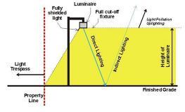
12.16.04
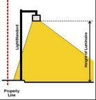
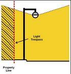
The Planning Commission may relax the lighting standards, by Conditional Use Permit, allow lighting that does not comply with the requirements of this section provided the Planning Commission determines, in its sole discretion, that such proposed lighting is consistent with the purpose of these Regulations. The following considerations are provided as guidance:
1. That and extraordinary need for security exists because of a history of vandalism or other objective means exists;
2. That in traveled ways or areas, conditions hazardous to the public exists, such as steep embankments or stairs;
3. That it would be unreasonable to require replacement of an entire lighting installation because a minor change is proposed to an existing nonconforming lighting installation;
4. Special lighting is indicated for historic buildings;
5. That ornamental up-lighting of sculpture, buildings or landscape features end enhance the character of the area; and
6. Such lighting is necessary for special outdoor events and playing fields.
The purpose of this article is as follows:
1. To establish rules and procedures for the orderly planning and development of commercial sites and residential sites involving more than two dwelling units;
2. To provide for a permit, separate and distinct from the building permit, so that site issues such as drainage, driveways, access, utilities, and internal circulation may be resolved without the need for the preparation and review of detailed architectural plans;
3. To permit site preparation and drainage improvements without imposing the expense and time burden required for a full building permit;
4. To permit the planning of a phased site development without imposing the expense and time burden required for the preparation and review of complete architectural plans for all phases of the development;
5. To provide development applicants a site development permit to help expedite and enhance success and marketability of the project;
6. To provide city staff with procedures for the review and approval of site development;
7. To enhance the ability of a developer to obtain financing for a development project;
8. To maintain consistency with other area jurisdictions; and
9. To simplify and expedite the building permit process.
Any person who develops, or causes to be developed, property located within the planning jurisdiction of the City shall comply with this Chapter. Within the city corporate limits, the use of property shall not be changed, no development shall take place and no building permit shall be issued until a site development permit has been issued in accordance with the code of ordinances of the City. Property for which a site development permit has been issued shall be developed in compliance with the approved site plan. The following are exceptions to the applicability of this Chapter:
1. Construction, alteration, or addition to a single-family or two-family residential structure, or an accessory building to any such structure.
2. Alteration or finish-out of an existing building when the alteration or finish-out does not increase the square footage of the building or change the building footprint as long as one of the following applies:
A. The use does not change, or if the use changes, the new use does not require more parking than is currently existing and no additional parking spaces, aisles or driveways are proposed;
B. The alteration, finish-out or change of use is in compliance with all applicable codes and regulations of the city; and
C. The proposal does not increase the degree of any existing nonconforming use or nonconforming structure.
3. Construction of a fence, but no exception is granted by this subsection for construction of a retaining wall or for a fence that may obstruct or change the flow of water.
4. Substantial restoration that is commenced within a period of one year of a building damaged by fire, explosion, flood, tornado, riot, act of the public enemy, or accident of any kind.
5. A canopy or carport placed over existing parking spaces or other paved area.
6. Any other minor site activity similar to those listed above and eligible for a minor site development permit approved by the Planning Department prior to beginning such site activity or work.
1. Procedure.
The Site Plan Review Procedure provides for the administrative review in addition to plan review required by other sections of the Hickman Municipal Code of projects that have potentially significant effects on traffic circulation or a significant effect on land uses in adjacent neighborhoods. The procedure provides for review and evaluation of site development features and possible mitigation of unfavorable effects on surrounding property.
2. Administration.
The Zoning Administrator shall review, evaluate, and act on all site plans submitted pursuant to this procedure. An applicant may appeal a denial of any application to the Board of Adjustment. In all cases, the authority of the Board of Adjustment is governed by Nebraska Revised Statues §19-910, which sets standards for its conduct, procedures, and establishes specific criteria to which each judgment must conform.
The following selected uses shall follow the Site Plan Review procedure prior to the issuance of a building permit for a new or substantially improved building unless they are otherwise subject to a Conditional Use Permit or Zone Change procedure for specific zoning districts.
1. Multiple Family Developments
2. Places of Assembly
3. Education Facilities
4. Any use including drive-thru services
5. All commercial, industrial, office, or civic
6. Any industrial use adjacent to a residential zoning district
7. Any new development or redevelopment of properties within the identified Corridor Overlay District or Downtown Overlay District.
1. An application for a Site Plan Review may be filed by the owner(s) of a property or the owners' authorized agent with the Zoning Administrator.
2. The application shall include the following information:
A. Name, address and contact information of the applicant.
B. Owner, address, and legal description of the property.
C. A description of the nature and operating characteristics of the proposed use.
D. A site plan, drawn to a scale sufficient to permit adequate review and dimensioned as necessary, showing the following information:
1) The date, scale, north point, title, name of owner, and name of person preparing the site plan.
2) The location and dimensions of boundary lines, easements, and required yards and setbacks of existing and proposed buildings and site improvements.
3) The location, size, and use of proposed and existing structures on the site.
4) The location of all proposed site improvements, including parking and loading areas, pedestrian and vehicular access, sewers, sidewalks, utilities, service areas, fencing, screening, landscaping, and lighting.
5) Location of any major site feature, including drainage and contours at no greater than five foot intervals.
6) Any other information that may be required for review by the Zoning Administrator
The Zoning Administrator must act upon each complete application within 30 days of application. An applicant may appeal a denial to the Board of Adjustment within 10 days of the action. The Board of Adjustment shall consider the appeal at the first available meeting after the filing of the appeal.
1. The Zoning Administrator (or the Board of Adjustment in cases of appeal), shall review and approve the site plan based on the criteria established in Table 13.1 and conformance with applicable regulations in this Zoning Ordinance.
2. The Zoning Administrator (or the Board of Adjustment in cases of appeal), shall make the following findings before approval of the site plan:
A. The proposed development, together with any necessary modifications, is compatible with the criteria established in Table 13.1.
B. Any required modifications to the site plan are reasonable and are the minimum necessary to minimize potentially unfavorable effects.
C. The site plan conforms to the Zoning Ordinance.
The Zoning Administrator (or the Board of Adjustment in cases of appeal), may require modification of a site plan as a prerequisite for approval. Required modifications may be more restrictive than base district regulations and may include, but not be limited to, additional landscaping or screening; installation of erosion control measures; improvement of access or circulation; rearrangement of structures on the site; or other modifications deemed necessary to protect the public health, safety, welfare, community character, property values, and/or aesthetics.
1. A Site Plan Approval shall become void two years after the date of approval, unless the applicant receives a Building Permit there is significant completion of the building permit prior to the expiration of the site plan.
2. The Zoning Administrator may approve an application to modify a previously approved site plan if he/she determines that the modification does not affect findings related to the criteria set forth in Table 12.1.
The Zoning Administrator may revoke a Site Plan Approval if he/she determines that the development is not complying with the terms and conditions of the approval. Due to the condition of the building permit approval being contingent on Site Plan approval, then both the site plan and the building permit can be revoked until such time as the presented issues are remedied to the satisfaction of the City. Such revocation may be appealed to the Board of Adjustment.
An approval pursuant to the article shall run with the land until the expiration date or such approval.
Land Use Compatibility
Development Density
Height and Scale
Height and Bulk
Setbacks
Building Coverage
Site Development
Frontage
Site area per unit or floor area ratio should be similar to surrounding uses if not separated by major natural or artificial features
Development should minimize differences in height and building size from surrounding structures Differences should be justified by urban design considerations
Development should respect pre-existing setbacks in surrounding area Variations should be justified by site or operating characteristics
Building coverage should be similar to that of surrounding development of possible. Higher coverage should be mitigated by landscaping or site amenities
Project frontage along a street should be similar to width
Sidewalks Sidewalks a minimum five feet in width should run parallel to all street frontages.
Parking and Internal
Circulation See Article 10 Parking
Landscape or Fence for Screening
Building Design
Building Design
Operating Characteristics
Parking should serve all structures with minimal conflicts between pedestrians and vehicles
All structures must be accessible to public safety vehicles
Development must have access to adjacent public streets and rights-of-way___0
Internal circulation should minimize conflicts and congestion at public access points
Landscape or fence screening should be integral to the development, provide street landscaping, breaks in uninterrupted paved areas, fences and buffering where required by surrounding land uses Parts of site with sensitive environmental features or natural drainage ways should be preserved.
Architectural design and building materials should be compatible with surrounding areas or highly visible locations
Traffic Capacity Project should not reduce the existing level of traffic service on adjacent streets
Compensating improvements will be required to mitigate impact on street system operations
External Traffic Effects Project design should direct nonresidential traffic away from residential areas
Operating Hours Projects with long operating hours must minimize effects on surrounding residential areas
Outside Storage Outside storage areas must be screened from surrounding streets and less intensive land uses
Public Facilities
Sanitary Waste Disposal
Storm Water Management
Developments within 500 feet of a public sanitary sewer must connect to sewer system. Individual disposal systems, if permitted, shall not adversely affect public health, safety, or welfare.
Sanitary sewer must have adequate capacity to serve development
Development should handle storm water adequately to prevent overloading of public storm water management system
Development should not inhibit development of other properties
Storm Water management must have adequate capacity to serve development
Development should not increase probability of erosion, flooding, landslides, or other run-off related effects
Utilities Project must be served by utilities
Utilities must have adequate capacity to serve development
Rural estate subdivisions should be located in designated areas which can accommodate utility and infrastructure installation consistent with the need to protect the environment and public health
Check One: Meets Criteria Does Not Meet Criteria
Comprehensive Plan
Comprehensive Plan Projects should be consistent with the City of Hickman Comprehensive Plan
Pursuant to Neb. Rev. Stat. §19-908 (R.R.S. 1997): The Board of Adjustment shall consist of five regular members, plus one additional member designated as an alternate who shall attend and serve only when one of the regular members is unable to attend for any reason, each to be appointed for a term of three years and removable for cause by the appointing authority upon written charges and after public hearings. Vacancies shall be filled for the unexpired term of any member whose term becomes vacant. One member only of the Board of Adjustment shall be appointed from the membership of the Planning Commission, and the loss of membership on the Planning Commission by such member shall also result in their immediate loss of membership on the Board of Adjustment and the appointment of another Planning Commissioner to the Board of Adjustment. The first vacancy occurring on the Board of Adjustment shall be filled by the appointment of a person who resides in the extraterritorial zoning jurisdiction of the City at such time as more than two hundred persons reside within such area. Thereafter, at all times, at least one member of the Board of Adjustment shall reside outside of the corporate boundaries of the City but within its extraterritorial zoning jurisdiction. The Board of Adjustment shall adopt rules in accordance with the provisions of any ordinance adopted pursuant to sections 19-901 to 19-914. Meetings of the board shall be held at the call of the chairperson and at such other times as the board may determine. Such chairperson, or in their absence the acting chairperson, may administer oaths and compel the attendance of witnesses. All meetings of the board shall be open to the public. The board shall keep minutes of its proceedings, showing the vote of each member upon each question, or, if absent or failing to vote, indicating such fact, and shall keep records of its examinations and other official actions, all of which shall be immediately filed in the office of the board and shall be a public record.
As provided in Neb. Rev. Stat. §19-909: Appeals to the Board of Adjustment may be taken by any person aggrieved or by any officer, department, board or bureau of the City affected by any decision of the administrative officer. Such appeal shall be taken within a reasonable time, as provided by the rules of the Board, by filing with the officer from whom appeal is taken and with the Board of Adjustment a notice of appeal specifying the grounds thereof. The officer from whom the appeal is taken shall forthwith transmit to the Board all the papers constituting the record upon which the action appealed from was taken. An appeal stays all proceedings in furtherance of the action appealed from, unless the officer from whom the appeal is taken certifies to the Board of Adjustment, after the notice of the appeal shall have been filed with him, that by reason of facts stated in the certificate a stay would, in their opinion, cause imminent peril to life or property. In such case, proceedings shall not be stayed otherwise than by a restraining order which may be granted by the Board of Adjustment or by a court of record in application on notice to the officer from whom the appeal is taken and on due cause shown. The Board of Adjustment shall fix a reasonable time for the hearing of the appeal, give public notice thereof, as well as due notice to the parties, in interest, and decide the same within a reasonable time. Upon the hearing any party may appear in person or by agent or attorney.
The Board of Adjustment shall have the following powers:
1. To hear and decide appeals where it is alleged there is error in any order, requirement, decision or determination made by an administrative official or agency based on or made in the enforcement of any zoning regulation or any regulation relating to the location or soundness of structures; and
2. To hear and decide, in accordance with the provisions of this Ordinance, requests for interpretation of any map, or for decisions upon other special questions upon which the Board is authorized by this Ordinance to pass; and
3. To grant variances, where by reason of exceptional narrowness, shallowness or shape of a specific piece of property at the time of enactment of this Ordinance, or by reason of exceptional topographic conditions or other extraordinary and exceptional situation or condition of such piece of property, the strict application of any regulation under this Ordinance would result in peculiar and exceptional practical difficulties to or exceptional and undue hardships upon the owner of such property, to authorize, upon an appeal relating to the
property, a variance from such strict application so as to relieve such difficulties or hardship, if such relief may be granted without substantial detriment to the public good and without substantially impairing the intent and purpose of this Ordinance.
No such variance shall be authorized by the Board unless it finds that:
1. The strict application of the Ordinance would produce undue hardship; and
2. Such hardship is not shared generally by other properties in the same zoning district and the same vicinity; and
3. The authorization of such variance will not be of substantial detriment to adjacent property and the character of the district will not be changed by the granting of the variance; and
4. The granting of such variance is based upon reasons of demonstrable and exceptional hardship as distinguished from variations for purposes of convenience, profit or caprice. No variance shall be authorized unless the Board finds that the condition or situation of the property concerned or the intended use of the property is not of so general or recurring a nature as to make reasonably practicable the formulation of a general regulation to be adopted as an amendment to this Ordinance.
In exercising the above mentioned powers, the Board may reverse or affirm, wholly or partly, or may modify the order, requirement, decision or determination appealed from, and may make such order, requirement, decision or determination as ought to be made, and to that end shall have all the powers of the officer from whom the appeal is taken. The concurring vote of four members of the Board shall be necessary to reverse any order, requirement, decision or determination of any such administrative official, or to decide in favor of the applicant on any matter upon which it is required to pass under this Ordinance or to effect any variation in this Ordinance.
Any person or persons, jointly or severally, aggrieved by any decision of the Board of Adjustment may appeal as provided by Neb. Rev. Stat. §19-912.
Section 15.01 Purpose
The Amendment Article describes the methods by which changes may be made in the text of the Zoning Ordinance (text amendment) and/ or the official boundaries of zoning districts (rezoning).
15.02
1. Text Amendments
Text amendments may be initiated by an applicant, the Planning Commission, or the City Council.
2. Map amendments
Map amendments nay be initiated by a property owner or authorized agent, the Planning Commission, or the City Council
An application for a Rezoning may be filed by the owner(s) of a property or the owners' authorized agent with the Planning Commission. The application must be filed, and all plans must be submitted, at least 14 days prior to the scheduled meeting of the Planning Commission at which the application is to be heard. The application shall include the following information:
1. Name and address of the applicant.
2. Owner, address and legal description of the property.
3. A description of the reason for the rezoning application and the nature and operating characteristics of the proposed use.
4. Any graphic information, including site plans, elevations, other drawings, or other materials determined by the Planning Commission to be necessary to describe the proposed use to approving agencies. The site plan, should be drawn to scale sufficient to permit adequate review and dimensioned as necessary, showing at least the following information:
A. The date, scale, north point, title, name of owner, and name of person preparing the site plan.
B. The location and dimensions of boundary lines, easements, and required yards and setbacks of existing and proposed buildings and site improvements.
C. The location, size, and use of proposed and existing structures on the site.
D. The location of all proposed site improvements, including parking and loading areas, pedestrian and vehicular access, sewers, sidewalks, utilities, service areas, fencing, screening, landscaping, and lighting.
E. Location of any major site feature, including drainage and contours at no greater than fivefoot intervals.
Regulations, restrictions, and boundaries authorized to be created pursuant to Neb. Rev. Stat. §§ 19-901 to 19-915 may from time to time be amended, supplemented, changed, modified, or repealed.
1. Public Hearing.
The Planning Commission and City Council shall each hold a public hearing on any proposed amendment. The Public Hearings shall be held at a reasonable hour and place for such public hearing, and they shall hold said hearings at the next regular meeting after proper notification of adjacent property owners.
2. Planning Commission Review
No amendment, supplement, change or modification of this Ordinance, including the boundaries of any zoning district, shall be made by the City Council without first the consideration by the City Planning Commission, the Commission shall submit in writing its recommendations on each amendment, supplement, change or modification to the City Council. Said recommendations shall include approval, disapproval, or other suggestions and the reasons thereof, and a discussion of the effect of each amendment, supplement, change or modification on the Comprehensive Plan. Said recommendations shall be of an advisory nature only.
Public notice of hearing on a proposed amendment shall be published once in the official City newspaper and at least ten days shall elapse between the date of publication and the date set for such hearing. Such notice shall state the date, time and place of the hearing and shall contain a statement regarding the proposed change in regulations or restrictions or the zoning classification or zoning district boundaries of the property.
The provisions of Neb. Rev. Stat. §19-904 relative to public hearings and official notice shall apply equally to all changes or amendments. In addition to the publication of the notice therein prescribed, a notice shall be posted in a conspicuous place on or near the property on which action is pending. Such notice shall not be less than 18 inches in height and 24 inches in width with a white or yellow background and black letters not less than 1-1/2 inches in height. Such posted notice shall be so placed upon such premises that it is easily visible from the street nearest the same and shall be so posted at least 10 days prior to the date of such hearing. It shall be unlawful for anyone to remove, mutilate, destroy, or change such posted notice prior to such hearing. Any person so doing shall be deemed guilty of a misdemeanor.
If the record title owners of any lots included in such proposed change be nonresidents of the municipality, then a written notice of such hearing shall be mailed by certified mail to them addressed to their last-known addresses at least ten days prior to such hearing.
At the option of the legislative body of the municipality, in place of the posted notice provided above, the owners or occupants of the real estate to be zoned or rezoned and all real estate located within 300 feet of the real estate to be zoned or rezoned may be personally served with a written notice thereof at least 10 days prior to the date of the hearing, if they can be served with such notice within the county where such real estate is located. Where such notice cannot be served personally upon such owners or occupants in the county where such real estate is located, a written notice of such hearing shall be mailed to such owners or occupants addressed to their last-known addresses at least 10 days prior to such hearing.
4. Protests.
In case of a protest against such change, signed by the owners of 20 percent or more either of the area of the lots included in such proposed change, or of those immediately adjacent on the sides and in the rear thereof extending 300 feet there from, and of those directly opposite thereto extending 300 feet from the street frontage of such opposite lots, such amendment shall not become effective except by the favorable vote of 3/4 of all the members of the legislative body of such municipality.
The provisions of this section in reference to notice shall not apply (1) in the event of a proposed change in such regulations, restrictions, or boundaries throughout the entire area of an existing zoning district or of such municipality, or (2) in the event additional or different types of zoning districts are proposed, whether or not such additional or different districts are made applicable to areas, or parts of areas, already within a zoning district of the municipality, but only the requirements of Neb. Rev. Stat. §19-904 shall be applicable.
The provisions of this Ordinance shall be administered and enforced by a Zoning Administrator as appointed by the City Council, who shall have the power to make inspection of buildings or premises necessary to carry out their duties in the enforcement of this Ordinance.
The following shall apply to all new construction and all applicable renovations and remodels within Hickman’s Zoning Jurisdiction:
1. It shall be unlawful to commence the excavation for the construction of any building, or any accessory buildings, or to commence the moving or alteration of any buildings, including accessory buildings, until the Zoning Administrator has issued a zoning permit for such work.
2. Issuance of a zoning permit. In applying to the Zoning Administrator for a zoning permit, the applicant shall submit a dimensioned sketch or a scale plan indicating the shape, size and
height and location of all buildings to be erected, altered or moved and of any building already on the lot. They shall also state the existing and intended use of all such buildings, and supply such other information as may be required by the Zoning Administrator for determining whether the provisions of this Ordinance are being observed. If the proposed excavation or construction as set forth in the application is in conformity with the provisions of this Ordinance, and other Ordinances of the City then in force, the Zoning Administrator shall issue a zoning permit for such excavation or construction. If a zoning permit is refused, the Zoning Administrator shall state such refusal in writing, with the cause, and shall immediately thereupon mail notice of such refusal to the applicant at the address indicated upon the application. The Zoning Administrator shall grant or deny the permit within a reasonable time from the date the application is submitted. The issuance of a permit shall, in no case, be construed as waiving any provisions of this Ordinance. A zoning permit shall become void 12 months from the date of issuance unless substantial progress has been made by that date on the project described therein.
No land or building or part thereof hereafter erected or altered in its use or structure shall be used until the Chief Building Inspector shall have issued a certificate of zoning compliance stating that such land, building or part thereof, and the proposed use thereof, are found to be in conformity with the provisions of this Ordinance. Within three days after notification that a building or premises is ready for occupancy or use, it shall be the duty of the Chief Building Inspector to make a final inspection thereof and to issue a Certificate of Zoning Compliance if the land, building, or part thereof and the proposed use thereof are found to conform with the provisions of this Ordinance, or, if such certification is refused, to state refusal in writing, with the cause, and immediately thereupon mail notice of such refusal to the applicant at the address indicated upon the application.
Pursuant to Neb. Rev. Stat. §19-913, the owner or agent of a building or premises in or upon which a violation of any provisions of this Ordinance has been committed or shall exist or lessee or tenant of an entire building or entire premises in or upon which violation has been committed or shall exist, or the agent, architect, building contractor or any other person who commits, takes part or assists in any violation or who maintains any building or premises in or upon which such violation shall exist, shall be guilty of a misdemeanor and shall be punished by a fine not to exceed 100 dollars for any one offense. Each day of non-compliance with the terms of this Ordinance shall constitute a separate offense.
In case any building or structure is erected, constructed, reconstructed, altered, repaired, converted or maintained, or any building, structure, or land is used in violation of Neb. Rev. Stat. §§19-901 to 19-914, or this Ordinance, or any regulation made pursuant to said sections, the appropriate authorities of the City may institute any appropriate action or proceedings to prevent such unlawful erection, construction, reconstruction, alteration, repair, conversion, maintenance or use, to restrain, correct, or abate such violation, to prevent the occupancy of said building, structure or land, or to prevent any illegal act, conduct, business or use in or about such premises.
Section 16.01 Severability
Should any article, section or provision of this Ordinance be declared by the courts to be unconstitutional or invalid, such decision shall not affect the validity of this Ordinance as a whole, or any part thereof other than the part so declared to be unconstitutional or invalid.
The catch heads appearing in connection with the foregoing sections are inserted simply for convenience, to serve the purpose of any index and they shall be wholly disregarded by any person, officer, court or other tribunal in construing the terms and provisions of this Ordinance.
All ordinances or parts of ordinances in conflict with this Ordinance, or inconsistent with the provisions of this Ordinance, are hereby repealed to the extent necessary to give this Ordinance full force and effect.
This Ordinance shall take effect and be in force from and after its passage and publication according to law.
ADOPTED AND APPROVED by the Governing Body of Hickman, Nebraska, This _______________________day of ________________________, 2023. (Seal)
ATTEST:
City Clerk Mayor