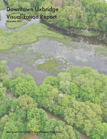
Downtown Uxbridge Visualization Report
Downtown Uxbridge Visualization Report
November 2021
Prepared for the Town of Uxbridge by: Architectural Design Consultant Becker Schmidt from Boston Architectural College. Commissioned by Michael Gallerani with funding from the Department of Economic Development and Community Planning.

Introduction
In the Spring of 2021, the Department of Economic Development & Community Planning (EDCP) Collaborated with the Central Massachusetts Regional Planning Commission (CMRPC), Adaptiv Architects, and students from the Boston Architectural College (BAC) Gateway Program to create a development plan for the Main Street District of Uxbridge, MA. Following the completion of the initial report, The EDCP retained Becker Schmidt, a member of the BAC Gateway team, to develop a study of the district that presents visualization that presents strategies brought forward in the Gateway Report (Spring 2021).
A Note on Past Reports
Since 2003, there have been several reports written pertaining to the development of downtown and its historical buildings. It is encouraged that when carrying out the suggestions outlined in this report to review all previous documentation which thoroughly outlines action steps for implementation.


Defining Downtown
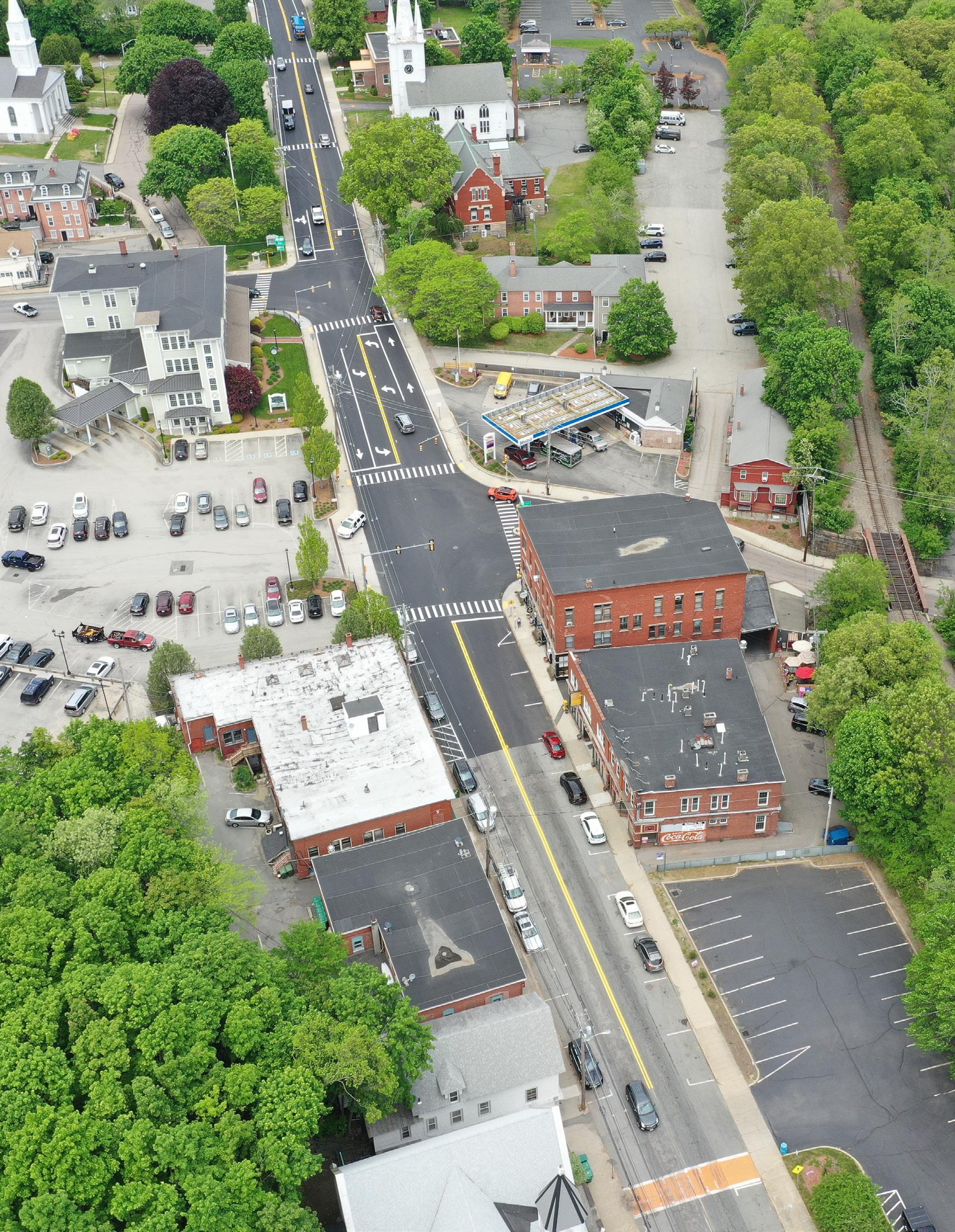
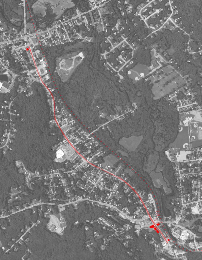
The downtown area of Uxbridge stretches just over a mile along Main Street between Hartford Avenue and Park Street.
The northern end of this zone is anchored by the intersection of Main Street and Hartford Avenue with a CVS and gas station. A handful of restaurants, shops and residences stretch south, capping the north end of downtown Uxbridge at the intersection of Main Street and Rivulet Street.
The southern end of the downtown zone begins with the Uxbridge Town Common; the Daughters of the American Revolution (DAR) House and the Masonic Lodge are the northern most buildings in this historically protected section of the downtown corridor. This section of the downtown stretches west to Kooperman’s Lumberyard on Route 16, east to the Farnum House on Capron Street and south past the Senior Center to Park Street.
Boundaries for both zones are malleable as future developments will densify, and potentially expand these spaces.
Elements Considered
This report focuses on five buildings and two landscape improvements. It is essential to note that these suggested interventions are not isolated to the featured buildings but, instead, serve as examples of the strategies that can be implemented along the entire downtown corridor. The areas featured in this report are as follows:
1. The Taft Brothers Block
3. The Senior Center
4. The A. Thomas Building
5. The Taft Building
6. The Savers Bank Parking Lot
7. Connections to the Blackstone River Greenway
7. The Burger Grille
Primary Interventions Explained
Key themes from previous reports and conversations with local officials and community members motivated the interventions suggested in this report. Uxbridge has the potential to be a destination economy by celebrating its history and heritage, enhancing its connectivity to its surrounding environmental assets, and improving accessibility. In order to do so, small and big interventions can be executed in key locations to provide living, working, and recreational options for existing and future residents.
• Update street signage downtown so all shops signs reflect a historic charm
• Commission building murals for added visual interest and cultural enrichment
• Remodel building facades in a historically accurate manner to highlight the town’s heritage
• Increase density by adding floors to street facing buildings that provide affordable housing options to attract residents and office space to attract businesses
• Improve accessibility and walk-ability by adding bike paths, greening the sidewalks, and replacing parking lots with green space that will make the downtown area desirable to both go to and stay in, ultimately increasing presence in the downtown area
• Connect the downtown area to surrounding environmental assets, like the Blackstone River and the Blackstone River Greenway.
• Move overhead power lines to underground. This is a long-term intervention, and one that would drastically improve sidewalk accessibility and visual appeal
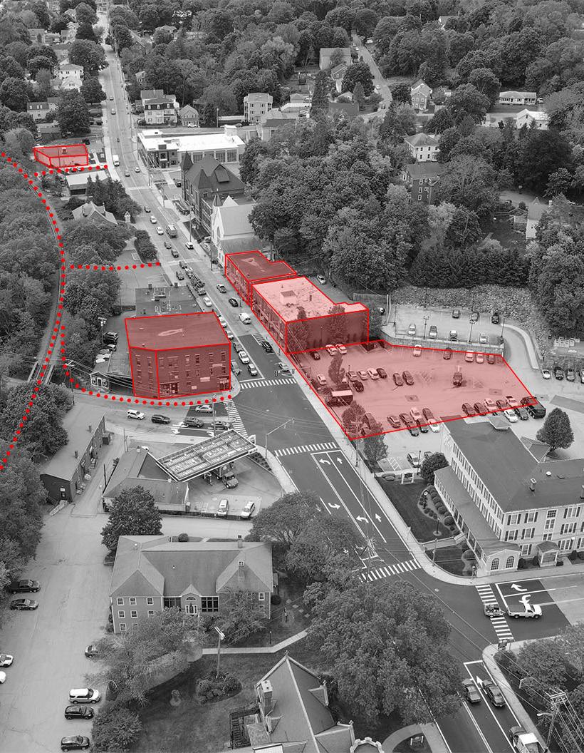
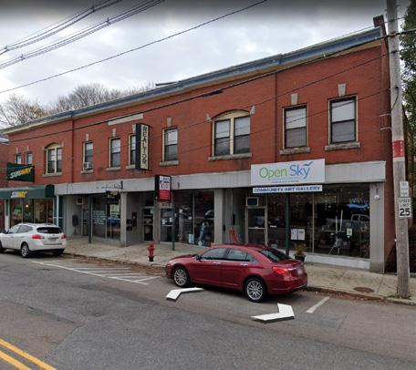
South Main Street
South Main Street is the more active area of the downtown corridor. It includes significant historical buildings such as Town Hall and the Public Library as well as community assets such as the Senior Center and the Fire Headquarters. A few businesses and restaurants line the street with office, event, and housing spaces on the second-fourth floors of these mostly brick buildings. This area of downtown would greatly benefit from facade renovations including window replacement, brick refurbishment, first floor facade reconstruction, and street art. Buildings in this area are encouraged to add density by building additional stories for housing or office space. Updated building facades, walkable sidewalks, and increased greenification will attract new residents, small businesses, and developers. The following section highlights four buildings and two landscape interventions in South Main Street.
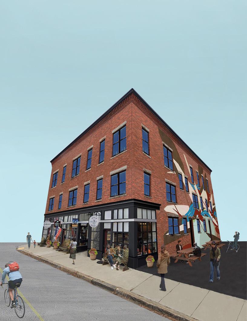
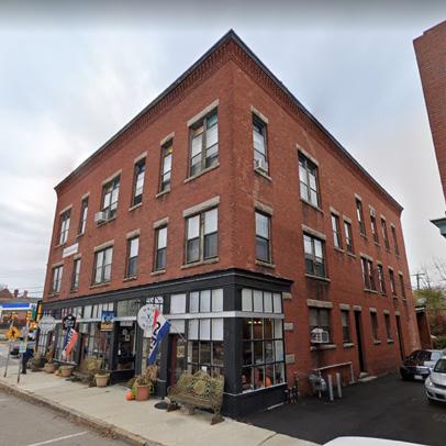
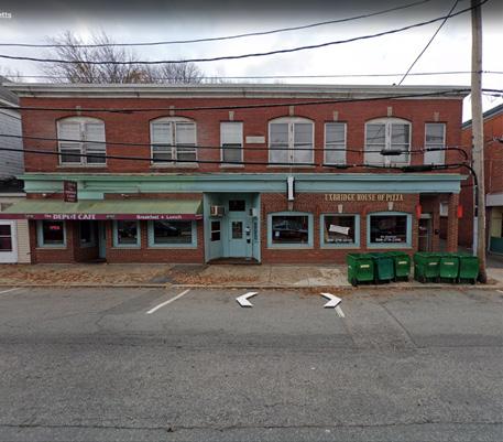
South Main Street: The Taft Brothers Block
The Taft Brothers Block is a three story building on the corner of Main Street and Route 16. The first and second floor house retail spaces and offices while the third floor operates as an event space. A historical landmark and architecturally beautiful building, the Taft Brothers Block would benefit from enhancing its existing characteristics: brick and first floor facade refurbishment, historically appropriate finishes and windows, and commissioned street art.
Bike lane
Greenify sidewalks: benches and planters
Replace windows
Refurbish brick
Refurbish existing first floor facade
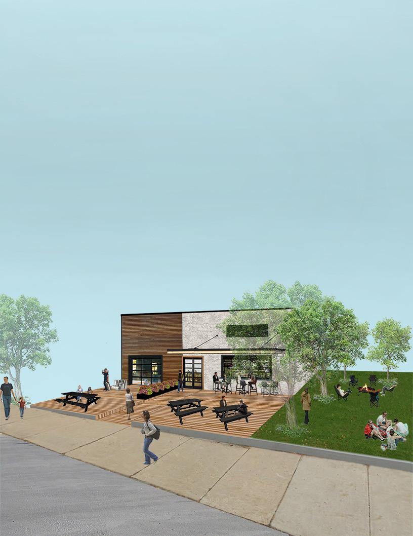
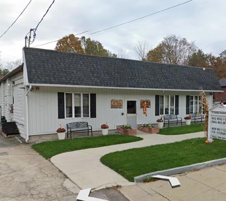
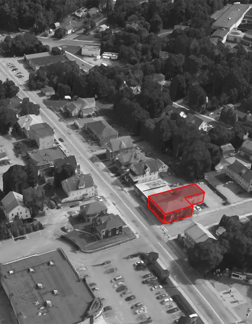
South Main Street: The Senior Center
The Senior Center is a staple of the Uxbridge community and is anticipated to move location to the McCloskey Center in the near future. This building is some what of a blank canvas and has potential to be a recreational highlight of the South Main Street. This report proposes a brewery and restaurant with ample public space and greenery for community engagement. This site is also ideal for a mixed-use building with restaurant and retail space on the first floor, office on the second, and housing on the third and fourth. 2
Greenify sidewalks: benches, trees, and planters
Public Open Green Space
Outdoor seating & public deck
South Main Street: The A. Thomas Building 3
Built in 1828, the A. Thomas Building is another historical landmark on South Main Street that would benefit from refurbishment while maintaining original character. It is also suggested to add another floor or two to the building for office space and housing. To the left of the A. Thomas Building is a white sided building that would benefit from refurbishment. Less historically significant, the remodeling of this building allows for experimentation that would bring needed charm and variation to the downtown area. This rendering suggests cedar siding with black finishes. Additionally, this rendering shows the positive visual impacts that murals can have to add visual interest and energy to a downtown environment.
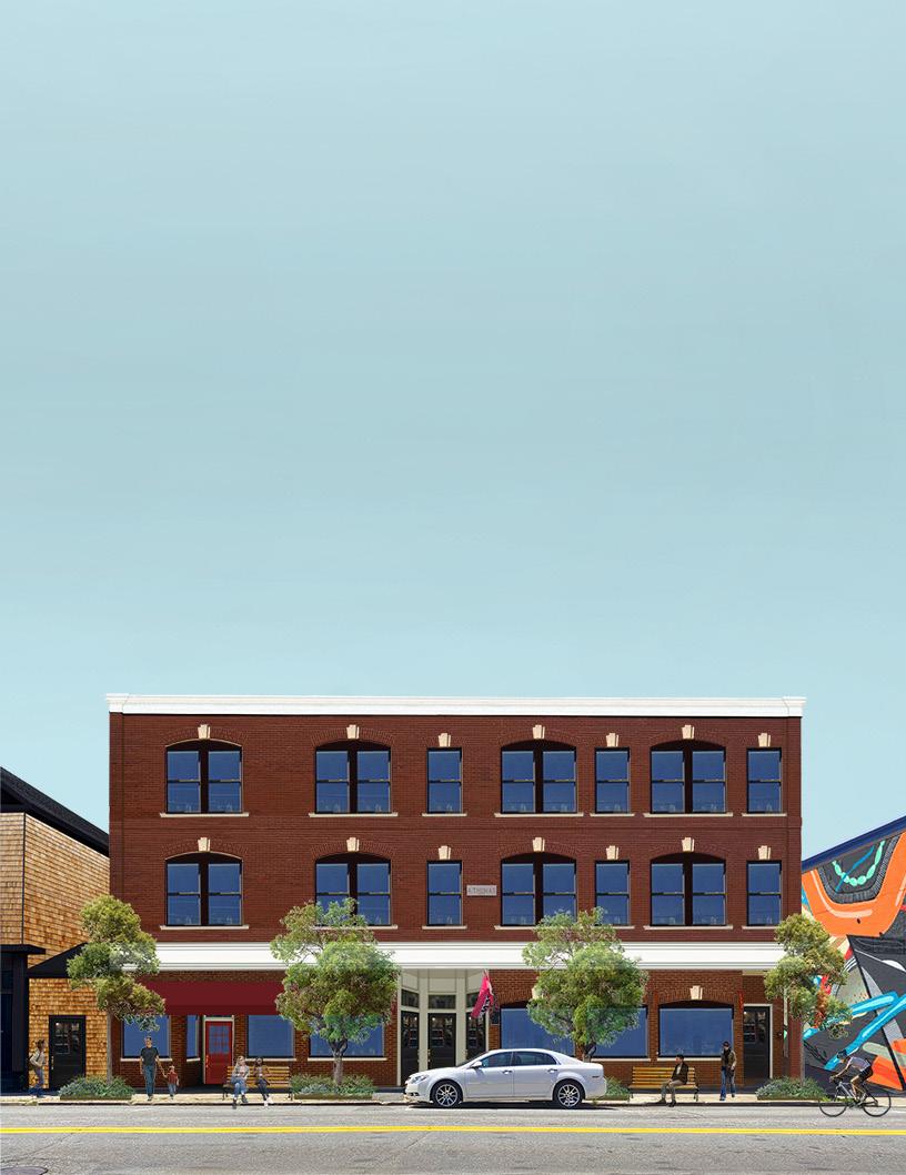
Additional floors for housing/office space
Historically appropriate finishes
Bike lane
Greenify sidewalks: benches, trees, and planters
Replace windows
Reside Elysian Salon Building Refurbish brick Remodel ground floor facade
South Main Street: The Taft Building 4
The Taft Building first floor facade should be rebuilt to be more historically accurate. As with the other brick buildings, brick refurbishment, window replacement, historically accurate finishes, and a potential additional floor would all elevate the Main Street Experience.
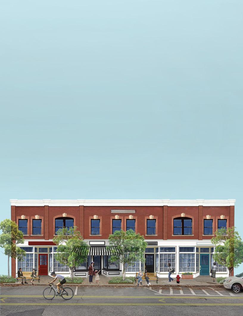
Refurbish brick
Bike lane
Add awning
Greenify sidewalks: benches, trees, and planters
Replace windows
Remodel ground floor facade
Historically appropriate finishes
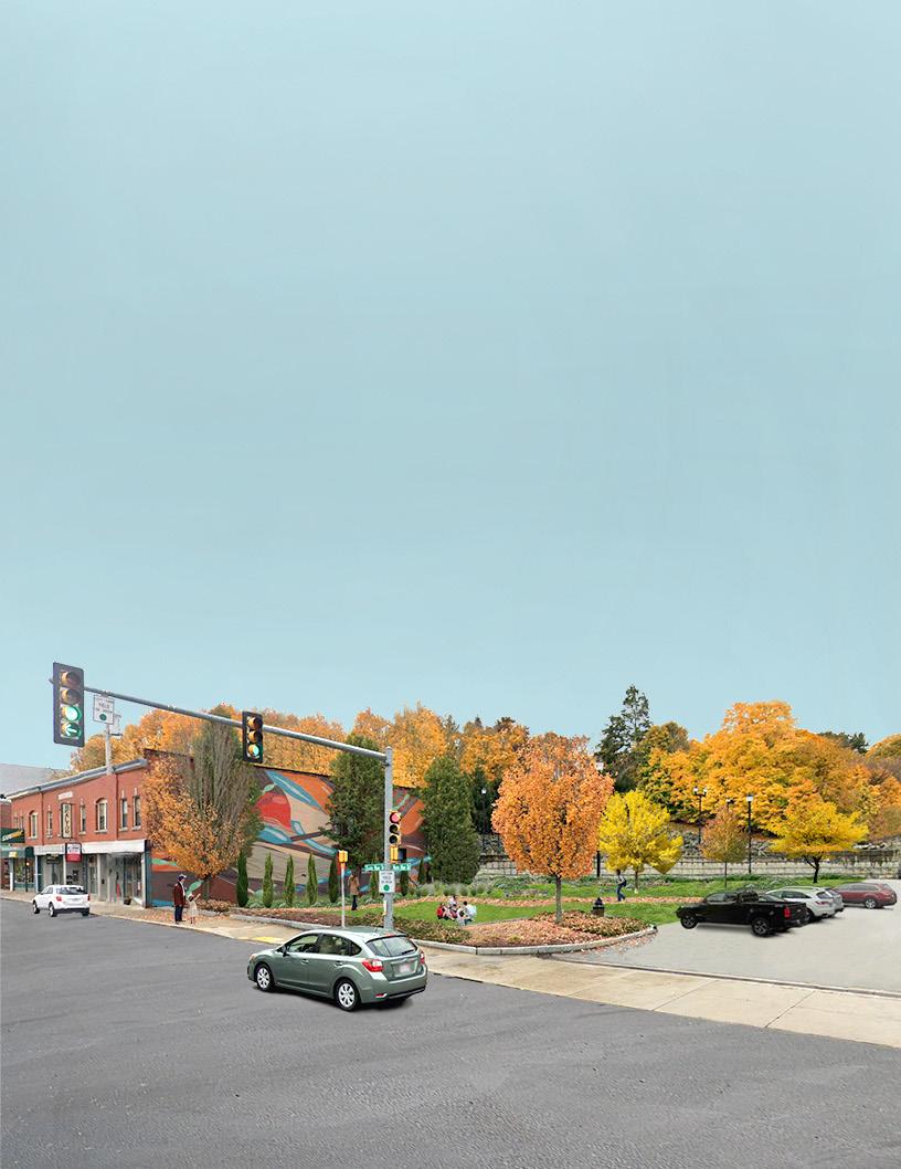
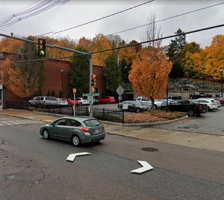
South Main Street: Savers Bank Parking Lot
Currently, the Savers Bank has an excessively large parking lot that would be better used as a green space. Reducing the parking lot by half still allows for ample parking spaces while adding much needed green space to an area that is next to the busy intersection of Route 16 and Main Street. Introducing additional pedestrian friendly green space makes the intersection feel safer and more desirable to spend time in.
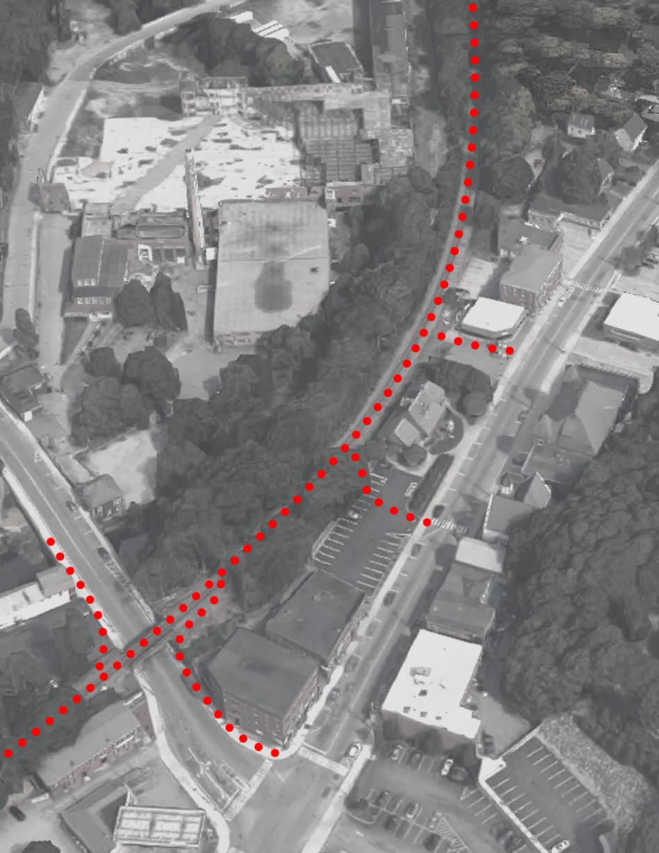
South Main Street: Connections to Blackstone River Greenway
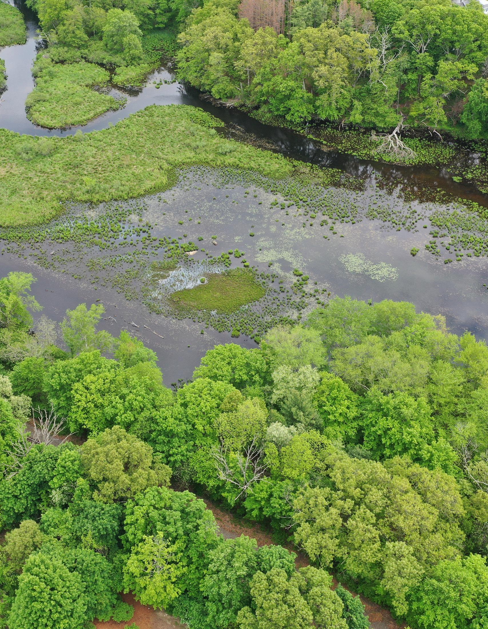
Uxbridge sits directly next to the Blackstone River and at the center of the National Heritage Corridor. An old mill town, Uxbridge is rich with the history that its proximity to this waterway has given it. It is essential that the town highlight its proximity to nearby outdoor recreation as it transitions to a destination economy.
The Blackstone River Greenway is a 48-mile long bike-way from Worcester, MA to Providence, RI that runs the length of the National Heritage Corridor. It is still under construction and the section running through Uxbridge has not yet been built. However, as downtown runs adjacent to the future bike-way, it is advantageous for Uxbridge to build connection points from the path to downtown, giving pedestrian access to bikers and walkers alike who may stop in the town to eat, rest, and shop.
Access near mixed-use development gives access to path from restaurant, housing, and retail.
Access from crosswalk
Access from main intersection and across from landscape intervention
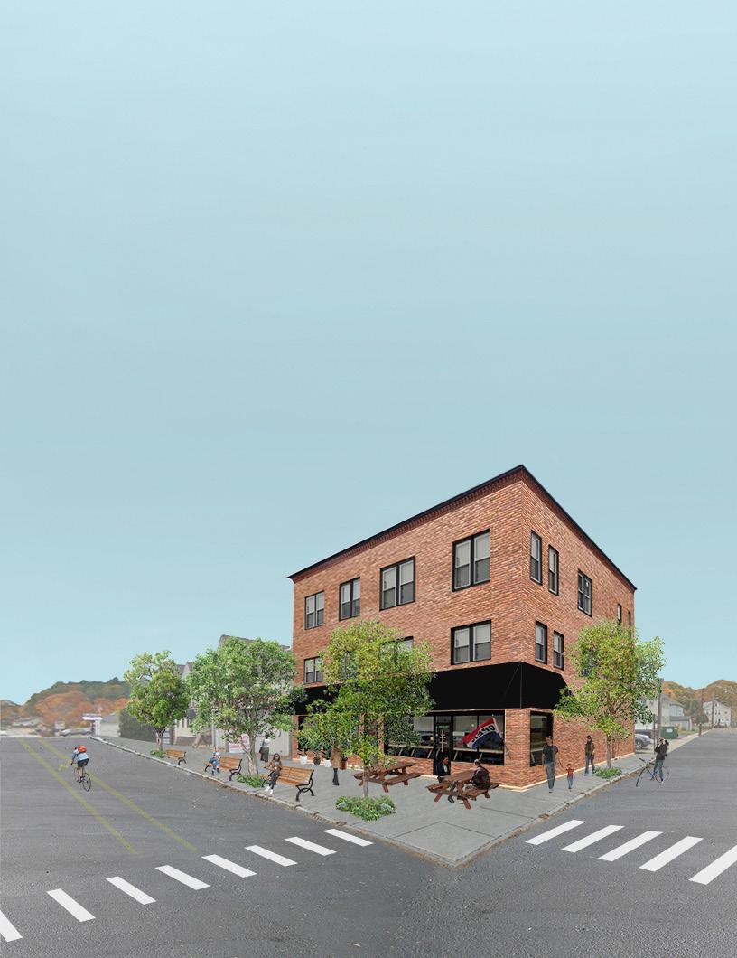
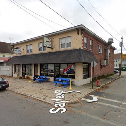
North Main Street: The Burger Grille
North Main Street is characterized by 1-2 story commercial spaces, restaurants, and housing. This area has potential to become a more central area of the town if existing buildings and future developments increase density, introduce mixed-use programs, and create affordable housing. The Burger Grille is currently located in a 2 story building alongside the New Life Ministry. The most important suggested improvement for this building is the additional floors built for rent-able living space. By approaching building remodels with a mixed-use perspective, Uxbridge can create environments for life, work, and recreation that attract new investment and new residents into the area. As the first local business one encounters on the north end of Uxbridge, the Burger Grille acts as a friendly welcome as the gateway for the Main Street district. For this reason, it is also essential to increase greenery with trees and planters and walk-ability with benches and up-to-date sidewalks.
Bike Lane Greenify Sidewalks: benches, trees, and planters
Replace Windows Add awning
Refurbish Brick
Outdoor Seating
Additional floors for housing/office space