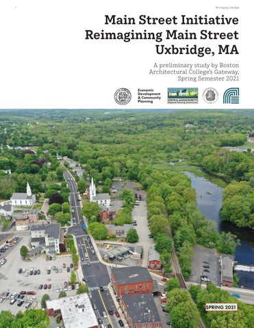
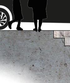
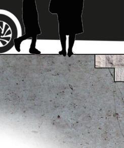
Reimagining Main Street Uxbridge, MA
A preliminary study by Boston Architectural College’s Gateway, Spring Semester 2021

A preliminary study by Boston Architectural College’s Gateway, Spring Semester 2021
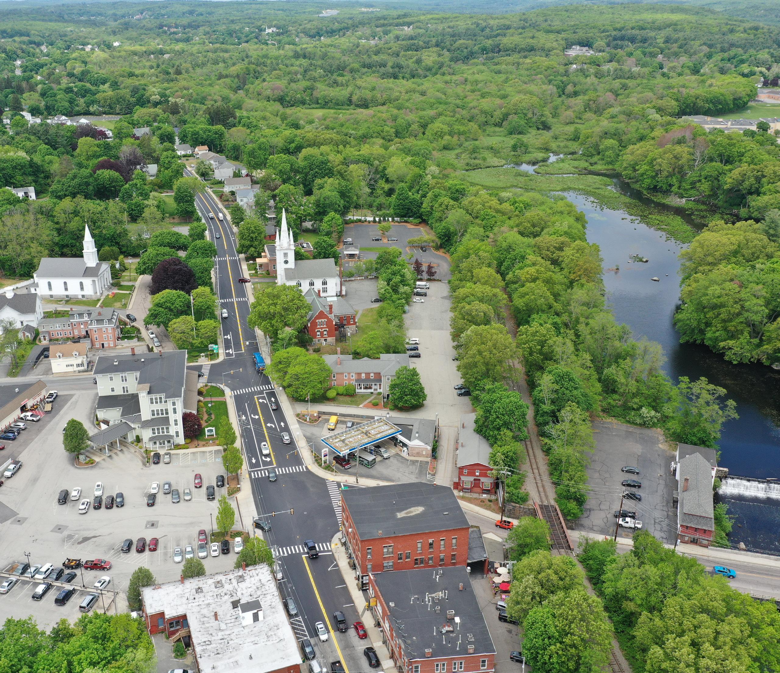
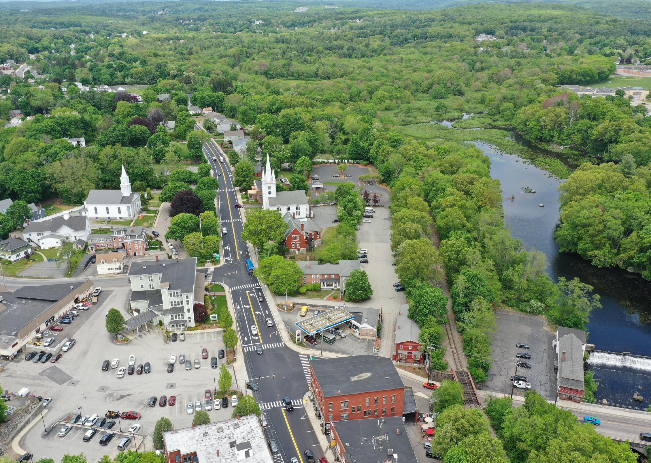
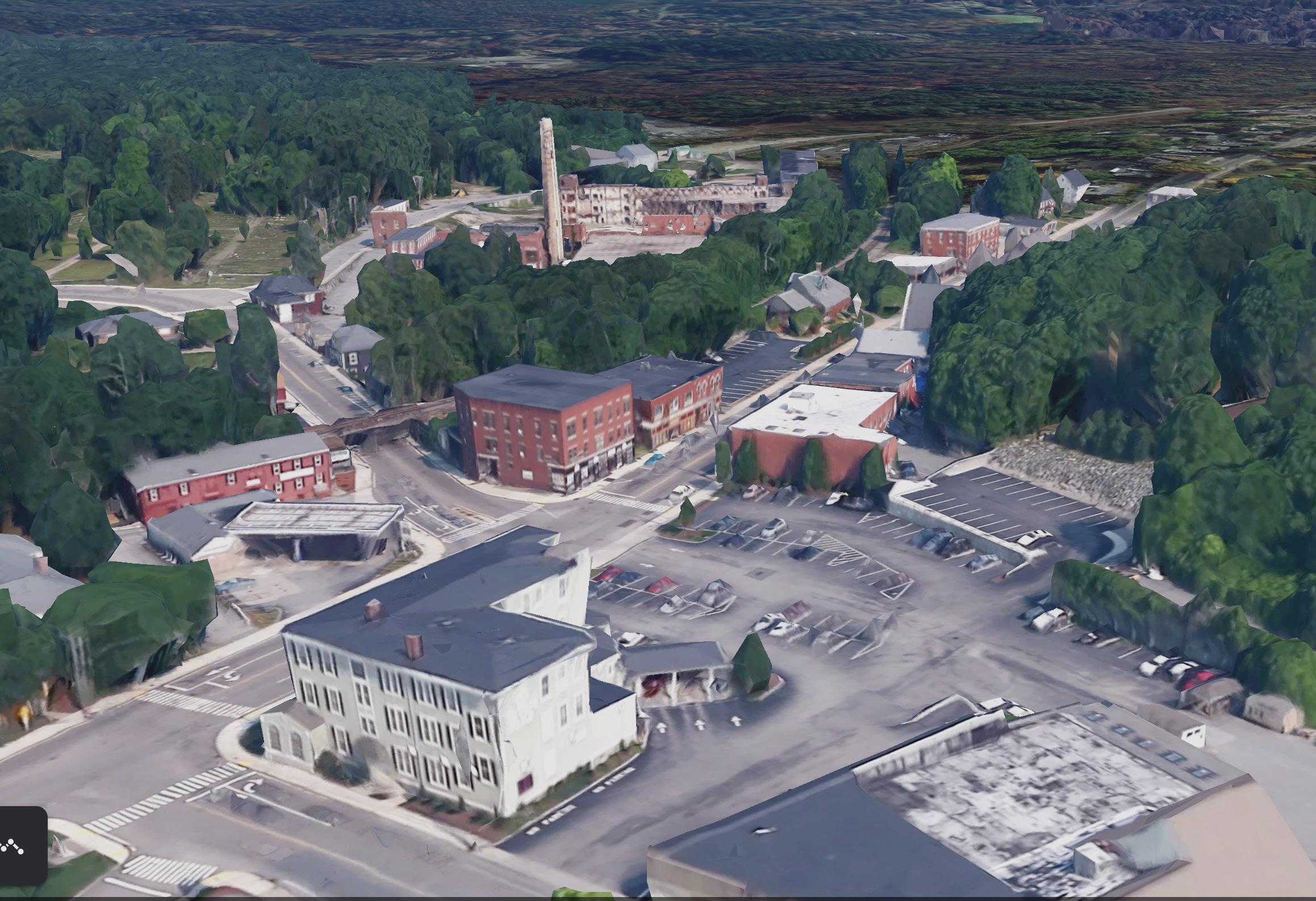
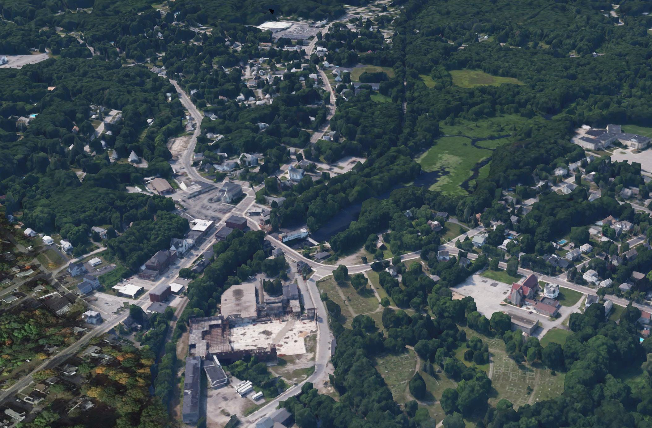
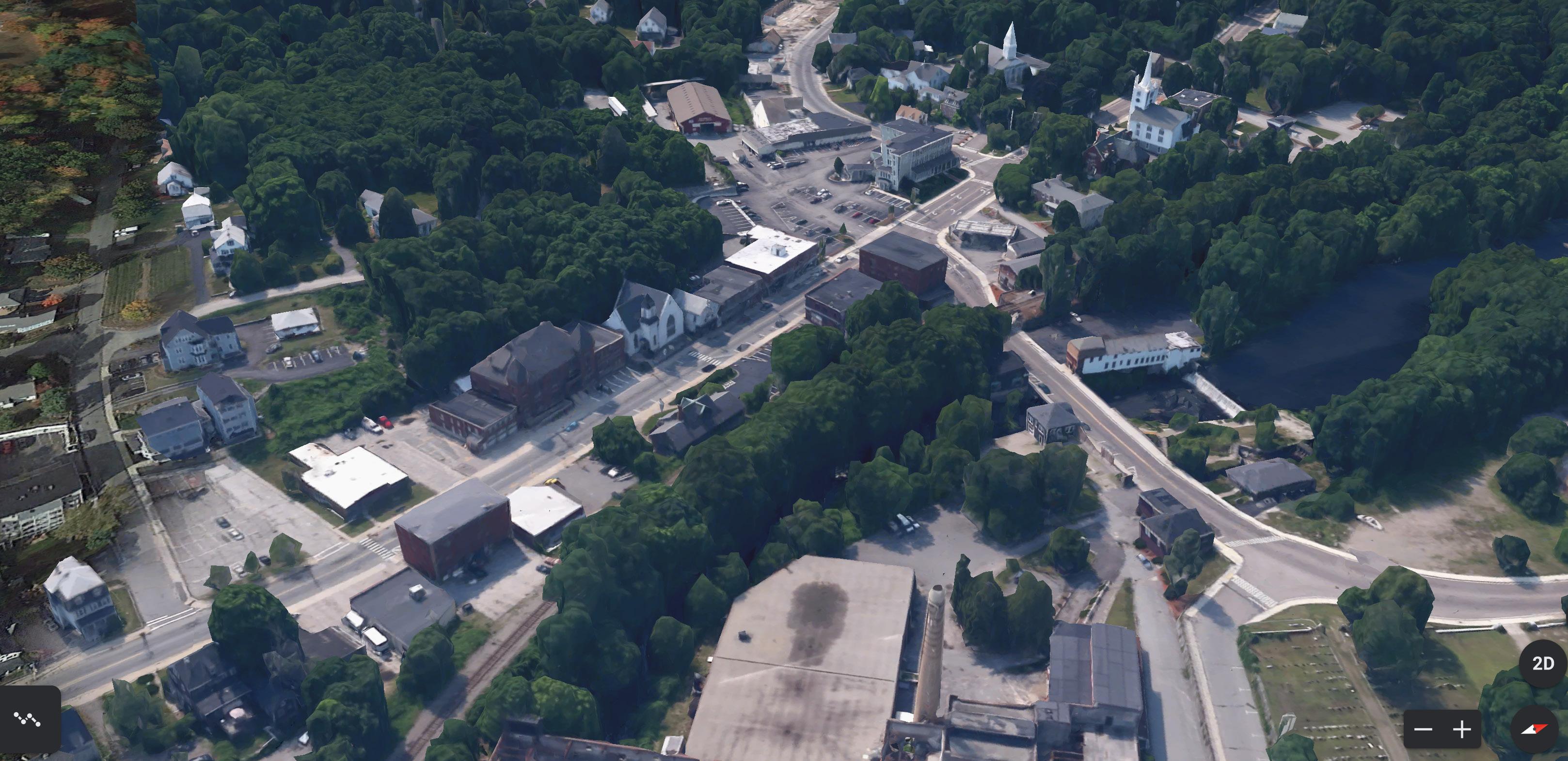
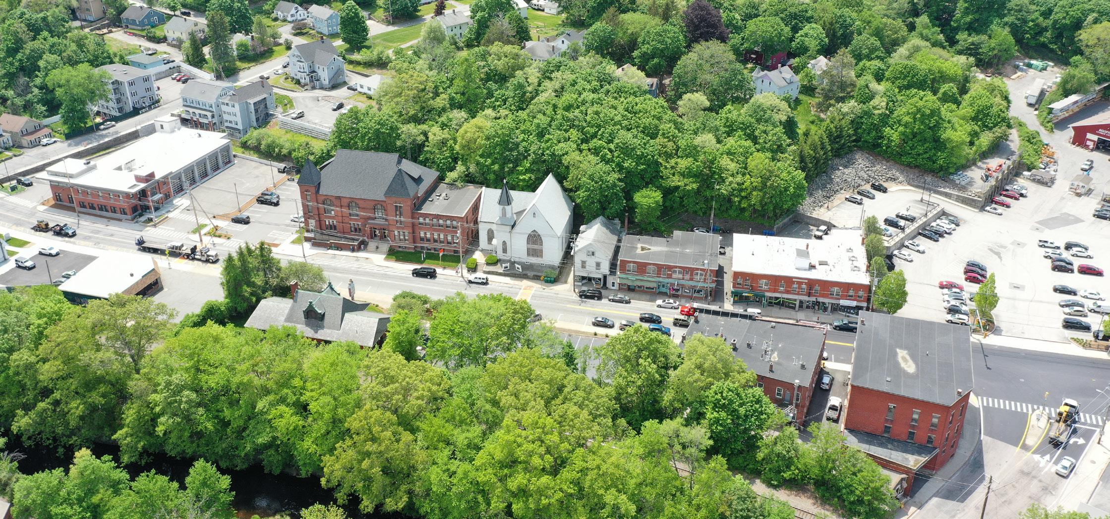
Uxbridge’s town center contains a civic core, shared parking areas, and smaller blocks with moderately dense mixed uses. The Town Hall, Public Library and Senior Center are located in the center of the downtown with the McCloskey Building serving as the northern anchor of the Main Street corridor. The reuse of the McCloskey Building will shape the downtown area and should municipal functions migrate to the McCloskey Building, the reuse of Town Hall and Senior Center would come to define the downtown area. The purpose of this project is to explore the strategic reuse of Uxbridge’s McCloskey Building and other municipal properties related to Re-Imagining Main Street in Uxbridge. The tasks are as follows:
Examine Data on the Main Street Area
•Demographics, Businesses, Housing, Private and Municipal Assets
Collect Public Input
•Core team Focus Group Visioning, Visioning Survey Public Forum
•Define Preferred Use or Reuse of Municipal Assets
Examine Municipal Assets and Preferred Reuse Options
•Case Studies, Site Evaluation, Architectural Review
Market Analysis to Contextualize and Refine Preferred Reuse Recommendations
•Neighborhood Analysis, Market Trends, Zoning
Provide a Path Forward
•Preferred uses defined for an RFP
•Design Concepts for Main Street, including the Town Hall and Senior Center
•Potential funding sources
•Design Guidelines for Main Street
By the end of Fall 2021 semester, students are expected to:
•Research and catalogue potential funding sources for the reuse of the McCloskey Building.
•Visit and document existing site conditions.
•Meet with community organizations, stakeholders, and residents to identify building reuse preferences and a general vision for Main Street. This includes assisting with the development and analysis of a community survey.
•Review and make recommendations for drafted design guidelines related to Re-Imagining Main Street.
•Produce preliminary conceptual design proposals for identified priority areas along Main Street.
•Present initial findings to stakeholders.
Prior to initiating our outreach efforts, the BAC team created a Community Engagement Strategy to help guide the process. It was developed based on the goal of gaining perspectives from a wide range of community members and with the understanding that community engagement efforts will extend beyond the January-May timeline this particular Gateway group is limited to. Because of this, the plan can be adapted to continue the work started in this report, resulting in a continuous community engagement, process that priorities community member voices in development efforts.
The strategy is divided into three sections: Outreach Plan, Outreach Strategies & Considerations, and Stakeholder & Potential Partner involvement. The first section outlines the order of outreach actions and the what should be gained from each effort. The second section identifies potential strategies for attaining community feedback through existing community networks and resources. And the third section identifies community stakeholders and potential partners amongst them who can assist in community engagement efforts. The second and third sections serve as assets for accomplishing the goals of the first section.
This semester, the shared efforts between BAC Gateway Students, Adaptiv, and CMRPC resulted in a Community Feedback Form, an Community Survey, and a virtual Visioning Workshop, which means community engagement efforts are currently in section 1, stage 3: Plan DevelopmentEngagement Forum I. In order to create a robust, thorough, and thoughtful Mainstreet Development Plan that fully encompasses what Uxbridge will prioritize in the coming years, further efforts to engage Uxbridge stakeholders are essential.
The BAC’s Gateway approach and methodology to this project will be based on the principles of Participatory Action Research (PAR) and therefore will place most emphasis on working in collaboration with our client stakeholders and also most importantly for this project, the local community stakeholders including residents. As such we will develop a high-level Community Engagement Framework which will identify project stakeholders, their roles, engagement strategies & tools and also engagement principles, goals and objectives. To develop a relevant and effective strategy we will expect the following assistance from client;
• Community and local resident stakeholder’s lists
• Client to identify and connect with us any available resources that we can review to get a good handle of local stakeholders.
1. Outreach Action Plan
1. Initial Engagement
a. Meet and greet sessions
b. Meet key community leaders
c. Identify and meet key stakeholders
d. Gather contextual information and ask stakeholders background questions
• Client will remain the main liaison and point of contact with community and resident stakeholders. We will make contact through the client. Client to attend and participate in most of community engagement sessions. Process methodology diagram highlight relationships and flow of
e. Develop and appoint partners
2. Plan Kick-Off
a. Introduce the Main Street Corridor Development Plan concept
b. Explain why we should have it and how to get involved
c. Conduct community assessment surveys
3. Plan Development - Engagement Forum I
a. What are the issues and needs in Uxbridge?
b. What are Uxbridge’s assets?
c. What are the community goals and priorities?
d. What is a shared community vision and why is it important?
4. Plan Development - Engagement Forum II
a. What is Uxbridge’s community vision?
b. What is the role of each stakeholder in this vision?
5. Plan Development - Engagement Forum III
a. What are the future development scenarios for Uxbridge?
b. What are the implications of these scenarios, in terms of growth and otherwise?
c. Which scenarios are desirable directions for change?
6. Plan Consolidation
a. Consolidate most desirable outcomes into a downtown development proposal
b. Select which scenario to implement
c. Strategize the implementation of the development plan
c. Review development proposal and implementation strategy
2. Outreach Strategies & Considerations
Local Media
• Radio stations
• TV stations
• Uxbridge website
• Local paper
• Pre-existing newsletters
Webpage/Blog
• Create a website for project efforts and outreach updates
Social Networking
• Local Facebook groups, Instagram accounts, and twitter
• Key stakeholders could feature the project on their accounts
• Instagram takeovers of local organizations
• Interviewing individual community members
Email Blasts
• Community organization networks
• Flyers, Postcards, and Posters
• Display in shop windows and community spaces
• Hand out at community events
• Attend Community Events & Activities
• Virtual Town Halls
• Covid-safe group meetings
• Multilingual media and literature for nonEnglish speakers
• Video captions for hard of hearing participants
• Asynchronous as well as synchronous meetings
• Summarize and share results of each outreach effort
• Hold multiple outreach meetings for the same topic at different times to gain a variety or responses
3. Stakeholder & Potential Partner Identification
• Identify Stakeholders: individuals and groups of people interested in, or effected by, the development of the Main
• Street Corridor community members, residents, Boards, Committees, and Commissions, local businesses, property owners, government officials, low income residents, unemployed residents, town youth, etc.
• identify Potential Partners: individuals or groups of people from the community that are a core part of outreach efforts.
• Their expertise, reach and community leadership aid in developing and sharing project goals.
• Community leaders, Institutional partners, Non-Profit groups
• Government representatives
• Local businesses
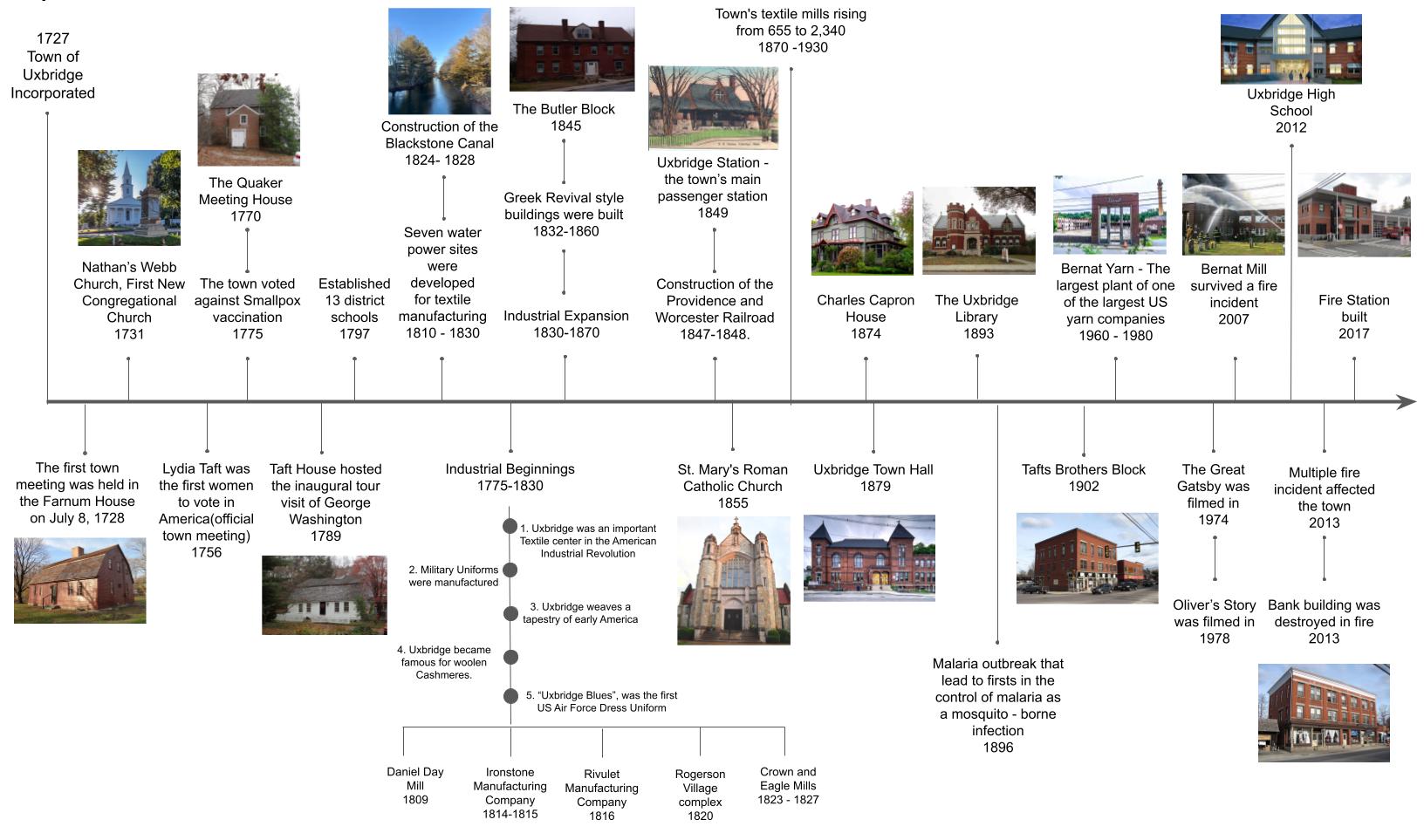


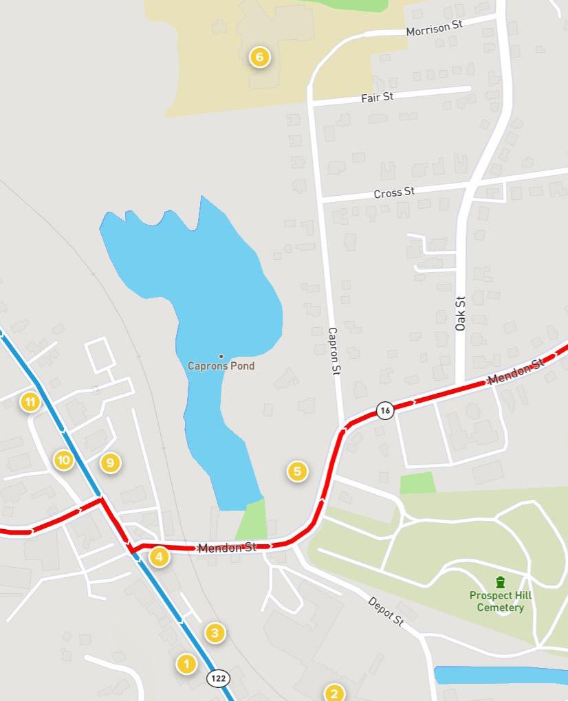
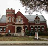
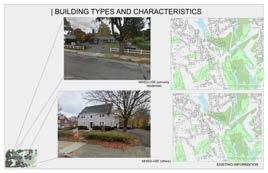
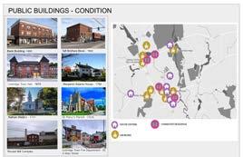
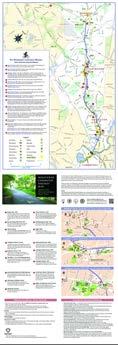
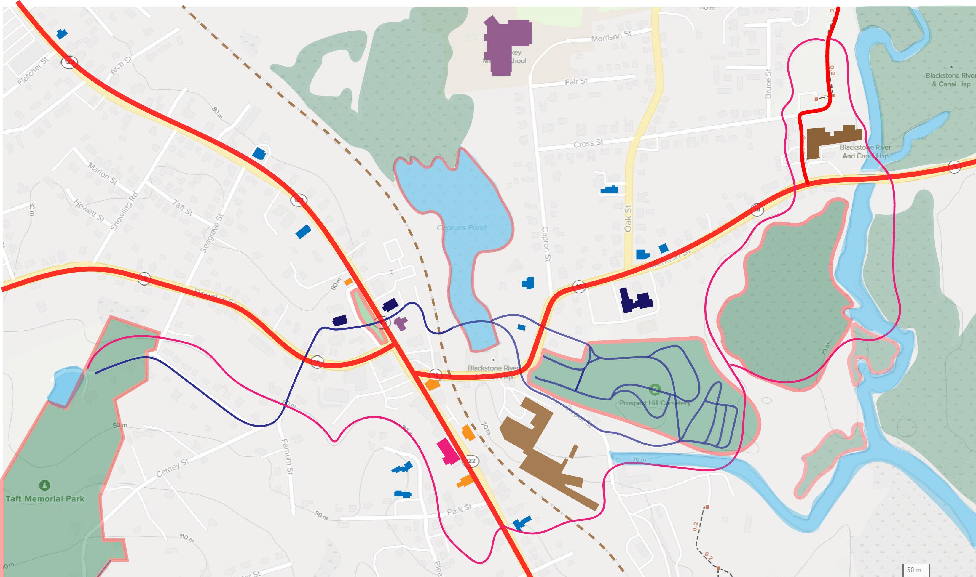
The maps highlights historical landmarks such as religious institutions, historical homes, and industrial sites, amongst others.
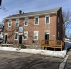
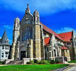
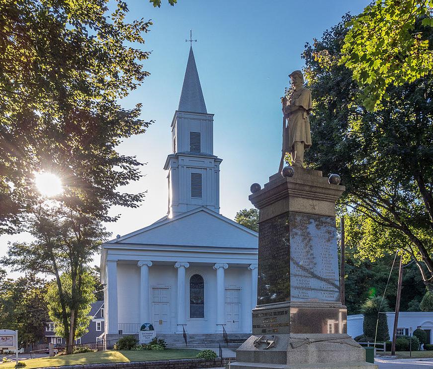
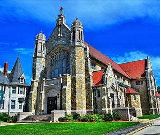
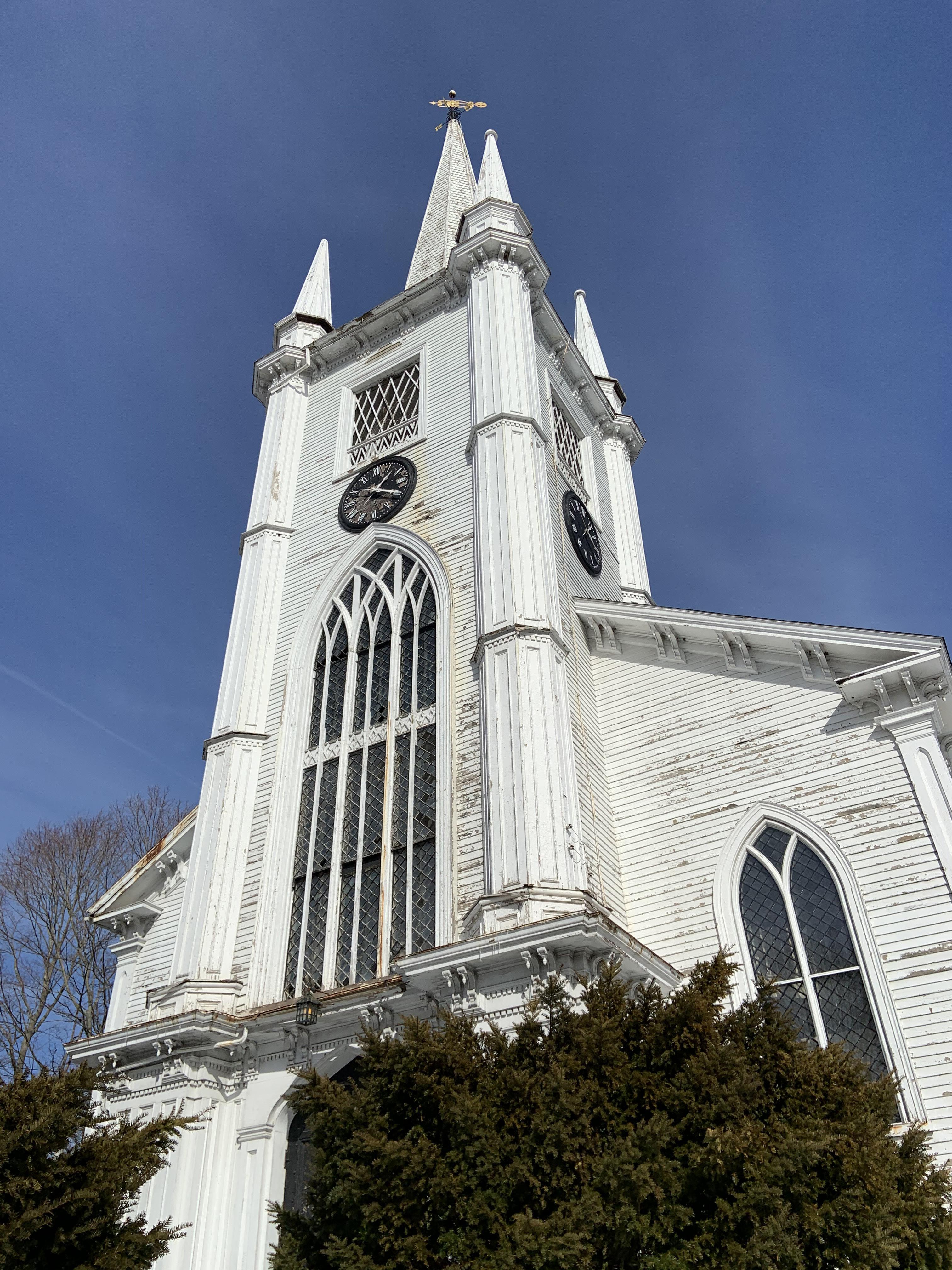
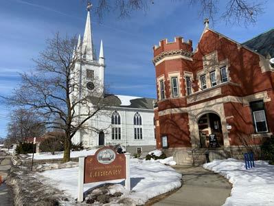
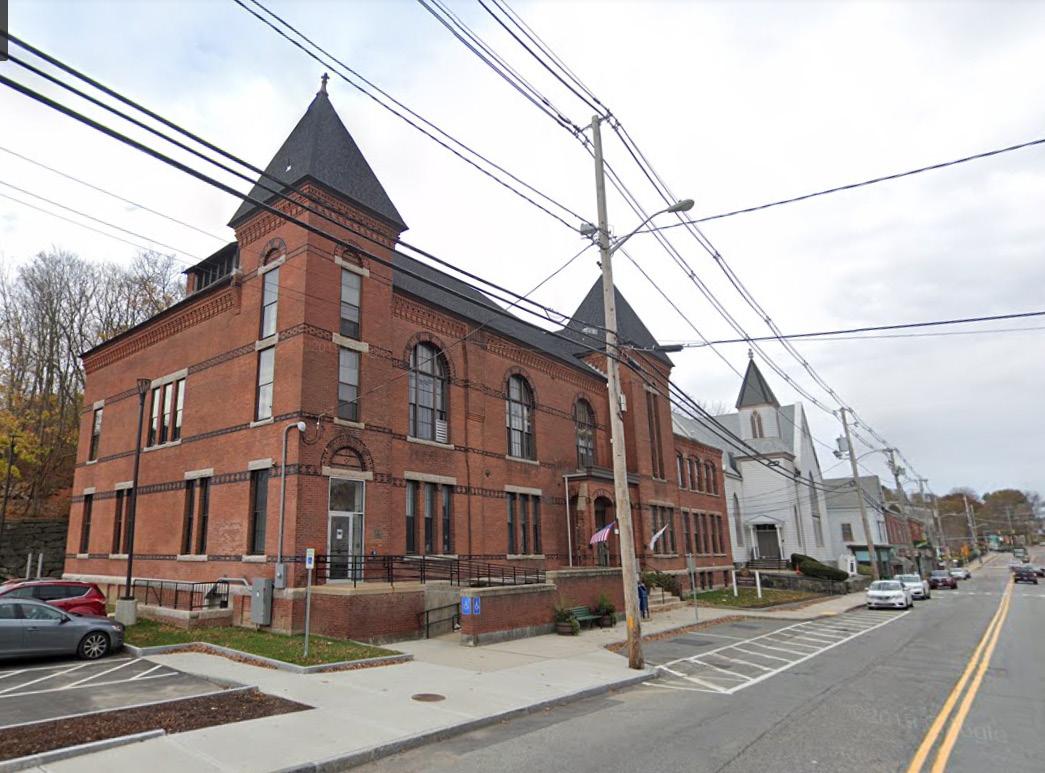
The Evangelical Congregational Church is one of the oldest churches in Massachusetts and was built because of dispute between the ‘liberal and Calvinistic’ branches of the first church of Uxbridge. A year later in 1834, the Unitarian church was built.
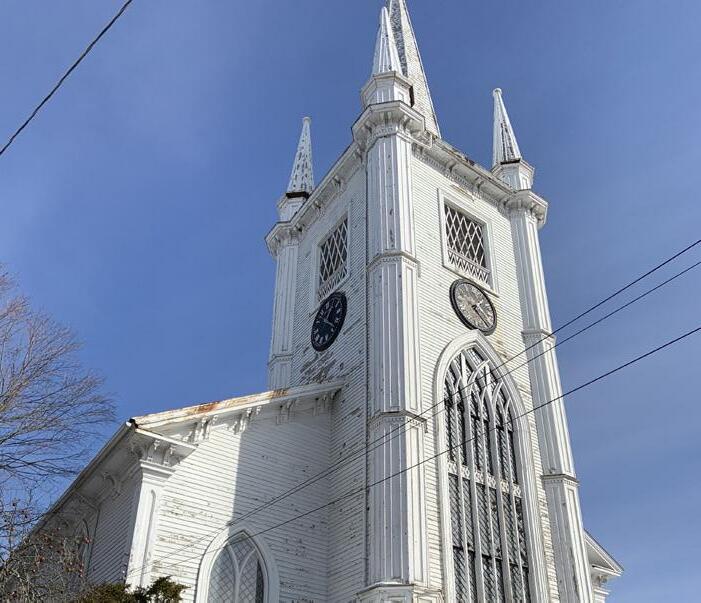
The St. Mary’s Parish was built in 1850 by the Irish immigrants, first came to Uxbridge in the 1820s to work on the farms, and later the canal, the railroad, and in the mills.
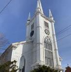
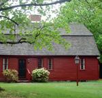
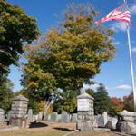
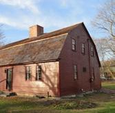
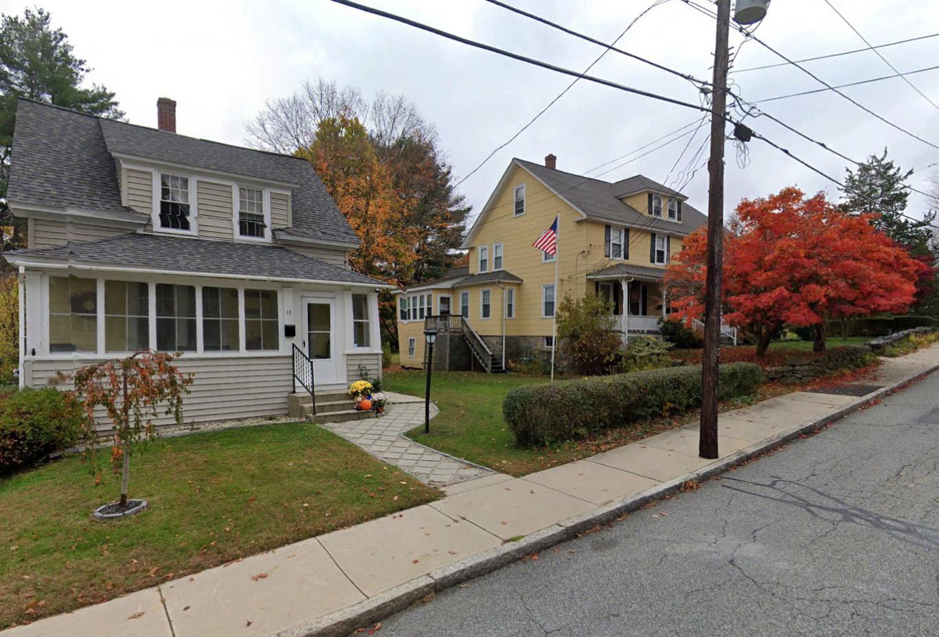
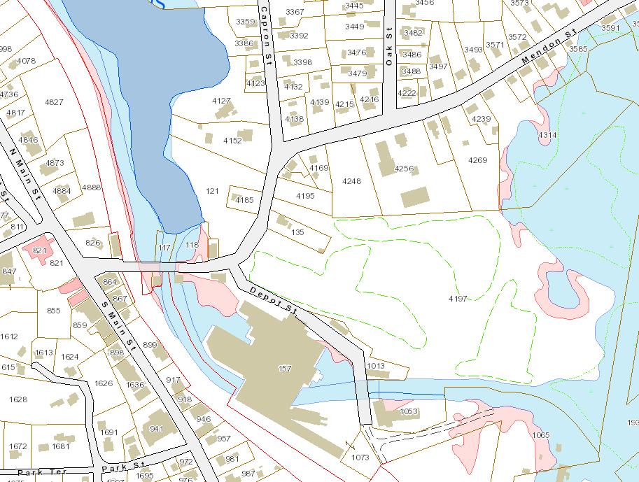
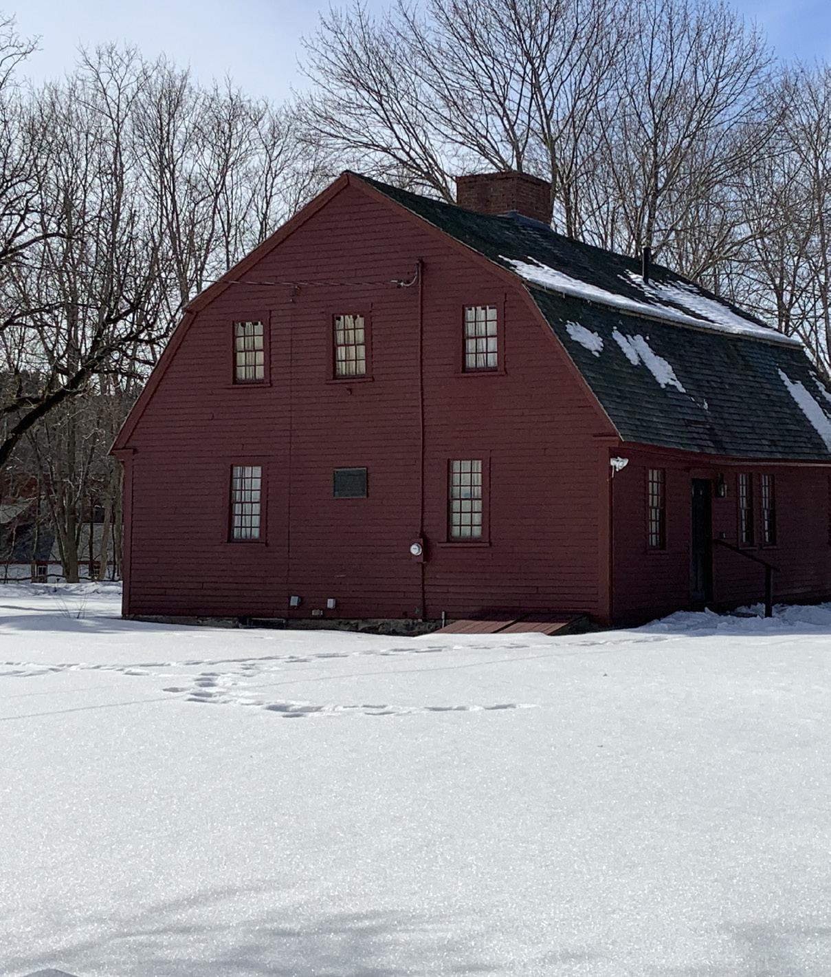
The land for Prospect Hill cemetery, next to St. Mary’s Parish was donated by Daniel Taft. It is one of the oldest cemeteries of the town and there are many historic gravestones. Some of the names that recur through Uxbridge’s history—Aldrich, Farnum, Taft, Wheelock, Capron, Willard, Chapin - are buried here. The map also identifies historic residences, most of which were built in between 1820 - 1880.
Interestingly, the houses have different architectural styles, and they still exist in good condition.
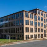
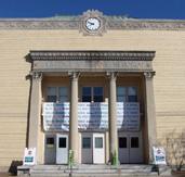
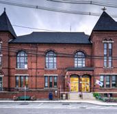
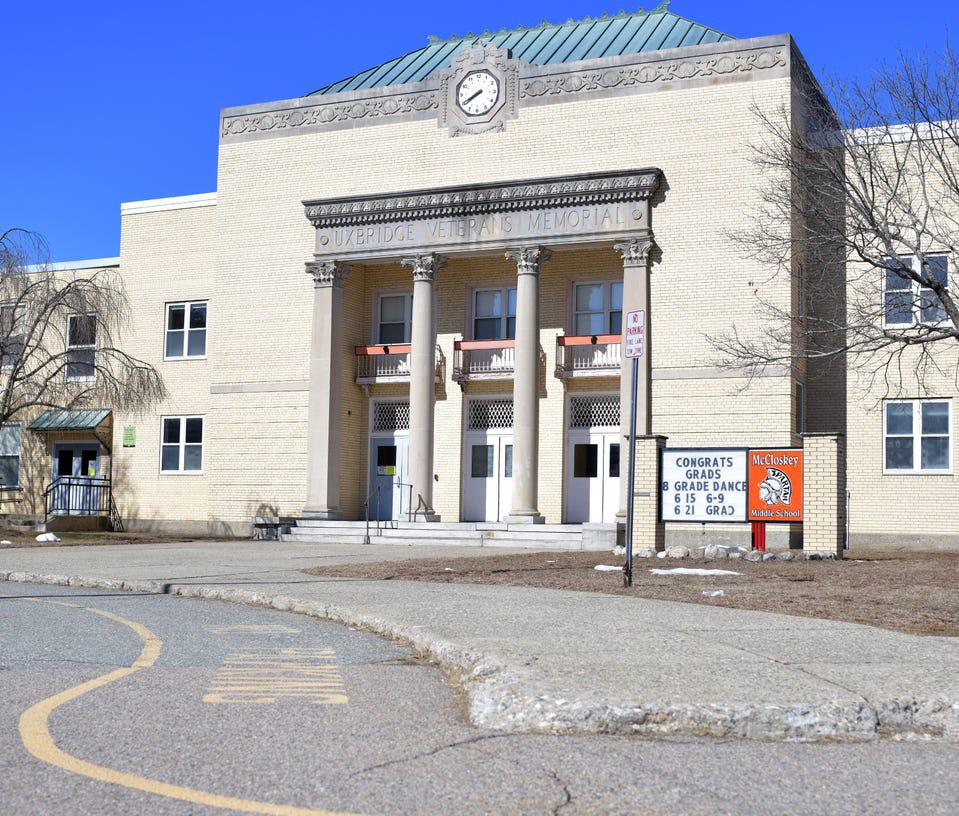
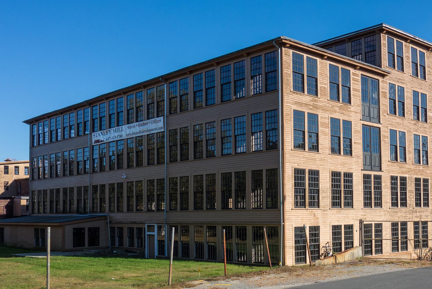
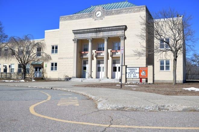
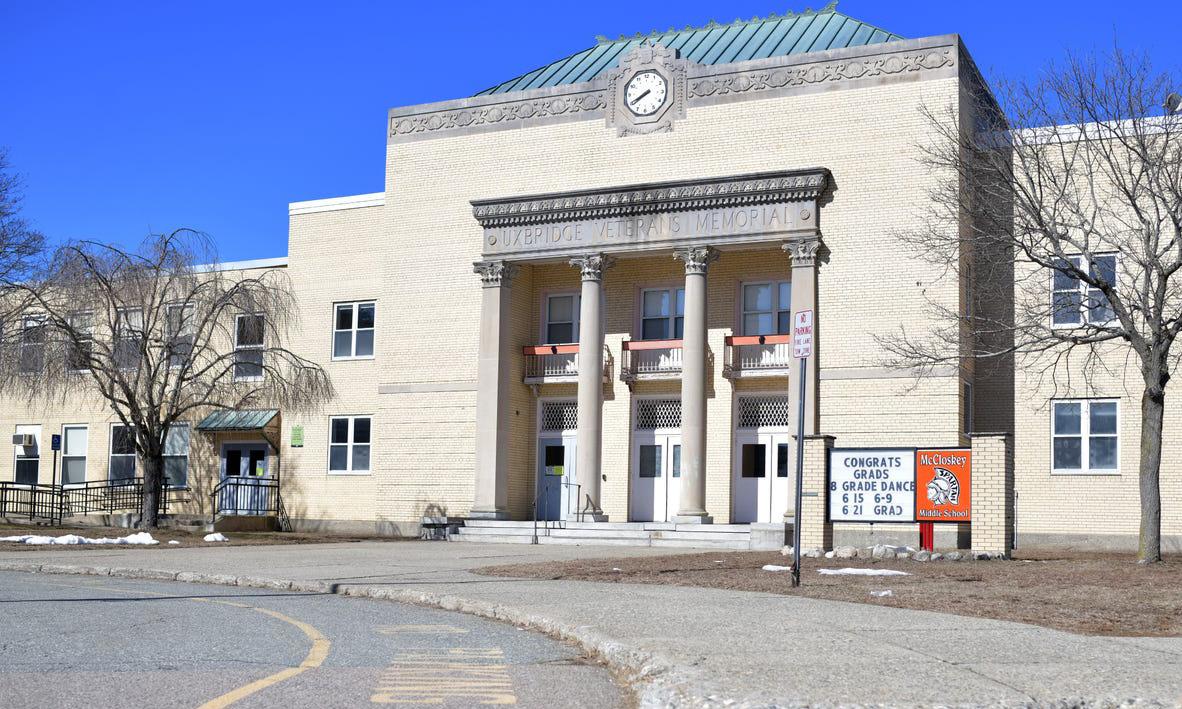
Built in 1937
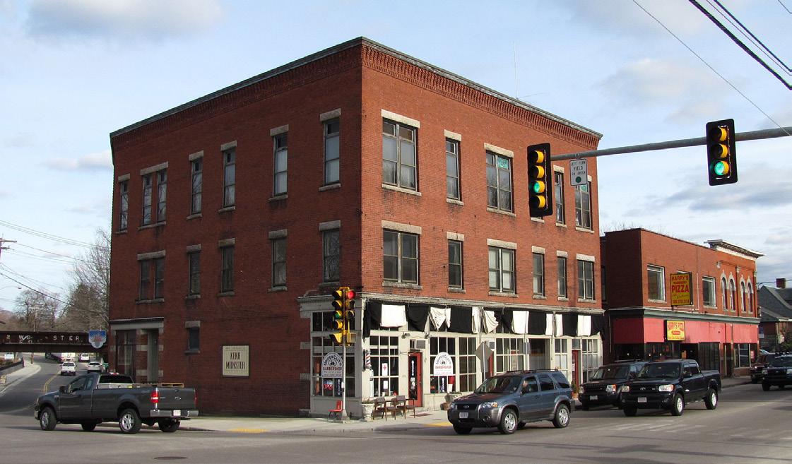
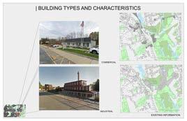
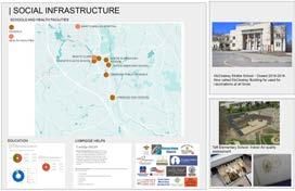
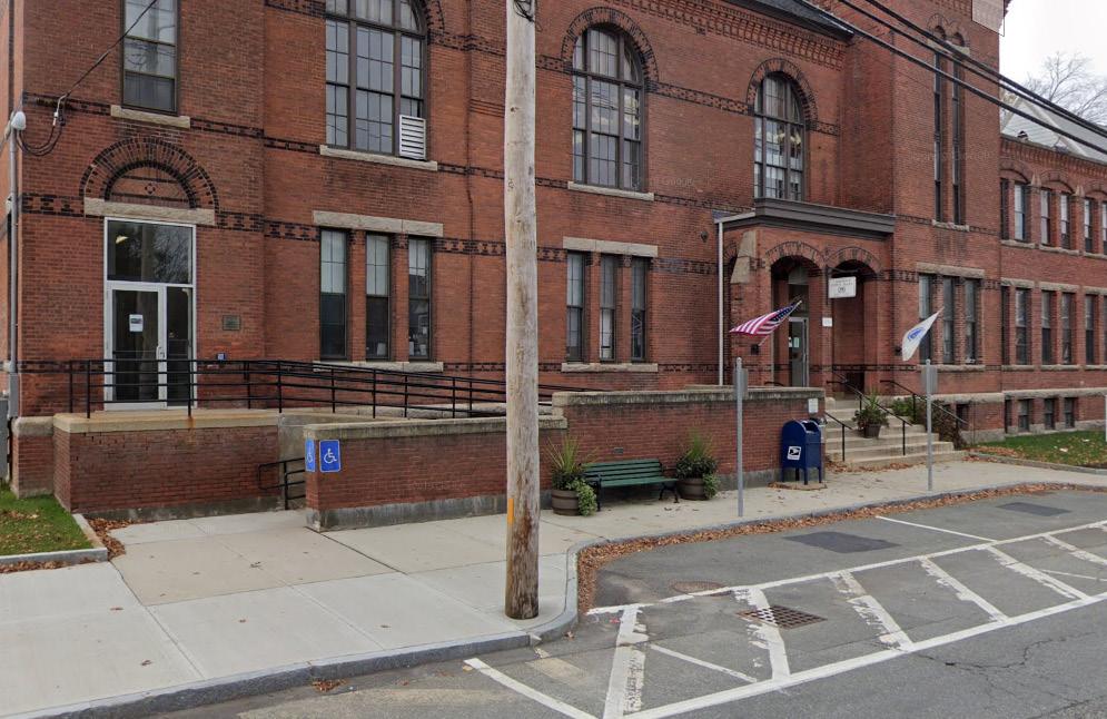
The McCloskey Building served as a middle school for several decades, but due to its extensive rehabilitation needs and the excessive expense it imposed upon the town, residents voted to close it in 2018, ultimately saving the town’s taxpayers 450,00 in upkeep. Since its closing, feasibility studies have been commissioned to turn the building into a municipality center for the town.
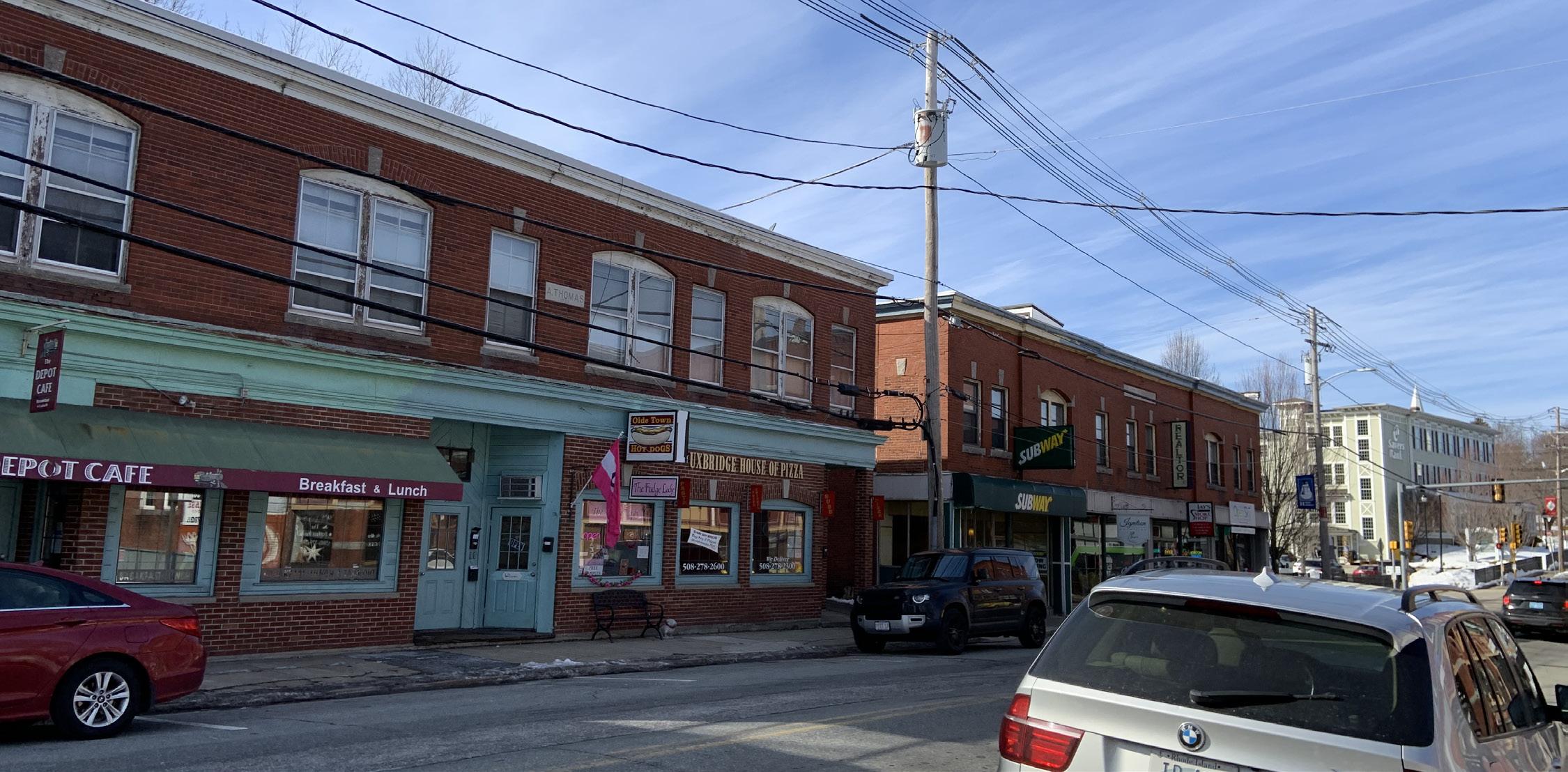
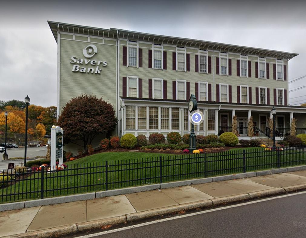
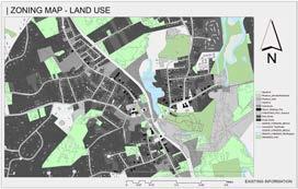
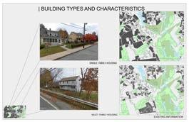
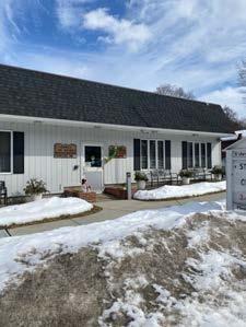
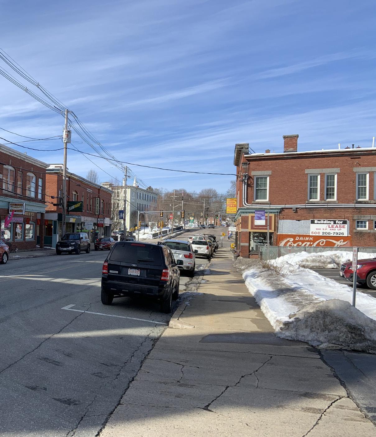
Downtown Uxbridge is predominantly commercial zoning with residential (single family homes boarding the outer edges on main street.
and
are
and

As we established earlier majority of the housing units in the neighborhood are the majority of the housing units in the Main Street District neighborhoods are single family. These houses are generally aimed for the people 55 and above.
The next most common housing typology in Uxbridge is the multi - family housing units. These are single buildings set up to accommodate more than one family living separately. It can range from a duplex to an apartment with four units.
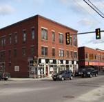
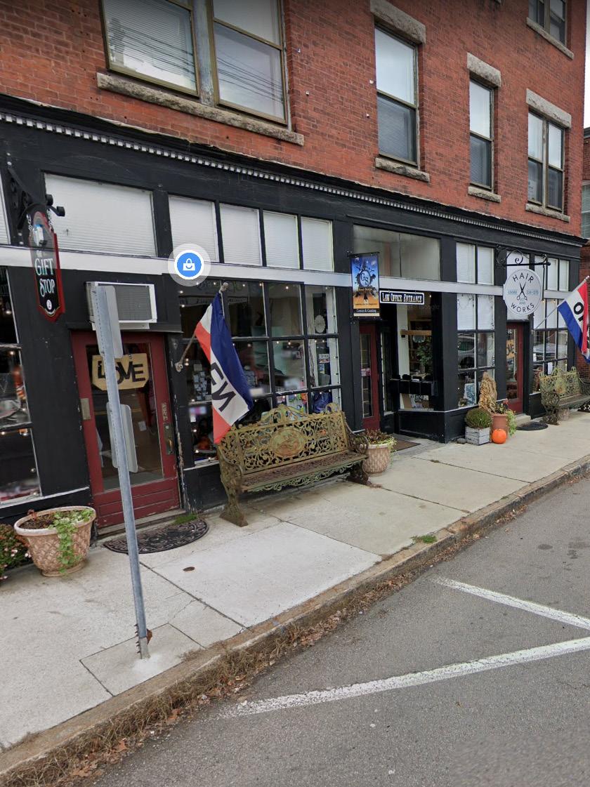
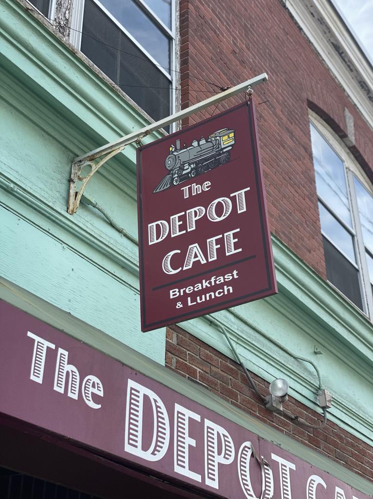
The major commercial spaces that include along this stretch are couple of convenience stores, a gas station, a hardware store and a clothing store. There are couple of deli restaurants available on this street as well.
The major commercial spaces that include along this stretch are couple of convenience stores, a gas station, a hardware store and a clothing store. There are couple of deli restaurants available on this street as well.
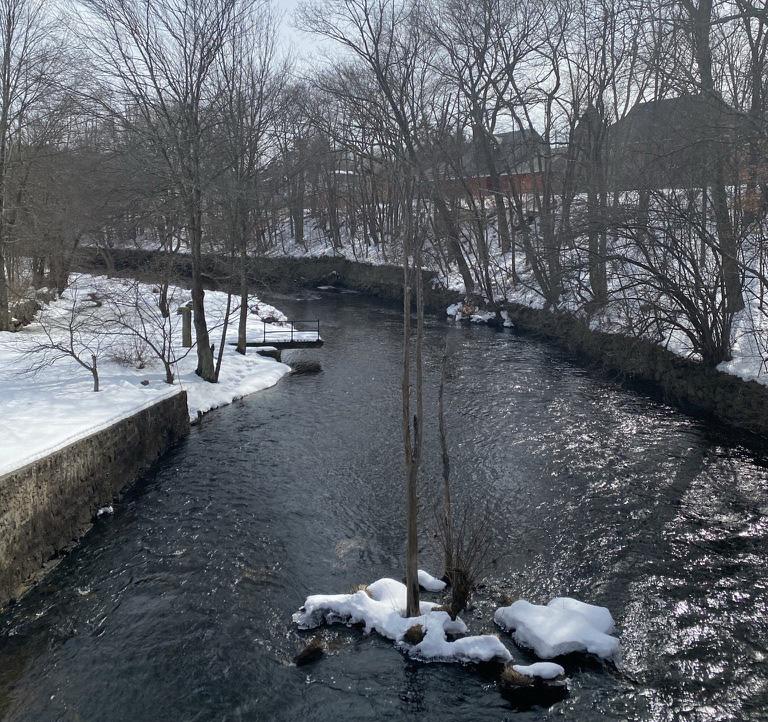
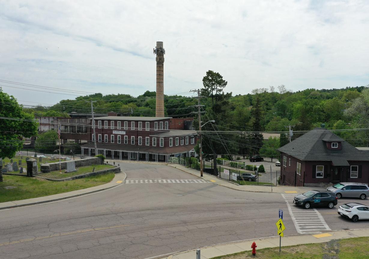
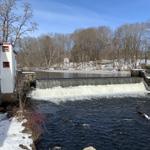
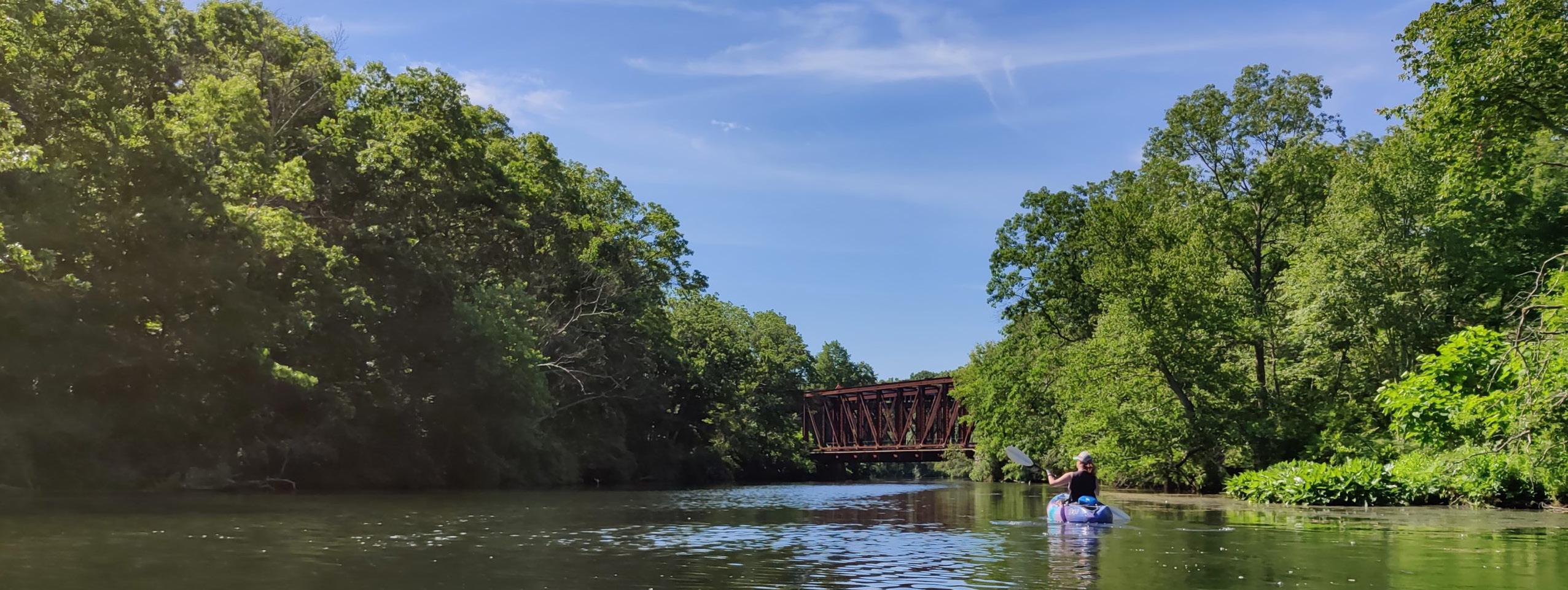
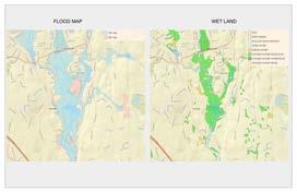
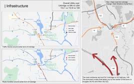
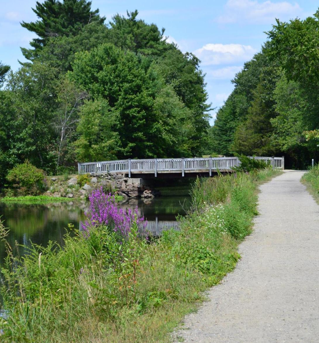
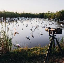
Uxbridge sits in the heart of the Blackstone River Valley. It is known as the “Birthplace of the American Industrial Revolution” as it ran the nation’s first water-powered cotton mill. This National Heritage Corridor (1986) is surrounded by several state parks and natural amenities. Douglas State Forest, the Purgatory Chasm State Reservation, Taft Memorial Park, The Blackstone Gorge, The Blackstone River and Canal Heritage State Park, Cormier Woods, the Quisset Wildlife Management Area and the partially developed Blackstone River Greenway/Bike Trail all surround the town. The Mumford River passes through Uxbridge, providing a scenic dam and potential for a river walk connected to the downtown area. The town’s location provides residents and visitors ample opportunity for outdoor activities - hiking, toe paths, bike trails, canoing, horseback riding, farm visits, historical tours, nature tours, landscape watercolor groups, and camping.


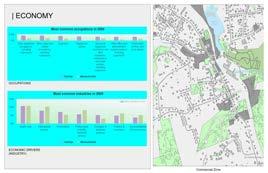
Note: All demographics and economic activities data from CMRCP’ 2020 Data gathering Survey
2020 Key Demographic Indicators (Esri)
2020 TOTAL POPULATION (ESRI)


MUNI
2020 Population Age 25+: Less than 9th…
2020 Population Age 25+: 9-12th…
2020 Population Age 25+:…
2020 Business Summary by NAICS
2020 Unclassified Establishments…
2020 Food Srv & Drinking Places…
2020 Health Care/Social Assistance…
2020 Legal Services (NAICS5411) Businesses


2020 Population Age 25+: High School…
2020 Population Age 25+: Some…
2020 Population Age 25+: Associate's…
2020 Population Age 25+: Bachelor's…
2020 Population Age 25+:…
2020 Educational Attainment Base (Esri)
2020 Average Household Size (Esri)
2020 Median Age (Esri)


Race and Hispanic Origin (Esri)
2020 Hispanic Population (Esri)
2020 Population of Two or More Races…
2020 Other Race Population (Esri)
2020 Pacific Islander Population (Esri)
2020 Asian Population (Esri)
2020 American Indian/Alaska Native…
2020 Black/African American Population…
2020 White Population (Esri)
2020 Age: 5 Year Increments (Esri)
2020 Total Population Age 80-84 (Esri)
2020 Total Population Age 70-74 (Esri)
2020 Total Population Age 60-64 (Esri)
2020 Total Population Age 50-54 (Esri)
2020 Total Population Age 40-44 (Esri)
2020 Total Population Age 30-34 (Esri)
2020 Total Population Age 20-24 (Esri)
2020 Total Population Age 10-14 (Esri)
2020 Total Population Age 0-4 (Esri)
2020 Securities/Commodity Contracts…
2020 Transportation/Warehouse…
2020 Sports/Hobby/Book/Music…
2020 Food & Beverage Stores (NAICS445)…
2020 Motor Vehicle/Parts Dealers…
2020 Construction (NAICS23) Businesses
2020 Total (NAICS11-99) Businesses
2020 MEDIAN HOUSEHOLD INCOME (ESRI)


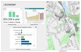
The demographic breakdown of Uxbridge, MA shows the majority of the residents are white, aged 18-65, and have a high school degree or a bachelor's degree. According to Massachusetts population information for 2021, the town of Uxbridge is significantly more white than the state average.
The median age in the state is 40 years old, with Uxrbridge skewing slightly higher. Uxbridge's average level of education is similar to the cross section shown in the state data. The median income in Uxbridge is slightly lower than the state averages.
Within this section are descriptions and summaries of our BAC Gateway team’s efforts to engage the Uxbridge community in the Main Street District planning process: a feedback form and a visioning workshop. Also contained is a priority matrix, in which we list, rank, and summarize the issues that community members raised during these outreach efforts.
Here, our team’s mission is to contact a diverse array of community members and, though discussion, to synthesize a robust list of issues they feel are important to consider during redevelopment of the Main Street District and its municipal assets. The issues and aspirations developed together with the community during this process provided a foundation for the visioning themes and strategic recommendations we discuss in the following section. Altogether, these efforts will provide a stable base for ongoing planning projects, ensuring that community actors have a holistic vision of what areas require improvement and also what values should guide that improvement.
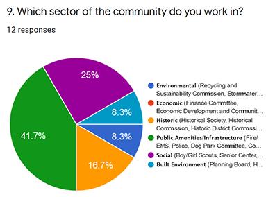
We distributed this survey to a list of community stakeholders generated through discussion with town government and CMRPC, through online and on-site research, and through direct conversation with community members. This list encompassed 72 organizations involved within the downtown, including Town departments and committees, local businesses, schools, housing complexes, churches, youth groups, social organizations, and environmental caretakers.
As previously discussed, our team developed a list of stakeholders. These contacts were divided into six categories of community work based on the facet of Uxbridge that their work most affects. These categories were used while developing the feedback form structure and visioning workshop agenda, helping us either gather similar data or foster discussion across multiple disciplines. They are as follows:
1. Environmental
2. Economic
3. Historic
4. Public Amenities/Infrastructure
5. Social
6. Built Environment
Respondent Summary
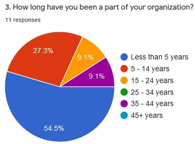
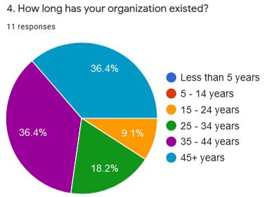
In all, 11 responses were submitted from the following organizations (written as received):
1. Department of Public Works
2. Senior Center/Council on Aging
3. Historical Society
4. Cable Access TV
5. Town Manager/Municipal Government
6. Uxbridge-Millville Regional Housing
7. Uxbridge Public Schools
8. Our Lady of the Valley Regional School
9. Uxbridge Police
10. Uxbridge Historic District Commission
11. Blackstone River Valley Heritage Corridor
We hoped to receive more feedback from nongovernmental organizations, such as local businesses, social groups, and less involved residents. Unfortunately, time pressure and COVID-19 denied us methods such as partnering with local organizations to include a survey link in newsletters or door-to-door distribution, which would have reached a broader base. As such, our results must be read while keeping in mind the context of our respondent demographics.
We consider the ongoing effort to define the Main Street District’s borders a worthwhile goal. When asked what respondents believed were the borders of downtown Uxbridge, they gave a variety of answers, defining different spatial areas by varied markers - roads, businesses, landmarks. Similarly, when asked whether the McCloskey Building was a part of downtown Uxbridge, two answered ‘yes’, four answered ‘no’, and one answered ‘kinda’. This confusion can be mended with built and informational solutions, as are already underway.
We gleaned this information from our desktop study (special mention to the various resources on hand from the Economic Development and Community Planning Department), but it is worthwhile to note again the prodigious history grounded in Uxbridge’s soil. Multiple respondents noted the numerous historical movements that inhabitants of this small town have made waves during - the Revolutionary War, Civil War, industrial revolution and mills, railroad era, women’s suffrage movement, WWII, to list several – and the lengthy built catalogue that accompanies those historical moments. It was inspiring as well to hear about the Unitarian Church and Farnum House renovation projects currently underway. Uxbridge’s history is an impressive, unique draw. Respondents to our feedback form and our visioning workshop agree that it should be central to the Main Street District development efforts.
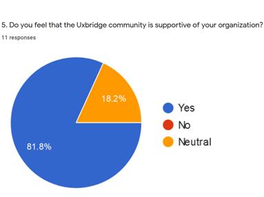
Support for Uxbridge Organizations
This is a positive aspect to note – only two of nine respondents answered ‘neutral’, and not a single ‘no’ was recorded. One of those neutral respondents explained why, stating that they are upset by high water/sewer rates caused by capital project debt (which was approved at a former Town Meeting). All in all, this is a positive sign, especially next to the following question, which asked whether the Uxbridge community was aware of the respondent’s organization: ten of eleven respondents answered ‘yes’.
“Current residents have repeatedly spoken about how ‘small town feel’ was key to choosing Uxbridge.”
We find it worthwhile to note that several respondents discussed how the position of their organizations along Main Street makes them more noticeable to residents. When asked what about downtown Uxbridge most benefited their organization, one respondent wrote, “The convenience of swinging by and paying a bill while ‘in the area’. Sometimes just seeing the building reminds people to come pay their bill before it’s late!” Others, similarly, noted the proximity or availability that the position afforded their organization. This is not an argument against the McCloskey Building development – having most municipal functions in one place would create another central location, after all – but a suggestion to be considered while planning that development; what efforts or areas could be planned that would similarly remind habitually traveling residents of their municipal duties?
Summary
After the initial Community Feedback Form, it was clear that additional outreach efforts would be needed to gain deeper understanding of issues identified within the community responses. On March 23, CMRPC, Adaptiv Architects, and Boston Architectural College (BAC) graduate students participating in the Gateway program held an online Community Visioning Workshop. The goals of the workshop were to continue to identify issues within the area, rank the importance of these identified issues, and foster discussion around potential solutions, visions, and development priorities for the Main Street Corridor.
Several key community members attended the workshop from the Economic Development and Community Planning Department, the Historical Society, Historical Commission, Department of Public Works, UCTV, and the Zoning Board of Appeals. The workshop was facilitated via zoom and an online whiteboard program called Miro. The workshop was structured into ten sections: Introduction, Miro Board Navigation, Site Presentation, Issue Identification, Issue Ranking, Case Studies, Declarative Sentence Exercise, Building Reuse Discussion, Inspiration Board, Closing Remarks.
To begin, CMRPC, Adaptiv Architects, and the BAC Gateway students started by introducing themselves, the agenda, and the desired outcomes for the workshop. Students then presented desktop research of Uxbridge at its Main Street Corridor: a historical timeline, building inventory, zoning map, demographics study, climate overview, soil examination, and traffic report. Following this, students introduced participants to basic functions of Miro Board, the online tool used for this workshop. This structure told participants what to expect and set up the context of the conversation.
The first participatory activity asked community members to identify key issues within the Main Street Corridor. Gateway students opened this section by summarizing key issues gathered from the Community Feedback Form. The categories used in the Community Feedback Form, and summarized above, were also used in the Community Visioning Workshop. However, facilitators organized them into three combined groups: 1. Housing, Buildings, & The Economy; 2. Historical & Environmental; 3. Social Amenities & Infrastructure. These categories were used throughout the workshop as a way to organize issues, better identify priorities, and foster more focused discussion within breakout rooms.
During the Issue Identification exercise, community members discussed traffic congestion and danger along Route I22 and Route 16, options and feasibility for change, and ongoing state and town-led projects within that space. Additionally, community members identified a need for better diversity of use and more pleasing buildings along the Main Street Corridor, and the need for Uxbridge to transition to a destination economy, highlighting its historical and environmental assets.
As community members discussed the Main Street Corridor, BAC students listed the identified issues according to their groups in ranking tables on the next board. Community members then continued their discussion as they ranked the identified issues from least to most important using different colored sticky notes. The highest ranked issues were ‘limited mobility access’, ‘transition to a destination economy’, ‘difficult pedestrian crossing and bicycle access’, and ‘repurposing of town-owned properties (if McCloskey is developed)’. We also discussed the need for housing within Uxbridge - specifically affordable housing - and the housing study currently being conducted in the area.


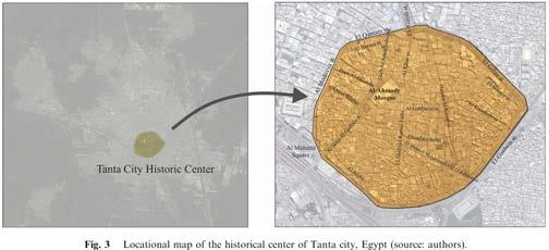
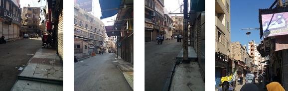
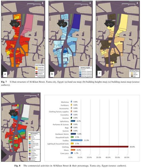
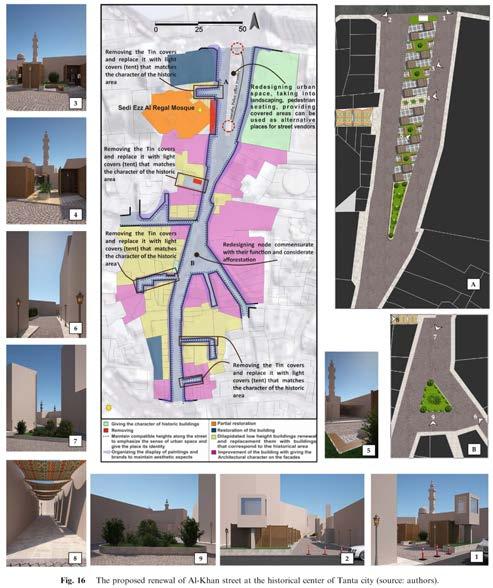


In the first half of the workshop, we gained a broad understanding of what our participants felt were problems within Uxbridge. The second half was designed to bring more specific and grounded discussion on how those issues could be addressed. Gateway students began by presenting four case studies from other areas which have undergone a similar redevelopment process: Hyde and Jackson Square in Cambridge, MA; Columbus, OH; Milltown, NY; and Tanta, Egypt.


With the goal of facilitating more in depth discussion, facilitators next broke community participants into three zoom breakout rooms. Each group chose a top-priority issue identified in the issue ranking exercise and discussed a vision for that problem using a declarative sentence template.
“[blank] is an issue in the Main Street Corridor. It is our mission to solve this issue because [blank]. We believe a potential solution would be to [blank], which reflects the values of Uxbridge because [blank].”
Following the declarative exercise, CMRPC led a discussion regarding the adaptive reuse of the McCloskey Building. The community’s attitude towards reuse was positive, citing McCloskey’s desirable location, experiential quality, and amenities. Other uses were suggested for the existing municipal buildings such as a visiting center for the Blackstone Valley area, a makerspace, or multi-use building remodeled by an outside developer. Community members emphasized that a newly remodeled municipal center would attract business and financial investment in Uxbridge, leading to a return in the town’s investment. Furthermore, it was strongly stated that the McCloskey building remodel is of top priority and needs to take advantage of the resources currently available to the town.
The three discussion topics chosen were environmental and historic connectivity, truck traffic congestion, and insufficient business presence along Main Street. Topics discussed in each breakout room included the history and feasibility of the Greenway Bike Path, how to repurpose vacated municipal properties, the practicality of rerouting Route 16, a lack of Main Street attractions to gain visitors, how to design a connection between the Farnum House river boardwalk and Main Street, and how to better identify historical landmarks within Uxbridge. The topics addressed in these breakout sessions largely influence the visioning themes identified in the Community Visioning & Aspirations for Main Street Corridor and strategic actions in the Strategic Actions and Recommendations sections of this report.
The workshop ended with an inspiration board exercise where participants put colored sticky notes by images of various urban interventions, identifying their desirability for the Uxbridge context. While participants engaged with the board, BAC Gateway students recapped workshop accomplishments and CMRPC detailed further upcoming engagement efforts.
Both the Community Expert Feedback Form and Community Visioning Workshop were essential steps in identifying important issues within the Main Street Corridor as well as beginning to understand what the community envisions for the future of their town. Further outreach, as well as combining findings from simultaneous community efforts, will be essential in continuing to develop a robust development plan for the Main Street Corridor.
Summary
As stated, the primary goal of outreach efforts were to not only identify issues within the Main Street Corridor, but also identify which issues should be prioritized within the forthcoming development plan. It was also important to identify which issues could be solved with town resources and which problems would require larger investment, outside intervention, and a longer timeline. Doing so provided a perspective of which issues were not only important, but also more readily achievable and which issues would come later in the development process. This frame of discussion led us to develop a priority matrix in which we determined which issues were high-impact and short-term, high-impact and long-term, low-impact but short-term, lowimpact and long-term. The format of the workshop only allotted time to discuss high-impact issues, the details of which will be discussed below. However, the structure of the priority matrix can provide a perspective from which to discuss additional issues and will be helpful as Uxbridge continues to form their development plan in coming months.
Many of the issues were reiterated between outreach efforts as well as have commonalities between them. After discussing issues that were identified in the Feedback Form, as well as identifying additonal issues in the workshop, community members determined that the highest priority issues in each category were the unsafe traffic conditions at the primary intersections on Main Street, a lack of connectivity with surrounding environmental and historical assets, limited accessibility, and municipal building reuse.
Community Feedback Form:
Traffic congestion
Insufficient parking
Inaccessible municipal buildings
Not enough businesses in the District
Disconnect between Main Street and environmental features
Walkability and Bikeability
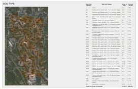
Contaminated soil and flooding risks
Workshop:
Group 1: Housing, Buildings, & the Economy
Limited mobility access
Rundown apartment buildings along Main Street
We need a bylaw that delays demolition on and building on teardowns
Not enough businesses and restaurants in the downtown area
Insufficient affordable housing
Transition to a destination economy
Group 2: Historical & Environmental
Main Street not connected to parks or waterways
Not enough greenery
History not properly integrated into the downtown area
Lack of greenery; not enough community green space
Lack of connection to environmental assets, passive recreation
Lack of cultural, environmental, and historical attractions
Lots of cultural, environmental, and historical experience that is not integrated into the Main Street Corridor
Litter; Not enough trash disposal
River flooding Main Street
Need official designation for some historic sites
Group 3: Social Amenities & Infrastructure
Unsafe intersections; Traffic
Route 16 moves through the center of town creating congestion and safety issues
Street potentially not wide enough for a “streetscape”
Congested weekday parking; Lack of available parking for municipal buildings
Difficult pedestrian crossing and bicycle access
Truck traffic congestion
Unsure of what municipal buildings will be repurposed as if Mccloskey Center is redeveloped
Inconveniently places powerlines - west side
Need to complete the planned bike trail through Uxbridge
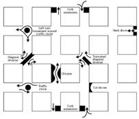
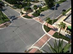
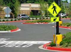
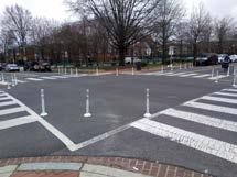
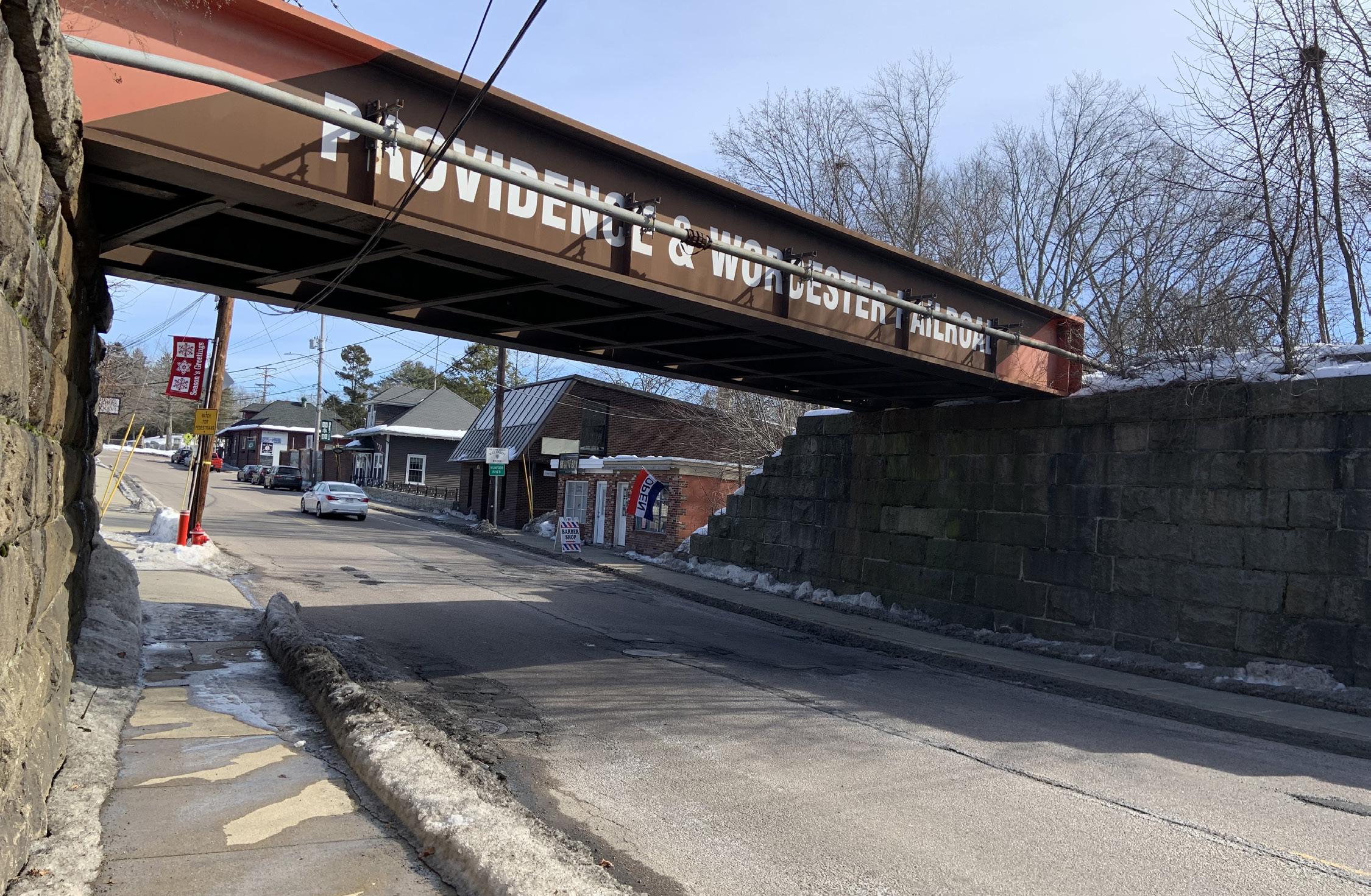
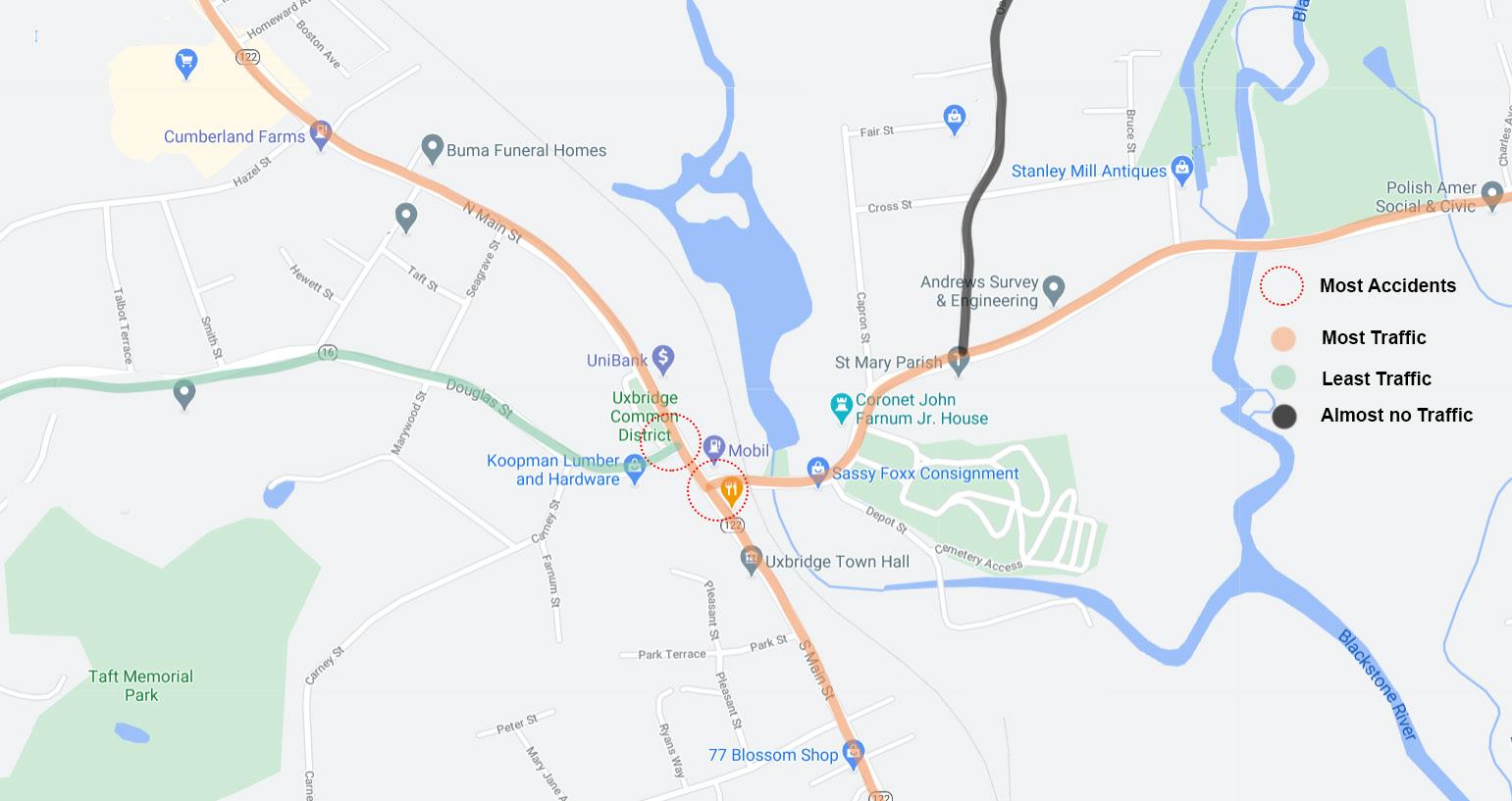
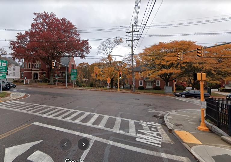
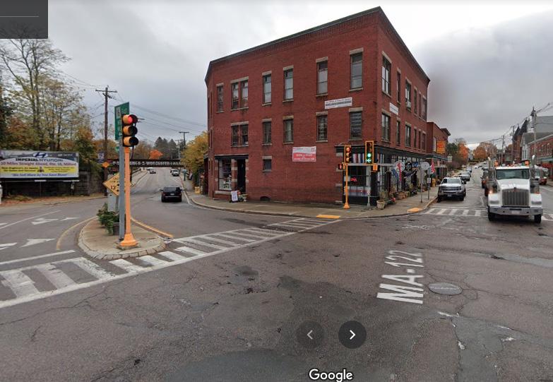
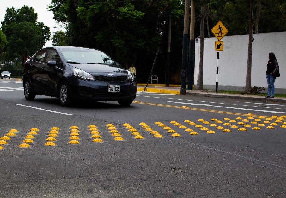
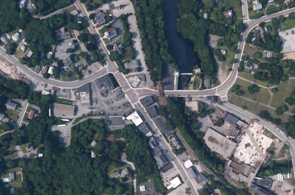
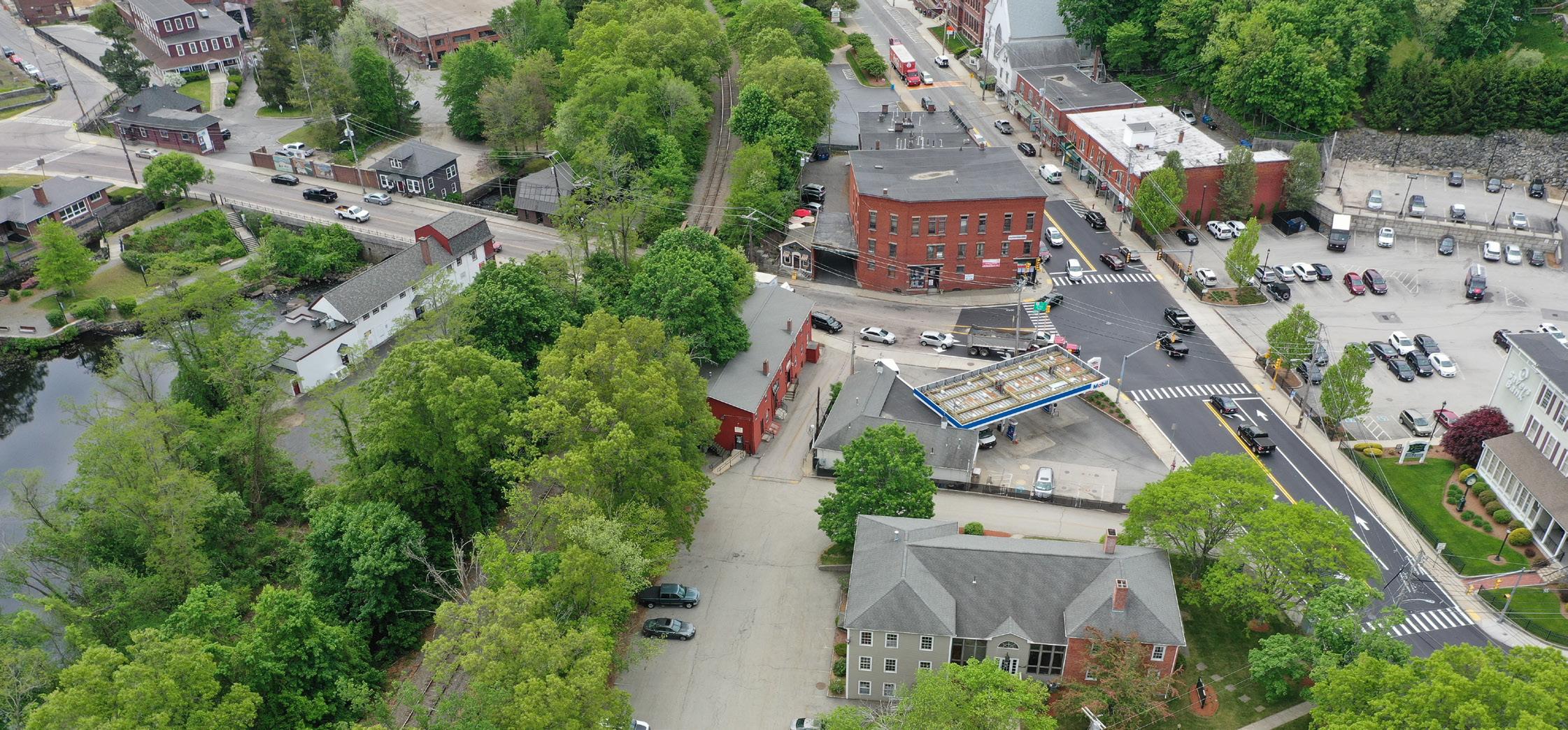
I22, primarily referred to as Main St, intersects with Route 16 in the middle of the Main Street Corridor. The zig-zag intersection results in an unusually high amount of traffic and traffic accidents per year. The additional rail bridge that runs over Route 16 causes a dip in the road that floods due to its proximity to the river and occasionally causes trucks to get stuck underneath it. The town has attempted to build a residential feel amidst this high volume of truck and car traffic, developing a crosswalk, streetside parking, and sidewalks, but these are unsafe; speedy traffic commonly flouts the crosswalk, narrow streetside parking results in car doors being opened to traffic, and the narrow sidewalks are cramped and exposed. The dangerous atmosphere is exacerbated by the proximity of municipal buildings and shops, resulting in frequent jaywalking. Additionally, there is no discernible bike path here, nor are sidewalks wide enough for cyclists to share the walkway with pedestrians, discouraging them from passing through the area. All of these factors result in a precarious environment for vehicles, cyclists, and pedestrians.
This intersection, and its related issues, were discussed at length by community members in the workshop who wanted wider, greener sidewalks that were safe and accessible for pedestrians as well as to rework the vehicular flow to make the intersection safer. Similarly, feedback form respondents advocated for more noticeable crosswalks, better signage, traffic control, and roadway reconstruction. However, community members were also apprehensive about the feasibility of widening the sidewalks or altering the street conditions in any dramatic way. Currently, the Massachusetts Department of Transportation (MassDOT) has begun the reconstruction of RT I22 through the Main Street Corridor. They prioritize improving pavement conditions, bicycle and pedestrian accommodation, safety, and signage, but no drastic changes to the current conditions have been suggested.
It was determined through the feedback form and workshop that the road and sidewalk conditions are a top priority, however require state involvement and additional resources beyond the town’s capacity, making this issue a long-term development goal - meaning it should be featured as a top priority within the development plan but under the expectation that drastic infrastructural impact will happen over a longer period of time.
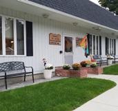
Uxbridge predominantly features an aging population. Limited parking and accessibility along its Main Street Corridor results in a significant portion of the community struggling to engage their downtown and its resources. This issue is correlated to the area’s previously discussed traffic issues, as well as the current location of municipal services. The Town Hall, Senior Center, and Library are not ADA compliant and have limited capacity for the services they provide. Additionally, the public parking lot is located offset from the street and on a hill, making it difficult for those with mobility issues to take advantage of it. Even the closer, newly completed Senior Center lot, our feedback form respondents noted, does not have enough capacity to alleviate these issues. Such factors make accessibility an interconnected issue, most likely addressed in the mid to long-term through multiple related interventions.
Priorities Closing Summary
After two initial outreach efforts conducted through the Community Feedback Form and Community Visioning Workshop, BAC students, Adaptiv Architects, and CMPRC were able to work with active Uxbridge community members to identify several Main Street Corridor issues as well as which one’s should be prioritized in development efforts. However, in order to more thoroughly identify which issues and solutions should be prioritized in a development plan, further community engagement efforts will be essential. As mentioned in the Community Feedback Form section above, we had hoped to receive more input from non-governmental organizations such as local businesses, social groups, and less involved residents. Moving forward, input from these stakeholders is essential in creating a robust development plan that addresses issues in both the short and long term for truly transformative change in the Main Street Corridor, and ultimately, the entire town of Uxbridge.
McCloskey Center Adaptation & Municipal Building Repurposing Short & Long-Term; High-Impact
The biggest priority in Uxbridge is the adaptation of the McCloskey building from an empty school to a municipal center. By congregating the Town Hall, Senior Center, and Other municipal and community services and functions within the building, they will have ample room, ample parking, and ample accessibility to grow and change with the needs of the community. As Uxbridge moves into the future, it will need a Library with state of the art technology, a senior center with a full kitchen and larger facilities to provide their growing portfolio of services to the community, and a more welcoming town hall that all residents can physically access.
The town is on board with the move of municipal services to the McCloskey Center - even voting to fund a feasibility study in 2019 that verified its potential - and are keen on making this the number one priority in coming years. However, citizens are concerned with what will happen to the existing municipal buildings, two of which are historical. As a secondary priority to the McCloskey build out, existing building interventions are subject to limited financial resources. Potential solutions discussed at length in the Community Visioning Workshop are featured in detail in the Strategic Actions & Recommendations section of this report.
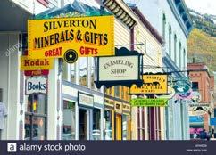
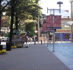
A destination economy is one where most aspects of the economy relate directly or indirectly to the spending of those who visit. As our workshop participants noted, Uxbridge is already a town frequented for the passive recreation opportunities offered by the surrounding environmental amenities and the Blackstone River Valley as a whole; we envision a future where the Main Street District is as attractive and as well frequented as these attractions, a future where the town’s built and natural functions work together to encourage visiting and spending. To this end, having heard and acknowledged the issues raised through our feedback form and visioning forum, in the following pages we will propose strategic actions intended to make known and glorify the history of the District, to make the area more attractive and safe to pedestrians, to experientially connect the built and natural areas of Uxbridge, and to alter the building typology along Main Street.
Pike/Pine, Seattle Neighborhood Design Guidelines
One of the concerns most often raised in response to new development is, “Will this erode the unique character of our community?” This is especially important when development is intended to create a unique sense of place, fueling a destination economy. Though in an urban context, the neighborhood design guidelines established in this report by an area of Seattle concerned with maintaining their history as an auto row district are a fine case study in how detailed a framework for considering this issue can be. The report details the existing architectural context down to specific materials and elements, signature features of that context, and specific desires for further development. Read through page 14 and pages 24-30 of this report: http://www.seattle.gov/ Documents/Departments/OPCD/OngoingInitiatives/ PikePineConservationDistrict/Pike%20Pine%20DG%20 2017.pdf
MA Heritage Trail
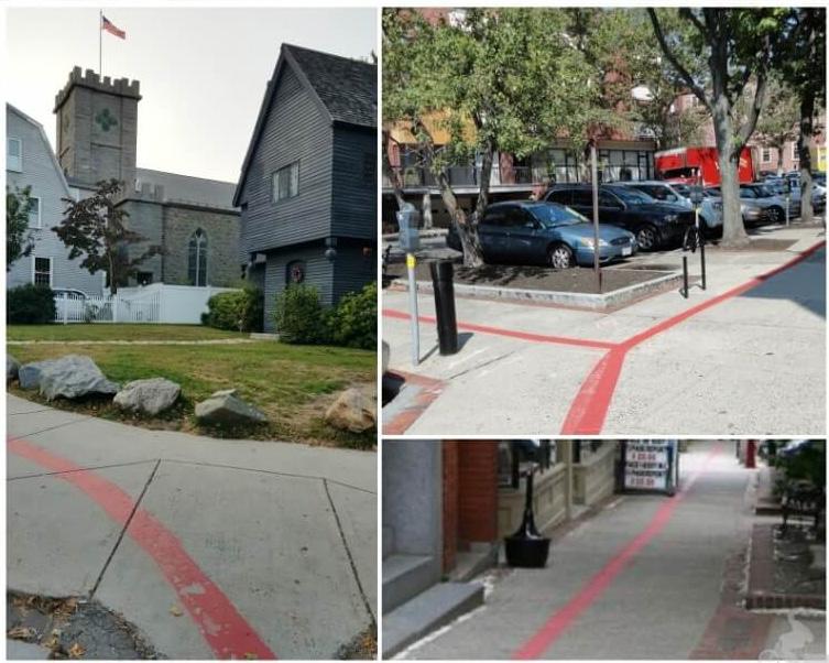
Salem, another Massachusetts town with a rich history, has effectively crafted a town image and presented its historical landmarks so as to connect visitors with economic nodes. Salem’s heritage trail is a red line painted on the ground that guides interested parties through a visitor’s center, historical properties, museums, art pieces, and, importantly, various shops, restaurants, and public gathering spaces. A mobile app and numerous accessible publications give visitors an idea of what they’ll see when visiting. In all, Salem is a fine example of a well planned history-centric destination economy. As states the header to their free town guide: “Delicious Cuisine. Unique Shops. Engaging Tours. Unmatched History.”
Our community respondents repeatedly mentioned the prodigious history of Uxbridge. The Town has endured for hundreds of years and has been at the forefront of several cultural movements - to name three, the Revolutionary War, the Industrial Revolution, and the womens’ suffrage movement. This history remains in the Town’s impressive inventory of historical buildings and places, many of which we discussed earlier in this report (an exhaustive list can be found on the Department of Economic Development and Community Planning webpage). In concert with the idea of a destination economy, we envision a future where this built history is better taken care of and made more evident to visitors, a future where visitors and residents alike can easily immerse themselves in learning about the momentous events that have occurred here, in Uxbridge. To this end, in the following pages we will propose strategic actions intended to make known and glorify the Main Street District’s history.
Parramore-Callahan.Orlando Neighborhood Project
The goal of this effort was to ‘spread awareness of the cultural value of Orlando’s Parramore District by creating an immersive experience that presents the area as a cultural, educational, and tourist destination.’ The Project has addressed the on-site experience, developing a mobile app that guides visitors through historical markers using augmented reality and digital storytelling and 3D printing plaques to place on the buildings themselves. They have also addressed the off-site experience, collating lesson plans, oral histories, and documentaries that will allow electronic visitors to immerse themselves in Parramore’s history as well. Check out their work at https://parramore-callahanneighborhoodproject.org/.
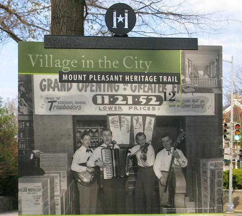
This is one of several heritage trails in Washington, D.C. Visitors are led through a self-guided 90 minute tour by trail maps and 17 posted large city signs with maps, information, and historical photographs. Like Uxbridge, Mount Pleasant’s relevant history spans several notable periods and demographics. Like Salem, they make a point to include local businesses and restaurants along the trail, referencing some as heritage destinations or community landmarks, and have partnered with these businesses, having them hand out trail maps and advertise the heritage trail to visitors.
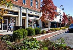
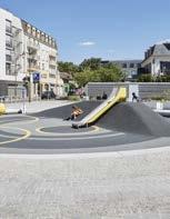
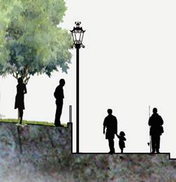
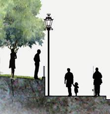
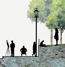
Pedestrian safety along Main Street was the first issue discussed at our visioning workshop and the issue mentioned most by feedback form respondents: at the moment, the road is not built to accommodate a high volume of pedestrians as well as cars and trucks. Indeed, reducing Main Street traffic is one of our reasons for moving Uxbridge’s municipal hubs to the McCloskey Building. As such, we envision a future where pedestrians on Main Street feel safe to move, to pause, and to cross the road, where cars travel smoothly and parking is easy, and beyond as well to a future where bikes and those less able also have means to pass through. We envision a future where residents and visitors can freely and safely live, work, and play in the Main Street District. To this end, in the following pages we propose strategic actions intended to address traffic issues, craft inclusive through-access, and make the street environment more human.
This report on walkability in rural Massachusetts, done by WalkBoston in concert with CMRPC and other groups, details the varied path typologies found within the state, benefits and drawbacks to each, items to consider when designing paths, and the overall community benefits of addressing pathmaking. They supply a multitude of case studies to support their examples; the report is a great read for those interested in civic design and those simply interested in learning more about Massachusetts communities. It is found here: https://www.walkboston. org/sites/default/files/WalkBostonRuralWalkingToolKit. pdf.
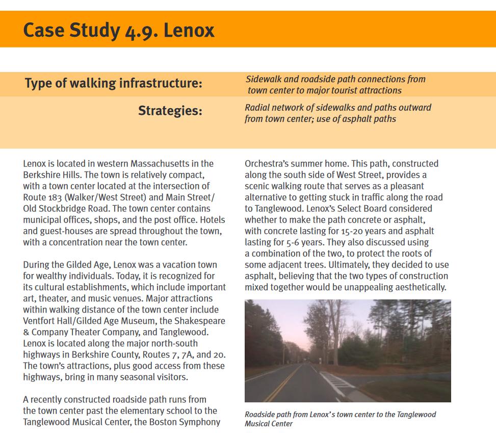
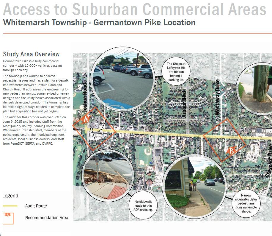
We include this report because of its focus on access to suburban commercial areas, an aspect relevant to Uxbridge and our vision goals. The report discusses how parking and walkability can and should be developed in concert, how to navigate walkable development in an area with high car and truck traffic, and discusses several case studies sited along main street corridors, detailing how each community solved the issues they faced. Consult pages 44-52 of this report: https://www.montcopa.org/ DocumentCenter/View/9839/Walkability-Plan_Final_ web-version?bidId=.
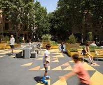
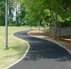
Our workshop participants noted that Uxbridge, at the crux of the Blackstone River Valley, is known for its passive recreation opportunities. Three rivers run through the town. Green space is abundant. Like Uxbridge’s storied history, this is an important asset to leverage while crafting a unique sense of place that would define a destination economy. We envision a future where the built environment and natural environment are connected; where circulation between the Main Street District and natural assets is evident and, also, where Uxbridge is considered integral within the regional context. In the following pages we propose strategic actions intended to experientially and architecturally connect built and natural, to maintain healthy and open space, and to create a regional connection.
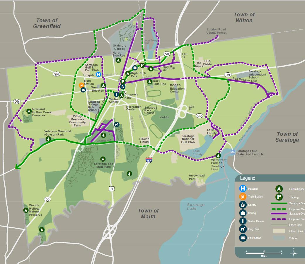
Saratoga Springs, NY Greenbelt Trail
Saratoga Springs, like Uxbridge, is a community with a multitude of passive recreation opportunities and the trails associated with each. They endeavor to connect these exhibits throughout the town with a single trail, the Greenbelt. This will not only create more opportunities for passive recreation, but also make it clear to all visitorsSaratoga has a wide variety of attractions and established organizations - that there is more to see. In this way, the town is promoting an image of the city as a natural center while improving economy and environment by capitalizing on their existing natural amenities and infrastructure.
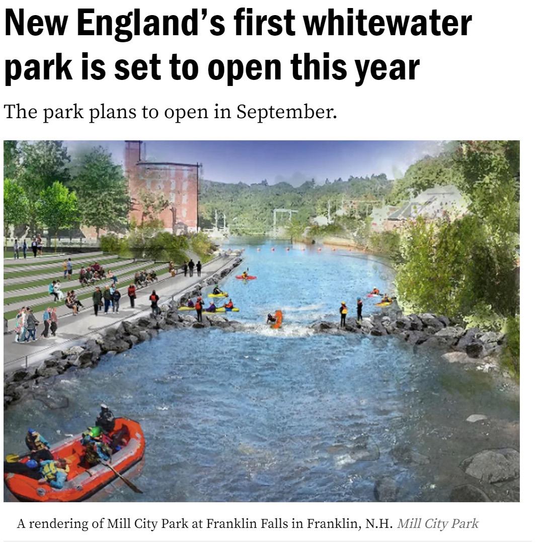
A central New Hampshire city is transforming its downtown, creating a 13-acre park where visitors can whitewater raft, surf, bike, and camp.
Construction begins in July on Mill City Park at Franklin Falls, billed as the first whitewater park in New England. The park plans to open in September 2021.
https://www.boston.com/travel/
Sources: MIT University civicmoxie.com/main-streets-revitalization
Sources: MIT University civicmoxie.com/main-streets-revitalization
The revitalization plans aims to support independent businesses, promote local culture, and improve the quality of life for neighborhood residents and attract tourism to the area. The goal of the project is to create an iconic street such as Newbury St or Beacon Hill in Boston. The students started analyzing the site’s diverse programs to understand the organization and the identity of the street. This data helped them develop a plan for recruiting complementary businesses and marketing this commercial area.
Project:
Revitalization of Urban Main Streets
Team:
MIT Urban Planning student run project
Location:
Hyde/Jackson Square, Boston, MA & New Orleans
Completed: 2002 - 2015
Project Type:
Arts and culture, community revitalization, corridor / main streets, urban design.
Plan Priorities:
•Pedestrian improvements
•Traffic calming as well as streetscape
•Façade improvements on older buildings.
Key Takeaways
• Student led visioning process
• Attracting tourism and improving diverse programming to revitalize Newbury street
• Street facade uplifting can be a good strategy for renewal
Sources: Ms Consultants, inc. msconsultants.com/urban-revitalization-complete-streets/
The project goal is to develop the local economy, restore historic buildings and structures, and create streetscapes for the potential future growth in urban areas such as the I-70 and I71 reconstruction.
The project aims to create more welcoming environments to walk, bike, and use transit, improving accessibility to downtown and adjacent neighborhoods that were once divided by the original freeway construction.
Plan Elements:
•New sidewalks
•Bike lanes
•Brick crosswalks and sidewalk intersections
•On-street parking
•Street trees
•Decorative street lights and traffic signals
•Granite curbs
•Bus stops
Key Takeaways:
•Total renovation of the Architecture & Landscape
•Renovation of building façades
•Pedestrian access (Bike lanes, new sidewalks...)
NB: The strategic actions and recommendations are preliminary suggestions that have not been validated through analytical data nor coordinated with other broader municipal development priorities. These recommendations were developed in line with the community limited community input identified in this report should only be read as idea setting for further exploration , engagement and further development.
These recommendations have been organized and delineated in line with the community visioning themes identified as follows;
Re-imagining Down Main street Uxbridge Vision
Important Notes:
Vision to be developed through further (NO DONE THROUGH THIS REPORT)
Themes: developed through limited community engagement. Should be validated further Strategic actions not coordinated nor validated through diagnostic data nor municipal development priorities Projects, Initiatives and activities/ priorities for implementation towards vision themes
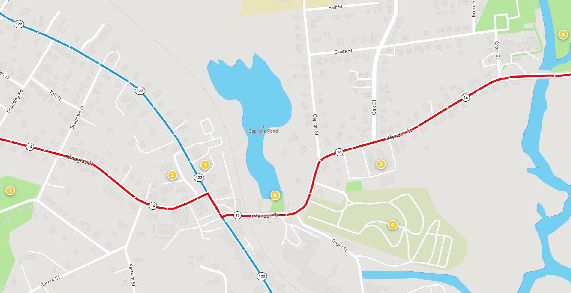
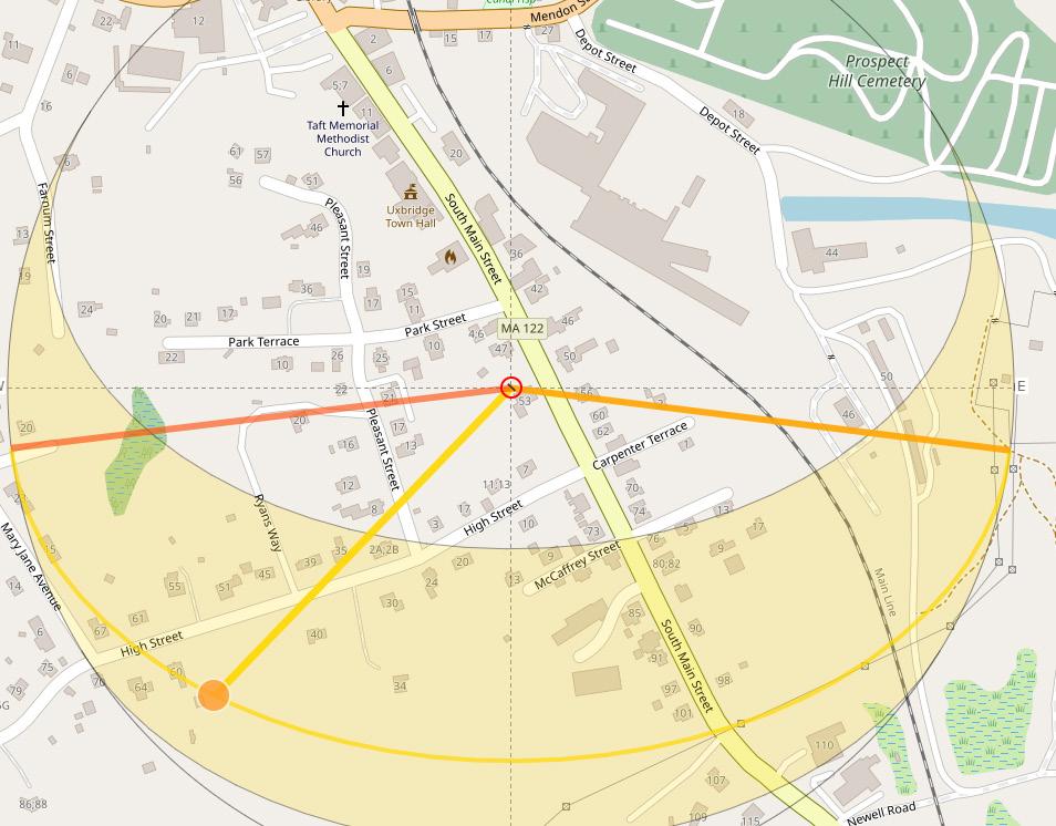
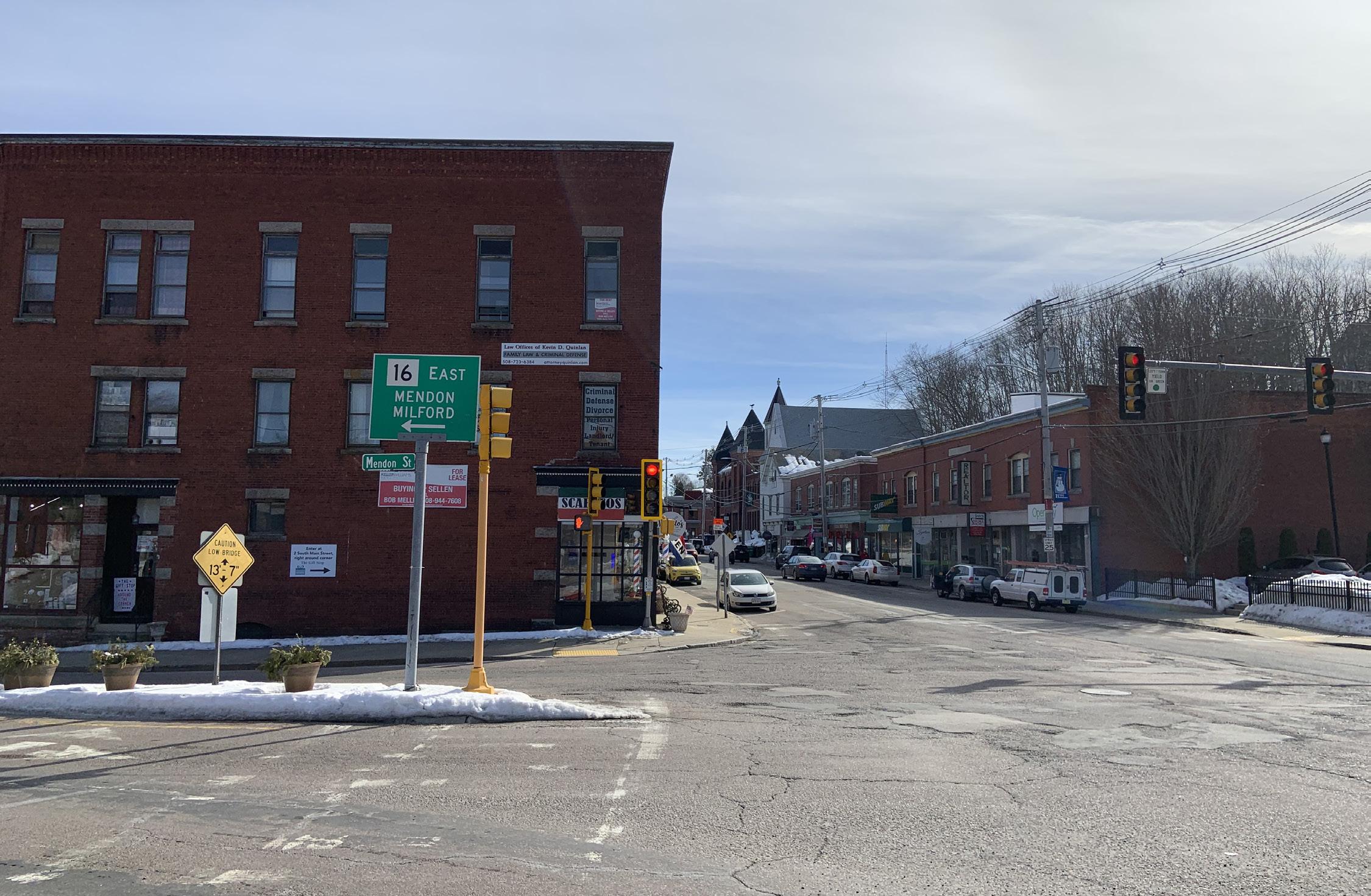
The Town of Uxbridge is one of the historic cities of the US with more than 375 National Historic Sites. Some of the most important issues as stated by the residents of the town are - ‘limited mobility access’, ‘transition to a destination economy’, ‘difficult Pedestrian and bicycle access’, and ‘repurposing of townowned properties. The main roads of the town route 16 and the main street are the busiest and the dangerous roads in the town. But there are a lot of historic landmarks and parks along these roads.
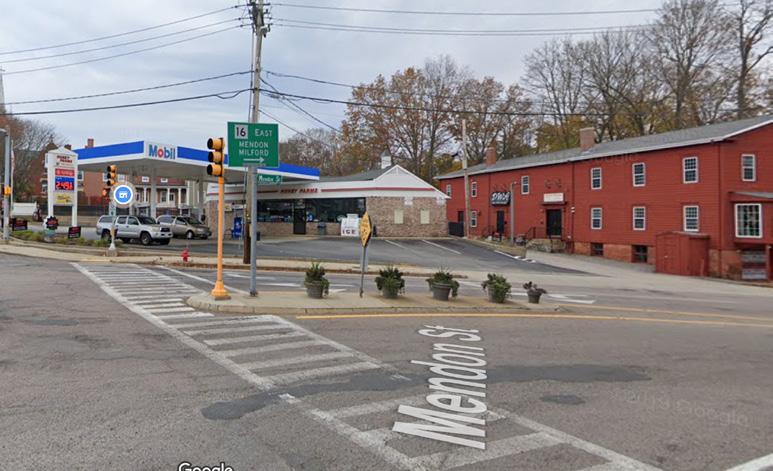
Both Corners have Traffic lights, Arrows and Zebra crossing. However, drivers can collide by not turning properly. A potential solution would be adding road reflectors to reduce speed

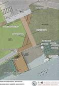
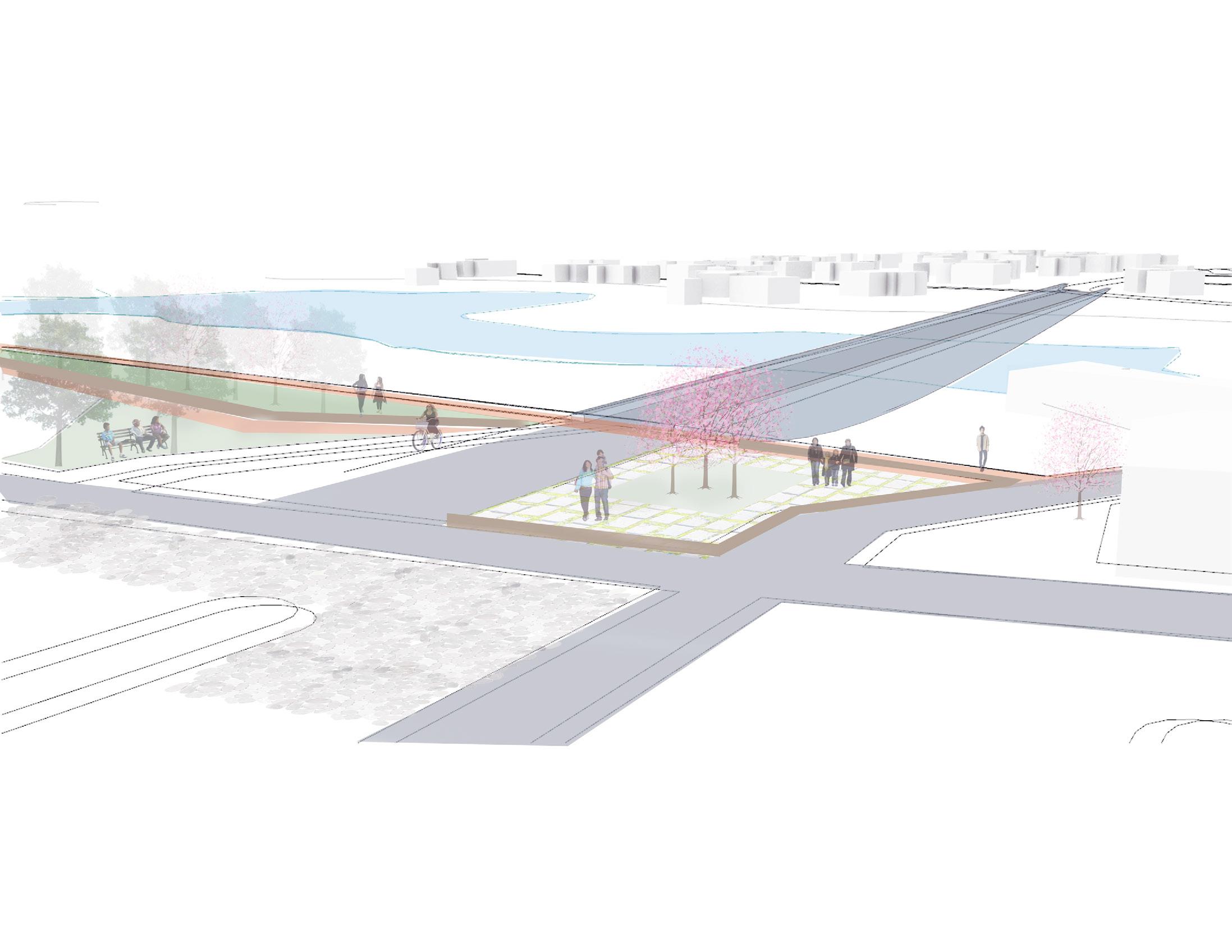
Proposed Mayor Connections: Proposal 1- New Foot Bridge and Gas Station Relocation R16 to Boston
Proposed Mayor Connections: Proposal 1- New Foot Bridge and Gas Station Relocation
Proposed Mayor Connections: Proposal 2 - Building Demolition and New

2
This proposal is more expensive than the first one. Another solution to improve circulation and decrease car accidents is to demolish the Hardware and the UPS buildings located over Douglas Street. The proposal will create a straight Mendon Street road and a safer intersection with Saint Main Street
The town of Uxbridge is one of the historic cities of the US with more than 375 National Historic Sites. From my desktop research and community meeting, I identified a few issues of the residents and the heritage sites. Some of the most important issues as stated by the residents of the town are - ‘limited mobility access’, ‘transition to a destination economy’, ‘difficult Pedestrian and bicycle access’, and ‘re-purposing of town-owned properties. The main roads of the town route 16 and the main street are the busiest and the dangerous roads in the town. But there are a lot of historic landmarks and parks along these roads. Through our desktop research and case studies of the surrounding cities like Salem, we proposed a few strategic actions that could be implemented to promote the cultural heritage sites of the town. A great way to promote the heritage sites are reusing the existing building and creating public gathering space.
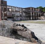
There are a few abandoned mills that could potentially be a great source of public gathering source. The Bernat museum, which was partially destroyed by a fire incident could be used to promote and support small business by introducing outdoor restaurants and shops in the ruins of the mill.
Creating walking and bicycle trail from the Blackstone River and Canal Heritage State Park to the Arthur Taft park is a great way to encourage people to walk through one end to the other end of the downtown, enjoying the sites.
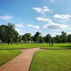
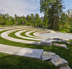
Landscaping and introducing activities in the heritage sites like playground, Amphitheater, outdoor yoga center is a great way to bring the community together and promoting the cultural heritage sites.
1. Sidewalks
Introducing sidewalks along the North and South main-street and route 16 will allow people to walk along the heritage sites.
2. Walking/Bike Trails
Creating pedestrian walkways and biking trails will allow people to enjoy the historical sites and parks.
3. Signage
Designing signage board surrounding the historical landmarks to highlight the important events. It will let people know about the historical events that took place in the city of Uxbridge.
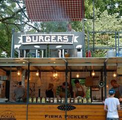
4. Street Food
Introducing street food in the abandoned mills. This will allow people to visit the historical sites and enjoy a meal.
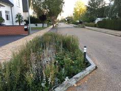
5. Landscaping the Existing Parks
Landscaping and beautifying the existing parks with children playground and sitting area and other activities would encourage people to


6. Playground
Designing playgrounds in the existing parks and abandoned mills will allow the residents enjoy and visit the historic sites.
Designing
8. Outdoor Yoga Space
Introducing health activities like yoga in the parks. This would offer the residents an opportunity to enjoys their time in the heritage site while working out.
Encouraging
10. Bird Watching
Designing a space in the heritage park for people who love watching birds.


Abutting development


Currently,Mumford River and the pond right next to the downtown area are not actively being used by people even though there is a national heritage park right next to the bridge. Another problem is the park is partially not barrier-free when there is a large number of aged population in town. Therefore, create a walkway at the boundary of the pond to maximize the natural resource and increase the connectivity to the neighborhood while installing a barrier-free ramp where it is possible for the aged neighbors. Creating the grass parks along with the trail to encourage the people to enjoy the picnic or appreciate the environment of the surrounding.


corridor as public amenity


Activating River& Pond edge for public use


River boating recreation activities


Providing public parking


Activating River edges and waterways for public recreation


River edge stabilization and access pathways


Providing public amenities


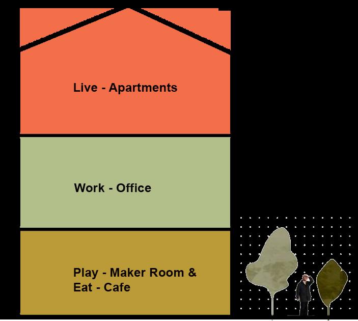
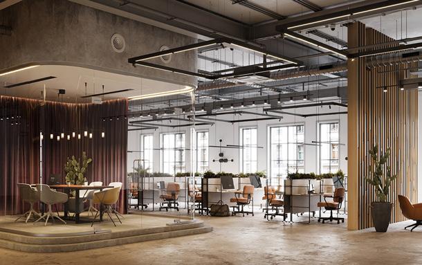
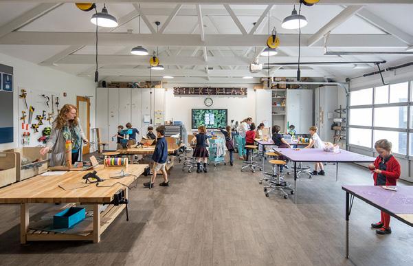
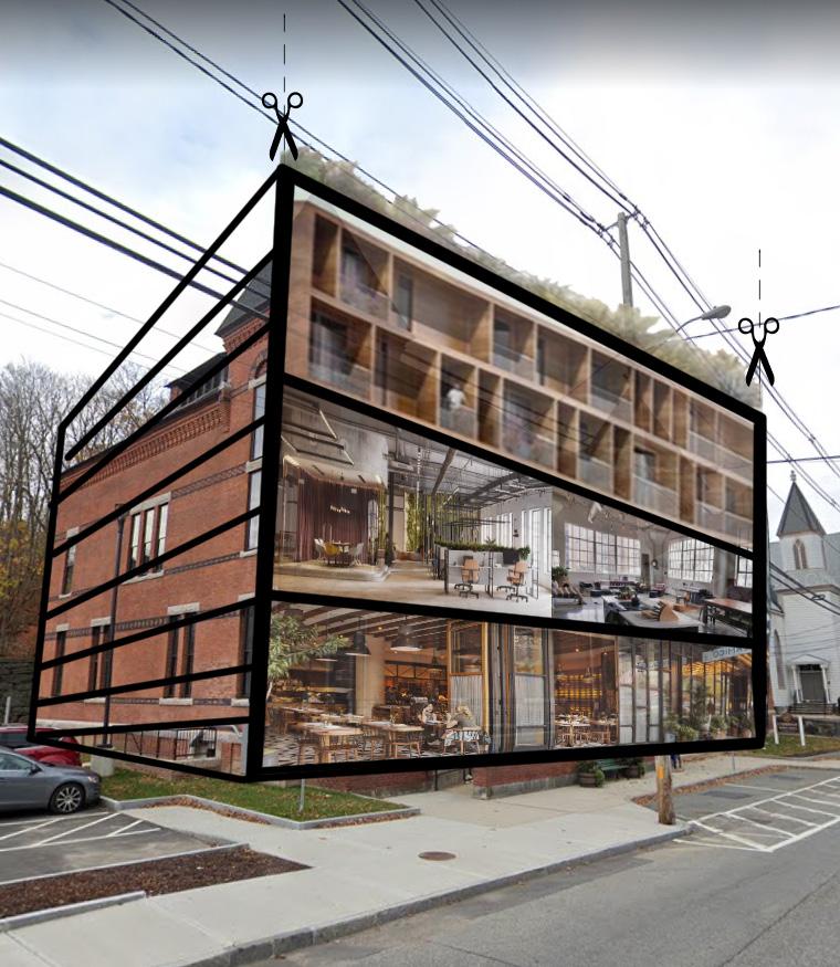
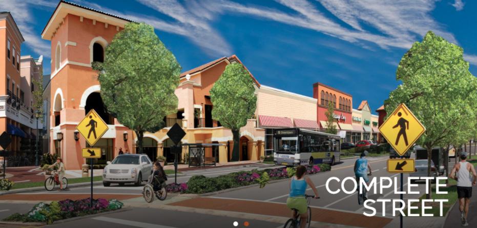
Downtown Main street Uxbridge is currently dominated by small office and retail/commercial zoning activities. To foster and promote a ‘Destination Economy’ this area should explore diversifying is zoning to include other activities such as; Residential, workspaces and recreation. By introducing a carefully balanced mix of activities, Main Street Uxbridge can attain a fine balance of Work/Live & Play place with a right amount activities to support a thriving economy and a sense of place, identity and Heritage.
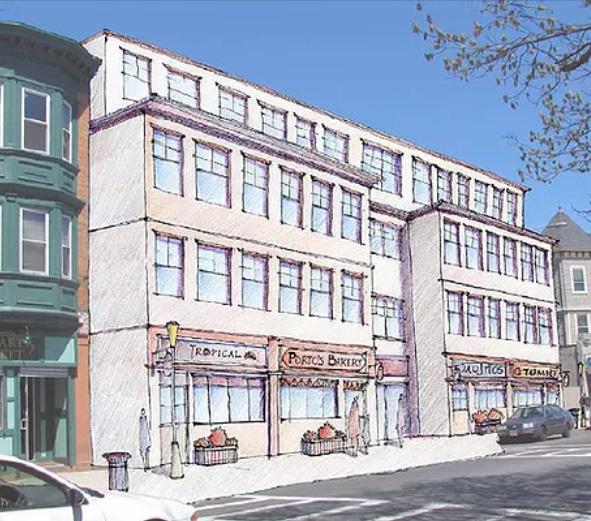
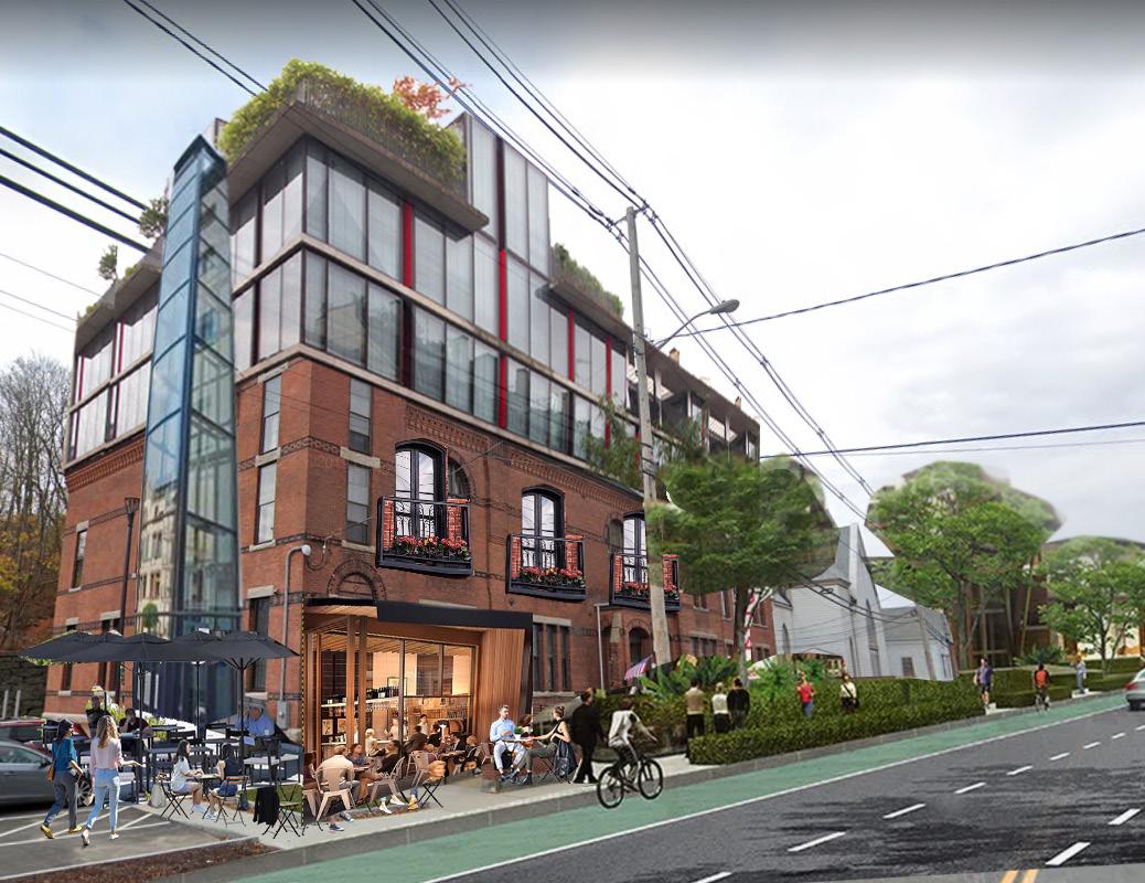
As Uxbridge contemplates moving the Town Hall to the McCloskey Building, its citizens are wondering how the historical building can be re-purposed. To increase community engagement, and serve a more variety of people, the current Town Hall building could be repurposed as a mix-use building that contains a housing, office/maker space, and first floor retail.
NB: The following exemplar explorations are preliminary ideas for conversations and should not considered as design nor programme recommendations
Note: Exploration of the strategic reuse of Uxbridge’s McCloskey Building and other municipal properties to be part of the Fall 2021 Semester
The Central Massachusetts Regional Planning Commission, in partnership with Kuhn Riddle Architects, was retained by the Town of Uxbridge to prepare a Property Condition Assessment and Site Repurposing Study for the McCloskey Building in response to the Request for Proposal UMBR2019A issued in September, 2019. The team had access to existing conditions drawings that included the original 1936 structure and additions completed in 1988 and 1998.
Extract recommendations from the: McCloskey Building & Site Repurposing Study Town of Uxbridge, Report, April 27, 2020
• The McCloskey building has sufficient square footage to be able to accommodate the Town’s projected municipal needs under one roof with ample on-site parking (see next section).
• The majority of the building’s interior spaces are of good architectural quality with high ceilings and access to daylight. Selective demolition of portions of the 1988 additions would restore access to daylight for large areas of the original 1936 building.
Option 1 keeps the original historical part of the building while adding additional floors for housing, offering living, working, and recreational needs for the community.