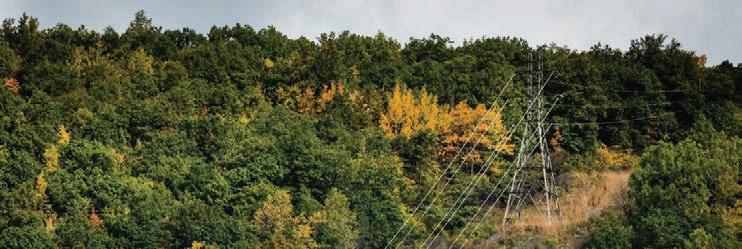
Saving the Chesapeake’s Great Rivers and Special Places
Chesapeake “living blueprint” will help inform restoration decisions.
PHOTO BY JODY COUSER
Mission
The Chesapeake Conservancy’s mission is to conserve and restore the natural and cultural resources of the Chesapeake Bay watershed for the enjoyment, education, and inspiration of this and future generations.We serve as a catalyst for change, advancing strong public and private partnerships, developing and using new technology, and empowering environmental stewardship.
Board of Directors
Anne W. Scott, Chair
Robert Gensler, Treasurer
Molly Joseph Ward, Secretary
Thad Bench
Marc Bunting
Leslie Delagran
Joel E. Dunn
Robert E. Friend
Heather Gartman
Verna Harrison
Randall W. Larrimore
Jeffery More
John G. Neely
Dr. Mamie A. Parker
John J. Reynolds
Chief G. Anne Richardson
Richard Scobey
Robert G. Stanton
Honorary Members
Gilbert M. Grosvenor
U.S. Senator Paul Sarbanes (ret.)
U.S. Senator John Warner (ret.)
Emeritus Directors
Patrick F. Noonan
Charles A. Stek
Chesapeake Conservancy Staff
Joel E. Dunn, President & CEO
Patty Allen, Office Manager
Jeffrey Allenby, Director of Conservation Technology
Carolyn Black, Trail Partnership Associate
Michael Bowman, Partnership Communications Associate
Curtis Campbell, Controller
Jody Couser, Director of Communications
Jacob Czawlytko, Senior Geospatial Analyst
John Davy, Virginia Project & Partnership Manager
Carly Dean, Program Manager
Melissa Ehrenreich, Director of Development
Kelsey Everett, Partnership Digital Resources Associate
Susan Shingledecker, Vice President & Director of Programs
Helen Sieracki, Annual Fund Manager
Rachel Soobitsky, Geospatial Project Manager
Susan Stephenson, Grants & Contracts Coordinator
Katie Walker, Geospatial Analyst
Emily Wiggans, Geospatial Analyst
From the President & CEO
“Half” Could Make Us Whole
With two young daughters at home, spring has become our family’s favorite time to reconnect with the great outdoors. We are devoted to making memories outside and exploring some of our family’s favorite places in the Chesapeake, like Terrapin Park in Stevensville, Maryland. In this issue of Shorelines, we’ve included some suggestions to help you plan your own adventures at special places conservationists have protected.
Eighteen million people call the Bay watershed home. That means we have 18 million reasons to protect this landscape so that future generations will have the same opportunities we enjoy—and incidentally, we will have an additional 4 million reasons by 2050.
We would want Rachel Carson to confirm to our grandchildren that spring is just as boisterous as we remember it being when we were children. We would want Aldo Leopold to confirm that the “fierce green fire” has not died out. We would want Teddy Roosevelt to tell us that we have been fierce stewards of the most glorious heritage a people ever received.
We need to adopt the American Indian philosophy of thinking seven generations into the future—and plan and act for them. In the face of global catastrophe, it’s time to do things wildly differently and to think and plan at previously unimaginable spatial scales.
Noted conservationist E.O. Wilson, author of Half-Earth, proposes a bold plan to save our imperiled biosphere: Conserve half the surface of the Earth, both land and ocean, to maintain nature.
It’s time to put serious consideration into setting a goal of maintaining half of the Chesapeake Bay watershed by conserving and restoring working lands and natural lands and the places that matter for the future of our region. Something like this can and should only be done with willing landowners and using precision conservation techniques, so that it is done at the direction of communities and in the right places on the landscape.
Currently, approximately 22 percent of the land area in the Chesapeake watershed is conserved. This includes important working lands, rich farmlands, and productive forests, as well as our natural lands, including national and state parks and wildlife areas. In comparison, approximately 11 percent of the watershed is developed.
A distant goal of protecting 50 percent of the watershed’s working lands and natural lands would still leave around 39 percent available for future growth and development and other needs of society.
The 2014 Chesapeake Bay Watershed Agreement committed to protecting 2 million acres of additional land by 2025, along with 300 new public access sites. It’s now 2019, and we’re halfway to both the 2-million-acre goal and the public access goal, which is certainly something to celebrate.
But we need to begin to identify goals beyond 2025. It’s time to think through how these ideas apply to our Chesapeake Bay and watershed. It is time to think big, because our Chesapeake is the biggest asset we all share. With careful stewardship, we can pass on something we are proud of to our children and grandchildren. This is the goal of a lifetime.
Sincerely,
Joel e. Dunn, President and CEO
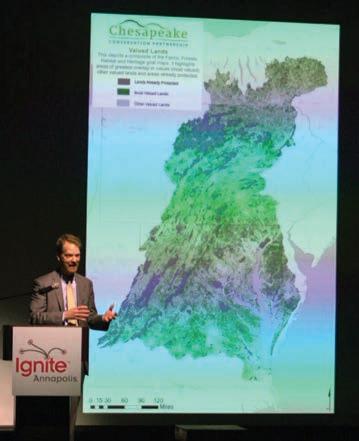
In March, President and CEO Joel Dunn presented at Ignite Annapolis: “Not on Our Watch: How Big Data Will Restore the Health of the Chesapeake.” IMAGE COURTESY OF IGNITE ANNAPOLIS
From our founding, Chesapeake Conservancy has helped people explore the wonders of the Chesapeake. Much of this work is done in partnership with the National Park Service (NPS) Chesapeake Bay Office and Colonial National Historical Park through our support of the Chesapeake Bay Gateways and Watertrails Network and the Captain John Smith Chesapeake National Historic Trail (Chesapeake Trail).
We know that when people feel connected to the Bay, they’ll be more likely to help take care of it. Perhaps they will decide to vote for elected officials who care about the environment or even choose a career in conservation. Here are just a few examples of how Chesapeake Conservancy helps people get outside and enjoy the Chesapeake.
Public Access & Land Conservation
Of the Chesapeake’s 12,000 miles of shorelines, only about 2 percent is publicly accessible. It’s difficult to become an advocate for the Chesapeake when access is so limited. With our NPS, state and local government, and community partners, we have helped create 153 new public access sites and permanently protect some of the Bay’s special places, such as Blackwater National Wildlife Refuge, Harriet Tubman Underground Railroad National Historical Park, and Fort Monroe National Monument. Recent projects include a new city park and future kayak launch in Seaford, Delaware; paddlein campsites at Point Lookout in southern Maryland; and a canoe and kayak launch at Wye Island on Maryland’s Eastern Shore.
FindYourChesapeake.com
Managed in partnership with NPS, FindYourChesapeake.com is a “one-stopshop” website that has all the information you need to plan unique and authentic Chesapeake experiences. The site features nearly 400 special places to explore and fun events throughout the watershed.
Find Your Chesapeake: Trips & Tips E-Newsletter
Plan your weekend adventure with the help of our free e-newsletter called “Find Your Chesapeake: Trips & Tips.” Each week, in partnership with NPS, we highlight interesting, unusual, and offthe-beaten path events. You can sign up for Trips and Tips on our website at www.chesapeakeconservancy.org.
Boater’s Guide
The Boater’s Guide for the Captain John Smith Chesapeake National Historic Trail is a free online publication that introduces paddlers and cruisers to the rivers and parts of the Bay explored by Smith and his crew from the English settlement at Jamestown. The guide is also available digitally through the Mobile Boater’s Guide.
Chesapeake Roving Ranger
The Chesapeake Roving Ranger is a mobile visitor information center for the Chesapeake Bay Gateways and Watertrails Network. Managed in partnership with NPS, last year the ranger went to 26 locations and events. From June through November 2018, the crew interacted with nearly 3,500 people in Delaware, Pennsylvania, Maryland, and Virginia.
Find Your Chesapeake GeoTour
In June 2018, NPS, Chesapeake Conservancy, Maryland Geocaching Society, and NoVaGo partnered to create this Chesapeake-centric and sophisticated version of hide-andseek. Geocachers plot map coordinates to locate a hidden treasure or “cache.” The Find Your Chesapeake GeoTour consists of 64 geocache locations throughout the watershed and many along the Chesapeake Trail. Caches include information about the places where they are hidden, helping to make geocaching a fun and educational experience for the whole family. The tour has logged over 4,500 visits since its launch.
John Smith Cross Marker Project
Through the help of volunteer historians Ed Haile and Connie Lapallo, Chesapeake Conservancy is working to mark each of the 24 places where Captain John Smith left actual crosses during his explorations. There are just four more crosses to go!
Virtual Tours
Modern technology allows us to offer virtual access to the great rivers of the Chesapeake. We offer virtual tours of 11 rivers that are like Google Street View, but from the perspective of a kayaker on the water. Available on Chesapeake Conservancy’s website at www. chesapeakeconservancy.org, the tours can help you plan your next kayaking trip in advance.
Webcams
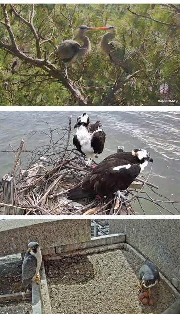
In partnership with explore.org, Chesapeake Conservancy hosts three live-streaming webcams that take viewers inside the nests of osprey, peregrine falcons, and great blue herons. Approximately 10 million viewers from around the world watch these cams each season. They are great tools to help people fall in love with the Chesapeake and strive to protect the birds’ habitat. Thank you to the Crazy Osprey Family, Transamerica, and the owner of the great blue heron rookery for making these cams possible.
Spring not only means activity returns to the wildlife webcams, but everywhere in the watershed plants and critters are waking up from the winter. It’s the best time to get outdoors and enjoy the beauty and diversity of the Chesapeake region. Chesapeake Conservancy offers these tools to help you find and enjoy your own Chesapeake experiences.
It’s a great time to tune into our three wildlife webcams. PHOTOS BY CHESAPEAKE CONSERVANCY WEBCAMS
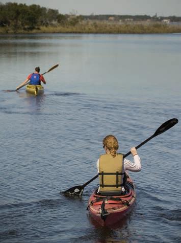
Those who recreate on the Chesapeake are more likely to be its environmental advocates.
PHOTO BY IAN PLANT
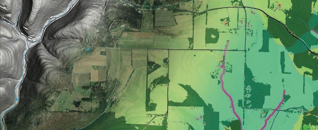
Updated, high-resolution, high-quality data will track changes and inform partners working to restore the Chesapeake Bay. IMAGE BY CHESAPEAKE CONSERVANCY CONSERVATION INNOVATION CENTER
Chesapeake “Living Blueprint” Will Help Inform Restoration Decisions
EPA Grant to Track Environmental Impacts of Land Use in Bay Watershed
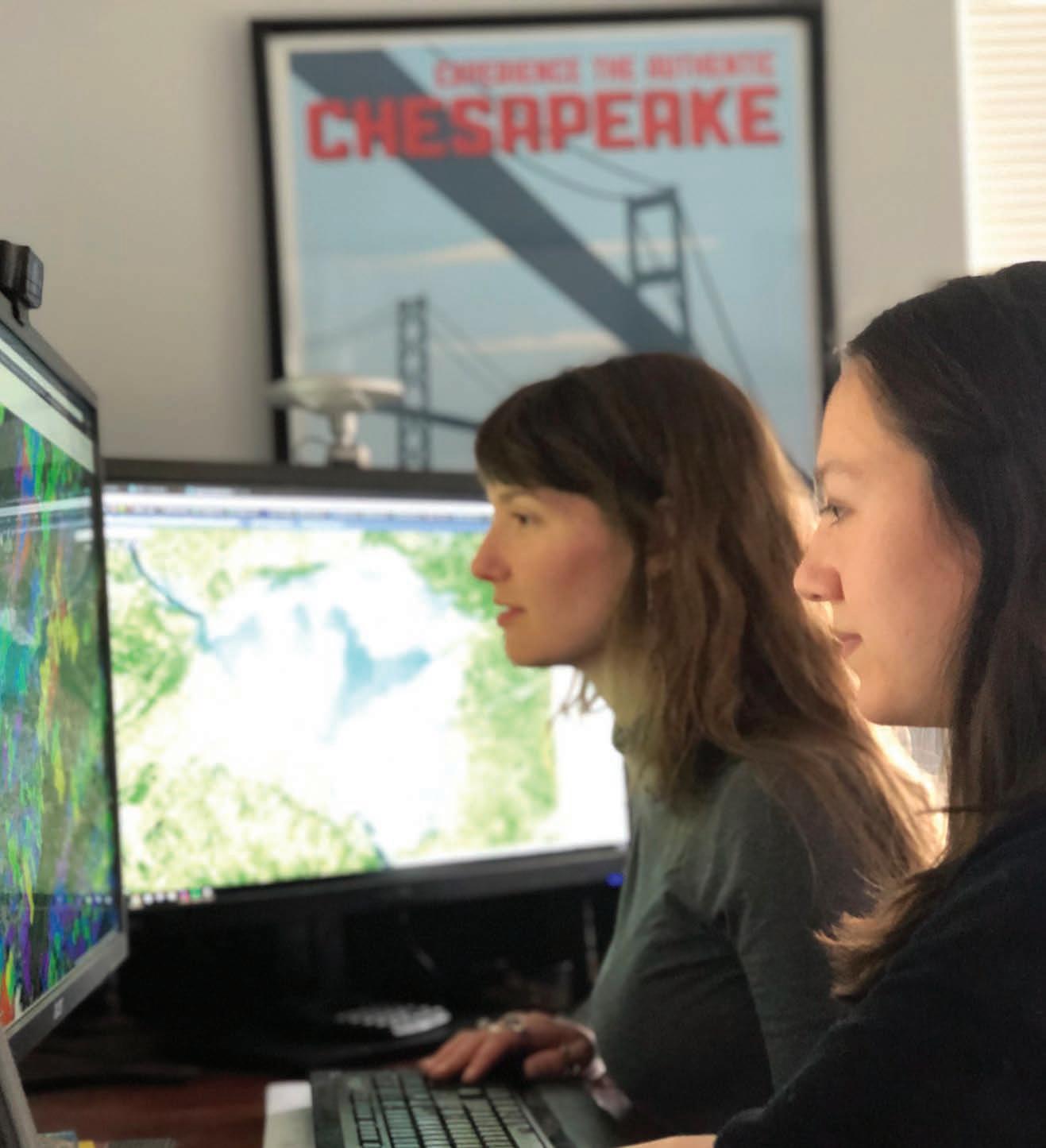
Data processing is emerging as a powerful, new driver to accelerate the pace and quality of conservation and restoration efforts here in the Chesapeake and around the world. Recent advances in data collection, through satellites and drones, and distributed data processing are making a detailed and regularly updated view of the planet a reality. This information will help restoration planners and others know changes in land use in real time—a powerful tool for conservation here in the Chesapeake.
Thanks to a recent grant from the US Environmental Protection Agency (EPA) to the Chesapeake Conservancy’s Conservation Innovation Center (CIC), we are working with partners to track environmental impacts of land use in the watershed. This Chesapeake “living blueprint” will help inform all levels of environmental decisionmaking and track progress as it’s being made.
The EPA grant builds on the Chesapeake Bay High-Resolution Land Cover Data Project completed by the Chesapeake Conservancy and partners in December 2016 for the Chesapeake Bay Program (CBP) and supports the goals of the 2014 Chesapeake Bay Watershed Agreement.
“This project will give states, counties, and local jurisdictions critical information on how the landscape is changing over time and how these changes impact progress toward achieving restoration of local waters and the Chesapeake Bay,” said EPA Regional Administrator Cosmo Servidio. “It will also provide more accurate information about how water
moves through the landscape, which will help the partners plan restoration efforts.”
“The Chesapeake Bay Program partnership is at the national forefront of data-driven conservation and restoration,” said Chesapeake Conservancy President and CEO Joel Dunn. “Our work together is creating consistent and comprehensive information that leverages the latest technology and advances strong public and private partnerships. Chesapeake Conservancy is proud to help empower stewardship—from the smallest nonprofits to state and federal agencies—and bring our common goal of a healthier and sustainable Chesapeake that much closer.”
Chesapeake Conservancy, working with project partners and the CBP, will provide state and local jurisdictions with updated, high-resolution, high-quality data about changes to landscapes and the locations of headwater streams and other water features to support continued progress in the restoration of the Chesapeake Bay and local waters within its watershed.
Over the next several years, it will also provide the following:
• Detailed information on streams that is critical to understanding how water moves through the landscape and where restoration efforts could be located
• Optimal siting for best management practices for maximizing water quality benefits
• Tracking and reporting tools for partners to streamline project implementation
• Mapping support to help partners integrate geospatial data into restoration efforts
Project partners include the University of Vermont Spatial Analysis Laboratory, University of Maryland–Baltimore County, Drexel University Academy of Natural Sciences, and Chesapeake Commons.
To learn more about how the CIC can help your community’s restoration work, please contact Director of Conservation Technology Jeff Allenby at 443.321.3610.
Chesapeake Conservancy’s Conservation Innovation Center is mapping stream channels that were previously unrecorded. This unprecedented information will help inform Chesapeake restoration in powerful ways. IMAGE BY CHESAPEAKE CONSERVANCY CONSERVATION INNOVATION CENTER
Chesapeake Conservancy’s Conservation Innovation Center is mapping high-resolution land cover change (1-meter) across the entire Chesapeake Bay watershed. The images above show growth of impervious surfaces, roads, and structures between 2013 and 2017 (shown in pink).
IMAGERY BY UNITED STATES DEPARTMENT OF AGRICULTURE (USDA) NATIONAL AGRICULTURE IMAGERY PROGRAM (NAIP); DATA BY CHESAPEAKE CONSERVANCY CONSERVATION INNOVATION CENTER
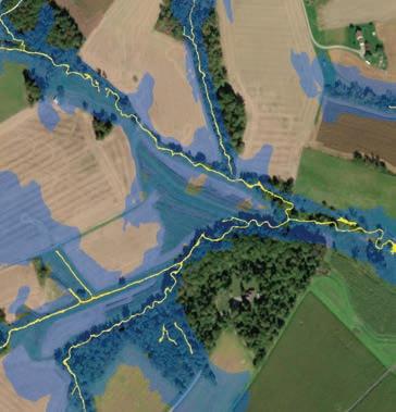
Quantifying Forest Buffers in Pennsylvania
Chesapeake Conservancy recently concluded a five-year project to quantify forest buffer coverage along waterways across the entire 22,610 square miles of the Chesapeake. Of the land within 100 feet of streams, 67 percent is currently protected by forest buffers, while an estimated 353,416 acres are opportunities for future buffer restoration. The new dataset will help Pennsylvania achieve water quality goals both for local streams and as part of the Chesapeake Bay Phase III Watershed Implementation Planning (WIP) efforts.
This buffer data is now available to view and download for every county in Pennsylvania within the Chesapeake Bay watershed. “All of our data is open source data,” says Jeff Allenby, director of conservation technology at Chesapeake Conservancy. “Our organization takes pride in providing the most innovative datasets to every conservation partner out there— a rising tide lifts all ships.”
Users can access GIS files for the buffer dataset and intermediate land cover and hydrography datasets at https:// chesapeakeconservancy.org/conservationinnovation-center/high-resolution-data/ enhanced-flow-paths/pa-data-downloader/. County-based PDF reports with municipality data are also available for print and download.
Chesapeake Conservancy Develops Technology for James River Restoration Work
To support the James River Water Quality Improvement Program, a new program of the Virginia Environmental Endowment (VEE), the Chesapeake Conservancy’s Conservation Innovation Center developed a “Restoration Planner,” a web-based application to support planning and evaluation of restoration projects.
“This tool provides VEE and its grant applicants with information about where conservation and restoration projects are likely to produce the greatest water quality benefits,” said Chesapeake Conservancy’s Geospatial Project Manager Emily Mills. “The Restoration Planner is a classic example of enabling what we call ‘precision conservation,’ which is bringing the right practices at the right scale to the right places at the right time. Precision conservation means having a greater impact with investments of valuable resources—time and money.”
“Thanks to this tool from Chesapeake Conservancy, VEE and our grantees can now quickly determine the potential environmental impact of a proposed project, ensuring that we are investing our efforts and private funds in the most effective way,” said VEE Executive Director Joseph H.
Maroon. “The Conservancy’s tool was a key factor in VEE awarding over $4.5 million in grants last fall to six projects aimed at advancing conservation practices and improving water quality in the James River.”
This precision approach and the resulting grant-funded projects complement Envision the James, an initiative Chesapeake Conservancy conducted along with the James River Association and other partners, which specifically identified public demand for water quality restoration and wildlife habitat conservation.
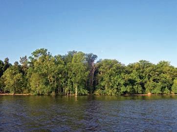
Forest buffers can make dramatic improvements to water quality and provide habitat for wildlife species.
PHOTO BY ADRIENNE GEMBERLING
The 348-mile James River flows from the Appalachian Mountains to the Chesapeake Bay.
PHOTO BY US FISH AND WILDLIFE SERVICE
Holistic Approach Needed for Planning Energy Projects
The Environmental Law Institute (ELI) has prepared a report on Opportunities to Improve Landscape-Scale Mitigation for Energy Projects in the Chesapeake Region for the Chesapeake Conservation Partnership, which Chesapeake Conservancy co-convenes with NPS. The report recommends specific actions that Maryland, Pennsylvania, and Virginia may consider to improve policy and regulation in the face of energy infrastructure development.
“The Chesapeake Bay region is home to a diversity of landscapes, historic places, ecosystems, and wildlife as well as an increasing number of pipeline and electricity transmission projects,” said John Griffin, program manager for the Chesapeake Conservation Partnership—a network of conservation organizations and natural and cultural resources agencies.
“Energy facilities present the region with both challenges and opportunities. Our Partnership sees a real need for ways to improve the evaluation and permitting of energy projects so that landscape-scale conservation objectives can be achieved.”
The ELI report urges states to clearly define and understand conservation landscape objectives in advance of any permit applications to derive the most benefit from sometimes diffuse approval processes for electric transmission lines, gas pipelines, or solar or wind facilities.
The report also calls for a change to the conceptual approach to permitting. Energy facility applicants face a long list of federal and state requirements, but these processes
Nanticoke Farmland Conserved
An innovative public-private partnership will permanently protect 233 acres located in the Nanticoke Rural Legacy Area. In December 2018, the US Navy and the Maryland Department of Natural Resources, with transactional support from The Nature Conservancy and The Conservation Fund, acquired a perpetual conservation easement on the property. In addition to conserving forests, productive farmland, and wetlands, this easement will also preserve a rural and open landscape under the airspace of the Atlantic Test Range where the US Navy completes military aircraft test flights. The area is also home to diverse Nanticoke River wildlife and associated wetland habitats that are recognized for their national significance to the North American Waterfowl Management Plan and National Wetlands Priority Conservation Plan.
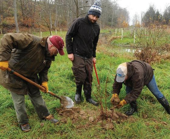
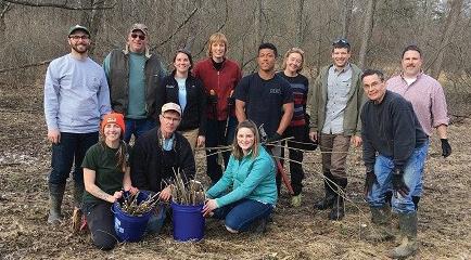
Partners Collect Live Stakes for Restoration
Secretary Cindy Dunn of the Pennsylvania Department of Conservation and Natural Resources (DCNR) joined volunteers at a live stake tree collection event in March. The event was part of a partnership of DCNR, Susquehanna University, Chesapeake Conservancy, Foundation for Pennsylvania Watersheds, and the Merrill W. Linn Land and Waterways Conservancy to collect approximately 8,000 live stakes across
Union, Centre, and Snyder counties. Live stakes are living shrub and tree branches that root readily when inserted into the soil. These free cuttings will be distributed to nine project partners and embedded into 2.5 miles of streambanks for forest restoration projects. Growing trees on streambanks minimizes the shoreline erosion, provides critical habitat for wildlife, and filters upslope runoff.
often do not approach impacts holistically. The review process should identify important areas for project applicants to avoid; define potential impacts on a landscape-wide, cumulative basis rather than permit-bypermit; and define mitigation for the whole project with respect to those impacts.
The ELI report is available for download from the Chesapeake Conservation Partnership website at www.chesapeakeconservation.org.
This conservation effort was made possible with funding from the Department of Defense’s Readiness and Environmental Protection Integration Program (REPI), the Maryland Rural Legacy Program, and through private funds from Chesapeake Conservancy through the support of Mt. Cuba Center. The land will remain in private ownership and will continue to be managed for farming and other resourcebased activities, but the easement precludes future development or incompatible use of the property, in keeping with conservation objectives of the Rural Legacy Area.
Since 2013, Chesapeake Conservancy and partners have conserved 2,235 acres acres along the Nanticoke.
Electric transmission lines, gas pipelines, and solar/wind facilities projects should factor in landscape impact before permitting process begins. PHOTO BY CHESAPEAKE BAY PROGRAM
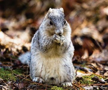
Conservation in the Nanticoke Rural Legacy Area helps protect diverse native plants and wildlife such as the formerly endangered Delmarva fox squirrel.
PHOTO BY CHESAPEAKE BAY PROGRAM
Secretary Dunn (fourth from left, standing) and volunteers collected live stakes for restoration projects along Pennsylvania streambanks.
PHOTO BY ALBERT GERMANN OF DCNR
Donor Spotlight: Lucie Lehmann
“Our monthly donors are critical partners to protect and restore land all across the Chesapeake. Every monthly donor who steps up makes a big impact by providing the resources to support his or her favorite Chesapeake Conservancy programs all year long,” said Annual Fund Manager Helen Sieracki, who oversees the Chesapeake Stewards monthly donor club. “It’s easy for the donors—set it up once, and it’s done! It also means the world to our staff who know they can count on our monthly donors, so they can focus on getting conservation done.”
Annapolis resident Lucie Lehmann is one such monthly donor. She grew up outside of New York City on the Long Island Sound and worried about its future. “Living on the water instilled in me a great love of the outdoors, of ducks and birds, and of public policy, the environment, and conservation,” Lehmann said.
She spent most of her career in public service, on Capitol Hill, at the US State Department, and then as the state director for now retired US Senator Barbara A. Mikulski, where
she worked on issues important to Maryland and the Chesapeake Bay.
“I have always supported conservation efforts, and I am especially proud to support Chesapeake Conservancy because of its emphasis on increasing access to the water, which helps get people invested in the health and future of the Bay. I value the Conservancy’s focus on partnerships with other nonprofits and government agencies, and its proactive efforts with cutting-edge technology that help with initiatives like mapping the Bay and its tributaries,” Lehmann said. “Chesapeake Conservancy has excellent staff and leadership, and I know that it uses its contributions wisely. As a donor, that matters greatly.”
Lehmann is the author of a best-selling Maryland cookbook called Dishing Up Maryland, and she co-wrote a book on plants that are grown for green roofs and help reduce stormwater runoff.
We are so honored that Lucie Lehmann continues to give back to conservation as a member of our Chesapeake Stewards Club. To learn how you can become a
Conservancy Board & Staff News
Chesapeake Conservancy welcomes three new members to the Board of Directors: Rappahannock Tribe Chief G. Anne Richardson, Thad Bench, and John J. Reynolds. Five members completed their terms on the Board: Jane Danowitz, Holly A. Evans, Stephen F. Harper, Turney McKnight, and Board Chair Douglas P.
Wheeler Anne W. Scott, who previously served as vice chair, will serve as the new chair. Molly Ward was elected to serve as secretary. Treasurer Robert Gensler was elected to a second term.
“The Board is pleased to welcome three new members, each of whom brings tremendous experience, as well as deeply rooted connections to the Chesapeake Bay watershed that will strengthen Chesapeake Conservancy in the pursuit of our mission,” said Chair Scott. “On behalf of the entire Board, I would like to thank outgoing chair Douglas Wheeler for his excellent leadership. During his time as chair, Chesapeake Conservancy grew to become a leader in innovation for the Chesapeake watershed and a strong partner for the National Park Service. Our sincere gratitude is also extended to our outgoing members Jane Danowitz, Holly Evans, Stephen Harper, and Turney McKnight for sharing their time and energy to help lead Chesapeake Conservancy through so many achievements,” Scott continued.
Chesapeake Conservancy President and CEO Joel Dunn added: “Thanks to
monthly donor just like Lucie Lehmann, please visit our website at www. chesapeakeconservancy.org/donate, or call Helen Sieracki at 443.321.3610.
Doug’s leadership, our small but mighty nonprofit is changing how conservation and restoration are approached in the Chesapeake Bay watershed. We have created groundbreaking technology, conserved thousands of acres of land, enhanced public access, and cultivated the epic collaboration necessary to address the challenges the Chesapeake faces.”
We also welcome the following new staff to our team: Carolyn Black, trail partnership associate; Michael Bowman, partnership communications associate; Curtis Campbell, controller; John Davy, Virginia project and partnership manager; Jessica Hammond, conservation coordinator; Susan Minnemeyer, geospatial program manager; Mende Naylor, administrative assistant; Gabrielle Roffe, project and partnership coordinator, and Susan Stephenson, grants and contracts coordinator. We bid a very fond farewell and our heartfelt thanks to several other valued employees, including Michael Norton, Jared Schultz, and Patrick Smith. We wish them well on their next adventures!
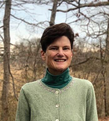
Board Chair Anne Scott COURTESY PHOTO
Chesapeake Stewards Club member Lucie Lehmann PHOTO BY JODY COUSER
716 Giddings Avenue, Suite 42 | Annapolis, Maryland 21401
Let’s Keep in Touch!
443.321.3610
info@chesapeakeconservancy.org
chesapeakeconservancy.org
facebook.com/chesapeakeconservancy
twitter.com/chesconserv
instagram.com/chesapeakeconservancy
linkedin.com/company/chesapeake-conservancy
FindYourChesapeake.com
LEAVE A LEGACY OF THE CHESAPEAKE FOR FUTURE GENERATIONS
Please consider making a special gift to Chesapeake Conservancy by naming the organization in your will or by designating Chesapeake Conservancy as a beneficiary of your bank account, 401(k) or other retirement account, or life insurance policy.
You can help immediately by joining the Chesapeake Stewards Club and providing monthly support for Chesapeake Conservancy’s ongoing habitat and land conservation programs. For more information, call 443.321.3610.
CHESAPEAKE CONSERVANCY RELIES ON OUR MANY FRIENDS TO PROTECT AND CONSERVE THE CHESAPEAKE’S GREAT RIVERS AND SPECIAL PLACES. YOUR TAX-DEDUCTIBLE CONTRIBUTION OF ANY AMOUNT IS TRULY APPRECIATED. CHESAPEAKE CONSERVANCY HAS A 4-STAR RATING FROM CHARITY NAVIGATOR. OUR TAX ID NUMBER IS 26-2271377.