Saving the Chesapeake’s Great Rivers and Special Places
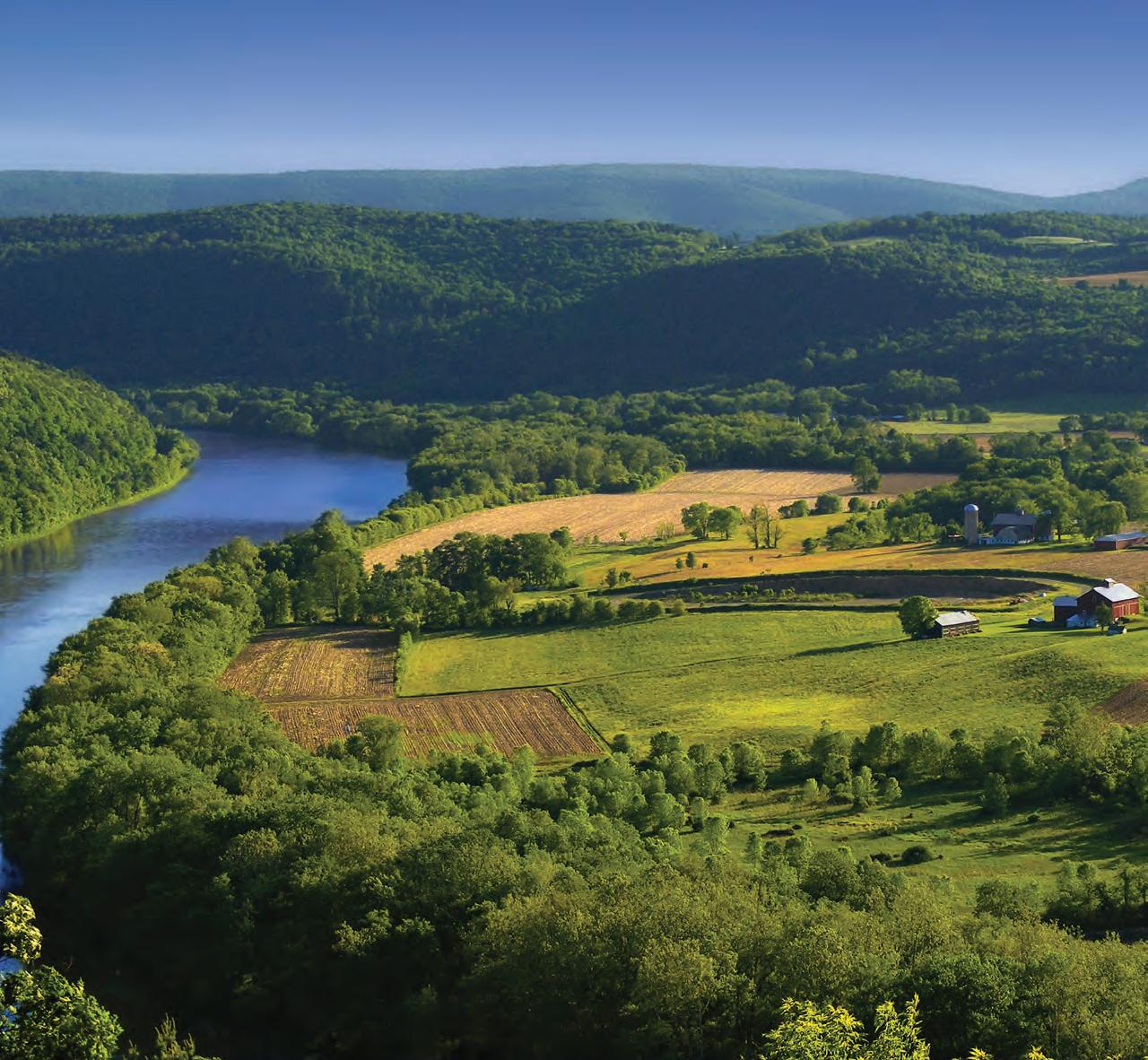
SUSQUEHANNA RIVER, ASYLUM TOWNSHIP, BRADFORD COUNTY
PHOTO BY NICHOLAS A. TONELLI/FLICKR
Mission
The Chesapeake Conservancy’s mission is to strengthen the connection between people and the watershed; conserve the landscapes and special places that sustain the Chesapeake’s unique natural and cultural resources; and restore landscapes, rivers, and habitats in the Chesapeake Bay region.
Board of Directors
Douglas P. Wheeler, Chairman
Stephen F. Harper, Vice Chairman
Robert Gensler, Treasurer
Jane Danowitz, Secretary
Nicholas H. Dilks
Joel E. Dunn
Holly A. Evans
Robert E. Friend
Heather Gartman
Paul E. Hagen
Michael D. Hankin
Verna Harrison
Barbara Jackson
H. Turney McKnight
Edward T. McMahon
Jeffery More
John G. Neely
Richard Scobey
Anne W. Scott
Robert G. Stanton
Honorary
Members
Gilbert M. Grosvenor
U.S. Senator Paul Sarbanes (ret.)
Charles A. Stek
U.S. Senator John Warner (ret.)
Chesapeake Conservancy Staff
Joel Dunn, President & CEO
Jenn Aiosa, Vice President & Director of Programs
Jeffrey Allenby, Director of Conservation Technology
John Griffin, Program Manager, Chesapeake Conservation Partnership
Chigo Ibeh, Geospatial Analyst
Louis Keddell, Geospatial Analyst
Jacob Leizear, Chesapeake Conservation Corps Member
Joseph McCauley, Chesapeake Fellow
Megan McSwain, Communications and Partnership Assistant
Cassandra Pallai, Geospatial Program Manager
Reed Perry, Chesapeake Fellow
David Saavedra, Geospatial Analyst
Jared Schultz, Grants Specialist
Helen Sieracki, Development Coordinator
Colin Stief, Senior Application Designer
Robin Talbot, Executive Assistant
Peter Turcik, Media Specialist
Colleen Whitlock, Director of Administration
Our Kitty Hawk Moment
Never in my life have I been more proud of pixels.
A few months ago, I watched our Director of Conservation Technology Jeff Allenby and Geospatial Program Manager Cassandra Pallai process 3.8 billion of them—800 square miles of our watershed—in just under 6 minutes, LIVE, in front of thousands of people at the Esri FedGIS conference in Washington, D.C. Pixels may not seem like a big deal, but I want you to know that our ability to be at the leading edge of conservation is dependent upon them.
It took Captain John Smith several years to create and publish his famous map of the Chesapeake. A year ago, it would have taken us one week to process what Jeff and Cass just accomplished in the time it will take you to read this message. The mind boggles. With technology at our fingertips, imagine what the conservation community will be able to achieve next.
At Chesapeake Conservancy we are preparing for the future of conservation by bringing data to the table in faster and better ways. As you read in the last issue of Shorelines, we are proud to have partnered to produce high-resolution land cover data covering 64,000 square miles of the Chesapeake Bay watershed. Let me tell you, that’s a lot of pixels. This land cover data has created a fresh new MRI for our watershed to help us laser in on what’s working, what’s not, and where we need to focus to protect the things that matter. It will be the foundational dataset to meet water quality, wildlife, cultural, and economic development goals. Last December, we launched this dataset to the public. I’d argue that it is still one of the nation’s best kept secrets. But not for long.
We live in a world where we carry data in our pocket, but we’ve yet to apply data fully to the necessary work of protecting the environment.
When the Wright Brothers launched their plane from the dunes at Kitty Hawk in 1903, it took the world five years to realize the power of that moment. The launch of our high-resolution land cover data with practical applications is our Kitty Hawk moment in land conservation. The power of the possible just expanded, and the foundational work we’ve accomplished in the Chesapeake now holds promise for landscapes everywhere.
What started in 2013 as a pilot grant from the Intel Corporation has grown into a technology movement that will significantly enhance land management, conservation and restoration prioritization, as well as environmental verification, among other things. Advancements in Esri software and Microsoft Azure cloud technology will be very beneficial to the Chesapeake.
I hope you will share this news and that you will also ask me how you can help Chesapeake Conservancy unlock the power of the data for communities in the Chesapeake and beyond. We can’t do it alone.
Sincerely,
Joel e. Dunn, President and CEO
Chesapeake Conservancy President & CEO Joel Dunn PHOTO BY MARK HAMILTON
Director of Conservation Technology Jeff Allenby and Geospatial Program Manager Cassandra Pallai presented at the Esri FedGIS conference in Washington, D.C., in February. PHOTO COURTESY OF ESRI
Grand Opening of Harriet Tubman Visitor Center
Legacy an Important Part of the Chesapeake’s Story
On March 10, better known by some as Harriet Tubman Day, descendants of the famous abolitionist and other admirers gathered in Dorchester County, MD, to honor her incredible life with the opening of the Harriet Tubman Underground Railroad Visitor Center. Funded in part by the federal Land and Water Conservation Fund, the 15,000 square-foot LEED silverrated visitor center is managed through a partnership between the Maryland Park Service and National Park Service.
Tubman was born on Maryland’s Eastern Shore. She escaped slavery in 1849 at age 27, but returned to Dorchester and Caroline counties an estimated 13 times over the next decade to help enslaved people escape to the North. During the Civil War she was a nurse, and in later years Tubman worked for women’s rights.
Visitors will see immersive exhibits about how the landscape of the Choptank River region shaped Tubman’s early years, her emancipation from slavery, her time as a conductor on the Underground Railroad, and her lifelong advocacy work for justice. Other features include a museum store, research library, and seasonal interpretive programs to teach visitors about Tubman’s life and legacy.
“As advocates and contributors to the initial legislation for a Harriet Tubman National Park, Chesapeake Conservancy is proud to have worked alongside a dedicated group of citizens, historians, and elected officials to create this lasting legacy for Harriet Tubman,” Chesapeake Conservancy President and CEO Joel Dunn said.
“Harriet Tubman’s legacy is an important part of the Chesapeake’s story to share with current and future generations. The new visitor center will provide a major draw for travelers and economic development. The first national park honoring an African American woman in the United States is a national model for the conservation of landscapes paired with significant cultural and natural heritage. By proximity, it also complements the nearby Blackwater National Wildlife Refuge, providing large landscape conservation for one of the nation’s premier waterfowl habitats and bird watching destinations.”
In 2013, President Obama designated the Harriet Tubman Underground Railroad National Monument. This
monument would later become a part of the Harriet Tubman Underground Railroad National Historical Park after The Conservation Fund generously donated 480 acres, an essential component needed for establishment. The Harriet Tubman Underground Railroad National Monument, National Historical Park, and Harriet Tubman Underground Railroad State Park preserve the landscape characteristics of Tubman’s early home of Dorchester, Talbot, and Caroline counties on Maryland’s Eastern Shore. The Harriet Tubman National Historical Park in New York State was recently established to include sites related to her later home and achievements.
Take a trip to the new visitor center in Church Creek, just 12 miles from Cambridge, Maryland, to see this tribute to a great American heroine.
Please designate Chesapeake Conservancy on AmazonSmile, and Amazon will donate to the Conservancy a percentage of your purchase at no cost to you! smile.amazon.com
Chesapeake Conservancy/NPS Communications Assistant Megan McSwain looks at a display.
PHOTO BY PETER TURCIK
Millicent Sparks as Harriet Tubman taking in the sites of the new visitor center during the March 10 event.
PHOTO BY PETER TURCIK
envision the susquehanna
Few things are more important than the places where we live, work, and play. The health and vitality of these places affect our well-being and food supply, our livelihoods and economy, and our sense of belonging to a community.
With this in mind, in 2013 Chesapeake Conservancy embarked on a new initiative aimed at understanding what is important to individuals, communities, and organizations within the Susquehanna River watershed in order to facilitate the development of a shared vision of the future. Called Envision the Susquehanna (ETS), this initiative asked residents throughout
the watershed to share their priorities and concerns related to the river and its environment and heritage. Residents also helped recommend future actions that would protect important assets and values and conserve what makes this region special to everyone who lives, works, or plays there.
In partnership with key organizations, Chesapeake Conservancy began a threeyear collective-impact process focused on extensive community engagement and stakeholder feedback to learn about the conservation values, attitudes, and priorities of residents living along the Susquehanna River corridor. The ETS Core team includes the National Park Service, Pennsylvania’s Department of Conservation and Natural Resources (DCNR), the Susquehanna Greenway Partnership, the Susquehanna River Heartland Coalition for Environmental Studies, and the Wildlife Management Institute. After three years, 62 key informant interviews, reviews of 36 different comprehensive and greenway plans, a phone survey of 965 residents conducted with
help from Bucknell University and Lycoming College faculty and students, and 17 workshops that sought direct input from more than 200 stakeholders, Chesapeake Conservancy compiled Envision the Susquehanna: A Vision for the Susquehanna River Watershed, which can now be viewed on Chesapeake Conservancy’s website.
This document summarizes the results of the residential phone survey, feedback from workshops, and stakeholder engagement to identify challenges across the watershed and opportunities to conserve the heritage and restore the natural resources of the Susquehanna River and its tributaries. It highlights the unique character within regions of the watershed, as well as priorities shared across regions. The vision document categorizes information and recommendations within five themes to help identify opportunities for partnerships and collaborative solutions. These themes include: American Indian heritage and history, wildlife habitat, stormwater and flooding, recreation and access, and working lands.
The vision document will serve as a framework for future collaboration among members of the ETS team, as
Project Manager Carly Dean visits the exact point where the Susquehanna flows out of Lake Otsego in Cooperstown, NY.
PHOTO BY DAVID BUCK
Fishing on the Susquehanna.
PHOTO BY SCOTT MCDANIEL
Precision Conservation to Reduce Pollution from Working Lands
well as opportunities for collaboration with additional partners. Coupling stakeholder interest with robust datasets outlined in the vision document, Chesapeake Conservancy and its partners are seeking regional “hot spots” where focused efforts may achieve shared outcomes. Examples of two early implementations are highlighted here:
Eastern Brook Trout Habitat Restoration in Kettle Creek Watershed
In early 2017, Chesapeake Conservancy used its new high-resolution land cover data to map the water network—all 516 miles of it—within the Kettle Creek watershed, a tributary to the West Branch of the Susquehanna River. Conservancy staff worked closely with biologists from Trout Unlimited to identify the stream features most important to restoring brook trout habitat in order to identify where restoration efforts may maximize positive outcomes in the watershed.
In September 2016, the National Fish and Wildlife Foundation (NFWF) awarded a grant to the Chesapeake Conservancy to prioritize and implement restoration, starting in Clinton and Centre counties in partnership with DCNR and Susquehanna and Bloomsburg universities. The goal is to yield the greatest nutrient and sediment reductions from working lands and improve wildlife habitat.
The three-year initiative is piloting a new approach to restoration planning and implementation that combines high-resolution land cover data and concentrated flow path modeling to prioritize where buffer and other agricultural Best Management Practices (BMPs) may yield the greatest nutrient and sediment reductions from working lands. The Conservancy is using this prioritization to identify candidates for BMPs—particularly forested riparian buffers—and conduct outreach to farm operators.
University partners on the grant will conduct pre- and post-construction monitoring on adjacent streams to determine whether water quality and brook trout habitat improvements are detected over the life of the project from this targeted approach. NFWF funding has also allowed the Conservancy to hire a new technical coordinator,
located at the Freshwater Research Institute at Susquehanna University, who will provide technical assistance to implementing partners and outreach to landowners, and who will work to engage faculty, students, and additional community partners.
Conservancy Susquehanna Highlights at
a Glance
2012 - John Smith Chesapeake Trail Expands to Include the Susquehanna
2013 - Conservancy Launches Envision the Susquehanna
2015 - Conservancy Releases Virtual Tour of the Susquehanna River
2016 - Conservancy Produces and Releases High-Resolution Land Cover Data. National Park Service Establishes Visitor Contact Station for John Smith Chesapeake Trail in Wrightsville, PA, at the Zimmerman Center
2017 - Conservancy Releases Envision the Susquehanna Document and Begins Work with Partners to Implement Restoration Projects
Earlier this year, our Conservation Innovation Center and Esri demonstrated how they identified 150,000 acres of potential conservation opportunities across the entire Susquehanna watershed at a 1 meter by 1 meter scale in just 9 minutes. We adapted our data and analyses to take advantage of distributed computing on the cloud with help from Esri, Microsoft Azure, and Intel. As part of the Conservancy’s efforts in the Susquehanna watershed, we will work with conservation professionals on the ground to see how this data can be put to work for restoration and a healthier Chesapeake Bay.
This 1.08-acre BMP Opportunity Area is on a farm that has been plowed up to the shoreline of Bald Eagle Creek in Centre County, PA. Surface runoff from over 16 acres of agricultural land and 13 acres of turf grass potentially flows unbuffered into the creek. Based on 11 metrics determined as most important by 28 local practitioners, this BMP Opportunity is in the top 10% of the area’s restoration opportunities.
Conservancy staff worked with Trout Unlimited to identify priorities for brook trout habitat restoration.
PHOTO BY STEVE DROTER/CHESAPEAKE BAY PROGRAM
Donor Spotlight: The York County Community Foundation
In 2016 the Chesapeake Conservancy partnered with the York County Stormwater Consortium as part of the Envision the Susquehanna initiative. This partnership resulted in the creation of a web tool to streamline and standardize the data, calculations, and formatting of stormwater project reports that are submitted by municipalities to the county. The tool allows the consortium to identify, compare, and prioritize the most cost-efficient projects to help achieve water quality goals and save time during the review process. Funding for the project was generously contributed by the York County Community Foundation (YCCF), which works with the consortium and other partners in the county and provides funding for environmental research, restoration, preservation, protection, recreation, and education efforts. YCCF believes that clean water has a direct effect on the health of the community in York County and strives
for clean water and thriving natural environments to create a vibrant community for county residents.
“The product that we ended up with was perfect. The York County Community Foundation is excited to work with partners like the Chesapeake Conservancy who try to use technology with an integrated approach to clean water. I am a big believer in technology and using that to inform the foundation’s decision making is very important,” Community Investment Program Officer Elyse Pollick said.
Pollick adds that the foundation is more than happy with the result of the tool the Chesapeake Conservancy created, saying it is very user friendly and provides a level playing field upon which the county is able to review each and every project. She added that it was very well received and that municipalities continue to use it.
“Public tax dollars go to stormwater projects in York County, and the community trusts that this money is going to clean water projects that are being reviewed thoroughly and efficiently. The Chesapeake Conservancy’s York County Stormwater Consortium Best Management Practices Reporting Tool gives us the ability to guarantee to the community that the
Tune In to 2017 Wildlife Webcams
Millions of viewers have already tuned in to the 2017 season, now streaming in proud partnership with explore.org, the world’s largest live camera network; the “Crazy Osprey Family,” hosts of the osprey cam; the property owner of the “Great Blue Heron
Rookery;” and Transamerica.“We must not take for granted that these species depend on the health of the Chesapeake Bay for their very survival. In fact, both osprey and peregrine falcons were brought back from the brink of extinction to once again thrive in
process is the most efficient that it can be, so that tax dollars are spent fully and efficiently,” Pollick said.
“The York County Community Foundation is such a leader in the foundation realm in Pennsylvania. It means a great deal to have a partnership with the YCCF. The Chesapeake Conservancy is an organization that prides itself on strong partnerships with local communities and supports communitybased approaches. This partnership in particular strengthens our goal in Pennsylvania to work with local communities and identify solutions that meet their needs,” Chesapeake Conservancy Director of Development Melissa Ehrenreich said.
The Chesapeake Conservancy would like to thank the York County Community Foundation for its continued support of our mission.
the Chesapeake,” Chesapeake Conservancy President and CEO Joel Dunn said. “In a time of great turmoil for the Chesapeake, these beautiful birds provide an example of what we can do to restore the environment when we put our minds to it.”
Elyse Pollick COURTESY PHOTO
Peregrine falcons at Transamerica Building in Baltimore PHOTO BY PETER TURCIK
Osprey nest from Chesapeake Conservancy osprey cam Great Blue Heron PHOTO COURTESY OF GREAT BLUE HERON ROOKERY
Watershed Stream Mapping Project Underway
Chesapeake Conservancy recently received funding from the Chesapeake Bay Trust to partner with the University of Maryland, Baltimore County, (UMBC) to develop a methodology for mapping stream channels throughout the Chesapeake Bay watershed.
Chesapeake Conservancy and UMBC will take advantage of the high level of detail available from new technology to improve the stream mapping of headwater streams. The partners will explore using light detection and ranging. Light Detection and Ranging (LiDAR) uses pulses of light from an airplane to collect information about the earth’s surface—similar to how radar collects information about a vehicle or other object’s speed—to digitally model the surface of a landscape in great detail. The project will begin with extensive field surveys to locate existing stream channels and record GPS locations to accurately establish where these channels begin and where they travel. The team will then use this baseline data to compare different techniques for high-resolution mapping in order to improve the mapping of small streams. These narrow waterways are often under-represented in existing stream datasets.
“LiDAR surface models hold great potential for mapping streams because stream channels carved by running water are readily visible,” Geospatial Analyst David Saavedra said. “By utilizing LiDAR, we will be able to map streams with greater detail and accuracy, creating an
Conservancy Staff News
Jared Schultz, grants specialist, is responsible for managing the Conservancy’s grants program, which includes research of corporate and foundation funding sources, writing grant proposals and reports, and coordinating with Conservancy staff to ensure grant fulfillments are properly made and documented. He brings a
invaluable resource for conservation and restoration planning.”
“The Chesapeake Conservancy is grateful for this opportunity provided by the Chesapeake Bay Trust and is excited to partner with UMBC. This project will bring together decades of scientific and geospatial experience and create scientifically rigorous methodologies that have the potential to work across a variety of different scales and landscapes,” Chesapeake Conservancy Director of Conservation Technology Jeff Allenby said. “Accurate stream maps are critical to our understanding of how terrestrial and aquatic systems are connected throughout the Chesapeake Bay watershed. As we develop a better understanding of how water moves throughout this network, we will improve our ability to effectively direct conservation and restoration efforts where they are most needed and track progress in our goals of improving the health of the Chesapeake Bay.”
writing background that includes grant and speech writing for the University of Pennsylvania, work for BBC Wildlife digital magazine, and general and medical news writing.
Adrienne Gemberling, Susquehanna technical coordinator, serves as the key on-the-ground coordinator for the Conservancy’s Implementing Precision Conservation in the Susquehanna River Watershed Project. She collaborates with local partner agencies, universities, stakeholder groups, businesses,
Are you enjoying our wildlife webcams? Purchase this beautiful Tom & Audrey photo documentary by Teena Ruark Gorrow and Craig A. Koppie from our website, and $10 will be donated to Chesapeake Conservancy.
www.chesapeakeconservancy.org
and conservation organizations to pilot precision conservation practices, assess best management practice effectiveness through data collection, and develop tools for local partners.
Reed Perry joins the staff for the spring and summer as a Chesapeake Fellow to help with government relations and to increase community access to the Captain John Smith Chesapeake National Historic Trail.
Envision the James outreach coordinator, Regan Gifford, has moved on from the Conservancy to pursue graduate school. Geospatial analysts Margaret Markham and Kathryn Wesson have moved on to pursue opportunities in their home states of New York and Virginia. Good luck Regan, Margaret, and Kathryn!
Stream channels carved by running water are readily visible in LiDAR-derived terrain data, such as this hillshaded digital elevation model. BY THE CHESAPEAKE CONSERVANCY CONSERVATION INNOVATION CENTER
Jared Schultz COURTESY PHOTO
Adrienne Gemberling COURTESY PHOTO
716 Giddings Avenue, Suite 42 | Annapolis, Maryland 21401
Let’s Keep in Touch!
443.321.3610
info@chesapeakeconservancy.org
www.chesapeakeconservancy.org
www.facebook.com/chesapeakeconservancy
www.twitter.com/chesconserv
www.instagram.com/chesapeakeconservancy/
THE CHESAPEAKE CONSERVANCY RELIES ON OUR MANY FRIENDS TO PROTECT AND CONSERVE THE CHESAPEAKE’S GREAT RIVERS AND SPECIAL PLACES. YOUR TAX-DEDUCTIBLE CONTRIBUTION OF ANY AMOUNT IS TRULY APPRECIATED. OUR TAX ID NUMBER IS #26-2271377.
LEAVE A LEGACY OF THE CHESAPEAKE FOR FUTURE GENERATIONS
Please consider making a special gift to the Chesapeake Conservancy by naming the Conservancy in your will or by designating the Chesapeake Conservancy as a beneficiary of your bank account, 401(k) or other retirement account, or life insurance policy.
You can help immediately by becoming a monthly sustaining donor today to support the Conservancy’s ongoing habitat and land conservation programs.
For more information, call 443.321.3610
The Conservancy’s partners at the National Park Service Chesapeake Bay Office coordinate Kids in Kayaks with the Baltimore National Heritage Area and Baltimore City Recreation and Parks.