International Research Journal of Engineering and Technology (IRJET)
e-ISSN: 2395-0056
Volume: 07 Issue: 04 | Apr 2020
p-ISSN: 2395-0072
www.irjet.net
A REAL-TIME POTHOLE DETECTION APPROACH FOR A SAFETY TRANSPORTATION SYSTEM Divyaa T1, Gowtham S1, Nivedha V V1 Dr.V.Balaji2, T. Thomas Leonid2 1UG
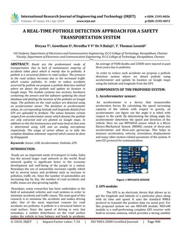
Students, Department of Electronics and Communication Engineering, K.C.G College of Technology, Karapakkam, Chennai. Department of Electronics and Communication Engineering, K.C.G College of Technology, Karapakkam, Chennai. --------------------------------------------------------------------------------***-----------------------------------------------------------------------------An average of 9300 deaths and 25000 were injured in past ABSTRACT: Roads are the predominant mode of three years due to potholes. transportation. Due to lack of maintenance majority of accidents takes place which is mainly due to potholes. A In order to reduce such accidents we propose a pothole pothole is a structural failure in road surface. The pressure detection system where we detect pothole using to the road surface increases due to the increased traffic accelerometer and update its location on Google maps which creates potholes. In order to reduce accidents using the latitude and longitude from the GPS. occurred by pothole we propose a pothole detection method where we detect the pothole and update its location in COMPONENTS OF THE PROPOSED SYSTEM: Google maps. The module contains two sections, hardware containing the sensors and the software updating the cloud 1. Accelerometer sensor: database and plotting the location of the potholes on Google An accelerometer is a device that measuresthe maps. The potholes on the road surface are detected using acceleration forces. By calculating the speed increasing an accelerometer sensor. The deviation in accelerometer capacity of the vehicle with respect to gravity, an values, its corresponding latitude and longitude details from accelerometer can figure out the angle it is tilted with GPS are uploaded to firebase. The values between certain respect to the earth. By determining the tilting angle the ranges from accelerometer sensor which denotes the pothole accelerometer determine the speed and direction of the are only extracted and are plotted on Google maps. In vehicle. Here we use MPU6050 sensor which is a Micro addition to this the luminescence and noise level at that area Electro-Mechanical System (MEMS) consist of three-axis is determined using LDR and an analog microphone accelerometer and three-axis gyroscope. This helps to respectively. The usage of server allows us to take the measure acceleration, velocity, orientation, displacement complete database whenever required which cannot be done and many other motion related parameter of the system. It by thingspeak. uses I2C protocol for communication. Keywords: Sensor, LDR, Accelerometer, Potholes, GPS. 2Faculty,
INTRODUCTION: Roads are an important mode of transport in India. India has the second larger road network in the world. Road network quality is significant factor in the economy development and well-being of the people in a nation. Nowadays the use of automobile increases rapidly which led to several issues and problems such as increase in pollution, traffic etc. Since the number of automobiles are increasing day by day, the number of road accidents and traffic issues are also growing rapidly. Nowadays, many researches has been undertaken in the field of automated vehicles and road systems in order to minimize accidents and traffic issues. The main goal of this research is to minimize the accidents and makes driving safer. One of the most important reasons for road accidents are potholes. A pothole is a structural failure in road surface. Since the speed of driving is very fast nowadays, a sudden disturbance on the road surface makes the vehicle to lose balance and leads to accidents.
Š 2020, IRJET
|
Impact Factor value: 7.34
|
Figure 1 MPU6050 SENSOR
2. GPS module: The GPS is an electronic device that allows us to get the longitude and latitude of a particular place along with its time and speed. It uses the standard NMEA protocol to transmit the position data via serial port. For this proposed system we use NEO-6M module. NEO-6M module is a well-performing complete GPS receiver with built-in ceramic antenna, which provides a strong satellite
ISO 9001:2008 Certified Journal
|
Page 900